Sub-Basin Level Flood Action Plan - Banat Sub-basin - - ICPDR
Sub-Basin Level Flood Action Plan - Banat Sub-basin - - ICPDR
Sub-Basin Level Flood Action Plan - Banat Sub-basin - - ICPDR

Create successful ePaper yourself
Turn your PDF publications into a flip-book with our unique Google optimized e-Paper software.
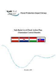
<strong>Flood</strong> Protection Expert Group<br />
<strong>Sub</strong>-<strong>Basin</strong> <strong>Level</strong> <strong>Flood</strong> <strong>Action</strong> <strong>Plan</strong><br />
- <strong>Banat</strong> <strong>Sub</strong>-<strong>basin</strong> -<br />
November, 2009
Prepared by:<br />
Republic of Serbia<br />
Ministry of Agriculture, Forestry and Water Management, Republic Directorate for Water, in cooperation with<br />
Institute for Development of Water Resources “Jaroslav erni”, Belgrade<br />
Romania<br />
Ministry of Environment, Bucharest, and<br />
Romanian Waters, National Administration, Bucharest<br />
Editor:<br />
Marina Babi Mladenovi, PhD, Institute for Development of Water Resources “Jaroslav erni”, Belgrade
CONTENTS<br />
1. INTRODUCTION.........................................................................................................1<br />
2. CHARACTERISATION OF CURRENT SITUATION..............................................2<br />
2.1. Review and assessment of current situation ...........................................................2<br />
2.1.1. Natural conditions...............................................................................................2<br />
2.1.2. <strong>Flood</strong>plains and flood defences ...........................................................................2<br />
2.1.3. Institutional and legal framework........................................................................5<br />
2.1.4. Recent awareness of flooding..............................................................................7<br />
3.1. Romania...................................................................................................................8<br />
3.1.1. Regulation on land use and spatial planning........................................................9<br />
3.1.2. Reactivation of former, or creation of new, retention and detention capacities.....9<br />
3.1.3. Structural flood defences.....................................................................................9<br />
3.1.4. Non-structural measures (preventive actions, capacity building of professionals,<br />
raising awareness and preparedness of general public) ........................................9<br />
3.2. Serbia .....................................................................................................................11<br />
3.2.1. Regulation on land use and spatial planning......................................................11<br />
3.2.2. Reactivation of former, or creation of new, retention and detention capacities...11<br />
3.2.3. Structural flood defences...................................................................................11<br />
3.2.4. Non-structural measures (preventive actions, capacity building of professionals,<br />
raising awareness and preparedness of general public) ......................................12<br />
4. MEASURES TO ACHIEVE TARGETS ...................................................................13<br />
ANNEX 1 ............................................................................................................................20
<strong>Sub</strong>-<strong>Basin</strong> <strong>Level</strong> <strong>Flood</strong> <strong>Action</strong> <strong>Plan</strong><br />
1. INTRODUCTION<br />
In response to the danger of flooding and in line with its Joint <strong>Action</strong> Programme, the <strong>ICPDR</strong><br />
decided in 2000 to establish the long-term <strong>Action</strong> Programme for Sustainable <strong>Flood</strong><br />
Prevention in the Danube River <strong>Basin</strong>. The whole process was accelerated after disastrous<br />
floods in 2002 and resulted in adoption of the <strong>Action</strong> Programme at the <strong>ICPDR</strong> Ministerial<br />
Meeting on 13 December 2004.<br />
The overall goal of the <strong>ICPDR</strong> <strong>Action</strong> Programme is to achieve a long term and sustainable<br />
approach for managing the risks of floods to protect human life and property, while<br />
encouraging conservation and improvement of water related ecosystems. Given the area, the<br />
complexity and the internal differences in the Danube River <strong>Basin</strong>, the <strong>Action</strong> Programme<br />
represents an overall framework, which needs to be specified in further detail for sub-<strong>basin</strong>s.<br />
Therefore, the targets of the <strong>ICPDR</strong> <strong>Action</strong> Programme include preparation of flood action<br />
plans for all sub-<strong>basin</strong> in the Danube catchment area.<br />
In September 2007 a Directive of the European parliament and of the Council on the<br />
assessment and management of flood risks (EFD) was adopted by the European Council. The<br />
aim of the Directive is to reduce and manage the risks that floods pose to human health, the<br />
environment, cultural heritage and economic activity. The Directive requires Member States<br />
to first carry out a preliminary flood risk assessment by 2011 to identify areas at risk of<br />
flooding. For such areas they would then need to draw up flood risk maps by 2013 and<br />
establish flood risk management plans focused on prevention, protection and preparedness by<br />
2015.<br />
As the <strong>ICPDR</strong> <strong>Action</strong> Programme was designed in full coherence with EFD the flood action<br />
plans for sub-<strong>basin</strong>s are an important part of implementation of the EFD and they summarize<br />
the key actions towards preparation of the flood risk management plans. Therefore, the<br />
preparation of the flood action plans for sub-<strong>basin</strong>s can be considered as an interim step in<br />
implementation of EFD.<br />
This action plan for the <strong>Banat</strong> sub-<strong>basin</strong> reviews the current situation in flood protection in<br />
Serbia and Romania and sets the targets and the respective measures aiming among others to<br />
reduction of damage risks and flood levels, increasing the awareness of flooding and to<br />
improvement of flood forecasting. The targets and measures are based on the regulation of<br />
land use and spatial planning, increase of retention and detention capacities, technical flood<br />
defences, preventive actions, capacity building, awareness & preparedness raising and<br />
prevention and mitigation of water pollution due to floods.<br />
This <strong>Action</strong> plan is derived from <strong>Action</strong> plans prepared for Serbian and Romanian territories.<br />
It is foreseen that this planning document will be further refined as appropriate and necessary<br />
by the bilateral river commissions.<br />
1
<strong>Sub</strong>-<strong>Basin</strong> <strong>Level</strong> <strong>Flood</strong> <strong>Action</strong> <strong>Plan</strong><br />
2. CHARACTERISATION OF CURRENT SITUATION<br />
2.1. Review and assessment of current situation<br />
2.1.1. Natural conditions<br />
Transboundary rivers in the south-eastern <strong>Banat</strong> region are the Timi/Tamiš, Bârzava/Brzava,<br />
Rojga, Moravia/ Moravica, Cara/Karaš and Nera. The Tamiš and Nera rivers are direct<br />
tributaries of the Danube, while the others are intersected by the DTD channel Novi Beej –<br />
<strong>Banat</strong>ska Palanka. Also, this sub-<strong>basin</strong> includes Cerna river <strong>basin</strong>, being a Romanian left<br />
direct tributary of the Danube.<br />
Major portion of the <strong>Banat</strong> rivers’ <strong>basin</strong>s are mountainous and hilly regions of the Carpathian<br />
Mountains, on the RO territory, while RS territory hosts its smaller and lowland parts. <strong>Flood</strong><br />
waves on these rivers have characteristics of torrent floods (short lag time and high peak<br />
flow), threatening riparian lowlands.<br />
Summary of hydrological parameters for all south-eastern <strong>Banat</strong> rivers is given in Table 1.<br />
The main characteristics of each river are given in Table 2.<br />
Table 1: Main hydrological characteristics of the south-eastern <strong>Banat</strong> rivers<br />
River Catchment Average multi-annual<br />
River Gauge station Country chainage area<br />
discharge<br />
Q 1%<br />
km km 2 m 3 /s m 3 /s<br />
Timi/Tamiš<br />
ag RO 207.0 4,493 46.60 1,322<br />
Jaša Tomi RS 122.7 5,334 38.00 1,292<br />
Bârzava/Brzava<br />
Parto RO 145.0 933 5.74 200<br />
Markovievo RS 18.0 1,111 6.81 192<br />
Moravia/<br />
RS<br />
Vatin<br />
Moravica<br />
16.0 432 1.11 124<br />
Rojga Veliki Gaj RS 12.0 47 0.16 38<br />
Cara/Karaš Dobrievo RS 16.8 1,366 10.50 437<br />
Nera<br />
Naid RO 115.0 1,319 14.60 665<br />
Vraev Gaj RS 7.5 1,428 16.81 670<br />
Cerna Tople RO 67.0 1,324 21.40 611<br />
2.1.2. <strong>Flood</strong>plains and flood defences<br />
Romania<br />
The main hydraulic works affecting the flow regime of the rivers are: reservoirs, deviations<br />
and water transfers from neighbouring <strong>basin</strong> into a reservoir and dykes. These types of<br />
infrastructures are in fact the most useful instruments for water management, offering<br />
possibilities in getting regulation of different volumes during the seasons and sometimes<br />
during the year, to offer flood protection or dilution in case of accidental pollution.<br />
In order to protect goods and human lives, on Romanian territory have been realised hydraulic<br />
structures which compose the National System for <strong>Flood</strong> Defence.<br />
Reservoirs<br />
In the <strong>Banat</strong> hydrographical space, there are as most important 23 reservoirs from which 9 are<br />
permanent and 14 temporary. The maximum volume gathered by these is 405.1 mil.m 3 , from<br />
which 194.4 mil.m 3 in permanent and 210.7 mil.m 3 in polders. The permanent reservoirs have<br />
a global utile volume 136.5 mil.m 3 and an attenuation volume of 48.5 mil.m 3 . The attenuation<br />
volume of the polders is 202.3 mil.m 3 .<br />
The main reservoirs with complex purposes are:<br />
2
<strong>Sub</strong>-<strong>Basin</strong> <strong>Level</strong> <strong>Flood</strong> <strong>Action</strong> <strong>Plan</strong><br />
- Gozna, Vliug, Secu and Timi Trei Ape for water supply for Reia city and for electric<br />
power;<br />
- Valea lui Iovan, on Cerna River for industrial water supply for Turceni and Ialnia<br />
thermo-electric powerplant.<br />
The polders of the <strong>Banat</strong> hydrographic space Cenei, Hitia, Pdureni, Gad, Cadar-Duboz,<br />
Gherteni, Vrdia, Liava, Moravia – Clopodia, are designated to comply with the<br />
border conditions regarding the maximum discharges, respectively those which may cross the<br />
border within the limits of the values imposed by the Romanian-Serbian agreements in action.<br />
Derivations and intakes<br />
In the <strong>Banat</strong> hydrographical space, there have been retained as most important 11 derivations<br />
of total length of 106.6 km and with an installed discharge of 455.9 m 3 /s. From the water uses<br />
view point, 4 have main energetic purpose, 2 the supply with potable and industrial water, 3<br />
ensure the water supply and the production of electric power, 1 is a derivation for high waters<br />
and 1 has complex purposes. These are:<br />
- Semenic derivation, Cara-Severin county, which contributes to the supplementation of<br />
the supply with water of the Reia municipality and to the production of electric power,<br />
making the derivation of the water from Timi River in Bârzava River through the<br />
intermediary of the pumping station which draws off water from Timi Trei Ape, the<br />
discharge being at Crinicel HPP;<br />
- Nera-Bârzava derivation, Cara-Severin county, which contributes to the<br />
supplementation of the supply with water of the Reia municipality and to the production<br />
of electric power, making the derivation of the waters from Nera River in Bârzava River<br />
through Crinicel HPP;<br />
- Secu–Reia intake, Cara-Severin county, for the supply with water of Reia<br />
municipality from Secu reservoir;<br />
- Gozna and Safra intakes, Cara-Severin county, with energetic role which draws off<br />
water from Guzna reservoir, respectively through the catchments of some tributaries of<br />
Bârzava river and bring it to Crinicel HPP;<br />
- Breazova and Grebla intakes, Cara-Severin county, with energetic role which bring<br />
waters between Crinicel and Breazova HPP, respectively between Breazova HPP (and<br />
Vliug reservoir) to Grebla HPP;<br />
- Nera-Oravia derivation, Cara-Severin county, which draws off water from Nera River<br />
downstream from Sasca Montan locality for the supply with water of Oravia town,<br />
situated on Oravia brook, tributary of Cara River;<br />
- Ruieni intake, Cara-Severin county, with energetic role which draws off water from<br />
Poiana Mrului reservoir and brings it to Ruieni HPP;<br />
- Timi - Bega derivation (Cotei-Chiztu canal), Timi county, which starts from Timi<br />
River, from the Hydraulical Knot Cotei and has the role to supply with water the uses<br />
along Bega canal, in Timioara area and downstream, having as water source the Timi<br />
River;<br />
- Bega - Timi derivation (Topolov-Hitia canal), Timi county, which starts from the<br />
Topolov hydraulical Knot on Bega River and brings the water toward Timi River to the<br />
Hitia hydraulical Knot. It has the main role in the derivation of high waters toward Timi<br />
River for the protection against floods of the Timioara municipality and with role to limit<br />
the maximum admitted flows on Bega River at the border with Serbia.<br />
Dikes and river regulations<br />
In the <strong>Banat</strong> hydrographic space there exist 82 regulations of river beds of a total length of<br />
1040 km and 141 dikes with a total length of 1067 km. These works protect against floods: 19<br />
towns, 46 industrial units, 64,000 houses and residences, a surface of 43,000 ha, roads,<br />
bridges, railways and other objectives.<br />
3
<strong>Sub</strong>-<strong>Basin</strong> <strong>Level</strong> <strong>Flood</strong> <strong>Action</strong> <strong>Plan</strong><br />
From the Regulation and dike works of the <strong>Banat</strong> hydrographic space, there have been<br />
retained as most important 11 works with a total of 972.7 km regulations of river beds and<br />
1068.4 km dikes.<br />
These works protect both localities and important agricultural areas. The protected objectives<br />
are industrial units, bridges, roads, railways and others. The main hydro-works against floods<br />
are on Timi River. From the main works:<br />
- Regulations and dikes on Timi River, Cara-Severin county (L reg =273.0 km,<br />
L dike =471.9 km);<br />
- Regulations and dikes on Bârzava River, Timi county and Cara-Severin (L reg = 23.0 km,<br />
L dike = 4.5 km);<br />
- Regulations and dikes on Moravia River, Timi county (L reg = 47.8 km, L dike = 50.0 km);<br />
- Regulations and dikes on Cara River, Cara-Severin county (L reg = 48.2 km, L dike = 89.3<br />
km).<br />
Serbia<br />
The flood protection in the south-eastern <strong>Banat</strong> region is provided by the Danube-Tisa-<br />
Danube Hydro-system (HS DTD) channel network, and levees. Namely, most of the rivers in<br />
this region (all except the Nera) are incorporated into the HS DTD, which provided more<br />
favourable flood defence conditions for the <strong>Banat</strong> rivers. A single flexible system, comprised<br />
of intersected watercourses and main canals, allows mutual redistribution of the flow<br />
depending on the rate of discharge in each river and coincident water levels of the recipients –<br />
the Danube and the Tisa. Levees along the Tamiš, Brzava and Moravica rivers enable<br />
protection from Q 5% at RO border, while further downstream the safety level is increased due<br />
to favourable influence of the DTD channel. The alignment of flood protection structures<br />
along all south-east <strong>Banat</strong> watercourses (RS and RO part) is presented at Figure 1.<br />
The RS part of the Tamiš River has two distinct parts. The upstream part (between the<br />
Tomaševac weir and RO border) has both-side levees (on 350 to 900 m distance), while 50%<br />
of floodplain is covered with forests. The downstream part of the river (between the<br />
Tomaševac weir and the mouth to the Danube), within the Lower Tamiš Hydro-system, has<br />
been fully modified after the construction of the Tomaševac, Opovo, enta and Panevo<br />
weirs. Levees are built only along the most downstream reach of the river, and they protect<br />
the Panevaki rit area of Belgrade on the right bank 1 and Panevo city on the left bank.<br />
These levees were built between 1929 and 1935.<br />
The Tomaševac weir controls water levels within the HS DTD, together with other weirs<br />
(Botos and Novi Beej weirs at the Novi Beej – <strong>Banat</strong>ska Palanka Channel and Stajievo<br />
weir at the Begej Channel, near its mouth to the Tisa).<br />
High waters are evacuated usually through the Tamiš channel, over the Tomaševac, Opovo<br />
and Panevo gates, to the confluence with the Danube near Panevo. However, since HS<br />
DTD offers a flexibility in flood management, if the conditions on the Danube are not<br />
favourable, another possible flood routes can be used: towards the Danube over the enta<br />
weir (confluence with the Danube at km 1,206) or towards the Tisa through the Novi Beej –<br />
<strong>Banat</strong>ska Palanka Channel (with two alternative mouths: over the Stajievo weir on the Begej<br />
River or over the Novi Beej weir).<br />
The Brzava and Moravica rivers were once tributaries of the Tamiš River. Within the training<br />
works (1963-1968), these rivers were diverted towards the DTD Novi Beej – <strong>Banat</strong>ska<br />
Palanka Channel. The Brzava River course was shortened by 15 km and maximum water<br />
level at the mouth is lowered by 1.5 m. Both bank levees (20 km along the left and 16.3 km<br />
1 The Panevaki rit is an area encircled by the Danube, Tamiš and Karašac and protected by 88.8 km of<br />
continuous levees along these rivers.<br />
4
<strong>Sub</strong>-<strong>Basin</strong> <strong>Level</strong> <strong>Flood</strong> <strong>Action</strong> <strong>Plan</strong><br />
along the right bank) were erected in 1983 along the entire RS section. There are both bank<br />
levees along the Moravica River: from the mouth to 15.3 km at the right and to 15.85 km at<br />
the left bank. By diverting the Moravica flow from the Tamiš towards the DTD Novi Beej –<br />
<strong>Banat</strong>ska Palanka Channel, maximum water level at the mouth was reduced for over 3 m.<br />
Also, there are both side levees along the Rojga River in RS (tributary of the Moravica River),<br />
with a total length of 25.02 km.<br />
Along the Nera River, only local protection structures were built (protection of the Kusi<br />
settlement and 5.5 km long right-bank levee near the mouth to the Danube). The problem of<br />
flood protection is still unresolved.<br />
Figure 1: <strong>Flood</strong> protection lines along the south-east <strong>Banat</strong> rivers (Source: RS-RO commission)<br />
2.1.3. Institutional and legal framework<br />
An intergovernmental Joint RS-RO Commission was established in 1956, in order to carry on<br />
the implementation of the intergovernmental Agreement Between the Federal People's<br />
Republic of Yugoslavia and the People's Republic of Romania on Hydraulic Engineering<br />
Issues Relating to Hydraulic Systems and National Border or Cross-border Watercourses,<br />
signed in Bucharest in 1955.<br />
Following extensive construction of hydraulic structures (reservoirs, retention <strong>basin</strong>s, levees,<br />
the HS DTD, etc.), Common <strong>Flood</strong> Defence Rules for the Yugoslav/Romanian Border or<br />
Cross-border Watercourses and Hydraulic Systems were developed and adopted in 1971.<br />
These Rules, as amended from time to time, are still in effect today.<br />
The <strong>Flood</strong> Defence Rules include two parts:<br />
5
<strong>Sub</strong>-<strong>Basin</strong> <strong>Level</strong> <strong>Flood</strong> <strong>Action</strong> <strong>Plan</strong><br />
- Part 1 contains general provisions, measures, and activities which are to be undertaken<br />
before, during, and after flood and ice defence situations; and,<br />
- Part 2 contains specific actions to be undertaken during the implementation of flood<br />
defence, for every watercourse and every hydraulic system.<br />
The <strong>Flood</strong> Defence Rules accurately define the watercourses and hydraulic systems of joint<br />
interest, and include major characteristics of appurtenant structures. The Rules also define the<br />
obligations of competent authorities to:<br />
- maintain the river channels and flood defences in good working order, provide the means<br />
required to undertake action, and develop identified technical documentation and plans in<br />
order to prepare for successful flood defence in joint-interest sectors;<br />
- hold a mandatory joint meeting of RS and RO specialists, every year before the autumn<br />
rainy season, in order to assess the status of flood defence structures and to review flood<br />
defence documentation;<br />
- in the course of flood and ice defence, provide specified hydro-meteorological data,<br />
exchange such data at specified times for each stage of defence, and organize the<br />
monitoring of phenomena and action teams tasked with eliminating potential dangers<br />
from overflowing water or failure of the lines of defence. In the event of a critical<br />
situation in a joint-interest sector, both Parties are required to provide all possible mutual<br />
assistance in material, equipment and manpower, including simplified national border<br />
crossing procedures;<br />
- in the event of overflow or levee breach, to provisionally seal levees and contain the flood<br />
water, based on a joint plan, and to immediately notify the other Party of the exact time,<br />
place and extent of breach, as well as of the measures which have been undertaken to<br />
contain and evacuate the water from the flooded area;<br />
- exchange specified information about water levels, ice conditions, time and place of ice<br />
formation, measures undertaken to break up ice formations, and the effectiveness of the<br />
measures undertaken; and,<br />
- notify each other of the cessation of defence and prepare defence reports for the Joint<br />
Committee to review during its next session.<br />
Part 2 of the <strong>Flood</strong> Defence Rules includes basic indicators for each watercourse and<br />
hydraulic system relating to discharge, operating modes of training structures, specified<br />
restrictions which apply to the operation of pumping stations, other conditions required for the<br />
unhindered conveyance of flood water and ice, and defined second lines of defence in the<br />
event of levee breach within the RS and RO territories.<br />
Romania<br />
Issued or updated important regulations are as follows:<br />
- The National Strategy for <strong>Flood</strong> Risk Management on short term (Governmental Decision<br />
1854 from 2005), which establish prevention and protection measures for flood effects<br />
mitigation for each of involved structures from central to local level;<br />
- National <strong>Plan</strong> for Prevention and <strong>Flood</strong> Protection at Hydrographic <strong>Basin</strong> level<br />
(Governmental Decision 1309 from 2005);<br />
- The Water Law 107 from 1996 modified and completed according tot the National<br />
Strategy;<br />
- Emergency Order regarding safety operation of the reservoirs for fishery, recreation or<br />
local importance, establishing operating conditions;<br />
- Regulations for management of emergency situations generated by flooding, dangerous<br />
meteorological phenomena and accidents at hydraulic structures adopted in May 2005.<br />
Based on these regulations, taking into account the 2005 and 2006 floods, new flood<br />
protection plans at <strong>basin</strong>, county and local level have been approved in 2006. These plans<br />
6
<strong>Sub</strong>-<strong>Basin</strong> <strong>Level</strong> <strong>Flood</strong> <strong>Action</strong> <strong>Plan</strong><br />
comprise maps with level curves that bordered flooded zones by watercourses overflow and<br />
versant run-off corresponding to the maximum known discharges. In 2009 all flood protection<br />
plans will be updated.<br />
The main actors involved in flood protection actions are: Ministry of Environment, Apele<br />
Române (Romanian Waters) National Administration, National Institute for Hydrology and<br />
Water Management, General Inspectorate for Emergency Situations and National<br />
Administration for Meteorology.<br />
Serbia<br />
Protection against harmful water effects is regulated by the “Water Law” (Official Gazette of<br />
the Republic of Serbia, 46/91). The Law arranges proceedings and measures for flood and ice<br />
protection, as well as protection from torrents and erosion.<br />
The participants involved in flood defence are:<br />
- Ministry of Agriculture, Forestry and Water Management of the Republic of Serbia –<br />
Republic Directorate for Water;<br />
- Public Water Management Company “Vode Vojvodine” – Novi Sad;<br />
- Public Water Management Company “Beogradvode” – Belgrade;<br />
- Local water management companies;<br />
- Republic Hydrometeorological Service of Serbia.<br />
Responsibilities of participants are determined in the General <strong>Flood</strong> Defence <strong>Plan</strong> and the<br />
Annual <strong>Plan</strong> for <strong>Flood</strong> Defence. These plans are prepared only for watercourses with the<br />
existing flood protection structures. For other areas endangered by floods, local community<br />
appoints flood protection measures and proceedings. Also companies whose properties are<br />
endangered prepare special flood protection plans.<br />
The flood and ice control actions are organized and carried on in three phases, depending on<br />
the hazard degree: preparation, regular and emergency defence. Phases of defence are defined<br />
in the Annual <strong>Plan</strong> for <strong>Flood</strong> Defence, in relation to the river stage on the adjacent gauging<br />
station.<br />
2.1.4. Recent awareness of flooding<br />
<strong>Flood</strong>s are frequent in the south-east <strong>Banat</strong>, especially in the unprotected valleys of the Karaš<br />
and the Nera. Also, cross border flooding with devastating social and economic impacts, and<br />
political and administrative implications, occurred on the Tamiš River several times. In the<br />
year 1966 there was disastrous flooding after a breach of the Romanian left-bank levee<br />
upstream of the border. Forty years later, major flood waves occurred in April of 2000 and<br />
April of 2005.<br />
In spring 2000 a breach of the left-side levee in Romania, 3.4 km upstream of the border,<br />
caused flooding at the Serbian territory, similar to the 1966 flood event. A state of emergency<br />
on the territory of the Seanj municipality was proclaimed, and emergency levees around<br />
three settlements were made. At RS side about 9,500 ha of agricultural land were flooded<br />
(17,500 ha within both countries), as well as oil field facilities. The evacuation of flood water<br />
towards the Brzava River involved artificial breaches on a road, railroad and levees, and<br />
lasted 32 days. Although flooding of settlements was prevented (cost of emergency flood<br />
defence measures was about 500,000 €), the flood damage was about 5 million € (apart from<br />
damages to traffic, flood protection and other structures).<br />
In mid-April of 2005, a major flood wave occurred again, due to snowmelt and simultaneous<br />
rainfall in the RO portion of the <strong>basin</strong>. The RO side warned of repeated heavy rainfall and<br />
forecasted extremely high stages, similar to the disastrous 2000 flood event. Huge quantity of<br />
precipitation has been recorded, even 3 times more than average monthly value.<br />
7
<strong>Sub</strong>-<strong>Basin</strong> <strong>Level</strong> <strong>Flood</strong> <strong>Action</strong> <strong>Plan</strong><br />
In 18 April 2005 dikes in Bârzava and Timi <strong>basin</strong>s (RO side) were overtopped, producing<br />
breaches and many localities in Romania were flooded (Gtaia, Berecua, Sângeorge,<br />
Mnstire, Denta, Cruceni, Rudna partially, Foeni, Otelec, Sânmartinul Sârbesc partially).<br />
In April 2005, Timi river united with Bega through Topolov derivation, passed the<br />
highflood with the biggest volume ever recorded on these watercourses. At ag station the<br />
volume was 669 mil. m 3 , in comparison with other two events those from 2000 and 1966 was<br />
3 and respectively 5 times bigger. Due to this volume on Timi River the dikes have been<br />
broken in Crai Nou zone and 320 mil. m 3 water were overtopped, resulting in the “<strong>Banat</strong><br />
Sea”.<br />
About 30,000 ha of land and a number of villages in both countries have been flooded. On RS<br />
side of the border several villages were flooded for 48 days, and about 2,000 people were<br />
displaced. Long new-built emergency levees prevented further spreading of flood on RS<br />
territory. The total damage in RS was about 14 million €. In RO only damages on hydraulic<br />
structures were about 11 million €.<br />
After such experience it was concluded that flood defence structures at RO and RS territories<br />
do not provide the required safety level and that they should be reconstructed to provide<br />
safety from Q 1% flood.<br />
3. TARGET SETTINGS<br />
3.1. Romania<br />
The National <strong>Action</strong> <strong>Plan</strong> for flood protection on medium-term (2009-2012) launched and<br />
comprises new hydraulic structures in frequently affected zones, higher safety degree of<br />
existing works and finalization of ongoing ones.<br />
The National <strong>Action</strong> <strong>Plan</strong> foresees 1850 km river regulation 976 km of dikes, 810 km<br />
riverbank consolidation, identification of new zones as wetlands and DESWAT and<br />
WATMAN Projects finalisation.<br />
The prioritisation criteria for promoting investments for flood protection have been made<br />
following:<br />
- Inclusion of the proposed works in the Strategy of Ministry of Environment;<br />
- Actual safety degree of the flood protection structures;<br />
- Amplitude of avoided damages as result of the projects;<br />
- The elaboration status of technical and economic documents;<br />
- Financing possibility<br />
- Occupied field status.<br />
<strong>Flood</strong> <strong>Action</strong> <strong>Plan</strong> for the short term strategy implementation started in 2005 by integrated<br />
actions for 5years (2010):<br />
- development of the hydrological information system and modernization of the early<br />
warning system – DESWAT Project<br />
- rehabilitation of the old flood defence hydraulic infrastructure and building new ones in<br />
areas of high risk,<br />
- <strong>Flood</strong> hazard mapping and flood management plans. The first pilot <strong>basin</strong> was Siret.<br />
Nowadays, interdisciplinary studies in eight river <strong>basin</strong>s are under implementation (Siret,<br />
Mure, Criuri, <strong>Banat</strong>, Jiu, Olt, Some-Tisa, Ialomia-Buzu) and will be finalized during<br />
2009, beginning of 2010.<br />
8
<strong>Sub</strong>-<strong>Basin</strong> <strong>Level</strong> <strong>Flood</strong> <strong>Action</strong> <strong>Plan</strong><br />
The National <strong>Plan</strong> will be finished in the frame of the River <strong>Basin</strong> Management <strong>Plan</strong>s – <strong>Flood</strong><br />
management Section first draft, till December 2009 and is planned to be adopted till mid<br />
2010.<br />
In the mean time, during 2009 will be finalized mid and long term National Strategy for <strong>Flood</strong><br />
Risk management, which will take into account the need for <strong>Flood</strong> Directive implementation.<br />
3.1.1. Regulation on land use and spatial planning<br />
The existing local urban plans for development should contain maps with actually flooded<br />
areas, based on historic and studies data.<br />
These maps are from the Local <strong>Flood</strong> Protection <strong>Plan</strong>s and are updated every 4 years.<br />
3.1.2. Reactivation of former, or creation of new, retention and detention capacities<br />
The polders are designated to comply with the border conditions regarding the maximum<br />
discharges, respectively those which may cross the border within the limits of the values<br />
imposed by the Romanian-Serbian agreements. In RO side of the <strong>Banat</strong> sub-<strong>basin</strong> are 7 main<br />
polders having an important role in flood protection and cutting the peak-flow in the area. The<br />
polders are the following:<br />
- Hitia on Timi river (V=20 mil. m 3 )<br />
- Cadar Duboz on Pogni river (V= 42.2 mil.m 3 )<br />
- Gad on Lanca Birda river (V= 20.5 mil.m 3 )<br />
- Gherteni on Bârzava river (V= 7.7 mil.m 3 )<br />
- Vrdia on Cara river (V= 7.47 mil.m 3 )<br />
- Liava on Liava river (V= 9.45 mil.m 3 )<br />
- Pdureni (V= 35 mil. m 3 ).<br />
3.1.3. Structural flood defences<br />
The structural flood defences are realized in order to make an effective protection for<br />
populated areas, to avoid human and material losses.<br />
The <strong>Action</strong> <strong>Plan</strong> (2009-2012) at national level foresees 1850 km river regulation 976 km of<br />
dikes, 810 km riverbank consolidation. For all investments works are realized feasibility<br />
studies.<br />
3.1.4. Non-structural measures (preventive actions, capacity building of professionals,<br />
raising awareness and preparedness of general public)<br />
3.1.4.1. Preventive actions<br />
These actions are concentrated towards prevention/mitigation of potential damages generated<br />
by floods through:<br />
a) avoiding houses, social and cultural or/and economic objectives constructions in<br />
potentially flooded area;<br />
b) realisation of structural and non-structural measures for protection;<br />
c) geographical delimitation of natural flood risk zones and noting these in the general<br />
urban planning studies;<br />
d) modern forecast, warning and alarming systems implementation in case of floods;<br />
e) existing infrastructure for flood protection and riverbed maintenance;<br />
9
<strong>Sub</strong>-<strong>Basin</strong> <strong>Level</strong> <strong>Flood</strong> <strong>Action</strong> <strong>Plan</strong><br />
f) effective communication and people education regarding flood risk and the action<br />
ways in emergency situations.<br />
A good system for people warning and preparation could save many lives. For this reason, in<br />
the last years was and are in development three projects: SIMIN (National Meteorological<br />
Integrated System), DESWAT (Destructive Water) and WATMAN (Water Management).<br />
SIMIN integrates the provided data from existent systems in Romania with a high technology<br />
in meteorological radars field, stations with surface hydrologic sensors, data processing<br />
systems and forecast decision based on satellite transmission. System was released in<br />
September 2003.<br />
The DESWAT project has in its first stage as objective, the modernisation of informational<br />
hydrological system, beginning with data acquisition through 600 automatic stations placed<br />
on rivers, 250 automatic gauging stations and 64 automatic quality stations, continuing with<br />
transmission support which will comprise the actual classic radio system, the GSM and<br />
satellite systems.<br />
The programme package for hydrological forecast will be modernised, enlarged and will<br />
include semi-automatic procedures for elaboration of warnings, forecasts and information<br />
products for various decision makers, media and population.<br />
WATMAN is a project through that the National Strategy for water management in case of<br />
disaster will be applied. It will integrate the output data from SIMIN and DESWAT, finally<br />
being carrying-out the Information-Decisional Integrated System. Those two projects, through<br />
modernised hydrologic and meteorological information systems will provide data and forecast<br />
in real-time, which represents input data for WATMAN infrastructure, optimising the<br />
integrated water management system.<br />
3.1.4.2. Financial insurance for flood risk<br />
In 1 January 2010, a law referring to the obligatory insurance for houses against natural<br />
disasters such earthquakes, landslides and flooding will come into force.<br />
3.1.4.3. Raising awareness and preparedness of general public<br />
- Improvement reaction capacity, response and intervention;<br />
- Information and awareness of the population regarding floods and its effects;<br />
- Eco-centres setting-up in frequently affected zones;<br />
- Public meeting presenting the local flood protection plans and the warning procedures<br />
based on colours code;<br />
- Exercises for flood simulation at <strong>basin</strong> and county level with the participation of<br />
population.<br />
3.1.4.4. Capacity building of professionals<br />
It was planned an intensive programme for raising personnel capacity from the water<br />
management units of Romanian Waters responsible with flood defences maintenance and<br />
with means and equipments for interventions in case of flooding.<br />
It is developing the training action of new elected mayors and public local administration.<br />
3.1.4.5. Prevention and mitigation of water pollution due to floods<br />
A characteristic is represented by the pollution with heavy metals, where there are important<br />
mining perimeters with rocks which reach the surface and which are washed by the<br />
10
<strong>Sub</strong>-<strong>Basin</strong> <strong>Level</strong> <strong>Flood</strong> <strong>Action</strong> <strong>Plan</strong><br />
precipitation. Another significant pressure is represented by the suspended solid loads caused<br />
by coal mining activities.<br />
The Law 466 (regarding dam safety) covers the safety problems of dams and dikes of the<br />
mining waste deposits.<br />
Now, according to the EU Directive 1999/31/CE and Governmental Decision 349 from 2005<br />
the major part of the mining ponds with high risk stopped the activity.<br />
The actual legislation foresees the continuity monitoring of the closed ponds.<br />
3.2. Serbia<br />
Implementing criteria from the Water Management Master <strong>Plan</strong> of the Republic of Serbia,<br />
and taking into account the actual flood protection conditions and problems (especially the<br />
size of flood prone areas and possible damages) the long term flood protection strategy in the<br />
south-eastern <strong>Banat</strong> rivers sub-<strong>basin</strong>s in Serbia will comprise of:<br />
- The existing layout of flood protection structures on the Tamiš, Brzava, Moravica and<br />
Rojga rivers remains the same, while the following is planned:<br />
- Reconstruction of the flood protection structures to decrease flood hazard;<br />
- Regular maintenance of the flood protection structures, according to criteria, standards<br />
and norms;<br />
- New flood protection scheme on the Karaš and Nera rivers;<br />
- Gradual and broad implementation of non-structural flood protection measures (as<br />
upgrade of the flood forecasting and warning procedures; introduction of flood maps into<br />
spatial plans, etc.);<br />
- International cooperation in flood management with Romania.<br />
3.2.1. Regulation on land use and spatial planning<br />
Target 1.<br />
Target 2.<br />
Spatial plans of municipalities contain flood hazard maps (both for potentially<br />
and actually flooded areas) and flood risk maps.<br />
Limitations related to land use in flood prone areas are defined.<br />
3.2.2. Reactivation of former, or creation of new, retention and detention capacities<br />
Target 1.<br />
Target 2.<br />
Natural retention capacities along the Middle Tamiš are preserved (between<br />
the Tomaševac weir and the Lower Tamiš System).<br />
Creation of new detention capacity on the Karaš River (planned within the new<br />
flood protection scheme).<br />
3.2.3. Structural flood defences<br />
Target 1.<br />
Target 2.<br />
Provide adequate flood protection safety. The adequate criterion for the<br />
protection of the riparian land will be defined considering the size of the<br />
potentially endangered areas, number of inhabitants and infrastructure value.<br />
Provide permanent preparedness of the flood defence system.<br />
11
<strong>Sub</strong>-<strong>Basin</strong> <strong>Level</strong> <strong>Flood</strong> <strong>Action</strong> <strong>Plan</strong><br />
3.2.4. Non-structural measures (preventive actions, capacity building of professionals,<br />
raising awareness and preparedness of general public)<br />
The non-structural measures (encompassing institutional, preventive, corrective and other<br />
measures) should be given an appropriate role in flood control and mitigation. Main activities<br />
should be tied to:<br />
- Preventive and operative tasks (setting up or improving the data base on natural events<br />
and protection system characteristics, modification of the existing plans for flood coping<br />
practices, adoption of reservoir operational rules, development/improvement of flood<br />
forecast and warning system);<br />
- Regulative and institutional measures (zoning of floodplains, floodplain management<br />
policy, construction standards etc.);<br />
- Managerial and technical education, as well as public awareness building.<br />
All these tasks will be tied together within the <strong>Flood</strong> risk management plan for the <strong>Banat</strong> sub<strong>basin</strong>.<br />
Target 1. Reduce flood risk<br />
Target 2. Introduce principles of EU <strong>Flood</strong>s directive<br />
Target 3. Build capacity of professionals and institutions responsible for flood<br />
management<br />
Target 4. Upgrade flood monitoring, forecast and warning<br />
Target 5. Introduce regulations for emergency situations response (natural disasters)<br />
Target 6. Prepare <strong>Flood</strong> risk management plan<br />
Target 7. Improve awareness of stakeholders on floods<br />
Target 8. Update/build scientific base for flood management<br />
Target 9. Improve international cooperation in flood management<br />
12
4. MEASURES TO ACHIEVE TARGETS<br />
Targets<br />
Measures<br />
Type of<br />
intervention<br />
Institution in<br />
charge<br />
4.1. Regulation on land use and spatial planning<br />
RS Target 1: Spatial plans of<br />
municipalities contain flood<br />
Defining water estate Administrative MAFWM-RDW,<br />
PWMC VV<br />
hazard maps and flood risk Introduction of flood maps into Administrative MESP<br />
maps<br />
spatial plans of municipalities<br />
Target 2: Limitations related to Preparation of instructions for Administrative MAFWM-RDW,<br />
land use in flood prone areas are limitations on land use<br />
MESP<br />
defined Land use limitations applied Administrative LRSG<br />
RO Target 1: Local and regional Including the results of the study Administrative Public<br />
developing plans contain flood “Identification and delimitation of<br />
Administration<br />
hazard maps<br />
the natural hazards (earthquakes,<br />
landslides and floods). Hazards<br />
maps at county level” into local<br />
and regional developing plans<br />
Target 2: Urban Development Including the maps from Local Administrative<br />
<strong>Plan</strong>s contain flood maps <strong>Flood</strong> Protection <strong>Plan</strong><br />
(Contingency <strong>Plan</strong>s) into the<br />
Urban Development <strong>Plan</strong>s<br />
4.2. Reactivation of former, or creation of new, retention and detention capacities<br />
RS<br />
Target 1: Natural retention<br />
capacities along the Middle<br />
Tamiš are preserved<br />
Target 2: Creation of new<br />
detention capacity on the Karaš<br />
River<br />
4.3. Structural flood defences<br />
RS Target 1: Provide protection for<br />
the adopted design flood along<br />
the south-eastern <strong>Banat</strong> rivers<br />
Administrative/<br />
Technical<br />
Public<br />
Administration<br />
Costs<br />
(k€)<br />
Deadline<br />
Continuous<br />
120 2009<br />
Comment<br />
20/year Continuous This actions include flood<br />
risk evaluation (flooded<br />
areas maps and estimation<br />
of damages)<br />
PWMC VV Continuous<br />
Design and construction Technical PWMC VV Started Presently in the phase of<br />
Preliminary design.<br />
Reconstruction of levees along the<br />
Tamiš upstream of HSDTD<br />
Reconstruction of levees along<br />
downstream section of the Tamiš<br />
Technical PWMC VV 5,000 Started<br />
Technical PWMCies Started PWMC BV (right bank),<br />
PWMC VV (left bank).<br />
Presently in the phase of<br />
Preliminary design.
RO<br />
Targets<br />
Target 2: Provide permanent<br />
preparedness of the flood<br />
defence system<br />
Target 1: Provide flood<br />
protection in <strong>Banat</strong> sub-<strong>basin</strong><br />
Measures<br />
Reconstruction of the Brzava River<br />
channel<br />
New levees along several sections<br />
of the Karaš River<br />
Construction of a diversion<br />
channel Karaš-DTD Channel<br />
Regulation of the Karaš channel<br />
(km 22-RO border)<br />
New flood protection scheme<br />
along the Nera river<br />
Maintenance of flood protection<br />
structures<br />
Type of Institution in Costs<br />
intervention charge (k€)<br />
Deadline<br />
Comment<br />
Technical PWMC VV 2,500 Started Presently in the phase of<br />
Detailed design.<br />
Technical PWMC VV 10,000 Started Presently in the phase of<br />
Preliminary design.<br />
Technical PWMC VV Started Presently in the phase of<br />
Preliminary design.<br />
Technical PWMC VV<br />
Started Presently in the phase of<br />
Preliminary design.<br />
Technical PWMC VV Started Presently in the phase of<br />
Pre-feasibility study.<br />
Technical MAFWM-RDW,<br />
Continuous According to specific<br />
PWMCies,<br />
standards and norms.<br />
LRSG, OTHER<br />
Maintenance of weirs on Tamiš Technical MAFWM-RDW,<br />
PWMCies,<br />
OTHER<br />
Purchase and repair of machinery,<br />
tools, materials, equipment and<br />
communications<br />
Rehabilitation of weak points at<br />
levees<br />
Increase of safety degree for Tria<br />
dam for Bozovici water supply,<br />
Cara-Severin county<br />
Bârzava river and tributaries<br />
control in Boca town, Cara-<br />
Severin county<br />
Bârzava River regulation and<br />
riverbed consolidation on Gtaiaborder<br />
sector, Timi county<br />
Bistra river control on Oelu<br />
Rou-Bucova sector, Cara-<br />
Severin county<br />
Bârzava river and tributaries<br />
control in Reia town, Cara-<br />
Severin county<br />
Technical<br />
MAFWM-RDW,<br />
PWMCies,<br />
OTHER<br />
Continuous<br />
Continuous<br />
Technical PWMCies Continuous<br />
According to specific<br />
standards and norms.<br />
According to specific<br />
standards and norms.<br />
Technical RW 2.201 2010 Hazard Risk Mitigation &<br />
Emergency Preparedness<br />
Project – World Bank<br />
Technical RW 3.3 2009 National Budget &<br />
External funds<br />
Technical RW 2.6 2010 National Budget &<br />
External funds<br />
Technical RW 2.2 2009 National Budget &<br />
External funds<br />
Technical RW 4.3 2009 National Budget &<br />
External funds
Targets<br />
Measures<br />
Timi riverbank consolidation and<br />
reshaping on Lugoj-border sector,<br />
Timi county<br />
Bistra river regulation and<br />
embankment on Oelu Rou-Iaz<br />
sector, Cara-Severin county<br />
Consolidation and reshaping of<br />
Bega-Timi canal on Topolov-<br />
Timi river confluence, Timi<br />
county<br />
224 objectives (polders, riverbank<br />
Regulations, dams) at national<br />
level<br />
Type of Institution in Costs<br />
intervention charge (k€)<br />
Deadline<br />
Comment<br />
Technical RW 67.4 2010 National Budget &<br />
External funds<br />
Technical RW 8.5 2009 National Budget &<br />
External funds<br />
Technical RW 3.5 2009 National Budget &<br />
External funds<br />
Technical RW 2000 2013 9 dams, 4 polders, 211<br />
Regulations works<br />
4.4. Non-structural measures (preventive actions, capacity building of professionals, raising awareness and preparedness of general public)<br />
RS Target 1: Reduce flood risk Implementation of operative flood Technical/ PWMCies, LRSG Continuous<br />
defence measures<br />
Organizational<br />
Target 2: Introduce principles of<br />
EU <strong>Flood</strong>s directive<br />
Preparation and adoption of new<br />
Water Law<br />
Legal/<br />
Administrative<br />
Republic of<br />
Serbia,<br />
2010<br />
Target 3: Build capacity of<br />
professionals and institutions<br />
responsible for flood<br />
management<br />
Preparation of bylaws according to<br />
new Water Law<br />
Regular upgrade of General and<br />
Annual <strong>Flood</strong> Defence <strong>Plan</strong>s for<br />
the Republic of Serbia<br />
Preparation and regular upgrade of<br />
General and Annual <strong>Flood</strong><br />
Defence <strong>Plan</strong>s for municipalities<br />
Characterisation of current<br />
situation<br />
Update/preparation of technical<br />
documentation for all existing<br />
flood protection structures (incl.<br />
data on water estate)<br />
Update/preparation of flood<br />
defence manual<br />
MAFWM-RDW<br />
MAFWM-RDW 2011<br />
Legal/<br />
Administrative<br />
Administrative MAFWM-RDW Continuous State level – increased<br />
efficiency of operative<br />
flood defence.<br />
Administrative LRSG Continuous Municipality level –<br />
increased efficiency of<br />
operative flood defence.<br />
Technical MAFWM-RDW,<br />
2010<br />
PWMCies<br />
Technical PWMCies Finished partially.<br />
Technical MAFWM-RDW 2010
Targets<br />
Target 4: Upgrade flood<br />
monitoring, forecast and<br />
warning<br />
Target 5: Introduce regulations<br />
for emergency situations<br />
response (natural disasters)<br />
Target 6: Prepare <strong>Flood</strong> risk<br />
management plan for the southeastern<br />
<strong>Banat</strong> sub-<strong>basin</strong> in<br />
Measures<br />
Preparation of bylaw for<br />
establishment and management of<br />
cadastre of water structures<br />
Preparation of cadastre of flood<br />
protection structures<br />
Improvement of the system of<br />
automated weather and gauging<br />
stations<br />
Improvement of the system of<br />
hydrological and weather<br />
forecasting<br />
Improvement of alarm systems and<br />
systems for issuing timely warning<br />
to population at risk<br />
Preparation of strategic, tactical<br />
and operative disaster management<br />
plans for catastrophic flood<br />
Training exercises<br />
Type of Institution in Costs<br />
Deadline<br />
intervention charge (k€)<br />
Administrative MAFWM-RDW 2010<br />
Technical PWMCies, LRSG Continuous<br />
Technical/<br />
Organizational<br />
Technical/<br />
Organizational<br />
Technical/<br />
Organizational<br />
Technical/<br />
Organizational<br />
Public<br />
participation<br />
RHMSS,<br />
MAFWM-RDW<br />
RHMSS,<br />
MAFWM-RDW<br />
RHMSS,<br />
MAFWM-RDW<br />
MAFWM-RDW,<br />
PWMCies, MI,<br />
LRSG<br />
PWMCies,<br />
LRSG, MI<br />
Continuous<br />
Continuous<br />
Continuous<br />
Continuous<br />
Comment<br />
Measured data available<br />
to relevant services in real<br />
time.<br />
Introduction of the latest<br />
technologies in<br />
forecasting.<br />
Forecasts available to<br />
relevant services through<br />
WMISS and by other IT.<br />
- Criteria for declaration<br />
of an emergency;<br />
- Information routes;<br />
- Methods of public<br />
warning;<br />
- Evacuation routes;<br />
- Preparedness of public<br />
services.<br />
- Organizing operations of<br />
the police and fire fighting<br />
forces as during floods;<br />
- Organizing evacuation<br />
of population;<br />
- Organizing life (medical<br />
services and emergency<br />
recovery).<br />
Preliminary flood risk assessment Scientific MAFWM-RDW 2010 Activities started.<br />
Required harmonization<br />
with RO.
Serbia<br />
Targets<br />
Measures<br />
Preparation of methodology for<br />
flood risk mapping<br />
Adoption of bylaw on<br />
methodology for flood risk<br />
mapping<br />
Preparation of flood hazard maps<br />
Preparation of flood risk maps<br />
Preparation of draft <strong>Flood</strong> risk<br />
management plan<br />
Public information and<br />
consultation on draft <strong>Flood</strong> risk<br />
management plan<br />
Type of Institution in Costs<br />
intervention charge (k€)<br />
Deadline<br />
Comment<br />
Scientific/ MAFWM-RDW 2010 The following<br />
Technical<br />
results/conclusions will be<br />
used:<br />
- Common position on<br />
flood risk mapping<br />
(<strong>ICPDR</strong>);<br />
- <strong>Flood</strong>risk project;<br />
- Tamnava project<br />
(Swedish Rescue Service<br />
and MAFWM-RDW).<br />
Administrative MAFWM-RDW 2011<br />
Scientific/<br />
Technical<br />
Scientific/<br />
Technical<br />
Technical /<br />
Organizational<br />
Public<br />
participation<br />
MAFWM-RDW,<br />
PWMCies<br />
MAFWM-RDW,<br />
PWMCies<br />
MAFWM-RDW,<br />
PWMCies<br />
MAFWM-RDW,<br />
PWMCies<br />
Bring into force <strong>Flood</strong> risk Administrative MAFWM-RDW 2015<br />
management plan<br />
Target 7: Improve awareness of Introduction of flood insurance Administrative<br />
stakeholders on floods<br />
Introduction of water management<br />
issues into schools<br />
Public<br />
participation<br />
Continuous<br />
Preparation of flood leaflet, film, Public<br />
TV broadcasts etc.<br />
participation<br />
Target 8: Update/build scientific Preparation of studies and design Scientific All Continuous<br />
2013<br />
2013<br />
2014 Support: Tamnava project<br />
(Swedish Rescue Service<br />
and MAFWM-RDW).<br />
2014-2015 <strong>Flood</strong> risk management<br />
plan and <strong>Flood</strong> risk maps<br />
should be discussed in<br />
public. The results,<br />
benefits and consequences<br />
of preparation of the flood<br />
risk maps as a legal act<br />
should be presented to a<br />
broad public.<br />
From elementary school<br />
to university.
RO<br />
Targets<br />
base for flood management<br />
Target 9: Improve international<br />
cooperation in flood<br />
management<br />
Target 1: Implementation of<br />
preventive measures<br />
Measures<br />
Common RS-RO study on possible<br />
impacts on a current flood<br />
protection level<br />
Bring into force new bilateral<br />
agreement with RO<br />
Update Common <strong>Flood</strong> Defence<br />
Type of<br />
intervention<br />
Scientific<br />
Institution in<br />
charge<br />
Bilateral<br />
commission<br />
Costs<br />
(k€)<br />
Deadline<br />
Legal<br />
Republic of<br />
Serbia<br />
2010<br />
Administrative Bilateral<br />
Rules<br />
commission<br />
The south-eastern <strong>Banat</strong> sub-<strong>basin</strong> Administrative Republic of<br />
wide on-line flood related<br />
Serbia, RHMSS<br />
meteorological and hydrological<br />
bilateral<br />
data exchange<br />
commission<br />
The south-eastern <strong>Banat</strong> sub-<strong>basin</strong> Administrative Republic of<br />
wide on line operative flood<br />
Serbia + bilateral<br />
defence information exchange<br />
commission<br />
Update the Water Law Administrative ME<br />
Update the <strong>Flood</strong> Protection <strong>Plan</strong>s Administrative RW Every 4 years<br />
at <strong>basin</strong>, county and local level<br />
Update the <strong>Plan</strong> for warningalarming<br />
Administrative RW Every 10<br />
for downstream localities<br />
years<br />
in case of accidents at dams<br />
DANUBE FLOODRISK<br />
flood risk reduction: risk<br />
assessment, risk mapping,<br />
involvement of stakeholders, risk<br />
reduction by adequate spatial<br />
planning.<br />
DESWAT – Carrying of a<br />
hydrologic information-decisional<br />
system for the management of<br />
emergency situations<br />
(61 automatic stations in <strong>Banat</strong><br />
hydrographic space)<br />
Information System for Integrated<br />
Water Management (WATMAN)<br />
Contributions to the development<br />
of the flood risk management<br />
strategy<br />
Administrative<br />
Public<br />
RW 6.38 2012<br />
Technical RW 45 2010<br />
Technical RW 138.4 2013<br />
Technical Romanian Waters 1.7 2009<br />
Comment<br />
2010 Improvement and formal<br />
agreement.<br />
2010 Improvement and formal<br />
agreement.
Targets<br />
Target 2: Raise awareness and<br />
preparedness of general public<br />
Target 3: Prevention and<br />
mitigation of water pollution due<br />
to floods<br />
Measures<br />
Type of Institution in Costs<br />
intervention charge (k€)<br />
Deadline<br />
Comment<br />
FLIWAS – Warning Informatic Technical RW 0.15 2009<br />
system in case of floods<br />
WIMS – Investment supporting the Technical RW 2.4 2009<br />
information system and database<br />
for water management (PHARE<br />
project) at national level<br />
High-flood forecasting and flood Administrative/ RW 0.1 2009<br />
management in Romania –<br />
feasibility study - the analysis for<br />
implementing of the decision<br />
support system<br />
Technical<br />
Exercises for general public Public<br />
RW, GIEO 0.50 Continuous<br />
preparedness for flood simulation participation<br />
<strong>Flood</strong> Protection leaflets<br />
Public<br />
participation<br />
ME 0.01 Continuous<br />
Setting-up New Eco-centres Administrative ME 0.02 Continuous<br />
Monitoring the closed ponds and Administrative, MIN 5.00 2012 USTDA estimation of the<br />
waste deposits<br />
Technical<br />
minimum needed<br />
equipment for monitoring<br />
and communication
<strong>Sub</strong>-<strong>Basin</strong> <strong>Level</strong> <strong>Flood</strong> <strong>Action</strong> <strong>Plan</strong><br />
Annex 1<br />
List of competent authorities responsible for preparation and implementation of the<br />
<strong>Action</strong> <strong>Plan</strong>s<br />
Country Name of institution Abbreviation Address<br />
RS<br />
Ministry of Agriculture, Forestry and Water<br />
Management – Republic Directorate for Water<br />
Ministry of Environment and Spatial <strong>Plan</strong>ning<br />
Public Water Management Company “Vode<br />
Vojvodine”<br />
Public Water Management Company<br />
“Beogradvode”<br />
Republic Hydrometeorological Service of<br />
Serbia<br />
Ministry of the Interior<br />
MAFWM-RDW<br />
MESP<br />
PWMC VV<br />
PWMC BV<br />
RHMSS<br />
MI<br />
Bulevar umetnosti 2a<br />
11070 Novi Beograd<br />
Nemanjina 11<br />
11000 Beograd<br />
Bulevar Mihajla Pupina 25<br />
21000 Novi Sad<br />
Svetozara orovica 15<br />
11000 Beograd<br />
Kneza Višeslava bb<br />
11000 Beograd<br />
Bulevar Mihajla Pupina 2<br />
11070 Novi Beograd<br />
Local and regional self-government units<br />
LRSG<br />
Other water and land users<br />
OTHER<br />
RO<br />
Ministry of Environment<br />
Ministry of Transportation and Infrastructure<br />
Romanian Waters National Administration<br />
National Institute of Hydrology and Water<br />
Management<br />
General Inspectorate for Emergency Situations<br />
Ministry of Economy<br />
ME<br />
MT<br />
RW<br />
NIHWM<br />
GIES<br />
MIN<br />
12 Libertatii Blv. Sector 5<br />
Bucuresti<br />
38 Dinicu Golescu Blv. Sector 1<br />
010873 Bucuresti<br />
6. Edgar Quinet St. Sector 1<br />
010018 Bucuresti<br />
97 Bucuresti-Ploiesti Av. Sector 1<br />
Bucuresti<br />
46 Banu Dumitrache St. Sector 2<br />
Bucuresti<br />
152 Calea Victoriei St. Sector 1<br />
010096 Bucuresti<br />
20