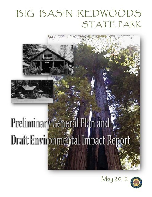
BIG BASIN REDWOODS - California State Parks - State of California
BIG BASIN REDWOODS - California State Parks - State of California
BIG BASIN REDWOODS - California State Parks - State of California

Create successful ePaper yourself
Turn your PDF publications into a flip-book with our unique Google optimized e-Paper software.
<strong>BIG</strong> <strong>BASIN</strong> <strong>REDWOODS</strong><br />
STATE PARK<br />
May 2012
Big Basin Redwoods SP<br />
Preliminary General Plan / Draft EIR<br />
This document represents the Preliminary General Plan and Draft Environmental<br />
Impact Report circulated for CEQA public review.<br />
Written comments or inquiries regarding this plan should be submitted to the address below.<br />
<strong>California</strong> <strong>State</strong> <strong>Parks</strong><br />
Planning Division<br />
Big Basin Redwoods Planning Team<br />
1416 9th Street, Room 1442-7<br />
P.O. Box 942896<br />
Sacramento, CA 94296-0001<br />
© 2012 <strong>California</strong> <strong>State</strong> <strong>Parks</strong><br />
All Photographs copyright <strong>California</strong> <strong>State</strong> <strong>Parks</strong> unless otherwise noted.<br />
This document is also available as an electronic file at<br />
www.parks.ca.gov/planning<br />
Cover Photos:<br />
Old growth redwoods at Big Basin Redwoods SP<br />
1936 photo <strong>of</strong> the Administration Building
<strong>BIG</strong> <strong>BASIN</strong> <strong>REDWOODS</strong><br />
STATE PARK<br />
Preliminary General Plan and<br />
Draft Environmental Impact Report<br />
<strong>State</strong> Clearinghouse #2001112104<br />
Edmund G. Brown Jr.<br />
Governor<br />
John Laird<br />
Secretary for Natural Resources<br />
Ruth Coleman<br />
Director <strong>of</strong> <strong>Parks</strong> and Recreation<br />
<strong>State</strong> <strong>of</strong> <strong>California</strong><br />
The Natural Resources Agency<br />
Department <strong>of</strong> <strong>Parks</strong> and Recreation<br />
P.O. Box 942896<br />
Sacramento, <strong>California</strong><br />
94296-0001<br />
May 2012
EXECUTIVE SUMMARY
Chapter Divider Photos:<br />
Post card collection commemorating Big Basin Redwoods SP<br />
1908 post card highlighting park features
Big Basin Redwoods <strong>State</strong> Park<br />
Preliminary General Plan and Draft EIR<br />
May 2012<br />
EXECUTIVE<br />
SUMMARY<br />
PARK DESCRIPTION<br />
Big Basin Redwoods <strong>State</strong> Park is <strong>California</strong>'s oldest state park, established<br />
in 1902 through a land purchase and donation. The park consists <strong>of</strong> more<br />
than 18,000 acres in the Santa Cruz Mountains, located within 60 miles <strong>of</strong><br />
major metropolitan centers in the San Francisco Bay Area<br />
and the Santa Clara Valley. The 3,800 acres that comprised<br />
the original <strong>California</strong> Redwood Park is nominated as a<br />
National Historic Landmark property. This area contains<br />
the heart <strong>of</strong> the redwood grove that inspired admirers to<br />
form the Sempervirens Club and advocate for the creation<br />
<strong>of</strong> a state park.<br />
Elevations within the park range from sea level to over<br />
2,000 feet. Three watersheds (Waddell Creek, East<br />
Waddell Creek, and Scott Creek) form the dominant<br />
landscape features <strong>of</strong> the park. Approximately 5,810 acres<br />
within the state park is designated a state wilderness, and<br />
together with the backcountry (10,540 acres) constitutes<br />
85% <strong>of</strong> the park, <strong>of</strong>fering quiet solitude among the large<br />
evergreen trees and steep canyon slopes.<br />
The Headquarters area, located along Highway 236, has<br />
the highest concentration <strong>of</strong> development and visitor<br />
activity in the park, with campgrounds, interpretive<br />
facilities, picnic areas, store and gift shop, and trails<br />
situated under the towering redwoods. Remnants <strong>of</strong> the<br />
park’s early history, including Civilian Conservation Corps<br />
(CCC)-era and post-World War II construction, are present<br />
in varying degrees <strong>of</strong> preservation.<br />
At Waddell Beach, the big surf, persistent winds, and ease<br />
<strong>of</strong> access attract surfers, kite surfers, windsurfers, and spectators to this<br />
well-known water sport venue. Inland from Highway 1 is the Rancho del<br />
Oso (RDO) sub-unit and the 23-acre Theodore J. Hoover Natural Preserve.<br />
This area includes remnants <strong>of</strong> the early Theodore Hoover farm operations,<br />
the Nature and History Center, an equestrian camp and trailhead facilities.<br />
Established in 1902,<br />
Big Basin Redwoods SP<br />
is <strong>California</strong>’s oldest<br />
state park.<br />
Executive Summary<br />
ES -1
Preliminary General Plan and Draft EIR<br />
May 2012<br />
Big Basin Redwoods <strong>State</strong> Park<br />
In 2011, the Little Basin property (535 acres) was acquired and added to Big<br />
Basin Redwoods SP, which includes a developed campground and group<br />
recreation facilities.<br />
PURPOSE FOR THE GENERAL PLAN<br />
The park’s purpose<br />
emphasizes the<br />
preservation <strong>of</strong> the old<br />
growth redwood forest,<br />
also recognizing<br />
outstanding cultural,<br />
educational and<br />
recreation values.<br />
In those early years <strong>of</strong> the park’s history, park plans were made to<br />
preserve the ancient redwood forest and provide public access and<br />
recreation opportunities. Most <strong>of</strong> the existing buildings and park facilities<br />
were constructed during the first 50 years after the park was established,<br />
yet a General Plan was never completed for the park. The need for formal<br />
planning was highlighted by recent acquisitions, new potential for<br />
regional natural lands and open space connections, a growing demand<br />
from the expanding <strong>California</strong> population for new recreation options and<br />
coastal access and the opportunity to coordinate planning with several<br />
other state parks in the region. A comprehensive planning effort was<br />
initiated to create a long-term and visionary general plan that would be<br />
commensurate with the park’s significance within the region as well as in<br />
the <strong>California</strong> <strong>State</strong> Park System.<br />
REGIONAL PLANNING CONTEXT<br />
The Santa Cruz Mountains region includes many recreation and open<br />
space providers. In addition to public open space, the region contains<br />
small towns, rural housing, small businesses, timber companies, and<br />
private recreation developments.<br />
This General Plan was developed by <strong>California</strong> <strong>State</strong> <strong>Parks</strong> as part <strong>of</strong> a<br />
regional planning effort, along with general plans approved for Año<br />
Nuevo <strong>State</strong> Park and Butano <strong>State</strong> Park. These three parks in proximity<br />
to each other share natural, cultural, and visitor demographic<br />
characteristics, and face similar issues. Regional characteristics and<br />
common issues were researched at the beginning <strong>of</strong> the planning process<br />
and used as a foundation for the resulting park plans. The general plan<br />
process also recognized each park’s unique assets and needs separately.<br />
The plans recognize the close relationship between <strong>California</strong> state parks<br />
and other nearby public and private lands, and emphasize the potential<br />
for regional collaboration in resource management, recreational use,<br />
education and interpretation, and park management.<br />
KEY ISSUES AND OPPORTUNITIES<br />
The following are the primary planning issues addressed by the General<br />
Plan:<br />
• Vegetation, Wildlife, and Habitat Protection: Big Basin<br />
Redwoods SP contains over 4,400 acres <strong>of</strong> old growth redwoods,<br />
rare plant communities, and numerous animal and plant species<br />
having special status or <strong>of</strong> special concern. Plant and animal<br />
ES -2<br />
Executive Summary
Big Basin Redwoods <strong>State</strong> Park<br />
Preliminary General Plan and Draft EIR<br />
May 2012<br />
species composition has shifted and populations and habitats in<br />
and around the park have declined due to past land use and<br />
current human activities. Strategies for ecosystem management<br />
and regional collaboration for natural resource management are<br />
emphasized in the plan. Additional focus is provided for the<br />
special status species found in the park, which include the San<br />
Francisco garter snake, coho salmon, steelhead, <strong>California</strong> redlegged<br />
frog, and marbled murrelet. Conservation <strong>of</strong> the state and<br />
federally listed marbled murrelet, a sea-going bird which nests in<br />
old growth redwoods and Douglas-fir, is <strong>of</strong> high importance and<br />
nesting habitat <strong>of</strong> this bird will be protected.<br />
• Recreation Demand and Visitor Opportunities: <strong>California</strong>’s<br />
rapidly growing population and shifting demographics have<br />
created new and increased demands for recreation facilities,<br />
amenities, programs, and concession services. The park’s unique<br />
resources and its location near the high density urban centers<br />
around the Santa Cruz Mountains creates a high demand for<br />
recreation at the park, particularly during the peak season<br />
months <strong>of</strong> May through October. The park properties in current<br />
state ownership <strong>of</strong>fer limited potential for such new<br />
development or expansion to meet future recreation demands<br />
and visitor needs. However, the addition <strong>of</strong> Little Basin presents a<br />
new opportunity to provide public recreation facilities for groups,<br />
families, and for special events outside the old growth forest.<br />
• Public Access and Circulation: Outdated infrastructure, older<br />
roads and highways, parking inadequacies, limited public<br />
transportation, and sensitive resource protection all contribute to<br />
the public access and circulation issues within the park. These<br />
challenges are most apparent in the historic core area where<br />
camping, picnicking, trail use, concession services, and park<br />
operations compete for limited parking and roadway space. Much<br />
<strong>of</strong> the existing park infrastructure was developed to<br />
accommodate recreation in the earliest acquired areas <strong>of</strong> the<br />
park (i.e. Headquarters area). The plan describes existing and<br />
potential access locations and appropriate areas for future facility<br />
development, and also encourages development <strong>of</strong> alternative<br />
transportation in and around the park to reduce traffic<br />
congestion and air polluting vehicle emissions.<br />
• Rehabilitation and Preservation <strong>of</strong> Significant Historic Resources:<br />
Established in 1902 through the efforts <strong>of</strong> the Sempervirens Club,<br />
Big Basin Redwoods SP was the first park in today’s <strong>California</strong> <strong>State</strong><br />
Park System and is historically significant as one <strong>of</strong> the first public<br />
commitments to environmental preservation and outdoor<br />
recreation. The park contains many fine examples <strong>of</strong> Park Rustic<br />
architecture as developed by the National Park Service and<br />
constructed by the CCC. There are also important Native American<br />
sites within the park. The historic recreation structures and<br />
Executive Summary<br />
ES -3
Preliminary General Plan and Draft EIR<br />
May 2012<br />
Big Basin Redwoods <strong>State</strong> Park<br />
facilities will benefit from guidelines for management, building<br />
preservation, and appropriate adaptive uses. Careful consideration<br />
to maintaining appropriate adaptive uses and preserving the<br />
historic setting and integrity <strong>of</strong> individual buildings is essential to<br />
the preservation <strong>of</strong> these valuable resources.<br />
OVERVIEW OF PLANNING CONCEPTS AND PROPOSALS<br />
Natural Resources<br />
The plan emphasizes the preservation <strong>of</strong> the old growth forest and the<br />
park’s natural resources, utilizing sustainable management practices to<br />
improve the ecology and health <strong>of</strong> the coastal redwood forests and<br />
associated habitat.<br />
To accomplish this goal, the plan calls for relocating or removing some<br />
existing recreation facilities (e.g. individual campsite, picnic site, trail,<br />
etc.), where necessary, and implement effective management strategies<br />
to protect sensitive resources and avoid or reduce adverse impacts.<br />
Cultural Resources<br />
Big Basin’s heritage, cultural traditions, and significant cultural<br />
resources will be preserved and interpreted. The Plan provides<br />
important guidance to the treatments and appropriate<br />
adaptive uses <strong>of</strong> historic buildings and protection <strong>of</strong><br />
archaeological sites and cultural landscape features.<br />
Public Access and Recreation Opportunities<br />
The overall visitor experience will be improved by reducing<br />
vehicle traffic and high intensity uses in the historic core area,<br />
and increasing access and recreation opportunities at Little<br />
Basin, Saddle Mountain, and RDO for family and group<br />
recreation and destination for special events.<br />
Footbridge over Waddell Creek<br />
The wilderness and backcountry will be preserved for its sense<br />
<strong>of</strong> solitude, natural and aesthetic resource values, for its lowimpact<br />
recreational opportunities and visitor experiences, and<br />
improved trail connections for multi-use between destination<br />
areas and points <strong>of</strong> interest within the park.<br />
Interpretation and Education<br />
ES -4<br />
The interpretive focus will increase the public’s awareness <strong>of</strong> the park’s<br />
diversity and opportunities and connect visitors with the natural world,<br />
cultural history and varied outdoor recreational activities. Efforts will be<br />
made to attract and accommodate a more ethnically diverse audience<br />
with measures such as <strong>of</strong>fering additional interpretive materials and<br />
exhibit translations in languages other than English. In addition, the Park<br />
Executive Summary
Big Basin Redwoods <strong>State</strong> Park<br />
Preliminary General Plan and Draft EIR<br />
May 2012<br />
will promote community outreach to increase attendance, partner with<br />
area ethnic organizations on special events or education programs, and<br />
publicize park programs via media outlets to reach more underrepresented<br />
groups.<br />
KEY PLAN PROPOSALS<br />
Wilderness and Backcountry<br />
• Preserve the remote forested mountain character <strong>of</strong> the state<br />
wilderness and backcountry, and protect the integrity and<br />
character <strong>of</strong> the West Waddell Creek watershed through effective<br />
management <strong>of</strong> resources and visitor use.<br />
• Expand the state wilderness to include approximately 390 acres<br />
<strong>of</strong> additional lands north to Gazos Creek Road and west to<br />
Whitehouse Canyon Road.<br />
• Establish backcountry trails and trailheads for backpackers,<br />
equestrians, and cyclists outside sensitive resource areas and<br />
accessible from existing roads and trails.<br />
• Consider <strong>of</strong>fering backcountry tours on fire roads through a<br />
concession contract or as a part <strong>of</strong> the park interpretation and/or<br />
accessibility programs.<br />
The Park Rustic style<br />
and distinctive<br />
features <strong>of</strong> historic<br />
properties will be<br />
preserved.<br />
Headquarters Area<br />
• Restrict new facility construction in the old growth redwoods and<br />
manage visitor activities to protect significant resources and<br />
achieve long-term management objectives.<br />
• Establish the primary visitor contact and campground registration<br />
outside the Headquarters area, and relocate some park<br />
administrative functions to a new facility at Saddle Mountain.<br />
• Coordinate with DFG and USFWS toward the long-term recovery<br />
and survival <strong>of</strong> the Santa Cruz Mountain’s marbled murrelet<br />
population.<br />
• Protect sensitive aquatic species, including <strong>California</strong> red-legged<br />
frog and anadromous fish, and take appropriate measures to<br />
minimize disturbances in critical habitats during breeding and<br />
spawning seasons.<br />
• Rehabilitate the Lodge building, according to the Secretary <strong>of</strong><br />
Interior Standards, to provide suitable adaptive uses for this<br />
historic building.<br />
Executive Summary<br />
ES -5
Preliminary General Plan and Draft EIR<br />
May 2012<br />
Big Basin Redwoods <strong>State</strong> Park<br />
• Introduce up to 10 overnight cabins with parking and utilities in<br />
the Sky Meadow area along the road to the existing group camps<br />
and outside sensitive resource areas.<br />
• Allow for development <strong>of</strong> additional staff housing, trailer pads,<br />
and amenities outside the designated National Register<br />
boundaries <strong>of</strong> the Lower Sky Meadow residence area to serve<br />
future housing needs, while maintaining the historic integrity <strong>of</strong><br />
this significant 1940s residence area.<br />
Saddle Mountain and Highway 236<br />
• Develop a park welcome center for primary visitor contact,<br />
orientation, park information, and campground registration.<br />
Develop parking and determine the feasibility <strong>of</strong> implementing a<br />
shuttle system to transport visitors to other areas <strong>of</strong> the park.<br />
• Preserve and maintain the scenic quality <strong>of</strong> Highway 236 and<br />
establish appropriate “first impression” treatments that are<br />
compatible with the character <strong>of</strong> the park and create an<br />
attractive and welcoming park entry experience.<br />
• Preserve the meadow and open space qualities in the planning<br />
and design <strong>of</strong> future park facilities, and establish adequate<br />
vegetative screening and buffers between administrative and<br />
visitor activity areas, and between park development and<br />
adjacent properties.<br />
• Conduct additional natural and cultural resource surveys, as<br />
necessary, to determine the presence <strong>of</strong> significant resources;<br />
implement protective measures, and interpret the site’s history<br />
and important resources through effective interpretation<br />
methods and media dissemination.<br />
• Coordinate with Caltrans to manage visitor and non-visitor traffic<br />
along Highway 236 through the park, and improve signage at<br />
locations on Highway 9 at Waterman Gap and along Highway 236<br />
at China Grade Road to redirect visitors to the south entrance at<br />
Saddle Mountain.<br />
• Explore <strong>State</strong> Scenic Highway and Federal Scenic Byway status for<br />
Highway 236 to help provide grant funding for planning,<br />
designing, and developing byway-related projects.<br />
• Evaluate the historic Gatehouse for <strong>California</strong> National Register<br />
eligibility. Rehabilitate the historic Gatehouse to serve as an<br />
employee residence, park <strong>of</strong>fice, or for other appropriate<br />
adaptive uses. Consider site improvements to accommodate<br />
trailhead parking or a possible shuttle/bus stop.<br />
ES -6<br />
Executive Summary
Big Basin Redwoods <strong>State</strong> Park<br />
Preliminary General Plan and Draft EIR<br />
May 2012<br />
• Coordinate with Caltrans to develop and/or improve highway<br />
turnouts, where appropriate, to accommodate short-term<br />
parking, shuttle/bus stops, or temporary vehicle pull-outs.<br />
• Consider acquiring easements or acquisition <strong>of</strong> additional<br />
properties if available from willing sellers, to accommodate<br />
facilities development, highway, or trail improvements and/or to<br />
ensure long-term compatibility between park-related activities,<br />
resource protection, and adjacent land uses.<br />
Rancho del Oso and Waddell Beach<br />
• Coordinate with Caltrans to maintain and expand Waddell Beach<br />
parking facilities, as feasible, to support beach activities and<br />
ocean view parking.<br />
• Improve highway signage and implement effective measures to<br />
slow vehicle traffic and provide early warning to motorists for<br />
approaching intersection and pedestrian crossing.<br />
• Provide review and input to Caltrans on their planning and design<br />
for the proposed Highway 1 bridge replacement at the mouth <strong>of</strong><br />
Waddell Creek to promote desirable hydrological, riparian,<br />
and estuarine conditions and facilitate safe vehicle<br />
access and egress from Highway 1. Incorporate day<br />
use parking (approx. 50 spaces) on the inland side <strong>of</strong><br />
Highway 1, with safe pedestrian access along<br />
Waddell Creek from the inland side <strong>of</strong> the highway<br />
to the beach.<br />
• Protect special status plant and wildlife habitats,<br />
conduct resource surveys and monitor use along<br />
roadways and near sensitive habitats, and<br />
implement resource management and protective<br />
measures to eliminate or mitigate human impacts on<br />
significant natural resources.<br />
• Relocate the RDO entrance road gate further inland<br />
(+/- 100 ft.) and develop a vehicle turnaround,<br />
parking, and park information kiosk for visitors.<br />
• Develop a fully functional ranger station/interpretive<br />
facility. This could be an upgrade <strong>of</strong> an existing<br />
facility or a new building. This facility should function<br />
as a center for RDO activities and orientation as well<br />
as a gateway into the backcountry and the West<br />
Waddell Creek <strong>State</strong> Wilderness.<br />
Kite Surfing at Waddell Beach<br />
• Upgrade or reconfigure the horse camp and equestrian staging<br />
facilities to improve campsites, trailer parking and vehicle<br />
circulation.<br />
Executive Summary<br />
ES -7
Preliminary General Plan and Draft EIR<br />
May 2012<br />
Big Basin Redwoods <strong>State</strong> Park<br />
• Conduct additional site-specific surveys, as necessary, to identify<br />
natural and cultural resource sensitivities and protective<br />
measures, and prepare site plan(s) to determine the location,<br />
size, and configuration <strong>of</strong> desired public use and park operations<br />
facilities.<br />
• Address public health and safety issues, accessibility<br />
requirements, aesthetics, interpretation, and management <strong>of</strong><br />
visitor capacity.<br />
• Develop a bicycle camp and walk-in campground facilities at a<br />
location either adjacent to the horse camp or in an open area<br />
along the existing road north <strong>of</strong> the day use parking lot. Consider<br />
alternative forms <strong>of</strong> camp facilities, such as yurts or tent cabins,<br />
with provisions to serve backpackers and touring bicyclists<br />
utilizing the Highway 1 Pacific Coast Trail.<br />
• Retain park staff residences for public safety and protection <strong>of</strong><br />
public property.<br />
• Rehabilitate the Nature and History Center building, parking and<br />
support facilities, as necessary, to serve as the primary<br />
interpretive center for RDO. Prepare site-specific plans to define<br />
day use parking, circulation, picnic areas, accessible restroom<br />
facilities, and use <strong>of</strong> outdoor open space areas for visitor<br />
education and interpretive programs.<br />
• Repair and upgrade the current potable water supply and<br />
distribution systems to existing and new park buildings and key<br />
visitor locations.<br />
• Conduct visitor and potential user surveys to determine future<br />
visitor needs and recreation demands for day use and overnight<br />
facilities in RDO and coastal areas to the north. Additional<br />
campground development (accessible from Highway 1) may be<br />
considered in the RDO area, if additional properties suitable for<br />
this use became available from willing sellers.<br />
Little Basin<br />
• Upgrade and expand utility systems and infrastructure to support<br />
recreational activities, such as camping (including cabins), hiking,<br />
biking, horseback riding, fishing, interpretive programs and group<br />
activities, including special events. Consider program needs for a<br />
possible environmental education center.<br />
• Complete resource inventories and evaluations, and implement<br />
resource protection measures where needed. Remove or<br />
relocate existing facilities, as necessary, to preserve and protect<br />
sensitive and significant natural and cultural resources.<br />
ES -8<br />
Executive Summary
Big Basin Redwoods <strong>State</strong> Park<br />
Preliminary General Plan and Draft EIR<br />
May 2012<br />
• Upgrade and/or modify existing facilities to satisfy operational<br />
needs and to meet ADA accessibility requirements.<br />
• Interpret resource values and site history <strong>of</strong> Little Basin property.<br />
• Consider a concession-developed and operated overnight lodge<br />
with dining facilities and additional cabins.<br />
• Coordinate with Santa Cruz County to identify road<br />
improvements and county maintenance that may be necessary to<br />
maintain public vehicle access on Little Basin Road from Highway<br />
236 to the Little Basin property.<br />
Staff considers public recreation opportunities at Little Basin<br />
MANAGEMENT PLANS<br />
Major programs and projects implemented during the lifespan <strong>of</strong> the<br />
General Plan will require additional planning. This planning will take the<br />
form <strong>of</strong> management plans or specific project plans. Management plans<br />
define the specific objectives, methodologies and/or designs for<br />
accomplishing management goals. Occurring on an as-needed basis, they<br />
typically focus on specific management topics, goals, or issues.<br />
Management plans can apply to all, or part, <strong>of</strong> a park unit. They usually<br />
include program-level decisions that describe how and when<br />
management actions are appropriate and necessary and they are <strong>of</strong>ten<br />
based on funding and staffing capabilities. Some <strong>of</strong> the goals and<br />
guidelines comprising Chapter 4, Park Plan, recommend preparing and<br />
updating specific management plans and more detailed site investigations<br />
subsequent to the adoption <strong>of</strong> the General Plan, including the following:<br />
Executive Summary<br />
ES -9
Preliminary General Plan and Draft EIR<br />
May 2012<br />
Big Basin Redwoods <strong>State</strong> Park<br />
• Roads and Trails Management Plan<br />
• Interpretation Management Plan<br />
• Watershed Management Plans<br />
• Wildfire Management Plan<br />
• Scope <strong>of</strong> Collections <strong>State</strong>ment<br />
• Cultural Resource Management Plan<br />
ENVIRONMENTAL ANALYSIS<br />
The environmental analysis and the consideration <strong>of</strong> alternatives in the<br />
General Plan were prepared in conformance with the <strong>California</strong><br />
Environmental Quality Act (CEQA) requirement to analyze and disclose<br />
the potential environmental effects <strong>of</strong> a proposed action. The<br />
environmental analysis is programmatic in scope and serves as a first tier<br />
EIR. Tiering is a process where a lead agency prepares a series <strong>of</strong><br />
environmental documents, progressing from general concerns to more<br />
site-specific evaluations with the preparation <strong>of</strong> each new document. The<br />
environmental analysis in this document evaluates broad environmental<br />
matters and does not contain project-specific analysis for the facilities<br />
that are considered in the General Plan. It is a reference for future<br />
environmental documents that will provide more detailed information<br />
and analysis for site specific developments and projects.<br />
The General Plan includes guidelines that direct future project-level<br />
environmental review <strong>of</strong> site-specific projects to avoid or minimize<br />
potential adverse effects to resources during construction or operation <strong>of</strong><br />
the facilities and improvements. Specific projects would also undergo<br />
subsequent CEQA review as appropriate. Because the General Plan<br />
contains goals and guidelines that are designed to avoid or minimize<br />
potential adverse environmental effects, no significant program-level<br />
impacts were identified.<br />
ES -10<br />
Executive Summary
Preliminary General Plan and Draft EIR<br />
May 2012<br />
Big Basin Redwoods <strong>State</strong> Park<br />
TABLE OF CONTENTS<br />
EXECUTIVE SUMMARY<br />
ES-1<br />
Chapter 1 INTRODUCTION TO PARK 1-1<br />
1.1 Location and Regional Context 1-1<br />
1.2 Site Characteristics 1-2<br />
1.3 Purpose Acquired 1-3<br />
1.4 Sense <strong>of</strong> Place 1-4<br />
1.5 Purpose <strong>of</strong> the General Plan 1-6<br />
1.6 Planning Context 1-7<br />
1.7 The Planning Process 1-11<br />
Chapter 2 EXISTING CONDITIONS 2-1<br />
2.1 Regional Land Use 2-1<br />
2.2 Regional Recreation Facilities 2-2<br />
2.3 Existing Park Land Use and Facilities 2-5<br />
2.4 Significant Resource Values 2-26<br />
2.5 Park Support 2-99<br />
2.6 Planning Influences 2-101<br />
Chapter 3 ISSUES ANALYSIS 3-1<br />
3.1 Planning Assumptions 3-1<br />
3.2 Parkwide Issues 3-3<br />
3.3 Specific Area Issues 3-9<br />
Chapter 4 PARK PLAN 4-1<br />
4.1 Classification 4-1<br />
4.2 Declaration <strong>of</strong> Purpose 4-4<br />
4.3 Vision 4-6<br />
4.4 Parkwide Goals and Guidelines 4-8<br />
4.5 Area-specific Guidelines 4-56<br />
4.6 Managing Visitor Capacity 4-73<br />
Table <strong>of</strong> Contents<br />
i
Big Basin Redwoods <strong>State</strong> Park<br />
Preliminary General Plan and Draft EIR<br />
May 2012<br />
Chapter 5 ENVIRONMENTAL ANALYSIS 5-1<br />
5.1 Introduction 5-1<br />
5.2 EIR Summary 5-6<br />
5.3 Project Description 5-6<br />
5.4 Environmental Setting 5-11<br />
5.5 Environmental Effects Eliminated From Further Analysis 5-11<br />
5.6 Environmental Impacts and Mitigation 5-13<br />
5.7 Unavoidable Significant Environmental Effects 5-41<br />
5.8 Alternatives to the Proposed Plan 5-44<br />
REFERENCES 6-1<br />
TABLES<br />
2-1 Yearly and Monthly Attendance 2-6<br />
2-2 Existing Parking in Headquarters Area 2-9<br />
2-3 Existing Campgrounds 2-14<br />
2-4 Existing Roads 2-22<br />
2-5 Trails by User Group 2-23<br />
2-6 Air Pollution Summary 2-33<br />
2-7 Selected County Populations 2-109<br />
4-1 Desired Outcomes and Indicators 4-77<br />
5-1 Plan Alternatives 5-49<br />
APPENDICES<br />
A Acronyms and Abbreviations<br />
B Location <strong>of</strong> EIR Required Content in the General Plan/EIR<br />
C Publicly-Owned Recreation Facilities in the Vicinity <strong>of</strong> Big Basin Redwoods SP<br />
D Privately-Owned/Operated Recreation Facilities in the Vicinity <strong>of</strong> Big Basin Redwoods SP<br />
E Existing Roads<br />
F Existing Trails<br />
G Systemwide Planning Policies, Procedures and Guidelines<br />
H Regulatory Influences<br />
I Special Status Plant Species Reported to Occur within Big Basin Redwoods SP<br />
J Sensitive Wildlife Species that Occur or for which Potential Habitat Exists<br />
within Big Basin Redwoods SP<br />
K US Population Distribution By Age, 2008 and 2030<br />
L Travel Distance to Big Basin Redwoods SP<br />
M Glossary<br />
ii<br />
Table <strong>of</strong> Contents
Preliminary General Plan and Draft EIR<br />
May 2012<br />
Big Basin Redwoods <strong>State</strong> Park<br />
FIGURES<br />
(all map figures are located at the back <strong>of</strong> this document, following the Glossary)<br />
Figure 1 Regional Map<br />
Figure 2 Location Map<br />
Figure 3 Land Use & Facilities<br />
Figure 4 Land Use & Facilities – Park Headquarters Area<br />
Figure 5 Coastal Zone<br />
Figure 6 Regional Fault Map<br />
Figure 7 Watersheds and Streams<br />
Figure 8 Vegetation Communities<br />
Figure 9 Wildlife Habitat<br />
Figure 10 Natural Resource Sensitivity<br />
Figure 11 National Historic Landmark with Contributing Elements<br />
Figure 12 Historic Resources NRHP Multiple Property Documentation, Park Headquarters Area<br />
Figure 13 Lower Sky Meadow Residence Area – National Historic District<br />
Figure 14 Headquarters Area (Governor’s Camp) 2011<br />
Figure 15 Headquarters Area (Governor’s Camp) 1954<br />
Figure 16 Headquarters Area (Governor’s Camp) 1941<br />
Figure 17 Headquarters Area (Governor’s Camp) 1924<br />
Figure 18 Preferred Alternative – Park Headquarters / Sky Meadow<br />
Figure 19 Preferred Alternative – Saddle Mountain and Highway 236<br />
Figure 20 Preferred Alternative – Waddell Beach and Rancho del Oso<br />
Figure 21 Preferred Alternative – Little Basin<br />
Figure 22 Preferred Alternative – Wilderness and Backcountry<br />
Figure 23 Tsunami Inundation Risk<br />
Figure 24 Sea Level Rise – 100 Year Storm Comparison <strong>of</strong> Current and Projected Year 2100<br />
Inundation Areas<br />
Figure 25 Sea Level Rise – Mean High Tide with 55 inches <strong>of</strong> Sea Level Rise<br />
REPORT CONTRIBUTORS<br />
(Inside back cover)<br />
Table <strong>of</strong> Contents<br />
iii
Big Basin Redwoods <strong>State</strong> Park<br />
Preliminary General Plan and Draft EIR<br />
May 2012<br />
iv<br />
Table <strong>of</strong> Contents
1 INTRODUCTION
CONTENTS<br />
Chapter 1: INTRODUCTION 1<br />
1.1 Location and Regional Context 1<br />
1.2 Site Characteristics 2<br />
1.3 Purpose Acquired 3<br />
1.4 Sense <strong>of</strong> Place 4<br />
1.5 Purpose <strong>of</strong> the General Plan 6<br />
1.6 Planning Context 7<br />
The Planning Hierarchy 7<br />
Organization <strong>of</strong> the General Plan 8<br />
Subsequent Planning 10<br />
1.7 The Planning Process 11<br />
Interagency and Stakeholder Involvement 12
Big Basin Redwoods <strong>State</strong> Park<br />
Preliminary General Plan and Draft EIR<br />
May 2012<br />
CHAPTER 1 :<br />
INTRODUCTION<br />
1.1 LOCATION AND REGIONAL CONTEXT<br />
Big Basin Redwoods <strong>State</strong> Park (SP) lies in the Santa Cruz Mountains <strong>of</strong><br />
<strong>California</strong>, 43 miles southeast <strong>of</strong> San Francisco and 23 miles northwest <strong>of</strong><br />
the city <strong>of</strong> Santa Cruz. The park is accessible via Highways 9 and 236, near<br />
the small town <strong>of</strong> Boulder Creek, and from coastal Highway 1 to Waddell<br />
Beach and inland at Rancho del Oso (RDO). The park is located within two<br />
county jurisdictions: the southern portion <strong>of</strong> the park is in Santa Cruz<br />
County and a small northern portion is in San Mateo County. The Santa<br />
Cruz Mountains region includes many recreation and open space<br />
providers such as <strong>California</strong> <strong>State</strong> <strong>Parks</strong>, Santa Cruz and San Mateo<br />
County <strong>Parks</strong>, the Midpeninsula Regional Open Space District, Peninsula<br />
Open Space Trust, Sempervirens Fund, the <strong>California</strong> Department <strong>of</strong> Fish<br />
and Game, the Santa Cruz Water Department, and the University <strong>of</strong><br />
<strong>California</strong>. In addition to public open space the region contains small<br />
towns, rural housing, small businesses, timber companies, and private<br />
recreation providers (see Regional Map, Figure 1).<br />
The westerly half the park is located within the coastal zone, which falls in<br />
the jurisdiction <strong>of</strong> the County <strong>of</strong> Santa Cruz and <strong>State</strong> Coastal Commission<br />
for required permits under the approved County <strong>of</strong> Santa Cruz 1994<br />
General Plan and Local Coastal Plan.<br />
Planning reflects<br />
a long-range<br />
vision for parks in<br />
the Santa Cruz<br />
Mountains.<br />
Introduction<br />
1 -1
Preliminary General Plan and Draft EIR<br />
May 2012<br />
Big Basin Redwoods <strong>State</strong> Park<br />
1.2 SITE CHARACTERISTICS<br />
View from Chalks Mountain<br />
Berry Creek Falls<br />
Waddell Beach<br />
The park consists <strong>of</strong> more than 18,000 acres and contains two distinct<br />
areas, the uplands and coastal areas. The more extensive uplands area is<br />
characterized by old growth and previously-logged coast redwood forests<br />
together with mixed conifer, oaks, chaparral, rugged terrain, and<br />
mountain streams. Many <strong>of</strong> the ridges are forested with a mixed<br />
evergreen landscape, while others contain oak woodlands, chaparral, and<br />
bare soil. The park’s mountain ridges are prominent in the backdrop, with<br />
Pine Mountain (2,208 ft.), Buzzards Roost (2,150 ft.), and Chalk Mountain<br />
(1,609 ft.), providing spectacular views from their summits and overlooks.<br />
Remnants <strong>of</strong> the park’s early history, including Civilian Conservation<br />
Corps (CCC)-era and post-World War II construction, are present in the<br />
Headquarters area. Also developed in this area are campgrounds,<br />
interpretive facilities, picnic areas, store and gift shop, and trails under<br />
towering redwoods bustle with visitor activity. The wilderness and<br />
backcountry <strong>of</strong>fer quiet solitude in the large evergreen trees and steep<br />
canyon slopes. The majority <strong>of</strong> streams and creeks in these uplands drain<br />
into West Waddell Creek, the foremost freshwater resource associated<br />
with the park and a major Central <strong>California</strong> coastal stream supporting a<br />
recovering coho salmon and steelhead habitat. West Waddell Creek<br />
meanders west, eventually entering the freshwater and brackish marshes<br />
<strong>of</strong> the lowlands where it flows across Waddell Beach to the Pacific Ocean.<br />
The coastal area <strong>of</strong> the park is characterized by coastal scrub, grasses,<br />
marshes, flat terrain, and sandy beaches. Much <strong>of</strong> the length <strong>of</strong> coastline<br />
in the area is characterized by broad marine terraces, some <strong>of</strong> which have<br />
long been used for agricultural purposes. Remnants <strong>of</strong> this rich<br />
agricultural history are still present, with farm operations continuing just<br />
outside park boundaries and historic structures representative <strong>of</strong> the<br />
Theodore Hoover farm operations located and interpreted inside the<br />
park. With more than 45 miles <strong>of</strong> streams, brackish and freshwater<br />
marshes, and beaches, few other state parks contain as many distinct and<br />
diverse aquatic habitats as Big Basin Redwoods SP. Containing multiple<br />
types <strong>of</strong> threatened and endangered wetland species, the Theodore J.<br />
Hoover Natural Preserve is an excellent example <strong>of</strong> this unique ecological<br />
diversity. Waddell Beach represents the largest portion <strong>of</strong> the park’s<br />
marine environment, consisting <strong>of</strong> a gently sloping sandy beach flanked<br />
on both sides by steep bluffs with coastal strand vegetation and<br />
Monterey pines. Big surf, persistent winds, and ease <strong>of</strong> access attract<br />
surfers, kite surfers, windsurfers and spectators to this popular water<br />
sport venue.<br />
1 -2<br />
Introduction
Big Basin Redwoods <strong>State</strong> Park<br />
Preliminary General Plan and Draft EIR<br />
May 2012<br />
1.3 PURPOSE ACQUIRED<br />
With its first parcels acquired in 1902, Big Basin Redwoods SP is<br />
<strong>California</strong>'s oldest state park. One element <strong>of</strong> <strong>California</strong>'s natural history<br />
represented by the park is the value <strong>of</strong> preserving and protecting<br />
<strong>California</strong>'s natural resources. The acquisition <strong>of</strong> Big Basin, originally<br />
known as <strong>California</strong> Redwood Park, represents the first successful effort<br />
to save coast redwoods from logging.<br />
With pleas from the public beginning as early as 1877 to save the old<br />
growth coast redwood forests from logging in the Santa Cruz Mountain<br />
areas, the first real effort to purchase land in Big Basin, and preserve it as<br />
a state park, was devised by Andrew P. Hill in 1900.<br />
This effort began on May 1, 1900 when a group <strong>of</strong> people interested in<br />
saving the redwoods assembled in the library at Stanford University. This<br />
group, led by Hill, decided to visit the areas where outstanding trees<br />
existed along Sempervirens Creek. The Sempervirens Club was created as<br />
an outcome <strong>of</strong> this Santa Cruz Mountains trip. The Club became the voice<br />
for the preservation <strong>of</strong> the redwoods and the driving force behind this<br />
effort. A bill to create <strong>California</strong>’s first state park, called <strong>California</strong><br />
Redwood Park, was presented to the state legislature in 1901, and was<br />
passed in 1902. The purpose <strong>of</strong> the park was to bring the public to view<br />
and experience the redwoods to ensure their preservation. The first 2,500<br />
acres were purchased for $250,000 with an additional 1,300 acres <strong>of</strong><br />
private timber land donated by H. L. Middleton and others, comprising a<br />
total <strong>of</strong> 3,800 acres. By 1904, the park was open to the public.<br />
The number <strong>of</strong> people traveling to the park multiplied with the creation<br />
<strong>of</strong> modern roads and highway links to the area. Within a period <strong>of</strong> twenty<br />
years, the number <strong>of</strong> visitors and campers expanded from a few hundred<br />
a season to many thousands.<br />
In 1927, the <strong>California</strong> Legislature established the <strong>State</strong> Park System.<br />
Additional parks were established throughout the state, and visitor<br />
attendance increased. Acquisition <strong>of</strong> additional property continued at Big<br />
Basin Redwoods SP along with the purchase <strong>of</strong> other state park lands in<br />
the Santa Cruz Mountains region. Acquisitions included additional old<br />
growth redwood forest and other important habitats, lands for<br />
recreational uses, and ocean frontage.<br />
Introduction<br />
1 -3
Preliminary General Plan and Draft EIR<br />
May 2012<br />
Big Basin Redwoods <strong>State</strong> Park<br />
1.4 SENSE OF PLACE<br />
Each <strong>of</strong> <strong>California</strong>’s state parks has a unique sense <strong>of</strong> place. This<br />
awareness <strong>of</strong> the sense <strong>of</strong> place leads to a sense <strong>of</strong> belonging and<br />
reconnection. <strong>State</strong> parks <strong>of</strong>fer opportunities to reconnect, enriching<br />
people and communities with an enhanced sense <strong>of</strong> connection to the<br />
natural systems that sustain us and to our cultural heritage. Big Basin<br />
Redwoods SP represents an important legacy that relates to the<br />
preservation <strong>of</strong> its sense <strong>of</strong> place, with the first efforts to save old growth<br />
coast redwoods inspired by its ancient trees and early establishment as a<br />
<strong>State</strong> Park.<br />
The park preserves an environmentally diverse<br />
segment <strong>of</strong> the <strong>California</strong> Coastal Landscape<br />
Province. Its mountainous watersheds set a<br />
dramatic context for the spectacular resources<br />
it contains. Differences in terrain and elevation<br />
separate the western and eastern parts <strong>of</strong> the<br />
park, but the park remains cohesive through<br />
an extensive trail system. In addition to<br />
variations in geography, landscape, and<br />
facilities, shifting marine and mountain<br />
weather conditions <strong>of</strong>ten add a particular<br />
mystique and dynamic to many park areas.<br />
Visitors to Big Basin Redwoods SP experience<br />
distinct settings in various areas, each with its<br />
own sense <strong>of</strong> place.<br />
The old growth coast redwood groves on the<br />
east side <strong>of</strong> the park have inspired generations<br />
<strong>of</strong> visitors with wonder and amazement. In the<br />
words <strong>of</strong> John Steinbeck: “The redwoods, once<br />
seen, leave a mark or create a vision that stays<br />
with you always.The feeling they produce is not<br />
transferable. From them comes silence and<br />
awe…they are not like any trees we know, they<br />
are ambassadors from another time”<br />
(Steinbeck 1962).<br />
1 -4<br />
The visitor facilities in the park Headquarters<br />
area are set in the redwood forest and impart a sense <strong>of</strong> history through<br />
interpretation <strong>of</strong> the CCC-era and the park’s longtime recreational use.<br />
Constructed <strong>of</strong> logs, wood and stone, the historic structures blend<br />
effortlessly into the forest environment. Visitors appreciate this unique<br />
and rare opportunity to enter the redwood forest and enjoy the historic<br />
facilities that would not be possible to build today. During the summer<br />
and on spring and fall weekends, this is a very busy and active area <strong>of</strong> the<br />
Introduction
Big Basin Redwoods <strong>State</strong> Park<br />
Preliminary General Plan and Draft EIR<br />
May 2012<br />
park. Day users and campers stop at the Headquarters building to receive<br />
park information, enjoy a docent-led walk on the Redwood Trail, or learn<br />
about local plants and animals at the Nature Museum. Kids on bikes visit<br />
the park store for ice cream or participate in a Junior Ranger program<br />
along the creek. In the evening, campers head toward the historic<br />
campfire center for programs under the redwoods.<br />
Waddell Beach has salt-laden winds, crashing breakers, and a sandy<br />
beach. In summer, the parking lot is <strong>of</strong>ten full <strong>of</strong> beachgoers eager to ride<br />
the waves or watch others head to the ocean to surf, board or kite sail.<br />
The Theodore J. Hoover Natural Preserve marks a transition zone<br />
between land and sea and contains a greater concentration <strong>of</strong> sensitive<br />
plant and animal species than any other place <strong>of</strong> similar size in <strong>California</strong>.<br />
The preserve can awaken a sense <strong>of</strong> wonder and the desire to safeguard<br />
such a unique environment.<br />
Waddell Valley enchanted former residents and inspires visitors with its<br />
wide open spaces bordered by Monterey pines on steep slopes and the<br />
red alders and willows lining its lush riparian corridor. Hulda Hoover<br />
McLean, whose father purchased extensive property in the Waddell<br />
Valley area in the early 1900s, spent many years enjoying the natural<br />
wonders <strong>of</strong> the coast. Her words describe the coastal environment and its<br />
spirit <strong>of</strong> place (McLean 2002):<br />
In the Waddell Valley, seasons come gently, merging into<br />
each other in small increments.<br />
Spring brings us a mounting chorus <strong>of</strong> bird songs. They<br />
sing… just for the joy <strong>of</strong> spring…In meadows, fresh green<br />
grass pushes through gray litter... Spring wind blows up the<br />
valley and whips us as we prepare garden beds for fresh<br />
planting…<br />
Summer Flowers are in full bloom and scent the air. Green<br />
meadows turn to pale gold…Out at sea, a river <strong>of</strong> fog clouds<br />
the horizon and moves in to cool our nights.<br />
Autumn. The smell <strong>of</strong> autumn is shale dust and sagey<br />
plants, bay trees and eucalyptus…Poplars turn to gold...<br />
Winter First rain brings up mushrooms…A flooded creek<br />
wreaks havoc upstream but brings steelhead and salmon<br />
into the creek to spawn… …Rainbows span the valley: they<br />
tell us <strong>of</strong> coming spring.<br />
The creation <strong>of</strong> the <strong>California</strong> <strong>State</strong> Park system and Big Basin Redwoods<br />
SP were inspired by the spirit and beauty <strong>of</strong> the Santa Cruz Mountains<br />
and the coast redwood trees that continue to delight and inspire those<br />
who visit them.<br />
Introduction<br />
1 -5
Preliminary General Plan and Draft EIR<br />
May 2012<br />
Big Basin Redwoods <strong>State</strong> Park<br />
1.5 PURPOSE OF THE GENERAL PLAN<br />
The general plan is the primary management document for a park within<br />
the <strong>California</strong> <strong>State</strong> Park system, establishing its purpose and a<br />
management direction for the future. By providing a defined purpose and<br />
vision with long-term goals and guidelines, it provides the framework for a<br />
unit’s resource stewardship, interpretation, visitor use, operation, and<br />
development. Subsequently, this established framework helps guide daily<br />
decision-making and serves as the basis for developing more detailed<br />
management and site-specific project plans.<br />
This document does not attempt to provide a detailed master plan, but<br />
rather provides conceptual direction and parameters for future<br />
management, development, and appropriate uses. Specific objectives and<br />
strategies for implementation <strong>of</strong> the general plan are intended to be<br />
developed in subsequent planning efforts as they are needed, including<br />
the preparation <strong>of</strong> management plans and specific project plans.<br />
Strategies for<br />
implementation <strong>of</strong> the<br />
general plan are<br />
intended to be<br />
developed in<br />
subsequent planning<br />
efforts as they are<br />
needed, including the<br />
preparation <strong>of</strong><br />
management plans<br />
and specific project<br />
plans.<br />
1 -6<br />
This general plan document was prepared by the <strong>California</strong> <strong>State</strong> <strong>Parks</strong> to<br />
satisfy the requirements the <strong>California</strong> Public Resources Code (PRC)<br />
Section 5002.2. The PRC specifies that a general plan shall consist <strong>of</strong><br />
elements that will evaluate and define the proposed management <strong>of</strong><br />
resources, land uses, facilities, concessions, operation <strong>of</strong> the unit, and any<br />
environmental impacts. The Big Basin Redwoods SP General Plan is<br />
submitted to the <strong>State</strong> Park and Recreation Commission for approval.<br />
The <strong>California</strong> Environmental Quality Act (CEQA) <strong>of</strong> 1970 establishes a<br />
requirement for state agencies to analyze and disclose the potential<br />
environmental effects <strong>of</strong> a proposed action. The environmental impact<br />
report (EIR) prepared by state and local governments is usually a<br />
freestanding document intended to meet the requirements <strong>of</strong> CEQA.<br />
However, CEQA also encourages options to avoid needless redundancy,<br />
such as combining general plans and EIRs (CEQA Guidelines Section 15166)<br />
and the use <strong>of</strong> tiering. Tiering is a process where a lead agency prepares a<br />
series <strong>of</strong> environmental assessments, progressing from general concerns<br />
at a programmatic level to more site-specific evaluations, with the<br />
preparation <strong>of</strong> subsequent environmental documents for detailed projects<br />
(CEQA Guidelines Section 15152). When the lead agency combines a<br />
general plan and an EIR, all CEQA requirements must be covered and<br />
documents must identify where the requirements are met.<br />
This general plan serves as a first-tier EIR as defined in Section 15166 <strong>of</strong><br />
the CEQA guidelines. The analysis <strong>of</strong> broad environmental matters found<br />
within the Environmental Analysis section will be a reference for future<br />
environmental documents that will provide more detailed information and<br />
analysis for site-specific developments and projects. Please see Appendix<br />
B for a table indicating the location <strong>of</strong> required elements <strong>of</strong> the EIR within<br />
this document.<br />
Introduction
Big Basin Redwoods <strong>State</strong> Park<br />
Preliminary General Plan and Draft EIR<br />
May 2012<br />
1.6 PLANNING CONTEXT<br />
The following describes the context <strong>of</strong> general planning in the<br />
Department’s overall planning structure, a summary description <strong>of</strong> each<br />
general plan chapter, and subsequent planning efforts.<br />
THE PLANNING HIERARCHY<br />
The following planning hierarchy provides direction for the future <strong>of</strong> Big<br />
Basin Redwoods SP:<br />
<strong>California</strong> <strong>State</strong> Park’s Mission <strong>State</strong>ment: The Department’s Mission<br />
sets the fundamental parameters within which the <strong>California</strong> Department<br />
<strong>of</strong> <strong>Parks</strong> and Recreation acquires, plans, and manages its 279 park units.<br />
For all units <strong>of</strong> the <strong>California</strong> <strong>State</strong> Park system:<br />
The Mission <strong>of</strong> the <strong>California</strong> Department <strong>of</strong> <strong>Parks</strong> and Recreation is to<br />
provide for the health, inspiration, and education <strong>of</strong> the people <strong>of</strong> <strong>California</strong><br />
by helping to preserve the state’s extraordinary biological diversity, protecting<br />
its most valued natural and cultural resources, and creating opportunities for<br />
high-quality outdoor recreation.<br />
Classification: In addition to the Department’s Mission, the unit<br />
classification recognizes the units’ resources significance and establishes<br />
the parameters for park management and appropriate development as<br />
specified by the <strong>California</strong> Public Resources Code, Section 5019.50-<br />
5019.80. Big Basin Redwoods SP is classified as a <strong>State</strong> Park.<br />
Sub-classification: The Public Resources Code establishes several<br />
categories <strong>of</strong> sub-classifications that may be included within the<br />
boundaries <strong>of</strong> a state park. Big Basin Redwoods SP contains two <strong>of</strong> these<br />
sub-classifications: <strong>State</strong> Wilderness and Natural Preserve. The West<br />
Waddell Creek <strong>State</strong> Wilderness (5,810 acres) consists <strong>of</strong> a significant<br />
portion <strong>of</strong> the Waddell Creek watershed. The Theodore J. Hoover Natural<br />
Preserve (23 acres) is located near the mouth <strong>of</strong> the Waddell Creek<br />
watershed.<br />
Introduction<br />
1 -7
Preliminary General Plan and Draft EIR<br />
May 2012<br />
Big Basin Redwoods <strong>State</strong> Park<br />
This general plan<br />
process focused on a<br />
regional planning<br />
effort to address<br />
existing issues and<br />
recreation trends, and<br />
provide ongoing<br />
guidance to achieve<br />
the long-term vision<br />
for state parks located<br />
in the central Santa<br />
Cruz Mountains.<br />
Declaration <strong>of</strong> Purpose: A broad statement <strong>of</strong> direction that is unique to<br />
Big Basin Redwoods SP. The Declaration <strong>of</strong> Purpose is required by Public<br />
Resources Code, Section 5019.50, and is determined by the park’s prime<br />
resources and recreation opportunities within the larger context <strong>of</strong> the<br />
<strong>State</strong> Park System.<br />
Regional Planning Strategy: Developed in response to a regional analysis,<br />
the general plan process focused on a regional planning effort to address<br />
existing issues and recreation trends, and provide ongoing guidance to<br />
achieve the long-term vision for state parks located in the central Santa<br />
Cruz Mountains.<br />
Regional Vision: A vision statement formulated as part <strong>of</strong> the regional<br />
planning approach to develop the general plans for Big Basin Redwoods<br />
SP, Año Nuevo SP, and Butano SP. This vision statement provides<br />
philosophical direction and serves as a guiding statement for the desired<br />
condition <strong>of</strong> state parks located in the central Santa Cruz Mountains (see<br />
Chapter 4, Park Plan 4.3).<br />
Park Vision: The vision statement is a view <strong>of</strong> the park’s desired future<br />
conditions and visitor experiences. It expresses a vision <strong>of</strong> what the park<br />
could ultimately be like with implementation <strong>of</strong> the general plan.<br />
Parkwide Management Goals and Guidelines: Topical guidance whose<br />
scope is relevant for the entire park. These goals and guidelines were<br />
developed in response to an evaluation <strong>of</strong> existing conditions and are<br />
intended to address existing issues, foreseeable trends/patterns, and<br />
provide ongoing guidance for the incremental actions that will be taken<br />
over time to realize the long-term vision for the park.<br />
Planning Zones/Areas: Zones or identified park areas that characterize<br />
similar types <strong>of</strong> resource conditions, land uses and activities, which form<br />
the basis for planning decisions and guidance for future management<br />
actions.<br />
Area-Specific Goals and Guidelines: Management goals and guidelines<br />
that clarify the management intent for a specific area.<br />
ORGANIZATION OF THE GENERAL PLAN<br />
The general plan is presented in five chapters that introduce the park and<br />
this planning effort, existing land use and resource conditions, planning<br />
issues, goals and guidelines, and an assessment <strong>of</strong> the potential<br />
environmental effects <strong>of</strong> the proposed project. The content <strong>of</strong> each<br />
chapter is summarized below:<br />
Chapter 1: Introduction gives an overview <strong>of</strong> the park’s<br />
characteristics, general plan purpose, and planning process.<br />
1 -8<br />
Introduction
Big Basin Redwoods <strong>State</strong> Park<br />
Preliminary General Plan and Draft EIR<br />
May 2012<br />
Chapter 2: Existing Conditions identifies the natural, cultural,<br />
recreational, and aesthetic resources <strong>of</strong> the park, including a<br />
discussion <strong>of</strong> the demographic trends in <strong>California</strong> that are<br />
relevant to the planning process. This information provides a<br />
foundation to understand the specific park issues.<br />
Chapter 3: Issues Analysis describes current challenges and major<br />
issues facing the park, which helps to define the project scope for<br />
planning purposes.<br />
Chapter 4: Park Plan presents a<br />
statement <strong>of</strong> purpose and<br />
vision for the park’s future.<br />
Planning zones and park<br />
areas are defined by their<br />
geographic location, similar<br />
resource characteristics, or<br />
associated land use.<br />
Parkwide and area-specific<br />
goals and guidelines are<br />
presented to guide park<br />
management and<br />
development, and describe<br />
the future desired<br />
conditions and<br />
considerations for<br />
subsequent planning and<br />
general plan<br />
McCrary Ridge Trail<br />
implementation. This section<br />
also includes a description <strong>of</strong> the adaptive management process<br />
that will be used to sustain resources and positive visitor<br />
experiences at the park. The Park Plan section is considered the<br />
preferred alternative, or proposed project.<br />
Chapter 5: Environmental Analysis discloses the potential<br />
environmental effects <strong>of</strong> the proposed project, including any<br />
significant and potential significant effects that may result from<br />
implementing the general plan. Potential mitigation measures<br />
and alternatives to the proposed project are also discussed in this<br />
section. This is considered a Programmatic EIR which will inform<br />
decision-makers and the public about the environmental<br />
consequences <strong>of</strong> the adoption <strong>of</strong> the general plan, consistent<br />
with the requirements <strong>of</strong> the <strong>California</strong> Environmental Quality Act<br />
and CEQA guidelines.<br />
Introduction<br />
1 -9
Preliminary General Plan and Draft EIR<br />
May 2012<br />
Big Basin Redwoods <strong>State</strong> Park<br />
SUBSEQUENT PLANNING<br />
Major programs and projects implemented during the lifespan <strong>of</strong> the<br />
general plan will require additional planning. This planning will take the<br />
form <strong>of</strong> management plans or specific project plans. Management plans<br />
define the specific objectives, methodologies, and/or designs for<br />
accomplishing management goals. Occurring on an as-needed basis, they<br />
typically focus on specific management topics, goals, or issues.<br />
Management plans can apply to all, or part, <strong>of</strong> a park unit. They usually<br />
include program level decisions that describe how and when<br />
management actions are appropriate and necessary; also, they are <strong>of</strong>ten<br />
based on funding and staffing capabilities. Typical examples <strong>of</strong><br />
management plans include resource management plans, operations<br />
plans, interpretive plans, concession plans, and facility development<br />
plans.<br />
Specific project plans are detailed implementation plans. For example,<br />
specific project plans would include design concepts, site plans, and<br />
details for rehabilitation and development <strong>of</strong> public visitor facilities, and<br />
parking reconfiguration for the Headquarters area. Future planning<br />
efforts may include the preparation <strong>of</strong> specific resource management<br />
plans, Historic Structure Reports, etc. to protect sensitive resources, or<br />
the development <strong>of</strong> site-specific plans for new facilities to determine how<br />
they will relate to their surroundings.<br />
Future planning efforts also include the preparation <strong>of</strong> project-specific<br />
environmental compliance documents for implementation <strong>of</strong><br />
management plans and subsequent development projects. These<br />
documents should tier <strong>of</strong>f and be consistent with the General Plan’s<br />
Programmatic EIR. Securing any permits required for future<br />
implementation projects would also be a part <strong>of</strong> subsequent planning<br />
actions. Finally, the General Plan may need to be amended if significant<br />
new acquisitions are added to the existing park or if any other<br />
circumstances render parts <strong>of</strong> this General Plan inapplicable.<br />
1 -10<br />
Introduction
Big Basin Redwoods <strong>State</strong> Park<br />
Preliminary General Plan and Draft EIR<br />
May 2012<br />
1.7 THE PLANNING PROCESS<br />
This is the first General Plan prepared for Big Basin Redwoods SP, even<br />
though it is the oldest park in the <strong>State</strong> Park System. A large amount <strong>of</strong><br />
planning and project work has been accomplished in its long history, and<br />
no doubt will continue in the years to come.<br />
A comprehensive planning effort was initiated to ensure that the park has<br />
a long-term and visionary General Plan that would be commensurate with<br />
Big Basin Redwood SP’s significance within the region and the nation as<br />
well as in the <strong>State</strong> Park System. This General Plan was prepared by a<br />
multi-disciplinary team who conducted field investigations, research,<br />
interviews, public meetings, and surveys to compile a planning<br />
information data base, and receive public input. This planning effort<br />
examined the areas within park ownership, as well as planning<br />
information regarding the surrounding region, and its relationship with<br />
nearby state parks and other public lands.<br />
Open House in Felton, February 2010<br />
Public meetings and planning workshops were held in Boulder Creek and<br />
Los Gatos in September 2001 to inform the public about the park’s<br />
resources and to identify various public concerns and issues regarding<br />
planning for the park. Another workshop was held in Boulder Creek in<br />
August 2003 to consider planning alternatives and opportunities. The<br />
planning effort stopped and restarted a few times during the next five<br />
years, but regained the Planning Team’s full attention in February 2010<br />
with an open house that was held in Los Gatos and in Felton to receive<br />
public feedback on the refined planning alternatives being considered. A<br />
Introduction<br />
1 -11
Preliminary General Plan and Draft EIR<br />
May 2012<br />
Big Basin Redwoods <strong>State</strong> Park<br />
public meeting was also held in Felton in March 2011 to present the<br />
preferred alternative.<br />
Throughout the planning process, newsletters and the Department’s<br />
website provided information about the planning process, where to<br />
obtain planning and contact information, upcoming public meetings and<br />
summaries <strong>of</strong> public comments, and explained or clarified major issues<br />
and planning team proposals.<br />
This active participation by the public, organizations, local government,<br />
and other agencies in the development <strong>of</strong> the park’s concepts, goals, and<br />
proposals influenced the direction and content <strong>of</strong> the General Plan.<br />
INTERAGENCY AND STAKEHOLDER INVOLVEMENT<br />
Participation by pertinent agencies and organizations was sought<br />
throughout the planning process to ensure a broad consideration <strong>of</strong><br />
concerns and interests as well as compliance or consistency with relevant<br />
policies, regulations, and plans. Early consultation with agencies on<br />
prominent issues such as sensitive habitats, endangered species,<br />
significant cultural resources and recreation needs was conducted to<br />
ensure that their input would have timely consideration during the<br />
planning process.<br />
In November 2007, the Department contacted the Native American<br />
Heritage Commission (NAHC) and a Sacred Lands File search was<br />
requested. The Department’s cultural staff consulted with tribal members<br />
<strong>of</strong> the Amah-Mutsun Band <strong>of</strong> Ohlone who represented Native <strong>California</strong><br />
Indian concerns for protection <strong>of</strong> the archaeological resources, sensitive<br />
project level planning and/or monitoring <strong>of</strong> future construction activities<br />
within archaeologically sensitive areas <strong>of</strong> the park.<br />
The following are other agencies and organizations contacted during this<br />
planning effort: U.S. Fish and Wildlife Service, <strong>California</strong> Department <strong>of</strong><br />
Fish and Game, Cal Fire, <strong>California</strong> Department <strong>of</strong> Transportation,<br />
<strong>California</strong> Coastal Commission, Sierra Club, <strong>California</strong> Wilderness<br />
Coalition, The Sempervirens Fund, Save the Redwoods League, Peninsula<br />
Open Space Trust, Mountain Bikers <strong>of</strong> Santa Cruz, International Mountain<br />
Bicycling Association, Santa Cruz County Horsemen’s Association,<br />
National Park Service and many others.<br />
1 -12<br />
Introduction
2 EXISTING CONDITIONS
CONTENTS<br />
Chapter 2: EXISTING CONDITIONS ........................................ 1<br />
2.1 Regional Land Use ....................................................... 1<br />
2.2 Regional Recreation Facilities ...................................... 2<br />
Public Recreation Facilities ............................................... 2<br />
Private Recreation Facilities ............................................. 4<br />
2.3 Existing Park Land Use and Facilities ............................ 5<br />
Parkwide Land Use ........................................................... 5<br />
Park Attendance Levels .................................................... 6<br />
Headquarters Area and RDO Land Use and Facilities....... 8<br />
Saddle Mountain Land Use and Facilities ....................... 15<br />
Little Basin Land Use and Facilities ................................. 17<br />
Circulation ...................................................................... 19<br />
Trails ............................................................................... 22<br />
Administration and Maintenance Facilities .................... 23<br />
Utilities ........................................................................... 23<br />
Employee Housing .......................................................... 24<br />
Concessions .................................................................... 24<br />
Accessibility <strong>of</strong> Park Facilities ......................................... 25<br />
2.4 Significant Resource Values ....................................... 26<br />
Physical Resources .......................................................... 26<br />
Natural Resources .......................................................... 42<br />
Cultural Resources .......................................................... 54<br />
Aesthetic Resources ....................................................... 83<br />
Auditory Resources ........................................................ 87<br />
Interpretation Resources................................................ 87<br />
2.5 Park Support ............................................................. 99<br />
2.6 Planning Influences ................................................. 101<br />
Systemwide Planning.................................................... 101<br />
Regional Planning ......................................................... 102<br />
Regulatory Influences ................................................... 107<br />
Agencies and Non-Governmental Organizations ......... 107<br />
Demographics, Trends, and Projections ....................... 107<br />
Public Input ................................................................... 114
Big Basin Redwoods <strong>State</strong> Park<br />
Preliminary General Plan and Draft EIR<br />
May 2012<br />
CHAPTER 2 :<br />
EXISTING<br />
CONDITIONS<br />
2.1 REGIONAL LAND USE<br />
Land use patterns in the Santa Cruz Mountains have not changed<br />
significantly in the recent past. The timber industry, parks and open<br />
space, and private homes are the major land uses in the area.<br />
Big Basin Redwoods SP either shares borders or is in proximity to Castle<br />
Rock, Año Nuevo, Butano, and Portola Redwoods <strong>State</strong> <strong>Parks</strong>. Nearby are<br />
several other recreational and open space lands such as Pescadero Creek<br />
County Park and land owned by private nonpr<strong>of</strong>it organizations such as<br />
the Sempervirens Fund and the Peninsula Open Space Trust. Private<br />
ownership patterns around the park generally consist <strong>of</strong> relatively large<br />
or very small parcels <strong>of</strong> land. Lying between the large ownership parcels,<br />
consisting <strong>of</strong> several hundred acres, are subdivided areas with small lots<br />
that contain homes and cabins or are undeveloped. Most <strong>of</strong> the area<br />
between the state parks surrounding Big Basin Redwoods SP remains<br />
undeveloped. A significant amount <strong>of</strong> land is owned by timber companies<br />
and is in timber production.<br />
Santa Cruz Mountains<br />
Existing Conditions<br />
2 -1
Preliminary General Plan and Draft EIR<br />
May 2012<br />
Big Basin Redwoods <strong>State</strong> Park<br />
2.2 REGIONAL RECREATION FACILITIES<br />
A variety <strong>of</strong> recreational activities are available within a ten-mile radius <strong>of</strong><br />
Big Basin Redwoods SP from a diversity <strong>of</strong> providers, both public and<br />
private. See Appendix C, Publicly-Owned Recreational Facilities in the<br />
Vicinity <strong>of</strong> the Park, for a listing <strong>of</strong> recreational facilities and activities <strong>of</strong>fered<br />
by state and local agencies. Federal, state, and local agency facilities are<br />
briefly summarized below.<br />
PUBLIC RECREATION FACILITIES<br />
<strong>State</strong> <strong>Parks</strong><br />
Several state parks are located relatively close to Big Basin Redwoods SP<br />
(see Figure 1). Butano SP, Portola Redwoods SP and Henry Cowell<br />
Redwoods SP are well established and have camping and picnic facilities.<br />
These parks all contain redwood forests and complement Big Basin<br />
Redwoods SP, helping to fulfill the widespread desire <strong>of</strong> the public to see,<br />
learn about, and appreciate redwood trees close up, as well as providing day<br />
use and overnight accommodations.<br />
Año Nuevo SP, located on the coast northwest <strong>of</strong> Big Basin Redwoods SP,<br />
focuses on interpretation <strong>of</strong> the northern elephant seals that use the park’s<br />
beaches. The inland portion <strong>of</strong> Año Nuevo SP, adjacent to the western edge<br />
<strong>of</strong> Big Basin Redwoods SP, is not yet developed for public use. West <strong>of</strong><br />
Highway 1, Año Nuevo SP is developed with parking, an interpretive center<br />
and coastal access trails, with the majority <strong>of</strong> the coastal dunes protected as<br />
a natural preserve. Castle Rock SP, on the ridge above Big Basin Redwoods<br />
SP, is largely undeveloped except for primitive backpacking camps, unusual<br />
rock formations popular with rock climbers, and trails that are part <strong>of</strong> a<br />
more extensive trail system linking the Santa Clara and San Lorenzo valleys<br />
with Castle Rock SP, Big Basin Redwoods SP, and the coast. Trails link Big<br />
Basin Redwoods SP with many other parks and preserves in the region.<br />
In the summer <strong>of</strong> 2006, The Trust for Public Lands (TPL) transferred<br />
approximately 400 acres <strong>of</strong> Coast Dairies property on the coastal side <strong>of</strong><br />
Highway 1 to <strong>California</strong> <strong>State</strong> <strong>Parks</strong>. Coast Dairies is located between<br />
Waddell Beach and Wilder Ranch SP and surrounds the community <strong>of</strong><br />
Davenport. The Coast Dairies property totals 6,831 acres <strong>of</strong> northern Santa<br />
Cruz County coastal dairy ranch property that consists <strong>of</strong> agricultural lands,<br />
redwood forest, beaches, and other natural and cultural resources. The<br />
entire Coast Dairies property was purchased from the Coast Dairies and<br />
Land Company by TPL using grants from the <strong>State</strong> Coastal Conservancy. The<br />
remaining inland portion <strong>of</strong> the property is to be transferred to the U.S.<br />
Bureau <strong>of</strong> Land Management (BLM) and a local nonpr<strong>of</strong>it, Agri-Culture, at an<br />
unspecified future date.<br />
2 -2<br />
Existing Conditions
Big Basin Redwoods <strong>State</strong> Park<br />
Preliminary General Plan and Draft EIR<br />
May 2012<br />
In 2005, several local, state and federal agencies partnered with TPL to<br />
permanently protect a 154-acre coastal property called Sand Hill Bluff,<br />
located between Coast Dairies and Wilder Ranch <strong>State</strong> Park. <strong>California</strong> <strong>State</strong><br />
<strong>Parks</strong> has acquired 47 acres <strong>of</strong> the shoreline to provide public access and<br />
recreation and to protect coastal and archaeological resources.<br />
County <strong>Parks</strong><br />
Santa Cruz, San Mateo, and Santa Clara Counties all have parks near Big<br />
Basin Redwoods SP. Santa Cruz County’s nearby parks are the smallest and<br />
most locally-oriented <strong>of</strong> the county parks around Big Basin Redwoods SP,<br />
mainly emphasizing formal recreational facilities such as playgrounds. The<br />
exception is Quail Hollow Ranch, which provides trails and interpretation.<br />
The three San Mateo County parks near Big Basin Redwoods SP, Pescadero<br />
Creek Park, Memorial Park, and Sam McDonald Park, <strong>of</strong>fer camping,<br />
interpretive, and trail opportunities on a scale similar to some <strong>of</strong> the nearby<br />
state parks.<br />
The three Santa Clara County parks near Big Basin Redwoods SP provide a<br />
variety <strong>of</strong> experiences. Sanborn Skyline Park has camping, hiking and<br />
interpretive opportunities similar to those in the San Mateo County parks.<br />
Upper Stevens Creek Park <strong>of</strong>fers hiking and biking trails and a wilderness<br />
experience. Stevens Creek Park focuses on activities comparable to a more<br />
urban day use park including picnicking, trails for hiking, biking, and<br />
equestrians, boating, fishing, and archery.<br />
Midpeninsula Regional Open Space District<br />
The Midpeninsula Regional Open Space District (MROSD) was first created in<br />
1972 to preserve open space along the spine <strong>of</strong> the coastal range running<br />
the length <strong>of</strong> the San Francisco Peninsula and on the boundary separating<br />
Santa Cruz and Santa Clara counties (see Figure 1).<br />
The MROSD protects viewsheds, provides recreation opportunities in an<br />
ecologically-sensitive way, and educates the public about these lands. The<br />
MROSD has an active acquisition program in pursuit <strong>of</strong> these purposes.<br />
The primary facilities in the land that MROSD preserves are trails for hikers,<br />
bikers, and equestrians. Some are loops, while some give access to<br />
destinations within the preserves. Others are parts <strong>of</strong> trail networks that<br />
connect to other preserves or nearby parks. Generally, trailheads and<br />
support facilities are located on land in other ownership. However, some <strong>of</strong><br />
the preserves provide a variety <strong>of</strong> public uses (see Appendix C).<br />
Interpretation through self-guided experiences and docent-led tours are<br />
also priorities <strong>of</strong> the MROSD.<br />
The MROSD’s Coastside Protection Program provides open space and<br />
agricultural preservation and management services on the coast. The<br />
Existing Conditions<br />
2 -3
Preliminary General Plan and Draft EIR<br />
May 2012<br />
Big Basin Redwoods <strong>State</strong> Park<br />
MROSD boundary extends from the southern border <strong>of</strong> Pacifica to the San<br />
Mateo/Santa Cruz County line..<br />
Federal <strong>Parks</strong><br />
In December 2011, 3,800 acres <strong>of</strong> property known as Rancho Corral de<br />
Tierra was added to the Golden Gate National Recreation Area in northern<br />
San Mateo County, six miles north <strong>of</strong> Half Moon Bay. This property rises<br />
from Highway 1 along the coast to the nearly 2,000-foot peak <strong>of</strong> Montara<br />
Mountain. In the following months, the National Park Service will work with<br />
the local communities and public land agencies to develop maps and<br />
signage on the existing network <strong>of</strong> trails, and develop a long-term plan for<br />
this new national park site.<br />
This property is the largest concentration <strong>of</strong> federal open space lands in the<br />
region other than in the GGNRA is to the northeast <strong>of</strong> the park along the<br />
southern shores <strong>of</strong> San Francisco Bay, where there are several National<br />
Wildlife Refuges.<br />
Please see Appendix C for a list <strong>of</strong> publicly-owned recreation facilities in the<br />
vicinity <strong>of</strong> Big Basin Redwoods <strong>State</strong> Park.<br />
PRIVATE RECREATION FACILITIES<br />
The west side <strong>of</strong> the central Santa Cruz Mountains is primarily a natural<br />
setting separated by a prominent ridge from a nearby large metropolitan<br />
area. The regional population supports a large number <strong>of</strong> retreats and<br />
conference centers surrounding Big Basin Redwoods SP, mostly in the<br />
Boulder Creek-Felton area.<br />
In addition to the camping provided by state and county parks in the area,<br />
privately-owned overnight facilities provide additional camping<br />
opportunities. The Felton-Boulder Creek area has several campgrounds, two<br />
<strong>of</strong> which serve RVs. The Costanoa resort on Highway 1, just north <strong>of</strong> Año<br />
Nuevo SP, provides a variety <strong>of</strong> overnight accommodations ranging from a<br />
lodge, various types <strong>of</strong> cabins, individual campsites, and RV spaces. In<br />
addition, several motels, lodges, and bed and breakfasts accommodations<br />
are near the park.<br />
The park is close to services in nearby communities, including restaurants<br />
and stores. Additionally, a variety <strong>of</strong> recreational amenities and activities are<br />
available in the vicinity, including golfing, horseback riding, stock car racing,<br />
fishing, vineyards/wine tasting, theaters, art galleries, and museums.<br />
Please see Appendix D for a list <strong>of</strong> privately-owned recreation facilities in the<br />
vicinity <strong>of</strong> Big Basin Redwoods <strong>State</strong> Park.<br />
2 -4<br />
Existing Conditions
Big Basin Redwoods <strong>State</strong> Park<br />
Preliminary General Plan and Draft EIR<br />
May 2012<br />
2.3 EXISTING PARK LAND USE AND<br />
FACILITIES<br />
PARKWIDE LAND USE<br />
Historic use <strong>of</strong> the land presently occupied by Big Basin Redwoods SP has<br />
included hunting, fishing, shellfish collection, logging, agriculture, lumber<br />
milling, and tanning. Today, this state park land is managed for resource<br />
preservation, watershed conservation, wildlife sanctuary, recreation and<br />
educational activities. The existing land uses in the park blend with the<br />
relatively undeveloped nature <strong>of</strong> the Santa Cruz Mountains and coastal<br />
areas between Half Moon Bay and Santa Cruz. Steep and rugged<br />
topography and sensitive resources have limited land developed for<br />
public use to a small percentage <strong>of</strong> the park’s over 18,000 acres. Distance<br />
from transportation routes, rugged topography, and the locations <strong>of</strong><br />
prime natural and cultural resources have contributed to the current land<br />
use patterns established within the park during the past 100 years.<br />
The highest levels <strong>of</strong> public use occur during the park’s peak use season,<br />
from late spring through October. Many <strong>of</strong> these activities continue in the<br />
park at reduced levels throughout the rest <strong>of</strong> the year. This allows for<br />
seasonal shifts in land uses in specific areas <strong>of</strong> the park, such as <strong>of</strong>fseason<br />
closure <strong>of</strong> day use areas and campgrounds, or for resource<br />
management activities, such as restoration <strong>of</strong> understory vegetation and<br />
prescribed burns.<br />
The state park land is<br />
managed for resource<br />
preservation, watershed<br />
conservation, wildlife<br />
sanctuary, recreation<br />
and educational<br />
activities.<br />
The Headquarters area is located in the eastern portion <strong>of</strong> the park and is<br />
accessed by Highway 236. This area was part <strong>of</strong> the original 3,800 acre<br />
park acquisition and, due to relatively flat terrain, ease <strong>of</strong> access, and<br />
location within old growth redwoods, it contains the majority <strong>of</strong><br />
recreational facilities in the park. This area has been the focus <strong>of</strong> the<br />
park’s recreation since its inception, and remains so. Activities in the<br />
Headquarters area include picnicking, camping, hiking, horseback riding,<br />
biking, auto touring, study <strong>of</strong> the park’ s natural and cultural resources,<br />
staff housing and administrative, interpretive and maintenance facilities.<br />
Rancho del Oso (RDO) is located along the coast in the western portion <strong>of</strong><br />
the park and is accessed from Highway 1. The proximity <strong>of</strong> fresh and salt<br />
water, gentle slopes, fertile soils, and important natural and cultural<br />
resources has shaped existing land use in the area. Waddell Beach on the<br />
west side <strong>of</strong> Highway 1 is the busiest area <strong>of</strong> RDO, where people gather to<br />
take part in activities such as world class kite and wind surfing, swimming,<br />
surfing, and sunbathing. In contrast, the Waddell Valley on the east side<br />
<strong>of</strong> the highway <strong>of</strong>fers low-key recreation in quiet, dispersed settings with<br />
hiking and horseback riding, biking, picnicking, camping, and<br />
Campsite in redwood forest<br />
Existing Conditions<br />
2 -5
Preliminary General Plan and Draft EIR<br />
May 2012<br />
Big Basin Redwoods <strong>State</strong> Park<br />
interpretation <strong>of</strong> the natural resources and the history <strong>of</strong> human<br />
occupation <strong>of</strong> the area.<br />
The vast majority <strong>of</strong> the park (approximately 11,800 acres) is<br />
undeveloped wilderness and backcountry which <strong>of</strong>fers limited access and<br />
steep topography, and contains areas <strong>of</strong> old and second-growth redwood<br />
and knobcone pine forests. Fire and maintenance roads, trails, trail<br />
camps, bridges, interpretive signage, and overlooks are the only<br />
improvements in backcountry locations. Within this area <strong>of</strong> the park is the<br />
West Waddell Creek <strong>State</strong> Wilderness, a 5,810-acre parcel <strong>of</strong> land set<br />
aside to provide opportunities for solitude and low-impact recreation.<br />
The wilderness area is <strong>of</strong>f-limits to mechanized vehicular use and<br />
mountain bikes, and does not contain permanent improvements other<br />
than semi-improved campgrounds or structures existing at the time <strong>of</strong><br />
classification. Existing visitor activities within backcountry/wilderness<br />
areas include hiking, horseback riding, biking (except in the wilderness),<br />
nature study, interpretive programs, primitive camping and orienteering.<br />
PARK ATTENDANCE LEVELS<br />
Average yearly<br />
attendance<br />
between the years<br />
2000 – 2010 was<br />
814,516 visitors.<br />
2 -6<br />
The following table demonstrates use levels at the park from 1999-2011<br />
along with a monthly breakdown <strong>of</strong> fiscal years (FY) 2009-10 and 2010-11.<br />
The park received a total <strong>of</strong> 641,311 visitors during the 2010-2011 FY,<br />
with a high <strong>of</strong> 1,137,024 visitors during the 2000-01 FY. The average<br />
yearly attendance during this 10-year period was 814,516 visitors. Day<br />
users account for 86% <strong>of</strong> all visitors, with 14% paid day users and 72%<br />
unpaid day users. Monthly attendance figures indicate that the peak use<br />
periods are from May through September.<br />
Fiscal Year<br />
Table 2-1<br />
YEARLY ATTENDANCE<br />
Attendance Levels<br />
Paid Unpaid Overnight<br />
Day Use Day Use Camping<br />
Total<br />
Attendance<br />
2010-2011 116,427 428,804 96,080 641,311<br />
2009-2010 113,909 428,128 93,785 635,822<br />
2008-2009 116,725 555,061 94,109 765,895<br />
2007-2008 111,794 667,109 108,764 887,667<br />
2006-2007 108,118 433,775 103,468 645,361<br />
2005-2006 103,589 348,365 86,706 538,660<br />
2004-2005 93,646 513,435 105,485 712,566<br />
2003-2004 115,470 652,105 135,770 903,345<br />
2002-2003 122,962 591,466 131,378 845,806<br />
2001-2002 120,485 843,480 131,419 1,095,384<br />
2000-2001 143,145 871,388 122,491 1,137,024<br />
1999-2000 120,492 748,361 96,503 965,356<br />
Average<br />
Attendance<br />
115,564 590,123 108,830 814,516<br />
Existing Conditions
Big Basin Redwoods <strong>State</strong> Park<br />
Preliminary General Plan and Draft EIR<br />
May 2012<br />
Table 2-1 continued<br />
MONTHLY ATTENDANCE<br />
Fiscal Years 2009-10 and 2010-11<br />
Month Paid<br />
Day Use<br />
Unpaid<br />
Day Use<br />
Overnight<br />
Camping<br />
Total<br />
Attendance<br />
July 2009 16,764 68,591 19,513 104,868<br />
August 11,718 33,661 16,473 61,852<br />
September 10,392 45,454 8,489 64,335<br />
October 7,920 35,637 6,130 49,687<br />
November 6,706 31,208 3,488 41,402<br />
December 4,907 26,519 1,091 32,517<br />
January<br />
2010<br />
5,250 21,727 929 27,906<br />
February 5,438 19,259 1,422 26,119<br />
March 8,656 27,110 3,265 39,031<br />
April 8,692 32,482 6,556 47,730<br />
May 15,038 43,936 10,969 69,943<br />
June 12,428 42,544 15,460 70,432<br />
July 17,962 60,159 21,319 99,440<br />
August 14,731 50,817 18,168 83,716<br />
September 10,831 39,871 10,225 60,927<br />
October 7,366 32,762 5,287 45,415<br />
November 5,907 21,229 2,696 29,832<br />
December 4,554 26,542 983 32,069<br />
January<br />
2011<br />
5,986 24,063 1,155 31,204<br />
February 5,884 21,684 1,462 29,030<br />
March 5,432 24,222 1,645 31,299<br />
April 12,256 34,382 7,889 54,527<br />
May 13,427 44,979 8,743 67,149<br />
June 12,091 48,094 16,508 76,693<br />
Average<br />
Attendance<br />
9,517 45,709 9,281 64,507<br />
Source: <strong>California</strong> Department <strong>of</strong> <strong>Parks</strong> and Recreation – October 2011<br />
Average monthly<br />
attendance was<br />
64,507 from 2009-<br />
2011.<br />
The peak use<br />
visitation periods<br />
are from May<br />
through<br />
September.<br />
Existing Conditions<br />
2 -7
Preliminary General Plan and Draft EIR<br />
May 2012<br />
Big Basin Redwoods <strong>State</strong> Park<br />
HEADQUARTERS AREA AND RDO<br />
LAND USE AND FACILITIES<br />
Day Use Facilities<br />
Visitors utilizing the day use facilities in the Headquarters area generally<br />
visit the Headquarters (Administration) Building first to obtain<br />
information and pay user fees. The Headquarters Building was<br />
constructed in 1935 by the CCC and is an impressive example <strong>of</strong> Park<br />
Rustic architecture. The building provides visitor services and<br />
administration space for park staff. The main hall <strong>of</strong> the building provides<br />
interpretive areas to help park visitors understand the natural and<br />
cultural history <strong>of</strong> the park and to obtain park information. The side<br />
rooms provide campsite registration services in addition to staff <strong>of</strong>fices.<br />
The park store is also a historic building located across Highway 236 from<br />
the Headquarters Building and provides food and outdoor/camping<br />
supplies. The store, gift shop, and tent cabin reservations are currently<br />
operated through a concessionaire. A deck and outdoor picnic area are<br />
popular with park visitors.<br />
Headquarters Building - Campsite Registration<br />
The Nature Museum is located within the same building as the park store<br />
and gift shop. This serves as a natural history museum and contains<br />
numerous displays interpreting the natural history <strong>of</strong> the Big Basin area.<br />
In 2011-2012, accessibility improvements were made to the existing<br />
buildings and facilities in the Headquarters area.<br />
2 -8<br />
Existing Conditions
Big Basin Redwoods <strong>State</strong> Park<br />
Preliminary General Plan and Draft EIR<br />
May 2012<br />
The primary day use picnic area in Headquarters is located along North<br />
Escape Road, just west <strong>of</strong> Highway 236. A former campground located<br />
along Gazos Creek Road intersects North Escape Road from the west and<br />
provides additional day use facilities. These historic facilities provide<br />
restrooms, picnic tables, parking, modern pedestal grills and historic CCCera<br />
Diablo stoves. Existing picnic areas with tables and grills are spread<br />
out along North Escape Road. Day use parking lots are situated near<br />
individual and clustered picnic sites to accommodate families and group<br />
use. Log barriers define available parking spaces along North Escape Road<br />
to minimize resource impacts during busy park visitation periods. The<br />
park utilizes a system <strong>of</strong> gates along North Escape Road to control visitor<br />
use. As visitation increases, park staffs open the gates at the north end <strong>of</strong><br />
the road to increase the area’s visitor capacity. The gates remain closed<br />
during low visitor use to reduce maintenance and servicing <strong>of</strong> these<br />
areas. The day use facilities located along Gazos Creek Road retain the<br />
original historic campsite configuration that include designated parking, a<br />
fire ring and a picnic table at each site. A limited number <strong>of</strong> parking areas<br />
are also available for group or oversized vehicle parking, or a few horse<br />
trailers. Day use parking, restrooms and picnic locations are accessible<br />
from the Headquarters area to the popular trails and park features.<br />
Approximately 380 vehicles can park in the Headquarters Area during the<br />
busiest weekends. This assumes that all spaces are full in the<br />
Table 2.2<br />
Existing Parking in Headquarters Area<br />
Location Description Number <strong>of</strong><br />
vehicles<br />
(estimated<br />
during peak<br />
use periods)<br />
Visitor<br />
Capacity<br />
(assumes an<br />
average <strong>of</strong> 3.6<br />
persons per car)<br />
Headquarters<br />
Lot<br />
Gazos Picnic<br />
Area<br />
N. Escape Rd.<br />
Outer picnic<br />
sites<br />
Main parking lot near store and<br />
Nature Museum, redwood loop<br />
trail, and campfire center<br />
Parking for developed picnic area<br />
at Gazos Creek. Rd. and N. Escape<br />
Rd.<br />
Parallel parking along N. Escape<br />
Rd.<br />
123 440<br />
50 180<br />
157 565<br />
Misc. day use parking 50 180<br />
Totals:<br />
380<br />
vehicles<br />
1365<br />
visitors<br />
Notes: Numbers are estimates only, and vary depending on vehicle size and how<br />
visitors park.<br />
Existing Conditions<br />
2 -9
Preliminary General Plan and Draft EIR<br />
May 2012<br />
Big Basin Redwoods <strong>State</strong> Park<br />
Headquarters’ lot, Gazos Picnic Area and in other picnic sites, and that<br />
vehicles are parked parallel along the North Escape Road (see Table 2.2).<br />
Visitor parking is a major operational issue in the park Headquarters Area,<br />
due to the limited number <strong>of</strong> available parking spaces and that Highway<br />
236 bisects this high use area. On busy weekends, visitors will <strong>of</strong>ten drive<br />
around for a long time to find parking if they wish to visit the museums,<br />
Redwood Loop Trail, store and gift shop. The entrance kiosk to the day<br />
use area is kept open daily with two staff persons plus a ranger to help<br />
direct waiting traffic that backs up on Highway 236. There is only one way<br />
in and one way out (by the kiosk) <strong>of</strong> the day use areas.<br />
Rancho del Oso (RDO)<br />
Rancho del Oso <strong>of</strong>fers a variety <strong>of</strong> visitor facilities that include a nature<br />
and history center, beach day-use facilities, a ranger contact station, the<br />
Theodore J. Hoover Natural Preserve, interpretive trails, and backcountry<br />
access into the park. RDO contains the 23-acre Theodore J. Hoover<br />
Natural Preserve, with wetland habitat and a wide variety <strong>of</strong> special<br />
status plants and animals. The Nature and History Center, operated by<br />
park volunteers, <strong>of</strong>fers interpretation <strong>of</strong> the plant and animal<br />
communities associated with the park. The RDO ranger station is open to<br />
visitors on weekends and provides park interpretation and information.<br />
Located next to the ranger station is a small parking lot that provides<br />
overnight parking for the Horse Camp and trail camp users, and provides<br />
a trailhead for hikers, bikers and equestrians to access the Skyline-to-the-<br />
Sea Trail.<br />
Site amenities at Waddell Beach include parking, restrooms, trash<br />
receptacles, recycle containers, bulletin boards and a bus shelter. There is<br />
a 150-space gravel surface parking lot that provides a staging area for<br />
beach users. The west portion <strong>of</strong> the parking lot has undergone erosion<br />
from storm waves that have decreased the overall size <strong>of</strong> the parking<br />
area. In general, the parking lot fills to capacity on weekends due to<br />
favorable wind, surfing and swimming conditions.<br />
Overnight Facilities<br />
Big Basin Redwoods SP has 13 campgrounds, containing a total <strong>of</strong> 233<br />
campsites, which provide a wide assortment <strong>of</strong> camping experiences<br />
designed for a variety <strong>of</strong> user groups. Visitors are <strong>of</strong>fered the opportunity<br />
to camp under the old growth redwoods, with a large group <strong>of</strong> friends,<br />
near their horses, or within the comfort <strong>of</strong> a tent cabin. Campground<br />
infrastructure varies with each campground and ranges from shower<br />
facilities and laundry facilities to pit toilets and no running water. With<br />
the exception <strong>of</strong> campground host sites there are no utility hook-ups in<br />
the park. Campsites suited for large RVs are available. The majority <strong>of</strong><br />
visitors with RVs use small trailers or small self-contained vehicles to<br />
negotiate the tight turning radii and small campsites available at the park.<br />
Campground facilities are available by reservation only. Although camping<br />
2 -10<br />
Existing Conditions
Big Basin Redwoods <strong>State</strong> Park<br />
Preliminary General Plan and Draft EIR<br />
May 2012<br />
is available throughout the year, some campgrounds are closed when<br />
visitor demand is low.<br />
Blooms Creek Campground<br />
Constructed in the1930s by the CCC, Blooms Creek<br />
Campground is the oldest existing campground in Big<br />
Basin Redwoods SP. This 52-unit campground is located<br />
directly <strong>of</strong>f Highway 236 and <strong>of</strong>fers 48 drive-in campsites<br />
and four walk-in sites. Set under the old growth redwood<br />
forest, the road through Blooms Creek Campground is<br />
winding and very narrow in spots making it inaccessible to<br />
larger RVs and trucks. Restrooms, showers, trash<br />
receptacles, recycle bins, hose bibs, fire rings and picnic<br />
tables are provided at the campground. This campground<br />
has sparse understory vegetation and volunteer trails with<br />
little screening between campsites. Blooms Creek<br />
Campground <strong>of</strong>fers four ADA-accessible sites.<br />
Blooms Creek campsite<br />
Sempervirens Campground<br />
Sempervirens Campground is the first campground visible to visitors<br />
entering the park on Highway 236 from the south. Constructed in the late<br />
1940s, this 32-unit campground is set within the old growth redwood<br />
forest. Tight campsite spacing and avoidance <strong>of</strong> redwoods has created an<br />
attractive and popular campground, but with a very narrow and winding<br />
campground road that is difficult for larger RVs and truck-trailer<br />
combinations to negotiate. The campground understory is sparselyvegetated<br />
and open between campsites. Restrooms, showers, trash<br />
receptacles, recycle bins, hose bibs, fire rings and picnic tables are<br />
provided in the campground.<br />
Huckleberry Campground<br />
Huckleberry Campground was constructed in 1968 and is<br />
located <strong>of</strong>f Sky Meadow Road. This campground is the<br />
largest in Big Basin Redwoods SP and its name reflects the<br />
dense huckleberry understory, which distinguishes it from<br />
the Blooms Creek and Sempervirens campgrounds. It<br />
provides three different types <strong>of</strong> camping experiences:<br />
tent cabins, drive-in sites, and walk-in sites. The tent<br />
cabins are operated and maintained by a concessionaire<br />
and provide 37 units equipped with two double beds, a<br />
table, and a wood burning stove enclosed in a wood<br />
framed building capped with a canvas ro<strong>of</strong>. Laundry<br />
services are available to tent cabin users. Walk-in camping<br />
consists <strong>of</strong> eight sites located within 20-300 ft. from<br />
Tent cabin<br />
designated parking spaces. The lack <strong>of</strong> direct car access,<br />
reduced traffic noise and increased site spacing enhances the feeling <strong>of</strong><br />
seclusion at these campsites. The remaining 26 sites are drive-in sites for<br />
Existing Conditions<br />
2 -11
Preliminary General Plan and Draft EIR<br />
May 2012<br />
Big Basin Redwoods <strong>State</strong> Park<br />
both RVs and tent camping. Huckleberry Campground was designed to<br />
accommodate larger vehicles by providing a wide roadbed and large<br />
turning radii. Restrooms, showers, trash receptacles, recycle bins, hose<br />
bibs, fire rings and picnic tables are provided in the campground.<br />
Huckleberry Campground remains open throughout the year.<br />
Camping at Big Basin<br />
Wastahi Campground<br />
Wastahi Campground is a 26-unit walk-in campground constructed in<br />
1968 and located <strong>of</strong>f Sky Meadow Road. This campground is located on a<br />
hillside with individual campsites from 50 to 400 ft. uphill from a central<br />
parking area. Restrooms, showers, trash receptacles, recycle bins, hose<br />
bibs, fire rings and picnic tables are provided in the campground.<br />
Sky Meadow and Sequoia Group Camps<br />
Group campgrounds <strong>of</strong>fer an opportunity for friends, extended families,<br />
schools and organizations to participate in an overnight experience at Big<br />
Basin Redwoods SP. Sky Meadow Camp, constructed in 1971, is located<br />
<strong>of</strong>f Sky Meadow Road and is comprised <strong>of</strong> two campsites with a capacity<br />
<strong>of</strong> 40 people per site. Constructed in 1950, Sequoia Camp is located just<br />
northwest <strong>of</strong> park Headquarters and <strong>of</strong>fers two campsites with a 50-<br />
person capacity per campsite. Sequoia <strong>of</strong>fers close parking to each<br />
campsite while Sky Meadow requires a short walk to one <strong>of</strong> the two sites.<br />
Sequoia Camp is the more popular group camp due to the available<br />
parking and proximity to visitor services in the Headquarters area.<br />
Camping areas are not delineated at either campground, which provides<br />
flexibility for clustering tents or creating separation as desired by the<br />
2 -12<br />
Existing Conditions
Big Basin Redwoods <strong>State</strong> Park<br />
Preliminary General Plan and Draft EIR<br />
May 2012<br />
camper. Restroom and shower facilities, trash receptacles, recycle bins,<br />
picnic tables, fire rings and grills are all available at Sequoia Camp. Sky<br />
Meadow Camp has trash receptacles, recycle bins, picnic tables, fire rings,<br />
grills, and pit toilets.<br />
Campfire Center<br />
Originally constructed in 1911 and reconfigured by the CCC in 1936, the<br />
approximately 600-seat campfire center is currently used for campfire<br />
and interpretive programs, entertainment events, and group gatherings.<br />
The center consists <strong>of</strong> wooden benches constructed from large redwood<br />
logs situated in an amphitheater configuration facing a covered stage and<br />
stone fire pit. A restoration effort was recently completed that replaced<br />
deteriorated log seating and included upgrades for ADA accessibility. This<br />
amphitheater is situated close to the historic lodge building. Although<br />
occasionally used for daytime activities, the center is primarily used for<br />
nighttime activities and serves those visitors utilizing overnight<br />
accommodations.<br />
Campfire Center at Big Basin<br />
Trail Camps<br />
Jay Camp, Lane Camp, Sunset Camp, Twin Redwoods Camp, and Alder<br />
Camp are campgrounds located throughout the park designed for use by<br />
backpackers and mountain bikers utilizing the Skyline-to-the-Sea Trail and<br />
other remote park trails. Jay Camp is the only trail camp located within a<br />
developed area <strong>of</strong> the park and <strong>of</strong>fers backpackers an initial staging area<br />
from the Headquarters area. Jay Camp <strong>of</strong>fers eight walk-in campsites<br />
accessed from a central parking area and contains restrooms, showers,<br />
hose bibs, trash receptacles and recycle bins. All the other trail camps<br />
<strong>of</strong>fer from 6-10 campsites and pit toilet restroom facilities. Pets and open<br />
Existing Conditions<br />
2 -13
Preliminary General Plan and Draft EIR<br />
May 2012<br />
Big Basin Redwoods <strong>State</strong> Park<br />
fires are not allowed at the trail camps. Road damage along East Waddell<br />
Road has prohibited maintenance access and temporarily closed Camp<br />
Herbert.<br />
Horse Camp<br />
Horse Camp is located in the RDO area <strong>of</strong> the park and <strong>of</strong>fers overnight<br />
accommodations for equestrian trail users. The camp consists <strong>of</strong> six sites<br />
that may be used individually or for group events. Parking is available in<br />
the adjacent trailhead parking lot and ranger station service drive. Recent<br />
ADA upgrades <strong>of</strong> the restrooms and day use parking somewhat restricts<br />
movement <strong>of</strong> horse trailers in and around the parking lot. Horse Camp<br />
amenities include picnic tables, fire rings, pedestal grills, hitching post,<br />
box stalls, water trough, manure disposal, hose bibs, and a pit toilet.<br />
Other ADA accessibility improvements are planned for the horse camp.<br />
Table 2-3 below shows Big Basin Redwoods SP existing campgrounds.<br />
Little Basin and Saddle Mountain land use and facilities are described<br />
separately on the following pages.<br />
Table 2-3<br />
Existing Campgrounds<br />
Name Description User Group<br />
# <strong>of</strong><br />
Sites<br />
Individual<br />
Site<br />
Capacity<br />
Overall<br />
Capacity<br />
Blooms Creek Drive-In Car / RV Campers 48 8 384<br />
Blooms Creek Walk-In Car / RV Campers 3 8 24<br />
Huckleberry Drive-In Car / RV Campers 27 8 216<br />
Huckleberry Tent Cabin Car Campers 37 8 296<br />
Huckleberry Walk-In Car Campers 8 8 64<br />
Sempervirens Drive-In Car / RV Campers 31 8 248<br />
Wastahi Walk-In Car Campers 27 8 216<br />
Sky Meadow Group Car Campers 2 40 80<br />
Sequoia Group Car Campers 2 50 100<br />
Lane Trail Backpacker / Mt. Biker 6 6 36<br />
Jay Trail Backpacker / Mt. Biker 8 6 48<br />
Twin Redwoods Trail Backpacker / Mt. Biker 6 6 36<br />
Alder Trail Backpacker / Mt. Biker 6 6 36<br />
Sunset Trail Backpacker / Mt. Biker 10 6 60<br />
Horse Camp Equestrian Equestrian 6 6 36<br />
PARK TOTALS 227 sites 1880 people<br />
Note: There are 12 total campgrounds in Big Basin, including trail camps and the horse camp,<br />
not including Little Basin overnight facilities.<br />
2 -14<br />
Existing Conditions
Big Basin Redwoods <strong>State</strong> Park<br />
Preliminary General Plan and Draft EIR<br />
May 2012<br />
SADDLE MOUNTAIN LAND USE AND FACILITIES<br />
Saddle Mountain is a 17.48 acre property located on Highway 236<br />
approximately four miles southeast <strong>of</strong> the Big Basin Headquarters area.<br />
This site includes a former motel and restaurant development initially<br />
built in 1949 and later purchased in 1999 by the Sempervirens Fund. The<br />
Sempervirens Fund made the property available for use to school districts<br />
as an environmental education camp for school children. The property<br />
was transferred to <strong>State</strong> <strong>Parks</strong> in 2007 which continued the<br />
environmental camp as an interim use. The existing camp is currently<br />
managed by Exploring New Horizons, a nonpr<strong>of</strong>it organization, under a<br />
lease agreement with <strong>State</strong> <strong>Parks</strong>. The current lease agreement will<br />
expire in 2012. An extension to this lease or a new concessions<br />
agreement is anticipated.<br />
This mountainous property contains coast redwood and Douglas-fir forest<br />
with an open grassy area along the highway frontage and a large gently<br />
sloping grassy meadow and swimming pool development in the central<br />
portion <strong>of</strong> the property. Buildings are located on the highway frontage<br />
and around the perimeter <strong>of</strong> the meadow. Private residential parcels are<br />
located adjacent to the property to the west and across Highway 236 and<br />
Little Basin Road.<br />
The Saddle Mountain<br />
property was<br />
transferred to <strong>State</strong><br />
<strong>Parks</strong> in 2007, which<br />
continued the<br />
environmental camp<br />
as an interim use.<br />
Access to the property is provided by the two-lane Highway 236 on the<br />
eastern approach from Boulder Creek to Big Basin Redwoods SP. Entrance<br />
into the property is comprised <strong>of</strong> a wide paved driveway and parking area<br />
for the dining hall/kitchen building along the highway frontage portion <strong>of</strong><br />
the property.<br />
Existing facilities include: a multi-use dining<br />
hall/kitchen main building, 12 rustic cabins,<br />
swimming pool and two bath houses, large<br />
open grassy meadow, campfire center, small<br />
amphitheater, community garden, group<br />
picnic area, archery range, trails, parking<br />
areas, manager’s residence, staff residence<br />
building, <strong>of</strong>fice trailer, maintenance garage,<br />
and utilities infrastructure.<br />
Dining hall/kitchen building: This 2,937-<br />
square-foot building was originally<br />
constructed in 1949 and used as a<br />
restaurant and bar with dance floor. The<br />
building is currently used as a dining hall,<br />
kitchen, and indoor activities room.<br />
Multi-use dining hall at Saddle Mountain<br />
Staff residences: This 3,240-square-foot single story masonry block<br />
building was originally constructed in 1949 as an eight-unit motel.<br />
Currently, it is used as temporary housing for camp counselors. Each<br />
studio-type unit is approximately 384 square feet, with one bedroom, one<br />
Existing Conditions<br />
2 -15
Preliminary General Plan and Draft EIR<br />
May 2012<br />
Big Basin Redwoods <strong>State</strong> Park<br />
bathroom, and small kitchenette. There is vehicle parking for the<br />
residents near the front <strong>of</strong> the building.<br />
Caretaker’s residence: This is a 1,577-square-foot two bedroom, one<br />
bath, wood-frame dwelling. This building was originally constructed in<br />
1947 with modifications made over the years.<br />
Garage/workshop: Constructed around 1953, this is a 693-square-foot,<br />
wood-frame and wood exterior building. It is used by the camp for<br />
material and equipment storage and maintenance purposes.<br />
Office Trailer: The <strong>of</strong>fice trailer is located between the garage and the<br />
boy’s cabins along the southern side <strong>of</strong> the main meadow area. The<br />
trailer is used as the <strong>of</strong>fice for the administrative functions for the<br />
environmental education camp.<br />
Cabins: There are 12 rustic cabins located in two groupings (boys and<br />
girls) <strong>of</strong> six cabins each. The boy’s cabins are located along the<br />
southeastern perimeter <strong>of</strong> the meadow and the girl’s cabins are located<br />
along the southern perimeter <strong>of</strong> the meadow. Each cabin is a 16’ x 16’<br />
single wall, wood-frame structure, with a total <strong>of</strong> 256 square feet <strong>of</strong><br />
interior space. The cabins have plywood walls and metal ro<strong>of</strong>s.<br />
Campfire Center and Amphitheater: The campfire center is located on a<br />
moderately sloped hillside along the southeastern corner <strong>of</strong> the meadow<br />
and is used for group programs and activities. It includes an elevated<br />
wood-frame stage area and rustic log bench seating for about 60 people.<br />
There is a small stone fire ring in front <strong>of</strong> the stage area. The<br />
amphitheater is situated in a redwood grove at the northwest corner <strong>of</strong><br />
this property.<br />
Saddle Mountain Campfire Center<br />
2 -16<br />
Existing Conditions
Big Basin Redwoods <strong>State</strong> Park<br />
Preliminary General Plan and Draft EIR<br />
May 2012<br />
Group picnic area: The picnic area is located under a grouping <strong>of</strong> trees<br />
behind the dining/kitchen building and adjacent to the staff residence<br />
parking area. There are eight metal picnic tables arranged in a circle.<br />
Pool Area: The in-ground swimming pool is 24’ x 65’. It is estimated to be<br />
about 40 years old and in relatively good condition. The pool is<br />
surrounded by concrete decking and a wooden fence. There is also an<br />
outdoor shower in the pool area.<br />
Saddle Mountain buildings, outdoor structures and facilities are not<br />
currently ADA compliant.<br />
LITTLE <strong>BASIN</strong> LAND USE AND FACILITIES<br />
Description and Background<br />
Little Basin is a 535-acre property that was acquired in 2011 as an<br />
addition to Big Basin Redwoods SP. Little Basin is comprised <strong>of</strong> a 40-acre<br />
central meadow area, a 150-acre developed campground area with<br />
several group-oriented recreation facilities, and 345 acres <strong>of</strong> scenic<br />
woodlands and coast redwoods. Two perennial creeks, Blooms Creek and<br />
Scott Creek, traverse the property. Access to the property is via Little<br />
Basin Road, a single lane paved road <strong>of</strong>f <strong>of</strong> Highway 236. A series <strong>of</strong> roads<br />
and pedestrian paths travel throughout the developed camping and<br />
recreational area and several hiking trails connect with the trail system in<br />
Big Basin (see Figure 4).<br />
In 2007, the Peninsula Open Space Trust<br />
(POST) and Sempervirens Fund acquired<br />
the Little Basin property from the<br />
Hewlett-Packard Company (HP). HP<br />
founders William Hewlett and David<br />
Packard purchased Little Basin in 1963<br />
for the enjoyment <strong>of</strong> their employees<br />
and to accommodate their company's<br />
picnics. Over the years, a dedicated crew<br />
<strong>of</strong> volunteers, made up entirely <strong>of</strong> HP<br />
employees, designed and built the Little<br />
Basin campground and recreational<br />
amenities during weekend work parties.<br />
They cleared locations for campsites,<br />
built cabins, created playgrounds, and<br />
built picnic and barbeque areas.<br />
Little Basin Administration and Maintenance facilities<br />
Additionally, they constructed and<br />
maintained hiking trails that traverse large<br />
areas <strong>of</strong> the property and provide connections with the adjoining Big<br />
Basin Redwoods SP.<br />
Existing Conditions<br />
2 -17
Preliminary General Plan and Draft EIR<br />
May 2012<br />
Big Basin Redwoods <strong>State</strong> Park<br />
Existing Facilities<br />
The Little Basin campground includes 36 tent sites, 14 rustic cabins<br />
(several <strong>of</strong> which are ADA-accessible), and a group camping area that can<br />
accommodate 50 campers. Each campsite is equipped with a charcoalburning<br />
BBQ grill, a table with benches, a food locker, and a woodburning<br />
fire pit. Many sites also accommodate trailer parking, although<br />
water and electric hookups for trailers are not available. The cabins are<br />
single room, wood frame structures. All cabins include two double-bed<br />
frames, a single-bed frame, a table, and a small storage shelf. Some<br />
Little Basin Picnic Area and Amphitheater<br />
cabins can accommodate up to eight people. The campground area also<br />
includes two bathhouse/shower rooms, water spigots, and restrooms<br />
with flush toilets.<br />
Recreational facilities on the property include a tennis court, basketball<br />
court, baseball field, children's play structures, and game room. A central<br />
recreational/conference hall, bandstand, large outdoor kitchen, and<br />
picnic area/amphitheater provide space for large group gatherings. Little<br />
Basin Reservoir, created to provide a water source for an earlier cattle<br />
ranch operation on the property, was used for catch-and-release bass and<br />
bluegill fishing.<br />
Little Basin's existing sewage system (septic tanks) and potable water<br />
storage system services the campground. Two wells at Little Basin have<br />
provided water for domestic use, fire, and landscape maintenance and a<br />
water treatment plant is located on the property. During drought years,<br />
potable water was trucked in to service the campground during peak<br />
summer months. The current operator is exploring alternatives to<br />
upgrade the water supply and distribution system.<br />
2 -18<br />
Existing Conditions
Big Basin Redwoods <strong>State</strong> Park<br />
Preliminary General Plan and Draft EIR<br />
May 2012<br />
Centrally located on the property is an operations center that includes a<br />
two-story 4,100-square-foot residence, <strong>of</strong>fice and workshop, and a fivestall<br />
maintenance garage. The residence, located above the <strong>of</strong>fice,<br />
includes a kitchen, living room, three bedrooms, and two bathrooms.<br />
Facilities Management and Operations<br />
In transferring Little Basin to <strong>State</strong> <strong>Parks</strong>, POST and Sempervirens set<br />
aside funding for a land stewardship fund to ensure that this property is<br />
well maintained and cared for into the future. Little Basin’s facilities will<br />
be managed and operated by the nonpr<strong>of</strong>it group, United Camps,<br />
Conferences and Retreats (UCCR), under a concessions agreement<br />
scheduled to last through 2017.<br />
Available funding will focus on making improvements to increase the<br />
sewage capacity and provide enough water to serve existing campground<br />
use without trucking in water.<br />
The concessionaire is responsible to manage all aspects <strong>of</strong> the<br />
maintenance and support required to run Little Basin as a first-class<br />
camping and recreational facility, which also includes maintaining the onsite<br />
water treatment plant and potable water distribution system,<br />
campground and recreation facility reservations, and security. <strong>State</strong> <strong>Parks</strong><br />
will provide ranger patrols and law enforcement as needed.<br />
CIRCULATION<br />
Several state highways serve the area around Big Basin Redwoods SP.<br />
Some are large and carry heavy traffic, and others are two lane highways<br />
providing circulation for residents <strong>of</strong> the Santa Cruz Mountains and also<br />
alternative routes for travelers wishing a more leisurely driving<br />
experience.<br />
Highway 236 bisects the park and provides the main access routes to the<br />
park headquarters and inland areas <strong>of</strong>f Highway 9. Visitors from the San<br />
Highway 236 through the park<br />
Existing Conditions<br />
2 -19
Preliminary General Plan and Draft EIR<br />
May 2012<br />
Big Basin Redwoods <strong>State</strong> Park<br />
There is no connecting<br />
road through the park<br />
for public vehicle<br />
access between<br />
Highway 1 and<br />
Highway 236.<br />
Therefore, the<br />
Headquarters area<br />
and RDO are <strong>of</strong>ten<br />
viewed by the public<br />
as distinctively<br />
different parks.<br />
Francisco Bay Area can access the park’s inland areas via Highway 9<br />
through the Santa Cruz Mountains to Highway 236 at Waterman Gap, or<br />
by crossing the mountains farther south on Highway 17, the main link<br />
between Santa Clara County and Santa Cruz. From Santa Cruz, visitors<br />
travel north on Highway 9 to Highway 236 at Boulder Creek to the park’s<br />
southeast entrance. Highway 236 winds through the old growth<br />
redwoods, providing close-up views and a distinct sense <strong>of</strong> arrival from<br />
either direction. Visitor contact along Highway 236 is located at the<br />
Headquarters facility, approximately five miles from the northern park<br />
boundary and 1.5 miles from the park’s southern boundary. Traffic on<br />
Highway 236 within the core area <strong>of</strong> the park can become congested on<br />
holidays and weekends during the peak season (May-September) because<br />
<strong>of</strong> the large numbers <strong>of</strong> visitors and limited parking availability.<br />
Highway 1 provides public vehicular access to Rancho del Oso (RDO) and<br />
Waddell Beach. There is no connecting road through the park for public<br />
vehicle access between Highway 1 and Highway 236. Therefore, the<br />
Headquarters area and RDO are <strong>of</strong>ten viewed by the public as<br />
distinctively different parks. The trails system through Big Basin provides<br />
the essential linkages for hikers and backpackers from the inland<br />
mountains to the coastal region. From Santa Cruz, Highway 1 runs north<br />
and south along the coast, with RDO approximately 23 miles to the north<br />
<strong>of</strong> Santa Cruz. Park signs identify the park location, but the closest visitor<br />
contact is located approximately 0.3 miles from the entrance gate at the<br />
RDO ranger station. According to the <strong>California</strong> Department <strong>of</strong><br />
Transportation, over five million people in 2.2 million vehicles per year<br />
drive past the Santa Cruz/San Mateo county line on Highway 1, situated<br />
between Waddell Beach and Año Nuevo SP.<br />
China Grade Road connects the northern and southern routes <strong>of</strong> Highway<br />
236 and is an additional access route into the eastern portion <strong>of</strong> the park.<br />
Primarily used by local residents and visitors attending area summer<br />
camps, China Grade Road is not considered a major access route for park<br />
visitors due to the steep terrain and narrow road conditions. Lodge Road,<br />
which connects to the southern route <strong>of</strong> Highway 236, provides<br />
additional access to the eastern portion <strong>of</strong> the park and is primarily used<br />
by park staff to access park residences and maintenance facilities.<br />
Access into the RDO sub-unit is through multiple entry points. Hiking in<br />
from the Headquarters area, as well as vehicular travel from roads<br />
located on both the north and the south side <strong>of</strong> Waddell Creek <strong>of</strong>f<br />
Highway 1 allow entry into this portion <strong>of</strong> the park. The paved portion <strong>of</strong><br />
Waddell Canyon Road, also known as Skyline-to-the-Sea Trail, on the<br />
north side <strong>of</strong> the Waddell Creek only provides visitors vehicle access to<br />
the ranger station, horse camp, and parking lot for overnight trail camps.<br />
Visitors wishing to continue further in to the park must walk or ride a<br />
horse or bicycle on the unpaved road/trail. Park staff use the unpaved<br />
portion <strong>of</strong> Waddell Canyon Road for patrol and maintenance <strong>of</strong> the trail<br />
camps in the backcountry, and for emergency vehicle access. The<br />
trail/road is also used by equestrians, hikers, backpackers, and bicyclists<br />
2 -20<br />
Existing Conditions
Big Basin Redwoods <strong>State</strong> Park<br />
Preliminary General Plan and Draft EIR<br />
May 2012<br />
for approximately 4.5 miles to a point where it connects to the Henry<br />
Creek Trail. Approximately, one mile <strong>of</strong> this road from Highway 1 is also<br />
used by farm vehicles for access to private agricultural land in the canyon.<br />
Vehicle entry from the south side <strong>of</strong> the creek is via a right-<strong>of</strong>-way<br />
easement over private property, which provides visitors with vehicle and<br />
pedestrian access to the Nature and History Center. This road is also used<br />
by park staff to make entry to staff housing and to the maintenance shop.<br />
Private land owners in the canyon use this road primarily as an ingress<br />
and egress. Staff, visitors, and private landowner’s access and circulation<br />
is coordinated and maintained to optimize efficiency, security, and<br />
emergency access.<br />
The Santa Cruz Metropolitan Transit District (SCMTD) provides seasonal<br />
bus service to the Big Basin Headquarters area from the Metro Transit<br />
Center in downtown Santa Cruz. There is also year-round bus service from<br />
the Metro Transit Center to Waddell Beach. Bicycle transport<br />
accommodations are also available on SCMTD buses.<br />
Other methods <strong>of</strong> accessing the park are by hiking, bicycling, and<br />
horseback. Day hikers, overnight backpackers, and equestrians can access<br />
the park via the Skyline-to-the-Sea Trail, which extends 26 miles from<br />
Saratoga Gap to Waddell Beach and traverses the ridges and valleys <strong>of</strong><br />
the park. Additional access for hikers and equestrians is available on the<br />
Basin Trail easement connecting Portola Redwoods SP and Big Basin<br />
Redwoods SP, and the Butano fire road easement, connecting Butano SP<br />
and Big Basin Redwoods SP. Hikers can also enter the western portion <strong>of</strong><br />
the park from Año Nuevo SP by way <strong>of</strong> the Whitehouse Ridge Trail.<br />
Visitor circulation within the park revolves primarily around the visitor<br />
facilities and old growth redwood forest located in the Headquarters area<br />
and at the beaches and interpretive facilities found at RDO. Parking is<br />
available in the Headquarters area in day use parking lots and along North<br />
Escape and Gazos Creek Roads.<br />
Parking at RDO is available for overnight horse camp and trail camp<br />
parking at the trailhead / Horse Camp parking lot located near the ranger<br />
station. Limited day use parking is also available at the Nature and History<br />
Center. From these locations, hikers, bicyclists, and equestrians can<br />
access interpretive trails, the backcountry, and wilderness areas. Day use<br />
visitors to Waddell Beach use a large parking lot near the beach west <strong>of</strong><br />
Highway 1 and smaller parking area, east <strong>of</strong> the highway.<br />
Vehicle parking is available in campgrounds and day use parking lots in<br />
the Headquarters area. Campers generally use trails and trail connectors<br />
to access activities and facilities located in the Headquarters area.<br />
Overnight parking is available in the Headquarters area at Jay Trail Camp<br />
for backpackers desiring to hike into the backcountry and wilderness for<br />
overnight trips.<br />
Existing Conditions<br />
2 -21
Preliminary General Plan and Draft EIR<br />
May 2012<br />
Big Basin Redwoods <strong>State</strong> Park<br />
The Santa Cruz County Regional Transportation Commission adopted its<br />
updated Regional Transportation Plan and accompanying Environmental<br />
Impact Report in June 2010. This is a plan for improving the county’s<br />
transportation system over a 25-year period between 2010 and 2035,<br />
which lists future projects such as highway bridge replacements, transit<br />
facilities upgrades, and bicycle transportation improvements, including<br />
construction <strong>of</strong> a 14-mile paved multi-use path for bicyclists and<br />
pedestrians from Boulder Creek to Santa Cruz.<br />
The following table shows the total available miles <strong>of</strong> paved and unpaved<br />
roads at Big Basin Redwoods SP. Please see Appendix F for a complete<br />
listing and description <strong>of</strong> park roads. Also refer to the Land Use and<br />
Facilities map (Figure 3) for road locations.<br />
Table 2-4<br />
Existing Roads<br />
Road Type<br />
Unpaved Road<br />
Mountain bikes can travel 30 miles <strong>of</strong> fire<br />
roads within the park<br />
Paved Road<br />
TOTAL ROADS<br />
Length<br />
30.3 miles<br />
23.1 miles<br />
53.4 miles<br />
TRAILS<br />
With over 138 total miles <strong>of</strong> combined trails and fire roads, many<br />
developed in the 1930s by the CCC, Big Basin Redwoods SP <strong>of</strong>fers a wide<br />
range <strong>of</strong> trail activities for hikers, bikers and equestrians. Hiking<br />
opportunities <strong>of</strong>fer visitors a range <strong>of</strong> experiences within the park<br />
boundaries, from strolling along the 0.6 mile redwood interpretive loop<br />
trail located in the heart <strong>of</strong> the old growth redwoods, to backpacking<br />
along 14.4 miles <strong>of</strong> the Skyline-to-the-Sea Trail. Based on staff<br />
observations, the majority <strong>of</strong> visitors day hiking in the Headquarters area<br />
venture no more than 1.0 to 1.5 miles from day use and camping<br />
facilities, while only a small percentage hike greater distances to<br />
backcountry and beach locations. Bicycles are permitted on paved and<br />
unpaved roads. Equestrians are allowed on unpaved roads and<br />
designated trails and have access to over 40 miles <strong>of</strong> park trails.<br />
Equestrians may ride from Headquarters to RDO. Day hikers and<br />
backpackers can utilize all park trails and roads. Overall, trail conditions<br />
within Big Basin Redwoods SP are considered moderate to good.<br />
2 -22<br />
Existing Conditions
Big Basin Redwoods <strong>State</strong> Park<br />
Preliminary General Plan and Draft EIR<br />
May 2012<br />
The following table shows total available trail miles by user group at Big<br />
Basin Redwoods SP. Please see Appendix E for a complete listing <strong>of</strong> park<br />
trails.<br />
Table 2-5<br />
Trails by User Group<br />
User Group<br />
Hiking Only<br />
Equestrian and Hiking<br />
TOTAL TRAILS<br />
64.2 miles<br />
20.8 miles<br />
85.0 miles<br />
Length<br />
ADMINISTRATION AND MAINTENANCE FACILITIES<br />
Administrative <strong>of</strong>fice facilities are currently housed in the Headquarters<br />
building. Located in the Headquarters area and originally constructed in<br />
1907, the Old Lodge is used occasionally for meetings by park staff,<br />
although it does not have operating utilities and is damaged by a fallen<br />
tree.<br />
Park maintenance facilities are located on Rodgers Road and consist <strong>of</strong> a<br />
maintenance operations <strong>of</strong>fice and multiple storage and workspace<br />
buildings. Due to very tight turns along Sky Meadow Road prior to the<br />
maintenance facility, a materials storage area has been located just<br />
northeast <strong>of</strong> the Sky Meadow lower residence along Sky Meadow Road.<br />
This allows for more convenient access by large trucks and equipment. No<br />
administration building or maintenance facilities are located at RDO,<br />
except a small ranger <strong>of</strong>fice near the horse camp and a maintenance shop<br />
located near the Nature and History Center. RDO is more than a 50-<br />
minute drive from the park’s current maintenance facility on Rodgers<br />
Road, which makes it difficult for maintenance staff to effectively service<br />
the RDO area.<br />
UTILITIES<br />
Many utilities at Big Basin Redwoods SP were constructed in the 1930-50s<br />
and require frequent maintenance.<br />
The wastewater collection system and treatment plant near the<br />
Headquarters area is an on-site system originally constructed in 1936 and<br />
rehabilitated in 2010. Wastewater is collected, treated, and released into<br />
Waddell Creek. The Nature and History Center, and ranger station at RDO<br />
use septic systems for wastewater treatment, and the horse camp and<br />
campgrounds have pit toilets, which are pumped to remove waste.<br />
Existing Conditions<br />
2 -23
Preliminary General Plan and Draft EIR<br />
May 2012<br />
Big Basin Redwoods <strong>State</strong> Park<br />
Water collection and treatment for the Headquarters area is served by an<br />
on-site system. Water is collected at Sempervirens Reservoir, created in<br />
1952 by damming Sempervirens Creek, and piped to a water treatment<br />
plant located 1000 feet downstream. The water is then gravity-fed and<br />
pumped to water storage tanks where it is distributed to various park<br />
facilities. The historic Gatehouse at the park’s southern Highway 236<br />
entrance is being used as a lab for the water treatment facility. Currently,<br />
there are plans to upgrade this system by replacing water treatment plant<br />
facilities, a 100,000-gallon storage tank, and the fire protection system in<br />
the Sky Meadow residence area.<br />
There are two water systems in the RDO area. At the existing ranger<br />
station and equestrian campground area, a well has been reactivated and<br />
two 5,000-gallon tanks installed to allow for ionization <strong>of</strong> the well water<br />
before use. On the south side <strong>of</strong> Waddell Creek, near the Nature and<br />
History Center, water is currently supplied by a shallow cistern. <strong>State</strong><br />
<strong>Parks</strong> is planning to develop a well in the area to replace the existing<br />
system.<br />
Pacific Gas and Electric Company provides electricity to the park through<br />
a system <strong>of</strong> overhead utility lines. Propane tanks provide gas to all<br />
facilities requiring heat or heated water. Pacific Bell provides telephone<br />
service within the park through overhead lines.<br />
EMPLOYEE HOUSING<br />
The park location and high cost <strong>of</strong> living in the area necessitates providing<br />
park housing opportunities for employees. Employee housing at Big Basin<br />
Redwoods SP serves employees working at the park and at other nearby<br />
parks located within the Santa Cruz District. Big Basin Redwoods SP <strong>of</strong>fers<br />
19 structures and eight trailer locations available as seasonal and<br />
permanent employee residences. The majority <strong>of</strong> the housing available at<br />
the park is located at the lower residence area along Sky Meadow Road<br />
(Historic District) and the upper residence area along Lodge Road. These<br />
are post WWII single-family units with private bathrooms, shower, and<br />
laundry facilities. Cabin units at Jay Camp provide bunkhouse style<br />
accommodations for seasonal employees. There is no indoor plumbing<br />
within the cabins, and employees utilize the nearby public restroom and<br />
shower facilities. Employee residences are also located at RDO, the<br />
Headquarters area, and the maintenance area.<br />
CONCESSIONS<br />
The purpose <strong>of</strong> <strong>State</strong> Park’s concessions program is to seek involvement<br />
and assistance from private and public sector entities to provide services<br />
that cannot be adequately performed by <strong>State</strong> <strong>Parks</strong>, and that enhance<br />
the park experience <strong>of</strong> visitors. Concession operations are implemented<br />
2 -24<br />
Existing Conditions
Big Basin Redwoods <strong>State</strong> Park<br />
Preliminary General Plan and Draft EIR<br />
May 2012<br />
through concession contracts. These contracts grant to a person,<br />
corporation, partnership, or association the right to use specified state<br />
park lands and/or programs.<br />
Presently, there are two concession contracts at the park. One contract is<br />
for operation <strong>of</strong> the food and gift store in the Headquarters area, and<br />
tent cabins, shower, and laundry facilities at Huckleberry Campground.<br />
This park concession expires in 2017. The second contract is for the<br />
maintenance and operations <strong>of</strong> Little Basin. This contract was accepted as<br />
part <strong>of</strong> the property transfer in 2011 and also expires in 2017. In addition<br />
to these contracts, there is a lease agreement with a nonpr<strong>of</strong>it<br />
organization to operate and maintain interim facilities at Saddle<br />
Mountain. This lease agreement expires in 2012, with the potential <strong>of</strong> a<br />
short-term extension.<br />
ACCESSIBILITY OF PARK FACILITIES<br />
The Americans with Disabilities Act (ADA)-compliant facilities within Big<br />
Basin Redwoods SP include eight accessible campsites, 12 picnic sites, the<br />
0.6 mile Redwood Trail, various campground restrooms, and the park<br />
maintenance <strong>of</strong>fice. Several projects that will increase accessibility <strong>of</strong> the<br />
park’s facilities are currently underway or scheduled in the next few<br />
years. Future construction, trail reroutes, and retr<strong>of</strong>itting projects <strong>of</strong><br />
existing facilities will all require compliance with ADA. Additional<br />
information on the accessible features <strong>of</strong> Big Basin Redwoods SP can be<br />
found in the June 2000 Santa Cruz District, Mountain Sector, Big Basin<br />
Redwoods SP Accessibility Survey and the <strong>California</strong> <strong>State</strong> <strong>Parks</strong><br />
Accessibility website.<br />
The Department is continually improving existing facilities throughout the<br />
<strong>State</strong> Park System to be compliant with the ADA. The Department’s ADA<br />
improvement program has included several Big Basin Redwoods SP<br />
projects scheduled through 2012. Those projects include planning and<br />
design for new accessible restroom facilities for the Huckleberry<br />
Campground and the Sequoia Group Camp. Accessibility modifications<br />
are also underway or completed for the Headquarters historic core area<br />
buildings, restroom, and campfire center; Blooms Creek Campground<br />
restroom; Sempervirens Campground restroom; RDO Nature Center and<br />
campground restroom; and the Waddell Beach restroom.<br />
Existing Conditions<br />
2 -25
Preliminary General Plan and Draft EIR<br />
May 2012<br />
Big Basin Redwoods <strong>State</strong> Park<br />
2.4 SIGNIFICANT RESOURCE VALUES<br />
PHYSICAL RESOURCES<br />
The information in this section was compiled from existing documents<br />
and field research. For more detailed information on the park’s natural<br />
and cultural resources, please refer to the park’s Resource Inventory, the<br />
Reference section <strong>of</strong> this document, and the Department’s unit data files<br />
(UDF).<br />
Topography<br />
The park is located in the western, coastal portion <strong>of</strong> the Santa Cruz<br />
Mountains, which is a part <strong>of</strong> the <strong>California</strong> Coast Ranges. The Santa Cruz<br />
Mountains extend about 74 miles in a northwest to southeast direction<br />
from the Golden Gate to the Pajaro River. San Francisco Bay and the<br />
Santa Clara Valley form the eastern boundary <strong>of</strong> the Santa Cruz<br />
Mountains, and the Pacific Ocean borders these mountains to the west.<br />
The width <strong>of</strong> the Santa Cruz Mountains ranges from 5.5 miles in the<br />
vicinity <strong>of</strong> Daly City to 29 miles at its maximum. Their western slopes<br />
stretch roughly 15 miles from crest to coast in the area <strong>of</strong> the park and<br />
contain elevations ranging from sea level to over 2,000 feet above mean<br />
sea level. Loma Prieta, at 3,806 feet, is the highest mountain in the range.<br />
Most <strong>of</strong> the crests are rounded by erosion and have not been affected by<br />
glaciation.<br />
View <strong>of</strong> Big Basin from Chalks Mountain Road<br />
2 -26<br />
Existing Conditions
Big Basin Redwoods <strong>State</strong> Park<br />
Preliminary General Plan and Draft EIR<br />
May 2012<br />
The western margin <strong>of</strong> the Santa Cruz Mountains between San Francisco<br />
and the city <strong>of</strong> Santa Cruz is characterized by the dramatic coastline<br />
formed where the bedrock uplands <strong>of</strong> the range meet the Pacific Ocean.<br />
Landscapes along this portion <strong>of</strong> coast can be abrupt with steep coastal<br />
terrain and rocky shores, or can be more gradual, consisting <strong>of</strong> flat<br />
elevated marine terraces that slope gently downward from mountainous<br />
uplands to sandy beaches.<br />
The Waddell, Año Nuevo, and Scott Creek watersheds form the dominant<br />
landscape features <strong>of</strong> Big Basin Redwoods SP. Waddell Creek has two<br />
main forks, the East and West Waddell. The West Waddell begins in the<br />
northern portion <strong>of</strong> the park at an elevation <strong>of</strong> 1,800 feet. Berry and<br />
Henry Creeks drain into the West Waddell at the base <strong>of</strong> Chalk Mountain<br />
(1,609 feet), which is immediately to the west. The West Waddell<br />
continues south through a narrow valley that drops from 400 to 160 feet<br />
before joining East Waddell Creek.<br />
The East Waddell headwaters, including the tributaries Opal Creek and<br />
Blooms Creek, originate above the main developed areas <strong>of</strong> the park at<br />
elevations <strong>of</strong> 1,400 to 1,600 feet. Opal and Blooms Creeks meander<br />
through a flat valley that supports some <strong>of</strong> the park’s oldest and largest<br />
redwood stands. Both creeks join to form the East Waddell at an<br />
elevation <strong>of</strong> 950 feet. Pine Mountain is a dominant landscape feature in<br />
the park, rising to 2,208 feet. The East Waddell continues to flow through<br />
a very steep and narrow canyon in its lower reaches.<br />
The East and West Waddell meet and form Waddell Creek about three<br />
miles from the ocean. Surrounding ridges rise to 950 feet on either side <strong>of</strong><br />
the V-shaped valley formed by the creek. Before reaching the ocean,<br />
Waddell Creek flows through a brackish marsh that is dissected by tidal<br />
channels.<br />
As discussed in the Geology section below, Late Oligocene folding,<br />
faulting and orogenic uplift occurred between the Zayante-Vergeles Fault<br />
and the San Andreas Fault. The Oligocene folds are expressed in a system<br />
<strong>of</strong> synclines and anticlines in the central and northern Santa Cruz<br />
Mountains, including Big Basin. The Ben Lomond Fault has also<br />
contributed to development <strong>of</strong> park landforms, uplifting such peaks as<br />
Eagle Rock (2488 feet amsl) and creating intervening basins. Much <strong>of</strong> the<br />
mountainous topography <strong>of</strong> the park is defined by bedding-plane slopes,<br />
where more resistant rock layers form hogbacks (McJunkin 1983).<br />
Climate<br />
The climate <strong>of</strong> the Santa Cruz Mountains varies over relatively short<br />
distances because <strong>of</strong> diverse topography, although the proximity <strong>of</strong> the<br />
Pacific Ocean moderates some climate extremes. Generally, an increase<br />
in elevation and distance from the coast produces a corresponding<br />
increase in precipitation and temperature maxima/minima.<br />
Existing Conditions<br />
2 -27
Preliminary General Plan and Draft EIR<br />
May 2012<br />
Big Basin Redwoods <strong>State</strong> Park<br />
The park is at the extreme southern end <strong>of</strong> the Marine West Coast<br />
Climatic Zone and exhibits some characteristics <strong>of</strong> the Mediterranean<br />
Climatic Zone.<br />
The average<br />
precipitation in dry<br />
years is 30 to 35<br />
inches and in the<br />
wettest years<br />
exceeds 90 inches,<br />
as measured at park<br />
Headquarters.<br />
Precipitation on the<br />
immediate coast, as<br />
measured at RDO, is<br />
typically a little<br />
more than half <strong>of</strong><br />
this total.<br />
Summers are dry and winters are wet, with precipitation beginning in<br />
October and continuing through April. Precipitation in the park is quite<br />
variable, resulting from orographic effects produced by the Santa Cruz<br />
Mountains. The average precipitation in dry years is 30 to 35 inches and<br />
in the wettest years exceeds 90 inches, as measured at park<br />
Headquarters. Precipitation on the immediate coast, as measured at RDO,<br />
is typically a little more than half <strong>of</strong> this total. Although summer fogs do<br />
not produce significant amounts <strong>of</strong> moisture, they do keep valleys cool<br />
and moist, and contribute to moisture conservation in plants by reducing<br />
evapotranspiration.<br />
Temperatures in the park normally range from 30° to 40° F in the winter<br />
to 80° to 90° F in the summer. In the Santa Cruz Mountains area, the<br />
overall temperature range is from about 25° to 102° F. The average highs<br />
during the warmest months <strong>of</strong> July through September are 75° to 90° F.<br />
Average lows during the winter are in the middle 30s. Temperatures <strong>of</strong><br />
freezing or lower occur in most years.<br />
During summer and fall, the dominant air movements are associated with<br />
differential heating and cooling <strong>of</strong> the ocean and adjacent land. The<br />
onshore wind begins in the morning and blows strongly during the<br />
daylight hours as the cooler and denser sea air moves inland to displace<br />
the hotter, less dense inland air. At night, greater radiational cooling over<br />
land causes the inland air to become cooler and denser than the air over<br />
the ocean, resulting in the <strong>of</strong>fshore wind.<br />
In winter, the winds are predominately from a southwesterly direction<br />
during storms, but shifts to a northwesterly direction after the passage <strong>of</strong><br />
a cold front. In the spring, the predominant wind direction is from the<br />
northwest.<br />
Potential Effects <strong>of</strong> Global Climate Change on the Park<br />
Climate change refers to change in the Earth’s weather patterns,<br />
including the rise in the Earth’s temperature due to an increase in heattrapping<br />
or greenhouse gases (GHGs) in the atmosphere. GHGs include<br />
carbon dioxide, methane, nitrous oxide, and sulfur hexafluoride among<br />
others. Human activities are adding large amounts <strong>of</strong> GHGs to the<br />
atmosphere. Combustion <strong>of</strong> fossil fuels for heat, electricity, and<br />
transportation is the main source <strong>of</strong> these gases.<br />
Warming <strong>of</strong> the climate system is now considered to be unequivocal<br />
(International Panel <strong>of</strong> Climate Change 2007) with global surface<br />
temperature increasing approximately 1.33 degrees Fahrenheit (°F) over<br />
the last 100 years. Continued warming is projected to increase global<br />
average temperature between 2 and 6°F over the next 100 years (some<br />
2 -28<br />
Existing Conditions
Big Basin Redwoods <strong>State</strong> Park<br />
Preliminary General Plan and Draft EIR<br />
May 2012<br />
projections go as high as 11°F). Rising temperatures could have a variety<br />
<strong>of</strong> impacts, including increasing emissions <strong>of</strong> greenhouse gases and<br />
criteria pollutants associated with energy generation.<br />
Higher temperatures also contribute to sea level rise by expanding ocean<br />
water, melting mountain glaciers and small ice caps, and causing portions<br />
<strong>of</strong> Greenland and the Antarctic ice sheets to melt (U.S. Environmental<br />
Protection Agency 2011). According to the December 2009 Staff Report to<br />
the <strong>California</strong> <strong>State</strong> Lands Commission, sea level is projected to rise 16<br />
inches by 2050, and 55 inches by 2100 (<strong>California</strong> <strong>State</strong> Lands Commission<br />
2008). The <strong>California</strong> Resources Agency states that sea level rise can<br />
cause damage to coastal communities and loss <strong>of</strong> land (see map figures<br />
24 and 25).<br />
Regional climate studies indicate that <strong>California</strong> is likely to see average<br />
annual temperatures rise by 3–4° Fahrenheit in the next century, with<br />
winters 5–6° F warmer and summers 1–2° F warmer. Winter precipitation<br />
will increase, particularly in the mountains, and more will fall as rain than<br />
snow. Summer stream flow and soil moisture required for plant growth<br />
are likely to decrease. <strong>State</strong>wide averages and generalizations cannot tell<br />
the whole story, for impacts <strong>of</strong> climate change are likely to vary greatly<br />
from one place to another. Finally, El Niño conditions may occur more<br />
frequently in the future, bringing more extreme weather events (Melack,<br />
Miller, 1999).<br />
Some potential effects <strong>of</strong> climate change on Big Basin Redwoods SP may<br />
include:<br />
• Sea level rise: Based on current climate and greenhouse gas<br />
emission projections, it is expected that sea level will rise at a<br />
greater rate than it has over the past 100 years. Major<br />
consequences <strong>of</strong> sea level rise include:<br />
Based on current<br />
climate and<br />
greenhouse gas<br />
emission projections,<br />
it is expected that sea<br />
level will rise at a<br />
greater rate than it<br />
has over the past 100<br />
years.<br />
Sea level is projected<br />
to rise 16 inches by<br />
2050, and 55 inches by<br />
2100.<br />
□<br />
□<br />
□<br />
□<br />
Increased salt water intrusion into coastal aquifers.<br />
More beach areas and coastal wetlands areas will be<br />
inundated. Saltwater/freshwater interface and zone <strong>of</strong><br />
brackish water will migrate inland.<br />
Tidal prism will increase - potentially greater coastline scour<br />
and removal <strong>of</strong> sediment. A tidal prism is the change in the<br />
volume <strong>of</strong> water covering an area, such as a wetland,<br />
between a low tide and the subsequent high tide.<br />
Coastal bluffs will be more exposed to wave energy and<br />
increased bluff erosion including scour and undercutting.<br />
• Habitat loss and shifts: Some climate change computer models<br />
predict decreased rainfall on the <strong>California</strong> coast, while others<br />
predict no change or greater rainfall. If coastal rainfall increases,<br />
most <strong>of</strong> the increase will be lost as run<strong>of</strong>f, and the dry<br />
Existing Conditions<br />
2 -29
Preliminary General Plan and Draft EIR<br />
May 2012<br />
Big Basin Redwoods <strong>State</strong> Park<br />
summer/wet winter current climate pattern will persist. Warmer<br />
temperatures in summer will cause increased drying from<br />
evaporation. The combination <strong>of</strong> warmer temperatures and drier<br />
summer conditions may eliminate some plant communities and<br />
animal habitat, greatly fragment other habitat, and cause some<br />
habitats to shift. El Niño warming may encourage toxic algal<br />
blooms in bays and estuaries and depress ocean productivity<br />
<strong>of</strong>fshore. The moisture-dependent wetland, riparian, and<br />
redwood forest plant communities could be especially affected at<br />
Big Basin Redwoods SP. Gains or losses in wetland areas will<br />
depend on the ability <strong>of</strong> a wetland to migrate inland, the ability <strong>of</strong><br />
a wetland to migrate to higher elevation inland areas with greater<br />
trappings <strong>of</strong> sediment; and overall change in tidal range. Since the<br />
park is in the southern end <strong>of</strong> the coast redwood’s range, these<br />
trees are especially vulnerable to the effects <strong>of</strong> warming.<br />
• Fire danger: As the climate warms and possibly dries, wildfires<br />
may become more frequent in some areas <strong>of</strong> <strong>California</strong>. The San<br />
Mateo and Santa Cruz coastal areas may see a small increase in<br />
fires. Both knobcone pine forest and chaparral plant communities<br />
located on the higher park ridges are very prone to fire. The plant<br />
species in these communities are adapted to fire and typically<br />
regenerate, but increased fires could cause wildlife losses,<br />
threaten public safety and structures, and contribute to poor air<br />
quality in the region.<br />
• Severe storms and flooding: Climate change may alter the<br />
frequency and intensity <strong>of</strong> winter storms, resulting in flooding<br />
and mudslides that could damage park infrastructure and access<br />
roads. Indirectly, this could affect visitor use, particularly in inland<br />
areas <strong>of</strong> the park during the winter season. On shore, heavier<br />
and/or more frequent El Niño rains could increase the frequency<br />
<strong>of</strong> the rodent population booms that precede hanta virus<br />
outbreaks.<br />
• Fishery habitat change: Over the next century, spawning streams<br />
may warm above temperatures suitable for cold water fish, such<br />
as salmon and steelhead. Reduced summer stream flow due to<br />
evaporation will also cause a loss <strong>of</strong> fish habitat.<br />
• Possible visitor use increase and changes in recreation use<br />
patterns and access: <strong>California</strong>’s central coast parks have<br />
historically been used in the summer by many Central Valley<br />
residents escaping the heat. As the Central Valley summer<br />
temperatures climb even higher, the number <strong>of</strong> visitors from<br />
these hotter areas could also climb. Potential changes in<br />
recreation use patterns and access resulting from a rise in sea<br />
level elevation may involve loss <strong>of</strong> existing sandy beach areas and<br />
safe coastal access locations. Depending on the magnitude <strong>of</strong> sea<br />
2 -30<br />
Existing Conditions
Big Basin Redwoods <strong>State</strong> Park<br />
Preliminary General Plan and Draft EIR<br />
May 2012<br />
level rise, Waddell Beach and areas east <strong>of</strong> Highway 1 in RDO may<br />
become smaller in size.<br />
Air Quality<br />
The <strong>California</strong> Air Resources Board (CARB) regulates emission sources and<br />
oversees the activities <strong>of</strong> the local Air Pollution Control Districts and Air<br />
Quality Management Districts. CARB regulates local air quality by<br />
establishing state ambient air quality standards and vehicle emission<br />
standards. The Monterey Bay Unified Air Pollution Control District<br />
(MBUAPCD) is the local agency that regulates air quality in the North<br />
Central Coast Air Basin (NCCAB).<br />
Existing Air Quality<br />
The main factors that determine air quality are the types <strong>of</strong><br />
pollutants, locations <strong>of</strong> pollutant sources (such as urban or industrial<br />
areas) and the influence <strong>of</strong> topographic and climatic/meteorological<br />
conditions. Wind direction, wind speed, and air temperature<br />
gradients interact with the physical features <strong>of</strong> the landscape to<br />
determine the movement and dispersal <strong>of</strong> air pollutants.<br />
The majority <strong>of</strong> Big Basin Redwoods SP is located within the<br />
northernmost portion <strong>of</strong> the NCCAB which includes Santa Cruz, San<br />
Benito and Monterey counties. A small portion <strong>of</strong> the park that is<br />
located in San Mateo County is included in the southern portion <strong>of</strong><br />
the San Francisco Bay Area Air Basin (SFBAAB). The main emission<br />
sources in the NCCAB are the Moss Landing Power Plant, a large<br />
cement plant at Davenport located approximately 11 miles southwest<br />
<strong>of</strong> Big Basin, agricultural activities, and vehicle emissions from<br />
Highway 101 traffic. Though separated by the Coast Range (Santa<br />
Cruz Mountains) to the south, wind can move air pollution from the<br />
SFBAAB to the NCCAB. The NCCAB is a non-attainment zone for ozone<br />
and PM 10. The nearest air monitoring site is approximately 11 miles<br />
south <strong>of</strong> the park in Davenport. Two air quality components <strong>of</strong><br />
concern are ozone and particulate matter.<br />
Ozone: Ozone is the chief component <strong>of</strong> urban smog. Ozone is a<br />
secondary air pollutant that is produced in the atmosphere when<br />
hydrocarbons and nitrous oxide (NOx) precursors react in the<br />
presence <strong>of</strong> sunlight. Motor vehicle emissions are generally the<br />
primary source <strong>of</strong> ozone precursors. Low wind speeds or stagnant air<br />
coupled with warm temperatures and clear skies provide the<br />
optimum conditions for ozone formation; therefore, summer is<br />
generally the peak ozone season. Wind then disperses the ozone,<br />
creating a regional problem. The North Central Coast Air Basin<br />
(NCCAB) has violated the state ozone air quality standard in recent<br />
years, but overall ozone concentrations are decreasing.<br />
Existing Conditions<br />
2 -31
Preliminary General Plan and Draft EIR<br />
May 2012<br />
Big Basin Redwoods <strong>State</strong> Park<br />
Particulate Matter (PM): PM 10 consists <strong>of</strong> a mixture <strong>of</strong> particles<br />
and droplets 10 microns or less in diameter (“coarse” particles)<br />
that have varied chemical composition. PM contains a subgroup<br />
<strong>of</strong> smaller particles (“fine” particles) less than 2.5 microns<br />
designated as PM 2.5 .<br />
Sources <strong>of</strong> ambient PM include: combustion sources such as<br />
trucks and passenger vehicles, <strong>of</strong>f-road equipment, industrial<br />
processes, residential wood burning, and forest/agricultural<br />
burning; fugitive dust from paved and unpaved roads,<br />
construction, mining, and agricultural activities; and ammonia<br />
sources such as livestock operations, fertilizer application, and<br />
motor vehicles. In general, combustion processes emit and form<br />
fine particles (PM 2.5 ), whereas particles from dust sources tend to<br />
fall into the coarse (PM 10 ) range.<br />
Most <strong>of</strong> the state, including the NCCAB, is designated as nonattainment<br />
for PM 10 standards. Due to the variety <strong>of</strong> sources and<br />
the size and chemical composition <strong>of</strong> the particles, the PM 10<br />
problem can vary widely from one area to another. Also, PM 10<br />
emissions vary with the seasons: wildfires, agricultural practices,<br />
and dust storms are potential spring and summer season sources,<br />
while wood burning is a common fall and winter season source.<br />
Dry weather and windy conditions cause higher coarse PM<br />
emissions, resulting in elevated PM 10 concentrations. Table 2-6<br />
summarizes the air quality in the North Central Coast Air Basin<br />
from 1990 through 2010.<br />
2 -32<br />
Existing Conditions
Big Basin Redwoods <strong>State</strong> Park<br />
Preliminary General Plan and Draft EIR<br />
May 2012<br />
Ozone<br />
Table 2-6<br />
Air Pollution Summary<br />
North Central Coast Air Basin<br />
Pollutant Standard b 1990 1995 2000 2005 2010<br />
Highest 1-hr. average, ppm c 0.09 0.120 0.138 0.098 0.107 0.087<br />
Number <strong>of</strong> state standard<br />
1-hr. exceedances d 11 8 3 2 0<br />
Basin max. nat’l 8-hr. average<br />
concentration, ppm c 0.075 0.095 0.102 0.084 0.085 0.078<br />
Basin nat’l 8-hr.<br />
d<br />
exceedances<br />
15 16 9 2 2<br />
Particulate Matter PM 2.5<br />
National 24-hr., µg/m 3 PM 2.5<br />
c<br />
35 ND e ND 26.4 21.7 32.8<br />
National 24-hr. PM 2.5<br />
exceedances d ND ND 0 0 0<br />
Particulate Matter PM 10<br />
Highest 24-hr. average, µg/m 3<br />
c<br />
PM 10<br />
50 56 152 77 69 54<br />
Number <strong>of</strong> state standard<br />
d<br />
24-hr. exceedances PM 10<br />
6 71 24 12 12<br />
Key to Table 2-6:<br />
a. Data from the <strong>California</strong> Air Resources Board, Trend Summary Database.<br />
b. <strong>State</strong> or national standard. Exceedances are shown in bold type.<br />
c. ppm – parts per million; µg/m3 – micrograms per cubic meter<br />
d. Number <strong>of</strong> days in a given year that violations <strong>of</strong> the applicable standard were<br />
measured.<br />
e. ND – No Data<br />
Geology<br />
Big Basin Redwoods SP is within the boundaries <strong>of</strong> the Coast Ranges<br />
Geomorphic Province. This province extends along the <strong>California</strong> coast<br />
from the Oregon border south to the Santa Ynez Mountains <strong>of</strong> Santa<br />
Barbara County. It trends in a north-northwesterly direction roughly<br />
parallel to the Sierra Nevada Mountains, and is bounded on the west by<br />
the Pacific Ocean and on the east by the Great Valley (aka Central Valley).<br />
The information summarized in the following section is from the Geologic<br />
Resource Inventory report (McJunkin 1983) prepared for <strong>State</strong> <strong>Parks</strong> by<br />
the <strong>California</strong> Division <strong>of</strong> Mines and Geology, now the <strong>California</strong><br />
Geological Survey.<br />
Existing Conditions<br />
2 -33
Preliminary General Plan and Draft EIR<br />
May 2012<br />
Big Basin Redwoods <strong>State</strong> Park<br />
Geologic History and Lithology<br />
Silica-rich, organic<br />
Santa Cruz<br />
Mudstone is the<br />
rock type found in<br />
the western and<br />
southern portions <strong>of</strong><br />
Big Basin Redwoods<br />
SP.<br />
It is the<br />
characteristic<br />
formation exposed<br />
along ridge tops<br />
such as Chalk<br />
Mountain.<br />
Big Basin Redwoods SP is located on the Salinian Block, bounded by<br />
the San Gregorio Fault to the west, and the San Andreas Fault to the<br />
east. The Zayante Fault cuts through the east-central portion <strong>of</strong> the<br />
park (see Regional Fault Map (Figure 6). The oldest rocks in the Big<br />
Basin Redwoods SP area are Cretaceous age (136-66 million years)<br />
quartz diorite, which underlies part <strong>of</strong> the Pine Mountain area. The<br />
Salinian Block granitic rocks were eroded to a relatively flat surface at<br />
the end <strong>of</strong> the Cretaceous, and inundated by the sea in the middle<br />
Paleocene (60 million years). Marine sedimentary rocks consisting <strong>of</strong><br />
sandstone, siltstone, and shale were deposited on the eroded granitic<br />
rocks over a period <strong>of</strong> approximately 30 million years, during periods<br />
<strong>of</strong> sea level rise and fall. Northward movement along strike-slip faults<br />
(San Andreas system) has brought these rocks northward. During the<br />
Late Oligocene to Miocene (approximately five to 28 million years),<br />
the area was subjected to uplift, folding, and erosion. The region then<br />
subsided and another sea level rise occurred. During this time<br />
(Neogene), the Santa Margarita Sandstone was deposited. At the end<br />
<strong>of</strong> the Miocene, sedimentary conditions changed and the silica-rich,<br />
organic Santa Cruz Mudstone was deposited. This rock type is found<br />
today in the western and southern portions <strong>of</strong> Big Basin Redwoods<br />
SP. It is the characteristic formation exposed along ridge tops such as<br />
Chalk Mountain. The Pliocene (2-5 million years) Purisima Formation<br />
was then deposited over the Santa Cruz Mudstone.<br />
The Chalks<br />
Geomorphic development <strong>of</strong> the present Big Basin landscape<br />
occurred in the late Pliocene to early Pleistocene (1-6 million years).<br />
Streams had already established their drainage patterns. At least four<br />
periods <strong>of</strong> glaciation occurred during the Pleistocene epoch (1.6<br />
million to 10,000 years), with cooler, wetter climates, and<br />
2 -34<br />
Existing Conditions
Big Basin Redwoods <strong>State</strong> Park<br />
Preliminary General Plan and Draft EIR<br />
May 2012<br />
fluctuations in sea level. Sea level was lowered as much as 350 feet<br />
below its present elevation during periods <strong>of</strong> active glaciation. In the<br />
Big Basin area, lowering <strong>of</strong> sea level caused extensive erosive downcutting<br />
by streams. This rapid erosion undercut the mountain slopes<br />
and caused many landslides to develop, some <strong>of</strong> them more than one<br />
square mile in area. The ancient Middle Ridge landslide covers more<br />
than three square miles in the northern portion <strong>of</strong> Big Basin<br />
Redwoods SP.<br />
The post-glacial sea level rise caused alluvial backfilling in the local<br />
creek estuaries. This alluvium helped to buttress the toes <strong>of</strong> some<br />
larger landslides along lower Waddell Creek. The drier climate also<br />
helped reduce the potential for major landslides. The many landslides<br />
within the park, some still active, are the legacy <strong>of</strong> this time period.<br />
Soils<br />
Big Basin Redwoods SP is located in Soil Region I, Northwestern Coast<br />
Ranges. Soil Region I encompasses steep mountain ranges and small<br />
valleys <strong>of</strong> the Coast Ranges from the Santa Cruz Mountains north to<br />
the Oregon border. Soils in Region I are primarily derived from<br />
sedimentary rocks, alluvium, and granitic rocks.<br />
Twenty soil mapping units representing nine soil series have been<br />
identified within the park. These soils are derived from sedimentary,<br />
metasedimentary, and granitic rocks. Most soils are moderately deep<br />
to very deep. Drainage is quite variable, ranging from somewhat<br />
poorly drained to somewhat excessively drained.<br />
The U.S. Department <strong>of</strong> Agriculture Natural Resources Conservation<br />
Service has determined the limitation or suitability <strong>of</strong> soils that occur<br />
in Santa Cruz County. Potential land uses that have applicability for<br />
parks are picnic areas, paths and trails, and camp areas. Soil limitation<br />
ratings are slight to moderate on all Soquel soils for these uses. For all<br />
other park soils, there are moderate to severe constraints for<br />
development <strong>of</strong> camp and picnic areas. Constraints for paths and<br />
trails range from slight to severe. The most common limiting factor<br />
for development is steepness <strong>of</strong> slope.<br />
Geologic Hazards<br />
The following are several potential geologic hazards that must be<br />
considered when planning new buildings, campsites, roads, or trails<br />
within Big Basin Redwoods SP.<br />
Existing Conditions<br />
2 -35
Preliminary General Plan and Draft EIR<br />
May 2012<br />
Big Basin Redwoods <strong>State</strong> Park<br />
Landslide Hazards: Landslides are common in the park, most having<br />
formed during the Pleistocene, as discussed above. Several large<br />
landslides occur on the northwest side <strong>of</strong> Pine Mountain and the<br />
north and west sides <strong>of</strong> Mount McAbee. Middle Ridge Landslide,<br />
which covers over three square miles, has smaller landslides, both<br />
active and inactive, superimposed on it.<br />
Many smaller landslides occur on the canyon slopes <strong>of</strong><br />
Waddell Creek and its tributaries. Many <strong>of</strong> the local<br />
landslides are small features that involve localized slope<br />
failure. Landslides along Union Creek below Sky Meadow<br />
have caused problems with trails and sewer lines. The<br />
Eastern Road Landslide is a reactivation <strong>of</strong> a portion <strong>of</strong> an<br />
older landslide, caused by road placement that has cut into<br />
dipping rock units. Gazos Creek Road crosses an unnamed<br />
active landslide that has destroyed many large redwood<br />
trees. The road requires continued maintenance during wet<br />
weather to keep it open. The road is most likely contributing<br />
to the slope failure.<br />
Creekside erosion along the Skyline to the<br />
Sea Trail<br />
2 -36<br />
The locations <strong>of</strong> the active and inactive landslides have been<br />
mapped and are discussed in detail in the Geologic<br />
Resource Inventory (McJunkin 1983). Any new development<br />
within Big Basin Redwoods SP should be located outside <strong>of</strong><br />
any known active or probable landslides. Any slope area<br />
should be considered potentially active for engineering<br />
purposes until a geotechnical evaluation is conducted. Some<br />
roads within the park are probably contributing to landslide<br />
movement and the continued use <strong>of</strong> those roads should be<br />
evaluated.<br />
Seismic Hazards: The Big Basin area is located within an active seismic<br />
zone, between the San Gregorio and San Andreas Fault systems. The<br />
Zayante Fault cuts through the east central portion <strong>of</strong> Big Basin<br />
Redwoods SP. After the 1989 Loma Prieta earthquake, whose<br />
epicenter was approximately 25 miles to the east-southeast <strong>of</strong> Big<br />
Basin Redwoods SP, some aftershocks were recorded on the Zayante<br />
Fault, indicating conjugate faulting. Strong seismic shaking can be<br />
expected to occur in some areas <strong>of</strong> Big Basin Redwoods SP.<br />
Therefore, the possibility <strong>of</strong> ground rupture within Big Basin<br />
Redwoods SP should be considered when planning future<br />
development.<br />
Secondary seismic hazards, such as liquefaction and landsliding, may<br />
occur during an earthquake. Loose, granular materials (alluvium)<br />
below the water table, such as along stream channels and in<br />
unconsolidated, disturbed materials, may be subject to liquefaction.<br />
The County <strong>of</strong> Santa Cruz Emergency Management Plan (2002)<br />
Liquefaction Hazard Map shows a zone <strong>of</strong> high potential for<br />
liquefaction within the Waddell Creek drainage. The zone includes the<br />
lower reach <strong>of</strong> Waddell Creek, from the ocean to the intersection <strong>of</strong><br />
the east and west branches <strong>of</strong> Waddell Creek. Strong seismic shaking<br />
Existing Conditions
Big Basin Redwoods <strong>State</strong> Park<br />
Preliminary General Plan and Draft EIR<br />
May 2012<br />
may also trigger movement on any <strong>of</strong> the many landslides within Big<br />
Basin Redwoods SP.<br />
Flood Hazards: Localized flooding is possible along the lower reach <strong>of</strong><br />
Waddell Creek, extending about 1.5 miles inland from the ocean.<br />
Flooding may also result from the blockage <strong>of</strong> a stream channel by a<br />
landslide and then subsequent failure <strong>of</strong> the landslide dam.<br />
Another potential source <strong>of</strong> flooding could be from the failure <strong>of</strong><br />
Sempervirens Dam, an earth-fill structure built in 1951. This flooding<br />
would extend downstream from the dam along Sempervirens Creek,<br />
reaching the Headquarters area within approximately 15 minutes.<br />
The inundation area is a narrow zone along Sempervirens Creek and<br />
would not affect the Headquarters’ buildings. Once they join with<br />
Waddell Creek, the floodwaters would take approximately 40 minutes<br />
to reach the Last Chance Creek area and about an hour to finally<br />
reach the ocean. The inundation zone is narrow and would only affect<br />
people or property adjacent to the active river channel. The elevation<br />
affected will depend upon the existing level <strong>of</strong> water in Sempervirens<br />
Creek and Waddell Creek.<br />
Tsunami inundation is possible along the Waddell Beach area and<br />
some distance upstream in the Waddell Creek drainage (see figure<br />
23). The actual run-up distance and elevation is dependent upon the<br />
size and location <strong>of</strong> the earthquake; the tsunami travel path, the<br />
coastal configuration, and the <strong>of</strong>fshore topography; therefore, a set<br />
distance or elevation <strong>of</strong> run-up cannot be provided. The tsunami<br />
inundation map from the Santa Cruz County Emergency Management<br />
Plan (2002) indicates possible inundation for a 6.8+ earthquake on<br />
the <strong>of</strong>fshore San Gregorio Fault Zone. The wave would arrive just<br />
minutes after the earthquake, and an inundation zone could extend<br />
approximately one mile inland in the Waddell Creek drainage, with<br />
wave heights up to 50 feet.<br />
Historically, the 1964 magnitude 8.4 Alaska Earthquake generated a<br />
Pacific-wide tsunami that reached heights <strong>of</strong> 11 feet in the Santa Cruz<br />
Harbor (NOAA 2005). On March 11, 2011, a magnitude 8.9<br />
earthquake in Japan caused powerful surges that destroyed boat<br />
docks in Santa Cruz harbor and triggered evacuations for beaches and<br />
low-lying coastal areas west <strong>of</strong> Highway 1 in response to the tsunami.<br />
Water levels rose slightly, with surges <strong>of</strong> water as high as two or three<br />
feet.<br />
Existing Conditions<br />
2 -37
Preliminary General Plan and Draft EIR<br />
May 2012<br />
Big Basin Redwoods <strong>State</strong> Park<br />
Highway 1 bluff erosion at Waddell Beach<br />
Coastal Erosion: In the Santa Cruz region, the rate <strong>of</strong> coastal bluff retreat<br />
has been measured at approximately one foot per year or less. Much <strong>of</strong><br />
the erosion occurs during major storm events, such as El Niño storms.<br />
Highway 1 traverses the bottom <strong>of</strong> a cliff just north <strong>of</strong> Waddell Creek. This<br />
area requires ongoing maintenance by Caltrans due to bluff instability,<br />
especially during extended periods <strong>of</strong> wet weather.<br />
Hydrology and Water Resources<br />
Almost all <strong>of</strong> Big Basin Redwoods SP is located within the Central Coast<br />
Hydrologic Basin, as identified by the Department <strong>of</strong> Water Resources. A<br />
small portion <strong>of</strong> Big Basin Redwoods SP (northern ridgetop areas that<br />
drain to Pescadero and Butano creeks) is located in the San Francisco<br />
Hydrologic Unit. The Central Coast Regional Water Quality Control Board<br />
(RWQCB) designates the area as the Big Basin Hydrologic Unit.<br />
In general, the watersheds within the Santa Cruz Mountains are<br />
recovering from historic impacts due to the logging and agricultural<br />
practices <strong>of</strong> the mid-20th century. Clearcutting and road building<br />
associated with extensive logging released large amounts <strong>of</strong> sediments to<br />
the creeks and rivers. The Santa Cruz Mountains watersheds historically<br />
had excellent coho salmon and steelhead habitat, which is slowly<br />
recovering due to improved land management practices. The Butano<br />
Creek and Gazos Creek watersheds are designated as priority watersheds<br />
for restoration <strong>of</strong> steelhead and coho habitat.<br />
Watersheds<br />
A watershed is typically defined as: all lands enclosed by a continuous<br />
hydrologic drainage divide and lying upslope from a specified point on<br />
2 -38<br />
Existing Conditions
Big Basin Redwoods <strong>State</strong> Park<br />
Preliminary General Plan and Draft EIR<br />
May 2012<br />
a stream. Big Basin Redwoods SP encompasses most <strong>of</strong> the 26 square<br />
mile (16,700 acres) watershed <strong>of</strong> Waddell Creek, along with portions<br />
<strong>of</strong> other watersheds including significant Waddell Creek tributaries.<br />
The features and resources <strong>of</strong> the Waddell Creek watershed influence<br />
the hydrologic and related resources <strong>of</strong> Big Basin Redwoods SP. The<br />
Waddell Creek tributaries include: Sempervirens Creek and its<br />
tributaries Union and Blooms Creeks; Opal Creek and its tributaries<br />
Rogers, Maddocks, Redwood, and Huckleberry Creeks; and Timms,<br />
Kelly, and Last Chance Creeks.<br />
Waddell Creek: The headwaters originate in the relatively steep<br />
northern and northeastern margins <strong>of</strong> Big Basin Redwoods SP, near<br />
the 2,200 foot elevation, forming East Waddell and West Waddell<br />
Creeks. These creeks join below the Headquarters area and flow to<br />
the Pacific Ocean; the total distance from headwaters to ocean is<br />
approximately 12 miles. Much <strong>of</strong> the Waddell Creek watershed is<br />
classified as a youthful stream; the principal activity is active<br />
downcutting that forms a V-shaped valley with steep inner gorges<br />
and waterfalls (Berry Creek, Golden, Upper, and Sempervirens Falls).<br />
Landslides are numerous within the inner gorge area. As Waddell<br />
Creek reaches its lower floodplain, the gradient and stream energy<br />
decreases, the sediment load is deposited and the stream meanders<br />
across its floodplain. A seasonal lagoon commonly forms behind a<br />
sandbar during summer and fall.<br />
Sempervirens Creek: This perennial<br />
tributary to Waddell Creek has a watershed<br />
<strong>of</strong> 1,465 acres and is the water supply<br />
source for the largest developed areas <strong>of</strong> Big<br />
Basin Redwoods SP. The upper watershed is<br />
steep and predominately redwood forest<br />
with a thick humus layer; there are no roads<br />
and only one steep, wooded trail. At an<br />
elevation <strong>of</strong> approximately 1,225 feet, water<br />
is stored in a 4-acre reservoir behind<br />
Sempervirens Dam, an earthen dam with a<br />
storage capacity <strong>of</strong> 78 acre-feet. Water is<br />
piped to a nearby treatment plant and then<br />
distributed throughout the Big Basin<br />
Redwoods SP. Flows into Sempervirens<br />
Reservoir also appear to be supplemented<br />
by subsurface inflows from spring sources<br />
originating in the underlying Santa<br />
Margarita Sandstone aquifer. Siltation has<br />
reduced the depth <strong>of</strong> the reservoir from 40<br />
to 33 feet at its deepest point.<br />
Opal Creek<br />
Opal Creek: Opal Creek is a 4.5 mile long perennial tributary to<br />
Waddell Creek with a watershed <strong>of</strong> 2,300 acres. The upper watershed<br />
is steep and predominately redwood forest. In its lower reaches, the<br />
Existing Conditions<br />
2 -39
Preliminary General Plan and Draft EIR<br />
May 2012<br />
Big Basin Redwoods <strong>State</strong> Park<br />
gradient is low and the water <strong>of</strong>ten appears stagnant during summer<br />
and fall. This watershed is <strong>of</strong> special significance because <strong>of</strong> its<br />
location in the area <strong>of</strong> Big Basin Redwoods SP with the most intense<br />
public use. Opal Creek and its tributaries were once part <strong>of</strong> the Big<br />
Basin Redwoods SP water supply system before the development <strong>of</strong><br />
Sempervirens Reservoir.<br />
Other Watersheds: There are several creeks within Big Basin<br />
Redwoods SP that drain directly to the Pacific Ocean and are not<br />
tributaries to Waddell Creek. These include Finney Creek with a 225-<br />
acre watershed <strong>of</strong> steep topography with predominately pine forest,<br />
some redwood and brush. The middle and lower reaches have<br />
perennial flow. Elliot Creek, adjacent to and south <strong>of</strong> Finney Creek,<br />
has a 640-acre watershed similar to Finney Creek, and exhibits<br />
perennial flow through the Big Basin Redwoods SP area. Other<br />
significant creeks and rivers with portions <strong>of</strong> their headwaters within<br />
the boundaries <strong>of</strong> Big Basin Redwoods SP are Scott Creek, the San<br />
Lorenzo River (a tributary <strong>of</strong> Boulder Creek), and Año Nuevo Creek.<br />
Groundwater Resources<br />
In general, the sedimentary rock units within Big Basin Redwoods SP are a<br />
poor source <strong>of</strong> groundwater. Groundwater drains quickly and freely<br />
through the fractures, and therefore, the surface detention capacity is<br />
low. It is estimated that in the adjacent Scott Creek watershed, forty<br />
percent <strong>of</strong> the precipitation leaves the system as surface run<strong>of</strong>f. The<br />
Department <strong>of</strong> Water Resources (DWR) Bulletin 118 (DWR 2003) does not<br />
include this area in its list <strong>of</strong> groundwater basins, apparently due to<br />
insufficient groundwater resources. There are no developed wells in use<br />
within the Big Basin Redwoods SP, other than a shallow well that provides<br />
water to the RDO Nature and History Center. One well near RDO was<br />
abandoned due to high concentrations <strong>of</strong> hydrogen sulfide.<br />
However, there are three developed spring sources within Big Basin<br />
Redwoods SP. A spring near RDO provides relatively high quality water for<br />
this subunit. Brown House Spring, upstream and across Waddell Creek<br />
from the RDO spring, provides water to several residences. Pine<br />
Mountain Spring, higher in the Waddell Creek watershed, provided<br />
potable water to the Big Basin wastewater treatment plant before the<br />
development <strong>of</strong> Sempervirens Reservoir. There are also suspected springs<br />
beneath the Sempervirens Reservoir that provide a significant amount <strong>of</strong><br />
water to the reservoir. These spring sources indicate that some <strong>of</strong> the<br />
sandstone rock formations within the park provide adequate high-quality<br />
groundwater.<br />
Water Quality<br />
Surface water quality varies among different sources in Big Basin<br />
Redwoods SP but is generally good. During periods <strong>of</strong> high flow, turbidity<br />
increases but has no significant impact. Big Basin Redwoods SP staffs<br />
2 -40<br />
Existing Conditions
Big Basin Redwoods <strong>State</strong> Park<br />
Preliminary General Plan and Draft EIR<br />
May 2012<br />
perform routine water quality tests in conjunction with water supply and<br />
wastewater treatment facilities. The treated drinking water from the<br />
Sempervirens Reservoir supply is periodically tested for chlorine, bacteria,<br />
minerals and other chemical characteristics. Some secondary (aesthetic)<br />
maximum contaminant levels (MCLs) have been exceeded for dissolved<br />
iron, turbidity and color.<br />
To protect the public from exposure during water contact activities, the<br />
Santa Cruz County Health Department has set maximum safe limits for<br />
coliform in surface water. Relatively high counts <strong>of</strong> fecal coliform and<br />
streptococci have been detected in the upper tributaries <strong>of</strong> Blooms Creek<br />
outside <strong>of</strong> park boundaries. The levels decrease in the lower portion <strong>of</strong><br />
the creek, then rise again as the creek passes through the Blooms Creek<br />
campground. In the upper reaches <strong>of</strong> Opal Creek, coliform levels are very<br />
low, but increase near the campgrounds.<br />
The Big Basin Redwoods SP Wastewater Treatment Plant discharges<br />
treated effluent into East Waddell Creek just below the confluence <strong>of</strong><br />
Blooms and Opal Creeks. Water testing is done above and below the<br />
outfall. In some cases, the coliform count decreases below the outfall due<br />
to the effect <strong>of</strong> chlorine from the treatment plant. The park has been<br />
cited in the past by the RWQCB for sewage effluent discharges. East<br />
Waddell Creek is also listed on the RWQCB’s 303(d) list as an impaired<br />
water body for nutrients (such as nitrogen and phosphorous) from<br />
sewage effluent. The Central Coast RWQCB (Environmental Protection<br />
Agency 1994a) Basin Plan states that “The Department <strong>of</strong> <strong>Parks</strong> and<br />
Recreation must correct deficiencies in order to protect public health and<br />
the beneficial uses <strong>of</strong> Waddell Creek and its tributaries.” A project to<br />
upgrade the WWTP began in 2006 and is still in progress.<br />
Groundwater quality in the vicinity <strong>of</strong> Big Basin Redwoods SP is<br />
dependent upon the composition <strong>of</strong> the water-bearing materials<br />
(aquifer). Due to variability in the underlying geology, wells located in<br />
close proximity can produce water that varies greatly in mineral content<br />
and potability. A well drilled at RDO had to be abandoned due to<br />
excessive hydrogen sulfide levels. High-quality water can be found in a<br />
nearby well on private property. Water yield and water quality can also<br />
change quickly and dramatically after an earthquake, as occurred<br />
following the 1989 Loma Prieta earthquake. Brown House Spring,<br />
discussed above, first increased in flow rate and then went dry for almost<br />
two years. Other springs and groundwater wells in the area experienced<br />
similar disruptions. Water quality <strong>of</strong> the RDO spring is generally good,<br />
with only iron, manganese, turbidity, and color levels greater that the<br />
secondary MCLs. The shallow well that supplies the Nature and History<br />
Center has only exceeded the secondary MCLs for color and turbidity.<br />
Water Supply<br />
Three sources <strong>of</strong> water have been developed and are currently used<br />
within the park. Water from Sempervirens Reservoir, which holds<br />
Existing Conditions<br />
2 -41
Preliminary General Plan and Draft EIR<br />
May 2012<br />
Big Basin Redwoods <strong>State</strong> Park<br />
approximately 78 acre-feet, serves the Headquarters area including<br />
employee residences and campgrounds. The yearly withdrawal is<br />
approximately 34 acre-feet. RDO obtains water from a spring to supply<br />
park facilities and the ranger residence. The Nature and History Center<br />
uses water from an 11 foot-deep shallow well. All three sources have<br />
historically been adequate to meet typical demand, even during drought<br />
conditions, although the Nature and History Center well requires some<br />
water conservation measures during summer.<br />
NATURAL RESOURCES<br />
Plant Life<br />
Vegetation Types<br />
Vegetation types in <strong>California</strong> are formally recognized and classified in the<br />
<strong>California</strong> Natural Diversity Database (CNDDB) (<strong>California</strong> Department <strong>of</strong><br />
Fish and Game 2010). Standards for classifying vegetation are based on A<br />
Manual <strong>of</strong> <strong>California</strong> Vegetation (Sawyer et al. 2009) and the National<br />
Vegetation Classification Standard (NVCS) adopted by the federal<br />
government (USGS 2010). CNDDB vegetation lists incorporate many<br />
elements <strong>of</strong> the earlier CNDDB vegetation classification system described<br />
in Holland (1986).<br />
Big Basin Redwoods SP exhibits a significant diversity <strong>of</strong> vegetation types,<br />
consisting <strong>of</strong> at least 15 types; 12 <strong>of</strong> these are alliances (equivalent to<br />
series/plant community) and two are classified as stands (equivalent to<br />
alliance). One other vegetation type is not documented as a current<br />
CNDDB types. This is the Sand Verbena-Sea Rocket-Cord Grass<br />
Association (the most specific level <strong>of</strong> classification in the NVCS).<br />
The 15 vegetation types found in the park are:<br />
Sequoia sempervirens<br />
• Salix lasiolepis Shrubland Alliance (Arroyo willow thickets)<br />
• Schoenoplectus americanus Herbaceous Alliance (American<br />
bulrush marsh)<br />
• Phalaris aquatic Semi-Natural Herbaceous Stands (Harding grass<br />
swards)<br />
• Quercus chrysolepis Forest Alliance (Canyon live oak forest)<br />
• Quercus wislizenii Woodland Alliance (Interior live oak woodland)<br />
• Adenostema fasciculatum Shrubland Allliance (Chamise<br />
chaparral)<br />
• Quercus agrifolia Woodland Alliance (Coast live oak woodland)<br />
• Baccharis pilularis Shrubland Alliance (Coyote brush scrub)<br />
• Pseudotsuga menziesii Forest Alliance (Douglas-fir forest)<br />
• Pinus attenuata Forest Alliance (Knobcone pine forest)<br />
• Pinus radiata Forest Alliance (Monterey pine forest)<br />
• Alnus rubra Forest Alliance (Red alder forest)<br />
2 -42<br />
Existing Conditions
Big Basin Redwoods <strong>State</strong> Park<br />
Preliminary General Plan and Draft EIR<br />
May 2012<br />
• Sequoia sempervirens Forest Alliance (Redwood forest)<br />
• Callitropsis abramsiana Woodland Special Stands (Santa Cruz<br />
cypress grove)<br />
• Sand Verbena-Sea Rocket-Cord Grass Association<br />
The four vegetation types identified above in bold type are considered by<br />
the CNDDB to be <strong>of</strong> high inventory priority (formerly referred to as “rare<br />
natural communities”) because <strong>of</strong> their rarity and imperilment. In<br />
addition, the Redwood Forest type is <strong>of</strong> special significance because it<br />
provides habitat for listed wildlife species and because protection <strong>of</strong><br />
remnant old growth redwood stands was the primary impetus for park<br />
establishment. These four imperiled vegetation types are described<br />
below.<br />
Schoenoplectus americanus Herbaceous Bulrush Alliance<br />
Two marsh complexes occur at the mouth <strong>of</strong> Waddell Creek. The larger <strong>of</strong><br />
the two marshes is located along Waddell Creek from the Highway 1<br />
bridge upstream for a distance <strong>of</strong> about 700 to 800 feet. The other marsh,<br />
known as the “Turtle Pond,” is about two acres in size and is located<br />
about 200 feet south <strong>of</strong> the mouth <strong>of</strong> Waddell Creek and east <strong>of</strong> Highway<br />
1. Both <strong>of</strong> these marsh complexes can be categorized as Bulrush Alliance,<br />
although they differ somewhat in species composition and salinity.<br />
The larger marsh has elements<br />
<strong>of</strong> both Coastal Brackish Marsh<br />
and Coastal and Valley<br />
Freshwater Marsh as described<br />
by Holland (1986), with brackish<br />
to saline conditions present in a<br />
portion <strong>of</strong> the marsh. Common<br />
species include three square<br />
(Schoenoplectus americanus),<br />
Pacific Coast bulrush<br />
(Schoenoplectus robustus),<br />
slough sedge (Carex obnupta),<br />
broad-leaved cattail (Typha<br />
latifolia), tall cyperus (Cyperus<br />
eragrostis), arroyo willow, toad<br />
rush (Juncus bufonius), Mexican<br />
rush (Juncus mexicanus), and<br />
common rush (Juncus patens).<br />
The small marsh is a freshwater Coastal marsh at the mouth <strong>of</strong> Waddell Creek<br />
system that is equivalent to<br />
Holland’s Coastal and Valley Freshwater Marsh. The dominant species are<br />
common tule (Schoenoplectus acutus var. occidentalis), <strong>California</strong> bulrush<br />
(Schoenoplectus californicus), and arroyo willow. Both marshes provide<br />
valuable wildlife habitat, especially for fish, amphibians, and birds.<br />
Existing Conditions<br />
2 -43
Preliminary General Plan and Draft EIR<br />
May 2012<br />
Big Basin Redwoods <strong>State</strong> Park<br />
Pinus radiata Forest Alliance<br />
Pinus radiata Forest Alliance is a unique vegetation type that is limited to<br />
three natural mainland populations, all in <strong>California</strong>. Approximately 116<br />
acres <strong>of</strong> the northernmost population (Año Nuevo population) <strong>of</strong><br />
Monterey pine is within the boundaries <strong>of</strong> Big Basin Redwoods SP. Here it<br />
occupies the ridges flanking both sides <strong>of</strong> the mouth <strong>of</strong> Waddell Creek,<br />
extending to the north on to private property. The canopy is dominated<br />
by Monterey pine (Pinus radiata), with scattered coast live oak (Quercus<br />
agrifolia), Douglas-fir, and knobcone pine. Fog and fire play important<br />
roles in the health and maintenance <strong>of</strong> this community. The former<br />
probably has a primary role in limiting the distribution <strong>of</strong> Monterey pine<br />
to within five miles <strong>of</strong> the immediate coast. Although not absolutely vital<br />
for reproduction like other closed cone pines, fire does provide optimum<br />
conditions for reproduction and enhances the vigor and growth <strong>of</strong><br />
Monterey pines. An <strong>of</strong>ten fatal disease, pine pitch canker has infected the<br />
Año Nuevo population, posing a serious threat to the continued existence<br />
<strong>of</strong> native stands <strong>of</strong> Monterey pine in the Santa Cruz Mountains. There is<br />
no effective management strategy to control this disease in a wildland<br />
situation, hence <strong>State</strong> <strong>Parks</strong> has had no option other than to let the<br />
disease run its course while removing dead or dying trees that pose a<br />
threat to visitors or facilities.<br />
Sequoia sempervirens Forest Alliance<br />
The Sequoia sempervirens Forest Alliance vegetation covers more than<br />
50% <strong>of</strong> the park. It is dominated by redwood (Sequoia sempervirens), with<br />
Douglas-fir (Pseudotsuga menziesii) and tanoak (Lithocarpus densiflora) as<br />
co-dominants in the canopy, especially in drier locations. Redwood is the<br />
dominant tree in more moist situations along streams. Redwood forests<br />
occupy much <strong>of</strong> the low to middle elevations <strong>of</strong> the park where<br />
sufficiently moist conditions exist, especially in drainages with a<br />
permanent water source. About 4,400 acres <strong>of</strong> old growth redwood<br />
forest occur in the park, providing habitat for the marbled murrelet, a<br />
federally listed threatened, and state listed endangered, bird species.<br />
Once widespread in the northern hemisphere during the age <strong>of</strong> the<br />
dinosaurs, native coast redwood forests are now limited to a narrow<br />
coastal belt from central <strong>California</strong> to extreme southwestern Oregon.<br />
Currently, approximately 4% <strong>of</strong> the old growth redwood forest present<br />
when Euro-Americans arrived in the redwood region has not been logged.<br />
The largest old growth redwood acreage in the Santa Cruz Mountains is<br />
protected in Big Basin Redwoods SP. The total biomass <strong>of</strong> an average old<br />
growth redwood forest stand is greater than any other vegetation type on<br />
earth. In addition, redwoods are the world’s tallest measured trees and<br />
have a girth exceeded by only a few species.<br />
2 -44<br />
Existing Conditions
Big Basin Redwoods <strong>State</strong> Park<br />
Preliminary General Plan and Draft EIR<br />
May 2012<br />
Callitropsis abramsiana Woodland Special Stands<br />
The state and federally listed endangered Santa Cruz cypress (Callitropsis<br />
abramsiana, now Hesperocyparis a.) dominates the canopy <strong>of</strong> this<br />
vegetation type. Knobcone pine and interior live oak (Quercus wislizenii)<br />
are minor components <strong>of</strong> the canopy. The shrub understory is typically<br />
well developed, commonly including species such as chamise<br />
(Adenostoma fasciculatum) and brittle-leaved manzanita (Arctostaphylos<br />
tomentosa). There are only five known populations <strong>of</strong> Santa Cruz cypress,<br />
all occurring in the Santa Cruz Mountains. Three stands <strong>of</strong> Santa Cruz<br />
cypress, constituting a single population, occur in the Eagle Peak portion<br />
<strong>of</strong> the park. Visitor use in this area is extremely low, but there is a<br />
developed trail that extends from Little Basin Road to the summit <strong>of</strong> Eagle<br />
Peak that provides limited access to two <strong>of</strong> the cypress stands.<br />
Special Plants<br />
Special plants are those listed on the <strong>California</strong> Department <strong>of</strong> Fish and<br />
Game Natural Diversity Database Special Vascular Plants, Bryophytes, and<br />
Lichens List (CDFG 2011). Species <strong>of</strong>ficially listed or candidates for listing<br />
by the U.S. Fish and Wildlife Service and the <strong>California</strong> Department <strong>of</strong> Fish<br />
and Game, and all taxa listed in the <strong>California</strong> Native Plant Society’s<br />
Inventory <strong>of</strong> Rare and Endangered Plants (CNPS 2011) are included on<br />
this list. Species that are proposed for listing by the federal government<br />
and state candidates for listing are legally protected as if they were listed,<br />
and species listed by CNPS on their <strong>California</strong> Rare Plant Ranks 1A and 1B<br />
meet the criteria for listing and are protected as such. Other species<br />
locally sensitive and important to the management <strong>of</strong> parks are also<br />
considered special by <strong>State</strong> <strong>Parks</strong>.<br />
The <strong>California</strong> Native Plant Society (CNPS) has developed five <strong>California</strong><br />
Rare Plant Rank categories to categorize the state’s rare, threatened, and<br />
endangered vascular plants. Rank 1A is composed <strong>of</strong> plant species<br />
presumed to be extinct in <strong>California</strong> because they have not been seen or<br />
collected in the wild for many years. Plant species ranked as 1B are<br />
considered as rare, threatened, or endangered throughout their range,<br />
and with few exceptions are endemic to <strong>California</strong>. Species appearing on<br />
Rank 2 are considered rare, threatened, or endangered in <strong>California</strong>, but<br />
are more common elsewhere. Rank 3 is composed <strong>of</strong> plant taxa that lack<br />
the necessary information to assign them to other lists or to reject them.<br />
Plants on Rank 4 comprise a watch list <strong>of</strong> plant taxa that are <strong>of</strong> limited<br />
distribution in <strong>California</strong>.<br />
The CNPS Threat Rank is an extension added onto the <strong>California</strong> Rare<br />
Plant Rank and designates the level <strong>of</strong> endangerment by ranking from 1<br />
to 3, with 1 being the most endangered and 3 being the least<br />
endangered. A Threat Rank is present for all <strong>California</strong> Rare Plant Rank<br />
1B, 2, 4, and the majority <strong>of</strong> <strong>California</strong> Rare Plant Rank 3.<br />
There are fourteen special plant species reported to occur within the<br />
boundaries <strong>of</strong> Big Basin Redwoods SP. Several other species are known to<br />
Existing Conditions<br />
2 -45
Preliminary General Plan and Draft EIR<br />
May 2012<br />
Big Basin Redwoods <strong>State</strong> Park<br />
occur on lands adjacent to or near the park and suitable habitat for some<br />
<strong>of</strong> these species can be found in the park (see Appendix I). Biological<br />
information for all <strong>of</strong> these species is available in the CNPS Inventory <strong>of</strong><br />
Rare and Endangered Vascular Plants <strong>of</strong> <strong>California</strong> (2011).<br />
Arcuate bush mallow<br />
Twelve <strong>of</strong> the fourteen special plant species reported to occur within the<br />
park are <strong>California</strong> Rare Plant Rank 1B plants and two are <strong>California</strong> Rare<br />
Plant Rank 2 species. The Rank 1B species are arcuate bush mallow<br />
(Malacothamnus arcuatus), Ben Lomond spineflower (Chorizanthe<br />
pungens var. hartwegiana), Kellman’s bristle moss (Orthotrichum<br />
kellmanii), Kings Mountain manzanita (Arctostaphylos regismontana),<br />
Monterey pine, pine rose (Rosa pinetorum), San Francisco campion<br />
(Silene verecunda ssp. verecunda), San Francisco collinsia (Collinsia<br />
multicolor), Santa Cruz cypress (Hesperocyparis abramsiana ssp.<br />
abramsiana), Santa Cruz manzanita (Arctostaphylos andersonii), Santa<br />
Cruz Mountains beardtongue (Penstemon rattanii var. kleei), and whiteflowered<br />
rein orchid (Piperia candida). The Rank 2 species are slender<br />
sliver moss (Anomobryum julaceum) and Norris’ beard moss (Didymodon<br />
norisii).<br />
Arcuate bush mallow is an evergreen shrub that is associated with<br />
chaparral habitat. It has been reported from the China Grade area north<br />
<strong>of</strong> Big Basin Headquarters.<br />
Ben Lomond spineflower is a small annual herb <strong>of</strong> open lower montane<br />
coniferous forest habitat that is listed as federally endangered. It is from<br />
the Slippery Rock area near Sempervirens Falls.<br />
Ben Lomond spineflower<br />
© 2009 Neal Kramer<br />
Kellman’s bristle moss is found in chaparral and cismontane woodland<br />
habitats. It has been reported from the Basin Trail near the China Grade<br />
area <strong>of</strong> the park.<br />
Kings Mountain manzanita is an evergreen shrub <strong>of</strong> broadleaved upland<br />
forest, chaparral, and coniferous forest habitats. Although it has been<br />
reported from the vicinity <strong>of</strong> the Big Basin Headquarters, the taxonomic<br />
identification <strong>of</strong> this occurrence is questionable.<br />
Kings Mountain manzanita<br />
Monterey pine is a conifer <strong>of</strong> a closed cone coniferous forest type that is<br />
endemic to <strong>California</strong>. There are only three native mainland populations<br />
<strong>of</strong> Monterey pine, although it has been widely planted in other parts <strong>of</strong><br />
the world. A small portion <strong>of</strong> the northernmost population falls within the<br />
boundaries <strong>of</strong> the park at the mouth <strong>of</strong> Waddell Creek. All populations <strong>of</strong><br />
Monterey pine in the state are threatened with a potentially lethal pine<br />
pitch canker disease that has infected some trees in this population.<br />
Norris’ beard moss occurs in the Eagle Rock area <strong>of</strong> the park.<br />
Pine rose is associated with closed cone coniferous forest habitat. It was<br />
collected in 1932 in pine woods at the mouth <strong>of</strong> Waddell Creek, but<br />
surveys conducted in the late 1990s failed to relocate this historic<br />
occurrence.<br />
2 -46<br />
Existing Conditions
Big Basin Redwoods <strong>State</strong> Park<br />
Preliminary General Plan and Draft EIR<br />
May 2012<br />
San Francisco campion is a perennial herb known from fewer than 20<br />
occurrences ranging from San Francisco to northern Santa Cruz County. It<br />
occurs in many different habitats, including sand hills and dunes, coastal<br />
prairie, valley-foothill grassland, coastal scrub, coastal strand, and<br />
chaparral. It is known from a single occurrence on steep eroding slopes<br />
alongside the trail between Rancho del Oso and the Alder Trail Camp.<br />
However, park biologists have been unable to relocate the noted<br />
population and think it is likely extirpated.<br />
San Francisco collinsia is an annual herb <strong>of</strong> moist, shady locations in<br />
coastal scrub and closed cone coniferous forest ranging from San<br />
Francisco to the Monterey Peninsula. A small population occurs alongside<br />
the trail between Rancho del Oso and the Alder Trail Camp in the general<br />
vicinity <strong>of</strong> the San Francisco campion occurrence.<br />
Santa Cruz cypress is a federally and state listed as endangered conifer<br />
species endemic to the Santa Cruz Mountains. It occurs in chaparral and a<br />
type <strong>of</strong> closed cone coniferous forest. In the park it is restricted to three<br />
small groves in the Eagle Rock area.<br />
Santa Cruz manzanita is an evergreen shrub that is endemic to the Santa<br />
Cruz Mountains. Several occurrences have been located in the park,<br />
including an area between open chaparral and redwood/mixed evergreen<br />
forest at the junction <strong>of</strong> Highway 236 and China Grade Road. Another<br />
occurrence is located adjacent to the lower end <strong>of</strong> the dirt access road<br />
leading to Eagle Rock. Santa Cruz manzanita is a relatively common<br />
component <strong>of</strong> all chaparral communities in the park.<br />
The Santa Cruz Mountains beardtongue is a perennial herb <strong>of</strong> coniferous<br />
forest and chaparral habitats that is endemic to the Santa Cruz<br />
Mountains. A non-specific location has been reported in the Eagle Rock<br />
area.<br />
Slender silver moss has been collected from the China Grade area <strong>of</strong> the<br />
park.<br />
White-flowered rein orchid is a perennial herb <strong>of</strong> coniferous forest and<br />
broadleaved upland forest habitats. This species has been reported from<br />
the Pine Mountain area <strong>of</strong> the park.<br />
Please see Appendix I for additional information on the special plant<br />
species at Big Basin Redwoods SP.<br />
Exotic Plant Species<br />
Past activities such as logging, mining, agricultural production, and road<br />
development have resulted in the introduction <strong>of</strong> invasive exotic plants<br />
into the park. Ongoing efforts to control the most damaging exotic plants<br />
have been undertaken. Two species <strong>of</strong> continuing concern are Cape ivy<br />
(Senecio mikanoides) and periwinkle (Vinca major), both <strong>of</strong> which occur in<br />
the lower reaches <strong>of</strong> the Waddell Creek drainage.<br />
Existing Conditions<br />
2 -47
Preliminary General Plan and Draft EIR<br />
May 2012<br />
Big Basin Redwoods <strong>State</strong> Park<br />
Animal Life<br />
<strong>California</strong> red-legged frog<br />
<strong>California</strong> Coast Range newt<br />
In the Santa Cruz Mountains past and ongoing land use practices,<br />
especially logging, have created a mosaic <strong>of</strong> pristine native habitats,<br />
habitats in various stages <strong>of</strong> succession and other lands that provide little<br />
or no wildlife habitat value, such as areas converted for agriculture, road<br />
development, and home sites/businesses. The once pristine and fairly<br />
extensive redwood forest habitat has undergone the most change from<br />
pre-Euroamerican conditions. The varied habitats represented in Big<br />
Basin Redwoods SP, combined with the strategic connection at locations<br />
along its boundary to Butano SP and Año Nuevo SP, make this park very<br />
important for wildlife. The park provides important habitat for several<br />
unique wildlife species, and is <strong>of</strong> great importance to regional wildlife<br />
populations. It contains valuable old growth and older second growth<br />
redwood habitat. The park lies within the Santa Cruz Mountains, a<br />
bioregion recognized as one <strong>of</strong> the top ten hotspots <strong>of</strong> biodiversity<br />
nationwide. Healthy populations <strong>of</strong> a large number <strong>of</strong> native wildlife<br />
species exist within the park. Its connectivity to other <strong>State</strong> <strong>Parks</strong>,<br />
including the extensive system <strong>of</strong> regional and county parks, provides<br />
important movement corridors for wildlife between native habitat areas<br />
within the Santa Cruz Mountains bioregion.<br />
Wildlife habitats in Big Basin Redwoods SP are very diverse. Aquatic<br />
habitats within the park include marine, estuarine, fresh emergent marsh,<br />
lacustrine, and riverine. Tree-dominated habitats include montane<br />
riparian, coastal oak woodland, montane hardwood, montane hardwoodconifer,<br />
closed-cone pine-cypress, and redwood. The montane riparian<br />
habitat in Big Basin Redwoods SP includes willow-dominated forest and<br />
alder-dominated forest, both providing important cover and foraging<br />
habitat, as well as movement corridors for wildlife along streams. The<br />
shrub-dominated habitats found are coastal scrub, chamise-redshank,<br />
and mixed chaparral. There are also small areas <strong>of</strong> annual/perennial<br />
grassland in the park. This wide range <strong>of</strong> habitats supports a mixed<br />
assemblage <strong>of</strong> native wildlife.<br />
Amphibians<br />
Aquatic habitats within Big Basin Redwoods SP support several amphibian<br />
species. Sempervirens Reservoir is home to the threatened <strong>California</strong> redlegged<br />
frog (Rana aurora draytonii) and the bullfrog (Rana catesbeiana),<br />
an introduced species that competes with red-legged frogs for habitat<br />
and resources. <strong>California</strong> newts (Taricha torosa) and rough-skinned newts<br />
(Taricha granulosa) live in Waddell Creek and its tributaries, and can<br />
<strong>of</strong>ten be found along trails during wet times <strong>of</strong> the year. A variety <strong>of</strong><br />
salamander species live in Big Basin Redwoods SP, including the Pacific<br />
giant salamander (Dicamptodon ensatus), and black salamander (Aneides<br />
flavipunctatus). The aquatic habitats <strong>of</strong> the park also support western<br />
toads (Bufo boreas), and Pacific tree frogs (Pseudacris regilla).<br />
2 -48<br />
Existing Conditions
Big Basin Redwoods <strong>State</strong> Park<br />
Preliminary General Plan and Draft EIR<br />
May 2012<br />
Reptiles<br />
Reptiles can be found in every habitat in Big Basin Redwoods SP. Some <strong>of</strong><br />
the species present include the western rattlesnake (Crotalus viridis),<br />
gopher snake (Pituophis melanoleucus), kingsnake (Lampropeltis getula),<br />
garter snake (Thamnophis couchii), and ringneck snake (Diadophis<br />
punctatus). It is common to see lizards like the western fence lizard<br />
(Sceloporus occidentalis), and both northern and southern alligator lizards<br />
(Elgaria sp.) basking in the sun in rocky areas, and western skinks<br />
(Eumeces skiltonianus) can sometimes be found under logs and rocks.<br />
Reptiles in Big Basin Redwoods SP can be found throughout the park,<br />
near creeks and wetlands, as well as on exposed ridges in drier habitats<br />
like chaparral.<br />
Birds<br />
Big Basin Redwoods SP supports a tremendous diversity <strong>of</strong> avian life, and<br />
several rare and specialized species. The old growth redwood forests<br />
provide habitat for a variety <strong>of</strong> bird species, some <strong>of</strong> which are yearlong<br />
residents and some <strong>of</strong> which are seasonal visitors. Residents <strong>of</strong> the<br />
redwood forest include the golden-crowned kinglet (Regulus satrapa),<br />
Pacific wren (formerly winter wren) (Troglodytes pacificus), dark-eyed<br />
junco (Junco hyemalis), purple finch (Carpodacus purpureus), Steller’s jay<br />
(Cyanocitta stelleri), and hairy woodpecker (Picoides villosus). Summer<br />
visitors include hermit warbler (Setophaga occidentalis) and Pacific-slope<br />
flycatcher (Empidonax difficilis), whereas winter visitors include the<br />
varied thrush (Ixoreus naevius) and Townsend’s warbler (Setophaga<br />
townsendi).<br />
The willow and alder riparian forests along Waddell Creek provide very<br />
rich bird habitat, with excellent cover and foraging opportunities for<br />
several species, including <strong>California</strong> quail (Callipepla californica), great<br />
horned owl (Bubo virginianus), Anna’s hummingbird (Calypte anna),<br />
northern flicker (Colaptes auratus), chestnut-backed chickadee (Parus<br />
rufescens), orange-crowned warbler (Oreothlypis celata), spotted towhee<br />
(Pipilo maculatus), and song sparrow (Melospiza melodia). Raptors hunt<br />
and nest along Waddell Creek and throughout the park, including the redtailed<br />
hawk (Buteo jamaicensis), sharp-shinned hawk (Accipiter striatus)<br />
and Cooper’s hawk (Accipiter cooperii). Insectivorous birds such as the<br />
black phoebe (Sayornis nigricans), barn swallow (Hirundo rustica) and<br />
violet-green swallow (Tachycineta thalassina) forage over the waters <strong>of</strong><br />
creeks and wetlands, as well. At the outlet <strong>of</strong> Waddell Creek, Waddell<br />
Beach attracts shorebirds such as the sanderling (Calidris alba), willet<br />
(Catoptrophorus semipalmatus), and black oystercatcher (Haematopus<br />
bachmani), and provides a good viewing area for seabirds.<br />
Garter snake<br />
Golden-crowned kinglet<br />
Sanderling<br />
Mammals<br />
Mammals are abundant in Big Basin Redwoods SP. Many park visitors see<br />
the mule deer (Odocoileus hemionus) and raccoons (Procyon lotor) that<br />
are thriving in the Headquarters and campground areas. Less obvious, are<br />
Existing Conditions<br />
2 -49
Preliminary General Plan and Draft EIR<br />
May 2012<br />
Big Basin Redwoods <strong>State</strong> Park<br />
the numerous species <strong>of</strong> bats living throughout the park. Large redwood<br />
and Douglas-fir trees provide habitat for bats that roost under loose bark,<br />
in crevices, and hollowed out trunks. Fourteen species <strong>of</strong> bats could be<br />
present within Big Basin Redwoods SP. Desert cottontails (Sylvilagus<br />
audubonii) and brush rabbits (Sylvilagus bachmani) can be found in the<br />
sage scrub and chaparral habitats <strong>of</strong> the park, and several species <strong>of</strong> mice<br />
live in the park, including <strong>California</strong> pocket mouse (Chaetodipus<br />
californicus) and deer mouse (Peromyscus maniculatus). Coyotes (Canis<br />
latrans) and gray fox (Urocyon cinereoargenteus) can both be found in Big<br />
Basin Redwoods SP, and are important predators in the ecosystem.<br />
Invertebrates<br />
Big Basin Redwoods SP is home to many species <strong>of</strong> invertebrates. Ranging<br />
from dragonflies and spiders, down to the microbes in the soil,<br />
invertebrates are the most abundant and diverse taxonomic group in the<br />
park. A complete inventory <strong>of</strong> invertebrate species within the park has<br />
not been completed.<br />
Special Animals<br />
Santa Cruz County has an unusually high number <strong>of</strong> threatened and<br />
endangered species within each major taxonomic group. Due to the<br />
diversity <strong>of</strong> habitats at Big Basin Redwoods SP and the rareness <strong>of</strong> the<br />
park’s prime resource, the old growth redwood forest, several rare and<br />
special status wildlife species live in the park and surrounding lands.<br />
Special status wildlife species are those listed as state or federally<br />
endangered or threatened, <strong>California</strong> Species <strong>of</strong> Special Concern, or <strong>of</strong><br />
local concern, because <strong>of</strong> declining population levels, limited ranges,<br />
and/or continuing threats have made them vulnerable to extinction.<br />
Special Amphibians<br />
The threatened <strong>California</strong> red-legged frog can be found in several<br />
locations in the park, including the wetland and riparian habitats <strong>of</strong><br />
Rancho del Oso and Waddell Creek, and the lacustrine habitat at<br />
Sempervirens Reservoir. During certain times <strong>of</strong> the year, red-legged<br />
frogs can be found in upland habitats as well, when individuals are<br />
dispersing to and from their aquatic habitat.<br />
Special Reptiles<br />
The endangered San Francisco garter snake (Thamnophis sirtalis<br />
tetrataenia) is present in the Rancho del Oso area, where it is established<br />
in the wetland areas around the mouth <strong>of</strong> Waddell Creek. The Coast<br />
horned lizard (Phrynosoma coronatum), a <strong>California</strong> Species <strong>of</strong> Special<br />
Concern, may be present in the coastal scrub and mixed chaparral<br />
habitats within the park. The southwestern pond turtle (Clemmys<br />
marmorata pallida), another <strong>California</strong> Species <strong>of</strong> Special Concern, lives in<br />
Turtle Pond and the wetlands in the Rancho del Oso area.<br />
2 -50<br />
Existing Conditions
Big Basin Redwoods <strong>State</strong> Park<br />
Preliminary General Plan and Draft EIR<br />
May 2012<br />
Special Birds<br />
The marbled murrelet (Brachyramphus marmoratus), a federally<br />
threatened seabird, was an ornithological mystery until a nest for the<br />
species was first discovered in the<br />
Headquarters area <strong>of</strong> Big Basin Redwoods<br />
SP over two decades ago. This fascinating<br />
bird nests almost exclusively on the largediameter<br />
upper branches <strong>of</strong> old growth<br />
redwood and Douglas-fir trees even<br />
though it spends the rest <strong>of</strong> its life in<br />
coastal ocean waters. This federally<br />
threatened seabird requires old growth<br />
trees with complex canopy structures and<br />
suitable nesting platforms (large diameter<br />
horizontal branches in upper canopy <strong>of</strong><br />
trees, with sufficient canopy cover to help<br />
conceal the nest from predators). A<br />
Marbled murrelet<br />
dwindling population <strong>of</strong> breeding marbled<br />
murrelets can be found in the old growth redwood forest in the<br />
Headquarters and surrounding areas <strong>of</strong> the park.<br />
The federally threatened and state endangered marbled murrelet has<br />
been listed because <strong>of</strong> population declines throughout its range in<br />
<strong>California</strong>, Oregon, and Washington primarily due to habitat loss (USFWS<br />
1997, Pacific Seabird Group 2003). Current major threats include logging<br />
or modification <strong>of</strong> habitat, oil spills and predation <strong>of</strong> eggs by Steller’s jays<br />
and common ravens. Egg predation is particularly evident in the Santa<br />
Cruz Mountains population. Marbled murrelet surveys in four parks in the<br />
Santa Cruz Mountains have shown a drastic reduction in detections <strong>of</strong><br />
murrelets in the past 10 years. The average numbers <strong>of</strong> occupied site<br />
behavior detections at Big Basin Redwoods SP has declined from 55 in<br />
1995 to less than five in 2005 for the annual survey period. The numbers<br />
from the other parks also show a similar decline (Suddjian 2005).<br />
The state endangered American peregrine falcon (Falco peregrinus) can<br />
be found in areas <strong>of</strong> Big Basin Redwoods SP where there are suitable cliffs<br />
and rock outcroppings, which this species requires for nesting. The<br />
federally threatened Western snowy plover (Charadrius alexandrines<br />
nivosus) nests in small numbers on Waddell Beach. Threatened brown<br />
pelicans (Pelecanus occidentalis) and many other marine birds can be<br />
found on the beach at times, as well. Several other sensitive bird species<br />
are found in the park, including Vaux’s swift (Chaetura vauxi), black swift<br />
(Cypseloides niger), and yellow warbler (Setophaga petechia). Black swifts<br />
nest under some <strong>of</strong> the waterfalls present in the park.<br />
Special Mammals<br />
Mountain lions (Felis concolor) are known to occur in the Santa Cruz<br />
mountains region, and Big Basin Redwoods SP is a critical piece <strong>of</strong> the<br />
Existing Conditions<br />
2 -51
Preliminary General Plan and Draft EIR<br />
May 2012<br />
Big Basin Redwoods <strong>State</strong> Park<br />
regional habitat for species like this that are wide-ranging and require<br />
large territories. Several bat species present in the park are Species <strong>of</strong><br />
Special Concern, including the Townsend’s western big-eared bat<br />
(Corynorhinus townsendii), pallid bat (Antrozous pallidus), and western<br />
mastiff bat (Eumops perotis).<br />
Please see Appendix J for the complete list <strong>of</strong> sensitive wildlife species<br />
that occur, or for which potential habitat exists within Big Basin<br />
Redwoods SP.<br />
Aquatic Life<br />
The aquatic resources <strong>of</strong> Big Basin Redwoods SP are primarily associated<br />
with Waddell Creek and its tributaries. The park also includes portions <strong>of</strong><br />
several other major coastal streams such as Año Nuevo, Boulder, and<br />
Elliot creeks. Over 45 miles <strong>of</strong> streams are contained within the park.<br />
There are also lacustrine, palustrine, and estuarine aquatic resources,<br />
including Sempervirens Reservoir, and the marsh at the T.J. Hoover<br />
Natural Preserve and seasonal Waddell Lagoon complex.<br />
The aquatic resources <strong>of</strong> the park are rich and moderately diverse. Eleven<br />
species <strong>of</strong> fish, at least four species <strong>of</strong> amphibians, three species <strong>of</strong><br />
reptiles dependent on aquatic habitats, and well over 100 taxa <strong>of</strong> aquatic<br />
insects and other aquatic invertebrates have been recorded in the park.<br />
Waddell Creek and the Lagoon provide habitat for several listed or<br />
sensitive aquatic animal species discussed above, as well as coho salmon<br />
(Oncorhyncus kisutch), steelhead (Oncorhyncus mykiss), and tidewater<br />
goby (Eucyclogobius newberryi).<br />
Marine Life<br />
Mouth <strong>of</strong> Waddell Creek<br />
2 -52<br />
Big Basin Redwoods SP provides habitat for several<br />
marine species at the mouth <strong>of</strong> Waddell Creek,<br />
where the park meets the Pacific Ocean in a gently<br />
sloping sandy beach. This coastal strand habitat<br />
includes the littoral zone, an area subject to wave<br />
and tidal action. Many species <strong>of</strong> shorebirds forage<br />
in this tidally active area. Kelp wrack and other<br />
detritus washed up on the beach attract kelp flies<br />
(Coelopa vanduzeei, Fucellia costalis), which<br />
provide a rich and abundant food source for<br />
insectivorous vertebrates, such as sanderlings and<br />
threatened snowy plovers.<br />
Waddell Beach also provides habitat for the<br />
occasional visiting marine mammal, such as the northern fur seal<br />
(Callorhinus ursinus), <strong>California</strong> sea lion (Zalophus californianus), Steller<br />
sea lion (Eumetopias jubatus), harbor seal (Phoca vitulina), and northern<br />
elephant seal (Mirounga angustirostris), which breeds at nearby Point<br />
Año Nuevo. Several marine bird species can be found foraging and resting<br />
on Waddell Beach, including several species <strong>of</strong> gulls. Western gulls (Larus<br />
Existing Conditions
Big Basin Redwoods <strong>State</strong> Park<br />
Preliminary General Plan and Draft EIR<br />
May 2012<br />
occidentalis) are present year-round and Heermann’s gulls (Larus<br />
heermanni) and ring-billed gulls (Larus delawarensis) are <strong>of</strong>ten seen<br />
during winter.<br />
Rocky intertidal habitat occurs <strong>of</strong>f <strong>of</strong> Waddell Beach near the park’s<br />
northern boundary, and is home to a diverse assemblage <strong>of</strong> intertidal<br />
invertebrates. Just beyond, the inshore zone provides important habitat<br />
for several marine species. The inshore waters are important foraging<br />
areas for seabirds such as the marbled murrelet, brown pelican, various<br />
gulls, and three species <strong>of</strong> cormorants (Phalacrocorax sp.). During winter,<br />
rafts <strong>of</strong> seabirds congregate just beyond the surf zone, including such<br />
species as western grebes (Aechmophorus occidentalis), Pacific loons<br />
(Gavia pacifica), and surf scoters (Melanitta perspicillata).<br />
Exotic Animals<br />
Several species <strong>of</strong> exotic animals have been introduced into Santa Cruz<br />
County, frequently with deleterious effects. Of particular concern to<br />
biologists are the spread <strong>of</strong> the bullfrog, wild pig (Sus scr<strong>of</strong>a), red fox<br />
(Vulpes fulva), eastern gray squirrel (Sciurus carolinensis), European<br />
starling (Sturnus vulgaris), and brown-headed cowbird (Molothrus ater),<br />
which is a native bird whose range has expanded due to human activity.<br />
These species are extremely prolific and impact natural ecosystems and<br />
native species where they occur.<br />
Feral Pigs: Feral pigs were introduced throughout <strong>California</strong> by the<br />
Spanish missionaries in the 1700s (Barrett and Pine 1980). The earliest<br />
reported date <strong>of</strong> feral pig presence in Santa Cruz County was 1944<br />
(Hoehne n.d.), observed in the eastern portions <strong>of</strong> The Forest <strong>of</strong> the Nisene<br />
Marks SP. Feral pigs damage native vegetation by their rooting activities.<br />
They can eliminate populations <strong>of</strong> rare plants, cause erosion problems,<br />
and stimulate exotic plant proliferation. They compete with native animal<br />
species for acorns and feed on herpt<strong>of</strong>auna, bird eggs, and nestlings. They<br />
also may harbor diseases, which pose a health threat to other mammals<br />
in their range, including humans.<br />
Preferred feral pig habitat includes coast live oak woodlands and riparian<br />
areas. However, they will also forage in redwood forests. During the dry<br />
season, they are usually found in damp creek bottoms, while in spring<br />
and winter they move along ridge tops, rooting in oak woodlands.<br />
Areas <strong>of</strong> the park that have shown evidence <strong>of</strong> feral pig activity include<br />
the park Headquarters area, Waddell drainage, and the Theodore Hoover<br />
Natural Preserve. Feral pigs have become established in the Natural<br />
Preserve as recently as 1995.<br />
Bullfrog: Bullfrogs are present in Sempervirens Reservoir where they<br />
predate upon and compete with threatened <strong>California</strong> red-legged frogs.<br />
They also interfere with red-legged frog reproduction.<br />
Existing Conditions<br />
2 -53
Preliminary General Plan and Draft EIR<br />
May 2012<br />
Big Basin Redwoods <strong>State</strong> Park<br />
Red fox: Red foxes were first discovered in Big Basin Redwoods SP in 1995<br />
(Burkett, personal communication). They predate on ground nesting<br />
birds, causing significant damage to prey populations. Red foxes pose a<br />
potentially serious threat to the threatened Western snowy plover, which<br />
ground nests in the Rancho del Oso area.<br />
Eastern gray squirrel: The eastern gray squirrel is a native <strong>of</strong> the eastern<br />
half <strong>of</strong> the United <strong>State</strong>s. It was introduced to San Francisco and other<br />
west coast cities in 1925. It competes with native wildlife for mast and<br />
other forage resources.<br />
European starling: The European starling was introduced from Europe to<br />
New York in 1890. Rapidly spreading west, the species was first noted in<br />
<strong>California</strong> in 1952, reaching Santa Cruz County soon thereafter.<br />
Behaviorally aggressive, the starling frequently out-competes native bird<br />
species for nesting cavities, effectively decreasing native bird populations.<br />
CULTURAL RESOURCES<br />
Big Basin Redwoods SP’s over 18,000 acres are host to a variety <strong>of</strong><br />
cultural resources. These archaeological and historical resources are a<br />
testament to the stream <strong>of</strong> human involvement in this redwood park for<br />
millennia. Sites relating to early <strong>California</strong> Indians, Spanish explorers,<br />
logging, conservation, and park development are dispersed throughout<br />
the groves, beaches, and meadows <strong>of</strong> the park and the recently acquired<br />
Little Basin property. Cultural resource surveys, NHL and National<br />
Register nominations, and artifacts from these locations have allowed<br />
researchers and park managers to identify sensitive areas for protection<br />
and preservation.<br />
Archaeology<br />
Prehistoric cultures have occupied the local coastal environments for at<br />
least the last 7000 years and probably as early as 10,000 years before the<br />
The <strong>California</strong><br />
Indians <strong>of</strong> the San<br />
Francisco and<br />
Monterey Bay areas<br />
are today<br />
collectively known<br />
as the Ohlone.<br />
2 -54<br />
Existing Conditions
Big Basin Redwoods <strong>State</strong> Park<br />
Preliminary General Plan and Draft EIR<br />
May 2012<br />
present. Clues to the prehistory <strong>of</strong> the Central Coast and Santa Cruz<br />
Mountains exist within Big Basin Redwoods SP. Evidence <strong>of</strong> prehistoric<br />
inhabitants has been documented in several places throughout the park.<br />
Sites containing bedrock mortars and stone tools have been discovered at<br />
the interface <strong>of</strong> evergreen forests and oak woodland meadows that occur<br />
sporadically throughout the Santa Cruz Mountains and in Big Basin<br />
Redwoods SP (Dallas 1983; Green 2008). Archaeologists have theorized<br />
about the development <strong>of</strong> prehistoric societies along the Central Coast,<br />
with most researchers concurring with an early foraging model that<br />
gradually emerges into a collector model. Early foraging societies<br />
sustained a general economic focus on resource procurement with<br />
frequent residential changes according to the seasons. Populations<br />
moved from food source to food source as necessary, thus food storage<br />
was not a component <strong>of</strong> their strategy. Comparatively, the later collector<br />
societies replaced the foraging societies around 2000 years ago and<br />
focused on a narrower economy, relying on food storage in a centralized<br />
village setting for most <strong>of</strong> the year. Hylkema (1991) provides the best<br />
archaeological overview <strong>of</strong> Santa Cruz and San Mateo counties.<br />
Archaeological collections associated with temporary special-use site<br />
types include shell, bone, and burned rock artifacts and display low tool<br />
diversity. Multi-use sites have longer occupation periods, have similar<br />
resources, a greater diversity <strong>of</strong> tool types, occasional human remains,<br />
and include well-defined activity features. Prehistoric settlement patterns<br />
were evaluated by examining sites within various ecological zones and<br />
their associated artifact assemblages and features. Excavations at an<br />
archaeological site situated along the northern boundary <strong>of</strong> the park<br />
provided evidence <strong>of</strong> a substantial residential settlement. Artifacts<br />
recovered from this site included diagnostic obsidian projectile points,<br />
shell bead ornaments, abalone (Haliotis) pendants, and stone beads<br />
suggesting a Late Period occupation (1200-1769 AD). The shell beads and<br />
obsidian projectile points, some sourced to Napa Valley, indicated a<br />
robust trade network between the coast and the interior valley as well as<br />
long distance procurement or trade/exchange with the Napa region.<br />
Ethnography<br />
The <strong>California</strong> Indians <strong>of</strong> the San Francisco and Monterey Bay areas are<br />
today collectively known as the Ohlone. The Spanish coined the name<br />
Costanoan for the indigenous people they encountered in the region.<br />
Prehistorically, they were comprised <strong>of</strong> approximately 50 autonomous<br />
groups <strong>of</strong>ten called tribelets. These tribelets were related by language,<br />
though mutually unintelligible. The eight language branches Mutsun,<br />
Rumsen, Awaswas, and Ramaytush, Karkin, Chochenyo, Tamyen and<br />
Chalon all belong to the family <strong>of</strong> the Penutian language speakers.<br />
Together, with the neighboring Miwok tribes, they form the Utian branch<br />
<strong>of</strong> the larger Penutian stock (Levy 1978). Records indicate that several<br />
tribes <strong>of</strong> Ohlone speakers - Quiroste, Achistaca, Cotoni and Sayante - lived<br />
in and around the area today known as Big Basin Redwoods SP.<br />
Existing Conditions<br />
2 -55
Preliminary General Plan and Draft EIR<br />
May 2012<br />
Big Basin Redwoods <strong>State</strong> Park<br />
Ohlone Indian populations in this region at the time <strong>of</strong> European contact<br />
were organized into extended families, or clans that formed villages.<br />
Within the villages, clan members ascribed to different clubs or societies.<br />
Membership usually involved initiation where novices learned the<br />
customs <strong>of</strong> the organization, and used shell beads to pay dues. Abalone<br />
shell pendants were frequently used as badges <strong>of</strong> membership and rank.<br />
Together, the various social organizations formed the fabric <strong>of</strong> society<br />
and directed the storage and redistribution <strong>of</strong> surplus food resources,<br />
construction <strong>of</strong> village buildings, planned hunting strategies and followed<br />
the seasonal cycles <strong>of</strong> nature that would determine where and when they<br />
should relocate. Both men and women could be members <strong>of</strong> various<br />
societies, and among larger communities, an elite group <strong>of</strong> women<br />
directed the construction <strong>of</strong> large circular dance houses that were<br />
excavated several feet below the surrounding ground level.<br />
Houses called ruk and/or tac were constructed <strong>of</strong> tule reeds that were<br />
tightly thatched and woven over a framework <strong>of</strong> willow poles. Every<br />
house had an indoor and outdoor hearth and underground oven. Many<br />
fist-sized river cobbles were used to distribute heat in the ovens where<br />
plant bulbs, shellfish and animal meats could be roasted. Each village also<br />
had a semi-subterranean, ro<strong>of</strong>ed sweathouse where interior fires<br />
steamed the occupants like a sauna.<br />
Ohlone economy reflected a mixture <strong>of</strong> hunting and gathering. Along the<br />
coast, they hunted small animals, such as rabbits, as well as marine<br />
mammals, such as sea lions and whales, when they occasionally washed<br />
ashore. The Ohlone communally hunted elk, deer, and, at times, bears,<br />
and they were also avid fishermen, catching salmon and trout from<br />
2 -56<br />
Existing Conditions
Big Basin Redwoods <strong>State</strong> Park<br />
Preliminary General Plan and Draft EIR<br />
May 2012<br />
streams, as well as surf fish from the ocean. Mussels and other shellfish<br />
were also a major source <strong>of</strong> food. Acorns, where available, were<br />
gathered, leached, and made into meal and gruel. On the coast, small<br />
seeds, including clarkia and tarweed, were substituted for acorns as a<br />
food source. The Ohlone would burn the land in order to manage and<br />
clear the underbrush and promote the growth <strong>of</strong> seed-bearing plants.<br />
European Contact to Present<br />
The first known visit <strong>of</strong> Europeans to Big Basin Redwoods SP came on<br />
October 20, 1769, when the Portolá Expedition stopped at the mouth <strong>of</strong> a<br />
creek on the Pacific Ocean now called Waddell Creek. The Spaniards<br />
named it La Salud, Spanish for “good health”, since<br />
several members <strong>of</strong> the expedition who were sick with<br />
scurvy began to recover after camping near the creek.<br />
This was probably because they were able to gather<br />
madrone berries. The ascorbic acid these berries<br />
provided gave them back their good health or “La Salud”<br />
(Brown 2001). The explorers spent more time recovering<br />
at a large Ohlone Indian village <strong>of</strong> the Quiroste on<br />
nearby Whitehouse Creek. Days later, the Expedition<br />
made the great discovery <strong>of</strong> the San Francisco Bay.<br />
The Spanish eventually settled the entire bay areas <strong>of</strong><br />
Monterey and San Francisco. They implemented the<br />
traditional colonizing system <strong>of</strong> pueblo, presidio, and<br />
mission. These efforts were led by both Franciscan friars<br />
and military <strong>of</strong>ficers. The system relied solely on the<br />
work <strong>of</strong> the local Indians. The local Indians made the<br />
adobe, built Mission walls, painted the interior <strong>of</strong> the<br />
churches, and grew the food for the newly arrived<br />
Spanish and themselves, since the traditional diet was<br />
slowly abandoned for the new.<br />
Portola sights the Bay, by W. Francis, 1909<br />
The redwood forests in Big Basin Redwoods SP served as a refuge for<br />
Ohlone Indians during the Spanish occupation <strong>of</strong> the area. The first active<br />
resistance to Spanish power in the Bay Area was led by Charquin, a leader<br />
<strong>of</strong> the Quiroste in the area <strong>of</strong> Point Año Nuevo, down the coast from San<br />
Francisco. Charquin and his followers retreated into the rugged country<br />
behind Point Año Nuevo in late 1791, lands that were equidistant from<br />
the missions San Francisco, Santa Clara, and Santa Cruz. During the<br />
eighteen years that the Spanish military had been present among tribes<br />
<strong>of</strong> the Bay Area, its leaders had tried to avoid direct confrontation that<br />
might result in losses and a resultant weakening <strong>of</strong> its authority. But the<br />
success <strong>of</strong> Charquin goaded the soldiers into action in May <strong>of</strong> 1793. On<br />
December 14, 1793, Quirostes took part in a direct attack on Mission<br />
Santa Cruz, the only attack on a Mission north <strong>of</strong> Monterey ever reported<br />
during the entire Spanish era. The attack on Mission Santa Cruz was a<br />
continuation <strong>of</strong> the ongoing history <strong>of</strong> the Charquin resistance.<br />
Existing Conditions<br />
2 -57
Preliminary General Plan and Draft EIR<br />
May 2012<br />
Big Basin Redwoods <strong>State</strong> Park<br />
The Spanish Mission system was the ultimate cause <strong>of</strong> demise <strong>of</strong> the<br />
intricate traditional culture <strong>of</strong> Ohlone people that existed prior to the<br />
Missions. Conditions worsened for Ohlone during the Mexican Period<br />
(1821-1846). Mission lands were secularized, with no lands being<br />
received by the Indians. After statehood, the 1849 Constitution <strong>of</strong><br />
<strong>California</strong> deprived all Native Americans <strong>of</strong> citizenship. It was not until<br />
1924 that the U.S. Congress extended citizenship to all Native Americans.<br />
Today, the descendants <strong>of</strong> the Costanoan Indian mission people use the<br />
designation <strong>of</strong> Ohlone to encompass the families from as far south as<br />
Soledad and Monterey, northward to Livermore and San Francisco. Some<br />
<strong>of</strong> the Ohlone have further subdivided into discrete family tribal groups<br />
such as the Carmel Band <strong>of</strong> Rumsen, the Pajaro Valley Indian Association<br />
<strong>of</strong> Watsonville, the Mutsun <strong>of</strong> San Juan Bautista, the Amah Band <strong>of</strong><br />
Gilroy, and the Muwekma Tribe <strong>of</strong> Santa Clara Valley. Descendants <strong>of</strong><br />
Ohlone still thrive today in and around the San Francisco and Monterey<br />
Bay areas and maintain their rich culture and lifeways.<br />
In a poem written in 1991 by an Ohlone woman named Linda Yamane,<br />
she is asked:<br />
Indian faces by Louis Choris<br />
“What does it mean to be Ohlone?<br />
If someone should ask me that question again<br />
I wonder where I would begin?<br />
I guess I’d say it’s knowing who I’ve come fromimme<br />
amah-anumk selesium<br />
from the people-the ancient ones.<br />
And knowing exactly where I belongtsiaiaruka<br />
uti ruk<br />
the country around here was their home<br />
tsiaiaruka ka ruk<br />
this is my home.<br />
This is where I belong.<br />
Haxe lattui-<br />
I know that-<br />
And that’s why I can never leave.”<br />
(Yamane 1991, from Bean 1994)<br />
History<br />
The Portola Expedition was the first to see and document the magnificent<br />
redwoods <strong>of</strong> the Santa Cruz Mountains. The coast redwood, a species<br />
previously unknown to science, was described by Father Juan Crespi, the<br />
diarist <strong>of</strong> the expedition:<br />
“There begins here a large mountain range covered with a tree<br />
very like the pine in its leaf, save that this is not over two fingers<br />
long; the heartwood is red, very handsome wood, handsomer<br />
than cedar. No-one knew what kind <strong>of</strong> wood it might be; it may<br />
be spruce, we cannot tell; many said savin, and savin ‘twas called,<br />
2 -58<br />
Existing Conditions
Big Basin Redwoods <strong>State</strong> Park<br />
Preliminary General Plan and Draft EIR<br />
May 2012<br />
though I have never seen them red. There are great numbers <strong>of</strong><br />
this tree here, <strong>of</strong> all sizes <strong>of</strong> thickness, most <strong>of</strong> them exceedingly<br />
high and straight like so many candles: what a pleasure it is to see<br />
this blessing <strong>of</strong> timber.” (Brown and Stanger 1969)<br />
Scientific identification <strong>of</strong> the redwood tree came soon afterwards.<br />
Archibald Menzies, a Scottish naturalist and surgeon with the Vancouver<br />
Expedition took samples <strong>of</strong> coast redwoods in an area now within Big<br />
Basin Redwood SP. He sent the samples to England in late 1794. A.B.<br />
Lambert concluded that coast redwood belonged to the Taxodium genus<br />
and gave it the botanical classification <strong>of</strong> Taxodium sempervirens (ever<br />
living) in 1824. However in 1847, Austrian botanist Stephen Endlicher<br />
established that coast redwood was not related to Taxodium (Bald<br />
Cypress) but a new genus. Endlicher, an accomplished linguist as well as<br />
botanist, chose the name Sequoia sempervirens to honor Sequoyah, a<br />
Cherokee Indian who created a Native American alphabet (Kennedy<br />
2008).<br />
The harvesting <strong>of</strong> lumber resources in<br />
the Santa Cruz Mountains began in<br />
earnest in 1833 when Joseph Majors, a<br />
newly naturalized Mexican citizen,<br />
secured land grants for Rancho Zayante<br />
and Rancho St. Augustine in the areas<br />
around Felton and Scott’s Valley. Majors<br />
held them in title for Isaac Graham and<br />
his partner Henry Neale, who were not<br />
Mexican citizens, and therefore could<br />
not legally own land. Graham built a saw<br />
mill, as well as a distillery in Zayante,<br />
along the San Lorenzo River. Other<br />
notable pioneers, Paul Sweet, Peter<br />
Lassen and Captain Elisha Stevens also<br />
were early timber men in the Santa Cruz<br />
Mountains (McCarthy 1994).<br />
Oxen team transporting logs in the Santa Cruz Mountains<br />
Those early logging operations were small compared to what was to<br />
come. The timber resources remained relatively untouched until the Gold<br />
Rush began in 1849. The following building boom that accompanied the<br />
Gold Rush created huge demands for lumber. Wood was needed for<br />
construction, timber for the mines, railroad ties and fuel. There were 28<br />
saw mills in operation in Big Basin and the San Lorenzo Valley by 1864<br />
(Verardo 1975). William Waddell began logging the area near the creek<br />
that now bears his name in the mid-1860s. The Waddell Creek watershed<br />
encompasses East and West forks as well as the creeks Opal, Bloom,<br />
Sempervirens, Berry and Henry, almost all within Big Basin Redwoods<br />
<strong>State</strong> Park. The Waddell Creek watershed was an early target for<br />
nineteenth-century timber harvesting. Called Big Gulch at the time,<br />
Waddell began to log the watershed. He constructed a five-mile tramway<br />
with more than ten bridges all the way to the coast. Waddell had a run-in<br />
Existing Conditions<br />
2 -59
Preliminary General Plan and Draft EIR<br />
May 2012<br />
Big Basin Redwoods <strong>State</strong> Park<br />
with a large grizzly bear during a hunting excursion in what is now Big<br />
Basin Redwoods <strong>State</strong> Park in the fall <strong>of</strong> 1875. William Waddell died five<br />
days later from his injuries.<br />
The tan bark industry was also prosperous in the Big Basin area with<br />
evidence <strong>of</strong> early mill sites still present in the park. The tannin extracted<br />
from the tan oak bark was essential for the leather industry. An ambitious<br />
bark stripper could take out as much as 2,000 cords a year out <strong>of</strong> Big<br />
Basin. One such man was Tom Maddock who moved his family onto a<br />
homestead in Big Basin in late 1870s. In 1883, Tom and his eleven-yearold<br />
son, John, built a cabin out <strong>of</strong> a single redwood tree they felled by ax.<br />
Tom Maddock moved out <strong>of</strong> Big Basin in 1889, but his wife and son<br />
remained until the <strong>State</strong> bought the land in 1902 (Verardo 1975). The<br />
Maddock Cabin site is located north <strong>of</strong> the Headquarters area near the<br />
confluence <strong>of</strong> Maddock and Opal Creeks.<br />
The arrival <strong>of</strong> the railroad to Boulder Creek, in 1885, made timber<br />
harvesting even more possible and pr<strong>of</strong>itable. The railroad also brought<br />
people to the area that normally could not access it to view and marvel at<br />
the remaining stands <strong>of</strong> old growth redwoods.<br />
Protecting the Redwoods<br />
The first plea on record to save the giant redwood trees was in 1877<br />
when Ralph Sydney Smith, editor for the Redwood City Times and<br />
Gazette, wrote an article after the disturbing experience <strong>of</strong> seeing a giant<br />
redwood felled. It was Smith who coined the term “Save the Redwoods,”<br />
the rallying cry for the conservation <strong>of</strong> the big trees.<br />
He sought to protect all the old stands <strong>of</strong> redwoods in his home county <strong>of</strong><br />
San Mateo and in neighboring Santa Cruz County. He wrote in an open<br />
letter to his paper:<br />
“…ours is indeed a privileged country: a land <strong>of</strong> fertile plains,<br />
picturesque valleys and green robed hills, a land <strong>of</strong> magnificent<br />
prospects in two senses, physical and economic. The earth holds<br />
few fairer landscapes than that which unveils itself from a<br />
thousand points along the ‘ridge’, the back bone <strong>of</strong> our peninsula<br />
county.” (Wing 1940)<br />
It was Smith that had the concept <strong>of</strong> a redwood park. He pushed for the<br />
purchase <strong>of</strong> land by a public entity so that redwood trees would be<br />
protected for future generations. About the Big Basin locale in Santa Cruz<br />
County, he wrote:<br />
“Big Basin <strong>of</strong> the three pronged Waddell Creek, in the northern<br />
part <strong>of</strong> Santa Cruz County, is fully equal <strong>of</strong> the location proposed<br />
by us. The rugged grandeur <strong>of</strong> its hills, the dense growth and size<br />
<strong>of</strong> its forests, equal anything in these <strong>State</strong>s. San Mateo will not<br />
complain if Big Basin is selected for the site.”<br />
2 -60<br />
Existing Conditions
Big Basin Redwoods <strong>State</strong> Park<br />
Preliminary General Plan and Draft EIR<br />
May 2012<br />
The San Francisco Chronicle continued carrying Smith’s torch for a park in<br />
a somewhat prophetic article on a “Redwood Park.”<br />
“It is believed that if the <strong>State</strong> <strong>of</strong> <strong>California</strong> would appropriate a<br />
portion <strong>of</strong> the purchase money, the rest could be raised by<br />
subscription from public spirited men who know and appreciate<br />
the value <strong>of</strong> such a preserve for the <strong>State</strong>. Its proximity to this city<br />
makes it more available and desirable for the purposes <strong>of</strong> a great<br />
forest park than any other body <strong>of</strong> redwood in the state.” (Wing<br />
1940)<br />
Smith penned and circulated informational pamphlets pushing his plea<br />
for a park. “The Redwood Reserve Plan,” as it was titled, helped acquaint<br />
people with the majesty <strong>of</strong> the coast redwood trees and the need to<br />
conserve them. East coast periodicals such as The Atlantic Monthly,<br />
Scribner’s, Harper’s Weekly and the New York Tribune all commended the<br />
plan. Many were in support <strong>of</strong> it, but not all. Ralph Sydney Smith was shot<br />
in the back and killed in his hometown <strong>of</strong> Redwood City on November 29,<br />
1887. But the call to “Save the Redwoods” would not die with him.<br />
The Sierra Club was formed in 1892, in response to concerns regarding<br />
the present and future <strong>of</strong> Yosemite. In 1896, the club’s president, John<br />
Muir, began advocating for<br />
preservation <strong>of</strong> redwoods in the<br />
Santa Cruz Mountains area (de<br />
Vries 1997). In 1899, now<br />
spurred by pr<strong>of</strong>itable orders<br />
from the Southern Pacific<br />
Railroad for railroad ties, lumber<br />
activities increased, assisted by<br />
the coming <strong>of</strong> electricity to the<br />
area. In this year, Andrew<br />
Putnam Hill, a painter and<br />
photographer based in San Jose,<br />
was contacted by a British<br />
publication, Wide World<br />
Magazine, to provide some<br />
photographs <strong>of</strong> redwood forest<br />
in <strong>California</strong>. Hill traveled to<br />
Felton Grove (then privately<br />
owned, now Henry Cowell<br />
Redwoods <strong>State</strong> Park), near Santa<br />
Cruz. Hill paid the entrance fee and took his photographs <strong>of</strong> the trees.<br />
When the owner discovered this, he strongly objected to the<br />
photographs, demanding that Hill relinquish his photographic plates. He<br />
also told Hill that he was planning to harvest his redwood grove. Hill<br />
refused to give up the plates and left the Felton Grove. Hill soon came to<br />
the conclusion that "these trees, because <strong>of</strong> the size and antiquity, were<br />
among the natural wonders <strong>of</strong> the world, and should be saved for<br />
Existing Conditions<br />
2 -61
Preliminary General Plan and Draft EIR<br />
May 2012<br />
Big Basin Redwoods <strong>State</strong> Park<br />
posterity," and he determined to start a campaign to make the grove a<br />
public park (de Vries 1997).<br />
Andrew Hill was an idealist with extraordinary energy and determination,<br />
and a broad circle <strong>of</strong> friends. Many were popular writers <strong>of</strong> the day whom<br />
he persuaded to write articles for local newspapers on saving the<br />
redwoods. Hill threw himself into a multitude <strong>of</strong> activities, meetings, and<br />
lectures before groups such as chambers <strong>of</strong> commerce, the Native Sons<br />
and Daughters <strong>of</strong> the Golden West, academic groups, local women's<br />
organizations, and many others. Many <strong>of</strong> these groups forwarded<br />
resolutions for Congress to create a Santa Cruz Mountains National<br />
redwood park. Hill also utilized his skills as a photographer to carry his<br />
message across the country. His photographs <strong>of</strong> the redwoods appeared<br />
in many venues, including the Pan American Exposition in New York (de<br />
Vries 1997).<br />
On May 18, 1900, Hill’s<br />
group named the new<br />
organization the<br />
Sempervirens Club. Their<br />
objectives were<br />
threefold: preserving the<br />
redwoods, saving the<br />
fauna and flora for<br />
scientific study, and<br />
creating a park for all<br />
people.<br />
Hill was asked in April <strong>of</strong> 1900 to call a meeting <strong>of</strong> potential park<br />
supporters. He chose to enhance the prestige <strong>of</strong> the issue by involving the<br />
notable educational institutions <strong>of</strong> the times. He recruited the president<br />
<strong>of</strong> Stanford University, David Starr Jordan, to host the meeting. At the<br />
May 1st meeting, the group changed their parkland focus from the Felton<br />
Grove to Big Basin. Dr. C.L. Anderson had convinced the group that the<br />
Big Basin contained larger trees, and would be cheaper to obtain than the<br />
redwood groves near Felton. Hill’s group <strong>of</strong> park supporters decided to<br />
make a field trip to visit the property. On May 15, the group was joined at<br />
Boulder Creek by Charles Wesley Reed, member <strong>of</strong> the San Francisco<br />
Board <strong>of</strong> Supervisors and Henry L. Middleton, agent for the lumber<br />
company that held options on most <strong>of</strong> the basin. Notably, Middleton (or<br />
the lumber company which he represented) was inclined towards selling<br />
the property to the state. He provided the party with a guide as well as a<br />
cook. The party followed the ridge between Sempervirens Creek and the<br />
East Waddell, though there was no road or trail. They headed for Barlow’s<br />
Camp, in an area which would later become known as Governor’s Camp<br />
and today known as the Headquarters area.<br />
The group explored the area for the next three days, camping formally at<br />
the base <strong>of</strong> Slippery Rock, a sandstone outcrop on Sempervirens Creek.<br />
On the evening <strong>of</strong> May 18, the group decided to form a permanent<br />
organization with the purpose <strong>of</strong> preserving the natural environment <strong>of</strong><br />
the basin as a public park. They named the new organization the<br />
Sempervirens Club. Their objectives were threefold: preserving the<br />
redwoods, saving the fauna and flora for scientific study, and creating a<br />
park for all people. One <strong>of</strong> the significant aspects <strong>of</strong> the trip was that the<br />
extent <strong>of</strong> the redwoods in the region was fully realized, together with the<br />
value <strong>of</strong> the watercourses which included Waddell, Gazos, Pescadero, and<br />
Butano creeks (Yaryan 2002).<br />
Sempervirens Club members were skillful in their promotion <strong>of</strong> the cause,<br />
recruiting many from prestigious educational institutions, widespread<br />
community groups, chambers <strong>of</strong> commerce, women's clubs, the Sierra<br />
2 -62<br />
Existing Conditions
Big Basin Redwoods <strong>State</strong> Park<br />
Preliminary General Plan and Draft EIR<br />
May 2012<br />
Club, and other citizen organizations, and seeking the guidance <strong>of</strong><br />
knowledgeable legislators. Fund-raising and meeting activities grew<br />
during the summer and fall <strong>of</strong> 1900. Support for the cause was provided<br />
by Native Sons and Daughters, regional chapters <strong>of</strong> Game and Fish<br />
Protective Association, San Jose Cross-Country Club, <strong>California</strong> Pioneers<br />
<strong>of</strong> Santa Clara County, the American Association for the Advancement <strong>of</strong><br />
Science, American Forestry Association, and the Society for the<br />
Promotion <strong>of</strong> Agriculture, to name a few. Local newspapers, particularly<br />
in San Jose and Santa Cruz, took up the cry <strong>of</strong> “Save the Redwoods,”<br />
publishing frequent articles and editorials on the subject. These greatly<br />
assisted in awakening the call for preserving the land among the local<br />
citizens.<br />
A concern that the redwoods were disappearing at an alarming rate<br />
added to the strength <strong>of</strong> the movement. William Dudley <strong>of</strong> Stanford<br />
University conducted one <strong>of</strong> the first surveys <strong>of</strong> the Big Basin area. He<br />
reported two million acres <strong>of</strong> redwoods in the area had disappeared<br />
between 1895 and 1898. Joined by Charles Wing, also <strong>of</strong> Stanford, in his<br />
critical concern, Dudley determined by 1900 that there was no good<br />
timber left in public hands, only that which was privately owned. He<br />
concluded that any efforts to create a redwood park would involve its<br />
purchase from the private sector. Another concern arising from the<br />
disappearance <strong>of</strong> the redwood forests was that <strong>of</strong> climate change. Many<br />
believed that rainfall had lessened in the area as a result <strong>of</strong> the removal<br />
<strong>of</strong> the forests. Farmers in the fruitful Santa Clara Valley feared that the<br />
cutting <strong>of</strong> more redwoods would lead to desertification in surrounding<br />
regions (Yaryan 2002).<br />
The vision <strong>of</strong> the Sempervirens Club was aptly summed up by Carrie<br />
Stevens Walter in a 1900 article in the San Francisco Chronicle:<br />
“Imagine a time in the not very remote future when the whole<br />
peninsula from San Francisco to San Jose shall become one great<br />
city; then picture, at its very doorway, this magnificent domain <strong>of</strong><br />
redwood forest and running streams, the breathing place <strong>of</strong><br />
millions <strong>of</strong> cramped and crowded denizens <strong>of</strong> the city. [This park]<br />
is a heritage <strong>of</strong> which we have no right to deprive future<br />
generations” (Yaryan 2002).<br />
This was echoed in an article in the San Jose Mercury on January 5, 1901:<br />
“...There is sweeping all over the United <strong>State</strong>s a wave <strong>of</strong> the<br />
same spirit that actuates the members <strong>of</strong> the Sempervirens Club<br />
in their effort to save the trees <strong>of</strong> Big Basin. Everywhere,<br />
thoughtful men and women are beginning to realize the terrible<br />
consequences that would surely follow upon the heels <strong>of</strong> the<br />
destruction <strong>of</strong> our magnificent forests."<br />
The Sempervirens Club had provided one <strong>of</strong> the first focused public<br />
actions in the emerging Conservation Movement.<br />
Existing Conditions<br />
2 -63
Preliminary General Plan and Draft EIR<br />
May 2012<br />
Big Basin Redwoods <strong>State</strong> Park<br />
The club made the decision to convince the <strong>California</strong> <strong>State</strong> Legislature,<br />
instead <strong>of</strong> the US Congress, to acquire the land. There were several<br />
reasons for this approach: Club members did not want to jeopardize a<br />
state bill already pending to purchase Calaveras Big Trees. There was<br />
opposition among many politicians in eastern states for the creation <strong>of</strong><br />
more parks in the West. There was resistance among some <strong>California</strong>ns<br />
for increased federal control <strong>of</strong> state lands and Congress was largely<br />
unwilling to purchase private land for forest protection while a great deal<br />
<strong>of</strong> federal land remained (Yaryan 2002).<br />
<strong>California</strong> Assemblyman George Fisk introduced a bill in January 1901,<br />
drafted by Charles Reed, President <strong>of</strong> the Sempervirens Club, calling for<br />
the creation <strong>of</strong> a <strong>California</strong> Redwood Park Commission comprised <strong>of</strong> the<br />
governor and four <strong>of</strong> his appointees, and calling for the funds to purchase<br />
the proposed parkland. The bill’s stated goal was to:<br />
“preserve a body <strong>of</strong> these trees from destruction and maintain<br />
them for the honor <strong>of</strong> <strong>California</strong> and the benefit <strong>of</strong> succeeding<br />
generations.”<br />
The bill also called for $500,000 in order to purchase 5,000 acres at $100<br />
per acre, the price <strong>of</strong>fered by Middleton and his lumber company. When<br />
the bill ran into trouble, only Hill refused to give up, conferring with<br />
popular Assemblyman Alden Anderson and modifying the bill's<br />
appropriation to $250,000, with the expenditure spread out at $50,000<br />
per year for five years. Anderson also advised Hill to seek support from<br />
Sacramento legislator Grove Johnson, leader <strong>of</strong> the Southern Pacific<br />
Railroad Company's political activities in the state. The railroad was<br />
supportive, anticipating increased tourism to the state as a result <strong>of</strong> the<br />
establishment <strong>of</strong> the park, and quietly directed its own immensely<br />
influential political pressures toward the adoption <strong>of</strong> the bill.<br />
Hill and the Sempervirens Club actively campaigned for the next two<br />
months, with newspaper and magazine stories, leaflets, interviews with<br />
key people, field trips to Big Basin, and garnering the considerable<br />
support <strong>of</strong> women's groups throughout the state. Fr. Robert Kenna S.J,<br />
club member and President <strong>of</strong> Santa Clara University, lobbied Catholic<br />
Church members in an unusual involvement <strong>of</strong> the church in conservation<br />
activities. Kenna, along with many other prominent members <strong>of</strong> the<br />
clergy, appealed on the basis <strong>of</strong> spirituality and morality:<br />
“Man’s work, if destroyed, man may again replace. God’s work,<br />
God alone can re-create. Accede, then, to the prayers <strong>of</strong> the<br />
people. Save this forest. Save it now.” (Yaryan 2002)<br />
In early March 1901, when the bill came to a vote, it was almost<br />
unanimously approved by both houses <strong>of</strong> the <strong>California</strong> legislature.<br />
2 -64<br />
However, there was one last hurdle. Governor Gage had to sign the bill,<br />
and he was confronted with the redwood park option, as well as a bill<br />
calling for the creation <strong>of</strong> a statewide forest and water conservation<br />
Existing Conditions
Big Basin Redwoods <strong>State</strong> Park<br />
Preliminary General Plan and Draft EIR<br />
May 2012<br />
commission. After important conferences with David Starr Jordan,<br />
President <strong>of</strong> Stanford University, and an additional outpouring <strong>of</strong> public<br />
support for the park throughout the state, Gage signed the Redwood Park<br />
bill. The passage <strong>of</strong> the bill only set plans in motion. Land now had to be<br />
actually purchased. A four-man Redwood Park Commission was<br />
appointed by Governor Gage to acquire the land. Implementation <strong>of</strong> the<br />
new park legislation was difficult, and ultimately required the assistance<br />
<strong>of</strong> the Sempervirens Club and others. One <strong>of</strong> the commissioners Gage<br />
appointed had been a supporter <strong>of</strong> the forest and water conservation<br />
commission bill, and out <strong>of</strong> anger at its loss, blocked the acquisition <strong>of</strong> the<br />
Big Basin lands. Meanwhile, preparations to begin logging operations<br />
were underway. An owner <strong>of</strong> 320 acres in the proposed park, I.T. Bloom<br />
grew tired <strong>of</strong> waiting for the state to purchase the land, and began<br />
cutting timber. Middleton, supporter <strong>of</strong> the park and still in the lumber<br />
business, worked with the Sempervirens Club to negotiate one option<br />
after another on the land to<br />
stall the logging while the<br />
state was making a decision.<br />
Hill convinced Middleton to<br />
invite Governor Gage and the<br />
members <strong>of</strong> the Redwood<br />
Park Commission to the park<br />
site. Several small cabins and<br />
a cook house were built in the<br />
heart <strong>of</strong> the property at what<br />
would soon become known as<br />
Governor’s Camp. The party<br />
camped in the redwoods for<br />
ten days in August 1901.<br />
Many in the party went home<br />
to publicize the property in<br />
Early meeting <strong>of</strong> the Sempervirens Club<br />
newspaper and magazine<br />
articles (de Vries 1997).<br />
In September 1902, the Commission finally agreed to acquire 2,500 acres<br />
in Big Basin at $100 an acre. An additional 1,300 acres <strong>of</strong> brush and cutover<br />
land was donated by Middleton and others. This became known as<br />
<strong>California</strong> Redwood Park. Sometime thereafter, a five-room cottage was<br />
built in the Governor’s Camp area for use by Governor Gage. Later, it<br />
would also be used by subsequent visiting governors. After the purchase<br />
<strong>of</strong> the land by the state, the Sempervirens Club reorganized, and under<br />
the leadership <strong>of</strong> Laura White engaged many fellow clubwomen to<br />
further the conservation cause. Carrie Stevens Walter and Louise Jones<br />
were two other key women in the early conservation movement that<br />
were introduced to the movement through Big Basin park efforts (Yaryan,<br />
Verardo and Verardo 2000).<br />
The Sempervirens Club continued to monitor the activities <strong>of</strong> different<br />
managers <strong>of</strong> Big Basin after the <strong>State</strong>’s purchase, and alerted public<br />
attention when needed to eliminate destructive or damaging practices by<br />
Existing Conditions<br />
2 -65
Preliminary General Plan and Draft EIR<br />
May 2012<br />
Big Basin Redwoods <strong>State</strong> Park<br />
park management. The Sempervirens Club continually arranged for<br />
additional sales and grants to expand the park, occasionally enlisting the<br />
assistance <strong>of</strong> the later-formed Save the Redwoods League. The protection<br />
<strong>of</strong> natural watershed lands in addition to already designated parklands, in<br />
order to control activities that could damage the forest from outside its<br />
boundaries, became a priority for acquisition. Acquisitions were also<br />
made to construct adequate roads to the park from populous and<br />
accessible regions south <strong>of</strong> the San Francisco Bay Area (Fox 1981).<br />
Several notable writers <strong>of</strong> the late nineteenth and early twentieth century<br />
whose works were <strong>of</strong>ten located in natural settings made special visits to<br />
the park during the early years after its 1902 establishment, including<br />
Bret Harte, Robert Louis Stevenson, Rudyard Kipling, John Masefield,<br />
Josephine Clifford McCrackin and John Muir. These writers, and others<br />
like them, appreciated the beauty <strong>of</strong> Big Basin and were eloquent in<br />
interpreting it to the public. The fame and widespread readership <strong>of</strong><br />
these authors, greatly contributed to the evolution <strong>of</strong> the American<br />
Conservation Movement.<br />
The tide <strong>of</strong> public sentiment toward the designation and state ownership<br />
<strong>of</strong> the park did not subside with the signing <strong>of</strong> the legislation. Public<br />
support <strong>of</strong> long-term protection <strong>of</strong> the park land continued and<br />
interjected itself throughout the first twenty-five years <strong>of</strong> its<br />
establishment, in an ongoing effort to ensure that the park would indeed<br />
be preserved for future generations. This sentiment was a part <strong>of</strong><br />
conservation movement philosophy and policy <strong>of</strong> the times.<br />
Management <strong>of</strong> the new park was given to J.H.B. Pilkington, Santa Cruz<br />
County horticultural commissioner, by the Redwood Park Commission.<br />
Designated as "Warden," it was his responsibility to protect the park<br />
resources and spend the $10,000 allotted by the legislature for<br />
development <strong>of</strong> the area. In July 1903, Governor Pardee (Gage’s<br />
successor) visited the new acquisition with the commission members,<br />
staying there for several weeks. His party stayed at one <strong>of</strong> several<br />
campsites in the area. While there, Governor Heber Wells <strong>of</strong> Utah visited<br />
Pardee at the old Barlow Camp, and the site thereafter was referred to as<br />
Governor’s Camp. The park was finally opened to campers in June 1904. A<br />
large gathering <strong>of</strong> state <strong>of</strong>ficials and businessmen was held in the park<br />
that summer, encouraging further appropriations and acquisitions to<br />
expand the park land. Park commissioner H.L. Middleton deeded nine<br />
acres <strong>of</strong> his own land for the location <strong>of</strong> a warden’s residence (later called<br />
the Warden’s Lodge), near the park entrance (on what is now Lodge<br />
Road). The current Lodge was finally built several years later (1911). In<br />
September 1904, a fire broke out and burned many acres <strong>of</strong> the park,<br />
though the Governor’s Camp area was spared by the diligent work <strong>of</strong><br />
Pilkington and his crew.<br />
Governor Pardee and the state legislature disbanded the Redwood Park<br />
Commission in 1905 on the grounds <strong>of</strong> mismanagement, and established<br />
a new commission in which the state forester served as park manager.<br />
2 -66<br />
Existing Conditions
Big Basin Redwoods <strong>State</strong> Park<br />
Preliminary General Plan and Draft EIR<br />
May 2012<br />
The park was placed under the authority <strong>of</strong> the <strong>State</strong> Board <strong>of</strong> Forestry.<br />
Pardee was an admirer <strong>of</strong> Gifford Pinchot, believing that forest<br />
"conservation" with controlled economic exploitation was preferable to<br />
less intrusive park-style preservation, which he considered a "waste" <strong>of</strong><br />
natural resources. The change in management <strong>of</strong> the park and<br />
subsequent activities reflected this philosophy.<br />
Governor Gillett's 1906 election resulted in Pilkington's replacement by<br />
Samuel Rambo, soon after which it became rumored that illegal logging<br />
operations were underway in the park. Rambo and state forester G.B. Lull<br />
maintained that only dead or burned timber was being removed. In 1908,<br />
Andrew Hill and others made their own first-hand investigation. They<br />
found many downed green trees, wood cut up everywhere, and long piles<br />
<strong>of</strong> trees on the ground visible through a thinned forest. Backed with Hill's<br />
photographs, the group's report generated a grand jury investigation and<br />
the end <strong>of</strong> logging in the park. The Sempervirens Club "watchdog"<br />
activities demonstrated their continuing conservation concerns. Again,<br />
the group utilized its connections with various local newspapers to<br />
publicize the dangers to the general public. As a result, the legislature<br />
restored the Redwood Park Commission, removing the park from the<br />
control <strong>of</strong> the state forester.<br />
The Commission, headed by Charles Wing, appointed William “Billy” Dool<br />
as warden <strong>of</strong> the park, a job which included serving as manager, law<br />
<strong>of</strong>ficer, postmaster, and campfire program director, among other tasks.<br />
He eventually had a small group <strong>of</strong> assistants, mostly young men, to help<br />
in these varied tasks. In 1908, the Sempervirens Club and the park<br />
commission obtained more federal lands in the Big Basin area, adding<br />
another 3,980 acres to the park. This addition included about half <strong>of</strong> the<br />
Waddell Creek watershed.<br />
Hill's next campaign, with the support <strong>of</strong> the Sempervirens Club and park<br />
enthusiasts, was for legislative support to construct a good access road to<br />
the park. This new campaign garnered almost as much support as that<br />
which designated the park, with the additional impetus <strong>of</strong> completion in<br />
time for the 1915 Panama-Pacific International Exposition in San<br />
Francisco. With the establishment <strong>of</strong> good access to the park, the club<br />
and park supporters anticipated visitors from San Francisco and around<br />
the world. Hill's remarks on the occasion <strong>of</strong> the legislature's vote <strong>of</strong><br />
$70,000 to construct the road stated that the club had secured a total <strong>of</strong><br />
$327,602 for the road along with other park improvements. The road,<br />
known as the Saratoga-Big Basin Road, was completed in May 1915, in<br />
time for the Exposition.<br />
The park received unprecedented attention and publicity as a result <strong>of</strong><br />
the Exposition, particularly as a result <strong>of</strong> Hill’s photographs and lectures.<br />
Better access encouraged greater use. Camping was free, wood was free,<br />
the park had a post <strong>of</strong>fice, daily newspapers and telephone, and the hotel<br />
was a reasonable $14 a week. Mrs. Phoebe Apperson Hearst, a longtime<br />
Existing Conditions<br />
2 -67
Preliminary General Plan and Draft EIR<br />
May 2012<br />
Big Basin Redwoods <strong>State</strong> Park<br />
supporter <strong>of</strong> the park, contributed $1,250 to remove poison oak from the<br />
Governor's Camp area, all measurably improving the camping experience.<br />
In May <strong>of</strong> 1917, Hill alerted club members to the planned construction <strong>of</strong><br />
a saw mill adjacent to the park, increasing the danger <strong>of</strong> fire within the<br />
park boundaries. Hill and the Club sought support for the passage <strong>of</strong> a bill<br />
providing $150,000 to purchase the proposed mill site and prevent its<br />
construction. The bill passed, and the property was purchased, tripling<br />
the original size <strong>of</strong> the park to more than 9,300 acres.<br />
Hill continued as an effective promoter and salesman for the redwoods,<br />
making countless lectures on their virtues. Hill was elected president <strong>of</strong><br />
the Sempervirens Club in 1918. That same year, a studio for his work was<br />
completed in the park, allowing him a place to sell his paintings and<br />
photographs, as well as a darkroom for developing film. The new road<br />
increased the accessibility <strong>of</strong> the park and on July 4, 1919, every camping<br />
spot was occupied, and 1,000 automobiles were counted. The increasing<br />
availability <strong>of</strong> automobiles resulted in further park visitation, despite<br />
difficult road conditions. In response, Warden Dool constructed 100 more<br />
camping sites, with brick stoves, tables and seats. Three thousand autos<br />
squeezed into the park that year for the September 6th presentation <strong>of</strong><br />
the forest play created by club members and supporters, "Soul <strong>of</strong> the<br />
Sequoia." Over 6,000 people attended the performance the following<br />
year.<br />
Big Basin cabins, circa 1920s<br />
2 -68<br />
By 1922, fifty-three rental<br />
cabins/cottages had been<br />
constructed. These were located east<br />
<strong>of</strong> the Lodge between the Lodge and<br />
Opal Creek. Some <strong>of</strong> the cabins were<br />
singles while others were duplexes. A<br />
resemblance <strong>of</strong> a park “village” was<br />
created which contained laundry and<br />
storage sheds, dormitories for the<br />
hotel and kitchen staff,<br />
arbors/pergola’s, walkways and<br />
benches, a post <strong>of</strong>fice, clubhouse,<br />
wash house, barbershop, boat<br />
landing, park store/lunch counter,<br />
filling station, and campfire circle. The<br />
Lodge is the only remaining structure<br />
from this era (Kennedy 2009).<br />
During the 1920s, camps for groups<br />
such as the Campfire Girls, Boy Scouts, Girl Scouts, and the YWCA were<br />
established in the park. More camping areas were designated and picnic<br />
tables and stoves were added to enhance the visitor's stay. Other<br />
facilities, such as the Lodge, and the campfire area, begun earlier, were<br />
expanded and enhanced. According to Don Waters, the grandson <strong>of</strong><br />
Warden Billy Dool, the principal activities enjoyed in the 1920s were<br />
Existing Conditions
Big Basin Redwoods <strong>State</strong> Park<br />
Preliminary General Plan and Draft EIR<br />
May 2012<br />
“hiking, picnicking, meandering among the huge trees, picking<br />
huckleberries, and watching Fred Canham call the deer to dinner in the<br />
early evening…”( Santa Cruz Weekly 1980)<br />
Andrew Hill passed away in 1922, having been declared by many the<br />
father <strong>of</strong> the park and savior <strong>of</strong> the redwoods. The San Jose Mercury had<br />
published some 400 articles about Big Basin written by Hill during the 22<br />
years that he was involved in its preservation. The Sempervirens Club,<br />
however, continued its work. Because <strong>of</strong> the negative experiences during<br />
the early management <strong>of</strong> the park by state foresters, the club played an<br />
active role in the creation <strong>of</strong> the <strong>State</strong> Park System. Part <strong>of</strong> the role <strong>of</strong> this<br />
new organization would be to acquire land desirable for state parks.<br />
Newton B. Drury, secretary <strong>of</strong> the Save the Redwoods League, helped<br />
establish a state park Commission, a state park survey, and authorization<br />
<strong>of</strong> a <strong>State</strong> <strong>Parks</strong> bond issue. All three were successful, with the $6 million<br />
bond issue passing in 1928. With the creation <strong>of</strong> the <strong>State</strong> Park<br />
Commission, the Sempervirens Club lobbied for the purchase <strong>of</strong><br />
additional lands in order to complete the acquisition <strong>of</strong> all <strong>of</strong> the Big Basin<br />
watersheds. By 1928, the park’s name was changed from <strong>California</strong><br />
Redwood Park to Big Basin Redwoods <strong>State</strong> Park.<br />
The original goals <strong>of</strong> the Sempervirens Club members were to preserve a<br />
“greater” park <strong>of</strong> 60,000 acres that would include the forests <strong>of</strong> Butano<br />
and Pescadero. Although they succeeded in acquiring the core area <strong>of</strong> Big<br />
Basin, the goal <strong>of</strong> acquiring the expanded acreage was more difficult to<br />
achieve. The Club continued to lobby for the acquisition <strong>of</strong> the entire<br />
watershed. Eventually, separate parks would be established in the other<br />
forests, connected to Big Basin by trails. Following World War I, the club’s<br />
activities declined as many <strong>of</strong> the founders had died or moved onto other<br />
ventures. By the late 1920s, conservation interests had shifted to saving<br />
the redwoods in <strong>California</strong>’s north coast. Club members continued to<br />
seek funds to acquire adjacent land, build new facilities, and construct<br />
better roads; however, the most significant work <strong>of</strong> the Sempervirens<br />
Club had been accomplished.<br />
The Three C’s and Depression Era Construction in the Park<br />
The arrival <strong>of</strong> the Great Depression had a dramatic effect upon parks<br />
nationwide, and Big Basin was no exception. Despite the economic<br />
downturn <strong>of</strong> the 1930s, a great deal <strong>of</strong> development work was completed<br />
in the park throughout the decade. Two major programs affected the<br />
development <strong>of</strong> parks in the United <strong>State</strong>s: federal projects funded by<br />
emergency appropriations and administered through the Public Works<br />
Administration (PWA); and Emergency Conservation Work (ECW) carried<br />
out by the Civilian Conservation Corps (CCC). The work was to be carried<br />
out according to National Park Service (NPS) standards and designs with<br />
skilled labor by private contractors. The extent, scope, coordination, and<br />
quality <strong>of</strong> facilities constructed in state and national parks during the<br />
1930s and 1940s would not have been possible without the existence <strong>of</strong><br />
Existing Conditions<br />
2 -69
Preliminary General Plan and Draft EIR<br />
May 2012<br />
Big Basin Redwoods <strong>State</strong> Park<br />
the CCC. Though created for other purposes, the CCC was a perfect<br />
implementation tool for newly established public parks throughout the<br />
country. The development by the NPS <strong>of</strong> a standard design aesthetic in<br />
both state and national parks created a unifying natural and appropriately<br />
rustic design treatment that was well-suited to the character <strong>of</strong> both<br />
wilderness and parklands. The use <strong>of</strong> local materials such as the redwood<br />
used in construction and regional rock for the stone work and masonry<br />
enhanced the rustic look and feel. It also created a symbiosis between the<br />
natural and built environments. The CCC provided the means needed to<br />
implement the designs, and constructed many parks and monuments<br />
throughout the country that broadly influenced and shaped the public<br />
concept <strong>of</strong> parks.<br />
Workers for the CCC were primarily young men in their late teens and<br />
early twenties, generally unskilled and unemployed. With pr<strong>of</strong>essional<br />
oversight and training, the crews became skilled in many activities<br />
including landscape naturalization, trail construction, park improvements,<br />
roadside planting, and the construction <strong>of</strong> complex park structures.<br />
Pr<strong>of</strong>essionals, scientists and educators unemployed by the Depression<br />
were hired as supervisors and foremen, and landscape architects, in<br />
particular, were sought to provide pr<strong>of</strong>essional expertise. Oversight<br />
inspection included a network <strong>of</strong> regional pr<strong>of</strong>essionals that reviewed<br />
work and enforced uniform high standards for park design and<br />
construction.<br />
CCC men constructing a road<br />
2 -70<br />
In 1934, Daniel Hull, formerly the Chief<br />
Engineer <strong>of</strong> the NPS landscape division,<br />
took over the management <strong>of</strong> the ECW<br />
program for <strong>California</strong>, serving as both<br />
the <strong>State</strong> Park Landscape Engineer and<br />
<strong>California</strong> Procurement Officer for the<br />
federal ECW. He organized a central<br />
design <strong>of</strong>fice to manage all <strong>of</strong> the CCC<br />
efforts within the state. Within the ECW<br />
program, Hull directed the design and<br />
construction <strong>of</strong> hundreds <strong>of</strong> park facilities<br />
throughout the state, including longrange<br />
development plans that still shape<br />
functional and recreational aspects <strong>of</strong> the<br />
parks (McClelland 1993).<br />
The first CCC camp was established in Big<br />
Basin in June 1933, followed by two more by 1935. The principal buildings<br />
remaining in the Governor's Camp/Headquarters area today were<br />
constructed by the crews <strong>of</strong> the CCC from drawings signed by Daniel Hull.<br />
It was during this era that the park gained its Headquarters<br />
Administration building (1935), the Outdoor Theater with a stage,<br />
campfire circle, and cut log benches (1935), the Nature Museum and<br />
Store (1938), and an expanded Lodge (1939). Other structures were also<br />
built to support the park’s increasing demands, such as ranger residences,<br />
Existing Conditions
Big Basin Redwoods <strong>State</strong> Park<br />
Preliminary General Plan and Draft EIR<br />
May 2012<br />
garages and work sheds. The Headquarters area complex is considered a<br />
major example <strong>of</strong> Daniel Hull’s work and is among the best<br />
representatives <strong>of</strong> NPS design and CCC achievements <strong>of</strong> the era.<br />
The attack on Pearl Harbor in 1941 ushered in a new era, not only for the<br />
United <strong>State</strong>s, but for the entire world as well. With the nation involved in<br />
its second world war, the effects were felt all over the country. The park<br />
was no exception. Gas and food rationing, as well as blackouts, and an<br />
entire generation <strong>of</strong> men and women involved in the war effort created a<br />
hiatus with development in the park. The CCCs were disbanded and many<br />
Park employees joined the Armed Services. Development increased in the<br />
Park after the war, but never as was seen during the 1930s. In the 1940s,<br />
a new policy <strong>of</strong> decentralization was taken and other locations in the park<br />
were sought for new development. The area known as Lower Sky<br />
Meadow was selected as a site for construction <strong>of</strong> new employee<br />
residences, which were completed by 1949.<br />
The face <strong>of</strong> new construction in the park during the 1950s began to<br />
change, becoming less rustic and more utilitarian. This change reflected<br />
the need for modernizing the park infrastructure. Materials other than<br />
natural ones that could be found in the park were used in bathhouses and<br />
restroom facilities. Steel sheds for maintenance work and storage were<br />
also installed, and several individual cabins were removed. The dance<br />
floor that had hosted many summertime evening musical events was last<br />
used in 1951. The pool that was constructed in 1939 in the meadow near<br />
the Redwood Loop Trail was closed and filled in due to polio concerns. In<br />
1953, the meadow was restored. New water systems were constructed, a<br />
sewage plant was built, and the post <strong>of</strong>fice was closed. In 1961, the last <strong>of</strong><br />
the cabins were removed from the Headquarters area and the Lodge was<br />
closed, but the park continued to grow. That same year, the <strong>State</strong><br />
purchased an additional 488 acres from Big Creek Timber Company. The<br />
new acquisition included Golden, Silver and Lower Berry Creek falls. In<br />
1967, the Huckleberry and Wastahi campgrounds were built. Over the<br />
ensuing decades, new facilities and visitor services were completed at the<br />
park, while efforts have been made to retain many <strong>of</strong> the historic<br />
buildings and features.<br />
One <strong>of</strong> the last ornithological mysteries was solved in the early 1970s in<br />
the park. The marbled murrelet was known to science as a sea bird, but<br />
no nests had ever been identified. In 1974, a forester trimming limbs in<br />
the Blooms Creek campground area, noticed a small nest with a webfooted<br />
bird in it. “Here discovered in Big Basin was the last North<br />
American breeding bird whose nest had not been discovered,” reported<br />
Denzil Verardo, a ranger at the park (Verardo 1975). The significant<br />
discovery in the old growth forest led to the bird being listed as a<br />
federally threatened and state endangered species in 1990. The nest and<br />
the tree limb it was found on are now in the <strong>California</strong> Academy <strong>of</strong><br />
Sciences in San Francisco.<br />
Existing Conditions<br />
2 -71
Preliminary General Plan and Draft EIR<br />
May 2012<br />
Big Basin Redwoods <strong>State</strong> Park<br />
In 1983, a severe wind storm knocked down the Warden Tree in the park<br />
Headquarters area. The tree sent several other redwoods crashing down.<br />
A portion <strong>of</strong> the Lodge was destroyed as was a smaller residence.<br />
Harriett “Petey” Weaver was the first woman<br />
ranger in the <strong>State</strong> Park System.<br />
Over 100 Years <strong>of</strong> Big Basin Redwoods <strong>State</strong> Park<br />
In 2002, Big Basin Redwood SP celebrated its 100 year anniversary. It is<br />
the oldest state park in the <strong>California</strong> <strong>State</strong> Park System. Many events and<br />
ceremonies occurred during the centennial year. One project to<br />
commemorate the centennial was an oral history project conducted by<br />
<strong>State</strong> Park Ranger Kim Baker. She and a team interviewed<br />
dozens <strong>of</strong> people who were associated with the park and<br />
its history. The Oral History Project “Visionaries, Visitors<br />
and Valued Workers” <strong>of</strong>fers many insights to several eras<br />
<strong>of</strong> the Park’s history. Baker wrote in her introduction that<br />
“these stories provide some historic facts. More<br />
importantly they demonstrate the experiences and<br />
emotions, memories and unique insights that are not<br />
provided by other forms <strong>of</strong> documentation.” (Baker 2002)<br />
It is a chronological journey through park history as told<br />
by campers, concessionaires, employees and<br />
conservationists. An individual whose life and career was<br />
fundamental to the history <strong>of</strong> Big Basin Redwoods SP was<br />
Harriett “Petey” Weaver. She was the first woman ranger<br />
in the Division <strong>of</strong> <strong>Parks</strong>, which later became <strong>California</strong><br />
<strong>State</strong> <strong>Parks</strong>. “Petey” Weaver was one <strong>of</strong> the most peopleoriented<br />
and best-liked rangers at the park. Every<br />
summer she organized activities for campers and visitors,<br />
ranging from nature walks, “c<strong>of</strong>fee hikes,” to campfire<br />
songs and skits. Writing about her experiences she<br />
reflected on a time when campfire programs were the<br />
highlights <strong>of</strong> the camper’s experience in Big Basin:<br />
“For thousands upon thousands <strong>of</strong> people <strong>of</strong> that time in<br />
our century, before television and jet planes and travel<br />
trailers and motor homes, turned thought and mobility into a<br />
national restlessness, such outings and activities highlighted the<br />
family year. Amassing far flung lands had not yet become a status<br />
thing. Campers liked to go to a favorite spot and stay. Between<br />
vacations they kept in touch with one another and arranged to be<br />
in the park the same weeks or months. Those who chose to help<br />
at campfires checked the strings <strong>of</strong> their guitars and banjos,<br />
wrote more skits, assembled more funny stories and stirring<br />
adventures and experiences to tell; learned more readings and<br />
tap steps, bought more sheet music, and <strong>of</strong>fered new songs for<br />
the community singing. Happily they reminisced about summers<br />
past, their vacation neighbors, both human and wild. No<br />
mountaintop lodge or rocky point aerie beside the sea could ever<br />
have been more cherished than their campsite among the giant<br />
redwoods” (Weaver 1994).<br />
2 -72<br />
Existing Conditions
Big Basin Redwoods <strong>State</strong> Park<br />
Preliminary General Plan and Draft EIR<br />
May 2012<br />
Historic Headquarters Area<br />
The built environment at the park<br />
Headquarters area nestled among the<br />
redwoods groves along Opal Creek is<br />
what many people associate with Big<br />
Basin Redwoods SP. It is the historic<br />
core area <strong>of</strong> the original 3,800 acres<br />
deeded to the <strong>State</strong> that became the<br />
first <strong>California</strong> <strong>State</strong> Park in 1902.<br />
Within this area are over 400 recorded<br />
sites, buildings and features that<br />
reflect the historic activity <strong>of</strong> the early<br />
park years. It is an example <strong>of</strong> early<br />
park development that became the<br />
model for later park development<br />
throughout the state. A majority <strong>of</strong> the<br />
buildings and structures were built by<br />
the CCC from 1933 until 1941. The<br />
architecture is defined by the classic<br />
Park Rustic style that has come to<br />
identify park infrastructure in the<br />
Big Basin Inn, circa 1936<br />
Western United <strong>State</strong>s. This style is<br />
synonymous with the National Park Service and popular examples are<br />
Yosemite’s Ahwahnee Hotel, the Grand Canyon’s El Tovar Hotel and the<br />
Rim Village at Crater Lake National Park. Daniel Hull, Chief Engineer <strong>of</strong> the<br />
NPS landscape division designed many <strong>of</strong> the buildings that exist at the<br />
Headquarters area. The cut granite stone and log and rough-hewn wood<br />
frames <strong>of</strong> the buildings, as well as their carefully selected locations, blend<br />
harmoniously with the natural redwood forest background. The historic<br />
Park Rustic buildings at Big Basin Redwoods SP are perhaps the best<br />
examples <strong>of</strong> this style <strong>of</strong> architecture and design within the <strong>California</strong><br />
<strong>State</strong> <strong>Parks</strong> System and more specifically the Santa Cruz Mountains. Many<br />
<strong>of</strong> the historic resources located here retain the original historic fabric.<br />
Several <strong>of</strong> the historic structures are eligible to the National Register <strong>of</strong><br />
Historic Places as well as the <strong>California</strong> Register.<br />
Several maps are included at the end <strong>of</strong> this document for reference to<br />
the locations <strong>of</strong> historic buildings, sites and features described below.<br />
Figures 11, 12 and 13 identify the park’s historic landmark contributing<br />
sites and features, and figures 14, 15, 16 and 17 depict the major<br />
buildings, structures, and objects that existed in the Big Basin<br />
Headquarter’s Area (Governor’s Camp) in the years between 1924 and<br />
2011.<br />
Existing Conditions<br />
2 -73
Preliminary General Plan and Draft EIR<br />
May 2012<br />
Big Basin Redwoods <strong>State</strong> Park<br />
Headquarters Administration Building<br />
Headquarters Administration building<br />
This building was constructed in 1935 by<br />
the CCC. It is <strong>of</strong> classic Park Rustic style<br />
and currently serves as the<br />
Administration building for the park. It is<br />
a single-story wood frame building with a<br />
gable ro<strong>of</strong> and wood shingles. A massive<br />
internal stone masonry chimney and<br />
fireplace is located within the structure.<br />
Stone steps and a raised masonry porch<br />
define the main entrance. The<br />
campground registration and information<br />
window is located under a gable ro<strong>of</strong> on<br />
the north end <strong>of</strong> the west side.<br />
Nature Lodge (museum) and Store<br />
This building was constructed in 1938 by the CCC. It currently serves as a<br />
park store, gift shop, natural history museum, and storage. In 1941, it<br />
served as a studio, lunch room and store. Later modifications were made<br />
to several <strong>of</strong> the original windows, and a wood deck was added on the<br />
west and south sides <strong>of</strong> the building. In 1918, a U.S. Post Office was<br />
housed in a smaller building on this site.<br />
Campfire Center<br />
2 -74<br />
Existing Conditions
Big Basin Redwoods <strong>State</strong> Park<br />
Preliminary General Plan and Draft EIR<br />
May 2012<br />
Outdoor Theater/Campfire Center<br />
This historic structure was constructed in 1935 by the CCC. It replaced an<br />
existing stage and campfire circle in the same vicinity. It consists <strong>of</strong> a<br />
wood frame stage, complete with dressing rooms, fire ring, and log<br />
benches located in a small amphitheater configuration that provide<br />
seating for approximately 600 people. Stone masonry steps wrap around<br />
the front <strong>of</strong> the stage. Many <strong>of</strong> the old log benches were restored or<br />
replaced in 2010 -11 (crafted in the same style as the original log<br />
benches) as part <strong>of</strong> a rehabilitation project, and to meet ADA accessibility<br />
requirements. The Outdoor Theater/Campfire center hosts regular<br />
campfire programs and performances during the high visitation periods.<br />
Historically, it was extremely popular during the summer months,<br />
attracting campers and non-camping locals.<br />
Three Car Garage<br />
This building located northeast <strong>of</strong> the Headquarters Administration<br />
building was constructed by the CCC in 1937. It is a single-story wood<br />
frame structure with rough cut stone facing on a concrete foundation,<br />
with a small addition on the east side. It has been altered by filling in one<br />
garage bay, replacement windows and ro<strong>of</strong>, with a chimney and a small<br />
shed addition. While these alternations have had an impact on the<br />
building’s historic integrity, it still remains a fine example <strong>of</strong> Park Rustic<br />
architecture with exceptional detail.<br />
Residence #3<br />
This building was constructed by the CCC in 1939<br />
and is still used as ranger housing. It replaced a 1922<br />
custodian cottage built by park staff at the same<br />
location. The structure faces west along North<br />
Escape Road, just north <strong>of</strong> the Nature Museum. It<br />
has a rectangular foundation and rests on a pier<br />
foundation. The board-and-batten sheathed walls<br />
are topped with a cross-gable ro<strong>of</strong> clad with woodshake<br />
shingles. A raised covered porch provides<br />
access to the house on the west side. This house has<br />
served as a residence to many park rangers including<br />
Harriet “Petey” Weaver, the first female <strong>California</strong><br />
<strong>State</strong> Park Ranger.<br />
Lodge<br />
The Lodge at Big Basin<br />
This building was constructed in 1911 and expanded several times<br />
thereafter. Originally known as the Redwood Inn, it became the Big Basin<br />
Inn in the 1920s, then the Big Basin Lodge Office. In 1918, a new store<br />
was built at the Inn, followed by an outdoor dining veranda covered by a<br />
log pergola. The Inn filled the role <strong>of</strong> a hotel lobby for the park’s guest<br />
cabins, but did not have its own overnight accommodations. Kitchen and<br />
Existing Conditions<br />
2 -75
Preliminary General Plan and Draft EIR<br />
May 2012<br />
Big Basin Redwoods <strong>State</strong> Park<br />
dining facilities were expanded in 1932, and a dining wing was added<br />
during the 1950s. In 1983, a large redwood tree fell on the dining wing,<br />
destroying it and the 1911 front entry. The entry had faced the Campfire<br />
Center, and its loss changed the orientation <strong>of</strong> the building so that the<br />
original side entrance <strong>of</strong> the building is now considered the front<br />
entrance. The eastern elevation is the oldest part <strong>of</strong> the building with<br />
remains <strong>of</strong> the original lobby and a large intact stone fireplace. Interior<br />
log and lumber trusses support the gabled ro<strong>of</strong>s. The outdoor dining<br />
veranda and pergola has been removed.<br />
Lower Sky Meadow Residence Area<br />
The post war period saw fewer buildings and structures built than in the<br />
1930s, but some new facilities were added. Campgrounds and comfort<br />
stations were the most common new facilities. Park administrators also<br />
emphasized new staff housing for development. Construction began at<br />
Lower Sky Meadow for staff residences in 1941. The Sky Meadow area<br />
was considered the only sunny location in the park, and it also<br />
represented a safer location for housing than at the park Headquarters<br />
area. Staff had rarely been able to live in the park in the winter months,<br />
since existing housing in the densely forested Headquarters area was in<br />
danger <strong>of</strong> falling trees during winter storms. Four residences were<br />
completed in the summer <strong>of</strong> 1942 at Lower Sky Meadow.<br />
Lower Sky Meadow Residence Area<br />
The houses were constructed in the<br />
Minimal Traditional architectural style.<br />
Minimal Traditional style was a common<br />
design style found in domestic<br />
architecture in the United <strong>State</strong>s from<br />
about 1930 to 1950. Houses constructed<br />
in this simple style were less expensive<br />
versions <strong>of</strong> the period revival architectural<br />
styles <strong>of</strong> the 1910s and 1920s, with lower<br />
pitched ro<strong>of</strong>s and without period<br />
detailing. The style remained popular after<br />
WW II, since resources were still limited<br />
and inexpensive construction methods<br />
and materials remained popular. These<br />
single-story homes were usually small<br />
cottages known for being durable and<br />
functional.<br />
Three Minimal Traditional residences and two detached garages were<br />
added to the residential area in 1947. One additional home, identical to<br />
these three single family homes, was built in the maintenance yard. In<br />
1953-54, two additional homes and two duplexes were constructed in the<br />
same architectural style at the upper residence area. Four <strong>of</strong> the Lower<br />
Sky Meadow homes were raised and placed on new foundations in 1949.<br />
2 -76<br />
Existing Conditions
Big Basin Redwoods <strong>State</strong> Park<br />
Preliminary General Plan and Draft EIR<br />
May 2012<br />
The staff residences and contributing elements (i.e. homes, garages,<br />
walkways and road) at Sky Meadow are eligible at the local and state<br />
levels as a Historic District, and have been nominated to the National<br />
Register <strong>of</strong> Historic Places (see Figure 13). This represents the first time in<br />
the <strong>California</strong> <strong>State</strong> Park System that a complex <strong>of</strong> employee residences<br />
was developed for park staff. The new residences provided staff with<br />
modern housing comparable to homes in an American suburb. The<br />
residences maintain many <strong>of</strong> the aspects that define integrity for historic<br />
resources: original location, design, setting, materials and workmanship.<br />
The residential area remains the largest and most intact housing<br />
development built between 1941 and 1955 in a <strong>California</strong> <strong>State</strong> Park.<br />
(Avery 2011)<br />
Slippery Rock (<strong>State</strong> Historic Landmark #827)<br />
Aside from the redwood trees themselves, Slippery Rock<br />
is perhaps the most conspicuous and significant landscape<br />
feature in the park. Slippery Rock is an exposed slab <strong>of</strong><br />
Miocene sandstone, approximately 200 yards long and<br />
100 yards wide. The rock formation is named for the<br />
underwater springs that seep through the ground and<br />
flow down the rock’s smooth surface. As early as the mid-<br />
1870s, tanbark was hauled down Slippery Rock and out<br />
Old Lodge Road to tanneries in Santa Cruz.<br />
In May <strong>of</strong> 1900, a group <strong>of</strong> conservationists, led by<br />
Andrew P. Hill, camped at the base <strong>of</strong> Slippery Rock and<br />
organized the Sempervirens Club, with the goal <strong>of</strong> saving<br />
the magnificent redwood trees. It was here that the plan<br />
to establish Big Basin as a state park was galvanized. A<br />
<strong>State</strong> Historic Landmark plaque marks the location <strong>of</strong> the<br />
Sempervirens Club campsite, dedicated in 1968.<br />
Sempervirens Falls<br />
Sempervirens Falls is immediately adjacent to the site <strong>of</strong><br />
the original Sempervirens Club campsite. The creek and falls were named<br />
in commemoration <strong>of</strong> the event. The falls themselves have changed little<br />
from their appearance in early historic photographs, and remain a<br />
popular spot for park visitors.<br />
Wastahi Campground (1923)<br />
Established by the San Jose Campfire Girls, this camp contained buildings<br />
and a swimming pool constructed in the 1920s. Little remains from this<br />
early period, although a paved area may represent an outdoor dance<br />
floor used by the campers. Today, Wastahi campground is a 26-unit walkin<br />
campground that was constructed in 1968.<br />
Existing Conditions<br />
2 -77
Preliminary General Plan and Draft EIR<br />
May 2012<br />
Big Basin Redwoods <strong>State</strong> Park<br />
Blooms Creek Campground (c. 1920s)<br />
Camping has been an important land-use activity along Blooms Creek<br />
between its junctions with Sempervirens and Opal Creeks. Two YWCA<br />
camps were established near the present-day Blooms Creek Campground<br />
during the 1920s. Although neither <strong>of</strong> these camps remains in place,<br />
campgrounds have continued in the general area.<br />
Jay Camp (c. 1906, with subsequent alterations)<br />
This area was originally used for stables that were in place by 1906. A<br />
stage line was operated out <strong>of</strong> this stable, with service to Boulder Creek.<br />
A barn and several other structures were added by 1924. The area was<br />
used for shops and storage buildings during the 1930s. It is currently<br />
operated as a trail camp, which includes mobile home trailers for<br />
seasonal housing and sheds converted to cabins.<br />
Big Basin Lodge cabin sites<br />
Numerous resort cabins were constructed behind the Big Basin Lodge,<br />
first built in 1912. Eventually, a total <strong>of</strong> 52 cabins were in place. By the<br />
1960s, they were deteriorated and obsolete, and gradually demolished by<br />
<strong>State</strong> <strong>Parks</strong>.<br />
Lodge Road (c. 1875-1878) (Old Lodge Road, Park Road, Bloom Mill Road,<br />
Upper Boulder Creek Road)<br />
This road was originally built as a logging road in 1875-1878, but was<br />
eventually extended to serve as the primary park entrance. It was the<br />
only road into Big Basin prior to the construction <strong>of</strong> Highway 236. In 1903,<br />
the road was extended from Slippery Rock to Governor’s Camp<br />
(Headquarters area). Today, the two-mile route through the park is still<br />
used by park employees and local traffic.<br />
Sequoia (Trail Beautiful) Trail (c. 1875)<br />
The Sequoia Trail is one <strong>of</strong> the oldest trails in the park, and may have<br />
been in use as early as 1875. A portion <strong>of</strong> this trail was formerly known as<br />
the Trail Beautiful. This section was built in 1895 from Opal Creek to<br />
Slippery Rock and down to the only road (Lodge Road) out <strong>of</strong> the basin. A<br />
part <strong>of</strong> the Trail Beautiful was originally known as Rodgers Trail, which<br />
extended from Governor’s Camp to China Grade.<br />
Redwood Trail<br />
The current alignment <strong>of</strong> the Redwood Trail is much shorter than<br />
previous trails that extended through this area. From virtually the<br />
inception <strong>of</strong> the park, visitors were guided through this area to see the<br />
most dramatic <strong>of</strong> the old growth redwood trees. Today, this half-mile<br />
loop trail circles some <strong>of</strong> the largest redwoods in the park. Having<br />
2 -78<br />
Existing Conditions
Big Basin Redwoods <strong>State</strong> Park<br />
Preliminary General Plan and Draft EIR<br />
May 2012<br />
originated as a 1.5-mile loop, this trail crossed Opal Creek four times and<br />
passed by many <strong>of</strong> the named trees in the area. In the late 1930s, the<br />
area had been heavily impacted by visitor use, and plans were made to<br />
have only one trail access this area. By 1940, the route was shortened to<br />
a loop from park Headquarters southward along the current alignment.<br />
Highway 236 (1914-1915) (Lower Boulder Creek Road, Redwood Park-<br />
Saratoga Summit <strong>State</strong> Highway, <strong>State</strong> Highway 9A).<br />
Route 236 was built between 1914 and 1915, with approximately five<br />
miles through the original park boundaries. Part <strong>of</strong> the southern portion<br />
<strong>of</strong> the road utilized the route <strong>of</strong> the Sempervirens Trail. Portions <strong>of</strong> the<br />
Old Barlow Road were also used in the routing <strong>of</strong> the new highway.<br />
Gazos Creek Road (c. 1924)<br />
Gazos Creek Road appears on the 1924 Trail Map <strong>of</strong> the <strong>California</strong><br />
Redwood Park and Vicinity. The road was improved in 1927, to provide a<br />
western outlet for the park to the coast.<br />
Hihn-Hammond Road (1915-1917)<br />
The Hihn-Hammond Road was originally constructed between 1915 and<br />
1917 as a shingle mill and logging road. The section <strong>of</strong> the road within the<br />
original park boundary runs from Highway 236 to the intersection with<br />
the Last Chance Road.<br />
North Escape Road (1938)<br />
The North Escape Road was built by the CCC in 1938 in response to fire<br />
safety concerns. A portion <strong>of</strong> the road utilized the pre-existing China<br />
Grade Trail as well as the Maddock Cabin Trail. It also follows the route <strong>of</strong><br />
the original Opal Creek Trail for 1.5 miles.<br />
Skyline to the Sea Trail (c. 1914)<br />
Much <strong>of</strong> the Skyline-to-the-Sea Trail west <strong>of</strong> Opal Creek appears to have<br />
been part <strong>of</strong> a trail in place as early as 1914. The present-day trail follows<br />
a portion <strong>of</strong> a 1905 trail that extended from China Grade to Maddock<br />
Creek. The section <strong>of</strong> the trail, following the West Fork <strong>of</strong> Waddell Creek<br />
to Berry Falls, was known as the Berry Falls Trail in 1912. In more recent<br />
years, the trail has been extended several times and now connects Big<br />
Basin with Castle Rock <strong>State</strong> Park.<br />
Numerous lumber mills, camps, and cabins (prior to establishment <strong>of</strong><br />
the park)<br />
There were numerous lumber mills and camps in what is now the state<br />
park. They include Union Creek Mill, Blooms Mill, Waters Tie Camp site,<br />
Porter Brothers Tanbark Camp, Old Bark Campsite, Beatle Mill, and<br />
Existing Conditions<br />
2 -79
Preliminary General Plan and Draft EIR<br />
May 2012<br />
Big Basin Redwoods <strong>State</strong> Park<br />
Rodgers Sawmill. None <strong>of</strong> these camps remain, although these sites are<br />
likely to contain archaeological evidence <strong>of</strong> early lumber mill activities.<br />
Similarly, there were several cabins in place prior to the establishment <strong>of</strong><br />
the park, including Maddock’s Cabin (1883–1938), Barlow Cabin<br />
(removed 1907), Pratt Cabin, Rodgers Cabin, Timms Cabin (pre-1883), and<br />
the Barr Cabin (pre-1876). None <strong>of</strong> these cabins remain today.<br />
Rancho del Oso<br />
Rancho del Oso and the lower Waddell Creek drainage has a rich history.<br />
Remnants <strong>of</strong> that history still exist at RDO. These include features, sites<br />
and structures that relate to prehistoric <strong>California</strong> Indians, Spanish<br />
explorers, pioneering loggers, dairy ranchers and a prominent American<br />
family, the Hoovers.<br />
Significant evidence <strong>of</strong> prehistoric inhabitants has been found at RDO.<br />
This area was located between the territories <strong>of</strong> the Quiroste and Cotoni<br />
Ohlone tribes.<br />
The lower Waddell Creek was where the Gaspar de Portola expedition<br />
found sustaining and healing wild fruit that cured many members <strong>of</strong> the<br />
exploring party who were suffering from scurvy.<br />
William Waddell established the first organized lumber operation in Big<br />
Basin. Originally from Kentucky, Waddell came to the area as an<br />
experienced woodsman in 1850. Waddell began logging near “William’s<br />
Landing,” located at the mouth <strong>of</strong> San Vincent Creek, near modern<br />
Davenport. After relocating to Waddell’s Canyon, also known as Big<br />
Gulch, he built the largest lumber mill in the county at the fork <strong>of</strong> Waddell<br />
Creek in 1862.<br />
Rancho del Oso aerial 1927<br />
He constructed a five-mile long<br />
tramway from the mill on Waddell<br />
Creek to the beach. Oxen, and later<br />
horses, were used to pull the carts <strong>of</strong><br />
lumber along the tramway. Waddell<br />
also constructed a wharf at Waddell<br />
Creek, which was damaged by a storm<br />
soon after its construction. The mill<br />
burned down in a fire in 1864 and was<br />
relocated to Seaside, along Scott<br />
Creek. Rather than repairing the<br />
wharf, Waddell constructed a new<br />
700-foot wharf at Año Nuevo Bay in<br />
1866, and by 1868, he constructed a<br />
railroad tramway to the new wharf.<br />
Waddell continued to log in the Big<br />
Basin region until his death in 1875.<br />
Some trails or logging roads remain<br />
2 -80<br />
Existing Conditions
Big Basin Redwoods <strong>State</strong> Park<br />
Preliminary General Plan and Draft EIR<br />
May 2012<br />
from the Waddell’s logging activities; although the buildings and<br />
structures are no longer present (Kennedy 2009).<br />
Theodore Hoover, older brother <strong>of</strong> President Herbert Hoover, visited the<br />
Waddell Valley as a Stanford University student on a surveying expedition<br />
in 1898. Hoover wrote about the experience in his journal, “Someday I’m<br />
going to own a field, a hill and a piece <strong>of</strong> the stream” (Stanford Magazine<br />
Jan/Feb 1997). Hoover was able to accomplish his dream in 1912 when he<br />
purchased the majority <strong>of</strong> the Waddell Valley from over a dozen small<br />
landowners. He named his holdings Rancho del Oso or Ranch <strong>of</strong> the Bear.<br />
It became the weekend retreat for the Hoover family. In 1925, Theodore<br />
Hoover became the Dean <strong>of</strong> the Engineering Department at Stanford<br />
University. The same year he had a four-story, thirty-room Spanish style<br />
residence built at RDO. It was called the “Casa.” Theodore and his wife,<br />
Mildred, moved into the Casa full time after his retirement from Stanford<br />
University in 1936. Hulda Hoover McLean, the couple’s second daughter,<br />
moved into the Casa in 1943 with her family to take care <strong>of</strong> the Ranch and<br />
her father after her mother died. Hulda and her husband, Chuck McLean,<br />
raised three boys at RDO. They became active community members in<br />
Santa Cruz County. Hulda became the first woman on the County Board<br />
<strong>of</strong> Supervisors. Theodore Hoover died at RDO in 1955. The Casa burned<br />
down in 1959. The McLeans continued to live at RDO until it was sold to<br />
the <strong>State</strong> in 1979. It was Theodore Hoover’s vision to preserve the natural<br />
beauty <strong>of</strong> the lower Waddell Creek watershed.<br />
The McLean family maintained that vision during the years that they lived<br />
at RDO. The house that they built in 1971, the “Casita,” has become the<br />
Nature and History Center and the lower reaches <strong>of</strong> Waddell Creek are<br />
now included in the Theodore J. Hoover Natural Preserve.<br />
Saddle Mountain<br />
A review <strong>of</strong> historical aerial photographs <strong>of</strong> the property, beginning from<br />
1948 through 2005, revealed a history <strong>of</strong> changes at Saddle Mountain. In<br />
1948, the property appeared to be undeveloped with no visible on-site<br />
structures; however, the northeastern portion <strong>of</strong> the site was rough<br />
graded in preparation for construction. The northern and central portions<br />
<strong>of</strong> the property were sparsely populated with trees and the southern<br />
portion was densely forested. By 1956, a motel facility had been<br />
constructed in the northeastern portion <strong>of</strong> the property, as well as<br />
several smaller structures and a swimming pool. By 1963, two unpaved<br />
roads had been developed on the property. There has been little<br />
development since the 1950s. The property has served as a family<br />
resort/motel and a saloon and lodge. Currently, an environmental<br />
outdoor school is leasing the property from <strong>State</strong> <strong>Parks</strong> since 2007 when<br />
it was acquired from Sempervirens Fund. The outdoor school facilities<br />
include several cabins, a garden, trails, a small outdoor campfire center, a<br />
small amphitheater, staff housing, a dining facility and kitchen.<br />
Existing Conditions<br />
2 -81
Preliminary General Plan and Draft EIR<br />
May 2012<br />
Big Basin Redwoods <strong>State</strong> Park<br />
Little Basin<br />
Prehistoric evidence <strong>of</strong> human habitation has been identified in two<br />
archaeological sites that are indicative <strong>of</strong> more permanent settlement by<br />
<strong>California</strong> Indians at Little Basin. A large bedrock milling feature is located<br />
on the margins <strong>of</strong> a meadow. The association <strong>of</strong> creeks, meadows, and<br />
wetlands, rich in ecological diversity, played integral roles in the lifeways<br />
<strong>of</strong> prehistoric peoples <strong>of</strong> the region.<br />
The first historic recorded activities in the Little Basin area were two<br />
logging operations. The first took place from 1885 to 1895 and the second<br />
from 1908 to 1910. The stumps <strong>of</strong> the large trees that once stood on the<br />
basin floor can be seen around the camping area and on the trails.<br />
The Little Basin property was used as a cattle ranch from 1935 to 1940.<br />
Thin topsoil prevented range-quality grass from growing, and the ranch<br />
was subsequently abandoned. During this time, the Little Basin Reservoir<br />
Dam was built to provide a year-round source <strong>of</strong> water for the cattle and<br />
grass.<br />
The property was sold to Mr. Rohn in 1940. Rohn used the property as a<br />
military surplus depot, refurbishing World War II equipment. To provide<br />
space to store the equipment, Rohn cut trees and leveled terraces in the<br />
area which is now used for overflow parking. Rohn also built the C<strong>of</strong>fer<br />
Spring Dam in the west hill above the basin floor to help provide a<br />
continuous supply <strong>of</strong> potable water to Little Basin. C<strong>of</strong>fer Spring Dam,<br />
although no longer used for potable water, is still a working dam.<br />
On February 13, 1963, Hewlett Packard (HP) founders Bill Hewlett and<br />
David Packard purchased the Little Basin property from Hazel Rohn for a<br />
place to accommodate large company picnics. The campsite area was<br />
developed from 1963 to 1973 by HP employee volunteers who needed a<br />
place to set up their tents during weekend work parties or during<br />
company picnics. The picnic area was also developed by HP employee<br />
volunteers. The picnic tables currently in the picnic area were designed by<br />
Bill Hewlett. The lumber was cut to length in HP's carpentry shop in Palo<br />
Alto, trucked to Little Basin and assembled. Volunteers also made use <strong>of</strong><br />
the natural resources that Little Basin <strong>of</strong>fered. The current cook shack<br />
structure and the bandstand were constructed from one fallen redwood<br />
tree milled on-site.<br />
In 1991, HP created a ten-year master plan to develop and improve the<br />
site. This plan included a new operations center, water treatment facility,<br />
restroom remodeling, maintenance center, tent cabins, sports court and<br />
field, children's play area and road paving. All projects were complete by<br />
2001 (information from www.LittleBasin.org).<br />
In 2007, HP transferred ownership <strong>of</strong> Little Basin to the Peninsula Open<br />
Space Trust (POST) and Sempervirens Fund for permanent resource<br />
protection and public recreation. The two organizations partnered to<br />
maintain the land until it was acquired by <strong>State</strong> <strong>Parks</strong> in 2011.<br />
2 -82<br />
Existing Conditions
Big Basin Redwoods <strong>State</strong> Park<br />
Preliminary General Plan and Draft EIR<br />
May 2012<br />
Museum Collections<br />
The museum collections consist <strong>of</strong> a variety <strong>of</strong> objects related to the<br />
park's cultural and natural history. A significant portion <strong>of</strong> the collection is<br />
archival documents, such as historic photographs and postcards <strong>of</strong> the<br />
park. These objects document the early years at Big Basin Redwoods SP<br />
and show buildings, activities, people, and the natural resources <strong>of</strong> the<br />
park. A.P. Hill and F.R. Fulmer produced many <strong>of</strong> the postcards and<br />
photographs in the first thirty years <strong>of</strong> the park's existence. The park was<br />
fortunate to receive glass plate negatives made by A.P. Hill that were<br />
later donated by John Fulmer. There are also many photographs and<br />
postcards <strong>of</strong> the park from unknown sources. Park staff and volunteers<br />
have collected park brochures, memorabilia, and programs. Much <strong>of</strong> the<br />
photographic and art collections related to Big Basin Redwoods SP are<br />
currently stored at <strong>California</strong> <strong>State</strong> <strong>Parks</strong> Photographic Archives and the<br />
<strong>State</strong> Museum Resource Center in West Sacramento. Mounted natural<br />
history specimens make up another large portion <strong>of</strong> the museum<br />
collection.<br />
A Scope <strong>of</strong> Collections <strong>State</strong>ment was completed for the park in March<br />
2006. The Scope <strong>of</strong> Collections <strong>State</strong>ment discusses historical periods<br />
from circa 2,900 B.P. to the present day, proposes significant topics to be<br />
interpreted, discusses the content, history, and uses <strong>of</strong> the park<br />
collections, and presents collections development and management<br />
goals.<br />
The collections development goals focus collections acquisition on the<br />
following Big Basin subject areas: the acquisition and development <strong>of</strong> Big<br />
Basin Redwoods SP; historic recreational activities; park personalities;<br />
oral histories; archival materials and park memorabilia; natural history;<br />
and Native American presence in the region.<br />
AESTHETIC RESOURCES<br />
Scenic Resources<br />
Scenery can be defined as the general appearance <strong>of</strong> a place and the<br />
features <strong>of</strong> its views or landscapes. It consists <strong>of</strong> both biophysical<br />
elements (landforms, water, and vegetation) and cultural, or manmade,<br />
elements. Scenic quality is an important and valuable resource, especially<br />
on public lands. Many people value the quality <strong>of</strong> the scenery and have<br />
high expectations <strong>of</strong> scenic quality, especially when visiting state parks.<br />
Scenic resources <strong>of</strong>ten provide a unique sense <strong>of</strong> place to an individual<br />
park, as well as to specific areas within a park unit. Big Basin Redwoods SP<br />
has been recognized for its unique scenic qualities and natural beauty.<br />
Majestic old growth redwoods<br />
The visual resources <strong>of</strong> Big Basin Redwoods SP are associated with views<br />
inside the park, especially <strong>of</strong> the majestic old growth redwood trees, as<br />
Existing Conditions<br />
2 -83
Preliminary General Plan and Draft EIR<br />
May 2012<br />
Big Basin Redwoods <strong>State</strong> Park<br />
well as views from the roads looking toward the park landscape. These<br />
are the views and special scenic resources that provided the motivation<br />
to preserve this inspiring and unique landscape.<br />
The visual quality <strong>of</strong> this area is very important not only for visitors to the<br />
park, but also on a local, regional and <strong>State</strong> level, as indicated in local and<br />
regional land use plans (such as the Santa Cruz County General Plan and<br />
Local Coastal Program). Views from the highway and park roads are<br />
where many people experience this landscape. Consequently, the<br />
preservation and protection <strong>of</strong> scenic quality is an important public issue<br />
in this region.<br />
Overview <strong>of</strong> Scenic Character<br />
There are a wide variety <strong>of</strong> scenic resources to experience in the park.<br />
The majority <strong>of</strong> the landscape is characterized by many ridges running<br />
generally southwest from the summit toward the ocean. A variety <strong>of</strong><br />
vegetation communities occupy these ridges – mixed evergreen forests,<br />
oak woodlands, chaparral, and grasslands.<br />
The landscape character in the park is extremely variable. Visitors can<br />
experience the shady and cool old growth redwood forests <strong>of</strong> massive,<br />
towering trees, mixed evergreen<br />
forests with a variety <strong>of</strong> forms and<br />
textures, and meandering creeks<br />
containing lush riparian corridors<br />
and waterfalls are surrounded by<br />
delicate fern covered rock faces.<br />
Canyons <strong>of</strong> coastal scrub present<br />
seasonal wildflowers and the scent<br />
<strong>of</strong> sagebrush, as well as the<br />
freshwater and brackish marshes<br />
that harbor abundant wildlife<br />
habitat within sedges, cattails, and<br />
bulrushes. Visitors can also find<br />
drier sites with an open canopy <strong>of</strong><br />
knobcone pine forest intergrading<br />
with dense stands <strong>of</strong> mixed<br />
chaparral, and sandy beaches with<br />
panoramic views <strong>of</strong> the Pacific<br />
View <strong>of</strong> the basin from Buzzard’s Roost<br />
Ocean.<br />
This diversity <strong>of</strong> landscape character and vegetation is complemented by<br />
the CCC-era log and stone structures and associated park facilities<br />
designed to harmonize with the natural landscape. These Park Rustic<br />
structures help to define the special scenic qualities in the park<br />
Headquarters area.<br />
Situated beside the Pacific Ocean, the western side <strong>of</strong> the Santa Cruz<br />
Mountains is heavily influenced by marine weather patterns. Summer fog<br />
2 -84<br />
Existing Conditions
Big Basin Redwoods <strong>State</strong> Park<br />
Preliminary General Plan and Draft EIR<br />
May 2012<br />
is frequent, producing a cool, misty, and quiet quality to the coastal areas,<br />
blanketing the coastal bluffs, and <strong>of</strong>ten reaching deep into the canyons<br />
and the redwood forest. Along with a variety <strong>of</strong> weather conditions (such<br />
as fog, wind, and rain), the changing seasons contribute to a<br />
transformation <strong>of</strong> vegetation in form, texture, and color. The most<br />
noticeable are the seasonal displays <strong>of</strong> wildflowers throughout the park<br />
and the changing colors <strong>of</strong> deciduous vegetation and grasses which are<br />
especially pronounced in the autumn and spring.<br />
Highway 236 is the gateway into the main entrance and core area <strong>of</strong> Big<br />
Basin Redwoods SP. Near the park entrance, it is a narrow curving road<br />
dominated by a closed canopy <strong>of</strong> redwoods.<br />
Highway 1 <strong>of</strong>fers extensive panoramic views <strong>of</strong> the surrounding<br />
landscape, and serves as the gateway to the Waddell Beach and RDO<br />
sections <strong>of</strong> the park. The scenic resources along Highway 1 in this vicinity<br />
are considered to be top quality. There is a variety <strong>of</strong> terrain, land uses,<br />
and vegetation as well as a rich contrast between wide marine terraces<br />
and high ridges, the ocean on one side, and dry chaparral areas near lush<br />
forests.<br />
Vista points and panoramic views are primarily<br />
found along areas <strong>of</strong> higher elevation and open<br />
vegetation along the roads and trails in and<br />
surrounding the park. Panoramas <strong>of</strong> the park<br />
and surrounding landscape can also be found<br />
on Highways 9, 35, 236 and China Grade Road.<br />
Distinct areas <strong>of</strong> the park with panoramic<br />
views are Waddell Beach, RDO, and The<br />
Chalks. In Waddell Beach and RDO, there are<br />
extensive views <strong>of</strong> the Pacific Ocean toward<br />
the west, and to the east, views <strong>of</strong> the interior<br />
<strong>of</strong> the park property as the landform gains<br />
elevation and the vegetation changes from<br />
coastal scrub to forest. The Chalks, a high ridge<br />
on the western side <strong>of</strong> the park, <strong>of</strong>fers one <strong>of</strong><br />
the best vantage points and panoramic views<br />
across the park.<br />
Waddell Beach<br />
There are a variety <strong>of</strong> unique and valuable<br />
scenic areas throughout the park, including Waddell Beach, the<br />
RDO/Theodore J. Hoover Natural Preserve/Nature and History Center<br />
area, the old growth redwood forest, The Chalks, and the numerous<br />
waterfalls encountered along the trails.<br />
There are three areas <strong>of</strong> the park that have unique scenic characteristics:<br />
the Park Headquarters, RDO, and Waddell Beach.<br />
Existing Conditions<br />
2 -85
Preliminary General Plan and Draft EIR<br />
May 2012<br />
Big Basin Redwoods <strong>State</strong> Park<br />
Park Headquarters<br />
The Headquarters, or core area <strong>of</strong> the park, is characterized by majestic<br />
old growth coast redwood trees, some towering above 300 feet. The<br />
entire area is dominated by the redwood forest, with massive red-brown<br />
striated trunks leading the visitor’s eye upward toward glimpses <strong>of</strong> the<br />
sky through a canopy <strong>of</strong> green. The area is predominantly shady,<br />
receiving filtered sun through the tree canopy. The understory vegetation<br />
in this old growth forest provides a variety <strong>of</strong> textures, forms, and color to<br />
the landscape. Sempervirens Falls is located in this area and is a unique<br />
feature and extremely scenic resource. Several other waterfalls are<br />
located adjacent to trails throughout the park.<br />
Old growth redwoods<br />
Most <strong>of</strong> the facilities and structures in this area complement the scenic<br />
quality by harmonizing with the natural environment primarily through<br />
the use <strong>of</strong> natural/native building materials (primarily stone and wood),<br />
siting structures and other facilities unobtrusively within the trees, and<br />
the use <strong>of</strong> dark brown colors to blend effortlessly with the existing<br />
landscape.<br />
Many <strong>of</strong> the structures and facilities in the core area <strong>of</strong> the park are<br />
historic structures built by the CCC in the 1930s. These structures<br />
illustrate the Park Rustic style <strong>of</strong> architecture and site planning as they<br />
blend with the natural landscape. The Headquarters building and<br />
Campfire Center are two <strong>of</strong> the best examples <strong>of</strong> the Park Rustic style and<br />
use <strong>of</strong> native materials.<br />
Rancho del Oso<br />
Park store<br />
This area <strong>of</strong> the park is located on the coast adjacent to Highway 1 and<br />
extends east <strong>of</strong> the highway into Waddell Valley. The valley can be<br />
characterized as a canyon originally shaped by the meandering <strong>of</strong><br />
Waddell Creek, and gradually widening at the mouth <strong>of</strong> the creek as it<br />
enters the Pacific Ocean. Steep-sided bluffs <strong>of</strong> native Monterey pine form<br />
the north and south boundaries <strong>of</strong> this area. Elevation increases from<br />
west to east and there are also a variety <strong>of</strong> vegetation communities<br />
represented, from fresh and brackish marshes, grassy meadows, to<br />
northern coastal scrub, agricultural fields, and finally, redwood forest.<br />
The mix <strong>of</strong> vegetation adds an ever-changing variety <strong>of</strong> color, form, and<br />
texture throughout the seasons. Expansive views <strong>of</strong> the ocean<br />
predominate at the western boundary <strong>of</strong> this area.<br />
Waddell Beach<br />
Kite surfing at Waddell Beach<br />
Waddell Beach is a sandy pocket beach at the mouth <strong>of</strong> Waddell Creek.<br />
The beach is enclosed on the north and south by bluffs that extend down<br />
to the ocean’s edge. The dominant visual feature is the expansive view <strong>of</strong><br />
the Pacific Ocean toward the west. To the east is a limited viewshed<br />
looking into Waddell Valley.<br />
2 -86<br />
Existing Conditions
Big Basin Redwoods <strong>State</strong> Park<br />
Preliminary General Plan and Draft EIR<br />
May 2012<br />
AUDITORY RESOURCES<br />
The dominant sounds at Big Basin Redwoods SP are natural ones, <strong>of</strong> wind<br />
in the trees, bird calls, and moving water. The roadways in and out <strong>of</strong> the<br />
park (Highway 236 and Highway 1) contribute vehicle noise in adjacent<br />
areas, such as in the Headquarters area, especially during the busy<br />
summer season.<br />
INTERPRETATION RESOURCES<br />
This section presents an overview <strong>of</strong> the Interpretation resources at the<br />
park. More detailed information on interpretation resources and media<br />
used in the park can be found in the Interpretation Resources Inventory<br />
prepared for this planning effort.<br />
Park Interpretive Conditions<br />
Section Overview<br />
The primary interpretive facilities and programs are located in the park<br />
Headquarters and the Rancho del Oso areas. These two interpretive<br />
programs are currently managed separately. A third area, the Saddle<br />
Mountain area, is currently leased to a nonpr<strong>of</strong>it environmental<br />
education provider. Little Basin, a recently acquired recreation area, also<br />
provides programs and resource information to visitors through a<br />
separate concessions operating agreement.<br />
The Rancho del Oso, Headquarters, and Saddle Mountain areas will be<br />
addressed separately in this section, since their programs are currently<br />
unrelated.<br />
As the oldest state park in the system, Big Basin Redwoods SP has a long<br />
history <strong>of</strong> interpretive programs and exhibits. This section will not cover<br />
the park’s interpretation history, except as it pertains to current<br />
conditions, but it is a topic worthy <strong>of</strong> further study and documentation.<br />
Past Interpretation Planning<br />
Described below, are three <strong>State</strong> <strong>Parks</strong>-produced interpretive planning<br />
documents for the current park interpretation:<br />
1. Big Basin Redwoods <strong>State</strong> Park Interpretive Prospectus, April<br />
1975. The park cultural and natural history information in this<br />
brief document emphasizes the Waddell Creek watershed. Its<br />
themes are:<br />
Existing Conditions<br />
2 -87
Preliminary General Plan and Draft EIR<br />
May 2012<br />
Big Basin Redwoods <strong>State</strong> Park<br />
Primary Themes:<br />
• The total environment and ecology <strong>of</strong> the watershed<br />
• The watershed concept and its relationship to the human<br />
environment<br />
• Various plant communities <strong>of</strong> the park<br />
• Animal life <strong>of</strong> the park and its association with various plant<br />
communities<br />
• The origin <strong>of</strong> the redwood conservation movement and the<br />
beginnings <strong>of</strong> the <strong>State</strong> Park System.<br />
Secondary Theme:<br />
• Pioneer life and associated early logging activities.<br />
2. Big Basin Nature Lodge: Big Basin Redwoods <strong>State</strong> Park<br />
Interpretive Plan, January 1989. This is the exhibit plan for the<br />
current Nature Lodge exhibits. The author <strong>of</strong> this plan extended it<br />
with suggested topics and media for other park interpretation<br />
sites and programs, including RDO. The topics and themes are<br />
consistent with the topics presented in the interpretive<br />
prospectus, but are more detailed.<br />
3. Interpretive Plan for the Visitor Center at Big Basin Redwoods<br />
<strong>State</strong> Park, October, 1994. This is the plan for the current<br />
Sempervirens Room exhibits. It is based in part on the Nature<br />
Lodge interpretive plan recommendations for the Sempervirens<br />
Room, and the cultural history display planning that was not<br />
implemented at the Nature Lodge.<br />
Current Interpretation Topics<br />
Headquarters Area<br />
Redwood forest ecology, park plants and animals (especially the coast<br />
redwood and marbled murrelet), wayfinding and visitor orientation,<br />
microclimate influences on plant communities, park watersheds, and<br />
area history—homesteading, timber harvesting, redwood<br />
conservation movement, the CCC, and the early park days.<br />
Rancho del Oso<br />
Dune, pond, and wetlands ecology; area history (with emphasis on<br />
William Waddell and the Hoover family), park animals (particularly<br />
newts and the extinct <strong>California</strong> grizzlies), wildflowers, wayfinding,<br />
and visitor orientation.<br />
2 -88<br />
Existing Conditions
Big Basin Redwoods <strong>State</strong> Park<br />
Preliminary General Plan and Draft EIR<br />
May 2012<br />
Interpretive Facilities<br />
Headquarters Area<br />
Sempervirens Room: This room in the Headquarters Administration<br />
building serves as a park orientation and information center, and a<br />
meeting room for <strong>of</strong>f-season interpretive programs. The Mountain<br />
<strong>Parks</strong> Foundation operates a sales counter, selling books and other<br />
materials related to the park's resources. A popular interactive<br />
computer kiosk provides general information about the park and<br />
detailed information on several trails.<br />
The Sempervirens Room also contains exhibits on the park’s history,<br />
installed c. 1996. They cover the loggers, homesteaders, park<br />
recreation in the early 20th century, the movement to save the<br />
redwoods, and the expansion <strong>of</strong> the park to include the entire<br />
Waddell Creek watershed. A large diorama, possibly built by the CCC<br />
or the WPA, depicts the Headquarters area in the 1930s. The room is<br />
furnished based on an interior photograph <strong>of</strong> the Big Basin Lodge<br />
lobby in the early 20th century.<br />
Nature Lodge: This building was a lunchroom in the 1940s and has<br />
been adapted for interpretive displays about the park’s natural<br />
resources. The primary exhibits focus the three most prevalent plant<br />
and animal communities <strong>of</strong> the park—upland/chaparral, mixed<br />
evergreen forest, and redwood forest. Taxidermal animals are used in<br />
each display. Other exhibit sections provide information on the park’s<br />
geology, meteorology, and watersheds; effects <strong>of</strong> fire on redwoods,<br />
and the different species <strong>of</strong> sequoias world-wide. Several enlarged<br />
postcard images from earlier park days are displayed on the walls.<br />
Sempervirens Room exhibit<br />
Existing Conditions<br />
2 -89
Preliminary General Plan and Draft EIR<br />
May 2012<br />
Big Basin Redwoods <strong>State</strong> Park<br />
Three interactive displays provide a dynamic dimension. “Build an<br />
Animal” interprets the adaptations <strong>of</strong> several park animals in a mixand-match<br />
activity. Visitors can peer through tubes at the watershed<br />
model to see major features mentioned in the display text. The third<br />
interactive display is a panel with push buttons that display the<br />
features <strong>of</strong> the different species <strong>of</strong> redwoods. Visitors can also watch<br />
a film about marbled murrelets. The Audio-visual and Other Electronic<br />
Media section provides more details on the film.<br />
The back room <strong>of</strong> the Nature Lodge is devoted to the Naturalist’s Lab<br />
exhibit. This display recreates how the room appeared circa 1948<br />
when it was part <strong>of</strong> the Central Nature Workshop used by Leonard<br />
Penhale, the first <strong>of</strong>ficial <strong>State</strong> Park Naturalist, to prepare mounted<br />
specimens and artwork for exhibits throughout the <strong>State</strong> Park<br />
System. The Naturalist’s Lab exhibit includes many <strong>of</strong> the mounted<br />
natural history specimens from the original 1940s Nature Lodge<br />
exhibits.<br />
Redwood Trail: The Redwood Trail is an interpretive loop trail that<br />
winds through old growth redwood groves and is within easy walking<br />
distance from the Headquarters building. The trail guide brochure is<br />
sold at the bookstore, park Headquarters, and at the beginning <strong>of</strong> the<br />
trail. The trail is accessible for people with mobility disabilities.<br />
Redwood Trail Visitors<br />
Campfire Center: A Campfire Center was built in the Headquarters<br />
area during the early years <strong>of</strong> the park. The CCC completely<br />
reconfigured and rebuilt it as an amphitheater with stage in the<br />
1930s. The campfire center/amphitheater is still in use, and serves as<br />
a venue for traditional campfire programs and special events. Audio-<br />
2 -90<br />
Existing Conditions
Big Basin Redwoods <strong>State</strong> Park<br />
Preliminary General Plan and Draft EIR<br />
May 2012<br />
visual equipment has been upgraded several times through the years,<br />
and is regularly used for campfire programs and special<br />
presentations.<br />
Big Basin Lodge: The Lodge is occasionally used for interpretive<br />
activities, especially for special events such as Founders’ Day. It is also<br />
used for docent training sessions. Historic photos <strong>of</strong> the park are<br />
displayed on the interior walls. It is not accessible for people with<br />
mobility disabilities.<br />
Wayside Interpretation: Seven outdoor panels and several historic<br />
markers or plaques are located in the Headquarters area. The panel<br />
topics are:<br />
• Don’t feed the wildlife<br />
• Marbled murrelet natural history and conservation<br />
• Habitats and trails <strong>of</strong> Big Basin<br />
• The Maddock homestead and tanbark harvesting<br />
• “Relics <strong>of</strong> the Past” - redwoods<br />
• Redwood life span and size (by redwood round).<br />
A time capsule marker from the 1978 <strong>State</strong> Park’s 50 th anniversary, a<br />
plaque on a historic water fountain dedicated to Andrew P. Hill in<br />
1924, a plaque with information on the CCC’s park development, and<br />
a state historic site marker noting the 1902 founding <strong>of</strong> the park<br />
could also be considered interpretive features <strong>of</strong> the park. There is<br />
also a state historic landmark plaque at Slippery Rock<br />
commemorating the founding <strong>of</strong> the Sempervirens Club.<br />
The Redwood Round display is the most prominent outdoor<br />
interpretation in the Headquarters area. It is a cut section/slice <strong>of</strong> a<br />
large redwood trunk. It was originally installed by the CCC in the<br />
1930s. The original round was in deteriorating condition by the<br />
1990s. The district replaced it with a contemporaneous round that<br />
had been displayed inside at the Los Angeles Museum <strong>of</strong> Science and<br />
Industry. The enclosure is still the Big Basin original. The round is<br />
marked with dates in human history and is located adjacent to the<br />
Headquarters Administration building.<br />
Rancho del Oso<br />
Nature and History Center: The Nature and History Center is the main<br />
interpretive facility in the coastal section <strong>of</strong> the park. It is currently<br />
open on weekends. The center includes interpretive exhibits, a small<br />
interpretive sales counter, a meeting space, a reference library for<br />
docents and staff, and a small <strong>of</strong>fice for the seasonal park interpretive<br />
specialist.<br />
The current interpretive exhibit topics are native flora and fauna, and<br />
RDO history. A taxidermied grizzly bear is the highlight. The Nature<br />
and History Center has also hosted nature-oriented art exhibits. The<br />
Existing Conditions<br />
2 -91
Preliminary General Plan and Draft EIR<br />
May 2012<br />
Big Basin Redwoods <strong>State</strong> Park<br />
inner courtyard plantings include area natives, which are identified<br />
with plant labels.<br />
Park staff and volunteers have developed plans for new interpretive<br />
exhibits in the Nature and History Center. Topics include:<br />
• Natural community diversity<br />
• Stewardship and habitat preservation, endangered and<br />
extinct species<br />
• The Hoover family history at RDO, and their nature study<br />
• A comparison <strong>of</strong> logging past and present<br />
• Marsh life exploration, from microscopic to macroscopic<br />
Plans also include new exhibits on birding and ducks, to be located<br />
outside <strong>of</strong> the Nature and History Center.<br />
Ranger Office/Visitor Center: There are a few exhibits in this building,<br />
on area wildlife, park recreation, and wayfinding (including a threedimensional<br />
area map). New exhibits are also planned for this<br />
building, to include an introduction to the park flora and fauna, as<br />
well as wayfinding and recreation opportunities.<br />
Nature Trail: The RDO Nature Trail is within easy walking distance<br />
(approximately 200 feet) <strong>of</strong> the Nature and History Center. The<br />
nature trail guide booklet is keyed to numbered posts along the trail.<br />
Topics include plant communities, individual plant species, local<br />
animals, Native <strong>California</strong> Indians, and local history.<br />
Wayside Exhibits: A deck with three interpretive panels along the<br />
roadway is located adjacent to the Theodore J. Hoover Natural<br />
Preserve. Topics are park natural and cultural history (including the<br />
Hoovers), and the preserve’s marsh habitat.<br />
Four interpretive panels are located along the western section <strong>of</strong> the<br />
Skyline-to-the-Sea Trail. Topics include newts, native wildlife, salmon<br />
and steelhead, and wayfinding.<br />
Panels by the Waddell Beach parking lot were replaced as part <strong>of</strong> an<br />
ADA compliance project in this area.<br />
Saddle Mountain<br />
The 17-acre Saddle Mountain area was acquired by <strong>California</strong> <strong>State</strong> <strong>Parks</strong><br />
in December 2007. It is currently operated under a lease agreement to<br />
the nonpr<strong>of</strong>it “Exploring New Horizons” for interim use as an outdoor<br />
education school, summer camp, family programs, and weekend group<br />
programs at the site. Exploring New Horizons uses three facilities on the<br />
property for interpretation and education similar to typical state park<br />
programs: a building that formerly housed a restaurant, and two campfire<br />
center/ amphitheaters.<br />
2 -92<br />
Existing Conditions
Big Basin Redwoods <strong>State</strong> Park<br />
Preliminary General Plan and Draft EIR<br />
May 2012<br />
The former restaurant is used as an indoor activity area, as well as a<br />
dining hall and <strong>of</strong>fice and storage space. It has a large combination dining<br />
room/dance floor. The larger campfire center/amphitheater seats<br />
approximately 60 people, and the smaller campfire center/amphitheater<br />
has seating for approximately 40 people.<br />
Exploring New Horizons also developed an organic garden, pens for farm<br />
animals, and a small trail system on the south side <strong>of</strong> the property; these<br />
are all used in the environmental education program.<br />
Interpretive Programs<br />
Headquarters Area<br />
Campfire Programs: Campfire programs are presented in the historic<br />
CCC-built campfire center. Programs are popular with visitors and cover a<br />
wide range <strong>of</strong> cultural and natural history topics.<br />
Campfire center<br />
Walks and Hikes: Docents or staff members lead Redwood Loop walks on<br />
the Redwood Trail. The walks focus on park history and redwood forest<br />
ecology. Staff members and docents lead many other interpretive walks<br />
and more strenuous hikes throughout the year. Most are given during the<br />
busy camping months. Schedules, topics and routes vary based on the<br />
walk or hike leader, usually a volunteer docent. Other walks/hikes include<br />
history walks to the Maddock cabin site or Slippery Rock, dog-friendly<br />
walks on the North Escape Road, and longer hikes on the Shadowbrook<br />
Trail or to the 1,685-foot Ocean View Summit. A variety <strong>of</strong> additional<br />
walks and hikes are <strong>of</strong>fered intermittently.<br />
Existing Conditions<br />
2 -93
Preliminary General Plan and Draft EIR<br />
May 2012<br />
Big Basin Redwoods <strong>State</strong> Park<br />
School programs: Seasonal staff and volunteers conduct “Old Growth<br />
Redwood Walks” for K-12th grade school groups, covering cultural and<br />
natural history. More than 400 children per year have attended these<br />
programs. Ranger and interpretive staff have previously conducted <strong>of</strong>fsite<br />
school programs.<br />
Other Presented Programs: Seasonal park interpreters present Junior<br />
Ranger programs and Big Basin Nature Club programs for children during<br />
the summer camping season. They are designed for 7 to 12 year-old<br />
children as a part <strong>of</strong> the <strong>California</strong> <strong>State</strong> <strong>Parks</strong> statewide Junior Ranger<br />
program.<br />
Big Basin Nature Club programs, for 3 to 6-year olds accompanied by a<br />
parent, are also <strong>of</strong>fered during the summer camping season. The<br />
programs were developed in response to demand for activities for<br />
children too young for Junior Rangers, and feature age-appropriate<br />
hands-on nature activities.<br />
During the summer 2008 season, interpretive staff experimented with<br />
craft activities at the campgrounds. These were <strong>of</strong>fered every Monday,<br />
and were fairly successful.<br />
Special Events: Founders’ Day commemorates the 1902 park founding.<br />
Every September, up to 30 docents present a melodrama along the<br />
Redwood Trail, using music and theater to tell the story <strong>of</strong> the founding <strong>of</strong><br />
the park. Staff and docents also <strong>of</strong>fer other history-themed activities for<br />
adults and children.<br />
An evening interpretive event in the Halloween season, The Missing Arm<br />
<strong>of</strong> William Waddell, combines history (William Waddell’s death by grizzly<br />
bear attack) and imagination on a forest night-time walk.<br />
Other annual events are the Tales <strong>of</strong> the Basin storytelling weekend in<br />
July, Wings over the Basin weekend <strong>of</strong> bird activities and scholarship in<br />
May, and a Mother’s Day history program called The Women <strong>of</strong> Big Basin.<br />
Informal Interpretation: Roving Interpretation provides an important<br />
service to visitors. Interpretive staff and docents visit campgrounds and<br />
day use areas, answer questions, share hand-held interpretive artifacts,<br />
and encourage compliance with park rules. These contacts provide many<br />
people who might not otherwise attend an interpretive program with an<br />
interpretive experience and a positive interaction with park staff.<br />
Continuing a long tradition at the park, interpreters and docents give<br />
informal C<strong>of</strong>fee Talk programs in the Sempervirens Room on some<br />
weekend mornings during the peak season. Along with hot beverages,<br />
interpreters share park information with visitors and respond to<br />
questions. Various interpretive exhibits are discussed during the C<strong>of</strong>fee<br />
Talk.<br />
2 -94<br />
Existing Conditions
Big Basin Redwoods <strong>State</strong> Park<br />
Preliminary General Plan and Draft EIR<br />
May 2012<br />
Rancho del Oso<br />
School Programs: Rancho del Oso school programs focus on nature<br />
discovery, with some cultural history included. Approximately 100<br />
children per school year have attended the programs the last three<br />
years.<br />
Public Programs: In the past, the staff interpreter and docents have<br />
presented guided nature walks on Saturdays, <strong>of</strong>ten with special<br />
themes. These programs normally meet at the Nature and History<br />
Center and explore a nearby natural area. Occasionally, outside<br />
experts have also guided weekend walks. Due to the current low<br />
staffing levels, regular weekend walks are not being <strong>of</strong>fered.<br />
The Nature and History Center is the hub <strong>of</strong> RDO interpretation<br />
activities. Outside speakers have given afternoon or evening<br />
presentations in the Center on diverse cultural and natural history<br />
topics such as organic farming, snowy plover conservation, grizzly<br />
bears, whales, and the “Big Slide” located north <strong>of</strong> the park along<br />
Nature and History Center exhibits<br />
Highway 1. Staff interpreters have also organized nature-themed art<br />
and craft classes at the Center, and receptions for the openings <strong>of</strong><br />
new interpretive art displays.<br />
"Newt Night" and “Grizzly Bear Festival” have been popular annual<br />
special events, and a “Wildflower Weekend” was added to the special<br />
event line-up several years ago.<br />
Audio-visual and Other Electronic Media<br />
A DVD <strong>of</strong> a short film on marbled murrelets is available for viewing in the<br />
Nature Lodge. Viewers can choose English or Spanish captioning.<br />
Existing Conditions<br />
2 -95
Preliminary General Plan and Draft EIR<br />
May 2012<br />
Big Basin Redwoods <strong>State</strong> Park<br />
Campfire programs, special events, and talks <strong>of</strong>ten include presentations<br />
developed on computers (using PowerPoint and other s<strong>of</strong>tware) and<br />
shown via an LCD projector.<br />
The <strong>California</strong> <strong>State</strong> <strong>Parks</strong> Foundation has produced a podcast on Big<br />
Basin <strong>State</strong> Park, which is available on their website. A link to the podcast<br />
also appears on the <strong>of</strong>ficial <strong>State</strong> Park’s Big Basin Redwoods page, as well<br />
as a link to download a PDF <strong>of</strong> the broadcast transcript. The podcast<br />
includes information on the park’s founding, natural resources, recreation<br />
opportunities, and the story <strong>of</strong> the discovery <strong>of</strong> the marbled murrelet<br />
nest that solved the marbled murrelet mystery. It does not mention the<br />
Rancho del Oso area.<br />
Park Websites: The Park’s <strong>of</strong>ficial website for Big Basin Redwoods SP is<br />
www.parks.ca.gov/BigBasinGP. The cooperating associations Mountain<br />
<strong>Parks</strong> Foundation and Friends <strong>of</strong> Santa Cruz <strong>State</strong> <strong>Parks</strong> also have some<br />
information on their websites. There is little interpretive content on these<br />
sites.<br />
Interpretive Collections<br />
The park archives and museum collections are very large. <strong>State</strong> Park’s<br />
collections catalogue database contains records for more than 1,000 Big<br />
Basin Redwoods SP items. They include Native <strong>California</strong> Indian artifacts,<br />
timber harvesting tools, historic photographs, books and postcards,<br />
documents related to the park’s founding and early operation, objects<br />
used in the park’s early days, WPA art from an early interpretive display,<br />
taxidermal animals (some also with a historic connection to early park<br />
displays), artwork by Hulda Hoover McLean, and much more. The vast<br />
majority <strong>of</strong> the objects are not suitable for hands-on use, but they are<br />
valuable for research. Some <strong>of</strong> these items are on display in the park. The<br />
park acquired a few <strong>of</strong> Harriet “Petey” Weaver’s personal items relating<br />
to Big Basin for eventual development <strong>of</strong> an exhibit about her.<br />
The current collection includes some objects obtained for hands-on use in<br />
interpretive programs. The bulk <strong>of</strong> the collections, including most <strong>of</strong> the<br />
WPA art collection, are located at the <strong>State</strong> Museum Resource Center in<br />
Sacramento.<br />
Docent Programs<br />
The Headquarters and Rancho del Oso areas have active docent<br />
programs. Volunteers make it possible for a variety <strong>of</strong> interpretive<br />
activities to be <strong>of</strong>fered in both areas <strong>of</strong> the park. They also keep the<br />
Nature and History Center open on weekends at Rancho del Oso, and<br />
work in the Nature Lodge and Sempervirens Room at Headquarters.<br />
Support Facilities<br />
Interpreters’ <strong>of</strong>fice and storage space is currently limited in the<br />
Headquarters area.<br />
2 -96<br />
Existing Conditions
Big Basin Redwoods <strong>State</strong> Park<br />
Preliminary General Plan and Draft EIR<br />
May 2012<br />
The docent den located in the Krevis Cabin provides a space for preparing<br />
for presentations, resting between programs, and conducting research.<br />
Another collection <strong>of</strong> reference books is kept here, plus some print<br />
images, resource files and costumes.<br />
The Rancho del Oso Nature and History Center contains a reference<br />
library for docents and staff in that section <strong>of</strong> the park.<br />
Cooperating Associations<br />
The Mountain <strong>Parks</strong> Foundation raises funds for park interpretation in the<br />
Headquarters area, and the Waddell Creek Association funds<br />
interpretation at RDO. Several active members <strong>of</strong> the Waddell Creek<br />
Association are also docents at RDO.<br />
Regional Interpretation<br />
The regional interpretation study area is a section <strong>of</strong> the Santa Cruz<br />
Mountains and the adjacent coastal area chosen to reflect common park<br />
visitor access routes along Highways 1, 9, 17, 35, 84, and 236. It is<br />
approximately 20 miles wide and 40 miles long, extending from San<br />
Gregorio in the northwest to Aptos in the southeast, and from the ocean<br />
in the southwest to the edge <strong>of</strong> the Santa Cruz Mountains in the<br />
northeast. .<br />
Major interpretation topics in this study area include redwood, coastal,<br />
marine, and grassland ecology; wetlands, timber harvesting, natural<br />
resource preservation, recreation past and present, local agriculture,<br />
maritime exploration and commerce, the Ohlone, European exploration<br />
and settlement, special status plants and animals, and geology.<br />
Area Interpretation Providers<br />
This area is rich in interpretation providers. The following list has been<br />
limited to the providers with the strongest physical or thematic<br />
connections. All are either within ten driving miles <strong>of</strong> Big Basin Redwoods<br />
SP Headquarters or the RDO entrance, connected by publicly accessible<br />
fire roads or trails to the park, or with strong interpretation topic overlap.<br />
A list <strong>of</strong> primary interpretation topics is given for each <strong>of</strong> these providers.<br />
• Año Nuevo <strong>State</strong> Park: elephant seals and other marine<br />
mammals, plant communities, rocky shore and sand dune<br />
ecology, the Quiroste, Spanish exploration and mission outpost,<br />
dairy ranching, coastal agriculture, lighthouse and shipwreck<br />
history.<br />
• Butano <strong>State</strong> Park: plant communities, nocturnal animals,<br />
amphibians, Native <strong>California</strong> Indians, logging, homesteading.<br />
• Castle Rock <strong>State</strong> Park: timber harvest history and impacts,<br />
second-growth forest succession.<br />
• Cloverdale Coastal Ranches, Peninsula Open Space Trust: coastal<br />
grassland ecology, habitat restoration, red-legged frogs, San<br />
Francisco garter snakes.<br />
Existing Conditions<br />
2 -97
Preliminary General Plan and Draft EIR<br />
May 2012<br />
Big Basin Redwoods <strong>State</strong> Park<br />
• Henry Cowell Redwoods <strong>State</strong> Park: redwood ecology, logging,<br />
preservation, plant communities, Ohlone.<br />
• Memorial Park, San Mateo County: redwood ecology, land use<br />
history.<br />
• Natural Bridges <strong>State</strong> Beach: coast ecology and geology, monarch<br />
butterflies.<br />
• New Brighton <strong>State</strong> Beach: animal migration (including monarch<br />
butterfly, sooty shearwater), human migration (including Ohlone,<br />
Spanish, Portuguese, Chinese), the CCC, park area recreation<br />
history.<br />
• Pescadero <strong>State</strong> Beach (marsh preserve): coastal wetland<br />
ecology.<br />
• Pigeon Point Lighthouse <strong>State</strong> Historic Park: lighthouse,<br />
shipwrecks, whales and whaling, Monterey Bay National Marine<br />
Sanctuary, <strong>California</strong> Coastal Trail.<br />
• Pigeon Point is also one <strong>of</strong> the gateways for the <strong>of</strong>fshore<br />
<strong>California</strong> Coastal National Monument (CCNM). The Bureau <strong>of</strong><br />
Land Management (BLM) is the primary agency in charge <strong>of</strong> the<br />
CCNM; <strong>California</strong> <strong>State</strong> <strong>Parks</strong> is a partner.<br />
• Portola Redwoods <strong>State</strong> Park: redwood ecology, timber<br />
harvesting<br />
• Quail Hollow Ranch County Park, Santa Cruz County: area<br />
cultural and natural history, including sandhill plant and animal<br />
special status species.<br />
• San José History Park, City <strong>of</strong> San José: This facility is outside the<br />
study area, but is located only 22 miles from Big Basin<br />
Headquarters. It is worth noting because it contains the relocated<br />
and restored Andrew P. Hill home. Interpretation <strong>of</strong> the home<br />
includes the story <strong>of</strong> Hill’s role in founding Big Basin Redwoods<br />
SP.<br />
• San Lorenzo Valley Museum, Boulder Creek Historical Society:<br />
logging and other forest product harvesting, life in the San<br />
Lorenzo Valley c. 1900.<br />
• Sanborn County Park, Santa Clara County<br />
(interpretation/education run by Youth Science Institute):<br />
nature-based science study.<br />
• Skyline Ridge/Russian Ridge Preserves, Midpeninsula Regional<br />
Open Space District: natural communities, pond ecology,<br />
recreation opportunities and orientation. These adjoining open<br />
space preserves share a visitor center and interpretive program.<br />
• The Forest <strong>of</strong> Nisene Marks <strong>State</strong> Park: redwood forest ecology,<br />
logging and other land use history.<br />
2 -98<br />
Existing Conditions
Big Basin Redwoods <strong>State</strong> Park<br />
Preliminary General Plan and Draft EIR<br />
May 2012<br />
2.5 PARK SUPPORT<br />
There are many volunteer groups, nonpr<strong>of</strong>it organizations, advocacy<br />
groups and cooperative associations that assist with acquisition,<br />
operations, maintenance and interpretation at the park. Typical park<br />
support activities include trail patrols and maintenance, special events,<br />
interpretive programs, facility maintenance, habitat restoration and land<br />
acquisition.<br />
Friends <strong>of</strong> Santa Cruz <strong>State</strong> <strong>Parks</strong> is dedicated to the long-term<br />
preservation <strong>of</strong> local state park resources to ensure that their history,<br />
traditions and natural beauty may be enjoyed by all. As a nonpr<strong>of</strong>it<br />
organization, Friends work in a creative partnership with <strong>California</strong> <strong>State</strong><br />
<strong>Parks</strong> to fund and support interpretive activities and recreation by<br />
promoting public education, awareness and participation.<br />
The Mountain <strong>Parks</strong> Foundation has been funding educational and<br />
interpretive activities in the Santa Cruz Mountains <strong>State</strong> <strong>Parks</strong> since 1973.<br />
In cooperation with <strong>California</strong> <strong>State</strong> <strong>Parks</strong>, the Foundation supports<br />
educational activities for more than 1.5 million visitors each year. It<br />
publishes and distributes park literature, sells books, maps and park<br />
brochures, purchases equipment and supplies for educational programs,<br />
sponsors seminars, children's day camps, and special events for park<br />
visitors.<br />
The Santa Cruz Mountains Bioregional Council is a nonpr<strong>of</strong>it public<br />
benefit corporation whose purpose is to conserve native plant and animal<br />
biodiversity in the Santa Cruz Mountains Bioregion. The Bioregional<br />
Council works to preserve and restore native biological diversity and<br />
processes through information sharing, coordinating activities, fostering<br />
<strong>of</strong> biological research, initiating land conservation and habitat<br />
enhancement projects, and supporting public education. Council<br />
members include individuals from state and federal resource<br />
management agencies, local governments, land trusts, open space<br />
districts, educational institutions, conservation groups, and private<br />
properties.<br />
The Santa Cruz Mountains Trails Association builds and maintains trails<br />
in the Santa Cruz Mountains. The group has been active at Big Basin<br />
Redwoods SP rehabilitating park trails, including the Skyline-to-the-Sea<br />
Trail.<br />
The Save-the-Redwoods League contributes to the permanent protection<br />
<strong>of</strong> redwood forest, funds environmental restoration, supports research to<br />
expand knowledge about the redwood forest, and educates the public<br />
about the redwoods and the redwood forest ecosystem.<br />
Existing Conditions<br />
2 -99
Preliminary General Plan and Draft EIR<br />
May 2012<br />
Big Basin Redwoods <strong>State</strong> Park<br />
The Sempervirens Fund works closely with <strong>California</strong> <strong>State</strong> <strong>Parks</strong> to<br />
preserve and protect the natural character <strong>of</strong> <strong>California</strong>'s Santa Cruz<br />
Mountains and encourages appropriate public enjoyment <strong>of</strong> this<br />
environment. The Fund purchases threatened redwood forest lands in the<br />
Santa Cruz Mountains region and fosters public participation in activities<br />
such as reforestation and trail projects.<br />
The Waddell Creek Association, in cooperation with <strong>California</strong> <strong>State</strong><br />
<strong>Parks</strong>, operates the Rancho del Oso Nature and History Center. The<br />
association helps to interpret and preserve the resources <strong>of</strong> the Waddell<br />
Valley section <strong>of</strong> Big Basin Redwoods SP.<br />
The Wildlands Restoration Team is a volunteer based organization<br />
dedicated to preserving the rich biodiversity <strong>of</strong> the Santa Cruz Mountains.<br />
The group has been active at the park restoring plant communities and<br />
wildlife habitats.<br />
2 -100<br />
Existing Conditions
Big Basin Redwoods <strong>State</strong> Park<br />
Preliminary General Plan and Draft EIR<br />
May 2012<br />
2.6 PLANNING INFLUENCES<br />
Planning for <strong>State</strong> <strong>Parks</strong> is extensive, and must consider issues that cross<br />
statewide, regional, and local boundaries. Federal, state, county, and<br />
community agencies are responsible for providing oversight and review <strong>of</strong><br />
various planning-related policies and laws. Additionally, local planning<br />
information is essential in assisting <strong>State</strong> <strong>Parks</strong> with relevant information<br />
regarding natural, cultural, recreational, and aesthetic resources, existing<br />
land uses, and education and interpretation programs pertinent to the<br />
park.<br />
The following systemwide, regional, and regulatory planning influences<br />
were considered in developing the General Plan goals and guidelines.<br />
SYSTEMWIDE PLANNING<br />
Systemwide planning improves the ability <strong>of</strong> <strong>State</strong> <strong>Parks</strong> to fulfill its<br />
mission by establishing policies, methods and guidelines for managing<br />
state-owned park land. This enables <strong>State</strong> <strong>Parks</strong> to apply a more<br />
consistent approach and implementation to the various aspects <strong>of</strong> park<br />
planning, preservation, development and operation throughout the park<br />
system. It is the intent <strong>of</strong> this General Plan to be consistent and current<br />
with systemwide planning and policies. Elements <strong>of</strong> systemwide planning<br />
policies, procedures and guidelines include the following: A description <strong>of</strong><br />
each <strong>of</strong> these is found in Appendix G.<br />
• Public Resources Code<br />
• <strong>California</strong> Environmental Quality Act<br />
• <strong>California</strong> Department <strong>of</strong> <strong>Parks</strong> and Recreation Administrative<br />
Manual<br />
• <strong>California</strong> Department <strong>of</strong> <strong>Parks</strong> and Recreation Operations<br />
Manual (DOM)<br />
• Department Operations Manual (DOM) Chapter 0300, Natural<br />
Resources<br />
• DOM Section 0400, Cultural Resources (Current DOM Chapter<br />
1600 will be updated as DOM 0400 when completed).<br />
• <strong>California</strong> <strong>State</strong> Park System Plan<br />
• <strong>State</strong> <strong>Parks</strong> Accessibility Guidelines<br />
• <strong>California</strong> Recreational Trails Plan<br />
• <strong>California</strong> <strong>State</strong> Park Systemwide Concessions Policies<br />
Existing Conditions<br />
2 -101
Preliminary General Plan and Draft EIR<br />
May 2012<br />
Big Basin Redwoods <strong>State</strong> Park<br />
REGIONAL PLANNING<br />
Big Basin Redwoods<br />
SP is integrated<br />
within a regional<br />
landscape <strong>of</strong> open<br />
space recreation<br />
areas, habitat<br />
preservation areas,<br />
and recreational trail<br />
networks.<br />
Consideration <strong>of</strong> regional planning influences is important for any park<br />
planning effort because it enables planners to anticipate and coordinate<br />
with regional planning efforts and issues that affect the park. For this<br />
general plan, planning influences focus on the region around Big Basin<br />
Redwoods SP, Butano SP, Año Nuevo SP, Portola Redwoods SP, and Castle<br />
Rock SP, as well as the northern boundary <strong>of</strong> Henry Cowell Redwoods SP.<br />
Big Basin Redwoods SP is integrated within a regional landscape <strong>of</strong> open<br />
space recreation areas, habitat preservation areas, and recreational trail<br />
networks. Planning consideration is also given to major access routes<br />
from areas providing significant visitation to the park as well as<br />
connections to other regional recreation destinations.<br />
Although Big Basin Redwoods SP is the largest single park in the region,<br />
several other state and county parks, the nearby recreation areas <strong>of</strong> the<br />
Midpeninsula Regional Open Space District, and many other public and<br />
private open space ownerships also preserve natural and cultural<br />
resources and provide recreational opportunities and facilities. Open<br />
space networks and recreational corridors link the park with other nearby<br />
parks and preserves, as well as provide connections to major trails serving<br />
the San Francisco Bay Area.<br />
Several agencies have regulatory or management authority within this<br />
region. Big Basin Redwoods SP falls under two county jurisdictions, with<br />
its southern portion in Santa Cruz County and the northern in San Mateo<br />
County. The park draws a significant amount <strong>of</strong> its visitation from nearby<br />
Santa Clara County. The park is within the Coastal Zone and under the<br />
jurisdiction <strong>of</strong> the Santa Cruz County Local Coastal Program and the San<br />
Mateo County Local Coastal Program. The park also spans areas regulated<br />
by various air and water quality boards and regional planning agencies.<br />
Several major state and county roads provide access.<br />
Many <strong>of</strong> the non-governmental organizations, such as the Sempervirens<br />
Fund, The Trust for Public Land, and the Peninsula Open Space Trust, are<br />
acquiring property in the area around Big Basin Redwoods SP with the<br />
intent <strong>of</strong> preserving it in perpetuity as open space. Due to the influx <strong>of</strong><br />
suburban development in the Half Moon Bay area, San Mateo County is<br />
also increasing its efforts to maintain its coastal lands in open space.<br />
Regional Plans<br />
Policies <strong>of</strong> existing regional planning documents that are most pertinent<br />
to planning for Big Basin Redwoods SP are summarized below:<br />
Santa Cruz County General Plan and Local Coastal Program<br />
2 -102<br />
The 1994 Santa Cruz County General Plan and Local Coastal Program<br />
present a “set <strong>of</strong> policies and programs to guide future growth and<br />
development in a manner consistent with the goals and quality <strong>of</strong> life<br />
Existing Conditions
Big Basin Redwoods <strong>State</strong> Park<br />
Preliminary General Plan and Draft EIR<br />
May 2012<br />
desired by Santa Cruz County citizens.” The Santa Cruz County General<br />
Plan and Local Coastal Program integrate all policies and programs in one<br />
document.<br />
The following are summaries <strong>of</strong> the policies that most relate to this<br />
planning process:<br />
• Agriculture and coastal-dependent industry are the first priority<br />
for the Coastal Zone. The second priority is recreation, including<br />
public parks, visitor-serving commercial uses, and coastal<br />
recreation facilities. The third priority is given to private<br />
residential, general industrial and general commercial uses.<br />
• The Waddell Creek Watershed, including Bloom’s Creek and Año<br />
Nuevo Creek are designated as Least Disturbed Watersheds which<br />
recognizes and supports their value as relatively natural<br />
watersheds with clear running streams.<br />
• <strong>State</strong> Highways 1, 9, and 236 are identified as county Scenic<br />
Roads which affords them the highest level <strong>of</strong> scenic protection.<br />
• Expansion <strong>of</strong> established preserves, parks or open space areas<br />
and connections between existing preserved lands are supported.<br />
• <strong>State</strong> <strong>Parks</strong> is encouraged to use open space and easements<br />
rather than acquisition for trail expansion. Highest priority is<br />
given to developing trails in the <strong>State</strong> Park System Trails Plan. The<br />
County encourages coordination with <strong>State</strong> <strong>Parks</strong> in developing<br />
links between County and <strong>State</strong> trail systems.<br />
• Development <strong>of</strong> vista points, providing a continuous coastal<br />
bicycle route, linking existing trail systems, and establishing<br />
equestrian trails are supported.<br />
• Waddell Bluffs and Waddell Creek Beach are designated as<br />
primary public access areas which should have adequate visitor<br />
services.<br />
• <strong>State</strong> <strong>Parks</strong> is encouraged to retain and expand picnic facilities,<br />
camping sites, RV facilities, trails and shoreline access and to<br />
develop overnight uses at new parks and increase capacity <strong>of</strong><br />
existing facilities.<br />
San Mateo County General Plan and Local Coastal Program<br />
The 1986 San Mateo County General Plan calls for preservation <strong>of</strong><br />
agricultural lands for agricultural use, protection <strong>of</strong> native habitats,<br />
animals and plants, and protection and enhancement <strong>of</strong> the natural visual<br />
quality <strong>of</strong> county lands. It proposes the continued provision <strong>of</strong><br />
recreational lands for the “physical, mental, and spiritual quality <strong>of</strong> life <strong>of</strong><br />
San Mateo County residents.” It also defines what the County would like<br />
<strong>State</strong> <strong>Parks</strong>’ role to be:<br />
• “…to give priority to developing existing facilities.”<br />
• “…to provide park and recreation facilities <strong>of</strong> statewide<br />
significance.”<br />
Existing Conditions<br />
2 -103
Preliminary General Plan and Draft EIR<br />
May 2012<br />
Big Basin Redwoods <strong>State</strong> Park<br />
• “…to be “the principal agency to acquire, develop and maintain<br />
coastal beaches.”<br />
The San Mateo County General Plan lists land use objectives for rural<br />
areas as: a) preserve natural resources; b) provide for the managed<br />
productive use and monitoring <strong>of</strong> resources; c) provide outdoor<br />
recreation; and d) protect public health and safety.<br />
The 1998 San Mateo County Local Coastal Program (LCP) <strong>of</strong>fers specific<br />
policies in support <strong>of</strong> the general policies <strong>of</strong> the 1986 San Mateo County<br />
General Plan. The LCP is also focused on the Coastal Zone within the<br />
county. The LCP describes the Local Coastal Program as “…a<br />
comprehensive set <strong>of</strong> land use policies for the Coastal Zone in order to<br />
meet the requirements <strong>of</strong> the <strong>California</strong> Coastal Act <strong>of</strong> 1976. These<br />
policies encourage the development <strong>of</strong> recreation-oriented, visitorserving<br />
facilities and the concentration <strong>of</strong> new development within rural<br />
service centers, while providing the maximum protection <strong>of</strong> access to<br />
beaches, the preservation <strong>of</strong> scenic values, and the protection <strong>of</strong><br />
agricultural lands.” All development in the Coastal Zone requires either a<br />
Coastal Development Permit or an exemption from coastal permit<br />
requirements.<br />
The following are summaries <strong>of</strong> the 1998 San Mateo County LCP policies<br />
that most relate to <strong>State</strong> <strong>Parks</strong>’ planning process:<br />
• Highway 1, south <strong>of</strong> Half Moon Bay, is designated as a county<br />
Scenic Road which affords it high levels <strong>of</strong> scenic protection.<br />
• Support a trails program that connects recreation facilities along<br />
the coast and which connects coastal and inland recreation<br />
facilities.<br />
• <strong>State</strong> <strong>Parks</strong> is encouraged to specify an alignment for the Pacific<br />
Ocean Corridor Trail.<br />
• <strong>State</strong> <strong>Parks</strong> is designated as the primary agency for the<br />
acquisition, development and maintenance <strong>of</strong> public recreation<br />
and visitor-serving facilities (including the Pacific Ocean Corridor<br />
Trail) in the Coastal Zone.<br />
• Developments must comply with sensitive habitat policies while<br />
not substantially altering the natural environment or interrupting<br />
views.<br />
• As feasible, <strong>State</strong> <strong>Parks</strong> is encouraged to remove pampas grass<br />
and invasive brooms from its lands.<br />
Midpeninsula Regional Open Space District Master Plan and Regional<br />
Open Space Study<br />
2 -104<br />
The Midpeninsula Regional Open Space District’s (MROSD) Master Plan<br />
and Regional Open Space Study guide their open space preservation<br />
efforts. The Master Plan sets forth guidelines for MROSD acquisitions and<br />
shows the relative desirability <strong>of</strong> potential open space land acquisitions<br />
for the purpose <strong>of</strong> “preserving a regional greenbelt along the crest <strong>of</strong> the<br />
hills along the San Francisco Peninsula.” The Regional Open Space Study<br />
Existing Conditions
Big Basin Redwoods <strong>State</strong> Park<br />
Preliminary General Plan and Draft EIR<br />
May 2012<br />
shows the general extent <strong>of</strong> lands and public access improvements (both<br />
existing and under consideration) to complete the MROSD’s Greenbelt<br />
Mission. Both documents are submitted to the counties, cities, and other<br />
conservation-oriented local, state, and federal agencies and organizations<br />
for review and comment in order to encourage coordination with their<br />
planning and policies.<br />
The MROSD can provide locally based, long-term stewardship <strong>of</strong> some<br />
lands and <strong>of</strong>fer easement opportunities to willing sellers for agricultural<br />
lands. Over the next 15 years, the MROSD anticipates it could purchase or<br />
manage approximately 11,800 acres <strong>of</strong> land within the entire Coastside<br />
Protection area.<br />
The MROSD promotes watershed protection and is involved in regional<br />
recreation planning efforts such as the Skyline-to-the-Sea Trail that runs<br />
through Big Basin Redwoods SP, the Bay Trail, a planned recreational<br />
corridor that, when complete, will encircle San Francisco and San Pablo<br />
Bays with a continuous 400-mile network <strong>of</strong> bicycling and hiking trails<br />
along their shores, <strong>of</strong> which 240 miles have been completed, and the Bay<br />
Area Ridge Trail, which will ultimately be a 500-mile trail encircling San<br />
Francisco Bay along the ridge tops, open to hikers, equestrians, mountain<br />
bicyclists. Almost 300 miles <strong>of</strong> this trail has been completed and<br />
dedicated for use.<br />
Coast Dairies Long-Term Resource Protection and Access Plan (February<br />
2004)<br />
In the summer <strong>of</strong> 2006 the Coast Dairies property, made up <strong>of</strong> 6,831<br />
acres <strong>of</strong> northern Santa Cruz County coastal dairy ranch land, was<br />
transferred to <strong>California</strong> <strong>State</strong> <strong>Parks</strong> by The Trust for Public Land (TPL).<br />
Coast Dairies is the centerpiece <strong>of</strong> a regional network <strong>of</strong> conservation<br />
open space, providing opportunities for regional trail development and<br />
other recreational linkages, such as beach access.<br />
A collaborative effort by <strong>State</strong> <strong>Parks</strong>, BLM, TPL, and the Santa Cruz<br />
community, the Coast Dairies Plan is a broad planning document and<br />
management plan. All transferred property will be managed in<br />
accordance with the Coast Dairies Plan. The plan’s vision is to preserve<br />
the distinctive character and resources <strong>of</strong> the area which is marked by the<br />
interface <strong>of</strong> the natural rugged coastline, sandy “pocket” beaches, coastal<br />
marine terraces, pastoral grasslands, densely forested upland and riparian<br />
corridors, and the developed uses <strong>of</strong> coastal agriculture, mining, Highway<br />
1, and the town <strong>of</strong> Davenport. The Coast Dairies Plan provides broad<br />
direction and guidance on managing and protecting natural and physical<br />
resources, visitor use, and development on the property.<br />
The plan will be implemented in three phases: 1) an Immediate Access<br />
Stage, an Interim Access Stage (0-5 years after conveyance), and a Longterm<br />
Access Stage (5-10 years after conveyance).<br />
Existing Conditions<br />
2 -105
Preliminary General Plan and Draft EIR<br />
May 2012<br />
Big Basin Redwoods <strong>State</strong> Park<br />
Santa Cruz County North Coast Beaches Master Plan<br />
The North Coast Beaches Master Plan (1991) provides policies and<br />
recommendations for land use and facilities for nine north Santa Cruz<br />
County beaches from Laguna Creek Beach (north <strong>of</strong> Wilder Ranch SP) to<br />
Greyhound Beach (south <strong>of</strong> RDO). The plan’s purpose is to guide the<br />
county’s efforts in providing and balancing public beach access<br />
developments with resource protection.<br />
A range <strong>of</strong> visitor services are recommended, including parking<br />
improvements, bus stops, educational and regulatory signage,<br />
telephones, restrooms, recycle containers, bike racks, trails, bridges, and<br />
stairs. Restoration <strong>of</strong> dune areas, protection <strong>of</strong> wetlands and sensitive<br />
species, and plantings <strong>of</strong> native species along damaged or closed trails are<br />
recommended. Plan policies support preservation <strong>of</strong> rural views, natural<br />
and cultural resources, and sensitive species and habitats. They also<br />
promote exotic plant removal and native plantings. The plan supports<br />
interpretation, encourages alternative modes <strong>of</strong> transportation, limits the<br />
levels <strong>of</strong> recreational use and opportunities to existing levels and<br />
opportunities, and establishes the County as the lead agency for<br />
managing these nine beaches.<br />
<strong>California</strong> Coastal National Monument, Resource Management Plan<br />
The <strong>California</strong> Coastal National Monument (CCNM) was created by<br />
President Clinton in January <strong>of</strong> 2000 and was proclaimed a biological and<br />
geological treasure that is extremely rich in biodiversity and provides<br />
essential habitat for many species <strong>of</strong> scientific interest. The <strong>California</strong><br />
Coastal National Monument consists <strong>of</strong> all unappropriated or unreserved<br />
islands, rocks and outcroppings along the coast <strong>of</strong> <strong>California</strong> that are<br />
above the mean high tide line and not contiguous to the shore in a<br />
distance <strong>of</strong> 12 nautical miles <strong>of</strong>fshore. The designation as a National<br />
Monument mandates the protection <strong>of</strong> historic and scientific objects,<br />
particularly wildlife species which normally inhabit the monument area.<br />
The Bureau <strong>of</strong> Land Management (BLM) was originally charged with<br />
managing the monument. In June 2000, BLM signed a Memorandum <strong>of</strong><br />
Understanding with the Department <strong>of</strong> Fish and Game (DFG) and<br />
<strong>California</strong> <strong>State</strong> <strong>Parks</strong> to collaborate in the management <strong>of</strong> the<br />
Monument. Approximately 25% <strong>of</strong> <strong>California</strong>’s coastline is under <strong>State</strong><br />
<strong>Parks</strong> management.<br />
2 -106<br />
The BLM (with DFG and <strong>State</strong> <strong>Parks</strong> as partners) completed a Resource<br />
Management Plan for the Monument in September 2005. The plan is<br />
comprehensive in nature and addresses issues in the monument area.<br />
The plan integrates, where possible, the numerous related management<br />
issues <strong>of</strong> the various coastal partners involved in the planning effort. Key<br />
implementation priorities for management include protecting CCNM<br />
resources and resource values; developing and maintaining partnerships;<br />
and CCNM site characterization (specifically identifying and<br />
understanding CCNM resources). Key specific actions include establishing<br />
Existing Conditions
Big Basin Redwoods <strong>State</strong> Park<br />
Preliminary General Plan and Draft EIR<br />
May 2012<br />
CCNM visitor gateways (Año Nuevo SP and Big Basin Redwoods SP have<br />
not been identified as potential gateway locations); seabird conservation;<br />
and CCNM connections with tide pools and the intertidal zone.<br />
REGULATORY INFLUENCES<br />
There are several agencies involved in regulatory authority for the region<br />
that includes Big Basin Redwoods SP.<br />
• <strong>California</strong> Coastal Commission, Central Coast District<br />
• <strong>State</strong> Water Resources Control Board<br />
• Bay Area Air Quality Management District<br />
• Monterey Bay Unified Air Pollution Control District<br />
• <strong>California</strong> Department <strong>of</strong> Fish and Game<br />
• United <strong>State</strong>s Fish and Wildlife Service<br />
• National Marine Fisheries Service<br />
• National Oceanic and Atmospheric Administration, Monterey Bay<br />
Marine National Sanctuary<br />
• United <strong>State</strong>s Army Corps <strong>of</strong> Engineers<br />
• Regional Agencies and Non-Governmental Organizations<br />
• Central Coast Regional Water Quality Control Board<br />
REGIONAL AGENCIES AND NON-GOVERNMENTAL<br />
ORGANIZATIONS<br />
The following are several regional agencies and non-governmental<br />
organizations that are actively involved in planning and acquiring natural<br />
open space lands in this region. See Appendix H for summary <strong>of</strong> each.<br />
• Association <strong>of</strong> Bay Area Governments<br />
• Association <strong>of</strong> Monterey Bay Area Governments<br />
• Midpeninsula Regional Open Space District<br />
• Peninsula Open Space Trust<br />
• Save-the-Redwoods League<br />
• Sempervirens Fund<br />
• The Trust for Public Land<br />
DEMOGRAPHICS, TRENDS, AND PROJECTIONS<br />
In the last 50 years, the importance <strong>of</strong> outdoor recreation to <strong>California</strong>ns<br />
has steadily grown. During the last several decades, changing<br />
demographics and user interests and demands require recreation<br />
Existing Conditions<br />
2 -107
Preliminary General Plan and Draft EIR<br />
May 2012<br />
Big Basin Redwoods <strong>State</strong> Park<br />
planners to be responsive to several factors that will affect the future use<br />
and development <strong>of</strong> <strong>California</strong>’s state parks. The following are several key<br />
factors which will affect future use patterns, management decisions,<br />
facilities, and programs at state parks located in and around the Santa<br />
Cruz Mountains.<br />
Selected County Populations<br />
(April 1, 2010 Census)<br />
The majority <strong>of</strong> visitors to the Santa Cruz Mountains’ state parks live<br />
in Bay Area communities in San Mateo, Alameda, Santa Clara, San<br />
Francisco, and Contra Costa counties.<br />
Central Valley<br />
6.5 million<br />
SF Bay Area<br />
7.15 million<br />
San Mateo Co.<br />
718,451<br />
Santa Clara Co.<br />
1,718,642<br />
Alameda Co.<br />
1,510,271<br />
Big Basin<br />
Redwoods<br />
<strong>State</strong> Park<br />
Contra Costa Co.<br />
1,049,025<br />
Population Increase and Park Visitation<br />
<strong>California</strong>’s population approached 37.3 million persons in the Census<br />
year 2010, according the <strong>California</strong> Department <strong>of</strong> Finance. <strong>California</strong>, the<br />
nation’s most populous state, represents 12.1% – one out <strong>of</strong> every eight<br />
persons – <strong>of</strong> the United <strong>State</strong>s population. The state has increased by<br />
nearly 3.4 million persons – 9.1% – since the last census on April 1, 2000.<br />
Even though the current population growth figures have slowed in<br />
comparison to earlier projections, perhaps in response to a slower<br />
national economy, population growth in <strong>California</strong> continues to remain<br />
strong. Between 1987 and 2002, the state’s population grew by 25% and<br />
according to the Association <strong>of</strong> Bay Area Governments, the population <strong>of</strong><br />
the San Francisco Bay Area is projected to increase 20% by the year 2025.<br />
This equates to an additional 1.4 million residents living in and around the<br />
San Francisco Bay.<br />
2 -108<br />
Existing Conditions
Big Basin Redwoods <strong>State</strong> Park<br />
Preliminary General Plan and Draft EIR<br />
May 2012<br />
Ninety-seven percent <strong>of</strong> this population participates in some form <strong>of</strong><br />
outdoor recreation activity at least a few times a year, with almost half<br />
participating twice a week or more (Bay Area Open Space Council 2004).<br />
Due to these factors, along with <strong>California</strong>’s explosive population<br />
increase, it’s projected that demand for recreational opportunities in<br />
these coastal state parks will certainly increase. With the projected<br />
population growth rates in the Bay Area and <strong>California</strong>, even activities<br />
with static or declining rates <strong>of</strong> participation will grow in absolute<br />
numbers because there will simply be more people to participate.<br />
Living costs and home prices remain high in the San Francisco Bay Area,<br />
prompting home buyers to move to less expensive areas where<br />
commutes are much longer such as the burgeoning Central Valley where<br />
home prices and quality <strong>of</strong> life issues are important. Yet these former<br />
residents occasionally return to the Bay Area for recreation pursuits and it<br />
is expected that the Santa Cruz Mountains will continue to be popular<br />
with Central Valley residents seeking to escape the heat <strong>of</strong> the valley<br />
during the hot summer months.<br />
Transplanted Bay Area residents form relationships in their new<br />
communities and share their positive experiences at this park and parks<br />
nearby, such as Castle Rock and Butano <strong>State</strong> <strong>Parks</strong>, increasing visitation<br />
to all Santa Cruz Mountains parks by people who do not live in the<br />
immediate area. The Central Valley’s population is projected to sharply<br />
rise in the next three to four decades, increasing anticipated visitation to<br />
Bay Area and Santa Cruz parks from valley communities such as Stockton,<br />
Sacramento, Modesto, Merced, and Fresno.<br />
Table 2-7 below reflects selected Bay Area and Central Valley county<br />
population changes between 2000 and 2010, where much <strong>of</strong> the Santa<br />
Cruz Mountains recreation visitation originates.<br />
Table 2-7<br />
Selected County Populations<br />
County<br />
Total Population Increase, 2000-2010<br />
April 1, 2000 April 1, 2010 Number Percent<br />
Alameda 1,443,741 1,510,271 66,530 4.6%<br />
Contra Costa 948,816 1,049,025 100,209 10.6%<br />
Merced 210,554 255,793 45,239 21.5%<br />
Sacramento 1,223,499 1,418,788 195,289 16.0%<br />
San Francisco 776,733 805,235 28,502 3.7%<br />
San Joaquin 563,598 685,306 121,708 21.6%<br />
San Mateo 707,161 718,451 11,290 1.6%<br />
Santa Clara 1,682,585 1,781,642 99,057 5.9%<br />
Santa Cruz 255,602 262,382 6,780 2.7%<br />
Solano 394,542 413,344 18,802 4.8%<br />
Stanislaus 446,997 514,453 67,456 15.1%<br />
Yolo 168,660 200,849 32,189 19.1%<br />
Source: <strong>California</strong> Dept. <strong>of</strong> Finance<br />
Existing Conditions<br />
2 -109
Preliminary General Plan and Draft EIR<br />
May 2012<br />
Big Basin Redwoods <strong>State</strong> Park<br />
Age and Technology Factors<br />
By 2010, 16.3% <strong>of</strong> the <strong>California</strong> population was older than 60, and by<br />
2020, the senior population will double due to the aging <strong>of</strong> the baby<br />
boomers. It is predicted that the boomers will have expectations <strong>of</strong><br />
recreation providers and active recreational abilities that their parents<br />
didn’t have due to improvements in overall fitness and advances in<br />
medical technology. In addition, baby boomers are typically better<br />
educated and more knowledgeable about legislative advocacy, so the<br />
expectation is that they will ask for services more readily than previous<br />
generations. Raised in relative prosperity, they will anticipate more<br />
amenity-rich and meaningful recreational experiences and programs,<br />
including park facilities and infrastructure such as RV campgrounds,<br />
alternative overnight accommodations and facilities where they can use<br />
their high-tech equipment such as GPS units, bikes, kayaks, backpacking<br />
equipment, and fishing gear. In addition, baby boomers will have mobility<br />
enhancement issues, and are anticipated to be interested in conservation<br />
and heritage programs as well as volunteer activities where they can<br />
contribute their knowledge and time. They will have an appetite for<br />
adventure and high quality programs and an aversion to slowing down as<br />
they age (<strong>California</strong> <strong>State</strong> <strong>Parks</strong> 2007).<br />
Recreation equipment is being custom designed by measuring the user’s<br />
body mass index using graphite and titanium alloy materials. Although<br />
expensive to do so now, as technological advances continue, it is<br />
expected that this ‘customization’ will decrease in cost and become more<br />
available to a larger consumer group. There is also a perception that<br />
custom-tailored equipment will shorten the learning curve for the skill<br />
needed for the recreation activity. And, as technological advances<br />
continue, new forms <strong>of</strong> recreational pursuits appear. These activities,<br />
such as geocaching, will continue in popularity as will Wi-Fi (high-speed<br />
wireless Internet access).<br />
Implications to population changes mean that park service providers will<br />
need to expand lands, programs, services, and facilities to accommodate<br />
the future influx <strong>of</strong> anticipated user groups. Lands not acquired now may<br />
be unavailable or too costly in the future and programs and opportunities<br />
will need to be constantly evaluated and updated to reflect the interest<br />
and demands <strong>of</strong> a rapidly changing <strong>California</strong> population.<br />
Thirty-seven percent <strong>of</strong> <strong>California</strong>’s foreign-born arrived since 1990. With<br />
such a diverse group <strong>of</strong> users, greater emphasis will need to be placed on<br />
recreation programs that attract a variety <strong>of</strong> people. For example, many<br />
immigrants to the Bay Area are unfamiliar with the types <strong>of</strong> facilities and<br />
services provided at Big Basin Redwoods SP. Ways to educate and<br />
encourage these diverse groups and newcomers to become users <strong>of</strong> and<br />
advocates for parks and recreation should be developed.<br />
2 -110<br />
In 1960, the baby boom was the largest group in the total population <strong>of</strong><br />
the state; in 2000, boomers were still a major group but were surpassed<br />
in numbers by the 5-9 year- old age group. The most populous age groups<br />
Existing Conditions
Big Basin Redwoods <strong>State</strong> Park<br />
Preliminary General Plan and Draft EIR<br />
May 2012<br />
<strong>of</strong> <strong>California</strong>’s youngest citizens are on average two full years younger<br />
than the U.S. average, due to recent immigration. By 2020, it is projected<br />
that <strong>California</strong>’s young adult group (ages 18–40) will still be the most<br />
populous in the state (<strong>California</strong> Dept. <strong>of</strong> Finance 2007), and will be more<br />
mobile, dependent on technology, and more comfortable with change<br />
and cultural diversity than their predecessors. This age group is fueled<br />
primarily by recent immigration with families including young children.<br />
Studies have shown that these young (and new) <strong>California</strong>ns are not<br />
necessarily connected to outdoor recreation activities and programs <strong>of</strong><br />
the kind <strong>California</strong> <strong>State</strong> <strong>Parks</strong> typically provides. For recreation, they will<br />
most <strong>of</strong>ten prefer to travel, participate in extreme (at risk) sports, attend<br />
movies, and go on day trips, <strong>of</strong>ten combining multiple activities and<br />
experiences (<strong>California</strong> <strong>State</strong> <strong>Parks</strong> 2005).<br />
The Bay Area’s population age demographics show a typical baby boom<br />
aging pattern. However, the proportion <strong>of</strong> younger age groups in the total<br />
Bay Area population is larger than the baby boom generation’s was<br />
statewide, and it is larger than the younger age groups in the statewide<br />
population. This indicates an even higher potential recreation demand by<br />
this young Bay Area age group for nearby relevant recreational facilities<br />
and experiences.<br />
Please see Appendix K for chart information on US population<br />
distribution by age, 2008 and 2030.<br />
Latent Demand for Outdoor Recreation<br />
A series <strong>of</strong> surveys <strong>of</strong> 2,512 representative adults throughout <strong>California</strong><br />
showed that the trend for all segments <strong>of</strong> the population during the<br />
1990s was to engage in some form <strong>of</strong> outdoor recreation. Camping grew<br />
in popularity as the decade drew to a close, but more recent surveys<br />
showed the participation rate started to decline in the late 1990s and<br />
continues to decline slightly. <strong>California</strong> <strong>State</strong> <strong>Parks</strong>’ 2007 Public Opinions<br />
and Attitudes on Outdoor Recreation in <strong>California</strong> shows that outdoor<br />
recreation areas and facilities are still very important to the quality <strong>of</strong> life<br />
for most <strong>California</strong>ns and that there is a strong public belief that the<br />
protection <strong>of</strong> the natural environment is an important aspect <strong>of</strong> outdoor<br />
recreation (<strong>California</strong> <strong>State</strong> <strong>Parks</strong> 2007).<br />
Based on unmet demand and public support, <strong>California</strong>ns believe the<br />
following outdoor recreation activities, in the following order, should<br />
have top priority for expenditure <strong>of</strong> public recreation funds (Public<br />
Opinions and Attitudes on Outdoor Recreation in <strong>California</strong>, 2007):<br />
• Walking for fitness and pleasure<br />
• Camping in developed sites<br />
• Bicycling on paved surfaces<br />
• Day hiking on trails<br />
• Picnicking in developed sites<br />
• Beach activities<br />
Existing Conditions<br />
2 -111
Preliminary General Plan and Draft EIR<br />
May 2012<br />
Big Basin Redwoods <strong>State</strong> Park<br />
• Visiting outdoor nature museums, zoos, gardens or arboretums<br />
• Visiting historic or cultural sites<br />
• Attending outdoor cultural events<br />
• Off-highway vehicle use<br />
The U.S. Forest Service’s National Survey on Recreation and the<br />
Environment (2000–2003) shows the current top recreation pursuits in<br />
the Santa Cruz Mountains area are:<br />
• Walking and hiking<br />
• Family gatherings<br />
• Viewing/photographing natural scenery<br />
• Visiting outdoor nature centers<br />
• Picnicking in developed sites<br />
Big Basin campsite<br />
Campground demand will continue to grow throughout <strong>California</strong>,<br />
particularly for RV and alternative campground facilities. This is for the<br />
most part true for aging baby boomers who seek convenience and<br />
relaxation and who are still inclined to enjoy camping, may have limited<br />
mobility, but have grown weary <strong>of</strong> the preparatory steps such as setting<br />
up tents. Families and single parents with young children who seek<br />
quality time with their family and less work, such as single mothers who<br />
are concerned about safety and security, are pleased with tent cabins and<br />
yurts. During the peak season and holiday weekends, many state park<br />
campgrounds are full and campers are turned away. <strong>California</strong> <strong>State</strong> <strong>Parks</strong><br />
has been able to add very few campsites during the last ten years, and no<br />
coastal campsites. Population growth and demand is so high that if<br />
<strong>California</strong> <strong>State</strong> <strong>Parks</strong> were to add 325 campsites a year, it would not<br />
keep up with demand (<strong>California</strong> <strong>State</strong> Park System Plan 2002). The<br />
situation for day use picnic sites is similar.<br />
2 -112<br />
Existing Conditions
Big Basin Redwoods <strong>State</strong> Park<br />
Preliminary General Plan and Draft EIR<br />
May 2012<br />
The National Survey on Recreation and the Environment (2000-2003)<br />
indicates that camping in developed sites was an activity that<br />
approximately 37% <strong>of</strong> the residents <strong>of</strong> the Bay Area participated. With the<br />
dramatic projected increases in statewide and regional populations,<br />
especially <strong>of</strong> younger, active people interested in family and group<br />
recreational experiences, camping will continue to be an important and<br />
well-used type <strong>of</strong> recreation facility in this park in the future.<br />
Changing Ethnic Patterns<br />
The relatively large Latino-Hispanic and Asian populations located in the San<br />
Francisco Bay Area and Central Valley counties, combined with changing<br />
ethnicity patterns in <strong>California</strong>, will directly affect visitor demographics at<br />
Big Basin Redwoods SP. A language other than English is spoken in<br />
approximately 40% <strong>of</strong> <strong>California</strong> households and, approximately 25% <strong>of</strong> K-12<br />
students are learning English as their primary language. <strong>California</strong> ethnic<br />
facts are impressive – over one-third <strong>of</strong> Asian Americans live in <strong>California</strong><br />
and nearly one-third <strong>of</strong> Hispanic Americans call <strong>California</strong> home.<br />
The Latino-Hispanic population in 2010 was 28.7% <strong>of</strong> <strong>California</strong>’s total<br />
population, which is a 20.8% increase since 2000, according to the 2010<br />
U.S. Census. The total Asian population was 4.3% <strong>of</strong> <strong>California</strong>’s total<br />
population, a 22.6% increase since 2000. Population projections for Santa<br />
Clara, Santa Cruz and San Mateo counties show a 15.7% increase in the<br />
Latino-Hispanic population and a 9.4% increase in Asian populations by<br />
2020, compared with only moderate increases or slight reductions for<br />
other ethnic groups. This increase suggests that the mix <strong>of</strong> user groups<br />
and the corresponding facility needs at parks may be changing. For<br />
example, there is a correlation between Latinos recreating in large, <strong>of</strong>ten<br />
family-based groups and a high demand for developed recreation sites,<br />
particularly sites with picnic tables, barbeque grills, and parking lots.<br />
Group picnics also tend to be longer in duration than for other ethnic<br />
groups, as many food items are prepared on site (<strong>California</strong> <strong>State</strong> Park<br />
System Plan 2007). Asian Americans also spend time outdoors with family<br />
and friends and like to be near natural areas to view and photograph<br />
wildlife and hike and bicycle on park trails (Bay Area Open Space Council<br />
2004).<br />
The relatively large<br />
Latino-Hispanic and<br />
Asian populations<br />
located in the San<br />
Francisco Bay Area and<br />
Central Valley counties,<br />
combined with changing<br />
ethnicity patterns in<br />
<strong>California</strong>, will directly<br />
affect visitor<br />
demographics at Big<br />
Basin Redwoods SP.<br />
It is clear that the San Francisco Bay Area population is changing. This is<br />
also true for the Central Valley, another potential visitor base for the<br />
park. Population projections for Sacramento, San Joaquin, Yolo, and<br />
Solano counties suggest that from 2000 to 2020 there will be a 256%<br />
increase in the Latino population, which will then comprise 33% <strong>of</strong> the<br />
population in these four counties. In the same four Central Valley<br />
counties, the Asian American population is expected to double in the<br />
same time frame to comprise just over 15% <strong>of</strong> the population. African<br />
Americans and other ethnic groups will also increase as a percentage <strong>of</strong><br />
the population, while in certain Valley counties, the percentage <strong>of</strong><br />
Caucasians will decrease. The implications <strong>of</strong> these demographic changes<br />
for recreation demand will compel future planners to provide recreation<br />
Existing Conditions<br />
2 -113
Preliminary General Plan and Draft EIR<br />
May 2012<br />
Big Basin Redwoods <strong>State</strong> Park<br />
facilities and public participation opportunities that will satisfy these<br />
emerging user groups.<br />
Visitor Demographics<br />
Formal studies have not been done for visitor demographics at the park.<br />
The following demographic information is based on park staff<br />
observations, anecdotal evidence, and available data from other sources.<br />
The interpretation staff members at the Headquarters area have provided<br />
the following estimates <strong>of</strong> audience demographics, based on their<br />
experience. All figures are approximate.<br />
• Most visitors are in family groups.<br />
• The majority (c. 60%) <strong>of</strong> families come from the Bay Area (Santa<br />
Clara, San Mateo, San Francisco, Alameda counties).<br />
• Most visitors are Caucasian, 20-30% are Asian, 5-10% are Latino,<br />
2% are African American, 2% are South Asian Indian, and 2%<br />
other.<br />
• Few people <strong>of</strong> color participate in the park interpretive programs.<br />
• 5 -10% are foreign visitors. The most common countries <strong>of</strong> origin<br />
appear to be Germany and Japan, in that order.<br />
• 5% are Seniors<br />
• 10% Single adults<br />
• Many families attend campfire programs (60-70% <strong>of</strong> audience)<br />
• Approximately 3-5% <strong>of</strong> interpretation audience is Spanish<br />
speaking<br />
• 1-5% speak Hindi or Urdu<br />
• 5% speak another foreign language<br />
According to a study prepared for the Santa Cruz County Convention and<br />
Visitors Council, most visitors to the county come from the San Francisco<br />
Bay Area and the Central Valley, and the average travel group consists <strong>of</strong><br />
3.3 people.<br />
PUBLIC INPUT<br />
<strong>California</strong> <strong>State</strong> <strong>Parks</strong> uses a variety <strong>of</strong> methods to solicit public input<br />
during the preparation <strong>of</strong> general plans. Methods for the Big Basin<br />
Redwoods SP General Plan included holding public meetings and<br />
workshops, posting planning information on the <strong>State</strong> Park’s web site for<br />
public comment, and the use <strong>of</strong> visitor surveys. Identifying issues that the<br />
General Plan should address were also obtained during the <strong>California</strong><br />
Environmental Quality Act (CEQA) Notice <strong>of</strong> Preparation public comment<br />
period.<br />
2 -114<br />
Existing Conditions
Big Basin Redwoods <strong>State</strong> Park<br />
Preliminary General Plan and Draft EIR<br />
May 2012<br />
Public Meetings and Workshops<br />
The Planning Team held a series <strong>of</strong> public meetings to solicit input for the<br />
preparation <strong>of</strong> the General Plan. The majority <strong>of</strong> attendees at these<br />
meetings were adjacent residents or members <strong>of</strong> local communities.<br />
The purpose <strong>of</strong> the first series <strong>of</strong> meetings was to identify issues and<br />
concerns and to gather input on desired recreational activities in the<br />
Santa Cruz Mountains and along the Central <strong>California</strong> Coast. These<br />
meetings were used as scoping meetings following CEQA<br />
recommendations. Approximately 60 people attended a meeting held<br />
September 26, 2001 at Boulder Creek Elementary School. Approximately<br />
30 people attended a second scoping meeting on September 27, 2001 at<br />
Fisher Middle School in Los Gatos. This type <strong>of</strong> public meeting was also<br />
held during the concurrent planning processes for Butano SP and Año<br />
Nuevo SR and SP.<br />
The initial Notice <strong>of</strong> Preparation (NOP) for this General Plan was prepared<br />
and filed by the Department on November 30, 2001. Following project<br />
delays, a subsequent NOP was filed and circulated to the appropriate<br />
federal, state, and local planning agencies on January 28, 2010. Many<br />
issues identified and discussed at the two public scoping meetings were<br />
included in the NOP. The purpose <strong>of</strong> the NOP is to gain input from other<br />
agencies, organizations and individuals identifying additional issues that<br />
should be addressed in the General Plan/EIR. The Department received<br />
input from several agencies and individuals during the NOP comment<br />
periods, including concerns about the protection <strong>of</strong> endangered plant and<br />
animal species, such as the marbled murrelet and old growth redwood<br />
habitat in the park; the potential for<br />
additional designation <strong>of</strong> wilderness<br />
lands within the park; and a desire for<br />
a region-wide analysis <strong>of</strong> recreation<br />
and resource programs and<br />
opportunities.<br />
Three public workshops were held<br />
during the early planning stages.<br />
Participants learned about the planning<br />
process, reviewed the resource data,<br />
and provided input on issues, concerns,<br />
and recommendations for the park’s<br />
future. Using this input, the planning<br />
team developed alternative concepts<br />
and preliminary plan guidelines for<br />
public review.<br />
Public meeting to present plan alternatives<br />
Two public meetings were held in<br />
February 2010 in an open house format to present plan alternatives. The<br />
two public meetings were well attended and the feedback that we<br />
received provided mixed reviews. Public comments expressed continued<br />
Existing Conditions<br />
2 -115
Preliminary General Plan and Draft EIR<br />
May 2012<br />
Big Basin Redwoods <strong>State</strong> Park<br />
interests for park access and trails to support equestrians, bicyclists,<br />
hikers. Concerns by individuals, neighbors and representatives from<br />
various organizations focused on the protection <strong>of</strong> redwood forests,<br />
wilderness areas, historic buildings, and long-term management and<br />
stewardship <strong>of</strong> park resources. A summary <strong>of</strong> public comments was<br />
made available for review on <strong>State</strong> <strong>Parks</strong>’ website.<br />
Input from these meetings and further environmental analysis was used<br />
to develop a Preferred Alternative that was presented in March 2011 for<br />
public review. This Preliminary General Plan and Draft EIR was completed<br />
and made available for public review in the spring <strong>of</strong> 2012. Public<br />
comments on the EIR are an important part <strong>of</strong> the CEQA public review<br />
process. The <strong>California</strong> <strong>State</strong> Park and Recreation Commission is expected<br />
to hold a public meeting in 2012 to take action towards approval <strong>of</strong> the<br />
Big Basin Redwoods SP General Plan. Through public meetings, agency<br />
and stakeholder briefings, surveys, and posting <strong>of</strong> planning information<br />
on the project website, the planning process has encouraged public<br />
participation.<br />
Visitor Surveys<br />
Written visitor surveys were conducted in 1999, 2000, and 2001 at Big<br />
Basin Redwoods SP. The approximately 300 responses were examined to<br />
help identify potential issues during the planning process. Most<br />
comments related to visitor experience and park facilities, such as the<br />
availability <strong>of</strong> showers in the campgrounds and containers for recycling,<br />
excess vehicles and noise in the campgrounds, and a desire for more<br />
varied interpretive programs in the park.<br />
A survey was taken shortly before the February 2010 public meetings<br />
from a select audience who had camped at Big Basin Redwoods SP in<br />
2009. Campers were primarily from outside the region. This information<br />
helped the Planning Team understand what activities campers like to do<br />
or expect to do at Big Basin. Of the 6,578 people who received the survey<br />
by e-mail, 1,831 responded (almost 28 percent - a high return). Since this<br />
survey was sent to campers, as expected, the activity that most<br />
respondents wanted to do was "camping" (96 percent), followed by<br />
"hiking" (83 percent), "relaxing in the outdoors" (75 percent), and<br />
"walking for pleasure" (62 percent).<br />
Native <strong>California</strong> Indian Consultation<br />
<strong>California</strong> <strong>State</strong> <strong>Parks</strong> recognizes its special responsibility as the steward<br />
<strong>of</strong> many sites <strong>of</strong> cultural and spiritual significance to living Native peoples<br />
<strong>of</strong> <strong>California</strong>. Therefore, it is the policy <strong>of</strong> <strong>California</strong> <strong>State</strong> <strong>Parks</strong> to engage<br />
in open, respectful, ongoing consultation with appropriate Native<br />
<strong>California</strong> Indian tribes or groups in the proper management <strong>of</strong> areas,<br />
places, objects or burials associated with their heritage, sacred sites and<br />
traditional cultural properties or cultural traditions in the <strong>State</strong> Park<br />
System.<br />
2 -116<br />
Existing Conditions
Big Basin Redwoods <strong>State</strong> Park<br />
Preliminary General Plan and Draft EIR<br />
May 2012<br />
The Native American Heritage Commission (NAHC) was contacted on<br />
November 29, 2007 and a Sacred Lands File search was requested. Native<br />
American contact lists for San Mateo and Santa Cruz counties were also<br />
requested. No Sacred Lands were identified by the NAHC.<br />
Individuals on the NAHC contact list were contacted by mail and<br />
telephone on several occasions. The area <strong>of</strong> Big Basin Redwoods SP is<br />
traditionally in an area recognized as under the oversight <strong>of</strong> the Amah-<br />
Mutsun Band <strong>of</strong> Ohlone for consultation on development matters. The<br />
Amah-Mutsun have previously represented Native <strong>California</strong> Indian<br />
concerns with the Santa Cruz District and maintain a consulting<br />
relationship with the cultural resource staff at the district.<br />
A tribal member representing the Chairman <strong>of</strong> the Amah-Mutsun Band <strong>of</strong><br />
Ohlone attended the Los Gatos public meeting. After tribal review <strong>of</strong> the<br />
“plan alternatives”, the Amah-Mutsun indicated they were generally<br />
supportive <strong>of</strong> <strong>State</strong> <strong>Parks</strong> plans for protection and interpretation <strong>of</strong> the<br />
park and its cultural resources. Their main concerns or requests were for<br />
protection <strong>of</strong> the archaeological resources and sensitive project level<br />
planning and/or monitoring <strong>of</strong> future construction activities within<br />
archaeologically sensitive areas. The Amah-Mutsun also requested<br />
“exclusivity” in regards to the Native <strong>California</strong> Indian dealings with the<br />
park and the entire Santa Cruz District.<br />
Continued Public Involvement<br />
Subsequent to the completion and approval <strong>of</strong> the General Plan, there<br />
will be public input opportunities on future management plans and<br />
project efforts that implement the recommendations <strong>of</strong> the General Plan.<br />
This includes <strong>California</strong> Environmental Quality Act public review <strong>of</strong><br />
proposed projects.<br />
Existing Conditions<br />
2 -117
Preliminary General Plan and Draft EIR<br />
May 2012<br />
Big Basin Redwoods <strong>State</strong> Park<br />
2 -118<br />
Existing Conditions
3 ISSUES ANALYSIS
CONTENTS<br />
Chapter 3: ISSUES ANALYSIS ............................................... 1<br />
3.1 Planning Assumptions ................................................1<br />
3.2 Parkwide Issues .........................................................3<br />
Vegetation, Wildlife, and Habitat Protection ................. 3<br />
Recreation Demand and Visitor Opportunities .............. 3<br />
Public Access and Circulation ......................................... 5<br />
Preservation <strong>of</strong> Cultural Sites and Features ................... 5<br />
Interpretive Planning ...................................................... 7<br />
Regional Park Planning ................................................... 7<br />
Climate Change ............................................................... 8<br />
3.3 Specific Area Issues ....................................................9<br />
Park Headquarters Area ................................................. 9<br />
Sky Meadow ................................................................. 10<br />
Backcountry and Wilderness ........................................ 11<br />
Waddell Beach and Rancho del Oso ............................. 11<br />
Saddle Mountain .......................................................... 12<br />
Little Basin .................................................................... 13
Big Basin Redwoods <strong>State</strong> Park<br />
Preliminary General Plan and Draft EIR<br />
May 2012<br />
CHAPTER 3 :<br />
ISSUES ANALYSIS<br />
The Issues Analysis section identifies planning assumptions, key parkwide<br />
issues, and specific area issues that were identified during the planning<br />
process. These issues were identified during the statewide and regional<br />
analysis for natural, cultural, and recreational resources, public<br />
workshops, and stakeholder meetings.<br />
The following are the primary planning issues the general plan will<br />
address, either through overall parkwide management guidelines or<br />
through management guidelines for specific park areas.<br />
3.1 PLANNING ASSUMPTIONS<br />
The following assumptions are based on current state and federal laws,<br />
regulations, and <strong>State</strong> <strong>Parks</strong> policy, which form the basis for planning and<br />
set the parameters for addressing general planning issues for Big Basin<br />
Redwoods SP.<br />
<strong>California</strong> <strong>State</strong> <strong>Parks</strong> will:<br />
• Continue to manage Big Basin Redwoods SP, as required by<br />
Public Resources Code Sec. 5019.53, which is classified as a<br />
state park to preserve outstanding natural, scenic, and<br />
cultural values, and manage its use compatible with the<br />
primary purpose for which the park was established.<br />
Management will also follow the requirements for Natural<br />
Preserve and <strong>State</strong> Wilderness sub-classifications that are<br />
also contained within the state park boundaries, as defined in<br />
the Public Resources Code Sec. 5019.68 and 5019.71.<br />
• Manage and protect rare, threatened, and endangered<br />
species and sensitive wildlife habitats, including the old<br />
growth redwood and estuarine habitats, as required by<br />
federal and state laws.<br />
• Preserve the park’s cultural resources, including historic<br />
structures and landscapes, following The Secretary <strong>of</strong> the<br />
Interior’s Standards for the Treatment <strong>of</strong> Historic Properties.<br />
• Maintain and increase, where appropriate, the overall level <strong>of</strong><br />
recreational opportunities for state parks located in the Santa<br />
Cruz Mountains region.<br />
• Consider the issues and concerns <strong>of</strong> adjacent land owners<br />
and residents during the planning and implementation<br />
Issues Analysis<br />
3 -1
Preliminary General Plan and Draft EIR<br />
May 2012<br />
Big Basin Redwoods <strong>State</strong> Park<br />
process; seek input from local, regional, and statewide<br />
interests.<br />
• Coordinate with planning efforts in adjacent state parks and<br />
with other open space providers and agencies, to evaluate<br />
potential connectivity and compatibility <strong>of</strong> state park<br />
recreational opportunities and resource management<br />
programs with surrounding land uses, and<br />
• Maintain public and private vehicle access on Highway 236<br />
and Highway 1, as important linkages with nearby<br />
communities, including Boulder Creek, Los Gatos, Felton,<br />
Santa Cruz, and San Mateo.<br />
Old growth redwood at Big Basin<br />
3-2<br />
Issues Analysis
Big Basin Redwoods <strong>State</strong> Park<br />
Preliminary General Plan and Draft EIR<br />
May 2012<br />
3.2 PARKWIDE ISSUES<br />
VEGETATION, WILDLIFE, AND HABITAT PROTECTION<br />
Big Basin Redwoods SP contains over 4,400 acres <strong>of</strong> old growth<br />
redwoods, rare plant communities, and numerous animal and plant<br />
species having special status or <strong>of</strong> special concern. Past and present<br />
human influences, including logging, agricultural production, fire<br />
suppression, wildlife feeding, introduction <strong>of</strong> non-native plants and<br />
animals, intensive visitor activities and facility development have changed<br />
the conditions under which natural ecosystems have developed. Over<br />
time, these changes have created shifts in species composition and<br />
changes in the structure and pattern <strong>of</strong> plant communities and species<br />
populations. As a result, sensitive habitats such as old growth redwoods<br />
and riparian and estuarine areas have been impacted and native plant<br />
and wildlife values have declined in some locations. This decline has<br />
affected species such as the tidewater goby, coho salmon, snowy plover,<br />
and marbled murrelet.<br />
Climate change predictions range from a decreased rainfall on the<br />
<strong>California</strong> coast, to no change, or greater rainfall. The combination <strong>of</strong><br />
warmer temperatures and drier summer conditions could eliminate some<br />
plant communities and animal habitat, greatly fragment other habitat,<br />
and cause some habitats to shift. The moisture-dependent wetland,<br />
riparian, and redwood forest plant communities could be especially<br />
affected at Big Basin Redwoods SP.<br />
The park is an important part <strong>of</strong> a regional mosaic <strong>of</strong> preserved lands in<br />
the Santa Cruz Mountains that provide valuable native habitats for<br />
wildlife. Protecting habitats within the park as well as between the park<br />
and other surrounding public open space lands is essential for<br />
maintaining healthy ecosystems. Allowing public access and interpreting<br />
the importance <strong>of</strong> the area’s natural history is also an important planning<br />
consideration.<br />
RECREATION DEMAND AND VISITOR OPPORTUNITIES<br />
The park’s unique resources and its location near the high density urban<br />
centers around the Santa Cruz Mountains creates a high demand for<br />
recreation at the park, particularly during the peak season months <strong>of</strong> May<br />
through October. Currently recreation demand is exceeding the supply <strong>of</strong><br />
recreation facilities and opportunities in the park during the peak season,<br />
with camping, picnicking and trail use being the most popular activities at<br />
Issues Analysis<br />
3 -3
Preliminary General Plan and Draft EIR<br />
May 2012<br />
Big Basin Redwoods <strong>State</strong> Park<br />
the park. As the population continues to increase and diversify in the<br />
Santa Clara Valley, Central Valley and the Bay Area, the demand for<br />
outdoor recreation is also certain to grow, both in the numbers <strong>of</strong> people<br />
desiring outdoor experiences and in the types <strong>of</strong> recreational activities<br />
they seek in the Santa Cruz Mountains.<br />
<strong>California</strong>’s demographic changes are also creating a larger demand for<br />
recreation opportunities that vary from traditional park facilities and<br />
programs. More group day use facilities, overnight accommodations, such<br />
as cabins, yurts, and lodges, and opportunities for multi-use trails and<br />
more accessible trails for all visitors to the park’s points <strong>of</strong> interest are<br />
desired. Big Basin Redwoods SP, along with other regional open space<br />
and park lands, will be challenged to provide additional recreation<br />
facilities and more diversified recreational activities to satisfy future<br />
recreation demand.<br />
The general planning process included evaluating sites having<br />
development potential to accommodate new or expanded developments<br />
and appropriate activities. With the diversity and significant <strong>of</strong> natural<br />
and cultural resources, the plan recognizes that the park properties in<br />
current state ownership have limited potential for such new development<br />
or expansion to meet the recreation demand in the Santa Cruz<br />
Mountains. Coordination and collaborative planning between agencies<br />
and land managers will continue to focus on future recreation demands<br />
and visitor needs, guided by the general plan vision and plan guidelines<br />
for future management actions.<br />
Understanding the sensitivity <strong>of</strong> the meadow and its past use<br />
3-4<br />
Issues Analysis
Big Basin Redwoods <strong>State</strong> Park<br />
Preliminary General Plan and Draft EIR<br />
May 2012<br />
PUBLIC ACCESS AND CIRCULATION<br />
Outdated infrastructure, older roads and highways, parking inadequacies,<br />
limited public transportation, and sensitive resource constraints all<br />
contribute to the public access and circulation difficulties within the park.<br />
These challenges are most apparent in the historic core area where<br />
camping, picnicking, trail use, concession services, and park operations<br />
compete for limited parking and roadway space. Much <strong>of</strong> the existing<br />
park infrastructure was developed to accommodate recreation in the<br />
original park acquisition (i.e. historic core area) and there are fewer<br />
developed recreational access points and opportunities in other acquired<br />
properties. The general plan process evaluates existing and potential<br />
access locations and appropriate areas for future facility development.<br />
The newly acquired Little Basin property is one example <strong>of</strong> park property<br />
that has development potential outside the old growth forest.<br />
The park’s large size and central location within the Santa Cruz Mountains<br />
<strong>of</strong>fers good potential as a primary destination area and trailhead for<br />
regional trail connections. Trail opportunities within the park and those<br />
connecting regional open space and parklands are in high demand by<br />
multiple user groups. Improving access to and within the park and<br />
enhancing regional connections is a significant aspect <strong>of</strong> this planning<br />
effort.<br />
PRESERVATION OF CULTURAL SITES AND FEATURES<br />
Established in 1902 through the efforts <strong>of</strong> the Sempervirens Club, Big<br />
Basin Redwoods SP was the first park in today’s <strong>California</strong> <strong>State</strong> Park<br />
System and is historically significant as one <strong>of</strong> the first public<br />
commitments to environmental preservation and outdoor recreation. The<br />
park contains many fine examples <strong>of</strong> Park Rustic architecture as<br />
developed by the National Park Service and constructed by the CCC.<br />
There are also important Native American sites within the park. The<br />
historic recreation structures and facilities will benefit from guidelines for<br />
management, building preservation, and appropriate adaptive uses.<br />
Cultural sites are clues to an area’s prehistory and history. They are<br />
viewed as important resources that are protected by a variety <strong>of</strong> state<br />
and federal laws and regulations as well as <strong>California</strong> <strong>State</strong> <strong>Parks</strong>’<br />
directives and policies. Cultural resources are irreplaceable and once lost<br />
are non-renewable. The protection and preservation <strong>of</strong> these resources is<br />
a primary mission for <strong>California</strong> <strong>State</strong> <strong>Parks</strong>.<br />
Archaeological sites have been documented throughout Big Basin<br />
Redwoods SP. All <strong>of</strong> these sites possess potential data that may give<br />
greater insight into the cultural habits and lifeways <strong>of</strong> prehistoric Native<br />
<strong>California</strong> Indians in the Santa Cruz Mountains. The entire park has not<br />
Issues Analysis<br />
3 -5
Preliminary General Plan and Draft EIR<br />
May 2012<br />
Big Basin Redwoods <strong>State</strong> Park<br />
been systematically surveyed for cultural resources; however initial site<br />
investigations were done in areas proposed for future facilities<br />
development. The potential exists for other previously unknown sites to<br />
occur through out the park in those un-surveyed areas. The knowledge<br />
that can be gleaned from the documentation and subsequent<br />
investigation <strong>of</strong> archaeological sites is valuable during future project<br />
implementation to identify alternatives and required mitigation<br />
measures, and in the interpretation and education <strong>of</strong> the park’s past.<br />
The entire original 3,800 acres <strong>of</strong> Big Basin has been nominated as a<br />
National Historic Landmark (NHL). A National Register Historic District has<br />
been nominated for the Lower Sky Meadow Residential Area and the<br />
historically significant employee housing complex located there. The<br />
significant buildings, structures and the sites that they occupy are<br />
important cultural resources because they are examples <strong>of</strong> previous<br />
development that occurred at the Park. A National Register <strong>of</strong> Historic<br />
Places Multi-Property Documentation form prepared by <strong>California</strong> <strong>State</strong><br />
<strong>Parks</strong> and the National Park Service in 2010 identified three associated<br />
historic contexts for the historic period <strong>of</strong> the park: Early Development at<br />
Big Basin Redwoods <strong>State</strong> Park, 1902-1933; The Civilian Conservation<br />
Corps in Big Basin Redwoods <strong>State</strong> Park, 1933-1941; and the Post World<br />
War II Development at Big Basin Redwoods <strong>State</strong> Park, 1941-1955.<br />
Nature lodge /Park store is one <strong>of</strong> several historic buildings in<br />
the park Headquarters area.<br />
Careful consideration to maintaining appropriate adaptive uses and<br />
preserving the historic setting and integrity <strong>of</strong> individual buildings is<br />
essential to the preservation <strong>of</strong> these valuable resources.<br />
3-6<br />
Issues Analysis
Big Basin Redwoods <strong>State</strong> Park<br />
Preliminary General Plan and Draft EIR<br />
May 2012<br />
INTERPRETIVE PLANNING<br />
Opportunities exist to increase the effectiveness, accessibility, and<br />
efficiency <strong>of</strong> park interpretive programs, activities, and facilities. Chapter<br />
2 (Existing Conditions) describes the interpretive planning documents,<br />
programs and facilities that currently exist for the park, indicating the<br />
main interpretation topics and focus <strong>of</strong> current exhibits. Most <strong>of</strong> the<br />
interpretive panels and displays on the redwood forest ecology and the<br />
history <strong>of</strong> Big Basin Redwoods SP are concentrated in the Headquarters<br />
area. The Nature and History Center at RDO also provides exhibits on<br />
wildlife and the Hoover family history at RDO.<br />
Interpretive planning has helped establish a vision for the park and will<br />
guide future planning decisions for the visitor’s appreciation,<br />
understanding, and enjoyment <strong>of</strong> park’s natural, cultural, and<br />
recreational resources. Beyond the general plan, the long-range approach<br />
to interpretive planning is to complete the more detailed interpretive<br />
plans (Interpretation Master Plan, Action Plan, and Individual Project or<br />
Program Plans). Chapter 4 (Park Plan) includes interpretation goals and<br />
guidelines pertaining to the park, and identifies the primary periods and<br />
themes related to the park’s cultural and natural history and significant<br />
resource values.<br />
REGIONAL PARK PLANNING<br />
Big Basin Redwoods SP shares borders with Año Nuevo SP and Castle<br />
Rock SP and is in proximity to Butano SP and Portola Redwoods SP, as<br />
well as with several other recreational and open space lands such as<br />
Pescadero Creek County Park, and Sempervirens Fund and Peninsula<br />
Open Space Trust properties. The proximity <strong>of</strong> these properties and the<br />
similarity <strong>of</strong> natural, cultural, and recreational resources provide<br />
opportunities to manage these lands in a coordinated and integrated<br />
way. Coordinated management and integral planning can better identify<br />
visitor needs and desires and improve the effectiveness <strong>of</strong> maintenance,<br />
administrative, and visitor services. Coordination among the region’s<br />
open space and park land agencies along with adjacent private property<br />
owners strengthens natural and cultural resource protection, enhances<br />
park operations, improves recreational and educational opportunities,<br />
and can protect private property interests. The planning and<br />
management <strong>of</strong> Big Basin Redwoods SP has considered interagency and<br />
regional coordination as key elements during the preparation <strong>of</strong> this<br />
general plan.<br />
Issues Analysis<br />
3 -7
Preliminary General Plan and Draft EIR<br />
May 2012<br />
Big Basin Redwoods <strong>State</strong> Park<br />
CLIMATE CHANGE<br />
Climate change may have an effect on the long-term need,<br />
appropriateness, feasibility, public safety, and operational practicality <strong>of</strong><br />
public access and facilities in coastline areas that may be affected by sea<br />
level changes. It can also affect the migration <strong>of</strong> plant and animals in the<br />
park. On-going research and management strategies are being developed<br />
and coordinated with other agencies and institutions to guide long-range<br />
planning in response to future climate changes. This general plan<br />
considered potential changes in environmental conditions, habitat<br />
location shifts, migrations <strong>of</strong> plants and animals, changes in public access<br />
and recreation opportunities, new emerging interpretive opportunities,<br />
and response to changing park operation challenges.<br />
3-8<br />
Issues Analysis
Big Basin Redwoods <strong>State</strong> Park<br />
Preliminary General Plan and Draft EIR<br />
May 2012<br />
3.3 SPECIFIC AREA ISSUES<br />
PARK HEADQUARTERS AREA<br />
The majority <strong>of</strong> visitor facilities, including day use picnic areas and<br />
campgrounds, are located in the Headquarters area. This area is also<br />
considered the historic core that contains the oldest redwoods and<br />
numerous historic structures initially built to provide visitor services to<br />
experience and enjoy the redwood environment. Evaluating how visitor<br />
services, recreation, redwood habitat protection, and historic building<br />
preservation can coexist and provide healthy natural habitats,<br />
educational opportunities, cultural resource stewardship, and<br />
recreational enjoyment is a key planning consideration.<br />
Over several decades, random parking, volunteer trails, and overuse in<br />
some areas has resulted in the loss <strong>of</strong> understory vegetation and soil<br />
compaction, especially in the park’s campgrounds and in the vicinity <strong>of</strong><br />
the picnic facilities located along North Escape Road. Soil compaction is<br />
detrimental to the redwood’s shallow root systems, which can adversely<br />
affect the long-term health <strong>of</strong> the redwood forest.<br />
Multiple time periods <strong>of</strong> facility construction for recreational use, visitor<br />
services, and park operations are represented in the historic core area.<br />
The remaining historically significant buildings contribute to the park’s<br />
cultural history and require decisions for preservation, interpretation, and<br />
appropriate adaptive uses. There is a need to preserve and protect the<br />
outstanding examples <strong>of</strong> Park Rustic architecture constructed by the CCC.<br />
Concentrated visitor use in some <strong>of</strong> the campgrounds and picnic areas is<br />
having an impact on the natural and cultural resources in this area.<br />
The old growth redwood habitat located in the historic core area is<br />
recognized as designated critical habitat for the state and federally-listed<br />
marbled murrelet. A factor in the decline in marbled murrelet detections<br />
and nesting success within the park’s historic core area is related to the<br />
nest/nestling predation by various corvid species (e.g. Steller’s jay,<br />
common raven) and other predators. Planning considerations have<br />
addressed the conservation <strong>of</strong> the marbled murrelet and other sensitive<br />
species, and the effects <strong>of</strong> existing and proposed development and use in<br />
the old growth redwood habitat.<br />
The Headquarters area provides the majority <strong>of</strong> visitor services in the<br />
park. Visitors can park, check in, pay fees, receive information, purchase<br />
camping supplies, visit the snack bar, camp, picnic, access trailheads and<br />
attend campfire programs in this location. During the park’s peak visitor<br />
use season (May-October) congestion occurs in the historic core area as<br />
Issues Analysis<br />
3 -9
Preliminary General Plan and Draft EIR<br />
May 2012<br />
Big Basin Redwoods <strong>State</strong> Park<br />
Entrance Traffic at Big Basin<br />
campers, picnickers, and trail users compete for limited parking and<br />
facilities. Vehicular and pedestrian congestion can impact the surrounding<br />
natural environment and have a negative effect on visitor experience.<br />
Planning considerations included an evaluation <strong>of</strong> controlled vehicle<br />
access through the park, the location, and amount <strong>of</strong> visitor parking, day<br />
use and overnight facilities, and the location and requirements for visitor<br />
services as well as park administrative and maintenance functions.<br />
SKY MEADOW<br />
The Sky Meadow area includes a group camp and employee residence<br />
area. The park maintenance and storage facilities and a few additional<br />
employee residences are also located further up the road. These areas<br />
were part <strong>of</strong> the original park acquisition and later developed for park<br />
operations and recreation activities outside the old growth forest.<br />
Remaining buildings and structures continue to serve this use, some<br />
dating back to the 1940s. Significant natural and cultural resources also<br />
exist within these areas.<br />
Over the years, the Sempervirens Fund and Save the Redwoods League<br />
have established memorial groves and dedicated trees on park property<br />
acquired through these nonpr<strong>of</strong>it organizations. Several <strong>of</strong> these<br />
memorial groves and trees are located along Sky Meadow Road.<br />
3-10<br />
Planning issues include the proper treatment and protection <strong>of</strong> historic<br />
buildings, particularly the Lower Sky Meadow Residence area recently<br />
nominated as a Historic District to the National Register <strong>of</strong> Historic Places,<br />
Issues Analysis
Big Basin Redwoods <strong>State</strong> Park<br />
Preliminary General Plan and Draft EIR<br />
May 2012<br />
protection <strong>of</strong> the sensitive plant and wildlife habitats (including Sky<br />
Meadow), and the recognition <strong>of</strong> memorial groves and dedicated trees<br />
through proper signing and access to these areas. These resource issues<br />
are also important considerations in planning for public access and<br />
recreational uses.<br />
BACKCOUNTRY AND WILDERNESS<br />
Streambank erosion has closed <strong>of</strong>f vehicular access to the upper reaches<br />
<strong>of</strong> West Waddell Creek Road and is jeopardizing trail access through this<br />
area. Key planning issues include visitor safety, the need for emergency<br />
access, bicycle access and impacts on wilderness values, and the long<br />
term sustainability <strong>of</strong> trail access in the backcountry.<br />
The upper portion <strong>of</strong> the West Waddell Creek <strong>State</strong> Wilderness ends at<br />
the original park acquisition boundary. Additional properties within the<br />
West Waddell Creek Watershed have been acquired since the <strong>State</strong><br />
Wilderness classification in 1982. During the general plan process the<br />
Wilderness boundaries were evaluated to reflect parkwide goals,<br />
appropriate land uses, and desired visitor experiences.<br />
Limited opportunities exist to provide additional trailheads and provisions<br />
for access into the backcountry and connections to regional open space<br />
and adjacent public lands. The general plan addresses the potential for<br />
improved access into the backcountry areas.<br />
WADDELL BEACH AND RANCHO DEL OSO<br />
Waddell Beach <strong>of</strong>fers world-class, ocean-oriented recreational<br />
opportunities. The T.J. Hoover Natural Preserve and Waddell Creek, with<br />
its associated riparian vegetation and wetlands, provides habitat and<br />
protection <strong>of</strong> several rare and endangered plants and animals. RDO <strong>of</strong>fers<br />
equestrian camping, trail camps and trailhead parking for backpackers,<br />
and interpretation <strong>of</strong> the resources and early history <strong>of</strong> this area.<br />
Planning considerations and guidelines address the related issues,<br />
concerns and goals for improved access facilities for continued public use,<br />
adequate protection <strong>of</strong> cultural resources, and enhancement <strong>of</strong> the creek<br />
and lagoon habitats.<br />
Vehicular access to this area is challenged by a lack <strong>of</strong> entrance identity<br />
and directional signs. With two entrance roads and beach parking, many<br />
visitors have difficulty identifying this area as being part <strong>of</strong> Big Basin<br />
Redwoods SP. Currently, there is a lack <strong>of</strong> immediate visitor contact,<br />
orientation and park information available to park visitors adjacent to<br />
Highway 1. Parking is inadequate for both beach and inland day use<br />
Issues Analysis<br />
3 -11
Preliminary General Plan and Draft EIR<br />
May 2012<br />
Big Basin Redwoods <strong>State</strong> Park<br />
during the peak visitor use season and during special events at Waddell<br />
Beach. Pedestrian pathways and bicycle lanes are limited or non-existent<br />
along Highway 1 and across the bridge at Waddell Creek. The General<br />
Plan provides guidance for future considerations by <strong>State</strong> <strong>Parks</strong> and<br />
Caltrans for bridge work, parking, bicycle lanes, and pedestrian beach<br />
access along Highway 1 at Waddell Creek and Waddell Beach.<br />
The Nature and History Center lacks adequate facilities to serve the<br />
visitors, including restrooms, parking and outdoor meeting facilities, for<br />
educational and other programs. There is also a lack <strong>of</strong> day use picnic<br />
facilities in the RDO area.<br />
The developed facilities at RDO, including the existing equestrian<br />
campground, are located in a culturally sensitive area and are adjacent to<br />
sensitive plant and wildlife habitat. The ranger <strong>of</strong>fice and interpretive<br />
displays need upgrading to serve the visitors. The equestrian campground<br />
lacks adequate vehicular/trailer parking and turn-around areas. Planning<br />
goals and guidelines are developed for RDO, Waddell Beach, and the<br />
Nature and History Center to guide long-term visitor use and protection<br />
and interpretation <strong>of</strong> the areas’ significant natural and cultural resources.<br />
SADDLE MOUNTAIN<br />
In 2007, <strong>State</strong> <strong>Parks</strong> acquired this property, which is <strong>of</strong>ten referred to as<br />
Saddle Mountain. This land acquisition came with an existing lease to a<br />
nonpr<strong>of</strong>it organization and included several buildings and structures that<br />
remain from a former motel and restaurant development. Over time,<br />
these facilities were adapted for its current interim use by the nonpr<strong>of</strong>it<br />
as an outdoor environmental education center. A new lease agreement<br />
may extend this current use. Aging buildings and infrastructure require<br />
ongoing maintenance and repairs; also new building construction or<br />
replacement would be required for long-term uses.<br />
The General Plan process considered the potential for long term public<br />
use <strong>of</strong> this property, and also looked at the site potential for development<br />
<strong>of</strong> new park facilities to provide additional visitor services or satisfy park<br />
administrative needs. Important considerations include its location and<br />
access from Highway 236, resource constraints and sensitivities, and its<br />
development potential and compatibility with adjacent land uses. The<br />
potential parking and vehicle circulation generated by any new<br />
development is an issue to be addressed at this program level General<br />
Plan/EIR, and also during subsequent environmental impact assessments<br />
when a specific project proposal is made. During the general planning<br />
workshops and public meetings, one <strong>of</strong> the issues and expressed public<br />
concerns was the impact that new development and changing uses would<br />
have on the continuation <strong>of</strong> the environmental education program on this<br />
site.<br />
3-12<br />
Issues Analysis
Big Basin Redwoods <strong>State</strong> Park<br />
Preliminary General Plan and Draft EIR<br />
May 2012<br />
LITTLE <strong>BASIN</strong><br />
During the course <strong>of</strong> planning for this general plan, <strong>State</strong> <strong>Parks</strong> acquired<br />
the Little Basin property. This acquisition process included an assessment<br />
<strong>of</strong> existing facilities, resource conditions, access from existing roads and<br />
trails and determining how the Little Basin property and developed<br />
facilities would be managed and operated as part <strong>of</strong> Big Basin Redwoods<br />
<strong>State</strong> Park.<br />
Replacing aging infrastructure and providing adequate water storage and<br />
supply was identified as one <strong>of</strong> the primary issues to be addressed in the<br />
planning for future recreation development and public use at Little Basin.<br />
The potential for development <strong>of</strong> additional recreation facilities was also<br />
considered during the general planning process, in response to the<br />
growing demand for recreation and to support visitor facilities and<br />
interests outside the old growth forest. Facility upgrades would also<br />
include ADA accessibility requirements.<br />
Public input was obtained on the acquisition and future use <strong>of</strong> the Little<br />
Basin property. Public support was received for adding this property to<br />
the state park, with the focus on providing public access for group<br />
recreation activities outside the old growth forest. Public interests and<br />
concerns were also expressed for potential impacts from increased public<br />
traffic along Little Basin Road and noise from special events.<br />
Group Picnic Area at Little Basin<br />
Issues Analysis<br />
3 -13
Preliminary General Plan and Draft EIR<br />
May 2012<br />
Big Basin Redwoods <strong>State</strong> Park<br />
3-14<br />
Issues Analysis
4 PARK PLAN
CONTENTS<br />
Chapter 4: PARK PLAN........................................................... 1<br />
4.1 Classification.............................................................. 1<br />
4.2 Declaration <strong>of</strong> Purpose ............................................... 4<br />
Proposed Declaration <strong>of</strong> Purpose ................................... 4<br />
4.3 Vision ........................................................................ 6<br />
4.4 Parkwide Goals and Guidelines .................................. 8<br />
Physical Resource Management ..................................... 8<br />
Natural Resource Management .................................... 10<br />
Cultural Resource Management ................................... 19<br />
Aesthetic Resource Management ................................. 25<br />
Land Use and Facilities .................................................. 27<br />
Interpretation and Education ........................................ 35<br />
Park Operations ............................................................. 48<br />
4.5 Area-Specific Guidelines ........................................... 56<br />
Park Headquarters and Sky Meadow ............................ 56<br />
Saddle Mountain and Highway 236 .............................. 60<br />
Waddell Beach and Rancho del Oso ............................. 63<br />
Little Basin ..................................................................... 68<br />
Wilderness and Backcountry Areas ............................... 69<br />
4.6 Managing Visitor Capacity ........................................ 73<br />
Adaptive Management.................................................. 74<br />
Desired Outcomes and Indicators ................................. 77
Big Basin Redwoods <strong>State</strong> Park<br />
Preliminary General Plan and Draft EIR<br />
May 2012<br />
CHAPTER 4 :<br />
PARK PLAN<br />
The Park Plan establishes the long-range vision and purpose for Big Basin<br />
Redwoods SP. Specific goals and supporting guidelines further clarify the<br />
purpose and vision. These are written to address current issues while<br />
providing a foundation for continued planning, resource protection and<br />
preservation, as well as future development and interpretation <strong>of</strong> the<br />
park. The goals and guidelines also serve as design and implementation<br />
parameters for subsequent management and site-specific development<br />
plans.<br />
4.1 CLASSIFICATION<br />
In addition to <strong>California</strong> <strong>State</strong> <strong>Parks</strong>’ mission, park management and<br />
development is further directed by park unit classification as specified by<br />
the <strong>California</strong> Public Resources Code (PRC). Big Basin Redwoods SP is<br />
classified a “state park.” The PRC defines the state park classification as<br />
follows:<br />
PRC 5019.53. <strong>State</strong> parks consist <strong>of</strong> relatively spacious<br />
areas <strong>of</strong> outstanding scenic or natural character,<br />
<strong>of</strong>tentimes also containing significant historical,<br />
archeological, ecological, geological, or other such values.<br />
The purpose <strong>of</strong> state parks shall be to preserve<br />
outstanding natural, scenic, and cultural values,<br />
indigenous aquatic and terrestrial fauna and flora and the<br />
most significant examples <strong>of</strong> ecological regions <strong>of</strong><br />
<strong>California</strong>, such as the Sierra Nevada, northeast volcanic,<br />
great valley, coastal strip, Klamath-Siskiyou Mountains,<br />
southwest mountains and valleys, redwoods, foothills<br />
and low coastal mountains, and desert and desert<br />
mountains.<br />
Each state park shall be managed as a composite whole in<br />
order to restore, protect, and maintain its native<br />
environmental complexes to the extent compatible with<br />
the primary purpose for which the park was established.<br />
Improvements undertaken within state parks shall be for<br />
the purpose <strong>of</strong> making the areas available for public<br />
enjoyment and education in a manner consistent with the<br />
preservation <strong>of</strong> natural, scenic, cultural, and ecological<br />
values for present and future generations. Improvements<br />
may be undertaken to provide for recreational activities<br />
Park Plan<br />
4 -1
Preliminary General Plan and Draft EIR<br />
May 2012<br />
Big Basin Redwoods <strong>State</strong> Park<br />
including, but not limited to, camping, picnicking,<br />
sightseeing, nature study, hiking, and horseback riding, so<br />
long as such improvements involve no major<br />
modifications <strong>of</strong> lands, forests, or waters. Improvements<br />
which do not directly enhance the public’s enjoyment <strong>of</strong><br />
the natural, scenic, cultural, or ecological values <strong>of</strong> the<br />
resource, which are attractions unto themselves, or<br />
which are otherwise available to the public within a<br />
reasonable distance outside the park, shall not be<br />
undertaken within state parks.<br />
<strong>State</strong> parks may be established in the terrestrial or<br />
nonmarine aquatic (lake or stream) environments <strong>of</strong> the<br />
state.<br />
The PRC establishes several categories <strong>of</strong> classification that may be<br />
included within the boundaries <strong>of</strong> a unit <strong>of</strong> the <strong>State</strong> Park System. Big<br />
Basin Redwoods SP contains two <strong>of</strong> these sub-classifications: Theodore J.<br />
Hoover Natural Preserve and West Waddell Creek <strong>State</strong> Wilderness.<br />
The PRC defines the natural preserve sub-classification as follows:<br />
Big Basin Redwoods SP<br />
contains two subclassifications:<br />
Theodore J. Hoover<br />
Natural Preserve and<br />
West Waddell Creek<br />
<strong>State</strong> Wilderness.<br />
PRC 5019.71. Natural preserves consist <strong>of</strong> distinct areas<br />
<strong>of</strong> outstanding natural or scientific significance<br />
established within the boundaries <strong>of</strong> other <strong>State</strong> Park<br />
System units. The purpose <strong>of</strong> natural preserves shall be to<br />
preserve such features rare or endangered plant and<br />
animal species and their supporting ecosystems,<br />
representative examples <strong>of</strong> plant or animal communities<br />
existing in <strong>California</strong> prior to the impact <strong>of</strong> civilization,<br />
geological features illustrative <strong>of</strong> geologic processes,<br />
significant fossil occurrences or geological features <strong>of</strong><br />
cultural or economic interest, or topographical features<br />
illustrative <strong>of</strong> representative or unique biogeographical<br />
patterns. Areas set aside as natural preserves shall be <strong>of</strong><br />
sufficient size to allow, where possible, the natural<br />
dynamics <strong>of</strong> ecological interaction to continue without<br />
interference, and to provide in all cases, a practicable<br />
management unit. Habitat manipulation shall be<br />
permitted only in those areas found by scientific analysis<br />
to require manipulation to preserve the species or<br />
associations that constitute the basis for the<br />
establishment <strong>of</strong> the natural preserve.<br />
The PRC defines the state wilderness sub-classification as follows:<br />
4 -2<br />
PRC 5019.68. <strong>State</strong> wildernesses, in contrast with those<br />
areas where man and his works dominate the landscape,<br />
are hereby recognized as areas where the earth and its<br />
community <strong>of</strong> life are untrammeled by man and where<br />
man himself is a visitor who does not remain. A state<br />
Park Plan
Big Basin Redwoods <strong>State</strong> Park<br />
Preliminary General Plan and Draft EIR<br />
May 2012<br />
wilderness is further defined to mean an area <strong>of</strong> relatively<br />
undeveloped state-owned or leased land which has<br />
retained its primeval character and influence or has been<br />
substantially restored to a near-natural appearance,<br />
without permanent improvements or human habitation,<br />
other than semi-improved campgrounds, or structures<br />
which existed at the time <strong>of</strong> classification <strong>of</strong> the area as a<br />
state wilderness and which the <strong>State</strong> Park and Recreation<br />
Commission has determined may be maintained and used<br />
in a manner compatible with the preservation <strong>of</strong> the<br />
wilderness environment, or primitive latrines, which is<br />
protected and managed so as to preserve its natural<br />
conditions, and which:<br />
(a) Appears generally to have been affected primarily<br />
by the forces <strong>of</strong> nature, with the imprint <strong>of</strong> man’s<br />
work substantially unnoticeable.<br />
(b) Has outstanding opportunities for solitude or a<br />
primitive and unconfined type <strong>of</strong> recreation.<br />
(c) Consists <strong>of</strong> at least 5,000 acres <strong>of</strong> land, either by<br />
itself or in combination with contiguous areas<br />
possessing wilderness characteristics, or is <strong>of</strong><br />
sufficient size as to make practicable its preservation<br />
and use in an unimpaired condition.<br />
(d) May also contain ecological, geological, or other<br />
features <strong>of</strong> scientific, educational, scenic, or historical<br />
value.<br />
Please see Section 4.5, Area-Specific Guidelines - Wilderness and<br />
Backcountry Areas, for proposed changes to the state wilderness<br />
boundaries.<br />
Park Plan<br />
4 -3
Preliminary General Plan and Draft EIR<br />
May 2012<br />
Big Basin Redwoods <strong>State</strong> Park<br />
4.2 DECLARATION OF PURPOSE<br />
A Declaration <strong>of</strong> Purpose describes the purpose <strong>of</strong> a park and is the<br />
broadest statement <strong>of</strong> management goals designed to fulfill the vision for<br />
the park. A Declaration <strong>of</strong> Purpose for each state park is required by PRC,<br />
Section 5002.2(b), “…setting forth specific long-range management<br />
objectives for the park consistent with the park’s classification...”<br />
The current Declaration <strong>of</strong> Purpose for the park was approved by the<br />
<strong>State</strong> Park and Recreation Commission on June 19, 1964, as follows:<br />
The purpose <strong>of</strong> Big Basin Redwoods <strong>State</strong> Park, which was<br />
established in 1902 as the first park unit <strong>of</strong> what is now<br />
the <strong>California</strong> <strong>State</strong> Park System, is to make available to<br />
the people forever, for their inspiration, enlightenment,<br />
and enjoyment, in an essentially natural condition, a<br />
Coast Redwood forest <strong>of</strong> the Santa Cruz Mountains,<br />
including the entire watersheds <strong>of</strong> Waddell and Año<br />
Nuevo Creeks, and embracing coastal chaparral,<br />
evergreen woodland, and ocean shore; together with the<br />
outstanding recreational resource <strong>of</strong> this area and all<br />
related scenic, historic, and scientific values.<br />
The function <strong>of</strong> the Division <strong>of</strong> Beaches and <strong>Parks</strong> at Big<br />
Basin Redwoods <strong>State</strong> Park is to manage the resources <strong>of</strong><br />
the park in such a way as to perpetuate them for the<br />
continuing benefit <strong>of</strong> the people in accordance with the<br />
declared purpose <strong>of</strong> the park; to interpret them<br />
effectively; and to provide such facilities and services,<br />
consistent with the purpose <strong>of</strong> the park, as are necessary<br />
for the full enjoyment <strong>of</strong> the park by visitors.<br />
PROPOSED DECLARATION OF PURPOSE<br />
Through this general planning process, the planning team examined the<br />
1964 Declaration <strong>of</strong> Purpose statement. Revisions are recommended in<br />
order to update the statement language and assure that the current park<br />
ownership and its resources, which have greatly expanded beyond the<br />
original park ownership, are encompassed. The following is the revised<br />
Declaration <strong>of</strong> Purpose:<br />
The purpose <strong>of</strong> Big Basin Redwoods <strong>State</strong> Park, which was<br />
established in 1902 as the first park unit <strong>of</strong> what is now<br />
the <strong>California</strong> <strong>State</strong> Park System and recognized as a<br />
catalyst in the emergence <strong>of</strong> the American Conservation<br />
4 -4<br />
Park Plan
Big Basin Redwoods <strong>State</strong> Park<br />
Preliminary General Plan and Draft EIR<br />
May 2012<br />
Movement, is to protect, restore and perpetuate the<br />
outstanding coast redwood forests <strong>of</strong> the Santa Cruz<br />
Mountains, including the watersheds <strong>of</strong> Waddell and Año<br />
Nuevo creeks, and recognize these resources for their<br />
educational and recreational value. Significant cultural<br />
resources remain in the park, including early 20th century<br />
structures and those built by the Civilian Conservation<br />
Corps during the development <strong>of</strong> the park in the 1930s, as<br />
well as the buildings from the post World War II era. The<br />
park’s wilderness characteristics and the outstanding<br />
scenic qualities <strong>of</strong> the old growth redwoods, canyon<br />
streams and waterfalls, and ridge top ocean vistas<br />
extending beyond the coastal resources at Rancho del<br />
Oso, together with its cultural history, high quality<br />
recreation and opportunities for the inspiration,<br />
enlightenment, and enjoyment <strong>of</strong> current and future park<br />
visitors, make Big Basin Redwoods <strong>State</strong> Park one <strong>of</strong><br />
<strong>California</strong>’s premier parks.<br />
Berry Creek Falls on the Skyline to the Sea Trail<br />
Park Plan<br />
4 -5
Preliminary General Plan and Draft EIR<br />
May 2012<br />
Big Basin Redwoods <strong>State</strong> Park<br />
4.3 VISION<br />
This vision statement provides an overview <strong>of</strong> desired future conditions<br />
within the park.<br />
Big Basin Redwoods <strong>State</strong> Park is a place <strong>of</strong> magnificent<br />
natural beauty combined with diverse recreation<br />
opportunities and a natural and cultural resources<br />
preservation ethic honoring its unique heritage and<br />
influence as <strong>California</strong>’s oldest state park. The park<br />
extends from the peaks <strong>of</strong> the Santa Cruz Mountains and<br />
inland stands <strong>of</strong> majestic old growth redwood forest to<br />
the beaches at Rancho del Oso, <strong>of</strong>fering a great diversity<br />
<strong>of</strong> scenic and recreational environments. The park<br />
provides a variety <strong>of</strong> overnight and day use facilities,<br />
trails, and other recreation opportunities with<br />
interpretive information allowing visitors to enjoy and<br />
appreciate the unique resources <strong>of</strong> the park and the<br />
region.<br />
The park features a rehabilitated historic Headquarters<br />
area, which preserves the old growth redwoods and<br />
historic buildings dating from an important period in the<br />
park’s history. The 1930s setting has a pedestrianoriented<br />
atmosphere encouraging visitors to adopt a<br />
more leisurely pace so that they can perceive and<br />
appreciate traditional park values and understand the<br />
significance <strong>of</strong> important events and people associated<br />
with the park’s resource legacy. The south entrance on<br />
Highway 236 becomes the park’s welcome center for<br />
visitors, with park administration and visitor services<br />
located at Saddle Mountain, providing information to<br />
visitors about recreation opportunities throughout the<br />
park, leaving the historic core area less congested from<br />
vehicle traffic during peak visitation periods. Additional<br />
recreation facilities are made available at Little Basin for<br />
group use and special events outside the old growth<br />
forest.<br />
The park’s western entrance at Rancho del Oso <strong>of</strong>fers<br />
direct access to park facilities on either side <strong>of</strong> Highway 1,<br />
providing highway travelers with uncomplicated routes to<br />
beach recreation activities and trails leading inland to<br />
wilderness and backcountry areas. Provisions are in place<br />
to accommodate bicyclists, backpackers, and equestrians<br />
traveling along the coastal routes or inland into the<br />
backcountry.<br />
4 -6<br />
Park Plan
Big Basin Redwoods <strong>State</strong> Park<br />
Preliminary General Plan and Draft EIR<br />
May 2012<br />
Within its backcountry and wilderness areas, Big Basin<br />
Redwoods <strong>State</strong> Park <strong>of</strong>fers hiking opportunities in the<br />
Santa Cruz Mountains for visitors to experience such<br />
places, seek personal renewal, and to gain inspiration and<br />
knowledge from nature’s complexity and beauty.<br />
Child enjoys a fallen tree<br />
Park Plan<br />
4 -7
Preliminary General Plan and Draft EIR<br />
May 2012<br />
Big Basin Redwoods <strong>State</strong> Park<br />
4.4 PARKWIDE GOALS AND GUIDELINES<br />
The following parkwide goals and guidelines respond to existing issues<br />
and provide ongoing guidance that is necessary to realize the long-term<br />
vision for the park. These guidelines are consistent with general plans,<br />
regional goals and management objectives approved for the adjacent Año<br />
Nuevo and Butano <strong>State</strong> <strong>Parks</strong>.<br />
The goals establish the purpose and the guidelines provide the direction<br />
that <strong>State</strong> <strong>Parks</strong> will consider to achieve these goals. The following goals<br />
and guidelines address managing and interpreting the park’s resources,<br />
providing recreational facilities and opportunities, and operating and<br />
maintaining the park.<br />
PHYSICAL RESOURCE MANAGEMENT<br />
Geology and Hydrology<br />
Whether gradual or abrupt, Big Basin Redwoods SP’s natural geologic and<br />
hydrologic processes are reshaping the park’s landforms and changing its<br />
watercourses. The park’s steep topography and unconsolidated soils,<br />
periodic heavy rainfall, and occasional earthquakes make this area<br />
naturally prone to floods, landslides, slope erosion, stream bank<br />
slumping, and stream sedimentation and clogging by debris. Human<br />
development and use, such as roads, trails, utilities, and recreation<br />
facilities, can increase the frequency and scale <strong>of</strong> these natural processes<br />
as well as introduce sediments, septic system wastes, and other<br />
pollutants into watersheds. Several traces <strong>of</strong> the active San Gregorio Fault<br />
traverse the coast and the potential exists for surface rupture and strong<br />
ground shaking. Appropriate initial site investigation, site planning,<br />
design, development, and operation <strong>of</strong> facilities is critical to avoid or<br />
minimize locating park development or activities in potentially<br />
geologically hazardous areas, which could lead to negative human<br />
impacts on water quality and habitat integrity, and possible loss <strong>of</strong> human<br />
life and property.<br />
A close relationship between watershed integrity, water quality, facility<br />
development, and natural disaster preparedness is reflected in the<br />
following goals and guidelines. These goals and guidelines are further<br />
reinforced by implementing the policies presented in the Department<br />
Operations Manual (DOM) for watershed management, stream<br />
management, watershed and stream protection, stream restoration,<br />
floodplain management, wetlands management, coastal lagoon<br />
management, water quality and quantity, water rights, coastal erosion,<br />
geologic hazards, facility siting in geologically hazardous areas (including<br />
4 -8<br />
Park Plan
Big Basin Redwoods <strong>State</strong> Park<br />
Preliminary General Plan and Draft EIR<br />
May 2012<br />
seismic hazard zones), and protection <strong>of</strong> geologic and soil resources. In<br />
addition to the DOM, <strong>State</strong> <strong>Parks</strong> has developed Best Management<br />
Practices (BMPs) for road recontouring and rehabilitation, road removal,<br />
road-to-trail conversion, and culvert replacement. The current standard<br />
construction BMPs for erosion and sediment control are from the<br />
<strong>California</strong> Stormwater Quality Association (CASQA) as developed in their<br />
2009 CASQA Construction BMP Handbooks, which are used where<br />
appropriate. These BMPs will be implemented as applicable during sitespecific<br />
development.<br />
Geology and Hydrology Goal: Minimize human impacts on natural<br />
geologic and hydrologic processes and values while protecting human life<br />
and property from these natural processes.<br />
Geology and Hydrology Guidelines:<br />
Geology / Hydrology 1: Monitor and document the geologic and<br />
hydrologic processes affecting the park and its resources.<br />
Geology / Hydrology 2: Determine if, where, and how human<br />
development or activities may be exaggerating the natural rates<br />
or scales <strong>of</strong> landslides, stream channel erosion, stream debris<br />
clogging, and sedimentation. Identify management actions that<br />
can reduce or avoid negative human impacts to slope and stream<br />
integrity and to water quality. Management actions could include<br />
road and trail rehabilitation or removal from highly erosive areas,<br />
stream modifications, debris management, and revegetation.<br />
Geology / Hydrology 3: Understand and comply with the surface<br />
and groundwater beneficial uses and water quality objectives set<br />
forth in the Water Quality Control Plan for the Central Coast<br />
Region (Basin Plan) for the Big Basin Redwoods SP watersheds<br />
and take appropriate actions to prevent degradation <strong>of</strong> surface<br />
and groundwater within the park. Examples <strong>of</strong> appropriate<br />
actions include ensuring that park sewage treatment meets water<br />
quality standards and planning and implementing new park<br />
projects so they do not degrade surface or groundwater quality<br />
or affect the water production rates <strong>of</strong> pre-existing nearby wells.<br />
Geology / Hydrology 4: Cooperate with other landowners and<br />
regulatory agencies to address and remediate sediment issues<br />
affecting the park.<br />
Geology / Hydrology 5: As appropriate, use standard Best<br />
Management Practices (BMPs) for erosion, dust, sediment<br />
control, and storm water run<strong>of</strong>f for park projects, and update<br />
regularly.<br />
Park Plan<br />
Geology / Hydrology 6: Maintain and manage native riparian<br />
vegetation bordering streams and springs, where feasible, to<br />
filter sediments and other pollutants from run<strong>of</strong>f that enter water<br />
4 -9
Preliminary General Plan and Draft EIR<br />
May 2012<br />
Big Basin Redwoods <strong>State</strong> Park<br />
bodies. Use biotechnical methods, where possible, when it is<br />
necessary for embankment stabilization.<br />
Geology / Hydrology 7: Include pr<strong>of</strong>essional biological,<br />
geological, and engineering evaluations as appropriate when<br />
designing and locating permanent structures, campgrounds,<br />
roads, utilities, and trails to avoid or reduce potential damage to<br />
people and property from unstable soil, landslides, debris flows,<br />
floods, and earthquakes<br />
Geology / Hydrology 8: Construct new structures in the park in<br />
conformance with seismic design criteria in the newest edition <strong>of</strong><br />
the Uniform Building Code or <strong>California</strong> Building Code.<br />
Geology / Hydrology 9: Participate with others, such as<br />
resource/regulatory agencies and adjacent landowners, to<br />
develop watershed management plans or assessments for major<br />
watersheds contained in the park. The watershed planning effort<br />
will use current information from existing watershed assessments<br />
and studies. These watershed plans will analyze the sediment<br />
transport functions in the park’s stream systems, evaluate<br />
impacts <strong>of</strong> facilities and park use, and provide a scientific basis for<br />
selection, design, implementation and monitoring <strong>of</strong> future<br />
fisheries habitat enhancement and sediment reduction projects.<br />
Elements <strong>of</strong> this plan may include, but not be limited to:<br />
• Inventory and prioritize sediment sources, and analyze the<br />
sediment transport functions in the stream systems with<br />
respect to their impact on in-stream habitat and on sediment<br />
delivery to Waddell Creek, its tributaries, and Waddell Beach.<br />
• Determine if fluvial geomorphic analyses are needed and at<br />
what level is required for all streams. Coordinate this analysis<br />
with the Regional Water Quality Control Board (RWQCB)<br />
monitoring efforts.<br />
• Delineate the 100-year floodplain for West Waddell Creek,<br />
and other major creeks and tributaries<br />
NATURAL RESOURCE MANAGEMENT<br />
Protection and effective management <strong>of</strong> the park’s natural resources is<br />
one <strong>of</strong> the major goals <strong>of</strong> this plan, especially the protection <strong>of</strong> special<br />
status plant and animal species, and management <strong>of</strong> regional habitat and<br />
linkages in the Santa Cruz bioregion. The natural resource management<br />
goals and guidelines presented in this section are related to vegetation<br />
and wildlife management, special status plants and animals, and regional<br />
habitat management.<br />
4 -10<br />
Park Plan
Big Basin Redwoods <strong>State</strong> Park<br />
Preliminary General Plan and Draft EIR<br />
May 2012<br />
Vegetation Management<br />
Native plant communities are essential habitat for both special status as<br />
well as common wildlife species. Big Basin Redwoods SP protects one <strong>of</strong><br />
the most extensive areas <strong>of</strong> native habitat remaining within the Santa<br />
Cruz Mountains bioregion, including the largest tract <strong>of</strong> old growth<br />
redwood forest. A few <strong>of</strong> the park’s plant communities are considered <strong>of</strong><br />
high inventory priority by the Department <strong>of</strong> Fish and Game <strong>California</strong><br />
Natural Diversity Database due to their rarity and imperilment. These<br />
communities are Schoenoplectus americanus Herbaceous Alliance<br />
(American bulrush marsh), Pinus radiata Forest Alliance (Monterey pine<br />
forest), Sequoia sempervirens Forest Alliance (Redwood forest) and<br />
Callitropsis abramsiana Woodland Special Stands (Santa Cruz cypress<br />
grove).<br />
The long term health <strong>of</strong> the park’s native plant communities, which<br />
provide habitat for native wildlife, are threatened by invasive non-native<br />
plant species such as French broom, pampas grass, cape ivy, and<br />
periwinkle.<br />
Fire is an important natural process that is integral to the ecology <strong>of</strong> the<br />
Santa Cruz Mountains bioregion. Many <strong>of</strong> the plant communities within<br />
this region, including some <strong>of</strong> those in Big Basin Redwoods SP, depend on<br />
periodic fires for renewal, regeneration, and maintenance <strong>of</strong> healthy<br />
ecosystems. This is especially true for the park’s knobcone pine forest,<br />
northern mixed chaparral, and Monterey pine forest communities.<br />
However, natural fire regimes have been greatly altered since the<br />
Euroamerican settlement <strong>of</strong> the area. Subsequent land use conversion,<br />
resource utilization (e.g. by logging), and introduction <strong>of</strong> non-native plant<br />
species (e.g. European beachgrass) within the park and surrounding lands<br />
have created a mosaic <strong>of</strong> natural habitats interspersed with lands<br />
dominated by non-native species and areas developed for visitor services.<br />
In some locations, such as publicly owned lands, it is feasible and<br />
appropriate to implement a well-planned program <strong>of</strong> prescribed fire to<br />
promote natural processes and to rejuvenate and maintain healthy<br />
ecosystems. Prescribed fires are used as a management tool to eliminate<br />
exotic weeds from native habitats, promote the growth <strong>of</strong> native plant<br />
species, and enhance wildlife habitat. Prescribed fire is the planned<br />
application <strong>of</strong> fire implemented under safe weather conditions to restore<br />
healthy ecosystems and reduce the risk <strong>of</strong> catastrophic wildfires. By<br />
reintroducing fire cycles to the ecosystem, healthy landscape-level<br />
ecological dynamics are restored.<br />
Preservation <strong>of</strong> the<br />
park’s native<br />
vegetation<br />
communities, wildlife<br />
habitats, and wildlife<br />
populations is key to<br />
the health <strong>of</strong> local and<br />
regional ecosystems.<br />
DOM Chapter 0300, Natural Resources, Section 0313.2 describes the<br />
Department’s policy on fire management, including wildfire management<br />
(Section 0313.2.1) and prescribed fire management (Section 0313.2.2).<br />
Park Plan<br />
4 -11
Preliminary General Plan and Draft EIR<br />
May 2012<br />
Big Basin Redwoods <strong>State</strong> Park<br />
Vegetation Management Goal: Protect, restore and maintain the native<br />
ecosystems, especially vegetation complexes and the old growth redwood<br />
forest habitat, at Big Basin Redwoods SP.<br />
Vegetation Management Guidelines:<br />
Vegetation 1: Prepare and continually update the park’s<br />
Vegetation Management <strong>State</strong>ment that identifies goals for<br />
vegetation management and desired conditions in each <strong>of</strong> the<br />
park’s management units as described in the Department’s<br />
Natural Resource Condition Assessment database. Re-establish<br />
and promote natural ecological processes, such as the use <strong>of</strong> fire<br />
under prescribed conditions, which are essential for the<br />
development and maintenance <strong>of</strong> native plant communities.<br />
Maintain sustainable forest management techniques to ensure<br />
healthy forests, which may contribute to the reduction <strong>of</strong><br />
atmospheric carbon through carbon sequestration, especially in<br />
conifer tree species.<br />
Vegetation 2: Identify locations in the park that are heavily<br />
impacted from past management practices (e.g. agricultural<br />
production, logging, and fire suppression) and implement<br />
appropriate vegetation and habitat restoration programs.<br />
Components <strong>of</strong> such restoration programs may include<br />
prescribed fire, revegetation with native species, fenced<br />
enclosures, facility relocations, and other methods. Reforestation,<br />
where appropriate, can also help to positively affect climate<br />
change by reducing greenhouse gases through carbon<br />
sequestration.<br />
Vegetation 3: Manage invasive non-native plant species with<br />
appropriate methods to prevent their establishment and spread.<br />
Priority for control efforts will be given to those species that<br />
threaten native plant species, cause damage to facilities, have the<br />
most potential to spread rapidly, and are conspicuous in the park.<br />
Vegetation 4: Prescribed fire should be used as part <strong>of</strong> a<br />
vegetation management strategy, when appropriate, to achieve<br />
natural and cultural landscape management goals. This program,<br />
including the Unit Prescribed Fire Plan, will be upgraded<br />
periodically to reflect the ongoing accomplishments and<br />
necessary refinements, changes in prescribed fire science and<br />
technology, state and federal regulations, and be reviewed for<br />
consistency with other programs affecting vegetation<br />
management strategies and public safety.<br />
Special Status Plants<br />
Fourteen special status plant species are reported to occur within the<br />
boundaries <strong>of</strong> Big Basin Redwoods SP (Appendix I). Twelve <strong>of</strong> these are<br />
4 -12<br />
Park Plan
Big Basin Redwoods <strong>State</strong> Park<br />
Preliminary General Plan and Draft EIR<br />
May 2012<br />
CNPS List 1B species and the other two are CNPS List 2 species. Several<br />
other special status species are known to occur on lands adjacent to or<br />
near the park and suitable habitat for some <strong>of</strong> these species can be found<br />
in the park.<br />
Known or potential threats exist for Monterey pine (CNPS List 1B), the<br />
federally endangered Ben Lomond spineflower (CNPS List 1B), and San<br />
Francisco campion (CNPS List 1B). The health <strong>of</strong> the entire Monterey pine<br />
population in the Santa Cruz Mountains is threatened by pine pitch<br />
canker, a disease that <strong>of</strong>ten kills infected trees. Ben Lomond spineflower,<br />
a small annual, occurs at Slippery Rock, an area accessible to visitors and<br />
subject to trampling. The occurrence <strong>of</strong> San Francisco campion is limited<br />
to less than a dozen plants along a steep section <strong>of</strong> a hiking trail in the<br />
Rancho del Oso area. Other threats to this species include shading <strong>of</strong> its<br />
habitat by encroaching Douglas-fir stands. The site is also subject to<br />
landslides. Appropriate management will be provided for all special status<br />
plant species that are considered to be at risk by park biologists.<br />
Special Status Plants Goal: Protect special status plants within the park<br />
and manage for their perpetuation.<br />
Special Status Plants Guidelines:<br />
Special Plants 1: Initiate surveys for special status plant species to<br />
document their distribution and abundance.<br />
Special Plants 2: Protect special status plant species to the degree<br />
necessary to maintain or enhance populations.<br />
Special Plants 3: Implement appropriate management actions<br />
using proven ecological principles and pr<strong>of</strong>essionally accepted<br />
methods for those species identified as “at risk” or “with known<br />
threats”.<br />
Wildlife Management<br />
The protection and perpetuation <strong>of</strong> native wildlife species is contingent<br />
upon the successful rehabilitation and continuance <strong>of</strong> native plant and<br />
aquatic communities, combined with the removal <strong>of</strong> non-native, invasive<br />
plant and animal species. Also, measures to prevent wildlife feeding and<br />
encourage the secure storage <strong>of</strong> human food will help prevent the<br />
disruption <strong>of</strong> natural wildlife processes and facilitate the health and<br />
existence <strong>of</strong> native wildlife species.<br />
Wildlife Management Goal: Protect, restore and maintain the wildlife<br />
populations at Big Basin Redwoods SP.<br />
Wildlife Management Guidelines:<br />
Park Plan<br />
Wildlife 1: Encourage and support scientific surveys and studies<br />
to be conducted in the park to gather more information about<br />
4 -13
Preliminary General Plan and Draft EIR<br />
May 2012<br />
Big Basin Redwoods <strong>State</strong> Park<br />
the distribution, status, and condition <strong>of</strong> sensitive natural<br />
resources.<br />
Wildlife 2: Cooperate with federal, state, and local agencies and<br />
with open space organizations to promote effective and efficient<br />
park and regional vegetation, habitat, and wildlife resource<br />
management.<br />
Wildlife 3: Prepare and conduct surveys and inventories <strong>of</strong><br />
natural resources in areas subject to development. Avoid or<br />
reduce negative impacts to sensitive resource areas and follow all<br />
applicable regulations and guidelines for minimizing adverse<br />
impacts from new facilities development.<br />
Wildlife 4: Control and/or eradicate non-native animal species,<br />
such as bullfrogs and feral pigs, that have been identified by <strong>State</strong><br />
Park biologists and/or park managers as creating significant<br />
impacts to special status wildlife species such as the federally<br />
listed as threatened <strong>California</strong> red-legged frog. Use methods that<br />
are based on sound principles <strong>of</strong> ecosystem management and<br />
that are consistent with the Department’s Non-Native Animal<br />
Control Policy (DOM, Chapter 0300, Natural Resources, Section<br />
0311.5.7.1). Priority for control efforts will be given to those<br />
species most detrimental to the environment and for which there<br />
is a reasonable probability <strong>of</strong> success.<br />
Newt observed along the trail at Big Basin<br />
4 -14<br />
Park Plan
Big Basin Redwoods <strong>State</strong> Park<br />
Preliminary General Plan and Draft EIR<br />
May 2012<br />
Wildlife 5: Encourage and support scientific surveys and studies<br />
to be conducted in the park to gather more information about<br />
the distribution, status, and condition <strong>of</strong> sensitive natural<br />
resources. Monitoring <strong>of</strong> San Francisco garter snake, <strong>California</strong><br />
red-legged frog, marbled murrelet, western snowy plover, and<br />
other special status animal species is desirable to identify animal<br />
population trends and to develop management strategies for<br />
their protection and perpetuation.<br />
Wildlife 6: Reduce and, where possible, eliminate wildlife access<br />
to human food and garbage by using wildlife-pro<strong>of</strong> trash<br />
containers and dumpsters throughout the park, increasing the<br />
frequency <strong>of</strong> trash collection, and educating the public about the<br />
detrimental effects that human food can have on the ecological<br />
balance <strong>of</strong> the park and surrounding regions. Post signs<br />
throughout the park informing people not to feed wildlife and to<br />
cover and store food and trash appropriately. Also see listed<br />
actions for Marbled Murrelet Management and Conservation.<br />
Wildlife 7: Protect common and special status wildlife and their<br />
habitats for the purpose <strong>of</strong> establishing and maintaining selfsustaining<br />
populations in a natural ecological setting and/or as<br />
required by laws and regulations. Avoid human-induced<br />
disturbance and degradation <strong>of</strong> natural areas. Protect special<br />
habitat elements, such as snags, where possible.<br />
Forty-one special<br />
status animal species<br />
are confirmed or<br />
strongly suspected to<br />
occur in the park.<br />
Special Status Animals<br />
Forty-one special status animal species are confirmed or strongly<br />
suspected to occur within the boundaries <strong>of</strong> Big Basin Redwoods SP and<br />
suitable habitat exists within the park for an additional nine species. Ten<br />
<strong>of</strong> the species with confirmed sightings in the park have state and/or<br />
federal listing status. These are the American peregrine falcon, brown<br />
pelican, <strong>California</strong> black rail, <strong>California</strong> red-legged frog, coho salmon,<br />
marbled murrelet, San Francisco garter snake, steelhead (central<br />
<strong>California</strong> coast ESU), tidewater goby, and western snowy plover.<br />
Appropriate management should be provided for all special status animal<br />
species.<br />
Special Status Animals Goal: Protect special status wildlife within the<br />
park and manage for their perpetuation.<br />
Special Status Animals Guidelines:<br />
Special Animals 1: Protect all special status native wildlife species<br />
and their habitats. Include all taxa that are locally important<br />
(including endemic species) as well as those protected by federal<br />
and/or state law. A comprehensive list <strong>of</strong> species requiring special<br />
management attention should be prepared and regularly<br />
updated. Implement specific programs using sound ecological<br />
Park Plan<br />
4 -15
Preliminary General Plan and Draft EIR<br />
May 2012<br />
Big Basin Redwoods <strong>State</strong> Park<br />
principles and pr<strong>of</strong>essionally accepted methods to protect and<br />
rehabilitate special status animal populations and their habitats.<br />
Special Animals 2: Monitor marbled murrelet, snowy plover, and<br />
other special status animal species to identify population trends<br />
and to develop management strategies for their protection and<br />
perpetuation.<br />
Special Animals 3: Minimize trail building, roadwork, and park<br />
facility maintenance activities in or near breeding areas during<br />
the breeding seasons for special status species.<br />
Special Animals 4: Minimize disturbance to special status aquatic<br />
species, including <strong>California</strong> red-legged frog and anadromous fish,<br />
when scheduling and implementing activities that may result in<br />
streambed alteration or disturbance to wetlands or riparian<br />
habitat. This includes the sizing and placement <strong>of</strong> culverts<br />
beneath roads and trails throughout the park to facilitate fish<br />
passage. Culvert drainage patterns should follow the natural<br />
grade <strong>of</strong> the stream as much as possible to maximize fish<br />
passage.<br />
Special Animals 5: Consider the needs <strong>of</strong> special status aquatic<br />
species into the timing and implementation <strong>of</strong> any activity that<br />
would result in streambed alteration or disturbance to wetlands<br />
or riparian habitat. Conduct in-stream work consistent with the<br />
requirements <strong>of</strong> CDFG, NOAA Fisheries, and the Federal Clean<br />
Water Act. Apply appropriate Best Management Practices (BMPs)<br />
to protect water quality.<br />
Special Animals 6: Inspect structures for special status species,<br />
particularly for bat populations, prior to renovation removal or<br />
any other actions which could disturb or harm special status<br />
species. Take appropriate measures to protect any identified<br />
special status species.<br />
4 -16<br />
Park Plan
Big Basin Redwoods <strong>State</strong> Park<br />
Preliminary General Plan and Draft EIR<br />
May 2012<br />
Marbled Murrelet Management and Conservation<br />
The marbled murrelet is a federally threatened Pacific seabird that nests<br />
in the upper branches <strong>of</strong> old growth redwood and Douglas-fir trees in Big<br />
Basin Redwoods SP. Big Basin Redwoods SP contains the largest stand <strong>of</strong><br />
old growth redwood forest in the Santa Cruz Mountains region, which is<br />
designated as critical habitat for this species by the U.S. Fish and Wildlife<br />
Service. The following guidelines and recommendations have been<br />
developed in coordination with the <strong>California</strong> Department <strong>of</strong> Fish and<br />
Game.<br />
Interpretive panel in Headquarters area<br />
Marbled Murrelet Management and Conservation Goal: Coordinate with<br />
the U.S. Fish and Wildlife Service and <strong>California</strong> Department <strong>of</strong> Fish and<br />
Game toward the long-term recovery and survival <strong>of</strong> the Santa Cruz<br />
Mountains marbled murrelet population. Implement actions to minimize<br />
marbled murrelet population decline, protect and restore marbled<br />
murrelet breeding habitat, reduce the impacts <strong>of</strong> human presence on the<br />
breeding success <strong>of</strong> this bird, and contribute to the recovery <strong>of</strong> the species.<br />
Marbled Murrelet Management and Conservation Guidelines:<br />
Murrelet 1: Consult with DFG and USFWS prior to initiating<br />
construction activities that may affect murrelets and/or their<br />
nesting habitat.<br />
Park Plan<br />
Murrelet 2: Control corvid populations and reduce the human<br />
influences that support unnaturally high corvid populations and<br />
concentrations in certain areas, especially in the Headquarters<br />
Area and Rancho del Oso; consider corvid management through<br />
direct removal when other control measures prove inadequate,<br />
and consult with experts on appropriate methods <strong>of</strong> corvid<br />
control and/or removal.<br />
4 -17
Preliminary General Plan and Draft EIR<br />
May 2012<br />
Big Basin Redwoods <strong>State</strong> Park<br />
Murrelet 3: Improve waste patrol and cleanup in visitor-use<br />
areas.<br />
Murrelet 4: Educate visitors about the threatened status <strong>of</strong> the<br />
marbled murrelet and why they should not feed wildlife.<br />
Murrelet 5: Minimize disturbances, trail building, and<br />
maintenance activities in old growth redwood habitat, including<br />
the use <strong>of</strong> loud motorized equipment, during the marbled<br />
murrelet breeding season (March – September).<br />
Murrelet 6: Coordinate the park’s Tree Safety Program with<br />
murrelet habitat protection, especially during the marbled<br />
murrelet breeding season.<br />
Murrelet 7: Where possible, consider relocating camping and/or<br />
picnic facilities or rotating use in areas with marbled murrelet<br />
habitat.<br />
Murrelet 8: Support and participate in marbled murrelet research<br />
that will contribute to the conservation <strong>of</strong> this species.<br />
Regional Habitat Management<br />
The Santa Cruz Mountains bioregion comprises a mosaic <strong>of</strong> pristine or<br />
near pristine native habitats, habitats in various stages <strong>of</strong> succession, and<br />
lands converted for agriculture, road development, and home<br />
site/business purposes that provide little or no wildlife habitat value.<br />
Fragmentation is a primary concern regarding the sustainability <strong>of</strong> species<br />
populations, and linkage with other protected areas is central to longterm<br />
species protection. It is vital to maintain connections to regional<br />
conservation, including reserve design and linkages, natural processes<br />
(such as fire and flooding), vegetation management, exotic species<br />
control, road maintenance and aquatic sedimentation, as well as routine<br />
inspections and monitoring. Big Basin Redwoods SP provides a valuable<br />
core <strong>of</strong> preserved native habitats within this bioregion that is contiguous<br />
with other protected public lands or is linked to other native habitats.<br />
These linkages, both terrestrial and aquatic, allow movement <strong>of</strong> wildlife<br />
from one suitable habitat to another. Linkages may take the form <strong>of</strong><br />
stream corridors or parcels <strong>of</strong> wild land through developed areas.<br />
Identifying and protecting linkages between the park and other<br />
surrounding natural lands is essential for maintaining healthy ecosystems<br />
and supporting regional conservation.<br />
Regional stressors affecting wildlife and habitats that are pertinent to Big<br />
Basin Redwoods SP include intensive agriculture effects (such as run<strong>of</strong>f <strong>of</strong><br />
agricultural chemicals and sediment, consumption <strong>of</strong> oversubscribed<br />
water resources, and conversion and fragmentation <strong>of</strong> habitat); water<br />
management and degraded aquatics (such as riparian habitats, and<br />
4 -18<br />
Park Plan
Big Basin Redwoods <strong>State</strong> Park<br />
Preliminary General Plan and Draft EIR<br />
May 2012<br />
coastal wetlands degradation caused by the use <strong>of</strong> water resources, flood<br />
control efforts, and the effects <strong>of</strong> surrounding land uses); recreation<br />
pressure on sensitive habitats (such as beaches and dunes, serpentine<br />
habitats, and riparian areas); and invasive species threats to biological<br />
diversity.<br />
Regional Habitat Management Goal: Maintain, enhance, or restore the<br />
movement <strong>of</strong> native species through the park and regional ecosystems in<br />
order to protect and promote species abundance and diversity.<br />
Regional Habitat Management Guideline:<br />
Regional Habitat 1: Protect known wildlife habitat linkages to<br />
permit movement <strong>of</strong> wildlife (both aquatic and terrestrial) and to<br />
increase species abundance and diversity. Collect baseline<br />
information to monitor the health and function <strong>of</strong> core habitat<br />
areas and these linkages. Monitor wildlife as necessary to gauge<br />
the effectiveness <strong>of</strong> linkages and to identify wildlife population<br />
trends.<br />
CULTURAL RESOURCE MANAGEMENT<br />
Prehistoric archaeological resources reflecting the past life patterns <strong>of</strong><br />
Native <strong>California</strong>n Indians indigenous to the region are known to occur in<br />
the park. Also present are numerous historic buildings, structures, and<br />
features that represent early park development. Many <strong>of</strong> those resources<br />
were constructed by the CCC during the 1930s. A Historic Resources<br />
Study (Kennedy 2009) was completed for the Headquarters area and<br />
outlying portions <strong>of</strong> the park. This study documented historic buildings,<br />
structures and features within the park and provided historic and<br />
architectural information used in this general plan.<br />
The significance <strong>of</strong> the historic built environment has been recognized on<br />
a national and state level. <strong>California</strong> <strong>State</strong> <strong>Parks</strong> and the National Park<br />
Service prepared a Multi Property Documentation Form (MPD) (Avery<br />
2010) for the National Register <strong>of</strong> Historic Places identifying three<br />
associated themes and historic contexts for the park that can be applied<br />
for future <strong>California</strong> Register <strong>of</strong> Historic Resources or National Register <strong>of</strong><br />
Historic Places nominations. The three historic contexts identified are:<br />
The significance <strong>of</strong><br />
the historic built<br />
environment has<br />
been recognized on a<br />
national and state<br />
level.<br />
• 1902-1933 Early Development at Big Basin Redwoods SP<br />
• 1933-1941 The Civilian Conservation Corps in Big Basin<br />
Redwoods SP<br />
• 1941-1955 Post World War II Development at Big Basin<br />
Redwoods SP<br />
The MPD is an umbrella document which identifies historic resources and<br />
provides registration requirements for listing on the National Register <strong>of</strong><br />
Park Plan<br />
4 -19
Preliminary General Plan and Draft EIR<br />
May 2012<br />
Big Basin Redwoods <strong>State</strong> Park<br />
Historic Places. Through a process <strong>of</strong> recordation and evaluation,<br />
resources found to meet the registration requirements as outlined in the<br />
MPD may be nominated to the National Register. While the MPD<br />
streamlines this process by providing accepted contexts and registration<br />
requirements, the preparer must identify which context the resource<br />
reflects and demonstrate how it meets the registration requirements in a<br />
National Register nomination.<br />
A National Historic Landmark nomination for the park’s original 3,800<br />
acres has been prepared for the park’s association with the early social<br />
movement to preserve the nation’s natural heritage (the old growth<br />
redwood forest) from destruction and for its association with the<br />
American Conservation Movement. A National Register nomination has<br />
also been prepared for the Lower Sky Meadow residence area as a<br />
Historic District. The ten buildings and one structure that define the<br />
Lower Sky Meadow Residential Area are recognized as the largest and<br />
most intact park employee housing development built between 1941 and<br />
1955 in a <strong>California</strong> <strong>State</strong> Park (Avery 2010) and retains a high level <strong>of</strong><br />
integrity <strong>of</strong> location, setting, workmanship, design and materials.<br />
Historic Resources<br />
Historic buildings, whether they are viewed as individual historic<br />
properties or contributors to a larger designated historic property,<br />
provide a tangible connection to the past and contribute to a park’s<br />
identity. They allow present day visitors to experience firsthand the<br />
social, economic, and aesthetic values <strong>of</strong> a particular period. The<br />
treatment and use <strong>of</strong> historic structures are affected by several sets <strong>of</strong><br />
standards and regulations that provide management guidance during the<br />
planning stages for any project that will affect the integrity <strong>of</strong> a historic<br />
resource.<br />
Big Basin Lodge in 1938<br />
The Secretary <strong>of</strong> Interior’s Standards<br />
for the Treatment <strong>of</strong> Historic<br />
Properties identifies management<br />
treatments that are applicable to<br />
historic buildings that are listed,<br />
nominated or presumed to be eligible<br />
to the National Register <strong>of</strong> Historic<br />
Places. These standards are used to<br />
promote responsible preservation<br />
practices that help protect resources.<br />
The four acceptable treatment types<br />
for historic properties are:<br />
Preservation, Rehabilitation,<br />
Restoration, and Reconstruction.<br />
New development or redevelopment in Big Basin Redwoods SP must<br />
comply with the <strong>California</strong> Environmental Quality Act (CEQA) as well as<br />
PRC 5024 and 5024.5 in order to avoid or mitigate potential significant<br />
4 -20<br />
Park Plan
Big Basin Redwoods <strong>State</strong> Park<br />
Preliminary General Plan and Draft EIR<br />
May 2012<br />
adverse impacts to historic resources. Projects undertaken on historic<br />
buildings must also adhere to the <strong>California</strong> <strong>State</strong> Historical Building Code<br />
(CHBC), which is designed to allow owners <strong>of</strong> historic properties<br />
(including state agencies) the flexibility to provide for public safety,<br />
adaptive use and accessibility while maintaining historic integrity.<br />
<strong>California</strong> <strong>State</strong> <strong>Parks</strong> will follow the PRC, Department policies, and the<br />
Office <strong>of</strong> Historic Preservation (OHP) guidance for management and<br />
protection <strong>of</strong> cultural resources, consistent with the park’s purpose,<br />
classification, and general plan guidelines. The entire mosaic <strong>of</strong> cultural<br />
Park Headquarters Administration Building 2008<br />
resources found at Big Basin Redwoods SP will benefit from implementing<br />
the following guidelines for their future protection, management,<br />
treatment, interpretation and adaptive use.<br />
Historic Resources Goal: Protect and preserve important and significant<br />
cultural resources, including significant cultural landscapes and those<br />
buildings in the park as identified as eligible, or potentially eligible, to the<br />
<strong>California</strong> Register <strong>of</strong> Historic Resources or the National Register <strong>of</strong><br />
Historic Places.<br />
Historic Resources Guidelines:<br />
Historic 1: Develop and implement a treatment plan for the<br />
historic resources located in the park. Development strategies<br />
should include cultural resource treatments, as defined by the<br />
Secretary <strong>of</strong> the Interior’s Standards for the Treatment <strong>of</strong> Historic<br />
Properties, for those historic buildings, structures and features<br />
Park Plan<br />
4 -21
Preliminary General Plan and Draft EIR<br />
May 2012<br />
Big Basin Redwoods <strong>State</strong> Park<br />
that have been identified as significant, combined with the<br />
interpretive objectives for the landscape as a whole, including the<br />
periods <strong>of</strong> significance; the integrity <strong>of</strong> the landscape and its<br />
character-defining features; and the existing condition <strong>of</strong> these<br />
individual features.<br />
Historic 2: Complete Historic Structure Reports (HSR) for those<br />
existing historic buildings that do not have them, and update<br />
existing HSRs as needed. Provide documentation including<br />
graphic and physical information about a property’s history and<br />
existing conditions, recommend appropriate treatments,<br />
management actions and goals for preservation or rehabilitation<br />
and appropriate adaptive use <strong>of</strong> the property, and outline the<br />
scope <strong>of</strong> recommended work for current and future resource<br />
managers.<br />
Historic 3: Establish compatible uses for historic buildings<br />
requiring minimal change to historic fabric and character-defining<br />
features. Repair and retain historic fabric, whenever possible,<br />
instead <strong>of</strong> replacing with new materials. If replacement is<br />
necessary, use “like-kind” materials, styles, finishes, colors and<br />
craftsmanship. Distinctive features, finishes, and construction<br />
techniques or examples <strong>of</strong> craftsmanship that characterize a<br />
historic property should be preserved.<br />
Historic 4: Complete and maintain an inventory <strong>of</strong> standing<br />
buildings and historic structures, roads and trails, historic objects<br />
and landscape features, with information including date <strong>of</strong><br />
construction, significance, and character-defining features.<br />
Inventory and archive all historic maps into the Department’s<br />
archive database.<br />
Historic 5: Include cultural resource surveys in site-specific<br />
planning and development, to determine the resource presence,<br />
significance, potential impacts, and to provide recommended<br />
mitigation, when appropriate.<br />
Historic 6: Document and evaluate historic properties that have<br />
changed over time, and determine the appropriate treatment for<br />
those property changes that have acquired historic significance in<br />
their own right.<br />
Historic 7: Preservation and rehabilitation <strong>of</strong> historic buildings<br />
shall follow the Secretary <strong>of</strong> the Interior’s Standards and<br />
Guidelines and the <strong>California</strong> Historic Building Code.<br />
Archaeological Resources<br />
4 -22<br />
Archaeological sites originally recorded in the 1970s and 1980s are known<br />
to exist within the park. Additional surveys and updating site records is an<br />
on-going effort to identify and protect significant cultural resources.<br />
Park Plan
Big Basin Redwoods <strong>State</strong> Park<br />
Preliminary General Plan and Draft EIR<br />
May 2012<br />
Guidelines to record and update archaeological records are provided by<br />
the OHP.<br />
In adherence to Departmental Policy 2007-5, Native American<br />
Consultation Policy and Implementation Procedures, <strong>California</strong> <strong>State</strong><br />
<strong>Parks</strong> will engage in open, respectful and ongoing consultation with<br />
appropriate Ohlone representatives and groups in the proper<br />
management <strong>of</strong> areas, places, objects or burials associated with their<br />
heritage, sacred sites and traditional cultural properties or cultural<br />
traditions.<br />
In general, avoidance and preservation <strong>of</strong> archaeological sites is the<br />
preferred course <strong>of</strong> action by <strong>California</strong> <strong>State</strong> <strong>Parks</strong>. If these actions are<br />
not feasible, then appropriate mitigation methods would be employed.<br />
The archaeological resources goals and guidelines identified in the<br />
following section will benefit future protection and management <strong>of</strong> the<br />
park’s significant cultural resources.<br />
Archaeological Resources Goal: Identify, document and evaluate<br />
prehistoric archaeological resources for long-term protection and<br />
preservation.<br />
Archaeological Resources Guidelines:<br />
Archaeological 1: Implement the <strong>California</strong> <strong>State</strong> <strong>Parks</strong><br />
Archaeological Site Condition Assessment (ASCAR) program to<br />
regularly inspect and record the status <strong>of</strong> archaeological sites.<br />
Conduct resource surveys and update the documentation and site<br />
records <strong>of</strong> the known archaeological sites to amplify or correct<br />
information about a resource, or confirm that the existing record<br />
remains accurate at the time <strong>of</strong> a subsequent field examination.<br />
This would include testing through limited excavation and/or<br />
collection <strong>of</strong> selected surface cultural materials, GPS mapping <strong>of</strong><br />
sites, and establishment <strong>of</strong> resource sensitivity boundaries.<br />
Archaeological 2: Prepare cultural resource management plans,<br />
as necessary, to further define a framework to identify,<br />
acknowledge, assess, and create effective management<br />
procedures for cultural sites within the park.<br />
Archaeological 3: Nominate cultural resources, either as sites,<br />
districts or cultural landscapes, which may be eligible for listing in<br />
the National Register <strong>of</strong> Historic Places and/or the <strong>California</strong><br />
Register <strong>of</strong> Historical Resources, to provide state and national<br />
recognition and context for resource management and<br />
protection.<br />
Park Plan<br />
Archaeological 4: Continue consultations with Ohlone<br />
representatives consistent with the Department’s Native<br />
American Consultation Policy, and encourage participation in<br />
future park projects.<br />
4 -23
Preliminary General Plan and Draft EIR<br />
May 2012<br />
Big Basin Redwoods <strong>State</strong> Park<br />
Archaeological 5: Identify, document, catalogue and curate<br />
artifacts and collections that have previously been recovered<br />
from archaeological sites within the park, according to the Office<br />
<strong>of</strong> Historic Preservation guidelines.<br />
National Historic Landmark<br />
National Historic Landmarks (NHLs) are cultural properties designated by<br />
the U.S. Secretary <strong>of</strong> the Interior as being nationally significant.<br />
Acknowledged as among the nation's most significant historic places,<br />
these buildings, sites, districts, structures, and objects possess<br />
exceptional value or quality in illustrating or interpreting the heritage <strong>of</strong><br />
the United <strong>State</strong>s in history, architecture, archaeology, engineering, and<br />
culture. Designation will also assist in managing the historic buildings,<br />
features, and sites by identifying those that contribute to the NHL and<br />
those that are non-contributing.<br />
A portion <strong>of</strong> Big Basin Redwoods SP has been nominated as a historic<br />
district with national significance due to the Sempervirens Club’s role in<br />
shaping the larger American Conservation Movement. The significant<br />
resources are considered to be the natural landscape directly associated<br />
with the Club’s formation and advocacy, and the roads used by the Club<br />
members and visitors during the period <strong>of</strong> significance (1902-1908). The<br />
three contributing elements to the NHL are the redwood forest,<br />
Sempervirens Falls, and Slippery Rock (Sempervirens Club campsite) (see<br />
Figure 11).<br />
National Historic Landmark Guideline:<br />
NHL 1: Develop a cultural landscape management plan in order to<br />
preserve and maintain Sempervirens Falls, Slippery Rock, and the<br />
redwood forest landscape that defines the National Historic<br />
Landmark district nomination.<br />
Museum Collections<br />
Museum collections are important to understanding a park’s cultural and<br />
natural histories and for interpreting that information to the public. The<br />
existing Scope <strong>of</strong> Collections <strong>State</strong>ment (updated in March 2006) is a<br />
management plan for museum collections at Big Basin Redwoods SP. The<br />
purpose <strong>of</strong> the Scope <strong>of</strong> Collections <strong>State</strong>ment is to define what objects<br />
constitute the permanent collection for this park, how the objects are<br />
used, and what objects are appropriate for the park to acquire. The Scope<br />
<strong>of</strong> Collections <strong>State</strong>ment describes how the park plans to interpret,<br />
exhibit, conserve, and make collections available for public research. It<br />
includes a description <strong>of</strong> the park’s museum collections, historical time<br />
periods, interpretive themes, intended uses <strong>of</strong> museum objects, and<br />
recommendations for museum acquisitions and collection management<br />
goals.<br />
4 -24<br />
Park Plan
Big Basin Redwoods <strong>State</strong> Park<br />
Preliminary General Plan and Draft EIR<br />
May 2012<br />
Museum Collections Guidelines:<br />
Collections 1: Periodically update the Scope <strong>of</strong> Collections<br />
<strong>State</strong>ment to provide clear guidelines on which objects to seek,<br />
acquire, decline, and deaccession.<br />
Collections 2: As outlined in the unit’s Scope <strong>of</strong> Collections<br />
<strong>State</strong>ment, the park’s museum collections shall relate closely to<br />
the park’s history, resources, interpretive themes, and values.<br />
Documents and artifacts <strong>of</strong> people, events, cultural features, or<br />
natural features shall be protected, curated, and accessible to the<br />
public.<br />
Collections 3: Appropriate and relevant objects should be<br />
acquired and maintained to preserve original elements <strong>of</strong> the<br />
cultural and natural environment, to preserve documentation <strong>of</strong><br />
people, events, and cultural or natural features that are central to<br />
the park’s purpose, and to support the interpretation <strong>of</strong> park<br />
themes.<br />
Collections 4: Collections acquired for or maintained at the park<br />
shall be managed in accordance with the policies and procedures<br />
outlined in Chapter 2000, Museum Collections Management, in<br />
the Department’s Operations Manual. The Department will<br />
establish secure and climate-controlled collections storage,<br />
management, and research space for the park’s collections.<br />
AESTHETIC RESOURCE MANAGEMENT<br />
All landscapes are dynamic and have multi-dimensional characteristics.<br />
Light, visual patterns, textures, temperature, scent, sound, expanding<br />
vistas, and focused views blend together to create the park’s distinctive<br />
aesthetic qualities. The park’s intrinsic natural and cultural features also<br />
contribute to its aesthetic values.<br />
Big Basin Redwoods SP was established to preserve its aesthetic and<br />
natural resources. To sustain the aesthetic qualities unique to this park,<br />
both in-park and surrounding land management practices are critical.<br />
Preserving the highest aesthetic standards for Big Basin Redwoods SP is a<br />
shared responsibility between <strong>State</strong> Park planners, managers, and staff,<br />
as well as representatives from other responsible agencies and<br />
neighboring landowners.<br />
Aesthetics Goal: Identify and protect positive aesthetic values to preserve<br />
the fundamental character <strong>of</strong> the park for future generations.<br />
Park Plan<br />
4 -25
Preliminary General Plan and Draft EIR<br />
May 2012<br />
Big Basin Redwoods <strong>State</strong> Park<br />
Aesthetics Guidelines:<br />
Aesthetics 1: Preserve and enhance positive aesthetic resources<br />
and remove or screen elements that have negative aesthetic<br />
qualities to preserve the parks scenic and recreation values.<br />
Aesthetics 2: Integrate positive aesthetic features into the design<br />
<strong>of</strong> new park facilities, interpretive programs, and maintenance<br />
programs. The design style should be site-specific and contextual<br />
– reinforcing the colors, shapes, scale, and materials in the<br />
surrounding environment to integrate and complement the<br />
park’s natural setting. Preserve and showcase scenic views, use<br />
native (or replicated) building materials where appropriate, use<br />
muted colors that reflect the natural surroundings, and take<br />
advantage <strong>of</strong> (or screen) ephemeral conditions (e.g. weather,<br />
wind, sunlight, etc.), as appropriate. Historic buildings should<br />
retain the Park Rustic style that embodies the harmonious<br />
blending <strong>of</strong> native stone and wood. New construction should be<br />
compatible with, but clearly differentiated from, the historic Park<br />
Rustic resources to avoid a false sense <strong>of</strong> history.<br />
Aesthetics 3: Develop and implement<br />
design standards or guidelines for park<br />
facilities and signage to share<br />
similarities in style and/or materials, to<br />
create a sense <strong>of</strong> park identity and<br />
visual continuity, and to reflect and<br />
preserve positive aesthetic values.<br />
Evaluate “first impressions” at park<br />
entrances and access points and<br />
organize, consolidate, screen, or<br />
remove unnecessary, repetitive, or<br />
unsightly elements.<br />
Replica <strong>of</strong> original log benches at campfire center<br />
Aesthetics 4: Where appropriate,<br />
visually screen parking lots, roads,<br />
operations facilities, and storage areas<br />
from primary public use areas. Use<br />
native vegetation, rocks, elevation<br />
change, berms, and other methods that<br />
either use or mimic natural elements to<br />
minimize negative visual impacts from<br />
these facilities.<br />
Aesthetics 5: Limit artificial lighting to avoid brightening the dark<br />
night sky. Restrict night lighting to the more developed areas <strong>of</strong><br />
the park (e.g. buildings and parking lots) and provide lighting<br />
fixtures that focus the light downward. Light levels should be as<br />
low as possible, consistent with public safety standards. Refer to<br />
4 -26<br />
Park Plan
Big Basin Redwoods <strong>State</strong> Park<br />
Preliminary General Plan and Draft EIR<br />
May 2012<br />
the Department’s Lightscape Protection Policy (DOM, Chapter<br />
0300, 2004) when evaluating lighting.<br />
Aesthetics 6: Minimize vehicle noise in heavily-used areas,<br />
through screening, separation <strong>of</strong> use areas, and other<br />
appropriate techniques. Locate park administrative and<br />
maintenance functions away from public areas, if feasible, and<br />
take appropriate measures to minimize construction and<br />
maintenance noise.<br />
Aesthetics 7: Restrict levels <strong>of</strong> sound from radios and other<br />
human-made devices and enforce park noise standards,<br />
especially during night and early morning hours. Refer to the<br />
Department’s Soundscape Protection Policy (DOM, Chapter 0300,<br />
2004) when planning new facilities or evaluating noise standards,<br />
and comply with federal and state noise ordinances and<br />
standards.<br />
Aesthetics 8: Coordinate with local, state, and federal agencies,<br />
open space providers and community groups, landowners, and<br />
other stakeholders to preserve, protect, and enhance positive<br />
aesthetic features and viewsheds. Follow the Local Coastal<br />
Program and other applicable standards for aesthetic resources.<br />
Aesthetics 9: Acquire property and conservation easements from<br />
willing sources to expand and protect the park’s aesthetic<br />
resources.<br />
LAND USE AND FACILITIES<br />
Recreation<br />
The unique resources found in Big Basin Redwoods SP and its location<br />
near high density urban centers has created a high demand for<br />
recreation. The park is a popular destination and has provided many<br />
recreation opportunities for more than 100 years. In the park’s earliest<br />
days, people traveled here to stay for weeks under the magnificent<br />
redwoods. Many recreation facilities were built in the park headquarters<br />
area, in the heart <strong>of</strong> the old growth redwood habitat. Over the years, the<br />
amount <strong>of</strong> leisure time and recreation trends has changed, and many <strong>of</strong><br />
these facilities were relocated or removed to protect sensitive<br />
environments.<br />
In the last two to three decades <strong>California</strong>’s population has diversified<br />
and increased exponentially. As these trends continue, the demand for<br />
outdoor recreation will increase even further, both in the numbers <strong>of</strong><br />
people desiring an outdoor experience and in the types <strong>of</strong> recreational<br />
activities they seek. Big Basin Redwoods SP will be challenged to<br />
Park Plan<br />
4 -27
Preliminary General Plan and Draft EIR<br />
May 2012<br />
Big Basin Redwoods <strong>State</strong> Park<br />
accommodate visitors with new facilities and more diversified<br />
recreational activities while retaining its unique and special values and<br />
resources.<br />
Recreation Goal: Provide a range <strong>of</strong> high-quality recreational<br />
opportunities that allow <strong>California</strong>'s diverse population to visit, enjoy,<br />
experience, and appreciate the important natural, cultural, recreational<br />
and aesthetic resources <strong>of</strong> Big Basin Redwoods SP.<br />
Recreation Guidelines:<br />
Recreation 1: Provide facilities and programs that enhance the<br />
public's enjoyment and appreciation <strong>of</strong> the park’s natural,<br />
cultural, recreational, and aesthetic resources. Include facilities<br />
that support appropriate activities such as hiking, camping,<br />
backpacking, nature, and history study, bicycling, surfing, wind<br />
surfing, horseback riding, picnicking, and the enjoyment <strong>of</strong><br />
solitude, including provisions for concession-developed or<br />
operated recreation opportunities.<br />
Recreation 2: Relocate, remove, and/or reorganize facilities to<br />
preserve and protect park resources, to better serve visitor<br />
recreation needs, and to provide efficient park administrative,<br />
public safety, and maintenance functions.<br />
Recreation 3: Where appropriate, provide recreation access and<br />
program opportunities that expand the visitor use <strong>of</strong> the park in<br />
the spring, fall, and winter months.<br />
Recreation 4: Create diversified recreation opportunities across<br />
the region’s state parks to disperse recreation, reduce resource<br />
impacts, and provide facilities and recreational opportunities that<br />
respond to unique site characteristics. Coordinate with federal,<br />
state and county agencies and open space and community-based<br />
organizations to plan a regional network <strong>of</strong> recreation<br />
opportunities.<br />
Recreation 5: Provide information and facilities to encourage<br />
visitation to nearby state parks and regional open space. Methods<br />
to encourage this cross-connection include information<br />
describing regional resources and the area’s historic connections,<br />
location maps and park and open space access information, trail<br />
connections, and mass transit opportunities.<br />
4 -28<br />
Recreation 6: Provide additional day use and overnight<br />
accommodations outside the old growth forest, to serve the<br />
visitor needs reflected by <strong>California</strong>’s changing demographic<br />
trends. Develop group recreation facilities, where appropriate,<br />
and make provisions to accommodate a wide range <strong>of</strong> user<br />
groups and for special events during year-round seasonal<br />
conditions.<br />
Park Plan
Big Basin Redwoods <strong>State</strong> Park<br />
Preliminary General Plan and Draft EIR<br />
May 2012<br />
Recreation 7: Evaluate new technologies and recreational<br />
activities and incorporate those that would enhance visitor<br />
experiences and benefit recreation facilities and programs, such<br />
as maximizing the use <strong>of</strong> the Internet for public outreach and<br />
providing wireless Internet access.<br />
Recreation 8: Acquire adjacent properties from willing sellers that<br />
would provide recreation opportunities and/or improved<br />
connections between Big Basin Redwoods SP and other state and<br />
regional parks.<br />
Access and Circulation<br />
Big Basin Redwoods SP is a large park with a small number <strong>of</strong> perimeter<br />
access points and a relatively limited interior road system. Due to the<br />
park’s large size and diverse topography, most visitors depend on<br />
personal transportation to access the park facilities and points <strong>of</strong> interest.<br />
<strong>State</strong> Highway 236 provides vehicle access from two directions into the<br />
Headquarters area, where the highest concentration <strong>of</strong> developed<br />
facilities are located. <strong>State</strong> Highway 1 provides access to RDO and<br />
Waddell Beach. Both highways include a mix <strong>of</strong> visitor and non-visitor<br />
traffic and divide park properties on each side <strong>of</strong> the highways. The<br />
backcountry areas are accessible by trails and unpaved logging roads.<br />
During peak use periods, visitor and non-visitor traffic at Headquarters<br />
and RDO entrances causes traffic congestion, vehicle-pedestrian conflicts,<br />
and localized noise that detracts from positive visitor experiences in the<br />
park.<br />
Access and Circulation Goal: Coordinate and maintain visitor access and<br />
circulation in order to optimize operations efficiency, security, emergency<br />
access, and visitor enjoyment <strong>of</strong> the park, while maintaining the park’s<br />
character and avoiding resource degradation.<br />
Access and Circulation Guidelines:<br />
Access 1: Establish a park access system that provides clear<br />
direction for visitor arrival to and departure from the park. Ensure<br />
that primary visitor contact areas are conveniently located so that<br />
their administrative functions proceed efficiently for both visitors<br />
and park staff. Where appropriate, provide or improve access to<br />
less-visited areas <strong>of</strong> the park. Coordinate with Caltrans and Santa<br />
Cruz and San Mateo counties to ensure that road construction<br />
and maintenance will result in safe, convenient, and enjoyable<br />
driving experiences for motorists as they access and traverse<br />
through the park.<br />
Access 2: Work with state and local transportation agencies to<br />
support an integrated and efficient multi-modal transportation<br />
system that facilitates visitor access to the park. Coordinate with<br />
these agencies to provide facilities that encourage and support a<br />
Park Plan<br />
4 -29
Preliminary General Plan and Draft EIR<br />
May 2012<br />
Big Basin Redwoods <strong>State</strong> Park<br />
variety <strong>of</strong> park access transportation modes, including pedestrian,<br />
bicycle, equestrian, bus, and shuttle, and that include support<br />
facilities, such as bus pullouts and transit shelters.<br />
Access 3: Evaluate and upgrade existing signs along park access<br />
routes and in entrance areas to direct and orient visitors arriving<br />
at or leaving the park. Provide orientation information at park<br />
entrances that will permit visitors to easily access a range <strong>of</strong><br />
available park experiences. Remove, combine, or relocate signs<br />
that are confusing, unnecessary, or negatively impact aesthetic<br />
resources. Create a parkwide continuity <strong>of</strong> placement and design<br />
for entrance signs to promote a recognizable park identity.<br />
Access 4: During the peak visitor use season, coordinate with<br />
regional transit providers or concessionaires to provide<br />
transportation alternatives, such as a shuttle system, between<br />
park areas and nearby parks and open space preserves, to<br />
achieve more efficient use <strong>of</strong> existing facilities and to reduce park<br />
traffic and the size <strong>of</strong> parking facilities needed to serve visitor<br />
activities. Provide connections to park and regional trails,<br />
including connections to the <strong>California</strong> Coastal Trail, from<br />
convenient transit stops.<br />
Access 5: Develop a circulation system that separates vehicular<br />
from non-vehicular traffic, where feasible, and public use areas<br />
from park administration and maintenance functions in order to<br />
reduce potential user conflicts and enhance non-vehicular modes<br />
<strong>of</strong> transportation.<br />
Parking<br />
Parking along Highway 236<br />
Limited parking is provided along Highway 236 at the park<br />
Headquarters for campsite registration and information,<br />
and in adjacent lots that serve the park store, campfire<br />
programs, nature trails, and picnic areas. The parking<br />
configuration and circulation in and around the<br />
Headquarters area has evolved since the early park<br />
development to serve the adaptive uses <strong>of</strong> remaining<br />
historic buildings. Some parking was removed near<br />
sensitive habitats while other parking areas were better<br />
defined to reduce resource impacts. The park reaches, and<br />
<strong>of</strong>ten exceeds, the available parking capacity during the<br />
holidays and weekends during the peak season (May-<br />
September).<br />
At RDO, existing parking facilities at Waddell Beach are undersized for the<br />
high visitation at this beach location. The park is affected by high summer<br />
recreation demand that creates parking and vehicle traffic congestion.<br />
There is a 150-space gravel surface parking lot that provides a staging<br />
area for beach users. The west portion <strong>of</strong> the parking lot has undergone<br />
4 -30<br />
Park Plan
Big Basin Redwoods <strong>State</strong> Park<br />
Preliminary General Plan and Draft EIR<br />
May 2012<br />
years <strong>of</strong> erosion from storm waves that have decreased the overall size <strong>of</strong><br />
the parking area. Favorable wind, surfing and swimming conditions<br />
generally fill the parking lot to capacity on the weekends.<br />
Parking Goal: Provide safe and convenient day use and overnight parking,<br />
as well as parking for group use and special events, that minimize<br />
negative impacts to natural, cultural, aesthetic, and recreation resources<br />
and contribute to positive visitor experiences.<br />
Parking Guidelines:<br />
Parking 1: Explore alternatives for accommodating special event<br />
parking, such as the use <strong>of</strong> unpaved areas and satellite parking<br />
areas. Reconfigure parking availability where necessary to<br />
address public safety concerns and improve visitor experiences.<br />
Pursue shared parking arrangements with adjoining<br />
municipalities and landowners.<br />
Parking 2: Minimize the number <strong>of</strong> parking facilities near or<br />
adjacent to sensitive resource areas in order to reduce or avoid<br />
negative resource impacts.<br />
Parking 3: Conduct periodic parking and circulation assessments<br />
in response to future parking demands and changing conditions.<br />
These assessments shall identify physical and environmental<br />
constraints, design capacity and deficiencies, parking and<br />
transportation alternatives, and potential parking to<br />
accommodate visitor use during peak visitation periods. Monitor<br />
the parking situation during peak use periods to determine and<br />
record visitor use patterns and take appropriate management<br />
actions to mitigate resource impacts and improve parking<br />
efficiencies.<br />
Trails<br />
Trails are important recreational facilities within and surrounding Big<br />
Basin Redwoods SP and are in high demand by multiple user groups. The<br />
park’s large backcountry provides an extensive multi-use trail system. The<br />
park’s central location within the Santa Cruz Mountains <strong>of</strong>fers great<br />
potential to serve as a primary node for trail connections within the<br />
region.<br />
Trails Goal: Provide a multi-use trail system within the park and trail<br />
access to regional and statewide trail systems.<br />
Trails Guidelines:<br />
Park Plan<br />
Trails 1: Develop new pedestrian, bicycle and equestrian multiuse<br />
trails and trailheads. Focus on providing trails that access<br />
natural, cultural, and scenic resources, the backcountry and<br />
wilderness areas, and that connect to regional trail systems.<br />
4 -31
Preliminary General Plan and Draft EIR<br />
May 2012<br />
Big Basin Redwoods <strong>State</strong> Park<br />
Promote and encourage the use <strong>of</strong> existing unpaved and paved<br />
roads within the park as multi-use trails. Improve existing<br />
trailheads and create new trailhead facilities and trail connections<br />
in less-visited areas <strong>of</strong> the park to reduce use levels in the heavilyvisited<br />
historic core area. Use the Department’s Trails Handbook<br />
to guide trail design, construction, management, and<br />
maintenance.<br />
Trails 2: Develop a parkwide Roads and Trails Management Plan<br />
that evaluates the park’s entire trail system, trail use and user<br />
conflicts, and guides the placement and use <strong>of</strong> future trails, while<br />
avoiding negative impacts to significant natural and cultural<br />
resources. Emphasize opportunities for visitors to access and<br />
enjoy the park’s natural and cultural resources, its recreation<br />
destinations and facilities, and its diverse topography, natural<br />
communities, and scenic views. The plan should recognize<br />
regional trail connections, recreation opportunities, habitat<br />
linkages, and provide opportunities for further public input.<br />
Consider a potential multi-use trail connection outside the state<br />
wilderness between the Hihn Hammond Road/trail and the<br />
Skyline to the Sea Trail at West Waddell Creek.<br />
Skyline to the Sea Trail<br />
Trails 3: Develop multi-use trails and trail loops <strong>of</strong> shorter length<br />
near popular park attractions to accommodate visitors <strong>of</strong> all<br />
abilities. Provide support facilities such as trailheads that<br />
incorporate ADA-compliant picnic facilities, restrooms, and other<br />
amenities.<br />
Trails 4: Locate trails and trailheads to minimize impacts to<br />
natural, cultural, and scenic resources and areas <strong>of</strong> geological<br />
instability.<br />
4 -32<br />
Park Plan
Big Basin Redwoods <strong>State</strong> Park<br />
Preliminary General Plan and Draft EIR<br />
May 2012<br />
Trails 5: Provide signs clarifying public property boundaries and<br />
provide trail users with information regarding park rules and<br />
regulations to minimize public/private use conflicts and impacts<br />
to private property.<br />
Trails 6: Work with multiple jurisdictions, community-based<br />
organizations, and adjacent landowners to encourage alternative<br />
transportation systems, including pedestrian, bicycle, and<br />
equestrian trails and trail connections that connect Big Basin<br />
Redwoods SP with other parks and open space lands. Support<br />
federal, state, and regional trail objectives and plans, such as<br />
county local coastal programs, and work with local jurisdictions to<br />
create loop trails and trail connections. Provide maps that show<br />
park and regional trail systems and access points.<br />
Trails 7: Focus on acquiring, from willing sellers, recreational<br />
corridors and easements on existing fire roads or other<br />
appropriate lands for multi-use trails that connect the park to<br />
other state and regional parks and open spaces.<br />
Accessibility<br />
Currently there are universally-accessible camping, picnic, and trail<br />
facilities at Big Basin Redwoods SP. <strong>California</strong> <strong>State</strong> <strong>Parks</strong> is improving the<br />
facilities in the areas around the park Headquarters to improve access for<br />
persons with disabilities, and to comply with standards required by the<br />
American With Disabilities Act (ADA). Improvements include accessible<br />
pathways, parking spaces, and access ramps in and around the<br />
headquarters building, campfire center, store, and gift shop. Restroom<br />
buildings and water fountains are also being upgraded in these areas.<br />
Future projects will retr<strong>of</strong>it additional existing facilities to ADA standards<br />
and provide further universally-accessible facilities and recreation<br />
opportunities in the park.<br />
Accessibility Goal: Big Basin Redwoods SP recreation facilities shall<br />
become universally-accessible and provide high-quality recreational<br />
opportunities for all visitors.<br />
Accessibility Guidelines:<br />
Accessibility 1: Provide universal access to the park’s programs,<br />
facilities, and resources, where feasible, including buildings and<br />
their contents, historic structures and landscapes, roads,<br />
walkways and trails, and the park’s important natural and cultural<br />
resources, in accordance with the Americans with Disabilities Act<br />
(1990) and <strong>California</strong> <strong>State</strong> Park’s Accessibility Guidelines. Provide<br />
universal accessibility for employees in work areas and in park<br />
residences as they are developed or renovated.<br />
Park Plan<br />
Accessibility 2: Use the <strong>California</strong> <strong>State</strong> Historic Building Code as<br />
the guideline for providing appropriate accessibility in and to<br />
4 -33
Preliminary General Plan and Draft EIR<br />
May 2012<br />
Big Basin Redwoods <strong>State</strong> Park<br />
historic buildings, structures, sites and features. The historic<br />
building code provides alternative regulations to facilitate access<br />
and use by persons with disabilities to and throughout buildings,<br />
structures, sites and features designated as qualified historic<br />
buildings or properties. Reasonably equivalent access alternatives<br />
are evaluated as part <strong>of</strong> this process.<br />
Concessions<br />
Concessions play a supportive role in enhancing the mission <strong>of</strong> <strong>California</strong><br />
<strong>State</strong> <strong>Parks</strong> by providing essential and appropriate services that the<br />
Department may not have the resources or expertise to provide and are<br />
not being provided nearby by private business.<br />
Concessions Goal: Provide high quality recreation and visitor services<br />
through concession’s contracts while protecting the park’s natural,<br />
cultural, recreation and aesthetic resources, and improve facilities and<br />
services that will meet the needs <strong>of</strong> increasing visitation and changing<br />
needs <strong>of</strong> park visitors.<br />
Concessions Guidelines:<br />
Concessions 1: Provide visitor services and products that enhance<br />
recreational and/or educational experiences at the park,<br />
consistent with the Public Resources Code, Department policies,<br />
the park’s purpose and classification, and General Plan guidelines.<br />
Concessions 2: Evaluate and implement new types <strong>of</strong> concessions<br />
at the park to respond to regional and statewide recreation<br />
trends, demographic changes, and needs that are not being met<br />
by the private sector.<br />
Concessions 3: Improve services to major public use areas,<br />
possibly with a satellite concessions facility or mobile services,<br />
during periods <strong>of</strong> peak visitor use.<br />
Concessions 4: Explore opportunities to meet the demand for<br />
more recreational activities through concession agreements for<br />
equipment rental such as sea kayaks, paddle boards, bicycles,<br />
horses, etc. as appropriate for this unit.<br />
4 -34<br />
Park Plan
Big Basin Redwoods <strong>State</strong> Park<br />
Preliminary General Plan and Draft EIR<br />
May 2012<br />
INTERPRETATION AND EDUCATION<br />
Interpretation can enhance a park visitor’s experience and their<br />
understanding <strong>of</strong> the park’s resources. Interpretation promotes<br />
recreational enjoyment, visitor safety, cultural and natural resource<br />
protection and appreciation, and understanding <strong>of</strong> management and<br />
maintenance practices. It can also educate visitors about how to help<br />
preserve the resources they came to enjoy and how to have a safe visit.<br />
<strong>California</strong> <strong>State</strong> <strong>Parks</strong> is a leader in providing education programs for<br />
<strong>California</strong>’s grade K-12 school groups. There are opportunities to provide<br />
more education programs in and around Big Basin Redwoods SP and via<br />
remote media, especially in partnership with other area interpretation<br />
and education providers.<br />
Interpretive Significance, Mission and Vision<br />
These elements represent the broadest level <strong>of</strong> interpretation planning.<br />
Interpretive Significance gives the “what:” it documents the park<br />
resources and features that have been identified as important to<br />
interpret. Interpretation Mission gives the “who,” “where,” and “why:”<br />
the area being interpreted, who it is interpreted for, and why it is being<br />
interpreted. The Interpretation Vision presents the desired scenario to be<br />
created by park interpretation.<br />
Interpretive Significance: Big Basin Redwoods SP encompasses a<br />
wide topographical range and a diversity <strong>of</strong> habitats. It is the<br />
oldest state park in <strong>California</strong>, and important in the history <strong>of</strong> the<br />
American conservation movement in the state. Important natural<br />
resources for interpretation include the old growth redwood<br />
groves and marbled murrelet habitat, the coastal, riparian and<br />
wetland habitats <strong>of</strong> the RDO area, as well as other special status<br />
plants and animals found in the park. Important cultural history<br />
includes the park founding, use history and evolution <strong>of</strong> park<br />
culture—including visitors, employees, and, concessionaires;<br />
changing visitor uses <strong>of</strong> the park, and its importance as a<br />
recreation destination to generations <strong>of</strong> families; the Theodore<br />
Hoover family in RDO—especially Hulda Hoover McLean, Native<br />
<strong>California</strong> Indian occupation, and the Portolá expedition’s stop in<br />
the Waddell Valley. Important cultural resources to be<br />
interpreted include significant cultural landscapes, and CCC-built<br />
and Post World War II Park Rustic historic buildings and<br />
structures in the Headquarters and outlying areas.<br />
Big Basin Redwoods<br />
SP encompasses a<br />
wide topographical<br />
range and a diversity<br />
<strong>of</strong> habitats. It is the<br />
oldest state park in<br />
<strong>California</strong>, and<br />
important in the<br />
history <strong>of</strong> the<br />
American<br />
conservation<br />
movement in the<br />
state.<br />
Interpretation Mission: The mission <strong>of</strong> Big Basin Redwoods SP<br />
interpretation is to create a positive connection between park<br />
visitors and the natural, cultural, aesthetic, and recreational<br />
resources <strong>of</strong> the central Santa Cruz Mountains and adjacent<br />
Park Plan<br />
4 -35
Preliminary General Plan and Draft EIR<br />
May 2012<br />
Big Basin Redwoods <strong>State</strong> Park<br />
coastline, and to support <strong>California</strong> <strong>State</strong> <strong>Parks</strong>’ resource<br />
protection and preservation guidelines for the park.<br />
Interpretation Vision: High-quality interpretation <strong>of</strong> Big Basin<br />
Redwoods <strong>State</strong> Park enhances participants’ awareness,<br />
enjoyment, and appreciation <strong>of</strong> park natural resources, especially<br />
<strong>of</strong> the old growth redwood forest and coastal wetlands, the<br />
park’s cultural resources, especially the historic buildings and<br />
landscape in the headquarters area, and the park’s cultural<br />
history, particularly the history <strong>of</strong> resource preservation and the<br />
growth <strong>of</strong> the <strong>State</strong> Park System. Park interpretation sparks<br />
interest in learning broader science, history, and cultural<br />
concepts; increases visitor safety at the park, encourages visitors<br />
to take part in active outdoor recreation during and after their<br />
visit, and leads to further protection <strong>of</strong> irreplaceable cultural and<br />
natural resources both in and outside <strong>of</strong> the park.<br />
Interpretation Goal A: Reinforce the Department’s mission and inspire<br />
people to use the park safely and preserve its resources.<br />
Interpretation Guidelines:<br />
Interpretation A1: Reinforce the Department’s strategic<br />
initiatives with park interpretation, including interpretation <strong>of</strong><br />
what <strong>California</strong> <strong>State</strong> <strong>Parks</strong> has done and what visitors can do to<br />
help reduce global warming.<br />
Interpretation A2: Deliver public safety and resource protection<br />
messages using interpretive techniques, in order to promote<br />
public safety and create emotional connections to park resources<br />
and an interest in resource stewardship.<br />
Interpretation A3: Use interpretation to inform visitors <strong>of</strong> shortterm<br />
park stewardship opportunities such as “Litter Getters” and<br />
coastal cleanup days; and long-term volunteer opportunities such<br />
as the docent program, trail building, and invasive plant removal<br />
volunteer program.<br />
Interpretation Goal B: Provide for the appreciation, understanding, and<br />
enjoyment <strong>of</strong> the park’s special qualities.<br />
Interpretation Guidelines:<br />
Interpretation B1: Reinforce the park’s identity in all areas <strong>of</strong> the<br />
park and on all park communication such as press releases,<br />
websites, flyers, and brochures. Clearly identify RDO as part <strong>of</strong> Big<br />
Basin Redwoods SP.<br />
4 -36<br />
Interpretation B2: Coordinate the interpretive programs <strong>of</strong> the<br />
historic core and RDO areas, while also using appropriate themes<br />
related to their individual senses <strong>of</strong> place.<br />
Park Plan
Big Basin Redwoods <strong>State</strong> Park<br />
Preliminary General Plan and Draft EIR<br />
May 2012<br />
Interpretation B3: To create links between past and present,<br />
develop cultural and natural history interpretation that uses a<br />
flow <strong>of</strong> history approach to examine how different groups <strong>of</strong><br />
people have viewed and used the park area’s natural resources.<br />
Interpretation B4: When developing interpretation for a<br />
particular park area, emphasize the special resources and history<br />
<strong>of</strong> that area, and consider how they relate to the resources,<br />
programs, facilities, and history <strong>of</strong> surrounding areas inside and<br />
outside the park, and to the Department’s statewide interpretive<br />
program.<br />
Interpretation B5: Make use <strong>of</strong> the abundant primary-source<br />
historical documents and oral history interviews related to Big<br />
Basin to create cultural history interpretation that links visitors to<br />
the resources via the voices <strong>of</strong> past people they can empathize<br />
with, and exposes them to multiple views <strong>of</strong> Big Basin’s founding,<br />
growth, notable events, and resource management.<br />
Interpretation B6: Integrate natural, cultural, and recreational<br />
interpretation. Interpret wildlife, plants, and people (past,<br />
present, and future) in the context <strong>of</strong> the park’s ecology.<br />
Interpret processes and relationships (patterns, cycles,<br />
interactions and adaptations) rather than isolated facts.<br />
Interpretive signing in the Headquarters area<br />
Interpretation B7: Consider development <strong>of</strong> universally<br />
accessible self-guided interpretation in outdoors and/or indoors<br />
interpretation that is not only wheel chair accessible, but also<br />
accessible for visually- or hearing-impaired visitors. In all<br />
interpretation, use a mix <strong>of</strong> visual, tactile, auditory and object-<br />
Park Plan<br />
4 -37
Preliminary General Plan and Draft EIR<br />
May 2012<br />
Big Basin Redwoods <strong>State</strong> Park<br />
related media and interpretive techniques to make exhibits and<br />
presentations more accessible, interesting and memorable.<br />
Interpretation B8: Consider <strong>of</strong>fering scheduled shuttle<br />
interpretive tours <strong>of</strong> backcountry areas using existing fire roads.<br />
These tours could also visit other park units in the Santa Cruz<br />
Mountains and <strong>of</strong>fer an overview <strong>of</strong> the area’s geology, wildlife,<br />
and plant communities.<br />
Interpretation B9: Encourage concessionaires to incorporate the<br />
park's interpretive themes into their operations where<br />
appropriate and feasible.<br />
Interpretation B10: If a visitor contact station or visitor center is<br />
added at Saddle Mountain in the future, provide an overview <strong>of</strong><br />
the park’s interpretive messages at this point, especially<br />
wayfinding and recreation, and information on where in the park<br />
they can learn more.<br />
Interpretation B11: As areas farther from the existing<br />
interpretation cores are added to the park, or visitor uses are<br />
moved from the cores to other park areas, consider adding<br />
interpretive facilities and programs such as interpretive trails,<br />
panels, and Junior Rangers programs in these areas if visitation<br />
levels warrant.<br />
Interpretation B12: Work with the cooperating associations to<br />
explore the development <strong>of</strong> additional park-specific interpretive<br />
sales items to reinforce park interpretive messages, such as parkspecific<br />
natural history books, images, electronic media and<br />
objects; reprints <strong>of</strong> historical Big Basin and RDO images, and<br />
reproductions <strong>of</strong> appropriate historical objects, with<br />
accompanying interpretive information.<br />
Interpretation Goal C: Reach out to diverse populations, including<br />
underserved groups and non-traditional users.<br />
Interpretation Guidelines:<br />
Interpretation C1: Implement training for volunteers and<br />
employees to support Department accessibility policies in park<br />
interpretive programs, displays, and publications.<br />
Interpretation C2: Actively recruit minority and bilingual<br />
volunteer docents and park hosts, especially Spanish-speakers.<br />
4 -38<br />
Interpretation C3: Attract and accommodate a more ethnically<br />
diverse audience with measures such as <strong>of</strong>fering additional<br />
interpretive materials and exhibit translations in languages other<br />
than English—especially Spanish-language materials, <strong>of</strong>fering<br />
programs such as guided walks in Spanish, coupled with further<br />
Park Plan
Big Basin Redwoods <strong>State</strong> Park<br />
Preliminary General Plan and Draft EIR<br />
May 2012<br />
community outreach to increase attendance, partnering with<br />
area ethnic organizations on special events or education<br />
programs, and publicizing park programs via media outlets that<br />
will reach more under-represented groups (for example, Spanishlanguage<br />
radio or African-American community newspapers).<br />
Interpretation C4: Develop programs and partnerships with<br />
preschools, K-12th grade schools, environmental education<br />
programs, and youth groups that work with underserved<br />
populations or at-risk youth to fulfill parts <strong>of</strong> the state’s<br />
educational content standards and/or the Children’s Outdoor Bill<br />
<strong>of</strong> Rights at the park while bringing in underserved and nontraditional<br />
users.<br />
Interpretation C5: Provide additional remote interpretation; for<br />
example, additional podcasts, web-based activities, and PORTS<br />
programs.<br />
Interpretation Goal D: Create long-term strategies to sustain park<br />
interpretation and education programming.<br />
Interpretation Guidelines:<br />
Interpretation D1: Explore options to fund or share a permanent<br />
interpretive staff position at RDO, in order to create more<br />
personnel stability for interpretation and docent program<br />
management.<br />
Interpretation D2: Evaluate visitor and management interests for<br />
interpretive programming to determine the most effective<br />
allocation <strong>of</strong> limited resources and staff.<br />
Interpretation D3: Increase park interpretation program <strong>of</strong>fice<br />
and storage space.<br />
Interpretation D4: Develop and implement a plan to maintain<br />
park archives and collections to Department standards, in order<br />
to ensure that interpretation research and artifact resources are<br />
protected.<br />
Interpretation D5: Work closely with the park’s cooperating<br />
associations and volunteers to improve park interpretive<br />
resources, programs, and opportunities.<br />
Interpretation D6: Work with interested parties to continue and<br />
enrich outdoor environmental education opportunities in the<br />
area.<br />
Interpretation D7: Coordinate interpretive programs and facilities<br />
with other area interpretation providers in order to enhance<br />
programs, share resources, and avoid unnecessary duplication.<br />
Park Plan<br />
4 -39
Preliminary General Plan and Draft EIR<br />
May 2012<br />
Big Basin Redwoods <strong>State</strong> Park<br />
Interpretation D8: Work with the cooperating associations to<br />
explore opportunities for fee-based value-added interpretive and<br />
educational services, such as seminars, workshops, van tours, and<br />
special school/youth programs.<br />
Interpretation Planning<br />
<strong>State</strong> park unit interpretation planning takes place on multiple levels,<br />
each <strong>of</strong> which builds on the previous levels. The first park-specific level is<br />
the interpretation information in the unit’s general plan. The general plan<br />
builds on <strong>State</strong> <strong>Parks</strong> system-wide interpretation planning and strategic<br />
initiatives. The subsequent unit levels are currently defined as the:<br />
• Interpretation Master Plan<br />
• Interpretation Action Plan<br />
• Individual Project or Program Plans<br />
Interpretation Master Plan: An Interpretation Master Plan takes a<br />
long-range approach to interpretive planning and may be developed<br />
for a unit, sector, or geographical region, or may be used for<br />
particular resources found throughout the state. It updates and<br />
expands upon the general plan and is intended to help guide park<br />
unit staff toward realizing its vision for interpretation. The Master<br />
Plan provides greater background and context, while analyzing<br />
existing conditions and looking at opportunities and constraints for<br />
expanding interpretation and meeting visitor needs. A Master Plan<br />
<strong>of</strong>fers recommendations for facilities and media, with objectives and<br />
strategies that are in line with the park unit’s goals and guidelines.<br />
The Master Plan can be a stand-alone document or combined with an<br />
Action Plan. Master Plans may be used to request and attract funding<br />
for project-specific development.<br />
Interpretation Action Plan: An Interpretation Action Plan should<br />
follow the development <strong>of</strong> a Master Plan and may be set up as a<br />
stand-alone document. The Action Plan is a “roadmap,” <strong>of</strong>fering a<br />
realistic and flexible mechanism for achieving the park unit’s<br />
interpretive goals, objectives and strategies. Guided by the Action<br />
Plan, park staff can methodically approach interpretive development,<br />
adapting to the continuing evolution <strong>of</strong> the park unit while moving<br />
toward the realization <strong>of</strong> the stakeholders’ shared vision.<br />
Project or Program Plans: This is the detailed planning for a specific<br />
project or program; for example, planning for a set <strong>of</strong> visitor center<br />
displays, or a new school group program <strong>of</strong>fering.<br />
Interpretation Planning Goal: Fulfill the interpretation goals defined for<br />
Big Basin Redwoods SP in this general plan by completing more detailed<br />
levels <strong>of</strong> interpretation planning, updating planning as needed, and<br />
implementing these plans based on Action Plan prioritization and<br />
available funding.<br />
4 -40<br />
Park Plan
Big Basin Redwoods <strong>State</strong> Park<br />
Preliminary General Plan and Draft EIR<br />
May 2012<br />
Interpretation Planning Guidelines<br />
Interpretation Planning 1: Integrate all interpretation planning<br />
with regional and statewide interpretation planning and<br />
development, both within <strong>California</strong> <strong>State</strong> <strong>Parks</strong> and with other<br />
local agencies.<br />
Interpretation Planning 2: Prepare an Interpretation Master Plan<br />
and an Interpretation Action Plan, review them on a regular basis,<br />
and update as necessary.<br />
Interpretation Planning 3: Develop and implement specific<br />
interpretive project or program plans for all Big Basin Redwoods<br />
SP interpretation.<br />
Interpretation Planning 4: Work with the district collection<br />
manager or the collection manager’s designee to review and<br />
update the park Scope <strong>of</strong> Collections as needed, in order to<br />
ensure that collection guidelines and management fit with the<br />
needs <strong>of</strong> interpretation, and that interpretive use <strong>of</strong> collections<br />
fits with Department collections policy.<br />
Interpretive Periods<br />
Interpretive periods define the spans <strong>of</strong> time that will be covered by the<br />
park’s cultural history interpretation. A primary interpretive period<br />
focuses interpretation on the time period <strong>of</strong> greatest significance in the<br />
park’s cultural history. The significance is determined by important events<br />
associated with the park site, or by notable existing historic or prehistoric<br />
resources at the site. Choosing the primary and secondary interpretive<br />
periods also involves considering what stories are best told in a particular<br />
park, the distinctiveness <strong>of</strong> the resources, the amount <strong>of</strong> information<br />
available to draw upon, and the physical evidence available for visitors to<br />
relate to. A secondary interpretive period designates a time period that is<br />
worthy <strong>of</strong> interpretation but that should receive less emphasis than the<br />
primary period. Except for discrete time-related natural history concepts<br />
such as geological eras or natural disaster events, interpretive periods are<br />
only used for cultural resource interpretation.<br />
Primary Interpretive Periods:<br />
The Early Park Years: 1900 to 1941<br />
This period begins with the end <strong>of</strong> tanbark harvesting in Big Basin,<br />
and the 1900 founding <strong>of</strong> the Sempervirens Club.<br />
The Headquarters area primary interpretive period also includes the<br />
1902 founding <strong>of</strong> the park, the 1904 fire, the 1908 park logging<br />
scandal, the construction <strong>of</strong> roads into the park, early park recreation,<br />
early park employees and concessionaires, and the CCC camps and<br />
their work.<br />
Park Plan<br />
4 -41
Preliminary General Plan and Draft EIR<br />
May 2012<br />
Big Basin Redwoods <strong>State</strong> Park<br />
The interpretive period ends with the 1941 closing <strong>of</strong> the CCC camps<br />
and the significant transitions in visitor use that began with the<br />
United <strong>State</strong>s’ entry into World War II.<br />
The Hoover Family: 1912 to 2006<br />
The Hoover family period starts with Theodore Hoover’s purchase <strong>of</strong><br />
200 acres <strong>of</strong> land in the Waddell Valley, and ends with the death <strong>of</strong><br />
Hulda Hoover McLean.<br />
This period includes the time the Hoovers lived in the valley, the <strong>State</strong><br />
<strong>Parks</strong> acquisition <strong>of</strong> Waddell Beach and most <strong>of</strong> the original RDO land,<br />
the transformation <strong>of</strong> the Casita to the Nature and History Center,<br />
and Hulda Hoover McLean’s continued involvement in the RDO area<br />
<strong>of</strong> the park until her death.<br />
Secondary Interpretive Periods:<br />
Native <strong>California</strong> Indians: Prehistory to 1810<br />
This period includes the prehistoric evidence <strong>of</strong> area occupation, the<br />
first contacts with people <strong>of</strong> European ancestry, the mission system<br />
and rebellions against it, and pre- and post-European contact lifeways<br />
<strong>of</strong> the Native <strong>California</strong> Indians <strong>of</strong> the area. It ends in 1810, by which<br />
point the tribes had been broken up and dispersed. Although the<br />
main period <strong>of</strong> occupancy and use by the various area tribes ends in<br />
the early 1800s, it is important to include the further story <strong>of</strong> these<br />
people in interpretation and the deep connection to this area that<br />
many descendants retain.<br />
The Portolá Expedition: 1769<br />
This period covers the passage <strong>of</strong> the Portolá Expedition through the<br />
park area, and their experience camping in Waddell Valley.<br />
Logging, Homesteading, and Tanbark: 1862 to 1900<br />
This period includes the arrival <strong>of</strong> William Waddell in Waddell Valley,<br />
his logging operation, and his death; the early homesteading <strong>of</strong> Tom<br />
Barlow and Tom Maddock, the tanbark harvesting industry in Big<br />
Basin, and a time when many logging camps and mills besides<br />
Waddell’s operated in and around what is now park land.<br />
The Park During and After World War II: 1941 to today<br />
This period includes the changes in recreation use and park<br />
development, and Park Rustic architecture that happened during and<br />
post World War II, especially the huge increase in use post-war, the<br />
further expansion <strong>of</strong> the park boundaries, changing environmental<br />
awareness, and the discovery <strong>of</strong> the first documented marbled<br />
murrelet nest.<br />
4 -42<br />
Park Plan
Big Basin Redwoods <strong>State</strong> Park<br />
Preliminary General Plan and Draft EIR<br />
May 2012<br />
Interpretive Themes<br />
Interpretation uses themes to connect visitors to the significant<br />
recreational, natural, and cultural resources <strong>of</strong> the park in personally<br />
meaningful ways. Themes provide a point <strong>of</strong> view for presenting<br />
information and inspiration through various interpretive media. The<br />
unifying theme integrates the park’s themes. Some <strong>of</strong> the important<br />
stories <strong>of</strong> the park headquarters and RDO are area-specific, so are<br />
addressed in themes relevant just to that area.<br />
See Figures 14 – 17 for this and other maps <strong>of</strong> the Headquarters<br />
Area (Governor’s Camp) between the years 1924 - 2011<br />
Unifying Theme: Waddell Creek, its feeders and its tributaries are<br />
a major influence on Big Basin’s cultural and natural history.<br />
The Waddell Creek watershed provides the right growing<br />
conditions for coast redwoods in its upper reaches, and the<br />
distinctive mosaic <strong>of</strong> natural communities near its mouth,<br />
including the wetlands <strong>of</strong> the Theodore J. Hoover Natural<br />
Preserve. The year-round streams have provided people with<br />
refreshment, livelihood, beauty and rejuvenation for millennia.<br />
Primary Themes<br />
Redwood Park Preservation: A small group <strong>of</strong> far-sighted and<br />
committed individuals saved Big Basin’s old growth redwoods,<br />
Park Plan<br />
4 -43
Preliminary General Plan and Draft EIR<br />
May 2012<br />
Big Basin Redwoods <strong>State</strong> Park<br />
planted the seeds <strong>of</strong> today’s <strong>California</strong> <strong>State</strong> Park System, and<br />
inspired other grass-roots preservation movements.<br />
The establishment <strong>of</strong> <strong>California</strong> Redwood Park is the most<br />
significant aspect <strong>of</strong> Big Basin’s cultural and natural history. This<br />
theme encompasses the stories <strong>of</strong> A.P. Hill’s photography and<br />
activism, the founding <strong>of</strong> the Sempervirens Club, the club’s first<br />
exploratory outings to Big Basin, statewide lobbying for the<br />
formation <strong>of</strong> <strong>California</strong> Redwood Park, Governor Gage’s visit, park<br />
legislation, and the continuing preservation efforts <strong>of</strong> the<br />
Sempervirens Fund, the Save the Redwoods League, and other<br />
groups and individuals.<br />
Governor’s Camp: Between 1904 and the beginning <strong>of</strong> World War<br />
II, visitors to the park enjoyed a summer camp-like experience<br />
that <strong>of</strong>fered a sense <strong>of</strong> community and a wide range <strong>of</strong><br />
recreational diversions and amenities, but also heavily impacted<br />
the headquarters area ecosystem.<br />
West Waddell Creek bridge on<br />
the Skyline to the Sea Trail<br />
This theme covers the park’s early recreational years when<br />
Governor’s Camp was a close-knit lively resort village under the<br />
redwood trees, with many amenities and activities. It also<br />
interprets the costs to the natural environment– vegetation<br />
trampling, soil compaction, and wildlife taming and feeding.<br />
Big Basin Recreation through the Years: The changes in visitor<br />
culture and natural resource use in Big Basin’s core area from<br />
park founding to now are a microcosm <strong>of</strong> cultural and<br />
conservation changes in America.<br />
This theme connects visitors to past recreation uses at the park,<br />
and how they reflect changes in American society and natural<br />
resource use through the 20 th century and into the 21 st century.<br />
Connecting this theme with the “Big Basin Recreation and<br />
Preservation Today” theme will help visitors understand changes<br />
in park management through the years.<br />
Big Basin Recreation and Preservation Today: We can enjoy Big<br />
Basin today and preserve the park for tomorrow.<br />
This theme addresses visitors’ need for orientation to the park<br />
and its recreational opportunities as well as tips on how to enjoy<br />
a safe and low impact visit.<br />
Physical Forces and Natural Communities: Geology, weather,<br />
water, and fire continue to shape Big Basin’s plant and animal<br />
communities.<br />
This theme covers the geologic formation <strong>of</strong> the Waddell Creek<br />
Watershed, how the park’s topography transforms weather into<br />
4 -44<br />
Park Plan
Big Basin Redwoods <strong>State</strong> Park<br />
Preliminary General Plan and Draft EIR<br />
May 2012<br />
microclimates, and how geology, wind, water, and fire determine<br />
plant and animal communities. This theme also covers the<br />
evolutionary adaptations that species in the park use to survive,<br />
the park’s special status plant communities and plant and animal<br />
species, the scientific research opportunities the park provides,<br />
and how global climate change may affect the park’s natural<br />
communities.<br />
Coast Redwoods: The redwood, impressive and well-adapted as it<br />
appears, lives on the edge at Big Basin Redwoods SP.<br />
This theme explores the specialties and adaptations <strong>of</strong> the coast<br />
redwood, especially its adaptations to the conditions found at Big<br />
Basin. It goes further to explain how the redwood’s need for a<br />
damp cool climate place groves in the southern portions <strong>of</strong> its<br />
range, like those at Big Basin, at risk from global warming.<br />
Marbled Murrelets: Marbled murrelets nest in the old growth<br />
redwood groves <strong>of</strong> Big Basin.<br />
This theme covers the natural history <strong>of</strong> the marbled murrelet,<br />
especially its nesting behavior, and the cultural/natural history<br />
account <strong>of</strong> how the mystery <strong>of</strong> where they nest was solved at Big<br />
Basin. It also addresses threats to the marbled murrelet,<br />
especially corvids, reasons behind park policies in nesting areas<br />
and campgrounds, and actions visitors can take to help protect<br />
the species.<br />
Hoover Family: Influenced by her father’s love <strong>of</strong> nature, her<br />
mother’s interest in history, and her uncle’s public service, Hulda<br />
Hoover McLean chose to conserve Rancho del Oso for future<br />
generations.<br />
This theme encompasses the Hoover family’s time at Rancho del<br />
Oso, including Theodore’s interest in nature and sense <strong>of</strong><br />
connection to the Waddell Valley, Mildred Hoover’s influential<br />
<strong>California</strong> history writings, Herbert Hoover’s visits to Rancho del<br />
Oso, the transfer <strong>of</strong> land from the family to <strong>State</strong> <strong>Parks</strong>—<br />
especially Hulda Hoover McLean’s home and surrounding land—<br />
Hulda’s natural and cultural history writings and artwork, her<br />
commitment to public service, and her continued involvement<br />
with the park and the Waddell Creek Association until her death.<br />
Park Plan<br />
4 -45
Preliminary General Plan and Draft EIR<br />
May 2012<br />
Big Basin Redwoods <strong>State</strong> Park<br />
Nature and History Center wildlife exhibit<br />
Secondary Themes<br />
Native <strong>California</strong> Indians: The Ohlone tribes <strong>of</strong> the Quiroste,<br />
Achistaca, Cotoni and Sayante used Big Basin as a food source, a<br />
place <strong>of</strong> refuge, and a trading corridor. Many <strong>of</strong> their descendants<br />
continue to feel a connection to this land.<br />
This theme covers the prehistory, history and lifeways <strong>of</strong> the<br />
Native <strong>California</strong> Indian groups who lived in and around the park,<br />
and passed through it on trade and travel routes. It also covers<br />
the descendants <strong>of</strong> those people, their continuing connection to<br />
the land, and the resurgence and renewal <strong>of</strong> traditional Ohlone<br />
culture.<br />
Portolá Expedition: Gaspar de Portolá’s 1769 expedition named<br />
the Rancho del Oso area Cañada de la Salud (Canyon <strong>of</strong> Health)<br />
after several very ill men recovered during their stay there.<br />
This theme focuses on the Portolá expedition’s experience in the<br />
Rancho del Oso area, with brief background information on their<br />
explorations from Mexico up the <strong>California</strong> coast.<br />
Lumber, Tanbark, and Early Settlement: Logging and tanbark<br />
harvesting flourished in and around the Big Basin area in the<br />
second half <strong>of</strong> the 1800s, and a few settlers made homes in the<br />
redwoods during that time.<br />
This theme covers the forest product production in the Big Basin<br />
area, including William Waddell’s large operation, the people<br />
who worked in the forest, and the hardy handful <strong>of</strong> early settlers<br />
such as Thomas Barlow and Tom Maddock.<br />
4 -46<br />
Park Plan
Big Basin Redwoods <strong>State</strong> Park<br />
Preliminary General Plan and Draft EIR<br />
May 2012<br />
Big Basin Workers: Big Basin park workers have made important<br />
contributions to the park and to the <strong>State</strong> Park System, and<br />
working at the park has been an important life experience for<br />
many <strong>of</strong> them.<br />
This theme covers the Big Basin state park employees,<br />
concessionaires, and volunteers who have worked at the park<br />
through the years. It incorporates workers’ memories <strong>of</strong> their<br />
time at Big Basin, and their accomplishments.<br />
The Civilian Conservation Corps: Young men, desperate for work<br />
in the Great Depression and given the opportunity by the federal<br />
government to earn a small wage, joined the CCC and built many<br />
<strong>of</strong> the park’s trails, roads, and buildings still used today.<br />
This theme blends cultural history and existing cultural resources.<br />
It covers the purposes <strong>of</strong> the CCC, the CCC Companies active in<br />
the park, CCC camp life, the role <strong>of</strong> the National Park Service in<br />
designing park improvements, the Park Rustic style, and surviving<br />
examples <strong>of</strong> their work.<br />
Post-War Development: <strong>California</strong>’s population boom, improved<br />
roads, and leap in automobile use during World War II caused a<br />
huge jump in park visitor numbers post-war, necessitating the<br />
development <strong>of</strong> new facilities to serve visitors and house<br />
additional staff.<br />
Minimal traditional Park Rustic architecture buildings and<br />
structures in the headquarters area and Lower Sky Meadow, in<br />
most cases built from standard state plans used throughout the<br />
park system during this period <strong>of</strong> expansion, represent the catchup<br />
effort that <strong>State</strong> <strong>Parks</strong> had to undertake to cope with the<br />
dramatic increase in visitors between pre-war and post-war<br />
years.<br />
Recreational Resources: No matter how you like to interact with<br />
the outdoors, from active sports to kicking back and relaxing,<br />
you’ll find something to enjoy at Big Basin Redwoods <strong>State</strong> Park.<br />
This theme covers the many types <strong>of</strong> recreation available at the<br />
park, such as sailboarding, kite-surfing, horseback riding,<br />
mountain biking, hiking, birding, camping, picnicking, and just<br />
relaxing and enjoying the ambiance.<br />
<strong>California</strong> Grizzly Bear: Rancho del Oso was named for the grizzly<br />
bears that were once found there, and was the site <strong>of</strong> one <strong>of</strong> the<br />
last <strong>California</strong> grizzly bear attacks on a human.<br />
Cultural and natural history are tied together in this theme, in the<br />
cultural and natural history <strong>of</strong> the now-extinct <strong>California</strong> grizzly,<br />
Park Plan<br />
4 -47
Preliminary General Plan and Draft EIR<br />
May 2012<br />
Big Basin Redwoods <strong>State</strong> Park<br />
and the attack on William Waddell. It also addresses changes in<br />
scientific understanding <strong>of</strong> large predators’ roles in the ecosystem<br />
that have taken place since the <strong>California</strong> grizzly was<br />
exterminated.<br />
PARK OPERATIONS<br />
Operations and Public Safety<br />
Infrastructure and operations are at the core <strong>of</strong> a functional unit and<br />
integral to meeting the Park’s purpose and vision and managing resources<br />
and visitor uses. Because future staffing and management structures may<br />
change, interagency and intra-district cooperation and sharing <strong>of</strong><br />
personnel and resources can make it easier to ensure efficient operations<br />
and visitor safety.<br />
Operations Goal: Develop adequate infrastructure for efficient use <strong>of</strong><br />
energy, water, and other resources; protect public health and safety; and<br />
reduce waste, pollution, and environmental degradation.<br />
Operations Guidelines:<br />
Little Basin Operations and Maintenance Facilities<br />
Operations 1: Review long-term infrastructure requirements<br />
needed to handle increased future use <strong>of</strong> the park.<br />
Operations 2: Continue to work with adjoining landowners for<br />
efficient park operations and emergency vehicle access.<br />
Operations 3: Provide a well-defined and clearly<br />
signed year-around safe park entry for visitors<br />
and a variety <strong>of</strong> recreation and emergency<br />
vehicles, especially during peak-use days.<br />
Operations 4: Work with CAL FIRE and other<br />
agencies to ensure that emergency response<br />
vehicles can reach most park locations, given the<br />
unit’s paved roads, bridges, and unpaved fire<br />
roads, and that alternative emergency response<br />
measures are explored.<br />
Operations 5: Maintain and improve park<br />
entrance roads to maximize efficiency and safety<br />
for parking, day use, and future facilities<br />
development.<br />
Operations 6: Maintain and develop clear signage<br />
for visitor access and orientation throughout the park. Define trail<br />
use for bicycling, hiking, backpacking and equestrian use. Define<br />
4 -48<br />
Park Plan
Big Basin Redwoods <strong>State</strong> Park<br />
Preliminary General Plan and Draft EIR<br />
May 2012<br />
the multi-use pathways. Enhance the entrance signage to the<br />
park from Highway 1 and Highway 236.<br />
Operations 7: Provide ADA-compliant facilities and recreational<br />
use access (e.g., trails) where practicable.<br />
Operations 8: Coordinate with Caltrans and the Santa Cruz<br />
County Roads Department to identify short-term and long-term<br />
safety and signage improvements that can be made at road<br />
intersections, trail junctions, and parking areas.<br />
Public Safety Goal: Ensure that current and future facility developments<br />
are planned and appropriately designed for safe public access and use,<br />
including the routes into and out <strong>of</strong> the park.<br />
Public Safety Guidelines:<br />
Safety Guideline 1: Establish goals for interoperable radio<br />
communications within the park and with surrounding agencies,<br />
with considerations for changes in technology, expanding<br />
boundaries etc.<br />
Safety Guideline 2: Provide for appropriate training and<br />
equipment for personnel in all aspects <strong>of</strong> public safety, law<br />
enforcement, education, and resource management and<br />
protection.<br />
Safety Guideline 3: Continue to work with outside agencies and<br />
organizations to include the communities surrounding the park.<br />
Safety Guideline 4: Address public safety issues by emphasizing<br />
the principles <strong>of</strong> crime prevention through environmental design<br />
(CPTED), and other law enforcement practices. Four CPTED<br />
principles to consider are:<br />
Park Plan<br />
• Natural access control: This ensures that paths, roads,<br />
and trails be as direct as possible and avoid blind turns or<br />
corners while considering all natural resource elements.<br />
Gates and signs alert the public where and when the park<br />
is open.<br />
• Natural Surveillance: This allows visitors to see and be<br />
seen. Locating facilities and activities where others will<br />
pass by (including law enforcement staff) will deter the<br />
criminal element. In some parks (especially in urban<br />
areas) it may be appropriate to keep trails/paths clear<br />
from dense shrubs, large rocks or other obstacles that<br />
can be used as hiding places. Locating facilities, such as<br />
restrooms, in the center <strong>of</strong> an activity area or a<br />
campground makes observing persons and activities<br />
easier for the visitor to see if something is out <strong>of</strong> place,<br />
and to check on children or other visitors. Ensure there is<br />
4 -49
Preliminary General Plan and Draft EIR<br />
May 2012<br />
Big Basin Redwoods <strong>State</strong> Park<br />
adequate lighting in areas <strong>of</strong> the park that are used at<br />
night.<br />
• Territorial Reinforcement: This includes posting signs,<br />
providing fencing, or using some other forms <strong>of</strong><br />
demarcation to demonstrate where visitors should or<br />
should not be. Signage that includes directions and maps<br />
provides orientation to assist the visitor.<br />
• Maintenance: Keeping appropriate vegetation welltrimmed<br />
and maintained, picking up litter, cleaning<br />
graffiti and other forms <strong>of</strong> facility maintenance<br />
demonstrates to the visitor that the park personnel care<br />
about the environment that is provided for the visitor and<br />
promotes visitor care <strong>of</strong> the environment (this is <strong>of</strong>ten<br />
referred to as the Broken Windows Theory). Ensure that<br />
benches and tables do not attract elements that may lead<br />
to criminal activity and that trash cans and recycle<br />
containers are animal-pro<strong>of</strong> and placed in appropriate<br />
locations to make it easy for visitors to find and use.<br />
Wildfire Prevention and Suppression<br />
The prevention and suppression <strong>of</strong> destructive wildland fires threatening<br />
human lives, property, and sensitive natural resources is <strong>of</strong> prime<br />
importance. Wildland fires can have a significant effect on park resources<br />
and operations. DOM Chapter 0300, Natural Resources, Section 0313.2<br />
describes the Department’s policy on fire management, including wildfire<br />
management (Section 0313.2.1) and prescribed fire management (Section<br />
0313.2.2). An Interagency Fire Protection Agreement concerning wildland<br />
fire protection between <strong>California</strong> <strong>State</strong> <strong>Parks</strong> and CAL FIRE outlines the<br />
primary agency responsibilities, modified fire suppression techniques,<br />
and post-fire rehabilitation. Primary responsibilities <strong>of</strong> <strong>State</strong> <strong>Parks</strong><br />
personnel concerning life and safety include the protection and<br />
evacuation <strong>of</strong> visitors and park personnel, area closures, law<br />
enforcement, protection <strong>of</strong> park facilities and resources, and initial fire<br />
response. <strong>State</strong> <strong>Parks</strong> has also prepared guidelines for the protection <strong>of</strong><br />
buildings and structures near wildland vegetation (Guidelines for the<br />
Protection <strong>of</strong> Structures from Wildland Fire, March 2009). These<br />
guidelines are intended to minimize the probability that structures near<br />
flammable vegetation will ignite and burn during a wildland fire. The<br />
guidelines consider structural design, maintenance, and specific actions<br />
to minimize fuel in the structure ignition zone, defensible space zone, and<br />
wildland fuel zone. These actions include, but are not limited to, installing<br />
fire screens on chimneys; enclosing the area beneath overhanging<br />
wooden decks and foundations to prevent accumulations <strong>of</strong> organic<br />
debris below; removing dead organic matter within two feet <strong>of</strong> any<br />
wooden part <strong>of</strong> the structure; and removing all needles, leaves, and<br />
organic debris from ro<strong>of</strong>s, gutters, exterior beams, and decking.<br />
4 -50<br />
Park Plan
Big Basin Redwoods <strong>State</strong> Park<br />
Preliminary General Plan and Draft EIR<br />
May 2012<br />
Wildfire Management Goal: Protect human lives, property, and sensitive<br />
natural resources through the prevention and suppression <strong>of</strong> destructive<br />
wildland fires.<br />
Wildfire Management Guideline:<br />
Wildfire 1: The Department shall coordinate with appropriate<br />
agencies, such as CAL FIRE and the county and volunteer fire<br />
departments, to complete and update the Wildfire Management<br />
Plan for this unit, addressing all aspects <strong>of</strong> wildfire planning,<br />
including prevention, pre-suppression, and suppression.<br />
Wildfire 2: The Department shall follow the fire management<br />
policy, including wildfire management (DOM Section 0313.2.1),<br />
and guidelines developed through the interagency agreement<br />
with CAL FIRE concerning wildland fire protection.<br />
Special Agreements<br />
The park has a variety <strong>of</strong> legal agreements with different entities. It is<br />
important that these agreements are kept current and that they respect<br />
the purpose and vision <strong>of</strong> the park while honoring any legal requirements.<br />
Special Agreements Goal: Enhance the functionality <strong>of</strong> the park<br />
operations through coordination and cooperation with adjacent land<br />
owners, and ensure that all easements, access agreements, or other legal<br />
arrangements are in the best interests <strong>of</strong> the Department and consistent<br />
with the park’s purpose and vision.<br />
Special Agreements Guidelines:<br />
Agreement 1: Monitor current stream water diversion practices<br />
and ensure that the methods comply with current legal<br />
agreements.<br />
Agreement 2: Investigate and seek opportunities for securing<br />
easements or parcel additions that will enhance the functionality<br />
<strong>of</strong> the park.<br />
Agreement 3: Contact adjacent landowners to identify any<br />
parcels that may be available from willing sellers and suitable as<br />
park additions.<br />
Agreement 4: Review all legal agreements regularly and check<br />
operating language to ensure compatibility with the park’s<br />
mission and operations, monitor physical effects over time, if any,<br />
and update and modify agreements as necessary.<br />
Park Plan<br />
Agreement 5: Coordinate with the Sempervirens Fund and Save<br />
the Redwoods League to appropriately locate and sign dedicated<br />
memorial groves and trees located in the park. Ensure that access<br />
4 -51
Preliminary General Plan and Draft EIR<br />
May 2012<br />
Big Basin Redwoods <strong>State</strong> Park<br />
requirements and resource protection measures are sufficiently<br />
addressed and incorporated into the process for dedicating new<br />
groves and maintaining existing sites. Dedicated memorial groves<br />
and trees shall not prohibit or prevent public access and use <strong>of</strong><br />
park lands that are authorized by this general plan and approved<br />
by the Park Superintendent.<br />
Staffing Needs and Facilities<br />
Efficient park operations require adequate staffing and associated<br />
facilities. Identifying long-term needs and plans for staff operations will<br />
prevent piecemeal developments and inefficient park operations.<br />
Staffing and Facilities Goal: Provide adequate staffing and all-season<br />
work space for visitor services and maintenance operations, and ensure<br />
there are enough storage facilities for maintenance supplies, tools and<br />
equipment. Provide sufficient employee housing units to meet long-term<br />
operational needs.<br />
Staffing and Facilities Guidelines:<br />
Staffing and Facilities 1: Maintain and upgrade existing park<br />
residences for staff housing and upgrade structures for fire safety<br />
and functionality.<br />
Staffing and Facilities 2: Ensure adequate <strong>of</strong>fice space for the<br />
rangers, maintenance staff and volunteers to provide selfcontained,<br />
onsite management.<br />
Staffing and Facilities 3: Design multi-purpose all-weather work<br />
areas for maintenance operations and for storage <strong>of</strong> supplies and<br />
tools. Locate work areas close to vehicle storage and<br />
maintenance shops.<br />
Staffing and Facilities 4: Identify temporary housing or other<br />
facility needs that would attract and provide for seasonal<br />
workers.<br />
Staffing and Facilities 5: Accommodate and promote<br />
opportunities for site-related seasonal interns and workers.<br />
Sustainability<br />
4 -52<br />
The concept <strong>of</strong> sustainable design represents a desire to harmonize the<br />
built environment with natural systems by emphasizing the principles <strong>of</strong><br />
energy conservation, waste reduction, and pollution prevention.<br />
<strong>California</strong> <strong>State</strong> <strong>Parks</strong> can apply sustainable design principles that<br />
complement the Department’s mission to provide recreation<br />
opportunities while preserving resources for future generations and to<br />
focus on creating environments that promote good health. It is especially<br />
important that park units use sustainable design principles, including<br />
Park Plan
Big Basin Redwoods <strong>State</strong> Park<br />
Preliminary General Plan and Draft EIR<br />
May 2012<br />
energy and water conservation, to reduce greenhouse gas emissions in<br />
light <strong>of</strong> the potential environmental changes due to global climate<br />
change. In doing so, <strong>California</strong> <strong>State</strong> <strong>Parks</strong> will also encourage the<br />
development <strong>of</strong> new technology and innovations that will reduce these<br />
heat-trapping emissions, and will illustrate to visitors examples <strong>of</strong> positive<br />
actions to reduce energy use and greenhouse gas emissions.<br />
Sustainability Goal: Incorporate sustainable design principles into the<br />
design, development, operations, and maintenance <strong>of</strong> park facilities and<br />
programs.<br />
Sustainability Guidelines:<br />
Sustainability 1: Use sustainable design strategies to minimize<br />
impacts to the park’s natural, cultural and aesthetic resources.<br />
Choose low-impact building sites, structures, building, and<br />
landscape materials, and maintenance and management<br />
practices that avoid the use <strong>of</strong> environmentally-damaging, wasteproducing,<br />
or hazardous materials. Use natural, renewable,<br />
indigenous, and recyclable materials, and energy-efficient design.<br />
Sustainability 2: The use <strong>of</strong> sustainable materials shall be<br />
compatible with the aesthetics goals and guidelines.<br />
Sustainability 3: Interpret sustainable design elements in the park<br />
to encourage a sense <strong>of</strong> connection to the surrounding natural<br />
and cultural resources and inspire personal behavior that reduces<br />
negative impacts to the environment and promotes energy<br />
conservation.<br />
Sustainability 4: Consult the United <strong>State</strong>s Green Building<br />
Council’s Leadership in Energy and Environmental Design (LEED)<br />
standards for ways to reduce energy use and maximize the use <strong>of</strong><br />
energy-efficient products and materials. These standards have<br />
been developed to promote environmentally healthy design,<br />
construction, and maintenance practices.<br />
The concept <strong>of</strong><br />
sustainable design<br />
represents a desire<br />
to harmonize the<br />
built environment<br />
with natural systems<br />
by emphasizing the<br />
principles <strong>of</strong> energy<br />
conservation, waste<br />
reduction, and<br />
pollution prevention.<br />
Sustainability 5: Use low- or zero-emission vehicles, when<br />
possible, for park operations and maintenance, and a potential<br />
shuttle system. Use low- or zero-emission grounds maintenance<br />
equipment, when possible, such as electric trimmers, chain saws,<br />
and mowers. Substitution <strong>of</strong> lower-emission and alternative<br />
energy-source tools and vehicles will reduce air quality impacts<br />
and heat-trapping emissions, and promote energy efficiency.<br />
Utilities<br />
Park buildings date from the early 20 th century to modular buildings<br />
constructed in the late 1990s and more recent structures from the 2000s.<br />
Current utilities for use in a public park may require upgrades to existing<br />
services. One <strong>of</strong> the biggest constraints is the limited amount <strong>of</strong> potable<br />
Park Plan<br />
4 -53
Preliminary General Plan and Draft EIR<br />
May 2012<br />
Big Basin Redwoods <strong>State</strong> Park<br />
water for public consumption and the limited water storage and<br />
distribution, primarily in the vicinity <strong>of</strong> RDO and Little Basin.<br />
Utilities Goal: Ensure long-term sustainable, environmentally compatible<br />
and energy-efficient infrastructure for the park.<br />
Utilities Guidelines:<br />
Utilities 1: Repair and upgrade the current potable water supply<br />
and distribution systems to the existing park buildings and key<br />
visitor locations. This would include items, such as the repair or<br />
replacement <strong>of</strong> the main water storage tank, water lines, and<br />
reservoirs.<br />
Utilities 2: Upgrade the secondary wastewater treatment system<br />
and replace or relocate sewer lines, where necessary, to protect<br />
creeks and drainages.<br />
Utilities 3: Identify other utility needs and implement utility<br />
improvements comprehensively to avoid unnecessary site<br />
disturbance and expensive rerouting <strong>of</strong> utility corridors and<br />
junctions over time.<br />
Utilities 4: Locate and map the current utility systems in the park<br />
including telephone, electricity and water, so that all staff can<br />
recognize and respond to utility problems efficiently.<br />
Utilities 5: Develop an infrastructure plan that reflects long-term<br />
facility needs and is compatible with other park management<br />
goals and guidelines.<br />
Regional Planning and Community Involvement<br />
The proximity <strong>of</strong> Big Basin Redwoods SP to other state parks in the region<br />
and the similarity <strong>of</strong> their natural, cultural and recreational resources<br />
provide opportunities for management in a coordinated and integrated<br />
way. Working in partnership with the region’s open space agencies and<br />
recreation providers along with adjacent property owners can strengthen<br />
natural, cultural, and scenic resource protection, enhance park<br />
operations, improve recreational and educational opportunities, and<br />
protect private property interests.<br />
Regional Planning Goal: Integrate the planning and management<br />
programs at Big Basin Redwoods SP with the planning and management<br />
programs <strong>of</strong> other parks and open space providers in the Santa Cruz<br />
Mountains.<br />
Regional Planning Guidelines:<br />
4 -54<br />
Regional Planning 1: Coordinate natural, cultural, and aesthetic<br />
resource management, operations, staff housing, interpretation,<br />
Park Plan
Big Basin Redwoods <strong>State</strong> Park<br />
Preliminary General Plan and Draft EIR<br />
May 2012<br />
visitor and emergency services, and facility development<br />
programs at Big Basin Redwoods SP with other state parks in the<br />
area to promote healthy ecosystems, protected cultural and<br />
aesthetic resources, high-quality recreational opportunities, and<br />
operational efficiencies.<br />
Regional Planning 2: Work in partnership with state, regional,<br />
and local agencies, private landowners, and other organizations<br />
to provide a network <strong>of</strong> regional open space and a variety <strong>of</strong><br />
educational and recreational opportunities. Coordinate park<br />
planning with local open space planning efforts, such as those <strong>of</strong><br />
the Midpeninsula Regional Open Space District, the Peninsula<br />
Open Space Trust, and other organizations.<br />
Regional Planning 3: Coordinate and collaborate with<br />
universities, colleges and other research organizations on natural<br />
and cultural resource studies to increase the knowledge <strong>of</strong><br />
resources in the park and in the Santa Cruz Mountains region.<br />
Seek cooperative agreements with adjacent landowners,<br />
neighbors, and local jurisdictions responsible for zoning and land<br />
use management to provide for open space buffer areas to<br />
protect sensitive park resources and to identify and preserve<br />
wildlife habitat linkages.<br />
Regional Planning 4: Communication systems within the park and<br />
with the greater Santa Cruz Mountains region should be<br />
maintained to provide the greatest transmission area possible to<br />
allow park staff to respond effectively to emergencies. Visitors<br />
should be aware <strong>of</strong> locations where there is no access to<br />
telephone communication in remote areas <strong>of</strong> the park.<br />
Regional Planning 5: Coordinate and establish mutual support<br />
arrangements or agreements with state, county, city, and local<br />
organizations to provide effective and efficient public safety<br />
programs in the park, and to maintain emergency evacuation<br />
routes to allow safe and immediate exit from areas <strong>of</strong> the park<br />
where people visit, work, or reside.<br />
Regional Planning 6: To expand affordable housing for park<br />
employees, coordinate with other parks and agencies in the<br />
region to identify and utilize potential shared housing<br />
opportunities.<br />
Park Plan<br />
4 -55
Preliminary General Plan and Draft EIR<br />
May 2012<br />
Big Basin Redwoods <strong>State</strong> Park<br />
4.5 AREA-SPECIFIC GUIDELINES<br />
There are five planning areas identified in Big Basin Redwoods SP. Each <strong>of</strong><br />
these areas has a distinct combination <strong>of</strong> resource characteristics, visitor<br />
experience and activities, types <strong>of</strong> access and facilities, development<br />
potentials, and operational requirements. The planning areas for Big<br />
Basin Redwoods SP are:<br />
• Park Headquarters and Sky Meadow<br />
• Saddle Mountain and Highway 236<br />
• Waddell Beach and Rancho del Oso<br />
• Little Basin<br />
• Wilderness and Backcountry<br />
The management intent for each park planning area is a more specific<br />
application <strong>of</strong> the broader park vision and the parkwide goals and<br />
guidelines. Management intent statements define the future uses and<br />
desired visitor experiences for the five planning areas. Management<br />
intent statements describe <strong>State</strong> <strong>Parks</strong>’ approach to protecting natural,<br />
cultural, and aesthetic resources, creating desired visitor experiences and<br />
opportunities for recreation and education, as well as park operations,<br />
maintenance and visitor facilities.<br />
PARK HEADQUARTERS AND SKY MEADOW<br />
The park Headquarters is located in the heart <strong>of</strong> the old growth forest. It<br />
includes the oldest sections <strong>of</strong> the park and contains old growth<br />
redwoods, unique cultural resources, developed facilities, and a variety <strong>of</strong><br />
recreational opportunities. This area in the northeastern part <strong>of</strong> the park<br />
includes a portion <strong>of</strong> the original 3,800 acres acquired in 1902, and is<br />
accessible by public roads and trails. The oldest and tallest redwood trees<br />
occur in the old growth forest in the park Headquarters area. Hiking trails,<br />
day use picnicking and camping facilities in the old growth forest are<br />
among the most popular visitor attractions at this park.<br />
Cultural resources in need <strong>of</strong> protection range from archaeological sites<br />
significant to early Native <strong>California</strong>ns to standing structures from the<br />
CCC era, as well as the buildings from the post World War II era. Several<br />
<strong>of</strong> the significant historic resources in this planning zone are eligible for<br />
listing in the National Register <strong>of</strong> Historic Places.<br />
Campgrounds, picnic areas, and visitor facilities are located in some <strong>of</strong> the<br />
most important remaining old growth nesting areas for marbled<br />
murrelets. In the past, uncontrolled human food subsidies have resulted<br />
in significant increases in corvid populations in prime old growth nesting<br />
4 -56<br />
Park Plan
Big Basin Redwoods <strong>State</strong> Park<br />
Preliminary General Plan and Draft EIR<br />
May 2012<br />
habitat, which <strong>of</strong>ten leads to high nest predation <strong>of</strong> murrelets, resulting in<br />
low nesting success. Park managers, as stewards <strong>of</strong> the resources, are<br />
challenged to provide recreation and camping facilities within the old<br />
growth redwoods while protecting the nesting habitat <strong>of</strong> marbled<br />
murrelets. This will be achieved in coordination with DFG and USFWS.<br />
Management Intent<br />
The Headquarters area will be managed to protect the combination <strong>of</strong><br />
high-quality natural, recreational, and cultural values. The old growth<br />
forest and associated habitats are the highest priority for preservation.<br />
Significant historic buildings that remain will receive appropriate<br />
treatments to ensure their long-term protection and use. Recreation<br />
facilities and visitor services will be maintained as long as the natural and<br />
cultural resource integrity and significance is not diminished. No new<br />
building construction is proposed within the old growth forest (see Figure<br />
18).<br />
Headquarters Goal A: Preserve the old growth redwood forest and<br />
protect native plants and wildlife habitats.<br />
Headquarters Guidelines:<br />
Headquarters A1: Coordinate with DFG and USFWS toward the<br />
long-term recovery and survival <strong>of</strong> the Santa Cruz Mountains<br />
marbled murrelet population.<br />
Headquarters A2: Limit new facilities construction in the old<br />
growth redwoods and manage visitor activities to protect<br />
sensitive resources and achieve long-term management<br />
objectives.<br />
Headquarters A3: Relocate developed recreation facilities, where<br />
necessary, to protect sensitive natural resources and significant<br />
cultural resources.<br />
Headquarters A4: Restore forest understory vegetation and<br />
reduce soil compaction, where possible, within developed public<br />
use areas.<br />
Headquarters A5: Protect sensitive aquatic species, including the<br />
<strong>California</strong> red-legged frog and anadromous fish, and take<br />
appropriate measures to minimize disturbances in critical<br />
habitats during breeding and spawning seasons.<br />
Headquarters Goal B: Improve the park’s setting and overall visitor<br />
experience in the historic Headquarters area, rehabilitate historic<br />
buildings for adaptive reuse and accessibility, and reduce vehicle traffic<br />
and high intensity uses.<br />
Park Plan<br />
4 -57
Preliminary General Plan and Draft EIR<br />
May 2012<br />
Big Basin Redwoods <strong>State</strong> Park<br />
Headquarters Guidelines:<br />
Headquarters B1: The concession-operated park store is<br />
considered an appropriate use for the historic Nature lodge/store<br />
building in the Headquarters area. The concessionaire shall<br />
adhere to the requirements <strong>of</strong> the contract in relation to<br />
maintaining the historic integrity <strong>of</strong> the building while providing<br />
services to the public in accordance with their contract. Other<br />
appropriate adaptive uses may be considered for this building.<br />
Concession opportunities may exist in the development <strong>of</strong> the<br />
Saddle Mountain property, to provide essential programs and<br />
visitor services.<br />
Big Basin Lodge 1938<br />
Headquarters B2: Rehabilitate the Lodge building and provide<br />
suitable adaptive uses for this building. Rehabilitation will include<br />
sensitive new construction that is compatible with the rustic<br />
environment and setting. Consideration also may be given to the<br />
front entry, an outdoor veranda, and pergola that are compatible<br />
with the historic setting, but do not attempt to replicate<br />
nonexistent historic structures.<br />
Headquarters B3: Improve wayfinding for visitors in the<br />
Headquarters area by opening sight lines between buildings and<br />
designated use areas, consistent with the cultural landscape;<br />
establishing path connections between activity areas and<br />
improving information and directional signing to program areas<br />
and available services.<br />
Headquarters B4: Establish the primary visitor contact and<br />
campground registration outside the Headquarters area, and<br />
relocate some park administrative functions to a new facility at<br />
Saddle Mountain. Retain the traditional visitor information<br />
counter at the Park Headquarters Administration building.<br />
4 -58<br />
Park Plan
Big Basin Redwoods <strong>State</strong> Park<br />
Preliminary General Plan and Draft EIR<br />
May 2012<br />
Headquarters B5: Consider the cultural resource evaluations and<br />
recommendations in the National Register nominations for<br />
significant cultural resources, during the planning, design, and<br />
implementation <strong>of</strong> future development projects. Consult with<br />
<strong>State</strong> Historians and Restoration Architects when developing<br />
plans and mitigation measures for projects affecting historic<br />
buildings and structures, such as improvements necessary for<br />
park operations or ADA accessibility.<br />
Headquarters B6: Provide park shuttle and satellite parking areas<br />
to reduce Headquarters traffic congestion during peak visitor use<br />
periods.<br />
Headquarters B7: Make provisions for equestrian trailer parking<br />
and access to equestrian trails from locations outside the<br />
Headquarters area. A potential site is located along Highway 236<br />
near East Ridge Road/trail.<br />
Headquarters B8: Explore <strong>State</strong> Scenic Highway and Federal<br />
Scenic Byway status for Highway 236.<br />
Headquarters Goal C: Protect and preserve historic residences and<br />
associated features and structures that contribute to the nominated<br />
National Register Historic District located in the Lower Sky Meadow<br />
residential area.<br />
Headquarters Guidelines:<br />
Headquarters C1: Introduce up to 10 overnight cabins outside the<br />
Sky Meadow Residential historic district, along the road near the<br />
existing group camps and outside sensitive resource areas. These<br />
cabins will require an expansion <strong>of</strong> parking and utilities<br />
infrastructure in the vicinity to provide seasonal accommodations<br />
for individual or group use.<br />
Headquarters C2: Conduct site-specific surveys and investigations<br />
for sensitive plant and animal species protection, and coordinate<br />
with the Sempervirens Fund early in the site planning to locate<br />
new facilities and avoid dedicated trees and memorial groves.<br />
Headquarters C3: Allow for development <strong>of</strong> additional staff<br />
housing, trailer pads, and amenities outside <strong>of</strong> the designated<br />
National Register boundaries <strong>of</strong> the Lower Sky Meadow residence<br />
area when addressing future housing needs, to maintain the<br />
historic integrity <strong>of</strong> this significant 1940s residence area.<br />
Park Plan<br />
4 -59
Preliminary General Plan and Draft EIR<br />
May 2012<br />
Big Basin Redwoods <strong>State</strong> Park<br />
SADDLE MOUNTAIN AND HIGHWAY 236<br />
The Saddle Mountain property is located at the southern park boundary<br />
at the intersection <strong>of</strong> Highway 236 and Little Basin Road. This is the first<br />
park encounter for visitors arriving on Highway 236 from Highway 9 at<br />
Boulder Creek. The property includes older buildings and structures that<br />
remain from previous uses prior to state park ownership, and are<br />
currently being used for an outdoor environmental education program<br />
under a short-term agreement with a nonpr<strong>of</strong>it organization. The<br />
property location along Highway 236 and situated outside <strong>of</strong> the old<br />
growth forest presents an opportunity to create an important future park<br />
entry gateway that includes long-term park administrative and visitor<br />
serving facilities. It is one <strong>of</strong> the few sites available within state park<br />
ownership that would accommodate new development and uses to help<br />
reduce the high visitor use intensity occurring in the Headquarters area.<br />
Management Intent<br />
Through highway signing and development <strong>of</strong> new entrance facilities,<br />
Saddle Mountain property will be transformed into the primary visitor<br />
contact facility and gateway into Big Basin Redwoods SP headquarters<br />
area. The Highway 236 entrance from the north will continue to serve<br />
visitor and non-visitor traffic, viewed as a secondary access for most<br />
visitors (see Figure 19).<br />
Saddle Mountain Goal: Establish a “front door” park entrance for primary<br />
visitor contact and park orientation on Highway 236 at the southern park<br />
boundary.<br />
Saddle Mountain Guidelines:<br />
Saddle Mountain 1: Develop a park welcome center for primary<br />
visitor contact, orientation, park information, and campground<br />
registration. Buildings and site development shall include<br />
provisions for park administration, interpretation, restrooms, and<br />
parking for visitors and authorized vehicles. Other provisions that<br />
may be considered in the site planning and development include,<br />
but are not limited to, the following:<br />
4 -60<br />
• Multi-purpose room that could be used for meetings,<br />
training, activities, or rented out for special event activities.<br />
This could be included in the welcome center or in a separate<br />
building designed for this and other uses listed below.<br />
• Office space for administrative services and work areas for<br />
staff and other program volunteers.<br />
• Interpretive sales area, gift shop, or other types <strong>of</strong> visitor<br />
services <strong>of</strong>fered through a cooperating association and/or<br />
concessionaire, or nonpr<strong>of</strong>it organization.<br />
• Information kiosk or display panels providing public<br />
information when staff is unavailable.<br />
Park Plan
Big Basin Redwoods <strong>State</strong> Park<br />
Preliminary General Plan and Draft EIR<br />
May 2012<br />
• Day use picnic areas, with tables, shade, restrooms, and<br />
parking.<br />
Saddle Mountain 2: Preserve and maintain the scenic quality <strong>of</strong><br />
Highway 236 and establish appropriate “first impression”<br />
treatments that are compatible with the character <strong>of</strong> the park<br />
and create an attractive and welcoming park entry experience<br />
into Big Basin Redwoods SP.<br />
Saddle Mountain 3: Develop a park shuttle/metro bus stop on<br />
Highway 236 and integrated into site development with adequate<br />
visitor parking. Provide additional parking to support a park<br />
shuttle system for visitor transport to other park areas during<br />
peak visitor use periods. Investigate shuttle operations<br />
implemented or proposed in other state, national, and local parks<br />
to help determine the required components and feasibility <strong>of</strong><br />
implementing a shuttle system for Big Basin Redwoods SP.<br />
Saddle Mountain 4: Consider provisions for trailhead parking at<br />
Saddle Mountain, and establish multi-use trail connections<br />
between Saddle Mountain, Little Basin, and Headquarters area,<br />
where possible.<br />
Saddle Mountain 5: Preserve the meadow and open space<br />
qualities in the planning and design <strong>of</strong> future park facilities, and<br />
establish adequate vegetative screening and buffers between<br />
administrative and visitor activity areas, and between park<br />
development and adjacent properties.<br />
Saddle Mountain 6: Conduct additional natural and cultural<br />
resource surveys, as necessary, to determine the presence <strong>of</strong><br />
significant resources; implement protective measures, and<br />
interpret the site’s history and important resources through<br />
effective interpretation methods and media dissemination.<br />
Highway 236 Goal: Maintain the scenic quality <strong>of</strong> the Highway 236<br />
corridor and enhance the park entry experience for visitors through<br />
appropriate signing, vegetation management, and facility improvements.<br />
Highway 236 Guidelines:<br />
Highway 236 - 1: Coordinate with Caltrans to manage visitor and<br />
non-visitor traffic along Highway 236 through the park, and<br />
improve signage on Highway 9 locations at Waterman Gap and<br />
along Highway 236 at China Grade Road to redirect visitors to the<br />
south entrance at Saddle Mountain.<br />
Park Plan<br />
Highway 236 - 2: Explore <strong>State</strong> Scenic Highway and Federal Scenic<br />
Byway status for Highway 236, to help provide grant funding for<br />
the costs <strong>of</strong> planning, designing and developing byway-related<br />
projects. For example, Federal scenic byway designation helps<br />
4 -61
Preliminary General Plan and Draft EIR<br />
May 2012<br />
Big Basin Redwoods <strong>State</strong> Park<br />
provide grant funding for scenic byway improvement projects,<br />
such as:<br />
• Safety improvements: This can include safety improvements<br />
due to changing traffic patterns on a scenic byway,<br />
• Planned development <strong>of</strong> a corridor management plan: If an<br />
area has had increased tourism, lodging and other amenities<br />
may be needed on a scenic byway,<br />
• Improvements to a <strong>State</strong> or Native American Tribal Scenic<br />
Byway: This includes the planning, designing and<br />
development <strong>of</strong> the byway,<br />
• Construction <strong>of</strong> new facilities,<br />
• General Improvements for recreational purposes,<br />
• Protection: This type <strong>of</strong> project allows for protection <strong>of</strong><br />
historical, cultural, recreational, etc. areas on the byway,<br />
• Tourist Information: These projects will provide information<br />
to tourists about the area, and<br />
• Marketing program.<br />
Highway 236 through the park<br />
Highway 236 - 3: Evaluate the historic Gatehouse for <strong>California</strong><br />
National Register eligibility. Rehabilitate the historic Gatehouse to<br />
serve as an employee residence, park <strong>of</strong>fice, or for other<br />
appropriate adaptive uses. Consider site improvements to<br />
accommodate trailhead parking or a possible shuttle/bus stop.<br />
Highway 236 - 4: Develop and/or improve highway turnouts,<br />
where appropriate, to accommodate short-term parking,<br />
shuttle/bus stops, or temporary pull-outs for vehicles.<br />
4 -62<br />
Park Plan
Big Basin Redwoods <strong>State</strong> Park<br />
Preliminary General Plan and Draft EIR<br />
May 2012<br />
Highway 236 - 5: Develop trailhead parking, where feasible, for<br />
access to multi-use trails, with provisions for horse trailers at the<br />
following locations: (a) East Ridge Road/trail and Highway 236, (b)<br />
East Ridge Road and China Grade Road, (c) China Grade Road<br />
near Lane Trail Camp, and (d) Gazos Creek Road and Whitehouse<br />
Canyon Road.<br />
Highway 236 - 6: Consider acquiring easements or acquisition <strong>of</strong><br />
additional properties if available from willing sellers, to<br />
accommodate facilities development, highway, or trail<br />
improvements and/or to ensure long-term capability between<br />
park-related activities, resource protection, and adjacent land<br />
uses.<br />
WADDELL BEACH AND RANCHO DEL OSO<br />
The Waddell Beach and Rancho del Oso (RDO) planning zone is located on<br />
both the inland and ocean sides <strong>of</strong> Highway 1 where Waddell Creek<br />
meets the Pacific Ocean. It is the western entrance into Big Basin<br />
Redwoods SP, the West Waddell Creek <strong>State</strong> Wilderness, and is the<br />
coastal terminus <strong>of</strong> the Skyline to the Sea Trail. The area is characterized<br />
by steep coastal bluffs to the north and south, a pocket beach at the<br />
mouth <strong>of</strong> the creek, a protected wetland area, a riparian corridor through<br />
the Waddell Valley, grassy meadows, northern coastal scrub, inland<br />
redwood forests, and adjacent private agricultural fields. The<br />
northernmost population <strong>of</strong> native Monterey pine grows within this zone.<br />
The character <strong>of</strong> this coastal portion <strong>of</strong> Big Basin Redwoods SP is very<br />
different from the redwood forested Headquarters area. Waddell Beach<br />
has favorable winds for surfing sports and beach parking is <strong>of</strong>ten filled on<br />
the weekends. RDO <strong>of</strong>fers a variety <strong>of</strong> visitor facilities that includes a<br />
nature and history center, a ranger station, an equestrian camp, trail<br />
camps, and an interpretive trail. RDO and Waddell Beach are comprised<br />
<strong>of</strong> land once used by Native <strong>California</strong> Indians, Spanish explorers, and<br />
early homesteaders before the RDO property was purchased by Theodore<br />
J. Hoover in 1914, and contains sensitive and significant cultural<br />
resources. The 23-acre Theodore J. Hoover Natural Preserve protects the<br />
valuable wildlife habitat and sensitive species <strong>of</strong> the coastal freshwater<br />
and brackish marsh. Staff housing provides security for this portion <strong>of</strong> the<br />
park.<br />
Management Intent<br />
The Waddell Beach and RDO will be managed to protect and preserve its<br />
natural and cultural resources while providing outdoor recreation<br />
opportunities and public access. Natural plant communities and habitat<br />
include the native Monterey pine, Waddell Creek riparian, and the plants<br />
and wildlife <strong>of</strong> the Theodore J. Hoover Natural Preserve. Management<br />
Park Plan<br />
4 -63
Preliminary General Plan and Draft EIR<br />
May 2012<br />
Big Basin Redwoods <strong>State</strong> Park<br />
will protect and preserve important and significant cultural resources,<br />
including potentially significant cultural landscapes such as those that<br />
may feature resources from the eras <strong>of</strong> early Spanish exploration, timber<br />
harvesting, homesteading, and Native <strong>California</strong>n encampments. Parking<br />
will accommodate day use and overnight visitors, including equestrian<br />
use.<br />
Visitor contact will be improved at the Highway 1 entrance to the park,<br />
with more visitor orientation and information emphasizing the<br />
opportunities available to visitors in the inland portions <strong>of</strong> Big Basin and<br />
throughout the Santa Cruz Mountains region. Visitors will continue to<br />
enjoy activities such as hiking, picnicking, horseback riding, mountain<br />
biking, camping, nature study, and photography as well as beachcombing<br />
and water sports at Waddell Beach. Individuals, families, and school<br />
groups will learn about and experience the park’s plant communities and<br />
wildlife habitat at the RDO Nature and History Center and on the nature<br />
trails (see Figure 20).<br />
Waddell Beach Goal: Preserve the long-term health <strong>of</strong> the Waddell Creek<br />
watershed and coastal beach environment, and provide safe public beach<br />
access and visitor parking to support ocean-oriented recreational<br />
activities associated with Waddell Beach.<br />
Waddell Beach Guidelines:<br />
Waddell Beach 1: Coordinate with Caltrans to maintain and<br />
expand Waddell Beach parking facilities, as feasible, to support<br />
beach activities and ocean view parking. Maintain and improve,<br />
as necessary, the bus transit stop, parking, and restroom facilities<br />
to maintain functional efficiency, safe pedestrian and vehicle<br />
circulation, and attractiveness. Consider asphalt paving and<br />
striping to improve parking and circulation efficiency and public<br />
safety.<br />
Waddell Beach and the T. J. Hoover Natural Preserve<br />
4 -64<br />
Park Plan
Big Basin Redwoods <strong>State</strong> Park<br />
Preliminary General Plan and Draft EIR<br />
May 2012<br />
Waddell Beach 2: Improve highway signage and implement<br />
effective measures to slow vehicle traffic and provide early<br />
warning to motorists for approaching intersection and pedestrian<br />
crossing.<br />
Waddell Beach 3: Provide review and input to Caltrans on their<br />
planning and design for the proposed Highway 1 bridge<br />
replacement at the mouth <strong>of</strong> Waddell Creek to promote desirable<br />
hydrological, riparian, and estuarine conditions and facilitate safe<br />
vehicle ingress and egress from Highway 1. Incorporate day use<br />
parking (approx. 50 spaces) on the inland side <strong>of</strong> Highway 1, with<br />
safe pedestrian access along Waddell Creek from the inland side<br />
<strong>of</strong> the highway to the beach.<br />
Waddell Beach 4: Protect habitat at the mouth <strong>of</strong> Waddell Creek,<br />
and implement best management practices that may include<br />
seasonal beach closures during snowy plover nesting periods.<br />
Ranch del Oso Goal: Promote RDO as the western gateway to Big Basin<br />
and the West Waddell Creek <strong>State</strong> Wilderness, providing a safe public<br />
entry that is welcoming and conveys a sense <strong>of</strong> arrival and area identity.<br />
Develop facilities and manage use in the appropriate manner to ensure<br />
resource protection and meet the visitor needs for long-term access and<br />
use.<br />
Rancho del Oso Guidelines:<br />
RDO 1: Relocate the RDO entrance road<br />
gate further inland (+/-100 ft.), and develop<br />
a vehicle turnaround, parking, and park<br />
information kiosk for visitors. Incorporate<br />
trail and camping information and<br />
interpretation on the area’s history and<br />
significant natural and cultural resources.<br />
Include highway and park entrance signs<br />
that clearly identify this area as part <strong>of</strong> Big<br />
Basin Redwoods SP.<br />
RDO 2: Develop a fully functional ranger<br />
station/interpretive facility, which could be RDO entrance road <strong>of</strong>f Highway 1<br />
an upgrade <strong>of</strong> an existing facility or a new<br />
building. This facility can function as a center for RDO activities,<br />
interpretation, and orientation as well as a gateway into the<br />
backcountry and the West Waddell Creek <strong>State</strong> Wilderness.<br />
RDO 3: Upgrade or reconfigure the horse camp and equestrian<br />
staging facilities to improve campsites, trailer parking and vehicle<br />
circulation. Continue to monitor and evaluate current equestrian<br />
facilities and use to minimize potential impacts to natural and<br />
cultural resources.<br />
Park Plan<br />
4 -65
Preliminary General Plan and Draft EIR<br />
May 2012<br />
Big Basin Redwoods <strong>State</strong> Park<br />
Existing Ranger <strong>of</strong>fice and interpretive facility<br />
RDO 4: Protect special status plant and wildlife habitats; conduct<br />
resource surveys and monitor use along roadways and near<br />
sensitive habitats; and implement resource management and<br />
protective measures to eliminate or mitigate human impacts on<br />
significant natural resources.<br />
RDO 5: Prepare site plan(s) to determine the<br />
location, size, and configuration <strong>of</strong> desired public<br />
use and park operations facilities, addressing<br />
public health and safety issues, resource<br />
sensitivities, accessibility requirements,<br />
aesthetics, interpretation, and management <strong>of</strong><br />
visitor capacity.<br />
RDO 6: Develop a bicycle camp and walk-in<br />
campground facilities (approximately 15 sites) at<br />
a location either adjacent to the horse camp or in<br />
an open area along the road north <strong>of</strong> the day use<br />
parking lot. Consider alternative forms <strong>of</strong> camp<br />
facilities, such as yurts, with provisions to serve<br />
backpackers and touring bicyclists utilizing the<br />
Highway 1 Pacific Coast Trail.<br />
RDO 7: Conduct visitor and potential user<br />
surveys to determine future visitor needs and<br />
recreation demands for day use and overnight facilities in RDO<br />
and the coastal region. Additional campground development<br />
(accessible from Highway 1) may be considered in the area <strong>of</strong><br />
RDO, if additional properties suitable for this use became<br />
available from willing sellers.<br />
RDO 8: Improve area aesthetics by removing, screening, or<br />
relocating on-site storage containers and other non-visitor use<br />
facilities.<br />
RDO 9: Develop an all-season footbridge across Waddell Creek,<br />
where feasible, to enhance trail access between the RDO ranger<br />
station and the Nature and History Center.<br />
RDO 10: Retain park staff residences for public safety and<br />
protection <strong>of</strong> public property.<br />
4 -66<br />
RDO 11: Rehabilitate the Nature and History Center building and<br />
install new interpretive displays (currently underway) to serve as<br />
the primary interpretive center for RDO. Differentiate<br />
interpretation from that <strong>of</strong>fered at the ranger station by focusing<br />
on historical and ecological topics. Prepare site-specific plans to<br />
define day use parking, circulation, picnic areas, accessible<br />
restroom facilities and use <strong>of</strong> outdoor open space areas for visitor<br />
education and interpretive programs (also refer to Section 4.4,<br />
Parkwide Goals and Guidelines – Interpretation and Education).<br />
Park Plan
Big Basin Redwoods <strong>State</strong> Park<br />
Preliminary General Plan and Draft EIR<br />
May 2012<br />
RDO 12: Repair and upgrade the current potable water supply<br />
and distribution systems to existing and new park buildings and<br />
key visitor locations. Ensure that water diversions out <strong>of</strong> West<br />
Waddell Creek do not adversely affect resources or interfere with<br />
park operations.<br />
RDO 13: Investigate and seek opportunities for securing<br />
easements or suitable parcel additions from willing sellers that<br />
will enhance the functionality <strong>of</strong> the park.<br />
RDO Nature and History Center<br />
Park Plan<br />
4 -67
Preliminary General Plan and Draft EIR<br />
May 2012<br />
Big Basin Redwoods <strong>State</strong> Park<br />
LITTLE <strong>BASIN</strong><br />
The Little Basin property was recently acquired in 2011 and added to Big<br />
Basin Redwoods SP. This planning zone is approximately 535 acres<br />
comprised <strong>of</strong> scenic woodlands and coast redwoods, and includes a<br />
residence, maintenance shop, and developed 150-acre campground with<br />
several group-oriented recreation facilities. Little Basin is a unique<br />
camping destination with campsites, cabins, ball fields, a tennis court, a<br />
basketball court, playground, picnic areas, open space meadows and<br />
miles <strong>of</strong> hiking trails that connect with the trail system in Big Basin. Access<br />
to the property is via Little Basin Road, a narrow 1.7 mile county road <strong>of</strong>f<br />
Highway 236 and adjacent to the Saddle Mountain property. The Big<br />
Basin Headquarters area is approximately four miles from Little Basin.<br />
Initial resource surveys have been conducted and no sensitive natural<br />
resources have been identified. Two significant archeological sites have<br />
been identified. However, no historic buildings or structures exist on this<br />
property.<br />
Management Intent<br />
Little Basin Entrance<br />
The Little Basin facilities will be managed to provide<br />
for group recreation, environmental education, and<br />
special event opportunities with provisions for day<br />
use and overnight accommodations. Initially, these<br />
facilities will be managed and operated by the<br />
nonpr<strong>of</strong>it group United Camps, Conferences and<br />
Retreats (UCCR), under a concessions agreement<br />
scheduled through 2017. The concessionaire is<br />
responsible to manage all aspects <strong>of</strong> the maintenance<br />
and support required to operate Little Basin as a firstclass<br />
camping and recreational facility, which also<br />
includes maintaining the on-site water treatment<br />
plant and potable water distribution system,<br />
campground and recreation facility reservations, and<br />
security. <strong>State</strong> <strong>Parks</strong> will provide ranger patrols and<br />
law enforcement as needed. Further site studies,<br />
resource monitoring and recreation surveys are<br />
needed to determine the long-term management,<br />
development, and use <strong>of</strong> the Little Basin property<br />
(see Figure 21).<br />
Little Basin Goal: Establish a public day use and overnight recreation area<br />
for group use, and destination for special events.<br />
Little Basin Guidelines:<br />
4 -68<br />
Little Basin 1: Upgrade and expand utility systems and<br />
infrastructure to support recreational activities, such as camping<br />
Park Plan
Big Basin Redwoods <strong>State</strong> Park<br />
Preliminary General Plan and Draft EIR<br />
May 2012<br />
(including cabins), hiking, biking, horseback riding, fishing,<br />
interpretive and group activities. Consider potential for expansion<br />
<strong>of</strong> recreation facilities and program needs for a possible<br />
environmental education center.<br />
Little Basin 2: Upgrade and/or modify existing facilities to satisfy<br />
operational needs and to meet ADA accessibility requirements.<br />
Little Basin 3: Complete inventories and resource evaluations,<br />
and implement resource protection measures as necessary.<br />
Remove or relocate existing facilities, as necessary, to preserve<br />
and protect sensitive and significant natural and cultural<br />
resources.<br />
Little Basin 4: Interpret resource values, site history, and past use<br />
<strong>of</strong> Little Basin property.<br />
Little Basin 5: Consider a concession-developed and operated<br />
overnight lodge with group dining facilities and additional cabins.<br />
Little Basin 6: Coordinate with Santa Cruz County to identify any<br />
road improvements and county maintenance actions that may be<br />
necessary to maintain public vehicle access on Little Basin Road<br />
from Highway 236 to the Little Basin property.<br />
WILDERNESS AND BACKCOUNTRY AREAS<br />
The West Waddell Creek <strong>State</strong> Wilderness is currently 5,904 acres in size,<br />
which encompasses a significant portion <strong>of</strong> the Waddell Creek watershed.<br />
Its boundaries were based on the state’s property ownership in 1982.<br />
Property acquisition since 1982 presents opportunities to expand the<br />
wilderness into other roadless areas <strong>of</strong> the park.<br />
Management Intent<br />
The West Waddell Creek <strong>State</strong> Wilderness will be managed to preserve<br />
the primitive visitor experience and natural character <strong>of</strong> the landscape,<br />
where roads and the use <strong>of</strong> mechanized vehicles (including bicycles) is<br />
prohibited. Management <strong>of</strong> the West Waddell Creek <strong>State</strong> Wilderness will<br />
support natural processes and preserve the native habitats and scenic<br />
characteristics.<br />
<strong>State</strong> Wilderness Goal: Preserve the natural landscape and wilderness<br />
characteristics and manage for primitive visitor experiences.<br />
Park Plan<br />
4 -69
Preliminary General Plan and Draft EIR<br />
May 2012<br />
Big Basin Redwoods <strong>State</strong> Park<br />
<strong>State</strong> Wilderness Guidelines:<br />
Wilderness 1: Preserve and protect the integrity and character <strong>of</strong><br />
the Waddell Creek watershed through effective management <strong>of</strong><br />
resources and visitor use. Identify and monitor environmental<br />
conditions and use patterns, and implement adaptive<br />
management actions to reduce adverse impacts to less than<br />
significant levels.<br />
Wilderness 2: Expand the state wilderness to include<br />
approximately 390 acres <strong>of</strong> additional lands, north to Gazos Creek<br />
Road and west to Whitehouse Canyon Road, to provide a distinct<br />
boundary for park management purposes. The proposed<br />
wilderness boundary will be set back 50 feet from San Mateo<br />
County’s right-<strong>of</strong>-way on Gazos Creek Road and 50 feet from the<br />
edge <strong>of</strong> park roads and trails that define the limits <strong>of</strong> the state<br />
wilderness (see Figure 22).<br />
Backcountry trail<br />
The park’s backcountry includes the steeper and more remote areas <strong>of</strong><br />
the park where visitors must walk, ride a horse, or mountain bike in order<br />
to enjoy. These areas are characterized by forested mountains, rolling<br />
hills covered with grass and chaparral, and riparian canyons with lush<br />
undergrowth. These areas are mostly natural with little recreational<br />
development and are usually far enough from public roads that visitors<br />
can’t see or hear highway traffic noise. Much <strong>of</strong> the park ownership falls<br />
into the backcountry planning area.<br />
Also included in this section is the West Waddell Creek <strong>State</strong> Wilderness<br />
(approximately 6,000 acres). The designated wilderness encompasses a<br />
significant portion <strong>of</strong> the Waddell Creek watershed that has retained its<br />
4 -70<br />
Park Plan
Big Basin Redwoods <strong>State</strong> Park<br />
Preliminary General Plan and Draft EIR<br />
May 2012<br />
primeval character without roads, buildings, and structures other than a<br />
few trails and bridge crossings.<br />
Management Intent<br />
The backcountry will be managed to preserve its sense <strong>of</strong> solitude,<br />
natural and aesthetic resource values, and for its low-impact recreational<br />
opportunities and visitor experiences. It will be managed to preserve the<br />
natural landscape with minimal recreational facility development. Fire<br />
roads and trails will remain in the backcountry to ensure visitor safety and<br />
provide access and trail connections between park areas and regional trail<br />
systems. The area’s quiet forests, expansive brushlands, native wildlife<br />
and plants, ridgetop vistas <strong>of</strong> the Santa Cruz Mountains and cultural<br />
resources are invaluable qualities that will be preserved.<br />
New facilities in the backcountry may include new and/or realigned trails<br />
and trailhead parking, vista overlooks, and trail camps, based on a future<br />
Roads and Trails Management Plan. Hikers, bicyclists, and equestrians can<br />
explore the park and connect with regional trails leading to surrounding<br />
Santa Cruz Mountains open space areas. Trails provide backcountry<br />
hikers, backpackers, and equestrians with access to the remote<br />
wilderness areas to experience the solitude <strong>of</strong> old growth redwoods and<br />
to observe and photograph wildlife and the expansive vistas <strong>of</strong> the<br />
surrounding landscape. Fire roads provide access to backcountry ridges<br />
for bicyclists and potential shuttle tours. Multi-use trails will provide<br />
access and linkages for bicyclists between Highway 236 through Big Basin<br />
and Highway 1 on the coast (see Figure 22).<br />
Backcountry Goal: Preserve and protect the wild and remote natural<br />
landscape and provide opportunities for backcountry visitor experiences.<br />
Backcountry Guidelines:<br />
Backcountry 1: Preserve the remote natural forested mountain<br />
character <strong>of</strong> the backcountry.<br />
Backcountry 2: Manage Santa Cruz cypress and Monterey pine<br />
stands for their species protection and preservation.<br />
Backcountry 3: Establish trailheads for access to the backcountry<br />
at vehicular access points near park boundaries and along existing<br />
roads outside the old growth forest, where visitor safety and<br />
security issues can be adequately addressed. Backcountry<br />
trailheads will provide an alternative access to trails, which are<br />
intended to help relieve headquarters area traffic congestion and<br />
disperse park visitors during peak use periods.<br />
Park Plan<br />
4 -71
Preliminary General Plan and Draft EIR<br />
May 2012<br />
Big Basin Redwoods <strong>State</strong> Park<br />
McCrary Ridge Trail<br />
Backcountry 4: Implement appropriate trail stabilization and/or<br />
trail relocation as necessary to minimize the West Waddell Creek<br />
stream bank erosion currently threatening segments <strong>of</strong> the<br />
Skyline to the Sea Trail.<br />
Backcountry 5: Establish additional trail camps for backpackers<br />
and cyclists, outside sensitive resource areas and accessible from<br />
existing roads and trails. Consider relocation or permanent<br />
closure <strong>of</strong> Camp Herbert (trail camp) due to access difficulties<br />
from erosion problems on segments <strong>of</strong> the Skyline to the Sea<br />
Trail.<br />
Backcountry 6: Establish additional low-pr<strong>of</strong>ile, non-intrusive<br />
interpretive signs/panels, where appropriate.<br />
Backcountry 7: Consider <strong>of</strong>fering shuttle tours on backcountry<br />
fire roads through a concession contract or as a part <strong>of</strong> park<br />
interpretation and accessibility programs.<br />
4 -72<br />
Park Plan
Big Basin Redwoods <strong>State</strong> Park<br />
Preliminary General Plan and Draft EIR<br />
May 2012<br />
4.6 MANAGING VISITOR CAPACITY<br />
The section presents <strong>California</strong> <strong>State</strong> <strong>Parks</strong>’ methodology to evaluate<br />
existing and future desired conditions and to analyze the capacity issues<br />
related to general plan concepts and recommendations for the future<br />
development and use <strong>of</strong> the park. It is intended that the general plan and<br />
this discussion <strong>of</strong> visitor capacity will satisfy the initial requirements <strong>of</strong><br />
the PRC, Section 5019.5, which states:<br />
“Before any park or recreational area development plan<br />
is made, the department shall cause to be made a land<br />
carrying capacity survey <strong>of</strong> the proposed park or<br />
recreational area, including in such survey such factors as<br />
soil, moisture, and natural cover.”<br />
Big Basin Redwoods SP contains developed areas with recreation and<br />
administrative facilities as well as a large amount <strong>of</strong> undeveloped open<br />
space land. The general plan recommends preserving and protecting the<br />
park’s important natural and cultural resources as well as recommending<br />
desired and appropriate visitor and recreational activities for Big Basin<br />
Redwoods SP.<br />
Some recreational activities that have occurred in the park for many years<br />
have impacted some <strong>of</strong> the park’s important natural and cultural<br />
resources. If conditions change or visitor experience diminishes, there is a<br />
process for recognizing and responding to such changes and potential<br />
impacts. General plan goals and guidelines for resource management<br />
present the desired future conditions against which park managers can<br />
measure visitor use and take the appropriate actions to avoid or reduce<br />
negative impacts using the adaptive management process. This process<br />
also considers possible alternatives for continuing desired and<br />
appropriate visitor experiences.<br />
Physical constraints for development and public use exist in the park,<br />
such as the presence <strong>of</strong> old growth and recovering redwood forests,<br />
sensitive vegetation communities and wildlife, archaeological and historic<br />
sites and features, steep topography, existing roads, easements, and<br />
drainages. These elements will all be important factors in park design and<br />
determining visitor capacities.<br />
Park visitor experience is shaped by the physical environment and<br />
character <strong>of</strong> specific park areas. The character <strong>of</strong> an area helps determine<br />
the types <strong>of</strong> visitor opportunities that promote enjoyment or appreciation<br />
<strong>of</strong> a park’s defining qualities, the variety <strong>of</strong> possible activities, and types<br />
and amount <strong>of</strong> development that serve those visitor activities. The quality<br />
and character <strong>of</strong> visitor experience is also influenced by visitor<br />
demographics and recreation trends. These dynamic influences<br />
Park Plan<br />
4 -73
Preliminary General Plan and Draft EIR<br />
May 2012<br />
Big Basin Redwoods <strong>State</strong> Park<br />
contribute to defining the nature <strong>of</strong> desirable park experiences and<br />
conditions.<br />
Social constraints also exist due to the increased population levels and<br />
diversity in <strong>California</strong> and within the communities in the region. These<br />
population trends will have an influence on future park development and<br />
facility design and can be viewed as opportunities for cultural awareness<br />
and exchange.<br />
<strong>California</strong> <strong>State</strong> <strong>Parks</strong>’ methodology focuses on the initial capacity <strong>of</strong><br />
developed facilities and desired resource and social conditions.<br />
Subsequent surveys, analysis, and monitoring programs are necessary in<br />
order to make final determinations and adjustments in visitor capacity<br />
through future management actions. The methodology and steps to be<br />
used in this process are outlined below.<br />
ADAPTIVE MANAGEMENT<br />
The following represents an adaptive management cycle, or<br />
methodology, that involves research, planning, monitoring, and<br />
management actions to achieve sustainable resources and social<br />
conditions. This methodology was initiated during this general planning<br />
effort and applied with the level <strong>of</strong> detail commensurate with the<br />
conceptual nature <strong>of</strong> this plan. This includes the identification <strong>of</strong> existing<br />
opportunities and constraints and the description <strong>of</strong> desired resources<br />
and social conditions. Visitor capacities are addressed for park areas<br />
when sufficient data is presented.<br />
Visitor Capacity Management is defined by <strong>State</strong> <strong>Parks</strong> as:<br />
A methodology used to determine and maintain the<br />
desired resource and social conditions that fulfill the<br />
purpose and mission <strong>of</strong> a park. It includes establishing<br />
initial visitor capacities, then monitoring key indicators in<br />
order to identify appropriate management actions in<br />
response to unacceptable conditions.<br />
Adaptive Management Process<br />
4 -74<br />
The following tasks are usually carried out during the resource<br />
inventories, unit classification, and general planning processes.<br />
Subsequent management plans and site investigations provide the more<br />
detailed information necessary for project-level analysis and impact<br />
assessments in order to initiate required mitigation and monitoring<br />
programs. These tasks are presented here for an understanding <strong>of</strong> the<br />
iterative process that <strong>State</strong> <strong>Parks</strong> considers from the programmatic<br />
planning stages <strong>of</strong> the general plan through the project implementation<br />
and monitoring phases.<br />
Park Plan
Big Basin Redwoods <strong>State</strong> Park<br />
Preliminary General Plan and Draft EIR<br />
May 2012<br />
1. Identify Existing Opportunities and Constraints: Through ongoing<br />
research, surveys, and site investigations we are able to<br />
document existing resources and social conditions. This data<br />
helps identify opportunities and constraints, and establishes the<br />
baseline condition for natural, cultural, and recreational<br />
resources.<br />
2. Determine Vision and Desired Conditions: The analysis <strong>of</strong> current<br />
uses and condition assessments begin to shape the types <strong>of</strong><br />
activities and experiences that are desired. This increases our<br />
ability to determine the resource conditions we desire and the<br />
protective measures, including thresholds (standards) <strong>of</strong><br />
acceptable resource conditions that are necessary to maintain<br />
those resource conditions.<br />
3. Identify Issues and Evaluate Alternatives: The analysis <strong>of</strong><br />
resource and social impacts related to current use helps identify<br />
the issues, problems, and thresholds that shape the vision or<br />
desired conditions <strong>of</strong> the park. Additional surveys, studies, or site<br />
analysis may be necessary to understand the full effects <strong>of</strong><br />
existing uses, potential alternatives, or feasibility <strong>of</strong> desired<br />
improvements. It is at this stage that the objectives <strong>of</strong> visitor use<br />
and capacity for specific units are determined, which may include<br />
quantitative limits on certain park uses (e.g., the number <strong>of</strong><br />
campsites or parking spaces in the park).<br />
4. Develop Measurable Indicators and Thresholds: Key indicators<br />
are identified that can diagnose whether the desired conditions<br />
for a park are being met. These indicators must be measurable<br />
and have a direct relationship to at least one desired condition<br />
(e.g. the number <strong>of</strong> exposed tree roots per mile <strong>of</strong> trail).<br />
Thresholds that reflect desired conditions are then identified for<br />
each indicator (for example: 100 tree roots per trail mile<br />
maximum). Through monitoring processes, management is<br />
alerted when conditions exceed a determined threshold or<br />
deviate outside the acceptable range.<br />
5. Establish Initial Visitor Capacities: Initial visitor capacities are<br />
formulated based on the analysis <strong>of</strong> existing conditions,<br />
alternative considerations, desired future conditions, and<br />
prescribed goals and objectives. Implementation occurs when<br />
sufficient knowledge is gained and plans are finalized. As<br />
environmental impact assessments and monitoring programs are<br />
initiated, plans are implemented and new patterns <strong>of</strong> use are<br />
generated.<br />
6. Monitor Use and Identify Changing Conditions: Through<br />
monitoring and further study we can assess the degree <strong>of</strong> impact<br />
or changing conditions that occur over a specified period <strong>of</strong> time.<br />
Thresholds and indicators are used in the monitoring process to<br />
Park Plan<br />
4 -75
Preliminary General Plan and Draft EIR<br />
May 2012<br />
Big Basin Redwoods <strong>State</strong> Park<br />
determine when an unacceptable condition exists. Unacceptable<br />
conditions trigger management action(s) appropriate to correct<br />
the unacceptable condition.<br />
7. Adjust Environmental or Social Conditions: As monitoring efforts<br />
reveal that conditions may be approaching or exceeding<br />
thresholds, management must consider alternatives and take<br />
appropriate action. The analysis <strong>of</strong> impacts and their causes<br />
should direct management toward actions that adjust<br />
resource/experience conditions to a desired state. This may<br />
include further studies, new project design, and stronger<br />
enforcement <strong>of</strong> rules and regulations, which may also require<br />
adjustments to the initial visitor capacities.<br />
Research, Investigations, and Monitoring<br />
Data from research, pre-project site investigations, visitor impact<br />
assessments, post-project evaluations, and baseline resource monitoring<br />
can all be captured and used to make sure the desired condition <strong>of</strong> the<br />
park is maintained. A program <strong>of</strong> continued research and site<br />
investigations provides and documents updated data on resource<br />
conditions and new problems as they may occur. Periodic surveys provide<br />
a measure <strong>of</strong> visitor satisfaction and identify recreation trends and public<br />
opinions on the types <strong>of</strong> activities and experiences people are seeking.<br />
These ongoing efforts build the unit data file for subsequent planning and<br />
analysis, and monitoring programs ensure that development actions<br />
achieve the desired outcomes.<br />
Desired Outcomes and Indicators<br />
The following (Table 4-1) provides a list <strong>of</strong> indicators and potential<br />
management actions that may be developed based on the goals and<br />
guidelines identified in Section 4-4 and Section 4-5 and their associated<br />
desired outcomes. These indicators may be modified on a regular basis,<br />
based on site-specific knowledge, recent observations in the field, and<br />
updates in scientific understanding, in order to achieve the desired<br />
outcome.<br />
4 -76<br />
Park Plan
Big Basin <strong>State</strong> Park Preliminary General Plan and Draft EIR<br />
May 2012<br />
TABLE 4-1<br />
DESIRED OUTCOMES AND INDICATORS<br />
(Carrying Capacity Objective)<br />
Goals and Guidelines Desired Outcomes Indicators<br />
(Environmental and Social)<br />
Natural Resources<br />
Protect all special status native<br />
wildlife species and their habitats.<br />
Include all taxa that are locally<br />
important (including endemic<br />
species) as well as those protected<br />
by federal and/or state law.<br />
• Sustainable populations <strong>of</strong><br />
special status wildlife<br />
species.<br />
• Occurrence <strong>of</strong> special status<br />
native wildlife species.<br />
• Active nest sites.<br />
• Presence <strong>of</strong> suitable habitat.<br />
• Abundance <strong>of</strong> prey species.<br />
Potential Management Actions &<br />
Monitoring Activities<br />
• Periodic field surveys.<br />
• Check for active nest sites prior<br />
to construction activities.<br />
• Avoid sensitive habitats and<br />
provide protective mitigation.<br />
• Periodic sightings reported.<br />
Protect special status plant species<br />
to the degree necessary to<br />
maintain or enhance populations.<br />
• Sustainable populations <strong>of</strong><br />
special status plant species.<br />
• Occurrence <strong>of</strong> special status<br />
plant species.<br />
• Active special-status native<br />
wildlife species nest sites.<br />
• Presence <strong>of</strong> associated<br />
healthy plant communities.<br />
• Initiate a survey for special<br />
status plant species in the park<br />
as staffing and funding become<br />
available.<br />
• Periodic field surveys.<br />
Cultural Resources<br />
Protect significant cultural sites<br />
and features.<br />
• Retention <strong>of</strong> the integrity<br />
and value <strong>of</strong> cultural<br />
resources.<br />
• Disturbance to known<br />
archaeological sites.<br />
• Retention <strong>of</strong> historic<br />
building fabric and character<br />
defining features.<br />
• Develop a program for<br />
archaeological survey, site<br />
recordation, evaluation, GPS<br />
mapping, and record and report<br />
preparation for the cultural<br />
resources within the park.<br />
• Retention <strong>of</strong> cultural<br />
landscape elements<br />
• Prepare management<br />
documents (Historic Structures<br />
Park Plan<br />
4 -77
Big Basin <strong>State</strong> Park Preliminary General Plan and Draft EIR<br />
May 2012<br />
TABLE 4-1<br />
DESIRED OUTCOMES AND INDICATORS<br />
(Carrying Capacity Objective)<br />
Goals and Guidelines Desired Outcomes Indicators<br />
(Environmental and Social)<br />
• Appropriate treatment and<br />
adaptive use <strong>of</strong> historic<br />
buildings, structures and<br />
landscapes, as defined by<br />
the Secretary <strong>of</strong> the<br />
Interior’s Standards for the<br />
Treatment <strong>of</strong> Historic<br />
Properties.<br />
Potential Management Actions &<br />
Monitoring Activities<br />
Reports, Cultural Landscape<br />
Reports) for significant cultural<br />
resources.<br />
• Develop specific management<br />
guidelines for inventory and<br />
significance evaluation.<br />
• Staff observations <strong>of</strong> park<br />
resources and visitor activity<br />
during day-to-day operations.<br />
Preserve and protect those<br />
resources found to be eligible for<br />
listing on the National Register <strong>of</strong><br />
Historic Places. Protect significant<br />
prehistoric sites through<br />
identification, preservation, and<br />
avoidance.<br />
• Retention <strong>of</strong> the integrity<br />
and value <strong>of</strong> cultural<br />
resources.<br />
• Disturbance to known<br />
archaeological sites.<br />
• Retention <strong>of</strong> historic<br />
building fabric and character<br />
defining features.<br />
• Retention <strong>of</strong> cultural<br />
landscape elements<br />
• Periodic maintenance and<br />
building inspections/risk<br />
assessments.<br />
• Develop treatment guidelines<br />
and recommendations for<br />
significant historic buildings,<br />
structures, and features. Where<br />
rehabilitation is appropriate,<br />
identify compatible and noncompatible<br />
uses.<br />
• Staff observations during day-today<br />
operations.<br />
• Periodic maintenance and<br />
building inspections/risk<br />
4 -78<br />
Park Plan
Big Basin <strong>State</strong> Park Preliminary General Plan and Draft EIR<br />
May 2012<br />
TABLE 4-1<br />
DESIRED OUTCOMES AND INDICATORS<br />
(Carrying Capacity Objective)<br />
Goals and Guidelines Desired Outcomes Indicators<br />
(Environmental and Social)<br />
Preserve and protect Native<br />
American historic, cultural, or<br />
sacred sites, features, and objects.<br />
• Input from Native American<br />
representatives on<br />
archaeological resources<br />
and sites in the park.<br />
•<br />
• Retention <strong>of</strong> the integrity<br />
and value <strong>of</strong> cultural<br />
resources.<br />
• Lack <strong>of</strong> disturbance to<br />
known archaeological sites.<br />
Potential Management Actions &<br />
Monitoring Activities<br />
assessments.<br />
• Native American monitoring on<br />
specific park projects and<br />
activities.<br />
• Consultation with Native<br />
American representatives prior<br />
to any action, program or<br />
project that has the potential to<br />
affect Native American sites,<br />
features, and objects.<br />
Recreation Resources<br />
Provide a range <strong>of</strong> high-quality<br />
outdoor recreation opportunities<br />
that allow <strong>California</strong>’s diverse<br />
population to visit, enjoy,<br />
experience, and appreciate all <strong>of</strong><br />
the park’s resources.<br />
• A variety <strong>of</strong> recreation<br />
experiences that enhances<br />
appreciation and enjoyment<br />
<strong>of</strong> the park’s resources.<br />
• Presence <strong>of</strong> returning park<br />
visitors.<br />
• Diversity <strong>of</strong> recreation<br />
activity throughout the park.<br />
• Diversity in park visitation<br />
demographics.<br />
• Conflict among park users<br />
and differing recreation<br />
activities.<br />
• Effects on park resources<br />
with increases in park<br />
• Staff observations during day-today<br />
operations.<br />
• Staff observations <strong>of</strong> park<br />
recreation activity during day-today<br />
operations.<br />
• Design facilities for user needs.<br />
• Visitor satisfaction surveys.<br />
• Evaluate new recreation<br />
opportunities, trends, and<br />
activities.<br />
• Adjust or respond park visitor<br />
opportunities to changing<br />
demographics.<br />
Park Plan<br />
4 -79
Big Basin <strong>State</strong> Park Preliminary General Plan and Draft EIR<br />
May 2012<br />
TABLE 4-1<br />
DESIRED OUTCOMES AND INDICATORS<br />
(Carrying Capacity Objective)<br />
Goals and Guidelines Desired Outcomes Indicators<br />
(Environmental and Social)<br />
visitation.<br />
Planning Zone Guidelines<br />
Headquarters Area<br />
Preserve and protect the old<br />
growth redwood forest and<br />
historic character <strong>of</strong> park<br />
development, and maintain access<br />
for visitor education and<br />
enjoyment.<br />
Reduce potential user conflicts<br />
and traffic congestion, and<br />
improve public safety and nonvehicular<br />
circulation in the<br />
headquarters and developed<br />
recreation areas.<br />
Preserve and protect historic<br />
buildings, structures and cultural<br />
landscape elements.<br />
• Preservation <strong>of</strong> park<br />
heritage and historic<br />
character.<br />
• Quality visitor experiences,<br />
appreciation, and enjoyment<br />
<strong>of</strong> park resources.<br />
• Effective park operations<br />
and services for quality<br />
visitor experiences.<br />
• Improved health <strong>of</strong> the<br />
forest and associated plant<br />
and wildlife habitats.<br />
• Preservation, restoration, or<br />
rehabilitation <strong>of</strong> historic<br />
buildings and structures.<br />
• Safer non-vehicular travel in<br />
and out <strong>of</strong> the headquarters<br />
area.<br />
• Retention <strong>of</strong> historic<br />
building fabric.<br />
• Retention <strong>of</strong> cultural<br />
landscape elements.<br />
• Reduction <strong>of</strong> soil<br />
compaction.<br />
• Reestablishment <strong>of</strong> native<br />
understory vegetation in old<br />
growth forest areas.<br />
• Increased presence <strong>of</strong><br />
wildlife associated with<br />
understory vegetation.<br />
• Decrease in user conflicts.<br />
• Increase in returning park<br />
visitors.<br />
Potential Management Actions &<br />
Monitoring Activities<br />
• Conduct periodic visitors use<br />
and satisfaction surveys.<br />
• Initiate appropriate historic<br />
building treatments and<br />
preservation <strong>of</strong> historic building<br />
fabric and character defining<br />
features.<br />
• Perform condition assessments<br />
and monitor changes. Establish<br />
appropriate treatment options,<br />
adaptive uses and required<br />
maintenance.<br />
• Staff observations <strong>of</strong> park<br />
resources, facilities, and visitor<br />
activity during day-to-day<br />
operations.<br />
• Periodic maintenance<br />
inspections/risk assessments.<br />
• Establish a shuttle system, if<br />
feasible, to transport visitors to<br />
the historic zone from outlying<br />
areas. Implement shuttles as<br />
4 -80<br />
Park Plan
Big Basin <strong>State</strong> Park Preliminary General Plan and Draft EIR<br />
May 2012<br />
TABLE 4-1<br />
DESIRED OUTCOMES AND INDICATORS<br />
(Carrying Capacity Objective)<br />
Goals and Guidelines Desired Outcomes Indicators<br />
(Environmental and Social)<br />
• Reduced air pollution<br />
Potential Management Actions &<br />
Monitoring Activities<br />
part <strong>of</strong> historic tours, concession<br />
services, and interpretive<br />
program activities.<br />
• Take necessary measures to<br />
reduce soil compaction from<br />
vehicles and concentrated visitor<br />
use, and promote rehabilitation<br />
<strong>of</strong> understory vegetation.<br />
Waddell Beach and<br />
Rancho del Oso<br />
Improve park entrance and<br />
Highway 1 access, day use parking,<br />
visitor information, and RDO<br />
identity as a sub-unit <strong>of</strong> Big Basin<br />
Redwoods SP.<br />
Preserve the long-term health <strong>of</strong><br />
the Waddell Creek watershed and<br />
coastal beach environment, and<br />
provide safe public beach access<br />
and visitor parking to support<br />
ocean-oriented recreational<br />
activities associated with Waddell<br />
Beach.<br />
Maintain and improve, as<br />
necessary, the bus transit stop,<br />
beach parking, and restroom<br />
• Sufficient parking and<br />
provisions for day use<br />
activities.<br />
• Safe pedestrian access<br />
between inland watershed<br />
areas and the beach.<br />
• Enhancement <strong>of</strong> creek<br />
channel conditions and<br />
riparian habitat.<br />
• Special protection for<br />
sensitive natural and cultural<br />
features.<br />
• Visitor enjoyment <strong>of</strong> beach,<br />
trails, and wilderness area.<br />
• Visitors more educated<br />
• Adequate parking, fewer law<br />
enforcement responses, and<br />
high visitor satisfaction.<br />
• Continuation <strong>of</strong> natural<br />
seasonal stream flows.<br />
• Enhancement <strong>of</strong> riparian<br />
vegetation and habitat.<br />
• Abundance <strong>of</strong> wildlife<br />
presence and activity<br />
(particularly at nearby T.J.<br />
Hoover Natural Preserve)<br />
• Presence <strong>of</strong> special status<br />
plant and wildlife species.<br />
• Sightings <strong>of</strong> wildlife<br />
reported.<br />
• Staff observations during day-today<br />
park operations.<br />
• Periodic maintenance<br />
inspections and stream channel<br />
monitoring, especially during<br />
storms and high water<br />
conditions.<br />
• Conduct resource surveys and<br />
check for active special status<br />
wildlife species nest sites and<br />
presence <strong>of</strong> special status plant<br />
and wildlife species prior to new<br />
development or facilities<br />
improvements.<br />
• Observe and record visitor use<br />
patterns and thresholds for<br />
determining visitor capacity.<br />
Park Plan<br />
4 -81
Big Basin <strong>State</strong> Park Preliminary General Plan and Draft EIR<br />
May 2012<br />
TABLE 4-1<br />
DESIRED OUTCOMES AND INDICATORS<br />
(Carrying Capacity Objective)<br />
4 -82<br />
Goals and Guidelines Desired Outcomes Indicators<br />
(Environmental and Social)<br />
facilities to maintain functional<br />
efficiency, safe pedestrian and<br />
vehicle circulation, and<br />
attractiveness.<br />
Incorporate day use parking<br />
(approx. 50 spaces) on the inland<br />
side <strong>of</strong> Highway 1, with safe<br />
pedestrian access along Waddell<br />
Creek from the inland side <strong>of</strong> the<br />
highway to the beach.<br />
Develop a fully functional ranger<br />
station to function as a center for<br />
RDO and visitor orientation as well<br />
as a gateway into the backcountry<br />
and the West Waddell Creek <strong>State</strong><br />
Wilderness.<br />
Upgrade or reconfigure the horse<br />
camp and equestrian staging<br />
facilities to improve campsites and<br />
trailer parking and vehicle<br />
circulation.<br />
Develop a bicycle camp and walkin<br />
campground facilities, and<br />
consider alternative forms <strong>of</strong> camp<br />
facilities, such as yurts, with<br />
about area history and the<br />
importance and sensitivity<br />
<strong>of</strong> natural and cultural<br />
resources.<br />
• Enhanced overnight<br />
recreational experience and<br />
improved accommodations<br />
for equestrians,<br />
backpackers, and bicyclists.<br />
• Provide visitor facilities to<br />
support day use and<br />
program activities.<br />
• Disturbance to known<br />
archeological sites.<br />
• Increase in loss vegetation<br />
and soil erosion.<br />
• Increased exposure and<br />
damage <strong>of</strong> archaeological<br />
sites and features.<br />
• Increase or decrease in<br />
emergency response and<br />
rescues on backcountry<br />
trails, traffic accidents, and<br />
ocean-related incidents.<br />
• Visitor appreciation as<br />
indicated through visitor<br />
surveys and return visits.<br />
• Increase in volunteers and<br />
support for interpretive<br />
programs and trail<br />
maintenance and patrols.<br />
Potential Management Actions &<br />
Monitoring Activities<br />
• Design improvements to<br />
accommodate visitor needs and<br />
locate facilities outside sensitive<br />
resource areas. Consider<br />
limiting the numbers <strong>of</strong> visitors<br />
at any one time, to manage use<br />
and minimize resource impacts<br />
to less than significant levels.<br />
• Conduct cultural resource<br />
surveys to identify and evaluate<br />
significant cultural resources,<br />
including archeological sites and<br />
features, buildings, structures<br />
and cultural landscape<br />
elements.<br />
• Monitor and evaluate visitor<br />
uses and the adequacy <strong>of</strong><br />
existing facilities, and take<br />
appropriate actions to minimize<br />
potential environmental and<br />
cultural impacts (fencing,<br />
screening, signage, accessibility,<br />
visual and physical connectivity,<br />
facility redesign, etc.).<br />
• Conduct site-specific surveys to<br />
Park Plan
Big Basin <strong>State</strong> Park Preliminary General Plan and Draft EIR<br />
May 2012<br />
TABLE 4-1<br />
DESIRED OUTCOMES AND INDICATORS<br />
(Carrying Capacity Objective)<br />
Goals and Guidelines Desired Outcomes Indicators<br />
(Environmental and Social)<br />
provisions to serve backpackers<br />
and touring bicyclists utilizing<br />
Highway 1 Pacific Coast Trail.<br />
Rehabilitate the Nature and<br />
History Center building, parking<br />
and support facilities, as<br />
necessary, to serve as the primary<br />
interpretive center for RDO.<br />
Potential Management Actions &<br />
Monitoring Activities<br />
identify resource constraints and<br />
sensitivities.<br />
• Conduct visitor and potential<br />
user surveys to determine future<br />
visitor needs and recreation<br />
demands.<br />
• Prepare site-specific plans to<br />
define day use parking,<br />
circulation, picnic areas,<br />
accessible restroom facilities,<br />
and use <strong>of</strong> outdoor open space<br />
areas for visitor education and<br />
interpretive programs.<br />
Saddle Mountain<br />
Establish a “front door” park<br />
entrance for primary visitor<br />
contact and park orientation on<br />
Highway 236 at the southern park<br />
boundary.<br />
Develop a park welcome center<br />
for primary visitor contact,<br />
orientation, park information, and<br />
campground registration, with<br />
provisions for park administration,<br />
<strong>of</strong>fices, interpretation, ADA<br />
• Reduced traffic movements<br />
along Highway 236 through<br />
the park headquarters area.<br />
• Convenient park visitor<br />
access and circulation.<br />
• Efficient park operations and<br />
administrative functions.<br />
• Facilities and programs<br />
accessible to all visitors.<br />
• Effective traffic signage and<br />
safe vehicle access and<br />
egress from Highway 236<br />
into site.<br />
• Proper vegetation<br />
management and controlled<br />
uses.<br />
• Sufficient number and size<br />
<strong>of</strong> administrative,<br />
maintenance, and visitor<br />
serving facilities.<br />
• Conduct additional site surveys<br />
to determine the presence <strong>of</strong><br />
prehistoric and historic<br />
resources and implement<br />
protective measures for<br />
significant properties.<br />
• Establish adequate vegetative<br />
screening and buffers between<br />
administrative and visitor<br />
activity areas, and between park<br />
development and adjacent<br />
properties.<br />
Park Plan<br />
4 -83
Big Basin <strong>State</strong> Park Preliminary General Plan and Draft EIR<br />
May 2012<br />
TABLE 4-1<br />
DESIRED OUTCOMES AND INDICATORS<br />
(Carrying Capacity Objective)<br />
Goals and Guidelines Desired Outcomes Indicators<br />
(Environmental and Social)<br />
accessibility, restrooms, parking,<br />
meetings, training, potential<br />
concessions, special event<br />
activities, and picnic areas.<br />
Develop park shuttle/metro bus<br />
stop on Highway 236 with<br />
adequate parking to support a<br />
park shuttle system for visitor<br />
transport to other park areas<br />
during peak visitor use periods.<br />
Maintain the scenic quality <strong>of</strong> the<br />
Highway 236 corridor, preserve<br />
the site’s open space qualities, and<br />
enhance the park entry experience<br />
for visitors.<br />
• Safe and convenient<br />
transportation and<br />
circulation along park roads<br />
and trails.<br />
• Entrance into state park<br />
invokes a lasting “first<br />
Impression” for visitor’s<br />
arrival at the welcome<br />
center and their transition<br />
into the ancient redwood<br />
forest.<br />
• Sufficient utilities and<br />
infrastructure to support<br />
desired functions.<br />
• Effective interpretation<br />
methods and media.<br />
Potential Management Actions &<br />
Monitoring Activities<br />
• Conduct visitor satisfaction<br />
surveys and seek partnerships<br />
and/or concession opportunities<br />
to increase visitor experience<br />
and provide improved services,<br />
facilities, transportation, and<br />
visitor accommodations.<br />
Develop trailhead parking, where<br />
feasible, for access to multi-use<br />
trails, with provisions for horse<br />
trailers.<br />
Little Basin<br />
Establish a public day use and<br />
overnight use recreation area for<br />
family and group use, and<br />
destination for special events.<br />
• Year around recreation<br />
opportunities for groups and<br />
facilities that support<br />
educational programs and<br />
special events.<br />
• Number and severity <strong>of</strong><br />
recorded traffic incidents on<br />
Little Basin Road.<br />
• Recorded sound levels that<br />
reach or exceed established<br />
• Monitor and evaluate visitor<br />
uses and the adequacy <strong>of</strong><br />
existing facilities, and take<br />
appropriate actions to minimize<br />
potential environmental and<br />
cultural impacts (fencing,<br />
4 -84<br />
Park Plan
Big Basin <strong>State</strong> Park Preliminary General Plan and Draft EIR<br />
May 2012<br />
TABLE 4-1<br />
DESIRED OUTCOMES AND INDICATORS<br />
(Carrying Capacity Objective)<br />
Park Plan<br />
Goals and Guidelines Desired Outcomes Indicators<br />
(Environmental and Social)<br />
Upgrade and expand utility<br />
systems and infrastructure to<br />
support recreational activities,<br />
such as camping (including cabins),<br />
hiking, biking, horseback riding,<br />
fishing, interpretive and group<br />
activities. Consider program needs<br />
for possible environmental<br />
education center.<br />
Consider a concession-developed<br />
and operated overnight lodge with<br />
dining facilities and additional<br />
cabins.<br />
<strong>State</strong> Wilderness<br />
Expand the state wilderness into<br />
other roadless areas <strong>of</strong> the park.<br />
Manage the wilderness areas to<br />
preserve the primitive visitor<br />
experience and natural character<br />
<strong>of</strong> the landscape.<br />
Preserve and protect the integrity<br />
and character <strong>of</strong> the West Waddell<br />
Creek watershed through effective<br />
management <strong>of</strong> resources and<br />
visitor use.<br />
• Sufficient utilities to support<br />
program needs.<br />
• Variety <strong>of</strong> public recreation<br />
facilities and opportunities<br />
that could not be <strong>of</strong>fered in<br />
the Big Basin old growth<br />
forest.<br />
• Opportunities to support<br />
environmental education<br />
programs and interests in<br />
the ecology and history <strong>of</strong><br />
the Santa Cruz Mountains.<br />
• Minimal and infrequent<br />
human encounters on trails,<br />
and absence <strong>of</strong> motorized<br />
vehicles and bicycles.<br />
• Primitive visitor experience,<br />
with little evidence <strong>of</strong> man’s<br />
influence on the natural<br />
landscape.<br />
• Protected native plant<br />
communities and wildlife<br />
habitats.<br />
threshold for peak use<br />
period and events.<br />
• Water quality and<br />
availability.<br />
• Occurrence <strong>of</strong> special status<br />
plant species.<br />
• Sightings <strong>of</strong> wildlife<br />
reported.<br />
• Frequency <strong>of</strong> group<br />
reservations and return<br />
visitors.<br />
• Presence <strong>of</strong> special status<br />
plant and wildlife species<br />
and suitable habitat.<br />
• Sightings <strong>of</strong> wildlife<br />
reported.<br />
• Number <strong>of</strong> trail users at any<br />
one time.<br />
Potential Management Actions &<br />
Monitoring Activities<br />
screening, signage, accessibility,<br />
visual, and physical connectivity,<br />
facility redesign, etc.).<br />
• Conduct site-specific surveys to<br />
identify resource constraints and<br />
sensitivities.<br />
• Conduct visitor and potential<br />
user surveys to determine future<br />
visitor needs and recreation<br />
demands.<br />
• Conduct visitor satisfaction<br />
surveys to measure the quality<br />
<strong>of</strong> visitor experience and identify<br />
user conflicts.<br />
• Monitor visitor access and use <strong>of</strong><br />
the wilderness areas, and take<br />
appropriate actions to modify,<br />
reduce, or eliminate activities<br />
that may threaten resources,<br />
visitor safety, or diminish the<br />
primitive visitor experience.<br />
4 -85
Big Basin <strong>State</strong> Park Preliminary General Plan and Draft EIR<br />
May 2012<br />
TABLE 4-1<br />
DESIRED OUTCOMES AND INDICATORS<br />
(Carrying Capacity Objective)<br />
Goals and Guidelines Desired Outcomes Indicators<br />
(Environmental and Social)<br />
Potential Management Actions &<br />
Monitoring Activities<br />
Backcountry<br />
Preserve the backcountry natural,<br />
cultural, and scenic resources, and<br />
sense <strong>of</strong> solitude.<br />
Provide visitor/recreation<br />
opportunities that encourage<br />
appreciation <strong>of</strong> the backcountry.<br />
• Visitor access to<br />
backcountry trails, and<br />
connections to a regional<br />
multi-use trail network.<br />
• Trail camps and picnic sites<br />
provided for small groups.<br />
• Horse and/or bicycle trail<br />
camps, accessible from<br />
multi-use trails.<br />
• Presence <strong>of</strong> special status<br />
plant and wildlife species.<br />
• Trail and road erosion.<br />
• Presence <strong>of</strong> suitable wildlife<br />
and plant habitat.<br />
• Sightings <strong>of</strong> wildlife<br />
reported.<br />
• Disturbance <strong>of</strong> known<br />
archaeological sites.<br />
• Conduct periodic field resources<br />
surveys.<br />
• Conduct periodic trail condition<br />
appraisal and evaluation <strong>of</strong> use<br />
impacts, and modify trails to<br />
reduce impacts <strong>of</strong> recreation<br />
use.<br />
• Check for presence <strong>of</strong> specialstatus<br />
plant and wildlife species<br />
before developing any new<br />
camps.<br />
• Conflicts between different<br />
types <strong>of</strong> trail users.<br />
NOTE: Indicators and possible management actions also pertain to additional resource topics and may be updated by park staff based on<br />
field observations, new scientific knowledge, lack <strong>of</strong> current indicators to accurately reflect changes, etc.<br />
4 -86<br />
Park Plan
5 ENVIRONMENTAL ANALYSIS
Preliminary General Plan and Draft EIR<br />
May 2012<br />
Big Basin Redwoods <strong>State</strong> Park<br />
CONTENTS<br />
Chapter 5: ENVIRONMENTAL ANALYSIS 3<br />
5.1 Introduction 3<br />
Purpose <strong>of</strong> EIR 3<br />
Focus <strong>of</strong> EIR 3<br />
Subsequent Environmental Review Process 4<br />
5.2 EIR Summary 6<br />
Summary <strong>of</strong> Impacts and Mitigation 6<br />
Summary <strong>of</strong> Alternatives Considered 6<br />
5.3 Project Description 6<br />
5.4 Environmental Setting 11<br />
5.5 Environmental Effects Eliminated From Further Analysis 11<br />
5.6 Environmental Impacts And Mitigation 13<br />
Aesthetics 13<br />
Air Quality 16<br />
Biological Resources 19<br />
Climate Change and Greenhouse Gas Emissions 22<br />
Cultural Resources 24<br />
Geology, Soils and Seismicity Resources 26<br />
Hazards and Hazardous Materials 28<br />
Hydrology and Water Quality 30<br />
Noise 34<br />
Recreation 35<br />
Transportation and Traffic 36<br />
Utilities and Service Systems 39<br />
5.7 Unavoidable Significant Environmental Effects 41<br />
Significant Irreversible Environmental Changes 41<br />
Growth-Inducing Impacts 42<br />
Cumulative Impacts 43<br />
5.8 Alternatives to the Proposed Plan 41<br />
Alternative 1: Facilities Removal And Increased Resource Protection 44<br />
Alternative 2: Wilderness Expansion 45<br />
Alternative 3: No Project 46<br />
5 -2<br />
Environmental Analysis
Big Basin Redwoods <strong>State</strong> Park<br />
Preliminary General Plan and Draft EIR<br />
May 2012<br />
CHAPTER 5:<br />
ENVIRONMENTAL<br />
ANALYSIS<br />
5.1 INTRODUCTION<br />
PURPOSE OF THE EIR<br />
This general plan for Big Basin Redwoods <strong>State</strong> Park (SP), with all its<br />
sections, constitutes an environmental impact report (EIR), as required by<br />
Public Resources Code (PRC) §5002.2 and 21000 et seq. The General<br />
Plan/Draft EIR is subject to approval by the <strong>California</strong> <strong>State</strong> Park and<br />
Recreation Commission (Commission). The Commission has sole authority<br />
for the plan’s approval and adoption. Following certification <strong>of</strong> the EIR<br />
and approval <strong>of</strong> the general plan by the Commission, the Department will<br />
prepare specific management plans and development plans as staff and<br />
funding become available. Future projects within the park, based on the<br />
proposals in this general plan, are subject to further environmental<br />
reviews and permitting requirements and approval by other agencies,<br />
such as Caltrans, the Department <strong>of</strong> Fish and Game, and the <strong>California</strong><br />
Coastal Commission.<br />
FOCUS OF THE EIR<br />
The Notice <strong>of</strong> Preparation (NOP) for this general plan was circulated to<br />
the appropriate federal, state, and local planning agencies on January 28,<br />
2010. Based on known issues affecting the long-term management <strong>of</strong> the<br />
park and on comments received during the planning process, this General<br />
Plan/Draft EIR was prepared to address potential environmental impacts<br />
that may result from the implementation <strong>of</strong> the plans management goals<br />
and guidelines. Emphasis is given to potentially significant environmental<br />
impacts that may result from all future park management, development,<br />
and uses within Big Basin Redwoods SP that are consistent with these<br />
goals and guidelines.<br />
Fencing is used along<br />
the Redwood Loop<br />
Trail to protect the<br />
root zone <strong>of</strong> ancient<br />
redwood trees.<br />
Environmental Analysis<br />
5 -3
Preliminary General Plan and Draft EIR<br />
May 2012<br />
Big Basin Redwoods <strong>State</strong> Park<br />
SUBSEQUENT ENVIRONMENTAL REVIEW PROCESS<br />
At each planning<br />
level, specific<br />
projects will be<br />
subject to further<br />
environmental<br />
review to determine<br />
if they are consistent<br />
with the General<br />
Plan and to identify<br />
any potentially<br />
significant<br />
environmental<br />
impacts.<br />
The tiering process <strong>of</strong> environmental review is used for this EIR. Tiering in<br />
an EIR, as part <strong>of</strong> a general plan, allows agencies to consider broad<br />
environmental issues at the general planning stage, followed by more<br />
detailed examination <strong>of</strong> actual development projects in subsequent<br />
environmental documents. These later documents incorporate, by<br />
reference, the general discussions from the broader EIR in the general<br />
plan and concentrate solely on the issues specific to the projects [PRC<br />
Section 21093; <strong>California</strong> Environmental Quality Act (CEQA) Guidelines<br />
Section 15152]. This document represents the first tier <strong>of</strong> environmental<br />
review.<br />
As a first tier <strong>of</strong> planning, this plan provides parkwide goals and<br />
guidelines. Future second tier review will provide more detailed<br />
information and environmental analysis. At each planning level, specific<br />
projects will be subject to further environmental review to determine if<br />
they are consistent with the general plan and to identify any potentially<br />
significant environmental impacts, mitigation measures and monitoring<br />
that would be required by the project. More comprehensive<br />
environmental review will be possible at the specific levels <strong>of</strong> planning,<br />
where facility size, location, and capacity can be explicitly delineated,<br />
rather than at the general plan level. Additional potentially significant<br />
environmental impacts and mitigation measures specific to the project<br />
will be identified at that time.<br />
Visitors hike on the<br />
Skyline to the Sea Trail<br />
near Berry Creek Falls.<br />
5 -4<br />
Environmental Analysis
Big Basin Redwoods <strong>State</strong> Park<br />
CONTENTS OF THE EIR<br />
Preliminary General Plan and Draft EIR<br />
May 2012<br />
This programmatic EIR includes the following sections:<br />
Introduction: This section includes a brief overview <strong>of</strong> the environmental<br />
review process, legal requirements, and approach to the environmental<br />
analysis.<br />
EIR Summary: The EIR summary represents a summary <strong>of</strong> potential<br />
environmental impacts associated with the proposed general plan, an<br />
overview <strong>of</strong> the environmental effects <strong>of</strong> alternatives considered to be<br />
the preferred general plan, and a description <strong>of</strong> any areas <strong>of</strong> controversy<br />
and/or issues that need to be resolved.<br />
Project Description: This section provides an overview <strong>of</strong> the proposed<br />
general plan, which is the focus <strong>of</strong> the programmatic EIR.<br />
Environmental Setting: This section provides a description <strong>of</strong> the<br />
physical environmental conditions in the vicinity <strong>of</strong> the project from a<br />
local and regional perspective. The environmental setting constitutes the<br />
baseline physical conditions to determine whether an impact is<br />
significant.<br />
This General Plan for<br />
Big Basin Redwoods<br />
<strong>State</strong> Park, with all its<br />
sections, constitutes<br />
an environmental<br />
impact report (EIR), as<br />
required by the Public<br />
Resources Code.<br />
Environmental Effects Eliminated from Further Analysis: This section<br />
describes those environmental topics that did not warrant detailed<br />
environmental analysis and the supporting rationale for their elimination.<br />
Environmental Impacts: This section analyzes potential environmental<br />
impacts associated with implementation <strong>of</strong> the proposed general plan.<br />
Other CEQA Considerations: This section contains information on other<br />
CEQA-mandated topics, including significant and unavoidable impacts,<br />
significant irreversible environmental changes, growth-inducing impacts,<br />
and cumulative impacts.<br />
Alternatives to the Proposed Project: The alternatives analysis describes<br />
the alternatives to the proposed general plan (including the No Project<br />
Alternative) that are considered in this EIR and the associated<br />
environmental effects <strong>of</strong> these alternatives relative to the proposed<br />
project.<br />
Environmental Analysis<br />
5 -5
Preliminary General Plan and Draft EIR<br />
May 2012<br />
Big Basin Redwoods <strong>State</strong> Park<br />
5.2 EIR SUMMARY<br />
SUMMARY OF IMPACTS AND MITIGATION<br />
This plan is conceptual in identifying new facilities, and is focused<br />
primarily on the desired programs and actions to protect park resources<br />
and improve visitor experiences. Due to the resources sensitivity, the park<br />
has limited potential for development <strong>of</strong> new facilities. The plan describes<br />
a park vision, management goals, planning guidelines, and desired<br />
outcomes, but the Department can only speculate on the appropriate<br />
types, locations, and potential impacts <strong>of</strong> new facilities to meet these<br />
goals and accommodate future visitor needs. Implementation <strong>of</strong> the<br />
general plan would require additional studies at the project level and<br />
subject to further environmental review. Implementation <strong>of</strong> the goals and<br />
guidelines contained in Chapter 4, along with the Department’s<br />
compliance with federal and state laws and regulations, avoids potential<br />
significant effects or maintains them at a less than significant level.<br />
Additional mitigation measures are, therefore, not necessary.<br />
SUMMARY OF ALTERNATIVES CONSIDERED<br />
Four alternatives are considered in this EIR, including the Preferred<br />
Alternative, Facilities Removal and Increased Resource Protection<br />
Alternative, Wilderness Expansion Alternative, and the No Project<br />
Alternative. Descriptions <strong>of</strong> the alternatives are provided in Section 5.8.<br />
5.3 PROJECT DESCRIPTION<br />
In Chapter 4 <strong>of</strong> this general plan, the project description establishes the<br />
overall long-range purpose and vision for Big Basin Redwoods SP.<br />
Management goals and supporting guidelines in Chapter 4 are designed<br />
to address the currently identified critical planning issues and to mitigate<br />
the adverse environmental effects <strong>of</strong> uses that would be permitted in Big<br />
Basin Redwoods SP.<br />
In Chapter 5, this Environmental Analysis focuses on the environmental<br />
effects <strong>of</strong> the Preferred Plan for five separate park planning zones: 1)<br />
Park Headquarters and Sky Meadow, 2) Saddle Mountain and Highway<br />
236, 3) Little Basin, 4) Waddell Beach and Rancho del Oso, and 5)<br />
Wilderness and Backcountry. See Map Figure 3 for the location <strong>of</strong><br />
5 -6<br />
Environmental Analysis
Big Basin Redwoods <strong>State</strong> Park<br />
Preliminary General Plan and Draft EIR<br />
May 2012<br />
planning areas, and Chapter 4 for complete descriptions. The general plan<br />
proposals improve and expand existing resource protection; provide park<br />
improvements enhancing current and future coastal park visitor use; and<br />
establish new park visitor access and recreation opportunities to inland<br />
park areas. The following is a summary <strong>of</strong> the general plan’s land use,<br />
development, and visitor opportunity proposals:<br />
PARK HEADQUARTERS AND SKY MEADOW<br />
• Limit new facilities construction in the old growth redwoods and<br />
manage visitor activities to protect sensitive resources and<br />
achieve long-term management objectives. Relocate developed<br />
recreation facilities, where necessary, to protect sensitive natural<br />
resources and significant cultural sites and features.<br />
• Establish the primary visitor contact and campground registration<br />
outside the Headquarters area, and relocate some park<br />
administrative functions to a new facility at Saddle Mountain.<br />
• Provide park shuttle and satellite parking areas to reduce<br />
Headquarters traffic congestion during peak visitor use periods.<br />
• Coordinate with DFG and USFWS toward the long-term recovery<br />
and survival <strong>of</strong> the Santa Cruz Mountains marbled murrelet<br />
population.<br />
• Preserve the old growth redwood forest and protect native plants<br />
and wildlife habitats. Restore forest understory vegetation and<br />
reduce soil compaction, where possible, within developed public<br />
use areas. Protect sensitive aquatic species, including the<br />
<strong>California</strong> red-legged frog and anadromous fish, and take<br />
appropriate measures to minimize disturbances in critical<br />
habitats during breeding and spawning seasons.<br />
• Make provisions for equestrian trailer parking and access to<br />
equestrian trails from locations outside the Headquarters area. A<br />
potential site is located along Highway 236 near East Ridge<br />
Road/trail.<br />
• Protect and preserve historic structures and adapt historic<br />
buildings to appropriate uses. Rehabilitate the historic Lodge to<br />
provide suitable adapted uses for this historic building.<br />
• Introduce up to 10 overnight cabins in the Sky Meadow area<br />
along the road near the existing group camps and outside<br />
sensitive resource areas. These cabins would require an<br />
expansion <strong>of</strong> parking and utilities infrastructure in order to<br />
provide seasonal accommodations for individual or group use.<br />
• Allow for development <strong>of</strong> additional staff housing, trailer pads,<br />
and amenities outside <strong>of</strong> the designated National Register<br />
boundaries <strong>of</strong> the Lower Sky Meadow residence area when<br />
addressing future housing needs, to maintain the historic<br />
integrity <strong>of</strong> this significant 1940s-era residence area.<br />
Environmental Analysis<br />
5 -7
Preliminary General Plan and Draft EIR<br />
May 2012<br />
Big Basin Redwoods <strong>State</strong> Park<br />
SADDLE MOUNTAIN AND HIGHWAY 236<br />
• Develop a park welcome center for primary visitor contact,<br />
orientation, park information, and campground registration.<br />
Buildings and site development shall include provisions for park<br />
administration, interpretation, restrooms, and parking for visitors<br />
and authorized vehicles.<br />
• Evaluate existing buildings and structures before accommodating<br />
new development. Preserve the meadow and open space<br />
qualities in the planning and design <strong>of</strong> future park facilities, and<br />
establish adequate vegetative screening and buffers between<br />
administrative and visitor activity areas, and between park<br />
development and adjacent properties.<br />
• Develop a park shuttle/metro bus stop on Highway 236 and<br />
integrated into site development with adequate visitor parking.<br />
Provide additional parking to support a park shuttle system for<br />
visitor transport to other park areas during peak visitor use<br />
periods.<br />
• Consider provisions for trailhead parking at Saddle Mountain, and<br />
establish multi-use trail connections between Saddle Mountain,<br />
Little Basin, and Headquarters area, where possible.<br />
• Explore <strong>State</strong> Scenic Highway and Federal Scenic Byway status for<br />
Highway 236 to help provide grant funding for the costs <strong>of</strong><br />
planning, designing and developing byway-related projects.<br />
• Evaluate the historic Gatehouse for <strong>California</strong> National Register<br />
eligibility. Rehabilitate the historic Gatehouse to serve as an<br />
employee residence, park <strong>of</strong>fice, or for other appropriate<br />
adaptive uses. Consider site improvements to accommodate<br />
trailhead parking or a possible shuttle/bus stop.<br />
• Develop and/or improve highway turnouts, where appropriate, to<br />
accommodate short-term parking, shuttle/bus stops, or<br />
temporary pull-outs for vehicles.<br />
• Develop trailhead parking, where feasible, for access to multi-use<br />
trails, with provisions for horse trailers at the following locations:<br />
(a) East Ridge Road/trail and Highway 236, (b) East Ridge Road<br />
and China Grade Road, (c) China Grade Road near Lane Trail<br />
Camp, and (d) Gazos Creek Road and Whitehouse Canyon Road.<br />
WADDELL BEACH AND RANCHO DEL OSO<br />
5 -8<br />
• Coordinate with Caltrans to maintain and expand Waddell Beach<br />
parking facilities, as feasible, to support beach activities and<br />
ocean view parking. Maintain and improve, as necessary, the bus<br />
transit stop, parking, and restroom facilities to maintain<br />
functional efficiency, safe pedestrian and vehicle circulation, and<br />
attractiveness. Consider asphalt paving and striping to improve<br />
parking and circulation efficiency and public safety.<br />
• Provide review and input to Caltrans on their planning and design<br />
for the proposed Highway 1 bridge replacement at the mouth <strong>of</strong><br />
Environmental Analysis
Big Basin Redwoods <strong>State</strong> Park<br />
Preliminary General Plan and Draft EIR<br />
May 2012<br />
Waddell Creek to promote desirable hydrological, riparian, and<br />
estuarine conditions and facilitate safe vehicle ingress and egress<br />
from Highway 1. Incorporate day use parking (approx. 50 spaces)<br />
on the inland side <strong>of</strong> Highway 1, with safe pedestrian access along<br />
Waddell Creek from the inland side <strong>of</strong> the highway to the beach.<br />
• Relocate the RDO entrance road gate further inland (+/- 100 ft.),<br />
and develop a vehicle turnaround, parking, and park information<br />
kiosk for visitors.<br />
• Develop a fully functional ranger station/interpretive facility,<br />
which could be an upgrade <strong>of</strong> an existing facility or a new<br />
building. This facility can function as a center for RDO activities,<br />
interpretation, and orientation as well as a gateway into the<br />
backcountry and the West Waddell Creek <strong>State</strong> Wilderness.<br />
• Upgrade or reconfigure the horse camp and equestrian staging<br />
facilities to improve campsites, trailer parking and vehicle<br />
circulation. Continue to monitor and evaluate current equestrian<br />
facilities and use to minimize potential natural and cultural<br />
resource impacts.<br />
• Develop a bicycle camp and walk-in campground facilities<br />
(approximately 15 sites) at a location either adjacent to the horse<br />
camp or in an open area along the road north <strong>of</strong> the day use<br />
parking lot. Consider alternative forms <strong>of</strong> camp facilities, such as<br />
yurts, with provisions to serve backpackers and touring bicyclists<br />
utilizing the Highway 1 Pacific Coast Trail.<br />
• Develop an all-season footbridge across Waddell Creek, where<br />
feasible, to enhance trail access between RDO and the Nature<br />
and History Center.<br />
• Rehabilitate the Nature and History Center building and install<br />
new interpretive displays (currently underway) to serve as the<br />
primary interpretive center for RDO. Prepare site-specific plans to<br />
define day use parking, circulation, picnic areas, accessible<br />
restroom facilities and use <strong>of</strong> outdoor open space areas for visitor<br />
education and interpretive programs.<br />
• Repair and upgrade the current potable water supply and<br />
distribution systems to existing and new park buildings and key<br />
visitor locations. Ensure that water diversions out <strong>of</strong> West<br />
Waddell Creek do not adversely affect resources or interfere with<br />
park operations.<br />
LITTLE <strong>BASIN</strong><br />
• Upgrade and expand utility systems and infrastructure to support<br />
recreational activities, such as camping (including cabins), hiking,<br />
biking, horseback riding, fishing, interpretive and group activities.<br />
Consider potential for expansion <strong>of</strong> recreation facilities and<br />
program needs for a possible environmental education center.<br />
• Remove or relocate existing facilities, as necessary, to preserve<br />
and protect sensitive and significant natural and cultural<br />
resources.<br />
Environmental Analysis<br />
5 -9
Preliminary General Plan and Draft EIR<br />
May 2012<br />
Big Basin Redwoods <strong>State</strong> Park<br />
• Consider a concession-developed and operated overnight lodge<br />
with dining facilities and additional cabins.<br />
• Coordinate with Santa Cruz County to identify any road<br />
improvements and county maintenance actions that may be<br />
necessary to maintain public vehicle access on Little Basin Road<br />
from Highway 236 to the Little Basin property.<br />
WILDERNESS AND BACKCOUNTRY AREAS<br />
• Expand the state wilderness to include approximately 390 acres<br />
<strong>of</strong> additional lands, north to Gazos Creek Road and west to<br />
Whitehouse Canyon Road, to provide a distinct boundary for park<br />
management purposes. The proposed wilderness boundary will<br />
be set back 50 feet from San Mateo County’s right-<strong>of</strong>-way on<br />
Gazos Creek Road and 50 feet from the edge <strong>of</strong> park roads and<br />
trails that define the limits <strong>of</strong> the state wilderness (see Figure 22).<br />
• Establish additional trail camps for backpackers and cyclists,<br />
outside sensitive resource areas and accessible from existing<br />
roads and trails. Consider relocation or permanent closure <strong>of</strong><br />
Camp Herbert (trail camp) due to access difficulties from erosion<br />
problems on segments <strong>of</strong> the Skyline to the Sea Trail.<br />
• Implement appropriate trail stabilization and/or trail relocation as<br />
necessary to minimize the West Waddell Creek stream bank<br />
erosion currently threatening segments <strong>of</strong> the Skyline to the Sea<br />
Trail.<br />
• Develop a parkwide Roads and Trails Management Plan that<br />
evaluates the park’s entire trail system, trail use and user<br />
conflicts, and guides the placement and use <strong>of</strong> future trails, while<br />
avoiding negative impacts to significant natural and cultural<br />
resources. Consider a potential multi-use trail connection outside<br />
the state wilderness between the Hihn Hammond Road/trail and<br />
the Skyline to the Sea Trail at West Waddell Creek.<br />
• Develop multi-use trails and trail loops <strong>of</strong> shorter length near<br />
popular park attractions to accommodate visitors <strong>of</strong> all abilities.<br />
Provide support facilities such as trailheads that incorporate ADAcompliant<br />
picnic facilities, restrooms, and other amenities.<br />
• Consider <strong>of</strong>fering shuttle tours on backcountry fire roads through<br />
concession contract or as a part <strong>of</strong> park interpretation and<br />
accessibility programs.<br />
• Provide universal access to the park’s programs, facilities, and<br />
resources, where feasible, including buildings and their contents,<br />
historic structures and landscapes, roads, walkways and trails,<br />
and the park’s important natural and cultural resources, in<br />
accordance with the Americans with Disabilities Act (1990) and<br />
<strong>California</strong> <strong>State</strong> Park’s Accessibility Guidelines. Provide universal<br />
accessibility for employees in work areas and in park residences<br />
as they are developed or renovated.<br />
5 -10<br />
Environmental Analysis
Big Basin Redwoods <strong>State</strong> Park<br />
Preliminary General Plan and Draft EIR<br />
May 2012<br />
5.4 ENVIRONMENTAL SETTING<br />
Existing conditions that characterize Big Basin Redwoods SP, including<br />
descriptions <strong>of</strong> the important resources within the park and the regional<br />
planning context, are described in Chapter 2.<br />
This general plan is consistent with other applicable state and regional<br />
plans, such as the Santa Cruz County Local Coastal Program, the Wildlife<br />
Action Plan (Central Coast Region), the Master Plan for the Coast<br />
Redwood, the Regional Transportation Plan, and local community and<br />
open space plans, including the Midpeninsula Regional Open Space<br />
District Master Plan.<br />
5.5 ENVIRONMENTAL EFFECTS<br />
ELIMINATED FROM FURTHER<br />
ANALYSIS<br />
The following topics were eliminated for future analysis in the EIR<br />
because there is no potential for significant environmental effects<br />
resulting from implementation <strong>of</strong> the general plan. A brief reason for<br />
their elimination is provided for each respective topic.<br />
Land Use and Planning: The general plan proposals would not result in<br />
the division <strong>of</strong> an established community or conflict with applicable land<br />
use plans, habitat conservation plans, or the policies or regulations <strong>of</strong> any<br />
agency with jurisdiction over the project. Therefore, no significant land<br />
use and planning effects would occur and no further environmental<br />
analysis on the effects on land use and planning is necessary.<br />
Mineral Resources: Implementation <strong>of</strong> the general plan would not result<br />
in the loss <strong>of</strong> availability <strong>of</strong> known mineral resources that are or would be<br />
<strong>of</strong> value to the region and residents <strong>of</strong> the state, or are a locallyimportant<br />
mineral resource recovery site delineated on a local general<br />
plan, specific plan, or other land use plan. Therefore, no further<br />
environmental analysis on the effects on mineral resources is necessary.<br />
Population and Housing: Big Basin Redwoods SP is a destination for<br />
residents throughout <strong>California</strong>, although most visitors come from the<br />
metropolitan areas <strong>of</strong> northern and central <strong>California</strong>. Visitation is<br />
expected to increase as the <strong>State</strong>’s population grows by 1.4% annually<br />
through 2020. Staff at Big Basin Redwoods SP and the people involved in<br />
the regional tourist-serving industries primarily live in Santa Cruz and San<br />
Environmental Analysis<br />
5 -11
Preliminary General Plan and Draft EIR<br />
May 2012<br />
Big Basin Redwoods <strong>State</strong> Park<br />
Mateo counties. Between 1997 and 2020, the population <strong>of</strong> San Mateo<br />
County is projected to increase by approximately 20%, and a 49%<br />
increase is projected for Santa Cruz County (<strong>California</strong> Dept. <strong>of</strong> Housing<br />
and Community Development 2011).<br />
Guideline Regional Planning 6 encourages cooperation with other<br />
agencies to identify and provide potential shared affordable employee<br />
housing opportunities. While implementation <strong>of</strong> the general plan would<br />
not directly induce regional population growth, additional recreational<br />
facilities could increase visitation and potentially add to the employment<br />
base <strong>of</strong> the immediate area. Given the latest unemployment rate (U.S.<br />
Bureau <strong>of</strong> Labor October 2011) in Santa Cruz (10.1.7%) and San Mateo<br />
(7.9%) counties and the latest housing vacancy rate (<strong>State</strong> Dept. <strong>of</strong><br />
Finance January 2011 ) in San Mateo County (4.9%) and Santa Cruz<br />
(9.7%), the increase in demand for labor and housing would be met by<br />
the existing local population. No additional housing would be needed to<br />
serve growth associated with additional visitation. The general plan does<br />
not include proposals for infrastructure that would generate more growth<br />
in the immediate vicinity. For these reasons, no significant population,<br />
employment, and housing effects would occur as a result <strong>of</strong><br />
implementation <strong>of</strong> the general plan and no further consideration is<br />
necessary for this topic.<br />
Public Services: The general plan proposals for new facilities at the park<br />
are limited primarily to the Saddle Mountain and Little Basin areas. New<br />
facilities would supplement existing facilities and uses that require the<br />
same level <strong>of</strong> services for public health and safety. Existing public services<br />
such as fire and police protection, schools, parks, and other public<br />
facilities are adequate to maintain acceptable service ratios, response<br />
times, and other performance objectives for these services. Therefore, no<br />
further environmental analysis is necessary on the effects <strong>of</strong> public<br />
services.<br />
Big Basin Redwoods SP<br />
is a destination for<br />
residents throughout<br />
<strong>California</strong>, although<br />
most visitors come<br />
from the metropolitan<br />
areas <strong>of</strong> northern and<br />
central <strong>California</strong>.<br />
5 -12<br />
Environmental Analysis
Big Basin Redwoods <strong>State</strong> Park<br />
Preliminary General Plan and Draft EIR<br />
May 2012<br />
5.6 ENVIRONMENTAL IMPACTS AND<br />
MITIGATION<br />
The purpose <strong>of</strong> this section is to identify potential impacts <strong>of</strong> the project<br />
that may be considered significant. This analysis uses criteria from the<br />
model Initial Study Checklist (Appendix G <strong>of</strong> the CEQA Guidelines) and<br />
CEQA’s mandatory findings <strong>of</strong> significance (PRC sec. 21083, Guidelines<br />
sec. 15065 and sec. 15064.5) as tools for determining the potential for<br />
significant environmental effects. A significant effect on the environment<br />
is generally defined as a substantial or potentially substantial adverse<br />
change in the physical environment.<br />
General plan proposals include development and maintenance <strong>of</strong> day use<br />
and camping facilities, parking areas, trails, road modifications, education<br />
and research facilities, multimodal transportation facilities, and natural<br />
resource management activities that could create adverse impacts. The<br />
impacts are considered potential because the actual size, location, and<br />
design <strong>of</strong> the proposed facilities or structures have not been determined.<br />
All park plans and projects shall be in compliance with state and federal<br />
permitting and regulatory requirements and subject to subsequent tier<br />
CEQA review and project specific mitigation. Appropriate mitigation<br />
specific to detailed project design will be implemented, as necessary, in<br />
later planning and development stages.<br />
Any potential impacts at this programmatic level would be avoided or<br />
reduced to a less than significant effect by implementing the general plan<br />
goals and guidelines, as described in the following analysis for each topic.<br />
The analysis is organized alphabetically by topic following the model<br />
Initial Study Checklist (Appendix G <strong>of</strong> the CEQA Guidelines).<br />
AESTHETICS<br />
This section analyzes impacts related to aesthetic resources that could<br />
result from implementation <strong>of</strong> the general plan. A summary <strong>of</strong> aesthetic<br />
resources that exist within the park may be found within the Aesthetics<br />
section <strong>of</strong> Chapter 2 (Existing Conditions).<br />
Any changes that substantially degrade visual experiences for visitors to<br />
the park and others from adjacent properties have the potential to cause<br />
significant impacts. Adverse visual impacts may occur on scenic and<br />
public use areas, as well as degradation <strong>of</strong> historic sites and cultural<br />
landscape settings, if positive aesthetic features are not adequately<br />
integrated into the design and location <strong>of</strong> new park facilities and<br />
programs.<br />
Environmental Analysis<br />
5 -13
Preliminary General Plan and Draft EIR<br />
May 2012<br />
Big Basin Redwoods <strong>State</strong> Park<br />
The significance <strong>of</strong> visual impacts is dependent upon expectations and<br />
perceptions. For example, the presence <strong>of</strong> recreation facilities or<br />
numerous visitors would generally be more visually <strong>of</strong>fensive to visitors<br />
on a backcountry hike than in areas where higher levels <strong>of</strong> social<br />
interaction are expected, such as a picnic area or campground. The<br />
historic setting and sense <strong>of</strong> place in the park Headquarters area could be<br />
degraded if park facility improvements are not made compatible with the<br />
Park Rustic architecture and characteristics <strong>of</strong> historic buildings that<br />
remain in the ancient redwood forest. Plan proposals and potential<br />
impacts are discussed below with reference to Plan guidelines that with<br />
proper implementation will reduce impacts to no significance or a less<br />
than significant level.<br />
Thresholds<br />
The analysis <strong>of</strong> aesthetic impacts uses criteria from the <strong>State</strong> CEQA<br />
Guidelines Appendix G. According to these criteria, implementation <strong>of</strong> the<br />
general plan would have a significant aesthetic impact if it would:<br />
• Have a substantial adverse effect on a scenic vista,<br />
• Substantially damage scenic resources, including, but not limited<br />
to, trees, rock outcroppings, and historic buildings,<br />
• Substantially degrade the existing visual character or quality <strong>of</strong><br />
the site and its surroundings, or<br />
• Create a new source <strong>of</strong> substantial light or glare, which would<br />
adversely affect day or nighttime views in the area.<br />
Impact Analysis<br />
Scenic views and the<br />
natural character <strong>of</strong><br />
backcountry and<br />
wilderness areas will<br />
be protected.<br />
Adverse Effect on Scenic Vistas: The general plan would allow for the<br />
development <strong>of</strong> improved access, management and recreation facilities in<br />
specific areas <strong>of</strong> the park. While new trails, trail camps and trailhead<br />
parking may be developed in the backcountry, scenic views and the<br />
natural character <strong>of</strong> backcountry and wilderness areas will be protected.<br />
Facilities will be sited and designed to blend in with the natural<br />
environment and to not obstruct viewsheds.<br />
Appropriate vegetation and habitat restoration programs will be<br />
implemented in park locations that were heavily impacted from past<br />
management practices (e.g. logging and fire suppression). Components <strong>of</strong><br />
restoration programs will include the use <strong>of</strong> prescribed fire, revegetation<br />
with native species, fenced enclosures, facility relocations, and other<br />
methods as appropriate. Implementation <strong>of</strong> these programs and actions<br />
identified in the general plan would be considered a beneficial impact to<br />
aesthetic resources.<br />
Degradation <strong>of</strong> Existing Visual Character: Implementation <strong>of</strong> the general<br />
plan proposals may create adverse impacts to visual resources, which can<br />
be avoided or reduced by implementing the general plan’s guidelines for<br />
appropriate and sustainable setting, design, and selection <strong>of</strong> materials for<br />
5 -14<br />
Environmental Analysis
Big Basin Redwoods <strong>State</strong> Park<br />
Preliminary General Plan and Draft EIR<br />
May 2012<br />
park projects (see guidelines Aesthetics 2 and Sustainability 1),<br />
revegetation <strong>of</strong> disturbed areas (see guideline Vegetation 2), and<br />
screening <strong>of</strong> facilities (see guideline Aesthetics 4).<br />
New development will occur outside the old growth forest, and in areas<br />
previously disturbed by development or past uses. New building<br />
construction is proposed for Saddle Mountain, a site along Highway 236<br />
that includes a new welcome center for park administration and visitor<br />
services, with additional parking and day use facilities that would be<br />
visible from Highway 236. Undesirable non-historic buildings and facilities<br />
that remain from prior non-park uses would be replaced by new<br />
construction and would be carefully sited and designed to blend into the<br />
environment to provide an attractive and welcoming park entry<br />
experience into Big Basin Redwoods SP. Guidelines Saddle Mountain 1, 2,<br />
and 5 describe the site planning considerations for new facilities and<br />
criteria to protect significant resources and preserve the open space<br />
qualities. The Department will explore <strong>State</strong> Scenic Highway and Federal<br />
Scenic Byway status for Highway 236, to help provide funding for<br />
planning, design, and developing scenic byway improvement projects (see<br />
guideline Highway 236-2).<br />
The design style for new development will be site-specific and contextual<br />
– reinforcing the colors, shapes, scale, and materials in the surrounding<br />
environment to integrate and complement the park’s natural setting, and<br />
preserve scenic views. Native (or replicated) building materials will be<br />
used where appropriate, with muted colors that reflect the natural<br />
surroundings and take advantage <strong>of</strong> (or screen) ephemeral conditions<br />
(e.g. weather, wind, sunlight, etc.), as appropriate. Building architecture<br />
in the Headquarters area will retain the existing historic Park Rustic style<br />
that embodies the harmonious blending <strong>of</strong> native stone and wood. New<br />
construction will be compatible with, but clearly differentiated from, the<br />
historic Park Rustic resources to avoid a false sense <strong>of</strong> history.<br />
The general plan also proposes new development at Waddell Beach and<br />
Rancho del Oso along Highway 1. Major road and parking development<br />
may occur on state park property as part <strong>of</strong> a Caltrans Waddell Creek<br />
bridge replacement project. The plan promotes RDO as the western<br />
gateway to Big Basin with a safe public entry that is welcoming and<br />
conveys a sense <strong>of</strong> arrival and area identity. The general plan provides<br />
guidance on the desired facilities and improved conditions for access and<br />
public safety (see guidelines Waddell Beach 1 and RDO 5). Guideline<br />
Aesthetics 8 calls for plan proposals to comply with Local Coastal Program<br />
standards for Highway 1 for aesthetic resources, which would include<br />
minimizing visual impacts from park development on county-designated<br />
scenic roads. Park development will follow the Local Coastal Program and<br />
other applicable standards for aesthetic resources. The Department will<br />
coordinate with local, state, and federal agencies, open space providers<br />
and community groups, landowners, and other stakeholders to preserve,<br />
protect, and enhance positive aesthetic features and viewsheds.<br />
Environmental Analysis<br />
5 -15
Preliminary General Plan and Draft EIR<br />
May 2012<br />
Big Basin Redwoods <strong>State</strong> Park<br />
High-pr<strong>of</strong>ile directional, informational, and interpretive signs along trails,<br />
park and local roads could contribute to visual clutter. Implementation <strong>of</strong><br />
guideline Aesthetics 3 calls for organizing and presenting elements that<br />
exist together in specific areas <strong>of</strong> the park in a clear and uncluttered way.<br />
Design standards and/or guidelines for park facilities and signage will be<br />
developed and implemented to create a sense <strong>of</strong> park identity and visual<br />
continuity in style and/or materials, and to reflect and preserve positive<br />
aesthetic values. Park entrances and access points will be evaluated for<br />
enhancing “first impressions” with the purpose to organize, consolidate,<br />
screen, or remove unnecessary, repetitive, or unsightly elements.<br />
Sustainable design<br />
strategies will be<br />
used to minimize<br />
impacts to the park’s<br />
natural, cultural, and<br />
aesthetic resources.<br />
Sustainable design strategies will be used to minimize impacts to the<br />
park’s natural, cultural, and aesthetic resources. Low-impact building<br />
sites, structures, and building and landscape materials will be selected.<br />
Natural, renewable, indigenous, and recyclable materials will be<br />
incorporated into energy-efficient project design. Maintenance and<br />
management practices that avoid the use <strong>of</strong> environmentally-damaging,<br />
waste-producing, or hazardous materials will also be utilized.<br />
Developed parking and maintenance facilities may be visible from the<br />
existing or proposed visitor use areas. Guideline Aesthetics 4 describes<br />
the use <strong>of</strong> screening methods with appropriate native plants, rocks, or<br />
elevation changes. These elements could also s<strong>of</strong>ten the visual effect <strong>of</strong><br />
parking areas, campground facilities, roads, and trails, buffer intrusive or<br />
distracting views and activities outside park boundaries, and enhance<br />
scenic views.<br />
New Sources <strong>of</strong> Light and Glare: Artificial lighting from new park<br />
development can have an adverse effect on the dark night sky. Through<br />
guideline Aesthetics 5, artificial lighting would be limited to developed<br />
areas <strong>of</strong> the park, be shielded or focused downwards, and emit the<br />
lowest light levels possible while meeting the park’s goals for public<br />
safety. Therefore, there would be no substantial adverse impact due to<br />
light or glare issues.<br />
Summary<br />
With implementation <strong>of</strong> the general plan guidelines listed in Chapter 4<br />
(Park Plan), substantial adverse impacts to aesthetic resources at Big<br />
Basin Redwoods SP would not occur; thus maintaining any environmental<br />
impacts to a less-than-significant level.<br />
AIR QUALITY<br />
This section analyzes air quality impacts that could result from<br />
implementation <strong>of</strong> the general plan. A description <strong>of</strong> the environmental<br />
setting for air quality, climate and topography is provided in Chapter 2<br />
(Existing Conditions).<br />
5 -16<br />
Environmental Analysis
Big Basin Redwoods <strong>State</strong> Park<br />
Preliminary General Plan and Draft EIR<br />
May 2012<br />
The majority <strong>of</strong> Big Basin Redwoods SP is located within the<br />
northernmost portion <strong>of</strong> the North Coast Central Air Basin (NCCAB),<br />
which includes Santa Cruz, San Benito, and Monterey counties. A small<br />
portion <strong>of</strong> the park that is located in San Mateo County is included in the<br />
southern portion <strong>of</strong> the San Francisco Bay Area Air Basin (SFBAAB). The<br />
main emission sources in the NCCAB are the Moss Landing Power Plant, a<br />
large cement plant at Davenport located approximately 11 miles south <strong>of</strong><br />
RDO, agricultural activities, and vehicle emissions from Highway 101<br />
traffic. The wind can move air pollution from the SFBAAB to the NCCAB,<br />
even though the air basins are separated by the Coast Range (Santa Cruz<br />
Mountains). The NCCAB is a non-attainment zone for ozone and PM 10.<br />
The nearest air monitoring site is approximately 11 miles south <strong>of</strong> the<br />
park in Davenport. Two air quality components <strong>of</strong> concern are ozone and<br />
particulate matter. In general, the region has very good air quality.<br />
Thresholds<br />
The air quality analysis uses criteria from the <strong>State</strong> CEQA Guidelines<br />
Appendix G. According to these criteria, implementation <strong>of</strong> the general<br />
plan would have significant air quality impact if it would:<br />
• Conflict with or obstruct implementation <strong>of</strong> the applicable air<br />
quality plan,<br />
• Violate any air quality standards or contribute substantially to an<br />
existing or projected air quality violation,<br />
• Result in a cumulatively considerable net increase <strong>of</strong> any criteria<br />
pollutant for which the project region is non-attainment under an<br />
applicable federal or state ambient air quality standard (including<br />
releasing emissions that exceed quantitative thresholds for ozone<br />
precursors),<br />
• Expose sensitive receptors to substantial pollutant<br />
concentrations, or<br />
• Create objectionable odors affecting a substantial number <strong>of</strong><br />
people.<br />
Impact Analysis<br />
Short-Term Construction-generated Criteria Air Pollutant Emissions:<br />
Construction related emissions are described as short-term or temporary<br />
in duration and have the potential to represent a significant impact with<br />
respect to air quality. Implementation <strong>of</strong> the general plan would take<br />
place over time with the implementation <strong>of</strong> various projects and plans<br />
(e.g., Saddle Mountain, RDO, and Little Basin development, or a Road and<br />
Trails Management Plan). Most projects require minor construction<br />
activity, such as trail construction, road management, or vegetation<br />
management, and would not result in substantial temporary emissions. A<br />
limited number <strong>of</strong> projects could involve more extensive construction,<br />
such as development at Saddle Mountain. For these plans or projects,<br />
<strong>State</strong> <strong>Parks</strong> would include standard control measures to limit emissions to<br />
less-than-significant levels. The air quality impacts from construction can<br />
Environmental Analysis<br />
5 -17
Preliminary General Plan and Draft EIR<br />
May 2012<br />
Big Basin Redwoods <strong>State</strong> Park<br />
be substantially reduced by the use <strong>of</strong> dust control measures and other<br />
construction best management practices (see guideline<br />
Geology/Hydrology 5). Dust control measures would be developed<br />
during site-specific planning. Air quality may also be temporarily impacted<br />
by prescribed burning programs or wildfires in the park. Under guideline<br />
Vegetation 4, the Department would use prescribed fire as part <strong>of</strong> a<br />
vegetation management strategy. This strategy would identify conditions<br />
under which prescribed burning would be allowed in order to minimize<br />
impacts to air quality.<br />
Each individual plan and project would go through separate<br />
environmental review to ensure that the necessary standard control<br />
measures are included. Therefore, implementation <strong>of</strong> the general plan<br />
would not result in short term construction-generated impacts to air<br />
quality.<br />
Long-Term Operational Criteria Air Pollutant Emissions: There may be<br />
increased park visitation as a result <strong>of</strong> additional directional signage on<br />
regional roads as well as from new and expanded facilities and<br />
interpretive opportunities, but would not be expected to be <strong>of</strong> a<br />
magnitude that would alter general traffic patterns on local roadways.<br />
Emissions associated with this number <strong>of</strong> vehicle trips (existing and new<br />
users) would be similar to current uses. Thus, operation <strong>of</strong> the project<br />
would not result in a substantial increase in long-term regional ROG, NOX,<br />
PM10, or CO emissions associated with increases in vehicle trips. In<br />
addition, implementation <strong>of</strong> the project would not substantially increase<br />
vehicle miles traveled (VMT), because the overall number <strong>of</strong> park visitors<br />
is expected to remain moderate as a result <strong>of</strong> the remote location <strong>of</strong> the<br />
park and limited local population density. Consequently, implementation<br />
<strong>of</strong> the general plan would not conflict with or obstruct implementation <strong>of</strong><br />
MBUAPCD air planning efforts.<br />
New facilities in the backcountry may include trails, parking, vista<br />
overlooks and trail camps based on a future Roads and Trails<br />
Management Plan. The plan guideline (Backcountry 7) considers <strong>of</strong>fering<br />
shuttle tours on backcountry fire roads through a concession contract or<br />
as part <strong>of</strong> park interpretation and accessibility programs. The effects <strong>of</strong><br />
dust generation and required mitigation would be addressed during<br />
subsequent environmental review if such a program was initiated.<br />
Most visitors currently arrive by private vehicles. An increase in visitor use<br />
may cause a minor increase in total vehicle emissions in the region. The<br />
general plan recommends coordinating with San Mateo and Santa Cruz<br />
counties and local transit agencies to encourage and develop public<br />
transit and multi-modal transportation opportunities for visitor access to<br />
the park and to other parks and recreation areas in the region (see<br />
guideline Access 2). The general plan also recommends the use <strong>of</strong> lowemission<br />
park vehicles, such as maintenance vehicles, and potential<br />
shuttles to reduce emissions and contribute to better air quality (see<br />
guideline Sustainability 5). Subsequent plans and studies (Roads and<br />
5 -18<br />
Environmental Analysis
Big Basin Redwoods <strong>State</strong> Park<br />
Preliminary General Plan and Draft EIR<br />
May 2012<br />
Trails Management Plan, traffic studies, concessions evaluations) would<br />
help determine the viability and timing <strong>of</strong> implanting plan proposals and<br />
further assessment <strong>of</strong> environmental impacts. The plan proposals are not<br />
expected to conflict with, obstruct implementation <strong>of</strong>, or violate air<br />
quality standards set by the <strong>California</strong> Air Resources Board.<br />
Air quality is also affected by air pollutants such as ozone and fine<br />
particles that come from a variety <strong>of</strong> sources. Table 2-6 (Existing<br />
Conditions) summarizes the air quality in the North Central Coast Air<br />
Basin from 1990 through 2010.<br />
Summary<br />
Implementation <strong>of</strong> the general plan is not expected to result in significant<br />
short-term or long-term adverse effects on air quality. With<br />
implementation <strong>of</strong> the plan’s guidelines listed in Chapter 4 (Park Plan),<br />
substantial adverse impacts to air quality at Big Basin Redwoods SP would<br />
not occur; thus maintaining any project impacts at a less-than-significant<br />
level.<br />
Subsequent plans<br />
and studies would<br />
help determine the<br />
viability and timing<br />
<strong>of</strong> implanting plan<br />
proposals and<br />
further assessment<br />
<strong>of</strong> environmental<br />
impacts.<br />
BIOLOGICAL RESOURCES<br />
This section analyzes impacts related to biological resources that could<br />
result from implementation <strong>of</strong> the general plan. A description <strong>of</strong><br />
biological resources (plant life and animal life) that exist within the park<br />
may be found in the Natural Resources section <strong>of</strong> Chapter 2 (Existing<br />
Conditions).<br />
Big Basin Redwoods SP exhibits a significant diversity <strong>of</strong> vegetation types,<br />
consisting <strong>of</strong> at least 15 types. Four <strong>of</strong> these vegetation types are<br />
considered by the CNDDB to be <strong>of</strong> high inventory priority because <strong>of</strong> their<br />
rarity and imperilment. In addition, the Redwood Forest type is <strong>of</strong> special<br />
significance because it provides habitat for listed wildlife species and<br />
because protection <strong>of</strong> remnant old growth redwood stands was the<br />
primary impetus for the park establishment. The park also provides<br />
important habitat for a number <strong>of</strong> unique wildlife species, and is <strong>of</strong> great<br />
importance to regional wildlife populations. It contains valuable old<br />
growth and older second growth redwood habitat.<br />
Thresholds<br />
The biological resources analysis uses criteria from the <strong>State</strong> CEQA<br />
Guidelines Appendix G. According to these criteria, implementation <strong>of</strong> the<br />
GPA would have a significant impact on biological resources if it would:<br />
• Have a substantial adverse effect, either directly or through<br />
habitat modifications, on any species identified as a candidate,<br />
sensitive, or special status species in local or regional plans,<br />
Environmental Analysis<br />
5 -19
Preliminary General Plan and Draft EIR<br />
May 2012<br />
Big Basin Redwoods <strong>State</strong> Park<br />
policies, or regulations, or by the <strong>California</strong> Department <strong>of</strong> Fish<br />
and Game or U.S. Fish and Wildlife Service,<br />
• Have a substantial adverse effect on any riparian habitat or other<br />
sensitive natural community identified in local or regional plans,<br />
policies, regulations, or by the <strong>California</strong> Department <strong>of</strong> Fish and<br />
Game or U.S. Fish and Wildlife Service,<br />
• Have a substantial adverse effect on federally protected wetlands<br />
as defined by Section 404 <strong>of</strong> the Clean Water Act (including, but<br />
not limited to, marsh, vernal pool, coastal, etc.) through direct<br />
removal, filling, hydrological interruption, or other means,<br />
• Interfere substantially with the movement <strong>of</strong> any native resident<br />
or migratory fish or wildlife species or with established native<br />
resident or migratory wildlife corridors, or impede the use <strong>of</strong><br />
native wildlife nursery sites, or<br />
• Conflict with the provisions <strong>of</strong> an adopted Habitat Conservation<br />
Plan, Natural Community Conservation Plan, or other approved<br />
local, regional, or state habitat conservation plan.<br />
Impact Analysis<br />
The general plan proposals have the potential to adversely affect the<br />
park’s biological resources, especially where new facilities are introduced<br />
into previously undisturbed areas, such as trails and trail camps in the<br />
backcountry. Adverse impacts to biological resources can be avoided or<br />
reduced by implementing the general plan’s guidelines for protecting and<br />
preserving these resources in the park and region.<br />
Special status wildlife, wildlife habitats, and sensitive plant communities<br />
occur at Big Basin Redwoods SP. There are 22 special status plant species<br />
and 52 special status wildlife species for which potential habitat exists in<br />
the park. Two vegetation types that occur within the park are considered<br />
rare natural plant communities. Additional site-specific surveys for special<br />
status species and sensitive habitats will be completed as part <strong>of</strong> the<br />
planning process for resource management projects, construction,<br />
maintenance, or rehabilitation <strong>of</strong> facilities and trails. Where appropriate,<br />
state and federal resource agencies will be consulted to assist with<br />
appropriate resource protection, habitat enhancement, and management<br />
techniques.<br />
5 -20<br />
Generally, most <strong>of</strong> the new facility development recommended in the<br />
plan would occur in areas that have been previously disturbed (such as<br />
Saddle Mountain and RDO). There would be minimal adverse impacts to<br />
vegetation and wildlife in these portions <strong>of</strong> the park. Site-specific impact<br />
evaluations will occur when projects and facilities are proposed. The<br />
general plan recommends preparing and updating comprehensive natural<br />
resource management plans, including marbled murrelet, fire<br />
management, trails and watershed management plans that will provide<br />
additional guidance for identification, protection, habitat restoration, and<br />
adaptive management <strong>of</strong> the park’s resources, especially special status<br />
species and sensitive habitats.<br />
Environmental Analysis
Big Basin Redwoods <strong>State</strong> Park<br />
Preliminary General Plan and Draft EIR<br />
May 2012<br />
The general plan recommends actions, in coordination the USFWS and<br />
CDFG, for the long-term recovery and survival <strong>of</strong> the marbled murrelet,<br />
state-listed as endangered and federally-listed as threatened (see<br />
guideline Murrelet 1). Included are guidelines for minimizing recreational<br />
facility development in areas <strong>of</strong> marbled murrelet nesting habitat and in<br />
other special status species habitat. In addition, noise-producing activities<br />
such as construction or maintenance activities would be minimized during<br />
the breeding season and would comply with applicable federal and state<br />
regulations (see guidelines Special Animals 3 and Murrelet 1). Human<br />
food and garbage will be controlled with wildlife-pro<strong>of</strong> trash containers<br />
and public education that addresses the detrimental effects <strong>of</strong> these<br />
materials on wildlife (see guideline Wildlife 6).<br />
Structures would be inspected for special status species, including bat<br />
populations, and protective measures established prior to major<br />
maintenance, construction, renovation, or structure demolition (see<br />
guideline Special Animals 5). The federally-threatened steelhead trout<br />
and state-endangered and federally-threatened coho salmon spawn in<br />
West Waddell Creek that provides limited but good quality spawning for<br />
anadromous fish. The plan recommends that the timing <strong>of</strong> streambed<br />
alterations or disturbance to wetlands or riparian habitat take into<br />
account the needs <strong>of</strong> special status aquatic species, including migrating<br />
fish and the <strong>California</strong> red-legged frog (see guidelines Special Animals 3<br />
and Special Animals 4).<br />
Facility removal, rehabilitation and new development, including trails,<br />
have the potential to disturb, degrade, or remove wildlife habitat or<br />
sensitive plant communities. If there is any potential for significant<br />
adverse effects to sensitive habitat, including wetland and riparian<br />
habitat, proposed facilities will be designed to avoid or minimize adverse<br />
impacts (see guideline Wildlife 3). This may include limiting access to<br />
some areas <strong>of</strong> the park, or temporarily closing or relocating facilities to<br />
promote restoration (see guideline Vegetation 2). The plan’s adaptive<br />
management process, outlined in Section 4.6, Managing Visitor Capacity,<br />
describes a process for evaluating, monitoring, and mitigating visitor<br />
impacts so that adverse impacts to wildlife are minimized.<br />
Ground disturbance, including grading, soil compaction, vegetation<br />
removal, and some recreation activities, has the potential to provide<br />
habitat for non-native invasive species. The spread <strong>of</strong> invasive exotic<br />
plant species and exotic animal species may have adverse impacts by<br />
promoting the loss <strong>of</strong> native habitat and reducing species diversity.<br />
Ground disturbance could include new facility construction (structures,<br />
parking lots) as well as trail and trail camp development. Trails and roads<br />
can also become dispersal corridors for invasive plants. The plan proposes<br />
goals and guidelines to reduce and avoid any negative impacts to prevent<br />
the spread <strong>of</strong> invasive non-native plant and animal species in the park and<br />
region (see guidelines Wildlife 3 and Vegetation 3). This would include<br />
conducting additional surveys and using appropriate methods to control<br />
invasive species.<br />
Environmental Analysis<br />
5 -21
Preliminary General Plan and Draft EIR<br />
May 2012<br />
Big Basin Redwoods <strong>State</strong> Park<br />
Adaptive<br />
management<br />
describes a process<br />
for evaluating,<br />
monitoring, and<br />
mitigating visitor<br />
impacts on natural<br />
and cultural<br />
resources.<br />
There are important habitat linkages both within the park and between<br />
the park and surrounding properties, such as riparian corridors with<br />
continuous vegetative cover and coast redwood stands. To continue<br />
resource protection and enhancement, on-going cooperation with<br />
regulatory agencies, local jurisdictions, adjacent landowners, and<br />
recreation and open space providers will be pursued to encourage<br />
conservation easements and property acquisition for habitat preservation<br />
and to maintain buffers and habitat linkages (see guideline Regional<br />
Planning 3).<br />
The planning areas outlined in the general plan also support additional<br />
resource protections by designating appropriate land use, facility<br />
development, and visitor use areas. Visitor use impacts to wildlife can be<br />
substantially reduced or eliminated by placing facilities away from known<br />
nesting sites and sensitive habitat, as outlined in guidelines Special<br />
Animals 3 and Murrelet 1. Foremost among the necessary precautions<br />
observed during the planning and implementation <strong>of</strong> resource<br />
management actions are adherence to existing laws, regulations, and<br />
protocols. Specific activities with the potential for impacts beyond park<br />
boundaries will include disclosure <strong>of</strong> potential impacts specific to each<br />
activity. Mitigation for future significant impacts for site-specific projects<br />
shall be developed as part <strong>of</strong> the project level planning and<br />
environmental review process.<br />
Summary<br />
Compliance with general plan guidelines would ensure that future<br />
development and improvements within Big Basin Redwoods SP would not<br />
result in significant disturbance or losses <strong>of</strong> sensitive plant communities,<br />
special status plants, special status wildlife, or wildlife habitats; thus<br />
maintaining any impacts <strong>of</strong> project implementation at a less-thansignificant<br />
level.<br />
CLIMATE CHANGE AND GREENHOUSE GAS<br />
EMISSIONS<br />
This section analyzes impacts related to climate change and greenhouse<br />
gas emissions that could result from or affect the implementation <strong>of</strong> the<br />
general plan. A description <strong>of</strong> the environmental setting for climate and<br />
the potential effects <strong>of</strong> global climate change on the park are provided in<br />
Chapter 2 (Existing Conditions).<br />
Thresholds<br />
The analysis <strong>of</strong> greenhouse gas (GHG) emissions uses criteria from the<br />
<strong>State</strong> CEQA Guidelines Appendix G. According to these criteria,<br />
implementation <strong>of</strong> the general plan would have a significant impact on<br />
GHG emissions if it would:<br />
5 -22<br />
Environmental Analysis
Big Basin Redwoods <strong>State</strong> Park<br />
Preliminary General Plan and Draft EIR<br />
May 2012<br />
• Generate greenhouse gas emissions, either directly or indirectly,<br />
that may have a significant impact on the environment?<br />
• Conflict with an applicable plan, policy or regulation adopted for<br />
the purpose <strong>of</strong> reducing the emissions <strong>of</strong> greenhouse gases?<br />
Impact Analysis<br />
Sea Level Rise: Sea level rise and extreme event impacts are expected to<br />
dramatically increase in severity this century (Natural Resources Agency<br />
2009). Though these impacts will vary locally, scientific research has<br />
projected average sea levels along the <strong>California</strong> coast to increase 55<br />
inches or 1.4 meters by the year 2100 (<strong>California</strong> Climate Change Center<br />
2009).<br />
The year 2100 map projections show sea level rise in the lower terrain <strong>of</strong><br />
Big Basin Redwoods SP’s Rancho del Oso (RDO), which includes Waddell<br />
Beach. The areas unaffected by the projected sea level rise are farther<br />
inland and located on higher ground, such as the horse camp, RDO<br />
parking lot, and ranger <strong>of</strong>fice. The Waddell Beach parking lot and<br />
restrooms would be subject to wave run-up action and inundation, but<br />
are expendable and replaceable. If this lower ground area is not<br />
accessible or useable, new parking areas and restrooms would be<br />
developed at higher ground.<br />
Due to sea level rise, some areas would experience a change in the<br />
vegetation and wildlife habitats. Sensitive plant and animal species found<br />
in this area could be affected due to these long-term changes. However,<br />
the change is expected to be a gradual transition over an undetermined<br />
amount <strong>of</strong> years. This would allow most species time to adapt to their<br />
changing environment. These changes may also have an increase for<br />
listed or sensitive aquatic animal species (see Section 2.3 and Appendices<br />
I and J). Examples include marine bird species and special amphibians<br />
(e.g., <strong>California</strong> red-legged frog) and reptiles (e.g., San Francisco garter<br />
snake) by increasing the wetland and riparian habitats that provides cover<br />
and foraging in the tidally active area.<br />
The projected tsunami hazard area show a similar flooding pattern as the<br />
1.4 meter sea level rise projections, leaving the higher-ground areas with<br />
insignificant impacts. The close proximity <strong>of</strong> the Theodore J. Hoover<br />
Natural Preserve may also act as a buffer for storm surges, sea level<br />
increases, and even a tsunami.<br />
The map projections <strong>of</strong> a 100-year storm (year 2100) would have a more<br />
significant impact than a 1.4 meter sea level rise, with flooding reaching<br />
inland more than a mile in a narrow corridor from Waddell Beach through<br />
the Theodore J. Hoover Natural Preserve to near the Alder Trail Camp.<br />
Portions <strong>of</strong> the Skyline to the Sea Trail would be affected and may need<br />
to be rerouted. The RDO ranger stations and horse camp would not be<br />
impacted.<br />
Environmental Analysis<br />
5 -23
Preliminary General Plan and Draft EIR<br />
May 2012<br />
Big Basin Redwoods <strong>State</strong> Park<br />
Greenhouse Gas Emissions: GHGs play a critical role in determining the<br />
earth’s surface temperature. Solar radiation enters the earth’s<br />
atmosphere from space and is trapped by GHGs. Prominent GHGs<br />
contributing to the greenhouse effect are carbon dioxide (CO2), methane<br />
(CH4), nitrous oxide (N2O), hydr<strong>of</strong>luorocarbons, chlor<strong>of</strong>luorocarbons, and<br />
sulfur hexafluoride. Human-caused emissions <strong>of</strong> these GHGs in excess <strong>of</strong><br />
natural ambient concentrations are responsible for intensifying the<br />
greenhouse effect and have led to a trend <strong>of</strong> unnatural warming <strong>of</strong> the<br />
earth’s climate, known as global climate change or global warming.<br />
The amount <strong>of</strong> new development envisioned by this general plan, if<br />
implemented, was not substantial enough to generate specific studies<br />
(i.e. traffic generation, water usage, waste treatment, etc.) as necessary<br />
to analyze and determine the direct or indirect generation <strong>of</strong> greenhouse<br />
gas emissions and the environment effects.<br />
Summary<br />
Implementation <strong>of</strong> the general plan will require specific project proposals<br />
and subsequent environmental review that will provide more detailed<br />
information necessary to determine the project’s full impact on the<br />
environment and level <strong>of</strong> significance. Based on a program-level<br />
environmental assessment, implementation <strong>of</strong> the general plan would<br />
not result in the generation <strong>of</strong> substantial short-term construction-related<br />
or long-term operation related emissions <strong>of</strong> greenhouse gases (GHGs).<br />
CULTURAL RESOURCES<br />
This section analyzes impacts to cultural resources that could result from<br />
the implementation <strong>of</strong> the general plan. The Cultural Resources section<br />
<strong>of</strong> Chapter 2 (Existing Conditions) provides a summary <strong>of</strong> archaeology,<br />
ethnography, and history <strong>of</strong> Big Basin Redwoods SP.<br />
Prehistoric archaeological resources reflecting the past life patterns <strong>of</strong><br />
Native <strong>California</strong>n Indians indigenous to the region are known to occur in<br />
the park. Also present are numerous historic buildings, structures, and<br />
features that represent early park development. Many <strong>of</strong> those resources<br />
were constructed by the CCC during the 1930s. A Historic Resources<br />
Study (Kennedy 2009) was completed for the Headquarters area and<br />
outlying portions <strong>of</strong> the park. This study documented historic buildings,<br />
structures, and features within the park and provided historic and<br />
architectural information used in this general plan.<br />
Thresholds<br />
The cultural resources analysis uses criteria from the <strong>State</strong> CEQA<br />
Guidelines Appendix G. According to these criteria, implementation <strong>of</strong> the<br />
general plan would have a significant impact on cultural resources if it<br />
would:<br />
5 -24<br />
Environmental Analysis
Big Basin Redwoods <strong>State</strong> Park<br />
Preliminary General Plan and Draft EIR<br />
May 2012<br />
• Cause a substantial adverse change in the significance <strong>of</strong><br />
historical resources,<br />
• Cause a substantial adverse change in the significance <strong>of</strong> an<br />
archaeological resource, or<br />
• Disturb any human remains, including those interred outside <strong>of</strong><br />
formal cemeteries.<br />
Impact Analysis<br />
Big Basin Redwoods SP contains potentially significant cultural resources<br />
that could be disturbed, destroyed or degraded by new development and<br />
facility improvements proposed in the general plan. These resources<br />
include prehistoric and ethnographic sites, historic and ethnohistoric<br />
resources, and historic roads and trails. Extensive research and inventory<br />
<strong>of</strong> the park’s cultural resources has occurred over the past several years,<br />
but is not considered complete; therefore, the potential exists for the<br />
discovery <strong>of</strong> previously unknown prehistoric and historic sites during<br />
facilities construction, rehabilitation, resource management projects,<br />
restoration, or maintenance operations.<br />
The general plan calls for additional site surveys and inventory be<br />
completed for historic-period resources to assist in significance<br />
evaluations, including significant cultural landscapes and those buildings<br />
in the park as identified as eligible, or potentially eligible, to the <strong>California</strong><br />
Register <strong>of</strong> Historic Resources or the National Register <strong>of</strong> Historic Places<br />
(see guidelines Historic 1, 2, 3, 4, 5, 6, and 7). Areas <strong>of</strong> high probability for<br />
prehistoric archaeological sites will be surveyed and recorded and criteria<br />
<strong>of</strong> significance developed for each class <strong>of</strong> resource for sites encountered<br />
in the future (see guidelines Archaeological 1, 2, 3, 4, and 5).<br />
As part <strong>of</strong> any new development project, the Department will inventory<br />
and review areas <strong>of</strong> potential impact to determine the presence and<br />
significance <strong>of</strong> cultural resources, the potential impact, and<br />
recommended mitigation, if appropriate. Impacts may be reduced by<br />
project avoidance, site capping, structural stabilization/renovation,<br />
project redesign, and data recovery (see guidelines Historic 5, 6).<br />
Implementation <strong>of</strong> the Cultural Resource Management guidelines would<br />
protect significant cultural resources, thus maintaining any impacts <strong>of</strong> the<br />
implementation <strong>of</strong> the general plan at a less-than-significant level.<br />
Cultural resources in need <strong>of</strong> protection range from archaeological sites<br />
significant to early Native <strong>California</strong>ns to standing structures from the<br />
CCC era, as well as the buildings from the post-World War II era. The<br />
significant historic resources in the park are potentially eligible for listing<br />
in the National Register <strong>of</strong> Historic Places. The general plan calls for<br />
rehabilitation <strong>of</strong> historic buildings for appropriate adaptive uses. Cultural<br />
resource evaluations and recommendations in the National Register<br />
nominations for significant cultural resources will be considered during<br />
the planning, design, and implementation <strong>of</strong> future development<br />
projects. Consultation with <strong>State</strong> Historians and Restoration Architects<br />
Environmental Analysis<br />
As part <strong>of</strong> any new<br />
development<br />
project, the<br />
Department will<br />
inventory and<br />
review areas <strong>of</strong><br />
potential impact to<br />
determine the<br />
presence and<br />
significance <strong>of</strong><br />
cultural resources,<br />
the potential<br />
impact, and<br />
recommended<br />
mitigation, if<br />
appropriate.<br />
5 -25
Preliminary General Plan and Draft EIR<br />
May 2012<br />
Big Basin Redwoods <strong>State</strong> Park<br />
will occur when developing plans and mitigation measures for projects<br />
affecting historic buildings and structures, such as improvements<br />
necessary for park operations or ADA accessibility (see guideline<br />
Headquarters B5).<br />
A National Register nomination has been prepared for the Lower Sky<br />
Meadow residential area as a Historic District. This 1940s park employee<br />
housing development retains a high level <strong>of</strong> integrity <strong>of</strong> location, setting,<br />
workmanship, design and materials. Guideline Headquarters C3 will<br />
guide potential new development <strong>of</strong> additional staff housing, trailer pads,<br />
and amenities in the Lower Sky Meadow residence area to avoid<br />
significant impacts to the historic integrity <strong>of</strong> this significant 1940s<br />
residence area (also see guidelines Historic 4 and Historic 5).<br />
All construction, maintenance, or improvements <strong>of</strong> historic buildings,<br />
structures, and features will be in conformance with the Secretary <strong>of</strong> the<br />
Interior’s Standards for the Treatment <strong>of</strong> Historic Properties (see<br />
guideline Historic 1). Generally, a project that follows the Secretary <strong>of</strong> the<br />
Interior’s Standards for the Treatment <strong>of</strong> Historic Properties and it’s<br />
guidelines for preserving, rehabilitating, restoring, and reconstructing<br />
historic buildings shall be considered as mitigated to a level <strong>of</strong> less than a<br />
significant impact on the historical resource.<br />
Summary<br />
With implementation <strong>of</strong> the general plan guidelines listed in Chapter 4<br />
(Park Plan), substantial adverse impacts to cultural resources at Big Basin<br />
Redwoods SP would not occur; thus maintaining any impacts <strong>of</strong> general<br />
plan implementation at a less-than-significant level.<br />
GEOLOGY, SOILS AND SEISMICITY RESOURCES<br />
This section analyzes impacts related to geology, soils, and seismicity that<br />
would result from the implementation <strong>of</strong> the general plan. The Physical<br />
Resources section <strong>of</strong> Chapter 2 (Existing Conditions) provides a summary<br />
<strong>of</strong> the geology, soils, and known geologic hazards at Big Basin Redwoods<br />
SP.<br />
Most soils in Big Basin Redwoods SP are moderately deep to very deep.<br />
Drainage is quite variable, ranging from somewhat poorly drained to<br />
somewhat excessively drained. Soil limitation ratings are slight to<br />
moderate on all Soquel soils for these uses. For all other park soils, there<br />
are moderate to severe constraints for development <strong>of</strong> camp and picnic<br />
areas. Constraints for paths and trails range from slight to severe. The<br />
most common limiting factor for development is steepness <strong>of</strong> slope.<br />
5 -26<br />
Landslides are common in the park. Several large landslides occur on the<br />
northwest side <strong>of</strong> Pine Mountain and the north and west sides <strong>of</strong> Mount<br />
McAbee. Many smaller landslides occur on the canyon slopes <strong>of</strong> Waddell<br />
Creek and its tributaries.<br />
Environmental Analysis
Big Basin Redwoods <strong>State</strong> Park<br />
Preliminary General Plan and Draft EIR<br />
May 2012<br />
The Big Basin area is located within an active seismic zone, between the<br />
San Gregorio and San Andreas Fault systems. The Zayante Fault cuts<br />
through the east central portion <strong>of</strong> Big Basin Redwoods SP. Strong seismic<br />
shaking can be expected to occur in some areas <strong>of</strong> Big Basin Redwoods<br />
SP. Therefore, the possibility <strong>of</strong> ground rupture exists within Big Basin<br />
Redwoods SP. Secondary seismic hazards, such as liquefaction and<br />
landsliding, may occur during an earthquake. A zone <strong>of</strong> high potential for<br />
liquefaction is identified within the Waddell Creek drainage. The zone<br />
includes the lower reach <strong>of</strong> Waddell Creek, from the ocean to the<br />
intersection <strong>of</strong> the east and west branches <strong>of</strong> Waddell Creek. Strong<br />
seismic shaking may also trigger movement on any <strong>of</strong> the many landslides<br />
within Big Basin Redwoods SP.<br />
Thresholds<br />
The geology, soils, and seismicity analysis uses criteria from the <strong>State</strong><br />
CEQA Guidelines Appendix G. According to these criteria, implementation<br />
<strong>of</strong> the general plan would have a significant impact related to geology,<br />
soils, and seismicity if it would:<br />
• Expose people or structures to potential substantial adverse<br />
effects, including the risk <strong>of</strong> loss, injury, or death involving<br />
rupture <strong>of</strong> a known earthquake fault, as delineated on the most<br />
recent Alquist-Priolo Earthquake Fault Zoning Map issued by the<br />
<strong>State</strong> Geologist for the area or based on other substantial<br />
evidence <strong>of</strong> a known fault, strong seismic ground shaking,<br />
seismic-related ground failure, including liquefaction, and/or<br />
landslides,<br />
• Result in substantial soil erosion or the loss <strong>of</strong> topsoil,<br />
• Be located on a geologic unit or soil that is unstable, or that<br />
would become unstable as a result <strong>of</strong> the project, and potentially<br />
result in on- or <strong>of</strong>f-site landslide, lateral spreading, subsidence,<br />
liquefaction, or collapse,<br />
• Be located on expansive soil, as defined in Table 18-1-B <strong>of</strong> the<br />
Uniform Building Code (1994), creating substantial risks to life or<br />
property,<br />
• Have soils incapable <strong>of</strong> adequately supporting the use <strong>of</strong> septic<br />
tanks or alternative wastewater disposal systems where sewers<br />
are not available for the disposal <strong>of</strong> wastewater, or<br />
• Directly or indirectly destroy a unique paleontological resource or<br />
site or unique geologic feature.<br />
Impact Analysis<br />
The park is subject to earthquakes, and has the potential for damage<br />
from ground shaking, ground surface rupture, liquefaction, lateral<br />
spreading, and landslides. Guideline Geology/Hydrology 7 directs the<br />
Department to conduct pr<strong>of</strong>essional geologic and engineering evaluations<br />
to identify potentially hazardous soils or geologic areas prior to any<br />
permanent facility development and to avoid or reduce damage to people<br />
Environmental Analysis<br />
5 -27
Preliminary General Plan and Draft EIR<br />
May 2012<br />
Big Basin Redwoods <strong>State</strong> Park<br />
The Department<br />
will conduct<br />
pr<strong>of</strong>essional<br />
geologic and<br />
engineering<br />
evaluations to<br />
identify potentially<br />
hazardous soils or<br />
geologic areas prior<br />
to any permanent<br />
facility<br />
development.<br />
and property from unstable soil and seismic hazards. The general plan<br />
provides guidelines to protect the public from natural hazards, such as<br />
using interpretive media to educate visitors about natural hazards and<br />
how to avoid danger (see Interpretation Goal A and guideline<br />
Interpretation A1).<br />
Areas <strong>of</strong> the park contain highly erodible soils. Land disturbance, such as<br />
grading and trail development, can trigger or accelerate soil erosion.<br />
Development <strong>of</strong> some <strong>of</strong> the general plan’s proposals would decrease<br />
permeable areas in the park, potentially leading to greater run<strong>of</strong>f rates<br />
and concentrated flows that have greater potential to erode exposed<br />
soils. Guidelines Geology/Hydrology 3, 4, and 5 direct the Department to<br />
follow best management practices (BMPs) to reduce soil erosion and<br />
stormwater run<strong>of</strong>f and to ensure water quality during facility removal,<br />
maintenance, or construction. <strong>California</strong> <strong>State</strong> <strong>Parks</strong> has developed BMPs<br />
for road recontouring and rehabilitation, road removal, road to trail<br />
conversion, and culvert replacement. In addition, the standard<br />
construction BMPs for erosion and sediment control from the <strong>California</strong><br />
Stormwater Quality Association will also be used, where appropriate. The<br />
plan also recommends biotechnical methods, where possible, to provide<br />
embankment stabilization and enhance stream restoration (see guideline<br />
Geology/Hydrology 6).<br />
Summary<br />
Current and future facilities and infrastructure in Big Basin Redwoods SP<br />
could be subject to potentially hazardous geologic and soil conditions,<br />
including seismic events. Implementation <strong>of</strong> the general plan guidelines,<br />
as well as compliance with the <strong>California</strong> Building Standards Code for any<br />
future development would maintain the risks <strong>of</strong> these hazards at an<br />
acceptable level, and this impact would be less than significant.<br />
There are no known unique paleontological resources in Big Basin<br />
Redwoods SP. If present, any paleontological resources would likely be<br />
detected during site specific inventories conducted to detect cultural<br />
resources. Any feature <strong>of</strong> geologic significance would be detected during<br />
site specific geotechnical investigation. If unique resources are detected<br />
during future surveys, adverse impacts to these resources would be<br />
avoided during site specific design; thus, implementation <strong>of</strong> the general<br />
plan would not result in any adverse impact to any features <strong>of</strong> geologic<br />
significance in the park.<br />
HAZARDS AND HAZARDOUS MATERIALS<br />
This section analyzes impacts related to hazards and hazardous materials<br />
that could result from implementation <strong>of</strong> the general plan.<br />
5 -28<br />
Environmental Analysis
Big Basin Redwoods <strong>State</strong> Park<br />
Preliminary General Plan and Draft EIR<br />
May 2012<br />
Thresholds<br />
The hazards and hazard materials analysis uses criteria from the <strong>State</strong><br />
CEQA Guidelines Appendix G. According to these criteria, implementation<br />
<strong>of</strong> the general plan would have a significant impact related to hazards and<br />
hazard materials if it would:<br />
• Create a significant hazard to the public or the environment<br />
through the routine transport, use, or disposal <strong>of</strong> hazardous<br />
materials,<br />
• Create a significant hazard to the public or the environment<br />
through reasonably foreseeable upset and accident conditions<br />
involving the release <strong>of</strong> hazardous materials into the<br />
environment,<br />
• Emit hazardous emissions or handle hazardous or acutely<br />
hazardous materials, substances, or waste within one-quarter<br />
mile <strong>of</strong> an existing or proposed school,<br />
• Be located on a site which is included on a list <strong>of</strong> hazardous<br />
materials sites compiled pursuant to Government Code Section<br />
65962.5 and, as a result, would it create a significant hazard to<br />
the public or the environment,<br />
• For a project located within an airport land use plan or, where<br />
such a plan has not been adopted, within two miles <strong>of</strong> a public<br />
airport or public use airport, would the project result in a safety<br />
hazard for people residing or working in the project area,<br />
• For a project within the vicinity <strong>of</strong> a private airstrip, would the<br />
project result in a safety hazard for people residing or working in<br />
the project area,<br />
• Impair implementation <strong>of</strong> or physically interfere with an adopted<br />
emergency response plan or emergency evacuation plan, or<br />
• Expose people or structures to a significant risk <strong>of</strong> loss, injury or<br />
death involving wildland fires, including where wildlands are<br />
adjacent to urbanized areas or where residences are intermixed<br />
with wildlands.<br />
Impact Analysis<br />
There are no known classified hazardous materials sites within Big Basin<br />
Redwoods SP. The park is not located within one-quarter mile <strong>of</strong> any<br />
schools. The Las Trancas Airport, a privately owned airstrip is located .7<br />
mile south from the park (RDO) along Highway 1, which is six miles<br />
northwest <strong>of</strong> Davenport in Santa Cruz County. The nearest public use<br />
airport is approximately 35 miles away to the northeast in San Jose.<br />
Implementation <strong>of</strong> the general plan would not result in development that<br />
would be in conflict with the operation <strong>of</strong> the nearest airports.<br />
During construction <strong>of</strong> facilities, ground disturbance may expose<br />
hazardous materials through excavation, especially in previously<br />
developed areas. Construction activities may require the use <strong>of</strong> certain<br />
potentially hazardous materials, such as fuels, oils, and solvents for<br />
Environmental Analysis<br />
5 -29
Preliminary General Plan and Draft EIR<br />
May 2012<br />
Big Basin Redwoods <strong>State</strong> Park<br />
construction equipment. Hazardous materials spills may occur, including<br />
into drainages. If hazardous materials are found in the park, including<br />
during construction, building removal, renovation or rehabilitation, and<br />
maintenance activities, all regulations for hazardous material transport,<br />
use, and disposal will be adhered to, following Department policies and<br />
procedures (Department Operations Manual, Chapter 0800, Hazardous<br />
Materials).<br />
The Department uses pesticides and herbicides, where appropriate, in the<br />
park to help control pests and vegetation. Staff will follow Department<br />
policies and other state and federal requirements for herbicide and<br />
pesticide application, incorporating all safety measures and<br />
recommended concentrations. Only chemicals that are appropriate for<br />
use near water will be used in or near wetland areas. Sustainable<br />
maintenance and management practices also discourage the use <strong>of</strong><br />
environmentally damaging or hazardous materials (see guideline<br />
Sustainability 1).<br />
The general plan recommends updating and following the current<br />
Wildfire Management Plan that addresses potential wildfire risks and<br />
specifies emergency actions for public safety, park structures, and<br />
adjacent landowner structures (see guideline Wildfire 1). The Wildfire<br />
Management Plan also specifies strategies for pre-suppression measures,<br />
such as the creation <strong>of</strong> defensible space around structures, wildfire<br />
education programs, and park fire regulations.<br />
As stated in guideline Wildfire 2, the Department shall follow the fire<br />
management policy, including wildfire management (DOM Section<br />
0313.2.1). <strong>State</strong> <strong>Parks</strong> is also guided by an Interagency Agreement with<br />
Cal Fire concerning wildland fire protection and has prepared a Wildfire<br />
Local Operating Agreement (a regional wildfire plan for Big Basin<br />
Redwoods SP, Butano SP, and Año Nuevo SP), and developed guidelines<br />
for the protection <strong>of</strong> structures from wildland fire (2009). These<br />
guidelines outline actions to minimize the probability that structures near<br />
flammable vegetation will ignite and burn during a wildland fire.<br />
Summary<br />
The park is not located on hazardous materials sites nor will the plan<br />
proposals physically interfere with an adopted emergency response plan<br />
or evacuation plan. Should any hazardous substances or other health<br />
hazards be identified, appropriate warning and protective methods would<br />
be developed and implemented. Implementation <strong>of</strong> the general plan will<br />
not result in or expose people to substantial health hazards.<br />
HYDROLOGY AND WATER QUALITY<br />
5 -30<br />
This section analyzes impacts related to hydrology and water quality that<br />
could result from the implementation <strong>of</strong> the general plan. A description<br />
<strong>of</strong> the hydrology and water quality in the park may be found in the<br />
Environmental Analysis
Big Basin Redwoods <strong>State</strong> Park<br />
Preliminary General Plan and Draft EIR<br />
May 2012<br />
Physical Resources section <strong>of</strong> Chapter 2, Section 2.4 (Significant Resource<br />
Values). Flood hazard conditions are also described on figures 23, 24, and<br />
25.<br />
Thresholds<br />
The hydrology and water quality analysis uses criteria from the <strong>State</strong><br />
CEQA Guidelines Appendix G. According to these criteria, implementation<br />
<strong>of</strong> the general plan would have a significant impact related to hydrology<br />
and water quality if it would:<br />
• Violate any water quality standards or waste discharge<br />
requirements,<br />
• Substantially deplete groundwater supplies or interfere<br />
substantially with groundwater recharge such that there would<br />
be a net deficit in aquifer volume or a lowering <strong>of</strong> the local<br />
groundwater table level (e.g., the production rate <strong>of</strong> pre-existing<br />
nearby wells would drop to a level which would not support<br />
existing land uses or planned uses for which permits have been<br />
granted),<br />
• Substantially alter the existing drainage pattern <strong>of</strong> the site or<br />
area, including through the alteration <strong>of</strong> the course <strong>of</strong> a stream or<br />
river, in a manner which would result in substantial erosion or<br />
siltation on- or <strong>of</strong>f-site,<br />
• Substantially alter the existing drainage pattern <strong>of</strong> the site or<br />
area, including through the alteration <strong>of</strong> the course <strong>of</strong> a stream or<br />
river, or substantially increase the rate or amount <strong>of</strong> surface<br />
run<strong>of</strong>f in a manner which would result in flooding on- or <strong>of</strong>f-site,<br />
• Create or contribute run<strong>of</strong>f water which would exceed the<br />
capacity <strong>of</strong> existing or planned stormwater drainage systems or<br />
provide substantial additional sources <strong>of</strong> polluted run<strong>of</strong>f,<br />
• Otherwise substantially degrade water quality,<br />
• Place housing within a 100-year flood hazard area as mapped on<br />
a federal Flood Hazard Boundary or Flood Insurance Rate Map or<br />
other flood hazard delineation map,<br />
• Place within a 100-year flood hazard area structures which would<br />
impede or redirect flood flows,<br />
• Expose people or structures to a significant risk <strong>of</strong> loss, injury or<br />
death involving flooding, including flooding as a result <strong>of</strong> the<br />
failure <strong>of</strong> a levee or dam, or<br />
• Inundation by seiche, tsunami, or mudflow.<br />
Impact Analysis<br />
Development and recreation facilities in general have the potential to<br />
cause short-term and long-term hydrologic and water quality impacts the<br />
park’s creeks and wetlands. Under guideline Geology/Hydrology 3, the<br />
Department would comply with applicable water quality objectives<br />
developed by the San Francisco Regional Water Quality Control Board.<br />
Environmental Analysis<br />
5 -31
Preliminary General Plan and Draft EIR<br />
May 2012<br />
Big Basin Redwoods <strong>State</strong> Park<br />
Guideline Geology/Hydrology 5 recommends the use <strong>of</strong> best<br />
management practices to control erosion and surface run<strong>of</strong>f. Impacts to<br />
park water quality from grading, filling, construction equipment use and<br />
storage, and mechanical or chemical control in resources and facilities<br />
management programs would be minimized by implementing guidelines<br />
Geology/Hydrology 2, 3, 5, 6, and 7. Guideline Geology/Hydrology 2 also<br />
recommends an assessment <strong>of</strong> human activities on park geological and<br />
hydrological processes, and identification <strong>of</strong> appropriate management<br />
actions that would reduce or avoid negative impacts. The general plan<br />
calls for the preparation <strong>of</strong> site specific plans such as a Roads and Trails<br />
Management Plan. These plans would be develop and designed for<br />
consistency with the general plan to protect water quality, manage<br />
run<strong>of</strong>f, respect floodplain processes, and address other hydrological<br />
issues.<br />
West and East Waddell Creek, Blooms Creek, and Opal Creek contain<br />
spawning and potential spawning grounds for threatened and<br />
endangered anadromous fish species; therefore, any increase in sediment<br />
loading to the park’s creeks may be considered a significant impact.<br />
Guideline Special Animals 2 recommends protection <strong>of</strong> all special status<br />
native wildlife species and their habitats, which would include the<br />
protection <strong>of</strong> anadromous fish from the impacts <strong>of</strong> any activity that<br />
results in disturbance to riparian habitat, including increased sediment<br />
loading in creeks. Appropriate biotechnical stream bank erosion control<br />
methods will be used, where feasible, to reduce sediment (see guideline<br />
Geology/Hydrology 6).<br />
The plan proposes further study and analysis to determine where any<br />
remediation efforts are necessary to improve water quality in the park<br />
(see guideline Geology/Hydrology 9). These studies would analyze such<br />
elements as sediment sources, transport functions, and fluvial<br />
geomorphic conditions in streams, and assess impacts to ecology, the<br />
watershed, and water quality from recreation and other park activities.<br />
Based on the analysis and findings, the Department would restore<br />
geomorphic function to the watershed to the extent possible, thereby,<br />
substantially reducing or eliminating unnatural soil and stream bank<br />
erosion, stream sedimentation, and habitat degradation.<br />
As part <strong>of</strong> the process for preparation <strong>of</strong> site-specific plans, resource<br />
management plans, or facility construction, site-specific studies <strong>of</strong> soil<br />
conditions and facility siting will be conducted. All new projects and<br />
increased visitor use in the park will be evaluated to ensure that they do<br />
not contribute to degradation <strong>of</strong> water quality, substantially alter existing<br />
drainage patterns, or result in on- or <strong>of</strong>fsite erosion, siltation, pollution,<br />
or flooding (see guidelines Geology/Hydrology 1, 3, and 7). Measures to<br />
reduce construction impacts include avoiding storage <strong>of</strong> surplus or waste<br />
materials in the floodplain, in areas <strong>of</strong> potential landslides, near surface<br />
waters, or in drainages (see guideline Geology/Hydrology 5). The Federal<br />
Emergency Management Agency has not delineated the full extent <strong>of</strong> the<br />
100-year floodplain for West Waddell Creek and Opal Creek. The plan<br />
5 -32<br />
Environmental Analysis
Big Basin Redwoods <strong>State</strong> Park<br />
Preliminary General Plan and Draft EIR<br />
May 2012<br />
calls for determination <strong>of</strong> the 100-year floodplain in these areas to ensure<br />
that developed structures would not impede or redirect flood flows (see<br />
guideline Geology/Hydrology 9).<br />
Interpretive programs will educate the public about park management<br />
goals, including information on the potential effects <strong>of</strong> recreation to<br />
water quality and the importance <strong>of</strong> water quality and the environment<br />
(see guideline Interpretation 5).<br />
A portion <strong>of</strong> the park adjacent to Highway 1 may be affected by seiches or<br />
tsunamis due to its location, elevation and proximity to the beach and<br />
wetlands at the mouth <strong>of</strong> Waddell Creek (see Figure 23). Areas along<br />
Waddell Creek subject to flooding or inundation from such events are<br />
predominately open space, wetlands, and adjacent private agricultural<br />
lands. Facilities located in these areas are expendable and serve primarily<br />
as trail camps and parking for beach use and overnight uses that occur in<br />
higher elevations further up the watershed. Public safety is the highest<br />
priority for immediate evacuation to higher elevations during the early<br />
warnings <strong>of</strong> potential tsunami events. Mudflows may also present a<br />
hazard to people and structures.<br />
Based upon the 2100 map projections (see Figure 24), management<br />
actions would include relocating facilities farther inland as the shoreline<br />
changes. Although shoreline protection devices, such as seawalls and<br />
riprap are not typically used for protecting expendable items and areas,<br />
the Department would consider the placement <strong>of</strong> rock by Caltrans as part<br />
<strong>of</strong> the bluff stabilization efforts to maintain the highway and beach<br />
parking facilities. The planning and design for the proposed Highway 1<br />
bridge replacement at the mouth <strong>of</strong> Waddell Creek should also be<br />
considered for projected sea level rise (see Figure 25), storm inundation,<br />
and tsunamis. The Caltrans bridge replacement project (including<br />
Highway 1 alignment) would be designed and constructed to sustain the<br />
long-term conditions projected for the new mean-high tide, tsunami<br />
effects, and 100-year flood protection. New parking lots and entrance<br />
road improvements would be located and designed in conjunction with<br />
the bridge replacement project, and constructed with Caltrans highway<br />
standards for public safety and sustainability. All long term planning<br />
should take into account any permanent changes, concept designs,<br />
construction, or projects at RDO. Potential adverse impacts would be<br />
minimized with the implementation <strong>of</strong> guideline Geology/Hydrology 7<br />
which directs the Department to prepare pr<strong>of</strong>essional geological and<br />
engineering evaluations when locating facilities.<br />
Summary<br />
With implementation <strong>of</strong> the general plan guidelines listed in Chapter 4<br />
(Park Plan), hydrology and water quality effects resulting from<br />
implementation <strong>of</strong> the general plan would be at a less-than-significant<br />
level.<br />
Environmental Analysis<br />
5 -33
Preliminary General Plan and Draft EIR<br />
May 2012<br />
Big Basin Redwoods <strong>State</strong> Park<br />
NOISE<br />
This section analyzes impacts from noise that could result from<br />
implementation <strong>of</strong> the general plan.<br />
Thresholds<br />
The noise analysis uses criteria from the <strong>State</strong> CEQA Guidelines Appendix<br />
G. According to these criteria, implementation <strong>of</strong> the general plan would<br />
have a significant impact related to noise if it would cause:<br />
• Exposure <strong>of</strong> persons to or generation <strong>of</strong> noise levels in excess <strong>of</strong><br />
standards established in the local general plan or noise<br />
ordinance, or applicable standards <strong>of</strong> other agencies,<br />
• Exposure <strong>of</strong> persons to or generation <strong>of</strong> excessive groundborne<br />
vibration or groundborne noise levels,<br />
• A substantial permanent increase in ambient noise levels in the<br />
project vicinity above levels existing without the project, or<br />
• A substantial temporary or periodic increase in ambient noise<br />
levels in the project vicinity above levels existing without the<br />
project.<br />
Impact Analysis<br />
The primary sources <strong>of</strong> noise expected to occur within Big Basin<br />
Redwoods SP are related to facility operations, construction activities,<br />
and vehicular traffic. Vehicular traffic noise levels in the Headquarters<br />
area could be reduced if a park shuttle/metro bus stop and a day use<br />
park-and-ride lot were placed at the Saddle Mountain property. The<br />
construction equipment used for the rehabilitation <strong>of</strong> historic structures<br />
may also add a temporary increase in noise levels in the Headquarters<br />
area. By implementing guidelines Aesthetics 6 and Aesthetics 7, the park<br />
would take appropriate measures to minimize construction and<br />
maintenance noise and would comply with federal and state noise<br />
ordinances.<br />
Noise impacts from vehicles would be reduced by separation <strong>of</strong> use areas,<br />
screening, and other appropriate techniques, and maintenance and<br />
service functions would be located away from public areas as much as<br />
possible (see guideline Aesthetics 6). The Department will follow the<br />
Soundscape Protection Policy (Department Operations Manual: 0312.4.1)<br />
by restricting sound from human-made devices and enforcing park noise<br />
standards.<br />
At Little Basin, anecdotal information shows that there was an increase in<br />
noise level when the Hewlett-Packard Company (HP) owned the facility<br />
(from 1963-2007) and had company picnics/gatherings. Little Basin’s<br />
facilities are now managed and operated by the nonpr<strong>of</strong>it group, United<br />
Camps, Conferences and Retreats (UCCR), under a concessions<br />
5 -34<br />
Environmental Analysis
Big Basin Redwoods <strong>State</strong> Park<br />
Preliminary General Plan and Draft EIR<br />
May 2012<br />
agreement scheduled through 2017. Noise levels could be higher than<br />
average in the Little Basin area if outdoor concerts or similar-type events<br />
are presented. Current noise levels will be monitored by UCCR.<br />
The park is not located within two miles <strong>of</strong> a public use airport and will<br />
not expose people working or residing in the project area to excessive<br />
noise levels associated with airports. The plan proposals will not generate<br />
or expose people to excessive groundborne vibrations or groundborne<br />
noise levels.<br />
Summary<br />
With implementation <strong>of</strong> the general plan guidelines listed in Chapter 4<br />
(Park Plan), noise effects resulting from implementation <strong>of</strong> the general<br />
plan would be at a less-than-significant level.<br />
RECREATION<br />
This section analyzes impacts related to recreation that could result from<br />
implementation <strong>of</strong> the general plan. The Existing Park Land Use and<br />
Facilities section <strong>of</strong> Chapter 2 (Existing Conditions) provides a summary <strong>of</strong><br />
the park’s land use and existing facilities in each <strong>of</strong> the planning areas.<br />
Thresholds<br />
The recreation resource analysis uses criteria from the <strong>State</strong> CEQA<br />
Guidelines Appendix G. According to these criteria, implementation <strong>of</strong> the<br />
general plan would have a significant impact on recreation resources if it<br />
would:<br />
• Increase the use <strong>of</strong> existing neighborhood and regional parks or<br />
other recreational facilities such that substantial physical<br />
deterioration <strong>of</strong> the facility would occur or be accelerated, or<br />
• Include recreational facilities or require the construction or<br />
expansion <strong>of</strong> recreational facilities which might have an adverse<br />
physical effect on the environment.<br />
Impact Analysis<br />
The plan proposes new facilities to improve conditions and opportunities<br />
for current and future visitor use, including the development <strong>of</strong> day use<br />
picnicking and trail camping facilities, overnight cabins, new interpretive<br />
facilities and information, additional trails (including loop trails), and<br />
connections to local and regional trails outside the park boundaries. The<br />
plan also recognizes the potential for expansion <strong>of</strong> group recreation<br />
facilities at Little Basin, new development at Saddle Mountain, and facility<br />
improvements to accommodate accessibility for disabled persons.<br />
Environmental Analysis<br />
5 -35
Preliminary General Plan and Draft EIR<br />
May 2012<br />
Big Basin Redwoods <strong>State</strong> Park<br />
Using the adaptive<br />
management<br />
process, any<br />
potentially<br />
significant impacts<br />
will be minimized<br />
to ensure<br />
protection <strong>of</strong> the<br />
park’s important<br />
resource values<br />
and visitor<br />
opportunities.<br />
As noted in the plan, population growth and changing demographics will<br />
influence the Department’s efforts to consider new forms <strong>of</strong> recreation<br />
and new technologies to respond to visitor demand and recreation trends<br />
(see guidelines Recreation 6 and 7), but also calls for restricting or<br />
modifying some types <strong>of</strong> recreation activities, as necessary, in order to<br />
minimize adverse resource impacts (see guideline Recreation 2). The plan<br />
recommends providing increased opportunities for interpretation and<br />
education, and to expand facilities and programs that allow more<br />
recreational opportunities in the spring and fall (see guideline Recreation<br />
3). Prior to new development at Saddle Mountain, additional site surveys<br />
and evaluations will be conducted to determine the presence <strong>of</strong><br />
significant natural, prehistoric, and historic resources; and protective<br />
measures would be implemented (see guideline Saddle Mountain 6). At<br />
RDO, additional resource surveys and monitoring would occur, and site<br />
plan(s) would be prepared to determine the location, size, and<br />
configuration <strong>of</strong> desired facilities, to protect special status plant and<br />
wildlife habitats. Resource management and protective measures would<br />
be implemented to eliminate or mitigate human impacts on significant<br />
natural resources (see guidelines RDO 4 and RDO 5).<br />
The plan recommends the use <strong>of</strong> an adaptive management process that<br />
would help implement the general plan’s vision and desired conditions<br />
for natural, cultural, and recreational resources and visitor experiences in<br />
the park. Samples <strong>of</strong> these desired outcomes, indicators, and potential<br />
management actions are listed in Table 4-1. This process would provide<br />
an ongoing method to evaluate and avoid or reduce impacts associated<br />
with recreational uses, visitor experiences, and park resources. Using the<br />
adaptive management process, any potentially significant impacts will be<br />
minimized to ensure protection <strong>of</strong> the park’s important resource values<br />
and visitor opportunities as expressed in the general plan.<br />
The plan’s proposals may increase the use <strong>of</strong> regional parks, open space,<br />
and public recreation facilities by encouraging regional trail connections<br />
and interpretation <strong>of</strong> the natural, cultural, aesthetic, and recreational<br />
resources in the Santa Cruz Mountains region (see guidelines Recreation<br />
4 and Recreation 5). However, this increased use would be minor and<br />
would not cause or accelerate significant physical deterioration <strong>of</strong> the<br />
facilities.<br />
Summary<br />
With implementation <strong>of</strong> the general plan guidelines, the development <strong>of</strong><br />
recreation facilities at Big Basin Redwoods SP would not result in an<br />
adverse physical effect on the environment.<br />
TRANSPORTATION AND TRAFFIC<br />
This section analyzes transportation and circulation impacts that could<br />
result from implementation <strong>of</strong> the general plan. A description <strong>of</strong> the park<br />
5 -36<br />
Environmental Analysis
Big Basin Redwoods <strong>State</strong> Park<br />
Preliminary General Plan and Draft EIR<br />
May 2012<br />
roads, trails, and circulation may be found in Chapter 2 (Existing<br />
Conditions), Section 2.3.<br />
Thresholds<br />
The transportation and traffic analysis uses criteria from the <strong>State</strong> CEQA<br />
Guidelines Appendix G. According to these criteria, implementation <strong>of</strong> the<br />
general plan would have a significant impact on transportation and traffic<br />
if it would:<br />
• Conflict with an applicable plan, ordinance or policy establishing<br />
measures <strong>of</strong> effectiveness for the performance <strong>of</strong> the circulation<br />
system, taking into account all modes <strong>of</strong> transportation including<br />
mass transit and non-motorized travel and relevant components<br />
<strong>of</strong> the circulation system, including but not limited to<br />
intersections, streets, highways and freeways, pedestrian and<br />
bicycle paths, and mass transit,<br />
• Conflict with an applicable congestion management program,<br />
including, but not limited to level <strong>of</strong> service standards and travel<br />
demand measures, or other standards established by the county<br />
congestion management agency for designated roads or<br />
highways,<br />
• Result in a change in air traffic patterns, including either an<br />
increase in traffic levels or a change in location that results in<br />
substantial safety risks,<br />
• Substantially increase hazards due to a design feature (e.g., sharp<br />
curves or dangerous intersections) or incompatible uses (e.g.,<br />
farm equipment),<br />
• Result in inadequate emergency access, or<br />
• Conflict with adopted policies, plans, or programs regarding<br />
public transit, bicycle, or pedestrian facilities, or otherwise<br />
decrease the performance or safety <strong>of</strong> such facilities.<br />
Impact Analysis<br />
The general plan proposes facilities that may require modifications to<br />
existing roads and parking facilities, directional signage, multi-use trails<br />
and trailheads, and multi-modal transportation facilities.<br />
In the summer season and during other peak use periods, increased<br />
visitor traffic and an inadequate number <strong>of</strong> existing picnic sites and<br />
parking spaces in the park Headquarters area are resulting in congestion<br />
in the park along the main park entrance road (Highway 236). Due to the<br />
resources sensitivity, the park has limited potential for new facilities<br />
development, therefore, this plan is focused primarily on desired<br />
programs and actions to protect park resources and improve visitor<br />
experiences. The general plan calls for the development <strong>of</strong> alternative<br />
transportation facilities to support more efficient and energy-saving<br />
modes <strong>of</strong> transportation, and the development <strong>of</strong> a shuttle system to<br />
supplement the transport <strong>of</strong> visitors into the Headquarters area and to<br />
Environmental Analysis<br />
5 -37
Preliminary General Plan and Draft EIR<br />
May 2012<br />
Big Basin Redwoods <strong>State</strong> Park<br />
trailhead locations with access to the backcountry and to other state<br />
parks and destinations in the region (see guideline Access 4). A park<br />
shuttle/metro bus stop with a day use park-and-ride lot at Saddle<br />
Mountain, if implemented, could help alleviate some traffic and parking<br />
congestion in the Headquarters area along with the monitoring <strong>of</strong> parking<br />
and visitor use, and reconfiguring parking spaces in the Headquarters<br />
area (see guidelines Access 1, 3, and 4, and Parking 1 and 3, and Saddle<br />
Mountain 3). Future park concessions contracts and agreements may<br />
consider providing new facilities and services, such as the park shuttle,<br />
through further studies and cost/benefit analysis.<br />
The general plan proposes development <strong>of</strong> a welcome center at Saddle<br />
Mountain, to serve for park administration and visitor parking (see<br />
guideline Saddle Mountain 1), whereby reducing some <strong>of</strong> these functions<br />
in the Headquarters area. Site planning for Saddle Mountain<br />
development will consider other provisions that may be included based<br />
on further parking and traffic analysis, and second level environmental<br />
review. The potential impacts <strong>of</strong> new development on traffic and<br />
circulation along Highway 236 and Little Basin Road will be assessed<br />
during project-specific planning and design. Little Basin Road may have<br />
increased traffic generated by the type and use <strong>of</strong> existing or new<br />
recreational facilities developed at Little Basin. <strong>State</strong> <strong>Parks</strong> will coordinate<br />
with Santa Cruz County to identify necessary road improvements and<br />
county maintenance actions to manage public vehicle access on Little<br />
Basin Road, as recommend by guideline Little Basin 6.<br />
The Department will coordinate with Caltrans to manage visitor and nonvisitor<br />
traffic along Highway 236 through the park, and improve signage<br />
on Highway 9 and Highway 236 locations (see guideline Highway 236 – 1).<br />
To improve visitor parking conditions and public safety, the general plan<br />
proposes to develop and/or improve highway turnouts to accommodate<br />
short-term parking, shuttle/bus stops, or temporary pull-outs for vehicles<br />
on Highway 236 through the park. Trailhead parking would also improve<br />
access to multi-use trails with added provisions for horse trailers (see<br />
guidelines Highway 236 – 4 and 5).<br />
The Department will explore obtaining <strong>State</strong> Scenic Highway and Federal<br />
Scenic Byway status for Highway 236, to help provide grant funding for<br />
implementing safety improvements and resource protections due to<br />
changing traffic patterns and use (see guideline Highway 236 – 2)<br />
The general plan calls for the development <strong>of</strong> a parkwide Roads and Trails<br />
Management Plan that evaluates the park’s entire trail system, trail use<br />
and user conflicts, and guides the placement and use <strong>of</strong> future trails,<br />
while avoiding negative impacts to significant natural and cultural<br />
resources (see guideline Trails 2).<br />
Separation <strong>of</strong> vehicle traffic from pedestrians, bicyclists, and equestrians,<br />
where feasible, is recommended by guideline Access 6 and the<br />
installation <strong>of</strong> safety signage by guideline Access 3. These provisions<br />
5 -38<br />
Environmental Analysis
Big Basin Redwoods <strong>State</strong> Park<br />
Preliminary General Plan and Draft EIR<br />
May 2012<br />
would improve traffic safety. The plan also recommends adequate<br />
roadway signage and coordination with San Mateo/Santa Cruz County<br />
and Caltrans to implement roadway maintenance and improvements to<br />
increase traffic safety along Highway 1 and Highway 236 through the park<br />
(see guideline Access 1).<br />
At Waddell Beach, the general plan is based on a future Caltrans project<br />
to replace the Waddell Creek Highway 1 bridge, with potential to create<br />
opportunities to improve parking, circulation efficiency, and public safety.<br />
The Department will coordinate with and provide input to Caltrans and<br />
other agencies on their planning and design for the bridge project, to<br />
promote desirable hydrological, riparian, and estuarine conditions,<br />
protect habitat at the mouth <strong>of</strong> Waddell Creek, and facilitate safe vehicle<br />
ingress and egress from Highway 1 (see guidelines Waddell Beach 1, 3,<br />
and 4).<br />
Summary:<br />
There could be a minor increase in regional vehicle traffic due to the<br />
improvement or addition <strong>of</strong> new park facilities and programs. The plan’s<br />
proposals would not cause the current levels <strong>of</strong> service standards<br />
established by the county congestion management agency for roads or<br />
highways to be exceeded. The plan proposals will not cause a change in<br />
existing air traffic patterns, result in inadequate emergency access or<br />
parking capacity, or conflict with adopted policies, plans or programs<br />
supporting alternative transportation.<br />
Any improvements to roads and circulation made as a result <strong>of</strong><br />
implementation <strong>of</strong> the general plan would better accommodate and<br />
manage existing and future uses, improving circulation and visitor safety<br />
and provide safe and adequate parking. As such, impacts on<br />
transportation and traffic resulting from implementation <strong>of</strong> the general<br />
plan would be less than significant.<br />
UTILITIES AND SERVICE SYSTEMS<br />
This section analyzes impacts on utilities and service systems that could<br />
result from implementation <strong>of</strong> the general plan. A description <strong>of</strong> park<br />
utilities may be found in Chapter 2 (Existing Conditions), Section 2.3.<br />
Thresholds<br />
The utilities and service system analysis uses criteria from the <strong>State</strong> CEQA<br />
Guidelines Appendix G. According to these criteria, implementation <strong>of</strong> the<br />
general plan would have a significant impact on utilities and service<br />
systems if it would:<br />
• Exceed wastewater treatment requirements <strong>of</strong> the applicable<br />
Regional Water Quality Control Board,<br />
Environmental Analysis<br />
5 -39
Preliminary General Plan and Draft EIR<br />
May 2012<br />
Big Basin Redwoods <strong>State</strong> Park<br />
• Require or result in the construction <strong>of</strong> new water or wastewater<br />
treatment facilities or expansion <strong>of</strong> existing facilities, the<br />
construction <strong>of</strong> which could cause significant environmental<br />
effects,<br />
• Require or result in the construction <strong>of</strong> new stormwater drainage<br />
facilities or expansion <strong>of</strong> existing facilities, the construction <strong>of</strong><br />
which could cause significant environmental effects,<br />
• Have sufficient water supplies available to serve the project from<br />
existing entitlements and resources, or are new or expanded<br />
entitlements needed,<br />
• Result in a determination by the wastewater treatment provider<br />
which serves or may serve the project that it has adequate<br />
capacity to serve the project’s projected demand in addition to<br />
the provider’s existing commitments,<br />
• Be served by a landfill with sufficient permitted capacity to<br />
accommodate the project’s solid waste disposal needs, or<br />
• Comply with federal, state, and local statutes and regulations<br />
related to solid waste.<br />
Impact Analysis<br />
The general plan recommends upgrading the Little Basin utility systems<br />
and infrastructure, as necessary, to accommodate group recreational use,<br />
and for special events with both indoor and outdoor facilities. New<br />
development at Saddle Mountain would also require upgrading or<br />
replacing existing utilities and infrastructure to support the development<br />
<strong>of</strong> a new welcome center and administrative and visitor use facilities. The<br />
Department would comply with the water quality objectives and<br />
requirements <strong>of</strong> the San Francisco Bay Regional Water Quality Control<br />
Board (see guideline Geology/Hydrology 3) and would utilize sustainable<br />
design strategies to construct and maintain utility and service systems in<br />
the park (see guideline Sustainability 1).<br />
Implementation <strong>of</strong> guidelines Utilities 1 through Utilities 4 would<br />
evaluate the current park infrastructure, repair and upgrade the current<br />
water supply and distribution system, as necessary, identify utility needs,<br />
and develop recommendations for utility upgrades and replacement.<br />
Currently, Big Basin Redwoods SP is served by state-owned septic<br />
systems; therefore, plan proposals would not impact outside wastewater<br />
treatment providers. The plan’s recommended development will<br />
continue to be served by state-owned septic systems.<br />
Summary<br />
Construction and operations <strong>of</strong> the equipment and facilities would be in<br />
compliance with state and federal regulations, as well as management<br />
strategies and actions <strong>of</strong> the general plan. As such, new infrastructure<br />
and services would be environmentally compatible with the resources<br />
within Big Basin Redwoods SP, and any degradation <strong>of</strong> environmental<br />
5 -40<br />
Environmental Analysis
Big Basin Redwoods <strong>State</strong> Park<br />
Preliminary General Plan and Draft EIR<br />
May 2012<br />
values would not be substantial. Additional environmental review for new<br />
development would be required. While the exact nature <strong>of</strong> the<br />
infrastructure and service needs would not be determined until the<br />
development proposals become available, any adverse effects would be<br />
mitigated to less-than-significant levels. Thus, this impact would be less<br />
than significant.<br />
5.7 UNAVOIDABLE SIGNIFICANT ENVIRONMENTAL<br />
EFFECTS<br />
Evaluation at the specificity <strong>of</strong> this first tier review indicates that the<br />
potential effects from projects proposed in this general plan can be<br />
reduced to less than significant levels with appropriate facility siting, the<br />
implementation <strong>of</strong> the goals, guidelines, and resource management<br />
programs, and further reduced with the development <strong>of</strong> specific<br />
mitigation measures, if necessary, when future site-specific development<br />
plans are proposed.<br />
Until the uses, locations, and scope <strong>of</strong> facilities or management plans are<br />
specified, the actual level <strong>of</strong> impact cannot be determined. However, all<br />
plans and projects are required to be in compliance with applicable local,<br />
state, and federal permitting and regulatory requirements and subject to<br />
subsequent tier CEQA review and project-specific mitigation.<br />
At this level <strong>of</strong> planning, unavoidable significant environmental effects<br />
are not anticipated as a result <strong>of</strong> the proposals in this General Plan<br />
/Environmental Impact Report.<br />
SIGNIFICANT IRREVERSIBLE ENVIRONMENTAL<br />
CHANGES<br />
This first tier environmental review indicates that no significant<br />
irreversible changes to the physical environment are anticipated from the<br />
adoption and implementation <strong>of</strong> this general plan. Appropriate facility<br />
siting, implementation <strong>of</strong> goals and guidelines included in this plan, and<br />
the development <strong>of</strong> specific mitigation measures during the project-level<br />
environmental review process can maintain any impacts at a less-thansignificant<br />
level.<br />
Facility development, including structures, roads, and trails, may be<br />
considered a long-term commitment <strong>of</strong> resources; however, the impacts<br />
can be reversed through removal <strong>of</strong> the facilities and discontinued access<br />
and use. The Department does remove, replace, or realign facilities, such<br />
Environmental Analysis<br />
5 -41
Preliminary General Plan and Draft EIR<br />
May 2012<br />
Big Basin Redwoods <strong>State</strong> Park<br />
as trails and campsites, where impacts have become unacceptable either<br />
from excessive use or from a change in environmental conditions.<br />
The construction and operation <strong>of</strong> facilities may require the use <strong>of</strong> nonrenewable<br />
resources. This impact is projected to be minor due to the<br />
limited amount <strong>of</strong> facilities planned for development and to the<br />
consideration <strong>of</strong> sustainable practices in site design, construction,<br />
maintenance, and operations as proposed in the general plan, Section<br />
4.4. Sustainable practices used in design, management, and operations<br />
emphasize environmental sensitivity in construction, the use <strong>of</strong> non-toxic<br />
materials and renewable resources, resource conservation, recycling, and<br />
energy efficiency.<br />
Destruction <strong>of</strong> any significant cultural or natural resources would be<br />
considered a significant irreversible effect. To avoid this impact, proposed<br />
development sites will be surveyed for sensitive resources, all site and<br />
facility designs will incorporate methods for protecting and preserving<br />
significant resources, and human activities will be managed to ensure<br />
resource protection.<br />
GROWTH-INDUCING IMPACTS<br />
<strong>State</strong> CEQA Guidelines Section 15126.2(d) requires that an EIR evaluate<br />
the growth-inducing impacts <strong>of</strong> a proposed project. Specifically, an EIR<br />
must discuss the ways in which a proposed project could foster economic<br />
or population growth, or the construction <strong>of</strong> additional housing, either<br />
directly or indirectly, in the surrounding environment. Growth<br />
inducement itself is not an environmental effect, but may lead to<br />
environmental effects. Such environmental effects may include increased<br />
demand on other community and public services and infrastructure,<br />
increased traffic and noise, degradation <strong>of</strong> air or water quality,<br />
degradation or loss <strong>of</strong> plant or wildlife habitats, or conversion <strong>of</strong><br />
agricultural and natural land to urban uses. The analysis <strong>of</strong> indirect<br />
growth-inducing impacts for the general plan focuses on two main<br />
factors: (1) promotion <strong>of</strong> development and population growth, and (2)<br />
elimination <strong>of</strong> obstacles to growth.<br />
5 -42<br />
If implemented completely, the general plan may indirectly foster<br />
economic and population growth in the region. With complete<br />
development <strong>of</strong> all proposals, park visitation is likely to increase. This<br />
would be due to the proposed improvements and development <strong>of</strong><br />
additional day use and overnight facilities, interpretive opportunities, and<br />
improvements to park circulation, including new trails and trail<br />
connections from the park to regional trails, and multi-modal<br />
opportunities to access the park and surrounding areas. Additional<br />
directional and informational signage and interpretive information<br />
outside the park boundaries (on the highway, in other state and regional<br />
parks, and in the community) should raise the park’s pr<strong>of</strong>ile as a<br />
Environmental Analysis
Big Basin Redwoods <strong>State</strong> Park<br />
Preliminary General Plan and Draft EIR<br />
May 2012<br />
destination for recreational opportunities and the appreciation and<br />
enjoyment <strong>of</strong> natural and cultural resources.<br />
Any improvement to recreational facilities and programs or increase in<br />
the park’s design capacity can encourage increased use, which may create<br />
additional tourism and the need for tourist services (such as recreation<br />
equipment, supplies, food, and related facilities) in adjacent communities,<br />
state parks, open space and recreation areas, and the surrounding region.<br />
The economy <strong>of</strong> the Central <strong>California</strong> Coast depends considerably upon<br />
recreation and tourism, and an increase in visitor use may be considered<br />
an economic benefit. The increased visitor capacity and interpretive<br />
potential <strong>of</strong> the plan’s proposals may result in the need for an increased<br />
number <strong>of</strong> permanent and seasonal park staff.<br />
CUMULATIVE IMPACTS<br />
Cumulative impacts are defined in <strong>State</strong> CEQA Guidelines Section 15355<br />
as “two or more individual effects which, when considered together, are<br />
considerable or which compound or increase other environmental<br />
impacts.” A cumulative impact occurs from “the change in the<br />
environment, which results from the incremental impact <strong>of</strong> the project<br />
when added to other closely related past, present, and reasonably<br />
foreseeable probable future projects. Cumulative impacts can result from<br />
individually minor, but collectively significant, projects taking place over a<br />
period <strong>of</strong> time” (<strong>State</strong> CEQA Guidelines §15355[b]).<br />
Land management agencies in the Santa Cruz Mountains region recognize<br />
the importance <strong>of</strong> the natural qualities <strong>of</strong> the area that have been<br />
preserved over time, and base their planning and development efforts on<br />
the importance <strong>of</strong> preserving these values into the future. The intent <strong>of</strong><br />
the Santa Cruz County general plan and LCP in this portion <strong>of</strong> the county<br />
is to maintain rural open space and regulate new development.<br />
The general plan for Big Basin Redwoods <strong>State</strong> Park was prepared<br />
concurrently and in coordination with the general plans for Año Nuevo<br />
<strong>State</strong> Park and Butano <strong>State</strong> Park. The planning effort also coordinated as<br />
much as possible with surrounding land use planning, resource<br />
management, and recreation networks, such as Peninsula Open Space<br />
Trust and Sempervirens Fund. This coordination resulted in a general plan<br />
that is integrated with the surrounding regional open space planning on<br />
multiple levels. Future land use conflicts should be minimal.<br />
The Department will continue to work cooperatively with regional land<br />
management agencies to achieve common management strategies that<br />
would enhance and preserve existing natural, cultural, and recreational<br />
resource values region-wide. To the extent that the loss <strong>of</strong> biological,<br />
cultural, and aesthetic resources is occurring in the region, any loss,<br />
Environmental Analysis<br />
5 -43
Preliminary General Plan and Draft EIR<br />
May 2012<br />
Big Basin Redwoods <strong>State</strong> Park<br />
disturbance, or degradation <strong>of</strong> these resources would contribute to<br />
cumulative impacts.<br />
Any facility development and resource management efforts that may<br />
occur with the implementation <strong>of</strong> the general plan would not result in<br />
significant project-level environmental impacts. The goals and guidelines<br />
in the general plan would direct management actions that would<br />
preserve, protect, restore, or otherwise minimize adverse effects related<br />
to biological resources, cultural resources, aesthetics, seismic hazards,<br />
water quality, traffic, and water supply. These management actions<br />
would also maintain Big Basin Redwoods SP’s contribution to cumulative<br />
impacts to a less-than-significant level.<br />
5.8 ALTERNATIVES TO THE PROPOSED<br />
PLAN<br />
The guiding principles for the analysis <strong>of</strong> alternatives in this EIR are<br />
provided by the <strong>State</strong> CEQA Guidelines Section 15126.6, which indicates<br />
that the alternatives analysis must: (1) describe a range <strong>of</strong> reasonable<br />
alternatives to the project that could feasibly attain most <strong>of</strong> the basic<br />
objectives <strong>of</strong> the project; (2) consider alternatives that could reduce or<br />
eliminate any significant environmental impacts <strong>of</strong> the proposed project,<br />
including alternatives that may be more costly or could otherwise impede<br />
the project’s objectives; and (3) evaluate the comparative merits <strong>of</strong> the<br />
alternatives. The <strong>State</strong> CEQA Guidelines Section 15126.6(d) permits the<br />
evaluation <strong>of</strong> alternatives to be conducted in less detail than is done for<br />
the proposed project. A description <strong>of</strong> the project alternatives, including<br />
the No Project Alternative, is provided in this EIR to allow for a<br />
meaningful evaluation, analysis, and comparison <strong>of</strong> these alternatives<br />
with the Preferred Alternative, which is the general plan as described in<br />
Chapter 4. Located at the end <strong>of</strong> this section is Table 5-2, which compares<br />
the plan alternatives with one another, as they relate to each <strong>of</strong> the main<br />
park areas.<br />
ALTERNATIVE 1: FACILITIES REMOVAL AND<br />
INCREASED RESOURCE PROTECTION<br />
Description<br />
5 -44<br />
Alternative 1 would focus on the protection, sustainability, and<br />
biodiversity <strong>of</strong> the plants and animals within the old growth redwood<br />
forest. Measures to ensure this protection would include: removing some<br />
or all <strong>of</strong> the existing campgrounds and picnic areas within the old growth<br />
Environmental Analysis
Big Basin Redwoods <strong>State</strong> Park<br />
Preliminary General Plan and Draft EIR<br />
May 2012<br />
redwood forest; relocating the food service concessionaire,<br />
administrative and maintenance <strong>of</strong>fices to Saddle Mountain and to Little<br />
Basin; adapting the Headquarters historic buildings for interpretive and<br />
educational purposes; removing long-term parking from the<br />
Headquarters area; and establishing a visitor shuttle system to park<br />
destinations. Traffic flow would be redesigned in order to accommodate<br />
vehicles while reducing congestion and minimizing resource impacts.<br />
Parking, trails, and trailheads would be established outside <strong>of</strong> the<br />
Headquarters area away from the most sensitive habitats.<br />
Modification or removal <strong>of</strong> existing facilities would occur in the<br />
Headquarters area to protect and restore native habitats and natural<br />
processes. This action would reduce the overall amount and variety <strong>of</strong><br />
visitor facilities in the park. The campgrounds would be removed or<br />
reduced in size, or closed on a seasonal and rotational basis to aid the<br />
recovery <strong>of</strong> forest habitat.<br />
Evaluation<br />
Removing, or reducing in size, recreational facilities within the old growth<br />
redwood forest would minimize the negative impacts to the forest<br />
understory, and minimize soil compaction around the redwood trees. This<br />
would also help restore the health <strong>of</strong> associated plant and wildlife<br />
habitats, with special attention to the federally protected marbled<br />
murrelet. This action would reduce the overall amount and variety <strong>of</strong><br />
visitor facilities in the park. Removing food sources to jays, ravens, and<br />
raccoons would also help protect murrelets and other nesting birds.<br />
Vehicular traffic and associate noise and air quality effects would be<br />
reduced in the day use and overnight use areas. Visitor and non-visitor<br />
traffic would still traverse through the park on Highway 236.<br />
Visitor surveys indicate a strong interest to maintain the opportunities to<br />
enjoy the traditional camping, hiking and picnicking experiences at Big<br />
Basin, which is part <strong>of</strong> its legacy for family traditions in past, present, and<br />
future generations. With the few areas suitable for development outside<br />
the old growth forest and within current state park ownership, this<br />
alternative was not selected because it would result in the loss <strong>of</strong><br />
recreational facilities currently serving visitors to the Santa Cruz<br />
Mountains region, and would not address the increasing recreational<br />
demands for visitor camping, group picnic areas, and tent-cabin facilities.<br />
ALTERNATIVE 2: WILDERNESS EXPANSION<br />
Description<br />
Alternative 2 would convert the backcountry to an expanded wilderness<br />
(potential addition <strong>of</strong> 4,000 acres) within Big Basin Redwoods SP. This<br />
Environmental Analysis<br />
5 -45
Preliminary General Plan and Draft EIR<br />
May 2012<br />
Big Basin Redwoods <strong>State</strong> Park<br />
would encourage greater use <strong>of</strong> the park for more primitive visitor<br />
experiences and low-impact type <strong>of</strong> recreational use. Because a state<br />
wilderness area, by definition, should have “no permanent road within<br />
any wilderness” (Wilderness Act <strong>of</strong> 1964), this alternative would require<br />
the closure and/or removal <strong>of</strong> all roads, or roads converted to trails. This<br />
action would also prohibit bicycle use and use <strong>of</strong> mechanized equipment<br />
within the designated wilderness areas. This alternative would also<br />
include the removal <strong>of</strong> developed trail camps, with opportunities<br />
remaining for informal primitive camping.<br />
In addition, this alternative would establish a threshold for visitor carrying<br />
capacity and reduce the overall use intensity within the Headquarters<br />
area during the peak use periods, through a reduction <strong>of</strong> long-term<br />
parking and overnight camping. Administrative and maintenance<br />
functions and concession services would be relocated, as feasible, to<br />
transform the Headquarters area into a pedestrian oriented low intensity<br />
use area with greater emphasis on natural resource protection goals and<br />
management objectives. Visitor access would rely on short-term parking<br />
and a shuttle system to reduce traffic and congestion. The remaining<br />
backcountry would accommodate multi-use trails and trail camps for<br />
individuals and group use.<br />
Evaluation<br />
This alternative would increase opportunities for visitors seeking a more<br />
primitive wilderness experience. With imposed restrictions on<br />
development and use within a state wilderness, other benefits would<br />
include greater protection <strong>of</strong> the old growth forest and reduced impacts<br />
on watersheds, streams and associated native plant and wildlife habitats.<br />
However, with more areas set aside as wilderness, more active forms <strong>of</strong><br />
recreation, such as mountain bikes, would be displaced and concentrated<br />
in surrounding park areas and in adjacent public and private properties in<br />
the Santa Cruz Mountains.<br />
An expanded wilderness could potentially increase fire danger and public<br />
safety because <strong>of</strong> a longer response time to get to these remote roadless<br />
areas. Park enforcement could also be compromised for similar reasons.<br />
ALTERNATIVE 3: NO PROJECT<br />
Description<br />
5 -46<br />
The <strong>California</strong> Environmental Quality Act requires an evaluation <strong>of</strong> the<br />
“No Project” Alternative and its impact (CEQA Guidelines §15126.6[e][1]).<br />
The No Project Alternative represents perpetuation <strong>of</strong> existing<br />
management actions, and its analysis is based on the physical conditions<br />
that are likely to occur in the future if the project (the proposed general<br />
plan) is not approved and implemented. The purpose <strong>of</strong> describing and<br />
Environmental Analysis
Big Basin Redwoods <strong>State</strong> Park<br />
Preliminary General Plan and Draft EIR<br />
May 2012<br />
analyzing the no project alternative is to allow decision-makers to<br />
compare the impacts <strong>of</strong> approving the proposed general plan with the<br />
expected impacts <strong>of</strong> not approving the general plan. Without a general<br />
plan for Big Basin Redwoods SP, it is assumed that the existing patterns <strong>of</strong><br />
operation and management would continue and no new major<br />
recreational or operational facilities would occur. Visitation and park use<br />
would be expected to increase as the state-wide and regional populations<br />
grow. Many <strong>of</strong> the management actions that would protect, preserve,<br />
and restore natural and cultural resources beyond the requirements <strong>of</strong><br />
laws and regulations may not occur under the No Project Alternative.<br />
Evaluation<br />
The existing conditions, deterioration <strong>of</strong> historic facilities, traffic and<br />
parking congestion, and impacts on the park’s resources would continue<br />
if the general plan was not adopted.<br />
Without the improvements to accommodate and manage the existing<br />
visitor demands, as well as a projected increase in visitor use, sensitive<br />
natural and cultural resources may be expected to degrade over time due<br />
to overuse. There would also be fewer facilities to accommodate the<br />
needs for mountain bikers and equestrians, resulting in increased impacts<br />
in existing use areas.<br />
Under the No Project Alternative, the park’s natural and cultural<br />
resources may not receive an increased level <strong>of</strong> protection. Resource<br />
management plans and policies for natural and cultural resources may<br />
not be developed.<br />
Demand for recreation facilities and programs are increasing along with<br />
population increases in the San Francisco Bay Area and Central Valley.<br />
However, without a general plan, the Department would not have the<br />
authority to develop or enhance facilities to respond to this demand,<br />
especially for day and overnight use. Recreational and interpretive<br />
improvements that could enhance the visitor experience at the park’s<br />
current level <strong>of</strong> use or anticipated future needs would not be developed.<br />
Under the No Project Alternative, a comprehensive evaluation <strong>of</strong> park,<br />
regional, and statewide trail systems may not be accomplished.<br />
Opportunities would be missed to create a higher quality visitor<br />
experience through trail linkages to the <strong>California</strong> Coastal Trail, to<br />
regional state parks and recreation and open space areas, and to local or<br />
regional community destinations.<br />
Also, under the No Project Alternative, land use management may not be<br />
evaluated on a parkwide basis, and the park’s potential for planned and<br />
integrated land use, recreational facility development, and possible<br />
future acquisitions may not occur. Without organized land use or<br />
management plans and development guidelines, incremental cumulative<br />
impacts may adversely impact the park in the future.<br />
Environmental Analysis<br />
5 -47
Preliminary General Plan and Draft EIR<br />
May 2012<br />
Big Basin Redwoods <strong>State</strong> Park<br />
Traffic and circulation improvements at Headquarters area will not be<br />
accomplished with the No Project Alternative. With expected increased<br />
visitor and non-visitor traffic on highways 236 and 1, impacts in the<br />
Headquarters area and Waddell Beach would continue or worsen.<br />
With the absence <strong>of</strong> a general plan and additional guidance for cultural<br />
resource management, deterioration <strong>of</strong> historic buildings and impacts on<br />
cultural sites and features are likely to continue if the No Project<br />
Alternative is selected.<br />
Improvements to informational and directional signage may not occur.<br />
The existing visual and aesthetic character <strong>of</strong> the park may not be<br />
improved under the No Project Alternative and existing scenic and other<br />
aesthetic resources may be affected.<br />
Existing interim facilities, programs and uses at Saddle Mountain would<br />
likely continue under an agreement with a nonpr<strong>of</strong>it or concessionaire.<br />
Aging facilities (buildings and infrastructure) would support similar uses,<br />
but limit the opportunity to replace these facilities for other important<br />
functions and use.<br />
Existing facilities, programs, and uses at Rancho del Oso would continue<br />
at current levels, preventing new visitor facilities or site improvements<br />
desirable to support increasing visitation and on-going demands for<br />
coastal recreation activities or implement new measures to protect<br />
resources.<br />
Little Basin would continue to operate for group recreation and<br />
educational program activities under the current or similar agreement.<br />
Opportunities for new recreation, infrastructure, and operational facilities<br />
and more sustainable systems would not be possible under the No<br />
Project Alternative.<br />
5 -48<br />
Environmental Analysis
Big Basin Redwoods <strong>State</strong> Park Preliminary General Plan and Draft EIR<br />
May 2012<br />
Park<br />
Headquarters<br />
and Sky<br />
Meadow<br />
Table 5-1<br />
Plan Alternatives<br />
Preferred Alternative Alternative 1 -<br />
Facilities Removal and Increased<br />
Resource Protection<br />
Desired facilities and improvements:<br />
• Provide park shuttle and satellite<br />
parking areas to reduce HQ traffic<br />
congestion during peak use periods.<br />
• Allow additional trailer pads and<br />
amenities in Sky Meadow residence<br />
area for future housing needs.<br />
• Provide up to 10 additional overnight<br />
cabins in the Sky Meadow campground<br />
area.<br />
• Provide additional equestrian trailer<br />
parking and access to trails outside HQ<br />
area.<br />
Potential impacts from facility<br />
rehabilitation and improvements, and<br />
traffic redesign will be minimized or<br />
avoided through the implementation <strong>of</strong><br />
plan goals and guidelines ensuring<br />
protection <strong>of</strong> significant resources, and<br />
application <strong>of</strong> the adaptive management<br />
process.<br />
Implements measures to protect the<br />
old growth redwood forest, including:<br />
• Remove some or all <strong>of</strong> camping and<br />
picnic facilities within the old growth<br />
to protect ancient redwoods and<br />
associated habitats.<br />
• Remove or relocate food store from<br />
Headquarters area to reduce food<br />
source and corvid population for<br />
protection <strong>of</strong> marbled murrelet<br />
nesting habitat.<br />
Removal <strong>of</strong> camping and picnic areas<br />
would exacerbate the documented<br />
need and visitor demand for additional<br />
recreational facilities in the Santa Cruz<br />
Mountains region. This could result in<br />
increased and uncontrolled use and<br />
environmental impacts on adjacent<br />
public and private open space lands.<br />
Alternative 2 -<br />
Wilderness Expansion<br />
Provides additional protection to<br />
natural and cultural resources with<br />
seasonal closures and rotation <strong>of</strong><br />
campground use.<br />
Includes many <strong>of</strong> the same actions<br />
proposed in the Preferred Alternative<br />
and Alternative 1.<br />
Environmental Analysis<br />
5 -49
Big Basin Redwoods <strong>State</strong> Park Preliminary General Plan and Draft EIR<br />
May 2012<br />
Wilderness and<br />
Backcountry<br />
Zone<br />
Table 5-1<br />
Plan Alternatives<br />
Preferred Alternative Alternative 1 -<br />
Facilities Removal and Increased<br />
Resource Protection<br />
Desired facilities and improvements:<br />
• Provide additional loop trails,<br />
trailheads, and trails for multiple users,<br />
including trail connections to regional<br />
trail systems.<br />
• Potential for auto tour concession for<br />
backcountry roads.<br />
• Evaluate existing and potential trails<br />
and roads (including unpaved roads),<br />
roads and trails management,<br />
maintenance, location, and use<br />
intensity through a parkwide Roads<br />
and Trails Management Plan.<br />
Potential impacts from facility<br />
development and visitor use. Impacts will<br />
be minimized or avoided through the<br />
implementation <strong>of</strong> plan goals and<br />
guidelines ensuring protection <strong>of</strong><br />
significant resources, appropriate facility<br />
location, and application <strong>of</strong> the adaptive<br />
management process.<br />
Less development and visitor<br />
opportunities than the Preferred<br />
Alternative:<br />
• Remove or relocate some trails and<br />
trailheads to restore wildlife habitat<br />
corridors.<br />
• No additional trails or trailheads<br />
developed.<br />
Less potential for impacts than<br />
Preferred Alternative due to fewer<br />
proposed visitor facilities (trails and<br />
trailheads and less potential visitor<br />
use).<br />
Alternative 2 -<br />
Wilderness Expansion<br />
Recognized potential to nearly double<br />
the size <strong>of</strong> the existing <strong>State</strong><br />
Wilderness.<br />
• Remove roads and facilities within<br />
the designated wilderness, and<br />
restore these areas to near natural<br />
conditions.<br />
• Prohibits mountain bikes and use <strong>of</strong><br />
mechanized equipment in state<br />
wilderness areas.<br />
This alternative would increase<br />
opportunities for visitors seeking a<br />
primitive wilderness experience, but<br />
could increase fire dangers and public<br />
safety because <strong>of</strong> a longer response<br />
time to get to these remote areas.<br />
More active forms <strong>of</strong> recreation would<br />
be displaced and concentrated in<br />
surrounding park areas.<br />
5 -50<br />
Environmental Analysis
Big Basin Redwoods <strong>State</strong> Park Preliminary General Plan and Draft EIR<br />
May 2012<br />
Saddle<br />
Mountain<br />
Property<br />
Table 5-1<br />
Plan Alternatives<br />
Preferred Alternative Alternative 1 -<br />
Facilities Removal and Increased<br />
Resource Protection<br />
Desired facilities and improvements:<br />
• Develop new park Welcome Center for<br />
primary visitor contact, park<br />
orientation and campground<br />
registration.<br />
• Develop park shuttle/metro bus stop<br />
with a day use park-and-ride lot.<br />
• Develop trailhead parking and signage<br />
at locations along Hwy. 236 at China<br />
Grade Road and south <strong>of</strong> Waterman<br />
Gap.<br />
Potential impacts from facility renovation<br />
and visitor use. Impacts will be minimized<br />
or avoided through implementation <strong>of</strong><br />
plan goals and guidelines and permit or<br />
operating agreement conditions,<br />
ensuring protection <strong>of</strong> significant<br />
resources and appropriate visitor use and<br />
intensity.<br />
Locates new facilities outside the old<br />
growth forest. However, this would<br />
likely be at a smaller scale <strong>of</strong><br />
development to minimize or eliminate<br />
potential impacts.<br />
• Considers joint operations and use <strong>of</strong><br />
educational programs and<br />
interpretive facilities.<br />
• Considers site for visitor parking or<br />
shuttle stop to supplement the loss<br />
<strong>of</strong> developed facilities in the HQ<br />
area.<br />
Alternative 2 -<br />
Wilderness Expansion<br />
Same as Alternative 1.<br />
Environmental Analysis<br />
5 -51
Big Basin Redwoods <strong>State</strong> Park Preliminary General Plan and Draft EIR<br />
May 2012<br />
Table 5-1<br />
Plan Alternatives<br />
Preferred Alternative Alternative 1 -<br />
Facilities Removal and Increased<br />
Resource Protection<br />
Alternative 2 -<br />
Wilderness Expansion<br />
Rancho del Oso<br />
and Waddell<br />
Beach<br />
• Develop day use parking (approx. 50<br />
spaces) on the inland side <strong>of</strong> Hwy. 1<br />
and pedestrian underpass to the<br />
beach.<br />
• Relocate the entrance gate to RDO<br />
further inland, and develop a vehicle<br />
turnaround, parking, and park<br />
information kiosk for visitors.<br />
• Upgrade or reconfigure the horse<br />
camp and equestrian staging facilities<br />
to improve campsites and trailer<br />
parking, and vehicle circulation.<br />
• Develop new bicycle camp and walkin<br />
campground facilities at a location<br />
north <strong>of</strong> the day use parking lot.<br />
• Develop new ranger station for visitor<br />
contact, public safety, education, and<br />
RDO operational needs to address an<br />
increase in visitation and<br />
concentration <strong>of</strong> visitor activities.<br />
5 -52<br />
Environmental Analysis
Big Basin Redwoods <strong>State</strong> Park Preliminary General Plan and Draft EIR<br />
May 2012<br />
Little Basin<br />
Table 5-1<br />
Plan Alternatives<br />
Preferred Alternative Alternative 1 -<br />
Facilities Removal and Increased<br />
Resource Protection<br />
• Rehabilitate facilities, utilities and<br />
infrastructure, as needed, for full<br />
public use.<br />
• Improve Little Basin’s 1.7 mile county<br />
access road from Hwy. 236 for safe,<br />
two-way traffic, and general public<br />
use.<br />
• Connect an unimproved road-trail<br />
from Little Basin to Big Basin HQ area.<br />
Initial natural resource surveys have<br />
been conducted. No sensitive natural<br />
resources have been identified.<br />
Initial cultural resource surveys have<br />
been conducted for the developed 17<br />
acres. A few archaeological sites have<br />
been identified.<br />
Same as Preferred Plan, except:<br />
• Relocate camping and picnic areas<br />
from HQ to Little Basin.<br />
Alternative 2 -<br />
Expand <strong>State</strong> Wilderness<br />
Same as Alternative 1, with relocation <strong>of</strong><br />
some HQs functions and facilities to Little<br />
Basin.<br />
Environmental Analysis<br />
5 -53
Big Basin Redwoods <strong>State</strong> Park Preliminary General Plan and Draft EIR<br />
May 2012<br />
5 -54<br />
Environmental Analysis
6 REFERENCES
Divider photos:<br />
Top photo: Photo depicting the entrance to <strong>California</strong> Redwood Park circa 1920s<br />
Bottom photo: Post card showing Boulder Creek Stage
Big Basin Redwoods <strong>State</strong> Park<br />
Preliminary General Plan and Draft EIR<br />
May 2012<br />
CHAPTER 6:<br />
REFERENCES<br />
Ahern, Katherine<br />
1992 Cultural Landscape Bibliography: An Annotated<br />
Bibliography on Resources in the National Park System.<br />
Edited by Leslie H. Blythe and Robert R. Page. Cultural<br />
Landscape Program, National Park Service. Washington,<br />
D.C.<br />
Available at: http://www.cr.nps.gov/phad/clbib.html<br />
Allen, Rebecca and James D. Newland<br />
1998 Architectural Overview <strong>of</strong> Buildings and Structures<br />
Constructed Between 1942-1965 in <strong>California</strong> <strong>State</strong> <strong>Parks</strong><br />
and Beaches. By Past Forward for <strong>California</strong> <strong>State</strong> <strong>Parks</strong>.<br />
<strong>California</strong> <strong>State</strong> <strong>Parks</strong>, Southern Service Center, San<br />
Diego, CA.<br />
American Society <strong>of</strong> Landscape Architects<br />
2001 Fact Sheet: Historic American Landscape Survey.<br />
American Society <strong>of</strong> Landscape Architects, Washington,<br />
D.C.<br />
Available at:<br />
http://www.asla.org/Members/publicaffairs/factsheets/h<br />
istlasurvey.htm<br />
Association <strong>of</strong> Bay Area Governments<br />
Coastside Subregional Planning Project.<br />
Available at:<br />
http://www.abag.ca.gov/planning/subregional/cspp/<br />
Retrieved October 5, 2005.<br />
Population and Demographic Data.<br />
Available at:<br />
http://www.abag.ca.gov/abag/overview/<br />
datacenter/popdemo/<br />
Retrieved October 5, 2005.<br />
Trends and Challenges.<br />
Available at: http://www.abag.ca.gov/planning/trends/<br />
Retrieved October 5, 2005.<br />
References<br />
6 -3
Preliminary General Plan and Draft EIR<br />
May 2012<br />
Big Basin Redwoods <strong>State</strong> Park<br />
B.C. Vandall Co.<br />
1876 Bishop’s Directory <strong>of</strong> the City <strong>of</strong> San Jose for 1876. B. C.<br />
Vandall Co., San Francisco, CA.<br />
Bancr<strong>of</strong>t, Hubert Howe<br />
1886 History <strong>of</strong> <strong>California</strong>, vol. II. The History Company, San<br />
Francisco, CA.<br />
Basgall, Mark E.<br />
1987 Resource Intensification Among Hunter-Gatherers: Acorn<br />
Economies in Prehistoric <strong>California</strong>. Research in Economic<br />
Anthropology 9:21-52.<br />
Baumh<strong>of</strong>f, Martin A.<br />
1963 “Ecological Determinants <strong>of</strong> Aboriginal <strong>California</strong><br />
Populations.” University <strong>of</strong> <strong>California</strong> Publications in<br />
American Archaeology and Ethnology 49(2):155-236.<br />
Berkeley, CA.<br />
Bay Area Open Space Council<br />
2004 <strong>Parks</strong>, People and Change. San Francisco, CA.<br />
Beals, Ralph L. and Joseph A. Hester, Jr.<br />
1974 Indian Land Use and Occupancy in <strong>California</strong>, <strong>California</strong><br />
Indians I, The Costanoans. Garland Pub., Inc., New York,<br />
pp. 93-99.<br />
Bean, Lowell John<br />
1994 The Ohlone Past and Present, Native Americans <strong>of</strong> the San<br />
Francisco Bay Region. Ballena Press Publication, Menlo<br />
Park, CA.<br />
Bennyh<strong>of</strong>f, J.A. and R.E. Hughes<br />
1987 “Shell Bead and Ornament Exchange Networks Between<br />
<strong>California</strong> and the Western Great Basin.” Anthropological<br />
Papers <strong>of</strong> the American Museum <strong>of</strong> Natural History, Vol<br />
64: Part 2. New York.<br />
Bickel, Polly<br />
1978 “Changing Sea Levels Along the <strong>California</strong> Coast:<br />
Anthropological Implications.” Journal <strong>of</strong> <strong>California</strong><br />
Anthropology 5:6-20.<br />
6-4<br />
References
Big Basin Redwoods <strong>State</strong> Park<br />
Preliminary General Plan and Draft EIR<br />
May 2012<br />
Binford, L.R.<br />
1980 “Willow Smoke and Dog's Tails: Hunter-Gatherer<br />
Settlement Systems and Archaeological Site Formation.”<br />
American Antiquity 45(1): 4-20.<br />
Birnbaum, Charles A.<br />
1993 “Protecting Cultural Landscapes: Planning, Treatment and<br />
Management <strong>of</strong> Historic Landscapes.” Preservation Brief<br />
No. 36. National Park Service, Washington, D.C.<br />
Bisch<strong>of</strong>f, Matthew<br />
Available at:<br />
http://www2.cr.nps.gov/tps/briefs/brief36.htm<br />
2006 National Historic Landmark Nomination: Big Basin<br />
Redwoods <strong>State</strong> Park (draft). NPS Form 10-900.<br />
Submitted to the U.S. Department <strong>of</strong> the Interior,<br />
National Park Service, National Historic Landmarks<br />
Program, Oakland, <strong>California</strong>. <strong>California</strong> <strong>State</strong> <strong>Parks</strong>,<br />
Sacramento, CA.<br />
Bolten, H.E.<br />
1926 Historical Memoirs <strong>of</strong> New <strong>California</strong> vols. 1-4 by Fray<br />
Francisco Palou, O.F.M. University <strong>of</strong> <strong>California</strong> Press,<br />
Berkeley, CA.<br />
Breschini, Gary S. and Trudy Haversat<br />
1979 Preliminary Archaeological Reconnaissance <strong>of</strong> the Holmes<br />
China Grade Timber Harvest along Boulder Creek, Santa<br />
Cruz County, <strong>California</strong>. Prepared for Mr. Roy W.<br />
Webster, Holmes Lumber Co. Archaeological Consulting,<br />
Castroville, CA. On file at <strong>California</strong> <strong>State</strong> <strong>Parks</strong>, Northern<br />
Service Center, Sacramento, CA.<br />
Broadbent, S.M.<br />
1972 “The Rumsen <strong>of</strong> Monterey, an Ethnography from<br />
Historical Sources.” Contributions <strong>of</strong> the University <strong>of</strong><br />
<strong>California</strong> Archaeological Research Facility. No.14: 45-93.<br />
Berkeley, CA.<br />
References<br />
6 -5
Preliminary General Plan and Draft EIR<br />
May 2012<br />
Big Basin Redwoods <strong>State</strong> Park<br />
Brown, Alan K.<br />
1994 “The European Contact <strong>of</strong> 1772 and Some Later<br />
Documentation. In The Ohlone Past and Present: Native<br />
Americans <strong>of</strong> the San Francisco Bay Region.” Edited by<br />
Lowell John Bean. Ballena Press Anthropological Papers,<br />
No. 42. Menlo Park, CA.<br />
Bruntz, George G.<br />
1971 The History <strong>of</strong> Los Gatos: Gem <strong>of</strong> the Foothills. Valley<br />
Publishers, Fresno, CA.<br />
Bulger, John B.<br />
1999 Terrestrial Activity and Conservation <strong>of</strong> <strong>California</strong> Red<br />
Legged Frogs (Rana aurora draytonii) in Forested Habitats<br />
<strong>of</strong> Santa Cruz County, <strong>California</strong>. Land Trust <strong>of</strong> Santa Cruz<br />
County.<br />
Bureau <strong>of</strong> American Ethnology<br />
1907 “Costanoan Family.” Bulletins <strong>of</strong> the Bureau <strong>of</strong> American<br />
Ethnology, Bulletin 30, vol. 1, pp. 351. Washington, D.C.<br />
Burkett, Ester<br />
1995 Personal communication<br />
<strong>California</strong> Air Resources Board<br />
2003 Proposed Clean Air Plan: Strategies For A Healthy Future,<br />
2002 – 2020.<br />
Available at: http://www.arb.ca.gov<br />
<strong>California</strong> Climate Change Center<br />
2009 The Impact <strong>of</strong> Sea-level Rise on the <strong>California</strong> Coast<br />
<strong>California</strong> Department <strong>of</strong> Finance<br />
2004 Population Projections by Race / Ethnicity, Gender and<br />
Age for <strong>California</strong> and Its Counties 2000–2050.<br />
Available at:<br />
http://www.d<strong>of</strong>.ca.gov/HTML/DEMOGRAP/ReportsPaper<br />
s/Projections/P1/P1.asp<br />
Retrieved August 29, 2005<br />
6-6<br />
References
Big Basin Redwoods <strong>State</strong> Park<br />
Preliminary General Plan and Draft EIR<br />
May 2012<br />
<strong>California</strong> Department <strong>of</strong> Fish and Game<br />
2011 <strong>California</strong> Natural Diversity Database.<br />
<strong>California</strong> Department <strong>of</strong> <strong>Parks</strong> and Recreation<br />
1974 Butano <strong>State</strong> Park Interpretive Prospectus. On file,<br />
Northern Service Center, <strong>California</strong> <strong>State</strong> <strong>Parks</strong>,<br />
Sacramento, CA.<br />
<strong>California</strong> Dept. <strong>of</strong> Housing and Community Development<br />
2011 The <strong>State</strong> <strong>of</strong> Housing in <strong>California</strong> 2011: Supply and<br />
Affordability Problems Remain.<br />
<strong>California</strong> Department <strong>of</strong> Transportation<br />
Traffic and Vehicle Data Systems Unit<br />
Information available at:<br />
http://www.dot.ca.gov/hq/traffops/saferesr/trafdata/<br />
<strong>California</strong> Department <strong>of</strong> Water Resources<br />
<strong>California</strong>’s Groundwater. Bulletin No. 118.<br />
<strong>California</strong> Division <strong>of</strong> Beaches and <strong>Parks</strong><br />
1962 “A Bibliography <strong>of</strong> the Indians <strong>of</strong> Central <strong>California</strong>.”<br />
Ethnographic Report No. 3, pp. 31-33. Compiled by<br />
Francis A. Riddell, Sacramento, CA.<br />
<strong>California</strong> Division <strong>of</strong> Mines and Geology<br />
Fault parameters available at:<br />
http://www.consrv.ca.gov/cgs/rghm/psha/<strong>of</strong>r9608/<br />
<strong>California</strong> Environmental Protection Agency<br />
1994 Water Quality Control Plan for the Central Coast Basin<br />
(Basin Plan), Regional Water Quality Control Board,<br />
Region 3.<br />
1994 Water Quality Control Plan for the San Francisco Bay<br />
Region (Basin Plan). Regional Water Quality Control<br />
Board, Region 3.<br />
1995 Water Quality Control Plan for the Central Coast Basin<br />
(Basin Plan). Regional Water Quality Control Board,<br />
Region 2.<br />
2002 Watershed Management Initiative. Regional Water<br />
Quality Control Board, Region 3.<br />
References<br />
6 -7
Preliminary General Plan and Draft EIR<br />
May 2012<br />
Big Basin Redwoods <strong>State</strong> Park<br />
<strong>California</strong> Historical Society<br />
1924 Quarterly Journal. Vol. 3, no. 3, pp. 285, San Francisco,<br />
CA. (Discussion <strong>of</strong> V.D. Moody.)<br />
<strong>California</strong> Native Plant Society<br />
2011 Inventory <strong>of</strong> Rare and Endangered Plants <strong>of</strong> <strong>California</strong>, 8 th<br />
edition, electronic version.<br />
<strong>California</strong> Office <strong>of</strong> Historic Preservation<br />
1995 Instructions for Recording Historical Resources.<br />
Sacramento, <strong>California</strong>.<br />
<strong>California</strong> Pest Council<br />
Available at:<br />
http://ohp.parks.ca.gov/pages/1054/files/manual95.pdf<br />
2000 Guidelines for Handling Woody Material Infected with<br />
Pitch Canker Fungus. Pitch Canker Task Force.<br />
<strong>California</strong> Resources Code<br />
Available at: http://www.leginfo.ca.gov/cgibin/calawquery?codesection=prc&codebody=&hits=20<br />
<strong>California</strong> <strong>State</strong> Lands Commission<br />
2008 <strong>California</strong> Climate Change Center, Climate Change<br />
Scenarios and Sea Level Rise Estimates for the <strong>California</strong><br />
2008 Climate Change Scenarios Assessment/Draft Paper.<br />
<strong>California</strong> <strong>State</strong> <strong>Parks</strong><br />
2001 Transition and Trail Plans for Accessibility in <strong>State</strong> <strong>Parks</strong>.<br />
Northern Service Center, Sacramento, CA.<br />
2002 The <strong>State</strong> Park System Plan 2002, Part 1. Planning<br />
Division, Sacramento, CA.<br />
2004 Department Operations Manual, Park Operations<br />
Division, Sacramento, CA.<br />
2005 Park and Recreation Trends in <strong>California</strong>. Planning<br />
Division, Sacramento, CA.<br />
2009 <strong>California</strong> Outdoor Recreation Plan, 2009. Planning<br />
Division, Sacramento, CA.<br />
2009 Public Opinions and Attitudes on Outdoor Recreation in<br />
<strong>California</strong>, 2009. Planning Division, Sacramento, CA.<br />
6-8<br />
References
Big Basin Redwoods <strong>State</strong> Park<br />
Preliminary General Plan and Draft EIR<br />
May 2012<br />
Cattle & Wright<br />
1878 Directory <strong>of</strong> the City <strong>of</strong> San Jose. San Francisco, CA.<br />
Cook, Sherburn F.<br />
1976 The Populations <strong>of</strong> the <strong>California</strong> Indians 1769-1970.<br />
University <strong>of</strong> <strong>California</strong> Press, Berkeley, CA.<br />
Cunningham, Florence R.<br />
1967 Saratoga’s First Hundred Years. Edited by Francis L. Fox.<br />
Valley Publishers, Fresno, CA.<br />
Dallas, Herb, Don Storm and Tom Wheeler<br />
1983 Cultural Resource Survey <strong>of</strong> Big Basin Redwoods <strong>State</strong><br />
Parkfor the Prescribed Burn Program. <strong>California</strong><br />
Department <strong>of</strong> <strong>Parks</strong> and Recreation. Report on file at the<br />
Northern Service Center, Sacramento, CA.<br />
de Vries, Carolyn<br />
1978 Grand and Ancient Forest, The Story <strong>of</strong> Andrew P. Hill and<br />
Big Basin Redwoods <strong>State</strong> Park. Valley Publishers, Fresno,<br />
CA.<br />
Dietz, S.A. and T.L. Jackson<br />
1981 “Report <strong>of</strong> Archaeological Investigations at Nineteen<br />
Archaeological Sites” for the Stage 1 Pacific Grove<br />
Monterey Consolidation Project Regional Sewerage<br />
System. Vols. 1-4. Report on file with the <strong>California</strong><br />
Department <strong>of</strong> Transportation, Sacramento, CA.<br />
Edwards, Rob<br />
1978 Archaeological Check <strong>of</strong> the Ward, Meridith and Slay<br />
Boundary Adjustments. Report prepared for Santa Cruz<br />
County Planning Department, Santa Cruz. Report on file<br />
at <strong>California</strong> <strong>State</strong> <strong>Parks</strong>, Northern Service Center,<br />
Sacramento, CA.<br />
Elsasser, Albert B.<br />
1986 “Rebuttal. In Part I: Review <strong>of</strong> the Prehistory <strong>of</strong> the Santa<br />
Clara Valley Region, <strong>California</strong>.” Archives <strong>of</strong> <strong>California</strong><br />
Prehistory, 7:99-102. Coyote Press, Salinas, CA.<br />
References<br />
6 -9
Preliminary General Plan and Draft EIR<br />
May 2012<br />
Big Basin Redwoods <strong>State</strong> Park<br />
Engbeck, Joseph H., Jr.<br />
2002 By the People, For the People: The Work <strong>of</strong> the Civilian<br />
Conservation Corps in <strong>California</strong> <strong>State</strong> <strong>Parks</strong>, 1933-1941.<br />
<strong>California</strong> <strong>State</strong> <strong>Parks</strong>, Sacramento, CA.<br />
Environmental Research Consultants, Inc.<br />
1977 “Big Basin Water Company Environmental Impact Report”<br />
for Water Rights Applications 19877, 24172, 24804, Santa<br />
Cruz. On file at the Northern Service Center, <strong>California</strong><br />
<strong>State</strong> <strong>Parks</strong>, Sacramento, CA.<br />
Foote, Horace S.<br />
1888 Pen Pictures From the Garden <strong>of</strong> the World or Santa Clara<br />
County <strong>California</strong>. The Lewis Publishing Company,<br />
Chicago, Ill.<br />
Fox, Stephen<br />
1981 John Muir and His Legacy: The American Conservation<br />
Movement. Boston: Little, Brown and Company<br />
Fredrickson, David A.<br />
1981 Technical Proposal for: Cultural Resource Inventory <strong>of</strong> Big<br />
Basin Redwoods <strong>State</strong> Park. By the Anthropological<br />
Studies Center, Sonoma <strong>State</strong> University Academic<br />
Foundation, Inc. for the <strong>California</strong> Department <strong>of</strong> <strong>Parks</strong><br />
and Recreation.<br />
Garrod, R. Vince<br />
1962 Saratoga Story. Saratoga Historical Foundation, Saratoga,<br />
CA.<br />
George, Douglas E.<br />
1998 Location <strong>of</strong> Snowy Plover Nests on Waddell Beach 1994-<br />
1996. Palomarin Field Station. Point Reyes Bird<br />
Observatory, Petaluma, CA.<br />
Grossman, D.H., D. Faber-Langendoen, A.S. Weakley, et al.<br />
1998 “International Classification <strong>of</strong> Ecological Communities:<br />
Terrestrial Vegetation <strong>of</strong> the United <strong>State</strong>s.” The National<br />
Vegetation Classification System: Development, Status,<br />
and Applications. Vol. 1. The Nature Conservancy,<br />
Arlington, VA.<br />
6-10<br />
References
Big Basin Redwoods <strong>State</strong> Park<br />
Preliminary General Plan and Draft EIR<br />
May 2012<br />
Guinn, J.M.<br />
1904 History <strong>of</strong> the <strong>State</strong> <strong>of</strong> <strong>California</strong> and Biographical Record<br />
<strong>of</strong> Coast Counties, <strong>California</strong>. The Chapman Publishing<br />
Co., Chicago, Ill.<br />
H. S. Crocker & Co.<br />
1872 Santa Clara County Directory for 1871-72. County<br />
Directory Publishing Co., San Francisco, CA.<br />
Hall, Frederic<br />
1871 The History <strong>of</strong> San Jose and Surroundings. A.L. Bancr<strong>of</strong>t<br />
and Company, San Francisco, CA.<br />
Hare, Bob<br />
1989 Big Basin Nature Lodge, Big Basin Redwoods <strong>State</strong> Park<br />
Interpretive Plan. <strong>California</strong> Department <strong>of</strong> <strong>Parks</strong> and<br />
Recreation.<br />
Harrington, J. P.<br />
Report on file at the Northern Service Center,<br />
Sacramento, CA.<br />
1942 “Central <strong>California</strong> Coast.” Anthropological Records, VII,<br />
pp.1-46. Berkeley, CA.<br />
Harrison, E.S.<br />
1892 History <strong>of</strong> Santa Cruz County, <strong>California</strong>. Pacific Press<br />
Publishing Co., San Francisco, CA.<br />
Heizer, Robert F.<br />
1953 “The Mission Indian Vocabularies <strong>of</strong> Alphonse Pinart.”<br />
Anthropological Records, XV, pp.1-84. Berkeley, CA.<br />
1974 “<strong>California</strong> Indians I.” Indians <strong>of</strong> <strong>California</strong>, A Collection <strong>of</strong><br />
Maps and Tribal Distribution. Garland Pub., New York, pp.<br />
56-63.<br />
1974 “The Destruction <strong>of</strong> <strong>California</strong> Indians.” A Collection <strong>of</strong><br />
Documents from the Period 1847 to 1865. Peregrine<br />
Smith, Inc., University <strong>of</strong> Nebraska Press, Lincoln, NE.<br />
References<br />
6 -11
Preliminary General Plan and Draft EIR<br />
May 2012<br />
Big Basin Redwoods <strong>State</strong> Park<br />
Hildebrandt, William, and Pat Mikkelsen<br />
1991 Preliminary Evaluation <strong>of</strong> Thirteen Sites Along Highway<br />
101 and 152, Santa Clara and San Benito Counties,<br />
Calfornia. <strong>California</strong> Department <strong>of</strong> Transportation,<br />
District 4, Oakland, CA.<br />
Hill, Allison<br />
Holland, Francis R., Jr.<br />
“Big Basin’s Big History,” article published in Get Outside<br />
the Bay Area… naturally.<br />
Available at:<br />
http://www.sfgate.com/getoutside/1997/nov/bb_history<br />
.html<br />
1963 “Miguel Island: Its History and Archaeology.” Journal <strong>of</strong><br />
the West 2(2):145–155. Manhattan, KS.<br />
Holland, Robert<br />
1986 Preliminary Description <strong>of</strong> the Terrestrial Natural<br />
Communities <strong>of</strong> <strong>California</strong>. <strong>California</strong> Department <strong>of</strong> Fish<br />
and Game, Nongame-Heritage Program, Sacramento, CA.<br />
Hylkema, Mark G.<br />
1991 “Prehistoric Native American Adaptations Along the<br />
Central <strong>California</strong> Coast <strong>of</strong> San Mateo and Santa Cruz<br />
Counties.” Master’s Thesis, San Jose <strong>State</strong> University.<br />
Micr<strong>of</strong>ilms International, Order #1344277. Ann Arbor,<br />
Michigan.<br />
1993 “Some Perspectives on Upland Settlement Patterns <strong>of</strong> the<br />
Central Diablo Range <strong>of</strong> <strong>California</strong>.” Proceedings <strong>of</strong> the<br />
Society for <strong>California</strong> Archaeology, vol. 6.<br />
2002 “Tidal Marsh, Oak Woodlands and Cultural Florescence in<br />
the Southern San Francisco Bay Region. In: Late Holocene<br />
Societies <strong>of</strong> the <strong>California</strong> Coast.” Edited by J. Erlandson<br />
and T. Jones. Perspectives in <strong>California</strong> Archaeology, vol.<br />
6. Cotsen Institute <strong>of</strong> Archaeology, University <strong>of</strong><br />
<strong>California</strong>, Los Angeles, CA.<br />
Hylkema, Mark G., with Jeffrey T. Hall<br />
1985 Preliminary Report on the Archaeological Data Recovery<br />
Excavation at CA-SMA-115, Montara <strong>State</strong> Beach. Ms. on<br />
file, <strong>California</strong> <strong>State</strong> <strong>Parks</strong>, Sacramento, CA.<br />
6-12<br />
References
Big Basin Redwoods <strong>State</strong> Park<br />
Preliminary General Plan and Draft EIR<br />
May 2012<br />
Jackson, Thomas L.<br />
Prediction <strong>of</strong> Areas <strong>of</strong> Archaeological Sensitivity,<br />
Pescadero Park, San Mateo County, <strong>California</strong>.<br />
Manuscript submitted to James A. Roberts Associates,<br />
Inc., Carmichael, CA.<br />
Jennings, Mark R., and Marc P. Hayes<br />
1994 Amphibian and Reptile Species <strong>of</strong> Special Concern in<br />
<strong>California</strong>. <strong>California</strong> Department <strong>of</strong> Fish and Game,<br />
Inland Fisheries Division.<br />
Jones, Terry L.<br />
1993 “Big Sur: A Keystone in Central <strong>California</strong> Culture History.”<br />
Pacific Coast Archaeological Society Quarterly, 29(1).<br />
Jones, Terry L., and Mark G. Hylkema<br />
1988 “Two Proposed Projectile Point Types for the Monterey<br />
Bay Area: The Año Nuevo Long-Stemmed and Rossi<br />
Square-Stemmed.” Journal <strong>of</strong> <strong>California</strong> and Great Basin<br />
Anthropology 10 (2):163-186.<br />
Jones, Terry L., and D. J. Kennett<br />
1999 “Late Holocene Sea-Temperatures, Along the Central<br />
<strong>California</strong> Coast.” Quaternary Research 51:74-82.<br />
Kennedy, Kathleen<br />
2008 “Chronology <strong>of</strong> Big Basin” prepared for Historical<br />
Resources Study (draft)<br />
Leake, Fred E. and Ray S. Carter<br />
1987 Roosevelt's Tree Army: A Brief History <strong>of</strong> the Civilian<br />
Conservation Corps. Richard A. Long and John C Bigbee,<br />
eds. NACCCA.<br />
Le Boeuf, Burney J.<br />
Available at:<br />
http://www.geocities.com/ccchistory/treearmy.html<br />
1975 History <strong>of</strong> Punta Del Año Nuevo. University <strong>of</strong> <strong>California</strong>,<br />
Santa Cruz. On file, Cultural Resources Division Archives,<br />
<strong>California</strong> <strong>State</strong> <strong>Parks</strong>, Sacramento, CA.<br />
References<br />
6 -13
Preliminary General Plan and Draft EIR<br />
May 2012<br />
Big Basin Redwoods <strong>State</strong> Park<br />
Library <strong>of</strong> Congress<br />
Chronology <strong>of</strong> Selected Events in the Development <strong>of</strong> the<br />
American Conservation Movement, c.1850-1920<br />
Available at:<br />
http://rs6.loc.gov/ammem/amrvhtml/conshome.html<br />
Retrieved January 2006<br />
Lowry, Alexander and Denzil Verardo<br />
1973 Big Basin. The Sempervirens Fund, Los Altos, CA.<br />
Martin, Edward<br />
1911 History <strong>of</strong> Santa Cruz County with Biographical Sketches.<br />
Historic Record Co., Los Angeles, CA.<br />
Martin, Roy<br />
1998 Big Basin Redwoods <strong>State</strong> Park Resource Inventory –<br />
Meteorology. Report on file at Northern Service Center,<br />
<strong>California</strong> <strong>State</strong> <strong>Parks</strong>, Sacramento, CA.<br />
Mayer, Kenneth E. and William F. Laudenslayer, ed.<br />
1988 A Guide to Wildlife Habitats <strong>of</strong> <strong>California</strong>. <strong>California</strong><br />
Department <strong>of</strong> Forestry and Fire Protection, Sacramento,<br />
CA.<br />
Mayer, Peter J.<br />
1976 Miwok Balanophagy: Implications for the Cultural<br />
Development <strong>of</strong> Some <strong>California</strong> Acorn-eaters.<br />
Archaeological Research Facility, University <strong>of</strong> <strong>California</strong><br />
Department <strong>of</strong> Anthropology. Berkeley, CA.<br />
McCarthy, Nancy<br />
1994 Where Grizzlies roamed the Canyons: The Story <strong>of</strong> the San<br />
Lorenzo Valley. Garden Court Press, Palo Alto CA.<br />
McClelland, Linda Flint<br />
1995 “Guidelines for Evaluating and Documenting Rural<br />
Historic Landscapes.” National Register Bulletin No. 30.<br />
National Park Service, Washington, D.C.<br />
6-14<br />
References
Big Basin Redwoods <strong>State</strong> Park<br />
Preliminary General Plan and Draft EIR<br />
May 2012<br />
McCreary, Doug<br />
2001 “Sudden Oak Death Threatens Coastal Oak Forests.”<br />
Integrated Hardwood Range Management Program,<br />
University <strong>of</strong> <strong>California</strong>, Oaks ‘n’ Folks, vol. 17, issue 1.<br />
McJunkin, R.D.<br />
1983 Geology <strong>of</strong> the Big Basin Redwoods <strong>State</strong> Park, Santa Cruz<br />
County, <strong>California</strong>. <strong>California</strong> Division <strong>of</strong> Mines and<br />
Geology. Open-file Report 84-6, 72 p., 2 plates.<br />
McLean, Hulda Hoover<br />
2002 Almost a Hundred Years. Waddell Creek Association,<br />
Santa Cruz, CA. pp. 110-111.<br />
Meadows, Don<br />
1950 A Manual <strong>of</strong> the History and Biology <strong>of</strong> the Big Basin<br />
Redwoods <strong>State</strong> Park, <strong>California</strong>. Unpublished paper. Big<br />
Basin Redwoods <strong>State</strong> Park, CA.<br />
Meinecke, E.P.<br />
1929 The Effect <strong>of</strong> Excessive Tourist Travel on the <strong>California</strong><br />
Redwood <strong>Parks</strong>. Report to the Department <strong>of</strong> Natural<br />
Resources, Division <strong>of</strong> <strong>Parks</strong>. <strong>State</strong> Printing Office,<br />
Sacramento, CA.<br />
Melack, Miller<br />
1999 Confronting Climate Change in <strong>California</strong>: Ecological<br />
Impacts on the Golden <strong>State</strong>, Nov. 1999<br />
Metraux, Katherine and Steve Radosevich<br />
2000 Big Basin Redwoods <strong>State</strong> Park Scope <strong>of</strong> Collections<br />
<strong>State</strong>ment. Report on file at the Northern Service Center,<br />
<strong>California</strong> <strong>State</strong> <strong>Parks</strong>, Sacramento, CA.<br />
Midpeninsula Regional Open Space District<br />
1998 Regional Open Space Study.<br />
Monroe-Fraser, J.P.<br />
1881 History <strong>of</strong> Santa Clara County, <strong>California</strong>. Alley, Bowen &<br />
Co., San Francisco, CA.<br />
1883 History <strong>of</strong> Alameda County, <strong>California</strong>. M.W. Wood,<br />
Oakland, CA.<br />
References<br />
6 -15
Preliminary General Plan and Draft EIR<br />
May 2012<br />
Big Basin Redwoods <strong>State</strong> Park<br />
Moratto, Michael<br />
1984 <strong>California</strong> Archaeology. Academic Press, Orlando, Florida.<br />
Morton, Don, et al.<br />
1937 Big Basin Redwoods. History <strong>of</strong> <strong>California</strong> <strong>State</strong> <strong>Parks</strong>,<br />
edited by Vernon Aubrey Neasham. Vol. 38 <strong>of</strong> 40.<br />
<strong>California</strong> Department <strong>of</strong> Natural Resources.<br />
National Oceanic and Atmospheric Administration<br />
National Park Service<br />
NOAA International Tsunami Information Center.<br />
Available at: http://www.tsunami.noaa.gov/<br />
1997 Cultural Resource Management Guideline, Release No. 5.<br />
Washington, D.C.<br />
Available at:<br />
http://www.nps.gov/refdesk/DOrders/RM32.zip<br />
2001 Growth <strong>of</strong> an Idea: Establishing the Historic American<br />
Landscapes Survey (HALS). Washington, D.C.<br />
Natural Resources Agency<br />
Available at: http://www.cr.nps.gov/habshaer/hals/<br />
2009 <strong>California</strong> Climate Adaptation Strategy (CAS) report<br />
Noss, Reed F., ed.<br />
c. 2000 The Redwood Forest: History, Ecology, and Conservation<br />
<strong>of</strong> the Coast Redwoods. Island Press, Washington D.C.<br />
Olsen, W.H., and L.A. Payen<br />
1969 “Archaeology <strong>of</strong> the Grayson Site, Merced County,<br />
<strong>California</strong>.” <strong>California</strong> Department <strong>of</strong> <strong>Parks</strong> and<br />
Recreation Archaeological Reports, No.11. Sacramento,<br />
CA.<br />
Pacific Seabird Group<br />
2003 “Methods for Surveying Marbled Murrelets in Forests: A<br />
Revised Protocol for Land Management and Research.”<br />
Pacific Seabird Group Technical Publication No. 2.<br />
6-16<br />
References
Big Basin Redwoods <strong>State</strong> Park<br />
Preliminary General Plan and Draft EIR<br />
May 2012<br />
Parker, Patricia L. and Thomas F. King<br />
1998 “Guidelines for Evaluating and Documenting Traditional<br />
Cultural Properties.” National Register Bulletin No. 38.<br />
National Park Service, Washington, D.C.<br />
Paulson, L.L.<br />
Available at:<br />
http://www.cr.nps.gov/nr/publications/bulletins/nrb38/<br />
1875 Handbook and Directory <strong>of</strong> Santa Clara, San Benito, Santa<br />
Cruz, Monterey and San Mateo Counties. Francis &<br />
Valentine Co., San Francisco, CA.<br />
Petersen, M.D., W.A. Bryant, C.H. Cramer, et al.<br />
1996 Probabilistic Seismic Hazard Assessment for the <strong>State</strong> <strong>of</strong><br />
<strong>California</strong>. Open File Report 96-08. <strong>California</strong> Division <strong>of</strong><br />
Mines and Geology, Sacramento, CA. Fault parameters<br />
Radford, William A., ed.<br />
Available at:<br />
http://www.consrv.ca.gov/cgs/rghm/psha/<strong>of</strong>r9608/<br />
Radford’s Portfolio <strong>of</strong> Details <strong>of</strong> Building Construction.<br />
The Radford Architectural Company, Chicago, Ill.<br />
Ramsey, Charles George and Harold Reeve Sleeper<br />
1952 Architectural Graphic Standards, 4th Edition. John Wiley<br />
& Sons, Inc., New York, N.Y.<br />
Rischbieter, D. and G. Waldron<br />
1998 Big Basin Redwoods <strong>State</strong> Park Resource Inventory -<br />
Hydrology. Report on file at the Northern Service Center,<br />
<strong>California</strong> <strong>State</strong> <strong>Parks</strong>, Sacramento, CA.<br />
Robinson, W.W.<br />
1948 Land in <strong>California</strong>. University <strong>of</strong> <strong>California</strong> Press, Berkeley,<br />
CA.<br />
Roland, Carol<br />
1999 CCC Resources in the <strong>State</strong> Park System. Report on file in<br />
the Northern Service Center, <strong>California</strong> <strong>State</strong> <strong>Parks</strong>,<br />
Sacramento, CA.<br />
References<br />
6 -17
Preliminary General Plan and Draft EIR<br />
May 2012<br />
Big Basin Redwoods <strong>State</strong> Park<br />
Roper Starch Worldwide Inc.<br />
2000 Outdoor Recreation in America 2000: Addressing Key<br />
Societal Concerns. Prepared for The Recreation<br />
Roundtable, Washington, D.C.<br />
San Francisco Chronicle<br />
Available at:<br />
http://www.funoutdoors.com/files/1999%20Roper%20Ex<br />
ec.%20Summary.pdf<br />
Retrieved October 5, 2005.<br />
1926 J.S. Partridge Succumbs in Third Year on Federal Bench.<br />
128(125): 1, May 20.<br />
San Jose Board <strong>of</strong> Trade<br />
1887 Santa Clara County, <strong>California</strong>. W.B. Bancr<strong>of</strong>t & Co., San<br />
Francisco, CA.<br />
Santa Cruz County<br />
Book <strong>of</strong> Deeds, Books 18, 22, 24, 29, 130, 136, 184, 275.<br />
County Recorder.<br />
Book <strong>of</strong> Patents, Books 1 and 2. County Recorder.<br />
1872-1896 Great Register <strong>of</strong> Santa Cruz County. (Published in even<br />
number years to 1896), County Clerk, Santa Cruz, CA.<br />
(Micr<strong>of</strong>ilm at <strong>California</strong> <strong>State</strong> Library, Sacramento, CA.)<br />
Official Records, Books 11, 18, 250, 296, 527, 596,<br />
652,934,1055. County Recorder.<br />
Santa Cruz County Planning Department<br />
2002 County <strong>of</strong> Santa Cruz Emergency Management Plan.<br />
Santa Cruz County Regional Transportation Commission<br />
2000 Final Report, Highway 17 Transportation Improvement<br />
Study.<br />
2000 Fact Sheet. Santa Cruz County Coastal Rail Trail.<br />
1980 Santa Cruz Weekly. 1980. 26 November.<br />
6-18<br />
References
Big Basin Redwoods <strong>State</strong> Park<br />
Preliminary General Plan and Draft EIR<br />
May 2012<br />
Sawyer, Eugene T.<br />
1922 History <strong>of</strong> Santa Clara County, <strong>California</strong>. Historic Record<br />
Company, Los Angeles, CA.<br />
Sawyer, John and Todd Keeler-Wolf<br />
2009 A Manual <strong>of</strong> <strong>California</strong> Vegetation. <strong>California</strong> Native Plant<br />
Society.<br />
Schroeder, Joseph J., Jr., ed.<br />
1900 Sears Roebuck and Co. Consumers Guide, Fall. DBI Books,<br />
Inc., Northfield, Ill., 1970.<br />
Singer, Steven W. and Thomas E. Hamer<br />
2001 Annual Report, Gazos Creek Marbled Murrelet Monitoring<br />
Program. Environmental and Ecological Services.<br />
Sonoma <strong>State</strong> University Academic Foundation, Inc.<br />
n.d.<br />
Technical Proposal for: Cultural Resource Inventory <strong>of</strong> Big<br />
Basin Redwoods <strong>State</strong> Park. Anthropological Studies<br />
Center. On file at <strong>California</strong> <strong>State</strong> <strong>Parks</strong>, Northern Service<br />
Center, Sacramento, CA.<br />
Stafford, Jean<br />
1977 Preliminary Archaeological Reconnaissance <strong>of</strong> APN 86-<br />
031-03. Timber Harvest Plan prepared for Hammon,<br />
Jensen, Wallen & Associates, Oakland, CA. On file at<br />
<strong>California</strong> <strong>State</strong> <strong>Parks</strong>, Northern Service Center,<br />
Sacramento, CA.<br />
1978 Preliminary Archaeological Reconnaissance <strong>of</strong> Cowell<br />
Foundation Timber Harvest Plan Portion Section 2, T9S,<br />
R3W, Santa Cruz County, <strong>California</strong>. Prepared for<br />
Hammon, Jensen, Wallen & Associates. On file at the<br />
Northern Service Center, <strong>California</strong> <strong>State</strong> <strong>Parks</strong>,<br />
Sacramento, CA.<br />
Stammerjohan, George<br />
1997 First Ownership Patterns at Big Basin Redwoods <strong>State</strong><br />
Park. August 1997, Memo to Staff: Big Basin Redwoods<br />
<strong>State</strong> Park, Santa Cruz District and the General Planning<br />
Team <strong>of</strong> the Northern Service Center. <strong>California</strong><br />
Department <strong>of</strong> <strong>Parks</strong> and Recreation, Sacramento, CA.<br />
References<br />
6 -19
Preliminary General Plan and Draft EIR<br />
May 2012<br />
Big Basin Redwoods <strong>State</strong> Park<br />
Steinbeck, John<br />
1962 Travels with Charley: In Search <strong>of</strong> America<br />
Storer, Andrew J., Thomas R. Gordon, David L. Wood, and Paul L. Dallara<br />
n.d<br />
Pitch Canker in <strong>California</strong>. Department <strong>of</strong> Environmental<br />
Science, Policy and Management. Division <strong>of</strong><br />
Environmental Biology. University <strong>of</strong> <strong>California</strong>, Berkeley.<br />
Suddjian, David L.<br />
Information retrieved on 7/13/06 at:<br />
http://frap.cdf.ca.gov/pitch_canker/research/pitchcan.ht<br />
ml<br />
2001 Marbled Murrelet Monitoring Surveys at Big Basin and<br />
Portola <strong>State</strong> <strong>Parks</strong>. Report prepared for Biological<br />
Consulting Services.<br />
2005 “Summary <strong>of</strong> 2005 Marbled Murrelet Surveys in the<br />
Santa Cruz Mountains.” Unpublished report. Prepared for<br />
Command Oil Spill Trustee Council.<br />
The Trust for Public Land<br />
2001 Coast Dairies Property Long-Term Resource Protection<br />
and Use Plan (Coast Dairies Plan) Existing Conditions<br />
Report.<br />
2004 Coast Dairies Property Long-Term Resource Protection<br />
and Access Plan.<br />
Thompson, Thomas H. and Albert Augustus West<br />
1876 Historical Atlas Map <strong>of</strong> Santa Clara County, <strong>California</strong>.<br />
Thompson and West, San Francisco, CA.<br />
United <strong>State</strong>s Bureau <strong>of</strong> Census<br />
1880 Agricultural Census. Santa Cruz County, San Lorenzo<br />
District. Dept. Of Commerce, Washington, D.C.<br />
United <strong>State</strong>s Department <strong>of</strong> Agriculture<br />
1980 Soil Survey <strong>of</strong> Santa Cruz County, <strong>California</strong>. Soil<br />
Conservation. Service in cooperation with University <strong>of</strong><br />
<strong>California</strong>, Agricultural Experiment Station.<br />
6-20<br />
References
Big Basin Redwoods <strong>State</strong> Park<br />
Preliminary General Plan and Draft EIR<br />
May 2012<br />
United <strong>State</strong>s Fish and Wildlife Service<br />
Draft Recovery Plan for the Santa Cruz Cypress (Cupressus<br />
abramsianna), Ventura Field Office.<br />
1997 Recovery Plan for the Threatened Marbled Murrelet<br />
(Brachyramphus marmoratus) in Washington, Oregon,<br />
and <strong>California</strong>. Portland, Oregon. 203 pp.<br />
United <strong>State</strong>s Forest Service<br />
2000-2003 National Survey on Recreation and the Environment.<br />
Verardo, Denzil<br />
Available at:<br />
http://www.srs.fs.usda.gov/trends/Nsre/nsre2.html<br />
Retrieved October 5, 2005.<br />
1975 “The History <strong>of</strong> Big Basin” (unpublished)<br />
Waddell Creek Association<br />
2005 Funding Prospectus for Facilities Renovations at Rancho<br />
del Oso, The Western Sector <strong>of</strong> Big Basin Redwoods <strong>State</strong><br />
Park.<br />
Weeks, Kay and Anne E. Grimmer<br />
1995 The Secretary <strong>of</strong> the Interior’s Standards for the<br />
Treatment <strong>of</strong> Historic Properties with Illustrated<br />
Guidelines for Preserving, Rehabilitating, Restoring and<br />
Reconstructing Historic Buildings. National Park Service,<br />
Washington, D.C.<br />
Wing, Clark<br />
1940 “Big Basin Redwoods <strong>State</strong> Park-Santa Cruz County. “<br />
<strong>California</strong> Historical Survey Series Historic Landmarks,<br />
Monuments and <strong>State</strong> Park. Written under the auspices<br />
<strong>of</strong> the Work Projects Administration sponsored by the<br />
<strong>State</strong> Of <strong>California</strong>, Department <strong>of</strong> Natural Resources.<br />
Division <strong>of</strong> <strong>Parks</strong>, Berkeley.<br />
Yaryan, Willie<br />
2002 Saving the Redwoods: The Ideology and Political Economy<br />
<strong>of</strong> Nature Preservation. Dissertation for the Doctor <strong>of</strong><br />
Philosophy, University <strong>of</strong> <strong>California</strong>, Santa Cruz<br />
References<br />
6 -21
Preliminary General Plan and Draft EIR<br />
May 2012<br />
Big Basin Redwoods <strong>State</strong> Park<br />
Yaryan, Willie, Denzil Verardo and Jennie Verardo.<br />
2000 Sempervirens Story: A Century <strong>of</strong> Preserving <strong>California</strong>’s<br />
Ancient Redwood Forest 1900-2000. The Sempervirens<br />
Fund, Los Altos, CA.<br />
Young, John V.<br />
1979 Ghost Towns <strong>of</strong> the Santa Cruz Mountains. Paper Vision<br />
Press, Santa Cruz, CA.<br />
6-22<br />
References
APPENDICES
CONTENTS<br />
Chapter 1: Appendices<br />
APPENDIX A<br />
Acronyms and Abbreviations ................................................. A-1<br />
APPENDIX B<br />
Location <strong>of</strong> EIR Required Content in the General Plan/EIR ... B-1<br />
APPENDIX C<br />
Publicly-Owned Recreation Facilities in the Vicinity <strong>of</strong> Big Basin<br />
Redwoods <strong>State</strong> Park ............................................................. C-1<br />
APPENDIX D<br />
Privately-Owned/Operated Recreation Facilities in the Vicinity<br />
<strong>of</strong> Big Basin Redwoods <strong>State</strong> Park .........................................D-1<br />
APPENDIX E<br />
Existing Roads ........................................................................ E-1<br />
APPENDIX F<br />
Existing Trails ......................................................................... F-1<br />
APPENDIX G<br />
Systemwide Planning Policies, Procedures and Guidelines .. G-1<br />
APPENDIX H<br />
Regulatory Influences ........................................................... H-1<br />
Regional Agencies and Non-Governmental Organizations ... H-3<br />
APPENDIX I<br />
Special Status Plant Species Reported to Occur Within Big<br />
Basin Redwoods <strong>State</strong> Park..................................................... I-1<br />
APPENDIX J<br />
Sensitive Wildlife Species (June 2005) That Occur, or For<br />
Which Potential Habitat Exists Within Big Basin Redwoods<br />
<strong>State</strong> Park ................................................................................ J-1<br />
APPENDIX K<br />
US Population Distribution By Age ........................................ K-1<br />
APPENDIX L<br />
Travel Distance To Big Basin Redwoods <strong>State</strong> Park ............... L-1<br />
APPENDIX M<br />
Glossary ................................................................................. M-1
Big Basin Redwoods <strong>State</strong> Park<br />
Preliminary General Plan and Draft EIR<br />
May 2012<br />
APPENDIX A<br />
ACRONYMS AND ABBREVIATIONS<br />
ABAG<br />
ADA<br />
BLM<br />
BMP<br />
Caltrans<br />
CCC<br />
CDF<br />
CDFG<br />
CEQA<br />
CNPS<br />
CSP<br />
CZMA<br />
DPR<br />
DWR<br />
EIR<br />
LCP<br />
MROSD<br />
NCCAB<br />
NHL<br />
NHRP<br />
Association <strong>of</strong> Bay Area Governments<br />
Americans with Disabilities Act<br />
Bureau <strong>of</strong> Land Management<br />
Best Management Practice<br />
<strong>California</strong> Department <strong>of</strong> Transportation<br />
Civilian Conservation Corps<br />
<strong>California</strong> Department <strong>of</strong> Forestry and Fire Protection<br />
<strong>California</strong> Department <strong>of</strong> Fish and Game<br />
<strong>California</strong> Environmental Quality Act<br />
<strong>California</strong> Native Plant Society<br />
<strong>California</strong> <strong>State</strong> <strong>Parks</strong><br />
Coastal Zone Management Act<br />
(<strong>California</strong>) Department <strong>of</strong> <strong>Parks</strong> and Recreation<br />
(<strong>California</strong>) Department <strong>of</strong> Water Resources<br />
Environmental Impact Report<br />
Local Coastal Program<br />
Midpeninsula Regional Open Space District<br />
North Central Coast Air Basin<br />
National Historic Landmark<br />
National Register <strong>of</strong> Historic Places<br />
Appendix A: Acronyms and Abbreviations A -1
Preliminary General Plan and Draft EIR<br />
May 2012<br />
Big Basin Redwoods <strong>State</strong> Park<br />
NMFS<br />
NOP<br />
POST<br />
PRC<br />
RDO<br />
RWQCB<br />
SB<br />
SCMTD<br />
SFBAAB<br />
SP<br />
SR<br />
SWRCB<br />
TPL<br />
USACOE<br />
USFWS<br />
VCM<br />
National Marine Fisheries Service<br />
Notice <strong>of</strong> Preparation<br />
Peninsula Open Space Trust<br />
Public Resources Code<br />
Rancho del Oso<br />
Regional Water Quality Control Board<br />
<strong>State</strong> Beach<br />
Santa Cruz Metropolitan Transit District<br />
San Francisco Bay Area Air Basin<br />
<strong>State</strong> Park<br />
<strong>State</strong> Reserve<br />
<strong>State</strong> Water Resources Control Board<br />
The Trust for Public Land<br />
U.S. Army Corps <strong>of</strong> Engineers<br />
U.S. Fish and Wildlife Service<br />
Visitor Capacity Management<br />
Appendix A<br />
A -2<br />
Appendix A: Acronyms and Abbreviations
Big Basin Redwoods <strong>State</strong> Park<br />
Preliminary General Plan and Draft EIR<br />
May 2012<br />
APPENDIX B<br />
LOCATION OF EIR REQUIRED CONTENT IN THE GENERAL PLAN/EIR<br />
CEQA Guidelines Content<br />
Section 15122. Table <strong>of</strong> Contents or Index<br />
Section 15123. Summary<br />
Section 15124. Project Description<br />
Location in General Plan/EIR<br />
Beginning <strong>of</strong> this document/Table <strong>of</strong> Contents<br />
Executive Summary<br />
Ch. 4 Park Plan (description)<br />
Sec. 5.3 Project Description (summarized)<br />
Ch. 1 Introduction (information about project purpose,<br />
planning context, and general plan process)<br />
Section 15125. Environmental Setting<br />
Ch. 2 Existing Conditions<br />
Sec. 5.4 Environmental Setting<br />
Section 15126. Consideration and Discussion <strong>of</strong><br />
Environmental Impacts<br />
(a) (and Section 15126.2) Significant<br />
Environmental Effects <strong>of</strong> the Proposed Project<br />
(b) Significant Environmental Effects Which<br />
Cannot be Avoided if the Proposed Project is<br />
Implemented<br />
(c) Significant Irreversible Environmental<br />
Changes Which Would be Involved in the<br />
Proposed Project Should it be Implemented<br />
(d) Growth-Inducing Impact <strong>of</strong> the Proposed<br />
Project<br />
(e) (and Section 15126.4) The Mitigation<br />
Measures Proposed to Minimize the Significant<br />
Effects<br />
Ch. 5 Environmental Analysis<br />
Sec. 5.6 Environmental Impacts and Mitigation<br />
Sec. 5.7 Unavoidable Significant Environmental Effects<br />
Sec. 5.7 Unavoidable Significant Environmental Effects<br />
Sec. 5.7 Unavoidable Significant Environmental Effects ,<br />
Growth-Inducing Impacts<br />
Ch. 4 The Park Plan, Goals and Guidelines (intended to<br />
minimize adverse environmental effects)<br />
Sec. 5.6 Environmental Impacts and Mitigation<br />
Appendix B: Location <strong>of</strong> EIR Required Content B -1
Preliminary General Plan and Draft EIR<br />
May 2012<br />
(f) Alternatives to the Proposed Project<br />
Section 15127. Limitations on Discussion <strong>of</strong><br />
Environmental Impact<br />
Section 15128. Effects Not Found to be<br />
Significant<br />
Section 15129. Organizations and Persons<br />
Consulted<br />
Sec. 5.8 Alternatives to the Proposed Action<br />
Big Basin Redwoods <strong>State</strong> Park<br />
Sec. 5.7 Unavoidable Significant Environmental Effects ,<br />
Significant Irreversible Environmental Changes<br />
Sec. 5.5 Environmental Effects Eliminated from Further<br />
Analysis<br />
Ch. 6 References<br />
Section 15130. Discussion <strong>of</strong> Cumulative Impacts Sec. 5.7 Unavoidable Significant Environmental Effects ,<br />
Cumulative Impacts<br />
Section 15131. Economic and Social Effects<br />
(optional topic)<br />
Ch. 4 Park Plan<br />
Throughout the document under discussions <strong>of</strong> recreation<br />
and visitor experience<br />
B -2<br />
Appendix B: Location <strong>of</strong> EIR Required Content
Big Basin Redwoods <strong>State</strong> Park Preliminary General Plan and Draft EIR<br />
May 2012<br />
APPENDIX C<br />
PUBLICLY-OWNED RECREATION FACILITIES IN THE VICINITY OF <strong>BIG</strong> <strong>BASIN</strong> <strong>REDWOODS</strong> STATE PARK<br />
NAME OF<br />
FACILITY<br />
CAMPSITES PICNIC SITES TRAILS OTHER(S) COMMENTS<br />
STATE PARKS<br />
Año Nuevo<br />
Coast NP<br />
None 10 picnic tables 3-mile round trip Guided tours to view the seals<br />
Año Nuevo SP None None The 1.5-mi. Whitehouse<br />
Ridge Trail connects<br />
with Big Basin<br />
Butano SP<br />
21 drive-in; 18 walkin;<br />
also 7 backpacking<br />
sites at trail camp<br />
12 picnic tables ~36 miles trails for<br />
hiking.<br />
Biking, horseback riding<br />
on fire roads only<br />
Guided nature walks and weekend<br />
campfire programs <strong>of</strong>fered during the<br />
summer.<br />
Portola SP<br />
53 tent spaces: 1 for<br />
disabled, 9 tent/RV; 4<br />
walk-in group camps:<br />
3 hold 50, 1 holds 25;<br />
also 6 sites for<br />
backpackers<br />
Group day use<br />
for 75; also 2<br />
parking for 30<br />
cars; 3 picnic<br />
areas with 20<br />
sites<br />
18 miles <strong>of</strong> trails for<br />
hiking only<br />
Appendix C: Publicly-Owned Recreation Facilities C -1
Preliminary General Plan and Draft EIR Big Basin Redwoods <strong>State</strong> Park<br />
May 2012<br />
Castle Rock SP<br />
Primitive for<br />
backpackers only: 26<br />
units<br />
None<br />
“32+” miles: hiking,<br />
riding trails<br />
Rock climbing<br />
The 6.5 miles <strong>of</strong> the Skyline-to-the-Sea<br />
trail closest to Castle Rock is in that<br />
park. Only one fire road open to bikes<br />
to access the trail camp.<br />
H. Cowell RSP 110 campsites Group picnic<br />
for 50-60; 15<br />
family sites<br />
20 miles: hiking, riding;<br />
bikes on paved or fire<br />
roads<br />
Nature Center; nature<br />
trail<br />
The Roaring Camp and Big Trees<br />
Railroad is in the park<br />
COUNTY PARKS - San Mateo County<br />
Pescadero Creek<br />
Primitive walk-in<br />
camps<br />
(18 sites in two<br />
groups)<br />
None<br />
46.8 miles with loops;<br />
for hikers & equestrians<br />
Biking on designated<br />
service roads only;<br />
Important plant and<br />
wildlife resources<br />
Trail connections to Sam McDonald,<br />
Memorial and Portola parks; also<br />
Hikers’ Hut, a hostel run by the Sierra<br />
Club, with a capacity <strong>of</strong> 14 people<br />
Memorial Park 156 campsites; 6<br />
youth group areas; 2<br />
group camps (75<br />
people each)<br />
4 reservable<br />
picnic areas<br />
(350 people<br />
max.)<br />
12.5 miles <strong>of</strong> hiking and<br />
interpretive trails<br />
Campfire center<br />
Emphasis on interpretation: walks,<br />
programs<br />
Sam McDonald<br />
3 youth group camps<br />
(300 capacity); also<br />
horse camp for<br />
individuals or groups<br />
(8 sites, 80 people<br />
max.)<br />
None<br />
6.7 miles for hikers,<br />
joggers, and<br />
equestrians<br />
Biking on designated<br />
service roads only<br />
Trail connections to Memorial and<br />
Pescadero Creek parks; park has<br />
volunteer program<br />
Heritage Grove None None 1.5 miles Largest redwood trees<br />
in the Santa Cruz Mts.<br />
Used for access to Pescadero Creek<br />
Park and the Hikers’ Hut.<br />
C -2<br />
Appendix C: Publicly-Owned Recreation Facilities
Big Basin Redwoods <strong>State</strong> Park Preliminary General Plan and Draft EIR<br />
May 2012<br />
COUNTY PARKS - Santa Cruz County<br />
Ben Lomond<br />
Park<br />
None 12 picnic sites No trails; street parking<br />
only<br />
1-acre neighborhood<br />
park<br />
Basketball court, playground; historic<br />
dam<br />
Felton Covered<br />
Bridge<br />
None 6 picnic sites ~1/4 mile trail around<br />
park<br />
32 parking spaces Covered bridge; recreational amenities<br />
include a volleyball court, playgrounds,<br />
lawn, fishing<br />
Highlands Park None 2 reservable<br />
group sites;<br />
~12 family<br />
picnic sites<br />
~1/2-mile trails 26 acres Reservable house, sports field<br />
Quail Hollow<br />
Ranch<br />
None 10 picnic sites 3.5 - 4 miles <strong>of</strong> trails Gravel lot<br />
accommodating 50 cars<br />
COUNTY PARKS - Santa Clara County<br />
Emphasis on interpretation <strong>of</strong> natural<br />
resources; docent-led walks, nature<br />
programs available (also has historic<br />
ranch house, pond - no fishing),<br />
weddings.<br />
Sanborn County<br />
Park<br />
13 RV sites plus 1 for<br />
disabled persons; 1<br />
youth group camp<br />
for 35-40; 1 walk-in<br />
campground with 33<br />
sites<br />
3 reservable<br />
grp areas: 2<br />
hold 100; 1<br />
holds 200; 3<br />
other areas<br />
first come first<br />
served for up<br />
to 420 (42 sites<br />
x 10 each)<br />
15 miles <strong>of</strong> hiking &<br />
horse trails; 1-mile<br />
nature trail; 267 parking<br />
spaces plus 10 for<br />
disabled persons<br />
Lake for fishing<br />
Emphasis on nature study,<br />
interpretation, ranger-led walks. Is<br />
adjacent to Castle Rock <strong>State</strong> Park, and<br />
has connecting trails<br />
Appendix C: Publicly-Owned Recreation Facilities C -3
Preliminary General Plan and Draft EIR Big Basin Redwoods <strong>State</strong> Park<br />
May 2012<br />
Upper Stevens<br />
Creek<br />
None None ~8 miles <strong>of</strong> trails for<br />
hiking, mt. biking, and<br />
horse-back riding; only<br />
5 parking spaces<br />
“Wilderness”<br />
experience<br />
Stevens Creek None 3 group picnic<br />
areas, capacity:<br />
100, 75, and 50<br />
people; also<br />
family sites,<br />
first come first<br />
served, total<br />
capacity <strong>of</strong><br />
800; 363<br />
parking spaces<br />
~8 miles <strong>of</strong> trails for<br />
hiking, mt. biking, and<br />
horseback riding (on<br />
specific trails)<br />
Small lake – boating,<br />
fishing – no motorized<br />
craft<br />
Archery, birding. Adjacent to<br />
Midpeninsula Open Space preserve<br />
(Fremont-Older)<br />
Russian Ridge<br />
Open Space<br />
Preserve<br />
MIDPENINSULA OPEN SPACE DISTRICT<br />
8 mi. trails Open grasslands,<br />
wildflowers, wildlife<br />
(raptors); views<br />
Connections to: Bay Area Ridge Trail to<br />
Skyline Ridge OSP<br />
Coal Creek Open<br />
Space Preserve<br />
5 mi. trails; hiking,<br />
biking, equestrian<br />
Forested areas,<br />
seasonal waterfalls<br />
Connections to Skyline Blvd., Russian<br />
Ridge, and Portola Valley. Trail loops.<br />
Los Trancos<br />
Open Space<br />
Preserve<br />
5 mi. trails; no bicycles;<br />
1.5-mi San Andreas<br />
Fault Trail<br />
Grasslands, brushlands,<br />
forested areas; views<br />
Self-guided geology interpretation<br />
along the Fault Trail<br />
C -4<br />
Appendix C: Publicly-Owned Recreation Facilities
Big Basin Redwoods <strong>State</strong> Park Preliminary General Plan and Draft EIR<br />
May 2012<br />
Skyline Ridge<br />
Open Space<br />
Preserve<br />
Several tables<br />
at Horseshoe<br />
Lake overlook<br />
10 mi. trails; ~2 mi. <strong>of</strong><br />
accessible trails; 3 mi.<br />
<strong>of</strong> Bay Ridge Trail<br />
Meadows; pond with<br />
pier for nature study;<br />
lakes; chaparral;<br />
ridgetop views<br />
Nature center <strong>of</strong>fers docent-led tours<br />
Monte Bello<br />
Ridge Open<br />
Space Preserve<br />
Backpack walk-in<br />
camp; 4 single sites<br />
and 1 group site<br />
~15 mi. trail system for<br />
hikers, bikers. Stevens<br />
Creek Nature Trail is a<br />
self-guided 3-mile loop<br />
Grasslands, creekside<br />
forests; vistas; rich<br />
wildlife area<br />
The 72-year-old Picchetti Ranch Area is<br />
in the southwestern corner <strong>of</strong> the<br />
preserve and features a working<br />
winery complex.<br />
Long Ridge Open<br />
Space Preserve<br />
10 mi. trails Grasslands and oak,<br />
madrone and Douglas<br />
fir forests; great views.<br />
Many connections, possibilities for<br />
trail loops. Connects to Skyline Ridge<br />
and Saratoga Gap preserves and Upper<br />
Stevens Creek County Park; also access<br />
from Highway 35 and 3-mile segment<br />
<strong>of</strong> Bay Area Ridge Trail; hiking trail to<br />
Portola SP<br />
Saratoga Gap<br />
Open Space<br />
Preserve<br />
Less then 2 miles <strong>of</strong><br />
trail; ~1 mile paralleling<br />
Skyline Blvd.<br />
Largely Douglas fir<br />
forest<br />
Many trail connections: Sanborn-<br />
Skyline Park, Castle Rock SP, Big Basin<br />
Redwoods SP, Upper Stevens Cr. Park,<br />
Monte Bello Open Space Preserve,<br />
Saratoga Gap-Page Mill Rd. trail, Bay<br />
Area Ridge Trail; 9-mi. loop through<br />
Long Ridge<br />
Fremont Older<br />
Open Space<br />
Preserve<br />
~9 mi. hiking, biking,<br />
and equestrian trails<br />
Open grasslands,<br />
brushy hillsides; historic<br />
house; vistas<br />
El Sereno Open<br />
Space Preserve<br />
5.6 mi. hiking, biking &<br />
equestrian trails<br />
Chaparral<br />
Appendix C: Publicly-Owned Recreation Facilities C -5
Preliminary General Plan and Draft EIR Big Basin Redwoods <strong>State</strong> Park<br />
May 2012<br />
C -6<br />
Appendix C: Publicly-Owned Recreation Facilities
Big Basin Redwoods <strong>State</strong> Park<br />
Preliminary General Plan and Draft EIR<br />
May 2012<br />
APPENDIX D<br />
PRIVATELY-OWNED/OPERATED RECREATION FACILITIES IN THE VICINITY OF<br />
<strong>BIG</strong> <strong>BASIN</strong> <strong>REDWOODS</strong> STATE PARK<br />
GROUP/ ORGANIZATION ADDRESS TYPE OF FACILITY<br />
Environmental education<br />
Exploring New Horizons at<br />
Sempervirens<br />
20161 Big Basin Hwy.<br />
Boulder Creek, CA 95066<br />
Outdoor School - Environmental<br />
Education programs<br />
Campgrounds available to the general public<br />
Costanoa<br />
Cotillion Gardens RV Park<br />
Redwood Resort<br />
2001 Rossi Rd.<br />
Pescadero, CA 94060<br />
300 Old Big Trees Rd.<br />
Felton CA 95018<br />
150 East Grove,<br />
Boulder Creek, CA 95006<br />
Resort & Campground<br />
Campground<br />
Campground<br />
River Grove Park 4980 Highway 9<br />
Felton, CA 95018<br />
Smithwoods RV Park 4770 Highway 9<br />
Felton, CA 95018<br />
or<br />
PO Box 27<br />
Felton, CA 95018<br />
Private Campgrounds<br />
Boulder Creek Scout<br />
Reservation<br />
250 Scout Ranch Road<br />
(formerly 14586 Bear Creek Rd.)<br />
Boulder Creek, CA 95006<br />
Campground<br />
Campground<br />
Boy Scout Camp<br />
Camp Butano Creek<br />
1400 Canyon Rd.<br />
Pescadero, CA 94060<br />
Girl Scout Camp<br />
Camp Chesebrou 25005 Highway 9<br />
Boulder Creek, CA 95006-9078<br />
Boy Scout Camp<br />
Appendix D: Privately-Owned/Operated Recreation Facilities<br />
D -1
Preliminary General Plan and Draft EIR<br />
May 2012<br />
Big Basin Redwoods <strong>State</strong> Park<br />
Camp Krem Boulder Creek, CA Camp for developmentally<br />
disabled<br />
Cutter Scout Reservation 2500 China Grade<br />
Boulder Creek, CA 95006<br />
Boy Scout Camp<br />
YMCA Camp Jones Gulch<br />
YMCA <strong>of</strong> the East Bay<br />
Camping<br />
11000 Pescadero Rd.<br />
La Honda, CA 94020<br />
990 Pescadero Creek Rd.<br />
Loma Mar, CA<br />
YMCA Camp/Lodging<br />
YMCA Camp/Lodging<br />
YMCA <strong>of</strong> the Redwoods, Camp 16275 Hwy. 9<br />
Campbell<br />
Boulder Creek, CA 95006-9652<br />
Retreats/Lodging<br />
Camp Hammer<br />
21401 Big Basin Hwy.<br />
Boulder Creek, CA 95066-9097<br />
Camp Harmond 16403 Hwy. 9<br />
Boulder Creek, CA 95006<br />
YMCA Camp/Lodging<br />
Group Retreats/lodging (Twin<br />
Lakes Church owns; open for<br />
Christian groups)<br />
Retreats/Lodging<br />
Mission Springs Conference<br />
Center<br />
Mount Hermon Christian<br />
Conference Center<br />
1050 Lockhart Gulch Rd.<br />
Scotts Valley CA 95066<br />
PO Box 413<br />
Mount Hermon CA 95041<br />
Retreats/Lodging<br />
Retreats/Lodging<br />
Mount Cross Lutheran Camp PO Box 387<br />
Felton, CA 95018<br />
Quaker Center PO Box 686,<br />
Ben Lomond CA 95005<br />
Retreats/Lodging<br />
Retreats/Lodging<br />
Redwood Christian Park<br />
Redwood Glen Camp and<br />
Conference Center<br />
Taungpulu Monastery<br />
Vajrapani Institute<br />
15000 Two Bar Rd.<br />
Boulder Creek, CA 95006<br />
3100 Bean Creek Rd.<br />
Scotts Valley, CA 95066<br />
18335 Big Basin Hwy.<br />
Boulder Creek, CA 95006<br />
19950 Kings Creek Rd.<br />
Boulder Creek, CA 95006<br />
or<br />
PO Box 213<br />
Boulder Creek, CA 95006<br />
Retreats/Lodging<br />
Retreats/Lodging (Salvation Army;<br />
open to public; no alcohol) 205<br />
acres; 300 people sleeping<br />
Retreat/Lodging<br />
Retreats/Lodging<br />
D-2<br />
Appendix D: Privately-Owned Recreation Facilities
Big Basin Redwoods <strong>State</strong> Park<br />
Preliminary General Plan and Draft EIR<br />
May 2012<br />
Overnight Accommodations<br />
Boulder Creek Lodge and<br />
Conference Center<br />
Pigeon Point Lighthouse<br />
Hostel<br />
Costanoa<br />
Best Western Inn<br />
Davenport Bed and Breakfast<br />
Inn<br />
16901 Big Basin Hwy.<br />
Boulder Creek, CA 95006<br />
210 Pigeon Point Rd. (@ Hwy 1)<br />
Pescadero, CA 94060-9713<br />
2001 Rossi Rd.<br />
Pescadero, CA 94060<br />
6020 Scotts Valley Drive<br />
Scotts Valley, CA 95066<br />
31 Davenport Avenue<br />
Davenport, CA 95017<br />
Lodge and Conference Center<br />
Hostel operated by<br />
Hosteling-International<br />
Lodge, cabins<br />
Motel<br />
Bed and Breakfast<br />
Econo Lodge 9733 Highway 9<br />
Ben Lomond, CA 95005-9204<br />
Motel<br />
Fairview Manor Bed and<br />
Breakfast Inn<br />
Felton Crest Inn<br />
245 Fairview Avenue<br />
Ben Lomond, CA 95005<br />
780 El Solyo Heights Drive<br />
Felton, CA 95018<br />
Bed and Breakfast<br />
Bed and Breakfast<br />
Fern River Resort Motel 5250 Highway 9<br />
Felton, CA 95018<br />
Motel<br />
The Hilton Santa Cruz/Scotts<br />
Valley<br />
6001 La Madrona Drive<br />
Scotts Valley, CA 95060<br />
Hotel<br />
Jaye’s Timberlane Resort 8705 Highway 9<br />
Ben Lomond, CA 95005<br />
Motel<br />
Merrybrook Lodge<br />
Pescadero Creek Inn Bed and<br />
Breakfast<br />
Valley View Inn<br />
13420 Big Basin Way<br />
Boulder Creek, CA 95006<br />
393 Stage Road<br />
Pescadero, CA 94060<br />
600 Hacienda<br />
Scotts Valley, CA 95066<br />
Motel<br />
Bed and Breakfast<br />
Bed and Breakfast<br />
Additional privately–owned overnight accommodations, recreation facilities, and conference facilities are<br />
located in Santa Cruz.<br />
Appendix D: Privately-Owned/Operated Recreation Facilities<br />
D -3
Preliminary General Plan and Draft EIR<br />
May 2012<br />
Big Basin Redwoods <strong>State</strong> Park<br />
D-4<br />
Appendix D: Privately-Owned Recreation Facilities
Big Basin Redwoods <strong>State</strong> Park<br />
Preliminary General Plan and Draft EIR<br />
May 2012<br />
APPENDIX E<br />
EXISTING ROADS<br />
<strong>BIG</strong> <strong>BASIN</strong> <strong>REDWOODS</strong> STATE PARK, AÑO NUEVO STATE PARK<br />
AND BUTANO STATE PARK<br />
Road #<br />
Name<br />
Description Type <strong>of</strong> Use Length<br />
# Bridges<br />
(YEAR CONSTRUCTED)<br />
in Miles<br />
1 China Grade Road (1880)<br />
2 Rogers Road (1880)<br />
3 Lodge Road (1903)<br />
Paved<br />
Paved/Unpaved<br />
Paved<br />
Public Road 3.7 0<br />
Public Road 0.6 0<br />
Public Road 1.8 0<br />
4 East Ridge Road Unpaved<br />
Authorized<br />
Vehicles, Hiking,<br />
Mt. Biking,<br />
Equestrian<br />
1.4 0<br />
5 Sky Meadow Road<br />
Paved<br />
Public Road 3.8 0<br />
6 Little Basin Road Paved<br />
7 Pine Mountain Road (1960) Unpaved<br />
Public Road,<br />
Authorized<br />
Vehicles<br />
Authorized<br />
Vehicles, Hiking,<br />
Mt. Biking,<br />
Equestrian<br />
0.6 0<br />
1.1 1<br />
8 North Escape Road (1895)<br />
Paved<br />
Public Road 3.1 1<br />
9 Gazos Creek Road (1934) Paved/Unpaved<br />
Authorized<br />
Vehicles, Hiking,<br />
Mt. Biking,<br />
Equestrian<br />
5.3 0<br />
Appendix E: Existing Roads E -1
Preliminary General Plan and Draft EIR<br />
May 2012<br />
Big Basin Redwoods <strong>State</strong> Park<br />
Road #<br />
Name<br />
(YEAR CONSTRUCTED)<br />
10 Middle Ridge Road (1905) Unpaved<br />
11 Johansen Road Unpaved<br />
12 Hihn Hammond Road (1940) Unpaved<br />
13 Last Chance Road (1970) Unpaved<br />
14 Anderson Landing Road Unpaved<br />
15 Whitehouse Canyon Road Unpaved<br />
16 Chalks Mountain Road Unpaved<br />
17 East Waddell Road (1945) Unpaved<br />
18 Upper Canyon Road (1940)<br />
Description Type <strong>of</strong> Use Length<br />
Paved<br />
Authorized<br />
Vehicles, Hiking,<br />
Mt. Biking,<br />
Equestrian<br />
Authorized<br />
Vehicles, Hiking,<br />
Mt. Biking,<br />
Equestrian<br />
Authorized<br />
Vehicles, Hiking,<br />
Mt. Biking,<br />
Equestrian<br />
Authorized<br />
Vehicles, Hiking,<br />
Mt. Biking,<br />
Equestrian<br />
Authorized<br />
Vehicles, Hiking,<br />
Mt. Biking,<br />
Equestrian<br />
Authorized<br />
Vehicles, Hiking,<br />
Mt. Biking,<br />
Equestrian<br />
Authorized<br />
Vehicles, Hiking,<br />
Mt. Biking,<br />
Equestrian<br />
Authorized<br />
Vehicles, Hiking,<br />
Mt. Biking,<br />
Equestrian<br />
in Miles<br />
# Bridges<br />
3.8 0<br />
1.8 0<br />
2.5 1<br />
2.2 0<br />
0.9 0<br />
2.4 0<br />
3.1 0<br />
5.1 0<br />
Public Road 0.5 0<br />
19 Lower Canyon Road (1947)<br />
20* Sky Meadow Campground Road<br />
Paved<br />
Paved<br />
Public Road 0.3 0<br />
Public Road 0.2 0<br />
E-2<br />
21*<br />
Huckleberry Campground Road<br />
(1968)<br />
Paved Public Road 1.0 0<br />
Appendix E: Existing Roads
Big Basin Redwoods <strong>State</strong> Park<br />
Preliminary General Plan and Draft EIR<br />
May 2012<br />
Road #<br />
Name<br />
Description Type <strong>of</strong> Use Length<br />
# Bridges<br />
(YEAR CONSTRUCTED)<br />
in Miles<br />
22*<br />
23*<br />
Sempervirens Campground Road<br />
(1949)<br />
Blooms Creek Campground Road<br />
(1930)<br />
Paved Public Road 0.3 0<br />
Paved Public Road 0.4 1<br />
24* Alder Campground Road (1945) Unpaved<br />
Authorized<br />
Vehicles, Hiking,<br />
Mt. Biking,<br />
Equestrian<br />
0.1 0<br />
25<br />
Highway 236<br />
(1929-1938)<br />
Paved Public Road 6.5 0<br />
26 Highway 1<br />
27* Union Creek Road (1974)<br />
Paved<br />
Unpaved<br />
Public Road 1.2 1<br />
Public Road 0.2 0<br />
28 Butano Fire Road Unpaved<br />
29 Olmo Fire Road Unpaved<br />
Authorized<br />
Vehicles, Hiking,<br />
Mt. Biking,<br />
Equestrian<br />
Authorized<br />
Vehicles, Hiking,<br />
Mt. Biking,<br />
Equestrian<br />
5.2 6<br />
3.2 7<br />
30 Butano SP Entrance Road<br />
31 Gazos Creek Road<br />
32 Old Womans Creek Road<br />
33 Whitehouse Canyon Road<br />
Paved<br />
Paved<br />
Unpaved<br />
Unpaved<br />
Public Road 1.0 1<br />
Public Road 3.6 8<br />
Public Road 1.6 5<br />
Public Road 1.4 4<br />
34 Chalk Mountain Fire Road Unpaved<br />
Authorized<br />
Vehicles, Hiking,<br />
Mt. Biking,<br />
Equestrian<br />
0.78 3<br />
35 Año Nuevo SNR Entrence Road<br />
Paved<br />
Public Road 0.4 1<br />
Appendix E: Existing Roads E -3
Preliminary General Plan and Draft EIR<br />
May 2012<br />
Big Basin Redwoods <strong>State</strong> Park<br />
Road #<br />
Name<br />
(YEAR CONSTRUCTED)<br />
36 Año Nuevo SNR Service Road Paved<br />
* Road not located/numbered on Existing Roads and Trails Map<br />
Description Type <strong>of</strong> Use Length<br />
Authorized<br />
vehicles<br />
in Miles<br />
# Bridges<br />
0.5 2<br />
Total Paved Roads<br />
Total Unpaved Roads<br />
TOTAL ROADS:<br />
34.8 miles<br />
36.78 miles<br />
71.58 miles<br />
E-4<br />
Appendix E: Existing Roads
Big Basin Redwoods <strong>State</strong> Park<br />
Preliminary General Plan and Draft EIR<br />
May 2012<br />
APPENDIX F<br />
EXISTING TRAILS<br />
<strong>BIG</strong> <strong>BASIN</strong> <strong>REDWOODS</strong> STATE PARK, AÑO NUEVO STATE PARK<br />
AND BUTANO STATE PARK<br />
Trail #<br />
Name<br />
Type<br />
Length<br />
# Bridges<br />
(YEAR CONSTRUCTED)<br />
<strong>of</strong> Use<br />
in Miles<br />
1 Skyline to the Sea (1914) Hiking 14.4 24<br />
Skyline to the Sea Equestrian 7.2<br />
2 East Ridge Trail Equestrian, Hiking 4.6 2<br />
3 Eagle Rock Trail (1985) Hiking 1.0 0<br />
4 Shadowbrook Trail Hiking 2.8 5<br />
5 Sequoia Trail (1875) Hiking 2.9 2<br />
6 Pine Mountain Trail (1932) Hiking 1.8 0<br />
7 Basin Trail Hiking 3.2 0<br />
8 Hollow Tree Trail (1977) Hiking 3.2 3<br />
9 Meteor Trail Hiking 1.0 0<br />
10 Creeping Forest Trail Hiking 1.3 0<br />
11 Dool Trail Hiking 0.8 1<br />
12* Redwood Trail (1938) Hiking, Interpretive 0.6 0<br />
13 Blooms Creek Trail Hiking 0.6 1<br />
14 Sunset Trail (1914) Hiking 4.9 6<br />
15 Howard King Trail (1972) Hiking 4.7 0<br />
16 Timms Creek Trail (1914) Hiking 0.9 0<br />
17 McCrary Ridge Trail Equestrian, Hiking 2.6 0<br />
18 Berry Creek Falls Trail (1914) Hiking 1.1 1<br />
19 Henry Creek Trail (1964) Equestrian, Hiking 2.0 0<br />
20 Westridge Trail Equestrian, Hiking 4.1 0<br />
21 Clark Connection Equestrian, Hiking 1.1 0<br />
22 Marsh Trail Equestrian, Hiking 0.4 0<br />
Appendix F: Existing Trails<br />
F -1
Preliminary General Plan and Draft EIR<br />
May 2012<br />
Big Basin Redwoods <strong>State</strong> Park<br />
Trail #<br />
Name<br />
(YEAR CONSTRUCTED)<br />
Type<br />
<strong>of</strong> Use<br />
Length<br />
in Miles<br />
# Bridges<br />
23 Nature Trail Equestrian, Hiking 0.8 0<br />
24 Whitehouse Ridge Trail Equestrian, Hiking 0.6 0<br />
25**<br />
Sempervirens Campground-Blooms Ck.<br />
Campground<br />
Hiking 0.2 0<br />
26** Blooms Ck. Campground-Park HQ Hiking 0.4 0<br />
27** Hihn Hammond-Skyline to the Sea Hiking 0.4 0<br />
28** Sunset-Skyline to the Sea Hiking 0.2 0<br />
29** Eastridge-Shadowbrook (Hwy. 236) Hiking 0.2 0<br />
30** Eastridge-Shadowbrook (Huckleberry) Hiking 0.4 0<br />
31** Sequoia-Shadowbrook Hiking 0.1 0<br />
32** Shadowbrook-Wastahi Campground Hiking 0.3 0<br />
33**<br />
Shadowbrook-Huckleberry<br />
Campground<br />
Hiking 0.1 0<br />
34** Sequoia Campground-Park HQ Hiking 0.4 0<br />
35** Sempervirens Falls Trail Hiking 0.1 0<br />
36 Ray Linder Trail Hiking 1.0 0<br />
37 Indian Trail Hiking 0.9 0<br />
38 Canyon Trail Hiking 2.8 0<br />
39 Doe Ridge Trail Hiking 1.6 0<br />
40 Jackson Flats Trail Hiking 2.8 0<br />
41 Butano Creek Trail Hiking 1.5 0<br />
42 Goat Hill Trail Hiking 1.8 0<br />
43 Gazos Trail Hiking 0.8 0<br />
44 Mill Ox Trail Hiking 0.5 0<br />
45 Six Bridges Trail Hiking 1.0 0<br />
46 Año Nuevo Trail Hiking 1.3 0<br />
47 Whitehouse Ridge Trail Hiking 1.5 0<br />
48 New Year’s Creek Trail Hiking 0.25 0<br />
49 Cove Beach Trail Hiking 0.04 0<br />
50 Pond Loop Trail Hiking 0.4 0<br />
51 Año Nuevo Point Trail Hiking 1.3 0<br />
52 Cascade Creek Trail Hiking 0.5 0<br />
F-2<br />
Appendix F: Existing Trails
Big Basin Redwoods <strong>State</strong> Park<br />
Preliminary General Plan and Draft EIR<br />
May 2012<br />
Trail #<br />
Name<br />
Type<br />
Length<br />
# Bridges<br />
(YEAR CONSTRUCTED)<br />
<strong>of</strong> Use<br />
in Miles<br />
53 Whitehouse Creek Trail Hiking 0.19 0<br />
54 Atkinson Bluff Trail Hiking 1.8 0<br />
55 Franklin Point Trail Hiking 0.6 0<br />
56 Unmaintained Trails Hiking 1.8 0<br />
57 Candelabra Trail Hiking 1.5 0<br />
* ADA accessible trail<br />
** Trail/Connector not located/numbered on Existing Roads and Trails Map<br />
Total Hiking only<br />
Total Equestrian and Hiking<br />
TOTAL TRAILS:<br />
72.38 miles<br />
23.4 miles<br />
95.78 miles<br />
Appendix F: Existing Trails<br />
F -3
Preliminary General Plan and Draft EIR<br />
May 2012<br />
Big Basin Redwoods <strong>State</strong> Park<br />
F-4<br />
Appendix F: Existing Trails
Big Basin Redwoods <strong>State</strong> Park<br />
Preliminary General Plan and Draft EIR<br />
May 2012<br />
APPENDIX G<br />
SYSTEMWIDE PLANNING POLICIES, PROCEDURES AND GUIDELINES<br />
Public Resources Code<br />
In addition to the <strong>State</strong> Constitution and Statutes, <strong>California</strong> Law consists <strong>of</strong> 29 codes covering various subject<br />
areas in the <strong>California</strong> Code <strong>of</strong> Regulations. The <strong>California</strong> Public Resources Code (PRC) addresses natural,<br />
cultural, aesthetic, and recreational resources <strong>of</strong> the state. PRC sections 5019.50 to 5019.80, Classification <strong>of</strong><br />
Units <strong>of</strong> the <strong>State</strong> Park System, provide guidelines for the designation <strong>of</strong> state park units and guiding principles<br />
for state park improvements. The PRC also classifies different types <strong>of</strong> state park improvements <strong>of</strong> park units.<br />
<strong>California</strong> Environmental Quality Act<br />
The <strong>California</strong> Environmental Quality Act (CEQA) is a state law requiring state and local agencies to regulate<br />
activities with consideration for environmental protection. If a proposed activity has the potential for a<br />
significant adverse environmental impact, an Environmental Impact Report (EIR) must be prepared and<br />
certified as to its adequacy before taking action on the proposed project. General plans are considered a<br />
“project” for the purposes <strong>of</strong> CEQA; therefore require the appropriate environmental impact assessment and<br />
review.<br />
<strong>California</strong> Department <strong>of</strong> <strong>Parks</strong> and Recreation Administrative Manual<br />
The Administrative Manual provides the policies and procedures by which <strong>California</strong> <strong>State</strong> <strong>Parks</strong> functions.<br />
Departmental manuals are intended to contain general matters <strong>of</strong> policy and procedure. In certain areas there<br />
will be information and specifications that are too lengthy to include in a manual. These more detailed<br />
materials will be prepared and issued in the form <strong>of</strong> handbooks, with each handbook devoted to a single topic<br />
(such as planning or trail maintenance).<br />
<strong>California</strong> Department <strong>of</strong> <strong>Parks</strong> and Recreation Operations Manual<br />
The Operations Manual provides the policies and procedures that are pertinent to the operation <strong>of</strong> the <strong>State</strong><br />
Park System. It is intended as a working document for Department personnel.<br />
Department Operations Manual Chapter 0300, Natural Resources<br />
The <strong>California</strong> <strong>State</strong> <strong>Parks</strong>' Department Operations Manual Chapter 0300, Natural Resources, is the basic<br />
natural resource policy document for the <strong>State</strong> Park System. The policies, definitions, processes, and<br />
procedures contained in this chapter guide the management <strong>of</strong> the natural resources under the jurisdiction <strong>of</strong><br />
the Department <strong>of</strong> <strong>Parks</strong> and Recreation, including naturally occurring physical and biological resources and<br />
Appendix G: Systemwide Planning Policies, Procedures and Guidelines<br />
G -1
Preliminary General Plan and Draft EIR<br />
May 2012<br />
Big Basin Redwoods <strong>State</strong> Park<br />
associated intangible values, such as natural sounds and scenic qualities. These policies, definitions, processes<br />
and procedures amplify the legal codes in the PRC, the <strong>California</strong> Code <strong>of</strong> Regulations, and the <strong>California</strong> <strong>State</strong><br />
Park and Recreation Commission's <strong>State</strong>ment <strong>of</strong> Policies and Rules <strong>of</strong> Order as they pertain to the natural<br />
resources <strong>of</strong> the <strong>State</strong> Park System.<br />
Department Operations Manual Section 0400 (old Section 1600), Cultural Resources<br />
The Department Operations Manual Section 0400 (when published) will be the basic cultural resource policy<br />
document for the <strong>State</strong> Park System. Section 1832 <strong>of</strong> the Resource Management Directives (1979) and the<br />
Cultural Resources Management Handbook (2001) provide the policies, definitions, processes and procedures<br />
to guide the management <strong>of</strong> cultural resources under the jurisdiction <strong>of</strong> the Department, including prehistoric<br />
and historic archaeological sites, historic buildings, features and landscapes, and Native American cultural<br />
resources. These policies, definitions, processes and procedures highlight the legal codes in the PRC, the<br />
<strong>California</strong> Code <strong>of</strong> Regulations, <strong>State</strong> Historic Building Code, The Secretary <strong>of</strong> the Interior’s Standards, a<br />
Memorandum <strong>of</strong> Understanding between <strong>State</strong> <strong>Parks</strong> and the Office <strong>of</strong> Historic Preservation, Executive Order<br />
W-26-92, and the <strong>California</strong> <strong>State</strong> Park and Recreation Commission’s <strong>State</strong>ment <strong>of</strong> Policies and Rules <strong>of</strong> Order<br />
as they pertain to the cultural resources <strong>of</strong> the <strong>State</strong> Park System.<br />
<strong>California</strong> <strong>State</strong> Park System Plan<br />
The <strong>California</strong> <strong>State</strong> <strong>Parks</strong> System Plan is the Department’s document containing both the challenges that face<br />
the <strong>State</strong> Park System as well as the goals, policies, objectives, and proposals for new programs and initiatives<br />
needed to guide the <strong>State</strong> Park System.<br />
<strong>State</strong> <strong>Parks</strong> Accessibility Guidelines<br />
The Americans with Disabilities Act (ADA), the federal law that prohibits discrimination on the basis <strong>of</strong><br />
disability, is applicable to all programs, services, and activities by the state. In compliance with the ADA, the<br />
Department published the <strong>State</strong> <strong>Parks</strong> Accessibility Guidelines in 2005, which were first issued in 1994. The<br />
Accessibility Guidelines details procedures to make state parks universally accessible while maintaining the<br />
quality <strong>of</strong> park resources. The Department has also published the All Visitors Welcome: Accessibility in <strong>State</strong><br />
Park Interpretive Programs and Facilities (2003), which provides guidance on developing accessible<br />
interpretive programs and facilities.<br />
The Department’s Transition and Trail Plans for Accessibility in <strong>State</strong> <strong>Parks</strong> (2001) outlines its commitment to<br />
achieve programmatic access throughout state parks. The vision <strong>of</strong> the Plans is embodied in the Big Basin<br />
Redwoods <strong>State</strong> Park General Plan.<br />
<strong>California</strong> Recreational Trails Plan<br />
The <strong>California</strong> Recreational Trails Plan (Phase One) addresses the mission and overall role <strong>of</strong> the <strong>California</strong><br />
<strong>State</strong> <strong>Parks</strong> <strong>State</strong>wide Trails Office as well as provides guidelines for future actions <strong>of</strong> the <strong>State</strong>wide Trails<br />
Office. The mission and vision <strong>of</strong> the <strong>State</strong>wide Trails Office is to:<br />
Promote the establishment and maintenance <strong>of</strong> a system <strong>of</strong> trails and greenways that serves<br />
<strong>California</strong>’s diverse population while respecting and protecting the integrity <strong>of</strong> its equally diverse<br />
natural and cultural resources. The system should be accessible to all <strong>California</strong>ns for improving their<br />
physical and mental well-being by presenting opportunities for recreation, transportation, and<br />
education, each <strong>of</strong> which provides enhanced environmental and societal benefits.<br />
G-2<br />
Appendix G: Systemwide Planning Policies, Procedures and Guidelines
Big Basin Redwoods <strong>State</strong> Park<br />
Preliminary General Plan and Draft EIR<br />
May 2012<br />
This plan serves as a guideline for establishing and maintaining parks in <strong>California</strong> and integrates the<br />
Department’s trail programs with the local government agencies and private organizations that operate and<br />
maintain the trails. The plan and the Trails Maintenance Handbook serve as planning and maintenance guides<br />
for trails within the park system.<br />
<strong>California</strong> <strong>State</strong> Park Systemwide Concessions Policies<br />
The Department partners with a variety <strong>of</strong> businesses, non-pr<strong>of</strong>its, and public agencies through concession<br />
contracts, cooperative agreements, and operating agreements to <strong>of</strong>fer the public these goods and services.<br />
How these opportunities are made available to the public is regulated by the <strong>California</strong> Public Resources Code,<br />
Section 5080 et seq.<br />
Appendix G: Systemwide Planning Policies, Procedures and Guidelines<br />
G -3
Preliminary General Plan and Draft EIR<br />
May 2012<br />
Big Basin Redwoods <strong>State</strong> Park<br />
G-4<br />
Appendix G: Systemwide Planning Policies, Procedures and Guidelines
Big Basin Redwoods <strong>State</strong> Park<br />
Preliminary General Plan and Draft EIR<br />
May 2012<br />
APPENDIX H<br />
REGULATORY INFLUENCES<br />
There are a number <strong>of</strong> agencies involved in regulatory authority for the region that includes Big Basin<br />
Redwoods SP.<br />
<strong>California</strong> Coastal Commission, Central Coast District<br />
The <strong>California</strong> Coastal Commission was established by voter initiative in 1972 and made permanent by the<br />
Legislature in 1976 as the Coastal Zone Management Act (CZMA). The primary mission <strong>of</strong> the Commission, as<br />
the lead agency responsible for carrying out <strong>California</strong>’s federally-approved coastal management program, is<br />
to plan for and regulate land and water uses in the coastal zone consistent with the policies <strong>of</strong> the CZMA.<br />
Commission jurisdiction in the coastal zone (which is specifically mapped) is broad and applies to all private<br />
and public entities. It covers virtually all manner <strong>of</strong> development activities, including any division <strong>of</strong> land, a<br />
change in the intensity <strong>of</strong> use <strong>of</strong> state waters and <strong>of</strong> public access to them. The Coastal Act includes specific<br />
policies (see Division 20 <strong>of</strong> the Public Resources Code) relating to public access and recreation, lower cost<br />
visitor accommodations, terrestrial and marine habitat protection, visual resources, landform alteration,<br />
agricultural lands, commercial fisheries, industrial uses, water quality, <strong>of</strong>fshore oil and gas development,<br />
transportation, development design, power plants, ports, universities and public works. These policies<br />
constitute the statutory standards applied to planning and regulatory decisions pursuant to the Coastal Act.<br />
For all projects at Big Basin Redwoods SP within the Coastal Zone, compliance with the Coastal Act is<br />
administered through a Local Coastal Program by the counties (see Santa Cruz County General Plan, Local<br />
Coastal Program and San Mateo County General Plan, Local Coastal Program).<br />
<strong>State</strong> Water Resources Control Board<br />
Big Basin Redwoods SP lies almost entirely within the jurisdiction <strong>of</strong> the Central Coast Regional Water Quality<br />
Control Board as the Big Basin Hydrologic Unit. This hydrological unit covers 226,240 acres. A small section <strong>of</strong><br />
the northern part <strong>of</strong> the park lies within the Pescadero Creek watershed which falls under the jurisdiction <strong>of</strong><br />
the San Francisco Bay Regional Water Quality Control Board. The RWQCB has regulatory authority in regard to<br />
water quality matters at the park.<br />
The Central Coast Regional Water Quality Control Board falls within the oversight <strong>of</strong> the <strong>State</strong> Water Resources<br />
Control Board (SWRCB). The mission <strong>of</strong> the SWRCB is to ensure the highest reasonable quality <strong>of</strong> waters in the<br />
state, while allocating those waters to achieve the optimum balance <strong>of</strong> beneficial uses. The joint authority <strong>of</strong><br />
water allocation and water quality protection enables the SWRCB to provide comprehensive protection for<br />
<strong>California</strong>'s waters. The mission <strong>of</strong> the Regional Water Quality Control Boards (RWQCBs) is to develop and<br />
enforce water quality objectives and implementation plans which will best protect the beneficial uses <strong>of</strong> the<br />
<strong>State</strong>'s waters, recognizing local differences in climate, topography, geology and hydrology.<br />
Appendix H: Regulatory Influences<br />
H -1
Preliminary General Plan and Draft EIR<br />
May 2012<br />
Big Basin Redwoods <strong>State</strong> Park<br />
Bay Area Air Quality Management District<br />
The Bay Area Air Quality Management District's jurisdiction encompasses seven counties - Alameda, Contra<br />
Costa, Marin, San Francisco, San Mateo, Santa Clara and Napa, and portions <strong>of</strong> two others - southwestern<br />
Solano and southern Sonoma. The District uses a progressive approach to regulating air pollution. By adopting<br />
reasonable air quality plans and then following through with regulations sensitive to the socio-economic<br />
impacts, flexible permitting, helpful compliance assistance, and proactive enforcement, the District has one <strong>of</strong><br />
the most responsive air programs in the nation.<br />
Monterey Bay Unified Air Pollution Control District<br />
The mission <strong>of</strong> the Monterey Bay Unified Air Pollution Control District (MBUAPCD) is to protect the public<br />
health while balancing economic and air quality considerations. The MBUAPCD’s jurisdiction includes<br />
Monterey, San Benito, and Santa Cruz counties. This area is designated as the North Central Coast Air Basin, a<br />
single region sharing the same air pollution problems.<br />
As required by the <strong>California</strong> Clean Air Act and Amendments (HSC Section 40910 et seq.) and the Federal Clean<br />
Air Act and Amendments (42 U.S.C. Section 7401 et seq.) the District is responsible for air monitoring,<br />
permitting, enforcement, long-range air quality planning, regulatory development, education and public<br />
information activities related to air pollution. <strong>California</strong> Health and Safety Code Sections 39002, et seq. and<br />
40000, et seq. requires local districts to be the primary enforcement mechanism for air pollution control.<br />
Districts must have rules and regulations for the implementation and enforcement for the attainment and<br />
maintenance <strong>of</strong> federal and state ambient air standards.<br />
<strong>California</strong> Department <strong>of</strong> Fish and Game<br />
The <strong>California</strong> Department <strong>of</strong> Fish and Game (CDFG) is the trustee agency for the state’s plant and wildlife<br />
resources. As such, they have regulatory authority over all <strong>of</strong> the state’s special plant and wildlife species. Any<br />
project that has the potential for direct or indirect impacts to state-listed plant or animal species or Species <strong>of</strong><br />
Concern requires consultation with CDFG. Authorization for “take” <strong>of</strong> listed species (i.e., an Incidental Take<br />
Permit) and mitigation may be required.<br />
Any project that involves work within a streambed or stream banks <strong>of</strong> any permanent or intermittent stream<br />
requires a permit from the CDFG under Section 1601 (i.e., a Streambed Alteration Agreement) <strong>of</strong> the Fish and<br />
Game Code. A Streambed Alteration Agreement is also needed for any project that will divert, obstruct, or<br />
change the natural flow <strong>of</strong> any river, stream, or lake; use materials from a streambed; or result in the disposal<br />
or deposition <strong>of</strong> debris, waste, or other material containing crumbled, flaked, or ground pavement where it<br />
can pass into any river, stream, or lake.<br />
United <strong>State</strong>s Fish and Wildlife Service<br />
The United <strong>State</strong>s Fish and Wildlife Service (USFWS) has regulatory authority over Federal Threatened and<br />
Endangered plant and animal species and Species <strong>of</strong> Concern. Whenever a federally-listed plant or wildlife<br />
species, Species <strong>of</strong> Concern, or designated (or proposed) critical habitat occurs within a proposed project area,<br />
<strong>State</strong> <strong>Parks</strong> is required to consult with the USFWS on direct or indirect impacts to those species or their habitat<br />
as a result <strong>of</strong> the project. Consultation with the USFWS may result in the need for an Incidental Take Permit<br />
and/or required mitigation measures.<br />
H-2<br />
Appendix H: Regulatory Influences
Big Basin Redwoods <strong>State</strong> Park<br />
Preliminary General Plan and Draft EIR<br />
May 2012<br />
National Marine Fisheries Service<br />
The National Marine Fisheries Service (NMFS) has regulatory authority over federally-listed marine or<br />
anadromous fish species and their habitats. Whenever a proposed project has the potential to result in direct<br />
or indirect impacts to a federally-listed marine or anadromous fish or their habitats, <strong>State</strong> <strong>Parks</strong> is required to<br />
consult with NMFS. Consultation with NMFS may result in the need for an Incidental Take Permit and/or<br />
required mitigation for project impacts to these species or habitats.<br />
National Oceanic and Atmospheric Administration, Monterey Bay Marine National Sanctuary<br />
The Monterey Bay Marine National Sanctuary (MBMNS) is a federally-protected marine area <strong>of</strong> <strong>California</strong>’s<br />
central coast, designated in accordance with the National Marine Sanctuaries Act. The Sanctuary is<br />
administered by the National Marine Fisheries Service in the U.S. Department <strong>of</strong> Commerce, National Oceanic<br />
and Atmospheric Administration (NOAA). The mission <strong>of</strong> NOAA's National Marine Sanctuary Program is to<br />
serve as trustee for the nation's system <strong>of</strong> marine protected areas, to conserve, protect, and enhance their<br />
biodiversity, ecological integrity and cultural legacy. NOAA's sanctuaries help monitor both human and natural<br />
changes in the environment that can help prevent further harmful impacts.<br />
Stretching from Marin County to Cambria, the MBMNS extends an average distance <strong>of</strong> 30 miles from shore. Big<br />
Basin Redwoods SP’s coastline lies within the MBMNS boundaries. Management <strong>of</strong> Big Basin Redwoods SP’s<br />
coastline areas must be consistent with MBMNS management programs as well as the laws and regulations<br />
established to protect the Sanctuary’s resources.<br />
United <strong>State</strong>s Army Corps <strong>of</strong> Engineers<br />
The United <strong>State</strong>s Army Corps <strong>of</strong> Engineers (USACOE) is a federal agency mandated to regulate certain types <strong>of</strong><br />
activities in wetlands and waters <strong>of</strong> the U.S. under the following sections <strong>of</strong> Federal law: 33 CFR – Navigation<br />
and Navigable Waters (COE); 40 CFR – Protection <strong>of</strong> Environment (EPA); Section 9 <strong>of</strong> the Rivers and Harbors<br />
Act <strong>of</strong> 1899; Section 10 <strong>of</strong> the Rivers and Harbors Act <strong>of</strong> 1899; Section 404 <strong>of</strong> the Clean Water Act; and Section<br />
103 <strong>of</strong> the Marine Protection Research and Sanctuaries Act <strong>of</strong> 1972. Under these sections, the USACOE<br />
requires permits for the discharge <strong>of</strong> dredged or fill material into any water <strong>of</strong> the U.S. or wetland under its<br />
jurisdiction. A permit from USACOE must also be obtained for any and all structures, whether permanent or<br />
temporary, that are planned to be in or over any navigable water <strong>of</strong> the U.S. and those that affect the course,<br />
location, or condition <strong>of</strong> the water body. Types <strong>of</strong> projects requiring permits from the USACOE include:<br />
placement <strong>of</strong> wharves, dams, dikes, pilings, weirs, breakwaters, jetties, bank protection, aerial or subaqueous<br />
power transmission lines, intake or outtake pipes, permanently moored floating vessels, tunnels, artificial<br />
canals, boat ramps, aids to navigation, and any other permanent or semi-permanent obstacle or obstruction.<br />
Permits are also required from the USACOE for any project that requires dredging <strong>of</strong>, or placement <strong>of</strong> fill into,<br />
any wetland or water <strong>of</strong> the U.S. and for the transportation <strong>of</strong> dredged material for the purpose <strong>of</strong> dumping it<br />
into ocean waters.<br />
REGIONAL AGENCIES AND NON-GOVERNMENTAL ORGANIZATIONS<br />
The following are several regional agencies and non-governmental organizations that are actively involved in<br />
planning and acquiring natural open space lands in this region.<br />
Appendix H: Regulatory Influences<br />
H -3
Preliminary General Plan and Draft EIR<br />
May 2012<br />
Big Basin Redwoods <strong>State</strong> Park<br />
Association <strong>of</strong> Bay Area Governments<br />
The Association <strong>of</strong> Bay Area Governments (ABAG) is a regional council <strong>of</strong> local governments operated by the<br />
cities and counties <strong>of</strong> the San Francisco Bay Area. It was established in 1961 to protect local control, plan for<br />
the future, and promote cooperation on regional issues. ABAG’s regional jurisdiction includes the nine counties<br />
<strong>of</strong> Alameda, Contra Costa, Marin, Napa, San Francisco, San Mateo, Santa Clara, Solano, and Sonoma. Through<br />
its role as an association <strong>of</strong> cities and counties, ABAG has been designated by the state and federal<br />
governments as the <strong>of</strong>ficial comprehensive planning agency for the Bay Area. Its locally-adopted Regional Plan<br />
provides a policy guide for planning the region’s housing, economic development, environmental quality,<br />
transportation, recreation, and health and safety. One <strong>of</strong> ABAG’s vital functions is to provide a forum to<br />
resolve local differences through workable compromises. Its active public information program encourages<br />
citizen involvement in planning and policy decisions.<br />
Useful ABAG publications cover demographics, maps, transportation, air and water quality, earthquake<br />
information, smart growth, the Bay Trail, and land-use planning. Understanding the conditions and trends in<br />
the region helps understand visitors who come from this area and how they may affect the park.<br />
Association <strong>of</strong> Monterey Bay Area Governments<br />
The Association <strong>of</strong> Monterey Bay Area Governments (AMBAG) is “a forum for planning, discussion and study <strong>of</strong><br />
regional problems <strong>of</strong> mutual interest and concern to the counties <strong>of</strong> Monterey, San Benito and Santa Cruz, and<br />
for the development <strong>of</strong> studies, plans, policy, and action recommendations.” Useful AMBAG studies and<br />
reports cover demographics, Geographic Information Systems, transportation, air and water quality, and landuse<br />
planning.<br />
Midpeninsula Regional Open Space District<br />
The Midpeninsula Regional Open Space District (MROSD) is an independent special district with the purposes<br />
<strong>of</strong> preserving regional open space lands in a natural condition and allowing limited public recreational use <strong>of</strong><br />
these lands. The MROSD, located in the mid- and southern portions <strong>of</strong> the San Francisco peninsula, currently<br />
manages nearly 50,000 acres <strong>of</strong> land, in 26 open space preserves. These preserves range in size from 55 acres<br />
to 15,000 acres. The MROSD has an active land acquisition program.<br />
Peninsula Open Space Trust<br />
The Peninsula Open Space Trust (POST) is a regional nonpr<strong>of</strong>it organization working to protect land as parks<br />
and open space. POST has purchased lands in this region using a combination <strong>of</strong> public and private funds, and<br />
has sold the land to public agencies when further public funds were available. Through this productive<br />
partnership, important open space has been protected and POST has been able to leverage its available land<br />
acquisition funds. POST has been involved most recently in open space acquisitions north <strong>of</strong> Butano SP, with its<br />
640-acre conservation easement for Pesky Ranch, and at Pigeon Point Light Station <strong>State</strong> Historic Park, where a<br />
3-acre parcel <strong>of</strong> land known as Whaler’s Cove was transferred to <strong>State</strong> <strong>Parks</strong> in 2005.<br />
Save-the-Redwoods League<br />
The Save-the-Redwoods League was founded in 1918. As a leader in the movement to preserve the coast<br />
redwood and giant sequoia, the League has assisted in permanently protecting hundreds <strong>of</strong> thousands <strong>of</strong> acres<br />
<strong>of</strong> redwood forest. Its primary conservation tool is acquisition <strong>of</strong> forest land from willing sellers. The League<br />
has assisted in establishment and expansion <strong>of</strong> parks in the southern range <strong>of</strong> the redwood forest including Big<br />
Basin Redwoods, Portola, Butano, Wilder Ranch, Julia Pfeiffer Burns, and Limekiln <strong>State</strong> <strong>Parks</strong>.<br />
H-4<br />
Appendix H: Regulatory Influences
Big Basin Redwoods <strong>State</strong> Park<br />
Preliminary General Plan and Draft EIR<br />
May 2012<br />
Sempervirens Fund<br />
The Sempervirens Fund is a nonpr<strong>of</strong>it organization working to preserve redwood forest lands as parks and<br />
open space. Together with the <strong>State</strong> <strong>of</strong> <strong>California</strong>, the Sempervirens Fund has identified thousands <strong>of</strong> acres <strong>of</strong><br />
unprotected lands within the proposed expansion boundaries <strong>of</strong> Big Basin Redwoods SP, Butano SP, Castle<br />
Rock SP and Portola Redwoods SP. As the Sempervirens Fund is able to acquire these lands, it transfers them<br />
to the <strong>State</strong> Park System for public recreational access and permanent stewardship.<br />
The Trust for Public Land<br />
The Trust for Public Land (TPL) is a national nonpr<strong>of</strong>it organization working to protect land as parks and open<br />
space. TPL is not a government agency, although it sometimes works with agencies to protect open space land.<br />
TPL helps communities and government agencies identify land for protection. It helps identify funds that might<br />
be used to protect that land, and sometimes helps raise those funds through charitable campaigns and<br />
legislative or voter initiatives. TPL's real estate and legal staff also help complete the transaction itself, <strong>of</strong>ten<br />
optioning or purchasing a property and holding it until it can be permanently protected by a government or<br />
community land trust. TPL has been involved in open space planning in this region, particularly at Coast Dairies<br />
and Año Nuevo SP.<br />
Appendix H: Regulatory Influences<br />
H -5
Preliminary General Plan and Draft EIR<br />
May 2012<br />
Big Basin Redwoods <strong>State</strong> Park<br />
H-6<br />
Appendix H: Regulatory Influences
Big Basin Redwoods <strong>State</strong> Park Preliminary General Plan and Draft EIR<br />
May 2012<br />
APPENDIX I<br />
SPECIAL STATUS PLANT SPECIES REPORTED TO OCCUR WITHIN <strong>BIG</strong> <strong>BASIN</strong> <strong>REDWOODS</strong> STATE PARK<br />
Common Name Scientific Name <strong>California</strong> Rare<br />
Plant Rank *<br />
Arcuate bush mallow Malacothamnus arcuatus 1B.2<br />
<strong>State</strong>/Federal List*<br />
Ben Lomond spineflower Chorizanthe pungens var. hartwegiana 1B.1 FE<br />
Kellman’s bristle moss Orthotrichum kellmanii 1B.2<br />
Kings Mountain manzanita Arctostaphylos regismontana 1B.2<br />
Monterey pine Pinus radiata 1B.1<br />
Norris’ beard moss Didymodon norrisii 2.2<br />
Pine rose Rosa pinetorum 1B.2<br />
San Francisco campion Silene verecunda ssp. verecunda 1B.2<br />
San Francisco collinsia Collinsia multicolor 1B.2<br />
Santa Cruz cypress<br />
Hesperocyparis abramsiana ssp.<br />
abramsiana<br />
Santa Cruz manzanita Arctostaphylos andersonii 1B.2<br />
Santa Cruz Mountains beardtongue Penstemon rattanii var. Kleei 1B.2<br />
Slender silver moss Anomobryum filiforme 2.2<br />
White-flowered rein orchid Piperia candida 1B.2<br />
1B.2 SE/FE<br />
Appendix I: Special Status Plant Species<br />
I -1
Preliminary General Plan and Draft EIR Big Basin Redwoods <strong>State</strong> Park<br />
May 2012<br />
Special Status Plant Species For Which Potential Habitat Exists Within Big Basin Redwoods <strong>State</strong> Park<br />
Common Name Scientific Name CNPS List* <strong>State</strong>/Federal List*<br />
Blasdale’s bent grass Agrostis blasdalei 1B.2<br />
Branching beach aster Corethrogyne leucophylla 3.2<br />
Brewer’s calandrinia Calandrinia breweri 4.2<br />
Coast rock cress Arabis blepharophylla 4.3<br />
Gairdner’s yampah Perideridia gairdneri ssp. gairdneri 4.2<br />
Monterey Indian paintbrush Castilleja latifolia 4.3<br />
San Francisco wallflower Erysimum franciscanum 4.2<br />
Santa Cruz microseris Stebbinsoseris decipiens 1B.2<br />
Schreibers manzanita Arctostaphylos glutinosa 1B.2<br />
Stinkbells Fritillaria agrestis 4.2<br />
White-rayed pentachaeta Pentachaeta bellidiflora 1B.1 SE/FE<br />
*Status Codes: SE = <strong>State</strong> Endangered; FE = Federal Endangered. In the spring <strong>of</strong> 2011, CNPS <strong>of</strong>ficially changed the name “CNPS List” to “<strong>California</strong> Rare<br />
Plant Rank.” Rank 1B = Plants rare, threatened, or endangered in <strong>California</strong> and elsewhere; Rank 2 = Plants rare, threatened, or endangered in<br />
<strong>California</strong>, but more common elsewhere; Rank 3 = Plants about which we need more information, a review list; Rank 4 = Plants <strong>of</strong> limited distribution,<br />
a watch list; the CNPS Threat Rank is an extension added onto the <strong>California</strong> Rare Plant Rank and designates the level <strong>of</strong> endangerment by ranking from<br />
1 to 3, with 1 being the most endangered and 3 being the least endangered.<br />
I -2<br />
Appendix I: Special Status Plant Species
Big Basin Redwoods <strong>State</strong> Park Preliminary General Plan and Draft EIR<br />
May 2012<br />
APPENDIX J<br />
SENSITIVE WILDLIFE SPECIES (JUNE 2011) THAT OCCUR, OR FOR WHICH POTENTIAL HABITAT EXISTS<br />
WITHIN <strong>BIG</strong> <strong>BASIN</strong> <strong>REDWOODS</strong> STATE PARK<br />
TYPE SPECIES COMMON NAME STATUS*<br />
PROBABILITY IN<br />
BBRSP<br />
AMPHIBIANS<br />
Rana aurora draytonii<br />
<strong>California</strong> red-legged frog<br />
FT, CSC, CP<br />
Present<br />
Rana boylii<br />
Foothill yellow-legged frog<br />
FSC, CSC, CP<br />
Possible<br />
Ambystoma californiense<br />
<strong>California</strong> Tiger Salamander<br />
FT, CSC, CP<br />
Unlikely<br />
BIRDS<br />
Gavia immer<br />
Common loon<br />
CSC<br />
Present<br />
Pelecanus occidentalis californicus<br />
<strong>California</strong> Brown pelican<br />
FE, SE, CFP<br />
Present<br />
Phalacrocorax auritus<br />
Double-crested cormorant<br />
CSC<br />
Present<br />
Ardea herodias<br />
Great blue heron<br />
Local concern<br />
Present<br />
Nycticorax nycticorax<br />
Black-crowned night heron<br />
Local concern<br />
Possible<br />
Accipiter cooperi<br />
Cooper’s hawk<br />
CSC<br />
Present<br />
Accipiter striatus<br />
Sharp-shinned hawk<br />
CSC<br />
Present<br />
Aquilla chrysaetos<br />
Golden eagle<br />
CSC, CFP<br />
Probable<br />
Circus cyaneus<br />
Northern harrier<br />
CSC<br />
Probable<br />
Elanus leucurus<br />
White-tailed kite<br />
CFP<br />
Probable<br />
Falco columbarius<br />
Merlin<br />
CSC<br />
Probable<br />
Falco peregrinus anatum<br />
American peregrine falcon<br />
SE, CFP<br />
Present<br />
Haliaeetus leucocephalus<br />
Bald eagle<br />
CE, FT (FPD),CFP<br />
Possible<br />
Appendix J: Sensitive Wildlife Species J -1
Preliminary General Plan and Draft EIR Big Basin Redwoods <strong>State</strong> Park<br />
May 2012<br />
TYPE SPECIES COMMON NAME STATUS*<br />
Pandion haliaetus<br />
Laterallus jamaicensis coturniculus<br />
Charadrius alexandrinus nivosus<br />
Numenius americanus<br />
Larus californicus<br />
Sterna antillarum browni<br />
Sterna elegans<br />
Brachyramphus marmoratus<br />
Cerorhinca monocerata<br />
Asio otus<br />
Cypseloides niger<br />
Chaetura vauxi<br />
Empidonax trailii<br />
Progne subis<br />
Lanius ludovicianus<br />
Agelaius tricolor<br />
Setophaga petechia brewsteri<br />
Geothlypis trichas sinuosa<br />
Osprey<br />
<strong>California</strong> black rail<br />
Western snowy plover<br />
Long-billed curlew<br />
<strong>California</strong> gull<br />
<strong>California</strong> least tern<br />
Elegant tern<br />
Marbled murrelet<br />
Rhinoceros auklet<br />
Long-eared owl<br />
Black swift<br />
Vaux’s swift<br />
Willow flycatcher<br />
Purple martin<br />
Loggerhead shrike<br />
Tricolored blackbird<br />
<strong>California</strong> Yellow warbler<br />
Saltmarsh Common Yellowthroat<br />
CSC<br />
FSC, ST, CFP<br />
FT, CSC<br />
CSC<br />
CSC<br />
FE, SE, CFP<br />
CSC<br />
FT, SE, CFP<br />
CSC<br />
CSC<br />
CSC<br />
CSC<br />
SE<br />
CSC<br />
FSC, CSC<br />
FSC, CSC<br />
CSC<br />
FSC, CSC<br />
PROBABILITY IN<br />
BBRSP<br />
Probable<br />
Present<br />
Present<br />
Probable<br />
Present<br />
Possible?<br />
Possible?<br />
Present<br />
Possible<br />
Probable<br />
Present<br />
Present<br />
Probable<br />
Probable<br />
Probable<br />
Probable<br />
Probable<br />
Present?<br />
MAMMALS<br />
Corynorhinus townsendii townsendii<br />
Townsend’s western big-eared bat<br />
FSC, CSC<br />
Present<br />
Pallid bat<br />
Antrozous pallidus<br />
Long-eared myotis<br />
CSC<br />
Probable<br />
Myotis evotis<br />
Yuma myotis<br />
FSC<br />
Probable<br />
Myotis yumanensis<br />
Fringed myotis<br />
FSC, CSC<br />
Probable<br />
Myotis thysanodes<br />
Western mastiff bat<br />
FSC,<br />
Present<br />
Eumops perotis<br />
Ringtail<br />
FSC, CSC<br />
Possible<br />
Bassiriscus astutus<br />
CFP?<br />
Probable<br />
J -2<br />
Appendix J: Sensitive Wildlife Species
Big Basin Redwoods <strong>State</strong> Park Preliminary General Plan and Draft EIR<br />
May 2012<br />
TYPE SPECIES COMMON NAME STATUS*<br />
PROBABILITY IN<br />
BBRSP<br />
REPTILES<br />
Clemmys marmorata<br />
Western pond turtle<br />
FSC, CSC<br />
Present<br />
Phrynosoma coronatum frontale<br />
<strong>California</strong> horned lizard<br />
FSC, CSC, CP<br />
Present<br />
Thamnopsis sirtalis tetrataenia<br />
San Francisco garter snake<br />
FE, CE, CFP<br />
Present<br />
FISHES<br />
Onchorynchus kisutch<br />
Coho salmon<br />
FT, SE<br />
Present<br />
Onchorynchus mykiss<br />
Steelhead - Central <strong>California</strong> coast<br />
ESU<br />
FT<br />
Present<br />
Eucyclogobius newberryi<br />
Tidewater goby<br />
FE (FPD), CSC<br />
Present<br />
INVERTE-<br />
BRATES<br />
Speyeria adiaste adiaste<br />
Cicindela hirticollis gravida<br />
Tryonia imitator<br />
Unsilvered fritillary butterfly<br />
Sandy beach tiger beetle<br />
<strong>California</strong> brackish water snail<br />
FSC<br />
FSC<br />
FSC<br />
Present<br />
Possible<br />
Possible<br />
*Status Codes: FE = Federal Endangered; FT = Federal Threatened; FC = Federal Candidate for listing; FPD = Federal Proposed for Delisting; FSC =<br />
Federal Species <strong>of</strong> Concern; SE = <strong>State</strong> Endangered; ST = <strong>State</strong> Threatened; CFP = <strong>California</strong> Fully Protected; CP = <strong>California</strong> Protected; CSC = <strong>California</strong><br />
Species <strong>of</strong> Special Concern; MNBMC = Fish and Wildlife Service’s Migratory Nongame Birds <strong>of</strong> Management Concern.<br />
Information Sources:<br />
CNDDB, 2011<br />
<strong>California</strong> <strong>State</strong> <strong>Parks</strong> Natural Resources Baseline Condition Assessment, FY 2001/02<br />
Appendix J: Sensitive Wildlife Species J -3
Preliminary General Plan and Draft EIR Big Basin Redwoods <strong>State</strong> Park<br />
May 2012<br />
J -4<br />
Appendix J: Sensitive Wildlife Species
Big Basin Redwoods <strong>State</strong> Park<br />
Preliminary General Plan and Draft EIR<br />
May 2012<br />
APPENDIX K<br />
Source: U.S Census Bureau<br />
Image by Mark Schill 08/25/2008<br />
Appendix K: US Population Distribution K -1
Preliminary General Plan and Draft EIR<br />
May 2012<br />
Big Basin Redwoods <strong>State</strong> Park<br />
K -2<br />
Appendix J: Sensitive Wildlife Species
Big Basin Redwoods <strong>State</strong> Park<br />
Preliminary General Plan and Draft EIR<br />
May 2012<br />
APPENDIX L<br />
TRAVEL DISTANCE TO <strong>BIG</strong> <strong>BASIN</strong> <strong>REDWOODS</strong> STATE PARK<br />
Destination and route<br />
Distance from Big Basin<br />
Headquarters Area (in<br />
miles)<br />
Travel Time<br />
Little Basin (Hwy 236) 4 8 mins.<br />
Boulder Creek (Hwy 236) 9 18 mins.<br />
Santa Cruz (Hwy 9 & Hwy 17) 24 44 mins.<br />
Davenport (Bonny Doone & Empire Grade) 24 45 mins.<br />
Saratoga (Hwy 236 & Hwy 9) 23 49 mins.<br />
Los Gatos (Hwy 9 & Hwy 17) 26 51 mins.<br />
Rancho del Oso (Hwy 1, Bonny Doone, &<br />
Empire Grade)<br />
Half Moon Bay (Hwy 1, Bonny Doone, &<br />
Empire Grade)<br />
*Distance and travel time based on Mapquest inquiries<br />
32 59 mins.<br />
46 1 hr. 18 mins.<br />
Santa Cruz Metro Bus Service<br />
Destination and bus route<br />
Distance from<br />
Santa Cruz Metro<br />
Transit Center (in<br />
miles)<br />
Travel Time from<br />
Santa Cruz Metro<br />
Transit Center<br />
Distance and time to Big<br />
Basin Headquarters Area by<br />
car<br />
Big Basin Headquarters Area<br />
Route 35A<br />
Scotts Valley, Cavallaro<br />
Transit Center<br />
Route 35<br />
24 1 hr. 15 mins. NA.<br />
6 15 mins. 20 mi. (50 mins.)<br />
Waddell Beach & Rancho del<br />
Oso<br />
Route 40<br />
*Bus travel time based on Aug. 2008 bus schedule<br />
19 45 mins. 32 mi. (59 mins.)<br />
Appendix L: Travel Distance to Big Basin Redwoods <strong>State</strong> Park L -1
Preliminary General Plan and Draft EIR<br />
May 2012<br />
Big Basin Redwoods <strong>State</strong> Park<br />
L -2<br />
Appendix L: Travel Distance to Big Basin Redwoods <strong>State</strong> Park
Big Basin Redwoods <strong>State</strong> Park<br />
Preliminary General Plan and Draft EIR<br />
May 2012<br />
APPENDIX M<br />
GLOSSARY<br />
Access (Egress/Ingress) – The ability to enter a site (ingress) from a roadway or trail and exit a site (egress)<br />
onto a roadway or trail by vehicle, walking, bike, horse, etc.<br />
Accessibility (for people with disabilities) – Under the Americans with Disabilities Act <strong>of</strong> 1990, state and local<br />
governments that construct new buildings and facilities, or make specific alterations to existing buildings,<br />
facilities and programs, must make them accessible. Title II requires a public entity to ensure that persons with<br />
disabilities are not excluded from services, programs, and activities because existing building and facilities are<br />
inaccessible. Beyond Federal law, the state has established standards for accessibility in the <strong>California</strong> Building<br />
Code. Title I and Title III would also be applicable. See Americans with Disabilities Act <strong>of</strong> 1990.<br />
Adaptive Use – Use <strong>of</strong> a historic structure for a purpose other than that for which it was originally intended.<br />
This may require alterations to a structure’s interior while maintaining the original exterior appearance.<br />
Alluvium – Sand, gravel, silt, and clay deposited by rivers and streams in valley bottoms.<br />
Americans with Disabilities Act <strong>of</strong> 1990 (ADA) – Ensures equal access to all users <strong>of</strong> public (and private)<br />
facilities and programs. This federal civil rights legislation for persons with disabilities passed in 1990. The<br />
ADA covers a wide range <strong>of</strong> disabilities, from physical conditions affecting mobility, stamina, sight, hearing, and<br />
speech, to conditions such as emotional illness and learning disorders. The ADA also addresses access to the<br />
workplace. See Accessibility.<br />
Aquifer - A layer <strong>of</strong> water-bearing permeable rock, sand, or gravel capable <strong>of</strong> providing significant amounts <strong>of</strong><br />
water to wells or springs. The upper boundary <strong>of</strong> the topmost aquifer is known as the water table. Some areas<br />
have several aquifers, each capped on top by an impervious layer (aquitard). If the recharge area is elevated<br />
higher that the capping layer, the water may be under considerable pressure, and flowing or Artesian wells<br />
may be likely.<br />
Best Management Practice – The most current methods, treatments, or actions in regard to environmental<br />
mitigation responses.<br />
Buffer – An area or strip <strong>of</strong> land separating two distinct and/or incompatible land uses or zones, which acts to<br />
s<strong>of</strong>ten or mitigate the effects <strong>of</strong> one land use on another. It should function as a barrier for both vision and<br />
sound.<br />
<strong>California</strong> Environmental Quality Act (CEQA) – The <strong>California</strong> Environmental Quality Act, Public Resources<br />
Code Section 21000 et. seq.; Title 14, <strong>California</strong> Code <strong>of</strong> Regulations Section 15000 et. seq. CEQA is a statute<br />
that requires state and local agencies to identify the significant environmental and historical impacts <strong>of</strong> their<br />
proposed actions and to avoid or mitigate any adverse impacts, if feasible.<br />
Appendix M: Glossary M -1
Preliminary General Plan and Draft EIR<br />
May 2012<br />
Big Basin Redwoods <strong>State</strong> Park<br />
<strong>California</strong> <strong>State</strong> Park and Recreation Commission – Established in 1927 to advise the Director <strong>of</strong> <strong>Parks</strong> and<br />
Recreation on the recreational needs <strong>of</strong> the people <strong>of</strong> <strong>California</strong>. The commissioners are appointed by the<br />
Governor and conduct public hearings on naming, classification and the approval <strong>of</strong> general plans (and<br />
amendments) for <strong>State</strong> Park System units.<br />
Concessions – A contract with persons, corporations, partnerships, or associations for the provision <strong>of</strong><br />
products, facilities, programs and management and visitor services that will provide for the enhancement <strong>of</strong><br />
park visitor use, enjoyment, safety, and convenience. Concessions may be for food service, overnight<br />
accommodation, equipment rentals (canoes, raft, skis), gift stores, etc.<br />
Direct Impacts – Primary environmental effects that are caused by a project and occur at the same time and<br />
place.<br />
Environment – The <strong>California</strong> Legislature defined ‘environment’ to refer to “the physical conditions which exist<br />
within the area which will be affected by a proposed project, including land, air, water, noise, objects <strong>of</strong><br />
historic or aesthetic significance.”<br />
Environmental Analysis – The task <strong>of</strong> addressing the potential impact <strong>of</strong> any given plan or development<br />
project on the state’s environment, an analysis that can range across any number <strong>of</strong> topics including air<br />
pollution, toxins, and impacts on plants, animals and historical resources.<br />
Environmental Impact Report (EIR) – An informational document prepared by the lead agency responsible for<br />
carrying out a project as part <strong>of</strong> the CEQA public review process that describes and analyzes a project’s<br />
potential significant environmental effects and discusses ways to mitigate or avoid those effects. See<br />
<strong>California</strong> Environmental Quality Act, Tiered Approach/Tiering.<br />
Exotic Species (or alien, non-native or non-indigenous species) – A species occurring in an area outside <strong>of</strong> its<br />
historically known natural range that has been intentionally introduced or has inadvertently penetrated the<br />
system. Also known as introduced, non-native, non-indigenous or ornamental species. See Non-native<br />
Species.<br />
General Plan – A document providing broad public policy and programmatic guidance regarding development<br />
and management <strong>of</strong> an individual unit <strong>of</strong> the <strong>State</strong> Park System, essential to the managers, staff and<br />
stakeholders. A General Plan is sometimes called a “comprehensive plan” or “master plan.” See Master Plan.<br />
Gravel – All sedimentary particles (rock or mineral) larger than 2 millimeters and smaller than 64 millimeters in<br />
diameter.<br />
Greenway – A linear area maintained as open space in order to conserve natural and cultural resources, and to<br />
provide recreational opportunities, aesthetic and design benefits, and linkages. More specifically, a<br />
coordinated system or open space that links existing facilities using streets, railroad rights-<strong>of</strong>-way, utility<br />
easements and natural features such as stream corridors and drainage channels. Greenways also provide<br />
corridors for wildlife habitat, as well as acting as visual buffer zones between developments.<br />
Guidelines – General statements <strong>of</strong> policy direction around which specific details may later be established.<br />
M -2<br />
Appendix M: Glossary
Big Basin Redwoods <strong>State</strong> Park<br />
Preliminary General Plan and Draft EIR<br />
May 2012<br />
Habitat – The physical location or type <strong>of</strong> environment in which an organism or biological population lives or<br />
occurs, <strong>of</strong>ten characterized by a dominant plant form or physical characteristic (e.g., the oak-savanna, wetland,<br />
or a coastal habitat).<br />
Historic District – A geographic area that contains a concentration <strong>of</strong> historic buildings, structures, or sites<br />
united historically, culturally, or architecturally. Historic districts are defined by precise geographic boundaries.<br />
Historic Resource(s) – Any object, building, structure, site, area, place, record, or manuscript which is<br />
historically significant or which is significant in the architectural, engineering, scientific, economic, agricultural,<br />
educational, social, political, military, archaeological or cultural history <strong>of</strong> <strong>California</strong>.<br />
Indirect Impacts – Also referred to as secondary effect, indirect impacts are caused by a project and occur later<br />
in time or at some distance from the project.<br />
Interpretation – A communication process that forges emotional and intellectual connections between the<br />
interests <strong>of</strong> the audience and the inherent meanings in the resource. The term is used to describe<br />
communication activities designed to improve understanding at parks, zoos, museums, nature centers, historic<br />
sites and other travel destinations. www.interpnet.com<br />
Interpretive Activities – Hikes, talks, tours or demonstrations that provide the participants with information<br />
and inspiration on a given natural or cultural resource. Participants learn and discover new ideas or concepts<br />
about the subject.<br />
Lead Agency – The governmental agency responsible for compliance with CEQA for a proposed project.<br />
Generally, it is the agency with the broadest permit discretion for the project or the agency actually carrying<br />
out the project. For example, <strong>California</strong> <strong>State</strong> <strong>Parks</strong> is the Lead Agency for Departmental projects, and has the<br />
authority to approve its own projects, even though permits may also be required from other agencies. See<br />
<strong>California</strong> Environmental Quality Act (CEQA).<br />
Management Plans – In <strong>California</strong> <strong>State</strong> <strong>Parks</strong>, management plans define the objectives, methodologies,<br />
and/or designs regarding how management goals will be accomplished. Occurring on an as-needed basis, they<br />
are typically focused on specific management topics, goals, or issues. Depending on their focus, the plans can<br />
apply to all or part <strong>of</strong> a unit. Management plans are consistent with system-wide plans and policies, and with<br />
the unit’s general plan.<br />
Master Plan – Master plans are tangible statements <strong>of</strong> where the park is now, what it should be in the future<br />
and what is required to get there. While circumstances vary from place to place, the decision to develop a<br />
master plan is <strong>of</strong>ten determined by the need to understand the current conditions <strong>of</strong> the park, to generate and<br />
build community interest and participation, to create a new and common vision for the park’s future, and/or<br />
to develop a clear and solid set <strong>of</strong> recommendations and implementation strategies. See General Plan.<br />
Mission <strong>State</strong>ment – A broad statement <strong>of</strong> purpose derived from an organization’s values and goals. See<br />
Vision <strong>State</strong>ment.<br />
Appendix M: Glossary M -3
Preliminary General Plan and Draft EIR<br />
May 2012<br />
Big Basin Redwoods <strong>State</strong> Park<br />
Mitigate, Mitigation – To ameliorate, alleviate, or avoid to the extent reasonably feasible – usually impacts to<br />
the environment associated with a project or undertaking. According to CEQA, mitigation for environmental<br />
impacts include: (a) avoiding an impact by not taking a certain action or parts <strong>of</strong> an action; (b) minimizing an<br />
impact by limiting the degree or magnitude <strong>of</strong> the action and its implementation; (c) rectifying an impact by<br />
repairing, rehabilitating or restoring the environment affected; (d) reducing or eliminating an impact by<br />
preserving and maintaining operations during the life <strong>of</strong> the action; (e) compensating for an impact by<br />
replacing or providing substitute resources or environments. Refer also to Section 106 <strong>of</strong> the National Historic<br />
Protection Act.<br />
Mitigation Measure – Under the <strong>California</strong> Environmental Quality Act (CEQA), when an environmental impact<br />
or potential impact is identified, measures must be proposed that will eliminate, avoid, rectify, reduce or<br />
compensate for those environmental effects.<br />
Multi-use or Multi-purpose Trail – An appropriately surfaced trail intended as a circulation connection for a<br />
variety <strong>of</strong> uses (bicycle, hiking, pedestrian).<br />
Native Species – A plant or animal that is historically indigenous to a specific area.<br />
Non-native Species – Introduced species or exotic species; refers to plants and animals that originate in other<br />
regions <strong>of</strong> the world and are brought into a new region, where they may dominate the local species or in some<br />
way negatively impact the environment for native species. Also known as non-indigenous species. See Exotic<br />
Species.<br />
Province – A broadly defined geographical area. It is a term that helps predict where plant species can be<br />
expected to grow.<br />
Public Resources Code (PRC) – <strong>California</strong> law that addresses natural, cultural, aesthetic, and recreational<br />
resources <strong>of</strong> the <strong>State</strong>, in addition to the <strong>State</strong> Constitution and Statutes.<br />
Riparian – (land or area) – The strip <strong>of</strong> land adjacent to a natural watercourse such as a river or stream. Often<br />
supports vegetation that provides fish habitat when growing large enough to overhang the bank.<br />
Run<strong>of</strong>f – That portion <strong>of</strong> rainfall or surplus water that does not percolate into the ground and flows overland<br />
and is discharged into surface drainages or bodies <strong>of</strong> water.<br />
Sand – Loose particles <strong>of</strong> rock or mineral that range from 0.0625-2.0 millimeters in diameter.<br />
Shale – A fine-grained detrital sedimentary rock, formed by the deposition and compaction <strong>of</strong> clay, silt, or<br />
mud. It has finely laminated (layered) structure, which gives it a fissility along which the rock splits readily,<br />
especially on weathered surfaces. Shale is well indurated, but not as hard as argillite or slate. It may be red,<br />
brown, black, or gray. A diatomaceous shale is usually a light colored, s<strong>of</strong>t rock composed mostly <strong>of</strong> the<br />
opaline frustules (the hard, siliceous bivalve shell <strong>of</strong> a diatom).<br />
Significant Effect – A substantial, or potentially substantial, adverse change in the environment.<br />
Silt – Loose particles <strong>of</strong> rock or mineral that range from 0.002-0.0625 millimeters in diameter.<br />
M -4<br />
Appendix M: Glossary
Big Basin Redwoods <strong>State</strong> Park<br />
Preliminary General Plan and Draft EIR<br />
May 2012<br />
Stakeholder – Group or individual who can affect, or is affected by, the achievement <strong>of</strong> the jurisdiction or<br />
organization’s mission; examples include managers, employees, policy makers, suppliers, vendors, citizens,<br />
users, community activists, businesses, and community groups; and who should have a right to participate in<br />
the decision-making process.<br />
Sustainable Design – To locate, design, reconstruct, construct, rehabilitate, renovate, operate, and maintain<br />
built environments that are models <strong>of</strong> energy, water, and materials efficiency, while providing healthy,<br />
productive, and comfortable habitable environments and long term benefits. This design approach is<br />
sometimes called “green design” or “green technology.”<br />
Tiered Approach (Tiering) – In General Plans, used to meet the requirement <strong>of</strong> CEQA. The first tier EIR will be<br />
prepared for the general plan. Subsequent management plans, area development plans, and specific project<br />
plans, implementing the general plan may be subject to additional environmental review (second and third<br />
tiers, etc.) The degree <strong>of</strong> specificity will reflect the level <strong>of</strong> detail in the general plan and subsequent plans. See<br />
<strong>California</strong> Environmental Quality Act, Environmental Impact Report, and General Plan.<br />
Unit Data File (UDF) – In <strong>California</strong> <strong>State</strong> <strong>Parks</strong>, the working file that contains an organized body <strong>of</strong> information<br />
about a unit, and references the location <strong>of</strong> other information. It acts as an organized library <strong>of</strong> both unit data<br />
and the status <strong>of</strong> current issues.<br />
Viewshed – The total area within a view from a defined observation point.<br />
Vision <strong>State</strong>ment – A vision statement is a compelling image (description) <strong>of</strong> a desirable state <strong>of</strong> reality made<br />
possible by accomplishing the mission in a way that is consistent with the core values <strong>of</strong> key stakeholders. The<br />
vision statement is an inspiring view <strong>of</strong> the preferred future. See Mission <strong>State</strong>ment.<br />
Watershed – The total area above a given point on a waterway that contributes water to its flow; the entire<br />
region drained by a waterway or watercourse that drains into a lake, reservoir, or other body <strong>of</strong> water. A<br />
watershed may, and <strong>of</strong>ten does, cover a very large geographical region.<br />
Appendix M: Glossary M -5
Preliminary General Plan and Draft EIR<br />
May 2012<br />
Big Basin Redwoods <strong>State</strong> Park<br />
M -6<br />
Appendix M: Glossary
FIGURESS
FIGURES<br />
Figure 1 Regional Map<br />
Figure 2 Location Map<br />
Figure 3 Land Use & Facilities<br />
Figure 4 Land Use & Facilities – Park Headquarters Area<br />
Figure 5 Coastal Zone<br />
Figure 6 Regional Fault Map<br />
Figure 7 Watersheds and Streams<br />
Figure 8 Vegetation Communities<br />
Figure 9 Wildlife Habitat<br />
Figure 10 Natural Resource Sensitivity<br />
Figure 11 National Historic Landmark with Contributing Elements<br />
Figure 12 Historic Resources NRHP Multiple Property Documentation, Park Headquarters Area<br />
Figure 13 Lower Sky Meadow Residence Area – National Historic District<br />
Figure 14 Headquarters Area (Governor’s Camp) 2011<br />
Figure 15 Headquarters Area (Governor’s Camp) 1954<br />
Figure 16 Headquarters Area (Governor’s Camp) 1941<br />
Figure 17 Headquarters Area (Governor’s Camp) 1924<br />
Figure 18 Preferred Alternative – Park Headquarters / Sky Meadow<br />
Figure 19 Preferred Alternative – Saddle Mountain and Highway 236<br />
Figure 20 Preferred Alternative – Waddell Beach and Rancho del Oso<br />
Figure 21 Preferred Alternative – Little Basin<br />
Figure 22 Preferred Alternative – Wilderness and Backcountry<br />
Figure 23 Tsunami Inundation Risk<br />
Figure 24 Sea Level Rise – 100 Year Storm Comparison <strong>of</strong> Current and Projected Year 2100<br />
Inundation Areas<br />
Figure 25 Sea Level Rise – Mean High Tide with 55 inches <strong>of</strong> Sea Level Rise
REPORT CONTRIBUTORS<br />
PLANNING TEAM<br />
<strong>California</strong> <strong>State</strong> <strong>Parks</strong> Planning Division, Sacramento Headquarters<br />
Steve Musillami, Planning Division Chief (Acting)<br />
David Keck, Landscape Architect, Project Manager<br />
Ellen Wagner, Associate Landscape Architect<br />
Dave Schaechtele, Associate Park and Recreation Specialist<br />
Alan Kilgore, Research Analyst II (GIS)<br />
Scott Green, Associate <strong>State</strong> Archaeologist<br />
Julia Cox, Landscape Architect<br />
Alan Tang, Associate Landscape Architect (retired)<br />
<strong>California</strong> <strong>State</strong> <strong>Parks</strong> Santa Cruz District<br />
Chet Bardo, District Superintendent<br />
Shelia Branon, Mountains Sector Superintendent (Acting)<br />
Paul Keel, San Mateo Coast Sector Superintendent<br />
Victor Roth, Staff Park and Recreation Specialist<br />
Mark Hylkema, Associate <strong>State</strong> Archeologist<br />
Kevin Williams, Supervising Ranger<br />
Rachel Arias, Park Maintenance Chief, Mountains Sector<br />
Chris Spohrer, Environmental Scientist<br />
Portia Halbert, Environmental Scientist<br />
Karl Tallman, Mountains Sector Superintendent (retired)<br />
Dave Vincent, District Superintendent (retired)<br />
<strong>State</strong> <strong>Parks</strong> staff that made significant contributions to this plan:<br />
Carolyn Schimandle, <strong>State</strong> Park Interpreter III, Interpretation & Education Division<br />
Roy Martin, Environmental Scientist, Northern Service Center<br />
Cyndy Shafer, Environmental Scientist, Diablo Vista District<br />
Gudrun Baxter, Associate Landscape Architect (retired)<br />
Jason Spann, Associate Landscape Architect, Northern Service Center<br />
Kathleen Considine, Engineering Geologist<br />
Robin Ettinger, Associate Landscape Architect (retired)<br />
Robert Hare, Associate Park and Recreation Specialist (retired)