
You also want an ePaper? Increase the reach of your titles
YUMPU automatically turns print PDFs into web optimized ePapers that Google loves.
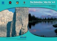
It is however, the large plateaus make this route so special and<br />
unique. These plateaus lie between 2000m and 2500m above sea level<br />
and the Pale di San Martino measures around 50 km_. The plateaus<br />
of the Sella, Púez, Z<strong>ing</strong>ari and the Vette Feltrine are smaller.<br />
The suggested route stays generally at an altitude of 2100m with<br />
summits at nearly 3000m and is only moderately difficult. Some of<br />
the easier sections of the route are secured with wire cables (stages:<br />
two, three, four, five, seven, eight, eleven and twelve), which are fixed<br />
to the rock and although some parts are exposed, they are not dangerous.<br />
This makes the path one of the easiest sections of the High-<br />
Altitude Trail, as it is well marked and clearly signposted. Hikers<br />
should however be aware that some gullies can remain covered in<br />
snow until the early summer and that they should therefore exercise<br />
caution when negotiat<strong>ing</strong> these areas.<br />
Thanks to the numerous places to stop and rest along this High-<br />
Altitude Trail this path can be described as relatively easy. Yet, as<br />
one of the most fascinat<strong>ing</strong> paths in the western Dolomites, it most<br />
certainly represents an enchant<strong>ing</strong> mountain hike.<br />
Along this route, it is possible to see how the different ages have<br />
left their mark on the region – walk<strong>ing</strong> along the High-Altitude Trail<br />
Number 2 is like hik<strong>ing</strong> through time. One can see fossils, imprints,<br />
the remains of animals and plants and many different layers of rock,<br />
which together reconstruct the history of liv<strong>ing</strong> creatures in this country<br />
dur<strong>ing</strong> prehistoric times.<br />
The climate around Brixen is mild and moderate. In the sections<br />
between 2000m and 3000m, the meteorological conditions <strong>corr</strong>espond<br />
however to typical mountain weather and this applies to the<br />
Dolomites as a whole at this altitude. The influence of a humid alternat<strong>ing</strong><br />
atmosphere and winds from the plain can be felt on the Pale<br />
di San Martino. These are sometime diverted by strong breezes and<br />
cause condensation, which are the cause of the fog, and rain, which<br />
are frequently affect the Vette Feltrine. In Feltre itself, the climate is<br />
better and rather more temperate.<br />
The flora is very diverse and varied depend<strong>ing</strong> on the altitude<br />
of the path (i.e. between 325m from Feltre and 3343m to the<br />
Marmolada). In fact, you could say that in just a few days one gains<br />
such an insight in to the plant world it is as if one had been on an<br />
imaginary trip to Greenland.<br />
The fauna is typical of the Western Alps, deer, chamois, squirrel,<br />
marmot, alpine hare, viper, eagle, partridge, black grouse, western<br />
capercaillie, common raven, alpine chough, chaffinch and a variety<br />
of other animals, large and small which can be encountered along the<br />
way and will brighten the day immensely.<br />
An article from Mario Brovelli was published in the magazine of<br />
the Italian Alpine Association CAI “Lo scarpone” on 16th March and<br />
1st September 1966. Brovelli was the first person to suggest the idea<br />
of a long and exceptionally interest<strong>ing</strong> route through the Dolomites<br />
that connected the towns of Brixen and Feltre. This idea proved to be<br />
a huge success and was named the Dolomite High-Altitude Trail No.<br />
2 or the Way of Legends which describes the High-Altitude Trail in the<br />
Dolomites and dist<strong>ing</strong>uishes it from the High-Altitude Trail Number 1.<br />
In the years to follow, Sigi Lechner systematically explored the path,<br />
pay<strong>ing</strong> particular attention to the sections that were still relatively unfamiliar.<br />
Even back in 1967 he was well known within the circle of passionate,<br />
German-speak<strong>ing</strong> hikers for his articles and lectures. Together<br />
with Mario Brovelli he wrote a small Italian guide that was published<br />
by EPT Belluno and later translated into four different languages.<br />
Abroad, primarily in Germany, the Norwegian-Bavarian photographer<br />
Olaf Beer contributed to the recognition of the High-Altitude<br />
Trail. On top of that he also described and signposted several new<br />
stretches of the path. For this, he received the „Pelmo d’Oro” award<br />
given by the province of Belluno.<br />
Ivano Tisot and Luis Pillon from Feltre were the first to complete<br />
the entire stretch of the High-Altitude Trail Number 2 in July 1969.<br />
The first woman to achieve this feat was Hildegard Buser from<br />
8 INNSBRUCK - BRIXEN - FELTRE EUROPA HIG--ALTITUDE TRAIL 2 9