St. Mary's County Multi-Jurisdictional Hazard Mitigation Plan
St. Mary's County Multi-Jurisdictional Hazard Mitigation Plan
St. Mary's County Multi-Jurisdictional Hazard Mitigation Plan

You also want an ePaper? Increase the reach of your titles
YUMPU automatically turns print PDFs into web optimized ePapers that Google loves.
<strong>St</strong>. Mary’s <strong>County</strong><br />
<strong>Multi</strong>-<strong>Jurisdictional</strong><br />
<strong>Hazard</strong> <strong>Mitigation</strong> <strong>Plan</strong><br />
May 27, 2011<br />
Department of Public Safety<br />
23090 Leonard Hall Drive<br />
Leonardtown, MD 20650
ST. MARY’S COUNTY<br />
BOARD OF COUNTY COMMISSIONERS’ MEETING<br />
Tuesday, September, 20, 2011<br />
Present: Commissioner President Francis Jack Russell<br />
Commissioner Lawrence D. Jarboe<br />
Commissioner Cynthia L. Jones<br />
Commissioner Daniel L. Morris<br />
Commissioner Todd B. Morgan<br />
John Savich, <strong>County</strong> Administrator<br />
Sharon Ferris (Recorder)<br />
DEPT OF PUBLIC SAFETY AND INFORMATION TECHNOLOGY:<br />
REQUEST ADOPTION OF MULTI JURISDICTION HAZARD<br />
MITIGATION PLAN<br />
Present: Bob Kelly, Director, Dept. of Public Works and Information<br />
Technology<br />
Gerald Gardiner, Emergency Management Manager, Dept. of Public<br />
Works and Information Technology<br />
Commissioner Morgan moved, seconded by Commissioner<br />
Jarboe, to adopt the updated <strong>St</strong>. Mary’s <strong>County</strong> <strong>Multi</strong>-<br />
<strong>Jurisdictional</strong> <strong>Hazard</strong> <strong>Mitigation</strong> <strong>Plan</strong> dated May 27, 2011. Motion<br />
carried 4-1. Commissioner Jones voted nay.
Table of Contents<br />
SMC <strong>Multi</strong>-jurisdictional <strong>Hazard</strong> <strong>Mitigation</strong> <strong>Plan</strong><br />
Table of Contents<br />
CHAPTER 1 - INTRODUCTION...................................................................................................................1<br />
OVERVIEW ..................................................................................................................................................1<br />
PURPOSE....................................................................................................................................................1<br />
CONSISTENCY WITH STATE AND FEDERAL MITIGATION POLICIES....................................................................1<br />
ORGANIZATION OF THE PLAN........................................................................................................................2<br />
WATERSHEDS .............................................................................................................................................3<br />
POPULATION ...............................................................................................................................................3<br />
HOUSING ....................................................................................................................................................3<br />
INCOME AND POVERTY.................................................................................................................................4<br />
ECONOMY ...................................................................................................................................................4<br />
CLIMATE .....................................................................................................................................................4<br />
TRANSPORTATION .......................................................................................................................................4<br />
ANALYSIS OF DEVELOPMENT TRENDS...........................................................................................................5<br />
PLANNING PROCESS....................................................................................................................................6<br />
<strong>St</strong>ep 1 - Organize Resources .............................................................................................................6<br />
Committee.........................................................................................................................................................6<br />
<strong>St</strong>ep 2 - Assess Risks .........................................................................................................................7<br />
<strong>St</strong>ep 3 - Develop a <strong>Mitigation</strong> <strong>Plan</strong> ....................................................................................................8<br />
<strong>St</strong>ep 4 - Implement the <strong>Plan</strong> and Monitor Progress.........................................................................8<br />
PUBLIC INVOLVEMENT..................................................................................................................................8<br />
INTERAGENCY AND INTERGOVERNMENTAL COORDINATION.............................................................................9<br />
PARTICIPATING JURISDICTIONS ....................................................................................................................9<br />
INTEGRATION WITH EXISTING PLANS.............................................................................................................9<br />
Review of Existing <strong>Plan</strong>s, Ordinances and Codes..............................................................................10<br />
Comprehensive <strong>Plan</strong> – Quality of Life in <strong>St</strong>. Mary’s <strong>County</strong> – A <strong>St</strong>rategy for the 21st Century10<br />
ST. MARY'S COUNTY COMPRESHENSIVE ZONING ORDINANCE.......................................................................14<br />
2009 INTERNATIONAL BUILDING AND RESIDENTIAL CODE ............................................................................19<br />
2010 COMPREHENSIVE LAND USE PLAN – TOWN OF LEONARDTOWN...........................................................19<br />
CHAPTER 2 – HAZARD IDENTIFICATION...............................................................................................21<br />
INTRODUCTION ..........................................................................................................................................21<br />
<strong>St</strong>ep 1 - <strong>Hazard</strong> Identification...........................................................................................................21<br />
<strong>St</strong>ep 2 - <strong>Hazard</strong> Profiles....................................................................................................................21<br />
HAZARD IDENTIFICATION ............................................................................................................................22<br />
Atmospheric <strong>Hazard</strong>s .......................................................................................................................22<br />
Wildfire <strong>Hazard</strong>s ................................................................................................................................22<br />
Hydrologic <strong>Hazard</strong>s ..........................................................................................................................22<br />
i
Table of Contents<br />
SMC <strong>Multi</strong>-jurisdictional <strong>Hazard</strong> <strong>Mitigation</strong> <strong>Plan</strong><br />
Geologic <strong>Hazard</strong>s..............................................................................................................................22<br />
Thunderstorms..................................................................................................................................22<br />
Overview.........................................................................................................................................................22<br />
Historic Activity................................................................................................................................................22<br />
Lightning............................................................................................................................................23<br />
Overview.........................................................................................................................................................23<br />
Historic Activity................................................................................................................................................23<br />
Tornadoes..........................................................................................................................................24<br />
Overview.........................................................................................................................................................24<br />
Historic Activity................................................................................................................................................25<br />
Profile..............................................................................................................................................................27<br />
Hurricanes..........................................................................................................................................28<br />
Overview.........................................................................................................................................................28<br />
Historic Activity................................................................................................................................................28<br />
Hailstorms..........................................................................................................................................30<br />
Overview.........................................................................................................................................................30<br />
Historic Activity................................................................................................................................................31<br />
Profile..............................................................................................................................................................31<br />
Severe Winter <strong>St</strong>orms.......................................................................................................................31<br />
Overview.........................................................................................................................................................31<br />
Historic Activity................................................................................................................................................32<br />
Profile..............................................................................................................................................................33<br />
Extreme Summer Heat......................................................................................................................33<br />
Overview.........................................................................................................................................................33<br />
Profile..............................................................................................................................................................34<br />
HYDROLOGIC HAZARDS .............................................................................................................................34<br />
Flash Floods and Flooding ..............................................................................................................34<br />
Overview.........................................................................................................................................................34<br />
Historic Activity................................................................................................................................................35<br />
Profile..............................................................................................................................................................36<br />
Drought ..............................................................................................................................................37<br />
Overview.........................................................................................................................................................37<br />
Historic Activity................................................................................................................................................38<br />
Profile..............................................................................................................................................................39<br />
Coastal/Shoreline Erosion ...............................................................................................................39<br />
Overview.........................................................................................................................................................39<br />
History Activity ................................................................................................................................................39<br />
Profile..............................................................................................................................................................40<br />
Wildfires and Urban Interface Fires ................................................................................................41<br />
ii
Table of Contents<br />
SMC <strong>Multi</strong>-jurisdictional <strong>Hazard</strong> <strong>Mitigation</strong> <strong>Plan</strong><br />
Overview.........................................................................................................................................................41<br />
Historic Activity................................................................................................................................................41<br />
Profile..............................................................................................................................................................42<br />
GEOLOGIC HAZARDS .................................................................................................................................43<br />
Earthquakes.......................................................................................................................................43<br />
Overview.........................................................................................................................................................43<br />
Historic Activity................................................................................................................................................44<br />
Profile..............................................................................................................................................................44<br />
Landslides..........................................................................................................................................44<br />
Overview.........................................................................................................................................................44<br />
Historic Activity................................................................................................................................................44<br />
Profile..............................................................................................................................................................45<br />
Land Subsidence ..............................................................................................................................46<br />
Overview.........................................................................................................................................................46<br />
Historic Activity................................................................................................................................................46<br />
Profile..............................................................................................................................................................46<br />
SUMMARY OF EVENTS ...............................................................................................................................47<br />
CONCLUSIONS...........................................................................................................................................48<br />
CHAPTER 3 – VULNERABILITY ANALYSIS............................................................................................49<br />
OVERVIEW ................................................................................................................................................49<br />
Development Trends...........................................................................................................................49<br />
Population Trends ...............................................................................................................................49<br />
Land Use Trends.................................................................................................................................49<br />
Building Inventory................................................................................................................................50<br />
IMPACTS OF POPULATION, BUILDINGS, AND CRITICAL FACILITIES................................................................51<br />
Loss Estimation...................................................................................................................................52<br />
Description of Vulnerability..................................................................................................................52<br />
<strong>Mitigation</strong> Measures ............................................................................................................................53<br />
Loss Estimation...................................................................................................................................54<br />
SEVERE STORMS.......................................................................................................................................54<br />
Description of Vulnerability..................................................................................................................54<br />
Loss Estimation...................................................................................................................................54<br />
WILDFIRES ................................................................................................................................................54<br />
Description of Vulnerability..................................................................................................................54<br />
<strong>Mitigation</strong> Measures ............................................................................................................................55<br />
Loss Estimation...................................................................................................................................55<br />
TORNADOES .............................................................................................................................................55<br />
Description of Vulnerability..................................................................................................................55<br />
iii
Table of Contents<br />
SMC <strong>Multi</strong>-jurisdictional <strong>Hazard</strong> <strong>Mitigation</strong> <strong>Plan</strong><br />
<strong>Mitigation</strong> Measures ............................................................................................................................55<br />
Loss Estimation...................................................................................................................................56<br />
HURRICANE WINDS ...................................................................................................................................56<br />
Description of Vulnerability..................................................................................................................56<br />
<strong>Mitigation</strong> Measures ............................................................................................................................57<br />
Loss Estimation...................................................................................................................................57<br />
FLOODING.................................................................................................................................................58<br />
Description of Vulnerability..................................................................................................................58<br />
Repetitive Loss Areas .........................................................................................................................59<br />
Critical Facilities in the Floodplain.......................................................................................................60<br />
<strong>Mitigation</strong> Measures ............................................................................................................................61<br />
Coastal/Shoreline Erosion...................................................................................................................62<br />
Description of Vulnerability..................................................................................................................62<br />
<strong>Mitigation</strong> Measures ............................................................................................................................62<br />
CHAPTER 4 – GOALS AND OBJECTIVES ..............................................................................................63<br />
INTRODUCTION ..........................................................................................................................................63<br />
MITIGATION GOALS AND OBJECTIVES .........................................................................................................63<br />
Flooding...............................................................................................................................................64<br />
Erosion ................................................................................................................................................64<br />
Wildfires...............................................................................................................................................64<br />
Wind ....................................................................................................................................................65<br />
Winter <strong>St</strong>orms......................................................................................................................................65<br />
Drought................................................................................................................................................65<br />
Critical Facilities ..................................................................................................................................65<br />
Public Awareness................................................................................................................................65<br />
Existing <strong>Plan</strong>s and Ordinances ...........................................................................................................66<br />
Sustainable Development ...................................................................................................................66<br />
Building Construction ..........................................................................................................................66<br />
Communications .................................................................................................................................66<br />
Shelters ...............................................................................................................................................67<br />
CHAPTER 5 – MITIGATION STRATEGY..................................................................................................68<br />
RANGE OF MITIGATION INITIATIVES AND POLICIES .......................................................................................68<br />
Preventive Measures ..........................................................................................................................68<br />
Emergency Services ...........................................................................................................................68<br />
Property Protection .............................................................................................................................69<br />
<strong>St</strong>ructural Projects...............................................................................................................................69<br />
Natural Resource Protection...............................................................................................................69<br />
iv
Table of Contents<br />
SMC <strong>Multi</strong>-jurisdictional <strong>Hazard</strong> <strong>Mitigation</strong> <strong>Plan</strong><br />
Public Information ...............................................................................................................................70<br />
MITIGATION ACTIONS.................................................................................................................................70<br />
Flooding...............................................................................................................................................70<br />
Erosion ................................................................................................................................................72<br />
Wildfires...............................................................................................................................................74<br />
Wind ....................................................................................................................................................75<br />
Winter <strong>St</strong>orms......................................................................................................................................76<br />
Drought................................................................................................................................................76<br />
Critical Facilities ..................................................................................................................................76<br />
Public Awareness................................................................................................................................77<br />
Existing <strong>Plan</strong>s and Ordinances ...........................................................................................................78<br />
Sustainable Development ...................................................................................................................80<br />
Building Construction ..........................................................................................................................80<br />
Communications .................................................................................................................................81<br />
Shelters ...............................................................................................................................................82<br />
CHAPTER 6 – ACTION PLAN ....................................................... ERROR! BOOKMARK NOT DEFINED.<br />
IDENTIFICATION AND ANALYSIS OF HAZARD MITIGATION MEASURES.............................................................84<br />
TIMEFRAME...............................................................................................................................................84<br />
SCORING CRITERIA FOR MITIGATION ACTIONS ............................................................................................84<br />
HIGH PRIORITY PROJECTS (HIGHEST SCORES)............................................................................................90<br />
MONITORING, EVALUATING, AND UPDATING THE PLAN.................................................................................91<br />
HAZARD MITIGATION PLANNING COMMITTEE...............................................................................................91<br />
PUBLIC INVOLVEMENT................................................................................................................................91<br />
UPDATING THE PLAN .................................................................................................................................92<br />
v
List of Figures and Tables<br />
SMC <strong>Multi</strong>-jurisdictional <strong>Hazard</strong> <strong>Mitigation</strong> <strong>Plan</strong><br />
List of Figures<br />
FIGURE 2.1 – MAP SHOWING SOUTHERN MARYLAND...............................................................................3<br />
FIGURE 2.2 – MARYLAND WATERSHEDS..................................................................................................3<br />
FIGURE 4.1 – RISK ASSESSMENT STEPS ............................................................................................... 21<br />
FIGURE 4.2 – FEMA’S DESIGN WIND SPEED FOR COMMUNITY SHELTERS .............................................. 27<br />
FIGURE 4.3 – HISTORY OF MARYLAND TORNADOES ............................................................................... 27<br />
FIGURE 4.4 – WIND ZONES IN THE UNITED STATES................................................................................ 30<br />
FIGURE 4.5 – HURRICANES WITHIN 65 MILES OF ST. MARY’S COUNTY SINCE 1886 ................................ 30<br />
FIGURE 4.6 – FIRE THREAT POTENTIAL IN MARYLAND COUNTIES............................................................ 42<br />
FIGURE 4.7 – FORESTED AREAS IN MARYLAND COUNTIES ..................................................................... 42<br />
FIGURE 4.8 – LANDSLIDE INCIDENCE/SUSCEPTIBILITY FOR THE NORTHEASTERN UNITED STATES............. 45<br />
FIGURE 4.9 – LANDSLIDE SUBSIDENCE IN THE UNITED STATES ............................................................... 46<br />
List of Tables<br />
TABLE 3.1 – ST. MARY’S COUNTY HAZARD MITIGATION PLANNING COMMITTEE.......................................7<br />
TABLE 3.1.A - PROJECTS FROM THE 2005 ST. MARY’S COUNTY HAZARD MITIGATION PLAN…….………….7<br />
TABLE 3.2 – INTERAGENCY COORDINATION ......................................................................................... 10<br />
TABLE 4.1 – TORNADO DAMAGE SCALE............................................................................................... 24<br />
TABLE 4.3 – TORNADO HISTORY ......................................................................................................... 25<br />
TABLE 4.4 – SAFFIR-SAMPSON SCALE AND TYPICAL DAMAGES ............................................................ 28<br />
TABLE 4.5 – WINTER WEATHER HISTORY ............................................................................................ 32<br />
TABLE 4.6 – HEAT DANGER CATEGORIES ............................................................................................ 33<br />
TABLE 4.7 – FLOODING VS. FLASH FLOODS – CAUSES ......................................................................... 34<br />
TABLE 4.8 – FLOOD PROBABILITY TERMS ............................................................................................ 35<br />
TABLE 4.9 – DROUGHT HISTORY ......................................................................................................... 38<br />
TABLE 4.10 – FIRE DANGER RATING DESCRIPTIONS .............................................................................. 41<br />
TABLE 4.11 – HISTORY OF FIRES IN ST. MARY’S COUNTY....................................................................... 41<br />
TABLE 4.12 – EARTHQUAKE MAGNITUDE AND INTENSITY SCALES ........................................................... 43<br />
TABLE 4.13 – MODIFIED MERCALLI INTENSITY SCALE AND PEAK GROUND ACCELERATION COMPARISON.. 43<br />
TABLE 4.14 – SUMMARY OF HAZARD EVENTS 1950 – 2003.................................................................... 47<br />
TABLE 4.15 – FREQUENCY OF OCCURRENCE......................................................................................... 48<br />
TABLE 4.16 – HAZARD PRIORITY........................................................................................................... 48<br />
TABLE 5.1 – POPULATION CHANGE ..................................................................................................... 49<br />
TABLE 5.2 – BUILDING COUNT AND EXPOSURE BY USE ........................................................................ 51<br />
TABLE 5.3 – BUILDING COUNT AND EXPOSURE BY TYPE.......................................................................<br />
TABLE 5.4 – CRITICAL FACILITIES COUNT AND EXPOSURE.................................................................... 51<br />
TABLE 5.5 – AGE OF HOUSING UNITS (BUILT BEFORE 1940 .................................................................. 53<br />
vll
List of Figures and Tables<br />
SMC <strong>Multi</strong>-jurisdictional <strong>Hazard</strong> <strong>Mitigation</strong> <strong>Plan</strong><br />
TABLE 5.6 – AGE OF HOUSING UNITS (BUILT BEFORE 1990) ................................................................. 53<br />
TABLE 5.7 – CRITICAL FACILITIES IN WILDFIRE HIGH RISK AREAS ......................................................... 54<br />
TABLE 5.8 – MANUFACTURED HOMES ................................................................................................. 55<br />
TABLE 5.9 – PROPERTIES IN THE 100-YEAR FLOODPLAIN..................................................................... 58<br />
TABLE 5.10 – REPETITIVE LOSS STRUCTURES....................................................................................... 60<br />
TABLE 5.11 – RATE OF EROSION........................................................................................................... 62<br />
TABLE 5.12 – PROPERTIES IN THE 100-YEAR EROSION ZONE ................................................................ 53<br />
Table 9.1 – MITIGATION ACTION TABLE .............................................................................................. 86<br />
vll
Chapter 1: Introduction<br />
SMC <strong>Multi</strong>-jurisdictional <strong>Hazard</strong> <strong>Mitigation</strong> <strong>Plan</strong><br />
CHAPTER 1 - INTRODUCTION<br />
Overview<br />
The Disaster <strong>Mitigation</strong> Act of 2000 (DMA 2000) was signed by the President on 30 October<br />
2000. The act requires state and local governments to prepare and adopt hazard mitigation<br />
plans as a condition for receiving Pre-Disaster <strong>Mitigation</strong> (PDM) grant assistance and <strong>Hazard</strong><br />
<strong>Mitigation</strong> Grant Program (HMGP) assistance after November 1, 2004. The <strong>St</strong>. Mary’s <strong>County</strong><br />
<strong>Multi</strong>-jurisdictional <strong>Hazard</strong> <strong>Mitigation</strong> <strong>Plan</strong> was first adopted in November of 2006 as a longrange<br />
strategic plan prepared to fulfill the requirements of DMA 2000 as administered by the<br />
Maryland Emergency Management Agency (MEMA) and the Federal Emergency Management<br />
Agency (FEMA) Region III. FEMA is requiring that all local jurisdictions update existing plans by<br />
March 30, 2011.<br />
Section 409 of the Robert T. <strong>St</strong>afford Disaster Relief and Emergency Assistance Act (Public<br />
Law 93-288, as amended), Title 44 Code of Federal Regulations (CFR), as amended by Section<br />
102 of DMA 2000, provided the framework for <strong>St</strong>ate and local governments to evaluate and<br />
mitigate all hazards as a condition for receiving Federal disaster assistance. A major<br />
requirement of the law is the development of a local hazard mitigation plan.<br />
Purpose<br />
<strong>Hazard</strong> mitigation is any action taken to permanently reduce or eliminate long-term risks to<br />
people and their property from the effects of hazards. Natural hazards can take many forms:<br />
tornadoes, floods, hurricanes, severe storms, winter weather, droughts, landslides, or<br />
earthquakes resulting from natural phenomena. In order to better prepared to face these<br />
natural hazards, communities can plan for and implement mitigation techniques for almost any<br />
type of hazard that may threaten its people and property.<br />
This plan establishes an ongoing hazard mitigation planning program by: a) identifying and<br />
assessing potential natural hazards that may pose a threat to life and property; b) evaluating<br />
which local mitigation measures that should be undertaken; and c) outlining procedures for<br />
monitoring the implementation of mitigation strategies. The plan update provides guidance to<br />
<strong>St</strong>. Mary’s <strong>County</strong> officials on local mitigation activities that should be implemented over the next<br />
five-year planning cycle. It encourages activities that are most cost-effective and appropriate for<br />
mitigating the effects of all identified natural hazards.<br />
Consistency with Federal and <strong>St</strong>ate <strong>Mitigation</strong> Policies<br />
The goals, objectives and policies of this plan are expected to implement the National and <strong>St</strong>ate<br />
directives for mitigation of natural hazards through local strategies intended to:<br />
• Substantially increase public awareness of natural hazard risks and the measures<br />
available to create safer, more disaster-resistant communities; and<br />
• Significantly reduce the risk of loss of life, injuries, economic costs, and destruction of<br />
natural and cultural resources that result from natural hazards.<br />
FEMA has developed ten fundamental principles for the Nation’s mitigation strategies that<br />
likewise underlie the strategies of this plan:<br />
1. Risk reduction measures ensure long-term economic success for the community as a<br />
whole, rather than short-term benefits for special interests.<br />
2. Risk reduction measures for one natural hazard must be compatible with risk reduction<br />
measures for other natural hazards.<br />
1
Chapter 1: Introduction<br />
SMC <strong>Multi</strong>-jurisdictional <strong>Hazard</strong> <strong>Mitigation</strong> <strong>Plan</strong><br />
3. Risk reduction measures must be evaluated to achieve the best mix for a given location.<br />
4. Risk reduction measures for natural hazards must be compatible with risk reduction<br />
measures for technological hazards and visa versa.<br />
5. All mitigation is local.<br />
6. Disaster costs and the impacts of natural hazards can be reduced by emphasizing proactive<br />
mitigation before emergency response; both pre-disaster (preventive) and postdisaster<br />
(corrective) mitigation is needed.<br />
7. <strong>Hazard</strong> identification and risk assessment are the cornerstones of mitigation.<br />
8. Building new federal-state-local partnerships and public-private partnerships is the most<br />
effective means of implementing measures to reduce the impacts of natural hazards.<br />
9. Those who knowingly choose to assume greater risk must accept responsibility for that<br />
choice.<br />
10. Risk reduction measures for natural hazards must be compatible with the protection of<br />
natural and cultural resources.<br />
Organization of the <strong>Plan</strong><br />
The next several chapters comprise the <strong>Hazard</strong> <strong>Mitigation</strong> <strong>Plan</strong>.<br />
Chapter 1 begins with an introduction to the plan including information on the purpose,<br />
organization of the plan, and demographics pertaining to <strong>St</strong>. Mary’s <strong>County</strong>. In addition, the<br />
planning process is outlined regarding how program changes and information updates were<br />
made with assistance from the <strong>Hazard</strong> <strong>Mitigation</strong> <strong>Plan</strong>ning Committee and state and federal<br />
assisting agencies.<br />
Chapter 2 encompasses the natural hazard risk assessment and hazard identification which<br />
identifies and profiles each of the natural hazards that could affect <strong>St</strong>. Mary’s <strong>County</strong>.<br />
Chapter 3 identifies the county’s assets and provides a vulnerability analysis to assess the<br />
potential impacts of the identified natural hazards on the people, buildings, and infrastructure in<br />
<strong>St</strong>. Mary’s <strong>County</strong>.<br />
Chapter 4 contains the goals and objectives of the plan.<br />
Chapter 5 includes the mitigation strategy, which identifies each mitigation measure, the lead<br />
implementation agencies or departments, approximate cost, and potential funding sources for<br />
implementation of each strategy.<br />
Chapter 6 outlines the action plan with procedures and details on how <strong>St</strong>. Mary’s <strong>County</strong> and<br />
the Town of Leonardtown will maintain the mitigation plan to keep the data current and update<br />
the progress on the mitigation strategy.<br />
2
Chapter 1: Introduction<br />
SMC <strong>Multi</strong>-jurisdictional <strong>Hazard</strong> <strong>Mitigation</strong> <strong>Plan</strong><br />
COUNTY PROFILE<br />
Location<br />
<strong>St</strong>. Mary’s <strong>County</strong> is located<br />
approximately 60 miles southeast of<br />
Washington, D.C. in southern Maryland<br />
(see Figure 2.1). <strong>St</strong>. Mary’s <strong>County</strong> is a<br />
peninsula bordered by the Wicomico<br />
River on the west, the Potomac River on<br />
the south, the Chesapeake Bay on the<br />
east, and the Patuxent River on the<br />
northeast. The Thomas Johnson<br />
Bridge connects the norther shore of the<br />
Patuxent River at Solomon's Island in<br />
Calvert <strong>County</strong> with its southern shore in<br />
<strong>St</strong>. <strong>Mary's</strong> <strong>County</strong>, MD. The total area of<br />
the county is approximately 361 square<br />
miles with a density of 280 persons per<br />
square mile. The county has one<br />
incorporated town, Leonardtown.<br />
Watersheds<br />
Figure 2.1 - Map Showing Southern Maryland<br />
<strong>St</strong>. Mary’s <strong>County</strong> is encompassed by two watersheds 6-digit (see Figure 2.2), the Lower<br />
Potomac (shown in yellow) and the Patuxent Watershed (shown in purple).<br />
Population<br />
Figure 2.2 - Maryland Watersheds<br />
In 2010, Maryland's population was 5,773,552,<br />
according to the US Census Bureau. The<br />
Maryland Department of <strong>Plan</strong>ning 2010<br />
estimate for the populatin of <strong>St</strong> Mary’s <strong>County</strong><br />
was 105,400. From 2000 to 2010, Maryland’s<br />
population grew approximately 9% percent, a gain of 477,514. Over the same period <strong>St</strong>. Mary’s<br />
population grew 22%, a gain of 19,189 people. <strong>St</strong>. Mary’s <strong>County</strong> is among the fastest growing<br />
counties in the <strong>St</strong>ate of Maryland. According to the Maryland Department of <strong>Plan</strong>ning’s<br />
February 2009 estimates, by the year 2030, <strong>St</strong>. Mary’s <strong>County</strong> will have an estimated 159,600<br />
residents.<br />
Housing<br />
As of 2010, there were 35,840 housing units in <strong>St</strong>. Mary’s <strong>County</strong>. Of these, approximately 13.5<br />
percent of the units are multi-unit structures. The average price of a home in 2007 was<br />
approximately $200,00, which increased to the average price of $337,500 in 2007.<br />
3
Chapter 1: Introduction<br />
SMC <strong>Multi</strong>-jurisdictional <strong>Hazard</strong> <strong>Mitigation</strong> <strong>Plan</strong><br />
Income and Poverty<br />
The total labor force in 2009 was 51,343 with an unemployment rate of 5.7 by October 2010 the<br />
labor foce was 52,475 and an unemployment rate of 6.2 percent. <strong>St</strong>. Mary’s per capita income<br />
in 2008 was reported as $37,748, and <strong>St</strong>. Mary’s <strong>County</strong> was ranked 14 th of the Maryland<br />
counties for per capita personal income behind the there Southern Maryland counties (Calvert,<br />
10 th and Charles, 12 th ).<br />
Economy<br />
<strong>St</strong>. Mary’s <strong>County</strong> is home to the U.S. Naval Air Systems Command and the Naval Air Warfare<br />
Center Aircraft Division and over 230 high-tech defense contractors. The county has emerged<br />
as a world-class center for aviation and avionics research, development, and testing. Due<br />
primarily to the influx of technical jobs resulting from the consolidation of several Navy activities,<br />
the <strong>County</strong>’s increase in median household income during the past decade has been the largest<br />
in the <strong>St</strong>ate. <strong>St</strong> <strong>Mary's</strong> <strong>County</strong>’s 1,990 businesses employ 28,200 workers; an estimated 40<br />
percent of these businesses have 100 or more workers. Businesses include many defense<br />
contractors, the Lundeberg School of Seamanship, <strong>St</strong>. <strong>Mary's</strong> Hospital, College of Southern<br />
Maryland and <strong>St</strong>. <strong>Mary's</strong> College of Maryland.. The county is also home to a newly designated<br />
<strong>St</strong>ate Enterprise Zone.<br />
Climate<br />
<strong>St</strong>. Mary’s <strong>County</strong>’s climate is generally mild. There are four distinct seasons with spring and<br />
fall being particularly pleasant, with low humidity and mild temperatures. The average annual<br />
winter temperature is 37.4 degrees Fahrenheit and the summers can be hazy, hot, and humid<br />
with an average summer temperature of 74.4 degrees Fahrenheit. Afternoon thunderstorms are<br />
also a common occurrence in the summer months. The average annual rainfall is 47.5 inches<br />
and the average annual snowfall is 17.8 inches.<br />
Future variability in climate is predicted and over time will likely influence the frequency and<br />
severity of the occurrences of natural hazards for the county. The Maryland Climate Action <strong>Plan</strong><br />
(released August 27, 2008) advises that for Maryland generally<br />
“Average yearly temperatures are expected to increase by 3-6° F (2-4° C) in the<br />
winter and by 4-8° F (2.2-4.4° C) in the summer…(US EPA 1998; IPCC 2007b;<br />
MCCC – STWG 2008). Precipitation will increase by 20 per cent in Maryland with<br />
more rainfall in the winter and less in the spring (US EPA 1997; Fisher et al.<br />
1997; IPCC 2007b)… Major coastal storms will be more intense and more<br />
frequent (EPA 1998, IPCC 2007b). By century’s end, 5-15 percent more latewinter<br />
storms may develop in the Northeast as storm systems move further north<br />
in response to warmer ocean surface temperatures (Frumhoff et al. 2007).<br />
Perhaps most significant to Maryland, sea level rise will increase by .6-1.22 m<br />
(24-48 inches) over the next century along the coast (MCCC 2008; MDNR 2008;<br />
IPCC 2007b).”<br />
Transportation<br />
<strong>St</strong>. Mary’s <strong>County</strong> is a peninsula which is itself divided into numerous peninsulas by rivers and<br />
creeks. Minor state and local roads generally follow ridgelines and are connected to the<br />
county’s four principal state roads—MD 5, MD 235, MD 4, and MD 234. Maryland Route 5<br />
(MD5) is a four- lane highway from Charles <strong>County</strong> to MD 235 (Three Notch Road). At its<br />
junction with 235, Route 5 bears right and continues as a two lane road south to Leonardtown<br />
(the county seat) and then runs along the length of the county through Ridge to Point Lookout.<br />
4
Chapter 1: Introduction<br />
SMC <strong>Multi</strong>-jurisdictional <strong>Hazard</strong> <strong>Mitigation</strong> <strong>Plan</strong><br />
From the junction with MD5, Three Notch Road continues as a four-lane road southeast to<br />
California, expands to six lanes through Lexington Park (the principal growth center for the<br />
county) and drops to two lanes south of Lexington park and continues south east ending at<br />
Route 5 in Ridge. Route 4 is four-lane highway in Calvert <strong>County</strong> which drops to a 2-lane road<br />
at the Governor Thomas Johnson Bridge over the Patuxent River, continues across Three<br />
Notch Road at California and ends at MD 5 just south of Leonardtown. Route 234 runs from US<br />
310 in eastern Charles <strong>County</strong> ending at Route 5 just north of Leonardtown.<br />
The population increase in the county has resulted in increased traffic volumes and highwayrelated<br />
commercial activities. Increased volume on the four principal state roads makes<br />
entering, exiting and crossing the highways from side roads increasingly difficult. The lack of<br />
interconnections and alternative north-south routes increase problems such as congestion and<br />
delays particularly along the Three Notch Road (MD 235) corridor from Hollywood through<br />
Lexington Park. In response to this congestion, projects such as widening the addition of turn<br />
lanes to Three Notch Road through California and Lexington Park, widening of Great Mills and<br />
Chancellor’s Run Roads in Lexington Park, construction of sections of FDR Boulevard which<br />
when complete will parallel Three Notch Road in Lexington Park, requirements for road<br />
interconnection between parcels, and provision of additional traffic lights and median separation<br />
to expedite the flow of traffic and reduce traffic accidents have been completed or are in<br />
progress.<br />
Analysis of Development Trends<br />
<strong>St</strong>. Mary’s <strong>County</strong> has a total land area of 231,280 acres. Analysis provided in the 2010<br />
Comprehensive <strong>Plan</strong> finds that more than half of this land (51 percent) is forested, with<br />
agriculture accounting for 26 percent. In 2007 the Census of Agriculture counted 68,648 acres<br />
of land in farms in <strong>St</strong>. Mary’s <strong>County</strong>, which was a slight increase from 68,153 acres in 2002 but<br />
which was still down from 71,920 acres in 1997. Developed land accounts for nearly 21 percent<br />
of the total land area, which is a dramatic increase of 30.4 percent from 1997 to 2002. In<br />
addition, low-density residential development (less than 2 units per acre) is the most rapidly<br />
growing type of development, up by 40% from 1997 to 2002.<br />
In the county’s Comprehensive <strong>Plan</strong>, Lexington Park and Leonardtown are designated<br />
development districts which are to be the primary growth centers; Charlotte Hall, New Market,<br />
Mechanicsville, Hollywood, and Piney Point are designated as town centers (the <strong>County</strong>’s<br />
secondary growth centers); and Callaway, Chaptico, Clements, Loveville, Ridge, <strong>St</strong>. Inigoes,<br />
and Valley Lee are village centers (tertiary growth centers).<br />
5
Chapter 1: Introduction<br />
PLANNING PROCESS<br />
SMC <strong>Multi</strong>-jurisdictional <strong>Hazard</strong> <strong>Mitigation</strong> <strong>Plan</strong><br />
In June 2004, <strong>St</strong>. Mary’s <strong>County</strong> Department of Public Safety received a grant from the Maryland<br />
Emergency Management Agency (MEMA) to prepare a DMA 2000 complaint hazard mitigation plan for<br />
the <strong>County</strong> and the Town of Leonardtown. The <strong>County</strong>’s Emergency Management Agency subsequently<br />
contracted with Greenhorne & O'Mara, Inc. (G&O) from Greenbelt, Maryland, to facilitate the planning<br />
process and prepare the <strong>Plan</strong>. The planning team members consisted of key representatives from<br />
various <strong>County</strong> agencies, the Town of Leonardtown, and other organizations. The <strong>St</strong>. Mary’s <strong>County</strong><br />
<strong>Multi</strong>-jurisdictional <strong>Hazard</strong> <strong>Mitigation</strong> <strong>Plan</strong> was completed in November 2006 by Greenhorne & O’Mara<br />
and adopted by the <strong>St</strong>. Mary’s <strong>County</strong> Board of <strong>County</strong> Commissioners and approved by the Federal<br />
Emergency Management Agency (FEMA). In 2009, the requirement was set forth by FEMA for <strong>St</strong>.<br />
Mary’s <strong>County</strong> to update the existing plan by March 31st, 2011. The Department of Public Safety<br />
convened a new planning team in June of 2009, consisting of relevant disciplines from within <strong>St</strong>. Mary’s<br />
<strong>County</strong> that have vested interest in <strong>Hazard</strong> <strong>Mitigation</strong> Projects. The team decided that all changes to the<br />
current <strong>Multi</strong>-jurisdictional <strong>Hazard</strong> <strong>Mitigation</strong> <strong>Plan</strong> would be completed by members of the team with<br />
assistance from cooperating state agencies.<br />
The <strong>Plan</strong>ning Team attended a kick-off meeting on June 29, 2009 and formally established the <strong>Hazard</strong><br />
<strong>Mitigation</strong> <strong>Plan</strong>ning Committee (HMPC). and Five committee meetings were held between June 2009<br />
and December 2010. Documentation of these meetings in the form of sign-in sheets, agendas, and<br />
minutes are included in Appendix A.<br />
The HMPC was actively involved in identifying hazards within the county, reviewing the county’s<br />
vulnerabilities to natural hazards, and recommending mitigation measures to reduce and prevent<br />
potential damage from these hazards. The HMPC then worked together to select the most appropriate<br />
and feasible mitigation measures.<br />
<strong>Plan</strong>ning Update Process<br />
The planning process involved four basic steps: organizing resources; assessing risks; developing a<br />
mitigation plan; and implementing the plan and monitoring progress.<br />
<strong>St</strong>ep 1 - Organize Resources<br />
The first step of the hazard mitigation planning process was for the county to organize their resources<br />
and ensure that they had adequate technical assistance and expertise to form a hazard mitigation<br />
committee. The committee included representatives from key county agencies such as Land Use and<br />
Growth Management, Emergency Management, Geographic Information Systems (GIS), and Public<br />
Works and representatives from the Town of Leonardtown. Technical support for the planning effort was<br />
provided by engineers, planners, and floodplain managers from within <strong>St</strong>. Mary’s <strong>County</strong> and Maryland<br />
<strong>St</strong>ate government agencies.<br />
Committee<br />
Select members from the Town of Leonardtown and the <strong>County</strong> departments were invited to be on the<br />
HMPC, which was tasked with conducting a DMA 2000 compliant hazard mitigation planning process to<br />
update the current hazard mitigation plan. Table 3.1 includes the members of the committee and the<br />
agencies they represent:<br />
6
Chapter 1: Introduction<br />
Table 3.1 – <strong>St</strong>. Mary’s <strong>County</strong> <strong>Hazard</strong> <strong>Mitigation</strong> <strong>Plan</strong>ning Committee<br />
Name<br />
Bob Kelly<br />
Gerald Gardiner<br />
Gerald Burandt<br />
Mark <strong>St</strong>ancliff<br />
Michael Sullivan<br />
Jenn Ballard<br />
Mike W yant<br />
<strong>St</strong>ewart Dement<br />
Adam Knight<br />
Tony W heatley<br />
Adam Knight<br />
Hans W elch<br />
George Erichsen<br />
Kathy Arnold<br />
Sue Veith<br />
Agency<br />
Direcctor, <strong>St</strong>. <strong>Mary's</strong> <strong>County</strong> Department of Public Safety<br />
Emergency Management Manager, <strong>St</strong>. Marys <strong>County</strong><br />
NAS Patuxent River Emergency Management<br />
<strong>St</strong>. <strong>Mary's</strong> <strong>County</strong> Information Technology<br />
Metropolitian Commission<br />
<strong>St</strong>. <strong>Mary's</strong> <strong>County</strong> Land Use & Growth Management<br />
<strong>St</strong>. <strong>Mary's</strong> <strong>County</strong> Public Schools<br />
<strong>St</strong>ate Highway Administration<br />
<strong>St</strong>. <strong>Mary's</strong> <strong>County</strong> Land Use & Growth Management<br />
Town of Leonardtown<br />
<strong>St</strong>. <strong>Mary's</strong> <strong>County</strong> Land Use & Growth Management<br />
Department of Economic and Community Development<br />
<strong>St</strong>. <strong>Mary's</strong> <strong>County</strong> Department of Public W orks & Transportation<br />
<strong>St</strong>. <strong>Mary's</strong> <strong>County</strong> Risk Management<br />
<strong>St</strong>. <strong>Mary's</strong> <strong>County</strong> Land Use & Growth Management<br />
SMC <strong>Multi</strong>-jurisdictional <strong>Hazard</strong> <strong>Mitigation</strong> <strong>Plan</strong><br />
Community, county, state, and<br />
federal resources were<br />
identified and the appropriate<br />
agencies were contacted to collect<br />
pertinent inventory information.<br />
Policy and regulatory information<br />
from each of the communities and<br />
the county was collected. This<br />
included comprehensive plans,<br />
zoning and subdivision ordinances,<br />
and building codes. In addition,<br />
information was collected regarding<br />
natural hazards, including past<br />
occurrences and projected<br />
frequencies of future occurrence, the<br />
anticipated risk, where available.<br />
Table 3.1.a – Projects from the 2005 <strong>St</strong>. Mary’s <strong>County</strong> <strong>Hazard</strong> <strong>Mitigation</strong> <strong>Plan</strong> Completed<br />
Information was collected from public<br />
works, planning, emergency<br />
management, and GIS departments.<br />
Several <strong>St</strong>ate agencies were<br />
contacted including the MEMA,<br />
Maryland Department of Natural Resources (DNR), the Department of Homeland Security/FEMA,<br />
Maryland Department of <strong>Plan</strong>ning, and the Maryland Department of the Environment (MDE), to inform<br />
them of the planning effort and to collect pertinent information.<br />
<strong>St</strong>ep 2 - Assess Risks<br />
The next step in the planning process was to update the hazard identification and vulnerability<br />
assessment for the entire county. This involved reviewing the projects identified in the March 2005 plan.<br />
The following projects have been completed:<br />
2005 Project No. Project Description Reason for<br />
Removal<br />
2 Complete proposed mitigation project at Piney Point Complete<br />
3 Complete proposed mitigation project at Mansfield Complete<br />
12 Identify, map and assess all mobile homes in the county & determine the most<br />
appropriate mitigation alternatives to reduce wind & flood damage<br />
14 Determine appropriate areas where overhead wires may be buried underground.<br />
Protect utilities, including underground pipelines, so that they may not be impacted<br />
and interrupted from exposures to hazards<br />
15 Identify areas with trees and determined if they need to be cut down, trimmed, etc.,<br />
to reduce vulnerability and risk of falling during or after a high wind event.<br />
Complete<br />
Complete<br />
Complete<br />
20 Identify isolated populations within the county and create a database. Create a Complete<br />
separate database that identifies concentrations of dependent population (elerdly,<br />
disabled and children)<br />
21 Identify means to ensure that local radio stations are able to continuously<br />
Complete<br />
broadcast during power outages<br />
26 Revise and update the existing code and bring it up to standard 2003 codes. Complete<br />
27 Develop a Citizens Emergency Response Team (CERT) program for the county,<br />
identify, designate and train coordinators in various neighborhoods on CPR and<br />
first aid<br />
30 Coordinate with the Naval Air <strong>St</strong>ation to use their AM radio station to make<br />
broadcast before, during and after<br />
Complete<br />
Complete<br />
7
Chapter 1: Introduction<br />
SMC <strong>Multi</strong>-jurisdictional <strong>Hazard</strong> <strong>Mitigation</strong> <strong>Plan</strong><br />
32 Evaluate the need to develop local ordinances to require community storm shelters<br />
with sizable mobile home parks and subdivisions and in all new public buildings<br />
(schools, libraries and communities centers)<br />
29 Identify critical facilities that do not currently have NOAA weather radios and<br />
increase the number of NOAA Weather Alert radios in public places across the<br />
county<br />
Complete<br />
Complete<br />
The 2005 projects have been incorporated into this updated plan. When the committee had discussion it<br />
was agreed upon to keep these and some wording has been updated.<br />
This involved analyzing the county’s greatest hazard threats and determining its most significant<br />
vulnerabilities with respect to natural hazards and hazardous materials. The hazard identification and<br />
vulnerability assessment performed in large part using GIS data from the county, HAZUS-MH (GIS<br />
based loss estimation software) and other county sources. At the first HMPC Meeting held on 29 June<br />
2009, an overview of the planning process was presented to the committee to review the identified<br />
hazards and areas vulnerable to various hazards and to discuss mitigation measures which should be<br />
applied.<br />
<strong>St</strong>ep 3 - Develop a <strong>Mitigation</strong> <strong>Plan</strong><br />
The next step was to assess the mitigation capabilities of the county and the Town of Leonardtown. A<br />
capability assessment was performed whereby the existing programs and policies addressing natural<br />
hazards were reviewed. A thorough analysis of the adequacy of existing measures was performed, and<br />
potential changes and improvements were identified. The committee reviewed the capability assessment<br />
at the second HMPC Meeting held on 3 September 2009. At this meeting, the Committee worked to<br />
identify goals and objectives for countywide mitigation efforts. These goals represent the county’s and<br />
communities’ vision for disaster resistance.<br />
At the third meeting held on 12 December 2009, issues that could affect hazard event-related damage in<br />
the county were considered by the HMPC and the development of new and revised mitigation measures<br />
began.<br />
These actions were further refined at the fourth committee meeting on 3 March 2010. The committee<br />
also helped draft an action plan that specifies recommended projects, who is responsible for<br />
implementing these projects, and when they are to be completed. The projects were categorized and<br />
prioritized. In the months following this meeting, the Department of Public Safety worked to revise the<br />
existing plan to incorporate all of the gathered information and to update the vulnerability analysis portion<br />
of the plan using data and information gathered from multiple sources.<br />
It should be noted that this plan recommends mitigation measures that should be pursued and<br />
implemented after funds are obtained by local means, including capital projects or by potential grant<br />
funding. Implementation of these recommendations depends on adoption of this plan by the <strong>St</strong>. Mary’s<br />
<strong>County</strong> Board of <strong>County</strong> Commissioners, the Town of Leonardtown and the cooperation and support of<br />
the offices and contacts designated as being responsible for each action item.<br />
<strong>St</strong>ep 4 - Implement the <strong>Plan</strong> and Monitor Progress<br />
The <strong>County</strong> will continue to implement the plan and perform periodic reviews and revisions through ongoing<br />
HMPC reviews and revisions. The review and revision process will be attached to the state-wide<br />
planning efforts which are outlined by the Maryland Emergency Management Agency and follow that<br />
update process. The Committee will meet annually to review the plan and will also hold public meetings<br />
to solicit citizen input.<br />
Public Involvement<br />
The public involvement element of the planning process involved one public meeting where information<br />
was presented to the public on 8 December 2010 at the Chesapeake Building in the <strong>St</strong>. Mary’s <strong>County</strong><br />
Board of <strong>County</strong> Commissioner’s Board Room. The purpose of this meeting was to educate the public<br />
on the planning process and the plans intent to identify steps the community could take to make the<br />
8
Chapter 1: Introduction<br />
SMC <strong>Multi</strong>-jurisdictional <strong>Hazard</strong> <strong>Mitigation</strong> <strong>Plan</strong><br />
community more disaster-resistant. Attendees were encouraged to provide input as to what type of<br />
mitigation measures they wanted the county and communities to pursue. Following approval from FEMA<br />
and MEMA this plan will be brought before the <strong>St</strong>. Mary’s <strong>County</strong> Board of <strong>County</strong> Commissioners for<br />
formal plan adoption at the local level.<br />
Interagency and Intergovernmental Coordination<br />
In addition to the HMPC members listed above, various local, state, and federal agencies were contacted<br />
to provided data, input and cooperation for the <strong>St</strong>. Mary’s <strong>County</strong> <strong>Hazard</strong> <strong>Mitigation</strong> <strong>Plan</strong>. These<br />
agencies and their reason for contact are shown in Table 3.2.<br />
Table 3.2 – Interagency Coordination<br />
Agency<br />
Maryland<br />
Department of the<br />
Environment<br />
Maryland<br />
Department of<br />
Natural Resources<br />
Maryland Geological<br />
Survey<br />
Maryland<br />
Emergency<br />
Management<br />
Agency<br />
Maryland<br />
Department of<br />
<strong>Plan</strong>ning<br />
National Weather<br />
Service<br />
Method of<br />
Contact<br />
Telephone<br />
Interview and<br />
e-mail<br />
Telephone<br />
Interview and<br />
e-mail<br />
Telephone<br />
and e-mail<br />
E-mail and<br />
internet<br />
website<br />
E-mail and<br />
internet<br />
website<br />
E-mail and<br />
internet<br />
Reason for<br />
Contact<br />
Repetitive loss<br />
information<br />
Shore erosion<br />
data<br />
Shore erosion<br />
data and <strong>St</strong>.<br />
<strong>Mary's</strong> Dam<br />
information<br />
Risk assessment<br />
data and disaster<br />
history<br />
Demographics<br />
and MD Property<br />
View Data<br />
Severe Weather<br />
History<br />
MEMA will serve as the state review agency and will<br />
initiate the state clearinghouse process which routes the<br />
final plan to all pertinent Maryland <strong>St</strong>ate agencies for<br />
review and comment. The following agencies in Table<br />
3.2 received a draft of the plan for review and comment:<br />
Participating Jurisdictions<br />
The Town of Leonardtown participated by direct<br />
representation on the <strong>Plan</strong>ning Team. In addition, they<br />
participated through the following means:<br />
• Responding to questionnaires<br />
• Attending committee meetings<br />
• Reviewing draft plan sections<br />
• Offering comment on the draft plan<br />
• Adopting final plan through formal resolution<br />
Integration with Existing <strong>Plan</strong>s<br />
website<br />
The <strong>St</strong>. Mary’s <strong>County</strong> <strong>Multi</strong>-jurisdictional <strong>Hazard</strong><br />
<strong>Mitigation</strong> <strong>Plan</strong> will be integrated into the existing adopted <strong>County</strong> Emergency Operations <strong>Plan</strong>, last<br />
updated in 2010 and will be administered through the <strong>St</strong>. Mary’s <strong>County</strong> Department of Public Safety and<br />
the <strong>St</strong>. Mary’s <strong>County</strong> Comprehensive <strong>Plan</strong> last updated in 2010 through the Department of Land Use<br />
and Growth Management. The requirements of the <strong>Hazard</strong> <strong>Mitigation</strong> <strong>Plan</strong> will be incorporated into future<br />
amendments of zoning ordinance, building code, and comprehensive plan documents. The Town of<br />
Leonardtown will also incorporate the requirements of this mitigation plan into future amendments of its<br />
planning documents.<br />
<strong>St</strong>. Mary’s <strong>County</strong> has a number of resources that it can access to implement hazard mitigation<br />
initiatives. These resources include both private and public assets at the local, state, and federal levels.<br />
A detailed “<strong>Hazard</strong> <strong>Mitigation</strong> Capabilities Assessment Questionnaire” was prepared and distributed to<br />
the HMPC for input. The questionnaire was designed to assess the community’s ability to reduce future<br />
losses from hazards like floods, winter storms, etc., through its various policies and programs. The intent<br />
of the capability assessment was to provide an inventory of existing policies, programs, practices, and<br />
operational responsibilities that have or may have a major role in helping the community in its overall<br />
efforts to mitigate hazards. The results of the questionnaire are integral to the development of the<br />
mitigation strategy of this plan.<br />
9
Chapter 1: Introduction<br />
SMC <strong>Multi</strong>-jurisdictional <strong>Hazard</strong> <strong>Mitigation</strong> <strong>Plan</strong><br />
The questionnaire covered several different agencies within the jurisdictions, particularly the <strong>County</strong><br />
agencies. These agencies or positions included the Department of Land Use and Growth Management;<br />
the Department of Public Works; the Floodplain Manager and Engineering.<br />
Two of the most important capabilities that the county and municipality utilize are the floodplain<br />
management ordinances and building codes. Through administration of floodplain ordinances,<br />
jurisdictions can ensure that all new construction or substantial improvements to existing structures<br />
located in the 100-year floodplain are built with first-floor elevations above base flood elevation. Building<br />
codes are important in mitigation; codes regionally developed consider the hazards present within that<br />
region of the country. Consequently, structures that are built to applicable codes are inherently resistant<br />
to many hazards like strong winds, floods, and earthquakes and can help mitigate regional hazards such<br />
as drought.<br />
As part of the assessment of the <strong>St</strong>. Mary’s <strong>County</strong>’s mitigation capabilities, a review of enabling<br />
statutes, ordinances, planning documents, and building codes was conducted. Some portions of these<br />
regulations were very strong in relation to mitigation capabilities, others had areas that would enhance<br />
the county’s mitigation efforts if particular sections were strengthened or revised. Commentary on<br />
recommendation to strengthen these existing plans and ordinances is provided in italics.<br />
Review of Existing <strong>Plan</strong>s, Ordinances and Codes<br />
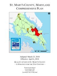
Comprehensive <strong>Plan</strong>–Quality of Life in <strong>St</strong>. Mary’s <strong>County</strong>–A <strong>St</strong>rategy for the 21st Century<br />
The current Comprehensive <strong>Plan</strong>, effective in April 2010, is adopted as a guide for <strong>County</strong> actions<br />
regarding many aspects of community life and development—growth and land use; resource<br />
protection;efficient use and protection of water resources; housing; economic development; community<br />
facilities; transportation; and human services. The Comprehensive <strong>Plan</strong> establishes goals, objectives and<br />
policies that support the Community Vision for the <strong>County</strong> to “preserve and enhance the quality of<br />
life….foster economic growth by focusing and managing growth; by protecting the rural character and<br />
economy of the countryside, by nurturing the shoreline and adjacent waters; and by preserving and<br />
capitalizing on the natural resources and the historical quality of the county.” The 2010 Comprehensive<br />
<strong>Plan</strong> incorporated many related functional plans, including the <strong>Hazard</strong> <strong>Mitigation</strong> <strong>Plan</strong>. With regard to<br />
hazard mitigation, the 2010 Comprehensive <strong>Plan</strong> contains language relevant to or specifically intended<br />
to strengthen and support improved hazard mitigation planning. Relevant goals, policies, objectives are<br />
excerpted below and discussion is provided for sections which pertain to <strong>Hazard</strong> <strong>Mitigation</strong>. Where<br />
additional attention to hazard mitigation appears necessary to ensure hazard mitigation is taken into<br />
account in implementation or future Comprehensive <strong>Plan</strong> updates, comments have been included in<br />
italics.<br />
41.1.A. Objective: Designate growth areas sized to accommodate the needs of the projected<br />
2030 population of the <strong>County</strong>. Target a majority of new residential development in<br />
development districts, town centers and village centers.<br />
viii.<br />
Policy: Balance development goals with environmental protection and<br />
enhancement of the value of waterfront as a resource for recreation and water<br />
dependent facilities.<br />
Comment: The issues of flood hazards associated with water bodies should be addressed.<br />
4.1.1.C. Objective: Focus development in town centers.<br />
x. Encourage installation of underground services to minimize visual impacts of<br />
overhead utility lines.<br />
Comment: The concern regarding power and other types of service which can be disrupted by<br />
natural disasters that damage overhead lines must be addressed to support enforcement of<br />
burying of utility lines.<br />
4.1.2.B. Objective: Foster and enhance sense of community and remedy negative conditions in<br />
existing developed areas.<br />
10
Chapter 1: Introduction SMC <strong>Multi</strong>-jurisdictional <strong>Hazard</strong> <strong>Mitigation</strong> <strong>Plan</strong><br />
i.a. Landscape provisions for redevelopment and new development.<br />
Comment: Ensure that consideration of water conservation and fire prevention are incorporated<br />
into future plans regarding landscaping.<br />
4.4.1. Goal: Direct growth in rural areas to existing population centers to protect resource<br />
areas.<br />
4.4.1.A. Objective: Limit growth in rural areas to preserve open space and to protect and<br />
promote agriculture and forestry.<br />
i. Conserve the land and water resource base that is necessary to maintain and<br />
support the preferred and uses of agriculture, forestry, fisheries activities and<br />
aquaculture, and to preserve natural environments (wetlands, forests, abandoned<br />
fields, beaches and shorelines).<br />
Comment: This area is directly linked to hazard mitigation because the protection of open spaces,<br />
particularly wetlands, floodplains and forests, can provide natural barriers, mitigate volume and<br />
velocity of flooding, and assure that peoples are not living in high risk areas which are particularly<br />
vulnerable to natural disasters prevalent in the <strong>County</strong>..<br />
In section 5.1. Introduction the plan discusses the importance of sensitive areas protection and<br />
links those to environmental services they provide including services for eliminating and<br />
mitigating hazards.<br />
… Sensitive areas provide ecosystem and economically valuable environmental<br />
services which cannot be inexpensively or effectively replaced. … <strong>St</strong>reams and<br />
their buffers provide the primary transport system for storm water and, if managed<br />
poorly, they become primary conduits to transport pollution – heavy metals, oils,<br />
chemicals, trash from urbanized areas, nutrients, bacteria, pesticides and<br />
herbicides from farms and lawns – into the Bay. When managed well, streams<br />
and their buffers capture, reduce, and process pollutants, provide water supply<br />
functions, and provide spawning areas for recreational and commercial fish stock.<br />
…Wetlands protect water quality, infiltrate, slow and filter runoff, help control and<br />
reduce pollution and erosion. Floodplains and wetlands are important in the<br />
maintenance of groundwater supplies and water purification. … Marshes, fringe<br />
wetlands and submerged grass beds stabilize sediments and dampen impacts<br />
from storms to reduce loss of upland property, and maintain water clarity. …Forest<br />
conservation is important for protecting water supply, aiding recharge of aquifers,<br />
and infiltrating storm water runoff. Assuring the continued viability of sensitive<br />
areas to provide their ecosystem and environmental service functions and for their<br />
contributions to the beauty and diversity of the landscape is also an important goal<br />
of this plan.<br />
In Section 5.2 Measures of Success for Conservation of Sensitive Areas the Comprehensive<br />
<strong>Plan</strong> discusses links between specific ordinance provisions for sensitive areas protection and<br />
plan goals including resources and goals that are important in hazard mitigation stating “The<br />
county maintains Geographic Information Systems (GIS) data layers that show the extent of the<br />
resources required to be protected under current regulations. That data was used to estimate the<br />
number of acres of these resources.” Many of the resources mapped in GIS are relevant to<br />
hazard mitigation planning including:<br />
• 100-foot Buffer for all perennial and for intermittent streams in the Critical Area (50,220<br />
acres) These are regulated as drainage way buffers in the Floodplain ordinance and<br />
provide safe conveyance for storm water during storms.<br />
11
Chapter 1: Introduction<br />
SMC <strong>Multi</strong>-jurisdictional <strong>Hazard</strong> <strong>Mitigation</strong> <strong>Plan</strong><br />
• Conservation of 100 year floodplains and a surrounding 50 foot buffer (21,130 acres)<br />
Floodplains are preserved from disturbances. The 50 buffer established assures that<br />
encroachment from new development is minimized and provides extra protection from<br />
flood events.<br />
• Conservation of the 100 foot Critical Area Buffer (7,250 acres) The Critical Area Buffer is<br />
required to be established and maintained in dense natural vegetation to provide a<br />
stabilized shoreline as well as provide a natural barrier to wind and wave action.<br />
• Highly erodible soils (49,221 acres total, of which only the areas within 300 feet of water<br />
features and wetlands are required by this plan to have mandatory protection for a net<br />
protection area of 35,262 acres). These soils are prone to erosion, often unstable, and,<br />
prone to undermining and collapse due to movement of surface and groundwater.<br />
Identifying the soils and keeping development off of them reduces the risk of damage to<br />
buildings, infrastructure, and downstream sediment impacts.<br />
Section 5.3.4. discusses the need to implement strategies, policies and programs, and to<br />
provided funding for resource conservation of inherently valuable sensitive areas which provide<br />
ecosystem functions (mitigation of flooding, filtering for improvement of water quality, economic<br />
value (farm, fishery, forest, mineral products, recreational use) and reduction in service costs<br />
(reduced storm water management, maintained water supply.) The <strong>County</strong>’s primary mechanism<br />
to maintain these values is via regulations that require environmentally sensitive designs and<br />
place the responsibility for protection, conservation and stewardship, and mitigation for losses<br />
predominately on the landowner in exchange for the value added from development. ‘<br />
The strongest Comprehensive <strong>Plan</strong> language supporting hazard mitigation planning is found in<br />
Section 5.3.5 regarding the planning vision for Quality of life and sustainability. This section<br />
discusses the need for stewardship and for maintaining, enhancing and avoiding disruption of the<br />
natural functions of wetlands, forests, and floodplains, and preventing development impacts that<br />
overwhelm the service capacity provided by natural systems.” Sustainable communities<br />
“maintain a high quality of life enriched by the benefits of the environment and as free as possible<br />
from the disruptions associated with losses and damages which increase risks of environmental<br />
hazards and man-made disasters. To assure that <strong>St</strong>. Mary’s <strong>County</strong> develops in a sustainable<br />
manner that balances growth and resource protection, it is necessary to assure that hazard<br />
avoidance and mitigation is integrated into the planning and development process. Another<br />
component is assuring that development is located to reduce exposure to risk associated with<br />
identified hazards, is constructed to minimize damage and disruptions from unavoidable risks and<br />
that development occurs in a manner that will not result in creating or increasing community<br />
exposure to hazards and adverse impacts. Of the twelve hazards identified as posing significant<br />
risks to the <strong>County</strong>, the highest risks are associated with 1) coastal/shoreline erosion, 2) extreme<br />
weather due to severe winter storms, 3) flood, 4) high wind due to hurricanes, 5) high wind due to<br />
tornado, 6) thunderstorm and lighting, and 7) wildfire. Also of concern are moderate risks<br />
associated with 8) hailstorms, 9) extreme summer heat and 10) drought. Risk of 11) earthquakes<br />
is considered to be low but the localized risk of 12) land failure of the steeps slopes and cliffs,<br />
particularly in the Patuxent watershed is of increasing concern.<br />
Section 5.5 discusses protection and management of riparian resource areas—riverbanks,<br />
streams and their buffers.<br />
5.5. Goal: Protect riverbanks, streams and their buffers from the adverse impacts of<br />
development and human activity.<br />
5.5.1.A. Objective: Preserve, protect and restore the natural ecosystems and functions of rivers,<br />
streams, and their buffers and adjacent hydric and erodible soils.<br />
Comment: Riparian areas absorb and slow runoff and can provide safe conveyance and holding<br />
areas for floodwaters. Adverse impacts of human activity include removal of forest cover and<br />
increases in impervious cover both of which reduce infiltration of storm water and increase runoff<br />
12
Chapter 1: Introduction<br />
SMC <strong>Multi</strong>-jurisdictional <strong>Hazard</strong> <strong>Mitigation</strong> <strong>Plan</strong><br />
volume and velocities. Increased volume and velocity promotes flash flooding and channel<br />
erosion that disconnects streams from their floodplains causing more sudden and more<br />
dangerous downstream flood events with deeper and faster flood waters.<br />
Section 5.7 discusses protection and management of tidal floodplains, non-tidal floodplains and<br />
the floodway protection to prevent the adverse impacts of development and human activity.<br />
Objective 5.7.1.A. “Preserve, protect and restore the natural environment and beneficial<br />
functions of floodplains” contains a number of policies directly pertaining to reduction of hazard<br />
including 5.7.1.A.i. “Limit and manage development activity in the 100-year floodplain to reduce<br />
vulnerability and flood hazards; 5.7.1.A.ii. Minimize the disturbance to vegetation in the floodplain<br />
Specific Actions to implement these policies include:<br />
• For all 100 year floodplain areas, continue to enforce existing regulations that require<br />
buffers at least 50 foot wide measured from the edge of the floodplain (determined by<br />
elevation).<br />
• Avoid disturbances to floodplains and their buffers to the maximum extent possible by<br />
requiring floodplain easements, continuing to prohibit development in the floodplain when<br />
alternative locations exist on a development site, continuing to prohibit creation of new<br />
development lots within the floodplain; prohibiting new fill in the floodplain, and keeping<br />
storm water ponds and structures out of the floodplain.<br />
• Maintain community eligibility for participation in the National Floodplain Insurance<br />
Program (NFIP) by assuring that development activities are conducted and structures are<br />
constructed or expanded in a manner that fully complies with (NFIP) criteria.<br />
• Seek to lower flood insurance rates through participation in the Community Rating System<br />
(CRS) which is a Federal Emergency Management Agency (FEMA) program that<br />
decreased flood insurance rates for residents in communities with effective hazard<br />
mitigation strategies.<br />
• Develop a comprehensive “No Adverse Impact” program for floodplain management.<br />
Objective 5.7.1.B. “<strong>Plan</strong> for and accommodate land use changes and impacts that are<br />
anticipated due to climate variability and projections for sea level rise.” contains a number of<br />
policies directly pertaining to identification and mitigation of hazard impacts including:<br />
• Map vulnerable lands, infrastructures and facilities.<br />
• <strong>St</strong>rengthen building codes and require use of appropriate construction and management<br />
techniques for new infrastructure and structures in vulnerable areas focusing particularly<br />
on elevation of buildings, foundation design, use of materials that can withstand periodic<br />
flooding, resistance to debris impact, resistance to wind and wave action, establish<br />
standards for abandonment and removal of impacted structures.<br />
• Include risk assessment and vulnerability when making public investments in<br />
infrastructure investments, to incorporate responses to threats into placement decisions<br />
and designs for new facilities, and for upgrade and replacement of threatened facilities.<br />
Also include in land conservation to reduce threats and preserve options for retreat of<br />
natural resources.<br />
<strong>St</strong> Mary’s <strong>County</strong> Comprehensive Zoning Ordinance<br />
The current Comprehensive Zoning Ordinance, effective effect on September 14, 2010, is the primary<br />
tool for regulating how development or redevelopment is accomplished in the <strong>County</strong>. It is also one of<br />
the tools for implementing the goals, objective, policies and actions recommended in the Comprehensive<br />
<strong>Plan</strong>. The Chapters listed and briefly discussed below contain provisions that are relevant to a hazard<br />
mitigation plan<br />
13
Chapter 1: Introduction<br />
SMC <strong>Multi</strong>-jurisdictional <strong>Hazard</strong> <strong>Mitigation</strong> <strong>Plan</strong><br />
Chapter 41 Chesapeake Bay Critical Area (IDA, LDA, RCA) establishes overlay district regulations<br />
that apply to all water of and lands under the Chesapeake Bay and its tributaries to the head of tide, all<br />
<strong>St</strong>ate and private wetlands, and all land and water areas within 1,000 feet beyond the landward<br />
boundaries of <strong>St</strong>ate or private wetlands and the heads of tide. The regulations apply to limit density and<br />
impervious cover, assure adequate water quality and quantity measures are implemented to manage<br />
runoff, measures to assure no net loss of forest cover, and to establish criteria for resource protection.<br />
Particular attention is given to prohibiting development and disturbances in a “Critical Area Buffer” at<br />
least 100 feet landward of mean high water or the top of stream banks and expanded for sensitive<br />
resources (non-tidal wetlands, hydric and highly erodible soils and steep slopes). The regulations have<br />
the effect of reducing the overall amount of development in close proximity or tidal waters and tributary<br />
stream and reducing the impacts of development that does occur. In addition to significant habitat<br />
benefits provided the regulations also reduce risk to hazards such as storm surge and tidal flooding, and<br />
damage and property loss due to shoreline erosion.<br />
Chapter 43 Air Installations Compatible Use Zone (AICUZ) establishes land use development<br />
standards and requirements intended to minimize exposure to aircraft noise, minimize risks to public<br />
safety, and minimize hazards to aviators and those employed or residing in proximity to public aviation<br />
facilities. Each overlay establishes a hierarchy of sub-districts with development and use restrictions<br />
dependent on the location of lands in relation to airport operations. The most stringent restrictions apply<br />
to land located closest to the airport, and the least stringent apply to lands located farther from the airport<br />
but within the boundary of this Overlay district.<br />
Chapter 70 Adequate Public Facilities. The purpose of adequate public facilities review is to<br />
implement adequate public facilities policies of the Comprehensive <strong>Plan</strong> and other functional plans<br />
adopted pursuant to the policies of the Comprehensive <strong>Plan</strong>, including the Lexington Park Transportation<br />
<strong>Plan</strong>, the Comprehensive Water and Sewerage <strong>Plan</strong>, the Educational Facilities Master <strong>Plan</strong>, the Fire and<br />
Rescue Services Master <strong>Plan</strong>, the Land Preservation and Recreation <strong>Plan</strong>, and the Capital<br />
Improvements Program (CIP). The ordinance 1) requires developers to provide or make arrangements<br />
for new or additional public facilities, or upgrades of existing public facilities, including roads, sewerage,<br />
water, storm drainage, schools, and fire prevention and suppression, that are necessary to address the<br />
impacts of their projects; 2) controls phasing and timing of development approval by conditioning such<br />
approval upon a finding that public facilities sufficient to serve proposed development are present or will<br />
be provided concurrent with that development; 3) encourages new development to occur in areas of the<br />
<strong>County</strong> where public facilities are being provided and which are designated for new growth in the<br />
Comprehensive <strong>Plan</strong> 4) implements uniform procedures, standards, and requirements for the review of<br />
development applications, and 5) assures that proposed development will not adversely affect the public<br />
health, safety, and welfare by requiring the following area addressed: Of particular relevance to this<br />
hazard mitigation plan are requirements for<br />
• <strong>St</strong>orm Drainage. The proposed development shall be served by an adequate storm drainage system.<br />
A storm drainage system shall be considered adequate if 1)The on-site drainage system installed by<br />
the developer will be capable of conveying through and from the property the design flow of storm<br />
water runoff originating in the development during a 2, 10-, and 100-year flood as determined in<br />
accordance with criteria specified in the <strong>St</strong>orm water Management Ordinance, in addition to flows<br />
from undeveloped land upstream in the natural watershed of the proposed development, flows from<br />
existing upstream developments, and designs flows from developments for which plats and plans<br />
have been approved, without resulting in erosion, sedimentation or flooding of the receiving channel<br />
and downstream properties; and 2)The off-site downstream drainage systems are capable of<br />
conveying to an acceptable outfall the design flow of storm water runoff originating in the<br />
development, as determined in accordance with criteria specified in the <strong>St</strong>orm water Management<br />
Ordinance, in addition to flows from undeveloped land up-stream in the natural watershed of the<br />
proposed development, flows from existing upstream developments, and design flows from<br />
developments for which plats have been recorded, without resulting in erosion, sedimentation, or<br />
flooding of the receiving channel and down-stream properties.<br />
14
Chapter 1: Introduction<br />
SMC <strong>Multi</strong>-jurisdictional <strong>Hazard</strong> <strong>Mitigation</strong> <strong>Plan</strong><br />
• Fire Prevention and Suppression. APF provisions are administered in conjunction with the <strong>St</strong>. <strong>Mary's</strong><br />
<strong>County</strong> Metropolitan Commission and <strong>County</strong> Fire Board. A proposed development shall be<br />
considered to be adequately served by fire suppression facilities if 1) developments on public water<br />
are served at the time of issuance of the first occupancy permit by an approved public (central) water<br />
supply system or multi-user water supply system capable of providing fire flow in accordance with the<br />
relevant <strong>St</strong>. <strong>Mary's</strong> <strong>County</strong> agency standards; or 2) development on private wells have Fire flow and<br />
storage capabilities installed in accordance with NFPA 1142 <strong>St</strong>andard on Water Supplies for<br />
Suburban and Rural Fire-fighting. The water source shall be provided, unless specific exemption is<br />
given for the installation of a sprinkler system by the fire department in whose area the premises lie<br />
or the amount of water carried on fire apparatus responding on the first alarm is greater than required<br />
by the standard. When a static water source is approved a dry hydrant with all weather access shall<br />
be provided to facilitate the fire department taking draft from the source. Water for fire suppression<br />
shall be available within 1,000 feet of all single buildings under 12,000 sq. ft. area and on site for all<br />
single buildings over 12,000 sq. ft. area.<br />
Chapter 71 Resource Protection <strong>St</strong>andards. The purposes of Chapter 71 are to:<br />
1) Protect the public health, safety, and welfare by maintaining the water and land resources that<br />
provide natural functions to prevent loss of land and topsoil to erosion, to filter pollution, nutrient<br />
and sediment runoff and to mitigate effects of flooding;<br />
2) minimize the impacts of surface land use on water resources and conserve fish, wildlife, and<br />
plant habitats while accommodating continued growth;<br />
3) Protect the <strong>County</strong>’s most sensitive and diverse ecosystems;<br />
4) Respect natural constraints and limitations as a primary component of development design;<br />
5) Enhance and protect the quality of the <strong>County</strong>’s water resources by controlling soil erosion and<br />
runoff to the maximum extent practicable. Reduce sources of pollution to meet Chesapeake Bay<br />
water quality standards; and<br />
6) Protect the <strong>County</strong>'s ground-water recharge areas and potential surface water impoundment<br />
sites.<br />
Applicants are required to identify and put in place measures to protect streams and their buffers, nontidal<br />
wetlands, the 100-year floodplain , floodway and coastal high hazard, hydric soils, highly erodible<br />
soils, slopes of 15 to 25% and greater, the Chesapeake Bay Critical Area, defined habitat protection<br />
areas, natural heritage areas and forest and woodland cover. The development standards are designed<br />
to implement the Comprehensive <strong>Plan</strong> criteria for resource protection discussed above. These<br />
standards of Chapter 71serve to protect sensitive resources from the impacts of development and allow<br />
the resource to retain their value for hazard mitigation and to protect people, property, structures and<br />
infrastructure from the hazards associated with location within or in close proximity to sensitive areas.<br />
Chapter 75 Forest Conservation. The purpose of Chapter 75 is to implement a program for forest<br />
conservation that regulates the cutting and clearing of certain forests; and to require forest stand<br />
delineations and forest conservation plans for many development activities. The regulations require<br />
identification and the protection of priority forest areas (as defined in the ordinance) on planned<br />
development sites. Of particular importance for hazard mitigation is the priority placed on the protection<br />
of trees, shrubs and herbaceous plants associated with intermittent and perennial streams and their<br />
buffers, with slopes over 25 percent; with slopes with highly erodible soils; and with 100-year floodplain<br />
and drainage way buffers. Retention of forests, mitigation for permissible cutting of forests, and<br />
“forestation” to plant forest on sites that have insufficient forest coverage are required by the regulations.<br />
Chapter 76 Floodplain Regulations. Chapter 76 establishes standards and regulations for<br />
development in the floodplain to manage and in some cases prevent development in areas subject to<br />
flooding; to require appropriate construction practices to minimize future damage; and to provide for the<br />
review of all activities proposed within identified floodplains and, by the issuance of permits for those<br />
15
Chapter 1: Introduction<br />
SMC <strong>Multi</strong>-jurisdictional <strong>Hazard</strong> <strong>Mitigation</strong> <strong>Plan</strong><br />
activities that comply with the objectives of this Ordinance, to assure compliance with relevant federal<br />
and state programs, including<br />
1) National Flood Insurance Program (44 CFR Parts 59-79),<br />
2) Maryland Waterway Construction Permit Program for non-tidal floodplains,<br />
3) U.S Army Corps of Engineers Section 10 and 404 Permit Programs,<br />
4) Maryland Tidal and Nontidal Wetlands Permit Programs.; and<br />
5) Maryland Coastal Zone Management Program.<br />
The regulations apply to all lands within the unincorporated area of <strong>St</strong>. <strong>Mary's</strong> <strong>County</strong> being subject to<br />
inundation by floodwaters of the 100-year, regulatory flood or base flood and as delineated on the most<br />
recent revision of the <strong>County</strong> floodway maps and FEMA Flood Insurance Rate Maps (FIRMs) and<br />
described in the flood insurance study (FIS) prepared by the Federal Emergency Management Agency<br />
(FEMA). Emphasis is on flood height elevation rather than the actual detail of the maps, so that if map<br />
boundaries and elevations disagree, elevations prevail, with no approval from FEMA required to The<br />
regulated floodplain includes Mapped Areas which may be may be expanded beyond the designations<br />
on the FIRM due to elevation. Mapped areas include 1) Non-tidal floodplains (the floodway and the<br />
floodway fringe) 2)Tidal floodplains in areas subject to coastal or tidal flooding by the100-year flood due<br />
to high tides, hurricanes, tropical storms, and steady onshore winds and 3) Coastal High <strong>Hazard</strong> Areas<br />
subject to coastal or tidal flooding with the addition of high-velocity water and wind action. (designated as<br />
V-Zones on the FIRMs)<br />
The county floodplain ordinance closely follows Maryland’s model ordinance with some<br />
additional provisions to implement Comprehensive <strong>Plan</strong> policies to eliminate or reduce risk to<br />
people and property from flooding in the tidal floodplain and by requiring new and replacement<br />
development to be well outside of the floodplain (50 foot setback) when alternative sites are<br />
available.<br />
Subdivision Ordinance<br />
The current Subdivision Ordinance that went into effect on September 14, 2010 is the primary tool<br />
governing the subdivision of land in the unincorporated areas of the <strong>County</strong>. In Section 10.3, the<br />
ordinance identifies 10 purposes, several of which are relevant to hazard mitigation and avoidance:<br />
10.3.2. Land shall be suitable for the purpose for which it is subdivided and adequate and effective public<br />
facilities shall be available, as determined by the <strong>Plan</strong>ning Commission. In addition, the public<br />
improvements shall conform to and be compatible with all other <strong>County</strong> laws, regulations, plans,<br />
programs and standards.<br />
Comment: The review for suitable land and adequate facilities extends to identification of high hazard<br />
locations unsuitable for subdivision and assuring that appropriate infrastructure is provided to<br />
avoid, mitigate or eliminate hazard risks.<br />
10.3.3. To protect and provide for the public health, safety, and general welfare and to prevent<br />
overcrowding of land and undue congestion of population.<br />
Comment: This should be extended to include the avoidance of development in high hazard areas.<br />
10.3.9. To prevent the pollution of air, surface waters; to assure the adequacy of drainage<br />
facilities; to safeguard the water table; and to encourage the wise use and management of natural<br />
resources throughout the <strong>County</strong> in order to preserve the integrity, stability, and beauty of the<br />
<strong>County</strong> and the value of the land.<br />
Comment: Many of the measures required to prevent pollution, assure adequacy of drainage facilities,<br />
and manage natural resources are also measures that reduce hazard risk..<br />
Article 3 Subdivision <strong>St</strong>andards and Approvals lists at 30.1. that subdivision platting is to “[p]provide<br />
for adequate light, air, and privacy, to secure safety from fire, flood, and other danger, and to prevent<br />
16
Chapter 1: Introduction<br />
SMC <strong>Multi</strong>-jurisdictional <strong>Hazard</strong> <strong>Mitigation</strong> <strong>Plan</strong><br />
overcrowding of the land and undue congestion of population. In addition, it will “[g]guide the future<br />
growth and development in accordance with the Comprehensive <strong>Plan</strong>.”<br />
At 30.6.4 The criteria for approval of a preliminary plat includes requirements that subdivisions provide<br />
adequate public facilities in accordance with Chapter 70 of the Zoning Ordinance, that drainage,<br />
erosions control and construction complies with accepted engineering and construction practices.<br />
Applicants are required to specify the “Flood <strong>Hazard</strong> Zone and source” and to provide a plan that<br />
illustrates<br />
−<br />
−<br />
−<br />
−<br />
−<br />
storm drain culverts on or adjacent to the property<br />
physical features of the property, including water courses, shore lines, wetlands, 100 year<br />
flood plains, existing structures and steep slopes<br />
soil types,<br />
topography [that] extend[s] a minimum of 100 feet beyond the property line” and<br />
proposed development including information about the ‘[m]ethod of water supply and fire<br />
suppression,<br />
Applicants must also provide an Erosion and sediment control plan, drainage area map, storm drain<br />
layout, method and location of storm water quality and quantity treatment including and storm water<br />
management calculations. Provision of this information allows for review for risk from hazards and the<br />
requirement that developers provide adequate measures to avoid, mitigate or eliminate hazards to new<br />
development particularly those associated with flooding and erosion.<br />
Final plats are required to demonstrate that “[t]he lot and block layout provides for safe and convenient<br />
vehicular, service and emergency access, efficient utility service connections, and adequate buildable<br />
area in each lot for planned uses,” “Rights-of-way and easements of adequate size and dimension are<br />
provided for the purpose of constructing the street, utility, and drainage facilities needed to serve the<br />
development.<br />
Section 30.14 discusses requirements for private roads “to provide for the safety of the property owners<br />
by requiring adequate access for fire, emergency, medical and law enforcement vehicles. It provides for<br />
the continued uninterrupted use of the access for all of the owners by establishing a durable roadway<br />
and easement, and assigns responsibility for continued maintenance of the access. The standards<br />
require that “the design vehicle shall be an emergency response/service/delivery-type vehicle (30-foot<br />
single unit truck). For local streets, the design vehicle shall be a school bus. For higher classification and<br />
commercial streets, the design vehicle shall be a tractor trailer/ladder truck-type vehicle (WB-50).<br />
Comment: Many of the measures (wide roads, wide intersections, extended turning radii) used to<br />
assure the infrequent need for emergency response/service/delivery-type vehicle access actually in<br />
crease risk to hazards. The resulting excessive clearing and imperviousness causes increased<br />
stormwater runoff quantity and velocity which increases flooding and erosion. Wide roads with large<br />
turning radii encourage excessive speed which increases risks for vehicular and pedestrian accidents.<br />
The lack of an interconnected street system increases miles driven, traffic congestion, and increases<br />
carbon emissions which have been linked to climate variability. Lack of interconnection also limits<br />
alternatives for emergency access. Alternative road design options that allow emergency access without<br />
increasing hazards should be considered by the <strong>County</strong> in future plan and ordnance updates.<br />
Section 30.16. specifies the requirements for public improvement and Infrastructure including storm<br />
drainage and over lot grading. “Where a development is traversed by a natural drainage course or<br />
stream, there shall be provided a drainage easement, a minimum of 50 feet in width, conforming<br />
substantially with the line of such watercourse for the purpose of maintaining, improving, or protecting<br />
such drainage facilities. This easement area shall be designed to the 100-year flood plain level.<br />
Applicants must dedicate, either in fee or by drainage easement of land on both sides of existing<br />
watercourses, where topography or other conditions are such as to make impractical the inclusion of<br />
drainage facilities within road rights-of-way, perpetual unobstructed easements at least 20 feet in width<br />
17
Chapter 1: Introduction<br />
SMC <strong>Multi</strong>-jurisdictional <strong>Hazard</strong> <strong>Mitigation</strong> <strong>Plan</strong><br />
for such drainage facilities shall be provided across property outside the road right-of-way….Drainage<br />
easements shall be carried from the road to a natural watercourse or to other drainage facilities and be<br />
adequate to accommodate the top width of the design flow, access and maintenance requirements.<br />
When a proposed drainage system will carry water across private land outside the subdivision,<br />
appropriate drainage rights must be secured and indicated on the plat with the respective recordation<br />
information.<br />
2009 International Building Code and Residential Code<br />
<strong>St</strong>. Mary’s <strong>County</strong> adopted the 2003 International Building and Residential Code for all permitted<br />
structures in the county in December 2006.. In December 2010 the <strong>County</strong> adopted the 2009 versions of<br />
this code, effective date 3 January 2011. The 2009 IBC contains a number of changes to the 2003 IBC<br />
which will further improve resistance of structures to natural hazards. These changes relate to increased<br />
standards for anchoring structural components (roofs to walls and columns and walls and columns to<br />
foundations) and design of roofs, beams, walls, foundations) to improve resistance to forces of wind,<br />
snow, and earthquake loads in addition to being designed to resist the forces of gravity. Exterior opening<br />
protection to resist windborne debris will be required for areas within 1 mile of a tidal coastline and wind<br />
speeds greater than 120 miles per hour. Roof designs will account for rain loads and provide overflow<br />
scuppers to relieve excess load. The International Code Series is the most comprehensive series of<br />
code to date. These codes address essentially all areas of building construction and the various building<br />
services such as electrical, plumbing/gas and mechanical and certain natural hazards. The 2009 building<br />
code includes requirements that increase resistance to a number of hazards:<br />
‣ Section 1609 Wind Loads (linear winds) – This section stipulates that Design Professionals must<br />
design structures that meet 100 miles per hour in their loading design.<br />
‣ Section 1612, Flood Loads. This section of the code would be replaced with the Maryland<br />
Floodplain Managers Hand Book.<br />
‣ Section 1613 through 1623, Seismic Loading – The code specifies that Design Professionals<br />
utilize a loading factor. Earthquake design has not been a major concern in this area.<br />
‣ Section 2308.10.1 Wind Uplift. This section discusses the roof tie down requirements to avoid<br />
blow offs during high wind storms. The new requirements state that the trusses/rafters must be<br />
tie/strapped down to the foundation of the structure.<br />
2010 Comprehensive Land Use <strong>Plan</strong> – Town of Leonardtown<br />
http://leonardtown.somd.com/government/2010Comprehensive<strong>Plan</strong>.pdf<br />
Page 1-5<br />
The Maryland Economic Growth, Resource Protection and <strong>Plan</strong>ning Act of 1992 also added the<br />
requirement that the comprehensive plan contain a Sensitive Areas Element, which describes how the<br />
jurisdiction will protect the following sensitive areas:<br />
• <strong>St</strong>reams and stream buffers<br />
• 100-year floodplains<br />
• Endangered species habitats<br />
• <strong>St</strong>eep slopes<br />
• Other sensitive areas a jurisdiction wants to protect from the adverse impacts of development.<br />
The 1992 Act requires that all state and local government investments in infrastructure (roads, sewer,<br />
water. schools. etc) are consistent with adopted local growth management plans.<br />
Page 11-13<br />
Protection of Sensitive Areas<br />
18
Chapter 1: Introduction<br />
SMC <strong>Multi</strong>-jurisdictional <strong>Hazard</strong> <strong>Mitigation</strong> <strong>Plan</strong><br />
The ultimate form of the Town of Leonardtown at build-out will likely be largely defined by McIntosh Run,<br />
Town Run and Breton Bay as its western, eastern and southern edges respectively. Uses adjacent to<br />
these bodies of water should continue to be buffered to minimize the impact of land disturbances and<br />
activity on water quality and wildlife habitat.<br />
This plan element, the plan’s Sensitive Areas Element and the plans Water Resources Element all<br />
recognize each of these water resources as sensitive areas. The Town’s goal is to preserve and<br />
enhance its streams and buffers. Improving storm water management in developed areas is also critical,<br />
including the use of retrofit to address existing problem areas, and providing incentives for developers<br />
constructing new storm water management structures to address areas that currently do not have such<br />
structures.<br />
The Town will continue to prohibit new development within stream buffers and will prohibit alteration of<br />
streambeds or stream banks, except for Best Management Practices (BMPs) to reduce erosion or<br />
stabilization.<br />
Page 12-1<br />
The Leonardtown Comprehensive <strong>Plan</strong>’s “Water Resources <strong>Plan</strong> Element” (WRE) is a new plan element<br />
added to the Comprehensive <strong>Plan</strong>. This plan element is mandated to assure compliance with the<br />
requirements of Maryland House Bill 1141 (HB 1141). The purpose of the WRE is to provide additional<br />
layers of planning for water resources in relation to existing use and proposed land use, based on an<br />
analysis of growth and development trends to assure that demands for water supply, wastewater<br />
treatment and storm water management can be satisfied as Town growth occurs and to assure adequate<br />
measures are taken to minimize impacts to water quality. Page 12-19<br />
Water Resources Goal and Objectives<br />
The Water Resources Goal for Leonardtown is:<br />
To maintain a safe and adequate water supply and adequate capacities for wastewater treatment to<br />
serve projected growth at sustainable levels; to take steps to protect and restore water quality; and to<br />
meet water quality regulatory requirements in the Breton Bay Watershed.<br />
Objectives to Support this Goal are:<br />
• Assure that existing and planned public water systems meet projected demand in a<br />
sustainable fashion.<br />
• Assure that existing and planned public wastewater collection and treatment systems meet<br />
projected demand without exceeding their permitted capacity.<br />
• Assure that the Town’s storm water management policies reflect the most recent state<br />
requirements, and require Low Impact Development (LID) practices that utilize Environmental<br />
Site Design (ESD) principles for managing storm water in both new development and by<br />
existing homeowners.<br />
• Maintain land use patterns that limit adverse impacts on water quality.<br />
• Continue to focus growth to areas best suited to utilize the existing and planned water and<br />
wastewater infrastructure efficiently and sustainable.<br />
Page 13-1<br />
<strong>St</strong>reams and their Buffers<br />
Breton Bay and the major streams in Leonardtown are shown on the sensitive areas map in the<br />
Leonardtown Critical Areas Program. Preservation of natural land and vegetation along a stream<br />
provides a buffer that protects the stream from sediment, phosphorous, and other runoff pollutants. Major<br />
tributary streams to Breton Bay include Macintosh Run and Town Run.<br />
Floodplains<br />
19
Chapter 1: Introduction<br />
SMC <strong>Multi</strong>-jurisdictional <strong>Hazard</strong> <strong>Mitigation</strong> <strong>Plan</strong><br />
The 100-year floodplain is the land area along a stream that is susceptible to inundation by a flood of a<br />
magnitude that would be expected to occur on average only once every 100 years as a result of rainfall<br />
and runoff from upland areas. The 100-year floodplains of streams in Leonardtown are shown on the<br />
Leonardtown Critical Areas Program map.<br />
20
Chapter 2: <strong>Hazard</strong> Identification<br />
SMC <strong>Multi</strong>-jurisdictional <strong>Hazard</strong> <strong>Mitigation</strong> <strong>Plan</strong><br />
CHAPTER 2 – HAZARD IDENTIFICATION<br />
Introduction<br />
This chapter discusses a portion of the risk assessment for <strong>St</strong>. Mary’s <strong>County</strong>. The four major<br />
steps in the risk assessment include hazard Identification, hazard profiles, vulnerability<br />
assessment, and loss estimation (Figure 4.1). This chapter comprises the first two steps in the<br />
risk assessment, wherein hazards that may affect <strong>St</strong>. Mary’s <strong>County</strong> are identified, and profiled,<br />
and potential effects are quantified. The nature of the specific hazard, history of previous<br />
occurrences, and the impact and potential severity of an occurrence have been documented.<br />
<strong>St</strong>eps 3 and 4 of the Risk Assessment (vulnerability assessment and loss estimation) will be<br />
discussed in the next chapter.<br />
<strong>St</strong>ep 1 - <strong>Hazard</strong> Identification<br />
Figure 4.1 – Risk Assessment <strong>St</strong>eps<br />
The risk assessment for <strong>St</strong>. Mary’s <strong>County</strong><br />
involved investigating various types of natural<br />
hazards faced by the county over the past<br />
several decades. Since it is assumed that<br />
hazards experienced by the county in the past<br />
may be likely to occur in the future, the hazard<br />
identification process included a history and<br />
an examination of various hazards and their<br />
occurrences. Information on past hazards<br />
was based on research from historical<br />
documents and newspapers; <strong>County</strong> plans<br />
and reports; conversations with county<br />
residents and public officials, and internet<br />
websites. Data and maps that were available<br />
online included sources such as the United<br />
<strong>St</strong>ates Geological Survey (USGS), Spatial<br />
<strong>Hazard</strong> Events and Losses Database for the<br />
United <strong>St</strong>ates (SHELDUS), and the National<br />
Weather Service.<br />
<strong>St</strong>ep 2 - <strong>Hazard</strong> Profiles<br />
This step involves determining the frequency or probability of future events, their severity, and<br />
factors that may affect their severity. Each hazard type has unique characteristics that can<br />
impact the county. For example, no two flood events will impact a community in the same<br />
manner. Also, the same hazard events can affect different communities in different ways based<br />
on geography, development, population distribution, age of buildings, etc. Developing hazard<br />
event profiles enables us to answer the question “how bad could a hazard get?”<br />
21
Chapter 2: <strong>Hazard</strong> Identification<br />
SMC <strong>Multi</strong>-jurisdictional <strong>Hazard</strong> <strong>Mitigation</strong> <strong>Plan</strong><br />
<strong>Hazard</strong> Identification<br />
The <strong>Hazard</strong> <strong>Mitigation</strong> <strong>Plan</strong>ning Team reviewed a list of potential hazards and identified those<br />
that have been known to occur in <strong>St</strong>. Mary’s <strong>County</strong>. The list of hazards reviewed was obtained<br />
from the <strong>St</strong>ate of Maryland Core <strong>Plan</strong> for Emergency Response (2009) and the Maryland<br />
<strong>Hazard</strong> Identification Risk Assessment completed by MEMA. This assessment ranks wildfires<br />
and tornados as medium-high hazards; tidal/coastal flooding, extreme heat, hurricanes,<br />
thunderstorms, and winter weather as medium hazards and flash/riverine flooding, ice and<br />
drought as medium-low hazards for <strong>St</strong>. Mary’s <strong>County</strong>. The following natural hazards have been<br />
documented in <strong>St</strong>. Mary’s <strong>County</strong> as occurring over the past 50 years or a potential does exist<br />
to occur and have been assessed as risks for the purpose of this study and have been<br />
categorized into the following sections: atmospheric, wildfire, hydrologic, and geologic. They<br />
are not listed in any order of priority.<br />
Atmospheric <strong>Hazard</strong>s: Thunderstorms, Lightning, Tornadoes, Hurricanes, Hailstorms, Severe<br />
Winter <strong>St</strong>orms, Extreme Summer Heat<br />
Wildfire <strong>Hazard</strong>s: Wildfires, Urban Interface Fires<br />
Hydrologic <strong>Hazard</strong>s: Floods, Erosion of coastal shorelines, Erosion of upland surfaces and<br />
stream channels, Drought<br />
Geologic <strong>Hazard</strong>s: Earthquakes, Landslides/Land Subsidence<br />
Discussion of <strong>Hazard</strong>s<br />
Thunderstorms<br />
Overview<br />
Thunderstorms are forms of convection produced when warm moist air is overrun by dry cool<br />
air. As the warm air raises, thunderhead clouds (cumulonimbus) form and cause the strong<br />
winds, lightning, thunder, hail, and rain associated with these storms. Instability can be caused<br />
by surface heating or upper-tropospheric (~50,000 feet) divergence of air (rising air parcels can<br />
also result from airflows over mountainous areas). Generally, the former “air mass”<br />
thunderstorms form on warm-season afternoons and are not severe. The latter “dynamicallydriven”<br />
thunderstorms generally form in association with a cold front or other regional-scaled<br />
atmospheric disturbance. These storms can become severe, thereby producing strong winds,<br />
frequent lightning, hail, downbursts, and even tornadoes.<br />
The National Weather Service’s definition of a severe thunderstorm is a thunderstorm event that<br />
produces any of the following: downbursts with winds of 58 miles (50 knots) per hour or greater<br />
(often with gusts of 74 mph or greater), hail 0.75 inch in diameter or greater, or a tornado.<br />
Typical thunderstorms can be 3 miles wide at the base, rise to 40,000-60,000 feet in the<br />
troposphere, and contain half a million tons of condensed water.<br />
Historic Activity<br />
According to the National Climatic Data Center, approximately 125 thunderstorm and high wind<br />
events were reported in <strong>St</strong>. Mary’s <strong>County</strong>, Maryland, between January 1950 and August 2010,<br />
resulting in a total of 9 injury cases, $1.01 million in property damage, and $5,000 in crop<br />
damage. The following events are worthy of mention:<br />
• On 24 June 1996, a major thunderstorm caused three buildings to sustain considerable<br />
damage as it raced toward the central Chesapeake Bay. Property damage of $85,000 was<br />
estimated in <strong>St</strong>. Mary’s <strong>County</strong>.<br />
22
Chapter 2: <strong>Hazard</strong> Identification<br />
SMC <strong>Multi</strong>-jurisdictional <strong>Hazard</strong> <strong>Mitigation</strong> <strong>Plan</strong><br />
• On 4 February 1998, a powerful nor'easter, carrying heavy moisture from the Gulf of Mexico<br />
and Caribbean region, dumped between 2 and 4 inches of rain across much of Maryland<br />
between the foothills and the Chesapeake Bay. The nor'easter, coming on the heels of one<br />
just a week earlier, caused tides of 3 to 4 feet above normal from the Calvert <strong>County</strong>/Anne<br />
Arundel <strong>County</strong> line south to Point Lookout in extreme southeastern <strong>St</strong> <strong>Mary's</strong> <strong>County</strong>; and<br />
along the lower tidal Potomac River along the Charles and <strong>St</strong> <strong>Mary's</strong> Counties shoreline,<br />
including Cobb Island and <strong>St</strong> George Island. A daily rainfall record was broken at<br />
Baltimore/Washington International Airport (BWI); the 1.65 inches that fell on the 4th broke<br />
the 78 year-old Baltimore area mark of 1.48 inches. Flooding was most pronounced in <strong>St</strong><br />
<strong>Mary's</strong> <strong>County</strong>. During the peak of the storm, 26 roads were closed due the combination of<br />
wind and rain. Nine roads were closed due to flooding alone. <strong>St</strong>ate thoroughfares affected<br />
included Routes 5, 237, 238, 243, and 271. Evacuations were initiated in Great Mills and on<br />
<strong>St</strong> George Island due to rapid increases in tide levels. At least 200 residents were<br />
evacuated, including one 3 year-old boy who required a water rescue. Four fire fighters were<br />
treated for hypothermia at <strong>St</strong> <strong>Mary's</strong> Hospital. Some cars were nearly submerged in lowlying<br />
areas. In the Golden Beach neighborhood, Lake White overtopped its banks, and poor<br />
drainage contributed to the widespread flooding. The dam at <strong>St</strong>. <strong>Mary's</strong> Lake held; overflow<br />
problems were minimal. The sewage system serving Lexington Park failed due to the<br />
abnormally heavy flow of water, which caused manholes to flood. Four thousand citizens<br />
were affected in <strong>St</strong> <strong>Mary's</strong> <strong>County</strong>. Property damage of $145,000 and crop damage of<br />
$200,000 was reported.<br />
Lightning<br />
Overview<br />
Lightning is defined as a sudden and violent discharge of electricity from within a thunderstorm<br />
due to a difference in electrical charges and represents a flow of electrical current from cloud-tocloud<br />
or cloud-to-ground. Nationally, lightning causes extensive damage to buildings and<br />
structures, kills or injures people and livestock, starts untold numbers of forest fires and<br />
wildfires, and disrupts electromagnetic transmissions. Lightning is extremely dangerous during<br />
dry lightning storms because people remain outside due to the lack of precipitation; however,<br />
lightning is still present during the storm.<br />
At any given time, there are nearly 2,000 thunderstorms in progress over the earth's surface.<br />
There are at least 100,000 thunderstorms annually across the United <strong>St</strong>ates. To the general<br />
public, lightning is often perceived as a minor hazard. However, lightning-caused damage,<br />
injuries, and deaths establish lightning as a significant hazard associated with any thunderstorm<br />
in any area of Maryland.<br />
Damage from lightning occurs four ways: (1) electrocution/severe shock of humans and<br />
animals, (2) vaporization of materials along the path of the lightning strike, (3) fire caused by the<br />
high temperatures associated with lightning (10,000-60,000°F) and (4) the sudden power surge<br />
that can damage electrical/electronic equipment. Large outdoor gatherings (e.g., sporting<br />
events, concerts, campgrounds, etc.) are particularly vulnerable to lightning strikes that could<br />
result in injuries and deaths.<br />
Historic Activity<br />
There have been 16 major lightning events in <strong>St</strong>. Mary’s <strong>County</strong> between January 1950 and<br />
August 2010, resulting in $662,000 worth property damage. No injuries, fatalities, or crop<br />
damage was reported. Some of these are discussed below:<br />
• A structure was heavily damaged by a fire when lightning struck on 16 July 2000.<br />
Scattered thunderstorms that produced winds in excess of 55 MPH, heavy rainfall, large<br />
23
Chapter 2: <strong>Hazard</strong> Identification<br />
SMC <strong>Multi</strong>-jurisdictional <strong>Hazard</strong> <strong>Mitigation</strong> <strong>Plan</strong><br />
hail, and frequent lightning moved across Maryland during the morning and afternoon of<br />
the 16th. In <strong>St</strong>. <strong>Mary's</strong> <strong>County</strong>, a fire started by lightning heavily damaged a home in<br />
Hollywood. Marble sized hail fell in Leonardtown and pea sized hail fell in California and<br />
Tall Timbers where a total of 2.46 inches of rain fell. In Prince George's <strong>County</strong>, dime to<br />
quarter sized hail fell in Bowie and Mayo and pea-sized hail fell in Lanham. Trees were<br />
downed in Bowie. In Anne Arundel <strong>County</strong>, trees and power lines were downed. Quarter<br />
sized hail fell on Route 2 south of Annapolis. In Calvert <strong>County</strong>, trees and power lines<br />
were downed in Dunkirk and Chaneyville. A total of 3.20 inches of rain fell in<br />
Huntingtown where pea- to nickel-sized hail was reported. Pea-sized hail also fell in<br />
Owens, Dunkirk, and Chesapeake Beach. Winds estimated at 50 MPH were also<br />
reported in Chesapeake Beach. In Baltimore <strong>County</strong>, 1.50 inches of rain fell at Lake<br />
Roland. Large trees were downed between Reisterstown and Cockeysville and heavy<br />
downpours flooded roads in Towson and Parkville. In Frederick <strong>County</strong>, quarter-sized<br />
hail destroyed a cornfield in Thurmont and a car was hit by lightning, but no one was<br />
injured. Property damage was estimated at $160,000. No crop damage was reported.<br />
• On 17 June 2004, lightning caused a fire at a cabinet shop in Loveville. Thunderstorms<br />
accompanied by strong winds and heavy rainfall affected the Mid-Atlantic region during<br />
the evening of the 17th. Reports of downed trees, a weak tornado, lightning strikes, and<br />
torrential rainfall came from northeast and lower southern Maryland. A weak tornado<br />
touched down just outside of LaPlata in Charles <strong>County</strong>. Many homes and structures<br />
were damaged by fire and water. Firemen reported several fires caused by lightning in<br />
<strong>St</strong>. <strong>Mary's</strong> and Prince Georges Counties. Emergency personnel also reported the ceiling<br />
of a restaurant in Inverson Mall in HillCrest Heights collapsed under the weight of rain<br />
water, and flash flooding necessitated a water rescue on the Suitland Parkway. Property<br />
damage was estimated at $120,000. No crop damage was reported.<br />
Tornadoes<br />
Overview<br />
A tornado is a relatively short-lived storm composed of an intense rotating column of air,<br />
extending from a thunderstorm cloud system. Average winds in a tornado, although never<br />
accurately measured, are thought to range between 100 and 200 miles per hour, but some may<br />
have winds exceeding 300 miles per hour. The following are National Weather Service<br />
definitions of a tornado and associated terms:<br />
• Tornado - A violently rotating column of air that is touching the ground.<br />
• Funnel cloud - A rapidly rotating column of air that does not touch the ground.<br />
• Downburst - A strong downdraft, initiated by a thunderstorm, which induces an outburst of<br />
straight-line winds on or near the ground. They may last anywhere from a few minutes in<br />
small-scale microbursts to periods of up to 20 minutes in larger, longer macro-bursts. Wind<br />
speeds in downbursts can reach 150 mph and therefore can result in damages similar to<br />
tornado damages.<br />
Tornadoes are classified on a scale of 0 to 5 by the degree of damage they cause. This tornado<br />
classification is called the Fujita Scale and is shown in Table 4.1.<br />
Table 4.1 - Tornado Damage Scale<br />
24
Chapter 2: <strong>Hazard</strong> Identification<br />
SMC <strong>Multi</strong>-jurisdictional <strong>Hazard</strong> <strong>Mitigation</strong> <strong>Plan</strong><br />
Scale Wind Speeds Damage Frequency<br />
F0 40 to 72 MPH Some damage to chimneys, TV<br />
antennas, roof shingles, trees and<br />
windows<br />
F1 73 to 112 MPH Automobiles overturned, carports<br />
destroyed, trees uprooted<br />
F2<br />
F3<br />
113 to 157 MPH Roofs blown off homes, sheds and<br />
outbuildings demolished, mobile<br />
homes overturned<br />
158 to 206 MPH Exterior walls and roofs blown off<br />
homes. Metal buildings collapsed<br />
or are severely damaged. Forests<br />
and farmland flattened.<br />
29%<br />
40%<br />
24%<br />
6%<br />
Nearly 70 percent of deaths from<br />
tornadoes happen to people located<br />
in residential structures. Of these,<br />
over 40 percent are located in<br />
mobile homes, which are easily<br />
overturned and destroyed due to the<br />
low wind resistance of the structure.<br />
Table 4.2 breaks down the tornado<br />
deaths in the United <strong>St</strong>ates based<br />
on location or other circumstances.<br />
F4<br />
207 to 260 MPH Few walls, if any, standing in wellbuilt<br />
homes. Large steel and<br />
concrete missiles thrown far<br />
distances.<br />
F5 261 to 318 MPH Homes leveled with all debris<br />
removed. Schools, motels and<br />
other larger structures have<br />
considerable damage with exterior<br />
walls and roofs gone. Top stories<br />
demolished.<br />
Source: National Weather Service<br />
Http://www.spc.noaa.gov/climo/torn/locat<br />
ions.html<br />
Although the magnitude and location of tornadoes are unpredictable, most of those that<br />
occurred in the <strong>County</strong> over the last 55 years have been classified as low intensity (F0 and F1).<br />
There was one case of an F2 tornado event in 1983. These tornadoes have had no history of<br />
fatalities or crop damage. A total of four injuries have been reported in these tornadoes. The<br />
property damage to <strong>St</strong>. Mary’s <strong>County</strong> was approximately $4 million.<br />
Table 4.3 - Tornado History 1950-2010<br />
Historic Activity<br />
Location Date Type Magnitude Injuries<br />
Property<br />
Damage<br />
<strong>St</strong>. <strong>Mary's</strong> <strong>County</strong> 1/27/1967 Tornado F1 0 3K<br />
<strong>St</strong>. <strong>Mary's</strong> <strong>County</strong> 9/5/1979 Tornado F1 0 25K<br />
<strong>St</strong>. <strong>Mary's</strong> <strong>County</strong> 10/13/1983 Tornado F2 0 25K<br />
<strong>St</strong>. <strong>Mary's</strong> <strong>County</strong> 5/8/1984 Tornado F1 3 2.5M<br />
<strong>St</strong>. <strong>Mary's</strong> <strong>County</strong> 5/8/1984 Tornado F1 1 250K<br />
<strong>St</strong>. <strong>Mary's</strong> <strong>County</strong> 7/27/1995 Tornado F0 0 15K<br />
Naval Air <strong>St</strong>ation 8/6/1995 Tornado F0 0 0<br />
White Point Beach 10/5/1995 Tornado F1 0 5K<br />
Patuxent 10/27/1995 Tornado F0 0 0<br />
Hollywood 11/11/1995 Tornado F0 0 75K<br />
Patuxent River 11/11/1995 Tornado F0 0 5K<br />
California 7/13/1996 Tornado F1 0 100K<br />
Hollywood 7/31/2000 Tornado F0 0 1K<br />
<strong>St</strong> Inigoes 5/22/2001 Tornado F0 0 1K<br />
Thompson Corner 5/7/2003 Tornado F0 0 25K<br />
Oakville 5/7/2003 Tornado F0 0 25K<br />
California 7/14/2004 Tornado F1 0 5K<br />
Chaptico 6/27/2006 Tornado F0 0 1.0M<br />
TOTALS: 44.060M<br />
2%<br />
Less than<br />
1%<br />
Based on data from the National<br />
Climatic Data Center, <strong>St</strong>. Mary’s<br />
<strong>County</strong> experienced 18 tornado<br />
events between January 1950 and<br />
August 2010. Some of these are<br />
elaborated below:<br />
• On 11 November 1995, a<br />
combination gustnado and<br />
microburst struck near<br />
Hollywood, downing numerous<br />
pine and hardwood trees.<br />
Fallen trees caused minor<br />
damage to three homes,<br />
including stripped siding and a<br />
limb through a window. The<br />
apparent gustnado had a very<br />
short and narrow track (0.3<br />
miles long, 25-yards wide) and<br />
25
Chapter 2: <strong>Hazard</strong> Identification<br />
SMC <strong>Multi</strong>-jurisdictional <strong>Hazard</strong> <strong>Mitigation</strong> <strong>Plan</strong><br />
was embedded within the microburst. Property damage worth $75,000 was estimated in <strong>St</strong>.<br />
Mary’s <strong>County</strong>.<br />
• On 7 May 2003, a weak tornado damaged some agricultural buildings along Lockes<br />
Crossing Road. Severe thunderstorms moved southeast through Charles and <strong>St</strong>. <strong>Mary's</strong><br />
counties during the evening of the 7th. In <strong>St</strong>. <strong>Mary's</strong> <strong>County</strong>, the storms produced damaging<br />
winds, tornadoes, heavy rain, and hail. Two tornadoes were produced by these storms<br />
across northern <strong>St</strong>. <strong>Mary's</strong> <strong>County</strong>. The first tornado touched down near the intersection of<br />
Route 236 (Thompsons Corner Road) and Woodburn Hill Road in the community of<br />
Thompson Corner (just west of Mechanicsville). The tornado traveled straight east along<br />
Lockes Crossing Road for one half mile before dissipating. Along its path trees were<br />
downed, a roof was damaged, a machine shed lost its roof, and a 30 foot x70 foot barn was<br />
destroyed. The tornado had a path width of 75 yards and was classified at F0 strength. The<br />
second tornado touched down near the intersection of Route 235 (Three Notch Road) and<br />
North Sandgates Road (Route 472) near Oakville. It moved northeast along North<br />
Sandgates Road for 2 miles before it pushed offshore. It became a waterspout that tracked<br />
toward Broomes Island. Along the tornado's inland path, several trees and power lines were<br />
downed. One tree fell onto a trailer home, significantly damaging the structure. Two other<br />
homes sustained minor damage. The twister was 100 yards wide and was rated at F0<br />
strength. Trees and power lines were downed by high winds in the communities of<br />
Hollywood, Leonardtown, Charlotte Hall, Oakville, New Market, Laurel Grove, and at<br />
Summerseat Sanctuary. Trees had to be cleared from the following roads: Friendship<br />
School Road, Bishop Road, McIntosh Road, Clover Hill Road, Queentree Road, Jones<br />
Wharf Road, Cat Creek Road, Laurel Grove Road, Morganza Turner Road, and South<br />
Sandgates Road. Two cars were crushed by fallen trees in Hollywood. Nickle-sized hail was<br />
reported in Mechanicsville. A spotter in Hollywood reported 3.15 inches of rainfall in one<br />
hour and 45 MPH winds. Flooding was reported on Three Notch Road ans Chancellors Run<br />
Road (MD 235 and MD 246) in Lexington Park. Other roads that were inundated by water<br />
include Baptist Church Road, Mechanicsville Road, Dr. Johnson Road, and Foley Mattingly<br />
Road. Two unconfirmed reports of funnel clouds were received from residents of<br />
Hermanville and Scotland. The Scotland observer said the funnel was spotted over the<br />
Potomac River. Lightning associated with the storms started a house fire in Hollywood and a<br />
shed fire in Mechanicsville. Property damage in the <strong>County</strong> was estimated at $25,000.<br />
• On 14 July 2004, A cold front moved through the area and triggered numerous showers and<br />
thunderstorms over Maryland. The stronger storms were concentrated over Northeast and<br />
Lower Southern Maryland. These storms produced tornadoes, waterspouts, damaging<br />
winds and penny to quarter size hail. In <strong>St</strong>. <strong>Mary's</strong> <strong>County</strong>, an F1 tornado touched down just<br />
northwest of California and moved east-southeast. The tornado uprooted, snapped and<br />
twisted many medium and large trees. Maximum wind speeds were estimated at 80 mph.<br />
<strong>St</strong>rong thunderstorm winds moved a single engine plane in Hollywood. The plane was lifted<br />
and tossed upon another plane, totally destroying one and causing significant damage to the<br />
other. A waterspout also was spotted on the Potomac River adjacent to <strong>St</strong>. <strong>Mary's</strong> <strong>County</strong>.<br />
• On 27 June 2006, a waterspout came onshore from the Chesapeake Bay near Chaptico as<br />
a tornado, and caused structural damage to several properties in addition to extensive tree<br />
damage. The storm destroyed six barns and a carport at two farms along Hurry Road, and<br />
also destroyed a barn off Beavan Lane. Several homes and commercial buildings were also<br />
damaged. Since an official damage survey was not conducted, the path length, width and F<br />
scale rating were estimated based on reports from Emergency Management and<br />
newspapers. This storm caused approximately $1 million in damages.<br />
26
Chapter 2: <strong>Hazard</strong> Identification<br />
SMC <strong>Multi</strong>-jurisdictional <strong>Hazard</strong> <strong>Mitigation</strong> <strong>Plan</strong><br />
Profile<br />
Figure 4.2 - FEMA’s Design Wind Speed for Community Shelters<br />
A tornado path averages 4<br />
miles in length, but may<br />
reach up to 300 miles in<br />
length. Widths average<br />
300-400 yards (0.17 to<br />
0.23 miles), but severe<br />
tornadoes have cut swaths<br />
a mile or more in width, or<br />
have formed groups of two<br />
or three funnels traveling<br />
together. On the average,<br />
tornadoes move between<br />
25 and 45 miles per hour<br />
(mph), but speeds over<br />
land of up to 70 mph have<br />
been reported. Tornadoes<br />
rarely last more than a<br />
couple of minutes over a<br />
spot for more than 15-20<br />
minutes in a 10-mile area, but their short periods of existence do not limit their devastation of an<br />
area. The destructive power of a tornado results primarily from its high wind velocities and<br />
sudden changes in pressure. Damages from tornadoes result from extreme wind pressure and<br />
windborne debris. Because tornadoes are generally associated with severe storm systems,<br />
they are often accompanied by hail, torrential rain, and intense lightning. Depending on their<br />
intensity, tornadoes can uproot trees, bring<br />
down power lines, and destroy buildings.<br />
Figure 4.3 - History of Maryland Tornadoes<br />
Flying debris is the main cause of serious<br />
injury and death.<br />
Downbursts are characterized by straightline<br />
winds. Downburst damage is often<br />
highly localized and resembles that of<br />
tornadoes. There are significant<br />
interactions between tornadoes and<br />
downbursts and a tornado's path can be<br />
affected by downbursts. Because of this,<br />
the path of a tornado can be very<br />
unpredictable, including veering right and<br />
left or even a U-turn.<br />
FEMA’s publication, Design and Construction Guidance for Community Shelters, July 2000,<br />
presents a map of four wind zones in the U.S. (consistent with ASCE 7-98) and provides design<br />
wind speeds for shelters and other critical facilities. Zone IV shows the areas of highest wind<br />
activity which are situated in the Midwest and Tornado Alley, while Zone I shows the areas of<br />
lowest activity, which are in the western part of the United <strong>St</strong>ates. Figure 4.2 indicates that <strong>St</strong>.<br />
Mary’s <strong>County</strong> falls in Zone II (design wind speed of 160 mph) and within a hurricane<br />
susceptible region.<br />
27
Chapter 2: <strong>Hazard</strong> Identification<br />
SMC <strong>Multi</strong>-jurisdictional <strong>Hazard</strong> <strong>Mitigation</strong> <strong>Plan</strong><br />
Figure 4.3 indicates that approximately 209 tornadoes have occurred in Maryland between 1950<br />
and 1998. There were 12 incidents in <strong>St</strong>. Mary’s <strong>County</strong> during that period.<br />
Hurricanes<br />
Overview<br />
Hurricanes and tropical storms, as well as tropical depressions, are all tropical cyclones defined<br />
by the National Weather Service’s National Hurricane Center (NHC) as warm-core non-frontal<br />
synoptic-scale cyclones, originating over tropical or subtropical waters, with organized deep<br />
convection and a closed surface wind circulation around a well-defined center. Once they have<br />
formed, tropical cyclones maintain themselves by extracting heat energy from the ocean at high<br />
temperatures and releasing heat at the low temperatures of the upper troposphere. Hurricanes<br />
and tropical storms bring heavy rainfalls, storm surge, and high winds, all of which can cause<br />
significant damage.<br />
These storms can last for several days and, therefore, have the potential to cause sustained<br />
flooding, high wind, and erosion.<br />
<strong>St</strong>orm Surge - <strong>St</strong>orm surge can be modeled by various techniques; one such technique is the<br />
use of the NWS’s Sea, Lake and Overland Surges from Hurricanes (SLOSH) model. The<br />
SLOSH model is used to predict storm surge heights based on hurricane category. Surge<br />
inundation areas are classified based on the category of hurricane that would cause flooding.<br />
From the SLOSH maps, it may be concluded that the VE zones would be inundated during a<br />
Category 1 storm. As the category<br />
of the storm increases, more land<br />
area will become inundated. <strong>St</strong>orm<br />
surge is a major component of<br />
nor’easter storms along the East<br />
Coast of the U.S. because as the<br />
storm is rotates counter clockwise,<br />
high winds winds are moving from a<br />
north and/or eastward position<br />
across the ocean toward shore<br />
pushing water inland and forming<br />
large waves..<br />
Hurricanes are classified using the<br />
Saffir-Simpson Hurricane Scale<br />
(Table 4.4), which rates the<br />
intensity of hurricanes based on<br />
wind speed and barometric<br />
pressure measurements. The scale<br />
is used by the National Weather<br />
Service to predict potential property<br />
damage and flooding levels from<br />
imminent storms.<br />
Historic Activity<br />
Category<br />
Table 4.4 - Saffir-Sampson Scale and Typical Damages<br />
Sustained<br />
Wind Speeds<br />
(m ph)<br />
Surge (ft)<br />
Pressure<br />
(m b)<br />
Typical Dam age<br />
Tropical<br />
980 Minimal –<br />
Very dangerous w inds<br />
w ill p ro duc e s ome<br />
damage<br />
Hurricane 2 96-110 38511 965-980 Moderate –<br />
Extremely dangerous<br />
w ind s w ill c aus e<br />
extensive damage<br />
Hurricane 3 111-130 38607 945-965 Extensive Damage –<br />
Devastating damage w ill<br />
occur<br />
Hurricane 4 131-155 13-18 920-945 Extreme Damage –<br />
Catastrophic damage w ill<br />
occur<br />
.<br />
Hurricane 5 > 155 > 18 < 920 Catastrophic Damage –<br />
Catastrophic damage w ill<br />
occur<br />
Three tropical storm events were reported in <strong>St</strong>. <strong>Mary's</strong> <strong>County</strong>, Maryland, between January<br />
1950 and August 2010, resulting in 1 death, 200 injuries, $531 million in property damage, and<br />
$190,000 in crop damage. A few events have been elaborated below.<br />
28
Chapter 2: <strong>Hazard</strong> Identification<br />
SMC <strong>Multi</strong>-jurisdictional <strong>Hazard</strong> <strong>Mitigation</strong> <strong>Plan</strong><br />
• Hurricane Floyd made landfall just east of Cape Fear, North Carolina in the early morning<br />
hours of 16 September 1999, and moved north-northeast across extreme southeast Virginia<br />
to near Ocean City, Maryland by evening on the 16th. The eye of Hurricane Floyd passed<br />
east of the Chesapeake Bay between 9:00 a.m. and midnight on the 16th. Between 8 and<br />
12 inches fell across <strong>St</strong>. <strong>Mary's</strong>, Anne Arundel, and Harford Counties. The amount of<br />
damage Anne Arundel, Calvert, Charles, Harford, and <strong>St</strong>. <strong>Mary's</strong> Counties received from the<br />
storm qualified them for FEMA disaster assistance. Tidal flooding was reported along the<br />
Chesapeake Bay. <strong>St</strong>rong southerly winds ahead of the hurricane pushed tides 2 to 3 feet<br />
above normal, flooding several low-lying areas in <strong>St</strong>. <strong>Mary's</strong>, Calvert, Harford, and Anne<br />
Arundel Counties. Erosion was reported on the South River and Broad Creek. In <strong>St</strong>. <strong>Mary's</strong><br />
<strong>County</strong>, Piney Point Road, the only causeway to <strong>St</strong>. George Island went underwater,<br />
trapping a half dozen residents on the island. Tropical downpours also led to flooding. In <strong>St</strong>.<br />
<strong>Mary's</strong> <strong>County</strong>, high winds blew a cross bar off a church steeple and knocked out power to<br />
5000 customers. Winds gusted to 71 mph at Tall Timbers, 43 mph at <strong>St</strong>. Indigoes, and 45<br />
mph at Hollywood. A wind gust of 65 mph was recorded at Patuxent River Naval Air <strong>St</strong>ation<br />
at 11:45 a.m. eastern daylight time (EDT). One location reported 10.6 inches of rain<br />
between 6 a.m. and 4 p.m. EDT on the 16th. Emergency responders rescued 28 people by<br />
boat from a trailer park, homes, and stranded cars after the <strong>St</strong>. <strong>Mary's</strong> River and other<br />
waterways flooded. Nine other people were rescued from an apartment building near Great<br />
Mills. Property damage to Maryland counties was estimated at $900,000. No crop damage<br />
was reported.<br />
• On September 18, 2003, Hurricane Isabel made landfall on the North Carolina Coast. Its<br />
huge wind field was already piling water up into the southern Chesapeake Bay. By the time<br />
Isabel moved into central Virginia, it had weakened and was downgraded to a tropical storm.<br />
Isabel's eye tracked well west of the Chesapeake Bay, but the storm's 40 to 50 mph<br />
sustained winds pushed a bulge of water northward up the Bay and its tributaries, producing<br />
a record storm surge. Maryland saw 472 homes and buildings destroyed, 3,260 with major<br />
damage and over 3,600 more affected. Extensive damage occurred to Maryland's shoreline,<br />
which rarely sees storms of this intensity. In <strong>St</strong> <strong>Mary's</strong> <strong>County</strong>, residents saw 6-foot waves<br />
crashing onto shore and some homes literally flattened. Estimated damage to wharfs and<br />
piers was 2,500 destroyed and 1,000 with moderate damage costing $10.25 million.<br />
Damage to Point Lookout <strong>St</strong>ate Park was $3 million. Damage to "shore revetments" was<br />
$53.4 million. Damage to residential property is estimated at $16.95 million and businesses<br />
$1.5 million. Most of the damage resulted from storm surge, but some was from wind. On <strong>St</strong>.<br />
George Island, 20 homes were destroyed and water covered much of the island at high tide<br />
for a week. The bridge to the island washed out as early as 3:45 p.m. on Thursday. Wind<br />
damage to structures was limited with the greatest damage reported in <strong>St</strong>. <strong>Mary's</strong> <strong>County</strong>,<br />
where, on one property, winds blew the roof off a structure and knocked down 70 trees.<br />
Unofficial wind gust readings of up to 110 mph have been reported, but not confirmed.<br />
Patuxent Naval Air Base recorded wind gusts to 69 mph at midnight and Quantico Marine<br />
Base recorded a wind gust of 78 mph near the same time. <strong>St</strong> <strong>Mary's</strong> <strong>County</strong> had 27,092<br />
customers lose power. While most people had their power restored within a week, some<br />
locations took up to 2 weeks. Many injuries and three fatalities occurred from carbon<br />
monoxide poisoning from people improperly running generators in their houses. Other<br />
injuries resulted chain saws during the clean-up of debris. Property damage to Maryland<br />
counties was estimated at $530.5 million and crop damage was estimated at $190,000.<br />
A review of historical tracks of tropical weather systems indicates <strong>St</strong>. Mary’s <strong>County</strong> has been<br />
affected by such storms over 100 times since 1886. Figure x shows the storm tracks of the<br />
designated hurricanes, 57 tropical storms, and 21 subtropical depressions passing over or<br />
within approximately 65 miles of <strong>St</strong>. Mary’s <strong>County</strong> since 1886. These only represent<br />
29
Chapter 2: <strong>Hazard</strong> Identification<br />
SMC <strong>Multi</strong>-jurisdictional <strong>Hazard</strong> <strong>Mitigation</strong> <strong>Plan</strong><br />
hurricanes or tropical storms passing within the 65-mile radius. Numerous severe storms have<br />
struck the Atlantic Coast both above and below <strong>St</strong>. Mary’s <strong>County</strong>, including Bertha (1996),<br />
Floyd (1999), and Isabel (2003) and Tropical <strong>St</strong>orm Ernesto (2006). The earliest recorded<br />
hurricane dates back to 1859.<br />
Figure 4.5 - Hurricanes Within 65 Miles of <strong>St</strong>. Mary’s <strong>County</strong> Since 1886<br />
Profile<br />
Because hurricanes can disrupt power and inundate roads, they can wreck havoc on the entire<br />
community. FEMA’s publication, Taking Shelter from the <strong>St</strong>orm, August 2008, presents a map<br />
of four wind zones in the U.S. and provides design wind speeds for shelters and other critical<br />
facilities (Figure 4.4). Zone IV shows the areas of highest wind activity, which are situated in the<br />
Midwest and Tornado Alley; Zone I shows the areas of lowest activity, which are in the western<br />
U.S. <strong>St</strong>. Mary’s <strong>County</strong> is mapped in Zone II (design wind speed of 160 mph 3-second gust).<br />
Hailstorms<br />
Overview<br />
Hailstorms are violent and spectacular phenomena of<br />
atmospheric convection, always associated with<br />
Figure 4.4 - Wind Zones in the United <strong>St</strong>ates<br />
heavy rain, gusty winds, thunderstorms, and<br />
lightning. Hail is a product of strong convection and Hurricanes<br />
occurs only in connection with a thunderstorm where<br />
the high velocity updrafts carry large raindrops into<br />
the upper atmosphere (where the temperature is well<br />
below the freezing point of water).<br />
Hailstones grow in size when the frozen droplet is<br />
repeatedly blown into the higher elevations. The<br />
hailstone ascends as long as the updraft velocity is<br />
30
Chapter 2: <strong>Hazard</strong> Identification<br />
SMC <strong>Multi</strong>-jurisdictional <strong>Hazard</strong> <strong>Mitigation</strong> <strong>Plan</strong><br />
high enough to hold the hailstone. As soon as the size and weight of the hailstone overcome the<br />
lifting capacity of updraft, it begins to fall freely under the influence of gravity. The falling of<br />
hailstones, under thunderstorm conditions, is accompanied with a cold downdraft of air.<br />
Historic Activity<br />
A total of 46 hailstorms were reported in the county between January 1950 and August 2010.<br />
No fatalities or injuries were reported in these cases. The county incurred $12,000 in property<br />
damage. No crop damage was reported.<br />
• Hail nearly the size of golf balls was reported near Hollywood by the county sheriff's<br />
department on 25 May 1994. Property damage was estimated at $5,000.<br />
• On 4 May 1996, 2 inch diameter hail was reported by National Weather Service <strong>St</strong>orm<br />
Spotters in Lexington Park, and hail up to 1 inch in diameter was reported farther southeast,<br />
extending to Ridge. Approximately $5,000 of property damage was reported in <strong>St</strong>. Mary’s<br />
<strong>County</strong>.<br />
• On 19 August 2009, two reports were received by separate spotters, one with 2.75 inch<br />
diameter and the other with 1.75 inch diameter hail in Abells Wharf with an addition report of<br />
1 inch diameter hail in Compton. This event produced the largest hail recorded in <strong>St</strong>. Mary’s<br />
<strong>County</strong>.<br />
Profile<br />
Most of the "damaging" hailstones vary between the size of a golf ball ("severe") to the size of a<br />
softball or larger ("oversized"). According to the National Weather Service, most of the United<br />
<strong>St</strong>ates experience "severe" and "oversized" hailstorms. The largest recorded hailstone in the<br />
United <strong>St</strong>ates fell in Vivian South Dakota, on 23 July 2010, and measured more than 8 inches in<br />
diameter and weighed 1.94 pounds, generating an impact force of 578 lb-ft. Hailstorms occur all<br />
year round at all times of the day, but are more frequent in the summer months, in the evenings,<br />
and after sunset.<br />
Severe Winter <strong>St</strong>orms<br />
Overview<br />
Winter storms can vary in size and strength and include heavy snowstorms, blizzards, freezing<br />
rain, sleet, ice storms, and blowing and drifting snow conditions. Extremely cold temperatures<br />
accompanied by strong winds can result in wind chills that cause bodily injury such as frostbite<br />
and death. A variety of weather phenomena and conditions can occur during winter storms. For<br />
clarification, the following are National Weather Service approved descriptions of winter storm<br />
elements:<br />
• Heavy snowfall - the accumulation of 6 or more inches of snow in a 12-hour period or 8<br />
or more inches in a 24-hour period.<br />
• Blizzard - the occurrence of sustained wind speeds in excess of 35 miles per hour<br />
accompanied by heavy snowfall or large amounts of blowing or drifting snow.<br />
• Ice storm - an occurrence where rain falls from warmer upper layers of the atmosphere<br />
to the colder ground, freezing upon contact with the ground.<br />
• Freezing drizzle/freezing rain - the effect of drizzle or rain freezing upon impact on<br />
objects that have a temperature of 32 degrees Fahrenheit or below.<br />
• Sleet - solid grains or pellets of ice formed by the freezing of raindrops or the refreezing<br />
of largely melted snowflakes. This ice does not cling to surfaces.<br />
31
Chapter 2: <strong>Hazard</strong> Identification<br />
SMC <strong>Multi</strong>-jurisdictional <strong>Hazard</strong> <strong>Mitigation</strong> <strong>Plan</strong><br />
• Wind chill - an apparent temperature that describes the combined effect of wind and low<br />
air temperatures on exposed skin.<br />
Maryland’s greatest winter storms are the nor’easters. For nor'easters to occur in Maryland, an<br />
arctic air mass should be in place. While high pressure builds over New England, cold arctic air<br />
flows south from the high-pressure area. The dense cold air is unable to move west over the<br />
Appalachian Mountains and so it funnels south down the valleys and along the Coastal Plain.<br />
Winds around a nor’easter’s center can become intense. The strong northeast winds that rack<br />
the coast and inland areas give the storm its name. The wind builds large waves that batter the<br />
coastline and sometimes pile water inland, causing major coastal flooding and severe beach<br />
erosion. Unlike hurricanes, which usually come and go within one tide cycle, a nor’easter can<br />
linger through several tides, each one piling more and more water on shore and into the bays,<br />
dragging more sand away from the beaches.<br />
Historic Activity<br />
Table 4.5 - Winter Weather History<br />
There were<br />
approximately 24 major<br />
winter storm incidents<br />
in <strong>St</strong>. Mary’s <strong>County</strong><br />
between January 1950<br />
and August 2010,<br />
resulting in 2 deaths,<br />
11 injuries, and $5.6<br />
million in property<br />
damage (Table 4.5). A<br />
few of these are<br />
elaborated below:<br />
Location Date Type Magnitude Deaths Injuries<br />
Property<br />
Dam age<br />
Crop<br />
Dam age<br />
Maryland Counties 2/14/2003 Winter <strong>St</strong>orm N/A 1 10 5.2M 0<br />
Maryland Counties 2/26/2003 Winter N/A 0 0 0 0<br />
Maryland Counties 1/17/2004 Winter N/A 0 0 0 0<br />
Southern Maryalnd 1/25/2004 Winter / N/A 0 0 0 0<br />
C<strong>St</strong>. <strong>Mary's</strong> <strong>County</strong> 2/11/2006 Heavy Snow / N/A 0 0 230K 0<br />
<strong>St</strong>. <strong>Mary's</strong> <strong>County</strong> 2/12/2007 Winter <strong>St</strong>orm N/A 0 0 0 0<br />
<strong>St</strong>. <strong>Mary's</strong> <strong>County</strong> 2/24/2007 Winter <strong>St</strong>orm N/A 0 0 0 0<br />
<strong>St</strong>. <strong>Mary's</strong> <strong>County</strong> 3/1/2009 Winter <strong>St</strong>orm N/A 0 0 0 0<br />
<strong>St</strong>. <strong>Mary's</strong> <strong>County</strong> 12/18/2009 Winter <strong>St</strong>orm N/A 0 0 750K 0<br />
<strong>St</strong>. <strong>Mary's</strong> <strong>County</strong> 1/30/2010 Winter <strong>St</strong>orm N/A 0 0 0 0<br />
• A complex storm<br />
system produced<br />
copious amounts of<br />
wintry precipitation<br />
across Maryland<br />
<strong>St</strong>. <strong>Mary's</strong> <strong>County</strong><br />
Maryland Counties<br />
TOTAL<br />
2/2/2010 Winter <strong>St</strong>orm<br />
2/5/2010 Winter <strong>St</strong>orm<br />
N/A 0 2<br />
0 2.5M<br />
11 8.68M<br />
0 0<br />
0<br />
0<br />
west of the Chesapeake Bay between the evening of the 14 and midday on the 18 of<br />
February 2003. Hollywood (<strong>St</strong>. <strong>Mary's</strong> <strong>County</strong>) recorded 7.5 inches of accumulation (almost<br />
all sleet). Nicknamed the President's Weekend Snowstorm of 2003, this storm will go down<br />
in history as the heaviest snowstorm in the Baltimore region since records began in 1870.<br />
One fatality and 10 injuries were reported. Property damage to Maryland counties was<br />
estimated at $5.2 million. No crop damage was reported.<br />
• A potent area of low pressure strengthened over the central portion of the nation on 5<br />
February 2010. The storm system slowly moved through the Mid-Atlantic during the night of<br />
the 5th before redeveloping off the Mid-Atlantic coast on 6th. The storm system finally<br />
moved away from the area on the night of the 6th. <strong>St</strong>rong high pressure continued to pump<br />
in plenty of cold air across the region during the entire event. Due to the slow movement of<br />
the storm, there was a prolonged period of precipitation. The storm system ushered in<br />
copious amounts of moisture from the Gulf of Mexico and the Atlantic Ocean. The deep<br />
moisture combined with the forcing from the storm system to bring a period of heavy<br />
precipitation to the area on the night of the 5th through the daytime hours on the 6th. The<br />
highest level of actual accumulation in <strong>St</strong>. Mary’s <strong>County</strong> occurred in Mechanicsville at 19<br />
inches. A second storm followed on 9 February 2010 and brought another lower level of<br />
accumulation but was compacted with the first storm’s snowfall to bring over 30 inches of<br />
32
Chapter 2: <strong>Hazard</strong> Identification<br />
SMC <strong>Multi</strong>-jurisdictional <strong>Hazard</strong> <strong>Mitigation</strong> <strong>Plan</strong><br />
snow total to certain areas. Major snow accumulations were reported throughout the state of<br />
Maryland and many counties including <strong>St</strong>. Mary’s <strong>County</strong> received a Presidential Disaster<br />
Declaration.<br />
Profile<br />
All areas of <strong>St</strong>. Mary’s <strong>County</strong> are subject to the effects of winter storms. These storms may<br />
include snowstorms, sleet storms, ice storms, and blizzards. Major winter storms and<br />
occasional blizzard conditions bring bursts of heavy snow accumulating 3-6 inches in short<br />
periods or 1-2 feet in 12-24 hours. Blizzard conditions develop with winds over 35 mph whhc<br />
decrease visibility and increase the wind chill factor. Freezing rain and drizzle will create a<br />
coating of ice that is hazardous to walk on. Other impacts include hazardous conditions caused<br />
by falling trees and powerlines; requirement of additional manpower to clear debris, snow<br />
removal and salting; large scale use of public shelters; and traffic delays.<br />
Extreme Summer Heat<br />
Overview<br />
Temperatures that hover 10 degrees or more above the average high temperature for the region<br />
and last for several weeks are defined as extreme heat. A heat wave is primarily a public health<br />
concern. During extended periods of very high temperatures or high temperatures coupled with<br />
high humidity, individuals can suffer a variety of ailments, including heat stroke, heat<br />
exhaustion, heat syncope, and heat cramps.<br />
• Heat stroke, in particular, is a life threatening condition that requires immediate medical<br />
attention. It exists when the body’s core temperature rises above 105°F as a result of<br />
environmental temperatures. Victims may be delirious, stuporous, or comatose. The deathto-care<br />
ratio in reported cases in the U.S. averages about approximately 15 percent.<br />
• Heat exhaustion is much less severe than heat stroke. The body temperature may be<br />
normal or slightly elevated. A person suffering from heat exhaustion may complain of<br />
dizziness, weakness, or fatigue. The primary cause of heat exhaustion is fluid and<br />
electrolyte imbalance. The normalization of fluids will typically alleviate the situation.<br />
• Heat syncope is typically associated<br />
with exercise by people who are not<br />
acclimated to exercise. The symptom is<br />
a sudden loss of consciousness.<br />
Consciousness returns promptly when<br />
the person lies down. The cause is<br />
primarily associated with circulatory<br />
instability as a result of heat. The<br />
condition typically causes little or no<br />
harm to the individual.<br />
• Heat cramps are typically a problem for<br />
individuals who exercise outdoors, but<br />
are unaccustomed to heat. Similar to<br />
heat exhaustion, it is thought to be a<br />
result of a mild imbalance of fluids and<br />
electrolytes.<br />
Table 4.6 -Heat Danger Categories<br />
Danger<br />
Category<br />
Category<br />
Nam e<br />
He at Dis orde rs<br />
In 1979, R.G. <strong>St</strong>eadman, a meteorologist,<br />
developed the heat index, which is shown in<br />
Table 4.6, to illustrate the risk associated with extreme summer heat.<br />
IV<br />
Extreme<br />
Danger<br />
Heatstroke or sunstroke<br />
imminent.<br />
III Danger Sunstroke, heat cramps,<br />
or heat exhaustion likely;<br />
heat stroke possible w ith<br />
prolonged exposure and<br />
physical activity.<br />
II<br />
Extreme<br />
Caution<br />
Sunstroke, heat cramps,<br />
and heat exhaustion<br />
possible w ith prolonged<br />
exposure and physical<br />
I Caution Fatigue possible w ith<br />
prolonged exposure and<br />
physical activity.<br />
Appare nt<br />
Temperature<br />
>130<br />
105-130<br />
90-105<br />
80-90<br />
33
Chapter 2: <strong>Hazard</strong> Identification<br />
SMC <strong>Multi</strong>-jurisdictional <strong>Hazard</strong> <strong>Mitigation</strong> <strong>Plan</strong><br />
Historic Activity<br />
Based on data from the National Climatic Data Center, there have been 30 incidents of extreme<br />
heat between January 1995 and June 2010, resulting in 85 deaths, 432 injuries, $30,000 in<br />
property damage, and $28,000 in crop damage. Some of these events are explained below.<br />
• High temperatures rose into the mid 90s on 22 August 2002. With dew points in the<br />
lower to mid 70s, heat index values soared to near 105 degrees during the afternoon.<br />
Three people died as a result of the excessive heat. In Prince George's <strong>County</strong>, a 43-<br />
year old man was found dead in his home on the 22nd. In the city of Baltimore, a 72-<br />
year old man died in his home on the 22nd and a 74-year old man was found dead in his<br />
home on the 26th.<br />
• Excessive heat conditions occurred on Tuesday, Wednesday, and Thursday, 1-3 August<br />
2006 across much of Maryland. Afternoon heat index values ranged between 105 to as<br />
high as 115 degrees. Six people lost their lives in Central Maryland due to the excessive<br />
heat conditions during this heat wave.<br />
Profile<br />
In addition to posing a public health hazard, periods of excessive heat usually result in high<br />
electrical consumption for air conditioning, which can cause power outages and brownouts. The<br />
elderly, disabled, and debilitated residents of the county are especially susceptible to heat<br />
stroke. Large and highly urbanized cities can create an island of heat that can raise the area’s<br />
temperature by 3 to 5° F. Therefore, urban communities with substantial populations of elderly,<br />
disabled, and debilitated people could face a significant medical emergency during an extended<br />
period of excessive heat.<br />
Hydrologic <strong>Hazard</strong>s<br />
Flash Floods and Flooding<br />
Overview<br />
Flash floods, as the name suggests, occur suddenly after a brief but intense downpour, rapid<br />
melting of ice and snow packs, or failure of natural or manmade dams. Flash floods also result<br />
as a secondary effect from other types of disasters, including large wildfires that remove<br />
vegetative cover and alter soil characteristics, increasing the quantity and velocity of storm<br />
water runoff. . Flash floods are the number one weather-related killer, with approximately 140<br />
deaths recorded in the United <strong>St</strong>ates each year. Flash floods move fast and terminate quickly.<br />
Although the duration of these events is usually brief, the damages can be quite severe.<br />
Riverine floods are described in terms of their<br />
extent (including the horizontal area affected and<br />
the vertical depth of floodwaters) and the related<br />
probability of occurrence. Flood studies use<br />
historical records and hydrological modeling to<br />
determine the probability of occurrence for<br />
different extents of flooding. The probability of<br />
flood occurrence is based on the statistical<br />
chance of a particular size flood (expressed as<br />
cubic feet per second of water flow) occurring in<br />
any given year. The annual flood is usually<br />
Table 4.7 - Flooding vs. Flash Floods –<br />
Causes Causes of Flooding Causes of Flash Floods<br />
Low lying, relatively undisturbed Hilly/mountainous areas<br />
topography<br />
High season water tables<br />
High velocity flows<br />
Poor drainage<br />
Short warning times<br />
Excess paved surfaces<br />
<strong>St</strong>eep slopes<br />
Constrictions – filling<br />
Narrow stream valleys<br />
Obstructions – bridges Parking lots & other<br />
impervious surfaces<br />
Soil characteristics<br />
Improper drainage<br />
considered the single greatest event expected to occur in any given year. On the other hand,<br />
flash floods cannot be predicted accurately when there are heavy storms (Table 4.7).<br />
34
Chapter 2: <strong>Hazard</strong> Identification<br />
SMC <strong>Multi</strong>-jurisdictional <strong>Hazard</strong> <strong>Mitigation</strong> <strong>Plan</strong><br />
The Special Flood <strong>Hazard</strong> Area (SFHA) is a convenient tool for assessing vulnerability and risk<br />
in flood-prone communities because many communities have maps available that show the<br />
extent of the base flood and likely depths that will be experienced. The base flood is often<br />
referred to as the “100-year flood” By lay persons and officially as the ” one percent annual<br />
chance flood.” Experiencing a 100-year flood does not<br />
Table 4.8 - Flood Probability Terms<br />
mean a similar flood cannot happen for the next 99<br />
years; rather, it reflects the probability that, over a long Flood<br />
Chance of occurrence<br />
period of time, a flood of that magnitude have a 1% Recurrence in any given year<br />
chance of occurring in any given year. <strong>St</strong>atically<br />
10-year 10%<br />
smaller floods occur more often than larger and more<br />
50-year 2%<br />
widespread ones. Table 4.8 shows a range of flood<br />
100-year 1%<br />
recurrence intervals and their probabilities of<br />
500-year 0.20%<br />
occurrence. So every year, a 10-year flood has a<br />
greater likelihood of occurring (10% chance) than a 100-year flood (1% chance).<br />
Historic Activity<br />
25 flood events were reported in <strong>St</strong>. Mary’s <strong>County</strong>, Maryland between January 1994 and<br />
December 2010. A few of the recent major flood events are discussed below.<br />
• On 4 February 1998, a powerful nor'easter, carrying copious moisture from the Gulf of<br />
Mexico and Caribbean region, dumped between 2 and 4 inches of rain across much of<br />
Maryland between the foothills of western Maryland and the Chesapeake Bay. Highest<br />
totals of rainfall, ranging from 3 to 5 inches, fell in lower southern Maryland, causing<br />
widespread flooding of low lying areas and small streams and creeks. The nor’easter,<br />
coming on the heels of one just a week earlier, caused tides of 3 to 4 feet above normal<br />
from the Calvert <strong>County</strong>/Anne Arundel <strong>County</strong> line south to Point Lookout in extreme<br />
southeastern <strong>St</strong> Mary’s <strong>County</strong>; and along the lower tidal Potomac River along the<br />
Charles and <strong>St</strong> <strong>Mary's</strong> Counties shoreline, including Cobb Island and <strong>St</strong> George Island.<br />
A daily rainfall record was broken at Baltimore/Washington International Airport (BWI);<br />
the 1.65 inches that fell on the 4th broke the 78 year-old Baltimore area mark of 1.48<br />
inches. Flooding was most pronounced in <strong>St</strong>. <strong>Mary's</strong> <strong>County</strong>. During the peak of the<br />
storm, 26 roads were closed due the combination of wind and rain. Nine roads were<br />
closed due to flooding alone. <strong>St</strong>ate thoroughfares affected included Point Lookout Road<br />
(route 5),and Routes 237, 238, 243, and 271. Evacuations were initiated in Great Mills<br />
and on <strong>St</strong>. George Island due to rapid increases in tide levels. At least 200 residents<br />
were evacuated, including one 3 year-old boy who required a water rescue. Four fire<br />
fighters were treated for hypothermia at <strong>St</strong>. <strong>Mary's</strong> Hospital. Some cars were nearly<br />
submerged in low-lying areas. In the Golden Beach neighborhood, Lake White spilled<br />
over its banks, and poor drainage contributed to widespread shallow flooding . The dam<br />
at <strong>St</strong> <strong>Mary's</strong> Lake held; overflow problems were minimal. The sewage system serving<br />
Lexington Park failed due to the abnormally heavy flow of water which caused manholes<br />
to flood. The combination of BG&E, PEPCO, and SMECO reported nearly 15,000<br />
customers without power at the height of the storm. Four thousand SMECO customers<br />
were affected in <strong>St</strong>. <strong>Mary's</strong> <strong>County</strong>. Property damage was estimated at $650,000.<br />
• The eye of Hurricane Floyd passed east of the Chesapeake Bay between 9:00 a.m. and<br />
midnight on 16 September 1999. Gusty winds of 30 to 50 miles per hour blew across the<br />
area between 11 AM and midnight on the 16th, with localized wind gusts over 50 mph<br />
near the Chesapeake Bay. Hundreds of trees and power lines were downed and over<br />
500,000 SMECO customers lost electricity. Between 8 and 12 inches fell across <strong>St</strong>.<br />
<strong>Mary's</strong>, Anne Arundel, and Harford Counties. The amount of damage Anne Arundel,<br />
Calvert, Charles, Harford, and <strong>St</strong>. <strong>Mary's</strong> Counties received from the storm qualified<br />
35
Chapter 2: <strong>Hazard</strong> Identification<br />
SMC <strong>Multi</strong>-jurisdictional <strong>Hazard</strong> <strong>Mitigation</strong> <strong>Plan</strong><br />
Profile<br />
them for FEMA disaster assistance. Tidal flooding was reported along the Chesapeake<br />
Bay. <strong>St</strong>rong southerly winds ahead of the hurricane pushed tides 2 to 3 feet above<br />
normal, flooding several low lying areas in <strong>St</strong>. <strong>Mary's</strong>, Calvert, Harford, and Anne<br />
Arundel Counties. In <strong>St</strong>. <strong>Mary's</strong> <strong>County</strong>, the only causeway to <strong>St</strong>. George Island went<br />
underwater, trapping a half dozen residents. High winds blew a cross bar off a church<br />
steeple and knocked out power to 5000 customers. Winds gusted to 71 mph at Tall<br />
Timbers, 43 mph at <strong>St</strong>. Indigoes, and 45 mph at Hollywood. A wind gust of 65 mph was<br />
recorded at Patuxent River Naval Air <strong>St</strong>ation at 11:45 AM EDT. One location reported<br />
10.6 inches of rain between 6 a.m. and 4 p.m. EDT on the 16th. Emergency responders<br />
rescued 28 people by boat from a trailer park, homes, and stranded cars after the <strong>St</strong>.<br />
<strong>Mary's</strong> River and other waterways flooded. Nine other people were rescued from an<br />
apartment building near Great Mills. Property damage was estimated at $ 500,000.<br />
• On 9 August 2005, a very moist atmosphere was responsible for thunderstorms<br />
producing torrential rain and copious localized rainfall. There were a few instances of<br />
significant localized flooding problems. Water rushed and flooded several buildings at<br />
the College of Southern Maryland. There were reports from the college that at one time<br />
there was two feet of water rushing into the basements of the buildings. Many roads<br />
around the college were flooded. There were several car accidents due to the flooded<br />
roads, as well as several cars that stalled and had to be recovered with tow vehicles. In<br />
addition, flooded occurred at the government center in Leonardtown, mainly due to water<br />
leaking through the roof tiles.<br />
• On 9 December 2009 an upper level storm system over the Midwest United <strong>St</strong>ates<br />
allowed for abundant moisture from the Gulf of Mexico and Atlantic Ocean to override<br />
cold air at the surface across the mid-Atlantic. A surface of low pressure developed off<br />
the coast of North Carolina and moved northward ups the East Coast. With anomalously<br />
high water content across the region, widespread heavy rainfall with amounts of 1 to 2<br />
inches prompted areas of flooding <strong>St</strong> <strong>Mary's</strong> <strong>County</strong> in Maryland.<br />
• On September, 30 and October 10, 2010, the southern tip of Southern Maryland,<br />
especially <strong>St</strong>. <strong>Mary's</strong> <strong>County</strong>, was hit by heavy rainfall. The National Weather Service<br />
reported some areas received up to 14 inches of rain in about 20 hours. That amount of<br />
rain is usually recorded in a three to four month period. The rain event coincided with a<br />
coastal flood warning for tides 2 to 3 feet above normal. The higher tides left rivers and<br />
streams swollen by runoff with no outlet and caused flooding of property, homes and<br />
businesses in Great Mills, Leonardtown and elsewhere in the county. Inspection by<br />
county officials of a trailer park neighborhood affected by the flash flooding found that<br />
some residences were unsafe to inhabit, and that in addition to the flood-damaged<br />
homes, the motion of the elevated water caused a fuel tank leak resulting in a hazardous<br />
waste condition. Hazmat teams were called in to clean up the area while some<br />
residents were evacuated and forced to permanently vacate their condemned homes.<br />
Flash floods are more likely to occur in places with steep slopes and narrow stream valleys, and<br />
along small tributary streams. Low lying areas adjacent to tidally-influenced streams may also<br />
experience flash floods during storms when high tide and sustained onshore winds push the<br />
head of tide upstream and there is no place for freshwater entering the system from storm<br />
events to go except out onto the floodplain. In urban areas, parking lots and other impervious<br />
surfaces that shed water rapidly contribute to flash floods. Flash floods could also be a result of<br />
improper drainage. In rugged, hilly, and steep terrain, the high-velocity flows and short warning<br />
time make these floods hazardous and very destructive. Many small flash floods are confined<br />
36
Chapter 2: <strong>Hazard</strong> Identification<br />
SMC <strong>Multi</strong>-jurisdictional <strong>Hazard</strong> <strong>Mitigation</strong> <strong>Plan</strong><br />
to stream systems and during a majority of storm events. These events drastically alter stream<br />
channels, eroding and downcutting stream banks and disconnecting them from their floodplains.<br />
The effect of this is to lower the local groundwater water table (exacerbating localized drought<br />
conditions near impacted streams and increasing potential for subsidence). These downcut<br />
channels also deliver increased velocity and quantity of flood waters to downstream areas and<br />
transport large quantities of sediment. These sediments are eventually deposited in wetlands,<br />
the floodplain or flushed out of the nontidal system into the tidal system reducing the holding<br />
capacity of the floodplain, silting over wetlands and grass beds that help to buffer shorelines,<br />
smothering fish and oyster habitat important to the <strong>County</strong> economy and reducing the depth of<br />
navigable waters, Where small streams and swales converge with side channels deep gullies<br />
can begin to form, particularly within highly erodible soils prevalent in the Patuxent watershed.<br />
These gullies eventually can work up hill to points of concentration of runoff—frequently building<br />
downspouts and infrastructure (roads, stormwater management facilities) threatening those<br />
structures.<br />
Flood damage to residences can be devastating, both emotionally and financially. Flood<br />
damage to businesses can result in loss of income, wages, and tax revenues. Other effects<br />
include outbreaks of diseases, widespread animal illnesses, disrupted utilities, water pollution,<br />
fire, and washed out roads and culverts.<br />
Areas of urban development within floodplains are located in a number of areas with pre-FIRM<br />
development in the county. , These areas include the Great Mills area (within the nontidal<br />
floodplain of the <strong>St</strong>. Mary’s River) the <strong>St</strong>. George island and Piney Point area (within the tidal<br />
floodplains of the <strong>St</strong>. Mary’s River, <strong>St</strong>. George Creek and the Potomac River) and the Hayes<br />
Beach, Scotland beach and Rodo Beach (along the Chesapeake Bay), and in the Golden Beach<br />
area off the Patuxent River. There is one dam (<strong>St</strong>. Mary’s River Watershed Dam, Site 1, on the<br />
western branch of the <strong>St</strong>. Mary’s River) located just west of Great Mills with a high downstream<br />
hazard rating.<br />
Drought<br />
Overview<br />
Drought is a condition of climatic dryness that is severe enough to reduce soil moisture and<br />
water and snow levels below the minimum necessary for sustaining plant, animal, and economic<br />
systems. Drought is a complex physical and social process of widespread significance. It is not<br />
usually a statewide phenomenon, with differing conditions across the <strong>St</strong>ate often making<br />
drought a regional issue. Despite all of the problems that droughts have caused, drought has<br />
proven to be difficult to define and there is no universally accepted definition because drought,<br />
unlike floods, is not a distinct event. A drought is often the result of many complex factors such<br />
that it often has no well-defined start or end and the impacts vary by affected sector; thus, often<br />
making definitions of drought specific to particular affected groups.<br />
The most commonly used drought definitions are based on meteorological, agricultural,<br />
hydrological, and socioeconomic effects:<br />
• Meteorological drought is often defined by a period of substantially diminished<br />
precipitation duration and/or intensity. The commonly used definition of meteorological<br />
drought is an interval of time, generally on the order of months or years, during which the<br />
actual moisture supply at a given place consistently falls below the climatically<br />
appropriate moisture supply.<br />
• Agricultural drought occurs when there is inadequate soil moisture to meet the needs of<br />
a particular crop at a particular time. Agricultural drought usually occurs after or during<br />
37
Chapter 2: <strong>Hazard</strong> Identification<br />
SMC <strong>Multi</strong>-jurisdictional <strong>Hazard</strong> <strong>Mitigation</strong> <strong>Plan</strong><br />
meteorological drought, but before hydrological drought, and can also affect livestock<br />
and other dry-land agricultural operations.<br />
• Hydrological drought refers to deficiencies in surface and subsurface water supplies. It is<br />
measured as stream flow, snow pack, and as lake, reservoir, and groundwater levels.<br />
There is usually a delay between lack of rain or snow and less measurable water in<br />
streams, lakes, and reservoirs. Therefore, hydrological measurements tend to lag behind<br />
other drought indicators.<br />
• Socioeconomic drought occurs when physical water shortages start to affect the health,<br />
well-being, and quality of life of the people, or when the drought starts to affect the<br />
supply and demand of an economic product.<br />
Historic Activity<br />
Data in Table 4.9 reveal that <strong>St</strong>. Mary’s<br />
<strong>County</strong> experienced 10 drought periods<br />
between January 1950 and June 2010,<br />
resulting in approximately $50 million in crop<br />
damage. No fatalities, injuries, or property<br />
damage was reported. Some of these are<br />
explained in detail below:<br />
Table 4.9 - Drought History<br />
Location Date Type Crop<br />
Dam age<br />
<strong>St</strong>. <strong>Mary's</strong> <strong>County</strong> 8/1/1998 Drought 0<br />
<strong>St</strong>. <strong>Mary's</strong> <strong>County</strong> 10/1/1998 Drought 0<br />
<strong>St</strong>. <strong>Mary's</strong> <strong>County</strong> 11/1/1998 Drought 20.0M<br />
<strong>St</strong>. <strong>Mary's</strong> <strong>County</strong> 12/1/1998 Drought 0<br />
<strong>St</strong>. <strong>Mary's</strong> <strong>County</strong> 5/1/1999 Drought 0<br />
<strong>St</strong>. <strong>Mary's</strong> <strong>County</strong> 6/1/1999 Drought 0<br />
<strong>St</strong>. <strong>Mary's</strong> <strong>County</strong> 7/1/1999 Drought 0<br />
<strong>St</strong>. <strong>Mary's</strong> <strong>County</strong> 8/1/1999 Drought 30.0M<br />
<strong>St</strong>. <strong>Mary's</strong> <strong>County</strong> 9/1/1999 Drought 0<br />
<strong>St</strong>. <strong>Mary's</strong> <strong>County</strong> 7/17/2007 Drought 0<br />
<strong>St</strong>. <strong>Mary's</strong> <strong>County</strong> 8/1/2007 Drought 0<br />
• Only one other year on record (1930)<br />
has come close to the lack of rainfall the<br />
Baltimore area saw from 1 July to 30<br />
November 1998. The 5 month rainfall<br />
total at BWI Airport was only 5.79<br />
inches, compared to the normal average<br />
of over 17 inches. Officials reported 173<br />
fires, burning a total of 490 acres during<br />
this time frame. Several Maryland counties were affected by this drought. From the<br />
beginning of August to the end of November, the Forest Service recorded 303 fires<br />
<strong>St</strong>. <strong>Mary's</strong> <strong>County</strong> 9/1/2010 Drought 45.0M<br />
Total Drought 95.0M<br />
statewide. The fire risk in Maryland during the month averaged 700 on a scale of 0 to 800,<br />
compared to the normal of 450. The governor declared a statewide ban on outdoor burning<br />
on 26 November, hoping to significantly reduce the number of fires being accidentally set by<br />
campers and by field and leaf burning. No property damage was reported. Crop damage to<br />
Maryland counties was estimated at $20 million.<br />
• By the third week of August 1999, the Palmer Drought Index, which uses temperature and<br />
rainfall in a formula to determine drought, indicated Maryland was in an extreme drought.<br />
The drought warning issued by the Maryland Department of the Environment in December<br />
remained in effect through the month. August rainfall totals included <strong>St</strong>. <strong>Mary's</strong> <strong>County</strong> at 5.8<br />
inches. The lack of rainfall through the third week of August continued to affect water levels<br />
along the Potomac River and the Chesapeake Bay. Nearly 60 communities across the state<br />
instituted mandatory or voluntary water restrictions. The governor issued statewide<br />
mandatory water restrictions on 5 September 1999. Nineteen Maryland counties were<br />
declared Federal drought disaster areas on the 11th. The worst agricultural drought in<br />
Maryland continued to devastate farmers. <strong>St</strong>. <strong>Mary's</strong> <strong>County</strong> reported a 60 percent loss of<br />
corn and soybean crops. In addition to agricultural lands, forests and rural vegetation were<br />
also dangerously dry. The Maryland Department of Natural Resources responded to 600<br />
fires that burned over 2500 acres from January to July, a 100% increase from the previous<br />
38
Chapter 2: <strong>Hazard</strong> Identification<br />
SMC <strong>Multi</strong>-jurisdictional <strong>Hazard</strong> <strong>Mitigation</strong> <strong>Plan</strong><br />
year. No property damage was reported. Crop damage to Maryland counties was estimated<br />
at $30 million.<br />
Profile<br />
Droughts result from prolonged periods of dry weather accompanied by extreme heat and<br />
usually occur during the summer months (July and August). The warmest time of the year is<br />
July when maximum temperatures average 89 degrees. Extreme temperatures of 100 degrees<br />
occur occasionally. The occurrence of drought cannot be predicted. The usual length of time<br />
does not exceed 6 weeks in mid summer.<br />
When drought begins, agriculture is usually first to be affected because of its heavy dependence<br />
on stored soil moisture. Soil moisture can be rapidly depleted during extended dry periods. Dry<br />
land farming and ranching are the most at risk from drought. Water uses depending on instream<br />
flows, such as irrigated farms; aquatic, wetland, and riparian environmental<br />
communities; and recreational uses are at high risk but less exposed. Urban and agricultural<br />
water users who rely on reservoirs and wells that are not dependent on high rates of aquifer<br />
recharge are the last to feel the effects of drought.<br />
As the <strong>County</strong>’s Comprehensive <strong>Plan</strong> indicates, agriculture remains a leading and vital sector of<br />
<strong>St</strong>. Mary’s <strong>County</strong>'s economy. <strong>St</strong>. Mary’s <strong>County</strong> contains approximately 231,280 acres of land<br />
area. The 2007 land use analysis from the MDP shows that 52.5 percent is in a forest use<br />
(including forest on large residential lots) and 23.7% is in an agricultural use (including<br />
agricultural lands on large residential lots). The 2007 Census of Agriculture counted 68,648<br />
acres of land in farms (includes hay, pasture, crop and forested lands) in <strong>St</strong>. Mary’s <strong>County</strong>,<br />
which was a slight increase from 68,153 acres in 2002 but which was still down from 71,920<br />
acres in 1997. The number of farms declined during the period from 1997 (658 farms) to 2002<br />
(577 farms), but that trend had reversed by 2007 with an increase to 621 farms.<br />
Though the agricultural industry has continued to adapt to market and population forces, a<br />
number of factors have helped to generate a perception of impermanence in <strong>St</strong>. Mary’s<br />
<strong>County</strong>’s agricultural industry, similar to other counties in the state. The realities of higher land<br />
costs to purchase additional crop or pasture land, greater difficulties in obtaining long-term<br />
leases, labor shortages, increased wage scales, traffic congestion, loss of nearby agricultural<br />
support industries, and the influx of non-agricultural neighboring uses are attributed to the<br />
agriculture industry’s transition.<br />
Coastal/Shoreline Erosion<br />
Overview<br />
Erosion and accretion are long-term, dynamic processes that occur along shorelines. Major<br />
erosion/accretion events are usually associated with coastal storms because floodwater forces<br />
have the ability to cause significant acts of erosion/accretion in a short time period. Erosion is<br />
considered a serious hazard in coastal areas because it can threaten coastal development by<br />
eroding beach areas, including the flat berm portion and protective dunes. In general, shore<br />
erosion poses a significant threat to property owners, the public, and natural resources, both<br />
terrestrial and aquatic.<br />
History Activity<br />
• On 6 September 1996, Tropical <strong>St</strong>orm Fran allowed gusty southeast winds at and just<br />
above the surface to channel water up the Chesapeake Bay and its main tributaries. This<br />
became a small-scale storm surge, containing 6-foot waves and tides that ran in some<br />
places nearly 6 feet above normal. Damage was fairly heavy along the immediate shore of<br />
the Chesapeake Bay and tidal Potomac River in Charles, <strong>St</strong>. <strong>Mary's</strong>, Calvert, and Anne<br />
39
Chapter 2: <strong>Hazard</strong> Identification<br />
SMC <strong>Multi</strong>-jurisdictional <strong>Hazard</strong> <strong>Mitigation</strong> <strong>Plan</strong><br />
Arundel Counties. Damage was notable, but substantially less in <strong>St</strong>. <strong>Mary's</strong> <strong>County</strong>.<br />
Property damage incurred in Maryland counties totaled $100,000.<br />
• As previously mentioned, the eye of Hurricane Floyd passed east of the Chesapeake Bay<br />
between 9:00 a.m. and midnight on 16 September 1999. Between 8 and 12 inches fell<br />
across <strong>St</strong>. <strong>Mary's</strong> <strong>County</strong>. The amount of damage Anne Arundel, Calvert, Charles, Harford,<br />
and <strong>St</strong>. <strong>Mary's</strong> Counties received from the storm qualified them for FEMA disaster<br />
assistance. Tidal flooding was reported along the Chesapeake Bay. <strong>St</strong>rong southerly winds<br />
ahead of the hurricane pushed tides 2 to 3 feet above normal, flooding several low-lying<br />
areas in <strong>St</strong>. <strong>Mary's</strong>, Calvert, Harford, and Anne Arundel Counties. Erosion was reported on<br />
the South River and Broad Creek. In <strong>St</strong>. <strong>Mary's</strong> <strong>County</strong>, the only causeway to <strong>St</strong>. George<br />
Island went underwater, trapping a half dozen residents. Tropical downpours also led to<br />
flooding. <strong>County</strong> emergency responders rescued 28 people by boat from a trailer park,<br />
homes, and stranded cars after the <strong>St</strong>. <strong>Mary's</strong> River and other waterways flooded.<br />
Profile<br />
The <strong>County</strong> shoreline along the Patuxent River has very steep eroding slopes and the western<br />
shore of the Chesapeake Bay varies from steep, eroding cliffs to stable slopes. Cliffs are<br />
continually eroded by wave action, landslides, groundwater seepage, freeze/thaw action, and<br />
weathering. All shorelines in the county are subject to the effects of erosion. The most severe<br />
impacts occur along those shorelines with the longest fetch or exposed distance over water in<br />
front of the shore. Although erosion is a natural process, it can create significant problems for<br />
property owners, businesses, and the public, especially when inappropriate planning and design<br />
activities either increase natural erosion rates or compound the impact of natural erosion<br />
processes. The Maryland Geological Survey (MGS) began to quantify the problem in 1914,<br />
documenting major reductions of various islands throughout the state.<br />
A large percentage of <strong>St</strong>. Mary’s <strong>County</strong>’s shorelines incur erosion accelerated by high winds<br />
and high tides. The greatest numbers of incidences occur during the fall and winter months.<br />
Additionally, damaging wind events coupled with abnormally high tides cause shoreline erosion<br />
to occur each year. <strong>St</strong>udies cited in the Maryland Department of Natural Resources (DNR)<br />
Coastal atlas estimate that 80 percent of the Maryland’s 7,660 miles of tidal shoreline currently<br />
experience some degree of erosion, and approximately 76 percent of <strong>St</strong>. Mary’s <strong>County</strong>’s 538<br />
miles of shoreline currently experience some degree of erosion. According to DNR,<br />
approximately 371 miles of the shoreline experience more than 0 but less than 2 feet of erosion,<br />
24 miles experience between 2 and 4 feet per year, and 10 miles experience greater than 4 feet<br />
of erosion per year.<br />
Category 1 hurricane surge areas are located along the entire shore of the Bay, most of the<br />
Potomac River, and along the Patuxent River. Point Lookout, the area around Piney Point/<strong>St</strong>.<br />
George Island and Colton’s Point are most at risk from Category 1 storm surge and more<br />
extensive flooding from a Category 4 hurricane storm surge. In addition, the area around<br />
Chaptico Bay and Chaptico Run are areas prome to flooding from storm surge.<br />
Based on historical trends, the probability of shoreline erosion continuing in <strong>St</strong>. Mary’s <strong>County</strong> is<br />
high. In addition, as the shoreline continues to erode, more and more built structures will<br />
continue to lose their existing yards, septic fields and the setback, which protects the structure<br />
from possible landslides or eventual collapse as the soil around the foundation is eroded away.<br />
40
Chapter 2: <strong>Hazard</strong> Identification<br />
SMC <strong>Multi</strong>-jurisdictional <strong>Hazard</strong> <strong>Mitigation</strong> <strong>Plan</strong><br />
Wildfires and Urban Interface Fires<br />
Overview<br />
A wildfire is an uncontrolled fire spreading through vegetative fuels, such as brush, marshes,<br />
grasslands, or field lands, exposing and possibly consuming structures. They often begin<br />
unnoticed and spread quickly and are usually signaled by dense smoke that fills the area for<br />
miles around. Wildfires may also be called forest fires. For the purpose of this analysis, the<br />
term wildfire will be used. The causes of these fires include lightning, human carelessness, and<br />
arson.<br />
An urban-wildland<br />
interface fire is a<br />
wildfire in a<br />
geographical area<br />
where structures and<br />
other human<br />
development meet or<br />
intermingle with<br />
wildland or vegetative<br />
fuels. Fires can be<br />
rated based on their<br />
degree of combustion<br />
as noted in Table 4.10.<br />
Table 4.10 - Fire Danger Rating Descriptions<br />
Rating<br />
Low<br />
Moderate<br />
High<br />
Description<br />
Fuels do not ignite readily from small firebrands although a more intense heat source, such as<br />
lightning, may start fires in duff or punky wood. Fires in open cured grasslands may burn freely for a<br />
few hours after rain, but woods fires spread slowly by creeping or smoldering, and burn in irregular<br />
fingers. There is little danger of spotting.<br />
Fires can start from most accidental causes, but with the exception of lightning, the number of fires is<br />
generally low. Fires in open cured grasslands will burn briskly and rapidly on windy days. Timber<br />
fires spread slowly to moderately fast. The average fire is of moderate intensity, although heavy<br />
concentrations of fuel, especially draped fuel, may burn hot. Short-distance spotting may occur, but<br />
is not persistent. Fires are not likely to become serious and control is relatively easy.<br />
All fine dead fuels ignite readily and fires start easily from most causes. Unattended brush and<br />
campfires are likely to escape. Fires spread rapidly and short-distance spotting is common. Highintensity<br />
burning may develop on slopes or in concentrations of fine fuels. Fires may become serious<br />
and their control difficult unless they are attacked successfully while small.<br />
Historic Activity<br />
Very High<br />
Data from the<br />
Maryland Department of Natural Resources Fire Service,<br />
Southern Region Fire Center indicates a total of 982 fires<br />
occurred in the <strong>County</strong> between 1985 and 2009,<br />
damaging approximately 873 acres. The largest number<br />
of fires occurred in 1995 (79 fires), which damaged over<br />
100 acres of land within <strong>St</strong>. Mary’s <strong>County</strong>. Each year<br />
there has been property damage including outbuildings,<br />
automobiles, boats, propane tanks, fences, and porch<br />
decks. Although houses were threatened by these<br />
wildfires, they were all saved.<br />
Fires start easily from all causes and immediately after ignition, spread rapidly and increase quickly in<br />
intensity. Spot fires are a constant danger. Fires burning in light fuels may quickly develop intensity<br />
characteristics such as long-distance spotting and fire whirlwinds when they burn into heavier fuels.<br />
Table 4.11 - History of Fires in <strong>St</strong>.<br />
Mary’s <strong>County</strong><br />
Year No. of Fires Acres<br />
1990 11 11.3<br />
1991 45 59.9<br />
1992 64 34.2<br />
1993 35 19.5<br />
1994 45 72<br />
1995 79 104.1<br />
1996 22 10.2<br />
1997 35 21.8<br />
1998 40 30.9<br />
1999 61 52.8<br />
2000 17 10.6<br />
2001 59 40.4<br />
2002 57 32.8<br />
2003 9 4.5<br />
2004 23 23.8<br />
2005 25 9.9<br />
2006 55 12.7<br />
2007 71 66.7<br />
2008 36 12.8<br />
2009 35 18.5<br />
41
Chapter 2: <strong>Hazard</strong> Identification<br />
SMC <strong>Multi</strong>-jurisdictional <strong>Hazard</strong> <strong>Mitigation</strong> <strong>Plan</strong><br />
Profile<br />
Wildfires can occur at any time of day and during any month of the year, and the season length<br />
and peak months may vary appreciably from year to year. Land use, vegetation, amount of<br />
combustible materials present, and weather conditions such as wind, low humidity, and lack of<br />
precipitation are the chief factors influencing the number of fires and acreage burned. Generally,<br />
fires are more likely when vegetation is dry from a winter with modest snow and/or a spring and<br />
summer with sparse rainfall. Wildfires are capable of causing significant injury, death and<br />
damage to property. The potential for property damage from fire increases each year as more<br />
recreational properties are developed on wooded land and increased numbers of people use<br />
these areas. Fires can extensively impact the economy of an affected area, especially the<br />
logging, recreation and tourism industries. Major direct costs associated with forest fires or<br />
wildfires are the salvage and removal of downed timber and debris and the restoration of the<br />
burned area. If burned-out woodlands and grasslands are not replanted quickly to prevent<br />
widespread soil erosion, landslides, mudflows and floods could result, compounding the<br />
damage.<br />
Figure 4.6 - Fire Threat Potential in Maryland Counties<br />
The graphic in Figure 4.7 indicates that <strong>St</strong>.<br />
Mary’s <strong>County</strong> has approximately 47<br />
percent of its land delineated as forested<br />
lands. Although Maryland averages 5,000<br />
wildfires a year, which consume 8,000 to<br />
9,000 acres of forest, marsh, and<br />
grasslands, <strong>St</strong>. Mary’s <strong>County</strong> has not<br />
experienced any wildfire events in the past<br />
few years. This can be partly attributed to<br />
the burning regulations and public<br />
education on preventing forest fires.<br />
According to the DNR, the urbanwildland<br />
interface fire threat<br />
potential to the <strong>St</strong>. Mary’s <strong>County</strong><br />
forestlands is considered very high<br />
(Figure 4.6), due to the pressures<br />
to convert large tracts of open land<br />
for development. The probability of<br />
wildfires in <strong>St</strong>. Mary’s <strong>County</strong> would<br />
also be tied to periods of prolonged<br />
drought when forests are more<br />
vulnerable to ignite from lightning<br />
strikes or human carelessness or<br />
arson. Other contributing factors<br />
would include the buildup of dead<br />
underbrush from fallen trees and<br />
limbs following severe storms,<br />
hurricanes, ice storms, or<br />
tornadoes.<br />
Figure 4.7 - Forested Areas in Maryland Counties<br />
42
Chapter 2: <strong>Hazard</strong> Identification<br />
SMC <strong>Multi</strong>-jurisdictional <strong>Hazard</strong> <strong>Mitigation</strong> <strong>Plan</strong><br />
Geologic <strong>Hazard</strong>s<br />
Earthquakes<br />
Overview<br />
An earthquake is a shaking or sometimes violent trembling of the<br />
earth those results from the sudden shifting of rock beneath the<br />
earth's crust. This sudden shifting releases energy in the form of<br />
seismic waves or wave-like movement of the earth's surface.<br />
Earthquakes can strike without warning and may range in intensity<br />
from slight tremors to great shocks.<br />
Earthquakes are measured by two principal methods: seismographs<br />
and human judgment. The Modified Mercalli Intensity Scale is an<br />
intensity scale expressed in Roman numerals, which reports the<br />
amount of shaking and effects at a<br />
specific location based on expert<br />
judgment. The scale has twelve<br />
classes and ranges from I (not felt)<br />
to XII (total destruction). Table 4.12<br />
shows a comparison for scales of<br />
magnitude and intensity.<br />
The seismograph measures the<br />
magnitude of an earthquake and<br />
interprets the amount of energy<br />
released on the Richter scale. An<br />
earthquake measuring 6.0 on the<br />
Richter scale is ten times more<br />
powerful than a 5.0 and one<br />
hundred times more powerful than<br />
an earthquake measuring 4.0. This<br />
is a measure of the absolute size<br />
or strength of an earthquake and<br />
does not consider the effect at any<br />
specific location.<br />
Another way of measuring the<br />
potential damage of an earthquake<br />
is the peak ground acceleration<br />
(PGA). The PGA is measured as a<br />
percentage and refers to the<br />
maximum percentage of<br />
acceleration of the movement of<br />
the ground. A higher PGA means a<br />
more rapid movement of the<br />
ground and a higher probability of<br />
structural damage. Table 4.13<br />
Table 4.12 – Earthquake Magnitude<br />
and Intensity Scales<br />
provides a comparison between the Modified Mercalli Intensity (MMI) scale and peak ground<br />
acceleration.<br />
Source: USGS (Excerpted from FEMA Publication 386-2, “Understanding Your Risks”, August 2001.<br />
MMI<br />
Acceleration<br />
(%g) PGA<br />
Perceived<br />
Shaking<br />
Potential<br />
Damage<br />
I 124 Extreme Very Heavy<br />
Table 4.13 - Modified Mercalli Intensity Scale and Peak Ground<br />
Acceleration Comparison<br />
Magnitude<br />
(Richter)<br />
Inte ns ity<br />
(M e rcalli)<br />
Description<br />
1.0 – 3.0 I I. Not felt except by a very few under especially favorable<br />
c onditions .<br />
3.0 – 3.9 II – III II. Felt only by a few persons at rest, especially on upper floors<br />
of buildings.<br />
III. Felt quite noticeably by persons indoors, especially on upper<br />
floors of buildings. Many people do not recognize it is an<br />
earthquake. <strong>St</strong>anding motorcars may rock slightly. Vibrations<br />
similar to the passing of a truck. Duration estimated.<br />
4.0 – 4.9 IV – V IV. Felt indoors by many and felt outdoors by few during the<br />
day. At night, some aw akened. Dishes, w indow s, doors<br />
disturbed; w all make cracking sound. Sensation like heavy<br />
5.0 – 5.9 VI – VII<br />
truck striking building. <strong>St</strong>anding motorcars rocked noticeably.<br />
VI. Felt by all, many frightened. Some heavy furniture moved; a<br />
few instances of fallen plaster. Damage slight.<br />
VII. Damage negligible in buildings of good design and<br />
construction; slight in w ell-built ordinary structures;<br />
considerable damage in poorly built or badly designed<br />
structures. Some chimneys broken.<br />
6.0 – 6.9 VIII – IX V III. Damage s light in s pec ially des igned s truc tures ;<br />
considerable damage in ordinary substantial buildings w ith<br />
partial collapse. Damage great in poorly built structures. Fall of<br />
chimneys, factory stacks, columns, monuments and w alls.<br />
Heavy furniture<br />
IX. Damage c ons iderable in s pec ially des igned s truc tures ; w elldesigned<br />
frame structures throw n out of plumb. Damage great<br />
7.0 and<br />
higher<br />
X or higher<br />
in substantial buildings, w ith partial collapse. Buildings<br />
foundations shifted.<br />
X. Some w ell-built w ooden structures destroyed; most masonry<br />
and frame structures destroyed w ith foundations. Rails bent.<br />
XI. Few , if any (masonry) structures remain standing. Bridges<br />
destroyed. Rails bent greatly.<br />
XII. Damage total. Lines of sight and level are distorted.<br />
Objects throw n into the air.<br />
Source: United <strong>St</strong>ates Geographical Survey National Earthquake Information Center<br />
43
Chapter 2: <strong>Hazard</strong> Identification<br />
SMC <strong>Multi</strong>-jurisdictional <strong>Hazard</strong> <strong>Mitigation</strong> <strong>Plan</strong><br />
Historic Activity<br />
No earthquake incidents have been recorded in <strong>St</strong>. Mary’s <strong>County</strong> since 1960.<br />
Profile<br />
Earthquakes can last from a few seconds to over 5 minutes and they may also occur as a series<br />
of tremors over a period of several days. The actual movement of the ground in an earthquake<br />
is seldom the direct cause of injury or death. Casualties may result from falling objects and<br />
debris, because the shocks shake, damage, or demolish buildings and other structures.<br />
Disruption of communications, electrical power supplies and gas, sewer, and water lines should<br />
be expected. Earthquakes may trigger fires, dam failures, landslides, or releases of hazardous<br />
material, compounding their disastrous effects.<br />
Landslides<br />
Overview<br />
Landslides include a wide range of ground movement, such as rock falls, deep failure of slopes,<br />
and shallow debris flows. Although gravity acting on an over steepened slope is the primary<br />
reason for a landslide, there are other contributing factors:<br />
• Erosion by rivers, glaciers, or ocean waves creates over-steepened slopes.<br />
• Rock and soil slopes are weakened through saturation by snowmelt or heavy rains.<br />
• Earthquakes create stresses that make weak slopes fail.<br />
• Earthquakes of magnitude 4.0 and greater have been known to trigger landslides.<br />
• Volcanic eruptions produce loose ash deposits, heavy rain, and debris flows.<br />
• Excess weight from accumulation of rain or snow, stockpiling of rock or ore from waste<br />
piles or from man-made structures may stress weak slopes to failure.<br />
Slope material that becomes saturated with water may develop a debris flow or mud flow. The<br />
resulting slurry of rock and mud may pick up trees, houses, and cars, thus blocking bridges and<br />
tributaries causing flooding along its path and upstream of the blockages. Landslides occur in<br />
every state and U.S. territory. The Appalachian Mountains, the Rocky Mountains, the Pacific<br />
Coastal Ranges, and some parts of Alaska and Hawaii have severe landslide problems. Any<br />
area composed of very weak or fractured materials resting on a steep slope can and will likely<br />
experience landslides.<br />
Landslides are often prompted by the occurrence of other disasters. Floods or long duration<br />
precipitation events create saturated, unstable soils that are more susceptible to failure. The<br />
forces of earthquakes can also cause landslides.<br />
Historic Activity<br />
No records of major landslides have been found for <strong>St</strong>. Mary’s <strong>County</strong> since 1950.<br />
Minor slides have occurred along the Patuxent scarps due to toe erosion and , freeze thaw of<br />
groundwater acting to loosen soils. The weight of development can also cause collapse of the<br />
cliff face. Localized slides have occurred along the Potomac River on areas underlain by a<br />
deposit of Blue Marl clay. These areas have been typically occupied by farm fields and forest<br />
but as the shoreline has developed, the weight of the development, including the weight of<br />
stone revetments intended to protect the shore from erosion, has caused the Blue Marl to slide<br />
out into the river and the shoreline and structures above the clay deposits to slide down and out<br />
toward the river.<br />
44
Chapter 2: <strong>Hazard</strong> Identification<br />
SMC <strong>Multi</strong>-jurisdictional <strong>Hazard</strong> <strong>Mitigation</strong> <strong>Plan</strong><br />
Profile<br />
Landslides constitute a major geologic hazard because they are widespread, occurring in all 50<br />
states, and cause $1-2 billion in damages and average more than 25 fatalities on average each<br />
year. Landslides pose serious threats to highways and structures that support fisheries, tourism,<br />
timber harvesting, mining, and energy production as well as general transportation. Landslides<br />
commonly occur with other major natural disasters such as earthquakes and floods that<br />
exacerbate relief and reconstruction efforts. Expanded development and other land use has<br />
increased the incidence of landslide disasters.<br />
Landslides are common throughout the Appalachian region and New England. The greatest<br />
eastern hazard is from sliding of clay-rich soils; related damages in urban areas such as<br />
Pittsburgh, PA, and Cincinnati, OH, are among the greatest in the U.S. Landslides also occur<br />
across the Great Plains and into the mountain areas of the western U.S. in weathered shales<br />
and other clay-rich rocks, particularly where there are steep slopes, periodic heavy rains, and<br />
vegetation loss has occurred after wildfires. Earthquakes and volcanoes also cause landslides;<br />
the catastrophic 1980 eruption of Mount <strong>St</strong>. Helens in Washington <strong>St</strong>ate was preceded by the<br />
development of a large landslide on the north side of the volcano. The 1994 Northridge<br />
earthquake in the San Fernando Valley triggered thousands of landslides in the Santa Susanna<br />
Mountains north of the epicenter.<br />
Based on the Landslide map from the United <strong>St</strong>ates Geological Survey, <strong>St</strong>. Mary’s <strong>County</strong> is in<br />
an area of high susceptibility and moderate incidence (Figure 4.8). Note: Susceptibility is not<br />
indicated where same or lower than incidence. Susceptibility to landslide was defined as the<br />
probable degree of response of [the area] rocks and soils to natural or artificial cutting or loading<br />
of slopes, or to anomalously high precipitation. High, moderate, and low susceptibility are<br />
delimited by the same percentages used in classifying the incidence of landslides. Some<br />
generalization was necessary at this scale, and several small areas of high incidence and<br />
susceptibility were slightly exaggerated.<br />
Figure 4.8 - Landslide Incidence/Susceptibility for the Northeastern United <strong>St</strong>ates<br />
45
Chapter 2: <strong>Hazard</strong> Identification<br />
SMC <strong>Multi</strong>-jurisdictional <strong>Hazard</strong> <strong>Mitigation</strong> <strong>Plan</strong><br />
Land Subsidence<br />
Overview<br />
Figure 4.9 - Landslide Subsidence in the United <strong>St</strong>ates<br />
Land subsidence occurs when large<br />
amounts of groundwater have been<br />
withdrawn from certain types of rocks,<br />
such as fine-grained sediments. The<br />
rock compacts because the water is<br />
partly responsible for holding the<br />
ground up. When the water is<br />
withdrawn, the rock falls in on itself.<br />
Common causes of land subsidence<br />
from human activity are pumping<br />
water, oil, and gas from underground<br />
reservoirs; dissolution of limestone<br />
aquifers (sinkholes); collapse of<br />
underground mines; drainage of<br />
organic soils; and initial wetting of dry<br />
soils (hydrocompaction). Land<br />
subsidence occurs in nearly every<br />
<strong>St</strong>ate of the United <strong>St</strong>ates (Figure 4.9).<br />
Historic Activity<br />
While no major historic activity has<br />
been reported in the <strong>County</strong>, naturally<br />
occurring regional land subsidence is<br />
occurring throughout Maryland and the<br />
Chesapeake Bay region. This<br />
subsidence is mostly a result of<br />
postglacial rebound or readjustment<br />
(sinking) of land elevations since the retreat of the glaciers at the end of the last ice age.<br />
Subsidence data included in the report of the Maryland Commission on Climate Change<br />
Adaptation and Response Working Group shows that <strong>St</strong> Mary’s <strong>County</strong> is within an area that<br />
has experienced nearly 8 inches of subsidence in the last century. This subsidence combined<br />
with rise in tidal waters has resulted in 1.08 feet of sea level rise reported by the National<br />
Oceanic and Atmospheric Administration ( NOAA) for the tidal gauge in Solomon’s Island<br />
measured between 1937 and 1999.<br />
Localized sink holes have occurred in areas with highly erodible soils—particularly in the<br />
Patuxent River watershed where subsurface waters have undermined and flowed around rather<br />
than through underground drainage structures carrying away the surrounding erodible subsoil.<br />
Land subsidence in the Patuxent watershed typically is often treated as an erosion event since,<br />
due to the steep terrain, sink holes that form intersect the slope and result in formation of large<br />
gullies with sediment deposited in streams, wetlands and tidal creaks. A relatively large sink<br />
hole formed and caused a portion of the northbound lane of Three Notch Road to collapse in the<br />
vicinity of Woodlake requiring an extensive fill and repair project by Maryland <strong>St</strong>ate Highway<br />
Administration.<br />
Profile<br />
Land subsidence is usually not observable as it occurs because it occurs over a large area.<br />
When land subsidence is isolated in a small area, they appear as a sinkhole. In areas where<br />
46
Chapter 2: <strong>Hazard</strong> Identification<br />
SMC <strong>Multi</strong>-jurisdictional <strong>Hazard</strong> <strong>Mitigation</strong> <strong>Plan</strong><br />
climate change results in less precipitation and reduced surface-water supplies, communities<br />
will typically pump more ground water. In the southern part of the United <strong>St</strong>ates from states on<br />
the Gulf Coast and westward including New Mexico, Colorado, Arizona, Utah, Nevada and<br />
California, major aquifers include compressible clay and silt that can compact when<br />
groundwater is pumped. Land subsidence is a significant problem in California, Texas, and<br />
Florida, all of which have experienced hundreds of millions of dollars of damage over the years.<br />
However, parts of western Maryland have also begun to experience sinkholes as a common<br />
natural hazard.<br />
Summary of Events<br />
Based on Table 4.14, the county<br />
has experienced approximately<br />
215 natural hazards events<br />
since 1950. These events<br />
include atmospheric, wildfire,<br />
and hydrologic hazards.<br />
Thunderstorms are the most<br />
common occurring hazards in<br />
the county, followed by hail,<br />
winter storms, and extreme heat<br />
events.<br />
The total property damage in<br />
the <strong>County</strong> from these hazards,<br />
the bulk of which were from the<br />
hurricanes/tropical storms, was<br />
almost $ 593.23 million and total<br />
crop damage was approximately<br />
$428,000,.<br />
Of the 13 hazards assessed, the<br />
following six were considered to<br />
be high risk hazards in <strong>St</strong>.<br />
Mary’s <strong>County</strong>. These included<br />
the following:<br />
Table 4.14 - Summary of <strong>Hazard</strong> Events 1950 – 2010<br />
<strong>Hazard</strong> Event Total Events Death Injured Property Damage Crop Damage<br />
Atmospheric<br />
Thunderstorms 125 0 9 $ 1.01 million $ 5,000<br />
Lightning 13 0 0 $402,000 $ -<br />
Tornadoes 18 0 4 $ 4.06 million $ 205,000<br />
Hurricanes 2 1 200 $ 531.4 million $ 190,000<br />
Hail 27 0 0 $12,000 $ -<br />
Winterstorms 16 2 11 $ 5.58 million $ -<br />
Ex treme Heat 24 76 427 $30,000 $ 10,000<br />
Ex treme Cold 5 0 0 $0 $ 18,000<br />
Wildfires<br />
Wildfires/Urban Interface 982 na na na na<br />
Hydrologic<br />
Flood/flashfloods 25 0 0 $1.45 million $ -<br />
Drought 12 0 0 0 $50.04million<br />
Erosion na na na na na<br />
Earthquakes 0 0 0 0 0<br />
Landslide/Land Subsiden 0 0 0 0 0<br />
Total 215 79 651 $ 593.23 million $ 428,000<br />
• Coastal/shoreline erosion due to the increasing number of structures that may be at risk in<br />
the next 10 to 25 years. This was identified as a major concern for the county after<br />
Hurricane Floyd, Tropical <strong>St</strong>orm Isabel.<br />
• Flooding due to the frequency of floods that has historically affected the county on average<br />
of once every 2 years.<br />
• Hurricanes/tropical storms based on the number of events that have passed with 50 miles of<br />
county in the past 118 years. The frequency of occurrence for all events was estimated at<br />
one event occurring every 3 years and an event of F1 or greater magnitude occurring every<br />
39 years.<br />
• Severe storms because thunderstorms affect the county in some way each year.<br />
• Winter storms on average affect the county in some way each year and occur on a larger<br />
magnitude of impact approximately every 2 years.<br />
47
Chapter 2: <strong>Hazard</strong> Identification<br />
SMC <strong>Multi</strong>-jurisdictional <strong>Hazard</strong> <strong>Mitigation</strong> <strong>Plan</strong><br />
• Tornadoes because the county has experienced an average of one every 3 years.<br />
Four hazards were assigned a risk rating of moderate: hail, extreme heat, drought and lightning.<br />
The moderate rating indicated that a number of events have been documented in <strong>St</strong>. Mary’s<br />
<strong>County</strong>, but their historic rate of occurrence placed them at a lower priority for the county than<br />
the hazards listed as high risk. The remaining three hazards (earthquakes, landslide, land<br />
subsidence, and wildfires) were assigned a risk rating of low for <strong>St</strong>. Mary’s <strong>County</strong>. The low<br />
rating indicated that either no documented events have occurred in the county, or in the case of<br />
earthquake, the documented events did not result in structural damages in the county. The low<br />
risk rating does not mean that these hazards cannot occur in the future nor does it mean that, if<br />
a hazard occurred that it would not result in any damages or injuries.<br />
Conclusions<br />
Based on the hazard history and profiles of the aforementioned hazards, the hazard frequency<br />
for <strong>St</strong>. Mary’s <strong>County</strong> was determined (Table 4.15). This was achieved by reviewing the<br />
National Climate Data Center Query results for the last 50 years. The hazard frequency was<br />
calculated by dividing the number of events observed by the number of years. For example, 46<br />
hailstorms divided by 60 years indicated that an average of.76 hailstorms occur in <strong>St</strong>. Mary’s<br />
<strong>County</strong> in any given year.<br />
The natural hazards addressed in this section have been ranked as low, medium, or high<br />
priority (Table 4.16). The hazards have been prioritized based on several factors including the<br />
frequency of occurrence, amount of damage caused, potential for significant damage, and the<br />
community’s interest in the hazard. Of the hazards, the high priority hazards such as hurricane<br />
wind, tornadoes, winter storms, and floods, will be assessed in the following chapter for their<br />
vulnerability. <strong>Hazard</strong>s such as hail, extreme heat, drought, erosion, and lightning have been<br />
categorized as medium priority hazards, and earthquakes, and landslides/land subsidence and<br />
wildfires have been characterized as low priority hazards based on their infrequent occurrence.<br />
Table 4.15 – Frequency of Occurrence<br />
<strong>Hazard</strong> Total Events Years in Freq/Prob<br />
Record per Year<br />
Atmospheric <strong>Hazard</strong><br />
Thunderstorms 125 60 2.08<br />
Lightning 16 60 0.26<br />
Tornadoes 18 60 0.30<br />
Hurricanes 3 60 0.05<br />
Hailstorm 46 60 0.76<br />
Winterstorms 40 60 0.67<br />
Extreme Heat 111 60 1.85<br />
Extreme Cold 33 60 0.55<br />
Wildfire <strong>Hazard</strong><br />
Wildfires 982 25 39.28<br />
Hydrologic <strong>Hazard</strong><br />
Flood/flashfloods 25 60 0.42<br />
Drought 12 60 0.20<br />
Erosion na na na<br />
Geologic <strong>Hazard</strong><br />
Earthquakes 0 0 0<br />
Landslides/Land subsidence na na na<br />
Table 4.16 – <strong>Hazard</strong> Probability of Occurrence<br />
High Priority M edium Priority Low Priority<br />
Thunderstorms Hail Earthquakes<br />
Tornadoes Extreme Heat Landslide/Land Subsidence<br />
Hurricanes Drought Wildfires<br />
Winterstorms Lightning<br />
Flood<br />
Eros ion<br />
48
Chapter 4: Goals and Objectives<br />
SMC <strong>Multi</strong>-jurisdictional <strong>Hazard</strong> <strong>Mitigation</strong> <strong>Plan</strong><br />
CHAPTER 3 – VULNERABILITY ANALYSIS<br />
Overview<br />
A vulnerability assessment is performed to determine the impact that hazards have on the built<br />
environment and how they can negatively affect people’s safety. The results of the <strong>Hazard</strong><br />
Identification indicate that some hazards warrant a vulnerability assessment. For those natural<br />
hazards with a relatively short frequency of occurrence or those which have caused major<br />
damage in <strong>St</strong>. Mary’s <strong>County</strong>, a vulnerability assessment was deemed appropriate. Therefore,<br />
the effects of flooding, erosion, wind related events (thunderstorms, tropical storms, and<br />
tornadoes), and wildfires will be analyzed.<br />
Development Trends<br />
To understand the vulnerability of the built environment an analysis of the <strong>County</strong>’s<br />
development trends is necessary. This allows us to focus on where and what type of future<br />
development will occur and determine how to fortify it to be hazard-resistant.<br />
Development Trends<br />
The Lexington Park Development District serves as a destination and a focus for <strong>St</strong>. Mary’s<br />
<strong>County</strong>, offering a mix of governmental, retail, office, residential, entertainment, and recreational<br />
uses. The Patuxent River Naval Air <strong>St</strong>ation is the pride of Lexington Park. Commercial uses are<br />
concentrated primarily in Leonardtown and Lexington Park, and in the town and village centers.<br />
The county’s Comprehensive <strong>Plan</strong> discusses promoting development of designated traditional<br />
rural service centers, Budds Creek, Oraville, Helen, Avenue, <strong>St</strong>. James, Dameron, and Park<br />
Hall. The county also has plans to encourage expansion of rural services and moderate<br />
residential growth in the seven village centers: Callaway, Chaptico, Clements, Loveville, Ridge,<br />
<strong>St</strong>. Inigoes, and Valley Lee.<br />
Population Trends<br />
Table 5.1 - Population Change<br />
The geographical size of <strong>St</strong>. Mary’s Jurisdiction 1960-1970 1970-1980 1980-1990 1990-2000 2000-2010<br />
<strong>County</strong> is approximately 373 square<br />
<strong>St</strong>ate of Maryland 21.0% 7.0% 11.8% 9.7% 9.1%<br />
miles and contains 15 census tracts. Calvert <strong>County</strong> 23.5% 40.3% 32.6% 31.1% 23.1%<br />
In 2000, the <strong>County</strong>’s total population Charles <strong>County</strong> 31.7% 34.5% 28.1% 16.1% 20.2%<br />
was 86,211 people with 30,642<br />
<strong>St</strong>. <strong>Mary's</strong> <strong>County</strong> 17.9% 20.9% 21.2% 13.5% 22.3%<br />
households. The Maryland<br />
Department of <strong>Plan</strong>ning (MDP) estimated that there were 35,050 households in 2005<br />
households with a population of 96,450 and MDP projects that the county will have<br />
approximately 38,875 households with a population of105,400 in 2010. The increase from 1990<br />
to 2000 was considerably, smaller than the increase in population in Charles and Calvert<br />
Counties during the same period, but the growth rates during the period from 2000 to 2010 of<br />
the three counties are now much closer (Table 5.1)..<br />
Land Use Trends<br />
As of 2007, the majority of the <strong>County</strong>’s land (52.5 percent) was in forest use. Agricultural land<br />
accounted for 23.7 percent of the total land use. Developed land increased from 16 percent to<br />
28 percent from 1985 to 1997. Most of the lost forest and agricultural land was converted to low<br />
density residential use. Between 1996 and 2001, nearly 2,700 dwelling units were built on<br />
8,500 acres. Residential growth, while ubiquitous, has been concentrated in a broad swath<br />
between Leonardtown and Lexington Park, and in the northern third of the <strong>County</strong> centered on<br />
the Charlotte Hall and Mechanicsville town centers. The rural preservation district has typically<br />
captured a slight majority of new housing units, but the targeted growth areas have captured<br />
49
Chapter 4: Goals and Objectives<br />
SMC <strong>Multi</strong>-jurisdictional <strong>Hazard</strong> <strong>Mitigation</strong> <strong>Plan</strong><br />
nearly all townhouse and multi-family residential development. The county has put strong<br />
measures into place to direct new single-family units to the growth areas, but this type of<br />
housing will continue to be located on existing vacant rural parcels and in new clustered<br />
developments within the rural preserve.<br />
Non-residential development has occurred principally in the Lexington Park Development<br />
District within a narrow corridor on either side of major roads, especially Three Notch Road<br />
(MD235) and Great Mills Road (MD246). The northern town centers of Charlotte Hall and<br />
Mechanicsville have attracted non-residential development within a narrow corridor on either<br />
side of Three Notch Road (MD5) to a lesser extent. The town centers of Piney Point and<br />
Hollywood are targeted for this type of land use, but growth has been slow.<br />
Within Leonardtown, the <strong>County</strong> Seat, there has been a steady growth in jobs and facilities<br />
associated with law and government, the hospital, and the Leonardtown campus of the College<br />
of Southern Maryland. These trends are expected to continue. Leonardtown has accomplished<br />
revitalization of a public wharf which is attracting business and residential growth. In addition to<br />
non-residential activities, home occupations and agri-business; roadside stands, and farmers<br />
markets continue to occur.<br />
Building Inventory<br />
The 2009 Maryland Department of Assessments and Taxation Property View database and<br />
building polygon data developed from 2007 aerial photography was used to analyze the<br />
<strong>County</strong>’s building inventory. Per Maryland Property View, there are 47,500 parcels which<br />
provide over 52,000 dwelling units (single family, condominiums, townhouse and apartments).<br />
Fair Market Value of the structures is $1.8 billion (2009 dollars) and the total building<br />
replacement cost (including contents) was estimated per FEMA guidance at $3.5 billion (2009<br />
dollars). Losses associated with function and services and costs for displacement are not<br />
included in the analysis. The impervious coverage layers, drawn using 2007 aerial photographs<br />
and identify 37,064 buildings and another 45,547 structures (sheds barns, garages)<br />
demonstrates that losses would likely be even greater than can be estimated from the available<br />
Maryland Property view information.<br />
Table 5.2 - Building Count and Exposure by Use<br />
Asset Number Value of <strong>St</strong>ructures ($) Source<br />
People 101,808 MDP estimate for 2010<br />
<strong>St</strong>ructures in 2007 82,611 SMC GIS Data<br />
Fair market value in<br />
Parcels Dwellings FMV of <strong>St</strong>ructures ($)<br />
Agricultural 2,607 2,770 $318,046,850 MD. PropertyView '09<br />
Residential 41,825 46,091 $505,471,980 MD. PropertyView '09<br />
Commercial 2,845 3,168 $891,654,460 MD. PropertyView '09<br />
Industrial 82 1 $84,458,300 MD. PropertyView '09<br />
Exempt 140 124 $19,380,540 MD. PropertyView '09<br />
Totals 47,499 52,154 1,819,012,130 MD. PropertyView '09<br />
Infrastructure and<br />
Lifelines<br />
Critical Facilities Number Value of <strong>St</strong>ructures ($) Source<br />
Dams 1 MEMA<br />
Airports 1 $ 219,500 MD. PropertyView '03<br />
Fire <strong>St</strong>ations 17 $ 10,806,050 MD. PropertyView '03<br />
Police <strong>St</strong>ations 2 $ 1,130,400 MD. PropertyView '03<br />
Schools 40 $ 222,342,970 Board of Ed./MDPV '03<br />
Hospitals/Health Related<br />
20 $ 36,679,250 MD. PropertyView '03<br />
Facilities<br />
Total Critical Facilities 81 $<br />
271,178,170<br />
50
Chapter 4: Goals and Objectives<br />
SMC <strong>Multi</strong>-jurisdictional <strong>Hazard</strong> <strong>Mitigation</strong> <strong>Plan</strong><br />
Data for these structures was not available by Table 5.3 - Building Count and Exposure by<br />
building type in 2003 and information is still<br />
B u ild in g T y p e<br />
% o f T o t a l<br />
unavailable for 2007 therefore a new HAZUS<br />
W ood 58.9%<br />
update was not run for the 2007 data. As<br />
Masonry 28.0%<br />
reported in the 2006 <strong>Hazard</strong> <strong>Plan</strong>, information Concrete 3.9%<br />
from the HAZUS database categorized<br />
<strong>St</strong>eel 7.6%<br />
structures by construction type (Table 5.3).<br />
Manufactured Homes 1.6%<br />
<strong>St</strong>eel and reinforced masonry structures are Total 100.0%<br />
considered strong and more resistant to the<br />
forces of nature, while wood and unreinforced masonry structures are more vulnerable to high<br />
wind and other hazards. Approximately 59 percent of the county’s building stock is wood<br />
structures. Masonry buildings constitute 28 percent of buildings. <strong>St</strong>eel buildings comprise 7.6<br />
percent of the total building stock, and manufactured housing approximately 1.6 percent.<br />
Critical Facilities Inventory<br />
Critical facilities are those facilities that warrant special attention in preparing for a disaster<br />
and/or facilities that are of vital importance to maintaining citizen life and health safety, and<br />
community order during and/or directly after a disaster event. In order to assess the vulnerability<br />
of the community, particularly to natural hazards, an inventory of the county’s structures and<br />
critical facilities was performed. ArcVIEW shape files were provided by the <strong>County</strong>’s GIS<br />
department containing data about existing structure locations, land use, streams, transportation<br />
network, and the 100-year floodplain.<br />
The <strong>St</strong>. Mary’s <strong>County</strong> inventory of critical facilities includes emergency response facilities such<br />
as police stations and fire stations; hospitals and nursing homes; schools; local government<br />
buildings; and important transportation facilities including airports. A count of the types of<br />
facilities in <strong>St</strong>. Mary’s <strong>County</strong> is provided in Table 5.4, based on information provided by the<br />
<strong>County</strong>’s Department of Land Use and Growth Management. A total of 40 school buildings, 17<br />
fire stations and rescue squads, 20 hospitals and health related facilities, and 2 police<br />
departments with multiple structures are located in <strong>St</strong>. Mary’s <strong>County</strong>. The total value of these<br />
facilities is estimated at approximately $271 million. In addition to these, are the SMECO substations,<br />
water treatment/pumping stations, and emergency operation centers. The Patuxent<br />
River Naval Air<br />
<strong>St</strong>ation is also<br />
Table 5.4 - Critical Facilities Count and Exposure<br />
considered a critical<br />
Critical Facilities Number Value of <strong>St</strong>ructures ($) Source<br />
facility.<br />
The county’s<br />
primary evacuation<br />
routes should be<br />
inventoried as a<br />
part of the critical<br />
facilities inventory,<br />
since the response<br />
to natural disasters<br />
may depend on the<br />
Dams 1 MEMA<br />
Airports 1 $ 219,500 MD. PropertyView '10<br />
Fire <strong>St</strong>ations 17 $ 10,806,050 MD. PropertyView '10<br />
Police <strong>St</strong>ations 2 $ 1,130,400 MD. PropertyView '10<br />
Schools 40 $ 222,342,970 Board of Ed./MDPV '03<br />
Hospitals/Health<br />
Related Facilities<br />
20 $ 36,679,250 MD. PropertyView '10<br />
Total Critical<br />
Facilities 81 $ 271,178,170<br />
ability to ingress/egress via all or part of the county’s transportation network. The county-wide<br />
transportation plan adopted in 2006 addresses this issue.<br />
Impacts of Population, Buildings, and Critical Facilities<br />
51
Chapter 4: Goals and Objectives<br />
SMC <strong>Multi</strong>-jurisdictional <strong>Hazard</strong> <strong>Mitigation</strong> <strong>Plan</strong><br />
After the critical facilities were identified and mapped, their vulnerability to various hazards was<br />
assessed. Based on the hazard event profile that was described in the previous chapter, GIS<br />
data were used to determine the total number of structures as well as the critical facilities that<br />
are potentially vulnerable to specific hazards. <strong>Hazard</strong>s such as tornadoes and severe storms<br />
are not mapped at the county level because they are likely to impact the entire county or<br />
undefined locations within the county. As such, the entire county must be considered<br />
vulnerable to these hazards. In regard to the other identified hazards, coastal/shoreline erosion,<br />
flooding, and wildfires, maps showing specific hazard locations have been included.<br />
Loss Estimation<br />
Describing vulnerability in terms of dollar losses provides the <strong>County</strong> and the <strong>St</strong>ate with a<br />
common framework with which to measure the effects of hazards on the county’s assets.<br />
However, the estimated dollar losses obtained through this process are only approximate and<br />
should not be used for other purposes.<br />
The damage estimate methodology used was based on FEMA’s publication Understanding<br />
Your Risks: Identifying <strong>Hazard</strong>s and Estimating Losses. The result is an estimate of the<br />
potential hazard losses that could occur due to an event impacting and causing damages.<br />
The basic process for calculating loss estimates requires assessing the level of damage from a<br />
hazard event, both as a percentage of the asset’s structural and content replacement value, and<br />
as a loss of function. Next, the level of damage percentage needs to be multiplied by the value<br />
of the structure, its contents, and use. In this manner, comprehensive loss estimation can be<br />
developed that includes the risk to a structure itself, as well as the contents and functions of the<br />
structure.<br />
The <strong>St</strong>. Mary’s <strong>County</strong> loss estimation included an estimate of structural loss by determining the<br />
number of structures within the hazard area, grouped by specific occupancy class. The average<br />
structural replacement cost was used to determine the estimated losses. Since data on content<br />
loss were not available, they were not included as part of the loss estimation.<br />
Winter <strong>St</strong>orms<br />
Description of Vulnerability<br />
Vulnerability to the effects of winter storms on buildings depends on the age of the building, the<br />
building codes in effect at the time it was built, type of construction, and condition of the<br />
structure (i.e., how well it has been maintained).<br />
Snow and ice can be extremely hazardous. The entire county would be affected by snow, ice,<br />
and extreme cold. It could reduce visibility and surface accumulation could reduce traction and<br />
put a strain on power lines, roofs, and other structures. Severe winter storms could result in an<br />
expected increase in traffic accidents, impassable roads, and lost income as normal commuting<br />
could be hindered.<br />
Severe storm activity poses a significant threat to unprotected or exposed lifeline systems.<br />
Generally, commercial power networks are very susceptible to interruption from lightning strikes,<br />
high winds, ice conditions, and hail. Other utilities, including underground pipelines, may be<br />
impacted if not protected from exposure.<br />
All critical facilities in the county are vulnerable to the effects of severe winter storms due to the<br />
potential disruption of services and transportation systems as well as possible structure failure<br />
due to heavy snow loads. Severe winter storms have been and will continue to be a significant<br />
threat to the economic and social well being of <strong>St</strong>. Mary’s <strong>County</strong>.<br />
52
Chapter 4: Goals and Objectives<br />
SMC <strong>Multi</strong>-jurisdictional <strong>Hazard</strong> <strong>Mitigation</strong> <strong>Plan</strong><br />
An analysis of the age of housing stock prior to and after 1940 revealed that 5 percent of <strong>St</strong>.<br />
Mary’s <strong>County</strong>’s housing units were built prior to 1940 (Table 5.5). Census tracts 24037995100,<br />
24037995300, 24037996100, and 24037996200 have a higher percentage of houses built prior<br />
Table 5.5 - Age of Housing Units (built before 1940)<br />
Census Tract Built Before 1940 Built After 1940 Total Built % Built Before 1940<br />
24037995000 13 1,817 1,830 0.7%<br />
24037995100 165 1,314 1,479 11.2%<br />
24037995200 194 3,114 3,308 5.9%<br />
24037995300 255 1,250 1,505 16.9%<br />
24037995400 142 2,198 2,340 6.1%<br />
24037995500 104 1,573 1,677 6.2%<br />
24037995600 98 2,413 2,511 3.9%<br />
24037995700 93 2,500 2,593 3.6%<br />
24037995801 8 1,304 1,312 0.6%<br />
24037995802 72 1,411 1,483 4.9%<br />
24037995900 34 4,010 4,044 0.8%<br />
24037996001 13 1,994 2,007 0.6%<br />
24037996002 19 2,341 2,360 0.8%<br />
24037996100 258 2,626 2,884 8.9%<br />
24037996200 202 2,051 2,253 9.0%<br />
Total 1,670 31,916 33,586 5.0%<br />
face these severe storms.<br />
to 1940 than the other census tracts. While<br />
some structures may be well preserved and<br />
constructed of stronger<br />
materials using better<br />
craftsmanship that more<br />
modern buildings. .<br />
However, some older<br />
structures may not be in a<br />
condition to weather these<br />
storms due to construction<br />
prior to code requirements<br />
(poor building quality,<br />
plumbing, etc.), and poor<br />
maintenance and decay<br />
over time and these would<br />
structures require adequate<br />
measures to ensure that they<br />
are brought up to code to<br />
A similar analysis of the age of housing stock age before and after 1990 was conducted (1990<br />
was used as the benchmark since the adoption of the International Building Code in 1988).<br />
Table 5.6 indicates that 72.5 percent of the county’s building stock was built prior to 1990 (i.e.,<br />
prior to the new code). These structures may have to be inspected in detail to uncover potential<br />
construction issues.<br />
<strong>Mitigation</strong> Measures<br />
Table 5.6 - Age of Housing Units (built before 1990)<br />
Weather forecasting and<br />
warning county residents<br />
as far in advance as<br />
Census Tract Built Before 1990 Built After 1990 Total Built % Built Before 1990<br />
possible would allow time<br />
24037995000 1,321 509 1,830 72.2%<br />
to prepare for winter<br />
24037995100 1,134 345 1,479 76.7%<br />
storms. <strong>St</strong>ocking adequate<br />
24037995200 2,217 1,091 3,308 67.0%<br />
quantities of salt and sand<br />
24037995300 1,340 165 1,505 89.0%<br />
24037995400 1,804 536 2,340 77.1%<br />
expedites and improves<br />
24037995500 1,131 546 1,677 67.4% road clearing. Public<br />
24037995600 1,918 593 2,511 76.4% education concerning safe<br />
24037995700 2,100 493 2,593 81.0% driving, driving only if it is<br />
24037995801<br />
24037995802<br />
24037995900<br />
24037996001<br />
24037996002<br />
1,248<br />
1,272<br />
2,468<br />
1,334<br />
1,168<br />
64<br />
211<br />
1,576<br />
673<br />
1,192<br />
1,312<br />
1,483<br />
4,044<br />
2,007<br />
2,360<br />
95.1%<br />
85.8%<br />
61.0%<br />
66.5%<br />
49.5%<br />
required, and also stocking<br />
up on food, water,<br />
batteries, and other<br />
supplies will prepare<br />
people for the storm.<br />
24037996100 2,002 882 2,884 69.4%<br />
24037996200 1,879 374 2,253 83.4% The Department of Public<br />
Total 24,336 9,250 33,586 72.5% Works and Transportation<br />
maintains a Snow<br />
Emergency <strong>Plan</strong> and executes snow and ice removal operations, which includes coordination<br />
with volunteer fire and rescue stations for emergency response capabilities and with SMECO for<br />
53
Chapter 4: Goals and Objectives<br />
SMC <strong>Multi</strong>-jurisdictional <strong>Hazard</strong> <strong>Mitigation</strong> <strong>Plan</strong><br />
power restoration priorities. Sheltering of citizens is a priority during extended periods of power<br />
outages which can occur during extreme winter storms. The Department of Public Safety and<br />
the Department of Social Services are responsible for the activation and execution of sheltering<br />
operations at local area high schools.<br />
The 2009-2010 winter seasons brought 2 extreme winter storms which record levels of snowfall<br />
occurred. During this event, multiple structures collapsed or incurred physical damages. It<br />
became clear the critical facilities must have structural analysis completed in order to document<br />
actual snow load capacities and to prioritize mitigation measures accordingly.<br />
Loss Estimation<br />
The losses associated with winter storms are a result of structural damages, content damages,<br />
and disruption of business.<br />
Severe <strong>St</strong>orms<br />
Description of Vulnerability<br />
Severe storms can strike anywhere in the county; therefore, specific building counts are not<br />
practical to use to assess the vulnerability to this hazard. Impacts from severe storms have<br />
been moderate, with localized flooding occurring from severe thunderstorms, minor damages<br />
from high wind events, and power and transportation disruptions from winter storms. The impact<br />
from hail and lightning has been limited to minor damages at specific locations. Severe storms<br />
could have a major economic impact on <strong>St</strong>. Mary’s <strong>County</strong> when utility systems, including<br />
electricity, are disrupted for an extended period of time.<br />
Loss Estimation<br />
The losses associated with severe storms are a result of structural damages, content damages,<br />
and disruption of business.<br />
Wildfires<br />
Description of Vulnerability<br />
Based on 2007 data from the <strong>St</strong>ate, approximately 54 percent of <strong>St</strong>. Mary’s <strong>County</strong>’s land area<br />
is forested. The <strong>St</strong>ate has delineated extreme wildfire risk areas for each county in the Maryland<br />
2010 Risk Assessment. Based on this information, there are approximately 6,289 out of a total<br />
of 51,358 structures (12.2%) in extreme wildfire areas. A total of 16 critical facilities are located<br />
in these wildfire high risk areas (Table 5.7). They include 3 schools, 3 churches, 1 fire station,<br />
and 4 bridges.<br />
Table 5.7 - Critical Facilities in<br />
Wildfire High Risk Areas<br />
Critical Facility Type Number<br />
Bridges 4<br />
Gas Chlorine <strong>Plan</strong>t 2<br />
Dam 1<br />
Fire Department 1<br />
School 3<br />
Church 3<br />
SHA property 2<br />
Total 16<br />
Future wildfires could cause substantial loss of property along<br />
with direct and indirect economic effects for residents and<br />
community businesses. As indicated earlier, in recent years, <strong>St</strong>.<br />
Mary’s <strong>County</strong> has experienced an increase in population in the<br />
urban and rural areas. As more development is planned in the<br />
more rural areas and on forested or agricultural lands, the<br />
occurrence of human-caused fires and the number of people and<br />
property at risk due to wildfires will likely increase. Land supply<br />
will not be a deterrent to future population growth in the urbanwildland<br />
interface areas.<br />
54
Chapter 4: Goals and Objectives<br />
SMC <strong>Multi</strong>-jurisdictional <strong>Hazard</strong> <strong>Mitigation</strong> <strong>Plan</strong><br />
Wildfire activity poses a threat to life and property and, can cause severe erosion and silting of<br />
stream beds, damage to watersheds, and flooding due to loss of ground cover.<br />
In assessing physical vulnerability, the most important factor is the extent to which structures<br />
get damaged when they are exposed to fire and heat. Current standard loss estimation tables<br />
do not exist for wildfires. The local fire station and structural engineers should help estimate<br />
structure and content damage from wildfires.<br />
Most wildfire-related deaths occur as a result of fire suppression activities. However, if roads<br />
are damaged or there is insufficient warning time, other injuries and deaths could occur. Since<br />
there are no death or injury statistics curves for wildfires, they are estimated based on past<br />
wildfire events.<br />
<strong>Mitigation</strong> Measures<br />
As people move to the <strong>County</strong>’s more rural and forested areas, increased development in these<br />
areas creates danger for both forests and the population located there. <strong>Mitigation</strong> options for<br />
wildland fires need to address not only the management of fuels, but also the potential for a<br />
growing population in wildfire threat areas. These measures may also define the necessary<br />
interface between private property needs and natural resource needs, public education, fire<br />
breaks, and maintenance of fire roads.<br />
Loss Estimation<br />
Based on data from the Maryland Department of Natural Resources Forest Service for Southern<br />
Maryland, <strong>St</strong>. Mary’s <strong>County</strong> experienced a total of 1,004 fires between 1985 and 2010,<br />
resulting in a total a total of 873 acres burned.<br />
Tornadoes<br />
Table 5.8 - Manufactured Homes<br />
Description of Vulnerability<br />
Tornadoes have occurred in <strong>St</strong>. Mary’s<br />
<strong>County</strong> in the past and are expected to<br />
occur in the future. Tornadoes often<br />
result in buildings with missing roofs,<br />
uprooted road signs, fallen powerlines<br />
and trees, destroyed homes and water<br />
towers, and damaged cars. The impact<br />
of tornadoes primarily depends upon<br />
their occurrence in developed areas –<br />
tornadoes in undeveloped areas may<br />
cause damage only to a few trees and<br />
may even go unreported. As<br />
development and population in the <strong>St</strong>.<br />
Mary’s <strong>County</strong> increases, a larger<br />
number of structures and people may be<br />
subject to tornadoes.<br />
<strong>Mitigation</strong> Measures<br />
In assessing vulnerability, the most important factor is how likely structures are to fail when<br />
subjected to wind loads that exceed their design or to flying debris that penetrates the building.<br />
Census Tract Manufactured Homes Total Buildings % of Total<br />
24037995000 63 1,830 3.4%<br />
24037995100 75 1,650 4.5%<br />
24037995200 109 3,341 3.3%<br />
24037995300 77 1,503 5.1%<br />
24037995400 130 2,261 5.7%<br />
24037995500 183 1,606 11.4%<br />
24037995600 91 2,224 4.1%<br />
24037995700 139 2,744 5.1%<br />
24037995801 0 579 0.0%<br />
24037995802 33 1,577 2.1%<br />
24037995900 511 2,822 18.1%<br />
24037996001 187 1,451 12.9%<br />
24037996002 417 2,082 20.0%<br />
24037996100 218 2,955 7.4%<br />
24037996200 322 2,227 14.5%<br />
Total 2,555 30,852 8.3%<br />
55
Chapter 4: Goals and Objectives<br />
SMC <strong>Multi</strong>-jurisdictional <strong>Hazard</strong> <strong>Mitigation</strong> <strong>Plan</strong><br />
In general, building damages can range from cosmetic to complete structural failure, depending<br />
on wind speed and location of the building with respect to the tornado path, and can be<br />
analyzed by a structural engineer. Measures to reduce damages from tornadoes would include<br />
proper anchoring and strapping of buildings to their foundations and designing and constructing<br />
shelters and other critical facilities for appropriate wind speeds.<br />
Loss Estimation<br />
Because there are no standard loss estimation models and tables for tornadoes, losses for<br />
tornadoes are based on exposure by older structures (built prior to 1940) and of manufactured<br />
homes. As indicated in Table 5.8, based on HAZUS data, there are 2,555 manufactured homes<br />
out of a total of 30,852 structures (8.3%) that were built prior to 1940. The total dollar exposure<br />
of manufactured homes in <strong>St</strong>. Mary’s <strong>County</strong> is approximately $130 million. Manufactured<br />
homes are particularly vulnerable to tornadoes and high-wind hazards. Census tracts<br />
24037995500, 24037995900, 24037996001, 24037996002, and 24037996200, each have over<br />
10 percent manufactured homes out of the total housing stock. Some of the older structures<br />
could also be more vulnerable to wind hazard events. In terms of calculating human losses,<br />
shelters throughout the community should be assessed for their locations, capacities, and<br />
strengths in order to ensure they are able to house residents and withstand the design wind<br />
speed.<br />
Since tornadoes are not location specific in terms of reoccurrence, it is difficult to anticipate<br />
where they could occur, based on past occurrences.<br />
Hurricane Winds<br />
Description of Vulnerability<br />
Having investigated the different wind hazard issues of concern in <strong>St</strong>. Mary’s <strong>County</strong>, an<br />
analysis was conducted to assess the current, relative vulnerability of structures in the county to<br />
high wind hazards. Tropical storms, thunderstorms, and tornadoes are the types of events<br />
considered most probable to have a widespread effect on the county. Wind vulnerability of<br />
structures is dependent on several factors, including:<br />
• structure location particularly coastal vs. inland areas,<br />
• level of engineering design attention to quality of materials and construction,<br />
• structure exposure and height,<br />
• beneficial or adverse effects of nearby trees and structures,<br />
• age and condition, and<br />
• degree of rainfall or water penetration.<br />
The primary hazard caused by wind is the transport of debris, which can cause casualties and<br />
property loss or even the dislodging of manufactured homes from their foundations or vehicles.<br />
High winds may also cause damage to poles and lines carrying electric, telephone, and cable<br />
television service. As mentioned earlier, older structures built prior to the adoption of the 1988<br />
IBC could be more susceptible to wind damage.<br />
Although <strong>St</strong>. Mary’s <strong>County</strong> has not been directly hit by a hurricane, it is very vulnerable to one,<br />
by virtue of being a peninsula. The county is subject to the wind and flooding effects from<br />
hurricanes that hit the east coast and travel inland. Older critical facilities are vulnerable to wind<br />
damage due to the age of construction and possible poor condition, especially in the more rural<br />
and isolated areas of the county. It is important to identify specific critical facilities and assets<br />
that are most vulnerable to the hazard. Evaluation criteria include the age of the building (and<br />
56
Chapter 4: Goals and Objectives<br />
SMC <strong>Multi</strong>-jurisdictional <strong>Hazard</strong> <strong>Mitigation</strong> <strong>Plan</strong><br />
what building codes may have been in effect at the time of construction), type of construction,<br />
and condition of the structure (i.e., how well the structure has been maintained).<br />
As development in the county and population density increase, wind may present an increased<br />
threat to the people and structures in the county. Building codes currently in place should be<br />
reviewed to ensure that they sufficiently address the excessively high wind velocities<br />
occasionally experienced in the county.<br />
<strong>Mitigation</strong> Measures<br />
The entire county can be affected by wind hazards. Aged, dilapidated, and poorly constructed<br />
buildings, and buildings not constructed to applicable building codes are more susceptible to<br />
wind and weather hazards. As mentioned earlier, manufactured housing units are especially<br />
susceptible to wind events. <strong>St</strong>rong winds can rip roofs off houses, overturn manufactured<br />
homes, or cause total failure of poorly constructed structures. Gable-ended roofs are also<br />
especially vulnerable to strong winds. Special attention should be paid to these structures in<br />
terms of strapping and anchoring of foundations.<br />
Loss Estimation<br />
The HAZUS-MH Hurricane Model from FEMA’s loss estimation software was used to estimate<br />
losses to <strong>St</strong>. Mary’s <strong>County</strong>. A probabilistic scenario was developed for a Category 2 hurricane<br />
(96-110 mph 1 minute-sustained winds) that made landfall in the county. Hurricane parameters<br />
(wind speed, radius to maximum winds, central pressure, and time) were defined to simulate the<br />
effects a Category 2 hurricane, the losses for which were calculated.<br />
Based on this analysis, HAZUS estimates that approximately 253 buildings will suffer at least<br />
moderate damage (this includes severe damage and destruction) and 2,254 buildings will suffer<br />
minor damage. Of those that incur minor damages, the majority will be wood buildings (1,523).<br />
Approximately 580 and 100 masonry buildings will incur minor and moderate damage,<br />
respectively. Three buildings, one mobile home, and two wood structures will be completely<br />
destroyed.<br />
Building related losses are broken into two categories: direct property damage losses and<br />
business interruption losses. Direct property damage losses are the estimated costs to repair<br />
the damage caused to the building and its contents. Business interruption losses are the losses<br />
associated with the inability to operate a business because of the damage sustained during the<br />
hurricane. Business interruption losses also include temporary living expenses for those people<br />
displaced from their homes. The total building-related economic losses due to the modeled<br />
hurricane are estimated at $50 million. Of this, the largest loss was sustained by residences<br />
($48.7 million) and $ 950,000 was sustained by commercial properties.<br />
Approximately 1.3 million tons of debris would be generated, of which most would be tree<br />
debris. If the building debris tonnage is converted to an estimated number of truckloads, it<br />
would require 202 truckloads at 25 tons/truck to remove the debris generated by the hurricane.<br />
In terms of shelter requirements, approximately 21 households would be displaced due to the<br />
hurricane and of these, 5 people would seek temporary shelter in public shelters.<br />
Note: 1: These estimates are based on the HAZUS-MH Hurricane Model estimate of total<br />
number of structures identified at 30,852 (approximately 74 percent of the actual building count<br />
of 41,530) and total dollar exposure of these structures estimated at $5.05 billion. Since these<br />
numbers are much lower that numbers provided by the <strong>County</strong>’s Department of Land Use and<br />
Growth Management, they should be adjusted for the difference. These figures are only for<br />
indicative/informative purposes and should not be viewed literally for analytical purposes.<br />
57
Chapter 4: Goals and Objectives<br />
SMC <strong>Multi</strong>-jurisdictional <strong>Hazard</strong> <strong>Mitigation</strong> <strong>Plan</strong><br />
Note 2: HAZUS-MH is one of many planning tools used by states and local governments. Other<br />
tools should be considered in developing the hazard analysis and risk assessment for local<br />
communities. In some cases, other tools and methodologies may offer more usefulness than<br />
HAZUS in the performance of a measure hazard analysis and risk assessment.<br />
Flooding<br />
Description of Vulnerability<br />
Flooding of vacant land or land that does not have a direct effect on people or the economy is<br />
generally not considered a problem. Flood problems arise when floodwaters inundate<br />
developed areas, locations of economic importance, and infrastructures. Damage to buildings,<br />
particularly residential buildings, is usually the largest single flood-related problem faced by a<br />
community.<br />
There are a significant number of people living and working within or near the coastal and<br />
riverine floodplains who would be affected by flooding resulting primarily from thunderstorms,<br />
tropical storms, and hurricanes. The probability of repeated inland flooding, inability to mitigate<br />
the existing drainage problems due to a lack of funding, and the location of the pre-Flood<br />
Insurance Rate Map (Pre-FIRM) structures results in a high level of vulnerability to flood<br />
hazards. Given the large number of people can be affected by flooding, high economic costs<br />
and moderate response costs, the vulnerability to flooding is high in <strong>St</strong>. Mary’s <strong>County</strong>. Note:<br />
Pre-FIRM construction refers to structures built prior to the issuance of the community’s first<br />
Flood Insurance Rate Map (FIRM). <strong>St</strong>. Mary’s <strong>County</strong> was issued the first FIRM on 19 February<br />
1987.<br />
Data from the <strong>County</strong>’s Department of Land Use and Growth Management indicates that there<br />
are approximately 2,331properties in the 100-year flood zone. Of these 1,605 are residential,<br />
with a total value of approximately $258 million. 109 properties are of agricultural use with a<br />
total value of $27.2 million. The total value of all properties in the 100-year floodplain is<br />
approximately $454 million. Therefore, a significant portion of existing development in the<br />
county is vulnerable to flooding and flood damages (Table 5.9).<br />
Land Use Total <strong>St</strong>ructures Land Value Im provem ents Value Total Value<br />
Agricultural 109 $ 14,258,940 $ 13,021,550 $ 27,280,490<br />
Commercial 85 $ 14,090,400 $ 13,320,470 $ 27,410,870<br />
Exempt 22 $ 4,561,500 $ 1,031,900 $ 5,593,400<br />
Exempt Commercial 15 $ 35,534,960 $ 80,221,500 $ 115,756,460<br />
Industrial 2 $ 5,412,000 $ 13,854,300 $ 19,266,300<br />
Residential 1,605 $ 137,292,000 $ 121,213,600 $ 258,505,600<br />
Other 493 NA NA NA<br />
Total 2,331 $ 211,149,800 $ 242,663,320 $ 453,813,120<br />
Based on the information provided by FEMA’s National Flood Insurance Program (NFIP), there<br />
are 1,319 policies in the <strong>County</strong> and 18 policies in the Town of Leonardown, insured at a total<br />
amount of $ 35.3 million and approximately $959,800 in premiums. The loss statistics indicate<br />
that there were approximately 11 loss cases in Leonardtown and 478 losses in the <strong>County</strong> and<br />
12 losses in Leonardtown between September 1978 and December 2010, resulting in nearly $<br />
9.7 million in insurance payment.<br />
Note: Flood insurance is available for any structure (except in certain circumstances in mapped<br />
Coastal Barrier Resource or Otherwise Protected Areas) even those structures outside of the<br />
58
Chapter 4: Goals and Objectives<br />
SMC <strong>Multi</strong>-jurisdictional <strong>Hazard</strong> <strong>Mitigation</strong> <strong>Plan</strong><br />
mapped Special Flood <strong>Hazard</strong> Area (SFHA). Therefore, in some cases, the number of policies<br />
in a community includes policies for structures that are outside the mapped floodplain.<br />
Repetitive Loss Areas<br />
A repetitive loss structure is defined by FEMA as any structure for which two or more flood<br />
insurance claims have been paid for more than $1,000 in a 10-year period. While these<br />
properties make up only one percent of the flood insurance policies currently enforced, they<br />
account for 38 percent of the Nation’s flood insurance claim payments. A report on repetitive<br />
loss structures recently completed by the National Wildlife Federation found that 20 percent of<br />
these structures are listed as being outside of the 100-year floodplain. The United <strong>St</strong>ates<br />
General Accounting Office reports that between 1978 and 2004 NFIP's repetitive loss properties<br />
have cost $4.6 billion in flood insurance payments and numerous other flood-prone properties<br />
continue to remain at high risk in the Nation's floodplains. Therefore several programs have<br />
been developed to encourage communities to identify the causes of their repetitive losses and<br />
to mitigate these losses.<br />
Data from <strong>St</strong>. <strong>Mary's</strong> <strong>County</strong> Department of Land Use and Growth Management (Table 5.10)<br />
indicate that <strong>St</strong>. Mary’s <strong>County</strong> has had 57 repetitive loss structures; the majority in Scotland<br />
and <strong>St</strong>. George's Island, two in Tall Timbers, and one in Great Mills. Each of these properties<br />
has claimed at least two losses, some claiming three; the majority of the repetitive loss<br />
structures suffered damage in 2003 from Hurricane Isabel and in 2006 from Tropical <strong>St</strong>orm<br />
Ernesto. Eight of the 57 structures have been mitigated, either by demolishing and rebuilding a<br />
structure complaint with <strong>County</strong> regulations or by elevating the existing structure; <strong>St</strong>. <strong>Mary's</strong><br />
<strong>County</strong> Dept of Land Use has applied to the NFIP to have those structures removed from the<br />
repetitive loss list. Of the eight structures one is commercial, nine are residential; three have<br />
been elevated above flood protection elevation (base flood elevation plus one foot freeboard),<br />
and five have been demolished and replaced. The insurance claim payments have ranged from<br />
approximately $1,100 to $178,000 and average $53,000 per insurance claim (includes contents<br />
and structural payments).Identifying areas of repetitive losses within a community is a good<br />
indicator to use in determining areas of the highest flood damage vulnerability. Although flood<br />
damage is not necessarily limited to these areas, repetitive loss data provides location<br />
indicators for areas where structures are experiencing recurring and costly flood damage.<br />
59
Chapter 4: Goals and Objectives<br />
SMC <strong>Multi</strong>-jurisdictional <strong>Hazard</strong> <strong>Mitigation</strong> <strong>Plan</strong><br />
Property Use Built<br />
Number<br />
Pre/Post FIRM of Losses Mitigated <strong>Mitigation</strong> Action Taken<br />
Year<br />
Mitigated<br />
1 RESIDENTIAL 1965 PREFIRM 3 NO none n/a<br />
2 COMMERCIAL 1950 PREFIRM 2 NO none n/a<br />
3 RESIDENTIAL 2005 POSTFIRM 2 YES REPLACEMENT STRUCTURE 2005<br />
4 RESIDENTIAL 1925 PREFIRM 2 NO none n/a<br />
5 RESIDENTIAL unknown PREFIRM 2 NO none n/a<br />
6 RESIDENTIAL 1971 PREFIRM 2 NO none n/a<br />
7 RESIDENTIAL 1953 PREFIRM 2 YES ELEVATED STRUCTURE 2008<br />
8 COMMERCIAL unknown unknown 2 NO none n/a<br />
9 COMMERCIAL unknown unknown 2 NO none n/a<br />
10 COMMERCIAL unknown unknown 2 NO none n/a<br />
11 COMMERCIAL unknown unknown 2 NO none n/a<br />
12 RESIDENTIAL 1963 PREFIRM 2 NO none n/a<br />
13 RESIDENTIAL 1978 PREFIRM 2 NO none n/a<br />
14 RESIDENTIAL 2000 POSTFIRM 2 NO none n/a<br />
15 RESIDENTIAL 1996 POSTFIRM 2 NO none n/a<br />
16 COMMERCIAL 2009 POSTFIRM 2 YES REPLACEMENT STRUCTURE 2009<br />
17 RESIDENTIAL 2007 POSTFIRM 2 YES REPLACEMENT STRUCTURE 2007<br />
18 RESIDENTIAL 1918 PREFIRM 2 YES ELEVATED STRUCTURE 2007<br />
19 RESIDENTIAL 2001 POSTFIRM 2 NO none n/a<br />
20 RESIDENTIAL 1990 POSTFIRM 2 NO none n/a<br />
21 RESIDENTIAL 1940 PREFIRM 2 NO none n/a<br />
22 RESIDENTIAL 1960 PREFIRM 2 NO none n/a<br />
23 RESIDENTIAL unknown unknown 2 unknown none n/a<br />
24 RESIDENTIAL 1930 PREFIRM 2 NO none n/a<br />
25 RESIDENTIAL 1975 PREFIRM 2 NO none n/a<br />
26 RESIDENTIAL 1993 POSTFIRM 2 NO none n/a<br />
27 RESIDENTIAL 1955 PREFIRM 2 NO none n/a<br />
28 RESIDENTIAL 1965 PREFIRM 2 NO none n/a<br />
29 RESIDENTIAL 1964 PREFIRM 2 NO none n/a<br />
30 RESIDENTIAL 1940 PREFIRM 2 NO none n/a<br />
31 RESIDENTIAL 1972 PREFIRM 2 NO none n/a<br />
32 RESIDENTIAL 1961 PREFIRM 2 YES ELEVATED STRUCTURE 2009<br />
33 RESIDENTIAL 1964 PREFIRM 2 NO none n/a<br />
34 COMMERCIAL unknown unknown 2 NO none n/a<br />
35 unknown unknown unknown 2 NO none n/a<br />
36 RESIDENTIAL 1957 PREFIRM 2 NO none n/a<br />
37 RESIDENTIAL 1929 PREFIRM 2 NO none n/a<br />
38 RESIDENTIAL 2008 POSTFIRM 2 YES REPLACEMENT STRUCTURE 2008<br />
39 RESIDENTIAL 1964 PREFIRM 2 NO none n/a<br />
40 RESIDENTIAL 1940 PREFIRM 2 NO none n/a<br />
41 RESIDENTIAL 1952 PREFIRM 2 NO none n/a<br />
42 RESIDENTIAL 1890 PREFIRM 2 NO none n/a<br />
43 RESIDENTIAL 1951 PREFIRM 2 NO none n/a<br />
44 RESIDENTIAL 1947 PREFIRM 2 NO none n/a<br />
45 RESIDENTIAL 2009 POSTFIRM 3 YES REPLACEMENT STRUCTURE 2009<br />
46 RESIDENTIAL 1964 PREFIRM 2 NO none n/a<br />
47 RESIDENTIAL 2004 POSTFIRM 2 NO none n/a<br />
48 RESIDENTIAL 1967 PREFIRM 2 NO none n/a<br />
49 RESIDENTIAL 1936 PREFIRM 2 NO none n/a<br />
50 RESIDENTIAL 1956 PREFIRM 2 NO none n/a<br />
51 RESIDENTIAL 1966 PREFIRM 2 NO none n/a<br />
52 RESIDENTIAL 1892 PREFIRM 2 NO none n/a<br />
53 RESIDENTIAL 1930 PREFIRM 2 NO none n/a<br />
54 RESIDENTIAL 1963 PREFIRM 2 NO none n/a<br />
55 RESIDENTIAL 1925 PREFIRM 2 NO none n/a<br />
56 RESIDENTIAL 1964 PREFIRM 2 NO none n/a<br />
57 unknown unknown unknown 2 NO none n/a<br />
Critical Facilities in the Floodplain<br />
The county’s critical facilities database was used for identifying the facilities that are located in<br />
the 100-year floodplain. The analysis of these facilities revealed that there are no critical<br />
facilities in the 100-year floodplain. There is a school (Piney Point Elementary School) and a fire<br />
station (Harry Lunderberg Company 8) in the 500-year floodplain.<br />
However, an assessment of wastewater facilities by <strong>St</strong>. Mary’s <strong>County</strong> Metropolitan<br />
Commission revealed that portions of the Marlay-Taylor Water Reclamation Facility, Great Mills<br />
Wastewater Lift <strong>St</strong>ation, <strong>St</strong>. George Island Wastewater Lift <strong>St</strong>ation, and portions of the gravity<br />
and pressure sewer systems in many areas of <strong>St</strong>. Mary’s <strong>County</strong>, including <strong>St</strong>. George Island,<br />
Piney Point, Airedele Road, <strong>St</strong>. Clement’s Shores, and Wicomico Shores lie in the 100-year<br />
floodplain. <strong>St</strong>eps in each of these facilities have been taken to mitigate damage due to flooding.<br />
60
Chapter 4: Goals and Objectives<br />
SMC <strong>Multi</strong>-jurisdictional <strong>Hazard</strong> <strong>Mitigation</strong> <strong>Plan</strong><br />
The Town of Leonardtown has three critical facilities that are located in the floodplain:<br />
• Leonardtown Wastewater Treatment Facility- The Leonardtown facility is a 680,000 gallon<br />
per day facility that was built in the 1950s and upgraded in the 1980s and upgraded again to<br />
BNR in 2003. The Town began the process to expand the plant to a 1.2 MGD and<br />
upgraded the process to ENR, however, the downturn in the economy put the project on<br />
hold until early 2011. At that time, the Town will begin negotiation with MDE to decide when<br />
the project will be required to move forward for at least the ENR upgrade. Financing of the<br />
expansion is dependent upon income from new development which is dependent upon the<br />
economy.<br />
• McIntosh Pumping <strong>St</strong>ation - This pumping station located along Rt. 5 near McIntosh Run,<br />
was upgraded in 2009. The upgrades included (2) two centrifugal pumps and electrical<br />
controls. A new 60 KW emergency backup generator will be installed in 2011.<br />
• Wharf Pneumatic Sewage Ejector <strong>St</strong>ation - This facility was upgraded in 2009 and is online.<br />
The upgraded consisted of (2) duplex commercial pumps capable of pumping 132 gpm and<br />
a new emergency backup generator.<br />
<strong>Mitigation</strong> Measures<br />
The following mitigation actions are currently in place:<br />
• The county has a collective listing of roadways that have become inundated and/or<br />
overtopped by flood waters.<br />
• A capital improvement project named the Culvert/Bridge replacement is in place whereby<br />
undersized crossings are upgraded to the appropriate recurrent interval storm, the projects<br />
partially use Federal Bridge Replacement dollars for eligible structures.<br />
• The county also has an inventory of all ‘bridge’ structures that are can be included on a GIS<br />
layer. All major bridge structures and minor culvert structures are inspected by a certified<br />
professional.<br />
• To control flooding in public/private stormwater management facilities, the county has a<br />
contract with the Maryland Environmental Services (MES) to inspect the facilities for proper<br />
functioning and corrective maintenance.<br />
• More stringent floodplain regulations than required by the Code of Federal Regulations Title<br />
44, Parts 59-80. <strong>County</strong> regulations include a freeboard requirement, substantial<br />
damage/substantial improvement cumulative tracking, mandatory setbacks from the SFHA,<br />
limitations on fill in the floodplain, and limitations on enclosed space below base flood<br />
elevation (excluding crawl spaces) on new or substantially improved structures.<br />
• Documentation has begun for county participation in the National Flood Insurance<br />
Program's (NFIP) Community Rating System (CRS), a voluntary incentive program that<br />
recognizes and encourages community floodplain management activities that exceed the<br />
minimum NFIP requirements in exchange for county wide reduction in flood insurance<br />
premiums. Achieving a Rate Class 8 would reduce yearly flood insurance premiums paid by<br />
residents by $95,000. With minimal changes to the county regulations, we could achieve a<br />
Rate Class 7 which would reduce yearly premiums by over $140,000.<br />
• Given the high risk for flooding in the county, the comprehensive plan recommends that the<br />
county work to implement a “No Adverse Impact“ program for floodplain and stormwater<br />
management as recommended by the Association of <strong>St</strong>ate Floodplain Managers to reduce<br />
risk and increases in flooding due to new development.<br />
61
Chapter 4: Goals and Objectives<br />
SMC <strong>Multi</strong>-jurisdictional <strong>Hazard</strong> <strong>Mitigation</strong> <strong>Plan</strong><br />
Coastal/Shoreline Erosion<br />
Description of Vulnerability<br />
<strong>St</strong> Mary’s <strong>County</strong> has 534 miles of shoreline.<br />
Table 5.11 shows that less than 7% of the<br />
shoreline has any significant risk for erosion.<br />
Some of the impacts from shoreline erosion<br />
include the direct loss of land and its<br />
economic, cultural, and ecological values as<br />
well as the offsite impacts caused by<br />
increased sediment.<br />
The Erosion Vulnerability Assessment (EVA)<br />
planning tool was developed and released in<br />
2008 by the Army Corps of Engineers<br />
5.11 Risk of Erosion for <strong>St</strong>. Mary’s <strong>County</strong> shorelines<br />
Category Miles Percent of shoreline<br />
No Change 164.00 30.7%<br />
Protected 83.79 15.7%<br />
Accretion 37.07 6.9%<br />
Slight 216.11 40.4%<br />
Low 10.34 1.9%<br />
Moderate 5.56 1.0%<br />
High 0.80 0.1%<br />
No Data 17.05 3.2%<br />
Total 534.72 100%<br />
(ACOE) to assist Bay jurisdictions to assess vulnerability of shorelines to erosion. The tool uses<br />
a 50-year planning window to project shoreline position in 50 years and identify what resources<br />
will be vulnerable. The EVA was developed through a partnership between Maryland<br />
Department of Natural Resources (DNR), the Baltimore District ACOE, and the Virginia Institute<br />
of Marine Science (VIMS). It was designed as an online interactive map interface to inform local<br />
planners where community infrastructure, cultural resources, and habitat are potentially at risk<br />
from erosion in the future. A classification was developed by MGS to characterize shoreline<br />
change in the following categories: High erosion > 8 ft/yr; Moderate erosion 4-8 ft/yr, Low<br />
erosion rate 2-4 ft/yr, Slight erosion rate 0-2 ft/yr, No change, Accretion > 0.01 ft/yr, Protected<br />
erosion control structures in place, No Data no historic data available to compute change and<br />
unknown available data unreliable. As a planning tool, the final products can enhance or<br />
redirect future development options for individual communities, and define areas where<br />
opportunities for conservation easements could be directed.<br />
The <strong>County</strong>’s Department of Land Use and Growth Management used GIS to overlay the EVA<br />
data on the county property polygon data to identify the properties most vulnerable to erosion.<br />
There are approximately 329 properties in the 50-year erosion zones mapped as having High,<br />
Moderate, Low erosion rates. Of these just over half (175 properties) are residential with a total<br />
value of approximately $93.4 million. Approximately 21properties are commercial or exempt<br />
commercial, with a total value of $38.4 million. The total value of all properties is approximately<br />
$180 million.<br />
<strong>Mitigation</strong> Measures<br />
The EVA as well as the “Shorelines Online” website and tools development by Maryland DNR<br />
allows county and state agencies to recommend appropriate shoreline protection measures to<br />
landowners and where future threats to infrastructure are identified, to seek funding for<br />
installation of shore line erosion practices. Another important component of planning for<br />
shorelines is the avoidance or minimization of protection for shoreline reaches that have<br />
minimal current or historic erosion and to target the use of appropriate protection measures<br />
based on the energy present in the system. Because shoreline environments are by their<br />
nature dynamic inappropriate protection can promote erosion on currently stable shorelines.<br />
Changes to state law in 2007 established requirements to use the “softest possible measures<br />
for protection. These measures often referred to as “living shoreline” measures appear to<br />
provide adequate protection that are more resilient than hardened structures damage from daily<br />
and extreme events and also provide habitat and water quality benefits.<br />
62
Chapter 4: Goals and Objectives<br />
SMC <strong>Multi</strong>-jurisdictional <strong>Hazard</strong> <strong>Mitigation</strong> <strong>Plan</strong><br />
A comprehensive plan to coordinate protection efforts and an education and outreach effort to<br />
educate shoreline owners about the natural process of shore erosion is needed. On 29 August<br />
2009 at the Lexington Park Public Library and again on 12 January 2010 <strong>County</strong> staff along with<br />
DNR and MDE staff held workshops to educate waterfront homeowners on types of living<br />
shorelines, the cost of installation, appropriate maintenance, and funding sources.<br />
While 76 percent of the county shoreline experiences some degree of erosion each year, the<br />
EVA analysis shows that <strong>St</strong>. Mary’s <strong>County</strong> has only 25.8 miles of shoreline in the low erosion<br />
category, 5.4 miles in the moderate erosion category and 3.1 miles in the high erosion category.<br />
This means that a very low percentage of the <strong>County</strong>’s total shoreline falls in the most<br />
vulnerable category and requires significant protection measures. Using DNR data on cost per<br />
foot for shore erosion control structure, estimated cost for protecting the most vulnerable<br />
shorelines could exceed $44.6 million with project primarily accomplished by private land<br />
owners on a parcel basis without coordination or between projects.<br />
Chapter 4 - Goals and Objectives<br />
Introduction<br />
This chapter presents a series of goals and objectives to guide <strong>St</strong>. Mary’s <strong>County</strong> and the Town<br />
of Leonardtown toward identifying and selecting mitigation actions to address its vulnerabilities.<br />
The mitigation actions address the vulnerabilities discussed in Chapter 5 by identifying<br />
measures to help the <strong>County</strong> avoid, prevent, or otherwise reduce damages from hazards.<br />
While the <strong>Hazard</strong> Identification and Vulnerability Assessment chapters, Chapters 4 and 5,<br />
respectively, identified potential hazards and the areas and facilities in the county that are<br />
vulnerable to them, this Chapter will identify broad ideas to address these vulnerabilities and<br />
reduce the risk from natural hazards. Chapter 8 will layout a specific mitigation strategy by<br />
elaborating the action items, prioritizing the mitigation actions, identifying the implementation<br />
strategy of who is responsible for the action, completion, and identifying possible funding<br />
sources.<br />
<strong>Mitigation</strong> Goals and Objectives<br />
In the <strong>Hazard</strong> <strong>Mitigation</strong> <strong>Plan</strong>ning Committee meetings, <strong>County</strong> Commissioner meetings, and<br />
Public meetings which were held between June 2009 and December 2010, local government<br />
representatives discussed the findings of the vulnerability assessment and its implications for<br />
mitigation strategies. This information was presented to citizens at a Public Information Meeting<br />
and the community provided feedback which reconfirmed that the main desire was that<br />
mitigation objectives maintain the social, economic and environmental fabric of the community.<br />
First and foremost, mitigation objectives should address the protection of people, property, local<br />
governments, and the local economy from the effects of natural hazards.<br />
<strong>Hazard</strong> <strong>Mitigation</strong> <strong>Plan</strong>ning Committee discussed the goals which were outlined in the 2006<br />
plan and developed new goals according to the current vulnerability assessment, completion of<br />
certain projects outlined in the 2006 plan and based on needs identified by participating<br />
agencies. A list of goals that addressed various hazards was developed by the Committee<br />
based on risk assessment. The goals were reviewed and revised by the committee as<br />
necessary. The committee then developed additional goals specific to certain areas of the<br />
county and Leonardtown. These goals represent the vision for reducing damages caused by<br />
natural hazards and have been categorized into broad groups.<br />
63
Chapter 4: Goals and Objectives<br />
SMC <strong>Multi</strong>-jurisdictional <strong>Hazard</strong> <strong>Mitigation</strong> <strong>Plan</strong><br />
After the <strong>Hazard</strong> <strong>Mitigation</strong> <strong>Plan</strong>ning Committee developed the mitigation goals to achieve for<br />
the community, they identified specific mitigation objectives to help accomplish the goals. Each<br />
of the objectives was then developed into specific actions, discussed in Chapter 8 of the <strong>Plan</strong>.<br />
Definitions:<br />
Goals are general guidelines that explain what you want to achieve. They are usually broad<br />
policy-type statements, long term and represent global visions. Objectives define strategies or<br />
implementation steps to attain the identified goals. Unlike goals, they are specific and<br />
measurable. Goals and Objectives have been classified into the following 13 categories:<br />
− Flooding<br />
− Erosion<br />
− Wildfires<br />
− Wind<br />
− Winter <strong>St</strong>orms<br />
− Drought<br />
− Critical Facilities<br />
− Public Awareness<br />
− Existing <strong>Plan</strong>s & Ordinances<br />
− Sustainable Development<br />
− Building Construction<br />
− Communications<br />
− Shelters<br />
Flooding<br />
Goal 1: Minimize damage caused by flooding.<br />
Objective 1: Minimize damage to existing structures, infrastructure and property caused by<br />
coastal, riverine, and stream channel flooding.<br />
Objective 2: Increase monitoring capabilities in areas which are frequently impacted by coastal<br />
riverine, and stream flooding for the protection of life and safety.<br />
Objective 3: Reduce damage to repetitive loss properties.<br />
Erosion<br />
Goal 1: Minimize damage caused by shoreline erosion.<br />
Objective 1: Determine whether existing land management measures in shoreline erosion<br />
hazard areas are adequate.<br />
Wildfires<br />
Goal 1: Minimize damage due to wildfires.<br />
Objective 1: Reduce damage and loss to existing community assets including residential and<br />
commercial structures and infrastructure due to wildfires.<br />
Objective 2: Reduce vulnerability of critical facilities located in wildfire high risk areas by<br />
identifying appropriate measures.<br />
64
Chapter 4: Goals and Objectives<br />
SMC <strong>Multi</strong>-jurisdictional <strong>Hazard</strong> <strong>Mitigation</strong> <strong>Plan</strong><br />
Wind<br />
Goal 1: Reduce exposure of structures to wind hazards.<br />
Objective 1: Document conditions of current Critical Facilities and upgrade structures to current<br />
Maryland Building Codes where applicable..<br />
Objective 2: Assess all mobile home communities in the county and outreach on most<br />
appropriate mitigation alternatives to reduce wind and flood damage.<br />
Objective 3: Document Wind Load capacities of all critical facilities within <strong>St</strong>. Mary’s <strong>County</strong><br />
Government.<br />
Objective 4: Educate building inspectors and homeowners on the most recent code<br />
requirements.<br />
Winter <strong>St</strong>orms<br />
Goal 1: Minimize the impacts of winter storms on county residents.<br />
Objective 1: Inform residents about safety measures both before and after a major winter storm.<br />
Objective 2: Protect utilities, including underground pipelines, so that they may not be impacted<br />
and interrupted from exposure to hazards such as hail, icy conditions, etc.<br />
Objective 3: Document Snow Load capacities for critical facilities within <strong>St</strong>. Mary’s <strong>County</strong><br />
Government.<br />
Objective 4: <strong>St</strong>rengthen critical facilities structures to current Maryland Building Codes.<br />
Drought<br />
Goal 1: Minimize loss due to drought.<br />
Objective 1: Educate residents on water conservation.<br />
Critical Facilities<br />
Goal 1: Ensure adequate protection of critical facilities and infrastructure throughout the<br />
county.<br />
Objective 1: Identify wastewater treatment plants and community wells in high hazard areas.<br />
Objective 2: Document Snow and Wind Load capacities on critical facilities within <strong>St</strong>. Mary’s<br />
<strong>County</strong> Government.<br />
Objective 3: Increase communications capabilities between Critical Infrastructures and<br />
Emergency Response personnel.<br />
Public Awareness<br />
Goal 1: Increase public understanding, support, and demand for hazard mitigation.<br />
Objective 1: Ensure proper real estate disclosure to enable buyers to make informed purchase<br />
decisions.<br />
Objective 2: Increase public access to Flood Insurance Rate Maps (FIRMs).<br />
Objective 3: Create awareness among residents of the potential hazards associated with<br />
specific hazard areas (floodplain, shoreline erosion, wildfire risk areas) and how they can<br />
protect themselves and their properties from these events.<br />
Objective 4: Identify and seek multiple funding sources that will support hazard mitigation<br />
awareness and training programs.<br />
65
Chapter 4: Goals and Objectives<br />
SMC <strong>Multi</strong>-jurisdictional <strong>Hazard</strong> <strong>Mitigation</strong> <strong>Plan</strong><br />
Existing <strong>Plan</strong>s and Ordinances<br />
Goal 1: Ensure hazard mitigation goals are consistent with goals and objectives of other<br />
plans in the county.<br />
Objective 1: Revise existing plans to incorporate <strong>Mitigation</strong> measures where appropriate.<br />
Objective 2: Consider increasing freeboard requirement for all new & substantially improved or<br />
damaged structures in the 100-year floodplain.<br />
Objective 3: Guide new development away from high hazard areas.<br />
Objective 4: Increase flood insurance program participation by landowners and renters and<br />
reduce risk to property by implementing “No adverse impact” recommendations and<br />
participating in the Community Rating System program.<br />
Sustainable Development<br />
Goal 1: Promote sustainable development to improve the quality of life.<br />
Objective 1: Increase natural resource protection through open space easements and<br />
acquisitions.<br />
Objective 2: Ensure all acquired properties that are in the floodplain are cleared of structures<br />
and remain in public ownership in perpetuity.<br />
Building Construction<br />
Goal 1: Encourage high construction standards.<br />
Objective 1: Ensure current building codes and standards follow FEMA’s basic guidelines and<br />
are properly implemented and enforced.<br />
Objective 2: Create an awareness of constructing buildings to safe standards.<br />
Communications<br />
Goal 1: Promote public understanding, support and involvement in mitigation related<br />
activities.<br />
Objective 1: Develop an education/public information program for the county.<br />
Objective 2: Develop a distribution plan for brochures and other relevant information.<br />
Objective 3: Create a standard user friendly public web-site for emergency mitigation,<br />
preparedness, response, and recovery information.<br />
Goal 2: Improve public warning systems.<br />
Objective 1: Ensure the entire county is within range of a hazard alert siren.<br />
Goal 3: Increase communications capabilities within Public Educational facilities.<br />
Objective 1: Ensure all education facilities in <strong>St</strong>. Mary’s <strong>County</strong> have full radio coverage for<br />
Emergency Response purposes.<br />
66
Chapter 4: Goals and Objectives<br />
SMC <strong>Multi</strong>-jurisdictional <strong>Hazard</strong> <strong>Mitigation</strong> <strong>Plan</strong><br />
Shelters<br />
Goal 1: Provide for adequate shelters throughout the county to serve as refuge areas<br />
during hazard events.<br />
Objective 1: Increase public awareness on the importance of private shelters or safe rooms.<br />
Objective 2: Consider hardening for new schools and community facilities and require shelters<br />
in these buildings.<br />
Objective 3: Enact local ordinances to require community storm shelters within sizable<br />
(Quantify) mobile home parks and subdivisions (Quantify).<br />
Objective 4: Require construction of safe rooms in all new public buildings (schools, libraries, &<br />
community centers).<br />
Objective 5: Ensure local area shelters have power solutions for long term sheltering events<br />
during extended power outages.<br />
67
Chapter 5: <strong>Mitigation</strong> <strong>St</strong>rategy SMC <strong>Multi</strong>-jurisdictional <strong>Hazard</strong> <strong>Mitigation</strong> <strong>Plan</strong><br />
Chapter 5 – <strong>Mitigation</strong> <strong>St</strong>rategy<br />
Range of <strong>Mitigation</strong> Initiatives and Policies<br />
The goals and objectives were integrated with the known and newly recognized hazards and<br />
vulnerabilities within <strong>St</strong>. Mary’s <strong>County</strong> to produce a series of specific mitigation actions<br />
designed to protect lives and properties of county residents.<br />
Developing a range of proposed mitigation initiatives and updating the policies, ordinances, and<br />
regulations that guide these efforts allows the systematic achievement of the goals of this plan.<br />
The Committee identified a range of mitigation initiatives and policies from the following<br />
categories:<br />
Preventive Measures<br />
Preventive measures are designed to minimize the potential development of new natural hazard<br />
problems and are intended to keep existing natural hazard problems from becoming worse.<br />
They ensure that future land development projects do not increase local and/or regional natural<br />
hazard damage potentials. Preventive measures are usually administered by local building,<br />
zoning, planning, and/or code enforcement officials and typically include the following:<br />
• Land use plans<br />
• Zoning ordinances<br />
• Subdivision and land development ordinances<br />
• Building codes<br />
• Floodplain development regulations<br />
• Erosion regulations<br />
• <strong>St</strong>ormwater management regulations<br />
• Operations and maintenance (O&M) procedures<br />
• Subsurface investigation requirements<br />
Emergency Services<br />
Emergency services protect people during and immediately following a natural hazard event.<br />
Counties and municipalities typically develop an Emergency Operations <strong>Plan</strong> (EOP) to formally<br />
document their emergency preparedness and response planning. The local EOP identifies<br />
standard operating procedures for various emergency management personnel and establishes<br />
the location and operating conditions of the Emergency Operations Center (EOC). As such,<br />
adopting and implementing the EOP is a critical first step in providing local emergency services<br />
measures in response to a natural hazard event.<br />
Emergency services measures can be implemented at the local, county, <strong>St</strong>ate, and/or Federal<br />
level, depending on the severity of the hazard event, and typically include the following:<br />
• <strong>Hazard</strong> indicators<br />
• <strong>Hazard</strong> warning<br />
• <strong>Hazard</strong> response<br />
• Critical facilities protection<br />
• Health and safety maintenance<br />
68
Chapter 5: <strong>Mitigation</strong> <strong>St</strong>rategy SMC <strong>Multi</strong>-jurisdictional <strong>Hazard</strong> <strong>Mitigation</strong> <strong>Plan</strong><br />
• Post-disaster recovery and mitigation<br />
Property Protection<br />
Property protection measures are used to minimize an existing structure’s vulnerability to a<br />
known hazard rather than trying to modify or control the hazard itself. Property protection<br />
measures involve improvements to publicly- or privately-owned property and must therefore be<br />
coordinated (and potentially even cost shared) with the respective property owners. Many of<br />
these measures do not affect the appearance or use of the structure, which make them<br />
particularly appropriate for historical sites or landmarks. Implementation of a property protection<br />
measure typically requires acquisition of a local building permit. As such, property protection<br />
measures include the following:<br />
• Relocation/acquisition<br />
• Elevation<br />
• Flood proofing<br />
• Insurance<br />
• Brush/shrub removal<br />
• Emergency response planning<br />
<strong>St</strong>ructural Projects<br />
<strong>St</strong>ructural projects are typically constructed to keep floodwaters and other natural hazards away<br />
from select areas. They are usually designed by engineers and managed or maintained by<br />
public works staff. From a flood hazard mitigation standpoint, structural projects can be used to<br />
control flows and water surface elevations for both flood minimization and recreational<br />
purposes. However, due to their limiting costs and potential environmental implications,<br />
structural projects are not normally constructed to protect individual properties, but are largescale<br />
undertakings designed to protect a large number of people and properties. As such,<br />
structural hazard mitigation projects typically include the following:<br />
• Dams/levees/floodwalls<br />
• Bridge/culvert modifications<br />
• Channel modifications/diversions<br />
• Firebreaks<br />
• Shelters/safe rooms<br />
Natural Resource Protection<br />
Natural resource protection activities implemented as hazard mitigation measures can be<br />
multiple in scope, purpose, and outcome. They are generally aimed at preserving (or in some<br />
cases restoring) local natural areas or environmentally sensitive resources, but can also play a<br />
significant role in reducing local and regional damages caused by natural hazard events.<br />
Natural resource protection activities are typically implemented by park, recreation, or<br />
conservation agencies and organizations, but are not limited to these types of entities. Any<br />
responsible entity, such as a local government, can develop and implement a natural resource<br />
protection program that will minimize the impacts of natural hazards while enhancing the local<br />
and regional environment. Natural resource protection activities that can minimize the potential<br />
impacts of natural hazards include the following:<br />
69
Chapter 5: <strong>Mitigation</strong> <strong>St</strong>rategy SMC <strong>Multi</strong>-jurisdictional <strong>Hazard</strong> <strong>Mitigation</strong> <strong>Plan</strong><br />
• Open space preservation<br />
• Wetland protection<br />
• Implementation of Best Management Practices (BMPs)<br />
• Water resources management planning<br />
Public Information<br />
Public information provides the public with accurate and relevant information as a key<br />
component of a successful hazard mitigation program. Public information activities advise<br />
residents, business owners, and local officials about natural hazards and how they can protect<br />
themselves, their property, and their constituents from these hazards. Public information<br />
activities can be aimed at the entire county or at select residents and business owners in known<br />
hazard areas. These programs are intended to motivate people to take precautionary steps on<br />
a pre-disaster basis. These public information activities include the following:<br />
• Map information<br />
• Library resources<br />
• Outreach projects<br />
• Environmental education<br />
<strong>Mitigation</strong> Actions<br />
Once the goals and objectives were developed, specific mitigation actions were identified and<br />
evaluated to address each goal and objective. This task was performed by the <strong>Hazard</strong><br />
<strong>Mitigation</strong> <strong>Plan</strong>ning Committee. These actions range from construction projects (e.g., retrofitting<br />
existing structures) to non-construction related projects (e.g., the implementation of educational<br />
awareness programs).<br />
While some mitigation actions pertain to all hazards, others are specific to hazards such as<br />
flooding, wildfire, etc. <strong>Mitigation</strong> actions identified below are presented along with the estimated<br />
cost, the office or agency responsible for implementing the action, a timeline, and possible<br />
sources of funding and implementation. An overall priority is assigned to each action based on<br />
its effect on overall risk and property, ease of implementation, political and community support,<br />
and potential funding.<br />
Flooding<br />
Issue: A total of 8,918 properties lie within the 100-year floodplain. Their breakdown by location<br />
is as follows:<br />
Project 1: Increase flood hazard protection from localized flood hazard events by identifying at<br />
least 10 flood risk structures annually to develop measures to increase protection due to storm<br />
drain system improvements. This will reduce the depth and frequency of localized flooding in<br />
buildings and yards and reduce the danger of street flooding associated with old storm drains.<br />
Responsible Organizations - <strong>St</strong>. Mary’s <strong>County</strong> Department of Public Works and Transportation<br />
and Land Use and Growth Management, <strong>County</strong> Attorney’s Office – Real Property Manager,<br />
Town of Leonardtown<br />
Estimated Costs – Varies with each property<br />
70
Chapter 5: <strong>Mitigation</strong> <strong>St</strong>rategy SMC <strong>Multi</strong>-jurisdictional <strong>Hazard</strong> <strong>Mitigation</strong> <strong>Plan</strong><br />
Possible Funding Sources – USACE’s Floodplain Services Program, Pre-disaster <strong>Mitigation</strong><br />
Assistance Funds administered by MEMA, <strong>Hazard</strong> <strong>Mitigation</strong> Grant Program Technical<br />
Assistance Funds administered by MEMA<br />
Timeline for Implementation – 2-5 years<br />
Project 2: Complete additional mitigation projects at area with repetitive loss.<br />
A Piney Point <strong>Mitigation</strong> project was completed to elevate two homes above the 100-year flood<br />
level. Additional sites will be identified throughout the jurisdiction as potential mitigation projects<br />
to assist homeowners that have repetitive flood properties.<br />
Responsible Organizations - <strong>St</strong>. Mary’s <strong>County</strong> Department of Public Works and Transportation,<br />
<strong>County</strong> Attorney’s Office<br />
Estimated Costs - $ 50,000 per structure<br />
Funding Agency – Maryland Emergency Management Agency (MEMA)<br />
Timeline for Implementation – 3 years<br />
Project 3: Expand the recently completed mitigation project at Mansfield to extend outward to<br />
the Great Mills Business Corridor and additional repetitive flood properties.<br />
The Mansfield <strong>Mitigation</strong> project involved the displacement/relocation of tenants, acquisition of<br />
property, and razing of an existing apartment structure near the intersection of Great Mills Road<br />
and Maryland Route 5. There are additional structures which are still subject to flooding<br />
conditions during extended rain events. These properties will be reviewed for possible <strong>Hazard</strong><br />
<strong>Mitigation</strong> projects.<br />
Responsible Organizations - <strong>St</strong>. Mary’s <strong>County</strong> Department of Public Works and Transportation<br />
and Land Use and Growth Management, <strong>County</strong> Attorney’s Office<br />
Funding Agency – Federal Emergency Management Agency<br />
Estimated Costs – 1.5 million<br />
Timeline for Implementation – 2 - 4 years<br />
Issue: The Maryland Department of the Environment contains an extensive database of<br />
repetitively flooded properties (those having two or more claims of $1,000 or more within any<br />
10-year period of time). The five properties that have been identified by MDE include: 2<br />
properties in Scotland; 2 properties in Tall Timbers; and one property in Great Mills.<br />
Project 4: The <strong>St</strong>ate recommends considering demolishing the structures and acquiring the<br />
properties. If this option is not feasible, elevate utilities and wet flood proof the structures.<br />
Consider procuring the services of a consulting engineer/surveyor to determine and inventory<br />
the following on potential repetitive loss structures: 1 st floor elevation, basement elevation,<br />
lowest opening, lowest adjacent ground grade, type of construction, use, and condition.<br />
Responsible Organizations - <strong>St</strong>. Mary’s <strong>County</strong> Department of Public Works and Transportation<br />
and Land Use and Growth Management, <strong>County</strong> Attorney’s Office<br />
Possible Funding Sources – HMGP, PDM<br />
Estimated Costs – Consultant fees<br />
Timeline for Implementation – 2-5 years<br />
Issue: The <strong>St</strong>ate only has records of those properties having flood insurance are included in this<br />
database. The county will need to rely upon their own records to determine any repetitively<br />
71
Chapter 5: <strong>Mitigation</strong> <strong>St</strong>rategy SMC <strong>Multi</strong>-jurisdictional <strong>Hazard</strong> <strong>Mitigation</strong> <strong>Plan</strong><br />
flooded properties that do not carry flood insurance. Properties such as the Maryland Antique<br />
Center in Leonardtown that are in the 100-year floodplain have incurred repeated or significant<br />
losses and are not recorded as repetitive-loss properties.<br />
Project 5: Ensure that high-risk, pre-FIRM structures do not get repeatedly flooded by using<br />
retrofitting techniques to reduce the flood risk to the properties by developing a “flood inventory”<br />
of all repetitive loss structures that are currently not in the MDE’s database. Consider procuring<br />
the services of a consulting engineer/surveyor to determine and inventory the following on<br />
potential repetitive loss structures: first floor elevation, basement elevation, lowest opening,<br />
lowest adjacent ground grade, type of construction, use, and condition and then develop<br />
appropriate mitigation measures for each property.<br />
Responsible Organizations - Town of Leonardtown, <strong>St</strong>ate Highway Administration, <strong>County</strong><br />
agencies<br />
Estimated Costs - Consultant fees, if applicable<br />
Possible Funding Sources – USACE’s Floodplain Services Program, Pre-disaster <strong>Mitigation</strong><br />
Assistance Funds administered by MEMA, <strong>Hazard</strong> <strong>Mitigation</strong> Grant Program Technical<br />
Assistance Funds administered by MEMA, Flood <strong>Mitigation</strong> Assistance Program Technical<br />
Assistance Funds<br />
Timeline for Implementation: 1 year<br />
Issue: An Inventory of flooded conditions and resulting road closures on county maintained<br />
roads is maintained by the Department of Public Works and Transportation. Many of the existing<br />
storm drainage conveyance systems have recently been repaired to handle the runoff, which<br />
results in localized flooding, roadway closures, pavement failures, and other potential safety<br />
concerns. Reported flooding conditions occur at depths of 4-6 inches over portions of<br />
a roadway, with road closures (major flooding) required when an excess of 6 inches is<br />
experienced over a roadway. Portions of Friendship School , Bushwood Road and Baptist<br />
Chruch Road have experienced flooding. Several other roadways have experienced reported<br />
flooding conditions, often in areas where alternative access in unavailable. Local major collector<br />
roadways are designed to accommodate up to the 25-year recurrent storm event and safely<br />
pass the 100 year storm (flood). The evaluation, re-design, and replacement additional problem<br />
areas is needed.<br />
Project 6: Undersized bridges/culverts have been identified along the roadways mentioned<br />
above that result in roadway inundation or closure and determine appropriate measures to<br />
systematically replace and repair them and upgrade them to handle a 10-year and 25-year<br />
storm. Several sites have already been addressed and this project will continue until completion<br />
over the next 5 year period.<br />
Responsible Organizations - Department of Public Works and Transportation, <strong>St</strong>ate Highway<br />
Administration<br />
Estimated Costs - Consultant fees, if applicable<br />
Possible Funding Sources – MEMA, FEMA, MDE<br />
Timeline for Implementation: 2-5 years<br />
Erosion<br />
Sandgates, Sotterley and Far Cry Roads, and on <strong>St</strong>. Inigoes and Smith Creek there are a<br />
number of areas with concentrations of at risk structure, located in the following areas of the<br />
county:<br />
41 properties – Colton’s Point / Blackistone areas, 7 th District<br />
72
Chapter 5: <strong>Mitigation</strong> <strong>St</strong>rategy SMC <strong>Multi</strong>-jurisdictional <strong>Hazard</strong> <strong>Mitigation</strong> <strong>Plan</strong><br />
12 properties – <strong>St</strong> Clements Shores<br />
32 properties – Breton Bay PUD, Society Hill, Rosebank and Newtown Neck<br />
27 properties – Breton Beach, Blake Creek and vicinity<br />
35 properties – Heron Creek, Cedar Cove, Tall Timers in Piney Point<br />
27 properties – <strong>St</strong>. George’s Island<br />
8 properties – Drayden, Carthagena Creek in Valley Lee<br />
29 properties – <strong>St</strong> Jerome’s Neck, Hayes Beach, Scotland, Cornfield Harbor and Point Lookout<br />
vicinities in Ridge<br />
17 properties – Town Creek, Myrtle Point, Kingston Creek vicinities in Hollywood<br />
52 properties – Scotch Neck, Clarkes Landing, <strong>St</strong>eerhorn Neck areas around Cuckold Creek in<br />
Hollywood<br />
There are 70 existing road segments totaling 1.86 miles of road length that occur in the 100 -<br />
year erosion zone. In many cases these segments constitute the only access route to properties<br />
protection of these segments, relocation and repair will be necessary.<br />
The 2003 <strong>St</strong> Mary’s <strong>County</strong>’s Shoreline Conditions Assessment identified a total of 171 potential<br />
sites that are experiencing erosion problems. These sites were evaluated using an iterative<br />
screening process to prioritize erosion control and shoreline protection needs. The objective of<br />
the screening process was to narrow the focus of the investigation of those areas experiencing<br />
the most critical erosion problems. After five iterations, a total of 12 potential erosion control<br />
project sites were identified and prioritized based on the severity of the problem and potential<br />
impacts.<br />
Project 7: For each of the 12 potential erosion control project sites, conduct a detail field<br />
evaluation to refine the proposed erosion project concept and estimated construction costs. Also<br />
identify properties that are subject to inland erosion.<br />
Responsible Organizations – <strong>St</strong> Mary’s <strong>County</strong> Department of Public Works and Transportation<br />
and Land Use and Growth Management, <strong>St</strong>ate Highway Administration, Maryland Department<br />
of the Environment, Amy Corps of Engineers, Soil Conservation Service, and the Town of<br />
Leonardtown.<br />
Estimated Costs – Varies with each property<br />
Possible Funding Sources – Corps of Engineers Section 103/14, DNR Shore Erosion Control<br />
Program, MDE Water Quality Revolving Fund.<br />
Time for Implementation – 8 -10 years<br />
Issue In areas with existing structures close to the edge, those landowners who own properties<br />
that are highly erodible ad have the means to do so are armoring the shoreline (where a site<br />
bulkhead, revetment- rip rap on shoreline, stone fill, jetties to capture sand) In many cases,<br />
owners of properties that are not highly erodible in nature are also doing so. This has increased<br />
the risk of erosion on either side of the protected properties, because hardening the shoreline<br />
magnifies the wave energy so, when it hits the unprotected area, it erodes faster. Thus a means<br />
to address this unnecessary protection is needed<br />
Project 8: Implement 2007 MDE requirements for installation of appropriate living shoreline<br />
protection methods, work with the MDE to appropriately implement the waiver process for<br />
73
Chapter 5: <strong>Mitigation</strong> <strong>St</strong>rategy SMC <strong>Multi</strong>-jurisdictional <strong>Hazard</strong> <strong>Mitigation</strong> <strong>Plan</strong><br />
hardened shorelines in high energy environments and inform landowners about the guidelines<br />
that require the use of sire appropriate methods to protect shoreline<br />
Responsible Organizations – Land Use Growth Management, Maryland Department of the<br />
Environment (Tidal Wetlands Division)<br />
Estimated Cost – No cost anticipated<br />
Possible Funding Sources – No funding required<br />
Timeline for Implementation – 2 – 5 years<br />
Wildfires<br />
Issue: There are currently 16 critical/community facilities that are located in wildfire high risk<br />
areas, including 3 schools, 3 churches, and 1 fire department.<br />
Project 9: Identify appropriate measures to reduce the vulnerability of these critical facilities that<br />
may include the review of zoning regulations to defensible space practices to reduce loss.<br />
Responsible Organizations - Public Safety, GIS, Maryland Forestry Service and <strong>County</strong> Fire<br />
Departments<br />
Estimated Costs: Regular employee pay and volunteer time<br />
Possible Funding Sources - No funding required<br />
Timeline for Implementation - 2-5 years<br />
Issue: There are a number of service roads, abandoned road beds, public roads, farm roads,<br />
logging roads, utility corridors and pipelines, and other private access corridors in high hazard<br />
areas that may serve as good fire breaks. These roads are overgrown and, as a result, are not<br />
being used for the purposes for which they were intended.<br />
Project 10: Identify these roads that could be used as fire breaks and maintain them on a<br />
regular basis so that they can be used as natural breaks.<br />
Responsible Organizations - Department of Public Works and Transportation, GIS, Maryland<br />
Forestry Service, Fire Departments, <strong>St</strong>. Mary’s <strong>County</strong> Metropolitan Commission, and Southern<br />
Maryland Electric Service Cooperation<br />
Estimated Costs - Regular employee pay<br />
Possible Funding Sources - No funding required<br />
Timeline for Implementation - 2-5 years<br />
Issue: Residents are not very familiar with the concept of defensible space practices<br />
(buffer/stand-off distances of about 50 feet) that could reduce the potential for damage by<br />
wildfire). In addition, citizens must be educated on fire prevention safety measures such as<br />
defensible space practices and county regulations and ordinances for outdoor burning.<br />
Project 11: Develop procedures in county and <strong>St</strong>ate regulations to enhance the concept of<br />
defensible space practices and raise public awareness. Develop and Public Communications<br />
Campaign to familiarize residents with county regulations and ordinances and to promote the<br />
concept of defensible space practices in urban interface areas, which emphasizes that trees<br />
around new homes be thinned or cut down to create a buffer zone or stand-off distance of<br />
approximately 50 feet to reduce the potential for damage from wildfire. Create flyers and web-<br />
74
Chapter 5: <strong>Mitigation</strong> <strong>St</strong>rategy SMC <strong>Multi</strong>-jurisdictional <strong>Hazard</strong> <strong>Mitigation</strong> <strong>Plan</strong><br />
site information easily obtained by residents on county regulations and ordinances for outdoor<br />
burning and utilize media outlets such as Channel 95 and 10, radio and print advertisement to<br />
deliver public outreach messaging on these issues.<br />
Responsible Organizations - Fire Services, Land Use and Growth Management, Public Safety,<br />
Public Information Office<br />
Estimated Costs - $70,000 for trifold brochure to be distributed to approximately $35,000<br />
residence in <strong>St</strong>. Mary’s <strong>County</strong>. Regular employee pay will be used for content and layout<br />
preparation and approximately $2 for printing a trifold brochure and postage.<br />
Possible Funding Sources - <strong>Hazard</strong> <strong>Mitigation</strong> Grant Program (HMGP), Pre Disaster <strong>Mitigation</strong><br />
grant (PDM), Assistance to Firefighters Grant (AFG) through the Federal Emergency<br />
Management Agency (FEMA)<br />
Timeline for Implementation - 1 year<br />
Responsible Organizations – Department of Public Safety, Land Use and Growth Managment<br />
Wind<br />
Project 12: All mobile homes in the county have been identified and mapped to determine the<br />
most appropriate mitigation alternatives to reduce wind and flood damage. Residents within<br />
these communities must be educated on the hazards of living in these structures. Public<br />
Outreach will occur within these communities to help educated on hazards such as high winds,<br />
hurricanes/tropical storms and tornados and the appropriate measures which must be<br />
considered to protect life and safety.<br />
Responsible Organizations - Land Use and Growth Management, Public Safety<br />
Estimated Costs - Normal staff time<br />
Possible Funding Sources – Local Emergency <strong>Plan</strong>ning Grant and Citizens Corp Grant<br />
Timeline for Implementation - 1 year<br />
Project 13: Continue to educate building inspectors on the most appropriate tie-down<br />
procedures available for all structures including modular and mobile-homes and update subdivision<br />
regulations. Also, continue to educate homeowners on the most recent code<br />
requirements.<br />
Responsible Organizations - Land Use and Growth Management, Local Insurance providers,<br />
Insurance Service Organizations<br />
Estimated Costs - Normal staff time<br />
Possible Funding Sources - No funding required<br />
Timeline for Implementation - 1 year<br />
Issue: Publicly maintained roads throughout the county can become lined with trees that are<br />
vulnerable to wind damage.<br />
Project 14: Identify areas with trees and determined if they need to be cut down, trimmed, etc.,<br />
to reduce vulnerability and risk of falling during or after a high wind event.<br />
Responsible Organizations - Public Works and Transportation, <strong>St</strong>ate Highway Administration,<br />
Southern Maryland Electric Cooperation, Maryland Forestry Service<br />
75
Chapter 5: <strong>Mitigation</strong> <strong>St</strong>rategy SMC <strong>Multi</strong>-jurisdictional <strong>Hazard</strong> <strong>Mitigation</strong> <strong>Plan</strong><br />
Estimated Costs - To be determined<br />
Possible Funding Sources – <strong>County</strong> funding and <strong>Hazard</strong> <strong>Mitigation</strong> Grant<br />
Timeline for Implementation - 2-5 years<br />
Winter <strong>St</strong>orms<br />
Project 15: Inform residents about safety measures both before and after a winter storm.<br />
Prior to and during the winter, provide adequate information to educate citizens about:<br />
• Location of emergency shelters that may be opened as needed<br />
• Preparations to wait out a winter storm at home<br />
• Guidance on the use of portable and standby generators<br />
• Winter travel and tips for driving in bad weather<br />
• Fire hazards of space heaters<br />
• Protecting plumbing during a winter storm<br />
• Coping with winter power failures<br />
Responsible Organizations - Department of Public Safety, Town of Leonardtown, SMECO,<br />
Public Information Office, Department of Public Works and Transportation, <strong>St</strong>ate Highway<br />
Administration, <strong>St</strong>. Mary’s <strong>County</strong> Metropolitan Commission<br />
Estimated Costs - Normal staff time<br />
Possible Funding Sources - <strong>County</strong> funding, Pre Disaster <strong>Mitigation</strong> Grant and Local<br />
Emergency <strong>Plan</strong>ning Committee Grant<br />
Timeline for Implementation - 1 year<br />
Drought<br />
Project 16: Identify areas throughout the county where water reuse projects may be feasible<br />
(e.g., golf courses, non-potable domestic, commercial, and industrial uses).<br />
Responsible Organizations - Department of Parks and Recreation, Maryland Department of the<br />
Environment, <strong>St</strong>. Mary’s <strong>County</strong> Metropolitan Commission, and Land Use and Growth<br />
Management and Town of Leonardtown<br />
Estimated Costs - <strong>St</strong>aff time<br />
Possible Funding Sources - No funding required<br />
Timeline for Implementation - 5years<br />
Critical Facilities<br />
Issue: Currently, portions of the Marlay-Taylor Water Reclamation Facility, Great Mills<br />
wastewater lift station, <strong>St</strong>. George Island wastewater lift station, and portions of the gravity and<br />
pressure sewer systems in many areas of <strong>St</strong>. Mary’s <strong>County</strong>, including <strong>St</strong>. George Island, Piney<br />
Point, Airedele Road, <strong>St</strong>. Clement’s Shores, and Wicomico Shores lie in the 100-year floodplain.<br />
<strong>Mitigation</strong> measures have been taken at each of these locations to minimize flooding. These<br />
measures include elevated walls, standby generators, sealed wet wells, installation of water<br />
resistant pumps, etc. Leonardtown has three critical facilities located in the floodplain: the<br />
76
Chapter 5: <strong>Mitigation</strong> <strong>St</strong>rategy SMC <strong>Multi</strong>-jurisdictional <strong>Hazard</strong> <strong>Mitigation</strong> <strong>Plan</strong><br />
Leonardtown Wastewater Treatment Facility, McIntosh Pumping <strong>St</strong>ation, and Wharf Pneumatic<br />
Sewage Ejector <strong>St</strong>ation.<br />
Project 17: Determine what flood mitigation measures may still be needed for each of these<br />
facilities and determine if additional funding is required.<br />
Responsible Organizations - <strong>St</strong>. Mary’s <strong>County</strong> Department of Public Works and Transportation<br />
and <strong>St</strong>. Mary’s <strong>County</strong> Metropolitan Commission, Land Use and Growth Management, Town of<br />
Leonardtown<br />
Estimated Costs - Varies with each property<br />
Possible Funding Sources - USACE’s Floodplain Services Program, Pre-disaster <strong>Mitigation</strong><br />
Assistance Funds administered by MEMA, <strong>Hazard</strong> <strong>Mitigation</strong> Grant Program Technical<br />
Assistance Funds administered by MEMA, Flood <strong>Mitigation</strong> Assistance Program Technical<br />
Assistance Funds, Small Flood Control Projects<br />
Timeline for Implementation - 2-5 years<br />
Public Awareness<br />
Issue: There is a need to develop a single distribution point for residents to conveniently access<br />
hazard information.<br />
Project 18: Designate the county’s website, fairs, <strong>St</strong>. Mary’s <strong>County</strong> Welcome Center, county<br />
libraries (Leonardtown, Lexington Park, and Charlotte Hall) as places for residents to seek<br />
information on flooding and other hazards. Interested property owners can read or check out<br />
handbooks or other publications that cover their particular situation. The county could develop<br />
and run their own public information campaigns with displays, lectures, and other projects,<br />
which could augment the county’s activities. These assigned locations should also house a<br />
number of FEMA publications dealing with various flood and other hazard related topics. In<br />
addition to the community library, publications should also be available at the county offices for<br />
public review. An informational brochure dealing with the health and safety issues of various<br />
hazards should be developed by the Emergency Management Director. This should include<br />
mapping of local evacuation routes and emergency shelters.<br />
The following information and manuals could be obtained from FEMA on various topics<br />
including flooding, risk management series, etc., and used for reference purposes.<br />
1. http://www.fema.gov/fima/rmsp426.shtm - FEMA 426- Reference Manual to Mitigate<br />
Potential Terrorist Attacks Against Buildings<br />
2. http://www.fema.gov/fima/rmsp428.shtm - FEMA 428- Primer to Design Safe School<br />
Projects in Case of Terrorist Attacks http://www.fema.gov/nfip/publicat.shtm -<br />
publications<br />
3. http://www.fema.gov/about/faq1.shtm - information on ordering publications and<br />
frequently asked questions<br />
4. http://www.fema.gov/nwz97/97050.shtm - This link contains information on publications<br />
for people with disabilities, Hispanic population, etc.<br />
5. http://www.fema.gov/hazards/floods/lib234.shtm - Repairing Your Flooded Home<br />
Create awareness at local fairs by distributing brochures. Fairs for the elderly are held in various<br />
parts of the county. Most municipalities have large fairs that can be used as avenues to<br />
distribute information to large groups of people. Use local fairs and carnivals in the county as<br />
opportunities to disseminate information to the public and identify specific points of contact in<br />
each municipality to take the lead in distributing this information. The Emergency Management<br />
77
Chapter 5: <strong>Mitigation</strong> <strong>St</strong>rategy SMC <strong>Multi</strong>-jurisdictional <strong>Hazard</strong> <strong>Mitigation</strong> <strong>Plan</strong><br />
could have handouts at the annual <strong>St</strong>. Mary’s <strong>County</strong> Fair held every September. Other festivals<br />
should be identified for opportunities to disseminate information to residents. Also, develop a<br />
public awareness program for Public Access Television.<br />
Responsible Organizations - Public Safety, <strong>St</strong>. Mary’s <strong>County</strong> Public Library system, Public<br />
Information Office, Volunteer Fire Companies, Town of Leonardtown, Local TV stations<br />
Estimated Costs - No costs incurred<br />
Possible Funding Sources - No funding required<br />
Timeline for Implementation - 2-5 years<br />
Project 19: The Citizens Emergency Response Team (CERT) program was developed and has<br />
been successful in recruitment and retention of volunteers. Since 2008, the Department of<br />
Public Safety has been successful in training over 60 volunteers through annual trainings and<br />
exercises. This program will be extended to reach organizations such as local businesses, faithbased<br />
organizations, Public Schools and local Colleges. Most CERT programs require 20<br />
hours of emergency management preparedness and response training for the members, but for<br />
some it can just be a way to improve their community’s preparedness capability through<br />
education programs. The project will continue training, maintenance and activation standards<br />
as well as administrative requirements like publications and establishing a database. Identify,<br />
designate, and train coordinators in various neighborhoods on CPR, and first aid. Due to this<br />
programs growth, it will also be necessary to train more coordinators and trainers to help<br />
continue all CERT related trainings and exercises. All CERT Volunteers will be utilized during<br />
community outreach events, Emergency Preparedness trainings and exercises, as well can be<br />
activated during actual events to help supplement the Emergency Response Community which<br />
can become overwhelmed during large scale incidents.<br />
Responsible Organizations: Public Safety, Public Information Office<br />
Estimated Costs: $5,000<br />
Possible Funding Sources: Citizens Corp Grant<br />
Timeline for Implementation: Continuous<br />
Timeline for Implementation: 2-5 years (to train coordinators)<br />
Existing <strong>Plan</strong>s and Ordinances<br />
Issue: Natural hazards are currently not addressed in the county’s comprehensive plan. This<br />
<strong>Hazard</strong> <strong>Mitigation</strong> <strong>Plan</strong> should thus be viewed as and integrated as a ”safety” component to the<br />
county’s Comprehensive <strong>Plan</strong>. This guidance document provides a model natural hazards<br />
element that incorporates best practices and other best practices for local planning for natural<br />
hazards and long-term post-disaster recovery.<br />
Project 20: The Comprehensive <strong>Plan</strong> drives all ordinances. Integrate this all-hazard mitigation<br />
plan into the county’s and Town’s Comprehensive <strong>Plan</strong> during the next revision of the<br />
Comprehensive <strong>Plan</strong> and ordinances, to avoid development in hazard-prone areas. The county<br />
and Town of Leonardtown must review their comprehensive plans to ensure that designated<br />
growth areas are not in high hazard areas identified in this plan.<br />
Responsible Organizations: <strong>St</strong>. Mary’s <strong>County</strong> Department of Land Use and Growth<br />
Management, Emergency Services, Public Works and Transportation, Town of Leonardtown<br />
Estimated Costs – Normal staff salary<br />
Possible Funding Sources – None required<br />
78
Chapter 5: <strong>Mitigation</strong> <strong>St</strong>rategy SMC <strong>Multi</strong>-jurisdictional <strong>Hazard</strong> <strong>Mitigation</strong> <strong>Plan</strong><br />
Timeline for Implementation – 2-5 years<br />
Issue: High hazard areas are sometimes not taken into consideration when planning for new<br />
development.<br />
Project 21: The county’s Land Use and Growth Management department and the Town of<br />
Leonardtown should review their capital improvement plans to ensure that programmed<br />
infrastructure improvements are not in high hazard areas. An estimate should be made of<br />
potential dollar losses from hazards for each of the alternative growth scenarios developed as<br />
part of the county’s comprehensive planning proves. This will enable the public to take future<br />
disaster costs into account as they plan for future growth. This should also be taken into<br />
account for economic development initiatives. <strong>St</strong>eering business development away from<br />
hazardous areas will save businesses from the expensive cycle of disaster damage and repairs.<br />
Responsible Organizations: <strong>St</strong>. Mary’s <strong>County</strong> Department of Land Use and Growth<br />
Management, CIP, Board of <strong>County</strong> Commissioners, Town of Leonardtown<br />
Estimated Costs – Normal staff salary<br />
Possible Funding Sources – None required<br />
Timeline for Implementation – 1 year<br />
Issue: <strong>St</strong>. Mary’s <strong>County</strong> currently has a freeboard requirement of 12 inches for all buildings.<br />
Project 22: Consider increasing the current 12 inch freeboard requirement to 2 to 3 feet.<br />
Although no changes are required to be made to the floodplain services ordinances at this time,<br />
<strong>St</strong>. Mary’s <strong>County</strong> and the state of Maryland recommends that the following changes be<br />
considered, to strengthen the ordinance, based on lessons learned from Hurricane Isabel. The<br />
recommended changes to the <strong>St</strong>ate Model Floodplain Ordinance are outlined below. If the<br />
county did not adopt the <strong>St</strong>ate Model, they must determine how to best fit these changes into<br />
their ordinance.<br />
An increase in the freeboard requirement can be implemented simply by modifying the Flood<br />
Protection Elevation definition. Currently it is 12 inches foot of freeboard, but changing it to 2 or<br />
3 feet will implement a higher elevation requirement. Also, it is recommended that "repetitive<br />
loss" be added to the definitions. This will allow extension of the Increased Cost of Compliance<br />
(ICC) coverage in flood insurance policies that pays up to $30,000 in additional coverage to<br />
bring repetitive loss as well as substantially damaged properties into compliance with the<br />
floodplain ordinance. The community must be willing to treat repetitive loss properties the<br />
same as new and substantially improved structures to qualify. If this is adopted, they must<br />
require that repetitive loss properties meet all code requirements as new structures, but they will<br />
be making ICC payments available to these structures.<br />
Point of contact: John Joyce, <strong>St</strong>ate National Floodplain Coordinator, MDE. Email: John Joyce at<br />
jjoyce@mde.state.md.us.<br />
Responsible Organizations - <strong>St</strong>. Mary’s <strong>County</strong> Department of Land Use and Growth<br />
Management, CIP, Maryland Department of the Environment, Town of Leonardtown<br />
Estimated Costs - Normal staff salary<br />
Possible Funding Sources - None required<br />
Timeline for Implementation - 2-5 years<br />
79
Chapter 5: <strong>Mitigation</strong> <strong>St</strong>rategy SMC <strong>Multi</strong>-jurisdictional <strong>Hazard</strong> <strong>Mitigation</strong> <strong>Plan</strong><br />
Sustainable Development<br />
Issue: Ensure all acquired properties that are in the floodplain are cleared of structures &<br />
remain in public ownership in perpetuity.<br />
Project 23: Regardless of the source of acquisition or relocation project funds, once a flood--<br />
prone property is cleared of structures, it should be maintained as open space in perpetuity. The<br />
properties can be enhanced to make better use of wetland or ecological habitat, but in no case<br />
should any type of structure be allowed, except perhaps for elevated walkways through<br />
wetlands to facilitate providing access to these areas for the purposes of learning about wetland<br />
habitat and ecology. Draft and submit ordinance to the <strong>County</strong> Commission/Leonardtown<br />
Commissioners to assure cleared floodplain land remains open in perpetuity.<br />
Responsible Organizations - Department of Land Use and Growth Management, <strong>County</strong> and<br />
Town Attorneys, Maryland Department of the Environment, Town of Leonardtown<br />
Estimated Costs - Normal staff salary<br />
Possible Funding Sources - General Fund<br />
Timeline for Implementation - 1 year<br />
Building Construction<br />
Issue: <strong>St</strong>. Mary’s <strong>County</strong> currently uses the 2009 International Building and Residential Code.<br />
The International Code Series is the most comprehensive series of code to date. These codes<br />
address essentially all areas of building construction and the various building services such as<br />
electrical, plumbing/gas and mechanical, and certain natural hazards. The 2009 building code<br />
stipulates that structures should be designed to withstand windspeeds of 100 miles per hour in<br />
their loading designs. Also, more stringent requirements will be imposed for roof tie-down<br />
requirements to avoid blow-offs during high wind storms. Trusses/rafters will be tie/strapped<br />
down to the foundation of the structure. Locally, there are over 100 facilities and structures<br />
which are owned and operated by <strong>County</strong> Government. Many of the structures listed are not<br />
built to current Maryland Building Codes and it is unknown as to the wind rating and snow load<br />
capacity, making it hazardous to allow citizens to shelter or staff to operate during severe<br />
weather events in these facilities.<br />
Project 24: Ensure current building codes and standards follow FEMA’s basic guidelines & are<br />
properly implemented. Examine infrastructure (water lines, electrical, etc.) for all new<br />
development periodically to ensure that they are designed to safe and high construction<br />
standards.<br />
Responsible Organization - Department of Land Use and Growth Management<br />
Estimated Costs - <strong>St</strong>aff time<br />
Possible Funding Sources - General Fund<br />
Timeline for Implementation - 1 year<br />
Project 25: Review design, construction and current facility conditions of emergency response<br />
and direct support facilities owned, operated and maintained by the <strong>County</strong>, to include any<br />
subsequent facility alterations to bring facility up to Category II Hurricane wind conditions and 30<br />
PSF snow loads. Scope of work includes structural analysis to determine live load that the<br />
current roofs can support. In addition, facilities which house cultural, historical or community<br />
based activities and equipment need to be reviewed to protect <strong>St</strong>. Mary’s Counties programs<br />
and history from damages which can occur during natural disaster. After the analyses are<br />
80
Chapter 5: <strong>Mitigation</strong> <strong>St</strong>rategy SMC <strong>Multi</strong>-jurisdictional <strong>Hazard</strong> <strong>Mitigation</strong> <strong>Plan</strong><br />
completed, construction upgrade projects can be outlined and prioritized accordingly and grant<br />
funding can be pursued.<br />
Responsible Organizations: <strong>St</strong>. Mary’s <strong>County</strong> Department of Public Works and Transportation,<br />
Public Safety and Land Use and Growth Management.<br />
Estimated Costs: $100,000 for engineering costs for structural analysis of all county owned<br />
facilities. Additional costs for structural upgrades will vary.<br />
Possible Funding Sources: Local funds, HMGP, (EMPG), PDM and the <strong>St</strong>ate Homeland<br />
Security Grant.<br />
Timeline for Implementation: 2-5 years<br />
Communications<br />
Issue: Currently, the entire county is not within range of a hazard alert siren.<br />
Project 26: Conduct a county-wide siren coverage study and prioritize areas that are in need of<br />
siren coverage. Identify major developments, municipalities, and other populated centers for<br />
the installation of additional warning devices. Incorporate voice Public Announcement<br />
capabilities where useful and ensure new procedures are developed and training occurs within<br />
appropriate disciplines. Develop a booklet to educate the public on meanings of warnings, and<br />
appropriate action to take before and during a disaster or emergency.<br />
Responsible Organizations: <strong>St</strong>. Mary’s <strong>County</strong> Department of Public Safety, Town of<br />
Leonardtown and Patuxent River Naval Air <strong>St</strong>ation.<br />
Estimated Costs: $120,000 – sirens and radios cost approximately $15,000 per location.<br />
Estimate the need of 8 additional sirens county-wide. Cost for public education at $2.00 per<br />
booklet for 35,000 households equals $70,000.<br />
Possible Funding Sources: Local funds, HMGP, (EMPG), PDM and the <strong>St</strong>ate Homeland<br />
Security Grant.<br />
Timeline for Implementation: 2-5 years<br />
Issue: Portions of <strong>St</strong>. Mary’s <strong>County</strong> are vulnerable to specific hazards, such as coastal areas,<br />
floodplains and Calvert Cliffs Nuclear Power <strong>Plan</strong>t Emergency Protective Zones. Public Safety<br />
is the responsible agency during emergencies to notify these populations. Current technology<br />
can be utilized with proper assistance from Information Technology to increase notification<br />
capabilities.<br />
Project 27: Utilize the reverse 9/11 system to notify citizens through the use of predefined<br />
groups, including Emergency Evacuation Zones within coastal areas, flood plains affected by<br />
the <strong>St</strong>. Mary’s <strong>County</strong> Dam and also those citizens impacted by Calvert Cliffs Nuclear Power<br />
<strong>Plan</strong>t.<br />
Responsible Organizations: <strong>St</strong>. Mary’s <strong>County</strong> Department of Public Safety and the <strong>County</strong><br />
Information Technology Department<br />
Estimated Costs: Normal staff time<br />
Possible Funding Sources: N/A<br />
Timeline for Implementation: 1 year<br />
81
Chapter 5: <strong>Mitigation</strong> <strong>St</strong>rategy SMC <strong>Multi</strong>-jurisdictional <strong>Hazard</strong> <strong>Mitigation</strong> <strong>Plan</strong><br />
Shelters<br />
Project 28: Increase public awareness on the importance of private shelters or safe rooms.<br />
Introduce the concept of constructing a tornado safe room in residences and involve Channel 95<br />
and the real estate community to promote safe rooms. These rooms protect against injury and<br />
death that could result from the dangerous forces of extreme winds. Work with builders to offer<br />
tornado safe rooms as an option for new construction and encourage builders to show safe<br />
rooms in model homes. Also promote the retrofitting of existing structures to include tornado<br />
safe rooms. A small interior room above grade is the best location for a safe room. Safe rooms<br />
are often used for other non-emergency purposes. Bathrooms and large closets are a frequent<br />
choice. Because warning times for tornadoes can be very short, quick access to the safe room<br />
is important in choosing location. If the owners have any special accessibility needs, these<br />
should be considered in the location and design of the safe room. The cost of a safe room<br />
varies according to the size and location of the shelter, number of exterior walls used in its<br />
construction, type of door used, type of foundation, and if the safe room is in a new house or a<br />
retrofit of an existing house. The average cost for an 8-foot by 8-foot tornado safe room in a<br />
new home ranges from $3,000-$6,000. FEMA's publication 320, Taking Shelter From the <strong>St</strong>orm:<br />
Building a Safe Room Inside Your House, and the accompanying construction plans and<br />
specifications may be ordered by calling 1-888-565-3896 or by visiting the FEMA Safe Room<br />
website at www.fema.gov/mit/saferoom. The designs in FEMA 320 can be built by most<br />
residential contractors. The qualifications and reputation of any contractor can be checked by<br />
the homeowner for all projects. The Wind Engineering Research Center at Texas Tech<br />
University also provides technical guidance about shelters. Their toll-free number is 1-(888)<br />
946-3287, ext. 336. Refer to FEMA publication Taking Shelter from the <strong>St</strong>orm: Building a Safe<br />
Room Inside Your House and call 1-(800) 480-2520 to obtain a copy of this publication.<br />
Responsible Organizations: Public Safety, in coordination with the other county departments –<br />
Land Use and Growth Management, Public Information Office, Board of Education, Maryland<br />
National Capital Building Industry Association<br />
Estimated Costs: Normal staff salary<br />
Possible Funding Sources: None required<br />
Timeline for Implementation: 2-5 years<br />
Project 29: Evaluate the need to develop local ordinances to require community storm shelters<br />
within sizable mobile home parks and subdivisions, and certain sized new construction including<br />
large commercial developments, community buildings (schools, libraries, & community centers).<br />
Responsible Organizations: Land Use and Growth Management<br />
Estimated Costs: Normal staff salary<br />
Possible Funding Sources: No funding required<br />
Timeline for Implementation: 2-5 years<br />
Issue: Currently the (3) area High Schools, Great Mills, Leonardtown and Chopticon are utilized<br />
as Public Shelters. Each site only has generator capabilities to run emergency lighting during<br />
power outages. During extended power outage events, local government does not have the<br />
ability to provide mass sheltering with necessary capabilities such as hot meals, showers and<br />
heating and air conditioning.<br />
Project 30: Install Emergency Generator Transfer Switches at all (3) locations which will allow<br />
for the temporary use of generators which can power necessary portions of the facilities which<br />
will provide power related services. <strong>St</strong>ate contracts are in place with multiple vendors in the<br />
82
Chapter 5: <strong>Mitigation</strong> <strong>St</strong>rategy SMC <strong>Multi</strong>-jurisdictional <strong>Hazard</strong> <strong>Mitigation</strong> <strong>Plan</strong><br />
region which can be used to rent the necessary equipment. In addition, the Federal Emergency<br />
Management Agency (FEMA) has a supply of generators and local jurisdictions can request<br />
resources from FEMA before, during and after an event which impacts this region.<br />
Responsible Organizations: <strong>St</strong>. Mary’s <strong>County</strong> Public Schools and the Department of Public<br />
Safety and Maryland Emergency Management Agency<br />
Estimated Costs: $180,000 ($60,000 per site location)<br />
Possible Funding Sources: Emergency Management Performance Grant and <strong>St</strong>ate Homeland<br />
Security Grant Funds<br />
Timeline for Implementation: 2 years<br />
Project 30: Install Distribution Antennas on local area schools to increase communications<br />
capabilities within the facilities. Currently there is a lack of coverage in areas within structures<br />
which creates risk for emergency responders, staff and students during emergency events.<br />
Estimated Costs: $300,000<br />
Responsible Organization: <strong>St</strong>. Mary’s <strong>County</strong> Public Schools and the Department of Public<br />
Safety.<br />
Possible Funding Sources: <strong>Hazard</strong> <strong>Mitigation</strong> Grant, Emergency Management Performance<br />
Grant and <strong>St</strong>ate Homeland Security Grant Funds.<br />
Timeline for Implementation: 2 years<br />
83
Chapter 6: Action <strong>Plan</strong><br />
SMC <strong>Multi</strong>-jurisdictional <strong>Hazard</strong> <strong>Mitigation</strong> <strong>Plan</strong><br />
Identification and Analysis of <strong>Hazard</strong> <strong>Mitigation</strong> Measures<br />
Each of the proposed mitigation actions was evaluated to assess level of impact to four<br />
elements: Life/Safety, Administrative/Legal, Capital Costs, and Operating/Maintenance.<br />
The Life/Safety impact element evaluated the direct and indirect impacts on <strong>St</strong>. Mary’s<br />
residents, businesses, and public safety. The impacts were considered low if the mitigation<br />
action would have a minimal or negligible impact, moderate if the action would have an indirect<br />
impact, and high if the action would impact public safety.<br />
The Administrative/Legal impact element assessed the mitigation action by determining if it<br />
would satisfy any legal or statutory requirement. The impacts were considered low if the<br />
mitigation action did not satisfy a legal or statutory requirement. They were considered<br />
moderate if the action would result in improved data collection and storage or administrative<br />
processes. The impact was considered high if it satisfied a statutory requirement or if it was a<br />
continuance of a key function.<br />
The Capital Costs impact was evaluated to determine the costs of the mitigation actions. The<br />
impacts were considered low if the costs were estimated to be less than $50,000; moderate if<br />
the costs were $50,000 to $250,000; and high if the costs exceeded $250,000.<br />
The Operating/Maintenance impact element was evaluated to determine the estimated on-going<br />
costs to the county from the mitigation action. The impacts were considered low if the on-going<br />
costs were less than $15,000; moderate if the costs were $15,000 to $30,000; and high if the<br />
costs exceeded $30,000.<br />
Timeframe<br />
The proposed mitigation actions were also evaluated to determine the estimated implementation<br />
timeframe. Actions that were determined to be short ranged had an implementation schedule<br />
within 1 year. Medium-ranged actions had an implementation schedule between 2 and 5 years<br />
and long-ranged actions had an implementation schedule between 5 and 10 years. Table 9.1<br />
identifies each mitigation action and evaluates the above mentioned criteria and assigns a<br />
timeline to it.<br />
Scoring Criteria for <strong>Mitigation</strong> Actions<br />
Life/Safety impact element - direct and indirect impact on <strong>St</strong>. Mary’s <strong>County</strong> residents,<br />
businesses, and public safety.<br />
Administrative/Legal impact element – to determine if it would satisfy any legal or statutory<br />
requirement.<br />
Capital Costs impact – to determine the costs of the mitigation actions. Low if the costs were<br />
less than $50,000; moderate if the costs were $50,000 to $250,000; and high if the costs<br />
exceeded $250,000.<br />
Operating/Maintenance impact element - to determine the estimated on-going costs to the<br />
county from the mitigation action. Low if on-going costs were less than $15,000; moderate if the<br />
costs were $15,000 to $30,000; and high if the costs exceeded $30,000.<br />
84
Chapter 6: Action <strong>Plan</strong><br />
SMC <strong>Multi</strong>-jurisdictional <strong>Hazard</strong> <strong>Mitigation</strong> <strong>Plan</strong><br />
Evaluation Element<br />
Life/Safety<br />
Administrative/Legal<br />
Level of Impact<br />
L M H<br />
Minimal/negligible Indirect impact Direct impact on public<br />
impact<br />
safety<br />
Does not satisfy a<br />
legal or statutory<br />
requirement<br />
Improvement on data<br />
collection and storage<br />
or admin process<br />
Capital Costs $250K<br />
Operating/Maintenance $30K<br />
Satisfies a statutory<br />
requirement/continuance of<br />
key functions<br />
Timeframe<br />
“S” indicates short range – action implemented within 1 year<br />
“M” indicates medium range – action implemented between 2 and 5 years<br />
“L” indicates long range – action implemented between 5 and 10 years<br />
Scoring<br />
10 points for a “high” vote<br />
5 points for a “medium” vote<br />
1 point for a “low” vote<br />
7 points for a “short range” activity<br />
5 points for a “medium range” activity<br />
3 points for a “long range” activity<br />
85
Chapter 6: Action <strong>Plan</strong><br />
SMC <strong>Multi</strong>-jurisdictional <strong>Hazard</strong> <strong>Mitigation</strong> <strong>Plan</strong><br />
Table 9.1 – <strong>Mitigation</strong> Action Table<br />
Project<br />
No.<br />
Project Description<br />
Life/<br />
Safety<br />
Impact<br />
Admin/L<br />
egal<br />
Impact<br />
Capital<br />
Costs<br />
Oper./<br />
Main.<br />
Costs<br />
Time<br />
frame<br />
Total<br />
Score<br />
1<br />
2<br />
3<br />
Increase flood hazard protection from localized<br />
flood hazard events by undertaking storm drain<br />
improvements to reduce flooding.<br />
Complete additional mitigation projects at areas<br />
with repetitive loss.<br />
Expand the recently completed mitigation<br />
project at Mansfield to extend outward to the<br />
Great Mills Business Corridor and additional<br />
repetitive flood properties.<br />
H H H H M 45<br />
M H M L S 28<br />
M M M M M 25<br />
4<br />
5<br />
6<br />
7<br />
8<br />
9<br />
Consider demolishing repetitive loss structures<br />
and acquiring the properties. If this option is not<br />
feasible, elevate utilities and wet flood proof the<br />
structures.<br />
Developing a “flood inventory” of all repetitive<br />
loss structures that are currently not in the<br />
MDE’s database.<br />
Continue projects related to undersized<br />
bridges/culverts that result in roadway<br />
inundation or closure and execute appropriate<br />
measures to systematically replace and repair<br />
them and upgrade them to handle a 10-year<br />
and 25-year storm.<br />
For each of the 12 potential erosion control<br />
project sites identified by the county’s Shoreline<br />
<strong>St</strong>udy, conduct a detail field evaluation to refine<br />
the proposed erosion project concept and<br />
estimated construction costs. Also identify<br />
properties that are subject to inland erosion.<br />
Initiate discussions with MDE to identify<br />
appropriate shoreline methods to require the<br />
use of the methods if they protect the shore.<br />
Identify appropriate measures to reduce the<br />
vulnerability of these critical facilities that may<br />
include the review of zoning regulations to<br />
defensible space practices to reduce loss.<br />
M M H H L 22<br />
L M L L S 15<br />
H M H H M 40<br />
H H H H L 43<br />
H M L L S 24<br />
H H L M M 31<br />
86
Chapter 6: Action <strong>Plan</strong><br />
SMC <strong>Multi</strong>-jurisdictional <strong>Hazard</strong> <strong>Mitigation</strong> <strong>Plan</strong><br />
Project<br />
No.<br />
Project Description<br />
Life/<br />
Safety<br />
Impact<br />
Admin/L<br />
egal<br />
Impact<br />
Capital<br />
Costs<br />
Oper./<br />
Main.<br />
Costs<br />
Time<br />
frame<br />
Total<br />
Score<br />
10<br />
11<br />
12<br />
13<br />
14<br />
15<br />
16<br />
17<br />
Identify existing service roads, abandoned road<br />
beds, public roads, farm roads, logging roads,<br />
utility corridors and pipelines, and other private<br />
access corridors in high hazard areas that<br />
could be used as fire breaks and maintain them<br />
on a regular basis.<br />
Develop procedures in county and <strong>St</strong>ate<br />
regulations to enhance the concept of<br />
defensible space practices and raise public<br />
awareness through a flier to introduce residents<br />
to defensible space practices in urban interface<br />
areas.<br />
Public Outreach to all mobile homes in the<br />
county on mitigation alternatives to reduce wind<br />
& flood damage and educate on potential<br />
hazards and ways to protect life and safety.<br />
Inform residents about safety measures both<br />
before and after a major winter storm. Prior to<br />
and during the winter, provide adequate<br />
information to educate citizens.<br />
Identify areas throughout the county where<br />
water reuse projects may be feasible (e.g., golf<br />
courses, non-potable domestic, commercial<br />
and industrial uses).<br />
Complete flood mitigation measures for the<br />
wastewater facilities in the 100-year floodplain<br />
are adequate and determine if additional<br />
funding is required.<br />
Designate the county website, local fairs,<br />
libraries (Leonardtown, Lexington Park, and<br />
Charlotte Hall) as places for residents to seek<br />
information on flooding and other hazards and<br />
create awareness at local fairs by distributing<br />
brochures.<br />
Continue CERT training, maintenance and<br />
activation standards as well as administrative<br />
requirements. Identify, designate, and train<br />
coordinators in various neighborhoods on<br />
CERT, CPR, and first aid. Develop a Citizens<br />
Corp Council.<br />
H M L M M 26<br />
H M L L S 24<br />
M L L M M 17<br />
H L L L S 20<br />
L L L M L 11<br />
M H H H ,M 40<br />
L L L H M 18<br />
M L M H S 28<br />
18<br />
Integrate this all-hazard mitigation plan all<br />
H H L L M 27<br />
87
Chapter 6: Action <strong>Plan</strong><br />
SMC <strong>Multi</strong>-jurisdictional <strong>Hazard</strong> <strong>Mitigation</strong> <strong>Plan</strong><br />
Project<br />
No.<br />
Project Description<br />
Life/<br />
Safety<br />
Impact<br />
Admin/L<br />
egal<br />
Impact<br />
Capital<br />
Costs<br />
Oper./<br />
Main.<br />
Costs<br />
Time<br />
frame<br />
Total<br />
Score<br />
future updates of the county’s Comprehensive<br />
<strong>Plan</strong> during the next revision of the<br />
Comprehensive <strong>Plan</strong>, to avoid development in<br />
hazard prone areas. Identify means to ensure<br />
that local radio stations are able to continuously<br />
broadcast during power outages. Last plan<br />
updates were 2009/2010<br />
20<br />
21<br />
22<br />
23<br />
24<br />
Review county’s and Leonardtown’s capital<br />
improvement plans to ensure that programmed<br />
infrastructure improvements are not in high<br />
hazard areas. Integrate this all-hazard<br />
mitigation plan into the county’s<br />
Comprehensive <strong>Plan</strong> during the next revision of<br />
the Comprehensive <strong>Plan</strong>, to avoid development<br />
in hazard prone areas.<br />
Consider increasing the current 1 foot<br />
freeboard to 2 or 3 feet for all buildings. Review<br />
county’s and Leonardtown’s capital<br />
improvement plans to ensure that programmed<br />
infrastructure improvements are not in high<br />
hazard areas.<br />
Once a flood-prone property is cleared of<br />
structures, it should be deeded to a public<br />
entity and maintained as open space in<br />
perpetuity. Consider increasing the current 1<br />
foot freeboard to 2 feet for all buildings.<br />
Conduct a county-wide siren coverage study<br />
and prioritize areas that are in need of siren<br />
coverage. Identify major developments,<br />
municipalities, and other populated centers for<br />
the installation of additional warning devices.<br />
Continue to utilize the reverse 9/11 system to<br />
notify citizens through the use of predefined<br />
groups, including Emergency Evacuation<br />
Zones within coastal areas, flood plains<br />
affected by the <strong>St</strong>. Mary’s <strong>County</strong> Dam and<br />
also those citizens impacted by Calvert Cliffs<br />
Nuclear Power <strong>Plan</strong>t.<br />
H H L L S 29<br />
H H L L M 27<br />
M H L M S 28<br />
M L M M M 25<br />
H L L L H 40<br />
27<br />
Increase public awareness on the importance<br />
of private shelters or safe rooms.<br />
H L L L H 25<br />
28<br />
Install Emergency Generator Transfer Switches L L H L M 28<br />
88
Chapter 6: Action <strong>Plan</strong><br />
SMC <strong>Multi</strong>-jurisdictional <strong>Hazard</strong> <strong>Mitigation</strong> <strong>Plan</strong><br />
Project<br />
No.<br />
Project Description<br />
Life/<br />
Safety<br />
Impact<br />
Admin/L<br />
egal<br />
Impact<br />
Capital<br />
Costs<br />
Oper./<br />
Main.<br />
Costs<br />
Time<br />
frame<br />
Total<br />
Score<br />
at all (3) High Schools which will allow for the<br />
temporary use of generators which can power<br />
necessary portions of the facilities which will<br />
provide power related services.<br />
30<br />
Design new radio system to increase<br />
communications capabilities within identified<br />
critical facilities<br />
H M H H H 38<br />
89
Chapter 6: <strong>Mitigation</strong> <strong>St</strong>rategy SMC <strong>Multi</strong>-jurisdictional <strong>Hazard</strong> <strong>Mitigation</strong> <strong>Plan</strong><br />
High Priority Projects (highest scores)<br />
1. Increase flood hazard protection by undertaking storm drain improvements to reduce<br />
flooding. Identify at least 10 flood risk structures annually to develop measures to increase<br />
protection.<br />
2. For each of the 12 potential erosion control project sites identified by the county’s Shoreline<br />
<strong>St</strong>udy, conduct a detailed field evaluation to refine the proposed erosion project concept and<br />
estimated construction costs. Also identify properties that are subject to inland erosion.<br />
3. Identify undersized bridges/culverts that result in roadway inundation or closure and<br />
determine appropriate measures to systematically replace and repair them and upgrade<br />
them to handle a 10-year and 25-year storm.<br />
4. Determine if flood mitigation measures for the wastewater facilities in the 100-year floodplain<br />
are adequate and determine if additional funding is required.<br />
5. Review the counties and Leonardtown’s capital improvement plans to ensure that<br />
programmed infrastructure improvements are not in high hazard areas.<br />
6. Identify areas with trees and determine if they need to be cut down, trimmed, etc., to reduce<br />
vulnerability and risk of falling during or after a high wind event.<br />
7. Identify appropriate measures to reduce the vulnerability of critical facilities in wildfire high<br />
hazard areas.<br />
8. Determine appropriate areas where overhead wires may be buried underground. Protect<br />
utilities, including underground pipelines, so that they may not be impacted and interrupted<br />
from exposure to hazards.<br />
90
Chapter 6: Action <strong>Plan</strong><br />
SMC <strong>Multi</strong>-<strong>Jurisdictional</strong> <strong>Hazard</strong> <strong>Mitigation</strong> <strong>Plan</strong><br />
Chapter 6: Action <strong>Plan</strong><br />
Introduction<br />
This <strong>Plan</strong> document is considered <strong>St</strong>. Mary’s <strong>County</strong>’s road map for evaluating hazards,<br />
identifying resources and capabilities, selecting appropriate actions, and developing and<br />
implementing mitigation measures to eliminate or reduce future damage from those hazards in<br />
order to protect the health, safety, and welfare of its residents. The proposed projects in this<br />
plan will be implemented when funding is available and pursued by all means necessary to<br />
mitigate from the hazards outlined in Chapter 4: Risk Assessment.<br />
Monitoring, Evaluating, and Updating the <strong>Plan</strong><br />
Monitoring, evaluating, and updating the <strong>Plan</strong> are critical to maintaining its relevance. Effective<br />
implementation of mitigation activities paves the way for continued momentum in the planning<br />
process and gives direction for the future. This section identifies who will be responsible for<br />
monitoring, evaluating, and updating the <strong>Plan</strong>, and what those responsibilities entail. This<br />
section also lays out the method and schedule of these and describes how the public will be<br />
involved on a continuing basis.<br />
<strong>Hazard</strong> <strong>Mitigation</strong> <strong>Plan</strong>ning Committee<br />
A permanent entity the “<strong>Hazard</strong> <strong>Mitigation</strong> Committee” is responsible for maintaining the <strong>Plan</strong><br />
and for monitoring, evaluating, and updating it. The Director of Public Safety has been chosen<br />
as the committee chairman that will ensure that annual <strong>Hazard</strong> <strong>Mitigation</strong> meetings occur and<br />
the plan is updated as we move forward.<br />
The <strong>Hazard</strong> <strong>Mitigation</strong> Committee will oversee the progress made on the implementation of the<br />
identified action items and update the <strong>Plan</strong>, as needed, to reflect changing conditions. The<br />
Committee will serve as the focal point for coordinating countywide mitigation efforts and will<br />
meet annually to address all its responsibilities. It will serve in an advisory capacity to the <strong>St</strong>.<br />
Mary’s <strong>County</strong> Department of Public Safety.<br />
The Committee will monitor the mitigation activities by reviewing reports from the agencies<br />
identified for implementation of the different mitigation actions. The Committee will request that<br />
the responsible agency or organization submit a semi-annual report, which provides adequate<br />
information to assess the status of mitigation actions. The Committee would then provide their<br />
feedback to the individual agencies.<br />
Evaluation of the <strong>Plan</strong> should include not only checking on whether or not mitigation actions are<br />
implemented, but also assessing their degree of effectiveness. This would be done through a<br />
review of the qualitative and quantitative benefits (or avoided losses) of the mitigation activities.<br />
These would then be compared to the goals and objectives that the <strong>Plan</strong> was intended to<br />
achieve. The Committee would also evaluate mitigation actions to see if they need to be<br />
modified or discontinued in light of new developments. The Committee would document<br />
progress annually.<br />
The <strong>Plan</strong> will be updated every 5 years by the Department of Public Safety, as required by the<br />
DMA 2000, or following a disaster. The updated <strong>Plan</strong> would account for any new developments<br />
in the county or special circumstances (post-disaster). Issues that come up during monitoring<br />
and evaluation, which require changes in mitigation strategies and actions, should be<br />
incorporated in the <strong>Plan</strong> at this stage.<br />
Public Involvement<br />
91
Chapter 6: Action <strong>Plan</strong><br />
SMC <strong>Multi</strong>-<strong>Jurisdictional</strong> <strong>Hazard</strong> <strong>Mitigation</strong> <strong>Plan</strong><br />
The Committee should involve the public during the evaluation and update of the <strong>Plan</strong> through<br />
annual public education activities, public workshops, and public hearings. A public meeting was<br />
held on December 8, 2010 to obtain public input for plan evaluation. The meeting was facilitated<br />
by the Department of Public Safety. The public was notified through a newspaper<br />
advertisement. No one from the public was in attendance. It was video taped and was televised<br />
on Channel 95 (<strong>County</strong> Information Channel) It was also recommended that the county’s<br />
website serve as a means of communication by providing information about mitigation initiatives<br />
and to include having the plan available for citizens. In addition, following natural disasters<br />
which impact this jurisdiction, the Department of Public Safety will capture public comment and<br />
concerns for future updates within the plan where applicable.<br />
Updating the <strong>Plan</strong><br />
Throughout the hazard analysis and vulnerability assessment, descriptions of missing or<br />
inadequate data indicate some areas in which the county and town could improve their ability to<br />
identify vulnerable structures. As the county and town governments work to increase their<br />
overall technical capacity and implement their comprehensive planning goals, they should also<br />
attempt to improve their ability to identify assets vulnerable to hazards.<br />
92