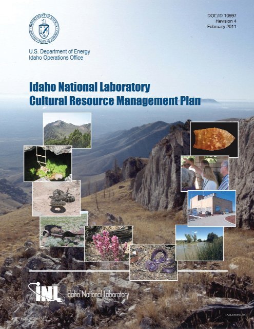
Idaho National Laboratory Cultural Resource Management Plan
Idaho National Laboratory Cultural Resource Management Plan
Idaho National Laboratory Cultural Resource Management Plan

You also want an ePaper? Increase the reach of your titles
YUMPU automatically turns print PDFs into web optimized ePapers that Google loves.
DOE/ID-10997<br />
Revision 4<br />
<strong>Idaho</strong> <strong>National</strong> <strong>Laboratory</strong> <strong>Cultural</strong> <strong>Resource</strong><br />
<strong>Management</strong> <strong>Plan</strong><br />
February 2011<br />
Prepared for the<br />
U.S. Department of Energy<br />
<strong>Idaho</strong> Operations Office
ABSTRACT<br />
As a federal agency, the U.S. Department of Energy has been directed by<br />
Congress, the U.S. president, and the American public to provide leadership in<br />
the preservation of prehistoric, historic, and other cultural resources on the lands<br />
it administers. This mandate to preserve cultural resources in a spirit of<br />
stewardship for the future is outlined in various federal preservation laws,<br />
regulations, and guidelines such as the <strong>National</strong> Historic Preservation Act, the<br />
Archaeological <strong>Resource</strong>s Protection Act, and the <strong>National</strong> Environmental Policy<br />
Act. The purpose of this <strong>Cultural</strong> <strong>Resource</strong> <strong>Management</strong> <strong>Plan</strong> is to describe how<br />
the Department of Energy, <strong>Idaho</strong> Operations Office will meet these<br />
responsibilities at <strong>Idaho</strong> <strong>National</strong> <strong>Laboratory</strong>.<br />
This <strong>Laboratory</strong>, which is located in southeastern <strong>Idaho</strong>, is home to a wide<br />
variety of important cultural resources representing at least 13,500 years of<br />
human occupation in the southeastern <strong>Idaho</strong> area. These resources are<br />
nonrenewable, bear valuable physical and intangible legacies, and yield<br />
important information about the past, present, and perhaps the future. There are<br />
special challenges associated with balancing the preservation of these sites with<br />
the management and ongoing operation of an active scientific laboratory. The<br />
Department of Energy, <strong>Idaho</strong> Operations Office is committed to a cultural<br />
resource management program that accepts these challenges in a manner<br />
reflecting both the spirit and intent of the legislative mandates.<br />
This document is designed for multiple uses and is intended to be flexible<br />
and responsive to future changes in law or mission. Document flexibility and<br />
responsiveness will be assured through regular reviews and as-needed updates.<br />
Document content includes summaries of <strong>Laboratory</strong> cultural resource<br />
philosophy and overall Department of Energy policy; brief contextual overviews<br />
of <strong>Laboratory</strong> missions, environment, and cultural history; and an overview of<br />
cultural resource management practices. A series of appendices provides<br />
important details that support the main text.<br />
iii
CONTENTS<br />
ABSTRACT ................................................................................................................................................. iii<br />
ACRONYMS, ABBREVIATIONS, AND SYMBOLS .............................................................................. ix<br />
GLOSSARY ............................................................................................................................................ xxiii<br />
INTRODUCTION ........................................................................................................................................ 1<br />
Legal Basis for <strong>Cultural</strong> <strong>Resource</strong> <strong>Management</strong> ................................................................................ 1<br />
DOE <strong>Cultural</strong> <strong>Resource</strong> <strong>Management</strong> Philosophy ............................................................................. 2<br />
Purpose of this <strong>Cultural</strong> <strong>Resource</strong> <strong>Management</strong> <strong>Plan</strong> ........................................................................ 3<br />
Scope of this <strong>Cultural</strong> <strong>Resource</strong> <strong>Management</strong> <strong>Plan</strong> ........................................................................... 3<br />
Organization of this <strong>Cultural</strong> <strong>Resource</strong> <strong>Management</strong> <strong>Plan</strong> ................................................................ 4<br />
Professional Qualifications and Training ........................................................................................... 4<br />
Archaeology ............................................................................................................................. 5<br />
Architectural History ................................................................................................................ 5<br />
<strong>Cultural</strong> Anthropology ............................................................................................................. 5<br />
Historic Architecture ................................................................................................................ 6<br />
Historic Landscape Architecture .............................................................................................. 6<br />
Historic Preservation ................................................................................................................ 6<br />
History 6<br />
CULTURAL RESOURCES OF THE IDAHO NATIONAL LABORATORY ........................................... 9<br />
Description of the <strong>Idaho</strong> <strong>National</strong> <strong>Laboratory</strong> .................................................................................... 9<br />
Past and Present Land Use ................................................................................................................. 9<br />
Natural Setting .................................................................................................................................. 11<br />
Flora and Fauna ................................................................................................................................ 14<br />
Prehistory: Paleontology and Paleoecology ..................................................................................... 15<br />
Prehistory: The First Americans ....................................................................................................... 16<br />
Early Prehistoric Period: 13,500 to 8,000 B.P. ...................................................................... 17<br />
Middle Prehistoric Period: 8000 to 1300 B.P. ....................................................................... 19<br />
Late Prehistoric Period: 1300 to 150 B.P. .............................................................................. 20<br />
Protohistoric Period: 300 to 150 B.P. ..................................................................................... 21<br />
History: American Indians ............................................................................................................... 21<br />
History: Euro American ................................................................................................................... 23<br />
Trapping and Fur Trading ...................................................................................................... 23<br />
Emigrants ............................................................................................................................... 24<br />
Mining and Transportation ..................................................................................................... 24<br />
Ranching ................................................................................................................................ 26<br />
Homesteading and Agriculture .............................................................................................. 26<br />
History: 1942 to Present ................................................................................................................... 28<br />
Military Ordnance Testing ..................................................................................................... 28<br />
Nuclear Science and Engineering .......................................................................................... 29<br />
Current Operations ................................................................................................................. 34<br />
v
IDAHO NATIONAL LABORATORY CULTURAL RESOURCE MANAGEMENT ............................ 35<br />
Past, Present, and Potential Effects of INL Activities on <strong>Cultural</strong> <strong>Resource</strong>s .................................. 35<br />
Responsibility for <strong>Resource</strong> <strong>Management</strong> ........................................................................................ 36<br />
Primary Activities of the INL <strong>Cultural</strong> <strong>Resource</strong> <strong>Management</strong> Office ............................................ 36<br />
NHPA Section 110 Goals ................................................................................................................. 37<br />
Identification .......................................................................................................................... 37<br />
Evaluation and Nomination to the <strong>National</strong> Register of Historic Places ............................... 39<br />
Protection and Preservation.................................................................................................... 41<br />
Stakeholder Communication .................................................................................................. 43<br />
Future Activities and Priorities .............................................................................................. 46<br />
NHPA Section 106 Process .............................................................................................................. 46<br />
Tailored <strong>Cultural</strong> <strong>Resource</strong> Review ................................................................................................. 47<br />
Activities and Properties Exempt From <strong>Cultural</strong> <strong>Resource</strong> Review ...................................... 47<br />
<strong>Cultural</strong> <strong>Resource</strong> Review Process ........................................................................................ 50<br />
SUMMARY ................................................................................................................................................ 53<br />
REFERENCES ........................................................................................................................................... 55<br />
Appendix A—Legal Basis for <strong>Cultural</strong> <strong>Resource</strong> <strong>Management</strong> ................................................................. 67<br />
Appendix B—American Indian Interests: DOE Policy and Regulatory Guidance .................................... 83<br />
Attachment 1—U.S. Department of Energy American Indian and Alaska Native Tribal<br />
Government Policy ........................................................................................................................... 91<br />
Attachment 2—Agreement-in-Principle between the Shoshone-Bannock Tribes and the United<br />
States Department of Energy ............................................................................................................ 97<br />
Attachment 3—Communications Protocol ............................................................................................... 115<br />
Attachment 4—Memorandum of Agreement Between United States Department of Energy,<br />
<strong>Idaho</strong> Operations Office and the Shoshone-Bannock Tribes ......................................................... 123<br />
Appendix C—Standards and Procedures for the <strong>Management</strong> of INL Archaeological Properties .......... 129<br />
Appendix D—Strategies and Procedures for the <strong>Management</strong> of INL Historic Architectural<br />
Properties ........................................................................................................................................ 159<br />
Appendix E—Research Designs ............................................................................................................... 173<br />
Appendix F—Historic Contexts ............................................................................................................... 197<br />
Appendix G—Programmatic Agreement .................................................................................................. 287<br />
Appendix H—Inventory of Known INL Archaeological <strong>Resource</strong>s ........................................................ 295<br />
Appendix I—INL Architectural Properties Inventory .............................................................................. 373<br />
vi
Appendix J—INL <strong>Cultural</strong> <strong>Resource</strong> Projects .......................................................................................... 407<br />
Appendix K—Goals and Tasks................................................................................................................. 453<br />
Appendix L—<strong>Idaho</strong> <strong>National</strong> <strong>Laboratory</strong> <strong>Cultural</strong> <strong>Resource</strong> Monitoring <strong>Plan</strong> ........................................ 459<br />
FIGURES<br />
Figure 1. Panorama of INL high-desert terrain. ............................................................................................ 1<br />
Figure 2. Official seal of the U.S. Department of Energy. ............................................................................ 1<br />
Figure 3. Regional setting of <strong>Idaho</strong> <strong>National</strong> <strong>Laboratory</strong> showing locations of major facilities. ............... 10<br />
Figure 4. Big Southern Butte viewed from the Big Lost River. ................................................................. 12<br />
Figure 5. Big Lost River during seasonal water flow. ................................................................................ 13<br />
Figure 6. Springtime vegetation at INL. ..................................................................................................... 14<br />
Figure 7. Pronghorn on the INL high-desert plain. ..................................................................................... 15<br />
Figure 8. Entrance to West Rattlesnake Cave at INL. ................................................................................ 15<br />
Figure 9. INL prehistoric chronological sequence. ..................................................................................... 17<br />
Figure 10. Haskett spear point found at INL. ............................................................................................. 18<br />
Figure 11. Elko corner-notched dart point found at INL. ........................................................................... 20<br />
Figure 12. Late prehistoric small arrow points found at INL. .................................................................... 20<br />
Figure 13. Big Lost River during seasonal storm and high water flow. ..................................................... 24<br />
Figure 14. Reenactment of an emigrant wagon train at Goodale’s Cutoff. ................................................ 24<br />
Figure 15. Historic INL trails with dates that indicate the year in which roads and trails were<br />
surveyed, not necessarily the year they were first used. ............................................................. 25<br />
Figure 16. Headgate from early 1900s irrigation project in the area now known as INL. .......................... 27<br />
Figure 17. Historic artifacts from a failed homestead in the area now known as INL................................ 27<br />
Figure 18. Sixteen-inch naval gun being tested at area now known as INL during the Vietnam<br />
war. ............................................................................................................................................. 28<br />
Figure 19. EBR-1 <strong>National</strong> Historic Landmark. ......................................................................................... 29<br />
Figure 20. Promotional poster for the USS Nautilus nuclear-powered submarine program. ..................... 30<br />
Figure 21. Aerial photo of the LOFT facility (demolished in 2006) and ANP hangar at TAN. ................. 31<br />
Figure 22. Demolition of the WRRTF stack. .............................................................................................. 32<br />
Figure 23. Aerial view of INTEC. .............................................................................................................. 32<br />
Figure 24. Aerial view of MFC. .................................................................................................................. 34<br />
Figure 25. Unexploded Naval depth charge found at INL. ......................................................................... 43<br />
Figure 26. Tour of archeological and historical sites at INL. ..................................................................... 46<br />
Figure 27. <strong>National</strong> Historic Preservation Act Section 106 review process. .............................................. 48<br />
Figure 28. INL Environmental Policy ......................................................................................................... 78<br />
vii
Figure 29. ICP Environmental Policy. ........................................................................................................ 79<br />
Figure 30. Bechtel BWXT Environmental Policy. ..................................................................................... 80<br />
Figure 31. INL <strong>Cultural</strong> <strong>Resource</strong> <strong>Management</strong> Office project summary. ............................................... 147<br />
Figure 32. Standard report format for INL archaeological investigations. ............................................... 148<br />
Figure 33. INL CRM Office permit application for archaeological investigations. ................................. 149<br />
Figure 34. INL CRM Office user agreement for sensitive cultural resource data. ................................... 150<br />
Figure 35. Intermountain Antiquities Computer System forms, INL variation. ....................................... 151<br />
Figure 36. Example of completed <strong>Idaho</strong> Historic Sites Inventory form. .................................................. 172<br />
Figure 37. Theoretical organization of prehistoric archaeological sites in a subsistence and<br />
settlement pattern. ..................................................................................................................... 184<br />
Figure 38. Example of INL <strong>Cultural</strong> <strong>Resource</strong> <strong>Management</strong> Office field monitoring form. ................... 463<br />
TABLES<br />
Table 1. Property types for which actions are exempt from review. .......................................................... 49<br />
Table 2. INL activities exempt from review (no activities at EBR-I are exempted except as noted<br />
below). ........................................................................................................................................ 51<br />
Table 3. Summary of DOE-ID building survey and assessment. ............................................................. 163<br />
Table 4. INL signature properties. ............................................................................................................ 164<br />
Table 5. INL prehistoric archaeological sites. .......................................................................................... 297<br />
Table 6. INL prehistoric isolated finds. .................................................................................................... 331<br />
Table 7. INL historic and multi-component archaeological sites and isolated finds. ............................... 365<br />
Table 8. Surveyed INL properties. ............................................................................................................ 377<br />
Table 9. INL <strong>Cultural</strong> <strong>Resource</strong> <strong>Management</strong> Office archaeological investigations................................ 409<br />
Table 10. Early INL archaeological investigations and subcontracts. ...................................................... 434<br />
Table 11. INL <strong>Cultural</strong> <strong>Resource</strong> <strong>Management</strong> Office architectural investigations. ................................ 439<br />
viii
ACRONYMS, ABBREVIATIONS, AND SYMBOLS<br />
The acronyms, abbreviations, initialisms, and symbols contained in the following list include those<br />
used to denote terms in both the body of this document and the appendices, with the exception of form<br />
examples (e.g., Figure 31) where both the acronym and full term are provided. Symbols are provided at<br />
the end of this list.<br />
A1W large ship reactor (A for aircraft carrier, 1 for first model, and W for the designer,<br />
Westinghouse)<br />
A&M Assembly and Maintenance building (TAN-607)<br />
ACETS Advanced Combined Environments Test Station<br />
ACHP Advisory Council on Historic Preservation<br />
ACRS Advisory Committee on Reactor Safeguards<br />
A.D. Anno Domini (in the year of the Lord)<br />
Admin administration (administrative)<br />
AEC Atomic Energy Commission (also “USAEC,” DOE predecessor)<br />
AEF Argonne Experimental Facility<br />
AFSR Argonne Fast Source Reactor<br />
AIP Agreement-In-Principle<br />
AIRFA American Indian Religious Freedom Act<br />
ALPR Argonne Low Power Reactor<br />
AMWTP Advanced Mixed Waste Treatment Project<br />
ANCR Aerojet Nuclear Company Report (technical report designation)<br />
ANL Argonne <strong>National</strong> <strong>Laboratory</strong><br />
ANL-W Argonne <strong>National</strong> <strong>Laboratory</strong>-West (now MFC)<br />
ANLW Argonne <strong>National</strong> <strong>Laboratory</strong>-West (archaeological field or project designator)<br />
ANP Aircraft Nuclear Propulsion<br />
ANPP Aircraft Nuclear Propulsion Program<br />
anti-C anti-contamination (protective clothing)<br />
APEX Atomic Products Division of General Electric (technical report designation)<br />
APMP Architectural Properties <strong>Management</strong> <strong>Plan</strong><br />
ARA Army Reactor Area (renamed the Auxiliary Reactor Area)<br />
ARPA Archaeological <strong>Resource</strong> Protection Act of 1979<br />
ARVFS Advanced Reentry Vehicle Fuzing System<br />
ATR Advanced Test Reactor<br />
ATRC Advanced Test Reactor Complex<br />
B<br />
building (designator)<br />
ix
BBWI<br />
BCP<br />
BEA<br />
BIA<br />
bldg.<br />
BLM<br />
BLR<br />
BM<br />
BORAX<br />
B.P.<br />
BRB<br />
BRX<br />
BT<br />
BV<br />
BWP<br />
BWXT<br />
C<br />
C1W<br />
ca.<br />
CAB<br />
CAES<br />
CCD<br />
CDC<br />
CERCLA<br />
CERT<br />
cf.<br />
CF<br />
CFA<br />
CFR<br />
CFRD<br />
CITRC<br />
CL<br />
cm<br />
Bechtel BWXT <strong>Idaho</strong>, LLC (AMWTP contractor and former INEEL contractor)<br />
Baseline Change Proposal<br />
Battelle Energy Alliance, LLC (INL contractor)<br />
Bureau of Indian Affairs<br />
building<br />
Bureau of Land <strong>Management</strong><br />
Big Lost River<br />
Bingham County<br />
Boiling-Water Reactor Experiment<br />
before present (i.e., before 1950 A.D.)<br />
B. Robert Butler (cultural resource investigator)<br />
Boiling-Water Reactor Experiment (archaeological field designator)<br />
Butte County<br />
Bonneville County<br />
Buried Waste Program<br />
BWX Technologies, Inc.<br />
celsius<br />
cruiser ship reactor (C for cruiser, 1 for first model, and W for the designer,<br />
Westinghouse)<br />
circa, in approximately, around (abbreviation for Latin “circum”)<br />
Citizens Advisory Board<br />
Center for Advanced Energy Studies<br />
Corrosive Chemical Disposal Area<br />
Capsule Driver Core<br />
Comprehensive Environmental Response, Compensation, and Liability Act<br />
controlled environmental radioiodine test<br />
compare (Latin abbreviation for “conferre”)<br />
Central Facilities Area building designation<br />
Central Facilities Area<br />
Code of Federal Regulations<br />
corporate-funded research and development<br />
Critical Infrastructure Test Range Complex (formerly PBF)<br />
Clark County<br />
centimeter<br />
x
Co.<br />
company<br />
COM communication<br />
CP-1 Chicago Pile #1<br />
CPP Chemical Processing <strong>Plan</strong>t (used primarily as an SSC designation)<br />
cr.<br />
creek<br />
CRBR Clinch River Breeder Reactor<br />
CRCE Cavity Reactor Critical Experiment<br />
CRM cultural resource management (also “<strong>Cultural</strong> <strong>Resource</strong> <strong>Management</strong>,” e.g., INL CRM<br />
Office)<br />
CRMO <strong>Cultural</strong> <strong>Resource</strong> <strong>Management</strong> Office (also “CRM Office”)<br />
CRMP <strong>Cultural</strong> <strong>Resource</strong> <strong>Management</strong> <strong>Plan</strong><br />
CRWG <strong>Cultural</strong> <strong>Resource</strong>s Working Group<br />
CWI CH2MWG <strong>Idaho</strong>, LLC (ICP contractor)<br />
D 2 O deuterium oxide (also “heavy water,” two parts deuterium and one part oxygen)<br />
D&D decontamination and dismantlement<br />
D&D decontamination and demolition<br />
DC<br />
Defense Communication (technical report designation)<br />
D.C. District of Columbia<br />
DCS distributed control system<br />
DD&D deactivation, decontamination, and demolition<br />
DEQ <strong>Idaho</strong> Department of Environmental Quality<br />
DEW Defense Early Warning (later the Ballistic Missile Early Warning System)<br />
DOD Department of Defense<br />
DOE Department of Energy<br />
DOE-HQ Department of Energy, Headquarters<br />
DOE-ID Department of Energy, <strong>Idaho</strong> Operations Office<br />
DOE/ID Department of Energy, <strong>Idaho</strong> Operations Office (technical report designation)<br />
E<br />
east<br />
E-85 mixture of 85% ethanol and 15% gasoline based on volume<br />
EA<br />
environmental assessment<br />
EBOR Experimental Beryllium Oxide Reactor<br />
EBR Experimental Breeder Reactor (e.g., EBR-I)<br />
EBWR Experimental Boiling Water Reactor<br />
EC<br />
environmental checklist (INL document designator)<br />
xi
ECCS<br />
ECF<br />
ECW<br />
ed.<br />
EFS<br />
e.g.<br />
EG&G<br />
EH<br />
EHS<br />
EIS<br />
EM<br />
EMS<br />
e-mail<br />
EO<br />
EOCR<br />
EPA<br />
ER<br />
ERDA<br />
ESRF<br />
et al.<br />
etc.<br />
ETR<br />
ETRC<br />
et seq.<br />
EXT<br />
FAA<br />
FAST<br />
FAV<br />
Fax<br />
FCF<br />
FDP<br />
FET<br />
FETF<br />
Emergency Core Cooling System<br />
Expended Core Facility<br />
ECW Press (Essays on Canadian Writing, et seq.)<br />
edition<br />
Experimental Field Station<br />
for example (Latin abbreviation for “exempli gratia”)<br />
EG&G Technical Services, Inc. (originally Edgerton, Germeshausen, and Grier, Inc.,<br />
former INEL contractor)<br />
Environmental, Safety, and Health (DOE-HQ division)<br />
Earl H. Swanson (cultural resource investigator)<br />
environmental impact statement<br />
Environmental <strong>Management</strong> Office of the Department of Energy<br />
Environmental <strong>Management</strong> System<br />
electronic mail (also “E-mail”)<br />
Executive Order<br />
Experimental Organic Cooled Reactor<br />
Environmental Protection Agency<br />
environmental restoration<br />
Energy Research and Development Administration (DOE predecessor)<br />
Environmental Sciences and Research Foundation<br />
and others (abbreviation for Latin feminine plural “et aliae,” masculine plural “et alil,” or<br />
neutral plural “et alia”)<br />
and so forth (abbreviation for Latin “et cetera”)<br />
Engineering Test Reactor<br />
Engineering Test Reactor Critical Facility<br />
and those that follow (abbreviation for Latin “et sequens”)<br />
external (INL technical report designation)<br />
Federal Aviation Administration<br />
Fluorinel Dissolution Process and Fuel Storage (project and facility, CPP-666)<br />
Fast Attack Vehicle (canceled project)<br />
facsimile<br />
Fuel Cycle Facility (renamed “Fuel Conditioning Facility”)<br />
Fluorinel Dissolution Process<br />
Field Engineering Test (LOFT facility, formerly FETF)<br />
Flight Engine Test Facility (now FET)<br />
xii
FFA/CO<br />
FONSI<br />
FPR<br />
FRAN<br />
FS&R<br />
Federal Facility Agreement and Consent Order<br />
finding of no significant impact<br />
fuel processing restoration<br />
Fast Burst Reactor (nuclear effects reactor)<br />
Filling, Storage, and Remelt System<br />
ft feet (foot; also )<br />
FY<br />
fiscal year<br />
GCRE Gas-Cooled Reactor Experiment<br />
GDE guide (INL document designator)<br />
GE<br />
General Electric Company<br />
GIS geographical information system<br />
Govt government<br />
GPS Global Positioning System<br />
H 2 O water (two parts hydrogen and one part oxygen)<br />
HABS Historic American Buildings Survey<br />
HAER Historic American Engineering Record<br />
HAPMP INEEL Historic Architectural Properties <strong>Management</strong> <strong>Plan</strong> for U.S. Department of<br />
Energy, <strong>Idaho</strong> Operations Office (INEEL/EXT-02-1338)<br />
HBIS Historic Building Inventory Survey<br />
HEPA high efficiency particulate air<br />
HETO Heritage Tribal Office (formerly Tribal CRM Office)<br />
HFEF Hot Fuel Examination Facility<br />
HIST history (archaeological project designator)<br />
HPIL Health Physics Instrument <strong>Laboratory</strong><br />
HPTF Howe Peak Transmitter Facility<br />
HTGR High Temperature Gas Cooled Reactor<br />
HTRE Heat Transfer Reactor Experiments<br />
I-131 iodine-131<br />
I.C.<br />
<strong>Idaho</strong> Code<br />
ICDF <strong>Idaho</strong> CERCLA Disposal Facility<br />
ICP<br />
<strong>Idaho</strong> Cleanup Project<br />
ICPP <strong>Idaho</strong> Chemical Processing <strong>Plan</strong>t (also “Chem <strong>Plan</strong>t,” now INTEC)<br />
ID<br />
<strong>Idaho</strong><br />
ID<br />
<strong>Idaho</strong> Operations Office (DOE)<br />
xiii
IDO <strong>Idaho</strong> Operations Office reports (issued by DOE and its predecessors for DOE Technical<br />
Information Division distribution)<br />
IDT <strong>Idaho</strong> Department of Transportation<br />
i.e.<br />
that is (abbreviation for Latin “id est”)<br />
IEDF INEEL Engineering Demonstration Facility<br />
IEEE Institute of Electrical and Electronics Engineers<br />
IET<br />
Initial Engine Test<br />
IF<br />
<strong>Idaho</strong> Falls, <strong>Idaho</strong><br />
IFR<br />
Integral Fast Reactor<br />
ISHS <strong>Idaho</strong> State Historical Society<br />
IHSI <strong>Idaho</strong> Historical Sites inventory<br />
ILTSF Intermediate Level Transuranic Storage Facility<br />
IMACS Intermountain Antiquities Computer System<br />
in. inch (also [“])<br />
Ind. individual<br />
Inc.<br />
Incorporated<br />
INEC <strong>Idaho</strong> Nuclear Energy Commission<br />
INEEL <strong>Idaho</strong> <strong>National</strong> Engineering and Environmental <strong>Laboratory</strong> (now INL)<br />
INEL <strong>Idaho</strong> <strong>National</strong> Engineering <strong>Laboratory</strong> (now INL)<br />
INL <strong>Idaho</strong> <strong>National</strong> <strong>Laboratory</strong> (formerly NRTS, INEL, and then INEEL)<br />
INTEC <strong>Idaho</strong> Nuclear Technology and Engineering Center (formerly ICPP)<br />
IRC <strong>Idaho</strong> Research Center<br />
ISF<br />
Intermediate-Scale Facility (waste disposal demonstration site)<br />
ISFF <strong>Idaho</strong> Spent Fuel Facility<br />
ISM Integrated Safety <strong>Management</strong><br />
ISO International Standards Organization<br />
ISU <strong>Idaho</strong> State University<br />
ITDF <strong>Idaho</strong> Transportation Department facility<br />
IWPF <strong>Idaho</strong> Waste Processing Facility (PREPP-II)<br />
JCAE Joint Committee on Atomic Energy, U.S. Congress (now dissolved)<br />
JF<br />
Jefferson County<br />
JFK John Fitzgerald Kennedy (thirty-fifth president of the United States, 1961 to 1963).<br />
JGF John G. Franzen (cultural resource investigator)<br />
km<br />
kilometer<br />
xiv
kV<br />
L<br />
LAK<br />
LAN<br />
LCCDA<br />
LCRE<br />
LDRD<br />
LESAT<br />
LITCO<br />
LLC<br />
LLMWPF<br />
LMFBR<br />
LMIT<br />
LMITCO<br />
LOFT<br />
LPTF<br />
LRD<br />
LT<br />
LWP<br />
m<br />
M&O<br />
MCP<br />
MDA<br />
Met Lab<br />
MFC<br />
mi<br />
Mil.<br />
misc.<br />
MIT<br />
MK<br />
ML<br />
MOA<br />
MOU<br />
kilovolt<br />
series designator for nonnuclear, large-break, loss-of-coolant accident teaching reactors<br />
L. A. Kingsbury (cultural resource investigator)<br />
local area network<br />
Liquid Corrosive Chemical Disposal Area<br />
Lithium Cooled Reactor<br />
laboratory-directed research and development<br />
Lockheed Environmental Systems and Technologies Company<br />
Lockheed <strong>Idaho</strong> Technologies Company (contractual company name of LMITCO)<br />
limited liability company<br />
Low Level Mixed Waste Processing Facility<br />
Liquid Metal Fast Breeder Reactor<br />
Lockheed Martin <strong>Idaho</strong> Technologies Company (abbreviated form of LMITCO used<br />
primarily as a document or activity designator)<br />
Lockheed Martin <strong>Idaho</strong> Technologies Company (former INL M&O contractor)<br />
Loss of Fluid Test<br />
Low Power Test Facility<br />
laboratory requirements document (INL document designator)<br />
long-term<br />
laboratory wide procedure (INL document designator)<br />
meter<br />
management and operating (contractor)<br />
management control procedure (INL document designator)<br />
mass detonation area<br />
Metallurgical <strong>Laboratory</strong><br />
Materials and Fuels Complex (formerly ANL-W)<br />
mile<br />
military<br />
miscellaneous<br />
Massachusetts Institute of Technology<br />
Morrison Knudsen Corporation (now Washington Group International, Inc.)<br />
Mobile Low-Power reactor (e.g., ML-1)<br />
memorandum of agreement<br />
memorandum of understanding<br />
xv
MTA Mobile Test Assembly<br />
MTR Materials Test Reactor<br />
MWSF Mixed Waste Storage Facility<br />
N<br />
north<br />
NA<br />
not applicable<br />
NAGPRA Native American Graves Protection and Repatriation Act<br />
NaK sodium-potassium alloy, used as a reactor coolant<br />
NARA <strong>National</strong> Archives and Records Administration<br />
NASA <strong>National</strong> Aeronautics and Space Administration<br />
n.d.<br />
no date<br />
NDGPS <strong>National</strong> Defense Global Positioning System<br />
NE<br />
Nuclear Energy, Science, and Technology Office of the Department of Energy<br />
NEA Nuclear Energy Agency<br />
NEPA <strong>National</strong> Environmental Policy Act<br />
NESHAP <strong>National</strong> Emissions Standards for Hazardous Air Pollutants<br />
NHPA <strong>National</strong> Historic Preservation Act<br />
NIQI Northern Intermountain Quaternary Institute<br />
NIOSH <strong>National</strong> Institute of Occupational Safety and Health<br />
No. number (also “#”)<br />
NOAA <strong>National</strong> Oceanic and Atmospheric Administration<br />
NODA Naval Ordnance Disposal Area<br />
Nos. numbers<br />
NOTF Naval Ordnance Test Facility<br />
NOX mixed oxides of nitrogen (NO, NO 2 , N 2 O)<br />
n.p.<br />
no publisher<br />
NPG Naval Proving Grounds<br />
NPR New Production Reactor<br />
NPS <strong>National</strong> Park Service<br />
NRB <strong>National</strong> Register bulletin<br />
NRC Nuclear Regulatory Commission<br />
NRF Naval Reactors Facility<br />
NRHP <strong>National</strong> Register of Historic Places<br />
NRT Nuclear Reactor Testing<br />
NRTS <strong>National</strong> Reactor Testing Station (now INL)<br />
xvi
NuPac Nuclear Pacific (manufacture of casks)<br />
NW northwest<br />
NWCF New Waste Calcining Facility<br />
NWI Northwind Environmental, Inc. (subcontractor and cultural resource investigator)<br />
OCVZ organic contamination in the vadose zone<br />
OECD Organization for Economic Cooperation and Development<br />
OMRE Organic Moderated Reactor Experiment<br />
Ord<br />
ordnance<br />
ORNL Oak Ridge <strong>National</strong> <strong>Laboratory</strong><br />
OU<br />
operable unit<br />
p. page<br />
P<br />
policy (DOE)<br />
PA<br />
programmatic agreement<br />
P&W Pratt and Whitney Aircraft Division (United Aircraft Corporation)<br />
PBF Power Burst Facility (now CITRC)<br />
PCB polychlorinated biphenyl<br />
PDD program description document (INL document designator)<br />
PEW process equipment waste<br />
Ph.D. Doctor of Philosophy<br />
PIP<br />
program improvement plan<br />
PL<br />
Portable Low-Power reactor (e.g., PL-3)<br />
PL<br />
public law<br />
PM<br />
Portable Medium Power Nuclear Power <strong>Plan</strong>t (e.g., PM-2A)<br />
PNDR Partnership in Natural Disaster Reduction (replaces ACETS)<br />
POL policy (INL document designator)<br />
PPCo Phillips Petroleum Company<br />
PREPP Process Experimental Pilot <strong>Plan</strong>t<br />
Prog program<br />
PS<br />
policies and standards of performance<br />
PTR Phillips Technical Report (PPCo internal report)<br />
PUREX plutonium and uranium extraction<br />
PWT portable water treatment<br />
Quad. quadrant<br />
R<br />
range<br />
xvii
R. river<br />
R-2 Swedish test reactor designation<br />
RadCon Radiological Control<br />
RAL Remote Analytical <strong>Laboratory</strong> (CPP-684)<br />
RCRA <strong>Resource</strong> Conservation and Recovery Act<br />
Ref. reference<br />
RESL Radiological and Environmental Sciences <strong>Laboratory</strong><br />
Rev. revision<br />
RMF Reactivity Measurement Facility<br />
ROB Research Office Building (at IRC)<br />
ROW right of way<br />
RSTA Reactives Storage and Treatment Area<br />
RWMC Radioactive Waste <strong>Management</strong> Complex<br />
S1W Submarine Thermal Reactor (also “STR”; S for submarine, 1 for first model, and W for<br />
the designer, Westinghouse)<br />
S5G Submarine Reactor (high-speed submarine; S for submarine, 5 for fifth model, and G for<br />
the designer, General Electric)<br />
SA<br />
spreading area<br />
SAB spreading area B<br />
SAIC Science Application International Corporation (involved in radioactive waste technology)<br />
SARA Superfund Amendments and Reauthorization Act<br />
SAREF Safety Research Facility<br />
SAT Save America’s Treasures<br />
SCADA Supervisory Control and Data Acquisition (INL electrical power consumption<br />
computerized system)<br />
SDA Subsurface Disposal Area<br />
SE<br />
southeast<br />
Sec<br />
section<br />
Sept. September<br />
SERDP Strategic Environmental Research and Development Program<br />
Sho-Ban Shoshone-Bannock Tribes<br />
SHPO State Historic Preservation Office<br />
SIS<br />
Special Isotope Separation<br />
SJM Susanne J. Miller (cultural resource investigator)<br />
SL<br />
Stationary Low Power reactor (e.g., SL-1)<br />
xviii
SM<br />
Stationary Medium Power reactor (e.g., SM-1)<br />
SMC Specific Manufacturing Capability<br />
SNAP Systems for Nuclear Auxiliary Power<br />
SNF spent nuclear fuel<br />
SNM special nuclear material<br />
SNTP Space Nuclear Test Program<br />
SPERT Special Power Excursion Reactor Test<br />
sq. square (also “ 2 ”)<br />
SSC structure, system, or component<br />
SSC Super Conducting Supercollider (canceled project)<br />
SSSTF Staging, Storage, Sizing, and Treatment Facility<br />
STAR Safety and Tritium Applied Research Facility (TRA-666)<br />
STC Science and Technology Campus<br />
Stat. statute<br />
STD standard (INL document designator)<br />
STEP Safety Test Engineering Program<br />
STF Security Training Facility (former EOCR reactor building)<br />
STGWG State and Tribal Government Working Group<br />
STR Submarine Thermal Reactor<br />
SUSIE Shield Test Pool Facility<br />
SW<br />
southwest<br />
SWEPP Stored Waste Examination Pilot <strong>Plan</strong>t<br />
SWPP service waste percolation pond<br />
T<br />
township<br />
T<br />
trailer or temporary structure (designator)<br />
TAN Test Area North<br />
TB<br />
temporary building (designator)<br />
Temp. temporary<br />
TERO Tribal Employment Rights Ordinance<br />
TETF Totally Enclosed Treatment Facility<br />
THPO Tribal Historic Preservation Office<br />
THRITS Thermal Reactor <strong>Idaho</strong> Test Station<br />
TMI Three Mile Island<br />
TNT trinitrotoluene<br />
xix
TRA Test Reactor Area (now ATRC)<br />
TRANSCOM Transportation Communication<br />
TREAT Transient Reactor Test Facility<br />
TRL Tritium Research <strong>Laboratory</strong><br />
TRU transuranic (an element with an atomic number greater than 92, the atomic number of<br />
uranium)<br />
TRUPACT transuranic waste package containers<br />
TSA Transuranic Storage Area<br />
TSF Technical Support Facility<br />
TST test (archeological field project designator)<br />
U-235 uranium-235<br />
UAV unmanned aerial vehicle<br />
UCNI unclassified controlled nuclear information<br />
UGV unmanned ground vehicle<br />
UK<br />
unknown<br />
U of I University of <strong>Idaho</strong><br />
UREP Utilities Replacement Expansion (also “Enhancement”) Project<br />
U.S. United States<br />
USA United States of America<br />
USAEC U.S. Atomic Energy Commission (also “AEC,” DOE predecessor)<br />
USC United States Code (also “U.S.C.”)<br />
U.S.C. United States Code (also “USC”)<br />
USDOE U.S. Department of Energy (also “DOE”)<br />
USFS U.S. Forest Service<br />
USGPO U.S. Government Printing Office<br />
USGS United States Geological Survey (also “U.S.G.S.”)<br />
U.S.G.S. United States Geological Survey (also “USGS”)<br />
USS United States Ship<br />
UTM universal transverse mercator (map measurement)<br />
v. against (abbreviation for Latin “versus”)<br />
VCO Voluntary Consent Order<br />
VIS misnomer for “InelViz” (software developed for INL to display meteorological data and<br />
plume dispersion modeling data)<br />
VMF Vehicle Monitoring Facility<br />
VVE vapor vacuum extraction<br />
xx
W<br />
west<br />
WAG waste area group<br />
WCF Waste Calcining Facility<br />
WEDF Waste Engineering Development Facility<br />
WERF Waste Experimental Reduction Facility (now WROC)<br />
WINCO Westinghouse <strong>Idaho</strong> Nuclear Company, Inc. (former ICPP M&O contractor)<br />
WIPP Waste Isolation Pilot <strong>Plan</strong>t (DOE facility in New Mexico)<br />
WM waste management<br />
WMC Waste <strong>Management</strong> Complex (building designation)<br />
WMF Waste <strong>Management</strong> Facility (building designation)<br />
WMO Waste <strong>Management</strong> Office<br />
WOW Woman Ordnance Worker<br />
WRC Weapons Range Complex<br />
WROC Waste Reduction Operations Complex (formerly WERF)<br />
WRRTF Water Reactor Research Test Facility<br />
WTB wireless test bed<br />
WW2 World War II<br />
YDB yard B, west side of CPP-601<br />
ZPPR Zero Power Plutonium Reactor<br />
ZPR Zero Power Reactor<br />
&<br />
and<br />
x<br />
by<br />
<br />
degrees (temperature)<br />
> greater than<br />
’ feet (foot; also “ft”)<br />
< less than<br />
<br />
less than or equal to<br />
# number (also “No.”)<br />
% percent<br />
+ plus<br />
square (squared, also “sq.”)<br />
xxi
xxii
GLOSSARY<br />
The terms defined in this glossary fall under one of two general categories: (1) terms that are<br />
sufficiently technical in nature as to merit clarification, and (2) commonly used terms that convey a<br />
meaning within this document that differs from or is more specific than that conveyed elsewhere.<br />
abrader. Small, generally flat piece of stone that exhibits linear grooves produced by the repeated<br />
rubbing (abrasion) of bone or wood to fashion needles, arrow shafts, perforators, etc.<br />
adaptation. The process of change in response to environmental conditions or other external stimuli.<br />
adverse effect. A type of impact that may alter, directly or indirectly, any of the characteristics of a<br />
historic property that qualify the property for inclusion in the <strong>National</strong> Register of Historic Places<br />
(NRHP). This includes any impact that would diminish the integrity of the property’s location, design,<br />
setting, materials, workmanship, feeling, or association. Adverse effects may also include reasonably<br />
foreseeable effects caused by an undertaking that may occur later, be farther removed in distance, or be<br />
cumulative. Consideration is given to all qualifying characteristics of a historic property, including those<br />
that may have been identified subsequent to the original evaluation of the property’s eligibility for the<br />
<strong>National</strong> Register [36 CFR § 800.5(a)(1); see 36 CFR § 800.5(a)(2) for examples].<br />
Advisory Council on Historic Preservation (ACHP; also referred to as “Advisory Council”). An<br />
independent federal agency that advises the U.S. president and U.S. Congress on historic preservation and<br />
oversees review under Section 106 of the <strong>National</strong> Historic Preservation Act (NHPA). The Advisory<br />
Council is made up of a 20-member panel of presidential appointees, as well as agency heads, parties<br />
named in the NHPA, and a staff with offices in Washington, D.C. [<strong>National</strong> Preservation Institute,<br />
“Integrating <strong>Cultural</strong> <strong>Resource</strong>s in NEPA Compliance,” September 2003]<br />
aeolian. Pertaining to, caused by, or carried by the wind.<br />
alluvial. Deposited by flowing water, as in a riverbed, a floodplain, a delta, or a fan.<br />
altithermal. A climatic period corresponding to the archaic cultural periods from 7500 to 3500 before<br />
present (B.P.). The altithermal climate was an extended warming period with apparent long droughts<br />
resulting from the shift of major latitudinal wind patterns.<br />
American Indians. Of, or relating to, persons whose ancestors aboriginally occupied the Americas (also<br />
referred to as Native Americans or Indians).<br />
anthropology. The scientific and humanistic study of human kind's present and past biological, linguistic,<br />
social, and cultural variations from an all-encompassing holistic approach, with major subfields of<br />
archaeology, physical anthropology, cultural anthropology, and anthropological linguistics.<br />
archaeological context. The physical setting, location, and cultural association of artifacts and features<br />
within an archaeological site.<br />
archaeological site. A definable area containing artifacts and/or features representative of human<br />
activities preserved in a geological context. Any place or locality where there is evidence of past human<br />
activity. An archaeological site can be as ephemeral as a surface scatter of flakes covering a few square<br />
feet to the remains of an earthlodge village covering several tens of acres. Sites can include, but are not<br />
limited to, stone circles, lithic scatters, campsites, rockshelters, caves, quarries, burials, pictographs,<br />
vision quest structures, buffalo jumps, sheepherding camps, homesteads, and historic trash dumps. For<br />
practical purposes at <strong>Idaho</strong> <strong>National</strong> <strong>Laboratory</strong> (INL), artifact concentrations of >10 items are classified<br />
as sites.<br />
xxiii
archaeology. The scientific study of the physical evidence of past human societies. Archaeology's initial<br />
objective is the construction of descriptive cultural chronology; its intermediate objective is the<br />
description of past lifeways, and its ultimate objective involves discovery of the processes that underlie<br />
and condition human behavior.<br />
archaic period (also middle prehistoric period). A cultural manifestation and ecological adaptive<br />
strategy dating between 8000 to 1300 B.P. on the northeastern Snake River Plain. It is divided into three<br />
subperiods: early (8000 to 5500 B.P.), middle (5500 to 3500 B.P.), and late (3500 to 1300 B.P.). These<br />
subperiods are based on changes in projectile point structure and form. This Archaic lifeway is<br />
characterized by varied resource utilization, including seasonal round adaptations, big and small game<br />
hunting, and gathering of vegetal and seed foods.<br />
architectural property. Various types of buildings, structures, and objects serving human needs related<br />
to the occupation and use of the land. Their function, materials, date, condition, construction methods,<br />
and location reflect the historic activities, customs, tastes, and skills of the people who built and used<br />
them. On the INL site, this term generally refers to post-1942 structures, buildings, and objects.<br />
archive. A place or collection containing records, documents, or other materials of historical interest.<br />
area of potential effect. A geographic area within which an undertaking may directly or indirectly cause<br />
alterations in the character or use of any historic properties in the area. [36 CFR § 800.16(d)]<br />
assemblage. A discrete collection of artifacts from a given site, stratum, or area. A group of artifacts<br />
related to each other based upon recovery from a common archaeological context.<br />
assessment. Evaluation of a federal project in regard to the effect it may have on cultural resources.<br />
Under 36 CFR 800.5, assessment is defined as application of the “Criteria of Effect” (36 CFR 800.9a) in<br />
consultation with the State Historic Preservation Office.<br />
artifact. Any object manufactured, used, or modified by humans.<br />
basalt. A dark-colored igneous rock of volcanic origin. Fine-textured varieties were used by prehistoric<br />
people in stone tool manufacture in the INL region.<br />
biface. A chipped stone artifact that has been flaked on both sides.<br />
Boreal. Of or pertaining to northern forest areas and tundra of the North Temperate Zone and Arctic<br />
region.<br />
cairn. A memorial or landmark consisting of regular or irregular piles of locally available rock. Cairns are<br />
used as trail markers or burial markers or to mark offerings, sacred places, or caches.<br />
categorical exclusion. Refers to a category of actions under NEPA which neither individually nor<br />
cumulatively have a significant effect on the human environment and for which, therefore, neither an<br />
environmental assessment nor an environmental impact statement is required.<br />
Cenozoic. The latest of four geologic eras encompassing the last 65 million years.<br />
Clovis point. A fluted lanceolate projectile point often found at mammoth kill sites dated ca. 13,000 to<br />
13,500 B.P. and associated with the Clovis technology, which is among the earliest known in the western<br />
hemisphere and marks the earliest known human occupation of the INL landscape.<br />
Cody complex. Late Paleo-Indian cultural complex dating approximately 10,500–8,800 B.P.<br />
characterized by parallel-flaked lanceolate projectile points and tanged, asymmetric Cody knives.<br />
complex. A term used to integrate a number of traits or items known to be associated with one another. A<br />
temporal continuity represented by persistent configurations in single technologies or other systems of<br />
related forms.<br />
xxiv
compliance. Adherence to specific provisions of any law, executive order, regulation, authorization, or<br />
similar legal instrument. In cultural resource management, compliance is most commonly used to mean<br />
documented observance of the regulated procedural requirements of the <strong>National</strong> Historic Preservation<br />
Act, although the word is generally not favored by the Advisory Council due to its connotations of<br />
resistance and coercion. [Bureau of Land <strong>Management</strong> <strong>Cultural</strong> <strong>Resource</strong> <strong>Management</strong> Manual, 8100,<br />
1988]<br />
conservation. The protection, preservation, data recovery, and management actions directed toward<br />
cultural resources. The term is based on the premise that cultural resources are nonrenewable and<br />
emphasizes use and taking action.<br />
consultation. The process of seeking, discussing, and considering the views of other participants, and,<br />
where feasible, seeking agreement with them regarding matters arising in the Section 106 process.<br />
[36 CFR § 800.16(f)] With respect to Native Americans, official consultation is a<br />
government-to-government interaction.<br />
consulting parties. Persons or groups the federal agency consults with during the <strong>National</strong> Historic<br />
Preservation Act Section 106 process. They may include the State Historic Preservation Office; the Tribal<br />
Historic Preservation Office; American Indian tribes and native Hawaiian organizations; representatives<br />
of local governments; applicants for federal assistance, permits, licenses, and other approvals; or any<br />
additional consulting parties. [Based on 36 CFR § 800.2(c)]<br />
Additional consulting parties may include individuals and organizations with a demonstrated interest in<br />
the undertaking due to the nature of their legal or economic relation to the undertaking or affected<br />
properties, or their concern with the undertaking’s effects on historic properties. [36 CFR § 800.2(c)(6)]<br />
cultural resources. Unique and nonrenewable evidence of past human activity identifiable through field<br />
surveys, historic documentation, or oral evidence. This includes archaeological, historical, and<br />
architectural sites, structures, districts, and natural and cultural landscapes with important public or<br />
scientific uses or value, as well as objects, locations, and landscapes of importance to a culture or<br />
community for traditional, religious, or other cultural reasons.<br />
culture. The integrated system of learned behavior patterns that is characteristic of the members of a<br />
society and not the result of biological inheritance.<br />
debitage. Lithic waste material (i.e., flakes) resulting from stone tool manufacture and/or maintenance.<br />
determination of eligibility. A decision that a district, site, building, structure, or object meets or does<br />
not meet the <strong>National</strong> Register of Historic Places criteria for evaluation. [36 CFR § 60.3(c)]<br />
diagnostic artifact. An artifact with characteristic traits such that it can be placed in a specified cultural<br />
context, time period, and geographic area.<br />
early prehistoric period (also paleo-Indian tradition or period). An archaeological period and cultural<br />
manifestation comprising several cultures and complexes that date to at least 13,500 B.P. and end about<br />
8,000 years ago. This period is best known for the nomadic hunters of now-extinct big game at the close<br />
of the Pleistocene or glacial period.<br />
effect. Alteration to the characteristics of a historic property that qualifies it for inclusion, or eligibility for<br />
inclusion, in the <strong>National</strong> Register of Historic Places. [36 CFR § 800.16(I)]<br />
environmental assessment (EA). A concise public document for which a federal agency is responsible.<br />
The EA serves to:<br />
<br />
Briefly provide sufficient evidence and analysis for determining whether to prepare an environmental<br />
impact statement (EIS) or a finding of no significant impact (FONSI)<br />
xxv
Aid an agency’s compliance with the <strong>National</strong> Environmental Policy Act (NEPA) when no EIS is<br />
necessary<br />
Facilitate preparation of an EIS when one is necessary.<br />
The EA includes a discussion of the need for the proposed undertaking and alternatives, a discussion of<br />
the environmental impacts of the proposed action and alternatives, and a list of agencies and persons<br />
consulted. [NEPA; 40 CFR 1508.9]<br />
ethnography. The systematic description of human cultures based on anthropological fieldwork.<br />
Euro American. European immigrants to the Americas who settled in <strong>Idaho</strong> in the early to mid 1800s.<br />
evaluation. The process of determining eligibility of a property for listing on the <strong>National</strong> Register of<br />
Historic Places. [Based on criteria set forth in 36 CFR Part 60.4]<br />
fauna. A Latin term that refers to animals.<br />
finding. Factual assessment by a party, usually an agency, that is subject to review by other parties to the<br />
<strong>National</strong> Historic Preservation Act Section 106 process. [Based on ACHP, “Section-by-Section Questions<br />
& Answers,” www.achp.gov/106q&a.html]<br />
feature. Non-portable evidence of human activities produced by activities such as digging pits for<br />
storage, setting posts or foundations for houses, or constructing hearths for cooking. Features are often<br />
distinguished by soil discolorations, artifact concentrations, or architectural style characteristics.<br />
federal undertaking (see “undertaking”). A broad range of federal activities, including construction,<br />
rehabilitation and repair projects, demolition, licensing, permitting, loans, loan guarantees, grants,<br />
property transfers, and many other types of federal involvement. Sponsoring agencies are obligated to<br />
consider the potential effects of proposed undertakings on historic properties and seek the input of the<br />
Advisory Council on Historic Preservation when adverse effects are anticipated.<br />
fire hearth. A feature preserved in an archaeological site consisting of the remains of a fireplace. Stone<br />
liners and charcoal are commonly found in fire hearths.<br />
floodplain. The portion of a river valley adjacent to the channel, built of sediments deposited by a stream<br />
and covered with water when the river overflows its banks at flood stages. INL floodplain deposits are<br />
characterized by extensive gravel deposits.<br />
flora. A Latin term that refers to plants.<br />
flute. A flake scar that runs from the base of a projectile point down the middle portion toward the tip on<br />
both sides, characteristic of the Clovis and Folsom projectile points.<br />
Folsom point. A spear point characterized by a single, well-made flute on each side and fine pressure<br />
flaking. Folsom points were made from about 11,200 to 12,900 B.P. and are generally found in western<br />
North America, often in association with extinct forms of bison.<br />
geographic information system (GIS). The computer hardware, software, and procedures designed to<br />
support the capture, management, manipulation, analysis, and display of spatial data. GIS is useful in<br />
planning and managing problems related to elements on a landscape such as modeling, creating maps, and<br />
understanding complex events (e.g., population trends, weather, traffic patterns, location of critical<br />
facilities of certain types, and floodplain histories).<br />
Great Basin. The area of internal drainage in the western United States comprising Nevada, eastern<br />
California, southeastern Oregon, southern <strong>Idaho</strong>, and western Utah.<br />
historic architectural property. Any manmade building, structure, or object that is either on or eligible<br />
for listing on the <strong>National</strong> Register of Historic Places.<br />
xxvi
historic context. An organizing structure for interpreting history and grouping information about historic<br />
properties that share a common theme, geographical location, and time period. [<strong>National</strong> Register Bulletin<br />
(NRB) 16A, “How to Complete the <strong>National</strong> Register Registration Form,” Appendix IV, p.2]<br />
An important theme, pattern, or trend in the historic development of a locality, state, or the nation at a<br />
particular time in history or prehistory. [NRB 30]<br />
historic landscape. A geological area that historically has been used by people or shaped or modified by<br />
human activity, occupancy, or intervention and which possesses a significant concentration, linkage, or<br />
continuity of areas of land use, vegetation, buildings and structures, roads and waterways, and natural<br />
features. [NRB 30]<br />
historic period. A period described by written documents, such as the period in southeastern <strong>Idaho</strong><br />
coinciding with the arrival of Lewis and Clark, which represents the beginning of recorded accounts and<br />
events in the area (circa 150 B.P. onward).<br />
historic property. Any prehistoric or historic district, site, building, structure, or object included in or<br />
eligible for inclusion in the <strong>National</strong> Register of Historic Places. It includes artifacts, records, and remains<br />
that are related to and located within such properties and properties that are of traditional religious and<br />
cultural importance to an American Indian tribe or a native Hawaiian organization and meet <strong>National</strong><br />
Register criteria. [36 CFR § 800.16(l)]<br />
Any property listed in or eligible for the <strong>National</strong> Register. The listed properties are of local, regional,<br />
and/or nationwide importance. [NHPA, Section 106]<br />
Holocene. An epoch of the Quaternary period from the end of the Pleistocene, approximately 12,000 B.P.<br />
to the present time.<br />
hunter-gatherer lifestyle. A subsistence lifestyle adapted to the exploitation of different resources in<br />
different areas and during different seasons of availability.<br />
ignimbrite. Opaque, glassy volcanic rock favored for prehistoric stone tool manufacture in the INL<br />
region.<br />
incised. A decoration found on pottery and consisting of lines drawn into wet clay. When fired, the<br />
arrangement of lines leaves a permanent design on the vessel surface. Also, marks made on bone.<br />
Indian Tribe (see “Tribes”). Legal definition for the governing body and group of people of any<br />
American Indian tribe, band, nation, or other group that is recognized as an American Indian tribe by the<br />
Secretary of the Interior and for which the United States holds land in trust or restricted status for that<br />
entity or its members. Such term also includes any native village corporation, regional corporation, and<br />
native group established pursuant to the Alaska Native Claims Settlement Act. [43 USC 1601 et seq.]<br />
integrity. The ability of a property to convey its significance through its location, design, setting,<br />
materials, workmanship, feeling, and association. [NRB 15, “How to Apply the <strong>National</strong> Register Criteria<br />
of Evaluation,” p. 44.] Also, authenticity of a property’s historic identity, evidenced by the survival of<br />
physical characteristics that existed during the property’s historic or prehistoric period. [NRB 16A, “How<br />
to Complete the <strong>National</strong> Register Registration Form,” Appendix IV, p.2]<br />
intensive survey. A field survey of a given area using transect intervals that do not exceed 20 meters and<br />
that results in a full inventory of cultural resources.<br />
inventory. The process and product of locating cultural properties within appropriate contexts and<br />
identifying or documenting them sufficiently for <strong>National</strong> Register eligibility decisions. The inventory<br />
process includes archival checks, literature reviews, field surveys, and descriptive documentation.<br />
xxvii
isolates/isolated find. Archaeological evidence of limited human activity. On INL, practically defined as<br />
an occurrence of less than 10 artifacts.<br />
Keeper of the <strong>National</strong> Register of Historic Places. The individual delegated the authority by the<br />
<strong>National</strong> Park Service to list properties and formally determine their eligibility for the <strong>National</strong> Register<br />
of Historic Places. [Based on 36 CFR § 60.3(f)]<br />
lacustrine. Pertaining to or produced by a lake or lakes.<br />
Lake Terreton. An extensive shallow inland lake that covered a large portion of the northeastern Snake<br />
River Plain during the Pleistocene period.<br />
lanceolate. Lance- or leaf-shaped, referring to projectile points. Most commonly used in reference to<br />
flaked stone knives (bifaces) or projectile points that are long, slender, and come to a point at one or both<br />
ends.<br />
late prehistoric period. A cultural manifestation dating between 1300 and 150 B.P. on the northeastern<br />
Snake River Plain and marked by adoption of the bow and arrow. It is divided into two subperiods: Late<br />
Prehistoric I (1300 to 750 B.P.) and Late Prehistoric II (750 to 150 B.P.), based on changes in projectile<br />
point structure and form. Prehistoric ceramics also emerge as diagnostic artifacts of this period.<br />
lava tube. During basaltic eruptions, fast-moving lava crusts over and forms tunnels filled with<br />
fast-moving streams of lava. As an eruption wanes, the lava in these tunnels drains out, leaving empty<br />
caves known as lava tubes within the cooled flows.<br />
lifeway. The “what” and “who” of human culture, including settlement pattern, population density,<br />
technology, economy, organization of domestic life, kinship, social stratification, ritual, art, and religion.<br />
lithic. Of or relating to stone.<br />
locus. A predicted archaeological site locality.<br />
material culture. All physical items made or modified by human beings.<br />
memorandum of agreement (MOA). A document that records the terms and conditions agreed upon to<br />
resolve the adverse effects of an undertaking upon historic properties. [36 CFR § 800.16(o)]<br />
memorandum of understanding (MOU). Similar to a MOA, a document expressing an understanding<br />
among parties regarding regulations, actions, relations, etc.<br />
midden. An accumulation of debris by biological agents such as packrats or humans. It may include plant<br />
matter, bone, and shell fragments. For prehistoric sites, a layer of soil stained to a dark color by the<br />
decomposition of organic refuse such as food bones, fragments of stone tools, charcoal, pieces of pottery,<br />
or other discarded materials. For historic sites, a similar layer of soil, but with appropriate historic<br />
material remains, often in a much thinner deposit.<br />
middle prehistoric period. A cultural manifestation and ecological adaptive strategy dating between<br />
8000 to 1300 B.P. on the northeastern Snake River Plain. It is divided into three subperiods: early (8000<br />
to 5500 B.P.), middle (5500 to 3500 B.P.), and late (3500 to 1300 B.P.). These subperiods are based on<br />
changes in projectile point structure and form. This Archaic lifeway is characterized by varied resource<br />
utilization, including seasonal round adaptations, big and small game hunting, and gathering of vegetal<br />
and seed foods.<br />
mitigation. Action intended to reduce or compensate for the damage caused to historic or prehistoric<br />
properties during a federal undertaking. Examples of mitigation include project modification to avoid<br />
properties, detailed documentation of properties, and salvage of properties through controlled excavation<br />
and data recovery.<br />
xxviii
multi-component. A descriptive term for archaeological sites that exhibit artifacts from more than one<br />
cultural time period.<br />
<strong>National</strong> Historic Landmark (NHL). A building, site, structure, object, or district that is officially<br />
recognized by the U.S. government for its exceptional historical significance. All NHLs are listed in the<br />
<strong>National</strong> Register of Historic Places. On INL, Experimental Breeder Reactor-I (EBR-1) is an NHL.<br />
<strong>National</strong> Park Service (NPS). A bureau of the United States Department of the Interior that manages<br />
national parks, monuments, and historic sites. The NPS acts as a steward for historic areas in the <strong>National</strong><br />
Park System, administers preservation programs, maintains the <strong>National</strong> Register of Historic Places, sets<br />
standards for preservation-related activities, and provides technical preservation information and<br />
guidance.<br />
<strong>National</strong> Register criteria. The criteria established by the Secretary of the Interior for use in evaluating<br />
the eligibility of properties for the <strong>National</strong> Register of Historic Places. [36 CFR § 800.16(r)]<br />
<strong>National</strong> Register of Historic Places (NRHP; also referred to as “<strong>National</strong> Register”). A list of<br />
formally nominated and recognized properties judged important to national and local history due to their<br />
significance to American history, architecture, archaeology, engineering, and culture. The <strong>National</strong><br />
Register is maintained by the U.S. Department of the Interior, <strong>National</strong> Park Service. It was created by the<br />
NHPA in 1966 and authorized and expanded by 36 CFR 60, which also describes the protocol for<br />
nomination to the <strong>National</strong> Register. 36 CFR 63 provides the procedures for federal agencies and state<br />
historic preservation offices to follow when agreement is reached on the eligibility of property to the<br />
<strong>National</strong> Register.<br />
Native American (also American Indian). Of, or relating to, a tribe, people, or culture that is indigenous<br />
to the Americas.<br />
northwestern plains. The area somewhat arbitrarily described as including all of Wyoming, the drainage<br />
of the Yellowstone and Madison Rivers up to the Missouri River in northern Montana, western South<br />
Dakota and Nebraska, the southwestern corner of North Dakota, and the area along the northern border of<br />
Colorado.<br />
object. A material item of functional, aesthetic, cultural, historical, or scientific value that may be, by<br />
nature or design, movable yet related to a specific setting or environment. [36 CFR § 60.3(j)]<br />
obsidian. Volcanic glass that, because it can be worked to an extremely sharp edge and point, was highly<br />
prized for chipped-stone implements in the INL region.<br />
obsidian hydration. The technique of dating obsidian artifacts by measuring the microscopic amount of<br />
water absorbed from the surface into the rock.<br />
oral history. Verbally transmitted information about past events, usually in the first person. Although<br />
information about unwritten events can be useful and may be the only information available for some<br />
events, as with some written history, it is subject to the vagaries of human perceptions and mental recall.<br />
paleo-Indian period (also early prehistoric period). An archaeological period or tradition comprising<br />
several cultures and complexes that date to at least 13,500 B.P. and end about 8,000 years ago. This<br />
period is best known for the nomadic hunters of now-extinct big game at the close of the Pleistocene or<br />
glacial period.<br />
petroglyph. Any form of prehistoric rock art or carvings that are ground, etched, or carved onto a stone<br />
surface. Carvings in rock thought to express artistic or religious meaning.<br />
pictograph. A rendering, often painted on the walls of caves or on cliffs, which represents a form of<br />
nonverbal communication often employed by prehistoric people. Paintings on rock thought to express<br />
artistic or religious meaning.<br />
xxix
Pioneer Basin. An area in southeast <strong>Idaho</strong> that includes the Big Lost River and its small tributaries as<br />
they flow across the northeastern Snake River Plain.<br />
<strong>Plan</strong>o. Several lanceolate-type projectile points representative of a variety of cultures dating from around<br />
12,000 to 8,000 B.P. These cultures were known for big-game hunting, and most known sites are<br />
associated with extinct bison kills. A variety of <strong>Plan</strong>o-age projectile points have been defined and include<br />
Plainview, Scottsbluff, Agate Basin, Hell Gap, Alberta, Eden, and Angostura.<br />
Pleistocene. A geologic epoch, usually thought of as the Ice Age, which began about 1.6 million years<br />
ago and ended with the melting of the large continental glaciers, creating the modern climatic pattern<br />
about 12,000 years ago.<br />
pluvial. Of or pertaining to rain. Also refers to the wetter periods during a major, extended dry period.<br />
Prehistoric period. The period prior to the historic, before any written languages were present (in <strong>Idaho</strong>,<br />
before 150 B.P.).<br />
preservation. <strong>Cultural</strong> resource identification, evaluation, recordation, documentation, curation,<br />
acquisition, protection, management, rehabilitation, restoration, stabilization, maintenance, research,<br />
interpretation, conservation, and education and training. Any combination of the aforementioned<br />
activities. [NHPA, Section 301 (8)]<br />
programmatic agreement. A document that records the terms and conditions agreed upon to resolve the<br />
potential adverse effects of a federal agency program, complex undertaking, or other situations in<br />
accordance with 36 CFR § 800.14(b). [36 CFR § 800.16(t)] Within the context of this document, a<br />
programmatic agreement is a document executed between an agency or facility and advisory groups that<br />
may take the place of multiple memoranda of agreement when actions are programmed, repetitive, or<br />
perceived to have similar impacts on cultural resources.<br />
projectile point. Any stone, bone, metal, or wood spear point, dart point, or arrow point.<br />
protection (legal definition). The review process of the Advisory Council on Historic Preservation<br />
regarding federal undertakings as codified in 36 CFR 800, “Procedures for the Protection of Historic and<br />
<strong>Cultural</strong> Properties.” [Wendorf 1978]<br />
protohistoric period. A period represented in the archaeological record that occurs between prehistory<br />
and history, during which a culture has not yet developed writing, but other cultures have noted its<br />
existence in their own writings. At INL, indigenous cultures adopted European trade items and influence<br />
before the actual arrival of Euro-American settlers.<br />
provenience. The location of an artifact or object described in terms of map grids, stratified levels, and/or<br />
depth from ground surface. It provides for scientific control of artifacts and associations once the items<br />
have been removed from the context of the site. The three-dimensional location of an artifact or feature<br />
within an archaeological site, measured by two horizontal dimensions and a vertical elevation.<br />
Quaternary period. The most recent geologic period, dating from approximately two million years ago<br />
to the present. The Quaternary subsumes the Pleistocene and Holocene epochs.<br />
radiocarbon analysis (dates, dating). A physiochemical method of estimating the length of time since<br />
the death of an organism. A process that provides dates by counting the radioactive decay of carbon in the<br />
remains of once-living plants and animals (e.g., charcoal, wood, bone, shell). Originally it was believed<br />
that the decay rates were constant through time, but recent comparative work has shown this is not the<br />
case. Therefore, carbon decay rates must be calibrated, leading to significant differences in radiocarbon<br />
years and calibrated, or calendar, years; the older the material, the greater the difference. Unless otherwise<br />
specified, dates in this document reflect actual calibrated calendar years before present.<br />
xxx
econnaissance survey. A field survey of a given area using transect intervals that exceed 20 meters and<br />
that results in a general understanding of the cultural resources.<br />
riparian. A vegetative zone that parallels a perennial water course.<br />
scraper. A stone implement used to remove fat from the underside of a skin, smooth wood, scrape<br />
leather, etc. Different types are described in terms of the shape and/or position of the cutting edge, e.g.,<br />
side scraper, end scraper, snubnosed scraper, thumbnail scraper, scoop scraper.<br />
seasonal round. Scheduled movement of human groups through various ecozones in the course of a year.<br />
Movement carefully planned to coincide with the seasonal availability of specific floral and faunal<br />
resources.<br />
Section 106. The section of the <strong>National</strong> Historic Preservation Act that requires federal agencies to take<br />
into account the effects of their undertakings on historic properties and afford the Advisory Council on<br />
Historic Preservation a reasonable opportunity to comment. [NHPA, Section 106; also 36 CFR Part 800,<br />
“Protection of Historic Properties”]<br />
Section 110. The section of the <strong>National</strong> Historic Preservation Act that sets out the broad historic<br />
preservation responsibilities of federal agencies and is intended to fully integrate historic preservation into<br />
ongoing programs of all federal agencies. [NHPA, Section 110; also introduction to the Secretary of the<br />
Interior’s “Standards and Guidelines for Federal Agency Historic Preservation Programs”]<br />
sensitivity. A generalized evaluation of the likelihood of encountering cultural resources within a given<br />
geographic locale. Areas known to contain high densities of cultural resources are considered to be<br />
archaeologically sensitive.<br />
settlement pattern. The distribution of human populations throughout their habitat.<br />
shadscale. <strong>Plan</strong>t community consisting of low shrubs such as bitterbrush and rabbitbrush, usually<br />
consistent with high-desert steppe environments.<br />
significance. The importance of a historic property in one or more areas, such as history, architecture,<br />
archeology, engineering, or culture. [NRB 16A, “How to Complete the <strong>National</strong> Register Registration<br />
Form,” Appendix IV, p. 3; also based on NRB 15, “How to Apply the <strong>National</strong> Register Criteria for<br />
Evaluation,” p. 7]<br />
sink (sinks, sink area). Low areas on the northeastern Snake River Plain near the foothills of the Lemhi<br />
and Lost River ranges where the Big Lost River, Little Lost River, and Birch Creek cease all overland<br />
flow and sink through porous basalt bedrock into the Snake River Plain aquifer.<br />
site. The location of a significant event; prehistoric or historic occupation or activity; or building or<br />
structure, whether standing, ruined, or vanished. The location itself possesses historic, cultural, or<br />
archeological value regardless of the value of any existing structure. [NRB 16A, “How to Complete the<br />
<strong>National</strong> Register Registration Form,” Appendix IV, p. 3] For practical purposes, on INL, a site exhibits a<br />
concentration of 10 or more artifacts or fewer items in an active geologic setting (e.g., active sand dune).<br />
Snake River Plain. Broad curved depression extending more than 500 kilometers across southern <strong>Idaho</strong>.<br />
It is marked by basaltic lava flows, prominent volcanic buttes, alluvial and lacustrine features, and<br />
deposits of aeolian silts and sands within a semiarid sagebrush-steppe vegetation community.<br />
stakeholder. Those individuals, groups, host communities, and other entities in the public and private<br />
sectors that are interested in or affected by Department of Energy activities and decisions.<br />
State Historic Preservation Office (SHPO). The office designated pursuant to Section 101(b)(l) of the<br />
<strong>National</strong> Historic Preservation Act to administer a state historic preservation program. In <strong>Idaho</strong>, the<br />
SHPO is a program of the <strong>Idaho</strong> State Historical Society. [36 CFR § 800.16(v)]<br />
xxxi
stewardship. To protect and manage property through the philosophy of cultural resource management<br />
and law and with the premise that cultural resources are a national heritage. This governmental, corporate,<br />
and individual responsibility has been translated into actions where individuals and groups have assumed<br />
on-the-ground responsibilities (monitoring, patrolling, rehabilitation, education, and interpretation) for<br />
specific prehistoric and historic sites.<br />
strata. The various layers of human or geological origin that comprise archaeological sites.<br />
structure. A construction made for purposes other than creating shelter, such as a bridge. [NRB 16A,<br />
“How to Complete the <strong>National</strong> Register Registration Form,” Appendix IV, p. 4]<br />
subsistence. The obtaining of food and shelter necessary to support life.<br />
surface site. An area in which archaeological remains occur on stable ground surfaces.<br />
territory. The familiar surroundings or home range that is claimed by a group of people.<br />
test excavation. A small-scale, controlled excavation unit placed within an area that is thought to contain<br />
buried cultural material. On INL, these are commonly conducted in 1 × 1or 1 × 2-meter units or in<br />
30 × 30-centimeter square-shovel probes within which soil is removed in 10 centimeter levels. They are<br />
part of the identification process for cultural resources, specifically designed to assess the nature and<br />
extent of subsurface cultural deposits.<br />
Tribes (see “Indian Tribe”). American Indians that are federally recognized, such as the<br />
Shoshone-Bannock Tribes.<br />
typology. The study and systematic classification of types. The study of the differences and similarities<br />
exhibited in cultural materials. The ordering of artifacts based on form, function, technology, material,<br />
color, shape, or any other quantifiable characteristic(s).<br />
undertaking (see “federal undertaking”). A project, activity, or program funded in whole or in part<br />
under the direct or indirect jurisdiction of a federal agency. This includes activities carried out by or on<br />
behalf of a federal agency; carried out with federal financial assistance; requiring a federal permit,<br />
license, or approval; and subject to state or local regulation administered pursuant to a delegation or<br />
approval by a federal agency. [36 CFR § 800.16(y)]<br />
United States Department of the Interior. Federal agency whose land-managing responsibilities are<br />
generally administered through the <strong>National</strong> Park Service, Bureau of Land <strong>Management</strong>, and Bureau of<br />
Reclamation. The Department of the Interior has strong cultural resource advisory, regulatory, and<br />
preservation responsibilities for all federal lands through its offices of Departmental Consulting<br />
Archaeologist and Archaeological Assistance, <strong>National</strong> Park Service programs, <strong>National</strong> Register of<br />
Historic Places, Historic Preservation Fund, and close working relationship with the Advisory Council on<br />
Historic Preservation.<br />
xxxii
<strong>Idaho</strong> <strong>National</strong> <strong>Laboratory</strong><br />
<strong>Cultural</strong> <strong>Resource</strong> <strong>Management</strong> <strong>Plan</strong><br />
INTRODUCTION<br />
The Department of Energy (DOE) recognizes<br />
the importance of cultural resources to its<br />
stakeholders and of preserving those resources for<br />
present and future generations. DOE is also<br />
committed to compliance with legal mandates that<br />
require consideration of cultural resources. This<br />
section of the <strong>Idaho</strong> <strong>National</strong> <strong>Laboratory</strong> (INL)<br />
<strong>Cultural</strong> <strong>Resource</strong> <strong>Management</strong> <strong>Plan</strong> (CRMP)<br />
outlines DOE’s commitment to and basic<br />
philosophy of cultural resource management at<br />
INL (see Figure 1).<br />
Legal Basis for <strong>Cultural</strong><br />
<strong>Resource</strong> <strong>Management</strong><br />
As a federal agency, DOE has been directed<br />
by the U.S. Congress and the U.S. president to<br />
provide leadership in the preservation of<br />
prehistoric, historic, and other cultural resources<br />
on lands it administers and to manage these<br />
resources in a spirit of stewardship for future<br />
generations (see Figure 2). The management of<br />
INL cultural resources is driven and guided by<br />
various federal laws, regulations, executive orders,<br />
DOE directives, supplementary State of <strong>Idaho</strong><br />
statutes and legislation, and INL procedures.<br />
Figure 1. Panorama of INL high-desert terrain.<br />
<strong>Cultural</strong> resources at INL include, but are not<br />
necessarily limited to, the following broad range<br />
of items and locations:<br />
<br />
<br />
<br />
Archaeological materials and sites that date to<br />
the prehistoric, historic, and/or protohistoric<br />
periods<br />
Standing structures, buildings, objects, and<br />
records that are over 50 years of age, of<br />
exceptional importance, important through<br />
their association with momentous events (e.g.,<br />
Cold War, reactor testing, and World War II),<br />
and/or contain significant workmanship and<br />
design<br />
<strong>Cultural</strong> and natural places, landscapes, select<br />
natural resources, and sacred areas or objects<br />
that have importance for American Indians<br />
and others.<br />
Figure 2. Official seal of the U.S. Department of<br />
Energy.<br />
Several laws direct the inventory of cultural<br />
resources on federal land, guide the nomination of<br />
sites to the <strong>National</strong> Register of Historic Places<br />
(NRHP), establish mechanisms to protect cultural<br />
resources during land-use activities, and levy legal<br />
penalties as a consequence for unmitigated<br />
destruction of cultural resources. Preeminent<br />
among these are the <strong>National</strong> Environmental<br />
Policy Act of 1969 (NEPA), the Archaeological<br />
<strong>Resource</strong> Protection Act of 1979 (ARPA), and the<br />
<strong>National</strong> Historic Preservation Act of 1966<br />
(NHPA), as amended, and their implementing<br />
regulations.<br />
NEPA outlines the federal policy of general<br />
environmental protection by requiring information<br />
1
gathering, planning, and assessment in advance of<br />
projects or actions that occur on federal land or are<br />
federally licensed or funded. It requires the use of<br />
natural and social sciences in planning and<br />
decision-making with regard to project impacts on<br />
the environment and extends protective provisions<br />
to important historic, cultural, and natural aspects<br />
of our national heritage. Federal agencies must<br />
prepare detailed environmental impact statements<br />
(EISs) and environmental assessments (EAs)<br />
outlining the scope, environmental impacts of, and<br />
alternatives to the action planned and allow for<br />
and consider public comments.<br />
ARPA establishes definitions, permit<br />
requirements, and criminal and civil penalties,<br />
among other provisions, to strengthen the basic<br />
tenets of the Antiquities Act of 1906. Felony-level<br />
penalties are established for the unauthorized<br />
excavation, removal, damage, alteration, or<br />
defacement of any archaeological resource located<br />
on public or American Indian lands. This act also<br />
prohibits the sale, purchase, exchange,<br />
transportation, receipt, or offering of any<br />
archaeological resource obtained in violation of<br />
any provision of the act. Finally, ARPA fosters<br />
increased cooperation and exchange of<br />
information between governmental authorities, the<br />
professional archaeological community, and<br />
private individuals possessing collections of<br />
archaeological resources and data.<br />
NHPA establishes the NRHP and defines<br />
historic properties as those that meet <strong>National</strong><br />
Register criteria and are, therefore, eligible for<br />
listing on the <strong>National</strong> Register. Properties that are<br />
eligible for listing are afforded the same protection<br />
under the law as those that are listed. NHPA<br />
Sections 106 and 110 are particularly important<br />
for the identification, management, and protection<br />
of INL’s cultural resources. Together these<br />
provisions of law direct federal agencies, like<br />
DOE-ID, to assume responsibility for the<br />
significant cultural resources under their<br />
stewardship and consider these resources in<br />
day-to-day operations as well as long-term<br />
planning.<br />
The protective provisions of NHPA apply only<br />
to those resources that are determined to be<br />
eligible or potentially eligible for nomination to<br />
the NRHP. Many American Indian sacred sites,<br />
traditional cultural areas, and sites or features of<br />
local interest are not eligible for listing on the<br />
<strong>National</strong> Register but nonetheless are cultural<br />
resources and are no less important to local tribal<br />
people and stakeholders. Other laws, such as the<br />
NEPA, American Indian Religious Freedom Act,<br />
and the American Folklife Preservation Act<br />
recognize their importance and the Department of<br />
Energy, <strong>Idaho</strong> Operations Office (DOE-ID) is<br />
committed to their protection at INL (NHPA<br />
provides direction for integrating NEPA and<br />
NHPA Section 106 requirements. However,<br />
categorical exclusions under NEPA do not apply<br />
under NHPA.)<br />
Appendix A provides an annotated list of<br />
laws, regulations, policies, executive orders, and<br />
INL procedures that guide the management of<br />
cultural resources at INL. Appendix B includes<br />
summaries of the DOE policy and<br />
DOE-ID-specific programs and regulatory<br />
guidance that illustrate DOE’s commitment to<br />
protecting American Indian interests. Appendices<br />
C and D provide descriptions of how requirements<br />
and commitments regarding the protection of<br />
cultural resources are implemented at INL.<br />
DOE <strong>Cultural</strong> <strong>Resource</strong><br />
<strong>Management</strong> Philosophy<br />
The INL CRMP was initiated by and reflects<br />
the philosophy of DOE-ID, as stated in the<br />
following directive:<br />
The INEL [<strong>Idaho</strong> <strong>National</strong><br />
Engineering <strong>Laboratory</strong>, now known as<br />
the <strong>Idaho</strong> <strong>National</strong> <strong>Laboratory</strong>]<br />
possesses a rich and varied prehistory<br />
and history. It must be emphasized that<br />
cultural resources are limited and<br />
non-renewable; that once damaged or<br />
destroyed, the information those<br />
resources contained is irretrievably lost.<br />
Since the INEL has been a federal<br />
reservation for over 50 years where<br />
public access has been restricted, we are<br />
in a unique position to implement<br />
management programs which can<br />
protect these resources and the<br />
information that can be learned from<br />
them for the future. As with all other<br />
2
elevant federal regulations, DOE-ID is<br />
committed to rigorous compliance<br />
(DOE-ID 1990).<br />
Indeed, in the years since this 1990<br />
memorandum was issued, DOE-ID has taken<br />
many steps to integrate cultural resource<br />
management into INL missions and activities.<br />
Department of Energy, Headquarters (DOE-HQ)<br />
has facilitated this effort through ongoing<br />
activities to raise the level of awareness within the<br />
entire DOE complex concerning the importance of<br />
the agency’s cultural resource-related legal<br />
responsibilities. These efforts have culminated in<br />
the issuance of a formal DOE policy governing<br />
cultural resources (DOE P 141.1, 2001). This<br />
policy formalizes DOE’s goal to preserve and<br />
protect INL cultural resources within a<br />
collaborative framework consisting of INL<br />
representatives, stakeholders, and preservation<br />
partners.<br />
Purpose of this <strong>Cultural</strong><br />
<strong>Resource</strong> <strong>Management</strong> <strong>Plan</strong><br />
This CRMP outlines the necessary processes<br />
and procedures for maintaining INL cultural<br />
resources in a spirit of stewardship for future<br />
generations and in a manner that is consistent with<br />
the intent of executive and legislative mandates<br />
and DOE directives. To be useful for this purpose,<br />
the CRMP must:<br />
<br />
<br />
<br />
Respond to existing and changing executive<br />
orders and federal, state, and DOE<br />
requirements for historic preservation and<br />
fulfill federal stewardship responsibilities<br />
Outline processes to identify, evaluate the<br />
importance of, and take appropriate action for<br />
protection of INL cultural resources in<br />
accordance with legal requirements,<br />
regulations, professional standards, and<br />
stakeholder wishes<br />
Outline a process for communicating and<br />
consulting with the <strong>Idaho</strong> State Historic<br />
Preservation Office (SHPO), the Advisory<br />
Council on Historic Preservation (ACHP or<br />
Advisory Council), the Shoshone-Bannock<br />
Tribes, and other INL stakeholders as<br />
mandated by law<br />
<br />
<br />
<br />
<br />
<br />
Provide INL employees and decision-makers<br />
with guidance on regulatory compliance as it<br />
pertains to management of INL cultural<br />
resources<br />
Serve as a tool for managing cultural resources<br />
during activities that span from day-to-day<br />
work to long-term land-use planning<br />
Serve as a reference tool for individuals with<br />
responsibility for INL cultural resources<br />
Provide an effective balance between DOE’s<br />
ongoing missions and programs and the<br />
preservation and enhancement of cultural<br />
resources<br />
Encourage and enhance educational,<br />
interpretive, and research opportunities for<br />
DOE-ID-managed cultural resources<br />
consistent with DOE management objectives.<br />
Ultimately, this CRMP is intended to meet the<br />
following INL cultural resource management<br />
objectives:<br />
<br />
<br />
Serve as a management commitment by<br />
DOE-ID and the INL <strong>Cultural</strong> <strong>Resource</strong>s<br />
<strong>Management</strong> (CRM) Office<br />
Streamline the compliance process regarding<br />
properties managed by DOE-ID<br />
Serve as the foundation for the 2004<br />
programmatic agreement between DOE-ID,<br />
the <strong>Idaho</strong> SHPO, and the Advisory Council.<br />
The content of this CRMP is responsive to<br />
guidance issued by DOE-HQ (DOE 1995), but the<br />
overall format closely follows earlier draft INL<br />
plans (cf. Miller 1995).<br />
Scope of this <strong>Cultural</strong> <strong>Resource</strong><br />
<strong>Management</strong> <strong>Plan</strong><br />
This CRMP encompasses INL cultural<br />
resources that are managed under the direction of<br />
DOE-ID by management and operating (M&O)<br />
contractor Battelle Energy Alliance, LLC (BEA).<br />
It also encompasses those properties controlled by<br />
the INL environmental cleanup mission, which is<br />
managed under the direction of DOE-ID by <strong>Idaho</strong><br />
Cleanup Project (ICP) contractor CH2MWG<br />
<strong>Idaho</strong>, LLC (CWI), and the Advanced Mixed<br />
3
Waste Treatment project contractor, Bechtel<br />
BWXT <strong>Idaho</strong>, LLC (BBWI). 1<br />
The Naval Reactors Facility (NRF), which is<br />
administered by the DOE Office of Naval<br />
Reactors, <strong>Idaho</strong> Branch Office and managed by<br />
the Bechtel Marine Propulsion Corporation, is also<br />
located at INL and is therefore described in this<br />
CRMP. However, NRF and the cultural resources<br />
within its administrative boundaries are<br />
specifically excluded from management under this<br />
CRMP.<br />
Organization of this <strong>Cultural</strong><br />
<strong>Resource</strong> <strong>Management</strong> <strong>Plan</strong><br />
The INL CRMP is intended to be a dynamic,<br />
flexible document suitable for multiple uses. It is<br />
designed to accommodate updates in response to<br />
changes in regulations, legislation, DOE mission,<br />
or progress in INL cultural resource programs. The<br />
main body of the document, which is divided into<br />
five sections with supporting subsections, is<br />
general in scope and, as a result, somewhat<br />
abbreviated.<br />
The section titled “<strong>Cultural</strong> <strong>Resource</strong>s of the<br />
<strong>Idaho</strong> <strong>National</strong> <strong>Laboratory</strong>” follows this section. It<br />
provides a broad description of the environment,<br />
cultural history, and past and present INL missions<br />
with special attention to the important cultural<br />
resources located at INL.<br />
The next section, titled “<strong>Idaho</strong> <strong>National</strong><br />
<strong>Laboratory</strong> <strong>Cultural</strong> <strong>Resource</strong> <strong>Management</strong>,” is<br />
the “working” portion of the plan where the<br />
cultural resource management program (CRM<br />
program) is outlined. This section includes, but is<br />
not limited to, general descriptions of<br />
responsibilities for cultural resource protection and<br />
management, compliance strategies, and future<br />
goals and objectives. This section is followed by<br />
the “Summary” and “References” sections.<br />
A series of appendices follow the<br />
“References” section. Referred to throughout the<br />
document, these appendices address specific topics<br />
with details and supporting material that enhance<br />
the general descriptions contained within the main<br />
1. Unless otherwise specified, subsequent references to INL<br />
staff and management include ICP and other contractor<br />
personnel conducting work at INL.<br />
body of the document. The appendices are<br />
designed for separate distribution for clarification<br />
or information on specific aspects of INL cultural<br />
resource management. The appendices will also be<br />
reviewed each year and updated as needed. The<br />
following topics are addressed in the appendices:<br />
<br />
<br />
<br />
<br />
<br />
<br />
<br />
<br />
<br />
<br />
<br />
<br />
Appendix A—Annotated summary of the<br />
statutory and regulatory basis for cultural<br />
resource management, including sections on<br />
DOE and INL policies and requirements<br />
Appendix B—Summary of American Indian<br />
interests, including sections on DOE policy<br />
and DOE-ID-specific programs and regulatory<br />
guidance<br />
Appendix C—Strategies and procedures for<br />
the management of archeological resources<br />
Appendix D—Strategies and procedures for<br />
the management of historic architectural<br />
resources<br />
Appendix E—Research designs employed by<br />
the archaeology and history programs<br />
Appendix F—Historic contexts that provide<br />
supplemental historical information about the<br />
area now encompassed by INL<br />
Appendix G—Sitewide programmatic<br />
agreement<br />
Appendix H—Inventory of known<br />
archaeological resources at INL<br />
Appendix I—Inventory of DOE-ID<br />
architectural properties<br />
Appendix J—Inventory of cultural resource<br />
projects<br />
Appendix K—Schedule of activities and<br />
priorities<br />
Appendix L—INL cultural resource<br />
monitoring plan.<br />
Professional Qualifications<br />
and Training<br />
Professional qualification standards for<br />
cultural resource investigators are an important<br />
element of the Secretary of Interior's standards and<br />
guidelines for all federal historic preservation<br />
4
programs nationwide. As such, all INL cultural<br />
resource investigations must comply with those<br />
qualification standards, which ensure that a<br />
consistent level of expertise is applied nationally<br />
to the identification, evaluation, registration,<br />
documentation, treatment, and interpretation of<br />
cultural resources. They also assure credibility in<br />
the practice of historic preservation at all levels.<br />
Professional qualification of cultural resource<br />
investigators is also a key factor in DOE-ID and<br />
BEA’s ability to conduct autonomous<br />
management of INL’s cultural resources because<br />
the <strong>Idaho</strong> SHPO has made retention of qualified<br />
internal INL cultural resource staff a condition for<br />
allowing DOE-ID and its contractors the<br />
autonomy for the decision-making processes<br />
outlined in this plan (<strong>Idaho</strong> SHPO, May 22, 2003).<br />
In addition, the <strong>Idaho</strong> SHPO has refused to review<br />
cultural resource studies conducted by persons<br />
who do not meet the minimum qualification<br />
standards as set forth in 36 CFR Part 61,<br />
“Professional Qualification Standards.”<br />
The following subsections describe the<br />
minimum qualifications to supervise and report on<br />
cultural resource studies at INL and to make<br />
recommendations based on those studies.<br />
Professional cultural resource managers must meet<br />
the criteria in at least one of the disciplines.<br />
Archaeology<br />
Archaeology is the study of past human<br />
lifeways through the systematic observation,<br />
analysis, and protection of their material remains.<br />
The professional standard for archaeologists calls<br />
for a graduate degree in archaeology,<br />
anthropology, or a closely related field, plus all of<br />
the following:<br />
<br />
<br />
<br />
At least one year of full-time professional<br />
experience or equivalent specialized training<br />
in research, administration, or management<br />
Demonstrated ability to carry research to<br />
completion<br />
At least one year of full-time professional<br />
experience at a supervisory level in the study<br />
of archaeological resources of the prehistoric<br />
or historic periods.<br />
Architectural History<br />
Architectural history is the study of the<br />
development of building practices through written<br />
records and design, and the examination of<br />
structures, sites, and objects in order to determine<br />
their relationship to preceding, contemporary, and<br />
subsequent architecture and events. Professionals<br />
in this field must have a graduate degree in<br />
architecture or art history, historic preservation, or<br />
a closely related field, with coursework in<br />
American architectural history. In lieu of the<br />
aforementioned graduate degrees, professionals<br />
must have an undergraduate degree in architectural<br />
history, art history, historic preservation, or a<br />
closely related field, plus one of the following:<br />
<br />
<br />
At least two years of full-time experience in<br />
research, writing, or teaching in American<br />
architectural history or restoration architecture<br />
with an academic institution, historical<br />
organization, agency, museum, or other<br />
professional institution<br />
Substantial contribution through research and<br />
publication to the body of scholarly<br />
knowledge in the field of American<br />
architectural history.<br />
<strong>Cultural</strong> Anthropology<br />
<strong>Cultural</strong> anthropology is the description and<br />
analysis of cultural systems, which includes<br />
systems of behavior (economic, religious, and<br />
social), values, ideologies, and social<br />
arrangements, and includes the study of past<br />
societies. Minimal professional qualifications<br />
include a graduate or undergraduate degree in<br />
anthropology or a closely related field such as<br />
ethnography, plus both of the following:<br />
<br />
<br />
Minimum of two years of full-time<br />
professional experience applying the theories,<br />
methods, and practices of cultural<br />
anthropology to the identification, evaluation,<br />
registration, documentation, or treatment of<br />
historic and prehistoric properties<br />
Products and activities that demonstrate the<br />
successful application of acquired<br />
proficiencies in the discipline to the practice of<br />
historic preservation.<br />
5
Historic Architecture<br />
Historic architecture is the practice of<br />
applying artistic and scientific principles to the<br />
research, planning, design, and management of the<br />
built environment with specialized training in the<br />
principles, theories, concepts, methods, and<br />
techniques of preserving historic buildings and<br />
structures. The minimum professional<br />
qualifications in historic architecture are a<br />
professional degree in architecture or a state<br />
license to practice architecture, plus one of the<br />
following:<br />
<br />
<br />
One year of graduate study in architectural<br />
preservation, American architectural history,<br />
preservation planning, or a closely related<br />
field, with emphasis on detailed investigation<br />
of historic structures, preparation of research<br />
reports on such structures, and preparation of<br />
plans and specifications for preservation<br />
projects<br />
Minimum of one year of full-time professional<br />
experience on historic preservation projects<br />
with the same emphasis as the one-year<br />
graduate study.<br />
Historic Landscape Architecture<br />
Historic landscape architecture is the practice<br />
of applying artistic and scientific principles to the<br />
research, planning, design, and management of<br />
both natural and built environments with<br />
specialized training in the principles, theories,<br />
concepts, methods, and techniques of preserving<br />
cultural and historic landscapes. Professionals in<br />
this field must have a five-year professional<br />
degree in landscape architecture, plus both of the<br />
following:<br />
<br />
<br />
Three years of full-time professional<br />
experience applying the theories, methods, and<br />
practices of landscape architecture to the<br />
identification, evaluation, registration,<br />
documentation, or treatment of historic<br />
properties<br />
Products and activities that demonstrate the<br />
successful application of acquired<br />
proficiencies in the discipline to the practice of<br />
historic preservation.<br />
The three years of full-time professional<br />
experience may be replaced with one year of<br />
comparable experience if it is accompanied with a<br />
state-recognized license to practice landscape<br />
architecture. The other qualification requirements<br />
still apply.<br />
Historic Preservation<br />
Historic preservation is the application of<br />
strategies that promote the documentation,<br />
protection, treatment, continued use, and<br />
interpretation of prehistoric and historic resources.<br />
Professional standards in this field call for a<br />
graduate degree in historic preservation or a<br />
closely related field of study, plus both of the<br />
following:<br />
<br />
<br />
Two years of full-time professional experience<br />
applying the theories, methods, and practices<br />
of historic preservation to the identification,<br />
evaluation, registration, documentation, or<br />
treatment of historic properties<br />
Products and activities that demonstrate the<br />
successful application of acquired<br />
proficiencies in the discipline to the practice of<br />
historic preservation.<br />
The graduate degree may be replaced with an<br />
equivalent undergraduate degree if it is<br />
accompanied by four years of the aforementioned<br />
full-time professional experience, products, and<br />
activities.<br />
History<br />
History is the study of the past through written<br />
records, oral history, and material culture and the<br />
examination of that evidence within a<br />
chronological or topical sequence in order to<br />
interpret its relationship to preceding,<br />
contemporary, and subsequent events. The<br />
minimum professional qualifications in history are<br />
a graduate degree in history or a closely related<br />
field. In lieu of the graduate degree, the<br />
professional must have an undergraduate degree in<br />
history or a closely related field, plus one of the<br />
following:<br />
<br />
At least two years of full-time experience in<br />
research, writing, teaching, interpretation, or<br />
other demonstrable professional activity with<br />
an academic institution, historical<br />
6
organization, agency, museum, or other<br />
professional institution<br />
Substantial contribution through research and<br />
publication to the body of scholarly<br />
knowledge in the field of history.<br />
DOE-ID has contracted with the BEA<br />
<strong>Cultural</strong> <strong>Resource</strong>s <strong>Management</strong><br />
Office (CRMO) to manage and protect<br />
cultural resources under DOE-ID’s<br />
jurisdiction. The BEA CRMO<br />
professional staff, who meets these<br />
standards, is committed to maintaining<br />
a CRM program that accepts these<br />
challenges in a manner reflecting the<br />
resources’ importance in local,<br />
regional, and national history.<br />
7
CULTURAL RESOURCES OF THE<br />
IDAHO NATIONAL LABORATORY<br />
This section describes the natural INL<br />
environment and past and present human land use.<br />
Contextual overviews of this lengthy span of<br />
occupation are introduced along with summary<br />
descriptions of the cultural resource base.<br />
Preliminary research designs are included in<br />
Appendix E and more detailed historic contexts<br />
are provided in Appendix F.<br />
Description of the <strong>Idaho</strong><br />
<strong>National</strong> <strong>Laboratory</strong><br />
INL is a federal reserve with an area of<br />
approximately 2300 km 2 (890 mi 2 ) covering<br />
portions of five counties on the northeastern edge<br />
of the Snake River Plain in southeastern <strong>Idaho</strong><br />
(DOE-ID 1996; Irving 1993). INL, which is<br />
currently under DOE-ID jurisdiction, supports<br />
activities and research that include, but are not<br />
limited to, nuclear energy research and<br />
development, Department of Homeland Security<br />
technologies development and demonstration, and<br />
environmental cleanup and restoration. With the<br />
exception of areas permitted for livestock grazing<br />
through the Bureau of Land <strong>Management</strong> (BLM),<br />
limited hunting overseen by the <strong>Idaho</strong> Department<br />
of Fish and Game, and travel along public<br />
highways, general public access to much of the<br />
INL area has been restricted since the 1940s.<br />
Past and Present Land Use<br />
During World War II, the U.S. Navy set aside<br />
the core area of what was to become INL, through<br />
public land withdrawal and purchase, the Naval<br />
Proving Grounds (NPG), a naval ordnance testing<br />
range, and aerial bombing practice range.<br />
Beginning in 1949, the Atomic Energy<br />
Commission (AEC), a predecessor agency to<br />
DOE, increased the size of the NPG, designated<br />
the new larger area as the <strong>National</strong> Reactor<br />
Testing Station (NRTS), and began important<br />
nuclear energy research and engineering. In 1974,<br />
changing missions led DOE to rename the NRTS<br />
reserve to the <strong>Idaho</strong> <strong>National</strong> Engineering<br />
<strong>Laboratory</strong> (INEL). In 1975, it was designated as a<br />
<strong>National</strong> Environmental Research Park,<br />
recognizing the ecological diversity and research<br />
potential of the large and relatively undisturbed<br />
land area included within its boundaries. In 1997,<br />
increasing emphasis on environmental restoration<br />
and stewardship was reflected in another name<br />
change to the <strong>Idaho</strong> <strong>National</strong> Engineering and<br />
Environmental <strong>Laboratory</strong> (INEEL). In 1999, the<br />
U.S. Secretary of Energy designated a large<br />
portion of INEEL as a “Sagebrush-Steppe<br />
Ecosystem Reserve,” recognizing the important<br />
and largely undisturbed natural resource<br />
inventories located there. Then, in February 2005,<br />
with the separation of the national laboratory and<br />
environmental restoration missions into two<br />
separate contracts, INEEL was renamed INL, its<br />
current designation.<br />
Several geographically separated facility areas<br />
exist at INL. Some remain active; others are<br />
undergoing extensive changes; yet others have<br />
been remediated in accordance with federal<br />
requirements and are marked only by soil caps and<br />
monuments. One facility, the Experimental<br />
Breeder Reactor I (EBR-I), is designated as a<br />
<strong>National</strong> Historic Landmark and has been<br />
converted to an interpretive center for the public.<br />
As originally and intentionally designed, INL<br />
facility areas stand in relative isolation to each<br />
other, separated by large expanses of undeveloped<br />
high-desert terrain dotted with auxiliary structures,<br />
roads, and trails (see Figure 3). Primary INL areas<br />
are:<br />
<br />
<br />
<br />
<br />
<br />
<br />
<br />
<br />
<br />
<br />
Army (Auxiliary) Reactor Area<br />
Central Facilities Area<br />
Critical Infrastructure Test Range Complex<br />
Experimental Breeder Reactor I<br />
<strong>Idaho</strong> Nuclear Technology and Engineering<br />
Center<br />
Materials and Fuels Complex<br />
Naval Reactors Facility<br />
Radioactive Waste <strong>Management</strong> Complex<br />
Advanced Test Reactor Complex<br />
Test Area North.<br />
9
Figure 3. Regional setting of <strong>Idaho</strong> <strong>National</strong> <strong>Laboratory</strong> showing locations of major facilities.<br />
10
INL lands and facilities are under the direction<br />
of DOE-ID, with the exception of NRF, which is<br />
under the direction of DOE’s Office of Naval<br />
Reactors. Day-to-day operations are managed by<br />
contractors selected by DOE.<br />
Prior to 1949, the region that now includes<br />
INL was used by explorers, Oregon Trail<br />
emigrants, ranchers, homesteaders, canal builders,<br />
and stagecoach and freighter companies. Old<br />
trails, basalt foundations, trash dumps, and canal<br />
works are a testament to the tenacity of these early<br />
historic occupants. At the same time, and<br />
extending at least as far back as 13,500 years ago,<br />
American Indian hunter-gatherers found a<br />
multitude of useful resources on the high desert<br />
that would become INL. Remnants of their<br />
activities suggest that prehistoric groups visited<br />
the area regularly, but probably seasonally, for<br />
thousands of years.<br />
The sections to follow present additional<br />
details on past land use at INL and the cultural<br />
resources that preserve a record of it. The<br />
descriptions begin with an overview of the natural<br />
setting and landscape, which have been important<br />
in different ways to the people who have travelled<br />
through, lived, and worked in the region.<br />
American Indian prehistoric and historic land use,<br />
which is tied so intimately to the resources that the<br />
landscape offered, is described next. Euro<br />
American immigrants made various attempts to<br />
use INL lands during the historic period. These<br />
efforts, which are subsequently described, may<br />
have failed, at least in part, because of a general<br />
lack of understanding of the high-desert setting<br />
and landscape. The final land use description in<br />
this section focuses on more recent historic<br />
activities associated with INL and its predecessors.<br />
Historical highlights drawn from the World War II<br />
and nuclear science and engineering contextual<br />
period of significance (1942 to 1970) are provided<br />
for major INL facilities and programs. (More<br />
detailed historic contexts are presented in<br />
Appendix F, primarily for the period extending<br />
from World War II to the present.) This most<br />
recent account of historical INL land use<br />
concludes with the potential impacts to all types of<br />
cultural resources as a result of ongoing and future<br />
INL operations.<br />
Natural Setting<br />
INL is located in the northeastern portion of<br />
the Snake River Plain near the foothills of the Lost<br />
River, Lemhi, and Bitterroot mountains in<br />
southeastern <strong>Idaho</strong> (Bonnichsen and Breckenridge<br />
1982; Kuntz et al. 1984; Link and Hackett 1988;<br />
Nace et al. 1972; Nace et al. 1975). The general<br />
region is a high altitude “cold desert” or, more<br />
accurately, a sagebrush-grassland steppe, with<br />
minimal precipitation of 23 cm (9 in.) annually,<br />
mostly falling as winter snow and early spring and<br />
late fall rains. Seasonal and daily temperature<br />
extremes vary widely.<br />
The Snake River Plain is a large topographic<br />
depression approximately 50 to 100 km (31 to 62<br />
mi) wide that extends from the <strong>Idaho</strong> communities<br />
of Payette in the west, to Twin Falls in the south,<br />
and up to Ashton 300 km (186 mi) northeast,<br />
forming a curved swath across southern <strong>Idaho</strong><br />
(Hackett and Morgan 1988; Kuntz 1978). The<br />
Plain is divided into two distinct parts: the western<br />
Snake River Plain (Payette to Twin Falls) and the<br />
eastern Snake River Plain (Twin Falls to Ashton),<br />
which are defined by geologic and geophysical<br />
features unique to each (Kuntz 1978). The eastern<br />
Snake River Plain, where INL is situated, is a<br />
broad, flat Cenozoic volcanic feature that is filled<br />
by thick sequences of rhyolitic tuffs overlain by<br />
1 to 2 km (0.6 to 1.2 mi) of basaltic lava flows and<br />
interbedded sediments (NRF Geotechnical<br />
Investigation 1991).<br />
The northern border of the eastern Snake<br />
River Plain near INL is formed by the<br />
northernmost extent of the fault-block mountains<br />
of the Basin and Range Province (Lost River,<br />
Lemhi, Bitterroot). Far to the south of INL,<br />
fault-block mountains of this province also form<br />
the southern boundary of the eastern Snake River<br />
Plain. To the west, the rolling terrain of the Plain<br />
itself continues uninterrupted. The Yellowstone<br />
Plateau lies to the east-northeast and is an<br />
extension of the Snake River Plain (Kuntz 1978)<br />
and the geologic events that created it. Mountain<br />
ranges to the east of the INL region are part of the<br />
northern Rocky Mountain Province.<br />
At INL, the Snake River Plain is composed of<br />
many superimposed flows of basaltic lava<br />
11
extruded from low-shield volcanoes, fissures, and<br />
tubes over the past two million years during the<br />
Quaternary period (Greeley 1982; Mabey 1982;<br />
Morgan and Hackett 1989). Over time, these<br />
original lava flows have weathered, alluvial, and<br />
lacustrine deposits that have accumulated on top<br />
of them in low-lying areas, and a widespread but<br />
variable veneer of aeolian sediment has been<br />
deposited across the entire region. The result is a<br />
subdued modern topography and landscape<br />
typified by low, rolling hills punctuated by<br />
occasional volcanic features. Elevations range<br />
from 1454 to 1652 m (4769 to 5387 ft) above sea<br />
level with isolated rhyolitic domes, or buttes,<br />
which reach a maximum height of 2304 m<br />
(7557 ft).<br />
The topographic results of Quaternary<br />
volcanic activity on INL are quite uniform across<br />
the area. Common features include low-relief<br />
pressure ridges, pressure plateaus, collapse<br />
depressions, and fissures (Greeley 1982). Though<br />
pronounced changes in topographic relief are<br />
generally rare, several striking volcanic features<br />
are present. The most prominent of these are three<br />
buttes (Big Southern Butte, Middle Butte, and East<br />
Butte) that dominate the horizon from any vantage<br />
point on INL (see Figure 4). These buttes served<br />
as important prehistoric and historic landmarks<br />
and appear on the earliest maps of this area<br />
(Preston 1978).<br />
Figure 4. Big Southern Butte viewed from the Big<br />
Lost River.<br />
The Big Southern Butte, just south of the<br />
southwestern INL boundary, is a 300,000-year-old<br />
rhyolite dome complex and largest of the three<br />
buttes. It rises 760 m (2,493 ft) above the Snake<br />
River Plain and has a diameter of 6.5 km (4 mi) at<br />
its base (Kuntz et al. 1989; Spear and King 1982).<br />
It consists of two coalesced domes that grew by<br />
internal expansion and an uplifted section of older<br />
basalt flows approximately 350 m (1148 ft) thick<br />
on its northern flank (Spear and King 1982). The<br />
Middle Butte and East Butte are within INL<br />
boundaries. The Middle Butte is an uplifted block<br />
of basalt lava flows with a rhyolite core. Its exact<br />
age has not been determined. The lava flows<br />
capping the Middle Butte are approximately 75 m<br />
(246 ft) thick and the presence of a rhyolite core is<br />
inferred from magnetic and gravity data (Kuntz et<br />
al. 1989; Spear and King 1982). The East Butte is<br />
a 600,000-year-old rhyolite dome. It rises<br />
approximately 350 m (246 ft) above the<br />
surrounding terrain and was formed by the same<br />
geologic processes that created the Big Southern<br />
Butte—subsurface expansion of highly viscous<br />
lava (Kuntz et al. 1989).<br />
Other unique volcanic features in the area<br />
include rifts, lava tubes, craters, and locally<br />
prominent pressure ridges. All of these features<br />
exhibit a high density of prehistoric archaeological<br />
sites, reflecting their use as vistas, shelters, and<br />
hunting and ambush sites; and as areas where<br />
water, plant and animal foods, and other raw<br />
materials of economic and cultural importance<br />
might be found.<br />
One of the most obvious raw materials<br />
important for local hunter-gatherers and available<br />
on and near INL is stone appropriate for<br />
tool-making. Some stone materials produced a<br />
very sharp but delicate edge and were commonly<br />
used in the manufacture of projectile points and<br />
knives. These materials include obsidian, which is<br />
available at the Big Southern Butte just south of<br />
INL, and ignimbrite (or welded tuff), which is<br />
available at Howe Point on the north end of INL.<br />
When a task called for an abrader, other volcanic<br />
rocks available on INL were sought, such as scoria<br />
and pumice.<br />
While volcanic features dominate much of the<br />
contemporary landscape of INL, a large portion of<br />
the facility is contained within what is known as<br />
the Pioneer Basin (Butler 1968). This basin<br />
incorporates three important features: the alluvial<br />
12
deposits of the Lost Rivers (Big Lost River, Little<br />
Lost River, and Birch Creek), the sink areas of<br />
these same watercourses, and the lake bed of<br />
ancient Lake Terreton.<br />
The Big Lost River enters INL at its<br />
southwestern border and flows northeast<br />
approximately 48.3 km (30 mi) through the<br />
<strong>Laboratory</strong>. This river channel is presently dry<br />
throughout most of the year, but probably flowed<br />
year-round before upstream irrigation and<br />
increased aridity depleted local waterflows (see<br />
Figure 5). The river also flooded, occasionally<br />
severely, in the recent and distant geologic past.<br />
Evidence of these events is seen in the extensive<br />
deposits of alluvial material that have accumulated<br />
near the watercourse and in some expanses that<br />
extend up to 8 km (5 mi) away. The myriad of<br />
abandoned stream channels and meander scars that<br />
cross the Big Lost River floodplain also testify to<br />
higher water levels in the past. These alluvial<br />
features probably gained much of their present<br />
character during the Pleistocene epoch when<br />
higher moisture levels increased stream flow and<br />
provided the energy necessary for their creation<br />
(Pierce and Scott 1982).<br />
Figure 5. Big Lost River during seasonal water<br />
flow.<br />
The Big Lost River, the Little Lost River, and<br />
Birch Creek all terminate in sink areas near the<br />
northern INL boundary. It is here that the<br />
watercourses cease all overland flow and enter the<br />
Snake River Plain aquifer by seeping through fine<br />
sediments and porous basalt bedrock. If<br />
unimpeded by modern water control projects, most<br />
surface water on INL would eventually drain to<br />
one of these areas (Lewis and Jensen 1984).<br />
During the Pleistocene epoch, when high<br />
discharge from the Big Lost River combined with<br />
increased flows from the Little Lost River and<br />
Birch, Beaver, and Camas creeks, the sink areas<br />
were completely submerged by the waters of Lake<br />
Terreton. This shallow inland lake once covered<br />
approximately 233 km 2 (35 mi 2 ) of INL land—<br />
now occupied by sagebrush grassland, playas, and<br />
low dunes—and extended far to the east (Butler<br />
1978; Nace et al. 1975). While the lake probably<br />
reached maximum extent at the close of the last<br />
glacial period, paleontological studies (Bright and<br />
Davis 1982) suggest that the basin may have<br />
partially filled as recently as 700 years ago.<br />
Decreases in the amount of available moisture<br />
during the Holocene epoch and as a result of<br />
modern water diversion practices have<br />
transformed the lake into a dry and relatively<br />
barren expanse of silts, clays, and sand dunes.<br />
Usually, the only standing water held by the basin<br />
today occurs intermittently in early spring in years<br />
when runoff is high and the sinks become marshy.<br />
The basaltic plains of INL also contain a<br />
number of scaled-down and isolated versions of<br />
Pleistocene Lake Terreton. The area commonly<br />
known as Rye Grass Flats near the main INL<br />
entrance is one example. Playas such as this<br />
generally occur in low-lying areas atop the older<br />
lava flows. However, unlike Lake Terreton, which<br />
depended on the discharge of local rivers and<br />
streams, the moisture levels in these features are<br />
maintained exclusively through the seasonal flow<br />
of intermittent drainages or high precipitation<br />
rates. Today, the small playas rarely hold water;<br />
but in the past, when effective moisture levels<br />
were higher, each of the basins probably offered a<br />
shallow, semi-reliable, seasonal water source. The<br />
grasses and forbs that would have thrived in the<br />
moisture-laden soil would have attracted game<br />
animals, and a rich aquatic community would have<br />
been supported as well. Prehistoric cultural<br />
materials found in abundance near the playa<br />
deposits offer evidence to suggest that hunters<br />
once took advantage of this suite of useful<br />
resources.<br />
13
The relatively permanent water sources at the<br />
Big Southern Butte, the Lost Rivers, the sinks,<br />
and, during prehistoric times, Lake Terreton, were<br />
essential and well known to the inhabitants<br />
occupying or crossing the Snake River Plain. High<br />
concentrations of prehistoric sites exist in those<br />
areas, and well-used early historic trails and<br />
wagon and stage roads connect them (often<br />
replaced by modern railroads and highways).<br />
Many of these areas contain evidence of historic<br />
attempts to store water and divert streams for<br />
agriculture.<br />
A discontinuous layer of windblown Holocene<br />
sands and silts covers many of the topographic<br />
features of the northeastern Snake River Plain.<br />
These aeolian deposits are derived from distant<br />
upwind sources and from the eroded rocks of<br />
nearby mountain ranges and then redeposited by<br />
mountain streams at the northern margin of the<br />
Snake River Plain. The thickness of these deposits<br />
is variable, ranging from a thin dusting on top of<br />
the more recent lava flows to accumulations of<br />
more than 3 m (10 ft) in low-lying areas and at<br />
flow margins (Nace et al. 1975). Wind action has<br />
also produced and continues to influence a series<br />
of dune fields in the north-central portion of INL<br />
downwind from the sinks and the Lake Terreton<br />
basin. The abundance of prehistoric sites in this<br />
area indicates that human populations apparently<br />
took advantage of the relative comfort provided by<br />
these accumulations of soil and sand and, at times,<br />
the nearby aquatic resources.<br />
Flora and Fauna<br />
<strong>Plan</strong>t life at INL is strongly influenced by<br />
climate and topography and is generally similar to<br />
other cool desert environments of the Great Basin<br />
and the Columbia Plateau. Communities range<br />
from shadscale steppe at lower altitudes, to several<br />
sagebrush- and grass-dominated communities, to<br />
juniper woodland along the foothills of the nearby<br />
mountains and buttes. Although the relative<br />
dominance and boundaries of these general<br />
communities have expanded and contracted in<br />
response to variation in available moisture and<br />
temperature regimes, palynological data indicate<br />
their continued presence since the late Pleistocene<br />
glacial periods (Davis and Bright 1983).<br />
A total of 20 to 22 distinct vegetation cover<br />
types have been identified on present-day INL<br />
(McBride et al. 1978). Although the specific<br />
makeup of each cover type varies according to<br />
differences in soil composition and available<br />
moisture, big sagebrush (Artemesia spp.) is a<br />
component of almost every identified community<br />
and occurs on approximately 80% of INL (French<br />
et al. 1965; Harniss and West 1973). A variety of<br />
grasses, cacti, forbs, and low shrubs dominate the<br />
understory in nearly every cover type (see<br />
Figure 6).<br />
Figure 6. Springtime vegetation at INL.<br />
Differences in vegetation cover are significant<br />
in the archaeological study of INL because many<br />
of the vegetation communities and their<br />
corresponding topographic situations provide<br />
microenvironments within the basaltic terrain. In<br />
turn, these microenvironments provided people<br />
with a number of opportune camping locations.<br />
Pressure ridges, in particular, offered shelter<br />
throughout much of the area. These protected<br />
areas were probably attractive mainly as shelter<br />
from prevailing winds, but they also tend to trap<br />
moisture in deep aeolian deposits and, thus,<br />
support a variety of useful plants in the spring and<br />
early summer. The Big Lost River channels, sink<br />
areas, and playas would have also provided a<br />
variety of useful vegetable materials and water for<br />
people and livestock. The variety of native plant<br />
species on the eastern Snake River Plain and INL<br />
(Atwood 1970) can be surprising to the casual<br />
modern observer, but a great number of these were<br />
known and used in a variety of sophisticated ways<br />
by indigenous people (Anderson et al. 1996).<br />
14
A total of 219 resident and seasonal vertebrate<br />
species live on or frequent INL today (Arthur et al.<br />
1984; Reynolds et al. 1986). Birds constitute the<br />
largest single class of wildlife in this census,<br />
although many of these are migratory. Small<br />
mammals are the most common year-round<br />
residents. Of particular cultural interest are species<br />
that are known or expected to have been utilized<br />
by people. Many of these, including mammoth and<br />
camel, are now extinct in North America.<br />
However, archaeological sites near INL, such as<br />
Bison Rockshelter and Veratic Rockshelter<br />
(Swanson 1972), Owl Cave (Butler 1978, 1986;<br />
Miller 1982, 1990), and Jaguar Cave (Dort 1975;<br />
Guilday and Adams 1967; Kurten and Anderson<br />
1972), provide evidence of these animals’ past<br />
presence and indications of their importance to<br />
prehistoric people. It is certain that many species<br />
also provided welcome meals and useful products<br />
for early historic explorers, Oregon Trail<br />
emigrants on their way through the area, and early<br />
homesteaders who tried to make a living there.<br />
The most abundant big game animal currently<br />
in residence at INL is the pronghorn (Antilocapra<br />
americana) (see Figure 7). It is estimated that up<br />
to 40% of the pronghorn population of <strong>Idaho</strong> (as<br />
well as many from Montana) may utilize the area<br />
during the winter months (Hoskinson and Tester<br />
1980).<br />
site near the INL Critical Infrastructure Test<br />
Range Complex (CITRC; formerly Power Burst<br />
Facility [PBF]) also indicate that bison were once<br />
hunted within INL boundaries (Ringe 1988).<br />
Prehistory: Paleontology and<br />
Paleoecology<br />
Fossils of several different time periods have<br />
been found in southern <strong>Idaho</strong> near and within INL<br />
boundaries, from truly ancient marine<br />
invertebrates in the limestones of the central and<br />
eastern mountains to packrat middens and trees a<br />
few centuries old on the basaltic plains. Fossils of<br />
interest from the Pleistocene and Holocene have<br />
primarily been recovered from lake, marsh, and<br />
river deposits of the Snake River and Lost River<br />
systems; lava tubes, rockshelters, and caves; and<br />
archaeological sites. These finds and a few<br />
subsequent investigations allow a glimpse into the<br />
prehistoric biology and ecology of the Snake River<br />
Plain. They guide present and future scientific<br />
work and form the basis for interpretation of past<br />
conditions.<br />
Much of the paleoecological work has<br />
centered on the eastern Snake River Plain<br />
Pleistocene and Holocene epochs. This<br />
research-oriented work has been conducted at lava<br />
caves (see Figure 8) and rockshelters on the Plain<br />
proper as a paleontological effort or in conjunction<br />
with archaeological investigations (cf. Bright and<br />
Davis 1982; Butler 1968, 1972, 1978; Davis and<br />
Bright 1983; Dort and Fredlund 1984; Dort and<br />
Miller 1977; Fredlund and Dort 1986; Miller 1982,<br />
1983, 1990; White et al. 1984).<br />
Figure 7. Pronghorn on the INL high-desert plain.<br />
Deer, elk, and mountain sheep are also<br />
occasionally observed at INL. Other big game<br />
animals, such as bison, no longer inhabit the area,<br />
but were also utilized by prehistoric and early<br />
historic populations. Bison Rockshelter, Veratic<br />
Rockshelter, Owl Cave, and Wilson Butte Cave<br />
contained bison remains with associated cultural<br />
materials. Test excavations at a small prehistoric<br />
Figure 8. Entrance to West Rattlesnake Cave at<br />
INL.<br />
15
Gradually, as a result of this paleoecological<br />
work and other investigations, a panorama of the<br />
western North American Pleistocene-Holocene<br />
transition is beginning to emerge. It begins with<br />
the recession of major continental glaciers and a<br />
decline in montane glaciation, followed by a<br />
period of increased aridity.<br />
The last of the Pleistocene megafauna, such as<br />
mammoth (Mammuthus columbi), large bear<br />
(Arctodus simus), camel (Camelops hesternus and<br />
Camelops sp.), and dire wolf (Canis dirus),<br />
became extinct by 9000 B.P. Boreal species such<br />
as caribou (Rangifer tarandus) were isolated at<br />
higher altitudes or displaced to northern latitudes.<br />
Major inland pluvial lakes, probably including<br />
Lake Terreton on INL, shrank, and vegetation<br />
zones were altered. Although the climatic<br />
mechanisms responsible for this change are poorly<br />
understood, severe seasonal temperature<br />
fluctuations and lack of effective moisture are<br />
recognized at a number of paleontological and<br />
paleoecological sites. The altithermal (i.e.,<br />
warming period), which varies in timing and<br />
severity with geographic location, appears to be a<br />
drier period than present. The effects of the<br />
altithermal reached a maximum at approximately<br />
7000 B.P. in western North America. Climatic<br />
adjustments following the altithermal period—<br />
interpreted to be a continuation of an interglacial<br />
period—led to the establishment of modern<br />
conditions. Finally, beginning in the late<br />
Pleistocene, humans appeared on the Eastern<br />
Snake River Plain as well and became enmeshed<br />
participants in regional paleoecology.<br />
Prehistory: The First Americans<br />
Systematic archaeological investigation of<br />
southeastern <strong>Idaho</strong> prehistory began in 1958.<br />
Since that time, several major excavations have<br />
been completed, including:<br />
<br />
Wilson Butte Cave southwest of INL (Gruhn<br />
1961, 1965)<br />
<br />
<br />
<br />
<br />
<br />
Birch Creek sites, Bison Rockshelter, and<br />
Veratic Rockshelter north of INL (Swanson<br />
1972)<br />
Wasden site and Owl Cave just east of INL<br />
(Butler 1978; Butler 1986; Miller 1982, 1990)<br />
Wahmuza site to the south of INL (Holmer<br />
1986b; Jimenez 1986).<br />
Three decades of intensive survey and test<br />
excavation projects on INL (cf. Miller 1995;<br />
Reed et al. 1987a, 1987b; Ringe 1995) have<br />
also contributed to a greater understanding of<br />
the region. These projects have helped<br />
document human use of the eastern Snake<br />
River Plain by hunting and gathering<br />
populations for a span of at least 13,500 years<br />
and provide the basis for regional<br />
chronological sequences (cf. Butler 1986;<br />
Franzen 1981; Ringe et al. 1988; Swanson<br />
1972) and analyses of settlement and<br />
subsistence (cf. Reed et al. 1987a, 1987b;<br />
Marler 2004; Ringe and Braun 1993; Ringe<br />
1995).<br />
The prehistoric cultural chronology (see<br />
Figure 9) for southeastern <strong>Idaho</strong> is broken into<br />
three major periods: (1) early prehistoric,<br />
(2) middle prehistoric, and (3) late prehistoric.<br />
These periods were marked by major changes<br />
in weapon systems and in the types of<br />
projectile points that were used (Ringe et al.<br />
1988). A fourth period, the protohistoric,<br />
began with the first appearance of Euro-<br />
American trade goods in archaeological<br />
assemblages that still reflect a reliance on<br />
traditional practices of hunting and gathering.<br />
The most recent cultural period recognized in<br />
southeastern <strong>Idaho</strong> is the historic, which was<br />
marked by the presence of Euro-American<br />
people and the first written records in the<br />
region.<br />
16
Figure 9. INL prehistoric chronological sequence.<br />
Early Prehistoric Period: 13,500 to<br />
8,000 B.P.<br />
One of the most significant features of eastern<br />
Snake River Plain prehistory is its time depth. The<br />
earliest reliable evidence of human occupation in<br />
the region consists of surface finds of Clovis spear<br />
points that have been dated elsewhere at about<br />
13,500 years B.P. (Marler 2004). Environmental<br />
conditions during the terminal Pleistocene epoch<br />
were probably considerably cooler and wetter than<br />
they are today. However, palynological (pollen)<br />
studies in the region (Davis and Bright 1983)<br />
indicate that vegetation during this time was<br />
essentially modern. The principal difference<br />
between then and now is in the distribution of<br />
vegetation zones.<br />
During the Pleistocene epoch, the mountains<br />
north of the Snake River Plain were wooded and<br />
glaciated (Knoll 1977), and the mountain valleys<br />
probably supported an alpine tundra biome<br />
(Sadek-Kooros 1972). Many of the higher<br />
prominent points on the Plain may have also<br />
supported a coniferous forest (Bright 1966). The<br />
Plain itself was characterized by sagebrushgrassland<br />
steppes, much as it is today (Bright and<br />
Davis 1982). Small internal playas probably held<br />
shallow stands of water, and equally shallow Lake<br />
Terreton was probably at maximum extent,<br />
covering more than 91 km 2 (35 mi 2 ) in the<br />
northeastern portion of INL and extending a<br />
considerable distance to the east (Bright and Davis<br />
1982). This environment supported a diverse<br />
17
fauna, including now-extinct forms of mammoth,<br />
camel, and horse, whose fossils have been found<br />
on INL, and also several modern species, such as<br />
bison and mountain sheep (Ringe et al. 1987). The<br />
regional archaeological record indicates that the<br />
economy of early prehistoric people was based<br />
mainly on this large game, although it is certain<br />
that a wide variety of smaller animals and local<br />
plant resources was also exploited. The sagebrush<br />
grasslands and internal playas of the area would<br />
have provided excellent browse for Pleistocene<br />
animals and productive hunting and gathering<br />
opportunities for people.<br />
Large lanceolate spear points of several<br />
varieties are the diagnostic artifacts of the early<br />
prehistoric period, suggesting that a spear-hunting<br />
technology was in place. The earliest known point<br />
styles, Clovis and Folsom, are leaf shaped in<br />
outline and exhibit characteristic channel-flake<br />
scars (i.e., flutes) that extend from the base to near<br />
the tip of the implements. The best information on<br />
the dates associated with these early implements<br />
comes from the Wasden site and Owl Cave, a<br />
collapsed lava blister near INL (Butler 1978, 1986;<br />
Miller 1982, 1990). The earliest cultural levels at<br />
Wasden revealed fragments of fluted points in<br />
association with the remains of mammoth, bison,<br />
and camel. Uncalibrated radiocarbon dates place<br />
this association between 10,000 and 12,000 B.P.<br />
Several Folsom points and two even older Clovis<br />
points have also been recovered from undated<br />
surface contexts on INL (Butler 1970; Marler<br />
2004; Reed et al. 1987a, 1987b; Ross et al. 1986).<br />
Around 11,000 B.P., fluted points became rare<br />
in the archaeological record, and unfluted<br />
lanceolate and stemmed forms began to occur in<br />
significant numbers until approximately 8000 B.P.<br />
This change may be related to the extinction<br />
of some forms of Pleistocene megafauna and a<br />
concurrent change in the style of weapons used to<br />
bring down the creatures that remained. From<br />
approximately 12,000 B.P., the environment<br />
gradually warmed, although cold pulses were still<br />
common (Currey and James 1982). These<br />
changing conditions may have contributed to the<br />
demise of some megafauna species. Mammoths<br />
were gone from the Plain by approximately 11,000<br />
B.P., and others, such as the camel and Pleistocene<br />
horse, were gone by 9000 B.P. (Ringe et al. 1987).<br />
Projectile point styles from this time are<br />
lanceolate in outline, and many are stemmed or<br />
shouldered. Most point styles are called by names<br />
originally coined in the northwestern plains where<br />
a number of well-stratified and dated sites have<br />
been investigated. This includes lanceolate<br />
varieties, such as Agate Basin and Milnesand, and<br />
stemmed or shouldered varieties known as<br />
Alberta, Eden, Scottsbluff, and Hell Gap (Frison<br />
1978; Wormington 1957).<br />
Two lanceolate point varieties known as<br />
Haskett and Birch Creek were initially defined and<br />
continue to be found in many cave and surface<br />
sites on the Snake River Plain and INL (see<br />
Figure 10). Haskett points were first recognized in<br />
south-central <strong>Idaho</strong> where they were associated<br />
with bison bones and radiocarbon dates between<br />
9800 and 10,000 B.P. (uncalibrated) (Butler 1978;<br />
Sargeant 1973). They also have a wide distribution<br />
in surface sites throughout the region, including<br />
Figure 10. Haskett spear point found at INL.<br />
18
INL (Marler 2004; Reed et al. 1987a, 1987b).<br />
Birch Creek points were found in direct<br />
association with a series of 8000-year-old bison<br />
kills at the Wasden site and Owl Cave (Butler<br />
1978, 1986; Miller 1982) and at Bison Rockshelter<br />
and Veratic Rockshelter in the Birch Creek valley<br />
(Swanson 1972). Evidence from all locations,<br />
dated or not, suggest that the people who used<br />
these points were relying heavily on animal<br />
species such as bison and mountain sheep, which<br />
survived the transition from the Pleistocene to the<br />
Holocene epoch.<br />
Middle Prehistoric Period: 8000 to<br />
1300 B.P.<br />
The close of the early prehistoric period and<br />
the beginning of the middle prehistoric period was<br />
marked by a major change in projectile point<br />
structure and form, probably corresponding to a<br />
major shift in hunting technology. Large spear<br />
points characteristic of the earlier period were<br />
almost entirely replaced by smaller notched and<br />
stemmed forms. This transition probably<br />
represents the adoption of an atlatl (i.e., spear<br />
thrower) technology, which may have been more<br />
effective in exploiting newly evolved species that<br />
survived the Pleistocene-Holocene transition. The<br />
presence of ground stone in middle prehistoric<br />
contexts at some sites such as Wilson Butte Cave<br />
(Gruhn 1961) and the Birch Creek Rockshelters<br />
(Swanson 1972) also suggests that plant foods<br />
such as camas may have gained increased<br />
importance during this time. However, available<br />
evidence suggests that hunting remained a<br />
dominant economic endeavor. Thus, the middle<br />
prehistoric period on the eastern Snake River Plain<br />
was marked by some changes in lifestyle, but it<br />
did not represent a major break from the previous<br />
early prehistoric period.<br />
The environment during the middle prehistoric<br />
period was one of transition. A general warming<br />
trend continued, reaching a point of maximum<br />
warmth and dryness at approximately 3800 B.P.<br />
(Currey and James 1982), but available evidence<br />
seems to indicate that these conditions did not<br />
produce dramatic environmental changes in the<br />
area. Pleistocene Lake Terreton probably declined<br />
to its present seasonally marshy state, and the<br />
internal playas held little, if any, standing water.<br />
However, pollen profiles indicate that modern<br />
xeric (i.e., dry) vegetation was present throughout<br />
the interval (Davis and Bright 1983). This<br />
essentially modern habitat supported many<br />
animals that were of economic importance to<br />
human populations, including modern bison and<br />
antelope on the grasslands and mountain sheep,<br />
elk, and deer in the higher elevations.<br />
Middle prehistoric projectile point forms<br />
suggest that this was a time of some cultural<br />
reorganization and mobility. The archaeological<br />
record reflects this in a proliferation of point<br />
styles, which appear to have correlates in both the<br />
northwestern plains and the Great Basin. It appears<br />
that people from these surrounding areas were<br />
moving in and out of the eastern Snake River<br />
Plain, perhaps in response to deteriorating<br />
environmental conditions (Benedict 1979; Madsen<br />
1982).<br />
The diagnostic time markers of the initial<br />
portion of the middle prehistoric period are<br />
Bitterroot or Northern Side-Notched points<br />
(Greiser 1984; Gruhn 1961; Swanson 1972) and<br />
sporadic stemmed-indented base points that<br />
resemble the Pinto series of the Great Basin<br />
(Holmer 1986a). Both forms occur in prehistoric<br />
contexts ranging from 8000 to 6000 B.P. at sites<br />
such as the Birch Creek Rockshelters (Swanson<br />
1972) and further south at Weston Canyon<br />
Rockshelter (Miller 1972). At both of these sites,<br />
mountain sheep appear to have been the preferred<br />
prey in an economy that continued to be focused<br />
on the acquisition of game animals.<br />
Between approximately 6000 and 3500 B.P.,<br />
large side-notched points decreased in frequency,<br />
and around 5000 B.P., stemmed-indented base<br />
points became the dominant style of dart in the<br />
region. Large corner-notched varieties and new<br />
small lanceolate forms also made their first<br />
appearance around 4000 B.P., but did not become<br />
dominant until later (see Figure 11). Once again,<br />
mountain sheep and bison appear to have been the<br />
favored game.<br />
19
Figure 11. Elko corner-notched dart point found at<br />
INL.<br />
During the latter part of the middle prehistoric<br />
period, from approximately 3500 to 1300 B.P.,<br />
eastern Snake River Plain assemblages continued<br />
to contain a wide variety of point styles, although<br />
the predominant type changed from<br />
stemmed-indented base to large corner-notched<br />
points. These resemble the Elko series in the Great<br />
Basin (Holmer 1986a; Thomas 1981) and the<br />
Pelican Lake type in the northwestern plains<br />
(Greiser 1984; Reeves 1983). Lanceolate points<br />
such as the Wahmuza lanceolate (Holmer 1986b)<br />
and the Humboldt (Holmer 1986a) or McKean<br />
lanceolate (Greiser 1984) are also common in<br />
middle prehistoric assemblages. No major changes<br />
in the basic hunting adaptation are indicated<br />
during this subperiod.<br />
Late Prehistoric Period: 1300 to<br />
150 B.P.<br />
The late prehistoric period is the best<br />
represented and the most debated on the eastern<br />
Snake River Plain. It embraces Swanson’s Lemhi<br />
Phase in the Birch Creek valley (Swanson 1972),<br />
Gruhn’s Dietrich Phase on the Plain (Gruhn 1961),<br />
and Jimenez’s Ahvish Phase in the Snake River<br />
bottoms (Jimenez 1986). The period is marked by<br />
another probable change in weapon technology—<br />
adoption of the bow and arrow, probably used<br />
concurrently with the atlatl and dart weaponry of<br />
the earlier middle prehistoric period.<br />
Archaeologically, the late prehistoric period is<br />
recognized by a general decrease in projectile<br />
point size (see Figure 12). Small corner-notched<br />
points that closely resemble the Rosegate Series of<br />
the Great Basin (Thomas 1981) occurred first and<br />
remained dominant until approximately 700 B.P.<br />
Small points with low side notches known as<br />
Avonlea in the northwestern plains (Greiser 1984)<br />
also occurred between 1300 and 700 B.P. These<br />
two styles were followed by small side- and<br />
tri-notched arrow points. Known as Desert<br />
Side-Notched points (Holmer 1986a; Thomas<br />
1981), they dominate assemblages from<br />
approximately 700 to 300 B.P. when stone-tipped<br />
arrows began to be replaced by firearms of<br />
Euro-American manufacture.<br />
Aboriginal ceramics also appear as diagnostic<br />
time markers of the late prehistoric period. This<br />
pottery commonly occurs in eastern Snake River<br />
Plain assemblages after 700 B.P., but evidence<br />
from the Wahmuza site suggests that ceramics<br />
were in use at the much earlier date of<br />
approximately 1,200 B.P. (Holmer 1986b).<br />
Finally, the larger lanceolate and corner-notched<br />
forms of the middle prehistoric period also<br />
continue to persist in small numbers throughout<br />
the entire late prehistoric period.<br />
Figure 12. Late prehistoric small arrow points<br />
found at INL.<br />
20
Modern environmental conditions prevailed<br />
throughout the entire late prehistoric period,<br />
except for a few cold pulses and a brief period of<br />
increased moisture at 700 B.P. when Lake<br />
Terreton is thought to have once again filled its<br />
shallow basin (Davis and Bright 1983). A typical<br />
Holocene fauna, including modern bison, was also<br />
present throughout this period.<br />
Available evidence suggests that subsistence<br />
continued to be based on large game hunting.<br />
<strong>Plan</strong>t foods must have also played some role in<br />
late prehistoric economics; however, there is little<br />
evidence to suggest that they were as important in<br />
the diet as they were in the Great Basin, the<br />
Columbia Plateau, and even in southwestern<br />
<strong>Idaho</strong>. When they are found in the eastern part of<br />
the state, plant processing tools usually consist of<br />
mortars and pestles, which would have been used<br />
to process root crops such as camas or bisquitroot.<br />
The scarcity of grinding stones on the INL site<br />
suggests that seed products were not common<br />
dietary elements, perhaps because they are<br />
generally more costly than root crops or big game<br />
animals in terms of pursuit and processing time<br />
relative to caloric returns (cf. Simms 1984).<br />
Excavations at the following sites provide<br />
some indication of the overall economic activities<br />
of late prehistoric populations:<br />
Wahmuza site (Holmer 1986b), an open<br />
campsite on the Fort Hall bottoms of the<br />
Snake River<br />
Baker Caves (Plew et al. 1987), a series of<br />
three small lava tubes on the Snake River<br />
Plain east of Minidoka<br />
Aviators’ Cave on INL (Lohse 1989).<br />
The excavated assemblages from these sites<br />
suggest that people were spending the winter<br />
months at camps along the Snake River where<br />
they probably relied on stored foods, such as<br />
bison, deer, and camas or bisquitroot. These stored<br />
resources were obtained on an annual subsistence<br />
round that probably included the INL area. During<br />
the winter, these people also probably made short<br />
forays into the surrounding sagebrush grasslands<br />
and mountain ranges to obtain fresh meat, and<br />
apparently did some fishing in nearby rivers and<br />
streams. During the warmer months, people<br />
apparently dispersed to hunt and gather throughout<br />
the region and probably created many of the sites<br />
found on INL as they foraged.<br />
Protohistoric Period: 300 to 150 B.P.<br />
The nomadic hunting and gathering lifestyle<br />
of the late prehistoric period continued in<br />
southeastern <strong>Idaho</strong> even after the introduction of<br />
European horses and trade goods about 200 to 300<br />
years ago. However, adoption of the horse by<br />
some groups at this time led to significant changes<br />
in aboriginal lifeways. These changes included<br />
increases in exploitative range, interaction with<br />
other groups, warfare, and changes in leadership<br />
roles.<br />
History: American Indians<br />
INL is included within a large aboriginal<br />
territory inhabited by two linguistically distinct<br />
American Indian groups—the Shoshone and the<br />
Bannock. Both aboriginal groups (and a variety of<br />
subgroups within the Shoshone family) shared a<br />
common way of life in prehistoric times that<br />
allowed them to effectively utilize a wide variety<br />
of locally available resources. Early explorers,<br />
anthropologists who visited the area, and tribal<br />
oral histories have left a record of these groups<br />
that is incomplete but still useful in providing<br />
clues about the lifeway that was practiced.<br />
Because of the overall continuity expressed in the<br />
prehistoric record of the area, the information<br />
provided by these early historic and tribal sources<br />
is also important in the inferential interpretation of<br />
archaeological sites.<br />
Prior to the introduction of the horse, the<br />
sociopolitical organization of the Shoshone and<br />
the Bannock Tribes was fluid. Individuals and<br />
even entire families could move as freely from one<br />
social unit to another as they moved from one food<br />
resource to another (Liljeblad 1957). The<br />
introduction of equestrian mobility by the 18 th<br />
century caused development of a more distinct,<br />
formalized band organization. Use of horses<br />
allowed the Shoshone and Bannock Tribes to<br />
increase their exploitative range, congregate in<br />
larger groups for longer periods of time, and<br />
protect their possessions from groups of<br />
marauding Blackfoot Indians who also frequented<br />
the area (Steward 1938).<br />
21
The absence of a restrictive sociopolitical<br />
organization is a reflection of the highly nomadic<br />
lifestyle of the Shoshone and Bannock Tribes. The<br />
groups moved systematically throughout a large<br />
territory in order to utilize a variety of seasonally<br />
available resources, and, in contrast to their<br />
linguistically related kin in the Great Basin,<br />
probably enjoyed a relative abundance of food and<br />
other material resources. A large proportion of this<br />
general abundance was found in and near rivers<br />
and streams (e.g., Snake River and Big Lost River)<br />
that flowed through even the driest and most<br />
desolate parts of southern <strong>Idaho</strong>. This led to an<br />
entire complex of subsistence and religious and<br />
social activities that centered on the riverine<br />
habitat (Clark 1986). Consequently, many of the<br />
larger Shoshone and Bannock villages were<br />
located near waterways. However, because the<br />
dispersed nature of the resource base required<br />
these groups to be highly nomadic, these villages<br />
were not occupied on a continuous, year-round<br />
basis. Instead, they were probably utilized again<br />
and again only during the winter months when<br />
weather forced less mobility. During the<br />
remainder of the year, native groups apparently<br />
dispersed to utilize resources that were often found<br />
far from these wintering grounds.<br />
This unique seasonal round, as augmented by<br />
the horse, has been documented by early<br />
anthropologists (Murphy and Murphy 1960, 1986;<br />
Steward 1938). These researchers report that the<br />
Shoshone and the Bannock Tribes of southeastern<br />
<strong>Idaho</strong> gathered in large winter villages, primarily<br />
along the Snake River in the Fort Hall area.<br />
During the winter, they lived on stores of meat,<br />
fish, and plant foods. In addition, they fished in<br />
nearby streams and made short forays into<br />
neighboring areas to supplement their supplies<br />
with fresh meat. When winter came to a close, the<br />
people split into smaller groups and traveled to<br />
other areas in southern <strong>Idaho</strong> as resources became<br />
seasonally available.<br />
Many different areas were visited during these<br />
annual expeditions. In the spring, groups traveled<br />
to salmon fishing areas along the Snake River west<br />
of Twin Falls and to the camas prairies in central<br />
<strong>Idaho</strong> near Fairfield and Dubois (Murphy and<br />
Murphy 1960). Two main routes were followed<br />
during this springtime expedition: one followed<br />
the Snake River, and then north by a number of<br />
routes; and the other proceeded from the Fort Hall<br />
and <strong>Idaho</strong> Falls area across to the Big Lost River<br />
and then west, skirting along the southern edge of<br />
the mountains. This latter route may have caused<br />
American Indians to pass directly through the INL<br />
area.<br />
In the late summer and early autumn, big<br />
game hunting became an important activity, and<br />
most groups moved east to participate. Many<br />
followed a trail from the <strong>Idaho</strong> camas prairies east<br />
along the edge of the mountains to the Big Lost<br />
River. From there, the routes separated depending<br />
on the destination. Some groups traveled up the<br />
Little Lost River, crossed east to the Lemhi River<br />
and over Lemhi Pass, and continued east onto the<br />
Great Plains. Other groups headed toward the<br />
Snake River near <strong>Idaho</strong> Falls, and then north over<br />
Monida Pass. Still others followed a route along<br />
the Snake River to the Jackson Hole and<br />
Yellowstone area. Some groups also returned to<br />
Fort Hall and then went south to the Bear River<br />
Valley and into northern Wyoming. Finally, some<br />
groups chose to go north to the Salmon River area<br />
for the late season salmon run.<br />
It is important to stress that these are only the<br />
major routes and destinations and that the small<br />
groups probably ranged widely throughout the<br />
entire region. It is also important to note that the<br />
Snake River Plain forms a natural east-west<br />
corridor for trade and travel and an area that must<br />
be traversed for north-south travel along the river<br />
valleys. As such, it was frequented by other groups<br />
as well as the Shoshone and Bannock Tribes. For<br />
example, the Nez Perce from northern <strong>Idaho</strong><br />
frequently came into southeastern <strong>Idaho</strong> to trade<br />
and travel to the Great Plains.<br />
Geographically, the INL area appears to have<br />
served as a natural corridor for the seasonal<br />
movements of the Shoshone and Bannock Tribes.<br />
Although there are no large winter villages<br />
reported in the area, some relatively large camps<br />
were observed by visitors. In the early 1830s,<br />
Warren A. Ferris encountered over 200 American<br />
Indians traveling near the three buttes and also<br />
reported a camp consisting of nearly 200 lodges on<br />
22
the Big Lost River (Ferris 1940). Natheniel J.<br />
Wyeth also reported American Indians camped<br />
near the Big Lost River (Wyeth 1899). Although<br />
the INL area was probably not used as a wintering<br />
ground, it seems certain that it was frequently<br />
visited, either in transit to other areas, as a<br />
destination for groups interested in obtaining<br />
obsidian from the Big Southern Butte or Howe<br />
Point, or for those attracted by food resources such<br />
as bison, which are reported to have existed in<br />
great numbers in the INL area (Haines 1969; Ross<br />
1956; Work 1923).<br />
A list of animals utilized by the American<br />
Indians of southeastern <strong>Idaho</strong>, as reported<br />
ethnographically (Shimken 1947; Steward 1938),<br />
would include all of the following and more: ants,<br />
badgers, bears, beavers, birds, bird eggs, bison,<br />
caterpillars, chipmunks, cicadas, crickets, deer,<br />
doves, eagles, elk, fish, grasshoppers, ground<br />
squirrels, marmots, mountain lions, mountain<br />
sheep, muskrats, owls, packrats, pronghorn, quail,<br />
rabbits, and sage grouse. The Shoshone and<br />
Bannock people also knew and utilized many<br />
plants for food and other practical purposes<br />
(Anderson et al. 1997). Indeed, it is likely that<br />
virtually every plant on the high desert was used in<br />
some way at some time of the year. Most, if not<br />
all, of these animals and plants continue to be<br />
available on or near INL and are still important to<br />
tribal members.<br />
From approximately 1810 to 1850, the<br />
American Indians in southeastern <strong>Idaho</strong> remained<br />
relatively undisturbed by the small groups of<br />
trappers, traders, miners, and emigrants who<br />
worked on or simply passed through<br />
Shoshone-Bannock territory on their way to<br />
California, Washington, and Oregon. However,<br />
conflicts began to arise after gold discoveries and<br />
Euro-American settlement in the 1860s. In the late<br />
1860s, treaties were signed between the tribes and<br />
the U.S. government in an attempt to reduce<br />
conflicts.<br />
History: Euro American<br />
From 1805, when Lewis and Clark explored<br />
what is now central <strong>Idaho</strong>, until gold was<br />
discovered in the early 1860s, exploration and<br />
development in southeastern <strong>Idaho</strong> was sparse.<br />
The socioeconomic development that was once<br />
dependent on trapping and fur trading became<br />
dependent on more abundant resources such as<br />
water, land, and minerals. Cattle and sheep were<br />
soon introduced, and while agriculture eventually<br />
became the leading economic force in southeastern<br />
<strong>Idaho</strong> as a whole, another resource—people—<br />
became instrumental in INL development.<br />
Trapping and Fur Trading<br />
Settlement of the American West owed itself,<br />
as much as anything, to a hat. The hat was made of<br />
a beaver pelt, and, during the 1820s and 1830s, no<br />
dedicated follower of fashion would settle for<br />
anything less (Reisner 1979). Therefore, it is no<br />
surprise that the first Euro Americans to explore<br />
the INL region were the trappers, also known as<br />
mountain men. In 1816, Donald Mackenzie<br />
organized the Snake River Expeditions to explore<br />
territory that includes what we now call INL. He<br />
was followed in 1823 by Antoine Goddin, who<br />
trapped beaver extensively in the Little Lost River<br />
region (Hammer 1967). Osborne Russell spent<br />
time on the eastern Snake River Plain in late 1835<br />
and described in his journal (one of the more<br />
reliable for this time period) large buffalo herds,<br />
the three buttes, and the Lost River sinks (Haines<br />
1969). In 1834, a trading and supply post, Fort<br />
Hall, was established south of INL’s present-day<br />
boundary by Nathaniel Wyeth (Trego n.d.). Today,<br />
the remains of this early establishment are located<br />
within the boundaries of the Fort Hall<br />
Shoshone-Bannock Reservation.<br />
While mountain men are generally credited<br />
with opening the door to settlement of the<br />
American West, it may be more accurate to say<br />
that they nearly slammed it shut. Indeed, the<br />
terrors they endured were hardly apt to draw<br />
settlers, and the written accounts they left had to<br />
weigh heavy on the settlers’ minds. These<br />
accounts described arid plains that could support<br />
little more than wild bunchgrass; entire regions<br />
that alternated between fierce heat and stinging<br />
cold; incessant winds; streams that flooded a few<br />
weeks each year and went dry the rest (see<br />
Figure 13); hostile Indians, grizzly bears, and<br />
wolves; grasshopper plagues; hail, followed by<br />
drought, followed by hail; and flecks of precious<br />
metal that never panned out. Although they made<br />
23
Figure 13. Big Lost River during seasonal storm<br />
and high water flow.<br />
it clear that it was possible to live off the land in<br />
better years, the life these rugged individuals led—<br />
that of trapper, hunter, fortune seeker—was not<br />
what the vast majority of American emigrants<br />
sought (Reisner 1979).<br />
Emigrants<br />
Eventually, as promises of abundant land,<br />
game, rivers, ores, and agreeable climates in<br />
California, Oregon, and Washington spread, a thin<br />
ribbon of civilization began to trickle out to the<br />
resource-rich west, especially from the east. This<br />
trickle eventually became a stream with the<br />
establishment of the Oregon Trail in 1836. In<br />
order to avoid Indian hostilities along the Snake<br />
River, Tim Goodale established a northern<br />
extension of the Oregon Trail through the area<br />
along an established fur-trading route, and<br />
emigrant wagons used it as early as 1852. A<br />
portion of Goodale’s or Jeffrey’s Cutoff (Dykes<br />
1989; <strong>Idaho</strong> State Historical Society n.d.; Merrill<br />
1990) is still recognizable in the southwestern<br />
corner of INL (see Figure 14 and Figure 15).<br />
Later, the cutoff was used for cattle drives<br />
from <strong>Idaho</strong>, Washington, and Oregon to shipping<br />
points in Wyoming. After heavy herd stock losses<br />
occurred in the 1880s, cattle drives were curtailed<br />
and seasonal sheep drives traversed the route.<br />
Figure 14. Reenactment of an emigrant wagon<br />
train at Goodale’s Cutoff.<br />
Mining and Transportation<br />
In the 1860s through the 1880s, discoveries of<br />
gold and other precious metals in central <strong>Idaho</strong><br />
brought many miners, and boomtowns sprang up<br />
in areas just north and west of present day INL<br />
boundaries. These mid- to late-1800s mining<br />
booms created a need for transportation systems<br />
between the newly established mining towns north<br />
of INL, such as Mackay and Leadore, and their<br />
supply stations in older towns, such as <strong>Idaho</strong> Falls<br />
to the east and Blackfoot further to the south.<br />
Freighting and staging became a major business,<br />
and a number of companies were formed in order<br />
to meet the demand for mining equipment,<br />
passenger service, dry goods, and other supplies.<br />
Old wagon roads and trails became stage and<br />
freight lines virtually overnight (see Figure 15),<br />
and several new trails were forged across the<br />
desert (Trego 1935).<br />
Because of the freshwater springs that bubble<br />
from its slopes within the otherwise dry desert, the<br />
Big Southern Butte served as a stop for nearly all<br />
stage, freight, and later rail lines. Berryman and<br />
Rogers, Joe Skelton, and Henry Leatherman, three<br />
of the earliest freighters to cross the desert from<br />
<strong>Idaho</strong> Falls and Blackfoot to Arco, all used the Big<br />
Southern Butte as a way station (Olsen 1978;<br />
Trego 1928).<br />
24
Figure 15. Historic INL trails with dates that indicate the year in which roads and trails were surveyed,<br />
not necessarily the year they were first used.<br />
25
In the 1890s another way station or stage<br />
station was established along the banks of the Big<br />
Lost River approximately 2 miles north of the<br />
Radioactive Waste <strong>Management</strong> Complex<br />
(RWMC). This station, known as the Powell Stage<br />
Station, was located along a trail or route that ran<br />
parallel and several miles to the north of<br />
Goodale’s Cutoff. George W. Powell, the<br />
proprietor of this station, constructed a rock<br />
building that housed a store and post office.<br />
Powell also maintained the only known bridge<br />
crossing of the Big Lost River in the area (Gilbert<br />
2009).<br />
A second stage station known as the Birch<br />
Creek Stage Station existed at the north end of<br />
INL along the banks of Birch Creek. Established<br />
as early as 1884, it was a stopover for travelers<br />
and freighters bound for the mining camps in the<br />
Birch Creek and Salmon River valleys.<br />
In 1901, completion of the Oregon Shortline<br />
railroad between Blackfoot and Arco signaled the<br />
end of stage and freight lines in the area<br />
(Sedgewick n.d.). As horse-drawn wagons became<br />
obsolete, many drivers increasingly relied on small<br />
farms and ranches in the area.<br />
Eventually, many of the mining boom towns<br />
folded when initial expectations of productivity in<br />
the surrounding mines were not realized<br />
(Bottolfsen 1926a).<br />
One last minor boom occurred in 1925 when<br />
gold was discovered in the Lost River sinks, but<br />
within a month it was realized that the gold was in<br />
such minute quantities that extraction was<br />
economically infeasible (Crowder 1981; Olsen<br />
1978).<br />
Ranching<br />
As transportation through the desert became<br />
more reliable, settlers began to make their way<br />
into the area. Many of these early occupants began<br />
ranching in the northern reaches of present-day<br />
INL. Sources report that there were six or seven<br />
ranches in operation on the Little Lost River and<br />
Birch Creek in 1882 (Edelman n.d.). Among these<br />
early cattlemen were:<br />
<br />
<br />
<br />
The Hawley brothers, whose descendents still<br />
operate a large ranch on the Little Lost River<br />
near Howe (Edelman n.d.)<br />
The Hollands, who also raised cattle near<br />
Howe and routinely ran their stock between<br />
there and the Big Southern Butte (Gerard<br />
1982; Pettite 1977)<br />
Dave Wood, who maintained several ranches<br />
in the area, one of which was located on the<br />
Birch Creek sinks (Oberg 1970)<br />
Frank Reno, whose family still operates a<br />
ranch in the Birch Creek sinks area today<br />
(Edelman n.d.).<br />
The disastrous winters of the 1880s killed so<br />
much stock that the local cattle industry never<br />
quite recovered, and sheep were moved into the<br />
grazing areas once dominated by cattle.<br />
Major sheep drives across the INL area began<br />
in the 1860s, and the growth of this new industry<br />
paralleled that of the cattle industry (Wentworth<br />
1948). As the demand for mutton and wool<br />
increased and sheep became a profitable<br />
commodity, many cattle ranchers added flocks to<br />
their cattle herds or completely switched to raising<br />
sheep. By the early 1900s, sheep were very<br />
common in the area and are still moved today<br />
from pastures near the Big Southern Butte across<br />
the INL area to Howe. Many of the isolated<br />
historic sites encountered within INL boundaries<br />
are remnants of the small temporary camps created<br />
by sheep and cattle drovers as they moved their<br />
stock through the region around the end of the 19 th<br />
century.<br />
Homesteading and Agriculture<br />
While the northern portion of what is now INL<br />
was used primarily by ranchers, the western and<br />
northeastern portions were geared toward<br />
homesteading and agricultural pursuits. The first<br />
settlers in the area were members of the Church of<br />
Jesus Christ of Latter-Day Saints, who established<br />
residence near the northeastern boundary in 1855<br />
(Clements n.d.). In these early days, farming was<br />
oriented toward family subsistence because<br />
26
transportation systems were not adequate to ship<br />
any supplies or produce in or out of the area. After<br />
freight and wagon lines became firmly established<br />
in the 1880s, settlers came to the area in larger<br />
numbers and began to farm for commercial as well<br />
as subsistence purposes.<br />
Most of the homesteaders arriving in the late<br />
1800s settled along the Big Lost River. The first<br />
permanent settlers arrived in 1878, and the first<br />
official water right claim was recorded in 1879<br />
(Bottolfsen 1926b). Many settlers were prompted<br />
to move into the area by the Homestead Act of<br />
1862, which allowed the head of a family to obtain<br />
160 acres of land by meeting certain criteria such<br />
as residing on the land and cultivating it for a<br />
period of five consecutive years. The Desert Land<br />
Act of 1877 also encouraged settlement in the Big<br />
Lost River area by permitting families to acquire<br />
640 acres of land if water could be brought to it<br />
(Bottolfsen 1926b).<br />
Water was a rare commodity in the desert<br />
areas of the eastern Snake River Plain and the<br />
success of farming efforts in the area hinged on<br />
the homesteaders’ ability to obtain it. With<br />
passage of the Carey Land Act in 1894 (Scott<br />
1983; Williams 1970) and passage of the Desert<br />
Reclamation Act in 1902, the federal government<br />
stepped in to assist homesteaders in this endeavor.<br />
The 1894 act set aside one million acres of public<br />
land in <strong>Idaho</strong> for homesteading, provided the<br />
settlers participate in state-sponsored irrigation<br />
projects, and the 1902 act provided the funding<br />
necessary to reclaim these arid and semi-arid acres<br />
(see Figure 16).<br />
Southeastern <strong>Idaho</strong> was a major beneficiary of<br />
this federal aid and, as a result, the years from<br />
1905 to 1920 saw a dramatic upswing in<br />
agricultural activity on land within and around the<br />
present-day INL boundaries. The population of<br />
<strong>Idaho</strong> Falls quadrupled from approximately 1,262<br />
in 1900 to 4,827 in 1910, and this growth is<br />
directly attributed to the promise of irrigable land.<br />
Irrigation companies formed, and with financial<br />
backing by the federal government, proceeded to<br />
start construction on a number of dams, including<br />
the Mackay Dam on the Big Lost River upstream<br />
of INL, and canal projects that brought<br />
much-needed water to homesteaders (Pettite<br />
1983). The town of Powell—later named<br />
Pioneer—sprang up along the Oregon Shortline<br />
Railroad in the southwestern portion of INL to<br />
supply local residents with necessary mercantile<br />
goods and serve as a stock-shipping station<br />
(Gerard 1982; Schmalz 1963). Unfortunately,<br />
gross miscalculations of precipitation and water<br />
flow in the area coupled with ignorance of the<br />
fractured bedrock strata and porous gravels of the<br />
Big Lost River led to the failure and ultimate<br />
abandonment of all but a few of these projects in<br />
the 1920s (Pettite 1983; Staley 1978). Many of the<br />
small homesteads on and around INL were forced<br />
to fold, although a few notable exceptions in the<br />
Mud Lake area east of INL and far upstream in the<br />
Big Lost River valley continued to flourish. Many<br />
of the historic sites located within INL boundaries<br />
are representative of these short-lived efforts to<br />
reclaim the high desert for agricultural purposes<br />
(see Figure 17).<br />
Figure 16. Headgate from early 1900s irrigation<br />
project in the area now known as INL.<br />
Figure 17. Historic artifacts from a failed<br />
homestead in the area now known as INL.<br />
27
History: 1942 to Present<br />
In 1942, the U.S. Navy established a presence<br />
on what is now INL to test naval ordnance. After<br />
World War II, nonnuclear military munitions<br />
testing continued until the AEC acquired the<br />
former ordnance test area for development of a<br />
remote installation devoted to testing and<br />
developing nuclear reactor technologies.<br />
Prototypes of the nation’s three commercial power<br />
reactor concepts—the pressurized water reactor,<br />
the boiling water reactor, and liquid-metal-cooled<br />
breeder reactor—were first developed and tested at<br />
this <strong>National</strong> Reactor Testing Station ([NRTS]—<br />
now INL). Since its formation as the NRTS in<br />
1949, basic research critical to design, safe<br />
operation, and licensing of nuclear power and<br />
propulsion reactors has taken place at INL.<br />
Military Ordnance Testing<br />
During World War II, the U.S. Naval<br />
Ordnance <strong>Plan</strong>t was established in Pocatello,<br />
<strong>Idaho</strong>, as a place to manufacture, assemble, and<br />
reline Navy weapons. Nearly all of the naval ship<br />
guns used by the Pacific Fleet were eventually sent<br />
to the plant for relining. Before the guns could be<br />
shipped back for active duty, they had to be test<br />
fired to ensure that their aim was true. The Arco<br />
Naval Proving Ground (NPG) was established<br />
some 60 miles northwest of Pocatello as a remote<br />
place to test the guns for combat readiness. While<br />
operating during World War II, it was one of only<br />
six such facilities in the United States and the only<br />
one capable of test firing the Pacific Fleet’s<br />
16-inch battleship guns.<br />
The Arco NPG included some 270 square<br />
miles of land and infrastructure, including<br />
operational support facilities and housing for<br />
military and civilian personnel. This infrastructure<br />
is primarily located at what is today the INL<br />
Central Facilities Area (CFA), but also included<br />
rail lines and roads for gun transport and<br />
downrange activities and various targets, spotting<br />
towers, and detonation areas. The Army Air<br />
Corps, flying out of Pocatello, also established two<br />
practice bombing ranges near the Arco NPG at this<br />
time, one located southwest of CFA and the other<br />
southeast (Braun 1996; Scientech Inc. 1993; Stacy<br />
2000).<br />
After the end of World War II, ordnance<br />
testing at the Arco NPG continued in the form of<br />
explosives storage and transportation tests.<br />
Structures were built and then loaded with<br />
explosives that were intentionally discharged to<br />
assess the effects to the structures and surrounding<br />
area of such explosions and to determine safe<br />
storage of military ordnance. One such test<br />
occurred on August 29, 1945, when 250,000<br />
pounds of TNT were detonated. The explosion<br />
created a mile high smoke and dust cloud and a<br />
crater fifteen feet deep. Another test on October<br />
31, 1946, detonated 500,000 pounds of excess<br />
high explosives to determine the safe distance for<br />
explosive ordnance storage in the open. At the<br />
time, this was believed to be the world's largest<br />
conventional ordnance explosion (Wylie,<br />
Appendix B; also EG&G <strong>Idaho</strong> 1986). Craters and<br />
debris from this and other ordnance tests still<br />
remain on the INL landscape.<br />
Between 1968 and 1970, during the Vietnam<br />
War, massive 16-inch naval guns were again heard<br />
on the <strong>Idaho</strong> desert (see Figure 18). A naval firing<br />
site, located southwest of CFA, was established<br />
and used for test firing the battleship New Jersey’s<br />
armament. Since AEC research facilities were then<br />
scattered throughout the original downrange area<br />
of the Arco NPG, the guns tested at that time were<br />
aimed in the opposite direction. From the firing<br />
site located a few miles south of CFA, the guns<br />
were aimed southward across uninhabited territory<br />
toward the Big Southern Butte. Craters can still be<br />
found on the northern flank of the butte (Braun<br />
1996; Coloff 1965).<br />
Figure 18. Sixteen-inch naval gun being tested at<br />
area now known as INL during the Vietnam war.<br />
28
Arco NPG land and infrastructure were<br />
acquired from the Navy by the AEC in 1949 and<br />
formed the nucleus of the future INL.<br />
Nuclear Science and Engineering<br />
The federal government initially established<br />
INL as the NRTS in 1949. Its purpose was to<br />
provide an isolated location where prototype<br />
nuclear reactors could be designed, built, and<br />
tested. The Naval Proving Ground buildings<br />
acquired by the AEC became known as the Central<br />
Facilities Area. As its name suggests, CFA served<br />
as a centralized support services facility for the<br />
reactor testing operations, containing such jointly<br />
used services as a fire department, medical<br />
dispensary, cafeteria, crafts shops, and motor<br />
vehicle repair and maintenance facilities (Braun<br />
1996). Since establishment of the NRTS, 52 “firstof-a-kind”<br />
reactors have been constructed at INL.<br />
The following contextual overview and the<br />
supporting text in Appendix F focus on major<br />
nuclear-era research and testing programs by<br />
facility area and are not intended as a<br />
comprehensive history. A more complete and<br />
definitive context, including an inventory of INL<br />
buildings administered by DOE-ID for post-1942<br />
INL activities, can be found in the INL CRMP.<br />
Additional detail is provided by a popular history<br />
of INL (Stacy 2000) and several Historic<br />
American Engineering Record reports.<br />
Experimental Breeder Reactor I. The first<br />
reactor built at INL, Experimental Breeder Reactor<br />
I (EBR-I), reached initial criticality on August 24,<br />
1951, and achieved many historical firsts during<br />
its operational lifetime. On December 20, 1951,<br />
shortly after initial startup, the facility became the<br />
first reactor in the world to produce usable<br />
quantities of electricity. Subsequently, in 1953,<br />
EBR-I proved the concept that reactors designed<br />
to operate in the high-energy neutron range are<br />
capable of creating more fuel than is consumed<br />
(i.e., breeding). This was an important concept in<br />
the 1950s because uranium, the main ingredient in<br />
reactor fuel, was thought to be in short supply. In<br />
1955, EBR-I inadvertently experienced a core<br />
meltdown and proved that the consequence of<br />
such an event was not necessarily catastrophic<br />
(Braun 2006B). In July of 1963, EBR-I became<br />
the first reactor in the world to generate usable<br />
electricity with plutonium as the major fuel<br />
component and, later, also demonstrated the<br />
feasibility of using liquid metal as a reactor<br />
coolant. The reactor was decommissioned in 1964,<br />
named an NHL on December 21, 1965, 14 years<br />
after its first historic event occurred, and opened<br />
for public visitation in 1975. In 1979 it was<br />
recognized as an American Society of Mechanical<br />
Engineering Landmark and in 1985 was awarded<br />
the same honor by the American Nuclear Society<br />
(Braun 2006A; Braun 1994; INEL 1969) (see<br />
Figure 19).<br />
Figure 19. EBR-1 <strong>National</strong> Historic Landmark.<br />
Advanced Test Reactor Complex. The first<br />
reactor built expressly for testing reactor core and<br />
fuel materials, the Materials Test Reactor (MTR)<br />
achieved startup on March 31, 1952, at the INL<br />
area now known as Advanced Test Reactor<br />
Complex (ATRC) (formerly the Test Reactor Area<br />
[TRA] 2 ). Experiments conducted at MTR<br />
influenced the choice of fuel elements and core<br />
structural materials for every reactor constructed<br />
in the United States since MTR startup. After<br />
more than 125,000 operating hours, MTR was<br />
finally shut down on April 25, 1970, and was<br />
formally decommissioned in 1974. Until 2007, the<br />
MTR building was maintained and used for office<br />
and laboratory space and storage.<br />
To enhance the nation’s reactor testing<br />
capability, the Engineering Test Reactor (ETR)<br />
was completed in 1957, just a few hundred feet<br />
2. Unless otherwise specified for historical purposes, the<br />
INL area originally known as TRA is primarily referred<br />
to in this section by its current designation of ATRC.<br />
29
south of MTR at ATRC. At the time of initial<br />
operation, ETR was the largest and most<br />
technically advanced materials test reactor in the<br />
world. Like the older MTR, the original ETR<br />
mission was to evaluate fuel, coolant, and<br />
moderator characteristics for future reactor<br />
designs. The demand for expanded and more<br />
technically advanced reactor testing capability was<br />
so great that even before ETR became operational,<br />
planning was underway for yet another, even more<br />
advanced test reactor at INL.<br />
Construction on the Advanced Test Reactor<br />
(ATR) began in 1961, and at that time it was the<br />
largest single construction project ever undertaken<br />
in the State of <strong>Idaho</strong>. Located approximately 200<br />
yards north of the old MTR reactor building, ATR<br />
began operation in 1967. ATR performed<br />
experiments similar to those conducted at the<br />
MTR and ETR facilities, with the U.S. Navy as the<br />
primary customer. ETR was shut down for the last<br />
time in 1982 and has since been demolished. MTR<br />
now stands vacant and is awaiting demolition.<br />
ATR remains in operation, still performing its<br />
materials testing mission. Since the 1950s, the<br />
ATRC reactors have made vast and fundamental<br />
contributions to the development of nuclear<br />
science and engineering (Braun and Marler 1996;<br />
INEL 1969).<br />
Radioactive Waste <strong>Management</strong> Complex.<br />
RWMC was established in the southwestern<br />
corner of INL in 1952 to accommodate increasing<br />
amounts of radioactive wastes being generated by<br />
the new reactors. From 1954 to 1970, transuranic<br />
(TRU) wastes from the nation’s national defense<br />
programs were disposed of in the RWMC’s<br />
Subsurface Disposal Area (SDA) (DOE-ID 1996).<br />
In 1970, TRU wastes began to be stored above<br />
ground in an expanded TRU waste storage area<br />
(INEL 1969). At the facility’s Stored Waste<br />
Examination Pilot <strong>Plan</strong>t (SWEPP), the TRU waste<br />
has been vented, examined, and certified for<br />
eventual disposal at a permanent national<br />
repository, such as the Waste Isolation Pilot <strong>Plan</strong>t<br />
in New Mexico. The Advanced Mixed Waste<br />
Treatment Project (AMWTP), which began<br />
operation in 2003, expanded the complex’s waste<br />
management operations to include treatment of<br />
65,000 cubic meters of INL low-level and TRU<br />
waste currently stored at the Transuranic Storage<br />
Area and prepare the wastes for shipment out of<br />
<strong>Idaho</strong>. RWMC presently consists of the SDA, the<br />
TRU waste storage area, an administrative<br />
complex, and the operations zone. Although most<br />
of the above-ground structures were built after<br />
1970, many of the features at RWMC are<br />
important for the role they have played in the<br />
development of radioactive waste management<br />
technology.<br />
Naval Reactors Facility. Also in the early<br />
1950s, work began at INL to develop and test<br />
reactor prototypes for the U.S. Navy. The initial<br />
power run of the prototype reactor (S1W) for the<br />
world’s first nuclear submarine, the USS Nautilus,<br />
was conducted at INL on May 31,1953, proving<br />
that atomic propulsion of ships was possible (see<br />
Figure 20).<br />
Figure 20. Promotional poster for the USS<br />
Nautilus nuclear-powered submarine program.<br />
The U.S. nuclear Navy was born and, in 1958,<br />
a propulsion reactor prototype designed for use in<br />
surface ships (A1W) was also designed and built<br />
at NRF. The A1W prototype facility consists of a<br />
dual-pressurized water reactor plant within a<br />
30
portion of steel hull designed to replicate the<br />
aircraft carrier, USS Enterprise.<br />
A1W was the first ship propulsion system<br />
designed to have two reactors providing power to<br />
the propeller shaft of one ship. The S5G reactor is<br />
a prototype pressurized-water reactor designed to<br />
operate in either a forced or natural circulation<br />
flow mode. Coolant flow through the reactor is<br />
caused by thermal circulation rather than pumps.<br />
The S5G prototype plant was installed in an actual<br />
submarine hull section capable of simulating the<br />
rolling motions of a ship at sea (INEL 1969).<br />
These prototypes were used for many years to<br />
train naval personnel. A historic context and<br />
building inventory assessment report that<br />
addresses the historical significance of NRF<br />
facilities has been completed under the direction<br />
of DOE’s Office of Naval Reactors.<br />
Boiling Water Reactor Experiment. In 1953,<br />
the first of five reactors was constructed at the<br />
Boiling Water Reactor Experiment (BORAX) area<br />
to prove the feasibility of reactors in which the<br />
coolant and moderator boils in the reactor core and<br />
passes steam directly to the turbine for power<br />
generation. The BORAX tests also attempted to<br />
demonstrate the efficiency of power production<br />
from this type of direct-cycle system. After<br />
BORAX I was deliberately destroyed in 1954 to<br />
determine this type of reactor’s safety under<br />
extreme conditions, BORAX II was constructed in<br />
the same area for further safety parameter tests and<br />
to experiment with new core combinations.<br />
The next reactor in the series, BORAX III,<br />
was built in 1955 to determine if boiling-water<br />
reactors could generate power. The determination<br />
was made when BORAX III became the first<br />
reactor to light an American town (Arco, <strong>Idaho</strong>)<br />
on July 17, 1955.<br />
BORAX IV operated from 1956 to 1958 and<br />
demonstrated the stability of ceramic cores of<br />
uranium-thorium oxide fuel elements. The last<br />
reactor in the series, BORAX V, produced a<br />
superheated dry steam wholly by nuclear means<br />
for the first time in order to increase the efficiency<br />
of this type of design and reduce the costs of<br />
nuclear power.<br />
Although no surface structures remain from<br />
the BORAX programs, there is no question of the<br />
importance they had in the development of reactor<br />
safety parameters and the nuclear power program<br />
(INEL 1976).<br />
Test Area North. In the 1950s and early 1960s,<br />
the Aircraft Nuclear Propulsion (ANP) program<br />
was conducted at TAN (see Figure 21). During the<br />
course of this program, which was designed to<br />
prove the feasibility of nuclear-powered aircraft,<br />
three Heat Transfer Reactor Experiments (HTRE-<br />
I,-II, and -III) were conducted. Although no<br />
nuclear-powered aircraft were ever built, HTRE<br />
test results proved the feasibility of using heat<br />
from nuclear power to operate aircraft turbojet<br />
engines and resulted in a myriad of other scientific<br />
contributions. Three additional low-power reactors<br />
were operated in support of this program; the<br />
Shield Test Pool Reactor, the Critical Experiment<br />
Tank, and the Hot Critical Experiment.<br />
Figure 21. Aerial photo of the LOFT facility<br />
(demolished in 2006) and ANP hangar at TAN.<br />
Following the development and success of the<br />
Intercontinental Ballistic Missile program, the<br />
need to restock conventional weapons arsenals,<br />
and the desire to pursue space exploration, the<br />
ANP program was terminated in 1961 by<br />
presidential executive order. Two prototype<br />
nuclear aircraft engines used in the HTRE tests are<br />
presently on public display near the EBR-I reactor<br />
complex. Although many of the structures<br />
associated with the ANP have either been<br />
demolished or stand vacant, the ANP hangar,<br />
designed to house prototype aircraft, still exists<br />
and supports ongoing programs at TAN (Braun<br />
2006a).<br />
31
The Loss of Fluid Test (LOFT) program was<br />
first conceptualized in 1962, shortly after the<br />
demise of the ANP, but underwent an extensive<br />
series of modifications before actual testing began<br />
at TAN in 1976. LOFT consisted of a series of<br />
simulated loss-of-coolant accidents. In 1978, the<br />
first nuclear tests began at the LOFT containment<br />
facility. The LOFT reactor was the only nuclear<br />
reactor in the world capable of repeatedly<br />
simulating loss-of-coolant incidents similar to<br />
those that might occur in commercial power<br />
reactors. In 1979, the LOFT scientists and reactor<br />
played a vital role in predicting activity within the<br />
Three Mile Island (TMI) reactor core as scientists<br />
struggled to manage and control the TMI reactor<br />
core meltdown. Successful testing continued at<br />
LOFT until 1982, when an international<br />
consortium took over operations and continued<br />
testing until 1986, when the program officially<br />
ended. The Water Reactor Research Test Facility<br />
(WRRTF), originally constructed to house reactor<br />
shielding tests associated with the ANP program,<br />
was reused during the LOFT program to conduct<br />
nonnuclear simulations of thermal-hydraulic<br />
features of commercial nuclear reactors. After a<br />
long history of significant contributions to nuclear<br />
science and engineering, many structures<br />
associated with LOFT and other, less significant<br />
programs now lack missions and have been<br />
vacated and demolished (INEL 1969; Stacy 1994)<br />
(see Figure 22).<br />
Figure 22. Demolition of the WRRTF stack.<br />
<strong>Idaho</strong> Nuclear Technology and<br />
Engineering Center. In 1953, INL’s most<br />
important reactor support facility, the INL area<br />
now known as INTEC (formerly the <strong>Idaho</strong><br />
Chemical Processing <strong>Plan</strong>t [ICPP] 3 ), began the<br />
process of recovering and reprocessing unburned,<br />
enriched uranium from “spent” reactor fuel<br />
elements. INTEC was initially designed and built<br />
as a five-year demonstration facility, but the Cold<br />
War nuclear arms race led to an increased demand<br />
for nuclear fuel, and INTEC soon became a<br />
full-scale production facility (see Figure 23).<br />
Figure 23. Aerial view of INTEC.<br />
Spent reactor fuel elements were transported<br />
to INTEC to extract enriched uranium, which was<br />
then shipped to another national laboratory at<br />
Savannah River, South Carolina, for use as fuel in<br />
reactors producing plutonium and tritium for<br />
nuclear weapons.<br />
In addition to its groundbreaking work in fuel<br />
reprocessing technology, INTEC became a leader<br />
in the development of new technologies to manage<br />
nuclear wastes.<br />
The Waste Calcining Facility (WCF),<br />
developed at INTEC in the mid-1950s,<br />
transformed highly acidic radioactively<br />
contaminated liquid wastes into granular pellets<br />
that are much safer and easier to store until<br />
radioactive components in the waste are rendered<br />
safe through natural decay. INTEC calcining<br />
operations continued after WCF closure with its<br />
successor, the New Waste Calcining Facility<br />
(NWCF). Although fuel reprocessing at INTEC<br />
ended in 1992 and the final waste calcining<br />
campaign occurred in June 2000, their<br />
contributions to the history of nuclear science have<br />
been significant. (INEL 1969; Pace and Braun<br />
2000; Stacy 1997).<br />
3. Unless otherwise specified for historical purposes, the<br />
INL area originally known as ICPP is primarily referred<br />
to in this section by its current designation of INTEC.<br />
32
Army Reactor Area. Work began at the Army<br />
Reactor Area (ARA) in 1957 to develop compact,<br />
portable reactors to generate electricity in remote<br />
locations. This work culminated with one watercooled<br />
reactor and two gas-cooled reactors, which<br />
were constructed at three of the four ARA sites<br />
(ARA-II, ARA-III, and ARA-IV). Support<br />
facilities, including a hot cell, were located at<br />
ARA-1, a nearby area south of ARA-II. In January<br />
1961, an incident at the Stationary Low Power<br />
reactor (SL-1), located at the ARA-II facility,<br />
resulted in a steam explosion, leading to the first<br />
fatalities in U.S. history directly related to nuclear<br />
reactor operations.<br />
After nearly nine years of operation, the army<br />
program at ARA was terminated in 1965 due to<br />
reactor maintenance problems, an inability to<br />
define a current mission, and questions related to<br />
cost effectiveness. After the Army terminated its<br />
reactor programs, the name was changed to the<br />
Auxiliary Reactor Area, and the remaining<br />
facilities were used for a few years in support of<br />
various other research programs. After standing<br />
vacant for several years, decontamination and<br />
dismantlement of the ARA structures began in<br />
1993 (INEL 1962; Stacy 1997).<br />
Critical Infrastructure Test Range<br />
Complex. In 1955, the INL area now known as<br />
the Critical Infrastructure Test Range Complex<br />
(CITRC) was established as the Special Power<br />
Excursion Reactor Test (SPERT) area to<br />
implement the AEC’s water-cooled reactor safety<br />
testing program. Four SPERT reactors were<br />
designed, built, and operated in the 15-year period<br />
between initial startup of SPERT-I on June 11,<br />
1955, and final shutdown of SPERT-IV in 1970.<br />
The purpose of the SPERT reactors was to study a<br />
wide range of variables such as core configuration,<br />
plate design, coolant flow, and reflector moderator<br />
and temperature coefficients. In general, research<br />
was directed toward “runaway power,” which was<br />
the major safety concern at that time.<br />
Following shutdown of SPERT-IV, the<br />
SPERT area was renamed the Power Burst Facility<br />
(PBF) in 1970 4 and SPERT-II, -III, and -IV were<br />
4. The PBF area in which the SPERT and PBF reactor<br />
facilities operated has been renamed CITRC. Unless<br />
otherwise specified for historical purposes, the area<br />
formerly designated as PBF is primarily referred to in<br />
converted to the Waste Engineering Development<br />
Facility, the Waste Experimental Reduction<br />
Facility, and the Mixed Waste Storage Facility for<br />
the treatment, storage, disposal, and recycling of<br />
radioactive hazardous, mixed, and industrial and<br />
commercial wastes. These three facilities were colocated<br />
at the Waste Reduction Operations<br />
Complex (WROC).<br />
The SPERT-I reactor was demolished in 1985;<br />
however, at the PBF reactor, just north of<br />
SPERT I, studies continued on the effects of<br />
abnormal conditions on nuclear fuels (INEL<br />
1969). After years of successful operation and<br />
failed attempts to attract new programs, the PBF<br />
reactor at CITRC is presently being<br />
decontaminated and dismantled while some of the<br />
remaining offices and infrastructure at CITRC are<br />
being used by Department of Homeland Security<br />
programs.<br />
Materials and Fuels Complex. In 1953, the<br />
same year that Argonne’s EBR-I proved the<br />
breeding concept, design began on the next<br />
generation of breeder reactors. It was planned that<br />
Experimental Breeder Reactor-II (EBR-II) would<br />
serve as both a prototype for commercial breeder<br />
reactors and as a testing and development center<br />
for fuel reprocessing technologies. Construction<br />
began in 1961 at the INL area now known as<br />
MFC 5 (formerly Argonne <strong>National</strong> <strong>Laboratory</strong>-<br />
West [ANL-W]) (see Figure 24), and EBR-II<br />
achieved criticality in 1963. In 1964, the first fuels<br />
were reprocessed and the reactor began producing<br />
electricity. Eventually EBR-II produced enough<br />
electricity to provide power to the entire INL. The<br />
original design tests were accomplished by 1965,<br />
and the reactor was then used as an irradiation<br />
facility for the testing of reactor components.<br />
EBR-II was shut down for the last time in 1994.<br />
this section by its current designation of CITRC. The<br />
SPERT and PBF reactor facilities within CITRC are<br />
referred to by their original designations.<br />
5. Unless otherwise specified for historical purposes, the<br />
INL area originally known as ANL-W is primarily<br />
referred to throughout this document by its current<br />
designation of MFC.<br />
33
Figure 24. Aerial view of MFC.<br />
Other major reactor experiment facilities at MFC<br />
include the Zero Power Plutonium Reactor (ZPPR)<br />
that physicists used to mock up different fuel and<br />
control elements and test them at low power and<br />
the Transient Reactor Test Facility (TREAT) that<br />
Argonne built to better understand how fast<br />
neutrons behaved during an excursion. (INEL<br />
1969).<br />
Miscellaneous Programs. Other reactor<br />
concepts tested at INL include the Organic<br />
Moderated Reactor Experiment (OMRE),<br />
constructed southwest of CFA and operated from<br />
1957 to 1963. The OMRE was designed to test the<br />
use of liquid hydrocarbons as a coolant and<br />
moderator. After deactivation in 1963, the facility<br />
remained unused until 1977, when it was finally<br />
dismantled.<br />
The Experimental Organic Cooled Reactor<br />
(EOCR) was built adjacent to the OMRE facility<br />
and was designed as a continuation of the OMRE<br />
studies. EOCR was approximately 90% complete<br />
when the program was canceled in 1962 and,<br />
though the reactor was in place, it was never<br />
brought to criticality (INEL 1969). The EOCR<br />
reactor building was subsequently used briefly for<br />
office space, then was renamed as the Security<br />
Training Facility and used to train <strong>Laboratory</strong><br />
security forces. After standing in the desert for 38<br />
years, the EOCR facility was removed in 1999.<br />
Current Operations<br />
The LOFT facility at TAN was the last new<br />
reactor testing facility to be constructed at INL,<br />
and the years following the end of the LOFT<br />
program saw a continuing decline in the reactor<br />
testing mission.<br />
ATR is the only DOE-ID full-scale reactor<br />
currently operating, and all other remaining INL<br />
reactor facilities are in various stages of shutdown<br />
and deactivation, decontamination, and<br />
decommissioning (DD&D) or are in standby<br />
awaiting new missions. Fuel processing and waste<br />
calcining at INTEC have ended, and the original<br />
WCF and Fuel Reprocessing Complex have<br />
undergone or are undergoing DD&D. Hazardous<br />
and radioactive waste management, environmental<br />
cleanup, environmental technology development,<br />
and long-term environmental stewardship have<br />
assumed greater importance over the years. The<br />
labor force at INL (including the NRF and<br />
then-Argonne) peaked in 1992 with some 12,700<br />
employees (Stacy 1999). In the years between<br />
1992 and 2009 the number of employees declined<br />
to a sitewide total of approximately 6600,<br />
including NRF. This reduction, and the<br />
consolidation of activities, resulted in some of the<br />
built environment standing vacant. However, the<br />
nation’s energy and security concerns have<br />
resulted in new and revitalized INL missions and<br />
growth.<br />
In 2002 DOE named INL the lead <strong>Laboratory</strong><br />
for the development of the next generation of<br />
nuclear reactor technology and for the<br />
development and testing of Homeland Security<br />
technologies. In 2010 ATR was named a national<br />
scientific user facility and INL management and<br />
staff are actively seeking and attaining new<br />
scientific research and engineering projects in<br />
governmental, private sector, and international<br />
arenas. INL now plays a key role in the<br />
advancement of America’s scientific and<br />
technological infrastructure, and the INL<br />
workforce presently numbers approximately 8000.<br />
To support these and other mission-critical<br />
programs and activities and to replace older<br />
buildings and structures that have been removed or<br />
that are presently undergoing deactivation,<br />
decontamination, and demolition (DD&D), some<br />
construction has been completed, such as the<br />
Center for Advanced Energy Studies (CAES) and<br />
laboratory facilities at both RTC and MFC. Before<br />
2021, many more new structures are planned<br />
(Braun, 2006a; INL 2012–2021 Ten Year Site<br />
<strong>Plan</strong>, 2010).<br />
34
IDAHO NATIONAL LABORATORY<br />
CULTURAL RESOURCE<br />
MANAGEMENT<br />
This section summarizes the overall approach<br />
to managing cultural resources at INL. Topics<br />
include the effects of activities on cultural<br />
resources, management responsibility, and overall<br />
management of cultural resources—identification,<br />
evaluation, and protection. Appendices C and D<br />
complement this general description by providing<br />
strategies and procedures for the management of<br />
archaeological and historic architectural resources.<br />
Future priorities for the INL CRM Program are<br />
outlined in Appendix K.<br />
Past, Present, and Potential<br />
Effects of INL Activities on<br />
<strong>Cultural</strong> <strong>Resource</strong>s<br />
INL remains an active scientific facility where<br />
programs and projects are undergoing near<br />
constant change. Historically, INL missions have<br />
also varied tremendously, resulting in a variety of<br />
needs by multiple tenants and organizations.<br />
INL-related activities have had an undeniable<br />
impact on cultural resources of all types. In some<br />
cases, the impacts have been beneficial. For<br />
instance, restrictions on grazing and other public<br />
access and development for portions of INL have<br />
protected exposed surface artifacts at thousands of<br />
prehistoric and historic archaeological sites, and<br />
general maintenance activities and reuse have<br />
prolonged the life of many historic buildings and<br />
structures.<br />
However, some impacts have been damaging<br />
to INL cultural resources. For example, at times<br />
reuse of buildings where historically important<br />
activities took place has meant the removal of<br />
original equipment and systems associated with<br />
those activities. In other instances, historic<br />
buildings have been demolished to eliminate or<br />
reduce maintenance costs and potential<br />
contamination problems or to make room for<br />
newer facilities, while archaeological sites and<br />
sensitive American Indian sites have been<br />
adversely affected by ground disturbance<br />
associated with facility and infrastructure<br />
construction.<br />
In general, the potential impacts to cultural<br />
resources at INL fall into the following categories:<br />
<br />
<br />
<br />
<br />
<br />
<br />
<br />
<br />
<br />
Natural forces (e.g., wind erosion, water<br />
erosion, flooding, range fires, animal activity,<br />
and gravity)<br />
Vandalism (e.g., graffiti, unauthorized artifact<br />
collection, unrestricted offroad vehicle use,<br />
and neglect)<br />
Construction (e.g., facilities, roads, utilities,<br />
wells, landfills, borrow pits, fencing,<br />
trenching, and other structures that disturb the<br />
ground and impact the landscape)<br />
Maintenance and renovation (e.g., scavenging<br />
equipment, neglect, and removal or alteration<br />
of historic features)<br />
Deactivation, decontamination, and<br />
dismantlement (e.g., asbestos abatement,<br />
landscape changes, demolition of buildings<br />
and other structures, and disposal of historic<br />
data)<br />
Habitat modification (e.g., spread of noxious<br />
and/or exotic weeds, flood control, fire<br />
rehabilitation, introduction of hazardous<br />
materials, artificial changes such as manmade<br />
ponds, and grazing)<br />
Contamination (e.g., radiological, industrial,<br />
and mixed waste pollutants)<br />
Operations (e.g., security activities,<br />
environmental monitoring, and cleanup)<br />
Emergency response (e.g. fire fighting and<br />
containment, and flood control).<br />
Depending on facility missions over time,<br />
some activities tend to have greater cumulative<br />
impacts on cultural resources than others.<br />
After initial passage of the <strong>National</strong> Historic<br />
Preservation Act in 1966 and the <strong>National</strong><br />
Environmental Policy Act in 1969, INL began to<br />
incorporate cultural resource concerns into land<br />
use and management decisions. Today they are<br />
routinely considered an integral part of operations<br />
and environmental stewardship at the <strong>Laboratory</strong><br />
(Environmental Policies, Appendix A).<br />
35
Responsibility for <strong>Resource</strong><br />
<strong>Management</strong><br />
Comprehensive planning is especially<br />
important for DOE because the agency manages<br />
large amounts of land distributed over a broad and<br />
diverse geographic area. The wealth of cultural<br />
resources potentially impacted by activities on<br />
DOE lands is also diverse and region specific.<br />
Because of the wide variety of its holdings,<br />
DOE-HQ has delegated primary responsibility for<br />
cultural resource management to local DOE field<br />
offices. DOE operations office managers, field<br />
office managers, and lead program secretarial<br />
officers assume primary responsibility for<br />
implementing cultural resource policies. At INL,<br />
the Environmental Technical Support Division of<br />
DOE-ID takes responsibility for oversight of the<br />
INL CRM Program through a designated cultural<br />
resources coordinator. The INL CRM Office,<br />
which is operated by DOE-ID’s M&O contractor,<br />
is responsible for day-to-day cultural resource<br />
management at INL and implementation of this<br />
<strong>Plan</strong>. This office is staffed with professional<br />
archaeologists, preservationists, anthropologists,<br />
and historians who meet Secretary-of-Interior<br />
qualification standards.<br />
<strong>Cultural</strong> resource concerns and responsibilities<br />
are also integrated into broader DOE objectives<br />
through a <strong>Cultural</strong> <strong>Resource</strong> <strong>Management</strong><br />
Program based at DOE-HQ. The DOE director of<br />
the Office of Health, Safety, and Security; the<br />
director of the Office of <strong>Management</strong> and<br />
Administration; the designated federal<br />
preservation officer (Chief Historian, DOE Office<br />
of History); and the Assistant Secretary for<br />
Congressional and Intergovernmental Affairs are<br />
responsible for developing and coordinating<br />
cultural resource management and historic<br />
preservation policy and guidance with broad DOE<br />
impact.<br />
Primary Activities of the INL<br />
<strong>Cultural</strong> <strong>Resource</strong> <strong>Management</strong><br />
Office<br />
Federal law directs that cultural resources be<br />
considered and protected if possible during daily<br />
operations and project planning and<br />
implementation on INL. The most effective<br />
protective measures are “active” and include<br />
resource inventories, <strong>National</strong> Register<br />
nominations, site monitoring, scientific research,<br />
and public education. “Reactive” measures are<br />
also taken to protect resources. This includes<br />
activities such as site avoidance during ground<br />
disturbance, archaeological investigations to<br />
mitigate adverse impacts, preparation of Historic<br />
American Engineering Record documentation, and<br />
a variety of other activities outlined in Appendices<br />
C and D.<br />
The INL CRM Office coordinates cultural<br />
resource-related activities at INL with oversight by<br />
the DOE-ID cultural resources coordinator. The<br />
activities of the INL CRM Office—set forth by<br />
law, regulation, and guidance—fall into three very<br />
broad cultural resource management categories:<br />
(1) identification, (2) evaluation, and<br />
(3) protection. The staff is also dedicated to sound<br />
overall management and resource protection or<br />
enhancement, and elements of these objectives<br />
infuse all INL cultural resource management<br />
efforts.<br />
The overall mission of the INL CRM Office,<br />
as outlined in this plan, is to provide a professional<br />
approach to managing the cultural resources under<br />
DOE-ID’s jurisdiction in coordination with and<br />
support of current and emerging <strong>Laboratory</strong><br />
missions and programs.<br />
As such, INL cultural resources are managed<br />
in such a manner as to:<br />
<br />
<br />
<br />
<br />
Promote appreciation and awareness of the<br />
value and sensitivity of cultural resources on<br />
INL<br />
Encourage management accountability for<br />
INL cultural resources<br />
Achieve compliance with the spirit and intent<br />
of applicable executive and legislative<br />
mandates<br />
Foster innovative and cost-effective methods<br />
for taking cultural resources into early and<br />
careful consideration during INL undertakings<br />
in harmony with the overall DOE mission.<br />
36
NHPA Section 110 Goals<br />
NHPA Section 110 is intended to ensure that<br />
historic preservation is fully integrated into the<br />
ongoing programs of all federal agencies. It sets<br />
forth broad responsibilities and a few specific<br />
benchmarks to fulfill this goal. In a broad sense,<br />
the statute requires federal agencies to assume<br />
responsibility for identifying and protecting<br />
historic properties and avoid unnecessary damage<br />
to them. Agencies are also charged with the<br />
affirmative responsibility for considering projects<br />
and programs that further the purposes of the<br />
NHPA, and the statute declares that the costs of<br />
preservation activities are eligible project costs in<br />
all undertakings.<br />
1992 amendments to the Act further<br />
strengthened the provisions of Section 110 and<br />
established specific benchmarks for compliance.<br />
In this context, the statute requires the head of<br />
each federal agency to assume responsibility for<br />
the preservation of historic properties owned or<br />
controlled by the agency, establish a broad<br />
preservation program for historic properties, and<br />
to the maximum extent feasible, to use historic<br />
properties available to it in carrying out its<br />
responsibilities, including construction, lease, or<br />
purchase of new properties. It further directs that<br />
preservation-related activities, and all other<br />
activities that may impact historic properties, be<br />
carried out in cooperation with other federal, state,<br />
and local agencies; American Indian tribes; and<br />
the general public. Finally, it directs federal<br />
agencies to establish preservation programs to<br />
identify, evaluate, and nominate properties under<br />
their jurisdiction to the <strong>National</strong> Register and to<br />
maintain and manage such properties in a manner<br />
that considers their preservation. Finally, agency<br />
procedures for compliance with Section 106 of the<br />
Act are to be consistent with regulations issued by<br />
the Advisory Council on Historic Preservation.<br />
DOE is committed to a comprehensive<br />
cultural resource management approach that<br />
addresses all cultural resources at INL in full<br />
compliance with all Sections of the NHPA. A<br />
broad range of ongoing INL CRM Office activities<br />
fulfill Section 110 requirements. This includes, but<br />
is not necessarily limited to: archaeological survey<br />
and recording of previously unknown resources,<br />
assessment and updated documentation of<br />
previously recorded archaeological resources,<br />
<strong>National</strong> Register nominations, artifact analyses,<br />
and archival research. All of these activities<br />
enhance resource protection and preservation.<br />
Identification<br />
Efforts to identify cultural resources have been<br />
ongoing at INL for decades. Appendices H and I<br />
provide lists of the cultural resources that have<br />
been identified during this time, organized<br />
according to resource type. Every year more<br />
resources are added to this inventory through two<br />
basic processes. In one process, resources are<br />
inventoried for purposes of long-term planning<br />
and compliance with provisions in the <strong>National</strong><br />
Historic Preservation Act and the Archaeological<br />
<strong>Resource</strong>s Protection Act that require federal<br />
agencies to ultimately locate and evaluate the<br />
cultural resources on lands under their jurisdiction.<br />
In the second process of identification, cultural<br />
resources that may be subject to impact as a result<br />
of INL activities are inventoried.<br />
Methods for identification of cultural<br />
resources at INL vary according to the type of<br />
resource under consideration. For the most part,<br />
archaeological sites are identified through<br />
intensive, systematic pedestrian surface survey in<br />
most INL areas. Limited test excavation may also<br />
be employed to assess the nature and extent of<br />
subsurface cultural deposits at potentially<br />
significant archaeological sites. Historic<br />
architectural properties, structures, and objects<br />
generally exhibit some type of surface<br />
manifestation as well, but not always, and INL<br />
historic archives are often consulted to assist with<br />
identification of these cultural resources. Direct<br />
communication is necessary to identify and<br />
characterize most American Indian cultural<br />
resources such as sacred sites or traditional use<br />
areas. Even in areas that are widely recognized as<br />
sensitive to the Shoshone-Bannock Tribes,<br />
detailed inventory of the resources, tangible and<br />
intangible, of potential concern and importance is<br />
impossible without tribal input.<br />
DOE-ID’s commitment to locating cultural<br />
resources at INL is critical to their long-term<br />
stewardship. The archaeological sites, historic<br />
architectural properties, traditional cultural areas<br />
37
and sacred American Indian sites scattered over<br />
the entire <strong>Laboratory</strong> cannot be understood in<br />
isolation. All are part, and only part, of larger<br />
human systems adapted specifically to the<br />
high-desert landscape through several distinct time<br />
periods. Since the area is so large and its cultural<br />
history so complex, effective stewardship is only<br />
accomplished through an ongoing program of<br />
resource identification using existing historic<br />
contexts and research designs and through<br />
incorporation of the resulting information into new<br />
and/or updated contexts and research designs.<br />
General cultural resource identification efforts<br />
are also important for overall land-use planning. In<br />
this case, surveys can be targeted in areas where<br />
there are special concerns, such as:<br />
<br />
<br />
<br />
<br />
<br />
Zones that are subject to high levels of natural<br />
erosion where cultural resources may be<br />
subject to unmitigated impact<br />
Areas that are targeted for environmental<br />
cleanup<br />
Areas where future development may occur<br />
Areas that are poorly understood and<br />
under-represented in existing cultural resource<br />
inventories<br />
Areas that hold promise for development to<br />
enhance public understanding of INL’s<br />
cultural resources.<br />
For these types of identification efforts, it may<br />
be appropriate to target specific types of cultural<br />
resources, such as scientific equipment, important<br />
American Indian plants, age/gender-related items,<br />
or any other resource that is poorly understood.<br />
The goal of every effort is enhanced understanding<br />
of the resource base.<br />
Predictive modeling can further enhance the<br />
value of existing prehistoric archaeological<br />
resource inventories for land-use planning by<br />
providing information on the expected density and<br />
distribution of resources in areas that have not<br />
been surveyed. This information can be useful for<br />
planning future DOE activities to minimize<br />
damage to archaeological resources. At facilities<br />
like INL, with significant land holdings and<br />
numerous archaeological resources, this type of<br />
predictive modeling effort is a valid way of<br />
working to satisfy the statutory requirements for<br />
100% inventory of DOE-ID cultural resource<br />
holdings<br />
Research. There are two primary approaches to<br />
conducting cultural resource research on INL:<br />
1. Develop strong research-based relationships<br />
with universities and provide support to other<br />
non-INL historical and archaeological<br />
researchers based on qualified and valid<br />
proposals. Work to develop joint funding<br />
proposals in areas of mutual interest and<br />
benefit with these external entities and join in<br />
the solicitation of support for research that fills<br />
gaps in the understanding of INL cultural<br />
resources.<br />
2. Optimize basic cultural resource research<br />
goals through the required compliance<br />
activities that demand most INL CRM Office<br />
resources. This can be done by conducting<br />
information-gathering activities under an<br />
umbrella of thoughtful research designs (see<br />
Appendix E) and historical contexts (see<br />
Appendix F). In this way, sufficient and<br />
sophisticated information can be gathered, and<br />
time and funding can be used optimally. This<br />
approach allows recovery of the basic data<br />
needed to describe, characterize, and protect<br />
INL cultural resources while maintaining legal<br />
compliance and contributing to the regional<br />
scientific information base.<br />
Unanticipated Discoveries. Even after<br />
advance surveys and other identification efforts,<br />
cultural resources are occasionally identified<br />
unexpectedly during implementation of INL<br />
projects. This is particularly true for<br />
archaeological and paleontological sites, which<br />
may have little or no surface manifestation, but<br />
important historic objects and data may also be<br />
discovered during a project.<br />
The INL Stop Work Authority provides<br />
mechanisms for protecting inadvertently<br />
discovered cultural materials from further damage.<br />
Through training, all INL employees are informed<br />
of their right and obligation, to stop any work<br />
process that could adversely impact safety or the<br />
environment, including exposing or threatening<br />
resources of cultural importance. Employees are<br />
also generally encouraged to contact the INL<br />
38
CRM Office informally whenever they have<br />
questions or concerns about cultural resources or if<br />
they find something they think may be of interest.<br />
As a final check for archaeological resource<br />
protection, environmental checklists that cover<br />
activities involving ground disturbance also<br />
include reminders of the INL Stop Work<br />
Authority.<br />
When INL employees suspect sensitive<br />
cultural materials have been uncovered or<br />
previously identified cultural resources are being<br />
subjected to unanticipated impacts, they are<br />
trained to stop or redirect their activities and<br />
immediately contact the INL CRM Office. When<br />
contacted, the INL CRM Office will advise the<br />
employee to establish a 30 to 50-m protective<br />
buffer around the exposed archaeological or<br />
paleontological materials or to isolate significant<br />
data or objects. The DOE-ID cultural resources<br />
coordinator will be contacted and will schedule a<br />
site visit to evaluate the situation within two<br />
working days of the discovery. Once notification<br />
has been made through the INL CRM Office, the<br />
DOE-ID cultural resources coordinator will, as<br />
appropriate, be contacted and in turn notify other<br />
interested parties as the situation demands. For all<br />
prehistoric archaeological sites, interested parties<br />
will include, but not necessarily be limited to, the<br />
Advisory Council, <strong>Idaho</strong> SHPO, and<br />
Shoshone-Bannock Tribes. An invitation to<br />
consult on the resolution of adverse effects to the<br />
identified resource and participate in any<br />
associated activities will be included with this<br />
notification. Within two working days of the<br />
notification, interested parties will be asked to<br />
inform the DOE-ID cultural resources coordinator<br />
of their intentions to participate. When human<br />
remains are included in the find, the DOE-ID<br />
cultural resources coordinator will also notify the<br />
appropriate county sheriff’s office and initiate<br />
compliance with the Native American Graves<br />
Protection and Repatriation Act, as appropriate.<br />
Emergency Situations. Another means of<br />
identifying cultural resources at INL is through<br />
inventories and assessments completed in response<br />
to emergency situations. Emergency response<br />
activities are those activities declared by the U.S.<br />
president, a tribal government, or the governor of a<br />
state, as necessary to safeguard human health and<br />
the environment during declared disasters,<br />
emergencies, or national security threats.<br />
Emergencies at INL may be caused by either<br />
natural or manmade events.<br />
During emergency situations at INL, no<br />
actions necessary to preserve human health or<br />
property will be delayed to comply with historic<br />
preservation requirements. However, INL<br />
emergency responders can carry on the spirit of<br />
the mandates by consistently trying to minimize<br />
the overall impact of their activities. Emergency<br />
responders are also reminded that activities<br />
completed in anticipation of emergency situations<br />
(flood control, controlled burns, etc.) and those<br />
conducted after termination of the emergency are<br />
not exempt from cultural resources review.<br />
Although activities conducted prior to<br />
termination of an INL emergency are exempt from<br />
cultural resource review and consideration, the<br />
aftereffects of those activities must be evaluated.<br />
Once an emergency has ended, the INL CRM<br />
Office conducts archive searches and field<br />
inventories, as appropriate, to evaluate the impact<br />
to cultural resources.<br />
Evaluation and Nomination to the<br />
<strong>National</strong> Register of Historic Places<br />
Evaluation of INL cultural resources for<br />
nomination to the <strong>National</strong> Register involves<br />
determining the significance of those resources.<br />
Methods for determining the significance of<br />
cultural resources at INL play an important role in<br />
both long-term planning and project-specific<br />
impact assessments. Regulations promulgated by<br />
the <strong>National</strong> Historic Preservation Act provide a<br />
general approach for evaluating significance.<br />
According to 36 CFR 60.4, “Criteria for<br />
Evaluation”:<br />
The quality of significance in<br />
American history, architecture,<br />
archeology, engineering, and culture is<br />
present in districts, sites, buildings,<br />
structures, and objects that possess<br />
integrity of location, design, setting,<br />
materials, workmanship, feeling, and<br />
association and:<br />
<br />
That are associated with events that<br />
have made a significant contribution<br />
39
to the broad patterns of our history;<br />
or<br />
That are associated with the lives of<br />
persons significant in our past; or<br />
That embody the distinctive<br />
characteristics of a type, period, or<br />
method of construction, or that<br />
represent the work of a master, or<br />
that possess high artistic values, or<br />
that represent a significant and<br />
distinguishable entity whose<br />
components may lack individual<br />
distinction; or<br />
That have yielded, or that may be<br />
likely to yield, information<br />
important in prehistory or history; or<br />
That have achieved significance<br />
within the past 50 years if they are<br />
of exceptional importance.<br />
In addition to meeting one or more of the<br />
aforementioned criteria, properties must possess<br />
integrity in order to be eligible to the <strong>National</strong><br />
Register. Integrity is defined as (Advisory Council<br />
1991):<br />
The authenticity of a property’s<br />
historic identity, evidenced by the<br />
survival of physical characteristics that<br />
existed during the property’s<br />
historic…period. If a property retains<br />
the physical characteristics it<br />
possessed in the past, then it has the<br />
capacity to convey association with<br />
historical patterns or persons,<br />
architectural or engineering design<br />
and technology, or information about a<br />
culture or people.<br />
Integrity has seven qualities that apply to<br />
historic architectural properties:<br />
1. Location<br />
2. Design<br />
3. Setting<br />
4. Materials<br />
5. Workmanship<br />
6. Feeling<br />
7. Association, which is the “direct link between<br />
a property and an event, or person…for which<br />
the property is significant…and is sufficiently<br />
intact that it can convey that relationship”<br />
(Advisory Council 1991).<br />
A property normally must meet at least two of<br />
the seven qualities to be eligible for the <strong>National</strong><br />
Register.<br />
Clearly, some important cultural resources at<br />
INL will not meet any of the evaluation criteria or<br />
will lack sufficient integrity. For instance, the<br />
significance of a traditional cultural area lies with<br />
those who have traditional ties there and can only<br />
be established by communicating directly with<br />
them. Therefore, while the <strong>National</strong> Register<br />
criteria are useful, they are not necessarily used<br />
alone in the process of evaluating significance at<br />
INL. Appendices E and F contain research designs<br />
and historic contexts that provide the background<br />
necessary to evaluate the significance of INL<br />
archaeological and architectural properties.<br />
Significance evaluations play an important role in<br />
identifying cultural resources that should be<br />
protected from impact during INL-sponsored<br />
activities. These evaluations are also an important<br />
part of general cultural resource management<br />
activities at INL. Significance is documented<br />
through data collection and established within the<br />
framework of historic contexts and research<br />
designs developed for each type of cultural<br />
resource known at INL. Some properties exhibit<br />
characteristics that make them eligible for<br />
nomination to the <strong>National</strong> Register of Historic<br />
Places, while others do not, but they are no less<br />
important in the overall management scheme.<br />
INL’s first reactor facility, EBR-I, is listed on<br />
the <strong>National</strong> Register as a <strong>National</strong> Historic<br />
Landmark and Aviator’s Cave was listed on the<br />
<strong>National</strong> Register of Historic Places in 2010.<br />
DOE-ID intends to nominate other properties in<br />
the future. Possible strategies include nomination<br />
of:<br />
<br />
<br />
Multiple historic buildings and structures<br />
The nuclear-powered jet engines presently on<br />
display at the EBR-I complex<br />
40
Goodale’s Cutoff of the Oregon Trail<br />
The Middle Butte Cave rock art site and<br />
traditional cultural area.<br />
<strong>National</strong> Register nominations require detailed<br />
documentation in a format specified by the<br />
<strong>National</strong> Park Service. Data collection is often<br />
necessary to accumulate the required information.<br />
Methods for collecting data to meet eligibility<br />
requirements vary for archaeological sites, historic<br />
architectural properties, and traditional use or<br />
sacred areas. For archaeological sites, data<br />
necessary for nomination may be collected via:<br />
<br />
<br />
<br />
<br />
Surface mapping<br />
Artifact collection, when necessary for<br />
research purposes or to protect cultural<br />
resources<br />
Test excavations<br />
<strong>Laboratory</strong> analyses.<br />
Information in local archives and repositories<br />
may also be of value in understanding<br />
archaeological sites and historic architectural<br />
properties. Information on resources from the<br />
more recent past is also available from current and<br />
former INL employees and in archival form,<br />
including records that are housed and maintained<br />
at the INL Records Storage Center, publications<br />
that are cataloged and made available at the INL<br />
Technical Library, and recently, data in various<br />
media that are being gathered by the INL <strong>Cultural</strong><br />
<strong>Resource</strong> <strong>Management</strong> Office staff for eventual<br />
disposition in the future INL Archive Center.<br />
Finally, information on traditional-use areas<br />
and sacred sites, beyond general statements about<br />
large regions and features, is only available<br />
through communication with the local land users.<br />
Protection and Preservation<br />
Elements of resource protection and<br />
preservation are included in every aspect of the<br />
CRM Program. The paragraphs to follow include<br />
descriptions of program elements that are part of<br />
long-term planning and the overall management<br />
goal of maintaining resource preservation.<br />
Monitoring. The purpose of the comprehensive<br />
sitewide cultural resource monitoring program is<br />
to identify, track, and reduce impacts to known<br />
resources throughout INL. The INL CRM Office<br />
conducts monitoring activities for DOE-ID to<br />
determine the effectiveness of DOE-ID and<br />
contractor policies and to safeguard cultural<br />
resources from destruction and deterioration<br />
caused by natural or human processes. Each year,<br />
the INL CRM Office selects a few locations for<br />
monitoring based on such factors as stakeholder<br />
feedback, <strong>National</strong> Register status/eligibility, ease<br />
of public access, history of adverse effects, and<br />
proposed work in the area. INL monitoring forms<br />
are completed and a report submitted to DOE-ID,<br />
who then undertakes appropriate actions to address<br />
findings following the process outlined in the INL<br />
Monitoring <strong>Plan</strong> in Appendix L.<br />
The INL CRM Office staff has conducted<br />
monitoring of several historic architectural<br />
properties and has identified impacts to resources.<br />
INL management has been notified of the impacts<br />
and is addressing these issues.<br />
Another key element of the site-wide<br />
monitoring program is that INL is a restricted area<br />
and an active security force regularly monitors the<br />
<strong>Laboratory</strong> via ground patrols and security<br />
surveillance of public points of access. When<br />
encountered, trespassers are removed immediately<br />
and may face criminal charges. Largely as a result<br />
of these restrictions, many archaeological sites on<br />
INL are relatively undisturbed. In addition,<br />
vandalism of cultural resources seldom occurs<br />
because of their location in a secured area.<br />
The INL CRM Office has notified INL<br />
security forces when discovering unlawful<br />
intrusions during archaeological site monitoring,<br />
which resulted in increased security patrols in<br />
some areas, the placement of additional “No<br />
Trespassing” signs in others. INL security officials<br />
are also valuable partners in investigations of<br />
cultural resource damage and they have assisted in<br />
the identification and punishment of vandals. In<br />
other instances gravel barriers have been<br />
established to prevent stream erosion on highly<br />
significant archaeological locations, and barriers<br />
have been installed to prevent unauthorized<br />
access.<br />
Project Files and Databases. Archival<br />
systems are created to protect, conserve, and make<br />
41
available information of value. The INL cultural<br />
resource management project files include a<br />
library of cultural resource investigations at and<br />
around INL and comprehensive databases and<br />
forms for cataloging cultural resources. Presently,<br />
the databases contain administrative, locational,<br />
and descriptive information and archaeological<br />
data that are tied to the geographical information<br />
system (GIS) in use at INL. Regular updates to the<br />
databases and GIS files ensure that records<br />
searches and ongoing survey efforts are based on<br />
the most current information. An electronic system<br />
integrates the cultural resource information into a<br />
single system that enhances the usefulness of the<br />
information; however, it does not replace the<br />
hardcopy cultural resource investigation records.<br />
These materials are stored in INL CRM Office<br />
project files. Duplicates of these hardcopies are<br />
also maintained to a large extent at the <strong>Idaho</strong><br />
SHPO and, for archaeological sites, at the Earl H.<br />
Swanson Archaeological Repository in the <strong>Idaho</strong><br />
Museum of Natural History, Pocatello, <strong>Idaho</strong>.<br />
Confidentiality. Archaeological records, such as<br />
those preserved within the INL CRM Office<br />
project files, are exempt from the Freedom of<br />
Information Act and are released on a strict<br />
need-to-know basis. At INL, this information is<br />
recognized as “controlled unclassified<br />
information” that can be distributed for “official<br />
use only.” The restrictions on distribution of<br />
archaeological site information are designed to<br />
protect these sensitive resources from looting and<br />
vandalism. Similar safeguards are also extended to<br />
all known American Indian cultural resources on<br />
INL.<br />
To meet the criteria for confidentiality<br />
established by law (ARPA, NHPA, American<br />
Indian Religious Freedom Act [AIRFA]) and by<br />
DOE directives regarding controlled unclassified<br />
information, the INL CRM Office limits the<br />
circulation of detailed maps and archaeological<br />
and important tribal site locational information.<br />
When not in use, this information is maintained in<br />
secure files in the INL CRM Office. When it is<br />
provided to INL project managers who need it for<br />
planning purposes, it is clearly labeled for “official<br />
use only.” Reports that are placed in public<br />
reading facilities as part of the NEPA review<br />
process are also carefully screened to remove all<br />
detail on archaeological and important American<br />
Indian resource locations.<br />
In contrast to archaeological and sensitive<br />
tribal resources, the locations of historic<br />
architectural properties are widely known by INL<br />
employees and the general public. However,<br />
following the events of September 11, 2001, some<br />
restrictions on the distribution of information were<br />
established in response to national security<br />
concerns.<br />
Curation. DOE is responsible for all artifacts<br />
and samples collected from INL and for their<br />
supporting documentation and must curate them in<br />
a repository that meets federal standards issued<br />
under 36 CFR 79, “Curation of Federally-Owned<br />
and Administered Archaeological Collections.”<br />
This is an ongoing responsibility as collection of<br />
artifacts and samples may occur under limited<br />
circumstances as part of the overall INL CRM<br />
Program. Those pre-1942 collections that have<br />
already been made are located at the Earl H.<br />
Swanson Archaeological Repository in the <strong>Idaho</strong><br />
Museum of Natural History on the <strong>Idaho</strong> State<br />
University campus in Pocatello, <strong>Idaho</strong>, and are<br />
managed according to terms expressed in a<br />
curation contract between the repository and<br />
DOE-ID. Identification of post-1942 artifacts is<br />
conducted by a team comprised of INL CRM<br />
Office professionals, knowledgeable scientists and<br />
engineers, and others. Once identified, the artifacts<br />
are moved to interim storage. Identification of a<br />
long-term curation facility for post-1942 artifacts<br />
is ongoing.<br />
Permitting. Most cultural resource investigations<br />
at INL are conducted in-house through the INL<br />
CRM Office. Investigations by outside agencies,<br />
universities, or subcontractors are required to be<br />
permitted and are tracked and coordinated through<br />
the INL CRM Office where records are also<br />
maintained.<br />
Reuse. A culture of government properties reuse<br />
began at INL in 1949 with AEC’s acquisition of<br />
the World War II Naval Proving Ground and<br />
associated infrastructure, including architectural<br />
properties, for its reactor development and testing<br />
program. Although property reuse continues to be<br />
encouraged, the waning early nuclear mission,<br />
combined with increasing environmental concerns<br />
42
eginning in the late 1960s, has resulted in mixed<br />
success for this endeavor.<br />
Reactor development and new construction at<br />
INL peaked in the late 1960s, and INL contractors<br />
began to seek external programs and customers to<br />
reuse existing INL architectural properties. A<br />
program known as “Work for Others” trained and<br />
encouraged employees to market INL staff and<br />
property capabilities to a wide variety of other<br />
government agencies and private businesses. As a<br />
result of this marketing effort, some INL<br />
employees worked on external programs for<br />
agencies such as the Department of Defense, and<br />
several INL structures were reused. For example, a<br />
large hangar located at TAN is now used by the<br />
U.S. Army for its Abrams tank armor project.<br />
In addition to active marketing efforts, a<br />
program was developed to identify “excess” INL<br />
architectural properties that were no longer needed<br />
and to screen those properties for reuse by all<br />
federal agencies. However, in addition to reuse,<br />
there also exists a need to clean up “legacy” waste<br />
left by past processes and, by the late 1980s,<br />
compliance with environmental laws and<br />
regulations became a growing concern. In the<br />
early 1990s, many of the “Work for Others”<br />
programs and customers were gone and DOE<br />
transferred INL landlord responsibilities, including<br />
the management of INL architectural properties,<br />
from reactor development to environmental<br />
remediation and, later, to environmental<br />
management (Stacy 2000 and personal<br />
communication with Ken Moor).<br />
The mission of the Environmental<br />
<strong>Management</strong> Program is to treat and/or remove<br />
INL hazardous, radiological, and mixed wastes<br />
and identify contaminated architectural properties<br />
for DD&D. Properties identified as contaminated<br />
include those that contained materials such as<br />
asbestos, petroleum products, acids and bases,<br />
radionuclides, unexploded ordnance and explosive<br />
residues (see Figure 25), polychlorinated<br />
biphenyls (PCBs), and heavy metals (Arrowrock<br />
2003). Although this meant that virtually all<br />
historic INL buildings and structures were slated<br />
for DD&D, internal and external opportunities for<br />
reusing them continue to be pursued.<br />
Figure 25. Unexploded Naval depth charge found<br />
at INL.<br />
In 2002, the Secretary of Energy designated<br />
INL as DOE’s lead laboratory for the development<br />
of the next generation of nuclear reactors and, at<br />
the same time, accelerated environmental cleanup.<br />
Landlord responsibilities shifted from<br />
environmental management to DOE’s Nuclear<br />
Energy Program and, in 2003, a transition team<br />
was formed to identify properties to transfer to the<br />
Nuclear Energy Program for continued use or<br />
reuse. This effort is ongoing and is intended to<br />
remain flexible as the new nuclear mission and<br />
necessary funding evolve and new customers and<br />
uses for some properties are identified, while the<br />
potential for reuse of other properties fades.<br />
Stakeholder Communication<br />
Both the NHPA (36 CFR 800.8) and NEPA,<br />
along with various executive orders and DOE<br />
policies, require stakeholder communication and<br />
systematic planning as keys to their successful<br />
implementation. Systematic planning for public<br />
participation in INL cultural resource management<br />
helps DOE ensure that such participation takes<br />
place in a productive manner. It further helps<br />
ensure that the public’s interests regarding cultural<br />
resource preservation and interpretation is<br />
considered as INL executes its primary missions.<br />
The list of stakeholders and potential<br />
stakeholders is as varied as the resources<br />
themselves, including such diverse groups as local<br />
historical societies, museum associations, Oregon<br />
Trail enthusiasts, INL retirees, historical and<br />
scientific researchers, American Indian tribes, and<br />
the general public. These diverse stakeholders are<br />
involved at appropriate levels and at appropriate<br />
43
times, including during an annual meeting to<br />
discuss recent and future activities regarding INL<br />
cultural resource management.<br />
Effective identification and management of<br />
diverse cultural resources, such as American<br />
Indian cultural and traditional sites and<br />
one-of-a-kind reactor facilities, that are of<br />
importance to living people requires well-planned<br />
communication with these stakeholders. The<br />
values and concerns associated with these<br />
resources cannot be understood unless the people<br />
who use and value them place them in appropriate<br />
context. Groups such as the INL Retirees<br />
Association, local and state historical societies,<br />
and professional organizations provide insights<br />
and information relevant to the management and<br />
disposition of post-1942 cultural resources.<br />
American Indian Interests. As a federal<br />
agency, DOE recognizes its trust responsibility to<br />
American Indian tribes. In the spirit of that<br />
responsibility, DOE-ID has been active in<br />
outreach efforts with the Tribes. This has<br />
facilitated ongoing communication with the<br />
Shoshone-Bannock Tribes to identify and protect<br />
significant tribal resources at INL. A signed<br />
Agreement-In-Principle (AIP) with the<br />
Shoshone-Bannock Tribes (DOE-ID 2007)<br />
commits DOE-ID to conducting INL activities in a<br />
manner that protects the health, safety,<br />
environment, and cultural resources of the Tribes<br />
and outlines efforts to help them maintain<br />
economic self-sufficiency (see Appendix B).<br />
<strong>Cultural</strong> resource protection is an important<br />
part of the AIP and is coordinated through the INL<br />
<strong>Cultural</strong> <strong>Resource</strong>s Working Group (CRWG) with<br />
membership from the Shoshone-Bannock Tribes,<br />
DOE-ID, and the INL CRM Office. This group<br />
meets regularly to address issues and opportunities<br />
in a timely manner and in an environment of<br />
mutual respect. Recurring topics of discussion<br />
include cultural resource protection, Native<br />
American Graves Protection and Repatriation Act<br />
(NAGPRA) requirements, educational outreach,<br />
and overall management of INL cultural resources,<br />
particularly sites and areas that are culturally<br />
important to them.<br />
Tribal input is actively solicited for new and<br />
ongoing INL projects, and working guidelines<br />
developed by the CRWG facilitate these<br />
interactions. Under these guidelines, designated<br />
tribal point(s) of contact receive regular reports on<br />
INL CRM Office activities that address field<br />
projects and resources of importance to them.<br />
Invitations to comment on, visit, observe, and/or<br />
assist in any of the described activities are implicit<br />
in all communications. If required by law or<br />
requested by the Tribes, formal government-togovernment<br />
consultation may follow at any time.<br />
The holistic view regarding cultural resources and<br />
cooperative spirit embodied in this group are<br />
designed to enhance understanding and<br />
appreciation of all types of cultural resources<br />
within the INL community and the Tribes.<br />
Ongoing communication and consultation<br />
with the Shoshone-Bannock Tribes on cultural<br />
resource matters through the CRWG has resulted<br />
in the identification of several major areas of<br />
interest. In general these are:<br />
<br />
<br />
<br />
<br />
<br />
<br />
Protection of the integrity of archaeological<br />
sites and objects<br />
Treatment of archaeological sites and objects<br />
during impact assessments and scientific<br />
research<br />
Protection of the environment and landscape<br />
that houses tribally important plants and<br />
animals, prehistoric resources, traditional<br />
cultural places, and sacred sites<br />
Treatment of human burials and burial items<br />
Return of cultural patrimony and human<br />
skeletal remains (i.e., repatriation)<br />
Access to and free use and protection of<br />
traditional cultural places and sacred sites.<br />
A variety of procedures has been developed<br />
and activities are conducted by the INL CRM<br />
Office and DOE-ID to address the aforementioned<br />
areas of interest (see Appendix B for details). For<br />
example, the Tribes are involved in the protection<br />
and treatment of archaeological sites through the<br />
INL CRM Office’s routine communications<br />
including the CRWG meetings, archaeological<br />
survey reports, and various environmental<br />
documents. This communication also helps<br />
identify and ultimately protect other types of<br />
resources that are of importance to the Tribes. The<br />
44
CRWG Communication Protocol also outlines a<br />
general process by which the Tribes are<br />
immediately brought into discussions whenever<br />
human remains are discovered at INL. Finally, the<br />
Middle Butte Cave Agreement signed between<br />
DOE-ID and the Tribes in 1994 maximizes tribal<br />
access to an important INL cultural area within the<br />
limits of safety, health, and national security.<br />
INL Archives. As a Federal agency, INL is<br />
mandated by Federal Regulation 36 CFR §<br />
1220.10 to establish and maintain a records<br />
management program that complies with <strong>National</strong><br />
Archives and Records Administration (NARA)<br />
guidelines and disposition schedules. Primary<br />
responsibility of the records management program,<br />
and for the retention and preservation of official<br />
DOE-ID records related to INL, is provided for by<br />
support service organizations. Many active records<br />
with significant historic value are maintained at<br />
INL facilities and include such materials as<br />
photographic negatives and prints, architectural<br />
and engineering drawings, extensive library<br />
holdings that include technical and nontechnical<br />
reports and documents, oral histories, and other<br />
historical INL data. These materials are<br />
maintained in the INL records storage building,<br />
Technical Library, INL CRM Office, and other<br />
dedicated storage areas. Many of the unclassified<br />
holdings are also available to employees through<br />
the INL Intranet system and may, with permission,<br />
be made available to non-INL researchers and<br />
scholars.<br />
The INL CRM Office is developing a formal<br />
INL Archive <strong>Management</strong> <strong>Plan</strong> to identify and<br />
manage the important, irreplaceable information<br />
represented by INL archival materials. The goal of<br />
this <strong>Plan</strong> is to preserve all of the records, both at<br />
INL (active records) and in permanent federal<br />
storage at NARA-approved centers in Seattle,<br />
WA, and Washington, DC (inactive records).<br />
Ideally, the INL archive facility would maintain<br />
records of specific importance to INL’s history<br />
that hold intrinsic research value regarding the<br />
development of the cultural history, landscape, and<br />
built environment of INL. The archives would<br />
work in tandem with the current records<br />
management program and the Technical Library to<br />
make these records available to INL employees,<br />
stakeholders, and the public, to the extent that<br />
security requirements allow, as a foundation for<br />
information dissemination about INL history, past<br />
programs, and associated structures and artifacts.<br />
An addition to the INL Records Storage Center in<br />
<strong>Idaho</strong> Falls has been requested to house the INL<br />
Archives and is planned for construction ca.<br />
2020(2012–2021 Ten Year Site <strong>Plan</strong>, 2010).<br />
Training and Public Outreach. Training and<br />
public outreach are essential cultural resource<br />
management activities with the following two<br />
compatible goals:<br />
1. Educate people about local history and<br />
prehistory and recruit participation in cultural<br />
resource preservation<br />
2. Educate people about the letter and intent of<br />
the laws protecting cultural resources and<br />
make them aware of the penalties for their<br />
violation.<br />
Training—The INL CRM Office holds<br />
training sessions with INL project managers,<br />
environmental coordinators, field workers, and<br />
others as applicable, to increase knowledge,<br />
awareness, and appreciation of INL cultural<br />
resources, requirements for historic preservation,<br />
and their responsibilities to comply with these<br />
requirements.<br />
The INL CRM Office has featured articles and<br />
photographs in INL publications and other<br />
external publications to highlight important<br />
historic INL events, persons, artifacts, and INL<br />
CRM Office activities. INL CRM Office<br />
personnel also conduct training activities, such as<br />
mentoring college students and educating local<br />
high school students and teachers.<br />
Public Outreach—Access to an INL facility<br />
for educational and interpretive purposes began in<br />
1975 with the opening of the EBR-I <strong>National</strong><br />
Historic Landmark Visitors Center. The goal of<br />
this interpretive program is to educate the public<br />
about INL history and science in general. Grants<br />
have been secured to preserve the EBR-I structure<br />
and to update its exhibits in partnership with the<br />
Save American Treasures program, Murdock<br />
Trust, <strong>Idaho</strong> Heritage Trust, Atomic Heritage<br />
Foundation, and Museum of <strong>Idaho</strong> located in<br />
<strong>Idaho</strong> Falls.<br />
45
INL CRM Office staff have also developed<br />
many effective tools to enhance knowledge of INL<br />
resources and promote cultural resource<br />
protection. Forums for such discussions include<br />
national, regional, and local professional meetings<br />
and conferences where facility history,<br />
archaeological research, and management<br />
strategies and tools are explained and shared. In<br />
addition, in 1999, a public history was prepared to<br />
commemorate INL’s 50 th anniversary. This book,<br />
titled Proving the Principle: A History of <strong>Idaho</strong><br />
<strong>National</strong> Engineering and Environmental<br />
<strong>Laboratory</strong>, 1949–1999, was widely distributed to<br />
INL employees, libraries, and schools and is<br />
provided to others by request. A follow-on<br />
publication will cover 2000–2010.<br />
Other efforts are oriented toward members of<br />
the general public in communities surrounding<br />
INL. Tours of INL cultural resource sites have<br />
proven to be an especially popular and effective<br />
means of educating and communicating with the<br />
public (see Figure 26). Signs at the public rest<br />
area, located adjacent to Highway 20 on the banks<br />
of the Big Lost River, describe the area geology,<br />
flora, fauna, and historic, present, and future INL<br />
activities.<br />
Figure 26. Tour of archeological and historical<br />
sites at INL.<br />
Throughout the year, INL CRM Office staff<br />
also visit many local schools and civic groups to<br />
give presentations on a wide variety of topics.<br />
Presentations are tailored specifically for different<br />
audiences and have included regional prehistory<br />
and history, nuclear history, careers in archaeology<br />
and history, cultural resource management and<br />
compliance, archaeological resource protection,<br />
artifact illustration, and American Indian resources<br />
and sensitivities.<br />
Partnerships with local museums, interpretive<br />
societies, historical societies, and the <strong>Idaho</strong> State<br />
Tourism Office have resulted in an expansion of<br />
the Public Education and Interpretation Program at<br />
the EBR-I Visitor’s Center. The center includes<br />
interactive displays, educational videos, traveling<br />
exhibits, and outdoor classrooms. The INL CRM<br />
Office plans to continue this expansion at EBR-1<br />
with additional interpretive and educational tools,<br />
such as a nature trail. These and other partnerships<br />
will continue to educate residents and visitors<br />
about INL history; they will also be the driving<br />
force behind the nomination of Highway 20 from<br />
<strong>Idaho</strong> Falls to Arco and Highways 22 and 33 along<br />
INL’s north and west boundaries as scenic and<br />
historic byways. A final outreach-related goal is to<br />
continue to improve the ongoing oral history<br />
program to capture important first-hand stories<br />
about INL land use and history.<br />
Future Activities and Priorities<br />
In addition to the general cultural resource<br />
management goals described throughout the<br />
preceding text, a number of specific activities<br />
could be enhanced or initiated to achieve those<br />
goals. Proposed future activities will be prioritized<br />
in the INL CRM Office annual work plan based on<br />
input from the <strong>Idaho</strong> SHPO, Advisory Council,<br />
Shoshone-Bannock Tribes, and other stakeholders.<br />
A list of recurring activities and proposed future<br />
activities is provided in Appendix K.<br />
NHPA Section 106 Process<br />
Timely and consistent consideration of<br />
cultural resources in the day-to-day operation of<br />
INL is one of the most basic goals of cultural<br />
resource management at the <strong>Laboratory</strong>. It is also<br />
a requirement of NHPA Section 106, which<br />
requires federal agencies to consider the impact<br />
their activities will have on properties that are<br />
either listed on or eligible for listing on the<br />
<strong>National</strong> Register, and to afford the Advisory<br />
Council ample opportunity to comment on the<br />
proposed activities. Such consideration and<br />
comment are to be completed prior to initiation of<br />
the activities.<br />
The NHPA Section 106 process is the legal<br />
mechanism used to determine if adverse effects to<br />
historic properties will occur and, if so, the nature<br />
and extent of the adverse effects, and to consult<br />
46
with the <strong>Idaho</strong> SHPO and other interested parties<br />
to develop strategies to mitigate those effects.<br />
Legally, the consulting parties have a minimum of<br />
30 days to review and comment at each step in the<br />
process. Figure 27 illustrates the Section 106<br />
review process.<br />
Since only ~10% of the 890-square-mile<br />
reserve has been inventoried for archaeological<br />
resources and only DOE-ID-owned buildings have<br />
been inventoried within the built environment,<br />
DOE-ID must also ensure no cultural resources are<br />
inadvertently destroyed, transferred, or altered<br />
during ongoing operations. Both of these related<br />
concerns are met through a cultural resource<br />
review process that requires INL CRM Office<br />
involvement whenever a project is proposed that<br />
meets any of the following thresholds:<br />
1. Ground disturbance outside the boundaries of<br />
fenced INL facility areas or within 50 ft of<br />
existing buildings or landscaped areas within<br />
unfenced facility areas<br />
2. Demolition, major structural or landscape<br />
modification, or permanent closure of extant<br />
buildings and structures and/or removal of<br />
original equipment, features, or data<br />
3. Any activities that may affect the EBR-I<br />
facility area, a <strong>National</strong> Historic Landmark<br />
4. Any ground disturbance within or around<br />
CITRC, where sensitive cultural remains have<br />
been inadvertently discovered in disturbed and<br />
undisturbed contexts<br />
5. Any activities proposed for known or<br />
suspected zones of American Indian<br />
sensitivity and high resource density.<br />
Tailored <strong>Cultural</strong> <strong>Resource</strong><br />
Review<br />
In the past, INL has followed the Section 106<br />
process on a project-by-project and property-byproperty<br />
basis. This has been cumbersome and can<br />
result in costly project delays. Therefore, one of<br />
the main purposes of this plan is to tailor the<br />
Section 106 process to meet INL needs.<br />
The cultural resource review process at INL is<br />
usually initiated through completion of an<br />
environmental checklist. Under the INL NEPA<br />
compliance program, every reasonably foreseeable<br />
federal undertaking on or off INL is preceded by<br />
preparation of an environmental checklist. The<br />
environmental checklist triggers the assessment of<br />
the potential impact of the proposed work for a<br />
wide variety of environmental issues. The federal<br />
agency then assigns a level of documentation (i.e.,<br />
categorical exclusion, environmental assessment,<br />
or environmental impact statement) required for<br />
implementation. The list of threshold activities<br />
mandating cultural resource review, as listed<br />
above, is included in procedures that provide<br />
direction and guidance for preparing<br />
environmental checklists at INL. Thus, even those<br />
INL activities that are categorically excluded from<br />
NEPA review are screened for their potential<br />
impact to cultural resources.<br />
Activities and Properties Exempt From<br />
<strong>Cultural</strong> <strong>Resource</strong> Review<br />
INL is an active scientific and engineering<br />
facility where thousands of work orders are<br />
processed each year. To further streamline the<br />
Section 106 process, it is appropriate to define lists<br />
of activities and properties that are exempt from<br />
further cultural resource review. Thus, INL NEPA<br />
compliance and project personnel are also<br />
provided with a categorical list of property types<br />
that are not, themselves, considered significant or<br />
potentially eligible for nomination to the <strong>National</strong><br />
Register under the NHPA. As such, actions that<br />
affect the aforementioned property types are<br />
exempt from review. These property types are<br />
listed in Table 1 and captured by structure number<br />
in Appendix I, Table 8.<br />
Most of the properties included on the<br />
exemption list are associated with the modern built<br />
environment at the <strong>Laboratory</strong>. While these<br />
resources may contribute to overall landscapes<br />
under different historic contexts and research<br />
designs, they are not likely to yield any additional<br />
information important in understanding those<br />
landscapes.<br />
47
Figure 27. <strong>National</strong> Historic Preservation Act Section 106 review process.<br />
48
Table 1. Property types for which actions are exempt from review.<br />
Property Type<br />
1. Post-1970<br />
buildings, with<br />
exceptions<br />
2. Subsurface<br />
structures<br />
Description<br />
Activities or actions associated with buildings and structures constructed after<br />
1970 are exempt from review, with the following exceptions: A property built<br />
after 1970 may be subject to review if it has been determined the exceptional<br />
historical importance of the property makes it eligible for inclusion on the<br />
NRHP.<br />
These structures have minimal or no visible surface manifestations and include<br />
earthen and concrete-lined trenches, French drains, underground tanks, vaults,<br />
underground pipelines, sewer lines, and other structures that are typically<br />
located below ground and were never intended to be routinely accessed by<br />
people.<br />
3. Storage tanks These structures include surface and subsurface utility tanks used in routine<br />
facility operations. Associated concrete slab foundations, scaffolding, piping,<br />
or spill-management retaining walls are also included.<br />
4. Wells and<br />
boreholes<br />
5. Utility poles and<br />
towers<br />
These structures include characterization wells, monitoring wells, drinking<br />
water wells, industrial water wells, injection wells, and various types of test<br />
wells and boreholes. Wells associated with homesteading and other early<br />
historic uses of the area are not included.<br />
These structures include power lines, microwave towers, seismic data<br />
collection and transmission facilities, and other types of communication<br />
towers.<br />
6. Utility structures These structures provide housing or control of utility equipment or access to<br />
underground utility equipment, such as pump houses, electrical substations,<br />
boiler tanks, or equipment monitoring shacks.<br />
7. Mobile trailers These structures are used for temporary office space and/or storage.<br />
8. Isolated finds These archaeological resources consist of
encountered during any activity. Activities exempt<br />
from cultural resource review at INL are listed in<br />
Table 2.<br />
Exemption lists are subject to stakeholder<br />
review along with other aspects of the overall<br />
CRM Program. Despite the exemptions for certain<br />
activities and property types, the INL CRM Office<br />
conducts a large number of cultural resource<br />
reviews each year. Most of these reviews are<br />
prompted by one of the threshold criteria listed in<br />
the previous description. However, some reviews<br />
are associated with exempt activities and<br />
resources, particularly those that involve<br />
archaeological resources that are ineligible for<br />
nomination to the <strong>National</strong> Register or Isolated<br />
Finds. Appendix J provides a list of the cultural<br />
resource reviews conducted over the past three<br />
decades.<br />
<strong>Cultural</strong> <strong>Resource</strong> Review Process<br />
INL NEPA compliance personnel or project<br />
managers initiate the cultural resource review<br />
process as early as possible in the planning phase<br />
of a project. Typically, they begin during the<br />
preparation of an environmental checklist, which<br />
provides the INL CRM Office with information on<br />
the nature and extent of the proposed activity.<br />
Exact dimensions and locations for all aspects of<br />
the proposed work (e.g., access roads, laydown<br />
areas, utility upgrade or removal, and proposed<br />
replacement or refinishing products) must be<br />
provided. INL CRM Office staff members use this<br />
information to determine if the proposed activity is<br />
an “undertaking” as defined in the NHPA and if<br />
so, to establish its “area of potential effect.” The<br />
next review process steps for INL CRM Office<br />
staff are to determine whether the area in question<br />
has ever been surveyed for cultural resources, and<br />
if so, whether the survey met the minimum<br />
requirements described in Appendices C and D,<br />
whether there are any previously identified<br />
cultural resources in the proposed project area, and<br />
if the affected property is listed on an existing<br />
inventory.<br />
Other sources of information that may be utilized<br />
include early land survey records, county land<br />
ownership records, local libraries and information<br />
repositories, current and former employees, local<br />
historians, and researchers who previously<br />
conducted investigations at INL.<br />
If these literature and records reviews indicate<br />
that the proposed project area and/or affected<br />
historic resource type is unsurveyed, has only been<br />
partially surveyed, was originally surveyed using<br />
methods less stringent than those described in<br />
Appendices C and D and in use today, or was<br />
completed more than 10 years ago, INL project,<br />
program, and facility managers must provide<br />
support for completion of a cultural resource<br />
survey, evaluation, and, when necessary,<br />
mitigation. Early planning is crucial for timely<br />
completion of this work and implementation of the<br />
proposed project.<br />
There are three possible outcomes at the end of the<br />
previously described scoping and identification<br />
efforts of the cultural resource review process. In<br />
broad outline, they are similar to those listed in the<br />
guidelines for implementation of Section 106 of<br />
the NHPA. This is intentional; they have been<br />
developed for compliance with this law. However,<br />
at INL there are resources (e.g., traditional<br />
American Indian gathering sites or sacred areas)<br />
that are not necessarily eligible for listing on the<br />
<strong>National</strong> Register. Although these resources may<br />
not be eligible, DOE-ID is obligated to consider<br />
them under requirements other than the NHPA,<br />
such as the tribal AIP and NEPA. The tailored<br />
process outlined in this plan is also used to assess<br />
affects to ineligible resources. The three possible<br />
outcomes are:<br />
1. No <strong>Resource</strong>s Affected. No cultural resources<br />
are present within the area of potential effect<br />
for the proposed undertaking; or cultural<br />
resources are present in the area, but the<br />
proposed undertaking will have no effect on<br />
the characteristics that make the resources<br />
culturally important.<br />
Because the INL CRM Office maintains a<br />
complete record of INL cultural resource<br />
investigations and comprehensive resource<br />
inventories, most of these questions can be<br />
answered by contacting the INL CRM Office staff.<br />
50
Table 2. INL activities exempt from review (no activities at EBR-I are exempted except as noted below).<br />
Activity Type<br />
1. Emergency<br />
response<br />
2. Routine<br />
maintenance<br />
activities<br />
3. Replacement in<br />
kind<br />
4. Energy<br />
conservation<br />
measures<br />
Description<br />
Activities declared by the appropriate INL official, U.S. president, a tribal government, or<br />
the governor of a state as necessary to safeguard human health and the environment<br />
during declared disasters, emergencies, or national security threats (including EBR-I).<br />
Activities that include, but are not limited to, normal custodial services; electrical and<br />
plumbing installation or repair; repair of fire suppression systems, alarms, or<br />
communication systems; moving or assembly of interior furnishings; resurfacing of road,<br />
sidewalk, and parking areas; routine decontamination (through such activities as wiping<br />
down with rags, using strippable latex, and minor vacuuming, but excluding scabbing) of<br />
the surfaces of equipment, rooms, or other interior surfaces.<br />
Replacement of fixtures or components of a property, such as matching paint with<br />
existing or similar paint color, refinishing materials with existing or similar colors, or<br />
replacing or installing carpeting with water-soluble glue. This exemption includes<br />
refinishing with products that have improved safety, environmental, or health<br />
considerations over the existing or original, as long as the color of the refinishing product<br />
is similar to or matches the existing original color.<br />
Activities that include, but are not limited to, modifications to heating, ventilation, and air<br />
conditioning systems; insulation to roofs, crawl spaces, walls, and floors; and caulking<br />
and weather stripping that are not visible or do not significantly alter or detract from those<br />
qualities that make the property eligible for nomination to the NRHP.<br />
5. Security systems Installation, maintenance, or repair of security systems, including computer security,<br />
detection, monitoring, surveillance, and alarm systems.<br />
6. Safety systems Installation, maintenance, and repair or modification of personnel safety systems and<br />
devices within the built environment, such as radiation monitoring devices; emergency<br />
exit lighting systems; protective additions to electrical equipment; improvements to<br />
walking and working surfaces; and installation of protective railings, guards, or shielding.<br />
7. Asbestos<br />
abatement<br />
8. Internal<br />
reconfiguration<br />
of active<br />
laboratories<br />
9. Ground<br />
disturbance<br />
within fenced<br />
facility<br />
perimeters<br />
Removing or fixing asbestos for safety and health concerns, including lagging, insulating,<br />
painting, pipe and duct work, and panel removal. None of these activities may cause<br />
structural modifications or alter character-defining features. Asbestos abatement activities<br />
strictly associated with the DD&D of properties and that result in permanent, significant<br />
structural modification or alteration of the property are not included in this exemption.<br />
Changes to the internal configuration of active laboratories or other existing experimental<br />
or testing properties within the built environment to accommodate new experiments or<br />
tests.<br />
Modifications to the ground surface within existing facilities (TAN, EBR-I, WRRTF,<br />
NRF, RTC, INTEC, RWMC, MFC) or within 50 ft of existing buildings in unfenced<br />
facility areas (CFA, ARA, BORAX). All activities under this exemption are subject to the<br />
INL Stop Work Authority (see Appendix A) should cultural resources be unexpectedly<br />
encountered at any time. This exemption does not apply to the CITRC facilities.<br />
51
2. No Adverse Effect. <strong>Cultural</strong> resources are<br />
present within the area of potential effect, and<br />
the proposed undertaking is beneficial, does<br />
not meet the criteria of an adverse effect, or<br />
the undertaking can be modified or conditions<br />
put in place to avoid the adverse effect.<br />
3. Adverse Effect. <strong>Cultural</strong> resources are present<br />
within the area of potential effect, and the<br />
proposed undertaking may alter, directly or<br />
indirectly, any characteristic of a property that<br />
make it culturally important.<br />
Because of the apparent and natural<br />
distinctions among the disparate types of cultural<br />
resources found at INL, customizing the NHPA<br />
Section 106 process and other requirements in a<br />
manner that benefits both DOE and the resources<br />
is complex. Therefore, while undertakings are<br />
reviewed for potential effects on cultural<br />
resources, tailored resource-specific identification,<br />
assessment, and mitigation strategies have been<br />
developed. Appendix C relates detailed procedures<br />
for identifying, evaluating, and consulting on<br />
historic and prehistoric archaeological sites.<br />
Appendix D describes customized management<br />
approaches and strategies for INL’s unique built<br />
environment.<br />
For each undertaking, DOE will consider<br />
potential effects on all types of cultural resources.<br />
If it is determined that no resources will be<br />
affected by an undertaking or that no adverse<br />
effect will occur, documentation of negative<br />
findings or avoidance or protective measures will<br />
be maintained in the INL cultural resource<br />
management archives. This information will be<br />
provided to the <strong>Idaho</strong> SHPO, Shoshone-Bannock<br />
Tribes, and stakeholders in a general annual<br />
report.<br />
In those instances when the effects of an<br />
undertaking will be adverse, measures to minimize<br />
or mitigate the potential impact will be developed<br />
in consultation with the <strong>Idaho</strong> SHPO and<br />
communication with the Shoshone-Bannock<br />
Tribes, and other interested parties and<br />
stakeholders, as appropriate. For historic property<br />
types in the built environment that have been fully<br />
inventoried and evaluated, mitigation will follow<br />
strategies outlined in Appendix D.<br />
52
SUMMARY<br />
DOE-ID recognizes and accepts cultural<br />
resource stewardship responsibilities and the broad<br />
stakeholder interest in the resources in their care<br />
and control. DOE-ID also recognizes and accepts<br />
responsibility for the identification, evaluation,<br />
and protection of all INL cultural resources. These<br />
responsibilities are promulgated under three major<br />
federal laws (NHPA, ARPA, and NEPA) and their<br />
implementing regulations; Executive Orders; State<br />
of <strong>Idaho</strong> statutes; and DOE-HQ policies, orders,<br />
and directives. To meet these obligations and to<br />
enhance overall INL mission goals, a dynamic and<br />
evolving CRM program has been instituted at INL.<br />
Inventories of INL cultural resources are ongoing,<br />
as are cultural resource monitoring and public and<br />
employee awareness and education. Applicable<br />
laws and procedures are enforced and stakeholders<br />
are informed of activities.<br />
Through the INL CRM program, DOE-ID and<br />
the INL CRM Office recognize and integrate the<br />
following diverse factors and issues that promote,<br />
guide, and require the protection and preservation<br />
of cultural resources:<br />
<br />
<br />
<br />
<br />
<br />
Complying with federal laws and regulations,<br />
state statutes, and DOE policies and orders<br />
concerning historic preservation and<br />
environmental protection to support INL and<br />
DOE missions and programs<br />
Responding to the need for information and<br />
support demanded by a research and<br />
development facility such as INL, with its<br />
large land area, diverse resources, and varied<br />
programs, to meet short-term goals and<br />
anticipate and plan for long-term and future<br />
activities<br />
Interacting with non-INL offices and agencies<br />
that oversee and influence the management of<br />
INL cultural resources<br />
Interacting with Tribes and stakeholders in a<br />
spirit of trust and openness to ensure balance<br />
and effectiveness in the management of INL<br />
cultural resources<br />
Meeting the popular and nearly universal<br />
appeal of prehistory and history by sharing<br />
and promoting the fascinating 13,500-year<br />
history represented at INL.<br />
This CRMP is the INL CRM Office’s primary<br />
mechanism for integrating cultural resource<br />
identification, evaluation, and protection into the<br />
INL mission and consolidating historic<br />
preservation activities into INL routine<br />
management and project-specific activities. As<br />
such, this plan addresses:<br />
<br />
<br />
<br />
Activities that support the mission and vision<br />
of the <strong>Laboratory</strong>, while complying with<br />
federal, state, and local regulations and<br />
requirements for cultural resource protection<br />
Activities that meet the practical challenges to<br />
preserving INL’s unique cultural landscape<br />
The need to facilitate and participate in INL<br />
programs and missions and the opportunity to<br />
conduct both cultural resource management<br />
and historical and scientific research through<br />
standardized practices, contexts, and research<br />
designs—specific future activities and<br />
long-term goals needed to ensure<br />
programmatic continuity.<br />
This plan is intended to be a living document,<br />
flexible and responsive to change. It is designed to<br />
accommodate revision based on:<br />
<br />
<br />
<br />
<br />
<br />
New and revised laws, regulations,<br />
procedures, and agreements<br />
INL CRM Office annual plans and reports,<br />
and input and suggestions from oversight<br />
groups, stakeholders, and other interested<br />
parties<br />
Changes in INL programs, management<br />
alignment, physical structure and landscape<br />
Acquisition, through inventory and research,<br />
of new knowledge about INL cultural<br />
resources; application of this information to<br />
prediction, planning, and land-use on INL; and<br />
sharing of this information through such<br />
mechanisms as the compliance process,<br />
nominations to the <strong>National</strong> Register,<br />
technical and managerial reports, and popular<br />
and professional publications and<br />
presentations<br />
Continuing participation of American Indians<br />
in INL cultural resource management through<br />
participation in the CRWG; solicitation of<br />
53
egular commentary on INL CRM Office<br />
plans, mitigation proposals, research and<br />
testing excavations, and treatment of sites and<br />
artifacts; and by working with American<br />
Indian authorities to obtain information about<br />
traditional land and resource use in order to<br />
protect and interpret areas and resources of<br />
concern.<br />
As the dynamic INL CRM Program evolves,<br />
its overarching goal will continue to be support of<br />
the overall INL mission through the protection of<br />
the valuable, irreplaceable cultural and historical<br />
resources present at INL.<br />
54
REFERENCES<br />
The following is a list of references used in the body and appendices of the INL <strong>Cultural</strong> <strong>Resource</strong><br />
<strong>Management</strong> <strong>Plan</strong>. Additional references are provided in Appendix F, “Historic Contexts.”<br />
36 CFR 18, “Leases and Exchanges of Historic Property,” Code of Federal Regulations, Office of the<br />
Federal Register.<br />
36 CFR 60, “<strong>National</strong> Register of Historic Places,” Code of Federal Regulations, Office of the Federal<br />
Register.<br />
36 CFR 60.4, “Criteria for Evaluation,” Code of Federal Regulations, Office of the Federal Register.<br />
36 CFR 61, “Procedures for Approved State and Local Government Historic Preservation Programs,”<br />
Code of Federal Regulations, Office of the Federal Register.<br />
36 CFR 63, “Determinations of Eligibility for Inclusion in the <strong>National</strong> Register of Historic Place,” Code<br />
of Federal Regulations, Office of the Federal Register.<br />
36 CFR 65, “<strong>National</strong> Historic Landmark Program,” Code of Federal Regulations, Office of the Federal<br />
Register.<br />
36 CFR 67, “Standards for Rehabilitation,” Code of Federal Regulations, Office of the Federal Register.<br />
36 CFR 79, “Curation of Federally-Owned and Administered Archeological Collections,” Code of<br />
Federal Regulations, Office of the Federal Register.<br />
36 CFR 800, “Protection of Historic and <strong>Cultural</strong> Properties,” Code of Federal Regulations, Office of the<br />
Federal Register.<br />
43 CFR 3, “Preservation of American Antiquities,” Code of Federal Regulations, Office of the Federal<br />
Register.<br />
43 CFR 7, Subparts A and B, “Protection of Archaeological <strong>Resource</strong>s Uniform and Supplemental<br />
Regulations,” Code of Federal Regulations, Office of the Federal Register.<br />
43 CFR 10, “Native American Graves Protection and Repatriation Act,” Final Rule, Code of Federal<br />
Regulations, Office of the Federal Register.<br />
Advisory Council, 1991, “Balancing Historic Preservation Needs with the Operation of Highly Technical<br />
or Scientific Facilities,” Advisory Council on Historic Preservation, Washington, D.C., U.S.<br />
Government Printing Office.<br />
Anderson, J. E., K. T. Ruppel, J. M. Glennon, K. E. Holte, and R. C. Rope, 1996, <strong>Plan</strong>t Communities,<br />
Ethnoecology, and Flora of the <strong>Idaho</strong> <strong>National</strong> Engineering <strong>Laboratory</strong>, Environmental Science and<br />
Research Foundation Report Series, Number 005.<br />
Arthur, W. J., J. W. Connelly, D. K. Halford, and T. D. Reynolds, 1984, Vertebrates of the <strong>Idaho</strong><br />
<strong>National</strong> Engineering <strong>Laboratory</strong>, DOE/ID-12099, U.S. Department of Energy, <strong>Idaho</strong> Operations<br />
Office, <strong>Idaho</strong> Falls, <strong>Idaho</strong>.<br />
Arrowrock Group Inc., 2003, The <strong>Idaho</strong> <strong>National</strong> Engineering and Environmental <strong>Laboratory</strong>, A<br />
Historical Context and Assessment, Narrative and Inventory, INEEL/EXT-97-01021, Boise, <strong>Idaho</strong>,<br />
developed for the <strong>Idaho</strong> <strong>National</strong> Engineering and Environmental <strong>Laboratory</strong>.<br />
Atwood, N. D., 1970, “Flora of the <strong>National</strong> Reactor Testing Station,” Brigham Young University<br />
Science Bulletin, Biological Series, Brigham Young University, 11: 1–46.<br />
Benedict, J. B., 1979, “Getting Away From It All: A Study of Man, Mountains, and the Two-Drought<br />
Altithermal,” Southwestern Lore, Vol. 54, No. 3, pp. 11–12.<br />
55
Bonnichsen, B. and R. M. Breckenridge (ed.), 1982, Cenozoic Geology of <strong>Idaho</strong>, <strong>Idaho</strong> Bureau of Mines<br />
and Geology Bulletin No. 26, Moscow, <strong>Idaho</strong>.<br />
Bottolfsen, C. A, 1926a, Little Bits of Lost River History, Arco, <strong>Idaho</strong>: Arco Advertiser.<br />
Bottolfsen, C. A., 1926b, “Pioneer Lore,” Blackfoot Daily Bulletin, Blackfoot, <strong>Idaho</strong>, January 18, 1926.<br />
Braun J.B., 2006a, Change As An Historic Feature in the Preservation of Places Related to Science and<br />
Technology, Unpublished Master’s Thesis: Goucher College, Baltimore, MD.<br />
Braun, J. B., 2006b, Experimental Breeder Reactor I Preservation <strong>Plan</strong>, INL/EXT-06-11909, U.S.<br />
Department of Energy, <strong>Idaho</strong> Operations Office, <strong>Idaho</strong> Falls, <strong>Idaho</strong>.<br />
Braun, J. B., 1996, <strong>Idaho</strong> <strong>National</strong> Engineering <strong>Laboratory</strong> Historic Building Inventory Survey Phase I,<br />
INEL-96-0498, U.S. Department of Energy, <strong>Idaho</strong> Field Office, <strong>Idaho</strong> Falls, <strong>Idaho</strong>.<br />
Braun, J. B. and C. F. Marler, 1996, <strong>Idaho</strong> <strong>National</strong> Engineering <strong>Laboratory</strong> Historic Building Inventory<br />
Survey Phase II, (draft), INEL-96/0374, U.S. Department of Energy, <strong>Idaho</strong> Operations Office, <strong>Idaho</strong><br />
Falls, <strong>Idaho</strong>.<br />
Braun, J. B., 1994, Historic <strong>Resource</strong> <strong>Management</strong> <strong>Plan</strong> for Historic Architectural Properties on the<br />
INEL, (draft), DOE/ID-10462, U.S. Department of Energy, <strong>Idaho</strong> Operations Office, <strong>Idaho</strong> Falls,<br />
<strong>Idaho</strong>.<br />
Bright, R. C. and O. K. Davis, 1982, “Quaternary Paleoecology of the <strong>Idaho</strong> <strong>National</strong> Engineering<br />
<strong>Laboratory</strong>, Snake River Plain, <strong>Idaho</strong>,” American Midland Naturalist, Vol. 108, No. 1, pp. 21–23.<br />
Bright, R. C., 1966, “Pollen and Seed Stratigraphy of Swan Lake, Southeastern <strong>Idaho</strong>: It’s Relation to<br />
Regional Vegetational History and to Lake Bonneville History,” Tebiwa, Vol. 9, No.2, pp. 1–47.<br />
Butler, B. R., 1986, “Prehistory of the Snake and Salmon River Area,” Handbook of North American<br />
Indians, Volume 11: Great Basin, W. L. D’Azevedo (ed.), pp. 127–134.<br />
Butler, B. R., 1978, A Guide to Understanding <strong>Idaho</strong> Archaeology: The Upper Snake and Salmon River<br />
Country, 3rd ed., Special Publication of the <strong>Idaho</strong> Museum of Natural History, Pocatello, <strong>Idaho</strong>.<br />
Butler, B. R., 1972, “The Holocene or Postglacial Ecological Crisis on the Eastern Snake River Plain,”<br />
Tebiwa, Vol. 15, pp. 49–63.<br />
Butler, B. R., 1970, “A Report on the 1967–69 Archaeological Survey of the <strong>National</strong> Reactor Testing<br />
Station, <strong>Idaho</strong>,” Tebiwa, Vol. 13, No. 1, pp. 58–75.<br />
Butler, B. R., 1968, “An Introduction to Archaeological Investigations in the Pioneer Basin Locality of<br />
Eastern <strong>Idaho</strong>,” Tebiwa, Vol. 11, No. 1, pp. 1–36.<br />
Clark, S. F., 1986, Nineteenth Century Shoshone-Bannock Riparian Adaptation, Unpublished Master’s<br />
Thesis: <strong>Idaho</strong> State University, Pocatello, <strong>Idaho</strong>.<br />
Clements, L. J., n.d., A Collection of Upper Snake River Valley History Plus a Complete Biography of<br />
Andrew Henry, Upper Snake River Valley Historical Society, <strong>Idaho</strong>.<br />
Coloff, S., 1965, “The High and Dry Navy: World War II,” Philtron, October 1965.<br />
Crowder, D. L., 1981, Tales of Eastern <strong>Idaho</strong>, <strong>Idaho</strong> Falls, <strong>Idaho</strong>: Curtiss Press, Inc.<br />
Currey, D. R. and S. R. James, 1982, “Paleoenvironments of the Northeastern Great Basin and<br />
Northeastern Basin Rim Region: A Review of Geological and Biological Evidence,” D. B. Madsen<br />
and J. F. O’Connell (eds.), Man and Environment in the Great Basin, Society For American<br />
Archaeology.<br />
56
Davis, O. K. and R. C. Bright, 1983, Late Pleistocene Vegetation History of the <strong>Idaho</strong> <strong>National</strong><br />
Engineering <strong>Laboratory</strong>, INEL Radioecology and Ecology Programs: 1983 Progress Report,<br />
USDOE:RESL, DOE/ID-12098, O. D. Markham (ed.), pp. 162–171.<br />
DOE-ID, 2010, INL 2012-2021 Ten-Year Site <strong>Plan</strong>, DOE/ID-11427, U.S. Department of Energy,<br />
<strong>Idaho</strong> Falls, <strong>Idaho</strong>.<br />
DOE-ID, 2007, Agreement-in-Principle, December 2007.<br />
DOE-ID, 2000, Institutional <strong>Plan</strong>, 2001-2005, U.S. Department of Energy, <strong>Idaho</strong> Operations Office,<br />
<strong>Idaho</strong> Falls, <strong>Idaho</strong>.<br />
DOE-ID, 1996, Comprehensive Facility and Land Use <strong>Plan</strong>, DOE/ID-10514, U.S. Department of Energy,<br />
<strong>Idaho</strong> Operations Office, <strong>Idaho</strong> Falls, <strong>Idaho</strong>.<br />
DOE-ID, 1990, <strong>Management</strong> of <strong>Cultural</strong> <strong>Resource</strong>s at the INEL, U.S. Department of Energy, <strong>Idaho</strong><br />
Operations Office, <strong>Idaho</strong> Falls, <strong>Idaho</strong>.<br />
DOE-ID Memorandum, 1990, “<strong>Management</strong> of <strong>Cultural</strong> <strong>Resource</strong>s on the INEEL,” A. A. Pitrolo,<br />
manager, U.S. Department of Energy, <strong>Idaho</strong> Operations, Office, <strong>Idaho</strong> Falls, <strong>Idaho</strong>, October 12, 1990.<br />
DOE Information Brief, 1999, “Managing <strong>Cultural</strong> <strong>Resource</strong>s that may Contain Residual Radioactive<br />
Material,” U.S. Department of Energy, August 1999.<br />
DOE Memorandum EH-231, 1990, “<strong>Management</strong> of <strong>Cultural</strong> <strong>Resource</strong>s at Department of Energy<br />
Facilities,” as revised in 1998, U.S. Department of Energy.<br />
DOE O 1230.2, 1992, “American Indian Policy,” as revised in 1998, U.S. Department of Energy.<br />
DOE P 141.1, 2001, “Department of Energy <strong>Management</strong> of <strong>Cultural</strong> <strong>Resource</strong>s,” U.S. Department of<br />
Energy, Office of Environment Safety and Health.<br />
Dort, W. Jr. and G. G. Fredlund, 1984, “Heavy-Liquid Separation of Microscopic Paleoenvironmental<br />
Indicators, Owl Cave, Wasden Archaeological Site, Eastern Snake River Plain, <strong>Idaho</strong>,” Geological<br />
Society of America Annual Meeting, Abstracts With Programs, Vol. 16, No. 6, p. 492.<br />
Dort, W., Jr. and S. J. Miller, 1977, Archaeological Geology of Birch Creek Valley and the Eastern Snake<br />
River Plain, <strong>Idaho</strong>, Field Guide, First Annual Field Trip, Division of Archaeological Geology,<br />
Geology Society of American, <strong>Idaho</strong> Falls, <strong>Idaho</strong>.<br />
Dort, W. Jr., 1975, “Archaeo-Geology of Jaguar Cave, Upper Birch Creek Valley, <strong>Idaho</strong>,” Tebiwa, Vol.<br />
17, No. 2, pp. 33–58.<br />
Dykes, F. W., 1989, Jeffery’s Cutoff: <strong>Idaho</strong>’s Forgotten Oregon Trail Route, Pocatello, <strong>Idaho</strong>: F. W.<br />
Dykes.<br />
Edelman, H., n.d., Reminiscences, Manuscript No. 8, <strong>Idaho</strong> State University Archives, Eli M. Oboler<br />
Library, Pocatello, <strong>Idaho</strong>.<br />
EG&G <strong>Idaho</strong>, 1986, Installation Assessment Report For EG&G <strong>Idaho</strong>, Inc., Operations at the <strong>Idaho</strong><br />
<strong>National</strong> Engineering <strong>Laboratory</strong>, EG&G-WM-6875.<br />
Executive Order 11593, 1971, “Protection and Enhancement of the <strong>Cultural</strong> Environment,” The White<br />
House, Washington, D.C.<br />
Executive Order 13007, 1996, “Indian Sacred Sites,” The White House, Washington, D.C.<br />
Executive Order 13175, 2000, “Consultation and Coordination with Indian Tribal Governments,” The<br />
White House, Washington, D.C.<br />
57
Executive Order 13287, 2003, “Preserve America,” The White House, Washington, D.C.<br />
Ferris, W. A., 1940, Life in the Rocky Mountains, P. C. Phillips (ed.), Denver, Colorado: O. H West<br />
Publishing Co.<br />
Franzen, J. G., 1981, A Class I <strong>Cultural</strong> <strong>Resource</strong> Inventory of the Burley and <strong>Idaho</strong> Falls Districts,<br />
<strong>Idaho</strong>, Commonwealth Associates Final Report No. R-2196.<br />
Fredlund, G. G. and W. Dort, Jr., 1986, “Phytolith and Pollen Evidence for Early Holocene Vegetation<br />
Change, Owl Cave, Wasden Site, Eastern Snake River Plain, <strong>Idaho</strong>,” Fifty-first Annual Meeting of the<br />
Society for American Archaeology, New Orleans, Louisiana.<br />
French, N. R., R. McBride, and J. E. Detmer, 1965, “Fertility and Population Density of the Black-Tailed<br />
Jackrabbit,” Journal of Wildlife <strong>Management</strong>, Vol. 29, pp. 14–26.<br />
Frison, G., 1978, Prehistoric Hunters of the High Plains, New York: Academic Press.<br />
Gerard, H. C., 1982, Wild Horse Jack, privately published, copyright Harry Clay Gerard.<br />
Gilbert, H. K., 2009, “The Powell Stage Station,” INL/EXT-09-15268. <strong>Idaho</strong> Falls, ID.<br />
Greeley, R., 1982, “The Style of Basaltic Volcanism in the Eastern Snake River Plain, <strong>Idaho</strong>,” Cenozoic<br />
Geology of <strong>Idaho</strong>, B. Bonnichsen and R. M. Breckenridge (eds.), <strong>Idaho</strong> Department of Lands, Bureau<br />
of Mines and Geology, Moscow, <strong>Idaho</strong>.<br />
Grieser, S. T., 1984, “Projectile Point Chronologies of Southwestern Montana,” Archaeology in Montana,<br />
Vol. 25, No. 1, pp. 35–51.<br />
Gruhn, R., 1965, “Two Early Radiocarbon Dates From the Lower Levels of Wilson Butte Cave,<br />
Southcentral <strong>Idaho</strong>,” Tebiwa, Vol. 8, No. 2, p. 57.<br />
Gruhn, R., 1961, The Archaeology of Wilson Butte Cave, South-Central <strong>Idaho</strong>, Occasional Papers of the<br />
<strong>Idaho</strong> State College Museum, No. 6, Pocatello, <strong>Idaho</strong>.<br />
Guilday, J. E. and E. K. Adams, 1967, “Small Mammal Remains from Jaguar Cave, Lemhi County,<br />
<strong>Idaho</strong>,” Tebiwa, Vol. 10, No. 1, pp. 26–36.<br />
HABS/HAER Collections, 1983, Reprint from the Federal Register, Vol. 48, No. 190, Thursday,<br />
September 29, 1983.<br />
Hackett, W. R. and L. A. Morgan, 1988, Explosive Basaltic and Rhyolitic Volcanism of the Eastern<br />
Snake River Plain, Guidebook to the Geology of Central and Southern <strong>Idaho</strong>, P. K. Link and W. R.<br />
Hackett (eds.), <strong>Idaho</strong> Geological Survey Bulletin 27, University of <strong>Idaho</strong>, Moscow, <strong>Idaho</strong>.<br />
Haines, A. L. (ed.), 1969, Journal of a Trapper, by Osborne Russell, Lincoln, Nebraska: University of<br />
Nebraska Press.<br />
Hammer, C. G., 1967, “Lost Gold of the Lavas,” True West, Vol. 15, No. 2, Austin, Texas: Western<br />
Publications.<br />
Harniss, R. O. and E. West, 1973, “Vegetation Patterns on the <strong>National</strong> Reactor Testing Station,<br />
Southeastern <strong>Idaho</strong>,” Northwest Science, Vol. 47, pp. 30–43.<br />
Holmer, R. N., 1986a, “Common Projectile Points of the Intermountain West,” Anthropology of the<br />
Desert West: Essays in Honor of Jesse D. Jennings, C. J. Condie and D. D. Fowler (eds.), University<br />
of Utah Anthropological papers, No. 110, pp. 89–115.<br />
Holmer, R. N. (ed.), 1986b, Shoshone-Bannock Culture History, Swanson/Crabtree Anthropological<br />
Research <strong>Laboratory</strong> Reports of Investigations, 85–16, Pocatello, <strong>Idaho</strong>.<br />
58
Hoskinson, R. L. and J. R. Tester, 1980, “Migration Behavior of Pronghorn Antelope in Southeastern<br />
<strong>Idaho</strong>,” Journal of Wildlife <strong>Management</strong>, Vol. 44, pp. 132–144.<br />
I.C. 18:7027-7028, “Burial Act,” <strong>Idaho</strong> Code, Chapter 70.<br />
I.C. 67:4113-4129, “<strong>Idaho</strong> Historic Preservation Act,” <strong>Idaho</strong> Code, Chapter 41.<br />
<strong>Idaho</strong> Code, Chapter 5, Title 27, “Protection of Graves.”<br />
<strong>Idaho</strong> Code, Chapter 70, Title 18, Section 7035, “<strong>Idaho</strong> Cave Protection Act.”<br />
<strong>Idaho</strong> State Historical Society, n.d., Goodale’s Cutoff, Reference Series, No. 51.<br />
INEL 1985, Thumbnail Sketch 1985, Public Affairs Office, <strong>Idaho</strong> <strong>National</strong> Engineering <strong>Laboratory</strong>.<br />
INEL 1983, Thumbnail Sketch 1983, Public Affairs Office, <strong>Idaho</strong> <strong>National</strong> Engineering <strong>Laboratory</strong>.<br />
INEL 1976, Thumbnail Sketch 1976, Public Affairs Office, <strong>Idaho</strong> <strong>National</strong> Engineering <strong>Laboratory</strong>.<br />
INEL 1969, Thumbnail Sketch 1969, Public Affairs Office, <strong>Idaho</strong> <strong>National</strong> Engineering <strong>Laboratory</strong>.<br />
INEL 1962, Thumbnail Sketch 1963, Public Affairs Office, <strong>Idaho</strong> <strong>National</strong> Engineering <strong>Laboratory</strong>.<br />
INL 2005, INL Comprehensive Facility and Land Use <strong>Plan</strong>, Facilities and Site Services Directorate,<br />
<strong>Idaho</strong> <strong>National</strong> <strong>Laboratory</strong>, http://mceris.inel.gov/, Web page visited September 25, 2005.<br />
INL CRM, 2004, INEEL <strong>Cultural</strong> <strong>Resource</strong> <strong>Management</strong> Program FY04 Annual Report, INEEL/EXT-<br />
04-02532. January 2005.<br />
INL CRM, 2005, INL <strong>Cultural</strong> <strong>Resource</strong> <strong>Management</strong> Program Annual Report for FY 2005, INL/EXT-<br />
05-00937. March 2006.<br />
INL CRM, 2007, INL <strong>Cultural</strong> <strong>Resource</strong> <strong>Management</strong> Program Annual Report for FY 2006, INL/EXT-<br />
07-12134. March 2007.<br />
INL CRM, 2008, INL <strong>Cultural</strong> <strong>Resource</strong> <strong>Management</strong> Program Annual Report for FY 2007, INL/EXT-<br />
08-14071. March 2008.<br />
Irving, J. S., 1993, Environmental <strong>Resource</strong> Document for the <strong>Idaho</strong> <strong>National</strong> Engineering <strong>Laboratory</strong>,<br />
EGG-WMO-10279.<br />
Jimenez, J., 1986, The Ahvish Phase at Wahmuza and the Numic Affiliation of the Dietrich and Lemhi<br />
Phases of Southern <strong>Idaho</strong>, Unpublished Master’s Thesis: <strong>Idaho</strong> State University, Pocatello, <strong>Idaho</strong>.<br />
Knoll, K. M., 1977, “Chronology of Alpine Glasier Stillstands, East-Central Lemhi Range, <strong>Idaho</strong>,”<br />
Special Publication of the <strong>Idaho</strong> Museum of Natural History.<br />
Kuntz, M. A., W. F. Downs, R. P. Smith, and K. L. Ruebelmann, 1989, Geology of the Snake River Plain<br />
From <strong>Idaho</strong> Falls to Arco, <strong>Idaho</strong> in Snake River Plain-Yellowstone Volcanic Province Field Trip<br />
Guidebook T305, K. L. Ruebelmann (ed.).<br />
Kuntz, M. A., B. Skipp, W. E. Scott, K. L. Pierce, H. Prostka, G. F. Embree, and M. H. Hait, Jr., 1984,<br />
Preliminary Geologic Map of the <strong>Idaho</strong> <strong>National</strong> Engineering <strong>Laboratory</strong> and Adjoining Areas,<br />
<strong>Idaho</strong>, U.S. Geologic Survey Open File Report 84-281.<br />
Kuntz, M. A., 1978, Geology of the Arco-Big Southern Butte Area, Eastern Snake River Plain, and<br />
Potential Volcanic Hazards to the Radioactive Waste <strong>Management</strong> Complex and Other Waste<br />
Storage and Reactor Facilities at the <strong>Idaho</strong> <strong>National</strong> Engineering <strong>Laboratory</strong>, <strong>Idaho</strong>, U.S. Geologic<br />
Survey Open File Report 78-691.<br />
59
Kurten, B. and E. Anderson, 1972, “The Sediments and Fauna of Jaguar Cave II: The Fauna,” Tebiwa,<br />
Vol. 15, No. 1, pp. 21–45.<br />
Lewis, B. D. and R. G. Jensen, 1984, Hydrologic Conditions at the <strong>Idaho</strong> <strong>National</strong> Engineering<br />
<strong>Laboratory</strong>, <strong>Idaho</strong>: 1979 - 1981, U.S. Geologic Survey Open File Report 84-230.<br />
Liljeblad, S., 1957, Indian Peoples in <strong>Idaho</strong>, Unpublished Master’s Thesis: <strong>Idaho</strong> State University,<br />
Pocatello, <strong>Idaho</strong>.<br />
Link, P. K. and W. R. Hackett (eds.), 1988, Guidebook to the Geology of Central and Southern <strong>Idaho</strong>,<br />
<strong>Idaho</strong> Geologic Survey Bulletin No. 27.<br />
Lohse, E. S., 1989, “Aviators’ Cave,” <strong>Idaho</strong> Archaeologist, Vol. 12, No. 2.<br />
LWP-2008, 2006, “Utilization and Disposal of Real Property,” Rev. 0, <strong>Idaho</strong> <strong>National</strong> <strong>Laboratory</strong>, May<br />
18, 2006.<br />
LWP-6200, “Maintenance Integrated Work Control Process,” Rev. 0, <strong>Idaho</strong> <strong>National</strong> <strong>Laboratory</strong>,<br />
pending.<br />
LWP-8000, 2005, “Environmental Instructions for Facilities, Processes, Materials, and Equipment,” Rev.<br />
0, <strong>Idaho</strong> <strong>National</strong> <strong>Laboratory</strong>, September 29, 2005.<br />
LWP-14002, 2005, “Stop Work Authority,” Rev. 0, <strong>Idaho</strong> <strong>National</strong> <strong>Laboratory</strong>, September 29, 2005.<br />
LWP-14101, 2005, “Field Work,” Rev. 0, <strong>Idaho</strong> <strong>National</strong> <strong>Laboratory</strong>, September 29, 2005.<br />
LWP-21220, “Work <strong>Management</strong>,” Rev. 0, <strong>Idaho</strong> <strong>National</strong> <strong>Laboratory</strong>, pending.<br />
Mabey, D. R., 1982, Geophysics and Tectonics of the Snake River Plain, <strong>Idaho</strong>, Cenozoic Geology of<br />
<strong>Idaho</strong>, B. Bonnichsen and R. M. Breckenridge (eds.), <strong>Idaho</strong> Bureau of Mines and Geology Bulletin,<br />
Vol. 26, pp. 139–153.<br />
Madsen, D. B., 1982, “Get It Where the Getting’s Good: A Variable Model of Great Basin Subsistence<br />
and Settlement Based on Data From the Eastern Great Basin,” Man and Environment in the Great<br />
Basin, D. B. Madsen and J. F. O’Connell (eds.), Society for American Archaeology Papers, No. 2.<br />
Marler, C. F., 2004, A Paleoindian Context for the <strong>Idaho</strong> <strong>National</strong> Engineering and Environmental<br />
<strong>Laboratory</strong>, Unpublished Master’s Thesis: <strong>Idaho</strong> State University, Pocatello, <strong>Idaho</strong>.<br />
McBride, R., N. R. French, A. H. Dahl, and J. E. Detmer, 1978, Vegetation Types and Surface Soils of the<br />
<strong>Idaho</strong> <strong>National</strong> Engineering <strong>Laboratory</strong> Site, IDO-12084, U.S. Department of Energy, <strong>Idaho</strong><br />
Operations Office, <strong>Idaho</strong> Falls, <strong>Idaho</strong>.<br />
MCP-553, 2006, “Step Back and Stop Work Authority,” Rev. 11, <strong>Idaho</strong> Cleanup Project, June 7, 2006.<br />
MCP-2477, 2006, “Utilization and Disposal of Real Property,” Rev. 9, <strong>Idaho</strong> Cleanup Project, May 25,<br />
2006.<br />
MCP-2725, 2006, “Field Work,” Rev. 6, <strong>Idaho</strong> Cleanup Project, December 14, 2006.<br />
MCP-2860, 2004, “Building/Facility Transition,” Rev. 7, <strong>Idaho</strong> <strong>National</strong> <strong>Laboratory</strong>, June 17, 2004.<br />
MCP-3480, 2006, “Environmental Instructions for Facilities, Processes, Materials, and Equipment,” Rev.<br />
12, <strong>Idaho</strong> Cleanup Project, June 14, 2006.<br />
MCP-3562, 2006, “Hazard Identification, Analysis, and Control of Operational Activities,” Rev. 10,<br />
<strong>Idaho</strong> Cleanup Project, December 4, 2006.<br />
Merrill, I. R., 1990, Tim Goodale and His Cutoff: A Major Trail Segment During and After the Fourth<br />
Emigration Wave, Overland Journal, Vol. 8, No. 3, pp. 9–16.<br />
60
Miller, S. J., 1995, <strong>Idaho</strong> <strong>National</strong> Engineering <strong>Laboratory</strong> <strong>Management</strong> <strong>Plan</strong> for <strong>Cultural</strong> <strong>Resource</strong>s,<br />
(draft), DOE-ID-10361, Rev. 1, U.S. Department of Energy, <strong>Idaho</strong> Operations Office, <strong>Idaho</strong> Falls,<br />
<strong>Idaho</strong>.<br />
Miller, S. J., 1990, Characteristics of Mammoth Bone Reduction at Owl Cave, The Wasden Site, <strong>Idaho</strong>,<br />
R. Bonnichsen and M. H. Sorg (eds.), Bone Modification Center for the Study of the First Americans,<br />
Institute for Quaternary Studies, University of Maine, Orono, Maine.<br />
Miller, S. J., 1983, Preliminary <strong>Cultural</strong> <strong>Resource</strong>s Assessment of Two Study Areas on the <strong>Idaho</strong> <strong>National</strong><br />
Engineering <strong>Laboratory</strong>, Southeastern <strong>Idaho</strong>, INL <strong>Cultural</strong> <strong>Resource</strong> <strong>Management</strong> Office, <strong>Idaho</strong><br />
Falls, <strong>Idaho</strong>.<br />
Miller, S. J., 1982, “The Archaeology and Geology of an Extinct Megafauna/Fluted Point Association at<br />
Owl Cave, the Wasden Site, <strong>Idaho</strong>,” J. E. Ericson, R. E. Taylor, and R. Berger (eds.), Peopling of the<br />
New World, Ballena Press Anthropological Papers, No. 23, Los Altos, California: Ballena Press.<br />
Miller, S. J., 1972, Weston Canyon Rockshelter: Big Game Hunting in Southeastern <strong>Idaho</strong>, Unpublished<br />
Master’s Thesis: <strong>Idaho</strong> State University, Pocatello, <strong>Idaho</strong>.<br />
Morgan, L. A. and W. R. Hackett, 1989, “Explosive Basaltic and Rhyolitic Volcanism of the Eastern<br />
Snake River Plain,” Snake River Plain-Yellowstone Volcanic Province, Field Trip Guidebook T305,<br />
K. L. Ruebelmann (ed.), pp. 39–47.<br />
Murphy, R. F. and Y. Murphy, 1986, “Northern Shoshone and Bannock,” Handbook of North American<br />
Indians, Great Basin, W. L. D’Azevedo (ed.), 11, pp. 284–307.<br />
Murphy, R. F. and Y. Murphy, 1960, “Shoshone-Bannock Subsistence and Society,” University of<br />
California Anthropological Records, Vol. 16, No. 7, pp. 293–338.<br />
Nace, R. L., P. T. Voegli, J. R. Jones, and M. Deutsch, 1975, Generalized Geologic Framework of the<br />
<strong>National</strong> Reactor Testing Station, <strong>Idaho</strong>, United States Geological Survey Professional Paper 725-B,<br />
Washington, D.C.<br />
Nace, R. L., M. Deutsch, and P. T. Voegli, 1972, Physical Environment of the <strong>National</strong> Reactor Testing<br />
Station, <strong>Idaho</strong>: A Summary, U.S. Geologic Survey Professional Paper 725-A, Washington, D.C.<br />
Oberg, P. M., 1970, Between These Mountains: History of Birch Creek Valley, <strong>Idaho</strong>, New York:<br />
Exposition Press.<br />
Olsen, G., 1978, “Mackay’s Yesterday’s,” Arco Advertiser, Arco, <strong>Idaho</strong>.<br />
Pace, B. R. and J. B. Braun, 2000, Historic American Engineering Record for INTEC Chemical<br />
Processing Facilities,INEEL/EXT-2000-0129, <strong>Idaho</strong> <strong>National</strong> Engineering and Environmental<br />
<strong>Laboratory</strong>, <strong>Idaho</strong> Falls, <strong>Idaho</strong>.<br />
Pace, Braun, and Gilbert 2006<br />
PDD-1012, 2006, “Environmental <strong>Management</strong> System,” Rev. 11, <strong>Idaho</strong> Cleanup Project, October 26,<br />
2006.<br />
PDD-8100, “Environmental <strong>Management</strong> System,” Rev. 0, <strong>Idaho</strong> <strong>National</strong> <strong>Laboratory</strong>, pending.<br />
Pettite, W. S., 1983, Memories of Market Lake, Volume III, privately published, copyright Wm. Stibal<br />
Pettite.<br />
Pettite, W. S., 1977, Memories of Market Lake, Volume II, privately published, copyright Wm. Stibal<br />
Pettite.<br />
61
Pierce, K. L. and W. E. Scott, 1982, Pleistocene Episodes of Alluvial-Gravel Deposition, Southeastern<br />
<strong>Idaho</strong>, in Cenozoic Geology of <strong>Idaho</strong>, B. Bonnichsen and R. M. Breckenridge (eds.), <strong>Idaho</strong> Bureau of<br />
Mines and Geology Bulletin, No. 26.<br />
Pitrolo, A. A., 1990, “Directive: <strong>Management</strong> of <strong>Cultural</strong> <strong>Resource</strong>s on the INEL,” U.S. Department of<br />
Energy, <strong>Idaho</strong> Operations Office, <strong>Idaho</strong> Falls, <strong>Idaho</strong>, October, 12, 1990.<br />
Plew, M. G., M. G. Pavesic, and M. A. Davis, 1987, Archaeological Investigations at Baker Caves I and<br />
III: A Late Archaic Component on the Eastern Snake River Plain, Boise State University<br />
Archaeological Report, No. 15.<br />
Preston, R. N., 1978, Early <strong>Idaho</strong> Atlas, 2nd ed., Portland, Oregon: Binford and Mort.<br />
Public Law 59-209, 1906, “Antiquities Act of 1906,” as promulgated in 16 USC 431–433.<br />
Public Law 74-292, 1935, “Historic Sites, Buildings, and Antiquities Act of 1935,” as amended, as<br />
promulgated in 16 USC 461–467.<br />
Public Law 86-523, 1969, “The Reservoir Salvage Act of 1960,” as amended, as promulgated in 16 USC<br />
469–469c.<br />
Public Law 89-508, 1966, “Federal Collections Act of 1966.”<br />
Public Law 89-665, 1966, “<strong>National</strong> Historic Preservation Act of 1966,” as amended, as promulgated in<br />
16 USC 470, et seq.<br />
Public Law 91-190, 1969, “<strong>National</strong> Environmental Policy Act of 1969,” as amended, as promulgated in<br />
42 USC 4321 and 4331–4335.<br />
Public Law 93-291, 1976, “Archaeological and Historic Preservation Act of 1974,” as amended, as<br />
promulgated in 16 USC 469–469c.<br />
Public Law 94-201, 1976, “American Folklife Preservation Act of 1976,” as promulgated in 20 USC<br />
2101–2107.<br />
Public Law 95-341, 1978, “The American Indian Religious Freedom Act,” as promulgated in<br />
42 USC 1996.<br />
Public Law 96-95, 1979, “Archaeological <strong>Resource</strong>s Protection Act,” as amended, as promulgated in<br />
16 USC 470aa, et seq.<br />
Public Law 100-691, 1988, “Federal Cave <strong>Resource</strong>s Protection Act of 1988.”<br />
Public Law 101-601, 1990, “Native American Grave Protection and Repatriation Act of 1990,” as<br />
amended, as promulgated in 10 CFR 3001 et seq.<br />
Reed, W. G., J. W. Ross, B. L. Ringe, and R. N. Holmer, 1987a, Archaeological Investigations on the<br />
<strong>Idaho</strong> <strong>National</strong> Engineering <strong>Laboratory</strong>: 1984-1985, Revised Edition, Swanson/Crabtree<br />
Anthropological Research <strong>Laboratory</strong> Reports of Investigations, 87-1, Pocatello, <strong>Idaho</strong>.<br />
Reed, W. G., J. W. Ross, B. L. Ringe, and R. N. Holmer, 1987b, Annual Review of Archaeological<br />
Investigations on the INEEL 1986-1987, Swanson/Crabtree Anthropological Research <strong>Laboratory</strong><br />
Reports of Investigations, 87-2, Pocatello, <strong>Idaho</strong>.<br />
Reeves, B. O. K., 1983, Culture Change in the Northern Plains: 1000 B.C. - A.D. 1000, Archaeological<br />
Survey of Alberta Occasional Papers, No. 20.<br />
Reisner, M., 1979, Cadillac Desert: American West and its Disappearing Water, New York: Penguin<br />
Books USA, Inc.<br />
62
Reynolds, T. D., J. W. Connelly, D. K. Halford, and W. J. Arthur, 1986, “Vertebrate Fauna of the <strong>Idaho</strong><br />
<strong>National</strong> Environmental Research Park,” Great Basin Naturalist, Vol. 46, pp. 513–527.<br />
Ringe, B. L., 1995, Locational Analysis and Preliminary Predictive Model for Prehistoric Archaeological<br />
<strong>Resource</strong>s on the <strong>Idaho</strong> <strong>National</strong> Engineering and Environmental <strong>Laboratory</strong>, Master’s Thesis:<br />
Department of Anthropology, <strong>Idaho</strong> State University, Pocatello, <strong>Idaho</strong>.<br />
Ringe, B. L. and J. B. Braun, 1993, “<strong>Cultural</strong>, Aesthetic, and Scenic <strong>Resource</strong>s,” Environmental <strong>Resource</strong><br />
Document for the <strong>Idaho</strong> <strong>National</strong> Engineering <strong>Laboratory</strong>, Volumes 1 and 2, J. S. Irving (ed.), EGG-<br />
WMO-10279, <strong>Idaho</strong> Falls, <strong>Idaho</strong>.<br />
Ringe, B. L., R. N. Holmer, and W. G. Reed, 1988, “Current Perspectives on the Prehistory of the Eastern<br />
Snake River Plain,” Twenty-First Great Basin Anthropological Conference, October 1988, Park City,<br />
Utah.<br />
Ringe, B. L., 1988, Test Excavation of Ten Sites Along the Powerline Between PBF and EBR-II, <strong>Idaho</strong><br />
<strong>National</strong> Engineering <strong>Laboratory</strong>, Swanson/Crabtree Anthropological Research <strong>Laboratory</strong> Reports<br />
of Investigations, 88-6, INL <strong>Cultural</strong> <strong>Resource</strong> <strong>Management</strong> Office, <strong>Idaho</strong> Falls, <strong>Idaho</strong>.<br />
Ringe, B. L., R. N. Holmer, S. J. Miller, J. Hearst, and W. Akersten, 1987, Archaeological and<br />
Paleontological Survey of the <strong>Idaho</strong> <strong>National</strong> Engineering <strong>Laboratory</strong> for the Super Conducting<br />
Super Collider, <strong>Idaho</strong> Museum of Natural History Reports of Investigations, 87-12, Pocatello, <strong>Idaho</strong>.<br />
Ross, A., 1956, The Fur Hunters of the Far West, K. A. Spaulding (eds.), Norman, Oklahoma: University<br />
of Oklahoma Press.<br />
Ross, J. W., B. L. Ringe, W. G. Reed, and R. N. Holmer, 1986, Archaeological Surveys of Three INEEL<br />
Gravel Pit Locations, Volume 1, Swanson/Crabtree Anthropological Research <strong>Laboratory</strong> Reports of<br />
Investigations, 86-6, Pocatello, <strong>Idaho</strong>.<br />
Sadek-Kooros, Hind, 1972, “The Sediments and Fauna of Jaguar Cave, I: The Sediments,” Tebiwa, Vol.<br />
15, No. 1, pp. 1–21.<br />
Sargeant, K. E., 1973, The Haskett Tradition: A View from Redfish Overhang, Unpublished Master’s<br />
Thesis: <strong>Idaho</strong> State University, Pocatello, <strong>Idaho</strong>.<br />
Schmalz, B. L., 1963, “Headgates and Headaches: The Powell Tract,” <strong>Idaho</strong> Yesterdays, Vol. 9, No. 4,<br />
pp. 22–25.<br />
Scientech, Inc., 1993, Technical Memorandum, “Records Search for the Interim Action to Clean Up<br />
Unexploded Ordnance Location at the <strong>Idaho</strong> <strong>National</strong> Engineering <strong>Laboratory</strong>,” SCIE-COM-166-92,<br />
<strong>Idaho</strong> Falls, <strong>Idaho</strong>.<br />
Scott, P. L., 1983, <strong>Idaho</strong> and the Carey Act, 1894-1930: Reclamation by the States, Unpublished Master’s<br />
Thesis: University of Utah, Salt Lake City, Utah.<br />
Sedgewick, M., n.d., Manuscript (unnumbered), <strong>Idaho</strong> State University Archives, Eli M. Oboler Library,<br />
Pocatello, <strong>Idaho</strong>.<br />
Shimkin, D. B., 1947, Wind River Shoshone Ethnogeography, University of California Anthropological<br />
Records, Vol. 5, No. 4, pp. 245–288.<br />
Simms, S. R., 1984, Aboriginal Great Basin Foraging Strategies: An Evolutionary Analysis, Ph.D.<br />
Dissertation: University of Utah, Salt Lake City, Utah.<br />
Spear, D. B. and J. S. King, 1982, “The Geology of Big Southern Butte, <strong>Idaho</strong>,” Cenozoic Geology of<br />
<strong>Idaho</strong>, B. Bonnichsen and R. M. Breckenridge (eds.), <strong>Idaho</strong> Department of Lands, Bureau of Mines<br />
and Geology, Moscow, <strong>Idaho</strong>, pp. 395–403.<br />
63
Stacy, S., 2005a, Historic American Engineering Record – INEEL Power Burst Facility and SPERT I,<br />
ICP/EXT-05-00768, Historic American Engineering Record No. ID-33-F, <strong>National</strong> Park Service.<br />
Stacy, S., 2005b, Historic American Engineering Record – <strong>Idaho</strong> <strong>National</strong> Engineering and<br />
Environmental <strong>Laboratory</strong> – Test Area North, INEEL/EXT-04-02536, Historic American<br />
Engineering Record No. ID-33-E, <strong>National</strong> Park Service.<br />
Stacy, S., 2000, Proving the Principle: A History of the <strong>Idaho</strong> <strong>National</strong> Engineering and Environmental<br />
<strong>Laboratory</strong> 1949-1999, DOE/ID-10799, U.S. Department of Energy, <strong>Idaho</strong> Operations Office.<br />
Stacy, S., 1997a, Historic American Engineering Record for the Advanced Reentry Vehicle Fuzing<br />
System, INEL/EXT-97-00066, Historic American Engineering Record No. ID-32-B, <strong>National</strong> Park<br />
Service.<br />
Stacy, S., 1997b, Historic American Engineering Record for the Old Waste Calcining Facility,<br />
INEEL/EXT-97-01370, Historic American Engineering Record No. ID-33-C, <strong>National</strong> Park Service.<br />
Stacy, S., 1997c, Historic American Engineering Record for the Army Reactors Area, INEEL/EXT-97-<br />
01369, Historic American Engineering Record No. ID-33-D, <strong>National</strong> Park Service.<br />
Stacy, S., 1994, Historic American Engineering Record for the TAN-629 Hangar, EXT-94-00574,<br />
Historic American Engineering Record No. ID-32-A, <strong>National</strong> Park Service.<br />
Staley, M., 1978, “Water - A History of the Mud Lake Area,” Snake River Echoes, Vol. 7, No. 1, pp.<br />
11-12.<br />
STD-101, “Integrated Work Control Process,” Rev. 19, <strong>Idaho</strong> Cleanup Project, October 26, 2006.<br />
Steward, J. H., 1938, Basin Plateau Aboriginal Sociopolitical Groups, Bureau of American Ethnology<br />
Bulletin No. 120, Washington, D.C.: U.S. Government Printing Office.<br />
Swanson, E. H., Jr., 1972, Birch Creek: Human Ecology in the Cool Desert of the Northern Rocky<br />
Mountains 9000 B.C. - A.D. 1850, Pocatello, <strong>Idaho</strong>: <strong>Idaho</strong> State University Press.<br />
Thomas, D. H., 1981, “How to Classify the Projectile Points from Monitor Valley, Nevada,” Journal of<br />
California and Great Basin Anthropology, Vol. 3, No. 1, pp. 7–43.<br />
Trego, B., 1935, “Pioneer Lore,” Blackfoot Daily Bulletin, April 11, 1935.<br />
Trego, B., 1928, “Pioneer Lore,” Blackfoot Daily Bulletin, April 5, 1928.<br />
Trego, B., n.d., Manuscript No. 142, <strong>Idaho</strong> State University Archives, Eli M. Oboler Library, Pocatello,<br />
<strong>Idaho</strong>.<br />
Wentworth, E. C., 1948, America’s Sheep Trails, Iowa State College: Iowa State College Press.<br />
White, J. A., H. G. McDonald, E. Anderson, and J. Soiset, 1984, “Lava Blisters as Carnivore Traps,”<br />
Contributions in Quaternary Vertebrate Paleontology: A Volume in Memorial to John E. Guilday, H.<br />
H. Genoways and M. R. Dawson (eds.), Special Publication of the Carnegie Museum of Natural<br />
History, No. 8, Pittsburgh, Pennsylvania, pp. 241–256.<br />
Williams, M. H., 1970, Special Report: The History of Development and Current Status of the Carey Act<br />
in <strong>Idaho</strong>, <strong>Idaho</strong> Department of Reclamation, <strong>Idaho</strong> Department of Water <strong>Resource</strong>s, Boise, <strong>Idaho</strong>.<br />
Work, J., 1923, The Journal of John Work, A Chief Trader of the Hudson’s Bay Company During His<br />
Expedition From Vancouver to the Flatheads and the Blackfeet of the Pacific Northwest, W. S. Lewis<br />
and P. C. Phillips (eds.), Cleveland, Ohio: Arthur H. Clark Co.<br />
Wormington, H. M., 1957, Ancient Man in North America, 4 th Edition, Denver Museum of Natural<br />
History Popular Series, No. 4.<br />
Wyeth, N. J., 1899, “The Correspondence and Journals of Captain Nathaniel J. Wyeth, 1831-1836,”<br />
Sources of the History of Oregon, No. 1, Eugene, Oregon: University Press.<br />
64
Wyle Laboratories., 1993, Interim Ordnance Cleanup Program: Record Search Report. <strong>Idaho</strong> Falls: U.S.<br />
Department of Energy, 1993.<br />
65
Appendix A<br />
Legal Basis for <strong>Cultural</strong> <strong>Resource</strong> <strong>Management</strong><br />
67
Appendix A<br />
Legal Basis for <strong>Cultural</strong> <strong>Resource</strong> <strong>Management</strong><br />
INTRODUCTION<br />
The following is an outline of federal and state laws and regulations, executive orders, DOE<br />
directives, and INL procedures that guide cultural resource compliance and activities at INL.<br />
All work at INL, including research, operations, and maintenance, is performed within an<br />
environmental management system (EMS) that integrates environmental protection, environmental<br />
compliance, pollution prevention, and continual improvement into work planning and execution<br />
throughout all work areas as a function of the Integrated Safety <strong>Management</strong> System (ISMS). ISMS<br />
dictates that all work be preplanned in accordance with specific standards and procedures, depending on<br />
the nature of the work.<br />
LAWS, REGULATIONS, AND GUIDELINES<br />
The federal and state laws, executive orders, regulations, and DOE directives summarized in the<br />
following paragraphs define and mandate the protection of cultural resources on federal land, provide<br />
guidelines for agencies and institutions in the implementation of these directives, and define the<br />
philosophical basis that underlies the INL <strong>Cultural</strong> <strong>Resource</strong> <strong>Management</strong> Program.<br />
This summary is organized chronologically to give a sense of the development of national thought<br />
and legal requirements on cultural resource protection. Several of the earlier acts have been strengthened<br />
or superseded by later legislation. Although all laws listed are applicable, those marked by an asterisk (*)<br />
are the leading and most relevant to INL “daily routine” and long-range planning by the INL CRM<br />
Office.<br />
FEDERAL LAW AND EXECUTIVE ORDERS<br />
“Antiquities Act of 1906” (PL 59-209; 16 USC 431 - 433)<br />
This law is the first federal statute passed to protect antiquities in the U.S., protecting all historic and<br />
prehistoric cultural properties and objects of antiquity without regard to minimum age. “Objects of<br />
antiquity” (including paleontological resources) will be preserved, restored, maintained, and disturbed<br />
only under excavation permits; artifacts and associated documents are to be cared for in public museums.<br />
A system will be created to establish national historic monuments, and criminal penalties will be assessed<br />
for violations.<br />
Requirements of the Antiquities Act, including the permitting process for excavation, have been<br />
expanded, strengthened, and superseded by the ARPA. However, the ARPA definition of antiquities or<br />
cultural resources excludes paleontological remains unless they are found in an archaeological context.<br />
“Historic Sites, Buildings, and Antiquities Act of 1935,” as amended<br />
(PL 74-292; 16 USC 461 - 467)<br />
This act sets a national policy of preserving historic sites, buildings, and objects of national<br />
significance for the inspiration and benefit of the people of the U.S. The authority to restore and maintain<br />
such sites is given to the Secretary of the Interior, who is also designated to oversee a <strong>National</strong> Survey of<br />
Historic Sites and Buildings (now the <strong>National</strong> Register of Historic Places), the Historic Sites Survey, the<br />
Historic American Buildings Survey (HABS), the Historic American Engineering Record (HAER), and<br />
the Historic American landscape Survey (HALS).<br />
69
“Federal Records Act of 1950,” as amended<br />
(44 USC 3101 et seq.)<br />
This act establishes the framework for federal records management programs, requiring all federal<br />
agencies to adequately document their missions and functions, policies, procedures, decisions and<br />
transactions, and to preserve their historically valuable records. The <strong>National</strong> Archives and Records<br />
Administration (NARA) is designated to assist agencies in this endeavor by providing general oversight<br />
and advice, appraising records, regulating and approving the disposition of records, operating federal<br />
records centers, and preserving permanent records that document historically and nationally important<br />
events in the U.S.<br />
* “<strong>National</strong> Historic Preservation Act of 1966,” as amended<br />
(PL 89-665; 16 USC 470, et seq.)<br />
This act outlines the leadership role of the federal government in preserving prehistoric and historic<br />
resources and promotes a policy of cooperation between federal agencies, Indian Tribes, other nations,<br />
states, and local governments. The act directs federal agencies to assume responsibility for preserving<br />
historic properties located on lands that they own or control (Section 110) and requires them to take into<br />
account the effects of their actions on those properties (Section 106). In this legal context, “historic<br />
properties” are widely varied but all are eligible, or potentially eligible, for listing in a <strong>National</strong> Register<br />
of Historic Places, formally established by the act. Historical buildings, structures, and objects, prehistoric<br />
and historical archaeological sites, cultural landscapes, places of traditional cultural significance to Native<br />
Americans or other communities, artifacts, and records are eligible for nomination.<br />
The act also provides for the establishment and support of State Historic Preservation Offices<br />
(SHPO), Tribal Historic Preservation Offices, state historic preservation plans, and procedures for<br />
forming approved state and local government historic preservation programs. It creates the independent<br />
national Advisory Council on Historic Preservation to serve as counsel on historic preservation issues to<br />
the president, Congress, and federal and state agencies. Further guidance for the <strong>National</strong> Historic<br />
Landmarks Program is also provided as well as a directive to inform and educate the public about cultural<br />
resources under federal jurisdiction.<br />
The following sections of the act are especially important to the relationship between cultural<br />
resource protection and activities on federal land, like INL.<br />
*Section 106—The Advisory Council on Historic Protection (ACHP), created by the <strong>National</strong><br />
Historic Preservation Act (NHPA), is responsible for implementing Section 106. This important section<br />
requires that federal agencies consider the potential impact of their activities on properties listed on or<br />
eligible for listing on the <strong>National</strong> Register and provide the ACHP sufficient information and time to<br />
comment on the proposed activities. In most situations, the ACHP only takes an active role in Section 106<br />
reviews when adverse effects on historic properties are unavoidable. Far more active roles are played by<br />
other consulting parties such as the SHPO, Indian Tribes, and interested stakeholders.<br />
In addition to providing a review process to be followed for individual federal undertakings, Section<br />
106 also addresses emergency activities and situations where historic properties are inadvertently<br />
discovered. Federal agencies can comply with Section 106 by following procedures for individual<br />
activities or by developing programmatic agreements for large projects and/or ongoing program activities.<br />
The programmatic agreement is developed in consultation with the SHPO, the ACHP, Native American<br />
Tribes, and other interested groups. Federal agencies can also develop their own substitute procedures<br />
(subject to approval by the ACHP) or follow a state review system approved by the ACHP and the State.<br />
Such tailoring of requirements and processes for INL is captured in this plan (see Appendix G).<br />
70
Basic compliance with Section 106 involves the following process:<br />
1. Initiation of the Section 106 process. In this initial step, federal agencies must establish the<br />
undertaking, identify the appropriate SHPO or Tribal Historic Preservation Office and other<br />
consulting parties, and make plans to involve the public. The federal agency official coordinates the<br />
steps of this process with the overall planning schedule for the undertaking and with any reviews<br />
required under other authorities such as the <strong>National</strong> Environmental Policy Act, the Native American<br />
Graves Protection and Repatriation Act, the American Indian Religious Freedom Act, and the<br />
Archaeological <strong>Resource</strong>s Protection Act.<br />
2. Identification of historic properties. If the undertaking under consideration has the potential to<br />
impact historic properties, a second step in the Section 106 process is initiated. At this time, the<br />
federal agency must gather information, and determine and document the area of potential effect for<br />
the undertaking. Next, steps must be taken to identify historic properties within the area of potential<br />
effect and apply <strong>National</strong> Register criteria to determine if any of the properties present are eligible for<br />
listing on the <strong>National</strong> Register. This step can involve field studies (e.g., archaeological surveys and<br />
test excavations), archival research, oral history, and various forms of outreach to the public and<br />
Indian Tribes.<br />
3. Assessment of adverse effects. If eligible or potentially eligible historic properties are present within<br />
the area of potential effect for the undertaking, the federal agency must consult with the SHPO,<br />
impacted Tribal Historic Preservation Office(s), and any American Indian tribe or public stakeholder<br />
that attaches religious or cultural significance to identified historic properties to determine if they will<br />
be adversely affected. The federal agency must also consider any views concerning such effects that<br />
have been provided by consulting parties and the public.<br />
4. Resolution of adverse effects. If an adverse effect is determined as a result of the undertaking, the<br />
federal agency must continue consultation with the SHPO, impacted Tribal Historic Preservation<br />
Office(s) or Indian tribes, other consulting parties, and the public to develop and evaluate alternatives<br />
or modifications to the undertaking that could avoid, minimize, or mitigate adverse effects on historic<br />
properties. Continued consultation results in notification to the ACHP and development of a formal<br />
memorandum of agreement that outlines measures that will be taken to protect significant properties.<br />
*Section 110—This section of the act directs federal agencies to establish programs to locate,<br />
evaluate, and nominate eligible historic properties under their jurisdiction to the NRHP. The 1992<br />
amendments strengthen the NHPA by requiring each federal agency to establish a historic preservation<br />
program to meet these goals. This requirement is important because it stresses that federal agencies must<br />
take an active role in the preservation and management of all significant cultural resources under their<br />
jurisdiction, not only those that happen to fall within the path of construction or modification projects.<br />
*Section 112—This section, added by the 1992 amendments to the NHPA, requires that federal<br />
agency and contractor individuals conducting historic preservation activities meet certain professional<br />
qualifications and that their activities under the NHPA meet certain standards.<br />
*Section 304—This section directs federal agencies to “withhold from disclosure to the public,<br />
information relating to the location or character of historic resources whenever the head of the agency or<br />
the Secretary determines that the disclosure of such information may create a substantial risk of harm,<br />
theft, or destruction to such resources or to the area or place where such resources are located.” This<br />
section is also used to protect sensitive information related to historic properties that is provided by<br />
traditional cultural leaders.<br />
71
* “<strong>National</strong> Environmental Policy Act of 1969,” as amended<br />
(PL 91-190; 42 USC 4321 and 4331 - 4335)<br />
This act outlines the federal policy of general environmental protection by requiring information<br />
gathering, planning, and assessment in advance of projects or actions that occur on federal land or are<br />
federally licensed or funded. It requires the use of natural and social sciences in planning and decisionmaking<br />
with regard to project impacts on the environment; protective provisions are extended to<br />
important historical, cultural, and natural aspects of our national heritage. Federal agencies must prepare<br />
detailed statements (EISs, EAs) outlining the scope, environmental impacts of, and alternatives to the<br />
action planned, and allow for and consider public comments. The NHPA provides direction for<br />
integrating <strong>National</strong> Environmental Policy Act (NEPA) and NHPA Section 106 requirements.<br />
(Categorical exclusions under NEPA do not apply under the NHPA).<br />
“Protection and Enhancement of the <strong>Cultural</strong> Environment,”<br />
1971 (EO 11593)<br />
This Executive Order formally designates the federal government as the leader in preserving,<br />
restoring, and maintaining the historic and cultural environment of the nation and gives federal agencies<br />
the responsibility for locating, inventorying, and nominating to the NRHP those sites that qualify. It also<br />
urges caution by federal agencies that, while this inventory and nomination process is going on, eligible<br />
properties are not transferred or altered. The primary philosophy and requirements of this order were<br />
incorporated into the NHPA 1980 amendments.<br />
“Archaeological and Historic Preservation Act of 1974,”<br />
as amended (PL 93-291; 16 USC 469 - 469c)<br />
This act amends the 1960 Reservoir Salvage Act (16 USC 469) by expanding its provisions for the<br />
recovery, protection, and preservation of scientific, prehistoric, historic, and archaeological data to any<br />
federal action involving ground disturbance. It also provides federal agencies with justification for<br />
expenditures to mitigate impacts on historic properties that contain scientific, prehistoric, historic, or<br />
archaeological data.<br />
“American Folklife Preservation Act of 1976”<br />
(PL 94-201; 20 USC 2101 - 2107)<br />
This act establishes that preservation of American folklife, including a wide range of creative and<br />
symbolic forms such as custom, belief, technical skill, language, literature, art, architecture, music, play,<br />
dance, drama, ritual, pageantry, and handicraft, is in the interest of the general welfare of the nation.<br />
* “The American Indian Religious Freedom Act,” 1978<br />
(PL 95-341; 42 USC 1996)<br />
This act reaffirms American Indian religious freedom rights under the First Amendment and sets U.S.<br />
policy to protect and preserve the inherent and constitutional right of American Indians to believe,<br />
express, and exercise their traditional religions. The act prompts federal agencies to avoid interfering with<br />
access to sacred locations and traditional resources that are integral to the practice of native religions and<br />
directs them to consult with interested American Indian groups and leaders to develop and implement<br />
policies and procedures to aid in protection and preservation of cultural and spiritual traditions and sites.<br />
The act is not implemented by any regulations.<br />
72
* “Archaeological <strong>Resource</strong>s Protection Act,” 1979, as amended<br />
(PL 96-95; 16 USC 470aa et seq.)<br />
This act establishes definitions, permit requirements, and criminal and civil penalties, among other<br />
provisions, to strengthen the basic tenets of the Antiquities Act of 1906. Felony-level penalties are<br />
established for the unauthorized excavation, removal, damage, alteration, or defacement of any<br />
archaeological resource more than 100 years of age and located on public lands or American Indian lands.<br />
The act also prohibits the sale, purchase, exchange, transportation, receipt, or offering of archaeological<br />
resources obtained in violation of any provision of the act. Finally, the act fosters increased cooperation<br />
and exchange of information between governmental authorities, the professional archaeological<br />
community, and private individuals having collections of archaeological resources and data. Removal of<br />
artifacts from federal lands is also considered theft of government property and may be prosecuted under<br />
more general Theft of Government Property statutes (18 USC 641).<br />
* “Federal Cave <strong>Resource</strong>s Protection Act of 1988” (PL 100-691)<br />
The stated purpose of this act is “...to secure, protect, and preserve significant caves on Federal lands<br />
for the perpetual use, enjoyment, and benefit of all people...to foster increased cooperation and exchange<br />
of information between governmental authorities and those who utilize caves located on Federal lands for<br />
scientific, education, or recreational purposes.” The Federal Cave <strong>Resource</strong>s Protection Act does not<br />
specifically address archaeological resources, but INL cave sites with archaeological resources benefit<br />
from this protection. Regulations have not yet been published.<br />
* “Native American Grave Protection and Repatriation Act of 1990,”<br />
as amended (PL 101-601; 25 USC 3001 et seq.)<br />
This act provides for the determination of custody, protection, and repatriation of American Indian<br />
human remains, associated and unassociated funerary objects, sacred objects, and objects of cultural<br />
patrimony in existing federal collections and establishes criminal penalties for trafficking in human<br />
remains or cultural objects. Procedures are also provided for developing permits for excavation of such<br />
remains in consultation with appropriate American Indian representatives as well as for handling such<br />
remains when they are unexpectedly discovered during federal activities.<br />
* “Indian Sacred Sites,” 1996 (EO 13007)<br />
Under this broad Executive Order, federal agencies with land management responsibilities must, to<br />
the extent practicable and permitted by law, and in keeping with essential agency functions, accommodate<br />
access to and ceremonial use of sacred sites by American Indian religious practitioners and avoid<br />
adversely affecting the physical integrity of such sacred sites. Where appropriate, agencies must also<br />
maintain the confidentiality of sacred sites.<br />
* “Consultation and Coordination with Indian Tribal Governments,”<br />
2000 (EO 13175)<br />
This Executive Order reaffirms the unique legal relationship between the U.S. and American Indian<br />
tribal governments. It stresses that federal agencies establish regular and meaningful consultation and<br />
collaboration with tribal officials in the development of federal policies that have tribal implications,<br />
strengthen the U.S. government-to-government relationships with American Indian tribes, and reduce the<br />
imposition of unfunded mandates upon the tribes.<br />
73
“Preserve America,” 2003 (EO 13287)<br />
Federal agencies have a responsibility to provide a leadership role in preserving America’s heritage.<br />
Federal agencies must manage the cultural resources under their jurisdiction as assets to their departments<br />
and missions while contributing to the vitality and economic well-being of the nation’s communities and<br />
fostering a broader appreciation for the development of the U.S. and its underlying values. This Executive<br />
Order directs federal agencies to maximize efforts to integrate the policies, procedures, and practices of<br />
the NHPA. It directs them to promote the preservation of irreplaceable cultural resources by advancing<br />
the protection and continued use of their historic properties and pursuing partnerships with state and local<br />
governments, American Indian tribes, and the private sector.<br />
REGULATIONS<br />
Regulations are promulgated, adopted, and then published in the Code of Federal Regulations (CFR)<br />
to direct the implementation of federal laws. The following CFR citations are most pertinent to cultural<br />
resource management at INL.<br />
* “<strong>National</strong> Environmental Policy Act” (10 CFR 1021)<br />
This regulation provides guidance for implementation of NEPA for DOE projects. To ensure that all<br />
environmental concerns are addressed in the decision-making process, the regulation encourages<br />
combining NEPA compliance with other regulatory requirements such as those of the NHPA.<br />
“Leases and Exchanges of Historic Property” (36 CFR 18)<br />
This regulation governs the historic property leasing and exchange provisions of the NHPA.<br />
“<strong>National</strong> Register of Historic Places” (36 CFR 60)<br />
This regulation addresses nominations by federal, state, and local agencies as well as revision of<br />
nominations and removal of properties from the <strong>National</strong> Register.<br />
* “Procedures for Approved State and Local Government Historic<br />
Preservation Programs” (36 CFR 61)<br />
This regulation establishes standards for the approval and operation of state historic preservation<br />
programs, and requires the SHPO to conduct statewide surveys of cultural properties, prepare and<br />
implement state preservation plans, and cooperate with federal agencies in Section106 compliance.<br />
Professional qualification standards are also established, ensuring credibility in the practice of historic<br />
preservation at all levels and ensuring a consistent level of expertise is applied nationally to the<br />
identification, evaluation, registration, documentation, treatment, and interpretation of archaeological and<br />
other cultural resources.<br />
* “Determinations of Eligibility for Inclusion in the <strong>National</strong> Register of<br />
Historic Places” (36 CFR 63)<br />
This regulation sets forth a process and specific criteria for determining if properties are eligible for<br />
nomination to the <strong>National</strong> Register.<br />
“<strong>National</strong> Historic Landmark Program” (36 CFR 65)<br />
This regulation establishes criteria and procedures for identifying properties of national significance<br />
and designating them as national historic landmarks. Processes for revising landmark boundaries and/or<br />
removing landmark designations are also included.<br />
74
“Standards for Rehabilitation” (36 CFR 67)<br />
This regulation establishes procedures and standards whereby owners or holders of long-term leases<br />
for historic buildings may obtain certifications to gain federal tax credits for appropriate rehabilitation.<br />
Tax deductions for owners who donate interests in cultural resources for preservation purposes are also<br />
described.<br />
* “Standards for the Treatment of Historic Properties” (36 CFR 68)<br />
This regulation contains the standards for historic preservation projects including acquisition,<br />
protection, stabilization, preservation, rehabilitation, restoration, and reconstruction. These standards form<br />
the basis of the federal preservation program.<br />
* “Curation of Federally Owned and Administered Archaeological<br />
Collections” (36 CFR 79)<br />
This regulation provides standards and guidelines to be followed by federal agencies in preserving<br />
and providing adequate long-term curatorial services for archaeological collections of prehistoric and<br />
historic artifacts and associated records that are recovered under the NHPA, ARPA, and other antiquities<br />
laws.<br />
* “Protection of Historic and <strong>Cultural</strong> Properties”,<br />
as amended (36 CFR 800)<br />
This regulation includes guidelines of the ACHP to implement Sections 1–6 of the NHPA, as<br />
amended, and presidential directives issued pursuant thereto.<br />
* “Preservation of American Antiquities” (43 CFR 3)<br />
This regulation establishes procedures to be followed for permitting the excavation or collection of<br />
prehistoric and historic objects on federal lands.<br />
“<strong>National</strong> Archives and Records Administration (NARA) – Records<br />
<strong>Management</strong> (36 CFR Subchapter B Parts 1220-1239)<br />
This regulation provides guidance for Federal agencies’ records management programs regarding the<br />
creation, management, and disposition of records.<br />
* “Protection of Archaeological <strong>Resource</strong>s Uniform and Supplemental<br />
Regulations” (43 CFR 7 Subparts A and B)<br />
This regulation implements ARPA by providing definitions, standards, and procedures for federal<br />
land managers to protect archaeological resources and provides further guidance on permitting procedures<br />
and penalties.<br />
* “Native American Graves Protection and Repatriation Act:<br />
Final Rule”, as amended (43 CFR 10)<br />
This regulation establishes a systematic process for determining the rights of lineal descendents,<br />
American Indian tribes, and Native Hawaiian organizations to certain American Indian human remains,<br />
funerary objects, sacred objects, and objects of cultural patrimony with which they are affiliated.<br />
75
DEPARTMENT OF ENERGY DIRECTIVES<br />
<strong>Cultural</strong> resource management direction and guidance specific to DOE is set forth in departmental<br />
policy, orders, and memoranda, as well as directives from individual field offices. DOE also issues<br />
periodic cultural resource management information briefs, including the following topics: NHPA, State<br />
and Tribal historic preservation officers, management of cultural resources at DOE facilities, managing<br />
cultural resources that may contain residual radioactive material, historic preservation and the DOE<br />
historian, ARPA, NAGPRA, consultation with Native Americans, and the Freedom of Information Act<br />
and confidentiality of cultural resources.<br />
* “Department of Energy <strong>Management</strong> of <strong>Cultural</strong> <strong>Resource</strong>s,”<br />
2001 (DOE P 141.1)<br />
The purpose of this policy is to ensure that DOE maintains a program that reflects the spirit and intent<br />
of cultural resource legal mandates. Two specific goals are outlined:<br />
1. To ensure that DOE programs and field elements integrate cultural resources management into their<br />
missions and activities<br />
2. To raise the level of awareness within DOE concerning the importance of the Department’s cultural<br />
resource-related legal and trust responsibilities.<br />
* “Environmental Protection Program,” 2003 (DOE O 450.1)<br />
This order provides direction to all DOE elements and contractors that are responsible for the<br />
management and operation of departmental facilities. It requires the implementation of sound stewardship<br />
practices that are protective of the air, water, land, and cultural resources impacted by DOE operations.<br />
These practices must be incorporated into an EMS that is part of an overarching ISMS that meets or<br />
exceeds compliance with applicable resource protection laws, regulations, and DOE requirements.<br />
* “American Indian Policy,” 1992, as revised through 2006<br />
(DOE O 1230.2)<br />
This order provides direction to all departmental officials, staff, and contractors regarding fulfillment<br />
of trust obligations and other responsibilities arising from departmental actions that may potentially<br />
impact American Indian and Alaska Native traditional, cultural, and religious values and practices;<br />
natural or cultural resources; and treaty and other federally recognized and reserved rights.<br />
* “<strong>Management</strong> of <strong>Cultural</strong> <strong>Resource</strong>s on the INEL,” October 12, 1990<br />
(DOE-ID <strong>Management</strong> Directive)<br />
This directive from A. A. Pitrolo, manager, DOE-ID, represents DOE-ID’s response to the DOE<br />
memorandum, “<strong>Management</strong> of <strong>Cultural</strong> <strong>Resource</strong>s at Department of Energy Facilities.” The <strong>Idaho</strong>specific<br />
memorandum initiates development and implementation of an INL cultural resource management<br />
plan and commits to rigorous compliance with cultural resource legislation.<br />
STATE OF IDAHO<br />
On the INL site, as on other federal lands, federal statutes supersede existing state legislation<br />
pertaining to cultural resources. However, both sets of statues are complementary and state acts have<br />
corollaries at the federal level.<br />
76
“<strong>Idaho</strong> Historic Preservation Act,” <strong>Idaho</strong> Code, Chapter 41<br />
(I.C. 67:4113-4129)<br />
This act establishes protection of archaeological and vertebrate paleontological resources on public<br />
(state) lands in <strong>Idaho</strong>. It provides for the permitting of qualified individuals or institutions to excavate,<br />
and establishes penalties for violation of the code. It is superseded by federal law on the INL site.<br />
“Burial Act,” <strong>Idaho</strong> Code, Chapter 70 (I.C. 18:7027-7028)<br />
Desecration of human burials on public (state) lands is prohibited and penalties are established for<br />
unlawful removal of human remains.<br />
“Protection of Graves,” <strong>Idaho</strong> Code, Chapter 5, Title 27<br />
This law defines permitted activities and establishes guidelines for the legal removal of human<br />
remains from <strong>Idaho</strong> gravesites by qualified archaeologists or law enforcement personnel. Consultation<br />
with and written permission of the State Historical Society director and the appropriate tribe is required in<br />
cases involving American Indian burials. Human remains and associated items from these gravesites must<br />
be reinterred in an area approved by the tribe.<br />
“<strong>Idaho</strong> Cave Protection Act,” <strong>Idaho</strong> Code, Chapter 70, Title 18,<br />
Section 7035<br />
It is unlawful to damage caves or their features or contents through vandalism or removal; permission<br />
is possible for legitimate entry and collection. The act applies to federal, state, or private caves or their<br />
resources. It includes cave features, plants and animals, and archaeological materials. Violation of the act<br />
is considered a trespass and malicious injury to property misdemeanor.<br />
INL IMPLEMENTING DOCUMENTS<br />
The INL environmental philosophy and program are synthesized in the overall INL environmental<br />
policy (Figure 28). The policy is a core element of INL’s EMS which is integrated with the broad<br />
Integrated Safety <strong>Management</strong> (ISM) system and based on the five core elements of the International<br />
Standardization Organization (ISO) EMS Standard (ISO 14001). It is important to recognize that in the<br />
context of INL’s ISM system, the term “safety” encompasses environmental, safety, health, and quality<br />
assurance. The major elements of INL’s EMS include policy, planning, implementation and operation,<br />
checking and corrective action, and management review. By implementing the ISM system and<br />
associated EMS, INL effectively protects workers, surrounding communities, and the environment while<br />
meeting operating objectives to comply with legal and other requirements.<br />
77
Figure 28. INL Environmental Policy<br />
The <strong>Idaho</strong> Cleanup Project (ICP) and Bechtel BWXT also rely upon basic environmental policies<br />
with standards equal to those adopted by INL. Those policies are reproduced in Figures 29 and 30.<br />
78
Figure 29. ICP Environmental Policy.<br />
79
Figure 30. Bechtel BWXT Environmental Policy.<br />
80
All work done on INL is controlled by specific company guidelines, as outlined in a series of<br />
laboratory-wide manuals and high-level laboratory requirements documents (LRD). LRD-9000,<br />
“<strong>Laboratory</strong> Excellence Conduct of Operations,” and LRD-8000, “Environmental Requirements for<br />
Facilities, Processes, Materials and Equipment,” are particularly relevant to cultural resource<br />
management. Applicable high-level guidance is also provided in the program description document,<br />
PDD-8100, “Environmental <strong>Management</strong> System,” which outlines a systematic approach to<br />
environmental protection and compliance with environmental standards. Work preplanning (depending on<br />
the nature of the work) is directed by laboratory-wide procedures (LWP) or management control<br />
procedures (MCP) such as LWP-8000, “Environmental Instructions for Facilities, Processes, Materials<br />
and Equipment,” LWP-6200, “Integrated Work Control Process, LWP-21220, “Hazard Identification,<br />
Analysis and Control of Operational Activities, and MCP-2860, “Building/Facility Transition.” While<br />
work is being performed, numerous additional procedures are adhered to, with LWP-14002, “Stop Work<br />
Authority,” as one of primary importance to cultural resources. All of these guiding documents and<br />
procedures have equivalent corollaries, typically known as management control procedures, in the EMSs<br />
of other INL contractors.<br />
* PDD-8100, “Environmental <strong>Management</strong> System”<br />
The Environmental <strong>Management</strong> System at INL is designed to integrate environmental protection,<br />
environmental compliance, pollution prevention, and continual improvement into work planning and<br />
execution throughout all work areas as a function of the ISMS. The EMS applies to all company<br />
organizations that implement environmental requirements or that have activities, products, or services that<br />
have the potential to impact the air, water, land, natural resources, historic or cultural resources,<br />
vegetation, wildlife, or surrounding population. Company line management is responsible for<br />
communicating relevant environmental requirements and environmental hazards to employees and<br />
subcontractors through appropriate company documents. The INL cleanup contractor recognizes the<br />
integrating features of an EMS in PDD-1012.<br />
LWP-6200, “Integrated Work Control Process”<br />
The Integrated Work Control Process outlined in LWP-6200 is the method by which the ISMS,<br />
enhanced work planning, worker safety, and the EMS are implemented for maintenance and construction<br />
work activities at INL. LWP-6200 provides a single process by which all maintenance and construction<br />
work on INL is performed, and by which all work is screened for hazards, including adverse impact to the<br />
environment and cultural resources. References are provided for other regulatory requirements (such as<br />
environmental compliance) applicable to work performed at INL. For the INL cleanup contractor,<br />
Standard 101 (STD-101) fills this important function.<br />
LWP-21220, “Hazard Identification, Analysis and Control of<br />
Operational Activities”<br />
This LWP describes the process for performing hazard identification, analysis, and control for<br />
operational activities (all non-maintenance and non-construction activities) and research and development<br />
work. This procedure provides the method by which the following functions of the ISMS are achieved:<br />
identify the hazards, analyze the hazards, identify standards and requirements, identify controls to prevent<br />
or mitigate hazards, and establish safety controls. “Hazards,” in the context of this procedure, include<br />
anything that could result in a negative environmental, safety, or health impact or non-compliance<br />
situation. An exhaustive list of potential work tasks and associated hazards is contained in this document.<br />
This list facilitates which department or subject matter expert must be contacted prior to each specific task<br />
or activity to ensure that work is conducted in accordance with applicable environmental, safety, health,<br />
and quality requirements; MCP-3562 describes the INL cleanup contractor’s process for these activities.<br />
81
*LWP-8000, “Environmental Instructions for Facilities, Processes,<br />
Materials and Equipment”<br />
This LWP provides instructions for performing environmental planning, compliance, and protection<br />
activities during the course of conducting work. It is used in conjunction with other appropriate<br />
instructions (e.g., operations, maintenance, construction, and safety and health procedures), as well as<br />
environmental permits. The INL Environmental Checklist is an important tool for identifying and<br />
implementing recommendations that arise from this procedure. This guidance is identified as MCP-3480<br />
by the INL cleanup contractor.<br />
*LWP-14002, “Stop Work Authority”<br />
Every INL employee is granted the authority under LWP-14002 to stop work if any unsafe condition,<br />
at risk behavior, or environmental or quality deficiency is noted. In practical terms, if cultural resources<br />
are noted in the course of work, the employee should stop work and contact the INL CRM Office. For the<br />
ICP, MCP-553, “Step Back and Stop Work Authority,” outlines this responsibility.<br />
LWP-14101, “Fieldwork”<br />
Both INL and ICP have procedures, LWP-14101 and MCP-2725, respectively, in place for<br />
conducting fieldwork in a safe manner.<br />
MCP-2860, “Building/Facility Transition”<br />
This procedure implements the standardized requirements for transitioning a DOE-ID facility from<br />
active to inactive status or vice versa. It defines responsibilities, processes, and definitions for<br />
determining building characteristics such as size, condition, and contamination levels. The product from<br />
this activity is a “Facility Condition Report” that is deployed to guide transition. Program managers are<br />
specifically directed to “Determine if any of the process equipment remaining in the facility has historical<br />
significance, and if so, who will remove it.” Finally, MCP-2860 directs program managers to consider<br />
long-term stewardship matters including “….the protection of cultural and ecological resources within<br />
areas of stewardship responsibility.”<br />
LWP-2008, “Utilization and Disposal of Real Property”<br />
This LWP describes the process whereby DOE-ID real property is transferred, donated, sold, or<br />
destroyed. Any of the first three options can include either arrangements with either internal (DOE) or<br />
external (other agencies, private parties, or organizations) entities. The ICP relies on MCP-2477 to govern<br />
this process.<br />
82
Appendix B<br />
American Indian Interests:<br />
DOE Policy and Regulatory Guidance<br />
83
Appendix B<br />
American Indian Interests:<br />
DOE Policy and Regulatory Guidance<br />
INTRODUCTION<br />
American Indians tribes have several concerns centered on the protection and renewal of their<br />
cultures:<br />
<br />
<br />
<br />
<br />
<br />
<br />
<br />
<br />
<br />
Treaty rights and tribal sovereignty<br />
Contemporary political and social rights, and economic viability<br />
Preservation of language and customs<br />
Freedom to practice native religions, and to protect and have access to religious and traditional sites<br />
Protection of archaeological sites, treatment of human burials and associated artifacts, and<br />
repatriation of human skeletons and sacred objects.<br />
DOE-ID has addressed these concerns by:<br />
Adhering to the U.S. Department of Energy American Indian and Alaska Native Tribal Government<br />
Policy (see Attachment 1)<br />
Entering into an AIP Between The Shoshone-Bannock Tribes and the United States Department Of<br />
Energy (see Attachment 2)<br />
Developing a communications protocol for undertakings involving INL American Indian cultural<br />
resources (see Attachment 3)<br />
Developing an MOA Between the United States Department of Energy, <strong>Idaho</strong> Operations Office and<br />
the Shoshone-Bannock Tribes (Middle Butte Cave Agreement) (see Attachment 4).<br />
SUMMARY OF THE U.S. DEPARTMENT OF ENERGY AMERICAN<br />
INDIAN AND ALASKA NATIVE TRIBAL GOVERNMENT POLICY<br />
The U.S. DOE American Indian and Alaska Native Tribal Government Policy (see Attachment 1)<br />
outlines the principles to be followed by DOE in its interaction with federally recognized American<br />
Indian tribes. This policy is based on federal policy, treaties, federal law, and DOE’s responsibilities as a<br />
federal agency to ensure that tribal rights and interests are identified and considered in pertinent decisionmaking<br />
processes. Under this policy, DOE will:<br />
1. Recognize the federal trust relationship and fulfill its trust responsibilities to American Indian and<br />
Alaska Native nations.<br />
2. Recognize and commit to a government-to-government relationship and institute appropriate<br />
protocols and procedures for program and policy implementation.<br />
3. Establish mechanisms for outreach, notice, and consultation, and ensure integration of American<br />
Indian nations into decision-making processes.<br />
4. Comply with applicable federal cultural resource protection and other laws and Executive Orders to<br />
assist in the preservation and protection of historic and cultural sites and traditional religious<br />
practices.<br />
85
5. Initiate a coordinated effort for technical assistance, business and economic self-determination<br />
development opportunities, education, and training programs.<br />
6. Ensure that the Secretary of Energy conducts an annual Tribal Leaders summit for performance<br />
review of policy implementation and issue resolution.<br />
7. Work with other federal agencies and state agencies that have associated responsibilities and<br />
relationships to their respective organizations as they relate to tribal matters.<br />
SUMMARY OF THE AGREEMENT-IN-PRINCIPLE BETWEEN THE<br />
SHOSHONE-BANNOCK TRIBES AND THE UNITED STATES<br />
DEPARTMENT OF ENERGY<br />
The AIP (see Attachment 2) specifically defines a working relationship between the Shoshone-<br />
Bannock Tribes and DOE-ID. The AIP reflects an understanding and commitment between the Tribes and<br />
DOE to facilitate the Tribes’ greater level of assurance that activities being conducted at INL address<br />
Tribal interests in DOE-administered programs and protect the health, safety, environment, and cultural<br />
resources of the Tribes. The AIP states the roles that the Tribes and DOE will play in the following areas:<br />
<br />
<br />
<br />
<br />
<br />
<br />
<br />
<br />
Environmental management<br />
NEPA compliance<br />
Environmental monitoring<br />
Release reporting requirements for DOE<br />
Emergency management<br />
Protection of cultural resources<br />
Risk assessment or health studies<br />
Tribal self-sufficiency.<br />
Protection of <strong>Cultural</strong> <strong>Resource</strong>s as Stipulated in the AIP<br />
The AIP recognizes that protection of cultural resources, access to sacred sites and sites of traditional<br />
use, and repatriation of American Indian human remains and cultural items are of paramount importance<br />
to the Tribes and DOE. As stewards of these important resources at INL, DOE-ID further agrees to<br />
continue coordination and consultation with the Tribes in their cultural resource compliance<br />
responsibilities and in the continued development of a relationship of trust and openness with the Tribes.<br />
Protection of cultural resources entails:<br />
1. Definition of cultural resources. DOE understands the Tribes’ position that cultural resources<br />
include, but are not limited to, natural resources, sacred sites, traditional cultural properties, camps,<br />
burial areas and associated funerary objects, and other items of cultural patrimony to the Tribes. DOE<br />
further understands that objects that are of religious, traditional, or historic importance to the Tribes<br />
include, but are not limited to, traditional plants, wildlife, and landscapes.<br />
2. Tribal involvement. DOE will provide access to INL cultural resource investigations and<br />
opportunities for tribal participation in project planning and determination of effects (NHPA Section<br />
106). DOE will also provide reasonable opportunity and adequate timeframes for tribal comment and<br />
response to specific undertakings. The Tribes will provide timely response to DOE, within 30 days or<br />
as otherwise agreed.<br />
86
3. Consultation. DOE and the Tribes will use the communications protocol (see Attachment 3) as a<br />
guide and a starting point, not as a substitute, for achieving the consultation requirements of<br />
applicable federal laws, regulations, orders, and policies.<br />
4. <strong>Management</strong> of discovered human remains and cultural artifacts. In the event that human<br />
remains or burial sites are inadvertently discovered, accidentally exposed, or potentially threatened,<br />
the Tribes will be contacted immediately and consultation, as outlined in the communications<br />
protocol, will be initiated (see Attachment 3).<br />
DOE agrees that Tribal representatives will be permitted to view any discoveries of remains and<br />
cultural artifacts, will be authorized to do site inspections of any archaeological discovery or<br />
excavation, and will be permitted to be present during any archaeological excavation, survey, study,<br />
or testing at INL.<br />
5. Tribal access for cultural and religious purposes. The 1994 memorandum of understanding<br />
(MOU) between the Tribes and DOE regarding access to the Middle Butte area will continue to be in<br />
effect (see Attachment 4). Access to other INL undeveloped areas for cultural or religious purposes<br />
will be considered and accommodated on a case-by-case basis.<br />
6. Protection of information. The Tribes, DOE, and DOE contractors will not release or allow the<br />
release of any information pertaining to the exact location of any American Indian burial sites,<br />
archaeological sites, or significant sites identified as American Indian to the public, unless required<br />
by law or legal authority.<br />
DOE will coordinate with the Tribes prior to approving for external publication any documents that<br />
have been prepared as a result of the study, analysis, research, or other work done under the direction<br />
and control of DOE on or in relation to American Indian human remains or archaeological resources<br />
at INL. In the event that the Tribes disagree with portrayal of tribal cultural matters in a DOEcontrolled<br />
publication, DOE will provide for inclusion of a tribal historical position in such<br />
publications.<br />
COMMUNICATIONS PROTOCOL FOR UNDERTAKINGS INVOLVING<br />
AMERICAN INDIAN CULTURAL RESOURCES AT INL<br />
DOE-ID recognizes and appreciates the need to interact and consult directly with the Shoshone-<br />
Bannock Tribes regarding the management of cultural resources at INL. A communications protocol (see<br />
Attachment 3) has been developed cooperatively to accomplish effective and timely communication and<br />
to enhance the formal and informal interaction and consultation required to serve the needs of DOE, its<br />
contractors, and tribal entities that have a stake in the issues. The communications protocol does not<br />
supersede or replace any other provisions for consultation with the Tribes or other regulatory agencies<br />
under applicable federal laws. Rather, it is intended to supplement them and to provide clarification on<br />
how and when communication, interaction, and consultation will occur between DOE-ID and the Tribes<br />
regarding INL cultural resources.<br />
87
Interactions and Consultations<br />
Differing levels of activity involving cultural resources at INL require a flexible approach to<br />
communication, interaction, and consultation. For this purpose, three levels of exchange between DOE<br />
and the Tribes have been developed, with each level differing according to degree of formality and the<br />
personnel involved. Briefly, the three levels of exchange are:<br />
1. Level I: Routine technical communication. This is the most informal level and often involves the<br />
direct interaction of DOE-ID or INL CRM Office personnel with personnel from the Heritage Tribal<br />
Office (HETO; formerly Tribal CRM Office). Routine communications would usually occur on a<br />
daily or weekly basis as needed, and involve telephone calls, e-mail messages, working meetings, etc.<br />
Another mechanism for routine technical interaction is the regular meeting of the INL CRWG,<br />
consisting of Tribal, federal, and contractor cultural resource management technical personnel.<br />
2. Level II: Intermediate interaction. The second level of interaction is actually a formal consultation,<br />
with the technical cultural resource management personnel for DOE-ID, the Tribes, and the INL<br />
CRM Office acting as the designees of their respective agencies. This level is entered into when it is<br />
determined (either through Level I interaction or other means) that an undertaking has the potential to<br />
affect an American Indian cultural resource. This level is also the level at which formal notification of<br />
the <strong>Idaho</strong> SHPO is made for the purposes of conducting a NHPA Section 106 review of undertaking.<br />
3. Level III: Government-to-government consultation. This is the most formal level of consultation<br />
and involves communication between the Tribal chairperson and the manager of DOE-ID. It is<br />
utilized when an undertaking will have an “adverse effect” upon an American Indian resource and<br />
mitigation needs to be performed, or when American Indian human remains or other cultural items, as<br />
defined by NAGPRA, are inadvertently discovered.<br />
MIDDLE BUTTE CAVE AGREEMENT<br />
In the “Middle Butte Cave Agreement,” formerly known as “Memorandum of Agreement Between<br />
United States Department of Energy, <strong>Idaho</strong> Operations Office and the Shoshone-Bannock Tribes,” (see<br />
Attachment 4), DOE-ID recognizes that certain INL areas have cultural and religious significance to the<br />
Tribes. This agreement provides tribal access to the Middle Butte area and other areas that may be<br />
identified for access in the future for the performance of tribal sacred or religious ceremonies or other<br />
cultural or educational activities.<br />
TRADITIONAL CULTURAL PLACES<br />
According to the 1990 <strong>National</strong> Register Bulletin 38, “Guidelines for Evaluating and Documenting<br />
Traditional <strong>Cultural</strong> Properties,” a traditional cultural property is a place that is eligible for inclusion in<br />
the <strong>National</strong> Register because of its association with cultural practices or beliefs of a living community<br />
that are rooted in that community’s history, and are important in maintaining the continuing cultural<br />
identity of the community. Non-American Indian places can also be traditional cultural properties. An<br />
urban neighborhood that has cultural value—for example, a Chinatown—or a rural community like the<br />
traditional communities of the Amish, or a cowboy community in the west can also be eligible for the<br />
<strong>National</strong> Register as a traditional cultural property.<br />
Shoshone-Bannock tribal homelands, including the Fort Hall Indian Reservation, aboriginal<br />
territories, and ceded areas, are acknowledged to be the “cultural, political, and economic center of the<br />
Tribes and are essential to their survival.” INL is located on federal land that is recognized as part of this<br />
aboriginal territory and contains cultural resources important to the Tribes. Protection of these cultural<br />
resources, access to sacred sites and sites of traditional use, and repatriation of American Indian human<br />
remains and cultural items are of paramount importance to the Tribes and DOE (Agreement-In-Principle<br />
88
Between the Shoshone-Bannock Tribes and the United States Department of Energy, August 6, 1998,<br />
p. 8).<br />
DOE-ID recognizes its trust responsibility to prudently manage the natural and cultural resources<br />
within its jurisdiction in consultation with the Tribes. Towards that means and for the purposes of this<br />
CRMP, the AIP and the communications protocol for undertakings involving American Indian cultural<br />
resources at INL will be used to address procedures for all cultural resource issues including, but not<br />
limited to, traditional cultural places, sacred sites, and AIRFA and NAGPRA issues. The aforementioned<br />
guidelines and policies recognize the importance of procedural flexibility, earliest possible involvement,<br />
meaningful and culturally appropriate consultation, early planning consideration, respect for religious and<br />
other cultural beliefs, and the legitimacy of confidentiality. DOE understands that, based on<br />
confidentiality concerns, it may be inappropriate for the Shoshone-Bannock Tribes to provide maps,<br />
descriptions, or lists of known sacred sites or traditional cultural places to non-tribal members.<br />
89
Attachment 1<br />
U.S. Department of Energy<br />
American Indian and Alaska Native Tribal Government<br />
Policy<br />
91
BACKGROUND<br />
U.S. DEPARTMENT OF ENERGY<br />
AMERICAN INDIAN AND ALASKA NATIVE TRIBAL<br />
GOVERNMENT POLICY<br />
Indian nations are sovereign with unique political and legal standing derived from a longstanding<br />
relationship as stated in the Purpose Section of this document. The Indian nations retain an inherent right<br />
to self-governmental authority, and therefore, Federal activities affecting self-governance rights and<br />
impacting upon trust resources require policy implementation in a knowledgeable and sensitive manner<br />
protective of tribal sovereignty and trust resources. DOE released its Indian Policy in 1992 and<br />
subsequently issued DOE Order 1230.2 that established the responsibilities and roles of DOE<br />
management in carrying out its policy. At the request of Indian nations in 1998, the Secretary of Energy<br />
agreed to revise the 1992 American Indian Policy and effect comprehensive implementation. This<br />
revision was based in part on comments from Indian nations and their leadership, and replaces the 1992<br />
Policy that is part of the 1992 Order.<br />
DEFINITIONS<br />
Indian Nation means any American Indian or Alaska Native Tribe, Band, nation, Pueblo, or other<br />
organized group or community, including any Alaska Native village [as defined or established pursuant to<br />
the Alaska Native Claims Settlement Act (43 U.S.C. 1601 et seq.)], which is acknowledged by the<br />
Federal government to constitute a tribe with a government to government relationship with the United<br />
States and eligible for the programs, services, and other relationships established by the United States for<br />
indigenous peoples because of their status as American Indian and Alaska Native tribes, Bands, nations,<br />
Pueblos or communities.<br />
American Indian and Alaska Native Tribal Government means the recognized government of an Indian<br />
nation and any affiliated or component band government of such nation that has been determined eligible<br />
for specific services by Congress or officially recognized in 25 CFR Part 83, “Indian Entities Recognized<br />
and Eligible to Receive Services from the United States Bureau of Indian Affairs,” as printed in the<br />
Federal Register.<br />
Trust Responsibility includes, but is not limited to: promotion and protection of tribal treaty rights,<br />
federally recognized reserved rights, and other federally recognized interests of the beneficiary American<br />
Indian and Alaska Native nations; determining, documenting, notifying, and interacting with tribal<br />
governments with regard to the impact of Departmental programs, policies, and regulations to protect<br />
American Indian and Alaska Native traditional and cultural lifeways, natural resources, treaty and other<br />
federally recognized and reserved rights.<br />
Consultation includes, but is not limited to: prior to taking any action with potential impact upon<br />
American Indian and Alaska Native nations, providing for mutually agreed protocols for timely<br />
communication, coordination, cooperation, and collaboration to determine the impact on traditional and<br />
cultural lifeways, natural resources, treaty and other federally reserved rights involving appropriate tribal<br />
officials and representatives throughout the decision-making process, including final decision-making and<br />
action implementation as allowed by law, consistent with a government to government relationship.<br />
<strong>Cultural</strong> <strong>Resource</strong>s include, but are not limited to: archaeological materials (artifacts) and sites dating the<br />
to prehistoric, historic, and ethnohistoric periods that are located on the ground surface or are buried<br />
beneath it; natural resources, sacred objects, and sacred sites that have importance for American Indian<br />
and Alaska Native peoples; resources that the American Indian and Alaska Native nations regard as<br />
supportive to their cultural and traditional lifeways.<br />
93
Treaty and Trust <strong>Resource</strong>s and <strong>Resource</strong> Interests include, but are not limited to: natural and other<br />
resources specified and implicit in treaties statutes, and agreements, or lands or other resources held in<br />
trust by the United States for the benefit of the tribes or individual Indian beneficiaries, including land,<br />
water, timber, fish, plants, animals, and minerals. In many instances, Indian nations retain hunting,<br />
fishing, and gathering rights, and access to these areas and resources on lands or waters that are outside of<br />
tribally owned lands.<br />
POLICY PRINCIPLES<br />
I. DOE RECOGNIZES THE FEDERAL TRUST RELATIONSHIP AND WILL FULFILL ITS<br />
TRUST RESPONSIBILITIES TO AMERICAN INDIAN AND ALASKA NATIVE NATIONS.<br />
The DOE will be diligent in fulfilling its federal trust obligations to American Indian and Alaska Native<br />
governments in policy implementation and program management activities. The DOE will pursue actions<br />
that uphold treaty and other federally recognized and reserved rights of the Indian nations and peoples.<br />
The Department recognizes that some Tribes have treaty-protected and other federally recognized rights<br />
to resources and resource interests located within reservation boundaries, aboriginal territories, and will,<br />
to the extent of its authority, protect and promote these treaty and trust resources and resources interests,<br />
and related concerns in these areas.<br />
When internal policies, regulations, and statutes, or other barriers, prohibit or hinder the DOE trust<br />
protection actions or participation in eligible program initiatives, the Secretary will direct the agency to<br />
seek corrective protection measures, and tribal government program inclusion.<br />
The DOE is committed to protecting treaty compliance and trust interests of Indian nations during<br />
interactions with state and local governments and other stakeholders with regard to DOE actions<br />
impacting upon American Indian and Alaska Native governments and peoples. The Department will<br />
inform and educate state and local governmental entities and other stakeholders about the DOE’s role and<br />
responsibilities regarding its trust relationship with Indian nations.<br />
The DOE will seek to determine the impacts of Departmental-proposed legislation upon Indian nations, in<br />
extensive consultation and collaboration with tribes. The Secretary will implement this notice and<br />
consultation effort consistent with the intent and purpose of this policy.<br />
II. THE DEPARTMENT RECOGNIZES AND COMMITS TO A GOVERNMENT- TO-<br />
GOVERNMENT RELATIONSHIP AND WILL INSTITUTE APPROPRIATE PROTOCOLS<br />
AND PROCEDURES FOR PROGRAM AND POLICY IMPLEMENTATION<br />
The DOE recognizes Ttribal governments as sovereign entities with primary authority and responsibility<br />
for the protection of the health, safety, and welfare of their citizens. The Department will recognize the<br />
right of each Indian nation to set its own priorities and goals in developing, protecting, and managing its<br />
natural and cultural resources. This recognition includes separate and distinct authorities that are<br />
independent of state governments.<br />
The Department, in keeping with the principle of self-governance, recognizes American Indian and<br />
Alaska Native governments as necessary and appropriate non-Federal parties in the federal decisionmaking<br />
process regarding actions potentially impacting Indian country energy resources, environments,<br />
and the health and welfare of the cities of Indian nations. The DOE will establish protocols for<br />
communication between tribal leaders, the Secretary, and federal officials. The DOE will ensure<br />
consistent application of program and policy implementation with Indian nations through periodic review,<br />
assessment, and collaboration with tribal representatives to audit protocol systems. Principles of<br />
consistent policy implementation will be tempered with consideration of the diverse cultures and ideals of<br />
the Indian nations.<br />
94
III.<br />
THE DEPARTMENT WILL ESTABLISH MECHANISMS FOR OUTREACH, NOTICE, AND<br />
CONSULTATION, AND ENSURE INTEGRATION OF INDIAN NATIONS INTO DECISION-<br />
MAKING PROCESSES.<br />
To ensure protection and exercise of tribal treaty and other federally recognized rights, the DOE will<br />
implement a proactive outreach effort of notice and consultation regarding current and proposed actions<br />
affecting tribes, including appropriate fiscal year budget matters. This effort will include timely notice to<br />
all potentially impacted Indian nations in the early planning stages of the decision-making process,<br />
including predraft consultation, in the development of regulatory policies on matters that significantly or<br />
uniquely affect their communities. As appropriate, the DOE will provide delivery of technical and<br />
financial assistance related to DOE-initiated regulatory policy, identifying programmatic impacts and<br />
determining the significance of the impact. The DOE will continue to conduct a dialogue with Indian<br />
nations for long- and short- term decision-making when DOE actions impact Indian nations. The DOE<br />
will comply with the consultation and Coordination with Indian Tribal Governments Executive Order<br />
13084, May 14, 1998, and the Government to Government Relations with Native American Tribal<br />
Governments Executive Memorandum, April 29, 1994.<br />
The DOE will implement permanent workshops and programs for field and headquarters staff on<br />
American Indian and Alaska Native cultural awareness and tribal governance.<br />
Due to the nature of the trust responsibility to tribal governments, performance reviews of consultation<br />
activities will be conducted, in collaboration with tribal governments.<br />
IV. DEPARTMENT-WIDE COMPLIANCE WITH APPLICABLE FEDERAL CULTURAL<br />
RESOURCE PROTECTION AND OTHER LAWS AND EXECUTIVE ORDERS WILL ASSIST<br />
IN PRESERVATION AND PROTECTION OF HISTORIC AND CULTURAL SITES AND<br />
TRADITIONAL RELIGIOUS PRACTICES.<br />
The Department will consult with any American Indian and Alaska Native tribal government with regard<br />
to any property to which that tribe attaches religious or cultural importance which might be affected by a<br />
DOE action. With regard to actions by DOE in areas not under DOE control or when an action of another<br />
federal agency takes place on DOE land, DOE will consult with tribes in accordance with this Policy.<br />
Such consultation will include tribal involvement in identifying and evaluating cultural resources<br />
including traditional cultural properties; facilitating tribal involvement in determining and managing<br />
adverse effects; collaboration in the development and signing of memoranda of understanding with DOE,<br />
when appropriate.<br />
Departmental consultation will include the prompt exchange of information regarding identification,<br />
evaluation, and protection of cultural resources. To the extent allowed by law, consultation will defer to<br />
tribal policies on confidentiality and management of cultural resources. Consultation will include matters<br />
regarding location and management methodology; repatriation and other disposition of objects and human<br />
remains; access to sacred areas and traditional resources located on DOE lands, consistent with safety and<br />
national security considerations; and cultural resources impact assessment of potential loss to tribal<br />
communities.<br />
The DOE will comply with current and forthcoming cultural resource protection laws and Executive<br />
Orders including Native American Graves Protection and Repatriation Act; Archaeological <strong>Resource</strong>s<br />
Protection Act; American Indian Religious Freedom Act; <strong>National</strong> Historic Preservation Act; <strong>National</strong><br />
Environmental Policy Act, Freedom of Information Act; Privacy Act; Indian Sacred Sites Executive<br />
Order 13007;, May 24, 1996, Consultation and Coordination with Indian Tribal Governments Executive<br />
Order 13084, May 14, 1998; Government to Government Relations with Native American Tribal<br />
Governments Executive Memorandum, April 29, 1994; Tribal Colleges and Universities Executive Order<br />
13021; Executive Order 12898 on Environmental Justice.<br />
95
V. THE DEPARTMENT WILL INITIATE A COORDINATED DEPARTMENT-WIDE EFFORT<br />
FOR TECHNICAL ASSISTANCE, BUSINESS AND ECONOMIC SELF-DETERMINATION<br />
DEVELOPMENT OPPORTUNITIES, EDUCATION, AND TRAINING PROGRAMS.<br />
The Department will implement a consistent national outreach and communication effort to inform tribal<br />
leaders and tribal program officials about access to internships and scholarships; availability of technical<br />
assistance and training opportunities,; conventional and renewable energy development programs; related<br />
tribal business and individual member business enterprise, service-provider, and contracting<br />
opportunities.<br />
The DOE recognizes the need for direct funding and technical assistance from applicable DOE-sponsored<br />
programs within the Department and the national Laboratories which deal with regulation, energy<br />
planning, and development of energy resources on tribal lands and Alaska Native site-controlled and trust<br />
lands.<br />
The Department will provide information and outreach programs to tribal and individual member<br />
businesses on opportunities to participate, compete, and participate in renewable and conventional energy<br />
generation, transmission, distribution, marketing and energy services, grants, and contracts. The<br />
Department will assist in development of balanced, sustainable, and viable American Indian and Alaska<br />
Native communities by continuing to implement Title XXVI, Indian Energy <strong>Resource</strong>s, of the national<br />
Energy Policy Act that provides for the promotion of resource development and energy integration.<br />
The Secretary will create programs that encourage and support the establishment of federal, private, tribal<br />
and intertribal partnerships. The Department will provide assistance and coordinate with other federal<br />
agencies in the development of energy-related projects.<br />
VI. THE SECRETARY OF ENERGY WILL CONDUCT AN ANNUAL TRIBAL LEADERS’<br />
SUMMIT FOR PERFORMANCE REVIEW OF POLICY IMPLEMENTATION AND ISSUE<br />
RESOLUTION.<br />
The Secretary will engage tribal leaders in an annual dialogue, to discuss the Department’s<br />
implementation of the American Indian and Alaska Native Policy. The dialogue will provide an<br />
opportunity for tribal leaders to assess policy implementation, program delivery, and discuss outreach and<br />
communication efforts, and other issues.<br />
VII. THE DEPARTMENT WILL WORK WITH OTHER FEDERAL AGENCIES, AND STATE<br />
AGENCIES, THAT HAVE RELATED RESPONSIBILITIES AND RELATIONSHIPS TO OUR<br />
RESPECTIVE ORGANIZATIONS AS THEY RELATE TO TRIBAL MATTERS.<br />
The DOE will seek and promote cooperation with other agencies that have related responsibilities. The<br />
Department’s mission encompasses many complex issues where cooperation and mutual consideration<br />
among governments (federal, state, tribal, and local) are essential. The DOE will encourage early<br />
communication and cooperation among all governmental and non-federal parties regarding actions<br />
potentially affecting Indian nations. The DOE will promote interagency and interdepartmental<br />
coordination and cooperation to assist tribal governments in resolving issues requiring mutual effort.<br />
96
Attachment 2<br />
Agreement-in-Principle<br />
between the Shoshone-Bannock Tribes<br />
and the<br />
United States Department of Energy<br />
97
100
101
102
103
104
105
106
107
108
109
110
111
112
113
114
Attachment 3<br />
Communications Protocol<br />
115
116
Communications Protocol August 10, 1999<br />
Communications Protocol for Undertakings Involving<br />
Native American <strong>Cultural</strong> <strong>Resource</strong>s on the INEEL<br />
The Department of Energy, <strong>Idaho</strong> Operations Office (DOE-ID) recognizes and appreciates the need<br />
to interact and consult directly with the Shoshone-Bannock Tribes, as well as other tribes, regarding the<br />
management of the cultural resources at INL. General provisions for consulting with the Tribes are<br />
provided for in the Agreement-In-Principle between DOE-ID and the Tribes, and consultation is required<br />
under the American Indian Graves Protection and Repatriation Act (NAGPRA), the <strong>National</strong> Historic<br />
Preservation Act as amended in 1999, Executive Order 13007, and the ensuing DOE American Indian and<br />
Alaska Native Tribal Government Policy. To accomplish effective and timely consultation in accordance<br />
with the applicable laws involving such consultation, and to enhance the informal interaction needed to<br />
serve the needs of the agency, contractors, and tribal entities who have a stake in the issues, cultural<br />
resource interaction and consultation on the undertakings involving American Indian cultural resources at<br />
INL will be conducted in the manner presented here.<br />
These procedures do not supersede or replace any other provisions for consultation with the Tribes or<br />
other regulatory agencies under applicable federal or state laws. Rather, they are intended to supplement<br />
them and to provide clarification on how and when interaction and consultation between DOE-ID and the<br />
Tribes regarding cultural resources at INL will occur. To the extent these procedures are inconsistent with<br />
any applicable Federal or state laws, the applicable laws will control.<br />
A. Definitions<br />
For the purposes of these procedures, the following definitions are provided.<br />
“<strong>Cultural</strong> resources”: “<strong>Cultural</strong> resources” is a broad term, used generally throughout these<br />
procedures, which includes the following:<br />
A. Historic properties as that term is defined in the NHPA [36 CFR 800.2(e)], which includes<br />
prehistoric and historic sites, districts, structures or objects, with emphasis on those<br />
associated with American Indian origin or culture;<br />
B. <strong>Cultural</strong> items as that term is defined in the NAGPRA [43 CFR 10.2(d)], which includes<br />
human remains, associated funerary objects, unassociated funerary objects, sacred objects,<br />
and objects of cultural patrimony;<br />
C. Sacred sites as that term is defined in Executive Order 13007 [Section 1(b)(iii)], which<br />
means any specific, discrete, narrowly delineated location of federal land (specifically for the<br />
purposes of these procedures, INL) that is identified by an American Indian tribe, or by an<br />
American Indian individual determined by the Tribes to be an appropriately authoritative<br />
representative of an American Indian religion, as sacred by virtue of its established religious<br />
significance to, or ceremonial use by, an American Indian religion;, provided that the Tribe<br />
or appropriately authoritative representative of an American Indian religion has informed the<br />
agency of the existence of such a site;<br />
D. Traditional cultural properties as that concept is discussed in <strong>National</strong> Register Bulletin #38,<br />
published by the <strong>National</strong> Park Service.<br />
“Consultation”: This term is used in these procedures to indicate a formal conduct of meaningful<br />
dialogue between the Tribal Council and the DOE-ID manager or their duly authorized designees<br />
with decision-making authority, which is intended to result in a mutually acceptable agreement on<br />
the resolution or disposition of an issue related to cultural resources at INL.<br />
117
“Interaction”: This term describes the informal, casual, day-to-day working relationship between<br />
the tribal, federal, and contractor technical cultural resources management (CRM) personnel, which<br />
is intended to maximize the effectiveness of their working relationships and minimize the<br />
administrative barriers to successful, timely, and effective management of cultural resources at<br />
INL.<br />
“Undertaking(s)”: This term is used as defined in the NHPA and its implementing regulations [36<br />
CFR ‘800.2(o)].<br />
“Effect” and “Adverse Effect”: These terms are used as defined in the NHPA and its<br />
implementing regulations {36 CFR ‘800.9]<br />
B. Interaction and Consultation<br />
Differing levels of activity involving cultural resources at INL require a flexible approach to<br />
consultation. For this purpose, three levels of interaction and consultation have been developed, and differ<br />
by degree of formality and personnel involved. Technical personnel involved in interaction and<br />
consultation should work to avoid the use of a more formal level than is required, in order to make the<br />
most effective use of time and resources and to minimize the administrative burden on personnel.<br />
However, personnel should use discretion in determining the appropriate level of consultation, and<br />
consideration should be given for the need to present an adequately documented record of consultation in<br />
the event of disputes. The appropriate level of interaction or consultation to be implemented will be<br />
decided by consensus among the tribal, federal and contractor <strong>Cultural</strong> <strong>Resource</strong> <strong>Management</strong> (CRM)<br />
technical personnel unless otherwise dictated by law.<br />
Level I: Routine Technical Communication.<br />
This informal level most often involves the direct interaction of DOE-ID or contractor CRM<br />
personnel in the INL <strong>Cultural</strong> <strong>Resource</strong>s <strong>Management</strong> Office (INL CRMO) with tribal CRM personnel,<br />
or between a subcontractor or other researcher/user personnel and DOE-ID or INL CRMO personnel.<br />
Routine interaction would usually occur on a daily or weekly basis as needed, and involves telephone<br />
calls, electronic mail messages, working meetings, etc. Another mechanism for routine technical<br />
interaction is the periodic meeting of the INL <strong>Cultural</strong> <strong>Resource</strong>s Working Group (CRWG), consisting of<br />
tribal, federal and contractor CRM technical personnel, to discuss issues, activities, project status, or other<br />
cultural resource areas of interest.<br />
Two types of formal notification are involved in routine interaction: quarterly summaries of routine,<br />
non-impacting undertakings; and notifications of undertakings which occur in previously undisturbed or<br />
unsurveyed areas, including caves.<br />
1. Quarterly Summaries of Routine Non-Impacting Undertakings: At the end of every quarter of the<br />
federal fiscal year, the INL CRMO will prepare a summary of undertakings at INL that require CRM<br />
clearance recommendations or surveys, and which did not affect (as defined in the NHPA) an<br />
American Indian cultural resource. This summary will be sent directly to the designated tribal CRM<br />
personnel, and to DOE-ID if requested by the DOE-ID cultural resources coordinator. Tribal CRM<br />
personnel may request additional information about the clearances or surveys related to any of the<br />
undertakings listed. This request should be made directly by tribal CRM personnel to the INL<br />
CRMO, and the tribal CRM office should provide a courtesy copy of the request to the DOE-ID<br />
cultural resources coordinator.<br />
2. Notification of Undertakings in previously Undisturbed/Unsurveyed Areas: If an undertaking is to<br />
take place in an area of INL that has not been previously disturbed in any way, or has not yet<br />
undergone any degree of archaeological survey, the INL CRMO will notify the tribal CRM personnel<br />
of the undertaking and the location, upon a determination to begin any activity pursuant to the<br />
118
undertaking. The intent of this notification is to allow the Tribes the opportunity to comment on or<br />
become otherwise involved in the undertaking at the earliest possible time. The tribal CRM personnel<br />
are encouraged to use this opportunity to provide information regarding cultural resources which may<br />
assist in the planning or implementation of the work being performed.<br />
This notification may be made by telephone call, faxed message, e-mail or other informal mechanism.<br />
The INL CRMO should have additional information, such as maps, project descriptions, etc., ready to<br />
provide to the tribal CRM personnel upon request. As provided in the Agreement-In-Principle, tribal<br />
representatives are permitted to inspect, review, or be present at and during any archaeological<br />
excavation or survey of interest at INL, provided adherence to all security, safety, and environmental<br />
requirements is met.<br />
DOE-ID recognizes and supports the need for the Tribes to keep certain sensitive or sacred<br />
information from being released to non-tribal members, and does not desire to compromise this need.<br />
DOE-ID, contractor personnel, and the Tribes should work to communicate the need to avoid certain<br />
areas in a sensitive and respectful manner, which also allows project planners to proceed with their<br />
planning in a timely manner.<br />
Level II: Intermediate Interaction.<br />
The second level of interaction is actually a formal consultation between the technical CRM<br />
personnel for DOE-ID, the Tribes, and the INL CRMO, acting as the designees of their respective<br />
agencies. This level is entered into when it is determined (either through Level I interaction or other<br />
means) that an undertaking has the potential to affect an American Indian cultural resource. This level is<br />
also the level at which formal notification of the State Historic Preservation Office (SHPO) is made for<br />
the purposes of conducting a NHPA Section 106 review of undertaking.<br />
1. Notifications of Undertakings: The notification method will be an immediate telephone call to the<br />
tribal CRM office by either DOE-ID CRM or the INL CRMO as soon as possible when either the<br />
INL CRMO or DOE-ID determines that an undertaking may have an effect upon an American Indian<br />
cultural resource. A formal letter of notification should be sent from the DOE-ID CRM to the tribal<br />
CRM office within 10 working days of the notification call, and to the SHPO if the cultural resource<br />
affected is a historic property. This letter should include a request for further consultation. INL<br />
CRMO should also notify the appropriate contractor management authority, to ensure that their<br />
management is aware of the potential effect and the potential need for mitigation measures. If the<br />
notification to the SHPO is made for an undertaking involving a historic, but non-American Indian,<br />
resource (i.e., a built historic property), the tribal CRM office need not be notified.<br />
2. Emergency Notifications. In the event that an appropriate INL authority declares a site emergency in<br />
response to a natural disaster or other threat to the environment, facility, the public, or personnel, the<br />
notifications will be conducted in accordance with the INL Emergency <strong>Management</strong> <strong>Plan</strong>/RCRA<br />
Contingency <strong>Plan</strong>. Follow-up interaction of CRM personnel to determine if the emergency or<br />
emergency response had any effect on American Indian cultural resources or to determine how to<br />
mitigate any adverse effects of the emergency or emergency response on those resources will be<br />
conducted at Level II as soon as possible following cessation of the emergency status. The DOE-ID<br />
cultural resources coordinator should send any formal notification or other documentation to the tribal<br />
CRM personnel within 10 working days of the declaration of the emergency.<br />
3. Inadvertent Discoveries: In the event that an inadvertent discovery of a cultural resource involves<br />
human remains or American Indian cultural items as defined in NAGPRA, all parties should initiate<br />
Level III consultation, and then proceed as mandated in NAGPRA and its implementing regulations<br />
at 43 CFR 10, or as provided in any agreement entered into between DOE-ID and the Tribes pursuant<br />
to 43 CFR 10.5(f).<br />
119
Level III: Government-to-Government Consultation.<br />
This is the most formal level of consultation, and involves communication between the tribal<br />
chairperson and the DOE-ID manager. Such consultation will be utilized when the INL CRMO, in<br />
consultation with appropriate parties (including DOE-ID, the tribal cultural resource personnel, the<br />
SHPO, and project managers), determines that an undertaking will have an adverse effect upon an<br />
American Indian resource and mitigation needs to be performed, or when American Indian human<br />
remains or other cultural items as defined by NAGPRA are inadvertently discovered.<br />
1. Notification of Tribes: In either situation, Government-to-Government consultation shall be initiated<br />
with a formal letter of notification from the DOE-ID manager to the tribal chairperson within 10<br />
working days of the determination of the adverse effect, or within the time limits mandated by<br />
NAGPRA in the case of an inadvertent discovery of human remains or cultural items. The letter<br />
should include a request for technical consultation on mitigation of the adverse effect or on the<br />
disposition of the remains or cultural items. In the case of human remains, the letter must include<br />
other information as required by NAGPRA’s implementing regulations [43 CFR 10.4(d)].<br />
2. Notification of SHPO and others: The DOE-ID cultural resources coordinator should also provide<br />
notification to the SHPO or the State Archaeologist, as appropriate and per the requirements of<br />
NHPA Section 106. Courtesy copies of all notifications should be provided to the distribution list<br />
given at the end of these procedures.<br />
3. Meetings: If the Tribes desire any personal meetings or presentations about the undertaking, the<br />
effect, the remains or the resource, DOE-ID and INL CRMO and their respective project managers<br />
should coordinate to prepare and deliver the information in a manner and location requested by the<br />
Tribes.<br />
4. Technical Mitigation: Once the initial letter of notification and request for consultation has been sent<br />
to the tribal chairperson, the respective CRM technical personnel should implement lower levels of<br />
consultation or interaction to work out the details of mitigation or disposition, at the discretion of the<br />
tribal chairperson and the DOE-ID manager. The cultural resource technical personnel will define the<br />
project history, recommend mitigation or disposition alternatives, coordinate with any project or<br />
program managers whose projects may be affected by the disposition or mitigation, assist in preparing<br />
formal correspondence, provide assistance to Government and Council officials, and assist in the<br />
project mitigation or disposition as deemed necessary by Government and Council officials.<br />
5. Letter of Proposed Disposition or Resolution: A final letter documenting the agreed-upon course of<br />
resolution and any implementation plan developed should be sent from the DOE-ID Operations<br />
manager to the tribal chairperson, and should include a courtesy copy to INL CRMO and any<br />
appropriate contractor and DOE-ID managers. In the case of an inadvertent discovery of human<br />
remains or cultural items, per NAGPRA, DOE-ID will proceed with the specified requirements in<br />
NAGPRA’s regulations at 43 CFR ’10.4 et al.<br />
C. Conflict Resolution<br />
If resolution or consensus cannot be reached after reasonable effort and discussion on the part of the<br />
respective tribal, federal, and contractor CRM technical personnel, the next highest level of consultation<br />
will automatically be implemented. If resolution or consensus cannot be achieved at Level III, a<br />
professional mediator, amenable to all parties, shall be invited to participate in the decision-making<br />
process.<br />
120
D. Revision of Procedures<br />
These procedures may need to be periodically revised or updated to reflect changes in law,<br />
agreement, organization, or other factors. Such revision should be accomplished after DOE-ID, INL<br />
CRMO and tribal cultural resource personnel agree on the need for changes to these procedures, and<br />
should be done in a mutually agreeable manner. DOE-ID will take the lead on preparing the revisions,<br />
and distributing drafts to the tribal and INL CRMO cultural resource personnel. Proposed revisions<br />
should be reviewed by all appropriate and affected federal agency, contractor, and tribal personnel,<br />
including but not limited to project managers, legal advisors, technical personnel, and regulatory<br />
personnel. DOE-ID, INL CRMO, and tribal cultural resource personnel should consider any comments or<br />
suggestions received by reviewers, and incorporate consensually agreed upon changes where appropriate.<br />
121
Communications Protocol June 8, 1999<br />
Correspondence List<br />
Courtesy copies of relevant correspondence, including letters of notification prepared during Level II<br />
or Level III consultation should be provided to the following list of personnel:<br />
DOE-ID<br />
Environmental Programs manager, tribal liaison officer, cultural resources coordinator<br />
Project manager<br />
Office of Chief Counsel<br />
INL <strong>Cultural</strong> <strong>Resource</strong> <strong>Management</strong> Office<br />
Project manager<br />
Regulatory Affairs manager and other senior level managers (in case of Level III consultation)<br />
Tribal<br />
Tribal attorney<br />
Tribal Business Council (in case of Level III consultation)<br />
Tribal cultural resources coordinator<br />
Other (depending on situation and level of consultation)<br />
<strong>Idaho</strong> State Historic Preservation Office<br />
This distribution list should be kept current, and revised as personnel and titles change. The respective<br />
CRM personnel are responsible for notifying the INEEL CRMO of changes as soon as possible.<br />
Revisions to the list should be prepared by the INEEL CRMO, and provided to DOE-ID and tribal CRM<br />
personnel as soon as possible.<br />
122
Attachment 4<br />
Memorandum of Agreement Between<br />
United States Department of Energy,<br />
<strong>Idaho</strong> Operations Office<br />
and the<br />
Shoshone-Bannock Tribes<br />
123
124
125
126
127
128
Appendix C<br />
Standards and Procedures for the <strong>Management</strong> of INL<br />
Archaeological Properties<br />
129
130
Appendix C<br />
Standards and Procedures for the <strong>Management</strong> of INL<br />
Archaeological Properties<br />
INTRODUCTION<br />
This section describes the general professional and program standards for archaeological<br />
investigations at INL. Examples of documents that support performance of archaeological investigations<br />
at INL, referred to as figures, are presented at the end of the appendix.<br />
The INL CRM Office conducts cultural resource advisory, compliance, and research activities for<br />
DOE-ID and manages and coordinates all cultural resource investigations, including oversight of<br />
subcontractors and outside researchers in archaeology, history, and paleontology. Similar standards and<br />
procedures for the management of INL historic architectural resources are provided in Appendix D.<br />
Standards and guidelines have been issued by the <strong>Idaho</strong> SHPO through the <strong>Idaho</strong> Archaeological<br />
Survey, <strong>Idaho</strong> Advisory Council of Professional Archaeologists, national ACHP, and U.S. Department of<br />
Interior <strong>National</strong> Park Service (NPS). All cultural resource management work at INL is and will continue<br />
to be performed in a manner consistent with these authorities. This protocol will be reviewed annually<br />
and updated as necessary in response to changes in federal, state, and professional guidelines as well as<br />
internal and external feedback obtained from experience conducting cultural resource management and<br />
scientific activities at INL.<br />
INL ARCHAEOLOGICAL RESOURCES<br />
INL contains a great number of archaeological sites from the prehistoric and historic time periods and<br />
even a variety of industrial archaeological sites from the very recent past. Because modern development<br />
within the 890-square-mile facility has been limited in expanse, many of these resources exhibit<br />
remarkable integrity. The majority of these resources are open sites, exposed at the current ground<br />
surface, which consist of campsites, lithic scatters, and rock features from the prehistoric period (13,500<br />
to 150 years ago). A preliminary predictive model suggests that there may be as many as 75,000<br />
additional resources of these types as yet undiscovered within the boundaries of INL (Ringe 1995). Lava<br />
tube caves also contain sensitive archaeological materials on the INL, including Native American<br />
pictographs and burial sites.<br />
Also represented in the inventory of known INL archaeological resources are localities that reflect<br />
more recent activities including homesteads, irrigation canals and canal construction camps, emigrant<br />
trails, stage stops, and railroad sidings, as well as trash dumps and other features associated with U.S.<br />
government use of INL after 1942. Since the early 1970s, DOE and its contractors have been committed<br />
to protecting INL archaeological resources from unmitigated harm during INL activities.<br />
History of INL Archaeological Investigations<br />
Archaeological investigations at INL, initiated in the late 1950s, have passed through four successive<br />
stages. The first stage involved numerous visits to areas where prehistoric sites were known or expected<br />
to have occurred. These initial projects were directed by E. H. Swanson, Jr., of the <strong>Idaho</strong> Museum of<br />
Natural History, as part of a larger project to examine prehistoric sites in all of southeastern <strong>Idaho</strong><br />
(Swanson 1972; Swanson and Bryan 1959; Swanson, Butler, and Bonnichsen 1964; Swanson, Tuohy, and<br />
Bryan 1959; Reed et al. 1987). Later, from 1967 to 1972, additional intuitive surveys were conducted on<br />
INL lands by individuals under the direction of B. R. Butler in an effort to discover the nature and<br />
131
distribution of archaeological resources in the desert region of the northern Snake River Plain (Butler<br />
1968; Butler 1970; Butler 1978).<br />
The early intuitive surveys directed by Swanson and Butler were important in establishing the<br />
archaeological research potential of the INL region, particularly with regard to its prehistoric resources.<br />
Many important archaeological sites within caves, atop buttes, and near the margin of Pleistocene Lake<br />
Terreton were recorded through their efforts. However, these early surveys stand in contrast to the later<br />
systematic inventory projects because the latter have shown that INL not only holds many large and<br />
complicated prehistoric sites, but also contains thousands of smaller resources that are equally important<br />
in understanding prehistoric lifeways. They have also brought attention to INL’s inventory of important<br />
archaeological resources from the historic period, particularly those related to Carey Land Act-sponsored<br />
settlement.<br />
Beginning in 1974, INL entered into the modern era of cultural resource management and the second<br />
stage in development of the current CRM Program. The cultural resource inventories conducted during<br />
the past 25 years are generally more intensive and systematic than previous work. This is largely due to<br />
the fact that most have been conducted with the specific goal of meeting regulatory requirements to<br />
identify and assess impacts to all cultural resources, rather than simply discovering the largest, oldest, or<br />
most unique sites.<br />
The first surveys of this modern era were supervised by S. J. Miller from 1974 to 1984 and included<br />
many small construction projects as well as several larger projects such as INL Perimeter and Grazing<br />
Boundaries, the Diversion Area, and the New Production Reactor Areas. Over 400 INL archaeological<br />
resources from early prehistoric through historic time periods were systematically recorded as a result of<br />
this work (Miller 1983; Miller 1984; Miller 1985; Reed et al. 1987).<br />
Beginning in 1985, the INL <strong>Cultural</strong> <strong>Resource</strong> <strong>Management</strong> Program moved into a third stage of<br />
development with the initiation of a subcontract with the <strong>Idaho</strong> State University Department of<br />
Anthropology for large cultural resource inventory projects. R. N. Holmer directed most of these projects<br />
through an organization named variously as the Swanson/Crabtree Anthropological Research Lab, the<br />
Northern Intermountain Quaternary Institute, and the Center for Environmental Anthropology (see Ringe<br />
1993 for a summary). The first projects involving systematic archaeological test excavation at INL were<br />
also completed under this agreement (Wright 1988; Ringe 1988).<br />
The <strong>Idaho</strong> State University surveys are important because they set a methodological precedent for all<br />
subsequent archaeological investigations at INL. The standardized methods employed during these<br />
projects are still in use today because they are of sufficient rigor to ensure that all cultural resources with<br />
visible surface remains are identified in all project areas. Many large INL survey projects were completed<br />
by the teams from <strong>Idaho</strong> State University from late 1984 through July of 1991, with 1,050 cultural<br />
resources recorded. Significantly, subsurface testing was also conducted at 64 prehistoric site locations<br />
during this period (Ringe 1988; Wright 1988; Ringe 1990; Henrikson and Holmer 1991; Thompson 1991;<br />
Sammons and Furniss 1992).<br />
The fourth and most recent stage in the development of the INL CRM Program began in 1989 with<br />
the formation of the INL <strong>Cultural</strong> <strong>Resource</strong> <strong>Management</strong> Office to serve as a focal point for information<br />
flow and action regarding cultural resource compliance and research at INL. Since the creation of this<br />
team, most archaeological surveys at INL have been conducted in-house. Attention has been directed<br />
beyond basic compliance with Section 106 of the <strong>National</strong> Historic Preservation Act to the full spectrum<br />
of cultural resource issues, including public education and outreach, American Indian consultation, site<br />
monitoring, compliance with NHPA Section 110, and long-term stewardship (INL CRM 2004, 2005,<br />
2007, 2008).<br />
132
As the INL <strong>Cultural</strong> <strong>Resource</strong> <strong>Management</strong> Program has matured, initial focus on archaeology has<br />
expanded to include an emphasis on archaeological sites, buildings, artifacts, and archives associated with<br />
more recent INL history. As a result of the unique nature of the work conducted at INL, many buildings<br />
and structures are considered to be historically significant (Arrowrock Group 1997). With increasing<br />
emphasis on environmental restoration, there has been a corresponding increase in cultural resource<br />
reviews of actions affecting these resources (see Appendix D).<br />
In addition, stakeholder involvement became increasingly formalized in 1992 with the establishment<br />
of a working agreement between the Shoshone-Bannock Tribes and DOE-ID. This agreement has been<br />
superseded in successive years by new agreements-in-principle that continue to refine the working<br />
relationship between the Tribes and DOE-ID while promoting increased interaction, understanding, and<br />
cooperation on issues of mutual concern, such as protection of natural environment and cultural resources<br />
(see Appendix J). In the spirit of openness fostered by the agreements (c.f. DOE-ID 2007), and in<br />
recognition of the need to often facilitate communication from the ground up, the INL <strong>Cultural</strong> <strong>Resource</strong><br />
Working Group was established in 1992. Comprised of preservation professionals from the Shoshone-<br />
Bannock Tribes, DOE-ID, and the INL CRM Office, the group strives to reduce potential conflicts in the<br />
sensitive relationship between steward and stakeholder. The CRWG addresses diverse issues such as, but<br />
not limited to, traditional cultural places, sacred sites, cultural landscapes, human remains, and a variety<br />
of other resources that fall under the purview of the Native American Graves Protection and Repatriation<br />
Act, NHPA, and ARPA.<br />
INL POLICIES FOR ARCHAEOLOGICAL RESOURCES<br />
DOE-ID and its contractors follow specific procedures to conduct research, environmental<br />
remediation, and operations at INL in a manner that protects human health and the environment in full<br />
compliance with environmental laws and regulations (see Appendix A). <strong>Cultural</strong> resources, including<br />
archaeological resources, are an expressed part of the protected environment. Protection is achieved<br />
through integration of environmental requirements into work planning and execution and consistent<br />
actions to minimize the environmental impacts of INL operations. This integrated approach applies to all<br />
INL employees and subcontractors who are also expected to report any environmental concerns to INL<br />
management. <strong>Management</strong>, in turn, is expected to take prompt action to address any concerns or issues.<br />
The INL environmental policy is implemented through internal standards and procedures as<br />
summarized in Appendix A. <strong>Cultural</strong> resource protection is an integral element in these procedural<br />
documents and is accomplished through a tailored review process that directly involves the INL CRM<br />
Office.<br />
The <strong>Cultural</strong> <strong>Resource</strong> Review Process<br />
INL is an active scientific and engineering laboratory. Thousands of work orders for projects ranging<br />
from lawn mowing to new facility construction are processed each year. Detailed procedures are in place<br />
to evaluate the environmental consequences of all activities, large or small.<br />
INL CRM Office review of proposed projects is prompted whenever one of the following basic<br />
thresholds is met:<br />
1. Ground disturbance outside the boundaries of fenced INL facility areas or more than 50 ft from<br />
existing buildings or landscaped areas in unfenced facility areas<br />
2. Demolition, major structural or landscape modification, or permanent closure of existing buildings or<br />
structures (see Appendix D)<br />
3. Any activities proposed for the EBR-I facility area, a <strong>National</strong> Historic Landmark (see Appendix D)<br />
133
4. Any ground disturbance within or around CITRC, where sensitive human remains have been<br />
inadvertently discovered in disturbed and undisturbed contexts<br />
5. Any activities proposed for known or suspected zones of American Indian sensitivity and/or high<br />
archaeological resource density.<br />
Proposed INL projects that meet one or more of these criteria are screened by the INL CRM Office to<br />
determine if they will affect cultural resources. Various techniques are employed to make this<br />
determination, including archive and record searches, on-the-ground surveys, monitoring of ground<br />
disturbance, and consultation. Basic guidelines for the conduct of these activities are provided in<br />
expanded discussions to follow and in Appendix D. Archaeological reviews are not completed for<br />
projects that occur within highly disturbed areas inside fenced INL facilities (TAN, WRRTF, NRF, RTC,<br />
INTEC, RWMC, MFC) or within 50 ft of standing buildings or structures in unfenced INL facilities<br />
(CFA, ARA, BORAX). EBR-I and CITRC are exceptions to this general rule because they each contain<br />
resources of special concern (<strong>National</strong> Historic Landmark at EBR-I and American Indian human remains<br />
at CITRC). Emergency activities are also exempt from cultural resource review.<br />
In general, all cultural resource reviews for archaeological resources begin with an exchange of<br />
information between the INL project manager and the INL CRM Office with the purpose of identifying<br />
an area of potential effect for the proposed project. Once this area is defined and the proposed activities<br />
within it are clearly understood, the INL CRM Office conducts an archive and literature review to<br />
determine the extent and results of any previous archaeological investigations within the project's area of<br />
potential effect.<br />
The archive and literature search is designed to evaluate previous efforts to identify cultural resources<br />
within the area of potential effect for the proposed project and assess the need for additional<br />
archaeological survey, data recovery, and/or consultation. Areas of potential effect for projects proposed<br />
outside the boundaries of defined INL facility areas will always be intensively surveyed for<br />
archaeological resources before any work begins. In some instances, previously surveyed areas will be<br />
reexamined. This may occur if the previous survey was originally conducted more than 10 years prior or<br />
is judged to be of less rigor than current requirements call for, if conditions have changed markedly since<br />
the original survey was conducted (e.g., range fire), or if the proposed project is located in a highly<br />
sensitive area (e.g., CITRC and the Big Lost River). Other situations may call for intensive new surveys<br />
of proposed project areas and still others a mix of on-the-ground survey and stakeholder consultation.<br />
Once all archaeological resources are identified within a project's area of potential effect, the INL<br />
CRM Office will determine if the proposed project will cause any impacts to the resources through a<br />
combination of additional archaeological or archival investigation and communication. Three scenarios<br />
are possible for archaeological resources at this point in the cultural resources review process:<br />
1. No cultural resources are present within the area of potential effect for the proposed undertaking, or<br />
cultural resources are present in the area but the proposed undertaking will have no effect on them<br />
because they are included in the official list of exempt resources (e.g. isolated finds) or they can be<br />
avoided by all project activities<br />
2. <strong>Cultural</strong> resources that are potentially eligible for listing on the <strong>National</strong> Register are present within<br />
the area of potential effect and the proposed undertaking will impact them, but the effect will not be<br />
adverse<br />
3. <strong>Cultural</strong> resources are present within the area of potential effect and the proposed undertaking will<br />
adversely impact them.<br />
When no archaeological resources have been identified in the project area, the INL CRM Office<br />
completes documentation of the identification efforts and a justification of the finding of no effect for<br />
134
inclusion in the INL cultural resource management project files (see Figure 31). These findings are also<br />
summarized and included in INL CRM Office yearly activity reports. After documentation is complete,<br />
the INL CRM Office provides written notification to the INL project manager with a recommendation<br />
that the project can proceed. Clearance recommendations such as this always carry a standard stipulation<br />
for stopping work if cultural materials (e.g., bones, obsidian flakes, “arrowheads” or other stone tools,<br />
darkened soil horizons, rusty cans, and ceramics) are unexpectedly encountered at any time.<br />
A similar set of procedures is followed when identification efforts reveal archaeological properties<br />
that are not eligible for the <strong>National</strong> Register within the area of potential effect for the project. This<br />
includes any of the following types of archaeological resources:<br />
<br />
Isolated finds<br />
Archaeological resources that have been previously determined through consultation with the <strong>Idaho</strong><br />
SHPO, Shoshone-Bannock Tribes, and other stakeholders and interested parties to be ineligible for<br />
nomination to the <strong>National</strong> Register or of no significance to the specified cultural group.<br />
These properties are considered to be ineligible for nomination to the <strong>National</strong> Register because they<br />
exhibit no potential to yield additional information (as determined by the original identification effort or<br />
some other type of previous archaeological investigation or consultation), setting has no bearing on their<br />
significance, and they are not deemed important by the appropriate tribal or stakeholder parties.<br />
Therefore, INL project activities will not significantly affect them, and they need not be avoided by<br />
project activities. Once documentation of the identification efforts and a justification of the no-effect<br />
finding are complete and permanently filed (see Figure 30), the INL CRM Office can recommend<br />
clearance for these projects through written correspondence with the INL project manager. Reminders of<br />
the INL Stop Work Authority and its applicability to unexpected discoveries of cultural material are also<br />
included with each of these clearance recommendations.<br />
Whenever possible, the INL CRM Office will endeavor to avoid impacts to all archaeological<br />
resources as a result of INL activities. This is particularly true when identification efforts (i.e. new survey,<br />
evaluation of resources recorded during a previous survey, and consultation) within a project's area of<br />
potential effect reveal archaeological resources that may be eligible for nomination to the <strong>National</strong><br />
Register or are significant to a local cultural group. The INL CRM Office takes a very conservative<br />
approach to significance evaluations in these, and all, situations. All archaeological sites are considered to<br />
be potentially significant until test excavations and/or consultation have been completed to assess their<br />
potential for yielding information of value in understanding research questions in history or prehistory<br />
(See Appendix E) and/or their importance to local cultural groups. Techniques employed to avoid damage<br />
to resources evaluated as potentially significant include, but are not necessarily limited to:<br />
<br />
<br />
<br />
<br />
<br />
<br />
Physical relocation of project activities<br />
Establishment of minimal buffer zones (30 to 50 meters), depending on the situation, between the<br />
archaeological resource and the project activities<br />
Placement of fences or other permanent markers around the perimeters of archaeological resources to<br />
physically prevent unauthorized access or disturbance<br />
Placement of signs in the project area advising that destruction, alteration, or collection of historic and<br />
prehistoric archaeological materials is a federal crime<br />
Placement of protective fill or other coverings over the surface of archaeological resources to act as a<br />
physical buffer between the sensitive materials and the project activities<br />
Requirements for all project personnel to successfully complete cultural resource awareness training<br />
and specific project briefings provided through the INL CRM Office<br />
135
Requirements for ongoing and intensive monitoring of project activities by the INL CRM Office to<br />
ensure compliance with agreed upon avoidance tactics.<br />
When the setting is an important element in the significance of an archaeological resource, other<br />
techniques may be employed to effectively remove the resource from the area of potential effect for the<br />
project. Project relocation or physical limitations, restrictions on the timing of project activities,<br />
vegetative or landscape screens, and post-project rehabilitation are a few of the options available for<br />
preventing impacts in these situations.<br />
Decisions regarding the methods used to avoid adverse impact to significant archaeological sites are<br />
made by INL professional archaeologists in regular communication with the Shoshone-Bannock Tribes<br />
when the project involves sites of tribal importance and are documented and retained in the INL CRM<br />
Office project files. Some survey projects and corresponding recommendations for resource protection are<br />
summarized in technical reports that are submitted to the <strong>Idaho</strong> SHPO, Advisory Council, Shoshone-<br />
Bannock Tribes, and applicable interested parties.<br />
While avoidance through project modification is the preferred option for avoidance of adverse effects<br />
to INL archaeological resources, it is not always feasible. In the case of an unavoidable adverse effect,<br />
DOE-ID and the INL CRM Office are committed to direct and meaningful consultation with the <strong>Idaho</strong><br />
SHPO, Shoshone-Bannock Tribes, and other interested parties and stakeholders to develop measures to<br />
minimize or mitigate the adverse impact. The INL CRM Office begins this process by preparing a<br />
summary report (see Figure 32).<br />
Decisions about the most appropriate methods for mitigating or minimizing adverse impacts to<br />
significant archaeological sites are always made in consultation with the <strong>Idaho</strong> SHPO, Shoshone-Bannock<br />
Tribes, and other stakeholders and interested parties. When this situation arises, the INL CRM Office<br />
prepares a summary report for the project according to the standard format presented here as Figure 32.<br />
Critical pieces of information included within this technical report are:<br />
<br />
<br />
<br />
<br />
<br />
A description of the project and its area of potential effect<br />
A description of the steps taken to identify archaeological resources within this area<br />
Descriptions of the affected cultural resources, including site recording forms and significance<br />
evaluations<br />
A description of how the project will affect cultural resources<br />
A site treatment plan that proposes measures to be taken to mitigate or minimize adverse effects<br />
Copies or summaries of any views provided by consulting parties and the public.<br />
Copies of this documentation are provided to the consulting parties for a 30-day review period.<br />
During this time, all parties work together to consider the actions proposed by the INL CRM Office to<br />
minimize or mitigate impacts to archaeological sites and agree upon a final plan to complete the project.<br />
When concurrence is reached, the INL CRM Office provides documentation of all efforts to the INL<br />
cultural resource management archives and INL project manager; the project can then proceed under the<br />
stipulations for archaeological resource protection outlined in the final plan.<br />
Once the <strong>Idaho</strong> SHPO has determined that sufficient information has been provided, consulting and<br />
interested parties are given 30 days to review this material and provide their views. The Advisory Council<br />
is also notified of the finding of adverse effects at this time and may choose to enter the consultation<br />
process, notifying all parties and the Secretary of Energy of this fact within 15 days.<br />
Consultation conducted in good faith, as previously described, should lead to agreement on<br />
appropriate strategies to mitigate or minimize the adverse effects of the proposed INL project.<br />
Commitments are formalized in a memorandum of agreement (MOA) signed by DOE-ID, the <strong>Idaho</strong><br />
136
SHPO, and other involved parties. INL project management is then formally notified that the project can<br />
proceed. Monitoring throughout the life of the project helps to ensure that all measures stipulated in the<br />
MOA are implemented. If agreement cannot be reached through consultation, DOE-ID will formally ask<br />
the Advisory Council to join the consultation. In making a final decision about the project, DOE will<br />
carefully consider the comments of all parties to the consultation, including those of the Advisory<br />
Council.<br />
STANDARD REQUIREMENTS FOR ARCHAEOLOGICAL<br />
INVESTIGATIONS AT INL<br />
The sections to follow contain descriptions of the policies and procedures employed by the INL CRM<br />
Office in the identification, investigation, assessment, documentation, and preservation of INL<br />
archaeological resources.<br />
Permitting<br />
From approximately 1990 on, the in-house staff of the INL CRM Office has conducted most<br />
archaeological investigations at INL. All work has followed the requirements and guidelines outlined<br />
herein. Permits are not required for internal archaeological investigations completed by the INL CRM<br />
Office. Outside agencies, subcontractors, and individuals completing archaeological investigations at INL<br />
are subject to permits. For investigations conducted before 1990, the NPS or BLM issued permits for<br />
archaeological investigations at INL. Today permits are handled through the INL CRM Office.<br />
The permit process established specifically for INL archaeological investigations by external<br />
organizations accomplishes the following:<br />
<br />
<br />
<br />
<br />
<br />
<br />
Protects archaeological resources from unauthorized or poor-quality research and recovery<br />
Protects sensitive locational information for INL archaeological resources and ensures it is used for<br />
“Official Use Only”<br />
Allows DOE-ID and the INL CRM Office to track and archive field and laboratory work and acquire<br />
information important to the description, protection, and overall management of INL cultural<br />
resources<br />
Ensures compliance with special INL safety, security, and environmental requirements<br />
Allows for timely notification of the Shoshone-Bannock Tribes prior to initiation of work and ensures<br />
appropriate notifications if sensitive cultural resources or areas are unexpectedly encountered<br />
Ensures consistency in and informs applicants of INL standards for archaeological field survey,<br />
excavations, and research.<br />
An applicant for a cultural resource permit must describe the scope and purpose of the proposed<br />
investigation; demonstrate the necessary professional credentials and adequate support to conduct and<br />
complete the work; agree to any stipulations for artifact and/or data security, health and safety, land use,<br />
access, and site remediation; and designate an approved repository for documents and artifacts associated<br />
with the project, which remain the property of DOE-ID. <strong>Cultural</strong> resource permit applications must be<br />
completed for all proposed activities, including field-oriented projects as well as laboratory analyses.<br />
Exchanges of sensitive cultural resource information may require completion of a separate user agreement<br />
that designates procedures for handling and protecting sensitive information. Figures 33 and 34 illustrate<br />
the necessary paperwork.<br />
137
Archive and Literature Searches<br />
The INL CRM Office maintains a comprehensive archive of all archaeological investigations<br />
completed at INL, including information on all known archaeological resources. Maintenance of these<br />
files is an important function of the INL CRM Office and accomplishes a number of goals, including:<br />
<br />
<br />
<br />
<br />
Helping to ensure overall consistency in cultural resource management and data collection<br />
Continuing refinement of overall INL CRM Office goals (see Appendix J), research designs (see<br />
Appendix E), and historic contexts (see Appendix F)<br />
Continuing refinement of the INL predictive model for prehistoric archaeological resources and<br />
associated research goals<br />
Preventing duplication of effort in archaeological resource identification<br />
Contributing to overall compliance with 36 CFR Part 79, “Curation of Federally-Owned and<br />
Administered Archaeological Collections.”<br />
Archive, literature, and electronic database searches are the first step toward completing any kind of<br />
archaeological investigation at INL. Archives maintained in the INL CRM Office and consulted at this<br />
time may include:<br />
<br />
<br />
<br />
<br />
<br />
<br />
INL CRM Office project files, which contain detailed information on all archaeological investigations<br />
conducted at INL and all archaeological sites known to occur there<br />
INL CRM Office electronic databases and geographic information systems (GIS) coverages<br />
Archaeological sensitivity maps, which divide INL into four differing zones of sensitivity (very high,<br />
high, medium, or low) based on the locational tendencies of prehistoric sites previously recorded<br />
there<br />
Historic land use maps, which depict early historic roads, rail lines, trails, and canals crossing INL,<br />
along with structures and buildings, as described in various historical documents and sources<br />
Maps and notes created by surveyors during the original land surveys that began in 1873 and many<br />
subsequent land surveys of the INL area<br />
Various INL-specific archives, including maps and documents describing post-1942 activities and<br />
facilities<br />
Archaeological reports, documents, and other literature of relevance to INL and the surrounding<br />
region.<br />
The archive and literature search is designed to evaluate previous efforts, identify cultural resource<br />
themes within an area of interest, and assemble information about any archaeological resources that may<br />
have been previously recorded there. In situations where an area of potential effect for a proposed project<br />
is being assessed, the archive and literature search serves an important role in assessing the need for<br />
additional archaeological survey, data recovery, and consultation.<br />
Archaeological Surveys<br />
Field activities conducted by the INL CRM Office or by any entity under permit through the INL<br />
CRM Office will follow basic safety and security protocols for vehicle operation, communication, and<br />
field work, including any unique health and safety requirements associated with specific INL facilities.<br />
Archaeological surveys at INL may be conducted for a variety of reasons. Some are conducted in<br />
advance of specific INL projects to assess the potential effects of the proposed activities. However, within<br />
available funding, the INL CRM Office also conducts inventories to expand understanding of the overall<br />
138
esource base and enhance long-term planning, overall management, and predictive modeling as a tool for<br />
land use decision-making. Since 1984, all archaeological surveys at INL have followed a consistent set of<br />
standards and procedures to ensure consistency and replicability.<br />
Nearly two decades of on-the-ground investigations have demonstrated that INL archaeological<br />
resources are easily identified through pedestrian survey methods. Even in active geomorphological<br />
settings (e.g., after range fires and in the dune fields within the bed of Pleistocene Lake Terreton), INL<br />
archaeological resources that span all time periods of human habitation are densely concentrated on the<br />
existing surface of the ground (40–50 resources per square mile). Nearly all appear to have some surface<br />
manifestation that can be identified and initially assessed by a pedestrian survey crew. Experience has<br />
shown that survey intervals of 15–20 meters are ideal for identifying 90–100% of archaeological<br />
resources at INL.<br />
The first step in completing an archaeological survey at INL is to establish the boundaries of the area<br />
to be surveyed. This will vary tremendously according to the needs of each particular project. For projectspecific<br />
archaeological surveys, the entire area of potential effect for the proposed project is always<br />
intensively examined and inventoried. Research-oriented surveys will follow the guidelines of a specific<br />
research design to establish survey boundaries. Global Positioning System (GPS) technology has proven<br />
to be very helpful in establishing the boundaries of all archaeological survey units as well as the<br />
archaeological sites identified within them.<br />
To identify archaeological resources within the defined survey area, archaeological survey crews<br />
systematically walk over the area in skirmish line fashion. Spacing between individuals in the skirmish<br />
line should not exceed 20 meters, and temporary flagging tape or pin-flag markers are employed to ensure<br />
that an area is completely examined. Notations of survey transect orientation, survey participants, field<br />
and weather conditions, and other details deemed pertinent are also documented by the survey crew<br />
leader.<br />
When cultural materials are encountered during the course of a survey, intensive searches in the<br />
vicinity are used to ascertain the boundaries of the resource and pinpoint diagnostic artifacts, artifact<br />
concentrations, cultural features, landmarks, and any areas of post-depositional disturbance. The survey<br />
crew leader assigns a temporary field number to the resource and establishes its geographic coordinates.<br />
Prior to conducting formal recording procedures, identified resources are classified generally as<br />
“isolates” or “sites,” a distinction that applies to all archaeological materials at INL, including prehistoric<br />
(>150 years old), historic (50–150 years old), and industrial (
Formal recording of sites is completed using Intermountain Antiquities Computer System (IMACS)<br />
site forms modified to reflect INL needs (see Figure 35). These forms require detailed administrative,<br />
environmental, and descriptive information in a standardized regional format. They are designed to obtain<br />
the maximum amount of information from each resource without test excavations and with only minimal<br />
collection of artifacts. Isolates are documented with an abbreviated version of the standard INL IMACS<br />
form (see Figure 35).<br />
Scaled planimetric maps are also prepared for all “sites,” while less formal sketch maps are drawn for<br />
“isolates.” The purpose of these maps is twofold: (1) to locate the resource in relation to features of the<br />
surrounding environment, both natural and cultural; and (2) to illustrate the spatial relationships between<br />
diagnostic artifacts, artifact concentrations, cultural features, and collected items within the perimeter of<br />
the site. To complete this site mapping, datum positions are established at each resource location. To aid<br />
in future relocation, prominent modern features, such as power poles or fence posts, are often utilized. In<br />
some instances, small cairns constructed of basalt cobbles or pebbles are constructed. Site datum positions<br />
are always noted on the INL IMACS form, particularly when they consist of cairns constructed by the<br />
survey crew. Directions to all important features of each site are typically obtained with GPS technology,<br />
or if necessary, using a compass and hard copy map.<br />
Artifacts and information collected during the survey may be subject to a variety of analyses. At a<br />
minimum, this will include basic functional and stylistic description of any collected artifacts and<br />
incorporation of each recorded archaeological resource into the comprehensive INL archaeological<br />
database and GIS coverage. Other technical analysis (e.g., predictive modeling, GIS analysis, obsidian<br />
hydration analysis, X-Ray fluorescence, and blood protein analysis) may also be conducted. Reporting of<br />
all archaeological investigations is mandatory and follows guidelines described in a subsequent section of<br />
this appendix.<br />
Excavations<br />
As appropriate, plans for archaeological excavations at INL may be reviewed in advance by the <strong>Idaho</strong><br />
SHPO, Shoshone-Bannock Tribes, and INL safety and environmental personnel. Several types of<br />
excavation are possible:<br />
<br />
<br />
<br />
<br />
Test excavations<br />
Full-scale excavations<br />
Salvage excavations<br />
Excavations involving human remains<br />
Paleontological excavations.<br />
These excavations share a common methodological foundation while varying considerably in their<br />
overall goals.<br />
Test Excavations<br />
Test excavations are small in scale and primarily designed to assess future research potential and<br />
establish <strong>National</strong> Register eligibility. At INL, they are patterned after an existing framework established<br />
for <strong>National</strong> Register evaluations of large dispersed artifact scatters (e.g., Henrikson and Holmer 1991;<br />
Ringe 1988, 1990, 1992a, 1992b, 1993, 1994; Thompson and Lohse 1992) and are generally guided by<br />
the practical objective of determining if buried cultural deposits are present and, if so, to assess their<br />
general nature and extent.<br />
This objective is achieved through an approach that involves intensive systematic surface<br />
reconnaissance, small systematically placed shovel probes, and formal 1 × 1m test units. The exact details<br />
140
of any given test excavation will differ according to the site being investigated and will always be<br />
presented in the context of a specific research design. In general however, the use of these basic<br />
techniques allows for an expedient yet thorough assessment of the subsurface character of an<br />
archaeological site with minimal impact to the cultural deposits and can be used to assess the significance<br />
of all types of archaeological resources.<br />
Seven basic tasks are required in the test excavation and site evaluation process:<br />
1. Grid establishment<br />
2. Site mapping<br />
3. Surface artifact collection<br />
4. Shovel probe excavation<br />
5. 1 × 1m test unit excavation<br />
6. Artifact analysis<br />
7. Report preparation.<br />
During the first stage of the evaluation, horizontal grid systems consisting of 5 × 5m or 10 × 10m<br />
units oriented to magnetic north are established at each site. Ten-meter intervals between grid lines are<br />
utilized only for those sites that are very large and widely dispersed; most sites investigated at INL are<br />
discrete enough to be gridded at 5m intervals. The central datum point at each site (usually designated as<br />
l000 N, l000 E) is tied to the INL GIS through the use of a GPS device. Each site is marked with a<br />
permanent datum, typically a steel rebar stake.<br />
During the second stage of evaluation, a planimetric map is prepared that illustrates the position of the<br />
site and grid in relation to surrounding features and indicating spatial relationships among artifacts.<br />
Surface artifacts are the focus of the third stage in evaluation. At this time, temporally and/or functionally<br />
diagnostic surface artifacts are plotted within the site grid, recorded, and may be systematically collected<br />
for later analysis. During systematic collection, approximately 50% of nondiagnostic surface artifacts,<br />
primarily unmodified flakes, may be collected from “checkerboard” samples of the grid units across the<br />
entire surface area of the site. This allows for subsequent analysis of the artifacts (e.g., obsidian hydration<br />
and faunal and stone tool analysis) and may reveal intrasite patterning that could provide clues to previous<br />
areas of activity at the site. In grid units not subject to full collection, artifacts are counted and logged, but<br />
not removed from their original positions.<br />
In the fourth and fifth stages of evaluation, attention is given to the subsurface character of each site.<br />
Geophysical tools (e.g. ground penetrating radar, magnetometers) may be employed at this time to<br />
identify subsurface anomalies that may indicate subsurface cultural features. Test excavations may also be<br />
completed, consisting of small shovel probes placed at regular grid intervals of 5 or 10 m across the site<br />
area to determine the depth and lateral extent of any subsurface cultural deposits. Shovel probes may also<br />
be placed near concentrations of surface artifacts or to assess geophysical anomalies. All probes are<br />
square, measure 30 × 30 cm and are excavated to at least 30 cm below existing ground surface or to<br />
bedrock, in 10 cm levels. In order to confirm that no cultural materials are present, excavations proceed to<br />
at least 10 cm below the last artifact-bearing level.<br />
Deposits from the test probes are screened through a 1 / 8 in. (minimum) hardware mesh, and recovered<br />
artifacts are logged, bagged, and collected with careful notation of horizontal and vertical provenience.<br />
The holes resulting from test-probe excavations are immediately backfilled with original soils captured on<br />
a tarp placed beneath the screen. This helps to protect the surface of the site from soil mixing and<br />
disturbance from intensive foot traffic during the archaeological evaluation.<br />
141
The excavation of test pits expands the investigation of a site to an evaluation of its potential<br />
significance by increasing subsurface exploration and focusing on features or areas of high artifact<br />
concentration. The methods utilized during excavation of 1 × 1m test pits are identical to those used<br />
during shovel testing, with the following important exceptions:<br />
1. First, all 1 × 1m pits are taken to at least 40 cm below existing ground surface, bedrock, or to 20 cm<br />
below the deepest artifacts. Excavation may proceed in arbitrary 10cm levels or stratigraphically, as<br />
the situation demands.<br />
2. Second, after completion of the excavation, measured profiles are drawn of at least one wall within<br />
each pit, soil horizons and/or cultural features are described and may be sampled, and photographs are<br />
taken. Several types of field samples may be taken from established 20 × 20cm columns in the test<br />
units or in selected other areas. Samples that may be obtained include fine-mesh screen (< 1 / 8 in.)<br />
samples, soil samples, pollen samples, charcoal samples, and samples of organic materials.<br />
3. Third, in contrast to shovel probes, which are systematically placed, the 1 × 1m pits are typically<br />
located intuitively in areas expected to contain subsurface artifacts or features. Clues used to<br />
determine the placement of the 1 × 1m pits are provided by the results of geophysical surveys, shovel<br />
probes, and/or surface artifact concentrations. When excavation is complete, all 1 × 1m pits are<br />
backfilled with soil captured on tarps placed beneath the screen.<br />
4. Finally, if required, test units are seeded with a mixture of native plants to help prevent the spread of<br />
noxious weeds.<br />
Analyses of artifacts and samples recovered from test pits or shovel probes may include any of the<br />
following activities, and possibly more. Specialists and/or special facilities may be utilized to complete<br />
these analyses:<br />
<br />
<br />
<br />
<br />
<br />
<br />
<br />
<br />
<br />
<br />
<br />
Sedimentary and soil chemistry analyses<br />
Radiocarbon analysis<br />
Dendrochronological analysis<br />
Flotation analysis of soil samples for plant macrofossils<br />
Fine-screening of soil samples for analysis of micro-artifacts<br />
Pollen analysis<br />
Stylistic and functional analysis of metal, glass, ceramic, stone, and bone artifacts, including debitage<br />
Micro-wear analysis of artifacts, particularly stone tools<br />
Obsidian sourcing and hydration analysis<br />
Faunal analysis, including, when possible, data on taxa, element, age, sex, season of death, and<br />
modification<br />
Blood protein analysis.<br />
Reporting of test excavations is mandatory and follows the guidelines presented in a subsequent<br />
section of this appendix.<br />
Full-Scale Excavations<br />
As with other types of archaeological excavations at INL, full-scale excavations follow an established<br />
data recovery plan and research design reviewed and approved by appropriate consulting parties prior to<br />
any ground disturbance. At a minimum, full-scale excavations follow the basic methodological protocols<br />
142
discussed under test excavations. Any deviations from these basics are justified in the project excavation<br />
plan and specific research design. Compliance with occupational safety and health rules and INL-specific<br />
security, environmental, safety, and health requirements are also monitored and strictly enforced.<br />
Salvage Excavations<br />
Salvage excavations are typically prompted by an unanticipated discovery of cultural materials during<br />
an ongoing INL or ICP project or as a follow-up to emergency situations where cultural resources have<br />
been impacted (e.g., fire or flood). Obviously, each situation and data recovery plan and research design<br />
will be unique; but once again, the minimum standards described under the test excavation discussion are<br />
followed and basic INL security, safety, and environmental requirements are enforced.<br />
Excavations Involving Human Remains<br />
Due to the potential cultural, religious, and legal sensitivity connected with excavations involving<br />
human remains, it is particularly important that this type of excavation follows a specific plan developed<br />
in consultation with the interested parties (i.e., <strong>Idaho</strong> SHPO, Shoshone-Bannock Tribes, and other<br />
impacted groups). If appropriate, the guidance and regulations of the Native American Graves Protection<br />
and Repatriation Act (NAGPRA) will be followed.<br />
The following general approach is employed whenever clusters of human-sized bones are<br />
encountered at INL:<br />
1. The finder stops project activities in the vicinity of the bones, establishes a 30 to 50-meter buffer<br />
around them in a reasonable effort to protect them, and immediately contacts the INL CRM Office,<br />
who in turn, immediately contacts the DOE-ID cultural resource coordinator.<br />
2. The DOE-ID cultural resources coordinator notifies the Shoshone-Bannock Tribes and jurisdictional<br />
county sheriff's office of the find.<br />
3. As soon as possible and within at least two days of the discovery, the INL CRM Office investigates<br />
the find and determines if the bones are human, and if human, determines whether they are ancient or<br />
modern, and thereby establishes jurisdiction as either local law enforcement (modern) or INL<br />
management (ancient or historic). The INL CRM Office also coordinates visits to and inspections of<br />
the area by other interested parties within this window of time.<br />
4. Depending on the nature of the find, the INL CRM Office also recommends additional measures for<br />
interim protection of the remains.<br />
5. If the remains fall under jurisdiction of local law enforcement, this procedure ends, although INL<br />
CRM Office involvement may continue.<br />
6. If the remains fall under the jurisdiction of DOE-ID, consultation on protection, analysis (possibly<br />
including excavation), and disposition commences per the requirements of NAGPRA and its<br />
implementing regulations. If the remains are identifiable as American Indian, the Shoshone-Bannock<br />
Tribes are closely involved in this consultation along with the <strong>Idaho</strong> SHPO. If the remains are not<br />
American Indian but still historic, record searches and interviews with informants are used to locate<br />
parties for consultation.<br />
7. All activities under this procedure are conducted with the utmost respect for the sensitive nature of<br />
any finds, the feelings of the parties involved, and within the guidelines of appropriate legal drivers.<br />
Paleontological Excavations<br />
Some geological contexts at INL have been known to yield plant and animal fossils. The floodplain of<br />
the Big Lost River and bed of Pleistocene Lake Terreton are two areas where finds have occurred.<br />
Remains of this type are not associated with human activities but do have good potential to yield<br />
143
important information on climate and environment that can be important in understanding human<br />
occupation of the area. Like all other excavations at INL, paleontological excavations follow a specific<br />
data recovery plan and research design and comply with relevant environmental, safety, and health<br />
requirements. Reporting and documenting the find is mandatory and follows established protocols.<br />
Lava Tube Cave Studies<br />
Lava tube caves at the INL contain archaeological materials, natural features, plants, and animals that<br />
are of high sensitivity and also of importance to the Shoshone-Bannock Tribes. Care is taken by the INL<br />
CRM Office when entering caves and other personnel are also encouraged to respect the fragile materials<br />
located there. The following general protocols are observed when entering INL caves:<br />
<br />
<br />
<br />
<br />
<br />
<br />
Restrict cave access to official business only.<br />
Never enter a cave alone and always consider that snakes, bats, and carnivores make their homes in<br />
caves.<br />
Do not utilize caves for leisure activities or horseplay (picnics, resting, music/radios, yelling, running,<br />
etc.).<br />
Respect and avoid disturbance to sensitive natural formations, plants, and animals.<br />
Provide adequate supervision for tour groups and do not exceed 25 participants.<br />
Protect sensitive cultural materials in and around caves (e.g., never touch pictographs or move<br />
artifacts, bones, basalt cobbles or boulders, or historic artifacts, and avoid ground disturbance).<br />
Protect locational information for caves and distribute for “Official Use Only.” Archaeological<br />
excavations in INL caves are infrequent and are guided by a detailed research design.<br />
For more detailed information see “Cave Procedure” (Environmental Surveillance, Education, and<br />
Research Program: Research and Education Procedure, RP-17, April 4, 2007).<br />
Significance Evaluations<br />
Archaeological significance evaluations play an important part in determining which archaeological<br />
resources warrant consideration with regard to long-term land-use planning, impact-driven planning, and<br />
overall management. Many INL archaeological resources are evaluated against a specific set of guidelines<br />
(36 CFR Part 60.4) established to govern nomination to the <strong>National</strong> Register. Under these guidelines,<br />
cultural resources must retain integrity of location, design, setting, materials, workmanship, feeling, and<br />
association, and must meet one or more of the following four criteria:<br />
a. Association with events that have made a significant contribution to the broad patterns of our<br />
history<br />
b. Association with the lives of persons significant in our past<br />
c. Embodiment of the distinctive characteristics of a type, period, or method of construction—<br />
representative of the work of a master, possessing high artistic values, or representative of a<br />
significant distinguishable entity—whose components may lack individual distinction<br />
d. Yielded or may be likely to yield information important to prehistory or history.<br />
Most archaeological resources are eligible under criterion d, although certain sites may meet any of<br />
the criteria. Historic sites may be especially eligible under criteria a and b. Usually, sites that are eligible<br />
under criterion d will be datable, have stratigraphic integrity, and will contain sufficient materials to<br />
address one or more of the research questions provided in the Research Design in Appendix E.<br />
Subsurface testing may be required to fully assess the <strong>National</strong> Register potential of many archaeological<br />
sites. In accordance with guidance from the <strong>Idaho</strong> SHPO, all archaeological sites at INL are considered to<br />
144
e eligible to the <strong>National</strong> Register under criterion d until it is demonstrated that no information remains<br />
to be gleaned from their deposits or surface features. Archaeological resources, particularly isolate<br />
locations, are considered to be ineligible if they are restricted to a surface context.<br />
Archaeological or other cultural resources that are not eligible for nomination to the <strong>National</strong> Register<br />
may still be considered significant and worthy of preservation under various other legal authorities<br />
(NEPA, ARPA, AIRFA, and NAGPRA; see Appendix A).<br />
Collection and Removal of Artifacts<br />
Artifacts have been collected from INL archaeological resources during past investigations, and<br />
similar collections may be assembled in the future under the basic procedures established herein. The<br />
following rules will serve as a protocol for future activities:<br />
<br />
<br />
<br />
<br />
<br />
Collecting artifacts from INL lands by unauthorized personnel is prohibited by law and actively<br />
discouraged by the INL CRM Office. Violations of this rule will be investigated and, when possible,<br />
prosecuted under appropriate legal authorities (e.g., ARPA and NAGPRA).<br />
Collecting arrowheads from federal land surfaces, though specifically exempt from the penalty<br />
provisions of ARPA, remains illegal when unauthorized or nonsystematic, causes adverse impact, and<br />
is punishable under other statutes.<br />
Collecting artifacts during INL CRM Office investigations is discouraged. However, INL CRM<br />
Office staff and/or individuals under permit from the INL CRM Office may collect artifacts in<br />
accordance with established research designs and priorities, or if they are judged to be in imminent<br />
danger of loss by INL project activities, natural forces, or unauthorized collection.<br />
Collecting artifacts during archaeological surveys or excavations will follow the protocols and<br />
guidelines outlined in specific data recovery plans and in accordance with 36 CFR 79.<br />
All collections will be permanently curated at the Earl H. Swanson Archaeological Repository,<br />
located at the <strong>Idaho</strong> Museum of Natural History at <strong>Idaho</strong> State University in Pocatello, <strong>Idaho</strong>. The<br />
collections will be maintained under standards established in 36 CFR Part 79 and the authority of a<br />
contractual agreement between the curation center and DOE-ID. Collections temporarily stored in the<br />
INL CRM Office will remain in secure fireproof storage until they are transferred for permanent<br />
curation. Organic materials or otherwise delicate or sensitive materials will be transferred<br />
immediately for appropriate storage.<br />
Documentation and Reporting<br />
Documentation standards for INL cultural resource investigations have been established to ensure that<br />
the collected information contributes to a better understanding of the archaeology of <strong>Idaho</strong> and the nation.<br />
Consistent formats are employed to ensure that the assumptions and biases affecting the conduct and<br />
results of the reported work are clearly stated and consistently reported. This consistency also helps to<br />
ensure that information about INL cultural resources is up to date and easily accessible. Information<br />
distributed by the INL CRM Office must undergo appropriate INL security and technical reviews before<br />
being disseminated outside the INL system.<br />
<strong>Cultural</strong> resource investigations conducted at INL are documented in at least one of three basic<br />
formats:<br />
1. Summary of <strong>Cultural</strong> <strong>Resource</strong> Investigation (see Figure 31)—A broad description of cultural<br />
resource investigations completed at INL. If no cultural resources are identified during an<br />
archaeological survey of a given INL area, this summary is the only written document prepared.<br />
145
2. Standard Report of <strong>Cultural</strong> <strong>Resource</strong> Investigation (see Figure 32)—A format based closely on<br />
documentation requirements distributed by the <strong>Idaho</strong> SHPO. It is used to document archaeological<br />
investigations at INL that result in the recording or re-recording, avoidance, or mitigation of any type<br />
of archaeological resource.<br />
3. INL External Report—A document that follows a formal INL scientific and technical information<br />
format intended for release to entities external to INL. It is used for large projects and those judged to<br />
be of potential interest to parties outside of the INL system. Although presenting a different<br />
appearance from the previous formats, the content of this type of document closely follows the<br />
standards of the <strong>Idaho</strong> SHPO as provided in Figure 32.<br />
4. In addition, identified archaeological resources and boundaries of intensively surveyed areas are<br />
tracked on paper and electronically in databases and GIS files. Copies of final reports will be<br />
distributed to the <strong>Idaho</strong> SHPO upon report completion.<br />
146
<strong>Idaho</strong> <strong>National</strong> <strong>Laboratory</strong><br />
<strong>Cultural</strong> <strong>Resource</strong> <strong>Management</strong> Office<br />
Summary of <strong>Cultural</strong> <strong>Resource</strong> Investigation<br />
INL CRM Office Project Number:<br />
INL CRM Office Project Name:<br />
Project Description:<br />
Environmental Checklist Number:<br />
Customer/Primary Contact:<br />
Project Location:<br />
Nearest INL Facility:<br />
Type of <strong>Cultural</strong> <strong>Resource</strong> Investigation:<br />
Principal Investigator:<br />
Dates of Investigation:<br />
INL CRM Office Permit Number:<br />
Project Status:<br />
Acres Surveyed (Intensive):<br />
Acres Surveyed (Reconnaissance):<br />
Acres Re-surveyed:<br />
<strong>Cultural</strong> <strong>Resource</strong>s Recorded:<br />
<strong>Cultural</strong> <strong>Resource</strong>s Re-recorded:<br />
<strong>Cultural</strong> <strong>Resource</strong>s Excavated:<br />
<strong>Cultural</strong> <strong>Resource</strong>s Avoided:<br />
Documentation of Investigation:<br />
Assessment of Effects:<br />
Recommended Actions:<br />
SHPO Comments:<br />
Sho-Ban Comments:<br />
Other Stakeholder Comments:<br />
Figure 31. INL <strong>Cultural</strong> <strong>Resource</strong> <strong>Management</strong> Office project summary.<br />
147
<strong>Idaho</strong> <strong>National</strong> <strong>Laboratory</strong><br />
<strong>Cultural</strong> <strong>Resource</strong> <strong>Management</strong> Office<br />
Standard Report of <strong>Cultural</strong> <strong>Resource</strong> Investigation<br />
INTRODUCTION<br />
Area of Potential Effects<br />
Project Acreage<br />
Landowners<br />
STATEMENT OF OBJECTIVES FOR INVESTIGATION<br />
Description of Area Investigated<br />
Amount and Types of Information Collected<br />
LOCATION AND GENERAL ENVIRONMENTAL SETTING<br />
Legal Locations<br />
Setting<br />
PRE-FIELD RESEARCH<br />
Sources of Information Checked<br />
Summary of Previous Investigations<br />
Evaluation of Previous Investigations<br />
EXPECTED HISTORIC AND PREHISTORIC LAND USE AND SITE DENSITY<br />
Known <strong>Cultural</strong> <strong>Resource</strong>s<br />
Expected <strong>Cultural</strong> <strong>Resource</strong>s<br />
Known or Expected Distribution of <strong>Cultural</strong> <strong>Resource</strong>s<br />
Known or Expected General Themes and Time Periods<br />
Known or Expected INL Contexts<br />
METHODS OF INVESTIGATION<br />
Field Techniques<br />
Surface Conditions<br />
Areas Not Examined<br />
Field Personnel<br />
Dates of Fieldwork<br />
Problems Encountered<br />
RESULTS<br />
All <strong>Cultural</strong> <strong>Resource</strong>s Identified in the Area of Potential Effects<br />
<strong>Cultural</strong> <strong>Resource</strong>s Noted But Not Recorded<br />
Summary of Important Characteristics of Identified <strong>Resource</strong>s<br />
<strong>National</strong> Register Eligibility<br />
Recommendations for Further Investigations<br />
CONCLUSIONS AND RECOMMENDATIONS<br />
Summary of Investigations<br />
Potential Threats to Identified <strong>Cultural</strong> Properties<br />
Relationship of Identified <strong>Cultural</strong> Properties to Project Impacts<br />
Avoidance or Mitigation Options<br />
Recommendations for Additional Investigations or Protection Measures<br />
REPOSITORY<br />
REFERENCES<br />
APPENDIX A: Key Information<br />
APPENDIX B: Certification of Results<br />
APPENDIX C: Project Maps<br />
APPENDIX D: Site/Isolate Forms<br />
Figure 32. Standard report format for INL archaeological investigations.<br />
148
Figure 33. INL CRM Office permit application for archaeological investigations.<br />
149
Figure 34. INL CRM Office user agreement for sensitive cultural resource data.<br />
150
Figure 35. Intermountain Antiquities Computer System forms, INL variation.<br />
151
Figure 35. (continued.)<br />
152
Figure 35. (continued.)<br />
153
Figure 35. (continued.)<br />
154
Figure 35. (continued.)<br />
155
Figure 35. (continued.)<br />
156
Figure 35. (continued.)<br />
157
Figure 35. (continued.)<br />
158
Appendix D<br />
Strategies and Procedures for the <strong>Management</strong> of INL<br />
Historic Architectural Properties<br />
159
160
Appendix D<br />
Strategies and Procedures for the <strong>Management</strong> of INL<br />
Historic Architectural Properties<br />
INTRODUCTION<br />
Since its inception in 1949 as the NRTS, work conducted at INL has had a significant effect on the<br />
course of local, regional, national, and international history. Given this, it follows that many of the<br />
architectural properties associated with accomplishments in science and engineering at INL are<br />
representative reminders of those accomplishments and, as such, are historically important.<br />
Formal recognition of the historic importance of INL programs and structures began in 1966 with the<br />
designation of EBR-I as a <strong>National</strong> Historic Landmark. However, it was not until the early 1990s that<br />
further consideration was given to post-1942 INL history and associated structures and artifacts.<br />
Increasing awareness of the historical importance of INL came about for a variety of reasons, primary<br />
among them were: (1) an increased focus on, and commitment to, compliance with all environmental laws<br />
and regulations; (2) the end of the Cold War, as marked by the removal of the Berlin wall; (3) changing<br />
INL programs and missions that led to increased alterations and demolition of older INL structures;<br />
(4) the 50 th anniversary of DOE national laboratories associated with the Manhattan Project; and (5) the<br />
50 th anniversary of INL in 1999.<br />
As an active scientific and engineering laboratory and one whose historic mission was the testing and<br />
development of nuclear power, INL presents unique challenges to historic preservation. These challenges<br />
include radiologically contaminated buildings and equipment, security restrictions, and the nearly<br />
constant modification, demolition, and replacement of structures and equipment to meet changing<br />
programmatic and mission needs. As a result of these challenges, what began in 1966 as a building-bybuilding<br />
approach to historic preservation of the INL built environment has evolved, and is continuing to<br />
evolve, into more holistic management strategies and systematic procedures for identifying, evaluating,<br />
and protecting important properties within a historic contextual framework. Contexts have been drafted,<br />
historic themes identified, and inventories of historic INL architectural properties are being continually<br />
expanded following the strategies and procedures outlined herein. These same strategies and procedures<br />
will be used to identify, evaluate, document, and protect additional INL architectural properties from the<br />
post-1942 era as legitimized through a programmatic agreement contained in Appendix G.<br />
Inventories are ongoing to catalog other important INL architectural properties that may or may not<br />
be eligible to the <strong>National</strong> Register of Historic Places, such as nuclear-era artifacts and photographic and<br />
engineering archives. Strategies continue to evolve and be implemented through interactions at regular<br />
meetings. Meeting invitees include:<br />
<br />
<br />
<br />
<br />
<br />
DOE-ID<br />
<strong>Idaho</strong> SHPO<br />
Shoshone-Bannock Tribes<br />
INL CRM Office<br />
Other interested parties.<br />
The agreed-upon implementation of the prioritized strategies and associated timeframes will be<br />
reflected in changes to the activities schedule contained in Appendix L of this document.<br />
161
INL Historic Architectural Properties<br />
For INL management purposes, a historic architectural property is defined as any post-1942 manmade<br />
structure or object that is either on, or eligible for listing on, the <strong>National</strong> Register. Examples might<br />
include the autopsy and surgical table that was removed to temporary storage prior to demolition of the<br />
former dispensary at the Central Facilities Area, the gantry crane used to load and unload ordnance during<br />
World War II, or the massive aircraft hangar at Test Area North; in other words, features of the INL “built<br />
environment.”<br />
History of INL Historic Architectural Investigations<br />
Recognizing the historic significance of many INL architectural properties and associated artifacts—<br />
yet lacking an empirical approach to achieve <strong>National</strong> Register eligibility determinations—in 1993 the<br />
INL CRM Office initiated comprehensive surveys of DOE-ID-owned buildings as required by NHPA<br />
Section 110 (Braun 1996; Braun and Marler 1996). In 1997, a comprehensive building inventory survey<br />
was completed and historic contexts were drafted for use in conjunction with <strong>National</strong> Register criteria to<br />
arrive at eligibility evaluations for DOE-ID buildings. Specifically, the goals of these investigations were<br />
to:<br />
<br />
<br />
<br />
<br />
<br />
Prepare a contextual history of INL from 1942 to the present<br />
Prepare a detailed historic properties inventory of all DOE-ID-managed buildings<br />
Develop significance evaluations for each building based on applicable legal criteria and historic<br />
contexts<br />
Develop mitigation recommendations for each historic building in the event of future adverse effects<br />
Develop recommendations on ways to satisfy NHPA Section 106 and 110 requirements.<br />
The buildings were inventoried and evaluated in terms of the following four major chronological<br />
contexts:<br />
Ordnance testing: 1942–1949 and 1968–1970<br />
Nuclear reactor testing: 1949–1970<br />
<br />
<br />
Multi-program research: 1971–present<br />
Waste remediation: 1970–present.<br />
With these contexts, it was determined that the period of historic significance for INL ranged from<br />
1942 with the establishment of the U.S. Navy’s ordnance testing program to the end of the original<br />
reactor testing as a primary INL mission in 1970. Due to their continued testing missions, a few post-1970<br />
structures are exceptions. With completion of the draft INL historic contexts and building inventory and<br />
assessments, it became apparent that INL is a historic property through its association with events related<br />
to World War II, nuclear reactor testing and development, and workmanship and design of reactor<br />
equipment and associated structures. Considering INL as a historic property, as defined by INL<br />
boundaries, provides a way to organize information about INL history. (The complete INL historic<br />
contexts are contained in Appendix F.) For further information regarding the contexts, methodology, and<br />
DOE-ID building inventory see “The <strong>Idaho</strong> <strong>National</strong> Environmental and Engineering <strong>Laboratory</strong>: A<br />
Historical Context and Assessment, Narrative, and Inventory” (INEEL/EXT-97-01021 1998, revised<br />
2003).<br />
Within the contextual framework, of the 516 buildings surveyed in 1997, approximately 200 were<br />
determined to be eligible for the <strong>National</strong> Register. The survey and inventory were updated in 2003 to<br />
reflect changes that have occurred since 1997. For example, since the survey was completed, some of the<br />
162
uildings have been demolished (e.g., those at the former Security Training Facility) and others have been<br />
found to be ineligible due to extensive modifications that took place after the INL historic period of<br />
significance (1942–1970). Some post-1970 buildings were found to be eligible due to their exceptional<br />
significance (e.g., PBF and LOFT reactors), and others were reassessed because the historic context(s) for<br />
them had been more fully developed. In FY 2008, an inventory of MFC buildings was completed and<br />
added to the overall DOE-ID inventory. Table 3 provides a summary of buildings surveyed and their<br />
eligibility to the <strong>National</strong> Register (INEEL/EXT-96-01021, “The INEEL: A Historical Context and<br />
Assessment, Narrative, and Inventory”).<br />
Table 3. Summary of DOE-ID building survey and assessment.<br />
Area Total buildings Eligible<br />
Materials and Fuels Complex 81 35<br />
Test Reactor Area 76 59<br />
<strong>Idaho</strong> Nuclear Technology and Engineering Center 130 23<br />
Sitewide 23 5<br />
Experimental Breeder Reactor I 2 2<br />
Power Burst Facility 22 12<br />
Test Area North 58 27<br />
Central Facilities Area 74 39<br />
Radioactive Waste <strong>Management</strong> Complex 48 0<br />
Howe Peak 0 0<br />
Total 433 160<br />
Appendix I contains a complete list of surveyed properties by area, including:<br />
Year built<br />
Eligibility for the <strong>National</strong> Register<br />
Historical context<br />
<strong>Idaho</strong> SHPO concurrence with the eligibility determination<br />
Section 106 status, if appropriate<br />
Property type<br />
Present condition<br />
Proposed disposition<br />
Owner.<br />
Those properties owned by Environmental <strong>Management</strong> (EM) are scheduled for eventual demolition.<br />
However, they may be removed from the list in the event a reuse for them is identified. Those properties<br />
owned by Nuclear Energy (NE) have been transferred from EM and the DD&D list and continue to be<br />
used.<br />
163
Property Categories<br />
At INL, processes are in place to protect the integrity of historical properties from activities that could<br />
adversely impact a property’s eligibility for listing on the <strong>National</strong> Register. Additionally, the historic<br />
property management approach includes property categories under which architectural properties might<br />
be considered eligible for listing on the <strong>National</strong> Register. The four architectural property categories are:<br />
1. Signature Properties: a term coined by DOE-HQ that denotes its most historically important<br />
properties across the complex (e.g., MTR) and/or those properties that are viewed as having tourism<br />
potential (e.g., World War II structures). These properties will be documented through HABS/HAER<br />
reports regardless of their ultimate disposition. A list of INL signature properties appears in Table 4.<br />
2. Category 1 Properties: Key individual INL properties (reactor buildings such as ETR) that, through<br />
periodic reviews, could be reclassified as signature properties.<br />
3. Category 2 Properties: Contributing INL properties directly associated with signature or key<br />
individual properties (control buildings, hot shops, and artifacts such as the TAN shielded<br />
locomotive).<br />
4. Category 3 Properties: Contributing INL properties not directly associated with signature or key<br />
individual properties (e.g., cafeterias and warehouses).<br />
As conditions change and new information is obtained, individual properties within each category<br />
may be reevaluated and reassigned to more appropriate categories.<br />
Table 4. INL signature properties.<br />
INL Signature Properties<br />
INL signature facilities considered nationally, regionally, and locally significant<br />
EBR-I reactor building, annex (EBR-601), and guardhouse (EBR-602)<br />
HTRE engines on display at EBR-I (HTRE 2 and 3)<br />
Chemical processing building (CPP-601)<br />
Loss of Fluid Test facility (TAN-630 and TAN-650)<br />
Materials Test Reactor (TRA-603)<br />
TAN hangar (TAN-629)<br />
TAN hot shop (TAN-607)<br />
INL signature facilities considered locally and regionally significant (CFA World War II buildings)<br />
Marine barracks (CF-606)<br />
Commanding officer’s house (CF-607) and Commanding officer’s garage (CF-632)<br />
Officers’ quarters (CF-613)<br />
Proofing area, which includes the containment wall, gun emplacements, and gantry crane (CF-633)<br />
Pumphouses (CF-642 and CF-651)<br />
164
POLICIES AND PROCEDURES FOR MANAGING HISTORIC<br />
ARCHITECTURAL PROPERTIES<br />
Personnel<br />
All work described in this section will be conducted, or closely overseen, by persons who meet the<br />
professional qualifications for such work as described in the Introduction Section of this plan and in<br />
Appendix C (36 CFR 61, “Professional Qualification Standards,” 1983).<br />
As with archaeological investigations, the INL CRM Office staff has completed most of the INL<br />
historic architectural property investigations, particularly those conducted in advance of projects.<br />
However, DOE-ID and the INL CRM Office recognize that specialized skills (e.g., archival identification<br />
and maintenance and building material conservation) will be required and that no one person has all the<br />
necessary skills. To that end, much work has also been completed by subcontractors, and future<br />
architectural investigative work may require present INL CRM Office staff to gain new skills or acquire<br />
additional staff.<br />
Outside agencies, subcontractors, and individuals completing historic architectural property<br />
investigations or research at INL are required to provide evidence of their professional qualifications and<br />
demonstrated expertise in their field. In addition, due to the nature of work conducted at INL over the<br />
years, a security clearance may also be required, as well as training regarding unique INL requirements<br />
and general legal compliance. A permitting system is in place that outlines these and other requirements.<br />
Identification<br />
Identification is the process of researching, locating, and recording historic architectural properties<br />
under DOE-ID jurisdiction at INL for long-term planning needs and in advance of INL projects.<br />
Literature and Records Review<br />
The first step in the identification process is to search the CRM Office archives to determine whether<br />
the area in question has ever been surveyed for historic architectural properties, whether such properties<br />
have been found, and whether these properties have been formally evaluated for or listed on the <strong>National</strong><br />
Register. If it is determined that a property has not been previously surveyed or evaluated, information<br />
will be gathered from technical reports, popular publications, interviews with current and former<br />
employees, and any other sources that might assist in the identification process.<br />
Surveys<br />
The second step in the identification process is to conduct a survey. Surveys include the completion<br />
of an <strong>Idaho</strong> Historic Sites Inventory form, which has been adapted for DOE-ID properties to include<br />
information such as building size and typology (see Figure 33 at end of this appendix). In addition,<br />
35-mm black-and-white photographs of the property will be taken. Copies of interviews, literature<br />
searches, and surveys, including survey forms and photographs, are maintained in the INL CRM Office.<br />
Evaluation Process<br />
Once an architectural property has been identified, the following three-step evaluation process will be<br />
followed to determine its historic significance:<br />
1. Collect data on the property to determine its physical integrity, age, and characteristics (with<br />
reference to historic contexts, property category, and role within the INL historic landscape). The<br />
collection of data for evaluation of architectural properties involves a site inspection and archival<br />
research to establish the property's association with historic events, scientific achievements, patterns<br />
of history, and architectural design or engineering characteristics. Potential sources of information<br />
165
eside in DOE-HQ archives, INL archives (such as those located in the technical library, CRM Office,<br />
photography laboratory, document and records centers, Public Relations, and engineering drawings),<br />
and with past and present employees.<br />
2. Identify the appropriate historical context using the characteristics ascertained through Step 1. If there<br />
is no previously identified historic context, a new one may be defined, its values identified, and the<br />
specific characteristics or data requirements outlined and added to the historic context.<br />
3. Compare the characteristics and integrity of the property with integrity and data requirements of the<br />
property category. If the comparison is favorable, the property meets the criteria for the <strong>National</strong><br />
Register. If the comparison is negative, the property fails to meet the criteria.<br />
Nomination to the <strong>National</strong> Register of Historic Places<br />
To date, the first INL reactor, EBR-I, is the only INL structure formally nominated to and listed on<br />
the <strong>National</strong> Register. Nomination packages of other eligible INL architectural properties will be made<br />
for those that will be retained and preserved, and will be made on standard forms provided for that<br />
purpose by the <strong>National</strong> Park Service. When DOE-ID or any other interested party nominates a property<br />
to the <strong>National</strong> Register, DOE will submit the nomination to their agency official and the Keeper of the<br />
<strong>National</strong> Register for processing. As a courtesy, it will also be submitted to the <strong>Idaho</strong> SHPO for review<br />
and comment by the <strong>Idaho</strong> Historic Sites Review Board.<br />
Collection and Storage of Artifacts<br />
Artifacts from the INL World War II heritage and pioneering nuclear era exist across INL. Teams<br />
comprised of cultural resource specialists and persons with specific knowledge of INL historic events<br />
conduct walkthroughs of buildings and facility areas to identify artifacts or items of historical significance<br />
for retention and/or collection. DOE-ID intends that the items be generally used in interpretive displays to<br />
educate the public about INL history and science. Displays will be comprised of both permanent INL<br />
exhibits at the EBR-I Visitors Center and traveling displays to other interpretive centers and museums.<br />
Some artifacts will be considered for preservation in place due to their size and/or DOE-ID’s desire to<br />
retain and interpret them in their original setting.<br />
A permanent curation facility for post-1942 INL artifacts has not been identified and may never exist.<br />
However, DOE recognizes the need for such a facility, not only for INL artifacts, but for those across the<br />
DOE complex. In the meantime, an archival plan will guide the collection of historical INL data, and<br />
historical contexts will guide the identification and collection of other World War II and nuclear-era<br />
artifacts.<br />
Reuse of Historic Architectural Properties<br />
Whenever feasible, DOE-ID will reuse INL buildings, structures, and equipment. Such reuse is<br />
guided by internal management control procedures that provide processes for transferring properties from<br />
one INL project or program to another; screening to determine interest in reusing properties by other DOE<br />
facilities, other federal agencies, and private business; and ensuring that historic significance and features<br />
of properties are taken into consideration prior to activities that may affect them. The procedures for<br />
internal and external reuse are summarized in Appendix A and include:<br />
<br />
<br />
<br />
MCP-2860, “Building/Facility Transition”<br />
LWP-2008 and MCP-2477, “Utilization and Disposal of Real Property”<br />
LWP-8000 and MCP-3480, “Environmental Instructions for Facilities, Processes, Materials, and<br />
Equipment.”<br />
166
In addition to internal procedures, INL infrastructure personnel maintain a comprehensive facilities<br />
database. Project personnel use the database extensively to determine surveillance and maintenance<br />
schedules, identify available floor space, and determine those properties that have reuse potential. The<br />
database includes extensive information such as:<br />
<br />
<br />
<br />
<br />
<br />
<br />
Year built<br />
Square footage<br />
Condition<br />
<strong>Plan</strong>ned disposition<br />
Cost of maintenance<br />
Date of deactivation and vacancy, if applicable.<br />
Information regarding INL cultural resources is now included in the INL Comprehensive Facility and<br />
Land Use <strong>Plan</strong>, an interactive database that provides an overview of INL, information about land<br />
acquisition and management, information about current and future INL programs and projects, planning<br />
forecasts for each area of INL, and detailed information about INL facilities (INL 2005). This information<br />
assists personnel such as project managers in their decisions regarding reuse of historic architectural<br />
properties.<br />
When a building or structure is determined to be a candidate for reuse, its architectural significance<br />
and historic features are considered prior to any alterations that may be proposed. Such consideration is<br />
completed by the CRM Office through the cultural resource review process. When feasible, the Secretary<br />
of Interior’s Standards for Rehabilitation will be followed during the alteration process and, in the interim<br />
and when a building is vacated, the Secretary of Interior’s guidelines for mothballing historic properties<br />
will be followed.<br />
Tailored Section 106 Project Review<br />
In the past, when INL historic architectural properties were threatened by projects, DOE-ID followed<br />
the review process outlined in NHPA Section 106 on a property-by-property, project-by-project basis.<br />
This proved cumbersome and had the potential to result in costly project delays. Therefore, one of the<br />
main purposes of this plan is to tailor the Section 106 process to meet INL needs.<br />
The INL-specific process known as a cultural resource review is initiated early in project planning<br />
and by either contacting CRM Office staff directly or, if required by internal company procedures, via the<br />
INL NEPA compliance process. However, a word of caution is required. Although NEPA and the NHPA<br />
have similar goals, obligations of federal agencies to NHPA are independent from NEPA. The NHPA<br />
obligations must be met during INL activities, even those that do not require the completion of a NEPA<br />
checklist, EA, or EIS. Proposed projects that are not considered to be major actions with significant<br />
impacts must still consider the potential for direct, indirect, and cumulative effects on historic INL<br />
architectural properties. Also, NEPA categorical exclusions obtained for certain projects, such as those<br />
related to environmental cleanup, do not relieve federal agencies of their responsibilities as outlined in the<br />
NHPA. The NHPA is not superseded by this, and procedures to protect and mitigate cultural resources<br />
must be applied. In situations where both NEPA and NHPA apply, DOE-ID may choose to substitute<br />
NEPA for the NHPA 106 process. If this is the case, DOE-ID will notify the <strong>Idaho</strong> SHPO and Advisory<br />
Council in advance of each project that will be managed in this fashion. “Standards for Developing<br />
Environmental Documents to Comply with Section 106” [36 CFR 800.8 (c) 1] will be applied to such<br />
environmental documentation.<br />
167
<strong>Cultural</strong> <strong>Resource</strong> Review Exemptions<br />
INL contains various property types that are elements of, or have features that contribute to, the<br />
overall landscape and understanding of INL history. However, due to the dynamic nature of the work<br />
conducted at INL and the fact that it is a functioning science and engineering laboratory, some INL<br />
property types do not meet <strong>National</strong> Register criteria. While these properties may contribute to the overall<br />
landscape under different historic contexts, they are not likely to yield additional information important to<br />
understanding those landscapes and are, therefore, exempt from consideration as potential historic<br />
properties.<br />
In addition to exempt property types, some routine INL activities do not typically pose a threat to<br />
architectural properties or artifacts. Projects that involve activities on this list are also exempt from the<br />
review process. The exempt property types and activities, enumerated in Tables 1 and 2 of this plan, have<br />
been reviewed and approved by the <strong>Idaho</strong> SHPO, Advisory Council, Shoshone-Bannock Tribes, and INL<br />
CRM Office professionals. Additions of property or activity types proposed for inclusion on these lists<br />
will require similar review and approval (SHPO letter May 22, 2003). Due to EBR-I’s status as a <strong>National</strong><br />
Historic Landmark and as determined through the formal programmatic agreement, DOE-ID will follow<br />
36 FR 800.10 for proposed activities.<br />
<strong>Cultural</strong> <strong>Resource</strong> Review Process<br />
Caution is exercised during INL project planning to ensure that no historic architectural properties are<br />
inadvertently destroyed, transferred, sold, or altered. This requirement is met through the following<br />
internal cultural property review process.<br />
Initiating a Review. All work at INL is guided and controlled by various internal standards and<br />
procedures, such as:<br />
<br />
<br />
<br />
PDD-8100, “Environmental <strong>Management</strong> System”<br />
LWP-6200 and MCP-6020, “Maintenance Integrated Work Control Process” and “Nuclear<br />
Maintenance Supplement to the Integrated Work Control Process”<br />
LWP-21220, “Work <strong>Management</strong>”<br />
<br />
LWP-8000 and MCP-3480, “Environmental Instructions for Facilities, Processes, Materials, and<br />
Equipment.”<br />
Compliance with these standards and procedures will require managers working on projects that may<br />
affect architectural properties to screen their projects against the exempt property types and activities lists<br />
(see Tables 1 and 2 in the “<strong>Idaho</strong> <strong>National</strong> <strong>Laboratory</strong> <strong>Cultural</strong> <strong>Resource</strong> <strong>Management</strong>” Section) and/or<br />
complete a NEPA environmental checklist. If it is determined that the project activities are not exempt<br />
and may affect a property that is not exempt, the project manager or designee will contact the INL CRM<br />
Office to initiate a review. INL CRM Office personnel will determine the area of potential effect, the<br />
potential for impact to a historic property by the project, and whether or not that impact will be adverse.<br />
Obtaining Required Information. To initiate and facilitate the review process, at a minimum, the<br />
project manager will provide to the INL CRM Office a succinct statement of the work to be performed,<br />
which will describe the project, its location, size, and scheduled start and finish dates; the identity of the<br />
performing organization and point of contact; and funding to conduct the review. For large or complex<br />
projects, additional information may also be requested.<br />
Timing of Reviews. Review requests are to be made to the INL CRM Office early in the project<br />
planning process. At least 30 days are to be allowed for completion of the INL CRM Office review. If the<br />
INL CRM Office determines that the eligibility and effect findings require <strong>Idaho</strong> SHPO and/or Advisory<br />
168
Council consultation, additional time will be required to draft a formal letter of consultation and to gather<br />
documentation that will aid in the consultation review process. After consulting parties have received<br />
sufficient information, they will have 30 days to review the project. On rare occasions, additional 30-day<br />
review periods may be requested by the consulting parties depending on timing and the complexity of the<br />
project.<br />
Effect Determinations<br />
Briefly, after compiling and reviewing appropriate documentation as previously discussed, the INL<br />
CRM Office will determine if the proposed project will impact historic architectural properties. Three<br />
possible effect determinations exist:<br />
1. No historic architectural properties affected. No historic architectural properties exist within the<br />
area of potential effect or the historic architectural properties present will not be affected by the<br />
proposed undertaking. In this case, the project may proceed as planned.<br />
2. No adverse effect. Potentially eligible architectural properties are present in the area of potential<br />
effect, the undertaking is not exempt and will affect the historic properties, but the effect is or can be<br />
rendered not adverse. The INL CRM Office will work with project managers or their designees to<br />
ensure, or to develop strategies to ensure, that project activities will not be harmful to the historic<br />
property. When appropriate and if possible, project work plans will be written or adjusted to<br />
incorporate applicable avoidance and protective measures that render a potentially adverse effect<br />
harmless. Discussion regarding methods used to redesign projects or to turn anticipated adverse<br />
effects into no adverse effects will be documented, retained in the INL CRM Office, and summarized<br />
in annual reports.<br />
3. Adverse Effect. The project activities are not exempt and will result in damage to one or more<br />
historic architectural property. According to 36 CFR 800, “Protection of Historic Properties,” an<br />
undertaking has an effect on a historic property when the undertaking may alter the characteristics of<br />
the property that may qualify the property for listing on the <strong>National</strong> Register. The effect is<br />
considered to be adverse if it may diminish the integrity of the property's location, design, setting,<br />
materials, workmanship, feeling, or association in any of the following ways:<br />
<br />
<br />
<br />
<br />
Destruction, damage, or alteration of all or part of the property<br />
Isolation of the property from or alteration of the character of the property's setting when that<br />
characteristic contributes to the property's eligibility<br />
Introduction of visual, audible, or atmospheric elements out of character with the property or the<br />
setting<br />
Neglect of a property resulting in deterioration or destruction<br />
Transfer, sale, or lease of the property without protective covenants.<br />
In the event that adverse impacts cannot be avoided, INL CRM Office staff will follow the mitigation<br />
strategies outlined below or, in the event strategies have not been developed for certain property<br />
types, DOE-ID will consult with the <strong>Idaho</strong> SHPO and interested parties to develop measures to<br />
minimize or mitigate the impact.<br />
Mitigation<br />
When an effect on a historic architectural property will be adverse and avoidance or reuse is<br />
infeasible, mitigation to minimize the adverse effect will be necessary. Based on the relative importance<br />
of the affected property, as defined by the property category, mitigation includes varying types of<br />
169
documentation and potentially other activities based on its relative significance. EBR-I is exempt from<br />
this process due to its status as a <strong>National</strong> Historic Landmark.<br />
In the event a project is proposed that will substantially alter or demolish EBR-I, DOE-ID will follow<br />
the provisions outlined in 36 CFR 800. For all other DOE-ID-owned buildings surveyed to date,<br />
mitigative recordation will be conducted as follows:<br />
<br />
<br />
<br />
<br />
Signature Properties. DOE-ID will follow 36 CFR 800.3 through 800.7. In addition, the DOE-HQ<br />
chief historian will become a consulting party and a signatory to any agreements that may develop<br />
and the AC HP will be invited to participate. Serious consideration will be given to preservation in<br />
place.<br />
Category 1 Properties. If an architectural property housed a reactor or a significant process (e.g.,<br />
ETR at RTC or the Fuel Processing Building at INTEC), was constructed during the defined period of<br />
significance (1942–1970), or is determined to have exceptional importance, that architectural property<br />
will form the primary property in a HABS/HAER study. The primary facility and its historic features<br />
will be thoroughly documented to HABS/HAER Level II standards. The complex of buildings,<br />
structures, and objects directly supporting the primary facility or process will be incorporated into the<br />
HABS/HAER study (HABS/HAER Collections 1983). A single HABS/HAER document might<br />
include several structures across the categories (e.g., the TAN Hot Shop, Maintenance Shop, and<br />
Administration Building). Category 1 buildings will not be adversely impacted prior to approval of<br />
the appropriate HABS/HAER report by the <strong>Idaho</strong> SHPO and <strong>National</strong> Park Service.<br />
Category 2 Properties. If an architectural property is an integral component in the reactor or process<br />
complex (e.g., cooling tower, heat exchanger, or reactor coolant pump house), its interior, when<br />
possible, and exterior will be photographed with large-format, archivally processed, black-and-white<br />
film. Photographs will include one photograph of each side of the building or structure, oblique<br />
photographs showing the relationship of the building or structure to associated buildings or structures<br />
or landscape, and interior photographs that illustrate historic features. The photographs will be<br />
preserved along with architectural and engineering drawings that depict elevations, sections, details,<br />
and historic features; and with available historic photographs of construction, manufacture, and other<br />
activities or experiments, when possible. When a HABS/HAER study is required for the key building<br />
or structure in a complex, these photographs and other documents will become part of the study.<br />
Category 3 Properties. If an architectural property such as a guardhouse, cafeteria, or warehouse<br />
was contributing, but was not directly related to the key building or process, it will be documented<br />
with 35-mm reconnaissance-level photographs and the completion of an <strong>Idaho</strong> Historic Sites<br />
Inventory form. This documentation will be preserved by the INL CRM Office and made available to<br />
scholars, researchers, and other interested parties. When appropriate, some 35-mm photographs will<br />
be included in HABS/HAER reports to illustrate the narrative.<br />
If an undertaking is proposed that involves properties that have not been surveyed or evaluated,<br />
surveys and evaluations will be completed and, in the event that they will be adversely impacted, the<br />
mitigation methodology previously described will be used, or new methodology will be developed in<br />
consultation with the <strong>Idaho</strong> SHPO, Advisory Council, Tribes, and other stakeholders, as appropriate. The<br />
new methodology will be incorporated into this plan or a memorandum of agreement will be developed.<br />
Responsibilities and Consultations<br />
The collection of data and preliminary determination of <strong>National</strong> Register eligibility are the<br />
responsibility of the INL CRM Office on behalf of DOE-ID. Consultation is initiated with the <strong>Idaho</strong><br />
SHPO, Advisory Council (when appropriate), and other interested parties via a letter report that includes:<br />
Completed <strong>Idaho</strong> History Sites Inventory form (Figure 36)<br />
170
Determination of eligibility<br />
35-mm photographs<br />
Evaluation techniques used<br />
The evaluation.<br />
When the consultation process is initiated in response to a proposed project that may result in an<br />
adverse impact to a historic architectural property, in addition to the aforementioned information, the INL<br />
CRM Office will also include:<br />
<br />
<br />
<br />
<br />
Determination of the effect of the proposed project on historic architectural properties<br />
Project description<br />
Description of the area of potential effect<br />
Strategies developed to mitigate adverse effects of the undertaking.<br />
If, after receiving sufficient information to review determinations and findings, the <strong>Idaho</strong> SHPO does<br />
not respond within 30 days, SHPO concurrence with the INL CRM Office’s preliminary determination of<br />
eligibility is assumed. The <strong>Idaho</strong> SHPO have 30 days at each step of the process where they are involved.<br />
In the event the <strong>Idaho</strong> SHPO and/or Advisory Council should disagree with DOE-ID or requests<br />
additional information, DOE-ID and <strong>Idaho</strong> SHPO will confer in an attempt to resolve the matter. If DOE-<br />
ID and <strong>Idaho</strong> SHPO still fail to agree on eligibility after discussion and collection of additional data, if<br />
needed, DOE-ID will submit a request for formal determination of eligibility to the Keeper of the<br />
<strong>National</strong> Register of Historic Places. If DOE-ID and <strong>Idaho</strong> SHPO fail to agree on effect, DOE-ID will<br />
request the views of the Advisory Council.<br />
Reporting<br />
<strong>Cultural</strong> resource management activities conducted by the INL CRM Office for DOE-ID will be<br />
reported annually to the <strong>Idaho</strong> SHPO, Advisory Council, Shoshone-Bannock Tribes, and interested<br />
parties. The report will form the basis for an annual meeting to be held each fiscal year, as deemed<br />
necessary.<br />
171
IDAHO HISTORIC SITES INVENTORY: INL HISTORICAL CONTEXT<br />
<strong>Idaho</strong> State Historic Preservation Office<br />
This form documents a building at <strong>Idaho</strong> <strong>National</strong> Engineering and Environmental <strong>Laboratory</strong>. It assesses its<br />
eligibility for the <strong>National</strong> Register of Historic Places and includes other data pursuant to a Programmatic<br />
Agreement for INEEL.<br />
PROPERTY DATA<br />
*Property Name/Area/Bldg. Number TRA Access Control Facility TRA/658<br />
*USGS Map Reference Circular Butte 3 SW <strong>Idaho</strong><br />
*Township 3N Range 29E Section 14, SW 1/4 of NW 1/4 of SE 1/4, Boise Meridian<br />
UTM: zone 12 341500 easting 4827430 northing<br />
*County Butte Acres Less than one acre City 40 miles west of <strong>Idaho</strong> Falls *Address <strong>Idaho</strong> <strong>National</strong><br />
<strong>Laboratory</strong><br />
Historic Context Science/Engineering: Post-Nuclear Research<br />
*Property Type: Building *Total # features<br />
*Associated bldgs./structures TRA COMPLEX<br />
*Construction Date 1987 Estimated Construction Period Style No Style <strong>Plan</strong> Rectangle,<br />
1 story, flat roof *Condition Excellent *Moved: Yes When<br />
*Materials Concrete foundation. Concrete walls. Roof is precast concrete with rubber roof membrane and<br />
gravel ballast.<br />
*Original Use Govt/Security (control) *Current Use Govt/Security (control)<br />
NATIONAL REGISTER RECOMMENDATION: (check all that apply)<br />
Individually eligible<br />
X Not eligible<br />
Contributing in a potential district X Noncontributing<br />
Multiple property study<br />
Historical significance<br />
Significant person<br />
X Historic landscape<br />
Architectural/artistic values<br />
Not evaluated<br />
Comment<br />
*Recorded by The Arrowrock Group, Inc. *Phone (208) 344-7371<br />
*Address 1718 North 17th Street, Boise, <strong>Idaho</strong> 83702 *Project/Report Title Historic Context of<br />
INEEL, Toward a Programmatic Agreement Survey Report # Reconnaissance X Intensive *Date<br />
Sept. 19, 1997<br />
FIELD NOTES/ADDITIONAL INEEL INFORMATION<br />
Other name(s)<br />
Access restrictions due to contamination yes<br />
Square footage of building 4,768<br />
Future plans Maintain<br />
Historian's type classification Security<br />
Historian's recommendation for mitigation upon finding<br />
of adverse impact: This reconnaissance - level survey<br />
IHSI#<br />
REV#<br />
SITS#<br />
Figure 36. Example of completed <strong>Idaho</strong> Historic Sites Inventory form.<br />
172
Appendix E<br />
Research Designs<br />
173
174
Appendix E<br />
Research Designs<br />
INTRODUCTION<br />
This appendix describes the research design that was originally prepared to guide large-scale<br />
archaeological inventories conducted in the mid-1980s. This research design was originally prepared and<br />
presented in Reed et al. 1987: 115–146. The INL CRM Office will prepare an update to this framework in<br />
the future.<br />
RESEARCH DESIGN<br />
The development of a research design is crucial to the successful completion of cultural resource<br />
management projects. Research designs provide a “frame of reference” describing the conceptual<br />
assumptions, research goals, hypotheses, methods, and operations of the researchers. Of critical<br />
importance is that research designs provide the foundation for determining the legal status of the cultural<br />
remains discovered during the project. Archaeological sites are eligible for protection and/or mitigation if<br />
they qualify for placement on the <strong>National</strong> Register of Historic Places. Sites qualify for the <strong>National</strong><br />
Register if they have the potential for making scientific contributions to our understanding of the “life and<br />
culture of indigenous peoples.” The principal means of assessing the potential “scientific contributions”<br />
of a site is through a well-developed research design (1980 addendum to the 1966 Historic Preservation<br />
Act).<br />
The most effective research designs are those developed for ecologically bounded regions rather than<br />
for areas conforming to modern political boundaries (Fowler 1982). Physiographic features such as<br />
hydrographic basins are appropriate to define these regions because they often correlate with the<br />
economic “home range” of many prehistoric and early historic peoples (i.e., the region where most<br />
resources were obtained to sustain life on a yearly basis). Therefore, the cultural history of INL acquires<br />
meaning only when viewed in a larger context of human adaptation to the distribution and range of<br />
resources available in the entire upper Snake River Basin. The research design developed below<br />
incorporates hypotheses that have relevance not only to interpreting archaeological sites on INL but also<br />
to sites throughout the upper basin and, in some instances, to areas beyond.<br />
It should be noted that research designs are meant to be dynamic statements that are continually<br />
updated to incorporate new discoveries and hypotheses. This research design is only the first step toward<br />
addressing the diverse potential of the sites on INL, and it should not be viewed as the final word. It is<br />
anticipated that it will be refined as more data become available to more accurately reflect the scientific<br />
significance, and therefore, the legal status of INL sites and the surrounding area.<br />
It is generally agreed by professional archaeologists that an adequate research design should<br />
minimally contain the following elements (following Fowler 1982):<br />
1. A description of the current understanding of the culture history and the distribution of the resource<br />
base in the area of concern<br />
2. A description of the general theoretical approach to interpreting the place of prehistoric and historic<br />
sites in the culture history of the region<br />
3. An outline of the general areas or domains of research interest, including specific research questions<br />
and the types of data necessary to answer those questions<br />
175
4. A description of the research strategies necessary to collect the data needed to answer the research<br />
questions<br />
5. An operations management plan that describes how the project objectives were completed.<br />
All of the above five elements are presented in this appendix.<br />
Theoretical Orientation<br />
<strong>Cultural</strong> materialism (Harris 1979) provides the theoretical framework for the approach taken to<br />
interpret the archaeological sites recorded at INL and surrounding region. Both explicit and implicit in the<br />
theory are five assumptions that form the framework of the approach:<br />
1. <strong>Cultural</strong> systems consist of numerous interrelated parts or subsystems such as technology, social<br />
organization, and ideology, and changes in one system cause changes in the others in predictable<br />
ways<br />
2. Culture is an energy-transforming system of objects and behaviors that draws all of its raw materials<br />
and energies from the natural environment via technology; therefore, technology is viewed as the<br />
“prime mover” of culture<br />
3. A great deal of cultural behavior is oriented toward energy and raw material acquisition, and most of<br />
the archaeological record results from this interaction of culture (via technology) with the natural<br />
environment at particular behavioral loci resulting in debris that directly reflects those technological<br />
activities<br />
4. When stress is experienced by a culture (e.g., when the acquisition of resources becomes overly<br />
difficult due to population pressure or environmental change), that culture will respond by<br />
intensifying production (i.e., technological development) and/or by migration to areas where the<br />
existing technology is sufficient<br />
5. The spatial and contextual patterns exhibited by the archaeological record reflect the settlement and<br />
technological behavior of the culture.<br />
These assumptions outline a theory relating human culture, material remains, and environment. An<br />
important implication is that archaeologists should be able to directly interpret subsistence and<br />
technological activities from the archaeological record, and, as a result, should be able to indirectly define<br />
parameters of the other interrelated cultural subsystems, such as social organization and ideology.<br />
Research Design Organization<br />
The objective of archaeological research is to answer questions about the histories, lifeways, and<br />
processes of cultural change of past and present cultures (Thomas 1979). As previously discussed, the<br />
sole reason for conducting cultural resource surveys is to mitigate the adverse effects of development<br />
projects on the research potential of archaeological sites or regions; in other words, those sites that appear<br />
to have the potential for answering questions about history, lifeway, or process are mandated by law to be<br />
preserved or subjected to scientific excavation prior to disturbance. Those questions, therefore, must be<br />
designed and organized in a clear and defensible manner, and they must be expressed so that they are<br />
answerable. Then, research procedures must be designed to effectively extract the needed information<br />
from the total body of observable data.<br />
For projects conducted strictly for academic research purposes, the investigator has the distinct<br />
advantage of being able to formulate his interests first, postulate the questions, and then seek the sites or<br />
regions that have the potential for answering those questions. The research procedures, therefore, can be<br />
designed to acquire the data of interest. The ideal approach is reversed for cultural resource projects, such<br />
as those at INL. The study region is defined by the project along with portions of the research procedures.<br />
176
Therefore, the addressable research questions are defined by the project parameters instead of by the<br />
research interest, as in academic research projects. This reversal of the ideal research approach (i.e.,<br />
question formulation, research design, and data recovery) results in a situation that is awkward to control.<br />
This is so because thousands of research questions could be posited for a project area, yet the discovered<br />
archaeological sites may address few, if any. The field archaeologist must be aware of all of these<br />
questions so that potentially significant sites can be recognized, but only those questions that directly<br />
apply to the observed resources are relevant and need to be developed during the analysis and reporting<br />
stages of the project.<br />
The remainder of this section presents research questions that are appropriate for the range of<br />
archeological sites known to exist on and around INL. The questions emerge from the overviews<br />
previously presented. It should be emphasized that a research design is more than a list of research<br />
questions; it must also outline the processes that lead to answers. One of the most difficult aspects of<br />
research design formulation is stating questions so that they can be answered. This often leads to<br />
questions that appear mundane and of little importance, yet they are crucial for addressing the broader<br />
objectives of archaeological research. In response to this, a hierarchical organization of questions and<br />
interests has been proposed (Fowler et al. 1981) as an appropriate organization for regional research<br />
designs. The organization has been successfully incorporated in several large-scale cultural resource<br />
surveys in the Desert West (e.g., Janetski 1981; Janetski and Holmer 1982). The approach organizes<br />
research objectives and questions according to the following outline:<br />
Problem Domains<br />
Research Topics<br />
Research Questions<br />
Data Requirements<br />
Several research topics might be presented under each domain, and several questions under each<br />
topic.<br />
Problem Domains<br />
Problem domains are general categories of research topics that embody all of the objectives of<br />
archaeological research: the who, what, where, when, and why of past cultures. The domains currently<br />
developed for INL are:<br />
<br />
<br />
<br />
<br />
<br />
<br />
<br />
Chronology<br />
Settlement and subsistence<br />
<strong>Cultural</strong> relationships<br />
Demography<br />
Environment<br />
Technology<br />
Material culture data recovery techniques.<br />
There are undoubtedly others that can and will be added, but it is felt that most questions currently<br />
being asked of the archeological record in the upper Snake River Basin fall under one of the<br />
aforementioned domains.<br />
The problem domain of chronology subsumes questions that address when archaeologically defined<br />
cultures existed and how archaeologists recognize those cultures from their material remains. Settlement<br />
and subsistence subsumes questions about settlement patterns and economy, demography about<br />
177
population density and distribution, and technology about manufacturing, processing, and resource<br />
acquisition techniques. Since cultures do not develop in a vacuum, the problem domains of environment<br />
and cultural relationships deal with the physical and cultural surroundings with which groups interacted.<br />
New techniques are continually being developed for analyzing archaeological data that are addressed by<br />
the problem domain of data recovery techniques.<br />
Research Topics<br />
Subsumed under each problem domain are several research topics that specify an aspect that is of<br />
research interest. For example, inquiries about projectile points and ceramics suggest two topics under<br />
chronology (and perhaps also under technology, material culture, and cultural relationships). Research<br />
topics are general statements of overriding problems and are not specific to a time or place. Using the<br />
example of projectile points, one topic under chronology should address the temporal meaning of<br />
projectile point styles in the upper Snake River Basin. This topic would be accompanied by background<br />
information briefly describing the history of research into this aspect of chronology with a summary of<br />
what we now know.<br />
Research Questions<br />
Under each research topic are questions to be answered by investigating the archaeological record.<br />
These questions must embody specific hypotheses and must be carefully stated so that they can be<br />
answered. Using the example of projectile point chronology, we are interested in knowing if the<br />
chronology, as interpreted for the Bonneville Basin, applies to the upper Snake River Basin, or if there is<br />
a sequence of styles that more closely resembles the northern Rocky Mountains, the central Great Basin,<br />
or the northern plains. This overall interest would be developed in the background discussion<br />
accompanying the research topic of projectile point chronology. In order to satisfy this interest, we might<br />
wish to discover a well-stratified and deep cave site in the middle of the basin. However, such a site is not<br />
absolutely necessary because many, less impressive sites combined might contain adequate information to<br />
address the larger interest, or taken singly, to address an aspect of the larger interest. Therefore, the<br />
questions should be as narrow and specific as possible; they should not be stated as, “What is the<br />
chronology of the basin?” but as a series of questions specific to a projectile point type and time frame.<br />
For example, “Do Elko Corner-Notched points in the basin date to 3300 to 1000 B.P. as they do in the<br />
central Great Basin and northern Rocky Mountains, or to 7800 to 900 B.P. as they do in the eastern Great<br />
Basin?” This question simply requires a yes or no answer to each of its parts. This question would be<br />
followed by similarly phrased questions about other point styles; all questions collectively address the<br />
research topic of regional projectile point chronology.<br />
Data Requirements<br />
Each question is followed by the data requirements needed to successfully formulate an answer and<br />
specific guidelines on how to recognize sites that potentially contain the data. What is more important is<br />
that instructions must be provided that indicate how the data fit together to answer the question. This<br />
element is the heart of any research design; it is the bridge between the archeological record and<br />
knowledge.<br />
Returning to the Elko point chronology example, the data requirements should specify a site with the<br />
potential for being of Archaic age and containing sealed deposits with datable materials. Guidelines for<br />
recognizing such a site would include seeking out rockshelters or lava tubes containing deposits with<br />
diagnostic Archaic projectile points or open sites with geological evidence of aggrading deposits. A test<br />
excavation would be justified to establish the real potential for answering the question.<br />
178
INL Research Design<br />
Each of the problem domains presented thus far can potentially be addressed by the archaeological<br />
data recovered during the surveys. Interpretations concerning the potential contribution of the recovered<br />
data and recommendations about how that potential can be realized are presented later in this appendix.<br />
The research design, as presented in this appendix, is also suitable for evaluating the potential research<br />
contributions and, therefore, the legal status of previously recorded INL sites. However, it must be<br />
reemphasized that the design is far from complete and is meant primarily to address the range of data<br />
recorded during the surveys conducted by the Swanson/Crabtree Anthropological Research <strong>Laboratory</strong><br />
(Reed et al. 1997).<br />
Problem Domain: Chronology<br />
Determining the chronological meaning of different styles of stone tools, ceramics, and other artifacts<br />
is a critical step toward the interpretation of the prehistory of an area. Only through a detailed<br />
understanding of the artifact chronology can the antiquity of most archaeological sites be estimated.<br />
Without knowing the age of occupation of sites, little else can be learned about the other problem<br />
domains. For this reason, chronology is the most basic of the domains and has the most immediate<br />
priority.<br />
There have been several excavations in the upper Snake River Basin that have contributed to our<br />
understanding of artifact chronology; however, most were completed before modern approaches to the<br />
analysis of style were developed. Reanalysis of those collections along with the collection of new<br />
specimens in a controlled manner is essential. Several INL sites could make significant contributions and<br />
are therefore protected by law.<br />
Research Topic: Projectile Point Chronology. A generalized projectile point sequence has been<br />
proposed for the upper Snake River Basin based on previously excavated sites (Butler 1978); however, a<br />
more recent interpretation of the existing data proposes a much tighter sequence of styles based on<br />
comparisons with sequences developed for surrounding regions (Holmer 1986). Whereas the “tighter”<br />
sequence seems more desirable because it allows more precise age determinations of sites to be made, it is<br />
difficult to determine its validity because of the sparse nature of the existing data. It is only through<br />
meticulous data collection from the kinds of sites that exist at INL that our knowledge of projectile point<br />
sequence can be refined to the point that it is useful for answering basic questions in other domains.<br />
Research Question—What is the age of the stemmed-indented base point in the study area?<br />
The age of stemmed-indented base points has been an enigma for several decades of archaeology in<br />
the Desert West. Arguments in the literature debate an early occurrence (8300–6200 B.P.) vs. a late<br />
occurrence (5000–3300 B.P.) in various regions. Recently, Holmer (1986) concluded that<br />
stemmed-indented base points occur during both time periods (some regions contain points from only one<br />
period, and some both) and that the points of each period are not related to each other but were<br />
independently developed styles. He suggests that points of both periods are present in the upper Snake<br />
River Basin and that they should be distinguishable from each other by making a few key measurements<br />
based on a computerized comparison of the early and late series in other areas of the Desert West. Such a<br />
project has not yet been conducted in southern <strong>Idaho</strong> because of the paucity of well-dated specimens.<br />
Since numerous stemmed-indented base points occur at INL, sites containing them are especially<br />
important to determine if both early and late varieties occur there and how to tell the difference between<br />
the two.<br />
Data Requirements: Any site containing stemmed-indented base points that also has the potential for<br />
buried deposits and datable materials.<br />
179
Research Question—What is the age of other stemmed points in the study area?<br />
There are numerous other styles of stemmed point styles reported to have been found in southern<br />
<strong>Idaho</strong> (e.g., Haskett, Birch Creek, Silver Lake, Alberta, and Scottsbluff points). Many of these styles are<br />
believed to have been made during the Pleistocene-Holocene transition, while some clearly date much<br />
later. Some researchers (e.g., Bryan 1980) argue that some varieties of stemmed points date as early as or<br />
earlier than fluted points (11,000–10,000 B.P.) and others sustain until 5000 B.P. or even more recently.<br />
Some characteristics seem to segregate the earlier from the later varieties (e.g., basal grinding), but only<br />
well-dated examples will provide the answer. Several stemmed points have been recovered from INL, and<br />
there seems to be great potential for understanding their temporal meaning through careful research.<br />
Data Requirements: Any site with stemmed points, especially if there is some potential for dating<br />
the age of manufacture (e.g., fire hearths).<br />
Research Question—What is the age of the large side-notched point in the study area?<br />
Of all of the point styles common to the upper Snake River Basin, the temporal meaning of certain<br />
varieties of large side-notched points (e.g., Northern or Bitterroot Side-Notched points) is probably the<br />
best understood (7300 to 4400 B.P.). Other varieties, however, are not so well documented. Those<br />
specimens that exhibit a very low notch, such as the Besant and Blue Dome styles, appear to date to a<br />
later period (1300 to 3300 B.P.); however, this conclusion awaits further well-controlled data. Numerous<br />
points of the low-notch variety have been recovered from INL, and the area clearly has potential to<br />
understand their temporal similarities and differences with the high-notch variety.<br />
Data Requirements: Any site with large side-notched points, especially with a potential for a datable<br />
context.<br />
Research Question—What is the age of the large corner-notched point in the study area?<br />
Large corner-notched points, known as Elko corner-notched in the Great Basin and as Pelican Lake in<br />
the northern plains, commonly occur in contexts dating between 1000 and 3300 years ago over vast areas<br />
west of the Mississippi River. Earlier, yet morphologically indistinguishable varieties occur in some areas<br />
of the Desert West (e.g., the Bonneville Basin) as early as 8000 B.P. In the upper Snake River Basin, a<br />
few specimens have been found in a pre-3300 B.P. context, but the majority seems to occur after that<br />
time. The presence of a few specimens in the early context suggests that the longer sequence of the<br />
Bonneville Basin might be applicable to INL, yet their paucity in contexts dating earlier than 4000 B.P.<br />
may indicate that excavation error or stratigraphic mixing might be the culprit. Since large corner-notched<br />
points are the most common style of point found at INL, it is imperative that additional data about their<br />
age be collected.<br />
Data Requirements: Any site with datable material that contains large corner-notched points.<br />
Research Question—What is the age of the small corner-notched point in the study area?<br />
Throughout the American West, the replacement of large corner-notched points by small<br />
corner-notched points (locally called Rose Spring Corner-Notched points) in the archaeological record<br />
signifies the adoption of the bow and arrow replacing the atlatl and dart as the principal hunting<br />
technology. This appears to have occurred in the upper Snake River Basin between approximately 1500–<br />
1300 years ago. Although the date of introduction of the style is of interest, the termination date of use of<br />
the style is of greater importance to understanding the prehistory of the area. In most areas of the Desert<br />
West, the small corner-notched points are replaced by small side-notched points between 1000 and 600<br />
years ago. But the pattern in the upper Snake River Basin appears different: small corner-notched points<br />
seem to continue until historic times with small side-notched points being added to the repertory of styles<br />
made by the more recent inhabitants. Knowing if the small corner-notched points were still being made<br />
180
within the last 600 to 1000 years is critical for interpreting other research questions, especially those<br />
concerning cultural relationships.<br />
Data Requirements: Any site with small corner-notched points in a stable context.<br />
Research Question—What is the age of the small side-notched point in the study area?<br />
As mentioned in the previous discussion, small side-notched points began appearing in the<br />
archaeological record of the Desert West after approximately 1000 years ago. By approximately<br />
700 years ago, they are the most common style. Numerous small side-notched point varieties occur that<br />
seem to have different temporal and spatial meaning. Point styles include Desert Side-Notched, General<br />
and Sierra subtypes, Avonlea, Plains Side-Notched, Prairie Side-Notched, Bear River Side-Notched,<br />
Uinta Side-Notched, and Nawthis Side-Notched. These different varieties have only recently been<br />
recognized and most have been recovered during surveys at INL.<br />
Data Requirements: Any site with small side-notched points in a datable text.<br />
Research Topic: Ceramic Chronology. The time depth of ceramic manufacture in the upper Snake<br />
River Basin is poorly understood. Like projectile points, there are different styles and manufacturing<br />
techniques evident in the ceramics of the upper Snake River Basin that probably have temporal meaning.<br />
Three basic styles or types are present:<br />
1. Well-made, thin-walled small globular coiled vessel with limited incised decoration around the rim<br />
and occasionally the handles<br />
2. Crudely made medium-sized paddle and anvil globular or conical vessel<br />
3. Crudely made molded and coiled flat-bottomed vessel.<br />
All of these ceramic styles appear to date to within the last 1300 years.<br />
Research Question—What are the dates associated with the manufacture and use of the<br />
well-made globular vessels in the study area?<br />
Current evidence suggests that this variety of ceramics was the first made in the upper Snake River<br />
Basin beginning sometime shortly before 700 A.D. This style appears to be technologically related to the<br />
pottery technology practiced throughout the Southwest U.S. between approximately 500 and 1300 A.D.<br />
The local specimens may well be the northern-most example of this technological tradition. Of particular<br />
interest is that the manufacture of well-made globular vessels ceased in areas just south of the upper<br />
Snake River Basin by approximately 1300 A.D., but perhaps continued locally into early historic times.<br />
Knowing the date range of this style of vessel is critical to understanding many questions under other<br />
research domains.<br />
Data Requirements: Any site with well-made pottery in a datable context and in association with<br />
other artifacts.<br />
Research Question—What are the dates associated with the manufacture and use of the crudely<br />
made globular and conical vessels?<br />
It is generally interpreted that more crudely made pottery (e.g., Promontory Ware) represents the<br />
incursion of other groups into the area and date to after 1350 A.D. In many surrounding areas, this style<br />
and the crudely made flat-bottomed vessels (see next research question) seem to have replaced the earlier<br />
well-made vessels. This does not seem to be the case in the upper Snake River Basin where both occur in<br />
a post-1350 context.<br />
Data Requirements: Any site with crudely made globular and conical vessels in a datable context<br />
and in association with other artifacts, especially other ceramic styles.<br />
181
Research Question—What are the dates associated with the manufacture and use of the crudely<br />
made flat-bottomed vessels?<br />
Crudely made flat-bottomed vessels (e.g., Intermountain Ware) seem to date after 1350 A.D. and<br />
have been interpreted as a Shoshone incursion into the area. As with other crudely made vessels in areas<br />
surrounding the upper Snake River Basin, the earlier well-made styles were replaced at that time by the<br />
flatbottomed vessel. In the basin, however, the flat-bottomed vessels seem to show up in the<br />
archaeological record at that time, but the well-made pottery continued to be made. The apparent<br />
contemporaneousness after 1350 A.D. of both types makes the prehistory of the area unique and, if true,<br />
is of critical importance to understanding the cultural history of the area.<br />
Data Requirements: Any site with flat-bottomed vessels in a datable context or in the direct context<br />
with other pottery types.<br />
Problem Domain: Settlement and Subsistence<br />
As presented thus far, if we can understand the distribution of archaeological sites (i.e., settlement)<br />
relative to the distribution of necessary resources (i.e., subsistence), we can interpret much about the<br />
lifeway of the people who left those sites behind. Our ability to accomplish this greatly depends on a<br />
detailed understanding of the cultural chronology of the area so that sites of different time periods are not<br />
lumped together in a single analysis.<br />
The basic approach to analyzing the settlement and subsistence of a prehistoric time period has been<br />
to correlate the presence or absence of sites with existing environmental zones. With some knowledge of<br />
past climatic changes (see the environment problem domain), positive and negative correlations lead to<br />
interpretations about the importance of specific resources to the regional inhabitants during that period.<br />
To make reasonable interpretations, we must also assess the range of activities conducted at each recorded<br />
site because environmental variables would be of different importance to different activities (e.g., a<br />
fishing site would likely be in a different environmental and topographic location than an antelope<br />
hunting blind). Therefore, a settlement and subsistence analysis has three independent variables: time<br />
period, ecozone, and activity. The dependent variable in the analysis is the subsistence organization of the<br />
groups inhabiting the region at that time. Once categories or scales for each variable have been defined,<br />
the analysis becomes a simple statistical exercise; the principal problem, however, is to define meaningful<br />
categories or scales for the variables. Research oriented toward defining two of the variables is addressed<br />
under other problem domains: the time period under cultural chronology and the ecozone under<br />
environment.<br />
A variety of approaches to defining categories of site activities and subsistence organization have<br />
been developed. One approach used during several large-scale research projects in the Great Basin seems<br />
applicable to the upper Snake River Basin. This is because of the similar range of environments and<br />
archaeological sites based on a model of hunter-gatherer foragers and collectors (Binford 1980). Binford’s<br />
field research with the Nunamiut Eskimo and his interpretation of descriptions of other known<br />
hunter-gatherer groups led him to argue that subsistence organization can be best interpreted by the<br />
logistical complexity of resource acquisition. He proposed a continuum from simple to complex; the<br />
simplest involves consumers consistently moving their residences to where food is immediately available,<br />
with the most complex involving consumers only occasionally moving their residences but acquiring<br />
resources often distant from the residence and transporting them back. The simple end of the continuum,<br />
called foraging by Binford, is defined as follows:<br />
[Foragers] typically do not store foods but gather foods daily. They go out gathering food on an<br />
encounter basis and return to their residential bases each afternoon or evening…[T]here are apt to be<br />
basically two types of spatial context for the discard or abandonment of artifactual remains. One is in the<br />
residential base, which is…the hub of subsistence activities, the locus out of which foraging parties<br />
182
originate and where most processing, manufacturing, and maintenance activities take place…[and the<br />
other is]…the location. A location is a place where extractive tasks are exclusively carried out [by the<br />
foraging party]. (Binford 1980:5)<br />
The more complex end of the continuum, called collecting by Binford, is defined as follows:<br />
[Collectors] are characterized by the storage of food for at least part of the year supplying<br />
themselves with specific resources through specially organized task groups. Site implications [are] that<br />
special task groups may leave a residential [base] and establish a field camp from which foodprocurement<br />
operations may be planned or executed. If such procurement activities are successful, the<br />
obtained food (taken at locations) may be field processed [at the field camp] to facilitate transport and<br />
then moved to the consumers in the residential base. (Binford 1980:10)<br />
To summarize the difference between foragers and collectors, Binford concludes that foragers move<br />
consumers to goods with frequent residential moves, while collectors move goods to consumers with<br />
generally fewer residential moves. Cultures that move goods to people (collectors) are, in Binford’s<br />
terms, more logistically organized.<br />
The terms “foraging and collecting” refer only to hunter-gatherers that move their residences at least<br />
once during the year. Entirely sedentary groups, such as agriculturalists, are even more logistically<br />
organized since the group is committed to stay near their fields and storage facilities for much of the year.<br />
Industrialized societies, such as our own, are the most logistically organized because most, if not all, of<br />
our consumption involves nonlocal resources brought to us through elaborate logistical systems.<br />
To account for the range of logistical organizations that occurred in the Desert West during<br />
prehistoric and early historic times, Holmer (1980:133) defined harvesters as follows:<br />
Harvesters are characterized by the storage of foods for at least part of the year and relatively large<br />
semi-permanent to permanent residential bases tethered to a highly productive ecozone such as a marsh<br />
and/or horticultural field. <strong>Resource</strong>s not associated with the focal ecozone are acquired through specially<br />
organized task groups that leave the residential base and establish a field camp from which<br />
food-procurement operations are executed. The obtained food, taken at locations, may be processed at<br />
the field camp and then transported to the residential base for storage and consumption. (Holmer 1980:<br />
1331)<br />
Since simple agriculturalists would often be similarly “tethered” to fields as harvesters are to<br />
exceptionally productive ecozones, they should also fall under this category.<br />
These three idealized subsistence strategies form a continuum from simple to complex. They are:<br />
Simple 1) Foragers—frequent residential moves among resource patches<br />
2) Collectors—occasional residential moves with frequent task group visits to<br />
distant resource patches<br />
Complex 3) Harvesters—permanent residential habitation near highly productive ecozones<br />
with occasional task group visits to distant resource patches.<br />
By constructing this continuum, it is not suggested that a particular culture can be placed at a single<br />
point along it. There is clearly a considerable amount of variability within each group. For example, a<br />
group may spend much of the year harvesting a single resource but spend the remaining time collecting a<br />
variety of resources in a variety of ecozones; or, within a single cultural group, one residential group may<br />
be more mobile (foraging) than their relatives (collecting). What is suggested is that, on average, there is<br />
an interpretable difference between cultural groups with different logistical organizations. As implied by<br />
the definitions of the idealized organizations, we would expect different relative frequencies of the<br />
various kinds of sites for each organization. A test to determine if this is reflected in the archaeological<br />
183
ecord was successfully conducted (Holmer 1981) using 6,000 computer-encoded sites in Utah. The data<br />
substantiated predictions about the relative difference in frequencies of residential bases, field camps, and<br />
procurement locations between Archaic hunter-gatherers and Fremont horticulturalists. Because of the<br />
success of this approach, it has been adopted to address the archaeological record of the upper Snake<br />
River Basin. Not only does this approach provide a model for interpreting the logistical organization of<br />
resource acquisition, but it also provides a meaningful site typology for use in interpreting sites at INL.<br />
Sites are classified according to the variability in observed artifacts and features that represent the<br />
variability of behaviors and activities carried out at the site. The greater the variety of activities, the more<br />
likely it was a residential base; the fewer the variety, the more likely it was a specialized resource<br />
procurement location. Field camps fall in between with some variety of represented activities, but with a<br />
clear focus on only one. Stations and caches are specialized hunting and storage sites represented by a<br />
very narrow range of activities (see Figure 37 for an illustrated theoretical organization of archaeological<br />
sites in a subsistence and settlement pattern).<br />
This discussion must be qualified with a cautionary note regarding the limitations of using surface<br />
observations to build a functional site typology and drawing conclusions about the nature of settlement<br />
systems based on that typology. Since the assignment of a site to a particular category is based on the<br />
material array observed, any alteration of that array may result in an improper categorization. However,<br />
the fact that predicted patterns in site distributions are actually reflected in the record suggests that site<br />
burial or disturbance may add “noise” to the data, but does not obliterate the underlying pattern.<br />
Figure 37. Theoretical organization of prehistoric archaeological sites in a subsistence and settlement<br />
pattern.<br />
184
Site taxonomy is based on the amount of variability in the artifacts and features observed at each site<br />
as recorded on the site form. It is not simply the number of different kinds of artifacts, but the number of<br />
different activities implied by those artifacts. For example, several different artifact types might be used<br />
in the killing and field butchering of an antelope (e.g., projectile points, bifaces, and utilized flakes), but<br />
the site simply represents a hunting location. A similar number of artifacts could represent a field camp if<br />
more activities are implied, such as a scraper, projectile point, and ground stone. We would be especially<br />
convinced that a site containing this inventory was a field camp if there was evidence of a fire basin<br />
present (e.g., charcoal or fire-cracked rock). Of course, now the site might be confused with a residential<br />
base, but that should show an even broader range and more intense processing of raw materials.<br />
The five site types are defined as follows:<br />
1. Residential bases are sites that contain artifacts representative of the processing of a variety of<br />
resources (e.g., ground stone, scrapers, bifaces, and utilized flakes). They often contain evidence of<br />
dwellings, storage, and fire basins.<br />
2. Field camps are sites that contain artifacts representative of the processing of a single resource often<br />
accompanied by a fire basin. They may be seed-gathering camps, hunting camps, quarrying camps, or<br />
any other single-resource acquisition campsite.<br />
3. Procurement locations are sites that contain evidence of the procurement of a single type of resource<br />
with little or no processing implied and no evidence of camping. They may be seed gathering<br />
locations, hunting locations, quarrying locations, or any other resource acquisition site. It should be<br />
mentioned that many locations (e.g., seed gathering site) may not leave physical remains behind for<br />
the archaeologist to observe.<br />
4. Caches are isolated storage sites with little or no evidence of the processing of resources and no<br />
evidence of camping. Those storage facilities that accompany residential base sites are not classified<br />
as cache sites unless they are physically separated enough to be distinguished as a separate site.<br />
5. Stations are information gathering and transmitting sites such as vantage points, cairns, and rock art.<br />
Some debris may be present as a result of tool manufacture or maintenance, and limited evidence of<br />
camping may be present. Rock art sites (e.g., pictographs and petroglyphs) that are isolated from<br />
artifacts are classified as stations because of the implied information transmitting characteristics of<br />
the site.<br />
A residual category of unusual sites is also necessary to include sites such as trails and canals. Even<br />
though the site types are presented in a prehistoric context, they are equally applicable to historic sites.<br />
Homesteads are residential bases, line shacks and sheep camps are field camps, agricultural fields and<br />
pastures are procurement locations, fire lookout towers are stations, and grain elevators are caches.<br />
Research Topic: Paleo-Indian occupations. Currently, very little is known about Paleo-Indian<br />
subsistence and settlement in the upper Snake River Basin. Fluted points are commonly found throughout<br />
the basin—as witnessed by so many private collectors owning several examples—but only a single site<br />
has been professionally excavated providing us with information about the subsistence base of the<br />
fluted-point makers. The Wasden Site (Miller 1982) suggests that the occupants of the basin, at<br />
approximately 10,500 years ago, were specialized big game hunters subsisting much like their<br />
contemporaries in the Great Plains. However, some researchers have argued that large stemmed points<br />
were also being made by occupants of the basin at that time and may represent a strategy separate in form,<br />
time, and/or space from the fluted points. Whether some stemmed points are contemporary with or later<br />
than fluted points, which is the more traditional interpretation, is yet to be satisfactorily determined. It is<br />
not until the very last cultural period of the Pleistocene that ground stone shows up in the archaeological<br />
record, indicating that the processing of plant foods was becoming an integral aspect of life on the Snake<br />
River Plain.<br />
185
Research Question—Do fluted points always occur in large game hunting contexts or are small<br />
game and/or vegetable foods also part of Paleo-Indian subsistence?<br />
Paleo-Indian residential base sites should contain evidence of the range of utilized food resources and<br />
of the tools needed for harvesting and processing those resources. Presently, we only know about the use<br />
of mammoth, but many other species of megafauna that resided on the Snake River Plain may have been<br />
utilized, as suggested by the wide variety of species recovered during the excavation of Jaguar Cave. A<br />
variety of smaller animals were also present that may have been utilized, and plant foods should have<br />
been relatively abundant. Determining the range of resources utilized by the Pleistocene inhabitants will<br />
require the excavation of several sites.<br />
Data Requirements: Any site that may have sealed subsurface deposits that occur in an area where<br />
points of this age are found. Sites that have high potential for aggrading deposits, such as in the lee of<br />
pressure ridges and in lava tubes in flows older than 10,000 years, should be considered to always have<br />
this potential.<br />
Research Question—What tool types and food resources occur in association with Paleo-Indian<br />
lanceolate and stemmed points?<br />
Paleo-Indian lanceolate and stemmed points have been associated in other parts of the Desert West<br />
with a highly specialized adaptation to the lacustrine environment surrounding late Pleistocene pluvial<br />
lakes. In the Snake River Plain, these point styles have been found in association with the remains of an<br />
extinct form of bison. Whether these point styles represent a continuation of the big game hunting<br />
tradition, a lacustrine focus, or perhaps both, in the upper Snake River Basin is not known; nor is it<br />
known if the same groups that made the fluted points for the hunting of megafauna also made stemmed<br />
points for harvesting lacustrine resources (if it turns out that they are contemporary).<br />
Data Requirements: Any site suspected of having sealed subsurface deposits that occur in the area<br />
where point styles diagnostic of this period are known, including all of INL).<br />
Research Question—Is there a direct spatial relationship between the Paleo-Indian stemmed<br />
points and extinct lacustrine systems?<br />
This question addresses the same objective as the preceding one. If all sites associated with this<br />
tradition can be shown to be directly associated with lake shores or marshes that date to the late<br />
Pleistocene, the argument for a specialized lacustrine adaptation gains support.<br />
Data Requirements: Two types of localities are needed to address this question: (1) archaeological<br />
sites that contain diagnostic materials of this period where the surface of origin for those artifacts can be<br />
defined, and (2) selected nonarchaeological locations where extinct lacustrine features (e.g., shore lines<br />
and marshes) can be excavated for datable materials. Based on a limited number of excavations, the ages<br />
of various exposed surfaces could be determined and their spatial extent mapped. Correlating this with<br />
archaeological site distribution would either support or challenge the lacustrine specialization hypothesis.<br />
Research Topic: Archaic Occupations. If the prevailing interpretation of the Archaic lifeway is<br />
valid, then the shift in adaptation at the end of the Pleistocene at about 8000 years ago should be<br />
accompanied by a broadening of the diet to include many smaller and more expensive food items (in<br />
terms of pursuit and processing time relative to caloric returns). Small game and plant foods, along with<br />
the technology to acquire and process them, should have become an integral part of the lifeway. However,<br />
there is argument (Butler 1978: 68) for the continuation of a big game hunting lifeway without any<br />
perceptible broadening of the diet. This suggests that adequate numbers of big game animals continued to<br />
be available after the loss of the Pleistocene megafauna. It was not until the altithermal (7500 B.P.) that<br />
ground stone becomes a consistent element in artifact inventories. This pattern may be inaccurate because<br />
186
of the limited number of sites excavated from this time period; only through more excavations will we be<br />
able to interpret the relative importance of small game and plant foods to the Archaic lifeway.<br />
Research Question—Do ground stone implements commonly occur in early Archaic sites?<br />
If plant seeds were an integral part of the diet during the Archaic, seed processing tools such as<br />
grinding stones (i.e., manos and metates) should commonly occur in seed procurement field camps and<br />
residential base sites that were occupied during the summer and fall. Several INL areas currently support<br />
dense stands of seed-producing plants, such as Indian rice grass, that were commonly eaten by the<br />
Archaic inhabitants of other areas of the Desert West. It is feasible that even if plant seeds were integrated<br />
into the diet, they may not have been harvested on INL lands because the occupants were elsewhere<br />
during the summer and fall months. Only through well-designed data collection projects can this kind of<br />
question be answered.<br />
Data Requirements: Any residential base site that contains artifacts diagnostic of the Early Archaic<br />
(e.g., Northern Side-Notched and Pinto series) would likely address this question. If properly excavated,<br />
the seasonality of site occupation could be determined so that the presence or absence of ground stone<br />
could be properly interpreted. Any sites other than residential bases that contain ground stone could also<br />
provide important information, especially if buried cultural material is present.<br />
Research Question—Do ground stone tools commonly occur in Middle Archaic sites?<br />
Following the discussion with the previous question, seed processing may not have been necessary<br />
during the Early Archaic, but with the onset of the altithermal, the climatic stress may have required the<br />
expansion of the diet to include such high cost resources. If this is the case, ground stone should become a<br />
common element in Middle Archaic summer and fall residential bases, and there should be a noticeable<br />
increase in seed processing field camps when compared to earlier Archaic occupations.<br />
Data Requirements: Any residential base site that contains artifacts diagnostic of the Middle<br />
Archaic (e.g., Gatecliff and McKean series) or any site type dating to the Middle Archaic with ground<br />
stone artifacts.<br />
Research Question—Do ground stone tools commonly occur in Late Archaic sites?<br />
With reference to the discussions above, after the altithermal (4500 B.P.), conditions should have<br />
improved in the upper Snake River Basin. Therefore, high cost items (e.g., grass seed) might no longer<br />
need to be utilized. A shift such as this would be obvious in the archaeological record and would imply a<br />
shift in subsistence organization of the area occupants.<br />
Data Requirements: Any site with Late Archaic material, especially with the potential for<br />
subsurface deposits and preserved vegetal materials (e.g., a lava tube).<br />
Research Question—Are there periods during the Archaic when the inhabitants were more<br />
logistically organized than at other times?<br />
In many areas west of the Snake River Basin, semi-permanent pithouses were being constructed<br />
during some periods of the Archaic that appear to represent residence for a minimum of several months.<br />
This pattern is different than the interpreted settlement of the Archaic inhabitants of the upper Snake<br />
River Basin who apparently never stayed in one place long enough for it to be worth the energy<br />
investment to construct a substantial residence structure.<br />
The “nature” of the food resources seems to explain the presence or absence of pithouses (i.e., more<br />
or less logistical complexity). On the middle and lower Snake River, salmon are available during certain<br />
seasons, and enough can be taken so that, with the proper storage technology, life could be maintained in<br />
one place for several months of the year. The availability of salmon, therefore, explains, in part, the<br />
presence of many of the pithouse villages along the Snake River in western <strong>Idaho</strong>. However, a few<br />
187
pithouse villages occur in areas where salmon are not available, such as in Surprise Valley in northeastern<br />
California. It appears that a unique combination of lacustrine resources during the Late Archaic resulted<br />
in the more complex logistical organization practiced there.<br />
The upper Snake River Basin also has a unique lacustrine environment that may have allowed a<br />
logistical complexity sufficient to result in pithouses. Numerous house pits have been observed in the<br />
upper basin, but none have ever been excavated and reported in the scientific literature. Areas around the<br />
lacustrine systems at INL may provide an excellent opportunity for determining the logistical complexity<br />
of Archaic occupants of all periods.<br />
Data Requirements: Residential base sites, especially if they contain evidence of structures, which<br />
would most likely be located adjacent to permanent water sources.<br />
Research Topic: Late Prehistoric Occupations. Most prehistorians currently believe that at some<br />
time during the last 1,000 years the local Archaic populations were replaced by the Numic-speaking<br />
groups that inhabited the area at historic contact (e.g., Shoshone and Bannock Tribes). This interpretation<br />
is based primarily on linguistic evidence, although many prehistorians also claim that it is substantiated<br />
by the archaeological record (Adovasio et al. 1982; Bettinger and Baumhoff 1982; Madsen 1975). Recent<br />
reinterpretations (Aikens and Witherspoon 1986) reinforce the replacement theory for much of the Desert<br />
West, arguing that Numic-speaking people were better adapted to arid conditions than their predecessors,<br />
and that the long droughts of the l3 th and 14 th centuries A.D. opened the door for their dominance<br />
throughout the area. Part of their adaptability involved the use of resources that were somewhat resistant<br />
to variations in available moisture, such as grass seeds, nuts, and rabbits. Reliance on these wide-ranging<br />
resources means a very different level of logistical complexity and technology than their predecessors.<br />
The implications of this theory are that the pre-Numic inhabitants had a more complex logistical<br />
organization in which the residential group was tied to the riparian environment, although special task<br />
groups would often venture into other environments. The Numic inhabitants were less dependent on the<br />
riparian environment, and the residential group commonly moved wherever resources were available<br />
throughout the various environments.<br />
If the replacement theory is correct and the replacement occurred because of greater adaptability to<br />
arid resources, then there should be a marked difference in the relative frequencies of site types at INL<br />
and the surrounding area. It would be predicted that a greater frequency of Numic sites should be<br />
residential bases with fewer task-specific camps and procurement locations than for their predecessors,<br />
who should be represented by few residential bases and numerous camps and locations.<br />
Data Requirements: All sites that contain Numic artifacts (Desert Side-Notched points and/or<br />
pottery) and all sites that contain Late Archaic artifacts (e.g., Elko series points). Sites with buried<br />
deposits that might yield subsistence information are especially important for answering this question.<br />
Research Topic: Protohistoric Occupations. Prehistorians refer to the period when the aboriginal<br />
lifeway was initially influenced by nonaboriginal technology as the “protohistoric” period. Current<br />
evidence suggests that the protohistoric period began in the upper Snake River Basin in the early<br />
seventeenth century with the introduction of the horse. Approximately 200 years elapsed before the<br />
historic period began with the Lewis and Clark Expedition in 1805. During those two centuries, a<br />
dramatic shift in lifeway occurred because of increased mobility, both in distance covered and loadcarrying<br />
capacity. The acquisition of the horse precipitated a shift to a more complex logistical<br />
organization resulting in much larger residential bases that were quite mobile. This should be evident in<br />
the archaeological record, and many of the subtleties should be interpretable through survey and<br />
excavation at INL.<br />
Data Requirements: Any site containing evidence of equestrian use (e.g., tipi rings) especially if<br />
subsurface deposits are present.<br />
188
Research Topic: Historic Indian Occupations. Once fur trappers and immigrants traveling the<br />
Oregon Trail invaded the area, the aboriginal lifeway again dramatically changed. This culminated with<br />
their confinement on reservations. Even with reservation life, American Indians continued to harvest<br />
resources from a variety of environments throughout the upper Snake River Basin. For example, they<br />
made yearly treks through the INL area to salmon fishing areas on the Lemhi and Salmon Rivers. They<br />
continue today to hunt, fish, and collect plant resources from much of their aboriginal homeland. Use of<br />
traditional resources along with commercial goods involves an increase in logistical complexity, although<br />
much of this increase was involuntary for the Shoshone-Bannock Tribes. Evidence of the historic<br />
subsistence organization is of considerable importance for developing theory about cultural change, such<br />
as when a group is thrust into the twentieth century without their consent.<br />
Data Requirements: Aboriginal sites with historic artifacts (e.g., trade beads and metal or glass<br />
points), especially if undisturbed by modern agricultural or pastoral activities.<br />
Research Topic: Historic Euro American Occupations. When the West was opened for white<br />
colonization in the early nineteenth century, a new level of subsistence organization based on agriculture<br />
and ranching was introduced. For the first time, residential bases such as farms or ranches were not<br />
moved seasonally, and many of the items necessary for life were acquired via technologically or<br />
economically complex systems. Irrigation, wagons, steel tools, and the Sears Roebuck catalogue provided<br />
the basis for this logistically more complex lifeway. Evidence of this era occurs at INL and can provide<br />
valuable information about pioneer life.<br />
Research Question—How much did these early white settlers rely on mail order for their<br />
necessities and how much was available in the local environment?<br />
It is difficult to determine from the historic record how self-sufficient the nineteenth century settlers<br />
were. Archaeological excavations of their trash heaps and their residences can answer this question.<br />
Data Requirements: Any historic site, including residential bases (e.g., homesteads), field camps<br />
(e.g., line shacks and sheep camps), and procurement locations (e.g., fields and irrigation systems).<br />
Research Question: How valuable were iron and steel tools and glass containers?<br />
People without the means to purchase replacement metal tools will repair them until there is nothing<br />
left to repair. The same can be said about glass containers; they will be used for a variety of purposes until<br />
broken. Much can be determined about the level of logistical needs by examining what is discarded by a<br />
historic group. Discarded broken tools that could have been easily repaired indicate a group more<br />
logistically organized than a group that utilizes materials until they are spent.<br />
Data Requirements: Any historic site with trash dumps, especially if it is a residential base site.<br />
Problem Domain: <strong>Cultural</strong> Relationships<br />
The upper Snake River Basin is in a unique position, being located at the juncture (or overlap) of<br />
three traditionally defined culture areas: the Great Basin to the south and west, the northern plains to the<br />
east, and the American Northwest to the north and west. The upper basin has most often been combined<br />
with the Great Basin culture area because the historic American Indian groups of the Snake River Basin<br />
spoke languages related to those spoken by other Great Basin groups. However, it is clear in the<br />
archaeological record that there were periods when northern plains-related cultures occupied, or at least<br />
interacted with the inhabitants of, cultures of the Snake River Basin. Other times, artifact types clearly<br />
indicate a Great Basin affiliation. There is little, if any, current evidence for a strong relationship with the<br />
Northwest although some artifact styles, most notably fishing gear, indicate contact with that area. The<br />
nature of the northern plains, Great Basin, and Northwest relationship is of keen interest to the<br />
archaeology of the upper Snake River Basin.<br />
189
Research Topic: Early Archaic Occupations. The Early Archaic in the upper Snake River Basin is<br />
marked by the presence of the Northern Side-Notched point. Its introduction to the area is later than in the<br />
northern plains and earlier than the in the Great Basin. Therefore, it appears that the popularity of the style<br />
began in the northern plains, moved through the Snake River Basin, and ultimately became popular in the<br />
northern and eastern Great Basin. Whether this pattern is a result of the movement of the makers<br />
themselves or of the diffusion of a technological development is not known. Also, the style, in<br />
unmodified form, persists longer in the Snake River Basin than in surrounding areas. Does this indicate<br />
that this area became a homeland for an immigrant population from the plains, or does it mean that the<br />
technology suited the occupants’ needs and was maintained until their needs changed? Also during the<br />
Early Archaic, there appears to be sporadic influxes of Pinto series points, which are common at that time<br />
in the eastern and southern Great Basin. Again, does this mean movement of people or diffusion of style<br />
or technology? Only controlled excavations of sites containing these point styles will shed light on the<br />
answer.<br />
Research Question—Does the assemblage of artifacts found in association with large<br />
side-notched points suggest a northern plains origin?<br />
If Northern Side-Notched points, especially those found in the earliest occupations, occur in direct<br />
association with an assemblage of other tools that is essentially identical to contemporary assemblages on<br />
the northern plains, the argument for a plains origin, or at least a strong relationship, is suggested.<br />
Data Requirements: Buried deposits with Northern Side-Notched points in association with other<br />
tools, especially in a cave, lava tube, or any open site suitable to have been used as a residential base.<br />
Research Question—Do the artifact assemblages directly associated with Pinto series points<br />
suggest an eastern Great Basin origin?<br />
In the eastern Great Basin, Pinto points commonly occur in direct association with ground stone tools,<br />
suggesting some reliance on plant seeds. This type of tool is noticeably absent in the Northern<br />
Side-Notched assemblages of the northern plains. Controlled excavation of sites where Pinto points are in<br />
undisturbed buried deposits should indicate if that lifeway was also practiced in the upper Snake River<br />
Basin.<br />
Data Requirements: Sites containing Pinto series points in a buried context, especially if the site was<br />
used as a residential base. Caves, lava tubes, or dune areas near water might contain this information.<br />
Research Topic: Middle Archaic Occupations. During the Middle Archaic, stemmed-indented<br />
base points became the dominant style of spear point in the upper Snake River Basin. At approximately<br />
the same time, similar points were made in the northern plains (e.g., McKean complex) and in the central<br />
Great Basin (e.g., Gatecliff series), suggesting that some form of communication or population movement<br />
was occurring. Unlike the Early Archaic period—which involved the sharing of a point style among the<br />
northern plains, upper Snake River Basin, and northern and eastern Great Basin—the Middle Archaic<br />
pattern involves the northern plains, upper Snake River Basin, and northern and central Great Basin,<br />
avoiding the eastern Great Basin. The areas are comparable in size but different in form. Radiocarbon<br />
dates suggest that the predominant Middle Archaic pattern resulted from an expansion into the Desert<br />
West from the south and west, ultimately from southern California, instead of from the northern Great<br />
Plains to the north and east as suggested for the Early Archaic.<br />
Research Question—Does the assemblage associated with the stemmed-indented base point<br />
remain relatively consistent across the large area described for the Middle Archaic expansion?<br />
If a direct connection can be made between the Middle Archaic artifact assemblages in the upper<br />
Snake River Basin and surrounding regions, an argument would be made that a single culture spanned the<br />
entire area. Some variability is expected, of course, because of adaptation to the range of local resources.<br />
190
However, artifacts that often have stylistic elements with no functional value (e.g., beads, basketry, hafted<br />
knives, and footgear) reflect cultural relationships and should be maintained.<br />
Data Requirements: Any undisturbed site containing buried Middle Archaic assemblages.<br />
Especially important sites would be those that have remained dry since occupation, such as caves, so that<br />
perishable artifacts are preserved.<br />
Research Topic: Late Archaic Occupations. The pattern established during the Middle Archaic<br />
continues during the Late Archaic, although the predominant point style changes from the<br />
stemmed-indented base to the large corner-notched points. A vast area of shared technology is suggested<br />
by this pattern. Movement of people, diffusion, or a combination of the two probably accounts for this. Of<br />
importance is that the eastern Great Basin continued to be excluded and changes that occurred there are<br />
obviously independent of those in the central and northern Great Basin, upper Snake River Basin, and<br />
northern plains.<br />
Research Question—Are the artifact assemblages common during the Middle Archaic maintained<br />
into the Late Archaic?<br />
As previously discussed, if artifacts with distinctive stylistic elements continue to be made during the<br />
Late Archaic, the argument for population stability is supported. The explanation for the shift in spear<br />
point style would then need to be based on something other than population replacement.<br />
Data Requirements: Sites with buried Late Archaic deposits, especially in a dry cave where<br />
perishables would survive.<br />
Research Topic: Late Prehistoric Occupations. The recent literature discussing the late<br />
prehistoric in southern <strong>Idaho</strong> is filled with references to Fremont occupants. The Fremont occupants were<br />
semi-sedentary groups in the eastern Great Basin that subsisted on a mixed economy of horticulture and<br />
hunting-gathering. That lifeway was never practiced in the upper Snake River Basin; therefore, by a strict<br />
definition, the Fremont did not occupy this area. It is clear from the archaeological record, however, that<br />
the Fremont did interact with the occupants of the upper Snake River Basin; it is the nature of the<br />
interaction that is open for debate. At the same time, the northern plains seem to indicate a separate<br />
trajectory of development that occasionally intrudes into the upper Snake River Basin. Therefore, any late<br />
prehistoric site containing preserved information should be considered significant.<br />
Research Question—Do late prehistoric sites exhibit artifact assemblages similar to Fremont?<br />
There are several characteristic styles of artifacts associated with Fremont sites in Utah that<br />
occasionally occur in Late Archaic sites in the upper Snake River Basin. Because of the paucity of<br />
excavated sites, we do not know if this is an underlying pattern for the entire time period that suggests<br />
Fremont occupants, or, if in only a few sites, some Fremont styles were introduced by trade or limited<br />
incursions into the area by Fremont people.<br />
Date Requirements: Any late prehistoric site containing buried deposits, especially in a dry cave<br />
where perishables would be preserved.<br />
Research Question—Do any late prehistoric sites contain artifact assemblages similar to the<br />
Avonlea of the northern plains?<br />
The introduction of the Avonlea point in the northern plains marks a diversion from the consistency<br />
over a large area during the Middle and Late Archaic. The Avonlea point occurs in the upper Snake River<br />
Basin, and its relationship to the contemporary Rose Spring Corner-Notched and Desert Side-Notched<br />
points is unknown.<br />
Data Requirements: Any site with Avonlea points, especially with buried deposits.<br />
191
Research Topic: Protohistoric Occupations. Once the horse and other items of European origin<br />
became available to the native inhabitants of the upper Snake River Basin, the lifeway changed<br />
dramatically. Groups became much more mobile, and we might speculate that more groups came through<br />
the basin more often; therefore, greater stylistic variability in artifacts should occur.<br />
Research Question—Can incursions into the upper Snake River Basin be documented by artifacts<br />
diagnostic of the Crow, Blackfoot, Nez Perce, and Flathead tribes?<br />
Data Requirements: Any sites dating to the protohistoric period.<br />
Research Topic: Historic Euro-American Occupations. After colonizing the Great Salt Lake<br />
area, Mormon pioneers expanded into surrounding regions to exploit the available resources. Later, when<br />
polygamy was determined to be unconstitutional, refugee polygamists inhabited remote regions removed<br />
from the Salt Lake area. The upper Snake River Basin was influenced by these two phenomena.<br />
Research Question—What is the nature of Mormon colonization in the upper Snake River Basin?<br />
Data Requirements: Any historic homestead.<br />
Problem Domain: Demography<br />
The actual number of people living in the upper Snake River Basin during various prehistoric periods<br />
is difficult to estimate from the archaeological record. However, interpretations about relative population<br />
density and distribution are feasible, especially in areas like INL where a considerable amount of<br />
archaeological survey has been conducted. Numerous factors affect the human use of any area. During<br />
some periods, important resources may abound; while at other times, there may be nothing at all to attract<br />
people. Catastrophic events, such as volcanic activity or floods, may make some areas unusable for<br />
limited periods of time. The actual relationship between people and natural resources is covered under the<br />
subsistence and settlement problem domain, while the population density and distribution are covered<br />
here.<br />
As of the date of the report (Reed et al. 1987) from which this appendix was derived, approximately<br />
3% of the 586,000 acres on INL had been surveyed for archaeological resources yielding approximately<br />
1200 sites. This suggests that there are probably more than 30,000 sites at INL that need to be considered<br />
prior to any further development. Of the known sites, 0.5% are Paleo-Indian, 2% are Early Archaic, 10%<br />
are Middle Archaic, 45% are Late Archaic, and 40% are late prehistoric. The remaining 2.5% are historic<br />
or of unknown temporal affiliation.<br />
Research Topic: Paleo-Indian Population Density. A quick review of collections of projectile<br />
points from the upper Snake River Basin suggests that the area may have been more densely populated<br />
than surrounding regions during the late Pleistocene. Hundreds of fluted Clovis and Folsom points have<br />
been found, primarily by amateur collectors. We do not know if this relatively large number reflects a<br />
large number of people, a few people who made and lost large numbers of points, or a depositional<br />
environment that makes their recovery more likely.<br />
Research Question—Was the INL area as heavily used during the late Pleistocene as other areas<br />
in the upper Snake River Basin?<br />
Data Requirements: Any site with Paleo-Indian artifacts, especially if subsurface deposits are<br />
present.<br />
Research Topic: Archaic Population Density. Throughout the upper Snake River Basin, there<br />
seems to be a dramatic increase in the number of sites that date to the Late Archaic, as interpreted by the<br />
presence of Elko corner-notched points. Does this reflect an increase in population size or, perhaps a<br />
stable population practicing a more mobile lifeway and leaving more sites behind?<br />
192
Research Question—Does the dramatic increase in the number of Late Archaic sites over earlier<br />
sites indicate greater population density?<br />
Under the settlement and subsistence problem domain, Late Archaic sites are examined for a shift in<br />
subsistence organization. If it is determined that subsistence is essentially the same during that period as<br />
in previous periods, then a regional increase in population size or a concentration of regional population<br />
in the desert areas of the Snake River Basin might be an acceptable interpretation. Survey and excavation<br />
data from INL could make a significant contribution to answering this question.<br />
Data Requirements: Any Archaic site, especially those with buried cultural deposits so that an<br />
estimate of length, occupation, and size of group can be made.<br />
Research Topic: Late Prehistoric Population Density. Based on the number of known sites that<br />
date to the late prehistoric, it would appear that population size decreased in the upper Snake River Basin<br />
after the Late Archaic. As with the previous research topic, this may reflect a changing subsistence<br />
organization rather than a population decrease. INL excavation and survey data will help address this<br />
topic.<br />
Research Question—Did the population of the upper Snake River Basin decrease during the late<br />
prehistoric?<br />
The answer to this question relies heavily on the interpreted subsistence organization covered under<br />
the subsistence and settlement research domain. If group size is not increasing and if there is no shift<br />
toward greater logistical complexity, an acceptable interpretation would be decreasing population<br />
concentration in the Snake River Basin.<br />
Data Requirements: Sites with late prehistoric occupation, especially if subsurface deposits are<br />
present that may have information concerning group size and length of site occupation.<br />
Research Topic: Overall Site Density. Based on the current level of survey of INL lands, there is<br />
approximately one site for every 15 acres of land. Although most of these (85%) are small sites consisting<br />
of fewer than 100 stone flakes and tools, this site density rivals culture areas like the Southwest (Arizona<br />
and New Mexico) and the Mississippi River area where complex agriculture-based cultures emerged.<br />
Research Question—Why are there so many sites at INL?<br />
An answer to this question may arise through subsistence research, but it may also be answered<br />
through demographic studies. It is feasible that there were so many people living in the upper Snake River<br />
Basin that the resources on INL had to be relied upon. It is equally feasible that the resources on INL<br />
were so desirable that they attracted heavy use of the area.<br />
Data Requirements: All sites that have temporally diagnostic artifacts, especially if accompanied by<br />
subsurface deposits that may yield information concerning group size, subsistence activity, and length of<br />
stay.<br />
Research Topic: Volcanic Activity and Human Behavior. Numerous volcanic events occurred in<br />
and around INL during the late Pleistocene and Holocene that should have affected human adaptation.<br />
The Great Rift area, Hells Half Acre field, Cerro Grande area, and more distant Picabo Vent complex<br />
must have diverted animals and hunters to adjoining areas, or may have even attracted both with an<br />
assortment of geothermal resources and spectacular visual effects. The effect of the flows on human<br />
demography is an especially intriguing question that could be answered through research on INL.<br />
Research Question—What effect have periods of volcanic activity had on regional populations?<br />
It is logical to conclude that volcanic activity would at least temporarily alter the human use of the<br />
affected area, and at most, permanently change the use of the area. Excavations of both pre- and<br />
post-eruption sites could provide insights into this problem.<br />
193
Data Requirements: Especially important to answering this question would be sites that are covered<br />
by volcanic flows. Since the presence of these features would not be detectable during survey, this kind of<br />
site would only be encountered during construction activities. Most post-eruption sites are recorded<br />
during survey, and those with subsurface deposits can tell us much about the human use of the area.<br />
Problem Domain: Environment<br />
The reconstruction of the environment is critical for interpreting human behavior. Humans usually<br />
respond adequately to climatic changes by adjusting their subsistence organization and/or technology to<br />
suit their changing needs. We know much about global climatic patterns, but little about the local effects<br />
of the constantly changing moisture and temperature cycles. Research concerning environmental<br />
reconstruction can be conducted at both archaeological sites and other sites where the proper data are<br />
preserved. Cave sites (e.g., lava tubes) with long depositional sequences are especially important because<br />
they often contain the remains of rodents and other small animals that are sensitive to climatic change.<br />
Caves also often trap pollen grains from plants growing in the area and from those brought to the site by<br />
prehistoric inhabitants. A climatic sequence based on a 2000-year cycle has been proposed (Butler 1978)<br />
based on cycles of small mammals recovered during the excavation of Owl Cave at the Wasden Site<br />
located just south of INL. In many ways, it correlates well with interpreted world climatic cycles (Denton<br />
and Karlen 1973).<br />
Of particular interest is that projectile point styles always change during interstadials and persist<br />
through the following stadial. Theoretically, the carrying capacity of a desert area like INL should<br />
decrease during the interstadials, which were generally warmer and dryer, thus stressing the human<br />
populations who rely on the natural resources. However, our present understanding of the climatic cycle<br />
is poor at best, and if we are to make interpretations about the meaning of artifact style changes, as well as<br />
subsistence and demographic changes, we must pursue environmental data as it applies to the local<br />
situation. INL sites have a tremendous potential for contributing to this understanding.<br />
Research Topic: Pleistocene Environments. We know that numerous species of animals became<br />
extinct near the end of the Pleistocene. The changing environment must have had a dramatic effect on the<br />
lifeway of people inhabiting the upper Snake River Basin. It is not known whether the adjustments that<br />
people had to make were slow, involving very slight changes over multiple generations, or dramatic,<br />
necessitating a single generation of inhabitants to make significant shifts in the lifeway.<br />
Research Question—How quickly did the Pleistocene megafauna become extinct?<br />
Data Requirements: Pleistocene sites with buried cultural deposits.<br />
Research Topic: Holocene Environments. Since the end of the Pleistocene the Snake River Plain<br />
has probably been much like it is now. There were wetter and dryer periods, resulting in the increase and<br />
decrease of pluvial lakes that temporarily supported animal and human populations. The history of the<br />
pluvial lakes at INL would provide a scale by which to interpret much of the habitation there. Occupation<br />
when water was not available is likely to be of a very different kind than when water was plentiful.<br />
Research Question—What is the sequence of pluvial lake increase and decrease?<br />
Some information is already known about this history, but much of the detail has not been studied. If<br />
we are to understand the human occupation of the area, we must know more about this sequence.<br />
Data Requirements: Playa-edge sites, with or without cultural material, which contain datable<br />
deposits due to flooding and desiccation.<br />
Problem Domain: Technology and Material Culture<br />
Aboriginal technology evolved over the 12,000+ years of occupation of the upper Snake River Basin.<br />
This is best recorded in stone tool manufacturing because stone is not perishable and the remains of all<br />
194
stages of stone tool manufacture are preserved. Other items in the material culture also show<br />
technological development, but most of those are perishable (e.g., basketry and clothing). Different<br />
groups developed different solutions to similar problems in the manufacture of various items. INL sites<br />
have the potential for addressing several of these.<br />
Research Topic: Stone Tool Manufacture. Most of the tools recovered from archaeological sites<br />
are made of stone. This is because stone is an excellent material for tool manufacture and because it is<br />
durable, outlasting the more perishable materials of wood and bone. Numerous sources of stone suitable<br />
for tools exist in and around the upper Snake River Basin; the most notable near INL is Big Southern<br />
Butte, which is a major source of obsidian that was heavily exploited by the prehistoric inhabitants of the<br />
region. Studies conducted near there can tell us much about the processes of material acquisition and<br />
stone tool manufacture.<br />
Research Question—How are lithic resources acquired, reduced, and transported to the ultimate<br />
areas of use?<br />
Sites representing primary reduction of obsidian near Big Southern Butte should tell us much about<br />
material acquisition and initial processing. Removal of the reduced material to camp or residential sites<br />
would be expected and should be evident in the archaeological record. Detailed analyses of reduction<br />
stages, along with source analyses and hydration dating, should provide a detailed history of lithic<br />
resource utilization that would be unparalleled in the archaeological literature.<br />
Data Requirements: Any site with obsidian flakes that can be classified to their stage of reduction.<br />
This includes sites where lithic materials were being acquired, and those in which obsidian was being<br />
used to process other resources.<br />
Research Topic: Basketry Technology. The classification of basketry has been the source of much<br />
confusion in reconstructing the prehistory of the upper Snake River Basin. It has been argued (Adovasio<br />
et al. 1982) that after 10,000 years of continuity of basketry technology during the Archaic in the eastern<br />
Great Basin and the upper Snake River Basin, it disappears from the face of the earth sometime between<br />
1300 and 1800 A.D. Technology has always changed in response to the needs of the people, and it is<br />
feasible that basketry technology did the same. However, the apparent loss of a basketry technology in the<br />
upper Snake River Basin has not been adequately demonstrated, and some INL sites have tremendous<br />
potential for addressing this question.<br />
Research Question—Is there a change in basketry technology anytime after the Pleistocene?<br />
Apparently, the historic groups of the area employed a different basketry technology than did those<br />
inhabiting the few prehistoric cave sites that have preserved basketry remains. Any continuity, or lack<br />
thereof, is important to understanding the prehistory of the occupation of the area.<br />
Data Requirements: Any site with preserved basketry remains. This would be expected only in dry<br />
cave situations, such as some of the lava tubes at INL.<br />
Problem Domain: Data Recovery Techniques<br />
It is estimated that approximately 75% of the stone materials used for tool manufacture in the upper<br />
Snake River Basin during prehistoric times was obsidian. Obsidian sources are numerous and each has a<br />
unique “fingerprint” of constituent elements. Stone tools and waste flakes can be chemically analyzed and<br />
their source determined. In addition, obsidian is an unstable compound that is chemically altered when<br />
exposed to air and water through hydration. Therefore, once an obsidian cobble is fractured during tool<br />
manufacture, the new surface begins to hydrate, and if the hydration rate is known for that source, an age<br />
of tool manufacture can be determined. This type of analysis has a tremendous potential for unraveling<br />
the cultural history of the INL sites.<br />
195
Research Topic: The Sources of Obsidian Used for Stone Tools. Determining the source of<br />
the obsidian used for stone tool manufacture can provide insights into many of the other problem<br />
domains. It is suggested (Binford 1979) that stone material is acquired while pursuing other resources,<br />
especially food. This implies that the sources of the employed stone should reflect the subsistence round<br />
(e.g., home range) of the people using those stone resources. If this is true, determining the source of the<br />
stone materials will generate a “map” of the home range of the people utilizing those resources.<br />
Determining the source of obsidian present at INL sites would provide information about the home range<br />
of groups of all ages.<br />
Research Question—What are the sources of obsidian exploited by INL occupants?<br />
It is expected that the pattern of obsidian exploitation changed over time as subsistence patterns<br />
changed, yet this is purely conjectural and INL sites can help determine if this expectation is true. It is<br />
desirable to determine the source of obsidian from every INL site, especially those that have some<br />
temporally diagnostic artifacts such as spear or arrow points or pottery.<br />
Data Requirements: All INL sites that have obsidian artifacts.<br />
Research Topic: The Age of Obsidian Tool Manufacture. Once the hydration rate is determined<br />
for a particular obsidian source, that source can be dated by measuring the thickness of the hydration rind<br />
and determining the temperature to which the specimen has been subjected. All flakes and tools can<br />
potentially be dated to their time of manufacture. Therefore, all INL sites can potentially be dated to their<br />
time of use. If this were accomplished, dramatic advances in understanding the prehistory of the upper<br />
Snake River Basin would be achieved.<br />
Research Question—Can we determine the age of obsidian tool manufacture of specimens<br />
recovered from the surface of INL sites?<br />
Artifacts recovered from the surface need to be correlated with their subsurface counterparts to<br />
determine if the temperature variable is the same in the equation to determine age relative to the hydration<br />
thickness.<br />
Data Requirements: All INL sites with obsidian artifacts, especially those with alternate dating<br />
potential (e.g., charcoal in fire hearths).<br />
Research Design Summary<br />
Numerous research questions were presented that address the research significance of the cultural<br />
resources observed at INL. A common element is evident in the type of sites that can answer many of<br />
those questions. That element concerns buried, intact deposits, especially those in the context of datable<br />
materials (e.g., fire hearths containing charcoal). Therefore, any site that exhibits the potential for buried<br />
deposits is, by law, potentially significant and must be protected or mitigated. Limited test excavations<br />
can determine if there are buried cultural deposits and can determine the research potential, and hence,<br />
legal status, of the site.<br />
Other sites may also be significant under the law. Those containing artifacts indicating Paleo-Indian<br />
occupation, for instance, will always require additional study before destruction. Sites dating to other time<br />
periods may be similarly significant, such as sites with stemmed points located adjacent to playas.<br />
The determination of site significance is a complex issue that does not have a formulaic answer. Any<br />
site that can potentially answer a question of research interest is, by law, significant. All of the sites<br />
determined to be in this category must be mitigated; this may involve further collections from the site, test<br />
excavations, or complete excavation.<br />
196
Appendix F<br />
Historic Contexts<br />
197
198
Appendix F<br />
Historic Contexts<br />
INTRODUCTION<br />
This appendix presents historic contexts derived from The <strong>Idaho</strong> <strong>National</strong> Engineering and<br />
Environmental <strong>Laboratory</strong>, A Historical Context and Assessment, Narrative and Inventory (Arrowrock<br />
2003). This historical information is used to assist with the evaluation of architectural properties from the<br />
post-1942 period. Context I also provides a brief pre-1942 summary of the Euro-American expansion into<br />
the area now encompassed by INL.<br />
Over the 60+-year history of INL, the <strong>Laboratory</strong> and the areas and facilities contained within its<br />
borders have been subjected to numerous mission and status changes ranging from the Site’s initial role as<br />
a naval ordnance test facility to that of a preeminent DOE national laboratory. As a result, the Lab and its<br />
attendant areas and facilities have been renamed over the years to reflect the missions and statuses of that<br />
time. Within this appendix, the current <strong>Laboratory</strong> designation of “INL” is primarily used; however, to<br />
retain the technical integrity of the historical framework in which INL areas and facilities are described,<br />
the area and facility designations employed are those that were in use during the timeframe being<br />
described.<br />
Footnotes from the original Arrowrock studies in 2003 are provided to illustrate the variety of sources<br />
used to compile the following information and to provide pertinent background information.<br />
CONTEXT I: EURO-AMERICAN CONTACT AND SETTLEMENT:<br />
1805–1942<br />
The period of Euro-American contact in <strong>Idaho</strong> is generally considered to begin in 1805 with the<br />
Lewis and Clark Expedition. The first Euro-Americans to have entered INL territory most likely were<br />
French-Canadian trappers and other explorers, perhaps around 1820. U.S. Army Captain B.L.E.<br />
Bonneville traversed the area in 1832–33 and referred to it as the “Plain of the Three Buttes.” 6 Explorers<br />
and trappers in the vicinity of INL would have met Shoshone and Bannock peoples gathering plants or<br />
hunting.<br />
Large numbers of emigrants followed the Oregon Trail through <strong>Idaho</strong> beginning in the 1840s. A<br />
shortcut known as Goodale's Cutoff was established in the early 1850s; its traces are still visible in the<br />
southwestern corner of INL. Later this trail was used when cowboys drove great herds of cattle across the<br />
Plain from <strong>Idaho</strong>, Washington, and Oregon to Wyoming. Sheep drives replaced cattle in the 1880s. 7<br />
Two stagecoach lines crossed the area near Twin Buttes, near the southern boundary of what became<br />
INL. Transportation became more reliable through the area after freighters began serving miners in the<br />
mountain camps north and west of INL. Homesteaders settled in the Big Lost River area in the late 1870s<br />
and began the daunting task of farming arid lands. Cattlemen established ranches along the Little Lost<br />
River and Birch Creek in the early 1880s.<br />
The federal government became involved in the effort to irrigate arid lands when Congress passed the<br />
Carey Act in 1894, followed by the Reclamation Act in 1902. These laws provided land and financing for<br />
water storage and distribution projects. This federal action might be said to constitute its first “test” in<br />
6. Washington Irving, Adventures of Captain Bonneville (Portland, Oregon: Binfords and Mort, no date, Klickitat Edition),<br />
p. 110.<br />
7. See Miller, p. 2-19 for a map of historic trails crossing the INEEL.<br />
199
eshaping the landscape at INL. The Big Lost River Irrigation Project included two large tracts of land,<br />
one in the south-central portion of the present INL. This experiment in settlement and irrigation ultimately<br />
failed. The engineers miscalculated the available water and had a poor understanding of the soils and<br />
porous basalt layers that underlay their reservoirs and canals. Settlers drifted away in the 1920s, having<br />
failed to find “salvation from the application of science and engineering expertise” for their project,<br />
leaving the land once more very sparsely populated, and having brought no large town to the INL<br />
environs. 8<br />
Considerable historical research has illuminated this context period and provided benchmark dates<br />
that mark a more detailed chronology. Historic themes include early exploration and discovery, trapping<br />
and trading, the Oregon Trail, mining, cattle and sheep drives, transportation, American Indian relations,<br />
settlement, irrigation, and ranching. 9<br />
CONTEXT II: ORDNANCE TESTING, 1942–1949, 1968–1970<br />
Sub-Theme: World War II<br />
Naval Proving Ground/Central Facilities<br />
Introduction: World War II Arrives in the <strong>Idaho</strong> Desert. Before World War II, the arid lands<br />
between Arco and <strong>Idaho</strong> Falls were used primarily for grazing. Earlier in the century, local irrigation<br />
companies had promised settlers water from the Big Lost River, but they failed to deliver it. Disappointed<br />
homesteaders relinquished their lands. A few traces of human habitation and enterprise remained on the<br />
landscape — the banks of abandoned canals, foundations of former homes and farm buildings, and a few<br />
non-native plantings. A new demand for these isolated lands, most of them still in the public domain,<br />
arose when the United States entered World War II.<br />
When Nazi Germany invaded Austria in 1938, the U.S. Congress authorized the U.S. Navy to expand<br />
its ship and aircraft strength. The Navy built large air bases on the east and west coasts and on the islands<br />
of Hawaii and Guam. The Navy also strengthened its support facilities, especially for the West Coast<br />
bases, where these were minimally adequate. After Japan attacked the U.S. fleet and air bases at Pearl<br />
Harbor, the pace quickened dramatically as the country went to war. The Navy searched everywhere for<br />
new locations to accommodate further expansion. Because of wartime shortages of materials and<br />
manpower, construction rules specified that new buildings should be basic and strictly functional, without<br />
elaboration or unnecessary enhancements. Substitutes were to be sought for scarce materials. 10<br />
As the war in the Pacific intensified, so did the demand for military support of all kinds: training,<br />
ordnance and ordnance testing, gun repair, and research related to safety. The coastal cities had supplied<br />
all the facilities and labor that they could, so the Navy looked inland for suitable locations. Congress<br />
appropriated funds, and Navy projects were established in several western states. The Sixth Supplemental<br />
<strong>National</strong> Defense Appropriation Act of 1942 placed two facilities in <strong>Idaho</strong>. One was a large personneltraining<br />
base, Farragut Naval Training Center, at Lake Pend Oreille in north <strong>Idaho</strong>. The other was the<br />
Naval Ordnance <strong>Plan</strong>t at Pocatello, established on April 1, 1942. 11<br />
8. Hugh Lovin, “Footnote to History: `The Reservoir Would Not Hold Water,'” <strong>Idaho</strong> Yesterdays (Spring 1980), p. 14. Lovin's<br />
remarks referred to the Blaine County Irrigation Project, which lies northeast of Howe in Butte County.<br />
9. These themes are introduced in Miller, p. 2-18 to 2-21, and supported by an excellent bibliography.<br />
10. United States, Building the Navy's Bases in World War II: History of the Bureau of Yards and Docks and the Civil Engineer.<br />
Corps, 1940-1946, Vol. 1 (Government Printing Office: Washington, D.C., 1947), p. 1-13. Hereafter cited as “Building the<br />
Navy's Bases.”<br />
11. Building the Navy's Bases, p. 16-44; 351.<br />
200
The Pocatello Naval Ordnance <strong>Plan</strong>t. The mission of the Pocatello plant was to manufacture, repair,<br />
and assemble large-caliber naval guns, mounts, and related equipment required for the Navy's Pacific<br />
battleships. A key activity was the relining of major-caliber battleship guns sent to the plant after repeated<br />
firings in battle had worn out the rifling in the guns.<br />
The Pocatello site met all the selection criteria. It consisted of 211 acres located three miles north of<br />
the town. It was inland and east of the coastal mountain ranges, so it was both isolated and secure. The<br />
area contained a plentiful labor supply and space for expansion. The land was marginal for farming and,<br />
therefore, less expensive than other potential sites. Ample water was available. Most important, the site<br />
was situated near one of the largest Union Pacific railroad terminals in the U.S. A transcontinental<br />
highway also passed through Pocatello. The plant could easily take delivery of steel, chemicals, ordnance,<br />
personnel, and battleship guns shipped from the West Coast. 12<br />
The plant, built by the <strong>Idaho</strong>-based Morrison-Knudsen Company, contained large and small gun<br />
shops, ordnance storehouses, personnel quarters, machine and proof shops, and accessory buildings.<br />
While spacious, the Pocatello site lacked one necessary asset: a location nearby to proof-fire the relined<br />
guns before declaring them ready to return to the coast and remounting on battleships. The Navy first<br />
considered a site near Tabor, <strong>Idaho</strong>, about forty miles northwest of Pocatello but found the land too<br />
uneven and access limited.<br />
The Navy looked further north toward the Arco Desert and found an ideal site. The land was flat, arid,<br />
and sparsely populated. A few acres were in private hands, but most of the land was in the public domain.<br />
The Navy appropriated about 271 square miles, configured up to nine miles wide and thirty-six miles long<br />
at its extreme dimensions. A branch of the Union Pacific Railroad passed near the southern edge of the<br />
site on its way from Pocatello to the towns of Arco and Mackay. By building a short spur line, the rails<br />
could carry the guns and other traffic between Pocatello and the proving ground — a distance of about<br />
sixty-five miles. The Morrison-Knudsen Company built all the buildings at the site. J. A. Terteling<br />
Company, another <strong>Idaho</strong> construction company, did subcontract work there and at the Pocatello plant.<br />
The proving ground was finished by August 1943. 13<br />
The Arco Naval Proving Grounds: 1942–1949. The Arco Naval Proving Grounds (NPG) facilities<br />
were divided into two areas: the Proof Area and the Residential Area. The Proof Area was the business<br />
end of the site, equipped to test-fire the guns relined or manufactured at the Pocatello plant, noting their<br />
accuracy and consistency. Later during the war the spacious expanse of the desert was the scene of<br />
additional missions—bombing target practice, research on the safe design of explosives storage cells, and<br />
miscellaneous research on new forms of explosives.<br />
The buildings and structures in the fenced and guarded eighty-five-acre Proof Area included a bank of<br />
ten gun emplacements, a concussion wall, control tower, an office building east of the control tower, the<br />
tool room and oil storage tanks west of the control tower, a nearby restroom, five munitions magazines,<br />
two electric substations, guardhouse, pumphouse, and two temporary buildings. Railroad trackage<br />
supported the movement of guns and equipment around the area. Most of the structures were constructed<br />
of reinforced concrete to withstand blast and vibration from proof testing and potential munitions<br />
explosions.<br />
12. Building the Navy's Bases, p. 341; see also Julie B. Braun, Lockheed <strong>Idaho</strong> Technologies Company Internal Report, INEL<br />
Historic Building Inventory Survey, Phase I (<strong>Idaho</strong> Falls: Sept. 1995), p. 29-30. Hereafter cited as “Braun, Inventory Phase 1.”<br />
13. Information on M-K and Terteling companies from “Appendix B,” Interim Ordnance Cleanup Program Record Search Report<br />
for the Interim Action to Clean Up Unexploded Ordnance Locations at the <strong>Idaho</strong> <strong>National</strong> Engineering <strong>Laboratory</strong> (<strong>Idaho</strong> Falls:<br />
Wyle Laboratories, Scientific Services and Systems Group, Norco, California, for Scientech, Inc., January, 1993). Hereafter cited<br />
as “Scientech Report.”<br />
201
The concussion wall, which was 315 ft long, 15 ½ ft high, and 8 ft thick, was reinforced with double<br />
rebar placed in a closed 8 in. grid. The railroad siding near the gun emplacements was equipped with a<br />
250-ton gantry crane to remove guns arriving from Pocatello. A gun ready to be proofed was positioned<br />
on one of the ten emplacements, loaded with a charge, and fired northward. Test operators located within<br />
the building behind the concussion wall could observe the firing through narrow window slits.<br />
Downrange, spotters were positioned at observation towers and in communication with the control tower.<br />
Aided by rows of marked concrete monuments across the desert, they triangulated the location of impact<br />
and recorded the performance of the gun. 14<br />
Munitions magazines, also located near railroad trackage, were constructed completely of reinforced<br />
concrete. They either had earthen berms on the side walls or were built below ground with berms<br />
covering the entire building except for the entrance.<br />
The Residential Area supported the Navy, Marine, and civilian personnel who lived and worked at the<br />
site, including Women Ordnance Workers, or “WOWs.” It contained civilian and officers' houses,<br />
associated garages, enlisted personnel barracks, (patrol) dog kennels, a warehouse, commissary, paint<br />
house, water tower, deep wells, sanitary sewers, fences, and electrical distribution lines. In 1944 a<br />
combination garage, fire station, and locomotive shed was added. On twice-weekly movie nights, the<br />
residents moved the locomotive outside, set up a movie projector, and settled down on rows of benches to<br />
enjoy the show. 15<br />
The Residential Area was divided into two complexes, separated by the railroad spur coming in from<br />
the Union Pacific branch. The civilian complex was on the south side and consisted of single-family<br />
dwellings. They were situated close to one another in an oval, with a circular roadway located on the<br />
outer edge and driveways leading to each house. The homes were wood frame, probably of prefabricated<br />
materials, and had lawns and fenced gardens. 16<br />
The officers' houses and the Marine barracks were on the north side of the spur tracks. These<br />
buildings were sided with brick veneer and had shutters around the windows. The lawns were landscaped<br />
with substantial plantings of trees and shrubs. The base commander's residence (later known as CF-607)<br />
had its own matching garage. The barracks was of similar construction and housed approximately twenty<br />
Marines. Among other duties, the Marines—and their dogs—patrolled the site perimeter. The kennels<br />
were near the barracks. 17<br />
Within a very short time, the Navy had shaped the desert landscape to accommodate its mission. A<br />
road system, water lines, sewer lines, electrical and telephone lines, and the railroad track united the<br />
Residential and Proof areas. The Navy named the main roads Lincoln Boulevard, Farragut Avenue, and<br />
Portland Avenue—names still used today. The railroad siding and village was (and still is) called Scoville<br />
after John H. Scoville, the officer in charge of construction at the Pocatello plant and the proving ground.<br />
Research and Testing Programs at Arco NPG: 1942–1949. Although a small facility, the Arco<br />
NPG was one of only six specialized facilities conducting ordnance experiments during World War II.<br />
One of the largest ammunition depots in the U.S. already existed at Hawthorne, Nevada, but no testing<br />
was performed there. Each ordnance testing facility specialized in a different type of ordnance. The White<br />
Oak, Maryland, site tested underwater mines. At Stump Neck, Maryland, powder testing was the<br />
emphasis. The Montauk, New York, site specialized in torpedoes. In 1943 (after the Pocatello plant was<br />
14. Margaret and Orville Larsen, interview with Susan M. Stacy, March 19, 1999. For a fuller account of life and operations at<br />
the Naval Proving Ground, see Chapter 2, “The Naval Proving Ground,” in Stacy, Proving the Principle.<br />
15. Stan Coloff, “The High and Dry Navy: World War II,” Philtron (October 1965), p. 3; Stacy, Proving the Principle, p. 11, 12.<br />
Hereafter cited as “Coloff.”<br />
16. A 1951 photograph shows most of these buildings: INEEL negative number 02974.<br />
17. Coloff, p. 3.<br />
202
constructed) a rocket ordnance test station was established in the Mojave Desert at Inyokern, California.<br />
In 1944 the Shumaker, Arkansas, site began large-scale production of rockets. 18<br />
At Arco, the specialty, but not the only one, was the proof firing of the Navy's 16-inch ship guns. In<br />
addition, proof testing was done on lesser-caliber anti-aircraft guns, aiming them high into the air.<br />
Between 1942 and 1945, the Arco NPG test fired 1,650 gun barrels, large and small. 19<br />
The Navy permitted certain U.S. Army activities at the site. Bomb groups and fighter squadrons<br />
training at the Pocatello Army Air Base used two areas of the proving ground to practice day and night<br />
high-altitude bombing techniques. B-24 Liberator bombers dropped 100-pound sand-filled bombs<br />
equipped with black powder spotting charges. The pilots aimed at wooden pyramid targets. 20<br />
Other areas were used for safety-related detonation research. The Joint Army/Navy Ammunition<br />
Storage Board authorized demolition tests to determine safe distances between high explosive munitions<br />
magazines. The research questions concerned how best to store explosive shells and cartridges in transit<br />
and at docks and depots. Army chemists built test storage cells and bunkers in the desert, packed them<br />
with trinitrotoluene (TNT) to simulate an actual storage facility, and ignited nearby “accidental” charges.<br />
The tests helped the scientists combine concrete barriers with air gaps in designs that would help protect<br />
the contents of nearby ammo cells. A test conducted in 1945 exploded 250,000 pounds of TNT stored in<br />
an igloo-type storage bunker, incidentally creating a crater fifteen feet deep and a noise heard all the way<br />
to Salt Lake City. 21<br />
Smokeless powder tests were conducted in 1944 and 1945. The tests helped determine whether<br />
confinement in a standard reinforced concrete magazine would cause the powder in them to explode,<br />
rather than burn. One of the concrete bunkers located near the concussion wall stored the powder in<br />
quantities of 500,000 pounds until it was tested.<br />
The researchers tested new types of illuminated projectiles (also called “star shells”) and white<br />
phosphorus projectiles to determine detonation characteristics. Mass detonation of projectiles took place<br />
in 1945. The ammunition was shipped to the Arco site from the depot at Hawthorne, Nevada.<br />
After World War II ended, explosives research continued at the proving grounds. Varying quantities<br />
of conventional explosives were used on numerous structures and materials. The tests continued to<br />
advance the safety standards for storing large quantities of explosive materials. The largest powder<br />
explosion of the time took place at the site on August 29, 1945. Similar tests continued into 1946. 22<br />
By 1947, gun proofing activities at the site had significantly diminished. The proving ground<br />
absorbed new functions. After the war, naval vessels were decommissioned, and various types of<br />
equipment from the ships were sent inland for repair and storage. Pocatello received much of that<br />
material, and some of the abundance — nets, floats, mooring rings, buoys — went to the proving ground<br />
for temporary storage until sandblasted and repainted. The NPG was designated a depot for stockpiling<br />
surplus manganese for the U.S. Treasury.<br />
The research that continued was no longer in connection with the gun plant in Pocatello and went<br />
along at a slower pace than before. Some 1948 and 1949 research was classified, the details generally<br />
18. Building the Navy's Bases, p. 339-340, 351-354.<br />
19. Braun, Inventory Phase 1, p. 31-32; and Scientech Report, p. 2-6, 2-7.<br />
20. One area was located five miles northwest of INL's Radioactive Waste <strong>Management</strong> Complex; the other, centered on today's<br />
Highway 20 between East Butte and the site of Argonne West. See Scientech Report, Reference 96, p. 2-74, 6-7.<br />
21. See Scientech Report, Table 2-1, p. 207.<br />
22. Scientech Report, p. 59-71.<br />
203
unknown today. “Project Marsh” may have been an effort to develop countermeasures for guided<br />
missiles. “Project Elsie” may have tested 16-inch shells made with depleted uranium. 23<br />
The Atomic Energy Commission Acquires the NPG, 1949. Congress created the Atomic Energy<br />
Commission (AEC) in 1946 to develop nuclear energy for peaceful purposes under civilian authority.<br />
After evaluating several locations, the AEC selected the Arco NPG in 1949 as the site for a nuclear<br />
reactor testing station. The Navy reluctantly gave up the proving ground and its buildings to the AEC. 24<br />
The houses, warehouse, rail trackage, and the accompanying infrastructure of the Residential and<br />
Proof Areas became very useful to the AEC as it began to build the country's first and only <strong>National</strong><br />
Reactor Testing Station (NRTS). This area became the nucleus of what later became known as the Central<br />
Facilities Area (CFA). Houses became offices and ad hoc laboratories, storage areas continued to serve<br />
construction contractors, and new buildings quickly enlarged the site.<br />
The gun emplacements and concussion wall outlived their function. These assets were not reused, but<br />
left in place.<br />
Sub-Theme: Vietnam War<br />
Navy Proving Ground/Central Facilities<br />
Vietnam War Ordnance Testing. The Vietnam War revitalized several mothballed ordnance facilities<br />
across the U.S. The Pocatello Naval Ordnance <strong>Plan</strong>t resumed its work relining 16-inch guns for the USS<br />
New Jersey—a battleship sent for special duty in Vietnam. The guns were reworked to extend their range.<br />
The Navy used the ship to clear (from off-shore) 200-yd-diameter landing zones in Vietnam's heavily<br />
canopied jungles. 25<br />
In 1968 a new Naval Ordnance Test Facility (NOTF) was constructed at the NRTS. Because nuclear<br />
reactors and their associated buildings and structures now occupied the old bombing and gun ranges, the<br />
original swath of desert north of CFA could not be used. Guns would have to point south. The Navy built<br />
a new gun emplacement northeast of EBR-I, along with a new access road, railroad spur, firing pit, pivot<br />
point, concussion wall, and equipment shelter. It moved the NPG gantry crane from its original location<br />
to NOTF, where it once more unloaded heavy guns for proof testing. The target was the northern flank of<br />
Big Southern Butte. 26<br />
Proof-firing at the NRTS ceased in 1970, before the end of the war. The Indian Head Ordnance<br />
Station in Maryland expanded and took over this role for the USS New Jersey and other major battleships.<br />
Most NOTF structures have since been removed from the site except for one gun emplacement and<br />
parts of the concussion wall. These are now ruins. The gantry crane returned to its original location at the<br />
Central Facilities Area. Impact craters from NOTF gun proofing are still visible on Southern Butte's<br />
north-facing flank. 27<br />
Extant NPG Buildings. Several Arco NPG buildings and structures are extant. The Proof Area retains<br />
railroad trackage, parts of the bank of gun emplacements, the concussion wall and the operations building<br />
directly behind it, at least one ammo storage bunker, a pumphouse, and the gantry crane.<br />
23. Scientech Report, p. 72-73.<br />
24. Richard Hewlett and Frances Duncan, Atomic Shield, 1947-1952: Volume II of a History of the United States Atomic Energy<br />
Commission (University Park: Pennsylvania State University Press, 1969), p. 210.<br />
25. Norman Friedman, The Naval Institute Guide to World Naval Weapons Systems, 1991/92 (Annapolis, Maryland: United States<br />
Naval Institute, 1991), p. 457.<br />
26. Stacy, Proving the Principle, p. 17.<br />
27. Braun, Inventory Phase 1, 37; INEEL photos 68-1808, 68-2408, 68-2412, and 68-2866 at the INEEL Photo Archive; Brandon<br />
Loomis, “Blast Site—INEL Officials 'Cleaning Up' Land Mines,” <strong>Idaho</strong> Falls Post Register, from clipping file with no date.<br />
204
In the Residential Area, the civilian houses were removed to make way for new requirements of the<br />
CFA as the NRTS grew and expanded. Several examples of the redbrick Navy personnel housing remain,<br />
including the Marine barracks, officers’ quarters, the commanding officer’s house, and a garage. Lincoln,<br />
Farragut, and Portland roads continue in use.<br />
Significance of the NPG and Recommendations. As one of six specialized ordnance facilities that<br />
conducted research and experiments during World War II, the NPG was a fairly rare military feature on<br />
the home front. Victory in the Pacific theater relied partly on the performance of battleship guns. The<br />
NPG was the terminus of an elaborate logistical system that began with the guns on ships like USS<br />
Missouri and USS Wisconsin. After repeated combat firing wore out the rifling, the guns were shipped to<br />
the coast, sent by rail overland to Pocatello, relined, sent to the proving ground, test-fired, and scored for<br />
accuracy. The guns then returned to action the way they had comeand entered battle once more. Aside<br />
from being a tribute to the logistical excellence of the U.S. military, the NPG's associations with the great<br />
battleships of the war and with military research are important national historic themes.<br />
The NPG is one of very few sites in <strong>Idaho</strong> that might interpret for future generations what the state<br />
contributed to American victory in the Pacific during World War II. Likewise, it retains a few remnants of<br />
a unique “village” of civilians and military personnel arranged for domestic life amidst the firing of<br />
battleship guns, bombing practice, and detonating vast stores of TNT.<br />
The NPG also provided the core setting for present-day INL. Infrastructure such as roads and rail<br />
sidings influenced the location of later facilities. Beyond the proofing and residential centers, the NPG<br />
had altered the desert landscape. Explosives tests and gun firings had produced impact craters and left a<br />
variety of ruins on the desert floor — piles of shattered concrete and twisted metal, bomb shells, and even<br />
unexploded projectiles. The latter was sometimes observed being “initiated by desert heat,” a hazardous<br />
legacy that remained unattended until many decades later. 28<br />
In 1992 INL contracted with Wyle Laboratories of Norco, California, to clear the desert of explosive<br />
debris and scrap metal. Since then, over 1,500 explosive ordnance items have been destroyed and 120,000<br />
pounds of scrap metal cleaned up. 29<br />
For its many thematic associations, the World War II “Ordnance Testing” context is assessed as<br />
historically significant. A HABS/HAER-level document ought to gather together archival resources such<br />
as historic photographs, plans, oral histories, military correspondence, and research reports. Material<br />
published as Chapter 2 in Proving the Principle is an additional source of interpretation and context that<br />
could supplement the HABS/HAER report and be reprinted for public distribution.<br />
Historic preservation planning at INL should preserve the Proof Area, aiming to protect it from<br />
further decay or destruction. <strong>Plan</strong>s for the Residential Area should continue to reuse and preserve the<br />
NPG-era buildings.<br />
The role of ordnance testing at NOTF for the Vietnam War was considerably less important to the<br />
prosecution of that war than the previous testing during World War II. Likewise, the impact of this<br />
activity on the course of <strong>Idaho</strong> history was relatively minor. The equipment shelter is not extant. Unless<br />
the remaining ruins have retrospective value in interpreting World War II activities, they are not assessed<br />
as historically or exceptionally significant in the Vietnam War era of ordnance testing.<br />
28. Scientech Report, Reference 92.<br />
29. Scientech Report, see also Loomis, cited in Note 18 above.<br />
205
CONTEXT III: NUCLEAR REACTOR TESTING: 1949–1970<br />
Preliminary Review of Nuclear Reactors<br />
The work of nuclear reactor testing is best begun with a short introduction to nuclear reactors and<br />
related subjects frequently mentioned. Nuclear reactors have several features in common: core, reflector,<br />
control elements (i.e., rods), and coolants,<br />
Core. The core is the part of the reactor consisting of the fuel and control elements, a coolant, and the<br />
vessel containing these. The design is such to sustain a chain reaction. Neutrons are less likely to split<br />
another atom if they travel at their natural rate of speed, which is in the range of millions of miles per<br />
hour. To slow them down, the fissionable fuel, such as uranium, is surrounded by a substance that slows,<br />
or moderates, the neutrons. Some materials do this well, but others absorb the neutrons, taking them out<br />
of play as promoters of the chain reaction.<br />
Reflector. Surrounding the core (of many reactors) is a reflector. One of the challenges in reactor design<br />
is to prevent the neutrons from escaping the core and becoming useless to the chain reaction. A single<br />
fission event of a uranium atom will produce on average about 2.5 neutrons, each capable of fissioning<br />
another atom. If the neutrons escape from the core, they will not be available to continue splitting the<br />
uranium atoms. Reflectors bounce the neutrons back into the core of the reactor.<br />
Control Elements. One objective of reactor design is to control the chain reaction at the will of the<br />
operator — to control the rate at which neutrons are produced within the core and thus the rate at which<br />
the chain reaction proceeds. Control elements are made of materials that absorb neutrons and slow down<br />
the reactivity of the fuel. The elements often are in the shape of rods. Operators move one or more control<br />
rods into the midst of the fuel where they absorb the neutrons in just the quantity required to reduce<br />
reactivity or shut down completely.<br />
Heat and Coolants. The supreme reason for requiring perfect control over a chain reaction arises from the<br />
fact that every fission of an atom produces a unit of heat. The fissions can occur so fast and in such<br />
quantity that the heat can melt the fuel, the moderator, and the container vessel surrounding it. Reactor<br />
designers, therefore, must arrange for some reliable method of carrying off the heat. In the case of<br />
reactors intended to generate electricity, the heat is the useful part of the reaction. The coolant carries<br />
away the core heat and transfers it to a secondary coolant, which then provides the motive force (i.e.,<br />
steam) to power the turbines of the generation machinery. In many reactors, the coolant can serve a dual<br />
function as a moderator.<br />
Reactor “Concepts.” Reactors can be configured in many possible arrangements and use a variety of<br />
materials in any part of its architecture. For example, the coolant can be water, a liquid metal, or gas. A<br />
reactor performs differently—and the engineering is very different—depending on the type of coolant (or<br />
fuel, or moderator, etc). The literature of nuclear reactors refers to a particular combination of nuclear<br />
features as a “concept.” Each combination performs differently, so each “concept” must be studied to<br />
discover its characteristics, its advantages for any given purpose, and its disadvantages.<br />
“Excursions” and “Transients.” As scientists began their post-war research into reactor concepts, they<br />
needed to find out what the safe operating limits of reactors were. For example, how much heat could<br />
build up before a fuel element or its cladding would melt? Many of the safety tests conducted at NRTS<br />
dealt with “excursions” and “transients,” names used to refer to extreme power levels and heat build-up.<br />
For various reasons (such as imperfectly manufactured fuel elements, the behavior of the coolant, failed<br />
cladding materials, or some other anomaly) the power level in a reactor can rise sharply and<br />
unexpectedly. This can produce dangerous quantities of heat. Much of the early testing and research at<br />
INL sought to discover the safe operating limits of reactors and the materials of which they were made. It<br />
also was important to study how the design of reactor components could eliminate or reduce the<br />
206
occurrence of such episodes, how to predict reactor behavior under various conditions, and how to use<br />
instrumentation and safety systems to prevent accidents.<br />
Sub-Theme: Reactor Testing, Experimentation, and Development<br />
Central Facilities<br />
CFA Site Transitions from the Navy to the AEC: 1950–1954. The AEC “inventors” of the<br />
reactor testing station decided that the reactor experiments would take place at locations assigned to the<br />
sponsor and selected according to safety and other criteria administered by AEC management. The AEC<br />
would then supply support services—such as security, laundry, warehousing, dosimeter and health<br />
services, fire prevention and suppression, and transportation to and from <strong>Idaho</strong> Falls—to all sponsors<br />
from a centralized location.<br />
The NPG complex became that location, equipping the AEC with ready-made buildings, roads, rail<br />
spur, yards, security perimeters, electricity, and water from which to launch the rest of the enterprise.<br />
While the transfer of ownership from the Navy to the AEC was still in process, the AEC began<br />
evaluating the water supply, building a well for the first reactor experiment, and improving the existing<br />
Navy roads and trails. Soon the foundation for EBR-I was under construction. The AEC added new rail<br />
spurs and expanded the Scoville electric substation to serve potential reactor sites.<br />
When it came to construction standards and policies, AEC policies were similar to those that<br />
governed the armed forces. Shaped by similar congressional mandates and budgets, the AEC required<br />
functional and standardized design, ease of construction, safety practices, and careful programmatic and<br />
fiscal accounting. Adapting NPG buildings for new uses rather than dismantling them was one way to<br />
save funds. 30<br />
Thus NPG dwellings and other buildings were the first home for the testing station’s many central<br />
functions. Some of the houses became construction contractor offices. Site engineers made use of the<br />
established military grid used by the Navy to define its territory and adapted it to the new requirements of<br />
the testing station.<br />
The redbrick officer's residences, garages, and Marine barracks became offices, lunchrooms, and<br />
security control centers (CF-606, -632, and -607 respectively). The Navy bunkhouse (CF-613) continued<br />
to be used as a bunkhouse. One residence (CF-603) was converted into a dispensary. Despite the changes<br />
in use, engineers worked carefully to blend new additions and changes with the old. 31<br />
Buildings in the Proof Area also were recycled for NRTS missions. In the 1950s site engineers<br />
remodeled and joined together several extant buildings near the concussion wall and control tower. These<br />
structures were originally assigned individual numbers, such as the oil shed (646) and office (684). A<br />
portion of this remodel was a new instrument laboratory, numbered CF-633, and a new locomotive shed<br />
(no longer extant, built in 1951.) By 1987 all of the buildings attached to the old battery wall had been<br />
renumbered as CF-633, and the old 646 and 684 numbers were reassigned to other storage buildings at the<br />
CFA. The control tower was logically converted into a fire lookout. The old NPG boiler room (CF-650),<br />
located near the battery wall, required few renovations and continued in use until the 1990s.<br />
30. United States Department of Energy, <strong>National</strong> Register of Historic Places Multiple-Property Documentation Form,<br />
Historic, Archaeological and Traditional <strong>Cultural</strong> Properties of the Hanford Site, Washington (Richland, Washington: U.S.<br />
DOE, February 1997), p. 6.10; see also “Engineering Aspects of the <strong>National</strong> Reactor Testing Station” (U.S. Atomic Energy<br />
Commission, <strong>Idaho</strong> Operations Office, October 1951), p. 13. Hereafter cited as “Engineering Aspects.”<br />
31. Architectural drawings, Medical Dispensary Remodel (CF-603), on file at EROB, INEEL, <strong>Idaho</strong> Falls, <strong>Idaho</strong>. See also Julie<br />
B. Braun, LITCO Internal Report, INEL Historic Building Inventory Survey, Phase I (<strong>Idaho</strong> Falls: INEL, September 1995).<br />
207
Over the years, the Navy munitions bunkers were used to store hazardous materials. Their heavy-duty<br />
concrete construction and berms provided the same protection from chemical explosions as from<br />
munitions explosions. One of the bunkers became the Dosimetry Calibrations <strong>Laboratory</strong> (CF-638) in<br />
1969, providing appropriate shielding from background radiation. The NPG locomotive shed and fire<br />
station, located south of the old Marine barracks (CF-606), were converted into craft shops (CF-654, no<br />
longer extant).<br />
The NRTS landlords often pointed proudly to their adaptation and reuse of existing buildings for<br />
central services as a mark of their cost-saving efforts. They avoided duplication of basic services and<br />
preserved resources better directed to the far more costly requirements for nuclear reactor experiments. 32<br />
Building contractors patterned new NRTS buildings after established military and industrial designs.<br />
Such designs were unembellished and functional, based on engineered building plans with virtually no<br />
architectural influences. “Industrial Vernacular,” a term later coined by industrial archaeologists and<br />
architectural historians, describes this type of architecture. 33 Some of the more permanent structures, such<br />
as offices and early reactor buildings, did reflect a few International-Style characteristics of the 1950s,<br />
and later contemporary architecture. Most, however, were plain, box-like structures with flat roofs and<br />
concrete walls or corrugated metal siding. These building materials were easily available and relatively<br />
inexpensive. Good gravel for concrete existed on-site, and the AEC moved a batch plant from one site to<br />
another as needed. The railroad provided easy transport of Portland cement, prefabricated metal siding,<br />
and framing to each site. 34<br />
New buildings at the CFA illustrated the site’s new nuclear testing mission. Since employees were no<br />
longer living on-site (except during the earliest construction phase), none of the new buildings were<br />
houses. The domestic-scaled brick Minimal Traditional officers’ quarters became a thing of the past. The<br />
emphasis was science, engineering, and industry, all of which called for purely functional and impersonal<br />
design.<br />
The CFA warehouse (CF-601) and fire station (CF-666), built by AEC contractors in 1950 and 1951,<br />
set the pattern for the vernacular industrial design that became the norm at the NRTS. The warehouse was<br />
a concrete masonry or “pumice block” structure, with a built-up flat roof and concrete slab floor. The<br />
AEC’s Division of Engineering and Construction designed the building, and regional contractors C. B.<br />
Lauch and Associates built it. The fire station, designed and constructed by the same group, used similar<br />
materials. A 1951 AEC Engineering Division report took pride in the low cost of these buildings while<br />
meeting AEC design requirements at the same time. 35 The cafeteria and bus station, the two buildings<br />
constructed specifically for site employees, followed the same functional and impersonal lines. Both were<br />
built of concrete block and exhibited no stylistic adornments.<br />
Several smaller CFA support buildings were constructed of material other than concrete. In 1951<br />
most of the pump houses, storage buildings, generator buildings, and small repair shops were<br />
prefabricated structures of corrugated iron cladding on a steel frame. A few were constructed with wood<br />
or asbestos shingle siding, and only one of brick after 1950. The fire station generator building (CF-679)<br />
had brick masonry walls, a concrete foundation, and a flat, corrugated-iron-sheet roof. The prefabricated<br />
metal building became the norm for most subsequent support facilities on the NRTS. These buildings<br />
easily could be constructed, dismantled, or moved and recycled for another use. An example was the lead<br />
storage building (CF-687), which was moved from the <strong>Idaho</strong> Chemical Processing <strong>Plan</strong>t to the CFA in<br />
32. “Engineering Aspects,” p. 13. See also Braun, p. 46.<br />
33. United States Department of Energy, <strong>National</strong> Register of Historic Places Multiple-Property Documentation Form -<br />
Historic, Archaeological and Traditional <strong>Cultural</strong> Properties of the Hanford Site, Washington (Richland, Washington: U.S.<br />
DOE, February 1997), p. 6.9, 6.19, 6.25.<br />
34. Stacy, Proving the Principle, p. 38-40.<br />
35. “Engineering Aspects,” p. 13.<br />
208
1952. These structures were — and still are — representative of vernacular industrial architecture. Their<br />
use emphasizes the change in approach from the Navy to the AEC. Instead of building for permanence,<br />
the AEC preferred to erect prefabricated, temporary buildings. In later decades, rapidly changing<br />
technology and concerns about radioactive contamination at the nation’s nuclear sites increased the<br />
AEC’s interest in temporary structures.<br />
CFA New Construction Slows Down: 1955–1970. In the 1960s, few buildings were constructed at<br />
the CFA. Most of them were storage buildings. Some reflected the changing concerns and issues of the<br />
nuclear industry (and its critics), particularly related to the handling of nuclear waste. One of the first<br />
radioactive waste-handling facilities at the NRTS was the “Hot” Laundry Facility (CF-669). Built in the<br />
1950, the facility handled all contaminated protective clothing for the entire station. Initially, such lowlevel<br />
waste was regarded in the same light as conventional chemical, or even domestic, waste.<br />
The design of the Laundry Facility reflected this thinking. Radioactively contaminated clothes were<br />
washed, and the wastewater was carried by a separate sewer line to a trickling-filter sewage plant. The<br />
waste entered the same septic tank as other CFA effluent and went to an open drain field. This process<br />
had evidently been tested at Los Alamos in 1952 and was considered an effective way to handle low-level<br />
waste. Eventually, the hot laundry building, sludge lines, and drain field became thoroughly<br />
contaminated. The facility was decontaminated and decommissioned in 1981, when its boiler exploded. A<br />
new hot laundry facility (CF-617) took its place, with its sewage lines going directly to a separate septic<br />
tank. The old hot laundry was dismantled in 1992. 36<br />
As early as 1958, the NRTS reacted to growing national concerns over radioactive fallout from<br />
nuclear testing. Site engineers converted an old NPG locker room into a Health and Safety <strong>Laboratory</strong><br />
(CF-649) for studying radioactivity levels in area plants and animals. Cow's milk from area dairies, feral<br />
and domestic rabbits, wild antelope, and native plant species were studied under laboratory conditions. In<br />
1960 these studies discovered a low level of iodine-131 (I-131) in milk from “environmental” cows on<br />
nearby farms. Internal reports attributed the rise to an unexplained “special test” conducted at the NRTS. 37<br />
In 1963, a new and expanded Radiation Environmental <strong>Laboratory</strong> was built, along with a new<br />
Technical Center <strong>Laboratory</strong>. A 1963 report from the Radiation lab indicated that there had also been an<br />
increase of strontium-90 occurring in cow's milk. 38 Aboveground nuclear testing beyond the boundaries<br />
of the NRTS was one likely source of some spikes in I-131 or Strontium-90 levels. 39 Growing calls for<br />
protecting the underlying aquifer from continued disposal of radioactive waste prompted NRTS scientists<br />
and site managers to voice their concerns to the AEC.<br />
As the nation’s attention grew more focused on environmental quality in the 1970s and 1980s, the<br />
role of CFA in environmental monitoring and general administration at INL eventually grew. As reactors<br />
closed down at the other activity centers on the site, reactor-support functions diminished at the CFA.<br />
36. For early national perspective, see A.D. Mackintosh (Superintendent of New Facilities Design and Construction at Oak<br />
Ridge <strong>National</strong> <strong>Laboratory</strong>), “Architectural Problems in Atomic Labs,” Architectural Forum (January 1952), p. 159. For<br />
CFA laundries, see the <strong>Idaho</strong> Operations Office, Engineering and Construction Division report by A. L. Biladeau,<br />
“Radioactive Waste Removal in A Trickling Filter Sewage <strong>Plan</strong>t,” May 1953. See also the EG&G <strong>Idaho</strong> internal technical<br />
report by R.D. Browning, “TAN, TRA, and CFA Sewage Treatment <strong>Plan</strong>t Study” (Operational and Capital Projects<br />
Engineering, January 1989).<br />
37. NRTS internal report, “Environmental Monitoring Data for the <strong>National</strong> Reactor Testing Station, Calendar Year 1959 and<br />
1st Quarter of 1960,” p. 1; see also report for Calendar Year 1963.<br />
38. NRTS internal report, “Environmental Monitoring Data for the <strong>National</strong> Reactor Testing Station, Calendar Year 1963.”<br />
39. “Environmental Monitoring Report No. 17; Third and Fourth Quarter and Annual Summary, 1965,” (<strong>Idaho</strong> Falls: AEC<br />
<strong>Idaho</strong> Operations Health and Safety Division, NRTS; 1965), p. 1-2.<br />
209
Sub-Themes: Reactor Testing, Experimentation, and Development<br />
and Commercial Reactor Safety<br />
EBR-I, Argonne <strong>National</strong> <strong>Laboratory</strong> West<br />
Argonne <strong>National</strong> <strong>Laboratory</strong>: An Introduction. The origin of the Argonne <strong>National</strong> <strong>Laboratory</strong><br />
places the purpose of the <strong>National</strong> Reactor Testing Station into a national context. 40<br />
On December 2, 1942, in the basement of Stagg Field at the University of Chicago, Enrico Fermi and<br />
a team of researchers conducted the experiment that produced the world’s first self-sustained nuclear<br />
chain reaction. The Chicago Pile #1 (CP-1) experiment was part of the Manhattan Project, the<br />
government’s secret effort to produce an atomic weapon. The scientists who conducted the experiment<br />
were members of the Metallurgical <strong>Laboratory</strong> (Met Lab), one of several secret research facilities<br />
involved in the bomb project.<br />
The secret project responded to political and scientific events in Europe in the 1930s after Otto Hahn<br />
and Fritz Strassman discovered nuclear fission. Physicists worldwide understood that controlled nuclear<br />
fission could provide a nearly unlimited source of energy. It could also be designed for bombs with<br />
unimaginably powerful explosions. As Hitler advanced, scientists feared that German scientists might be<br />
first to discover how to control it for the production of bombs. Several of them petitioned President<br />
Franklin Roosevelt to support atomic energy research in the U.S. By 1942 the Manhattan Project was<br />
underway.<br />
The scientists working on CP-1 knew they would not be able to continue pile research in the<br />
basement of Stagg Field. Their assignment, once the chain reaction was achieved, was to experiment with<br />
uranium pile size and configuration, searching for the most effective pile design for plutonium<br />
production, (an activity that took place at Hanford, Washington). For improved safety, security, and<br />
working space, the Met Lab group moved in 1943 to the Argonne Forest Preserve, a site near Chicago.<br />
Enrico Fermi was named director of the new Argonne <strong>Laboratory</strong>. 41<br />
Manhattan Project scientists had always discussed the future of nuclear research. Atomic science was<br />
new. It had potential for power production and other uses, but to advance these, further research was<br />
needed in materials, efficiency, operating methods, and safety.<br />
The Manhattan Project laboratories were the likely centers for such research. In 1946, a committee<br />
formed by General Leslie Groves, head of the Manhattan Project, recommended distributing various<br />
research needs among the existing laboratories and a new one to be located in the Northeast. Argonne<br />
would pursue atomic pile, or reactor research. Walter H. Zinn became director after Enrico Fermi moved<br />
to Los Alamos. 42<br />
By August 1, 1946, when President Harry S. Truman signed the Atomic Energy Act, the newly<br />
named Argonne <strong>National</strong> <strong>Laboratory</strong> (ANL) was one month old. It would focus on two major AEC<br />
objectives: developing reactor concepts and the safety of commercial power plant reactors.<br />
Establishing A Test Site for Nuclear Reactors: 1949–1951. One of Walter Zinn’s earliest<br />
proposals was to design and construct an experimental “breeder” reactor, a reactor that would produce<br />
more fuel than it consumed. In those early days of nuclear research, scientists believed that uranium was a<br />
40. For additional background, see Stacy, Proving the Principle, Chapter 3, “The Uranium Trail Leads to <strong>Idaho</strong>,” p. 18-27.<br />
41. Jack M. Holl, Argonne <strong>National</strong> <strong>Laboratory</strong>, 1946-96 (University of Illinois Press, 1997), p. 22-23. Hereafter cited as “Holl,<br />
Argonne.” After the war a larger site in Du Page County, Illinois, became the current location of Argonne <strong>National</strong><br />
<strong>Laboratory</strong>.<br />
42. “Atomic pile” was the early term for a reactor, coined because the materials used in the chain reaction experiments were<br />
piled on top of each other. The word “reactor” came into use after World War II. Holl, Argonne, p. 7, 35-44.<br />
210
scarce resource. Only uranium could be used to fuel reactors, and less than 1% of natural uranium is<br />
fissionable uranium-235 (U-235). A breeder reactor could make uranium scarcity a non-issue. In 1947 the<br />
AEC’s General Advisory Committee listed the breeder reactor as one of its high-priority projects.<br />
Zinn and others realized that reactor experiments were too dangerous to expose large population<br />
centers to possible accidents. The AEC Reactor Safeguards Committee recommended in 1949 that reactor<br />
experiments take place at a remote location. After a search for a suitable location, the AEC settled on<br />
<strong>Idaho</strong>'s Navy Proving Ground and set out to transform it as a <strong>National</strong> Reactor Testing Station. 43<br />
Having settled this matter, the AEC was ready to execute its reactor-research priorities. Argonne<br />
became one of the first clients of the NRTS, responsible for Zinn's breeder reactor experiment, sometimes<br />
referred to by his colleagues as “Zinn’s infernal pile.”<br />
Experimental Breeder Reactor I. EBR-I, the first reactor constructed at the NRTS, was located in the<br />
southwest corner of the site south of U.S. Highway 20/26. Zinn selected the location after a test well<br />
began to produce water. At the time, site engineers did not realize that the Snake River Plain aquifer<br />
underlaid nearly the entire NRTS site and could have supplied water just about anywhere.<br />
Construction of EBR-I began early in 1950, although a local contractor had poured building<br />
foundations in the fall of 1949 to expedite the project. The reactor design, developed at Argonne, already<br />
had been approved by the AEC. The Austin Company of Cleveland, Ohio, was architect/engineer. The<br />
Bechtel Corporation of San Francisco was named construction contractor and took over construction in<br />
the spring of 1950. 44<br />
The multi-level building, completed in April 1951, was made of steel, brick, and concrete. A single<br />
building housed the reactor and control room, as well as utilities and the equipment used for handling,<br />
storing, and cleaning nuclear fuel elements. The building, 122 ft long by 77 ft wide, included a basement,<br />
main floor, and mezzanine level. It was fifty feet high, with subgrade areas thirty feet deep. The project<br />
cost $2,500,000. 45<br />
By January 1951, the building was ready for action. A team of nine scientists arrived at the NRTS<br />
from ANL to assemble the reactor. The reactor was expected to prove the validity of the breeding<br />
principle and demonstrate the use of liquid metal as a coolant. Unmoderated, the reactor was cooled by an<br />
eutectic potassium-sodium alloy (NaK). The reactor was small, with a core the size of a “regulation<br />
football.” The creation of plutonium (breeding) was to occur in two “blankets” of uranium-238 (U-238)<br />
surrounding the core. The reactor was operated with twelve stainless-steel-jacketed U-238 control rods,<br />
eight of which also functioned as safety rods. 46<br />
43. Stacy, Proving the Principle, p. 26-27.<br />
44. Richard G. Hewlett & Francis Duncan, Atomic Shield, 1947-1952: Volume II of a History of the United States Atomic<br />
Energy Commission (University Park, Penn.: Pennsylvania State University Press, 1969) p. 495-496; Holl, Argonne, p. 87;<br />
“Breeder Design Completed, Contractor Selected,” Nucleonics (January 1950), p. 93.<br />
45. “Breeder Design Completed, Contractor Selected,” Nucleonics (January 1950), p. 93.; and E.W. Kendall, D. K. Wang,<br />
Decontamination and Decommissioning of the EBR-I Complex, Final Report (<strong>Idaho</strong> Falls: Aerojet Nuclear Company Report<br />
ANCR-1242, July 1975), p. 7.<br />
46. W. H. Zinn, “Basic Problems in Central-Station Nuclear Power,” Nucleonics (September, 1952), p. 10-13; Robert L.<br />
Loftness, Nuclear Power <strong>Plan</strong>ts: Design, Operating Experience, and Economics (Princeton, New Jersey: D. Van Nostrand<br />
Company, Inc., 1964), p. 335. Hereafter cited as “Loftness, Nuclear Power <strong>Plan</strong>ts.”<br />
211
Once the team had assembled the reactor and installed the fuel, it was time to bring the reactor to<br />
criticality. Walter Zinn arrived in May 1951 to begin criticality tests. Unfortunately the first test failed.<br />
More uranium fuel was needed. Finally, on August 24, the reactor went critical. Zinn's associate Harold<br />
Lichtenberger continued to run tests until late December. 47<br />
On December 20, 1951, energy generated by EBR-I lit four light bulbs in the reactor building—the<br />
first time a nuclear plant had ever produced electricity. The next evening, the reactor provided electrical<br />
power for the entire reactor building. The Argonne team had demonstrated that nuclear power could be a<br />
source of electricity. 48<br />
Despite the historic lighting of the four light bulbs, electric power production was not the primary<br />
mission of EBR-I. Later experiments with its original core (Mark I) and a later core (Mark II) went on to<br />
demonstrate the breeder principle: the reactor could produce as much fissionable material as it used. The<br />
AEC announced this landmark in June 1953, after core and blanket samples had been examined. 49<br />
The success of EBR-I in breeding fuel also led to the construction of a commercial breeder reactor. In<br />
1956, Detroit Edison began building the Enrico Fermi reactor at Lagoona Beach, Michigan, on Lake<br />
Michigan near Detroit.<br />
Boiling Water Reactor Experiments. In 1952, Argonne scientist Samuel Untermeyer suggested that<br />
steam formation in the core of a light-water reactor during a power excursion (sudden rapid rise in the<br />
power level of a reactor) might shut down the reactor. He wondered if boiling water could be used as a<br />
reactor control mechanism. 50<br />
His theory was that boiling produced a negative coefficient; that is, as the temperature rises, reactivity<br />
decreases. Steam bubbles decrease the water's effectiveness as a moderator. As more bubbles are formed,<br />
the reactivity slows until the reactor shuts itself down. This theory was contrary to the widely accepted<br />
belief that steam bubbles in a reactor core would cause instability. Untermeyer presented his idea to<br />
Walter Zinn, who supported a series of boiling water reactor experiments (BORAX) at the NRTS. The<br />
first experiments in the BORAX series began in the summer of 1953. 51<br />
BORAX-I was an open-top boiling water reactor located about a half mile northwest of EBR-I. No<br />
building was constructed to contain the reactor. The core was placed in a ten-foot diameter shield tank<br />
surrounded by a shield of soil piled ten feet deep and layered at a 45-degree angle. Access to the reactor<br />
was from an exterior stairway and platform. During the experiments, personnel were in a control trailer<br />
located outside the immediate area.<br />
Arrington Construction built the facility in May 1953. The first in a series of more than 200<br />
experiments began immediately. BORAX-I demonstrated that boiling-water reactors of the same or<br />
similar design would shut down if the power were suddenly increased. During the experiments, clouds of<br />
steam and streams of water shot up from the reactor core as high as fifty feet. R. O. Haroldsen, who was<br />
present for the experiments, said that when the BORAX-I experiments were running, motorists on the<br />
47. “Critical” means that the reactor is able to achieve the nuclear chain reaction; “criticality” is the point at which the reactor is<br />
just capable of sustaining a chain reaction.<br />
48. Stacy, Proving the Principle, p. 64-66.<br />
49. Stacy, Proving the Principle, p. 135.<br />
50. “Light water” is ordinary water (H20). As a moderator, it slows down fast-moving neutrons and helps maintain the chain<br />
reaction. It also absorbs some neutrons, so light-water reactors require enriched uranium, which has more neutrons than<br />
natural uranium. Reactors that use “heavy” water (D2O), which does not absorb neutrons, can operate with natural uranium.<br />
See Richard Wolfson, Nuclear Choices (Cambridge: MIT, 1991), p. 155-160.<br />
51. Holl, Argonne, p. 118; Andrew W. Kramer, Understanding the Nuclear Reactor (Barrington, Illinois: Technical Publishing<br />
Co., 1970), p. 37, 70.<br />
212
highway could observe the steam and water shooting out of the top of the reactor and reported that the<br />
Arco Desert had produced a new Old Faithful. 52<br />
The last BORAX-I experiment took place in July 1954. It was designed to push the reactor to its<br />
limits, that is, to destroy it. On July 22, a crowd of scientists and AEC officials gathered to observe. When<br />
the crew in the control trailer quickly removed the excursion rod, the sudden change caused a tremendous<br />
steam explosion. Although the reactor runaway was planned — all BORAX-I experiments involved a<br />
runaway reactor — the explosion was something of a surprise. Debris, including reactor rods, plywood<br />
sheets, and dirt, shot high into the air. The guests and a number of workers were told to take shelter while<br />
a cloud containing small amounts of radioactivity passed over the site.<br />
The results of the final experiment were regarded as inconclusive, but BORAX-I demonstrated that<br />
boiling water in the reactor core did not cause instability. A later series of experiments with boiling water<br />
reactors (the SPERT tests, discussed later in this report) included modifications of the reactor design to<br />
safeguard against excursions. 53<br />
The BORAX-I reactor debris was buried in place—entombed. The uncontaminated control equipment<br />
was salvaged for use in a later series of BORAX experiments. In the fall of 1954, a site a short distance<br />
from BORAX-I was selected as the location for the remaining BORAX experiments.<br />
The early BORAX experiments contributed to the design of Argonne’s Experimental Boiling Water<br />
Reactor (EBWR), the country's first power production pilot plant. EBWR, which operated at the Argonne<br />
site in Illinois from 1956 to 1967, successfully supplied power for the national laboratory in 1966. 54<br />
The later experiments in the BORAX series (BORAX-II through BORAX-V) were housed in a<br />
prefabricated corrugated metal reactor building erected in late 1954 by the Morrison-Knudsen Company a<br />
short distance from the site of BORAX-I. A turbine generator brought in for experiments with power<br />
production was placed in a separate building, also made of prefabricated corrugated metal. 55<br />
BORAX-II and BORAX-IV (1954–1955 and 1956–1958, respectively) tested various core<br />
combinations and fuel elements. The BORAX-III series, operated in 1955, tested the reactor’s power<br />
production capabilities. For these, researchers installed the turbine generator for the experiments.<br />
According to R.J. Haroldsen, the team scrounged up an old “wet steam” turbine at an abandoned mining<br />
site in New Mexico to use for the power production tests. On July 17, 1955, BORAX-III was patched into<br />
the Utah Power & Light power grid. For two hours (11 p.m.–1 a.m.) BORAX-III produced power for the<br />
town of Arco, part of the CFA, and the BORAX reactor complex. Although the power to Arco from<br />
BORAX-III was discontinued after the first brief run, BORAX-III continued to supply power for the<br />
BORAX complex and the CFA whenever it was running. It ceased operating later in 1955. 56<br />
52. J. R. Dietrich and D. C. Laymans, Transient and Steady State Characteristics of a Boiling Reactor: The Borax Experiments,<br />
1953, ANL-5211, February 1954; Holl, Argonne, p. 118; Ben Plastino, Coming of Age: <strong>Idaho</strong> Falls and the <strong>Idaho</strong> <strong>National</strong><br />
Engineering <strong>Laboratory</strong>, 1949-1990 (<strong>Idaho</strong> Falls: Margaret Plastino, 1998), p. 64.<br />
53. Holl, Argonne, p. 199-121; Loftness, Nuclear Power <strong>Plan</strong>ts, p. 156-158; Richard L. Doan, “Two Decades of Reactor Safety<br />
Evaluation,” Memorial lecture in honor of Dr. C. Rogers McCullough, prepared for delivery at the Winter Meeting of the<br />
American Nuclear Society (Washington, D.C.: November 15-18, 1970), p. 5.<br />
54. Argonne <strong>National</strong> <strong>Laboratory</strong>, Frontiers, Research Highlights, 1946-1996 (ANL 1996), p. 16; Loftness, Nuclear Power<br />
<strong>Plan</strong>ts, p. 167-213.<br />
55. The two buildings and associated support structures (including a redwood cooling tower and a guardhouse) were located in<br />
an area about .75 mile north of EBR-I. A control trailer was located about one-half mile from the BORAX area for BORAX<br />
II-IV. A control building was built outside the EBR-I complex for BORAX-V. D. L. Smith, Decontamination and<br />
Decommissioning <strong>Plan</strong> for the BORAX-V Facility. (<strong>Idaho</strong> Falls: EG&G <strong>Idaho</strong>, Inc., Nov. 1988).<br />
56. Glenn R. Rodman, Final Report of the Decontamination and Dismantlement of the BORAX-V Facility Reactor Building<br />
(<strong>Idaho</strong> Falls: INEL, Inactive Sites Dept., Lockheed Martin <strong>Idaho</strong> Technologies Company, INEL-96/0325, May 1997), p.<br />
1-2; Loftness, Nuclear Power <strong>Plan</strong>ts, p. 2-4; Holl, Argonne, p. 139; Plastino, p. 64.<br />
213
BORAX-V, the final experiment in the BORAX series, operated from 1962 to 1964. Although<br />
BORAX-V was housed in the same reactor building as the earlier experiments, the structure and the<br />
reactor both were modified. The original reactor vessel was buried in place, covered with a deep layer of<br />
sand, and capped with concrete. A new reactor vessel was placed in a new addition to the reactor<br />
building.<br />
The purpose of BORAX-V was to demonstrate the feasibility of producing integral superheated steam<br />
in a reactor facility. “Integral” means that the boiling water and the superheated (“dry”) steam are<br />
produced in the same core. It was thought that superheated steam would prove more efficient and<br />
economical than a simple boiling water reactor system. BORAX-V went critical on February 9, 1962, and<br />
produced its first superheated steam on October 1963. During the course of experiments, BORAX-V<br />
tested the safety and effectiveness of superheated steam. The tests also examined safety problems related<br />
to damaged or corrupted fuel elements. At the end of a number of successful runs, BORAX-V was placed<br />
on standby in late 1964. 57<br />
The BORAX experiments helped persuade the AEC that the deliberate inducement of power<br />
excursions and the deliberate withdrawal of coolant to a reactor could be tested under controlled<br />
conditions without disaster. Many more followed BORAX. Such tests yielded valuable safety<br />
information, at a time when the modeling capability of computers was long into the future and could be<br />
acquired no other way. They established for the NRTS a unique and primary role in the development of<br />
safe nuclear power reactors. BORAX proved the principle enabling pressurized water reactors to be<br />
further developed. 58<br />
The Argonne-West Facility Grows: 1955–1965. In addition to the landmark event of BORAX-III<br />
lighting the town of Arco, the year 1955 also brought a milestone of another sort to Argonne’s <strong>Idaho</strong><br />
Division. 59 In November, EBR-I experienced an unintentional core meltdown—the first such accident in a<br />
nuclear reactor. Walter Zinn viewed the accident as a source of important information about fuel rod<br />
configuration and operating procedures, but the AEC’s failure to publicize the accident gave rise to<br />
questions about reactor safety and the credibility of the AEC. 60<br />
Nevertheless, Argonne expanded its facilities at the NRTS. A second breeder reactor, EBR-II, was<br />
proposed by Walter Zinn and approved by the AEC in 1954. Based on experimental results and operating<br />
experience with EBR-I, EBR-II would be an intermediate-sized reactor, capable of producing twenty<br />
megawatts of electricity. Design of EBR-II began in 1955 and construction began late in 1957.<br />
Zinn located the new complex at “Site 16,” on the eastern edge of the NRTS site, a location nearest to<br />
<strong>Idaho</strong> Falls. It soon was known as Argonne <strong>National</strong> <strong>Laboratory</strong>-West or ANL-W (now MFC). Argonne<br />
planned to operate EBR-II for several years and knew that there would be frequent visits from scientists<br />
based in Chicago. Time saved in driving to and from <strong>Idaho</strong> Falls, after flying in from Chicago, was the<br />
most important factor in the site selection. 61<br />
Although Argonne was poised to lead the nuclear industry in the development of breeder reactors,<br />
differences of opinion between AEC and Argonne somewhat stunted Argonne’s role in the development<br />
of major test reactors. In 1965, the AEC canceled Argonne’s Fast Reactor Test Facility that had been<br />
57. Rodman, p. 2; Loftness, Nuclear Power <strong>Plan</strong>ts, p. 217-218.<br />
58. Stacy, Proving the Principle, p. 132.<br />
59. The name “ANL-West” did not come into usage until later. According to Richard Lindsay, ANL-West Public Information<br />
officer, “<strong>Idaho</strong> Division” and “<strong>Idaho</strong> Branch Administration” were used to describe different activities, and the similarity of<br />
the names caused confusion. He believes that ANL-West was used unofficially to describe all of the operations and may<br />
have been made an official name when the headquarters lab was reorganized.<br />
60. Stacy, Proving the Principle, p. 135-136.<br />
61. Richard Lindsay, public information officer, ANL-West, Personal communication with Elizabeth Jacox, Sept. 2, 1997.<br />
214
approved in 1962. To the dismay of Argonne supporters, the AEC went on to build the Fast Flux Test<br />
Facility at Hanford, Washington. When the AEC decided to focus its resources on a breeder concept<br />
known as the Liquid Metal Fast Breeder Reactor (LMFBR), Argonne’s assignment was to do safety<br />
research in its support, using EBR-II and its other facilities for that purpose.<br />
EBR-I after 1955. After the EBR-I accidental meltdown, Argonne examined the reactor core and found<br />
that its fuel elements had bowed in the high temperatures. The materials and design had not allowed for<br />
heat expansion. When a new core (Mark III) was installed in 1957, design modifications included<br />
zirconium spacers in the fuel elements, cluster-mounted control rods, and clamping of the inner core<br />
assembly. The modifications prevented unwanted mechanical movement within the assembly, which was<br />
seen as the cause of the meltdown. Thus, the accident contributed to the accumulation of knowledge about<br />
the safe design of nuclear reactors.<br />
Five years later, in 1962, a new core (Mark IV) was installed, loaded with plutonium fuel elements,<br />
the first plutonium fuel elements used in a power reactor. EBR-I operated successfully with the Mark IV<br />
core until it was shut down in 1964. 62<br />
Argonne-West Reactors 1955–1970. The Argonne-West complex expanded steadily with the<br />
addition of several new reactors and their support facilities. Activities originally located at the site of<br />
EBR-I gradually migrated to the new complex.<br />
Zero Power Reactor III—Reactor development depended partly upon tests in “critical assemblies,”<br />
which are low-power or zero-power reactors (ZPRs) that allow the chain reaction to occur without a<br />
significant accumulation of heat or hazard. Using zero-power reactors, experiments were conducted with<br />
various configurations of fuel to help test critical size, operating, and control features of a new or<br />
proposed reactor design. 63 ZPR-III was built near EBR-I in 1955 to test core designs for EBR-II. It also<br />
tested designs for the EBR-I MARK-III core and for the Enrico Fermi Reactor. 64<br />
The critical assembly of ZPR-III consisted of two tables mounted on a platform, one table movable,<br />
the other fixed. Drawers or trays for fissionable materials allowed the reactor to be loaded manually with<br />
different fuel configurations. The reactor was brought to criticality by moving the two halves together. 65<br />
Argonne eventually built two additional critical assemblies at its Illinois site to ease the demand on<br />
ZPR-III, but ZPR-III remained in operation until 1970, when it was replaced by the ZPPR: a larger, more<br />
versatile critical assembly at the Argonne-West site near EBR-II. In 1975, the ZPR-III critical assembly<br />
was decontaminated, dismantled, and moved to the EBR-I building for display. The ZPR-III containment<br />
building was decontaminated and dismantled.<br />
Argonne Fast Source Reactor—The Argonne Fast Source Reactor (AFSR), a low-power, fast<br />
spectrum reactor, achieved criticality on October 29, 1959. Associated with instrumentation tests for<br />
EBR-II, AFSR was originally located in a metal building southeast of ZPR-III. In 1965, AFSR was<br />
62. Loftness, Nuclear Power <strong>Plan</strong>ts, p. 339; Kendall & Wang, p. 7; “EBR-II since 1964,” unpublished ms., historical files,<br />
INEEL <strong>Cultural</strong> <strong>Resource</strong>s Office.<br />
63. ZPR-I, designed and built by Argonne in 1950, provided basic physics studies for the Navy's S1W submarine prototype<br />
reactor. ZPR-II was built to help test reactor designs for Du Pont's proposed reactor at Savannah River, South Carolina in<br />
1951.<br />
64. Holl, Argonne, p. 149.<br />
65. J. K. Long et al, Hazard Evaluation Report on the Fast Reactor Zero Power Experiment (ZPR-III) (ANL Report, October<br />
1969), p. 11-17.<br />
215
moved to the new Zero Power Plutonium Reactor Facility at Argonne-West, where it was used for<br />
instrumentation and operation tests until the late 1970s. 66<br />
Transient Reactor Test Facility—In 1958, construction began on the TREAT. A project of<br />
Argonne’s Fast Reactor Safety Program, TREAT had a similar purpose as the BORAX tests, but for<br />
breeder-type reactors. TREAT was designed to test the behavior of various fuels and structural materials<br />
in breeder reactors under extreme or “transient” conditions.<br />
The Teller Construction Company of Portland, Oregon, built the TREAT reactor and control<br />
buildings. Located just less than a mile northwest of EBR-II, it was built of aluminum-sided steel with a<br />
high bay and service wing. The reactor and associated instrument and utility areas are on the main floor.<br />
The basement is an equipment storage area and also contains the sub-reactor room, where control rod<br />
drive mechanisms are located. The control building, located approximately a half mile northwest of<br />
EBR-II, is an one-story concrete block structure. In 1982, the building was enlarged to accommodate<br />
larger reactor components and fuel elements. 67<br />
TREAT performed safety tests on samples of nuclear fuel. The reactor was graphite-moderated and<br />
air-cooled, using uranium oxide fuel. The reactor was designed to allow simulations of severe accidents,<br />
including meltdown or fuel element vaporization, without damage to the reactor. Slots through the core<br />
allowed a camera to record events taking place in the test hole during the excursion. Beginning in 1960,<br />
tests of fuel element designs for EBR-II were run in TREAT. 68<br />
EBR-II—After EBR-I had validated the idea that a breeder reactor could produce nuclear fuel,<br />
Argonne developed a design proposal for a second breeder reactor, EBR-II. EBR-II would serve as a<br />
prototype for commercial breeder reactors, but it was also designed to test and develop fuel-reprocessing<br />
systems. EBR-II had a notable new feature: the reactor was submerged in a pool of sodium during<br />
operation.<br />
Adjacent was a fuel reprocessing plant, at which spent reactor fuel would be removed from the<br />
reactor, sent through the reprocessing cycle, and returned to the reactor. Construction of the basic<br />
components of the EBR-II began in 1958, and the reactor was completed at Argonne-West in 1961. The<br />
architect/engineer for the project was the H. K. Ferguson Company of Cleveland, Ohio. 69<br />
The EBR-II complex includes four closely related facilities: reactor, power plant, sodium-boiler plant,<br />
and the Fuel Cycle Facility (FCF). The reactor building is a dome-shaped structure of one in. thick<br />
stainless steel, identified as “a gas tight containment shell” built to withstand an explosion the equivalent<br />
of 300 pounds of dynamite. The building houses the reactor facility, the primary sodium cooling system,<br />
and support systems. Because of the potential danger of explosion when sodium and water mix, there is<br />
no water system in the reactor plant.<br />
Early in 1962, before the sodium coolant was added to the system, the reactor was brought to “dry<br />
criticality,” and a number of tests were run at low power to provide comparison data for later experiments<br />
with the coolant present. Following the dry critical tests, the sodium coolant was added to the system in<br />
1963. EBR-II achieved “wet criticality” in November 1963. The reactor operated at less than full power<br />
until 1969. Its spent fuel was reprocessed for the first time in 1964. EBR-II produced electricity for the<br />
first time in 1964. The reactor produced all of the power used at ANL-W and had power left over, so it<br />
66. Personal communication from Richard Lindsay, September 12, 1997; Thumbnail Sketch 1965; Harry Lawroski, “Zero<br />
Power Plutonium Reactor Facility,” Nuclear News (February 1968), p. 47. See also Appendix A in Proving the Principle for<br />
estimated dates of operation of AFSR, p. 260.<br />
67. G. A. Freund et al, Design Summary Report on the Transient Reactor Test Facility (TREAT) (Argonne <strong>National</strong> <strong>Laboratory</strong>,<br />
June 1960, ANL-6034).<br />
68. Stacy, Proving the Principle, p. 136.<br />
69. Frontiers, p. 16; “EBR-II since 1964.”<br />
216
supplied the NRTS as well. Argonne-West was able to “sell” power to <strong>Idaho</strong> Power, saving the AEC<br />
more than a million dollars each year.<br />
The original design objectives for EBR-II—to demonstrate the feasibility of a central station fast<br />
breeder reactor and on-site fuel reprocessing—were met by 1965. In a new phase of experimentation, the<br />
reactor was used as an irradiation facility to produce study samples for use in design of new reactors.<br />
Thousands of fuel elements, reactor components, and other reactor materials were irradiated and tested in<br />
EBR-II.<br />
Zero Power Plutonium Reactor—In 1965 Argonne requested funding for the ZPPR, a facility for<br />
testing fast reactor plutonium cores. The design of ZPPR allowed the testing of large core volumes (up to<br />
5,000 liters), much larger than the facility at ZPR-III. The $3 million dollar request was granted and in<br />
August 1966 construction of the facility began. The reactor and ancillary systems were designed by<br />
Argonne; the structure was designed and built by the Mason-Hanger Silas-Mason Company. 70<br />
The ZPPR facility consists of an earth-and-gravel containment mound and a support building. The<br />
support building houses the control room, staff offices, and the Argonne Fast Source Reactor. The ZPPR,<br />
a split table critical assembly similar to, but much larger than, ZPR-III, is housed within the containment<br />
mound. The 2,000 ft 2 roof of the cell is a sand-and-gravel filter, which varies from 16 to 21 ft in depth. A<br />
bank of 28 HEPA (high-efficiency particulate air) filters backs up the sand-and-gravel roof to prevent the<br />
escape of airborne particles. Inside the mound, the reactor assembly was originally 10 10 8 ft, but was<br />
later expanded to 14 14 10 ft.<br />
The work of the ZPPR was to carry out safety tests of reactor cores for fast breeder reactors. Some of<br />
the work that had been conducted in earlier, smaller critical assemblies was confirmed with additional<br />
testing in the ZPPR. 71<br />
Fuel Cycle Facility. EBR-II was the first nuclear reactor with on-site fuel reprocessing incorporated<br />
into its design. The exterior of the building is concrete block and steel. Inside are two hot cells where the<br />
fuel elements from EBR-II were disassembled, reprocessed, and reassembled for use in the reactor.<br />
The fuel elements were highly radioactive, so all work was done by remote control. Operating<br />
personnel worked behind heavy shielding. The hot cell walls were of concrete 5 ft thick. Materials were<br />
handled with bridge cranes, mechanical manipulators, and master-slave manipulators. One hot cell was<br />
doughnut-shaped and contained argon gas instead of air. This shape allowed workers access to the cell<br />
from workstations around the perimeter of the cell or from the center. The argon atmosphere was<br />
necessary to avoid problems when sodium or other reactive elements were present in the fuel elements.<br />
The atmosphere of the second, rectangular cell was air. In the original facility, the argon cell was used to<br />
disassemble fuel elements, the air cell, to fabricate the recycled elements. 72<br />
Argonne-West and the Breeder Concept 1965–1970. Argonne <strong>National</strong> <strong>Laboratory</strong>’s national<br />
role in reactor development shifted its emphasis in the 1960s, and the shift affected ANL-W. By 1960,<br />
fully half of the ANL budget and staff were devoted to reactor development. ANL expected to work on<br />
the fledgling breeder reactor program throughout the 1960s, or “a full ten years,” as the AEC told the<br />
Joint Committee on Atomic Energy in 1960. The optimistic projections were that the breeder concept<br />
could create as much fuel as its original supply in five to ten years of operation. (It takes time for the new<br />
70. Holl, Argonne, p. 269, mentions that ZPPR was the forty-sixth reactor built at the NRTS and was one of twenty-two in<br />
operation in 1969.<br />
71. Lawroski, “Zero Power Plutonium Reactor Facility,” Nuclear News (Feb 1968); “Zero Power — But Large Purpose,”<br />
Nuclear News (January 1970; “ZPPR — Zero Power Plutonium Reactor,” Argonne <strong>National</strong> Lab brochure, no date;<br />
“Contributions of the Zero Power Plutonium Reactor (ZPPR) to the LMFBR Program,” anon, no date.<br />
72. D. C. Hesson, et al., ANL-6605; ANL-West brochure, “Hot Fuel Examination Facility,” 1974).<br />
217
fuel to accumulate in the blankets surrounding the reactor core.) EBR-II and its FCF were operating in<br />
1964, putting the projections to the test.<br />
ANL had several proposals for development of reactor concepts other than the breeder and sought<br />
AEC funding to pursue them, but change was in the air. In 1965, with the appointment of Milton Shaw as<br />
the AEC’s director of reactor development, the AEC decided to adopt the LMFBR as its top priority for<br />
commercial reactor development. The LMFBR was to be a demonstration reactor, operated on a larger<br />
scale than reactors operated up to that time. ANL was obliged to focus exclusively on the LMFBR.<br />
“Scaling up” the technology of EBR-II for commercial operation brought new problems of design,<br />
engineering, and safety controls. In 1971, President Richard Nixon confirmed the AEC’s direction and<br />
called for construction of a commercial demonstration Liquid Metal Breeder Reactor by 1980. 73<br />
EBR-II and the ZPPR became the centers for LMFBR research. EBR-II, which by then had met its<br />
original objective of demonstrating the feasibility of a central-station breeder reactor and an on-site fuel<br />
reprocessing system auxiliary to it, became an irradiation facility, used to test fuels and materials. It<br />
produced study samples used in the design of new reactors. EBR-II irradiated thousands of fuel elements,<br />
reactor components, and other materials. The ZPPR, the largest critical assembly facility in the world,<br />
helped develop and test core mock-ups for commercial breeders. Information derived from the testing<br />
conducted in EBR-II and ZPPR provided the basis for design of the Fast Flux Test Facility, the next step<br />
on the ladder to a demonstrator for a commercial LMFBR. 74<br />
The LMFBR program led to a reorganization of the ANL reactor development staff, construction of<br />
new facilities, and funneling of funds into the LMFBR program. Argonne-West grew substantially, and<br />
by 1967, the facility employed 275 people. 75<br />
Fuel Cycle Facility Modified as Hot Fuel Examination Facility. Argonne renamed the FCF<br />
several times as its mission shifted over the years. By 1968 the original studies planned for the facility<br />
had been successfully completed. More than 400 fuel sub-assemblies, containing more than 35,000<br />
individual fuel elements, had been prepared for EBR-II.<br />
The FCF was modified, renamed the Hot Fuel Examination Facility (HFEF), and dedicated by <strong>Idaho</strong><br />
Congressman Orval Hansen on July 5, 1972. The HFEF was a hot cell capable of examining large<br />
irradiated specimens, part of the research for the Liquid Metal Fast Breeder Reactor program. The HFEF<br />
contained two shielded cells, one with an air atmosphere, and one with an argon atmosphere for<br />
reprocessing fuel elements. The walls of the cells are 4 ft thick, and the cells are 70 ft long, 33 ft high, and<br />
30- ft wide. Work in the HFEF was done entirely by remote control, using master-slave manipulators and<br />
other automated or semi-automated equipment. Maintenance of the equipment is also remote-controlled<br />
and the design has been successful for more than twenty years.<br />
Specimens brought to the HFEF were examined using either non-destructive or destructive<br />
techniques. If a specimen was to be returned for further testing, non-destructive examination such as<br />
photography, weighing, measuring, and gamma-ray spectroscopy recorded information for comparison<br />
73. Holl, Argonne, p. 230-235, 265-270, 272; “The Future Role of the Atomic Energy Commission Laboratories, a Report to the<br />
Joint Committee on Atomic Energy,” (Washington: Atomic Energy Commission, January 1960), Vol. 1, Analysis and<br />
Conclusions, Section five, p. 80; Vol. 2, Supplementary Materials, p. 21.<br />
74. Glenn T. Seaborg and Justin L. Bloom, “Fast Breeder Reactors,” (Scientific American, Vol. 223, No. 5), p. 19-20.<br />
75. Holl, Argonne, p. 273-277; “Employee Distribution by Work Location and Residence,” February 1967, in vertical file,<br />
subject: <strong>Idaho</strong> <strong>National</strong> Engineering <strong>Laboratory</strong>, <strong>Idaho</strong> State Historical Society, Library and Archives, Boise.<br />
218
after further testing. When a specimen arrived for destructive, or final, examination, samples were cut and<br />
prepared for a smaller HFEF hot cell or sent to the Analytical <strong>Laboratory</strong>. 76<br />
Expansion of the facility in 1975 brought another name change. The FCF was modified and its name<br />
changed to Hot Fuel Examination Facility, North (HFEF-N) in 1975 when the Hot Fuel Examination<br />
Facility, South was built. HFEF-N handled and examined irradiated specimens from EBR-II, TREAT,<br />
and other facilities. 77<br />
Argonne-West Significance. The cluster of reactors and support facilities at ANL-W have played a<br />
significant role in the history of nuclear reactor research in the United States. Argonne <strong>National</strong><br />
<strong>Laboratory</strong> was the country's first national laboratory; its <strong>Idaho</strong> Division was an integral part of its<br />
operation. Argonne was a leader and innovator in the AEC's breeder reactor development program.<br />
The silver containment dome of EBR-II dominates the ANL-W complex. The reactor produced<br />
electrical power for ANL-W for thirty years, demonstrating the feasibility of a liquid metal reactor as a<br />
central power plant. Power production was so successful that EBR-II became the first co-generator in the<br />
State of <strong>Idaho</strong>. Also, it was the first reactor in the country to employ on-site fuel reprocessing, a function<br />
that operated successfully for six years of operation at the FCF.<br />
Argonne's BORAX reactors provided the basic information leading to the design and construction of<br />
the EBWR, the country's first nuclear power production pilot plant. BORAX-I proved that under extreme<br />
conditions the boiling water would shut the reactor down before heat could melt the fuel plates.<br />
BORAX-III was the first nuclear reactor to provide electricity to an American town (Arco, <strong>Idaho</strong>). The<br />
BORAX experiments laid the groundwork for SPERT, the next series of boiling water reactor safety tests.<br />
Private industry moved ahead with construction of the Vallecitos Boiling Water Reactor (California,<br />
1957); the Bodega Bay Reactor (California, 1964), and the Pathfinder Reactor (North Dakota, 1964), all<br />
building on the experience and data gathered in the BORAX experiments. In short, the BORAX tests<br />
were a necessary precursor to the establishment of a commercial nuclear power industry that could<br />
operate within known safety parameters. All of the buildings associated with BORAX experiments have<br />
been demolished.<br />
EBR-I has unique historical importance. It was the first reactor built at the newly established NRTS.<br />
By the time it was decommissioned in 1964, the small reactor had been the first nuclear reactor in the<br />
world to produce usable electrical power, the first to employ a liquid metal as a coolant, the first to<br />
produce more fuel than it consumed, the first power-producing reactor to use plutonium fuel, and the first<br />
to experience a meltdown of the core. EBR-I provided basic information about nuclear reactors and power<br />
production.<br />
As noted earlier, the <strong>National</strong> Park Service designated EBR-I as an NHL in August 1966 in<br />
ceremonies that included President Lyndon B. Johnson and AEC Chairman Glenn T. Seaborg. EBR-I was<br />
placed on the NRHP in 1975, recognized as a <strong>National</strong> Historic Engineering Landmark by the American<br />
Society of Mechanical Engineers in 1979, and named a Historic Landmark by the American Nuclear<br />
Society in 1994. The only original buildings remaining at the EBR-I site are the reactor building and the<br />
guardhouse.<br />
76. “Fuel,” Nuclear News (August 1972); ANL brochure “Hot Fuel Examination Facility,” 1974; “Hot Fuel Examination<br />
Facility (HFEF),” ANL web site, June, 1997.<br />
77. When the Integral Fast Reactor (IFR) program took shape in the 1980s, HFEF-N was modified and renamed Fuel Cycle<br />
Facility. In 1994, the facility's name became Fuel Conditioning Facility, its mission to treat spent EBR-II fuel prior to<br />
planned disposal at a geologic waste repository.<br />
219
Sub-Theme: Reactor Testing, Experimentation, and Development<br />
Test Reactor Area<br />
Establishment of the Test Reactor Area: 1944-1954. After World War II, nuclear scientists hoped<br />
to apply nuclear knowledge for peaceful purposes. They understood how to apply a chain reaction to an<br />
explosive weapon, but very little about the best way to design reactors and reactor fuel for electrical<br />
power generation, propulsion, or other useful purposes. The list of unknowns was exceedingly long.<br />
Even though physicists could design reactors that would generate enough heat to produce steam and<br />
generate electricity, engineers had yet to perfect the pipes, valves, fittings, and instruments that would<br />
keep the coolant moving, exchange its heat, and maintain the fuel at a constant and safe temperature. The<br />
limiting factor in the size or power level of a nuclear reactor is the ability of the coolant to carry away<br />
heat. 78<br />
At that time, chemists and engineers did not know much about how various materials would react in a<br />
nuclear environment. They didn't know the best materials to use for power reactors. They didn't know if<br />
their computations predicting how something would work were accurate. They didn't know how long<br />
metal, rubber, glass, and other fabrication materials would last under the constant bombardment of<br />
radiation. They didn't know how long a fuel element itself would last under the impact of radiation.<br />
Would a material react differently depending on whether the neutron was fast or slow? How? Would the<br />
fuel element change shape or lose strength? How? Bow inward? Bow outward? Crumble? Crack?<br />
They didn't know how certain materials would perform as absorbers or reflectors of neutrons. They<br />
didn't know how serious a problem it might be if some materials had impurities in their manufacture or<br />
were of uneven quality. They didn't know the best shape for the fuel — rods? plates? curved? straight?<br />
They didn't know the best material to clad the fuel and hold it in position in the reactor core. For coolant<br />
piping, they didn't know what alloys of aluminum and steel would resist the corrosion caused by fission<br />
particles and extremely high temperatures. Of all the elements in the periodic table, they knew “cross<br />
sections” for only a few of them. (A cross section is the probability that neutrons at a given speed and<br />
temperature would strike the element's atoms.) Indeed, they didn't even know what materials would<br />
absorb neutrons or scatter them. Yet this knowledge was essential to designing reactors. 79<br />
In addition to everything else they didn't know, they had few safety procedures, standard practices, or<br />
efficient operating routines. Until they answered all these questions and hundreds more like them, nuclear<br />
scientists could not fulfill their hopes for the safe and peaceful use of atomic energy.<br />
A Materials Testing Reactor. The scientists needed a reactor that could function as a kind of “mother<br />
reactor” to facilitate the design of other reactors. They needed to research how different temperature,<br />
pressure, and coolant conditions would affect various kinds of fuel assemblies. The reactor would be<br />
designed explicitly to test materials by exposing them to a high flow (flux) of neutrons and gamma<br />
radiation. In addition to solving these “urgent and practical” problems, they needed a reactor that could<br />
produce radioactive isotopes in sufficient quantity for medical treatment and experiments. 80<br />
Scientists needed to accumulate information quickly, considering the AEC's interest in developing the<br />
use of nuclear energy for power generation. A testing reactor could subject a material to the equivalent of<br />
78. Samuel Glasstone, Sourcebook on Atomic Energy, 3rd edition (Princeton, N.J.: D. Van Norstrand Company, Inc., 1967), p. 562-<br />
566.<br />
79. 1965 Thumbnail Sketch, p. 16.<br />
80. Phillips Petroleum, The Materials Testing Reactor (New York: United Nations, a reprint from Chapter 3, Research Reactors,<br />
presented to delegates at the International Conference on Peaceful Uses of the Atom, August 1955), p. 160-163. Hereafter<br />
referred to as The MTR.<br />
220
months or years of radiation exposure in a much shorter period of time, simulating the expected period of<br />
time the material might be exposed to radiation in a power reactor.<br />
The Progress of the MTR—As early as 1944, scientists at the Clinton <strong>Laboratory</strong> at Oak Ridge began<br />
designing what they called a “high flux” or “reactor development reactor,” the Materials Testing Reactor,<br />
or simply the MTR. Just to design it required experimentation, and the Clinton Lab built small low-power<br />
assemblies to conduct such experiments.<br />
In 1946 the Clinton Lab proposed that the AEC build a test reactor and a companion chemical<br />
processing plant to recover uranium from the reactor's spent fuel. The AEC agreed and assigned the<br />
Kellex Corporation to design it. By 1947, the project “was well advanced.” 81 Naturally, the scientists at<br />
Oak Ridge expected that this reactor would be built there. But the AEC decided in 1948 to centralize its<br />
reactor development program at Argonne <strong>National</strong> <strong>Laboratory</strong> near Chicago and build it there.<br />
Overcoming intense disappointment (“[Argonne] stole all our reactors,” was the bitter sentiment), 82 they<br />
cooperated with a five-member steering committee whose task it was to manage the final design and<br />
construction of the MTR. 83<br />
In the end, Argonne did not house the MTR either. The AEC's Reactor Safeguards Committee<br />
decided that the proposed power level of 30 megawatts was too high to risk operating near the four<br />
million people living in the Chicago area. Argonne's director, Walter Zinn, felt that the proposed chemical<br />
plant ought not to be near such dense population either. The MTR and the <strong>Idaho</strong> Chemical Processing<br />
<strong>Plan</strong>t (ICPP; now INTEC) became two of the first four projects built at the new NRTS in <strong>Idaho</strong>. 84<br />
Because the <strong>Idaho</strong> site was not yet organized, the steering committee completed the design of the<br />
reactor and its associated support facilities, created a site plan, approved construction drawings, and<br />
began procuring materials and supplies. Blaw-Knox was chosen the architect/engineer in July 1949, and<br />
preliminary plans were ready a few months later. 85<br />
While Blaw-Knox was at work, Kellex constructed a full-scale mock-up of the reactor at Oak Ridge.<br />
Its main purpose was to perfect the hydraulic performance of coolant and air circulation systems without<br />
the reactor producing neutrons. After initial simulations, the mockup operated on real fuel and ran as a<br />
low-power reactor, going critical for the first time on February 4, 1950. 86<br />
That same month, the AEC chose the Fluor Corporation to construct the MTR complex in <strong>Idaho</strong>.<br />
Fluor broke ground in May, and in July the AEC's <strong>Idaho</strong> Operations Office took the project over from the<br />
steering committee. 87 Construction proceeded somewhat unevenly, sometimes getting ahead of blueprints.<br />
Progress was interrupted further by an unusually cold winter in 1950–51. 88<br />
Siting the MTR—The AEC Safeguards Committee required that two concentric zones surround any<br />
reactor site. The near zone would be a controlled-access area where an accident could pose severe danger.<br />
The radius of this area was determined by a formula based on the reactor's power level. The second zone<br />
81. John R. Buck and Carl F. Leyse, eds., The Materials Testing Reactor Project Handbook (Lemont, Illinois, and Oak Ridge,<br />
Tennessee: Argonne <strong>National</strong> <strong>Laboratory</strong> and Oak Ridge <strong>National</strong> <strong>Laboratory</strong>, 1951), p. 37. Hereafter referred to as MTR<br />
Handbook.<br />
82. Atomic Shield, p. 126. The other Clinton <strong>Laboratory</strong> reactor to be relocated was a Navy submarine reactor.<br />
83. Its members were S. McLain, chairman; M. M. Mann, ORNL; J. R. Huffman, ANL; W. H. Zinn, ANL; A. M. Weinberg, ORNL.<br />
MTR Handbook, p. 28.<br />
84. See Atomic Shield, p. 185.<br />
85. MTR Handbook, p. 38.<br />
86. The MTR, p. 210. The MTR was a tank reactor with a steel lid over the top. It was water-cooled, beryllium reflected, and used<br />
aluminum-clad fuel plates.<br />
87. MTR Handbook, p. 43.<br />
88. Atomic Shield, p. 496.<br />
221
would be a “hazard area” to be determined by a combination of reactor type, meteorology, hydrology, and<br />
seismology. Danger within this zone would be much less; nevertheless, it should contain only a limited<br />
population.<br />
In addition, an informal practice appears to have evolved during the Manhattan Project of siting<br />
reactors no closer than five miles from one another when this was feasible. John Horan, who arrived at the<br />
NRTS in 1952 and later served as director of Health Physics, said in an interview that this practice may<br />
explain why the MTR was located about five miles from the CFA and why the Navy's propulsion reactor<br />
was subsequently located five miles beyond the MTR. 89<br />
The civil engineers surveying for a specific location for the MTR wanted to build on solid lava rock.<br />
They noticed that as the distance increased from the gravel creekbed of the Big Lost River, the depth to<br />
bedrock decreased. Therefore, knowing the depth of the MTR basement, they simply placed the building<br />
at a point where the gravel overburden matched the basement depth. They cleared the gravel and<br />
anchored the building to the lava. Horan said these engineers “bragged for years” about how this strategy<br />
saved the considerable costs of building footings or blasting through lava rock. They employed the same<br />
procedure in siting the ICPP and the Navy's first reactor. At the time, less was understood than today<br />
about the boundaries of the river's floodplain, so the legacy of the siting strategy is a location that requires<br />
vigilance with respect to potential floods. 90<br />
The MTR steering committee liked the terrain around the selected site. Because one of the proposed<br />
experiments would project a neutron beam a quarter of a mile from the MTR, the committee wanted a site<br />
that was flat for at least that distance around the reactor. The site also provided access to water and had<br />
natural drainage for retention basins. Finally, a convenient site for the ICPP—at the right elevation above<br />
bedrock—was available about one and a half miles away and would not be downwind of prevailing winds<br />
from the MTR.<br />
The principle of isolation applied to all future NRTS reactor experiments (if not always at five-mile<br />
increments), so the NRTS characteristic land-use pattern of widely distributed clusters of buildings<br />
established itself from the beginning. The MTR, the ICPP, the Navy propulsion project, and EBR-I each<br />
settled in its own “desert island,” connected to the CFA by roads and utility lines.<br />
Designing the MTR Complex—Taking Account of its Natural Setting. Within the rectangular MTR<br />
complex, buildings and their future expansions were oriented with respect to predominant winds, which<br />
came from the southwest during the daytime. This dictated the location for the exhaust stack on the east<br />
side of the compound. And the stack had to be high. Contaminated air had to be discharged high enough<br />
to disperse and dilute over a large uninhabited area. For security reasons, it had no aircraft warning<br />
lights. 91<br />
One of the major features of the MTR was its “canal,” an underwater facility for storing spent fuel<br />
until it could be sent to the ICPP and processed to recover its uranium. The below-grade canal projected<br />
87 ½ ft from the east side of the main reactor building. The canal was built 25 ft longer than called for in<br />
the original plan because during 1951 the managers were not sure that the ICPP would be operational in<br />
time to take delivery of the first several months' accumulation of MTR spent fuel. The extra length would<br />
accommodate extra fuel. 92 The ceiling of the canal tunnel, made of reinforced concrete, was slightly<br />
below ground level. The road that passed over the canal was reinforced to support the heavy trucks and<br />
crane used to lift the transport casks. The unloading hatch was at an offset, widened portion of the road<br />
located where traffic had the least impact on loading operations.<br />
89. John Horan, in telephone interview with Susan Stacy, July 29, 1997.<br />
90. John Horan, July 29, 1997.<br />
91. MTR Reactor, p. 352.<br />
92. MTR Handbook, p. 287.<br />
222
The MTR auxiliary buildings were oriented to each other for the shortest feasible extensions of<br />
piping, air ducts, wiring, fencing, roads, and walkways. 93 The entire complex was surrounded by a<br />
barbed-wire perimeter fence with the parking lot outside. Just inside the fence was a 10-foot wide patrol<br />
road. The reactor building and other buildings containing radiation hazards were further fenced within an<br />
“exclusion” area.<br />
Thus, by intentional design, the buildings in the most intimate association with reactor operations in<br />
the exclusion area were the reactor building, its laboratory wing, the storage canal, the hot cell building,<br />
plug storage building, process water building, fan house, and stack. A 150,000-gallon water reservoir also<br />
was in the area.<br />
On the upwind side were the pumps and wells, storage tanks, substation, demineralizing building,<br />
emergency diesel generator, steam plant, cooling tower, warehouses, administration and service building,<br />
and canteen. Downwind and outside the perimeter fence were the sewage plant and evaporation ponds.<br />
The MTR Goes Critical—The Korean War began in June 1950. The AEC's peaceful intentions for the<br />
MTR had to yield to the demands of national defense. The MTR could help speed the development of<br />
plutonium-producing reactors for weapons and propulsion reactors for Navy submarines. 94 In fact, during<br />
1950, the study groups working at Argonne considered how the MTR could be modified to produce<br />
plutonium should this be necessary. The ICPP, originally intended to reprocess only MTR fuel, also was<br />
recruited for defense. Design changes enabled it to process U-235 fuel slugs used at Hanford's tritium<br />
production reactors, Naval reactor fuel, and later the fuel for the Air Force's turbojet experiments. 95<br />
At the end of 1950, after considering 34 candidates, the AEC contracted with Phillips Petroleum<br />
Company to operate the MTR, partly because it wanted physicist Richard L. Doan, director of research at<br />
Phillips (and who had previously been loaned to the Manhattan Project) to be the manager. Doan brought<br />
with him 42 other Phillips specialists. 96 The group spent several months at Oak Ridge training in nuclear<br />
physics, health and safety, and reactor operation and management. There they practiced operating Oak<br />
Ridge's High Flux Training Facility, the new name for the MTR mock-up.<br />
The MTR went critical for the first time on March 31, 1952, with Fred McMillan, the reactor<br />
manager, at the controls. Operators carefully increased its power, making adjustments as needed, until it<br />
reached its full power operation of 30,000 kilowatts. On August 5, 1952, the MTR opened for business as<br />
the first test reactor in the world designed to test components for future reactors. 97<br />
MTR Work—The MTR was an instant hit. Like Sun Valley, another <strong>Idaho</strong> landmark, the MTR became<br />
so essential and so famous that nuclear literature at the time often dropped references to its country and<br />
state. MTR test loops were busy irradiating proposed fuels for the Navy's Nautilus and other reactor<br />
prototypes, for the proposed nuclear-powered bomber, and for reactors at the AEC's Savannah River<br />
weapons plant. It developed non-destructive techniques for the ICPP to assay the uranium in fuel<br />
assemblies that were to be dissolved. It irradiated thousands of materials. 98<br />
One example will illustrate how the MTR was instrumental in the design of nearly every reactor later<br />
built in the country. Sylvania Electric Products Company wished to manufacture fuel slugs for the AEC.<br />
93. MTR Handbook, p. 356.<br />
94. Atomic Shield, p. 419.<br />
95. Atomic Shield, p. 496, 499.<br />
96. Atomic Shield, p. 496. See also Phillips Petroleum, Phillips, The First 66 Years (Bartlesville, Oklahoma: PPCo, 1983), p. 140.<br />
Other Phillips employees who moved to <strong>Idaho</strong> with Doan were Alene Carter, fuel tester; Hugh Burton, physicist; Harry Markee,<br />
safety specialist; Ed Fast, physicist. See also Rich Bolton, “Fast Enters Retirement at same well-known pace,” INEL News<br />
(Sept 7, 1993), p. 5.<br />
97. Atomic Shield, p. 515. See also “INEL Pioneers set high standards,” INEL News (March 19, 1991), p. 4.<br />
98. J. R. Huffman, MTR Technical Quarterly Report, First Quarter 1954 (<strong>Idaho</strong> Falls: PPCo Report IDO-16181), p. 5-13.<br />
223
Using two different techniques, Sylvania fabricated eighteen fuel slugs made of natural uranium. MTR<br />
operators subjected them to prolonged high flux exposure—and observed both types gradually change<br />
their shape and size, increasing in diameter and decreasing in length. 99 Findings such as these were of<br />
critical importance in safe reactor operations. If fuel slugs were spaced too close together in a reactor and<br />
expanded, they could choke off the flow of coolant, cause a hot spot, melt the fuel, damage the reactor,<br />
and cause a serious accident.<br />
By the time the MTR shut down for the last time in 1970, it had performed more than 15,000 different<br />
irradiation experiments, and its operators had disseminated the findings to a large community of nuclear<br />
scientists.<br />
The Test Reactor Mission Grows. As the steering committee had anticipated, the MTR site<br />
expanded. A Hot Cell Building (TRA-632) went into use in the summer of 1954. Here, operators, while<br />
shielded safely behind thick concrete walls and special viewing windows, could handle, photograph, mill,<br />
measure, and weigh radioactive samples using remotely operated manipulators.<br />
The AEC authorized a Reactivity Measurement Facility (RMF) in February 1954. This was a small<br />
(very low power) reactor located in the east end of the MTR canal, where water was its moderator,<br />
reflector, and shield. It complemented the MTR in that it had a high sensitivity to subtle changes in<br />
reactivity, unlike the MTR. The author of the proposal suggested that the small facility would function as<br />
a “detector,” whereas the large MTR functioned as a “source” of neutrons. The two functions could not be<br />
maximized in the same reactor. The RMF enabled studies of reactivity changes in hafnium, zirconium,<br />
and other fuel materials as a function of their total irradiation — without having to transport the<br />
experiment to some other more distant facility on the NRTS site. 100<br />
Demand for space in the MTR grew to such an extent that merely expanding its adjunct facilities was<br />
not enough to satisfy it. By the end of 1954, the scientists were making preliminary calculations for a<br />
new, larger, more convenient, and higher power test reactor.<br />
In 1954 the United States was entering a new phase of its atomic energy program. Congress passed a<br />
new Atomic Energy Act, superseding the old act of 1946. Due largely to the successful research program<br />
carried out at the MTR and other AEC facilities, the time had arrived for private enterprise to become<br />
more involved in the development of a nuclear power industry. Up to this point, private ownership of<br />
atomic facilities had been forbidden. The new law provided for private licensing of reactors and nuclear<br />
fuel. Further, it allowed industry scientists access to information that heretofore had been classified. 101<br />
TRA Programs Expand: 1955-1970. The pace of activity at the NRTS in general picked up markedly<br />
in 1955. <strong>National</strong> defense made continued demands on the MTR. The Korean War had ended, but the<br />
Cold War competition for weapons supremacy between the United States and the Soviet Union was an<br />
escalating pressure at TRA (now RTC).<br />
New activity centers had sprouted up at the NRTS. One was Test Area North, site of General<br />
Electric's turbojet experiments for the U.S. Air Force, where the first heat transfer reactor experiment<br />
went critical on November 4, 1955. Another was the SPERT program, a series of experiments begun in<br />
1955 that examined the safety and stability of water-moderated reactor systems when their power levels<br />
increased unexpectedly.<br />
99. J. R. Huffman, MTR Technical Quarterly Report, Second Quarter, 1954 (<strong>Idaho</strong> Falls: PPCo Report No. IDO-16191), p. 17; and<br />
Huffman's Third Quarter 1954 Report, PPCo No. IDO-209, p. 12.<br />
100. W. E. Nyer, et al. Proposal for a Reactivity Measurement Facility at the MTR (<strong>Idaho</strong> Falls: Phillips Petroleum Report No. ID)-<br />
16108), p. 6-8. Reactivity is a measure of the departure of a nuclear reactor from criticality. The measure is either positive or<br />
negative and indicates whether neutron density will rise or fall over time. An RMF is also called a “critical facility.”<br />
101. Public Law 83-703 was enacted by the 83rd Congress, 2nd session, and signed into law by President Eisenhower August 30,<br />
1954.<br />
224
The MTR played a role in most of the new experiments. For SPERT I, for example, the Argonne<br />
experimenters predicted what would happen when power levels rose as high as 2400 megawatts. When<br />
the results of the actual test were other than expected, the MTR helped determine why the calculated<br />
prediction was in poor agreement with that obtained in the experiment. 102<br />
To accommodate a growing demand for gamma irradiation experiments by commercial interests, the<br />
AEC's <strong>Idaho</strong> Operations Office designed a gamma irradiation facility (TRA-641). Because of the<br />
classified military work conducted at MTR, commercial scientists without security clearance could not be<br />
admitted to the MTR exclusion area. However, to provide them access to gamma radiation for tests, the<br />
Gamma Irradiation Facility was located outside the security fence.<br />
The Gamma Facility opened in 1955. The facility took advantage of the MTR spent fuel, a valuable<br />
research asset. After removal from the MTR core, it radiated gamma rays, a penetrating form of energy<br />
(and hazardous to human health.) Very active when first removed from the reactor, the gamma source<br />
would gradually decay. An experimenter could specify the degree of “freshness” required for a given<br />
test. 103<br />
Fuel was transported to the facility from the MTR in 26,000-pound fuel-element carriers made of<br />
lead, steel, concrete, and water. Once the fuel was in the facility's 6-ft-wide storage canal and shielded by<br />
16 ft of water, operators maneuvered the elements into cadmium boxes and positioned them at safe<br />
distances from the adjacent elements (to prevent an accidental chain reaction). Packages containing the<br />
materials to be tested were wrapped in water-tight containers and dipped into the canal at a selected<br />
distance from the fuel element. Depending on the length of time the material was to be exposed,<br />
packaging could be a plastic bag, a can, or a special container with a corrosion-resistant coating.<br />
Experimenters paid non-profit rates (40 cents per million roentgens plus shipping; $10 minimum<br />
charge) to be scheduled on a first-come, first-served basis. They subjected nearly everything imaginable<br />
to gamma radiation—potatoes, meat, plastics, heat-sensitive pharmaceuticals, diamonds—anything for<br />
which there was a hope that irradiation would improve it, make it last longer, or increase its value. At any<br />
given time, the canal contained forty to fifty fuel elements. 104<br />
In September 1955, the MTR reached a milestone when Phillips increased the power level in the<br />
reactor to 40 megawatts. Higher levels permitted more rapid irradiation of materials and thus increased<br />
the speed at which an experiment could deliver results. 105<br />
Phillips' quarterly technical reports detail a constant barrage of research problems and questions.<br />
From the ICPP: Will it be safe to put 250 kilograms of two-percent enriched slugs into C Cell's 30-inch<br />
dissolver? From a reactor development program: Will these fuel pellets made of aluminum-uranium alloy<br />
melt under irradiation? From the medical community: Can thulium-170 be used as a source for<br />
radiography? Do impurities in the thulium produce undesirable effects? From the Bureau of Mines: Will<br />
neutron and gamma radiation improve the coking characteristics of Sewickley coal? From SPERT: What's<br />
the best way to design SPERT III so it will operate at temperatures of 650C? From fuel manufacturers:<br />
Congress is allowing the U.S. to sell 20% enriched fuel to foreign interests. How will it perform in a high<br />
flux reactor? 106 And, because the MTR itself was an experiment, Phillips conducted tests on how the<br />
MTR reactor components were holding up. Had the fast flux of neutrons caused any structural weakness<br />
102 IDO-16259, p. 13.<br />
103. J. R. Huffman, MTR Technical Branch Quarterly Report for First Quarter, 1955 (<strong>Idaho</strong> Falls: PPCo Report No. IDO-16229),<br />
p. 24.<br />
104. Gamma Irradiation Facility, A Fact Sheet, no author, p. 3-5. Pamphlet found attached to the 1957 version of Thumbnail Sketch.<br />
105. IDO-16254, p. 6.<br />
106. See series of Phillips Technical Branch quarterly reports for 1955 through 1957.<br />
225
in the materials within the core area? Using its findings on this and other accumulated experience, Phillips<br />
designed the next test reactor. 107<br />
The Engineering Test Reactor. By 1957, higher neutron fluxes than what the MTR could provide<br />
were in demand all over the country. Higher fluxes meant that an experiment could be carried out in a<br />
shorter period of time. Lower fluxes, such as those provided in the MTR low-flux graphite zone, were no<br />
longer in demand except as a “mine” for isotope production.<br />
In addition, test requirements were growing more sophisticated. Using MTR beam holes involved<br />
complicated and time-consuming handling problems. Also, in situations where it was important to have a<br />
uniform rate of flux, it was hard to supply this to the sample. Many experiments needed more room in<br />
order to be in the proper test environment and not impact the MTR operation. Phillips designed the<br />
Engineering Test Reactor to solve these problems. It provided large spaces in the highest flux zone in the<br />
core. Further, the flux was uniform along the entire 36-inch length of the fuel elements. 108<br />
After the AEC approved Phillips' conceptual design, it hired Kaiser Engineers to design and build the<br />
ETR. Kaiser had General Electric design the reactor core and its controls. From design to completion, the<br />
project took two years. The reactor was a standard tank design except that its control rods were driven<br />
through the core from below the reactor, not from above. This left the area above the reactor available for<br />
experimentation. 109<br />
Siting the ETR—Phillips situated the airtight ETR building about 420 ft south of the MTR (center to<br />
center) so that it could share the MTR auxiliary facilities while positioning its cooling towers to the east.<br />
Here it would be convenient to the MTR operational centers (such as the Hot Cell, Hot Plug Storage, and<br />
Reactor Services Building) and yet be free of the facilities and services associated solely with MTR<br />
operations. Many of the shared facilities—raw water, electrical and steam distribution, fuel oil, sewer,<br />
standby power, waste disposal—then were extended or enlarged. This arrangement still left space<br />
available for even further expansion of both ETR and MTR facilities. 110<br />
The single-most critical design driver for the reactor building was the size of the reactor vessel. When<br />
that was determined in October 1955, the rest of the planning continued. (The vessel is 35 ft long, with a<br />
diameter ranging between twelve and eight feet. It had to withstand a pressure of 250 pounds per square<br />
inch at a temperature of 200F.) Building height had to account for the bridge crane that would<br />
manipulate and place the vessel. 111<br />
Other design features of the complex were based on experience with the MTR. The MTR had<br />
provided insufficient office space for both visitors and resident technical personnel. Desks cluttered the<br />
reactor floor, balconies, and any free space near the experimental equipment. To address this, three-level<br />
“lean-to” extensions were added to the ETR building on the east and west sides to prevent similar<br />
frustrations. Partitioning of the reactor floor was avoided, leaving the entire area free for experimental<br />
equipment. 112<br />
107. IDO-16297, p. 5.<br />
108. “Test Reactors—The Larger View,” Nucleonics (March 1957), p. 55.<br />
109. Philip D. Bush, “ETR: More Space for Radiation Tests,” Nucleonics (March 1957), p. 41-42. The extra depth required for the<br />
control rods meant that a portion of the foundation had to be blasted through lava rock. See also R. M. Jones, An Engineering Test<br />
Reactor for the MTR Site (A Preliminary Study) (<strong>Idaho</strong> Falls: Phillips Petroleum Report No. IDO-16197, 1954), p. 7.<br />
110. R. M. Jones, An Engineering Test Reactor for the MTR Site (A Preliminary Study (<strong>Idaho</strong> Falls: Phillips Petroleum Report No.<br />
IDO-16197, 1954), p. 7.<br />
111. R. H. Dempsey, “ETR: Core and Facilities,” Nucleonics (March 1957), p. 54; and Kaiser Engineers, Engineering Test Reactor<br />
Project, Part I<br />
112. R. M. Jones, An Engineering Test Reactor for the MTR Site (A Preliminary Study) (<strong>Idaho</strong> Falls: Phillips Petroleum Report No.<br />
IDO-16197, 1954).<br />
226
Because the reactor would operate at a power level of 175 megawatts, it generated considerably more<br />
heat than the MTR. The primary coolant loop contained demineralized water. To keep it from boiling, it<br />
had to be kept pressurized. Pressure was maintained by pumping the water through the core and<br />
withdrawing it at a rate that would maintain the desired pressure. A secondary loop discharged the heat to<br />
the atmosphere. Exhaust gases were filtered and vented to a new stack. Because the coolant accumulated<br />
radionuclides, the pipes between the reactor building and the heat exchanger building were shrouded with<br />
concrete shielding.<br />
ETR Work—The typical life of a fuel element was eighteen days, in which time about 27% of the<br />
uranium fissioned. Like the MTR, the ETR required a water-filled canal where spent fuel elements could<br />
cool down before transport elsewhere. 113 ETR operators, like their colleagues at MTR, where the cycle<br />
also was 18 days, lived a cyclical lifestyle, taking three days to unload and refuel the reactor. Using<br />
remote manipulators, an operator could lift a fuel assembly part way up the side of the tank, tilt it, and<br />
slide it through an opening and down a chute. The element “flopped” into the 18-foot-deep canal, where<br />
technicians used grappling poles to guide the element to a resting place on a rack. Here, the fuel sat for<br />
several months to cool off, its radioactive constituents continuing to decay. With the help of a 30-ton<br />
crane, it would be maneuvered into a special shielded transport cask, called a “coffin,” and shipped down<br />
the road to the Gamma Facility or the ICPP to recover the valuable U-235 remaining in the fuel<br />
element. 114<br />
The ETR went critical for the first time at its full power level of 175 megawatts on April 19, 1957; the<br />
ETR Critical Facility (ETRC), on May 20, 1957. 115 This low-power reactor did the same for ETR as did<br />
the MTR Critical Facility. In order to run the reactor safely and efficiently, operators had to know how the<br />
experiments would affect power distribution, whether the reactivity effects of experiments would impact<br />
the reactor or generate potential hazards. This information had to be available before each new cycle was<br />
begun. It used fuel and control rods like the ETR and had the same type of beryllium-beryllium oxide<br />
reflector. 116<br />
The ETR mission was to evaluate proposed reactor fuels, coolants, and moderators. It was designed<br />
especially to simulate environments like those expected in civilian nuclear power reactors. ETR had more<br />
test space and more flexibility than the MTR. Over 20% of the head volume over the vessel was filled<br />
with test voids—like a “large cake of Swiss cheese,” as one writer put it. 117<br />
During its lifetime, the ETR had less on-stream time than the MTR because its experiments were<br />
more elaborate and required more time to plan, pre-test, and install. They were more expensive, too.<br />
Various test “sponsors” invested over $17 million to adapt 18 of the test loops for their experiments. 118<br />
Fabricating the tests required the services of welders, pipe fitters, heavy equipment operators, carpenters,<br />
mechanics, and many other specialists. These craft specialties explain the numerous shop buildings<br />
erected at TRA and at CFA to support these activities.<br />
Demand for test space kept growing, calling for more than the MTR and ETR could supply. Use of<br />
space was prioritized and allocated by the Washington Irradiation Board. Military and AEC priorities<br />
came first. After that, the rule was “first come, first served.” If private test space were available<br />
113. Bush, p. 41-56. See also 1965 Thumbnail Sketch, p. 15.<br />
114. R. H. Dempsey, “ETR: Core and Facilities,” Nucleonics (March 1957), p. 54.<br />
115 . R. L. Doan, “MTR-ETR Operating Experience,” Nuclear Science and Engineering (January 1962), p. 23.<br />
116. 1965 Thumbnail Sketch, p. 15.<br />
117. Bush, p. 43.<br />
118. Doan, p. 24.<br />
227
elsewhere, the Board rejected commercial requests for irradiations in the ETR. 119 Nevertheless, ETR<br />
customers included research and educational institutions, and the civilian power industry.<br />
Advance Test Reactor. Even before the ETR went critical for the first time, the AEC had been<br />
requesting studies for an “advanced” general purpose test reactor, one that would supply the AEC's needs<br />
long into the future. 120 In addition, high demand from the Naval Reactors Program continued to press the<br />
capacity of the MTR and ETR test reactors. A new reactor, while planned for multiple purposes, would<br />
specifically meet the long-term needs of the Naval Reactors program, with many of its test loops reserved<br />
for Navy work. 121<br />
Phillips prepared the conceptual design, combining its MTR and ETR operating experience with ideas<br />
from physicists at laboratories all over the country. One of the “advanced” features of the ATR was its<br />
ability to test several samples in the reactor at the same time, but exposing each one to different absolute<br />
flux levels. And flux levels were intense. The MTR designers had been reluctant to place test materials<br />
within the reactor core, but the ETR had a fuel grid that permitted just that. The ATR went further. With<br />
its “serpentine” or clover-leaf arrangement of fuel, a test material could receive a level of exposure in a<br />
few weeks, instead of years of equivalent exposure in the ETR. To accommodate varying power levels in<br />
its seven test loops, the ATR required an extremely sophisticated control system. A built-in computer—an<br />
innovation at TRA—reported continuously on reactor conditions. 122<br />
The AEC announced in October 1960 that Ebasco Services would be the architect/engineer, with<br />
Babcock & Wilcox preparing the nuclear core of the reactor. The reactor would operate at 250 megawatts,<br />
nearly 1.5 times the power level of the ETR—and the highest operating power level of any test reactor in<br />
the world. In addition to the special Navy program loops, it would have a gas test loop, a pressurized<br />
water test loop, and sodium-cooled test loops for fast and thermal reactors. Although it considered other<br />
sites for the project, the AEC chose the NRTS for practical reasons: the Navy program already was<br />
established there; having the three test reactors operated as a single complex would be efficient and<br />
economical; Phillips was a highly competent operator; and the NRTS was the least limiting AEC site with<br />
respect to safety. 123<br />
Siting and Building the ATR—With <strong>Idaho</strong> Governor Robert Smylie attending the ground-breaking<br />
ceremony on November 6, 1961, the ATR became the largest single construction project ever undertaken<br />
in the State of <strong>Idaho</strong>, eclipsing the earlier record-holder, Mountain Home Air Force Base. 124 The Fluor<br />
Corporation built the project, situating the ATR building about 200 yards northwest of the MTR. A<br />
cooling tower, critical facility, metallurgical research facility, labs, and other structures supported the new<br />
reactor. 125<br />
The ATR complex opened up a new TRA quadrangle northwest of the MTR-ETR area. The site plan<br />
repeated earlier patterns of compact placement of support buildings around the reactor, although the large<br />
reactor building, with a first-floor area of 27,000 square feet, enclosed several functions: the reactor and<br />
119. Doan, p. 32. See also 1965 Thumbnail Sketch, p. 13.<br />
120. See J. R. Huffman, W. P. Connor, G. H. Hanson, “Advanced Testing Reactors,” (<strong>Idaho</strong> Falls: Phillips Petroleum Company<br />
Report No. IDO-16353, May 28, 1956.)<br />
121. D. R. deBoisblank, “The Advanced Test Reactor—ATR Final Conceptual Design,” (<strong>Idaho</strong> Falls: Phillips Petroleum Company<br />
Report No. IDO-16667, 1961), p. 11-12.<br />
122. Advanced Test Reactor, pamphlet, undated (<strong>Idaho</strong> Falls: <strong>Idaho</strong> Nuclear Corporation), p. 3.<br />
123. Letter to Clinton P. Anderson, chairman JCAE from office of the General Manager, AEC. No date, 1960. <strong>Idaho</strong> Historical<br />
Society, U.S. Senator Henry Dworshak Papers, MS 84, Box 112, File “AEC-Miscellaneous.”<br />
124. “<strong>Idaho</strong> Rites Start Record Atom Job,” newsclip with no date, Post-Register, p. 1, 12. Found in <strong>Idaho</strong> Historical Society, Senator<br />
Henry Dworshak Papers, MS 84, Box 124, File “AEC—<strong>Idaho</strong> <strong>Plan</strong>t (1961).”<br />
125. AEC announcement, October 25, 1960; <strong>Idaho</strong> Historical Society, Senator Henry Dworshak Papers, MS 84, Box 112, File “AEC<br />
Miscellaneous.” See also 1965 Thumbnail Sketch, p. 15-17.<br />
228
working area, the Advanced Test Reactor Critical Facility (to determine in advance the nuclear<br />
experiments to be programmed), decontamination room, office area, experimental labs, health physics<br />
labs, tool rooms, and heating/ventilating equipment. A common canal served for the critical facility<br />
reactor, for fuel element storage, for conducting irradiations, and for transferring fuel from one work area<br />
to another without using transport casks. 126<br />
Other buildings in the complex included a shielded process-water building immediately north of the<br />
reactor building with an enclosed driveway connecting it to the reactor building. This building contained<br />
the piping and controls for a heat exchanger, transferring heat from the primary to secondary coolant. A<br />
utility building containing diesel generators and demineralized water equipment was located east of the<br />
process-water building. Laboratories and engineering space were housed in a one-story building east of<br />
the reactor.<br />
After years of delay caused by the failure of heat exchangers, valves, emergency pumps, and<br />
instrumentation cables, Fluor completed the reactor in 1967. It began operating at zero power on July 2,<br />
1967. On August 16, 1969, it operated at full power for the first time. Nuclear experiments began on<br />
Christmas Day. By this time, Phillips no longer was the TRA contractor; <strong>Idaho</strong> Nuclear Corporation had<br />
assumed control in 1966. 127 The ATR has continued routine operation since then.<br />
ATR Work—The ATR routine was similar to that of the MTR and ETR. At the end of seventeen days<br />
operating at full power, about 15% of the U-235 in the core was consumed. The reactor shut down for<br />
refueling, to change experiments, and make other modifications. To conserve time during the shut-down<br />
interval, the crews of engineers, welders, electricians, and health physicists operated around the clock in<br />
three shifts. 128<br />
Compared to the long line of customers clamoring for the MTR and ETR in their early years, the<br />
clients of the ATR shrank to a small group. The major user was the Navy, which had grown its Nautilus<br />
submarine into a huge nuclear fleet consisting of submarines and surface ships in many classes and sizes.<br />
ATR analysis of Navy fuel led to continuous improvements in extending the operational life of a ship's<br />
fuel. The civilian power programs and the national space program also were looking to advance the<br />
science of fuel systems and materials. They, too, made use of ATR test loops. 129<br />
MTR Retires in 1970—Reluctantly. In 1968, the AEC announced it would shut down the MTR in<br />
1970. In response, other interests tried to develop commercial possibilities, hoping to keep the venerable<br />
MTR operating. The State of <strong>Idaho</strong> had formed an <strong>Idaho</strong> Nuclear Energy Commission in 1967 to promote<br />
nuclear applications in agriculture, mining, lumbering, and other fields. In 1969 a Western Interstate<br />
Nuclear Compact formed to promote nuclear commerce and trade in all the western states. These two<br />
groups tried to continue the life of the MTR as a “Western Beam Research Reactor.” The problem was<br />
funding.<br />
The Associated Western Universities proposed that the AEC finance some fifty research projects at<br />
the MTR, but the AEC was unwilling or unable to fund the proposal. The <strong>National</strong> Science Foundation<br />
considered the MTR as a possible “<strong>National</strong> Neutron Center of Interdisciplinary Studies,” but concluded<br />
in 1972 that high-flux neutron beam capability would be cheaper at its Brookhaven, New York, or Oak<br />
Ridge laboratories than at the MTR. 130 Efforts to find a private buyer or renter for the MTR also failed.<br />
For a brief period in 1970, all three test reactors at TRA operated at the same time. The last MTR<br />
experiment was called the Phoenix, in which the reactor was loaded with plutonium fuel. The test verified<br />
126. The ATR Critical Facility went critical for the first time on May 19, 1964.<br />
127. “Advanced Test Reactor Now Running at Full Power,” Nuclear News (October 1969), p. 17.<br />
128. 1965 Thumbnail Sketch, p. 15.<br />
129. 1965 Thumbnail Sketch, p. 15.<br />
130. “Annual Report of the <strong>Idaho</strong> Nuclear Energy Commission, Report No. 6, 1972,” (Boise: INEC, 1973), p. 14-15.<br />
229
that this particular mix of isotopes would create more fuel than it consumed—thus vindicating its<br />
name “rising from the ashes.” Officially, the last day of operation for MTR was April 23, 1970.<br />
But later in the year, the State of <strong>Idaho</strong> appealed for two days of operation in order to irradiate<br />
samples of pheasant and other wildlife. The <strong>Idaho</strong> Department of Fish and Game had recently<br />
discovered mercury in pheasant flesh and needed information quickly as to the potential extent of<br />
this problem. At the time, some farmers used grain fungicides containing methyl mercury. If<br />
mercury poisoning were widespread, the Department of Fish and Game would have to cancel the<br />
forthcoming hunting season. The NRTS obliged the state and loaded up the reactor with about a<br />
thousand samples of fowl and fish from several locations, irradiating them for about two days in<br />
August 1970. 131 That was MTR's final service; it was decommissioned in 1974.<br />
Significance of the MTR, ETR, and ATR. Because the MTR was the first multipurpose test<br />
reactor in the world, it moved the boundaries of nuclear knowledge constantly outward. Providing<br />
the world's most intense neutron flux available, the MTR performed its tests in relatively short<br />
times and produced radioisotopes of higher specific activity than any other reactor.<br />
It accomplished its test mission safely. It logged 125,000 operating hours, sometimes with 600<br />
samples loaded at a time. It conducted more than 19,000 irradiations in 800 different programs.<br />
The AEC had sponsored most of them, but many commercial clients had been served as well. In<br />
addition, MTR had accommodated ten major Air Force experiments, fifty major Navy<br />
experiments, and several for the Army. 132<br />
Among its peaceful services, the MTR had supplied hospitals with irradiated cobalt-60 and<br />
other radionuclides, evaluated the economics of hydrazine rocket fuel, measured the properties of<br />
known transuranic elements and helped discover new ones. MTR spent fuel provided gamma<br />
radiation to countless samples of food—testing the possibility that irradiation might extend the<br />
shelf life of food without refrigeration—and thousands of other substances.<br />
MTR was the first reactor ever to use Pu-239 fuel at power levels up to 30 megawatts,<br />
demonstrating that a reactor fueled with plutonium could be satisfactorily controlled. 133 Phillips<br />
physicist Deslonde deBoisblank announced this achievement at the Geneva Atoms for Peace<br />
Conference in 1958. 134<br />
In its early years, MTR experiments contributed to the design and improvement of all commercial<br />
pressurized water reactors in the United States and many beyond its borders. Later, it contributed to the<br />
Yankee and Dresden power reactors at Rowe, Massachusetts, and Morris, Illinois, respectively; to the<br />
organic reactor; to the liquid metal fuel reactor; and to the homogenous fuel reactor. 135<br />
Behind the MTR were the people who managed, operated, maintained, and improved it. Quite simply,<br />
everything they did was new. The accomplishments of the pioneering machine were nothing less than the<br />
accomplishments of the human pioneers who devoted themselves to its success.<br />
After all of the “firsts” accumulated by the MTR, the two reactors that followed it had a hard act to<br />
follow. Each, however, represented the most advanced designs in the world at the time for test reactors<br />
and were major landmarks in the history of test reactors. The ETR and ATR were significant and essential<br />
131. “INEL Programs set high safety standards,” INEL News (March 19, 1993), p. 4. See also Annual Report of the <strong>Idaho</strong> Nuclear<br />
Energy Commission, No. 4, 1970, p. 6; Darrell W. Brock, “Application for Funding for a Proposed Study of Mercury Poisoning<br />
in <strong>Idaho</strong>,” May 28, 1970, copy in Senator Len B. Jordan Papers, Boise State University, Box 174, File 32.<br />
132. 1961 Thumbnail Sketch, p. 23-25; 1973 Thumbnail Sketch, p. 7.<br />
133. 1959 Thumbnail Sketch, p. 22.<br />
134. AEC Press release, September 11, 1958; IHS, MS 84, Box 83, File “AEC—<strong>Idaho</strong> <strong>Plan</strong>t.”<br />
135. Dresden was the first large-scale privately owned boiling water nuclear power station to go into operation (in 1959) in the United<br />
States; Yankee soon followed as the first pressurized water power reactor (in 1960).<br />
230
partners in the safe operation and success of the American nuclear fleet—and in the development of the<br />
commercial power industry and the space program. In addition, they incorporated highly advanced and<br />
unique designs unlikely to have been replicated anywhere else in the world. When the fortunes of the<br />
commercial reactor industry began to decline in the 1970s, their role in scientific innovation also<br />
declined. Much of the ATR work involved the analysis and improvement of performance rather than<br />
expanding the universe of knowledge.<br />
The closure of the MTR—and, most particularly, its failure to find either a commercial or institutional<br />
champion—signaled the beginning of a different era in nuclear research at the NRTS. Until that time,<br />
NRTS research reactors had slaked an urgent thirst for nuclear knowledge. Its mission to “mother” other<br />
reactors had succeeded, but the nation was changing its mind about nuclear power. The role of nuclear<br />
research in the development of “atoms for peace” began what now appears to be a 26-year decline.<br />
Sub-Theme: Reactor Testing, Experimentation, and Development<br />
Organic Moderated Reactor Experiment<br />
The Organic Moderated Reactor Experiment: 1957-1963. Among the many experimental reactor<br />
concepts that the AEC tested was a reactor that would use a liquid hydrocarbon as a coolant and a<br />
moderator. It contracted Atomics International—which had conceived the concept—to develop the<br />
reactor at the NRTS. From 1957 to 1963 the OMRE was in operation. OMRE was notable as the first<br />
experimental reactor constructed at the NRTS with partial funding by private industry. 136<br />
Most reactor concepts at the time used water—either light or heavy, pressurized or boiling—as a<br />
coolant. During the late 1950s scientists began to consider materials other than water for use as coolants<br />
in reactors. Water has the disadvantage of becoming corrosive at the high temperatures to which it is<br />
subjected in the reactor. It was necessary to use stainless steel or zirconium alloys to clad the fuel<br />
elements over which the heat-removing water passed. The advantage of organic substances over water is<br />
their low vapor pressure and low corrosion effects. Initial studies and experiments at the MTR inspired<br />
scientists to try the concept of an organic fluid. 137<br />
The OMRE complex consisted of a 4,300-ft 2 steel process and control building, a large airblast heat<br />
exchanger, a storage area, an auxiliary heat exchanger, a pipe gallery, several underground tanks, and<br />
extensive piping and electrical systems. 138 The complex was located east of the CFA (in the south central<br />
section of the NRTS) about halfway between the CFA and the Army Reactors Area.<br />
The organic material used for OMRE was called Santo-wax-R, a mixture of terphenyl and diphenyl<br />
isomers. 139 This mixture is solid at room temperature, but becomes liquid when exposed to high<br />
temperatures. Experiments simulated the conditions of heat transfer, temperature, and coolant flow which<br />
would exist in a power reactor. The reactor went critical for the first time on September 17, 1957. OMRE<br />
operated at full-power beginning in February of 1958. 140 A second core went critical for the first time on<br />
May 9, 1959.<br />
One consequence of the OMRE experiments was the construction at Piqua, Ohio, of the first<br />
organic-cooled and moderated nuclear power plant. It went critical in 1963. 141 This plant, built for a<br />
136. Thumbnail Sketch, November 1958, p. 23.<br />
137. Thumbnail Sketch, November 1958, p. 23.<br />
138. Robert E. Hine, Contamination and Decommissioning of the Organic Moderated Reactor Experiment Facility, EGG-2059 (<strong>Idaho</strong><br />
Falls: EG&G <strong>Idaho</strong>, Inc., September, 1980), p. 2.<br />
139. Terphenyl and diphenyl are hydrocarbons. Those known as polyphenyls were considered for reactor use.<br />
140. Thumbnail Sketch, November 1958, p. 23.<br />
141. The Piqua, Ohio, plant was part of the second round of demonstrations associated with the Power Reactor Development Program<br />
initiated by the AEC to invite industry to develop and finance power reactors.<br />
231
municipally owned utility company, operated until 1966. It shut down when organic matter built up in the<br />
reactor core, making it difficult to maintain and operate. 142<br />
The OMRE experiment was phased out in 1963 after its tests had established the feasibility of<br />
operating this type of reactor—provided that the organic coolant-moderator be kept clean. The reactor<br />
was shut down, and the nuclear fuel and reactor vessel internal piping were removed. The facility<br />
remained in deactivated condition until 1977. 143<br />
Experimental Organic Cooled Reactor Extends OMRE Studies. The EOCR, built adjacent to<br />
the OMRE, was designed to advance the OMRE studies. It was viewed as a link between the early OMRE<br />
experiments and an economically viable power reactor. “Scaling up” the concept to a commercial size<br />
required more advanced experiments. The OMRE had been built at a (relatively low) cost of $1,800,000<br />
and was insufficiently sophisticated to perform such advanced experiments, so the EOCR was planned to<br />
advance the concept.<br />
The EOCR was designed by the Fluor Corporation and Atomics International. It provided five large<br />
in-pile experimental loops (facilities in the reactor that allowed for the test irradiation of various<br />
materials) that would be used to advance the coolant and fuel-element technology for the concept. 144 The<br />
facility consisted of a reactor building (STF-601), storage tanks, and pumphouses—all of which went<br />
under construction in 1961. The reactor building was the only large building in the complex, the others<br />
being pumphouses and other auxiliary buildings. The portion of the building below grade was constructed<br />
of reinforced concrete and the portion above grade was built of pumice block covered with corrugated<br />
sheet metal.<br />
Construction on the facility was 90% complete when the AEC canceled the organic coolant program<br />
in December 1962. It had concluded that the concept was not likely to improve significantly the<br />
performance of nuclear power plants beyond that already achieved by other reactor concepts. Thus, this<br />
reactor never was completed and never went critical.<br />
OMRE and EOCR after 1963. Following the demise of the Organic Reactor Program in 1962 both the<br />
OMRE and the EOCR were placed in standby status. In 1977 workers proceeded to decontaminate and<br />
dismantle the OMRE and all of its support buildings. This was the first such dismantlement at INL and<br />
therefore constituted a learning experience for everyone involved in the procedure. Even in its<br />
dismantlement, the OMRE was used for experimental purposes.<br />
The DD&D process took two years and ended in September 1979. There were two major objectives<br />
to the DD&D at OMRE. One was to remove the entire facility by disposing of all contaminated articles<br />
and the second was to determine what techniques, procedures, and special tools should be developed for<br />
other DD&D projects. 145 Both objectives were met and demonstrated the need for further research into<br />
special tools, decontamination of soils, and ways to meet acceptable standards preventing the release of<br />
radioactive materials.<br />
The EOCR, still in standby status, in 1963 was considered for conversion to a water-cooled-andmoderated<br />
reactor. But this did not occur; the equipment and parts that had been ordered were used<br />
elsewhere. During 1978 and 1979 a portion of the building was used as office space auxiliary to the<br />
142. One source that describes the Piqua, Ohio, plant is Controlled Nuclear Chain Reaction: The First 50 Years (La Grange Park,<br />
Illinois: American Nuclear Society, 1992), p. 41; see also numerous editions of Thumbnail Sketch.<br />
143. Robert E. Hine, Contamination and Decommissioning of the Organic Moderated Reactor Experiment Facility OMRE EGG-2059<br />
(<strong>Idaho</strong> Falls: EG&G <strong>Idaho</strong> Report EGG-2095, 1980), p. 2.<br />
144. W. E. Nyer and J. H. Rainwater, Experimental Organic Cooled Reactor Conceptual Design (<strong>Idaho</strong> Falls: Report IDO-16570,<br />
December 1959), p. 7.<br />
145. Robert E. Hine, Contamination and Decommissioning of the Organic Moderated Reactor Experiment Facility OMRE EGG-2059<br />
(<strong>Idaho</strong> Falls: EG&G <strong>Idaho</strong> Report EGG-2095, 1980), p. 3.<br />
232
DD&D of the OMRE. The facility then was used as a training facility for the security force at INL. The<br />
vicinity was equipped for target practice and other security training procedures.<br />
All of the structures at the EOCR site have been demolished. The organic-cooled reactor concept was<br />
a significant symbol of the AEC reactor program despite its status as a concept that ended up as “a path<br />
not chosen” for commercial development. Pursuant to an MOA with the <strong>Idaho</strong> SHPO, photographs were<br />
taken of the buildings prior to demolition in anticipation of HABS/HAER recordation.<br />
Sub-Theme: Cold War Weapons and Military Applications<br />
Naval Reactors Facility<br />
The Navy's Quest for Nuclear Propulsion: 1939-1948. The Navy's dream of nuclear power for<br />
propulsion predated both the existence of the AEC and the entrance of the United States into World War<br />
II. As early as 1939, the Naval Research <strong>Laboratory</strong> became involved in budding atomic research, and<br />
thereafter participated in the Manhattan Project. Navy research, shared with the Army, led to the<br />
production of Uranium-235, which the Manhattan Project used for the bomb dropped on Hiroshima.<br />
After World War II, some Naval leaders, particularly Admiral Earle Mills of the Bureau of Ships,<br />
envisioned nuclear propulsion as the key to ocean-warfare supremacy. In 1946 Admiral Mills sent Navy<br />
researchers to Oak Ridge to learn the fundamentals of nuclear technology. Mills selected Captain Hyman<br />
Rickover, known for his excellent work on shipboard electrical problems, as senior officer. Rickover<br />
embarked on a career known for combining his formidable personality with the goal of developing<br />
nuclear propulsion. 146<br />
The Atomic Energy Act of 1946 and the formation of the AEC in 1947 obliged the Navy to work in<br />
close cooperation with the new civilian agency. Admiral Mills and Captain Rickover worked on<br />
procedures for cooperation between Navy and AEC staff. These arrangements stayed essentially the same<br />
for the next thirty years. The Navy focused more on engineering, while the AEC oversaw reactor<br />
research, initial design, and plant and shipboard safety. The Navy designed, built, and operated its ships.<br />
The AEC also received Navy funds for the naval features required on a shipboard plant. All land<br />
prototypes of the shipboard nuclear plants were funded by the AEC, with some supporting funds from the<br />
Navy. All actual shipboard plants were paid for by the Navy with the exception of the first two—the<br />
submarines USS Nautilus and USS Seawolf. 147<br />
Several AEC national laboratories were responsible for developing various aspects of naval nuclear<br />
power. The Bettis <strong>Laboratory</strong> (operated by Westinghouse) near Pittsburgh, Pennsylvania, was chosen as<br />
the site for the design and development of a naval nuclear plant. Knolls <strong>Laboratory</strong> in Schenectady, New<br />
York (operated by General Electric), was the site chosen for an intermediate naval reactor, with technical<br />
assistance supplied by the Argonne <strong>National</strong> <strong>Laboratory</strong>. Knolls engineers worked on the feasibility of a<br />
liquid-metal cooled reactor. Oak Ridge investigated the use of high-pressure, water-cooled reactors. A<br />
plant at Shippingport, Pennsylvania, was planned to demonstrate the feasibility of nuclear power for<br />
civilian use.<br />
Submarines in the Desert: 1948-1955. After the AEC decided to build the NRTS, it determined<br />
that the Navy's water-cooled reactor prototype would be one of the first four projects built at the new<br />
testing station (the others being EBR-I, the MTR, and the Chemical Processing <strong>Plan</strong>t). Argonne and<br />
Westinghouse designed and developed components for the reactor. The village of West Milton, New<br />
York, was chosen for the liquid-metal-cooled reactor prototype, since it was close to the Schenectady<br />
laboratory. A small-submarine prototype plant was developed later at Windsor, Connecticut, in 1957. 148<br />
146. Hewlett, Atomic Shield, p. 74-76.<br />
147. Francis Duncan, Rickover and the Nuclear Navy (Annapolis, Maryland: Naval Institute Press, 1990), 4. Hereafter cited as<br />
“Duncan, Rickover.” See also Hewlett, Atomic Shield, p. 189.<br />
148. Hewlett, Atomic Shield, p. 418-419; see also Duncan, Rickover, p. 5.<br />
233
At the NRTS, Rust Engineering Company chose a site for the submarine thermal reactor about five<br />
miles north of the MTR site. In August 1950, F. H. McGraw & Company broke ground for the Submarine<br />
Thermal Reactor (STR, also referred to as the Mark I or the S1W Prototype—S for submarine, 1 for first<br />
model, and W for the designer, Westinghouse). With this, <strong>Idaho</strong>'s association with the Nuclear Navy<br />
officially began. NRTS Manager Leonard E. Johnston and his staff often clashed with Captain Rickover,<br />
who came out personally to oversee the construction plans and who missed few, if any, details. In the<br />
midst of the Korean conflict, the pressure was on both men to get the prototype operating by 1952.<br />
The buildings at the Navy complex, which eventually became known as the Naval Reactors Facility,<br />
followed the same principles that guided the NPG and CFA: simplicity, ruggedness, and reliability.<br />
However simple the designs were, construction was often slow because the building blueprints were not<br />
ready on time. The reactor prototype was housed in a large steel building; inside was a full-scale section<br />
of a submarine hull surrounded by a 300,000-gallon tank of water. Following Rickover's insistence, the<br />
hull was identical to that of a regular Navy submarine, down to its “Battleship Gray” paint. 149<br />
By 1952, the Electric Boat Company, builder of USS Nautilus in Groton, Connecticut, had installed<br />
the main turbine, condenser, reduction gear, and other parts in the submarine's engine room. The pressure<br />
vessel was installed in the reactor compartment. In June of that year, President Harry Truman presided at<br />
keel-laying ceremonies for the Nautilus, destined to be the world's first nuclear-powered sea vessel.<br />
Meanwhile, during the hot <strong>Idaho</strong> summer of 1952, Westinghouse engineers worked two shifts, then<br />
eventually three shifts around the clock. They installed systems and began leak tests. Reactor control<br />
equipment and coolant pumps came from Pittsburgh's Bettis <strong>Laboratory</strong> in the autumn. By November<br />
1952, the reactor prototype was complete except for its nuclear fuel and two heat exchangers. 150<br />
By March 1953, the S1W Prototype achieved criticality, the world's first criticality of a pressurized<br />
water reactor. On June 25, 1953, the S1W achieved full design power and immediately embarked on a<br />
successful 96-hour sustained run, simulating a submerged crossing of the Atlantic Ocean. Two years later<br />
the S1W sustained a 66-day, continuous full-power run. This run was equivalent to a submarine traveling<br />
at high speed twice around the world—without having to stop and refuel. The S1W Prototype created two<br />
other “firsts” for the young nuclear industry and the Navy. It was the first use of highly enriched uranium<br />
as a fuel and the first use of zirconium alloy as a construction material in nuclear reactors.<br />
The S1W Prototype was the model for the nuclear core of the submarine USS Nautilus, the first<br />
nuclear-powered submarine in the world. The Nautilus proved its capabilities in 1958 when it became the<br />
first vessel to travel under the North Pole ice cap.<br />
The success of this 1958 sea trial reflected glory on the S1W Prototype. Nautilus commander, Bill<br />
Anderson, sent the following telegram to NRF workers from the White House upon his triumphant return<br />
to Washington, D.C.:<br />
“... during Nautilus' North Pole submerged transit from Pacific to<br />
Atlantic the performance of our engineering plant exceeded all<br />
expectations. To the first manufacturer of naval nuclear propulsion our<br />
sincere thanks for providing the plant that made possible this first<br />
transpolar crossing.” 151<br />
The S1W Prototype's early success was a prelude to the further development of naval reactor<br />
prototypes at the NRTS. A nuclear-powered aircraft carrier was in the design stage by 1952. The AEC<br />
and the Navy decided that Westinghouse would build the reactor and that the Newport News Shipbuilding<br />
149. Hewlett, Atomic Shield, p. 495-496; see also unpublished binder entitled “Naval Reactors Facility, 1994,” on file at INEEL<br />
<strong>Cultural</strong> <strong>Resource</strong>s Department.<br />
150. Hewlett, Atomic Shield, p. 515; “Naval Reactors Facility, 1994.”<br />
151. The telegram is contained within the NRF “Historical Scrapbook” for 1958.<br />
234
and Drydock Company would develop the shipboard features. Westinghouse already had a good technical<br />
base for the project from its work on the reactor prototype in <strong>Idaho</strong>.<br />
However, Rickover had to win over President Dwight D. Eisenhower and Congress, who were cutting<br />
budgets. The carrier was initially approved under President Truman in 1950, but was cut from the budget<br />
in 1953. The skyrocketing costs of nuclear ships (in all, the Nautilus program cost $65 million) caused<br />
both the Department of Defense and Congress to question their cost-effectiveness. But the Korean<br />
conflict gave Rickover, by this time an admiral, the opportunity to defend his request for a nuclear carrier.<br />
He was victorious in 1954, when funds for the nuclear carrier were reinstated and the USS Enterprise<br />
resulted, the first nuclear-powered surface ship. Years later, Rickover referred to this experience in a 1968<br />
speech to Congress, where he fought against withdrawing funds for the nuclear carriers USS South<br />
Carolina and USS Virginia. To support his arguments, he cited the Enterprise's many accomplishments in<br />
the Vietnam conflict. 152<br />
New Prototypes, Personnel Training, and Spent Fuel: 1956-1969. On April 1, 1956,<br />
construction of the Enterprise prototype reactor began at the NRF. The ship itself was being erected in<br />
Newport News, Virginia. Two years later the <strong>Idaho</strong> reactor achieved criticality. Called the A1W (A for<br />
Aircraft Carrier, 1 for first model, and W for Westinghouse), the plant included two pressurized water<br />
reactors and associated steam equipment. Both reactors achieved full power in 1959. The NRF and Bettis<br />
<strong>Laboratory</strong> used the A1W to test and develop different reactor materials. The information gained from<br />
A1W was used to design the C1W plant for the cruiser USS Long Beach, under construction in Quincy,<br />
Massachusetts. The A1W reactors continued in use after the carrier had been launched and were modified<br />
from May 1963 to November 1964 for a new surface-ship prototype. The new A1W core reached<br />
criticality in April of 1965. 153<br />
Having the submarine and aircraft carrier prototypes on the same site presented superb training<br />
opportunities. Rickover established an intensive nuclear training program in 1956 to support the growing<br />
inventory of nuclear-powered ships. Shipboard plant operators, specifically officers, first had to undergo<br />
six months of classroom instruction, then six months at a land prototype such as at the NRF. The<br />
prototypes gave the most realistic training possible because students learned their procedures and<br />
principles on operating reactors. If an officer passed this training, he was usually assigned to a nuclear<br />
ship and then undertook further study.<br />
In a 1957 address to Congress, Rickover praised the <strong>Idaho</strong> training program: “The Arco Navy nuclear<br />
submarine training facility is most valuable.… We have no better training facility in the Navy than we<br />
have there and it is absolutely essential for the future of nuclear power in the Navy that we train the<br />
people there....” 154 More than 12,500 Navy and civilian students received training at the S1W during its<br />
thirty-six years of operation. Approximately 14,500 were trained at A1W during its thirty-five-year life<br />
span. 155<br />
The next prototype built at the NRF was the S5G (S for submarine, 5 for fifth model, and G for<br />
General Electric), a natural-circulation reactor. In the natural circulation mode, coolant water flowed<br />
through the reactor by thermal circulation. The natural-circulation reactor was a quieter and simpler<br />
system because large coolant pumps were no longer needed. “Silent” running was a distinct advantage in<br />
stealth operations. In 1956, Bettis <strong>Laboratory</strong> had completed preliminary studies for a small,<br />
natural-circulation reactor. After further testing had been completed, Rickover pressured the AEC to build<br />
152. United States Congress, Hearing before the Joint Commission on Atomic Energy Congress of the U.S. eighty-ninth congress 2nd<br />
session on Naval Nuclear Propulsion Program, Jan. 26, 1966, p. 3. See also Duncan, Rickover, p. 162-163.<br />
153. Duncan, Rickover, p. 104-105; and “Naval Reactors Facility.”<br />
154. United States Congress, U.S. Congress, Joint Committee on Atomic Energy, Naval Reactor Program and Shippingport Reactor.<br />
85th Congress, First Session, March 7 and April 12, 1957 (Washington, D.C.: USGPO, 1957), p. iii.<br />
155. Duncan, Rickover, p. 247-248; and “Naval Reactors Facility.”<br />
235
a prototype at the <strong>Idaho</strong> site. Again, the new facility would match shipboard conditions, but with a new<br />
addition—the prototype would simulate the motion of an operating ship at sea. His main concern was<br />
whether the natural circulation reactor could function properly under those realistic circumstances. 156<br />
Rickover went to Congress in 1957 to ask for funding. He used strong Cold-War rhetoric to make his<br />
point. Growing Soviet naval strength gave impetus to his words:<br />
“The efforts of the Naval Reactors Branch of the AEC...have given our<br />
Nation world leadership in the development of atomic power for naval<br />
propulsion....We believe that a fleet of nuclear powered underwater<br />
vessels capable of firing long-range missiles will ultimately decide the<br />
balance of world power and the maintenance of the peace.” 157<br />
After Congress and the AEC approved funding for the prototype, Westinghouse, which was in charge<br />
of Bettis <strong>Laboratory</strong>, moved several key personnel from Bettis to work on the space program. Furious<br />
about this, Rickover persuaded the AEC to take the natural-circulation project away from Westinghouse<br />
and give it to General Electric's Knolls <strong>Laboratory</strong>. Thus, General Electric arrived at the NRF as a<br />
contractor at the NRTS.<br />
Construction of the natural circulation submarine prototype plant began in September, 1961. Four<br />
years later it achieved criticality. In June 1966, the S5G completed a simulated cruise of 4,256 nautical<br />
miles from New London, Connecticut, to London, England. In November, the natural-circulation system<br />
performed well under normal seagoing circumstances. The next year the test was performed for AEC<br />
officials. They were pleased with the results. The Navy began building ships using the natural circulation<br />
system. Rickover immediately sent 114 men to train at the S5G. The prototype continued operating for<br />
the next thirty years. 158<br />
Handling the Navy's Spent Fuel—The Expended Core Facility, 1957-1969. When the S1W<br />
Prototype commenced power operations in 1953, it had its own hot cell, a heavily shielded enclosure for<br />
remote handling of radioactive material, and water pit for examining its own spent nuclear fuel. Using<br />
remote handling methods, workers first placed the spent fuel assemblies into the water pit and then cut<br />
them apart using a special hack saw. Selected subassemblies were moved into the hot cell for detailed<br />
examination and measurement. Of particular interest was the amount of distortion or other anomalies in<br />
the fuel as a result of its use. After this data had been gathered, the fuel components were loaded into<br />
casks for the short trip to the ICPP, where it was processed and its uranium recovered.<br />
In 1957 a new set of hot cells and pools were built at the northwest perimeter of the NRF complex.<br />
Bettis <strong>Laboratory</strong> established design criteria for the Expended Core Facility (ECF). The engineer was<br />
Arthur G. McKee Company, and Paul Hardeman, Inc., the contractor. Its original dimensions were<br />
340 190 ft with a 58-ft-high bay down the center. The water pit, 34 ft 50 ft under the high bay,<br />
dominated the center of the building. It was 30-ft deep at the fuel unloading area. Nine hot cells north of<br />
the water pit were connected to the pit by a transfer tunnel. Radiochemistry laboratories were north of the<br />
hot cells.<br />
Railroad cars transported spent fuel from the other Navy facilities to the ECF. It arrived packaged in<br />
heavily shielded casks. The rail spur entered the high bay at the west end of ECF, into an area called the<br />
decontamination shop. The fuel was unloaded into the water pit, where it was separated from its structural<br />
material by a milling machine and core saw. From the pits, the fuel assemblies went to the hot cells for<br />
analysis.<br />
156. Duncan, Rickover, p. 24.<br />
157. Naval Reactor Program and Shippingport Reactor, p. iii.<br />
158. Duncan, Rickover, p. 22-25; see also “Naval Reactors Facility.”<br />
236
Initially, the Navy sent about three fuel cores a year to the ECF; later, the shipments increased to five<br />
a year. The ECF also received irradiated materials from other NRTS facilities. Around 1960, MTR test<br />
specimens (plant materials, core structural materials, and naval reactor fuel) began going to the ECF for<br />
analysis. The specimens were first assembled at ECF, irradiated at the MTR (after 1970 at the ATR) at the<br />
Test Reactor Area, then sent back to the ECF for disassembly and examination. To handle these, the Navy<br />
built an additional hot cell and a water pit with a below-water-level observation room and a lead glass<br />
viewing window.<br />
As the NRF developed additional prototypes, the workload at ECF grew. The number of ships in the<br />
Nuclear Navy also grew. With this growth, the ECF had to grow to keep pace—eventually doubling in<br />
size from its original dimensions. 159<br />
The buildings at the NRF are managed by DOE-Pittsburgh, not DOE-ID. The scope of this report did<br />
not include a building inventory or assessment of historic significance. However, such an inventory and<br />
assessment was accomplished in 2000. 160<br />
It is clear that the NRF reactors, particularly the S1W Prototype, were of great significance in<br />
providing the United States with supremacy of the seas in the early decades of the Cold War. The three<br />
prototypes at the NRF are a major reason why INL was of exceptional historical significance during the<br />
1950s and 1960s. The primary mission of the NRF has been the research and development of nuclear<br />
propulsion plants. It should be noted that no new reactors were constructed at NRF after 1966, although<br />
new cores were inserted into the existing reactors.<br />
Sub-Theme: Weapons and Military Applications<br />
Army Reactor Area (Auxiliary Reactor Area)<br />
Origin of the Army Reactors Program: 1957-1965. The conventional method of supplying<br />
electricity to an isolated U.S. Army base or mobile field station was to transport a diesel generator to the<br />
site and operate a supply line to keep diesel fuel flowing from the nearest depot. Trucking or flying fuel to<br />
some bases, such as to Arctic locations where road access was impossible and flying was restricted, could<br />
be difficult, hazardous, and costly.<br />
After World War II, the possibilities of atomic power tantalized the Army like it did the other military<br />
services. The allure was that a tiny handful of nuclear fuel might replace the logistical headache of fuel<br />
transport to remote locations. Or a nuclear power plant might be mobile, able to move with a field<br />
hospital or command center. Perhaps it could be portable, mounted on a barge and towable from one port<br />
to another as needed. Ideally, reactors could vary in capacity to serve a wide range of applications. They<br />
only needed to be small enough, light-weight enough, and cheap enough. The Army's nuclear power<br />
program aimed to meet these three challenges.<br />
The Army organized an Office of Research and Development in 1951 to begin a nuclear research<br />
program. Its chief, General K. D. Nichols, thought the Army's pursuit of small reactors might help to<br />
speed up the ultimate development of a commercial industry; he and others often used this argument as<br />
159. Information about the ECF came from Edgar L. Juell, “A Short History of the Expended Core Facility, (<strong>Idaho</strong> Falls: Naval<br />
Reactors Facility, 1990). See also “Naval Reactors Facility” and “<strong>Idaho</strong> Test Will Propel Huge Ship,” <strong>Idaho</strong> Falls Post-Register,<br />
December 11, 1958.<br />
160. Madeline Buckendorf, A Historic Context of the Naval Reactors Facility: Including Historic Building Inventories and<br />
Assessments (<strong>Idaho</strong> Falls: Prepared for the U.S. Department of Energy Pittsburgh Operations Office and Bechtel Bettis, Inc., by<br />
the Arrowrock Group, Inc., Boise, <strong>Idaho</strong>, November 2000).<br />
237
they sought support. The Army placed the Nuclear Development program under the supervision of the<br />
U.S. Army Corps of Engineers. 161<br />
Meeting initial resistance from the AEC staff, which desired to retain the initiative in developing a<br />
commercial industry, the Army gradually acquired allies in Alvin Weinberg, director of Oak Ridge<br />
<strong>National</strong> <strong>Laboratory</strong>; Admiral Lewis Strauss, an AEC Commissioner after July 1953; and the Joint Chiefs<br />
of Staff, who declared an official military “requirement” for a nuclear power plant in December of 1953.<br />
The AEC and the Army organized its first project, which the AEC approved for funding in July 1954. 162<br />
The Army's goal was to develop a family of three basic types of power plants. A stationary plant<br />
would be a permanent installation that could serve as a base in a remote area otherwise difficult to supply<br />
with fuel. It would not be designed for relocation elsewhere. A portable power plant would be<br />
pre-assembled for rapid erection in the field. A limited number of “packages” would make up the plant,<br />
each of which could fit in an air cargo transport or truck. The plant could be disassembled and then<br />
relocated to another site. A mobile power plant could move intact from one site to another without being<br />
broken down and reassembled at all—and possibly operate even while being moved. 163<br />
Further refining its goals, the Army selected operating ranges for its nuclear plants. A “low-power”<br />
reactor would produce in the range of 100 to 1,000 kilowatts. “Medium-power” reactors would supply<br />
from 1,000 to 10,000 kilowatts, and “high-power” facilities could range between 10 megawatts to about<br />
40 megawatts. 164<br />
The Army institutionalized these concepts in the names of its prototypes and experiments. Its first<br />
prototype, which went on line at Fort Belvoir, Virginia, thus carried the designation SM-1, a “stationary<br />
medium-power” reactor. Until it canceled its nuclear development program, the Army planned 17<br />
different projects. Of these, seven went into service, seven others were designed, and three were<br />
experiments built at the NRTS in <strong>Idaho</strong>. 165<br />
The Army Comes to the <strong>National</strong> Reactor Testing Station. The Fort Belvoir reactor, within<br />
eighteen miles of The White House, was a pressurized water reactor, the same type that Admiral Hyman<br />
Rickover had installed in the USS Nautilus prototype. Although other reactor concepts promised to<br />
embody virtues of light weight and simplicity so eagerly sought by the Army, pressurized water<br />
technology was the proven state of the art at the time. The Army dedicated the reactor in April 1957. To<br />
symbolize its potential for both peaceful and military uses, the first electricity generated by the reactor<br />
was used to run a printing press and a radar antenna. 166<br />
Reactors cooled with pressurized water had several disadvantages, however. The coolant circulated in<br />
a primary loop through the reactor and exchanged heat with water in a secondary loop. The secondary<br />
loop transferred heat to a boiler, which produced steam to run a turbine/generator. The coolant piping,<br />
pumps, valves, controls, and instrumentation added considerable weight, bulk, and complexity to the total<br />
outfit.<br />
161. Lawrence H. Suid, The Army's Nuclear Power Program, The Evolution of a Support Agency (New York: Glenwood Press, 1990),<br />
p. 3-8. This book is the most complete and useful source on the history of the Army nuclear program.<br />
162. Suid, p. 20-24.<br />
163. “The Army Reactor Program,” Nucleonics (February 1959), p. 54; and John F. Hogerton, The Atomic Energy Deskbook (New<br />
York: Reinhold Publishing, 1963), p. 32.<br />
164. Hogerton, p. 32.<br />
165. Hogerton, p. 33. <strong>Plan</strong>ts on the line were: SM-1 at Fort Belvoir; SM-1A at Fort Greeley, Alaska; PM-2A at Camp Century,<br />
Greenland; PM-1 at Sundance Air Force Base, Wyoming; PM-3A at McMurdo Sound, Antarctica; PL-3 at Byrd Station; and the<br />
Sturgis, a barge.<br />
166. Suid, p. 36-37.<br />
238
The Army, therefore, set out to experiment with two alternatives. The first was a boiling water<br />
reactor. In this design, ordinary water boils as it passes through the hot reactor core. The steam generated<br />
there powers the turbine. The system eliminates the secondary loop and the heat exchanger equipment.<br />
The Army and AEC engaged Argonne <strong>National</strong> <strong>Laboratory</strong> to design a stationary reactor in the “low”<br />
power range that might be suitable for a remote location. It had the Defense Early Warning (DEW) Line<br />
(later the Ballistic Missile Early Warning System) in mind, dozens of radar stations ringing the Arctic<br />
Circle on the watch for Soviet invasion. The Army wanted the plant small enough to haul on a 30-ton<br />
trailer. The prototype was named SL-1, and it was built on the NRTS at the ARA. 167<br />
The second alternative was a gas-cooled reactor (GCRE). In this concept, a gas circulates in a closed<br />
loop through a water-moderated reactor to carry off the heat. The loop passes through a steam generator,<br />
which then runs the turbine. The system promised to be smaller and lighter than either of the other<br />
concepts. The Army hoped that ambient air might eventually be used as the coolant. The Army and AEC<br />
selected Aerojet-General Corporation to design it. As this would be the country's first gas-cooled reactor,<br />
testing had to determine its operating parameters and best fuel element design. Once that information was<br />
available, the plan was for Aerojet to build a prototype of a Mobile Low-Power (ML) reactor—the ML-1.<br />
Both of these alternatives and the ML-1 became clusters of activity at ARA. 168<br />
Siting the Army Reactor Area. The SL-1 was ready to be built first. In August 1955, the AEC chose<br />
Pioneer Services and Engineering Company of Chicago as the architect/engineer. Bid requests began to<br />
go out in 1956, including one to build the circular steel tank that would house the reactor. 169 Construction<br />
began in 1957 and was finished in July 1958.<br />
By this time, the NRTS no longer was a tabula rasa (i.e., erased tablet) upon which a contractor could<br />
pick and choose a construction spot at will. Reactors and tests dotted the terrain, and each new experiment<br />
had to meet siting criteria administered by a Site Selection Committee at the NRTS and approved by the<br />
AEC in Washington. The Committee knew from the outset that the Army program would consist of three<br />
experiments. (The first name for the site was Army Reactor Experiment Area; the word “experiment”<br />
later was dropped.) The site was placed a few miles west of Argonne West and five miles east of the<br />
Central Facilities Area.<br />
The area was a master-planned, four-cluster complex. The first cluster, ARA-I, was the administrative<br />
center. The three experiments were strung out along a connecting road and as close together as possible<br />
without compromising rules establishing minimum distances between reactors. The GCRE and SL-1 each<br />
required one mile; the ML-1, only a half a mile. (SL-1 was closer than one mile to the public highway,<br />
but it commenced before the one-mile rule was applied.) The four-cluster string was perpendicular to the<br />
direction of the most prevalent winds. This way, the risk of accidental releases from one reactor blowing<br />
over the other centers was reduced as much as possible. 170<br />
ARA-1 was the southern-most cluster of the four. It contained a hot cell building, a shop and<br />
maintenance building, guardhouse, pumphouse, hydraulic test power facility, and water and electrical<br />
167. Suid, p. 82. For more technical detail on the SL-1 reactor, see “Army Reactor Program,” Nucleonics (February 1969), p. 53-54<br />
and insert.<br />
168. The GCRE was the eighth reactor type developed by the AEC Nuclear Reactor development program, selected for both military<br />
and civilian potential. U.S. AEC press release, June 6, 1956; Papers of Senator Henry Dworshak, <strong>Idaho</strong> Historical Society, MS<br />
84, Box 55, File “AEC—<strong>Idaho</strong> <strong>Plan</strong>t.” Hereafter referred to as “Dworshak Papers.”<br />
169. U.S. AEC/<strong>Idaho</strong> Operations press release, December 11, 1956. Dworshak Papers, Box 55, File “AEC—<strong>Idaho</strong> <strong>Plan</strong>t.” The SL-1<br />
was originally known as the Argonne Low Power Reactor, or ALPR.<br />
170. Norman Engineering Co., Master <strong>Plan</strong> Study for the Army Reactor Experimental Area (<strong>Idaho</strong> Falls: Norman Engineering Report<br />
No. IDO-24033, 1959), Section II (no page numbers). The master plan also provided for other facilities that the Army never did<br />
build.<br />
239
utilities. Office trailers and a crew training building eventually were added. Its earliest buildings were<br />
constructed in 1959 and 1960.<br />
SL-1, the first of the three projects, was next up the road at ARA-II. Completed in 1958, the site<br />
consisted of the cylindrical reactor building, a control room building with auxiliary equipment, and<br />
several small service buildings. The cylinder, made of quarter-inch thick steel plate, was part of the<br />
experiment. It was set on dummy piles to simulate construction methods used at DEW Line radar stations<br />
in permafrost. The reactor vessel, fuel storage well, and demineralizer for the water were in the lower part<br />
of the cylinder and shielded with gravel. Other equipment and shielding were in the upper two thirds of<br />
the building. The Army planned to use the SL-1 for training, so its operating contractor, Combustion<br />
Engineering, employed a military crew. Several earth berms were constructed at strategic places at the<br />
site. As at every other test area at the NRTS, a security fence and guard gate controlled entry.<br />
The GCRE, at ARA-III was the next complex, ready for action in 1959. The reactor was in a<br />
rectangular building. Inside, the reactor operated within a sunken “swimming pool” filled with the<br />
moderating water. At the northern corner of the site stood a large tank for contaminated water, heavily<br />
bermed. The layout included a control and test building, a service building, a warehouse, gatehouse,<br />
petroleum storage, nitrogen storage tanks, and cooling tower along with fire protection, water, and sewer<br />
utilities. One of the buildings was a laboratory and fabrication center related to the development of the<br />
next project down the line at ARA-IV, the ML-1 prototype.<br />
The ML-1 reactor was assembled in Downey, California, put on an Army semi-trailer, and hauled to<br />
<strong>Idaho</strong>, where it arrived in February 1961. 171 The ML-I site (ARA-IV) was intended to simulate field<br />
conditions for training; therefore, it was relatively undeveloped. For example, water was trucked to the<br />
site from ARA-III. 172 The reactor control building was 500 ft away from the reactor, and only one or two<br />
other buildings were erected at the site. Most of the study work connected with ML-1 took place within<br />
GCRE buildings at ARA-III.<br />
The Progress of the NRTS Experiments. SL-1 went critical for the first time on August 11, 1958,<br />
and produced electricity two months later on October 24. It was the first power plant reactor to use<br />
aluminum-clad fuel elements, which heretofore had been used only in test reactors like the MTR. It used a<br />
new alloy that overcame the low melting point of aluminum. After SL-1, aluminum alloys were used<br />
widely.<br />
The GCRE, which went critical for the first time on February 23, 1960, tested two types of fuel<br />
elements: plate-type and then pin-type. The object was to find a fuel configuration that would have a long<br />
run before depletion. The pin-type promised to produce 300 to 500 kilowatts for a year without refueling.<br />
This design also reduced the shielding requirements for the reactor, which meant that the ML-1 prototype<br />
might meet the Army's goal of being transportable in four packages totaling no more than 38 tons. 173 The<br />
GCRE had frequent maintenance problems, and on April 6, 1961, the reactor was shut down for the last<br />
time because of a leak in some of its stainless steel piping. It was deactivated by July 1, 1962.<br />
The Army then turned ARA-III to the support and testing of the ML-1 prototype reactor. The GCRE<br />
pool was converted to a dry pit with shielding on top to accommodate the ML-1. On September 21, 1962,<br />
ML-1 operated as a power plant for the first time in a short two-hour run, making history as the smallest<br />
nuclear power plant on record to produce electricity. Also, it produced the highest core temperature of any<br />
previous reactor—1,225F. Furthermore, this was the first time a reactor was connected to a closed-cycle,<br />
171. AEC/<strong>Idaho</strong> Operations press release, February 11, 1961. Dworshak Papers, Box 122 B, File “AEC—Press Releases.”<br />
172. ID0-24033, Section II.<br />
173. To James T. Ramey from Richard X. Donovan, November 21, 1960. Dworshak Papers, Box 112, File “AEC <strong>Idaho</strong> <strong>Plan</strong>t.” See<br />
also Thumbnail Sketch, April 1960, p. 17.<br />
240
gas-driven turbo-generator. It reached full-power operation on February 28, 1963. 174 During ML-1 tests,<br />
the operators trucked the reactor into a weather-sheltering metal building in the center of the ARA-IV<br />
area. The reactor control building was 500 ft away from the reactor just outside the perimeter fence.<br />
Evaluation, repair, and studies of the ML-1 took place within the GCRE buildings at ARA-III. 175<br />
The ML-1 proved to be disappointing, typically operating only a few days or hours before shutting<br />
down because of leaks, failed welds, or other problems. Only four days after it reached full power, a leak<br />
shut it down. It was out of action until spring 1964. After that, operations continued, but still with<br />
breakdowns. Radioactive releases were typical of ML-1; the experimenters realized that if it were to<br />
operate in the field, it would place its operators in danger. ML-1 tests ended in 1965. 176<br />
Meanwhile, in Washington, D.C., the Army Reactor Group had placed several prototype reactors on<br />
line in Greenland, Alaska, Wyoming, and Antarctica. Even though these had acquitted themselves well,<br />
the Group was having trouble persuading any of the services, including the Army, to order any of the<br />
plants. It appeared that the “life time” cost of a nuclear plant was lower than that of a conventional one,<br />
but the initial cost was far higher. When it came time actually to set a budget, the services opted for low<br />
first-cost alternatives. Economists suggested that this was false economy, but “balance the budget”<br />
pressures were more powerful. 177<br />
The SL-1 Accident. On January 3, 1961, the SL-1 had been shut down for maintenance since<br />
December 23, 1960. Three military crew members on an evening shift were preparing the reactor for<br />
another run. A violent explosion occurred in the reactor vessel, killing all three men. This was the first—<br />
and is still the only—fatal accident in the history of American reactor operations.<br />
The AEC immediately appointed an investigating committee to discover what had caused the<br />
accident. After interviewing hundreds of people, the committee never could say conclusively what had<br />
caused it. High levels of radioactivity in the building prohibited a detailed examination of its contents,<br />
although the technicians did manage to photograph parts of it remotely.<br />
It seemed plausible that one of the crew had moved a control rod farther out of the reactor than was<br />
specified in the maintenance procedures. In four milliseconds, the reactor went critical, heated rapidly,<br />
and caused water in the core to flash to steam. The column of steam slammed into the lid of the pressure<br />
vessel, causing the entire vessel to jump from its foundation, shearing all of its piping connections and<br />
blowing shield plugs and shielding material from the top of the vessel. The men died from the impacts of<br />
the explosion rather than from the effects of nuclear radiation (although radiation in the reactor building<br />
was at lethal levels after the accident). Most of the radiation released from the reactor vessel by the<br />
explosion remained inside the building. 178<br />
The investigating committee identified many problems with the management of the SL-1 reactor. One<br />
of the worst, and possibly a contributing cause of the accident, was that the fuel elements had been<br />
174. Suid, p. 91.<br />
175. See Photos from ARA HAER report: Nos. ID-33-D-96 through ID-33-D-102. These views show the ML-1 being moved from<br />
ARA-IV to ARA-III and set up for examination at in the GCRE pool.<br />
176. Suid, p. 92-93.<br />
177. “Economic Military Power Arrives, But Pentagon Hesitates,” Nucleonics (April 1960), p. 27.<br />
178. Many sources describe and discuss the SL-1 accident, among them “SL-1 Explosion Kills 3; Cause and Significance Still<br />
Unclear,” Nucleonics (February 1961), p. 17-23; a series of press releases in Dworshak Papers, Box 122B, File “AEC-<strong>Idaho</strong> Press<br />
Releases;” “Summary of the SL-1 Reactor Incident at the <strong>National</strong> Reactor Testing Station in <strong>Idaho</strong> on January 3, 1961,”<br />
prepared by the Staff of the JCAE, January 10, 1961, also in Dworshak Papers, Box 122B, File “AEC-<strong>Idaho</strong> Press Releases;”<br />
“SL-1 Accident, Findings of the Board of Investigation,” published verbatim in Nuclear News (July 1961), p. 13-16. A videotape<br />
The SL-1 Accident produced by the NRTS <strong>Idaho</strong> Operations Office shows film of the recovery effort and the disposition of the<br />
reactor building. See also William McKeown, <strong>Idaho</strong> Falls, The Untold Story of America's First Nuclear Accident (Toronto: ECW<br />
Press, 2003).<br />
241
allowed to deteriorate “to such an extent that a prudent operator would not have allowed operation of the<br />
reactor to continue without a thorough analysis and review, and subsequent appropriate corrective<br />
action.” 179<br />
The AEC hired General Electric to evaluate options for disposal of the reactor building. The reactor<br />
core, vessel, and fuel went to the TAN Hot Shop for analysis. The rest of the lower-level radioactive<br />
debris and contaminated soil was placed in a “burial ground” approximately 1,600 ft from its original<br />
location. Two pits and a trench dug to bedrock accepted the waste. Backfill over the debris provided<br />
shielding, and an exclusion fence surrounded the burial zone. This on-site burial was considered a better<br />
approach than transporting the material sixteen miles on a public highway to the RWMC and risking<br />
public exposure.<br />
The AEC decided that the cost of continuing to fund tests of boiling water reactors like SL-1 would<br />
not produce worthwhile benefits. It phased out the program and shelved it for possible future use. The<br />
Army felt that the concept had progressed “quite well,” but it also stopped funding it. 180<br />
After decontamination, the ARA-II buildings were converted for use as offices. The NRTS contractor<br />
set up a welding shop to provide training and qualification testing for welders and braziers.<br />
The accident may have aroused doubts in the minds of some about the Army's nuclear power plant<br />
program, but if so, the effects were not immediate. Editorials from nuclear industry publications such as<br />
Nucleonics said that accidents should be considered inevitable, but that the industry should do everything<br />
it could to protect its outstanding safety record to date. The AEC soon prohibited reactors that were<br />
controllable with only one control rod. The accident aroused protests from the local Oil, Chemical, and<br />
Atomic Workers International Union, which urged Congress to enact legislation to improve safety of<br />
nuclear workers. The Union also protested the lack of an isolation ward at the NRTS dispensary, lack of<br />
shielded lead caskets for burials, and lack of instruments available to read radiation levels higher than 500<br />
roentgens. 181 Site managers agreed that it was ill-equipped to deal with high-radiation casualties, but also<br />
felt that their pre-planned emergency procedures had been carried out appropriately during the SL-1<br />
accident. 182<br />
Perhaps the long-term impact of the SL-1 accident is best measured by the frequency with which it<br />
was mentioned by anti-nuclear writers in the 1970s and 1980s. Books appeared containing lists of nuclear<br />
accidents, near-accidents, and mishaps, described in language aimed to outrage or frighten the reader.<br />
Sometimes the accounts of the SL-1 accident were quite inaccurate, but they helped alarm the public and<br />
inspire protests against nuclear power plants. 183<br />
The End of the Army Reactor Program. In view of the continuing difficulty finding missions for<br />
their small reactors—and the continuing difficulty in keeping the ML-1 from breaking down—the Army<br />
and the AEC concluded that the ML-1 program might eventually achieve its objectives, but that it would<br />
cost too much. Nuclear plants, particularly in the low-power end of the spectrum, could not compete with<br />
diesel plants: Using the Army's Antarctica reactor as an example, the initial cost of the nuclear plant was<br />
179. “Findings of the Board of Investigation,” Nuclear News (July 1961), p. 13.<br />
180. Suid, p. 87.<br />
181. To Senator Henry Dworshak from Donald E. Seifert and George Drazich for Local 2-652, May 11, 1961. Dworshak Papers, Box<br />
122B, File “AEC—<strong>Idaho</strong> <strong>Plan</strong>t.”<br />
182. John R. Horan and C. Wayne Bills, “What Have We Learned? Health Physics at SL-1,” Nucleonics (December 1961), p. 43-46.<br />
183. See for example, Harvey Wasserman and Norman Solomon, Killing Our Own, The Disaster of America's Experience with Atomic<br />
Radiation (New York: Delacorte Press, 1982); John Fuller, We Almost Lost Detroit (New York: Reader's Digest Press, 1975);<br />
John May, The Greenpeace Book of the Nuclear Age (New York: Pantheon Books, 1989); Leslie J. Freeman, Nuclear Witnesses:<br />
Insiders Speak Out (New York: W.W. Norton and Co., 1981).<br />
242
$6–7 million; for diesel, $350,000. A nuclear plant required a crew of 20 highly trained men; a diesel<br />
plant, six.<br />
Partly behind the Army's reluctance to continue financing nuclear experiments was the country's<br />
growing involvement in the Vietnam War. The Department of Defense needed funds to prosecute the war.<br />
First the AEC and then the Army phased out the funding for the ML-1 development program by June<br />
1966. 184 This action effectively ended the involvement of the NRTS in the Army's nuclear development<br />
program.<br />
An Army ad hoc study group took up the question of the rest of its program in 1969. One of the<br />
participants summed up the situation by saying, “Nuclear power is a solution in search of a problem.”<br />
Basically, no military requirements existed for nuclear power. In the end, the group decided that it was<br />
only in selected remote situations that nuclear systems were cost-competitive with conventional diesel<br />
plants, that experiments should stop, but that study groups could continue. 185<br />
However, the Chief of Engineers, Lt. Gen. Frederick J. Clarke, could see little reason even to<br />
continue study groups. He permitted existing plants to operate until major problems forced them to shut<br />
down. In 1971, the Army Engineer Reactor Group lost its name and became the Engineer Power Group.<br />
Soon this group was examining excess generators returning from Vietnam. The Army experiment with<br />
nuclear reactors was over. 186<br />
The ARA Complex at INL. All ARA buildings were dismantled in the 1990s except for the ML-1<br />
Control Building at ARA-IV, which continues in use. As mitigation, INL prepared a HAER report,<br />
HAER No. ID-33-D, which was approved and accepted by the <strong>National</strong> Park Service in 2001. The HAER<br />
report was required to document ARA-I, ARA-II, and ARA-III, but in the judgment of the author, the<br />
HAER would be more complete with documentation of ARA-IV as well. Thus, ARA-IV history,<br />
documentation, and photographs were included in the HAER report.<br />
Sub-Theme: Cold War Weapons and Military Applications<br />
Advanced Reentry Vehicle Fuzing System Bunker<br />
The Advanced Reentry Vehicle Fuzing System (ARVFS) facility was built at the NRTS for the U.S.<br />
Air Force to evaluate the impact of gamma radiation on certain packages of instruments related to the<br />
fuzing system of guided missile warheads. The facility consisted of a below-grade Quonset hut covered<br />
with earth, a subsurface water tank open to the sky and built to shield spent fuel elements, and a support<br />
framework from which to suspend test packets over the gamma source. The bunker served as the control<br />
room during gamma exposures. The facility was on the east side of Lincoln Boulevard and northeast of<br />
the NRF.<br />
During the mid-1960s, the American missile program was developing both offensive and defensive<br />
capabilities with respect to guided missiles. The ARVFS bunker and the gamma exposure of a fuzing<br />
system were a very small part of a major national priority to maintain weapons superiority over the Soviet<br />
Union.<br />
After its initial use, the facility was used for a similar test in 1968 by health physicists at the NRTS to<br />
evaluate computer-generated codes (which predicted gamma radiation exposure in certain situations)<br />
against an actual exposure. The test exposed dosimeter film.<br />
184. Suid, p. 93.<br />
185. Suid, p. 103-105. The quotation comes from an individual, unnamed by Suid, who prepared a briefing for the Ad Hoc Study<br />
Group.<br />
186. Suid, p. 108.<br />
243
Other opportunistic uses of the facility occurred thereafter. In 1980, fuel rod pellets were subjected to<br />
various kinds of charges, including a shaped charge, in the water storage tank at the facility. In 1974 four<br />
containers of contaminated NaK, previously stored at EBR-I, were moved to the bunker for safekeeping<br />
and isolation.<br />
The ARVFS bunker site was decontaminated and dismantled in 1997. As mitigation for this<br />
potentially historic property, the Department of Energy contracted for a Historic American Engineering<br />
Record report on the facility. 187<br />
The ARVFS facility, which was of such short-term usefulness that neither electricity nor telephone<br />
were extended to the site, was a small part of the Arms Race. It represents one of a nearly infinite list of<br />
details executed to guarantee a weapon that would do the destructive work for which it had been<br />
designed.<br />
Sub-Theme: Cold War Weapons and Military Applications<br />
Test Area North<br />
Beginnings of the Aircraft Nuclear Propulsion Program: 1951. The idea for a nuclear-powered<br />
aircraft was envisioned before the end of World War II. Military advocates fought to have the idea given<br />
serious attention in the years after the war. The Aircraft Nuclear Propulsion program — as it would<br />
involve the NRTS — began in 1951 when the Department of Defense decided that a nuclear-powered<br />
bomber was a military requirement. The concept for the weapon system was that a bomber would be able<br />
to remain aloft for at least five days, approach its target from any circuitous route, deliver the payload,<br />
evade enemy fire, and return home by any route desired.<br />
When the AEC and the U.S. Air Force undertook the ANP program, they assigned the General<br />
Electric Company (GE) the task of developing a “direct cycle” heat exchange system for a turbojet<br />
aircraft. The NRTS opened up for GE a new site at the far northeastern end of the site—Test Area North,<br />
or TAN. TAN is about twenty-seven miles from CFA. 188<br />
The Utah Construction Company broke ground for the first buildings at TAN in 1953. They were<br />
equipped and ready for serious experiments by Christmas of 1955. GE's objective was to set up a turbojet<br />
engine, connect it to a reactor, and prove that the heat from the reactor could propel the engine.<br />
Major Facilities of the ANP Program. The project would require many support buildings in discrete<br />
activity areas. One of the first large buildings completed was the Assembly and Maintenance (A&M)<br />
building (TAN-607). A sprawling one-story structure, it would be the place to construct, assemble, repair,<br />
and modify the experiment. The A&M building contained a variety of fabrication shops and laboratories.<br />
The metallurgical lab contained X-ray machines for inspecting welds; the radioactive materials lab would<br />
examine spent fuel elements from the reactor and other radioactive samples. A Hot Shop, 52 ft wide by<br />
160 ft long by 60 ft high, with its six-foot-thick shielded windows and master-slave manipulators, allowed<br />
for the remote handling of “industrial-scale work” and radioactive substances. A chemical lab handled<br />
other chemicals, and a photographic lab was available. “Cold” shops were equipped to repair jet engines,<br />
make and calibrate instrumentation, and assemble (prior to their initial test) the nuclear power plants that<br />
would be the subject of the experiments. This building was separated from administrative and other<br />
non-research functions by a 15-foot-high earth embankment located atop a natural ridge formation. 189<br />
187. Susan M. Stacy, <strong>Idaho</strong> <strong>National</strong> Engineering <strong>Laboratory</strong>, HAER ID-32-B, Advanced Reentry Vehicle Fuzing System (<strong>Idaho</strong> Falls:<br />
INEL Report INEL-97-00066, 1997.) The summary of ARVFS activities in this section are drawn from this HAER.<br />
188. Stacy, Proving the Principle, p. 118-120.<br />
189. APEX-15, ANPP Engineering Program Progress Report No. 15, March 1955 (Cincinnati, Ohio: GE ANPP Department, Atomic<br />
Products Division), p. 10; see also Thumbnail Sketch March 1959, p. 13.<br />
244
The ANP support facilities were connected to each other by shielded roadways, tunnels, and a fourtrack<br />
railroad that would allow safe transport of people and heavy equipment from one area to another. 190<br />
GE built a unique shielded locomotive with the driver's cab surrounded by lead and water for the safety of<br />
the operator and passengers while transporting radioactively hot items. 191<br />
The Initial Engine Test (IET) facilities were located north of the A&M building. When it was ready<br />
for a test, the reactor/engine assembly was moved to the “test pad” from the assembly area. Mounted on a<br />
dolly, the assembly could be moved in any weather enclosed in a moveable all-aluminum building.<br />
Because of the weight of the reactor assembly, the railroad tracks consisted of four rails. Operators<br />
conducted the test from a shielded underground Control and Equipment Building (TAN-620). When an<br />
experiment had been concluded and the reactor shut down, the locomotive hauled the assembly back to<br />
the A&M building for post-test examination and further study. 192<br />
The ANP Experiments. GE built three major Heat Transfer Reactor Experiments. On December 30,<br />
1955, HTRE-1 demonstrated that a nuclear reactor could be the exclusive source of power for an aircraft<br />
engine. This was the first time that heat from a nuclear power reaction operated a J-47 turbojet engine.<br />
The reactor generated heat, the heat was compressed and forced through the nozzle of the turbojet. In an<br />
aircraft, the nozzle exhaust would provide thrust. Measurements and additional tests continued through<br />
January 1957. The reactor/engine plant accumulated a total of 150.8 hours of operation.<br />
In later experiments, engineers modified HTRE-1 so that they could test the impact of temperatures<br />
up to 2,800F. for sustained periods of time (and at even higher temperatures for shorter periods of time)<br />
on various materials within and near the reactor. 193<br />
The first two experiments had been built without regard to the space or arrangement limitations that<br />
would be relevant in the body of an airplane. The third experiment, HTRE-3, was built with the<br />
components arranged as they would be in an aircraft. Full nuclear power was achieved in 1959 and for the<br />
first time, an experiment ran two engines at the same time on nuclear power. In the course of these<br />
experiments, ANP research advanced scientific understanding of ceramics, alloys, and other materials<br />
subject to high heat. 194<br />
As the experiments progressed, GE built additional facilities at TAN. The Flight Engine Test facility<br />
was to house an anticipated airframe with typical crew compartments and aircraft control systems. The<br />
major structure was a hangar building (TAN-629) with a barrel-vaulted roof and open-span interior<br />
dimensions of 320 ft 234 ft. Associated with the hangar was a shielded control building (TAN-630) and<br />
additional four-rail track leading into the hangar. The hangar was completed in 1959. 195<br />
The project required additional test reactors to perform a variety of studies. The Shield Test Pool<br />
Facility (SUSIE), which included the SUSIE reactor, was used to examine the problems associated with<br />
shielding a human crew on an aircraft with an operating nuclear reactor aboard. Engineers tested<br />
prototypes or mock-ups of various shielding materials and configurations. The facility was located some<br />
distance from the other TAN facilities and was known as the “swimming pool” because it had two<br />
190. Susan M. Stacy, <strong>Idaho</strong> <strong>National</strong> Engineering <strong>Laboratory</strong>, Test Area North, Hangar 629, HAER No. ID-32-A, 1995, p. 22.<br />
Hereafter cited as “Stacy, Hangar HAER.”<br />
191. APEX-13, ANPP Engineering Program Report No. 13, September 1954 (Cincinnati, Ohio: GE ANPP Department, Atomic<br />
Products Division), p. 10-11, 195.<br />
192. Thumbnail Sketch 1958, p. 14.<br />
193. Stacy, Hangar HAER, p. 46.<br />
194. Stacy, Hangar HAER, p. 46.<br />
195. Pursuant to a Memorandum of Agreement with the <strong>Idaho</strong> SHPO, the TAN Hangar was the subject of a HAER in 1995. This<br />
document includes further design details of the Flight Engine Test Facility. See Susan M. Stacy, <strong>Idaho</strong> <strong>National</strong> Engineering<br />
<strong>Laboratory</strong>, Test Area North, Hangar 629, HAER No. ID-32-A.<br />
245
water-filled compartments into which reactors could be submerged for the tests. Near the pool was a<br />
platform and gantry crane for “in air” tests. A control building served both the pool and the platform.<br />
Construction began in 1958 and was completed in 1959. 196<br />
Another support facility, the Low-Power Test Facility (LPTF), was located about 1.25 miles southeast<br />
of the A&M area and near the Shield Test Facility. Reactor assemblies were preliminarily tested here at<br />
“zero” or low power. Two low-power reactors, the Hot Critical Experiment, and the Critical Experiment<br />
Tank were operated in the LPTF in 1958, both associated with ANP research. Several buildings were<br />
constructed there including a single-story cinder block building (TAN-640) which contained two<br />
poured-concrete test cells. A wall 5 ft thick served as a shield between the cells and the rest of the facility.<br />
The walls between the cells were four feet thick, allowing personnel to work in one cell while the reactor<br />
was operating in the other. 197<br />
Although GE demonstrated the principle of nuclear-powered flight, one of its major disappointments<br />
was to find that the reactor could not heat the engine air to the desired high temperatures, a requirement<br />
for fast bomber speeds. A nuclear airplane might be able to fly, but if it could not sprint at rapid speeds to<br />
evade the enemy or maneuver quickly, it could not serve as a military weapon. 198<br />
The End of the ANP Program: 1961. During the course of ANP experiments, the Department of<br />
Defense was simultaneously improving the technology of long-range guided missiles, another method of<br />
delivering a bomb to a far-away target. It proved to be more reliable and safer than a manned<br />
nuclear-powered bomber. In 1961 the new president, John F. Kennedy, was looking for funds to beef up<br />
the military's conventional forces and build the country's supply of Minuteman rockets and Polaris-firing<br />
submarines. He canceled the ANP program because, he said, “nearly fifteen years and about $1 billion<br />
have been devoted to the attempted development of a nuclear-powered aircraft; but the possibility a<br />
militarily useful aircraft in the foreseeable future is still very remote...” The ANP cut would save $35<br />
million. Other military programs would, he felt, produce more tangible and immediate benefits. 199<br />
Following the cancellation of the program in 1961, which came as a shock to the unprepared GE<br />
employees, the mission of TAN facilities changed considerably. The hangar and its control building were<br />
never beneficially used for an airplane, for example. But the hot shops, laboratories, fabrication and<br />
assembly shops could be turned to other demands and other programs. Many ANP facilities were altered<br />
and reused for purposes other than their original ones. Others remained vacant or underused for years. In<br />
1970, a private industrial council based in <strong>Idaho</strong> Falls, interested in marketing the vacant spaces at NRTS,<br />
estimated that 20 vacant buildings with over 223,000 square feet of floor space were available—most of<br />
them at TAN. 200<br />
False Starts and New Programs at TAN in the 1960s. Another nuclear-technology program that<br />
had been underway in the United States during the 1950s was a program called Systems for Nuclear<br />
Auxiliary Power (SNAP). The object of this research was to devise a compact auxiliary power system for<br />
space vehicles and satellites. By the 1960s SNAP was a joint project of the AEC and the <strong>National</strong><br />
Aeronautics and Space Administration (NASA).<br />
196. Thumbnail Sketch March 1959, p. 14.<br />
197. R. E. Wood et al, Operating Manual for the Low Power Test Facility (<strong>Idaho</strong> Falls: General Electric Report DC 59-8-718, 1959),<br />
p. 6.<br />
198. Stacy, Hangar HAER, p. 46.<br />
199. “Kennedy Asks $2 Billion Defense Insurance Hike,” and “A-<strong>Plan</strong>e Work Halt Asked by JFK in Defense Message,” <strong>Idaho</strong> Daily<br />
Statesman, March 29, 1961, p. 1 and p. 6 respectively.<br />
200. Dr. E. Fast, compiler, Potentially Available Facilities at the <strong>National</strong> Reactor Testing Station (<strong>Idaho</strong> Falls: Eastern <strong>Idaho</strong> Nuclear<br />
Industrial Council, February 1970), p. 14.<br />
246
Related to the SNAP program, the AEC prepared to conduct experiments with a Lithium Cooled<br />
Reactor (LCRE). The AEC envisioned a nuclear reactor that could power an electrical generator. It would<br />
have to be small and light-weight, but able to generate high-power levels. The AEC contracted Pratt and<br />
Whitney (P&W) in 1962 to modify the TAN hangar building for the lithium-cooled-reactor concept.<br />
P&W already had done preliminary development of the concept.<br />
P&W started on the modifications. The hangar building would house the experiment, while the<br />
hangar's control building, parts of the A&M building, the Health and Safety Building (TAN-607), and<br />
other buildings would house ancillary features of the project. But the work had barely begun before the<br />
AEC and NASA redirected the SNAP program, and the remodeling stopped abruptly. 201<br />
After the SL-1 reactor accident in January 1961, many TAN shops and laboratories were used in the<br />
analysis and clean-up that followed the accident. The AEC gave GE the contract to decontaminate and<br />
dispose of the debris, and GE used its many hot shops and laboratories for this work, glad to supply<br />
employment to at least a few of its ANP personnel. 202<br />
With its truncated staff, GE also took overflow work from some of the other contractors at the NRTS<br />
and did hot cell work for them. SUSIE was particularly popular. Now that the unique “swimming pool”<br />
was available to the rest of NRTS, it was in demand 24 hours a day all week long. 203<br />
GE operated the Fast Spectrum Refractory Metals Reactor, a low-power critical facility, in the LPTF<br />
from March 1962 to 1968. The main work of this reactor was to collect data for a proposed reactor<br />
concept called the 710 Reactor. This was another concept for developing a compact, high-temperature<br />
reactor for generating power in space. The reactor was to use tungsten and tantalum. The project was<br />
discontinued in 1969 when it was determined that existing non-nuclear technology could provide power<br />
needs in space. 204<br />
Also at the LPTF, GE operated the 630-A Reactor Critical Experiment to explore the feasibility of an<br />
air-cooled, water-moderated system for nuclear-powered merchant ships. Further development was<br />
discontinued in December 1964 when decisions were made to lower the priority of the entire<br />
nuclear-powered merchant ship program.<br />
Other experiments at TAN in the late 1960s were the Cavity Reactor Critical Experiment (CRCE) and<br />
Thermal Reactor <strong>Idaho</strong> Test Station (THRITS). Both of these were operated for the AEC by the <strong>Idaho</strong><br />
Nuclear Corporation. The CRCE was installed in one cell of the LPTF. It was a nuclear mock-up of a<br />
reactor having complete spatial separation of its low-fuel-density core and surrounding moderator—a<br />
concept proposed by the NASA Lewis Research <strong>Laboratory</strong> for more efficient rocket propulsion. The<br />
THRITS experiment was housed in the second cell of the LPTF and served as a thermal neutron source<br />
for several short-term tests. 205<br />
In May 1963, modifications were made to the Shield Test Pool Facility to house the Experimental<br />
Beryllium Oxide Reactor (EBOR). The project's objective was to develop the technology for using<br />
beryllium oxide as a neutron moderator in high-temperature, gas-cooled reactors. TAN-645 was built as<br />
the control and administration center, and TAN-646 was for the reactor building. While EBOR was under<br />
construction, progress was made elsewhere on developing graphite as a moderator, reducing the<br />
importance of developing an alternate moderator.<br />
201. Stacy, Hangar HAER, p. 57.<br />
202. Stacy, Hangar HAER, p. 56.<br />
203. To Henry Dworshak from John W. Morfitt, GE <strong>Idaho</strong> Test Station, September 26, 1961; Dworshak Papers, Box 122 B, File:<br />
AEC <strong>Idaho</strong> <strong>Plan</strong>t.<br />
204. Thumbnail Sketch 1969, p. 38.<br />
205. For an illustration of the gas-core reactor concept, see p. 127 of Stacy, Proving the Principle.<br />
247
Following a now-familiar pattern, the AEC terminated the EBOR program in 1966 soon after it<br />
redirected its policy toward a much narrower scope of reactor research. Only those reactor concepts that<br />
held promise for economical (commercial) power production and were efficient users of nuclear materials<br />
were of interest to the AEC. (See discussion above relating to Argonne West and the breeder reactor.) 206<br />
The ANP program represented the expenditure of about $1 billion across a period of fifteen years, a<br />
huge commitment of the national treasure in pursuit of weapons supremacy over the Soviet Union during<br />
the Cold War. The buildings and experiments at TAN represent a remarkable legacy of the Cold War,<br />
both nationally and in <strong>Idaho</strong> history. Although not all of the money was spent in <strong>Idaho</strong>, this was the place<br />
where engineers proved that nuclear-powered flight could be achieved. Some of the buildings and<br />
facilities were one-of-a-kind creations: the hangar building, the “swimming pool” reactor, the industrial<br />
sized hot shop.<br />
Within the last decade, a number of TAN buildings have been decommissioned and dismantled. The<br />
Initial Engine Test Facility, with its test pad, exhaust stack, railroad turntable, guard house, utility support<br />
buildings, and control bunker have been demolished. A 1956 Administration Building was dismantled,<br />
and one of the maintenance and assembly buildings (TAN-615) has been demolished. Many other<br />
buildings are in “shutdown” status awaiting further mission or other disposition.<br />
With the end of the Air Force program in 1961, the TAN buildings lost most of their functions with<br />
respect to the “Cold War and Military Applications,” one of the four themes describing reactor research at<br />
INL in the 1950s and 1960s. A few NASA-related programs came and went, but much of the work at<br />
TAN shifted to another theme entirely, that of supporting the growing commercial nuclear power industry<br />
by doing research that would improve “Commercial Reactor Safety.”<br />
Sub-Theme: Commercial Reactor Safety<br />
The SPERT/PBF Reactor Area<br />
The AEC Reactor Safety Program: 1955-1962. With the Atomic Energy Act of 1954, Congress<br />
and the AEC aimed to encourage the development of a commercial nuclear power industry. Of great<br />
concern was the safe operation of future nuclear power plants. Clearly, reactors would be located near<br />
their markets in heavily populated areas.<br />
In 1953 the AEC's Advisory Committee on Reactor Safeguards (ACRS) had formed from a merger of<br />
two safety groups: the Reactor Hazards Committee with members appointed by the AEC, and the<br />
Industrial Committee on Reactor Location Problems, whose members came from private industry. These<br />
groups concerned themselves with the location of reactors, their operational safety, radioactive fallout,<br />
and related issues. 207 The AEC and ACRS undertook safety research experiments on different reactor<br />
concepts. The incipient new private industry had a long way to go before reactor operations, even boiling<br />
water reactor operations then considered the most promising concept for commercial development, could<br />
be considered safe in locations other than isolated western deserts.<br />
An early series of tests were the SPERT that began in 1955. Originally conceived as a program to<br />
explore the operational limits of small study reactors used in university settings, the experiments moved<br />
on evaluate the safety limits of other types of reactors as well. Testing reactors to their point of<br />
destruction continued the tradition established uniquely at the NRTS with the earlier BORAX<br />
experiments. 208<br />
206. Thumbnail Sketch 1969, p. 37-38.<br />
207. Richard Doan, “Two Decades of Reactor Safety Evaluation”, Memorial Lecture in honor of Dr. C. Rogers McCullough prepared<br />
for delivery at the Winter Meeting of The American Nuclear Society in Washington, D.C. November 15-18, 1970.<br />
208. Stacy, Proving the Principle, p. 133-134.<br />
248
The SPERT experiments took place at a site built and operated by Phillips Petroleum Company about<br />
sixteen miles from the eastern NRTS boundary at a point where dominant winds would not carry<br />
radioactive materials across other activity areas at the NRTS in the event of a destructive reactor test. The<br />
site was a few miles northeast of the OMRE site and a few miles northwest of the Army's reactors. 209<br />
Research examined the safety requirements of containment buildings and the behavior dynamics of<br />
reactors should their power levels change rapidly. 210 A major objective was to postulate various kinds of<br />
“accidents” that could occur in a nuclear power plant, determine how the reactor would respond to them,<br />
and work out ways to control or prevent such accidents. Additional goals of the SPERT program were to<br />
design power plants with improved operational flexibility and at less cost. 211<br />
SPERT experiments began in 1955 and continued until 1970. A series of specially designed and<br />
instrumented reactors were deliberately operated beyond normal safety limits to answer the simple<br />
question, “What will happen?” The data that was gathered and analyzed throughout the period was used<br />
to help design commercial reactors. 212<br />
The SPERT Control Area. The purpose of SPERT was to find basic explanations for reactor behavior<br />
under runaway conditions. The SPERT complex was therefore arranged so that the reactors could be<br />
controlled from a safe distance. The control building was located half a mile from the reactors in a fenced<br />
area 250 250 ft. This area also included a supply of raw water. 213 The Control Building (later converted<br />
to a conference room in PBF-601) housed the SPERT-I reactor controls, administrative offices,<br />
instrument and mechanical work areas, and dark room. It included sufficient expansion space for the<br />
controls and instruments of the SPERT reactors that would follow in later experiments.<br />
The Terminal Building was about 2,800 ft from the Control Building. It housed the service facilities<br />
for the reactor, including necessary water and air equipment and a personnel decontamination and change<br />
room. It was located such that additional SPERT reactors could be built on an arc having a radius of about<br />
400 ft from the building.<br />
SPERT-1. The SPERT-I experiment was located 3,000 ft northwest of the control building and included<br />
two adjacent structures—the Reactor Building and the Instrument Bunker, the latter being an<br />
earth-covered concrete structure that housed relays and other auxiliary equipment for the reactor. The two<br />
buildings were enclosed within a fenced area 150 150 ft. SPERT-I tested reactor transient behavior and<br />
performed safety studies on light-water moderated, enriched-fuel reactor systems. SPERT-I went into<br />
operation June 11, 1955. It was a simple reactor, consisting of the core in an open tank of water. 214<br />
A plate-type, enriched uranium-aluminum core was placed into the open vessel. The assembly had no<br />
provisions for heat removal or coolant circulation through the core. Total energy released during the<br />
anticipated lifetime of the facility was expected to be small, so no special biological shield was installed.<br />
The tank was four feet in diameter by ten feet high. 215<br />
The Reactor Building was a 24 18 ft galvanized iron structure which housed the reactor and<br />
associated equipment, electrical switchgear, and other auxiliary facilities. The structure was unimposing<br />
209. T. R. Wilson An Engineering Description of the SPERT-1 Reactor Facility (<strong>Idaho</strong> Falls: Report IDO 16318), p. 8.<br />
210. Special Power Excursion Reactor Tests (<strong>Idaho</strong> Falls: Phillips Petroleum Company, no date) no page. Hereafter cited as “Phillips,<br />
SPERT.”<br />
211. Thumbnail Sketch 1969, p. 31.<br />
212. Phillips, SPERT.<br />
213. Thumbnail Sketch 1962, p. 31.<br />
214. During the start of the SPERT project, water-cooled and -moderated reactors were the most common type of reactor in the United<br />
States, and tests would be of immediate value to reactor designers.<br />
215. Thumbnail Sketch April 1958, p. 8.<br />
249
and built to afford the minimum required to protect personnel and equipment from extreme dust<br />
conditions and winter weather. The reactor vessel and tank were in a pit embedded in the floor. The pit<br />
had a drain and sump pump for automatic removal of waste water to a leaching pond outside the building.<br />
On the northwest side of the reactor pit, and also embedded in the building floor, were eighteen tubes<br />
used for the temporary storage of reactor fuel.<br />
The Instrument Bunker was a 10 × 12 ft, earth-covered, concrete block structure. Openings for<br />
instrument and electrical leads entered the bunker from the Reactor and Control buildings. SPERT-I had<br />
two instrumentation systems, one for controlling the reactor and one for studying transients. Observers in<br />
the control room watched the reactor on closed-circuit television. The camera was mounted above the<br />
tank in the reactor building. 216<br />
The SPERT-I reactor could produce bursts of high-energy neutrons for very short time periods. The<br />
reactor successfully demonstrated in 1958 that a safety device called a reactor fuse was capable of<br />
preventing a reactor runaway. The fuse worked independently of the mechanical control system and shut<br />
down the reactor by rapidly injecting a neutron absorbing gas into a chamber located within the reactor<br />
whenever the power level rose at an excessive rate. 217<br />
The SPERT-I tests showed that the reactor typically shut down following a surge of power. But in<br />
some cases, instabilities were observed following the power peaks. These divergent oscillations would<br />
probably destroy the reactor despite its self-limiting characteristics if they were allowed to continue.<br />
Determining the precise causes of these oscillations in the face of inherent shutdown tendencies in water<br />
reactors was one of the important research goals that justified the construction of additional reactors in the<br />
SPERT family. By 1960 SPERT-1 had been put through more than 1,000 tests using six different reactor<br />
cores. 218<br />
More complex SPERT reactors were under design and construction after 1958. Knowing this,<br />
researchers felt they could take greater risks with SPERT-I tests. Beginning in November 1962 SPERT-I<br />
was deliberately destroyed in a test that simulated an extreme reactor accident. SPERT-I was<br />
decommissioned in 1964. All but the outer vessel of the reactor, which had internal contamination, was<br />
dismantled. The SPERT-I site was then occupied by the Power Burst Facility. 219<br />
SPERT-III. Both SPERT-II and SPERT-III went under construction about the same time. But SPERT-III<br />
was ready for its initial criticality before SPERT-II. It consisted of a reactor vessel, a pressurizing tank,<br />
two primary coolant loops with pumps and heat exchangers. The reactor building consisted of the main<br />
section for the reactor and coolant systems and a wing for electrical switchgear, process controls,<br />
instrumentation, and other equipment. The main reactor building, a pumice-block structure, steel-girded,<br />
was 40 80 30 ft high. A ten-ton crane spanned the 40-ft width and served the entire length of the<br />
building. The reactor vessel was located below floor level in a pit centered twenty feet from the south<br />
wall. A process-equipment pit extended from the reactor pit to the north wall and was separated from the<br />
reactor pit by a concrete wall three feet thick.<br />
The reactor was designed for versatility, allowing cores of different shapes and sizes to be placed in<br />
the vessel for investigation. To accommodate the different designs, the internal structure was easily<br />
removable and could be replaced by a structure that would accept a different core design. The reactor<br />
216. Thumbnail Sketch July 1962, p. 31.<br />
217. Thumbnail Sketch June 1961, p. 32-34.<br />
218. “SPERT-2 Features Versatility,” Nucleonics (June 1960), p. 120.<br />
219. Site Characteristics, Volume II, Site Development <strong>Plan</strong>, 1983.<br />
250
vessel and control rod drive could accommodate cores having a minimum active core height of 42<br />
inches. 220<br />
SPERT-III went critical on December 19, 1958, and continued to operate until the completion of its<br />
programmed operations in June of 1968. The first core in SPERT III was similar to some of the early<br />
SPERT-I cores, but the emphasis now was to vary the flow, temperature, and pressure of the coolant<br />
water in the reactor vessel to see what effect these had on excursions. The tests subjected plate-type fuels<br />
to a range of coolant temperatures and pressures, for example.<br />
The results of the tests encouraged the nuclear power industry because they showed that operating a<br />
reactor under power-plant conditions did not significantly affect the self-shutdown of a reactor after an<br />
excursion. Beginning in 1965, SPERT-III tested another type of fuel, low-enriched uranium-oxide rods. 221<br />
SPERT-II. SPERT-II achieved criticality March 11, 1960. This pressurized water reactor had cost<br />
$4 million and featured removable fuel plates and variable coolant flow rate and direction. The system<br />
could use heavy or light water as a coolant. It had removable internal absorber shells so that the thickness<br />
of the reflector could be varied. SPERT-II tested various moderators and various core sizes. 222<br />
SPERT-II tested the behavior of heavy-water-moderated reactors, a reactor concept that was<br />
important in Canada and potentially important in the United States. 223 The tests also studied the effects of<br />
neutron lifetime on power excursions. The reactor went on standby status in October 1964 after<br />
completing its program in August 1964.<br />
SPERT-IV. SPERT-IV was built partly because the tank of SPERT-I was too small for further<br />
investigations of instability phenomena. Construction of the facility was completed in October 1961;<br />
initial criticality was achieved on July 24, 1962. 224<br />
One of the important SPERT-IV activities involved the capsule driver core (CDC), the testing of<br />
representative power reactor fuels to obtain information on the various mechanisms resulting in the<br />
destruction of reactor fuel. The information helped reactor designers provide safeguards needed to meet<br />
safety requirements. The CDC program at SPERT-IV ended in 1970. 225<br />
Significance of SPERT. SPERT reactors at the NRTS carried out the major portion of the AEC's<br />
reactor safety program during the early part of the 1960s. They provided the nuclear industry with<br />
information needed to design and operate boiling water, pressurized water, heavy water, and open pool<br />
reactors. The work was essential in establishing the commercial nuclear power industry in the United<br />
States (and Canada.) The contributions of the program to the evolution of nuclear technology are a major<br />
reason for the significance of the NRTS in American history.<br />
Sub-Theme: Commercial Reactor Safety<br />
The SPERT/PBF Reactor Area and the TAN Area<br />
The AEC Launches the Safety Test Engineering Program: PBF and LOFT Reactors. To<br />
explain the distinction among the AEC's many series of safety tests, J. A. Lieberman, AEC assistant<br />
director for Nuclear Safety, once said that SPERT tests had investigated “why” a reactor would behave<br />
220. C.R. Montgomery, J. A. Norberg, and T. R. Wilson, Summary of the SPERT-I. -II. and-III Reactor Facilities (<strong>Idaho</strong> Falls: AEC<br />
Report No. IDO-16418, November 1957), p. 25.<br />
221. Special Power Excursion Reactor Tests (<strong>Idaho</strong> Falls: <strong>National</strong> Reactor Testing Station, 1965), p. 31.<br />
222. “Second SPERT Reactor in <strong>Idaho</strong> Goes Critical,” <strong>Idaho</strong> Daily Statesman, March 13, 1960.<br />
223. Only one heavy water reactor was built as a part of the Power Demonstration Reactor Program (PWDR). The Carolina Virginia<br />
Tube Reactor (CVTR) used heavy water as a moderator and coolant and operated from 1964 to 1967.<br />
224. R. E. Heffner, et al, SPERT-IV Facility (<strong>Idaho</strong> Falls: Report No. IDO-16745, no date), p. 2.<br />
225. Special Power Excursion Reactor Tests (<strong>Idaho</strong> Falls: <strong>National</strong> Reactor Testing Station, 1965), p. 42-44.<br />
251
abnormally, while the Safety Test Engineering Program (STEP) tests at the Power Burst Facility and<br />
Loss-of Fluid Test facility would examine “what” would happen to a reactor in a full-scale accident. 226<br />
To find out “what” would happen, the experimenters originally conceived tests that would involve<br />
full-scale reactor systems and accidents. STEP was planned as a two-phase program. One phase—the<br />
PBF reactor—would involve oxide core destructive excursion tests to be conducted in an open tank and in<br />
a closed pressure vessel. SPERT I, south of TAN, would be modified for this phase.<br />
The other phase would consist of the Loss-of-Fluid (LOFT) project and take place at the Flight<br />
Engine Test Facility (FETF) at TAN. New facilities would be constructed and some existing facilities<br />
modified and adapted. 227 This phase would simulate loss-of-coolant (or loss-of-fluid) accidents, in which<br />
a coolant pipe would rupture. The test would deliberately initiate a rapid accumulation of heat in the<br />
reactor core and cause a subsequent release of fission products from the melting fuel. This accident was<br />
considered highly improbable to occur in a commercial reactor, but nevertheless it was posited as a<br />
worst-case accident and referred to as the “maximum credible accident.”<br />
The Power Burst Facility. The PBF reactor program advanced beyond the capabilities of the SPERT<br />
reactors. It was equipped to examine in great detail how fuel reacted under accident conditions. The<br />
reactor produced intense bursts of power capable of melting (and thus destroying) samples of fuel without<br />
damaging the rest of the assembly. A loop carrying pressurized water through the core of the PBF reactor<br />
permitted the testing of irradiated fuel samples containing highly radioactive fission products in a<br />
controlled environment.<br />
The research and experiments conducted during these programs extended the information base upon<br />
which safety criteria, procedures, and regulations were developed. The PBF reactor was scheduled for a<br />
series of forty tests. 228<br />
Construction of the PBF reactor complex began near the old SPERT-I site on October 1965 and was<br />
completed in October 1970. 229 The single-story PBF Control Center building, made of pumice block, was<br />
located at the SPERT-I control area. The reactor console was in this building. The Reactor Building,<br />
about half a mile from the control building, was 119 82 ft and had two annex wings, a main reactor<br />
room, basement, and a sub-reactor room. 230<br />
The complex included a variety of support and auxiliary buildings, including a well house, substation,<br />
fabrication and development building, storage warehouses, emergency generator building, and others.<br />
Many of these buildings remain in use. Additional buildings were constructed in the PBF area after the<br />
PBF experiments ended and mission of the PBF area changed.<br />
The PBF reactor had an open-tank reactor vessel, a driver core region where the test fuel was located,<br />
and a loop coolant system. The loop coolant system provided temperatures and pressures typical of<br />
pressurized water reactors. The water in the open pool provided cooling. The main core, usually referred<br />
to as the driver core, was fueled with 18.5% enriched Uranium-235 contained in approximately 2,400 fuel<br />
rods, grouped in assemblies containing 28 to 64 rods each. 231<br />
226. J. A. Lieberman quoted in “AEC <strong>Plan</strong>s Reactor-Safety Engineering Test Programs,” Nucleonics (February 1963), p. 19.<br />
227. “Test Area North,” Nuclear News, May 1969.<br />
228. Power Burst Facility (<strong>Idaho</strong> Falls: Prepared for the U.S. Department of Energy's, <strong>Idaho</strong> Operations Office by EG&G <strong>Idaho</strong>, Inc.<br />
no date).<br />
229. SPERT-I was decommissioned in 1964.<br />
230. A. A. Wasserman, et al, Power-Burst Facility (PBF) Conceptual Design (<strong>Idaho</strong> Falls: Phillips Petroleum Report No. PTR-590,<br />
no date).<br />
231. Power Burst Facility (<strong>Idaho</strong> Falls: EG&G), n.p.<br />
252
The PBF reactor achieved its first criticality on September 22, 1972. Subsequent experiments<br />
supplemented the tests carried out in the LOFT phase of the program. The Power Burst Facility shut<br />
down after completing its mission. It is currently inactive.<br />
Significance of the PBF Reactor. The PBF reactor was a one-of-a-kind facility. It was the only<br />
reactor in the world where severe fuel rod burst tests were performed, where rapid power changes were<br />
performed on the order of milliseconds, and where loss-of-coolant accidents could be simulated within a<br />
special assembly that fit inside the main reactor core. Like the SPERT series, it advanced the safety of<br />
commercial power reactors.<br />
Loss-of-Fluid Test. The Loss-of-Fluid Test was commissioned in 1962 when Congress authorized<br />
$19.4 million for the project. 232 The Phillips Petroleum Company was the major contractor when<br />
construction started in the fall of 1964. The original plan for LOFT was to study a single, full power, lossof-coolant<br />
accident that would cause a full melt down of the reactor core. The concept for the test was the<br />
question: “What is the life of all the components of a commercial reactor and how good are they?”<br />
Components included the pumps, valves, pipes, conversions to power, and all the other gadgetry involved<br />
in a reactor. A fair test was thought to require a full-scale model of a commercial reactor using<br />
commercially available components, not the highly engineered and specialized components used by<br />
engineers doing research.<br />
The experiment was scheduled for completion in 1967, but the project was redirected and changed<br />
several times because of debates in the nuclear industry about what kind of testing would be most useful<br />
and valuable. Eventually, it was decided that a test of safeguards intended to prevent a loss-of-coolant<br />
accident would be more valuable than a test of components, for which other testing techniques had arisen.<br />
Revising the test objective required time to modify the designs. By 1968, all construction had stopped in<br />
order to await redesign instructions. Frequent stop-starts caused by design lags, contractor problems,<br />
changes in management, the need for more funds from Congress, a labor strike, and other problems,<br />
occurred until the summer of 1976, when the facility was at last ready to have the core loaded into the<br />
reactor. 233<br />
LOFT employed a scaled-down model (50,000 thermal kilowatts, one-fiftieth the size of a<br />
commercial reactor) of a commercial power reactor. It was placed inside a steel-and-concrete containment<br />
building (TAN-650) located just east of the ANP hangar control building (TAN-630). The experiment<br />
was mounted on the Mobile Test Assembly (MTA), a dolly pulled by a shielded locomotive over the<br />
four-track rails, so it could be shuttled between the containment building and the TAN Hot Shop for<br />
post-test analysis. (In actual practice, however, the LOFT reactor was not moved in and out of the<br />
building.) LOFT also required a service building, control and equipment building, large storage building,<br />
radioactive waste tank building, electrical equipment, water wells, a liquid waste disposal pond, and other<br />
support facilities. 234<br />
In conjunction with the revamped LOFT project, non-nuclear tests known as “semiscale” were<br />
underway elsewhere at TAN. The semiscale apparatus consisted of a small reactor mock-up equipped<br />
with an Emergency Core Cooling System (ECCS). (An ECCS was a system intended to flush coolant into<br />
a reactor core in the event that an accident interrupted the flow of the normal coolant.) Previous tests had<br />
suggested that water in the ECCS did not circulate as designed. Critics of the nuclear industry argued that<br />
the tests proved that emergency cooling systems would not work and that commercial reactors were at<br />
232. A Historical Brief of the LOFT Project at the <strong>Idaho</strong> <strong>National</strong> Engineering <strong>Laboratory</strong> (<strong>Idaho</strong> Falls: Aerojet Nuclear Company,<br />
December 1975), p.1. Hereafter cited as “LOFT Historical Brief.”<br />
233. See LOFT Historical Brief.<br />
234. For a full description of the planned LOFT site see Preliminary Site Evaluation Report LOFT Facility PTR-544, Phillips<br />
Petroleum Company, 1963.<br />
253
isk of releasing catastrophic amounts of radioactivity to the environment. The semiscale tests thus<br />
became part of the national debate over the safety of commercial nuclear power plants. 235<br />
Each LOFT experiment required time to construct and set up. The reactor vessel was installed on the<br />
MTA on November 6, 1972; the steam generator was set in place in December. In November 1973, the<br />
MTA moved into the LOFT containment vessel. During 1975, workers conducted functional testing of<br />
the LOFT systems. Non-nuclear large-break loss-of-coolant accidents (known as the L-1 series) took<br />
place from 1976 to 1978. At last, first LOFT nuclear experiment began at the end of 1978 and continued<br />
into 1979 and 1982 as the L-2 series of nuclear large-break loss-of-coolant accidents. 236<br />
The containment building was a new domed building. Its substantial 200-ton doors were ready to<br />
withstand the force arising from a flash to steam when coolant was withdrawn from the reactor core. To<br />
begin the first simulation in December 1978 scientists opened a valve to imitate a “large break” in the<br />
cooling pipe. It was over in thirty minutes. The scientists learned that water flowed into the reactor vessel<br />
faster than it was expelled in the crucial first seconds after the “break,” which kept the core cooler than<br />
they had expected.<br />
Before a second test could be arranged the following May, an accident at a commercial nuclear power<br />
plant at Three-Mile Island (TMI) in Pennsylvania caused a partial meltdown of the reactor core. LOFT<br />
scientists altered their work schedule and used their models (Semiscale) and computer programs to help<br />
determine how a potentially dangerous hydrogen bubble inside the TMI reactor could be dissipated.<br />
When the crisis was over, LOFT returned to its own test program, but as a result of TMI accelerated its<br />
study of “small breaks.” The TMI experience had demonstrated that these, combined with the<br />
inappropriate intervention of human operators, potentially could be as dangerous as larger coolant-flow<br />
breaks. 237<br />
In 1982 federal financing for the LOFT experiment ran out after thirty tests. An international<br />
consortium arranged to fund several more tests, including the last one in 1985, when scientists tried to<br />
simulate the TMI accident and melt the core. The test (numbered LP-FP-2) was performed with a<br />
specially insulated center fuel module that was the subject of the test. The main core was set up as a<br />
driver core, which created the desired experimental environment in a central fuel module. The center fuel<br />
module was the only portion of the core that simulated the “small-break” loss-of-coolant accident that<br />
occurred at TMI. The driver core of LOFT did not melt, nor did it experience conditions much different<br />
than normal operating conditions. The temperature rose to 4,000F, but the core did not melt. The safety<br />
system operated to flood the core and cool it off. After the analysis of this last experiment, the LOFT<br />
program ended in 1986. 238<br />
Significance of LOFT. The significance of the LOFT tests can hardly be overstated in the history of<br />
the nuclear power industry. A coincidence of historical timing linked the long-planned tests of reactor<br />
safety with the real-world accident at the TMI plant. The final LOFT tests validated the effectiveness of<br />
the safety systems that had been built into the TMI and other nuclear power plants.<br />
The buildings associated most importantly with LOFT are the containment building (TAN-650) and<br />
the aluminum building (originally made to protect the ANP reactors from the weather) recycled as an<br />
entry into the containment building (TAN-624). The LOFT building should be preserved in place as an<br />
exceptionally significant part of American nuclear history.<br />
235. U.S. Department of Energy, Human Radiation Experiments: The Department of Energy Roadmap to the Story and the Records<br />
(Washington, D.C.: Assistant Secretary to Environment, Safety and Health, February 1995), p. 96.<br />
236. LOFT Historical Brief.<br />
237. Bob Passaro, “TAN has Colorful, Secretive Past, to be mothballed by 2000,” Post Register, May 15, 1994, p. H-12. The damaged<br />
core and tons of other contaminated waste from TMI was sent to the Site for analysis and study.<br />
238. Stacy, Hangar HAER, p. 62.<br />
254
Sub-Theme: Commercial Reactor Safety<br />
Experimental Dairy Farm<br />
Studying the Effects of Radioactive Fallout: 1957-1970. Not all nuclear research at the NRTS<br />
took place at reactors. With the growing frequency of the destructive types of tests done at SPERT, the<br />
Health and Safety Division of the AEC's <strong>Idaho</strong> Operations Office felt it would be wise to understand the<br />
potential health impacts of the radioactive releases that accompanied such tests. In the event of a large<br />
accidental release, the NRTS wished to be prepared with a plan of action aimed at protecting site<br />
employees and persons off-site and downwind of the release. 239<br />
The Health and Safety division initiated a program called Controlled Environmental Radioiodine<br />
Tests (CERT). Related issues and concerns included the potential impact of radioactive releases at nuclear<br />
power plants operating at normal conditions. At the time little was known about such effects. Even less<br />
was known about the impact of accidental releases. The CERT program used radioactive I-131, one of the<br />
release products in destructive reactor tests, and gathered data on how it moved through the food chain in<br />
areas on and adjacent to the NRTS.<br />
The Health and Safety Division already had previous experience during the early 1950s monitoring<br />
radioiodine in wildlife, natural vegetation, and on nearby farms and ranches. A number of studies had<br />
been made on the local jackrabbit population. In 1958 thyroid measurements were taken from two goats<br />
pastured near the Chemical Processing <strong>Plan</strong>t (discussed below) for several days. The CERT program<br />
extended these studies, collecting its data under more controlled conditions.<br />
The experiments involved releasing clouds of radioiodine over specific locations to answer certain<br />
questions. For example, the first tests examined what percentage of the radioiodine accumulated in the<br />
soil, grasses, and other vegetation and what percentage drifted off into the airshed. Then, when cows<br />
grazed on the grass, what percentage of the radioiodine was excreted and how much went into the cow's<br />
thyroid or milk. A final question involved determining what percentage of the material would end up in a<br />
human thyroid after drinking the cow's milk. 240<br />
To gather data on the human thyroid, the experiments had to involve volunteers who would drink the<br />
milk and then be measured for the iodine. The first experiment using cows and humans was conducted in<br />
May and June of 1963. Because permanent facilities were not yet available, CERT I took place on the<br />
“open range,” an unirrigated section of land near the southern boundary of the NRTS. A temporary barn,<br />
corral, and control trailers were placed in the area on temporary foundations. Two pasture areas were<br />
established, one “hot,” or radioiodine-contaminated and one “cold,” where the cattle could be grazed prior<br />
to the experiment. Seven human volunteers drank the contaminated milk. Their thyroid activity was<br />
measured over a six-week period. 241<br />
The Experimental Dairy Farm, located about seven miles northeast of the ICPP, was built during the<br />
summer of 1963. The site was selected for its location relative to reactors and roads, water availability—<br />
an adequate well already existed—and because the land was unused and available. The farm was intended<br />
239. Stacy, Proving the Principle, p. 167.<br />
240. John R. Horan, editor. Annual Report of the Health and Safety Division, <strong>Idaho</strong> Operations Office (<strong>Idaho</strong> Falls: 1958), p. 95; D. F.<br />
Bunch, editor. Controlled Environmental Radioiodine Tests, Progress Report Number Three (<strong>Idaho</strong> Falls: Health and Safety<br />
Division, <strong>Idaho</strong> Operations Office, U.S. AEC Report IDO-12063 1968), p. 2-4; Human Radiation Experiments: Department of<br />
Energy Roadmap to the Story and The Records (United States Department of Energy, Assistant Secretary for Environment,<br />
Safety and Health Report No. DOE/EH-0445, February 1995.)<br />
241. C.A. Hawley, et al, Controlled Environmental Radioiodine Tests, <strong>National</strong> Reactor Testing Station (Health and Safety Division,<br />
<strong>Idaho</strong> Operations Office, U.S. AEC Report IDO-12035, 1964), p. 2-10; C.A. Hawley, editor, Controlled Environmental<br />
Radioiodine Tests at the <strong>National</strong> Reactor Testing Station, 1965 Progress Report (Health and Safety Division, <strong>Idaho</strong> Operations<br />
Office, U.S. AEC Report No. IDO-12047, February 1966) p. 2.<br />
255
to duplicate regional farming methods. Facilities included a dairy barn, pumphouse, sprinkler system and<br />
corral. A twenty-seven acre pasture was established, and grass seed was planted.<br />
The CERT experiments waited until the following September when the grass had matured. Six cattle<br />
were again grazed on the hot pasture following the release of radioiodine. Humans again participated in<br />
drinking contaminated milk. Related experiments measured thyroid activity following inhalation of I-131<br />
by three people who sat in the pasture as the radioiodine cloud passed over it. 242<br />
Later experiments measured radioiodine deposits and dispersion under various weather conditions<br />
and in different seasons or times of day. In 1967 the experiments were modified to provide more detailed<br />
information. Stalls built in the barn allowed individual monitoring of each cow's water and feed. Careful<br />
measuring of feed and use of a “chopper” allowed more accurate measurement of iodine dosage than was<br />
possible when cattle grazed freely. These refinements reflected the growing sophistication of the<br />
investigation. 243<br />
The CERT program contributed to the worldwide efforts of scientists to learn more about the<br />
environmental effects of nuclear power plant operation. Previous studies at Hanford, Washington, and<br />
Oak Ridge, Tennessee, had provided some information about the dispersion of radioiodine, but the field<br />
and laboratory studies at the NRTS were more comprehensive. They provided data for computer models<br />
that predicted the transfer of iodine through the food chain to milk and subsequently as doses to human<br />
beings. The CERT study helped, in fact, to illuminate the key role of the food chain in the transfer of<br />
radioiodine and other substances. CERT data laid a basis for understanding the impacts of releases that<br />
might occur after an accidental release. CERT provided some of the most comprehensive and useful data<br />
available in the United States or anywhere else. The findings, in conjunction with data from other studies,<br />
helped scientists realize that the allowable releases of radioactive materials from nuclear power plants had<br />
to be reduced. CERT studies eventually led to regulatory changes reducing such discharges from<br />
light-water reactors. 244<br />
Two buildings related to CERT are extant, the barn (B16-603) and a pumphouse (B16-604). The barn<br />
has been converted for use as a storage building. They are a remnant of a frontier-like period in nuclear<br />
research when the impact of radionuclides on human health through the food chain and direct inhalation<br />
involved people and animals, helping to set parameters for future computer modeling, commercial reactor<br />
operations, and emergency planning.<br />
Sub-Theme: Chemical Reprocessing<br />
<strong>Idaho</strong> Chemical Processing <strong>Plan</strong>t<br />
Establishment of the Chemical Processing <strong>Plan</strong>t: 1949-1954. The ICPP (now INTEC) was<br />
designed by the same group of physicists and chemists who had designed the MTR. As a companion<br />
facility for the MTR, it was equipped to receive the MTR spent fuel elements and extract valuable U-235<br />
from them. The spent fuel contained radioactive elements such as Strontium-90, Cesium-137, and other<br />
substances dangerous to human life. At the end of extraction process, the ICPP shipped the recovered<br />
U-235 to Oak Ridge, Tennessee, for further steps leading to the remanufacturing of fuel elements. The<br />
242. Hawley, IDO-12047, p. 4-5.<br />
243. J. D. Zimbrick and P. G. Voilleque, editors, Controlled Environmental Radioiodine Tests at the <strong>National</strong> Reactor Testing Station,<br />
Progress Report Number Four (Health and Safety Division, <strong>Idaho</strong> Operations Office, U.S. AEC Report IDO-12065, January<br />
1969), p. 2, 5.<br />
244. J. Newell Stannard, Radioactivity and Health, A History (Hanford, Washington: Pacific Northwest <strong>Laboratory</strong>, 1988), p. 1358.<br />
256
uranium was not a hazard, but the ICPP had to store or otherwise dispose of the dangerous materials left<br />
behind. 245<br />
The ICPP was one of the four original areas developed at the NRTS. Although its originators<br />
conceived it as an auxiliary to the MTR—to recover the uranium in its highly enriched fuel—its mission<br />
expanded to include processing of spent fuel from other sources. With the escalation of tensions between<br />
the United States and the Soviet Union, aggravated by the Korean War, the AEC shifted the majority of<br />
its resources to developing atomic weapons. The plutonium-producing reactors at Hanford, Washington,<br />
sent some of their spent fuel to <strong>Idaho</strong>. 246<br />
During normal operations, the MTR shut down every 17 days to remove its depleted fuel. By this<br />
time, less than a fourth of the U-235 had fissioned, leaving a substantial amount of U-235 in the fuel<br />
elements. Rather than discarding this costly material, it was possible to extract it from the aluminum<br />
cladding and other substances that had accumulated in the fuel in order to reuse it for new fuel<br />
elements. 247<br />
Establishing the ICPP required hiring and training its operators and then running “cold” operations<br />
with simulated waste to test the facility. After that, the first hot runs began processing spent Hanford fuel<br />
on February 16, 1953, with fewer than 100 employees. 248<br />
The Modified PUREX Process. Uranium was extracted from the fuel elements in a multi-step<br />
chemical treatment process known as a modified PUREX (Plutonium and URanium EXtraction) process.<br />
(The PUREX process had been developed during the Manhattan Project.) The fuel was dissolved in a<br />
solution of nitric acid. This liquid then was “run” by steam-jet suction through three extraction processes<br />
or “cycles,” in which chemical additives, catalysts, and mechanical actions produce a sequence of<br />
chemical reactions resulting in the separation of uranium from the other metals, acids, and fissionable<br />
products in the solution. “Waste” products — solids, gases, and liquids — accumulated upon completion<br />
of each cycle. The uranium product was then shipped to Oak Ridge, where it was further prepared for<br />
remanufacture into new fuel elements. 249<br />
Siting and Designing the ICPP. The ICPP was located to be convenient to the MTR and to the CFA.<br />
Initially consisting of 82 acres, the plant was located about three and a half miles north of the Central<br />
Facilities Area and on the east side of Lincoln Highway. TRA (now RTC) is another mile and a half<br />
further northwest on the west side of the highway.<br />
The Foster-Wheeler Company designed the plant. The Bechtel Corporation built it. The first<br />
operating contractor, American Cyanamid, managed construction, recruited and hired operating<br />
personnel, and developed the first operating manuals. On October 1, 1953, Phillips Petroleum Company<br />
took over the plant and continued managing it until 1966, the first in a series of five operating<br />
contractors. 250<br />
245. The ICPP was renamed <strong>Idaho</strong> Nuclear Technology and Engineering Center (INTEC) in 1999. This report will use the historic<br />
name.<br />
246. Stacy, Proving the Principle, p. 94-97.<br />
247. Stacy, Proving the Principle, p. 69.<br />
248. Stacy, Proving the Principle, p. 101.<br />
249. For a more detailed description of the ICPP's modified PUREX process, see Brewer F. Boardman, The ICPP (A Factsheet)<br />
(<strong>Idaho</strong> Falls: <strong>Idaho</strong> Operations Office, 1957). For a general description of the plant and its operations, see R. B. Lemon and D. G.<br />
Reid, “Experience With a Direct Maintenance Radiochemical Processing <strong>Plan</strong>t,” Proceedings of the International Conference on<br />
the Peaceful Uses of Atomic Energy, Volume 9 (New York: United Nations, 1956), p. 532-545.<br />
250. Succeeding operators were <strong>Idaho</strong> Nuclear Corporation, 1966-1971; Allied Chemical, 1971-1979; Exxon Nuclear Corporation,<br />
1979-1984; Westinghouse <strong>Idaho</strong> Nuclear Corporation, 1984-1994; Lockheed Martin <strong>Idaho</strong> Corporation, 1994-present.<br />
257
The plant buildings were contained mostly within the rectangular perimeter boundaries of a security<br />
fence. By no means did these consume the entire 82 acres; the designers planned for growth and<br />
expansion. Today the perimeter fence encloses 210 acres, and an additional 55 acres lie outside the<br />
fence. 251<br />
One way to identify the main features of the site is to follow a shipment of fuel as it arrived at the<br />
ICPP gate. The fuel arrived packed in heavily shielded transport casks carried in specially equipped<br />
carrier trucks or by rail. After passing through the main guard gate at the west side of the plant, the truck<br />
headed south about a third of a mile away to CPP-603, the Fuel Storage Facility, isolated from the main<br />
activity area for safety. The truck entered special bays for the transfer operation. Unloading of the fuel to<br />
one of two transfer basins was handled remotely. The fuel elements were placed in stainless-steel buckets,<br />
suspended from overhead racks, and the whole apparatus placed in a water-filled basin. At least 15 ft of<br />
water was above the submerged fuel at all times. This water was recirculated and refreshed daily, the<br />
overflow going to a percolation pond just to the south of CPP-603 and on the outside of the perimeter<br />
fence. The Fuel Storage Facility had its own heating and air cleaning system and its own generator for<br />
emergency power supply. Water came from the main plant source, but was metered and filtered with<br />
separate equipment. The structural-steel building was covered with Transite siding. Before arriving at the<br />
ICPP, the fuel typically had had at least 90 days of cooling time. Here it cooled off for another 120 days<br />
or more.<br />
When the proper time had elapsed and the operators had accumulated sufficient fuel to “run” the<br />
extraction process at the Fuel Processing Complex (CPP-601), a “straddle carrier” transferred the fuel to<br />
the “head end” (south end) of CPP-601. The first step was to dump the fuel element into a vessel of nitric<br />
acid to dissolve it — cladding, fuel, and all. From there it went via a complex system of piping from one<br />
process cell to another, each step producing various waste products. Each product in this waste stream<br />
required treatment before it could be released to the atmosphere or stored. All vessels and piping were<br />
sized (small) to prevent the accidental accumulation of a critical mass of fissionable fuel.<br />
The process complex was designed for direct maintenance. This meant that during periodic<br />
shutdowns, workers could decontaminate work areas and perform maintenance tasks on the equipment. A<br />
minimum of moving parts made for simplicity, although essential items such as transfer jets, valves, and<br />
pumps were installed in pairs, one being a spare. High-maintenance equipment was placed in<br />
crew-accessible lead-shielded cubicles outside the hot process cells. Cleaning solutions were sprayed into<br />
the cells, flushed out, and then entered by maintenance personnel via ladders.<br />
The portion of the building above grade contained no uranium-processing equipment. It was<br />
constructed of steel framing and insulated with Transite siding. Chemicals added to the process feed were<br />
stored in tanks on this level. 252<br />
Waste products left the process building in underground pipes eastward to the Waste Treatment<br />
Complex, which included three main waste processing buildings and a tank farm. One of the buildings<br />
(CPP-604) housed the equipment necessary to recover Krypton-85 gas and generally reduce the volume<br />
of waste. Another (CPP-605) housed blowers which provided vacuum to process cells and exhausted<br />
filtered off-gases to the 250-ft-tall main stack (CPP-708). The Complex recovered all of the nitrogen and<br />
oxygen needed at the ICPP and other parts of the NRTS site. Further east of the Waste Complex—<br />
downwind of operations—was the 250-ft stack. 253<br />
251. “Land Use Information, www.inel.gov/resources/flup/icpp.html.<br />
252. The progress of fuel to be reprocessed is extracted from “Chemical Processing of Reactor Fuel Elements at the <strong>Idaho</strong> Chemical<br />
Processing <strong>Plan</strong>t,” Proceedings of the Geneva Conference (New York: United Nations, 1955), reprint pages 14-23.<br />
253. R.D. Logan, INEL Building Study, <strong>Idaho</strong> Chemical Processing <strong>Plan</strong>t (<strong>Idaho</strong> Falls: INEL Energy <strong>Management</strong>, 1990), p. 33-36.<br />
258
North of the Waste Treatment Complex is the Waste Tank Farm, constructed in 1953. Buried here<br />
were two 300,000-gallon stainless-steel tanks for storing high-level radioactive liquid wastes. Each was<br />
enclosed in a concrete vault and buried under ten feet of earth. One tank, which received the very “hot”<br />
first-cycle waste, was equipped with cooling coils; the other was not. A large empty area was left near<br />
these two tanks for future expansion. This restricted area contains structures housing instrumentation for<br />
monitoring the contents of the tanks.<br />
The rest of the site was developed to complement and serve the main process. A laboratory and<br />
administrative building (CPP-602) adjoined the process building on the north. This building contained<br />
offices, cafeteria, health physics services, first-aid facilities, low-level and high-level laboratories, and a<br />
machine shop. A service building (CPP-606) at the north side of the laboratory housed the steam plant,<br />
electrical equipment, and ventilating equipment for the laboratory buildings. This too was built of<br />
structural steel and sided with Transite. Outside the perimeter fence on the northeast side was the sewage<br />
lagoon for sanitary wastes. 254<br />
As the ICPP was designed to be a “multi-purpose” plant, it was adapted from time to time to improve<br />
or perform specialized functions. One of them was the recovery of radioactive Barium from day-old MTR<br />
fuel. The L Cell in CPP-601—with extra-thick concrete shielding—contained centrifuges and other<br />
equipment related to this process and also to the handling of the off-gas byproducts. The researchers<br />
hoped to find a way to precipitate only the target element from a more complex solution. A fuel element<br />
cutting facility was attached to CPP-603 near the railroad siding to aid in the handling of fuel casks and<br />
fuel elements. 255<br />
The operation of the plant and its processes required substantial quantities of water. This was pumped<br />
from the Snake River Plain aquifer into two 500,000-gallon storage tanks at the north end of the site. As<br />
needed, water was demineralized or otherwise treated depending on its particular use.<br />
The Role of the ICPP in the Cold War. As the Cold War and the arms race progressed, the United<br />
States poured its resources into weapons development, striving to assure its supremacy. Elsewhere in the<br />
country, the AEC's plutonium-production reactors were expanding. At the NRTS, all research missions<br />
bent to the compelling needs of national defense. From its original mission of reprocessing only MTR and<br />
Hanford fuel, the ICPP was adapted for more flexibility as a multiple-purpose processing plant.<br />
Eventually, it would process fuel from a wide variety of research, test, propulsion, and power reactors. In<br />
addition to aluminum clad fuels, it would dissolve fuels clad in zirconium, stainless steel, and other<br />
materials. It handled fuel from EBR-I, BORAX, and other experiments around the NRTS site. 256<br />
ICPP Adds New Processing Functions: 1955-1970. By the deliberate effort of Congress and the<br />
AEC, the supply of spent fuel was destined to grow as a consequence of reactor development. Congress<br />
passed the Atomic Energy Act of 1954, and the AEC and Congress's Joint Committee on Atomic Energy<br />
did what they could to nurture a commercial atomic power industry. The U.S. Navy launched the USS<br />
Nautilus submarine in the 1950s and then built a large fleet of ships propelled by nuclear reactors.<br />
Shippingport, an AEC demonstration reactor, went on line in Pennsylvania in 1957, the first large reactor<br />
to be built for civilian purposes. Research programs at the NRTS tested the safety limits of reactor fuels<br />
and core constructions. General Electric and Westinghouse scaled up the demonstration and began to sell<br />
reactors to electric utility companies. A commercial industry began to grow. Clearly, this success meant<br />
that spent fuel would need reprocessing.<br />
254. “Chemical Processing of Reactor Fuel Elements at the <strong>Idaho</strong> Chemical Processing <strong>Plan</strong>t,” Proceedings of the Geneva Conference<br />
(New York: United Nations, 1955), reprint p. 19<br />
255. Thumbnail Sketch 1956, p. 6.<br />
256. Thumbnail Sketch November 1958, p. 15.<br />
259
With every processing run at CPP-601, a stream of high-level waste inevitably flowed into the<br />
stainless-steel tanks at the ICPP tank farm. After the first one was filled, another was made ready, and<br />
then another. By 1960, 13 tanks populated the ICPP tank farm. Nine 300,000-gallon vessels held<br />
aluminum-type wastes; the other four each held 30,000 gallons of zirconium and stainless steel. Awash in<br />
a million gallons of liquid were only ten gallons of radioactive material. 257<br />
Scientists knew that metal tanks could not serve as a long-term method for storing the waste. They<br />
regarded the life of a stainless-steel tank to be no longer than 50 years because the acids from within or<br />
moisture from without would eventually corrode the metal. The hazard they wished to avoid was to have<br />
the radioactive liquid leak into surrounding soils and ground water. Far more than 50 years were required<br />
to sequester the waste—several centuries would have to elapse before the process of radioactive decay<br />
could reduce the hazard potential significantly. 258<br />
Therefore, chemists in the AEC's national laboratories launched investigations into “interim” and<br />
“ultimate” disposal of these wastes. One of the concepts for dealing with the growing volume of liquid<br />
waste was to transform it somehow into a dry solid, eliminating the water. This meant designing a process<br />
that would concentrate radioactive substances into a dry form, leaving the water clean enough to<br />
discharge into the environment. This could be an “interim” step in storing the waste. The volume could be<br />
reduced and the hazard of corrosion and leakage minimized. It was also conceivable that the solid form<br />
might be rendered even more inert or stable using processes as yet unproven.<br />
Scientists proposed several ideas for transforming liquid into an inert solid-carrier waste. A 1954<br />
study from Brookhaven <strong>National</strong> <strong>Laboratory</strong> suggested that radioactive ions could be made to adsorb and<br />
fix upon montmorillonite clay. Other studies proposed fixation in ceramic glazes or “gelling” liquids<br />
above the sludges that form in the tanks. Various techniques for solidifying the waste included pot<br />
calcining, radiant heat-spray, and rotary-ball kilns. Some proposed to incorporate the wastes into<br />
low-melting salts and store the material in underground salt caverns equipped to remove heat. Another<br />
optimistic hope was that some breakthrough chemical means of decontaminating the radioactive<br />
constituents might be found. At Oak Ridge <strong>National</strong> <strong>Laboratory</strong>, workers were investigating the<br />
possibility of mixing waste with shale, limestone and soda ash and allowing decay heat to fix the material<br />
in a ceramic mass. Still other proposals sidestepped the problem altogether and proposed to discharge it<br />
into the oceans or outer space. 259<br />
The Waste Calcining Facility. The first liquid-to-solid procedure that the AEC decided to fund for<br />
actual demonstration, however, was the “fluidized-bed calcination process,” built at the ICPP. The<br />
development program began in 1955. Originally conceived by scientists at Argonne <strong>National</strong> <strong>Laboratory</strong>,<br />
the method was first tested using small-scale models and then built by Phillips Petroleum at the ICPP.<br />
The process not only solidified the waste, but the solid was granular, free-flowing, and easily handled by<br />
257. To Senator Henry Dworshak from John B. Huff, August 21, 1958; Senator Dworshak Papers, Box 83, File “AEC—<strong>Idaho</strong> <strong>Plan</strong>t.”<br />
Also, “<strong>Idaho</strong> Falls: Atoms in the Desert,” Chemical Engineering (January 25, 1960), p. 5 (of reprint.)<br />
258. The half-life of Strontium-90 is 29 years; of Cesium-137, 30 years. A half-life is the time required for one-half of the atoms of a<br />
radioactive substance to disintegrate. The process is independent of temperature, pressure, or surrounding chemical conditions.<br />
259. See W. S. Ginnell, J. J. Martin, and L. P. Hatch, “Ultimate Disposal of Radioactive Wastes,” Nucleonics ( December, 1954), p.<br />
14-18; “Outlook for Waste Disposal,” Nucleonics (November 1957), p. 155-164; The Waste Calcining Facility at the <strong>Idaho</strong><br />
Chemical Processing <strong>Plan</strong>t, pamphlet, no date, no author, p. 2; Joseph A. Lieberman, “Treatment and Disposal of Fuel-<br />
Reprocessing Waste,” Nucleonics ( February 1958), p. 86; and J. I. Stevens, et al, Preliminary Process Criteria and Designs for<br />
Waste Calcining Facilities at the <strong>Idaho</strong> Chemical Processing <strong>Plan</strong>t (<strong>Idaho</strong> Falls: Phillips Petroleum Company Report No. PTR-<br />
177, February 25, 1957), p. 5.<br />
260
pneumatic transport techniques. Phillips engineers proposed early conceptual designs for the process in<br />
1956. 260<br />
The concept of fluidized bed technology was not new. It had been applied in the petroleum, iron and<br />
steel, and limestone industries. As applied to liquid radioactive wastes at the WCF, it involved placing a<br />
bed of sand-like granular material at the bottom of a cylindrical vessel — the calciner vessel. The grains<br />
are then heated to temperatures of 400C or more by a heat exchanger placed directly in the bed. A flow<br />
of hot air was introduced into the bed through fourteen holes at the bottom of the vessel and evenly<br />
distributed to the grains, placing the grains in motion, or “fluidizing” them. Liquid waste was fed as a fine<br />
mist into the vessel by pneumatic atomizing spray nozzles. In the hot environment, the water vaporized<br />
and the solids adhered to the small starter grains tumbling around in the fluidized bed. As the process<br />
continues, the solids knock against each other, causing particles to flake off and form the starter grains for<br />
the continuously sprayed liquid feed.<br />
Congress appropriated funds in 1957 for the early phases of the WCF design. The AEC awarded a<br />
contract to Fluor Corporation to be architect/engineer for the project. In 1958, the AEC asked Fluor to<br />
complete and construct the system. The facility cost about $6 million. Fluor commenced construction in<br />
1958 and completed the facility in 1961. Phillips took control of the building and began two years of<br />
“cold” trouble-shooting operations using simulated waste. 261 Hot operations began with the first run,<br />
called a “campaign,” on December 23, 1963.<br />
The WCF expanded the ICPP area to the east. The building (CPP-633) was placed southeast of the<br />
stack, where room still further east was available for the special tanks that would store the calcine. The<br />
building handled the entire process, receiving its fluid feed from underground piping extended from the<br />
main process building. The dry calcine—called alumina—exited the facility propelled by pneumatic<br />
pressure to storage facilities called “bin sets” about a hundred feet east of the building.<br />
Each bin set contained from three to seven vertically positioned stainless-steel tanks. Partially above<br />
grade level, they were shielded by an earthen berm. On top of each bin set was an “instrument shack” and<br />
other devices designed to monitor the accumulation of waste heat and detect leaks or other problems.<br />
Seven bin sets have been constructed at the site. Experience with calcine led to modifications of the<br />
earliest bin set design. It was not known just what products in the solid might prove to have future value,<br />
so the storage containers were designed so that the calcine could be retrieved for some future purpose. All<br />
operations had to take place so that radioactive particles could not enter the air or water supply. 262<br />
The over-riding imperative guiding the design of any process dealing with hazardous radioactive<br />
waste is to protect workers from danger. The calcining building followed the same principles that had<br />
been implemented in the design of the Fuel Processing Complex (CPP-601). Process equipment was<br />
decontaminated using automated methods, and then maintained “directly” by crews. Radioactively<br />
hazardous areas were located below grade, while the non-radioactive service areas were on the ground<br />
floor.<br />
The WCF building contained everything required for the calcining process except for the tanks that<br />
stored fuel oil and the bins that would store the calcined product. Filtered off-gases went up the main<br />
stack, and other wastes were sent through the calciner along with the fresh liquid feed.<br />
260. See C. E. Stevenson, et al, Waste Calcination and Fission Product Recovery Facilities—ICPP, A Conceptual Design (<strong>Idaho</strong><br />
Falls: Phillips Petroleum Company Report PTR-106, August 2, 1956); and D. R. Evans, Pilot <strong>Plan</strong>t Studies with a Six-Inch<br />
Diameter Fluidized Bed Calciner (<strong>Idaho</strong> Falls: Phillips Petroleum Company Report No. IDO-14539), p. 2.<br />
261. News release from <strong>Idaho</strong> Operations Office of the AEC, February 5, 1957; Senator Dworshak Papers, Box 74, File<br />
“Legislation—AEC—<strong>Idaho</strong> Releases.” See also “Fluor Gets Contract to Complete Calcination System,” Nucleonics (November<br />
1958), p. 27; and L. T. Lakey, et al, ICPP Waste Calcining Facility Safety Analysis Report (<strong>Idaho</strong> Falls: Phillips Petroleum<br />
Company Report No. IDO-14620, 1963), p. ii-1.<br />
262. PTR-177, p. 7-8.<br />
261
The ICPP Operating Routine. With the calciner the ICPP had two major chemical processing<br />
operations underway. Phillips established a routine whereby the two processes alternated their “run”<br />
operations. While the main processor operated, a crew decontaminated and maintained the calciner.<br />
Likewise, when the calciner ran, the main processor was shut down for repair and cleaning. A traveler on<br />
Highway 20, just outside the NRTS site, could always tell when the calciner was operating because the<br />
stack exhausted an orange-yellow plume of nitric oxide gas, a byproduct of the calcine operation.<br />
A range of laboratories complemented the site. In analytical laboratories, chemists routinely<br />
examined samples of solutions from various stages of chemical processing. They checked for uranium<br />
isotope content, acidity, and other parameters. To accommodate the type of analysis required, laboratories<br />
were “hot,” “warm,” or “cold,” and designed accordingly. In addition, some laboratories were devoted to<br />
“wet” chemistry, examining primarily liquid solutions. Equipment such as mass spectrometers and x-ray<br />
devices sometimes required special enclosures or shielded cells.<br />
Meanwhile, in the ICPP laboratories, chemists and engineers conducted tests and studies aimed at<br />
increasing the productivity and effectiveness of each process. One of the problems with the calciner, for<br />
example, was that the fluidized bed was heated by means of a circulating loop of NaK. Unplanned plant<br />
shutdowns frequently occurred because of leaks in the NaK piping. In 1970, in time for the fourth calciner<br />
campaign, the NaK system was replaced by a direct combustion system. Engineers refitted the calciner<br />
vessel so that kerosene and oxygen could be sprayed into it. Nitrates from the waste feed would ignite it,<br />
placing the heat in intimate contact with the moving particles in the bed. This method supplied steady<br />
temperatures of 450C. Overall, the new system was less hazardous because hydrocarbon fuel piping was<br />
more reliable than NaK piping. 263<br />
Other improvements took place at the main process facility. Better head-end equipment was installed<br />
for “cutting” fuel elements, reducing the amount of nonirradiated metal cladding dumped into the acid<br />
dissolver. A railroad track was built between the ICPP and the Naval Reactors Facility to facilitate the<br />
transfer of USS Nautilus and other fuels from that area. 264<br />
By 1959, the ICPP was engaged in a joint project with the United States Geological Survey to<br />
monitor the aquifer downstream of the ICPP injection wells, into which the plant pumped low-level liquid<br />
wastes. Fifteen such wells sampled water downstream.<br />
Failure of Commercial Processing. ICPP scientists also contributed to the government's effort to<br />
develop a fuel processing capability in the growing commercial nuclear power industry. The AEC hoped<br />
that private industry would handle fuel from civilian power reactors. In January of 1956, the NRTS<br />
sponsored a conference to which 600 representatives from industry were invited to learn more about the<br />
costs and problems involved in processing spent fuel. 265<br />
By 1960, government efforts to encourage a commercial fuel processing facility had failed to have the<br />
desired result. Therefore, the AEC reluctantly developed a plan for processing the spent fuel from civilian<br />
reactors. Because of the growing variety of fuel, it assigned certain kinds of fuel to each of its<br />
reprocessing plants and laid plans to expand the capabilities of the plants. To <strong>Idaho</strong>, it assigned highly<br />
263. C. L. Bendixsen, Safety Analysis Report for the Conceptual In-Bed Combustion System for the Waste Calcining Facility (<strong>Idaho</strong><br />
Falls: <strong>Idaho</strong> Nuclear Corporation Report No. CI-1119), p. 1, 27; and Bendixsen, Safety Review Report for the In-Bed Combustion<br />
System for the Waste Calcining Facility (<strong>Idaho</strong> Falls: <strong>Idaho</strong> Nuclear Corporation Report No. CI-1175, March 1970), p. 1-2.<br />
Nitrates in the waste feed interact with the kerosene to produce more benign nitrogen compounds.<br />
264. AEC-<strong>Idaho</strong> Operations Office Press Release, December 7, 1956, in Dworshak Papers, Box 55, File “AEC—<strong>Idaho</strong> <strong>Plan</strong>t.”<br />
265. W. K. Davis to “Gentlemen,” December 1, 1955, letter of announcement in Dworshak Papers, Box 55, File “AEC—<strong>Idaho</strong> <strong>Plan</strong>t.”<br />
See also Harold S. Vance, testimony before the JCAE, February 1958, p. 30-31. Copy in Dworshak Papers, Box 88, File “AEC—<br />
Committee Reports 1958.”<br />
262
enriched fuels, aluminum-clad fuels from forty test reactors around the country, zircaloy-clad, and<br />
stainless-steel-clad fuels. 266<br />
Then, still hoping private industry would take hold, it held off making the improvements. However,<br />
in June 1961, the AEC signed a contract to process highly enriched U-235 spent fuel from the Vallecitos<br />
Boiling Water Reactor in California, a commercial reactor owned and operated by Pacific Gas and<br />
Electric Company. The unburned fuel was worth $500 an ounce. In 1963, the ICPP began receiving rail<br />
shipments containing 90% enriched fuel from the R-2, a test reactor in Sweden. 267<br />
With an increasing number of reactors, more fuel was on the nation’s roads and railways traveling<br />
farther distances. (The Swedish fuel took twelve days to arrive from the port of Savannah, Georgia.)<br />
Safety requirements for fuel shipping casks became more stringent. Casks became larger and heavier,<br />
requiring retrofitting of transport bays, docks, and cranes at the ICPP Fuel Receiving Facility. 268<br />
Finally, as commercial power plants went on line all over the country during the 1960s, a private<br />
processing plant began operating at West Valley, New York. Although it was subsidized by the AEC,<br />
which had guaranteed West Valley a certain amount of fuel at a low price, the plant was not a success. It<br />
lost money in each of the six years it operated. The AEC shared with the operators its PUREX formulas,<br />
but the contractors were unable to operate the plant safely. The plant operated only until 1972. 269<br />
Meanwhile, the ICPP continued to adapt its process for new fuels. The main process building was<br />
modified in 1973 so it could process the stainless-steel-clad elements from EBR-II. The graphite matrix<br />
fuels from Project Rover (an effort to use nuclear power to propel a rocket tested in Nevada) eventually<br />
came to <strong>Idaho</strong>, where a new head-end process had to be designed for those fuels. 270<br />
Peach Bottom Fuel Arrives at the ICPP. During the 1960s, the AEC encouraged the development<br />
of a reactor concept in which the coolant was a gas. It built an Experimental Gas-Cooled Reactor at Oak<br />
Ridge and then licensed a privately financed demonstration gas-cooled reactor at Peach Bottom,<br />
Pennsylvania. Spent fuel from these reactors had graphite cladding, which reacted unacceptably with<br />
water. It could not be stored in the underwater basins of the Fuel Storage Building (CPP-603).<br />
Therefore, the ICPP added special dry storage facilities to its landscape. In 1971, the first Peach<br />
Bottom fuel was stored in 47 underground steel-lined vaults. Each was 3ft in diameter, 20 ft deep, and<br />
topped with a heavy shielded concrete cover. Later, fuel arrived from the High Temperature Gas Cooled<br />
Reactor (HTGR) at Fort St. Vrain, Colorado. This fuel, and part of the Peach Bottom fuel, was placed in a<br />
special concrete building (constructed in 1975) attached to CPP-603. The building had manipulators and<br />
storage racks arranged so that an accidental criticality could not occur. 271<br />
With the arrival of Peach Bottom fuel in 1971, the role of the ICPP rounded itself out not only as the<br />
operator of two major processing activities, but also as the warehouser of a wide variety of fuels in both<br />
wet and dry conditions. And, of course, the plant contained eleven huge stainless steel tanks of liquid<br />
wastes and a gradually growing inventory of calcine bin sets. Thus established, the plant continued to<br />
266. C. E. Stevenson, “How AEC <strong>Plan</strong>s to Process Power Reactor Fuels,” Nucleonics (February 1960), p. 72-73; and “Two Civilian-<br />
Fuel Reprocess <strong>Plan</strong>ts to Begin,” Nucleonics (September 1959), p. 29. The AEC in 1959 began two projects to handle civilian<br />
fuels at Hanford and Oak Ridge. To these and a plant at Hanford, it assigned specific types or sources of fuel.<br />
267. “AEC Takes Two Steps to Encourage Private Industry,” Nucleonics (May 1960), p. 27; “Fuels Reprocessing: Will Davison Build<br />
First Private <strong>Plan</strong>t?” Nucleonics (December 1960), p. 23; and AEC Press Release, June 6, 1981, Dworshak Papers, Box 122B,<br />
File “AEC Press Releases;” and “U.S. Fuel Back for Reprocessing,” Nucleonics (August 1963), p. 49.<br />
268. “AEC to Adopt Rules for Shipping Spent Fuel,” Nucleonics (November 1961), p. 46; “The First Foreign Shipment of Spent U.S.-<br />
Supplied Reactor Fuel Arrives in Savannah,” Nucleonics (September 1963), p. 18-20.<br />
269. Walter C. Patterson, The Plutonium Business and the Spread of the Bomb (San Francisco: Sierra Club Books, 1984), p. 45-46.<br />
270. Thumbnail Sketch 1973, p. 13-15.<br />
271. Thumbnail Sketch 1973, p. 16.<br />
263
efine its methods, replace aging facilities, and research methods of processing nuclear fuels and the<br />
waste it generated.<br />
Significance of the ICPP. ICPP has played a groundbreaking role in the process of recovering and<br />
reprocessing unburned, enriched uranium from “spent” reactor fuel elements, and has been a leader in the<br />
development of new technologies to manage nuclear wastes. Although fuel reprocessing at ICPP ended in<br />
1992 and the final waste calcining campaign occurred in June, 2000, their contributions to the history of<br />
nuclear science have been significant.<br />
Waste Calcining Facility—The significance of the Waste Calcining Facility (WCF) has already<br />
been acknowledged by the preparation of a HAER study. (The WCF was demolished in 1984.) The WCF<br />
was the first plant in the world to demonstrate successfully a practical method of transforming liquid<br />
high-level radioactive waste into a solid form. The process reduced the volume of the waste by a ratio of<br />
up to 10:1. The solid form was easier and safer to transport. The stability of the solid form reduced the<br />
likelihood that storage tanks would corrode, causing accidental releases into the environment (as has<br />
happened at Hanford and other DOE facilities). The storage containers for solids have a design life of 500<br />
years, whereas the tanks holding the waste in its liquid form had a design life of only 50 years. Further,<br />
the process proved adaptable to a variety of chemicals deriving from different types of reprocessed fuels.<br />
The success of the WCF has meant a highly significant reduction in risk in managing high-level liquid<br />
waste at INL.<br />
The quest for a workable calcining process at INL began early. Once operating, it continued reliably,<br />
and operated regularly. Partly because of it, INL has no record of highly-radioactive liquid waste leaks<br />
into the soil or groundwater from tank leakage, a record not shared by the other AEC waste sites.<br />
Calcining constituted a significant reason for optimism in the pursuit by scientists of a safe nuclear-fuel<br />
cycle. Although the costs of development and operation of the calcining process were high, calcining may<br />
prove to have been the lowest-cost long-term choice because it has avoided the much higher cost of<br />
remediating serious leaks into the environment.<br />
Fuel Reprocessing Facility—The other major process of the ICPP is significant for the steady<br />
and successful recovery of spent uranium from reactor fuels. Although other facilities in the United States<br />
reprocessed spent fuel, the ICPP was equipped and modified to handle certain fuel types uniquely. The<br />
ICPP has been an integral part of the operations of the NRTS from its very beginning in 1949. Few of the<br />
other facilities at the NRTS could have operated as effectively as they did without the fuel reprocessing,<br />
fuel handling, and fuel and waste storage facilities at the ICPP.<br />
CONTEXT IV: MULTI-PROGRAM RESEARCH: 1971-PRESENT<br />
Sub-Theme: Reactor Testing, Experimentation, and Development<br />
Central Facilities Area<br />
CFA and Changing Missions: 1970s-Present. Political upheavals during the 1970s affected how<br />
government controlled the nuclear industry. The AEC was abolished, replaced briefly with the Energy<br />
Research and Development Administration (ERDA), and then by the Department of Energy (DOE) in<br />
1977. The NRTS changed its name to <strong>Idaho</strong> <strong>National</strong> Engineering <strong>Laboratory</strong> in 1974, emphasizing its<br />
status as a national laboratory. 272 New environmental laws, the energy crisis, and nuclear power plant<br />
accidents obliged the INL to focus its resources on energy efficiency, nuclear waste cleanup and increased<br />
worker safety requirements.<br />
EG&G became the primary Maintenance and Operations contractor of the INL in 1976. Until about<br />
1979, very little new construction had taken place at CFA—a few additional storage facilities, utility<br />
272. Stacy, Proving the Principle, p. 217-218.<br />
264
uildings, and craft shops. Then the pace quickened. In 1979, a new High Bay Lab (CF-686) and office<br />
buildings for Morrison-Knudsen and EG&G were constructed. The old hot laundry facility was<br />
remodeled to meet DOE standards for energy efficiency.<br />
Similar changes occurred in the 1980s. New office buildings were needed to deal with health and<br />
safety issues: office buildings (CF-612 and -614), and Hazardous Waste Storage Facility Field Offices<br />
(CF-655). New multicraft shops replaced several outdated facilities.<br />
By 1990 several CFA buildings were forty years old or more. The DOE site manager decided to<br />
dismantle many old structures and replace them with new ones. The quality of construction and the<br />
heavy-duty materials in the older structures created challenges for dismantlement teams. Those composed<br />
of reinforced concrete, especially the structures at the NPG Proof Area, were constructed with rebar that<br />
was typically doubled and crisscrossed. Asbestos insulation covered many old pipes and walls. Buried<br />
fuel tanks, contaminated water pipes, drainage pumps, and entire buildings required special handling. In<br />
the Proof Area, old naval ordnance had to be found and recovered.<br />
Between 1990 and 1995, two new buildings appeared at the CFA: the Core Storage Library (CF-663),<br />
in which geological core samples were stored by the United States Geological Survey; and a new office<br />
complex called Office #3 (CF-615).<br />
Beginning in 1995, after Lockheed Technologies became the consolidated contractor for the INL,<br />
construction continued. Several old facilities were replaced and new ones constructed in connection with<br />
waste processing activities. Most were prefabricated metal structures. A new Transportation Complex<br />
(CF-696), Medical Dispensary (CF-1612), Fire Station, pumphouse and concrete-slab training facility<br />
(CF-1611, -1603, -1606), and more offices (CF-1608 through -1610) were completed. New chlorine<br />
injection facilities (CF-1601) and waste water labs (CF-1605) reflected INL's emphasis on environmental<br />
remediation. A Health Physics Instrument <strong>Laboratory</strong> (CF-1618) was completed in 2002. 273<br />
Significance of CFA. As a centralized service center for contractors elsewhere at INL, the CFA<br />
typically was not the scene of scientific discovery or historic breakthroughs in nuclear knowledge. Its<br />
labs, shops, transportation terminals, personnel services, storage warehouses, utility centers, and<br />
administrative offices all supported experiments elsewhere. As scientific inquiry shifted from nuclear<br />
reactor concepts and safety to waste remediation, CFA facilities shifted the burden of their support<br />
accordingly. Compelling demands by DOE to operate with energy efficiency and without excessive<br />
maintenance costs dictated that obsolete buildings be replaced.<br />
Aside from changing missions, the extant buildings at CFA also reflect national trends in industrial<br />
vernacular architecture. When DOE mandated that all of its facilities reduce their energy consumption<br />
after the oil shortages of the early 1970s, vendors had to supply buildings that would meet new energy<br />
efficiency standards at costs low enough to win bids. Invariably this meant that pumice-block,<br />
wood-frame, and brick-veneered buildings became a thing of the past. Prefabricated all-metal buildings<br />
tended to meet construction and energy conservation standards at lower costs.<br />
Office buildings CF-612 and CF-614, built in the 1980s, are among the few buildings on the entire<br />
INL site to meld a defined architectural style (International and Contemporary) with the functional nature<br />
of industrial structures.<br />
The blending of old NPG military structures in a setting with later nuclear-era buildings offers a rare<br />
opportunity to examine a landscape shaped by the federal government and its civilian contractors. The<br />
CFA exhibits the adaptation and reuse of military buildings and residences. The contrast between the<br />
Navy's approach to housing its employees on-site—providing them with permanent housing, landscaping,<br />
and trees—contrasts sharply with the AEC's determination not to house its employees on- or off-site and<br />
273. Hollie Gilbert, “Building/Structure” Data Base, 2003 version.<br />
265
not to construct permanent buildings. Yet both the Navy and AEC were engaged in government-financed<br />
scientific experimentation and testing. Each created similar clustering of activity in this desert<br />
environment.<br />
Because of the rarity of World War-II era military housing located in its original site, the extant NPG<br />
buildings are recommended for HABS/HAER-level documentation. These buildings are also historically<br />
significant because the NPG was one of only a few sites in the United States where military weapons<br />
research occurred and one of the few military sites of any kind in <strong>Idaho</strong>. They have survived adaptation<br />
and reuse in the nuclear era.<br />
Sub-Theme: Reactor Testing, Experimentation, and Development<br />
Argonne <strong>National</strong> <strong>Laboratory</strong> West<br />
The End of the Liquid Metal Fast Breeder Reactor (LMFBR). As mentioned earlier in Context<br />
IV, the AEC altered its reactor development objectives radically around 1965. Instead of continuing<br />
research on many different reactor concepts, the AEC selected one concept for further development—the<br />
LMFBR. This development tended to quench the start-up of new testing experiments at the NRTS in<br />
general, but some of the research on the LMFBR continued to involve ANL-W (now MFC).<br />
By 1970, LMFBR supporters felt ready to demonstrate the concept. They planned for the Clinch<br />
River Breeder Reactor (CRBR), to be located in Tennessee. It would be the joint effort of the AEC and a<br />
consortium of 700 private utility companies. The project would finally, it was hoped, prove the feasibility<br />
and safety of the LMFBR for commercial power production. The concept promised to breed plutonium<br />
fuel at a rate to double the initial fuel input in eight to ten years of operation. After years of debate and<br />
promotion, the federal government and the consortium companies committed funds for the project. 274<br />
The plan to build CRBR had developed despite the fact that Detroit Edison's small commercial<br />
breeder, the Enrico Fermi, shut down in 1972. The Fermi reactor had suffered a meltdown in 1966 when a<br />
metal plate below the core broke off and blocked the coolant flow. The reactor was repaired and<br />
continued operating until its fuel was depleted.<br />
Other national forces, however, conspired to prevent the CRBR from being built, although site<br />
preparation was initiated in 1983. High demand for electrical power, which utility companies and the<br />
AEC had been predicting for years, did not materialize. Consumers responded to energy shortages in the<br />
early 1970s by reducing their use of electricity. Fossil fuels were not being depleted as quickly as had<br />
been predicted, and new sources of supply were discovered. Segments of the public began to worry that<br />
terrorists or “rogue states” might acquire plutonium for weapons. The 1979 accident at Three Mile<br />
Island—and, many scientists believe, the inaccurate and incomplete way in which information about it<br />
was delivered to the public—aroused fears among other citizens that nuclear power plants were<br />
unreasonably dangerous. 275<br />
In this atmosphere, critics of the Clinch River project became more vocal and organized. Even among<br />
those who supported nuclear power, there were questions as to whether it was the best demonstration<br />
plant. The reactor was based on early designs, and some scientists, including nuclear pioneer Walter Zinn,<br />
believed that the CRBR design was obsolete. In their view, the demonstration would be neither efficient<br />
nor cost effective. Design changes, regulatory compliance, and the passage of time all increased the costs<br />
274. William Lanouette, “Dream Machine,” Atlantic Monthly (April 1983), p. 48-52.<br />
275. See Stacy, Proving the Principle, chapters 23 and 24, “The Endowment of Uranium” and “The Uranium Trail Fades,” for<br />
a synopsis of the impact of world events on the nuclear enterprise in <strong>Idaho</strong>, p. 222-243.<br />
266
of building the reactor. Although the funding for CRBR survived years of budget battles in Congress,<br />
private support weakened. In 1983, Congress canceled the funding. 276<br />
The Integral Fast Reactor Concept: 1984-1994. Research at ANL-W facilities contributed to the<br />
LMFBR program up until 1983, although ANL-W funding was not tied directly to the Clinch River<br />
project. The public's concerns about plutonium theft and, after the accident at Three Mile Island, power<br />
plant safety—along with a universal concern for effective methods of handling nuclear waste—inspired<br />
ANL to redirect its research goals.<br />
Scientists and engineers at ANL had been considering a new breeder reactor concept named the<br />
Integral Fast Reactor (IFR). By 1984 the IFR had become new ANL priority in reactor development, with<br />
tests and research centered at ANL-W. The project grew steadily. By 1994 employment levels at ANL-W<br />
reached a peak of approximately 850 people. 277<br />
Argonne was so interested in the IFR because it seemed to overcome many public concerns: its safety<br />
was derived from the operation of laws of nature, not the absence of human error; its fuel cycle reduced<br />
the volume of waste and the length of time it would be a hazard; and the nature of the residual plutonium<br />
was not in a form attractive for diversion to weapons. IFR proponents hoped to fulfill the early promise of<br />
nuclear energy for the peaceful and economic generation of electricity. 278<br />
The fuel for the IFR was a metallic fuel (in contrast to the ceramic fuel typically used in commercial<br />
reactors) with high thermal conductivity. The processing of spent fuel elements, which could be<br />
accomplished on-site without shipping the material to a processing plant, separated the unused fuel from<br />
most of the other waste, making the waste less highly radioactive than conventional spent fuel. Scientists<br />
hoped that the IFR, with this “closed” fuel cycle might ease public concerns about transporting nuclear<br />
fuels and wastes. 279<br />
Testing of the new fuel elements took place at ANL-W. The fuel, a combination of uranium,<br />
plutonium, and zirconium, appeared to perform more safely, economically, and efficiently than earlier<br />
designs. The fuel had greater thermal conductivity than earlier fuels and could transfer heat from the<br />
center of the reactor to the coolant more efficiently. This improved safety, because if heat should build up<br />
in the core, the fuel elements would expand, slowing the fission reaction, and resulting in a natural<br />
shutdown of the chain reaction.<br />
The new “integral” fuel recycling process also added to efficiency and safety. It produced a<br />
conglomerate of plutonium, uranium, and other heavier-than-uranium elements that could be refabricated<br />
into new fuel elements in special hot cells located near the reactor. The ANL-W scientists believed this<br />
system could neutralize the threat of plutonium theft. Weapons production requires a supply of “pure”<br />
plutonium which could not be obtained from IFR fuel without additional reprocessing. Separating the<br />
plutonium from the highly radioactive mix would require heavy investment in very large facilities that<br />
would be difficult to hide.<br />
In April 1986, the scientists at ANL-W loaded up the EBR-II reactor with IFR fuel and conducted a<br />
Loss-of-Flow Test and a Loss-of-Heat-Sink Test to simulate a complete station blackout and a loss of<br />
ability to remove heat from the core. In both tests, no operator interventions or emergency safety systems<br />
276. “Breeder Program: Bethe Panel Calls for Reorientation,” Science (182:1236), p. 1237; Lanouette, p. 46-52.<br />
277. “Argonne Proposes `Proliferation-resistant' breeder,” Physics Today (August 1984), p. 62; Holl, p. 446; Lindsay, personal<br />
communication, Sept. 16, 1997.<br />
278. Stacy, Proving the Principle, p. 232-237.<br />
279. At ANL-West, EBR-II and the Fuel Cycle Facility (FCF) were modified. The changes made power production, fuel<br />
reprocessing, and waste treatment possible at a single location. See Holl, p. 45-446.<br />
267
were brought into action. The reactor shut itself down because of the natural laws of physics, not a set of<br />
human-engineered or human-operated safety procedures. 280<br />
Three weeks after ANL-W's 1986 tests, an explosion occurred at the Chernobyl nuclear power plant<br />
in the Soviet Union. The alarming accident released substantial radiation into the environment and<br />
reinforced the opponents of nuclear power plants who argued they were not safe. Despite the good news<br />
about IFR and its inherent safety features, ANL was unable to gain sufficient support for the studies that<br />
would allow for scaling up of the concept. President Bill Clinton and the U.S. Congress, responding to<br />
calls for budget reductions, eliminated all funding for nuclear reactor research in 1994. In that year,<br />
EBR-II was shut down after thirty years of operation. 281<br />
The EBR-II reactor is in the process of dismantlement. Its fuel was removed and its liquid sodium<br />
coolant has been drained from the reactor vessel. In 2000, ANL-W began treating EBR-II sodium-bonded<br />
spent fuel. The electrometallurgical process is expected to have applications for the treatment of the Fermi<br />
reactor fuel currently in storage at INL. Elsewhere on the ANL-W site, soils contaminated with Cesium-<br />
137 have been subject to experimental phyto-remediation efforts, in which specific plants take up the<br />
cesium in their root systems. 282<br />
Sub-Theme: Reactor Testing, Experimentation, and Development<br />
Test Reactor Area<br />
TRA Retrenches: 1971-Present. The AEC's focus on the LMFBR affected operations at TRA (now<br />
RTC). ETR was designated as a key test vehicle for the breeder's safety program. In the spring of 1973,<br />
the Aerojet Nuclear Corporation, the RTC operating contractor at the time, began developing special<br />
sodium-cooled test loops for the breeder project. This conversion of the ETR reactor required a new<br />
closure to the top of the reactor vessel, a special helium coolant system, and a sodium handling system.<br />
Once the reactor was properly equipped, ANL would begin testing in mid-1974. The object of the tests<br />
would be to verify safety characteristics of the fuel and core design of the Clinch River breeder reactor. 283<br />
However, Clinch River became a very uncertain project even before Congress refused in 1983 to fund<br />
it further. DOE shut down ETR in December 1981. It never ran again and was placed on inactive standby<br />
in January 1982.<br />
When the Cold War ended in 1990, the Navy's demands on the ATR declined. <strong>National</strong> motivation to<br />
keep the frontier of nuclear knowledge moving ahead weakened.<br />
The operation of test reactors at TRA had not ended, however. The ATR and its critical facility<br />
reactor continued to serve research needs originating both on and off the site. In 1985, for example, the<br />
critical facility tested electronic components needed for decontamination work around the site. For offsite<br />
customers, the ATR has been a source of neutrons for measuring thermal cross sections of geological<br />
samples in uranium and oil exploration. 284 The U.S. Navy continues as a major ATR customer. In 1996,<br />
the isotope production mission was commercialized. The ATR continues to produce isotopes used by<br />
medical, industrial, and agricultural customers. 285<br />
280. Stacy, Proving the Principle, p. 234-237.<br />
281. “Argonne Proposes `Proliferation-resistant' breeder,” Physics Today (August 1984), p. 62; Holl, p. 450-456; Brandon<br />
Loomis, “End of an Era at Argonne, EBR-II Reactor Ends 30-year Run,” (<strong>Idaho</strong> Falls) Post Register, Sept. 29, 2994, p. 1.<br />
282. From a November 24, 2003, review of website http://www.inel. gov/facilities/anl-w-status.shtml.<br />
283. Thumbnail Sketch 1973, p. 9<br />
284. Site Development <strong>Plan</strong>, Volume 2, TRA.<br />
285. “ATR Celebrates 30 years of testing,” Lockheed Star (July 1, 1997), p. 1.<br />
268
DOE is actively seeking new customers and missions for the Test Reactor Area, not only from within<br />
the United States, but all over the world. In 1999, the ATR was equipped with a new test feature, the<br />
Irradiation Test Vehicle, which is capable of accommodating fifteen separate tests at a time, speeding up<br />
research results for customers. The improvements are marketed to universities, among other research<br />
customers. 286<br />
In the meantime, DOE is ordering the decontamination and dismantling of unused TRA buildings to<br />
reduce maintenance expenses, remediate contaminated sites, and reduce the potential for further<br />
environmental hazards from occurring.<br />
Sub-Theme: Cold War Weapons and Military Applications<br />
Auxiliary Reactor Area (Army Reactor Area)<br />
The ARA sites after 1971. After the Army effort to create very small nuclear power generators<br />
collapsed in 1965, the NRTS contractor changed the name of the area to Auxiliary Reactor Area. The<br />
name was an apt indicator of the new mission of ARA buildings and facilities—to provide technical<br />
support for other programs at the NRTS. 287<br />
At ARA-I, some of the buildings were remodeled to support various study programs taking place<br />
elsewhere on the site. A <strong>Plan</strong>t Applications and Engineering Tests program was set up to ascertain the<br />
reliability, capability, and durability of safety system performance. Related work included taking fatigue<br />
measurements on irradiated materials, studying ways to extend fuel life of the Advanced Test Reactor,<br />
and analyzing component failures. 288<br />
The welding shop at ARA-II closed in 1987, and the rest of the complex remained idle until it was<br />
declared excess and prepared for dismantlement. In 1996 the Department of Energy, Environmental<br />
Protection Agency, and the State of <strong>Idaho</strong> agreed to improve the safety of the SL-1 burial ground by<br />
recontouring the site to direct water away from it and constructing an impermeable cap over it. 289<br />
After the Army deactivated the Gas Cooled Reactor Experiment and ML-1 tests in 1965, its buildings<br />
were likewise adapted for other uses. After the reactor was removed, the pipes were closed off, and the<br />
reactor pit was covered with concrete blocks. From 1966 to1986, technicians used the building as a<br />
component and instrument lab to test and evaluate items used in reactor experiments elsewhere on the<br />
site. Such business was declining, however, and by 1987 this area too went idle. 290<br />
ARA-IV, the erstwhile home of the ML-1 reactor, was home for a short time to a small reactor sent<br />
from DOE's Nevada Test Site, a nuclear effects reactor, known as the Fast Burst Reactor (FRAN). This<br />
small reactor could supply bursts of high-intensity fast neutrons and gamma radiation. Its first criticality<br />
at the NRTS was August 28, 1968. Its mission was to test new detection instruments developed for<br />
reactor controls. But the program was phased out, and the AEC sent the reactor to Lawrence Livermore<br />
<strong>Laboratory</strong> in 1970.<br />
ARA-IV was renamed the Reactives Storage and Treatment Area (RSTA) in 1987. The purpose of<br />
RSTA was to provide a remote, safe location to store potentially reactive and explosive waste before<br />
shipping it off the INL site or treating it further on-site. The activities carried on at RSTA site included<br />
286. Raymond V. Furstenau and S. Blaine Glover, “The Advanced Test Reactor Irradiation Facilities and Capabilities,” found<br />
on November 24, 2003, at http://www.anes2002.org/proceedingcd/ 58Fur.pdf.<br />
287. Site Characteristic <strong>Idaho</strong> Falls: <strong>Idaho</strong> Operations, 1990), p. 14 of “Sitewide.”<br />
288. Site Characteristics, p. 14 of “INEL Sitewide.” Also, “Auxiliary Reactor Area,” Nuclear News (May 1969), p. 60.<br />
289. Erik Simpson, “Agencies agree to cap reactor burial grounds,” INEL News (February 6, 1996), p. 7. A similar treatment<br />
was agreed to for the BORAX-1 burial ground.<br />
290. Julie Braun, Draft Historic <strong>Resource</strong> <strong>Management</strong> <strong>Plan</strong> for Historic Architectural Properties on the INEL (<strong>Idaho</strong> Falls:<br />
U.S. DOE, 1994), p. 71.<br />
269
detonation, open burning, and the chemical reaction of reactive and explosive waste. The cost of<br />
maintaining required operating permits for RSTA was high, and the amount of reactive waste diminished.<br />
INL decided to close the site. The waste and the containers were characterized and classified as<br />
non-reactive and nonhazardous, and moved to an excess-materials storage yard at the CFA.<br />
Decontamination and dismantling of the ARA clusters began in 1988. DOE, the <strong>Idaho</strong> SHPO, and the<br />
NPS signed an MOA to preserve the photographic and engineering record of the Army programs and<br />
prepare a HAER report. All ARA buildings except a small control building at ARA-IV have been<br />
dismantled. Because the HAER study documented the Army program, ARA buildings were not included<br />
in the inventory accompanying this report. 291<br />
Sub-Theme: Cold War Weapons and Military Applications<br />
Naval Reactors Facility<br />
Maintaining the Status Quo: 1971-–present. The 1970s and the 1980s marked the maturing of the<br />
NRF. New initiatives were much reduced, and most developmental work consisted of placing new cores<br />
in the existing reactors. In 1973, a prototype core for a two-reactor carrier was installed in the A1W plant<br />
and brought to power. In October 1984 the S5G Prototype completed end-of-life testing, and a new core<br />
containing a reused module from the submarine USS Narwhal was installed. It achieved criticality in<br />
1986. Meanwhile, in 1973, the S1W prototype exceeded its originally estimated twenty-year design<br />
lifetime, and was still operating successfully.<br />
In the 1970s, the Nuclear Navy was focusing its efforts on the improvement of submarine<br />
performance. The Navy was competing with Soviet nuclear submarines that were feared to be faster and<br />
deeper-diving than the Navy's. Admiral Rickover and Navy contractors were dealing with accusations of<br />
corruption and bribery in relation to defense contracts. The entire defense industry, in particular General<br />
Dynamics, was under attack for overspending and fraud. 292<br />
Throughout the 1970s, the workload at the ECF increased substantially. Additional hot cells with a<br />
transfer tunnel to the storage pools were constructed. By 1977, the first off-site reactor control rods were<br />
received for examination and repair. In 1979, the S1W demonstrated the feasibility of reusing all<br />
radioactive water, and discontinued discharging any radioactive liquids into the environment. By 1980,<br />
the ECF was sending liquid wastes to the ICPP for evaporation.<br />
In 1981, the ECF expanded again with a fourth storage pool, this one designed to examine the reactor<br />
core from the Shippingport Power Station. 293 The ECF also continued receiving irradiated materials from<br />
TRA. Since 1957, approximately 3600 transfers have been made between ECF and TRA in shipping<br />
casks transported by exclusive-use truck.<br />
International events soon affected the course of the Navy's reactor programs. Tensions began easing<br />
between the United States and the Soviet Union even before President George Bush declared the end of<br />
the Cold War in November 1990. Nuclear disarmament treaties reduced the buildup of a nuclear arsenal<br />
on both sides. The Navy no longer needed to maintain the vast nuclear fleet of surface ships and<br />
submarines that had been the legacy of the USS Nautilus. And consequently, it no longer needed to run<br />
the S1W Prototype to train operators of nuclear ships. On Oct. 17, 1989, the S1W concluded its last<br />
power operation. The prototype had operated for 36 years, longest of any nuclear reactor in the world at<br />
the time. The A1W shut down in 1994; the S5G, in 1995.<br />
291. “Memorandum of Agreement Among the United States Department of Energy, <strong>Idaho</strong> Field Office, the <strong>Idaho</strong> State<br />
Historic Preservation Office, and the Advisory Council on Historic Preservation,” August 13, 1993.<br />
292. These issues were the subject of Patrick Tyler, Running Critical, The Silent War, Rickover, and General Dynamics (New<br />
York: Harper and Row, 1986).<br />
293. Naval Reactors Facility, 1994.<br />
270
The three prototypes are presently inactive. The Navy's spent nuclear fuel shipments continue to<br />
arrive at the ECF, but an agreement with the State of <strong>Idaho</strong> has established milestones for final storage at<br />
an off-site repository. The involvement of the State of <strong>Idaho</strong> in the conduct of DOE affairs in <strong>Idaho</strong> has<br />
been a relatively new influence at INL, arising out of concerns about the water quality of the Snake River<br />
Plain Aquifer and the indefinite plans of DOE for permanent disposal of nuclear waste. 294<br />
Historic Significance of the NRF. <strong>Idaho</strong>'s NRF played an important role in establishing the “Nuclear<br />
Navy,” allowing the United States to attain early naval supremacy in opposition to the Soviet Union<br />
during the Cold War. Careful engineering, testing, and training under the rigorous procedures laid out by<br />
Admiral Hyman Rickover gave the NRF and the U.S. Navy an excellent reputation for nuclear safety.<br />
Several world “firsts” occurred at the NRF. The S1W prototype of the USS Nautilus, the first “atomic<br />
machine” was constructed there. As Westinghouse executive John Simpson observed, “This was the<br />
Kittyhawk of the Atomic Age.” 295 Navy executives, including Admiral Rickover and USS Nautilus<br />
Commander William Anderson, credited NRF workers and on-site training of naval personnel for the<br />
success of the Navy's nuclear propulsion program. The site's initial success with the S1W prototype<br />
inspired the Navy to invest in further prototype projects in <strong>Idaho</strong>. These included the world's first nuclear<br />
aircraft carrier prototype (A1W), and the S5G, the first natural-circulation reactor. Both prototypes proved<br />
successful and helped the United States maintain its naval strength. These “firsts,” it should be noted, all<br />
occurred before 1970.<br />
Sub-Theme: Military (and other) Applications<br />
Test Area North<br />
Specific Manufacturing Capability. Even before the LOFT experiments ended in 1986, the buildings<br />
at TAN were modified for new uses. In 1983 the U.S. Army became one of INL's customers when it<br />
initiated a secret project using depleted uranium to manufacture a special armor for its M1-A1 Abrams<br />
tank. The project, named Specific Manufacturing Capability (SMC), was classified, so secret that many<br />
employees in the plant did not know the purpose of the work they were doing.<br />
The project made use of the expansive space inside the old ANP hangar building, TAN-629.<br />
Essentially, the main manufacturing building was erected inside the hangar, hidden from possible<br />
overhead spy satellites. The project remained classified until 1990 when the Army made public the<br />
purpose of the program. 296 Numerous other TAN buildings support the SMC. The activity is notable as<br />
one of the few “production” activities at INL (in contrast to “research and development”).<br />
The Deactivation of TAN Activities and Facilities. A complete history of TAN would include a<br />
long list of general research customers, partly because of the presence of the TAN Hot Shop, still in use<br />
by various research programs at INL. The Hot Shop, in the group of buildings referred to as the Technical<br />
Support area of TAN, includes programs dealing with the Three Mile Island Unit 2 Core Offsite<br />
Examination Program, the Spent Fuel Program, and others.<br />
The Spent Fuel Program concerns itself with the casks that transport spent fuel from one place to<br />
another. This research involves not just the casks, but the entire range of testing, security, manufacturing,<br />
and certifying transfer systems related to cask transport.<br />
The damaged core from Three Mile Island was shipped to TAN between 1986 and 1990. TAN<br />
facilities received the wreckage, examined it, and prepared it for temporary storage. In a multi-year<br />
294. United States Department of Energy, INEL Comprehensive Facility and Land Use <strong>Plan</strong> (<strong>Idaho</strong> Falls, <strong>Idaho</strong>: DOE/ID-<br />
10514, March 1996), p. 21-23.<br />
295. John W. Simpson, Nuclear Power from Undersea to Outer Space (LaGrange Park, Illinois.: American Nuclear Society),<br />
p. 53.<br />
296. Stacy, Hangar HAER, p. 63. See also Stacy, Proving the Principle, p. 228-229.<br />
271
process that ended in 2001, the material was moved from TAN to a dry-storage facility at INTEC to await<br />
its next move to a national repository for spent fuel.<br />
However, many TAN facilities are no longer in use. The facilities at the ANP “Initial Engine Test<br />
Area” have been demolished. The buildings that were part of the LOFT program—the Containment and<br />
Service Building, the Reactor Control and Equipment Building, and numerous auxiliary support<br />
buildings—are shut down and facing deactivation. The buildings used in connection to the tank armor<br />
project will continue in use for the foreseeable future.<br />
Part of the LOFT program included a Water Reactor Research Test Facility, a group of buildings that<br />
supported the tests occurring in the LOFT containment building. These buildings include the Thermal-<br />
Hydraulic Experimental Facility Assembly and Test Building (TAN-640, earlier known the LPTF), its<br />
related Control Building (TAN-641), the Semiscale Control and Administrative Building (TAN-645), and<br />
the Semiscale Assembly and Test Building (TAN-646). The future of these buildings is uncertain.<br />
Significance of TAN. The evolution of program uses at TAN exemplifies the flexible adaptation of<br />
DOE nuclear research facilities from military uses to peaceful uses — and back to military uses. After the<br />
failure and cancellation of the ANP program, the facilities were readily reincarnated for other research<br />
themes. Of all of them, the LOFT program and the contribution it made to reactor safety was perhaps the<br />
most important.<br />
The LOFT reactor was the only reactor in the world that could repeatedly simulate different kinds of<br />
loss-of-coolant accidents that might occur in commercial power plants. The experiments conducted from<br />
1978 to 1986 contributed to the safe operation of nuclear reactors all over the world. DOE, recognizing<br />
that the Nuclear Energy Agency (NEA) of the Organization for Economic Cooperation and Development<br />
(OECD) had considerable experience in sponsoring international research programs, invited NEA to<br />
establish such a program with LOFT. In addition to the experiments already carried out, the program<br />
investigated more severe transients in which fuel disruption and release of fission products would occur.<br />
These experiments began in October of 1983. The OECD member countries participating were Austria,<br />
Finland, West Germany, Italy, Japan, Spain, Sweden, Switzerland, the United Kingdom, and the United<br />
States. In exchange for financial and technical collaboration, the OECD received valuable data on eight<br />
accident simulations, including reactor recovery to safe conditions. The experience of working closely<br />
together on post-test analysis forged enduring links among analysts in the member countries.<br />
Sub-Theme: Chemical Reprocessing<br />
Chemical Processing <strong>Plan</strong>t<br />
The 1970s and 1980s: The Second Generation of ICPP Buildings. The decade of the 1970s<br />
began what the ICPP managers called a “facelift” of the plant. Safety standards for nuclear workers had<br />
become more stringent, as had standards for environmental protection. Decontaminating the process cells<br />
became more and more difficult — a consequence of the fact that the main process and waste calcining<br />
buildings had been adapted to operate with chemical solutions that they had not been designed initially to<br />
handle. Aside from that, equipment simply was aging.<br />
Design engineers addressed the ICPP shortcomings by replacing and improving one system after<br />
another. New buildings appeared all over the campus. A new Waste Disposal Building, to wash and filter<br />
low-level gases and liquid wastes before release to the environment, was one of the first. An Atmospheric<br />
Protection System (CPP-649), a central filtering center that collected air and off-gases to preclude<br />
accidental releases, appeared in 1976. 297 Monitoring stations went up to detect and impound any waste<br />
water that became accidentally contaminated. Electrical distribution was revamped in a systematic<br />
upgrade. And a coal-fired steam generator plant went on line in 1984 to supply plant heat for the entire<br />
297. Thumbnail Sketch 1973, p. 17.<br />
272
ICPP complex. Changes in waste management practices ended the use of wells for the injection of<br />
low-level radioactive liquid waste. Such liquid went instead to evaporation ponds. These new practices<br />
led to new monitoring stations housing new instrumentation and new pumps.<br />
More significantly, four major new buildings replaced and modernized the original plant. The first to<br />
be replaced was the old Waste Calcining Facility (CPP-633). The old plant ended its ninth and last<br />
campaign in March 1981 after a run of nearly two years that had been interrupted several times by failing<br />
equipment. A new calciner had been under development and design since before 1975. It opened for its<br />
first hot run in September 1982. The building (CPP-659) had many features similar to the old one, but<br />
could process 3,000 gallons of feed per day, had better protection for workers and the environment, and<br />
could handle waste streams from a wide range of standard and exotic fuels. The building was placed<br />
northeast of the old calciner building between part of the tank farm and the oldest bin sets.<br />
Next, the Fluorinel Dissolution Process (CPP-666) replaced the head-end portion of the original fuel<br />
reprocessing complex at CPP-601. Designed by the Ralph M. Parsons Company, it reversed the “direct<br />
maintenance” philosophy upon which the earlier process plants were based. The Fluorinel plant was to be<br />
operated and maintained by remote and computerized control. Under construction for four years, it was<br />
completed in 1984. The huge building—its roof covers 2 ¾ acres—integrated fuel storage with the<br />
dissolution process, meaning that fuel could be transferred underwater directly from its storage place to<br />
the process area without the use of transport casks. (At the time, site managers expected CPP-603, the<br />
original fuel storage complex, to be discontinued in the 1990s.)<br />
The fuel storage facility at the Fluorinel Dissolution Process and Fuel Storage (FAST) facility<br />
contained six pools containing three million gallons of water. The pools, connected by transfer channels,<br />
were arranged in a north-south row. Within the pools were 2600 fuel storage positions. A cask-handling<br />
pool and two isolation pools were at the north end. To the east of the pools was the processing area, which<br />
contained a shielded process cell, operating galleries, and a chemical makeup area. Features such as<br />
shielded process cells, viewing windows, below-grade locations for process cells followed principles<br />
established in the earlier building. One of the building's innovative features was a plan to use decay heat<br />
(from the fission products in stored fuel) to heat the plant and other ICPP buildings in the future. 298<br />
The new plant began receiving fuel in 1984. Dissolution began in the spring of 1985. At the time,<br />
DOE expected the plant to pay back the cost of its construction ($200 million) within five years based on<br />
then-current values of enriched uranium and Krypton-85 gas. 299<br />
The third major improvement was a new laboratory, also designed by Ralph M. Parsons. The Remote<br />
Analytical <strong>Laboratory</strong> (CPP-684) joined the new processing and calcining facilities in 1986. Containing a<br />
hot cell, the lab examines and evaluates samples of highly radioactive waste. The samples arrive at the lab<br />
via a pneumatic transfer system similar to those used at drive-up bank windows. Compressed air moves<br />
the samples through an overhead pipe system connecting the laboratory to the new calciner and new<br />
processing buildings. Inside the laboratory, a small cart motivated by a magnetic drive system beneath the<br />
hot cell floor moves the samples from one manipulator station to another. 300<br />
The final phase of the upgrade began in 1988 with the commencement of the Fuel Processing<br />
Restoration project, which would completely replace the old uranium extraction plant, CPP-601, the<br />
298. Logan, p. 205; and Westinghouse, FDP Facts (Fluorinel Dissolution Process) pamphlet (<strong>Idaho</strong> Falls: WINCO, 1986); and<br />
INEL, FAST Facility at ICPP (<strong>Idaho</strong> Falls: DOE/INEL, circa 1983), no page numbers.<br />
299. FDP Facts.<br />
300. Westinghouse, RAL Facts (<strong>Idaho</strong> Falls: WINCO, 1986).<br />
273
original 1951 process building. This building was expected to take six to seven years before it was ready<br />
to start up in 1996. 301<br />
In accordance with President Ronald Reagan's determination to continue producing nuclear weapons,<br />
the Department of Energy decided to locate a Special Isotope Separation (SIS) process at the ICPP in<br />
1989. The process was to accumulate plutonium for nuclear weapons using lasers to separate isotopes<br />
from a metal vapor. The anticipated project brought a new wave of work to the area, opening up a new<br />
cluster of buildings at the north end of the ICPP. The SIS was never built, but the buildings remain. 302<br />
One of the legacies of the long FAST facility construction periods was a substantial collection of<br />
construction- and contractor-related buildings—offices, craft shops, warehouses, quality assurance labs,<br />
and waste accumulation structures. Temporary trailers and guard houses appeared on the scene, hauled to<br />
a useful (or available) place and parked on skids or bolted to concrete pads. Construction activity has been<br />
somewhat constant at the site, so these buildings have been re-used by the INL manager or subsequent<br />
contractors. In the summer of 1997, a general clearance was underway. Several trailers were sent to the<br />
Arco School District for use at Arco High School.<br />
Retrofitting and Remediation. The fuel processing and waste calcining equipment at the ICPP shut<br />
down in October 1989. Among the many laws, orders, and agreements pertaining to environmental<br />
protection was the <strong>Resource</strong> Conservation and Recovery Act of 1976 (RCRA). RCRA set forth standards<br />
for cleanup of hazardous waste sites and regulated the transport of hazardous wastes to prevent further<br />
contamination of the environment. It was now time for the vast kingdom of underground piping at the<br />
ICPP to be upgraded and retrofitted. The new standards specified that pipes carrying hazardous chemicals<br />
must be surrounded by a secondary containment—a pipe surrounding the pipe that would catch the hazard<br />
should the primary pipe leak or break. Site workers took inventory and began years of work digging up<br />
and relaying pipes all over the plant. 303<br />
The Comprehensive Environmental Response, Compensation, and Liability Act of 1980 (CERCLA,<br />
also known as “Superfund”) provides mechanisms for the Environmental Protection Agency (EPA) to<br />
force agencies such as DOE to clean up sites where accidents or usage have contaminated the soil or<br />
water. The State of <strong>Idaho</strong> passed a Hazardous Waste <strong>Management</strong> Act in 1983 which incorporated<br />
procedures and standards for dealing with asbestos and radioactive hazards.<br />
The State of <strong>Idaho</strong> and the EPA pressed their interests, and DOE itself issued various orders regarding<br />
the clean up of hazardous waste sites. On December 9, 1991, those three parties signed a Federal Facility<br />
Agreement and Consent Order, setting forth mutual goals on a wide range of activities. Since then the<br />
ICPP (and other INL areas) have cleaned up asbestos, petroleum products, heavy metals, radionuclides,<br />
and other wastes. 304<br />
The ICPP operators have undertaken a systematic survey and characterization of their site, identifying<br />
contaminated soils, buildings, and structures. After analyzing alternative approaches to the cleanup of a<br />
site, they undertake decontamination and dismantlement activities. In addition, obsolete or surplused<br />
properties are being eliminated in accordance with DOE orders to reduce annual maintenance expenses at<br />
DOE laboratories.<br />
The Cold War Ends — The ICPP Acquires a New Mission and a New Name. After President<br />
George Bush declared the end of the Cold War in 1990, the Secretary of Energy ordered DOE facilities to<br />
terminate the recovery of uranium from spent fuel. The big new building under construction at the ICPP<br />
301. “40th Anniversary Package,” p. 13.<br />
302. “40th Anniversary Package,” p. 14.<br />
303. Kevin Richert, “Chem <strong>Plan</strong>t closures will be indefinite, officials say,” Post-Register (October 23, 1989).<br />
304. “INEL completes first 5 years of cleanup,” DOE This Month (December 1996), p. 8.<br />
274
came to a halt, unfinished and suddenly irrelevant. And the State of <strong>Idaho</strong>—after years of resisting the<br />
transport of nuclear waste and nuclear fuel into the state—demanded that DOE perform a site-wide EIS.<br />
The state filed for an injunction against any further receipt or storage of spent nuclear fuel until such an<br />
EIS was completed.<br />
The conflict was resolved on October 16, 1995, with an agreement between DOE, the State of <strong>Idaho</strong>,<br />
and the U.S. Navy as to the future of fuel storage and management of liquid wastes at the INL. 305 The<br />
agreement handed the ICPP a big job. It set forth compliance dates for calcining all of the remaining 1.7<br />
million gallons of high-level liquid waste in the stainless-steel tanks. In pursuit of this target, the New<br />
Waste Calcining Facility began a campaign during the summer of 1997 to calcine 287,000 gallons of<br />
non-sodium bearing waste, an effort that was completed in February 1998. The next goal is to calcine<br />
sodium-bearing waste, with an end date expected by the end of 2012. When that task has been<br />
accomplished, the waste calcining process will likewise be irrelevant. 306<br />
The fuel left in wet storage when the 1992 order shut down the process must be relocated to dry<br />
storage facilities by December 2000. Fuels in the basins of CPP-603 and in CPP-666 must move to dry<br />
storage by the end of the year 2023. This meant another modification at CPP-603 to expand its capacity<br />
for dry storage of fuels then at the ICPP and also for the Three Mile Island fuels then stored at TAN.<br />
INL expects to receive a maximum of 575 shipments of Navy fuel between 1995 and 2035. 307 By that<br />
time, the federal government is expected to have a permanent waste repository for the country's stockpile<br />
of spent nuclear fuel.<br />
With the evolution of a fuel storage mission, which features dry storage rather than storage shielded<br />
by water in pools or tanks, ICPP research has focused on new storage technologies and procedures, not<br />
new concepts for reprocessing spent fuel. Its engineers work on new technologies for waste management,<br />
better ways to store spent fuel, better ways to decontaminate and dismantle, and ways to scale up waste<br />
processing technologies to production-sized operations.<br />
In 1999 the ICPP changed its name to <strong>Idaho</strong> Nuclear Technology and Engineering Center (INTEC).<br />
The mission of INTEC continues to focus on the technologies of receiving and storing spent fuel or<br />
calcining the waste still remaining at the plant.<br />
Significance of Context IV, Multi-Program Research. Much INL research since 1970 has not<br />
been related to nuclear reactors. Nor has it taken place on INL desert site. After the MTR shut down in<br />
1970, scientists looked for other projects. They found one at Raft River, <strong>Idaho</strong>, where they established the<br />
Raft River Pilot <strong>Plan</strong>t, an investigation into geothermal energy. 308<br />
Other alternative energy explorations soon followed. Site scientists sought and found customers<br />
interested in a variety of research projects, including industrial energy conservation, the production of<br />
alcohol fuel, solar energy, and batteries for electric vehicles, and energy from biomass. INL became<br />
DOE's lead laboratory for hydropower programs and helped the city of <strong>Idaho</strong> Falls install a low-head<br />
bulb-turbine system in the Snake River. 309<br />
305. “Settlement Agreement between the State of <strong>Idaho</strong>, the Department of Energy, and Department of the Navy, October 16,<br />
1995, to resolve issues in the action of Public Service Company of Colorado v. Governor Phil Batt [of <strong>Idaho</strong>],” No. CV91-<br />
0035-S. EJL (D.Id.) and U.S. v. Batt, No. CV-01-0054-S-IJL (D.Id.) Section C.1 of the agreement says, “DOE shall<br />
remove all spent fuel, including naval spent fuel and Three Mile Island spent fuel from <strong>Idaho</strong> by January 1, 2035. Spent<br />
fuel being maintained for purposes of testing shall be excepted from removal, subject to the limitations [expressed<br />
elsewhere in the Agreement.]”<br />
306. “INEEL restarts calcining liquid high-level waste,” LMITCO Star (July 1, 1997).<br />
307. Section D.1.b. of Settlement Agreement.<br />
308. Stacy, Proving the Principle, p. 212-216.<br />
309. Stacy, Proving the Principle, p. 216.<br />
275
Looking for new customers, helping private industry take advantage of government research<br />
(“technology transfer”), and diversifying research beyond nuclear questions — these were new directions<br />
for INL. Most of these activities no longer required an isolated “test station” in the desert, although the<br />
desert continued to offer a practical laboratory for waste remediation research.<br />
In 2002 DOE declared that INL and ANL were to be its “lead laboratories” for nuclear energy<br />
research and development. At the same time, it began planning to “accelerate” the cleanup of and<br />
remediation of wastes at INL. Heretofore, INL has been managed from DOE's federal center in<br />
Washington, D.C., by its Division of Environmental <strong>Management</strong> (EM).<br />
To better organize for new research initiatives—which may include the construction of a new<br />
reactor—DOE is identifying buildings that will be placed under the management of its Division of<br />
Nuclear Energy, Science, and Technology (NE). Buildings that will remain under EM purview, but which<br />
will no longer be needed, are slated for dismantlement or demolition. 310<br />
Context IV, “Multi-Program Research” is, in general, a period that requires the passage of time—at<br />
least fifty years—before historians will discern how the historic patterns at work at INL ought to be<br />
further described and characterized. Likewise, that time must pass before they should assess whether the<br />
buildings erected during this period are significant enough to qualify for preservation or recognition for<br />
their contributions to the broad scope of American history.<br />
CONTEXT V: REMEDIATION OF WASTE: 1970-PRESENT<br />
Sub-Theme: Waste <strong>Management</strong><br />
Radioactive Waste <strong>Management</strong> Complex (RWMC)<br />
Early Disposal Practices: 1952-1959. Environmental monitoring began at the NRTS before any<br />
radioactive material was even produced. In 1949, a one-year study documented natural background<br />
radiation. The study provided a starting point from which any radioactivity increase could be recognized<br />
and measured in air, water, cow's milk, soil, and animal flesh. With the beginning of NRTS operations, so<br />
did air and personnel monitoring. Quarterly or semi-annual reports were distributed to the <strong>Idaho</strong><br />
Department of Health and the members of the <strong>Idaho</strong> Congressional delegation. In 1952, the United States<br />
Geological Survey reported a further base of useful information about the Snake River Plain Aquifer. This<br />
report expressed concern about potential contamination of the aquifer, but considered it a remote<br />
possibility. 311<br />
Among the many issues facing the youthful nuclear industry—safety, industrial security, and reliable<br />
performance—scientists also knew that the disposal of hazardous nuclear waste eventually would become<br />
a serious concern. In the 1950s, however, hazardous waste was not a ranking priority of the AEC. Each of<br />
the AEC's nuclear facilities made its own decisions about how to handle nuclear waste. 312 The AEC<br />
expected that by the time a commercial nuclear power industry had come into existence, further research<br />
and new technologies would have solved waste disposal problems. 313<br />
310. For an articulation of the new NE-related mission, see INEEL, Strategic <strong>Plan</strong>, January 2003.<br />
311. B.C. Anderson et al, A History of the Radioactive Waste <strong>Management</strong> Complex at the <strong>Idaho</strong> <strong>National</strong> Engineering<br />
<strong>Laboratory</strong> (<strong>Idaho</strong> Falls: DOE-ID, Report PR-W-79-038, 1979), p. 21, 35, 101, 102. Hereafter referred to as “Anderson,<br />
History of the RWMC.” Authors cite the USGS report secondarily from sources such as an article by John Horan and<br />
Herman J. Paas, Jr., “Environmental Surveillance a the <strong>National</strong> Reactor Testing Station,” Health Physics 12: 1039-1045<br />
Pergamon Press, 1966; and a letter from Bruce L. Schmalz to F. M. Empson, “Information on Burial Ground,” August 30,<br />
1961.<br />
312. Jack M. Holl, Argonne <strong>National</strong> <strong>Laboratory</strong>, 1946-96 (Chicago: University of Illinois Press, 1997), p. 73.<br />
313. For discussions of the AEC's early priorities, see, for example, see Michele Gerber, On the Home Front: The Cold War<br />
Legacy of the Hanford Nuclear Site (Lincoln: University of Nebraska Press, 1992); John Horan, George Wehmann, and<br />
276
As the Cold War escalated, the number of nuclear power plants and testing facilities nationwide<br />
increased. With this expansion came the generation of tons of radioactive waste and the growing dilemma<br />
of how to manage it. The NRTS expanded dramatically between 1950 and 1955. Radioactive waste came<br />
in the form of solids, liquids, and gases. Initially, some low-level liquid wastes were disposed of on-site at<br />
each reactor area via injection wells or settling ponds. The test reactors and ICPP released radioactive<br />
gases into the air, although releases were monitored and coordinated with favorable weather patterns so as<br />
to meet acceptable air-dilution levels.<br />
The on-site airborne releases were relatively small compared to releases from weapons tests at the<br />
Nevada Test Site. The NRTS air monitors and other monitoring stations in Southern <strong>Idaho</strong> detected high<br />
amounts of airborne waste from the Nevada tests. One such test generated readings in <strong>Idaho</strong> so high that<br />
technicians attributed them to equipment error. 314<br />
Agricultural use of the land surrounding the NRTS site continued to grow. The 1950s advent of<br />
sprinkler irrigation and subsequent deep-well drilling made the desert surrounding the Site more attractive<br />
to farmers than it had been before. In addition, electricity was cheap. This caused the NRTS landlords<br />
concern, for they needed land as a safety buffer between the reactor complexes and local land use. In<br />
1955, Congress authorized $1 million to purchase 140,000 acres north and east of the site. During this<br />
time, the AEC also made the level of “acceptable risk” for airborne releases eight times less stringent than<br />
it had been originally, so the acreage had the effect of adding additional protection. The purchase also<br />
included more area for expansion of the original waste burial grounds, which grew to 88 acres by 1957. 315<br />
In the late 1940s and early 1950s, the AEC thought that standard processes for domestic sewage<br />
treatment promised cost-effective radioactive waste treatment. In those early years, nuclear engineers and<br />
building designers viewed such low-level waste (composed of all radioactive waste not classified as highlevel<br />
waste, transuranic waste, spent nuclear fuel, or natural uranium and thorium byproducts) in the same<br />
light as conventional chemical, or even domestic waste, particularly in dry climates. 316 The Hanford<br />
nuclear site used several separate sewer systems, for example, to carry plutonium-process wastes into<br />
drainage ditches and settling ponds. Increased radioactivity levels in these ditches and ponds led to<br />
Hanford's 1952 decision to phase out these ponds and use shallow trenches and subsurface rock “cribs.” 317<br />
In 1952, NRTS engineers constructed a new sewage plant at CFA. They used a “combination unit,”<br />
also serving the “Hot Laundry” facility, which handled contaminated protective clothing. Although the<br />
Hot Laundry facility had a separate sewer line, it entered the same septic tank as the other CFA effluent<br />
and then went to the drain field. This process had evidently been tested at Los Alamos in 1952 and was<br />
Bruce L. Schmalz, “Experience in Site Selection at the <strong>National</strong> Reactor Testing Station, USA” (<strong>Idaho</strong> Falls: AEC, Health<br />
and Safety Division, 1962), hereafter referred to as “Horan, Wehmann, and Schmalz;” and Gerard H. Clarfield and William M.<br />
Wiecek, Nuclear America: Military and Civilian Nuclear Power in the United States, 1940-1980 (New York: Harper and Row,<br />
1984).<br />
314. Phillips Petroleum Co. Atomic Energy Division, internal report. Survey of Fall-out of Radioactive Material in South and South-East<br />
<strong>Idaho</strong> Following the Las Vegas, Nevada Tests of October and November, 1951 (Prepared by the Site Survey Section of the Health<br />
Physics Division, NRTS, USAEC. January , 1952).<br />
315. Anderson, A History of RWMC, p. 8. See also Horan, Wehmann, and Schmalz, p. 17-18.<br />
316. For example, see A.D. Mackintosh, “Architectural Problems in Atomic Labs,” Architectural Forum (January 1952), p. 159-164; A.<br />
L. Biladeau, “Radioactive Waste Removal in a Trickling Filter Sewage <strong>Plan</strong>t” (<strong>Idaho</strong> Falls: <strong>Idaho</strong> Operations Office of AEC,<br />
1953); H.R. Zietlin, E. D. Arnold, and J. W. Ullmann (of Chemical Technology Division, Oak Ridge <strong>National</strong> <strong>Laboratory</strong>),<br />
“Economics of Waste Disposal” in Manual on Nuclear Reactor Facilities (New York: McGraw-Hill and Nucleonics Magazine,<br />
1957), p. 101-103; and INEL Comprehensive Facility and Land Use <strong>Plan</strong> (<strong>Idaho</strong> Falls: DOE/ID-10514, 1996), p. 177.<br />
317. <strong>National</strong> Register of Historic Places Multiple Property Documentation Form—Historic, Archaeological and Traditional <strong>Cultural</strong><br />
Properties of the Hanford Site, Washington (Richland, Washington: USDOE, February, 1997), Section 5, page 59. See also Gerber,<br />
On the Home Front.<br />
277
considered an effective way to handle low-level waste. Eventually the sludge lines and drain field became<br />
contaminated. 318<br />
Following the practice at other nuclear laboratories, the NRTS set aside a “Waste Burial Ground” for<br />
the disposal of contaminated wastes. The thirteen-acre site, isolated from the reactor facilities, was<br />
recommended by the U.S. Geological Survey. It had good surface drainage and clay sediments that would<br />
resist saturation. 319 On July 28, 1952, the first burial trench was opened, and low-level waste was placed<br />
in it. This waste consisted mainly of contaminated paper, laboratory glassware, filters, and metal pipe<br />
fittings. According to one 1953 internal report, liquid waste in sealed containers was also placed in the<br />
trench. 320 Between 1952 and 1957, nine more trenches were excavated to basalt bedrock. The trenches<br />
were enclosed with a barbed wire fence; metal tags marked the general location of the trenches.<br />
Low-level, site-generated waste was picked up twice a week, placed in sealed cardboard boxes, and<br />
randomly dumped into the trenches. Earth was placed over the boxes at the end of each week. 321<br />
High-level waste also was dumped into trenches during this time. The material was contained in wooden<br />
boxes or 30-gallon garbage cans, shielded by a cask and lead open-top box container. These were<br />
immediately covered with earth.<br />
Wastes from another AEC facility began arriving at the Burial Ground in March 1954. The Rocky<br />
Flats Fuel Fabricating Facility in Golden, Colorado, which manufactured trigger devices made of<br />
plutonium for nuclear warheads. The facility at Golden was small in size (four square miles), had a high<br />
water table, and was near a densely populated area. After studying the merits and economics of alternative<br />
sites, the AEC decided to ship the waste to the NRTS. Plutonium is a “transuranic” waste, an<br />
alpha-emitting element with a half-life greater than twenty years whose combined activity level is at least<br />
100 nanocuries per gram of waste. 322 TRU waste can remain radioactive for hundreds of thousands of<br />
years. Rocky Flats shipped metal drums of TRU waste by rail to <strong>Idaho</strong>, where it was interspersed with<br />
NRTS waste in Trenches 1 through 10. 323<br />
In using shallow land burial methods, the NRTS followed practices used by most other AEC<br />
facilities. It was the main disposal method throughout the 1950s. Other methods included underground<br />
injection, sea burial, and large pit disposal. 324 In 1957 Nucleonics magazine published a series of articles<br />
on the economics of efficient waste disposal. One of them said, “One of the potentially attractive schemes<br />
for the ultimate disposal of radioactive waste is simply to pour the waste into pits.” The pits should not be<br />
located near processing plants for geological reasons, and some transport might be required. The authors<br />
of the report considered the possible benefits of processing nuclear waste, writing, “It may be necessary<br />
or desirable to remove some fission products from the waste, particularly the long-lived activities, prior to<br />
ground disposal.” AEC scientists and engineers predicted that by the year 2000 accumulated waste would<br />
318. <strong>Idaho</strong> Operations Office, Engineering and Construction Division report by A. L. Biladeau, “Radioactive Waste Removal in A<br />
Trickling Filter Sewage <strong>Plan</strong>t,” May 1953; and EG&G <strong>Idaho</strong> report by R. D. Browning, “TAN, TRA, and CFA Sewage Treatment<br />
<strong>Plan</strong>t Study” (Operational and Capital Projects Engineering, January 1989).<br />
319. Anderson, History of the RWMC, p. 11, 21. See notes No. 1 and No. 19. Also see “History, Radioactive Waste <strong>Management</strong><br />
Complex,” INEL Technical Site Information, 1993.<br />
320. Anderson, History of the RWMC, p. 4, citing a report by P. T. Voegeli and Morris Deutsch, Geology, Water Supply, and Waste<br />
Disposal at Sites 11 and 11A, Burial Ground D, and Vicinity (<strong>Idaho</strong> Falls: NRTS ID)-22027, 1953).<br />
321. Anderson, History of the RWMC. [np] See also “History, Radioactive Waste <strong>Management</strong> Complex,” INEL Technical Site<br />
Information, 1993.<br />
322. U.S. Department of Energy, Linking Legacies: Connecting the Cold War Nuclear Weapons Production Processes to Their<br />
Environmental Consequences (Washington, D.C.: Office of Environmental <strong>Management</strong>, January 1997), p. 40. Hereafter referred<br />
to as “Linking Legacies.”<br />
323. Anderson, History of the RWMC, p. 16-21.<br />
324. Linking Legacies, p. 48.<br />
278
e 3 × 10 11 curies, with an estimated “permissible” disposal cost of anywhere from $.60 to $64 per<br />
gallon. 325<br />
Rocky Flats waste dramatically increased in 1957 due to a severe fire at the plant. Large quantities of<br />
bulky and contaminated fire debris was shipped to the NRTS. To accommodate this substantial new<br />
volume, the NRTS created a series of “pits” for disposal of this waste. Pit 1 opened on November 1, 1957.<br />
That year the AEC also produced formal disposal procedures for the NRTS. Solid waste was packaged in<br />
steel drums or large crates, stacked near the pits, and then lowered into the pits by crane. Reporting and<br />
record-keeping on solid waste disposal was improved. The AEC further expanded and refined these<br />
requirements in 1959. 326<br />
Occasional flooding created problems at the Waste Burial Ground (later called the “Subsurface<br />
Disposal Area”). When the U.S. Geological Survey recommended the burial ground site in 1952, it had<br />
not predicted heavy cyclic floods. When the Big Lost River overflowed in 1958, site managers quickly<br />
arranged for a dam to divert water away from the burial ground. In 1962, two inches of rain fell on frozen<br />
ground, causing localized flooding. Some open trenches filled with water, allowing low-level waste<br />
barrels and boxes to float. A few boxes broke open, their contents of contaminated gloves and bottles to<br />
settle on lands near the burial grounds. These were retrieved and reburied. Diversion ditches and diking<br />
were constructed around the site, but intermittent flooding continued over the years. 327<br />
Interim Burial Ground: 1960-1963. As the number of AEC-licensed nuclear power plants increased,<br />
so did their waste. Utility companies hired from among several firms that packaged solid waste and<br />
buried it at sea. The cheaper cost of land burial caused the AEC to re-evaluate sea burial. In January 1960,<br />
the AEC announced plans to create regional interim burial grounds for commercial wastes. Until these<br />
were established, interim sites for storing wastes would be needed. In May, the AEC chose the Oak Ridge<br />
<strong>National</strong> <strong>Laboratory</strong> in Tennessee and <strong>Idaho</strong>'s NRTS as the interim sites. 328 Two AEC-<strong>Idaho</strong> scientists, B.<br />
L. Schmalz and W. P. Gammill, wrote to the AEC stressing that the use of the NRTS as a burial ground<br />
be only a temporary measure. They indicated that a potential risk of water table contamination did exist<br />
and that the burial ground would soon be full. They recommended that the AEC investigate sites not<br />
overlying an aquifer. Combined with concerns about the Interim Burial Ground program, officials on and<br />
off the site questioned the wisdom of long-term storage of TRU waste at the NRTS. 329<br />
As the AEC turned its attention to the issue, it required that Oak Ridge and the NRTS coordinate<br />
consistent procedures for land burial. No liquid waste was permitted, and fissionable material was closely<br />
supervised. Two major improvements in environmental monitoring were also implemented: increased<br />
subsurface monitoring by a system of ten monitoring holes around portions of the burial ground; and film<br />
badges placed around the perimeter to monitor direct radiation levels.<br />
A special burial arrangement was made at a site outside of the official burial ground. An accident<br />
occurred at SL-1 in the ARA in January 1961, killing three men and damaging the reactor and much of<br />
the equipment in the reactor room. After a safety analysis indicated that it would be more hazardous to<br />
transport the debris to the burial ground than dispose of it closer to the site of the accident, a separate<br />
325. H.R. Zietlin, E. D. Arnold and J. W. Ullmann [Chemical Technology Division, Oak Ridge <strong>National</strong> <strong>Laboratory</strong>, Oak Ridge, Tenn.],<br />
“Economics of Waste Disposal, Manual on Nuclear Reactor Facilities (New York: McGraw-Hill); and Nucleonics (1957), p. 101,<br />
103-104.<br />
326. Anderson, History of the RWMC, p. 22-27. Anderson refers to the manual as an “AEC-ID Manual Chapter 0500-7.”<br />
327. Anderson, History of the RWMC, p. 33.<br />
328. “West Coast Firm Attacks AEC Waste-Disposal Policy,” Nucleonics (July 1960), p. 30; and “Luedecke Reaffirms AEC's Land<br />
Burial Waste Policy,” Nucleonics (August 1960), p. 31.<br />
329. Horan, Wehmann, Schmalz, p. 17-18; see also Anderson's Notes Nos. 1, 2, and 22.<br />
279
urial ground was opened about a quarter of a mile from the reactor. Some SL-1 materials were taken<br />
later to the interim burial ground and placed in Pit 1, which was reopened specifically for that purpose. 330<br />
The AEC closed the Oak Ridge and <strong>Idaho</strong> interim burial grounds in 1963, after commercial sites<br />
opened for business. <strong>Idaho</strong> continued to receive TRU waste from Rocky Flats because of its classified<br />
nature. That year also saw a step backwards from what later managers regarded as safe burial practices. A<br />
labor strike at the NRTS had created a limited work force. During the strike, workers dumped Rocky Flats<br />
waste randomly into the pits rather than stacking barrels in an upright and orderly way. This practice<br />
continued for seven years, long after the strike was settled, because site managers believed it minimized<br />
personnel radiation exposures. Rocky Flats waste sent to the NRTS after 1967 was dumped into Pits 9<br />
and 10. 331<br />
Sub-Theme: Environmental Remediation<br />
Radioactive Waste <strong>Management</strong> Complex (RWMC)<br />
Increasing Environmental Concern, 1964–1970. Although environmental concerns at the Burial<br />
Ground already existed, these concerns were exacerbated by national and local events during the mid- and<br />
late-1960s. In the 1950s, the popular media had focused on fears of fallout and the “monsters” that might<br />
be engendered from radioactivity, not the practical problems of accumulating waste with radioactive halflives.<br />
The national consciousness concerning environmental degradation on all fronts was raised by<br />
chemists, biologists, and other writers. Nevil Shute's grim 1957 novel On the Beach and Rachel Carson's<br />
Silent Spring, published in the 1960s, aroused public concerns about nuclear fallout and chemicals<br />
hazardous to the environment.<br />
In 1960 and 1965, a <strong>National</strong> Academy of Sciences committee visited the NRTS and its waste burial<br />
ground. The committee felt that the ultimate leakage of plutonium waste was inevitable because the steel<br />
drums containing it would eventually corrode. Other minor incidents raised further concerns. In<br />
September 1966, two fires occurred in the waste burial ground, caused by alkali metal wastes<br />
inadvertently included with low-level waste. Further fires were prevented by compacting and immediately<br />
covering the barrels with earth. Another flood occurred in 1969, inundating the entire burial ground. Pits<br />
9 and 10 were flooded, along with two trenches. 332<br />
Despite these problems, Pits 9 and 10 continued to receive mixed waste (low-level waste containing<br />
hazardous waste or PCBs) from Rocky Flats. In 1969, a 12,000-gallon-metal tank filled with mixed waste<br />
from the Air Force was also placed in Pit 10. 333<br />
By 1968, national concerns over water pollution resulted in the issuance of President Lyndon<br />
Johnson's Executive Order 11288, entitled “Prevention, Control and Abatement of Water Pollution by<br />
Federal Activities.” The Federal Water Quality Administration surveyed the NRTS burial ground that<br />
year to determine if additional controls were needed to carry out this policy. <strong>Idaho</strong> Senator Frank Church<br />
330. Anderson, History of the RWMC, p. 31-33.<br />
331. Anderson connects the 1963 labor strike with a change in practice from stacking to random dumping of waste containers from<br />
evidence in letters, memos, and personal communications. These are cited on p. 31 of his report; see Note Nos. 10, 27, and 28. See<br />
also an internal report from Frank G. Schwartz and Paul V. Strider, “<strong>Management</strong> of Pit 9—Highlights of Accomplishments and<br />
Lessons Learned to Date” (<strong>Idaho</strong> Falls, <strong>Idaho</strong>: U.S. DOE-ID, 1997), p. 1; and “A Comprehensive Inventory of Radiological and<br />
Nonradiological Contaminants in Waste Buried in the Subsurface Disposal Area of the INEL RWMC During the Years 1952-<br />
1984” (<strong>Idaho</strong> Falls, <strong>Idaho</strong>: EG&G <strong>Idaho</strong>, Inc., October 1993), p. 1-2 to 1-4.<br />
332. Anderson, discusses the report, but does not name it, citing a reference by John Horan in Note 32; see p. 35-39, 104. See also<br />
documents related to the report in the files of <strong>Idaho</strong> Governor Don Samuelson at <strong>Idaho</strong> State Historical Society, Box 50, File<br />
“Nuclear—1970.” The New York Times reported that the AEC released a copy of the report to the New York Times in 1970. See<br />
clipping in file by Bob Smith, “AEC Scored on Storing Waste,” March 7, 1970, no page number.<br />
333. Anderson, History of the RWMC, p. 38-41. See also D. H. Card, “History of Buried Transuranic Waste at INEL” (<strong>Idaho</strong> Falls,<br />
<strong>Idaho</strong>: EG&G <strong>Idaho</strong>, Inc., 1977), p. 23-31. Hereafter referred to as “Card.”<br />
280
also became concerned about Rocky Flats waste stored over the aquifer. He requested four federal<br />
agencies—the USGS, Bureau of Radiological Health and U.S. Public Health Service, the Federal Water<br />
Pollution Control Administration, and the Bureau of Sport Fisheries and Wildlife—to review the burial<br />
ground. 334<br />
In 1969, water samples taken from a subsurface monitoring hole after that spring's flood indicated<br />
that small amounts of Cesium-137 were present. The NRTS Health Services <strong>Laboratory</strong> conducted further<br />
investigations in 1969 and 1970 and found that some fission products and plutonium isotopes had leached<br />
into surrounding soil, probably because of the flood. 335 Although it was believed that these small amounts<br />
could not reach the aquifer, the finding stimulated operational changes. In December 1969, John Horan,<br />
director of the Health and Safety Division of the <strong>Idaho</strong> Operations Office at the NRTS, wrote to the AEC<br />
recommending that burial of Rocky Flats waste be suspended during the winter months, and that<br />
plutonium-contaminated waste be segregated. 336<br />
Early Environmental Remediation and Cleanup: 1970-1979. In 1969 Congress passed the<br />
<strong>National</strong> Environmental Policy Act. In 1970 the AEC issued “Immediate Action Directive No. 011-21,”<br />
regarding solid waste burial. This directive ordered segregation of high-level waste and storage to permit<br />
retrieval of contamination-free waste containers after periods of up to twenty years. 337<br />
The NRTS gradually changed the way it stored different kinds of waste. Rocky Flats waste was<br />
carefully packed in drums and stacked once more, with Pit 11 reserved for this use. Waste contained in<br />
cardboard boxes was stored in Pit 10. Approximately 90 boxes were also placed in Pit 11, but they were<br />
stacked at the other end of the pit. Pit 11 was closed in October of 1970. That same year, TRU waste was<br />
still placed in Pit 12. The TRU waste consisted of sludge drums from Rocky Flats. The <strong>Idaho</strong> Operations<br />
Office decided not to bury any more Rocky Flats TRU waste in 1970 and began stacking it above ground.<br />
It expanded the waste management area to include 144 acres and closed Pit 12 closed in November. 338<br />
Until 1970, no buildings had been erected at the Waste Burial Ground and no waste had been stored<br />
above ground. In 1970, NRTS built a permanent above-ground facility, then called the Interim<br />
Transuranic Storage Area (now TSA). It consisted of a sloping asphalt pad 400 ft long, with a 1-ft-high<br />
soil berm surrounding three sides. As the pad filled, individual cells were built and surrounded by<br />
firewall. The stacked waste was covered first with plywood, a nylon-reinforced polyvinyl, with soil two to<br />
three feet deep placed on top. 339<br />
To carry out the 1970 AEC decision to move TRU waste to above-ground storage, several studies on<br />
the waste's condition and cost of removal had to be performed first. 340 The studies, conducted in 1971,<br />
revealed varied conditions. Some drums were in good condition, while others were corroded and leaking.<br />
Buried plywood boxes and cardboard cartons were almost completely deteriorated. The NRTS assigned<br />
permanent equipment and personnel to the waste management site for the first time.<br />
The Clean Water Act of 1972 stimulated further changes at the NRTS. A training program for<br />
operators and supervisors at the Waste Burial Ground was initiated in 1973, as was the first formal<br />
environmental surveillance plan.<br />
334. Anderson, History of the RWMC, p. 35-36.<br />
335. Anderson, History of the RWMC, p. 41-42.<br />
336. Anderson, History of the RWMC, p. 37-38.<br />
337. For the politics behind the federal environmental acts, see Mary Beth Norton, et. al., Vol. 2, A People and a Nation (Boston:<br />
Houghton Mifflin Company, 1986). See also Anderson, History of the RWMC, p. 42.<br />
338. Card, p. 31-33.<br />
339. Anderson, History of the RWMC, p. 44.<br />
340. Anderson, History of the RWMC, p. 42; see his Note No. 34, p. 104.<br />
281
In March 1974, the AEC generated is own program, the “Formerly Utilized Sites Remedial Action<br />
Program.” The NRTS (renamed <strong>Idaho</strong> <strong>National</strong> Engineering <strong>Laboratory</strong> in August 1974) commenced<br />
drum retrieval operations, but only of those which were unbreached. Wooden and cardboard boxes were<br />
not retrieved because of their advanced state of deterioration. A total of 20,262 drums were repackaged<br />
and stored during the program. 341<br />
From 1975 to 1977, major changes in national oversight and regulation of the nuclear industry<br />
occurred. The AEC was abolished in 1974 upon objections that the agency was both regulator and<br />
regulated. The AEC's research and weapons production missions were given to the Energy Research and<br />
Development Administration (ERDA); its regulatory authority, to the Nuclear Regulatory Commission<br />
(NRC). 342<br />
In 1976, a new federal law was enacted to regulate hazardous waste disposal — The <strong>Resource</strong><br />
Conservation and Recovery Act (RCRA). At INL, further studies were conducted on uncontained TRU<br />
waste. Workers used an air support weather shield to retrieve the waste from Pit 2. Drums and boxes were<br />
badly deteriorated, but waste had not migrated into the surrounding soil. 343<br />
During the 1970s the first buildings were constructed at the Waste Burial Site, which was renamed<br />
the Radioactive Waste <strong>Management</strong> Complex (RWMC). The Radiation Analysis <strong>Laboratory</strong> (later called<br />
the RadCon field office, WMC-601), a metal building on a concrete slab, was placed at the site. A<br />
prefabricated metal building served as the Decontamination Facility (now called the RWMC High Bay,<br />
WMC-602). Of similar construction were the Pumphouse (WMF-603), and the Supervisor's Office<br />
(WMF-604, now called the Change House and Lunch Room Facility). These buildings later were termed<br />
the Administrative Area of RWMC. Permanent buildings were not built because the waste burial site was<br />
intended to be relatively temporary. Temporary buildings also were easier to dispose of if they became<br />
contaminated. Meanwhile, at a national level, ERDA requested funding in 1975 to evaluate and possibly<br />
develop a site in southeastern New Mexico for the permanent storage of TRU waste. 344<br />
In 1977 DOE replaced ERDA as the cabinet-level federal agency in charge of the nuclear industry.<br />
Locally, changes were made in the way waste was stored at INL. Instead of trenches and pits, soil vaults<br />
were now used in what was now termed the Subsurface Disposal Area. Two cells in the Transuranic<br />
Storage Area (adjacent to the SDA) were then tested in 1978. This storage proved to be acceptable,<br />
especially after an air support weather shield was permanently placed over it. 345 In 1978, carbon-steel<br />
vaults were placed in the Intermediate Level Transuranic Storage Facility (ILTSF). In later years, these<br />
proved to be corrosive. Further construction occurred at the RWMC in 1979. As part of continuing efforts<br />
to monitor waste, observation well houses (WMF 606-608) were built around the site. A heavy equipment<br />
storage shed (WMF-609) was constructed, again out of steel and metal, to house cranes and other large<br />
machines. 346<br />
The Era of CERCLA and Superfund: 1980-1989. In 1980, Congress passed the Comprehensive<br />
Environmental Response Compensation and Liability Act (CERCLA), which established a “Superfund”<br />
to clean up the chemical waste sites that would be placed on a <strong>National</strong> Priority List for such cleanup.<br />
341. Anderson, History of the RWMC, p. 55.<br />
342. Terence R. Fehner and Jack M. Holl, Department of Energy, 1977-1994, A Summary History (Washington, D.C.: U.S.<br />
Department of Energy History Division, DOE/HR-0098, 1994), p. 6, 17-20.<br />
343. Anderson, History of the RWMC, p. 59.<br />
344. R.D. Logan and D. Jacobson, Internal Technical Report, “INEL Building Study, Perimeter Area Buildings” (<strong>Idaho</strong> Falls, <strong>Idaho</strong>:<br />
EG&G <strong>Idaho</strong>, Inc., December 1990). Some construction dates in this report conflict slightly with 1993 and 1996 INEL Technical<br />
Site Information reports.<br />
345. Anderson, History of the RWMC, p. 54-59.<br />
346. Logan and Jacobson, (1990).<br />
282
Some of the cleanup involved moving waste from one site to another. That same year, the Argonne<br />
<strong>National</strong> <strong>Laboratory</strong> (East) started sending its low-level waste to INL's RWMC site.<br />
The Superfund effort lagged in 1981 under the Reagan Administration. Virtually no Congressional<br />
authorizations effected any change at INL during the early 1980s. Only a guardhouse (WMF-611) was<br />
constructed at RWMC. 347<br />
In 1982 Congress passed the Nuclear Waste Policy Act. This law provided for the development of<br />
geologic repositories for high-level waste and spent nuclear fuel disposal. The act also established<br />
research, development, and demonstration programs regarding disposal of these particular wastes. On the<br />
heels of this act came the April 1983 Leaf v. Hodel decision, which subjected DOE to the 1976 RCRA<br />
requirements for handling hazardous waste disposal. Also during this time, DOE had chosen Carlsbad,<br />
New Mexico, for a Waste Isolation Pilot <strong>Plan</strong>t (WIPP) as its permanent TRU waste repository. After<br />
protracted controversy, WIPP opened, and INL began shipping qualified waste for permanent storage in<br />
1999.<br />
The need to qualify waste suited for WIPP storage led to plans for two waste disposal projects at INL.<br />
In 1984 the SWEPP opened. It provided operations capabilities for nondestructive examination and<br />
certification of TRU waste stored at the INL. The RWMC SWEPP facility was the first of its kind in the<br />
United States. Once the waste was certified at SWEPP, it was ready to be shipped to the New Mexico<br />
WIPP site. Waste that did not meet the WIPP waste acceptance criteria would be shipped to the proposed<br />
Process Experimental Pilot <strong>Plan</strong>t (PREPP) for processing. PREPP, to be located at TAN, was planned as<br />
an experimental program to devise methods of processing wastes into acceptable forms. The proposed<br />
program would involve the shredding and incinerating of waste, then immobilizing it in concrete. 348<br />
SWEPP started operating in 1985. The SWEPP program generated another “first” for the INL—it was<br />
the first United States facility to perform nondestructive examination and certification of<br />
defense-generated TRU waste. However, the PREPP facility was never started, partly because of<br />
questions about the program's capabilities. DOE eventually decided to prepare transuranic wastes for<br />
shipment to a then-undecided national waste burial site elsewhere than at INL. The emphasis at INL<br />
shifted to preparation and packaging of the material for shipment. In 1988 and 1989, the TRUPACT II<br />
(transuranic waste package containers) loading station, work control trailers, and communications<br />
building were constructed at RWMC.<br />
SPERT/Power Burst Facility<br />
New Mission for the Power Burst Facility. In the 1980s SPERT/PBF took on a new research<br />
mission directed to waste management. In 1968 SPERT-III had been put in standby condition. In 1980 it<br />
was decontaminated, and its system components recovered. The process pit, reactor pit, dry storage<br />
houses, reactor head dock, main reactor floor, and the storage canal all were decontaminated. In 1982 it<br />
was renamed the Waste Experimental Reduction Facility (WERF) and converted to include an<br />
incinerator, melting furnace, compactor, and sizing shop where metallic waste was cut up and resized.<br />
The WERF mission was to reduce the volume of low-level radioactive waste and mixed waste before it<br />
was shipped to a disposal site. 349<br />
In 1985 the SPERT-I reactor, which had been located in a below-grade pit, was dismantled and the<br />
area returned to its original state. In 1986 the SPERT-II Facility was renamed the Waste Engineering<br />
Development Facility (WEDF). It served as a place for investigating radioactive and mixed waste<br />
treatment technologies and processes. SPERT-IV also entered the waste management arena in 1986. It<br />
347. “A Comprehensive Inventory, 1952-184” (October 1993), p. 1-4; “INEL Building Study” (1990).<br />
348. Video Script, “Processing Experimental Pilot <strong>Plan</strong>t (PREPP)” (<strong>Idaho</strong> Falls, <strong>Idaho</strong>: EG&G <strong>Idaho</strong>, 1984).<br />
349. Comprehensive Facility and Land use <strong>Plan</strong>. (<strong>Idaho</strong> Falls: <strong>Idaho</strong> <strong>National</strong> Engineering <strong>Laboratory</strong>, March 1996), p.157.<br />
283
was renamed the Mixed Waste Storage Facility (MWSF) and modified to provide interim storage space<br />
for low-level mixed waste until the waste was dispatched to a more permanent waste site. 350<br />
INL's Post-Cold War Mission: 1990-1997. On December 9, 1991, DOE-ID, Region 10 of the<br />
Environmental Protection Agency, and the <strong>Idaho</strong> Department of Health and Welfare signed the INL<br />
Federal Facility Agreement and Consent Order. This document supplied all parties with a goal to restore<br />
the environment at INL and guidelines for a variety of cleanup activities. The sites to be cleaned up<br />
included those contaminated with asbestos, petroleum products, acids and bases, radionuclides,<br />
unexploded ordnance and explosive residues, PCBs, heavy metals and other hazardous wastes. It was<br />
hoped that INL could be removed from the <strong>National</strong> Priorities List by 2006.<br />
This legally binding document has provided numerous benchmarks and milestones in the remediation<br />
of hazardous residues of many kinds. Each facility complex in the desert was given a new label as a<br />
“Waste Area Group,” or WAG. The resulting ten WAGs were then further inventoried as to their<br />
“Operable Units,” or individual targets for clean up. WAG 10 covered the desert land beyond the fences<br />
of the Site's nine complexes. Under that name, the Navy's unexploded ordnance, chunks of TNT, and<br />
other debris were targeted for cleanup. Other projects involve the removal and treatment of organic<br />
vapors beneath the Radioactive Waste <strong>Management</strong> Complex, the excavation and treatment of buried<br />
mixed transuranic waste from Pit 9 and the treatment of contaminated groundwater from beneath TAN. 351<br />
The laboratory building to which many of the scientists who worked on waste cleanup reported was<br />
located in <strong>Idaho</strong> Falls. The <strong>Idaho</strong> Research Center (IRC), created in the 1980s during the national interest<br />
in fuel efficiency, expanded as INL research efforts moved in directions such as fuel alcohol, the<br />
biological processing of ores, development of special metal alloys, and welding. For these types of work<br />
the INL hired its first microbiologists and biochemists. When the INL later faced its many complex<br />
cleanup challenges, the appropriate personnel and laboratory facilities were available. The desert, former<br />
site of explosives tests, nuclear experiments, industrial and nuclear waste disposals of many kinds, and<br />
myriad forms of contamination large and small, became the new laboratory for IRC scientists charged to<br />
remediate it all. 352<br />
The federal support of cleanup grew. During the 1990s, about 60% of the total INL budget was for<br />
“Environmental <strong>Management</strong>,” or cleanup. John Wilcynski, DOE manager during between 1994 and<br />
1999, used to simplify INL's path forward with the slogan, “Finish the sixty, and grow the forty,”<br />
meaning that as the cleanup tasks were accomplished, the research mission of the laboratory could resume<br />
a larger share of the total effort. 353<br />
In 2003, DOE and its regulatory partners, the State of <strong>Idaho</strong> and the Environmental Protection<br />
Agency, were considering a cleanup schedule that would “accelerate” many of the target dates and<br />
deadlines to which they had previously agreed. This administrative thrust has the potential to accelerate<br />
the rate at which buildings and facilities—many of them of historic significance—are being<br />
decommissioned and dismantled. Even whole building clusters, which made up such a significant part of<br />
INL's historic “landscape,” are proposed for complete erasure. The Army Reactors Area already has been<br />
eliminated in this fashion (although this was done prior to the “accelerated” schedule).<br />
Significance of the Remediation of Waste Context. Though the history of the RWMC is<br />
relatively brief, the facility highlights a major turning point for INL and the national nuclear industry. The<br />
early optimism engendered by nuclear energy's peaceful potential gradually became clouded by<br />
controversy about the disposition of waste and spent reactor fuel. In the 1970s the issues of burial,<br />
350. Comprehensive Facility and Land use <strong>Plan</strong>, p.157.<br />
351. INEL Reporter (November/December 1996), p. 1.<br />
352. Stacy, Proving the Principle, p. 247-249.<br />
353. Stacy, Proving the Principle, p. 253.<br />
284
cleanup, and remediation of nuclear waste came to the national forefront. After the Cold War ended in<br />
1990, interest (and funding) for nuclear science rapidly waned. The development of the RWMC and its<br />
constantly evolving technologies reflect this important shift in the history of INL and the national atomic<br />
energy program.<br />
INL provided early experimental prototypes for nuclear waste remediation. In 1984, the SWEPP<br />
began operation at INL, the first United States facility of its kind to provide capabilities for<br />
nondestructive examination and certification of TRU waste. Whether this prototype will prove to have<br />
lasting historical significance or, indeed, whether the Remediation of Waste context itself, will survive the<br />
fifty-year benchmark for the <strong>National</strong> Register shall have to await the passage of time.<br />
285
286
Appendix G<br />
Programmatic Agreement<br />
287
288
289
290
291
292
293
294
Appendix H<br />
Inventory of Known INL Archaeological <strong>Resource</strong>s<br />
295
296
Appendix H<br />
Inventory of Known INL Archaeological <strong>Resource</strong>s<br />
The following inventories are up to date through Fiscal Year 2011, although information from some<br />
resources originally recorded by subcontractors is incomplete. Three inventory tables are provided: Table<br />
5 lists prehistoric archaeological sites, Table 6 lists prehistoric isolated finds, and Table 7 lists historic<br />
archaeological sites and isolated finds. <strong>Resource</strong>s that contain both prehistoric and historic artifacts<br />
(multi-component) are also listed in Table 7.<br />
Table 5. INL prehistoric archaeological sites.<br />
INL Prehistoric Archaeological Sites<br />
Site Number Field Number Project Name<br />
10-BM-034 BRB-70-16 NRTS Surveys 1967-1969<br />
10-BM-035 BRB-70-38A NRTS Surveys 1967-1969<br />
10-BM-036 BRB-70-38B NRTS Surveys 1967-1969<br />
10-BM-037 BRB-70-38C NRTS Surveys 1967-1969<br />
10-BM-038 BRB-70-38D NRTS Surveys 1967-1969<br />
10-BM-039 BRB-70-38E NRTS Surveys 1967-1969<br />
10-BM-040 BRB-70-38F NRTS Surveys 1967-1969<br />
10-BM-041 BRB-70-38G NRTS Surveys 1967-1969<br />
10-BM-042 BRB-71-54 NRTS Surveys 1970-1971<br />
10-BM-043 BRB-71-55 NRTS Surveys 1970-1971<br />
10-BM-044 BRB-71-56 NRTS Surveys 1970-1971<br />
10-BM-045 BRB-71-57 NRTS Surveys 1970-1971<br />
10-BM-047 BRB-70-01 NRTS Surveys 1967-1969<br />
10-BM-048 BRB-70-A NRTS Surveys 1967-1969<br />
10-BM-052 BRB-70-B NRTS Surveys 1967-1969<br />
10-BM-079 SJM-84-02-002 Grazing Boundary<br />
10-BM-080 SJM-84-02-003 Grazing Boundary<br />
10-BM-081 SJM-84-02-004 Grazing Boundary<br />
10-BM-084 SJM-84-02-008 Grazing Boundary<br />
10-BM-085 SJM-84-02-009 Grazing Boundary<br />
10-BM-086 SJM-84-02-010 Grazing Boundary<br />
10-BM-089 SJM-84-01-SP-02 Perimeter Boundary<br />
10-BM-093 SJM-84-01-SEP-02 Perimeter Boundary<br />
10-BM-094 SJM-84-01-SEP-03 Perimeter Boundary<br />
10-BM-096 SJM-84-01-EP-02 Perimeter Boundary<br />
10-BM-098 SJM-84-02-097 Grazing Boundary<br />
10-BM-106 ISU-85-11.91-21 FOC T-24<br />
10-BM-109 ISU-85-11.85-18 FOC-CFA to ANL<br />
297
Table 5. (continued).<br />
INL Prehistoric Archaeological Sites<br />
Site Number Field Number Project Name<br />
10-BM-110 ISU-85-11.85-19 FOC-CFA to ANL<br />
10-BM-112 ISU-85-11.85-21 FOC-CFA to ANL<br />
10-BM-115 ISU-85-11.85-24 FOC-CFA to ANL<br />
10-BM-116 ISU-85-11.85-25 FOC-CFA to ANL<br />
10-BM-117 ISU-85-11.85-26 FOC-CFA to ANL<br />
10-BM-118 ISU-85-11.85-27 FOC-CFA to ANL<br />
10-BM-122 ISU-85-11.85-17 FOC-CFA to ANL<br />
10-BM-123 ISU-85-11.81-04 FOC-ANL to TAN<br />
10-BM-124 ISU-85-11.81-05 FOC-ANL to TAN<br />
10-BM-126 ISU-85-11.81-01 FOC-ANL to TAN<br />
10-BM-136 SJM-84-21-01 Taylor Blvd Guard Station<br />
10-BM-137 ISU-86-08-02 FOC-ANL TO IF<br />
10-BM-148 ISU-92-08-01 Cedar Butte<br />
10-BM-156 ISU-87-12-32 SSC<br />
10-BM-217 ISU-88-09-01 ANL-W Administrative Boundary<br />
10-BM-223 ISU-88-09-07 ANL-W Administrative Boundary<br />
10-BM-229 ISU-88-09-13 ANL-W Administrative Boundary<br />
10-BM-231 ISU-88-09-15 ANL-W Administrative Boundary<br />
10-BM-235 ISU-88-09-18 ANL-W Administrative Boundary<br />
10-BM-241 ISU-88-09-25 ANL-W Administrative Boundary<br />
10-BM-244 ISU-88-09-28 ANL-W Administrative Boundary<br />
10-BM-245 ISU-88-09-29 ANL-W Administrative Boundary<br />
10-BM-247 ISU-88-09-31 ANL-W Administrative Boundary<br />
10-BM-248 ISU-88-09-32 ANL-W Administrative Boundary<br />
10-BM-250 ISU-88-09-34 ANL-W Administrative Boundary<br />
10-BM-263 ISU-90-08-Z NPR Sample Survey<br />
10-BM-264 ISU-90-08-AA NPR Sample Survey<br />
10-BM-265 ISU-90-08-BB NPR Sample Survey<br />
10-BM-267 ISU-90-08-DD NPR Sample Survey<br />
10-BM-275 ISU-90-08-W1 NPR Sample Survey<br />
10-BM-276 ISU-90-08-X1 NPR Sample Survey<br />
10-BM-608 SJM-84-01-BNDRY-17 Perimeter Boundary<br />
10-BT-0001 EHS-54-1 Little Lost River Cave Excavation<br />
10-BT-0003 EHS-58-01 Earl Swanson Surveys<br />
10-BT-0019 EHS-58-02 Earl Swanson Surveys<br />
10-BT-0029/10-BT-0102 EHS-58-03 Earl Swanson Surveys<br />
298
Table 5. (continued).<br />
INL Prehistoric Archaeological Sites<br />
Site Number Field Number Project Name<br />
10-BT-0033 EHS-61-01 Birch Creek Surveys<br />
10-BT-0034 EHS-61-02 Birch Creek Surveys<br />
10-BT-0037 EHS-61-03 Birch Creek Surveys<br />
10-BT-0038 EHS-61-04 Birch Creek Surveys<br />
10-BT-0039 EHS-61-05 Birch Creek Surveys<br />
10-BT-0040 EHS-61-06 Birch Creek Surveys<br />
10-BT-0041 EHS-61-07 Birch Creek Surveys<br />
10-BT-0042 EHS-61-08 Birch Creek Surveys<br />
10-BT-0046 EHS-62-01 Jackknife Cave Excavation<br />
10-BT-0047 EHS-61-09 Birch Creek Surveys<br />
10-BT-0048 LAK-77-11 Lost River/Birch Creek <strong>Plan</strong>ning Unit<br />
10-BT-0049 LAK-77-12 Lost River/Birch Creek <strong>Plan</strong>ning Unit<br />
10-BT-0050 EHS-61-10 Birch Creek Surveys<br />
10-BT-0051 EHS-61-11 Birch Creek Surveys<br />
10-BT-0064 EHS-61-12 Birch Creek Surveys<br />
10-BT-0079 ISU-85-11.90-29 FOC-Lincoln Blvd<br />
10-BT-0092 BRB-70-02 NRTS Surveys 1967-1969<br />
10-BT-0095 BRB-70-06 NRTS Surveys 1967-1969<br />
10-BT-0096 BRB-70-07 NRTS Surveys 1967-1969<br />
10-BT-0097 BRB-70-08 NRTS Surveys 1967-1969<br />
10-BT-0098 BRB-70-09 NRTS Surveys 1967-1969<br />
10-BT-0099 BRB-70-10 NRTS Surveys 1967-1969<br />
10-BT-0100 ISU-85-11.2-02 CFA Perimeter and Landfill<br />
10-BT-0101 BRB-70-12 NRTS Surveys 1967-1969<br />
10-BT-0102 BRB-70-13 NRTS Surveys 1967-1969<br />
10-BT-0103 BRB-70-14 NRTS Surveys 1967-1969<br />
10-BT-0104 BRB-70-15 NRTS Surveys 1967-1969<br />
10-BT-0106 BRB-71-17 NRTS Surveys 1970-1971<br />
10-BT-0107 BRB-71-18 NRTS Surveys 1970-1971<br />
10-BT-0109 BRB-70-20 NRTS Surveys 1967-1969<br />
10-BT-0110 BRB-70-21 NRTS Surveys 1967-1969<br />
10-BT-0111 BRB-70-22 NRTS Surveys 1967-1969<br />
10-BT-0112 BRB-70-23 NRTS Surveys 1967-1969<br />
10-BT-0113 BRB-70-24 NRTS Surveys 1967-1969<br />
10-BT-0114 BRB-70-25 NRTS Surveys 1967-1969<br />
10-BT-0115 BRB-70-27 NRTS Surveys 1967-1969<br />
299
Table 5. (continued).<br />
INL Prehistoric Archaeological Sites<br />
Site Number Field Number Project Name<br />
10-BT-0116 BRB-70-28 NRTS Surveys 1967-1969<br />
10-BT-0117 BRB-70-29 NRTS Surveys 1967-1969<br />
10-BT-0118 BRB-70-30 NRTS Surveys 1967-1969<br />
10-BT-0119 BRB-70-31 NRTS Surveys 1967-1969<br />
10-BT-0120 BRB-70-32 NRTS Surveys 1967-1969<br />
10-BT-0121 BRB-71-46 NRTS Surveys 1970-1971<br />
10-BT-0122 BRB-71-47 NRTS Surveys 1970-1971<br />
10-BT-0123 BRB-71-48 NRTS Surveys 1970-1971<br />
10-BT-0125 BRB-71-50 NRTS Surveys 1970-1971<br />
10-BT-0126 BRB-71-51 NRTS Surveys 1970-1971<br />
10-BT-0127 BRB-71-52 NRTS Surveys 1970-1971<br />
10-BT-0128 BRB-71-53 NRTS Surveys 1970-1971<br />
10-BT-0129 BRB-71-59A NRTS Surveys 1970-1971<br />
10-BT-0131/ 10-BT-0093 BRB-71-59B NRTS Surveys 1970-1971<br />
10-BT-0132/ 10-BT-0094 BRB-71-59C NRTS Surveys 1970-1971<br />
10-BT-0133 BRB-70-05 NRTS Surveys 1967-1969<br />
10-BT-0134 BRB-71-45 NRTS Surveys 1970-1971<br />
10-BT-0149 BRB-70-03 NRTS Surveys 1967-1969<br />
10-BT-0150 BRB-70-04 NRTS Surveys 1967-1969<br />
10-BT-0187 LAK-77-01 Lost River/Birch Creek <strong>Plan</strong>ning Unit<br />
10-BT-0188 LAK-77-02 Lost River/Birch Creek <strong>Plan</strong>ning Unit<br />
10-BT-0189 LAK-77-03 Lost River/Birch Creek <strong>Plan</strong>ning Unit<br />
10-BT-0190 LAK-77-04 Lost River/Birch Creek <strong>Plan</strong>ning Unit<br />
10-BT-0191 LAK-77-05 Lost River/Birch Creek <strong>Plan</strong>ning Unit<br />
10-BT-0192 LAK-77-06 Lost River/Birch Creek <strong>Plan</strong>ning Unit<br />
10-BT-0194 LAK-77-07 Lost River/Birch Creek <strong>Plan</strong>ning Unit<br />
10-BT-0196 LAK-77-08 Lost River/Birch Creek <strong>Plan</strong>ning Unit<br />
10-BT-0197 LAK-77-09 Lost River/Birch Creek <strong>Plan</strong>ning Unit<br />
10-BT-0233 LAK-77-10 Lost River/Birch Creek <strong>Plan</strong>ning Unit<br />
10-BT-0255 JGF-80-01 Big Desert <strong>Plan</strong>ning Unit<br />
10-BT-0371 SJM-84-11-E01 NPR Area E<br />
10-BT-0373 SJM-84-11-E03 NPR Area E<br />
10-BT-0375 SJM-84-11-E05 NPR Area E<br />
10-BT-0377 SJM-84-11-E07 NPR Area E<br />
10-BT-0378 SJM-84-11-E08 NPR Area E<br />
10-BT-0380 SJM-84-11-E10 NPR Area E<br />
300
Table 5. (continued).<br />
INL Prehistoric Archaeological Sites<br />
Site Number Field Number Project Name<br />
10-BT-0383 SJM-84-11-E13 NPR Area E<br />
10-BT-0385 SJM-84-11-E15 NPR Area E<br />
10-BT-0386 SJM-84-11-E16 NPR Area E<br />
10-BT-0387 SJM-84-11-E17 NPR Area E<br />
10-BT-0388 SJM-84-11-E18 NPR Area E<br />
10-BT-0390 SJM-84-11-E20 NPR Area E<br />
10-BT-0393 SJM-84-11-E23 NPR Area E<br />
10-BT-0394 SJM-84-11-E24 NPR Area E<br />
10-BT-0395 SJM-84-11-E25 NPR Area E<br />
10-BT-0396 SJM-84-11-E26 NPR Area E<br />
10-BT-0397 SJM-84-11-E27 NPR Area E<br />
10-BT-0398 SJM-84-11-E28 NPR Area E<br />
10-BT-0400 SJM-84-11-E30 NPR Area E<br />
10-BT-0415 SJM-84-11-E45/76 NPR Area E<br />
10-BT-0420 SJM-84-11-E49 NPR Area E<br />
10-BT-0422 SJM-84-11-E51 NPR Area E<br />
10-BT-0423 SJM-84-11-E52 NPR Area E<br />
10-BT-0424 SJM-84-11-E53 NPR Area E<br />
10-BT-0425 SJM-84-11-E54 NPR Area E<br />
10-BT-0427 SJM-84-11-E56 NPR Area E<br />
10-BT-0428 SJM-84-11-E57 NPR Area E<br />
10-BT-0429 SJM-84-11-E58 NPR Area E<br />
10-BT-0430 SJM-84-11-E59 NPR Area E<br />
10-BT-0431 SJM-84-11-E60 NPR Area E<br />
10-BT-0432 SJM-84-11-E61 NPR Area E<br />
10-BT-0435 SJM-84-11-E64 NPR Area E<br />
10-BT-0436 SJM-84-11-E65 NPR Area E<br />
10-BT-0437 SJM-84-11-E66 NPR Area E<br />
10-BT-0438 SJM-84-11-E67 NPR Area E<br />
10-BT-0439 SJM-84-11-E68 NPR Area E<br />
10-BT-0443 SJM-84-11-E72 NPR Area E<br />
10-BT-0448 SJM-84-11-E77 NPR Area E<br />
10-BT-0453 SJM-84-11-E82 NPR Area E<br />
10-BT-0457 SJM-84-11-E86 NPR Area E<br />
10-BT-0481 SJM-84-11-A NPR Area E<br />
10-BT-0482 SJM-84-11-B NPR Area E<br />
301
Table 5. (continued).<br />
INL Prehistoric Archaeological Sites<br />
Site Number Field Number Project Name<br />
10-BT-0538 SJM-84-02-041 Grazing Boundary<br />
10-BT-0541 SJM-84-02-051 Grazing Boundary<br />
10-BT-0542 SJM-84-02-052 Grazing Boundary<br />
10-BT-0543 SJM-84-02-053 Grazing Boundary<br />
10-BT-0546 SJM-84-02-056 Grazing Boundary<br />
10-BT-0547 SJM-84-02-057 Grazing Boundary<br />
10-BT-0551 SJM-84-02-064 Grazing Boundary<br />
10-BT-0553 SJM-84-02-066 Grazing Boundary<br />
10-BT-0554 SJM-84-02-067 Grazing Boundary<br />
10-BT-0555 SJM-84-02-068 Grazing Boundary<br />
10-BT-0558 SJM-84-02-072 Grazing Boundary<br />
10-BT-0559 SJM-84-02-073 Grazing Boundary<br />
10-BT-0561 SJM-84-02-075 Grazing Boundary<br />
10-BT-0562 SJM-84-02-076 Grazing Boundary<br />
10-BT-0563 SJM-84-02-077 Grazing Boundary<br />
10-BT-0564 SJM-84-02-078 Grazing Boundary<br />
10-BT-0567 SJM-84-02-082 Grazing Boundary<br />
10-BT-0568 SJM-84-02-083 Grazing Boundary<br />
10-BT-0569 SJM-84-02-084 Grazing Boundary<br />
10-BT-0570 SJM-84-02-085 Grazing Boundary<br />
10-BT-0571 SJM-84-02-086 Grazing Boundary<br />
10-BT-0572 SJM-84-02-087 Grazing Boundary<br />
10-BT-0584 SJM-84-01-SP-31 Perimeter Boundary<br />
10-BT-0588 SJM-84-01-SWP-01 Perimeter Boundary<br />
10-BT-0589 SJM-84-01-SWP-03 Perimeter Boundary<br />
10-BT-0590 SJM-84-01-SWP-02 Perimeter Boundary<br />
10-BT-0591 SJM-84-01-SP-24 Perimeter Boundary<br />
10-BT-0592 SJM-84-01-SP-26 Perimeter Boundary<br />
10-BT-0594 SJM-84-01-SP-22 Perimeter Boundary<br />
10-BT-0595 SJM-84-01-SP-23 Perimeter Boundary<br />
10-BT-0596 SJM-84-01-WP-02 Perimeter Boundary<br />
10-BT-0597 SJM-84-01-WP-01 Perimeter Boundary<br />
10-BT-0598 SJM-84-01-WP-03 Perimeter Boundary<br />
10-BT-0600 SJM-84-01-SWP-06 Perimeter Boundary<br />
10-BT-0603 SJM-84-01-NWP-03 Perimeter Boundary<br />
10-BT-0604 SJM-84-01-NWP-08 Perimeter Boundary<br />
302
Table 5. (continued).<br />
INL Prehistoric Archaeological Sites<br />
Site Number Field Number Project Name<br />
10-BT-0605 SJM-84-01-NWP-01 Perimeter Boundary<br />
10-BT-0606 SJM-84-01-NWP-02A Perimeter Boundary<br />
10-BT-0607 SJM-84-01-NWP-05 Perimeter Boundary<br />
10-BT-0608 SJM-84-01-SP-06 Perimeter Boundary<br />
10-BT-0610 SJM-84-01-SP-17 Perimeter Boundary<br />
10-BT-0612 SJM-84-01-SP-15 Perimeter Boundary<br />
10-BT-0614 SJM-84-01-SP-12 Perimeter Boundary<br />
10-BT-0615 SJM-84-01-SP-13 Perimeter Boundary<br />
10-BT-0616 SJM-84-01-SP-09 Perimeter Boundary<br />
10-BT-0617 SJM-84-01-SP-10 Perimeter Boundary<br />
10-BT-0618 SJM-84-01-SP-08 Perimeter Boundary<br />
10-BT-0619 SJM-84-01-SP-05 Perimeter Boundary<br />
10-BT-0620 SJM-84-01-SP-18 Perimeter Boundary<br />
10-BT-0621 SJM-84-01-SP-19 Perimeter Boundary<br />
10-BT-0623 SJM-84-02-063 Grazing Boundary<br />
10-BT-0627 SJM-84-01-WP-05 Perimeter Boundary<br />
10-BT-0628 SJM-84-01-WP-06 Perimeter Boundary<br />
10-BT-0629 SJM-84-01-WP-07 Perimeter Boundary<br />
10-BT-0630 SJM-84-01-WP-08 Perimeter Boundary<br />
10-BT-0632 SJM-84-01-WP-04 Perimeter Boundary<br />
10-BT-0640 SJM-84-02-096 Grazing Boundary<br />
10-BT-0641 SJM-84-02-070 Grazing Boundary<br />
10-BT-0646 SJM-84-15-A Geological Studies<br />
10-BT-0647 SJM-84-15-07 Geological Studies<br />
10-BT-0648 SJM-84-15-08 Geological Studies<br />
10-BT-0649 SJM-84-15-09 Geological Studies<br />
10-BT-0650 SJM-84-15-10 Geological Studies<br />
10-BT-0651 SJM-84-15-11 Geological Studies<br />
10-BT-0652 SJM-84-15-12 Geological Studies<br />
10-BT-0653 SJM-84-15-13 Geological Studies<br />
10-BT-0654 SJM-84-15-14 Geological Studies<br />
10-BT-0657 SJM-84-15-17 Geological Studies<br />
10-BT-0658 SJM-84-15-18 Geological Studies<br />
10-BT-0659 SJM-84-15-19 Geological Studies<br />
10-BT-0661 SJM-84-15-21 Geological Studies<br />
10-BT-0662 SJM-84-15-22 Geological Studies<br />
303
Table 5. (continued).<br />
INL Prehistoric Archaeological Sites<br />
Site Number Field Number Project Name<br />
10-BT-0663 SJM-84-15-23 Geological Studies<br />
10-BT-0665 SJM-84-15-25 Geological Studies<br />
10-BT-0668 SJM-84-15-28 Geological Studies<br />
10-BT-0669 SJM-84-15-29 Geological Studies<br />
10-BT-0670 SJM-84-15-30 Geological Studies<br />
10-BT-0673 SJM-84-15-B Geological Studies<br />
10-BT-0674 SJM-84-02-2GB-08 Grazing Boundary<br />
10-BT-0675 SJM-84-02-2GB-09 Grazing Boundary<br />
10-BT-0677 SJM-84-02-2GB-11 Grazing Boundary<br />
10-BT-0678 SJM-84-02-2GB-12 Grazing Boundary<br />
10-BT-0679 SJM-84-02-2GB-13 Grazing Boundary<br />
10-BT-0680 SJM-84-03-01 Diversion Area<br />
10-BT-0683 SJM-84-03-04 Diversion Area<br />
10-BT-0684 SJM-84-03-05 Diversion Area<br />
10-BT-0685 SJM-84-03-06 Diversion Area<br />
10-BT-0696 SJM-84-03-17 Diversion Area<br />
10-BT-0699 SJM-84-03-20 Diversion Area<br />
10-BT-0700 SJM-84-03-21 Diversion Area<br />
10-BT-0701 SJM-84-03-22 Diversion Area<br />
10-BT-0702 SJM-84-03-23 Diversion Area<br />
10-BT-0703 SJM-84-01-BNDRY-5 Perimeter Boundary<br />
10-BT-0704 SJM-83-01-01 RWMC Wind Gap #2<br />
10-BT-0705 SJM-83-01-02 RWMC Wind Gap #2<br />
10-BT-0707 SJM-83-01-04 RWMC Wind Gap #2<br />
10-BT-0708 SJM-83-01-05 RWMC Wind Gap #2<br />
10-BT-0711 SJM-83-01-08 RWMC Wind Gap #2<br />
10-BT-0712 SJM-83-01-09 RWMC Wind Gap #2<br />
10-BT-0716 SJM-83-01-13 RWMC Wind Gap #2<br />
10-BT-0717 SJM-83-01-14 RWMC Wind Gap #2<br />
10-BT-0718 SJM-83-01-15 RWMC Wind Gap #2<br />
10-BT-0719 SJM-83-01-16 RWMC Wind Gap #2<br />
10-BT-0720 SJM-84-03-24 Diversion Area<br />
10-BT-0721 SJM-84-03-25 Diversion Area<br />
10-BT-0726 SJM-84-03-30 Diversion Area<br />
10-BT-0727 SJM-84-03-31 Diversion Area<br />
10-BT-0729 SJM-84-03-33 Diversion Area<br />
304
Table 5. (continued).<br />
INL Prehistoric Archaeological Sites<br />
Site Number Field Number Project Name<br />
10-BT-0731 SJM-84-03-35 Diversion Area<br />
10-BT-0732 SJM-84-03-36 Diversion Area<br />
10-BT-0738 SJM-84-01-BNDRY-7 Perimeter Boundary<br />
10-BT-0740 SJM-84-19-01 TAN Powerlines and Parking Lot<br />
10-BT-0742 SJM-84-01-BNDRY-9 Perimeter Boundary<br />
10-BT-0743 SJM-84-01-BNDRY-10 Perimeter Boundary<br />
10-BT-0744 SJM-84-01-BNDRY-11 Perimeter Boundary<br />
10-BT-0745 SJM-84-05-01 CFA Heliport<br />
10-BT-0747 SJM-84-15-33 Geological Studies<br />
10-BT-0748 SJM-84-15-34 Geological Studies<br />
10-BT-0751 ISU-85-07-039 Firing Range<br />
10-BT-0752 ISU-85-07-012 Firing Range<br />
10-BT-0753 ISU-85-07-080 Firing Range<br />
10-BT-0754 ISU-85-07-082 Firing Range<br />
10-BT-0755 ISU-85-07-090 Firing Range<br />
10-BT-0756 ISU-85-07-163 Firing Range<br />
10-BT-0757 ISU-85-07-168 Firing Range<br />
10-BT-0758 ISU-85-07-177 Firing Range<br />
10-BT-0759 ISU-85-07-097 Firing Range<br />
10-BT-0760 ISU-85-07-178 Firing Range<br />
10-BT-0762 ISU-85-07-034 Firing Range<br />
10-BT-0763 ISU-85-07-035 Firing Range<br />
10-BT-0764 ISU-85-07-049 Firing Range<br />
10-BT-0765 ISU-85-07-050 Firing Range<br />
10-BT-0766 ISU-85-07-055 Firing Range<br />
10-BT-0767 ISU-85-07-056 Firing Range<br />
10-BT-0768 ISU-85-07-071 Firing Range<br />
10-BT-0769 ISU-85-07-073 Firing Range<br />
10-BT-0770 ISU-85-07-099 Firing Range<br />
10-BT-0771 ISU-85-07-106 Firing Range<br />
10-BT-0772 ISU-85-07-111 Firing Range<br />
10-BT-0773 ISU-85-07-116 Firing Range<br />
10-BT-0774 ISU-85-07-126 Firing Range<br />
10-BT-0775 ISU-85-07-007 Firing Range<br />
10-BT-0776 ISU-85-07-010 Firing Range<br />
10-BT-0778 ISU-85-07-075 Firing Range<br />
305
Table 5. (continued).<br />
INL Prehistoric Archaeological Sites<br />
Site Number Field Number Project Name<br />
10-BT-0779 ISU-85-07-084 Firing Range<br />
10-BT-0780 ISU-85-07-088 Firing Range<br />
10-BT-0782 ISU-85-07-005 Firing Range<br />
10-BT-0783 ISU-85-07-015 Firing Range<br />
10-BT-0784 ISU-85-07-020 Firing Range<br />
10-BT-0785 ISU-85-07-021 Firing Range<br />
10-BT-0786 ISU-85-07-022 Firing Range<br />
10-BT-0787 ISU-85-07-023 Firing Range<br />
10-BT-0788 ISU-85-07-025 Firing Range<br />
10-BT-0789 ISU-85-07-026 Firing Range<br />
10-BT-0790 ISU-85-07-029 Firing Range<br />
10-BT-0791 ISU-85-07-030 Firing Range<br />
10-BT-0792 ISU-85-07-032 Firing Range<br />
10-BT-0793 ISU-85-07-033 Firing Range<br />
10-BT-0794 ISU-85-07-041 Firing Range<br />
10-BT-0795 ISU-85-07-042 Firing Range<br />
10-BT-0796 ISU-85-07-043 Firing Range<br />
10-BT-0797 ISU-85-07-046 Firing Range<br />
10-BT-0798 ISU-85-07-047 Firing Range<br />
10-BT-0799 ISU-85-07-052 Firing Range<br />
10-BT-0801 ISU-85-07-064 Firing Range<br />
10-BT-0802 ISU-85-07-065 Firing Range<br />
10-BT-0803 ISU-85-07-132 Firing Range<br />
10-BT-0807 ISU-85-07-138 Firing Range<br />
10-BT-0808 ISU-85-07-139 Firing Range<br />
10-BT-0809 ISU-85-07-141 Firing Range<br />
10-BT-0810 ISU-85-07-143 Firing Range<br />
10-BT-0811 ISU-85-07-144 Firing Range<br />
10-BT-0812 ISU-85-07-157 Firing Range<br />
10-BT-0813 ISU-85-07-158 Firing Range<br />
10-BT-0814 ISU-85-07-159 Firing Range<br />
10-BT-0816 ISU-85-07-130 Firing Range<br />
10-BT-0817 ISU-85-07-146 Firing Range<br />
10-BT-0818 ISU-85-07-147 Firing Range<br />
10-BT-0820 ISU-85-07-153 Firing Range<br />
10-BT-0821 ISU-85-07-154 Firing Range<br />
306
Table 5. (continued).<br />
INL Prehistoric Archaeological Sites<br />
Site Number Field Number Project Name<br />
10-BT-0822 ISU-85-07-155 Firing Range<br />
10-BT-0933 ISU-85-12-09 NRF Perimeter<br />
10-BT-0934 ISU-85-12-10 NRF Perimeter<br />
10-BT-0937 ISU-85-12-13 NRF Perimeter<br />
10-BT-0940 ISU-85-12-16 NRF Perimeter<br />
10-BT-0941 ISU-85-12-17 NRF Perimeter<br />
10-BT-0944 ISU-85-12-02 NRF Perimeter<br />
10-BT-0945 ISU-85-12-03 NRF Perimeter<br />
10-BT-0947 ISU-85-12-05 NRF Perimeter<br />
10-BT-0948 ISU-85-12-06 NRF Perimeter<br />
10-BT-0949 ISU-85-12-07 NRF Perimeter<br />
10-BT-0950 ISU-85-12-18 NRF Perimeter<br />
10-BT-0953 ISU-85-11.90-03 FOC-Lincoln Blvd<br />
10-BT-0954 ISU-85-11.90-01 FOC-Lincoln Blvd<br />
10-BT-0956 ISU-85-11.90-14 FOC-Lincoln Blvd<br />
10-BT-0957 ISU-85-11.90-15 FOC-Lincoln Blvd<br />
10-BT-0958 ISU-85-11.90-16 FOC-Lincoln Blvd<br />
10-BT-0959 ISU-85-11.90-17 FOC-Lincoln Blvd<br />
10-BT-0967 ISU-85-11.90-04 FOC-Lincoln Blvd<br />
10-BT-0968 ISU-85-11.90-05 FOC-Lincoln Blvd<br />
10-BT-0970 ISU-85-11.90-34 FOC-Lincoln Blvd<br />
10-BT-0974 ISU-85-11.90-32 FOC-Lincoln Blvd<br />
10-BT-0975 ISU-85-11.90-27 FOC-Lincoln Blvd<br />
10-BT-0980 ISU-85-11.90-22 FOC-Lincoln Blvd<br />
10-BT-0981 ISU-85-11.90-24 FOC-Lincoln Blvd<br />
10-BT-0983 ISU-85-11.90-26 FOC-Lincoln Blvd<br />
10-BT-0990 ISU-85-11.90-47 FOC-Lincoln Blvd<br />
10-BT-0995 ISU-85-11.90-45 FOC-Lincoln Blvd<br />
10-BT-0996 ISU-85-11.90-46 FOC-Lincoln Blvd<br />
10-BT-0997 ISU-85-11.90-42 FOC-Lincoln Blvd<br />
10-BT-0998 ISU-85-11.90-41 FOC-Lincoln Blvd<br />
10-BT-1002 ISU-85-11.91-09 FOC-T-24<br />
10-BT-1003 ISU-85-11.91-10 FOC-T-24<br />
10-BT-1004 ISU-85-11.91-11 FOC-T-24<br />
10-BT-1006 ISU-85-11.91-05 FOC-T-24<br />
10-BT-1008 ISU-85-11.91-06 FOC-T-24<br />
307
Table 5. (continued).<br />
INL Prehistoric Archaeological Sites<br />
Site Number Field Number Project Name<br />
10-BT-1009 ISU-85-11.91-07 FOC-T-24<br />
10-BT-1010 ISU-85-11.91-01 FOC-T-24<br />
10-BT-1011 ISU-85-11.85-02 FOC-CFA to ANL<br />
10-BT-1012 ISU-85-11.91-26 FOC-T-24<br />
10-BT-1013 ISU-85-11.91-04 FOC-T-24<br />
10-BT-1015 ISU-85-11.91-14 FOC-T-24<br />
10-BT-1016 ISU-85-11.91-15 FOC-T-24<br />
10-BT-1018 ISU-85-11.91-17 FOC-T-24<br />
10-BT-1020 ISU-85-11.91-19 FOC-T-24<br />
10-BT-1021 ISU-85-11.91-20 FOC-T-24<br />
10-BT-1022 ISU-85-11.91-23 FOC-T-24<br />
10-BT-1025 ISU-85-11.91-13 FOC-T-24<br />
10-BT-1028 ISU-85-11.90-40 FOC-Lincoln Blvd<br />
10-BT-1029 ISU-85-11.84-05 FOC-CFA to TAN<br />
10-BT-1030 ISU-85-11.84-06 FOC-CFA to TAN<br />
10-BT-1032 ISU-85-11.84-01 FOC-CFA to TAN<br />
10-BT-1036 ISU-85-11.84-07 FOC-CFA to TAN<br />
10-BT-1038 ISU-85-11.84-08 FOC-CFA to TAN<br />
10-BT-1039 ISU-84-02-01 WERF Perimeter<br />
10-BT-1041 ISU-84-02-03 WERF Perimeter<br />
10-BT-1043 ISU-85-11.85-03 FOC-CFA to ANL<br />
10-BT-1044 ISU-85-11.85-04 FOC-CFA to ANL<br />
10-BT-1045 ISU-85-11.85-05 FOC-CFA to ANL<br />
10-BT-1046 ISU-85-11.85-06 FOC-CFA to ANL<br />
10-BT-1049 ISU-85-11.85-37 FOC-CFA to ANL<br />
10-BT-1052 ISU-85-11.85-36 FOC-CFA to ANL<br />
10-BT-1053 ISU-85-11.85-40 FOC-CFA to ANL<br />
10-BT-1059 ISU-85-11.85-11 FOC-CFA to ANL<br />
10-BT-1062 ISU-85-11.85-14 FOC-CFA to ANL<br />
10-BT-1063 ISU-85-11.85-15 FOC-CFA to ANL<br />
10-BT-1066 ISU-85-11.42-02 RWMC Borrow Area<br />
10-BT-1068 ISU-85-11.42-04 RWMC Borrow Area<br />
10-BT-1069 ISU-85-11.42-05 RWMC Borrow Area<br />
10-BT-1075 ISU-85-11.42-11 RWMC Borrow Area<br />
10-BT-1076 ISU-85-11.42-12 RWMC Borrow Area<br />
10-BT-1078 ISU-85-11.42-14 RWMC Borrow Area<br />
308
Table 5. (continued).<br />
INL Prehistoric Archaeological Sites<br />
Site Number Field Number Project Name<br />
10-BT-1079 ISU-85-11.42-15 RWMC Borrow Area<br />
10-BT-1082 ISU-85-11.42-18 RWMC Borrow Area<br />
10-BT-1083 ISU-85-11.42-19 RWMC Borrow Area<br />
10-BT-1085 ISU-85-11.42-21 RWMC Borrow Area<br />
10-BT-1086 ISU-85-11.42-23 RWMC Borrow Area<br />
10-BT-1087 ISU-85-11.42-25 RWMC Borrow Area<br />
10-BT-1091 ISU-85-11.42-27 RWMC Borrow Area<br />
10-BT-1101 ISU-85-11.41-09 RWMC Borrow Area<br />
10-BT-1102 ISU-85-11.41-10 RWMC Borrow Area<br />
10-BT-1104 ISU-85-11.41-12 RWMC Borrow Area<br />
10-BT-1106 ISU-85-11.41-14 RWMC Borrow Area<br />
10-BT-1108 ISU-85-11.41-16 RWMC Borrow Area<br />
10-BT-1109 ISU-85-11.41-17 RWMC Borrow Area<br />
10-BT-1110 ISU-85-11.41-18 RWMC Borrow Area<br />
10-BT-1112 ISU-85-11.41-20 RWMC Borrow Area<br />
10-BT-1122 ISU-85-11.60-07 PBF Administrative Area<br />
10-BT-1123 ISU-85-11.60-08 PBF Administrative Area<br />
10-BT-1128 ISU-85-11.60-13 PBF Administrative Area<br />
10-BT-1129 ISU-85-11.60-38 PBF Administrative Area<br />
10-BT-1130 ISU-85-11.60-39 PBF Administrative Area<br />
10-BT-1131 ISU-85-11.60-41 PBF Administrative Area<br />
10-BT-1133 ISU-85-11.60-43 PBF Administrative Area<br />
10-BT-1134 ISU-85-11.60-44 PBF Administrative Area<br />
10-BT-1135 ISU-85-11.60-45 PBF Administrative Area<br />
10-BT-1137 ISU-85-11.60-47 PBF Administrative Area<br />
10-BT-1139 ISU-85-11.60-49 PBF Administrative Area<br />
10-BT-1140 ISU-85-11.60-50 PBF Administrative Area<br />
10-BT-1141 ISU-85-11.60-51 PBF Administrative Area<br />
10-BT-1142 ISU-85-11.60-52 PBF Administrative Area<br />
10-BT-1143 ISU-85-11.60-53 PBF Administrative Area<br />
10-BT-1145 ISU-85-11.60-55 PBF Administrative Area<br />
10-BT-1146 ISU-85-11.60-56 PBF Administrative Area<br />
10-BT-1147 ISU-85-11.60-57 PBF Administrative Area<br />
10-BT-1148 ISU-85-11.60-62 PBF Administrative Area<br />
10-BT-1149 ISU-85-11.60-14 PBF Administrative Area<br />
10-BT-1152 ISU-85-11.60-17 PBF Administrative Area<br />
309
Table 5. (continued).<br />
INL Prehistoric Archaeological Sites<br />
Site Number Field Number Project Name<br />
10-BT-1156 ISU-85-11.60-18 PBF Administrative Area<br />
10-BT-1157 ISU-85-11.60-59 PBF Administrative Area<br />
10-BT-1160 ISU-85-11.60-03 PBF Administrative Area<br />
10-BT-1161 ISU-85-11.60-04 PBF Administrative Area<br />
10-BT-1166 ISU-85-11.60-25 PBF Administrative Area<br />
10-BT-1167 ISU-85-11.60-26 PBF Administrative Area<br />
10-BT-1170 ISU-85-11.60-29 PBF Administrative Area<br />
10-BT-1171 ISU-85-11.60-31 PBF Administrative Area<br />
10-BT-1172 ISU-85-11.60-32 PBF Administrative Area<br />
10-BT-1173 ISU-85-11.60-34 PBF Administrative Area<br />
10-BT-1174 ISU-85-11.60-35 PBF Administrative Area<br />
10-BT-1177 ISU-85-11.60-40 PBF Administrative Area<br />
10-BT-1181 ISU-85-11.60-30 PBF Administrative Area<br />
10-BT-1185 ISU-85-11.2-16 CFA Perimeter and Landfill<br />
10-BT-1188 ISU-85-11.87-02 FOC-EOCR to PBF<br />
10-BT-1189 ISU-85-11.87-03 FOC-EOCR to PBF<br />
10-BT-1190 ISU-85-11.87-04 FOC-EOCR to PBF<br />
10-BT-1191 ISU-85-11.2-01 CFA Perimeter and Landfill<br />
10-BT-1192 ISU-85-11.2-03 CFA Perimeter and Landfill<br />
10-BT-1193 ISU-85-11.2-04 CFA Perimeter and Landfill<br />
10-BT-1194 ISU-85-11.2-05 CFA Perimeter and Landfill<br />
10-BT-1200 ISU-85-11.2-12 CFA Perimeter and Landfill<br />
10-BT-1202 ISU-85-11.2-14 CFA Perimeter and Landfill<br />
10-BT-1205 ISU-85-11.61-02 PBF Administrative Area<br />
10-BT-1207 ISU-85-11.61-06 PBF Administrative Area<br />
10-BT-1208 ISU-85-11.61-07 PBF Administrative Area<br />
10-BT-1209 ISU-85-11.61-08 PBF Administrative Area<br />
10-BT-1211 ISU-85-11.61-10 PBF Administrative Area<br />
10-BT-1212 ISU-85-11.61-11 PBF Administrative Area<br />
10-BT-1214 ISU-85-11.61-13 PBF Administrative Area<br />
10-BT-1215 ISU-85-11.61-14 PBF Administrative Area<br />
10-BT-1216 ISU-85-11.61-15 PBF Administrative Area<br />
10-BT-1221 ISU-85-11.61-20 PBF Administrative Area<br />
10-BT-1222 ISU-85-11.61-21 PBF Administrative Area<br />
10-BT-1223 ISU-85-11.61-22 PBF Administrative Area<br />
10-BT-1224 ISU-85-11.61-03 PBF Administrative Area<br />
310
Table 5. (continued).<br />
INL Prehistoric Archaeological Sites<br />
Site Number Field Number Project Name<br />
10-BT-1225 ISU-85-11.61-04 PBF Administrative Area<br />
10-BT-1226 ISU-85-11.5-01 BORAX Gravel Pit<br />
10-BT-1227 ISU-85-11.5-03 BORAX Gravel Pit<br />
10-BT-1230 ISU-85-08-03 TRU Waste<br />
10-BT-1232 ISU-84-03-01 CFA-EBR I Powerline<br />
10-BT-1233 ISU-85-11.91-27 FOC T-24<br />
10-BT-1234 ISU-85-11.31-02 LOFT Perimeter<br />
10-BT-1236 ISU-85-11.3-03 LOFT Perimeter<br />
10-BT-1247 ISU-85-11.85-32 FOC-CFA to ANL<br />
10-BT-1250 SJM-84-15-01 Geological Studies<br />
10-BT-1251 SJM-84-15-02 Geological Studies<br />
10-BT-1252 SJM-84-15-03 Geological Studies<br />
10-BT-1272 ISU-86-06-11 NRF, TAN, CFA Gravel Pits<br />
10-BT-1273 ISU-86-06-14 NRF, TAN, CFA Gravel Pits<br />
10-BT-1274 ISU-86-06-20 NRF, TAN, CFA Gravel Pits<br />
10-BT-1279 ISU-86-06-18 NRF, TAN, CFA Gravel Pits<br />
10-BT-1280 ISU-86-06-19 NRF, TAN, CFA Gravel Pits<br />
10-BT-1281 ISU-86-06-16 NRF, TAN, CFA Gravel Pits<br />
10-BT-1282 ISU-86-06-17 NRF, TAN, CFA Gravel Pits<br />
10-BT-1283 ISU-86-06-02 NRF, TAN, CFA Gravel Pits<br />
10-BT-1284 ISU-86-06-05 NRF, TAN, CFA Gravel Pits<br />
10-BT-1285 ISU-86-06-08 NRF, TAN, CFA Gravel Pits<br />
10-BT-1286 ISU-86-06-09 NRF, TAN, CFA Gravel Pits<br />
10-BT-1289 ISU-86-06-06 NRF, TAN, CFA Gravel Pits<br />
10-BT-1297 SJM-84-01-NWP-02B Perimeter Boundary<br />
10-BT-1314 ISU-87-20-05 Perimeter Sign Maintenance<br />
10-BT-1315 ISU-87-20-06 Perimeter Sign Maintenance<br />
10-BT-1317 ISU-87-20-08 Perimeter Sign Maintenance<br />
10-BT-1318 ISU-87-20-09 Perimeter Sign Maintenance<br />
10-BT-1319 ISU-87-20-10 Perimeter Sign Maintenance<br />
10-BT-1321 ISU-87-20-12 Perimeter Sign Maintenance<br />
10-BT-1322 ISU-87-20-13 Perimeter Sign Maintenance<br />
10-BT-1324 ISU-87-20-16 Perimeter Sign Maintenance<br />
10-BT-1327 ISU-87-20-19 Perimeter Sign Maintenance<br />
10-BT-1328 ISU-87-20-20 Perimeter Sign Maintenance<br />
10-BT-1329 ISU-87-20-21 Perimeter Sign Maintenance<br />
311
Table 5. (continued).<br />
INL Prehistoric Archaeological Sites<br />
Site Number Field Number Project Name<br />
10-BT-1330 ISU-87-20-22 Perimeter Sign Maintenance<br />
10-BT-1332 ISU-87-20-24 Perimeter Sign Maintenance<br />
10-BT-1333 ISU-87-20-25 Perimeter Sign Maintenance<br />
10-BT-1334 ISU-87-20-26 Perimeter Sign Maintenance<br />
10-BT-1335 ISU-87-20-27 Perimeter Sign Maintenance<br />
10-BT-1336 ISU-87-20-28 Perimeter Sign Maintenance<br />
10-BT-1341 ISU-87-12-10 SSC<br />
10-BT-1345 ISU-87-12-14 SSC<br />
10-BT-1346 ISU-87-12-15 SSC<br />
10-BT-1348 ISU-87-12-17 SSC<br />
10-BT-1349 ISU-87-12-18 SSC<br />
10-BT-1351 ISU-87-12-20 SSC<br />
10-BT-1352 ISU-87-12-21 SSC<br />
10-BT-1353 ISU-87-12-22 SSC<br />
10-BT-1354 ISU-87-12-25 SSC<br />
10-BT-1357 ISU-87-12-28 SSC<br />
10-BT-1359 ISU-87-12-30 SSC<br />
10-BT-1363 ISU-87-12-38 SSC<br />
10-BT-1375 ISU-87-15-06 SSC<br />
10-BT-1377 ISU-87-15-02 Ant Study Plots<br />
10-BT-1378 ISU-87-15-01 Ant Study Plots<br />
10-BT-1380 ISU-88-01-02 NRF Waste Ditch<br />
10-BT-1382 ISU-88-01-04 NRF Waste Ditch<br />
10-BT-1383 ISU-88-01-05 NRF Waste Ditch<br />
10-BT-1385 ISU-88-01-07 NRF Waste Ditch<br />
10-BT-1389 ISU-88-01-11 NRF Waste Ditch<br />
10-BT-1390 ISU-88-01-12 NRF Waste Ditch<br />
10-BT-1397 ISU-88-01-19 NRF Waste Ditch<br />
10-BT-1398 ISU-88-01-20 NRF Waste Ditch<br />
10-BT-1399 ISU-88-01-21 NRF Waste Ditch<br />
10-BT-1402 ISU-88-01-24 NRF Waste Ditch<br />
10-BT-1403 ISU-88-01-25 NRF Waste Ditch<br />
10-BT-1404 ISU-88-01-26 NRF Waste Ditch<br />
10-BT-1408 ISU-88-01-30 NRF Waste Ditch<br />
10-BT-1413 ISU-88-01-35 NRF Waste Ditch<br />
10-BT-1417 ISU-88-01-39 NRF Waste Ditch<br />
312
Table 5. (continued).<br />
INL Prehistoric Archaeological Sites<br />
Site Number Field Number Project Name<br />
10-BT-1419 ISU-88-01-41 NRF Waste Ditch<br />
10-BT-1420 ISU-88-01-42 NRF Waste Ditch<br />
10-BT-1421 ISU-88-01-43 NRF Waste Ditch<br />
10-BT-1422 ISU-88-01-44 NRF Waste Ditch<br />
10-BT-1424 ISU-88-01-46 NRF Waste Ditch<br />
10-BT-1425 ISU-88-01-47 NRF Waste Ditch<br />
10-BT-1426 ISU-88-01-48 NRF Waste Ditch<br />
10-BT-1428 ISU-88-01-50 NRF Waste Ditch<br />
10-BT-1429 ISU-88-01-51 NRF Waste Ditch<br />
10-BT-1431 ISU-88-01-53 NRF Waste Ditch<br />
10-BT-1432 ISU-88-01-54 NRF Waste Ditch<br />
10-BT-1434 ISU-88-01-56 NRF Waste Ditch<br />
10-BT-1436 ISU-88-01-58 NRF Waste Ditch<br />
10-BT-1437 ISU-88-01-59 NRF Waste Ditch<br />
10-BT-1438 ISU-88-01-60 NRF Waste Ditch<br />
10-BT-1442 ISU-88-03-01 ICPP Gravel Pit<br />
10-BT-1445 ISU-88-07-04 Gravel Haul Road<br />
10-BT-1449 ISU-88-13-01 RWMC Wind Gap<br />
10-BT-1450 ISU-88-13-03 RWMC Wind Gap<br />
10-BT-1451 ISU-88-13-02 RWMC Wind Gap<br />
10-BT-1454 ISU-88-14-02 RWMC Inactive Borrow Area<br />
10-BT-1455 ISU-88-14-03 RWMC Inactive Borrow Area<br />
10-BT-1460 ISU-89-02-B01 Hunting Boundary<br />
10-BT-1462 ISU-89-02-A02 Hunting Boundary<br />
10-BT-1464 ISU-89-02-A04 Hunting Boundary<br />
10-BT-1466 ISU-89-02-A07 Hunting Boundary<br />
10-BT-1467 ISU-89-02-B02 Hunting Boundary<br />
10-BT-1468 ISU-89-02-B03 Hunting Boundary<br />
10-BT-1469 ISU-89-02-B04 Hunting Boundary<br />
10-BT-1471 ISU-89-02-B06 Hunting Boundary<br />
10-BT-1473 ISU-89-02-B08 Hunting Boundary<br />
10-BT-1476 ISU-89-02-A10 Hunting Boundary<br />
10-BT-1478 ISU-89-02-A13 Hunting Boundary<br />
10-BT-1479 ISU-89-02-A14 Hunting Boundary<br />
10-BT-1483 ISU-89-02-A16 Hunting Boundary<br />
10-BT-1484 ISU-89-04-02 NPR Seismic Stations<br />
313
Table 5. (continued).<br />
INL Prehistoric Archaeological Sites<br />
Site Number Field Number Project Name<br />
10-BT-1486 ISU-89-05-1-01 NPR Survey and Testing<br />
10-BT-1487 ISU-89-05-1-02 NPR Survey and Testing<br />
10-BT-1488 ISU-89-05-1-03 NPR Survey and Testing<br />
10-BT-1489 ISU-89-05-1-04 NPR Survey and Testing<br />
10-BT-1490 ISU-89-05-1-05 NPR Survey and Testing<br />
10-BT-1494 ISU-89-05-1-09 NPR Survey and Testing<br />
10-BT-1497 ISU-89-05-2-01 NPR Survey and Testing<br />
10-BT-1498 ISU-89-05-2-02 NPR Survey and Testing<br />
10-BT-1499 ISU-89-05-2-03 NPR Survey and Testing<br />
10-BT-1500 ISU-89-05-2-04 NPR Survey and Testing<br />
10-BT-1502 ISU-89-05-2-06 NPR Survey and Testing<br />
10-BT-1503 ISU-89-05-2-07 NPR Survey and Testing<br />
10-BT-1505 ISU-89-05-2-09 NPR Survey and Testing<br />
10-BT-1509 ISU-89-05-3-03 NPR Survey and Testing<br />
10-BT-1513 ISU-89-05-3-09 NPR Survey and Testing<br />
10-BT-1515 ISU-89-05-4-04 NPR Survey and Testing<br />
10-BT-1518 ISU-89-06-01 Fast Attack Vehicle Range<br />
10-BT-1521 ISU-89-06-04 Fast Attack Vehicle Range<br />
10-BT-1522 ISU-89-06-05 Fast Attack Vehicle Range<br />
10-BT-1526 ISU-89-06-09 Fast Attack Vehicle Range<br />
10-BT-1534 ISU-89-06-17 Fast Attack Vehicle Range<br />
10-BT-1535 ISU-89-06-18 Fast Attack Vehicle Range<br />
10-BT-1536 ISU-89-06-19 Fast Attack Vehicle Range<br />
10-BT-1537 ISU-89-06-20 Fast Attack Vehicle Range<br />
10-BT-1538 ISU-89-06-21 Fast Attack Vehicle Range<br />
10-BT-1539 ISU-89-06-22 Fast Attack Vehicle Range<br />
10-BT-1540 ISU-89-06-23 Fast Attack Vehicle Range<br />
10-BT-1541 ISU-89-06-24 Fast Attack Vehicle Range<br />
10-BT-1545 ISU-89-06-28 Fast Attack Vehicle Range<br />
10-BT-1546 ISU-89-06-29 Fast Attack Vehicle Range<br />
10-BT-1548 ISU-89-06-31 Fast Attack Vehicle Range<br />
10-BT-1550 ISU-89-06-33 Fast Attack Vehicle Range<br />
10-BT-1551 ISU-89-06-34 Fast Attack Vehicle Range<br />
10-BT-1553 ISU-89-06-36 Fast Attack Vehicle Range<br />
10-BT-1554 ISU-89-06-37 Fast Attack Vehicle Range<br />
10-BT-1556 ISU-89-06-39 Fast Attack Vehicle Range<br />
314
Table 5. (continued).<br />
INL Prehistoric Archaeological Sites<br />
Site Number Field Number Project Name<br />
10-BT-1559 ISU-89-06-42 Fast Attack Vehicle Range<br />
10-BT-1560 ISU-89-06-43 Fast Attack Vehicle Range<br />
10-BT-1561 ISU-89-06-44 Fast Attack Vehicle Range<br />
10-BT-1563 ISU-89-06-46 Fast Attack Vehicle Range<br />
10-BT-1565 ISU-89-06-48 Fast Attack Vehicle Range<br />
10-BT-1566 ISU-89-06-49 Fast Attack Vehicle Range<br />
10-BT-1567 ISU-89-06-50 Fast Attack Vehicle Range<br />
10-BT-1573 ISU-89-06-56 Fast Attack Vehicle Range<br />
10-BT-1574 ISU-89-06-57 Fast Attack Vehicle Range<br />
10-BT-1585 ISU-89-05-3-06 NPR Survey and Testing<br />
10-BT-1592 ISU-90-02-21 RWMC Section 18<br />
10-BT-1593 ISU-89-05-4-02 NPR Survey and Testing<br />
10-BT-1595 ISU-90-02-A RWMC Section 18<br />
10-BT-1605 ISU-90-02-K RWMC Section 18<br />
10-BT-1608 ISU-90-02-01 RWMC Section 18<br />
10-BT-1609 ISU-90-02-02 RWMC Section 18<br />
10-BT-1613 ISU-90-02-06 RWMC Section 18<br />
10-BT-1616 ISU-90-02-16 RWMC Section 18<br />
10-BT-1617 ISU-90-02-20 RWMC Section 18<br />
10-BT-1619 ISU-90-02-11 RWMC Section 18<br />
10-BT-1622 ISU-90-02-14 RWMC Section 18<br />
10-BT-1625 ISU-90-02-23 RWMC Section 18<br />
10-BT-1638 ISU-90-08-D NPR Sample Survey<br />
10-BT-1639 ISU-90-08-E NPR Sample Survey<br />
10-BT-1641 ISU-90-08-G NPR Sample Survey<br />
10-BT-1642 ISU-90-08-H NPR Sample Survey<br />
10-BT-1644 ISU-90-08-J NPR Sample Survey<br />
10-BT-1646 ISU-90-08-L NPR Sample Survey<br />
10-BT-1647 ISU-90-08-M NPR Sample Survey<br />
10-BT-1651 ISU-90-08-Q NPR Sample Survey<br />
10-BT-1653 ISU-90-08-S NPR Sample Survey<br />
10-BT-1656 ISU-90-08-V2 NPR Sample Survey<br />
10-BT-1657 ISU-90-08-W2 NPR Sample Survey<br />
10-BT-1659 ISU-90-08-Y NPR Sample Survey<br />
10-BT-1660 ISU-90-08-KK NPR Sample Survey<br />
10-BT-1662 ISU-90-08-MM NPR Sample Survey<br />
315
Table 5. (continued).<br />
INL Prehistoric Archaeological Sites<br />
Site Number Field Number Project Name<br />
10-BT-1664 ISU-90-08-OO NPR Sample Survey<br />
10-BT-1665 ISU-90-08-PP NPR Sample Survey<br />
10-BT-1666 ISU-90-08-QQ NPR Sample Survey<br />
10-BT-1667 ISU-90-08-RR NPR Sample Survey<br />
10-BT-1670 ISU-90-08-UU NPR Sample Survey<br />
10-BT-1671 ISU-90-08-VV NPR Sample Survey<br />
10-BT-1672 ISU-90-08-XX NPR Sample Survey<br />
10-BT-1673 ISU-90-08-YY NPR Sample Survey<br />
10-BT-1676 ISU-90-08-02B NPR Sample Survey<br />
10-BT-1677 ISU-90-08-03B NPR Sample Survey<br />
10-BT-1678 ISU-90-08-01A NPR Sample Survey<br />
10-BT-1679 ISU-90-08-02A NPR Sample Survey<br />
10-BT-1682 ISU-90-08-05A NPR Sample Survey<br />
10-BT-1685 ISU-90-08-B6 NPR Sample Survey<br />
10-BT-1687 ISU-90-08-B8 NPR Sample Survey<br />
10-BT-1688 ISU-90-08-B9 NPR Sample Survey<br />
10-BT-1690 ISU-90-08-B11 NPR Sample Survey<br />
10-BT-1692 ISU-90-08-B13 NPR Sample Survey<br />
10-BT-1693 ISU-90-08-B14 NPR Sample Survey<br />
10-BT-1694 ISU-90-08-B15 NPR Sample Survey<br />
10-BT-1696 EGG-90-09-01 ICPP-NPR Road<br />
10-BT-1697 EGG-90-09-02 ICPP-NPR Road<br />
10-BT-1698 EGG-90-09-03 ICPP-NPR Road<br />
10-BT-1700 EGG-90-08-01 INEL Sewer Upgrade<br />
10-BT-1713 EGG-90-08-14 INEL Sewer Upgrade<br />
10-BT-1722 EGG-90-08-23 INEL Sewer Upgrade<br />
10-BT-1723 EGG-90-08-24 INEL Sewer Upgrade<br />
10-BT-1732 EGG-90-11-04 RWMC-CFA Powerline<br />
10-BT-1733 EGG-90-11-05 RWMC-CFA Powerline<br />
10-BT-1734 EGG-90-11-06 RWMC-CFA Powerline<br />
10-BT-1735 EGG-90-11-07 RWMC-CFA Powerline<br />
10-BT-1736 EGG-90-11-08 RWMC-CFA Powerline<br />
10-BT-1737 EGG-90-11-09 RWMC-CFA Powerline<br />
10-BT-1738 EGG-90-11-10 RWMC-CFA Powerline<br />
10-BT-1754 ISU-91-04-01 NPR Area E<br />
10-BT-1755 ISU-91-04-02 NPR Area E<br />
316
Table 5. (continued).<br />
INL Prehistoric Archaeological Sites<br />
Site Number Field Number Project Name<br />
10-BT-1756 ISU-91-04-03 NPR Area E<br />
10-BT-1757 ISU-91-04-04 NPR Area E<br />
10-BT-1759 ISU-91-04-06 NPR Area E<br />
10-BT-1763 ISU-91-04-10 NPR Area E<br />
10-BT-1769 ISU-91-04-17 NPR Area E<br />
10-BT-1770 ISU-91-04-18 NPR Area E<br />
10-BT-1772 ISU-91-04-20 NPR Area E<br />
10-BT-1773 ISU-91-04-21 NPR Area E<br />
10-BT-1776 ISU-91-04-24 NPR Area E<br />
10-BT-1783 ISU-91-04-28 NPR Area E<br />
10-BT-1784 ISU-91-04-29 NPR Area E<br />
10-BT-1786 ISU-91-04-31 NPR Area E<br />
10-BT-1788 ISU-91-04-33 NPR Area E<br />
10-BT-1790 ISU-91-04-35 NPR Area E<br />
10-BT-1791 ISU-91-04-36 NPR Area E<br />
10-BT-1792 ISU-91-04-37 NPR Area E<br />
10-BT-1808 EGG-91-22-B WAG 7 Wells<br />
10-BT-1809 EGG-91-22-C WAG 7 Wells<br />
10-BT-1812 EGG-92-30-01 RWMC Power Upgrade<br />
10-BT-1815 EGG-92-30-04 RWMC Power Upgrade<br />
10-BT-1816 EGG-92-30-05 RWMC Power Upgrade<br />
10-BT-1818 EGG-92-30-06 RWMC Power Upgrade<br />
10-BT-1821 EGG-92-30-08 RWMC Power Upgrade<br />
10-BT-1836 EGG-93-07-02 INEL Ordnance Cleanup<br />
10-BT-1837 EGG-93-07-03 INEL Ordnance Cleanup<br />
10-BT-1840 EGG-93-07-06 INEL Ordnance Cleanup<br />
10-BT-1841 EGG-93-07-07 INEL Ordnance Cleanup<br />
10-BT-1843 EGG-93-07-09 INEL Ordnance Cleanup<br />
10-BT-1844 EGG-93-07-10 INEL Ordnance Cleanup<br />
10-BT-1846 EGG-93-07-12 INEL Ordnance Cleanup<br />
10-BT-1847 EGG-93-07-13 INEL Ordnance Cleanup<br />
10-BT-1848 EGG-93-07-14 INEL Ordnance Cleanup<br />
10-BT-1853 EGG-93-07-20 INEL Ordnance Cleanup<br />
10-BT-1855 EGG-93-15-02 Soil Borrowing from Spreading Area B<br />
10-BT-1861 EGG-93-15-08 Soil Borrowing from Spreading Area B<br />
10-BT-1864 EGG-93-15-11 Soil Borrowing from Spreading Area B<br />
317
Table 5. (continued).<br />
INL Prehistoric Archaeological Sites<br />
Site Number Field Number Project Name<br />
10-BT-1865 EGG-93-15-12 Soil Borrowing from Spreading Area B<br />
10-BT-1866 EGG-93-15-13 Soil Borrowing from Spreading Area B<br />
10-BT-1883 EGG-93-06-01-06 IWPF LLMWPF Alternates<br />
10-BT-1887 EGG-93-06-01-10 IWPF LLMWPF Alternates<br />
10-BT-1888 EGG-93-06-01-11 IWPF LLMWPF Alternates<br />
10-BT-1891 EGG-93-06-01-14 IWPF LLMWPF Alternates<br />
10-BT-1892 EGG-93-06-01-15 IWPF LLMWPF Alternates<br />
10-BT-1893 EGG-93-06-01-16 IWPF LLMWPF Alternates<br />
10-BT-1895 EGG-93-06-01-18 IWPF LLMWPF Alternates<br />
10-BT-1898 EGG-93-06-01-21 IWPF LLMWPF Alternates<br />
10-BT-1901 EGG-93-06-01-24 IWPF LLMWPF Alternates<br />
10-BT-1903 EGG-93-06-01-26 IWPF LLMWPF Alternates<br />
10-BT-1904 EGG-93-06-01-27 IWPF LLMWPF Alternates<br />
10-BT-1907 EGG-93-06-01-30 IWPF LLMWPF Alternates<br />
10-BT-1912 EGG-93-06-01-35 IWPF LLMWPF Alternates<br />
10-BT-1915 EGG-93-06-01-38 IWPF LLMWPF Alternates<br />
10-BT-1917 EGG-93-06-03-02 IWPF LLMWPF Alternates<br />
10-BT-1918 EGG-93-06-03-03 IWPF LLMWPF Alternates<br />
10-BT-1922 EGG-93-06-03-07 IWPF LLMWPF Alternates<br />
10-BT-1924 EGG-93-06-03-09 IWPF LLMWPF Alternates<br />
10-BT-1926 EGG-93-06-03-11 IWPF LLMWPF Alternates<br />
10-BT-1927 EGG-93-06-03-12 IWPF LLMWPF Alternates<br />
10-BT-1929 EGG-93-06-03-14 IWPF LLMWPF Alternates<br />
10-BT-1936 EGG-93-06-09-01 IWPF LLMWPF Alternates<br />
10-BT-1939 EGG-93-06-09-04 IWPF LLMWPF Alternates<br />
10-BT-1941 EGG-93-06-09-06 IWPF LLMWPF Alternates<br />
10-BT-1942 EGG-93-06-09-07 IWPF LLMWPF Alternates<br />
10-BT-1945 EGG-93-06-14-03 IWPF LLMWPF Alternates<br />
10-BT-1949 EGG-93-06-14-07 IWPF LLMWPF Alternates<br />
10-BT-1953 EGG-93-06-18-01 IWPF LLMWPF Alternates<br />
10-BT-1967 EGG-92-43-03 Alternate CFA Sewage Ponds<br />
10-BT-1969 EGG-92-43-05 Alternate CFA Sewage Ponds<br />
10-BT-1970 EGG-92-43-06 Alternate CFA Sewage Ponds<br />
10-BT-1974 EGG-94-20-NODA-01 Ordnance Cleanup at NODA and ANL-W<br />
10-BT-1976 EGG-94-20-NODA-03 Ordnance Cleanup at NODA and ANL-W<br />
10-BT-1979 EGG-94-21-01 Goodale's Cutoff Survey<br />
318
Table 5. (continued).<br />
INL Prehistoric Archaeological Sites<br />
Site Number Field Number Project Name<br />
10-BT-1980 EGG-94-21-04 Goodale's Cutoff Survey<br />
10-BT-1981 EGG-94-21-05 Goodale's Cutoff Survey<br />
10-BT-1982 EGG-94-21-08 Goodale's Cutoff Survey<br />
10-BT-1983 EGG-94-21-09 Goodale's Cutoff Survey<br />
10-BT-1984 EGG-94-21-11 Goodale's Cutoff Survey<br />
10-BT-1985 EGG-94-05-SAB-02 INEL Gravel Sources<br />
10-BT-1986 EGG-94-05-SAB-03 INEL Gravel Sources<br />
10-BT-1987 EGG-94-21-02 INEL Gravel Sources<br />
10-BT-1988 EGG-94-21-07 Goodale's Cutoff Survey<br />
10-BT-1989 EGG-94-21-10 Goodale's Cutoff Survey<br />
10-BT-1990 EGG-94-21-12 Goodale's Cutoff Survey<br />
10-BT-1991 EGG-94-24-01 PBF Remains<br />
10-BT-1996 EGG-94-05-TRA-01 INEL Gravel Sources<br />
10-BT-1997 EGG-94-05-TRA-02 INEL Gravel Sources<br />
10-BT-2000 EGG-94-05-NRF-02 INEL Gravel Sources<br />
10-BT-2006 EGG-94-05-TAN-01 INEL Gravel Sources<br />
10-BT-2046 LMIT-96-27-01 WERF Remains<br />
10-BT-2050 LMIT-96-51-04 Ordnance Removal Actions<br />
10-BT-2051 LMIT-96-51-05 Ordnance Removal Actions<br />
10-BT-2052 LMIT-96-51-06 Ordnance Removal Actions<br />
10-BT-2053 LMIT-96-51-07 Ordnance Removal Actions<br />
10-BT-2070 LMIT-96-34-01 Test Excavation at TAN<br />
10-BT-2076 LMIT-97-46-04 INEEL Road Upgrades<br />
10-BT-2080 LMIT-97-46-08 INEEL Road Upgrades<br />
10-BT-2095 LMIT-99-08-02 INTEC Service Wastewater Facility<br />
10-BT-2099 LMIT-99-31-04 RWMC Wells<br />
10-BT-2108 LMIT-99-31-13 RWMC Wells<br />
10-BT-2109 LMIT-99-31-14 RWMC Wells<br />
10-BT-2120 LMIT-99-08-13 RWMC Wells<br />
10-BT-2189 BBWI-01-28-05 Big Lost River Trenches<br />
10-BT-2191 BBWI-01-28-02 Big Lost River Trenches<br />
10-BT-2192 BBWI-01-28-03 Big Lost River Trenches<br />
10-BT-2193 BBWI-01-28-04 Big Lost River Trenches<br />
10-BT-2194 BBWI-01-35-01 Big Lost River Trenches<br />
10-BT-2195 BBWI-01-35-02 Big Lost River Trenches<br />
10-BV-83 SJM-84-01-EP-16 Perimeter Boundary<br />
319
Table 5. (continued).<br />
INL Prehistoric Archaeological Sites<br />
Site Number Field Number Project Name<br />
10-BV-85 SJM-84-01-EP-13 Perimeter Boundary<br />
10-BV-86 SJM-84-01-EP-14 Perimeter Boundary<br />
10-CL-418 SJM-84-01-NWP-06 Perimeter Boundary<br />
10-CL-420 SJM-84-01-NP-03 Perimeter Boundary<br />
10-JF-002 EHS-61-13 Birch Creek Surveys<br />
10-JF-003 EHS-61-14 Birch Creek Surveys<br />
10-JF-004 EHS-61-15 Birch Creek Surveys<br />
10-JF-005 EHS-61-16 Birch Creek Surveys<br />
10-JF-007 EHS-61-18 Birch Creek Surveys<br />
10-JF-008 EHS-61-19 Birch Creek Surveys<br />
10-JF-010 BRB-70-33 NRTS Surveys 1967-1969<br />
10-JF-011 BRB-70-34 NRTS Surveys 1967-1969<br />
10-JF-012 BRB-70-35 NRTS Surveys 1967-1969<br />
10-JF-014 BRB-70-36 NRTS Surveys 1967-1969<br />
10-JF-070 SJM-84-02-007 Grazing Boundary<br />
10-JF-072 SJM-84-02-012 Grazing Boundary<br />
10-JF-075 SJM-84-02-015 Grazing Boundary<br />
10-JF-076 SJM-84-02-016 Grazing Boundary<br />
10-JF-077 SJM-84-02-017 Grazing Boundary<br />
10-JF-078 SJM-84-02-018 Grazing Boundary<br />
10-JF-080 SJM-84-02-020 Grazing Boundary<br />
10-JF-084 SJM-84-02-024 Grazing Boundary<br />
10-JF-088 SJM-84-02-028 Grazing Boundary<br />
10-JF-089 SJM-84-02-029 Grazing Boundary<br />
10-JF-090 SJM-84-02-030 Grazing Boundary<br />
10-JF-092 SJM-84-02-032 Grazing Boundary<br />
10-JF-094 SJM-84-02-034 Grazing Boundary<br />
10-JF-095 SJM-84-02-035 Grazing Boundary<br />
10-JF-096 SJM-84-02-036 Grazing Boundary<br />
10-JF-097 SJM-84-02-037 Grazing Boundary<br />
10-JF-098 SJM-84-02-038 Grazing Boundary<br />
10-JF-099 SJM-84-02-039 Grazing Boundary<br />
10-JF-100 SJM-84-02-040 Grazing Boundary<br />
10-JF-105 SJM-84-02-090 Grazing Boundary<br />
10-JF-106 SJM-84-02-091 Grazing Boundary<br />
10-JF-107 SJM-84-02-092 Grazing Boundary<br />
320
Table 5. (continued).<br />
INL Prehistoric Archaeological Sites<br />
Site Number Field Number Project Name<br />
10-JF-111 SJM-84-02-101 Grazing Boundary<br />
10-JF-112 SJM-84-02-102 Grazing Boundary<br />
10-JF-113 SJM-84-02-103 Grazing Boundary<br />
10-JF-114 SJM-84-02-104 Grazing Boundary<br />
10-JF-115 SJM-84-02-105 Grazing Boundary<br />
10-JF-116 SJM-84-02-106 Grazing Boundary<br />
10-JF-118 SJM-84-02-108 Grazing Boundary<br />
10-JF-120 SJM-84-01-EP-08 Perimeter Boundary<br />
10-JF-121 SJM-84-01-EP-07 Perimeter Boundary<br />
10-JF-122 SJM-84-01-EP-06 Perimeter Boundary<br />
10-JF-123 SJM-84-01-EP-09 Perimeter Boundary<br />
10-JF-128 SJM-84-01-EP-20 Perimeter Boundary<br />
10-JF-131 SJM-84-01-NEP-03 Perimeter Boundary<br />
10-JF-135 ISU-85-11.81-08 FOC-ANL to TAN<br />
10-JF-137 ISU-85-11.81-11 FOC-ANL to TAN<br />
10-JF-138 ISU-85-11.81-13 FOC-ANL to TAN<br />
10-JF-140 ISU-85-11.81-02 FOC-ANL to TAN<br />
10-JF-142 ISU-85-11.81-12 FOC-ANL to TAN<br />
10-JF-149 SJM-84-01-EP-18 Perimeter Boundary<br />
10-JF-158 ISU-87-12-01 SSC<br />
10-JF-166 ISU-87-12-47 SSC<br />
10-JF-168 ISU-87-12-49 SSC<br />
10-JF-174 ISU-89-02-B16 Hunting Boundary<br />
10-JF-175 ISU-89-02-A20 Hunting Boundary<br />
10-JF-176 ISU-89-02-A21 Hunting Boundary<br />
10-JF-177 ISU-89-02-B21 Hunting Boundary<br />
10-JF-182 ISU-89-02-A23 Hunting Boundary<br />
10-JF-185 ISU-89-02-B18 Hunting Boundary<br />
10-JF-187 ISU-89-02-B20 Hunting Boundary<br />
10-JF-188 ISU-89-02-A27 Hunting Boundary<br />
10-JF-321<br />
LMIT-99-29-01<br />
Mud Lake Sheep Experiment Station<br />
Wells<br />
10-JF-325 SJM-00-01-CB01 Circular Butte Cell Tower<br />
BBWI-00-01-01<br />
ARA-INTEC Haul Road<br />
BBWI-00-01-02<br />
ARA-INTEC Haul Road<br />
BBWI-00-01-04<br />
ARA-INTEC Haul Road<br />
321
Table 5. (continued).<br />
INL Prehistoric Archaeological Sites<br />
Site Number Field Number Project Name<br />
BBWI-00-01-05<br />
ARA-INTEC Haul Road<br />
BBWI-00-01-07<br />
ARA-INTEC Haul Road<br />
BBWI-00-01-09<br />
ARA-INTEC Haul Road<br />
BBWI-00-18-01<br />
BORAX Ecosampling<br />
BBWI-01-33-01<br />
Ryegrass Flats Roads<br />
BBWI-01-33-rye-4 Ryegrass Flats Roads<br />
BBWI-01-33-rye-5 Ryegrass Flats Roads<br />
BBWI-01-33-rye-8 Ryegrass Flats Roads<br />
BBWI-01-36-02<br />
BLM Fire Fence<br />
BBWI-02-25-01<br />
Scott Fire<br />
BBWI-02-25-03<br />
Scott Fire<br />
BBWI-02-25-04<br />
Scott Fire<br />
BBWI-03-22-01<br />
TAN Demolition Landfill<br />
EGG-90-10-01<br />
Cinder Butte Snake Study<br />
EGG-91-12-01<br />
NRF Boreholes<br />
EGG-91-12-02<br />
NRF Boreholes<br />
EGG-91-12-05<br />
NRF Boreholes<br />
EGG-92-22-01<br />
SNTP Tank Farm at Quest Crater<br />
LITCO-95-52-01<br />
NRF Surveys<br />
LITCO-95-52-02<br />
NRF Surveys<br />
LITCO-95-52-08<br />
NRF Surveys<br />
LITCO-95-52-09<br />
NRF Surveys<br />
LITCO-95-52-10<br />
NRF Surveys<br />
LMIT-96-24-01<br />
CFA Landfill Borrow Source<br />
LMIT-96-28-03<br />
ANL-W Burn Remediation<br />
LMIT-96-28-13<br />
ANL-W Burn Remediation<br />
LMIT-96-28-16<br />
ANL-W Burn Remediation<br />
LMIT-97-16-02<br />
ACETS/PNDR<br />
LMIT-97-16-05<br />
ACETS/PNDR<br />
LMIT-97-16-06<br />
ACETS/PNDR<br />
LMIT-97-16-13<br />
ACETS/PNDR<br />
LMIT-97-16-14<br />
ACETS/PNDR<br />
LMIT-97-16-23<br />
ACETS/PNDR<br />
LMIT-97-16-29<br />
ACETS/PNDR<br />
LMIT-97-16-41<br />
ACETS/PNDR<br />
LMIT-97-16-42<br />
ACETS/PNDR<br />
322
Table 5. (continued).<br />
INL Prehistoric Archaeological Sites<br />
Site Number Field Number Project Name<br />
LMIT-97-16-43<br />
ACETS/PNDR<br />
LMIT-97-16-45<br />
ACETS/PNDR<br />
LMIT-97-16-47<br />
ACETS/PNDR<br />
LMIT-97-16-48<br />
ACETS/PNDR<br />
LMIT-97-16-50<br />
ACETS/PNDR<br />
LMIT-97-16-53<br />
ACETS/PNDR<br />
LMIT-97-16-55<br />
ACETS/PNDR<br />
LMIT-97-21-05<br />
Ordnance Removal Actions<br />
LMIT-97-21-06<br />
Ordnance Removal Actions<br />
LMIT-97-21-09<br />
Ordnance Removal Actions<br />
LMIT-97-21-11<br />
Ordnance Removal Actions<br />
LMIT-97-21-14<br />
Ordnance Removal Actions<br />
LMIT-97-40-01<br />
ARA Soil Sampling<br />
LMIT-97-40-02<br />
ARA Soil Sampling<br />
LMIT-98-31-11<br />
Highway 20/26 Controlled Burn<br />
LMIT-98-34-01<br />
Highway 20/26 Controlled Burn<br />
LMIT-98-34-03<br />
Highway 20/26 Controlled Burn<br />
LMIT-99-02-04<br />
Deadman Grazing Allotment Fence<br />
LMIT-99-02-05<br />
Deadman Grazing Allotment Fence<br />
LMIT-99-02-06<br />
Deadman Grazing Allotment Fence<br />
LMIT-99-02-08<br />
Deadman Grazing Allotment Fence<br />
LMIT-99-39-04<br />
OMRE Wells<br />
LMIT-99-39-07<br />
OMRE Wells<br />
LMIT-99-40-3<br />
Stormwater Release Sites<br />
SJM-99-01-SIC-02 Farragut Blvd Modifications<br />
SJM-99-01-SIC-03 Farragut Blvd Modifications<br />
10-BT-2087 SJM-99-01-SIC-04 Farragut Blvd Modifications<br />
SJM-99-01-SIC-09 Farragut Blvd Modifications<br />
SJM-99-01-SIC-10 Farragut Blvd Modifications<br />
SJM-99-01-SIC-11 Farragut Blvd Modifications<br />
ISU-2002-1-M10 INL Predictive Model 2002<br />
ISU-2002-1-M14 INL Predictive Model 2002<br />
ISU-2002-1-M19 INL Predictive Model 2002<br />
ISU-2002-1-M02 INL Predictive Model 2002<br />
ISU-2002-1-M24 INL Predictive Model 2002<br />
ISU-2002-1-M29 INL Predictive Model 2002<br />
323
Table 5. (continued).<br />
INL Prehistoric Archaeological Sites<br />
Site Number Field Number Project Name<br />
ISU-2002-1-M30 INL Predictive Model 2002<br />
ISU-2002-1-M33 INL Predictive Model 2002<br />
ISU-2002-1-M37 INL Predictive Model 2002<br />
ISU-2002-1-M38 INL Predictive Model 2002<br />
ISU-2002-1-M04 INL Predictive Model 2002<br />
ISU-2002-1-M42 INL Predictive Model 2002<br />
ISU-2002-1-M44 INL Predictive Model 2002<br />
ISU-2002-1-M46 INL Predictive Model 2002<br />
ISU-2002-1-M49 INL Predictive Model 2002<br />
ISU-2002-1-M51 INL Predictive Model 2002<br />
ISU-2002-1-M55 INL Predictive Model 2002<br />
ISU-2002-1-M06 INL Predictive Model 2002<br />
ISU-2002-1-M61 INL Predictive Model 2002<br />
ISU-2002-1-M62 INL Predictive Model 2002<br />
ISU-2002-1-M63 INL Predictive Model 2002<br />
ISU-2002-1-M65 INL Predictive Model 2002<br />
ISU-2002-1-M66 INL Predictive Model 2002<br />
ISU-2002-1-M07 INL Predictive Model 2002<br />
ISU-2002-1-G12 INL Predictive Model 2002<br />
ISU-2002-1-G13 INL Predictive Model 2002<br />
ISU-2002-1-G14 INL Predictive Model 2002<br />
ISU-2002-1-G02 INL Predictive Model 2002<br />
ISU-2002-1-G22 INL Predictive Model 2002<br />
ISU-2002-1-G26 INL Predictive Model 2002<br />
ISU-2002-1-G29 INL Predictive Model 2002<br />
ISU-2002-1-G33 INL Predictive Model 2002<br />
ISU-2002-1-G35 INL Predictive Model 2002<br />
ISU-2002-1-G36 INL Predictive Model 2002<br />
ISU-2002-1-G46 INL Predictive Model 2002<br />
ISU-2002-1-G49 INL Predictive Model 2002<br />
ISU-2002-1-G50 INL Predictive Model 2002<br />
ISU-2002-1-G51 INL Predictive Model 2002<br />
ISU-2002-1-G53 INL Predictive Model 2002<br />
ISU-2002-1-G55 INL Predictive Model 2002<br />
ISU-2002-1-G07 INL Predictive Model 2002<br />
ISU-2002-1-G08 INL Predictive Model 2002<br />
324
Table 5. (continued).<br />
INL Prehistoric Archaeological Sites<br />
Site Number Field Number Project Name<br />
ISU-2003-1-W004 INL Predictive Model 2003<br />
ISU-2003-1-W007 INL Predictive Model 2003<br />
ISU-2003-1-W008 INL Predictive Model 2003<br />
ISU-2003-1-W011 INL Predictive Model 2003<br />
ISU-2003-1-W012 INL Predictive Model 2003<br />
ISU-2003-1-W013 INL Predictive Model 2003<br />
ISU-2003-1-W014 INL Predictive Model 2003<br />
ISU-2003-1-W015 INL Predictive Model 2003<br />
ISU-2003-1-W017 INL Predictive Model 2003<br />
ISU-2003-1-W018 INL Predictive Model 2003<br />
ISU-2003-1-R004 INL Predictive Model 2003<br />
ISU-2003-1-R007 INL Predictive Model 2003<br />
ISU-2003-1-R008 INL Predictive Model 2003<br />
ISU-2003-1-R009 INL Predictive Model 2003<br />
ISU-2003-1-R010 INL Predictive Model 2003<br />
ISU-2003-1-R012 INL Predictive Model 2003<br />
ISU-2003-1-R018 INL Predictive Model 2003<br />
ISU-2003-1-R024 INL Predictive Model 2003<br />
ISU-2003-1-R025 INL Predictive Model 2003<br />
ISU-2003-1-R031 INL Predictive Model 2003<br />
ISU-2003-1-R032 INL Predictive Model 2003<br />
ISU-2003-1-R036 INL Predictive Model 2003<br />
ISU-2003-1-R038 INL Predictive Model 2003<br />
ISU-2003-1-R039 INL Predictive Model 2003<br />
ISU-2003-1-P001 INL Predictive Model 2003<br />
ISU-2003-1-P003 INL Predictive Model 2003<br />
ISU-2003-1-P006 INL Predictive Model 2003<br />
ISU-2003-1-P008 INL Predictive Model 2003<br />
ISU-2003-1-P012 INL Predictive Model 2003<br />
ISU-2003-1-P013 INL Predictive Model 2003<br />
ISU-2003-1-P014 INL Predictive Model 2003<br />
ISU-2003-1-P015 INL Predictive Model 2003<br />
ISU-2003-1-P019 INL Predictive Model 2003<br />
ISU-2003-1-P020 INL Predictive Model 2003<br />
ISU-2003-1-P021 INL Predictive Model 2003<br />
ISU-2003-1-P023 INL Predictive Model 2003<br />
325
Table 5. (continued).<br />
INL Prehistoric Archaeological Sites<br />
Site Number Field Number Project Name<br />
ISU-2003-1-P025 INL Predictive Model 2003<br />
ISU-2003-1-P028 INL Predictive Model 2003<br />
ISU-2003-1-P033 INL Predictive Model 2003<br />
BBWI-2004-40-110-02 FY2004 Section 110 Surveys<br />
BBWI-2004-40-110-07 FY2004 Section 110 Surveys<br />
BBWI-2004-40-110-3-01 FY2004 Section 110 Surveys<br />
BBWI-2004-40-110-3-03 FY2004 Section 110 Surveys<br />
BBWI-2004-40-110-4-01 FY2004 Section 110 Surveys<br />
BBWI-2004-40-110-4-03 FY2004 Section 110 Surveys<br />
BBWI-2004-40-110-4-05 FY2004 Section 110 Surveys<br />
BBWI-2004-40-110-4-06 FY2004 Section 110 Surveys<br />
BBWI-2004-40-110-4-08 FY2004 Section 110 Surveys<br />
BEA-2005-41-110-01 FY2005 Section 110 Surveys<br />
BEA-2005-41-110-02 FY2005 Section 110 Surveys<br />
BEA-2005-41-110-03 FY2005 Section 110 Surveys<br />
BEA-2005-41-110-06 FY2005 Section 110 Surveys<br />
BEA-2006-17-01<br />
Science and Technology Campus in Id.<br />
Falls<br />
BEA-2006-20-07<br />
Large Scale Explosive Test Range<br />
BEA-2006-20-12<br />
Large Scale Explosive Test Range<br />
BEA-2006-31-110-01 FY2006 Section 110 Surveys<br />
BEA-2006-31-110-03 FY2006 Section 110 Surveys<br />
BEA-2006-31-110-04 FY2006 Section 110 Surveys<br />
BEA-2006-31-110-06 FY2006 Section 110 Surveys<br />
BEA-2006-31-110-10 FY2006 Section 110 Surveys<br />
BEA-2006-31-110-01 FY2006 Section 110 Surveys<br />
BEA-2006-31-110-11 FY2006 Section 110 Surveys<br />
BEA-2006-31-110-12 FY2006 Section 110 Surveys<br />
BEA-2006-31-110-16 FY2006 Section 110 Surveys<br />
BEA-2006-31-110-20 FY2006 Section 110 Surveys<br />
BEA-2006-31-110-22 FY2006 Section 110 Surveys<br />
BEA-2006-31-110-28 FY2006 Section 110 Surveys<br />
BEA-2007-12-02<br />
Unmanned Ground Vehicle Test Range<br />
BEA-2007-12-03<br />
Unmanned Ground Vehicle Test Range<br />
BEA-2007-12-04<br />
Unmanned Ground Vehicle Test Range<br />
326
Table 5. (continued).<br />
INL Prehistoric Archaeological Sites<br />
Site Number Field Number Project Name<br />
BEA-2007-12-06<br />
Unmanned Ground Vehicle Test Range<br />
BEA-2007-12-07<br />
Unmanned Ground Vehicle Test Range<br />
BEA-2007-12-15<br />
Unmanned Ground Vehicle Test Range<br />
BEA-2007-12-16<br />
Unmanned Ground Vehicle Test Range<br />
BEA-2007-30-03<br />
Twin Buttes Fire<br />
BEA-2007-30-08<br />
Twin Buttes Fire<br />
BEA-2007-30-09<br />
Twin Buttes Fire<br />
BEA-2007-30-11<br />
Twin Buttes Fire<br />
BEA-2007-32-1<br />
FY2007 Section 110 surveys<br />
BEA-2007-32-3<br />
FY2007 Section 110 surveys<br />
BEA-2007-32-5<br />
FY2007 Section 110 surveys<br />
BEA-2007-32-6<br />
FY2007 Section 110 surveys<br />
BEA-2007-32-13<br />
FY2007 Section 110 surveys<br />
BEA-2007-32-14<br />
FY2007 Section 110 surveys<br />
BEA-2007-32-16<br />
FY2007 Section 110 surveys<br />
BEA-2007-32-17<br />
FY2007 Section 110 surveys<br />
BEA-2007-32-19<br />
FY2007 Section 110 surveys<br />
BEA-2007-32-20<br />
FY2007 Section 110 surveys<br />
BEA-2007-32-23<br />
FY2007 Section 110 surveys<br />
BEA-2007-32-24<br />
FY2007 Section 110 surveys<br />
BEA-2007-32-26<br />
FY2007 Section 110 surveys<br />
BEA-2007-32-27<br />
FY2007 Section 110 surveys<br />
BEA-2007-32-30<br />
FY2007 Section 110 surveys<br />
BEA-2007-32-31<br />
FY2007 Section 110 surveys<br />
BEA-2007-32-33<br />
FY2007 Section 110 surveys<br />
BEA-2007-32-35<br />
FY2007 Section 110 surveys<br />
BEA-2007-32-36<br />
FY2007 Section 110 surveys<br />
BEA-2007-32-37<br />
FY2007 Section 110 surveys<br />
BEA-2007-32-38<br />
FY2007 Section 110 surveys<br />
BEA-2007-32-39<br />
FY2007 Section 110 surveys<br />
BEA-2007-32-40<br />
FY2007 Section 110 surveys<br />
BEA-2007-32-41<br />
FY2007 Section 110 surveys<br />
BEA-2007-32-42<br />
FY2007 Section 110 surveys<br />
BEA-2007-32-43<br />
FY2007 Section 110 surveys<br />
BEA-2008-03-07<br />
NSTR Safety Fan<br />
BEA-2008-03-09<br />
NSTR Safety Fan<br />
327
Table 5. (continued).<br />
INL Prehistoric Archaeological Sites<br />
Site Number Field Number Project Name<br />
BEA-2008-03-10<br />
NSTR Safety Fan<br />
BEA-2008-03-16<br />
NSTR Safety Fan<br />
BEA-2008-03-17<br />
NSTR Safety Fan<br />
BEA-2008-03-21<br />
NSTR Safety Fan<br />
BEA-2008-03-22<br />
NSTR Explosive Magazine<br />
BEA-2008-05-1-1<br />
FY2008 Section 110 surveys<br />
BEA-2008-05-7-2<br />
FY2008 Section 110 surveys<br />
BEA-2008-05-2<br />
FY2008 Section 110 surveys<br />
BEA-2008-05-C-1<br />
FY2008 Section 110 surveys<br />
BEA-2008-05-B-1<br />
FY2008 Section 110 surveys<br />
BEA-2008-05-B-2<br />
FY2008 Section 110 surveys<br />
BEA-2008-05-D-2<br />
FY2008 Section 110 surveys<br />
BEA-2008-05-D-5<br />
FY2008 Section 110 surveys<br />
BEA-2008-05-D-6<br />
FY2008 Section 110 surveys<br />
BEA-2008-05-D-9<br />
FY2008 Section 110 surveys<br />
BEA-2008-05-D-11<br />
FY2008 Section 110 surveys<br />
BEA-2008-05-D-13<br />
FY2008 Section 110 surveys<br />
BEA-2008-05-D-17<br />
FY2008 Section 110 surveys<br />
BEA-2008-05-D-21<br />
FY2008 Section 110 surveys<br />
BEA-2008-05-D-24<br />
FY2008 Section 110 surveys<br />
BEA-2008-05-D-22<br />
FY2008 Section 110 surveys<br />
BEA-2008-05-D-23<br />
FY2008 Section 110 surveys<br />
BEA-2008-05-D-25<br />
FY2008 Section 110 surveys<br />
BEA-2008-05-D-26<br />
FY2008 Section 110 surveys<br />
BEA-2008-05-D-27<br />
FY2008 Section 110 surveys<br />
BEA-2008-05-D-29<br />
FY2008 Section 110 surveys<br />
BEA-2008-05-D-33<br />
FY2008 Section 110 surveys<br />
BEA-2008-05-D-34<br />
FY2008 Section 110 surveys<br />
BEA-2008-05-D-35<br />
FY2008 Section 110 surveys<br />
BEA-2008-05-D-36<br />
FY2008 Section 110 surveys<br />
BEA-2008-11-CFA-02 Firing Range Expansions - CFA<br />
BEA-2008-11-CFA-05 Firing Range Expansions - CFA<br />
BEA-2008-11-CFA-08 Firing Range Expansions - CFA<br />
BEA-2008-11-CFA-11 Firing Range Expansions - CFA<br />
BEA-2008-11-CFA-12 Firing Range Expansions - CFA<br />
BEA-2008-11-MFC-07 Firing Range Expansions - MFC<br />
328
Table 5. (continued).<br />
INL Prehistoric Archaeological Sites<br />
Site Number Field Number Project Name<br />
BEA-2008-11-MFC-08<br />
BEA-2008-11-MFC-09<br />
BEA-2008-11-MFC-10<br />
BEA-2008-11-MFC-13<br />
BEA-2008-11-MFC-16<br />
BEA-2008-11-MFC-17<br />
BEA-2008-27-02<br />
BEA-2008-28-01<br />
BEA-2008-28-02<br />
BEA-2008-28-03<br />
BEA-2008-28-04<br />
BEA-2008-28-05<br />
BEA-2008-28-06<br />
BEA-2008-28-07<br />
BEA-2008-28-08<br />
BEA-2009-04-01<br />
BEA-2009-04-02<br />
BEA-2009-04-04<br />
BEA-2009-05-MDA-01<br />
BEA-2009-05-MDA-02<br />
BEA-2009-05-MDA-03<br />
BEA-2009-05-MDA-12<br />
BEA-2009-05-MDA-22<br />
BEA-2009-05-MDA-23<br />
BEA-2009-05-MDA-25<br />
BEA-2009-05-MDA-33<br />
BEA-2009-05-MDA-34<br />
BEA-2009-05-MDA-38<br />
BEA-2009-05-RAIL-02<br />
BEA-2009-05-RAIL-03<br />
BEA-2009-05-RAIL-04<br />
BEA-2009-05-RAIL-06<br />
BEA-2009-05-RAIL-12<br />
BEA-2009-05-RAIL-13<br />
BEA-2009-05-RAIL-14<br />
Firing Range Expansions - MFC<br />
Firing Range Expansions - MFC<br />
Firing Range Expansions - MFC<br />
Firing Range Expansions - MFC<br />
Firing Range Expansions - MFC<br />
Firing Range Expansions - MFC<br />
PowerLine Tests at Dairy Farm and WRRTF<br />
NOAA Barrier Dispersion Tests<br />
NOAA Barrier Dispersion Tests<br />
NOAA Barrier Dispersion Tests<br />
NOAA Barrier Dispersion Tests<br />
NOAA Barrier Dispersion Tests<br />
NOAA Barrier Dispersion Tests<br />
NOAA Barrier Dispersion Tests<br />
NOAA Barrier Dispersion Tests<br />
NRF Misc - Gravel Pit<br />
NRF Misc - Road and Well<br />
NRF Misc - Road and Well<br />
Ordnance Surveys: Mass Detonation Area<br />
Ordnance Surveys: Mass Detonation Area<br />
Ordnance Surveys: Mass Detonation Area<br />
Ordnance Surveys: Mass Detonation Area<br />
Ordnance Surveys: Mass Detonation Area<br />
Ordnance Surveys: Mass Detonation Area<br />
Ordnance Surveys: Mass Detonation Area<br />
Ordnance Surveys: Mass Detonation Area<br />
Ordnance Surveys: Mass Detonation Area<br />
Ordnance Surveys: Mass Detonation Area<br />
Ordnance Surveys: Exploded Railcar Area<br />
Ordnance Surveys: Exploded Railcar Area<br />
Ordnance Surveys: Exploded Railcar Area<br />
Ordnance Surveys: Exploded Railcar Area<br />
Ordnance Surveys: Exploded Railcar Area<br />
Ordnance Surveys: Exploded Railcar Area<br />
Ordnance Surveys: Exploded Railcar Area<br />
329
Table 5. (continued).<br />
INL Prehistoric Archaeological Sites<br />
Site Number Field Number Project Name<br />
BEA-2009-05-RAIL-16<br />
Ordnance Surveys: Exploded Railcar Area<br />
10-BT-102 BEA-2009-05-RAIL-18 Ordnance Surveys: Exploded Railcar Area<br />
BEA-2009-05-RAIL-19<br />
BEA-2009-05-RAIL-21<br />
BEA-2009-05-RAIL-23<br />
BEA-2009-38-1<br />
BEA-2009-38-2<br />
BEA-2009-38-3<br />
BEA-2009-38-4<br />
BEA-2009-38-6<br />
BEA-2009-38-7<br />
Ordnance Surveys: Exploded Railcar Area<br />
Ordnance Surveys: Exploded Railcar Area<br />
Ordnance Surveys: Exploded Railcar Area<br />
FY2009 Section 110 surveys<br />
FY2009 Section 110 surveys<br />
FY2009 Section 110 surveys<br />
FY2009 Section 110 surveys<br />
FY2009 Section 110 surveys<br />
FY2009 Section 110 surveys<br />
BEA-2010-11-07<br />
New Haul Road<br />
10-BM-821 BEA-2010-11-07 New Haul Road<br />
BEA-2010-12-5<br />
Stand-Off Experiment Range<br />
BEA-2010-12-6<br />
Stand-Off Experiment Range<br />
BEA-2010-12-7<br />
Stand-Off Experiment Range<br />
BEA-2010-12-8<br />
Stand-Off Experiment Range<br />
BEA-2010-12-10<br />
Stand-Off Experiment Range<br />
BEA-2010-12-11<br />
Stand-Off Experiment Range<br />
BEA-2010-12-12<br />
Stand-Off Experiment Range<br />
BEA-2010-12-13<br />
Stand-Off Experiment Range<br />
BEA-2010-12-14<br />
Stand-Off Experiment Range<br />
BEA-2010-12-19<br />
Stand-Off Experiment Range<br />
BEA-2010-12-20<br />
Stand-Off Experiment Range<br />
BEA-2010-17-4<br />
Radiological Response Experiment Range<br />
BEA-2010-17-9<br />
BEA-2010-17-12<br />
BEA-2010-17-13<br />
BEA-2010-17-15<br />
BEA-2010-17-16<br />
BEA-2010-17-19<br />
BEA-2010-17-20<br />
BEA-2010-17-22<br />
BEA-2010-17-23<br />
Radiological Response Experiment Range<br />
Radiological Response Experiment Range<br />
Radiological Response Experiment Range<br />
Radiological Response Experiment Range<br />
Radiological Response Experiment Range<br />
Radiological Response Experiment Range<br />
Radiological Response Experiment Range<br />
Radiological Response Experiment Range<br />
Radiological Response Experiment Range<br />
330
Table 6. INL prehistoric isolated finds.<br />
INL Prehistoric Isolated Finds<br />
Site Number Field Number Project Name<br />
10-BM-078 SJM-84-02-001 Grazing Boundary<br />
10-BM-082 SJM-84-02-005 Grazing Boundary<br />
10-BM-087 SJM-84-02-100 Grazing Boundary<br />
10-BM-090 SJM-84-01-SP-03 Perimeter Boundary<br />
10-BM-091 SJM-84-01-SP-04 Perimeter Boundary<br />
10-BM-092 SJM-84-01-SEP-01 Perimeter Boundary<br />
10-BM-095 SJM-84-01-EP-03 Perimeter Boundary<br />
10-BM-097 SJM-84-01-EP-01 Perimeter Boundary<br />
10-BM-099 SJM-84-02-098 Grazing Boundary<br />
10-BM-100 SJM-84-02-099 Grazing Boundary<br />
10-BM-102 SJM-84-01-SP-01 Perimeter Boundary<br />
10-BM-111 ISU-85-11.85-20 FOC-CFA to ANL<br />
10-BM-113 ISU-85-11.85-22 FOC-CFA to ANL<br />
10-BM-114 ISU-85-11.85-23 FOC-CFA to ANL<br />
10-BM-119 ISU-85-11.85-28 FOC-CFA to ANL<br />
10-BM-125 ISU-85-11.81-06 FOC-ANL to TAN<br />
10-BM-127 ISU-85-11.81-07 FOC-ANL to TAN<br />
10-BM-128 ISU-85-13-01 Helicopter Pads<br />
10-BM-138 ISU-86-08-04 FOC-ANL TO IF<br />
10-BM-139 ISU-86-08-01 FOC-ANL TO IF<br />
10-BM-151 ISU-87-20-14 Perimeter Sign Maintenance<br />
10-BM-154 ISU-87-12-23 SSC<br />
10-BM-155 ISU-87-12-24 SSC<br />
10-BM-157 ISU-87-12-33 SSC<br />
10-BM-158 ISU-87-12-34 SSC<br />
10-BM-159 ISU-87-12-35 SSC<br />
10-BM-218 ISU-88-09-02 ANL-W Administrative Boundary<br />
10-BM-220 ISU-88-09-04 ANL-W Administrative Boundary<br />
10-BM-221 ISU-88-09-05 ANL-W Administrative Boundary<br />
10-BM-222 ISU-88-09-06 ANL-W Administrative Boundary<br />
10-BM-224 ISU-88-09-08 ANL-W Administrative Boundary<br />
10-BM-226 ISU-88-09-10 ANL-W Administrative Boundary<br />
10-BM-227 ISU-88-09-11 ANL-W Administrative Boundary<br />
10-BM-228 ISU-88-09-12 ANL-W Administrative Boundary<br />
10-BM-230 ISU-88-09-14 ANL-W Administrative Boundary<br />
10-BM-232 ISU-88-09-16 ANL-W Administrative Boundary<br />
10-BM-234 ISU-88-09-20 ANL-W Administrative Boundary<br />
331
Table 6. (continued).<br />
INL Prehistoric Isolated Finds<br />
Site Number Field Number Project Name<br />
10-BM-236 ISU-88-09-19 ANL-W Administrative Boundary<br />
10-BM-237 ISU-88-09-21 ANL-W Administrative Boundary<br />
10-BM-238 ISU-88-09-22 ANL-W Administrative Boundary<br />
10-BM-239 ISU-88-09-23 ANL-W Administrative Boundary<br />
10-BM-240 ISU-88-09-24 ANL-W Administrative Boundary<br />
10-BM-242 ISU-88-09-26 ANL-W Administrative Boundary<br />
10-BM-243 ISU-88-09-27 ANL-W Administrative Boundary<br />
10-BM-246 ISU-88-09-30 ANL-W Administrative Boundary<br />
10-BM-249 ISU-88-09-33 ANL-W Administrative Boundary<br />
10-BM-266 ISU-90-08-CC NPR Sample Survey<br />
10-BM-268 ISU-90-08-EE NPR Sample Survey<br />
10-BM-269 ISU-90-08-FF NPR Sample Survey<br />
10-BM-270 ISU-90-08-GG NPR Sample Survey<br />
10-BM-271 ISU-90-08-HH NPR Sample Survey<br />
10-BM-272 ISU-90-08-II NPR Sample Survey<br />
10-BM-273 ISU-90-08-JJ NPR Sample Survey<br />
10-BM-274 ISU-90-08-V1 NPR Sample Survey<br />
10-BM-347 EGG-94-20-ANLW-01 Ordnance Cleanup at NODA and ANL-W<br />
10-BM-348 EGG-94-20-ANLW-02 Ordnance Cleanup at NODA and ANL-W<br />
10-BM-349 EGG-94-20-ANLW-03 Ordnance Cleanup at NODA and ANL-W<br />
10-BM-350 EGG-94-20-ANLW-04 Ordnance Cleanup at NODA and ANL-W<br />
10-BM-352 EGG-94-20-ANLW-06 Ordnance Cleanup at NODA and ANL-W<br />
10-BM-481 LMIT-97-46-09 INEEL Road Upgrades<br />
10-BM-482 LMIT-97-46-10 INEEL Road Upgrades<br />
10-BM-483 LMIT-97-46-11 INEEL Road Upgrades<br />
10-BM-484 LMIT-97-46-12 INEEL Road Upgrades<br />
10-BM-485 LMIT-97-46-13 INEEL Road Upgrades<br />
10-BM-736 SJM-84-01-BNDRY-18 Perimeter Boundary<br />
10-BT-0372 SJM-84-11-E02 NPR Area E<br />
10-BT-0374 SJM-84-11-E04 NPR Area E<br />
10-BT-0376 SJM-84-11-E06 NPR Area E<br />
10-BT-0379 SJM-84-11-E09 NPR Area E<br />
10-BT-0381 SJM-84-11-E11 NPR Area E<br />
10-BT-0382 SJM-84-11-E12 NPR Area E<br />
10-BT-0384 SJM-84-11-E14 NPR Area E<br />
10-BT-0389 SJM-84-11-E19 NPR Area E<br />
332
Table 6. (continued).<br />
INL Prehistoric Isolated Finds<br />
Site Number Field Number Project Name<br />
10-BT-0391 SJM-84-11-E21 NPR Area E<br />
10-BT-0392 SJM-84-11-E22 NPR Area E<br />
10-BT-0399 SJM-84-11-E29 NPR Area E<br />
10-BT-0401 SJM-84-11-E31 NPR Area E<br />
10-BT-0402 SJM-84-11-E32 NPR Area E<br />
10-BT-0403 SJM-84-11-E33 NPR Area E<br />
10-BT-0404 SJM-84-11-E34 NPR Area E<br />
10-BT-0405 SJM-84-11-E35 NPR Area E<br />
10-BT-0406 SJM-84-11-E36 NPR Area E<br />
10-BT-0407 SJM-84-11-E37 NPR Area E<br />
10-BT-0408 SJM-84-11-E38 NPR Area E<br />
10-BT-0409 SJM-84-11-E39 NPR Area E<br />
10-BT-0410 SJM-84-11-E40 NPR Area E<br />
10-BT-0411 SJM-84-11-E41 NPR Area E<br />
10-BT-0412 SJM-84-11-E42 NPR Area E<br />
10-BT-0413 SJM-84-11-E43 NPR Area E<br />
10-BT-0414 SJM-84-11-E44 NPR Area E<br />
10-BT-0416 SJM-84-11-E46 NPR Area E<br />
10-BT-0417 SJM-84-11-E47 NPR Area E<br />
10-BT-0418 SJM-84-11-E48A NPR Area E<br />
10-BT-0419 SJM-84-11-E48B NPR Area E<br />
10-BT-0421 SJM-84-11-E50 NPR Area E<br />
10-BT-0426 SJM-84-11-E55 NPR Area E<br />
10-BT-0433 SJM-84-11-E62 NPR Area E<br />
10-BT-0434 SJM-84-11-E63 NPR Area E<br />
10-BT-0440 SJM-84-11-E69 NPR Area E<br />
10-BT-0441 SJM-84-11-E70 NPR Area E<br />
10-BT-0442 SJM-84-11-E71 NPR Area E<br />
10-BT-0444 SJM-84-11-E73 NPR Area E<br />
10-BT-0445 SJM-84-11-E74 NPR Area E<br />
10-BT-0446 SJM-84-11-E75 NPR Area E<br />
10-BT-0449 SJM-84-11-E78 NPR Area E<br />
10-BT-0450 SJM-84-11-E79 NPR Area E<br />
10-BT-0451 SJM-84-11-E80 NPR Area E<br />
10-BT-0452 SJM-84-11-E81 NPR Area E<br />
10-BT-0454 SJM-84-11-E83 NPR Area E<br />
10-BT-0455 SJM-84-11-E84 NPR Area E<br />
333
Table 6. (continued).<br />
INL Prehistoric Isolated Finds<br />
Site Number Field Number Project Name<br />
10-BT-0456 SJM-84-11-E85 NPR Area E<br />
10-BT-0522 SJM-84-02- Grazing Boundary<br />
10-BT-0540 SJM-84-02-043 Grazing Boundary<br />
10-BT-0544 SJM-84-02-054 Grazing Boundary<br />
10-BT-0545 SJM-84-02-055 Grazing Boundary<br />
10-BT-0548 SJM-84-02-059 Grazing Boundary<br />
10-BT-0549 SJM-84-02-061 Grazing Boundary<br />
10-BT-0550 SJM-84-02-062 Grazing Boundary<br />
10-BT-0552 SJM-84-02-065 Grazing Boundary<br />
10-BT-0556 SJM-84-02-069 Grazing Boundary<br />
10-BT-0557 SJM-84-02-071 Grazing Boundary<br />
10-BT-0560 SJM-84-02-074 Grazing Boundary<br />
10-BT-0583 SJM-84-01-SP-30 Perimeter Boundary<br />
10-BT-0585 SJM-84-01-SP-27 Perimeter Boundary<br />
10-BT-0586 SJM-84-01-SP-28 Perimeter Boundary<br />
10-BT-0587 SJM-84-01-SP-25 Perimeter Boundary<br />
10-BT-0593 SJM-84-01-SP-21 Perimeter Boundary<br />
10-BT-0599 SJM-84-01-SWP-05 Perimeter Boundary<br />
10-BT-0601 SJM-84-01-SWP-04 Perimeter Boundary<br />
10-BT-0602 SJM-84-01-SWP-07 Perimeter Boundary<br />
10-BT-0609 SJM-84-01-SP-16 Perimeter Boundary<br />
10-BT-0611 SJM-84-01-SP-14 Perimeter Boundary<br />
10-BT-0613 SJM-84-01-SP-11 Perimeter Boundary<br />
10-BT-0622 SJM-84-01-SP-20 Perimeter Boundary<br />
10-BT-0624 SJM-84-01-WP-11 Perimeter Boundary<br />
10-BT-0625 SJM-84-01-WP-09 Perimeter Boundary<br />
10-BT-0626 SJM-84-01-WP-10 Perimeter Boundary<br />
10-BT-0631 SJM-84-01-WP-12 Perimeter Boundary<br />
10-BT-0633 SJM-84-01-WP-14 Perimeter Boundary<br />
10-BT-0634 SJM-84-01-WP-13 Perimeter Boundary<br />
10-BT-0636 SJM-84-01-WP-15 Perimeter Boundary<br />
10-BT-0637 SJM-84-01-BNDRY-4 Perimeter Boundary<br />
10-BT-0638 SJM-84-02-2GB-04 Grazing Boundary<br />
10-BT-0642 SJM-84-02-060 Grazing Boundary<br />
10-BT-0643 SJM-84-15-04 Geological Studies<br />
10-BT-0644 SJM-84-15-05 Geological Studies<br />
334
Table 6. (continued).<br />
INL Prehistoric Isolated Finds<br />
Site Number Field Number Project Name<br />
10-BT-0645 SJM-84-15-06 Geological Studies<br />
10-BT-0655 SJM-84-15-15 Geological Studies<br />
10-BT-0656 SJM-84-15-16 Geological Studies<br />
10-BT-0660 SJM-84-15-20 Geological Studies<br />
10-BT-0664 SJM-84-15-24 Geological Studies<br />
10-BT-0666 SJM-84-15-26 Geological Studies<br />
10-BT-0667 SJM-84-15-27 Geological Studies<br />
10-BT-0671 SJM-84-15-31 Geological Studies<br />
10-BT-0672 SJM-84-15-32 Geological Studies<br />
10-BT-0681 SJM-84-03-02 Diversion Area<br />
10-BT-0682 SJM-84-03-03 Diversion Area<br />
10-BT-0686 SJM-84-03-07 Diversion Area<br />
10-BT-0687 SJM-84-03-08 Diversion Area<br />
10-BT-0688 SJM-84-03-09 Diversion Area<br />
10-BT-0689 SJM-84-03-10 Diversion Area<br />
10-BT-0690 SJM-84-03-11 Diversion Area<br />
10-BT-0691 SJM-84-03-12 Diversion Area<br />
10-BT-0692 SJM-84-03-13 Diversion Area<br />
10-BT-0693 SJM-84-03-14 Diversion Area<br />
10-BT-0694 SJM-84-03-15 Diversion Area<br />
10-BT-0697 SJM-84-03-18 Diversion Area<br />
10-BT-0698 SJM-84-03-19 Diversion Area<br />
10-BT-0706 SJM-83-01-03 RWMC Wind Gap #2<br />
10-BT-0709 SJM-83-01-06 RWMC Wind Gap #2<br />
10-BT-0710 SJM-83-01-07 RWMC Wind Gap #2<br />
10-BT-0713 SJM-83-01-10 RWMC Wind Gap #2<br />
10-BT-0714 SJM-83-01-11 RWMC Wind Gap #2<br />
10-BT-0715 SJM-83-01-12 RWMC Wind Gap #2<br />
10-BT-0722 SJM-84-03-26 Diversion Area<br />
10-BT-0723 SJM-84-03-27 Diversion Area<br />
10-BT-0724 SJM-84-03-28 Diversion Area<br />
10-BT-0725 SJM-84-03-29 Diversion Area<br />
10-BT-0728 SJM-84-03-32 Diversion Area<br />
10-BT-0730 SJM-84-03-34 Diversion Area<br />
10-BT-0733 SJM-84-03-37 Diversion Area<br />
10-BT-0734 SJM-84-03-38 Diversion Area<br />
10-BT-0735 SJM-84-03-39 Diversion Area<br />
335
Table 6. (continued).<br />
INL Prehistoric Isolated Finds<br />
Site Number Field Number Project Name<br />
10-BT-0736 SJM-84-01-SP-07 Perimeter Boundary<br />
10-BT-0737 SJM-84-01-BNDRY-6 Perimeter Boundary<br />
10-BT-0739 SJM-84-01-BNDRY-8 Perimeter Boundary<br />
10-BT-0741 SJM-84-19-02 TAN Powerlines and Parking Lot<br />
10-BT-0746 SJM-84-05-02 CFA Heliport<br />
10-BT-0761 ISU-85-07-011A Firing Range<br />
10-BT-0777 ISU-85-07-074 Firing Range<br />
10-BT-0781 ISU-85-07-089 Firing Range<br />
10-BT-0800 ISU-85-07-054 Firing Range<br />
10-BT-0804 ISU-85-07-133 Firing Range<br />
10-BT-0819 ISU-85-07-149 Firing Range<br />
10-BT-0823 ISU-85-07-169 Firing Range<br />
10-BT-0824 ISU-85-07-164 Firing Range<br />
10-BT-0825 ISU-85-07-165 Firing Range<br />
10-BT-0826 ISU-85-07-167 Firing Range<br />
10-BT-0827 ISU-85-07-081 Firing Range<br />
10-BT-0828 ISU-85-07-086 Firing Range<br />
10-BT-0829 ISU-85-07-087 Firing Range<br />
10-BT-0830 ISU-85-07-093 Firing Range<br />
10-BT-0831 ISU-85-07-094 Firing Range<br />
10-BT-0832 ISU-85-07-170 Firing Range<br />
10-BT-0833 ISU-85-07-171 Firing Range<br />
10-BT-0834 ISU-85-07-172 Firing Range<br />
10-BT-0835 ISU-85-07-176 Firing Range<br />
10-BT-0836 ISU-85-07-179 Firing Range<br />
10-BT-0837 ISU-85-07-180 Firing Range<br />
10-BT-0838 ISU-85-07-181 Firing Range<br />
10-BT-0839 ISU-85-07-011B Firing Range<br />
10-BT-0840 ISU-85-07-013 Firing Range<br />
10-BT-0841 ISU-85-07-079 Firing Range<br />
10-BT-0842 ISU-85-07-083 Firing Range<br />
10-BT-0843 ISU-85-07-166 Firing Range<br />
10-BT-0844 ISU-85-07-098 Firing Range<br />
10-BT-0845 ISU-85-07-100 Firing Range<br />
10-BT-0846 ISU-85-07-101 Firing Range<br />
10-BT-0847 ISU-85-07-122 Firing Range<br />
336
Table 6. (continued).<br />
INL Prehistoric Isolated Finds<br />
Site Number Field Number Project Name<br />
10-BT-0849 ISU-85-07-161 Firing Range<br />
10-BT-0850 ISU-85-07-162 Firing Range<br />
10-BT-0851 ISU-85-07-173 Firing Range<br />
10-BT-0852 ISU-85-07-182 Firing Range<br />
10-BT-0853 ISU-85-07-183 Firing Range<br />
10-BT-0854 ISU-85-07-009 Firing Range<br />
10-BT-0855 ISU-85-07-037 Firing Range<br />
10-BT-0856 ISU-85-07-038 Firing Range<br />
10-BT-0857 ISU-85-07-109 Firing Range<br />
10-BT-0858 ISU-85-07-110 Firing Range<br />
10-BT-0859 ISU-85-07-112 Firing Range<br />
10-BT-0860 ISU-85-07-113 Firing Range<br />
10-BT-0861 ISU-85-07-095 Firing Range<br />
10-BT-0862 ISU-85-07-119 Firing Range<br />
10-BT-0863 ISU-85-07-120 Firing Range<br />
10-BT-0864 ISU-85-07-121 Firing Range<br />
10-BT-0865 ISU-85-07-125 Firing Range<br />
10-BT-0866 ISU-85-07-036 Firing Range<br />
10-BT-0867 ISU-85-07-063 Firing Range<br />
10-BT-0868 ISU-85-07-066 Firing Range<br />
10-BT-0869 ISU-85-07-067 Firing Range<br />
10-BT-0870 ISU-85-07-102 Firing Range<br />
10-BT-0871 ISU-85-07-104 Firing Range<br />
10-BT-0872 ISU-85-07-044 Firing Range<br />
10-BT-0873 ISU-85-07-096 Firing Range<br />
10-BT-0874 ISU-85-07-103 Firing Range<br />
10-BT-0875 ISU-85-07-105 Firing Range<br />
10-BT-0876 ISU-85-07-107 Firing Range<br />
10-BT-0877 ISU-85-07-108 Firing Range<br />
10-BT-0878 ISU-85-07-076 Firing Range<br />
10-BT-0879 ISU-85-07-077 Firing Range<br />
10-BT-0880 ISU-85-07-078 Firing Range<br />
10-BT-0882 ISU-85-07-091 Firing Range<br />
10-BT-0883 ISU-85-07-092 Firing Range<br />
10-BT-0884 ISU-85-07-114 Firing Range<br />
10-BT-0885 ISU-85-07-115 Firing Range<br />
10-BT-0886 ISU-85-07-117 Firing Range<br />
337
Table 6. (continued).<br />
INL Prehistoric Isolated Finds<br />
Site Number Field Number Project Name<br />
10-BT-0887 ISU-85-07-118 Firing Range<br />
10-BT-0888 ISU-85-07-124 Firing Range<br />
10-BT-0889 ISU-85-07-174 Firing Range<br />
10-BT-0890 ISU-85-07-175 Firing Range<br />
10-BT-0891 ISU-85-07-014 Firing Range<br />
10-BT-0892 ISU-85-07-048 Firing Range<br />
10-BT-0893 ISU-85-07-060 Firing Range<br />
10-BT-0894 ISU-85-07-061 Firing Range<br />
10-BT-0895 ISU-85-07-068 Firing Range<br />
10-BT-0896 ISU-85-07-069 Firing Range<br />
10-BT-0897 ISU-85-07-070 Firing Range<br />
10-BT-0899 ISU-85-07-016 Firing Range<br />
10-BT-0900 ISU-85-07-017 Firing Range<br />
10-BT-0901 ISU-85-07-024 Firing Range<br />
10-BT-0902 ISU-85-07-027 Firing Range<br />
10-BT-0903 ISU-85-07-028 Firing Range<br />
10-BT-0904 ISU-85-07-045 Firing Range<br />
10-BT-0905 ISU-85-07-051 Firing Range<br />
10-BT-0906 ISU-85-07-019 Firing Range<br />
10-BT-0908 ISU-85-07-053 Firing Range<br />
10-BT-0909 ISU-85-07-057 Firing Range<br />
10-BT-0910 ISU-85-07-058 Firing Range<br />
10-BT-0911 ISU-85-07-062 Firing Range<br />
10-BT-0912 ISU-85-07-003 Firing Range<br />
10-BT-0913 ISU-85-07-004 Firing Range<br />
10-BT-0918 ISU-85-07-001 Firing Range<br />
10-BT-0919 ISU-85-07-137 Firing Range<br />
10-BT-0920 ISU-85-07-131 Firing Range<br />
10-BT-0921 ISU-85-07-134 Firing Range<br />
10-BT-0922 ISU-85-07-140 Firing Range<br />
10-BT-0923 ISU-85-07-142 Firing Range<br />
10-BT-0924 ISU-85-07-156 Firing Range<br />
10-BT-0925 ISU-85-07-160 Firing Range<br />
10-BT-0926 ISU-85-07-002 Firing Range<br />
10-BT-0927 ISU-85-07-018 Firing Range<br />
10-BT-0928 ISU-85-07-145 Firing Range<br />
338
Table 6. (continued).<br />
INL Prehistoric Isolated Finds<br />
Site Number Field Number Project Name<br />
10-BT-0929 ISU-85-07-148 Firing Range<br />
10-BT-0930 ISU-85-07-150 Firing Range<br />
10-BT-0931 ISU-85-07-151 Firing Range<br />
10-BT-0932 ISU-85-07-152 Firing Range<br />
10-BT-0935 ISU-85-12-11 NRF Perimeter<br />
10-BT-0936 ISU-85-12-12 NRF Perimeter<br />
10-BT-0938 ISU-85-12-14 NRF Perimeter<br />
10-BT-0939 ISU-85-12-15 NRF Perimeter<br />
10-BT-0942 ISU-85-12-08 NRF Perimeter<br />
10-BT-0943 ISU-85-12-01 NRF Perimeter<br />
10-BT-0946 ISU-85-12-04 NRF Perimeter<br />
10-BT-0952 ISU-85-11.90-02 FOC-Lincoln Blvd<br />
10-BT-0955 ISU-85-11.90-13 FOC-Lincoln Blvd<br />
10-BT-0960 ISU-85-11.90-10 FOC-Lincoln Blvd<br />
10-BT-0961 ISU-85-11.90-11 FOC-Lincoln Blvd<br />
10-BT-0962 ISU-85-11.90-12 FOC-Lincoln Blvd<br />
10-BT-0963 ISU-85-11.90-09 FOC-Lincoln Blvd<br />
10-BT-0964 ISU-85-11.90-08 FOC-Lincoln Blvd<br />
10-BT-0965 ISU-85-11.90-06 FOC-Lincoln Blvd<br />
10-BT-0966 ISU-85-11.90-07 FOC-Lincoln Blvd<br />
10-BT-0969 ISU-85-11.90-33 FOC-Lincoln Blvd<br />
10-BT-0971 ISU-85-11.90-36 FOC-Lincoln Blvd<br />
10-BT-0972 ISU-85-11.90-37 FOC-Lincoln Blvd<br />
10-BT-0973 ISU-85-11.90-31 FOC-Lincoln Blvd<br />
10-BT-0976 ISU-85-11.90-28 FOC-Lincoln Blvd<br />
10-BT-0977 ISU-85-11.90-30 FOC-Lincoln Blvd<br />
10-BT-0978 ISU-85-11.90-21 FOC-Lincoln Blvd<br />
10-BT-0982 ISU-85-11.90-25 FOC-Lincoln Blvd<br />
10-BT-0984 ISU-85-11.90-18 FOC-Lincoln Blvd<br />
10-BT-0985 ISU-85-11.90-19 FOC-Lincoln Blvd<br />
10-BT-0986 ISU-85-11.90-20 FOC-Lincoln Blvd<br />
10-BT-0987 ISU-85-11.90-23 FOC-Lincoln Blvd<br />
10-BT-0988 ISU-85-11.90-50 FOC-Lincoln Blvd<br />
10-BT-0989 ISU-85-11.90-51 FOC-Lincoln Blvd<br />
10-BT-0991 ISU-85-11.90-48 FOC-Lincoln Blvd<br />
10-BT-0992 ISU-85-11.90-49 FOC-Lincoln Blvd<br />
10-BT-0993 ISU-85-11.90-43 FOC-Lincoln Blvd<br />
339
Table 6. (continued).<br />
INL Prehistoric Isolated Finds<br />
Site Number Field Number Project Name<br />
10-BT-0994 ISU-85-11.90-44 FOC-Lincoln Blvd<br />
10-BT-0999 ISU-85-11.90-39 FOC-Lincoln Blvd<br />
10-BT-1000 ISU-85-11.90-38 FOC-Lincoln Blvd<br />
10-BT-1001 ISU-85-11.90-35 FOC-Lincoln Blvd<br />
10-BT-1005 ISU-85-11.91-12 FOC-T-24<br />
10-BT-1007 ISU-85-11.91-03 FOC-T-24<br />
10-BT-1014 ISU-85-11.91-22 FOC-T-24<br />
10-BT-1017 ISU-85-11.91-16 FOC-T-24<br />
10-BT-1019 ISU-85-11.91-18 FOC-T-24<br />
10-BT-1023 ISU-85-11.91-24 FOC-T-24<br />
10-BT-1024 ISU-85-11.91-25 FOC-T-24<br />
10-BT-1027 ISU-85-11.91-08 FOC-T-24<br />
10-BT-1033 ISU-85-11.84-02 FOC-CFA to TAN<br />
10-BT-1034 ISU-85-11.84-03 FOC-CFA to TAN<br />
10-BT-1040 ISU-84-02-02 WERF Perimeter<br />
10-BT-1042 ISU-84-02-04 WERF Perimeter<br />
10-BT-1047 ISU-85-11.85-07 FOC-CFA to ANL<br />
10-BT-1048 ISU-85-11.85-08 FOC-CFA to ANL<br />
10-BT-1050 ISU-85-11.85-38 FOC-CFA to ANL<br />
10-BT-1051 ISU-85-11.85-39 FOC-CFA to ANL<br />
10-BT-1054 ISU-85-11.85-33 FOC-CFA to ANL<br />
10-BT-1055 ISU-85-11.85-34 FOC-CFA to ANL<br />
10-BT-1057 ISU-85-11.85-09-01 FOC-CFA to ANL<br />
10-BT-1058 ISU-85-11.85-10 FOC-CFA to ANL<br />
10-BT-1060 ISU-85-11.85-12 FOC-CFA to ANL<br />
10-BT-1061 ISU-85-11.85-13 FOC-CFA to ANL<br />
10-BT-1064 ISU-85-11.85-16 FOC-CFA to ANL<br />
10-BT-1065 ISU-85-11.42-01 RWMC Borrow Area<br />
10-BT-1067 ISU-85-11.42-03 RWMC Borrow Area<br />
10-BT-1070 ISU-85-11.42-06 RWMC Borrow Area<br />
10-BT-1071 ISU-85-11.42-07 RWMC Borrow Area<br />
10-BT-1072 ISU-85-11.42-08 RWMC Borrow Area<br />
10-BT-1073 ISU-85-11.42-09 RWMC Borrow Area<br />
10-BT-1074 ISU-85-11.42-10 RWMC Borrow Area<br />
10-BT-1077 ISU-85-11.42-13 RWMC Borrow Area<br />
10-BT-1080 ISU-85-11.42-16 RWMC Borrow Area<br />
340
Table 6. (continued).<br />
INL Prehistoric Isolated Finds<br />
Site Number Field Number Project Name<br />
10-BT-1081 ISU-85-11.42-17 RWMC Borrow Area<br />
10-BT-1084 ISU-85-11.42-20 RWMC Borrow Area<br />
10-BT-1088 ISU-85-11.42-26 RWMC Borrow Area<br />
10-BT-1089 ISU-85-11.42-28 RWMC Borrow Area<br />
10-BT-1090 ISU-85-11.42-30 RWMC Borrow Area<br />
10-BT-1092 ISU-85-11.42-29 RWMC Borrow Area<br />
10-BT-1093 ISU-85-11.42-31 RWMC Borrow Area<br />
10-BT-1094 ISU-85-11.41-02 RWMC Borrow Area<br />
10-BT-1095 ISU-85-11.41-03 RWMC Borrow Area<br />
10-BT-1096 ISU-85-11.41-04 RWMC Borrow Area<br />
10-BT-1097 ISU-85-11.41-05 RWMC Borrow Area<br />
10-BT-1098 ISU-85-11.41-06 RWMC Borrow Area<br />
10-BT-1099 ISU-85-11.41-07 RWMC Borrow Area<br />
10-BT-1100 ISU-85-11.41-08 RWMC Borrow Area<br />
10-BT-1103 ISU-85-11.41-11 RWMC Borrow Area<br />
10-BT-1105 ISU-85-11.41-13 RWMC Borrow Area<br />
10-BT-1107 ISU-85-11.41-15 RWMC Borrow Area<br />
10-BT-1111 ISU-85-11.41-19 RWMC Borrow Area<br />
10-BT-1113 ISU-85-11.41-21 RWMC Borrow Area<br />
10-BT-1114 ISU-85-11.41-22 RWMC Borrow Area<br />
10-BT-1116 ISU-85-11.41-24 RWMC Borrow Area<br />
10-BT-1117 ISU-85-11.41-27 RWMC Borrow Area<br />
10-BT-1118 ISU-85-11.41-01 RWMC Borrow Area<br />
10-BT-1119 ISU-85-11.41-25 RWMC Borrow Area<br />
10-BT-1120 ISU-85-11.41-26 RWMC Borrow Area<br />
10-BT-1121 ISU-85-11.60-05 PBF Administrative Area<br />
10-BT-1124 ISU-85-11.60-09 PBF Administrative Area<br />
10-BT-1125 ISU-85-11.60-10 PBF Administrative Area<br />
10-BT-1126 ISU-85-11.60-11 PBF Administrative Area<br />
10-BT-1127 ISU-85-11.60-12 PBF Administrative Area<br />
10-BT-1132 ISU-85-11.60-42 PBF Administrative Area<br />
10-BT-1136 ISU-85-11.60-46 PBF Administrative Area<br />
10-BT-1138 ISU-85-11.60-48 PBF Administrative Area<br />
10-BT-1144 ISU-85-11.60-54 PBF Administrative Area<br />
10-BT-1150 ISU-85-11.60-15 PBF Administrative Area<br />
10-BT-1151 ISU-85-11.60-16 PBF Administrative Area<br />
10-BT-1153 ISU-85-11.60-58 PBF Administrative Area<br />
341
Table 6. (continued).<br />
INL Prehistoric Isolated Finds<br />
Site Number Field Number Project Name<br />
10-BT-1154 ISU-85-11.60-60 PBF Administrative Area<br />
10-BT-1155 ISU-85-11.60-61 PBF Administrative Area<br />
10-BT-1158 ISU-85-11.60-01 PBF Administrative Area<br />
10-BT-1159 ISU-85-11.85-09-02 FOC-CFA to ANL<br />
10-BT-1162 ISU-85-11.60-19 PBF Administrative Area<br />
10-BT-1163 ISU-85-11.60-20 PBF Administrative Area<br />
10-BT-1164 ISU-85-11.60-23 PBF Administrative Area<br />
10-BT-1165 ISU-85-11.60-24 PBF Administrative Area<br />
10-BT-1168 ISU-85-11.60-27 PBF Administrative Area<br />
10-BT-1169 ISU-85-11.60-28 PBF Administrative Area<br />
10-BT-1175 ISU-85-11.60-36 PBF Administrative Area<br />
10-BT-1176 ISU-85-11.60-37 PBF Administrative Area<br />
10-BT-1178 ISU-85-11.60-06 PBF Administrative Area<br />
10-BT-1179 ISU-85-11.60-21 PBF Administrative Area<br />
10-BT-1180 ISU-85-11.60-22 PBF Administrative Area<br />
10-BT-1182 ISU-85-11.60-33 PBF Administrative Area<br />
10-BT-1183 ISU-85-11.60-63 PBF Administrative Area<br />
10-BT-1184 ISU-85-11.2-07 CFA Perimeter and Landfill<br />
10-BT-1186 ISU-85-11.2-17 CFA Perimeter and Landfill<br />
10-BT-1187 ISU-85-11.87-01 FOC-EOCR to PBF<br />
10-BT-1195 ISU-85-11.2-06 CFA Perimeter and Landfill<br />
10-BT-1196 ISU-85-11.2-08 CFA Perimeter and Landfill<br />
10-BT-1197 ISU-85-11.2-09 CFA Perimeter and Landfill<br />
10-BT-1198 ISU-85-11.2-10 CFA Perimeter and Landfill<br />
10-BT-1199 ISU-85-11.2-11 CFA Perimeter and Landfill<br />
10-BT-1201 ISU-85-11.2-13 CFA Perimeter and Landfill<br />
10-BT-1203 ISU-85-11.2-15 CFA Perimeter and Landfill<br />
10-BT-1204 ISU-85-11.61-01 PBF Administrative Area<br />
10-BT-1206 ISU-85-11.61-05 PBF Administrative Area<br />
10-BT-1210 ISU-85-11.61-09 PBF Administrative Area<br />
10-BT-1213 ISU-85-11.61-12 PBF Administrative Area<br />
10-BT-1217 ISU-85-11.61-16 PBF Administrative Area<br />
10-BT-1218 ISU-85-11.61-17 PBF Administrative Area<br />
10-BT-1219 ISU-85-11.61-18 PBF Administrative Area<br />
10-BT-1220 ISU-85-11.61-19 PBF Administrative Area<br />
10-BT-1228 ISU-85-11.5-02 BORAX Gravel Pit<br />
342
Table 6. (continued).<br />
INL Prehistoric Isolated Finds<br />
Site Number Field Number Project Name<br />
10-BT-1229 ISU-85-08-01 TRU Waste<br />
10-BT-1231 ISU-84-05-01 RWMC Monitoring Wells<br />
10-BT-1235 ISU-85-11.31-01 LOFT Perimeter<br />
10-BT-1237 ISU-85-10-02 TAN IET<br />
10-BT-1238 ISU-85-10-01 TAN IET<br />
10-BT-1239 ISU-84-05-02 RWMC Monitoring Wells<br />
10-BT-1240 ISU-85-02-01 BORAX Perimeter<br />
10-BT-1243 ISU-86-02-01 ICPP Perimeter<br />
10-BT-1244 ISU-86-02-02 ICPP Perimeter<br />
10-BT-1245 ISU-86-02-03 ICPP Perimeter<br />
10-BT-1246 ISU-85-11.85-31 FOC-CFA to ANL<br />
10-BT-1248 ISU-85-11.85-29 FOC-CFA to ANL<br />
10-BT-1249 ISU-85-11.85-30 FOC-CFA to ANL<br />
10-BT-1253 ISU-85-08-02 TRU Waste<br />
10-BT-1254 ISU-86-05-02 CFA Substation<br />
10-BT-1255 ISU-86-05-01 CFA Substation<br />
10-BT-1276 ISU-86-06-12 NRF, TAN, CFA Gravel Pits<br />
10-BT-1277 ISU-86-06-13 NRF, TAN, CFA Gravel Pits<br />
10-BT-1278 ISU-86-06-15 NRF, TAN, CFA Gravel Pits<br />
10-BT-1287 ISU-86-06-03 NRF, TAN, CFA Gravel Pits<br />
10-BT-1288 ISU-86-06-04 NRF, TAN, CFA Gravel Pits<br />
10-BT-1290 ISU-86-06-01 NRF, TAN, CFA Gravel Pits<br />
10-BT-1291 ISU-86-06-07 NRF, TAN, CFA Gravel Pits<br />
10-BT-1292 ISU-86-06-10 NRF, TAN, CFA Gravel Pits<br />
10-BT-1298 SJM-84-01-BNDRY-3 Perimeter Boundary<br />
10-BT-1311 ISU-87-20-02 Perimeter Sign Maintenance<br />
10-BT-1312 ISU-87-20-03 Perimeter Sign Maintenance<br />
10-BT-1313 ISU-87-20-04 Perimeter Sign Maintenance<br />
10-BT-1316 ISU-87-20-07 Perimeter Sign Maintenance<br />
10-BT-1320 ISU-87-20-11 Perimeter Sign Maintenance<br />
10-BT-1323 ISU-87-20-15 Perimeter Sign Maintenance<br />
10-BT-1325 ISU-87-20-17 Perimeter Sign Maintenance<br />
10-BT-1331 ISU-87-20-23 Perimeter Sign Maintenance<br />
10-BT-1337 ISU-87-20-29 Perimeter Sign Maintenance<br />
10-BT-1339 ISU-87-12-08 SSC<br />
10-BT-1340 ISU-87-12-09 SSC<br />
10-BT-1342 ISU-87-12-11 SSC<br />
343
Table 6. (continued).<br />
INL Prehistoric Isolated Finds<br />
Site Number Field Number Project Name<br />
10-BT-1343 ISU-87-12-12 SSC<br />
10-BT-1344 ISU-87-12-13 SSC<br />
10-BT-1347 ISU-87-12-16 SSC<br />
10-BT-1350 ISU-87-12-19 SSC<br />
10-BT-1355 ISU-87-12-26 SSC<br />
10-BT-1356 ISU-87-12-27 SSC<br />
10-BT-1358 ISU-87-12-29 SSC<br />
10-BT-1360 ISU-87-12-31 SSC<br />
10-BT-1361 ISU-87-12-36 SSC<br />
10-BT-1362 ISU-87-12-37 SSC<br />
10-BT-1364 ISU-87-12-39 SSC<br />
10-BT-1365 ISU-87-12-40 SSC<br />
10-BT-1367 ISU-87-12-42 SSC<br />
10-BT-1368 ISU-87-12-43 SSC<br />
10-BT-1369 ISU-87-12-44 SSC<br />
10-BT-1371 ISU-87-15-04 Ant Study Plots<br />
10-BT-1372 ISU-87-15-05 Ant Study Plots<br />
10-BT-1373 ISU-87-15-07 Ant Study Plots<br />
10-BT-1374 ISU-87-15-08 Ant Study Plots<br />
10-BT-1376 ISU-87-15-03 Ant Study Plots<br />
10-BT-1379 ISU-88-01-01 NRF Waste Ditch<br />
10-BT-1381 ISU-88-01-03 NRF Waste Ditch<br />
10-BT-1384 ISU-88-01-06 NRF Waste Ditch<br />
10-BT-1386 ISU-88-01-08 NRF Waste Ditch<br />
10-BT-1387 ISU-88-01-09 NRF Waste Ditch<br />
10-BT-1388 ISU-88-01-10 NRF Waste Ditch<br />
10-BT-1391 ISU-88-01-13 NRF Waste Ditch<br />
10-BT-1392 ISU-88-01-14 NRF Waste Ditch<br />
10-BT-1393 ISU-88-01-15 NRF Waste Ditch<br />
10-BT-1395 ISU-88-01-17 NRF Waste Ditch<br />
10-BT-1396 ISU-88-01-18 NRF Waste Ditch<br />
10-BT-1400 ISU-88-01-22 NRF Waste Ditch<br />
10-BT-1401 ISU-88-01-23 NRF Waste Ditch<br />
10-BT-1405 ISU-88-01-27 NRF Waste Ditch<br />
10-BT-1406 ISU-88-01-28 NRF Waste Ditch<br />
10-BT-1407 ISU-88-01-29 NRF Waste Ditch<br />
344
Table 6. (continued).<br />
INL Prehistoric Isolated Finds<br />
Site Number Field Number Project Name<br />
10-BT-1409 ISU-88-01-31 NRF Waste Ditch<br />
10-BT-1411 ISU-88-01-33 NRF Waste Ditch<br />
10-BT-1412 ISU-88-01-34 NRF Waste Ditch<br />
10-BT-1414 ISU-88-01-36 NRF Waste Ditch<br />
10-BT-1415 ISU-88-01-37 NRF Waste Ditch<br />
10-BT-1416 ISU-88-01-38 NRF Waste Ditch<br />
10-BT-1418 ISU-88-01-40 NRF Waste Ditch<br />
10-BT-1423 ISU-88-01-45 NRF Waste Ditch<br />
10-BT-1427 ISU-88-01-49 NRF Waste Ditch<br />
10-BT-1430 ISU-88-01-52 NRF Waste Ditch<br />
10-BT-1433 ISU-88-01-55 NRF Waste Ditch<br />
10-BT-1435 ISU-88-01-57 NRF Waste Ditch<br />
10-BT-1439 ISU-88-01-61 NRF Waste Ditch<br />
10-BT-1440 ISU-88-01-62 NRF Waste Ditch<br />
10-BT-1441 ISU-88-01-63 NRF Waste Ditch<br />
10-BT-1443 ISU-88-05-01 FOC-TRA to Lincoln Blvd<br />
10-BT-1446 ISU-88-07-01 Gravel Haul Road<br />
10-BT-1452 ISU-88-13-04 RWMC Wind Gap<br />
10-BT-1453 ISU-88-14-01 RWMC Inactive Borrow Area<br />
10-BT-1456 ISU-89-01-01 ICPP/TRA Gravel Pit<br />
10-BT-1457 ISU-89-03-01 Los River Fault Trench<br />
10-BT-1461 ISU-89-02-A01 Hunting Boundary<br />
10-BT-1463 ISU-89-02-A03 Hunting Boundary<br />
10-BT-1465 ISU-89-02-A05 Hunting Boundary<br />
10-BT-1470 ISU-89-02-B05 Hunting Boundary<br />
10-BT-1472 ISU-89-02-B07 Hunting Boundary<br />
10-BT-1475 ISU-89-02-A09 Hunting Boundary<br />
10-BT-1481 ISU-89-02-B09 Hunting Boundary<br />
10-BT-1485 ISU-89-04-01 NPR Seismic Stations<br />
10-BT-1491 ISU-89-05-1-06 NPR Survey and Testing<br />
10-BT-1492 ISU-89-05-1-07 NPR Survey and Testing<br />
10-BT-1493 ISU-89-05-1-08 NPR Survey and Testing<br />
10-BT-1495 ISU-89-05-1-11 NPR Survey and Testing<br />
10-BT-1496 ISU-89-05-1-12 NPR Survey and Testing<br />
10-BT-1501 ISU-89-05-2-05 NPR Survey and Testing<br />
10-BT-1504 ISU-89-05-2-08 NPR Survey and Testing<br />
10-BT-1506 ISU-89-05-2-12 NPR Survey and Testing<br />
345
Table 6. (continued).<br />
INL Prehistoric Isolated Finds<br />
Site Number Field Number Project Name<br />
10-BT-1507 ISU-89-05-2-13 NPR Survey and Testing<br />
10-BT-1508 ISU-89-05-2-14 NPR Survey and Testing<br />
10-BT-1510 ISU-89-05-3-04 NPR Survey and Testing<br />
10-BT-1511 ISU-89-05-3-15 NPR Survey and Testing<br />
10-BT-1512 ISU-89-05-3-07 NPR Survey and Testing<br />
10-BT-1514 ISU-89-05-3-10 NPR Survey and Testing<br />
10-BT-1516 ISU-89-05-3-02 NPR Survey and Testing<br />
10-BT-1517 ISU-89-05-3-14 NPR Survey and Testing<br />
10-BT-1519 ISU-89-06-02 Fast Attack Vehicle Range<br />
10-BT-1520 ISU-89-06-03 Fast Attack Vehicle Range<br />
10-BT-1523 ISU-89-06-06 Fast Attack Vehicle Range<br />
10-BT-1524 ISU-89-06-07 Fast Attack Vehicle Range<br />
10-BT-1525 ISU-89-06-08 Fast Attack Vehicle Range<br />
10-BT-1527 ISU-89-06-10 Fast Attack Vehicle Range<br />
10-BT-1529 ISU-89-06-12 Fast Attack Vehicle Range<br />
10-BT-1531 ISU-89-06-14 Fast Attack Vehicle Range<br />
10-BT-1532 ISU-89-06-15 Fast Attack Vehicle Range<br />
10-BT-1533 ISU-89-06-16 Fast Attack Vehicle Range<br />
10-BT-1542 ISU-89-06-25 Fast Attack Vehicle Range<br />
10-BT-1543 ISU-89-06-26 Fast Attack Vehicle Range<br />
10-BT-1544 ISU-89-06-27 Fast Attack Vehicle Range<br />
10-BT-1547 ISU-89-06-30 Fast Attack Vehicle Range<br />
10-BT-1549 ISU-89-06-32 Fast Attack Vehicle Range<br />
10-BT-1552 ISU-89-06-35 Fast Attack Vehicle Range<br />
10-BT-1555 ISU-89-06-38 Fast Attack Vehicle Range<br />
10-BT-1557 ISU-89-06-40 Fast Attack Vehicle Range<br />
10-BT-1558 ISU-89-06-41 Fast Attack Vehicle Range<br />
10-BT-1564 ISU-89-06-47 Fast Attack Vehicle Range<br />
10-BT-1568 ISU-89-06-51 Fast Attack Vehicle Range<br />
10-BT-1569 ISU-89-06-52 Fast Attack Vehicle Range<br />
10-BT-1570 ISU-89-06-53 Fast Attack Vehicle Range<br />
10-BT-1571 ISU-89-06-54 Fast Attack Vehicle Range<br />
10-BT-1576 ISU-89-06-59 Fast Attack Vehicle Range<br />
10-BT-1577 ISU-89-06-60 Fast Attack Vehicle Range<br />
10-BT-1578 ISU-89-06-61 Fast Attack Vehicle Range<br />
10-BT-1579 ISU-89-06-62 Fast Attack Vehicle Range<br />
346
Table 6. (continued).<br />
INL Prehistoric Isolated Finds<br />
Site Number Field Number Project Name<br />
10-BT-1580 ISU-89-06-63 Fast Attack Vehicle Range<br />
10-BT-1583 ISU-89-05-1-10 NPR Survey and Testing<br />
10-BT-1584 ISU-89-05-3-16 NPR Survey and Testing<br />
10-BT-1586 ISU-89-05-2-10 NPR Survey and Testing<br />
10-BT-1587 ISU-89-05-2-11 NPR Survey and Testing<br />
10-BT-1588 ISU-89-05-2-A NPR Survey and Testing<br />
10-BT-1589 ISU-89-05-2-B NPR Survey and Testing<br />
10-BT-1590 ISU-89-05-2-C NPR Survey and Testing<br />
10-BT-1591 ISU-89-05-4-01 NPR Survey and Testing<br />
10-BT-1594 ISU-89-05-4-03 NPR Survey and Testing<br />
10-BT-1597 ISU-90-02-C RWMC Section 18<br />
10-BT-1598 ISU-90-02-D RWMC Section 18<br />
10-BT-1599 ISU-90-02-E RWMC Section 18<br />
10-BT-1600 ISU-90-02-F RWMC Section 18<br />
10-BT-1601 ISU-90-02-G RWMC Section 18<br />
10-BT-1602 ISU-90-02-H RWMC Section 18<br />
10-BT-1603 ISU-90-02-I RWMC Section 18<br />
10-BT-1604 ISU-90-02-J RWMC Section 18<br />
10-BT-1607 ISU-90-02-M RWMC Section 18<br />
10-BT-1610 ISU-90-02-03 RWMC Section 18<br />
10-BT-1611 ISU-90-02-04 RWMC Section 18<br />
10-BT-1612 ISU-90-02-05 RWMC Section 18<br />
10-BT-1614 ISU-90-02-07 RWMC Section 18<br />
10-BT-1615 ISU-90-02-08 RWMC Section 18<br />
10-BT-1618 ISU-90-02-22 RWMC Section 18<br />
10-BT-1620 ISU-90-02-12 RWMC Section 18<br />
10-BT-1621 ISU-90-02-13 RWMC Section 18<br />
10-BT-1623 ISU-89-08-01 Fenceline and Demonstration Area<br />
10-BT-1624 ISU-89-08-02 Fenceline and Demonstration Area<br />
10-BT-1627 EGG-90-01-01 ICPP Percolation Pond<br />
10-BT-1628 EGG-90-01-02 ICPP Percolation Pond<br />
10-BT-1629 EGG-90-01-03 ICPP Percolation Pond<br />
10-BT-1630 EGG-90-02-01 CFA Wells<br />
10-BT-1631 ISU-90-08-01 NPR Sample Survey<br />
10-BT-1632 ISU-90-08-02 NPR Sample Survey<br />
10-BT-1633 ISU-90-08-03 NPR Sample Survey<br />
10-BT-1634 ISU-90-08-04 NPR Sample Survey<br />
347
Table 6. (continued).<br />
INL Prehistoric Isolated Finds<br />
Site Number Field Number Project Name<br />
10-BT-1635 ISU-90-08-A NPR Sample Survey<br />
10-BT-1636 ISU-90-08-B NPR Sample Survey<br />
10-BT-1637 ISU-90-08-C NPR Sample Survey<br />
10-BT-1640 ISU-90-08-F NPR Sample Survey<br />
10-BT-1643 ISU-90-08-I NPR Sample Survey<br />
10-BT-1645 ISU-90-08-K NPR Sample Survey<br />
10-BT-1648 ISU-90-08-N NPR Sample Survey<br />
10-BT-1649 ISU-90-08-O NPR Sample Survey<br />
10-BT-1650 ISU-90-08-P NPR Sample Survey<br />
10-BT-1652 ISU-90-08-R NPR Sample Survey<br />
10-BT-1654 ISU-90-08-T NPR Sample Survey<br />
10-BT-1658 ISU-90-08-X2 NPR Sample Survey<br />
10-BT-1661 ISU-90-08-LL NPR Sample Survey<br />
10-BT-1663 ISU-90-08-NN NPR Sample Survey<br />
10-BT-1668 ISU-90-08-SS NPR Sample Survey<br />
10-BT-1669 ISU-90-08-TT NPR Sample Survey<br />
10-BT-1674 ISU-90-08-ZZ NPR Sample Survey<br />
10-BT-1675 ISU-90-08-01B NPR Sample Survey<br />
10-BT-1680 ISU-90-08-03A NPR Sample Survey<br />
10-BT-1681 ISU-90-08-04A NPR Sample Survey<br />
10-BT-1683 ISU-90-08-B4 NPR Sample Survey<br />
10-BT-1684 ISU-90-08-B5 NPR Sample Survey<br />
10-BT-1686 ISU-90-08-B7 NPR Sample Survey<br />
10-BT-1689 ISU-90-08-B10 NPR Sample Survey<br />
10-BT-1691 ISU-90-08-B12 NPR Sample Survey<br />
10-BT-1699 EGG-90-09-04 ICPP-NPR Road<br />
10-BT-1701 EGG-90-08-02 INEL Sewer Upgrade<br />
10-BT-1702 EGG-90-08-03 INEL Sewer Upgrade<br />
10-BT-1703 EGG-90-08-04 INEL Sewer Upgrade<br />
10-BT-1704 EGG-90-08-05 INEL Sewer Upgrade<br />
10-BT-1705 EGG-90-08-06 INEL Sewer Upgrade<br />
10-BT-1707 EGG-90-08-08 INEL Sewer Upgrade<br />
10-BT-1708 EGG-90-08-09 INEL Sewer Upgrade<br />
10-BT-1709 EGG-90-08-10 INEL Sewer Upgrade<br />
10-BT-1710 EGG-90-08-11 INEL Sewer Upgrade<br />
10-BT-1711 EGG-90-08-12 INEL Sewer Upgrade<br />
348
Table 6. (continued).<br />
INL Prehistoric Isolated Finds<br />
Site Number Field Number Project Name<br />
10-BT-1712 EGG-90-08-13 INEL Sewer Upgrade<br />
10-BT-1714 EGG-90-08-15 INEL Sewer Upgrade<br />
10-BT-1716 EGG-90-08-17 INEL Sewer Upgrade<br />
10-BT-1717 EGG-90-08-18 INEL Sewer Upgrade<br />
10-BT-1718 EGG-90-08-19 INEL Sewer Upgrade<br />
10-BT-1719 EGG-90-08-20 INEL Sewer Upgrade<br />
10-BT-1720 EGG-90-08-21 INEL Sewer Upgrade<br />
10-BT-1721 EGG-90-08-22 INEL Sewer Upgrade<br />
10-BT-1724 EGG-90-08-25 INEL Sewer Upgrade<br />
10-BT-1725 EGG-90-08-26 INEL Sewer Upgrade<br />
10-BT-1727 EGG-90-08-28 INEL Sewer Upgrade<br />
10-BT-1728 EGG-90-08-29 INEL Sewer Upgrade<br />
10-BT-1729 EGG-90-11-01 RWMC-CFA Powerline<br />
10-BT-1730 EGG-90-11-02 RWMC-CFA Powerline<br />
10-BT-1731 EGG-90-11-03 RWMC-CFA Powerline<br />
10-BT-1739 EGG-90-11-11 RWMC-CFA Powerline<br />
10-BT-1740 EGG-90-11-12 RWMC-CFA Powerline<br />
10-BT-1741 EGG-90-11-13 RWMC-CFA Powerline<br />
10-BT-1743 ISU-91-01-01 NPR To PBF Road<br />
10-BT-1744 ISU-91-01-02 NPR To PBF Road<br />
10-BT-1745 ISU-91-01-03 NPR To PBF Road<br />
10-BT-1746 ISU-91-01-04 NPR To PBF Road<br />
10-BT-1750 EGG-91-07-01 PBF-NPR Road<br />
10-BT-1751 EGG-91-07-02 PBF-NPR Road<br />
10-BT-1752 EGG-91-07-03 PBF-NPR Road<br />
10-BT-1753 EGG-91-07-04 PBF-NPR Road<br />
10-BT-1758 ISU-91-04-05 NPR Area E<br />
10-BT-1760 ISU-91-04-07 NPR Area E<br />
10-BT-1761 ISU-91-04-08 NPR Area E<br />
10-BT-1762 ISU-91-04-09 NPR Area E<br />
10-BT-1764 ISU-91-04-11 NPR Area E<br />
10-BT-1765 ISU-91-04-12 NPR Area E<br />
10-BT-1766 ISU-91-04-13 NPR Area E<br />
10-BT-1767 ISU-91-04-14 NPR Area E<br />
10-BT-1768 ISU-91-04-15 NPR Area E<br />
10-BT-1771 ISU-91-04-19 NPR Area E<br />
10-BT-1774 ISU-91-04-22 NPR Area E<br />
349
Table 6. (continued).<br />
INL Prehistoric Isolated Finds<br />
Site Number Field Number Project Name<br />
10-BT-1775 ISU-91-04-23 NPR Area E<br />
10-BT-1777 ISU-91-04-25 NPR Area E<br />
10-BT-1778 ISU-91-04-26 NPR Area E<br />
10-BT-1782 ISU-91-04-27 NPR Area E<br />
10-BT-1785 ISU-91-04-30 NPR Area E<br />
10-BT-1787 ISU-91-04-32 NPR Area E<br />
10-BT-1789 ISU-91-04-34 NPR Area E<br />
10-BT-1807 EGG-91-22-A WAG 7 Wells<br />
10-BT-1810 EGG-91-22-D WAG 7 Wells<br />
10-BT-1811 EGG-91-22-F WAG 7 Wells<br />
10-BT-1813 EGG-92-30-02 RWMC Power Upgrade<br />
10-BT-1814 EGG-92-30-03 RWMC Power Upgrade<br />
10-BT-1827 EGG-92-34-01 SNTP Tank Farm at LOFT<br />
10-BT-1828 EGG-93-09-01 INEL Central Connector<br />
10-BT-1829 EGG-93-09-02 INEL Central Connector<br />
10-BT-1830 EGG-93-09-03 INEL Central Connector<br />
10-BT-1838 EGG-93-07-04 INEL Ordnance Cleanup<br />
10-BT-1839 EGG-93-07-05 INEL Ordnance Cleanup<br />
10-BT-1842 EGG-93-07-08 INEL Ordnance Cleanup<br />
10-BT-1845 EGG-93-07-11 INEL Ordnance Cleanup<br />
10-BT-1849 EGG-93-07-15 INEL Ordnance Cleanup<br />
10-BT-1850 EGG-93-07-16 INEL Ordnance Cleanup<br />
10-BT-1851 EGG-93-07-17 INEL Ordnance Cleanup<br />
10-BT-1852 EGG-93-07-18 INEL Ordnance Cleanup<br />
10-BT-1854 EGG-93-15-01 Soil Borrowing from Spreading Area B<br />
10-BT-1856 EGG-93-15-03 Soil Borrowing from Spreading Area B<br />
10-BT-1857 EGG-93-15-04 Soil Borrowing from Spreading Area B<br />
10-BT-1858 EGG-93-15-05 Soil Borrowing from Spreading Area B<br />
10-BT-1859 EGG-93-15-06 Soil Borrowing from Spreading Area B<br />
10-BT-1860 EGG-93-15-07 Soil Borrowing from Spreading Area B<br />
10-BT-1862 EGG-93-15-09 Soil Borrowing from Spreading Area B<br />
10-BT-1863 EGG-93-15-10 Soil Borrowing from Spreading Area B<br />
10-BT-1880 EGG-93-06-01-03 IWPF LLMWPF Alternates<br />
10-BT-1881 EGG-93-06-01-04 IWPF LLMWPF Alternates<br />
10-BT-1884 EGG-93-06-01-07 IWPF LLMWPF Alternates<br />
10-BT-1885 EGG-93-06-01-08 IWPF LLMWPF Alternates<br />
350
Table 6. (continued).<br />
INL Prehistoric Isolated Finds<br />
Site Number Field Number Project Name<br />
10-BT-1886 EGG-93-06-01-09 IWPF LLMWPF Alternates<br />
10-BT-1890 EGG-93-06-01-13 IWPF LLMWPF Alternates<br />
10-BT-1894 EGG-93-06-01-17 IWPF LLMWPF Alternates<br />
10-BT-1896 EGG-93-06-01-19 IWPF LLMWPF Alternates<br />
10-BT-1897 EGG-93-06-01-20 IWPF LLMWPF Alternates<br />
10-BT-1899 EGG-93-06-01-22 IWPF LLMWPF Alternates<br />
10-BT-1900 EGG-93-06-01-23 IWPF LLMWPF Alternates<br />
10-BT-1902 EGG-93-06-01-25 IWPF LLMWPF Alternates<br />
10-BT-1905 EGG-93-06-01-28 IWPF LLMWPF Alternates<br />
10-BT-1906 EGG-93-06-01-29 IWPF LLMWPF Alternates<br />
10-BT-1908 EGG-93-06-01-31 IWPF LLMWPF Alternates<br />
10-BT-1909 EGG-93-06-01-32 IWPF LLMWPF Alternates<br />
10-BT-1910 EGG-93-06-01-33 IWPF LLMWPF Alternates<br />
10-BT-1911 EGG-93-06-01-34 IWPF LLMWPF Alternates<br />
10-BT-1913 EGG-93-06-01-36 IWPF LLMWPF Alternates<br />
10-BT-1914 EGG-93-06-01-37 IWPF LLMWPF Alternates<br />
10-BT-1916 EGG-93-06-03-01 IWPF LLMWPF Alternates<br />
10-BT-1919 EGG-93-06-03-04 IWPF LLMWPF Alternates<br />
10-BT-1920 EGG-93-06-03-05 IWPF LLMWPF Alternates<br />
10-BT-1921 EGG-93-06-03-06 IWPF LLMWPF Alternates<br />
10-BT-1923 EGG-93-06-03-08 IWPF LLMWPF Alternates<br />
10-BT-1925 EGG-93-06-03-10 IWPF LLMWPF Alternates<br />
10-BT-1928 EGG-93-06-03-13 IWPF LLMWPF Alternates<br />
10-BT-1930 EGG-93-06-03-15 IWPF LLMWPF Alternates<br />
10-BT-1932 EGG-93-06-05-01 IWPF LLMWPF Alternates<br />
10-BT-1933 EGG-93-06-05-02 IWPF LLMWPF Alternates<br />
10-BT-1934 EGG-93-06-05-03 IWPF LLMWPF Alternates<br />
10-BT-1935 EGG-93-06-05-04 IWPF LLMWPF Alternates<br />
10-BT-1937 EGG-93-06-09-02 IWPF LLMWPF Alternates<br />
10-BT-1938 EGG-93-06-09-03 IWPF LLMWPF Alternates<br />
10-BT-1940 EGG-93-06-09-05 IWPF LLMWPF Alternates<br />
10-BT-1943 EGG-93-06-14-01 IWPF LLMWPF Alternates<br />
10-BT-1944 EGG-93-06-14-02 IWPF LLMWPF Alternates<br />
10-BT-1946 EGG-93-06-14-04 IWPF LLMWPF Alternates<br />
10-BT-1947 EGG-93-06-14-05 IWPF LLMWPF Alternates<br />
10-BT-1948 EGG-93-06-14-06 IWPF LLMWPF Alternates<br />
10-BT-1950 EGG-93-06-14-08 IWPF LLMWPF Alternates<br />
351
Table 6. (continued).<br />
INL Prehistoric Isolated Finds<br />
Site Number Field Number Project Name<br />
10-BT-1951 EGG-93-06-14-09 IWPF LLMWPF Alternates<br />
10-BT-1952 EGG-93-06-14-10 IWPF LLMWPF Alternates<br />
10-BT-1954 EGG-93-06-18-02 IWPF LLMWPF Alternates<br />
10-BT-1955 EGG-93-06-18-03 IWPF LLMWPF Alternates<br />
10-BT-1956 EGG-93-06-18-04 IWPF LLMWPF Alternates<br />
10-BT-1957 EGG-93-06-18-05 IWPF LLMWPF Alternates<br />
10-BT-1958 EGG-93-06-18-06 IWPF LLMWPF Alternates<br />
10-BT-1959 EGG-93-06-18-07 IWPF LLMWPF Alternates<br />
10-BT-1965 EGG-92-43-01 Alternate CFA Sewage Ponds<br />
10-BT-1966 EGG-92-43-02 Alternate CFA Sewage Ponds<br />
10-BT-1968 EGG-92-43-04 Alternate CFA Sewage Ponds<br />
10-BT-1975 EGG-94-20-NODA-02 Ordnance Cleanup at NODA and ANL-W<br />
10-BT-1977 EGG-94-05-SAB-01 INEL Gravel Sources<br />
10-BT-1978 EGG-94-05-SAA-01 INEL Gravel Sources<br />
10-BT-2001 EGG-94-05-T12-01 INEL Gravel Sources<br />
10-BT-2002 EGG-94-05-T12-02 INEL Gravel Sources<br />
10-BT-2003 EGG-94-05-BRX-01 INEL Gravel Sources<br />
10-BT-2004 EGG-94-05-BRX-02 INEL Gravel Sources<br />
10-BT-2005 EGG-94-05-BRX-03 INEL Gravel Sources<br />
10-BT-2007 EGG-94-05-SAB-TST INEL Gravel Sources<br />
10-BT-2031 LITCO-95-36-01 RWMC-CFA Powerline<br />
10-BT-2032 LITCO-95-36-02 RWMC-CFA Powerline<br />
10-BT-2034 LITCO-95-36-04 RWMC-CFA Powerline<br />
10-BT-2035 LITCO-95-36-05 RWMC-CFA Powerline<br />
10-BT-2043 EGG-95-57-01 Firing Range Upgrades<br />
10-BT-2047 LMIT-96-51-01 Ordnance Removal Actions<br />
10-BT-2048 LMIT-96-51-02 Ordnance Removal Actions<br />
10-BT-2071 LMIT-96-01-01 New Borrow Sources<br />
10-BT-2072 LMIT-96-01-02 New Borrow Sources<br />
10-BT-2075 LMIT-97-46-03 INEEL Road Upgrades<br />
10-BT-2077 LMIT-97-46-05 INEEL Road Upgrades<br />
10-BT-2078 LMIT-97-46-06 INEEL Road Upgrades<br />
10-BT-2079 LMIT-97-46-07 INEEL Road Upgrades<br />
10-BT-2096 LMIT-99-31-01 RWMC Wells<br />
10-BT-2097 LMIT-99-31-02 RWMC Wells<br />
10-BT-2098 LMIT-99-31-03 RWMC Wells<br />
352
Table 6. (continued).<br />
INL Prehistoric Isolated Finds<br />
Site Number Field Number Project Name<br />
10-BT-2100 LMIT-99-31-05 RWMC Wells<br />
10-BT-2101 LMIT-99-31-06 RWMC Wells<br />
10-BT-2102 LMIT-99-31-07 RWMC Wells<br />
10-BT-2103 LMIT-99-31-08 RWMC Wells<br />
10-BT-2104 LMIT-99-31-09 RWMC Wells<br />
10-BT-2105 LMIT-99-31-10 RWMC Wells<br />
10-BT-2106 LMIT-99-31-11 RWMC Wells<br />
10-BT-2107 LMIT-99-31-12 RWMC Wells<br />
10-BT-2110 LMIT-99-08-03 INTEC Service Wastewater Facility<br />
10-BT-2111 LMIT-99-08-04 INTEC Service Wastewater Facility<br />
10-BT-2113 LMIT-99-08-06 INTEC Service Wastewater Facility<br />
10-BT-2114 LMIT-99-08-07 INTEC Service Wastewater Facility<br />
10-BT-2124 LMIT-99-08-17 INTEC Service Wastewater Facility<br />
10-BT-2190 BBWI-01-28-01 Big Lost River Trenches<br />
10-BV-87 SJM-84-01-EP-15 Perimeter Boundary<br />
10-CL-419 SJM-84-01-NWP-07 Perimeter Boundary<br />
10-CL-421 SJM-84-01-NP-02 Perimeter Boundary<br />
10-CL-422 SJM-84-01-NP-01 Perimeter Boundary<br />
10-CL-550 ISU-89-02-B11 Hunting Boundary<br />
10-JF-071 SJM-84-02-011 Grazing Boundary<br />
10-JF-074 SJM-84-02-014 Grazing Boundary<br />
10-JF-079 SJM-84-02-019 Grazing Boundary<br />
10-JF-081 SJM-84-02-021 Grazing Boundary<br />
10-JF-082 SJM-84-02-022 Grazing Boundary<br />
10-JF-085 SJM-84-02-025 Grazing Boundary<br />
10-JF-086 SJM-84-02-026 Grazing Boundary<br />
10-JF-087 SJM-84-02-027 Grazing Boundary<br />
10-JF-091 SJM-84-02-031 Grazing Boundary<br />
10-JF-093 SJM-84-02-033 Grazing Boundary<br />
10-JF-103 SJM-84-02-088 Grazing Boundary<br />
10-JF-104 SJM-84-02-089 Grazing Boundary<br />
10-JF-108 SJM-84-02-093 Grazing Boundary<br />
10-JF-109 SJM-84-02-094 Grazing Boundary<br />
10-JF-110 SJM-84-02-095 Grazing Boundary<br />
10-JF-117 SJM-84-02-107 Grazing Boundary<br />
10-JF-119 SJM-84-02-109 Grazing Boundary<br />
10-JF-124 SJM-84-01-EP-10 Perimeter Boundary<br />
353
Table 6. (continued).<br />
INL Prehistoric Isolated Finds<br />
Site Number Field Number Project Name<br />
10-JF-125 SJM-84-01-EP-11 Perimeter Boundary<br />
10-JF-126 SJM-84-01-EP-12 Perimeter Boundary<br />
10-JF-127 SJM-84-01-EP-19 Perimeter Boundary<br />
10-JF-129 SJM-84-01-EP-21 Perimeter Boundary<br />
10-JF-130 SJM-84-01-NEP-02 Perimeter Boundary<br />
10-JF-132 SJM-84-01-NEP-01 Perimeter Boundary<br />
10-JF-136 ISU-85-11.81-10 FOC-ANL to TAN<br />
10-JF-139 ISU-85-11.81-09 FOC-ANL to TAN<br />
10-JF-141 ISU-85-11.81-03 FOC-ANL to TAN<br />
10-JF-143 ISU-85-11.81-14 FOC-ANL to TAN<br />
10-JF-150 SJM-84-01-EP-17 Perimeter Boundary<br />
10-JF-157 ISU-87-20-01 Perimeter Sign Maintenance<br />
10-JF-159 ISU-87-12-02 SSC<br />
10-JF-160 ISU-87-12-03 SSC<br />
10-JF-161 ISU-87-12-04 SSC<br />
10-JF-162 ISU-87-12-05 SSC<br />
10-JF-163 ISU-87-12-06 SSC<br />
10-JF-164 ISU-87-12-07 SSC<br />
10-JF-165 ISU-87-12-46 SSC<br />
10-JF-171 ISU-89-02-B12 Hunting Boundary<br />
10-JF-173 ISU-89-02-A19 Hunting Boundary<br />
10-JF-179 ISU-89-02-B14 Hunting Boundary<br />
10-JF-181 ISU-89-02-B17 Hunting Boundary<br />
10-JF-183 ISU-89-02-A24 Hunting Boundary<br />
10-JF-184 ISU-89-02-A25 Hunting Boundary<br />
10-JF-186 ISU-89-02-B19 Hunting Boundary<br />
10-JF-322 LMIT-99-29-02 Mud Lake Sheep Experiment Station Wells<br />
10-JF-322 LMIT-99-29-02 Mud Lake Sheep Experiment Station Wells<br />
10-JF-323 LMIT-99-29-03 Mud Lake Sheep Experiment Station Wells<br />
10-JF-326 SJM-00-01-CB02 Circular Butte Cell Tower<br />
10-JF-327 SJM-00-01-CB03 Circular Butte Cell Tower<br />
EGG-90-15-01<br />
PBF Soil Coring<br />
EGG-91-12-04<br />
NRF Boreholes<br />
EGG-91-24-01<br />
Offsite Deep Wells<br />
EGG-92-36-01<br />
TAN Sanitary System<br />
EGG-94-09-01<br />
WAG 10-06 Soil Remediation<br />
354
Table 6. (continued).<br />
INL Prehistoric Isolated Finds<br />
Site Number Field Number Project Name<br />
LITCO-95-21-01<br />
RWMC-CFA Ethernet<br />
LITCO-95-21-02<br />
RWMC-CFA Ethernet<br />
LITCO-95-21-03<br />
RWMC-CFA Ethernet<br />
LITCO-95-52-04<br />
NRF Surveys<br />
LITCO-95-52-05<br />
NRF Surveys<br />
LITCO-95-52-06<br />
NRF Surveys<br />
LITCO-95-52-07<br />
NRF Surveys<br />
LMIT-96-28-01<br />
ANL-W Burn Remediation<br />
LMIT-96-28-02<br />
ANL-W Burn Remediation<br />
LMIT-96-28-04<br />
ANL-W Burn Remediation<br />
LMIT-96-28-05<br />
ANL-W Burn Remediation<br />
LMIT-96-28-06<br />
ANL-W Burn Remediation<br />
LMIT-96-28-07<br />
ANL-W Burn Remediation<br />
LMIT-96-28-08<br />
ANL-W Burn Remediation<br />
LMIT-96-28-09<br />
ANL-W Burn Remediation<br />
LMIT-96-28-10<br />
ANL-W Burn Remediation<br />
LMIT-96-28-11<br />
ANL-W Burn Remediation<br />
LMIT-96-28-12<br />
ANL-W Burn Remediation<br />
LMIT-96-28-14<br />
ANL-W Burn Remediation<br />
LMIT-96-28-15<br />
ANL-W Burn Remediation<br />
LMIT-96-28-17<br />
ANL-W Burn Remediation<br />
LMIT-96-28-18<br />
ANL-W Burn Remediation<br />
LMIT-97-16-03<br />
ACETS/PNDR<br />
LMIT-97-16-04<br />
ACETS/PNDR<br />
LMIT-97-16-08<br />
ACETS/PNDR<br />
LMIT-97-16-09<br />
ACETS/PNDR<br />
LMIT-97-16-10<br />
ACETS/PNDR<br />
LMIT-97-16-11<br />
ACETS/PNDR<br />
LMIT-97-16-12<br />
ACETS/PNDR<br />
LMIT-97-16-15<br />
ACETS/PNDR<br />
LMIT-97-16-17<br />
ACETS/PNDR<br />
LMIT-97-16-18<br />
ACETS/PNDR<br />
LMIT-97-16-20<br />
ACETS/PNDR<br />
LMIT-97-16-21<br />
ACETS/PNDR<br />
LMIT-97-16-24<br />
ACETS/PNDR<br />
LMIT-97-16-25<br />
ACETS/PNDR<br />
LMIT-97-16-26<br />
ACETS/PNDR<br />
355
Table 6. (continued).<br />
INL Prehistoric Isolated Finds<br />
Site Number Field Number Project Name<br />
LMIT-97-16-27<br />
ACETS/PNDR<br />
LMIT-97-16-28<br />
ACETS/PNDR<br />
LMIT-97-16-30<br />
ACETS/PNDR<br />
LMIT-97-16-32<br />
ACETS/PNDR<br />
LMIT-97-16-33<br />
ACETS/PNDR<br />
LMIT-97-16-34<br />
ACETS/PNDR<br />
LMIT-97-16-37<br />
ACETS/PNDR<br />
LMIT-97-16-38<br />
ACETS/PNDR<br />
LMIT-97-16-44<br />
ACETS/PNDR<br />
LMIT-97-16-46<br />
ACETS/PNDR<br />
LMIT-97-16-49<br />
ACETS/PNDR<br />
LMIT-97-16-51<br />
ACETS/PNDR<br />
LMIT-97-16-54<br />
ACETS/PNDR<br />
LMIT-97-21-01<br />
Ordnance Removal Actions<br />
LMIT-97-21-02<br />
Ordnance Removal Actions<br />
LMIT-97-21-03<br />
Ordnance Removal Actions<br />
LMIT-97-21-04<br />
Ordnance Removal Actions<br />
LMIT-97-21-07<br />
Ordnance Removal Actions<br />
LMIT-97-21-08<br />
Ordnance Removal Actions<br />
LMIT-97-21-10<br />
Ordnance Removal Actions<br />
LMIT-97-21-12<br />
Ordnance Removal Actions<br />
LMIT-97-21-15<br />
Ordnance Removal Actions<br />
LMIT-98-31-01<br />
ARA/PBF Environmental Restoration<br />
LMIT-98-31-02<br />
ARA/PBF Environmental Restoration<br />
LMIT-98-31-03<br />
ARA/PBF Environmental Restoration<br />
LMIT-98-31-04<br />
ARA/PBF Environmental Restoration<br />
LMIT-98-31-05<br />
ARA/PBF Environmental Restoration<br />
LMIT-98-31-06<br />
ARA/PBF Environmental Restoration<br />
LMIT-98-31-07<br />
ARA/PBF Environmental Restoration<br />
LMIT-98-31-08<br />
ARA/PBF Environmental Restoration<br />
LMIT-98-31-09<br />
ARA/PBF Environmental Restoration<br />
LMIT-98-31-10<br />
ARA/PBF Environmental Restoration<br />
LMIT-98-34-02<br />
Highway 20/26 Controlled Burn<br />
LMIT-98-34-04<br />
Highway 20/26 Controlled Burn<br />
LMIT-98-34-05<br />
Highway 20/26 Controlled Burn<br />
LMIT-98-34-06<br />
Highway 20/26 Controlled Burn<br />
356
Table 6. (continued).<br />
INL Prehistoric Isolated Finds<br />
Site Number Field Number Project Name<br />
LMIT-98-34-07<br />
Highway 20/26 Controlled Burn<br />
LMIT-99-39-01<br />
OMRE Wells<br />
LMIT-99-39-02<br />
OMRE Wells<br />
LMIT-99-39-03<br />
OMRE Wells<br />
LMIT-99-39-05<br />
OMRE Wells<br />
LMIT-99-39-06<br />
OMRE Wells<br />
LMIT-99-39-08<br />
OMRE Wells<br />
LMIT-99-39-09<br />
OMRE Wells<br />
LMIT-99-40-1<br />
Stormwater Release Sites<br />
LMIT-99-40-2<br />
Stormwater Release Sites<br />
SJM-99-01-SIC-01<br />
Farragut Blvd Modifications<br />
SJM-99-01-SIC-05<br />
Farragut Blvd Modifications<br />
SJM-99-01-SIC-06<br />
Farragut Blvd Modifications<br />
SJM-99-01-SIC-07<br />
Farragut Blvd Modifications<br />
SJM-99-01-SIC-08<br />
Farragut Blvd Modifications<br />
BBWI-00-01-03<br />
ARA-INTEC Haul Road<br />
BBWI-00-01-06<br />
ARA-INTEC Haul Road<br />
BBWI-00-01-08<br />
ARA-INTEC Haul Road<br />
BBWI-00-37-01<br />
SMC Production Equipment Upgrade<br />
BBWI-00-37-04<br />
SMC Production Equipment Upgrade<br />
BBWI-00-37-05<br />
SMC Production Equipment Upgrade<br />
BBWI-01-33-02<br />
Ryegrass Flats Roads<br />
BBWI-01-33-03<br />
Ryegrass Flats Roads<br />
BBWI-01-33-04<br />
Ryegrass Flats Roads<br />
BBWI-01-33-05<br />
Ryegrass Flats Roads<br />
BBWI-01-33-rye-1<br />
Ryegrass Flats Roads<br />
BBWI-01-33-rye-2<br />
Ryegrass Flats Roads<br />
BBWI-01-33-rye-3<br />
Ryegrass Flats Roads<br />
BBWI-01-33-rye-6<br />
Ryegrass Flats Roads<br />
BBWI-01-33-rye-7<br />
Ryegrass Flats Roads<br />
BBWI-01-36-01<br />
BLM Fire Fence<br />
BBWI-01-36-04<br />
BLM Fire Fence<br />
BBWI-01-36-05<br />
BLM Fire Fence<br />
BBWI-01-36-06<br />
BLM Fire Fence<br />
BBWI-02-13-01<br />
Tin Cup Burn Veg Studies<br />
BBWI-02-13-02<br />
Tin Cup Burn Veg Studies<br />
BBWI-02-13-03<br />
Tin Cup Burn Veg Studies<br />
357
Table 6. (continued).<br />
INL Prehistoric Isolated Finds<br />
Site Number Field Number Project Name<br />
BBWI-02-13-04<br />
Tin Cup Burn Veg Studies<br />
BBWI-02-25-02<br />
Scott Fire<br />
ISU-2002-1-G01 INL Predictive Model 2002<br />
ISU-2002-1-G15 INL Predictive Model 2002<br />
ISU-2002-1-G18 INL Predictive Model 2002<br />
ISU-2002-1-G19 INL Predictive Model 2002<br />
ISU-2002-1-G20 INL Predictive Model 2002<br />
ISU-2002-1-G23 INL Predictive Model 2002<br />
ISU-2002-1-G25 INL Predictive Model 2002<br />
ISU-2002-1-G27 INL Predictive Model 2002<br />
ISU-2002-1-G03 INL Predictive Model 2002<br />
ISU-2002-1-G32 INL Predictive Model 2002<br />
ISU-2002-1-G34 INL Predictive Model 2002<br />
ISU-2002-1-G38 INL Predictive Model 2002<br />
ISU-2002-1-G39 INL Predictive Model 2002<br />
ISU-2002-1-G04 INL Predictive Model 2002<br />
ISU-2002-1-G41 INL Predictive Model 2002<br />
ISU-2002-1-G42 INL Predictive Model 2002<br />
ISU-2002-1-G43 INL Predictive Model 2002<br />
ISU-2002-1-G44 INL Predictive Model 2002<br />
ISU-2002-1-G45 INL Predictive Model 2002<br />
ISU-2002-1-G47 INL Predictive Model 2002<br />
ISU-2002-1-G48 INL Predictive Model 2002<br />
ISU-2002-1-G05 INL Predictive Model 2002<br />
ISU-2002-1-G52 INL Predictive Model 2002<br />
ISU-2002-1-M01 INL Predictive Model 2002<br />
ISU-2002-1-M11 INL Predictive Model 2002<br />
ISU-2002-1-M12 INL Predictive Model 2002<br />
ISU-2002-1-M15 INL Predictive Model 2002<br />
ISU-2002-1-M16 INL Predictive Model 2002<br />
ISU-2002-1-M17 INL Predictive Model 2002<br />
ISU-2002-1-M18 INL Predictive Model 2002<br />
ISU-2002-1-M20 INL Predictive Model 2002<br />
ISU-2002-1-M21 INL Predictive Model 2002<br />
ISU-2002-1-M22 INL Predictive Model 2002<br />
ISU-2002-1-M23 INL Predictive Model 2002<br />
358
Table 6. (continued).<br />
INL Prehistoric Isolated Finds<br />
Site Number Field Number Project Name<br />
ISU-2002-1-M25 INL Predictive Model 2002<br />
ISU-2002-1-M26 INL Predictive Model 2002<br />
ISU-2002-1-M03 INL Predictive Model 2002<br />
ISU-2002-1-M31 INL Predictive Model 2002<br />
ISU-2002-1-M32 INL Predictive Model 2002<br />
ISU-2002-1-M34 INL Predictive Model 2002<br />
ISU-2002-1-M35 INL Predictive Model 2002<br />
ISU-2002-1-M39 INL Predictive Model 2002<br />
ISU-2002-1-M40 INL Predictive Model 2002<br />
ISU-2002-1-M41 INL Predictive Model 2002<br />
ISU-2002-1-M43 INL Predictive Model 2002<br />
ISU-2002-1-M45 INL Predictive Model 2002<br />
ISU-2002-1-M47 INL Predictive Model 2002<br />
ISU-2002-1-M48 INL Predictive Model 2002<br />
ISU-2002-1-M05 INL Predictive Model 2002<br />
ISU-2002-1-M50 INL Predictive Model 2002<br />
ISU-2002-1-M56 INL Predictive Model 2002<br />
ISU-2002-1-M57 INL Predictive Model 2002<br />
ISU-2002-1-M58 INL Predictive Model 2002<br />
ISU-2002-1-M64 INL Predictive Model 2002<br />
ISU-2002-1-M67 INL Predictive Model 2002<br />
ISU-2002-1-M68 INL Predictive Model 2002<br />
ISU-2002-1-M69 INL Predictive Model 2002<br />
ISU-2002-1-M70 INL Predictive Model 2002<br />
ISU-2002-1-M08 INL Predictive Model 2002<br />
BBWI-03-22-02<br />
TAN Demolition Landfill<br />
ISU-2003-1-P004 INL Predictive Model 2003<br />
ISU-2003-1-P009 INL Predictive Model 2003<br />
ISU-2003-1-P010 INL Predictive Model 2003<br />
ISU-2003-1-P016 INL Predictive Model 2003<br />
ISU-2003-1-P017 INL Predictive Model 2003<br />
ISU-2003-1-P018 INL Predictive Model 2003<br />
ISU-2003-1-P022 INL Predictive Model 2003<br />
ISU-2003-1-P029 INL Predictive Model 2003<br />
ISU-2003-1-P030 INL Predictive Model 2003<br />
ISU-2003-1-P034 INL Predictive Model 2003<br />
ISU-2003-1-R001 INL Predictive Model 2003<br />
359
Table 6. (continued).<br />
INL Prehistoric Isolated Finds<br />
Site Number Field Number Project Name<br />
ISU-2003-1-R002 INL Predictive Model 2003<br />
ISU-2003-1-R003 INL Predictive Model 2003<br />
ISU-2003-1-R015 INL Predictive Model 2003<br />
ISU-2003-1-R016 INL Predictive Model 2003<br />
ISU-2003-1-R017 INL Predictive Model 2003<br />
ISU-2003-1-R019 INL Predictive Model 2003<br />
ISU-2003-1-R020 INL Predictive Model 2003<br />
ISU-2003-1-R021 INL Predictive Model 2003<br />
ISU-2003-1-R026 INL Predictive Model 2003<br />
ISU-2003-1-R028 INL Predictive Model 2003<br />
ISU-2003-1-R029 INL Predictive Model 2003<br />
ISU-2003-1-R034 INL Predictive Model 2003<br />
ISU-2003-1-R035 INL Predictive Model 2003<br />
ISU-2003-1-W001 INL Predictive Model 2003<br />
ISU-2003-1-W003 INL Predictive Model 2003<br />
ISU-2003-1-W002 INL Predictive Model 2003<br />
ISU-2003-1-W005 INL Predictive Model 2003<br />
ISU-2003-1-W006 INL Predictive Model 2003<br />
ISU-2003-1-W009 INL Predictive Model 2003<br />
ISU-2003-1-W016 INL Predictive Model 2003<br />
ISU-2003-1-W010 INL Predictive Model 2003<br />
BBWI-2004-16-01<br />
WRRTF Road<br />
BEA-2006-03-01<br />
Expanded Surveys of T-24 and the Power Line Road<br />
BEA-2006-03-02<br />
Expanded Surveys of T-24 and the Power Line Road<br />
BEA-2006-03-03<br />
Expanded Surveys of T-24 and the Power Line Road<br />
BEA-2006-20-01<br />
Large Scale Explosive Test Range<br />
BEA-2006-20-02<br />
Large Scale Explosive Test Range<br />
BEA-2006-20-03<br />
Large Scale Explosive Test Range<br />
BEA-2006-20-04<br />
Large Scale Explosive Test Range<br />
BEA-2006-20-05<br />
Large Scale Explosive Test Range<br />
BEA-2006-20-06<br />
Large Scale Explosive Test Range<br />
BEA-2006-20-10<br />
Large Scale Explosive Test Range<br />
BEA-2006-31-110-02 FY2006 Section 110 Surveys<br />
BEA-2006-31-110-07 FY2006 Section 110 Surveys<br />
BEA-2006-31-110-13 FY2006 Section 110 Surveys<br />
BEA-2006-31-110-23 FY2006 Section 110 Surveys<br />
360
Table 6. (continued).<br />
INL Prehistoric Isolated Finds<br />
Site Number Field Number Project Name<br />
BEA-2006-31-110-24 FY2006 Section 110 Surveys<br />
BEA-2006-31-110-25 FY2006 Section 110 Surveys<br />
BEA-2006-31-110-26 FY2006 Section 110 Surveys<br />
BEA-2006-31-110-27 FY2006 Section 110 Surveys<br />
BEA-2007-12-08<br />
Unmanned Ground Vehicle Test Range<br />
BEA-2007-12-09<br />
Unmanned Ground Vehicle Test Range<br />
BEA-2007-12-11<br />
Unmanned Ground Vehicle Test Range<br />
BEA-2007-12-12<br />
Unmanned Ground Vehicle Test Range<br />
BEA-2007-12-13<br />
Unmanned Ground Vehicle Test Range<br />
BEA-2007-12-14<br />
Unmanned Ground Vehicle Test Range<br />
BEA-2007-30-01<br />
Twin Buttes Fire<br />
BEA-2007-30-02<br />
Twin Buttes Fire<br />
BEA-2007-30-05<br />
Twin Buttes Fire<br />
BEA-2007-30-12<br />
Twin Buttes Fire<br />
BEA-2007-32-110-02 FY2007 Section 110 Surveys<br />
BEA-2007-32-110-06 FY2007 Section 110 Surveys<br />
BEA-2007-32-110-09 FY2007 Section 110 Surveys<br />
BEA-2007-32-110-11 FY2007 Section 110 Surveys<br />
BEA-2007-32-110-21 FY2007 Section 110 Surveys<br />
BEA-2007-32-110-29 FY2007 Section 110 Surveys<br />
BEA-2007-32-110-32 FY2007 Section 110 Surveys<br />
BEA-2008-03-11<br />
NSTR Safety Fan and other Developments<br />
BEA-2008-03-12<br />
NSTR Safety Fan and other Developments<br />
BEA-2008-03-14<br />
NSTR Safety Fan and other Developments<br />
BEA-2008-03-15<br />
NSTR Safety Fan and other Developments<br />
BEA-2008-03-18<br />
NSTR Safety Fan and other Developments<br />
BEA-2008-03-19<br />
NSTR Safety Fan and other Developments<br />
BEA-2008-03-20<br />
NSTR Safety Fan and other Developments<br />
BEA-2008-05-110-01-01 FY2008 Section 110 Surveys<br />
BEA-2008-05-110-01-02 FY2008 Section 110 Surveys<br />
BEA-2008-05-110-01-06 FY2008 Section 110 Surveys<br />
BEA-2008-05-110-07-01 FY2008 Section 110 Surveys<br />
BEA-2008-05-110-A-03 FY2008 Section 110 Surveys<br />
BEA-2008-05-110-A-05 FY2008 Section 110 Surveys<br />
BEA-2008-05-110-D-01 FY2008 Section 110 Surveys<br />
BEA-2008-05-110-D-03 FY2008 Section 110 Surveys<br />
BEA-2008-05-110-D-04 FY2008 Section 110 Surveys<br />
361
Table 6. (continued).<br />
INL Prehistoric Isolated Finds<br />
Site Number Field Number Project Name<br />
BEA-2008-05-110-D-08 FY2008 Section 110 Surveys<br />
BEA-2008-05-110-D-10 FY2008 Section 110 Surveys<br />
BEA-2008-05-110-D-14 FY2008 Section 110 Surveys<br />
BEA-2008-05-110-D-15 FY2008 Section 110 Surveys<br />
BEA-2008-05-110-D-16 FY2008 Section 110 Surveys<br />
BEA-2008-05-110-D-18 FY2008 Section 110 Surveys<br />
BEA-2008-05-110-D-19 FY2008 Section 110 Surveys<br />
BEA-2008-05-110-D-20 FY2008 Section 110 Surveys<br />
BEA-2008-05-110-D-28 FY2008 Section 110 Surveys<br />
BEA-2008-05-110-D-30 FY2008 Section 110 Surveys<br />
BEA-2008-05-110-D-32 FY2008 Section 110 Surveys<br />
BEA-2008-08-01<br />
Temporary Wind Towers<br />
BEA-2008-11-01<br />
Gun Range Expansions CFA<br />
BEA-2008-11-03<br />
Gun Range Expansions CFA<br />
BEA-2008-11-06<br />
Gun Range Expansions CFA<br />
BEA-2008-11-07<br />
Gun Range Expansions CFA<br />
BEA-2008-11-09<br />
Gun Range Expansions CFA<br />
BEA-2008-11-10<br />
Gun Range Expansions CFA<br />
BEA-2008-11-13<br />
Gun Range Expansions CFA<br />
BEA-2008-11-14<br />
Gun Range Expansions CFA<br />
BEA-2008-11-MFC-01 Gun Range Expansions MFC<br />
BEA-2008-11-MFC-02 Gun Range Expansions MFC<br />
BEA-2008-11-MFC-04 Gun Range Expansions MFC<br />
BEA-2008-11-MFC-05 Gun Range Expansions MFC<br />
BEA-2008-11-MFC-06 Gun Range Expansions MFC<br />
BEA-2008-11-MFC-09 Gun Range Expansions MFC<br />
BEA-2008-11-MFC-11 Gun Range Expansions MFC<br />
BEA-2008-11-MFC-12 Gun Range Expansions MFC<br />
BEA-2008-11-MFC-14 Gun Range Expansions MFC<br />
BEA-2008-11-MFC-15 Gun Range Expansions MFC<br />
BEA-2008-11-MFC-18 Gun Range Expansions MFC<br />
BEA-2008-27-01<br />
Powerline Tests at Dairy Farm and WRRTF<br />
BEA-2008-27-03<br />
Powerline Tests at Dairy Farm and WRRTF<br />
BEA-2008-27-04<br />
Powerline Tests at Dairy Farm and WRRTF<br />
BEA-2008-27-05<br />
Powerline Tests at Dairy Farm and WRRTF<br />
BEA-2008-27-06<br />
Powerline Tests at Dairy Farm and WRRTF<br />
362
Table 6. (continued).<br />
INL Prehistoric Isolated Finds<br />
Site Number Field Number Project Name<br />
BEA-2008-29-01<br />
Cell Site 8 Upgrade<br />
BEA-2009-01-01<br />
T-25 Power Line Road Upgrade<br />
BEA-2009-01-02<br />
T-25 Power Line Road Upgrade<br />
BEA-2009-04-03<br />
NRF Misc-Road and well<br />
BEA-2009-05-MDA-04 Ordnance Surveys: Mass Detonation Area<br />
BEA-2009-05-MDA-05 Ordnance Surveys: Mass Detonation Area<br />
BEA-2009-05-MDA-06 Ordnance Surveys: Mass Detonation Area<br />
BEA-2009-05-MDA-07 Ordnance Surveys: Mass Detonation Area<br />
BEA-2009-05-MDA-09 Ordnance Surveys: Mass Detonation Area<br />
BEA-2009-05-MDA-10 Ordnance Surveys: Mass Detonation Area<br />
BEA-2009-05-MDA-11 Ordnance Surveys: Mass Detonation Area<br />
BEA-2009-05-MDA-15 Ordnance Surveys: Mass Detonation Area<br />
BEA-2009-05-MDA-17 Ordnance Surveys: Mass Detonation Area<br />
BEA-2009-05-MDA-18 Ordnance Surveys: Mass Detonation Area<br />
BEA-2009-05-MDA-20 Ordnance Surveys: Mass Detonation Area<br />
BEA-2009-05-MDA-21 Ordnance Surveys: Mass Detonation Area<br />
BEA-2009-05-MDA-24 Ordnance Surveys: Mass Detonation Area<br />
BEA-2009-05-MDA-27 Ordnance Surveys: Mass Detonation Area<br />
BEA-2009-05-MDA-30 Ordnance Surveys: Mass Detonation Area<br />
BEA-2009-05-MDA-31 Ordnance Surveys: Mass Detonation Area<br />
BEA-2009-05-MDA-35 Ordnance Surveys: Mass Detonation Area<br />
BEA-2009-05-MDA-36 Ordnance Surveys: Mass Detonation Area<br />
BEA-2009-05-MDA-37 Ordnance Surveys: Mass Detonation Area<br />
BEA-2009-05-Rail-01 Ordnance Surveys: Exploded Railcar Area<br />
BEA-2009-05-Rail-08 Ordnance Surveys: Exploded Railcar Area<br />
BEA-2009-05-Rail-09 Ordnance Surveys: Exploded Railcar Area<br />
BEA-2009-05-Rail-11 Ordnance Surveys: Exploded Railcar Area<br />
BEA-2009-05-Rail-15 Ordnance Surveys: Exploded Railcar Area<br />
BEA-2009-05-Rail-17 Ordnance Surveys: Exploded Railcar Area<br />
BEA-2009-05-Rail-20 Ordnance Surveys: Exploded Railcar Area<br />
BEA-2009-05-Rail-22 Ordnance Surveys: Exploded Railcar Area<br />
BEA-2010-03-01<br />
ITD Snow Fences<br />
BEA-2010-03-02<br />
ITD Snow Fences<br />
BEA-2010-09-01<br />
Grid 47 Firebreaks<br />
BEA-2010-10-03<br />
RHLLW<br />
BEA-2010-10-04<br />
RHLLW<br />
363
Table 6. (continued).<br />
INL Prehistoric Isolated Finds<br />
Site Number Field Number Project Name<br />
10-BT-2316 BEA-2010-11-02 New Haul Road<br />
10-BT-2317 BEA-2010-11-03 New Haul Road<br />
10-BT-2318 BEA-2010-11-04 New Haul Road<br />
10-BT-822 BEA-2010-11-06 New Haul Road<br />
10-BT-2319 BEA-2010-11-10 New Haul Road<br />
10-BT-2320 BEA-2010-11-11 New Haul Road<br />
10-BT-824 BEA-2010-11-13 New Haul Road<br />
BEA-2010-16-01<br />
MFC Wastewater Upgrade<br />
BEA-2010-12-1<br />
Stand-Off Experiment Range<br />
BEA-2010-12-2<br />
Stand-Off Experiment Range<br />
BEA-2010-12-3<br />
Stand-Off Experiment Range<br />
BEA-2010-12-4<br />
Stand-Off Experiment Range<br />
BEA-2010-12-9<br />
Stand-Off Experiment Range<br />
BEA-2010-12-15<br />
Stand-Off Experiment Range<br />
BEA-2010-12-16<br />
Stand-Off Experiment Range<br />
BEA-2010-12-17<br />
Stand-Off Experiment Range<br />
BEA-2010-12-18<br />
Stand-Off Experiment Range<br />
BEA-2010-12-20<br />
Stand-Off Experiment Range<br />
BEA-2010-17-5<br />
Radiological Response Training Range<br />
BEA-2010-17-6<br />
Radiological Response Training Range<br />
BEA-2010-17-7<br />
Radiological Response Training Range<br />
BEA-2010-17-8<br />
Radiological Response Training Range<br />
BEA-2010-17-11<br />
Radiological Response Training Range<br />
BEA-2010-17-17<br />
Radiological Response Training Range<br />
BEA-2010-17-18<br />
Radiological Response Training Range<br />
364
Table 7. INL historic and multi-component archaeological sites and isolated finds.<br />
INL Historic and Multi-Component Archaeological Sites and Isolated Finds<br />
Site<br />
Type Site Number Field Number Project<br />
Site 10-BM-081X SJM-84-01-SP-XX Perimeter Boundary<br />
Site 10-BM-219 ISU-88-09-03 ANL-W Administrative Boundary<br />
IF 10-BM-225 ISU-88-09-09 ANL-W Administrative Boundary<br />
IF 10-BM-233 ISU-88-09-17 ANL-W Administrative Boundary<br />
Site 10-BM-351 EGG-94-20-ANLW-05 Ordnance Cleanup at NODA and ANL-W<br />
Site 10-BT-0269 SJM-81-02-01 ICPP Drain Field<br />
Site 10-BT-0539 SJM-84-02-042 Grazing Boundary<br />
Site 10-BT-0565 SJM-84-02-079 Grazing Boundary<br />
Site 10-BT-0566 SJM-84-02-080 Grazing Boundary<br />
Site 10-BT-0635 SJM-84-01-WP-16 Perimeter Boundary<br />
Site 10-BT-0676 SJM-84-02-2GB-10 Grazing Boundary<br />
Site 10-BT-0695 SJM-84-03-16 Diversion Area<br />
Site 10-BT-0805 ISU-85-07-135 Firing Range<br />
Site 10-BT-0806 ISU-85-07-136 Firing Range<br />
Site 10-BT-0815 ISU-85-07-129 Firing Range<br />
IF 10-BT-0848 ISU-85-07-123 Firing Range<br />
IF 10-BT-0881 ISU-85-07-085 Firing Range<br />
IF 10-BT-0898 ISU-85-07-006 Firing Range<br />
IF 10-BT-0907 ISU-85-07-040 Firing Range<br />
Site 10-BT-0951 ISU-85-12-19 NRF Perimeter<br />
Site 10-BT-1031 ISU-85-11.84-04 FOC-Lincoln Blvd<br />
Site 10-BT-1035 ISU-85-11.84-10 FOC-CFA to TAN<br />
Site 10-BT-1037 ISU-85-11.84-09 FOC-Lincoln Blvd<br />
Site 10-BT-1056 ISU-85-11.85-35 FOC-CFA to ANL<br />
IF 10-BT-1115 ISU-85-11.41-23 RWMC Borrow Area<br />
Site 10-BT-1242 ISU-85-11.42-24 RWMC Borrow Area<br />
IF 10-BT-1275 ISU-86-06-21 NRF, TAN, CFA Gravel Pits<br />
IF 10-BT-1326 ISU-87-20-18 Perimeter Sign Maintenance<br />
Site 10-BT-1338 ISU-87-20-30 Perimeter Sign Maintenance<br />
Site 10-BT-1366 ISU-87-12-41 SSC<br />
Site 10-BT-1370 ISU-88-01-64 NRF Waste Ditch<br />
IF 10-BT-1394 ISU-88-01-16 NRF Waste Ditch<br />
Site 10-BT-1410 ISU-88-01-32 NRF Waste Ditch<br />
IF 10-BT-1444 ISU-88-05-02 FOC-TRA to Lincoln Blvd<br />
IF 10-BT-1447 ISU-88-07-02 Gravel Haul Road<br />
Site 10-BT-1448 ISU-88-07-03 Gravel Haul Road<br />
Site 10-BT-1474 ISU-89-02-A08 Hunting Boundary<br />
365
Table 7. (continued).<br />
INL Historic and Multi-Component Archaeological Sites and Isolated Finds<br />
Site<br />
Type Site Number Field Number Project<br />
Site 10-BT-1477 ISU-89-02-A11 Hunting Boundary<br />
IF 10-BT-1480 ISU-89-02-A15 Hunting Boundary<br />
IF 10-BT-1482 ISU-89-02-B10 Hunting Boundary<br />
IF 10-BT-1528 ISU-89-06-11 Fast Attack Vehicle Range<br />
IF 10-BT-1530 ISU-89-06-13 Fast Attack Vehicle Range<br />
Site 10-BT-1562 ISU-89-06-45 Fast Attack Vehicle Range<br />
IF 10-BT-1572 ISU-89-06-55 Fast Attack Vehicle Range<br />
IF 10-BT-1575 ISU-89-06-58 Fast Attack Vehicle Range<br />
IF 10-BT-1596 ISU-90-02-B RWMC Section 18<br />
Site 10-BT-1606 ISU-90-02-L RWMC Section 18<br />
IF 10-BT-1655 ISU-90-08-U NPR Sample Survey<br />
IF 10-BT-1706 EGG-90-08-07 INEL Sewer Upgrade<br />
IF 10-BT-1715 EGG-90-08-16 INEL Sewer Upgrade<br />
IF 10-BT-1726 EGG-90-08-27 INEL Sewer Upgrade<br />
Site 10-BT-1742 EGG-90-11-14 RWMC-CFA Powerline<br />
IF 10-BT-1817 EGG-92-30-09 RWMC Power Upgrade<br />
Site 10-BT-1835 EGG-93-07-01 INEL Ordnance Cleanup<br />
Site 10-BT-1878 EGG-93-06-01-01 IWPF LLMWPF Alternates<br />
Site 10-BT-1879 EGG-93-06-01-02 IWPF LLMWPF Alternates<br />
Site 10-BT-1882 EGG-93-06-01-05 IWPF LLMWPF Alternates<br />
IF 10-BT-1889 EGG-93-06-01-12 IWPF LLMWPF Alternates<br />
IF 10-BT-1931 EGG-93-06-03-16 IWPF LLMWPF Alternates<br />
Site 10-BT-1998 EGG-94-05-TRA-03 INEL Gravel Sources<br />
Site 10-BT-1999 EGG-94-05-NRF-01 INEL Gravel Sources<br />
Site 10-BT-2030 LITCO-95-29-01 Van Buren Upgrade<br />
Site 10-BT-2033 LITCO-95-36-03 RWMC-CFA Powerline<br />
Site 10-BT-2049 LMIT-96-51-03 Ordnance Removal Actions<br />
Site 10-BT-2112 LMIT-99-08-05 INTEC Service Wastewater Facility<br />
Site 10-BT-2115 LMIT-99-08-08 INTEC Service Wastewater Facility<br />
IF 10-BT-2116 LMIT-99-08-09 INTEC Service Wastewater Facility<br />
Site 10-BT-2117 LMIT-99-08-10 INTEC Service Wastewater Facility<br />
Site 10-BT-2118 LMIT-99-08-11 INTEC Service Wastewater Facility<br />
Site 10-BT-2119 LMIT-99-08-12 INTEC Service Wastewater Facility<br />
Site 10-BT-2121 LMIT-99-08-14 INTEC Service Wastewater Facility<br />
Site 10-BT-2122 LMIT-99-08-15 INTEC Service Wastewater Facility<br />
Site 10-BT-2123 LMIT-99-08-16 INTEC Service Wastewater Facility<br />
366
Table 7. (continued).<br />
INL Historic and Multi-Component Archaeological Sites and Isolated Finds<br />
Site<br />
Type Site Number Field Number Project<br />
Site 10-BT-2125 LMIT-99-08-18 INTEC Service Wastewater Facility<br />
Site 10-BV-82 SJM-84-01-EP-05 Perimeter Boundary<br />
IF 10-BV-84 SJM-84-01-EP-04 Perimeter Boundary<br />
Site 10-BV-178 LMIT-98-05-01 Environmental Engineering and Science<br />
Center in <strong>Idaho</strong> Falls<br />
Site 10-JF-069/10-BM- EHS-61-17<br />
Birch Creek Surveys<br />
083<br />
Site 10-JF-073 SJM-84-02-013 Grazing Boundary<br />
Site 10-JF-083 SJM-84-02-023 Grazing Boundary<br />
Site 10-JF-102 SJM-84-02-058 Grazing Boundary<br />
Site 10-JF-169 ISU-89-02-A17 Hunting Boundary<br />
Site 10-JF-170 ISU-89-02-A18 Hunting Boundary<br />
Site 10-JF-172 ISU-89-02-B15 Hunting Boundary<br />
IF 10-JF-178 ISU-89-02-B13 Hunting Boundary<br />
Site 10-JF-180 ISU-89-02-A22 Hunting Boundary<br />
IF EGG-91-12-03 NRF Boreholes<br />
Site EGG-93-16 Health Physics Instrumentation Lab at CFA<br />
Site LITCO-95-52-03 NRF Surveys<br />
Site LMIT-97-16-01 ACETS/PNDR<br />
Site LMIT-97-16-16 ACETS/PNDR<br />
Site 10-BT-2321 LMIT-97-16-22 ACETS/PNDR<br />
Site LMIT-97-16-35 ACETS/PNDR<br />
Site LMIT-97-16-40 ACETS/PNDR<br />
Site LMIT-97-16-52 ACETS/PNDR<br />
IF LMIT-97-16-07 ACETS/PNDR<br />
IF LMIT-97-16-19 ACETS/PNDR<br />
IF LMIT-97-16-31 ACETS/PNDR<br />
IF LMIT-97-16-36 ACETS/PNDR<br />
IF LMIT-97-16-39 ACETS/PNDR<br />
Site LMIT-97-21-13 Ordnance Removal Actions<br />
IF LMIT-97-21-16 Ordnance Removal Actions<br />
IF LMIT-97-21-17 Ordnance Removal Actions<br />
Site LMIT-99-02-01 Deadman Grazing Allotment Fence<br />
Site LMIT-99-02-07 Deadman Grazing Allotment Fence<br />
Site LMIT-99-02-09 Deadman Grazing Allotment Fence<br />
Site BBWI-00-37-02 SMC Production Equipment Upgrade<br />
367
Table 7. (continued).<br />
INL Historic and Multi-Component Archaeological Sites and Isolated Finds<br />
Site<br />
Type Site Number Field Number Project<br />
IF BBWI-00-37-03 SMC Production Equipment Upgrade<br />
Site BBWI-01-36-03 BLM Fire Fence<br />
Site ISU-2002-1-M13 INL Predictive Model 2002<br />
Site ISU-2002-1-M27 INL Predictive Model 2002<br />
Site ISU-2002-1-M28 INL Predictive Model 2002<br />
Site ISU-2002-1-M52 INL Predictive Model 2002<br />
Site ISU-2002-1-M53 INL Predictive Model 2002<br />
Site ISU-2002-1-M54 INL Predictive Model 2002<br />
Site ISU-2002-1-M59 INL Predictive Model 2002<br />
Site ISU-2002-1-M60 INL Predictive Model 2002<br />
Site ISU-2002-1-M71 INL Predictive Model 2002<br />
Site ISU-2002-1-G11 INL Predictive Model 2002<br />
Site ISU-2002-1-G24 INL Predictive Model 2002<br />
Site ISU-2002-1-G28 INL Predictive Model 2002<br />
Site ISU-2002-1-G30 INL Predictive Model 2002<br />
Site ISU-2002-1-G31 INL Predictive Model 2002<br />
Site ISU-2002-1-G37 INL Predictive Model 2002<br />
Site ISU-2002-1-G40 INL Predictive Model 2002<br />
Site ISU-2002-1-G57 INL Predictive Model 2002<br />
Site ISU-2002-1-G06 INL Predictive Model 2002<br />
IF ISU-2002-1-G16 INL Predictive Model 2002<br />
IF ISU-2002-1-G17 INL Predictive Model 2002<br />
IF ISU-2002-1-G21 INL Predictive Model 2002<br />
IF ISU-2002-1-G54 INL Predictive Model 2002<br />
IF ISU-2002-1-G56 INL Predictive Model 2002<br />
IF ISU-2002-1-G09 INL Predictive Model 2002<br />
IF ISU-2003-1-P002 INL Predictive Model 2003<br />
IF ISU-2003-1-P026 INL Predictive Model 2003<br />
IF ISU-2003-1-P031 INL Predictive Model 2003<br />
IF ISU-2003-1-P032 INL Predictive Model 2003<br />
IF ISU-2003-1-R027 INL Predictive Model 2003<br />
IF ISU-2003-1-R033 INL Predictive Model 2003<br />
IF ISU-2003-1-R037 INL Predictive Model 2003<br />
Site ISU-2003-1-R005 INL Predictive Model 2003<br />
Site ISU-2003-1-R006 INL Predictive Model 2003<br />
Site ISU-2003-1-R011 INL Predictive Model 2003<br />
368
Table 7. (continued).<br />
INL Historic and Multi-Component Archaeological Sites and Isolated Finds<br />
Site<br />
Type Site Number Field Number Project<br />
Site ISU-2003-1-R013 INL Predictive Model 2003<br />
Site ISU-2003-1-R014 INL Predictive Model 2003<br />
Site ISU-2003-1-R022 INL Predictive Model 2003<br />
Site ISU-2003-1-R023 INL Predictive Model 2003<br />
Site ISU-2003-1-R030 INL Predictive Model 2003<br />
Site ISU-2003-1-P005 INL Predictive Model 2003<br />
Site ISU-2003-1-P007 INL Predictive Model 2003<br />
Site ISU-2003-1-P011 INL Predictive Model 2003<br />
Site ISU-2003-1-P024 INL Predictive Model 2003<br />
Site ISU-2003-1-P027 INL Predictive Model 2003<br />
Site BBWI-04-12-01 Long Term Eco Monitoring<br />
Site BEA-2005-41-110-10 FY2005 Section 110 Surveys<br />
Site BEA-2005-41-110-11 FY2005 Section 110 Surveys<br />
Site BEA-2005-41-110-12 FY2005 Section 110 Surveys<br />
Site BEA-2005-41-110-07 FY2005 Section 110 Surveys<br />
Site BEA-2005-41-110-08 FY2005 Section 110 Surveys<br />
Site BEA-2005-41-110-09 FY2005 Section 110 Surveys<br />
Site BEA-2006-31-110-05 FY2006 Section 110 Surveys<br />
Site BEA-2006-31-110-08 FY2006 Section 110 Surveys<br />
Site BEA-2006-31-110-09 FY2006 Section 110 Surveys<br />
Site BEA-2006-31-110-14 FY2006 Section 110 Surveys<br />
Site BEA-2006-31-110-15 FY2006 Section 110 Surveys<br />
Site BEA-2006-31-110-17 FY2006 Section 110 Surveys<br />
Site BEA-2006-31-110-21 FY2006 Section 110 Surveys<br />
Site BEA-2006-31-110-31 FY2006 Section 110 Surveys<br />
Site BEA-2006-31-Richards FY2006 Section 110 Surveys<br />
Site BEA-2007-12-01 Unmanned Ground Vehicle Test Range<br />
Site BEA-2007-12-05 Unmanned Ground Vehicle Test Range<br />
Site BEA-2007-12-10 Unmanned Ground Vehicle Test Range<br />
IF BEA-2007-30-04 Twin Buttes Fire<br />
Site BEA-2007-30-07 Twin Buttes Fire<br />
Site BEA-2007-30-10 Twin Buttes Fire<br />
IF BEA-2007-30-14 Twin Buttes Fire<br />
Site BEA-2007-30-15 Twin Buttes Fire<br />
Site BEA02007-32-007 FY2007 Section 110 Surveys<br />
Site BEA-2007-32-4 FY2007 Section 110 Surveys<br />
369
Table 7. (continued).<br />
INL Historic and Multi-Component Archaeological Sites and Isolated Finds<br />
Site<br />
Type Site Number Field Number Project<br />
Site BEA-2007-32-10 FY2007 Section 110 Surveys<br />
Site BEA-2007-32-12 FY2007 Section 110 Surveys<br />
Site BEA-2007-32-18 FY2007 Section 110 Surveys<br />
Site BEA-2007-32-22 FY2007 Section 110 Surveys<br />
Site BEA-2007-32-25 FY2007 Section 110 Surveys<br />
Site BEA-2007-32-28 FY2007 Section 110 Surveys<br />
Site BEA-2007-32-34 FY2007 Section 110 Surveys<br />
Site BEA-2007-32-44 FY2007 Section 110 Surveys<br />
Site BEA-2007-32-7 FY2007 Section 110 Surveys<br />
Site BEA-2007-32-8 FY2007 Section 110 Surveys<br />
Site BEA-2007-32-15 FY2007 Section 110 Surveys<br />
Site BEA02007-32-101 FY2007 Section 110 Surveys<br />
Site BEA02007-32-102 FY2007 Section 110 Surveys<br />
Site BEA02007-32-103 FY2007 Section 110 Surveys<br />
Site BEA-2007-32-104 FY2007 Section 110 Surveys<br />
Site BEA-2007-32-105 FY2007 Section 110 Surveys<br />
Site BEA-2007-32-106 FY2007 Section 110 Surveys<br />
Site BEA-2007-32-107 FY2007 Section 110 Surveys<br />
Site BEA-2007-32-108 FY2007 Section 110 Surveys<br />
Site BEA-2007-32-109 FY2007 Section 110 Surveys<br />
Site BEA-2007-32-110 FY2007 Section 110 Surveys<br />
Site BEA-2007-32-111 FY2007 Section 110 Surveys<br />
Site BEA-2007-32-112 FY2007 Section 110 Surveys<br />
Site BEA-2007-32-114 FY2007 Section 110 Surveys<br />
Site BEA-2007-32-115 FY2007 Section 110 Surveys<br />
Site BEA-2008-05-1 FY2008 Section 110 Surveys<br />
Site BEA-2008-05-D-12 FY2008 Section 110 Surveys<br />
IF BEA-2008-03-04 NSTR Safety Fan and other Developments<br />
IF BEA-2008-03-05 NSTR Safety Fan and other Developments<br />
IF BEA-2008-03-06 NSTR Safety Fan and other Developments<br />
IF BEA-2008-03-08 NSTR Safety Fan and other Developments<br />
IF BEA-2008-03-13 NSTR Safety Fan and other Developments<br />
IF BEA-2008-MFC-03 Gun Range Expansions MFC<br />
Site BEA-2008-25-01 July 9th Fire<br />
Site BEA-2009-05-MDA-08 Ordnance Surveys: Mass Detonation Area<br />
Site BEA-2009-05-MDA-13 Ordnance Surveys: Mass Detonation Area<br />
370
Table 7. (continued).<br />
INL Historic and Multi-Component Archaeological Sites and Isolated Finds<br />
Site<br />
Type Site Number Field Number Project<br />
Site BEA-2009-05-MDA-14 Ordnance Surveys: Mass Detonation Area<br />
Site BEA-2009-05-MDA-16 Ordnance Surveys: Mass Detonation Area<br />
Site BEA-2009-05-MDA-26 Ordnance Surveys: Mass Detonation Area<br />
Site BEA-2009-05-MDA-28 Ordnance Surveys: Mass Detonation Area<br />
IF BEA-2009-05-MDA-29 Ordnance Surveys: Mass Detonation Area<br />
Site BEA-2009-05-MDA-32 Ordnance Surveys: Mass Detonation Area<br />
IF BEA-2009-05-MDA-39 Ordnance Surveys: Mass Detonation Area<br />
Site BEA-2009-05-RAIL-05 Ordnance Surveys: Exploded Railcar Area<br />
Site BEA-2009-05-RAIL-07 Ordnance Surveys: Exploded Railcar Area<br />
Site BEA-2009-05-RAIL-10 Ordnance Surveys: Exploded Railcar Area<br />
Site BEA-2009-38-5 FY2009 Section 110 Surveys<br />
IF BEA-2010-03-03 ITD Snow Fence<br />
Site BEA-2010-10-01 RHLLW<br />
Site BEA-2010-10-02 RHLLW<br />
Site 10BT2315 BEA-2010-11-01 New Haul Road<br />
Site 10BT823 BEA-2010-11-08 New Haul Road<br />
371
372
Appendix I<br />
INL Architectural Properties Inventory<br />
373
374
Appendix I<br />
INL Architectural Properties Inventory<br />
The table in this appendix contains a complete list of surveyed properties by area, including:<br />
Year built<br />
Eligibility to the <strong>National</strong> Register<br />
Historical context<br />
SHPO concurrence with the eligibility determination<br />
Section 106 status, if appropriate<br />
Property type<br />
Present condition<br />
Proposed disposition<br />
Owner.<br />
Those properties owned by Environmental <strong>Management</strong> (EM) are scheduled for eventual demolition.<br />
However, they may be removed in the event a reuse for them is identified. Those properties owned by<br />
Nuclear Energy (NE) have been transferred from EM and the DD&D list and are continuing in use.<br />
375
376
Table 8. Surveyed INL properties.<br />
Building or<br />
Structure<br />
ID<br />
Building or Structure Name<br />
Date<br />
Built<br />
Surveyed INL Architectural Properties<br />
<strong>National</strong><br />
Register<br />
Evaluation<br />
Context<br />
Material and Fuels Complex (MFC; formerly ANL-W)<br />
SHPO<br />
Concur Section 106 Status Status<br />
Property<br />
Type<br />
Category Condition Owner<br />
MFC-701 Security Building 1981 Not Eligible TBD No TBD Operating NA NA NE<br />
MFC-702 <strong>Plan</strong>t Services Equip. Storage 1982 Not Eligible TBD No TBD Operating NA NA NE<br />
MFC-703 Sodium Storage Building 1984 Not Eligible TBD No TBD Operating NA NA NE<br />
MFC-704 Fuel Manufacturing Facility 1986 Not Eligible TBD No TBD Operating NA NA NE<br />
MFC-706 Construction Shop/Storage 1986 Not Eligible TBD No TBD Operating NA NA NE<br />
MFC-707 Fire Pump house 1984 Exempt TBD No TBD Operating NA NA NE<br />
MFC-709 Safety Equipment Building 1992 Not Eligible TBD No TBD Operating NA NA NE<br />
MFC-710 Engineering Office Building 1991 Not Eligible TBD No TBD Operating NA NA NE<br />
MFC-713 Modular Office Building (T-13) 1978 Exempt TBD No TBD Operating NA NA NE<br />
MFC-714 Modular Office Building (T-12) 1977 Exempt TBD No TBD Operating NA NA NE<br />
MFC-715 Modular Office Building (T-15) 1980 Exempt TBD No TBD Demolished NA NA NA<br />
MFC-716 Modular Office Building (T-16A) 1990 Exempt TBD No TBD Operating NA NA NE<br />
MFC-717 Modular Office Building (T-2) 1985 Exempt TBD No TBD Operating NA NA NE<br />
MFC-718 Modular Office Building (T-3) 1985 Exempt TBD No TBD Operating NA NA NE<br />
MFC-719 Security Inspector Post (T-4) 1988 Exempt TBD No TBD Operating NA NA NE<br />
MFC-720 TREAT Reactor Building 1959 Eligible NRT No TBD Standby 1 Adequate NE<br />
MFC-721 TREAT Office Building 1958 Eligible NRT No TBD Operating 3 Fair NE<br />
MFC-722 TREAT Guardhouse 1980 Not Eligible TBD No TBD Operating NA NA NE<br />
MFC-723 TREAT Warehouse 1980 Not Eligible TBD No TBD Operating NA NA NE<br />
MFC-724 TREAT Control Building 1979 Not Eligible TBD No TBD Standby NA NA NE<br />
MFC-725 Fire Station 1998 Not Eligible TBD No TBD Operating NA NA NE<br />
MFC-742 Gas/Diesel Dispensary 1979 Not Eligible TBD No TBD Operating NA NA NE<br />
MFC-751 Safety Storage Building 1961 Eligible NRT No TBD Operating 3 Excellent NE<br />
MFC-752 <strong>Laboratory</strong> and Office Building 1962 Eligible NRT No TBD Operating 3 Excellent NE<br />
377
Table 8. (continued).<br />
Building or<br />
Structure<br />
ID<br />
Building or Structure Name<br />
Date<br />
Built<br />
Surveyed INL Architectural Properties<br />
<strong>National</strong><br />
Register<br />
Evaluation<br />
Context<br />
SHPO<br />
Concur Section 106 Status Status<br />
Property<br />
Type<br />
Category Condition Owner<br />
MFC-752A Diesel Generator Building 1973 Exempt TBD No TBD Operating NA NA NE<br />
MFC-753 <strong>Plan</strong>t Services Building 1961 Eligible NRT No TBD Operating 3 Adequate NE<br />
MFC-754 Well Pump House No. 1 1961 Exempt TBD No TBD Operating NA NA NE<br />
MFC-755 Fuel Oil Pump House 1977 Exempt TBD No TBD Operating NA NA NE<br />
MFC-756 Well Pump House No. 2 1961 Exempt TBD No TBD Operating NA NA NE<br />
MFC-757 Cooling Tower 1959 Eligible NRT UK TBD Demolished 2 NA NA<br />
MFC-757A Main Cooling Tower Acid System 1959 Eligible NRT No TBD Demolished NA NA NA<br />
Building<br />
MFC-758 Electrical Substation 1960 Exempt TBD No TBD Operating NA NA NE<br />
MFC-759 Old Fire House 1959 Eligible NRT No TBD Operating 3 Fair NE<br />
MFC-760 Sanitary and Industrial Waste Pump 1961 Exempt TBD No TBD Operating NA NA NE<br />
house<br />
MFC-765 Fuel Conditioning Facility 1963 Eligible NRT No TBD Operating 2 Adequate NE<br />
MFC-766 Sodium Boiler <strong>Plan</strong>t 1962 Eligible NRT No TBD Operating 3 Adequate NE<br />
MFC-767 Experimental Breeder Reactor II 1963 Eligible NRT Yes Draft HABS HAER report Shutdown 1 NA EM<br />
MFC-768 Power <strong>Plan</strong>t 1961 Eligible NRT No TBD Operating 3 Fair NE<br />
MFC-768B Water Chemistry <strong>Laboratory</strong> 1969 Eligible NRT No TBD Operating 2 UK NE<br />
MFC-769 Dangerous Material Storage 1963 Eligible NRT No TBD Operating 3 Poor NE<br />
MFC-770B Sodium Components Storage 1962 Eligible NRT No TBD Operating 3 Adequate NE<br />
MFC-770C Nuclear Calibration <strong>Laboratory</strong> 1963 Eligible NRT No TBD Operating 3 Adequate NE<br />
MFC-772 EBR II Engineering <strong>Laboratory</strong> 1966 Eligible NRT No TBD Operating 2 Excellent NE<br />
MFC-774 ZPPR Support Wing 1967 Eligible NRT No TBD Operating 3 Good NE<br />
MFC-775 ZPPR Work/Equipment Room UK Eligible NRT No TBD Operating 3 Adequate NE<br />
MFC-776 ZPPR Cell 1968 Eligible NRT No TBD Standby 2 Good NE<br />
MFC-777 ZPPR Equipment Building 1968 Eligible NRT No TBD Operating 3 Good NE<br />
MFC-778 Sanitary Sewage Lift Station 1966 Exempt TBD No TBD Operating NA NA NE<br />
378
Table 8. (continued).<br />
Building or<br />
Structure<br />
ID<br />
Building or Structure Name<br />
Date<br />
Built<br />
Surveyed INL Architectural Properties<br />
<strong>National</strong><br />
Register<br />
Evaluation<br />
Context<br />
SHPO<br />
Concur Section 106 Status Status<br />
Property<br />
Type<br />
Category Condition Owner<br />
MFC-778A Industrial Waste Lift Station 1966 Exempt TBD No TBD Operating NA NA NE<br />
MFC-780 Laundry Sorting Building 1966 Eligible NRT No TBD Operating 3 Adequate NE<br />
MFC-781 Material Handling Warehouse 1968 Eligible NRT No TBD Operating 3 Adequate NE<br />
MFC-782 Machine Shop Facility 1968 Eligible NRT No TBD Operating 3 Excellent NE<br />
MFC-783 Rigging Test Facility 1968 Eligible NRT No TBD Operating 3 Excellent NE<br />
MFC-784 ZPPR Materials Control Building 1968 Eligible NRT No TBD Operating 2 Adequate NE<br />
MFC-785 Hot Fuel Examination Facility 1972 Eligible NRT No TBD Operating 2 Adequate NE<br />
MFC-786 HFEF Substation 1973 Exempt TBD No TBD Operating NA NA NE<br />
MFC-787 Fuel Assembly and Storage Bldg 1970 Eligible NRT No TBD Operating 3 Excellent NE<br />
MFC-788 EBR II Maintenance Shop 1955 Eligible NRT No TBD Operating 3 Good NE<br />
MFC-789 EBR II Engineering <strong>Laboratory</strong> 1959 Eligible NRT No TBD Operating 3 Excellent NE<br />
MFC-789A Equipment Building ca.1959 Eligible NRT No TBD Operating 3 Good NE<br />
MFC-790 Interim Contaminated Equipment 1953 Eligible NRT No TBD Operating 3 Good NE<br />
Building<br />
MFC-791 Instrument and Maintenance Facility 1972 Not Eligible TBD No TBD Operating NA NA NE<br />
MFC-792 ZPPR Mockup Building 1972 Eligible NRT No TBD Operating 3 Adequate NA<br />
MFC-792A Security and Space Power Source 2004 Not Eligible TBD No TBD Operating NA NA NE<br />
Facility<br />
MFC-793 Sodium Components Maintenance Shop 1960 Eligible NRT No TBD Operating 3 Adequate NE<br />
MFC-793B Sodium Components Maintenance Shop UK Eligible NRT No TBD Operating 3 Excellent NE<br />
Alcohol Recovery Annex<br />
MFC-793C Contaminated Storage Building 1984 Not Eligible TBD No TBD Operating NA NA NE<br />
MFC-794 Contaminated Equipment Storage 1975 Not Eligible TBD No TBD Operating NA NA NE<br />
Building<br />
MFC-795 EBR II Cleanup System Building 1978 Not Eligible TBD No TBD Demolished NA NA NA<br />
MFC-796 Metal Stock Control Building 1978 Not Eligible TBD No TBD Operating NA NA NE<br />
379
Table 8. (continued).<br />
Building or<br />
Structure<br />
ID<br />
MFC-798<br />
Building or Structure Name<br />
Radioactive Liquid Waste Treatment<br />
Facility Building<br />
Date<br />
Built<br />
Surveyed INL Architectural Properties<br />
<strong>National</strong><br />
Register<br />
Evaluation<br />
Context<br />
SHPO<br />
Concur Section 106 Status Status<br />
Property<br />
Type<br />
Category Condition Owner<br />
1983 Not Eligible TBD No TBD Operating NA NA NE<br />
MFC-799 Sodium Process Facility Building 1987 Not Eligible TBD No TBD Operating NA NA NE<br />
MFC-799A Caustic Storage Tank Building UK Not Eligible TBD No TBD Operating NA NA NE<br />
MFC-TR1 Bus Drivers Trailer UK Exempt TBD No TBD Operating NA NA NE<br />
MFC-TR17 Electrical Equipment Storage Trailer UK Exempt TBD No TBD Operating NA NA NE<br />
MFC-TR20 EBR II Engineering <strong>Laboratory</strong> Trailer 1992 Exempt TBD No TBD Operating NA NA NE<br />
MFC-TR22 Environmental Safety and Waste 1988 Exempt TBD No TBD Operating NA NA NE<br />
<strong>Management</strong> Office Trailer<br />
MFC-TR30 Training and Procedures Trailer 1990 Exempt TBD No TBD Operating NA NA NE<br />
MFC-TR31 Office Trailer 1990 Exempt TBD No TBD Operating NA NA NE<br />
MFC-TR46 Radioactive Scrap and Waste Facility UK Exempt TBD No TBD Operating NA NA NE<br />
Office<br />
MFC-TR47 Sodium Process Facility Change Rooms UK Exempt TBD No TBD Removed NA NA NA<br />
and Offices<br />
Army Reactors Area (ARA)<br />
ARA-601 Well House (ARA II) 1959 Eligible NRT Yes MOA - HABS/HAER complete Demolished NA NA NA<br />
ARA-602 Gas Dynamics Building (ARA II) 1959 Eligible NRT Yes MOA - HABS/HAER complete Demolished NA NA NA<br />
ARA-603 Reactor Building 1959 Eligible NRT Yes MOA - HABS/HAER complete Demolished NA NA NA<br />
ARA-604 Guardhouse (ARA II) 1959 Eligible NRT Yes MOA - HABS/HAER complete Demolished NA NA NA<br />
ARA-605 Chlorination House (ARA II) UK Eligible NRT Yes MOA - HABS/HAER complete Demolished NA NA NA<br />
ARA-606 Administration and Technical Support UK Eligible NRT Yes MOA - HABS/HAER complete Demolished NA NA NA<br />
(ARA II)<br />
ARA-607 Control Building (ARA III) UK Eligible NRT Yes MOA - HABS/HAER complete Demolished NA NA NA<br />
ARA-608 Reactor Building (ARA III) UK Eligible NRT Yes MOA - HABS/HAER complete Demolished NA NA NA<br />
ARA-609 Gatehouse (ARA III) 1959 Eligible NRT Yes MOA - HABS/HAER complete Demolished NA NA NA<br />
380
Table 8. (continued).<br />
Building or<br />
Structure<br />
ID<br />
Building or Structure Name<br />
Date<br />
Built<br />
Surveyed INL Architectural Properties<br />
<strong>National</strong><br />
Register<br />
Evaluation<br />
Context<br />
SHPO<br />
Concur Section 106 Status Status<br />
Property<br />
Type<br />
Category Condition Owner<br />
ARA-610 Service Building (ARA III) 1959 Eligible NRT Yes MOA - HABS/HAER complete Demolished NA NA NA<br />
ARA-611 Well House (ARA III) UK Eligible NRT Yes MOA - HABS/HAER complete Demolished NA NA NA<br />
ARA-612 Contaminated Water Pump House UK Eligible NRT Yes MOA - HABS/HAER complete Demolished NA NA NA<br />
(ARA III)<br />
ARA-613 Support Facilities Building Addition UK Eligible NRT Yes MOA - HABS/HAER complete Demolished NA NA NA<br />
(ARA III)<br />
ARA-614 Decontamination and Laydown UK Eligible NRT Yes MOA - HABS/HAER complete Demolished NA NA NA<br />
Building (ARA II)<br />
ARA-615 Power Extrapolation Building<br />
UK Eligible NRT Yes MOA - HABS/HAER complete Demolished NA NA NA<br />
(ARA II)<br />
ARA-616 ML-1 Change House (ARA IV) UK Eligible NRT Yes MOA - HABS/HAER complete Demolished NA NA NA<br />
ARA-617 ML-1 Control Building (ARA IV) 1961 Eligible NRT No MOA-HABS/HAER complete Demolished NA NA NA<br />
ARA-621 Instrument Development Building UK Eligible NRT Yes MOA - HABS/HAER complete Demolished NA NA NA<br />
(ARA III)<br />
ARA-622 Warehouse Building (ARA III) 1962 Eligible NRT Yes MOA - HABS/HAER complete Demolished NA NA NA<br />
ARA-623 Acid Storage Building (ARA III) UK Eligible NRT Yes MOA - HABS/HAER complete Demolished NA NA NA<br />
ARA 624 Fire Hose House (ARA III) UK Eligible NRT Yes MOA - HABS/HAER complete Demolished NA NA NA<br />
ARA-626 Hot Cell Building (ARA I) 1960 Eligible NRT Yes MOA - HABS/HAER complete Demolished NA NA NA<br />
ARA-627 Shop and Maintenance Building UK Eligible NRT Yes MOA - HABS/HAER complete Demolished NA NA NA<br />
(ARA I)<br />
ARA-628 Guardhouse (ARA I) 1960 Eligible NRT Yes MOA - HABS/HAER complete Demolished NA NA NA<br />
ARA-629 Pump House (ARA I) UK Eligible NRT Yes MOA - HABS/HAER complete Demolished NA NA NA<br />
ARA-630 <strong>Laboratory</strong> Building (ARA III) UK Eligible NRT Yes MOA - HABS/HAER complete Demolished NA NA NA<br />
ARA-631 Hydraulic Test Tower Facility UK Eligible NRT Yes MOA - HABS/HAER complete Demolished NA NA NA<br />
381
Table 8. (continued).<br />
Building or<br />
Structure<br />
ID<br />
Building or Structure Name<br />
Date<br />
Built<br />
Surveyed INL Architectural Properties<br />
<strong>National</strong><br />
Register<br />
Evaluation<br />
Context<br />
Central Facilities Area (CFA)<br />
SHPO<br />
Concur Section 106 Status Status<br />
Property<br />
Type<br />
Category Condition Owner<br />
CF-601 Warehouse 1950 Eligible NRT Yes No MOA - No Adverse Effect Operating 3 Excellent NE<br />
CF-602 Materials Testing <strong>Laboratory</strong> and Office 1969 Eligible NRT Yes Programmatic Agreement Demolished NA NA NA<br />
CF-603 Dispensary 1943 Not Eligible Ord WW2 Yes Lacks Integrity-Post 1970 Demolished NA NA NA<br />
modifications<br />
CF-604 Emergency Generator Building 1983 Exempt Multi-Prog Yes NA Demolished NA NA NA<br />
CF-605 Materials Testing <strong>Laboratory</strong> and office 1950 Not Assessed Multi-Prog No No MOA Demolished NA NA NA<br />
CF-606 Office Building 1942 Eligible Ord WW2 No Consultation started 1996, Shutdown Signature UK NE<br />
ongoing<br />
CF-607 Office Building 1942 Eligible Ord WW2 No Consultation started 1996, Shutdown Signature UK NE<br />
ongoing<br />
CF-608 Security Helicopter<br />
1984 Not Eligible Multi-Prog Yes NA Operating NA UK NE<br />
Storage/Maintenance Facility<br />
CF-609 Security Headquarters 1988 Not Eligible Multi-Prog Yes NA Operating NA Excellent NE<br />
CF-611 Change House (Trailer) 1991 Exempt Multi-Prog Yes NA Demolished NA NA NA<br />
CF-612 CF Office Building #1 1983 Not Eligible Multi-Prog Yes NA Operating NA Excellent NE<br />
CF-613 Bunkhouse 1943 Eligible Ord WW2 No Consultation started 1996, Shutdown Signature UK NE<br />
ongoing<br />
CF-614 CF Office Building #2 1986 Not Eligible Multi-Prog Yes NA Operating NA NA NE<br />
CF-615 CF Office Building #3 1991 Not Eligible Multi-Prog Yes NA Operating NA NA NE<br />
CF-616 NOAA Storage Building 1983 Not Eligible Multi-Prog Yes NA Demolished NA NA NA<br />
CF-617 Laundry Decontamination Facility 1981 Not Eligible Waste Yes NA Demolished NA NA NA<br />
CF-619 Utility Building 1989 Not Eligible Multi-Prog Yes NA Operating NA NA NE<br />
CF-621 Multi-craft Shop #1 1983 Not Eligible Multi-Prog Yes NA Operating NA NA NE<br />
CF-622 Multi-craft Shop #2 1984 Not Eligible Multi-Prog Yes NA Operating NA NA NE<br />
CF-623 Multi-craft Shop #3 1986 Not Eligible Multi-Prog Yes NA Operating NA NA NE<br />
382
Table 8. (continued).<br />
Building or<br />
Structure<br />
ID<br />
Building or Structure Name<br />
Date<br />
Built<br />
Surveyed INL Architectural Properties<br />
<strong>National</strong><br />
Register<br />
Evaluation<br />
Context<br />
SHPO<br />
Concur Section 106 Status Status<br />
Property<br />
Type<br />
Category Condition Owner<br />
CF-624 Multi-craft Shop #4 1986 Not Eligible Multi-Prog Yes NA Operating NA NA NE<br />
CF-625 CF <strong>Laboratory</strong> Complex 1989 Not Eligible Waste Yes NA Operating NA NA NE<br />
CF-629 Office Building 1979 Not Eligible Multi-Prog Yes NA Operating NA NA NE<br />
CF-632 Boiler Operations Lunch Room/Storage 1945 Eligible Ord WW2 No Consultation started 1996, Shutdown Signature UK NE<br />
Building<br />
ongoing<br />
CF-633 Instrument <strong>Laboratory</strong> 1943 Eligible Ord WW2 No Consultation started 1996, Shutdown Signature UK NE<br />
ongoing<br />
CF-634 Acid Storage Building UK Not Assessed Multi-Prog No No MOA Demolished NA NA NA<br />
CF-635<br />
Hazardous Mix Waste Storage/Igloo/<br />
Bunker<br />
1943 Eligible Ord WW2 Yes Programmatic Agreement-large<br />
format photos completed<br />
Demolished NA NA NA<br />
CF-637 Hazardous Chemical Storage 1943 Eligible Ord WW2 Yes Programmatic Agreement Operating 2 Excellent NE<br />
CF-638 Dosimetry Calibration Lab/Ordnance 1943 Eligible Ord WW2 Yes Consultation 1997, No Effect Operating 2 Excellent NE<br />
Storage<br />
CF-639 Storage 1950 Eligible Multi-Prog Yes MOA photos taken Demolished NA NA NA<br />
CF-640 Storage (former Locomotive Shed) ca.1943 Not Assessed Ord WW2 Yes MOA photos taken Demolished NA NA NA<br />
CF-642 Pump House ca.1943 Eligible Ord WW2 No MOA required Operating Signature UK NE<br />
CF-643 Office Trailer 1977 Exempt Multi-Prog Yes NA Removed NA NA NA<br />
CF-645 Service Station 1960 Eligible Multi-Prog Yes MOA photos taken Demolished NA NA NA<br />
CF-646 Storage Building 1960 Eligible NRT Yes Programmatic Agreement-35mm Demolished NA NA NA<br />
photos completed<br />
CF-649 Storage 1950 Eligible Multi-Prog No No MOA Demolished NA NA NA<br />
CF-650 Heating <strong>Plan</strong>t 1943 Eligible Ord WW2 Yes Programmatic Agreement Demolished NA NA NA<br />
CF-651 Pump House (CF Well No. 1) 1943 Eligible Ord WW2 No MOA required Operating Signature UK NE<br />
CF-652 Office Trailer 1977 Exempt Multi-Prog Yes NA Removed NA NA NA<br />
CF-654 Old Craft Shop 1950 Not Assessed Multi-Prog No No MOA Demolished NA NA NA<br />
CF-655 Office Trailer 1986 Exempt Multi-Prog Yes NA Removed NA NA NA<br />
383
Table 8. (continued).<br />
Building or<br />
Structure<br />
ID<br />
Building or Structure Name<br />
Date<br />
Built<br />
Surveyed INL Architectural Properties<br />
<strong>National</strong><br />
Register<br />
Evaluation<br />
Context<br />
SHPO<br />
Concur Section 106 Status Status<br />
Property<br />
Type<br />
Category Condition Owner<br />
CF-656 Generator Auxiliary 1950 Eligible Multi-Prog No No MOA Demolished NA NA NA<br />
CF-657 Pump House 1953 Eligible Multi-Prog Yes MOA photos taken Demolished NA NA NA<br />
CF-660 Laborers & Equipment Operators 1963 Eligible NRT Yes Letter from SHPO 9/16/1993 Demolished NA NA NA<br />
Building<br />
CF-661 Material Storage Building 1963 Eligible NRT Yes Programmatic Agreement Operating 3 Excellent NE<br />
CF-662 Cafeteria 1952 Eligible NRT Yes Programmatic Agreement Demolished NA NA NA<br />
CF-663 Core Storage Library 1990 Not Eligible Waste Yes NA Operating Excellent NE<br />
CF-664 Service Station (Vehicle Inspection 1951 Eligible NRT Yes Programmatic Agreement Operating 3 UK NE<br />
Building)<br />
CF-665 Equipment Repair 1951 Eligible Multi-Prog Yes MOA photos taken Demolished NA NA NA<br />
CF-666 Fire Station 1951 Eligible NRT Yes Letter from SHPO 9/13/1994 Demolished NA NA NA<br />
CF-667 Storage Building 1951 Eligible NRT No NA Demolished NA NA NA<br />
CF-668 Communications Building 1951 Eligible NRT Yes Programmatic Agreement Operating 3 UK NE<br />
CF-669 Old Laundry 1950 Not Assessed NRT No No MOA Demolished NA NA NA<br />
CF-671 Boiler Building 1951 Eligible NRT Yes Programmatic Agreement Operating 3 UK NE<br />
CF-674 Warehouse 1952 Eligible NRT Yes Programmatic Agreement Operating 3 UK NE<br />
CF-675 Generator Building 1963 Exempt Multi-Prog Yes NA Demolished NA NA NA<br />
CF-676 Storage Building 1963 Eligible NRT Yes Programmatic Agreement Operating 3 Excellent NE<br />
CF-677 Pump House, Tank Farm 1951 Eligible NRT Yes Letter from SHPO, 11/20/1997 Demolished NA NA NA<br />
CF-678 Gas Storage Building 1951 Eligible NRT Yes MOA photos taken Demolished NA NA NA<br />
CF-679 Fire Station Emergency Generator 1951 Exempt Multi-Prog Yes NA Demolished NA NA NA<br />
CF-680 Storage Building 1951 Eligible NRT No NA Demolished NA NA NA<br />
CF-681 Control House, Substation 1951 Exempt Multi-Prog Yes NA Operating NA UK NE<br />
CF-684 Storage Building 1952 Eligible NRT Yes Programmatic Agreement-35mm Demolished NA NA NA<br />
photos completed<br />
CF-685 Bus Depot 1952 Eligible NRT Yes Programmatic Agreement Operating 3 Adequate NE<br />
384
Table 8. (continued).<br />
Building or<br />
Structure<br />
ID<br />
Building or Structure Name<br />
Date<br />
Built<br />
Surveyed INL Architectural Properties<br />
<strong>National</strong><br />
Register<br />
Evaluation<br />
Context<br />
SHPO<br />
Concur Section 106 Status Status<br />
Property<br />
Type<br />
Category Condition Owner<br />
CF-686 High Bay Lab Building 1979 Not Eligible Multi-Prog Yes NA Operating NA NA NE<br />
CF-687 Old Lead Shop 1953 Eligible Multi-Prog Yes MOA photos taken Demolished NA NA NA<br />
CF-688 Engineering Building CFA Tech Center 1963 Eligible NRT Yes Programmatic Agreement Operating 3 Excellent NE<br />
CF-689 Engineering Building CFA Tech Center 1963 Eligible NRT Yes Programmatic Agreement Operating 3 UK NE<br />
CF-690 Radiological and Environmental 1963 Eligible NRT Yes Programmatic Agreement Operating 3 Good NE<br />
Science Lab<br />
CF-691 Pump House/Old Sewage Treatment 1953 Eligible Multi-Prog Yes MOA photos taken Demolished NA NA NA<br />
<strong>Plan</strong>t<br />
CF-692 Scale House at Truck Weighing Scales 1950 Eligible NRT Yes Programmatic Agreement Demolished NA NA NA<br />
CF-695 Life Safety Test Facility 1966 Eligible NRT Yes Programmatic Agreement Operating 3 Excellent NE<br />
CF-696 CFA Transportation Complex 1995 Not Eligible Multi-Prog Yes NA Operating NA Adequate NE<br />
CF-697 CF Equipment Storage Building 1960 Eligible NRT Yes Programmatic Agreement Operating 3 Excellent NE<br />
CF-698 Standard Calibration <strong>Laboratory</strong> 1969 Eligible NRT Yes Programmatic Agreement Operating 3 Adequate NE<br />
CF-699 Communications and Alarm Building 1969 Eligible NRT Yes Programmatic Agreement Operating 3 Good NE<br />
CF-1601 Chlorine Injection Facility ca.1990 Not Eligible Waste Yes NA Demolished NA NA NA<br />
CF-1602 Hydrant and Standpipe Facility 1990 Not Eligible Multi-Prog Yes NA Operating NA NA NE<br />
CF-1603 Firewater Pump House 1995 Not Eligible Multi-Prog No NA Operating NA NA NE<br />
CF-1605 CFA Waste Water <strong>Laboratory</strong> 1995 Not Eligible Waste Yes NA Operating NA NA NE<br />
CF-1606 CFA Training Facility 1995 Not Eligible Multi-Prog Yes NA Operating NA NA NE<br />
CF-1607 Antifreeze and Oil Dispensing Building 1995 Not Eligible Multi-Prog Yes NA Operating NA NA NE<br />
CF-1608 CFA Modular Office 1995 Not Eligible Multi-Prog Yes NA Operating NA NA NE<br />
CF-1609 CFA/DOE Modular Office 1995 Not Eligible Multi-Prog Yes NA Operating NA NA NE<br />
CF-1610 CFA Waste <strong>Management</strong> Modular 1995 Not Eligible Multi-Prog Yes NA Operating NA NA NE<br />
Office<br />
CF-1611 CFA Fire Station 1 1996 Not Eligible Multi-Prog Yes NA Operating NA NA NE<br />
CF-1612 CFA Medical Facility 1996 Not Eligible Multi-Prog Yes NA Operating NA NA NE<br />
385
Table 8. (continued).<br />
Building or<br />
Structure<br />
ID<br />
Building or Structure Name<br />
Date<br />
Built<br />
Surveyed INL Architectural Properties<br />
<strong>National</strong><br />
Register<br />
Evaluation<br />
Context<br />
SHPO<br />
Concur Section 106 Status Status<br />
Property<br />
Type<br />
Category Condition Owner<br />
CF-1613 Chlorination Facility 1996 Not Eligible Multi-Prog Yes NA Demolished NA NA NA<br />
CF-1614 Fire Training Facility 1997 Not Eligible Multi-Prog Yes NA Operating NA NA NE<br />
CF-1616 Truck Scale House North of 629 1997 Not Eligible Multi-Prog Yes NA Operating NA NA NE<br />
CF-1618 Health Physics Instrument <strong>Laboratory</strong> 2002 Not Assessed Multi-Prog Yes NA Operating NA NA NE<br />
<strong>Idaho</strong> Nuclear Technology and Engineering Center (INTEC; formerly ICPP)<br />
CPP-601 Process Building 1953 Eligible NRT Yes MOA HAER ID-33-H Demolished NA NA NA<br />
CPP-602 <strong>Laboratory</strong> and Office Building 1953 Eligible NRT Yes MOA HAER ID-33-H D&D in 2 Excellent EM<br />
progress<br />
CPP-603 Fuel Receiving and Storage Building 1952-77 Eligible NRT Yes MOA HAER ID-33-H Operating 2 Excellent EM<br />
CPP-604 Waste Treatment Building 1951 Eligible NRT Yes Programmatic Agreement Operating 2 Excellent EM<br />
CPP-605 Blower Building 1953 Exempt Multi-Prog Yes NA Operating NA NA EM<br />
CPP-606 Service Building/Powerhouse 1951 Eligible NRT Yes Programmatic Agreement Operating 3 Excellent EM<br />
CPP-607 Storage/Butler Building 1953 Not Assessed Multi-Prog Yes NA Demolished NA NA NA<br />
CPP-608 Storage Building (Butler Building) 1950 Eligible NRT Yes MOA conditions met Demolished NA NA NA<br />
CPP-609 Vehicle Monitoring Facility Office 1982 Not Eligible Multi-Prog Yes NA Operating NA NA EM<br />
CPP-610 CPP 603 Area Storage Building 1992 Not Eligible Multi-Prog No NA Demolished NA NA NA<br />
CPP-611 Pump house, Deep Well Pump #1 1953 Exempt Multi-Prog Yes NA Operating NA NA EM<br />
CPP-612 Pump house, Deep Well Pump #2 1953 Exempt Multi-Prog Yes NA Operating NA NA EM<br />
CPP-613 Electrical Substation #10 Building 1953 Exempt Multi-Prog Yes NA Operating NA NA EM<br />
CPP-614 Pump house for Diesel-Driven Fire 1984 Exempt Multi-Prog Yes NA Operating NA NA EM<br />
Pump<br />
CPP-615 Sewage Treatment <strong>Plan</strong>t Compressor 1982 Not Eligible Multi-Prog Yes NA Operating NA NA EM<br />
Building<br />
CPP-616 Emergency Air Compressor Building 1979 Not Eligible NRT Yes NA Operating NA NA EM<br />
CPP-617 Storage Building (Butler Building) 1954 Eligible NRT Yes MOA conditions met Demolished NA NA NA<br />
386
Table 8. (continued).<br />
Building or<br />
Structure<br />
ID<br />
CPP-618<br />
Building or Structure Name<br />
Measurement and Control Building<br />
Tank Farm<br />
Date<br />
Built<br />
Surveyed INL Architectural Properties<br />
<strong>National</strong><br />
Register<br />
Evaluation<br />
Context<br />
SHPO<br />
Concur Section 106 Status Status<br />
Property<br />
Type<br />
Category Condition Owner<br />
1975 Eligible Multi-Prog Yes Programmatic Agreement Operating 3 Excellent EM<br />
CPP-619 Waste Storage Control House 1955 Eligible NRT Yes Programmatic Agreement Demolished NA NA NA<br />
CPP-620 Chemical Engineering Lab High Bay 1964 Eligible NRT Yes MOA conditions met Demolished NA NA NA<br />
Facility<br />
CPP-620A Annex 1989 Not Eligible Multi-Prog Yes MOA conditions met Demolished NA NA NA<br />
CPP-621 Chemical Storage Pump house 1956 Exempt Multi-Prog Yes NA Demolished NA NA NA<br />
CPP-622 Instrument House (Tank Farm) 1974 Not Eligible Multi-Prog Yes NA Demolished NA NA NA<br />
CPP-623 Instrument House (Tank Farm) 1974 Not Eligible Multi-Prog Yes NA Operating NA NA EM<br />
CPP-625 Rectifier Building for Electrolytic 1971 Not Eligible Multi-Prog Yes NA Demolished NA NA NA<br />
Dissolver<br />
CPP-626 Storage Basin Change Room ca.1975 Not Eligible Multi-Prog Yes NA Operating NA NA EM<br />
CPP-627 Remote Analytical Facility Building 1955 Eligible NRT Yes MOA – HAER ID-33-H Demolished NA NA NA<br />
CPP-628 Waste Storage Control House 1953 Eligible NRT Yes Programmatic Agreement Operating 2 Excellent EM<br />
CPP-629 MK FPR Office Building 1984 Not Eligible Multi-Prog Yes NA Demolished NA NA NA<br />
CPP-630 Safety and Spectrometry Building 1956 Eligible NRT Yes Programmatic Agreement Demolished NA NA NA<br />
CPP-631 “L” Cell Off-Gas Blower Room 1956 Eligible Multi-Prog Yes MOA - HAER ID-33-H Demolished NA NA NA<br />
CPP-632 Tank Farm Instrument House 1960 Eligible Multi-Prog Yes Programmatic Agreement Operating 3 Good EM<br />
CPP-633 Waste Calcining Facility 1961 Eligible Yes MOA - HAER ID-33-H Demolished NA NA NA<br />
CPP-634 Waste Storage Pipe Manifold Building 1958 Eligible NRT Yes Programmatic Agreement Demolished NA NA NA<br />
CPP-635 Waste Storage Pipe Manifold Building 1957 Eligible NRT Yes Programmatic Agreement Operating 3 Excellent EM<br />
CPP-636 Waste Storage Pipe Manifold Building 1965 Eligible NRT Yes Programmatic Agreement Operating 3 Excellent EM<br />
CPP-637 Process Improvement Facility, Offices 1958 Eligible NRT Yes MOA conditions met Demolished NA NA NA<br />
and Lab<br />
CPP-638 Waste Station 1968 Eligible NRT Yes Programmatic Agreement Operating 3 Fair EM<br />
CPP-639 Blower Building 1958 Eligible NRT Yes Programmatic Agreement Operating 3 Excellent EM<br />
387
Table 8. (continued).<br />
Building or<br />
Structure<br />
ID<br />
Building or Structure Name<br />
Date<br />
Built<br />
Surveyed INL Architectural Properties<br />
<strong>National</strong><br />
Register<br />
Evaluation<br />
Context<br />
SHPO<br />
Concur Section 106 Status Status<br />
Property<br />
Type<br />
Category Condition Owner<br />
CPP-640 Headend Process <strong>Plan</strong>t 1961 Eligible NRT Yes MOA – HAER ID-33-H Demolished NA NA NA<br />
CPP-641 Westside Waste Holdup Tank<br />
1961 Exempt Multi-Prog Yes NA Demolished NA NA NA<br />
Pumphouse<br />
CPP-642 Hot Waste Pump House and Pit 1957 Exempt Multi-Prog Yes NA Demolished NA NA NA<br />
CPP-643 ATV Storage Shed 1992 Not Eligible Multi-Prog Yes NA Demolished NA NA NA<br />
CPP-644 Emergency Power Building Substation 1981 Not Eligible Multi-Prog Yes NA Operating NA NA EM<br />
#20<br />
CPP-645 Office Building #1 Quality Inspection 1977 Not Eligible Multi-Prog Yes NA Demolished NA NA NA<br />
CPP-646 Instrument Building for Bin Set II 1965 Eligible NRT Yes Programmatic Agreement Operating 2 Excellent EM<br />
CPP-647 Instrument Building for Bin Set III 1970 Eligible Multi-Prog Yes Programmatic Agreement Operating 2 Good EM<br />
CPP-648 Basin Sludge Tank Control House 1972 Not Eligible Multi-Prog Yes NA Demolished NA NA NA<br />
CPP-649 Atmospheric Protection Building 1976 Not Eligible Multi-Prog Yes NA Operating NA NA EM<br />
CPP-650 Breathing Air Compressor Building 1985 Not Eligible Multi-Prog Yes NA Demolished NA NA NA<br />
CPP-651 Unirradiated Fuels Storage Facility 1974 Reassess Multi-Prog Yes NA Operating 2 Excellent NE<br />
CPP-652 Multipurpose Building 1975 Not Eligible Multi-Prog Yes NA Operating NA NA EM<br />
CPP-653 Vehicle Monitoring Building 1975 Not Eligible Multi-Prog Yes NA Operating NA Excellent EM<br />
CPP-654 Office Building (Purchasing & 1977 Not Eligible Multi-Prog Yes NA Operating NA Excellent EM<br />
Accounting<br />
CPP-655 Craft Shop & Warehouse Building 1974 Not Eligible Multi-Prog Yes NA Operating NA Good EM<br />
CPP-656 Office Building #3 Line Item Projects 1980 Not Eligible Multi-Prog Yes NA Demolished NA NA NA<br />
CPP-657 Office Building (Nuclear Materials 1974 Not Eligible Multi-Prog Yes NA Demolished NA NA NA<br />
Accountability)<br />
CPP-658 Instrument Building for Bin Set IV 1975 Not Eligible Multi-Prog Yes NA Operating NA NA EM<br />
CPP-659 New Waste Calcining Facility 1978 Reassess Multi-Prog Yes NA Operating TBD Excellent EM<br />
CPP-660 Chemicals and Hazardous Materials 1979 Not Eligible Multi-Prog Yes NA Demolished NA NA NA<br />
Storage<br />
CPP-661 Modular Guard Station #1 1986 Not Eligible Multi-Prog Yes NA Operating NA NA EM<br />
388
Table 8. (continued).<br />
Building or<br />
Structure<br />
ID<br />
Building or Structure Name<br />
Date<br />
Built<br />
Surveyed INL Architectural Properties<br />
<strong>National</strong><br />
Register<br />
Evaluation<br />
Context<br />
SHPO<br />
Concur Section 106 Status Status<br />
Property<br />
Type<br />
Category Condition Owner<br />
CPP-662 Maintenance Fabrication Shop 1976 Not Eligible Multi-Prog Yes NA Operating NA NA EM<br />
CPP-663 Maintenance Building 1980 Not Eligible Multi-Prog Yes NA Operating NA NA EM<br />
CPP-664 Office Building (Quality Inspection) 1981 Not Eligible Multi-Prog Yes NA Demolished NA NA NA<br />
CPP-665 Office Building (FPR Construction) 1980 Not Eligible Multi-Prog Yes NA Demolished NA NA NA<br />
CPP-666 FAST Facility 1983 Reassess Multi-Prog Yes NA Operating TBD Excellent EM<br />
CPP-667 NWCF Office Building 1961 Not Eligible Multi-Prog No NA Demolished NA NA NA<br />
CPP-668 Office Building #2 (Systems<br />
1984 Not Eligible Multi-Prog Yes NA Demolished NA NA NA<br />
Engineering)<br />
CPP-669 Main Gatehouse 1978 Not Eligible Multi-Prog Yes NA Demolished NA NA NA<br />
CPP-671 Instrument Building for Bin Set V 1981 Not Eligible Multi-Prog Yes NA Operating NA NA EM<br />
CPP-672 Contaminated Tool Storage Building 1981 Not Eligible Multi-Prog Yes NA Demolished NA NA NA<br />
CPP-673 Service Building for Bin Set VI 1986 Not Eligible Multi-Prog Yes NA Operating NA NA EM<br />
CPP-674 UREP Substation #40 Control House 1984 Not Eligible Multi-Prog Yes NA Shutdown NA NA EM<br />
CPP-675 UREP Substation #30 Control House 1984 Not Eligible Multi-Prog Yes NA Demolished NA NA NA<br />
CPP-676 UREP Load Center #1 YDB Area 1984 Not Eligible Multi-Prog Yes NA Demolished NA NA NA<br />
CPP-677 UREP Load Center #2 YDB Area 1984 Not Eligible Multi-Prog Yes NA Operating NA NA EM<br />
CPP-678 UREP Load Center #3 YDB Area 1984 Not Eligible Multi-Prog Yes NA Demolished NA NA NA<br />
CPP-679 Fast Model Building 1983 Not Eligible Multi-Prog Yes NA Operating NA NA EM<br />
CPP-681 Effluent Monitoring Building 1981 Not Eligible Multi-Prog Yes NA Demolished NA NA NA<br />
CPP-682 FPR Contractor Fabrication Shop 1982 Not Eligible Multi-Prog No NA Demolished NA NA NA<br />
CPP-683 Breathing Air Charging Station 1981 Not Eligible Multi-Prog No NA Demolished NA NA NA<br />
CPP-684 Remote Analytical <strong>Laboratory</strong> 1985 Reassess Multi-Prog Yes NA Operating TBD TBD EM<br />
CPP-685 Safeguards Data Acquisition Shelter 1981 Not Eligible Multi-Prog Yes NA Demolished NA NA NA<br />
CPP-686 Security Office Building 1985 Not Eligible Multi-Prog No NA Demolished NA NA NA<br />
389
Table 8. (continued).<br />
Building or<br />
Structure<br />
ID<br />
Building or Structure Name<br />
Date<br />
Built<br />
Surveyed INL Architectural Properties<br />
<strong>National</strong><br />
Register<br />
Evaluation<br />
Context<br />
SHPO<br />
Concur Section 106 Status Status<br />
Property<br />
Type<br />
Category Condition Owner<br />
CPP-687 Boiler house, Coal-Fired 1983 Not Eligible Multi-Prog Yes NA Demolished NA NA NA<br />
CPP-688 Coal Unloading Building, Coal-Fired 1983 Not Eligible Multi-Prog Yes NA Demolished NA NA NA<br />
CPP-689 Gatehouse, Coal-Fired 1983 Not Eligible Multi-Prog Yes NA Demolished NA NA NA<br />
CPP-690 Mobile Equipment Storage Building, 1983 Not Eligible Multi-Prog Yes NA Demolished NA NA NA<br />
Coal-Fired<br />
CPP-691 Fuel Processing Restoration Building 1993 Reassess Multi-Prog Yes NA Operating TBD Excellent EM<br />
(FPR)<br />
CPP-692 Instrument Building for Stack CPP-708 1983 Not Eligible Multi-Prog Yes NA Operating NA NA EM<br />
CPP-693 Warehouse 1980 Not Eligible Multi-Prog Yes NA Demolished NA NA NA<br />
CPP-694 NWCF Organic Solvent Disposal 1982 Not Eligible Multi-Prog Yes NA Demolished NA NA NA<br />
Building<br />
CPP-695 Quality X-Ray Facility 1984 Not Eligible Multi-Prog Yes NA Demolished NA NA NA<br />
CPP-696 Office Building, Coal-Fired 1984 Not Eligible Multi-Prog Yes NA Demolished NA NA NA<br />
CPP-697 East Guardhouse and VMF 1986 Not Eligible Multi-Prog Yes NA Operating NA NA EM<br />
CPP-698 MK Warehouse and Office Building 1984 Not Eligible Multi-Prog Yes NA Operating NA NA EM<br />
CPP-699 Training Building 1985 Not Eligible Multi-Prog Yes NA Demolished NA NA NA<br />
CPP-1604 Office Building #4 1986 Not Eligible Multi-Prog Yes NA Operating NA NA EM<br />
CPP-1605 Document Control Building 1986 Not Eligible Multi-Prog Yes NA Operating NA NA EM<br />
CPP-1606 <strong>Plan</strong>t Support Warehouse (FPR) 1986 Not Eligible Multi-Prog Yes NA Operating NA NA EM<br />
CPP-1607 Automatic Form Fire Protection 1983 Not Eligible Multi-Prog Yes NA Demolished NA NA NA<br />
Building<br />
CPP-1608 Contaminated Equip.<br />
1987 Not Eligible Multi-Prog Yes NA Operating NA NA EM<br />
Storage/Manipulator Repair<br />
CPP-1609 Modular Guard Station #3 1984 Not Eligible Multi-Prog No NA Demolished NA NA NA<br />
CPP-1610 Salt Pit Control Building 1985 Not Eligible Multi-Prog Yes NA Demolished NA NA NA<br />
CPP-1611 Pond-327 Pump House 1985 Not Eligible Multi-Prog Yes NA Demolished NA NA NA<br />
390
Table 8. (continued).<br />
Building or<br />
Structure<br />
ID<br />
Building or Structure Name<br />
Date<br />
Built<br />
Surveyed INL Architectural Properties<br />
<strong>National</strong><br />
Register<br />
Evaluation<br />
Context<br />
SHPO<br />
Concur Section 106 Status Status<br />
Property<br />
Type<br />
Category Condition Owner<br />
CPP-1612 Pond-326 Pump House 1985 Not Eligible Multi-Prog Yes NA Demolished NA NA NA<br />
CPP-1615 Service Building for Bin Set VII 1990 Not Eligible Multi-Prog Yes NA Operating NA NA EM<br />
CPP-1616 Glass Shop Storage Building 1986 Not Eligible Multi-Prog Yes NA Demolished NA NA NA<br />
CPP-1617 Waste Staging Building 1986 Not Eligible Multi-Prog Yes NA Operating NA NA EM<br />
CPP-1618 Liquid Effluent Treatment and Disposal 1990 Not Eligible Multi-Prog Yes NA Operating NA NA EM<br />
Building<br />
CPP-1619 Hazardous Chemical/Radioactive Waste 1989 Not Eligible Multi-Prog Yes NA Demolished NA NA NA<br />
Facility<br />
CPP-1630 Fire Protection Building 1987 Not Eligible Multi-Prog Yes NA Demolished NA NA NA<br />
CPP-1631 Production Computer Support Building 1989 Not Eligible Multi-Prog Yes NA Operating NA NA EM<br />
CPP-1634 FDP Pilot <strong>Plan</strong>t 1995 Not Eligible Multi-Prog Yes NA Operating NA NA EM<br />
CPP-1635 Hazardous Chemical Storage Facility 1992 Not Eligible Multi-Prog Yes NA Operating NA NA EM<br />
CPP-1636 Contractors Warehouse FPR 1989 Not Eligible Multi-Prog Yes NA Operating NA NA EM<br />
CPP-1637 Weld Fabrication Shop FPR 1989 Not Eligible Multi-Prog Yes NA Operating NA NA EM<br />
CPP-1638 Carpenter Shop FPR 1989 Not Eligible Multi-Prog Yes NA Demolished NA NA NA<br />
CPP-1642 Fire Pump House 1992 Not Eligible Multi-Prog Yes NA Operating NA NA EM<br />
CPP-1643 Fire Pump House 1992 Not Eligible Multi-Prog Yes NA Operating NA NA EM<br />
CPP-1644 Bulk Chemical Unloading 1991 Not Eligible Multi-Prog Yes NA Demolished NA NA NA<br />
CPP-1646 Anti-C Safety Handling Equipment 1992 Not Eligible Multi-Prog Yes NA Operating NA NA EM<br />
Facility<br />
CPP-1647 Demineralizer Waste Neutralizing 1993 Not Eligible Multi-Prog Yes NA Operating NA NA EM<br />
Facility<br />
CPP-1649 Instrument Storage and Maintenance 1991 Not Eligible Multi-Prog Yes NA Demolished NA NA NA<br />
Facility<br />
CPP-1650 Training Support Facility 1991 Not Eligible Multi-Prog Yes NA Operating NA NA EM<br />
CPP-1651 Operations Training Facility 1994 Not Eligible Multi-Prog Yes NA Operating NA NA EM<br />
391
Table 8. (continued).<br />
Building or<br />
Structure<br />
ID<br />
Building or Structure Name<br />
Date<br />
Built<br />
Surveyed INL Architectural Properties<br />
<strong>National</strong><br />
Register<br />
Evaluation<br />
Context<br />
SHPO<br />
Concur Section 106 Status Status<br />
Property<br />
Type<br />
Category Condition Owner<br />
CPP-1653 Contractors Warehouse FPR 1991 Not Eligible Multi-Prog Yes NA Operating NA NA EM<br />
CPP-1656 Comstock Office/Warehouse 1991 Not Eligible Multi-Prog Yes NA Operating NA NA EM<br />
CPP-1657 Hazardous Waste Temporary<br />
1991 Not Eligible Multi-Prog Yes NA Removed NA NA NA<br />
Accumulation Area<br />
CPP-1659 Contaminated Equipment Maintenance 1994 Not Eligible Multi-Prog Yes NA Operating NA NA EM<br />
Building<br />
CPP-1662 Remote Inspection and Alarm System 1993 Not Eligible Multi-Prog Yes NA Operating NA NA EM<br />
Facility<br />
CPP-1663 Security and Fire Protection Support 1993 Not Eligible Multi-Prog Yes NA Operating NA NA EM<br />
Facility<br />
CPP-1666 Office Building 1993 Not Eligible Multi-Prog Yes NA Operating NA NA EM<br />
CPP-1671 Protective Force Support Facility 1994 Not Eligible Multi-Prog Yes NA Operating NA NA EM<br />
CPP-1672 Access Control Building 1993 Not Eligible Multi-Prog Yes NA Demolished NA NA NA<br />
CPP-1673 Utility Control Center 1994 Not Eligible Multi-Prog Yes NA Operating NA NA EM<br />
CPP-1674 SNM Vault Guardhouse 1993 Not Eligible Multi-Prog Yes NA Operating NA NA EM<br />
CPP-1676 Oil Hazardous Materials Building 1994 Not Eligible Multi-Prog Yes NA Operating NA NA EM<br />
CPP-1677 Change Room 1993 Not Eligible Multi-Prog Yes NA Demolished NA NA NA<br />
CPP-1678 Industrial Contractors Lunch<br />
1993 Not Eligible Multi-Prog Yes NA Operating NA NA EM<br />
Room/Shop<br />
CPP-1681 Box Staging Area 1994 Not Eligible Multi-Prog Yes NA Operating NA NA EM<br />
CPP-1682 Kerosene Pump House 1994 Not Eligible Multi-Prog Yes NA Demolished NA NA NA<br />
CPP-1683 New Control Room for Waste ca.1994 Not Eligible Multi-Prog Yes NA Operating NA NA EM<br />
Operations<br />
CPP-1684 Standby Generator Facility 2000 Not Eligible Multi-Prog Yes NA Operating NA NA EM<br />
CPP-1686 Access Control Building 2000 Not Eligible Multi-Prog Yes NA Operating NA NA EM<br />
CPP-1689 SSSTF Administration Building 2003 Not Eligible Multi-Prog Yes NA Operating NA NA EM<br />
CPP-TB-1 MK Carpenter Shop 1980 Not Eligible Multi-Prog Yes NA Operating NA NA EM<br />
392
Table 8. (continued).<br />
Building or<br />
Structure<br />
ID<br />
Building or Structure Name<br />
Date<br />
Built<br />
Surveyed INL Architectural Properties<br />
<strong>National</strong><br />
Register<br />
Evaluation<br />
Context<br />
SHPO<br />
Concur Section 106 Status Status<br />
Property<br />
Type<br />
Category Condition Owner<br />
CPP-TB-3 FPR East Guard Gate 1985 Not Eligible Multi-Prog Yes NA Operating NA NA NA<br />
CPP-TB-4 Craft Building 1984 Not Eligible Multi-Prog Yes NA Demolished NA NA NA<br />
CPP-TB-5 Unloading Station 1985 Not Eligible Multi-Prog Yes NA Demolished NA NA EM<br />
CPP-TB-6 Quality Office Building 1981 Not Eligible Multi-Prog Yes NA Demolished NA NA NA<br />
CPP-TB-8 Quality Assurance Storage Shed 1986 Not Eligible Multi-Prog Yes NA Demolished NA NA NA<br />
CPP T-1 Contractors Office Space 1965 Eligible NRT Yes Programmatic Agreement Demolished 3 NA NA<br />
CPP-T-2 Temporary Storage Building 1980 Not Eligible Multi-Prog Yes NA Demolished NA NA NA<br />
CPP-T-3 Temporary Storage Building 1980 Not Eligible Multi-Prog Yes NA Demolished NA NA NA<br />
CPP-T-5 Contractors Office Space 1965 Eligible NRT Yes Programmatic Agreement Demolished NA NA NA<br />
Experimental Breeder Reactor I (EBR-I)<br />
EBR-601 Reactor Building and Annex 1950 Listed NRT Yes <strong>National</strong> Historic Land Mark Operating Signature Fair NE<br />
EBR-602 Security Control House 1950 Eligible NRT Yes SHPO letter 2002 SAT grant Shutdown Signature UK NE<br />
Critical Infrastructure Test Range Complex (CITRC; formerly PBF)<br />
PBF-601 Office Buildings (Control Building) 1955 Eligible NRT Yes HAER ID-33-F Demolished NA NA NA<br />
PBF-602 Pump House (Well No. 1) 1955 Exempt Multi-Prog Yes NA Operating NA NA NE<br />
PBF-604 Terminal Building (SPERT 1) 1955 Eligible NRT Yes HAER ID-33-F Demolished NA NA NA<br />
PBF-606 Instrument Cell ca.1955 Eligible NRT Yes HAER ID-33-F Demolished NA NA NA<br />
PBF-608 Electrical Substation Control House 1957 Exempt Multi-Prog Yes NA Operating NA NA NE<br />
PBF-609 WERF Building (former SPERT III 1957 Eligible NRT Yes HAER completed Demolished NA NA NA<br />
Reactor Building)<br />
PBF-610 Guard House UK Not Assessed NRT No No MOA Demolished NA NA NA<br />
PBF-611 Guard House 1960 Not Assessed NRT No No MOA Demolished NA NA NA<br />
PBF-612 CITRIC Control System Research<br />
Facility (former SPERT II)<br />
1959 Eligible NRT Yes Programmatic Agreement Operating 1 Excellent NE<br />
393
Table 8. (continued).<br />
Building or<br />
Structure<br />
ID<br />
PBF-613<br />
Building or Structure Name<br />
CITRIC Communications Research<br />
Facility (former SPERT IV)<br />
Date<br />
Built<br />
Surveyed INL Architectural Properties<br />
<strong>National</strong><br />
Register<br />
Evaluation<br />
Context<br />
1960 Eligible Waste<br />
NRT<br />
SHPO<br />
Concur Section 106 Status Status<br />
Property<br />
Type<br />
Category Condition Owner<br />
Yes Programmatic Agreement Operating 1 Excellent NE<br />
PBF-614 Pump House (Well No. 2) 1960 Exempt Multi-Prog Yes NA Operating NA NA NE<br />
PBF-616 Storage Building 1967 Eligible Multi-Prog Yes HAER ID-33-F Demolished NA NA NA<br />
PBF-617 Fuel Storage Building 1962 Eligible Multi-Prog Yes HAER ID-33-F Demolished NA NA NA<br />
PBF-619 PBF Control Building/Instrument Shop 1955 Eligible NRT Yes HAER ID-33-F Demolished NA NA NA<br />
PBF-620 PBF Reactor Building 1966 Eligible NRT Yes HAER ID-33-F Demolished NA NA NA<br />
PBF-621 Emergency Generator Building ca 1958 Exempt Multi-Prog Yes NA Demolished NA NA NA<br />
PBF-622 CITRIC Explosives Detection Research 1989 Not Eligible Waste Yes NA Operating NA NA NE<br />
Center<br />
PBF-623 CITRIC Wireless Communications 1991 Not Eligible Waste Yes NA Operating NA NA NE<br />
Support Building<br />
PBF-624 Auxiliary Building 1973 Not Eligible Multi-Prog Yes NA Demolished NA NA NA<br />
PBF-625 PBF Maintenance and Storage Building 1966 Eligible Multi-Prog Yes Programmatic Agreement Demolished NA NA NA<br />
PBF-626 Storage Building and (Pump House) 1972 Exempt Multi-Prog Yes NA Demolished NA NA NA<br />
PBF-627 Gas Cylinder Storage Facility 1966 Eligible Multi-Prog Yes HAER ID-33-F Demolished NA NA NA<br />
PBF-629 PBF Stack Gas Monitor Building 1981 Exempt Multi-Prog Yes NA Demolished NA NA NA<br />
PBF-632 WROC Office Building 1980 Not Eligible Waste Yes NA Operating NA NA NE<br />
PBF-634 PBF Firewater Pump House 1983 Exempt Multi-Prog Yes NA Demolished NA NA NA<br />
PBF-635 WERF Storage Building 1981 Not Eligible Multi-Prog Yes NA Demolished NA NA NA<br />
PBF-638 Potable Water and Fire Water Pump 1995 Exempt Multi-Prog Yes NA Operating NA NA NE<br />
House<br />
PBF-641 CITRIC Wireless Communications<br />
Network Center<br />
1993 Not Eligible Waste Yes NA Demolished NA NA NA<br />
394
Table 8. (continued).<br />
Building or<br />
Structure<br />
ID<br />
STF-601<br />
Building or Structure Name<br />
Security Training Facility (former<br />
EOCR reactor building.)<br />
Date<br />
Built<br />
Surveyed INL Architectural Properties<br />
<strong>National</strong><br />
Register<br />
Evaluation<br />
Context<br />
Security Training Facility (STF)<br />
SHPO<br />
Concur Section 106 Status Status<br />
Property<br />
Type<br />
Category Condition Owner<br />
1961 Eligible NRT Yes MOA photos taken Demolished NA NA NA<br />
STF-602 Fuel & Diesel Oil Pump House 1962 Not Assessed NRT No NA Demolished NA NA NA<br />
STF-604 Fire Water Pump House 1962 Not Assessed NRT No NA Demolished NA NA NA<br />
STF-605 Deep Well Pump House 1961 Eligible NRT Yes MOA photos taken Demolished NA NA NA<br />
STF-606 Solvent Storage Pump House 1962 Not Assessed NRT No NA Demolished NA NA NA<br />
STF-607 Deluge Valve House 1961 Eligible NRT Yes MOA photos taken Demolished NA NA NA<br />
STF-609 Wash Station & Hose House 1962 Not Assessed NRT No NA Demolished NA NA NA<br />
STF-610 Fuel Elements and Flow Test Facility 1961 Eligible NRT Yes MOA photos taken Demolished NA NA NA<br />
STF-611 Pump House (old OMRE-601) 1961 Eligible NRT Yes MOA photos taken Demolished NA NA NA<br />
STF-612 STF Shooting House 1962 Not Assessed NRT No NA Demolished NA NA NA<br />
Test Area North (TAN)<br />
TAN-601 Guardhouse 1956 Eligible NRT Yes HAER ID-33-E Operating 3 Adequate NE<br />
TAN-602 Administration Building 1956 Eligible Multi-Prog Yes HAER ID-33-E Demolished NA NA NA<br />
TAN-603 Service Building 1956 Eligible NRT Yes Programmatic Agreement - Demolished NA NA NA<br />
35mm photos completed<br />
TAN-604 Maintenance Shop 1956 Eligible NRT Yes HAER ID-33-E Demolished NA NA NA<br />
TAN-605 Substation Control House 1956 Exempt NRT Yes NA Operating NA NA NE<br />
TAN-606 Carpenter Shop 1956 Eligible NRT Yes HAER ID-33-E Demolished NA NA NA<br />
TAN-607 Hot Shop/Manufacturing & Assembly 1955 Eligible NRT Yes MOA - HAER ID-33-E Demolished NA NA EM<br />
building<br />
TAN-608 Water Filter Building 1955 Exempt Multi-Prog Yes NA Demolished NA NA NA<br />
TAN-609 Equipment Maintenance Shop 1956 Eligible NRT Yes HAER ID-33-E Demolished NA NA NA<br />
TAN-610 Water Pump House 1956 Exempt Multi-Prog Yes NA Operating NA NA NE<br />
TAN-611 Fuel Pump House 1956 Exempt Multi-Prog Yes NA Demolished NA NA NA<br />
395
Table 8. (continued).<br />
Building or<br />
Structure<br />
ID<br />
Building or Structure Name<br />
Date<br />
Built<br />
Surveyed INL Architectural Properties<br />
<strong>National</strong><br />
Register<br />
Evaluation<br />
Context<br />
SHPO<br />
Concur Section 106 Status Status<br />
Property<br />
Type<br />
Category Condition Owner<br />
TAN-612 Deep Well Pump House #1 1956 Exempt Multi-Prog Yes NA Operating NA NA NE<br />
TAN-613 Deep Well Pump House #2 1956 Exempt Multi-Prog Yes NA Operating NA NA NE<br />
TAN-614 Water Pump House 1965 Exempt Multi-Prog Yes NA Operating NA NA NE<br />
TAN-615 Assembly and Maintenance Building 1956 Eligible NRT Yes HAER ID-33-E Demolished NA NA NA<br />
TAN-616 Liquid Waste Treatment <strong>Plan</strong>t 1955 Eligible Multi-Prog Yes HAER ID-33-E Demolished NA NA NA<br />
TAN-618 Data Collection Building 1987 Not Eligible Multi-Prog Yes NA Demolished NA NA NA<br />
TAN-620 Control and Equipment Building 1956 Eligible NRT Yes HAER ID-33-E Demolished NA NA NA<br />
TAN-621 Guardhouse (IET area) ca.1955 Eligible NRT Yes HAER ID-33-E Demolished NA NA NA<br />
TAN-622 Unit Substation (IET area) ca.1955 Exempt Multi-Prog Yes HAER ID-33-E Demolished NA NA NA<br />
TAN-623 Sewage Pump House 1954 Exempt Multi-Prog Yes NA Demolished NA NA NA<br />
TAN-624 Containment Building Entryway 1959 Eligible NRT Yes HAER ID-33-E Demolished NA NA NA<br />
TAN-625 Fuel Pump Station (IET area) ca.1955 Eligible Multi-Prog Yes HAER ID-33-E Demolished NA NA NA<br />
TAN-626 Chlorination Building (IET area) ca.1955 Exempt Multi-Prog Yes HAER ID-33-E Demolished NA NA NA<br />
TAN-627 Tank Building (IET area) ca.1955 Eligible Multi-Prog Yes HAER ID-33-E Demolished NA NA NA<br />
TAN-628 Warehouse 1956 Eligible NRT Yes Programmatic Agreement Demolished NA NA NA<br />
TAN-629 Warehouse Receiving Building (The 1959 Eligible NRT Yes MOA - HAER ID-33-A Operating Signature Good NE<br />
Hanger)<br />
TAN-630 Control and Equipment Building 1959 Eligible NRT Yes MOA - HAER ID-33-E Demolished NA NA NA<br />
TAN-631 Tank Building 1959 Eligible NRT Yes HAER ID-33-E Demolished NA NA NA<br />
TAN-632 Pump House (Well #1) 1954 Exempt Multi-Prog Yes NA Operating NA NA NE<br />
TAN-633 Hot Cell Annex 1954 Eligible NRT Yes HAER ID-33-E Demolished 2NA NA NA<br />
TAN-635 Continuous Air Monitor Building 1979 Exempt Multi-Prog Yes NA Demolished NA NA NA<br />
TAN-636 Carpenter and Paint Shop 1967 Eligible NRT Yes HAER ID-33-E Demolished NA NA NA<br />
TAN-637 Compressor Building 1958 Exempt NRT Yes NA Demolished NA NA NA<br />
TAN-638 Guardhouse 1957 Eligible NRT Yes HAER ID-33-E Demolished NA NA NA<br />
396
Table 8. (continued).<br />
Building or<br />
Structure<br />
ID<br />
Building or Structure Name<br />
Date<br />
Built<br />
Surveyed INL Architectural Properties<br />
<strong>National</strong><br />
Register<br />
Evaluation<br />
Context<br />
SHPO<br />
Concur Section 106 Status Status<br />
Property<br />
Type<br />
Category Condition Owner<br />
TAN-639 Pump House (Well #2) 1954 Exempt Multi-Prog Yes NA Operating NA NA NE<br />
TAN-640 Assembly and Test Building 1958 Eligible NRT Yes HAER ID-33-E Demolished NA NA NA<br />
TAN-641 Control and Equipment Building 1958 Eligible NRT Yes HAER ID-33-E Demolished NA NA NA<br />
TAN-642 Area Gatehouse 1957 Eligible NRT Yes HAER ID-33-E Demolished NA NA NA<br />
TAN-643 Chlorination Building 1957 Exempt Multi-Prog Yes NA Demolished NA NA NA<br />
TAN-644 Well Pump House 1957 Exempt Multi-Prog Yes NA Demolished NA NA NA<br />
TAN-645 Control and Administration Building 1960 Eligible NRT Yes HAER ID-33-E Demolished NA NA NA<br />
TAN-646 Assembly and Test Building 1965 Eligible NRT Yes HAER ID-33-E Demolished NA NA NA<br />
TAN-647 Containment Storage Building 1960 Eligible NRT Yes HAER ID-33-E Demolished NA NA NA<br />
TAN-648 Storage Building 1960 Eligible NRT Yes HAER ID-33-E Demolished NA NA NA<br />
TAN-649 Water Filtration Building 1956 Exempt Multi-Prog Yes NA Demolished NA NA NA<br />
TAN-650 Containment and Service Building 1973 Eligible NRT Yes MOA - HAER ID-33-E Demolished NA NA NA<br />
LOFT Dome<br />
TAN-651 Heat Stress Relief Structure 1969 Eligible NRT Yes HAER ID-33-E Demolished NA NA NA<br />
TAN-652 Fire Protection Pump House 1965 Exempt Multi-Prog Yes NA Demolished NA NA NA<br />
TAN-653 Multi-craft Shop 1985 Not Eligible Multi-Prog Yes NA Demolished NA NA NA<br />
TAN-654 Storage Building 1986 Not Eligible Multi-Prog Yes NA Demolished NA NA NA<br />
TAN-655 Liquid Waste Lift Station 1975 Not Eligible Multi-Prog Yes NA Demolished NA NA NA<br />
TAN-656 Change Room (IET area) ca.1960 Eligible NRT Yes HAER ID-33-E Demolished NA NA NA<br />
TAN-657 Heat Stress Control Building 1969 Eligible Multi-Prog Yes HAER ID-33-E Demolished NA NA NA<br />
TAN-658 Storage Building 1962 Eligible NRT Yes Programmatic Agreement Operating 3 Excellent NE<br />
TAN-659 Control Shelter 1976 Exempt Multi-Prog Yes NA Demolished NA NA NA<br />
TAN-660 Maintenance Staging Building 1976 Not Eligible Multi-Prog No NA Demolished NA NA NA<br />
TAN-661 Control House for Turntable 1970 Eligible Multi-Prog Yes HAER ID-33-E Demolished NA NA NA<br />
TAN-662 Gas Cylinder and Oil Storage 1978 Not Eligible Multi-Prog Yes NA Demolished NA NA NA<br />
397
Table 8. (continued).<br />
Building or<br />
Structure<br />
ID<br />
Building or Structure Name<br />
Date<br />
Built<br />
Surveyed INL Architectural Properties<br />
<strong>National</strong><br />
Register<br />
Evaluation<br />
Context<br />
SHPO<br />
Concur Section 106 Status Status<br />
Property<br />
Type<br />
Category Condition Owner<br />
TAN-663 Continuous Air Monitor Building 1979 Exempt Multi-Prog Yes NA Demolished NA NA NA<br />
TAN-664 Automotive Service Attendant Building 1954 Exempt Multi-Prog Yes NA Shutdown NA NA NE<br />
TAN-665 Fire Water Pump House 1980 Exempt Multi-Prog Yes NA Operating NA NA NE<br />
TAN-666 Radioactive Liquid Waste Transfer and 1980 Not Eligible Multi-Prog Yes NA Demolished NA NA NA<br />
Storage<br />
TAN-667 Small Machine Shop 1983 Not Eligible Multi-Prog Yes NA Demolished NA NA NA<br />
TAN-668 Heavy Equipment Cleaning Facility 1985 Not Eligible Multi-Prog Yes NA Demolished NA NA NA<br />
TAN-669 Non-Radioactive Storage Building UK Not Eligible Multi-Prog No NA Demolished NA NA NA<br />
TAN-670 Chlorine Treatment Building 1954 Not Eligible Multi-Prog Yes NA Demolished NA NA NA<br />
TAN-671 Office Trailer, North 1979 Not Eligible Multi-Prog Yes NA Operating NA NA NE<br />
TAN-672 Office Trailer, South 1979 Not Eligible Multi-Prog Yes NA Operating NA NA NE<br />
TAN-673 Office Trailer, West 1979 Not Eligible Multi-Prog No NA Demolished NA NA NA<br />
TAN-674 Office Complex 1979 Not Eligible Multi-Prog No NA Demolished NA NA NA<br />
TAN-675 Phase I Utility Building 1984 Not Eligible Multi-Prog Yes NA Operating NA NA NE<br />
TAN-676 Security Guard Building 1985 Not Eligible Multi-Prog Yes NA Operating NA NA NE<br />
TAN-677 Truck Docking Building 1974 Not Eligible Multi-Prog Yes NA Operating NA NA NE<br />
TAN-678 Cafeteria #2 1985 Not Eligible Multi-Prog Yes NA Operating NA NA NE<br />
TAN-679 Manufacturing and Assembly 1986 Not Eligible Multi-Prog Yes NA Operating NA NA NE<br />
TAN-680 Bus Fuel Pump Station Control Building 1985 Not Eligible Multi-Prog Yes NA Operating NA NA NE<br />
TAN-681 Waste Treatment Building 1986 Reassess Multi-Prog Yes NA Operating TBD Adequate NE<br />
TAN-682 Storage Building 1986 Not Eligible Multi-Prog Yes NA Operating NA NA NE<br />
TAN-683 Storage Building 1987 Not Eligible Multi-Prog No NA Demolished NA NA NA<br />
TAN-684 Storage Building 1987 Not Eligible Multi-Prog No NA Demolished NA NA NA<br />
TAN-686 Secured Entry Trailers 1987 Not Eligible Multi-Prog Yes NA Demolished NA NA NA<br />
TAN-687 Fire Station 1989 Not Eligible Multi-Prog Yes NA Operating NA NA NE<br />
398
Table 8. (continued).<br />
Building or<br />
Structure<br />
ID<br />
Building or Structure Name<br />
Date<br />
Built<br />
Surveyed INL Architectural Properties<br />
<strong>National</strong><br />
Register<br />
Evaluation<br />
Context<br />
SHPO<br />
Concur Section 106 Status Status<br />
Property<br />
Type<br />
Category Condition Owner<br />
TAN-688 SMC Warehouse 1986 Not Eligible Multi-Prog Yes NA Operating NA NA NE<br />
TAN-689 Office Trailer 1988 Exempt Multi-Prog No NA Demolished NA NA NA<br />
TAN-690 Oil Storage Facility 1976 Not Eligible Multi-Prog Yes NA Operating NA NA NE<br />
TAN-692 Waste Storage Building 1986 Not Eligible Multi-Prog Yes NA Operating NA NA NE<br />
TAN-693 Paint Shop Building 1988 Not Eligible Multi-Prog Yes NA Demolished NA NA NA<br />
TAN-694 Tank Storage Building 1985 Not Eligible Multi-Prog Yes NA Demolished NA NA NA<br />
TAN-695 Hazardous Material Storage Facility 1992 Not Eligible Multi-Prog Yes NA Demolished NA NA NA<br />
TAN-1601 Equipment Storage 1995 Not Eligible Multi-Prog Yes NA Demolished NA NA NA<br />
TAN-1611 Pump and Treatment Facility 2000 Not Assessed Multi-Prog Yes NA Operating TBD NA EM<br />
TAN-1612 Fire Water Pump House 2000 Exempt Multi-Prog Yes NA Operating NA NA NE<br />
TAN-1613 Chemical Storage Building 2002 Not Assessed Multi-Prog Yes NA Operating TBD NA NE<br />
Reactor Technology Complex (RTC; formerly TRA)<br />
TRA-601 Deep Well Pump House No. 1 1952 Exempt Multi-Prog Yes NA Operating NA NA NE<br />
TRA-602 Inactive Deep Well Pump House No. 2 1952 Exempt Multi-Prog Yes Programmatic Agreement:<br />
requirements met<br />
Operating NA NA NE<br />
TRA-603 Materials Test Reactor Building 1952 Eligible NRT Yes Programmatic Agreement:<br />
requirements met<br />
D&D in<br />
progress<br />
Signature UK EM<br />
TRA-604 MTR Utility Basement 1952 Eligible NRT Yes Programmatic Agreement Demolished NA NA NA<br />
TRA-605 Warm Waste Treatment Facility 1952 Eligible NRT Yes Programmatic Agreement Operating 2 Excellent NE<br />
TRA-607 Carpenter Shop 1952 Eligible NRT Yes Programmatic Agreement Operating 3 Adequate NE<br />
TRA-608 Demineralizer Building 1952 Eligible NRT Yes Programmatic Agreement Operating 3 Good NE<br />
TRA-609 Compressor Building 1952 Eligible NRT Yes Programmatic Agreement Operating 3 Adequate NE<br />
TRA-610 MTR Fan House 1952 Eligible NRT Yes Programmatic Agreement Operating 3 Excellent EM<br />
TRA-611 Plug Storage Building 1952 Eligible NRT No MOA conditions met Demolished NA NA NA<br />
TRA-612 Retention Basin Sump Pump House 1952 Exempt NRT Yes NA Shutdown NA NA NE<br />
399
Table 8. (continued).<br />
Building or<br />
Structure<br />
ID<br />
Building or Structure Name<br />
Date<br />
Built<br />
Surveyed INL Architectural Properties<br />
<strong>National</strong><br />
Register<br />
Evaluation<br />
Context<br />
SHPO<br />
Concur Section 106 Status Status<br />
Property<br />
Type<br />
Category Condition Owner<br />
TRA-613 Sampling Station Radioactive Fluid 1996 Not Eligible NRT Yes Programmatic Agreement Demolished NA NA NA<br />
TRA-614 Maintenance Office Building/<br />
1952 Eligible NRT Yes Programmatic Agreement Operating 3 Fair NE<br />
Bunkhouse<br />
TRA-615 Meteorological Instrument Building 1970 Exempt Multi-Prog Yes NA Shutdown NA NA NE<br />
TRA-616 Cafeteria 1952 Eligible NRT Yes Programmatic Agreement Operating 3 Fair NE<br />
TRA-617 Warehouse 1952 Not Assessed Multi-Prog No No MOA Demolished NA NA NA<br />
TRA-618 Warehouse 1952 Eligible NRT Yes Programmatic Agreement Demolished NA NA NA<br />
TRA-619 Raw Water Pump House 1952 Exempt Multi-Prog Yes NA Operating NA NA NE<br />
TRA-620 Office Building 1952 Eligible NRT Yes Programmatic Agreement Operating 3 Fair NE<br />
TRA-621 Nuclear Materials Inspection and 1982 Not Eligible Multi-Prog Yes NA Operating NA NA NE<br />
Storage<br />
TRA-622 Cold Waste Handling Facility 1952 Eligible NRT Yes Programmatic Agreement Operating 3 Adequate NE<br />
TRA-623 Substation Control House 1952 Exempt Multi-Prog Yes NA Operating NA NA NE<br />
TRA-624 Sewage Treatment Building 1981 Not Eligible Multi-Prog No NA Demolished NA NA NA<br />
TRA-625 ATR Maintenance Support Building 1981 Not Eligible Multi-Prog Yes NA Operating NA NA NE<br />
TRA-626 Maintenance Storage Building 1952 Eligible NRT Yes Programmatic Agreement Demolished NA NA NA<br />
TRA-627 Fuel Oil Pump House 1952 Exempt Multi-Prog Yes NA Operating NA NA NE<br />
TRA-628 TRA Engineering Office Building 1986 Not Eligible Multi-Prog Yes NA Operating NA NA NE<br />
TRA-629 Cold Storage Building 1956 Eligible NRT Yes Programmatic Agreement Operating 3 Excellent NE<br />
TRA-630 Catch Tank Pump House 1952 Not Eligible NRT Yes Remodeled after 1970 Demolished NA NA NA<br />
TRA-631 Acid and Caustic Pump House 1952 Exempt Multi-Prog Yes NA Shutdown NA NA NE<br />
TRA-632 Hot Cell Building 1953 Eligible NRT Yes Programmatic Agreement Operating 2 Good NE<br />
TRA-633 Diesel Firewater Pump House 1980 Exempt Multi-Prog Yes NA Operating NA NA NE<br />
TRA-634 ATR Storage Facility 1982 Not Eligible Multi-Prog Yes NA Operating NA NA NE<br />
TRA-635 Reactor Services Building 1952 Eligible NRT Yes HAER-ID-33-G Demolished NA NA NA<br />
TRA-636 Warm Waste Effluent Monitor Station 1952 Eligible NRT Yes Programmatic Agreement Operating 3 Excellent NE<br />
400
Table 8. (continued).<br />
Building or<br />
Structure<br />
ID<br />
Building or Structure Name<br />
Date<br />
Built<br />
Surveyed INL Architectural Properties<br />
<strong>National</strong><br />
Register<br />
Evaluation<br />
Context<br />
SHPO<br />
Concur Section 106 Status Status<br />
Property<br />
Type<br />
Category Condition Owner<br />
TRA-637 Bunk House Trailer 1979 Not Eligible Multi-Prog Yes NA Demolished NA NA NA<br />
TRA-638 QA Office Trailer 1979 Not Eligible Multi-Prog Yes NA Operating NA NA NE<br />
TRA-639 Sodium Safety Equipment Storage 1980 Not Eligible Multi-Prog No NA Demolished NA NA NA<br />
TRA-640 Hazardous Chemical Storage Building 1984 Not Eligible Multi-Prog Yes NA Operating NA NA NE<br />
TRA-641 Storage and Maintenance Building 1955 Eligible NRT Yes MOA photos taken Operating 2 Fair NE<br />
(Gamma)<br />
TRA-642 Engineering Test Reactor Building 1957 Eligible NRT Yes HAER-ID-33-G Demolished NA NA NA<br />
TRA-643 ETR Services Building 1957 Eligible NRT Yes HAER-ID-33-G Demolished NA NA NA<br />
TRA-644 ETR Heat Exchanger Building 1957 Eligible NRT Yes HAER-ID-33-G Demolished NA NA NA<br />
TRA-645 Storage Building 1957 Eligible Multi-Prog Yes MOA complete Demolished NA NA NA<br />
TRA-647 ETR Office Building 1957 Eligible NRT Yes MOA conditions met Demolished NA NA NA<br />
TRA-648 ETR Electrical Building 1957 Eligible NRT Yes HAER-ID-33-G Demolished NA NA NA<br />
TRA-649 Reactor Wing Extension C 1966 Eligible NRT Yes Programmatic Agreement Operating 3 Adequate NE<br />
TRA-650 Deep Well Pump House (Well #3) 1960 Exempt Multi-Prog Yes NA Operating NA NA NE<br />
TRA-651 Maintenance and Storage Building 1960 Eligible NRT Yes MOA conditions met Demolished NA NA NA<br />
TRA-652 MTR Office Building, Wing B 1966 Eligible NRT Yes Programmatic Agreement Operating 3 Fair NE<br />
TRA-653 ATR Maintenance Shop 1957 Eligible NRT Yes Programmatic Agreement Operating 3 Good NE<br />
TRA-654 ETR Critical Facility 1959 Eligible NRT Yes HAER-ID-33-G Demolished NA NA NA<br />
TRA-655 ETR Air Intake Building 1957 Eligible NRT Yes MOA conditions met Demolished NA NA NA<br />
TRA-656 Maintenance Storage Building 1959 Eligible NRT Yes MOA conditions met Demolished NA NA NA<br />
TRA-657 Material Test Reactor Plug Storage 1952 Eligible NRT Yes HAER-ID-33-G Demolished NA NA NA<br />
Building<br />
TRA-658 TRA Access Control Facility 1987 Not Eligible Multi-Prog Yes NA Operating NA NA NE<br />
TRA-660 Advanced Reactivity Measurement 1957 Eligible NRT Yes Programmatic Agreement Operating 2 Good NE<br />
Facility<br />
TRA-661 Alpha Lab 1962 Eligible NRT Yes Programmatic Agreement Demolished NA NA NA<br />
401
Table 8. (continued).<br />
Building or<br />
Structure<br />
ID<br />
Building or Structure Name<br />
Date<br />
Built<br />
Surveyed INL Architectural Properties<br />
<strong>National</strong><br />
Register<br />
Evaluation<br />
Context<br />
SHPO<br />
Concur Section 106 Status Status<br />
Property<br />
Type<br />
Category Condition Owner<br />
TRA-662 Receiving and Storage Building 1961 Eligible NRT Yes Programmatic Agreement Operating 3 UK NE<br />
TRA-663 Superior Diesel Building 1957 Eligible NRT Yes MOA conditions met Demolished NA NA NA<br />
TRA-664 Hot Storage Building 1961 Eligible NRT Yes MOA conditions met Demolished NA NA NA<br />
TRA-665 Storage Building 1962 Eligible NRT Yes HAER-ID-33-G Demolished NA NA NA<br />
TRA-666 Hydraulic Test Facility and Tritium Lab 1963 Eligible NRT Yes Programmatic Agreement Operating 2 Adequate NE<br />
TRA-666A Tritium Lab ca.1963 Eligible Multi-Prog Yes Programmatic Agreement Operating 2 Good NE<br />
TRA-667 Health and Safety Building (Dispensary) 1964 Eligible NRT Yes Programmatic Agreement Operating 3 Good NE<br />
TRA-668 MTR, North Wing Extension 1956 Eligible NRT Yes Programmatic Agreement Demolished NA NA NA<br />
TRA-669 Cold Storage Building 1968 Eligible NRT Yes Programmatic Agreement Operating 3 Excellent NE<br />
TRA-670 ATR Building 1964 Eligible NRT Yes Programmatic Agreement Operating 1 Excellent NE<br />
TRA-671 ATR Cooling Tower Pump House 1971 Eligible NRT Yes Programmatic Agreement Operating 3 Excellent NE<br />
TRA-672 Deep Well Pump House (Well #4) 1963 Exempt NRT Yes NA Operating NA NA NE<br />
TRA-673 Storage Building 1971 Not Eligible NRT Yes NA Operating NA NA NE<br />
TRA-674 Diesel Generator Building 1984 Exempt Multi-Prog Yes NA Operating NA NA NE<br />
TRA-675 Waste Oil Dumpster Shed 1987 Not Eligible Multi-Prog Yes NA Shutdown NA NA NE<br />
TRA-676 Waste Heat Recovery Building 1989 Not Eligible Multi-Prog Yes NA Operating NA NA NE<br />
TRA-677 Demineralization Water Facility 1992 Exempt Multi-Prog Yes NA Operating NA NA NE<br />
TRA-678 TRA Office Building #2 1991 Not Eligible Multi-Prog Yes NA Operating NA NA NE<br />
TRA-679 Nuclear Training Facility 1991 Not Eligible Multi-Prog Yes NA Operating NA NA NE<br />
TRA-680 Emergency Command Center 1991 Not Eligible Multi-Prog Yes NA Operating NA NA NE<br />
TRA-681 Temporary Accumulation Unit #1 1995 Not Eligible Multi-Prog Yes NA Operating NA NA NE<br />
TRA-682 Temporary Accumulation Unit #2 1995 Not Eligible Multi-Prog Yes NA Operating NA NA NE<br />
TRA-683 Temporary Accumulation Unit #3 1995 Not Eligible Multi-Prog Yes NA Operating NA NA NE<br />
TRA-684 Temporary Accumulation Unit #4 1995 Not Eligible Multi-Prog Yes NA Operating NA NA NE<br />
TRA-685 Temporary Accumulation Unit #5 1995 Not Eligible Multi-Prog Yes NA Operating NA NA NE<br />
402
Table 8. (continued).<br />
Building or<br />
Structure<br />
ID<br />
Building or Structure Name<br />
Date<br />
Built<br />
Surveyed INL Architectural Properties<br />
<strong>National</strong><br />
Register<br />
Evaluation<br />
Context<br />
SHPO<br />
Concur Section 106 Status Status<br />
Property<br />
Type<br />
Category Condition Owner<br />
TRA-686 Temporary Accumulation Unit #6 1995 Not Eligible Multi-Prog Yes NA Operating NA NA NE<br />
TRA-687 Gas Bottle Storage Facility 1995 Not Eligible Multi-Prog Yes NA Operating NA NA NE<br />
TRA-688 Firewater Pump House 2000 Exempt Multi-Prog Yes NA Operating NA NA NE<br />
TRA-689 TRA Waste Storage Facility 1997 Not Eligible Multi-Prog Yes NA Operating NA NA NE<br />
TRA-690 Storage Building 1997 Not Eligible Multi-Prog Yes NA Demolished NA NA NA<br />
TRA-691 East Manhole Shelter 1996 Exempt Multi-Prog Yes NA Operating NA NA NE<br />
TRA-692 West Manhole Shelter 1996 Exempt Multi-Prog Yes NA Operating NA NA NE<br />
TRA-693 TRA Switchgear Enclosure 2004 Exempt Multi-Prog Yes NA Operating TBD TBD NE<br />
Waste <strong>Management</strong> Facility (WMF)<br />
WMF-601 RadCon Field Office 1974 Not Eligible Waste Yes NA Operating NA NA EM<br />
WMF-602 RWMC High Bay 1974 Not Eligible Waste Yes NA Operating NA NA EM<br />
WMF-603 Pump House 1977 Not Eligible Waste Yes NA Operating NA NA EM<br />
WMF-604 Change House and Lunch Room 1977 Not Eligible Waste Yes NA Operating NA NA EM<br />
WMF-605 Well house, Observation Well #87 1979 Exempt Waste Yes NA Operating NA NA EM<br />
WMF-609 Heavy Equipment Storage Shed 1979 Not Eligible Waste Yes NA Operating NA NA EM<br />
WMF-610 SWEPP Building 1983 Not Eligible Waste Yes NA Operating NA NA EM<br />
WMF-611 Guardhouse 1981 Not Eligible Waste Yes NA Operating NA NA EM<br />
WMF-612 SWEPP Certified and Segregated Waste 1984 Not Eligible Waste Yes NA Removed NA NA NA<br />
Storage<br />
WMF-613 WMF/Office Building Operational 1986 Not Eligible Waste Yes NA Operating NA NA EM<br />
Support Facility<br />
WMF-614 Propane Vaporizer Housing 1985 Not Eligible Waste Yes NA Operating NA NA EM<br />
WMF-615 SWEPP Drum Vent System Building 1986 Not Eligible Waste Yes NA Operating NA NA EM<br />
WMF-617 SWEPP Maintenance Facility 1987 Not Eligible Waste Yes NA Operating NA NA EM<br />
WMF-618 TRU-Pack II Loading Station 1988 Not Eligible Waste Yes NA Operating NA NA EM<br />
403
Table 8. (continued).<br />
Building or<br />
Structure<br />
ID<br />
Building or Structure Name<br />
Date<br />
Built<br />
Surveyed INL Architectural Properties<br />
<strong>National</strong><br />
Register<br />
Evaluation<br />
Context<br />
SHPO<br />
Concur Section 106 Status Status<br />
Property<br />
Type<br />
Category Condition Owner<br />
WMF-619 Communications Building 1989 Not Eligible Waste Yes NA Operating NA NA EM<br />
WMF-620 Work Control Center Trailer 1988 Exempt Waste Yes NA Operating NA NA EM<br />
WMF-621 Work Control Support Trailer 1988 Exempt Waste Yes NA Operating NA NA EM<br />
WMF-622 Office Annex #1 1985 Not Eligible Waste Yes NA Operating NA NA EM<br />
WMF-624 Fire Riser Enclosure 1996 Not Eligible Waste Yes NA Operating NA NA EM<br />
WMF-627 Propane Pump Enclosure 1997 Exempt Waste Yes NA Operating NA NA EM<br />
WMF-628 Type 2 Storage Module #1 1993 Not Eligible Waste Yes NA Operating NA NA EM<br />
WMF-629 Type 2 Storage Module #2 1993 Not Eligible Waste Yes NA Operating NA NA EM<br />
WMF-630 Type 2 Storage Module #3 1993 Not Eligible Waste Yes NA Operating NA NA EM<br />
WMF-631 Type 2 Storage Module #4 1993 Not Eligible Waste Yes NA Operating NA NA EM<br />
WMF-632 Type 2 Storage Module #5 1993 Not Eligible Waste Yes NA Operating NA NA EM<br />
WMF-633 Type 2 Storage Module #6 1993 Not Eligible Waste Yes NA Operating NA NA EM<br />
WMF-634 Type 2 Storage Module #7 1993 Not Eligible Waste Yes NA Operating NA NA EM<br />
WMF-635 Type 1 Storage Module 1995 Not Eligible Waste Yes NA Operating NA NA EM<br />
WMF-636 TSA Retrieval Enclosure Facility 1996 Not Eligible Waste Yes NA Operating NA NA EM<br />
WMF-637 Operations Control Building 1995 Not Eligible Waste Yes NA Operating NA NA EM<br />
WMF-639 Pump House #2 ca.1995 Exempt Waste Yes NA Operating NA NA EM<br />
WMF-640 Vapor Vacuum Extraction (VVE) 1989 Exempt Waste Yes NA Demolished NA NA NA<br />
Weather Shelter<br />
WMF-641 VVE Monitoring Well DO2 1990 Exempt Waste Yes NA Demolished NA NA NA<br />
WMF-642 VVE Monitoring Well 8801D 1990 Exempt Waste Yes NA Demolished NA NA NA<br />
WMF-643 VVE Monitoring Well 8902D 1990 Exempt Waste Yes NA Operating NA NA EM<br />
WMF-645 Construction Support Trailer 1991 Exempt Waste Yes NA Operating NA NA EM<br />
WMF-646 Field Support Trailer 1991 Exempt Waste Yes NA Operating NA NA EM<br />
WMF-648 ILTSF Vault Monitoring Trailer 1992 Exempt Waste Yes NA Demolished NA NA NA<br />
404
Table 8. (continued).<br />
Building or<br />
Structure<br />
ID<br />
Building or Structure Name<br />
Date<br />
Built<br />
Surveyed INL Architectural Properties<br />
<strong>National</strong><br />
Register<br />
Evaluation<br />
Context<br />
SHPO<br />
Concur Section 106 Status Status<br />
Property<br />
Type<br />
Category Condition Owner<br />
WMF-649 VVE Monitoring Well 9301 1993 Exempt Waste Yes NA Demolished NA NA NA<br />
WMF-650 VVE Monitoring Well 9302 1993 Exempt Waste Yes NA Demolished NA NA NA<br />
WMF-651 RadCon Trailer 1993 Exempt Multi-Prog Yes NA Demolished NA NA NA<br />
WMF-652 Security Trailer 1993 Not Eligible Multi-Prog Yes NA Removed NA NA NA<br />
WMF-653 Office Annex #2 1993 Not Eligible Waste Yes NA Operating NA NA EM<br />
WMF-655 Material Handling Facility 1995 Not Eligible Waste Yes NA Operating NA NA EM<br />
WMF-656 Maintenance Facility 1995 Not Eligible Waste Yes NA Operating NA NA EM<br />
WMF-657 Construction Field Support Trailer 1995 Exempt Waste Yes NA Operating NA NA EM<br />
WMF-658 DOE/RWMC Office Facility 1995 Not Eligible Waste Yes NA Operating NA NA EM<br />
WMF-660 Automatic Transfers with Building, 1996 Not Eligible Waste Yes NA Operating NA NA EM<br />
Standby Loop<br />
Sitewide Buildings and Structures<br />
AEF-601 BORAX V Reactor Building Basement ca.1955 Not Eligible NRT Yes per Bert Bedeau (SHPO<br />
office)11/7/1996<br />
Demolished NA NA NA<br />
AEF-602 BORAX V Turbine Building ca.1955 Not<br />
Eligible/Moved<br />
NRT No NA Demolished NA NA NA<br />
AEF-603 Waste <strong>Management</strong> Building ca.1955 Not Assessed NRT No No MOA Demolished NA NA NA<br />
AEF-604 BORAX Heating and Ventilating ca.1955 Not Assessed NRT No No MOA Demolished NA NA NA<br />
AEF-605 Washroom Facility ca.1955 Not Assessed NRT No No MOA Demolished NA NA NA<br />
AEF-606 Guard House ca.1955 Not Assessed NRT No No MOA Demolished NA NA NA<br />
B8-601 Lincoln Generator Building 1984 Not Eligible Multi-Prog Yes NA Operating NA NA NE<br />
B8-602 Guardhouse on Lincoln Boulevard 1986 Not Eligible Multi-Prog Yes NA Operating NA NA NE<br />
B16-601 Fire Station #2 ca.1958 Eligible Multi-Prog Yes MOA photos taken Demolished NA NA NA<br />
B16-602 Pump House Fire Station #2 1958 Eligible NRT Yes MOA photos taken Demolished NA NA NA<br />
B16-603 Experimental Dairy Farm Barn 1964 Eligible NRT Yes NA Demolished NA NA NA<br />
B16-604 Experimental Dairy Farm Pump House 1964 Exempt NRT Yes NA Operating NA NA NE<br />
B16-605 NOAA Storage Building 1956 Eligible NRT Yes Programmatic Agreement Demolished NA NA NA<br />
405
Table 8. (continued).<br />
Building or<br />
Structure<br />
ID<br />
Building or Structure Name<br />
Date<br />
Built<br />
Surveyed INL Architectural Properties<br />
<strong>National</strong><br />
Register<br />
Evaluation<br />
Context<br />
SHPO<br />
Concur Section 106 Status Status<br />
Property<br />
Type<br />
Category Condition Owner<br />
B16-606 Experimental Dairy Farm Storage 1963 Eligible NRT Yes Programmatic Agreement Demolished NA NA NA<br />
(Butler Building)<br />
B16-607 Training and Storage Building 1982 Not Eligible Multi-Prog Yes NA Demolished NA NA NA<br />
B16-610 Meteorological Balloon Shelter 1960 Eligible NRT Yes Programmatic Agreement Demolished NA NA NA<br />
B21-606 Guardhouse on Van Buren 1984 Not Eligible Multi-Prog Yes NA Operating NA NA NE<br />
B21-607 Weapons Range Complex (WRC) Pump 1988 Exempt Multi-Prog Yes NA Operating NA NA NE<br />
House<br />
B21-608 WRC Range House 1989 Not Eligible Not Yes NA Operating NA NA NE<br />
identified<br />
B21-609 WRC Range 3 Control House and Fire 1989 Not Eligible Not Yes NA Operating NA NA NE<br />
Line Cover<br />
identified<br />
B21-610 WRC Range 5 Control House and Fire 1989 Not Eligible Not Yes NA Operating NA NA NE<br />
Line Cover<br />
identified<br />
B21-611 WRC Range 1 Firing Stand Enclosure ca.1989 Not Eligible Not Yes NA Operating NA NA NE<br />
identified<br />
B25-601 SDA Engineered Barrier Test F 1996 Not Eligible Not Yes NA Shutdown NA NA NE<br />
identified<br />
B27-601 Generator Building 1984 Exempt Multi-Prog Yes NA Operating NA NA NE<br />
B27-602 Guardhouse on E. Portland Avenue 1984 Not Eligible Multi-Prog Yes NA Operating NA NA NE<br />
B27-603 Badging Building on E. Portland 1986 Not Eligible Multi-Prog Yes NA Operating NA NA NE<br />
B27-604 Bus Passenger Shelter 1985 Not Eligible Multi-Prog Yes NA Operating NA NA NE<br />
B27-605 Deep Well Pump house 1987 Exempt Multi-Prog Yes NA Operating NA NA NE<br />
B27-606 Multipurpose <strong>Laboratory</strong> Facility ca.2001 Not Assessed Not Yes NA Operating NA NA NE<br />
identified<br />
HPTF601 Equipment Building 1962 Not Assessed Multi-Prog No No MOA Demolished NA NA NA<br />
HPTF602 Transformer Building 1962 Not Assessed Multi-Prog No No MOA Demolished NA NA NA<br />
HPTF603 Equipment Building Expansion 1962 Not Assessed Multi-Prog No No MOA Demolished NA NA NA<br />
HPTF604 Communications Facility 1999 Not Assessed Multi-Prog Yes NA Operating NA NA NE<br />
406
Appendix J<br />
INL <strong>Cultural</strong> <strong>Resource</strong> Projects<br />
407
408
Appendix J<br />
INL <strong>Cultural</strong> <strong>Resource</strong> Projects<br />
The following project tables are divided into archaeological and architectural investigations. The<br />
archaeological investigations are further subdivided into those conducted by INL CRM Office personnel<br />
and those conducted by subcontracted personnel. Some of the projects reviewed had both an<br />
archaeological and architectural review and, hence, appear twice.<br />
Table 9. INL <strong>Cultural</strong> <strong>Resource</strong> <strong>Management</strong> Office archaeological investigations.<br />
INL <strong>Cultural</strong> <strong>Resource</strong> <strong>Management</strong> Office Archaeological Investigations<br />
Project Number Project Title<br />
Calendar Year 1990<br />
EGG-90-01 ICPP Percolation Pond<br />
EGG-90-02 CFA Groundwater Monitoring Wells<br />
EGG-90-03 RWMC Sewage Lagoon<br />
EGG-90-04 RWMC Bore Holes for Environmental Restoration Project Site Characterization<br />
EGG-90-05 TAN Core Drilling<br />
EGG-90-06 RWMC Administrative Expansion<br />
EGG-90-07 TRA Warm Water Waste Pond<br />
EGG-90-08 INEL Sewer Upgrade<br />
EGG-90-09 ICPP/NPR Access Road Upgrade<br />
EGG-90-10 Cinder Butte Rattlesnake Study<br />
EGG-90-11 RWMC/CFA Powerline<br />
EGG-90-12 CFA Groundwater Monitoring Wells Expansion<br />
EGG-90-13 T-12 Gravel Pit Expansion<br />
EGG-90-14 Teakettle Butte Spring Development<br />
EGG-90-15 Soil Coring Near PBF<br />
Calendar Year 1991<br />
EGG-91-01 WRRTF FAA Project<br />
EGG-91-02 SPERT III Building and Sewer<br />
EGG-91-03 NOAA Meteorological Monitoring Stations<br />
EGG-91-04 ICPP Parking Lot Extension<br />
EGG-91-05 INEL Gravel Pits Long Range <strong>Plan</strong><br />
EGG-91-06 RWMC Subcontractor Laydown Area<br />
EGG-91-07 PBF/NPR Access Road Final Alignment<br />
EGG-91-08 WAG7/RWMC Wells Archive Search<br />
EGG-91-09 ICPP Overview<br />
EGG-91-10 TAN Overview<br />
EGG-91-11 TRA Overview<br />
EGG-91-12 NRF Boreholes<br />
409
Table 9. (continued).<br />
Project Number<br />
INL <strong>Cultural</strong> <strong>Resource</strong> <strong>Management</strong> Office Archaeological Investigations<br />
Project Title<br />
EGG-91-13 NPR Offsite Seismic Monitors<br />
EGG-91-14 NPR Thermoluminescence Sample Plots<br />
EGG-91-15 Research Design and Data Recovery <strong>Plan</strong> For 10-BT-373, NPR Drilling Program<br />
EGG-91-16 WAG7/RWMC Well Survey <strong>Plan</strong><br />
EGG-91-17 ICPP Construction Staging Area<br />
EGG-91-18 RWMC Overview, EA for Waste Recovery, Pit 9<br />
EGG-91-19 NRF Bore Near 10-BT-933<br />
EGG-91-20 Middle Butte Cave Seismic Monitor<br />
EGG-91-21 NPR Interim Report<br />
EGG-91-22 WAG7/RWMC Well Survey<br />
EGG-91-23 INEL Electrical Upgrade<br />
EGG-91-24 Offsite Deep Wells<br />
EGG-91-25 Misc. Site Recordings (not project related)<br />
EGG-91-26 RWMC Administrative Area and Access Road<br />
Fiscal Year 1992<br />
EGG-92-01 Elk Capture and Relocation<br />
EGG-92-02 RWMC Simulated Cold Storage Pit<br />
EGG-92-03 TAN Environmental Remediation Projects<br />
EGG-92-04 NPR Seismic Profiling<br />
EGG-92-05 BORAX V Overview<br />
EGG-92-06 DOE Weapons Complex 21<br />
EGG-92-07 CFA Medical Facility<br />
EGG-92-08 Spreading Area B Soil Sampling<br />
EGG-92-09 RWMC Maintenance/Materials Handling Facilities<br />
EGG-92-10 INEL Sitewide Ordnance Cleanup<br />
EGG-92-11 Salvage Archaeology at Cedar Butte, 10-BM-148<br />
EGG-92-12 NRF Administrative Area Phase I<br />
EGG-92-13 TAN Medical Facility<br />
EGG-92-14 Elk Netting Program<br />
EGG-92-15 RWMC Upgrade and Expansion—Pit 9 Administrative Area—10-BT-1230<br />
Testing<br />
EGG-92-16 ICPP NOX Abatement Project<br />
EGG-92-17 RWMC Upgrade and Expansion—Operations Control Building and Powerline—<br />
10-BT-1609 Testing<br />
EGG-92-18 Dairy Farm Perimeter<br />
EGG-92-19 NRF Railroad Spur<br />
EGG-92-20 TAN Wells<br />
410
Table 9. (continued).<br />
INL <strong>Cultural</strong> <strong>Resource</strong> <strong>Management</strong> Office Archaeological Investigations<br />
Project Number Project Title<br />
EGG-92-21 INEL Sitewide Well Upgrade<br />
EGG-92-22 SNTP Project, Quest and LOFT Alternatives<br />
EGG-92-23 RWMC Upgrade and Expansion—Sewage Lagoon—10-BT-1605 Testing<br />
EGG-92-25 ICPP Substation and Feeder Lines<br />
EGG-92-26 RWMC Soil Erosion and Deposition Study<br />
EGG-92-27 Elk Trapping near NRF<br />
EGG-92-28 CFA Gravel Test Area<br />
EGG-92-29 CFA Trash Dump<br />
EGG-92-30 RWMC Power Upgrade<br />
EGG-92-31 SDA Engineered Barriers Test Plot<br />
EGG-92-32 NOAA Radar Profiler<br />
EGG-92-33 TRA Parking Lot Expansion<br />
EGG-92-35 ICPP Drilling<br />
EGG-92-36 TAN/SMC Sanitary System Upgrade<br />
EGG-92-37 Monolithic Confinement<br />
EGG-92-39 Historic Dumps<br />
EGG-92-40 <strong>Idaho</strong> Waste Processing Facility<br />
EGG-92-41 CFA Instrument Shed<br />
EGG-92-42 TAN/TSF Injection Well<br />
EGG-92-43 Alternate Areas for CFA Sewage Lagoons<br />
EGG-92-44 RESL Building at CFA<br />
EGG-92-45 ER and WM EIS Predictive Models<br />
EGG-92-46 Middle Butte/Indian Cave Documentation<br />
Fiscal Year 1993<br />
EGG-93-02 TAN Potable Deep Well<br />
EGG-93-03 INEL Electrical Upgrade Survey<br />
EGG-93-05 Alternate Area for TAN/SMC Sanitary System<br />
EGG-93-06 IWPF and LLMWPF Surveys<br />
EGG-93-07 INEL Ordnance Cleanup Survey<br />
EGG-93-08 TRA Warm Water Waste Pond<br />
EGG-93-09 INEL Central Connector<br />
EGG-93-10 East Butte Transmitter<br />
EGG-93-11 CFA Overview<br />
EGG-93-12 RWMC Neutron Access Tubes<br />
EGG-93-13 PBF Corrosive Waste Sump and Chemical Pond<br />
EGG-93-14 Grading and Gravelling Around TAN Fire Station<br />
411
Table 9. (continued).<br />
INL <strong>Cultural</strong> <strong>Resource</strong> <strong>Management</strong> Office Archaeological Investigations<br />
Project Number Project Title<br />
EGG-93-15 Soil Borrowing From Spreading Area B<br />
EGG-93-17 Broad Band Seismic Stations<br />
EGG-93-18 Grays Lake Seismic Station<br />
EGG-93-19 TAN Fiber Optics<br />
EGG-93-20 WRRTF Test Area<br />
EGG-93-21 LCCDA Near RWMC<br />
EGG-93-22 PBF Fiber Optics and Communications Upgrade<br />
EGG-93-23 Cold Test Pit Access and Administrative Expansion<br />
EGG-93-24 Infiltration Basin<br />
EGG-93-25 CFA Medical and Emergency Response Facilities<br />
EGG-93-26 Wind Gap Dumping—10-BT-1449 Survey and Testing<br />
EGG-93-27 Remedial Investigations at CFA Landfills<br />
EGG-93-28 STF Well Drilling<br />
EGG-93-30 Highway 20/26 RR Crossing Rebuild<br />
EGG-93-31 Explosives Disposal Area Near ARA IV<br />
EGG-93-32 Formation of Soil Mounds Study<br />
EGG-93-33 CFA Landfill Power Upgrade<br />
EGG-93-34 Dry Cask Storage<br />
EGG-93-35 CFA Bulky Waste Landfill Expansion<br />
EGG-93-36 WAG 10 Sampling Survey<br />
EGG-93-37 CFA Administrative Area<br />
EGG-93-38 <strong>Idaho</strong> Falls Technology Park<br />
EGG-93-39 Air Photo Markers for INEL Floodplain Study<br />
EGG-93-40 ICPP Buried Utility Lines<br />
EGG-93-41 INEL Boundary Sign Maintenance<br />
EGG-93-42 RWMC Road Signs<br />
EGG-93-43 CFA Boundary Signs<br />
EGG-93-44 WRRTF Soil Sampling<br />
EGG-93-45 Cold Test Pit Expansion<br />
EGG-93-46 Roberts/Chilly Fiber Optics<br />
Fiscal Year 1994<br />
EGG-94-01 Middle Butte Cave Signs<br />
EGG-94-02 INEL Landfill Complex Extension<br />
EGG-94-03 ANL-W Seismic Stations<br />
EGG-94-04 Jefferson County Landfill Land Exchange<br />
EGG-94-05 INEL Gravel/Fill Sources<br />
412
Table 9. (continued).<br />
Project Number<br />
INL <strong>Cultural</strong> <strong>Resource</strong> <strong>Management</strong> Office Archaeological Investigations<br />
Project Title<br />
EGG-94-06 ARA Monitoring Wells<br />
EGG-94-07 Salmon/Mud Lake Fiber Optics<br />
EGG-94-08 CFA Septic Tank and Drain Field Monitoring Wells<br />
EGG-94-09 Phase II Soil Remediation in WAG 10-06<br />
EGG-94-10 Barrier Technology Testing at Bonfire Point<br />
EGG-94-11 Triumph Mine Remediation<br />
EGG-94-12 Pocatello/Arco Fiber Optics<br />
EGG-94-13 Another Cold Test Pit Expansion<br />
EGG-94-14 INEL Sewer Upgrade EA Review<br />
EGG-94-15 CFA Topsoil Pit<br />
EGG-94-16 RWMC Laydown Area Expansion<br />
EGG-94-17 RWMC Power Poles<br />
EGG-94-18 IEDF in IF<br />
EGG-94-19 Cinder Pit Fencing and Resloping<br />
EGG-94-20 Ordnance Cleanup at NODA and ANL-W<br />
EGG-94-21 Goodale's Cutoff Survey<br />
EGG-94-22 CFA-RWMC Powerline<br />
EGG-94-23 Northend Sand Pit<br />
EGG-94-24 PBF Remains<br />
EGG-94-25 TAN/TSF-38 Bottle Remediation<br />
EGG-94-26 Misc. MK Wells<br />
EGG-94-27 USGS Floodplain Cross-Sections<br />
EGG-94-28 Warning Sign Near ARA IV<br />
EGG-94-29 Biotic Indicator Study<br />
EGG-94-30 RWMC Storage Modules<br />
EGG-94-31 RWMC Office Building<br />
EGG-94-32 Soil Removal at ARA II<br />
EGG-94-33 Transition <strong>Plan</strong><br />
EGG-94-34 Infiltration Basin Diversion Line<br />
EGG-94-35 Firing Range Vegetation Removal<br />
EGG-94-36 INEL Wetlands Characterization<br />
EGG-94-37 SL-1 Soil Cap<br />
EGG-94-38 BORAX Soil Cap<br />
EGG-94-39 Infiltration Basin Laydown Area<br />
EGG-94-40 RWMC Overview<br />
EGG-94-41 INEL Brush Fire<br />
413
Table 9. (continued).<br />
INL <strong>Cultural</strong> <strong>Resource</strong> <strong>Management</strong> Office Archaeological Investigations<br />
Project Number Project Title<br />
EGG-94-42 IWPF Phase II<br />
EGG-94-43 STF Obstacle Course Replacement<br />
EGG-94-44 ICPP Elk Remains<br />
EGG-94-45 NRF Waste Ditch Dredging<br />
EGG-94-46 PWT Units at TAN and PBF<br />
EGG-94-47 Antelope Substation Fire Prevention<br />
EGG-94-48 CFA Drainage Ditch<br />
EGG-94-49 Environmental Baseline Survey<br />
EGG-94-50 Antelope/Scoville Fiber Optics<br />
EGG-94-51 MWSF Storage Pad and Access Upgrade at PBF<br />
EGG-94-52 Snake Fences<br />
Fiscal Year 1995<br />
LITCO-95-01 RWMC Office Facility<br />
LITCO-95-02 BWP Administrative Area<br />
LITCO-95-03 NRF Soil Sampling<br />
LITCO-95-04 IWPF Test Excavations<br />
LITCO-95-05 ARA II Road Maintenance<br />
LITCO-95-06 Spreading Area B Alternatives<br />
LITCO-95-07 ER & WM EIS<br />
LITCO-95-08 CFA Concrete Crusher<br />
LITCO-95-09 Howe Peak Seismic Station revisited<br />
LITCO-95-10 Pit 9 Administrative Expansion<br />
LITCO-95-11 ICPP Culvert<br />
LITCO-95-12 Van Buren Test Pits for Road Maintenance<br />
LITCO-95-13 State of ID Monitors at NOAA Stations<br />
LITCO-95-14 LAN Upgrades RWMC/CFA and PBF<br />
LITCO-95-15 TRA Sewer Upgrade<br />
LITCO-95-16 Travelers' Information Radio System<br />
LITCO-95-17 WERF Drainage Basin Enlargement<br />
LITCO-95-18 RWMC Pipeline<br />
LITCO-95-19 Fire Prevention at ARA I<br />
LITCO-95-21 RWMC-CFA Ethernet<br />
LITCO-95-22 More Monitoring Wells at PBF and CFA<br />
LITCO-95-23 CFA Admin Support Facility<br />
LITCO-95-24 Guard Gate 3 Trash Dump<br />
LITCO-95-25 ARVFS Signs<br />
414
Table 9. (continued).<br />
Project Number<br />
INL <strong>Cultural</strong> <strong>Resource</strong> <strong>Management</strong> Office Archaeological Investigations<br />
Project Title<br />
LITCO-95-26 ICPP Substation<br />
LITCO-95-27 ICPP Wells<br />
LITCO-95-28 NODA Road Remediation<br />
LITCO-95-29 Van Buren Upgrade<br />
LITCO-95-30 Pit 9 Admin Area Well<br />
LITCO-95-31 NRF Wells<br />
LITCO-95-32 EBR-I Interpretive Trail<br />
LITCO-95-33 Dairy Farm Powerline<br />
LITCO-95-34 <strong>Idaho</strong> State University (ISU) Geology Field Trip<br />
LITCO-95-35 Monitoring Wells at CF-633, CF-670, CF-690, CF-667, and CF-623<br />
LITCO-95-36 RWMC-CFA Powerline<br />
LITCO-95-37 ARVFS Road<br />
LITCO-95-38 CFA Waterline<br />
LITCO-95-39 Landfill Utility Upgrade<br />
LITCO-95-40 Environmental Restoration of PBF-10 Evaporation Pond<br />
LITCO-95-41 Groundwater Remediation at TAN<br />
LITCO-95-42 Phase II Bonneville County Technology Park<br />
LITCO-95-43 Temporary Power at Pit 9<br />
LITCO-95-44 CFA Dry Well Search<br />
LITCO-95-45 Vegetation Plot at TAN<br />
LITCO-95-46 Big Lost River Modification at Pioneer<br />
LITCO-95-47 Pit 9 Parking Expansion<br />
LITCO-95-48 ROB/IRC Drill/Auger Holes<br />
LITCO-95-49 ISU Fieldschool<br />
LITCO-95-50 Site Characterization of OU 4-05<br />
LITCO-95-51 Spreading Area B Cattleguard<br />
LITCO-95-52 NRF Misc.<br />
LITCO-95-53 INEL Cave Survey<br />
LITCO-95-54 NODA Road Culvert<br />
LITCO-95-55 ESRF Vegetation Plots<br />
LITCO-95-56 Removal Actions in OU 10-06<br />
LITCO-95-57 Firing Range Misc. Upgrades<br />
LITCO-95-58 Adams Avenue Well<br />
LITCO-95-59 Repatriation/Reinternment of PBF Remains<br />
LITCO-95-60 ANL-W Brush Fire<br />
LITCO-95-61 CF-609 Tower<br />
415
Table 9. (continued).<br />
INL <strong>Cultural</strong> <strong>Resource</strong> <strong>Management</strong> Office Archaeological Investigations<br />
Project Number Project Title<br />
LITCO-95-62 USGS Well<br />
LITCO-95-63 Soil Erosion Monitors in ANL-W Burn<br />
LITCO-95-64 RWMC-North Parking Area<br />
LITCO-95-65 Cleanup of STR-8 Storage Area<br />
LITCO-95-66 Tolo Lake Mammoth Excavation (LDRD)<br />
LITCO-95-67 Elk Hunting/Trapping<br />
Fiscal Year 1996<br />
LMIT-96-01 Alternate Silt/Clay Source<br />
LMIT-96-02 East Butte Radio Facility<br />
LMIT-96-03 SL-1 Engineered Barriers Cap<br />
LMIT-96-04 Tetra Tech EIS<br />
LMIT-96-05 Sewer Lagoon Expansion at RWMC<br />
LMIT-96-07 Gas Tracer LDRD project<br />
LMIT-96-08 LESAT Pit 9 Processing of Stored Waste<br />
LMIT-96-09 Plasma Hearth Process - SAIC<br />
LMIT-96-10 NRF Drycell<br />
LMIT-96-11 CFA H 2 O Lines<br />
LMIT-96-12 Spreading Area B Drilling<br />
LMIT-96-13 Kaho'olawe Bid<br />
LMIT-96-14 Mojave Desert DOD Bid<br />
LMIT-96-15 Hunting Boundary Modification<br />
LMIT-96-16 Environmental <strong>Management</strong> Science Program Bid<br />
LMIT-96-17 Storm H 2 O Pollution Prevention <strong>Plan</strong>-INEL Gravel Sources<br />
LMIT-96-18 Environmental Technologies Database<br />
LMIT-96-19 Windgap Laydown Area<br />
LMIT-96-20 Controlled Burns at the Weapons Range<br />
LMIT-96-22 Landfill Drilling<br />
LMIT-96-23 Alternate road from PBF to ANL-W<br />
LMIT-96-24 Landfill Soil Borrow Area<br />
LMIT-96-25 South CFA Topsoil Area<br />
LMIT-96-26 Sitewide Road Projects<br />
LMIT-96-27 WERF Remains<br />
LMIT-96-28 Argonne Burn Remediation<br />
LMIT-96-29 Relocation of Trailers CF-643 and CF-652<br />
LMIT-96-30 Spent Nuclear Fuel Dry Storage at ICPP<br />
LMIT-96-31 OU 10-03 Ordnance Assessment<br />
416
Table 9. (continued).<br />
Project Number<br />
INL <strong>Cultural</strong> <strong>Resource</strong> <strong>Management</strong> Office Archaeological Investigations<br />
Project Title<br />
LMIT-96-32 Jefferson County Landfill Transfer '96<br />
LMIT-96-33 ISU Geology Field Trip<br />
LMIT-96-34 TAN/WRRTF Monitoring Wells<br />
LMIT-96-35 Monitoring of 10-BT-1605 for RWMC Sewer Lagoon Construction<br />
LMIT-96-36 TRA Tank Cleanup<br />
LMIT-96-37 ESRF Bat Inventory and Monitoring with Mist Nets<br />
LMIT-96-38 INEL Electrical Distribution Upgrade Phase I<br />
LMIT-96-39 ESRF Vegetation Monitoring Plots<br />
LMIT-96-40 TAN Parking Expansion<br />
LMIT-96-41 CFA and PBF Substation Upgrades<br />
LMIT-96-42 NOAA Remote Optical Sensor<br />
LMIT-96-43 TAN V-9 Tank Remediation<br />
LMIT-96-44 CERCLA Soil Removal at CFA<br />
LMIT-96-45 ICPP Electrical and Utility Systems Upgrade<br />
LMIT-96-46 TAN Gravel Pit Bones<br />
LMIT-96-47 ARVFS DD&D<br />
LMIT-96-48 Soil Capping at ARA-I<br />
LMIT-96-49 RWMC Access Control Upgrade<br />
LMIT-96-50 E. Ogden Ave. Bridge Demonstration<br />
LMIT-96-51 Ordnance Removal at the Fuse Burn Area, Blown Railcar Area, and TRA Area<br />
LMIT-96-52 ESRF Principal Lineament Research<br />
LMIT-96-53 ISU/UI Soil Studies<br />
LMIT-96-54 ANL-W Dust Remediation Projects<br />
Fiscal Year 1997<br />
LMIT-97-01 INEL RipRap Sources<br />
LMIT-97-02 RWMC Firebreak<br />
LMIT-97-03 Comstock Canal HAER<br />
LMIT-97-04 SDA Barometric Studies<br />
LMIT-97-05 Seismic Velocity Logging Wells<br />
LMIT-97-06 Spreading Area B Expansion<br />
LMIT-97-07 Silt/Clay EA<br />
LMIT-97-08 ICPP Percolation Facility<br />
LMIT-97-09 TRA Sewage Treatment <strong>Plan</strong>t<br />
LMIT-97-10 Sampling for Cesium, Strontium, and Cobalt in INEEL Soils<br />
LMIT-97-11 TAN Gravel Pit Flood Control<br />
LMIT-97-12 Highway 20/26 Monitoring Wells<br />
417
Table 9. (continued).<br />
Project Number<br />
INL <strong>Cultural</strong> <strong>Resource</strong> <strong>Management</strong> Office Archaeological Investigations<br />
Project Title<br />
LMIT-97-13 Trenching and Boreholes at CF-04 and CF-08<br />
LMIT-97-14 DOE-Inspector General Land Grab<br />
LMIT-97-15 ICPP Shallow Perched Water Investigation<br />
LMIT-97-16 ACETS/PNDR<br />
LMIT-97-17 PBF/WROC Local Area Network Upgrade<br />
LMIT-97-18 EBR-I Domestic Water System Modifications<br />
LMIT-97-19 Sampling Locations at CFA (CF-13,15,17,42, 47)<br />
LMIT-97-20 PBF Wells near PBF-612 and PBF-601<br />
LMIT-97-21 1997 Ordnance Removal Actions<br />
LMIT-97-22 Long Term Corrosion Degradation Project<br />
LMIT-97-23 Comprehensive Facility and Land Use <strong>Plan</strong><br />
LMIT-97-24 ARA-16 Tank Testing<br />
LMIT-97-25 Groundwater Monitoring Wells at TRA<br />
LMIT-97-28 Acid Pit/Cold Test Pit In Situ Stabilization Study<br />
LMIT-97-29 Ryegrass Road<br />
LMIT-97-30 TAN Fire Lines<br />
LMIT-97-31 BLM Fence<br />
LMIT-97-32 TRA Electrical Upgrade<br />
LMIT-97-33 LCCDA and OMRE Soil Sampling<br />
LMIT-97-34 Varsity Scout Trip to Middle Butte<br />
LMIT-97-35 OU 10-04 Offsite/Onsite Soil Sampling<br />
LMIT-97-36 Surplus Plutonium Disposition EIS<br />
LMIT-97-37 Middle Butte Cave Fluid Flow Study<br />
LMIT-97-38 Dike Improvements<br />
LMIT-97-39 Argonne Burn Assessment<br />
LMIT-97-40 ARA 01, 02, 10, 23, and 24 Sampling<br />
LMIT-97-41 Soil Removal at ICPP<br />
LMIT-97-42 TAN Parking<br />
LMIT-97-43 ESRF Dairy Farm Ant Studies<br />
LMIT-97-44 High Level Waste Facility/Low Level Mixed Waste Landfill<br />
LMIT-97-45 ICPP Concrete Batch <strong>Plan</strong>t<br />
LMIT-97-46 FY97 Sitewide Road Upgrades<br />
LMIT-97-47 ISU TAN Soil Studies<br />
LMIT-97-48 ICPP Cask Storage Area<br />
LMIT-97-49 ANL-PBF Powerline Road Upgrade<br />
LMIT-97-50 CFA Landfill Horse<br />
LMIT-97-51 PBF Rock Probes<br />
418
Table 9. (continued).<br />
Project Number<br />
INL <strong>Cultural</strong> <strong>Resource</strong> <strong>Management</strong> Office Archaeological Investigations<br />
Project Title<br />
LMIT-97-52 Highway 20 Parking Lot (<strong>Idaho</strong> Falls)<br />
LMIT-97-53 CFA Communications Upgrade<br />
LMIT-97-54 Controlled Burn East of ICPP<br />
LMIT-97-55 Controlled Burn Along Highway 20/26<br />
Fiscal Year 1998<br />
LMIT-98-01 Arco Hills Quartzite Mine<br />
LMIT-98-02 Diversion Dike Peiziometers<br />
LMIT-98-03 RWMC Well Modification<br />
LMIT-98-04 NOAA Tower at RWMC<br />
LMIT-98-05 New <strong>Idaho</strong> Falls <strong>Laboratory</strong><br />
LMIT-98-06 Job Requirements Checklist<br />
LMIT-98-08 INEEL Electrical Upgrade Phases II and III<br />
LMIT-98-09 Soil Gas Sampling at STF/OMRE<br />
LMIT-98-10 High Level Waste EIS<br />
LMIT-98-11 Monitoring Wells M11S – M14S<br />
LMIT-98-12 SERDP proposal<br />
LMIT-98-13 WERF Disposition <strong>Plan</strong><br />
LMIT-98-14 TRA Fire Lines<br />
LMIT-98-15 RWMC Sewer Upgrade Expansion<br />
LMIT-98-16 Waste Treatment EIS (ICPP)<br />
LMIT-98-17 Field Study of Environmental Baseline Areas<br />
LMIT-98-18 Soil and Water Conservation Society Tour<br />
LMIT-98-19 ROB/IEDF Wells<br />
LMIT-98-20 Billboard Near SAF on Highway 20 in <strong>Idaho</strong> Falls<br />
LMIT-98-21 ESRF Revegetation Studies<br />
LMIT-98-22 Site Operations Center at CFA<br />
LMIT-98-23 ISU Soil Studies<br />
LMIT-98-24 Bureau of Reclamation Floodplain Investigations<br />
LMIT-98-25 CF-10 Transformer Yard Petroleum Cleanup<br />
LMIT-98-26 INTEC Drilling<br />
LMIT-98-27 USGS Well Near RWMC Dike<br />
LMIT-98-28 Cooperative Efforts with Yellowstone <strong>National</strong> Park<br />
LMIT-98-29 Aviators’ Cave Projectile Point Analysis<br />
LMIT-98-30 INTEC EA for CPP-601, -603, -627, and -640<br />
LMIT-98-31 ARA/PBF Environmental Restoration<br />
LMIT-98-32 Nevada Street Bones<br />
419
Table 9. (continued).<br />
INL <strong>Cultural</strong> <strong>Resource</strong> <strong>Management</strong> Office Archaeological Investigations<br />
Project Number Project Title<br />
LMIT-98-33 INTEC Percolation Pond Modification/Expansion<br />
LMIT-98-34 Highway 20/26 Controlled Burn<br />
LMIT-98-35 VentureStar<br />
LMIT-98-36 Firing Range Controlled Burn<br />
LMIT-98-37 CFA Sidewalks<br />
LMIT-98-38 Pioneer Fence<br />
Fiscal Year 1999<br />
LMIT-99-01 STF Firing Range Fence<br />
LMIT-99-02 Deadman Grazing Allotment Fence<br />
LMIT-99-03 INEEL FOC Upgrade Activities (ANL-W Structure)<br />
LMIT-99-04 RWMC Waste Treatability Project<br />
LMIT-99-05 INEEL Road Rehabilitation - Implementation<br />
LMIT-99-06 BORAX Gravel Pit Expansion<br />
LMIT-99-07 Bulky Waste Pit<br />
LMIT-99-08 New INTEC Percolation Ponds<br />
LMIT-99-09 INEEL Environmental Aspects<br />
LMIT-99-10 Farragut Blvd. Modifications<br />
LMIT-99-11 TAN Waterlines<br />
LMIT-99-12 Northstar Satellite Launch Facility<br />
LMIT-99-13 RWMC Powerline<br />
LMIT-99-14 TRA Summary<br />
LMIT-99-15 SNF Dry Storage Area Relocation<br />
LMIT-99-16 TAN Wells PNA-2 through PNA-5<br />
LMIT-99-17 NOAA Field Mills<br />
LMIT-99-18 RWMC Storage Facility<br />
LMIT-99-19 INTEC Entrance Guard Gate and Parking Lot<br />
LMIT-99-20 ESRF Vegetation Plots near INTEC<br />
LMIT-99-21 INTEC WAG 3 Geotechnical Sampling<br />
LMIT-99-22 ESRF Vegetation and Insect Sampling<br />
LMIT-99-23 WAG 5 Remediation<br />
LMIT-99-24 Jefferson County Free Use Permit<br />
LMIT-99-25 Boreholes near CPP-651<br />
LMIT-99-26 USGS Wells<br />
LMIT-99-27 INTEC Cluster and Aquifer Wells<br />
LMIT-99-28 Global Technology Inc. Lichen, Vegetation, and Soil Sampling<br />
LMIT-99-29 Mud Lake Experimental Sheep Station Surveys<br />
420
Table 9. (continued).<br />
INL <strong>Cultural</strong> <strong>Resource</strong> <strong>Management</strong> Office Archaeological Investigations<br />
Project Number Project Title<br />
LMIT-99-30 New RWMC Concrete Batch <strong>Plan</strong>t<br />
LMIT-99-31 RWMC Wells<br />
LMIT-99-32 Sagebrush Steppe Ecosystem Preserve<br />
LMIT-99-33 INTEC Aquifer Wells<br />
LMIT-99-34 IRC Field Activities<br />
LMIT-99-35 TSF CERCLA Activities<br />
LMIT-99-36 ESRF Revegetation Assessment<br />
LMIT-99-37 Climate Change LDRD<br />
LMIT-99-38 ANL-PBF Road Gravelling<br />
LMIT-99-39 OMRE Wells<br />
LMIT-99-40 SWPP Release Sites<br />
LMIT-99-41 STF Firing Range<br />
LMIT-99-42 CFA Sirens<br />
LMIT-99-43 PBF Asphalt Repair<br />
LMIT-99-44 PBF Drainfield Enlargement<br />
LMIT-99-45 Cold Test Pit Soil Sampling<br />
Fiscal Year 2000<br />
BBWI-00-01 ARA-INTEC Road<br />
BBWI-00-02 INEEL Vegetation Mapping/INPeace project<br />
BBWI-00-03 Regional Groundwater Sampling<br />
BBWI-00-04 U.S. Cellular Tower at Circular Butte<br />
BBWI-00-05 Records Storage Facility at IRC<br />
BBWI-00-06 INTEC Stormwater Basins<br />
BBWI-00-08 AMWTP Powerline at RWMC<br />
BBWI-00-09 Cold Test Pit Expansion (no clearance)<br />
BBWI-00-10 WAG 6/10 OU 10-04 Native American Risk Assessment<br />
BBWI-00-11 IRC 5-Well Investigation<br />
BBWI-00-12 WAG-5 Overview<br />
BBWI-00-13 CFA Remediation – pond, drainfield, transformer yard<br />
BBWI-00-14 NRF Concrete Batch <strong>Plan</strong>t<br />
BBWI-00-15 Cold Test Pit Powerline Spur<br />
BBWI-00-16 RWMC Storage Containers<br />
BBWI-00-17 TAN Well PNA-1<br />
BBWI-00-18 BORAX Ecosampling<br />
BBWI-00-19 Ordnance Walkdowns<br />
BBWI-00-20 Spreading Area B Revegetation<br />
421
Table 9. (continued).<br />
INL <strong>Cultural</strong> <strong>Resource</strong> <strong>Management</strong> Office Archaeological Investigations<br />
Project Number Project Title<br />
BBWI-00-21 OMRE Sampling<br />
BBWI-00-22 ARA Remediation<br />
BBWI-00-23 Big Lost River Tracer Study<br />
BBWI-00-24 Decontamination of CF-617<br />
BBWI-00-25 INEEL Road Rehabilitation<br />
BBWI-00-26 NRF Demonstration at RR and Lincoln Blvd.<br />
BBWI-00-27 INTEC Gas Cylinders Characterization and Remediation<br />
BBWI-00-28 ITDF<br />
BBWI-00-29 USGS Wells at INTEC Service Wastewater Facility<br />
BBWI-00-30 ARA-II/SL-I Vegetation and Soil Sampling<br />
BBWI-00-31 INTEC Mercury Sampling in Vegetation and Soils<br />
BBWI-00-32 PER-613 Concrete Pad<br />
BBWI-00-33 Expanded Monitoring Well System for New INTEC Percolation Ponds<br />
BBWI-00-34 TAN Well #M21W<br />
BBWI-00-35 USGS Trenching of Bedrock Constrictions Within the Big Lost River<br />
BBWI-00-36 INTEC Post Array<br />
BBWI-00-37 SMC Production Equipment Upgrade<br />
BBWI-00-38 Bureau of Reclamation Floodplain Mapping<br />
BBWI-00-39 Cesium Sampling at ARA<br />
BBWI-00-40 PER-632 Excavation<br />
BBWI-00-41 Dust/Fire Suppression<br />
BBWI-00-42 TAN Firebreaks<br />
BBWI-00-43 Sagebrush Clearing At TRA<br />
BBWI-00-44 INTEC Perched Water Wells<br />
BBWI-00-45 Facility Sensitivity Analysis for Work Control Process<br />
BBWI-00-46 ISU Geology Field Trip<br />
BBWI-00-47 Science Action Teams<br />
Fiscal Year 2001<br />
BBWI-01-01 INTEC Electrical Upgrade<br />
BBWI-01-02 WAG 6/10 OU 10-04 Overview<br />
BBWI-01-03 DEQ Big Lost River Total Maximum Daily Load Analysis<br />
BBWI-01-04 Fire EA<br />
BBWI-01-05 Storm Water Permit Renewal<br />
BBWI-01-06 ICDF Review including SSSTF Expansion<br />
BBWI-01-07 RWMC Wells<br />
BBWI-01-08 CFA Remediation<br />
422
Table 9. (continued).<br />
Project Number<br />
INL <strong>Cultural</strong> <strong>Resource</strong> <strong>Management</strong> Office Archaeological Investigations<br />
Project Title<br />
BBWI-01-09 INEEL ISF<br />
BBWI-01-10 WAG 5 NAGPRA<br />
BBWI-01-11 Firing Range Modifications—Moving Vehicle Training Area<br />
BBWI-01-12 CFRD Imagery project<br />
BBWI-01-13 SERDP proposal<br />
BBWI-01-14 Highway 26 Parking Lot Snow and Weed Removal<br />
BBWI-01-15 U.S. Army Demolition and Training Exercises<br />
BBWI-01-16 WERF Waterline Break (between 641 and 609)<br />
BBWI-01-17 FAA Explosives Magazine Relocation<br />
BBWI-01-18 WAG 3 Hot Spot Monitoring Well<br />
BBWI-01-19 V-Tank Sampling at TAN<br />
BBWI-01-20 Deer Mouse Trapping<br />
BBWI-01-21 INEEL Road and Parking Lot Rehab<br />
BBWI-01-22 RWMC Remote Handled Low Level Waste Disposal Vaults<br />
BBWI-01-23 RWMC Reseeding<br />
BBWI-01-24 IRC Leased Labs<br />
BBWI-01-25 DD&D of CF-617<br />
BBWI-01-26 T-Road Grading and Mowing<br />
BBWI-01-27 SDA Paleontology<br />
BBWI-01-28 Floodplain Trenching<br />
BBWI-01-29 <strong>Idaho</strong> Falls Fiber Optic Upgrade near University Place<br />
BBWI-01-30 T-Road Training Exercises<br />
BBWI-01-31 TRA Hot Cell Concrete Pad<br />
BBWI-01-32 FAA Explosives Storage Facility<br />
BBWI-01-33 Ryegrass Flats Roads<br />
BBWI-01-34 USGS Well at EBR-I<br />
BBWI-01-35 INEEL Archaeological Field School<br />
BBWI-01-36 BLM Fire Fence<br />
BBWI-01-37 WAG-10 New Sites<br />
BBWI-01-38 Bechtel Telecom Wireless Test Bed<br />
BBWI-01-39 Butte Burn<br />
BBWI-01-40 CFA Cellular Tower<br />
BBWI-01-41 Pebble Bed Reactor Alternatives<br />
BBWI-01-42 In Situ Implosion Process Test<br />
BBWI-01-43 Cold Test Pit Grouting Experiments<br />
BBWI-01-44 Subsurface Geosciences Lab<br />
423
Table 9. (continued).<br />
INL <strong>Cultural</strong> <strong>Resource</strong> <strong>Management</strong> Office Archaeological Investigations<br />
Project Number Project Title<br />
BBWI-01-45 Relocation of ARA Explosives Disposal Operation to Firing Range<br />
BBWI-01-46 Misc. NRF projects<br />
Fiscal Year 2002<br />
BBWI-02-01 SNF Dry Storage Utility Extension at INTEC<br />
BBWI-02-02 Rain Gauge and Monitor at Experimental Field Station<br />
BBWI-02-03 Hand Augering in Big Lost River Sinks<br />
BBWI-02-04 DOE-ID Temporary Parking Lots in <strong>Idaho</strong> Falls<br />
BBWI-02-05 Syringa Networks Fiber Optics, Howe to Mud Lake<br />
BBWI-02-06 City Canal<br />
BBWI-02-08 Sagebrush Seedling Experiment<br />
BBWI-02-09 Pit 9 Glovebox Project<br />
BBWI-02-10 Saddle and Big Loop Monitoring<br />
BBWI-02-11 New Wells in the Vadose Zone Research Park<br />
BBWI-02-12 651 Mockup at the INEEL Gun Range<br />
BBWI-02-13 Vegetation Exclosures in the Tin Cup Fire<br />
BBWI-02-14 Soil Sampling Near Van Buren Blvd.<br />
BBWI-02-15 ICDF Wells and Laydown Area<br />
BBWI-02-16 BLM Road Grading on INEEL<br />
BBWI-02-17 INTEC Low Level Waste Landfill<br />
BBWI-02-18 INTEC Wells and Geobores<br />
BBWI-02-19 PBF Monuments<br />
BBWI-02-20 Tribal Activities at Aviators’ Cave<br />
BBWI-02-21 ARA Remediation<br />
BBWI-02-22 Soil Sampling West and Southwest of INTEC<br />
BBWI-02-23 SSSTF Cistern<br />
BBWI-02-24 Pygmy Rabbit Reintroduction<br />
BBWI-02-25 Scott Fire<br />
BBWI-02-26 Vadose Zone Research Park’<br />
BBWI-02-27 PBF-620 Excavations<br />
BBWI-02-28 NRF Finds<br />
BBWI-02-29 Footprint Reduction<br />
BBWI-02-30 RWMC Spur Powerline<br />
BBWI-02-31 Injection Well Retention Basin Enlargement Near PBF<br />
BBWI-02-32 <strong>National</strong> Wireless Test Bed<br />
BBWI-02-33 TRA Well<br />
BBWI-02-34 INTEC Bone<br />
424
Table 9. (continued).<br />
INL <strong>Cultural</strong> <strong>Resource</strong> <strong>Management</strong> Office Archaeological Investigations<br />
Project Number Project Title<br />
BBWI-02-35 Ryegrass Bone<br />
BBWI-02-36 Ordnance Removal<br />
BBWI-02-37 PBF 626 and 601 Excavations<br />
BBWI-02-38 ISU Field School<br />
Fiscal Year 2003<br />
BBWI-03-01 Removal of surface soils at ARA<br />
BBWI-03-02 INEEL Footprint Reduction <strong>Laboratory</strong> at INTEC<br />
BBWI-03-03 Access Modifications at PBF<br />
BBWI-03-04 Early Remedial Actions at TAN<br />
BBWI-03-05 Seismic Station Installation Near Pocatello<br />
BBWI-03-06 NRF Projects<br />
BBWI-03-07 USGS Wells near CFA<br />
BBWI-03-08 More Pygmy Rabbit Burrows<br />
BBWI-03-09 New Parking Areas at the Site<br />
BBWI-03-10 ICDF Ecological Sampling<br />
BBWI-03-11 Long Term Ecological Monitoring<br />
BBWI-03-12 Unpaved Road Maintenance<br />
BBWI-03-13 TAN Fire Station Soil Sampling<br />
BBWI-03-14 Controlled Burns at the Firing Range<br />
BBWI-03-15 WTB Activities<br />
BBWI-03-16 10-BT-810 Investigations<br />
BBWI-03-17 New CERCLA Sites<br />
BBWI-03-18 Sage Grouse Studies<br />
BBWI-03-19 IDT/BLM Highway 20/26 Gravel Pit Expansion<br />
BBWI-03-20 Final Placement of Foster Wheeler ISF<br />
BBWI-03-21 Revegetation of Engineered Barriers Project Area<br />
BBWI-03-22 New Landfill at TAN<br />
BBWI-03-23 Archaeological Sensitivity Maps for the Fire Dept.<br />
BBWI-03-24 DD&D at PBF<br />
BBWI-03-25 Powerpole Maintenance<br />
BBWI-03-26 Chloride Sampling For Infiltration Studies<br />
BBWI-03-27 Vegetation Removal Around PBF-604<br />
BBWI-03-28 IRC Fire Suppression Upgrade<br />
BBWI-03-29 BLM Use of T-12 Pit<br />
BBWI-03-30 GPS Tower (Coast Guard and DOE)<br />
BBWI-03-31 Runway of UAVs<br />
425
Table 9. (continued).<br />
Project Number<br />
BBWI-03-32<br />
BBWI-03-33<br />
BBWI-03-34<br />
BBWI-03-35<br />
BBWI-03-36<br />
BBWI-03-37<br />
BBWI-03-38<br />
BBWI-03-39<br />
BBWI-04-01<br />
BBWI-04-02<br />
BBWI-04-03<br />
BBWI-04-04<br />
INL <strong>Cultural</strong> <strong>Resource</strong> <strong>Management</strong> Office Archaeological Investigations<br />
Project Title<br />
INEEL 2003 Range Fires<br />
RWMC Well<br />
Northwind/BLM Power ROW<br />
Vadose Zone Research Park Activities<br />
Yucca Modeling at INEEL Lava Tubes<br />
Fence at Firing Range<br />
Section 110 Surveys<br />
ISU Field School<br />
Fiscal Year 2004<br />
INTEC Parking Lot Extension<br />
RWMC Wells<br />
Wireless Test Bed Enhancements<br />
WAG 10 Ordnance Removal<br />
BBWI-04-05 USGS Wells 132 and 133<br />
BBWI-04-06 D&D of Ground Piping at TAN<br />
BBWI-04-07 Powerpole at ARA IV<br />
BBWI-04-08 <strong>National</strong> Security Projects at PBF<br />
BBWI-04-09 Free Space Optic System<br />
BBWI-04-10 TRA Potable Water Well System<br />
BBWI-04-11 Misc. DD&D at TAN, TRA, INTEC, PBF<br />
BBWI-04-12 FY04 Long Term Ecological Sampling<br />
BBWI-04-13 Pit 4 Stop Work Exemption<br />
BBWI-04-14 RWMC Security Trailer and New Access Point<br />
BBWI-04-15 TAN Trailer Relocation<br />
BBWI-04-16 WRRTF Road and DD&D<br />
BBWI-04-17 INTEC Sewage Treatment <strong>Plan</strong>t Upgrade<br />
BBWI-04-18 Road Upgrade Between ANL-W and PBF<br />
BBWI-04-19 Coast Guard NDGPS Tower at STF<br />
BBWI-04-20 FY04 Fires<br />
BBWI-04-21 Expansion of Mining at Ryegrass Flats<br />
BBWI-04-22 Road Grading Along Scoville Siding<br />
BBWI-04-23 E-85 Alternative Fuel Stations<br />
BBWI-04-24 SMC Nurse Trailer<br />
BBWI-04-25 Vadose Zone Research Park New Wells<br />
BBWI-04-26 Explosive Breach Pad at Range 7<br />
BBWI-04-27 NRF Projects<br />
426
Table 9. (continued).<br />
Project Number<br />
INL <strong>Cultural</strong> <strong>Resource</strong> <strong>Management</strong> Office Archaeological Investigations<br />
Project Title<br />
BBWI-04-28 CFA Landfills Monitoring Wells<br />
BBWI-04-29 ICDF Parking Expansion<br />
BBWI-04-30 PBF Substation Modifications for SCADA Testbed<br />
BBWI-04-31 Rattlesnake Cave Drift Fence<br />
BBWI-04-32 PBF-632 Septic System Modifications<br />
BBWI-04-33 East Butte Radio Towers<br />
BBWI-04-34 Explosives Testing at MDA<br />
BBWI-04-35 <strong>National</strong> Security Work on the Powerline between SPERT and CFA<br />
BBWI-04-36 CITRC activities at MDA, etc.<br />
BBWI-04-37 Seismic Station at Well M14S near T-12<br />
BBWI-04-38 Removal of Manganese Pile from CFA<br />
BBWI-04-39 HPIL Modifications at CFA<br />
BBWI-04-40 INL Section 110 Surveys<br />
Fiscal Year 2005<br />
BBWI-05-01 Family Care Center in Ammon<br />
BBWI-05-02 UGV Obstacle Course<br />
BBWI-05-03 PBF-620 D&D<br />
BBWI-05-04 RWMC Accelerated Cleanup Phase II<br />
BBWI-05-05 Stormwater Ditch<br />
BBWI-05-06 Seismic Stations<br />
BBWI-05-07 Large Scale Explosives Testing Area<br />
BBWI-05-08 USGS Wells #134 and 135<br />
BBWI-05-09 ETR/MTR EA<br />
BBWI-05-10 WTB Expansions at the Badging Station, Van Buren Blvd, and Wilson Blvd<br />
BBWI-05-11 Monitoring Wells along the Big Lost<br />
BBWI-05-12 Soil Remediation at STF<br />
BBWI-05-13 5-year RCRA Review<br />
BEA-05-14 Closing out BLR Trenches<br />
BEA-05-15 New Road Between MFC and INTEC<br />
BEA-05-16 WTB Temporary Trailers<br />
BEA-05-17 LT Ecological Monitoring<br />
BEA-05-18 Demolition of ETR Stack<br />
BEA-05-19 Powerpole Maintenance<br />
BEA-05-20 NOAA Trench<br />
BEA-05-21 New Security Roads around MFC<br />
BEA-05-22 TAN 607 Deactivation<br />
427
Table 9. (continued).<br />
Project Number<br />
BEA-05-23<br />
BEA-05-24<br />
BEA-05-25<br />
BEA-05-26<br />
BEA-05-27<br />
BEA-05-28<br />
BEA-05-29<br />
BEA-05-30<br />
BEA-05-31<br />
BEA-05-32<br />
BEA-05-33<br />
BEA-05-34<br />
BEA-05-35<br />
BEA-05-36<br />
BEA-05-37<br />
BEA-05-38<br />
BEA-05-39<br />
BEA-05-40<br />
INL <strong>Cultural</strong> <strong>Resource</strong> <strong>Management</strong> Office Archaeological Investigations<br />
Project Title<br />
New ETR Fence, Gate, and Parking Lot<br />
INTEC Security Fence Modification and DD&D<br />
ISFF Road and Drainage Improvement at INTEC<br />
Pioneer Excavations<br />
UAV Vegetation Study<br />
Structural Collapse Rescue Training Area at CFA<br />
Support Pad for Pump Filters at EFS<br />
CFA Biodiesel Tank<br />
Fiber Optic Relay Upgrade<br />
Sampling of CERCLA Sites<br />
Wildland Fire Protection<br />
Drilling in IF<br />
RWMC Activities – Parking Expansion, Trailer Relocation, Cell Tower on<br />
Wheels<br />
PBF Fire Control During Powerline Project<br />
Vadose Zone Research Park Trenches<br />
INTEC Ash Pit<br />
TRA Bones<br />
Guard Gate 4 Vegetation and Rock Clearing<br />
BEA-05-41 Section 110<br />
BEA-05-42 Well Capping at INTEC and TAN<br />
BEA-05-43 Modular Offices at RTC<br />
Fiscal Year 2006<br />
BEA-06-01 PBF Monitoring: 690-632 Waterlines<br />
BEA-06-02 Cell Tower at ARA<br />
BEA-06-03 Expanded Surveys of T-24 and the Power Line Road<br />
BEA-06-04 Research Equipment Installation (Homeland Security) at PBF<br />
BEA-06-05 NRF Projects<br />
BEA-06-06 TAN 687 Drainfield Expansion<br />
BEA-06-07 Structural Collapse Rescue Training Area at CFA<br />
BEA-06-08 CIP R&D Testing<br />
BEA-06-09 Batch <strong>Plan</strong>t Near the Coal Fire <strong>Plan</strong>t at INTEC<br />
BEA-06-10 MFC Design Basis Threat<br />
BEA-06-11 FY 2006 Ordnance Remediation<br />
BEA-06-12 Vadose Zone Research Park Improvements<br />
BEA-06-13 FY 2006 Long Term Eco Studies<br />
BEA-06-14 Mass Detonation Area Container Tests<br />
428
Table 9. (continued).<br />
Project Number<br />
INL <strong>Cultural</strong> <strong>Resource</strong> <strong>Management</strong> Office Archaeological Investigations<br />
Project Title<br />
BEA-06-15 USGS Gauging Station Repairs<br />
BEA-06-16 Mars Project Drilling Area in IF<br />
BEA-06-17 STC Campus in IF<br />
BEA-06-18 BLR Rest Area Improvements<br />
BEA-06-19 CPP-603 Basin Water Removal<br />
BEA-06-20 Large Scale Explosive Test Facility<br />
BEA-06-21 TAN Locomotive Relocation<br />
BEA-06-22 Door Testing, Firing Range<br />
BEA-06-23 PBF Reactor Complex Continued DD&D<br />
BEA-06-24 BLM Fences<br />
BEA-06-25 Force-on-Force Training Activities<br />
BEA-06-26 USGS Well 103<br />
BEA-06-27 Reptile Traps<br />
BEA-06-28 TAN Haul Road for Landfill Access<br />
BEA-06-29 TRA-724 Excavation<br />
BEA-06-30 Sagebrush Study-Stoller<br />
BEA-06-31 Section 110 Surveys<br />
BEA-06-32 Look Ahead Sensor Tests<br />
BEA-06-33 Weed Control and Revegetation Areas (ICP)<br />
BEA-06-34 <strong>National</strong> Wireless Test Bed Drive Test Facility<br />
BEA-06-35 Cold Test Pit Activities<br />
BEA-06-36 Remote Treatment Project at MFC<br />
BEA-06-37 Western Energy Corridor<br />
Preliminary Activities for Next Generation Nuclear <strong>Plan</strong>t and Global Nuclear<br />
BEA-06-38 Energy<br />
Fiscal Year 2007<br />
BEA-07-01 ICP General DD&D<br />
BEA-07-02 INTEC Parking Lot/Integrated Waste Treatment Unit<br />
BEA-07-03 T-16 Improvements<br />
BEA-07-04 CERCLA Cleanup of PBF-33 and PBF-34<br />
BEA-07-05 AMWTP Yurt and Trailers South of RWMC<br />
BEA-07-06 Enlarged Drive-By Test Range<br />
BEA-07-07 Cell Tower north of INTEC<br />
BEA-07-08 Vadose Zone Research Park Expansion<br />
BEA-07-09 PER-620 Grading<br />
BEA-07-10 Wireless Test Bed WRRTF Powerline<br />
BEA-07-11 Big Lost River Trenches<br />
429
Table 9. (continued).<br />
Project Number<br />
INL <strong>Cultural</strong> <strong>Resource</strong> <strong>Management</strong> Office Archaeological Investigations<br />
Project Title<br />
BEA-07-12 Unmanned Ground Vehicle Test Range<br />
BEA-07-13 Aurora Test at INTEC Substation<br />
BEA-07-14 FY 2007 Ordnance Surveys<br />
BEA-07-15 Instrumentation Cable Cleanup at PBF<br />
BEA-07-16 FY 2007 Long Term Ecological Surveys<br />
BEA-07-17 Offroad Access between PBF and INL CERCLA Disposal Facility<br />
BEA-07-18 <strong>National</strong> Security Test Range Developments<br />
BEA-07-19 Gamma Spec Calibration Pad at MFC<br />
BEA-07-20 Accelerator Signs around PER-612<br />
BEA-07-21 RTC Parking Lot Expansion<br />
BEA-07-22 Tank Removal at CFA and PBF<br />
BEA-07-23 RWMC Fire Upgrade<br />
BEA-07-24 Beacon Test Site East of MFC<br />
BEA-07-25 Remote Handled Waste Disposition Project<br />
BEA-07-26 Firing Range Safety Fan Expansion at CFA and MFC<br />
BEA-07-27 2007 Fire Prevention (mowing)<br />
BEA-07-28 EBR-I Maintenance (deep well)<br />
BEA-07-29 New MFC Guard Post<br />
BEA-07-30 Twin Buttes and Moonshiners Fires<br />
BEA-07-31 INTEC Batch <strong>Plan</strong>t Improvements<br />
BEA-07-32 Section 110<br />
BEA-07-33 Cell Tower at Drive By Test Facility (Cell Site 8)<br />
BEA-07-34 New Lights at the Puzzle<br />
Fiscal Year 2008<br />
BEA-08-01 New Poles at CFA Substation<br />
BEA-08-02 CERCLA Misc Sites Monitoring and Remediation<br />
BEA-08-03 <strong>National</strong> Security Test Range Safety Fan and Other Developments<br />
BEA-08-04 Research and Education Campus Development in <strong>Idaho</strong> Falls<br />
BEA-08-05 Section 110<br />
BEA-08-06 U. S. Geological Survey FY 08 Drilling Program<br />
BEA-08-07 Next Generation Nuclear <strong>Plan</strong>t Contained Test Facility Siting Study<br />
BEA-08-08 INL Temporary Wind Towers<br />
BEA-08-09 Power Line Testing (Trail Mix)<br />
BEA-08-10 Mountain States Intertie Siting Study<br />
BEA-08-11 CFA and MFC Gun Range Surface Danger Zone Extensions<br />
BEA-08-12 MFC Search Station Power Cable<br />
430
Table 9. (continued).<br />
INL <strong>Cultural</strong> <strong>Resource</strong> <strong>Management</strong> Office Archaeological Investigations<br />
Project Number Project Title<br />
BEA-08-13 NRF Misc Projects (Ponds, Administrative Boundary, Mowing, Wells)<br />
BEA-08-14 Vadose Zone Research Park Auger Holes<br />
BEA-08-15 Ordnance Removal at the <strong>National</strong> Oceanic and Atmospheric Administration Grid<br />
BEA-08-16 ICP General DD&D and Cleanup<br />
BEA-08-17 Next Generation Nuclear <strong>Plan</strong>t Siting Study<br />
BEA-08-18 Misc DD&D at PBF<br />
BEA-08-19 Dairy Farm and Fuse Burn Ordnance Geophysical Surveys<br />
BEA-08-20 Railroad Rebuild<br />
BEA-08-21 Long Term Ecological Sampling<br />
BEA-08-22 New Research Cell Towers<br />
BEA-08-23 MFC Barriers<br />
BEA-08-24 Power Line Loop Tests<br />
BEA-08-25 July 9 Wild Fire<br />
BEA-08-26 Infiltration Basin Reuse<br />
BEA-08-27 Power Line Tests at Dairy Farm and WRRTF<br />
BEA-08-28 <strong>National</strong> Oceanic and Atmospheric Administration Barrier Dispersion Tests<br />
BEA-08-29 Cell Site 8 Upgrade<br />
BEA-08-30 CITRC Evacuation Road<br />
BEA-08-31 AREVA Siting Study<br />
BEA-08-32 Mine Detection Technology at the INL Research Complex, <strong>Idaho</strong> Falls<br />
BEA-08-33 INL Sitewide Monitoring<br />
BEA-08-34 Integrated Waste Treatment Unit Laydown Area Near INTEC<br />
BEA-08-35 CFA Firing Range Improvements<br />
BEA-08-36 Low Level Waste Disposal Facility EIS<br />
BEA-08-37 Well Technology Demonstration along INL T-Roads<br />
BEA-08-38 <strong>Idaho</strong> Fish and Game Water Troughs<br />
BEA-08-39 Army Training at CITRC<br />
Fiscal Year 2009<br />
BEA-09-01 T-25 Power Line Road Upgrade<br />
BEA-09-02 INTEC Power Line Testing<br />
BEA-09-03 NSTR Developments (road maintenance, fiber optics)<br />
BEA-09-04 NRF Misc Projects (propane tank, sewage treatment ponds, gravel pit)<br />
BEA-09-05 Railcar Ordnance Geophysical Surveys<br />
BEA-09-06 RWMC/SDA Power Upgrade<br />
BEA-09-07 MFC Lead Cleanup<br />
BEA-09-08 Alltel Trailer and Temporary Cell Tower<br />
431
Table 9. (continued).<br />
Project Number<br />
INL <strong>Cultural</strong> <strong>Resource</strong> <strong>Management</strong> Office Archaeological Investigations<br />
Project Title<br />
BEA-09-09 Linear Accelerator Research at PBF-612<br />
BEA-09-10 SMC Road Improvements<br />
BEA-09-11 Geophysical Surveys at the Powell Stage Station<br />
BEA-09-12 Misc. CWI small projects<br />
BEA-09-13 Smart Threads Integrated Radiation Sensor<br />
BEA-09-14 INL Wind Farm<br />
BEA-09-15 Explosive Magazine Facility<br />
BEA-09-16 Pocatello/Arco Bombing Range Assessment<br />
BEA-09-17 Wireless Test Bed Tower at CITRC<br />
BEA-09-18 T-3 Improvements<br />
BEA-09-19 Powerline Testing ‘09<br />
BEA-09-20 WERF DD&D<br />
BEA-09-21 <strong>National</strong> Guard Training<br />
BEA-09-22 RWMC Accelerated Retrieval V<br />
BEA-09-23 Gravel Pit Surveys<br />
BEA-09-24 Trail Mix ‘09<br />
BEA-09-25 SMC Fence Modifications<br />
BEA-09-26 RTC-TAN Power Pole Maintenance<br />
BEA-09-27 Firing Range Berm Maintenance<br />
BEA-09-28 TAN-TSF Pond Remediation<br />
BEA-09-29<br />
BEA-09-30<br />
BEA-09-31<br />
BEA-09-32<br />
BEA-09-33<br />
BEA-09-34<br />
BEA-09-35<br />
BEA-09-36<br />
BEA-09-37<br />
BEA-10-01<br />
BEA-10-02<br />
BEA-10-03<br />
BEA-10-04<br />
BEA-10-05<br />
Haul Road (T-24, T-25) EA<br />
Mountain States Transmission Intertie<br />
Stoller Soil and Small Mammal Sampling<br />
<strong>Idaho</strong> Fish and Game Water Troughs<br />
Powerline Loop Tests<br />
MFC Parking Expansion<br />
INL Information Signs<br />
MFC Demolition Landfill<br />
Bat Monitoring<br />
Fiscal Year 2010<br />
INL Wind Towers<br />
UAV Operations for Loop Tests<br />
Snow Fences for <strong>Idaho</strong> Transportation Dept.<br />
Wireless Test Bed Activities (Project M, Cell site 8, INL Pi, SWIFT, RF<br />
Spectrum, USG power demonstration)<br />
Areva Powerline (NorthWind permit)<br />
432
Table 9. (continued).<br />
Project Number<br />
BEA-10-06<br />
BEA-10-07<br />
BEA-10-08<br />
BEA-10-09<br />
BEA-10-10<br />
BEA-10-11<br />
BEA-10-12<br />
BEA-10-13<br />
BEA-10-14<br />
BEA-10-15<br />
BEA-10-16<br />
BEA-10-17<br />
BEA-10-18<br />
BEA-10-19<br />
BEA-10-20<br />
BEA-10-21<br />
BEA-10-22<br />
BEA-10-23<br />
BEA-10-24<br />
BEA-10-25<br />
BEA-10-26<br />
BEA-10-27<br />
INL <strong>Cultural</strong> <strong>Resource</strong> <strong>Management</strong> Office Archaeological Investigations<br />
Project Title<br />
NSTR activities (road maintenance, fiber optic tests)<br />
Small NRF Projects (alternate gravel pit, CERCLA cleanup, well expansion)<br />
Small CWI Projects (INTEC Wells, INTEC and ATR RWMC water line, cold<br />
test pit activities, drainage improvements, well closures)<br />
Grid 47 Fire Scar<br />
Remote Handled Low Level Waste Disposal Project<br />
T-24/T-25 Haul Road EA<br />
Standoff Experiment (SOX) Test Range at TAN<br />
New INL Information Signs<br />
FEMA Survey on East Butte<br />
Ordnance Remediation at LMFB, Railcar, EFS, MDA, and NODA<br />
MFC Wastewater System Upgrade<br />
Radiological Response Test Range<br />
MFC Road Upgrades<br />
Grid Enhancement EA (preliminary evaluation)<br />
Jefferson Fire<br />
Stoller/UI Fire Erosion Monitors<br />
MFC Firing Range Sign Replacements<br />
Power Pole Replacements after Jefferson Fire<br />
Stoller Pygmy Rabbit Studies<br />
Stoller Bat Monitors<br />
Middle Butte Fire<br />
Adams Blvd Gravel Pit Bison Bone<br />
433
Table 10. Early INL archaeological investigations and subcontracts.<br />
INL CRM Office Project<br />
Number<br />
EHS-54-01<br />
EHS-58-01<br />
EHS-61-01<br />
EHS-62-01<br />
Early INL Archaeological Investigations and Subcontracts<br />
Calendar Year 1954<br />
Project Title<br />
Little Lost River Cave No. 1 Excavation<br />
Calendar Year 1958<br />
Swanson Surveys<br />
Calendar Year 1961<br />
Birch Creek Surveys<br />
Calendar Year 1962<br />
Jackknife Cave and Other Test Excavations<br />
Calendar Year 1969-1970<br />
BRB-70-01 NRTS Surveys 1967-1969<br />
Calendar Year 1970-1971<br />
BRB-71-01 NRTS Surveys 1970-1971<br />
SJM-75-01<br />
Calendar Year 1975<br />
EBR-II/SAREF<br />
SJM-75-02<br />
SAREF Alternate<br />
Calendar Year 1976<br />
SJM-76-01<br />
CFA-EBR-II Telephone Cable<br />
SJM-76-02<br />
Willow Creek Building in IF<br />
Calendar Year 1977<br />
LAK-77-01<br />
Little Lost River/Birch Creek <strong>Plan</strong>ning Unit<br />
Calendar Year 1981<br />
SJM-81-01<br />
CPP Coal-Fired <strong>Plan</strong>t<br />
SJM-81-02<br />
CPP Drain Field<br />
Calendar Year 1982<br />
SJM-82-01<br />
CPP Gravel Pit Drilling<br />
Calendar Year 1983<br />
SJM-83-01<br />
RWMC Wind Gaps (#2 and RR)<br />
SJM-83-02<br />
Vadose Zone Monitoring Wells, RWMC vicinity<br />
SJM-83-03<br />
Big Lost River Diversion Canal Expansion<br />
SJM-83-04 CPP Well #4<br />
SJM-83-05<br />
CPP Monitoring Wells<br />
434
Table 10. (continued).<br />
INL CRM Office Project<br />
Number<br />
SJM-83-06<br />
SJM-83-07<br />
Early INL Archaeological Investigations and Subcontracts<br />
Project Title<br />
Nile Ave./Lincoln Blvd. Intersection<br />
Principal Lineament<br />
SJM-84-01<br />
SJM-84-02<br />
SJM-84-03<br />
SJM-84-04<br />
SJM-84-05<br />
SJM-84-06<br />
SJM-84-07<br />
SJM-84-08<br />
SJM-84-09<br />
SJM-84-10<br />
SJM-84-11<br />
SJM-84-12<br />
SJM-84-13<br />
SJM-84-14<br />
SJM-84-15<br />
SJM-84-16<br />
SJM-84-17<br />
SJM-84-18<br />
SJM-84-19<br />
SJM-84-20<br />
SJM-84-21<br />
SJM-84-22<br />
SJM-84-23<br />
SJM-84-24<br />
SJM-84-25<br />
SJM-84-26<br />
ISU-84-01<br />
Calendar Year 1984<br />
INEL Perimeter Boundary<br />
INEL Grazing Boundary<br />
Diversion Area<br />
RWMC Ditch/Culverts<br />
CFA Heliport<br />
CFA Temporary Heli Fuel Storage<br />
E. Portland Guard Station<br />
W. Portland Guard Station<br />
CFA Transportation Center<br />
Explosives Range<br />
NPR Surveys<br />
TRA Perimeter Security Road<br />
NRF Security Access Trail<br />
Seismic Line/Bulldozer Trail<br />
Geological Studies<br />
Drill Holes and Access Road<br />
Playa 2 Dike Upgrade<br />
WRRTF Pond<br />
TAN Powerlines and Parking Lot<br />
Ditch/Pond<br />
S. Taylor Blvd. Guard Station<br />
EBR-II Perimeter Road<br />
ANL-W Firing Range<br />
Clay Butte<br />
CPP Perimeter Security Road<br />
North Guard Station Powerline<br />
CFA Power Intertie<br />
435
Table 10. (continued).<br />
INL CRM Office Project<br />
Number<br />
ISU-84-02<br />
ISU-84-03<br />
ISU-84-04<br />
ISU-84-05<br />
ISU-85-02<br />
ISU-85-03<br />
ISU-85-07<br />
ISU-85-08<br />
ISU-85-09<br />
ISU-85-10<br />
ISU-85-11.1<br />
ISU-85-11.2<br />
ISU-85-11.21<br />
ISU-85-11.3<br />
ISU-85-11.31<br />
ISU-85-11.32<br />
ISU-85-11.4<br />
ISU-85-11.41<br />
ISU-85-11.5<br />
ISU-85-11.6<br />
ISU-85-11.7<br />
ISU-85-11.81<br />
ISU-85-11.84<br />
ISU-85-11.85<br />
ISU-85-11.87<br />
ISU-85-11.9<br />
ISU-85-11.91<br />
ISU-85-12<br />
ISU-85-13<br />
ISU-85-14<br />
Early INL Archaeological Investigations and Subcontracts<br />
WERF Perimeter<br />
Project Title<br />
CFA/EBR-I Powerline<br />
TRA Security Upgrade<br />
RWMC Monitoring Wells<br />
Calendar Year 1985<br />
BORAX V Facility<br />
TAN TSF Fuel Tank<br />
Weapons Ranges<br />
TRU Waste Area<br />
Reynolds Drill Pad<br />
TAN IET Facility<br />
TRA Perimeter<br />
CFA Perimeter<br />
CFA Gravel Pits and Landfill<br />
TAN TSF Perimeter<br />
LOFT Perimeter<br />
WRRTF Perimeter<br />
RWMC Office Area<br />
RWMC Borrow Area<br />
BORAX V Gravel Pit<br />
PBF Administrative Area<br />
EOCR Perimeter<br />
Fiber Optics TAN to ANL-W<br />
Fiber Optics CFA to ICPP to TRA to NRF to TAN<br />
Fiber Optics 135kV line from CFA to ANL-W<br />
Fiber Optics EOCR to PBF<br />
Fiber Optics Lincoln Blvd.<br />
Fiber Optics T-24 Rd.<br />
NRF Perimeter<br />
Helicopter Pads<br />
W. Portland Exit Ramp<br />
436
Table 10. (continued).<br />
INL CRM Office Project<br />
Number<br />
ISU-86-02<br />
Early INL Archaeological Investigations and Subcontracts<br />
Calendar Year 1986<br />
ICPP Perimeter<br />
Project Title<br />
ISU-86-05<br />
CFA Substation<br />
ISU-86-06<br />
CFA TAN and NRF Gravel Pits<br />
ISU-86-07<br />
CFA Landfill Expansion<br />
ISU-86-08<br />
Fiber Optics ANL-W to IF<br />
ISU-86-12<br />
NRF Topsoil Pit<br />
ISU-86-17<br />
NODA Perimeter<br />
ISU-86-20<br />
ARVFS Perimeter<br />
Calendar Year 1987<br />
ISU-87-03<br />
BORAX V Access Road<br />
ISU-87-06<br />
TRA Drill Pad<br />
ISU-87-07<br />
TAN Fire Station<br />
ISU-87-08<br />
RWMC Wells<br />
ISU-87-09<br />
Weapons Range Powerline<br />
ISU-87-12<br />
SSC<br />
ISU-87-14<br />
Weapons Range Helipad<br />
ISU-87-15<br />
Ant Study Plots<br />
ISU-87-16<br />
Highway Information Signs<br />
ISU-87-20<br />
Perimeter Sign Maintenance<br />
ISU-87-22 Fiber Optics ANL-W to Highway 20<br />
Calendar Year 1988<br />
ISU-88-01<br />
NRF Waste Ditch<br />
ISU-88-03<br />
ICPP Gravel Pit<br />
ISU-88-04<br />
Weapons Range Testing<br />
ISU-88-05<br />
Fiber Optics TRA to Lincoln Blvd.<br />
ISU-88-06<br />
135 kV Line Testing<br />
ISU-88-07<br />
Gravel Haul Road<br />
ISU-88-09<br />
ANL-W Administrative Boundary<br />
ISU-88-12<br />
T-12 Gravel Pit<br />
ISU-88-13<br />
RWMC Wind Gap<br />
ISU-88-14<br />
RWMC Inactive Borrow Area<br />
ISU-88-16<br />
EBR-I Display Pads<br />
437
Table 10. (continued).<br />
INL CRM Office Project<br />
Number<br />
ISU-89-01<br />
ISU-89-02<br />
ISU-89-03<br />
ISU-89-04<br />
ISU-89-05<br />
ISU-89-06<br />
ISU-89-08<br />
ISU-90-02<br />
ISU-90-04<br />
ISU-91-01<br />
ISU-91-02<br />
ISU-91-06<br />
ISU-92-08<br />
SJM-99-01<br />
SJM-00-01<br />
NWI-01-01<br />
NWI-02-01<br />
ISU-02-01<br />
ISU-03-01<br />
Early INL Archaeological Investigations and Subcontracts<br />
Calendar Year 1989<br />
ICPP TRA Gravel Pit<br />
Project Title<br />
Hunting Boundary<br />
Lost River Fault Trench<br />
NPR Seismic Stations<br />
NPR Survey and Testing<br />
Fast Attack Vehicle Area<br />
Fenceline and Demonstration Area<br />
Calendar Year 1990<br />
RWMC Sec. 18 Area<br />
NPR Sample Survey<br />
Calendar Year 1991<br />
PBF NPR Access Road Survey and Testing<br />
NPR Survey and Testing<br />
NPR Area E Testing<br />
Calendar Year 1992<br />
Cedar Butte Testing<br />
Calendar Year 1999<br />
Farragut Blvd Survey<br />
Calendar Year 2000<br />
US Cellular Tower on Circular Butte<br />
Calendar Year 2000<br />
Big Lost River Trenching Project Test Excavations<br />
Calendar Year 2002<br />
Syringa Networks Fiber Optics<br />
INL Predictive Model<br />
Calendar Year 2003<br />
INL Predictive Model<br />
438
Table 11. INL <strong>Cultural</strong> <strong>Resource</strong> <strong>Management</strong> Office architectural investigations.<br />
Project<br />
Number<br />
HIST-95-009<br />
HIST-95-0012<br />
HIST-95-0010<br />
LITCO-95-58<br />
HIST-95-007<br />
LMIT-96-1<br />
LITCO-95-60<br />
HIST-93-001<br />
LITCO-95-05<br />
LITCO-95-37<br />
LITCO-95-25<br />
HIST-96-012<br />
HIST-96-013<br />
HIST-94-0019<br />
LITCO-95-46<br />
LITCO-95-02<br />
LITCO-95-61<br />
HIST-96-001<br />
HIST-97-001<br />
HIST-95-0011<br />
HIST-96-014<br />
HIST-96-015<br />
HIST-96-016<br />
HIST-96-011<br />
HIST-96-028<br />
HIST-96-017<br />
HIST-96-018<br />
HIST-96-019<br />
HIST-97-002<br />
HIST-96-004<br />
HIST-97-003<br />
HIST-96-005<br />
INL <strong>Cultural</strong> <strong>Resource</strong> <strong>Management</strong> Office Architectural Investigations<br />
1995 CFA Building Closures<br />
1995 INEL Land Use <strong>Plan</strong><br />
1995 TAN Building Closures<br />
Adams Avenue Well<br />
AEF-603 Demolition<br />
Alternate Silt/Clay Source<br />
ANL-W Brush Fire<br />
ARA DD&D; Demolition and MOA<br />
ARA II Road Maintenance<br />
ARVFS Road<br />
ARVFS Signs<br />
B16-601 Demolition<br />
B17-706 Demolition<br />
BIA Building Remodel at Fort Hall<br />
Big Lost River Modification at Pioneer<br />
BWP Administrative Area<br />
CF-609 Tower<br />
CF-613 Excess or Demolition Project<br />
CF-639 Demolition<br />
CF-640 Demolition<br />
CF-645 Demolition<br />
CF-649 Demolition<br />
CF-650 Demolition<br />
CF-654 Demolition<br />
CF-657 Demolition<br />
CF-665 Demolition<br />
CF-672 Demolition<br />
CF-673 Relocation<br />
CF-678 Demolition<br />
CF-686/688/689 Reroof<br />
CF-687 Demolition<br />
CF-690 Reroof<br />
Project Title<br />
439
Table 11. (continued).<br />
Project<br />
Number<br />
HIST-96-020<br />
INL <strong>Cultural</strong> <strong>Resource</strong> <strong>Management</strong> Office Architectural Investigations<br />
CF-691 Demolition<br />
Project Title<br />
HIST-96-003 CF-698 Addition<br />
LITCO-95-23 CFA Admin Support Facility<br />
LITCO-95-08 CFA Concrete Crusher<br />
LITCO-95-44 CFA Dry Well Search<br />
LITCO-95-38 CFA Waterline<br />
HIST-93-004 CF-605 Demolition<br />
HIST-94-0023 CF-633 Demolition<br />
HIST-93-005 CF-654 Demolition<br />
HIST-94-009 CF-670 Dismantlement<br />
HIST-94-0010 CF-690 Reroof<br />
HIST-94-008 CF-698 Addition<br />
LITCO-95-65 Cleanup of STR-8 Storage AR<br />
HIST-95-0015 CPP Rover Dismantlement<br />
HIST-96-007 CPP-603 Deactivation<br />
HIST-97-004 CPP-603 Dismantlement<br />
HIST-96-006 CPP-606 Piping Replacement<br />
HIST-96-021 CPP-631 Demolition<br />
HIST-96-022 CPP-633 Dismantlement<br />
HIST-97-005 CPP-648 Dismantlement<br />
HIST-96-024 CPP-709 Dismantlement<br />
HIST-96-025 CPP-734 Dismantlement<br />
LITCO-95-20 DD&D of EBR-I Septic Systems and Dry Wells<br />
HIST-95-005 DD&D Programmatic Agreement<br />
LITCO-95-33 Dairy Farm Powerline<br />
HIST-93-007 Draft EIS Sections 3.6 & 4.5<br />
LMIT-96-1 East Butte Radio Facility<br />
HIST-94-0012 EBR-I Air Monitor Relocation<br />
HIST-95-0015 EBR-I Biodecontamination Experiment<br />
LITCO-95-32 EBR-I Interpretive Trail<br />
HIST-95-0016 EBR-I Lighting Upgrade<br />
440
Table 11. (continued).<br />
Project<br />
Number<br />
HIST-94-0017<br />
HIST-94-0011<br />
HIST-95-004<br />
HIST-95-003<br />
HIST-96-008<br />
LITCO-95-40<br />
LITCO-95-07<br />
LITCO-95-55<br />
HIST-94-004<br />
LITCO-95-19<br />
LITCO-95-57<br />
LITCO-95-41<br />
LITCO-95-24<br />
HIST-95-001<br />
HIST-96-002<br />
HIST-95-002<br />
HIST-96-001<br />
HIST-94-0020<br />
LITCO-95-09<br />
LITCO-95-11<br />
LITCO-95-26<br />
LITCO-95-27<br />
LITCO-95-53<br />
HIST-94-0021<br />
LITCO-95-49<br />
LITCO-95-34<br />
LITCO-95-04<br />
LITCO-95-14<br />
LITCO-95-39<br />
HIST-93-002<br />
LITCO-95-35<br />
INL <strong>Cultural</strong> <strong>Resource</strong> <strong>Management</strong> Office Architectural Investigations<br />
EBR-I Remodel<br />
Project Title<br />
EBR-I Reopening<br />
EBR-I Stack Removal<br />
EBR-I Women's Commemorative Plaque<br />
EBR-602 Closure<br />
Environmental Restoration of PBF-10 Evaporation Pond<br />
ER & WM EIS<br />
ESRF Vegetation Plots<br />
ETR Demolition<br />
Fire Prevention at ARA I<br />
Firing Range Misc. Upgrades<br />
Groundwater Remediation at TAN<br />
Guard Gate 3 Trash Dump<br />
HBIS Historic Contexts<br />
HBIS Phase II-TRA<br />
Historic Building Inventory - CFA<br />
Historic Building Inventory Survey - Phase II<br />
Historic <strong>Resource</strong>s <strong>Management</strong> <strong>Plan</strong><br />
Howe Peak Seismic Station Revisited<br />
ICPP Culvert<br />
ICPP Substation<br />
ICPP Wells<br />
INEL Cave Survey<br />
Internet Home Page<br />
ISU Field School<br />
ISU Geology Field Trip<br />
IWPF Test Excavations<br />
LAN Upgrades RWMC/CFA and PBF<br />
Landfill Utility Upgrade<br />
LOFT Reuse - Air Force<br />
Monitoring Wells at CF-633, CF-670, CF-690, CF-667 and CF-623<br />
441
Table 11. (continued).<br />
Project<br />
Number<br />
LITCO-95-22<br />
INL <strong>Cultural</strong> <strong>Resource</strong> <strong>Management</strong> Office Architectural Investigations<br />
More Monitoring Wells at PBF and CFA<br />
Project Title<br />
HIST-94-005 MTR Dismantlement<br />
LITCO-94-0018 NIOSH Oral Histories<br />
LITCO-95-54 NODA Road Culvert<br />
LITCO-95-28 NODA Road Remediation<br />
HIST-94-006 NRF A1W Cooling Tower Demolition<br />
LITCO-95-5 NRF Misc.<br />
LITCO-95-O''' NRF Soil Sampling<br />
LITCO-95-31 NRF Wells<br />
LITCO-95-4 Phase II Bonneville County Technology Park<br />
LITCO-95-3 Pit 9 Admin Area Well<br />
LITCO-95-1 Pit 9 Administrative Expansion<br />
LITCO-95-4 Pit 9 Parking Expansion<br />
LITCO-95-5 Removal Actions in OU 10-06<br />
LITCO-95-48 ROB/IRC Drill Auger Holes<br />
HIST-95-0013 RWMC Air Support Structures<br />
LITCO-95-64 RWMC North Parking Area<br />
LITCO-95-01 RWMC Office Facility<br />
LITCO-95-18 RWMC Pipeline<br />
LITCO-95-36 RWMC-CFA Powerline<br />
LITCO-95-21 RWMC-CFA Ethernet<br />
LITCO-95-50 Site Characterization of OU 4-05<br />
HIST-93-006 Sitewide programmatic agreement<br />
LITCO-95-63 Soil Erosion Monitors in ANL-W Burn<br />
LITCO-95-06 Spreading Area B Alternatives<br />
LITCO-95-51 Spreading Area B Cattleguard<br />
HIST-94-0022 SSC Dunaway House Marketing <strong>Plan</strong><br />
LITCO-95-13 State of ID Monitors at NOAA Stations<br />
HIST-96-026 TAN-609 Demolition<br />
HIST-96-009 TAN-616 Demolition<br />
HIST-97-006 TAN-620 Demolition<br />
442
Table 11. (continued).<br />
Project<br />
Number<br />
HIST-93-003<br />
INL <strong>Cultural</strong> <strong>Resource</strong> <strong>Management</strong> Office Architectural Investigations<br />
Project Title<br />
TAN-629 Hangar Reroof and HAER Report<br />
HIST-97-007 TAN-656 Demolition<br />
LITCO-95-43 Temporary Power at Pit 9<br />
HIST-94-0007 TETF Demolition<br />
HIST-95-0016 Tour – DOE-HQ Historians<br />
HIST-94-0023 Tour - Historic Sites Review Board<br />
HIST-94-003 TRA Safety and Fire Upgrades<br />
LITCO-95-15 TRA Sewer Upgrade<br />
HIST-95-0014 TRA-623 Reroof<br />
HIST-96-010 TRA-623 Reroof<br />
HIST-96-027 TRA-645 Demolition<br />
LITCO-95-16 Traveler's Information Radio System<br />
LITCO-95-62 USGS Well<br />
LITCO-95-12 Van Buren Test Pits for Road Maintenance<br />
LITCO-95-29 Van Buren Upgrade<br />
LITCO-95-45 Vegetation Plot at TAN<br />
HIST-95-006 Waste Calcining Facility Demolition<br />
LITCO-95-17 WERF Drainage Basin Enlargement<br />
HIST-95-008 WMO-601/601A Demolition<br />
00-001 EBR-I Water Leak Repair<br />
00-002 Fire Station #2 Demolition<br />
00-003 New Records Storage Building<br />
00-004 CF-603 Demolition<br />
00-005 TAN-601, 646 Security System<br />
00-006 CF-650, 671,688 Boiler Modification<br />
00-007 TRA-670 Regulatory Rod Control System Upgrade<br />
00-008 CF-601 Fire Alarm Box Removal<br />
00-009 CPP-603 Design Plugs for Floor Drains<br />
00-010 TAN-640, -641 NuPac Debris Coolability Tests<br />
00-011 CPP-604 PEW Feed Pump Containment<br />
00-012 CPP-604 PEW Chemical Addition Piping<br />
443
Table 11. (continued).<br />
Project<br />
Number<br />
INL <strong>Cultural</strong> <strong>Resource</strong> <strong>Management</strong> Office Architectural Investigations<br />
Project Title<br />
00-013 TRA-629 Relocation of Storage Tank from TRA-777A<br />
00-014 TRA Molten Salt/Tritium Research in TRL<br />
00-015 CPP-606, 1647 Chemical Feed Tanks Relocation<br />
00-016 TRA Potable Water Well System<br />
00-017 TAN-607 Alarm System<br />
00-018 TAN-604, 607 Change of Operations Administration<br />
00-019 TRA-631 Trench Piping Removal and Remediation<br />
00-020 TAN-629 Remove Deburner<br />
00-021 PEW Feed Sampler Upgrade<br />
00-022 CPP-699 Antennae Placement<br />
00-023 CPP-602 Telecommunications Removal<br />
00-025 CPP-657, 669, 686 Demolition Project<br />
00-026 TRA-604 Circuit Re-routing<br />
00-027 PBF-609 Waste Vitrification Upgrades<br />
00-028 Conceptual Design<br />
00-029 MTR Canal Water Removal<br />
00-030 TAN DD&D (602, 531, 634, 635, 638, 651, 659, 657, 660, 661, 663, 670)<br />
00-031 WMF-711 Air Support<br />
00-032 TAN-674 Trailer Foundation Removal<br />
00-033 EBR-I Exit Sign<br />
00-034 TRA-632 Decon of Interior Hot Cell<br />
00-035 TRA-635 Alarm Installation<br />
00-036 TRA-670 Fire Tank Computer System Mod<br />
00-037 TAN-602, 609, 615 Characterizations<br />
00-038 TRA-654 ETRC Internal Reconfiguration for New Experiment<br />
00-039 EBR-I Fire Alarms<br />
00-040 TAN-604 Temporary Wall Construction<br />
00-041 CPP-602 Install USC Consoles<br />
00-042 TRA-670 Replace Air Conditioning System<br />
00-043 EBR-I Emergency <strong>Plan</strong>ning Exercise<br />
00-044 TRA-618 Firewater Line<br />
444
Table 11. (continued).<br />
Project<br />
Number<br />
INL <strong>Cultural</strong> <strong>Resource</strong> <strong>Management</strong> Office Architectural Investigations<br />
00-045 Autopsy Table MOA<br />
Project Title<br />
00-046 TRA-670 ATR Feeder Breaker Upgrade<br />
00-047 TAN-629 SMC Equipment Removal<br />
00-048 CF-633 X-Ray Room Lock and Safety Lights<br />
00-049 TAN-607 Dewatering System (built 1998)<br />
00-050 TRA-670 Roof Hatch Modification<br />
00-051 TRA-670 DCS Upgrade<br />
00-052 CPP Tank Farm Closure<br />
00-053 WERF Closure<br />
00-054 CPP-637 Interior Remodel/Air Conditioning<br />
00-055 EBR-I IEEE Plaque<br />
00-056 TRA-642 FS&R Equipment Removal<br />
00-057 CPP-642 Water Sampling<br />
01-001 CPP-657, 669, 686<br />
01-002 ATR Electrical Upgrade<br />
01-003 TRA-604 & 605 Electrical Upgrade<br />
01-004 Army Projects: WRRTF Concrete Blocks (Farragut?)<br />
01-005 TAN-616 DD&D<br />
01-006 TAN-607A Lab Remodel<br />
01-007 TRA-670 Experiment Installation<br />
01-008 RWMC Concrete Disposal Vaults<br />
01-009 MTR Canal Fuel Repackaging & Transportation<br />
01-010 TRA-605 Sample Port<br />
01-011 TAN-616 Demolition<br />
01-012 CF-617 Demolition<br />
01-013 EBR-I Light Bulb Change Out<br />
01-014 TRA-666 STAR Operations EC<br />
01-015 WRRTF Transfer to Inactive Status<br />
01-016 none<br />
01-017 TRA-632 Pad Repair/Pipe Modifications<br />
01-018 MTR Piping Removal<br />
445
Table 11. (continued).<br />
Project<br />
Number<br />
INL <strong>Cultural</strong> <strong>Resource</strong> <strong>Management</strong> Office Architectural Investigations<br />
01-019 EBR-I Lighting Fixtures<br />
Project Title<br />
01-20 TRA-666 Sodium Loop Equipment Removal<br />
01-21 TRA-670 ATR Reactor Core Changeout<br />
01-22 TRA-630 and TRA-730 Tank Vault DD&D Project<br />
01-23 TAN-615 DD&D<br />
01-24 TRA-670/679<br />
01-25 CPP-666 Sodium Hydroxide Sample/Removal<br />
01-26 PBF-609 RCRA Closure<br />
02-001 CF-617 DD&D<br />
02-02 EBR-I Guardhouse Circuit Breaker Panel<br />
02-003 TRA-608 Floor Drain Replacement<br />
02-004 PBF-620 Canal<br />
02-005 TAN Closure<br />
02-06 TRA SE Closure<br />
02-07 TRA-632 Modification<br />
02-08 TAN/TRA Inactivation (several buildings)<br />
02-09 CF-646, -660, -667, -684; PBF-601, 616, 617, 41 Building Footprint Reduction<br />
(see 02-24)<br />
02-10 TAN-607 Storage Pool Deactivation Project<br />
02-11 EBR-I Pipe Removal<br />
02-12 CF-633 Wall Removal and Replacement<br />
02-13 EBR-I Brick Replacement<br />
02-14 EBR-I Cell Tower Project<br />
02-15 PBF-620 Defueling<br />
02-16 TAN-602, 609 DD&D<br />
02-17 INTEC ICDF/SSSTF Gravel/West of CPP-603<br />
02-18 Upgrade Utilities/CPP-660<br />
02-20 INEEL Artifact Donation to the Bonneville Museum<br />
02-21 SMC Paint Booth Removal TAN-606<br />
02-22 TAN DD&D 638, 705<br />
02-0023 MTR DD&D Canal<br />
02-24 2003-05 Footprint Reduction<br />
446
Table 11. (continued).<br />
Project<br />
Number<br />
INL <strong>Cultural</strong> <strong>Resource</strong> <strong>Management</strong> Office Architectural Investigations<br />
02-25 INTEC CPP-602 Mass Specs Removal<br />
Project Title<br />
02-026 TAN BCP/Footprint Reduction<br />
02-027 Maintenance/Craft Shop Consolidation<br />
02-28 INTEC VCO Tanks<br />
02-029 APMP/programmatic agreement<br />
03-01 EBR-I Guardhouse Hantavirus Cleanup<br />
03-02 EBR-I Water Drainage Project 7/2/02<br />
03-03 CFA/NPG Lights DD&D<br />
03-04 EBR-I Gate Replacement<br />
03-05 CFA New Parking<br />
03-06 OCVZ Unit B Demolition<br />
03-07 PBF Footprint Reduction DD&D<br />
03-08 INTEC/Foster-Wheeler Request<br />
03-09 CPP-659 Sample Cell Work<br />
03-10 CPP-603 Ultra Violet Equipment Removal<br />
03-11 IRC Fire Suppression System<br />
03-12 PBF-613 Systems Removal Affected<br />
03-13 TRA-602 Deep Well Abandonment and Removal and Replacement of Pumphouse<br />
Roof<br />
03-14 TAN-607 Yucca Mountain Experiment<br />
03-15 CF-633 Deactivation<br />
04-01 Move TAN-604 lab equipment to CFA-622<br />
04-02 Proposed Demolition CFA-633 Complex<br />
04-03 Proposed Demolition CFA-633 Complex<br />
04-04 Upgrade utilities (HVAC; water)<br />
04-05 Update EBR I Interpretive Displays<br />
04-06 Demolished<br />
04-07 MTR/ETR Proposed Demolition<br />
04-08 MTR/ETR Env. Assessment<br />
04-09 ANP Locomotive Proposed move to EBR I<br />
04-10 Mitigation completed for INTEC – eight buildings<br />
04-11 Mitigation completed for PBF – seven buildings<br />
447
Table 11. (continued).<br />
Project<br />
Number<br />
INL <strong>Cultural</strong> <strong>Resource</strong> <strong>Management</strong> Office Architectural Investigations<br />
Project Title<br />
04-12 Mitigation completed for TAN – 23 buildings and structure<br />
04-13 Mitigation completed for TRA – eight buildings<br />
04-14 Review for INTEC ineligible and exempt properties – 21 buildings and structures<br />
04-15 Review for PBF ineligible and exempt properties – six buildings and structures<br />
04-16 Review for TAN ineligible and exempt properties – 23 buildings and structures<br />
04-17 Review for TRA ineligible and exempt properties – seven buildings and structures<br />
05-01 INTEC Dry Storage Cask Area Disposition -Exempt<br />
05-02 INTEC ICDF RAD CON Trailer Disposition - Exempt<br />
05-03 INTEC Office Trailer Disposition - Exempt<br />
05-04 TAN LANDFILL Trailer Disposition - Exempt<br />
05-05 OFFICE Trailer Disposition- Exempt<br />
05-06 RWMC Systems and Infrastructure Disposition – HAER report completed prior to<br />
CWI contract termination<br />
05-07 RWMC WORK CONTROL CENTER Trailer Disposition - Exempt<br />
05-08 RWMC Office Trailer Disposition - Exempt<br />
05-09 RWMC Office Trailer Disposition - Exempt<br />
05-10 RWMC Office Trailer Disposition - Exempt<br />
05-11 RWMC Office Trailer Disposition - Exempt<br />
05-12 RWMC ILTSF Trailer Disposition - Exempt<br />
05-13 MATERIAL HANDLING FACILITY Disposition – HAER report completed prior<br />
to CWI contract termination<br />
05-14 MAINTENANCE FACILITY Disposition – HAER report completed prior to CWI<br />
contract termination<br />
05-15 RWMC Office Trailer DBL-WIDE Disposition - Exempt<br />
05-16 RWMC Building Trailer Disposition (2) - Exempt<br />
05-17 RWMC ARP SAMPLE Support Trailer (2) Disposition - Exempt<br />
05-18 RWMC ARP Men’s Change Trailer Disposition - Exempt<br />
05-19 RWMC Leased ARP Women’s Change Trailer Disposition - Exempt<br />
06-01 Removal of PER-706 Evaporation Tank at PBF - Exempt<br />
06-02 Completion of final TRA HAER report.<br />
06-03 Completion of draft INTEC HAER report.<br />
06-04 Pacific Northwest Fieldschool funding<br />
06-05 Draft Big Lost River Rest Area signs<br />
448
Table 11. (continued).<br />
Project<br />
Number<br />
INL <strong>Cultural</strong> <strong>Resource</strong> <strong>Management</strong> Office Architectural Investigations<br />
Project Title<br />
06-06 Modifications to MFC Bldg. 774 for Protective Force Consolidation Support –<br />
eligible; Cat. 2<br />
06-07 Maintenance of Stream Gauging Sites at the INL-exempt<br />
06-08 CPP-603 cold, dark, dry – eligible; 1998 MOA; 2004 PA<br />
06-09 TAN Shielded Locomotive move to EBR I – SHPO and NPS concurrence<br />
06-10 CF-603 Autopsy/Surgical Room and Contents – building ineligible; surgical tableeligible<br />
and moved to interim storage at CFA<br />
06-11 TAN-630 and TAN-650 LOFT-NHPA consultation completed; MOA in place and<br />
mitigation completed<br />
06-12 TRA-603 (MTR) - eligible; NHPA mitigation completed<br />
06-13 TAN-607 Hot Shop – eligible; was included in MOA with LOFT and MTR and<br />
NHPA mitigation completed<br />
06-14 CPP-651 temporary ducting, equipment, and a new door to room 107-eligible; no<br />
adverses impact<br />
06-15 INTEC – CPP-601 PEW Isolation and Reroute-eligible; 1998 MOA and 2004 PA<br />
06-16 MFC FASB glove box project – eligible; no adverse impact<br />
07-01 Removal of ZPPR IV Compressor - Exempt<br />
07-02 Replacement of walkway atop and external to CPP-646, CPP-647, CPP-747 – no<br />
adverse impact<br />
07-03 Removal of TAN-607A – eligible; mitigation completed<br />
07-04 Partial demolition/remodel of TRA-609 – eligible; mitigation completed<br />
07-05 Hood relocated from CF-689 to CF-666 – exempt activity<br />
07-06 WAASP System Installation at MFC – eligible; mitigation completed<br />
07-07 Above ground cable removal between PBF-612 and PBF-619 -exempt<br />
07-08 Installation of fire suppression system in TRA-660 – eligible; mitigation completed<br />
07-09 Removal of TRA-615 – exempt property<br />
07-10 TRA-608 and TRA-609 upgrades – eligible; mitigation completed<br />
07-11 TRA-630 tank system closure – ineligible; exempt activity<br />
07-12 TAN-629 ventilation upgrade – eligible; exempt activity<br />
07-13 HFEF Metal Waste Form (MWF) Furnace Installation and Operations – eligible;<br />
exempt activity<br />
07-14 Replace EBR I septic system – NHL; no adverse impact<br />
07-15 TRA-670 Reactivation of Pressurized Water Loop 2A – eligible; exempt activity<br />
07-16 CF-668 Exterior painting – eligible; exempt activity<br />
07-17 Oil cedar shingles on CFA World War II roofs – eligible; no adverse impact<br />
449
Table 11. (continued).<br />
Project<br />
Number<br />
INL <strong>Cultural</strong> <strong>Resource</strong> <strong>Management</strong> Office Architectural Investigations<br />
Project Title<br />
07-18 Reroof CFA-601, CFA-612, PER-612, PER-613, TRA-604,- eligible; no adverse<br />
impact<br />
07-19 Removal of TAN-609 – eligible; mitigation completed<br />
07-20 ZPPR IV removal – ineligible but of historic importance; large format photographs<br />
completed<br />
07-21 PBF-632 modifications - ineligible<br />
07-22 Training activities at PBF-609, PBF-612, and PBF-613 – eligible; no adverse<br />
impact<br />
08-01 Removal of MFC-705 trailer - exempt<br />
08-02 Removal of TRA-603-eligible; mitigation completed<br />
08-03 Removal of CF-635 - eligible; mitigation completed<br />
08-04 Removal of CF-646 – eligible; mitigation completed<br />
08-05 Removal of CF-650 – eligible; mitigation completed<br />
08-06 Removal of CF-675 – exempt property<br />
08-07 Removal of CF-684 – eligible; mitigation completed<br />
08-08 Removal of CF-692 – eligible; mitigation completed<br />
08-09 Removal of MFC-795 – TBD; ongoing<br />
08-10 Removal of TRA-612 – exempt property<br />
08-11 Removal of TRA-613 – ineligible<br />
08-12 Removal of TRA-631 – exempt property<br />
08-13 Removal of TRA-669 – eligible; mitigation completed<br />
08-14 Removal of TRA-675 - ineligible<br />
08-15 Removal of B-23-602 – exempt property<br />
08-16 INL/BLM Wind project - ongoing<br />
08-17 Removal of TRA-761 – exempt property<br />
08-18 Removal of TRA-613 - ineligible<br />
08-19 Removal of TRA-713 – exempt property<br />
08-20 Removal of CF-662 – eligible; mitigation completed<br />
08-21 CORS installation of EBR I – NHL; potential for adverse impact; project moved to<br />
another facility<br />
08-22 Assess the historical importance of geologist logbooks<br />
08-23 Identification of lead box located near SMC at TAN – associated with ANP project<br />
08-24 Assessed importance of CP-1 graphite blocks – recommended keeping sample<br />
450
Table 11. (continued).<br />
Project<br />
Number<br />
INL <strong>Cultural</strong> <strong>Resource</strong> <strong>Management</strong> Office Architectural Investigations<br />
Project Title<br />
08-25 ARP operations monitors near EBR I – no impact determination to EBR I or view<br />
of and to Big Southern Butte<br />
08-26 TRA-670 (ATR) new roof – eligible; exempt activity<br />
08-27 MFC-774 new roof – eligible; exempt activity<br />
09-01 CPP-602 pre-demolition – PA; HAER report completed<br />
09-02 CPP-630 pre-demolition – PA; HAER report completed<br />
09-03 TRA-632 demolition – PA; HAER report completed<br />
09-04 CF-613 demolition – PA; advised project of Signature Property requirements, no<br />
further action<br />
09-05 MFC-767 EBR II demolition – PA; HAER report in progress<br />
09-06` CPP-651 fence – no adverse impact determination<br />
09-07 CPP-691 fence – no adverse impact<br />
09-08 CF-633 firefighter training – no adverse impact with conditions on activities<br />
09-09 B16-603 – large format photos completed and filed<br />
09-10 PBF-609 demolition – HAER report completed<br />
09-11 Consolidation of storage and cargo containers – exempt<br />
09-12 TRA-652 and TRA 653 stairwell cover removal – no adverse impact, not original<br />
10-01 ANL-767 EBR II vessel and superstructure removal – eligible; HAER report<br />
10-02 CF-661 non-original interior plywood wall removal – eligible; no adverse impact<br />
10-03 TRA-670 replacement of existing casks – eligible; exempt activity<br />
10-04 CF-638 air conditioner installation – eligible; exempt activity<br />
10-05 CF-666 demolition – eligible; photos completed<br />
10-06 B16-610 demolition – eligible; photos completed<br />
10-07 B16-606 demolition – eligible; photos completed<br />
10-08 B16-605 demolition – eligible; photos completed<br />
10-09 CF-699 nonstructural interior wall removal – eligible; no adverse impact<br />
451
452
Appendix K<br />
Goals and Tasks<br />
453
454
Appendix K<br />
Goals and Tasks<br />
INTRODUCTION<br />
This appendix contains overarching long-term goals, short-term goals, and ongoing and recurring<br />
tasks to achieve them. As short-term goals and specific activities are achieved, they will be dropped from<br />
the list or become ongoing and recurring activities. New goals are added and prioritized in response to<br />
changes in INL mission and operations, the regulatory framework that drives compliance activities, and in<br />
consideration of comments and advice from stakeholders such as interested members of the general public<br />
and tribal partners, and as funding allows.<br />
The following lists reflect identified opportunities for programmatic involvement, ongoing cultural<br />
resource management responsibilities, and the need to retain a comprehensive, effective, and compliant<br />
<strong>Cultural</strong> <strong>Resource</strong> <strong>Management</strong> program. The intent is to respond to the letter and spirit of legal and<br />
policy requirements consistent with long-term stewardship, stakeholder involvement, and tribal interests<br />
as tailored and outlined in this <strong>Plan</strong>. Specific tasks for the present fiscal year and those planned for the<br />
following fiscal year are included in the “INL <strong>Cultural</strong> <strong>Resource</strong> <strong>Management</strong> Annual Report.” This<br />
report is issued each spring and is intended to facilitate discussions regarding goals, tasks, and specific<br />
activities during annual stakeholder meetings.<br />
Long-term Goals and Ongoing and Recurring Tasks<br />
There are ten long-term goals for the INL CRM program. A variety of ongoing and recurring tasks<br />
are associated with each goal.<br />
Goal 1: Identify and Manage INL <strong>Cultural</strong> <strong>Resource</strong>s<br />
Task 1. Reevaluate and update program requirements<br />
Task 2. Seek and maintain preservation partners<br />
Task 4. Inventory and record INL cultural resources<br />
Task 5. Maintain program and project files and records, electronic databases, and GIS data<br />
Task 6. Conduct oral histories<br />
Goal 2: Evaluate INL Properties for Historic Significance<br />
Task 1. Conduct research to develop and update prehistoric and historic contexts required to identify<br />
themes and establish the relative importance of specific resources.<br />
Task 2. Prepare <strong>National</strong> Register of Historic Places nomination documentation as requested by<br />
DOE-ID.<br />
Goal 3: Monitor the Condition of INL <strong>Cultural</strong> <strong>Resource</strong>s<br />
Task 1. Establish baseline condition of select INL cultural resources<br />
Task 2. Assess condition of select INL cultural resources, including at a minimum, Aviators’ Cave,<br />
Prickly Cave, Middle Butte Cave, and WERF burial<br />
<br />
Task 3. Collect data for yearly report (Routine visits to archaeological sites and project-specific<br />
visits).<br />
455
Goal 4: Protect INL <strong>Cultural</strong> <strong>Resource</strong>s<br />
<br />
<br />
<br />
<br />
Task 1. Participate in legal and regulatory reviews of INL documents and policies to ensure<br />
integration and maximize effectiveness of overall regulatory compliance<br />
Task 2. Respond to unanticipated discovery of cultural resources<br />
Task 3. Review, approve, and archive external investigator permits and data use agreements and<br />
oversee subcontracts<br />
Task 4. Establish and maintain INL Archive Center by gathering and archiving, using professional<br />
standards, INL historical data (i.e., photographs, architectural drawings, maps) and make data readily<br />
accessible<br />
Task 5. Develop and implement specific site protection and stabilization plans, as needed.<br />
Goal 5: INL Artifact Curation<br />
Task 1. Prepare pre-1942 artifacts in INL interim storage and associated documentation for accession<br />
into an accredited curatorial facility<br />
<br />
<br />
Task 2. Ensure security of artifacts and associated documentation in interim INL storage<br />
Task 3. Review and coordinate requests for use of INL artifact collections<br />
Task 4. Prepare for and participate in annual inspection of curatorial facilities.<br />
Goal 6: Stakeholder Involvement/Public Outreach<br />
Task 1. Participate in educational outreach programs (i.e., INL Speakers Bureau and Science Expo)<br />
Task 2. Coordinate and conduct public and employee tours of cultural resource sites<br />
Task 3. Present information on INL cultural resources and prehistoric and historic contexts<br />
Task 4. Host and conduct annual stakeholder meeting to report on previous fiscal year activities<br />
Task 5. Present at professional events (i.e., conferences, meetings)<br />
Task 6. Publish peer-reviewed articles.<br />
Goal 7: Interact with Native Americans<br />
Task 1. Comply with cultural resource-related stipulations in the Agreement-in-Principle between<br />
DOE-ID and Shoshone-Bannock Tribes<br />
<br />
Task 2. Participate in regular <strong>Cultural</strong> <strong>Resource</strong> Working Group meetings<br />
Task 3. Invite Sho-Ban Heritage Tribal Office (HeTO) representative participation on archaeological<br />
fieldwork when possible.<br />
Goal 8: Conduct Work Safely<br />
Task 1. Hold pre-job briefings to identify and discuss hazard mitigation<br />
Task 2. Inspect equipment regularly<br />
Task 3. Conform to all ISMS requirements<br />
Task 4. Comply with all field requirements.<br />
Goal 9: Maintain Professional Qualifications and Relationships<br />
Task 1. Identify and attend training to enhance/maintain skills<br />
456
Task 2. Maintain memberships in professional societies and organizations, interact with other cultural<br />
resource professionals (i.e., State Historic Preservation Office, <strong>National</strong> Park Service, professionals at<br />
other DOE labs).<br />
Goal 10: Activities Reports<br />
Task 1. Complete annual report of activities<br />
Task 2. Complete annual Dept. of Interior questionnaire<br />
Task 3. Complete annual monitoring report<br />
Task 4. Complete regular reports to Shoshone-Bannock HeTO.<br />
Short-term Goals (1-5 Years) and Associated Tasks<br />
In the short term, four major goals with a variety of associated tasks are recognized in the INL CRM<br />
program.<br />
Goal 1: Establish, Maintain, and Expand Research Partnerships and Grow the Program<br />
Task 1. Establish relationships with universities, private companies and individuals, and other<br />
government agencies to advance research in the areas of history, archaeology, and anthropology<br />
<br />
<br />
<br />
<br />
Task 2. Develop and/or update research questions and designs<br />
Task 3. Develop and submit proposals to procure funding to conduct research<br />
Task 4. Report on research progress annually or more often as required by funding institution<br />
Task 5. Publish research findings in peer-reviewed journals or other discipline-appropriate<br />
publications<br />
Task 6. Continue to serve on DOE-HQ History Program Executive Committee.<br />
Goal 2: Expand INL Interpretive/Education Program<br />
Task 1. Maintain existing internal and external partners, and establish new partners, to pursue<br />
interpretive opportunities<br />
Task 2. Develop interpretive signs for INL cultural landscape and associated artifacts and sites as<br />
funding allows.<br />
Goal 3: Establish Formal INL Archive<br />
Task 1. Obtain funding and expand INL Records Storage Center to accommodate INL Archive<br />
Task 2. Enhance skills of existing Program employees to gain professional archivist certification<br />
Task 3. Protect archival materials in compliance with pertinent laws and requirements<br />
Task 4. Develop and implement INL Archive <strong>Management</strong> <strong>Plan</strong>.<br />
Goal 4: Identify or Establish Permanent Curation Facility for post-1942 INL Artifacts and Records<br />
Task 1. Identify post-1942 INL artifacts and temporary storage for them<br />
Task 2. Investigate existing and new options for permanent storage, curation, and interpretation of<br />
post-1942 INL artifacts<br />
<br />
Task 3. Curate post-1942 INL artifacts in compliance with pertinent laws and requirements.<br />
457
458
Appendix L<br />
<strong>Idaho</strong> <strong>National</strong> <strong>Laboratory</strong><br />
<strong>Cultural</strong> <strong>Resource</strong> Monitoring <strong>Plan</strong><br />
459
460
Appendix L<br />
<strong>Idaho</strong> <strong>National</strong> <strong>Laboratory</strong><br />
<strong>Cultural</strong> <strong>Resource</strong> Monitoring <strong>Plan</strong><br />
INTRODUCTION<br />
INL has been a federal reservation with public access restricted since the early 1940s. Due to both its<br />
continuous access restriction and geographic remoteness, many prehistoric and historic resources within<br />
the INL boundaries are relatively well preserved. However, access restrictions and security patrols do not<br />
prevent all impacts, and damage to cultural resources may occur through six primary sources:<br />
1. Natural processes (e.g. erosion from wind or water, animal burrowing)<br />
2. Livestock grazing, herding, and associated operations<br />
3. Unauthorized access to sensitive areas and unauthorized artifact collection<br />
4. INL projects that fail to comply with recommendations to protect cultural resources as outlined in<br />
Environmental Checklists or other environmental guidance<br />
5. Lack of regular maintenance or inappropriate preservation treatments for historic architectural<br />
properties.<br />
6. Emergency Response or prevention activities (i.e., firebreaks, controlled burns).<br />
The INL CRM Office maintains an ongoing program for monitoring, assessing, and developing<br />
strategies to identify and mitigate impacts to cultural resources as a result of these sources of impact.<br />
PURPOSE<br />
The purpose of the INL cultural resource monitoring program is twofold:<br />
1. Monitoring targeted cultural resources during and after completion of INL site projects that may<br />
affect those resources ensures compliance with site contractor management commitments to mitigate<br />
project impacts to INL cultural resources. Other special project-related circumstances, such as soil<br />
disturbance in known sensitive areas, may require monitoring on a case-by-case basis.<br />
2. Monitoring cultural resources allows the opportunity to assess their integrity, thereby fulfilling federal<br />
stewardship responsibility. Monitoring enables DOE-ID to document whether the integrity of<br />
resources has been, or is being compromised and implement protections, as necessary.<br />
By identifying impacts to INL cultural resources, site contractors can implement the appropriate<br />
actions to prevent or minimize further deterioration. <strong>Cultural</strong> resources will be monitored in<br />
accordance with an annual schedule. This schedule is based on the selection criteria listed in the<br />
following section and may vary and/or be amended as warranted and determined by the INL CRM<br />
Office.<br />
Process of Selection<br />
Specific cultural resources are chosen for monitoring based on feedback from DOE-ID, the<br />
Shoshone-Bannock Tribes Heritage Tribal Office (HeTO), and INL stakeholders. The INL CRM files are<br />
also consulted for appropriate candidates for yearly monitoring. Both DOE-ID and the<br />
Shoshone-Bannock Tribes are often directly involved in fieldwork during the monitoring activities and<br />
INL project managers and other stakeholders, such as the <strong>Idaho</strong> State Historic Preservation Office<br />
461
(SHPO), also participate occasionally. Certain resources, like Middle Butte, Prickly, and Aviators’ Caves,<br />
sensitive localities inside the Power Burst Facility (PBF, now Critical Infrastructure Test Range<br />
Complex-CITRC), and the Experimental Breeder Reactor-I (EBR-I) <strong>National</strong> Historic Landmark, are<br />
monitored every year. Others, such as historic homesteads and some prehistoric archaeological sites are<br />
also visited routinely because of their location in highly visible areas where casual unauthorized visitation<br />
has been documented in the past. Each year INL CRM staff also conducts surveillance of resources in a<br />
wide variety of settings to address ongoing research interests, effects of fire suppression activities, and the<br />
overall focus of INL construction and project activities for the year.<br />
Monitoring of INL projects is completed under direct project funding and may be included as part of<br />
an INL Environmental Checklist or other environmental guidance. Project-specific monitoring is also<br />
routinely completed in the sandy aeolian soils inside the boundaries of the PBF-CITRC area, where<br />
Native American human remains have been discovered in both primary and secondary contexts. <strong>Cultural</strong><br />
resource monitoring of projects that involve soil disturbance within this facility complex is routine and<br />
required by company procedures (e.g., BEA’s LWP-8000 and CWI’s MCP-3480). This level of cultural<br />
resource oversight ensures that any new discoveries of human remains will be managed appropriately.<br />
Forms developed by INL CRM Office staff are completed for every cultural resource monitoring trip<br />
(Figure 38). Hard-copy and electronic versions of these documents are maintained in the INL CRM files.<br />
INL CRM files also include a variety of photographic documentation of monitoring efforts.<br />
Findings and Documentation<br />
Under the INL CRM monitoring program, there are four possible findings for a given monitoring trip,<br />
based on the level of disturbance noted:<br />
1. Type 1: No visible changes to a cultural resource and/or a project that is operating within the limits of<br />
cultural resource clearance recommendations<br />
2. Type 2: Impacts are noted but do not threaten the <strong>National</strong> Register eligibility of a cultural resource<br />
and/or a project is operating outside of culturally cleared limitations but no cultural resources have<br />
been adversely impacted<br />
3. Type 3: Impacts are noted that threaten the <strong>National</strong> Register eligibility of a cultural resource and/or a<br />
project has been operating outside of culturally cleared limitations and impacts to non-eligible<br />
cultural resources have occurred<br />
4. Type 4: Impacts that threaten the <strong>National</strong> Register eligibility of a cultural resource have occurred or<br />
are occurring during the monitoring visit, justifying the use of the INL Stop Work Authority<br />
(LWP-14002, MCP-553).<br />
If Type 2, 3, or 4 impacts are documented during a monitoring trip, notifications are made to project<br />
managers, the DOE-ID cultural resources coordinator, and various other parties, as appropriate, according<br />
to the severity of the disturbance. Typically, Type 2 impacts can be corrected at once with the cooperation<br />
of INL project managers, security personnel, and/or landlord organizations. In these instances, the<br />
impacts are only reported in summary fashion in year-end reports. Some Type 2 and all Type 3 or 4<br />
impacts prompt formal investigations by the INL CRM Office. INL project managers, security, and/or<br />
landlord organizations, DOE-ID, and Shoshone-Bannock tribal representatives may also participate in<br />
these investigations.<br />
Results of all monitoring and formal impact investigations are summarized annually in a year-end<br />
report to DOE-ID and also appear in a higher level summary of INL CRM Office yearly activities that is<br />
sent to DOE-ID and other parties such as the <strong>Idaho</strong> State Historic Preservation Office, the<br />
Shoshone-Bannock Tribes, and stakeholders.<br />
462
Figure 38. Example of INL <strong>Cultural</strong> <strong>Resource</strong> <strong>Management</strong> Office field monitoring form.<br />
463