Quantitative Spatial Reasoning - Indian Statistical Institute
Quantitative Spatial Reasoning - Indian Statistical Institute
Quantitative Spatial Reasoning - Indian Statistical Institute

You also want an ePaper? Increase the reach of your titles
YUMPU automatically turns print PDFs into web optimized ePapers that Google loves.
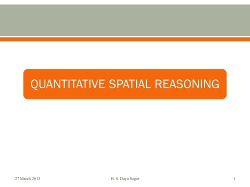
QUANTITATIVE SPATIAL REASONING<br />
27 March 2013 B. S. Daya Sagar 1
<strong>Spatial</strong> <strong>Reasoning</strong><br />
Strategically important set(s)<br />
Directional spatial relationship<br />
<strong>Spatial</strong> Significance Index of zones<br />
24 March 2013 B. S. Daya Sagar 2
III.II.I. Strategically significant state(s)<br />
24 March 2013 B. S. Daya Sagar 3
Matrices and Parameters<br />
24 March 2013 B. S. Daya Sagar 4
Strategically significant state(s) w.r.t 10 parameters<br />
24 March 2013 B. S. Daya Sagar 5
Directional <strong>Spatial</strong> Relationship<br />
http://www.isibang.ac.in/~bsdsagar/AnimationOfDirectional<strong>Spatial</strong>Relationship.wmv<br />
24 March 2013 B. S. Daya Sagar 6
Directional <strong>Spatial</strong> Relationship<br />
24 March 2013 B. S. Daya Sagar 7
The ability to derive spatially significant zones within a cluster of zones has<br />
interesting applications in understanding commonly sharing physical<br />
mechanisms. Using morphological dilation distance technique, we introduce<br />
geometrically-based criteria that serve as indicator of the spatial significance<br />
of zones within a cluster of zones. This presentation focuses on the problem of<br />
identifying zones that are ‘strategic’ in the sense that they are the most<br />
central or important based on their proximity to other zones. We have applied<br />
this technique to a task aiming at detecting spatially significant water body<br />
from a cluster of water bodies retrieved from IRS LISS-III multispectral satellite<br />
data.
<strong>Spatial</strong> Entities can be well identified/ mapped from Digital<br />
Elevation Models generated from high resolution remotely<br />
sensed data.<br />
o <strong>Spatial</strong> Entities – water bodies, zones of influence, geomorphic<br />
basins, and urban features of the specific thematic maps.<br />
Understanding the organization of these spatial entities is<br />
an important aspect from the point of ‘<strong>Spatial</strong> <strong>Reasoning</strong>’.
<strong>Spatial</strong>ly Significant Zone (SSZ) can be defined as “a zone<br />
from which it is easy to reach all of its neighbouring<br />
zones”.<br />
SSZ necessarily be at a strategic location, and also<br />
possessing relatively larger size.<br />
Cluster of spatial entities (zones) can be treated as a<br />
‘<strong>Spatial</strong> System’.<br />
o Eg: Geomorphological basin (cluster of sub-basins)<br />
consists of sub-basins (zones), and sub-basins consist<br />
of still minor sub-basins, and so on.
• SSZ within a cluster of zones possess a geometric<br />
characteristics that is greater proximity to other zones.<br />
• Identifying the spatial significance of a zone from<br />
geometric point of view based on qualitative spatial<br />
reasoning is non-trivial.<br />
• Recognizing SSZ within a spatial system composed of<br />
various zones could be accomplished quantitatively.<br />
◦ Need to define an appropriate measure of the spatially<br />
significance of a zone.
Fig: A 2-D representation of a spatial system with 10 zones.<br />
For a geometric basin (A i ), if A 1 is considered as an origin<br />
zone, then all the other zones (A 2 -A 10 ) are treated as<br />
destination zones.
• To provide an equation based on<br />
dilation distances among zones in a<br />
cluster.<br />
• To automatically compute spatial<br />
significance index (SSI) for each zone of<br />
a cluster of zones.<br />
• Morphological Dilation<br />
• <strong>Spatial</strong> System and its Subsystems<br />
• Dilation Distances Between Origin and<br />
Destination Zones<br />
• <strong>Spatial</strong> Significance Index of a Zone
Binary dilation is a fundamental morphological operation,<br />
can be performed on any set on 2-D Euclidean space.<br />
Dilation: The Boolean OR transformation of a set A by a<br />
set B.<br />
• Multiscale Dilations can be performed by varying the size of the<br />
structuring element (nB). (n>0)<br />
• Iterative dilations can also be represented mathematically, as<br />
follows:
Let ‘A’ be a cluster of zones composed of a number of<br />
non-empty, compact sets (zones)<br />
Any pair of zones A i & A j , from this cluster, that i≠j, the<br />
following spatial relations holds true:<br />
I<br />
II<br />
III
• Based on Euclidean metric, determining distances<br />
between spatial objects is a challenge.<br />
• If the sizes of the zones are similar, simple Euclidean<br />
distances would suffice to detect the spatially significant<br />
centroid of a corresponding zone.<br />
• If the cluster consists of dissimilar shapes and sizes, then<br />
detecting the spatially significant zone can be done<br />
through –<br />
◦ Computation of zone centroids<br />
• Minimal Skeleton Points (MSPs)<br />
◦ Euclidean distance between centroids of two zones<br />
• Zones Morphological properties cannot be considered<br />
ITERATIVE DILATION DISTANCE IS A BETTER CHOICE TO COMPUTE DISTANCES BETWEEN ZONES
Let non-empty, disjoint compact zones A i and A j<br />
be the original and destination zones. (A i < A j )<br />
• The distance from A i to A j<br />
represented by:<br />
• The distance between A j and<br />
A i represented by:<br />
The following conditions will be satisfied, iff both<br />
‘Ai’ & ‘Aj’ possess identical size, shape & orientation.
• If the compact zones shape-sizes are dissimilar, then:<br />
• The min. of d(Aij) and d(Aji) is Hausdorff dilation<br />
distance:<br />
• The max. distance (dmax) between origin zone (Ai) &<br />
destination zone (Aj) is computed as:<br />
• dmax between the destination zones and an origin zone<br />
is computed as:<br />
Estimation of the dilation distance between the origin & destination zones is<br />
justified as such as a dilation distance is essential to compute distances<br />
between zones.<br />
Limitation: This distance is essential affected by the object’s boundary<br />
points that are farthest out with respect to other spatial objects.
• A zone (A i ) is said to the best zone and termed as spatially the<br />
most important zone, if it satisfies the below characteristics:<br />
◦ If it is located in a place closer to all A j s, and<br />
◦ Reaching A i from all A j s required shorter distance.<br />
• <strong>Spatial</strong> Significance Index of a zone is defined as involving<br />
dilation-distances between origin (A i ) and destination zones<br />
(A j ).<br />
• SSI of a zone is a dimensionless unit.<br />
• Lower the SSI of a zone (A i ) in a cluster of zones, the higher is<br />
its significance.
METHODOLOGY<br />
Normalized <strong>Spatial</strong> Significance Index (NSSI) that<br />
ranges between 0 and 1 takes form of:<br />
If the zones of a cluster are identical, then:<br />
=<br />
If the zones of a cluster are dissimilar, then:<br />
≠<br />
When all the zones in a cluster are similar both in<br />
terms of size & shape, the following relationship<br />
holds good.
EXPERIMENTAL RESULTS<br />
• Small water bodies and their zones<br />
of influence of varied sizes and<br />
shapes arranged heterogeneously.<br />
• Max. dilation distances observed<br />
from distances computed between<br />
every water body and every other<br />
water body belonging to a cluster of<br />
66 water bodies.<br />
• The observed min. distances among<br />
66 max. distances for both water<br />
bodies & zones include 53 &52<br />
respectively<br />
• The max. distances among 66 max.<br />
distances for both water bodies and<br />
zones observed include 109 & 110<br />
respectively.<br />
a. LISS-III input image.<br />
b. Extracted water bodies from RS<br />
data. (60)<br />
c. Zones of influence, by<br />
corresponding water bodies. (66)<br />
d. Water bodies and zones with<br />
labeling.
EXPERIMENTAL RESULTS
EXPERIMENTAL RESULTS<br />
• The dilation distances between every state to other state are estimated,<br />
and origin-state specific max. distances are computed.<br />
• Max. dilation distances observed from the estimated distances between<br />
every state and every other state of a cluster of 28 states of India are<br />
considered, and min. of these max. distances are considered to detect<br />
spatially significant state.<br />
• Minimum of all these max. distances<br />
is 189, followed by 206, 213, 226,233.<br />
• Maximum of max. distances estimated<br />
between each origin-state and all<br />
destination-states is 383.<br />
The computational complexity<br />
increases with increasing:<br />
1. No. of spatial objects<br />
2. <strong>Spatial</strong> resolution<br />
Note: The no. of dilation distances required to be computed increases with no.<br />
of spatial objects, their sizes of the individual spatial objects.
• This iterative dilation distances technique can be extended:<br />
◦ To a wide class of metric spaces and to other representations (objects<br />
bounded by 2-D vectors), and<br />
◦ To 3-D case by replacing dilation distance with gray-scale geodesic<br />
distances.<br />
• This technique useful insights in:<br />
i. Clustering-classification frameworks,<br />
ii. Detecting the spatially significant segmented zones obtained via<br />
various segmentation approaches,<br />
iii. Automatically deriving a central node from a large no. of nodes,<br />
iv. Determining the influence of a node in a vector-based network<br />
setting,<br />
v. Deciding on nodal centre(s) to establish an administrative facility, from<br />
a cluster of cadastral zones from mapped from remotely sensed satellite<br />
data.
I would like to gratefully acknowledge Robert Marschallinger, Fritz Zobl, Vera Pawlowsky-<br />
Glahn, Qiuming Cheng, Gina Ross, Katsuaki Koike and Jean Serra. Support given by Bimal Roy<br />
and Sankar Pal (Current and Former Directors of <strong>Indian</strong> <strong>Statistical</strong> <strong>Institute</strong>) who created a great<br />
environment for academic research is gratefully acknowledged.<br />
Grateful to collaborators, mentors, reviewers, examiners, friends, employers, well-wishers, and<br />
doctoral students—S. V. L. N. Rao, B. S. P. Rao, M. Venu, K. S. R. Murthy, Gandhi, Srinivas,<br />
Radhakrishnan, Lea Tien Tay, Chockalingam, Lim Sin Liang, Teo Lay Lian, Dinesh, Jean Serra,<br />
Gabor Korvin, Arthur Cracknell, Deekshatulu, Philippos Pomonis, Peter Atkinson, Hien-Teik<br />
Chuah, Laurent Najman, Jean Cousty, Christian Lantuejoul, Christer Kiselman, Alan Tan, Sankar<br />
Pal, Bimal Roy, Lim Hock, VC Koo, Rajesh, Ashok, Pratap, Rajashekhara, Saroj Meher, Alan<br />
Wilson, B. K. Sahu, K. V. Subbarao, Baldev Raj, C. Babu Rao, and several others.<br />
B. S. Daya Sagar 28
Selected References<br />
<br />
<br />
<br />
<br />
<br />
<br />
<br />
<br />
<br />
<br />
<br />
<br />
<br />
<br />
<br />
<br />
Horton, R. E. (1945). Erosional development of stream and their drainage basin: hydrological approach to<br />
quantitative morphology, Bulletin of the Geophysical Society of America, 56, pp. 275-370.<br />
Langbein, W. B. (1947). Topographic characteristics of drainage basins, U.S. Geological Survey Professional Paper.<br />
968-C, pp. 125-157.<br />
Strahler, A. N. (1952). Hypsometric (area-altitude) analysis of erosional topography: Bulletin Geological Society of<br />
America,v. 63, no. II, pp. 1117-1141.<br />
Strahler, A. N. (1957). <strong>Quantitative</strong> analysis of watershed geomorphology. EOS Transactions of the American<br />
Geophysical Union, 38(6):913–920.<br />
Strahler, A. N. (1964). <strong>Quantitative</strong> geomorphology of drainage basins and channel networks, In Handbook of<br />
applied Hydrology (ed. V. T. Chow), New York, McGraw Hill Book Co., Section 4, pp. 4-39 - 4-76.<br />
Barbera, P. L. and Rosso, R. (1989). On the fractal dimension of stream networks, Water Resources Research,<br />
25(4):735–741.<br />
Tarboton, D. G., Bras, R. L. and Rodrýguez-Iturbe, I. (1990). Comment on “On the fractal dimension of stream<br />
networks” by Paolo La Barbera and Renzo Rosso. Water Resources Research, 26(9):2243–4.<br />
Maritan, A., Coloairi, F., Flammini, A., Cieplak, M., and Banavar, J. R. (1996). Universality classes of optimal channel<br />
networks. Science, 272, 984.<br />
Maritan, A., R. Rigon, J. R. Banavar, and A. Rinaldo (2002). Network allometry, Geophysical Research Letters,<br />
29(11), p. 1508-1511.<br />
Rodriguez-Iturbe, I. and Rinaldo, A. (1997). Fractal River Basins: Chance and Self-organization, Cambridge<br />
University Press, Cambridge.<br />
Mandelbrot, B. B. (1982). The Fractal Geometry of Nature. Freeman, San Francisco.<br />
Turcotte, D. L. (1997). Fractals in Geology and Geophysics, Cambridge University Press, Cambridge.<br />
Matheron, G. (1975). Random Sets and Integral Geometry, John Wiley Hoboekn, New Jersey.<br />
Serra, J. (1982), Image Analysis and Mathematical Morphology, Academic Press, London.<br />
Peucker, T. K. and Douglas, D. H. (1975). Detection of surface-specific points by local parellel processing of discrete<br />
terrain elevation data, Computer Vision, Graphics and Image Processing, 4, p. 375-387.<br />
Veitzer, S. A. and Gupta, V. K., (2000). Random self-similar river networks and derivations of generalized Horton<br />
laws in terms of statistical simple scaling, Water Resources Research, Volume 36 (4), 1033-1048.<br />
B. S. Daya Sagar 29
SAGAR, B. S. D.; VENU, M.; SRINIVAS, D. (2000): Morphological operators to extract channel networks from digital elevation models”,<br />
International Journal of Remote Sensing,” VOL. 21, 21-30.<br />
SAGAR, B. S. D.; MURTHY, M. B. R.; RAO, C. B.; RAJ, B. (2003): Morphological approach to extract ridge-valley connectivity networks from<br />
digital elevation models (DEMs), International Journal of Remote Sensing, VOL. 24, 573 – 581.<br />
TAY, L. T.; SAGAR, B. S. D.; CHUAH, H. T. (2005): Analysis of geophysical networks derived from multiscale digital elevation models: a<br />
morphological approach, IEEE Geoscience and Remote Sensing Letters, VOL. 2, 399 -403.<br />
LIM, S. L.; KOO, V. C.; SAGAR, B. S. D. (2009): Computation of complexity measures of morphologically significant zones decomposed from<br />
binary fractal sets via multiscale convexity analysis, Chaos, Solitons & Fractals, VOL. 41, 1253–1262.<br />
LIM, S. L.; SAGAR, B. S. D. (2007): Cloud field segmentation via multiscale convexity analysis, Journal Geophysical Research-Atmospheres, VOL.<br />
113, D13208, doi:10.1029/2007JD009369.<br />
SAGAR, B. S. D. (1996): Fractal relations of a morphological skeleton, Chaos, Solitons & Fractals, VOL. 7, 1871 -1879.<br />
SAGAR, B. S. D.; TIEN, T. L. (2004): Allometric power-law relationships in a Hortonian Fractal DEM, Geophysical Research Letters, VOL. 31,<br />
L06501.<br />
<br />
TAY, L. T.; SAGAR, B. S. D.; CHUAH, H. T. (2006): Allometric relationships between travel-time channel networks, convex hulls, and convexity<br />
measures, Water Resources Research, VOL. 46, W06502.<br />
SAGAR, B. S. D. (2007): Universal scaling laws in surface water bodies and their zones of influence, Water Resources Research, VOL. 43, W0241 6.<br />
<br />
SAGAR, B. S. D.; CHOCKALINGAM, L. (2004): Fractal dimension of non-network space of a catchment basin, Geophysical Research Letters,<br />
VOL. 31, L12502.<br />
CHOCKALINGAM, L.; SAGAR, B. S. D. (2005): Morphometry of networks and non-network spaces, Journal of Geophysical Research, VOL. 110,<br />
B08203.<br />
<br />
TAY, L. T.; SAGAR, B. S. D.; CHUAH, H. T. (2007): Granulometric analysis of basin-wise DEMs: a comparative study, International Journal of<br />
Remote Sensing, VOL. 28, 3363-3378.<br />
SAGAR, B. S. D.; SRINIVAS, D.; RAO, B. S. P. (2001): Fractal skeletal based channel networks in a triangular initiator basin, Fractals, VOL. 9,<br />
429-437.<br />
<br />
SAGAR, B. S. D.; VENU, M.; GANDHI, G.; SRINIVAS, D. (1998): Morphological description and interrelationship between force and structure: a<br />
scope to geomorphic evolution process modelling, International Journal of Remote Sensing, VOL. 19, 1341 -1358.<br />
B. S. Daya Sagar 30
SAGAR, B. S. D. (2005): Discrete simulations of spatio-temporal dynamics of small water bodies under varied streamflow discharges, Nonlinear<br />
Processes in Geophysics, VOL. 12, 31-40, 2005.<br />
SAGAR, B. S. D. (2010): Visualization of spatiotemporal behavior of discrete maps via generation of recursive median elements, IEEE Transactions<br />
on Pattern Analysis and Machine Intelligence, VOL. 32, 378-384.<br />
RAJASHEKHARA, H. M.; PRATAP VARDHAN; SAGAR, B. S. D. (2011): Generation of Zonal Map from Point Data via Weighted Skeletonization<br />
by Influence Zone, IEEE Geoscience and Remote Sensing Letters (Revised version under review).<br />
SAGAR, B. S. D.; PRATAP VARDHAN; DE, D. (2011): Recognition and visualization of strategically significant spatial sets via morphological<br />
analysis, Computers in Environment and Urban Systems, (Revised version under review).<br />
PRATAP VARDHAN; SAGAR, B. S. D. (2011): Determining directional spatial relationship via origin-specific dilation-distances, IEEE Transactions<br />
on Geoscience and Remote Sensing (Under Review).<br />
B. S. Daya Sagar 31
24 March 2013 B. S. Daya Sagar 32