Juneau Non-Motorized Transportation Plan - City and Borough of ...
Juneau Non-Motorized Transportation Plan - City and Borough of ...
Juneau Non-Motorized Transportation Plan - City and Borough of ...

You also want an ePaper? Increase the reach of your titles
YUMPU automatically turns print PDFs into web optimized ePapers that Google loves.
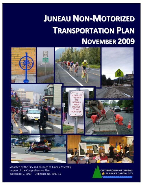
JUNEAU NON‐MOTORIZED<br />
TRANSPORTATION PLAN<br />
NOVEMBER 2009<br />
Adopted by the <strong>City</strong> <strong>and</strong> <strong>Borough</strong> <strong>of</strong> <strong>Juneau</strong> Assembly<br />
as part <strong>of</strong> the Comprehensive <strong>Plan</strong><br />
November 2, 2009 Ordinance No. 2009‐15
Prepared for:<br />
<strong>City</strong> <strong>and</strong> <strong>Borough</strong> <strong>of</strong> <strong>Juneau</strong><br />
155 S. Seward Street<br />
<strong>Juneau</strong>, Alaska 99801<br />
Prepared by:<br />
Sheinberg Associates<br />
204 No. Franklin Street, Ste 1<br />
<strong>Juneau</strong>, Alaska 99801<br />
November, 2009
ACKNOWLEDGEMENTS<br />
Thank you to <strong>Juneau</strong>’s walkers <strong>and</strong> cyclists who came to the public meetings <strong>and</strong> shared their time,<br />
knowledge <strong>and</strong> ideas. This plan would not have been possible without your help. Thanks to the<br />
following individuals who shared their insights <strong>and</strong> expertise.<br />
<strong>City</strong> <strong>and</strong> <strong>Borough</strong> <strong>of</strong> <strong>Juneau</strong> Assembly Members<br />
Mayor Bruce Botelho Ruth Danner Merrill Sanford<br />
Jonathan Anderson Bob Doll David Stone<br />
Jeff Bush Johan Dybdahl R<strong>and</strong>y Wanamaker<br />
Sara Chambers (former)<br />
<strong>City</strong> <strong>and</strong> <strong>Borough</strong> <strong>of</strong> <strong>Plan</strong>ning Commission<br />
Marsha Bennett Frank Rue Dennis Watson<br />
Nicole Grewe Michael Satre Maria Gladziszewski (Chair)<br />
Dan Miller Karen Taug Nancy Waterman (Vice Chair)<br />
<strong>City</strong> <strong>and</strong> <strong>Borough</strong> <strong>of</strong> <strong>Juneau</strong><br />
Parks <strong>and</strong> Recreation Advisory Board<br />
Dixie Hood<br />
Ray Howard<br />
James King Sr.<br />
Melissa Goldstein<br />
Alyssa Machold Ellsworth (Vice Chair)<br />
Jeff Sloss<br />
James Tipps<br />
Kate Walters<br />
Jeffrey Wilson (Chair)<br />
<strong>Juneau</strong> Affordable<br />
Housing Commission<br />
Steven Sorensen, Chair<br />
Alan Wilson, Vice‐Chair<br />
Honey Bee Anderson<br />
Tamara Rowcr<strong>of</strong>t<br />
Justin Shearer<br />
Rosemary Hagevig<br />
Dianne Slater<br />
Robert Banghart<br />
<strong>City</strong> <strong>and</strong> <strong>Borough</strong> <strong>of</strong> <strong>Juneau</strong> Administration<br />
Rod Swope, <strong>City</strong> Manager<br />
Kim Kiefer, Deputy <strong>City</strong> Manager<br />
Staff <strong>and</strong> Other Contributors<br />
Marc Matsil, Director Parks & Recreation<br />
Dale Pernula, Director Community Development<br />
Ben Lyman, Senior <strong>Plan</strong>ner Community Development<br />
Heather Marlow, L<strong>and</strong>s <strong>and</strong> Resources Manager<br />
Rorie Watt, Engineering Director<br />
Mike Scott, Streets Superintendent<br />
Joe Buck, Public Works Director<br />
<strong>Juneau</strong> Freewheelers Bicycle Club<br />
Trail Mix, Inc<br />
<strong>Juneau</strong> Coordinated <strong>Transportation</strong> Committee<br />
Sheinberg Associates Consultant Team<br />
Community <strong>Plan</strong>ners: Barbara J. Sheinberg, AICP <strong>and</strong> Zoë Morrison, MCIP, Sheinberg Associates, <strong>Juneau</strong><br />
GIS (Geographic Information System) Analysis <strong>and</strong> Mapping: Alaska Map Company, Kenai<br />
<strong>Non</strong>‐<strong>Motorized</strong> <strong>Transportation</strong> Consultation: Spring <strong>Plan</strong>ning Services, Anchorage
<strong>Juneau</strong> <strong>Non</strong>‐<strong>Motorized</strong> <strong>Transportation</strong> <strong>Plan</strong><br />
TABLE OF CONTENTS<br />
EXECUTIVE SUMMARY ................................................................................................................... 1<br />
CHAPTER 1 – INTRODUCTION .......................................................................................................... 7<br />
1.1 Introduction .............................................................................................................................. 7<br />
1.2 Sustainable <strong>Transportation</strong>....................................................................................................... 8<br />
1.3 Purpose <strong>and</strong> Goals <strong>of</strong> the <strong>Non</strong>‐<strong>Motorized</strong> <strong>Transportation</strong> <strong>Plan</strong>............................................... 9<br />
1.4 Types <strong>of</strong> <strong>Non</strong>‐<strong>Motorized</strong> Facilities <strong>and</strong> Definitions ................................................................ 10<br />
CHAPTER 2 – METHODOLOGY ........................................................................................................13<br />
2.1 Public Outreach <strong>and</strong> Engagement .......................................................................................... 13<br />
2.2 Research <strong>and</strong> Field Survey ...................................................................................................... 13<br />
2.3 Data Analysis <strong>and</strong> Prioritization <strong>of</strong> Infrastructure Improvements ......................................... 15<br />
2.4 Formal Public Review.............................................................................................................. 17<br />
CHAPTER 3 – UNDERSTANDING NON‐MOTORIZED TRANSPORTATION......................................................19<br />
3.1 Pedestrians.............................................................................................................................. 19<br />
3.2 Bicyclists.................................................................................................................................. 20<br />
3.3 Pedestrian Safety Issues ......................................................................................................... 21<br />
3.4 Bicycle Safety Issues................................................................................................................ 21<br />
CHAPTER 4 – DESIGNING A BIKABLE AND WALKABLE COMMUNITY..........................................................23<br />
4.1 Context Sensitive Solutions .................................................................................................... 23<br />
4.2 Complete Streets .................................................................................................................... 24<br />
4.3 Traffic Calming Measures ....................................................................................................... 25<br />
4.4 Design <strong>of</strong> New Neighborhoods <strong>and</strong> Buildings ........................................................................ 27<br />
CHAPTER 5 – JUNEAU’S NON‐MOTORIZED TRANSPORTATION POLICIES AND EXISTING SYSTEM......................29<br />
5.1 Setting ..................................................................................................................................... 29<br />
5.2 <strong>Plan</strong>ning <strong>and</strong> Policy Context ................................................................................................... 29<br />
5.3 <strong>Juneau</strong>’s Existing <strong>Non</strong>‐<strong>Motorized</strong> Facilities ............................................................................ 33<br />
CHAPTER 6 – DESIGN STANDARDS...................................................................................................41<br />
6.1 Specific Regulations ................................................................................................................ 41<br />
6.2 Sidewalk St<strong>and</strong>ards................................................................................................................. 41<br />
6.3 Paved Shoulder Lanes............................................................................................................. 42<br />
6.4 Bike Lanes ............................................................................................................................... 42<br />
6.5 Bike Racks ............................................................................................................................... 44<br />
6.6 Separated Paths...................................................................................................................... 45<br />
6.7 Safe Crossings <strong>and</strong> Intersections ............................................................................................ 46<br />
November 2009<br />
i
<strong>Juneau</strong> <strong>Non</strong>‐<strong>Motorized</strong> <strong>Transportation</strong> <strong>Plan</strong><br />
CHAPTER 7 – RECOMMENDED INFRASTRUCTURE IMPROVEMENTS ...........................................................49<br />
7.1 Highest Priority <strong>Non</strong>‐<strong>Motorized</strong> Infrastructure Improvements ............................................. 49<br />
7.2 Safe Crosswalks, Bridges <strong>and</strong> Intersections............................................................................ 52<br />
7.3 Sidewalk <strong>and</strong> Streetscape Improvements .............................................................................. 55<br />
7.4 Shoulder Lanes........................................................................................................................ 57<br />
7.5 Bike Facilities........................................................................................................................... 58<br />
7.6 Separated Multi‐Use Pathways .............................................................................................. 59<br />
CHAPTER 8 – RECOMMENDED POLICIES AND IMPLEMENTING ACTIONS.....................................................67<br />
CHAPTER 9 – FUNDING SOURCES ....................................................................................................77<br />
BIBLIOGRAPHY............................................................................................................................81<br />
APPENDIX A – ALASKA ADMINISTRATIVE CODE ..................................................................................83<br />
APPENDIX B – JUNEAU CODE GOVERNING NON‐MOTORIZED TRANSPORTATION........................................85<br />
APPENDIX C – PUBLIC INPUT FORM .................................................................................................89<br />
APPENDIX D – RECOMMENDED NON‐MOTORIZED INFRASTRUCTURE IMPROVEMENTS, BY AREA ....................91<br />
APPENDIX E – COMPLETE STREETS CODE EXAMPLE ..............................................................................97<br />
APPENDIX F – ORDINANCE ADOPTING THE NON‐MOTORIZED TRANSPORTATION PLAN ................................101<br />
LIST OF FIGURES<br />
Figure 1 – Existing Facilities – Auke Bay........................................................................................ 35<br />
Figure 2 – Existing Facilities – Mendenhall Valley ........................................................................ 36<br />
Figure 3 – Existing Facilities – Lemon Creek <strong>and</strong> Twin Lakes........................................................ 37<br />
Figure 4 – Existing Facilities – Downtown <strong>and</strong> Thane................................................................... 38<br />
Figure 5 – Existing Facilities – Douglas Isl<strong>and</strong> ............................................................................... 39<br />
Figure 6 – Recommendations – Auke Bay .................................................................................... 61<br />
Figure 7 – Recommendations – Mendenhall Valley ..................................................................... 62<br />
Figure 8 – Recommendations – Lemon Creek <strong>and</strong> Twin Lakes .................................................... 63<br />
Figure 9 – Recommendations – Downtown <strong>and</strong> Thane ............................................................... 64<br />
Figure 10 – Recommendations – Douglas Isl<strong>and</strong>.......................................................................... 65<br />
Figure 11 – Cross‐<strong>Juneau</strong> Bikeway Map ....................................................................................... 66<br />
November 2009<br />
ii
<strong>Juneau</strong> <strong>Non</strong>‐<strong>Motorized</strong> <strong>Transportation</strong> <strong>Plan</strong><br />
EXECUTIVE SUMMARY<br />
The purpose <strong>of</strong> the <strong>Juneau</strong> <strong>Non</strong>‐<strong>Motorized</strong> <strong>Transportation</strong> <strong>Plan</strong> is to promote active<br />
transportation by guiding development <strong>of</strong> a community‐wide bicycle <strong>and</strong> walking network that<br />
can be used by all <strong>Juneau</strong> residents for all types <strong>of</strong> trips. To accomplish this, a series <strong>of</strong> specific<br />
non‐motorized infrastructure improvements are recommended <strong>and</strong> 12 policies with<br />
implementing actions are identified.<br />
<strong>Plan</strong> goals are to:<br />
1. Use new approaches to street design that focus on working together early in project design<br />
to plan <strong>and</strong> build transportation projects that address the needs <strong>of</strong> all users: pedestrians,<br />
cyclists, public transit riders <strong>and</strong> motorists.<br />
2. Encourage an increase in bicycling, walking <strong>and</strong> other active forms <strong>of</strong> transportation by<br />
providing safe, efficient <strong>and</strong> easy‐to‐use facilities that connect activity centers.<br />
3. Improve <strong>Juneau</strong>’s non‐motorized transportation network <strong>and</strong> decrease the number <strong>of</strong><br />
bicycle <strong>and</strong> pedestrian related accidents by identifying unsafe conditions, network gaps <strong>and</strong><br />
deficiencies <strong>and</strong> making necessary improvements to sidewalks, bike lanes, paved shoulder<br />
lanes, separated paths, intersections <strong>and</strong> crosswalks.<br />
4. Develop a year‐round maintenance program for <strong>Juneau</strong>’s non‐motorized facilities with a<br />
focus on sweeping <strong>and</strong> snow removal along the cross‐<strong>Juneau</strong> bikeway <strong>and</strong> snow removal on<br />
sidewalks near schools, transit stops <strong>and</strong> in busy pedestrian areas.<br />
5. Educate pedestrians, cyclists <strong>and</strong> motorists so all can use the transportation network safely<br />
<strong>and</strong> efficiently. This will be accomplished in part by improving signage <strong>and</strong> developing<br />
programs that encourage residents to choose active modes <strong>of</strong> transportation, <strong>and</strong> through<br />
enforcement.<br />
In the last decade communities have been changing their approach towards planning for<br />
bicyclists <strong>and</strong> pedestrians. Rising fuel costs, increasing concern about green house gas<br />
emissions <strong>and</strong> growing awareness <strong>of</strong> the link between community health <strong>and</strong> active<br />
transportation have changed the way that all transportation is viewed. <strong>Plan</strong>ners <strong>and</strong> engineers<br />
now recognize that in addition to recreational use, non‐motorized transportation is a vital<br />
component <strong>of</strong> any sustainable community transportation network.<br />
<strong>Plan</strong>ning Process <strong>and</strong> Public Input<br />
Four key steps – public outreach <strong>and</strong> engagement, research <strong>and</strong> field survey, data analysis, <strong>and</strong><br />
formal public review – were completed to prepare the 2009 <strong>Juneau</strong> <strong>Non</strong>‐<strong>Motorized</strong><br />
<strong>Transportation</strong> <strong>Plan</strong>. Five public meetings were held early in the process <strong>and</strong> attended by nearly<br />
100 people; written comments or completed surveys were submitted by 80 people. The public<br />
was asked to identify their walking <strong>and</strong> biking routes <strong>and</strong> destinations, specific obstacles along<br />
November 2009 1
<strong>Juneau</strong> <strong>Non</strong>‐<strong>Motorized</strong> <strong>Transportation</strong> <strong>Plan</strong><br />
these routes <strong>and</strong> ideas about how to improve the overall non‐motorized transportation<br />
network.<br />
New Trends in <strong>Transportation</strong> <strong>Plan</strong>ning<br />
<strong>Transportation</strong> engineers <strong>and</strong> planners are using new approaches to counter automobile‐only<br />
focused design <strong>and</strong> to instead plan, design <strong>and</strong> build transportation projects in a manner that<br />
addresses the needs <strong>of</strong> all users: pedestrians, cyclists, public transit riders <strong>and</strong> motorists. New<br />
trends in street design, including Context Sensitive Solutions <strong>and</strong> Complete Streets, <strong>of</strong>fer ways<br />
to design <strong>and</strong> build more sustainable transportation networks.<br />
The Institute <strong>of</strong> <strong>Transportation</strong> Engineers advocates the use <strong>of</strong> a new method <strong>of</strong> street design<br />
called Context Sensitive Solutions. Put simply, Context Sensitive methods take the context – the<br />
surroundings – where a street will be built into account when design is occurring. Successful<br />
Context Sensitive approaches also tend to be collaborative <strong>and</strong> interdisciplinary, <strong>and</strong> includes<br />
stakeholders in the street design process. The goal is to develop transportation facilities that fit<br />
the physical setting <strong>and</strong> consider the location’s physical, scenic, <strong>and</strong> neighborhood attributes<br />
<strong>and</strong> resources, while maintaining safety <strong>and</strong> mobility. Context Sensitive approaches to street<br />
design are project‐oriented <strong>and</strong> location‐specific. This shifts the focus solely from the motorist<br />
to include consideration <strong>of</strong> safety, operations, community aesthetics, <strong>and</strong> the natural <strong>and</strong> built<br />
environments.<br />
The National Complete Streets Coalition has been working for several years to improve<br />
traditional street design. This has led to the idea <strong>of</strong> Complete Streets; streets that are designed<br />
to give safe access for all users. Pedestrians, bicyclists, transit riders <strong>and</strong> motorists <strong>of</strong> all ages<br />
<strong>and</strong> abilities are able to move safely along <strong>and</strong> across a Complete Street. Complete Streets in<br />
busy urban areas have features for buses, bicycles <strong>and</strong> pedestrians as well as for motorists. In<br />
more rural areas with less traffic <strong>and</strong> fewer pedestrians <strong>and</strong> cyclists a paved shoulder may<br />
suffice to complete the street. The Complete Street movement encourages planning for all<br />
users across the transportation network. This does not mean that all streets need to be perfect<br />
for all modes, but that the transportation network needs to work for all modes.<br />
Recommended Improvements to <strong>Non</strong>‐<strong>Motorized</strong> Infrastructure<br />
Eighteen highest priority <strong>and</strong> about 100 total specific infrastructure improvements are<br />
recommended. The recommended improvements are based on a combination <strong>of</strong> public input;<br />
discussion <strong>and</strong> review by <strong>City</strong> <strong>and</strong> <strong>Borough</strong> <strong>of</strong> <strong>Juneau</strong> (CBJ) staff, the Parks <strong>and</strong> Recreation<br />
Advisory Committee, <strong>Plan</strong>ning Commission, Affordable Housing Commission, <strong>and</strong> the Assembly;<br />
a review <strong>of</strong> existing plans; an analysis <strong>and</strong> evaluation <strong>of</strong> current conditions; <strong>and</strong> use <strong>of</strong> criteria<br />
to analyze identify priorities. The criteria used to evaluate <strong>and</strong> prioritize recommendations are:<br />
the potential for pedestrian use, proximity to community destinations, number <strong>of</strong> accidents<br />
involving pedestrians or bicyclists that have occurred in the area, <strong>and</strong> the average annual daily<br />
traffic counts in the vicinity <strong>of</strong> the proposed improvement. The result is a list <strong>of</strong> approximately<br />
November 2009 2
<strong>Juneau</strong> <strong>Non</strong>‐<strong>Motorized</strong> <strong>Transportation</strong> <strong>Plan</strong><br />
100 high, medium <strong>and</strong> low priority recommendations for improvements to non‐motorized<br />
facilities.<br />
The 18 highest priority recommendations <strong>Juneau</strong>‐wide <strong>and</strong> for each specific area are now<br />
listed. The order does not imply priority status or implementation timing; all 18 are important<br />
<strong>and</strong> should be implemented as opportunity <strong>and</strong> funding allows.<br />
The numbers (#xx) in the description refer to the improvement as it is depicted on Figures 6<br />
through 11 <strong>and</strong> on Tables 7‐2 through 7‐6.<br />
<strong>Juneau</strong>‐Wide<br />
1. Cross‐<strong>Juneau</strong> Bikeway – Identify gaps, bring all routes up to st<strong>and</strong>ards add signs. This focus<br />
on a bikeway way will raise the visibility <strong>of</strong> cycling in <strong>Juneau</strong> <strong>and</strong> will encourage residents to<br />
take more trips by bicycle. (See Figure 11 <strong>and</strong> Table 8.1).<br />
2. Paved Shoulder Lanes – Add paved shoulder on North Douglas Highway from Boat Launch<br />
to the end (#94), Thane Road from downtown to the end (#66), <strong>and</strong> Glacier Highway from<br />
Lena Loop to Tee Harbor (#11) <strong>and</strong> from Amalga Harbor to end (#13). These routes are part<br />
<strong>of</strong> the cross‐<strong>Juneau</strong> bikeway <strong>and</strong> are recreation destinations. The paved shoulder will<br />
provide space for both pedestrians <strong>and</strong> cyclists.<br />
Mendenhall Valley West<br />
3. Glacier Highway Sidewalk Improvements Auke Bay/UAS – Sidewalk improvements in<br />
University <strong>of</strong> Alaska Southeast (UAS) <strong>and</strong> Auke Bay area including complete sidewalk system<br />
<strong>and</strong> crosswalks where needed (#2 <strong>and</strong> #12). The area includes residential <strong>and</strong> commercial<br />
uses, the UAS <strong>and</strong> an elementary school <strong>and</strong> has many pedestrians. Pedestrian<br />
improvements will make the area safer <strong>and</strong> will encourage increased pedestrian use.<br />
4. Bike Lane Glacier Highway from Deharts to Brotherhood Bridge – Bike lane along Glacier<br />
Highway from Deharts to the Brotherhood Bridge needs to be brought up to st<strong>and</strong>ards for<br />
width, pavement markings <strong>and</strong> signs (#3). The paved shoulder in this area is currently<br />
variable in width <strong>and</strong> does not have consistent pavement markings <strong>and</strong> signs. This route has<br />
high traffic volumes <strong>and</strong> speeds <strong>and</strong> is part <strong>of</strong> the cross town bike route.<br />
Mendenhall Valley East<br />
5. Mendenhall Loop Road Intersections – Improve five Mendenhall Loop Road intersections<br />
for pedestrians (#27, #30, #31, #33 <strong>and</strong> #34). There are many community destinations,<br />
including schools, on both sides <strong>of</strong> this road. Accidents involving pedestrians <strong>and</strong> cyclists<br />
have occurred at each <strong>of</strong> these intersections <strong>and</strong> steps need to be taken to make these<br />
crossings safer.<br />
6. Brotherhood Bridge – Widen Brotherhood Bridge <strong>and</strong> add bike lanes <strong>and</strong> a wider, safer<br />
sidewalk. The bridge is currently too narrow <strong>and</strong> is part <strong>of</strong> the cross‐<strong>Juneau</strong> bikeway (#24).<br />
November 2009 3
<strong>Juneau</strong> <strong>Non</strong>‐<strong>Motorized</strong> <strong>Transportation</strong> <strong>Plan</strong><br />
7. Mendenhall Mall Road – Improve Mendenhall Mall Road for non‐motorized users by adding<br />
crosswalks, bike facilities <strong>and</strong> sidewalks. This is close to <strong>Juneau</strong>’s largest population center<br />
<strong>and</strong> near many schools <strong>and</strong> community destinations. Signage <strong>and</strong> pavement markings to<br />
delineate the road from the parking lot are not adequate particularly in winter (#25).<br />
8. Glacier Highway Bike Lanes – Bike lane on Glacier Highway from Brotherhood Bridge to the<br />
Mendenhall Loop Road needs to be brought up to st<strong>and</strong>ards for width, pavement markings<br />
<strong>and</strong> signs (#26). The paved shoulder in this area is currently variable in width <strong>and</strong> does not<br />
have consistent pavement markings <strong>and</strong> signs. This route has high traffic volumes <strong>and</strong><br />
speeds <strong>and</strong> is part <strong>of</strong> the cross town bike route.<br />
9. Under Thunder Trail – Complete the Under Thunder separated path along the eastern edge<br />
<strong>of</strong> the Mendenhall Valley. This path will provide an <strong>of</strong>f‐road alternative for commuters<br />
heading downtown <strong>and</strong> between neighborhoods in an area with high traffic volumes.<br />
Lemon Creek <strong>and</strong> Twin Lakes Priorities<br />
10. Lemon Creek Sidewalks <strong>and</strong> Bike Lanes – Improve non‐motorized facilities on Glacier<br />
Highway in Lemon Creek from Sunny Point intersection to V<strong>and</strong>erbilt Hill Road – complete<br />
sidewalks on south‐west side <strong>of</strong> the street <strong>and</strong> bring bike lane up to st<strong>and</strong>ard. The Lemon<br />
Creek area is very dangerous because it has a high number <strong>of</strong> pedestrians <strong>and</strong> significant<br />
commercial <strong>and</strong> industrial traffic moving at high speeds. Currently the paved bike lane is<br />
variable in width <strong>and</strong> there is only a sidewalk on one side <strong>of</strong> the street (#45 <strong>and</strong> #53).<br />
11. Lemon Creek Crosswalks – Add or improve crosswalks along Glacier Highway at Anka Street,<br />
Walmart <strong>and</strong> Concrete Way (#48, #49 <strong>and</strong> #47). This area has many pedestrians, including<br />
children <strong>and</strong> high traffic volumes <strong>and</strong> speeds. Crosswalks do not currently exist at Concrete<br />
Way or at Walmart. There have been accidents at all three locations.<br />
Downtown <strong>and</strong> Thane<br />
12. Egan Drive Downtown Bike Lanes – Add a bike lane on Egan Drive from the <strong>Juneau</strong>‐Douglas<br />
Bridge to Main Street. This is part <strong>of</strong> the cross‐<strong>Juneau</strong> bikeway <strong>and</strong> there is currently no<br />
provision for bicycles (#62).<br />
13. Egan Drive Downtown Pedestrian Improvements – Improve Egan Drive for pedestrians from<br />
the <strong>Juneau</strong>‐Douglas Bridge to Main Street by calming traffic <strong>and</strong> improving or adding<br />
crosswalks at Gold Creek/Glacier Avenue (#68), Whittier Street (#69), Willoughby Ave (#75)<br />
<strong>and</strong> Main Street (#74). This area is home to many community destinations <strong>and</strong> with new<br />
development underway that will increase pedestrian use.<br />
14. Glacier Avenue Downtown – Improve sidewalks, crosswalks <strong>and</strong> bike lanes on Glacier<br />
Avenue between Highl<strong>and</strong> Drive <strong>and</strong> 12th Street. Focus improvements on safe routes to<br />
schools (#63 <strong>and</strong> #64).<br />
15. Seawalk – Connect existing segments to complete route from Aurora Harbor to the Rock<br />
Dump. This has been a community priority for many years. Once completed, it will provide<br />
benefits for residents <strong>and</strong> tourists <strong>and</strong> will relieve congestion on downtown sidewalks (#61).<br />
November 2009 4
<strong>Juneau</strong> <strong>Non</strong>‐<strong>Motorized</strong> <strong>Transportation</strong> <strong>Plan</strong><br />
Douglas Isl<strong>and</strong><br />
16. Douglas Highway Bike Lane – Complete Douglas Highway bike lane from where it ends now<br />
near Gastineau School to the Savikko Road intersection (#84). This is part <strong>of</strong> the cross‐<br />
<strong>Juneau</strong> bikeway <strong>and</strong> the bike lane ends abruptly making a dangerous situation.<br />
17. Douglas Highway Crosswalks – Add or improve intersections on Douglas Highway at<br />
Cordova Street (#88), Crow Hill Drive (#86), Savikko Road (#89) <strong>and</strong> Douglas Library (#87).<br />
This is the main route through the area <strong>and</strong> several accidents involving pedestrians <strong>and</strong><br />
bicycles have taken place at each intersection.<br />
18. Treadwell Ditch – Rebuild trails <strong>and</strong> bridges along this 17 mile trail transportation <strong>and</strong><br />
recreation corridor that connects Douglas <strong>and</strong> the Eaglecrest recreation area (#90). This trail<br />
connects several residential areas <strong>and</strong> will provide an <strong>of</strong>f‐road alternative to Douglas<br />
Highway.<br />
Recommended Policies with Implementing Actions<br />
In addition to the specific recommended improvements to non‐motorized infrastructure, 12<br />
policies with implementing actions are developed to support <strong>and</strong> encourage active<br />
transportation <strong>and</strong> increase the safety <strong>and</strong> effectiveness <strong>of</strong> the existing non‐motorized system.<br />
The policies are listed below (without actions).The order is not linked to priority status or<br />
implementation timing; all 12 are important <strong>and</strong> should be implemented as opportunity <strong>and</strong><br />
funding allows.<br />
POLICY 1 – BE “READY‐TO‐FUND”. Complete concept plans, typical sections <strong>and</strong> cost estimates<br />
for select highest priority non‐motorized infrastructure improvements.<br />
POLICY 2 – STATE PROJECTS. Work with the Alaska DOT&PF Regional Director to establish a<br />
routine process to allow CBJ input at the front‐end <strong>of</strong> the design stage for State road projects.<br />
POLICY 3 – MUNICIPAL PROJECTS. Improve the process for <strong>Plan</strong>ning Commission review <strong>of</strong> CBJ<br />
projects to allow timely comment on non‐motorized infrastructure <strong>and</strong> routes. Project<br />
managers will use a context sensitive approach in the design <strong>of</strong> <strong>City</strong> projects to achieve a<br />
Complete Streets network.<br />
POLICY 4 – PRIVATE SECTOR DEVELOPMENT. Review design st<strong>and</strong>ards in Title 49 to provide<br />
opportunities to make subdivision design more context sensitive.<br />
POLICY 5 – TRANSPORTATION PLANNING. Integrate motorized <strong>and</strong> non‐motorized<br />
transportation planning.<br />
POLICY 6 – EDUCATION AND SIGNAGE. Establish a bicycle/pedestrian education <strong>and</strong> signage<br />
program.<br />
November 2009 5
<strong>Juneau</strong> <strong>Non</strong>‐<strong>Motorized</strong> <strong>Transportation</strong> <strong>Plan</strong><br />
POLICY 7 – MAINTENANCE. Develop a realistic maintenance program for non‐motorized<br />
facilities <strong>and</strong> commit to it.<br />
POLICY 8 – SAFE AND HEALTHY SCHOOL ACCESS. Actively support safe routes to schools<br />
programs.<br />
POLICY 9 – SEEK RECOGNITION. Work to be designated a bicycle friendly community.<br />
POLICY 10 – BICYCLE RACKS. Provide more bicycle racks.<br />
POLICY 11 – ADVOCACY. Support non‐motorized advocacy.<br />
POLICY 12 – CROSS‐JUNEAU BIKEWAY. Complete the cross‐<strong>Juneau</strong> bikeway.<br />
November 2009 6
<strong>Juneau</strong> <strong>Non</strong>‐<strong>Motorized</strong> <strong>Transportation</strong> <strong>Plan</strong><br />
CHAPTER 1 – INTRODUCTION<br />
1.1 Introduction<br />
The goal <strong>of</strong> the <strong>Juneau</strong> <strong>Non</strong>‐<strong>Motorized</strong> <strong>Transportation</strong> <strong>Plan</strong> is to make bicycling <strong>and</strong> walking<br />
safe, convenient <strong>and</strong> pleasant so that residents choose active forms <strong>of</strong> transportation more<br />
<strong>of</strong>ten.<br />
Over the last fifty years, the rise <strong>of</strong> the automobile has had a major influence on both behavior<br />
<strong>and</strong> community design. The automobile gave people freedom to live farther from their places <strong>of</strong><br />
work. Rapid suburban development resulted <strong>and</strong> the design <strong>of</strong> neighborhoods, shopping<br />
centers, schools, homes <strong>and</strong> streets was altered to allow cars to move quickly <strong>and</strong> easily.<br />
Walking <strong>and</strong> bicycling, ideal for short trips, lost their advantage <strong>and</strong> their place on the road. At<br />
the community scale, l<strong>and</strong> uses have became increasingly segregated <strong>and</strong> destinations farther<br />
apart. In neighborhoods, increased traffic moving at higher speeds has led to conflict between<br />
pedestrians, cyclists <strong>and</strong> motorists who once shared the streets. In many cases, the desire to<br />
accommodate cars has come at the expense <strong>of</strong> other modes <strong>of</strong> transportation. Decreased<br />
walking <strong>and</strong> biking trips, <strong>and</strong> the associated increase in vehicle trips, has impacted community<br />
sustainability by contributing to rising obesity levels, increased traffic congestion, rising<br />
transportation costs, increased burning <strong>of</strong> fossil fuels, <strong>and</strong> decreased air quality.<br />
There is now a growing desire in cities across the country to return to more walkable <strong>and</strong><br />
bikable streets to support livable communities. This means planning, designing <strong>and</strong> retr<strong>of</strong>itting<br />
the transportation network to encourage walking, bicycling <strong>and</strong> transit use by all residents<br />
including children, seniors <strong>and</strong> the disabled.<br />
<strong>Juneau</strong>’s <strong>Non</strong>‐<strong>Motorized</strong> <strong>Transportation</strong> <strong>Plan</strong> established goals <strong>and</strong> recommends both specific<br />
infrastructure improvements <strong>and</strong> related actions aimed at developing a complete<br />
transportation network <strong>and</strong> establishes community priorities for non‐motorized projects. This<br />
plan replaces the prior plan completed in 1997. It includes recommendations from that plan<br />
that are still relevant along with new recommendations to reflect current conditions <strong>and</strong><br />
priorities for biking <strong>and</strong> pedestrian routes. This plan also identifies potential funding sources for<br />
non‐motorized facilities.<br />
<strong>Juneau</strong> currently has a basic non‐motorized transportation system with many opportunities for<br />
improvement. With a strong commitment by <strong>City</strong> <strong>and</strong> <strong>Borough</strong> <strong>of</strong> <strong>Juneau</strong> policy makers, staff<br />
<strong>and</strong> residents, <strong>Juneau</strong> can use the “5 Es” – engineering, education, encouragement,<br />
enforcement <strong>and</strong> evaluation – to become a more walking <strong>and</strong> bicycling friendly city.<br />
November 2009 7
<strong>Juneau</strong> <strong>Non</strong>‐<strong>Motorized</strong> <strong>Transportation</strong> <strong>Plan</strong><br />
1.2 Sustainable <strong>Transportation</strong><br />
<strong>Transportation</strong> is about access <strong>and</strong> mobility. A well‐designed, complete network enables<br />
convenient access for residents to housing, work, recreation, shops <strong>and</strong> other activities. Mixeduse<br />
zoning allows a blend <strong>of</strong> l<strong>and</strong> uses within the same neighborhood, increasing the viability <strong>of</strong><br />
walking <strong>and</strong> cycling trips.<br />
Over the last thirty years, conventional development patterns have relied on single‐use zones<br />
<strong>and</strong> low density, sprawling neighborhoods. These segregated areas are difficult to serve with<br />
public transit, leading to car dependence. This puts elderly people who no longer drive, people<br />
who cannot afford or choose not to own a car, <strong>and</strong> youth at a disadvantage.<br />
Road infrastructure <strong>and</strong> parking lots are expensive to construct <strong>and</strong> maintain. As traffic<br />
congestion increases, there is increasing pressure to build more roads or widen existing ones.<br />
Across North America, cities have increased road capacity, yet find ever increasing traffic<br />
congestion.<br />
Cities are now looking to sustainable transportation initiatives to help solve these problems.<br />
Solutions are <strong>of</strong>ten focused on developing a highly interconnected vehicle, transit, bicycle <strong>and</strong><br />
trail network that increases accessibility <strong>and</strong> provides the community with transportation<br />
choices. Communities are also trying to minimize the average length <strong>of</strong> vehicle trips through<br />
compact growth <strong>and</strong> integrated l<strong>and</strong> uses.<br />
Designing <strong>and</strong> developing a transportation network that works for all modes has numerous<br />
benefits including:<br />
• Increased safety for bicyclists <strong>and</strong> pedestrians<br />
• Energy <strong>and</strong> cost savings for individuals <strong>and</strong> governments due to more fuel efficient<br />
modes <strong>of</strong> travel<br />
• Reduced vehicle miles traveled resulting in reduced emissions, improved traffic flow <strong>and</strong><br />
decreased vehicle maintenance <strong>and</strong> repair costs<br />
• Improved public health by increasing physical activity levels <strong>and</strong> improving air quality<br />
• Increased mobility <strong>and</strong> choice<br />
• Improved quality <strong>of</strong> life by fostering the personal interaction that takes place while on<br />
foot or on bicycle<br />
There are individual <strong>and</strong> community benefits to choosing non‐motorized transportation, yet in<br />
many places, adequate non‐motorized transportation facilities do not exist. Many communities<br />
are working to make their transportation systems more sustainable by improving their nonmotorized<br />
transportation networks.<br />
November 2009 8
<strong>Juneau</strong> <strong>Non</strong>‐<strong>Motorized</strong> <strong>Transportation</strong> <strong>Plan</strong><br />
Too <strong>of</strong>ten traditional road building projects have focused exclusively on improving the<br />
movement <strong>of</strong> cars by widening lanes, limiting pedestrian <strong>and</strong> bicycle access to roads <strong>and</strong><br />
minimizing interference with traffic flow. These improvements are <strong>of</strong>ten done without<br />
consideration <strong>of</strong> the movement <strong>of</strong> pedestrians <strong>and</strong> cyclists in the area. This design focus on<br />
increasing speeds <strong>and</strong> capacity for cars can lead to streets that divide neighborhoods <strong>and</strong> are<br />
dangerous <strong>and</strong> unwelcoming for pedestrians <strong>and</strong> cyclists.<br />
<strong>Transportation</strong> engineers <strong>and</strong> planners are using new approaches to counter automobile‐only<br />
focused design <strong>and</strong> instead plan, design <strong>and</strong> build transportation projects in a manner that<br />
addresses the needs <strong>of</strong> all users: pedestrians, cyclists, public transit riders <strong>and</strong> motorists. New<br />
trends in street design, including Context Sensitive Solutions <strong>and</strong> Complete Streets, <strong>of</strong>fer ways<br />
to design <strong>and</strong> build more sustainable transportation networks.<br />
1.3 Purpose <strong>and</strong> Goals <strong>of</strong> the <strong>Non</strong>‐<strong>Motorized</strong> <strong>Transportation</strong> <strong>Plan</strong><br />
The purpose <strong>of</strong> the <strong>Juneau</strong> <strong>Non</strong>‐<strong>Motorized</strong> <strong>Transportation</strong> <strong>Plan</strong> is to guide the development <strong>of</strong> a<br />
sustainable transportation system with a community‐wide walking <strong>and</strong> biking network that can<br />
be used by all <strong>Juneau</strong> residents for all types <strong>of</strong> trips.<br />
Specific goals are:<br />
1. Use new approaches to street design that focus on working together early in project design<br />
to plan <strong>and</strong> build transportation projects that address the needs <strong>of</strong> all users: pedestrians,<br />
cyclists, public transit riders <strong>and</strong> motorists.<br />
2. Encourage an increase in walking, bicycling <strong>and</strong> other active forms <strong>of</strong> transportation by<br />
providing safe, efficient <strong>and</strong> easy to use facilities that connect activity centers.<br />
3. Improve <strong>Juneau</strong>’s non‐motorized transportation network <strong>and</strong> decrease the number <strong>of</strong><br />
bicycle <strong>and</strong> pedestrian related accidents by identifying unsafe conditions, network gaps <strong>and</strong><br />
deficiencies <strong>and</strong> making necessary improvements to sidewalks, bike lanes, paved shoulder<br />
lanes, separated paths, intersections <strong>and</strong> crosswalks.<br />
4. Develop a year‐round maintenance program for <strong>Juneau</strong>’s non‐motorized facilities with a<br />
focus on sweeping <strong>and</strong> snow removal along the cross‐<strong>Juneau</strong> bikeway <strong>and</strong> snow removal on<br />
sidewalks near schools, transit stops <strong>and</strong> in busy pedestrian areas.<br />
5. Educate pedestrians, cyclists <strong>and</strong> motorists so all can use the transportation network safely<br />
<strong>and</strong> efficiently. This will be accomplished in part by improving signage, developing<br />
programs that encourage residents to choose active modes <strong>of</strong> transportation, <strong>and</strong> through<br />
enforcement.<br />
November 2009 9
<strong>Juneau</strong> <strong>Non</strong>‐<strong>Motorized</strong> <strong>Transportation</strong> <strong>Plan</strong><br />
1.4 Types <strong>of</strong> <strong>Non</strong>‐<strong>Motorized</strong> Facilities <strong>and</strong> Definitions<br />
There are several different types <strong>of</strong> non‐motorized transportation facilities. Generally, the term<br />
bicycle facility implies improvements or facilities intended to accommodate or encourage<br />
bicycling. This can include bike lanes, separated paths, bike parking, maps, signs, route markers,<br />
street‐crossing amenities <strong>and</strong> other facilities intended for the use <strong>of</strong> cyclists. Pedestrian<br />
facilities include sidewalks, paved shoulders, crosswalks, signage, separated paths <strong>and</strong> trails.<br />
Different types <strong>of</strong> facilities will be required in different areas depending on the traffic volume,<br />
types <strong>of</strong> users <strong>and</strong> existing conditions. This plan focuses on routes that are used by residents to<br />
get from one place to another, as opposed to routes that are used for recreation.<br />
Definitions for non‐motorized facilities <strong>and</strong> other terms used in this plan are now provided.<br />
Dimensional st<strong>and</strong>ards are from the American Association <strong>of</strong> State Highway <strong>and</strong> <strong>Transportation</strong><br />
Officials Guide for the Development <strong>of</strong> Bicycle Facilities.<br />
Arterial: A road that is designed to move large volumes <strong>of</strong> traffic <strong>and</strong> goods, generally<br />
from one part <strong>of</strong> the community to another to connect major employment <strong>and</strong> activity<br />
centers to residential areas.<br />
Bicycle Box: This is a painted box located at an intersection that allows cyclists to make<br />
left turns ahead <strong>of</strong> vehicles.<br />
Bicycle Lane: Bike lanes are found to the right <strong>of</strong> the main traffic lane <strong>and</strong> carry bicycle<br />
traffic in the same direction as adjacent motor traffic. Bike lanes are at least 5 feet wide<br />
<strong>and</strong> have bike route signs <strong>and</strong> pavement markings. Bike lanes are similar to a paved<br />
shoulder except that they are intended for use by cyclists only <strong>and</strong> will have signs to<br />
indicate this.<br />
Bicycle Route: This is a paved shoulder, bike lane, separated path or shared roadway<br />
that is designated as part <strong>of</strong> the community’s bike route system <strong>and</strong> has signs <strong>and</strong><br />
pavement markings.<br />
Collector: A road designed to carry traffic between local streets <strong>and</strong> arterials or from<br />
local street to local street.<br />
Complete Street: Streets designed <strong>and</strong> operated to enable safe access for all users<br />
within the network. Pedestrians, bicyclists, motorists <strong>and</strong> bus riders <strong>of</strong> all ages <strong>and</strong><br />
abilities are able to move safely along <strong>and</strong> across a complete street network.<br />
Context Sensitive Design: This is a collaborative, interdisciplinary approach that involves<br />
all stakeholders to develop a transportation facility that fits its physical setting <strong>and</strong><br />
preserves scenic, aesthetic, historic <strong>and</strong> environmental resources, while maintaining<br />
safety <strong>and</strong> mobility.<br />
Curb Extension: This is a traffic calming feature that extends the sidewalk or curb line<br />
out into the parking lane, effectively narrowing the street width. It is also know as a<br />
bulb‐out.<br />
November 2009 10
<strong>Juneau</strong> <strong>Non</strong>‐<strong>Motorized</strong> <strong>Transportation</strong> <strong>Plan</strong><br />
Local Street: A road designed to provide access to adjacent properties.<br />
Refuge: This is a raised isl<strong>and</strong> placed in the centre <strong>of</strong> the street at intersections or midblock<br />
to help protect crossing pedestrians from motor vehicles.<br />
Paved Shoulder/Paved Shoulder Lane: This is a striped, paved area to the right <strong>of</strong> the<br />
vehicle travel lane. This is a lane that can be used by pedestrians <strong>and</strong> bicyclists. Vehicles<br />
may also be able to stop in this lane temporarily, but parking is not allowed.<br />
Pork Chop Isl<strong>and</strong>s: These are small isl<strong>and</strong>s that separate the right turn lane from the<br />
through traffic lane, provide a refuge for pedestrians <strong>and</strong> shorten the crossing distance<br />
for pedestrians.<br />
Separated Paths: A separated multi‐use pathway is a paved path that is physically<br />
separated from the road. Separated paths are shared by pedestrians, cyclists, skate<br />
boarders, runners <strong>and</strong> in‐line skaters. In some cases, they may be used by cross‐country<br />
skiers.<br />
Shared Roadways: These are streets that are shared by both vehicles, cyclists <strong>and</strong> in<br />
some cases pedestrians. Shared roads may have signs to remind motorists to respect<br />
other modes <strong>of</strong> transportation.<br />
Sidewalks: Sidewalks are a paved surface running along a road that is separated from<br />
the driving surface by a curb <strong>and</strong> is designed for pedestrian use. These facilities are not<br />
designed for bicycle use <strong>and</strong> generally should not be considered bicycle facilities.<br />
Trails: A trail is an unpaved corridor that is not accessible to motorized vehicles <strong>and</strong><br />
<strong>of</strong>ten serves multiple uses such as walking, hiking, skiing or bicycling.<br />
November 2009 11
<strong>Juneau</strong> <strong>Non</strong>‐<strong>Motorized</strong> <strong>Transportation</strong> <strong>Plan</strong><br />
November 2009 12
<strong>Juneau</strong> <strong>Non</strong>‐<strong>Motorized</strong> <strong>Transportation</strong> <strong>Plan</strong><br />
CHAPTER 2 – METHODOLOGY<br />
Four key steps – public outreach <strong>and</strong> engagement, research <strong>and</strong> field survey, data analysis, <strong>and</strong><br />
formal public review – were completed to prepare the 2009 <strong>Juneau</strong> <strong>Non</strong>‐<strong>Motorized</strong><br />
<strong>Transportation</strong> <strong>Plan</strong>.<br />
2.1 Public Outreach <strong>and</strong> Engagement<br />
Informing the community about the plan update <strong>and</strong> seeking their experiences walking <strong>and</strong><br />
cycling in <strong>Juneau</strong> was accomplished in four ways:<br />
1. Posting information on the CBJ website, running display ads in the <strong>Juneau</strong> Empire, being<br />
interviewed on local radio shows <strong>and</strong> running public service announcements on the radio<br />
before public meetings.<br />
2. Hosting five public meetings in different locations throughout the community to explain the<br />
project, answer questions <strong>and</strong> encourage people to draw routes they use, wish to use, <strong>and</strong><br />
desire to be improved as they walk, bike or use other non‐motorized transportation to get<br />
around their neighborhoods <strong>and</strong> the community. Almost 100 residents attended these<br />
meetings.<br />
3. Contacting <strong>and</strong>/or meeting with agencies or stakeholder groups such as the Alaska<br />
Department <strong>of</strong> <strong>Transportation</strong> <strong>and</strong> Public Facilities, the Southeast Road Runners, the<br />
Freewheelers Bicycle Club, Trail Mix Inc., Nordic Ski Club <strong>and</strong> the <strong>Juneau</strong> Coordinated<br />
<strong>Transportation</strong> Committee.<br />
4. Developing a project questionnaire to solicit written, mapped <strong>and</strong> emailed comments <strong>and</strong><br />
ideas on walking <strong>and</strong> biking destinations, missing links, safety concerns <strong>and</strong> other obstacles<br />
along the routes. Approximately 80 individuals submitted almost 400 unique comments on<br />
non‐motorized transportation in <strong>Juneau</strong>. Comments covered a wide range <strong>of</strong> subjects <strong>and</strong><br />
scale; from dangerous intersections, to snow removal priorities, to city‐wide policies for<br />
promoting non‐motorized transportation. (See Appendix D for a copy <strong>of</strong> the questionnaire).<br />
2.2 Research <strong>and</strong> Field Survey<br />
Maps <strong>of</strong> the existing non‐motorized transportation network needed updating <strong>and</strong> it was critical<br />
to bring current research, practice <strong>and</strong> trends in active transportation to this project. Research<br />
<strong>and</strong> field work to support plan preparation included:<br />
• Detailed evaluation <strong>of</strong> the 1997 <strong>Plan</strong>’s recommendations to determine which were<br />
completed.<br />
• Field survey <strong>and</strong> mapping <strong>of</strong> <strong>Juneau</strong>’s bicycle <strong>and</strong> pedestrian routes to assess the<br />
status <strong>and</strong> condition <strong>of</strong> the network.<br />
• Obtain <strong>and</strong> review non‐motorized transportation plans <strong>and</strong> policy guidance from:<br />
o Anchorage Metropolitan Area <strong>Transportation</strong> Solutions. Anchorage Bicycle <strong>Plan</strong>, Draft 2008.<br />
November 2009 13
<strong>Juneau</strong> <strong>Non</strong>‐<strong>Motorized</strong> <strong>Transportation</strong> <strong>Plan</strong><br />
o Anchorage Metropolitan Area <strong>Transportation</strong> Solutions. Anchorage Pedestrian <strong>Plan</strong>, 2007.<br />
o American Association <strong>of</strong> State Highway <strong>Transportation</strong> Officials (AASHTO). Guide for the<br />
Development <strong>of</strong> Bicycle Facilities, 1999.<br />
o Bike Pittsburgh, Inc. (www.bike‐pgh.org)<br />
o <strong>City</strong> <strong>and</strong> <strong>Borough</strong> <strong>of</strong> Sitka. Sitka <strong>Non</strong>‐<strong>Motorized</strong> <strong>Transportation</strong> <strong>Plan</strong>, 2006.<br />
o <strong>City</strong> <strong>of</strong> Ann Arbor. Ann Arbor <strong>Non</strong>‐<strong>Motorized</strong> <strong>Transportation</strong> <strong>Plan</strong>, 2007.<br />
o <strong>City</strong> <strong>of</strong> Homer. Homer <strong>Non</strong>‐<strong>Motorized</strong> <strong>Transportation</strong> <strong>and</strong> Trail <strong>Plan</strong>, 2004.<br />
o <strong>City</strong> <strong>of</strong> Kirkl<strong>and</strong>. Kirkl<strong>and</strong> <strong>Non</strong>‐<strong>Motorized</strong> <strong>Transportation</strong> <strong>Plan</strong>, 2001.<br />
o <strong>City</strong> <strong>of</strong> Portl<strong>and</strong>. Portl<strong>and</strong> Bicycle Master <strong>Plan</strong>, 1998.<br />
o <strong>City</strong> <strong>of</strong> Maple Valley. <strong>Non</strong>‐<strong>Motorized</strong> <strong>Transportation</strong> <strong>Plan</strong>, 2004.<br />
o <strong>City</strong> <strong>of</strong> Santa Clarita. Santa Clarita <strong>Non</strong>‐<strong>Motorized</strong> <strong>Transportation</strong> <strong>Plan</strong>, 2007.<br />
o Complete Streets Coalition. (www.completestreets.org)<br />
o Halifax Regional Municipality. Active <strong>Transportation</strong> <strong>Plan</strong>, 2006.<br />
o Institute <strong>of</strong> <strong>Transportation</strong> Engineers. Context Sensitive Solutions in Designing Major Urban<br />
Thoroughfares for Walkable Communities. (www.ite.org/css/)<br />
o Klop, Jeremy. Complete Streets. The Rocky Mountain L<strong>and</strong> Use Institute, 2008.<br />
o Laplante, John, P.E. Ptoe <strong>and</strong> Barbara McCann. Complete Streets; We Can Get There From Here.<br />
ITE Journal, May 2008.<br />
o National Center for Safe Routes to Schools. (www.saferoutesinfo.org)<br />
o NYC Bike Maps; New York <strong>City</strong>’s Bike Paths, Bike Lanes <strong>and</strong> Greenways. (www.nycbikemaps.com)<br />
o Oregon Department <strong>of</strong> <strong>Transportation</strong>. Oregon Bicycle Manual, 2006.<br />
o Pedestrian <strong>and</strong> Bicycle Information Center. (www.walkinginfo.org)<br />
o Sacramento California. Best Practices for Complete Streets, 2005.<br />
o USDOT FWA Tuner‐Fairbank Highway Research Centre. (www.tfhrc.gov)<br />
o USDOT FWA. National Biking <strong>and</strong> Walking Study 10 Year Status Report, 2004.<br />
o USDOT FWA. Pedestrian Facilities User Guide, 2002.<br />
o Walkable Streets. (www.walkablestreets.com)<br />
• Acquire maps <strong>of</strong> current zoning <strong>and</strong> current “build‐out” residential density from the<br />
CBJ Community Development Department.<br />
• Map community destinations to which providing non‐motorized transportation<br />
access is important such as schools, commercial <strong>and</strong> work centers, parks, trailheads<br />
<strong>and</strong> beach access points.<br />
• Compile guidelines <strong>and</strong> codes governing design <strong>and</strong> use <strong>of</strong> non‐motorized facilities.<br />
• Acquire <strong>and</strong> map vehicle‐pedestrian or vehicle‐bicycle accident data from the<br />
<strong>Juneau</strong> Police Department (October 1999 – October 2008) <strong>and</strong> the Alaska<br />
Department <strong>of</strong> <strong>Transportation</strong> <strong>and</strong> Public Facilities (2002‐2006).<br />
Accident Data<br />
Between October 1999 <strong>and</strong> October 2008, there were 101 documented accidents (five<br />
fatalities) involving pedestrians <strong>and</strong> vehicles, <strong>and</strong> 98 accidents (one fatality) involving bicycles<br />
<strong>and</strong> vehicles (Table 2‐1). (No in‐depth analysis was done to determine the specific causes or<br />
possible trends.)<br />
November 2009 14
<strong>Juneau</strong> <strong>Non</strong>‐<strong>Motorized</strong> <strong>Transportation</strong> <strong>Plan</strong><br />
TABLE 2‐1 VEHICLE AND PEDESTRIAN OR BICYCLE ACCIDENTS<br />
Intersections with the most accidents<br />
Number <strong>of</strong> accidents is shown in brackets<br />
Corridors with most accidents<br />
Mendenhall Loop Rd <strong>and</strong> Egan Dr (7)<br />
Mendenhall Loop Rd – More than (20 + 1 fatality)<br />
Mendenhall Loop Rd <strong>and</strong> Mendenhall Mall Rd (8) Egan Dr in the Mendenhall Valley (12)<br />
Mendenhall Loop Rd <strong>and</strong> Nancy St (3) Mendenhall Mall Rd (13)<br />
Mendenhall Loop Rd <strong>and</strong> Stephen Richards Dr (13 Glacier Hwy through Lemon Creek (20)<br />
+ 1 fatality)<br />
Mendenhall Loop Rd <strong>and</strong> Mendenhall Blvd (8) Glacier Hwy in the airport/Jordan Creek area (13)<br />
Mendenhall Loop Rd <strong>and</strong> Taku Blvd (3) Glacier Ave through Downtown <strong>Juneau</strong> (11)<br />
Glacier Hwy at Walmart (6 + 1 fatality) Main St (10)<br />
Glacier Hwy <strong>and</strong> Alaway St (4 + 1 fatality) South Franklin St (14)<br />
Glacier Hwy <strong>and</strong> Anka St (4) Douglas Hwy from the Bridge to Downtown Douglas (10)<br />
Stephen Richards Dr <strong>and</strong> Riverside Dr (4)<br />
Glacier Hwy Ninth Ave/Tenth Ave (5)<br />
Glacier Hwy <strong>and</strong> Twelfth Ave (3)<br />
Egan Dr <strong>and</strong> Willoughby St (5)<br />
Egan Dr <strong>and</strong> Main St (4)<br />
South Franklin St <strong>and</strong> Front St (6)<br />
Main St <strong>and</strong> Fourth Ave (4)<br />
Douglas Hwy at Cordova St (1 + 1 fatality)<br />
Sources: <strong>Juneau</strong> Police Department (October 1999 – October 2008) <strong>and</strong> ADOT&PF (2002‐2006).<br />
2.3 Data Analysis <strong>and</strong> Prioritization <strong>of</strong> Infrastructure Improvements<br />
Strong interest in establishing non‐motorized improvement priorities exists for two reasons: to<br />
set realistic expectations about improvements that can be accomplished given limited funding<br />
<strong>and</strong> to ensure the investment <strong>of</strong> public resources provides the greatest possible public benefits<br />
in the most efficient way. Prioritized infrastructure improvements are presented in Chapter 7,<br />
methodology is reviewed here.<br />
While there is some variation, most non‐motorized transportation plans use similar types <strong>of</strong><br />
criteria to analyze possible improvements <strong>and</strong> identify priorities. The 2009 <strong>Juneau</strong> <strong>Non</strong>‐<br />
<strong>Motorized</strong> <strong>Transportation</strong> <strong>Plan</strong> used four criteria:<br />
• Potential for pedestrian use, as measured by the maximum residential density when<br />
the area is built‐out at the allowable zoning density.<br />
• Potential for non‐motorized use, as measured by the number <strong>of</strong> community<br />
destinations within a ¼ or ½ mile radius <strong>of</strong> the proposed improvement.<br />
• Potential for making non‐motorized facilities safer by improving an area with<br />
pedestrian or bicycle <strong>and</strong> car crash history.<br />
• The amount <strong>of</strong> traffic in the vicinity <strong>of</strong> the proposed improvement.<br />
November 2009 15
<strong>Juneau</strong> <strong>Non</strong>‐<strong>Motorized</strong> <strong>Transportation</strong> <strong>Plan</strong><br />
These criteria, which were used to score projects, were designed to recognize improvements in<br />
locations that meet the highest community needs. In addition, attention was given to whether<br />
a proposed non‐motorized improvement completed a deficiency in an existing route or<br />
network, or was recommended in the <strong>Juneau</strong> Comprehensive <strong>Plan</strong>, Area Wide <strong>Transportation</strong><br />
<strong>Plan</strong>, or 1997 <strong>Non</strong>‐<strong>Motorized</strong> <strong>Transportation</strong> <strong>Plan</strong>. For each criterion, a score between 0 <strong>and</strong> 3<br />
was assigned. Each criterion is described in more detail in Table 2‐2.<br />
Following the application <strong>of</strong> the four scoring criteria, each project had a minimum <strong>of</strong> zero points<br />
<strong>and</strong> a maximum <strong>of</strong> 12 points. Projects scoring 9 to 12 points were ranked as high priorities,<br />
projects scoring 5 to 8 points were ranked as medium priorities, <strong>and</strong> projects scoring 0 to 4 four<br />
points were ranked as low priorities.<br />
For example, a project within ¼ mile <strong>of</strong> a school <strong>and</strong> a public park, in an area zoned D‐18, on a<br />
route with average annual daily traffic count <strong>of</strong> 5,000, <strong>and</strong> at an intersection with four<br />
documented pedestrian‐vehicle crashes would score a 12, <strong>and</strong> thus be recommended as a<br />
highest priority improvement project.<br />
TABLE 2‐2 PRIORITIZATION CRITERIA<br />
1. Proximity to community destination (schools, shopping areas, recreation destinations including parks,<br />
trailheads, beach access points)<br />
• 3 Points – Within a quarter mile <strong>of</strong> two or more community destinations<br />
• 2 Points – Within a quarter mile <strong>of</strong> one community destination<br />
• 1 Points – Within half a mile <strong>of</strong> at least one community destination<br />
2. Maximum potential residential density<br />
• 3 Points – Within a quarter mile <strong>of</strong> a very high density area (more than 11 housing units per acre)<br />
• 2 Points – Within a quarter mile <strong>of</strong> a high density area (between 6 <strong>and</strong> 10 housing units per acre)<br />
• 1 Points – Within a quarter mile <strong>of</strong> a medium density area (between 4 <strong>and</strong> 5 housing units per acre)<br />
3. Average Annual Daily Traffic (AADT) count<br />
• 3 Points – Recommendation is on a route with a AADT <strong>of</strong> 4000 or greater<br />
• 0 Points – recommendation is on a route with AADT less than 4000.<br />
4. Proximity to Accidents<br />
• 3 Points – Recommendation is at a location with three or more accidents<br />
• 2 Points – Recommendation is at a location with two accidents<br />
• 1 Points – Recommendation is at a location with at least one accident<br />
In addition to infrastructure improvements, a series <strong>of</strong> recommended policies <strong>and</strong><br />
implementing actions were developed (see Chapter 8) based on a combination <strong>of</strong> public<br />
comment, discussion with CBJ department staff, <strong>and</strong> research into non‐motorized policies <strong>and</strong><br />
strategies used by communities. Policies were refined throughout the public hearing <strong>and</strong> review<br />
process.<br />
November 2009 16
<strong>Juneau</strong> <strong>Non</strong>‐<strong>Motorized</strong> <strong>Transportation</strong> <strong>Plan</strong><br />
2.4 Formal Public Review<br />
The draft 2009 <strong>Non</strong>‐<strong>Motorized</strong> <strong>Transportation</strong> <strong>Plan</strong> was issued in February 2009. Notice <strong>of</strong> its<br />
availability was provided by email to a project contact list <strong>and</strong> posted on the CBJ website. It<br />
was reviewed in March during work sessions or committee‐<strong>of</strong>‐the‐whole meetings with the<br />
Parks <strong>and</strong> Recreation Advisory Committee (PRAC), the <strong>Plan</strong>ning Commission <strong>and</strong> the CBJ<br />
Assembly. These meetings were advertised <strong>and</strong> open to the community. Public comment on the<br />
draft plan was accepted for four weeks.<br />
In May 2009 a revised plan was issued for public hearing <strong>and</strong> approval. Following an<br />
opportunity for public comment, the PRAC recommended the Assembly approve the plan <strong>and</strong><br />
incorporate it into the CBJ Comprehensive <strong>Plan</strong> at its May 9, 2009 meeting. The <strong>Plan</strong>ning<br />
Commission took action on the plan at its May 26 meeting, also recommending that the CBJ<br />
Assembly approve the plan <strong>and</strong> adopt it as part <strong>of</strong> the CBJ Comprehensive <strong>Plan</strong>. The Affordable<br />
Housing Commission reviewed the plan at their August 11, 2009 meeting <strong>and</strong> unanimously<br />
recommended that it be approved by the Assembly. The plan was adopted by the CBJ Assembly<br />
on November 2, 2009 by ordinance 2009‐15.<br />
November 2009 17
<strong>Juneau</strong> <strong>Non</strong>‐<strong>Motorized</strong> <strong>Transportation</strong> <strong>Plan</strong><br />
November 2009 18
<strong>Juneau</strong> <strong>Non</strong>‐<strong>Motorized</strong> <strong>Transportation</strong> <strong>Plan</strong><br />
CHAPTER 3 – UNDERSTANDING NON‐MOTORIZED TRANSPORTATION<br />
3.1 Pedestrians<br />
People walk places for a range <strong>of</strong> reasons; traveling to work, bus stops, school, recreation <strong>and</strong><br />
entertainment, health <strong>and</strong> exercise, social events <strong>and</strong> err<strong>and</strong>s. The decision to make a trip on<br />
foot is based on travel time, weather, safety <strong>and</strong> route continuity. People also begin <strong>and</strong> end<br />
every car <strong>and</strong> transit trip as a pedestrian.<br />
People who are walking to a specific destination look for the most direct route with safe<br />
crossings. Those who are walking for recreation look for enjoyable <strong>and</strong> interesting routes. For<br />
either type <strong>of</strong> trip, people choose walking routes that have safe crosswalks, continuous routes,<br />
slow traffic speeds, mixed l<strong>and</strong> uses, direction connections to destinations <strong>and</strong> good urban<br />
design.<br />
Pedestrian Friendly Design<br />
The pedestrian experience varies greatly depending on the surroundings. When constructing a<br />
new street or rebuilding an existing one, walking can be encouraged by considering the walker’s<br />
experience. Features such as ample sidewalks, street furniture, crosswalks, curb cuts,<br />
pedestrian scale lighting <strong>and</strong> vegetated buffers between the sidewalk <strong>and</strong> street make walking<br />
safer <strong>and</strong> more enjoyable.<br />
The specific design <strong>of</strong> pedestrian elements will depend on the type, capacity <strong>and</strong> location <strong>of</strong> the<br />
street. Arterial, minor arterial, collector <strong>and</strong> local streets each need to be designed differently<br />
to work well for pedestrians. Key design considerations are:<br />
Safe Crossings: Crossings should include crosswalks <strong>and</strong> signage to alert all. Crossings<br />
should be carefully spaced. If they are too far apart, pedestrians will cross without them,<br />
making a dangerous situation. Curb extensions <strong>and</strong> mid‐street refuge areas should be<br />
considered on busier streets with adequate right‐<strong>of</strong>‐way widths.<br />
Continuous <strong>and</strong> Direct Routes: Sidewalks <strong>and</strong> separated paths should provide for<br />
continuous pedestrian movement. Gaps <strong>and</strong> missing links are dangerous for<br />
pedestrians. Wherever possible, direct connections to destinations should be provided<br />
to reduce walking distances.<br />
Mixed L<strong>and</strong> Uses: Segregated l<strong>and</strong> use increases the distance between destinations,<br />
making walking more difficult. Mixing housing, employment, shopping, schools <strong>and</strong><br />
recreation will decrease distance between destinations <strong>and</strong> encourage people to walk.<br />
Accessibility: Pedestrian facilities should be designed to be usable by all. St<strong>and</strong>ard<br />
sidewalk widths, proper curb cuts, the absence <strong>of</strong> obstacles <strong>and</strong> good maintenance will<br />
November 2009 19
<strong>Juneau</strong> <strong>Non</strong>‐<strong>Motorized</strong> <strong>Transportation</strong> <strong>Plan</strong><br />
mean that seniors, people with disabilities <strong>and</strong> others with impaired mobility are all<br />
accommodated.<br />
Traffic Separation: On streets with high traffic speeds, sidewalks should be separated by<br />
a vegetated buffer to provide increased safety, a more pleasant walking experience <strong>and</strong><br />
space for snow storage.<br />
Interesting Places: The pedestrian environment can be greatly improved with the<br />
addition <strong>of</strong> street furniture, trees <strong>and</strong> l<strong>and</strong>scaping, human scale lighting, awnings <strong>and</strong><br />
overhangs, public art <strong>and</strong> other amenities. The pedestrian experience is also improved<br />
where buildings rather than parking lots are closer to the street.<br />
3.2 Bicyclists<br />
The needs <strong>of</strong> cyclists are somewhat different from the needs <strong>of</strong> pedestrians. Bicyclists heading<br />
to school or work are looking for safe <strong>and</strong> direct routes. Recreational cyclists are looking for<br />
safe routes that have interesting scenery or destinations. Cyclists will use separated paths or,<br />
more <strong>of</strong>ten, will ride on the road either on a designated bike lane or on the right h<strong>and</strong> side <strong>of</strong> a<br />
shared road.<br />
Types <strong>of</strong> Bicyclists<br />
There are three types <strong>of</strong> bicyclists: advanced, basic <strong>and</strong> children. Because the skills, confidence<br />
<strong>and</strong> preferences <strong>of</strong> users can vary, it is important to consider all types when designing a nonmotorized<br />
transportation system. The American Association <strong>of</strong> State Highway <strong>Transportation</strong><br />
Officials (AASHTO) Guide for the Development <strong>of</strong> Bicycle Facilities uses the following<br />
classification system.<br />
Advanced: Advanced riders are those who use their bicycle much the same way as they<br />
use a car. Convenience, speed <strong>and</strong> direct access to a destination with minimum detour<br />
or delay are main priorities. They are generally comfortable riding with traffic, but need<br />
to have sufficient operating space on the roadway or shoulder.<br />
Basic: Basic or less confident adult riders may also use their bicycles for transportation<br />
purposes but prefer to avoid roads with fast <strong>and</strong> busy motor vehicle traffic unless there<br />
is ample road width. Basic riders are comfortable riding on neighborhood streets <strong>and</strong><br />
shared use paths <strong>and</strong> prefer designated facilities such as bike lanes or wide shoulder<br />
lanes on busier streets.<br />
Children: Children on their own or with adults may not travel as fast as their adult<br />
counterparts but still require access to key community destinations <strong>and</strong> make up a<br />
major part <strong>of</strong> the non‐motorized transportation use in <strong>Juneau</strong>. They <strong>of</strong>ten travel<br />
between neighborhoods, schools, parks, stores <strong>and</strong> recreation facilities. Residential<br />
streets with low traffic volume <strong>and</strong> speeds, linked to designated bike lanes along arterial<br />
November 2009 20
<strong>Juneau</strong> <strong>Non</strong>‐<strong>Motorized</strong> <strong>Transportation</strong> <strong>Plan</strong><br />
streets <strong>and</strong> separated paths can safely accommodate children without encouraging<br />
them to travel in heavy traffic.<br />
A single type <strong>of</strong> facility will not be able to accommodate all user types. A system <strong>of</strong><br />
interconnected <strong>and</strong> continuous facilities is needed so that the advanced rider can ride on the<br />
road, while shoulder lanes <strong>and</strong> separated paths provide options for basic riders <strong>and</strong> children.<br />
Within any given corridor, bicyclists should be provided with a range <strong>of</strong> options.<br />
3.3 Pedestrian Safety Issues<br />
Accidents involving pedestrians result in injuries that tend to be more serious than in other<br />
types <strong>of</strong> accidents. According to the Federal Highway Administration, approximately 40 percent<br />
<strong>of</strong> accidents involving pedestrians occur at an intersection <strong>and</strong> 75 percent <strong>of</strong> accidents occur<br />
where there are no traffic controls. Traffic speed is a significant factor in the outcome <strong>of</strong> a<br />
pedestrian accident. If a car traveling 20 mph hits a pedestrian, there is an 85 percent<br />
survivability rate. If a car traveling at 40 mph hits a pedestrian, there is only a 15 percent<br />
survivability rate.<br />
There are many ways to create a safer environment for pedestrians. Typically safety related<br />
improvements involve additional sidewalks <strong>and</strong> crosswalks, enforcing existing traffic rules,<br />
education programs for motorists <strong>and</strong> pedestrians <strong>and</strong> altering the design <strong>and</strong> engineering <strong>of</strong><br />
roadways.<br />
The Institution <strong>of</strong> <strong>Transportation</strong> Engineers lists a number <strong>of</strong> suggestions for altering the design<br />
<strong>of</strong> pedestrian crossings. Appropriate solutions will vary depending on the particular conditions<br />
at each intersection.<br />
3.4 Bicycle Safety Issues<br />
A somewhat contested question about bicycle safety is whether cyclists are safest within the<br />
road right‐<strong>of</strong>‐way (a bike lane or a shared road) or if they are better <strong>of</strong>f on a separated path<br />
beside the road. While it may seem that cyclists would be safer on a separated path, the<br />
opposite may actually be true for adult cyclists. This is because cyclists on a separated path will<br />
be traveling at a high speed in an area where drivers <strong>of</strong> turning vehicles crossing separated<br />
paths are not looking for them. By contrast, when cyclists are riding on the road, they have the<br />
right‐<strong>of</strong>‐way <strong>and</strong> vehicles entering the road legally have to yield. When cyclists are traveling on<br />
a separated path or sidewalk they must yield to both pedestrians <strong>and</strong> traffic on cross streets.<br />
The decision about which type <strong>of</strong> bicycle facility is the best depends on local conditions <strong>and</strong> the<br />
anticipated type <strong>of</strong> rider.<br />
Another important aspect <strong>of</strong> designing safe bicycle facilities is consistency. All road users should<br />
have clear <strong>and</strong> consistent expectations <strong>of</strong> how other users will behave. Facilities that are<br />
designed to provide consistent routes (either on or <strong>of</strong>f the road) will mean that bicyclist<br />
behavior will be more predictable to motorists. Intersections where cyclists are merging onto<br />
November 2009 21
<strong>Juneau</strong> <strong>Non</strong>‐<strong>Motorized</strong> <strong>Transportation</strong> <strong>Plan</strong><br />
the roadway from a shared path tend to be dangerous. For this reason, it is best to minimize<br />
these transition points.<br />
There are potential safety concerns associated with bike lanes.<br />
There are also several potential problems at intersections (see<br />
illustration on right). Lastly, there are problems when cyclists must<br />
cross lanes <strong>of</strong> traffic to make a left turn. In areas where there are<br />
lots <strong>of</strong> parked cars, even bike lanes that meet the st<strong>and</strong>ards may not<br />
be wide enough for cyclists to avoid getting hit by a car door.<br />
Bicycle Laws <strong>and</strong> Enforcement in <strong>Juneau</strong><br />
Bicycles are legally classified in the State <strong>of</strong> Alaska as vehicles. There<br />
are both State Statutes <strong>and</strong> provision in the <strong>City</strong> <strong>and</strong> <strong>Borough</strong> <strong>of</strong><br />
<strong>Juneau</strong> Municipal Code that apply to bicyclists. Bicyclists are legally<br />
allowed to ride on all roads in <strong>Juneau</strong> with the exception <strong>of</strong> Egan<br />
Expressway from Mendenhall Loop Road to approximately 250 feet<br />
north <strong>of</strong> the entrance to Aurora Harbor. Cyclists are required to<br />
follow the rules <strong>of</strong> the road, whenever applicable.<br />
Intersection Hazards for Cyclists<br />
Riding in Bike Lanes ‐ 1, 2 <strong>and</strong>3<br />
are each potential conflicts<br />
between cyclists <strong>and</strong> motorists<br />
(Source: Oregon Bicycle Manual)<br />
In addition to motor vehicle laws, there are bicycle laws that cyclists must follow. Bicycles must<br />
be equipped with a headlight, functional brakes <strong>and</strong> a red rear reflector. People under 18 must<br />
wear a helmet while riding a bicycle. A bicycle may not be ridden on a sidewalk in a business<br />
district. A business district is defined as an area where there are buildings for commercial or<br />
industrial purposes for more than 600 feet <strong>of</strong> street frontage). Bicyclists are to ride as near to<br />
the right side <strong>of</strong> the roadway as practicable. Bicyclists should use the shoulder <strong>of</strong> the roadway<br />
when it is maintained in good condition. If a bicyclist is riding on a trail, path or sidewalk they<br />
must use care to avoid collisions <strong>and</strong> yield to pedestrians. Relevant Alaska State Statutes are in<br />
Appendix A <strong>and</strong> the relevant <strong>Juneau</strong> Municipal Code is found in Appendix B.<br />
Motorists <strong>and</strong> bicyclists are sometimes unclear about what rules bicyclists must follow. Several<br />
<strong>Juneau</strong> cyclists have experienced being yelled at or honked by motorists who do not realize that<br />
cyclists are allowed to share the road. Sometime though, cyclists do not follow vehicle laws<br />
while riding. A common example <strong>of</strong> this is when bicyclists run stop signs <strong>and</strong> traffic signals or<br />
ride against traffic. This failure to follow laws causes confusion <strong>and</strong> can lead to conflict between<br />
motorists <strong>and</strong> cyclists. Enforcement <strong>of</strong> bicycle laws in <strong>Juneau</strong> is sporadic <strong>and</strong> enforcing the rules<br />
may lead to safer conditions for both cyclists <strong>and</strong> motorists.<br />
November 2009 22
<strong>Juneau</strong> <strong>Non</strong>‐<strong>Motorized</strong> <strong>Transportation</strong> <strong>Plan</strong><br />
CHAPTER 4 – DESIGNING A BIKABLE AND WALKABLE COMMUNITY<br />
Traditional road building has <strong>of</strong>ten been focused on providing improved movement for<br />
motorists by widening lanes <strong>and</strong> limiting non‐motorized access. In the past, these road<br />
upgrades have <strong>of</strong>ten made the movement <strong>of</strong> pedestrians <strong>and</strong> cyclists more difficult <strong>and</strong><br />
dangerous (see photos below). There are many ways to improve the design <strong>of</strong> roads to make<br />
conditions safer for walkers <strong>and</strong> cyclists.<br />
No Space for Bicycles<br />
No Sidewalks on a School Route<br />
Examples <strong>of</strong> Streets Poorly Designed for <strong>Non</strong>‐<strong>Motorized</strong> Modes<br />
(Source: Ken Voigt, Ayres Associates)<br />
4.1 Context Sensitive Solutions<br />
The Institute <strong>of</strong> <strong>Transportation</strong> Engineers has developed a new method <strong>of</strong> street design called<br />
Context Sensitive Solutions. Context Sensitive Solutions involves a collaborative,<br />
interdisciplinary approach that includes all stakeholders in the street design process. The goal is<br />
to develop transportation facilities that fit the physical setting <strong>and</strong> preserve the scenic,<br />
aesthetic, historic <strong>and</strong> environmental resources, while maintaining safety <strong>and</strong> mobility. Context<br />
Sensitive Solutions take a project‐oriented <strong>and</strong> location‐specific approach to designing streets.<br />
This includes shifting the focus solely from the motorist to include consideration <strong>of</strong> safety,<br />
operations, community <strong>and</strong> aesthetics, natural <strong>and</strong> built environments <strong>and</strong> jurisdictional<br />
interests.<br />
There are several important differences between conventional street design <strong>and</strong> Context<br />
Sensitive Design. Conventional road design was carried out with the goal <strong>of</strong> meeting certain<br />
traffic dem<strong>and</strong> <strong>and</strong> intersection level <strong>of</strong> service objectives. Traditionally, these two elements<br />
would dictate the number <strong>of</strong> lanes <strong>and</strong> classification <strong>of</strong> the proposed road. This pre‐determined<br />
outcome <strong>of</strong> the design process can be a source <strong>of</strong> conflict with stakeholders <strong>and</strong> can result in a<br />
project that does not work for all users <strong>and</strong> is incompatible with the surroundings. A Context<br />
Sensitive approach begins by identifying the critical factors <strong>and</strong> communicating with<br />
stakeholders before establishing design criteria. This process results in a road design that<br />
balances level <strong>of</strong> service needs with environmental, historic preservation or economic<br />
development objectives.<br />
November 2009 23
<strong>Juneau</strong> <strong>Non</strong>‐<strong>Motorized</strong> <strong>Transportation</strong> <strong>Plan</strong><br />
Context Sensitive Design is not intended to replace policies, guides <strong>and</strong> st<strong>and</strong>ards that are<br />
commonly used. Instead, this approach is intended to illustrate how the flexibility inherent in<br />
the guidelines can be applied to make road projects more compatible with community goals<br />
(see photos below).<br />
Two Examples <strong>of</strong> Context Sensitive Arterial Street Design<br />
(Source: Right ‐ Institute <strong>of</strong> <strong>Transportation</strong> Engineers <strong>and</strong> left – Ken Voigt, Ayres Associates )<br />
4.2 Complete Streets<br />
The National Complete Streets Coalition has been working for several years to find solutions to<br />
the problems with traditional street design. The Coalition has developed the idea <strong>of</strong> Complete<br />
Street; these are streets that are designed to give safe access for all users. Pedestrians,<br />
bicyclists, transit riders <strong>and</strong> motorists <strong>of</strong> all ages <strong>and</strong> abilities are able to move safely along <strong>and</strong><br />
across a Complete Streets. Complete Streets in busy urban areas have features for buses,<br />
bicycles <strong>and</strong> pedestrians as well as for motorists. In a more rural area with less traffic <strong>and</strong> few<br />
pedestrians <strong>and</strong> cyclists, a paved shoulder may suffice.<br />
The Coalition has been working to promote changes to policies <strong>and</strong> design at the federal, state<br />
<strong>and</strong> local levels. Complete Streets policies have been adopted by both communities <strong>and</strong> states<br />
across the country. Implementation <strong>of</strong> these new policies can be a challenge <strong>and</strong> requires<br />
updating plans <strong>and</strong> procedures, collecting new types <strong>of</strong> data <strong>and</strong> training staff.<br />
The Complete Street movement encourages planning for all users across the transportation<br />
network. This does not mean that all streets need to be perfect for all modes, but that the<br />
transportation network needs to work for all modes. Rather then requiring a sidewalk on both<br />
sides <strong>of</strong> each street, a Complete Streets policy will focus on a pedestrian network that is<br />
complete <strong>and</strong> accessible, allowing pedestrians to reach all destinations safely. Each Complete<br />
Street project is unique because the best multi‐modal solution will depend on local conditions<br />
(see photo next page).<br />
November 2009 24
<strong>Juneau</strong> <strong>Non</strong>‐<strong>Motorized</strong> <strong>Transportation</strong> <strong>Plan</strong><br />
An Example <strong>of</strong> a Complete Street<br />
(Source: Ken Voigt, Ayres Associates)<br />
4.3 Traffic Calming Measures<br />
As travel speed is a major contributor to pedestrian <strong>and</strong> bicyclist injury, traffic calming is <strong>of</strong>ten<br />
considered as an element <strong>of</strong> non‐motorized transportation planning. Any vehicle traveling more<br />
than 30 mph poses a threat to both cyclists <strong>and</strong> pedestrians. This does not necessarily mean<br />
that in order to increase walkability, motor vehicle speed needs to be decreased. More<br />
important is total travel time, meaning a trip at lower speeds with fewer stops can be just as<br />
efficient as a trip at higher speeds with more stops.<br />
It is difficult to alter an existing arterial to make it more usable for walkers <strong>and</strong> cyclists. In<br />
addition to timing traffic signals for a maximum 30 mph speed, there are several methods<br />
suggested by the Institute <strong>of</strong> <strong>Transportation</strong> Engineers to make existing arterials safer for nonmotorized<br />
users. These include:<br />
• Narrower travel lanes – 11 foot<br />
lanes are adequate for traffic<br />
speeds <strong>of</strong> 45 mph or less.<br />
• Road diets – changing a four lane<br />
into a three lane with bike lanes<br />
<strong>and</strong> a center left turning lane (see<br />
photos on right <strong>and</strong> on next page).<br />
• Elimination <strong>of</strong> any free flow right<br />
h<strong>and</strong> turn lanes – this includes<br />
freeway entry or exit ramps as<br />
encouraging freeway speeds on<br />
arterial streets is dangerous.<br />
Road Diet<br />
(Source: www.saferoutesinfo.org)<br />
November 2009 25
<strong>Juneau</strong> <strong>Non</strong>‐<strong>Motorized</strong> <strong>Transportation</strong> <strong>Plan</strong><br />
Road Diet ‐ This arterial in Whitehorse Yukon was put on a "road diet". This former four‐lane<br />
road was modified to implement a “complete street.” It has two driving lanes, a center<br />
turning lane, bike lanes, curb extensions <strong>and</strong> a vegetated buffer. (Source: <strong>City</strong> <strong>of</strong> Whitehorse)<br />
• Median <strong>and</strong> parkway l<strong>and</strong>scaping – appropriate low maintenance l<strong>and</strong>scaping visually<br />
narrows the roadway (see photos below).<br />
Median <strong>and</strong> Parkway L<strong>and</strong>scaping – Photo to the right shows a poorly designed sidewalk <strong>and</strong> the<br />
photo on the left show a well designed sidewalk with buffer (Source: Federal Highway Administration)<br />
• Curb parking – retaining curb parking provides for community access <strong>and</strong> creates a traffic<br />
calming effect.<br />
• Engineering changes including tightening corner curb radii, raised medians, <strong>and</strong> curb<br />
extensions can also provide traffic calming.<br />
November 2009 26
<strong>Juneau</strong> <strong>Non</strong>‐<strong>Motorized</strong> <strong>Transportation</strong> <strong>Plan</strong><br />
4.4 Design <strong>of</strong> New Neighborhoods <strong>and</strong> Buildings<br />
Facilities for non‐motorized transportation should be included in the design for new<br />
neighborhoods, streets <strong>and</strong> buildings. In projects that involve upgrades <strong>and</strong> reconstruction,<br />
improvements should be made to bring non‐motorized facilities up to current AASHTO<br />
st<strong>and</strong>ards.<br />
Design <strong>of</strong> New Neighborhoods<br />
When new neighborhoods or subdivisions are planned non‐motorized transportation routes for<br />
pedestrians <strong>and</strong> bicyclists should be included <strong>and</strong> connect to the existing non‐motorized<br />
network. In new development areas (for example, on west Douglas Isl<strong>and</strong>) public access<br />
easement <strong>and</strong> rights‐<strong>of</strong>‐way for non‐motorized transportation should be acquired <strong>and</strong><br />
developed at the same time as the rest <strong>of</strong> the transportation system. This will minimize<br />
potential conflict over where non‐motorized facilities should be located, <strong>and</strong> avoid issues with<br />
future homeowners who did not know a trail was planned for an area near their dwelling.<br />
New neighborhoods should have a highly connected street network. Cul‐de‐sacs are generally<br />
discouraged, but if they are necessary, bicycle <strong>and</strong> pedestrian connections should be provided<br />
to connect the ends <strong>of</strong> the cul‐de‐sacs.<br />
In general, mixed‐use <strong>and</strong> higher density development should be encouraged in order to reduce<br />
travel distances. Shorter distances between destinations will make non‐motorized<br />
transportation more viable.<br />
Design <strong>of</strong> New Mixed‐Use or Commercial Development<br />
Design <strong>of</strong> new commercial, mixed‐use <strong>and</strong> multi‐family residential development <strong>of</strong>ten does not<br />
include proper non‐motorized facilities. Buildings should be set as close to the lot lines as<br />
possible to make a more interesting streetscape <strong>and</strong> will provide easier access to pedestrians.<br />
In parking lots safe, direct <strong>and</strong> clearly marked walkways should be provided to the building<br />
entrance. Where it crosses driving lanes, the walkway should be constructed <strong>of</strong> a different<br />
material (paving stones) <strong>and</strong> there should be crosswalk signs. Situations where pedestrians<br />
must walk behind rows <strong>of</strong> parked cars should be avoided. L<strong>and</strong>scaping within parking lots can<br />
help to define pedestrian routes, driving areas <strong>and</strong> parking areas.<br />
November 2009 27
<strong>Juneau</strong> <strong>Non</strong>‐<strong>Motorized</strong> <strong>Transportation</strong> <strong>Plan</strong><br />
November 2009 28
<strong>Juneau</strong> <strong>Non</strong>‐<strong>Motorized</strong> <strong>Transportation</strong> <strong>Plan</strong><br />
CHAPTER 5 – JUNEAU’S NON‐MOTORIZED TRANSPORTATION POLICIES<br />
AND EXISTING SYSTEM<br />
5.1 Setting<br />
<strong>Juneau</strong>, the Alaska state capital, has a population <strong>of</strong> 30,300 with nearly one million tourists<br />
visiting each year. It has a mild maritime climate where the amount <strong>of</strong> rain varies by location;<br />
downtown receiving the highest rainfall with 80 inches per year <strong>and</strong> the Mendenhall Valley with<br />
50 inches annually. The average summer temperature range is from 44° to 65° F. The average<br />
winter temperature range is from 22° to 35° F with lows not much below zero <strong>and</strong> occasional<br />
warm periods in the forties. High levels <strong>of</strong> rain <strong>and</strong> snow can be a deterrent to non‐motorized<br />
transportation.<br />
There are several residential areas in <strong>Juneau</strong>. These areas are spread out <strong>and</strong> many people live<br />
in one area <strong>and</strong> work in another. Areas include the Mendenhall Valley (population 17,000),<br />
Lemon Creek <strong>and</strong> Twin Lakes area (population 5,000), Downtown (population 4,000) <strong>and</strong><br />
Douglas Isl<strong>and</strong> (population 5,000).<br />
<strong>Juneau</strong>’s streets <strong>and</strong> neighborhoods are developed along the shore <strong>and</strong> the valleys between the<br />
mountains, Mendenhall Glacier <strong>and</strong> the Gastineau Channel. As a result, <strong>Juneau</strong> has a fairly<br />
linear layout which has both benefits <strong>and</strong> drawbacks to non‐motorized transportation. The lack<br />
<strong>of</strong> compact densities means that distances are further between neighborhoods <strong>and</strong> work areas.<br />
However, because <strong>of</strong> the limited number <strong>of</strong> possible routes, many <strong>of</strong> the developed areas <strong>of</strong><br />
<strong>Juneau</strong> can be interconnected with a small number <strong>of</strong> facilities.<br />
<strong>Juneau</strong>’s population is active <strong>and</strong> many people are interested in non‐motorized transportation.<br />
According to the 2000 census, 60% <strong>of</strong> Downtown <strong>and</strong> Thane residents walk to work. This high<br />
proportion <strong>of</strong> walkers indicates that residents are interested in non‐motorized modes <strong>of</strong><br />
transportation <strong>and</strong> that improving conditions may result in even higher numbers <strong>of</strong> walkers <strong>and</strong><br />
cyclists.<br />
In general, the existing planning documents are in support <strong>of</strong> providing non‐motorized<br />
transportation in <strong>Juneau</strong>. Both the Comprehensive <strong>Plan</strong> <strong>and</strong> the Area‐Wide <strong>Transportation</strong> <strong>Plan</strong><br />
contain overall goals related to developing non‐motorized facilities area‐wide <strong>and</strong> at specific<br />
locations where pedestrians <strong>and</strong> cyclists currently have difficulties.<br />
5.2 <strong>Plan</strong>ning <strong>and</strong> Policy Context<br />
The 2001 Area Wide <strong>Transportation</strong> <strong>Plan</strong> <strong>and</strong> 2008 CBJ Comprehensive <strong>Plan</strong> are the primary<br />
documents that establish transportation policy, guidelines <strong>and</strong> actions for <strong>Juneau</strong>. These plans<br />
call for area wide <strong>and</strong> neighborhood specific non‐motorized facilities. The 2009 <strong>Juneau</strong> <strong>Non</strong>‐<br />
<strong>Motorized</strong> <strong>Transportation</strong> <strong>Plan</strong> is guided by this direction, analyzes non‐motorized<br />
November 2009 29
<strong>Juneau</strong> <strong>Non</strong>‐<strong>Motorized</strong> <strong>Transportation</strong> <strong>Plan</strong><br />
improvements in more depth, recommends a variety <strong>of</strong> prioritized improvements to <strong>Juneau</strong>’s<br />
transportation network, <strong>and</strong> identifies funding options.<br />
Area Wide <strong>Transportation</strong> <strong>Plan</strong> – 2001<br />
The 2001 <strong>Juneau</strong> Area Wide <strong>Transportation</strong> <strong>Plan</strong> (AWTP) defines the framework for<br />
transportation projects in <strong>Juneau</strong> for the next 20 years. The AWTP’s six top priority<br />
transportation improvements (as paraphrased in the CBJ 2008 Comprehensive <strong>Plan</strong>) are:<br />
1. Establish <strong>and</strong> implement <strong>Transportation</strong> Dem<strong>and</strong> Management Policies throughout the CBJ<br />
focusing on reducing single‐occupant‐vehicle trips <strong>and</strong> promoting alternative modes <strong>of</strong><br />
travel.<br />
2. Increase frequency <strong>of</strong> transit service throughout the urban <strong>and</strong> suburban areas with express<br />
bus service provided from Auke Bay to Downtown <strong>Juneau</strong> with a link to Downtown Douglas.<br />
3. Focus on local street connections between subdivisions to maximize connectivity for<br />
pedestrian, bicycle <strong>and</strong> vehicle use <strong>and</strong> improve connections from neighborhoods to a<br />
regional, interconnected <strong>and</strong> area‐wide non‐motorized trail system.<br />
4. Establish <strong>and</strong> maintain bicycle lanes, pathways, sidewalks <strong>and</strong> bus stops where they are<br />
needed. Maintain bicycle lanes, pathways, sidewalks <strong>and</strong> bus stops with regular restriping,<br />
re‐surfacing, street sweeping <strong>and</strong> snow removal.<br />
5. Work with Alaska Department <strong>of</strong> <strong>Transportation</strong>/Public Facilities to implement the Safe<br />
Routes to School Program.<br />
6. Seek Federal funds for local transportation needs such as trails, pedestrian safety facilities,<br />
bike lanes, scenic enhancements <strong>and</strong> local transit improvements as well as roads <strong>and</strong> other<br />
vehicle transport‐<strong>and</strong> parking‐related improvements.<br />
The AWTP includes recommended solutions for both area wide <strong>and</strong> neighborhood<br />
transportation problems. The CBJ Comprehensive <strong>Plan</strong> supports the implementation <strong>of</strong> AWTP<br />
recommendations; the coordination between these two plans will make implementation <strong>of</strong><br />
recommendations easier.<br />
The AWTP non‐motorized transportation recommendations include maintaining non‐motorized<br />
facilities; enhancing routes to schools; including walking <strong>and</strong> biking facilities as appropriate on<br />
all road construction <strong>and</strong> reconstruction; <strong>and</strong> installing bike racks <strong>and</strong> constructing <strong>of</strong>f‐street<br />
pathways to connect neighborhoods <strong>and</strong> activity centers whenever possible. There are also<br />
recommendations aimed at solving specific localized transportation problems <strong>and</strong> many <strong>of</strong><br />
these have a non‐motorized component.<br />
November 2009 30
<strong>Juneau</strong> <strong>Non</strong>‐<strong>Motorized</strong> <strong>Transportation</strong> <strong>Plan</strong><br />
<strong>Juneau</strong> Comprehensive <strong>Plan</strong> – 2008<br />
The Comprehensive <strong>Plan</strong> guides residents <strong>and</strong> local <strong>of</strong>ficials as they decide the location,<br />
intensity <strong>and</strong> timing <strong>of</strong> future public <strong>and</strong> private development <strong>and</strong> conservation measures. The<br />
<strong>Plan</strong> chapter on transportation sets direction on the local transportation system, including<br />
vehicle transport, non‐motorized means <strong>of</strong> transportation, transit policy <strong>and</strong> sub‐area<br />
transportation needs.<br />
The Comprehensive <strong>Plan</strong> includes a section on <strong>Non</strong>‐<strong>Motorized</strong> <strong>Transportation</strong> that reinforces<br />
the importance <strong>of</strong> non‐motorized transportation <strong>and</strong> the role it can have in reducing traffic<br />
congestion. Encouraging non‐motorized transportation is especially important in areas such as<br />
Douglas Isl<strong>and</strong> <strong>and</strong> the Mendenhall Valley where many intersections are at capacity, limiting<br />
residential development.<br />
Comprehensive <strong>Plan</strong> Policy 8.2 sets out the specific position <strong>of</strong> the CBJ on non‐motorized<br />
transportation.<br />
CBJ POLICY 8.2 – It is the policy <strong>of</strong> the CBJ to promote <strong>and</strong> facilitate transportation<br />
alternatives to private vehicles as a means <strong>of</strong> reducing traffic congestion, air pollution,<br />
<strong>and</strong> the consumption <strong>of</strong> fossil fuels, <strong>and</strong> to provide safe <strong>and</strong> healthy means <strong>of</strong><br />
transportation to all people.<br />
Development Guidelines for Policy 8.2<br />
1. Require sidewalks <strong>and</strong> bicycle paths or lanes along newly constructed arterial <strong>and</strong> collector<br />
streets where appropriate, <strong>and</strong> provide or work with Alaska DOT&PF to provide such<br />
amenities along existing roads to provide safe <strong>and</strong> efficient access <strong>and</strong> recreation <strong>and</strong> to<br />
reduce pedestrian/automobile conflicts.<br />
2. Provide sidewalks <strong>and</strong> bicycle paths in <strong>and</strong> around the exp<strong>and</strong>ed campus <strong>of</strong> the University<br />
<strong>of</strong> Alaska Southeast, particularly in conjunction with the construction <strong>of</strong> student housing in<br />
the Auke Bay area.<br />
3. Require sidewalks <strong>and</strong> bicycle paths along roadways where higher‐density housing is to be<br />
provided as a condition <strong>of</strong> a rezoning application for higher densities.<br />
4. Provide secure, weatherpro<strong>of</strong> bike parking <strong>and</strong> storage facilities at public buildings <strong>and</strong> in<br />
private developments, particularly developments located along transit corridors.<br />
5. Require that cul‐de‐sacs <strong>and</strong> other dead‐end streets be connected to neighboring dead‐end<br />
streets <strong>and</strong> through‐streets with pedestrian <strong>and</strong> bicycle paths wherever practical in new<br />
developments in order to create non‐motorized transportation networks for neighborhood<br />
residents.<br />
November 2009 31
<strong>Juneau</strong> <strong>Non</strong>‐<strong>Motorized</strong> <strong>Transportation</strong> <strong>Plan</strong><br />
Implementation Actions for Policy 8.2<br />
1. Complete <strong>and</strong>/or upgrade a continuous separated bicycle/pedestrian pathway between the<br />
Mendenhall Valley <strong>and</strong> downtown <strong>Juneau</strong> by connecting those portions now existing.<br />
2. Work with the Alaska DOT&PF to construct sidewalks <strong>and</strong>/or separated paths, or where<br />
these are not practical, a wide shoulder <strong>of</strong> at least 36” along roads that lack such<br />
improvements, with a priority given to those corridors which have Average Annual Daily<br />
Traffic (AADT) <strong>of</strong> 4,000 vehicles or more. According to ADOT&PF 2005 data, these corridors<br />
are:<br />
o Glacier Highway – Vintage Boulevard to Fritz Cove Road – 11,000 AADT<br />
o Glacier Highway – Auke Bay to Ferry Terminal – 6,000 AADT<br />
o North Douglas Highway – <strong>Juneau</strong>‐Douglas Bridge to Eagle Creek – 4,200 AADT<br />
o Industrial Boulevard – 4,100 AADT<br />
Although it did not meet the criteria <strong>of</strong> AADT <strong>of</strong> 4,000 or more vehicles <strong>and</strong> no sidewalks in<br />
2005, the Lemon Creek portion <strong>of</strong> Glacier Highway (Lemon Drive) had an AADT <strong>of</strong> between<br />
4,500 <strong>and</strong> 12,000 (depending on road segment) <strong>and</strong> insufficient pedestrian <strong>and</strong> bicycle<br />
facilities; accordingly, this corridor should also be given priority in constructing additional<br />
pedestrian <strong>and</strong> bicycle facilities.<br />
3. Implement the pedestrian <strong>and</strong> non‐motorized improvements called for in the Area Wide<br />
<strong>Transportation</strong> <strong>Plan</strong> as funding becomes available. Where there is a public need for those<br />
improvements in the immediate future, actively pursue the funding needed to complete<br />
those improvements.<br />
4. Work with the <strong>Juneau</strong> School District <strong>and</strong> other agencies to identify opportunities for<br />
improved pedestrian <strong>and</strong> bicycle access to schools.<br />
The CBJ Comprehensive <strong>Plan</strong> also sets out transportation needs for specific areas <strong>of</strong> <strong>Juneau</strong>.<br />
<strong>Non</strong>‐motorized transportation policies in these sections are aimed at solving specific problems.<br />
This includes identifying gaps where separated paths or sidewalks are needed <strong>and</strong> specifying<br />
that non‐motorized facilities should be included in upgrades to the road system.<br />
Southeast Alaska <strong>Transportation</strong> <strong>Plan</strong><br />
This plan is one <strong>of</strong> a series <strong>of</strong> regional, multi‐modal transportation plans that are components <strong>of</strong><br />
the Alaska Statewide <strong>Transportation</strong> <strong>Plan</strong>. This plan identifies area needs, provides general<br />
guidance on transportation development, <strong>and</strong> recommends specific transportation<br />
improvements for Southeast Alaska. The existing <strong>Plan</strong> was adopted in 2004 <strong>and</strong> is currently<br />
being updated. This plan makes recommendations aimed at improving the water <strong>and</strong> road<br />
connections between communities in Southeast.<br />
November 2009 32
<strong>Juneau</strong> <strong>Non</strong>‐<strong>Motorized</strong> <strong>Transportation</strong> <strong>Plan</strong><br />
5.3 <strong>Juneau</strong>’s Existing <strong>Non</strong>‐<strong>Motorized</strong> Facilities<br />
<strong>Non</strong>‐motorized facilities vary across the community. Most streets have sidewalks along at least<br />
one side. <strong>Juneau</strong> has 35 miles <strong>of</strong> bike lanes <strong>and</strong> 15.5 miles <strong>of</strong> separated paths used by bicyclists<br />
<strong>and</strong> pedestrians for recreation <strong>and</strong> commuting. Figures 1 through 5 depict <strong>Juneau</strong>’s bike lanes<br />
<strong>and</strong> separated paths.<br />
Since the former NMTP was issued the following improvements have been made to <strong>Juneau</strong>’s<br />
non‐motorized system:<br />
• Sections <strong>of</strong> the Seawalk have been completed between the Rock Dump <strong>and</strong> the <strong>Juneau</strong>‐<br />
Douglas Bridge.<br />
• Glacier Highway between Tee Harbor <strong>and</strong> Amalga Harbor has a new paved shoulder.<br />
• A pedestrian bridge was installed across the Mendenhall River at Dimond Park connecting to<br />
the Kaxdigoowu Heen Dei trail.<br />
• A roundabout at the west side <strong>of</strong> the Douglas Bridge was installed improving pedestrian <strong>and</strong><br />
bicycle movement through the intersection.<br />
• All Capital Transit buses now have front‐mounted bicycle racks for transporting bikes. All<br />
buses purchased in the future will also have these bicycle racks.<br />
• Bike lanes were added to the Auke Recreation Bypass Road <strong>and</strong> to the northern portion <strong>of</strong><br />
Glacier Highway in the Auke Recreation area.<br />
• Bike Lanes were added to Glacier Highway through the Jordan Creek/airport area between<br />
Mendenhall Loop Road <strong>and</strong> the McNugget Intersection.<br />
• On Glacier Highway at the intersection with Anka Street (Costco turn) the bike lane was<br />
more clearly delineated <strong>and</strong> markings painted to show proper vehicle <strong>and</strong> bicycle<br />
movement, <strong>and</strong> “pork chops” were added to the intersection.<br />
• Flags for pedestrian use were installed on Glacier Highway at the Alaway Avenue<br />
intersection near Dzantiki’‐Heeni Middle School.<br />
• Bike lanes were added along Tongass Boulevard <strong>and</strong> Nancy Street in the Mendenhall Valley.<br />
• The separated paths along both sides <strong>of</strong> the Mendenhall Loop Road were resurfaced <strong>and</strong><br />
new bridges installed over Jordan <strong>and</strong> Duck Creeks.<br />
• A separated path was installed along Montana Creek Road between Back Loop Road <strong>and</strong><br />
Skaters Cabin Road.<br />
• Sidewalks were widened, curb bulbs added, <strong>and</strong> ADA accessibility improved in downtown<br />
along the waterfront, Front Street, Seward Street to the Capitol (awnings for rain protection<br />
also installed here) <strong>and</strong> along 4 th Street in front <strong>of</strong> the Capitol.<br />
• Wayfinding signage was designed <strong>and</strong> installed throughout downtown.<br />
November 2009 33
<strong>Juneau</strong> <strong>Non</strong>‐<strong>Motorized</strong> <strong>Transportation</strong> <strong>Plan</strong><br />
Deficiencies in <strong>Juneau</strong>’s <strong>Non</strong>‐<strong>Motorized</strong> <strong>Transportation</strong> System<br />
There are still many areas where <strong>Juneau</strong>’s <strong>Non</strong>‐<strong>Motorized</strong> facilities need to be improved. The<br />
following is a list <strong>of</strong> the general types <strong>of</strong> deficiencies that exist in <strong>Juneau</strong>’s non‐motorized<br />
transportation system.<br />
• There are gaps in the cross‐<strong>Juneau</strong> biking network where the<br />
facilities are subst<strong>and</strong>ard <strong>and</strong> dangerous. Specificially, Glacier<br />
Highway through Lemon Creek, Glacier Highway between UAS <strong>and</strong><br />
Mendenhall Loop Road, Glacier Highway <strong>and</strong> Egan Drive downtown,<br />
Willoughby Avenue <strong>and</strong> Douglas Highway through downtown<br />
Douglas should all be brought up to meet AASHTO st<strong>and</strong>ards for bike<br />
lanes.<br />
• Separated paths <strong>and</strong> bike lanes are not properly maintained for<br />
year‐round use (see photo on right).<br />
• Routes to schools <strong>and</strong> sidewalks in school zones can be made safer.<br />
This involves identifying main walking routes <strong>and</strong> adding wider<br />
sidewalks, pedestrian activated crosswalks <strong>and</strong> signage along<br />
these routes. This should be accompanied by school based<br />
encouragement <strong>and</strong> education programs.<br />
• Roads in rural areas <strong>of</strong>ten do not have paved shoulders,<br />
sidewalks or separated paths <strong>and</strong> are dangerous for<br />
pedestrians. Thane Road, North Douglas Highway from the<br />
boat launch to the end <strong>of</strong> the road <strong>and</strong> Glacier Highway from<br />
Lena Point to Tee Harbor <strong>and</strong> from Amalga Harbor to the end<br />
<strong>of</strong> the road are currently dangerous for pedestrians <strong>and</strong><br />
bicyclists (see photo on right).<br />
• There is no map or guide that shows existing facilities for nonmotorized<br />
transportation.<br />
Poor<br />
Maintenance: Lack<br />
<strong>of</strong> Snow Removal<br />
Unpaved Shoulder on<br />
Glacier Highway near<br />
Tee Harbor<br />
• Many destinations do not have bicycle parking<br />
facilities <strong>and</strong> those that exist are <strong>of</strong>ten poorly located,<br />
unmaintained or <strong>of</strong> subst<strong>and</strong>ard design.<br />
• The sidewalk system is nonexistent or incomplete.<br />
Glacier Highway through Lemon Creek, Glacier<br />
Highway in the Auke Bay area, Mendenhall Mall Road,<br />
Douglas Highway, Anka Street, North Douglas Highway<br />
<strong>and</strong> Egan Drive in the downtown area currently have<br />
subst<strong>and</strong>ard or incomplete sidewalk systems (see<br />
photo on right).<br />
No Sidewalks<br />
November 2009 34
<strong>Juneau</strong> <strong>Non</strong>‐<strong>Motorized</strong> <strong>Transportation</strong> <strong>Plan</strong><br />
CHAPTER 6 – DESIGN STANDARDS<br />
6.1 Specific Regulations<br />
There are several sets <strong>of</strong> st<strong>and</strong>ards that apply to the design <strong>and</strong> development <strong>of</strong> non‐motorized<br />
facilities. The American Association <strong>of</strong> State Highway <strong>and</strong> <strong>Transportation</strong> Officials (Guide for the<br />
Development <strong>of</strong> Bicycle Facilities gives design specifications including dimensions for the design<br />
<strong>of</strong> bicycle facilities including shared roadways, bike lanes, shared use paths, bicycle parking <strong>and</strong><br />
pavement markings.<br />
The Federal Highway Administration’s (FHWA) Manual on Uniform Traffic Control Devices sets<br />
out st<strong>and</strong>ards for school zone signage, bicycle facility signage <strong>and</strong> pedestrian crossing signs. The<br />
FWHA also sets out specific regulations for pedestrian facilities in the Pedestrian Facilities User<br />
Guide, 2002.<br />
Title II <strong>of</strong> the Americans with Disabilities Act requires local governments to make their activities,<br />
programs <strong>and</strong> services accessible to people with disabilities. This means that accessible design<br />
st<strong>and</strong>ards should be used for new <strong>and</strong> reconstructed sidewalks, crosswalks <strong>and</strong> separated<br />
paths. Priorities for improving accessibility are st<strong>and</strong>ardized curb cut ramps, connecting gaps in<br />
the sidewalks, ensuring that sidewalks do not end abruptly <strong>and</strong> ensuring access to transit. Snow<br />
removal <strong>and</strong> providing safe access during construction are also important.<br />
6.2 Sidewalk St<strong>and</strong>ards<br />
Sidewalks should be a minimum <strong>of</strong> 5 feet wide <strong>and</strong> meet the requirements <strong>of</strong> the American<br />
Disabilities Association for providing barrier free access. Curb cuts or ramps should be installed<br />
at all intersections <strong>and</strong> at mid block locations where there are crosswalks (see photo below).<br />
Ramps should have a slope <strong>of</strong> no more than 1:12 <strong>and</strong> tactile warning should be used to mark<br />
transitions for pedestrians with visual<br />
impairment. Sidewalks should be continuous,<br />
not end abruptly <strong>and</strong> extend to the main<br />
entrances <strong>of</strong> public buildings.<br />
In commercial or mixed‐use areas <strong>and</strong> near<br />
schools there should be sidewalks 8 to 10 feet<br />
wide on both sides <strong>of</strong> the street (USDOT FWHA<br />
Pedestrian Facilities User Guide, March 2002).<br />
On streets with higher traffic volumes <strong>and</strong><br />
speeds, a vegetated buffer 4 to 6 feet wide will<br />
make the sidewalk safer <strong>and</strong> more pleasant for<br />
walkers. Snow that is cleared from the street<br />
<strong>and</strong> sidewalk can be stored in this buffer area.<br />
Other streetscape improvements such as adding<br />
Example <strong>of</strong> Sidewalk with Curb Cuts <strong>and</strong> Ramp<br />
(Source: Front Street Downtown <strong>Juneau</strong>)<br />
November 2009 41
<strong>Juneau</strong> <strong>Non</strong>‐<strong>Motorized</strong> <strong>Transportation</strong> <strong>Plan</strong><br />
street trees, pedestrian scale lighting, l<strong>and</strong>scaping <strong>and</strong> furniture<br />
will make walking more enjoyable <strong>and</strong> may encourage people to<br />
take more trips on foot.<br />
6.3 Paved Shoulder Lanes<br />
Paved shoulder lanes are found to the right <strong>of</strong> the main driving<br />
lane <strong>and</strong> are delineated by a white line at least 6 inches wide.<br />
Paved shoulder lanes differ from bike lanes in that they are not<br />
designed for exclusive use by bicycles. They are <strong>of</strong>ten used in<br />
rural areas to accommodate both pedestrian <strong>and</strong> bicycle traffic<br />
(see photo on right). They have no pavement markings other than<br />
the roadway striping. They may have a Share the Road sign<br />
(“sharrow”) or, where they are part <strong>of</strong> the community bike route<br />
system, they should have appropriate bike route signage.<br />
Example <strong>of</strong> Paved Shoulder<br />
(Source: Federal Highway<br />
Administration Safety)<br />
The added space provided by paved shoulders increases safety for all users <strong>of</strong> the road. Another<br />
benefit <strong>of</strong> paved shoulders is that they reduce<br />
deterioration at the edge <strong>of</strong> the road surface <strong>and</strong><br />
thus can also extend the service life <strong>of</strong> the road<br />
surface. A paved shoulder should be a minimum<br />
<strong>of</strong> 4 feet wide. On roads where there is a curb or<br />
other roadside barrier, 5 feet is required<br />
(AASHTO Guide for the Development <strong>of</strong> Bicycle<br />
Facilities). Where there are lots <strong>of</strong> parked cars,<br />
high traffic volumes or speeds or steep grades<br />
the paved shoulder should be at least 6 feet wide<br />
(see illustration on right).<br />
6.4 Bike Lanes<br />
Bike lanes are located to the right <strong>of</strong> the<br />
main traffic lane <strong>and</strong> are designed to carry<br />
bike traffic in the same direction as<br />
adjacent motor traffic. A bike lane should<br />
be 6 feet wide <strong>and</strong> be delineated using a 6<br />
inch solid white line <strong>and</strong> painted with the<br />
st<strong>and</strong>ard bicycle paving symbols <strong>and</strong><br />
directional arrows (see illustration on<br />
right).<br />
Cross section Example <strong>of</strong> a Shoulder Lane (Source:<br />
JNMTP 1997)<br />
In areas where the bike lane is adjacent to<br />
a curb face or guardrail, where there is a<br />
steep grade or lots <strong>of</strong> traffic, bike lanes<br />
Example <strong>of</strong> Pavement Markings (Source: AASHTO)<br />
November 2009 42
<strong>Juneau</strong> <strong>Non</strong>‐<strong>Motorized</strong> <strong>Transportation</strong> <strong>Plan</strong><br />
may need to be wider than 6 feet.<br />
If there are physical width<br />
limitations, or if there is no curb, a<br />
minimum <strong>of</strong> 4 feet may be<br />
acceptable (AASHTO Guide for the<br />
Development <strong>of</strong> Bicycle Facilities).<br />
In areas with on‐street parking, a<br />
second 6 inch solid white line<br />
should be painted between the<br />
parked cars <strong>and</strong> the bike lane (see<br />
cross section on right).<br />
Cross section <strong>of</strong> a Bike Lane (Source: JNMTP 1997)<br />
Regular pavement maintenance, sweeping <strong>and</strong> snow removal is critical to not only encourage<br />
use but prevent accidents. Drainage grates should be bicycle safe with grates set perpendicular<br />
rather than parallel to the direction <strong>of</strong> travel. On high traffic streets, the entire bike lane can be<br />
painted either blue or green to make it more visible (see photo on below left).<br />
Bike lanes should be designed to provide the safest <strong>and</strong> most direct route across town,<br />
between neighborhoods <strong>and</strong> to schools. On routes where bicycles will be traveling but where<br />
the road is too narrow to include a bike lane 6 feet wide, share‐the‐road (“sharrow”) signs or<br />
markings may be used. This is not a preferred option, but may be required to connect bike<br />
lanes on well traveled routes (see photo below right).<br />
Above: Example <strong>of</strong> a “Sharrow”<br />
(From <strong>City</strong> <strong>of</strong> Vancouver, Canada)<br />
At left: Example <strong>of</strong> Green Bike<br />
Lane (Source: www.nycbikemaps.com)<br />
November 2009 43
<strong>Juneau</strong> <strong>Non</strong>‐<strong>Motorized</strong> <strong>Transportation</strong> <strong>Plan</strong><br />
6.5 Bike Racks<br />
Bike racks should be installed in a convenient <strong>and</strong> visible location as close<br />
to the building’s front entrance as possible. Bike racks should be<br />
designed to allow the bicycle frame <strong>and</strong> both wheels to be locked to the<br />
rack using a U‐type lock (see illustrations on right). CBJ has installed<br />
several “Cora W Series” bike racks <strong>and</strong> are pleased with the results.<br />
According to AASHTO bicycle racks should:<br />
• Not bend wheels or damage other bicycle parts.<br />
• Accommodate high‐security U‐shaped bike locks.<br />
• Accommodate locks securing the frame <strong>and</strong> both wheels<br />
(preferably without removing the front wheel from the bicycle).<br />
• Not impede or interfere with pedestrian traffic.<br />
• Be easily accessed from the street <strong>and</strong> protected from cars.<br />
• Be visible to passersby to promote usage <strong>and</strong> enhance security.<br />
• Be covered where users will leave their bikes for a long time.<br />
• Have as few moving parts as possible.<br />
• Accommodate a wide range <strong>of</strong> bicycle shapes <strong>and</strong> sizes.<br />
• Be simple to operate.<br />
• Bike racks must be spaced to provide easy access.<br />
Examples <strong>of</strong> Good Bike Racks<br />
(Source: FHWA Safety)<br />
Diagram Showing Spacing for Bicycle Parking (Source: FWA Safety)<br />
November 2009 44
<strong>Juneau</strong> <strong>Non</strong>‐<strong>Motorized</strong> <strong>Transportation</strong> <strong>Plan</strong><br />
Many communities now have ordinances related to<br />
bicycle parking. These ordinances will typically set out<br />
design guidelines, number <strong>and</strong> location <strong>of</strong> the bike<br />
racks. The number <strong>of</strong> bike parking spaces required can<br />
either be set as a function <strong>of</strong> the type <strong>of</strong> development<br />
or as a st<strong>and</strong>ard percent <strong>of</strong> the required <strong>of</strong>f‐street<br />
automobile parking. For example, in Ann Arbor the <strong>City</strong><br />
Ordinance requires 5 bike parking spaces per<br />
classroom for elementary schools (see photo on right)<br />
<strong>and</strong> one bike parking spot per 10 units in a multi‐family<br />
residential development.<br />
Bike Racks at a Floyd Dryden School<br />
(Source: Nathan C<strong>of</strong>fee)<br />
Decorative Bike Racks in Whitehorse (Source: <strong>City</strong> <strong>of</strong> Whitehorse)<br />
6.6 Separated Paths<br />
A separated multi‐use pathway is a facility<br />
that is physically separated from the road<br />
(see photo on right). The pathway may be<br />
within the road right‐<strong>of</strong>‐way or may be<br />
completely separate. The pathway can be<br />
separated from the road by either an open<br />
space or a physical barrier. Users can<br />
include bicyclists, in‐line skaters,<br />
wheelchair users <strong>and</strong> pedestrians including<br />
walkers, runners <strong>and</strong> people with baby<br />
strollers <strong>and</strong> dogs.<br />
A separated path can provide bicyclists <strong>and</strong><br />
other users with a shortcut through a<br />
Separated Multi‐Use Path (Source: Safe Routes to Schools)<br />
November 2009 45
<strong>Juneau</strong> <strong>Non</strong>‐<strong>Motorized</strong> <strong>Transportation</strong> <strong>Plan</strong><br />
residential neighborhood, an enjoyable ride in a park or along a shoreline. Separated paths<br />
need to be located where there are minimal driveway crossings or road intersections. Traffic<br />
intersecting a separated pathway can be very dangerous as cyclists will be crossing streets in an<br />
area where the motorist does not expect them.<br />
Separated paths should be a minimum <strong>of</strong> 10 feet wide <strong>and</strong> should be separated from any<br />
adjacent road surface by at least 5 feet (see cross section below). Intersections where a<br />
separated path meets the road are especially dangerous <strong>and</strong> should be designed carefully; in<br />
these situations installing signage warning both non‐motorized users <strong>and</strong> cyclists is important.<br />
6.7 Safe Crossings <strong>and</strong> Intersections<br />
Safe road crossings for bicyclists <strong>and</strong><br />
pedestrians are very important for nonmotorized<br />
transportation. Twelve types <strong>of</strong><br />
alterations or crossing treatments that<br />
increase safety at intersections are<br />
described below. These are not design<br />
st<strong>and</strong>ards, but are options for the design<br />
<strong>of</strong> new intersections or the modification <strong>of</strong><br />
existing intersections that will make them<br />
safer for non‐motorized users.<br />
• Adding corner “pork chop” isl<strong>and</strong>s to<br />
shorten crossing distance at<br />
intersections (see illustration on right).<br />
Cross section <strong>of</strong> a Separated Path (Source: AASHTO)<br />
“Pork Chop” Isl<strong>and</strong><br />
November 2009 46
<strong>Juneau</strong> <strong>Non</strong>‐<strong>Motorized</strong> <strong>Transportation</strong> <strong>Plan</strong><br />
• Narrower vehicle travel lanes to shorten the pedestrian crossing distance <strong>and</strong> slow traffic.<br />
• Additional street lights to increase visibility <strong>of</strong> pedestrians <strong>and</strong> bicyclists.<br />
• Tighter corner curb radii to slow turning traffic, shorten pedestrian crossing distances <strong>and</strong><br />
provide space for perpendicular curb ramps (see illustration below).<br />
Reduced Curb Radii<br />
Image on left allows car to turn at higher speeds. The sidewalk on the<br />
illustration to the right has been modified by reducing the curb radius to slow<br />
down turning speed <strong>and</strong> increase pedestrian safety. (Source: www.bicyclinginfo.org)<br />
• Raised medians to provide pedestrian refuge <strong>and</strong><br />
allow pedestrian to cross half the street at a time<br />
(see photo on right).<br />
• Signs warning motorists <strong>of</strong> the presence <strong>of</strong><br />
pedestrians.<br />
• Pedestrian activated crosswalk warning signs on<br />
streets with many pedestrians <strong>and</strong> heavier traffic<br />
flow where there are currently no traffic lights.<br />
• Full traffic lights with pedestrian signals at<br />
intersections that currently have no signals.<br />
• Countdown clocks telling pedestrians how long<br />
they have to cross the street at signalized<br />
intersections.<br />
• Curb extensions to shorten pedestrian crossing<br />
distance, improve sight lines <strong>and</strong> provide space for<br />
curb ramps (see photo to right).<br />
Raised Median Creating a Refuge Isl<strong>and</strong><br />
(Source: Federal Highway Administration)<br />
Curb Extension (Source: Federal<br />
Highway Administration)<br />
November 2009 47
<strong>Juneau</strong> <strong>Non</strong>‐<strong>Motorized</strong> <strong>Transportation</strong> <strong>Plan</strong><br />
• Crosswalks that are easy to see <strong>and</strong> last a long time.<br />
Continental or ladder style crosswalks are marked<br />
with thick white lines perpendicular to the direction<br />
<strong>of</strong> travel, are easy to see <strong>and</strong> long lasting (see<br />
illustration to right).<br />
• Roundabouts where a large circular, raised isl<strong>and</strong><br />
located at an intersection takes the place <strong>of</strong> a traffic<br />
signal <strong>and</strong> traffic entering the circle yields to traffic<br />
already in the roundabout (see photo below).<br />
Continental Crosswalks (Source: Federal<br />
Highway Administration)<br />
Roundabout<br />
(Source: Federal Highway Administration)<br />
November 2009 48
<strong>Juneau</strong> <strong>Non</strong>‐<strong>Motorized</strong> <strong>Transportation</strong> <strong>Plan</strong><br />
CHAPTER 7 – RECOMMENDED INFRASTRUCTURE IMPROVEMENTS<br />
The overall goal <strong>of</strong> <strong>Juneau</strong>’s <strong>Non</strong>‐<strong>Motorized</strong> <strong>Transportation</strong> <strong>Plan</strong> is to foster a more sustainable<br />
transportation system by developing a community‐wide biking <strong>and</strong> walking network that can be<br />
used by all residents for all types <strong>of</strong> trips. This chapter presents the following:<br />
7.1 – The highest priority infrastructure improvements<br />
7.2 – Crosswalks, bridges <strong>and</strong> intersection improvements<br />
7.3 – Sidewalk <strong>and</strong> streetscape improvements<br />
7.4 – Shoulder lane improvements<br />
7.5 – Bicycle facility improvements<br />
7.6 – Separated path improvements<br />
The location <strong>of</strong> each recommended infrastructure improvement is shown on the maps in<br />
Figures 6 through 11 <strong>and</strong> has a unique identification number. The recommendation numbers<br />
shown in the following tables can be used to locate the project on the map. Note that not all<br />
neighborhood trails that connect cul‐de‐sacs <strong>and</strong> serve other non‐motorized purposes that<br />
have been approved by the <strong>Plan</strong>ning Commission are captured on the maps. A list <strong>of</strong> the<br />
recommended improvement projects by area can be found in Appendix D.<br />
7.1 Highest Priority <strong>Non</strong>‐<strong>Motorized</strong> Infrastructure Improvements<br />
Below is a list <strong>of</strong> the 18 Highest Priority infrastructure improvements for <strong>Juneau</strong>. (Additional<br />
high priority recommendations exist, but those listed below are the top priorities.) Each is<br />
briefly described <strong>and</strong> the reason for its listing cited. Their order does not infer priority status or<br />
implementation timing, as all improvements are important <strong>and</strong> should be implemented as<br />
opportunity <strong>and</strong> funding allows. The numbers in the description <strong>of</strong> the improvement (#XX) can<br />
be used to identify the improvement on the maps found on Figures 6 to 10.<br />
<strong>Juneau</strong>‐Wide Improvements<br />
1. Cross‐<strong>Juneau</strong> Bikeway ‐ Identify gaps, bring all routes up to st<strong>and</strong>ards add signs. This focus<br />
on a bikeway way will raise the visibility <strong>of</strong> cycling in <strong>Juneau</strong> <strong>and</strong> will encourage residents to<br />
take more trips by bicycle. (See Figure 11 <strong>and</strong> Table 8.1).<br />
2. Paved Shoulder Lanes ‐ Add paved shoulder on North Douglas Highway from Boat Launch<br />
to the end (#94), Thane Road from downtown to the (#66), <strong>and</strong> Glacier Highway from Lena<br />
Loop to Tee Harbor (#11) <strong>and</strong> from Amalga Harbor to end (#13). These routes are part <strong>of</strong><br />
the cross town bikeway <strong>and</strong> are recreation destinations. The paved shoulder will provide<br />
space for both pedestrians <strong>and</strong> cyclists.<br />
November 2009 49
<strong>Juneau</strong> <strong>Non</strong>‐<strong>Motorized</strong> <strong>Transportation</strong> <strong>Plan</strong><br />
Auke Bay (Figure 6) <strong>and</strong> Mendenhall Valley West (Figure 7)<br />
3. Glacier Highway in Auke Bay/UAS Area ‐ Sidewalk improvements in University <strong>of</strong> Alaska<br />
Southeast (UAS) <strong>and</strong> Auke Bay area including complete sidewalk system <strong>and</strong> crosswalks<br />
where needed (#2 <strong>and</strong> #12). The area includes residential <strong>and</strong> commercial uses, the UAS<br />
<strong>and</strong> an elementary school <strong>and</strong> has many pedestrians. Pedestrian improvements will make<br />
the area safer <strong>and</strong> will encourage increased pedestrian use.<br />
4. Bike Lane Glacier Highway from Deharts to Brotherhood Bridge ‐ Bike lane along Glacier<br />
Highway from Deharts to the Brotherhood Bridge needs to be brought up to st<strong>and</strong>ards for<br />
width, pavement markings <strong>and</strong> signs (#3). The paved shoulder in this area is currently<br />
variable in width <strong>and</strong> does not have consistent pavement markings <strong>and</strong> signs. This route has<br />
high traffic volumes <strong>and</strong> speeds <strong>and</strong> is part <strong>of</strong> the cross town bike route.<br />
Mendenhall Valley East (Figure 7)<br />
5. Mendenhall Loop Road Intersections ‐ Improve five Mendenhall Loop Road intersections<br />
for pedestrians (#27, #30, #31, #33 <strong>and</strong> #34). There are many community destinations,<br />
including schools, on both sides <strong>of</strong> this road. Accidents involving pedestrians <strong>and</strong> cyclists<br />
have occurred at each <strong>of</strong> these intersections <strong>and</strong> steps need to be taken to make these<br />
crossings safer.<br />
6. Brotherhood Bridge ‐ Widen Brotherhood Bridge <strong>and</strong> add bike lanes <strong>and</strong> a wider, safer<br />
sidewalk. The bridge is currently too narrow <strong>and</strong> is part <strong>of</strong> the cross‐<strong>Juneau</strong> bikeway (#24).<br />
7. Mendenhall Mall Road ‐ Improve Mendenhall Mall Road for non‐motorized users by adding<br />
crosswalks, bike facilities <strong>and</strong> sidewalks. This is close to <strong>Juneau</strong>’s largest population center<br />
<strong>and</strong> near many schools <strong>and</strong> community destinations. Signage <strong>and</strong> pavement markings to<br />
delineate the road from the parking lot are not adequate particularly in winter (#25).<br />
8. Glacier Highway Bike Lanes ‐ Bike lane on Glacier Highway from Brotherhood Bridge to the<br />
Mendenhall Loop Road needs to be brought up to st<strong>and</strong>ards for width, pavement markings<br />
<strong>and</strong> signs (#26). The paved shoulder in this area is currently variable in width <strong>and</strong> does not<br />
have consistent pavement markings <strong>and</strong> signs. This route has high traffic volumes <strong>and</strong><br />
speeds <strong>and</strong> is part <strong>of</strong> the cross town bike route.<br />
9. Under Thunder Trail ‐ Complete the Under Thunder separated path along the eastern edge<br />
<strong>of</strong> the Mendenhall Valley neighborhood (#36). This path will provide an <strong>of</strong>f‐road alternative<br />
for commuters heading downtown <strong>and</strong> between neighborhoods in an area with high traffic<br />
volumes.<br />
November 2009 50
<strong>Juneau</strong> <strong>Non</strong>‐<strong>Motorized</strong> <strong>Transportation</strong> <strong>Plan</strong><br />
Lemon Creek <strong>and</strong> Twin Lakes (Figure 8)<br />
10. Lemon Creek Sidewalks <strong>and</strong> Bike Lanes ‐ Improve non‐motorized facilities on Glacier<br />
Highway in Lemon Creek from Sunny Point intersection to V<strong>and</strong>erbilt Hill Road – complete<br />
sidewalks on south‐west side <strong>of</strong> the street <strong>and</strong> bring bike lane up to st<strong>and</strong>ard. The Lemon<br />
Creek area is very dangerous because it has a high number <strong>of</strong> pedestrians <strong>and</strong> significant<br />
commercial <strong>and</strong> industrial traffic moving at high speeds. Currently the paved bike lane is<br />
variable in width <strong>and</strong> there is only a sidewalk on one side <strong>of</strong> the street (#45 <strong>and</strong> #53).<br />
11. Lemon Creek Crosswalks ‐ Add or improve crosswalks along Glacier Highway at Anka Street,<br />
Walmart <strong>and</strong> Concrete Way (#46, #49 <strong>and</strong> #47). This area has many pedestrians, including<br />
children <strong>and</strong> high traffic volumes <strong>and</strong> speeds. Crosswalks do not currently exist at Concrete<br />
Way or at Walmart. There have been accidents at all three locations.<br />
Downtown <strong>and</strong> Thane (Figure 9)<br />
12. Egan Drive Downtown Bike Lanes ‐ Add a bike lane on Egan Drive from the <strong>Juneau</strong>‐Douglas<br />
Bridge to Main Street. This is part <strong>of</strong> the cross town bikeway <strong>and</strong> there is currently no<br />
provision for bicycles (#62).<br />
13. Egan Drive Downtown Pedestrian Improvements ‐ Improve Egan Drive for pedestrians<br />
from the <strong>Juneau</strong>‐Douglas Bridge to Main Street by calming traffic <strong>and</strong> improving or adding<br />
crosswalks at Gold Creek/Glacier Avenue (#68), Whittier Street (#69), Willoughby Ave (#75)<br />
<strong>and</strong> Main Street (#74). This area is home to many community destinations <strong>and</strong> with new<br />
development underway that will increase pedestrian use.<br />
14. Glacier Avenue Downtown ‐ Improve sidewalks, crosswalks <strong>and</strong> bike lanes on Glacier<br />
Avenue between Highl<strong>and</strong> Drive <strong>and</strong> 12 th Street. Focus improvements on safe routes to<br />
schools (#63 <strong>and</strong> #64).<br />
15. Seawalk ‐ Connect existing segments to complete the route from Aurora Harbor to the Rock<br />
Dump. This has been a community priority for many years. Once completed, it will provide<br />
benefits for residents <strong>and</strong> tourists <strong>and</strong> will relieve congestion on downtown sidewalks (#61).<br />
Douglas Isl<strong>and</strong> (Figure 10)<br />
16. Douglas Highway Bike Lane ‐ Complete Douglas Highway bike lane from where it ends now<br />
near Gastineau School to the Savikko Road intersection (#84). This is part <strong>of</strong> the cross town<br />
bikeway <strong>and</strong> the bike lane ends abruptly making a dangerous situation.<br />
17. Intersections on Douglas Highway ‐ Improve intersections on Douglas Highway at Cordova<br />
Street (#88), Crow Hill Drive (#86), Savikko Road (#89) <strong>and</strong> Douglas Library (#87). This is the<br />
main route through the area <strong>and</strong> several accidents involving pedestrians <strong>and</strong> bicycles have<br />
taken place at each intersection.<br />
November 2009 51
<strong>Juneau</strong> <strong>Non</strong>‐<strong>Motorized</strong> <strong>Transportation</strong> <strong>Plan</strong><br />
18. Treadwell Ditch ‐ Rebuild trails <strong>and</strong> bridges along this 17 mile trail transportation <strong>and</strong><br />
recreation corridor that connects Douglas <strong>and</strong> the Eaglecrest reaction area (#90). This trail<br />
connects several residential areas <strong>and</strong> will provide an <strong>of</strong>f‐road alternative to Douglas<br />
Highway.<br />
7.2 Safe Crosswalks, Bridges <strong>and</strong> Intersections<br />
Most <strong>of</strong> <strong>Juneau</strong>’s intersections already have pedestrian cross‐walks, so improvements for nonmotorized<br />
users are to make crossing areas more obvious <strong>and</strong> visible through a variety <strong>of</strong><br />
specific techniques such as adding new signs, pavement coloring, markings or other additives,<br />
additional street lighting, adding curb extensions <strong>and</strong> traffic calming measures. Crossing <strong>and</strong><br />
intersection improvements listed on Table 7‐2 are at locations <strong>of</strong> accidents between<br />
pedestrians or cyclists <strong>and</strong> cars or were identified as difficult to cross by users, or both, <strong>and</strong> are<br />
ranked by priority. For each crossing or intersection, recommendations to improve its use for<br />
non‐motorized users are included.<br />
TABLE 7‐1 CROSSWALK, BRIDGES AND INTERSECTION IMPROVEMENTS<br />
Improvement No.<br />
Description<br />
High Priority<br />
Auke Bay (Figure 6) <strong>and</strong> Mendenhall Valley West (Figure 7)<br />
4<br />
5<br />
6<br />
Fritz Cove Road <strong>and</strong> Glacier Highway<br />
• DOT may install a roundabout at this location<br />
• Second option would be full traffic light with signal for pedestrians or pedestrian activated light with<br />
signs <strong>and</strong> continental crosswalk markings<br />
Glacier Highway <strong>and</strong> Back Loop<br />
• Build roundabout at this intersection<br />
Glacier Highway <strong>and</strong> Industrial Boulevard<br />
• Traffic light with signal for pedestrians<br />
• Second option is a pedestrian activated light with signs <strong>and</strong> continental crosswalk markings<br />
Mendenhall Valley East (Figure 7)<br />
22<br />
24<br />
27<br />
Riverside Drive at Dimond Park<br />
• Pavement markings following AASHTO guidelines for bicycle turning lanes should be added<br />
• Consideration as part <strong>of</strong> the upcoming CBJ Riverside Drive pedestrian study<br />
Brotherhood Bridge<br />
• Widen bridge to allow bike lanes at least 6 feet wide on both sides<br />
• Needs to be year round maintenance priority<br />
• Informal non‐motorized underpass formalized, widened <strong>and</strong> made safer<br />
Nancy Street <strong>and</strong> Mendenhall Loop Road<br />
• Currently no signals<br />
• Addition <strong>of</strong> “pork chops” <strong>and</strong> decreasing the turning radius to shorten crossing distance on Nancy Street<br />
• Continental crosswalk markings <strong>and</strong> traffic calming along Mendenhall Loop Road will increase safety<br />
November 2009 52
<strong>Juneau</strong> <strong>Non</strong>‐<strong>Motorized</strong> <strong>Transportation</strong> <strong>Plan</strong><br />
28<br />
29<br />
30<br />
31<br />
32<br />
33<br />
34<br />
35<br />
McNugget Intersection<br />
• Adding signs <strong>and</strong> continental crosswalk markings<br />
• Consider adding additional crosswalk across Egan Drive on west side<br />
Egan Drive <strong>and</strong> Riverside Drive<br />
• Decrease turning radius <strong>and</strong> add “pork chops’ <strong>and</strong> center refuge isl<strong>and</strong> to decrease crossing distances<br />
• Continental style crosswalk markings<br />
• Initiate safe routes to schools program <strong>and</strong> follow recommendations<br />
Mendenhall Mall Road <strong>and</strong> Mendenhall Loop Road<br />
• Continental style crosswalk markings<br />
• Curb extensions <strong>and</strong> refuge isl<strong>and</strong> to decrease the crossing distance<br />
• Consider prohibiting right turn on red southbound on Mendenhall Loop Road<br />
• Traffic calming along Mendenhall Loop Road<br />
Mendenhall Loop Road <strong>and</strong> Egan Drive<br />
• Additional signage <strong>and</strong> pavement markings<br />
• Curb extensions, decreased turning radius <strong>and</strong> add refuge isl<strong>and</strong> to decrease crossing distance<br />
Glacier Highway <strong>and</strong> Vintage Boulevard<br />
• Intersection provides a pedestrian connection between Vintage Commercial area <strong>and</strong> residential area<br />
south <strong>of</strong> Egan <strong>and</strong> there are currently no signals<br />
• Pedestrian activated signal or pedestrian underpass<br />
Mendenhall Loop Road <strong>and</strong> Taku Boulevard<br />
• Currently not signalized<br />
• Add pedestrian activated signal <strong>and</strong> continental style crosswalk<br />
• Traffic calming along Mendenhall Loop Road<br />
Mendenhall Loop Road <strong>and</strong> Mendenhall Boulevard<br />
• Curb extensions, decrease turning radius <strong>and</strong> add refuge isl<strong>and</strong> to decrease crossing distance<br />
• Traffic calming along Mendenhall Loop Road<br />
Fred Meyer to Bus Stop<br />
• DOT did not allow a crosswalk at this location<br />
• Need to find a solution to make crossing safer for pedestrians<br />
Lemon Creek <strong>and</strong> Twin Lakes (Figure 8)<br />
47<br />
48<br />
49<br />
Glacier Highway at Concrete Way<br />
• Add pedestrian activated signal <strong>and</strong> continental style crosswalk<br />
Glacier Highway at Anka Street<br />
• Intersection was recently reconstructed<br />
• Consider traffic calming along Glacier Highway through this busy commercial <strong>and</strong> industrial area<br />
Glacier Highway at Walmart<br />
• Add pedestrian activated signal <strong>and</strong> continental style crosswalk<br />
Downtown <strong>and</strong> Thane (Figure 9)<br />
Egan Drive <strong>and</strong> Glacier Avenue<br />
•<br />
68<br />
Add pedestrian activated signal <strong>and</strong> continental style crosswalk<br />
• Curb extensions, decrease turning radius <strong>and</strong> add refuge isl<strong>and</strong> to decrease crossing distance<br />
• Traffic calming along Egan Drive<br />
Egan Drive <strong>and</strong> Whittier Street<br />
• DOT is adding a traffic light in July 2009<br />
69 • Pedestrian activated crosswalk needed<br />
• Curb extensions, decrease turning radius <strong>and</strong> add refuge isl<strong>and</strong> to decrease crossing distance<br />
• Traffic calming along downtown section <strong>of</strong> Egan Drive<br />
November 2009 53
<strong>Juneau</strong> <strong>Non</strong>‐<strong>Motorized</strong> <strong>Transportation</strong> <strong>Plan</strong><br />
70<br />
71<br />
72<br />
73<br />
74<br />
75<br />
Egan Drive <strong>and</strong> 12 th Street<br />
• Add Curb extensions, decrease turning radius <strong>and</strong> add refuge isl<strong>and</strong> to decrease crossing distance<br />
• Continental crosswalk marking<br />
Egan Drive <strong>and</strong> West 8 th Street<br />
• Add Curb extensions, decrease turning radius <strong>and</strong> improve refuge isl<strong>and</strong> to decrease crossing distance<br />
for pedestrians traveling along Egan Drive <strong>and</strong> crossing West 8 th Street<br />
• Traffic calming along downtown section <strong>of</strong> Egan Drive<br />
Egan Drive <strong>and</strong> 10 th Street<br />
• Add Curb extensions, decrease turning radius <strong>and</strong> improve refuge isl<strong>and</strong> to decrease crossing distance<br />
• Continental crosswalk marking<br />
• Traffic calming along downtown section <strong>of</strong> Egan Drive<br />
Willoughby Ave <strong>and</strong> Capital Ave<br />
• Continental crosswalk marking <strong>and</strong> crosswalk sign<br />
Egan Drive <strong>and</strong> Main Street<br />
• Main Street will be rebuilt in Spring 2009<br />
• Crosswalk markings <strong>and</strong> signage needed <strong>and</strong> where possible sidewalk width should be increased<br />
• Traffic calming along downtown section <strong>of</strong> Egan Drive<br />
Egan Drive <strong>and</strong> Willoughby Ave<br />
• Pedestrian activated crosswalk or signs <strong>and</strong> pavement markings<br />
• Traffic calming along downtown section <strong>of</strong> Egan Drive<br />
Douglas Isl<strong>and</strong> (Figure 10)<br />
83<br />
86<br />
87<br />
88<br />
89<br />
<strong>Juneau</strong>‐Douglas Bridge<br />
• Sidewalks too narrow for both pedestrians <strong>and</strong> cyclists<br />
• Look at options to widen in the future<br />
Douglas Highway <strong>and</strong> Crow Hill Drive<br />
• Add pedestrian activated signal, signs <strong>and</strong> continental style crosswalk<br />
• Curb extensions to decrease crossing distance<br />
3 rd St <strong>and</strong> Douglas Library<br />
• Add pedestrian activated signal, signs <strong>and</strong> continental style crosswalk at bus stop<br />
• Curb extensions to decrease crossing distance<br />
Douglas Highway <strong>and</strong> Cordova St<br />
• Ensure that pedestrian activated signal is functional <strong>and</strong> add signs <strong>and</strong> continental style crosswalk<br />
• Curb extensions to decrease crossing distance<br />
Douglas Highway <strong>and</strong> Savikko Road<br />
• Continental style crosswalk <strong>and</strong> signs<br />
Mid <strong>and</strong> Low Priority<br />
Auke Bay (Figure 6) <strong>and</strong> Mendenhall Valley West (Figure 7)<br />
14<br />
Glacier Highway <strong>and</strong> Engineers Cut<strong>of</strong>f<br />
• Add pedestrian activated signal, signs <strong>and</strong> continental style crosswalk<br />
Back Loop Bridge<br />
18 • Traffic calming across bridge by narrowing driving lanes<br />
• Better signage <strong>and</strong> pavement markings for bike lanes on the bridge<br />
19<br />
Back Loop Road <strong>and</strong> Montana Creek Road<br />
• Add pedestrian activated signal, signs <strong>and</strong> continental style crosswalk<br />
November 2009 54
<strong>Juneau</strong> <strong>Non</strong>‐<strong>Motorized</strong> <strong>Transportation</strong> <strong>Plan</strong><br />
Mendenhall East Valley (Figure 7)<br />
Mendenhall Loop Road at Floyd Dryden<br />
39 • Add pedestrian activated signal, signs <strong>and</strong> continental style crosswalk<br />
• Initiate safe routes to schools program<br />
42<br />
Second Pedestrian Bridge in Upper Mendenhall Valley<br />
• Build new pedestrian bridge over Mendenhall River near Melvin Park with connections to trails<br />
Mendenhall Loop Road <strong>and</strong> Mendenhall River School<br />
43 • Pedestrian activated crosswalk needed <strong>and</strong> improved signage <strong>and</strong> pavement markings<br />
• Initiate safe routes to schools program<br />
Lemon Creek <strong>and</strong> Twin Lakes (Figure 8)<br />
52<br />
Glacier Highway <strong>and</strong> V<strong>and</strong>erbilt Hill Road<br />
• Follow AASHTO st<strong>and</strong>ards for bicycle turning lanes<br />
54<br />
Glacier Highway <strong>and</strong> Hospital Drive<br />
• Follow AASHTO st<strong>and</strong>ards for bicycle turning lanes<br />
80<br />
Irwin St <strong>and</strong> 12 th Street<br />
• Continental style crosswalks <strong>and</strong> signs<br />
Douglas Isl<strong>and</strong> (Figure 10)<br />
91<br />
Douglas Highway Roundabout<br />
• Improve signage for bicycles<br />
93<br />
Douglas Highway <strong>and</strong> David Street<br />
• Add pedestrians activated signal, continental style crosswalks <strong>and</strong> curb extensions<br />
7.3 Sidewalk <strong>and</strong> Streetscape Improvements<br />
Most <strong>of</strong> the streets in <strong>Juneau</strong> have sidewalks on at least one side. There are, however, streets<br />
that do not have sidewalks, or where existing sidewalks are not sufficient.<br />
Table 7‐3 lists the areas where sidewalk improvements are recommended. In some cases, these<br />
are areas where there is not currently a sidewalk <strong>and</strong> in other cases, they are areas where there<br />
is a sidewalk, but it needs improvement. Possible improvements include widening, adding a<br />
vegetated buffer or additional pedestrian elements such as curb extensions <strong>and</strong> crosswalks.<br />
Improvement No.<br />
TABLE 7‐2 SIDEWALK AND STREETSCAPE IMPROVEMENTS<br />
Description<br />
High Priority<br />
Auke Bay (Figure 6) <strong>and</strong> Mendenhall Valley West (Figure 7)<br />
Glacier Highway (Back Loop Road to Ferry Terminal)<br />
•<br />
2<br />
Add sidewalk on both sides on Glacier Highway between Back Loop Road <strong>and</strong> the Auke Bay ferry terminal<br />
• Vegetated buffer between street <strong>and</strong> sidewalk <strong>and</strong> continental style crosswalks should be added<br />
• Initiate safe routes to schools program<br />
November 2009 55
<strong>Juneau</strong> <strong>Non</strong>‐<strong>Motorized</strong> <strong>Transportation</strong> <strong>Plan</strong><br />
Mendenhall Valley East (Figure 6)<br />
Mendenhall Mall Road<br />
• Currently a privately owned road<br />
25 • Needs sidewalks on both sides, designated bike lanes <strong>and</strong> crosswalks<br />
• Parking needs to be formally separated from the street surface <strong>and</strong> crosswalks should be added where<br />
needed in the parking lots<br />
Lemon Creek <strong>and</strong> Twin Lakes (Figure 8)<br />
45<br />
46<br />
Glacier Highway (Sunny Point to V<strong>and</strong>erbilt Hill Road)<br />
• Complete sidewalks on both sides <strong>of</strong> the street<br />
• Vegetated buffer between street <strong>and</strong> sidewalk <strong>and</strong> traffic calming will increase safety for pedestrians<br />
Anka Street<br />
• Complete sidewalks on both sides <strong>of</strong> the street<br />
Downtown <strong>and</strong> Thane (Figure 9)<br />
64<br />
76<br />
Glacier Ave (Highl<strong>and</strong> Drive to 10 th Street)<br />
• Initiate safe routes to schools program <strong>and</strong> follow recommendations to make walking safer for children in<br />
this area<br />
Egan Drive (<strong>Juneau</strong>‐Douglas Bridge to Main Street)<br />
• Add vegetated buffer between sidewalk <strong>and</strong> street<br />
Add crosswalks at intersections, complete with curb extensions <strong>and</strong> pavement markings<br />
Douglas Isl<strong>and</strong> (Figure 10)<br />
82<br />
85<br />
North Douglas Highway<br />
• Pedestrian facilities needed north <strong>of</strong> the bridge<br />
• Sidewalk needed on one side <strong>of</strong> the street<br />
• Second option is a separated path<br />
Douglas Highway (Cordova Street to Savikko Road)<br />
• Complete sidewalks on both sides <strong>of</strong> the street<br />
• Initiate safe routes to schools program <strong>and</strong> follow recommendations<br />
Mid <strong>and</strong> Low Priority<br />
Auke Bay (Figure 6) <strong>and</strong> Mendenhall Valley West (Figure 7)<br />
Glacier Highway <strong>and</strong> Back Loop Road (UAS area)<br />
• Sidewalk needed on both sides <strong>of</strong> the street<br />
12<br />
• Consider added vegetated buffer along Glacier Highway where traffic volume <strong>and</strong> speeds are high<br />
• Should be integrated with sidewalk in the Auke Bay area<br />
Mendenhall East Valley (Figure 7)<br />
Riverside Drive (Long Run Drive to Tournure Street)<br />
• Sidewalks already exist, need to evaluate ways to make it safer for children<br />
37<br />
• Traffic calming such as narrower travel lanes <strong>and</strong> curb extensions could be used<br />
• Initiate safe routes to schools program <strong>and</strong> follow recommendations<br />
Lemon Creek <strong>and</strong> Twin Lakes (Figure 8)<br />
Central Avenue<br />
51<br />
• Sidewalk needed on one side <strong>of</strong> the street<br />
Sunny Drive<br />
59<br />
• Sidewalk needed on one side <strong>of</strong> the street<br />
November 2009 56
<strong>Juneau</strong> <strong>Non</strong>‐<strong>Motorized</strong> <strong>Transportation</strong> <strong>Plan</strong><br />
Downtown <strong>and</strong> Thane (Figure 9)<br />
Calhoun Avenue<br />
78 • Traffic calming to increase safety for pedestrians<br />
• Options include narrowing travel lanes, reducing speed limit, adding signs<br />
79<br />
Capital Avenue (Willoughby Avenue to 9 th Street)<br />
• Sidewalk needed on one side <strong>of</strong> the street<br />
Douglas Isl<strong>and</strong> (Figure 10)<br />
92<br />
Savikko Road<br />
• Sidewalks on at least one side <strong>of</strong> the street<br />
7.4 Shoulder Lanes<br />
There are several locations in <strong>Juneau</strong> where the shoulder lanes are not paved or where they are<br />
paved but are not wide enough to provide adequate space for pedestrians <strong>and</strong> cyclists to travel<br />
safely. Table 7‐4 lists needed shoulder lane improvements.<br />
Improvement No.<br />
TABLE 7‐3 SHOULDER LANE IMPROVEMENTS<br />
Description<br />
High Priority<br />
Downtown <strong>and</strong> Thane (Figure 9)<br />
Thane Road (Downtown to end)<br />
• Minimum <strong>of</strong> 5 feet on both sides<br />
66 • If there are segments where this is not possible, then a wide travel lane <strong>and</strong> share‐the‐road signs<br />
• A context sensitive street design should be used to ensure that safe design <strong>and</strong> appropriate traffic speeds<br />
• Signed as part <strong>of</strong> cross‐<strong>Juneau</strong> bikeway<br />
Mid <strong>and</strong> Low Priority<br />
Auke Bay (Figure 6) <strong>and</strong> Mendenhall Valley West (Figure 7)<br />
9<br />
Fritz Cove Road<br />
• Ensure minimum <strong>of</strong> 5 feet on both sides<br />
10<br />
Industrial Boulevard (Glacier Highway to Crazy Horse Drive)<br />
• Ensure minimum <strong>of</strong> 5 feet on both sides<br />
Glacier Highway (Lena Loop to Tee Harbor)<br />
11 • Ensure minimum <strong>of</strong> 5 feet on both sides<br />
• Signed as part <strong>of</strong> cross‐<strong>Juneau</strong> bikeway<br />
Glacier Highway (Amalga Harbor to Echo Cove)<br />
13 • Ensure minimum <strong>of</strong> 5 feet on both sides<br />
• Signed as part <strong>of</strong> cross‐<strong>Juneau</strong> bikeway<br />
17<br />
Engineer’s Cut<strong>of</strong>f <strong>and</strong> Mendenhall Peninsula Road (Glacier Highway to end <strong>of</strong> road)<br />
• Ensure minimum <strong>of</strong> 5 feet on both sides<br />
Douglas Isl<strong>and</strong> (Figure 10)<br />
North Douglas Highway (Boat Launch to the end <strong>of</strong> the road)<br />
94 • Ensure minimum <strong>of</strong> 5 feet on both sides<br />
• Signed as part <strong>of</strong> cross‐<strong>Juneau</strong> bikeway<br />
November 2009 57
<strong>Juneau</strong> <strong>Non</strong>‐<strong>Motorized</strong> <strong>Transportation</strong> <strong>Plan</strong><br />
7.5 Bike Facilities<br />
There are many routes in <strong>Juneau</strong> that are missing or have inadequate bike lanes. Specific<br />
recommendations are listed below on Table 7‐5. Some are part <strong>of</strong> the cross‐<strong>Juneau</strong> bikeway<br />
<strong>and</strong> others provide non‐motorized links to multiple community destinations. Bike lanes should<br />
be constructed to the st<strong>and</strong>ards described in Chapter 6.<br />
Improvement No.<br />
TABLE 7‐4 BIKE FACILITY IMPROVEMENTS<br />
Description<br />
High Priority<br />
Auke Bay (Figure 6) <strong>and</strong> Mendenhall Valley West (Figure 7)<br />
Back Loop Road (Mendenhall River to Glacier Highway)<br />
• Shoulder is already paved<br />
1 • Additional pavement markings <strong>and</strong> signs<br />
• Regular maintenance required<br />
• Singed as part <strong>of</strong> cross‐<strong>Juneau</strong> bikeway<br />
Glacier Highway (Back Loop Road to Brotherhood Bridge)<br />
• Shoulder is already paved<br />
• Additional pavement markings <strong>and</strong> signs to show that it is a bike lane<br />
3 • Intersection striping according to AASHTO st<strong>and</strong>ards<br />
• Regular maintenance required<br />
• Signed as part <strong>of</strong> cross‐<strong>Juneau</strong> bikeway<br />
• Street lights are required<br />
Mendenhall Valley East (Figure 7)<br />
Mendenhall Loop Road (Nancy Street to Egan Drive)<br />
23 • Bike lanes should be added on both sides<br />
• Alternately, bike access from the road to separated paths should be added<br />
Egan Drive (Brotherhood Bridge to Mendenhall Loop Road)<br />
26 • Bike lanes should be improved in both directions<br />
• Clear access <strong>and</strong> signage to connect bike lanes with separated paths<br />
Lemon Creek <strong>and</strong> Twin Lakes (Figure 8)<br />
Glacier Highway (through Lemon Creek)<br />
•<br />
53<br />
Shoulder is already paved, but should be a minimum <strong>of</strong> 6 feet wide<br />
• Pavement markings <strong>and</strong> signage required<br />
• Bike lanes at intersections should follow ASHTO st<strong>and</strong>ards<br />
Downtown <strong>and</strong> Thane (Figure 9)<br />
60<br />
61<br />
63<br />
South Franklin Street<br />
• Pavement markings <strong>and</strong> signage required<br />
Egan Drive (10 th St to South Franklin)<br />
• Signs <strong>and</strong> pavement markings required<br />
Glacier Highway (Highl<strong>and</strong> Avenue to 10 th St)<br />
• Signs <strong>and</strong> pavement markings required<br />
November 2009 58
<strong>Juneau</strong> <strong>Non</strong>‐<strong>Motorized</strong> <strong>Transportation</strong> <strong>Plan</strong><br />
65<br />
67<br />
Willoughby Ave (Glacier Avenue to Egan Drive)<br />
• Signs <strong>and</strong> pavement markings required<br />
10 th Street (Egan Drive to Glacier Avenue)<br />
• Signs <strong>and</strong> pavement markings required<br />
Douglas Isl<strong>and</strong> (Figure 10)<br />
84<br />
Douglas Highway (Gastineau School to Savikko Road)<br />
• Best option 5 feet on each side<br />
• If not possible consider share‐the‐road signs <strong>and</strong> sharrows<br />
Mid <strong>and</strong> Low Priority<br />
Mendenhall East Valley (Figure 7)<br />
Glacier Highway (Fred Meyer to separated path along Egan Drive)<br />
40 • Signs <strong>and</strong> pavement markings required<br />
• Regular maintenance required<br />
38<br />
Old Dairy Road (Glacier Highway to Crest Street)<br />
• Signs <strong>and</strong> pavement markings required<br />
Lemon Creek <strong>and</strong> Twin Lakes (Figure 8)<br />
58<br />
Channel Vista Dr (Glacier Highway to Hospital Path)<br />
• Signs <strong>and</strong> pavement markings required<br />
7.6 Separated Multi‐Use Pathways<br />
Recommendations for additional separated multi‐use paths are listed in Table 7‐6. Separated<br />
paths are generally located along busy streets with high traffic volumes <strong>and</strong> provide routes for<br />
pedestrians <strong>and</strong> for cyclists who are not comfortable riding on the road. In certain locations,<br />
separated paths can provide more direct non‐motorized connections to community<br />
destinations. Design <strong>and</strong> construction st<strong>and</strong>ards are listed in Chapter 6.<br />
Improvement No.<br />
TABLE 7‐5 SEPARATED PATH IMPROVEMENTS<br />
Description<br />
High Priority<br />
Auke Bay (Figure 6) <strong>and</strong> Mendenhall Valley West (Figure 7)<br />
Back Loop Road (Mendenhall River to Glacier Highway)<br />
7<br />
• Separated paved path at least 10 feet wide required on one side <strong>of</strong> the road<br />
Glacier Highway (Back Loop Road to Brotherhood Bridge)<br />
8<br />
• Separated paved path at least 10 feet wide required on north side <strong>of</strong> the road<br />
Mendenhall Valley East (Figure 7)<br />
36<br />
Under Thunder Path<br />
• At least 10 feet wide<br />
November 2009 59
<strong>Juneau</strong> <strong>Non</strong>‐<strong>Motorized</strong> <strong>Transportation</strong> <strong>Plan</strong><br />
Lemon Creek <strong>and</strong> Twin Lakes (Figure 8)<br />
Path from Sunny Point to V<strong>and</strong>erbilt Hill Road<br />
50 • Separated paved path at least 10 feet wide<br />
• Exact route to depend on l<strong>and</strong> ownership <strong>and</strong> location <strong>of</strong> wetl<strong>and</strong>s<br />
Downtown <strong>and</strong> Thane (Figure 9)<br />
61<br />
Seawalk (Harris Harbor to Rock Dump)<br />
• Boardwalk as close to water as possible<br />
Separated Path (Along Thane Road from Downtown to Sheep Creek)<br />
77 • Paved path 10 feet wide on the channel side <strong>of</strong> Thane Road where property ownership <strong>and</strong> topography<br />
allow it<br />
Douglas Isl<strong>and</strong> (Figure 10)<br />
90<br />
Treadwell Ditch<br />
• Unpaved path at least 10 feet wide connecting Douglas <strong>and</strong> Eaglecrest<br />
Mid <strong>and</strong> Low Priority<br />
Auke Bay (Figure 6) <strong>and</strong> Mendenhall Valley West (Figure 7)<br />
15<br />
UAS to pedestrian Bridge at Dimond Park<br />
• At least 10 feet wide <strong>and</strong> paved<br />
16<br />
Goat Hill to UAS Housing<br />
At least 10 feet wide <strong>and</strong> paved <strong>and</strong> should connect to Auke Lake Trail<br />
20<br />
Mendenhall Peninsula (Glacier Highway to end)<br />
• At least 10 feet wide <strong>and</strong> paved<br />
21<br />
Mendenhall River Trail to Back Loop Road south <strong>of</strong> Wren Dr<br />
• At least 10 feet wide <strong>and</strong> paved<br />
Mendenhall East Valley (Figure 7)<br />
41<br />
Vintage Business Park trail to Dimond Park<br />
• Trail was completed in summer 2009.<br />
Lemon Creek <strong>and</strong> Twin Lakes (Figure 8)<br />
55<br />
Coastal Trail (Y<strong>and</strong>ukin Drive to Twin Lakes Path)<br />
• At least 10 feet wide <strong>and</strong> paved<br />
56<br />
V<strong>and</strong>erbilt Hill to New Coastal Trail<br />
• At least 10 feet wide <strong>and</strong> paved<br />
57<br />
Twin Lakes to New V<strong>and</strong>erbilt Path<br />
• At least 10 feet wide <strong>and</strong> paved<br />
Downtown <strong>and</strong> Thane (Figure 9)<br />
81<br />
Gold Creek (Egan Dr to Cope Park)<br />
• Cantilevered path over Gold Creek<br />
November 2009 60
<strong>Juneau</strong> <strong>Non</strong>‐<strong>Motorized</strong> <strong>Transportation</strong> <strong>Plan</strong><br />
CHAPTER 8 – RECOMMENDED POLICIES AND IMPLEMENTING ACTIONS<br />
Chapter 7 lists the specific infrastructure improvements recommended to complete <strong>Juneau</strong>’s<br />
non‐motorized transportation network. This chapter establishes 12 complimentary policies with<br />
implementing actions that will support <strong>and</strong> encourage active transportation <strong>and</strong> increase the<br />
safety <strong>and</strong> effectiveness <strong>of</strong> the existing non‐motorized system.<br />
The 12 policies are listed below. Their order does not infer priority status or implementation<br />
timing, as all 12 policies are important <strong>and</strong> should be implemented as opportunity <strong>and</strong> funding<br />
allows. After each policy is an explanation <strong>of</strong> the policy’s intent <strong>and</strong> implementing actions.<br />
POLICY 1 ‐ BE “READY‐TO‐FUND”. Complete concept plans, typical sections <strong>and</strong> cost<br />
estimates for select highest priority non‐motorized infrastructure improvements.<br />
Having concept plans, budgets <strong>and</strong> scope defined for <strong>Juneau</strong>’s non‐motorized projects will<br />
enable the CBJ to quickly respond to funding opportunities that become available now <strong>and</strong> in<br />
the future.<br />
Implementing Action<br />
1A. The CBJ Assembly <strong>and</strong> Department directors will periodically identify projects to<br />
prepare concept plans, typical sections <strong>and</strong> cost estimates for in response to expected<br />
funding opportunities, growing safety concerns, new or anticipated development <strong>and</strong><br />
similar conditions.<br />
POLICY 2 ‐ STATE PROJECTS. Work with the Alaska DOT&PF Regional Director to establish a<br />
routine process to allow CBJ input at the front‐end <strong>of</strong> the design stage for State road projects.<br />
This will save time <strong>and</strong> money for both the State <strong>and</strong> CBJ <strong>and</strong> significantly enhance cooperation<br />
<strong>and</strong> communication.<br />
Review <strong>of</strong> proposed State road or road reconstruction <strong>and</strong> improvement projects is governed<br />
by CBJ 49.15.580 <strong>and</strong> AS 35.30.010, which provides that the CBJ will review these projects <strong>and</strong><br />
may impose conditions on <strong>and</strong> modifications to such projects. A challenge is that AS 35.30.010<br />
states that the review must occur “prior to construction <strong>of</strong> a public project”, which gives a lot <strong>of</strong><br />
latitude as to when a project comes before CDD <strong>and</strong> the CBJ <strong>Plan</strong>ning Commission for review.<br />
State projects are generally brought to CBJ for review after the design <strong>and</strong> environmental<br />
review have been completed <strong>and</strong> <strong>of</strong>ten just prior to construction. At this stage it is too late to<br />
effectively address design issues that would add or improve non‐motorized facilities.<br />
Southeast Region Alaska DOT&PF does not routinely communicate in this manner with<br />
communities in its region as they are all so small. However, in other Alaska DOT&PF regions<br />
November 2009 67
<strong>Juneau</strong> <strong>Non</strong>‐<strong>Motorized</strong> <strong>Transportation</strong> <strong>Plan</strong><br />
early communication with communities occurs more regularly, for example in Anchorage since<br />
it is large enough to be a Metropolitan <strong>Plan</strong>ning Organization.<br />
<strong>Juneau</strong>, however, is the largest city in Southeast Alaska DOT&PF region <strong>and</strong> it is the State<br />
Capital. Informal but regular CBJ CDD input early in the design process (before the<br />
environmental review) will benefit both Alaska DOT&PF <strong>and</strong> CBJ by clarifying expectations,<br />
preventing delays <strong>and</strong> saving money due to better communication <strong>and</strong> cooperation on the<br />
front end.<br />
This would not take the place <strong>of</strong> the review under CBJ 49.15.580 <strong>and</strong> AS 35.30.010, but would<br />
be in addition <strong>and</strong> less formal. The CBJ CDD would gather parties like other pre‐application<br />
meetings <strong>and</strong> provide input, ideas <strong>and</strong> ensure Alaska DOT&PF project designers know about<br />
relevant planned local projects. A process such as this would likely make the subsequent<br />
formal review more predictable <strong>and</strong> routine for all.<br />
Implementing Actions<br />
2A. CBJ <strong>and</strong> Alaska DOT&PF should develop a Memor<strong>and</strong>um <strong>of</strong> Underst<strong>and</strong>ing to set out<br />
mutually beneficial expectations <strong>and</strong> timing <strong>of</strong> road project reviews. The goal is to provide<br />
an opportunity for informal, but routine, CBJ input early in the design process (before the<br />
environmental review) <strong>of</strong> Alaska DOT&PF road projects so that a context sensitive<br />
approach can be used to help achieve a Complete Street network in <strong>Juneau</strong> <strong>and</strong> to<br />
implement <strong>Juneau</strong>’s non‐motorized route priorities. All parties will benefit by clarifying<br />
expectations, preventing delays <strong>and</strong> saving money due to better communication <strong>and</strong><br />
cooperation on the front end.<br />
2B. When the CBJ nominates road <strong>and</strong> other transportation projects to the Alaska DOT&PF<br />
Statewide <strong>Transportation</strong> Improvement Program (STIP) Needs List, ensure that facilities for<br />
non‐motorized transportation are included. Integrate non‐motorized <strong>and</strong> motorized<br />
improvements into a single project description when appropriate. It is important to<br />
specifically include the non‐motorized elements in the project title, by using words like<br />
“sidewalk, boardwalk <strong>and</strong> bike lane” in the project title for clarity <strong>of</strong> intent.<br />
POLICY 3 ‐ MUNICIPAL PROJECTS. Improve the process for <strong>Plan</strong>ning Commission review <strong>of</strong><br />
CBJ projects to allow timely comment on non‐motorized infrastructure <strong>and</strong> routes. Project<br />
managers will use a context sensitive approach in the design <strong>of</strong> <strong>City</strong> projects to achieve a<br />
Complete Streets network.<br />
The process improvements called for in the policy should take place in the context <strong>of</strong> broader<br />
improvements to the <strong>City</strong> State Project (CSP) process.<br />
The goals <strong>of</strong> this policy are two‐fold, to: A) Have <strong>Plan</strong>ning Commission review <strong>of</strong> CBJ projects<br />
(whether the project is initiated by the airport, engineering, harbors, l<strong>and</strong>s, parks <strong>and</strong><br />
recreation or other department) occur earlier in the design process; <strong>and</strong> B) ‘Institutionalize’ the<br />
November 2009 68
<strong>Juneau</strong> <strong>Non</strong>‐<strong>Motorized</strong> <strong>Transportation</strong> <strong>Plan</strong><br />
context sensitive approach that many CBJ departments already take to motorized <strong>and</strong> nonmotorized<br />
improvement planning <strong>and</strong> construction.<br />
This will help ensure consideration is given early in the project design to the recommended<br />
infrastructure improvements, policies <strong>and</strong> actions in this <strong>Non</strong>‐<strong>Motorized</strong> <strong>Transportation</strong> <strong>Plan</strong><br />
when the CBJ is designing or upgrading streets, sidewalks, trails, harbors <strong>and</strong> other projects that<br />
pedestrians <strong>and</strong> bicyclists will use. Waiting until the design is already significantly underway,<br />
complete or the project is ready to bid is too late for meaningful review <strong>and</strong> modification. At<br />
these stages any changes tend to increase the overall cost <strong>and</strong> cause delay, both <strong>of</strong> which could<br />
be avoided by earlier communication <strong>and</strong> work. <strong>Non</strong>‐motorized transportation improvements<br />
should routinely be considered at the same time as the needs <strong>of</strong> motorists. This will help<br />
ensure that <strong>Juneau</strong>’s transportation system works well for all its users; pedestrians, bicyclists,<br />
transit riders <strong>and</strong> motorists.<br />
POLICY 4 ‐ PRIVATE SECTOR DEVELOPMENT. Review design st<strong>and</strong>ards in Title 49 to provide<br />
opportunities to make subdivision design more context sensitive.<br />
Roads, sidewalks <strong>and</strong> related improvements built by the private sector, typically as a part <strong>of</strong><br />
subdivision design <strong>and</strong> construction, are subject to the road design st<strong>and</strong>ards set in CBJ 49.35<br />
(streets at sections 230‐240, sidewalks at section 620, bike paths at section 630) <strong>and</strong> the CBJ<br />
Engineering St<strong>and</strong>ard Details manual. Development st<strong>and</strong>ards already allow some<br />
consideration <strong>of</strong> context (e.g. requirements differ if the project is in or out <strong>of</strong> the urban service<br />
area boundary <strong>and</strong> vary somewhat by zoning density). However, more consideration <strong>of</strong><br />
neighborhood <strong>and</strong> roadway context will allow consideration <strong>of</strong>, for example, hillside <strong>and</strong> steep<br />
slopes, <strong>of</strong> preexisting sidewalk <strong>and</strong> path infrastructure, etc. Title 49 st<strong>and</strong>ards can be improved<br />
so that non‐motorized needs are accommodated more effectively.<br />
Implementing Actions<br />
4A. The Community Development Department, Parks <strong>and</strong> Recreation, Engineering,<br />
Public Works, <strong>and</strong> L<strong>and</strong>s <strong>and</strong> Resources will work together to improve design st<strong>and</strong>ards<br />
so that they are more context sensitive.<br />
4B. In CBJ chapter 49.35 Public Improvements, bike paths are listed under Article VI.<br />
Pedestrian Access. CBJ municipal code at Title 72 subjects bicyclists on roadways to all<br />
the duties applicable to vehicles. Accordingly, CBJ 49.35.630 Bike Paths, should be listed<br />
under Article II. Streets.<br />
4C. Update the CBJ Engineering St<strong>and</strong>ard Details to include examples, st<strong>and</strong>ard design<br />
details for non‐motorized facilities.<br />
November 2009 69
<strong>Juneau</strong> <strong>Non</strong>‐<strong>Motorized</strong> <strong>Transportation</strong> <strong>Plan</strong><br />
POLICY 5 ‐ TRANSPORTATION PLANNING. Integrate motorized <strong>and</strong> non‐motorized<br />
transportation planning.<br />
The CBJ Community Development Department is responsible for preparing the <strong>Juneau</strong><br />
Comprehensive <strong>Plan</strong> <strong>and</strong> (with others) the Area Wide <strong>Transportation</strong> <strong>Plan</strong>, both <strong>of</strong> which set<br />
policy <strong>and</strong> goals on all forms <strong>of</strong> transportation. Nationwide, transportation planning <strong>and</strong><br />
funding now integrates the needs <strong>of</strong> all users <strong>of</strong> the street network: motorists, public transit<br />
riders, bicyclists <strong>and</strong> pedestrians. To be most successful in accomplishing a complete<br />
transportation network in <strong>Juneau</strong>, motorized <strong>and</strong> non‐motorized transportation planning,<br />
design <strong>and</strong> construction should occur together.<br />
Implementing Action<br />
5A. Move responsibility for the <strong>Non</strong>‐<strong>Motorized</strong> <strong>Transportation</strong> <strong>Plan</strong> <strong>and</strong> its<br />
implementation to the CBJ Community Development Department (from the Parks <strong>and</strong><br />
Recreation Department). CDD will coordinate with the CBJ Parks <strong>and</strong> Recreation,<br />
Engineering, Public Works, <strong>and</strong> L<strong>and</strong> <strong>and</strong> Resources Departments.<br />
5B. In new subdivisions <strong>and</strong> neighborhoods, install facilities for non‐motorized<br />
transportation, such as paths connecting cul‐de‐sacs or linking to broader trail systems,<br />
at the same time as the rest <strong>of</strong> the transportation network. This will ensure home<br />
purchasers know about <strong>and</strong> can use the non‐motorized network <strong>and</strong> will prevent later<br />
‘surprises.’ Note that not all neighborhood trails that connect cul‐de‐sacs <strong>and</strong> serve<br />
other non‐motorized purposes that have been approved by the <strong>Plan</strong>ning Commission<br />
are captured on the maps.<br />
POLICY 6 ‐ EDUCATION AND SIGNAGE. Establish a bicycle/pedestrian education <strong>and</strong> signage<br />
program.<br />
New paths <strong>and</strong> engineering projects are high pr<strong>of</strong>ile <strong>and</strong> exciting; however, it is education,<br />
encouragement <strong>and</strong> enforcement that make a difference in day to day familiarity <strong>and</strong> use <strong>of</strong> a<br />
community’s non‐motorized transportation network. A program that regularly encourages <strong>and</strong><br />
educates residents about walking <strong>and</strong> bicycling opportunities <strong>and</strong> the health benefits <strong>of</strong> active<br />
transportation is vital to a successful system.<br />
The CBJ can lead development <strong>of</strong> a series <strong>of</strong> non‐motorized education workshops <strong>and</strong><br />
programs. Relevant programs <strong>and</strong> materials have been developed by others <strong>and</strong> could be used<br />
to keep costs low. For example, SEARHC has developed a suite <strong>of</strong> creative public service<br />
announcements for pedestrians, motorists <strong>and</strong> cyclists about how to safely share the road. The<br />
<strong>City</strong> <strong>and</strong> <strong>Borough</strong> <strong>of</strong> Sitka, as part <strong>of</strong> its bicycle friendly community project, has developed a<br />
similar program. Programs should target: A) Informing bicyclists <strong>and</strong> motorists about respective<br />
rules <strong>and</strong> road sharing; B) Education about new trends in street design; <strong>and</strong> C) providing bicycle<br />
education to both adults <strong>and</strong> children on how to use non‐motorized facilities safely.<br />
November 2009 70
<strong>Juneau</strong> <strong>Non</strong>‐<strong>Motorized</strong> <strong>Transportation</strong> <strong>Plan</strong><br />
Implementing Actions<br />
6A. Collaborate with <strong>Juneau</strong> Freewheelers Bicycle Club, schools <strong>and</strong> the local media to<br />
develop a share‐the‐road campaign to educate cyclists, pedestrians <strong>and</strong> motorists about<br />
their rights <strong>and</strong> responsibilities on the road <strong>and</strong> the importance <strong>of</strong> respecting other<br />
users <strong>of</strong> the transportation system. This community wide program could use public<br />
service announcements, posters <strong>and</strong> flyers to get the word out.<br />
6B. Develop a series <strong>of</strong> workshops for street engineers <strong>and</strong> designers, both public <strong>and</strong><br />
private sector, that focuses on context sensitive approach, design <strong>and</strong> complete streets.<br />
This would help inform <strong>Juneau</strong> engineers about best practices, sustainable<br />
transportation <strong>and</strong> associated costs.<br />
6C. Offer courses for both children <strong>and</strong> adults on the rules <strong>of</strong> the road, helmets, lights<br />
<strong>and</strong> other recommended or required equipment, <strong>and</strong> how to use the various nonmotorized<br />
facilities safely. Courses for children can be <strong>of</strong>fered through the schools.<br />
6D. Select signs that meet applicable st<strong>and</strong>ards <strong>and</strong> consistently install them at<br />
intersections, bike lanes, shoulder lanes, separated paths <strong>and</strong> crosswalks.<br />
POLICY 7 ‐ MAINTENANCE. Develop a realistic maintenance program for non‐motorized<br />
facilities <strong>and</strong> commit to it.<br />
Maintenance <strong>of</strong> existing bicycle <strong>and</strong> pedestrian facilities is necessary in order to have a<br />
functioning non‐motorized transportation network. Gravel <strong>and</strong> debris on bike lanes, paved<br />
shoulders or separated paths is very dangerous for cyclists; this <strong>and</strong> related maintenance<br />
concerns were the subject <strong>of</strong> 29 percent <strong>of</strong> all submitted plan comments <strong>and</strong> stated frequently<br />
during public meetings. Snow <strong>and</strong> ice on all types <strong>of</strong> non‐motorized transportation facilities can<br />
lead to conditions where people are forced to walk <strong>and</strong> bicycle on the road because sidewalks<br />
or bike lanes are impassable. Snow on sidewalks <strong>and</strong> large snow banks near crosswalks are<br />
especially dangerous near schools <strong>and</strong> force children to walk in the roadway. To be effective,<br />
maintenance should be year round <strong>and</strong> include sweeping, pavement repair, drainage repair,<br />
<strong>and</strong> pavement symbol <strong>and</strong> sign replacement.<br />
Implementing Actions<br />
7A. Support a sweeping <strong>and</strong> snow removal program for the cross‐<strong>Juneau</strong> bikeway.<br />
Enforcement <strong>of</strong> rules for contractors to sweep roads near construction zones, <strong>and</strong> for<br />
trucks to cover their loads <strong>and</strong> have tailgates will help reduce debris.<br />
7B. Snow removal for main pedestrian routes should be a CBJ <strong>and</strong> state priority. Both<br />
the CBJ <strong>and</strong> the State should invest in sidewalk snow clearing equipment. Areas near<br />
schools <strong>and</strong> transit stops should be a priority. Egan Drive downtown, the Douglas Bridge,<br />
Douglas Highway south <strong>of</strong> the bridge, Mendenhall Loop Road, Glacier Highway between<br />
November 2009 71
<strong>Juneau</strong> <strong>Non</strong>‐<strong>Motorized</strong> <strong>Transportation</strong> <strong>Plan</strong><br />
V<strong>and</strong>erbilt Hill Road <strong>and</strong> Fred Meyers, <strong>and</strong> Egan Drive between McNugget Intersection<br />
<strong>and</strong> the Brotherhood Bridge are all priorities.<br />
7C. Enforce the rules requiring property owners to clear the sidewalks adjacent to their<br />
property. This could involve both public service announcements about the importance<br />
<strong>of</strong> clearing sidewalks for all community members <strong>and</strong> also fining property owners who<br />
do not comply.<br />
7D. Initiate an education program tailored to CBJ employees who perform street <strong>and</strong><br />
trail maintenance. This could include best practices in snow removal <strong>and</strong> storage, joint<br />
identification <strong>and</strong> agreement on high priority routes to target limited maintenance<br />
dollars.<br />
POLICY 8 ‐ SAFE AND HEALTHY SCHOOL ACCESS. Actively support safe routes to schools<br />
programs.<br />
Safe Routes to Schools is an international movement aimed at increasing the number <strong>of</strong><br />
children who can safely walk <strong>and</strong> bike to school. Locally, this program that will help reduce<br />
skyrocketing obesity rates in American children <strong>and</strong> create healthy lifestyle choices early‐on, is<br />
run through the Alaska ADOT&PF. It provides grants to local <strong>and</strong> regional agencies <strong>and</strong><br />
nonpr<strong>of</strong>it organizations to help address planning, design <strong>and</strong> construction <strong>of</strong> non‐motorized<br />
improvements in the vicinity <strong>of</strong> schools.<br />
The <strong>Juneau</strong> School District has initiated its own safe routes to school program. This could be<br />
more effective by using the resources <strong>of</strong> the Alaska DOT&PF program <strong>and</strong> coordinating with the<br />
CBJ Community Development <strong>and</strong> Engineering departments.<br />
Implementing Action<br />
8A. Work with Alaska DOT&PF to enact a formal Safe Routes to Schools program to: A)<br />
Identify primary walking <strong>and</strong> bicycling routes to <strong>Juneau</strong> schools; B) Identify gaps <strong>and</strong><br />
deficiencies; C) Prioritize improvements; <strong>and</strong> D) pursue design <strong>and</strong> construction funding<br />
(through Safe Routes to Schools funding <strong>and</strong> other).<br />
POLICY 9 ‐ SEEK RECOGNITION. Work to be designated a bicycle friendly community.<br />
The League <strong>of</strong> American Bicyclists sponsors an awards program recognizing cities that support<br />
bicycling. Both Sitka <strong>and</strong> Anchorage have been recognized as Bicycle Friendly Communities. To<br />
receive this award communities are evaluated in the categories <strong>of</strong> engineering, education,<br />
encouragement, enforcement <strong>and</strong> evaluation, <strong>and</strong> planning. The award process can raise<br />
awareness about bicycling in the community <strong>and</strong> help focus energy towards active<br />
transportation.<br />
November 2009 72
<strong>Juneau</strong> <strong>Non</strong>‐<strong>Motorized</strong> <strong>Transportation</strong> <strong>Plan</strong><br />
Implementing Actions<br />
9A. Establish a baseline count <strong>of</strong> pedestrians <strong>and</strong> bicyclists at key locations in <strong>Juneau</strong> to<br />
allow development <strong>of</strong> performance measures. Subsequent counts <strong>of</strong> users <strong>of</strong> <strong>Juneau</strong>’s<br />
non‐motorized transportation network can help focus non‐motorized priorities in the<br />
future, target education <strong>and</strong> signage, <strong>and</strong> document how well improvements are<br />
encouraging residents to walk <strong>and</strong> bike. Consider setting a specific target for increased<br />
numbers <strong>of</strong> residents walking or bicycling.<br />
9B. Set a municipal goal to achieve a Complete Streets bronze, silver or gold level<br />
achievement, as proposed by the Rocky Mountain L<strong>and</strong> Use Institute, by a certain date<br />
(see Appendix E, Rocky Mountain Institute’s developing Sustainable Community<br />
Development Code).<br />
POLICY 10 ‐ BICYCLE RACKS. Provide more bicycle racks.<br />
Biking destinations in <strong>Juneau</strong> <strong>of</strong>ten lack adequate bike parking facilities. Existing bike racks<br />
<strong>of</strong>ten do not have enough space to accommodate the number <strong>of</strong> cyclists using the facility.<br />
Secure, covered, well designed bike racks help encourage residents to take more trips by<br />
bicycle <strong>and</strong> are required for the development <strong>of</strong> a complete non‐motorized network. Bike racks<br />
should be located at schools, commercial buildings, apartments, parks, transit stops <strong>and</strong> hubs,<br />
malls, recreation areas <strong>and</strong> on buses.<br />
Implementing Actions<br />
10A. Add a section to CBJ 49.35.630 (or other appropriate section) to establish<br />
st<strong>and</strong>ards for bike racks. Require installation <strong>of</strong> bicycle parking as part new building<br />
construction <strong>and</strong> major renovations. St<strong>and</strong>ards could include the number <strong>of</strong> bicycle<br />
spaces (both covered <strong>and</strong> open) to be provided, the location <strong>of</strong> bike racks <strong>and</strong><br />
specifications for design.<br />
10B. The CBJ can partner with local businesses <strong>and</strong> artists to install decorative bike racks<br />
at key community destinations. These racks should support the bicycle frame, be U‐lock<br />
compatible, <strong>and</strong> be interesting to look at. Consider seeking modest Capital<br />
Improvement Program funding for a bike rack program.<br />
10C. Continue to fund <strong>and</strong> install bicycle racks on Capital Transit buses.<br />
10D. Create <strong>and</strong> enforce a ‘red tag’ program for ab<strong>and</strong>oned bicycles (<strong>and</strong> other objects)<br />
locked to bike racks.<br />
November 2009 73
<strong>Juneau</strong> <strong>Non</strong>‐<strong>Motorized</strong> <strong>Transportation</strong> <strong>Plan</strong><br />
POLICY 11 ‐ ADVOCACY. Support non‐motorized advocacy.<br />
Strategies that encourage people to walk <strong>and</strong> bike benefit both individuals <strong>and</strong> the community.<br />
More people being active will lead to healthier lifestyles <strong>and</strong> reduced obesity <strong>and</strong> attendant<br />
health problems. More people using the system will make it easier to secure funding for nonmotorized<br />
projects. Communities with the strongest non‐motorized advocates are the most<br />
successful in obtaining funding <strong>and</strong> support for non‐motorized routes (2009 Alaska Bike<br />
Summit).<br />
Implementing Action<br />
11A. Support bicycle <strong>and</strong> pedestrian advocacy. Consider assisting with funding or<br />
organization <strong>of</strong> such group(s) to facilitate more direct involvement <strong>of</strong> community members<br />
<strong>and</strong> non‐motorized network users in obtaining funding <strong>and</strong> other work to develop <strong>and</strong><br />
improve <strong>Juneau</strong>’s bicycle <strong>and</strong> pedestrian facilities. A committee could advise the CBJ,<br />
Alaska DOT&PF, Trail Mix Inc. <strong>and</strong> others. In addition or alternatively, the CBJ can provide<br />
support to groups like the CBJ Freewheelers, actively support Bike to Work <strong>and</strong> Bike to<br />
School days, support installation <strong>of</strong> shower facilities in municipal <strong>and</strong> other <strong>Juneau</strong> work<br />
places, <strong>and</strong> support similar programs <strong>and</strong> initiatives that encourage active transportation.<br />
POLICY 12 ‐ CROSS‐JUNEAU BIKEWAY. Complete the cross‐<strong>Juneau</strong> bikeway.<br />
The cross‐<strong>Juneau</strong> bikeway is shown on Figure 11. Working to construct these bike lanes to<br />
AASHTO st<strong>and</strong>ards <strong>and</strong> to the ADOT&PF highway preconstruction manual on “Bicycle Ways” is<br />
a high priority for <strong>Juneau</strong>’s non‐motorized network. The cross‐<strong>Juneau</strong> bikeway must also be a<br />
priority for year round maintenance including sweeping, snow removal <strong>and</strong> repairs to the<br />
pavement.<br />
The cross‐<strong>Juneau</strong> bikeway identifies the safest <strong>and</strong> most direct route across town <strong>and</strong> between<br />
neighborhoods <strong>and</strong> encourages non‐motorized commuting. Bicycle commuters prefer to travel<br />
on bike lanes on roads as these are usually the safest <strong>and</strong> most direct routes. Separated paths<br />
can also form part <strong>of</strong> the cross‐<strong>Juneau</strong> bikeway, especially where they provide more direct<br />
access to destinations <strong>and</strong> have few intersections where the path crosses a street.<br />
Implementing Actions<br />
12A. Construct or improve the sections <strong>of</strong> the cross‐<strong>Juneau</strong> bikeway listed on Table 8.1<br />
below <strong>and</strong> as depicted on Figure 11 to build a complete network.<br />
November 2009 74
<strong>Juneau</strong> <strong>Non</strong>‐<strong>Motorized</strong> <strong>Transportation</strong> <strong>Plan</strong><br />
TABLE 8‐1 – MISSING SEGMENTS IN CROSS‐JUNEAU BIKEWAY<br />
Improvement #<br />
(see Tables 7‐5 <strong>and</strong> 7‐6)<br />
Description<br />
1 Back Loop Road (Back Loop Bridge to Glacier Highway)<br />
3 Glacier Highway (Back Loop Road to Brotherhood Bridge)<br />
23 Mendenhall Loop Road (Nancy Street to Egan Drive)<br />
26 Egan Drive (Brotherhood Bridge to Mendenhall Loop Road)<br />
53 Glacier Highway (through Lemon Creek)<br />
60 South Franklin Street<br />
65 Willoughby Avenue (Glacier Avenue to Egan Drive)<br />
67 10 th Street (Egan Drive to Glacier Avenue)<br />
84 Douglas Highway (Cordova Street to Savikko Road)<br />
12B. In the longer term, build a separated path through Lemon Creek (improvement #57,<br />
table 7.6) <strong>and</strong> a separated coastal path from Sunny Point to Downtown <strong>Juneau</strong> (#55 <strong>and</strong> 61,<br />
table 7.6). These paths will provide routes that are safe <strong>and</strong> direct, will be part <strong>of</strong> the cross‐<br />
<strong>Juneau</strong> bikeway <strong>and</strong> should be maintained for year round use.<br />
12C. Produce a map showing <strong>Juneau</strong>’s current bike paths <strong>and</strong> make it available to residents<br />
<strong>and</strong> visitors. Routes should have consistent signage that include directions (i.e., to Douglas,<br />
to Downtown) <strong>and</strong> complies with the MUTCD st<strong>and</strong>ards (see policy 6).<br />
12D. Prioritize year‐round maintenance for the cross‐<strong>Juneau</strong> bikeway.<br />
November 2009 75
<strong>Juneau</strong> <strong>Non</strong>‐<strong>Motorized</strong> <strong>Transportation</strong> <strong>Plan</strong><br />
November 2009 76
<strong>Juneau</strong> <strong>Non</strong>‐<strong>Motorized</strong> <strong>Transportation</strong> <strong>Plan</strong><br />
CHAPTER 9 – FUNDING SOURCES<br />
The table below lists potential funding sources for non‐motorized facilities. This includes opportunities that are from federal, state<br />
<strong>and</strong> local government sources as well as from private foundations. The purpose, project eligibility, timing <strong>and</strong> website are also<br />
included.<br />
CBJ Marine Passenger<br />
Fee<br />
TABLE 9‐1 – FUNDING SOURCES FOR NON‐MOTORIZED FACILITIES<br />
Funding Source Purpose Project Eligibility Timing Contact Website<br />
CBJ<br />
To address the impacts<br />
Project solicitation takes<br />
caused by marine<br />
place annually in<br />
passenger ship industry<br />
December<br />
Grants can be for design, construction, beautification<br />
<strong>and</strong> enhancement <strong>of</strong> facilities to relieve impacts <strong>of</strong><br />
marine passenger ships <strong>and</strong> marine passengers <strong>and</strong><br />
the acquisition <strong>of</strong> l<strong>and</strong> for this. Seawalk <strong>and</strong><br />
pedestrian improvements downtown would be<br />
eligible.<br />
CBJ <strong>City</strong> Managers Office<br />
www.juneau.org/manager/pass<br />
enger_fees.php<br />
CBJ<br />
CBJ Capital<br />
Improvement Program<br />
State<br />
Safe Routes to School –<br />
Alaska DOT&PF<br />
Identifies CBJ funding<br />
for street<br />
improvements, parks<br />
<strong>and</strong> recreation, etc<br />
Funding to help<br />
address planning,<br />
design <strong>and</strong><br />
construction<br />
improvements in the<br />
vicinity <strong>of</strong> schools<br />
Street upgrading projects can include facilities for<br />
non‐motorized. Trail projects can also be funded.<br />
Infrastructure: <strong>Plan</strong>ning, design, <strong>and</strong> construction <strong>of</strong><br />
infrastructure‐related projects that will substantially<br />
improve the ability <strong>of</strong> students to walk <strong>and</strong> bicycle to<br />
school, including sidewalk improvements, traffic<br />
calming <strong>and</strong> speed reduction improvements,<br />
pedestrian <strong>and</strong> bicycle crossing improvements, onstreet<br />
bicycle facilities, <strong>of</strong>f‐street bicycle <strong>and</strong><br />
pedestrian facilities, secure bicycle parking facilities,<br />
<strong>and</strong> traffic diversion improvements in the vicinity <strong>of</strong><br />
schools.<br />
<strong>Non</strong> ‐infrastructure: Activities to encourage walking<br />
<strong>and</strong> bicycling to school, including public awareness<br />
campaigns <strong>and</strong> outreach to press <strong>and</strong> community<br />
leaders, traffic education <strong>and</strong> enforcement in the<br />
vicinity <strong>of</strong> schools, student sessions on bicycle <strong>and</strong><br />
pedestrian safety, health, <strong>and</strong> environment, <strong>and</strong><br />
funding for training, volunteers, <strong>and</strong> managers <strong>of</strong> safe<br />
<strong>City</strong> Manager submits CIP<br />
proposed projects annual<br />
by April 5<br />
Applications accepted<br />
every April <strong>and</strong> July. Next<br />
deadline is July 29, 2009.<br />
CBJ Engineering Department<br />
www.juneau.org/engineering/CI<br />
P/FY09‐14_Final.php<br />
Alaska Department <strong>of</strong><br />
<strong>Transportation</strong> & Public Facilities<br />
www.dot.state.ak.us/stwdplng/s<br />
aferoutes/grants.shtml<br />
November 2009 77
<strong>Juneau</strong> <strong>Non</strong>‐<strong>Motorized</strong> <strong>Transportation</strong> <strong>Plan</strong><br />
Statewide<br />
<strong>Transportation</strong><br />
Improvement Program<br />
(STIP) – Alaska DOT&PF<br />
State/Federal<br />
TABLE 9‐1 – FUNDING SOURCES FOR NON‐MOTORIZED FACILITIES<br />
Funding Source Purpose Project Eligibility Timing Contact Website<br />
routes to school programs.<br />
State/Federal<br />
Federal funding for <strong>Non</strong>‐<strong>Motorized</strong> facilities can be included as part <strong>of</strong> Projects can be<br />
developing <strong>and</strong> road building <strong>and</strong> reconstruction projects. The TRAK nominated to the needs<br />
improvement roads program funds trails (only 2% <strong>of</strong> total budget) list at any time.<br />
<strong>and</strong> trails<br />
Highway Safety<br />
Improvement Program<br />
– Alaska DOT&PF<br />
Private<br />
Bikes Belong Coalition<br />
Private<br />
REI Bicycle Friendly<br />
Communities Grant<br />
Program<br />
Federal<br />
National Energy<br />
Technology Laboratory<br />
State <strong>of</strong> Alaska<br />
SeaTrails<br />
Funding to reduce<br />
fatalities <strong>and</strong> major<br />
injuries on roads<br />
Private Foundation that<br />
funds bicycle facilities<br />
<strong>and</strong> advocacy.<br />
Grants for communities<br />
that have been<br />
awarded Bicycle<br />
Friendly Community<br />
Status<br />
Grants to reduce fossil<br />
fuel emissions<br />
Funding for<br />
construction, signage,<br />
monitoring <strong>and</strong><br />
marketing <strong>of</strong> nonmotorized<br />
trails in<br />
Southeast Alaska<br />
Potential funding to improve conditions along<br />
corridors with many accidents (ie Glacier Highway<br />
through Lemon Creek <strong>and</strong> Mendenhall Loop Road).<br />
Grants for facility <strong>and</strong> advocacy projects, Local<br />
governments can apply for grants to build paved bike<br />
paths <strong>and</strong> unpaved trails <strong>and</strong> are encouraged to<br />
partner with local bike advocacy group. Grants <strong>of</strong> up<br />
to $10,000 awarded quarterly.<br />
Funding is intended to help communities maintain<br />
the momentum built during the Bicycle Friendly<br />
Communities application process. The focus is on<br />
building ridership <strong>and</strong> promoting bicycling.<br />
Grant to local governments to reduce fossil fuel<br />
emissions in a manner that is environmentally<br />
sustainable <strong>and</strong>, to the maximum extent practicable,<br />
maximizes benefits for local <strong>and</strong> regional<br />
communities<br />
Southeast Alaska communities, preferably Seatrail<br />
partner communities.<br />
DOT engineers submit<br />
projects for state‐wide<br />
approval.<br />
Applications accepted<br />
quarterly<br />
By invitation only.<br />
Closed July 26, 2009<br />
Periodically available, not<br />
on a schedule. $245,000<br />
awarded in April 2009.<br />
Now accepting letters <strong>of</strong><br />
interest for its upcoming<br />
Kiosk Development<br />
Project. 10‐15 kiosk kits<br />
Alaska Department <strong>of</strong><br />
<strong>Transportation</strong> & Public Facilities<br />
www.dot.state.ak.us/stwdplng/c<br />
ip_stip/index.shtml<br />
Alaska Department <strong>of</strong><br />
<strong>Transportation</strong> & Public Facilities<br />
www.dot.state.ak.us/stwddes/d<br />
cstraffic/hsip.shtml#<br />
www.bikesbelong.org/grants<br />
Bikes Belong Coalition <strong>and</strong> REI<br />
www.bikesbelong.org/reibfc<br />
Go to www.grants.gov <strong>and</strong> look<br />
for Funding Opportunity<br />
Number DE‐FOA‐0000013<br />
www.seatrails.org<br />
November 2009 78
<strong>Juneau</strong> <strong>Non</strong>‐<strong>Motorized</strong> <strong>Transportation</strong> <strong>Plan</strong><br />
TABLE 9‐1 – FUNDING SOURCES FOR NON‐MOTORIZED FACILITIES<br />
Funding Source Purpose Project Eligibility Timing Contact Website<br />
will be designed <strong>and</strong><br />
transported to interested<br />
SEAtrails communities.<br />
Federal<br />
NPS L<strong>and</strong> <strong>and</strong> Water<br />
Conservation Fund (PL‐<br />
578)<br />
Federal Transit<br />
Authority (FTA/USFS)<br />
Alternative<br />
<strong>Transportation</strong> in Parks<br />
<strong>and</strong> Public L<strong>and</strong>s<br />
Program<br />
Program for acquiring<br />
l<strong>and</strong> for outdoor<br />
recreation<br />
Makes National Forest<br />
System l<strong>and</strong>s explicitly<br />
eligible <strong>and</strong> includes<br />
bicycle, pedestrian <strong>and</strong><br />
non‐motorized<br />
watercraft projects in<br />
the definition <strong>of</strong><br />
alternative<br />
transportation.<br />
Grants are available for the acquisition <strong>of</strong> l<strong>and</strong> <strong>and</strong><br />
the development <strong>of</strong> public outdoor recreation<br />
facilities. Grants are limited to 50 percent <strong>of</strong> the total<br />
project cost. The cities <strong>and</strong> counties are responsible<br />
for the remaining project cost. Bicycle/pedestrian<br />
paths have been funded under this program in<br />
instances where they have been shown, as needed, in<br />
connection with outdoor recreation activities.<br />
The new Alternative <strong>Transportation</strong> in Parks <strong>and</strong><br />
Public L<strong>and</strong>s program (also known as Transit in the<br />
Parks) provides funds to support public<br />
transportation projects in parks <strong>and</strong> public l<strong>and</strong>s.<br />
TEA‐21 (Title III, Section 3039) authorized a study <strong>of</strong><br />
transit needs in national parks <strong>and</strong> related public<br />
l<strong>and</strong>s.<br />
Two categories: planning <strong>and</strong> implementation<br />
(“capital”).<br />
<strong>Plan</strong>ning projects are intended to identify the best<br />
alternative solution to a public l<strong>and</strong>’s transportation<br />
problem. Implementation projects (or “capital<br />
projects”) are projects that, in general, involve<br />
purchasing or constructing alternative transportation<br />
facilities or equipment.<br />
November 2009<br />
http://dnr.alaska.gov/parks/gra<br />
nts/<br />
Paul S. Sarbanes Transit in Parks<br />
Program (5320)<br />
Alaska, Idaho, Oregon, <strong>and</strong><br />
Washington.<br />
Richard F. Krochalis, FTA<br />
Regional Administrator,<br />
Jackson Federal Building,<br />
915 Second Avenue, Suite<br />
3142,<br />
Seattle, WA 98174–1002<br />
(206) 220–7954.<br />
Federal Transit<br />
Authority<br />
Range <strong>of</strong> projects.<br />
Some may be<br />
applicable.<br />
$25 million in 2008, $29 million in 2009<br />
Federal Transit Act (SAFETEA‐LU)<br />
Grant Programs<br />
• Metropolitan & Statewide <strong>Plan</strong>ning (5303, 5304,<br />
5305)<br />
• Large Urban Cities (5307)<br />
Various.<br />
http://www.fta.dot.gov/funding<br />
/grants_financing_263.html<br />
November 2009 79
<strong>Juneau</strong> <strong>Non</strong>‐<strong>Motorized</strong> <strong>Transportation</strong> <strong>Plan</strong><br />
TABLE 9‐1 – FUNDING SOURCES FOR NON‐MOTORIZED FACILITIES<br />
Funding Source Purpose Project Eligibility Timing Contact Website<br />
• Clean Fuels Grant Program (5308)<br />
• Major Capital Investments (New Starts & Small<br />
Starts) (5309)<br />
• Rail <strong>and</strong> Fixed Guideway Modernization (5309)<br />
• Bus <strong>and</strong> Bus Facilities (5309, 5318)<br />
• <strong>Transportation</strong> for Elderly Persons <strong>and</strong> Persons<br />
with Disabilities (5310)<br />
• Rural <strong>and</strong> Small Urban Areas (5311)<br />
• Rural Transit Assistance Program (5311(b)(3))<br />
• Public <strong>Transportation</strong> on Indian Reservations<br />
(5311(c))<br />
• Transit Cooperative Research Program (5313)<br />
• National Research & Technology Program (5314)<br />
• Job Access <strong>and</strong> Reverse Commute Program<br />
(5316)<br />
• New Freedom Program (5317)<br />
• Paul S. Sarbanes Transit in Parks Program (5320)<br />
• Alternatives Analysis (5339)<br />
• University <strong>Transportation</strong> Centers Program (TEA‐<br />
21 5505)<br />
• Over the Road Bus Program/Over the Road Bus<br />
Accessibility (3038)<br />
• Flexible Funding for Highway <strong>and</strong> Transit<br />
• National Fuel Cell Technology Development<br />
Program (SAFETEA‐LU 3045)<br />
November 2009 80
<strong>Juneau</strong> <strong>Non</strong>‐<strong>Motorized</strong> <strong>Transportation</strong> <strong>Plan</strong><br />
BIBLIOGRAPHY<br />
Active <strong>Transportation</strong> Canada. (www.activetransportation‐canada.blogspot.com)<br />
Anchorage Metropolitan Area <strong>Transportation</strong> Solutions. Anchorage Bicycle <strong>Plan</strong>, Public Review<br />
Draft, 2008.<br />
Anchorage Metropolitan Area <strong>Transportation</strong> Solutions. Anchorage Pedestrian <strong>Plan</strong>, 2007.<br />
American Association <strong>of</strong> State Highway <strong>Transportation</strong> Officials (AASHTO). Guide for the<br />
Development <strong>of</strong> Bicycle Facilities, 1999.<br />
Bike Pittsburgh, Inc. (www.bike‐pgh.org)<br />
<strong>City</strong> <strong>of</strong> Ann Arbor. <strong>City</strong> <strong>of</strong> Ann Arbor <strong>Non</strong>‐<strong>Motorized</strong> <strong>Transportation</strong> <strong>Plan</strong>, 2007.<br />
<strong>City</strong> <strong>and</strong> <strong>Borough</strong> <strong>of</strong> Sitka. Sitka <strong>Non</strong>‐<strong>Motorized</strong> <strong>Transportation</strong> <strong>Plan</strong>, 2006.<br />
<strong>City</strong> <strong>of</strong> Homer. Homer <strong>Non</strong>‐<strong>Motorized</strong> <strong>Transportation</strong> <strong>and</strong> Trail <strong>Plan</strong>, 2004.<br />
<strong>City</strong> <strong>of</strong> Kirkl<strong>and</strong>. Kirkl<strong>and</strong> <strong>Non</strong>‐<strong>Motorized</strong> <strong>Transportation</strong> <strong>Plan</strong>, 2001.<br />
<strong>City</strong> <strong>of</strong> Portl<strong>and</strong>. Bicycle Master <strong>Plan</strong>, 1998.<br />
<strong>City</strong> <strong>of</strong> Maple Valley. <strong>Non</strong>‐<strong>Motorized</strong> <strong>Transportation</strong> <strong>Plan</strong>, 2004.<br />
<strong>City</strong> <strong>of</strong> Santa Clarita. <strong>Non</strong>‐<strong>Motorized</strong> <strong>Transportation</strong> <strong>Plan</strong>, 2007.<br />
Complete Streets Coalition. (www.completestreets.org)<br />
Halifax Regional Municipality. Active <strong>Transportation</strong> <strong>Plan</strong>, 2006.<br />
Institute <strong>of</strong> <strong>Transportation</strong> Engineers. Context Sensitive Solutions in Designing Major Urban<br />
Thoroughfares for Walkable Communities, 2006. (www.ite.org/css/)<br />
Klop, Jeremy. “Complete Streets”. The Rocky Mountain L<strong>and</strong> Use Institute, January 2008.<br />
Laplante, John, P.E. Ptoe <strong>and</strong> Barbara McCann. “Complete Streets; We Can Get There From<br />
Here”. ITE Journal, May 2008.<br />
McCann, Barbara. “Complete the Streets!” <strong>Plan</strong>ning, May 2005.<br />
National Center for Safe Routes to Schools. (www.saferoutesinfo.org)<br />
November 2009 81
<strong>Juneau</strong> <strong>Non</strong>‐<strong>Motorized</strong> <strong>Transportation</strong> <strong>Plan</strong><br />
NYC Bike Maps. New York <strong>City</strong>’s Bike Paths, Bike Lanes <strong>and</strong> Greenways.<br />
(www.nycbikemaps.com)<br />
Oregon Department <strong>of</strong> <strong>Transportation</strong>. Oregon Bicycle Manual, 2006.<br />
(www.oregon.gov/ODOT/HWY/BIKEPED)<br />
Pedestrian <strong>and</strong> Bicycle Information Center. (www.walkinginfo.org)<br />
Sacramento <strong>Transportation</strong> & Air Quality Collaborative. Best Practices for Complete Streets,<br />
2005. (www.completestreets.org/documents/FinalReportII_BPCompleteStreets.pdf)<br />
US Department <strong>of</strong> <strong>Transportation</strong>, Federal Highway Administration. Tuner‐Fairbank Highway<br />
Research Centre. (www.tfhrc.gov)<br />
US Department <strong>of</strong> <strong>Transportation</strong> Federal Highway Administration. 2004. National Biking <strong>and</strong><br />
Walking Study 10 Year Status Report.<br />
www.fhwa.dot.gov/environment/bikeped/study/index.htm)<br />
Voigt, Ken. Ayres Associates. Creating Streets Not Highways. Western <strong>Plan</strong>ners Conference,<br />
2008.<br />
Walkable Streets. (www.walkablestreets.com)<br />
November 2009 82
APPENDIX A – ALASKA ADMINISTRATIVE CODE<br />
13 AAC 02.385. Applicability <strong>of</strong> regulations to bicycles<br />
(a) Every person operating a bicycle upon a roadway has all the rights <strong>and</strong> is subject to all <strong>of</strong> the<br />
duties applicable to the driver <strong>of</strong> any other vehicle as set out in this chapter, in addition to special<br />
regulations in secs. 385 ‐ 420 <strong>of</strong> this chapter, except as to those provisions <strong>of</strong> this chapter which by<br />
their nature have no application.<br />
(b) No person may violate the provisions <strong>of</strong> secs. 385 ‐ 420 <strong>of</strong> this chapter. The parent or guardian <strong>of</strong><br />
a child may not authorize or knowingly permit a child to violate a provision <strong>of</strong> this chapter.<br />
(c) When signs are erected indicating that no right, left or U‐turn is permitted, no person operating a<br />
bicycle may disobey the direction <strong>of</strong> the sign unless first pulling to the extreme right or shoulder <strong>of</strong><br />
the road, dismounting <strong>and</strong> making the turn as a pedestrian.<br />
13 AAC 02.395. Riding on bicycles <strong>and</strong> certain non‐motorized conveyances<br />
(a) Repealed 6/28/79.<br />
(b) No person operating a bicycle upon a highway may carry a person other than the operator, unless<br />
the bicycle is equipped with a seat for the passenger, except that an adult rider may carry a child<br />
securely attached to his person in a backpack or sling.<br />
(c) No person operating a bicycle or other non‐motorized conveyance may attach, hold on by h<strong>and</strong> or<br />
otherwise secure the bicycle or conveyance or himself to another vehicle so as to be towed or pulled.<br />
(d) A person operating a bicycle upon a highway shall maintain control <strong>of</strong> the bicycle <strong>and</strong> shall at all<br />
times keep at least one h<strong>and</strong> upon the h<strong>and</strong>lebars <strong>of</strong> the bicycle.<br />
(e) No person may operate a unicycle, coaster, roller skates, or a similar device on a roadway.<br />
(f) This section does not apply upon a roadway closed to motorized vehicle traffic.<br />
13 AAC 02.400. Riding bicycles on roadways <strong>and</strong> bicycle paths<br />
(a) A person operating a bicycle upon a roadway shall ride as near to the right side <strong>of</strong> the roadway as<br />
practicable, <strong>and</strong> shall give way to the right as far as practicable to a motor vehicle proceeding in the<br />
same direction when the driver <strong>of</strong> the motor vehicle gives audible signal.<br />
(b) Persons riding bicycles on a roadway may not ride more than two abreast except on paths or parts<br />
<strong>of</strong> roadways set aside for the exclusive use <strong>of</strong> bicycles. Persons riding bicycles two abreast may not<br />
impede traffic <strong>and</strong>, in a laned roadway, shall ride within the farthest right lane.<br />
(c) When a shoulder <strong>of</strong> the highway is maintained in good condition, an operator <strong>of</strong> a bicycle shall use<br />
the shoulder <strong>of</strong> the roadway.<br />
(d) A person operating a bicycle on a trail, path, sidewalk, or sidewalk area shall<br />
(1) exercise care to avoid colliding with other persons or vehicles;<br />
(2) give an audible signal before overtaking <strong>and</strong> passing a pedestrian; <strong>and</strong><br />
(3) yield the right‐<strong>of</strong>‐way to any pedestrian.<br />
November 2009 83
(e) Repealed 6/28/79.<br />
(f) A person riding a bicycle intending to turn left shall, unless he dismounts <strong>and</strong> crosses as a<br />
pedestrian, comply with the provisions <strong>of</strong> sec. 200 <strong>of</strong> this chapter. The operator <strong>of</strong> a bicycle must give<br />
a signal by h<strong>and</strong> <strong>and</strong> arm continuously during the last 100 feet traveled unless the h<strong>and</strong> is needed in<br />
the control or operation <strong>of</strong> the bicycle. When stopped to await an opportunity to turn, a h<strong>and</strong> <strong>and</strong><br />
arm signal must be given continuously by the operator.<br />
(g) No person may ride a bicycle upon a sidewalk in a business district or where prohibited by an<br />
<strong>of</strong>ficial traffic‐control device.<br />
(h) No bicycle race may be conducted upon a roadway, except as provided under AS 05.35.<br />
13 AAC 02.420. Parking <strong>of</strong> bicycles<br />
(a) No person may park a bicycle on a street or sidewalk in a manner which obstructs pedestrian<br />
traffic or the parking <strong>and</strong> driving <strong>of</strong> motor vehicles.<br />
(b) No person may secure a bicycle to any <strong>of</strong> the following publicly owned facilities:<br />
(1) fire hydrants;<br />
(2) police <strong>and</strong> fire callboxes;<br />
(3) electric traffic signal poles;<br />
(4) stanchions or poles located within bus zones or st<strong>and</strong>s;<br />
(5) stanchions or poles located within 25 feet <strong>of</strong> an intersection; or<br />
(6) trees under 10 inches in diameter.<br />
(c) A bicycle parked on a highway must comply with the provisions <strong>of</strong> this chapter regulating the<br />
parking <strong>of</strong> vehicles.<br />
November 2009 84
APPENDIX B – JUNEAU CODE GOVERNING NON‐MOTORIZED<br />
TRANSPORTATION<br />
72.02.385 Applicability <strong>of</strong> regulations.<br />
(a) Every person operating a bicycle upon a roadway has all the rights <strong>and</strong> is subject to all <strong>of</strong> the<br />
duties applicable to the driver <strong>of</strong> any other vehicle as set out in this chapter, in addition to special<br />
regulations in this article, except as to those provisions <strong>of</strong> this chapter which by their nature have no<br />
application.<br />
(b) No person may violate the provisions <strong>of</strong> this article. The parent or guardian <strong>of</strong> a child may not<br />
authorize or knowingly permit a child to violate a provision <strong>of</strong> this chapter.<br />
(c) When signs are erected indicating that no right turn, left turn or U‐turn is permitted, no person<br />
operating a bicycle may disobey the direction <strong>of</strong> the sign unless first pulling to the extreme right or<br />
shoulder <strong>of</strong> the road, dismounting <strong>and</strong> making the turn as a pedestrian.<br />
72.02.395 Riding on bicycles <strong>and</strong> certain non‐motorized conveyances.<br />
(a) No person operating a bicycle upon a highway may carry a person other than the operator,<br />
unless the bicycle is equipped with a seat for the passenger, except that an adult rider may carry a<br />
child securely attached to the adult in a backpack or sling.<br />
(b) No person operating a bicycle or other non‐motorized conveyance may attach, hold on by h<strong>and</strong><br />
or otherwise secure the bicycle or conveyance or himself or herself to another vehicle so as to be<br />
towed or pulled.<br />
(c) A person operating a bicycle upon a highway shall maintain control <strong>of</strong> the bicycle <strong>and</strong> shall at all<br />
times keep at least one h<strong>and</strong> upon the h<strong>and</strong>lebars <strong>of</strong> the bicycle.<br />
(d) No person may operate a unicycle, coaster, roller skates, inline skates or a similar device on a<br />
roadway in a negligent manner.<br />
(e) This section does not apply upon a roadway closed to motorized vehicle traffic.<br />
(f) Where an <strong>of</strong>ficial traffic control device prohibits non‐motorized conveyances on certain heavily<br />
traveled highways, no one using a non‐motorized conveyance shall move or ride along such highways<br />
or their easements.<br />
72.02.400 Riding on roadways <strong>and</strong> paths.<br />
(a) A person operating a bicycle upon a roadway shall ride as near to the right side <strong>of</strong> the roadway as<br />
practicable, <strong>and</strong> shall give way to the right as far as practicable to a motor vehicle proceeding in the<br />
same direction when the driver <strong>of</strong> the motor vehicle gives an audible signal.<br />
(b) Persons riding bicycles on a roadway may not ride more than two abreast except on paths or<br />
parts <strong>of</strong> roadways set aside for the exclusive use <strong>of</strong> bicycles. Persons riding bicycles two abreast may<br />
not impede traffic <strong>and</strong>, in a laned roadway, shall ride within the farthest right lane.<br />
November 2009 85
(c) When a shoulder <strong>of</strong> the highway is maintained in good condition, an operator <strong>of</strong> a bicycle shall<br />
use the shoulder <strong>of</strong> the roadway.<br />
(d) A person operating a bicycle on a trail, path, sidewalk or sidewalk area shall:<br />
(1) Exercise care to avoid colliding with other persons or vehicles;<br />
(2) Give an audible signal before overtaking <strong>and</strong> passing a pedestrian; <strong>and</strong><br />
(3) Yield the right‐<strong>of</strong>‐way to any pedestrian.<br />
(e) A person riding a bicycle intending to turn left shall, unless the person dismounts <strong>and</strong> crosses as a<br />
pedestrian, comply with the provisions <strong>of</strong> section 72.02.200. The operator <strong>of</strong> a bicycle must give a<br />
signal by h<strong>and</strong> <strong>and</strong> arm continuously during the last 100 feet traveled unless the h<strong>and</strong> is needed in<br />
the control or operation <strong>of</strong> the bicycle. When stopped to await an opportunity to turn, a h<strong>and</strong> <strong>and</strong><br />
arm signal must be given continuously by the operator.<br />
(f) No person may ride a bicycle upon a sidewalk in a business district or where prohibited by an<br />
<strong>of</strong>ficial traffic control device.<br />
(g) No bicycle race may be conducted upon a roadway, except as provided under AS 05.35.<br />
Business district means the territory contiguous to <strong>and</strong> including a highway, other than a controlledaccess<br />
highway, when within any 600 feet along the highway there are buildings in use for business<br />
or industrial purposes, including hotels, banks, <strong>of</strong>fice buildings, railroad stations or public buildings<br />
other than schools which occupy at least 300 feet <strong>of</strong> frontage on one side or 300 feet collectively on<br />
both sides <strong>of</strong> the highway; however, if the highway is physically divided into two or more roadways,<br />
only those buildings facing each roadway separately may be regarded.<br />
72.02.410 Helmet required for persons under the age <strong>of</strong> 18.<br />
No person under the age <strong>of</strong> 18 years shall ride or operate a bicycle on any public property or private<br />
property that is open for public use unless he or she is wearing a protective helmet designed for<br />
bicycle safety. Such helmet must meet or exceed the safety st<strong>and</strong>ards adopted by the U.S. Consumer<br />
Product Safety Commission, or substantially similar st<strong>and</strong>ard, <strong>and</strong> shall be equipped with either a<br />
neck or chin strap that shall be fastened securely while the bicycle is in motion. Violation <strong>of</strong> this<br />
subsection shall be an infraction punishable by a $25.00 fine, provided that the fine shall be waived<br />
upon presentation <strong>of</strong> pro<strong>of</strong> that a bicycle helmet that meets the requirements <strong>of</strong> this subsection was<br />
purchased or acquired for the bicycle operator after the citation was issued.<br />
72.02.420 Parking.<br />
(a) No person may park a bicycle on a street or sidewalk in a manner which obstructs pedestrian<br />
traffic or the parking <strong>and</strong> driving <strong>of</strong> motor vehicles.<br />
(b) No person may secure a bicycle to any <strong>of</strong> the following publicly owned facilities:<br />
(1) Fire hydrants;<br />
(2) Police <strong>and</strong> fire callboxes;<br />
(3) Electric traffic signal poles;<br />
November 2009 86
(4) Stanchions or poles located within bus zones or st<strong>and</strong>s;<br />
(5) Stanchions or poles located within 25 feet <strong>of</strong> an intersection; or<br />
(6) Trees under ten inches in diameter.<br />
(c) A bicycle parked on a highway must comply with the provisions <strong>of</strong> this chapter regulating the<br />
parking <strong>of</strong> vehicles.<br />
(CBJ Code 1970, § 72.12.065; Serial No. 71‐66, § 4, 1971)<br />
State law references: Similar provisions, 13 AAC 02.420.<br />
72.10.140 Use <strong>of</strong> skateboards, roller skates, roller blades <strong>and</strong> similar devices restricted.<br />
(a) No person may operate a skateboard, roller skates, roller blades, unicycle, coaster, scooter, or<br />
similar device:<br />
(1) On a sidewalk, roadway, or street within certain portions <strong>of</strong> the central business district.<br />
The portion <strong>of</strong> the central business district in which such devices are prohibited is shown on<br />
the attached Exhibit A <strong>and</strong> described as follows: Franklin Street from the Marine Park Parking<br />
Garage to Fourth Street, Seward Street from Marine Way to Fourth Street, Marine Way from<br />
the Marine Park Parking Garage to Main Street, the following streets between Franklin Street<br />
<strong>and</strong> Main Street‐‐Front Street, Second Street, Third Street <strong>and</strong> Fourth Street‐‐all <strong>of</strong> Shattuck<br />
Way, Municipal Way <strong>and</strong> Ferry Way;<br />
(2) Upon any roadway or street except while crossing a roadway or street in a crosswalk;<br />
(3) On private property which has been posted with a clearly visible sign prohibiting such<br />
operation;<br />
(4) Within six feet <strong>of</strong> the Fisherman's Memorial;<br />
(5) In the Marine Park Parking Garage;<br />
(6) At any time a ship is moored at the Steamship Dock, in the upper portion <strong>of</strong> the Marine<br />
Park Plaza, from the Marine Park Parking Garage to the foot <strong>of</strong> the semi‐circular stairs, as<br />
shown on the attached Exhibit B; or<br />
(7) At any time a commercial passenger vehicle is present in the Marine Park Plaza, in the<br />
lower portion <strong>of</strong> the Marine Park Plaza, from the top <strong>of</strong> the semi‐circular stairs to the Miners'<br />
Statue, as shown on the attached Exhibit B.<br />
(b) This section does not apply to roadways, streets, or the Marine Park Plaza while those facilities<br />
are being used for a parade or other activity for which a permit has been issued under this title if the<br />
use <strong>of</strong> a skateboard, roller skates, roller blades, unicycle, coaster, scooter, or similar device is part <strong>of</strong><br />
the activity.<br />
(c) The manager or his designee may establish rules for use <strong>of</strong> the Marine Park Plaza.<br />
November 2009 87
62.35.020 Duty to construct.<br />
Whenever application for a building permit is made for a new residential, industrial, commercial or<br />
other structure; or for an alteration <strong>of</strong> an existing structure, the cost <strong>of</strong> which alteration is estimated<br />
to be in excess <strong>of</strong> $10,000.00; the owner <strong>of</strong> any such structure within the area designated on the map<br />
entitled ________ or any area zoned commercial within the <strong>City</strong> <strong>and</strong> <strong>Borough</strong> shall also apply to the<br />
<strong>City</strong> <strong>and</strong> <strong>Borough</strong> engineer for a sidewalk permit <strong>and</strong> construct to st<strong>and</strong>ards approved by the <strong>City</strong> <strong>and</strong><br />
<strong>Borough</strong> engineer a sidewalk if such does not then exist, or repair or reconstruct a sidewalk if any<br />
existing sidewalk is not in repair, or not free from defect or not safe, on all sides <strong>of</strong> the property upon<br />
which such structure is situated so long as any such side adjoins or abuts a dedicated street or<br />
walkway. The <strong>City</strong> <strong>and</strong> <strong>Borough</strong> engineer may waive the construction, reconstruction or repair<br />
requirement herein in whole or in part if the sidewalk construction in any particular location is<br />
impossible or unfeasible.<br />
62.35.040 Maintenance required.<br />
An owner <strong>of</strong> real property shall keep the sidewalk or sidewalk door, if any, adjacent to or abutting on<br />
such real property in a good state <strong>of</strong> repair <strong>and</strong> clear <strong>of</strong> obstructions <strong>and</strong> hazards. Violation <strong>of</strong> this<br />
section constitutes an infraction punishable as provided in subsection 01.40.010(b)(3).<br />
62.35.080 Specifications <strong>and</strong> permit.<br />
No person shall construct or repair any sidewalk except in accordance with the line, grade, slope <strong>and</strong><br />
specifications established by the <strong>City</strong> <strong>and</strong> <strong>Borough</strong> engineer or without first obtaining a written<br />
permit from the <strong>City</strong> <strong>and</strong> <strong>Borough</strong> engineer.<br />
72.02.487 Driving on sidewalks.<br />
(a) The driver <strong>of</strong> any vehicle, except a bicycle, shall not drive within any sidewalk area except at a<br />
permanent or temporary driveway.<br />
(b) No person shall ride a bicycle upon a sidewalk within the business district.<br />
November 2009 88
APPENDIX C – PUBLIC INPUT FORM
APPENDIX D – RECOMMENDED NON‐MOTORIZED INFRASTRUCTURE IMPROVEMENTS, BY AREA<br />
Recommendations – Mendenhall West<br />
Rec.<br />
No<br />
Priority Improvement Type<br />
2001<br />
Area<br />
Wide<br />
<strong>Plan</strong><br />
2008 Comp.<br />
<strong>Plan</strong><br />
1997 NMPT<br />
<strong>Plan</strong><br />
Ownership <strong>of</strong><br />
Road<br />
1 High Improve bike lanes on Back Loop Rd Mendenhall River to Auke Bay Bike Lane No No No DOT<br />
2 High Improve sidewalks <strong>and</strong> crosswalks from Back Loop Rd to Ferry Terminal<br />
Sidewalk<br />
Improvements<br />
Yes No No DOT<br />
3 High Improve bike lanes on Glacier Hwy from UAS to Brotherhood Bridge Paved Shoulder Yes No No DOT<br />
4 High Fritz Cove Rd <strong>and</strong> UAS intersection needs improving for non‐motorized modes<br />
Intersection <strong>and</strong><br />
Crossings<br />
Partly No No DOT<br />
5 High Intersection <strong>of</strong> Back Loop Rd <strong>and</strong> Glacier Hwy needs pedestrian improvements<br />
Intersection <strong>and</strong><br />
Crossings<br />
Yes Yes No DOT<br />
6 High Intersection <strong>of</strong> Glacier Hwy <strong>and</strong> Industrial Blvd needs crosswalk<br />
Intersection <strong>and</strong><br />
Crossings<br />
Partly No No DOT<br />
7 High New separated path needed along Back Loop Rd from Mendenhall River to Auke Bay Separated Path Yes Partly No DOT<br />
8 High New separated path needed along Glacier Hwy from Brotherhood Bridge to UAS Separated Path No Yes No DOT<br />
9 Mid Bike lanes needed on Fritz Cove Rd Paved Shoulder Yes No Yes DOT<br />
10 Mid Bike lanes needed on Industrial Blvd from Glacier Hwy to Crazy Horse Dr Paved Shoulder Yes No Yes CBJ<br />
11 Mid Shoulder lane should be paved on Glacier Hwy from Upper Lena Loop to Tee Harbor Paved Shoulder No No Yes DOT<br />
12 Mid Pedestrian improvements are needed along Back Loop Rd in UAS area<br />
Sidewalk<br />
No<br />
Yes Yes<br />
Improvements<br />
DOT<br />
13 Mid Shoulder lane should be paved on Glacier Hwy from Amalga Harbor to end <strong>of</strong> road Paved Shoulder Yes No Yes DOT<br />
14 Mid Intersection <strong>of</strong> Glacier Hwy <strong>and</strong> Engineers Cut<strong>of</strong>f improvements for non‐motorized<br />
Intersection <strong>and</strong><br />
Crossings<br />
No No No DOT<br />
15 Mid Separated path needed from UAS across to pedestrian bridge at Dimond Park Separated Path No No No NA<br />
16 Low Separated path needed from Goat Hill to UAS student housing Separated Path No No No NA<br />
17 Low Bike lanes should be added along Engineer's Cut<strong>of</strong>f Paved Shoulder Yes No Yes DOT<br />
18 Low Back Loop Bridge needs improved facilities for non‐motorized modes<br />
Intersection <strong>and</strong><br />
Crossings<br />
No No No DOT<br />
19 Low<br />
Improve intersection <strong>of</strong> Back Loop Rd <strong>and</strong> Montana Creek Rd for non‐motorized Intersection <strong>and</strong><br />
modes<br />
Crossings<br />
No No No DOT<br />
20 Low Separated path needed on Mendenhall Peninsula Separated Path No No Yes NA<br />
21 Low Separated path between Mendenhall River Trail <strong>and</strong> Back Loop Rd south <strong>of</strong> Wren St Separated Path No No Yes NA<br />
November 2009 91
Recommendations – Mendenhall East<br />
Rec.<br />
No<br />
Priority Improvement Type<br />
22 High Bicycle access to Dimond Park needs to be improved<br />
23 High<br />
24 High<br />
Bike lanes transition needs to be improved on Mendenhall Loop Rd from Nancy St to<br />
Egan Dr<br />
Brotherhood Bridge needs improvements for non‐motorized modes (including<br />
underpass)<br />
25 High Mendenhall Mall Rd needs improvements for non‐motorized modes<br />
26 High<br />
Bike lane improvements needed on Egan Dr from Brotherhood Bridge to Mendenhall<br />
Loop Rd<br />
27 High Intersection <strong>of</strong> Nancy St <strong>and</strong> Mendenhall Loop Rd needs improvement<br />
28 High McNugget intersection needs improvements for non‐motorized modes<br />
29 High<br />
30 High<br />
31 High<br />
32 High<br />
33 High<br />
34 High<br />
Intersection <strong>of</strong> Riverside Drive <strong>and</strong> Egan Dr needs improvements for non‐motorized<br />
modes<br />
Intersection <strong>of</strong> Mendenhall Loop Rd <strong>and</strong> Mendenhall Mall Rd needs improvements<br />
for non‐motorized modes<br />
Intersection <strong>of</strong> Egan Dr <strong>and</strong> Mendenhall Loop Rd needs improvements for nonmotorized<br />
modes<br />
Crosswalk needed on Glacier Highway between Riverside Dr <strong>and</strong> the Brotherhood<br />
Bridge<br />
Intersection improvements needed at Mendenhall Loop Rd <strong>and</strong> Taku Blvd for nonmotorized<br />
modes<br />
Intersection improvements needed Mendenhall Loop Rd <strong>and</strong> Mendenhall Blvd for<br />
non‐motorized modes<br />
35 High Crosswalks needed to bus stop near Fred Meyer<br />
36 High Separated Under Thunder path needs to be completed<br />
37 Mid<br />
Pedestrian improvements needed along school routes from Long Run Dr to Tournure<br />
St<br />
Intersection<br />
<strong>and</strong> Crossing<br />
2001 Area<br />
Wide <strong>Plan</strong><br />
2008 Comp.<br />
<strong>Plan</strong><br />
1997 NMPT<br />
<strong>Plan</strong><br />
Ownership<br />
<strong>of</strong> Road<br />
No No No CBJ<br />
Bike Lane No No Yes DOT<br />
Intersection<br />
<strong>and</strong> Crossings<br />
Sidewalk<br />
Improvements<br />
Yes No Yes DOT<br />
Yes No No Private<br />
Bike Lane No No Partly DOT<br />
Intersection<br />
<strong>and</strong> Crossings<br />
Intersection<br />
<strong>and</strong> Crossings<br />
Intersection<br />
<strong>and</strong> Crossings<br />
Intersection<br />
<strong>and</strong> Crossings<br />
Intersection<br />
<strong>and</strong> Crossings<br />
Intersection<br />
<strong>and</strong> Crossings<br />
Intersection<br />
<strong>and</strong> Crossing<br />
Intersection<br />
<strong>and</strong> Crossing<br />
Intersection<br />
<strong>and</strong> Crossing<br />
Separated<br />
Path<br />
Sidewalk<br />
Improvements<br />
Yes No No DOT<br />
No No Yes DOT<br />
No No Partly DOT<br />
No No No DOT/Priv.<br />
No No Yes DOT<br />
Yes No No DOT/CBJ<br />
Yes No No DOT/CBJ<br />
Yes No No DOT/CBJ<br />
No No No DOT<br />
Yes No Yes NA<br />
No No No CBJ<br />
38 Mid Bike lane needed on Old Dairy Rd from end to Glacier Highway Bike Lane No No Yes DOT<br />
November 2009 92
Rec.<br />
No<br />
Priority Improvement Type<br />
39 Mid Intersection improvements needed on Mendenhall Loop Rd at Floyd Dryden School<br />
40 Mid<br />
41 ‐<br />
Bike lane needed on Glacier Highway between separated path along Egan Dr <strong>and</strong><br />
Fred Meyer<br />
Separated path needs to be completed from Vintage area to Dimond Park pedestrian<br />
Bridge ‐ Trail completed in summer 2009.<br />
42 Low Second pedestrian bridge across Mendenhall River in upper valley<br />
43 Low<br />
Intersection at Mendenhall Loop Rd <strong>and</strong> Mendenhall River School needs<br />
improvements<br />
Intersection<br />
<strong>and</strong> Crossing<br />
Bike Lane<br />
Separated<br />
Path<br />
Intersection<br />
<strong>and</strong> Crossings<br />
Intersection<br />
<strong>and</strong> Crossings<br />
2001 Area<br />
Wide <strong>Plan</strong><br />
Yes<br />
No<br />
No<br />
No<br />
No<br />
2008 Comp.<br />
<strong>Plan</strong><br />
1997 NMPT<br />
<strong>Plan</strong><br />
Ownership<br />
<strong>of</strong> Road<br />
Partly No COT/CBJ<br />
Partly Yes DOT<br />
No Yes NA<br />
No No NA<br />
Partly No DOT<br />
November 2009 93
Recommendations – Lemon Creek<br />
Rec.<br />
No<br />
Priority Improvement Type<br />
2001 Area<br />
Wide <strong>Plan</strong><br />
2008 Comp.<br />
<strong>Plan</strong><br />
1997 NMPT<br />
<strong>Plan</strong><br />
Ownership <strong>of</strong><br />
Road<br />
45 High Sidewalks needed on Glacier Hwy between Sunny Point <strong>and</strong> V<strong>and</strong>erbilt Hill Rd<br />
Sidewalk<br />
Improvements<br />
Yes Yes No DOT<br />
46 High Sidewalks needed on Anka St<br />
Sidewalk<br />
Improvements<br />
Yes Yes No CBJ<br />
47 High Crosswalk needed at Glacier Hwy <strong>and</strong> Concrete Way<br />
Intersection<br />
<strong>and</strong> Crossings<br />
Partly Partly No DOT<br />
48 High Intersection <strong>of</strong> Glacier Hwy <strong>and</strong> Anka St needs improvements for cyclists<br />
Intersection<br />
<strong>and</strong> Crossings<br />
No No No DOT/CBJ<br />
49 High Crosswalk needed at Glacier Hwy <strong>and</strong> Walmart<br />
Intersection<br />
<strong>and</strong> Crossings<br />
Yes Yes No DOT<br />
50 High Separated path needed from Sunny Point to V<strong>and</strong>erbilt Hill Rd<br />
Separated<br />
Path<br />
Yes Yes No DOT<br />
51 Mid Sidewalks are needed on Central Ave<br />
Sidewalk<br />
Improvements<br />
Yes Yes No CBJ<br />
52 Mid<br />
Intersection <strong>of</strong> Glacier Hwy <strong>and</strong> V<strong>and</strong>erbilt Hill Rd needs improvements for nonmotorized<br />
modes<br />
<strong>and</strong> Crossings<br />
Intersection<br />
No Partly No DOT<br />
53 Mid Glacier Hwy near Western Auto needs wider bikes lanes on both sides Bike Lane No No Yes DOT<br />
54 Mid Intersection <strong>of</strong> Glacier Hwy <strong>and</strong> Hospital Dr needs improvement<br />
Intersection<br />
<strong>and</strong> Crossings<br />
Partly Partly Yes DOT/CBJ<br />
55 Mid Separated coastal path needed from Y<strong>and</strong>ukin Dr to Twin Lakes Path<br />
Separated<br />
Path<br />
Partly Partly Yes DOT<br />
56 Mid Separated path along V<strong>and</strong>erbilt Hill Rd from Glacier Hwy to meet new coastal path<br />
Separated<br />
Path<br />
No No No DOT<br />
57 Mid<br />
Separated path needed along Glacier Hwy from end <strong>of</strong> Twin Lakes path to V<strong>and</strong>erbilt Separated<br />
Hill Rd<br />
Path<br />
No No Yes NA<br />
58 Low Bike lanes needed on Channel Vista Dr Bike Lane Partly Partly Yes DOT<br />
59 Low Sidewalk needed on one side <strong>of</strong> Sunny Dr<br />
Sidewalks<br />
Improvements<br />
No No No DOT<br />
November 2009 94
Recommendations – Downtown <strong>and</strong> Thane<br />
Rec.<br />
No<br />
Priority Improvement Type<br />
2001 Area<br />
Wide <strong>Plan</strong><br />
2008 Comp.<br />
<strong>Plan</strong><br />
1997 NMPT<br />
<strong>Plan</strong><br />
Ownership <strong>of</strong><br />
Road<br />
60 High Bike lanes are needed on South Franklin St Bike Lane No No No DOT<br />
61 High Seawalk should be completed from Harris Harbor to Rock Dump Separated Path Yes Yes Yes CBJ<br />
62 High Bike lanes are needed on Egan Dr from <strong>Juneau</strong>‐Douglas Bridge to Main St Bike Lane Yes Yes Yes DOT<br />
63 High Bike lanes are needed on Glacier Ave from Highl<strong>and</strong> Ave to Egan Dr Paved Shoulder No No Yes CBJ<br />
64 High Pedestrian improvements are need on Glacier Ave from Highl<strong>and</strong> Ave to 10 th Sidewalk<br />
St<br />
Improvements<br />
No No No CBJ<br />
65 High Bike lanes needed on Willoughby Ave from Glacier Ave to Egan Dr Bike Lane Yes Yes Yes DOT<br />
66 High Shoulder lanes are needed on Thane Rd from downtown to the end Paved Shoulder Yes No Yes DOT<br />
67 High Bike lanes needed on 10 th St between Egan Dr <strong>and</strong> Glacier Ave Bike Lane No No Yes CBJ<br />
68 High<br />
Intersection improvements needed at Egan Dr <strong>and</strong> Glacier Ave for non‐motorized Intersection <strong>and</strong><br />
modes<br />
Crossings<br />
No No No DOT/CBJ<br />
69 High<br />
Intersection improvements are needed at Egan Dr <strong>and</strong> Whittier St for non‐motorized Intersection <strong>and</strong><br />
modes<br />
Crossings<br />
Underway Underway No DOT/CBJ<br />
70 High<br />
Intersection improvements are needed at Egan Dr <strong>and</strong> 12 th St for non‐motorized Intersection <strong>and</strong><br />
modes<br />
Crossings<br />
No No No DOT/CBJ<br />
71 High<br />
Intersection improvements are needed at Egan Dr <strong>and</strong> West 8 th St for non‐motorized Intersection <strong>and</strong><br />
modes<br />
Crossings<br />
Partly No No DOT/CBJ<br />
72 High Intersection improvements are needed at Egan Dr <strong>and</strong> 10 th Intersection <strong>and</strong><br />
St<br />
Crossings<br />
Yes Yes Yes DOT/CBJ<br />
73 High<br />
Intersection improvements needed at Willoughby Ave <strong>and</strong> Capital Ave for nonmotorized<br />
modes<br />
Crossings<br />
Intersection <strong>and</strong><br />
Partly No No CBJ<br />
74 High Intersection improvements needed at Egan Dr <strong>and</strong> Main St for non‐motorized modes<br />
Intersection <strong>and</strong><br />
Crossings<br />
No No No DOT/CBJ<br />
75 High<br />
Intersection improvements needed at Egan Dr <strong>and</strong> Willoughby Ave for nonmotorized<br />
modes<br />
Crossings<br />
Intersection <strong>and</strong><br />
Partly No Yes DOT/CBJ<br />
76 High Pedestrian improvements are needed on Egan Dr between the bridge <strong>and</strong> Main St<br />
Sidewalk<br />
Improvement<br />
Yes No No DOT<br />
77 High Separated path needed along Thane Rd from end <strong>of</strong> Seawalk to Sheep Creek Separated Path No Yes Yes NA<br />
78 Mid Improvements for pedestrians needed on Calhoun Ave<br />
Sidewalk<br />
Improvements<br />
No No No CBJ<br />
79 Mid Sidewalks needed on Capital Ave between Willoughby Ave <strong>and</strong> 9 th Sidewalk<br />
St<br />
Improvements<br />
No No No CBJ<br />
80 Mid Intersection at 12 th Intersection <strong>and</strong><br />
St <strong>and</strong> Irwin St needs improvements for pedestrians<br />
Crossings<br />
No No No CBJ<br />
81 Low Separated path needed along Gold Creek from Egan Dr to Cope Park Separated Path No No Yes NA<br />
November 2009 95
Recommendations – Douglas Isl<strong>and</strong><br />
Rec.<br />
No<br />
Priority Improvement Type<br />
2001 Area<br />
Wide <strong>Plan</strong><br />
2008 Comp.<br />
<strong>Plan</strong><br />
1997 NMPT<br />
<strong>Plan</strong><br />
Ownership <strong>of</strong><br />
Road<br />
82 High North Douglas Hwy north <strong>of</strong> the bridge needs pedestrian improvements<br />
Sidewalk<br />
Improvements<br />
No No No DOT<br />
83 High<br />
Separated paths on <strong>Juneau</strong>‐Douglas Bridge are sometimes too narrow for bikes <strong>and</strong> Intersection <strong>and</strong><br />
walkers<br />
Crossings<br />
No No No DOT<br />
84 High Douglas Hwy bike lane needs to be completed from Gastineau Schoool to Savikko Rd Bike Lanes No No Yes DOT<br />
85 High<br />
Douglas Hwy between Cordova St <strong>and</strong> Downtown Douglas needs completed Sidewalk<br />
sidewalk<br />
Improvements<br />
No Yes No DOT<br />
86 High Crosswalk needed at Crow Hill Dr <strong>and</strong> the Douglas Hwy<br />
Intersection <strong>and</strong><br />
Crossings<br />
Partly No No DOT/CBJ<br />
87 High 3 rd Intersection <strong>and</strong><br />
St at library needs a crosswalk<br />
Crossings<br />
Partly No No DOT/CBJ<br />
88 High Douglas Hwy <strong>and</strong> Cordova St needs improved crosswalk<br />
Intersection <strong>and</strong><br />
Crossings<br />
Yes No No DOT/CBJ<br />
89 High 3 rd Intersection <strong>and</strong><br />
St <strong>and</strong> Savikko Rd needs intersection improvements<br />
Crossings<br />
No No DOT/CBJ<br />
90 High Treadwell Ditch with neighborhood connections Separated Path No No No NA<br />
91 Mid Roundabout needs lane improvements for bicycles<br />
Intersection <strong>and</strong><br />
Crossings<br />
No No No DOT<br />
92 Mid Pedestrian improvements along Savikko Rd<br />
Sidewalk<br />
Improvements<br />
Yes No Partly CBJ<br />
93 Mid Douglas Hwy <strong>and</strong> David St needs a crosswalk<br />
Intersection <strong>and</strong><br />
Crossings<br />
Partly No No DOT/CBJ<br />
94 Mid Shoulder lanes on North Douglas Hwy needed from Boat launch to end <strong>of</strong> the road Paved Shoulder Yes Partly Yes DOT<br />
November 2009 96
APPENDIX E – COMPLETE STREETS CODE EXAMPLE<br />
November 2009 97
November 2009 98
November 2009 99
November 2009 100
APPENDIX F – ORDINANCE ADOPTING THE NON‐MOTORIZED PLAN<br />
November 2009
November 2009
November 2009