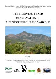
MT MABU, MOZAMBIQUE: - Royal Botanic Gardens, Kew
MT MABU, MOZAMBIQUE: - Royal Botanic Gardens, Kew
MT MABU, MOZAMBIQUE: - Royal Botanic Gardens, Kew

Create successful ePaper yourself
Turn your PDF publications into a flip-book with our unique Google optimized e-Paper software.
Darwin Initiative Award 15/036: Monitoring and Managing<br />
Biodiversity Loss in South-East Africa's Montane Ecosystems<br />
<strong>MT</strong> <strong>MABU</strong>, <strong>MOZAMBIQUE</strong>:<br />
BIODIVERSITY AND CONSERVATION<br />
November 2012<br />
Jonathan Timberlake, Julian Bayliss, Françoise Dowsett-Lemaire,<br />
Colin Congdon, Bill Branch, Steve Collins, Michael Curran, Robert J. Dowsett,<br />
Lincoln Fishpool, Jorge Francisco, Tim Harris, Mirjam Kopp & Camila de Sousa<br />
ABRI<br />
african butterfly research in<br />
Forestry Research<br />
Institute of Malawi
Biodiversity of Mt Mabu, Mozambique, page 2<br />
Front cover: Main camp in lower forest area on Mt Mabu (JB).<br />
Frontispiece: View over Mabu forest to north (TT, top); Hermenegildo Matimele plant collecting (TT,<br />
middle L); view of Mt Mabu from abandoned tea estate (JT, middle R); butterflies (Lachnoptera ayresii)<br />
mating (JB, bottom L); Atheris mabuensis (JB, bottom R).<br />
Photo credits: JB – Julian Bayliss CS ‒ Camila de Sousa<br />
JT – Jonathan Timberlake TT – Tom Timberlake<br />
TH – Tim Harris<br />
Suggested citation: Timberlake, J.R., Bayliss, J., Dowsett-Lemaire, F.,<br />
Congdon, C., Branch, W.R., Collins, S., Curran, M., Dowsett, R.J., Fishpool,<br />
L., Francisco, J., Harris, T., Kopp, M. & de Sousa, C. (2012). Mt Mabu,<br />
Mozambique: Biodiversity and Conservation. Report produced under the<br />
Darwin Initiative Award 15/036. <strong>Royal</strong> <strong>Botanic</strong> <strong>Gardens</strong>, <strong>Kew</strong>, London. 94 pp.
Biodiversity of Mt Mabu, Mozambique, page 3<br />
LIST OF CONTENTS<br />
List of Contents .......................................................................................................................... 3<br />
List of Tables .............................................................................................................................. 4<br />
List of Figures ............................................................................................................................ 5<br />
SUMMARY ............................................................................................................................... 6<br />
1. INTRODUCTION ................................................................................................................. 8<br />
1.1 Background .................................................................................................................... 8<br />
1.2 Media Coverage.............................................................................................................. 9<br />
2. DESCRIPTION OF STUDY AREA ................................................................................... 10<br />
2.1 Geography and Geology ............................................................................................... 10<br />
2.2 Climate ......................................................................................................................... 11<br />
2.3 Aerial Photos ................................................................................................................ 13<br />
3. HISTORY AND EARLY COLLECTING .......................................................................... 13<br />
3.1 Early History ................................................................................................................ 14<br />
3.2 Recent History .............................................................................................................. 16<br />
4. VEGETATION .. ................................................................................................................. 19<br />
4.1 Previous Studies ........................................................................................................... 19<br />
4.2 Vegetation Mapping ..................................................................................................... 19<br />
4.3 Vegetation Types .......................................................................................................... 22<br />
4.3.1 Plantations ............................................................................................................. 22<br />
4.3.2 Woodland .............................................................................................................. 22<br />
4.3.3 Moist Forest .......................................................................................................... 23<br />
4.3.4 Montane shrubland ............................................................................................... 27<br />
4.3.5 Vegetation of the Drier Western and Northern Slopes ......................................... 29<br />
4.4 Forest Plots ................................................................................................................... 29<br />
4.5 Observations on Tree Fruiting ...................................................................................... 29<br />
5. . PLANTS .............................................................................................................................. 33<br />
5.1 Previous Studies ........................................................................................................... 33<br />
5.2 Plant Collections ........................................................................................................... 33<br />
5.3 Species of Particular Interest ........................................................................................ 34<br />
6. BIRDS ................................................................................................................................. 37<br />
6.1 Previous Studies ........................................................................................................... 37<br />
6.2 Bird Survey ................................................................................................................... 37<br />
6.3 Biogeographical Significance ....................................................................................... 37<br />
6.4 Bird Species of Conservation Importance .................................................................... 39<br />
6.5 Bird Breeding Records ................................................................................................. 41<br />
7. OTHER VERTEBRATES & INVERTEBRATES ............................................................. 43<br />
7.1 Previous Studies ........................................................................................................... 43<br />
7.2 Larger Mammals .......................................................................................................... 43<br />
7.3 Bats ............................................................................................................................... 43<br />
7.4 Other Small Mammals .................................................................................................. 44<br />
7.5 Herpetofauna ................................................................................................................ 45<br />
7.6 Lepidoptera ................................................................................................................... 47<br />
7.7 Molluscs ....................................................................................................................... 49<br />
7.8 Freshwater Crustacea.................................................................................................... 49<br />
7.9 Biogeography ............................................................................................................... 50
Biodiversity of Mt Mabu, Mozambique, page 4<br />
8. CONSERVATION .............................................................................................................. 51<br />
8.1 Conservation Threats .................................................................................................... 51<br />
8.2 Protection and Conservation......................................................................................... 54<br />
9. MAIN FINDINGS ............................................................................................................... 56<br />
10. RECOMMENDATIONS ................................................................................................... 57<br />
11. ACKNOWLEDGEMENTS ............................................................................................... 59<br />
12. BIBLIOGRAPHY & REFERENCES ............................................................................... 60<br />
Annex 1. Participants on main Mt Mabu, October 2008 ......................................................... 66<br />
Annex 2. Media Coverage of Mt Mabu ................................................................................... 67<br />
Annex 3. Plant checklist for Mt Mabu above 800 m ............................................................... 71<br />
Annex 4. Annotated list of bird species on Mt Mabu recorded above 400 m .......................... 77<br />
Annex 5. Birds ringed near main forest camp on Mt Mabu, 16‒17 Oct 2008 ......................... 84<br />
Annex 6. List of larger mammal species recorded from the Mabu massif .............................. 85<br />
Annex 7. List of small mammal species collected or recorded from the Mabu massif ........... 87<br />
Annex 8. List of reptile and amphibian species collected or recorded from the Mabu massif 88<br />
Annex 9. Butterfly species collected on Mt Mabu from 2006 to 2010 .................................... 89<br />
LIST OF TABLES<br />
Table 1. Main visits to Mt Mabu, 2005‒2010 ............................................................................ 9<br />
Table 2. Extent of area above 1000 m by altitudinal class for the Mt Mabu massif ................ 10<br />
Table 3. Tea enterprises in the Mt Mabu area, with 1960 production figures ......................... 16<br />
Table 4. Extent of forest area by altitudinal class for the Mt Mabu massif ............................. 20<br />
Table 5. Summary of forest plot data, Mt Mabu ...................................................................... 31<br />
Table 6. Plant species of interest recorded from Mt Mabu ...................................................... 34<br />
Table 7. Species found on Mt Mabu mentioned on Sabonet Red Data lists as threatened<br />
or endemic .................................................................................................................. 36<br />
Table 8. Afromontane (near-)endemic and selected Eastern endemic bird species present<br />
on Namuli, Mulanje, Thyolo, Mabu and Chiperone Mountains ................................ 38<br />
Table 9. Location of bat sampling sites and sampling effort ................................................... 44<br />
Table 10. List of molluscs collected on Mt Mabu, 2005‒2009 ................................................ 49
Biodiversity of Mt Mabu, Mozambique, page 5<br />
LIST OF FIGURES<br />
Fig. 1. Montane areas in N Mozambique studied under the Darwin Initiative project ............ 11<br />
Fig. 2. Google Earth image of Tacuane area showing Mt Mabuand roads (Aug 2006) .......... 11<br />
Fig. 3. Map of Mt Mabu area showing forest extent and main localities visited ..................... 12<br />
Fig. 4. Google Earth image of Mt Mabu massif from 2006 showing forest + dense woodland<br />
cover and abandoned tea plantations; and false-colour Landsat image from 2005 with<br />
dense vegetation cover ................................................................................................. 13<br />
Fig. 5. Map showing route of Joseph Last from Malawi to Quelimane, 1887 ......................... 15<br />
Fig. 6. Map of Zambezi Company territory (Maugham 1910) ................................................ 16<br />
Fig. 7. Base camp at abandoned tea estate manager's house, Cha Madal ................................ 17<br />
Fig. 8. Soviet map of Mt Mabu and Tacuane area, 1:250,000 scale ........................................ 18<br />
Fig. 9. Supervised classification of Mt Mabu forest vegetation, 2011 (J. Bayliss) .................. 21<br />
Fig. 10. Partially-supervised classification of Mt Mabu forest vegetation, 2008 (S. Baena) .. 21<br />
Fig. 11. Moist woodland (Syzygium cordatum) at forest margin ............................................. 23<br />
Fig. 12. Burnt woodland in agricultural zone on lower SE slopes of Mt Mabu; woodland at<br />
forest margin showing boundary ................................................................................ 23<br />
Fig. 13. Medium altitude moist forest, near Mt Mabu campsite .............................................. 25<br />
Fig. 14. Medium altitude moist forest canopy, Mt Mabu ........................................................ 25<br />
Fig. 15. Montane forest on upper slopes of Mt Mabu .............................................................. 26<br />
Fig. 16. View over montane forest on Mt Mabu ...................................................................... 27<br />
Fig. 17. Coleochloa 'grassland' on rocky slopes near summit of Mt Mabu ............................. 28<br />
Fig. 18. Upper forest margin with montane shrubland and Coleochloa 'grassland'................. 28<br />
Fig. 19. Montane shrubland near summit of Mt Mabu ............................................................ 28<br />
Fig. 20. Montane shrubland near summit of Mt Mabu ............................................................ 28<br />
Fig. 21. Cryptostephanus vansonii on upper slopes of Mt Mabu ............................................ 34<br />
Fig. 22. Polystachya songensis orchid on Mabu summit ......................................................... 34<br />
Fig. 23. Olive Sunbird in Mt Mabu forest ................................................................................ 42<br />
Fig. 24. Lesser Pouched Rat caught in medium altitude forest, Mt Mabu ............................... 45<br />
Fig. 25. Two Atheris mabuensis on forest floor ....................................................................... 46<br />
Fig. 26. Pygmy chameleon, sp. nov. ........................................................................................ 47<br />
Fig. 27. Butterfly, Papilio ophidicephalus ............................................................................... 48<br />
Fig. 28. Butterfly, Cymothoe sp. nov. ...................................................................................... 48<br />
Fig. 29. Butterfly, Baliochila sp. nov. ...................................................................................... 48<br />
Fig. 30. Woodland clearance for agriculture and fire .............................................................. 52<br />
Fig. 31. Sun squirrel caught in gin trap, Mt Mabu ................................................................... 53<br />
Fig. 32. Small mammal trap and fence, Mt Mabu .................................................................... 53<br />
Fig. 33. Small but powerful gin trap, Mabu summit ................................................................ 54<br />
Fig. 34. Large gin trap with Hassam Patel, Mabu forest .......................................................... 54<br />
Fig. 35. Villagers at Mt Mabu forest camp .............................................................................. 55
Biodiversity of Mt Mabu, Mozambique, page 6<br />
SUMMARY<br />
Located in north-central Mozambique, 95 km south-east of Mt Mulanje in southern Malawi,<br />
Mt Mabu is a granitic massif rising to 1700 m. Much of it is covered in exceptionally welldeveloped<br />
and little-disturbed moist forest. It was first explored biologically in 2005 as part of<br />
a <strong>Kew</strong>-led project funded through the UK's Darwin Initiative, followed by a large expedition<br />
under the same project in 2008. Initially done with the help of Google Earth imagery,<br />
discovery of the extensive forest and the subsequent expedition gave rise to much<br />
international media coverage, some of which is outlined here. This report describes the area<br />
and its history, and outlines the main biological findings made under the project.<br />
Covering an estimated area of 7880 ha, with around 5270 ha of this at medium altitude<br />
(1000‒1400 m), the forests on Mt Mabu are some of the most extensive of this type in<br />
southern Africa. Mid-altitude forests are now increasingly rare as so many have been cleared<br />
for agriculture. In addition, Mabu's forest is also remarkably little disturbed, probably as it is<br />
mostly found on very steep and rugged terrain. Moist woodland (Syzygium cordatum,<br />
Pterocarpus angolensis, Xylopia aethiopica) and gully forest (Albizia adianthifolia,<br />
Erythrophleum suaveolens, Newtonia buchananii) are found below 1000 m, along with<br />
abandoned tea estates on the southern and south-eastern slopes. The main area of mid-altitude<br />
moist forest, perhaps the biologically richest and most important area, is characterised by<br />
large trees 40‒50 m high of Strombosia scheffleri, Newtonia buchananii, Chrysophyllum<br />
gorungosanum and Maranthes goetzeniana, with extensive clumps of the bamboo<br />
Oreobambos buchwaldii in gullies. Much moister Afromontane forest, 20‒25 m high, is<br />
found above 1350‒1400 m altitude, typically with Olea capensis, Rapanea melanophloeos,<br />
Aphloia theiformis, Faurea racemosa and Podocarpus latifolius. Emerging from the<br />
Afromontane forest at 1600‒1700 m are relatively small areas of granitic (syenite) rock with<br />
patches of montane shrubland and clumps of the sedge Coleochloa setifera, a common habitat<br />
in this region of inselbergs.<br />
Surveys carried out under the Darwin project yielded 249 plant species above 800 m<br />
altitude, of which two (a mistletoe Helixanthera schizocalyx and the shrub Vepris sp. nov.)<br />
are new to science and an additional 11 are significant range extensions from the<br />
Chimanimani Mountains or Tanzania's Southern Highlands and/or new records for<br />
Mozambique.<br />
Zoological findings of vertebrates were even more impressive with 126 bird species being<br />
recorded, including the discovery of significant populations of Cholo Alethe and the race<br />
belcheri of Green Barbet, along with smaller populations of Dapple-throat, Spotted Ground<br />
Thrush, Namuli Apalis (previously believed to be endemic to Mt Namuli) and Swynnerton's<br />
Robin. Of the 12 bat species recorded, one is new (Rhinolophus mabuensis) and two are new<br />
records for the country. A total of 15 reptile and 7 amphibian species were found, including<br />
three new species (the Mabu forest viper Atheris mabuensis, a chameleon Nadzikambia<br />
baylisii and a pygmy chameleon Rhampholeon). Two other snakes and a frog may also be<br />
new to science.
Biodiversity of Mt Mabu, Mozambique, page 7<br />
Much effort went into surveying the butterflies, with 203 species on the checklist<br />
including 39 new country records. Four of these are new species (Baliochila sp. nov.,<br />
Cymothoe sp. nov., Epamera sp. nov., Leptomyrina sp. nov.) with a further three new<br />
subspecies.<br />
At present the threats to the forests of Mt Mabu are not particularly great, with the great<br />
majority of it showing very little sign of human disturbance apart from hunting/snaring for<br />
bushmeat. However, there is a notable impact on the forest‒woodland margin from fire and<br />
clearance for subsistence agriculture. Logging and clearance for commercial agriculture<br />
remain potential threats, especially with the recent marked expansion of agriculture in<br />
Mozambique and new ownership of the abandoned tea estates. At present the Mabu area is<br />
not formally protected, although there are moves to gazette it at a Provincial level and develop<br />
a conservation project through a local NGO, Justica Ambiental, and Fauna and Flora<br />
International.<br />
Twelve recommendations for both management and further research are given. At this<br />
stage it is not our technical or scientific knowledge on Mabu's biodiversity that is the limiting<br />
factor for focussed conservation action, but the development of management plans and<br />
implementation of such action on the ground. As with many forests, the forests on Mt Mabu<br />
are still able to regenerate and maintain themselves if the underlying ecological factors<br />
(rainfall, soils, regeneration microclimate and availability of propagules) remain functional.<br />
And on Mt Mabu these attributes are, at present, still healthy.
Biodiversity of Mt Mabu, Mozambique, page 8<br />
1. INTRODUCTION<br />
The discovery in 2005 of a large expanse of forest on Mt Mabu in north-central Mozambique<br />
and the subsequent 2008 expedition, gave rise to much interest nationally and internationally<br />
‒ some said a "lost Eden", others called it the "Google Forest" as it was first noted using<br />
Google Earth imagery. In truth, the mountain had already been mapped and named and the<br />
forest was, of course, known to the local population. It is just that early explorers and, more<br />
recently, scientists and similar professionals had not recorded or visited it. But the large extent<br />
and relatively little-disturbed nature of the forest was indeed a very significant find, as were<br />
the number of new species found.<br />
Lying just west of the district centre of Tacuane in Zambézia Province, about 80 km southeast<br />
of the Malawi border near Mt Mulanje, Mt Mabu is one of a series of granitic blocks or<br />
inselbergs rising above the surrounding coastal lowlands. The country is sufficiently rugged<br />
that it has attracted little agriculture except on the more gentle footslopes, where tea and other<br />
plantations were established during the Portuguese colonial period.<br />
Mt Mabu and its forests had no formal protection, nor was it in any way recognised as an area<br />
worthy of conservation before this project's major expedition in October 2008. It is hoped that<br />
its now greatly increased profile will lead to sustainable conservation initiatives.<br />
1.1 Background<br />
Under a collaborative project – "Monitoring and Managing Biodiversity Loss on South-East<br />
Africa's Montane Ecosystems" funded by a UK Government Darwin Initiative grant – various<br />
trips were made to Mt Mabu area from 2005 to 2010 (Table 1), in particular a major<br />
expedition was undertaken in October 2008 (see Bayliss 2009). This was followed<br />
subsequently by a smaller trips in 2009‒2010 looking at butterflies and reptiles and for natural<br />
history filming. Most of these trips were a collaborative effort between the <strong>Royal</strong> <strong>Botanic</strong><br />
<strong>Gardens</strong> <strong>Kew</strong> (RBG <strong>Kew</strong>), the Instituto de Investigação Agraria de Moçambique (IIAM), the<br />
Maputo Natural History Museum (MHN), the Mulanje Mountain Conservation Trust<br />
(MMCT), the Forest Research Institute of Malawi (FRIM), the African Butterfly Research<br />
Institute (ABRI) in Kenya, and BirdLife International. A full list of participants on the main<br />
2008 expedition is given in Annex 1. Additional persons who contributed to sections of this<br />
report are listed in the Acknowledgements.<br />
The objectives of the study and expeditions were:<br />
1. To undertake botanical and vegetation field survey of Mt Mabu,<br />
2. To gather additional zoological information on the mountain, particularly on birds,<br />
reptiles and butterflies,<br />
3. To train a team of Mozambican and Malawian biologists in botanical and vegetation<br />
survey techniques,<br />
4. To assess the extent, status and threats to the moist forest and other biodiversity on the<br />
mountain,<br />
5. Based on gathered field data, to develop species and habitat recovery plans.<br />
This report presents and discusses findings from the main 2008 expedition, reconnaissance<br />
and subsequent trips, but also attempts to place these in a broader context as well as draw<br />
conclusions relevant to Mabu's conservation. Detailed species lists for plants, birds and<br />
butterflies are presented, along with partial data on bats, reptiles and other groups. In addition
Biodiversity of Mt Mabu, Mozambique, page 9<br />
to the species lists we give the first detailed account of the vegetation, and discuss the threats<br />
to all biodiversity. Particular attention has been paid to endemic, rare or threatened species.<br />
Our main attention was given to areas and species above 800 m altitude, as below this height<br />
much of the vegetation has already been transformed.<br />
Table 1. Main visits to Mt Mabu, 2005‒2010.<br />
dates taxa recorded persons involved<br />
Dec 2005 birds, plants, herps, butterflies J. Bayliss, C. Spottiswoode, E.<br />
Herrmann, H. Patel<br />
Jan 2006 butterflies, herps J. Bayliss and others<br />
Sept-Oct 2008 herps, plants, butterflies J. Bayliss, H. Patel and others<br />
Oct 2008 plants, birds, herps, small main Darwin project expedition<br />
mammals, butterflies<br />
May 2009<br />
Oct-Nov 2010<br />
butterflies, herps<br />
butterflies, herps<br />
J. Bayliss, W. Branch, ABRI<br />
and others<br />
J. Bayliss, ABRI, FFI<br />
Nov-Dec 2010 butterflies, herps<br />
J. Bayliss, BBC filming<br />
1.2 Media Coverage<br />
Unlike other expeditions to mountains in northern Mozambique and Malawi carried out under<br />
this Darwin Initiative project, the 2008 trip to Mt Mabu gave rise to a phenomenal amount of<br />
international media attention. This coverage and interest ‒ which still continues in 2012 ‒ is<br />
outlined in Annex 2, along with a selection of references to some of the main articles and web<br />
links, including videos.
Biodiversity of Mt Mabu, Mozambique, page 10<br />
2. DESCRIPTION OF STUDY AREA<br />
2.1 Geography and Geology<br />
The highest of a series of blocks, Mt Mabu rises above the surrounding lowland plains at<br />
around 350‒450 m altitude, just north of the Rio Lugela in Zambézia Province, north-central<br />
Mozambique. It is centred on 16 o 17'S, 36 o 24'E, with the 1710 m summit at 16 o 17'56.5"S,<br />
36 o 23'44.3"E. Situated within the District of Lugela, it lies some 95 km south-east of Mt<br />
Mulanje in southern Malawi, 120 km south-west of Mt Namuli and 200 km from the<br />
Provincial Capital of Quelimane on the Indian Ocean coast (Figure 1). The district centre of<br />
Lugela is 40 km away, while the larger town of Mocuba, at the confluence of the Lugela and<br />
Licungo rivers, is 85 km to the south-east.<br />
The Mabu massif is essentially a complex of granitic inselbergs ('whalebacks') or ancient<br />
igneous intrusions, exposed by millions of years of subsequent erosion. It is significantly<br />
smaller than the Namuli complex (see Timberlake et al. 2009) and, unlike that massif, does<br />
not include any substantive area of upland plateau. The rock forming the Mabu massif is<br />
syenite, similar to granite, an igneous intrusion of the younger Precambrian Namarroi series<br />
dating from 850‒1100 Mya (Instituto Nacional de Geologia 1987). This intrusion is<br />
surrounded by migmatites, also of the Namarroi series.<br />
Lugela District contains four Posto Administrativos and 16 Localidades ‒ Mabu is in the<br />
Posto Administrativo (P.A.) of Tacuane, Mabu Localidade. The nearest main administrative<br />
centre is Tacuane 15 km away (Figure 2), with the lesser administrative post of Limbuè lying<br />
on the southern footslopes of Mabu. The population of P.A. Tacuane in January 2005 was<br />
18,191 persons (Ministério da Administração Estatal 2005), a relatively low number.<br />
Population pressure is not high in this area, although the area may well have been more<br />
populous during the colonial period when the tea estates were providing employment. Areas<br />
visited by the 2008 expedition overlain by contours are shown in Figure 3.<br />
A GIS-based altitudinal analysis of the Mt Mabu area by J. Bayliss showed that out of a broad<br />
study area surrounding the Mabu massif of around 300 km 2 , 8308 ha lies above 1000 m<br />
(Table 2), which is around the lower limit of true moist forest (at least on the eastern slopes),<br />
although lowland gully forest can be found below this (see Section 4.3.3).<br />
Table 2. Extent of area above 1000 m by altitudinal class<br />
for the Mt Mabu massif.<br />
Altitude (m) extent (ha) %<br />
1000‒1200 3527 42.5<br />
1200‒1400 3723 44.8<br />
1400‒1600 1031 12.4<br />
1600+ 27 0.3<br />
Total 8308 100.0<br />
Although the forest on Mt Mabu was first noted on Google Earth (Figure 4a), and has<br />
sometimes been called the "Google Forest", there are some inaccuracies present on the<br />
webpage images (accessed January 2012). The main one is that the peak of Mt Mabu is<br />
shown on Google Earth as being 18 km east of its actual location ‒ the peak shown as "Mt<br />
Mabu" is a wooded area away from the main massif. Secondly, on the ground it is clear that<br />
the peak is along a bare open ridge south-west of the main rock outcrop, but the highest point<br />
appearing on Google Earth imagery is 1651 m, not 1710 m as on all cadastral maps, and is
Biodiversity of Mt Mabu, Mozambique, page 11<br />
apparently situated on a vegetated lower ledge some 600 m to the south-east. This could be an<br />
artefact resulting from cloud cover.<br />
Fig. 1. Montane areas in N Mozambique studied<br />
under the Darwin Initiative project [JB].<br />
Fig. 2. Google Earth image of Tacuane area showing Mt Mabu (centre left) and roads (Aug 2006)[JF].<br />
2.2 Climate<br />
Climate data from the Mabu massif itself above 1000 m altitude are not available, but data for<br />
the Madal tea estates near Tacuane (16 o 21'S, 36 o 22'E, 400 m altitude), possibly at Limbuè just
Biodiversity of Mt Mabu, Mozambique, page 12<br />
7 km away, is summarised in Kassam et al. (1981). These data are for only 16 years and<br />
probably date from the mid-1960s.<br />
Mean annual rainfall is given as 2119.1 mm, ranging from a monthly mean of 34.2 mm in<br />
September to 362.3 mm in January. The main rainfall months are November to April (1793.1<br />
mm over 6 months or 84.6% of annual total), while the four months from December to March<br />
have a mean of 1410.9 mm (66.6% of total). Over the 16 years recorded the wettest months<br />
were March (mean 381.1 mm) and January (mean 362.3 mm).<br />
Mean annual temperature was 23.7 o C, ranging from 21.0 in July to 25.5 o C in October. The<br />
mean maximum of 32.9 o C was in October with a mean minimum of 14.9 o C in July. Unlike<br />
the situation on Mt Namuli (Timberlake et al. 2009), the occurrence of frost is likely to be<br />
rare. Evapotranspiration (Penman) was 1252.6 mm/year ranging from 63.7 mm in June to<br />
142.5 in October. During the cooler winter months potential evapotranspiration is roughly<br />
equivalent to rainfall, but in October it is more than three times monthly rainfall.<br />
According to Reddy (1984) in his overview of Mozambique's climate, rainfall in the area<br />
should be around 1500 mm/year (surprisingly less than shown by actual rainfall records) with<br />
a low variation of only 20%. The winter rainfall index (30) indicates that some winter<br />
cropping is possible. In a national context the Cha Madal area is a relatively high rainfall area<br />
similar to Mt Namuli (zone 1‒2a, moderately cool; national climatic resources inventory,<br />
Voortman & Spiers 1982), with the possibility of two rainfed growing periods in 10% of<br />
years, perhaps with a 300 day growing period each year.<br />
Fig. 3. Map of Mt Mabu area showing forest extent and main localities visited (Oct 2008)[JB].
Biodiversity of Mt Mabu, Mozambique, page 13<br />
2.3 Aerial Photos<br />
The only aerial photos apparently available are from August 1965 and June 1969 at a given<br />
scale of around 1:43,000, although subsequent analysis and measurements from the 1:50,000<br />
map sheet suggest the scale is actually around 1:35,000. Owing to distortion, all area<br />
determinations were made using satellite imagery.<br />
Aerial photos of Mt Mabu, ±1:43,000 scale:<br />
row 418/062‒072 (north), 17 August 1965<br />
row 3111/076‒086 (mid), 15 June 1969<br />
row 418/118‒111 (south), 17 August 1965<br />
Fig. 4a,b. Google Earth image of Mt Mabu massif from 2006 (left) showing forest + dense woodland<br />
cover in dense green and abandoned tea plantations in paler blue-green (lower right and lower centre,<br />
with straight lines) and false-colour Landsat image (right) from July 2005 with dense vegetation cover<br />
shown in red.
Biodiversity of Mt Mabu, Mozambique, page 14<br />
3. HISTORY AND EARLY COLLECTING<br />
3.1 Early History<br />
We have not been able to find any reports of early colonial explorers noting or visiting the<br />
Mabu massif, at least in the British sources that describe the exploration of Mt Namuli and<br />
travels across northern Mozambique to southern Malawi in the latter 19 th and first half of the<br />
20 th century (e.g. Johnson 1884, O'Neill 1884, Last 1887, Vincent 1933a).<br />
Joseph Last, an intrepid 19th Century British traveller, carried out a lengthy journey in 1885‒<br />
1887 from the southern Tanzania coast to Blantyre in what is now Malawi, around parts of<br />
southern Malawi and then down to the coast at Quelimane and back to Blantyre (Last 1887,<br />
1890, Timberlake et al. 2009). Part of this long trip involved a foot safari from Mt Namuli<br />
down along the Rio Licungo to the coast and then, in mid-December 1886 after a few days<br />
rest in Quelimane, upstream along the Rio Licungo to what is now Mocuba, along the Rio<br />
Lugela and through the hilly country north of Lugela town to what is now Namarroi. From<br />
there he walked along the Rio Luo entering Malawi just south of Lake Chilwa (Chirwa) and<br />
north of Mt Mulanje, arriving in Blantyre on 14 January 1887. Unfortunately, in the account<br />
published by his sponsors, the <strong>Royal</strong> Geographical Society (Last 1887), he hardly mentions<br />
the Lugela leg of this trip. The route he took is shown on a subsequent map (Last 1890,<br />
portion shown in Figure 5). However, despite attempts to match the Lugela portion with<br />
present 1:250,000 and 1:50,000 map sheets, his route could not be traced except in fairly<br />
broad terms.<br />
All that can be said is that Last left the Rio Lugela heading north upstream of present-day<br />
Mocuba (not marked on his map) somewhere between Mt Cuba/Murra (16 o 40'S, 36 o 50'E) and<br />
just upstream of the Xilusi‒Lugela confluence (16 o 32'S, 36 o 38'E). From there he made his<br />
way between the hills west of Mt Mavigue ("Mavugwe", 16 o 22'S, 36 o 45'E), passing east of<br />
what is now Muabana but west of Mt Muiane ("Mwiani",16 o 02'S, 36 o 37'E), and then crossing<br />
the present-day Rio Mucodi soon after, some 30 km west of Namarroi, before travelling along<br />
the Rio Luo. Thereafter he followed the Luo westwards towards Malawi, which he entered<br />
just south of Lake Chilwa (Chirwa).<br />
In those days, fixing longitude was not easily done and distances were estimated from time<br />
spent walking, so many distortions are apparent in the 1890 map (Figure 5). Thus it has not<br />
been possible to identify more than a very few of the hills or other points it shows, and the<br />
relative positions of peaks seem highly distorted compared to present-day maps. However,<br />
although it seems fairly certain that of the early recorded travellers Last perhaps came closest,<br />
he did not pass close to Mt Mabu or see it (despite an intriguingly-named peak "Mapu<br />
H"[hill] on his 1890 map), or travel along the route of the present-day Tacuane‒Muabana<br />
road. Unfortunately, in his account there is also no mention of the type of country he passed<br />
through, the people or the life in these areas, or even whom he went with.<br />
Earlier, in 1884, Daniel Rankin and H.E. O'Neill (then the British Consul on Mozambique<br />
Island) plus 23 porters, walked from Blantyre to Quelimane along an existing and significant<br />
trade route to see how quick and effective that route was to the coast (Rankin 1885). It took<br />
them just 39 days. At the time there was concern that the Rio Zambezi was becoming less<br />
passable to boats owing to river silting, and that this route into the important new settlements<br />
of Blantyre and Zomba in southern Malawi could be easily cut by hostile forces. Their route<br />
passed south of the Mulanje massif, across the headwaters of the Rio Lugela but kept to<br />
higher ground until it met the Rio Tetema. From here it followed the river down to the<br />
Munguze ("Mulongusi") confluence and then down the Rio Licuare ("Likwati") to<br />
Quelimane. However, this route, also shown on Last's map (Last 1990), passes quite a long<br />
way south of Mt Mabu.
Biodiversity of Mt Mabu, Mozambique, page 15<br />
Fig. 5. Map showing route of Joseph<br />
Last from Malawi to Quelimane,<br />
1887.<br />
Another book by an early traveller (Maugham 1910) on the whole Zambezia area does not<br />
mention Mabu or the area around, focussing more on the coastal strip. Although the Namuli<br />
area is clearly shown on his map, the Mabu area is almost omitted (Figure 6).<br />
Hence despite a significant amount of trading and travelling in this part of north-central<br />
Mozambique, it appears that the Mabu area was continually by-passed, perhaps because of its<br />
rugged terrain, poor agricultural potential, thus scattered and low human population.
Biodiversity of Mt Mabu, Mozambique, page 16<br />
Fig. 6. Map of Zambezi Company territory (from Maugham 1910).<br />
3.2 Recent History<br />
The first major economic development in the area appears to have been the establishment of<br />
tea plantations in what was then Tacuane District on the lower slopes of Mt Mabu in the<br />
1930s (Wilson, Smithett & Co. 1962). By 1961 there were three tea estates in the area and<br />
two tea factories, compared to 14 estates and 11 factories in the Gurué area around Mt Namuli<br />
and 7 estates and 3 factories in the Milange area just across the border from Mt Mulanje in<br />
Malawi. Details of the three Tacuane estates are given in Table 3. From these records it<br />
appears that the estate where the present Darwin expedition was initially based ‒ Cha Madal ‒<br />
was by far the largest.<br />
Table 3. Tea enterprises in the Mt Mabu area, with 1960 production figures<br />
(from Wilson, Smithett & Co. 1962).<br />
Company<br />
altitude<br />
(m)<br />
Company<br />
area under<br />
tea (ha)<br />
tea production<br />
(kg)<br />
Cha Madal 400 Sociedade Agricola do Madal 607.5 444,466<br />
Cha Tacuane 700 Manuel Nunes 342.2 182,217<br />
Cha Lugela 700 João Martins 93.2 (no factory)<br />
1042.9 626,683<br />
The area under tea in northern Mozambique in the 1960s was surprisingly large at 15,010 ha,<br />
greater than that in Malawi (12,110 ha) or Kenya (14,950 ha). Mozambique's total tea<br />
production in 1961 was 23,368,000 lbs [pounds] (10,609,072 kg), with exports being<br />
21,362,000 lbs (9,698,348 kg), compared to production of 31,518,000 lbs (14,309,172 kg) in<br />
Nyasaland [Malawi], 27,869,000 lbs in Kenya, 9,830,000 lbs in Tanganyika [Tanzania] and<br />
2,379,000 lbs in Southern Rhodesia [Zimbabwe]. Hence production per hectare in<br />
Mozambique at 706.9 kg/ha was significantly less than that in Malawi (1182 kg/ha) or Kenya<br />
(847 kg/ha) (all figures from Wilson, Smithett & Co. 1962). Tea production was obviously a
Biodiversity of Mt Mabu, Mozambique, page 17<br />
major economic and agricultural activity in the area in the 1960s, but probably declined<br />
significantly in the 1970s with the Independence struggle and subsequent civil war.<br />
At the base of Mt Mabu on the southeastern side is the now-derelict Cha Madal Tea Estate,<br />
until recently owned by Madal (now Rift Valley Holdings), a large Mozambican company<br />
best known for its coconut plantations on the coast near Quelimane. In 1961 the estate<br />
manager was John Edge (Wilson, Smithett & Co. 1962). It was obviously a large estate, with<br />
an extensive factory, out-buildings, workers' and managers' housing. What was presumably<br />
the Estate Manager's house (16°18'20.5"S, 36°25'28.8"E, Figure 7a,b) was a large, spreading,<br />
opulent building with a wonderful view over the surrounding plains. The estate was<br />
abandoned in August 1982 as fighting in the area reached a stage where tea production was no<br />
longer viable; the tea estate later became a Renamo base.<br />
Fig. 7a,b. Base camp at abandoned tea estate manager's house, Cha Madal (left TH, right CS).<br />
Around the Estate Manager's house many exotic tree species were planted, presumably both<br />
for utilitarian purposes and for shade and beautification. These included Artocarpus<br />
heterophylla (Jackfruit), Eucalyptus cf. grandis (probably for fuelwood and construction),<br />
Vernicia montana (Tung oil), Grevillea robusta, Delonix regia, Ceiba pentandra (Kapok),<br />
Encephalartos cycads and Ficus elastica (India Rubber tree).<br />
The area of plantation tea can be clearly seen in the satellite imagery as a vegetation block<br />
south-east of the main forest area (Figure 4a). The estate was planted with over 600 ha of<br />
China hybrid tea (Camellia sinensis cultivar.), of which 520 ha were in production as of June<br />
1961 (Wilson, Smithett & Co. 1962). As it has not been managed for almost 30 years, the tea<br />
bushes have grown up to 15 m forming an almost solid-canopy forest. Apparently, it may still<br />
be commercially viable if pruned, and could be linked to neighbouring tea-producing areas in<br />
Gurué or even in Mulanje in southern Malawi. Recently, a senior Madal representative<br />
suggested that the planned rehabilitation of the estate may take the form of removing the tea<br />
and replanting with other, more viable crops. However, Madal have now (2011 or early 2012)<br />
sold the estate to a company called Mozambique Holdings.<br />
There is a Soviet map of the area, possibly forming part of a national 1:250,000 series<br />
produced in the late 1970s or early 1980s. The section of the sheet covering Mabu is shown in<br />
Figure 8. It gives a bit more detail than is available on the national Dinegeca 1:250,000 scale<br />
map series, and seems to have been derived separately, possibly from more recent aerial<br />
photos.<br />
On the summit of Mt Mabu we noted the destroyed remains of a trigonometrical point<br />
(presumably from which the spot height of 1710 m was determined), and this was
Biodiversity of Mt Mabu, Mozambique, page 18<br />
subsequently borne out by David Scott (pers. comm., Feb. 2009) who reported constructing<br />
such a point with the Mozambique mapping agency Dinegeca in 1995.<br />
Fig. 8. Soviet map of Mt Mabu and Tacuane area, 1:250,000 scale (probably<br />
late 1970s). Mt Mabu indicated with red arrow.
Biodiversity of Mt Mabu, Mozambique, page 19<br />
4. VEGETATION<br />
4.1 Previous Studies<br />
It seems that there have been no previous studies on, or even recognition of, the vegetation of<br />
Mt Mabu or the immediate area. However, as mentioned earlier, the presence of a number of<br />
tea estates on the lower slopes means that the surrounding vegetation must have been known<br />
to agriculturalists, even if it appears not to have been formally documented.<br />
On a continental or regional scale, the Mabu area is shown by White (1983) as forest patches<br />
of the East African coastal mosaic (type 16b) surrounded by Wetter Zambezian miombo<br />
woodland (type 21). White is wrong in his assertion that these forests are linked to those on<br />
the East African coast as they are clearly montane and medium altitude forests, very similar to<br />
those found on mountains in southern Malawi and Eastern Zimbabwe. The more detailed<br />
study by Wild & Barbosa (1968), on which White's study for this area was based, maps the<br />
Mabu area as Moist Evergreen Forest at low and medium altitudes (Type 1) surrounded by<br />
Brachystegia spiciformis (high rainfall) woodland (Type 21).<br />
The more detailed (and earlier) map of Zambézia Province by Barbosa (1952) shows the<br />
Mabu massif as Unit 1 "Floresta higrófila tropical altimontana, de chuvas e nevoeiros" (moist<br />
high-altitude rain and cloud forest), the same as Mt Namuli, surrounded by Unit 2 "Floresta<br />
sub-higrófila, das altitudes medias, de Brachystegia spiciformis com elementos da floresta<br />
higrófila" (medium-altitude sub-moist forest [woodland] with Brachystegia spiciformis and<br />
moist forest patches). They describe the moist status due to incoming rain and clouds, with a<br />
transition to xerophytic cold-adapted vegetation higher up. A few forest species are listed.<br />
A subsequent, more detailed study by Pedro & Barbosa (1955) looked at vegetation across the<br />
whole country from an agro-ecological viewpoint. The accompanying map shows Mabu<br />
("Alto Lugela") as unit 79 (Zonas altimontanas da Zambézia‒Niassa) occurring between<br />
1000‒1800 m. However, they mention that these zones have not been visited by them so they<br />
can not say much, and no species are listed.<br />
4.2 Vegetation Mapping<br />
Vegetation description of Mt Mabu was carried out by us in two ways ‒ determination of the<br />
possible extent of forest using satellite imagery supported by the use of historical<br />
panchromatic aerial photos, and categorisation of vegetation types seen up the altitudinal<br />
gradient to the peak in the south-eastern part of the massif.<br />
Two separate studies were done for area determination. One was carried out in 2006 using<br />
Landsat 7 ETM+ image (reference S-37-15-2000, 30 m resolution) from the year 2000 viewed<br />
through very near infra-red (VNIR) filters (Bayliss in Spottiswoode et al. 2008). This was not<br />
a supervised classification. The second area determination was done by Julian Bayliss in 2011<br />
using a supervised classification based on locations noted in the field during October 2008<br />
(see below).<br />
Results from the first, Spottiswoode et al. study, although not rigorous, suggested an area of<br />
dense vegetation above 1000 m altitude ‒ which was assumed to be moist forest, but this had<br />
not been confirmed at that stage ‒ of between 5000 and 7000 ha, excluding the fairly obvious<br />
extent of old tea plantation (about 2000 ha, seen through the presence of straight margins,<br />
Figure 4a).
Biodiversity of Mt Mabu, Mozambique, page 20<br />
The second determination of forest extent (J. Bayliss) ‒ the one which we are using here ‒<br />
was done by making a draft vegetation map based on an unsupervised classification using<br />
Erdas Imagine (maximum likelihood algorithm applied to a 6-band stack image) of a Landsat<br />
ETM+ image with 30 m resolution from July 2005 (path 166, row 071). Twelve classes in 9<br />
broad habitat types were recognised, including an 'unclassified' class.<br />
Following fieldwork a final vegetation map was developed using a supervised classification<br />
of the same Landsat image with radiometric and geometric correction, in which four broad<br />
habitat types were separated out ‒ moist forest, woodland, agriculture, rock and bare ground<br />
(Figure 9). Based on this latter interpretation, it was calculated that 6937.4 ha of moist forest<br />
were present on Mt Mabu, most of it above 1000 m; a substantial buffer of woodland is also<br />
shown. Although the figure for forest extent may be an overestimate as the difference between<br />
moist forest and dense woodland is not clear-cut and shadow effects may be significant, it is<br />
thought to be the best estimate possible at this stage without more detailed interpretation and<br />
field survey. Using these figures, forest covers 66% of the total area above 1000 m (see Table<br />
2).<br />
This forested area was divided into altitudinal classes (see Table 4). Out of a total<br />
(planimetric) forest area of 6937.4 ha, 4563.6 ha lies between 1000 and 1400 m, which we<br />
consider to be primarily mid-altitude moist forest, and an additional 919.5 ha lies above 1400<br />
m, which we consider to be high altitude or Afromontane moist forest. In addition, there is a<br />
significant amount of forest below 1000 m, but much of this is riverine or gully forest and<br />
perhaps some is overgrown plantation. The main forest block is that area above 1000 m<br />
altitude, which is 5483 ha.<br />
Table 4. Extent of forest area by altitudinal class for the Mt Mabu massif<br />
(derived from J. Bayliss supervised classification, 2011).<br />
Altitude (m)<br />
measured planimetric<br />
extent (ha)<br />
% estimated extent using<br />
slope correction factors (ha)<br />
below 1000 1454.3 21.0 1600<br />
1000‒1200 1719.9 24.8<br />
1200‒1400 2843.7 41.0<br />
5270<br />
1400+ 919.5 13.2 1010<br />
Total 6937.4 100.0 7880<br />
What should be also taken into account is that these forests are mostly on steep slopes, hence<br />
the actual area covered is significantly larger than the planimetric figures given above. Using<br />
an approximation of a 30 o slope between 1000‒1400 m (not an unreasonable assumption<br />
given the steep slopes there) and an estimated 15 o slope below 1000 m and above 1400 m,<br />
coupled with tangent tables, a rough rounded estimate of forest area in these various<br />
altitudinal bands is shown in the right-hand column of Table 4. The forest extent in the<br />
1000‒1400 m band is 5270 ha, higher than the cumulative planimetric figure of 4564 ha.<br />
Coupled with the forest extent above and below on less steep slopes, this gives a total forest<br />
cover on the mountain (excluding the tea plantations) of around 7880 ha.<br />
In totally separate exercises, the National Land Cover map of Mozambique gives the total<br />
extent (planimetric) of forest cover in the Mabu area as around 5500 ha (J. Francisco, pers.<br />
comm. 2010), while Susana Baena (RBG <strong>Kew</strong> GIS Unit) did an initial partially supervised<br />
classification using 26 ground control points derived from a reconnaissance in June 2008 that<br />
arrived at a more conservative figure of 5998 ha (see Figure 10).
Biodiversity of Mt Mabu, Mozambique, page 21<br />
All these studies show that the area of moist forest is very extensive for the region (between<br />
5500 and 7900 ha) with the great majority of it being found between 1000 and 1400 m. Such<br />
mid-altitude forest is increasingly rare in the southern African region as these areas have often<br />
been cleared in the past 100 years for timber and agriculture. We believe that it represents<br />
perhaps the largest extent of moist forest at such altitudes in southern Africa; in addition these<br />
forests are in excellent condition and little disturbed.<br />
Fig. 9. Supervised classification of Mt Mabu forest vegetation, 2011 (J. Bayliss). Red dots<br />
indicate routes travelled on 2008 expedition.<br />
Fig. 10. Partially-supervised classification of Mt Mabu forest vegetation, early 2008<br />
(S. Baena, RBG <strong>Kew</strong>). Red dots indicate path used in 2006.
Biodiversity of Mt Mabu, Mozambique, page 22<br />
4.3 Vegetation Types<br />
As the expedition only studied vegetation of the lower slopes in the south-eastern corner<br />
above the abandoned tea estate, and was not able to visit the majority of the forested area of<br />
Mt Mabu, any account of the vegetation must be limited in scope. The account below covers<br />
primarily the south-eastern side of the mountain that was extensively visited. Vegetation<br />
types and patterns on the drier western and northern slopes appear to be somewhat different<br />
from those described here (see Section 4.3.5).<br />
Above 600 m altitude vegetation on the Mabu massif can be classified into three main groups<br />
‒ woodland, forest, and scrub/sedge patches on bare rock. Below this altitude abandoned<br />
plantations and secondary vegetation are found, along with patches of lowland riparian forest.<br />
Above 800 m the forest group can be further subdivided into tall riparian forest, tall medium<br />
altitude forest and shorter high altitude ("montane") forest (sub-montane in the classification<br />
of Müller 1999), but within which there was significant variation.<br />
The great majority of the area studied was under forest, the main vegetation type of interest.<br />
In our study less emphasis was placed on woodland and the vegetation of rocky outcrops<br />
around the summit. Boundaries between the different vegetation types were sometimes<br />
surprisingly clear-cut, e.g. between montane forest and low scrub on the summit, and in<br />
places between woodland and medium altitude forest. These 'hard' boundaries may in part be<br />
due to fire.<br />
The main vegetation types are characterised and described below in terms of their structure<br />
(height, cover, etc.), species composition and ecology. This was done both through general<br />
observation and through the recording of 48 vegetation survey plots, each of around 0.25 ha<br />
extent (forest) to 0.5 ha (more open habitats), placed subjectively in what were considered to<br />
be representative sites. A GPS point was recorded for each. Additional clarification was<br />
obtained from viewing old aerial photographs (see Section 2.3) and the use of 0.04 ha forest<br />
mensuration plots (see Section 4.4). The descriptions follow an altitudinal sequence.<br />
Additional details on vegetation are given in Dowsett-Lemaire and Dowsett (2009).<br />
4.3.1 Plantations (400‒600 m)<br />
Around the ruined tea estate manager's house (16°18'20.5"S, 36°25'28.8"E, 550 m) there are a<br />
number of overgrown plantations of tea (Camellia sinensis) and Eucalyptus cf. grandis. Tea<br />
bushes, originally kept to around 1.5 m in height, have now grown up to 12–14 m high, many<br />
2–3 stemmed with stems 10–15 cm in diameter. These are overtopped by Albizia<br />
adianthifolia, locally forming a closed canopy. Other native trees found here include<br />
Macaranga capensis.<br />
Much of the planted and secondary growth around this area contains exotics (Grevillea<br />
robusta, Delonix regia, Eucalyptus cf. grandis and Vernicia montana) mixed with pioneer<br />
forest trees such as Macaranga capensis. Other exotics planted near the estate manager's<br />
house include Ceiba pentandra, Artocarpus heterophyllus (jackfruit) and Ficus lutea.<br />
4.3.2 Woodland (600‒1000 m)<br />
This type was not examined in detail, but on the lower sections of the main path up to Mt<br />
Mabu the woodland is clearly dominated by Pterocarpus angolensis. Other common trees<br />
include Pteleopsis myrtifolia and Vitex doniana, while Pericopsis angolensis and<br />
Stereospermum kunthianum were noted occasionally. The woodland is underlain by a carpet<br />
of Aframomum albiflorum; clumps of Oxytenanthera abyssinica bamboo often grow at the<br />
ecotone between woodland and dry forest or near dry streams. With increasing altitude,<br />
Syzygium cordatum becomes more common until it is locally dominant above 800 m (Figure<br />
11), forming pure stands sometimes closed enough to be called forest. Aframomum remains
Biodiversity of Mt Mabu, Mozambique, page 23<br />
common under Syzygium and the number of low-level epiphytes (ferns and orchids, also<br />
Rhipsalis) at 800–950 m suggests a high level of humidity for much of the year.<br />
At 900 m the transitional woodland‒forest on the ridge is drier, being dominated by Syzygium<br />
cordatum and Xylopia aethiopica. Other species noted were emergent Newtonia buchananii,<br />
Albizia adianthifolia and Macaranga capensis, with an understorey of Craterispermum<br />
schweinfurthii, Cussonia arborea, Englerophytum magalismontanum, Erythroxylum<br />
emarginatum, Oxyanthus speciosus, Phoenix reclinata, Synsepalum cerasiferum and<br />
Tabernaemontana ventricosa. Lianas were mainly Dalbergia lactea, Landolphia kirkii and<br />
Urera trinervis.<br />
Fig. 11. Moist woodland (Syzygium<br />
cordatum) at forest margin (JT).<br />
Fig. 12 a,b. Burnt woodland in agricultural zone on lower SE slopes of Mt Mabu (left, TH); woodland<br />
at forest margin showing boundary (right, JT).<br />
4.3.3 Moist Forest (400‒1650 m)<br />
The following categories of forest can be recognized: lowland riparian forest (400–900 m),<br />
mid-altitude moist forest (980 to 1350–1400 m) and Afromontane moist forest (from 1350–<br />
1400 m to 1650 m). Only the latter two were extensively studied by us.<br />
a) Lowland riparian forest (400‒1000 m)<br />
This forest type occurs over a significant altitudinal range and is fairly narrow in extent, so<br />
varies greatly in its composition and structure.<br />
Lower down, in patches of lowland riparian forest at 400–500 m near the tea estate<br />
managers's house (16°18'26"S, 36°25'39"E), large (40‒50 m high) trees of Albizia<br />
adianthifolia (dominant), Erythrophleum suaveolens, Khaya anthotheca, Macaranga
Biodiversity of Mt Mabu, Mozambique, page 24<br />
capensis, Newtonia buchananii, Parkia filicoidea, Pteleopsis myrtifolia and Synsepalum<br />
cerasiferum were noted in the canopy. Edge or pioneer species included Bridelia micrantha,<br />
Harungana madagascariensis, Trema orientalis and Vitex doniana, while understorey species<br />
included Dracaena mannii, Celtis gomphophylla, Clausena anisata, Ensete ventricosum and<br />
various lianes.<br />
Lowland riparian forest at 800–900 m near the path to the main forest camp was characterised<br />
by 45 m high emergent trees of Newtonia buchananii (Khaya anthotheca was rarely seen),<br />
with other canopy trees being Albizia adianthifolia, Anthocleista grandiflora, Erythrophleum<br />
suaveolens, Macaranga capensis, Parinari excelsa, Synsepalum cerasiferum and Xylopia<br />
aethiopica, with Pteleopsis myrtifolia, Vitex doniana and, locally, Shirakiopsis (Sapium)<br />
elliptica at the edges. The commonest understorey species were Craterispermum<br />
schweinfurthii and Erythroxylum emarginatum; others include Dracaena mannii, Oxyanthus<br />
speciosus, Englerophytum magalismontanum, Tabernaemontana ventricosa, small trees and<br />
saplings of Cryptocarya liebertiana, Cussonia spicata and Polyscias fulva (from 850 m).<br />
Oreobambos buchwaldii bamboo was fairly common, and locally the palm Phoenix reclinata.<br />
The tree fern Cyathea dregei occurs along the main streams, the large fern Marattia fraxinea<br />
is frequent, and the shrub Carvalhoa campanulata grows in light gaps. The commonest<br />
canopy liana by far is Millettia lasiantha, found with various Apocynaceae (Dictyophleba,<br />
Landolphia kirkii, Saba comorensis), Combretum paniculatum, Dalbergia lactea and Urera<br />
trinervis.<br />
b) Mid-altitude moist forest (980‒1400 m) (Figures 13, 14)<br />
This is found between the altitudes of 980–1000 m and 1350–1400 m, after which a sudden<br />
change in the dominant canopy species occurs.<br />
From the forest plots (see Section 4.4) and general observation, the main forest canopy trees<br />
in terms of basal area in the lower parts of medium-altitude forest were Strombosia scheffleri,<br />
Newtonia buchananii, Chrysophyllum gorongosanum and Maranthes goetzeniana. In<br />
addition, Cryptocarya liebertiana, Ficus sansibarica and Trichila dregeana were also seen.<br />
Occasional large trees of Cassia angolensis were noted elsewhere. Large strangling figs at<br />
1000–1350 m belong to two species, Ficus sansibarica and Ficus thonningii, replaced at<br />
higher elevations by Ficus scassellatii. Away from the stream gullies the forest canopy is<br />
usually closed, except for small gaps caused by tree-falls.<br />
The main sub-canopy trees (often with more stems but alower basal area) were Drypetes<br />
gerrardii, Drypetes natalensis, Funtumia africana, Garcinia kingaensis, Rawsonia lucida,<br />
Tabernaemontana ventricosa and a number of Rubiaceae including Heinsenia diervilleoides,<br />
Aidia micrantha, Tricalysia acocantheroides (all the way to the top) and Tricalysia pallens.<br />
Other sub-canopy trees and shrubs seen included Allophylus chaunostachys, Blighia<br />
unijugata, Cola greenwayi, Diospyros abyssinica (starts appearing just above 1100 m),<br />
Myrianthus holstii, Oxyanthus speciosus, Vepris nobilis and Zanthoxylum gilletii.<br />
Haplocoelum foliolosum is common from 1150–1300 m and the first big Tabernaemontana<br />
stapfiana appear on the ridge at 1200–1250 m. Canopy lianas are dominated by Millettia<br />
lasiantha, with Acacia pentagona, Agelaea heterophylla, Combretum paniculatum,<br />
Dictyophleba lucida, Landolphia kirkii, Oncinotis tenuiloba and Urera trinervis also<br />
common.<br />
Enormous clumps of Oreobambos buchwaldii bamboo to 18–20 m tall are frequent all the<br />
way up to 1400 m, particularly on dry slopes and in gullies.<br />
At around 1000 m near the main forest camp (16°17'10"S, 36°24'01"E), tall trees reach an<br />
impressive height of 40–45 m (see front cover), with Strombosia scheffleri being the
Biodiversity of Mt Mabu, Mozambique, page 25<br />
commonest (largest between 45–50 m tall, 90 cm DBH). Apart from Strombosia, common<br />
canopy large trees here were Newtonia buchananii (largest seen 50 m tall, 140 cm DBH),<br />
Chrysophyllum gorungosanum (over 45 m) and Maranthes goetzeniana (40 m, 35 cm DBH).<br />
At about 1100 m altitude, beyond a large rocky stream (16°17'05"S, 36°23'44"E) on a gentle<br />
slope, the forest is very impressive with the tallest trees (at least 40 m) including many<br />
Strombosia. Several Chrysophyllum gorungosanum, Maranthes goetzeniana and Newtonia<br />
buchananii were noted, with one or two tall Cryptocarya liebertiana, Trichilia dregeana and<br />
strangling figs (Ficus sansibarica). In the subcanopy Drypetes gerrardii, Garcinia kingaensis<br />
and Myrianthus holstii were seen. Smaller trees include Drypetes natalensis (also conspicuous<br />
along the stream, with arching branches), Pavetta gurueënsis, Rawsonia lucida, Rinorea<br />
ferruginea, Vepris sp. nov. and Synsepalum muelleri.<br />
Steep, wide gullies with permanent streams contain more light-demanding tree species such<br />
as Albizia adianthifolia, Macaranga capensis, Newtonia and Polyscias fulva (the latter<br />
becoming bigger and more frequent with increasing altitude). Also found here were<br />
Anthocleista grandiflora, Funtumia africana and medium-sized Bridelia micrantha,<br />
Englerophytum magalismontanum, Xylopia aethopica and small Bersama abyssinica. Tree<br />
ferns (Cyathea dregei) occur along streams to at least 1400 m while Dracaena fragrans is<br />
common in humid hollows and on some slopes.<br />
Fig. 13 a,b. Medium altitude moist forest, near Mt Mabu campsite (JB).<br />
Fig. 14. Medium altitude moist<br />
forest canopy, Mt Mabu (JT).<br />
c) Afromontane forest (1350‒1650 m) (Figures 15, 16)<br />
This forest type with its lower canopy height and much moister aspect is found up to 1650 m.<br />
The change from medium-altitude to high altitude forest is fairly abrupt at about 1350‒1400
Biodiversity of Mt Mabu, Mozambique, page 26<br />
m, at least on the south-eastern slopes, and is seen in the dropping out of Newtonia<br />
buchananii, the replacement of Albizia adianthifolia by A. gummifera, and in Olea capensis<br />
becoming a conspicuous tall tree.<br />
Canopy trees in the lower parts of Afromontane forest include Strombosia scheffleri,<br />
Chrysophyllum gorungosanum, Maranthes goetzeniana and Newtonia buchananii, with Cola<br />
greenwayi, Garcinia kingaensis, Heinsenia diervilleoides, Myrianthus holstii,<br />
Tabernaemontana stapfiana and Vepris nobilis in the sub-canopy. Small Cassipourea<br />
malosana and the understorey tree Lasiodiscus usambarensis appear around 1300 m, while<br />
Maytenus acuminata and Eugenia capensis subsp. nyassensis are common between 1300–<br />
1400 m. Higher up Podocarpus latifolius becomes increasingly common. Anthocleista<br />
grandiflora and Polyscias fulva are found in openings or gaps.<br />
One site on a ridge in the transition zone (16°17'31"S, 36°23'34"E, 1400 m), had several large<br />
Newtonia, Olea capensis, Parinari excelsa and Polyscias fulva (30–35 m tall), with Aphloia<br />
theiformis in the gaps. Other trees present included Chrysophyllum gorungosanum,<br />
Maranthes goetzeniana, Strombosia scheffleri and Zanthoxylum gilletii in the canopy, and<br />
Cola greenwayi, Craibia brevicaudata, Garcinia kingaensis, Myrianthus holstii,<br />
Tabernaemontana stapfiana and Vepris nobilis in the subcanopy. Common small trees and<br />
shrubs were Alchornea hirtella, Heinsenia diervilleoides, Carissa bispinosa, Chassalia<br />
parvifolia, Clausena anisata, Diospyros abyssinica, Dovyalis macrocalyx, Dracaena<br />
laxissima, Drypetes natalensis, Erythrococca polyandra, Eugenia capensis subsp. nyassensis,<br />
Lasianthus kilimandscharicus, Maytenus acuminata, Mostuea brunonis, Pauridiantha<br />
paucinervis, Pavetta gurueënsis, Peddiea fischeri, Psychotria zombamontana, Rinorea<br />
angustifolia, Rytigynia uhligii, Synsepalum muelleri, Tricalysia acocantheroides, Vepris sp.<br />
nov., Vepris nobilis and Memecylon sp. (FD-L 2538, 2–4 m tall).<br />
At the upper end of the forest at 1600 m, the taller trees (to 25 m high) are Olea capensis and<br />
Rapanea melanophloeos, with lower trees of Aphloia theiformis, Bersama abyssinica,<br />
Cassine aethiopica, Cassipourea malosana, Cryptocarya liebertiana, Faurea racemosa,<br />
Macaranga capensis, Nuxia congesta, Ochna holstii, Pittosporum viridiflorum, Podocarpus<br />
latifolius, Polyscias fulva, Prunus africana and Syzygium guineense subsp. afromontanum.<br />
Conspicuous lianas at the forest edge include Rutidea orientalis and Schefflera goetzenii,<br />
which are already common around 1400 m, and Canthium gueinzii.<br />
Lower down at 1550‒1600 m the following small understorey trees and shrubs were noted:<br />
Carissa bispinosa, Chassalia parvifolia, Diospyros abyssinica, Diospyros whyteana (at<br />
edges), Dovyalis macrocalyx, Dracaena laxissima, Erythroxylum emarginatum, Eugenia<br />
capensis, Lasianthus kilimandscharicus, Maytenus acuminata, Mostuea brunonis, Pavetta<br />
gurueënsis, Rinorea angustifolia, Rytigynia uhligii, Tricalysia acokantheroides, Memecylon<br />
sp. (FD-L 2538) and Vepris nobilis.<br />
Fig. 15. Montane forest on upper<br />
slopes of Mt Mabu (TT).
Biodiversity of Mt Mabu, Mozambique, page 27<br />
Fig. 16. View over montane forest on Mt Mabu (JB).<br />
4.3.4 Montane Shrubland (1600‒1700 m) (Figures 18, 19, 20)<br />
At 1600–1700 m just below the peak there is a limited area of montane shrubland where large<br />
boulders and rocky slopes are covered by scattered tufts of grass and sedge. Above this the<br />
summit is exposed and vegetation comprises mostly sedges and shrubby herbs. Such<br />
vegetation appears to be very typical of exposed granitic peaks across the region. Less time<br />
was spent exploring this habitat, which covers just a few hectares on the rounded peaks.<br />
Much of the area is bare rock with patches of small trees and shrubs in sheltered or more<br />
moisture-rich sites. In these patches Rapanea melanophloeos is the most frequent small tree,<br />
next to a few stunted Syzygium cordatum, Aphloia theiformis, Maytenus acuminata,<br />
Aeollanthus buchnerianus, Tetradenia riparia and Dissotis sp. Scattered Aloe arborescens<br />
were also seen.<br />
In somewhat more exposed sites, the dominant low shrub, 0.5–2.5 m high is Aeschynomene<br />
nodulosa, along with Kotschya recurvifolia. Common prostrate or semi-prostrate herbs<br />
include Ipomoea involucrata, Corrigola drymerioides, Indigofera sp. and Lobelia trullifolia.<br />
The dominant feature, however, is large clumps of the sedge Coleochloa setifera (Figure 17),<br />
with smaller clumps of the grasses (?)Danthoniopsis sp. and Helictotrichon elongatum and<br />
the sedge Cyperus fischerianus. Many of the large clumps had an abundance of the small<br />
pink-flowered orchid, Polystachya songaniensis (Figure 22).
Biodiversity of Mt Mabu, Mozambique, page 28<br />
Fig. 17. Coleochloa 'grassland'<br />
on rocky slopes near summit of<br />
Mt Mabu (TT).<br />
Fig. 18. Upper forest margin with montane<br />
shrubland and Coleochloa 'grassland' (JT).<br />
Fig. 19. Montane shrubland near summit of Mt<br />
Mabu (JT).<br />
Fig. 20. Montane shrubland near summit of Mt Mabu (JT).
Biodiversity of Mt Mabu, Mozambique, page 29<br />
4.3.5 Vegetation of the Drier Western and Northern Slopes<br />
In the western parts of the massif, which lie in the rain shadow and away from the prevailing<br />
oceanic moisture-bearing air currents, aerial photographs and study of Google Earth imagery<br />
suggest that the lower limit of moist forest is around 1200‒1250 m, although extending lower<br />
to 1050 m on sheltered slopes and along drainage lines and gullies. On the northern boundary<br />
the lower limit is around 1400 m. Below the forest on this drier side is what appears to be<br />
woodland and bushland. However, as these areas were not visited it is not possible to confirm<br />
this. This compares to a lower forest limit of 950 m in gullies and valleys on the southern and<br />
eastern slopes.<br />
There appears to be a marked break on the western side of Mabu between higher altitude<br />
forest (smooth texture, low canopy height) and medium altitude forest (rough texture, varying<br />
canopy height and colour) at around 1350‒1400 m. This disjunction is not so apparent on the<br />
moister eastern slopes.<br />
4.4 Forest Plots<br />
In order to help characterise forest composition and density, nine 20 × 20 m (0.04 ha)<br />
enumeration plots were recorded. These were all sited within 1 km of the main campsite, 8 in<br />
medium-altitude forest and one in adjacent woodland near a small stream. All trees were<br />
identified to species, and diameter breast height (dbh) for trees above 5 cm dbh recorded<br />
along with an estimated height. Summarised results are shown in Table 5.<br />
In the eight forest plots, the main large canopy trees in terms of basal area were (in declining<br />
order of importance): Newtonia buchananii (primarily in Plot 5), Strombosia scheffleri,<br />
Chrysophyllum gorongosanum and Maranthes goetzeniana. The main sub-canopy trees (often<br />
with more stems but lower basal area) were Drypetes gerrardii, Funtumia africana, Rawsonia<br />
lucida, Drypetes natalensis and a number of Rubiaceae (many being unidentified species but<br />
also Heinsenia diervilleoides and Aidia micrantha). Plot 1 was situated in the main campsite.<br />
The total number of stems over 5 cm dbh recorded in the forest plots was 279, giving a mean<br />
stem density of around 872 stems/ha. Figures for each plot ranged from 50 (= 1250 stems/ha)<br />
down to 20 (= 500 stems/ha).<br />
Mean basal area of all trees above 5 cm dbh for the eight forest plots was 29.94 (= 93.56<br />
m 2 /ha), ranging from 1.97 m 2 (= 49.32 m 2 /ha) to 5.72 m 2 (= 143.0 m 2 /ha). Of this figure, the<br />
four main canopy trees comprised over 76%, while the main sub-canopy trees (including<br />
unidentified Rubiaceae) contributed a further 16%, giving a combined total of over 92%.<br />
In the woodland plot (Plot 9) the major trees were Syzygium cordatum and Parinari excelsa,<br />
both in terms of number of stems in the plot (11 and 8 respectively) and basal area (equivalent<br />
to 36.55 and 8.61 m 2 /ha, respectively). Total basal area was 2.0782 (= 51.96 m 2 /ha). There<br />
were only 4 tree species in the woodland plot in comparison to the forest plots, which had<br />
from 9 to 17 species (mean 14.5).<br />
4.5 Observations on Tree Fruiting<br />
A striking feature of the forest on Mabu during the expedition was the near-absence of figs on<br />
large stranglers, in contrast to the situation for example in Malawi when October is normally a<br />
productive month and large hornbills are breeding (Dowsett-Lemaire & Dowsett 2006). Of<br />
the more than 30 strangler figs examined, only one Ficus bubu was in fruit, one F. scassellatii<br />
was in unripe fruit and another had ripe figs. Not a single F. thonningii nor F. sansibarica was<br />
fruiting. The ripe figs of F. scassellatii were taken by Silvery-cheeked Hornbills and Green
Biodiversity of Mt Mabu, Mozambique, page 30<br />
Barbets, but observations were of short duration.<br />
Of other large trees, Olea capensis were generally flowering except for a few trees at the<br />
forest edge at 1600 m that were out of phase and fruiting (with attendant Rameron Pigeons).<br />
Cryptocarya were also in flower, and Polyscias were near the end of the fruiting season<br />
(Rameron Pigeons were seen eating them). Aphloia were in young, fully formed fruit (already<br />
consumed by Green Barbet and Stripe-cheeked Greenbul). Lower down at 900 m, several<br />
Xylopia aethiopica were in ripe fruit, the arils being eaten occasionally by Green Barbet,<br />
White-eared Barbet, Golden-rumped Tinkerbird and Little Greenbul. One pair of Green<br />
Barbets was breeding there in a territory including many fruiting Xylopia, and the local<br />
Syzygium cordatum (some flowering) will provide an abundance of fruits in the middle of the<br />
rainy season. At 1600 m, a tall Syzygium guineense had just finished flowering. The fruiting<br />
of Pittosporum (common at 1600 m) was finished, with some old capsules still visible on the<br />
trees. One big Ochna holstii seen at 1600 m had unripe fruit.<br />
Some Apocynaceae climbers were fruiting (especially Landolphia kirkii, a mammal-eaten<br />
fruit), and Tabernaemontana stapfiana were also bearing full-grown fruits in several places.<br />
The liana Schefflera goetzenii had unripe fruit (as on Namuli at this time of year) while Urera<br />
trinervis had ripe fruit. Stripe-cheeked Greenbuls were also seen taking the ripe, orange<br />
berries of the climber Rutidea orientalis. Several Garcinia kingaensis were flowering and<br />
forming young fruit (this species does not flower every year). There were many old fruits of<br />
Myrianthus holstii on the forest floor, and some "flowers" were seen on the trees (maturation<br />
is expected in the rains). Some Drypetes gerrardii had fully-formed fruits, not yet ripe. The<br />
plumed seeds of Funtumia africana were flying around in many places in the forest and open<br />
pods were seen on trees. Of the smaller understorey species, fruiting is usually spread out,<br />
with very few ripe fruits at any time – this was true of species of Tricalysia and Coffea, and<br />
also Synsepalum muelleri and Maytenus acuminata. Others were generally flowering or with<br />
flower-buds (Canthium sp., Carissa bispinosa, Chassalia parvifolia, Erythroxylum<br />
emarginatum, Lasianthus kilimandscharicus, Lasiodiscus usambarensis, Pavetta gurueensis,<br />
Rinorea spp., Tabernaemontana ventricosa), suggesting that the rains will be a productive<br />
time. Their main dispersers appear to be greenbuls of the genus Andropadus.
Biodiversity of Mt Mabu, Mozambique, page 31<br />
Table 5. Summary of forest plot data, Mt Mabu.<br />
Species Plot 1 Plot 2 Plot 3 Plot 4 Plot 5 Plot 6 Plot 7 Plot 8 Plot 9 TOTAL<br />
no. BA no. BA no. BA no. BA no. BA no. BA no. BA no. BA no. BA stems BA<br />
Acacia pentagona 1 0.0080 1 0.0080<br />
Aidia micrantha 4 0.0300 4 0.0300<br />
Blighia unijugata 2 0.0087 3 0.0548 5 0.0635<br />
Bridelia micrantha 1 0.0661 1 0.0661<br />
Chrysophyllum gorungosanum 1 1.9609 1 0.8993 2 1.6178 1 0.2291 1 0.4779 1 0.2291 1 0.0062 8 5.4204<br />
Cola greenwayi 3 0.0054 10 0.0767 2 0.0048 15 0.0868<br />
Craibia brevicaudata 1 0.0805 1 0.0805<br />
Dalbergia boehmii 1 0.0090 1 0.0090<br />
Diospyros abyssinica 1 0.0022 1 0.0057 1 0.0064 3 0.0142<br />
Dovyalis macrocalyx 1 0.0275 1 0.0275<br />
Drypetes gerrardii 1 0.2972 4 0.0486 7 0.8678 5 0.3065 7 0.4990 5 0.0770 7 0.3130 12 0.2570 48 2.6661<br />
Drypetes natalensis 2 0.0058 2 0.0104 1 0.0106 7 0.0606 1 0.0026 1 0.0064 2 0.0083 16 0.1046<br />
Englerophytum magalismontanum 3 0.0937 1 0.0133 1 0.0020 5 0.1090<br />
Erythrococca polyandra 1 0.0045 1 0.0045<br />
Funtumia africana 1 0.0739 1 0.0087 6 0.0741 1 0.0025 5 0.0700 10 1.0602 11 0.0651 2 0.0099 37 1.3644<br />
Garcinia kingaensis 1 0.0401 2 0.0581 1 0.0043 4 0.1025<br />
Haplocoelum foliolosum 1 0.0020 1 0.0020<br />
Heinsenia diervilleoides 4 0.0380 1 0.0021 1 0.0269 6 0.0670<br />
Ixora scheffleri 1 0.0050 1 0.0050<br />
Keetia gueinzii 1 0.0021 1 0.0021<br />
Lecaniodiscus fraxinifolius 1 0.0025 1 0.0025<br />
Macaranga capensis 2 0.3878 2 0.3878<br />
Maranthes goetzeniana 1 0.3167 2 0.0085 2 0.5302 1 1.3072 2 0.1499 1 0.4657 1 0.8172 10 3.5955<br />
Millettia lasiantha 1 0.0135 3 0.0364 1 0.0021 5 0.0520<br />
Myrianthus holstii 1 0.0026 1 0.0472 1 0.0145 1 0.0079 3 0.0176 7 0.0898<br />
Newtonia buchananii 12 4.6231 1 2.6594 13 7.2825<br />
Oncinotis sp. 1 0.0050 2 0.0117 3 0.0168<br />
Oxyanthus speciosus 1 0.0054 1 0.0025 2 0.0105 1 0.0036 5 0.0220<br />
Parinari excelsa 8 0.3444 8 0.3444<br />
Polysphaeria lanceolata 1 0.0072 1 0.0079 2 0.0151<br />
Rauvolfia caffra 1 0.0050 1 0.0050<br />
Rawsonia lucida 1 0.0050 1 0.0028 6 0.2282 1 0.0041 1 0.0021 10 0.2423<br />
Rubiaceae spp. (uncertain) 1 0.0211 1 0.0284 1 0.0175 4 0.1193 1 0.0064 1 0.0133 1 0.0260 10 0.2320<br />
Rytigynia uhligii 2 0.0507 2 0.0507
Biodiversity of Mt Mabu, Mozambique, page 32<br />
Strombosia scheffleri 2 0.2651 6 4.2483 12 0.7678 3 0.0982 5 0.7412 4 0.3779 32 6.4985<br />
Synsepalum cf. brevipes 1 0.0106 1 0.0106<br />
Syzygium cordatum 11 1.4618 11 1.4618<br />
Tabernaemontana elegans 1 0.0028 3 0.0128 1 0.0661 5 0.0817<br />
Trilepisium madagascariense 1 0.0106 1 0.0041 2 0.0146<br />
Vitex doniana 2 0.2631 2 0.2631<br />
Xylopia aethiopica 1 0.0141 1 0.0141<br />
unknown 1 0.0804 2 0.6923 1 0.1542 1 0.0255 3 0.1475 8 1.0999<br />
TOTALS 20 3.0312 33 5.4793 33 3.8886 39 3.1524 50 5.7215 32 1.9728 35 2.2710 37 4.4211 22 2.0782 301 32.0162<br />
mean BA/ha (m 2 ) equivalent 75.780 136.983 97.215 78.810 143.038 49.320 56.775 110.53 51.955 88.934<br />
no. = number of individuals greater than 5 cm dbh; BA = basal area (m 2 )<br />
Coordinates of forest plots (central point):<br />
Plot 1 ‒ S16 17 10.3, E36 24 01.2, 981 m<br />
Plot 2 ‒ S16 16 56.9, E36 23 41.9, 111 m<br />
Plot 3 ‒ S16 17 00.3, E36 23 47.2, 1097 m<br />
Plot 4 ‒ S16 17 02.8, E36 23 33.2, 1232 m<br />
Plot 5 ‒ S16 17 10.1, E36 23 44.8, 1043 m<br />
Plot 6 ‒ S16 17 14.9, E36 23 55.0, 996 m<br />
Plot 7 ‒ S16 17 13.3, E36 23 58.8, 998 m<br />
Plot 8 ‒ S16 17 13.9, E36 23 39.7, 1084 m<br />
Plot 9 ‒ S16 17 19.6, E36 24 18.6, 956 m
Biodiversity of Mt Mabu, Mozambique, page 33<br />
5. PLANTS<br />
5.1 Previous Studies<br />
As far as we are aware, no previous biological collecting or survey work (botanical or<br />
zoological) had been carried out on the Mabu massif prior to our first reconnaissance visit in<br />
December 2005, nor are any descriptions of the area available. However, specimens cited in<br />
Flora Zambesiaca indicate that the botanists Barbosa and Carvalho collected in the Tacuane<br />
area in May 1949, including along the road from Tacuane to Limbuè, and there are also<br />
numerous collections made from 1943 to 1949 by Helen Faulkner from Namagoa Estates<br />
(16 o 47' S, 36 o 58' E, alt. 150 m) in Lugela District, 70 km to the south-east.<br />
Moist forests in Zimbabwe and Malawi have been much better studied than those in<br />
Mozambique (e.g. Dowsett-Lemaire 1989a, Müller 1999, 2006, White et al. 2001), and<br />
comparisons can be made to these, particularly to the composition of forests occurring at<br />
medium altitude (medium altitude and sub-montane according to Müller 1999). However, a<br />
full comparison across these countries has not yet been done.<br />
5.2 Plant Collections<br />
During the Darwin expedition plant specimens were collected from forest, woodland,<br />
shrubland, rocky outcrops and from the overgrown tea estates across the south-eastern part of<br />
the mountain. As on previous project expeditions, there was no particular collecting strategy<br />
other than to gather as comprehensive a collection as possible of fertile identifiable material<br />
from the full range of accessible habitats. However, particular attention was paid to the main<br />
forest species. Complete sets were deposited at the National Herbarium in Maputo (LMA) and<br />
at <strong>Kew</strong>, while the third and fourth incomplete sets were deposited at the herbarium of the<br />
Universidade Eduardo Mondlane (LMU) and the National Herbarium in Malawi (MAL).<br />
There were over 350 numbered collections with notes, with around another 300 voucher<br />
specimens from survey plots. Nearly all could be identified, and these form the basis of the<br />
checklist of species found above 800 m given in Annex 3.<br />
The total number of plant taxa recorded from above 800 m was 249, comprising 9<br />
Pteridophytes, 1 Gymnosperm, 35 monocotyledons and 204 dicotyledons, covering 90<br />
families. The largest families in terms of taxa were Rubiaceae (24), Euphorbiaceae (13),<br />
Leguminosae: Papilionoideae (12), Acanthaceae (12) and Apocynaceae (10). Not<br />
unexpectedly, the forest understorey families Rubiaceae (mostly in montane forest),<br />
Acanthaceae and Euphorbiaceae were particularly common. The papilionoids, however, were<br />
more common in the surrounding woodland. However, the plant collections were quite<br />
limited, both in extent and intensity. It is probable that the full species list from the Mt Mabu<br />
area above 800 m altitude will exceed 350 taxa.<br />
There was much similarity with the flora on Mt Namuli (Timberlake et al. 2009), with 118<br />
(48%) of the species given here in Annex 3 also being found there. However, the checklist for<br />
Namuli only covers those species above 1300 m (most of the moist forest on Mt Namuli is<br />
montane and above 1600 m), whereas most of the forest on Mabu is at medium altitude<br />
(1000‒1400 m). Medium altitude forest is known to be more species-rich than montane forest<br />
(T. Müller, pers. comm.).
Biodiversity of Mt Mabu, Mozambique, page 34<br />
5.3 Species of Particular Interest<br />
The species of particular interest comprise those that are new, endemic, threatened or of<br />
particular conservation concern, and those that are new records or significant range<br />
extensions. There were 18 species of particular interest recorded from Mt Mabu during the<br />
expedition. These are shown in Table 6.<br />
Table 6. Plant species of interest recorded from Mt Mabu.<br />
Family Species notes<br />
Amaryllidaceae Cryptostephanus vansonii previously a E Highlands/Moz border endemic<br />
Orchidaceae Bulbophyllum ballii 1st record for Moz; previously a Zimbabwe<br />
endemic<br />
Orchidaceae Bulbophyllum sandersonii 1st record for Moz<br />
Orchidaceae Polystachya malilaensis 1st record for Moz<br />
Orchidaceae Polystachya songaniensis previously thought endemic to Mts Mulanje &<br />
Zomba; 1st record Moz<br />
Poaceae Oreobambos buchwaldii 1st record for Moz<br />
Xanthorrhoeaceae Dianella ensifolia<br />
in FZ area previously only known from<br />
Chimanimani Mts<br />
Acanthaceae Mimulopsis arborescens 1st record for FZ area; signficant range<br />
extension from S Tanzania<br />
Acanthaceae Justicia asystasioides significant range extension from N Malawi<br />
Acanthaceae Sclerochiton hirstus only 2nd collection, previously thought to be a<br />
Namuli endemic<br />
Asteraceae Bothriocline glomerata 2nd FZ record (+ Namuli)<br />
Euphorbiaceae Crotonogynopsis usambarica new genus for FZ area (previously Tanzania)<br />
Loranthaceae Helixanthera schizocalyx new species; Mabu endemic<br />
Molluginaceae Corrigiola drymerioides 2nd record for Moz (Namuli)<br />
Rubiaceae Didymosalpinx norae 2nd record for Moz (Garuso)<br />
Rubiaceae Rytigynia sp. not matched at K<br />
Rutaceae Vepris sp.nov. near V. bachmannii possible new sp.<br />
Viscaceae Viscum cylindricum 1st record for Moz (previously Mal + Tanz)<br />
Fig. 21 a,b. Cryptostephanus vansonii on upper slopes<br />
of Mt Mabu (JT).<br />
Fig. 22. Polystachya songensis<br />
orchid on Mabu summit (TT).
Biodiversity of Mt Mabu, Mozambique, page 35<br />
New Species and Records<br />
Of these 18 listed species, two have just been described (Helixanthera schizocalyx, Harris et<br />
al. 2011) or are thought to be new (Vepris sp. nov.), while five represent significant range<br />
extensions (Cryptostephanus vansonii (Figure 21) and Dianella ensifolia from the<br />
Chimanimani Mountains 600 km to the south; Mimulopsis arborescens, Justicia asystasioides<br />
and Crotonogynopsis usambarica from N Malawi or S Tanzania 700 km to the north). There<br />
are twelve species that are new records for Mozambique, of which four are known from Mt<br />
Mulanje in Malawi (Strugnell 2006), so their occurrence in a similar habitat nearby is not<br />
surprising.<br />
Although its presence is not surprising, and probably more a reflection of under-recording in<br />
Mozambique rather than a particularly signficant range extension, it is interesting to note that<br />
this is the first record of the large common forest bamboo, Oreobambos buchwaldii, for<br />
Mozambique.<br />
Didymosalpinx norae was previously only known from Chirinda Forest in SE Zimbabwe<br />
(Timberlake & Shaw 1994) and from Garuso Forest near Chimoio in central Mozambique, as<br />
well as in a few lowland forests in Kenya and Tanzania. It discovery almost 400 km northeast<br />
from its previous known southern African populations is quite unusual for a showy<br />
flowering shrub.<br />
A question often raised is whether the Mulanje Cedar, Widdringtonia whytei, is found on<br />
similar mountains in Mozambique; to date it has only been found in Malawi. There was no<br />
sign of either W. whytei or, surprisingly, the more widespread W. nodiflora on Mabu, or on<br />
any other Mozambican mountains that have been visited during the Darwin project, although<br />
the massif may be too low and warm for it. However, it has been recorded from Mt<br />
Gorongosa in the centre of the country at around 1500 m (Müller et al. 2008).<br />
It was interesting to note the abundance of Maranthes goetzeniana, a large forest tree that to<br />
date does not appear to have been recorded from any forest in Malawi (White et al. 2001). It<br />
was also not found on Mt Namuli (Timberlake et al. 2009), although it is common in midaltitude<br />
forests in central Mozambique and adjacent parts of Zimbabwe.<br />
Threatened and Endemic species<br />
Apart from the newly-described mistletoe and possible new Vepris, it appears that there are<br />
no other endemic plant species on Mt Mabu, nor any taxa that are known to be particularly<br />
threatened across their range. This is in marked contrast to the situation on Mt Namuli where<br />
16 endemic plant taxa, including five new species, were recorded (Timberlake et al. 2009)<br />
and, in addition, 26 new Mozambique records.<br />
From the Sabonet Red Data List (Golding 2002, Izidine & Bandeira 2002, Timberlake et al.<br />
2006) there are 14 species on the Mabu checklist that are said to be endemic to the Flora<br />
Zambesiaca area, Mozambique or adjacent countries, or were on one or more country's Red<br />
Lists (Table 7). However, a number of these have since been shown to be not as restricted in<br />
distribution as was originally believed or were cited in error.<br />
What is apparent is that, compared to the zoological findings, the flora of Mabu has few<br />
species of particular interest; most species found here are moderately widespread in the<br />
scattered patches of most forest found across Eastern and Southern Africa. What is of much<br />
greater botanical interest, however, is the extent and good condition of the moist forest at an<br />
altitude where, elsewhere, so much of it has been cleared. For example, the total extent of<br />
moist forest on Mt Mabu is around 7880 ha, of which 5270 ha lies between 1000 and 1400 m,<br />
compared to 1300 ha of similar forest on Mt Chiperone (Timberlake et al. 2007), 135 ha on
Biodiversity of Mt Mabu, Mozambique, page 36<br />
Mt Namuli (Timberlake et al. 2009) and an unknown extent (perhaps 1000‒2000 ha, figure<br />
not given in Müller et al. 2008) on Mt Gorongosa.<br />
Further survey work should focus on the medium altitude forest areas, particularly gullies and<br />
streams within the forest and on the gully or riverine forests at lower altitudes. The drier side<br />
of the mountain has not yet been investigated biologically, and should contain some different<br />
habitats and species from the moister eastern side.<br />
Table 7. Species found on Mt Mabu that are mentioned on the Sabonet Red Data lists (Izidine &<br />
Bandeira 2002, Golding 2002) as threatened or endemic.<br />
Family Species RD or endemic status Notes<br />
Aloaceae Aloe arborescens VU in Mw common elsewhere<br />
Amaryllidaceae Cryptostephanus vansonii FZ endemic<br />
Orchidaceae Bulbophyllum ballii Zw endemic; VU in Zw now found in Moz<br />
Orchidaceae Polystachya songaniensis Mw endemic, LR now found in Moz<br />
Acanthaceae Brachystephanus africanus CR in Zw more common elsewhere<br />
Acanthaceae Sclerochiton hirsutus Moz endemic, DD<br />
Asteraceae Senecio peltophorus Mw endemic; VU now found in Moz<br />
Moraceae Ficus bubu CR in Zw more common elsewhere<br />
Moraceae Ficus sansibarica VU in Zw more common elsewhere<br />
Moraceae Ficus vallis-choudae EN in Zw more common elsewhere<br />
Rubiaceae Coffea mufindiensis subsp. FZ montane endemic common<br />
australis<br />
Rubiaceae Tricalysia acocantheroides VU in Zw<br />
Rutaceae Zanthoxylum gilletii VU in Zw more common elsewhere<br />
Sapindaceae Allophylus chaunostachys VU in Zw
Biodiversity of Mt Mabu, Mozambique, page 37<br />
6. BIRDS<br />
6.1 Previous Studies<br />
Prior to the survey carried out in October 2008, the birds of Mabu were known only through a<br />
brief visit by Claire Spottiswoode and Eric Herrmann on 10–14 December 2005<br />
(Spottiswoode et al. 2008), during which some 50 bird species were observed in the lowaltitude<br />
tea forest as well as in the main forest block up to 1220 m. There are no other bird<br />
records known from the area. Jack Vincent in his trip to the nearby Mt Namuli (Vincent<br />
1933b, 1933‒1936) did not pass close to Mabu.<br />
6.2 Bird Survey<br />
During the present survey, from 10–30 October 2008, some 120 bird species were recorded,<br />
bringing the total bird list to 126 species (Annex 4). Four nights were spent at 550 m altitude<br />
by the old tea estate manager's house (10–12 & 29 October) when riparian forest, mixed tea<br />
forest and other habitats in the vicinity were explored, and 16 nights in the forest, mainly<br />
around 1000 m (main forest camp), with four nights also at higher levels (near the summit at<br />
1400 m and north-west of the main camp at 1300 m).<br />
In addition, some mist-netting was carried out over two days in order to assess state of moult<br />
and breeding condition (see Annex 5). All birds were released after being marked with rings<br />
from the East African scheme (Kenya National Museum).<br />
The sections below discuss the biogeographical and conservation significance of the forest as<br />
related to birds (see also Dowsett-Lemaire 2010 for a comparison of Mts Mabu and Namuli).<br />
Nomenclature follows Dowsett-Lemaire & Dowsett (2006). A more comprehensive account<br />
of Mabu's birds is given in Dowsett-Lemaire & Dowsett (2009).<br />
6.3 Biogeographical Significance<br />
The known distributions of Afromontane and selected Eastern bird species on the five main<br />
montane massifs of the northern Mozambique/southern Malawi region are shown in Table 8.<br />
These are, from north to south, Namuli, Mulanje, Thyolo, Mabu and Chiperone. Records from<br />
Thyolo in southern Malawi are largely historical, as the forest was almost totally destroyed in<br />
the early 2000s. Records from Chiperone are based on Benson (1950) and Spottiswoode et al.<br />
(2008). The mention of Cabanis's Greenbul (race placidus) comes from a specimen duly<br />
collected by J. Makawa (R. Dean & R. Prys-Jones, pers. comm. 2009) but missed from the<br />
1950 publication. Chorological status follows Dowsett-Lemaire & Dowsett (2006).<br />
The biggest and tallest massif, Mulanje, has the highest number of Afromontane species, 31<br />
(including the Spotted Ground Thrush), with Namuli coming a close second (27). A few nonforest<br />
species are not recorded (nor expected) to occur on Mabu, such as the Red-tailed<br />
Flufftail Sarothrura affinis, Blue Swallow Hirundo atrocaerulea and Cinnamon Bracken<br />
Warbler Bradypterus cinnamomeus. These absences can be explained by the reduced size of<br />
grassland or shrubland habitats. Although the Namuli massif has more extensive open<br />
habitats, these same birds are also missing there (the flufftail almost certainly so, Dowsett-<br />
Lemaire 2008) ‒ the dominant type of grassland on Namuli gets water-logged and there are<br />
apparently no suitable breeding banks for Blue Swallow, while the montane shrubland is<br />
floristically impoverished and of limited extent for a species such as the Bracken Warbler.<br />
The total number of Afromontane birds recorded on Mabu is 18 species. A few high-altitude<br />
montane forest birds seem to be absent (e.g. Olive-flanked Robin Cossypha anomala, Whitetailed<br />
Crested Flycatcher Elminia albonotata, Eastern Double-collared Sunbird Nectarinia<br />
mediocris), all of which are recorded from the higher-altitude forests of Mulanje, Namuli and
Biodiversity of Mt Mabu, Mozambique, page 38<br />
Table 8. Afromontane (near-)endemic and selected Eastern endemic bird species present on Namuli,<br />
Mulanje, Thyolo, Mabu and Chiperone Mountains. Species are all found in forest except those marked<br />
"NF" (not forest) where the habitat consists of grassland, rocks, montane shrubland or forest edges.<br />
Afromontane species: Namuli Mulanje Thyolo Mabu Chiperone<br />
Red-tailed Flufftail (NF) ? X - - -<br />
Rameron Pigeon X X X X X<br />
Cinnamon Dove X X X X X<br />
Cape Eagle Owl (NF) X X - - -<br />
Scarce Swift X X X - -<br />
Bar-tailed Trogon X X X X X<br />
Moustached Green Tinkerbird - X - - ?<br />
Blue Swallow (NF) - X - - -<br />
Grey Cuckoo-shrike - - X X X<br />
Eastern Mountain Greenbul X X - - -<br />
Stripe-cheeked Greenbul X X X X X<br />
Cabanis's Greenbul X X X X X<br />
Olive Thrush X X X - X<br />
Orange Thrush X X X - X<br />
Cholo Alethe X X X X X<br />
Starred Robin X X X X X<br />
Swynnerton's Robin - - - X -<br />
Olive-flanked Robin X X - - X<br />
Cape Robin (NF) X X - X -<br />
Cinnamon Bracken Warbler (NF) - X - - -<br />
Evergreen Forest Warbler X X X - X<br />
Yellow-throated Warbler X X X X X<br />
Wailing Cisticola (NF) X X - X -<br />
Bar-throated Apalis - X - - -<br />
Namuli Apalis X - - X -<br />
Cape (Malawi) Batis X X X X X<br />
White-tailed Crested Flycatcher X X X - X<br />
Dapple-throat X - - X -<br />
Eastern Double-collared Sunbird X X - - X<br />
Olive Bush Shrike - X - - -<br />
Bertram's Weaver (NF) X X X X X<br />
Red-faced Crimsonwing X X X - X<br />
Swee Waxbill (NF) X X X X X<br />
African Citril (NF) X X X - X<br />
Sub-Afromontane species:<br />
Spotted Ground Thrush X X X X -<br />
Selected Eastern Species:<br />
S. Banded Snake Eagle - - - X -<br />
White-eared Barbet X X X X X<br />
Green Barbet X - X X -<br />
Eastern Green Tinkerbird X - - - ?<br />
Gunning's Akalat - - - X -<br />
White-winged Apalis X X X - X<br />
Green-headed Oriole - - X X X
Biodiversity of Mt Mabu, Mozambique, page 39<br />
Chiperone. The absence of the Evergreen Forest Warbler Bradypterus lopezi is more<br />
surprising as it is common in mid-altitude forest throughout SE Malawi and on Chiperone<br />
where it reaches its southern limit of range (Dowsett-Lemaire 1989b), but elsewhere in<br />
Malawi it can be rare in this forest type (e.g. Ntchisi Mountain). Even more surprising is the<br />
apparent absence of Orange Thrush Zoothera gurneyi as this species is also common in midaltitude<br />
forests in the region. It is unlikely to have been overlooked as it is very vocal from the<br />
months of at least September, even in dry weather (and it is unknown to the local hunters, see<br />
species account of Zoothera guttata). It is possible that further exploration of the high-altitude<br />
sections of Mabu forest (the largest area of which was not visited) will reveal the presence of<br />
some additional discreet Afromontane species such as Red-faced Crimsonwing Cryptospiza<br />
reichenovii. The intra-African migrant Scarce Swift Schoutedenapus myoptilus might have<br />
been missed as this noisy bird normally arrives by October, but could have been delayed by<br />
drought.<br />
Many of the Afromontane birds listed above reach their overall southern limits of range<br />
within this region: seven (Bar-tailed Trogon Apaloderma vittatum, Cabanis's Greenbul, Oliveflanked<br />
Robin, Evergreen Forest Warbler, Eastern Double-collared Sunbird, Bertram's<br />
Weaver and African Citril Serinus citrinelloides) reach the most southerly massif of<br />
Chiperone. Mulanje represents the southern limit for Moustached Green Tinkerbird, Eastern<br />
Mountain Greenbul and Cinnamon Bracken Warbler, while Dapple-throat, which skips<br />
Malawi altogether, reaches Mabu, an extension from Namuli.<br />
A small cluster of species (Afromontane or Eastern or otherwise) are shared between Thyolo,<br />
Mabu and Chiperone: Bronze-naped Pigeon, Grey Cuckoo-shrike and Green-headed Oriole.<br />
They all reappear on Mt Gorongosa, some 300–350 km to the south-west (Oatley & Tinley<br />
1989). Mt Chiperone remains under-explored, especially the higher levels not reached by<br />
Spottiswoode et al. (2008). In addition to identifying the green tinkerbird, a form of Barthroated<br />
Apalis (the yellow-bellied race of Mulanje or Namuli Apalis) should be sought in the<br />
montane forest.<br />
The presence of Gunning's Akalat on Mabu suggests that the local microclimate is fairly<br />
warm, also shown by the distribution of some lowland forest species there ‒ White-throated<br />
Nicator, Red-capped Robin and Blue-mantled Flycatcher all reach an altitude of 1400 m,<br />
whereas on the wet southern slopes of Mulanje they do not ascend above 800‒950 m. On<br />
Namuli the Nicator does not ascend above 1160 m (J. Graham, pers. comm.), the Red-capped<br />
Robin reaches 1200 m and the flycatcher has not been recorded (if it occurs, this would be<br />
below 1150 m). Similarly the warm microclimate of Mabu could explain the scarcity of<br />
montane species such as Namuli Apalis and Dapple-throat, and the absence of high-montane<br />
species such as Olive-flanked Robin (very common on the large, colder massifs of Mulanje<br />
and Namuli above 1000 and 1550 m respectively).<br />
6.4 Bird Species of Conservation Importance<br />
The forests on Mt Mabu are especially important for the following Red Listed species<br />
(BirdLife International 2008) and the belcheri population of Green Barbet:<br />
Southern Banded Snake Eagle Circaetus fasciolatus. Near Threatened. Several territorial<br />
pairs inhabit lower levels of the forest, including the foothills. It is an Eastern endemic,<br />
found mainly in coastal forest and unrecorded from adjacent Malawi, hence its discovery<br />
at Mabu represents a small range extension.<br />
Green Barbet Stactolaema olivacea belcheri. An Eastern endemic with a very patchy<br />
distribution on the eastern side of Africa from coastal Kenya to Natal. This well-marked
Biodiversity of Mt Mabu, Mozambique, page 40<br />
race was until recently thought to be confined to the forests on Thyolo and Mt Namuli.<br />
Forests on Thyolo Mountain have been eliminated by recent deforestation (Dowsett-<br />
Lemaire & Dowsett 2006) and the barbet numbers on Namuli are rather small, at most<br />
30–40 pairs (Dowsett-Lemaire 2008). First discovered on Mabu by C. Spottiswoode in<br />
2005, this barbet occurs over the full altitudinal range of forest, and locally down to 750<br />
m. Thus Mabu harbours the most important population to date, of the order of several<br />
hundred pairs (probably over 500 pairs; individual territories often cover about 10 ha).<br />
Spotted Ground Thrush Zoothera guttata. Endangered. A rare thrush of mid-altitude forest in<br />
tropical Africa (i.e. a sub-Afromontane endemic), common only in the temperate forests<br />
of eastern South Africa (Chittenden in Hockey et al. 2005). It is known to have<br />
movements down to the coast in the off-season (although the populations in S Malawi<br />
appear to be resident). Until recently in Mozambique it was known only from a couple of<br />
winter records on the coast (Parker 2005), but was discovered in the breeding season on<br />
Namuli (Dowsett-Lemaire 2008). Its numbers on Mabu are probably very low, but the<br />
near-absence of song in October means that proper evaluation of densities will have to<br />
await further study.<br />
Cholo Alethe Alethe choloensis. Endangered. Confined to mid-altitude and lower<br />
Afromontane forests in SE Malawi and adjacent N Mozambique. Populations in Malawi<br />
have decreased due to deforestation (especially bad on Thyolo Mountain, the lower slopes<br />
of Mulanje and at Lisau and Soche); they have also decreased on Namuli through the<br />
near-eradication of mid-altitude forest. Figures proposed for Namuli by Ryan et al. (1999)<br />
are far too high as the bird is rare in the cooler forest of Manho, the largest block of forest<br />
on Namuli (Dowsett-Lemaire 2008). The species occurs over a wide altitudinal range on<br />
Mabu (950–1650 m) but is rather uncommon below 1200 m. Vocal activity in most of<br />
October was low owing to the drought and population estimates are difficult to propose,<br />
although the order of magnitude should be around a 1000–1500 pairs. It is possible there<br />
are more Alethes on Mabu than on the whole of Mulanje (where the area of suitable forest<br />
covers c.5000 ha). In any case Mabu can be considered as extremely important for this<br />
species.<br />
Swynnerton's Robin Swynnertonia swynnertoni. Vulnerable. This Afromontane endemic was<br />
known only from the forests of eastern Zimbabwe and adjacent Mozambique (including<br />
Gorongosa) and the central highlands of Tanzania (mainly Udzungwa, with few in the<br />
East Usambaras). Its discovery on Mabu partly fills the gap between the Zimbabwe/S<br />
Mozambique and Tanzanian populations as Mabu is about 350 km NE of Gorongosa. On<br />
Mabu it is confined to the higher-altitude forest above 1340–1400 m and is not uniformly<br />
distributed as it favours dense understorey. The area of forest above the contour line of<br />
1400 m is about 900 ha, so the total population may be of the order of 100‒200 pairs.<br />
Gunning's Akalat Sheppardia gunningi. Near Threatened. An Eastern endemic with a patchy<br />
distribution from coastal Kenya to coastal Mozambique, and an inland population on the<br />
northern lakeshore of Lake Malawi and the eastern scarp of the Viphya Plateau. First<br />
discovered on Mabu by C. Spottiswoode in 2005, it is now seen to occur over a wide<br />
altitudinal range from 400–1350 m. It is surprising that this species has adapted to pure<br />
tea understorey under forest canopy (as has another understorey species, the Blue-mantled<br />
Flycatcher Trochocercus cyanomelas), and a substantial part of the population will be<br />
destroyed if the tea farms are reopened. Large numbers will, however, survive in the<br />
natural forest at low and middle levels if it receives adequate protection. The patchy<br />
habitat makes density estimates difficult, but there are probably several hundred pairs. In<br />
May 2009 L. Fishpool discovered the species on Mt Inago in forest patches at 1050‒1450<br />
m (Fishpool & Bayliss 2010). Inago (peak 1961 m) is 45 km to the north-east of Namuli
Biodiversity of Mt Mabu, Mozambique, page 41<br />
and 180 km NE of Mabu. The fairly richly coloured underparts and measurements of the<br />
Mabu birds (wing-lengths 71.7 mm, n=4, Appendix 5, compared to 71.3 mm, range 67.5–<br />
74.5 mm, n=9, from Malawi, R.J. Dowsett, pers. comm.) suggest that these birds are more<br />
closely related to the race bensoni of the northern Malawi lakeshore than to coastal races,<br />
despite the fact that the nearest population to Mabu is situated on the Mozambique coast<br />
at c.18°S.<br />
Namuli Apalis Apalis (thoracica) lynesi. Near Threatened. Until now this form of Barthroated<br />
Apalis was considered endemic to the forests of Mt Namuli, being replaced in SE<br />
Malawi by the yellow-bellied form flavigularis. Unlike on Namuli where it is very<br />
common, it is distinctly rare on Mabu, found only above 1400 m. Two of the three males<br />
heard or seen were unmated, which suggests that the population is not thriving. Possibly a<br />
warm microclimate combined with a very tall forest canopy are not favourable for this<br />
montane species, which prefers short-canopy forest and rich shrubland. The population is<br />
certainly small (a few dozen pairs, up to 100?). But the occurrence of this taxon on Mabu<br />
means that other high-altitude forests in this part of Mozambique are likely to harbour it,<br />
including a couple of high peaks next to Namuli and the southern section of the Namuli<br />
plateau (south of the Rio Malema dambo, with many forest patches around 1500 m), and<br />
possibly even Mt Chiperone, the upper parts of which remain largely unexplored. It was<br />
not, however, discovered on Mt Inago by L. Fishpool in 2009, where the altitude of the<br />
main forested area is rather low (below 1500 m).<br />
Dapple-throat Modulatrix orostruthus. Vulnerable. This Afromontane endemic was thought<br />
to reach its southern limit of distribution from the highlands of central Tanzania on Mt<br />
Namuli, but its presence on Mabu extends its range by some 160 km to the south-west.<br />
Although quite common on Namuli, on Mabu it is rare and highly localized and limited to<br />
the Afromontane forest above 1400 m. The species normally favours understorey with a<br />
dense layer of saplings under closed canopy; the disturbed canopy in parts of the forest,<br />
caused partly by temporary habitations during the civil war, may in part explain its rarity.<br />
Only three territorial birds were located (as with the Namuli Apalis), one of which did not<br />
even react to tape playback. One bird (paired) followed for 3 hours covered an area of at<br />
least 5–6 ha. Overall numbers must be low, of a few dozen pairs or up to 100.<br />
6.5 Bird Breeding Records<br />
October is normally an important month for laying in forest birds in SE Africa (Dowsett &<br />
Dowsett-Lemaire 1984, Dowsett-Lemaire & Dowsett 2006), but that does not appear to be the<br />
case on Mt Mabu, at least in 2008. Clearly breeding had started in some species, but some<br />
pairs were perhaps delayed because of the prolonged drought. Species foraging on the ground<br />
such as alethes and akalats normally breed as soon as the main rains start and driver ant<br />
foraging activity increases; the few mist-netted in mid-October (Annex 4) were still inactive.<br />
Cinnamon Dove: one bird was already sitting on completed nest, despite absence of eggs (27<br />
Oct), thus egg-laying probably end Oct.<br />
Green Barbet: one pair incubating (until at least 21 Oct), then feeding (by 28 Oct) = egglaying<br />
in Oct.<br />
Starred Robin: judging by the behaviour of pairs or males, breeding had just started in several<br />
pairs (not yet feeding, incubation stage) = egg-laying in Oct in several cases.<br />
Black-headed Apalis: pair feeding fledgling(s) 26 Oct (= laying Sept).<br />
Mozambique Batis: male feeding incubating female, 30 Oct (500 m) = laying Oct.<br />
Olive Sunbird: one nest-building in the canopy 21 Oct [L. Fishpool]<br />
Southern Puffback: nest-building 30 Oct (= laying Nov).
Biodiversity of Mt Mabu, Mozambique, page 42<br />
Mist-netted Green Twinspots had completed moult (one was just finishing), which suggests<br />
breeding at the end of the rains (normal in a seed-eater). Outside forest (transition<br />
woodland), a Chestnut-bellied Kingfisher was incubating 29 Oct (= laying Oct).<br />
Fig. 23. Olive Sunbird in Mt Mabu forest (JB).
Biodiversity of Mt Mabu, Mozambique, page 43<br />
7. OTHER VERTEBRATES & INVERTEBRATES<br />
7.1 Previous Studies<br />
Prior to the survey carried out in October 2008 there had been limited recording of mammals<br />
and herps, apart from some opportunistic observations by Julian Bayliss on reconnaissance<br />
trips (late 2005/early 2006, mid 2008), although the butterflies were looked at in greater detail<br />
on these trips. During the October 2008 expedition, detailed studies were carried out on the<br />
avifauna (see Section 6) to complement earlier work in 2005 (Spottiswoode et al. 2008) and<br />
systematic survey work was done on the butterflies of the forest and summit areas as well as<br />
detailed collecting of reptiles and bats. Collecting was more opportunistic for amphibians,<br />
other small mammals, freshwater crabs and molluscs. All findings are given below by group.<br />
7.2 Larger Mammals<br />
The main source of information on larger mammals was interviews by R.J. Dowsett in<br />
October 2008 with a local hunter, Mr Ofelio Kavaliyawo using an illustrated field guide (R.J.<br />
Dowsett in Dowsett-Lemaire & Dowsett 2009). The hunter appeared knowledgeable and had<br />
lived in the area for a number of years. He regularly set traps in the area surrounding the main<br />
forest camp and was employed as a guide in late 2005 and all subsequent visits. In addition<br />
any sightings or aural records were recorded. Full details are given in Annex 5.<br />
The Blue Monkey Cercopithecus albogularis is common within the forest but is hunted by the<br />
local community using bow and arrows, while Grant's Bush Baby Galagoides (zanzibaricus)<br />
granti was heard calling through the forest at night, especially around the main forest camp.<br />
Forest antelopes are under severe threat from bush meat hunting, primarily using gin-traps.<br />
Species such as Blue Duiker Cephalophus monticola and Bushbuck Tragelaphus scriptus are<br />
particularly hunted, as well as Klipspringer Oreotragus oreotragus and species such as<br />
Hyraxes (Procavia capensis and Heterohyrax brucei). According to local hunters, Leopard<br />
Panthera pardus are occasionally encountered. Both Buffalo Syncerus caffer and Elephant<br />
Loxodonta africana were historically common, although elephant have not been seen in<br />
recent years and the last sighting of buffalo was of a large herd passing through the tea estate<br />
in 2002.<br />
7.3 Bats<br />
As far as we are aware, there are no previous bat records from Mt Mabu or the immediate<br />
area. The nearest well-sampled and comparable localities in terms of habitat and environment<br />
are the montane areas of southern Malawi (Happold & Happold 1987, 1997) and Mt Namuli<br />
(see Timberlake et al. 2008, Curran & Kopp 2009). Although bats were opportunistically<br />
collected earlier by J. Bayliss, a more systematic survey was undertaken by Michael Curran<br />
and Mirjam Kopp in October 2008 (Curran & Kopp 2009). There have been some additional<br />
collections since (J. Bayliss), and the results presented here reflect all these findings. Records<br />
are backed up by voucher specimens deposited in three collections in the Durban Natural<br />
Science Museum (DNSM), the Museum of Natural History Geneva (MNHG) and the Natural<br />
History Museum Maputo (NHMM). Nomenclature follows Monadjem et al. (2010b).<br />
Methods<br />
Bats were sampled at four sites (Table 9) using mist nets, harp traps and acoustic monitoring.<br />
At each sampling site two to four ground nets (6 × 3 m and 9 × 3 m) and a canopy fixture<br />
were employed, the latter consisting of four 9 m nets (monofilament nylon with a 70/2 denier)<br />
hoisted to 16 m at site 3 and two 6 m nets held at 7.5 m height at site 4. Ground and canopy<br />
nets were opened from sunset until midnight or later, depending on the level of bat activity.<br />
Harp traps (2-tier, 1.5 × 1.5 m) were deployed from sunset to sunrise (18:00–05:00). Acoustic
Biodiversity of Mt Mabu, Mozambique, page 44<br />
monitoring was carried out at throughout the night consisting of one peak time (c.18:00)<br />
transect of 100 m lasting 10–15 minutes followed by two additional transects between 20:00<br />
and 22:00. Bat calls were recorded from a D240 detector recording a sampling frequency of<br />
44.1 kHz. Hand-held reference calls (Rhinolophidae and Hipposideridae) and hand-released<br />
calls (all other families) were taken from each species.<br />
Table 9. Location of bat sampling sites and sampling effort.<br />
Sampling site alt. (m) long. (S) lat. (E) no.nights<br />
1. Base camp 550 16.3058 36.4242 2<br />
2. Main forest camp 980 16.2864 36.4030 4<br />
3. River near main camp 1000 16.2848 36.3980 5<br />
4. Forest satellite camp 1300 16.2775 36.3803 2<br />
Diversity and assemblage structure<br />
Twelve species of bats across 38 individuals were recorded over the October 2008 sampling<br />
period (Annex 7). The mid-altitude forest assemblage superficially resembles that of the<br />
nearby montane forests of Mt Mulanje (Curran & Kopp, unpublished data) in containing a<br />
large proportion of species from the guild of 'dense-clutter feeders' (Kalko 1998), including a<br />
dominance of species from the families Rhinolophidae and Hipposideridae. Also of note is the<br />
presence of one member of the genus Kerivoula (woolly bats), a group which is generally<br />
viewed as being forest specialists. The identity of this particular Kerivoula species is<br />
uncertain at this stage, although based on external and cranial measurements it is clearly<br />
distinct from the two recognized Southern African species, K. argentata and K. lanosa. It<br />
represents an important record for Mozambique, either acting as the most southerly range<br />
extension for an existing species or possibly a new species in its own right, and indicating that<br />
montane forests are forming important stepping-stones for forest-restricted bat species. A new<br />
species of horseshoe bat, Rhinolophus mabuensis (Taylor et al. 2012, previously lumped with<br />
R. hildebrantii), was collected from Mabu and also later from neighbouring Mt Inago (Bayliss<br />
et al. 2010, Monadjem et al. 2010a).<br />
In terms of abundance and dominance, activity levels (as measured in mist net captures) were<br />
unexpectedly low over the 13 nights of sampling in comparison to similar altitudes and<br />
habitats on Mts Mulanje and Namuli. This low abundance was confirmed by acoustic data<br />
from echolocation transects. It could be due to seasonal aspects such as low levels of insect<br />
activity, or a low proportion of fruiting trees in the case of fruit bats. A species accumulation<br />
curve of the current data shows incomplete sampling suggesting that the low abundance is not<br />
indicative of low species richness or diversity and that many more species have yet to be<br />
discovered.<br />
7.4 Other Small Mammals<br />
Opportunistic small mammal recording was mostly undertaken by Julian Bayliss and Lucas<br />
Sabão. Bucket pitfall traps were positioned in different habitat types ranging from moist forest<br />
to the forest edge. A total of 17 specimens, consisting of 4 species of rodents and 3 species of<br />
shrew, were collected from 1000 to 1300 m in October 2008 and June 2009 (Annex 7).<br />
Specimens were sent to Peter Taylor at the Durban Natural Science Museum; nomenclature<br />
follows Musser & Carleton (2005).<br />
Specimens were prepared as skins and skulls in the collection of the Durban Natural Science<br />
Museum. Identification was based on keys in Skinner & Chimimba (2005) and the online key
Biodiversity of Mt Mabu, Mozambique, page 45<br />
of the Mammals of Tanzania (Field Museum of Natural History:<br />
http://www.fmnh.org/tanzania/).<br />
All four rodents are tropical forest specialists and are affiliated with montane or coastal<br />
forests of central (Malawi) and eastern Africa (Kenya, Uganda, Tanzania, DRC). The<br />
populations sampled (except for Grammomys dolichurus) are the most southerly known. The<br />
dominant rodent was the soft-furred mouse Praomys delectorum, a montane forest specialist.<br />
Although in the IUCN 2010 Red Data List Beamys major (Figure 24) has been included in the<br />
widespread B. hindei, and Lophuromys aquilus in the widespread L. flavopunctatus, leading to<br />
them being placed in the category of Least Concern, it is highly probably that the southern<br />
populations are distinct species (Musser & Carleton 2005) meaning that they may qualify for<br />
Data Deficient or Threatened status. To the best of our knowledge B. major has not been<br />
recorded previously for Mozambique, although it was suspected to occur by Smithers & Tello<br />
(1976).<br />
The shrew fauna of Mt Mabu is affiliated with tropical forests and woodlands as both<br />
Crocidura luna and C. olivieri found on Mt Mabu reach their southern extent in Africa in the<br />
montane forests of the Eastern Highlands of Zimbabwe. Both species are widespread in<br />
tropical Africa and are listed as Least Concern in the 2010 IUCN Red List.<br />
Similar studies conducted in nearby montane forests (Mts Chiperone, Namuli and Mulanje)<br />
suggest that the small mammal fauna of Mt Mabu has been under-sampled at this stage.<br />
Comparison with Durban Museum collections from additional montane forest habitats<br />
between 2006 and 2009 in northern Mozambique (Mts Chiperone, Namuli and Inago) indicate<br />
that six additional species of rodents should also be found on Mabu: Acomys spinossisimus,<br />
Aethomys namaquensis, Dendromus melanotis, Dasymys incomtus, Mus minutoides and<br />
Otomys angoniensis. Whilst P. delectorum, the dominant rodent on Mt Mabu, was also found<br />
on Chiperone and Namuli, the other Mabu forest-specialists (G. dolichurus, B. major and L.<br />
aquilus) were not, although this may be due to under-sampling. Amongst the shrews, C.<br />
silacea and C. luna were also found on Mt Namuli but an additional species (C. mariquensis)<br />
collected on Namuli can be expected to occur on Mabu.<br />
As with the bats, the terrestrial small mammal fauna occurring in these isolated relic montane<br />
forests of northern Mozambique form an important southern refuge biogeographically linked<br />
to tropical montane and coastal forests of central and east Africa.<br />
Fig. 24. Lesser Pouched rat (Beamys major) caught in medium altitude forest, Mt Mabu (JB).<br />
7.5 Herpetofauna<br />
The herpetofauna were opportunistically sampled by Julian Bayliss between 2005 and 2008,<br />
resulting in the discovery of several new species, and more systematically by Bill Branch and<br />
Werner Conradie in May 2009 (Branch 2011). To date, 7 amphibian species and 15 reptile
Biodiversity of Mt Mabu, Mozambique, page 46<br />
species (9 lizards, 6 snakes) have been recorded (Annex 8). The relatively low species count<br />
is a result of low sampling effort with surveys occurring during periods of reduced activity.<br />
Much greater herpetofaunal diversity can be expected with further study.<br />
Three new species of reptile have been discovered including a forest viper (Atheris<br />
mabuensis, Figure 25) in 2006 (Branch & Bayliss 2009), the southernmost record of the<br />
genus; a chameleon, Nadzikambia baylissi, discovered in 2008 and belonging to a genus<br />
previously thought to be endemic to Mt Mulanje (Branch & Tolley 2010); and also in 2006 a<br />
pygmy chameleon (Rhampholeon sp., Figure 26) that awaits description (Branch et al. in<br />
prep.). In addition to these new species, the taxonomic status of some of the other species is<br />
being investigated, including the status of a rare burrowing skink (Melanoseps sp.), again at<br />
its southernmost limit, an unusual large-scaled green snake (Philothamnus cf. carinatus), and<br />
two cryptic leaf-litter frogs (Arthroleptis sp.). Also of note is an unusual olive night snake<br />
(Dipsadoboa) that managed to escape after capture and which may prove to be new.<br />
A number of species are shared with Mt Mulanje in southern Malawi, including the frogs<br />
Leptopelis flavomaculatus and Hyperolius puncticulatus, the chameleon Triceros melleri, and<br />
the snakes Natricteres sylvatica and Naja melanoleuca. Closely-related chameleons occur on<br />
both mountains with Nadzikambia mlanjensis and Rhampholeon playceps on Mt Mulanje and<br />
the sister taxa N. baylissi and R. sp. nov. on Mt Mabu. No forest viper (Atheris) has been<br />
recorded from Mt Mulanje, whilst A. mabuensis is now known from both Mabu and Namuli.<br />
Numerous Mt Mulanje endemics, such as the lizards Trachylepis mlanjensis, Proscelotes<br />
mlanjensis, Platysaurus michelli, Lygodactylus rex and L. bonsi, and the frogs Arthroleptis<br />
francei, Amietia johnstoni, Ptychadena broadleyi, Strongylopus fuelleborni and Notophryne<br />
broadleyi, have yet to be found on Mabu, although some are known to occur on Mt Namuli<br />
(e.g. Lygodactylus rex and Strongylopus fuelleborni).<br />
Fig. 25. Two Atheris mabuensis on forest floor (JB).<br />
The Gaboon Viper (Bitis gabonica) was collected from a relatively low altitude in the<br />
overgrown tea forest but is suspected to also occur in the main forest area. It was previously<br />
recorded from Mt Chiperone as part of an earlier survey (Timberlake et al. 2007), the first<br />
record since 1950 for this region of Mozambique. The Gaboon Viper is not known from
Biodiversity of Mt Mabu, Mozambique, page 47<br />
southern Malawi, but has been recorded from the Mzuzu‒Nkhata Bay area in the north<br />
(Broadley pers. comm.).<br />
The results generally indicate that many of the species are at their southernmost range with<br />
affinities to groups from the north and west.<br />
Fig. 26. Pygmy chameleon, sp. nov. (JB).<br />
7.6 Lepidoptera<br />
The butterflies of Mt Mabu have been studied on a number of occasions, notably December<br />
2005, January 2006, June 2008, September 2008, October 2008 and November 2010.<br />
Specimens were collected by J. Bayliss, C. Congdon, S. Collins, M. Hassan, I. Bampton, R.J.<br />
Dowsett and S. Georgiadis from a range of habitats including the abandoned tea estate,<br />
woodlands at the base of the peak and at the forest edge, throughout the moist forest, and the<br />
rocky summits. As a result of these visits the number of species identified from Mabu is<br />
currently 203 (see Annex 8). It is believed that there are more species to be recorded with an<br />
estimated total of around 250 species, bringing the total in line with lists from neighbouring<br />
mountains such as Mt Mulanje 70 km away.<br />
Of the 203 species recorded four are regarded as new species (Baliochila sp. nov., Cymothoe<br />
sp. nov., Epamera sp. nov. and Leptomyrina (Gonatomyrina) sp. nov.), three are new<br />
subspecies (Papilio pelodurus subsp. nov., Baliochila woodi subsp. nov. and Neocoenyra<br />
bioculata subsp. nov.) and in addition, according to Congdon, Collins & Bayliss (2010), 35<br />
are new records for Mozambique (two were previously found on Mt Namuli).<br />
Species of interest<br />
Cymothoe sp. nov. ‒ The new species of montane Cymothoe, a member of the Cymothoe<br />
aurivillius group, was first collected by J. Bayliss on Mt Namuli in November 2007, Mt Mabu<br />
in September 2008 and Mt Inago in 2009 (Bayliss 2008, Congdon & Bampton 2009, Congdon<br />
et al. 2010, Figure 28). Males were commonly found but females proved elusive. Eggs were<br />
noted on Rawsonia lucida (Flacourtiaceae), and larvae from all three mountains were<br />
successfully raised to the adult stage. Males from Mabu are paler yellow than those from Mts<br />
Inago and Namuli, and the yellow areas of the Namuli males are heavily dusted with black.<br />
Nevertheless it appears that they are all races of the same species. Montane Cymothoe<br />
characteristically reside in forest clearings; they are relatively sedentary and generally do not<br />
move between forest patches if separated by a significant distance.<br />
According to DNA analysis (Van Velsen & S. Collins, pers comm.), this species lies far apart<br />
from all other East African montane species, probably diverging in the Miocene some 3.8<br />
million years ago. There is also some variation between samples from each mountain<br />
population.
Biodiversity of Mt Mabu, Mozambique, page 48<br />
Epamera sp. nov. ‒ A new species of Epamera was collected on the summit of Mabu in<br />
October 2010 by J. Bayliss and M. Hassan, having been previously found on Mt Namuli by C.<br />
Congdon in 2009. Unfortunately all specimens caught were female and the male is yet to be<br />
discovered. Females were observed to lay on Actinanthella menyharthii (Loranthaceae).<br />
There is a group of related species in Iolaus (Epamera), which includes I. silanus, I. nolaensis<br />
and I. helenae. Other members of this group have been found on the Upper Sangha River,<br />
Congo Republic, on the Usambara, Nguru and Udzungwa mountains in Tanzania, and on the<br />
Mafinga Mountains in N Malawi and neighbouring Zambia, as well as in coastal Tanzania.<br />
The discovery of the new species extends the range of the group southwards.<br />
Baliochila sp. nov. ‒ Two specimens of a new species of Baliochila were caught on Mabu in<br />
early June 2009 by C. Congdon, S. Collins and M. Hassan (Figure 29). The upperside<br />
resembles that of B. woodi from Mt Mulanje, while the underside is closer to that of the<br />
Tanzanian species. It is unusual to find two species in the same group in the same forest, but<br />
the new species was found at lower elevations in riverine forest compared to the new<br />
subspecies of B. woodi. The habits of the two are also different ‒ B. woodi males perch<br />
around open spaces on ridges in the forest and are relatively easily netted, while those of the<br />
new species circle high under the canopy. It is probable that the B. woodi from Mabu<br />
represents a new subspecies.<br />
Leptomyrina sp. nov. ‒ Leptomyrina (Gonatomyrina) handmani was described from S<br />
Malawi and there are records from N and NW Zambia, but these may refer to another species.<br />
The new species of Leptomyrina from Mabu, which was first caught on the summit of Mt<br />
Mabu in October 2008 by J. Bayliss and which is also found on Mts Namuli and Inago, is<br />
darker and with more rounded wings; the hindwing lacks the tornal attenuation of L.<br />
handmani.<br />
Fig. 27. Papilio ophidicephalus (JB)<br />
Fig. 28. Cymothoe sp. nov. (JB)<br />
Fig. 29. Baliochila sp. nov. (JB)
Biodiversity of Mt Mabu, Mozambique, page 49<br />
7.7 Molluscs<br />
Leaf-litter molluscs were opportunistically collected from woodland and moist forest habitats<br />
by Julian Bayliss & Malaika Sacranie, with a total of 6 species being identified by A.C. van<br />
Bruggen (Netherlands). Not surprisingly, most species found on this rapid survey belonged to<br />
the genus Gonaxis ‒ the two commonest being G. vengoensis, known from central<br />
Mozambique, and G. elongatus with a range from central Mozambique and adjoining parts of<br />
Zimbabwe to S Malawi. The total number of terrestrial snail species expected would be<br />
around 40‒50 (van Bruggen, pers. comm. 2012).<br />
Table 10. List of molluscs collected on Mt Mabu, 2005‒2009.<br />
Family / species<br />
Pomatiasidae<br />
Tropidophora insularis (Pfeiffer, 1852) var. nyasana (Smith, 1899)<br />
Streptaxidae<br />
Gonaxis vengoensis Connolly, 1922<br />
Gonaxis elongatus (Fulton, 1899)<br />
Gonaxis sp.<br />
Subulinidae<br />
Pseudoglessula (Kempioconcha) liederi (Von Martens, 1895)<br />
Urocyclidae<br />
Carinazingis regalis Van Bruggen & De Winter, 1990<br />
Helicarionidae<br />
Sitala jenynsi (Pfeiffer, 1845)<br />
Species of interest<br />
Apart from a single shell from Lengwe National Park in Malawi, Pseudoglessula<br />
(Kempioconcha) liederi is otherwise known only from its type locality in coastal SE Tanzania<br />
(SW Lindi). The Mt Mabu record bridges the range gap. Carinazingis regalis is a relatively<br />
new genus and species first collected and described from Mt Mulanje. It is a very peculiar<br />
snail with a coronet between the tentacles on the head, first described from the Mt Mulanje<br />
complex at 1000‒2000 m. Congeneric specimens were reported from Ntchisi Mt, and shells<br />
probably belonging to this species are recorded from the Zomba and Nyika Plateaux in<br />
Malawi. Tropidophora insularis var. nyasana, with a large turbinate shell and spiral structure,<br />
was collected from woodland below 1000 m. Tropidophora species, widely distributed in<br />
southern and East Africa from the coast westward, although not really reaching Central<br />
Africa, are difficult to identify properly because of variation in the shell characters. They are<br />
tree dwellers usually found on tree stems in the forest. Sitala jenynsi is a widely distributed<br />
woodland species in coastal East Africa as far north as Kenya, reaching its southern limits in<br />
E Zimbabwe/C Mozambique.<br />
7.8 Freshwater Crustacea<br />
Six specimens of freshwater crabs from two of the rocky mountain streams near to the main<br />
forest campsite were opportunistically collected in October 2008. These were identified as<br />
Potamonautes choloensis (S. Daniels, pers. comm.), a species listed as Vulnerable on the<br />
2010 IUCN Red List. This is a range extension and the first record from Mozambique.<br />
As part of a broader study on Eastern and Southern African freshwater crabs, two new species<br />
were also described from Mt Namuli and Mt Mulanje (Daniels & Bayliss 2012), but not from<br />
Mt Mabu.
Biodiversity of Mt Mabu, Mozambique, page 50<br />
7.9 Biogeography<br />
Within most taxonomic groups that have been even partially surveyed, there is evidence of a<br />
significant biogeographical link with mountains to the north (in Tanzania) and west (Malawi),<br />
such as the Eastern Arc Mountains and Moreau’s Tanganyika‒Nyasa Montane Chain.<br />
However, there is more of an influence from the latter, coupled with significant elements from<br />
the mountains in northern Malawi and southern Tanzania. Biogegraphical aspects will be<br />
expanded upon in a forthcoming paper (Bayliss et al., in prep.).<br />
In addition, the number of endemic species from Mabu and surrounding mountains suggest a<br />
long period of isolation and ancient linkages with the north.
Biodiversity of Mt Mabu, Mozambique, page 51<br />
8. CONSERVATION<br />
The main conservation attributes of the Mt Mabu area are (a) the large extent and intact nature<br />
of the medium-altitude moist forest found here, and (b) the new species of vertebrates and<br />
invertebrates discovered. It is these attributes, along with the fact that it was previously almost<br />
unknown, that have given rise to much of the public interest in the area and make it unique in<br />
the Mozambique and regional context. And it is these attributes that should be the main<br />
objectives of conservation action.<br />
In this section we outline the main conservation issues and threats to Mabu's biodiversity and<br />
suggest some possible approaches and actions. Mabu's ornithological significance is also<br />
discussed by Dowsett-Lemaire (2010).<br />
8.1 Conservation Threats<br />
Although there are no significant immediate threats to the forest of Mt Mabu, a number of<br />
medium-term threats to its biodiversity and ecological integrity have been identified. These<br />
include, in order of assumed priority: (a) expansion of agriculture into lower parts of medium<br />
altitude forest if local populations or demand increases; (b) frequent fires are "hardening" the<br />
forest boundary and may, over a period of time, inhibit forest regeneration at the margins,<br />
resulting in a gradual diminution of the forest extent at the expense of moist woodland; (c)<br />
there is a slight danger of logging for timber, particularly in the surrounding moist woodland<br />
and in lower part of forest; and (d) the unsustainable level of bushmeat hunting in the forest<br />
by the local population. These are expanded upon below.<br />
a) Clearance for agriculture<br />
Inside the forest a few smaller patches cleared for subsistence agriculture were found on the<br />
eastern slopes, for example one near the forest fly camp (16 o 17'07"S, 36 o 23'13"S, 1325 m)<br />
where a small field of around 0.3 ha had been cleared perhaps 20‒25 years ago. This patch<br />
was now overgrown with secondary vegetation including Rubus pinnatus and many lianas.<br />
According to a local hunter, Ofelio Kavaliyawo, it was the locality where a few families took<br />
refuge during the civil war in the 1980s, living in lean-to shelters by a stream. Similar areas<br />
where there had been small fields in forest clearings were seen elsewhere. However, the<br />
ecological footprint appears rather small, in some respects similar to that of larger tree-fall<br />
sites.<br />
On the 1965/69 aerial photos there appears to have been some minor clearance at the lower<br />
forest margins on the southern and north-eastern slopes, suggesting previous clearance for<br />
small fields. But it could be that these areas were actually in woodland, not forest. Similar<br />
patches were not seen on recent satellite imagery, but with the resolution available it is not<br />
possible to confirm this.<br />
Also on the 1965 aerial photos two commercial tea estates be clearly be seen on the lower<br />
southern and south-eastern slopes, including the development of a network of tracks, and<br />
what looks like rural or agricultural development off part of the north-eastern slope. No<br />
evidence was seen that these tea plantations had been planted on what was forest, except<br />
perhaps across strips of what was riverine forest, although such evidence may not be apparent<br />
given that the plantations were put in perhaps 50 years ago. However, it is unlikely, due to<br />
altitude and limited moisture in the dry season, that there was much forest at these lower<br />
altitudes anyway, except strips of what here has been called lowland riparian forest, confined<br />
to bands along drainage lines with additional moisture.
Biodiversity of Mt Mabu, Mozambique, page 52<br />
Today what is seen on Mt Mabu is subsistence agriculture coming up to the forest margin,<br />
particularly on the south-eastern side where there appears to be more local population than<br />
elsewhere. Fire (see below) is hardening these boundaries. However, there was no evidence<br />
seen of encroachment of agricultural clearance into the forest itself ‒ clearance and cultivation<br />
comes up to forest boundary but appears to be in what was moist woodland or forest fringing<br />
vegetation. The woodland trees are felled and the dry, cleared vegetation is burnt in the dry<br />
season, the fire going uphill to the moist forest margin where it stops (Figure 12). Evidence<br />
was seen in the form of old field furrows that fallow areas were reused some years later, but it<br />
is not known what the fallow period is.<br />
However, with an increasing population and with the increasing demands of a cash economy,<br />
it is very possible that agricultural land will become scarce and land use pressures build up.<br />
This may well result in the forest margins being pushed back further and more forest being<br />
cleared. But on the mid-slopes of the mountain itself there were very few areas that would be<br />
level enough or sufficiently non-rugged to allow for small fields or settlements. Any<br />
agriculture or production would be very marginal.<br />
b) Fire<br />
Wildfires seemed to be very frequent during the 2008 dry season, with smoke being seen all<br />
around. At times, smoke and ash could be seen in the canopy right inside the forest. It was not<br />
the forest vegetation that was burning, and very little evidence was seen of such an<br />
occurrence, but the surrounding woodland and grassland (Figure 30).<br />
The fires are set to clear fallow agricultural fields or areas that have recently been cleared, and<br />
presumably fire has been used in such away for perhaps hundreds of years. What appears to<br />
be happening now, though, is that fire is increasingly frequent in any given locality, not just<br />
occasional and fierce. Wildfires come right up to the forest boundary, which they seem to<br />
"harden" in the sense that regeneration of forest species is greatly inhibited. However, there<br />
was no evidence seen to suggest that moist forest could or had extended much lower down the<br />
slopes from its present position, at least on the south-eastern side. The forest boundary is<br />
likely to be mostly determined by altitude/microclimate and dry season moisture availability,<br />
both in the soil and atmosphere in terms of low cloud, dew, etc.<br />
Fig. 30. Woodland clearance for agriculture and fire (JB).
Biodiversity of Mt Mabu, Mozambique, page 53<br />
c) Logging<br />
An important feature of the forests on Mt Mabu is that there was no evidence of logging or<br />
tree cutting seen. Although not 'pristine', the forest is remarkably intact and undisturbed. In<br />
many forests in Mozambique, for example those on Mt Namuli (Timberlake et al. 2009) or<br />
the coastal forests of Cabo Delgado Province (Timberlake et al. 2011), selective logging has<br />
had a significant impact on forest extent, structure and composition. This is not the case, as<br />
far as we could determine, on Mabu.<br />
There still remains a minor danger of commercial logging, but most trees found in the forest<br />
are not of desired species and in addition extraction would be difficult and expensive in such<br />
terrain. However, significant levels of illegal logging have been reported from parts of<br />
Zambézia Province closer to the coast (Mackenzie 2006, Mackenzie & Ribeiro 2009), so the<br />
organisation and logistics for extraction are available.<br />
Many trees of Pterocarpus angolensis were seen on a ridge felled and burnt in the process of<br />
clearing for fields, but interestingly there was no attempt to use the wood.<br />
d) Hunting<br />
According to a local hunter, mammal populations are now relatively low (see Section 7.2),<br />
although Blue Monkeys are still relatively common. It is only the largest mammal species that<br />
appear to have been extirpated. There are no or very few predators present. These losses are<br />
probably due to bushmeat hunting. Game birds such as Francolin and Guinea Fowl are still<br />
actively hunted, along with a number of small antelope.<br />
The forest is used by local hunters from the villages below, particularly the area around the<br />
summit. One trapped and dying klipspringer was seen here. The hunting method of choice<br />
appears to be gin-traps, a kind of spring trap (Figures 31, 33). Of the gin-traps seen, many<br />
were relatively small, designed for duikers or klipspringer, but could easily damage a human<br />
foot or leg. One very large and active trap was seen in 2006 (Figure 34) which appears<br />
designed to trap much larger animals. Also noted was a technique where a low drift fence of<br />
scrub is laid across a marked path, with a single 'gateway' through it. In the soil under this<br />
gateway a gin trap is set, attached to a strong nearby bush to stop any captured animal running<br />
away. Another technique designed, peresumably for elephant shrews and similar-sized<br />
rodents, is the construction of a low fence of small stakes. In a gap a small sprung snare is<br />
made using bark cord, which is triggered by the animal passing through (Figure 32).<br />
Fig. 31. Sun squirrel caught in gin trap, Mt Mabu (JB).<br />
Fig. 32. Small mammal trap and fence,<br />
Mt Mabu (JB).
Biodiversity of Mt Mabu, Mozambique, page 54<br />
Fig. 33 a,b. Small but powerful gin trap,<br />
Mabu summit (JT).<br />
Fig. 34. Large gin trap with Hassam Patel,<br />
Mabu forest (JB).<br />
Only a few villagers are hunters, a skilled ocupation that seems to run in families. Hunting<br />
trips can take place over a number of days in the forest while visiting set traps. Each hunter is<br />
aware of where the traps are, and who they belong to.<br />
The reduced number of desired animals, such as antelope, is acknowledged by the hunters.<br />
The present level of extraction is thought by us to be unsustainable, although could be<br />
maintained at a lower level.<br />
8.2 Protection and Conservation<br />
At present Mt Mabu is under no form of official protection, but as there are few immediate<br />
threats this is not a major problem. However, there are a number of medium-term threats and<br />
it will be necessary in due course to gazette the area as some sort of Reserve. Moves towards<br />
this are apparently being made at Provincial level (October 2012).<br />
It is not yet clear which would be the most appropriate form of protection under the new<br />
national Protected Area legislation. This legislation is now in the process of being finalised<br />
and appropriate structures developed for its implementation. A possible status for an area of<br />
the biodiversity significance and size of Mabu might be that of a Forest Reserve (under the<br />
National Directorate of Lands and Forests, NDLF, of the Ministry of Agriculture) or Reserva<br />
Especial (under the National Directorate for Conservation Areas, DNAC, of the Ministry of<br />
Tourism). An alternative would be some sort of Community Reserve that is 'owned' and<br />
managed by the local community.<br />
In 2011, the international conservation NGO, Fauna and Flora International (FFI), agreed to<br />
initiate and fund a community-based conservation project in the Mabu area. At the time of<br />
writing, this project is still being developed, although local NGO partners have been<br />
identified.
Biodiversity of Mt Mabu, Mozambique, page 55<br />
We do not wish to speculate here as to what are the most appropriate conservation actions.<br />
However, various suggestions for conservation action include: (a) limited ecotourism based<br />
and run by local communities, with trained local guides taking visitors through the forest to<br />
the peaks and able to explain something of the history and natural history of the area; (b)<br />
improvement and intensification of local agriculture to reduce the need to repeatedly clear<br />
new areas; (c) controlled, sustainable use of forest for some products (e.g. medicinal plants,<br />
some bush meat) is possible, but this would have to be limited in extent and carefully<br />
monitored to stop damage. A great attribute of the Mabu forests is their "pristine" nature ‒ not<br />
untouched or truly pristine, but fully intact and relatively undisturbed, self-regenerating<br />
without compromise. This needs to be retained.<br />
Fig. 35. Villagers at Mt Mabu forest camp (JB).
Biodiversity of Mt Mabu, Mozambique, page 56<br />
9. MAIN FINDINGS<br />
1. The moist forest present on Mt Mabu is around 7880 ha in extent, 5270 ha of which is<br />
thought to be at medium-altitude (1000‒1400 m). Forests at this altitude are increasingly<br />
scarce across the region as many similar areas have been cleared for agriculture. The<br />
Mabu forests are possibly the largest extent in southern Africa. In addition, the forests<br />
seen here have been little disturbed and are in very good condition.<br />
2. Although not pristine, the forest is intact and in very good ecological condition. No<br />
evidence of tree cutting was seen.<br />
3. Plant species composition is typical of medium altitude forest and inselbergs, although<br />
twelve new records for Mozambique and one (possibly two) new species were<br />
discovered. The species richness found (249 taxa) above 800 m altitude is normal for<br />
such areas.<br />
4. The finds of vertebrates were particularly exciting. Out of 15 reptile species recorded,<br />
three are new to science, including a forest viper and a chameleon, with a further three<br />
possibly new. A total of 126 bird species were recorded, including Southern Banded<br />
Snake Eagle, Green Barbet (belcheri race), Spotted Ground Thrush, Cholo Alethe,<br />
Swynnerton's Robin, Gunning's Akalat, Namuli Apalis and Dapple-throat. Several of<br />
these records represent significant extensions of known range.<br />
5. Large mammal populations are rather low, in part owing to bushmeat hunting. Although<br />
only a few species of small mammal were recorded, these include three new<br />
Mozambique records and one (possibly two) new species of bat.<br />
6. A particularly high number of butterflies (203) were recorded, including 7 species or<br />
subspecies new to science plus 35 other new Mozambique records.<br />
7. In conclusion, although the immediate threats to the forests on Mt Mabu are not as great<br />
as those on many other forests in Mozambique, with increasing land pressures they are<br />
likely to become much more significant. Two important threats are the high and<br />
unsustainable hunting for bushmeat, and the recent increase in fire incidence along the<br />
forest margins. Some sort of protected status will possibly be needed, along with a<br />
locally-based conservation project.
Biodiversity of Mt Mabu, Mozambique, page 57<br />
10. RECOMMENDATIONS<br />
Research<br />
1. Further documentation of the biodiversity of Mt Mabu is required, especially that of the<br />
medium-altitude moist forest areas. The number of new species and records of<br />
vertebrates and invertebrates is high, and many more are likely to be found. These appear<br />
to be primarily located in forests at medium altitude, a habitat that in many other<br />
localities across the region has been cleared.<br />
2. There should be a more detailed plant survey by habitat and altitude. Plant collecting to<br />
date has not been sufficiently comprehensive or systematic. Few new species of plant are<br />
likely to be found, but the number of new plant records is likely to increase once the<br />
northern and western sides of the mountain are explored.<br />
3. There is a need for better documentation of the extent of forest around the whole massif,<br />
and better typification of the range of forest habitats. In addition, investigation is required<br />
into what factors might be determining forest extent.<br />
4. An important next stage of investigation should be a comparative study of the various<br />
inselbergs across this part of northern Mozambique and southern Malawi. This would<br />
focus on determining similarities and differences between the various massifs in this<br />
region, and with those further afield in southern Tanzania and eastern Zimbabwe,<br />
especially the distribution ranges of endemics. It may be appropriate to define and<br />
describe an south-central African inselberg ecoregion.<br />
Management<br />
5. It is not yet clear which would be the most appropriate form of protection under the new<br />
national Protected Area legislation, possibly that of Forest Reserve (under the National<br />
Directorate of Lands and Forests, NDLF, of the Ministry of Agriculture) or Reserva<br />
Especial (under the National Directorate for Conservation Areas, DNAC, of the Ministry<br />
of Tourism). An alternative would be some sort of Community Reserve that is 'owned'<br />
and managed by the local community. Although not urgent, any longer-term future of the<br />
Mt Mabu forests will involve some sort of protected status.<br />
7. The development of low-impact tourism, based and run by local communities around the<br />
mountain, perhaps through a development NGO, is considered the most appropriate land<br />
use for the massif. Some regulation of external visitors may become necessary to ensure<br />
that benefit goes to these communities as well as to operators or other external partners,<br />
but without destroying the visitor's sense of adventure and excitement.<br />
8. A local guide programme should be developed, including training and licensing of a few<br />
local guides who would accompany each visitor group. These guides should be versed in<br />
local history and have a good knowledge of the forest, the plants and animals found<br />
there, and an ability to communicate this for ecotourism.<br />
9. Current levels of hunting and bush meat extraction need to be reduced so that antelope<br />
populations, and that of other medium-size animals, can increase. The present level is<br />
thought to be so high that populations of some species may become locally extinct.
Biodiversity of Mt Mabu, Mozambique, page 58<br />
10. There is a need for public education across the area aimed at reducing the incidence of<br />
uncontrolled wildfires. At present there is a lot of unnecessary burning in order to clear<br />
agricultural fields, with much collateral damage to forest and woodland biodiversity.<br />
11. Any ecotourism programme needs to have a base accessible by road, perhaps on the old<br />
Madal tea estate. This should feature in any local infrastructure planning. Appropriate<br />
"base" accommodation will also be required for ecotourism, the development of which<br />
offers an opportunity to local enterprise.<br />
12. The owners of the old tea estate on the south-eastern slopes, previously Grupo Madal,<br />
should be fully involved in the protection and development of Mabu forest, including<br />
ecotourism. There is some infrastructure there which could be rehabilitated, and there<br />
were also plans to re-open or replace the plantations. As well as the local population, the<br />
estate has long-established rights in the area.
Biodiversity of Mt Mabu, Mozambique, page 59<br />
11. ACKNOWLEDGEMENTS<br />
Firstly we wish to thank all members of the main expedition, and others who participated in<br />
smaller subsequent trips or contributed to the organisation and logistics. In particular, Carl<br />
Bruessow (MMCT), Paul Smith (MSB <strong>Kew</strong>) and Ofelio Kavaliyawo (local guide and hunter,<br />
Nangaze community). Plant identifications at the Herbarium, <strong>Kew</strong> were greatly assisted by<br />
David Goyder, Frances Crawford, Iain Darbyshire, Kaj Vollesen, Roger Polhill, Mike Lock,<br />
Tom Cope, Aaron Davis and Phil Cribb.<br />
Additional contributors to sections of this report were:<br />
Susana Baena (forest extent), GIS Unit, <strong>Royal</strong> <strong>Botanic</strong> <strong>Gardens</strong>, <strong>Kew</strong>, London.<br />
Ivan Bampton (butterflies), c/o African Butterfly Research Institute, Nairobi, Kenya.<br />
[deceased]<br />
Savel Daniels, (crabs), Dept. Botany & Zoology, University of Stellenbosch, South Africa.<br />
Ara Monadjem (bats), Dept. Biological Sciences, University of Swaziland, Swaziland.<br />
Jose Monteiro (forest extent), Estação Florestal de Mandonge, IIAM, Sussundenga,<br />
Mozambique.<br />
Stephen Mphamba (plants), Forest Research Institute of Malawi, Zomba, Malawi.<br />
Hassam Patel (plants), Mulanje Mountain Conservation Trust, Mulanje, Malawi.<br />
Claire Spottiswoode (ornithology), Dept. of Zoology, University of Cambridge, UK.<br />
Peter Taylor (small mammals), Durban Natural Science Museum, South Africa.<br />
Dolf Van Bruggen (molluscs), Naturalis Biodiversity Centre, Leiden, Netherlands.
Biodiversity of Mt Mabu, Mozambique, page 60<br />
12. BIBLIOGRAPHY & REFERENCES<br />
Ackery, P.R., Smith, C.R., Vane-Wright, R.I. (1995). Carcasson's African Butterflies: An<br />
annotated Catalogue of the Papilionoidea and Hesperioidea of the Afrotropical Region.<br />
British Museum (Natural History), London.<br />
Barbosa, L.A.G. (1952). Esboço da Vegetação da Zambézia. Separate from Documentário<br />
Moçambique No. 69. Centro de Investigação Científica Algodoeira, Lourenço Marques.<br />
Bayliss, J. (2008). Danger and discoveries in northern Mozambique. Lepsoc News Africa<br />
4(2008): 3–6.<br />
Bayliss, J. (2009). Trip Report, Mount Mabu Expedition, 10–30 October 2008. Internal<br />
report. MMCT, Mulanje.<br />
Bayliss, J., Monteiro, J., Fishpool, L., Congdon, C., Bampton, I., Bruessow, C., Matimele, H.,<br />
Banze, A. & Timberlake, J. (2010). Biodiversity and conservation of Mount Inago,<br />
Mozambique. Report produced under the Darwin Initiative Award 15/036. <strong>Royal</strong> <strong>Botanic</strong><br />
<strong>Gardens</strong>, <strong>Kew</strong>. 32 pp. Available at http://www.kew.org/ucm/groups/public/documents/<br />
document/kppcont_046103.pdf<br />
Bayliss, J., Timberlake, J.R., Branch, W.R., Bruessow, C., Collins, S., Congdon, C., Michael<br />
Curran, de Sousa, C., Dowsett, R.J., Dowsett-Lemaire, F., Fishpool, L.D.C., Harris, T.,<br />
Georgiardis, S., Kopp, K., Liggitt, B., Monadjem, A., Patel, H., Ribeiro, D.,<br />
Spottiswoode, C., Taylor, P., Willcock, S. & Smith, P. (2012, in prep.). The discovery,<br />
biodiversity and conservation of Mabu forest – the largest mid-altitude rainforest in<br />
southern Africa. Oryx.<br />
Benson, C.W. (1950). A collection from Chiperoni Mountain, Portuguese East Africa.<br />
Bulletin British Ornithological Club 70: 51.<br />
BirdLife International (2008). Threatened Birds of the World 2008, CD-ROM. BirdLife,<br />
Cambridge.<br />
Branch, W.R. (2011). Treasure Mountain. Africa Geographic, March 2011: 30‒33.<br />
Branch, W.R. & Bayliss, J. (2009). A new species of Atheris (Serpentes: Viperidae) from<br />
northern Mozambique. Zootaxa 2113: 41–54.<br />
Branch, W.R. & Tolley, K.A. (2010). A new species of chameleon (Sauria: Chamaeleonidae:<br />
Nadzikambia) from Mount Mabu, central Mozambique. African Journal of Herpetology<br />
59(2): 157–172.<br />
Branch, W.R., Bayliss, J. & Tolley, K.A. (2012, in prep.). Pygmy chameleons of the<br />
Rhampholeon platyceps complex: The first records of Rhampholeon chapmanorum from<br />
Mozambique, the status of Brookesia platyceps carri Loveridge 1953, and the description<br />
of three new species from montane isolates in central Mozambique.<br />
Cabral, A. (2000). Borboletas de Moçambique. Natural History Museum(?), Maputo &<br />
Lisbon.
Biodiversity of Mt Mabu, Mozambique, page 61<br />
Congdon, T.C.E., Collins, S. & Bayliss, J. (2010). Butterflies of south east Africa's mountains<br />
(Mozambique and Malawi). Metamorphosis 21(2): 45‒107.<br />
Congdon, T.C.E. & Bampton, I. (2009). Musings from Mount Mabu. Metamorphosis 20(2):<br />
67–71.<br />
Curran, M. & Kopp, M. (2009). New records of bats (Order Chiroptera) from Mount Mabu,<br />
Mozambique. Unpublished report. University of Basel, Switzerland. 5 pp.<br />
Curran, M., Kopp, M. Bayliss, J. & Fahr, J. (2012, in prep.). Rhinolophus craveni nov. sp., a<br />
new species of horseshoe bat (Chiroptera: Rhinolophidae) from Mozambique. Acta<br />
Chiropterologica.<br />
D'Abrera, B.L. (1980). Butterflies of the Afrotropical Region. Lansdowne Editions,<br />
Melbourne.<br />
Daniels, S.R. & Bayliss, J. (2012). Neglected refugia of biodiversity: Mountainous regions in<br />
Mozambique and Malawi yield two novel freshwater crab species (Potamonautidae:<br />
Potamonautes). Zoological Journal of the Linnean Society 164: 498‒509.<br />
Dowsett, R.J. & Dowsett-Lemaire, F. (1984). Breeding and moult cycles of some montane<br />
forest birds in south-central Africa. Rev. Ecol. (Terre et Vie) 39: 89–111.<br />
Dowsett-Lemaire, F. (1989a). The flora and phytogeography of the evergereen forests of<br />
Malawi. I. Afromontane and mid-altitude forests. Bulletin du Jardin Botanique National<br />
de Belgique 59: 3–131.<br />
Dowsett-Lemaire, F. (1989b). Ecological and biogeographical aspects of forest bird<br />
communities in Malawi. Scopus 13: 1–80.<br />
Dowsett-Lemaire, F. (2008). Survey of birds on Namuli Mountain (Mozambique), November<br />
2007, with notes on vegetation and mammals. Dowsett-Lemaire Misc. Report 60. 26 pp.<br />
Available at http://ftp.rbgkew.org.uk/science/directory/projects/annex/namuli-birds-<br />
Dowsett.pdf<br />
Dowsett-Lemaire, F. (2010). Further ornithological exploration of Namuli and Mabu<br />
mountains (northern Mozambique), and the urgent need to conserve their forests. Bulletin<br />
of the African Bird Club 17(2): 159–177.<br />
Dowsett-Lemaire, F. & Dowsett, R.J. (2006). The Birds of Malawi: A handbook and atlas.<br />
Tauraco Press & Aves, Liège, Belgium.<br />
Dowsett-Lemaire, F. & Dowsett, R.J. (2009). The avifauna and forest vegetation of Mt.<br />
Mabu, northern Mozambique, with notes on mammals. Final report, October 2009.<br />
Unpublished report, Sumene, France. 20 pp. Available at http://www.kew.org/<br />
ucm/groups/public/documents/document/kppcont_046100.pdf<br />
Fishpool, L.D.C. & Bayliss, J. (2010). Brief notes on the birds of Mount Inago, northern<br />
Mozambique. Bulletin of the African Bird Club 17(2): 198–201.<br />
Golding, J.S. [editor] (2002). Southern African Plant Red Data Lists. Soutern African<br />
<strong>Botanic</strong>al Diversity Network Report no. 14. SABONET/SANBI, Pretoria.
Biodiversity of Mt Mabu, Mozambique, page 62<br />
Happold, D., Happold, M. & Hill, J. (1987). The bats of Malawi. Mammalia 51(3): 337‒414.<br />
Happold, M. & Happold, D.C.D. (1997). New records of bats (Chiroptera: Mammalia) from<br />
Malawi, east-central Africa, with an assessment of their status and conservation. Journal<br />
of Natural History 31: 805‒836.<br />
Harris, T., Darbyshire, I. & Polhill, R. (2011). New species and range extensions from Mt<br />
Namuli, Mt Mabu and Mt Chiperone in northern Mozambique. <strong>Kew</strong> Bulletin 66: 241–<br />
251.<br />
Hockey, P.A.R., Dean, W.R.J. & Ryan, P.G. [editors] (2005). Roberts ‒ Birds of Southern<br />
Africa (7th ed.). John Voelcker Bird Book Fund, Cape Town.<br />
Instituto Nacional de Geologia (1987). Carta Geológica, scale 1: 1 million. Instituto Nacional<br />
de Geologia, Maputo.<br />
Izidine, S. & Bandeira, S.O. (2002). Mozambique. In: Southern African Plant Red Data Lists<br />
(edited by J.S. Golding), pp. 43–60. SABONET, Pretoria.<br />
Johnson, W.P. (1884). Seven years' travels in the region east of Lake Nyasa. Proceedings of<br />
the <strong>Royal</strong> Geographical Society 6: 512‒533.<br />
Kalko, E. (1998). Organization and diversity of tropical bat communities through space and<br />
time. Zoology 101: 281‒297.<br />
Kassam, A.H., Van Velthuizen, H.T., Higgins, G.M., Christoforides, A., Voortman, R.L. &<br />
Spiers, B. (1981). Climatic data bank and length of growing period analysis. Field<br />
Document No. 33, Project MOZ/75/011, Assessment of Land Resources for Rainfed Crop<br />
Production in Mozambique. FAO, Rome.<br />
Kielland, J. (1990). Butterflies of Tanzania. Hill House, London.<br />
Last, J.T. (1887). On the Society's Expedition to the Namuli Hills, East Africa. Proceedings of<br />
the <strong>Royal</strong> Geographical Society 8: 467–490.<br />
Last, J.T. (1890). Mr J.T. Last's map of Eastern Africa, between the Rovuma and the<br />
Zambesi. Proceedings of the <strong>Royal</strong> Geographical Society 12: 223–224.<br />
Libert, M. (1999). Révision des genres Epitola Westwood, Hypophytala Clench et<br />
Stempfferia Jackson, et description de trois nouveaux genres (Lepidoptera Lycaenidae).<br />
A.B.R.I., Nairobi & Lambillonea, Tervuren, Belgium.<br />
Libert, M. (2004). Revision des Deudorix africains (Lepidoptera, Lycaenidae). A.B.R.I.,<br />
Nairobi, Kenya & Lambillionea, Tervuren, Belgium.<br />
Mackenzie, C. (2006). Forest Governance in Zambézia, Mozambique: Chinese Takeaway!<br />
Final report for Fongza, Mozambique. 87 pp. Available at www.illegal-logging.info/<br />
uploads/Mozambique_China.pdf.<br />
Mackenzie, C. & Ribeiro, D. (2009). Tristezas Tropicais: More sad stories from the forests of<br />
Zambézia. Justica Ambiental & ORAM, Maputo. 51 pp.
Biodiversity of Mt Mabu, Mozambique, page 63<br />
Maugham, R.C.F. (1910). Zambezia: A general description of the valley of the Zambezi River,<br />
from its delta to the River Aroangwa, with its hstory, agriculture, flora, fauna, and<br />
ethnography. John Murray, London.<br />
Ministério da Administração Estatal (2005). Perfil do Distrito de Lugela, Província da<br />
Zambézia. Serie Perfis Distritais. Consultancy report prepared by METIER Consultaria e<br />
Desenvolvimento, Maputo.<br />
Monadjem, A., Schoeman, M.C., Reside, A., Pio, D.V., Stoffberg, S., Bayliss, J., Cotterill,<br />
F.P.D., Curran, M., Kopp, M. & Taylor, P.J. (2010a). A recent inventory of the bats of<br />
Mozambique with documentation of seven new species for the country. Acta<br />
Chiropterologica 12: 371‒391.<br />
Monadjem, A., Taylor, P.J., Cotterill, F.P.D. & Schoeman, M.C. (2010b). Bats of Southern<br />
and Central Africa: A Biogeographic and Taxonomic Synthesis. Witwatersrand<br />
University Press, Johannesburg.<br />
Müller, T. (1999). The distribution, classification and conservation of rainforests in<br />
Zimbabwe. In: African Plants: Biodiversity, Taxonomy and Uses (edited by J. Timberlake<br />
& S. Kativu), pp. 221‒235. <strong>Royal</strong> <strong>Botanic</strong> <strong>Gardens</strong>, <strong>Kew</strong>.<br />
Müller, T. (2006). The distribution, classification and conservation of rainforests in Eastern<br />
Zimbabwe. Occasional Publications in Biodiversity No.19. Biodiversity Foundation for<br />
Africa/Zimbabwe Forestry Commission, Bulawayo.<br />
Müller, T., Mapaura, A., Wursten, B., Chapano, C., Ballings, P. & Wild, R. (2008).<br />
Vegetation survey of Mount Gorongosa. Occasional Publications in Biodiversity No.23.<br />
Biodiversity Foundation for Africa, Bulawayo.<br />
Musser, G.G. & Carleton, M.D. (2005). Superfamily Muroidea. In: Mammal Species of the<br />
World, 3rd edition (edited by D.E. Wilson & D.M. Reeder), pp. 894‒1531. John Hopkins<br />
University Press, Maryland, USA.<br />
Oatley, T.B. & Tinley, K.L. (1989). The forest avifauna of Gorongosa Mountain,<br />
Mozambique. Ostrich Suppl. 14: 57‒61.<br />
O'Neill, H.E. (1884). Journey from Mozambique to Lakes Shirwa and Amaramba. Part II,<br />
Exploration of the northern and north-eastern shores of lake Shirwa, and discovery of the<br />
lakes Amaramba and Chiuta, the true sources of the Lujenda River. Part III, Return<br />
journey from Lake Shirwa to the Mozambique coast at Angoche, November 1883 to<br />
January 1884. Proceedings of the <strong>Royal</strong> Geographical Society 6: 713–741.<br />
Parker, V. (2005). The Atlas of the Birds of Central Mozambique. Endangered Wildlife Trust<br />
& Avian Demography Unit, Johannesburg & Cape Town.<br />
Pedro, J.G. & Barbosa, L.A.G. (1955). A Vegetação. Esboço de Reconhecimento Ecólogica-<br />
Agricola de Moçambique. Centro de Investigação Científica Algodoeira, Lourenço<br />
Marques.<br />
Pringle, E.L.L., Henning, G.A. & Ball, J.B. (editors) (1994). Pennington's Butterflies of<br />
Southern Africa, second edition. Struik, Cape Town.
Biodiversity of Mt Mabu, Mozambique, page 64<br />
Rankin, D.J. (1885). Journey from Blantyre to Quillimane. Proceedings of the <strong>Royal</strong><br />
Geographical Society 7: 655‒664.<br />
Reddy, S.J. (1984). General climate of Mozambique. Comunicação 19a, Série Terre e Agua.<br />
IIAM, Maputo.<br />
Ryan, P.G., Bento, C., Cohen, C., Graham, J., Parker, V. & Spottiswoode, C. (1999). The<br />
avifauna and conservation status of the Namuli Massif, northern Mozambique. Bird<br />
Conservation International 9: 315–331.<br />
Skinner, J.D. & Chimimba, C.T. (2005). The Mammals of the southern African Subregion.<br />
Cambridge University Press, Cape Town.<br />
Smithers, R.H.N. & Tello, J.L.P.L. (1976). Check List and Atlas of the Mammals of<br />
Moçambique. Museum Memoir No. 8. Trustees of the National Museums and<br />
Monuments of Rhodesia, Salisbury.<br />
Spottiswoode, C.N., Patel, I.H., Herrmann, E., Timberlake, J. & Bayliss, J. (2008).<br />
Threatened bird species on two little-known mountains (Chiperone and Mabu) in northern<br />
Mozambique. Ostrich 79: 1–7.<br />
Strugnell, A.M. (2006). A checklist of the spermatophytes of Mount Mulanje, Malawi.<br />
Scripta <strong>Botanic</strong>a Belgica 34. National <strong>Botanic</strong> Garden, Meise, Belgium.<br />
Taylor, P.J., Stoffberg, S., Monadjem, A., Schoeman, M.C., Bayliss, J. & Cotterill, F.P.D.<br />
(2012). Four new bat species (Rhinolophus hildebrandtii complex) reflect Plio-<br />
Pleistiocene divergence of dwarfs and giants across an Afromontane archipelago. PLOS<br />
One 7(9): 1‒23 (e41744).<br />
Timberlake, J.R. & Shaw, P. [editors] (1994). Chirinda Forest: A Visitor's Guide. Forestry<br />
Commission, Harare, Zimbabwe.<br />
Timberlake, J.R. Golding, J.S. & Smith, P. (2006). A preliminary analysis of endemic and<br />
threatened plants of the Flora Zambesiaca area. In: Taxonomy and Ecology of African<br />
Plants and their conservation and sustainable use (edited by S.A. Ghazanfar &<br />
H.Beentje), pp. 749‒760. <strong>Royal</strong> <strong>Botanic</strong> <strong>Gardens</strong>. <strong>Kew</strong>.<br />
Timberlake, J.R., Bayliss, J., Alves, T., Baena, S., Francisco, J., Harris, T. & de Sousa, C.<br />
(2007). The biodiversity and conservation of Mount Chiperone, Mozambique.<br />
Unpublished report of Darwin Initiative project. <strong>Royal</strong> <strong>Botanic</strong> <strong>Gardens</strong>, <strong>Kew</strong>. 33 pp.<br />
Available at: http://www.kew.org/science-research-data/directory/projects/<br />
DarwinMozambique.htm<br />
Timberlake, J.R., Dowsett-Lemaire, F., Bayliss, J., Alves, T., Baena, S., Bento, C., Cook, K.,<br />
Francisco, J., Harris, T., Smith, P. & de Sousa, C. (2009). Mt Namuli, Mozambique:<br />
biodiversity and conservation. Report produced under the Darwin Initiative Award<br />
15/036. <strong>Royal</strong> <strong>Botanic</strong> <strong>Gardens</strong>, <strong>Kew</strong>. 115 pp. Available at http://www.kew.org/scienceresearch-data/directory/projects/DarwinMozambique.htm<br />
Timberlake, J.R., Goyder, D., Crawford, F., Burrows, J., Clarke, G.P., Luke, Q., Matimele,<br />
H., Müller, T., Pascal, O., de Sousa, C. & Alves, T. (2011). Coastal dry forests in northern<br />
Mozambique. Plant Ecology & Evolution 144: 126‒137.
Biodiversity of Mt Mabu, Mozambique, page 65<br />
Vincent, J. (1933a). The Namuli Mountains, Portuguese East Africa. The Geographical<br />
Journal 81: 314–327.<br />
Vincent, J. (1933b). [Four new species and eighteen new sub-species.... collected during the<br />
recent Portuguese East African Expedition]. Bulletin British Ornithological Club 53:<br />
129–149.<br />
Vincent, J. (1933–36). The birds of Northern Portuguese East Africa. Comprising a list of,<br />
and observations on, the collections made during the British Museum Expedition of<br />
1931–32. Ibis (13) 3: 611–652; 4: 126–160, 305–340, 495–527, 757–799; 5: 1–37, 355–<br />
397, 485–529, 707–762; 6: 48–125.<br />
Voortman, R. & Spiers, B. (1982). Land resources inventory, Mozambique. Map from Field<br />
Document No. 35, Project MOZ/75/011, Assessment of Land Resources for Rainfed Crop<br />
Production in Mozambique. INIA/FAO, Maputo.<br />
White, F. (1983). The Vegetation of Africa. Natural Resources Research No.20. UNESCO,<br />
Paris.<br />
White, F., Dowsett-Lemaire, F. & Chapman, J.D. (2001). Evergreen Forest Flora of Malawi.<br />
<strong>Royal</strong> <strong>Botanic</strong> <strong>Gardens</strong> <strong>Kew</strong>, London.<br />
Wild, H. & Barbosa, L.A.G. (1968). Vegetation map of the Flora Zambesiaca area.<br />
Supplement to Flora Zambesiaca. M.O. Collins, Harare.<br />
Williams, M.C. (2012). Afrotropical Butterflies & Skippers: A digital encyclopaedia, 11th<br />
edition. Available at http://www.atbutterflies.com<br />
Wilson, Smithett & Co. [compilers] (1962). Tea Estates in Africa. Wilson, Smithett & Co.,<br />
London.