Williamstown Profile - Full report - Hobsons Bay
Williamstown Profile - Full report - Hobsons Bay
Williamstown Profile - Full report - Hobsons Bay

Create successful ePaper yourself
Turn your PDF publications into a flip-book with our unique Google optimized e-Paper software.
Published by <strong>Hobsons</strong> <strong>Bay</strong> City Council<br />
October 2009
Table of Contents<br />
Executive Summary.....................................................................................................1<br />
Past, Current and Future Development......................................................................5<br />
A. Introduction.......................................................................................................6<br />
B. History & Development......................................................................................6<br />
Aboriginal History....................................................................................................6<br />
European Settlement..............................................................................................7<br />
More recent developments.....................................................................................8<br />
C. The Current Environment..................................................................................9<br />
Land uses...............................................................................................................9<br />
Natural features and parks....................................................................................11<br />
Residential development.......................................................................................11<br />
Community library, centres and halls....................................................................12<br />
Children’s services................................................................................................13<br />
Schools.................................................................................................................14<br />
Recreational facilities and open space..................................................................16<br />
Cultural Activities..................................................................................................18<br />
Retail Centres.......................................................................................................18<br />
Medical Centres....................................................................................................18<br />
Dentists................................................................................................................19<br />
Pharmacies...........................................................................................................19<br />
Local newspapers and E-news.............................................................................19<br />
Public transport.....................................................................................................20<br />
D. What’s ahead for <strong>Williamstown</strong>........................................................................20<br />
Data <strong>Profile</strong>.................................................................................................................24<br />
A. Population Characteristics................................................................................24<br />
Population Numbers.............................................................................................24<br />
Family types.........................................................................................................25<br />
Household types...................................................................................................26<br />
Overseas born residents.......................................................................................26<br />
People with disabilities..........................................................................................28<br />
Participation in education......................................................................................29<br />
Internet connected................................................................................................30<br />
B. Labour Force Characteristics...........................................................................31<br />
Labour force participation.....................................................................................31<br />
Employment sector...............................................................................................31<br />
Occupations..........................................................................................................32<br />
Unpaid work & volunteering..................................................................................33<br />
C. Financial Wellbeing..............................................................................................34<br />
Income..................................................................................................................34<br />
Income quartiles...................................................................................................34<br />
Household incomes..............................................................................................35<br />
Centrelink payments and allowances....................................................................36<br />
SEIFA index of disadvantage................................................................................37<br />
Gaming losses......................................................................................................37<br />
D. Housing...............................................................................................................39<br />
Dwelling types......................................................................................................39<br />
State Government owned housing........................................................................39<br />
Residential aged care facilities..............................................................................40
Building Permits....................................................................................................40<br />
Housing Tenure....................................................................................................40<br />
Housing repayments.............................................................................................41<br />
Housing rents.......................................................................................................43<br />
Rental payments...................................................................................................43<br />
Housing affordability and housing stress...............................................................44<br />
E. Transport..........................................................................................................46<br />
Car ownership......................................................................................................46<br />
Journey to work....................................................................................................46<br />
F. Population Forecasts........................................................................................48<br />
Population............................................................................................................48<br />
Age structure........................................................................................................48<br />
Appendix 1...............................................................................................................51<br />
Consultations.............................................................................................................52<br />
A. Introduction......................................................................................................52<br />
B. Methodology.....................................................................................................52<br />
Tables and Graphs<br />
Table 1: Population numbers....................................................................................24<br />
Table 2: Family structure..........................................................................................25<br />
Table 3: Household types.........................................................................................26<br />
Table 4: Year of arrival in Australia...........................................................................26<br />
Table 5: Main countries of birth................................................................................27<br />
Table 6: Non-English speaking background.............................................................27<br />
Table 7: Proficiency in English.................................................................................28<br />
Table 8: Core activity need for assistance................................................................28<br />
Table 9: Attendance at an educational institution.....................................................29<br />
Table 10: Highest level of schooling completed........................................................30<br />
Table 11: Type of internet connection in households................................................30<br />
Table 12: Labour force status...................................................................................31<br />
Table 13: Employment by Industry...........................................................................32<br />
Table 14: Occupation of employed persons.............................................................32<br />
Table 15: Unpaid assistance to a person with a disability, long term illness.............33<br />
Table 16: Volunteering for an organisation or group.................................................33<br />
Table 17: Gross weekly individual income................................................................34<br />
Table 18: Gross individual income quartiles (annual)...............................................35<br />
Table 19: Annual household income quartiles..........................................................36<br />
Table 20: Centrelink payments (March 2007)...........................................................37<br />
Table 21: EGMs in <strong>Hobsons</strong> <strong>Bay</strong> and gambling losses............................................37<br />
Table 22: Private dwelling types...............................................................................39<br />
Table 23: Public housing properties.........................................................................39<br />
Table 24: Aged care facilities...................................................................................40<br />
Table 25: Housing tenure of households (occupied dwellings).................................41<br />
Table 26: Median house sale price...........................................................................41<br />
Table 27: Monthly housing loan repayments (households).......................................42<br />
Table 28: Housing loan repayment quartiles.............................................................42<br />
Table 29 : Weekly rental payments (households).....................................................43<br />
Table 30: Housing rental payment quartiles.............................................................44<br />
Table 31: Households experiencing housing stress..................................................45
Table 32: Car ownership (vehicles per household)...................................................46<br />
Table 33: Travel to work...........................................................................................47<br />
Table 34: Population forecasts.................................................................................48<br />
Table 35: Households and dwellings........................................................................49<br />
Graph 1: Population 2001-2006...............................................................................24<br />
Graph 2: Age structures in <strong>Williamstown</strong> and <strong>Hobsons</strong> <strong>Bay</strong>.....................................25<br />
Graph 3: Weekly household income.........................................................................35<br />
Graph 4: Median house prices.................................................................................41<br />
Graph 5: Age structure forecasts..............................................................................48<br />
Graph 6: Age structure changes...............................................................................49<br />
Graph 7: Family and household forecasts................................................................50
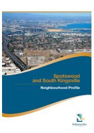
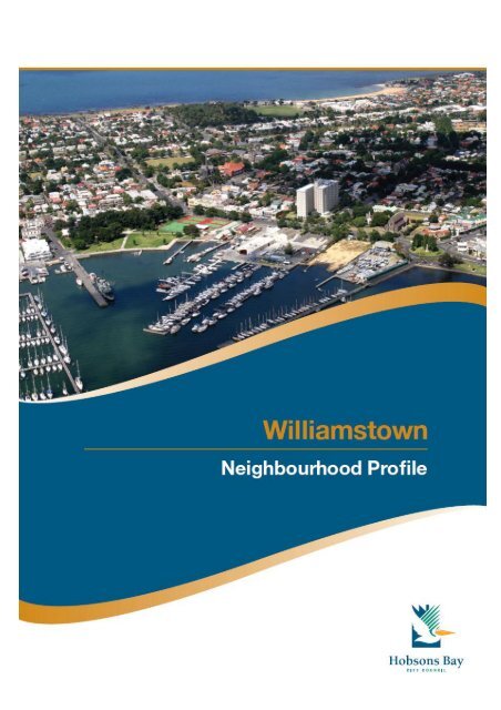
<strong>Williamstown</strong> Neighbourhood <strong>Profile</strong><br />
Executive Summary<br />
The <strong>Williamstown</strong> neighbourhood begins at Yarra Street, to the north, and is bordered by<br />
Port Phillip <strong>Bay</strong> along the southern and eastern boundaries. To the west and on the north<br />
side of Ferguson Street, the boundary is formed by the railway line and then links to<br />
<strong>Bay</strong>view Street via Kororoit Creek Road. (NB: <strong>Williamstown</strong> neighbourhood, as referred to in<br />
this profile, differs from the suburb of <strong>Williamstown</strong>; it does not include the area on the south<br />
side of Kororoit Creek Road, commonly called the Rifle Range.)<br />
The <strong>Williamstown</strong> neighbourhood is predominantly residential and has some small pockets<br />
of light industrial areas. Large parts of the neighbourhood are covered by heritage controls<br />
and the neighbourhood has many examples of significant buildings from the 1800s. The<br />
coastline is a dominant aspect of the <strong>Williamstown</strong> neighbourhood. Shipping construction<br />
and boating activities are also features and the area’s maritime history remains clearly<br />
evident.<br />
Residents speak positively about living in the neighbourhood. “I look out of my house and<br />
see water which gives <strong>Williamstown</strong> a sense of isolation and a village feel” and “It’s a mix of<br />
being a country town and a seaside town. It’s a place that you want your kids to grow up in<br />
and the proximity to the beach gives it a holiday feel.” There is a strong sense of attachment<br />
to the area but acknowledgement that the area is changing, “When I first arrived it was<br />
definitely more working class, but that’s changed”. People are concerned that the character<br />
of <strong>Williamstown</strong> is protected, commenting “I want it to keep its seaside feel – smaller and<br />
simpler – not like a millionaires’ row, not like the St Kilda marina”.<br />
Population numbers<br />
• The <strong>Williamstown</strong> neighbourhood had just under 10,200 residents, at the 2006 Census.<br />
This represented an estimated increase of 475 residents (almost five per cent) since the<br />
last Census in 2001.<br />
• Population forecasts anticipate numbers will continue to grow until 2015, after which<br />
time, growth is expected to flatten out, reaching 11,700 by 2020.<br />
Age structure<br />
• Between 2001 and 2006, there was an increase in the number of children and young<br />
people aged under 18 years and in groups aged between 35 and 69 years, particularly<br />
those in their 50s and 60s. The population of young adults aged between 18 and 24<br />
years, those in the family formation age range (25-34 years) and those aged 70 and over<br />
all declined.<br />
• Between 2010 and 2015, most age groups are predicted to increase to a greater or<br />
lesser degree, with the most noticeable increase in the 65-69 age range.<br />
Overseas born residents<br />
• Almost 2,000 (19.6 per cent) <strong>Williamstown</strong> residents were born overseas, lower than the<br />
<strong>Hobsons</strong> <strong>Bay</strong> rate (29.1 per cent). The main countries of birth were the United Kingdom,<br />
New Zealand, Italy and Greece.<br />
• Thirty eight per cent of residents speak a language other than English compared to 62<br />
per cent of <strong>Hobsons</strong> <strong>Bay</strong> residents.<br />
<strong>Williamstown</strong> Neighbourhood <strong>Profile</strong> 1
Residents needing assistance<br />
• Estimates suggest that approximately 1,900 residents living in <strong>Williamstown</strong> have a<br />
disability.<br />
• At the 2006 Census, there were 388 residents who required assistance with core<br />
activities involving self care, communication and mobility.<br />
Education<br />
• <strong>Williamstown</strong> has two government primary schools and one Catholic primary school. It<br />
also has a senior secondary campus (Years 10-12).<br />
• Just over 23 per cent (2,376) of people in <strong>Williamstown</strong> were enrolled in education at the<br />
2006 Census, marginally higher than the <strong>Hobsons</strong> <strong>Bay</strong> rate of 21.5 per cent.<br />
• Almost 55 per cent of those aged 15 years and over have completed secondary school<br />
or a Year 12 equivalent, compared to the municipal figure of 42.6 per cent.<br />
Labour Force<br />
• <strong>Williamstown</strong>’s labour force participation rate (64.2 per cent) was above the <strong>Hobsons</strong><br />
<strong>Bay</strong> figure (59.1 per cent). At the 2006 Census, <strong>Williamstown</strong>’s unemployment rate was<br />
3.6 per cent, below the <strong>Hobsons</strong> <strong>Bay</strong> figure of 5.9 per cent.<br />
• Among the employed, 62 per cent work full time and 32.4 per cent work part time.<br />
Compared to <strong>Hobsons</strong> <strong>Bay</strong>, the proportion of part time workers is approximately four per<br />
cent higher.<br />
• The main industries to employ <strong>Williamstown</strong>’s residents are education and training,<br />
professional, scientific and technical services, health care and social assistance.<br />
Income<br />
• According to the 2006 Census, 53 per cent the <strong>Williamstown</strong> population aged over 15<br />
years have gross weekly incomes below the Australian average of around $815,<br />
compared to the <strong>Hobsons</strong> <strong>Bay</strong> figure of 64 per cent.<br />
• Around 14 per cent of <strong>Williamstown</strong>’s residents earned $1,600 or more per week,<br />
compared to 5 per cent of the <strong>Hobsons</strong> <strong>Bay</strong> population. Those with very low incomes<br />
(below $400 per week), accounted for 34 per cent of <strong>Williamstown</strong>’s residents, well<br />
below the municipal rate of 42 per cent.<br />
Housing<br />
• In 2006, there were 4,500 dwellings in <strong>Williamstown</strong>. Almost 60 per cent of these were<br />
detached houses (ie single dwelling on a single lot), around 12 per cent less than the<br />
municipal rate.<br />
• Approximately 29 per cent of households are renters, four per cent above the figure for<br />
<strong>Hobsons</strong> <strong>Bay</strong>. The neighbourhood also has the largest supply of public housing in the<br />
municipality.<br />
• Since the 2001 Census, home ownership in <strong>Williamstown</strong> has declined at the same rate<br />
that home purchasing has increased (5 to 6 per cent), a trend that is generally evident<br />
across the municipality.<br />
Transport<br />
• <strong>Williamstown</strong> has good access to both train and bus services.<br />
• A higher proportion of <strong>Williamstown</strong> households do not own a vehicle (<strong>Williamstown</strong> -<br />
12.3 per cent and <strong>Hobsons</strong> <strong>Bay</strong> - 9.8 per cent).<br />
• Approximately 81 per cent of households own one or more vehicles, similar to the<br />
<strong>Hobsons</strong> <strong>Bay</strong> rate.<br />
<strong>Williamstown</strong> Neighbourhood <strong>Profile</strong> 2
Future developments proposed for the neighbourhood<br />
• <strong>Williamstown</strong> has limited scope for large scale residential development and most new<br />
housing will come through infill developments.<br />
• The <strong>Williamstown</strong> Town Hall is a landmark building in the heart of <strong>Williamstown</strong> and<br />
renovations to the building commenced in mid 2009.<br />
• Preliminary concept plans for the redevelopment of the <strong>Williamstown</strong> Library have been<br />
prepared. The plans include more space for collections and supporting technology. In<br />
addition, new technologies will be installed to help simplify borrowing and book<br />
management processes. The proposed design also includes a café and improved<br />
linkages between the library and the Town Hall precinct.<br />
• Revegetation work along the foreshore from Point Gellibrand to <strong>Williamstown</strong> Beach,<br />
together with a new pathway, is scheduled for 2009/10. Park furniture will be installed<br />
along The Strand and The Esplanade and the renewal of several playgrounds is also<br />
planned.<br />
• New gates have been commissioned for the <strong>Williamstown</strong> Botanic Gardens. The gates<br />
will be installed at the side entrances, in Osborne Street and Giffard Street.<br />
• The redevelopment the <strong>Williamstown</strong> Cricket Ground pavilion is planned and will provide<br />
improved facilities for both spectators and players. A new function space will be available<br />
for public hire. The work is expected to commence in 2010.<br />
• Work has commenced on the <strong>Williamstown</strong> Activity Centre Parking Strategy and Key<br />
Initiatives Report. The final <strong>report</strong> will guide changes to parking in <strong>Williamstown</strong>.<br />
DISCLAIMER<br />
Every care has been taken to ensure the information in this document is correct. However,<br />
<strong>Hobsons</strong> <strong>Bay</strong> City Council does not accept any liability to any person or organisation for the<br />
information (or the use of such information) provided in this document.<br />
<strong>Williamstown</strong> Neighbourhood <strong>Profile</strong> 3
<strong>Williamstown</strong> Neighbourhood <strong>Profile</strong> 4
<strong>Williamstown</strong> Neighbourhood<br />
Past, Current and Future Development<br />
<strong>Williamstown</strong> Neighbourhood <strong>Profile</strong> 5
A. Introduction<br />
The <strong>Williamstown</strong> neighbourhood begins at Yarra Street, to the north, and is bordered by<br />
Port Phillip <strong>Bay</strong> along the southern and eastern boundaries. To the west, the boundary is<br />
formed by the railway line, on the north side of Ferguson Street, which then links to <strong>Bay</strong>view<br />
Street via Kororoit Creek Road. (NB: <strong>Williamstown</strong> neighbourhood, as referred to in this<br />
profile, differs from the suburb of <strong>Williamstown</strong>; it does not include the area commonly called<br />
the Rifle Range.)<br />
The <strong>Williamstown</strong> neighbourhood is predominantly residential and has some small pockets<br />
of light industrial areas. Large parts of the neighbourhood are covered by heritage controls<br />
and the neighbourhood has many examples of significant buildings from the 1800s. Along<br />
the coastline, which is a dominant feature of the <strong>Williamstown</strong> neighbourhood, is a long<br />
ribbon of coast, edged with expanses of open space. Shipping construction and boating<br />
activities are important features and the area’s maritime history remains clearly evident.<br />
The <strong>Williamstown</strong> Botanic Gardens are located just east of the swimming beach, and are<br />
one of the earliest botanic gardens to be established in Victoria. The area has a public<br />
hospital, three primary schools and a senior secondary college. A public library is also<br />
located here and transport options include a train service to central Melbourne and several<br />
bus services to neighbouring suburbs and beyond.<br />
B. History & Development<br />
Aboriginal History<br />
Before European settlement two large Aboriginal groups had access to the areas<br />
surrounding Port Phillip <strong>Bay</strong>; the Bunerong and the Woiworung. They formed a part of the<br />
Kulin nation. Within these groups were sub-groups or clans, made up of 10-30 families.<br />
They were hunters and gathers; some moved camp according to the availability of food<br />
while others settled in one location if they had access to reliable food sources.<br />
There were two clans who identified with the <strong>Williamstown</strong> and Footscray area. One was<br />
the Yalukit-willam, who lived along a 5 kilometre wide strip at the top of Port Phillip <strong>Bay</strong>,<br />
which included <strong>Williamstown</strong> and Footscray. The Yalukit-willam was part of the Bunerong<br />
tribe. The other was the Marin-balluk who lived in the area between the Kororoit Creek<br />
and the Maribyrnong River and to the north of Sunbury and belonged to the Woiworung. 1<br />
The Yalukit-willam referred to the <strong>Williamstown</strong> area as "koort-boork-boork", meaning<br />
"clump of she-oaks".<br />
The area around Point Gellibrand was a major food gathering site for the Yalukitwillam<br />
as the mangroves located there are important fish and bird breeding grounds.<br />
While a shortage of freshwater meant that the area was unsuitable as a camp,<br />
Indigenous people of Victoria frequently used the area. 2<br />
References to Indigenous occupation are found in records from post European<br />
settlement. In 1856, a <strong>Williamstown</strong> man spoke of corroborees being held around a big<br />
tree at the foot of Thompson Street, and in 1919 a woman aged in her 80s had childhood<br />
memories of corroborees near the Town Hall site. Stone tools, animal bones and<br />
shellfish mounds were recorded at several sites near <strong>Williamstown</strong>; however vandalism<br />
has removed any remaining evidence. 3<br />
<strong>Williamstown</strong> Neighbourhood <strong>Profile</strong> 6
European Settlement<br />
European settlement around <strong>Williamstown</strong> commenced in the 1830s. Point Gellibrand<br />
was the site of the first permanent European settlement in the Port Phillip district. It is<br />
listed on the National Estate as a site of cultural heritage and landscape significance. 4<br />
<strong>Williamstown</strong> was originally named Port Harwood by John Batman in 1835 but soon after<br />
was renamed <strong>Williamstown</strong>, after King William IV who was the reining monarch.<br />
<strong>Williamstown</strong> was proclaimed a town in 1886 and a city in 1919. 5<br />
Initially, <strong>Williamstown</strong> was the major port for Melbourne. The first pier was constructed in<br />
1838 and was used to ferry passengers across to Melbourne. The pier was rebuilt<br />
several times: it later became known as Gem Pier and is still standing. 6 However, it<br />
wasn’t until the 1850s that activity around the port began in earnest, as prospectors<br />
passed through the area on their way to the gold fields. By 1856, hotels, shops,<br />
residences, banks and churches had been built. The Naval Dock Yards were also<br />
established in the 1850s and Fort Gellibrand was developed between 1860 and 1890. 7<br />
To meet the demand for ships’ ballast, quarries were opened up along the Maribyrnong<br />
River and the <strong>Williamstown</strong> coastline. The bluestone blocks that were used for the ballast<br />
were later re-used in local buildings and paving. 8<br />
Convict labour was used to build much of the early<br />
infrastructure in <strong>Williamstown</strong>. Prisoners worked on<br />
several projects at Point Gellibrand, including the<br />
battery, the powder magazine, the Tide Gauge<br />
House (now relocated in Commonwealth Reserve)<br />
and a tidal wall at Gellibrand Point. In 1848, the Time<br />
Ball Tower was erected. It was initially used as a<br />
lighthouse (see photo) and then as a timing signal to<br />
passing vessels which enabled them to set their<br />
chronometers (clocks). 9<br />
After the 1850s prisoners worked on land reclamation<br />
and road building around the Alfred Graving Dock<br />
and between Osborne Street and the battery.<br />
Other early industries to be established in<br />
<strong>Williamstown</strong> included woollen mills and<br />
associated industries. One of these was the<br />
Alfred Woollen Mill in Osborne St. The<br />
mill began operating in 1878 and was still in use<br />
in the 1930s, although its ownership had<br />
changed. 10<br />
Photo source:<br />
www.lighthouse.net.au/lights/VIC/<strong>Williamstown</strong>/<strong>Williamstown</strong><br />
%20Lighthouse.htm#History<br />
<strong>Williamstown</strong> Neighbourhood <strong>Profile</strong> 7
<strong>Williamstown</strong>’s Botanic Gardens were<br />
one of the earliest to be established in<br />
Victoria. The gardens were designed by<br />
Edward La Trobe and some elements of<br />
the original 1860 plan are still evident.<br />
Changes in the early part of the<br />
twentieth century saw the addition of an<br />
ornamental lake, palm avenue (see<br />
photo) and new gates at the north-east<br />
corner.<br />
Towards the end of the nineteenth century, <strong>Williamstown</strong> was being promoted as a health<br />
resort and the beach area adjacent to the Botanic Gardens was particularly popular. The<br />
<strong>Williamstown</strong> Baths were built in 1888, at the current site of the kiosk, and hot sea baths<br />
were added in 1902 (later destroyed by a storm in 1934). In the early 1900s, the promenade<br />
and bluestone wall were built along the foreshore. The dressing pavilion (now a restaurant),<br />
and life saving clubrooms were added in the 1930s.<br />
Shipbuilding was also at the forefront of activity in <strong>Williamstown</strong>.<br />
In the early 1900s, activity around the port area continued with the Commonwealth<br />
Government commissioning a number of ships to replace those lost during WW I.<br />
Having sold the dockyards to the Melbourne Harbour Trust in the 1920s, the<br />
Commonwealth then bought them back in order to meet the shipbuilding<br />
requirements as a result of WW II. 11<br />
More recent developments<br />
<strong>Williamstown</strong>’s maritime connections are still<br />
apparent today, including the naval dockyards<br />
which are located at the eastern tip of the<br />
neighbourhood. Until 1986, the dockyards were<br />
under the control of the Commonwealth<br />
government but have since had several owners and<br />
are now owned by BAE. The dockyards play an<br />
important strategic role as a military shipbuilder and<br />
are one of the city’s largest employers. Apart from<br />
the dockyards, boating activity, particularly around<br />
Nelson Place, is oriented towards recreational<br />
boating and associated industries.<br />
<strong>Williamstown</strong>’s history is evident in its heritage buildings and streetscapes although some of<br />
that history has been lost, as buildings were demolished to make way for new development.<br />
In the 1950s, the historic Langhorne bluestone wool store in Nelson Place was demolished<br />
by the former Housing Commission of Victoria. The Nelson Heights high rise flats were<br />
constructed on the site in the late 1960s to ease the chronic housing shortage in Melbourne.<br />
A second housing block (Floyd Lodge) was also developed in Hanmer Street.<br />
<strong>Williamstown</strong> Neighbourhood <strong>Profile</strong> 8
Until the opening of the West Gate Bridge in 1978, <strong>Williamstown</strong> was relatively undiscovered<br />
except to local residents and those who lived in the west. The construction of the new bridge<br />
meant that <strong>Williamstown</strong> was much more accessible by road, providing a direct link to<br />
central Melbourne. In turn, <strong>Williamstown</strong>’s close proximity to the City, expanses of coastline<br />
and historical buildings made it attractive to new residents and visitors. 12<br />
Today, the <strong>Williamstown</strong> neighbourhood is a popular destination for people visiting its<br />
beaches and cafes. Many houses and buildings have been restored and residents and<br />
visitors can take advantage of the broad range of cultural activities that are on offer.<br />
C. The Current Environment<br />
Land uses<br />
The land use in the <strong>Williamstown</strong> neighbourhood is predominantly residential, with an<br />
extensive coastal strip of open space along the eastern and southern boundaries.<br />
<strong>Williamstown</strong> has two main commercial areas (B1Z on the map below). The larger of the two<br />
is located close to the Ferguson Street and Douglas Parade junction and is the core retail<br />
centre of the <strong>Williamstown</strong> shopping centre. The second runs along Nelson Parade,<br />
opposite Commonwealth Reserve and is a major tourist precinct within the area.<br />
Heading further south along Nelson Parade, there are several areas which are zoned for<br />
industrial uses, although much of this the land is currently unused.<br />
Scattered throughout the neighbourhood are a number of public open space zones (PPRZ).<br />
Most of these are smaller spaces, although as mentioned earlier, there are large tracts of<br />
open space extending along much of the coastal boundary.<br />
There are also a number of areas designated for public use (PUZ) and these are used for<br />
education purposes and the local hospital.<br />
Other land uses are generally confined to port activity (SUZ5 on the map) or are controlled<br />
by the Port of Melbourne Planning Scheme (POMP). The Department of Sustainability and<br />
Environment (DSE) is the Responsible Authority in both instances. There is also a small<br />
parcel of Commonwealth owned land (CA). It falls under the jurisdiction of the Federal<br />
Government and therefore any development or use is outside the planning controls of the<br />
<strong>Hobsons</strong> <strong>Bay</strong> City Council.<br />
<strong>Williamstown</strong> Neighbourhood <strong>Profile</strong> 9
Land use zones<br />
Public Land<br />
Business<br />
PPRZ Public Park Recreation Zone B1Z Business 1 Zone<br />
PUZ2 Public Use Zone Education Industrial<br />
PUZ3 Public Use Zone Health & Community IN1Z Industrial 1 Zone<br />
PUZ4 Public Use Zone Transport IN3Z Industrial 3 Zone<br />
PUZ6 Public Use Zone Local Government Special Purpose<br />
RDZ1 Road Zone Category SUZ5 Special Use Zone 5<br />
Residential<br />
Commonwealth Land<br />
CA Commonwealth land not controlled by<br />
<strong>Williamstown</strong> R1Z Residential Neighbourhood 1 Zone <strong>Profile</strong> the <strong>Hobsons</strong> <strong>Bay</strong> Planning Scheme. 10<br />
R2Z Residential 2 Zone Port of Melbourne<br />
POMPS Port of Melbourne land not controlled by<br />
the <strong>Hobsons</strong> <strong>Bay</strong> Planning Scheme
Natural features and parks<br />
<strong>Williamstown</strong>’s major natural feature is its coastline. Just offshore, at the north-east corner of<br />
the neighbourhood, are the lower end of the Spit and the mouth of Greenwich <strong>Bay</strong>.<br />
Moving south, the coastline continues to the Point Gellibrand Coastal Heritage Park at the<br />
eastern tip. Parks Victoria and <strong>Hobsons</strong> <strong>Bay</strong> City Council are working together to develop<br />
this park, which forms part of the Altona Coastal Parklands. Revegetation has begun around<br />
Shelley Beach. The area was once covered by coastal saltbush but until recently was<br />
extremely degraded as a result of previous uses. Local community groups are working with<br />
Parks Victoria to re-establish indigenous plants and grasses.<br />
Shelley Beach is also the location of a ‘lava bubble’ which resulted from volcanic activity in<br />
the area. As lava flowed to the shoreline, gases in the lava built up and created a large<br />
bubble three metres in diameter. 13<br />
Residential development<br />
Residential development in the <strong>Williamstown</strong><br />
neighbourhood is an eclectic mix of housing<br />
types and streetscapes. In most streets, there<br />
are examples of heritage housing and in some<br />
cases, the heritage significance of the<br />
streetscape is predominantly intact. In other<br />
streets, heritage housing sits alongside more<br />
recent development. A blanket heritage<br />
overlay applies to the neighbourhood.<br />
There is also a wide variation in the size of<br />
housing lots, ranging from expansive blocks<br />
with large houses and gardens to smaller lots<br />
just wide enough to accommodate a single<br />
fronted cottage. Similarly, the character of the streets is very diverse. In some parts, the<br />
streets are wide with bluestone kerbing and large street trees while in other areas the streets<br />
are much narrower and the housing is set close to the footpath.<br />
Along with increased housing<br />
densities in the residential areas, a<br />
number of commercial and industrial<br />
sites have been converted to<br />
apartment living. The former Nelson<br />
Bros. Funeral Parlour in Douglas<br />
Parade (see photo) is an example of<br />
this changed use, with retail on the<br />
street level and apartments above.<br />
<strong>Williamstown</strong> Neighbourhood <strong>Profile</strong> 11
Community library, centres and halls<br />
The <strong>Williamstown</strong> library is located in Ferguson Street and is open to borrowers from:<br />
Monday to Thursday 10 am - 8 pm<br />
Friday 10 am - 6 pm<br />
Saturday 10 am - 1 pm<br />
Sunday 2 pm - 5 pm.<br />
Preliminary concept plans for the upgrade of the <strong>Williamstown</strong> library have been developed.<br />
(Further information about the redevelopment is provided under ‘What’s Ahead’ at the end of<br />
this section of the profile.)<br />
<strong>Williamstown</strong> has a range of halls and centres, some of which have function spaces<br />
available hire. The <strong>Williamstown</strong> Community and Education Centre is based in Joan Kirner<br />
House in Thompson Street. The building is owned by the State Government and is leased to<br />
the <strong>Hobsons</strong> <strong>Bay</strong> City Council. The centre is managed by a community board of<br />
management. The centre offers a diverse range of educational, cultural and recreational<br />
activities and has rooms for hire to the public. Classes on offer include: adult education and<br />
personal development courses; and art and craft classes for adults and children. A number<br />
of community groups are also based at the centre.<br />
The former offices of the <strong>Hobsons</strong> <strong>Bay</strong> City Council in Ferguson Street include the Town<br />
Hall which has space for 1,100 people, together with the Supper Room, Chamber and<br />
meeting rooms, all of which can be hired.<br />
<strong>Williamstown</strong> Neighbourhood <strong>Profile</strong> 12
Children’s services<br />
There is one maternal and child health centre operating from Monday to Friday in the<br />
<strong>Williamstown</strong> neighbourhood. The service is available to all families within the municipality<br />
with newborn babies through to young children. A wide range of information, advice and<br />
support about children's, women's and family health issues is provided. The service is colocated<br />
with the Robina Scott Kindergarten, opposite the Town Hall precinct in Ferguson<br />
Street.<br />
<strong>Williamstown</strong> Neighbourhood <strong>Profile</strong> 13
The Robina Scott Kindergarten offers programs for four year olds and is a Council owned<br />
facility that is operated by a Committee of Management. Willie Kids also runs a 4 year old<br />
kinder program from a childcare centre in Power Street and is privately owned and operated.<br />
In addition, the <strong>Williamstown</strong> Community and Education Centre, in Thompson Street, runs a<br />
kindergarten for three year olds.<br />
There are two child care centres in the neighbourhood. The <strong>Williamstown</strong> Child Care Co-op<br />
is a Council owned and community managed centre which is based in Cecil Street. ABC<br />
Childcare is a privately owned centre located in Power Street. Occasional Care is available<br />
at the <strong>Williamstown</strong> Community and Education Centre in Thompson Street.<br />
<strong>Williamstown</strong> Neighbourhood <strong>Profile</strong> 14
Schools<br />
There are three primary schools in <strong>Williamstown</strong>: two are government schools and one is a<br />
Catholic school. <strong>Williamstown</strong> Primary School and Saint Mary’s Catholic school are on<br />
adjacent sites in Cecil Street. To the north, on Melbourne Road, is <strong>Williamstown</strong> North<br />
Primary School.<br />
In addition, the area has one secondary college, <strong>Williamstown</strong> High School (Pascoe<br />
Campus), which is a senior campus for Years 10-12 students. Students in Years 7-9 attend<br />
the <strong>Bay</strong>view campus, located just outside the <strong>Williamstown</strong> neighbourhood, in the<br />
<strong>Williamstown</strong> North neighbourhood.<br />
<strong>Williamstown</strong> Neighbourhood <strong>Profile</strong> 15
Recreational facilities and open space<br />
The <strong>Williamstown</strong> neighbourhood has a range of open space, varying from a small number<br />
of local parks located throughout the neighbourhood to the ribbon of open space and<br />
parkland that wraps the coastline.<br />
The junction of Yarra Street and The Strand, at the north east corner of the neighbourhood,<br />
marks the commencement of a series of linked reserves. These extend down to Ferguson<br />
Street, where in nearby Commonwealth Reserve there are a number of tennis courts. A<br />
shared trail passes along the coast and extends south, before reaching Point Gellibrand<br />
Heritage Park.<br />
Point Gellibrand is the southern most point in <strong>Williamstown</strong> and is the location of the<br />
<strong>Williamstown</strong> Cricket Ground. The ground is used for both cricket and football. Tennis courts<br />
are also located nearby. (Details of the planned upgrade of facilities at the ground are<br />
outlined in ‘What’s Ahead’ at the end of this section of the profile.)<br />
Past this point, adjacent to The Esplanade, is another band of open space which includes<br />
<strong>Williamstown</strong> Beach. Near The Esplanade are the <strong>Williamstown</strong> Botanic Gardens,<br />
mentioned earlier. Adjacent to the gardens is Fearon Reserve. The reserve has two ovals<br />
used for football and cricket, together with cricket nets and clubrooms. Also located here are<br />
a lacrosse field, clubrooms and a synthetic box lacrosse court.<br />
At nearby Hatt Reserve and also at Robertson Reserve, there are junior cricket grounds with<br />
synthetic wickets.<br />
Dennis Reserve, just off Ferguson Street in Melbourne Road, caters for tennis and bowling.<br />
The Reserve has two synthetic tennis courts and three bowling greens.<br />
There are two croquet lawns and clubrooms in Victoria Street, adjacent to Gray Reserve.<br />
<strong>Williamstown</strong> Neighbourhood <strong>Profile</strong> 16
<strong>Williamstown</strong> Neighbourhood <strong>Profile</strong> 17
Cultural Activities<br />
The <strong>Williamstown</strong> neighbourhood offers a diverse range of cultural activities and events<br />
throughout the year.<br />
• The <strong>Williamstown</strong> Festival, now in its 30 th year, is a community festival that is held in<br />
March.<br />
• The <strong>Williamstown</strong> Literary Festival is a writing event with a special focus on the west.<br />
• The Sounds of Summer is held on a number of weekends and offers free music in<br />
Commonwealth Reserve.<br />
• Shakespeare in the <strong>Williamstown</strong> Botanical Gardens is held across several weekends<br />
each November.<br />
• Tall Ships celebrates <strong>Williamstown</strong>’s maritime heritage and activities are held around<br />
Australia Day. The Enterprize, a replica of the ship that brought the first settlers to<br />
Melbourne in 1835, is permanently based in <strong>Williamstown</strong>.<br />
There are a number of venues available for arts<br />
activities in <strong>Williamstown</strong> including:<br />
• <strong>Williamstown</strong> Town Hall in Ferguson Street<br />
• <strong>Williamstown</strong> Mechanics Institute in Electra<br />
Street (see photo)<br />
• <strong>Williamstown</strong> Little Theatre in Albert Street<br />
• The Commonwealth Reserve Rotunda<br />
Cultural Groups are also active in <strong>Williamstown</strong>,<br />
and some have been operating for several<br />
decades. They include:<br />
• The <strong>Williamstown</strong><br />
- Historical Society<br />
- Film Society<br />
- Musical Theatre Company<br />
• Little Theatre<br />
• Willin Wimmin (women’s community choir)<br />
• Way Out West (music sessions)<br />
Retail Centres<br />
<strong>Williamstown</strong> is one of three major activity centres in <strong>Hobsons</strong> <strong>Bay</strong>. A large retail and<br />
commercial precinct extends along Douglas Parade and Ferguson Street. The centre offers<br />
an extensive mix of services including a major supermarket, five banks, together with a<br />
range of fresh food shops, cafes, home wares, clothing and speciality stores.<br />
Nelson Place, opposite the <strong>Hobsons</strong> <strong>Bay</strong> waterfront, is a smaller precinct which caters for<br />
both locals and visitors to the area. It has a range of cafes, bars, bookstores and specialty<br />
shops.<br />
Medical Centres<br />
The <strong>Williamstown</strong> Hospital is Victoria's oldest suburban hospital. It opened in 1894 and is<br />
located in Railway Crescent. The hospital has 86 beds and provides emergency, acute<br />
medical and surgical, aged care and rehabilitation services.<br />
<strong>Williamstown</strong> Neighbourhood <strong>Profile</strong> 18
There are three medical centres operating in the <strong>Williamstown</strong> neighbourhood.<br />
The Clinic <strong>Williamstown</strong><br />
107 Ferguson Street<br />
<strong>Williamstown</strong> Medical Centre<br />
76 Stevedore Street<br />
<strong>Williamstown</strong> General Practitioners Group<br />
Suite 2/81 Ferguson Street<br />
Dentists<br />
There are five dental surgeries located in <strong>Williamstown</strong>.<br />
Dr David Chua,<br />
Dr Leslie Tu<br />
87 Douglas Parade<br />
Dr David W Bladen,<br />
43 Douglas Parade<br />
Dr Shane Vereker<br />
Dr Brendan Parker<br />
Dr Vincent Tran,<br />
35 Douglas Parade<br />
Dr Roland Goldberg,<br />
72 Electra Street<br />
Dr Kar Mun Chan,<br />
Kiddies Dental Care<br />
65 Electra Street<br />
(Saturday only)<br />
Pharmacies<br />
There are three pharmacies in the neighbourhood. All are located in the main retail centre<br />
along Douglas Parade and Ferguson Street.<br />
National Pharmacies<br />
81 Ferguson St<br />
Parade Pharmacy<br />
44 Douglas Pde<br />
<strong>Williamstown</strong> Village Pharmacy<br />
35 Ferguson St<br />
Local newspapers and E-news<br />
The Leader<br />
The Star<br />
The <strong>Williamstown</strong> Advertiser<br />
<strong>Williamstown</strong>Online.net (community e-news)<br />
<strong>Williamstown</strong> Neighbourhood <strong>Profile</strong> 19
Public transport<br />
The <strong>Williamstown</strong> neighbourhood is<br />
serviced by both rail and bus services.<br />
The train line connects to central<br />
Melbourne, with stops at <strong>Williamstown</strong><br />
North, <strong>Williamstown</strong> Beach and<br />
terminating at the <strong>Williamstown</strong> station.<br />
Rail passengers travelling to the City, or<br />
to Werribee and Geelong, change<br />
trains at Newport station.<br />
Three bus routes pass through the<br />
neighbourhood. The 417 bus route to<br />
Laverton departs from the corner of<br />
Ferguson Street and The Strand, and<br />
then runs to Altona before arriving at<br />
Aircraft Station in Railway Avenue.<br />
The 471 bus route links <strong>Williamstown</strong><br />
and Sunshine. The route commences<br />
at the corner of Victoria Street and The<br />
Esplanade, runs via Newport and<br />
Altona North and terminates at the<br />
Sunshine Railway Station.<br />
The 472 bus service operates between <strong>Williamstown</strong> and Moonee Ponds. The route<br />
commences at the corner of Victoria Street and The Esplanade, passes through Footscray<br />
and Ascot Vale and ends at the Moonee Ponds Bus Terminal.<br />
D. What’s ahead for <strong>Williamstown</strong><br />
Library and Town Hall<br />
The <strong>Williamstown</strong> Town Hall is a<br />
landmark building in the heart of<br />
<strong>Williamstown</strong> and renovations will<br />
commence in 2009. Stage 1 will<br />
include the refurbishment and<br />
restoration of the roof structure over<br />
the municipal offices facing Ferguson<br />
Street, to be completed in 2009. Stage<br />
2 will involve the full restoration of the<br />
facade and internal spaces. Stages 3<br />
and 4 will focus on the refurbishment<br />
and restoration of the Grand Hall.<br />
The preliminary concept plans for the redevelopment of the <strong>Williamstown</strong> Library have been<br />
prepared. The plans include more space for collections and supporting technology. In<br />
addition, new technologies will be installed to help simplify borrowing and book management<br />
processes. The proposed design also includes a café and improved linkages between the<br />
<strong>Williamstown</strong> Neighbourhood <strong>Profile</strong> 20
library and the Town Hall precinct. Timelines for commencement of these works are still to<br />
be confirmed.<br />
Nelson Place beautification and the Heritage Verandah Project<br />
The Nelson Place verandah project<br />
began approximately five to six<br />
years ago. To date, 10 verandahs<br />
have been reinstated, based on<br />
the original designs. Two more<br />
verandahs will commence soon,<br />
marking the halfway point of this<br />
project.<br />
Other work that is scheduled for<br />
Nelson Place, between Parker and<br />
Thompson Streets, is the widening<br />
of footpaths to improve the<br />
appearance and pedestrian<br />
movement in the precinct.<br />
The <strong>Williamstown</strong> foreshore<br />
Revegetation work along the foreshore from Point Gellibrand to <strong>Williamstown</strong> Beach is<br />
scheduled for 2009/10. Along with plantings of native vegetation to prevent erosion of the<br />
foreshore, the work will involve a new pathway. Park furniture will be installed along<br />
foreshore areas adjacent to The Strand and The Esplanade and the renewal of several<br />
playgrounds along the Strand is also planned.<br />
Future works will see the repair and replacement of the revetment which runs along the<br />
Strand, extending north to Greenwich <strong>Bay</strong>. The revetment is a bluestone bank that<br />
separates the land from the sea, helps to prevent erosion and provides safe access to and<br />
from land.<br />
In the coming 12 months (2008/09), a new public toilet facility will be built by the Council at<br />
the western end of <strong>Williamstown</strong> Beach; Parks Victoria also has plans to build toilets at the<br />
Point Gellibrand Coastal Heritage Park.<br />
<strong>Williamstown</strong> Botanic Gardens<br />
Rejuvenation of the <strong>Williamstown</strong> Botanic<br />
Gardens has commenced (in accordance with<br />
Conservation Management Plan Guidelines)<br />
and includes: the completed restoration of the<br />
historic cast-iron gates at the main entrance<br />
and the marble statue; design and planting<br />
beneath the Palm Walk; the commissioning of<br />
new gates at two entrances in Osborne and<br />
Giffard Streets; and the ongoing rejuvenation of<br />
garden beds.<br />
The celebrations for the Garden’s 150th<br />
birthday began in 2006 and will run until 2010.<br />
The celebrations are held in November and<br />
Design for Giffard Street Gates<br />
<strong>Williamstown</strong> Neighbourhood <strong>Profile</strong> 21
mark the gazetting of land for the Botanic Garden and the four years of design and laying<br />
out that occurred prior to the official opening on 2nd January 1860.<br />
Sporting Facilities<br />
Work is planned to redevelop the <strong>Williamstown</strong> Cricket Ground pavilion. <strong>Hobsons</strong> <strong>Bay</strong> City<br />
Council, together with the State Government and the Australian Football League, will<br />
provide funding to improve facilities for both spectators and players. A new function space<br />
will be available for the public to hire.<br />
A program to upgrade tennis court surfaces and install court lighting in <strong>Williamstown</strong> is<br />
progressing.<br />
Transport and traffic<br />
Works are planned at the intersection of The Esplanade and Victoria Street, near Gloucester<br />
Reserve. These will include an upgrade of the car park and changes to the intersection. In<br />
addition, measures will be undertaken to improve the safety of pedestrians and cyclists<br />
using the <strong>Hobsons</strong> <strong>Bay</strong> Coastal Trail, particularly at the interface with motor vehicles.<br />
Work has commenced on the <strong>Williamstown</strong> Activity Centre Parking Strategy and Key<br />
Initiatives Report. The final <strong>report</strong> will guide changes to parking in <strong>Williamstown</strong>.<br />
<strong>Williamstown</strong> Neighbourhood <strong>Profile</strong> 22
References<br />
1 <strong>Hobsons</strong> <strong>Bay</strong> City Council website,<br />
http://libraries.hobsonsbay.vic.gov.au/Page/page.asp?Page_Id=246&h=0#BM364<br />
2 Parks Victoria website, http://www.parkweb.vic.gov.au/resources05/05_1068.pdf<br />
3<br />
<strong>Hobsons</strong> <strong>Bay</strong> City Council website,<br />
http://www.hobsonsbay.vic.gov.au/libraries/Page/page.asp?Page_Id=246&h=0#BM371<br />
4<br />
Point Gellibrand Coastal Heritage Park Master Plan, revised 2003, <strong>Hobsons</strong> <strong>Bay</strong> City<br />
Council & Parks Victoria.<br />
5 <strong>Hobsons</strong> <strong>Bay</strong> Planning Scheme 21.07-1<br />
http://www.psdocs.dpcd.vic.gov.au/public/<strong>Hobsons</strong>%20<strong>Bay</strong>/21_mss07_hbay.doc<br />
6<br />
Meredith Gould Architects P/L, 1998, <strong>Williamstown</strong> Workshop and Slipways: Former Port of<br />
Melbourne Authority Site, heritage review, Parks Victoria.<br />
7<br />
http://www.hobsonsbay.vic.gov.au/page/page.asp?page_id=197#BM348<br />
8 Vines G, 1993, Work in the West, No 1, Melbourne’s Living Museum of the West<br />
Incorporated, Maribyrnong Vic<br />
9 <strong>Hobsons</strong> <strong>Bay</strong> Planning Scheme, op. cit.<br />
10<br />
Vines G, op. cit<br />
11 Meredith Gould Architects P/L, op. cit.<br />
12 <strong>Hobsons</strong> <strong>Bay</strong> Heritage Study: Thematic Environmental History (2003)<br />
www.hobsons.vic.gov.au/Files/Volume_1b_Thematic_Environmental_History.pdf<br />
13<br />
Parks Victoria http://www.parkweb.vic.gov.au/resources05/05_1068.pdf<br />
<strong>Williamstown</strong> Neighbourhood <strong>Profile</strong> 23
<strong>Williamstown</strong> Neighbourhood<br />
Data <strong>Profile</strong><br />
A. Population Characteristics<br />
Population Numbers<br />
The <strong>Williamstown</strong> neighbourhood had just under 10,200 residents, at the 2006 Census. This<br />
represented an estimated increase of 475 residents (almost five per cent) since the last<br />
Census in 2001. This rate of growth is above the <strong>Hobsons</strong> <strong>Bay</strong> rate of 0.7 per cent.<br />
<strong>Williamstown</strong> residents make up around 13 per cent of the municipality’s total population.<br />
Table 1 provides a breakdown of the age structures in <strong>Williamstown</strong> and highlights changes<br />
that occurred in the five years to 2006. There was an increase of 250 children and young<br />
people aged under 18 years. There were also increases in groups aged between 35 and 69<br />
years, particularly those in their 50s and 60s.<br />
Groups where there was a decline in numbers included young adults aged between 18 and<br />
24 years and those in the family formation age range (25-34 years). These groups had a<br />
combined loss of 223 people. Among those aged 70 years and over, there was a decrease<br />
of 70 people.<br />
Table 1: Population numbers Graph 1: Population 2001-2006<br />
Years of 2006 2001 Change<br />
age<br />
2001-2006<br />
Population<br />
0 to 4 676 648 28<br />
5 to 11 922 859 63<br />
12 to 17 748 589 159<br />
18 to 24 640 692 -52<br />
25 to 34 1,152 1,323 -171<br />
35 to 49 2,733 2,626 107<br />
50 to 59 1,463 1,228 235<br />
60 to 69 804 629 175<br />
70 to 84 813 880 -67<br />
85 & over 218 221 -3<br />
Total 10,169 9,694 475<br />
Number<br />
3000<br />
2500<br />
2000<br />
1500<br />
1000<br />
500<br />
0<br />
0-4<br />
5-11<br />
12-17<br />
18-24<br />
25-34<br />
35-49<br />
Years<br />
50-49<br />
60-69<br />
70-84<br />
85 +<br />
2006<br />
2001<br />
Source: ABS 2006 Census (Usual residence data) www.id.com.au/profile/Default.aspx?id=112<br />
The graph below compares the age structure of <strong>Williamstown</strong> residents with those from<br />
<strong>Hobsons</strong> <strong>Bay</strong>. It shows the proportions of children and young people were similar up until<br />
age 17 years. Thereafter, the proportion of 18-34 year olds in <strong>Williamstown</strong> declined in<br />
comparison to the <strong>Hobsons</strong> <strong>Bay</strong> figures.<br />
The proportion of <strong>Williamstown</strong> residents aged between 35-60 years was slightly above the<br />
<strong>Hobsons</strong> <strong>Bay</strong> rate while the proportions of older residents were quite similar.<br />
<strong>Williamstown</strong> Neighbourhood <strong>Profile</strong> 24
Graph 2: Age structures in <strong>Williamstown</strong> and <strong>Hobsons</strong> <strong>Bay</strong><br />
Percentage<br />
30<br />
25<br />
20<br />
15<br />
10<br />
Age Groups 2006<br />
<strong>Williamstown</strong><br />
<strong>Hobsons</strong> <strong>Bay</strong><br />
5<br />
0<br />
0-4<br />
5-11<br />
12-17<br />
18-24<br />
25-34<br />
Years<br />
35-49<br />
50-59<br />
60-69<br />
70-84<br />
85 and over<br />
Source: ABS 2006 Census (Usual residence data) www.id.com.au/profile/Default.aspx?id=112<br />
Family types<br />
There were just under 2,700 families living in <strong>Williamstown</strong> in 2006. This represents 114<br />
additional families since 2001. Approximately 64 per cent of all families had children, which<br />
is on a par with the <strong>Hobsons</strong> <strong>Bay</strong> figure.<br />
Between 2001 and 2006, families with children aged 15 years and under accounted for the<br />
largest increase (around 100 extra families) in the overall number of families. There were<br />
also an additional 30 single parent families.<br />
<strong>Williamstown</strong> had a slightly higher rate of families with children up to 15 years of age<br />
compared to <strong>Hobsons</strong> <strong>Bay</strong> (42.7 per cent and 39.9 per cent respectively) and a lower rate of<br />
families with older children (13.6 per cent and 15.3 per cent respectively). <strong>Williamstown</strong> also<br />
had a lower proportion of sole parent families compared to <strong>Hobsons</strong> <strong>Bay</strong>.<br />
Table 2: Family structure<br />
2006 2001<br />
Number % <strong>Hobsons</strong><br />
<strong>Bay</strong> %<br />
Number % <strong>Hobsons</strong><br />
<strong>Bay</strong> %<br />
Change<br />
2001-2006<br />
Couples with child/ren<br />
943 35.1 31.4 845 32.8 33.1 98<br />
15 years and under<br />
Couples with child/ren<br />
365 13.6 15.3 377 14.6 15.8 -12<br />
over 15 years<br />
Total couples with 1,308 48.6 46.7 1,222 47.4 48.9 87<br />
child/ren<br />
One parent families with 206 7.6 8.5 178 6.9 8.3 28<br />
child/ren 15 years and<br />
under<br />
One parent families with 196 7.3 8.9 192 7.5 7.5 4<br />
child/ren over 15 years<br />
Total one parent 402 14.9 17.4 370 14.4 15.8 31<br />
families<br />
Couples without child(ren) 939 34.9 34 931 36.1 33.5 7<br />
Other families 41 1.5 1.8 53 2.0 1.8 -12<br />
Total families 2,690 100.0 100.0 2,576 100.0 100.0 114<br />
Source: ABS 2006 Census (Enumerated data) www.id.com.au/profile/Default.aspx?id=112<br />
<strong>Williamstown</strong> Neighbourhood <strong>Profile</strong> 25
Household types<br />
Between the 2001 and 2006 Census, there were some small changes in the type of<br />
households in <strong>Williamstown</strong>. Almost two thirds of all households consisted of one family, 100<br />
more one family households than at the 2001 Census.<br />
Lone person households made up just under 30 percent of all <strong>Williamstown</strong> households in<br />
2006. This was close to 70 fewer than in 2001.<br />
Compared to <strong>Hobsons</strong> <strong>Bay</strong>, <strong>Williamstown</strong> had lower rates of one family or more households<br />
while the rate of lone person households was higher.<br />
Table 3: Household types<br />
2006 2001<br />
Number %<br />
<strong>Hobsons</strong><br />
<strong>Bay</strong> % Number %<br />
<strong>Hobsons</strong><br />
<strong>Bay</strong> %<br />
Change<br />
2001-2006<br />
One family households 2,652 64.8 67.1 2,553 62.7 68.7 100<br />
Two or more family households 9 0.2 1.3 19 0.5 1.3 -10<br />
Total family households 2,661 65.0 68.4 2,572 63.1 69.9 90<br />
Lone person households 1,172 28.6 24.6 1,239 30.4 23.6 -67<br />
Group households 124 3.0 3.2 141 3.4 2.9 -16<br />
Other not classifiable<br />
134 3.3 3.8 122 3.0 3.5 13<br />
households<br />
Total households 4,092 100.0 100.0 4,073 100.0 100.0 19<br />
Source: ABS 2006 Census (Enumerated data) www.id.com.au/profile/Default.aspx?id=112<br />
Overseas born residents<br />
Almost 2,000 <strong>Williamstown</strong> residents were born overseas and approximately 70 per cent<br />
arrived in Australia before 1991. The overall rate of overseas born residents living in<br />
<strong>Williamstown</strong> (19.6 per cent) was much lower than the <strong>Hobsons</strong> <strong>Bay</strong> rate (29.1 per cent).<br />
However, the proportion of <strong>Williamstown</strong> residents who were overseas born and who<br />
migrated after 2000 was approximately three percent above the <strong>Hobsons</strong> figure.<br />
Table 4: Year of arrival in Australia<br />
Number % <strong>Hobsons</strong><br />
<strong>Bay</strong> %<br />
2006 32 1.6 2.1<br />
2005 99 5.0 3.1<br />
2004 50 2.5 3.0<br />
2003 44 2.2 2.3<br />
2002 50 2.5 1.7<br />
2001 55 2.8 1.8<br />
1996 to 2000 140 7.1 8.0<br />
1995 to 1991 113 5.7 6.0<br />
Before 1991 1,322 66.9 67.2<br />
Year not stated 71 3.6 4.8<br />
Total 1,976 100.0 100.0<br />
Source: ABS 2006 Census (Usual residence data) www.id.com.au/profile/Default.aspx?id=112<br />
<strong>Williamstown</strong> Neighbourhood <strong>Profile</strong> 26
The main countries of birth for people living in the <strong>Williamstown</strong> neighbourhood are<br />
highlighted in Table 5. The largest group of overseas born residents was from the United<br />
Kingdom. The proportion of UK born people residents was slightly above the municipal<br />
figure at the 2006 Census (6.4 per cent for <strong>Williamstown</strong> and 4.7 per cent for <strong>Hobsons</strong> <strong>Bay</strong>).<br />
The three other main countries of birth included New Zealand, Italy and Greece. For<br />
<strong>Hobsons</strong> <strong>Bay</strong>, they were Italy, New Zealand and Malta.<br />
Table 5: Main countries of birth<br />
<strong>Williamstown</strong><br />
2006 2001<br />
number %<br />
<strong>Hobsons</strong><br />
<strong>Bay</strong> % number %<br />
<strong>Hobsons</strong><br />
<strong>Bay</strong> %<br />
Change<br />
2001-2006<br />
United Kingdom 646 6.4 4.7 618 6.3 5.1 28<br />
New Zealand 169 1.7 1.9 170 1.7 1.8 -1<br />
Italy 119 1.2 2.3 130 1.3 2.6 -12<br />
Greece 90 0.9 1.6 76 0.8 1.6 14<br />
Croatia 63 0.6 0.8 60 0.6 0.9 3<br />
Malta 52 0.5 1.8 42 0.4 2.1 10<br />
Germany 46 0.5 0.6 43 0.4 0.7 4<br />
Lebanon 44 0.4 1.2 17 0.2 1.2 27<br />
Ireland 39 0.4 0.3 35 0.4 0.3 3<br />
China 37 0.4 0.7 24 0.2 0.5 13<br />
Source: ABS 2006 Census (Usual residence data) www.id.com.au/profile/Default.aspx?id=112<br />
Just over one in every ten of <strong>Williamstown</strong>’s overseas born residents had a non-English<br />
speaking background. This was low compared to <strong>Hobsons</strong> <strong>Bay</strong> as a whole, where around<br />
one in five was from non-English speaking backgrounds.<br />
Table 6: Non-English speaking background<br />
number %<br />
<strong>Hobsons</strong><br />
<strong>Bay</strong> %<br />
Change<br />
2001 to 2006<br />
Non-English speaking background 1,055 10.4 21.5 108<br />
Main English speaking countries 937 9.2 7.6 42<br />
Total Overseas Born 1,992 19.6 29.1 150<br />
Australian 7,547 74.2 63.7 68<br />
Not stated 631 6.2 7.2 154<br />
Total 10,170 100 100 372<br />
Source ABS: 2006 Census (Usual residence data) www.id.com.au/profile/Default.aspx?id=112<br />
At the 2006 Census, <strong>Williamstown</strong> had a high proportion of residents who spoke English<br />
only, relative to the <strong>Hobsons</strong> <strong>Bay</strong> figure (62.4 per cent and 37.5 per cent respectively). As a<br />
result, <strong>Williamstown</strong> had a lower proportion of residents who spoke languages other than<br />
English.<br />
<strong>Williamstown</strong> Neighbourhood <strong>Profile</strong> 27
Table 7: Proficiency in English (overseas born persons aged 5 years and over)<br />
number %<br />
<strong>Hobsons</strong><br />
<strong>Bay</strong> %<br />
Speaks English only 1,237 62.4 37.5<br />
Speaks another language and English not well or not at all 133 6.7 14.8<br />
Speaks another language and English well or very well 606 30.6 46.8<br />
Speaks another language and English - proficiency not stated 3 0.2 0.6<br />
Not stated 3 0.2 0.3<br />
Total 1,983 100.0 100.0<br />
Source: ABS 2006 Census (Usual residence data) www.id.com.au/profile/Default.aspx?id=112<br />
People with disabilities<br />
The number of people in Australia who have a disability is based on the findings of the<br />
Survey of Disability, Ageing and Carers, conducted by the Australian Bureau of Statistics<br />
(ABS).<br />
In partnership with the ABS, the National Disability Administrator (NDA) uses these findings<br />
to produce disability estimates for local government areas. The most recent survey was in<br />
2003 and the findings suggest that approximately 18.6% of the <strong>Hobsons</strong> <strong>Bay</strong> population had<br />
a disability (and were living in a private dwelling). Using this method, there are estimated to<br />
be almost 1,900 people with a disability, living in <strong>Williamstown</strong>.<br />
The 2006 Census included a disability related question on whether help or supervision was<br />
required with one or more of the core activities of self-care, communication and mobility. The<br />
results do not reflect the true extent of disability in the community, given not all people with<br />
disabilities require assistance. That said, the Census findings were that 388 (3.8 per cent) of<br />
<strong>Williamstown</strong> residents indicated they needed help with a core activity, slightly below the<br />
rate for <strong>Hobsons</strong> <strong>Bay</strong> (4.4 per cent).<br />
Not surprisingly, it is among the neighbourhood’s elderly residents where the need for<br />
assistance was greatest, a trend that is reflected across the municipality. Of those requiring<br />
help, half (193) were aged 75 years and over.<br />
Table 8: Core activity need for assistance<br />
number %<br />
<strong>Hobsons</strong><br />
<strong>Bay</strong> %<br />
0 to 4 years 6 0.1 0.1<br />
5 to 14 years 14 0.1 0.2<br />
15 to 19 years 6 0.1 0.1<br />
20 to 24 years 7 0.1 0.1<br />
25 to 34 years 9 0.1 0.1<br />
35 to 44 years 21 0.2 0.3<br />
45 to 54 years 33 0.3 0.4<br />
55 to 64 years 47 0.5 0.6<br />
65 to 74 years 51 0.5 0.7<br />
75 to 84 years 114 1.1 1.2<br />
85 years and over 79 0.8 0.7<br />
Total needing assistance 388 3.8 4.4<br />
No need for assistance 9,231 90.8 89.4<br />
Not stated 543 5.3 6.2<br />
Total 10,162 100 100<br />
Source: ABS 2006 Census (Usual residence data) www.id.com.au/profile/Default.aspx?id=112<br />
<strong>Williamstown</strong> Neighbourhood <strong>Profile</strong> 28
Participation in education<br />
Just over 23 per cent (2,376) of people in <strong>Williamstown</strong> were enrolled in education at the<br />
2006 Census, only slightly higher <strong>Hobsons</strong> <strong>Bay</strong> rate of 21.5 per cent.<br />
The proportion of <strong>Williamstown</strong>’s population enrolled in pre-school (2.1 per cent) was slightly<br />
higher than the municipal rate (1.6 per cent). Approximately 15 per cent of the population<br />
was enrolled in either primary or secondary schools, similar to the <strong>Hobsons</strong> <strong>Bay</strong> rate (14 per<br />
cent).<br />
Looking back to other results of the 2001 Census, the proportion of the population enrolled<br />
in pre school and secondary school had increased marginally in 2006.<br />
When compared with <strong>Hobsons</strong> <strong>Bay</strong>, <strong>Williamstown</strong> had slightly higher rates of enrolments in<br />
post secondary education, except for TAFE. While the neighbourhood had a higher<br />
proportion of residents attending university (4.1 per cent compared to 3.2 per cent for<br />
<strong>Hobsons</strong> <strong>Bay</strong>), this was down slightly on 2001 Census figure of 4.9 per cent. A likely factor<br />
is the declining population of 18-24 years olds in <strong>Williamstown</strong> (refer Table 1), the group<br />
most likely to be enrolled in tertiary education.<br />
Table 9: Attendance at an educational institution<br />
2006 2001<br />
number %<br />
<strong>Hobsons</strong><br />
<strong>Bay</strong> % number %<br />
<strong>Hobsons</strong><br />
<strong>Bay</strong> %<br />
Pre School 218 2.1 1.6 172 1.8 1.4<br />
Primary School 821 8.1 7.8 798 8.2 8.5<br />
Secondary School 664 6.5 6.2 554 5.7 6.1<br />
TAFE 155 1.5 1.7 153 1.6 2<br />
University 420 4.1 3.2 482 4.9 3.3<br />
Other 98 1.0 0.9 77 0.8 0.9<br />
Not Attending 7,055 69.4 70.2 7,121 72.9 72.4<br />
Not Stated 738 7.3 8.3 419 4.3 5.2<br />
Total 10,169 100.0 100.0 9,774 100.0 100.0<br />
Source: ABS 2006 Census (Usual residence data) www.id.com.au/profile/Default.aspx?id=112<br />
Compared to the <strong>Hobsons</strong> <strong>Bay</strong> population, <strong>Williamstown</strong> residents were more likely to have<br />
completed Year 12. Almost 55 per cent of those aged 15 years and over had completed<br />
secondary school or a Year 12 equivalent, compared to the municipal figure of 42.6 per<br />
cent. As a result, <strong>Williamstown</strong> residents were much less likely to have left school early.<br />
Around 1 in 4 people left school on completion of Year 10 or before, compared to the<br />
municipal figure of one in three.<br />
<strong>Williamstown</strong> Neighbourhood <strong>Profile</strong> 29
Table 10: Highest level of schooling completed (persons aged 15 years and over)<br />
number %<br />
<strong>Hobsons</strong><br />
<strong>Bay</strong> %<br />
Year 8 or below 547 6.7 10.2<br />
Year 9 or equivalent 428 5.3 7.1<br />
Year 10 or equivalent 972 12.0 15.1<br />
Year 11 or equivalent 946 11.6 13.1<br />
Year 12 or equivalent 4,460 54.9 42.6<br />
Did not go to school 58 0.7 1.8<br />
Not Stated 718 8.8 10.2<br />
Total 8,129 100 100<br />
Source: ABS 2006 Census (Usual residence data) www.id.com.au/profile/Default.aspx?id=112<br />
Internet connected<br />
The proportion of households in <strong>Williamstown</strong> who were connected to the internet was well<br />
above the municipal rate. Almost 64 per cent of <strong>Williamstown</strong> households had internet<br />
access, mainly to broadband, well above the <strong>Hobsons</strong> <strong>Bay</strong> figure of 55.7 per cent.<br />
As a result, the rate of households without an internet connection was about six per cent<br />
lower than the overall rate for <strong>Hobsons</strong> <strong>Bay</strong> (30.5 per cent and 36.9 per cent respectively).<br />
Table 11: Type of internet connection in households<br />
number %<br />
<strong>Hobsons</strong><br />
<strong>Bay</strong> %<br />
Broadband connection 1,863 44.9 37.9<br />
Dial-up connection 762 18.4 17.2<br />
Other connection 18 0.4 0.6<br />
Total internet connections 2,643 63.6 55.7<br />
No internet connection 1,268 30.5 36.9<br />
Internet connection not stated 242 5.8 7.3<br />
Total households 4,153 100 100<br />
Source: ABS 2006 Census (Enumerated data) www.id.com.au/profile/Default.aspx?id=112<br />
<strong>Williamstown</strong> Neighbourhood <strong>Profile</strong> 30
B. Labour Force Characteristics<br />
Labour force participation<br />
According to the 2006 Census, around two thirds (5,223) of <strong>Williamstown</strong>’s residents aged<br />
15 years and over were in the labour force. (This means they were either employed or<br />
unemployed and looking for work.) <strong>Williamstown</strong>’s labour force participation rate (64.2 per<br />
cent) was above the <strong>Hobsons</strong> <strong>Bay</strong> figure (59.1 per cent). A contributing factor was that<br />
<strong>Williamstown</strong> had a larger proportion of residents in the 35-59 age range.<br />
Of those in the labour force, just over 96 per cent were employed - 62 per cent (3,240)<br />
worked full time and 32.4 per cent (1,693) worked part time. Compared to <strong>Hobsons</strong> <strong>Bay</strong>, the<br />
proportion of part time workers was close to four per cent higher.<br />
Looking at unemployment, <strong>Williamstown</strong>’s rate of 3.6 per cent was below the <strong>Hobsons</strong> <strong>Bay</strong><br />
figure (5.9 per cent). <strong>Williamstown</strong> also had a lower proportion of residents who were not in<br />
the labour force.<br />
Table 12: Labour force status (persons aged 15 years and over)<br />
2006 2001<br />
number %<br />
<strong>Hobsons</strong><br />
<strong>Bay</strong> % number %<br />
<strong>Hobsons</strong><br />
<strong>Bay</strong> %<br />
Change<br />
2001 to<br />
2006<br />
Employed full time 3,240 62.0 62.8 3,259 63.7 62.7 -20<br />
Employed part time 1,693 32.4 28.6 1,454 28.4 26.4 239<br />
Employed not stated 100 1.9 2.8 155 3.0 3.1 -55<br />
Total employed 5,033 96.4 94.1 4,868 95.2 92.2 165<br />
Total unemployed 190 3.6 5.9 248 4.8 7.8 -58<br />
Total labour force 5,223 100.0 100.0 5,116 100.0 100.0 107<br />
Total in labour force 5,223 64.2 59.1 5,116 63.9 58.9 107<br />
Total not in labour force 2,456 30.2 34.7 2,577 32.2 36.4 -121<br />
Not stated 451 5.5 6.2 310 3.9 4.6 141<br />
Total 8,130 100.0 100.0 8,002 100.0 100.0 127<br />
Source: ABS 2006 Census (Usual residence data) www.id.com.au/profile/Default.aspx?id=112<br />
Employment sector<br />
The top three industries where <strong>Williamstown</strong>’s residents were employed in 2006 included:<br />
• Education and Training (11.6 per cent)<br />
• Professional, Scientific and Technical Services (11.6 per cent)<br />
• Health Care and Social Assistance (10.4 per cent)<br />
These industries employed one third of the <strong>Williamstown</strong>’s working population. The same<br />
industries employed 23.1 per cent of <strong>Hobsons</strong> <strong>Bay</strong>’s workers.<br />
The industries that were the largest employers of <strong>Hobsons</strong> <strong>Bay</strong>’s workers were<br />
manufacturing (14 per cent), retail trade (9.9 per cent) and health care and social assistance<br />
(8.7 per cent). They employed a total of 32.6 per cent of <strong>Hobsons</strong> <strong>Bay</strong>’s workers compared<br />
to 28 per cent of <strong>Williamstown</strong>’s workers.<br />
<strong>Williamstown</strong> Neighbourhood <strong>Profile</strong> 31
Table 13: Employment by Industry<br />
number %<br />
<strong>Hobsons</strong><br />
<strong>Bay</strong> %<br />
Education and Training 585 11.6 7.0<br />
Professional, Scientific and Technical Services 584 11.6 7.4<br />
Health Care and Social Assistance 521 10.4 8.7<br />
Manufacturing 460 9.1 14.0<br />
Retail Trade 427 8.5 9.9<br />
Public Administration and Safety 319 6.3 6.4<br />
Construction 303 6.0 6.7<br />
Accommodation and Food Services 264 5.2 5.4<br />
Transport, Postal and Warehousing 243 4.8 7.8<br />
Wholesale Trade 240 4.8 5.1<br />
Financial and Insurance Services 239 4.8 4.6<br />
Information Media and Telecommunications 176 3.5 2.6<br />
Administrative and Support Services 152 3 3.9<br />
Other Services 127 2.5 3.3<br />
Arts and Recreation Services 126 2.5 1.9<br />
Inadequately described / Not stated 122 2.4 2.8<br />
Rental, Hiring and Real Estate Services 103 2.1 1.5<br />
Electricity, Gas, Water and Waste Services 23 0.4 0.7<br />
Agriculture, Forestry & Fishing 10 0.2 0.2<br />
Mining 7 0.1 0.2<br />
Total 5,029 100.0 100.0<br />
Source: ABS 2006 Census (Usual residence data) www.id.com.au/profile/Default.aspx?id=112<br />
Occupations<br />
As previously mentioned, there were just over 5,200 residents of the <strong>Williamstown</strong><br />
neighbourhood who were employed in 2006. The three main occupations employed two<br />
thirds of all working residents. These occupations included:<br />
• Professionals (33.7 per cent)<br />
• Managers (18.5 per cent)<br />
• Clerical and Administrative Workers (15.1 per cent)<br />
Compared to <strong>Hobsons</strong> <strong>Bay</strong> as a whole, <strong>Williamstown</strong> had significantly higher rates of<br />
professionals and managers and lower rates of technicians and trades workers, labourers<br />
and machinery operators and drivers.<br />
Table 14: Occupation of employed persons<br />
number %<br />
<strong>Hobsons</strong><br />
<strong>Bay</strong> %<br />
Professionals 1,695 33.7 20.2<br />
Managers 931 18.5 11.8<br />
Clerical and Administrative Workers 760 15.1 16.8<br />
Technicians and Trades Workers 474 9.4 14.1<br />
Sales Workers 423 8.4 9.1<br />
Community and Personal Service Workers 362 7.2 7.9<br />
Labourers 192 3.8 9.6<br />
Machinery Operators And Drivers 119 2.4 8.4<br />
Inadequately described or Not stated 72 1.4 2.1<br />
Total 5,029 100.0 100.0<br />
Source: ABS 2006 Census (Usual residence data) www.id.com.au/profile/Default.aspx?id=112<br />
<strong>Williamstown</strong> Neighbourhood <strong>Profile</strong> 32
Unpaid work & volunteering<br />
A new question included in the 2006 Census acknowledged the significant contribution of<br />
voluntary and unpaid work to the economy and the community. The question addressed<br />
unpaid work and caring for an aged person or a person with a disability.<br />
The data in Table 15 provides estimates on the providers of unpaid care and indicates that<br />
942 people, or 11.6 per cent of <strong>Williamstown</strong>’s population aged 15 years and over, provided<br />
assistance. This was only marginally higher than the rate for <strong>Hobsons</strong> <strong>Bay</strong> (10.2 per cent).<br />
It should be noted, a reasonably high proportion of people (8.5 per cent) did not respond to<br />
this Census question.<br />
Table 15: Unpaid assistance to a person with a disability, long term illness or old age<br />
(carers aged 15 years and over)<br />
number %<br />
<strong>Hobsons</strong><br />
<strong>Bay</strong> %<br />
Provided unpaid care 942 11.6 10.2<br />
No unpaid care provided 6,492 79.9 79.9<br />
Not stated 694 8.5 9.9<br />
Total 8,128 100.0 100.0<br />
Source: ABS 2006 Census (Usual residence data) www.id.com.au/profile/Default.aspx?id=112<br />
The 2006 Census asked whether any voluntary work with an organisation or group was<br />
undertaken in the last 12 months. The wording of this question may have produced an<br />
undercount as it excludes those who volunteer informally or don’t recognise the assistance<br />
they provide as volunteering.<br />
There were 1,742 people who indicated they had volunteered in the last 12 months. The<br />
<strong>Williamstown</strong> volunteer rate of 21.4 per cent was well above the <strong>Hobsons</strong> <strong>Bay</strong> rate of 14.1<br />
per cent.<br />
Table 16: Volunteering for an organisation or group<br />
2006<br />
number %<br />
<strong>Hobsons</strong><br />
<strong>Bay</strong> %<br />
Volunteer 1,742 21.4 14.1<br />
Not a volunteer 5,714 70.3 76.4<br />
Volunteer work not stated 675 8.3 9.5<br />
Total 8,131 100.0 100.0<br />
Source: ABS 2006 Census (Usual residence data) www.id.com.au/profile/Default.aspx?id=112<br />
<strong>Williamstown</strong> Neighbourhood <strong>Profile</strong> 33
C. Financial Wellbeing<br />
Income<br />
According to monthly data released by the Australian Bureau of Statistics, at August 2006 1<br />
(the point at which the 2006 Census was collected), the average weekly income in Victoria<br />
was $815.40. Census data in the table below shows that 4,324 <strong>Williamstown</strong> residents<br />
(aged 15 years and over) had gross weekly incomes below $800. This represents just over<br />
half the <strong>Williamstown</strong> population in this age group (53.2 per cent), lower than the <strong>Hobsons</strong><br />
<strong>Bay</strong> figure of 64.3 per cent.<br />
Looking at the rate of individuals with very low incomes (below $250 per week),<br />
<strong>Williamstown</strong>’s figure of 23.7 per cent was well below the municipal rate of 30 per cent. At<br />
the other end of the income scale, 14.1 per cent of <strong>Williamstown</strong>’s residents earned $1,600<br />
or more per week, compared to 5.3 per cent of the <strong>Hobsons</strong> <strong>Bay</strong> population.<br />
Table 17: Gross weekly individual income (persons aged 15 years and over)<br />
<strong>Hobsons</strong><br />
number % <strong>Bay</strong> %<br />
negative/nil income 517 6.4 7.7<br />
$1 to $149 495 6.1 7.0<br />
$150 to $249 911 11.2 15.3<br />
$250 to $399 848 10.4 11.7<br />
$400 to $599 802 9.9 12.3<br />
$600 to $799 751 9.2 10.3<br />
$800 to $999 677 8.3 8.5<br />
$1,000 to $1,299 777 9.6 8.1<br />
$1,300 to $1,599 534 6.6 4.2<br />
$1,600 to $1,999 431 5.3 2.7<br />
$2,000 or more 718 8.8 3.3<br />
not stated 672 8.3 9.0<br />
Total 8,132 100.0 100.0<br />
Source: ABS 2006 Census (Usual residence data) www.id.com.au/profile/Default.aspx?id=112<br />
Income quartiles<br />
Due to the influences of economic change such as wage level fluctuations and inflation,<br />
individual income groups are not comparable over time. However, using income quartiles<br />
allows a comparison of relative income-earning capacities. (These are calculated from the<br />
Melbourne Statistical Division (MSD) individual income data.)<br />
A comparison of the 2001 and 2006 Census data shows that the proportion of <strong>Williamstown</strong><br />
residents in each of the quartiles was reasonably steady. Table 18 shows that in 2001 and<br />
2006 slightly more than 40 per cent of <strong>Williamstown</strong> residents had gross annual incomes in<br />
either the lowest or medium lowest quartiles. This was around 10 per cent below the rate for<br />
the <strong>Hobsons</strong> <strong>Bay</strong> population (51.3 per cent) and was consistent with the 2001 results. On<br />
the other hand, the proportion of <strong>Williamstown</strong> residents with gross weekly incomes in the<br />
highest quartile was well above the <strong>Hobsons</strong> <strong>Bay</strong> figure (36.5 per cent and 24.3 per cent<br />
respectively) and again this was consistent with 2001.<br />
<strong>Williamstown</strong> Neighbourhood <strong>Profile</strong> 34
Table 18: Gross individual income quartiles (annual)<br />
2006 2001<br />
%<br />
<strong>Hobsons</strong><br />
<strong>Bay</strong> % %<br />
<strong>Hobsons</strong><br />
<strong>Bay</strong> %<br />
Lowest group 20.4 25.3 20.1 25.9<br />
Medium lowest 21.7 26.0 23.0 25.8<br />
Medium highest 21.4 24.3 20.7 24.9<br />
Highest group 36.5 24.3 36.2 23.3<br />
Total 100.0 100.0 100.0 100.0<br />
Source: ABS 2006 Census (Enumerated data) www.id.com.au/profile/Default.aspx?id=112<br />
Household incomes<br />
There were noticeable differences in the weekly incomes of <strong>Williamstown</strong>’s households at<br />
the 2006 Census, compared to those across the municipality. The main exception was<br />
among very low income households, where the proportion of households with weekly<br />
incomes below $350 was similar for both <strong>Williamstown</strong> and <strong>Hobsons</strong> <strong>Bay</strong>.<br />
<strong>Williamstown</strong> had between five and six per cent fewer households with income ranges<br />
between $350-$799 and $800-$1399 compared to <strong>Hobsons</strong> <strong>Bay</strong>. At the top end of the<br />
income scale, <strong>Williamstown</strong> had 12 per cent more households with incomes of $2,000 and<br />
above (28.8 per cent and 16.6 per cent of households respectively).<br />
Graph 3: Weekly household income<br />
$2000 and more<br />
$1400 to $1999<br />
$800 to $1399<br />
<strong>Williamstown</strong><br />
<strong>Hobsons</strong> <strong>Bay</strong><br />
$350 to $799<br />
Nil to $349<br />
Not stated<br />
Partial income not stated<br />
0 5 10 15 20 25 30 35<br />
Percentage<br />
Source: ABS 2006 Census (Usual residence data) www.id.com.au/profile/Default.aspx?id=112<br />
Household income groups are not comparable over time because of the influences of<br />
economic change such as wage level fluctuations and inflation. As a result, the income<br />
quartile method is used here as it provides a way to compare change in the income profile of<br />
a community over time.<br />
Table 19 shows that while the total number of households in <strong>Williamstown</strong> increased slightly<br />
(41 additional households), low income households decreased in number (31 fewer) and as<br />
a proportion of all <strong>Williamstown</strong> households (down by just over one per cent).<br />
There was an increase of 22 households in the medium lowest category income category,<br />
although this group remained relatively stable as a proportion of the overall household total.<br />
<strong>Williamstown</strong> Neighbourhood <strong>Profile</strong> 35
The largest growth was in the high income category which increased by almost 60<br />
households, representing a rise of just over one per cent since 2001.<br />
Table 19: Annual household income quartiles<br />
2006 2001<br />
Change<br />
2001 - 2006<br />
number % number %<br />
Lowest group 882 24.8 913 26 -31<br />
Medium lowest 701 19.7 678 19.3 22<br />
Medium highest 692 19.5 702 20 -9<br />
Highest group 1,277 35.9 1,217 34.7 59<br />
Total 3,551 100 3,510 100 41<br />
Source: ABS 2006 Census (Enumerated data) www.id.com.au/profile/Default.aspx?id=112<br />
Centrelink payments and allowances<br />
Centrelink data for small areas is available by postcode only. As a result, the data in Table<br />
20 covers the 3016 postcode which includes both the <strong>Williamstown</strong> and <strong>Williamstown</strong> North<br />
neighbourhoods (Refer to Appendix 1: map showing <strong>Williamstown</strong> and <strong>Williamstown</strong> North<br />
neighbourhood boundaries).<br />
The data refers to the number of people receiving payments as at March 2007 and the type<br />
of allowances they received. Due to Centerlink’s privacy policy, instances where the number<br />
of payment recipients is less than 20, the total appears as ‘
Table 20: Centrelink payments (March 2007)<br />
(Postcode 3016 data – includes <strong>Williamstown</strong> & North <strong>Williamstown</strong><br />
AGE 0-15 16-19 20-25 26-35 36-45 46-55 56-65 66-75 76+<br />
Disability support pension
Information on the impact of gaming is only available for the whole of <strong>Hobsons</strong> <strong>Bay</strong>. In the<br />
year 2007/08, gaming machine losses totalled $51 million or $777 per adult. This represents<br />
an increase of 3.8 per cent on the previous year 2006/07.<br />
<strong>Williamstown</strong> Neighbourhood <strong>Profile</strong> 38
D. Housing<br />
Dwelling types<br />
In 2006, there were a total of 4,532 dwellings in <strong>Williamstown</strong>. Just over 8 per cent of them<br />
were unoccupied. Separate houses (ie a single dwelling on a single lot) were the<br />
predominant housing type and made up 59 per cent of all dwellings. <strong>Williamstown</strong> stock of<br />
separate dwellings was around 12 per cent lower than the municipal rate of 71.2 per cent.<br />
Medium density dwellings represented just over a quarter of the neighbourhood’s housing<br />
stock and as Table 22 indicates, this housing type accounted for the largest growth in<br />
dwelling numbers since the Census in 2001.<br />
The other main dwelling type was high density, although this type of housing has declined<br />
by 47 dwelling since the 2001 Census.<br />
Table 22: Private dwelling types<br />
2006 2001<br />
number %<br />
<strong>Hobsons</strong><br />
<strong>Bay</strong> % number %<br />
<strong>Hobsons</strong><br />
<strong>Bay</strong> %<br />
Change<br />
2001-2006<br />
Separate house 2,675 59.0 71.2 2,678 60.6 74.8 -2<br />
Medium density 1,159 25.6 20.2 1,037 23.5 16.9 123<br />
High density 261 5.8 1.0 308 7.0 1.1 -47<br />
Caravans, cabin, houseboat 0 0 0.3 0 0 0.4 0<br />
Other 58 1.3 0.4 38 0.9 0.5 20<br />
Not stated 0 0 0.0 6 0.1 0.7 -6<br />
TOTAL occupied private 4,155 91.7 93.1 4,067 92 94.3 89<br />
dwellings<br />
TOTAL unoccupied<br />
377 8.3 6.9 352 8.0 5.7 25<br />
dwellings<br />
TOTAL DWELLINGS 4,532 100.0 100.0 4,418 100.0 100.0 114<br />
Source: ABS 2006 Census (Enumerated data) www.id.com.au/profile/Default.aspx?id=112<br />
a) ‘Medium density’ includes all semi-detached, row, terrace, townhouses and villa units, plus flats<br />
and apartments in blocks of 1 or 2 storeys, and flats attached to houses.<br />
(b) ‘High density’ includes flats and apartments in 3 storey and larger blocks.<br />
State Government owned housing<br />
There are an estimated 364 State Government owned housing properties in the<br />
<strong>Williamstown</strong> neighbourhood. Predominantly, they are high rise flats which are the only high<br />
rises in the municipality. The other Government stock consists mainly of medium density<br />
housing and some low rise flats.<br />
Table 23: Public housing properties<br />
High rise flat Low rise flat Medium Moveable Semidetached<br />
Separate Total<br />
density unit<br />
housing<br />
203 43 112 0 4 2 364<br />
Source: Dept of Human Services 2006 (requested data)<br />
<strong>Williamstown</strong> Neighbourhood <strong>Profile</strong> 39
Residential aged care facilities<br />
There are two aged care facilities located in the <strong>Williamstown</strong> neighbourhood; together they<br />
provide a total of 100 beds. There are 40 high care beds at the Hazeldean Nursing Home,<br />
while Wintringham Hostel has 60 low care beds.<br />
Table 24: Aged care facilities<br />
Facility Name Total Beds High care* Low care**<br />
Hazeldean Nursing Home 40 40 0<br />
Wintringham Hostel 60 0 60<br />
Source: data provided by aged care operators<br />
*Beds for those who require a high level of care<br />
**Beds for those who require a lower level care<br />
Building Permits<br />
In the period 2007/08, there were a total of 22 permits issued for new residential<br />
construction in the <strong>Williamstown</strong> neighbourhood. Fourteen permits were issued for the<br />
construction of a single dwelling together with seven permits for dual occupancy<br />
developments and one permit for a unit development.<br />
In the same period, three commercial development permits were issued.<br />
Housing Tenure<br />
It is important to note that between 2001 and 2006, changes were made to the wording on<br />
the Census questionnaire regarding dwelling ownership. "<strong>Full</strong>y Owned" in 2001 became<br />
"Owned Outright" in 2006, while "Being Purchased" became "Owned with a mortgage". This<br />
change in wording may have impacted on comparisons of the Census data.<br />
Looking at the findings of the 2006 Census, just over one in every three (34.8 per cent)<br />
<strong>Williamstown</strong> households owned their home, which was marginally lower than the rate for<br />
<strong>Hobsons</strong> <strong>Bay</strong> (36.1 per cent). Similarly, the rate of home purchasing was slightly below the<br />
rate for <strong>Hobsons</strong> <strong>Bay</strong> (30 per cent and 31.4 per cent respectively). While the proportion of<br />
owners and purchasers was slightly lower than for the municipality, <strong>Williamstown</strong> had a<br />
higher proportion of renters of government housing. (As mentioned earlier, several<br />
government owned high-rise blocks are located in <strong>Williamstown</strong>.)<br />
Bearing in mind the earlier caution about the potential impact of changed wording regarding<br />
home ownership and purchasing in the last Census, the data in Table 25 indicates that since<br />
2001, housing ownership in <strong>Williamstown</strong> declined at the same rate that home purchasing<br />
increased. This trend was also reflected in the <strong>Hobsons</strong> <strong>Bay</strong> data.<br />
<strong>Williamstown</strong> Neighbourhood <strong>Profile</strong> 40
Table 25: Housing tenure of households (occupied dwellings)<br />
2006 2001<br />
number %<br />
<strong>Hobsons</strong><br />
<strong>Bay</strong> % number %<br />
<strong>Hobsons</strong><br />
<strong>Bay</strong> %<br />
Change in Nos.<br />
2001- 2006<br />
Owned 1,447 34.8 36.1 1,684 41.2 44.5 -237<br />
Being purchased 1,247 30.0 31.4 1,012 24.7 26.4 235<br />
Renting - Govt 287 6.9 2.9 283 6.9 2.9 4<br />
Renting - Other 904 21.7 21.4 823 20.1 18.6 82<br />
Renting - Not stated 26 0.6 0.6 9 0.2 0.2 17<br />
Renting - Total 1,217 29.3 24.9 1,115 27.3 21.8 103<br />
Other tenure type 22 0.5 0.4 92 2.2 2.1 -70<br />
Not stated 227 5.5 7.1 188 4.6 5.3 39<br />
Total 4,160 100.0 100.0 4,090 100.0 100.0 70<br />
Source: ABS 2006 Census (Enumerated data) www.id.com.au/profile/Default.aspx?id=112<br />
Housing prices presented in Table 26 and Graph 4 are for the suburb of <strong>Williamstown</strong>. The<br />
suburb extends beyond the <strong>Williamstown</strong> neighbourhood addressed in this profile and<br />
includes the area on the south side of Kororoit Creek Road, formerly the Rifle Range.<br />
Table 26 provides data on the monthly median sales price, which is the mid point of the<br />
prices for houses sold in the suburb of <strong>Williamstown</strong>. Over the 12 months to September<br />
2008, the median house price fluctuated considerably, with the lowest median price of<br />
$650,000 occurring in December 2007 and a high of $930,000 in June 2008. The graph<br />
shows price fluctuations have been common across the municipality, although the median<br />
house price in <strong>Williamstown</strong> has generally around 65% higher.<br />
Table 26: Median house sale price<br />
<strong>Williamstown</strong> <strong>Hobsons</strong> <strong>Bay</strong><br />
Sep-08 $750,000 $434,375<br />
Aug-08 $730,000 $481,250<br />
Jul-08 $842,000 $450,000<br />
Jun-08 $930,000 $440,000<br />
May-08 $714,000 $440,000<br />
Apr-08 $670,000 $450,000<br />
Mar-08 $778,000 $500,000<br />
Feb-08 $667,500 $442,000<br />
Jan-08 $650,000 $417,000<br />
Dec-07 $750,000 $464,500<br />
Nov-07 $861,500 $495,500<br />
Oct-07 $819,000 $480,000<br />
http://<strong>report</strong>s.rpdata.com.au/<br />
Graph 4: Median house prices<br />
Housing repayments<br />
At the 2006 Census, 52.7 per cent of <strong>Williamstown</strong> households had monthly loan<br />
repayments below $2,000, significantly lower than for <strong>Hobsons</strong> <strong>Bay</strong> where 72.1 per cent of<br />
households had similar repayments.<br />
In total, 36.8 per cent of <strong>Williamstown</strong> households had repayments of $2,000 and more,<br />
compared to 20 per cent of <strong>Hobsons</strong> <strong>Bay</strong> households. One fifth of <strong>Williamstown</strong> households<br />
<strong>Williamstown</strong> Neighbourhood <strong>Profile</strong> 41
had monthly repayments between $2,000 to $2,999, while a further 16.5 per cent had<br />
repayments of $3,000 and over.<br />
Table 27: Monthly housing loan repayments (households)<br />
2006<br />
number %<br />
<strong>Hobsons</strong><br />
<strong>Bay</strong> %<br />
Up to $249 30 2.4 2.4<br />
$250 to $399 24 1.9 2.3<br />
$400 to $549 40 3.2 5.5<br />
$550 to $749 49 3.9 6.7<br />
$750 to $949 77 6.1 9.9<br />
$950 to $1,199 102 8.1 12.5<br />
$1,200 to $1,399 96 7.6 10.9<br />
$1,400 to $1,599 83 6.7 8.8<br />
$1,600 to $1,999 161 12.8 13.1<br />
$2,000 to $2,999 254 20.3 13.6<br />
$3,000 and over 206 16.5 6.4<br />
Not stated 130 10.4 7.9<br />
Total 1,251 100 100<br />
Source: ABS 2006 Census (Enumerated data) www.id.com.au/profile/Default.aspx?id=112<br />
Comparing changes to housing loan repayments over time is difficult due to the influences of<br />
economic change such as inflation and interest rates. However, housing loan repayment<br />
quartiles provide a method to standardise the data, enabling comparisons over time to be<br />
made. These quartiles are calculated using loan payment data for the Melbourne Statistical<br />
Division (MSD).<br />
Looking at changes between the 2001 and 2006 Census period, there was an overall<br />
increase of 177 households in <strong>Williamstown</strong> with a mortgage. There was a two to four per<br />
cent decrease among households with loan repayments in the top two quartiles and a<br />
corresponding increase in the proportion of households in the bottom two quartiles. Across<br />
the municipality, there were only minor changes to the proportion of households within all<br />
quartiles.<br />
Table 28: Housing loan repayment quartiles<br />
2006 2001<br />
number %<br />
<strong>Hobsons</strong><br />
<strong>Bay</strong> number %<br />
<strong>Hobsons</strong><br />
<strong>Bay</strong> %<br />
Change<br />
2001-2006<br />
Lowest group 208 18.5 27.4 136 14.4 25.7 72<br />
Medium lowest 190 16.9 24.7 138 14.7 24.7 51<br />
Medium highest 237 21.2 23.9 226 23.9 25.4 12<br />
Highest group 486 43.4 24.0 444 47.0 24.2 42<br />
Total 1,121 100 100 944 100 100 177<br />
Source: ABS 2006 Census (Enumerated data) www.id.com.au/profile/Default.aspx?id=112<br />
<strong>Williamstown</strong> Neighbourhood <strong>Profile</strong> 42
Housing rents<br />
There is no source that regularly provides data on the average cost of housing rentals in a<br />
given area. However, a review (March 2009) of real estate listings for the <strong>Williamstown</strong><br />
suburb (note this includes housing on the south side of Kororoit Creek Road) shows a wide<br />
variation in rental prices based on location and condition of the property.<br />
Generally, rental prices for houses range between $400 and $700 per week, while the rental<br />
for units and apartments is between $380 and $500 per week.<br />
Rental payments<br />
The majority of renting households (52.5 per cent) had weekly payments between $140 and<br />
$349, compared to approximately 68 per cent of <strong>Hobsons</strong> <strong>Bay</strong> renters.<br />
The level of <strong>Williamstown</strong> households with payments below $140 per week was seven per<br />
cent above that for <strong>Hobsons</strong> <strong>Bay</strong> (27.7 and 20.8 per cent respectively). This is probably due<br />
to the higher level of public housing the neighbourhood. On the other hand, <strong>Williamstown</strong><br />
households with rents of $350 and over were more than double the <strong>Hobsons</strong> <strong>Bay</strong> rate (16.1<br />
per cent and 7.2 per cent respectively).<br />
Table 29: Weekly rental payments (households)<br />
number % <strong>Hobsons</strong><br />
<strong>Bay</strong> %<br />
$0 to $49 53 4.4 3.7<br />
$50 to $99 197 16.4 7.9<br />
$100 to $139 82 6.9 9.2<br />
$140 to $179 146 12.1 18.4<br />
$180 to $224 159 13.3 28.8<br />
$225 to $274 143 11.9 12.7<br />
$275 to $349 182 15.2 8.4<br />
$350 to $449 114 9.5 4.1<br />
$450 to $549 35 2.9 1.2<br />
$550 and over 44 3.7 1.9<br />
not stated 44 3.7 3.7<br />
Total 1,200 100 100<br />
Source: ABS 2006 Census (Enumerated data) www.id.com.au/profile/Default.aspx?id=112<br />
As with mortgages, comparing rental payments over time is difficult because of the<br />
influences of economic change. As a result, a method using rental payment quartiles has<br />
been adopted as an effective way of comparing changes in the cost of renting. Quartiles are<br />
calculated from the Melbourne Statistical Division rental payment data.<br />
Between 2001 and 2006, there was an increase of 92 households that were renting in<br />
<strong>Williamstown</strong>. Table 30 shows that the proportion of <strong>Williamstown</strong> households within each of<br />
the rental quartiles remained reasonably stable, with only slight increases in the lower two<br />
quartiles and corresponding decreases in the higher ranges.<br />
A comparison with <strong>Hobsons</strong> <strong>Bay</strong> shows <strong>Williamstown</strong> had a higher proportion of households<br />
at the low end of rental payments and particularly at the high end of rental payments. The<br />
proportion of <strong>Williamstown</strong> renters in the top quartile was almost double the <strong>Hobsons</strong> <strong>Bay</strong><br />
figure.<br />
<strong>Williamstown</strong> Neighbourhood <strong>Profile</strong> 43
The proportions of <strong>Williamstown</strong> households in the two mid range quartiles were much lower<br />
than for <strong>Hobsons</strong> <strong>Bay</strong>, particularly in relation to those with rents in the medium lowest<br />
quartile (16.6 percent of <strong>Williamstown</strong> households and 30.5 per cent of <strong>Hobsons</strong> <strong>Bay</strong><br />
households).<br />
Table 30: Housing rental payment quartiles<br />
2006 2001<br />
number %<br />
<strong>Hobsons</strong><br />
<strong>Bay</strong> % number %<br />
<strong>Hobsons</strong><br />
<strong>Bay</strong> %<br />
Change<br />
2001 to 2006<br />
Lowest group 382 33.1 27.9 337 31.7 27.5 45<br />
Medium lowest 191 16.6 30.5 168 15.8 28.8 23<br />
Medium highest 194 16.8 24.1 189 17.8 27.1 4<br />
Highest group 388 33.6 17.5 368 34.6 16.6 20<br />
Total 1,155 100.0 100.0 1,063 100.0 100.0 92<br />
Source: ABS 2006 Census (Enumerated data) www.id.com.au/profile/Default.aspx?id=112<br />
Housing affordability and housing stress<br />
Housing affordability is linked to the percentage of a household’s income that is required to<br />
cover rental or mortgage payments. One definition of affordability is where a payment is up<br />
to 30 per cent of a household’s gross income and this definition is used in the following<br />
analysis. Depending on the level of income, housing payments may put households under<br />
varying degrees of stress. For low income families, the impact is significant as high housing<br />
costs leave them with limited finances for other essential living costs.<br />
To measure housing affordability and identify its impact in the municipality, <strong>Hobsons</strong> <strong>Bay</strong><br />
City Council commissioned id consulting to develop the data in Table 31. It provides an<br />
overview of <strong>Williamstown</strong>’s low and middle income families, their level of housing payments<br />
and their housing stress. (A lack of adequate data meant that in some instances it was not<br />
possible to determine the level of housing stress – these households are not included in the<br />
following analysis.)<br />
The degree of housing stress is relative to the level of income of the household. In the<br />
following analysis, housing stress refers to low income households who are paying 30 per<br />
cent or more of their incomes for housing, leaving them with limited finances for other<br />
necessities such as food, clothing and transport. Marginal housing stress refers to middle<br />
income households also paying 30 per cent or more of their incomes for housing. Their<br />
higher incomes allow them to pay a greater amount for housing and they have more left over<br />
for necessities.<br />
Table 31 shows that 23 per cent (almost one in four) of low income households who were<br />
renting were in housing stress, close to the <strong>Hobsons</strong> <strong>Bay</strong> figure of 24 per cent. Among low<br />
income households who were purchasing homes, eight per cent experienced housing<br />
stress, just slightly lower than the municipality rate.<br />
Five per cent of middle income households who were renting and three per cent of<br />
purchasers were identified as being in marginal housing stress. Both these figures were on a<br />
par with those for the municipality.<br />
<strong>Williamstown</strong> Neighbourhood <strong>Profile</strong> 44
Table 31: Households experiencing housing stress (%)<br />
Low income<br />
Less than 30%<br />
of income<br />
spent on<br />
housing costs<br />
30% or more of<br />
income spent on<br />
housing costs<br />
(housing stress)<br />
Less than 30%<br />
of income spent<br />
on housing costs<br />
Middle income<br />
30% or more of<br />
income spent on<br />
housing costs<br />
(marginal housing<br />
stress)<br />
Rent<br />
<strong>Williamstown</strong> 10% 23% 8% 6%<br />
<strong>Hobsons</strong> <strong>Bay</strong> 12% 24% 13% 5%<br />
Mortgage<br />
<strong>Williamstown</strong> 2% 5% 5% 4%<br />
<strong>Hobsons</strong> <strong>Bay</strong> 7% 10% 11% 6%<br />
<strong>Williamstown</strong> Neighbourhood <strong>Profile</strong> 45
E. Transport<br />
Car ownership<br />
At the 2006 Census, <strong>Williamstown</strong> households owned a total of 4,155 vehicles, an increase<br />
of 82 vehicles since the 2001 Census.<br />
Compared to ownership in <strong>Hobsons</strong> <strong>Bay</strong>, a higher proportion of <strong>Williamstown</strong> households<br />
did not own a vehicle (<strong>Williamstown</strong> -12.3 per cent and <strong>Hobsons</strong> <strong>Bay</strong> - 9.8 per cent) and<br />
<strong>Williamstown</strong> households were less likely to own three or more vehicles (<strong>Williamstown</strong> - 9.4<br />
and <strong>Hobsons</strong> <strong>Bay</strong> 11.9 per cent). The proportion of households with one or two vehicles was<br />
on a par with those for <strong>Hobsons</strong> <strong>Bay</strong>.<br />
Since the last Census in 2001, car ownership among <strong>Williamstown</strong> households remained<br />
relatively stable, a trend that was reflected across the municipality.<br />
Table 32: Car ownership (vehicles per household)<br />
2006 2001<br />
number %<br />
<strong>Hobsons</strong><br />
<strong>Bay</strong> % number %<br />
<strong>Hobsons</strong><br />
<strong>Bay</strong> %<br />
Change<br />
2001 to 2006<br />
No vehicles 510 12.3 9.8 515 12.6 9.7 -5<br />
1 vehicle 1,528 36.8 36.6 1,472 36.1 37.6 56<br />
2 vehicles 1,464 35.2 34.1 1,392 34.2 34.5 72<br />
3 vehicles or more 391 9.4 11.9 367 9.0 11.3 24<br />
Not stated 262 6.3 7.6 327 8.0 6.8 -64<br />
Total 4,155 100.0 100.0 4,073 100.0 100.0 82<br />
Source: ABS 2006 Census (Enumerated data) www.id.com.au/profile/Default.aspx?id=112<br />
Journey to work<br />
While people completing the Census can nominate up to three methods of travel to get to<br />
work these are reduced to the main travel method. So for example, people driving their car<br />
to a railway station to catch a train are included under "Train" rather than "Car" in the table<br />
below.<br />
In 2006, the dominant method used by <strong>Williamstown</strong> residents to travel to work was by car.<br />
Just under 62.7 per cent either drove to work or were a passenger. This was 5 per cent<br />
below the rate for <strong>Hobsons</strong> <strong>Bay</strong> (68.1 per cent).<br />
Compared to the municipal results, <strong>Williamstown</strong> residents had slightly higher rates of<br />
walking to work and also working from home.<br />
There was only minor change between the results of the 2001 and 2006 Census findings.<br />
<strong>Williamstown</strong> Neighbourhood <strong>Profile</strong> 46
Table 33: Travel to work (includes multi-mode journeys)<br />
2006 2001<br />
number % <strong>Hobsons</strong><br />
<strong>Bay</strong> %<br />
number % <strong>Hobsons</strong><br />
<strong>Bay</strong> %<br />
Train 614 12.4 11.2 607 12.6 9.8<br />
Bus 23 0.5 1.1 24 0.5 1.4<br />
Tram or Ferry 6 0.1 0.1 9 0.2 0.1<br />
Taxi 6 0.1 0.2 15 0.3 0.2<br />
Car - as driver 2,918 59.0 63.1 2,840 59.1 63.8<br />
Car - as passenger 184 3.7 5.0 187 3.9 5.8<br />
Truck 9 0.2 0.8 30 0.6 1.0<br />
Motorbike 34 0.7 0.6 21 0.4 0.4<br />
Bicycle 75 1.5 1.1 76 1.6 0.9<br />
Walked only 207 4.2 1.7 169 3.5 1.4<br />
Other 36 0.7 0.7 37 0.8 0.8<br />
Worked at home 226 4.6 2.7 241 5.0 2.7<br />
Did not go to work 532 10.7 9.8 450 9.4 9.5<br />
Not stated 79 1.6 2.0 101 2.1 2.2<br />
Total 4,949 100.0 100.0 4,807 100.0 100.0<br />
Source: ABS 2006 Census (Enumerated data) www.id.com.au/profile/Default.aspx?id=112<br />
<strong>Williamstown</strong> Neighbourhood <strong>Profile</strong> 47
F. Population Forecasts<br />
Population<br />
Population forecasts for <strong>Hobsons</strong> <strong>Bay</strong> and its neighbourhoods were based on the results of<br />
the 2006 Census and incorporate information on expected development for the area,<br />
together with population trends related to births, deaths and internal and external migration<br />
etc. The forecasts were developed for the Council by id consulting.<br />
As mentioned earlier, <strong>Williamstown</strong> experienced growth of approximately 5 per cent<br />
between the 2001 and 2006, accounting for an estimated 475 residents. Population<br />
forecasts anticipate the <strong>Williamstown</strong> neighbourhood will continue to grow until 2015, after<br />
which time, growth is expected to flatten out and reach 11,700 by 2020. Unlike some other<br />
areas in the municipality, <strong>Williamstown</strong> has limited scope for large scale residential<br />
development, apart from one pocket of light industrial area which has the potential for higher<br />
density housing development. Most of the population increase is likely to be accommodated<br />
through infill development.<br />
Table 34: Population forecasts<br />
2010 2015 2020<br />
Total population 10,977 11,666 11,709<br />
Percentage change 6.3% 0.4%<br />
Source: id consulting, forecast data www.id.com.au/<strong>Hobsons</strong><strong>Bay</strong>/forecastid/Default.asp?bhcp=1<br />
Age structure<br />
Up until 2020, the number of residents in most age groups up to 50 years of age is expected<br />
to remain reasonably stable or decrease slightly. In the same period, as shown in the graph,<br />
the forecasts predict a steady increase in the number of residents aged between 50 and 79<br />
years.<br />
Graph 5: Age structure forecasts<br />
Number<br />
2500<br />
2000<br />
1500<br />
1000<br />
500<br />
2010<br />
2015<br />
2020<br />
0<br />
0-9<br />
10-19<br />
20-29<br />
30-39<br />
40-49<br />
50-59<br />
60-69<br />
70-79<br />
80+<br />
Years<br />
Source: id consulting, forecast data www.id.com.au/<strong>Hobsons</strong><strong>Bay</strong>/forecastid/Default.asp?bhcp=1<br />
The graph below highlights in more detail how the population change will be experienced<br />
among each of the age groups. It shows that, between the period 2010-2015, most age<br />
groups are predicted to increase to varying degrees. The most noticeable increase is in the<br />
65-69 age range which is expected to increase by around 190 people.<br />
<strong>Williamstown</strong> Neighbourhood <strong>Profile</strong> 48
Looking to the years 2015-2020, all predicted growth is confined to people aged between 55<br />
years and over-85. Residents aged 65-69 years are expected to be the dominant age group.<br />
At the other end of the age spectrum, small losses are predicted among children and young<br />
people. This trend is expected to flow through all age groups up to 55 years.<br />
Graph 6: Age structure changes<br />
Source: id consulting, forecast data www.id.com.au/<strong>Hobsons</strong><strong>Bay</strong>/forecastid/Default.asp?bhcp=1<br />
Along with the expected growth in population, the number of households in the <strong>Williamstown</strong><br />
neighbourhood is also predicted to increase. In the decade to 2020, the forecasts anticipate<br />
an increase of 380 additional households, accompanied by an extra 402 new dwellings. The<br />
average household size is predicted to decrease from 2.42 people to 2.36 people.<br />
Table 35: Households and dwellings<br />
2010 2015 2020<br />
Households 4,454 4,744 4,834<br />
Dwellings 4,704 5,011 5,106<br />
Average household size 2.42 2.4 2.36<br />
Source: id consulting, forecast data www.id.com.au/<strong>Hobsons</strong><strong>Bay</strong>/forecastid/Default.asp?bhcp=1<br />
Graph 7 highlights changes within families and households that will influence the trend to<br />
smaller household sizes. Consistent with a decline in the number of younger residents and<br />
an increase in older residents, more households are likely to comprise families without<br />
children, or with children in the process of leaving home, and households of older couples or<br />
sole residents.<br />
The number of couple and lone parent families with dependants are expected to remain<br />
reasonably stable.<br />
<strong>Williamstown</strong> Neighbourhood <strong>Profile</strong> 49
Graph 7: Family and household forecasts<br />
Group households<br />
Lone person households<br />
2020<br />
2015<br />
2010<br />
Other families<br />
Lone parent familes with dependents<br />
Couples without dependents<br />
Couple families with dependents<br />
0 200 400 600 800 1,000 1,200 1,400 1,600 1,800<br />
Number<br />
Source: id consulting, forecast data www.id.com.au/<strong>Hobsons</strong><strong>Bay</strong>/forecastid/Default.asp?bhcp=1<br />
Please note:<br />
All Census data used in this section of the profile has been collected by the Australian<br />
Bureau of Statistics (ABS) and tailored by id consulting for <strong>Hobsons</strong> <strong>Bay</strong> City Council.<br />
DISCLAIMER<br />
Every care has been taken to ensure the information in this document is correct. However,<br />
<strong>Hobsons</strong> <strong>Bay</strong> City Council does not accept any liability to any person or organisation for the<br />
information (or the use of such information) provided in this document.<br />
<strong>Williamstown</strong> Neighbourhood <strong>Profile</strong> 50
Appendix 1: Postcode Areas<br />
Postcode 3016 includes the <strong>Williamstown</strong> and <strong>Williamstown</strong> North neighbourhoods.<br />
NB This profile refers to the <strong>Williamstown</strong> neighbourhood only – refer page 5 for<br />
neighbourhood boundaries.<br />
<strong>Williamstown</strong> Neighbourhood <strong>Profile</strong> 51
<strong>Williamstown</strong><br />
Consultations<br />
A. Introduction<br />
The <strong>Williamstown</strong> <strong>Profile</strong> is intended to provide an overview of the history and development<br />
of the area, some data about the characteristics of residents and information about the types<br />
of services and facilities available in the neighbourhood.<br />
However, none of this information can describe how people feel about <strong>Williamstown</strong> as a<br />
place to live, visit or work. In order to gain a better understanding of these perspectives, a<br />
number of consultations took place in early 2009.<br />
During the consultations, several long term residents also shared their memories of living<br />
and working in <strong>Williamstown</strong> and some of their comments are included towards the end of<br />
this consultation section.<br />
B. Methodology<br />
Several consultation methods were used namely focus groups, individual interviews and a<br />
survey.<br />
A total of four focus group sessions were held. In order to ensure a variety of views were<br />
heard, participants in these discussions included a range of age groups, parents and people<br />
from non-English speaking backgrounds. Each session lasted for approximately one hour.<br />
The focus groups included:<br />
- Participants in a planned activity group for older people (PAG)<br />
- Playgroup parents<br />
- Grades 5 and 6 students from <strong>Williamstown</strong> Primary School<br />
- English as a Second Language (ESL) students<br />
Five people were interviewed individually or in a small group and a survey was sent to the<br />
members of the <strong>Williamstown</strong> Chamber of Commerce.<br />
(The questions used in the consultations are included in Appendix 1.)<br />
How would you describe <strong>Williamstown</strong>?<br />
A recurring description of the <strong>Williamstown</strong> neighbourhood is that it is buffered from the<br />
hustle and bustle of suburban life. The physical geography of the area plays an important<br />
role in creating a sense of being “tucked away”. <strong>Williamstown</strong> is surrounded on two sides by<br />
water and while it is an attractive destination point for visitors, it is generally not impacted by<br />
passing traffic. A couple of long term residents spoke positively about the location, “I look<br />
out of my house and see water which gives <strong>Williamstown</strong> a sense of isolation and a village<br />
feel” and “It’s a mix of being a country town and a seaside town. It’s a place that you want<br />
your kids to grow up in and the proximity to the beach gives it a holiday feel.”<br />
<strong>Williamstown</strong> Neighbourhood <strong>Profile</strong> 52
The contained nature of <strong>Williamstown</strong> was also a positive feature for younger children<br />
involved in the consultation and they talked about having a sense of freedom and<br />
independence.<br />
It’s not too big. You know where you are, so it’s easy to find your way about.<br />
I’d never get lost in Willie… I always know where I am.<br />
My parents don’t get worried because it’s small. In bigger places my parents<br />
would be checking where I was.<br />
Because they were familiar with the area, children saw <strong>Williamstown</strong> as being a physically<br />
safe place, strengthened by the fact that they knew and were recognised by local residents.<br />
They talked about knowing their neighbours and of sometimes knowing people’s faces but<br />
not always their names. “It’s got its own little community. Everyone knows everyone.”<br />
In describing <strong>Williamstown</strong>, one young student said “It’s got history” and talked about areas<br />
related to its early settlement, such as Point Gellibrand. <strong>Williamstown</strong>’s history was one of<br />
the factors that attracted a more recent arrival to the neighbourhood who relocated from the<br />
inner city after living there for 30 years. “I’m interested in history. I didn’t really know<br />
<strong>Williamstown</strong> existed. But I had friends in the west and came over the Westgate and found<br />
<strong>Williamstown</strong>”.<br />
Longer term residents described the neighbourhood as a place that is changing, as new<br />
residents are attracted to the area. “The <strong>Williamstown</strong> I knew was a place where everyone<br />
knew each other. It was a social experience but now it’s more about the individual.” Another<br />
person noted the changing demographic. “When I first arrived it was definitely more working<br />
class, but that’s changed.”<br />
Along with these changes in the population, people also talked about their attachment to the<br />
physical character of the area and of wanting to protect the characteristics that make<br />
<strong>Williamstown</strong> unique. “I want it to keep its seaside feel – smaller and simpler – not like a<br />
millionaires’ row, not like the St Kilda marina.”<br />
What makes it a good place to live and work?<br />
Residents of <strong>Williamstown</strong> spoke positively about living in an area where there was a strong<br />
sense of community and open friendliness among the locals. One person commented that<br />
“walking down the street, people talk and say hello. This is a very close neighbourhood. I<br />
know everyone in the street and we chat – sometimes you have to avoid people!” Another<br />
person mentioned the long term friendships that had formed when a number of the women<br />
in her street were at home caring for children. “There was lots of interaction through<br />
childminding, borrowing and socialising. Some of the families in the street used to holiday<br />
together. We used to have street parties but these became too expensive when charges for<br />
street parties were introduced.”<br />
Initially attracted to the community and the village feel of <strong>Williamstown</strong>, a former resident<br />
said that “having lived in Melbourne for 10 years, it was the first time I knew my neighbours.<br />
You met people because they’re out and about on the street”. A newer resident had clear<br />
criteria for choosing to live in <strong>Williamstown</strong>. “I wanted to buy into an area that had a sense of<br />
community, a mixture of age groups, but I also wanted to be able close the door and be<br />
private. I also like that there is social housing here and I was surprised that several shops<br />
were running a slate for pensioners who couldn’t afford to pay till the next pension. All this<br />
mixed in with social housing!” However, alongside an appreciation for the strength of the<br />
local community, there were concerns about changes in the area. According to one person,<br />
<strong>Williamstown</strong> Neighbourhood <strong>Profile</strong> 53
ising housing costs had changed the demographic of <strong>Williamstown</strong> residents and as a<br />
result there was a “snobbishness among some residents”.<br />
As mentioned earlier, the fact that <strong>Williamstown</strong> is not affected by passing traffic was<br />
regarded as a really positive aspect of the area. One person who had previously lived in a<br />
congested inner suburb commented, “I was surprised about the lack of through traffic<br />
because noise pollution bothers me.”<br />
People were also appreciative of living near the beach, although for different reasons. While<br />
enjoying being close to the sea, a former resident commented, “I didn’t swim much but the<br />
proximity to the water and the open space was calming”, others were more actively<br />
engaged. “Our focus is on sailing more than on the beach and swimming. All the family are<br />
involved in sailing and we’ve made good friendships through it. ” Along with enjoying visits to<br />
the dog beach, children spoke about discovering the nooks and crannies at the beach and<br />
described “a secret spot with a little bit of sand – good for little kids, it’s safe, it’s really<br />
shallow and then it gets deep. It’s got rocks so there aren’t any waves.”<br />
As a result of living near the sea, people listed a range of activities they enjoyed including<br />
ocean swimming, cycling and walking along the beach and its environs. However, the<br />
popularity of the beach had some downsides, “often in summer it’s too crowded so I use it<br />
[the beach] after hours.”<br />
Apart from the beach and the variety of sports<br />
and leisure activities they’re involved in, students<br />
at the local primary school enjoyed the Nelson<br />
Place precinct. “Nelson Place is a mix of shops<br />
and restaurants but not crammed. It’s like an<br />
outdoor shopping mall.” They particularly liked<br />
the ice-cream shop and restaurants located<br />
there.<br />
Elderly residents felt that <strong>Williamstown</strong> provided<br />
them with a secure base. It was a place that was<br />
familiar, “where you know people” and have<br />
established friendships and routines. They spoke<br />
about having good neighbours they could call<br />
on. They also enjoyed having access to places<br />
Source: Nelson Place, photo by Williamtown Primary<br />
School student<br />
such as the senior citizens which provided the opportunity to socialise. One person was a<br />
great walker, despite requiring a walking frame, and enjoyed the social interaction and<br />
exercise it provided.<br />
Other positive features of living in <strong>Williamstown</strong> were that “it’s only about 20 minutes from<br />
everywhere” and “it’s close to the city and Highpoint but far enough away from everything<br />
too”. People felt that it was a safe neighbourhood. As mentioned early, children felt confident<br />
about their personal safety and this view was supported by others. “I go to bed with the<br />
doors unlocked and generally feel safe walking about.” Other people mentioned that while<br />
the area had experienced its share of burglaries and occasional violence, they believed that<br />
these were random events rather than the norm.<br />
<strong>Williamstown</strong> Neighbourhood <strong>Profile</strong> 54
What things do you do locally and what local facilities do you use?<br />
Source: <strong>Williamstown</strong> Beach, photo by Williamtown<br />
Primary School student<br />
Younger children were involved in a broad<br />
range of activities, predominantly sporting,<br />
in the local area. A number of these<br />
activities were centred on the beach and<br />
included participation in a cold water<br />
swimming program and the nippers group<br />
at the Life Saving Club, snorkelling and<br />
sailing, together with fishing off the pier<br />
near Nelson Place. Some played team<br />
sports including basketball, football,<br />
cricket, tennis and lacrosse as part of the<br />
school program and also outside of school<br />
hours. Involvement in scouts was also<br />
mentioned.<br />
Beach related activities were also popular with families. As mentioned earlier, sailing played<br />
an important role in the leisure and social life of some. Parents of younger children looked<br />
forward to them joining the nippers program when they were a little older and generally felt<br />
there were plenty of activities for their children. That said, they acknowledged that the costs<br />
associated with some activities might be an issue for some families.<br />
People’s shopping preferences varied markedly. One person said that most of their<br />
shopping was done locally, except for ‘one off’, larger purchases which tend to be made at<br />
larger centres such as Highpoint. According to another, “I predominantly shop locally. I do<br />
go to Footscray market but buy groceries, clothing, gifts here.” Some people tended to<br />
spread their shopping. “I use the local supermarket and butcher and also shop at the<br />
Victoria Market and at Altona Gate. In relation to clothing, <strong>Williamstown</strong> tends to be<br />
upmarket and pricey and doesn’t have ‘everyday’ clothes.”<br />
The cost and variety of shops influenced how some people shopped. A former resident said<br />
“I did nearly all of my shopping locally with a shopping jeep. It [<strong>Williamstown</strong>] has most of the<br />
things you need – maybe not at the cheapest price. Otherwise, I tended to shop at Highpoint<br />
because it’s cheaper and with clothing there’s more of a selection. <strong>Williamstown</strong> tends to be<br />
more upmarket with higher quality boutiques.”<br />
Students attending an English as a Second Language (ESL) class in <strong>Williamstown</strong> but who<br />
were not necessarily residents of the neighbourhood mainly did their shopping in Altona<br />
North, Altona Gate and Footscray. Most noted that price was an important factor that<br />
influenced their shopping. They also mentioned that shopping in Footscray gave them better<br />
access to a wider variety of food items.<br />
The places where children said they and their families shopped included the Victoria &<br />
South Melbourne markets. They also patronised the local sweet shops! While some of their<br />
clothing was bought locally, they shopped “mainly at Highpoint and sometimes in the city<br />
and at the DFO [direct factory outlet]. <strong>Williamstown</strong> is generally more for adult clothes”.<br />
Describing their shopping experience, some of the older participants at the consultation<br />
commented that “the shops and shopping area aren’t geared up for older people”.<br />
<strong>Williamstown</strong> Neighbourhood <strong>Profile</strong> 55
On another tack, one parent spoke very positively about the local traders who provided<br />
employment for young people. “One [of my children] has a job at a local shop – it’s a good<br />
thing that local traders look after the local kids. Lots of my friends’ kids also have a local<br />
job.”<br />
People in the consultations were asked about the local health services they used. A few<br />
attended doctors in <strong>Williamstown</strong>, “I tend to go wherever you don’t have to queue. It’s<br />
sometimes hard getting in at <strong>Williamstown</strong> - there’s long waiting lists” and “I use the local<br />
doctor and generally don’t have to wait, probably because it’s usually not urgent.” The<br />
hospital was also used occasionally, particularly for emergencies, and as one person said, “I<br />
hope that it stays”.<br />
The library was another service used by residents. Parents of young children used both the<br />
library and the toy library. One parent with teenage children said “the kids use the local<br />
library and we’re looking forward to the new library – it will make it a lot more attractive and<br />
inviting”. One resident who used the library was more critical about the service. “I use the<br />
library less so now than I used to. It used to have reasonable stock but the range is not so<br />
good now. I support the library but it’s a pity that all the history books are reference books<br />
and so can’t be borrowed, and it has very small resources in it.”<br />
People also talked about their involvement in social activities in <strong>Williamstown</strong>. As mentioned<br />
earlier, participants in the planned activity group (PAG) enjoyed the opportunity to socialise,<br />
especially those who had disabilities and were generally reliant on the support of a carer.<br />
For those still living with parents or who were in assisted living facilities, the PAG played an<br />
important role. Some residents were members of clubs, including the local RSL and the film<br />
society. Other social activities people attended were music events such as the Sounds of<br />
Summer festival or live music on offer in local pubs around <strong>Williamstown</strong>.<br />
What things do you regularly do outside the neighbourhood?<br />
Sport was an activity that many people participated in outside the <strong>Williamstown</strong><br />
neighbourhood. In most instances, this happened in other parts of the <strong>Hobsons</strong> <strong>Bay</strong> or<br />
nearby municipalities. Both adults and school children said they played in team sports such<br />
as football, tennis, hockey and baseball and one child also attended training in gymnastics<br />
and swimming.<br />
Shopping, as mentioned previously, was an activity regularly undertaken outside the<br />
neighbourhood. Among the most popular shopping destinations were the larger retail<br />
centres in the western suburbs and also central Melbourne, where people said they could<br />
obtain a wider variety of goods and where prices were sometimes lower.<br />
A number of people who participated in the consultation used health services outside of<br />
<strong>Williamstown</strong>. People travelled to doctors and dentists in nearby suburbs or in areas where<br />
they had lived previously. In some instances, people travelled because they were keen to<br />
maintain relationships with a long-term health provider, while others noted the difficulty of<br />
getting appointments in <strong>Williamstown</strong>, particularly with doctors.<br />
Several parents spoke about their children travelling to attend school outside the area.<br />
Another indicated that while her children attended local schools, she had a number of<br />
friends whose children travelled to schools in other parts of Melbourne. On the whole, the<br />
children who participated in the consultation indicated that they would be attending<br />
secondary schools in areas outside the municipality.<br />
<strong>Williamstown</strong> Neighbourhood <strong>Profile</strong> 56
As to be expected, socialising was an activity that regularly occurred in other places,<br />
although this was sometimes due to a lack of local friendships and networks. According to<br />
one newer resident, “I don’t have many close friends or family here so that takes me away<br />
and if you don’t have children, you’re not in the school network”.<br />
Getting about the neighbourhood.<br />
Being a reasonably flat area and with mostly local traffic on the roads, <strong>Williamstown</strong> was<br />
considered to be a very walkable neighbourhood. Walking was regularly mentioned as an<br />
enjoyable and practical method for getting about and also for keeping fit. Residents talked<br />
about “walking to places to meet friends and because I don’t do a [large] weekly shop, it’s<br />
easy to walk”. Several young parents commented that walking was their preferred method<br />
for getting around <strong>Williamstown</strong> and that it was an easy place to get around with young<br />
children.<br />
Others combined walking and cycling as transport options. “We cycle to the beach for a<br />
swim and catch the punt when it’s operating. Sometimes to supplement a big shop, we walk<br />
down to Douglas Parade. It would be more rare to take the car because I tend to buy little<br />
loads.”<br />
Children from the local primary school used multiple transport methods for getting about.<br />
Most said they were rarely driven to school because they live close by and only went by car<br />
if it was too wet or they were running late. The majority of children walked to school and<br />
some also rode bikes, scooters or skated. While adults tended to see the roads as<br />
reasonably safe to navigate, children were concerned about traffic, especially buses, and as<br />
a result they “hardly ever ride on roads, only in quieter streets”. Those who cycled said they<br />
generally rode on paths, pointing out that they worried about hitting pedestrians. In terms of<br />
getting to after-school activities, the children said they usually walked or rode, but if they had<br />
a lot to carry or some distance to travel their parents drove them by car.<br />
In the main, people who participated in the PAG consultation were elderly and had a<br />
disability. As a result, they tended to use taxis or were dropped off by car. One person,<br />
mentioned earlier, who despite needing a walking frame was an active walker as a means<br />
for getting about and keeping active.<br />
A number of people spoke about being regular public transport users. “I use public transport<br />
two or three times a week but I walk to Newport to get the train [rather than Williamston<br />
station] because you’re on two lines. I wouldn’t drive the car to the city.” The changeover at<br />
Newport station, in order to catch the <strong>Williamstown</strong> train, was a disincentive to one person.<br />
“The introduction of a train shuttle meant changing trains at Newport [to connect with the<br />
<strong>Williamstown</strong> train] and discouraged me from using it. I didn’t like waiting by myself at<br />
Newport, at night.”<br />
While safety and regularity of services were issues for some public transport users, others<br />
said they would “ like to use it more but it comes down to cost – it’s more expensive than<br />
driving and it makes it prohibitive.” People also mentioned public transport “services don’t<br />
generally run where I need them”. Students in the ESL classes felt that access to public<br />
transport was generally good, although buses on the Sunshine to <strong>Williamstown</strong> route tended<br />
to be unreliable.<br />
<strong>Williamstown</strong> Neighbourhood <strong>Profile</strong> 57
Amongst those who worked reasonably close to home, transport options varied. Car use<br />
was common, but was often substituted with walking or riding a bike either on the road or on<br />
shared pathways when they were available.<br />
What would make <strong>Williamstown</strong> a better place<br />
Public infrastructure in <strong>Williamstown</strong> was identified as needing attention. According to one<br />
person “the condition of footpaths and crossings is pretty poor. The roads are potholed and<br />
cracked. It doesn’t affect me now but for older people there are a lot of trip hazards.<br />
Crossing some busy roads has got better but crossing in areas like Willie Road is difficult –<br />
there probably should be more refuges (traffic islands). The school crossing [in <strong>Williamstown</strong><br />
Road] has the only set of lights”. The standard of footpaths was also an issue for children. “I<br />
really don’t like the footpaths. They’re bumpy and cracked and have broken glass all over<br />
them” …“if you’re on a scooter or rollerblades your wheels get stuck in the cracks”.<br />
Better information about <strong>Williamstown</strong> and the local services was cited by a newer resident<br />
to the neighbourhood as an area for improvement. “I found it very hard to find things out<br />
when I first came. I asked the Council if I could go onto a mailing list to receive information<br />
about local happenings but there wasn’t one. I still get the local newsletter from where I used<br />
to live and I can’t believe the difference – it’s informative about what’s happening and it’s in<br />
three languages. I also asked at Council for a resident’s kit and was disappointed that there<br />
wasn’t one. We need good community information.”<br />
A lack of doctors in the area was raised by a cross section of residents, resulting in long<br />
waiting lists for appointments or in some cases having to travel to other areas to visit a<br />
doctor. According to one newer resident, “Initially, I was horrified that there was no<br />
community health centre. I then looked for a female doctor and rang around six surgeries<br />
and was told that ‘you’ll never get onto female [doctors] books because they’re all closed’ -<br />
so I’m still travelling to my previous doctor”.<br />
Some transport issues, particularly public transport, have already been mentioned. Along<br />
with better access to public transport, the provision of a community bus was identified as<br />
lacking. “A community bus would mean older people could get down the street to shop - it<br />
would keep them independent.”<br />
Despite feeling that the geography of <strong>Williamstown</strong> buffered the neighbourhood from<br />
passing traffic, residents who worked elsewhere and travelled by car were concerned about<br />
traffic congestion. The gridlock of getting on and off the Westgate Bridge was mentioned.<br />
Although the bridge does not fall within the neighbourhood boundary, it is the major road link<br />
to the CBD and the south east. Residents also felt that congestion on the Westgate Freeway<br />
was getting progressively worse and those who worked in places with poor links to public<br />
transport noted that there was no alternative but to use the bridge.<br />
Along with traffic congestion, residents had a number of concerns about the impact of<br />
<strong>Williamstown</strong>’s growing popularity as a place to live. “My husband grew up in <strong>Hobsons</strong> <strong>Bay</strong><br />
and it was his dream to live in <strong>Williamstown</strong>, however he is concerned about the need to<br />
upgrade infrastructure to meet increased demand.” People also noted a need to manage<br />
this change in order to protect what made the area. “<strong>Williamstown</strong> has changed – it’s more<br />
popular and also more expensive and this has changed the feel of the place. There has<br />
been inappropriate development, particularly along the Strand where there are only a few of<br />
the original houses left.”<br />
<strong>Williamstown</strong> Neighbourhood <strong>Profile</strong> 58
This tension of managing development and the change it brings was also highlighted by<br />
those who had lived in the area for a long time. “I lived here before it became upmarket. I<br />
don’t like what’s happened along the Strand – there are some [housing] monstrosities.<br />
Planning regulations seems to be inconsistent. People with money get what they want.”<br />
Some older residents felt there was sometimes a lack of respect for “what’s already here<br />
and those who have lived here a long time” among the neighbourhood’s newer residents.<br />
When asked what would make <strong>Williamstown</strong> a better place to live, one resident commented,<br />
“I’d like less tourists. They put demands on the local infrastructure, the parks get trashed, it’s<br />
hard to get into restaurants. The associated costs fall on the ratepayers. Traffic congestion<br />
on the weekends is bad. On nice days, traffic can be bumper to bumper. Might be part of the<br />
reason why locals don’t drive.”<br />
Several safety concerns were raised by residents. Poor street lighting was identified as a<br />
hazard to people’s mobility and getting around the area, especially at night. For parents with<br />
young children, playground safety was important and they suggested better fencing and<br />
shading of playgrounds and parks were required.<br />
Parents also expressed a need for better access to childcare and were concerned about<br />
long waiting lists at some centres. One working parent who wanted her child to attend a<br />
childcare centre that was collocated with a kindergarten had waited for three years for a<br />
place at the centre.<br />
Participants in the consultation said they would like to see more diversity in the shopping<br />
centre. They talked about wanting a wider range in terms of prices, commenting that<br />
<strong>Williamstown</strong> “tends to be geared around money but poverty is there and it’s a fairly<br />
expensive place for shopping”. People also wanted a better mix of shops to suit the full age<br />
spectrum.<br />
The state of the physical environment was a<br />
high priority among school students and they<br />
felt there was room for improvement. “Some<br />
areas look really nice and some areas just<br />
look horrible, there’s graffiti and the grass is<br />
dead”. They also talked about the neglect of<br />
land along the railway tracks where “there’s<br />
lots of rubbish.”<br />
The children were also concerned about public<br />
behaviour and the impact of vandalism,<br />
speeding cars “they’re really annoying”, and<br />
“hoons walking around late at night in summer<br />
and starting fights”.<br />
Source: Railway tracks, photo by Williamtown Primary<br />
School student<br />
Residents memories<br />
One man in his 70s, who has been a long term resident of <strong>Hobsons</strong> <strong>Bay</strong> and <strong>Williamstown</strong>,<br />
spoke about having worked as a blacksmith at the former <strong>Williamstown</strong> dockyards for more<br />
than 40 years. He reminisced about how shipbuilding had changed over that time and how<br />
ships “used to be built from the ground- up” at the dockyards. He’d seen major changes in<br />
the shipbuilding process with the introduction of new technologies and the off-site<br />
<strong>Williamstown</strong> Neighbourhood <strong>Profile</strong> 59
manufacturing of component parts. This had resulted in the loss of jobs and had had a great<br />
impact on the neighbourhood as many of these workers were also local residents.<br />
As previously mentioned, some people in the consultation were somewhat amused about<br />
changes in the general perception of <strong>Williamstown</strong>. They remembered the area being<br />
referred to as “an old folks home” and as “a dump”. One long term resident talked about the<br />
negative reaction of friends when told he was going to live in <strong>Williamstown</strong>. “They asked me<br />
why and if I knew what I was doing.” Several people commented that “if you lived in<br />
<strong>Williamstown</strong> you were looked down upon” but that this view had changed considerably and<br />
<strong>Williamstown</strong> was now seen as a desirable place to live.<br />
Staying in <strong>Williamstown</strong><br />
There were a variety of responses as to whether people planned to live in <strong>Williamstown</strong> for<br />
the foreseeable future. For some, the thought of leaving was not an option to consider,<br />
“Nothing would make me move”. It was clear people had strong feelings about and<br />
commitment to <strong>Williamstown</strong>. “I see myself in <strong>Williamstown</strong> forever. I’d be broken hearted if I<br />
had to leave” and similarly, “I think I’m cemented. I wouldn’t leave if I stayed living in the city<br />
– I wouldn’t move to another suburb”.<br />
One parent of young children indicated that while they were keen to stay in <strong>Williamstown</strong>,<br />
the future education of their children might mean leaving the area if they selected schools in<br />
other locations. Another parent had “no intentions of leaving” and said she loved the<br />
environment, that it was close to family and friends and she felt the area had all that was<br />
required to meet her family’s current and future needs.<br />
One person who had been a resident for several years was pragmatic about staying in<br />
<strong>Williamstown</strong>. “It suits us at the moment. We didn’t buy a small house or a large one.<br />
Eventually it might get too large so we might have to down size again but I don’t know if that<br />
would be here.”<br />
Choosing to remain in <strong>Williamstown</strong> had not been an option for a former resident who<br />
reflected on why she had reluctantly left <strong>Williamstown</strong> to live in another suburb. “I couldn’t<br />
afford to buy and I couldn’t afford the rent increases”.<br />
Children who participated in the consultation generally felt that their parents liked the area<br />
and had no plans to move. One spoke confidently about his family staying put, “When we<br />
moved from Newport my mum hated the move and she’s not too keen to move again”.<br />
<strong>Williamstown</strong> Neighbourhood <strong>Profile</strong> 60
Appendix 1<br />
Focus Group Questions<br />
What’s your connection with the area?<br />
Local resident HB resident Work here Visitor<br />
Other___________________<br />
Male<br />
Female<br />
55<br />
1. If you were describing Brooklyn/Altona North what are some of the area’s<br />
distinctive features? (what makes it different to other places)<br />
2. What are the things that make it a good place to live / work / visit?<br />
Prompts<br />
• The facilities (eg parks, open space, leisure facilities)<br />
• Access to shops; shops have what you need<br />
• Access to services (doctors dentists etc, childcare/MCH, schools )<br />
• Affordable housing<br />
• Close to work<br />
• Safe environment (walking about, after dark, in home)<br />
3. What sort of activities do you do locally?<br />
Prompts<br />
• Member of club / group<br />
• Play sport<br />
• Socialise / meet with friends<br />
• Volunteer<br />
• Shop<br />
• Work<br />
4. What are some of the facilities you use in the local area?<br />
Prompts<br />
• Childcare/MCH/preschool/schools<br />
• Sports/ recreation<br />
• Neighbourhood<br />
• Community centre/halls<br />
• Seniors centre<br />
5. What things do you regularly do outside the area eg in other parts of <strong>Hobsons</strong><br />
<strong>Bay</strong> or beyond?<br />
Prompts<br />
• library<br />
• shop<br />
• go to school<br />
• access services health<br />
• Sport/leisure activities<br />
• Catch up with friends / socialise<br />
<strong>Williamstown</strong> Neighbourhood <strong>Profile</strong> 61
6. How do you normally get about the area?<br />
Prompts<br />
• public transport<br />
• drive<br />
• walk<br />
• ride a bike)<br />
Is it easy / safe to get about?<br />
7. What would make it a better place to live / work / visit?<br />
Prompts<br />
• sport/leisure places<br />
• meeting /socialising opportunities<br />
• transport<br />
• shops<br />
• services<br />
• safety<br />
• work<br />
8. Do you expect to still be living here in the next 5 years – if yes – how do you<br />
think your needs will change<br />
• facilities<br />
• services<br />
<strong>Williamstown</strong> Neighbourhood <strong>Profile</strong> 62