Doc_Post Tsunami GDA-NAD (Eng-UNEP).pdf - Wetlands ...
Doc_Post Tsunami GDA-NAD (Eng-UNEP).pdf - Wetlands ...
Doc_Post Tsunami GDA-NAD (Eng-UNEP).pdf - Wetlands ...

You also want an ePaper? Increase the reach of your titles
YUMPU automatically turns print PDFs into web optimized ePapers that Google loves.
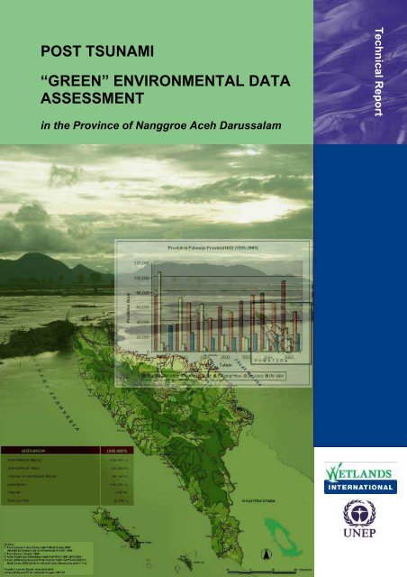
POST TSUNAMI<br />
“GREEN” ENVIRONMENTAL DATA<br />
ASSESSMENT<br />
in the Province of Nanggroe Aceh Darussalam<br />
Technical Report
POST TSUNAMI “GREEN” ENVIRONMENTAL<br />
DATA ASSESSMENT<br />
in the Province of Nanggroe Aceh Darussalam<br />
Technical Report<br />
Bogor, October 2006<br />
Indonesia Programme
<strong>Post</strong> <strong>Tsunami</strong> “Green” Environmental Data Assessment<br />
in Province of Nanggroe Aceh Darussalam<br />
© <strong>Wetlands</strong> International - Indonesia Programme, 2006<br />
Team of Authors : Novana Sari<br />
Fadia Miralka<br />
Ferry Hasudungan<br />
Lili Muslihat<br />
Nyoman Suryadiputra<br />
Design & Layout : Triana, Ferry Hasudungan, Novana Sari<br />
Translator : Wendy Suryadiputra<br />
Foto sampul : Iwan Tri Cahyo W.<br />
A copy of this report can be obtained from:<br />
<strong>Wetlands</strong> International – Indonesia Programme<br />
Jl. A.. Yani No. 53 Bogor 16161<br />
Jawa Barat – INDONESIA<br />
Tel. 0251 312189<br />
Fax. 0251 325755<br />
E-mail: admin@wetlands.or.id<br />
These activities were carried out with financial support from:<br />
(United Nations Environment Programme)<br />
This publication should be cited as follows:<br />
Novana Sari, Fadia Miralka, Ferry Hasudungan, Lili Muslihat and Nyoman Suryadiputra 2006. <strong>Post</strong><br />
<strong>Tsunami</strong> “Green” Environmental Data Assessment In the Province Of Nanggroe Aceh<br />
Darussalam. Technical Report. <strong>Wetlands</strong> International-Indonesia Programme, Bogor.
Preface<br />
This report comprises the results of a study of the bio-physical environment and the activities<br />
undertaken for its rehabilitation in the Province of Nanggroe Aceh Darussalam (<strong>NAD</strong>) during the<br />
conditions prevailing prior to and following the tsunami of 26 December, 2004. The data was<br />
collected during the months August-September 2006, and involved a range of different<br />
stakeholders. The data collected gives a general picture of environmental conditions in <strong>NAD</strong><br />
Province before and after the tsunami.<br />
The data and information in this report describe the impact of the tsunami disaster on the biophysical<br />
environment and the potential for rehabilitation. It is hoped that the results of this study will<br />
be useful to the efforts currently being made to achieve the aims of the rehabilitation program.<br />
The <strong>UNEP</strong> - “Green” Environment Data Assessment (<strong>UNEP</strong>-<strong>GDA</strong>) Project is the result of<br />
collaboration between <strong>UNEP</strong> and <strong>Wetlands</strong> International-IP (WI-IP) aimed at collecting, compiling<br />
and evaluating environmental or “Green” data on the Province of <strong>NAD</strong>, covering activities which<br />
include: environmental activities carried out by working groups, agriculture and physical-chemical<br />
soil conditions, forestry both inland and coastal, protection areas, biodiversity, wetlands, marine<br />
and inland fisheries. This Green data can also be accessed via the Online <strong>Doc</strong>ument Repository<br />
(ODR).<br />
We are aware that the contents of this report still leave much to be desired, but hope that they can<br />
be used to inform studies of post-tsunami conditions in <strong>NAD</strong> carried out by other parties.<br />
The Authors,<br />
Bogor, October 2006<br />
<strong>Post</strong> <strong>Tsunami</strong> “Green” Environmental Data Assessment in iii<br />
Province of Nanggroe Aceh Darussalam
Acknowledgements<br />
<strong>Wetlands</strong> International-Indonesia Programme would like to express their sincere gratitude to all<br />
those who have been involved directly or indirectly in collecting environmental data before and after<br />
the tsunami in <strong>NAD</strong>.<br />
Thanks go to :<br />
<br />
<br />
<br />
<br />
<br />
Badan Rekonstruksi dan Rehabilitasi (BRR) <strong>NAD</strong>-Nias, Bapedalda Propinsi <strong>NAD</strong>, all the<br />
concerned Government Agencies and District (Kabupaten) Governments of <strong>NAD</strong> Province<br />
for the information they provided to the DCAC<br />
National and International Non-Governmental Organisations for the information they provided<br />
to the DCAC<br />
The donor, <strong>UNEP</strong>, for providing the funds to enable this project to be carried out.<br />
All the staff of WI-IP in Bogor and Banda Aceh for their support, both administrative and<br />
technical, throughout the project.<br />
Wendy Suryadiputra, for translating this report from Indonesian to <strong>Eng</strong>lish.<br />
iv<br />
<strong>Post</strong> <strong>Tsunami</strong> “Green” Environmental Data Assessment in<br />
Province of Nanggroe Aceh Darussalam
Glossary of Terms and Abbreviations<br />
ACIAR<br />
ADB<br />
BAKORNAS PBP<br />
Bakosurtanal<br />
BALITTANAH<br />
Australian Centre for International Agriculture Research<br />
Asian Development Bank<br />
Badan Koordinasi Nasional (National Coordination Agency)<br />
Badan Koordinasi Survey dan Pemetaan Nasional (National Survey<br />
and Mapping Coordination Agency)<br />
Balai Penelitian Tanah (Soil Research Institute)<br />
BAPEDALDA Badan Pengendalian Dampak Lingkungan Daerah (Regional<br />
Environmental Impact Control Agency)<br />
BAPLAN<br />
BAPPEDA<br />
BAPPENAS<br />
Badan Planologi Kehutanan (Forestry Planning Agency)<br />
Badan Perencanaan Pembangunan Daerah (Regional Development<br />
Planning Agency)<br />
Badan Perencanaan Pembangunan Nasional (National Development<br />
Planning Agency)<br />
BKSDA Badan Konservasi Sumber Daya Alam (Natural Resources<br />
Conservation Agency)<br />
BPDAS<br />
BPS<br />
BPTP<br />
BRR<br />
CBO<br />
CITES<br />
CZMP<br />
Badan Pengelolaan Daerah Aliran Sungai (Watershed Management<br />
Agency)<br />
Biro Pusat Statistik (Central Bureau of Statistics)<br />
Balai Pengkajian Teknologi Pertanian (Institute for the Study of<br />
Agricultural Technology)<br />
Badan Rehabilitasi dan Rekonstruksi <strong>NAD</strong>-Nias (Agency for the<br />
Rehabilitation and Reconstruction of Aceh and Nias)<br />
Community Based Organization<br />
Convention on International Trade in Endangered Species of Wild<br />
Fauna and Flora (an international agreement among governments to<br />
regulate the trade in specimens of wildlife species in danger of<br />
extinction, so that it does not threaten their conservation in the wild.)<br />
Coastal Zone Management Plan<br />
<strong>Post</strong> <strong>Tsunami</strong> “Green” Environmental Data Assessment in v<br />
Province of Nanggroe Aceh Darussalam
DAS<br />
Dephut<br />
DKP<br />
Ditjen Pankim–Deptrans<br />
DPUP<br />
Fatemeta<br />
Faperta<br />
Daerah Aliran Sungai (Watershed)<br />
Departemen Kehutanan (Ministry of Forestry)<br />
Dinas Kelautan dan Perikanan (Marine Affairs and Fisheries Office)<br />
Direktorat Jenderal Settlement Preparation Departemen Transmigrasi<br />
(Directorate General for Settlement Preparation, Ministry of<br />
Transmigration)<br />
Departemen Pekerjaan Umum Provinsi (Provincial Department of<br />
Public Works)<br />
Fakultas Teknologi Mekanisasi Pertanian (Faculty of Agricultural<br />
Mechanisation Technology)<br />
Fakultas Pertanian (Faculty of Agriculture)<br />
GTZ Gesellschaft fur Technische Zusammenarbeit; (A corporation<br />
belonging to the German government, which is active in the field of<br />
international cooperation and operates across nations)<br />
ICRAF<br />
IPB<br />
IRRI<br />
IUCN<br />
IUCN Red List<br />
LAO PDR<br />
Leuser-SOCP<br />
LIPI<br />
LSI<br />
International Center for Research in Agroforestry<br />
Institut Pertanian Bogor (Bogor Agricultural University)<br />
International Rice Research Institute<br />
International Union for Conservation of Nature and Natural Resources<br />
According to the IUCN Red List system, there are nine categories of<br />
threat: Extinct, Extinct in the Wild, Critically Endangered, Endangered,<br />
Vulnerable, Near Threatened, Least Concern, Data Deficient, and Not<br />
Evaluated. A species is put onto the list of species threatened with<br />
extinction if it falls into the category Critically Endangered, Endangered<br />
or Vulnerable.<br />
Lao People’s Democratic Republic<br />
Leuser-Sumatran Orangutan Conservation Programme<br />
Lembaga Ilmu Pengetahuan Indonesia (Indonesian Institute of<br />
Sciences)<br />
IPB Main Library<br />
LSM Lembaga Swadaya Masyarakat/LSM (Non Governmental<br />
Organization/NGO)<br />
<strong>NAD</strong><br />
Nanggroe Aceh Darussalam<br />
vi<br />
<strong>Post</strong> <strong>Tsunami</strong> “Green” Environmental Data Assessment in<br />
Province of Nanggroe Aceh Darussalam
P2DT<br />
P3MT<br />
PHKA<br />
PHPA<br />
PKSPL<br />
PODES<br />
Puslitbangtannak<br />
Puslittan<br />
Satker Pesisir<br />
Satkorlak<br />
Satlak<br />
STIK<br />
SUSI<br />
USU<br />
UNORC<br />
Proyek Penelitian Database Tanah (Soil Database Research Project)<br />
Proyek Penelitian Pertanian Menunjang Transmigrasi (Project for<br />
Agricultural Research in Support of Transmigration)<br />
Perlindungan Hutan dan Konservasi Alam (Forest Protection and<br />
Nature Conservation)<br />
Perlindungan Hutan dan Pelestarian Alam (Forest Protection and<br />
Nature Conservation), previous name of PHKA<br />
Pusat Kajian Sumberdaya Pesisir dan Lautan (Centre for the Study of<br />
Marine and Coastal Resources)<br />
Potensi Desa (Village Potential)<br />
Tim Pusat Penelitian dan Pengembangan Tanaman Pangan Bogor<br />
(Team from the Bogor Centre for Food Crop Research and<br />
Development)<br />
Pusat Penelitian Tanah (Soil Research Centre)<br />
Satuan Kerja Pesisir (Coastal Work Units)<br />
Provincial level co-ordinating unit of Bakornas<br />
District or municipal level co-ordinating unit of Bakornas<br />
Sekolah Tinggi Ilmu Kehutanan (Forestry Academy)<br />
Survei Terintegrasi (Integrated Survey)<br />
Universitas Sumatra Utara (University of North Sumatra)<br />
United Nation Recovery Coordinator for Aceh and NIas<br />
WALHI Wahana Lingkungan Hidup Indonesia (Indonesian Forum for<br />
Environment)<br />
WIIP<br />
WWF<br />
YAGASU<br />
<strong>Wetlands</strong> International – Indonesia Programme<br />
World Wildlife Fund for Nature<br />
Yayasan Gajah Sumatera (Sumatra Elephant Foundation)<br />
<strong>Post</strong> <strong>Tsunami</strong> “Green” Environmental Data Assessment in vii<br />
Province of Nanggroe Aceh Darussalam
Contents<br />
Page<br />
PREFACE ..........................................................................................................................................iii<br />
ACKNOWLEDGEMENTS ................................................................................................................. iv<br />
GLOSSARY OF TERMS AND ABBREVIATIONS ............................................................................ v<br />
CONTENTS ......................................................................................................................................viii<br />
LIST OF TABLES .............................................................................................................................. x<br />
LIST OF ILLUSTRATIONS ............................................................................................................... xi<br />
LIST OF ANNEXES ..........................................................................................................................xii<br />
CD CONTENTS ...............................................................................................................................xiii<br />
CHAPTER 1. INTRODUCTION ........................................................................................................1<br />
1.1 BACKGROUND AND AIMS ..................................................................................................1<br />
1.2 IMPLEMENTATION ...............................................................................................................2<br />
1.2.1 Location ....................................................................................................................2<br />
1.2.2 Time ..........................................................................................................................2<br />
1.2.3 Personnel .................................................................................................................3<br />
CHAPTER 2. METHOD ..................................................................................................................4<br />
CHAPTER 3. RESULTS AND DISCUSSION ................................................................................5<br />
3.1 GENERAL CONDITIONS IN NANGGROE ACEH DARUSSALAM PROVINCE ..................5<br />
3.2 SOIL AND AGRICULTURE ...................................................................................................8<br />
3.2.1 Soil ............................................................................................................................8<br />
3.2.2 Agriculture ................................................................................................................8<br />
3.2.3 Plantations ..............................................................................................................11<br />
viii<br />
<strong>Post</strong> <strong>Tsunami</strong> “Green” Environmental Data Assessment in<br />
Province of Nanggroe Aceh Darussalam
3.3 WETLANDS AND FISHERIES ............................................................................................ 14<br />
3.3.1 Inland and Marine Fisheries ................................................................................... 14<br />
3.3.2 Coral Reefs ............................................................................................................. 14<br />
3.3.3 <strong>Wetlands</strong> ................................................................................................................ 16<br />
3.4 FORESTRY AND BIODIVERSITY ...................................................................................... 23<br />
3.4.1 Forest Cover ........................................................................................................... 24<br />
3.4.2 Forest Area ............................................................................................................. 24<br />
3.4.3 Disturbances/Pressures on Forest Areas .............................................................. 29<br />
3.4.4 Some Results of Disturbances/Pressures on Forest Areas ................................... 31<br />
3.4.5 Biodiversity ............................................................................................................. 31<br />
3.5 ENVIRONMENTAL REHABILITATION AND RECONSTRUCTION ACTIVITIES<br />
BY WORKING GROUPS .................................................................................................... 34<br />
CHAPTER 4. DISCUSSION AND EVALUATION ........................................................................ 37<br />
4.1 CONSTRAINTS ................................................................................................................... 37<br />
4.2 RECOMMENDATIONS ....................................................................................................... 37<br />
REFERENCES ................................................................................................................................. 38<br />
<strong>Post</strong> <strong>Tsunami</strong> “Green” Environmental Data Assessment in ix<br />
Province of Nanggroe Aceh Darussalam
LIST OF TABLES<br />
Table 1. List of DCAC activities August – October 2006 ................................................................ 2<br />
Table 2. Plantations: area and production ..................................................................................... 12<br />
Table 3. Coral Reef: Location and Damage ................................................................................... 15<br />
Table 4.<br />
Area of mangrove forest with rehabilitation potential & area damaged by<br />
tsunami, in <strong>NAD</strong> Province ................................................................................................. 18<br />
Table 5. Area of Swamp impacted by <strong>Tsunami</strong> ............................................................................. 20<br />
Table 6. Gunung Leuser National Park .......................................................................................... 27<br />
Table 7. Important Bird Areas (IBA), according to BirdLife International ....................................... 28<br />
Table 8. Encroachment & Logging in the Leuser Ecosystem ........................................................ 29<br />
Table 9. Active Forest Concession Areas in <strong>NAD</strong> Province, 2006 ................................................ 30<br />
Table 10. Revoked Forest Concessions in <strong>NAD</strong> Province, 2006 .................................................... 30<br />
Table 11. Degradation of 3 (three) watersheds in <strong>NAD</strong> Province .................................................... 31<br />
Table 12. Biodiversity Statistics ....................................................................................................... 32<br />
Table 13. Indicators for ”Green” Working Groups activities ............................................................. 36<br />
x<br />
<strong>Post</strong> <strong>Tsunami</strong> “Green” Environmental Data Assessment in<br />
Province of Nanggroe Aceh Darussalam
LIST OF ILLUSTRATIONS<br />
Figure 1. Map of Nanggroe Aceh Darussalam Province .................................................................. 5<br />
Figure 2. Topography of <strong>NAD</strong> Province ............................................................................................. 6<br />
Figure 3. Soil Map of <strong>NAD</strong> Province ................................................................................................... 6<br />
Figure 4. Map of Kabupaten Simeulue District.................................................................................... 7<br />
Figure 5. Rice Production (1999 – 2005) in <strong>NAD</strong> Province............................................................... 19<br />
Figure 6. Production of Secondary Crops (1999 – 2005) in <strong>NAD</strong> Province ..................................... 11<br />
Figure 7.<br />
Vegetable Crops: Area under Cultivation and Area Harvested in <strong>NAD</strong><br />
Prov. (2004 – 2005) ......................................................................................................... 11<br />
Figure 8. Plantation Damaged by <strong>Tsunami</strong> in 2004 ........................................................................ 12<br />
Figure 9. Map of coral reef distribution in <strong>NAD</strong> Province................................................................. 16<br />
Figure 10. Map of mangrove distribution in <strong>NAD</strong> Province................................................................ 17<br />
Figure 11. Lagoon between Menusah and Pulot village in Kecamatan Leupung subdistrict,<br />
Aceh Besar, <strong>NAD</strong> ................................................................................................. 19<br />
Figure 12. Area (left) and production (right) of brackish aquaculture ponds during<br />
2003 – 2005 ..................................................................................................................... 21<br />
Figure 13. Area (left) and production (right) of freshwater aquaculture during 2003 –<br />
2005 ................................................................................................................................. 22<br />
Figure 14. Conservation Forest in <strong>NAD</strong> Province ............................................................................. 26<br />
Figure 15. Forest functions, based on Governorial Decree No. 19 of 1999 ..................................... 26<br />
Figure 16. Forest areas, based on ease of access, in <strong>NAD</strong> Province ............................................... 28<br />
Figure 17. Some species of vegetation found in <strong>NAD</strong> Province........................................................ 33<br />
Figure 18. Satellite photo: Conditions in Ulee Lhue, Banda Aceh before and after<br />
the <strong>Tsunami</strong> ...................................................................................................................... 34<br />
Figure 19. Mechanisms for rehabilitation activities ........................................................................... 35<br />
<strong>Post</strong> <strong>Tsunami</strong> “Green” Environmental Data Assessment in xi<br />
Province of Nanggroe Aceh Darussalam
LIST OF ANNEXES<br />
Annex 1. List of Stakeholders contacted/visited by <strong>UNEP</strong> <strong>GDA</strong> Team ........................................53<br />
Annex 2. List of Literature on the Environment Pre- and <strong>Post</strong>-<strong>Tsunami</strong>, by<br />
Organisation/Institution ..................................................................................................57<br />
Annex 3. Chemical Conditions of Soil in <strong>NAD</strong> Province ...............................................................75<br />
Annex 4. (Soil Research Centre, Pusat Penelitian Tanah,, 1983)................................................77<br />
Annex 5. Results of Physical Analysis of Soil in <strong>NAD</strong> Province ...................................................78<br />
Annex 6.<br />
Agriculture Pre- and <strong>Post</strong>-<strong>Tsunami</strong>................................................................................79<br />
Annex 7. Production of Rice and Secondary Crops in <strong>NAD</strong> Province ..........................................81<br />
Annex 8. Vegetables: Area Planted and Area Harvested in <strong>NAD</strong> Province (2004-<br />
2005) ..............................................................................................................................82<br />
Annex 9. Plantations: Area and Production (2000-2005)..............................................................82<br />
Annex 10. Fishing Statistics Pre-<strong>Tsunami</strong> ......................................................................................83<br />
Annex 11. Coral Reef Statistics: Pre- and <strong>Post</strong>-<strong>Tsunami</strong> ...............................................................89<br />
Annex 12. <strong>Wetlands</strong> Statistics.........................................................................................................95<br />
Annex 13. Forest Cover ................................................................................................................118<br />
Annex 14. Conservation Forest in <strong>NAD</strong> Province .........................................................................120<br />
Annex 15. Forest Function Based on Decree No.19 (1999) of the Governor of <strong>NAD</strong><br />
Province .......................................................................................................................121<br />
Annex 16. Land Use and Status in Nanggroe Aceh Darussalam Province..................................122<br />
Annex 17. List of Fauna in <strong>NAD</strong> Province.....................................................................................129<br />
Annex 18. List of Stakeholders Involved in Environmental Activities in <strong>NAD</strong> ...............................146<br />
Annex 19. List of Environmental Rehabilitation Planned and Realised, by<br />
Stakeholders ...............................................................................................................157<br />
xii<br />
<strong>Post</strong> <strong>Tsunami</strong> “Green” Environmental Data Assessment in<br />
Province of Nanggroe Aceh Darussalam
CD Contents<br />
1. “Green” Environmental Data Assessment (<strong>UNEP</strong>-<strong>GDA</strong>) Project Technical Report<br />
2. Data and Information on Coast, <strong>Wetlands</strong> and Fisheries<br />
3. Data and Information on Soil and Agriculture<br />
4. Data and Information on Forestry, Biodiversity and Protection Areas<br />
5. Data and Information on Environmental Rehabilitation and Reconstruction Activities by<br />
Working Groups<br />
6. Map: “Coastal Management”<br />
7. Integrated Coastal Zone Management (ICZM) Workshop, 6-7 September 2006<br />
<strong>Post</strong> <strong>Tsunami</strong> “Green” Environmental Data Assessment in xiii<br />
Province of Nanggroe Aceh Darussalam
1. Introduction<br />
1.1. BACKGROUND AND AIMS<br />
The disastrous earthquake and tsunami of 26 December 2004 devastated almost the entire coastal<br />
region of Nanggroe Aceh Darussalam (<strong>NAD</strong>) Province and the neighbouring islands of Simeulue<br />
and Nias. This catastrophe not only took many thousands of lives but also caused enormous<br />
material (physical) and non-material (socio-economic) loss. To deal with the post tsunami<br />
conditions, the government embarked upon a three-phase restoration program: stage 1 emergency<br />
response, stage 2 rehabilitation and stage 3 reconstruction.<br />
<strong>NAD</strong> Province is currently at the stage of rehabilitation; this applies to all aspects, including the<br />
environment. The many parties actively engaged in efforts to restore the environment (donors,<br />
NGOs and government) need data and information which is detailed, comprehensive and relevant<br />
to the environmental rehabilitation program to be undertaken. For this reason, it is essential to have<br />
an environment database which can be used in the rehabilitation and reconstruction of the<br />
environment in <strong>NAD</strong> Province.<br />
To meet this need for environmental data and information (‘Green Data’), the <strong>UNEP</strong> – <strong>Post</strong><br />
<strong>Tsunami</strong> ‘Green’ Environmental Data Assessment (<strong>UNEP</strong>-<strong>GDA</strong>) in the Province of Nanggroe Aceh<br />
Darussalam project was undertaken, funded by the United Nations Environment Programme<br />
(<strong>UNEP</strong>), during August-September 2006. The Green data thus obtained can also be accessed<br />
through the Online <strong>Doc</strong>ument Repository (ODR), and comprises the following:<br />
<br />
<br />
<br />
Data and information on environmental conditions before the tsunami,<br />
Data and information on environmental conditions and rehabilitation after the tsunami,<br />
Data and information on the environmental rehabilitation and reconstruction activities<br />
undertaken by the various stakeholders after the tsunami.<br />
All the data and information listed above was collected, compiled and analysed on the basis of the<br />
following aspects:<br />
<br />
<br />
<br />
<br />
<br />
<br />
Soil and agriculture,<br />
Coastal areas and wetlands,<br />
Inland and marine fisheries,<br />
Biodiversity,<br />
Terrestrial and coastal forests and protection areas,<br />
Environmental rehabilitation and reconstruction by stakeholders.<br />
The aim of the project was to obtain data and information describing the environmental conditions<br />
prevailing in <strong>NAD</strong> Province before and after the tsunami, and the activities for its rehabilitation. In<br />
addition, it is hoped that the results of this project can be used as an environmental ‘Green’<br />
Database to support current and future rehabilitation programs.<br />
<strong>Post</strong> <strong>Tsunami</strong> “Green” Environmental Data Assessment in 1<br />
Province of Nanggroe Aceh Darussalam
1.2 IMPLEMENTATION<br />
1.2.1 Location<br />
The project encompassed the entire province of <strong>NAD</strong>, especially those areas impacted by<br />
the tsunami.<br />
1.2.2 Time<br />
The project lasted from August to October 2006. In brief, the <strong>UNEP</strong>-<strong>GDA</strong> Team’s tasks<br />
were to draw up a work plan, coordinate the team, collect and compile Green data. Table<br />
1 below presents an outline of DCAC (Data Collecting and Assessment Consultant)<br />
activities from August to October 2006.<br />
Table 1. List of DCAC activities August – October 2006<br />
No. Activity Time Location Description<br />
1 Coordination of <strong>UNEP</strong>-<br />
<strong>GDA</strong> Team<br />
August 2006,<br />
weeks I-III<br />
WI-IP<br />
office,<br />
Bogor<br />
• Draw up a work plan for DCACs and<br />
the <strong>UNEP</strong>-<strong>GDA</strong> Team as a whole.<br />
• Coordinate the whole <strong>UNEP</strong>-<strong>GDA</strong><br />
Team, both DCACs from Bogor and<br />
DCACs from Aceh, with regard to who<br />
will collect and need which data,<br />
where, when, and how it will be<br />
obtained.<br />
• Visits to institutions implementing<br />
green projects (Annex 1).<br />
Output : maps, secondary data, etc<br />
• Coordinate Team for visit to Banda<br />
Aceh to collect data.<br />
2 Trip I to Banda Aceh<br />
and surrounding area,<br />
to collect data<br />
August 2006,<br />
weeks II-IV<br />
WI-IP Aceh<br />
office,<br />
Banda<br />
Aceh<br />
• For their trip to Banda Aceh the<br />
DCACs from Bogor were divided into<br />
2 contingents: Week II (1 person) and<br />
Week III (3 persons).<br />
• Coordination with Aceh DCACs<br />
concerning what data had already<br />
been obtained and what data had not<br />
• Visits to institutions implementing<br />
green projects (Annex 1).<br />
Output: digital mapping from GTZ,<br />
latest report from BPTP <strong>NAD</strong>, working<br />
groups’ activities from BRR, etc.<br />
• Coordination with UNORC Aceh<br />
representative and related<br />
institutions/organisations.<br />
2 <strong>Post</strong> <strong>Tsunami</strong> “Green” Environmental Data Assessment in<br />
Province of Nanggroe Aceh Darussalam
No. Activity Time Location Description<br />
3 Input Green data September<br />
2006<br />
WI-IP<br />
office,<br />
Bogor<br />
• DCACs attend ICZM Workshop held<br />
by GTZ in Banda Aceh (6-7<br />
September 2006).<br />
Output: data on mangrove, coral<br />
reefs, inland fisheries, from<br />
stakeholders.<br />
• Compile Green data.<br />
• Enter Green data into ODR<br />
• Write Progress Report<br />
4 Final Report October 2006 WI-IP<br />
office,<br />
Bogor<br />
• Write Final Report<br />
• Submit Final Report<br />
1.2.3 Personnel<br />
The data were collected and compiled by the Data Collecting and Assessment Consultants<br />
(DCAC), including:<br />
1. I Nyoman Ngurah Suryadiputra Project Manager<br />
2. Novana Sari Team Coordinator<br />
3. Fadia Miralka Fisheries and <strong>Wetlands</strong> Consultant<br />
4. Ferry Hasudungan Biodiversity and Forestry Consultant<br />
5. Lili Muslihat Soil and Agriculture Consultant<br />
6. Ita Sualia Data Collector (in Banda Aceh)<br />
7. Eko Budi Prihanto Data Collector (in Banda Aceh)<br />
8. Sulfianto Data collector (in Simeulue)<br />
9. Dody Permadi WI-IP Librarian<br />
<strong>Post</strong> <strong>Tsunami</strong> “Green” Environmental Data Assessment in 3<br />
Province of Nanggroe Aceh Darussalam
2. Method<br />
Green data consists of observation/survey results and secondary data, both qualitative and<br />
quantitative, classified according to previously determined categories or aspects. These are:<br />
a. Environmental activities undertaken by working groups<br />
b. Agriculture and the physical & chemical conditions of soil and water<br />
c. Terrestrial and coastal forestry, biodiversity and protection areas<br />
d. <strong>Wetlands</strong>, inland and marine fisheries<br />
The time-line for the Green data is from before until after the disastrous earthquake and tsunami,<br />
i.e. 1999-2006. Data were obtained through the internet, visits to relevant institutions, and from WI-<br />
IP’s reference collection. Material came in a wide range of formats, including hardcopies,<br />
softcopies, research reports, project proposals, papers, leaflets, maps, scripts and articles.<br />
Data on physical & chemical soil conditions, biodiversity (fish, vegetation, birds and mammals) was<br />
obtained from the assessment carried out by WI-IP with reference to the book “Kajian Kondisi<br />
Lingkungan Pasca <strong>Tsunami</strong> di Beberapa Lokasi Nanggroe Aceh Darussalam dan Nias” (A Study of<br />
the <strong>Post</strong> <strong>Tsunami</strong> Environmental Conditions at Several Locations in Aceh and Nias). Data and<br />
information on each of these is given in Annex 2.<br />
4 <strong>Post</strong> <strong>Tsunami</strong> “Green” Environmental Data Assessment in<br />
Province of Nanggroe Aceh Darussalam
3. Results and Discussion<br />
3.1 GENERAL CONDITIONS IN NANGGROE ACEH DARUSSALAM<br />
PROVINCE<br />
Aceh is situated between latitudes 2 o - 6 o North and longitudes 95 o - 98 o East and is approximately<br />
125 m above sea level. Most of the province has a humid tropical climate, with the exception of the<br />
northern part of Aceh. Rainfall ranges 2000-4000 mm/year with a high air and soil temperature<br />
regime (>22 O C) throughout most of the year.<br />
<strong>NAD</strong> Province covers a total of 59,950.77 km 2 , comprising 17 ‘kabupaten’ districts, 4 municipalities,<br />
241 ‘kecamatan’ sub-districts and 5,985 villages (including ‘kelurahan’). Forest covers 33,356.13<br />
km 2 , wet ricefields 3,565.10 km 2 , and dry land 23,029.54 km 2 (Bappeda, 2005). Based on<br />
Presidential Regulation No. 30 for year 2005, the length of the north-east coast is 761 km and the<br />
west-south coast 706 km.<br />
Figure 1. Map of Nanggroe Aceh Darussalam Province<br />
A large part of Aceh’s terrain is mountainous with slopes of >30%. Approximately 2,564,000 ha or<br />
45% of Aceh’s total area is mountainous, while 23% is undulating to hilly (slope >15-30%), and<br />
32% is flat to undulating (slope
3,000<br />
2,500<br />
Topography of Nanggroe Aceh Darussalam<br />
Province<br />
area (x1000 ha)<br />
2,000<br />
1,500<br />
1,000<br />
500<br />
933<br />
188<br />
608<br />
1,326<br />
2,564<br />
0<br />
0-3 3-8 8-15 15-30 >30<br />
slope<br />
Figure 2. Topography of <strong>NAD</strong> Province.<br />
Histosol (peat), Entisols and Inceptisols are found in flat to undulating regions in alluvium and/or<br />
sedimentary geological formations. Molisols and Alfisols are found in karst hills, Ultisols and<br />
Oxisols in sedimentary rock and metamorphic rock formations, while Andisols occur in<br />
mountainous regions with volcanic rock formations.<br />
Figure 3. Soil Map of <strong>NAD</strong> Province<br />
6 <strong>Post</strong> <strong>Tsunami</strong> “Green” Environmental Data Assessment in<br />
Province of Nanggroe Aceh Darussalam
Kabupaten Simeulue<br />
Kabupaten Simeulue District is a group of 41 large and small islands situated between longitudes<br />
95° 45’ 23” and 96° 26’ 41” East, and latitudes 2° 19’ 3” and 2° 26’ 41” North. Administratively, it is<br />
part of the province Nanggroe Aceh Darussalam (<strong>NAD</strong>). Its capital is Sinabang on Pulau Simeulue<br />
island. The whole of the Kabupaten Simeulue District extends across a total of ±187,277.62 Ha,<br />
has 264 km of coastline, and 9,851.796 km 2 of waters. It is subdivided into 8 kecamatan subdistricts,<br />
16 bano/mukim and 135 villages.<br />
10660000<br />
10680000<br />
10700000<br />
10720000<br />
10740000<br />
P. Ina<br />
320000<br />
Lubuk Baik<br />
#<br />
Lhok Dalam<br />
#<br />
#<br />
U.Dewak Lewak Tl. Lewak TG. Sangiran<br />
Lhok Makmur<br />
P. lafulu Lameureum<br />
#<br />
U.Bodeh<br />
Tl. Lhok Makmur<br />
#<br />
P. Tepi<br />
Sanggiran<br />
#<br />
Lhok Pauh<br />
#<br />
Tl. Lhok Pauh PaparasD.LAULO<br />
P. Lho SaraFon #<br />
P. PAnjang<br />
Langi<br />
%#<br />
KEC. ALAFAN<br />
D. SIBOGAAmabaan<br />
# P. ITITIK<br />
Amabaan<br />
#<br />
P Panjang<br />
P. VENU<br />
TL. Sibigo P. ALAWAN<br />
P. Perak<br />
Sibigo<br />
%#<br />
KEC. SIMEULUEBARAT<br />
P. GALA KHALA<br />
Lamamek Tg. Sigulai<br />
#<br />
Sigulai<br />
#<br />
U. Bahagia Sembilan<br />
U.Sembilan P . Asu<br />
#<br />
D.ETUTUK<br />
Tl. Lunggung<br />
Efilan<br />
#<br />
P. Nyamukek<br />
Layabaung P. Gambacang<br />
P. Mantan sinasah<br />
#<br />
Tl. Baram<br />
KABUPATEN SIMEULUE<br />
PROVINSI N A D<br />
# Simpoint.shp<br />
Btskec.shp<br />
ñq Bandara_poin.shp<br />
% Ibukota.shp<br />
JalanDesa<br />
JalanKab<br />
320000<br />
SAMUDERA HINDIA<br />
260000<br />
280000<br />
300000<br />
P. HARAPAN<br />
Lafakha<br />
#<br />
Tl. Baram<br />
P Falu<br />
P. UJUNGTAUHEK<br />
Tl. Silingar U. Suakawa P BATU<br />
Detimon KEC. SALANG<br />
Tl. Aceh<br />
Tl Entung<br />
U.Sibarui Babussalam<br />
#<br />
Tl. Silokan<br />
Lugu Sekbahak %#<br />
Dengko<br />
Tl. Makkasim #<br />
Tl. Sibesan P. U. Dara Gunung Putih<br />
#<br />
P. Langeni<br />
Ujung Padang<br />
Kuala Bakti<br />
Tl. Aluayan Padang Anoi<br />
#<br />
#<br />
#<br />
P. Toko<br />
P. Simanam Tl Lok Legang P. Pinang<br />
Tl. Ratuk<br />
P. SIUMAT<br />
Meunafa<br />
KEC. SIMEULUETENGAH<br />
#<br />
Sebulu<br />
Selave P. Simanam Tl Itam<br />
Tl. Dalam<br />
Tg. Idung Kerbau<br />
Tl. Natnat<br />
Tl. Tirama<br />
Sambai Tl Lok Legang<br />
Tl. Aiai<br />
# Tg. P. LIMAU<br />
#<br />
Tl. Dalam Tl. Luan Idung Balu Kerbau<br />
Tl. Duk Duk<br />
Tl. Bahai Nasreuhe<br />
#<br />
P. Toko<br />
Luan Balu<br />
P. TALAM<br />
#<br />
%#<br />
Lamayang<br />
Tl. Tirama Bulu Hadik Tl Itam<br />
Tl. Luan Balu<br />
U.Aluayan U. Menggelo Tl. Nasreuhe<br />
#<br />
#<br />
#<br />
Tl. Tanjung Raya<br />
P. LINGGAM<br />
# Kuala Tl. Tanjung Baru Raya<br />
U. Laluntok<br />
Bunga Borengan<br />
#<br />
#<br />
#<br />
#<br />
#<br />
Tg. Kuala Baru<br />
U.Nasreuhe<br />
Latitik Lauhe<br />
Tl. Galai<br />
Tg. Kuala Baru<br />
Wel -Wel #<br />
Air Pinang<br />
Tl. Latak Galai Ayah # # Tl. Lembaya<br />
%#<br />
#<br />
# # Kampung Aie<br />
KEC. TELUKDALAM<br />
Tl. ArabanAmarabu<br />
#<br />
Bubuhan Lambaya<br />
Ujung Tinggi<br />
# Tl. Araban<br />
U. Tinggi<br />
#<br />
Lakubang<br />
#<br />
Kota U. Padang Lembayan<br />
U Lauke # Lauhe<br />
Tg. Tiram<br />
U. Lambayan<br />
U. Lamalek #<br />
Kuala Makmur U.Ganting<br />
Putra Jaya<br />
Tg. Pertandang<br />
#<br />
KEC. SIMEULUETIMUR #<br />
Dihit<br />
Tg. Sibau Ganting<br />
#<br />
P. # Sabu<br />
P. Benar<br />
Lamalik<br />
Tl. Arun Tg. Cakar BAhar<br />
Silengas<br />
Sefoyan<br />
P. SIMEULU CUT<br />
#<br />
# Tl.<br />
Bunon<br />
P. Linngi Padan P. Panjang<br />
#<br />
Tl. Seroyan<br />
U.Bambang<br />
#<br />
Angkeo<br />
P. Kubangan<br />
Tl. Angkeo<br />
Lugu<br />
#<br />
Selat Babaharu # P. Delapan Kota Batu<br />
Tl. Angkeo Laayon KEC. TEUPAHBARAT<br />
Linggi U Gading #<br />
#<br />
U. Gunung Bambang<br />
#<br />
Suka Karya P. Bengkok TELUK Tl. Bangkala SINABANG<br />
Tg. La' yon<br />
#<br />
#<br />
Inor<br />
Sinabang Tl. P. Sinabang Batu<br />
#<br />
%#<br />
U. Lataling<br />
Tl. Bangkala<br />
Naibos Maudil<br />
Suka Maju<br />
Bangkalak<br />
P. Batu #<br />
#<br />
Air Terjun #<br />
Tl. Sinabang<br />
#<br />
#<br />
#<br />
Salur<br />
U.NionaBungsu<br />
U. Kuala Kolok Tujuh Bura<br />
#%<br />
Air Dingin Suka Jaya Lataling U.Tuabing<br />
Nancala<br />
#<br />
#<br />
Tg. # Salur Lantik<br />
Tl. Panerusan<br />
# Leubang<br />
Suak Buluh<br />
P. Simpeda<br />
Tl. Nancala<br />
#<br />
Awe Kecil # # Sital<br />
#<br />
Labuah<br />
P. BATU BELAYAR<br />
SAMUDERAHINDIA<br />
#<br />
#<br />
#<br />
Awe Seubal Tl. Lasikin Sua-Sua<br />
Anao<br />
Batu-Batu<br />
#<br />
#<br />
Situbuk<br />
Tl. Limau<br />
Tl. Lasikin #<br />
ñq<br />
Lanting<br />
#<br />
Lasikin #<br />
U. Tauche<br />
Simpang Abail<br />
Labuan Bajau<br />
U. Matanurung #<br />
%#<br />
Tl. Selatu Busung KEC. TEUPAHSELATAN<br />
Mata Nurung Tl. Selatu #<br />
Balla Sektai<br />
6 0 6 12 Kilometers<br />
U. Kahat<br />
#<br />
P. MINCAU P. TEUPAH<br />
Latiung<br />
Seneubuk<br />
Suak Lamatan<br />
TL. Defayan #<br />
#<br />
Ulul Mayang<br />
#<br />
Alus-Alus<br />
#<br />
U.Defayan<br />
#<br />
#<br />
Batu Ralang<br />
L A<br />
300000<br />
280000<br />
260000<br />
10660000<br />
10680000<br />
10700000<br />
10720000<br />
10740000<br />
Figure 4. Map of Kabupaten Simeulue District<br />
As regards climate, this district has an average temperature range 25.5 0 C – 26.3 0 C with an annual<br />
average of 25.8 0 C. The highest temperature occurs in May and the lowest in August, November<br />
and December. Atmospheric humidity ranges from 88.8 % to 91.0 %, the highest humidity being in<br />
September and December and the lowest in January.<br />
<strong>Post</strong> <strong>Tsunami</strong> “Green” Environmental Data Assessment in 7<br />
Province of Nanggroe Aceh Darussalam
3.2 SOIL AND AGRICULTURE<br />
The tsunami at the end of 2004 in <strong>NAD</strong> province caused considerable damage to agricultural land.<br />
Efforts to rehabilitate it have begun but are generally still at the level of evaluation and monitoring<br />
of land resources, although some trials have also been carried out. Rehabilitation has been limited<br />
to making physical improvements to the land, so an effort is needed to improve the fertility of its<br />
soil, including washing out its salinity, sodicity, and high pH. Urgent repairs need to be made to the<br />
supporting infrastructure in order to speed up the land rehabilitation process and to overcome the<br />
difficulties the farmers are experiencing. The farmers’ economic capacity needs to be restored by<br />
providing them with the means of production, working capital, and technical guidance on farming<br />
which is oriented toward business and environment. Coordination among the various parties<br />
concerned in land rehabilitation needs to be made more effective.<br />
3.2.1 Soil<br />
For the assessment by WI-IP, the chemical and physical properties of soils were obtained<br />
by analysing soil samples taken from a number of selected locations throughout those<br />
parts of <strong>NAD</strong> province affected by the tsunami.<br />
Chemical Properties<br />
Soil fertility was studied by assessing the chemical properties of the soil samples.<br />
Substances tested for included: organic C, phosphate, total N content, potassium, cation<br />
exchange capacity (CEC), base saturation, aluminium, and soil reaction. The soils’<br />
chemical properties can be seen in Annex 3 and their criteria in Annex 4.<br />
Physical Properties<br />
The physical properties of soil are important to the interrelationship between soil, water and<br />
vegetation. The most important factors are aeration and the availability of water in the soil.<br />
Aeration depends on the soil’s structure (the number of pores) and permeability. Soil with<br />
sufficient pores does not necessarily have good aeration if some of the pores are filled with<br />
water.<br />
The results of the analysis of physical soil properties in Annex 5 shows that in lowland tidal<br />
swamp plains or alluvial basins the soil does not (yet) possess structure, the number of<br />
aeration pores is low, and permeability moderate. This is because the land is saturated<br />
with water. In land with sandy texture, the development of soil structure is still low with a<br />
moderate to high number of aeration pores and high permeability.<br />
3.2.2 Agriculture<br />
Agricultural land in Aceh comprises wet ricefields, dry fields, mixed plantation and gardens.<br />
Ricefields consist of irrigated and rain-fed fields, planted with rice, secondary crops and<br />
vegetables. Gardens take the form of back-yard farms nearby the house, containing fruit<br />
trees. Dry fields and mixed plantation are on specially managed land further away from the<br />
home, usually growing a variety of fruit trees and annual crops such as cacao, coffee,<br />
durian, etc.<br />
8 <strong>Post</strong> <strong>Tsunami</strong> “Green” Environmental Data Assessment in<br />
Province of Nanggroe Aceh Darussalam
The characteristics and types of agricultural land in Aceh Province tend to differ according<br />
to whether it is in lowland, which marks the transition from shore to hills, or in the uplands.<br />
Lowlands are more often used for food and secondary crops, while the uplands are usually<br />
for plantations.<br />
Agricultural Land Area and Production Before and After the <strong>Tsunami</strong><br />
As can be seen from Annex 6, the total area of agricultural land used for food crops (rice and<br />
secondary crops) in 2004 was around 1,578,380 ha, which consisted of 356,397 ha ricefield,<br />
983,389 ha dry field, and 240,594 ha gardens. This land provided a source of livelihood for<br />
the community and had a strategic value in improving the economy in <strong>NAD</strong> Province.<br />
The tsunami devastated approximately 61,816 ha of the land for food crops and<br />
horticulture, comprising 37,471 ha wet ricefield and 24,345 ha dry upland fields (FAO,<br />
2005). According to data from the National Disaster Management Team of the Ministry of<br />
Agriculture, however, the area of land damaged was wet ricefield 20,206 ha, plantation<br />
102,461 ha and dry fields 31,265 ha, together adding up to a total of 153,932 ha, as well as<br />
the loss of 1,904,587 head of livestock.<br />
Prior to the earthquake and tsunami disaster, agricultural land resources, comprising wet<br />
ricefield and dry fields, had experienced considerable improvement both as regards the<br />
increase in area and the increase in yield. The pattern of crops planted in irrigated ricefield<br />
(technical, semi-technical and rural) was rice–rice–secondary crop; that for rain-fed<br />
ricefields was rice–secondary crop. Productivity was 4.02 kw/ha for wet ricefield and 22.02<br />
kw/ha for dryland rice (Dinas Tanaman Pangan & Hortikultura, <strong>NAD</strong>). Figures reported by<br />
the Institute for the Study of Agricultural Technology (BPTP) recorded pre-tsunami<br />
productivity of wet ricefields as 4.31 – 5.90 ton/ha with an average of 4.7 ton/ha dry hulled<br />
rice. Two months after the tsunami, farmers tried to replant the wet ricefields they had<br />
already cleaned out; their first post-tsunami crop showed a 20-40% decrease in yield.<br />
Rice production from 1999 to 2001 decreased from 1,478,602 ton to 1,246,614 ton, then<br />
increased during 2002-2004 to 1,552,083 ton (Figure 5). Agricultural production,<br />
specifically rice and secondary crops, for 1990 -2005 is presented in Annex 7.<br />
Rice Production in <strong>NAD</strong> Province (1999-2005)<br />
1,600,000<br />
1,400,000<br />
Rice<br />
Production (ton)<br />
1,200,000<br />
1,000,000<br />
800,000<br />
600,000<br />
400,000<br />
1,478,602<br />
1,404,580<br />
1,246,614<br />
1,314,165<br />
1,547,499<br />
1,552,083<br />
1,403,139<br />
200,000<br />
0<br />
1999 2000 2001 2002 2003 2004 2005<br />
Year<br />
Figure 5. Rice Production (1999-2005) in <strong>NAD</strong> Province<br />
<strong>Post</strong> <strong>Tsunami</strong> “Green” Environmental Data Assessment in 9<br />
Province of Nanggroe Aceh Darussalam
Following the tsunami, the degradation of 20,00030,000 ha of farmland caused rice<br />
production to fall from 1,522,083 ton in 2004 to 1,403,139 ton in 2005, a drop of about<br />
148,944 ton (9.6%). Maize production, which had risen steadily from 36,642 ton in 2000 to<br />
94,427 ton in 2005, did not appear to be affected by the tsunami. Soybean production,<br />
which had been high in 1999 (106,480 ton), showed a very worrying decline during 2000 to<br />
2003 plummeting to a low of only 18,698 tons, then rising again in 2004 and 2005 to<br />
31,170-31,076 ton. The production of other crops, such as peanuts, mung beans, cassava<br />
and sweet potato, fluctuated from 2002 with a rise in 2004 followed by a slight decrease in<br />
2005 (Figure 6).<br />
Besides staple food crops, horticulture supplied the community with fruit and vegetables. In<br />
2004, the area under cultivation for vegetables was 34,392 ha, of which 31,252 ha was<br />
harvested , yielding a total of 1,976,774 kw, a productivity rate of 63 kw/ha (Figure 7). For<br />
fruit, the total area harvested was 13,505 ha, production 268,356 ton and productivity 19<br />
ton/ha (54.61 kg/tree/year). After the tsunami, there was an increase in the area put under<br />
cultivation for horticulture but an overall decrease in harvested area, production and<br />
productivity. For vegetables, the cultivated area rose to 35,189 ha and harvested area to<br />
32,710 ha, while production fell to 1,824,796 kw and productivity to 55.6 kw/ha (Annex 8).<br />
Production of Secondary Crops in <strong>NAD</strong> Province (1999-2005)<br />
120,000<br />
Secondary Crops Production (tons)<br />
100,000<br />
80,000<br />
60,000<br />
40,000<br />
20,000<br />
0<br />
1999 2000 2001 2002 2003 2004 2005<br />
Year<br />
Corn Soybean Peanut Mung beans Cassava Sweet potato<br />
Figure 6. Production of Secondary Crops (1999-2005) in <strong>NAD</strong> Province.<br />
10 <strong>Post</strong> <strong>Tsunami</strong> “Green” Environmental Data Assessment in<br />
Province of Nanggroe Aceh Darussalam
Vegetables Cultivation in <strong>NAD</strong> Province:<br />
Area Cultivated and Area Harvested<br />
36,000<br />
35,000<br />
34,000<br />
Area (ha)<br />
33,000<br />
32,000<br />
31,000<br />
30,000<br />
34,392<br />
35,189<br />
31,252<br />
32,710<br />
29,000<br />
Area Cultivated<br />
Area Harvested<br />
2004 2005<br />
Figure 7. Vegetable Crops: Area under Cultivation and Area Harvested in <strong>NAD</strong> Prov. (2004 – 2005)<br />
3.2.3 Plantations<br />
Plantation Area and Production Before and After the <strong>Tsunami</strong><br />
The estate crops sub sector plays an important role in mobilising the regional economy. In<br />
2003, plantations contributed 6.66% to the regional income of <strong>NAD</strong> Province, and provided<br />
new jobs for 13,935 people. However, prolonged conflict caused the economy of both<br />
community-owned and large-scale plantations to deteriorate.<br />
Based on 2004 figures, plantations in <strong>NAD</strong> Province cover a total of 726,103 ha, which is<br />
made up of 199,956 ha large-scale plantations and 526,147 ha community-owned.Records<br />
show that 254,666 ha of community-owned plantations, i.e. 48.41% of the total, were<br />
abandoned and became degraded because their owners were too afraid to work on them.<br />
With the conflict still unresolved, another disaster – the tsunami – struck, causing further<br />
loss and degradation to plantation assets, affecting 22,305 ha (4.24% of total plantation<br />
area).<br />
<strong>Post</strong> <strong>Tsunami</strong> “Green” Environmental Data Assessment in 11<br />
Province of Nanggroe Aceh Darussalam
Table 2. Plantations: area and production<br />
Large-scale<br />
Plantations<br />
Community<br />
Plantations<br />
Total<br />
Area (ha) in 2004 199,956 526,147 726,103<br />
Production (ton) in 2004 244,346 678,265 922,611<br />
Plantations damaged<br />
<strong>Tsunami</strong> Conflict Maintained<br />
22,305 254,666 249,176<br />
Source : Dinas Perkebunan Propinsi <strong>NAD</strong> (2000 - 2005)<br />
The main commodities for plantation are coconut, rubber, oil palm, cacao, coffee, cloves<br />
and nutmeg. Total production is 922,611 ton, of which 244,346 ton is from large-scale<br />
plantations and 678,265 ton from community-owned (Annex 9). Plantation affected by the<br />
tsunami tended to be situated all along the coast (22,305 ha), the most heavily affected<br />
being the communities’ coconut plantations (10,281 ha). Other plantations affected were<br />
rubber (4,282 ha), oil palm (2,346 ha), cacao (1,230 ha) and clove (997 ha) (Figure 8).<br />
Nevertheless, the communities’ estate crop production did not fall after the tsunami but, on<br />
the contrary, rose from 678,265 ton in 2004 to 721,302 ton in 2005, an increase of about<br />
43,074 ton or 6.35%.<br />
Plantation hit by <strong>Tsunami</strong><br />
12,000<br />
10,000<br />
area (ha)<br />
8,000<br />
6,000<br />
4,000<br />
2,000<br />
10,667<br />
4,282<br />
2,346<br />
997<br />
1,230<br />
0<br />
coconut rubber oil palm clove cacao<br />
commodity<br />
Figure 8. Plantation Damaged by <strong>Tsunami</strong> in 2004.<br />
12 <strong>Post</strong> <strong>Tsunami</strong> “Green” Environmental Data Assessment in<br />
Province of Nanggroe Aceh Darussalam
Damage Caused by the <strong>Tsunami</strong><br />
<br />
<br />
<br />
<br />
Soil has high levels of salinity and sodium<br />
Marine mud deposits<br />
Debris and wreckage of buildings<br />
Damaged irrigation and drainage ditches<br />
Salinity indicates the content of elements and organic compounds such as Na + , Mg 2+ , K + ,<br />
Cl - , SO 4 2- , HCO 3 - , NO 3 - and CO 3 2 - in a solution. In the context of soil, salinity indicates the<br />
level of salt dissolved in the soil. High salinity and sodicity levels occur because the sea<br />
water and sediment, which are saline and contain exchangeable Na, reached far inland: 1-<br />
2 km from the shoreline (east coast) and 4-5 km (west coast). Na+ compounds have the<br />
effect of breaking up the soil structure, giving rise to a reaction that renders the nutrients<br />
unavailable to the plants. Such conditions disturb plant growth.<br />
Results from a survey conducted by a Team from FAO (in collaboration with the<br />
Agricultural Research and Development Agency Badan Litbang Pertanian and the<br />
Directorate General for Food Crops, Ministry of Agriculture) during 29 January 8 February<br />
2005, showed that the salinity of surface water and sediment was still high, as indicated by<br />
electrical conductivity (EC) readings of 510 mS/cm (Pidie), 0.16.5 mS/cm (Bireuen) and<br />
44>100 mS/cm (Aceh Utara). By March 2005, salinity levels had begun to decline, as<br />
indicated by EC ranges of 0.22 mS/cm (Pidie), 0.13.2 mS/cm (Bireuen), and 717 mS/cm<br />
(Aceh Utara), with the result that part of the tsunami affected area could start to be<br />
replanted (BPTP-<strong>NAD</strong> 2006).<br />
Sediment along Aceh’s east coast was found to be 520 cm thick and saline. In dry<br />
conditions, this clayey soil will become hard, cracked and difficult to work. Moreover, the<br />
debris and wreckage from buildings together with the damage to irrigation channels will<br />
obstruct the hydrology, the land will flood resulting in high levels of iron and aluminium<br />
which could poison the vegetation.<br />
Land rehabilitation<br />
Efforts made to rehabilitate the land are as follow:<br />
<br />
<br />
<br />
<br />
<br />
Civil <strong>Eng</strong>ineering Work. The first step is to clear away the debris and rubble.<br />
Repair irrigation/drainage channels and roads so that salt can be washed away<br />
more effectively, and construct drainage channels on land where none previously<br />
existed.<br />
Desalination. Land is washed at intervals of 1 or 2 weeks using either rainwater or<br />
river water. Drainage channels must be dug for this so that the water flows away<br />
quickly from the land.<br />
Repair soil fertility. Land with high sodicity should be treated with gypsum<br />
(CaSO 4 2H 2 SO 4 depending on exchangeable Na content), sulphur, calcium and<br />
organic matter.<br />
Work the soil to repair permeability and soil structure, and monitor salinity.<br />
Select species of vegetation that tolerate saline conditions.<br />
<strong>Post</strong> <strong>Tsunami</strong> “Green” Environmental Data Assessment in 13<br />
Province of Nanggroe Aceh Darussalam
3.3 WETLANDS AND FISHERIES<br />
The aspect of fisheries and wetlands is divided into ten areas: fisheries, mangrove, lakes, rivers,<br />
swamps and reservoirs, sandy beach, brackish water aquaculture ponds (tambak), freshwater<br />
aquaculture, coral reefs, and lagoons. Data were obtained on area, production, species of biota,<br />
etc. The data came from a variety of government institutions, such as the Marine Affairs and<br />
Fisheries Office (Dinas Kelautan dan Perikanan), Water Resources Office (Dinas Sumber Daya<br />
Air) and Central Bureau of Statistics (Biro Pusat Statistik), and from local and international NGOs<br />
such as the Indonesian Coral Reef Foundation (Yayasan Terumbu Karang Indonesia (Terangi)),<br />
WIIP, WCS, UNESCO. Data was received in a variety of formats, with some parts left blank, which<br />
made analysis difficult.<br />
3.3.1 Inland and Marine Fisheries<br />
Fisheries comprises both marine and inland fisheries, supported by a fishing fleet which<br />
includes both unmotorised boats and boats powered by an outboard motor or engine. Prior<br />
to the tsunami, the condition of the fishing sector tended to fluctuate and differed from<br />
place to place, depending on the size of the fishing fleet. Fish production would rise<br />
following an increase in the number of boats and fall following a decrease.<br />
After the tsunami, the assistance generally given by stakeholders, i.e. government as well<br />
as foreign and community NGOs, was to repair and build boats and fishery facilities such<br />
as fish auction places, harbours and the like. In view of the pre-tsunami trends, it can be<br />
expected that an increase in the size of the fishing fleet will lead to a similar increase in fish<br />
catches (Annex 10).<br />
3.3.2 Coral Reefs<br />
Prior to the tsunami, the condition of coral covering the reefs was relatively good (Annex<br />
11), although in some places it was poor as a result of bombing and tourist activities. After<br />
the tsunami, the percentage of living coral cover along the east and west coasts of <strong>NAD</strong><br />
ranged from 1 to 64.8% and consisted of Acropora and Non Acropora.<br />
Referring to Forestry Ministerial decree (SK Menteri Kehutanan) No. 928/Kpts/Um/1982<br />
dated 22 December 1982, the coral reef ecosystem at Pulau Weh Marine Park (Taman<br />
Laut Pulau Weh) covered an area of approximately 2,600 Ha, concentrated around Pulau<br />
Rubiah island. In the Aceh Singkil district, coral reef in the Pulau Banyak Recreation Park<br />
(Taman Wisata Pulau Banyak) covered about 227,500 Ha. Much of these coral reef<br />
ecosystems was already degraded: 50-75% at Pulau Banyak and 38-44.25% at Pulau<br />
Rubiah, Sabang. The total coral reef area along the west coast of Aceh (including Pulau<br />
Simeulue) covered approximately 89,652 Ha, as shown in Table 3. According to data from<br />
the Ministry of Marine Affairs and Fisheries, Pulau Simeulue’s coral reef covered 23,776<br />
ha, of which 2,640 ha is calculated to have experienced uplift.<br />
14 <strong>Post</strong> <strong>Tsunami</strong> “Green” Environmental Data Assessment in<br />
Province of Nanggroe Aceh Darussalam
Table 3. Coral Reef: Location and Damage<br />
No.<br />
Location<br />
Total Area of<br />
Coral Reef (ha)<br />
Pre-tsunami Level<br />
of Degradation (%)<br />
<strong>Post</strong>-tsunami<br />
Condition of<br />
Coral Reef<br />
1 Kepulauan Weh (Pulau<br />
Rubiah)<br />
2,600* 38-44.25% Little change<br />
2 Pulau Banyak 227,000 50-75% No Data<br />
3 West coast of <strong>NAD</strong> 65,876 No Data Thought to be<br />
destroyed<br />
- LhokNga-Banda Aceh 2,900 No Data Thought to be<br />
destroyed<br />
- Aceh Singkil 22,400 No Data Thought to be<br />
destroyed<br />
- Lamno-Calang-Meulaboh 16,800 No Data Thought to be<br />
destroyed<br />
4 Simeulue 23,776 No Data Thought to be<br />
destroyed<br />
5 Pulo Aceh 15,791<br />
Source :<br />
* Dinas Kelautan dan Perikanan <strong>NAD</strong>, in Bappenas 2005, Pulau Weh National Park, Sabang, Nangro Aceh<br />
Darussalam Yuni Ikawati, Puji S. Hanggarawati, Hening Parlan, Hendrati Handini and Budiman Siswodihardjo,<br />
2001. Terumbu Karang di Indonesia. MAPPITEK-Jakarta;<br />
The tsunami overturned and damaged coral in shallow water but did not have a big impact<br />
in deep water. Its effect on coral reef took the form of sedimentation for less than a week<br />
and uplift like that which occurred at Pulau Simeulue, where a 100m width of reef was<br />
exposed to the air to a height of 50-200m as a result of which the coral died. If the length of<br />
Pulau Simeulue’s coastline is 264km, it can be estimated that 2640 ha of coral was<br />
damaged due to uplift. Such uplift of coral reef leads to a drop in fish production. This is<br />
because of the reduction in fish habitat, i.e. the coral reef that provides spawning and<br />
feeding grounds for fish.<br />
Coral reef is distributed mostly along <strong>NAD</strong>’s west coast and is not seen on the east coast<br />
(Figure 9). All the coral reef on the west coast is thought to have been destroyed by the<br />
impact of the tsunami, whereas coral reefs in Pulau Weh are in good condition. The island<br />
groups of Pulo Aceh (15,791 ha of coral reef) and Pulau Simeulue were the island groups<br />
struck hardest by the tsunami. These conditions lead to a strong belief that the whole coral<br />
reef ecosystem, spawning and feeding grounds might have been totally destroyed.<br />
<strong>Post</strong> <strong>Tsunami</strong> “Green” Environmental Data Assessment in 15<br />
Province of Nanggroe Aceh Darussalam
Figure 9. Map of coral reef distribution in <strong>NAD</strong> Province<br />
Note: Coral reef (purple) is distributed along the whole of Aceh’s west coast, around Pulau<br />
Sabang, and a little on the north coast. Mangrove (green) is distributed evenly along the<br />
whole of the east coast. Area of coral reef detected by satellite imaging is 89,652 ha.<br />
3.3.3 <strong>Wetlands</strong><br />
As defined by WIIP, wetlands are areas of swamp, brackish water, peatland, and<br />
permanent or transient waters, with standing or flowing water that is fresh, brackish or salt,<br />
including marine areas that are no more than six metres deep at low tide (Annex 12). An<br />
analysis of these areas is described below.<br />
Mangrove Forest<br />
The area covered by mangrove has decreased over time. Approximately 50.3% of<br />
mangrove forest was impacted by the tsunami, but the figures vary from one institution to<br />
another. BRR, for example, estimates that 164,000 ha of mangrove were lost, WIIP 84,000<br />
ha, the World Bank Consultative Group 25,000 ha and the FAO less than 20,000 ha.<br />
On Aceh’s east coast, mangrove forest can be found in Aceh Timur, Aceh Tamiang, Aceh<br />
Utara and Bireun, and on the west coast in Aceh Jaya, Aceh Barat and Aceh Singkil. There<br />
is also a large area of mangrove on the east coast of Pulau Simeulue island, and a<br />
moderate amount of mangrove forest on the eastern shores of Pulau Banyak. According to<br />
data obtained from the Marine Affairs and Fisheries Office (Dinas Kelautan dan Perikanan)<br />
the Kabupaten Simeulue district has 2,779.97 ha of mangrove. (Figure 10).<br />
16 <strong>Post</strong> <strong>Tsunami</strong> “Green” Environmental Data Assessment in<br />
Province of Nanggroe Aceh Darussalam
Figure 10. Map of mangrove distribution in <strong>NAD</strong> Province<br />
Data on the extent and distribution of mangrove damaged by the tsunami varies<br />
considerably. The data from Bappenas (2005; Annex 12) estimates that 25,000 ha of<br />
<strong>NAD</strong>’s mangrove forest were damaged, while Lapan (2005) puts the figure higher at<br />
32,003 ha. From this, the Forestry Office (Dinas Kehutanan) states that the area of<br />
mangrove with rehabilitation potential in <strong>NAD</strong> is 24,950 ha (see Table 4).<br />
<strong>Post</strong> <strong>Tsunami</strong> “Green” Environmental Data Assessment in 17<br />
Province of Nanggroe Aceh Darussalam
Table 4. Area of mangrove forest with rehabilitation potential & area damaged by<br />
tsunami, in <strong>NAD</strong> Province<br />
No District/Town Area (Ha)* Area (Ha)**<br />
1 Banda Aceh 1,100 111.3<br />
2 Lhoksumawe 300 308.6<br />
3 Aceh Jaya 860 67.6<br />
4 Aceh Selatan 1,200 0.0<br />
5 Aceh Singkil 2,125 1,460.4<br />
6 Aceh Tamiang 2,550 16,095.0<br />
7 Aceh Timur 1,900 10,453.6<br />
8 Aceh Utara 2,250 0<br />
9 Aceh Bireun 2,350 0<br />
10 Nagan Raya 800 0<br />
11 Pidie 1,642 32.3<br />
12 Aceh Barat Daya 910 2.7<br />
13 Aceh Barat 2,000 361.6<br />
14 Aceh Besar 1,479 53.9<br />
15 Simeulue 1,200 3,056.9<br />
16 Langsa 1,384 -<br />
17 Sabang 900 -<br />
Total 24,950 32,003.0<br />
Source : data obtained from several sources<br />
* Area with rehabilitation potential, Provincial & District Forestry Office (Dinas<br />
Kehutanan Propinsi & Kabupaten);<br />
** Area of mangrove forest damaged by tsunami LAPAN, 2005<br />
From the interpretation of volunteers’ photographs of the coast and a variety of other<br />
information, it can be estimated that the level of tsunami damage to mangroves was as<br />
follows:<br />
1. Aceh Besar 100% (approximately 26,823 ha)<br />
2. Banda Aceh 100% (< 500 ha)<br />
3. Pidie 75 % (17,000 ha)<br />
4. Aceh Utara and Bireun 30% (26,000 ha)<br />
5. Aceh Barat 50% (14,000 ha)<br />
6. P. Weh 60% (44,000 ha)<br />
18 <strong>Post</strong> <strong>Tsunami</strong> “Green” Environmental Data Assessment in<br />
Province of Nanggroe Aceh Darussalam
The tsunami not only devastated the mangrove forests by uprooting the trees from the<br />
substrate, it also lifted the substrate with the result that the mangrove were no longer<br />
inundated or reached by the tides. Field orientation in Tibang village revealed that all of<br />
the mangrove forest on the coast had been totally destroyed. However, the young<br />
mangrove that the community had planted around their tambak aquaculture ponds had<br />
escaped serious damage.<br />
Lakes<br />
Lakes in <strong>NAD</strong> are the Laut Peneng Suasa, Lincier, Bungara, Laut Bangko, Laut Tawar and<br />
Aneuk Laot. During pre-tsunami conditions, Laut Tawar had increased in size from 5,472<br />
ha in 2000 to 5,782 ha in 2004. Vegetation around the lake comprised Cyperus, Nympahae<br />
alba, Colocasia esculenta, Phragmites karka. For the other lakes, no comparative data is<br />
available. <strong>Post</strong>-tsunami lake conditions cannot be described as too little data was obtained.<br />
Lagoons<br />
Six lagoons were formed as a result of the tsunami on the west coast of <strong>NAD</strong>. Previously,<br />
these had been estuaries, fish ponds and ricefields that faced the sea. About 11 species of<br />
fish inhabit these lagoons: Kakap (Lates carcarifer), Bayam (Lutjanus argentimaculatus),<br />
Merah mata (Caranx sp.), Kerape (Ephinephelus spp.), Kirung (Mesopristes argentus),<br />
Saridin (Ambassis sp.), Ciri (Leiognathus equlus), Kapur-kapur (Gerres acinaces), Cabeh<br />
(Scatophagus arguna), Marang (Siganus javus) and Belanek (Mugil cephalus) (Based on<br />
assessment by <strong>Wetlands</strong> International-Indonesia Programme).<br />
Figure 11. Lagoon between Meusanah and Pulot village in Kecamatan Leupung<br />
sub-district, Aceh Besar, <strong>NAD</strong>. (Source : Cahyo Wibisono, I.T. & Suryadiputra, I N.N. 2006)<br />
Rivers<br />
<strong>NAD</strong>’s largest watershed (302,202.35 ha) is the Krueng Jambo Aye in Aceh Tengah, and<br />
its smallest (2,134.67 ha) is in the Krueng Peusangan area (upper, middle and lower<br />
reaches) of Aceh Barat. Watershed deterioration due to the tsunami was considerable,<br />
ranging from 4.83% to 85.47%. Insufficient data is available, however, to assess<br />
deterioration that had occurred prior to the tsunami.<br />
<strong>Post</strong> <strong>Tsunami</strong> “Green” Environmental Data Assessment in 19<br />
Province of Nanggroe Aceh Darussalam
Swamps-Reservoirs<br />
The biggest swamp forest is in Aceh Singkil and covers 38,141.78 ha. <strong>NAD</strong>’s swamp area<br />
has shrunk rapidly, from 132,988.41 ha in 2002 to only 68,079 ha in 2004. Vegetation<br />
commonly found are Ketepeng (Senna alata), ki kebo (Mimosa pigra), Scirpus spp.,<br />
Spaghnum spp., Hymenachne pseudointerupta.<br />
From the interpretation of satellite images by LAPAN in 2005, it is known that 9,448.5 ha of<br />
swamp were affected by the tsunami. The district with the greatest area of swamp damage<br />
was kabupaten Aceh Jaya (3126.8 ha), and that with the least was kabupaten Aceh Utara<br />
(0.3 ha). Further details are given in Table 5 below.<br />
Table 5. Area of Swamp impacted by <strong>Tsunami</strong><br />
No District/Town Area (ha)<br />
1 Banda Aceh 797.0<br />
2 Lhokseumawe 120.1<br />
3 Aceh Jaya 3,126.8<br />
4 Aceh Selatan 60.9<br />
5 Aceh Singkil 633.4<br />
6 Aceh Tamiang 325.5<br />
7 Aceh Timur 1,558.0<br />
8 Aceh Utara 0.3<br />
9 Bireuen 623.1<br />
10 Nagan Raya -<br />
11 Pidie 708.1<br />
12 Aceh Barat Daya 171.7<br />
13 Aceh Barat 274.6<br />
14 Aceh Besar 945.9<br />
15 Simeulue 103.1<br />
TOTAL <strong>NAD</strong> 9,448.5<br />
Source: Lapan, 2005<br />
Sandy beach<br />
There is very little data describing sandy beach conditions in <strong>NAD</strong>. According to Cahyo<br />
Wibisono, I.T. & Suryadiputra, I N.N. (2006), observations and information from the local<br />
community indicate that just before the tsunami the sandy beaches along Aceh’s west<br />
coast supported a variety of vegetation, dominated by Sea pine Casuarina equisetifolia,<br />
Waru Hibiscus tilaceus, Malapari Pongamia pinnata, Ficus septica, Timonus<br />
compressicaulis, Bayur Pterospermum diversifolium, Bintaro Cerbera manghas, Putat<br />
Barringtonia asiatica, and several other coastal species.<br />
20 <strong>Post</strong> <strong>Tsunami</strong> “Green” Environmental Data Assessment in<br />
Province of Nanggroe Aceh Darussalam
Formations found on sandy beaches are pes-caprae and Barringtonia. Pes-caprae<br />
formations are dominated by the herb Ipomea pes-caprae, known locally as galaran or<br />
katang-katang. Starting from the back of the beach, this herb slowly creeps towards the<br />
front and sides. Barringtonia formations are usually found behind Pes-caprae. Soil<br />
conditions are usually sandy but mixed with ordinary mineral soil (Cahyo Wibisono, I.T. &<br />
Suryadiputra, I N.N., 2006). Approximately 300 km of coast were hit by the tsunami.<br />
Coconut and sea pine are usually found in this area.<br />
Brackish water aquaculture<br />
It can be seen from the data for 2003 to 2005 that the area devoted to brackish water<br />
aquaculture decreased in 2004 then increased in 2005, but that production decreased<br />
throughout the period 2003 – 2005. In 2003, brackish aquaculture ponds (tambak) covered<br />
44,882.8 ha in 2003, decreasing to 40,077.7 ha in 2005 (Figure 12). Species of biota<br />
generally cultivated in these ponds included jumbo tiger prawns (udang windu), white<br />
shrimp (udang putih), milk fish (bandeng) and crabs.<br />
Brackishwater Aquaculture Ponds<br />
Area (ha)<br />
50000<br />
40000<br />
30000<br />
20000<br />
10000<br />
0<br />
2003 2004 2005<br />
Year<br />
Brackishw ater Aquaculture Ponds<br />
Production (ton)<br />
25000<br />
20000<br />
15000<br />
10000<br />
5000<br />
0<br />
2003 2004 2005<br />
Year<br />
Figure 12. Area (left) and production (right) of brackish aquaculture ponds during 2003-2005.<br />
<strong>Post</strong> <strong>Tsunami</strong> “Green” Environmental Data Assessment in 21<br />
Province of Nanggroe Aceh Darussalam
Freshwater aquaculture<br />
Freshwater aquaculture includes fish farming in ponds and floating net cages, in public<br />
waters and in wet rice fields (mina padi). Data from BPS for 2003-2004 and from the<br />
Marine Affairs and Fisheries Office (Dinas Kelautan dan Perikanan) for 2005 show a<br />
decrease in area for ricefield fish (mina padi), floating nets and public waters. However,<br />
fishpond production increased during 2003-2005, whereas ricefield fish production fell<br />
sharply, and production from floating net cages and open waters fluctuated.<br />
Freshwater Aquaculture<br />
50000<br />
40000<br />
30000<br />
20000<br />
10000<br />
2003<br />
2004<br />
2005<br />
0<br />
Ponds<br />
Ricef ields<br />
fish<br />
Float ing<br />
net cages<br />
Open<br />
wat ers<br />
Freshwater Fishponds<br />
14000<br />
12000<br />
10000<br />
8000<br />
6000<br />
4000<br />
2000<br />
2003<br />
2004<br />
2005<br />
0<br />
Ponds<br />
Ricefields<br />
fish<br />
Float ing<br />
net cages<br />
Open<br />
wat ers<br />
Figure 13. Area (left) and production (right) of freshwater aquacultur<br />
during 2003-2005.<br />
22 <strong>Post</strong> <strong>Tsunami</strong> “Green” Environmental Data Assessment in<br />
Province of Nanggroe Aceh Darussalam
3.4 FORESTRY AND BIODIVERSITY<br />
Collection of data on forest cover, conservation area and biodiversity commenced in the second<br />
week of August 2006. At the time of writing, efforts are still under way to obtain more information.<br />
Forest Cover<br />
Some data on this aspect was obtained from the <strong>NAD</strong> Provincial Forestry Office (Dinas<br />
Kehutanan), Forest Watch Indonesia (FWI), the Leuser International Foundation (LIF), and several<br />
parts of the Ministry of Forestry. Supporting data is still required in order to analyse and detect the<br />
current trends, so as to be able to describe the condition of forest cover in <strong>NAD</strong>. The main<br />
institution which must be visited to obtain this data is the Forestry Ministry, including the<br />
Information <strong>Doc</strong>umentation Centre PUSDOKINFO, Inventorisation & Mapping (Inventarisasi &<br />
Perpetaan), Planning Agency (Badan Planologi).<br />
Conservation Area<br />
Data on this aspect was obtained from the Conservation Office BKSDA <strong>NAD</strong>, in the form of leaflets,<br />
softfiles and maps, as well as from the Forestry Office for <strong>NAD</strong> Province, and from the literature<br />
(<strong>Wetlands</strong> International IP library, BirdLife Indonesia). From this data, it is possible to describe the<br />
status, size and location of the conservation areas. However, it has not yet been possible to<br />
accommodate information regarding the activities and issues which have been developing in each<br />
area, as access to such information is still severely restricted.<br />
Several criteria concerning areas important for wildlife are also included in this section, such as the<br />
RAMSAR criteria, IBA & EBA from BirdLife International, and KPB from CI. However, this has been<br />
limited due to the brevity of time provided for this data collection programme.<br />
Biodiversity<br />
Very little data has yet been collected on this aspect. In fact, a wealth of information on biodiversity<br />
has been amassed by the LDP (Leuser Development Program, also known as the Unit<br />
Management Leuser or UML), which worked for a long time on the Leuser Ecosystem Area (KEL or<br />
Kawasan Ekosistem Leuser). However, the LDP has now completed its term of work, while its<br />
successor the LIF (Leuser International Foundation) says that all the information resulting from the<br />
LDP activities has been submitted to LIPI as the Scientific Authority. Up until the time of writing this<br />
report, it had not yet been possible to make a special visit to LIPI in Cibinong.<br />
For areas other than the Leuser Ecosystem, a number of institutions have been identified as<br />
possessing relevant data. These are: the Department of Biology at Syiah Kuala University, Flora-<br />
Fauna International and Bogor Agricultural University (IPB). At the time of compiling this report,<br />
however, the data expected had not yet arrived, in particular that from Syiah Kuala University even<br />
though a special visit had been made to the university specifically to request this data.<br />
<strong>Post</strong> <strong>Tsunami</strong> “Green” Environmental Data Assessment in 23<br />
Province of Nanggroe Aceh Darussalam
3.4.1 Forest Cover<br />
Definition: Land where trees dominate the type of vegetation. The FAO defines forest as<br />
“land with tree crown cover of more than 10% and area of more than 0.5 ha. The trees<br />
should be able to reach a minimum height of 5 metres at maturity” (Forest Watch<br />
Indonesia, 2003).<br />
Note: It must be pointed out that a crown threshhold of 10% represents a very sparse tree<br />
cover; most of Indonesia's natural forest is closed crown forest.<br />
The Government of Indonesia employs a forest land use definition in several land use<br />
categories comprising ‘Permanent Forest’.<br />
In its report (Annex 13), the FWI states that permanent forest is land which is officially<br />
designated as national forest and falls under the authority of the Forest Ministry. This term<br />
refers to land use (land for various forestry interests), not to land cover (land on which<br />
trees are growing). For this reason, land with 'permanent forest' status does not mean the<br />
same as forest cover.<br />
3.4.2 Forest Area<br />
Definition:<br />
There are several definitions of forest areas, but that used by Law No. 41, 1999 on<br />
Forestry is as follows:<br />
Forest area (Kawasan hutan) is a specific area designated or determined by the<br />
Government to be maintained as permanent forest. The Government defines forest on the<br />
basis of its primary function as:<br />
1. conservation forest (hutan konservasi)<br />
2. protection forest (hutan lindung), and<br />
3. production forest (hutan produksi)<br />
Conservation forest is forest with specific characteristics, whose primary function is to<br />
preserve the biodiversity of flora, fauna and their ecosystems. It consists of the following :<br />
a. nature reserve forest (kawasan hutan suaka alam) is forest with specific<br />
characteristics whose primary function is to preserve the biodiversity of flora, fauna<br />
and their ecosystems, and which also functions as the region for a life support<br />
system,<br />
b. nature conservation forest (kawasan hutan pelestarian alam) is forest with<br />
specific characteristics whose primary function is to protect the life support system,<br />
preserve the species biodiversity of flora and fauna, and utilise biological natural<br />
resources and their ecosystems in a sustainable manner, and<br />
c. hunting park (taman buru) is a forest area designated as a place for recreational<br />
hunting.<br />
24 <strong>Post</strong> <strong>Tsunami</strong> “Green” Environmental Data Assessment in<br />
Province of Nanggroe Aceh Darussalam
Under the provisions of Law No. 5 of1990 concerning the Conservation of Biological<br />
Natural Resources and their Ecosystems, the following classification of conservation areas<br />
is described:<br />
Nature Conservation Reserve (Kawasan Suaka Alam) is an area with specific<br />
characteristics, both terrestrial and aquatic, whose primary function is to preserve the<br />
biodiversity of plants, animals and their ecosystems, and which also functions as an area<br />
for life support systems. Nature Conservation Reserves consist of:<br />
i. Nature reserve (Kawasan cagar alam) is a nature conservation reserve which<br />
because of its natural condition possesses particular flora, fauna and their<br />
ecosystems, or a specific ecosystem that needs to be protected, and whose<br />
development progresses in a natural manner.<br />
ii.<br />
Wildlife reserve (Kawasan suaka margasatwa) is a nature conservation reserve<br />
which possesses special characteristics in the form of biodiversity and/or unique<br />
species of fauna whose future survival can be supported by protecting its habitat.<br />
Nature Conservation Area (Kawasan Pelestarian Alam) is an area with specific<br />
characteristics, both terrestrial and aquatic, which functions to protect the life support<br />
system, preserve species diversity of plants and animals, and utilise biological natural<br />
resources and their ecosystems in a sustainable manner, comprising :<br />
i. National park (Kawasan taman nasional) is a nature conservation area which<br />
possesses a pristine ecosystem, managed through a zonation system, which is<br />
utilised for the purposes of research, scientific knowledge, education, to support<br />
cultivation, tourism and recreation.<br />
ii.<br />
iii.<br />
Ecotourism park (Kawasan taman wisata alam) is a nature conservation area<br />
whose main purpose is to be used for eco-tourism and recreation.<br />
Grand forest park (Kawasan taman hutan raya) is a nature conservation area<br />
for the purpose of providing a variety of indigenous and/or introduced plants and<br />
animals for research, science, education, breeding enhancement, culture,<br />
recreation and tourism purposes.<br />
Based on the definitions above, Nanggroe Aceh Darussalam Province has the following<br />
conservation areas (Annex 14):<br />
1. Taman Wisata Laut P. Weh (Pulau Weh Marine Park) 2,600 ha<br />
2. Taman Wisata Alam P. Weh (Pulau Weh Ecotourism Park) 1,300 ha<br />
3. TWL Kepulauan Banyak (Kepulauan Banyak Marine Park) 227,500 ha<br />
4. Taman Buru Lingga Isaq (Lingga Isaq Hunting Park) 80,000 ha<br />
5. Tahura Cut Nyak Dhien (Cut Nyak Dhien Grand Forest Park) 6,220 ha<br />
6. SM Rawa Singkil (Rawa Singkil Wildlife Reserve) 102,500 ha<br />
7. CA Pinus Jantho (Pinus Jantho Nature Reserve) 16,640 ha<br />
8. CA Serbajadi (Serbajadi Nature Reserve) 300 ha<br />
<strong>Post</strong> <strong>Tsunami</strong> “Green” Environmental Data Assessment in 25<br />
Province of Nanggroe Aceh Darussalam
Conservation Forest Area in <strong>NAD</strong> Province<br />
SM Rawa Singkil,<br />
102,500, 23%<br />
Tahura Cut Nyak<br />
Dhien, 6,220, 1%<br />
CA Pinus Jantho,<br />
16,640, 4%<br />
CA Serbajadi, 300,<br />
0%<br />
Taman Wisata Laut P.<br />
Weh, 2,600, 1%<br />
Taman Wisata Alam<br />
P. Weh, 1,300, 0%<br />
TWL Kepulauan<br />
Banyak, 227,500, 53%<br />
Taman Buru Lingga<br />
Isaq, 80,000, 18%<br />
Figure 14. Conservation Forest in <strong>NAD</strong> Provinc<br />
(Source : BKSDA Provinsi Nanggroe Aceh Darussalam, 2006).<br />
Despite some small differences in the figures for land area, this division of conservation<br />
areas is reinforced in the directive Forest Function in the Province of Aceh (Fungsi Hutan<br />
Wilayah Propinsi Daerah Istimewa Aceh) by the Governor of <strong>NAD</strong> Province, in the<br />
decisions contained in the Governor's decree SK No.19 of 1999, dated 19 May 1999<br />
(Annex 15). The graph below shows the types of forest function and their area in hectares.<br />
Forest Function based on Governor's Decree No. 19, 1999<br />
Ot her Uses (Areal<br />
Penggunaan Lain),<br />
1,966,444<br />
Suaka M argasatwa Rawa<br />
Singkil, 102,370<br />
Cagar Alam Serbajadi, 300<br />
Cagar Alam Pinus Jantho,<br />
16 ,6 4 0<br />
Taman Nasional Gunung<br />
Leuser, 623,987<br />
TWA Kepulauan Banyak,<br />
15,0 0 0<br />
Tahura Cut Nyak Dhien,<br />
6,220<br />
TWA Iboih Sabang<br />
(P.Weh), 1,200<br />
TWA Lhok Asan (Elephant<br />
Training Center), 112<br />
Taman Buru Lingga Isaq,<br />
86,704<br />
Social Forestry<br />
Development Area,<br />
221,300<br />
Protected Area (outside of<br />
Forest Area), 213,200<br />
Permanent Production<br />
Forest , 601,280<br />
Limited Production Forest,<br />
37,300<br />
Protection Forest,<br />
1,844,500<br />
Figure 15. Forest Functions, based on Governorial Decree SK No. 19 of 1999<br />
(Source : Dinas Kehutanan Provinsi Nanggroe Aceh Darussalam, SK Gubernur <strong>NAD</strong> No. 19/1999).<br />
26 <strong>Post</strong> <strong>Tsunami</strong> “Green” Environmental Data Assessment in<br />
Province of Nanggroe Aceh Darussalam
Leuser Ecosystem<br />
The Leuser Ecosystem (Kawasan Ekosistem Leuser or KEL), cannot be separated from<br />
the forest cover of the <strong>NAD</strong> region. The Leuser Ecosystem, which includes the Gunung<br />
Leuser National Park, Wildlife Reserve, Protection Forest and a number of nonconservation<br />
areas, forms a natural defence situated between Laut Tawar lake in<br />
Nanggroe Aceh Darussalam Province and Lake Toba in North Sumatera Province.<br />
Administratively, it extends across 11 kabupaten districts (7 in <strong>NAD</strong> Province and 4 in<br />
North Sumatera) which are: Aceh Tenggara, Aceh Barat, Aceh Utara, Aceh Timur, Aceh<br />
Selatan, Aceh Tengah, Aceh Singkil, Deli Serdang, Langkat, Tanah Karo and Dairi.<br />
This whole area forms one of the richest tropical rainforests in the world, measuring 2.6<br />
million hectares. KEL was first introduced through the Forestry Minister’s Decree No.<br />
227/Kpts-II/1995, later reinforced by Presidential Decree No. 33 of 1998.<br />
The wealth of biodiversity in KEL is both enormous and unique. Research and observation<br />
carried out by the Leuser Management Unit (UML) recorded the biodiversity of flora and<br />
fauna found in KEL, including:<br />
<br />
<br />
<br />
<br />
<br />
over 4,500 species of plant,<br />
434 species of bird,<br />
392 species of mammal,<br />
171 species of herpetofauna (amphibians & reptiles)<br />
350 species of insect, and<br />
81 species of fish (UML Database, 2002 in Irfan, 2002).<br />
This means that approximately 45 % of the estimated total number of plant species in the<br />
Western Indo-malayan Region, 85% of all bird species in Sumatera and 54% of the<br />
estimated total number of terrestrial animal species in Sumatera, are all found within the<br />
Leuser Ecosystem.<br />
A large part of KEL is the Gunung Leuser National Park, the size of which has been<br />
officially decreed as shown in Table 6.<br />
Table 6. Gunung Leuser National Park<br />
Ministerial Decrees<br />
Total area<br />
(ha)<br />
Gunung Leuser National Park<br />
Area in<br />
<strong>NAD</strong><br />
Area in<br />
North Sumatera<br />
Agriculture Minister: SK. Mentan No.<br />
913/Kpts/Um/10/1982, & SK. Mentan No.<br />
165/Kpts/Um/3/1982<br />
792,675 573,690 218,985<br />
Forestry Minister: SK. Menhut No. 276/Kpts-VI/97 1,094,682 na Na<br />
Note: Data is still limited and needs to be supplemented to give a clear picture of the extent and boundaries of<br />
this area.<br />
<strong>Post</strong> <strong>Tsunami</strong> “Green” Environmental Data Assessment in 27<br />
Province of Nanggroe Aceh Darussalam
Other criteria pertaining to land/forest areas<br />
Based on its function, or the condition of its supporting ecosystem, institutions competent<br />
in environmental matters categorise forest areas under a number of terms, including the<br />
following:<br />
Important Bird Area (IBA) BirdLife International<br />
Table 7. Important Bird Areas (IBA), according to BirdLife International<br />
IBAs in Nanggroe Aceh Darussalam<br />
Province<br />
Area (ha)<br />
Conservation<br />
Status & Area (ha)<br />
Non-conservation<br />
Gunung Leuser 1,700,000 1,094,692 605,308<br />
Trumon Singkil 157,000 - 157,000<br />
Simeulue 180,000 - 180,000<br />
Forest areas based on accessibility<br />
Source : Forest Watch Indonesia, 2003<br />
Others:<br />
Figure 16. Forest areas, based on ease of access, in <strong>NAD</strong> Province<br />
Information on land uses can be seen in Annex 16, although the size of each area still<br />
needs to be studied further, as this data differs from that given by other sources.<br />
28 <strong>Post</strong> <strong>Tsunami</strong> “Green” Environmental Data Assessment in<br />
Province of Nanggroe Aceh Darussalam
3.4.3 Disturbances/Pressures on Forest Areas<br />
Logging: legal & illegal<br />
Most of the information on the long history of pressures on the area comes from the Leuser<br />
Ecosystem. Table 8 notes logging activities that have occurred within the Gunung Leuser<br />
National Park.<br />
Table 8. Encroachment & Logging in the Leuser Ecosystem<br />
Period Pressure Area (ha)<br />
1972/73 Encroachment in Kluet More than 100<br />
1975/88 Encroachment in Lembah Alas on the border of SM Leuser<br />
Wildlife Reserve, by HPHH (7-13 sawmills in the area of Lembah<br />
Alas)<br />
1976/88+ Encroachment in upstream Lembah Alas along the road between<br />
Kutacane (Ketambe) – Blangkejeren (Agusan); sawmills 1981-88<br />
1988+ Encroachment in Sekundur, legal, based on habitat rehabilitation<br />
scheme (skema rehabilitasi habitat)<br />
1991+ Logging in Sembabala Barat, former protection forest was<br />
declared to be ‘limited production forest’<br />
More than 4,000<br />
More than 13,000<br />
Less than 17,000<br />
20,000<br />
1992/93 Encroachment in Langkat Selatan 500+<br />
1992 Logging and clearing of ex-logging area in Sekundur. Part<br />
converted to agricultural land (approx. 500 ha)<br />
More than 5,000<br />
Source of data: van Schaik & Supriatna (1996).<br />
Forest Concession Areas<br />
At the time of writing, five forest concession areas (HPH) were still licensed to exploit<br />
forests in <strong>NAD</strong>, these are: PT Aceh Inti Timber, PT Lamuri Timber, PT Krueng Sakti, PT<br />
Raja Garuda Mas Lestari, and Kopontren Najmussalam. The total area of these<br />
concession areas was 339,000 ha.<br />
<strong>Post</strong> <strong>Tsunami</strong> “Green” Environmental Data Assessment in 29<br />
Province of Nanggroe Aceh Darussalam
Table 9. Active Forest Concession Areas in <strong>NAD</strong> Province, 2006<br />
Name of HPH holder SK HPH licence (No.& date) Area (ha) Explanation<br />
PT. Krueng Sakti 146/Kpts-IV/88. 28 February 1988 115,000 Definitive<br />
PT. Alas Aceh Perkasa 68/Kpts-II/91. 01 February 1991 56,500 Definitive<br />
PT. Trijasa Mas Karya Inti 29/Kpts-II/91. 12 February 1991 41,000 Definitive<br />
PT. Raja Garuda Mas<br />
Lestari (formerly PT Bayben<br />
Woyla)<br />
Kop. PonPes Najmussalam<br />
(formerly PT Narindu)<br />
Source: Ministry of Forestry, 2006.<br />
447/Kpts/Um/8/77. 08 August 1977;<br />
639/Kpts-IV/1997. 26 September 1997;<br />
799/Kpts-IV/1998. 30 December 1998;<br />
851/Kpts-VI/1999. 11 October 1999.<br />
96,500 Definitive<br />
876/Kpts-VI/1999. 14 October 1999. 30,000 Definitive<br />
At the same time, four other concession licences had either been revoked or were in the<br />
process of renewal, as shown in Table 10 below.<br />
Table 10. Revoked Forest Concessions in <strong>NAD</strong> Province, 2006<br />
Name of HPH holder SK Revocation Area (ha) Status<br />
PT. Kwala Langsa<br />
PT. Singkil Tbr.<br />
PT. Bakau Selat Malaka<br />
9934/Kpts-II/2002. 29 October<br />
2002<br />
9969/Kpts-II/2002. 30 October<br />
2002<br />
9969/Kpts-II/2002. 30 October<br />
2002<br />
62,000 Unproductive,<br />
suitable for planted<br />
forest<br />
30,000 -<br />
20,000 Unproductive, needs<br />
to be rehabilitated<br />
PT. Olindo - - In process of renewal<br />
Source: Ministry of Forestry, 2006.<br />
The presence of forest concessions in <strong>NAD</strong> Province is under threat from organisations<br />
such as WALHI who, in a press release dated 22 March 2006, objected to the reactivation<br />
of the 5 concessions. For more on this, see:<br />
http://www.walhi.or.id/kampanye/hutan/jeda/060322_menhutcbthphaceh_sp/<br />
30 <strong>Post</strong> <strong>Tsunami</strong> “Green” Environmental Data Assessment in<br />
Province of Nanggroe Aceh Darussalam
3.4.4 Some Results of Disturbances/Pressures on Forest Areas<br />
Flood<br />
Forest degradation in <strong>NAD</strong> has brought about flood and landslide disasters. In May 2004,<br />
WALHI reported floods in 4 of Aceh’s districts: Nagan Raya, Aceh Barat, Aceh Jaya, and<br />
Aceh Barat Daya. Further information can be obtained at:<br />
http://www.walhi.or.id/kampanye/bencana/banjirlongsor/banj_hil_ladgaska_110504/<br />
WALHI also reported the degradation of three watersheds, which is thought to have been<br />
the main factor in triggering these disasters.<br />
Table 11. Degradation of 3 (three) watersheds in <strong>NAD</strong> Province<br />
Krueng Meureubo Watershed:<br />
Upriver coverage in Nagan Raya and downriver<br />
Area coverage in Aceh Barat<br />
Krueng Seunagan Watershed:<br />
Upriver and downriver Area coverage in<br />
Kabupaten Nagan Raya<br />
Krueng Tripa Watershed:<br />
Upriver Area coverage in Gayo Lues and<br />
Downriver in Gayo Lues and Nagan Raya<br />
Watershed Area:<br />
192,724 Ha<br />
Watershed Area:<br />
99,734 Ha<br />
Watershed Area:<br />
315,889 Ha<br />
Degraded Area of Watershed:<br />
56,201 Ha (29.16%)<br />
Unforested area:<br />
65,353 Ha (33.9%)<br />
Degraded and Unforested Area<br />
of Watershed:<br />
40,890 Ha (41%)<br />
Degraded Area of Watershed:<br />
117,517 Ha (37.2%)<br />
Source: WALHI, 2004, result of Satellite Image analysis<br />
Conflict with Wildlife<br />
Pressure on forest that provides wildlife habitat has caused several species to lose their<br />
source of food and/or their territorial areas to be used by human beings (for logging and<br />
conversion from forest to agriculture). As a result, there have been many reports of conflict<br />
between people and wildlife, usually the Sumatran Tiger (Panthera tigris sumatrae),<br />
Elephant (Elephas maximus), Honey Bear (Helarctos malayanus) and wild Boar (Sus sp.)<br />
(pers comm. T. Sulaiman, 2006).<br />
3.4.5 Biodiversity<br />
Indonesia is the world’s largest island nation, with more than 17,000 islands, a total<br />
coastline length of 81,000 km, and extending from longitude 95 to 145 degrees East and<br />
from latitude 6 degrees North to 11 degrees South. As a part of Indonesia, <strong>NAD</strong> also<br />
possesses very high biodiversity.<br />
An area of great importance to biodiversity in <strong>NAD</strong> is the Leuser Ecosystem Area, which<br />
provides habitats for a wide range of flora and fauna. It includes the Gunung Leuser<br />
National Park, Nature Reserve and Wildlife Reserve in the vicinity of Gunung Leuser. The<br />
Gunung Leuser National Park comprises a large part (1,094,682 ha) of the total Leuser<br />
<strong>Post</strong> <strong>Tsunami</strong> “Green” Environmental Data Assessment in 31<br />
Province of Nanggroe Aceh Darussalam
Ecosystem (2.6 million ha). No fewer than 700 species of fauna have been identified in this<br />
area, including 320 species of bird, 176 of mammal and 194 of herpetofauna. In particular,<br />
Mistar & Iskandar, 2003, describe finding 69 species of amphibian in the Leuser<br />
Ecosystem Area .<br />
Table 12. Biodiversity Statistics<br />
Group World Indonesia Sumatera <strong>NAD</strong><br />
(1) (2) (3) (4) (5)<br />
Bacteria, Blue & Green Algae 4,700 300 na na<br />
Fungi 47,000 12,000 na na<br />
Flowering Plants 250,000 29,375 na na<br />
Insects 750,000 25,000 na na<br />
Mollusca 50,000 20,000 Na na<br />
Fish 19,000 8,500 272 na<br />
Amphibians 4,200 395 92 69<br />
Reptiles 6,300 2,000 na Na<br />
Birds 9,200 1,519 610 320?<br />
Mammals 4,170 436 na 176<br />
Source:<br />
(1), (2), (3) http://www.ditjenphka.go.id/kkh.php<br />
(4), (5) : Mistar & Iskandar, 2003. Panduan Lapangan Amfibi: Kawasan Ekosistem Leuser. PILI NGO-<br />
Movement/Gibbon Foundation.; Holmes & Rombang, 2001. MacKinnon et al 1998; van Schaik &<br />
Supriatna, 1996.<br />
Data has yet to be obtained for areas outside the Leuser Ecosystem. The most recent<br />
information is that resulting from a brief study carried out by <strong>Wetlands</strong> International IP,<br />
which included 6 kabupaten districts in areas impacted by the earthquake and tsunami<br />
(Simeulue, Aceh Barat, Aceh Besar, Banda Aceh, Aceh Utara, and Nias). A detailed list of<br />
fauna and flora in <strong>NAD</strong> Province can be seen in Annex 17; the following is a brief<br />
description.<br />
Birds<br />
In general, most of the biodiversity data collected has come from the Leuser Ecosystem.<br />
Van Schaik & Supriatna (1996) mention about 380 bird species found in this area, most of<br />
them inland and upland species. Their notes give no information on waterfowl.<br />
Suryadiputra et al (2006) obtained better information on the presence of waterfowl in<br />
coastal areas of <strong>NAD</strong>, although their survey was very brief.<br />
Fish<br />
Van Schaik & Supriatna (1996) give only a little information on fish biodiversity in the<br />
Leuser Ecosystem. Suryadiputra (2006) mentions a number of fish species of economic<br />
value related to fisheries in the areas visited. LIPI is also said to have carried out research<br />
in several areas of post-tsunami <strong>NAD</strong>, but no information on this had yet been obtained at<br />
the time of writing this report.<br />
32 <strong>Post</strong> <strong>Tsunami</strong> “Green” Environmental Data Assessment in<br />
Province of Nanggroe Aceh Darussalam
Amphibians<br />
In a dedicated study, Mistar & Iskandar (2003) have described in detail sightings of 66<br />
species of amphibian in the Leuser Ecosystem. Although these data do not cover the<br />
whole of <strong>NAD</strong>, they do at least give a picture of the diversity of amphibian species in this<br />
province.<br />
Mammals<br />
Van Strien in van Schaik & Supriatna (1996) states that of the 205 or so species of<br />
mammal recorded on the island of Sumatra, 28 have more than one subspecies. Of all<br />
these, about 90 species have been found in or around the Leuser area. Suryadiputra<br />
(2006) reports sightings of about 16 mammal species, but this does not accurately<br />
describe the condition of mammals there, as the survey was limited in time and area.<br />
Reptiles<br />
Information compiled by van Schaik & Supriatna (1996) comes from the literature and<br />
specimens in the Bogor Zoological Museum, as well as survey results from 1980.<br />
Suryadiputra combines this group together with amphibians into a single list of species<br />
sighted. Around 34 reptile species are mentioned, although this figure includes data on<br />
specimens from north Sumatra. No new information has yet been obtained from the<br />
organisations/institutions that have done research in <strong>NAD</strong>, such as: Unit Management<br />
Leuser, Universitas Sumatera Utara, Universitas Syiah Kuala and Forestry Academy of<br />
Pante Kulu.<br />
Plants<br />
Information on plant species found in Nanggroe Aceh Darussalam comes from a study by<br />
WI-IP, which states that approximately 126 species of vegetation have been found<br />
scattered throughout the whole of <strong>NAD</strong> Province.<br />
Key :<br />
(left to right) perepat lanang Scyphiphora hydrophyllacea, Tengal Ceriops<br />
decandra, Ttanjang Bruguiera gymnorrhiza (Source : Cahyo Wibisono, I.T. &<br />
Suryadiputra, I N.N. 2006).<br />
Figure 17. Some species of vegetation found in <strong>NAD</strong> Province<br />
<strong>Post</strong> <strong>Tsunami</strong> “Green” Environmental Data Assessment in 33<br />
Province of Nanggroe Aceh Darussalam
3.5 ENVIRONMENTAL REHABILITATION AND RECONSTRUCTION<br />
ACTIVITIES BY WORKING GROUPS<br />
The earthquake and tsunami that hit <strong>NAD</strong> Province, Simeulue and Nias islands, caused large scale<br />
physical and non-physical loss. Over 167,000 people lost their lives, 500,000 lost their homes, and<br />
100,000 lost their livelihoods. The impact was also felt in the environmental sector, particularly in<br />
Aceh’s coastal areas. According to BRR (2005), the tsunami caused damage or loss of function to<br />
around 20,000 ha of brackish ponds (tambak), as well as damage to more than 60,000 ha of<br />
agricultural land and over 9,000 ha of swamp (Figure 18). For this reason, a concerted effort is<br />
needed to restore the affected areas.<br />
(Source : http://www.crisp.nus.edu.sg/tsunami/tsunami.html)<br />
Figure 18. Satellite photo: Conditions in Ulee Lhue, Banda Aceh before and after the <strong>Tsunami</strong>.<br />
<strong>NAD</strong> Province is currently at the rehabilitation stage, which has been in progress since April 2005.<br />
During this stage, the stakeholders play an important role in the rehabilitation process in many<br />
sectors, including environmental rehabilitation. Directly or indirectly, stakeholders can act as<br />
working groups who supervise and are responsible for carrying out the rehabilitation activities.<br />
34 <strong>Post</strong> <strong>Tsunami</strong> “Green” Environmental Data Assessment in<br />
Province of Nanggroe Aceh Darussalam
Stakeholders are divided into three categories: donors, facilitators, and implementers. The role of<br />
donors is to provide funds and supervise the rehabilitation activities carried out by the facilitators.<br />
This role is usually taken by government, donor institutions, etc. Facilitators are the<br />
organisations/institutions responsible for the process of the rehabilitation activities and are<br />
answerable directly to the donor; this role is usually performed by international and national NGOs.<br />
Implementers are the community groups/organisations responsible to the facilitator and donor(s)<br />
for the results of the fieldwork. The involvement of these stakeholders can be seen in Figure 19<br />
below which illustrates the mechanisms for rehabilitation activities.<br />
CBO Community 1<br />
Government<br />
Private sector<br />
Community<br />
2<br />
National<br />
NGO<br />
Community<br />
3<br />
International<br />
NGO<br />
Community<br />
4<br />
Donor<br />
Institution<br />
International<br />
NGO<br />
National<br />
NGO<br />
Community<br />
5<br />
International<br />
NGO<br />
National<br />
NGO<br />
CBO<br />
Community<br />
6<br />
National<br />
NGO<br />
CBO<br />
Community<br />
7<br />
National<br />
NGO<br />
Community<br />
8<br />
Donor Facilitator Implementer<br />
(Source : Cahyo Wibisono, I.T. & Suryadiputra, I N.N. 2006)<br />
Figure 19. Mechanisms for rehabilitation activities<br />
By December 2005, as many as 124 international NGOs had been registered as involved in the<br />
rehabilitation and reconstruction of Aceh, although no more than 20 of them are known to have a<br />
coastal rehabilitation program. At present, approximately 430 local NGOs are registered as being<br />
involved in the rehabilitation and reconstruction of Aceh, and it is estimated that fewer than 20% of<br />
them are engaged in coastal rehabilitation activities (Cahyo Wibisono, I.T. & Suryadiputra, I N.N.<br />
2006).<br />
Activities of “Green” Working Groups<br />
Data on post tsunami rehabilitation and reconstruction activities in <strong>NAD</strong> were obtained from<br />
stakeholders, such as government institutions (BRR, BPTP <strong>NAD</strong>), foreign NGOs (GTZ, Save the<br />
Children, USAid, etc.), local NGOs (Yayasan Gajah Sumatera, etc.), donors, and also through the<br />
internet. Data on environmental rehabilitation and reconstruction and on small grants for business<br />
capital, carried out by the working groups is presented in Table 13.<br />
<strong>Post</strong> <strong>Tsunami</strong> “Green” Environmental Data Assessment in 35<br />
Province of Nanggroe Aceh Darussalam
Table 13. Indicators for “Green” Working Groups activities<br />
No. Activity Activity Indicator<br />
1. Planting mangrove, coastal vegetation,<br />
food crops, and forest species<br />
Type of vegetation, land area (ha), number of plants planted,<br />
size of protection area (ha)<br />
2. Inland and marine fisheries Fish ponds (tambak) and fishing tackle<br />
3. Animal husbandry Types and numbers of livestock<br />
4. Business/livelihood grants Animal husbandry, Agriculture, Aquaculture, Fishery<br />
The patterns and approaches to rehabilitation vary from one NGO to another. The approach could<br />
integrate the planting of mangrove and coastal vegetation with the provision of jobs through the<br />
Cash for Work program, or it could combine coastal rehabilitation with livelihood support through<br />
the small grant mechanism.<br />
Data obtained from various sources shows that there are 73 foreign governments or institutions<br />
acting as donors and more than 190 national and international NGOs acting as facilitators and<br />
implementers (Annex 18). Around 130 NGOs have planted mangrove or been involved in the<br />
restoration of the coastal environment.<br />
Annex 19 shows that only a few government institutions have been involved in mangrove planting,<br />
such as BP DAS, the Forestry Office at provincial and district (kabupaten) level, and the Coastal<br />
Work Units (Satker Pesisir) from BRR. Most of the government’s mangrove planting has been in<br />
Banda Aceh city, Aceh Besar, Kabupaten Pidie, and several parts of Aceh’s east coast which have<br />
muddy shores. To date, mangrove rehabilitation by NGOs in Aceh has reached approximately<br />
28,000 ha. Planting of coastal vegetation by stakeholders covers 1,824 ha, much of it along the<br />
west coast including the districts of Aceh Besar, Aceh Barat, Nagan Raya and Aceh Selatan.<br />
Agricultural crops, mainly chillies, have been planted on about 10 ha.<br />
Rough calculations by WIIP (data obtained from various sources in Aceh) indicate that at least<br />
56,502 ha of coast has been assigned for rehabilitation so far. Of this total, 27,532 ha was to be<br />
planted with mangrove seedlings, the remainder with coastal vegetation. However, few<br />
stakeholders have reported actually carrying out the activity.<br />
36 <strong>Post</strong> <strong>Tsunami</strong> “Green” Environmental Data Assessment in<br />
Province of Nanggroe Aceh Darussalam
4. Discussion and Evaluation<br />
4.1 CONSTRAINTS<br />
<br />
<br />
<br />
<br />
The pre-tsunami environmental data issued by each institution differed in quality and<br />
quantity, which made it difficult to decide which data to use. This may have been due to the<br />
differences in approach.<br />
Very little data existed on mangroves, lagoons, swamps, reservoirs, and rivers in <strong>NAD</strong><br />
Province before the tsunami.<br />
Collection of environmental data was often hampered by bureaucracy and extreme<br />
carefulness on the part of the institutions providing the data. The data collected so far is,<br />
therefore, still limited.<br />
Data on the environmental rehabilitation and reconstruction activities carried out by the<br />
working groups has not been continuously updated, so the data obtained is unclear<br />
regarding the status or progress of the activities.<br />
4.2 RECOMMENDATIONS<br />
The collection, compilation and analysis of data and information on the environment takes a long<br />
time, because of the constraints listed above. To make data collection easier, institutions need to<br />
cooperate in sharing information, and to reduce the amount of bureaucracy involved.<br />
<strong>Post</strong> <strong>Tsunami</strong> “Green” Environmental Data Assessment in 37<br />
Province of Nanggroe Aceh Darussalam
References<br />
Abdus Syakur. 2004. Kajian ekologi dan potensi pulau-pulau kecil di perairan kota Sabang <strong>NAD</strong>.<br />
Sekolah Pasca Sarjana IPB (A study of the ecology and potentials of small islands in the<br />
waters off Sabang town, <strong>NAD</strong>. School of <strong>Post</strong>graduate Studies, Bogor Agricultural University)<br />
Achmad, A., 2006; Identifikasi kerusakan lahan dan Pendapat masyarakat terhadap Rencana<br />
rehabilitasi Lahan pertanian Pasca <strong>Tsunami</strong>; Studi Kasus Kecamatan Lho’nga kab. Aceh<br />
Besar, Sekolah Pasca Sarjana IPB. (Identification of land damage and the community’s<br />
opinion of plans for the post-tsunami rehabilitation of agricultural land; case study of Lho’nga<br />
sub-district in Aceh Besar. School of <strong>Post</strong>graduate Studies, Bogor Agricultural University)<br />
Aji Wahyu Anggoro, 2005; Kondisi Terumbu Karang di Perairan Pulau Weh, Sabang, Nanggroe<br />
Aceh Darussalam. Skripsi. Departemen Ilmu dan Teknologi Kelautan. Fakultas Perikanan<br />
dan Ilmu Kelautan. IPB (Coral reef condition in the waters of Pulau Weh, Aceh. Thesis,<br />
Dept. of Marine Science & Technology, Faculty of Fisheries and Marine Science, Bogor<br />
Agricultural University)<br />
Anonymous, s.a; Deskripsi kawasan konservasi Provinsi D.I. Aceh (A description of conservation<br />
areas in Aceh Province), s.n., various.<br />
Anonymous, 2003; Source: Status Lingkungan Hidup Daerah Aceh Tahun 2003 (The<br />
environmental status of the Aceh region 2003) Book I, s.n, 2003<br />
Anonymous, 2005; Preliminary Report Rapid Environment Impact Assessment Nanggroe Aceh<br />
Darussalam and North Sumatera, Ministry of Environment Republic of Indonesia, 25.<br />
Anonymous. 2005. Kunjungan Lapangan ke perairan Nias dan Simeulue sebagai tindak-lanjut<br />
kerjasama Indonesia – Italia (2004-2007). Laporan Kegiatan. In prep. BRKP Departemen<br />
Kelautan dan Perikanan. (Field trip to the waters of Nias and Simeulue as a follow-up to<br />
Indonesian-Italian collaboration 2004-2007. Activity report. Ministry of Marine Affairs and<br />
Fisheries)<br />
Anonymous, 2005; Preliminary Report Rapid Environment Impact Assessment Nanggroe Aceh<br />
Darussalam and North Sumatera, Ministry of Environment Republic of Indonesia, 25.<br />
Anonymous, 2006; Book I (Chapters. I, II & III-5): Kajian Pengembangan Sumberdaya Pesisir dan<br />
Laut pantai Timur dan Pantai Barat Provinsi Naggroe Aceh Darussalam (Pasca <strong>Tsunami</strong>), (A<br />
study of marine and coastal resources development on the east and west coasts of Aceh<br />
province (post-tsunami)) BAPPEDA Province of Nanggroe Aceh Darussalam, various.<br />
Anonymous (1) 2005. Impact Of Subsidence On Coastal Areas: Drainage And Salt Related Issues.<br />
(File Pdf, Taken from Website: http://www.fao.org)<br />
Badan Perencanaan Pembangunan Daerah (BAPPEDA) Aceh Barat, 2004. Data Pokok<br />
"Pembangunan Aceh Barat”. (Data on the development of Aceh Barat)<br />
38 <strong>Post</strong> <strong>Tsunami</strong> “Green” Environmental Data Assessment in<br />
Province of Nanggroe Aceh Darussalam
Bagian Lingkungan Hidup Sekretariat Kabupaten Aceh Tenggara, 2000; Neraca Kualitas<br />
Lingkungan Hidup Daerah Tahun 2000 Kabupaten Aceh Tenggara Buku III Lampiran,<br />
Bagian Lingkungan Hidup Sekretariat kabupaten Aceh Tenggara, v + 45. (Regional<br />
environmental quality accounting, year 2000, Southeast Aceh; book III, Annex, Environment<br />
section of the Aceh Tenggara district secretariat, v + 45)<br />
Bakosurtanal, 2005. Atlas <strong>Tsunami</strong> di Aceh. (Aceh tsunami atlas)<br />
Balai Penelitian Tanah Pusat penelitian tanah dan Agroklimat, 2005. Peta Tata Ruang pertanian di<br />
Prov. <strong>NAD</strong>. (Centre for Agroclimate and Soil Research, Agricultural spatial planning map for<br />
Aceh province)<br />
Balai Penelitian Tanah Pusat penelitian tanah dan Agroklimat, 2005. Teknologi Pengindaraan Jauh<br />
dan Sistem Informasi Geografi (SIG) untuk Efektitifitas Inventarisasi Lahan Pertanian Kota<br />
Banda Aceh, Kab. Aceh Besar, Kab. Aceh Jaya dan Kab. Aceh Barat. Prov. <strong>NAD</strong>. (Centre for<br />
Agroclimate and Soil Research, Remote sensing technology and geographic information<br />
system for the effective inventarisation of agricultural land in Banda Aceh, Aceh Besar, Aceh<br />
Jaya & Aceh Barat)<br />
Balai Pengkajian Teknologi Pertanian <strong>NAD</strong>, 2005. Laporan Akhir Kegiatan" Analisis Kebijakan<br />
Rehabilitasi Lahan Pertanian Pasca <strong>Tsunami</strong> di Propinsi Nanggroe Aceh Darussalam. (Final<br />
report on the analysis of policy for post-tsunami agricultural land rehabilitation in <strong>NAD</strong><br />
province)<br />
BKSDA <strong>NAD</strong> Kawasan Konservasi di Propinsi Daerah Istimewa Aceh. (Conservation areas in Aceh<br />
province)<br />
BKSDA <strong>NAD</strong>, 1998/99.Taman Wisata Laut Kepulauan Banyak (Kepulauan Banyak Marine<br />
Ecotourism Park) (leaflet).<br />
BAPEDALDA, 1997; Neraca Kualitas Lingkungan Hidup DaerahTahun 1997 Propinsi Daerah<br />
Istimewa Aceh Buku II Rangkuman Deskriptif, (Regional environmental quality accounting<br />
1997 for Aceh Province. Book II Descriptive summary) (BAPEDALDA, vi + 110.<br />
BAPEDALDA, 2001; Neraca Kualitas Lingkungan Hidup Daerah(NKLD) Tahun 2001 Kabupaten<br />
Aceh Barat Buku II. Rangkuman Deskriptif, (Regional environmental quality accounting 2001<br />
for Aceh Barat. Book II Descriptive summary) BAPEDALDA, v + 57.<br />
BAPEDALDA, 2002; Laporan Status Lingkungan Hidup Daerah Kota Banda Aceh Tahun 2002.<br />
Data: Januari 2001-Desember 2001. Buku II, (Environmental status report 2002 for Banda<br />
Aceh city. Data: January–December 2001. Book II) BAPEDALDA, vi + 55<br />
BAPEDALDA, 2002; Laporan Status Lingkungan Hidup Daerah Kota Banda Aceh Tahun 2002<br />
Data: Januari 2001 - Desember 2001, (Environmental status report 2002 for Banda Aceh<br />
city. Data: January-December 2001) BAPEDALDA, x + 59.<br />
BAPEDALDA, 2002; Status Lingkungan Hidup daerah Provinsi Nanggroe Aceh Darussalam Tahun<br />
2002 Data Januari – Desember 2002, (Environmental status 2002 for Aceh Province. Data:<br />
January-December 2002) BAPEDALDA, ix + 203.<br />
<strong>Post</strong> <strong>Tsunami</strong> “Green” Environmental Data Assessment in 39<br />
Province of Nanggroe Aceh Darussalam
BAPEDALDA, 2002; Status Lingkungan Hidup Daerah Provinsi Nanggroe Aceh Darussalam Tahun<br />
2002. Data: Januari – Desember 2001, (Environmental status 2002 for Aceh Province. Data:<br />
January-December 2001), BAPEDALDA, various.<br />
BAPEDALDA Aceh Barat, 2001; Neraca Kualitas Lingkungan Hidup Daerah (NKLD) Tahun 2001<br />
Kabupaten Aceh Barat, (Regional environmental quality accounting 2001 for Aceh Barat)<br />
BAPEDALDA Aceh Barat, iii + 51.<br />
BAPEDALDA Aceh barat, 2001; Neraca Kualitas Lingkungan Hidup Daerah (NKLD) Tahun 2001<br />
Kabupaten Aceh Barat. Buku II Lampiran, (Regional environmental quality accounting 2001<br />
for Aceh Barat. Book II Annex) BAPEDALDA Kabupaten Aceh Barat, xi + 71.<br />
BAPEDALDA Kabupaten Pidie, 2002; Status Lingkungan Hidup Daerah Kabupaten Pidie Tahun<br />
2002. Buku II Lampiran, (Environmental status 2002 for Pidie District. Book II Annex)<br />
BAPEDALDA Kabupaten Pidie, vi + 33.<br />
BAPEDALDA Provinsi Nanggroe Aceh Darussalam, 2001; Neraca Kualitas Lingkungan Hidup<br />
Daerah Tahun 2001 Provinsi Nanggroe Aceh Darussalam Buku I: Environmental analysis<br />
(Regional environmental quality accounting 2001 for Aceh Province. Book I: Environmental<br />
Analysis) , BAPEDALDA Nanggroe Aceh Darussalam Province, iv + 199.<br />
BAPEDALDA Provinsi Nanggroe Aceh Darussalam, 2001; Neraca Kualitas Lingkungan Hidup<br />
daerah Tahun 2001 Propinsi Nanggroe Aceh Darussalam Buku II: Environmental Database,<br />
(Regional environmental quality accounting 2001 for Aceh Province. Book II Environmental<br />
database) BAPEDALDA Nanggroe Aceh Darussalam Province, v + 120.<br />
BAPPEDA Aceh Barat, 2005; Data Pokok Pembangunan Aceh Barat Tahun 2004, (Data on the<br />
development of Aceh Barat in 2004) Bappeda Aceh Barat.<br />
BAPPEDA Aceh Selatan, 1989; Aceh Selatan dalam Angka 1989, (South Aceh in figures, 1989)<br />
s.n, xxi + 357.<br />
BAPPEDA <strong>NAD</strong>, 2005; data base profil daerah Provinsi <strong>NAD</strong> 2002-2004, (database: profile of Aceh<br />
province 2002-2004) Bappeda <strong>NAD</strong>.<br />
BAPPEDA Provinsi D.I. Aceh, 1988; Proposal to improve population monitoring in Aceh Utara,<br />
BAPPEDA Aceh Province, 13 + 10.<br />
BAPPEDA Provinsi <strong>NAD</strong>, 2005; Informasi Perkembangan Pembangunan Provinsi <strong>NAD</strong> (Basic<br />
Data), (Information on the development of Aceh Province – basic data) Bappeda Aceh<br />
Province.<br />
Bappenas. 2005; Buku Rinci Bidang Lingkungan Hidup dan Sumberdaya Alam. (Details on the<br />
environment and natural resources)<br />
Binnie & Partners (Overseas) Ltd – Hunting Technical Services Ltd, 1980. Water and Land Studies.<br />
Water Resources and Potentially Irrigable Land Of Aceh (Figure). Directorate General of<br />
Water Resources Development, Directorate Of Planning And Programming. Ministry of<br />
Public Work. Republic of Indonesia.<br />
BPS,2002, 2003, 2004,2005. BPS: Statistik Indonesia, BPS.xLi.<br />
40 <strong>Post</strong> <strong>Tsunami</strong> “Green” Environmental Data Assessment in<br />
Province of Nanggroe Aceh Darussalam
BPS, 2003; Aceh Dalam Angka - Aceh In Figures 2003, BPS, various.<br />
BPS and BPPD, 2005; Aceh in Figures - Aceh Dalam Angka 2004, BPS & BPPD <strong>NAD</strong><br />
BRR & <strong>NAD</strong> Nias, Membangun Tanah harapan: Laporan Kegiatan satu tahun Badan Pelaksana<br />
Rehabilitasi dan Rekonstruksi <strong>NAD</strong> dan NIAS, (Building a land of hope: report on one year of<br />
activities by the Implementing Agency for the Rehabilitation and Reconstruction of Aceh and<br />
Nias) BRR & <strong>NAD</strong> Nias.<br />
BRR <strong>NAD</strong>-Nias, 2005; Meletakan fondasi Membangun harapan: laporan kegiatan Enam Bulan<br />
badan Pelaksana rehabilitasi dan rekonstruksi <strong>NAD</strong> dan NIAS, (Laying foundations Building<br />
hope: report on six months of activities by the Implementing Agency for the Rehabilitation<br />
and Reconstruction of Aceh and Nias) BRR <strong>NAD</strong>-Nias.<br />
Budiman, S.D., 2006; <strong>Tsunami</strong>, 2 nd edition, Buku Ilmiah populer<br />
Cahyo Wibisono, I.T. & Suryadiputra, I N.N. (2006) Study of Lessons Learned from<br />
Mangrove/Coastal Ecosystem Restoration Efforts in Aceh since the <strong>Tsunami</strong>. <strong>Wetlands</strong><br />
International Indonesia Programme (Bogor, Indonesia).<br />
CFAN, BRR and World bank, 2005; Rebuilding A Better Aceh and Nias, Stocktaking of the<br />
Reconstruction Effort, CFAN, BRR, World Bank.<br />
Departemen Kehutanan, 1996; Informasi, Promosi dan Peluang Usaha Obyek Wisata Alam<br />
Daerah Istimewa Aceh Sumatera Utara Riau Kalimantan Barat, Kalimantan Timur dan<br />
Sulawesi Utara (Information, Promotion and Opportunities for Ecotourism in Aceh, North<br />
Sumatra, Riau, West Kalimantan and North Sulawesi), Ministry of Forestry, 57.<br />
Departemen Kehutanan DIRJEN PHPA Direktorat Pelestarian Alam Direktorat Pelestarian Alam,<br />
1990; Laporan Survai Penilaian Potensi Sumberdaya Alam Laut dalam Rangka Penetapan<br />
Kawasan Konservasi Laut di Kepulauan Banyak Propinsi Aceh, Proyek Pengembangan<br />
Kawasan Pelestarian Laut (Survey report on the assessment of marine resources potential in<br />
the context of establishing a marine conservation area at Kepulauan Banyak ), vii + 68.<br />
Departemen Pertanian, 2005. Penanggulangan Bencana Alam Aceh dan Rehabilitasinya (Aceh<br />
natural disaster management and rehabilitation)<br />
Dinas Perkebunan <strong>NAD</strong>, 2001; Data Statistik Perkembangan Komoditi Perkebunan Besar Provinsi<br />
<strong>NAD</strong> 2001, (Statistics on the development of commodities from large-scale plantations in<br />
Aceh province, 2001) <strong>NAD</strong> Plantation Service.<br />
Dinas Perkebunan Provinsi <strong>NAD</strong>, 2000; Data Statistik Perkembangan Komoditi Perkebunan<br />
Provinsi <strong>NAD</strong> Tahun 2000 (Statistics on the development of commodities from plantations in<br />
Aceh province, 2000), <strong>NAD</strong> Provincial Plantations Service.<br />
Dinas Perkebunan Provinsi <strong>NAD</strong>, 2001; Data Statistik Perkembangan Komoditi Perkebunan<br />
Rakyat Provinsi <strong>NAD</strong> Tahun 2001, (Statistics on the development of commodities from<br />
community-owned plantations in Aceh province, 2001), <strong>NAD</strong> Provincial Plantations Service.<br />
Dinas Perkebunan Provinsi <strong>NAD</strong>, 2002; Statistik Perkebunan Rakyat Provinsi <strong>NAD</strong>, (Statistics on<br />
community-owned plantations in Aceh province), <strong>NAD</strong> Provincial Plantations Service.<br />
<strong>Post</strong> <strong>Tsunami</strong> “Green” Environmental Data Assessment in 41<br />
Province of Nanggroe Aceh Darussalam
Dinas Perkebunan Provinsi <strong>NAD</strong>, 2003; Statistik Perkebunan Rakyat Provinsi <strong>NAD</strong> tahun 2003,<br />
(Statistics on community-owned plantations in Aceh province, 2003), <strong>NAD</strong> Provincial<br />
Plantations Service.<br />
Dinas Perkebunan Provinsi <strong>NAD</strong>, 2004; Statistik Perkebunan Besar Provinsi <strong>NAD</strong> Tahun 2004,<br />
(Statistics on large-scale plantations in Aceh province 2004), <strong>NAD</strong> Provincial Plantations<br />
Service.<br />
Dinas Pertanian Tanaman Pangan Hortikultura Provinsi <strong>NAD</strong>, 2004; Informasi Tanaman Pangan<br />
dan Hortikultura 1999-2003 (Information on food crops and horticulture 1999-2003), Aceh<br />
Provincial Office for Food Crop Farming and Horticulture.<br />
Dinas Pertanian Tanaman Pangan <strong>NAD</strong>, 2005; Laporan Tahunan Dinas Pertanian Tanaman<br />
Pangan dan Hortikultura Provinsi <strong>NAD</strong> tahun 2004. (Annual report of the Aceh Provincial<br />
Office for Food Crop Farming and Horticulture, 2004)<br />
Dinas Sumber Daya Air Provinsi <strong>NAD</strong>, s.n; Data-data Sungai SWS 01.01-sws 01.08, (Data on<br />
rivers SWS 01.01-sws 01.08) Aceh Provincial Office for Water Resources.<br />
Dinas Sumber Daya Air Provinsi <strong>NAD</strong>, 2004; Buku Data Sumber Daya Air Provinsi <strong>NAD</strong>, (Water<br />
resources data book for Aceh Province) Aceh Provincial Office for Water Resources<br />
Direktorat tata pembangunan dan Lingkungan Hidup Dirjen Pembangunan daerah Depdagri, 1993;<br />
Himpunan Peraturan Perundang-undangan di Bidang Pemerintah daerah dan lingkungan<br />
Hidup, (Collection of laws/regulations on regional government and the environment)<br />
Directorate of Planning for Development and the Environment, Directorate General of<br />
Development, Ministry of Trade<br />
DKP Provinsi <strong>NAD</strong>, 2004; Perikanan Dalam Angka tahun 2003 (Fisheries in figures, 2003), Marine<br />
Affairs and Fisheries Office for Aceh Province<br />
Dzikron, A.M., 2006; Tragedi <strong>Tsunami</strong> di Aceh Bencana alam atau Rekayasa, (The tsunami<br />
tragedy in Aceh; natural disaster or artificial) Muhamad Taufiq & Partners<br />
ETESP, 2006; Kecamatan Arogan lambalek Draft Rencana Aksi Kecamatan (Draft kecamatan<br />
Action Plan), SKM, BRR, <strong>NAD</strong> Nias & ADB.<br />
Eva Wardah. 2004. Dampak Keberadaan Lembaga Hukum Adat Laot dalam kehidupan nelayan<br />
Aceh kaitannya terhadap tingkat pendapatan nelayan. Studi kasus: Pada masyarakat<br />
nelayan di kabupaten Aceh Barat Provinsi Nanggroe Aceh Darussalam . (Impact of<br />
customary legal maritime authorities on the lives of Aceh fishing communities, with regard to<br />
fishermen’s incomes. Case study of fishing communities in Aceh Barat) School of<br />
<strong>Post</strong>graduate Studies, Bogor Agricultural University<br />
FAO, 1999. Soil Salinity Assessment - Methods and Interpretation of Electrical Conductivity<br />
Measurement (FAO Irrigation and Drainage Paper) www.fao.org/relief-oprations@fao.org<br />
FAO, 2005. A regional strategic framework for reclamation of salt-affected soils and agriculture<br />
recovery in tsunami-affected areas.<br />
FAO, 2005. Framework for Soil Reclamation Action Plan for Affected Soils (Version L1)<br />
42 <strong>Post</strong> <strong>Tsunami</strong> “Green” Environmental Data Assessment in<br />
Province of Nanggroe Aceh Darussalam
FAO, 2005. Framework for Soil Reclamation and Restart of Cultivation, Aceh - Indonesia<br />
FAO, 2005. Rebuilding livelihoods better than before <strong>Tsunami</strong> Communities reborn in Aceh<br />
www.fao.org/relief-oprations@fao.org<br />
FAO, 2005. Strategy and Program Planning Framework for Rehabilitation and Reconstruction of<br />
the Agriculture Sector in the <strong>Tsunami</strong> Affected Areas of North Sumatera<br />
FAO, March 2005. FAO Field Guide 20 Things to know about the Impact of salt water on<br />
agricultural land in Aceh province (www.fao.org/relief-oprations@fao.org)<br />
FAO, 26-Apr-2005. Agricultural Recovery swift in some areas, slower in others, depending on the<br />
regional recovery capacities<br />
FAO, 24-Apr-05. INDONESIA <strong>Post</strong>-<strong>Tsunami</strong> Consolidated Assessment<br />
FAO - Environment and Natural Resources Service, 2005. Atlas Of Indonesia <strong>Tsunami</strong> - Vol 1:<br />
Interpreted Satellite Images and Agroclimatic data<br />
FAO - Environment and Natural Resources Service, 2005. Atlas Of Indonesia <strong>Tsunami</strong> - Vol 2:<br />
Row Satellite Images<br />
FAO - Environment and Natural Resources Service, 2005. Atlas Of Indonesia <strong>Tsunami</strong> - Vol 3:<br />
Topographic and thematic map of <strong>NAD</strong><br />
FAO Regional Office for Asian and Pacific - Thailand, 2005. Report of Regional Workshop on Salt-<br />
Affected Soils from Sea Water Intrusion : Strategies for Rehabilitation and Management 31<br />
March to 1 April 2005.<br />
FAO, 2006; Rebuilding Livelihoods <strong>Tsunami</strong> Response Indonesia. January-March 2006, FAO, 6.<br />
FAO, 2006; Rebuilding Livelihoods <strong>Tsunami</strong> Response Indonesia. April-June 2006, FAO, 6.<br />
FAO, 2006. <strong>Tsunami</strong> Reconstruction:"Indonesia Status Report"<br />
FAO, (January-March 2006). "Rebuilding livelihoods" - (1) FAO Begins Tambak Rehabilitation for<br />
650 farmers. (2) FAO Distributes cattle to <strong>Tsunami</strong> - affected farmers with an emphasis on<br />
animal health (3) FAO's Forestry Rehabilitation Programme Investing in People. (4) FAO's<br />
Agricultural assistance reaps great benefits for tsunami<br />
Fatemeta/Faperta- IPB, 1981. Soil and agriculture surveys/mapping for Transmigration purposes in<br />
Alue Penyering WPP V. (No.PPT 8), Kab. Aceh Barat<br />
Fatemeta/Faperta- IPB, 1981. Soil and agriculture surveys/mapping for Transmigration purposes in<br />
Krueng Tadu WPP XVIII, (No.PPT 2), Kab Nagan Raya<br />
Fatemeta/Faperta- IPB, 1983. Soil and agriculture surveys/mapping for Transmigration purposes<br />
in Lamno WPP IV SKP B, (No.PPT 13). Kab. Aceh Jaya.<br />
Fatemeta/Faperta- USU, 1983. Soil and agriculture surveys/mapping for Transmigration purposes<br />
in Lamno WPP IV SKP A, (No.PPT 15). Kab. Aceh Jaya.<br />
<strong>Post</strong> <strong>Tsunami</strong> “Green” Environmental Data Assessment in 43<br />
Province of Nanggroe Aceh Darussalam
GTZ, 2006. Coastal Management (Aceh Atlas, Aceh geodatabase and Report).<br />
Holmes, D., Rombang, W.M. 2001. Daerah Penting bagi Burung: Sumatera. (Important bird areas:<br />
Sumatra) PKA/BirdLife International - Indonesia Programme, Bogor.<br />
Iwan Hasri. 2004. Skripsi. Kondisi, Potensi dan pengembangan sumber daya moluska dan<br />
krustase pada ekosistem mangrove di Daerah Ulee Lheue Banda Aceh. Departemen<br />
Manajemen Sumberdaya Peraiaran Fakultas Perikanan dan Ilmu Kelautan Institut Pertanian<br />
Bogor (Thesis. Condition, potential and development of mollusc and crustacean resources in<br />
the mangrove ecosystem at Ulee Lheue Banda Aceh. Department of Aquatic Resources<br />
Management, Faculty of Fisheries and Marine Science, Bogor Agricultural University)<br />
IUCN- The World Conservation Union, 2005. Information Paper : Recovery From Indian Ocean<br />
<strong>Tsunami</strong> - Guideline for Ecosystem Rehabilitation incorporating Livelihood Concern<br />
IUCN- The World Conservation Union, 2005. <strong>Tsunami</strong> damage to Terrestrial Coastal Ecosystems -<br />
Common Guideline and Methodology for Rapid Field Assessment, January-February 2005<br />
Janssen, H, 2005; <strong>Post</strong> <strong>Tsunami</strong> Rehabilitation of Fishing Communities and Fisheries Based<br />
Livelihoods in Indonesia (Proceedings of Regional Workshop 18-19 Jan 2006), s,n.<br />
Lila, R., 2005, <strong>Tsunami</strong> and Nuclear Earthquakes Testing http://www.rense.com.<br />
MacKinnon, J., Karen Phillipps & Bas van Ballen. 2000. Burung-burung di Sumatera, Jawa, Bali<br />
dan Kalimantan. (Birds of Sumatra, Java, Bali and Kalimantan) Puslitbang Biologi - LIPI.<br />
Mitchell, A., 1981. Report of a survey of Pulau Simeulue, Aceh, with a proposal for a Suaka<br />
Margasatwa. Report to World Wildlife Fund, Project 1517.<br />
Muchlisin, Z.A., E. Rudi, M. Nasir, D. Sutekad & N. Fadli, 2006; Kondisi dan Potensi Lahan Basah<br />
di Kota Lhokseumawe dan Kabupaten Aceh Utara Pasca <strong>Tsunami</strong>, (<strong>Post</strong> <strong>Tsunami</strong> condition<br />
and potential of wetlands in Lhokseumawe and Aceh Utara) <strong>Wetlands</strong> International & FMIPA<br />
Universitas Syiah Kuala Banda Aceh.<br />
Nur, M, Ferizal, M, T. Iskandar et.al, 2005; Laporan akhir kegiatan analisis Kebijakan Rehabilitas<br />
lahan pertanian Pasca <strong>Tsunami</strong> di provinsi <strong>NAD</strong>, (Final report on the analysis of the policy on<br />
post tsunami rehabilitation of agricultural land in Aceh province) Balai Pengkajian Teknik<br />
Pertanian <strong>NAD</strong><br />
Padiyar, P.A., M.J. Phillips, R.P. Subasinghe et al, s.a; 15 Langkah Rehabilitasi Lahan Budidaya<br />
Perikanan di Aceh, Indonesia (15 steps for the rehabilitation of fish farming lands in Aceh,<br />
Indonesia), FAO & Ministry of Marine Affairs and Fisheries, 60.<br />
Pemerintah Kabupaten Daerah Tingkat II Aceh Utara Bagian Lingkungan Hidup 1998/1999, 1999;<br />
Neraca Kualitas Lingkungan Hidup Daerah tahun 1998 kabupaten Daerah Tingkat II<br />
AcehUtara bagian Lingkungan Hidup 1998/1999. Rangkuman Deskriptif, (Regional<br />
environmental quality accounting 1998 for Aceh Utara. Descriptive summary) Pemerintah<br />
kabupaten Daerah Tingkat II Aceh Utara Bagian Lingkungan Hidup 1998/1999, vi + 62.<br />
44 <strong>Post</strong> <strong>Tsunami</strong> “Green” Environmental Data Assessment in<br />
Province of Nanggroe Aceh Darussalam
Pemerintah Kabupaten Daerah Tingkat II Aceh Utara Bagian Lingkungan Hidup 1998/1999, 1999;<br />
Neraca Kualitas Lingkungan Hidup Daerah Tahun 1998 kabupaten daerah Tingkat II Aceh<br />
Utara, (Regional environmental quality accounting 1998 for Aceh Utara) Pemerintah<br />
kabupaten Daerah Tingkat II Aceh Utara Bagian lingkungan Hidup 1998/1999, 47.<br />
Pemerintah Kabupaten Daerah Tingkat II Aceh Utara Bagian Lingkungan Hidup 1998/1999, 1999;<br />
Neraca Kualitas LingkunganHidup Daerah Tahun 1998 Kabupaten Daerah Tingkat II Aceh<br />
Utara. Buku I. Analisis Kebijakan, (Regional environmental quality accounting 1998 for Aceh<br />
Utara. Book I Policy analysis) Pemerintah Kabupaten Daerah Tingkat II Aceh Utara bagian<br />
Lingkungan Hidup<br />
Pemerintah Propinsi Daerah Istimewa Aceh Biro Bina Lingkungan Hidup, 2000; Neraca Kualitas<br />
Lingkungan Hidup Daerah Tahun 2000 Kabupaten Aceh Tenggara Buku III Lampiran,<br />
(Regional environmental quality accounting 2000 for Aceh Tenggara. Book III Annex)<br />
Pemerintah Propinsi Daerah Istimewa Aceh Biro Bina Lingkungan Hidup, v +45.<br />
Pemerintah Provinsi <strong>NAD</strong> DKP, 2006; Statistik Perikanan Budidaya Provinsi <strong>NAD</strong> tahun 2005,<br />
(Statistics on fish farming in Aceh province, 2005) Provincial Government of <strong>NAD</strong>.<br />
Phillips, M. And Agus Budhiman, 2005. An Assessment Of The Impacts Of The 26th December<br />
2004 Earthquake And <strong>Tsunami</strong> On Aquaculture In The Provinces Of Aceh And North<br />
Sumatra, Indonesia. Fao. (File Pdf, Taken from Website: http://www.fao.org).<br />
Pro.Perec. Pemukiman_trans Aceh-Sumut- Dtijen Pankim, Deptrans, 1984. Soil and agriculture<br />
surveys/mapping for Transmigration purposes in Cot Girek WPP I SKP C, SP VIa dan VIb<br />
(No. PPT 28), Kab. Aceh Utara<br />
PT Balai Gadang - Ditjen Pankim – Deptrans, 1992/93. Soil and agriculture surveys/mapping for<br />
Transmigration purposes in Jamboaye WPP VII- SP 1 (No.PPT 52), Kab. Aceh Timur<br />
PT. Baterka Wahuna <strong>Eng</strong>-Ditjen Pankim – Deptrans, 1983. Soil and agriculture surveys/mapping<br />
for Transmigration purposes in Tui Priya (Teunoum) WPP Vb SKP G (No.PPT 17) Kab.<br />
Aceh Jaya.<br />
PT. Ciria Jasa--Ditjen Pankim – Deptrans, 1983. Soil and agriculture surveys/mapping for<br />
Transmigration purposes in Lamno(Patek) WPP IV SKP C, SP 2,4,5 (No.PPT 18) Kab. Aceh<br />
Jaya<br />
PT. Ciria Jasa—Ditjen Pankim – Deptrans, 1984. Soil and agriculture surveys/mapping for<br />
Transmigration purposes in Trumon WPP VII SKP B (SP,1) (No.PPT 25) Kab. Aceh Selatan<br />
PT. Indah Karya- Ditjen Pankim Dep Trans, 1985. Soil and agriculture surveys/mapping for<br />
Transmigration purposes in Penaron Peurelak WPP X, SKP B (N0. PPT 34), Kab Aceh<br />
Timur.<br />
PT Multi Phi Beta.-Ditjen Pankim – Deptrans, 1986. Soil and agriculture surveys/mapping for<br />
Transmigration purposes in Sabulussalam WPP XV SKP E, (No.PPT 37) Kab. Aceh<br />
Selatan.<br />
<strong>Post</strong> <strong>Tsunami</strong> “Green” Environmental Data Assessment in 45<br />
Province of Nanggroe Aceh Darussalam
PT Langgogeni.-Ditjen Pankim – Deptrans, 1985. Soil and agriculture surveys/mapping for<br />
Transmigration purposes in Trumon (Bakongan) WPP XVII SKP B, SP 2, 3 (No.PPT 36)<br />
Kab. Aceh Selatan.<br />
PT Langgogeni.-Ditjen Pankim – Deptrans, 1991/92. Soil and agriculture surveys/mapping for<br />
Transmigration purposes in Keudu Teunom WPP Vb, SKP G, SP 4,5 (No.PPT 48). Kab.<br />
Aceh Barat.<br />
PT Langgogeni.-Ditjen Pankim - Deptrans 1991/92. Soil and agriculture surveys/mapping for<br />
Transmigration purposes in Pulau Sabang WPP SP 1 (No.PPT 49), Kodya Sabang<br />
PT Persada Adhi Cipta.-Ditjen Pankim - Deptrans 1991/92. Soil and agriculture surveys/mapping<br />
for Transmigration purposes in Jalin Jathai WPP Ia, SKP G, SP 1 (No.PPT 50) Kab. Aceh<br />
Barat.<br />
PT Tri Jaya Wikasita.-Ditjen Pankim – Deptrans, 1992/93. Soil and agriculture surveys/mapping for<br />
Transmigration purposes in Krueng Tuan WPP X SKP D, SP 1 (No.PPT 51) Kab. Aceh<br />
Timur<br />
PT Tri Jaya Wikasita.-Ditjen Pankim - Deptrans1992/93, Soil and agriculture surveys/mapping for<br />
Transmigration purposes in Ujung Karang WPP XI, SKP F, SP 1 (No.PPT 54), Kab. Aceh<br />
Timur<br />
PT Tri Jaya Wikasita.-Ditjen Pankim – Deptrans, 1992/93. Soil and agriculture surveys/mapping for<br />
Transmigration purposes in Krueng Peuto WPP VIII, SKP G, SP 1 (No.PPT 55) Kab. Aceh<br />
Utara.<br />
PT Tritunggal-Ditjen Pankim – Deptrans, 1984. Soil and agriculture surveys/mapping for<br />
Transmigration purposes in Lamno WPP IV SKP C, SP 1,2 (No.PPT 27) Kab. Aceh jaya<br />
PT Saeti <strong>Eng</strong>.-Ditjen Pankim – Deptrans, 1984. Soil and agriculture surveys/mapping for<br />
Transmigration purposes in KeudeuTeunom WPP VIb SKP F?D, (No.PPT 29), Kab. Aceh<br />
Jaya<br />
PT Saeti <strong>Eng</strong>.-Ditjen Pankim – Deptrans, 1985. Soil and agriculture surveys/mapping for<br />
Transmigration purposes in Bireun WPP VII (No. PPT 35) Kab. Bireun.<br />
PT Wahanabakti Persada - Ditjen Pankim – Deptrans, 1992/93. Soil and agriculture<br />
surveys/mapping for Transmigration purposes in Ketombong Teunong WPP Va SKP C, SP<br />
1 (No.PPT 53), Kab. Aceh Barat<br />
Pusat Penelitian Tanah, 1983. Laporan Survei Kapabilitas Tanah, Daerah Kota Nibong WPP Vc<br />
SKP C (Seun’anm) Kabupaten Aceh Barat. Proyek Penelitian Pertanian Menunjang<br />
Transmigrasi (P3MT). (Report on soil capability survey at Nibong town ... in Aceh Barat.<br />
Agricultural research for transmigration purposes.)<br />
Pusat Penelitian Tanah dan Agroklimat, 1983. Penelitian potensi dan tingkat kesesuaian Lahan<br />
untuk usaha pengembangan ternak Potong (sapi, kerbau) di Propinsi <strong>NAD</strong>. (Research on the<br />
potential and suitability of land for meat cattle (beef, buffalo) farming in Aceh province)<br />
46 <strong>Post</strong> <strong>Tsunami</strong> “Green” Environmental Data Assessment in<br />
Province of Nanggroe Aceh Darussalam
Suryadiputra, I N. N. (Editor). 2006. Kajian Kondisi Lingkungan Pasca <strong>Tsunami</strong> di Beberapa<br />
Lokasi Nanggroe Aceh Darussalam dan Nias. (A study of post tsunami environmental<br />
conditions at several locations in <strong>NAD</strong> and Nias) <strong>Wetlands</strong> International – Indonesia<br />
Programme/CPSG/Univ. Syah Kuala. Bogor. xxvi + 421.<br />
Syukri, A. and The Fisheries Team, s.a; Damage and Needs Assessment Result, FAO Response<br />
<strong>Tsunami</strong> Team Nanggroe Aceh Darussalam Indonesia, various.<br />
TIM BPTP <strong>NAD</strong>, 2006; Perkembangan Salinitas dan Produktivitas lahan di kabupaten Aceh Besar,<br />
Pidie dan Bireun <strong>NAD</strong> (Development of salinity and productivity of land in Aceh Besar, Pidie<br />
and Bireun), Team from BPPT <strong>NAD</strong>.<br />
TIM BPPT <strong>NAD</strong>, 2006; Workshop Nasional Tema: Upaya Pengelolaan Lahan <strong>Tsunami</strong> Untuk<br />
Peningkatan Produktivitas Tanaman dan Pendapatan Petani Pasca <strong>Tsunami</strong> (National<br />
workshop theme: Management of <strong>Tsunami</strong> Affected Land in Increasing Crop Productivity and<br />
Farmers’ Income): Perkembangan Salinitas dan Produktivitas Lahan di Kab. Aceh Besar,<br />
Pidie dan Bireun Provinsi <strong>NAD</strong>., Badan Penelitian dan Pengembangan Pertanian Balai<br />
Pengkajian Teknologi Pertanian <strong>NAD</strong>.<br />
Team Kelautan (marine team) UN FAO Unit Koordinasi Bantuan Rehabilitasi Aceh dan Nias, s.a;<br />
Panduan Untuk Konstruksi Kapal Kayu Nelayan Tradisional (Guide to the construction of<br />
traditional wooden fishing boats), FAO, 23.<br />
Tim Pusat Penelitian dan Pengembangan Tanaman Pangan Bogor, 2005. Pokok-pokok pikiran<br />
Penanggulangan Masalah Pertanian Pasca <strong>Tsunami</strong> di <strong>NAD</strong> (Thoughts on coping with posttsunami<br />
agricultural problems in Aceh )<br />
Tim Puslittian -P2DT, 1987. Survei dan Pemetaan Tanah Tinjau (No.PPT 38) Kab. Aceh Utara,<br />
Aceh Timur, Aceh Besar dan Pidie (Survey and soil mapping)<br />
Tim Puslittian -LREPP, 1990. Survei dan Pemetaan Tanah Tinjau (No.PPT 39) Lembar 0420 -<br />
Lho"Kru'ert. (Survey and soil mapping, sheet 0420 Lho”Kru’ert)<br />
Tim Puslittian -LREPP, 1990. Survei dan Pemetaan Tanah Tinjau (No.PPT 40) Lembar 0421 -<br />
Banda Aceh. (Survey and soil mapping, sheet 0421 Banda Aceh)<br />
Tim Puslittian -LREPP, 1990. Survei dan Pemetaan Tanah Tinjau (No.PPT 41) Lembar 0516 -<br />
Simeulue. (Survey and soil mapping, sheet 0516 Simeulue)<br />
Tim Puslittian -LREPP, 1990. Survei dan Pemetaan Tanah Tinjau (No.PPT 42) Lembar 0519 -<br />
Tapaktuan dan sebagian Sinabang(Survey and soil mapping, sheet 0519 Tapaktuan and<br />
part of Sinabang)<br />
Tim Puslittian-LREPP, 1990. Survei dan Pemetaan Tanah Tinjau (No.PPT 43) Lembar 0516–<br />
Lhokseumawe. (Survey and soil mapping, sheet 0516 Lhokseumawe)<br />
Tim Puslittian -LREPP, 1990. Survei dan Pemetaan Tanah Tinjau (No.PPT 44) Lembar 0620 -<br />
Langsa dan sebagian kecil Sumut. (Survey and soil mapping, sheet 0620 Langsa and a<br />
small part of North Sumatra)<br />
<strong>Post</strong> <strong>Tsunami</strong> “Green” Environmental Data Assessment in 47<br />
Province of Nanggroe Aceh Darussalam
Tim Puslittian -LREPP, 1990. Survei dan Pemetaan Tanah Tinjau (No.PPT 45) Lembar 0516 -<br />
Simpang Ulin. (Survey and soil mapping, sheet 0516 Simpang Ulin)<br />
Tim Puslittian -LREPP, 1991. Survei dan Pemetaan Tanah Tinjau (No.PPT 46) Lembar 0521 –<br />
Takengon. (Survey and soil mapping, sheet 0521 Takengon)<br />
Tim Puslittian - P3MT, 1983. Soil and agriculture surveys/mapping for Transmigration purposes in<br />
Kota Nibong WPP Vc, SKP C (Seuna'am) No. PPT 9 and 11 Kab. Nagan Raya<br />
Tim Puslittian - P3MT, 1983. Soil and agriculture surveys/mapping for Transmigration purposes in<br />
Meulaboh WPP Va, SKP C (No.PPT 7), Kab. Nagan Raya.<br />
Tim Puslittian - P3MT, 1985. Soil and agriculture surveys/mapping for Transmigration purposes in<br />
Seuneuam WPP Vc, SKP A, Kab. Nagan Raya.<br />
USAID, 2005. Environmental Assessment for the Proposed Phase II - Banda Aceh to Meulaboh<br />
Road Reconstruction and Rehabilitation with Financial and Technical Assistance Provided by<br />
United States Agency for International Development (USAID) November 2005<br />
UML - Unit Managemen Leuser (Program Pengembangan Leuser), 2002. Stasiun Penelitian dan<br />
Pos Pemantauan di Kawasan Ekosistem Leuser (Research stations and observation posts in<br />
the Leuser Ecosystem)<br />
Vialls, J. 2005; Asia <strong>Tsunami</strong> Proved Biggest War Crime in History <strong>Tsunami</strong> Pattno,<br />
www.vialls.com.<br />
Walhi, 2006; Profil lembaga Anggota dan ED Walhi Aceh (Profile of member organisations), Walhi<br />
Wilkinson, C., D. Souter and J. Goldberg; Status Terumbu Karang di Negara-negara Yang Terkena<br />
<strong>Tsunami</strong> (Status of Coral Reefs in <strong>Tsunami</strong> Affected Countries)2005, Australian Institute of<br />
Marine Science, vii + 164.<br />
Yunus, A., 2005; Latar Belakang Tektonik Gempa Bumi yang menimbulkan <strong>Tsunami</strong> di kawasan<br />
Aceh Andaman (Tectonic background to the earthquake that caused the tsunami in the<br />
Andaman Aceh area) , Fakultas Teknik UNISBA Bandung.<br />
Magazines<br />
Sinar Tani, 2004. Potensial Untuk Pengembangan Peternakan di Kabupaten kepulauan Simeulue<br />
(The potential for animal husbandry development in the Simeulue islands) 1-7 Dec 2004<br />
No.3075 th XXXV pages 10 and 15<br />
Sinar Tani, 2005. Akibat <strong>Tsunami</strong> Perlu Drainase dan Pemupukan Organik agar tanah kembali<br />
Subur. (Due to the tsunami, drainage and organic fertiliser are needed to make the soil fertile<br />
again) 18-24 May 2005 No.3099 th XXXV page 5<br />
Sinar Tani, 2005. BPTP <strong>NAD</strong> Uji coba kacang Tanah di Lahan sawah <strong>Tsunami</strong> (Peanut trials in<br />
tsunami-affected wet ricefield) 18-24 May 2005 No.3099 th XXXV page 7<br />
48 <strong>Post</strong> <strong>Tsunami</strong> “Green” Environmental Data Assessment in<br />
Province of Nanggroe Aceh Darussalam
Sinar Tani, 2005. Konsep Tata Ruang Aceh Pasca <strong>Tsunami</strong> (Draft spatial planning for posttsunami<br />
Aceh). 19-25 Jan 2005 No.3082 th XXXV pages 10 and 11<br />
Sinar Tani, 2005. Pemulihan Kinerja Pertanian di Aceh (Recovery of agricultural work performance<br />
in Aceh). 12-18 Jan 2005 No.3081 th XXXV pages 10 and 11<br />
Sinar Tani, 2005. Tanaman Pertanian di <strong>NAD</strong> Mati karena Garam <strong>Tsunami</strong>. (Crops in Aceh die due<br />
to tsunami salt) 9-15 Feb 2005 No.3085 th XXXV page 4<br />
Sinar Tani, 2005. Tiga Prinsip Rehabilitasi Lahan Pasca <strong>Tsunami</strong> dan Langkah Operasionalnya<br />
(The three principles of post-tsunami land rehabilitation and their operational steps) . 9-15<br />
Feb 2005 No.3085 th XXXV page 4<br />
Sinar Tani, 2005. <strong>Tsunami</strong> Meninggalkan Lumpur mematikan (<strong>Tsunami</strong> left deadly mud). 9-15 Feb<br />
2005 No.3085 th XXXV page 4<br />
Sinar Tani, 2005. <strong>Tsunami</strong> dan Dampaknya terhadap Agroekosistem (The tsunami and its impact<br />
on the agroecosystem). 2-8 Feb 2005 No.3085 th XXXV page 3<br />
Sinar Tani, 2005. Warta kajian Budidaya Ikan" <strong>NAD</strong> pasca gempa dan <strong>Tsunami</strong> (News on studies<br />
of fish farming after the earthquake and tsunami) 11-17 May 2005 No.3098 th XXXV page 11<br />
Articles<br />
Anon, s.a; FFI Aceh <strong>Tsunami</strong> Emergency Response: activity Report March 2005, s.n<br />
Anon, 2005; Dephut rencanakan Rehabilitasi Hutan Mangrove Pasca <strong>Tsunami</strong> di Aceh (Forestry<br />
Ministry plans mangrove forest rehabilitation post tsunami in Aceh), s.n<br />
FAO, 2006; Rebuilding Livelihoods, FAO<br />
Hasannudin, A., F. Kasim, a.K., Makarim et.al, 2005, Pokok-pokok Pikiran Penanggulangan<br />
Masalah Pertanian Pasca <strong>Tsunami</strong> di <strong>NAD</strong> (Thoughts on coping with post-tsunami<br />
agricultural problems in Aceh), Tim Pusat Penelitian dan Pengembangan Tanaman Pangan<br />
Bogor.<br />
Saufullah, A., A.A. Patwru, B. Kriswamurthiand et.al, s.a.; Redevelopment of post Disaster Areas in<br />
Indonesia: Rehabilitation and Reconstruction of Farms and Fistur Folk Wellbeing in Aceh<br />
Sumut , s.n.<br />
TIM BPPT <strong>NAD</strong>, 2006; Workshop Nasional Tema: Upaya Pengelolaan Lahan <strong>Tsunami</strong> Untuk<br />
Peningkatan Produktivitas Tanaman dan Pendapatan Petani Pasca <strong>Tsunami</strong> (National<br />
workshop theme: Management of <strong>Tsunami</strong> Affected Land in Increasing Crop Productivity and<br />
Farmers’ Income): Perkembangan Salinitas dan Produktivitas Lahan di Kab. Aceh Besar,<br />
Pidie dan Bireun Provinsi <strong>NAD</strong>, Badan Penelitian dan Pengembangan Pertanian Balai<br />
Pengkajian Teknologi Pertanian <strong>NAD</strong>.<br />
<strong>Post</strong> <strong>Tsunami</strong> “Green” Environmental Data Assessment in 49<br />
Province of Nanggroe Aceh Darussalam
Clippings<br />
1 Bencana Nasional Korban Tewas Sementara Tercatat 814<br />
Orang, Hilang 100 Orang<br />
National Disaster: provisional death toll is 814, and 100<br />
people are missing<br />
2 Ribuan warga Aceh Mengungsi<br />
Thousands of Aceh residents flee<br />
3 Gempa itu Terbesar Sepanjang Sejarah<br />
This was the biggest earthquake in history<br />
4 <strong>Tsunami</strong> Masih Ancam Wilayah Aceh<br />
<strong>Tsunami</strong> still threatens Aceh region<br />
5 Korban Bisa capai 10.000 Orang<br />
Number of victims could reach 10,000<br />
6 Mayat-mayat masih bergelimpangan<br />
Bodies still sprawled everywhere<br />
7 Memahami Gempa dan <strong>Tsunami</strong> di Aceh dan Sumatera<br />
Utara<br />
Understanding the earthquake and tsunami in Aceh and<br />
North Sumatra<br />
8 Perlu Rp 5 Trilyun Untuk Rehabilitasi Aceh dan Sumut<br />
Rp.5 trillion needed to rehabilitate Aceh and North Sumatra<br />
9 Warga Eksodus<br />
Exodus by inhabitants<br />
10 Kebutuhan Dana Rekonstruksi Aceh Membengkak jadi 10<br />
Triliun<br />
Funds needed for Aceh’s reconstruction swell to Rp.10 trillion<br />
11 Glombang <strong>Tsunami</strong> Dapat Diprediksi<br />
<strong>Tsunami</strong> can be predicted<br />
12 Solidaritas NGO Untuk Korban Bencana Aceh Terhambat<br />
Akses<br />
Solidarity NGO for Aceh disaster victims, access obstructed<br />
13 Terancam Kelaparan<br />
Threatened with starvation<br />
14 Mengapa Gempa di Aceh Bisa Terjadi<br />
Why the earthquake in Aceh could happen<br />
15 Hidup Harmonis dengan Gempa dan <strong>Tsunami</strong><br />
Living in harmony with earthquake and tsunami<br />
16 Wajah Bencana Tetap Memprihatinkan<br />
The face of disaster still causes concern<br />
17 Pusat Gempa di Halaman Meulaboh pun ikut Porak Poranda<br />
Epicentre in Meulaboh’s back yard causes chaos<br />
27 Dec 2004 Kompas 1 & 11<br />
27 Dec 2004 Kompas 1 & 11<br />
27 Dec 2004 Kompas 1 & 11<br />
28 Dec 2004 Kompas 1 & 11<br />
28 Dec 2004 Kompas 1 & 11<br />
29 Dec 2004 Kompas 1 & 11<br />
29 Dec 2004 Kompas 1 & 11<br />
29 Dec 2004 Kompas 1 & 11<br />
30 Dec 2004 Kompas 1 & 11<br />
30 Dec 2004 Kompas 1 & 11<br />
30 Dec 2004 Kompas 10<br />
30 Dec 2004 Kompas 10<br />
31 Dec 2004 Kompas 1 & 11<br />
31 Dec 2004 Kompas 1 & 11<br />
2 Jan 2004 Kompas 2<br />
3 Jan 2005 Kompas 12<br />
1 Jan 2005 Kompas 7<br />
50 <strong>Post</strong> <strong>Tsunami</strong> “Green” Environmental Data Assessment in<br />
Province of Nanggroe Aceh Darussalam
18 Duka dan Nestapa Mendominasi Situasi pasca tsunami<br />
Sorrow and misery dominate post-tsunami situation<br />
19 Di Aceh Utara Gempa dan <strong>Tsunami</strong> Lumatkan Delapan<br />
Kecamatan<br />
Earthquake and tsunami crushed 8 sub-districts in N.Aceh<br />
20 Nias Yang Terabaikan<br />
Nias ignored<br />
21 Banda Aceh Menggeliat<br />
Banda Aceh squirms<br />
22 Korban Bencana di Nias Juga Membutuhkan Perhatian<br />
Disaster victims in Nias also need attention<br />
23 Banda Aceh Sebelum dan Sesudah <strong>Tsunami</strong><br />
Banda Aceh before and after the tsunami<br />
24 Ribuan Hektar Sawah Terendam Lumpur<br />
Thousands of hectares of ricefield soaked in mud<br />
25 Penduduk Kota Calang Tersisa 30 Persen<br />
Only 30% left of Calang town’s inhabitants<br />
26 Simeulue Belum Tersentuh<br />
Simeulue still untouched<br />
27 Jika Hujan Wilayah Aceh Berpotensi Dilanda Banjir<br />
Rain could bring floods to Aceh region<br />
28 Indonesia Membangun Aceh<br />
Indonesia builds Aceh<br />
29 Infrastruktur Sembilan Pelabuhan di Aceh dan Sumut Rusak<br />
Berat<br />
Heavy to infrastructure of nine harbours in Aceh and North<br />
Sumatra<br />
30 Menunggu Bangkitnya Meulaboh Baru<br />
Awaiting the rise of new Meulaboh<br />
31 Meulaboh Mulai Pulih<br />
Meulaboh begins to recover<br />
32 280 Kilometer Jalan di <strong>NAD</strong> Rusak Berat<br />
280 km of Aceh’s roads are badly damaged<br />
33 Simeulue Butuh pangan dan BBM<br />
Simeulue needs food and fuel<br />
34 Jalur Pidie-Meulaboh Belum tembus<br />
Pidie-Meulaboh route not yet completely passable<br />
35 Rekonstruksi Aceh: Libatkan Rakyat Membangun Kota<br />
Sistematik<br />
Aceh reconstruction: involve the community in developing the<br />
city systematically<br />
1 Jan 2005 Kompas 3<br />
1 Jan 2005 Kompas 9<br />
1 Jan 2005 Kompas 10<br />
1 Jan 2005 Kompas 1 & 11<br />
3 Jan 2005 Kompas 7<br />
3 Jan 2005 Kompas 10<br />
3 Jan 2005 Kompas 9<br />
4 Jan 2005 Kompas 7<br />
5 Jan 2005 Kompas 1 & 11<br />
4 Jan 2005 Kompas 1 & 11<br />
5 Jan 2005 Kompas 4<br />
4 Jan 2005 Kompas<br />
5 Jan 2005 Kompas 8<br />
6 Jan 2005 Kompas 8<br />
6 Jan 2005 Kompas 7<br />
7 Jan 2005 Kompas 11<br />
7 Jan 2005 Kompas 7<br />
7 jan 2005 Kompas 10<br />
<strong>Post</strong> <strong>Tsunami</strong> “Green” Environmental Data Assessment in 51<br />
Province of Nanggroe Aceh Darussalam
36 <strong>Tsunami</strong> Dahsyat di Serambi Mekkah<br />
Devastating tsunami at the “veranda of Mecca”<br />
37 Aceh Selatan Hampir Tidak Tersentuh <strong>Tsunami</strong><br />
South Aceh almost untouched by tsunami<br />
38 Segera galakan Penanaman Bakau<br />
Speed up the planting of mangroves<br />
39 Menghutankan Pantai, Mengurangi Akibat Bencana<br />
Afforest the coast, reduce the effects of disasters<br />
40 Merencanakan Kota Pantai Berbasis Kerentanan Terhadap<br />
<strong>Tsunami</strong><br />
Plan coastal towns on the basis of vulnerability to tsunami<br />
41 Banda Aceh Tertutup Puing dan Sampah<br />
Banda Aceh covered by rubble and garbage<br />
42 Ruang Udara di Nanggroe Aceh Darussalam<br />
Air space in Aceh province<br />
43 Dibutuhkan Instalasi Pengelolaan Air di Pengungsian<br />
Water treatment installation needed in refugee centres<br />
44 Hujan Sengsarakan Pengungsi di Aceh<br />
Rain causes more suffering to refugees in Aceh<br />
45 <strong>Tsunami</strong> Aceh dan Kontroversi Keputusan Wakil Presiden<br />
The Aceh tsunami and contoversy over the Vice President’s<br />
decree<br />
46 Pembangunan Kembali Aceh Mulai Dari Mana<br />
Rebuilding Aceh; where to start?<br />
47 Rehabilitasi Pasca <strong>Tsunami</strong> yang ramah Lingkungan<br />
Environmentally friendlypost-tsunami rehabilitation<br />
48 Kerusakan Lingkungan Akibat <strong>Tsunami</strong> 675 Juta Dollar AS<br />
<strong>Tsunami</strong> caused 675 million US dollars of environmental<br />
damage<br />
49 KLH Siapkan Desain Lingkungan Banda Aceh<br />
Environment Ministry prepares design for Banda Aceh<br />
environment<br />
50 Meulaboh dan Banda Aceh: Tragedi Kemanusiaan di<br />
Panggung Tragedi<br />
Meulaboh and Banda Aceh: Human tragedy on thestage of<br />
tragedy<br />
8 Jan 2005 Kompas 41<br />
10 Jan 2005 Kompas 8<br />
12 Jan 2005 Kompas 7<br />
17 Jan 2005 Kompas 30<br />
20 Jan 2005 Kompas 39<br />
12 Jan 2005 Kompas 1 & 11<br />
8 Jan 2005 Kompas<br />
13 Jan 2005 Kompas 10<br />
13 Jan 2005 Kompas 1 & 11<br />
15 Jan 2005 Kompas 42<br />
20 Jan 2005 Kompas 37<br />
20 Jan 2005 Kompas 38<br />
22 Jan 2005 Kompas 3<br />
22 Jan 2005 Kompas<br />
25 Jan 2005 Kompas 32<br />
51 <strong>Tsunami</strong> Sweeps Sumatra Dec 27, 2004 The Jakarta<br />
<strong>Post</strong><br />
1<br />
52 Dephut Akan Pagari Pantai Aceh Dengan Bakau<br />
Forestry Ministry fences Aceh coast with mangroves<br />
8 Jan 2005 Suara<br />
Pembaruan<br />
1<br />
52 <strong>Post</strong> <strong>Tsunami</strong> “Green” Environmental Data Assessment in<br />
Province of Nanggroe Aceh Darussalam
Annex 1.<br />
List of Stakeholders contacted/visited by <strong>UNEP</strong>-<strong>GDA</strong><br />
Team<br />
Table 1.<br />
List of Government Organisations<br />
No. Organisation Name Email Address Telephone<br />
<strong>NAD</strong> Province<br />
1 Dinas Kelautan dan Perikanan<br />
<strong>NAD</strong><br />
Saifullah<br />
(Wakadis)<br />
2 BP DAS Muswir Ayyub<br />
(Kepala BPDAS)<br />
Jl. Tgk Malem 7, Kuta Alam<br />
Banda Aceh<br />
Jl. Cut Nyak Dhien Km 1.2<br />
Banda Aceh<br />
3 Dinas Pertanian <strong>NAD</strong> Jl. Tgk. Dianjong No. 148<br />
Keudah Banda Aceh<br />
4 Dinas Perairan <strong>NAD</strong> Bambang<br />
Riswandi<br />
5 Bappeda <strong>NAD</strong> Ruwaida Ibrahim<br />
(Bagian data)<br />
6 Bappeda Sabang Saiful safar,MS.i<br />
(bagian Ekonomi)<br />
sai_bappeda@<br />
yahoo.com<br />
(0651)22951<br />
0815340252<br />
53/0651-<br />
41339<br />
0651-22441<br />
J.M Taher no 20 Lueng Bata-<br />
Banda Aceh23247<br />
Jl.Tengku daud Breuh no 26 0651-21440/<br />
0815135215<br />
72<br />
0813602102<br />
07<br />
7 Dinas Kehutanan <strong>NAD</strong> Jl. Sudirman No.21 Banda<br />
Aceh<br />
8 Balai Konservasi Sumber Daya<br />
Alam (BKSDA) <strong>NAD</strong><br />
Jl. Cut Nyak Dhien Km 1.2<br />
Banda Aceh<br />
9 Bapedalda <strong>NAD</strong> Jl.Tengke Malem No 2 Lt2<br />
23121 banda Aceh<br />
10 BRR Silvia Wijaya<br />
(outreach)<br />
silvia.wijaya@br<br />
r.go.id<br />
J.M Taher no 20 Lueng Bata-<br />
Banda Aceh23247<br />
11 Dinas Perkebunan <strong>NAD</strong> Jl. Teuku Malem No.5 Banda<br />
Aceh<br />
12 Dinas Peternakan <strong>NAD</strong> Jl. Sultan Iskandar Muda No.3B<br />
Banda Aceh<br />
13 Dinas Pertanian Tanaman<br />
Pangan dan Hortikultura<br />
14 Badan Pusat Statisk (BPS) <strong>NAD</strong> bps1100@aceh<br />
.wasantara.net.i<br />
d<br />
15 Resort Meulaboh - Seksi<br />
Wilayah Aceh Barat, Singkil &<br />
Aceh Selatan<br />
16 Dinas Kehutanan: Kab. Aceh<br />
Barat<br />
17 Universitas Syiah Kuala,<br />
Jurusan Biologi<br />
18 Balai Penelitian dan Teknologi<br />
Pertanian (BPTP) <strong>NAD</strong><br />
19 Sekolah Tinggi Ilmu Kehutanan<br />
(STIK) Pante Kulu<br />
Esma Ardani (GN-<br />
RHL)<br />
Jl. T.Nyak Makam No.42 Banda<br />
Aceh<br />
Jln. Tgk. H. M. Daud Beureueh<br />
No. 50, Banda Aceh<br />
Teuku Sulaiman; Lorong<br />
Harimau, Jalan Manekro -<br />
Meulaboh<br />
Jl. Sisingamangaraja No. 65-<br />
67, Meulaboh<br />
Kampus UNSYIAH,<br />
Darussalam - Banda Aceh<br />
Jl. Pangeran Nyak Makam<br />
Banda Aceh<br />
Jl. Teuku Nyak Arief,<br />
Darussalam<br />
0651-<br />
42277,42311<br />
, 43628<br />
0651-<br />
42694/0651-<br />
41943<br />
0651 636<br />
666/0813103<br />
22181<br />
0651-<br />
21420/32386<br />
0651-<br />
44354,44388<br />
0651-<br />
53541,53640<br />
(0651) 23005<br />
/ 33632<br />
<strong>Post</strong> <strong>Tsunami</strong> “Green” Environmental Data Assessment in 53<br />
Province of Nanggroe Aceh Darussalam
No. Organisation Name Email Address Telephone<br />
Jakarta (DKI Jakarta), Bogor and Bandung (West Java Province), and vicinity<br />
1 Ministry of Forestry: PHKA Gd. Manggala Wanabakti - Blok<br />
1 Lt. 7. Jl. Gatot Subroto,<br />
Senayan; Jakarta.<br />
2 Ministry of Forestry: BAPLAN Gd. Manggala Wanabakti - Blok<br />
1 Lt. 7. Jl. Gatot Subroto,<br />
Senayan; Jakarta.<br />
3 Ministry of Forestry: PIKA Sutaryono, Gd. PIKA Jl.<br />
Padjadjaran Bogor<br />
4 Ministry of Forestry:<br />
Inventarisasi & Perpetaan Hutan<br />
5 Ministry of Forestry: Pusat<br />
Dokumentasi & Informasi<br />
Manggala Wanabakti<br />
6 Departemen Dalam Negeri,<br />
Dirjen BAN<strong>GDA</strong>, Direktorat<br />
Pembinaan Pengelolaan<br />
Lingkungan Hidup<br />
7 Institut Pertanian Bogor,<br />
Fahutan, KSH<br />
Nandi (Head of<br />
Aceh Project)<br />
Kapus IPH: Gd. Manggala Blok<br />
1 Lt. 7, Jakarta<br />
Gd. Manggala Wanabakti - Blok<br />
IV Lt. 2. Jl. Gatot Subroto,<br />
Senayan; Jakarta.<br />
Jl. TMP Kalibata No. 20 -<br />
Jakarta Selatan 12750<br />
Kampus IPB, Fakultas<br />
Kehutanan - Darmaga, Bogor<br />
8 BAKOSURTANAL Jl. Raya Jakarta - Bogor Km<br />
46, Cibinong. Jawa Barat<br />
16911<br />
9 Biro Pusat Statistik Jakarta bps3100@jakar<br />
ta.wasantara.ne<br />
t.id<br />
Jl. Medan Merdeka Selatan<br />
No.8-9 Blok D, Lt. 3 Jakarta<br />
Pusat<br />
10 Ministry of Transmigration Jl. Kalibata - Jakarta<br />
11 Tim Puslittian - P3MT Jl. Juanda No. 98 Bogor<br />
12 Fatemeta/Faperta- Institut<br />
Kampus IPB, Darmaga Bogor<br />
Pertanian Bogor<br />
13 Departemen Perairan Umum<br />
(Ministry of Open Waters)<br />
Jl. Patimura - Jakarta<br />
14 Ministry of Agriculture webadm@litban<br />
g.deptan.go.id<br />
Jl. Ragunan 29 Pasarminggu<br />
Jakarta Selatan 12540<br />
15 LSI- Kampus Darmaga Perpustakaan Pusat Kampus<br />
IPB, Darmaga<br />
16 Tim Pusat Penelitian dan<br />
Pengembangan Tanaman<br />
Pangan Bogor<br />
Jl. Merdeka 88 Bogor<br />
021-7942645<br />
0251 621<br />
693/0812<br />
930 3304<br />
0218790773<br />
0<br />
(021)<br />
3822290 /<br />
3840084<br />
(021)<br />
7806202/<br />
(021)<br />
7800644<br />
54 <strong>Post</strong> <strong>Tsunami</strong> “Green” Environmental Data Assessment in<br />
Province of Nanggroe Aceh Darussalam
Table 2.<br />
List of International Non-Governmental Organisations (NGO) active in the "Green" sector<br />
No. Organisation Name Email Address Telephone<br />
<strong>NAD</strong> Province<br />
1 JICA Marwaty Kompleks. UNSYIAH<br />
Gedung AAC Lt. 2 Banda<br />
Aceh<br />
2 USAid-ESP<br />
(Environmental<br />
Service<br />
Programme)<br />
Ratna Sari<br />
Wattimena (Office<br />
Manager)<br />
3 ADB Imudi Muchsin<br />
(Spatial Planning and<br />
Environmental<br />
Management)<br />
4 GTZ Farid Selmi ICZM<br />
consultan<br />
5 WWF Fazedah nasution<br />
(communication<br />
officer "Bale panda")<br />
6 Save The Children Nining (livelihood<br />
officer)/Rima<br />
(database officer)<br />
sari_wattimena@dai.co<br />
m, www.esp.or.id<br />
eselmi@aol.com<br />
fnasution@wwf.or.id<br />
rshahputra@savechildr<br />
en.or.id<br />
Jl.Tauku Iskanadar No 74<br />
Lamlumpang Ulee Kareng,<br />
Banda Aceh 23117<br />
Jl.Tgk malem 2, Kuta Alam<br />
Banda Aceh<br />
Kantor bapedalda <strong>NAD</strong>,<br />
Jl.Tengke Malem No 2 Lt2<br />
23121 Banda Aceh<br />
Jl.Tgk HM daud Beureuh<br />
no 177 A, lam Priet Banda<br />
Aceh 23126<br />
Jl. Sultan Mansyursyah<br />
No. 77, Peuniti, Banda<br />
Aceh<br />
7 PKSPL Amril amril_ray@yahoo.com Jl. Pangeran Nyak Makam<br />
Banda Aceh<br />
8 YAGASU Bambang Suprayogi gajah@medan.indo.net.<br />
id, yagasuaceh@medan.indo.net.i<br />
d<br />
9 UNESCO Wasistini<br />
Baitoningsih<br />
(Programme<br />
Assistant CSI-<br />
Coastal and Small<br />
Island Environment<br />
and Development )<br />
w.baitoningsih@unesco<br />
.org<br />
Jln. Merak No. 73 Neusu<br />
Jaya Banda Aceh 23243<br />
UNESCO House, Jl. Galuh<br />
(II) No. 5 Kebayoran Baru<br />
Jakarta 12110, P.O. Box<br />
1273/JKT<br />
10 WI-IP M.Ilman ilman_only@yahoo.com Jl.Persatuan 2 No 15 Desa<br />
lambheu keutapang dua<br />
Banda Aceh<br />
11 Fauna and Flora<br />
International (FFI)<br />
Ilarius Wibisono,<br />
Tisna Nando &<br />
Graham F. Usher.<br />
12 ProFauna Drh. Luki Kusuma<br />
Wardhani<br />
13 ICRAF Meulaboh Ery Nugraha (Project<br />
Manager)<br />
isaw@telkom.net,<br />
profauna@profauna.or.i<br />
d<br />
14 Mercy Corps Bambang Witjaksana b-witjaksana@<br />
me.id, mercycorps.org<br />
15 Catholic Relief<br />
Service (CRS)<br />
Candra Nugrahanto,<br />
Gisele Henriques<br />
16 WALHI <strong>NAD</strong> Cut Hindon; Dewa<br />
Gumay<br />
hindon@telkom.net<br />
Jl. Arifin Ahmad III No. 3,<br />
Ie Masin Kayee -Adang,<br />
Banda Aceh<br />
Jl. Malem diwa No. 8 Lingk<br />
V, Kel. Kuta Padang<br />
Jl. Nasional, Kampung<br />
Darat - Meulaboh Aceh<br />
Barat<br />
Jl.Elang Timur No46<br />
Simpang Blang Cut Lueng<br />
Bata<br />
0811928156<br />
0251-635044/45-<br />
08126991434/<br />
0813855539<br />
08129341681<br />
0651 638770/<br />
081218216438<br />
0651 635189/<br />
081315800396<br />
081360377499<br />
(Rima)<br />
081310034388<br />
0812 641<br />
8744/0651-0651<br />
2819<br />
021-<br />
72796489/021-<br />
7399818 ext 821,<br />
08161978899<br />
(0651)<br />
7401981/(0651)47<br />
917<br />
08155509748/62<br />
341 570033<br />
0655 701 17766<br />
081360260186<br />
(0651) 26998/<br />
08126932672<br />
<strong>Post</strong> <strong>Tsunami</strong> “Green” Environmental Data Assessment in 55<br />
Province of Nanggroe Aceh Darussalam
No. Organisation Name Email Address Telephone<br />
North Sumatera Province<br />
1 Leuser International<br />
Foundation<br />
(Yayasan Leuser<br />
International)<br />
Tedi Gunawarman,<br />
Agung & Yasra Al<br />
Fariza<br />
leuser@leuser<br />
foundation.org<br />
Jl. Bioteknologi No.2<br />
Komplex USUMedan,<br />
Sumatera Utara<br />
061 8216800; 061<br />
8216808<br />
2 Yayasan Ekosistem<br />
Leuseur - SOCP<br />
Susilo<br />
Jl. KH. Wahid Hasyim No.<br />
51/74 PO Box 1472<br />
Medan 20000<br />
Jakarta (Prov. DKI Jakarta), Bogor and Bandung (West Java Province) and vicinity<br />
1 Pusat Penginderaan<br />
Jarak Jauh (Centre<br />
for Remote<br />
Sensing) Institute<br />
Teknologi Bandung<br />
Jl. Ganesha No. 10<br />
Bandung, Kampus ITB.<br />
2 Yayasan Terumbu<br />
Karang Indonesia<br />
(Terangi)<br />
terangi@cbn.net.id<br />
Komp. Ligamas Indah Blok<br />
C2 No. 11, Pancoran,<br />
Jakarta Selatan<br />
021-7994912/021-<br />
7973301<br />
3 Wildlife<br />
Conservation<br />
Society (WCS)<br />
4 Pusat Informasi<br />
Lingkungan Hidup<br />
Indonesia<br />
Rizya L. Ardiwijaya<br />
Iwan Setiawan,<br />
Muchammad<br />
Muchtar<br />
Jl. Pangrango 10 Bogor<br />
Jl. Tumenggung Wiradireja<br />
No. 216 Rt. 03/06,<br />
Cimahpar, Bogor 16155<br />
P.O. Box 146, Bogor<br />
16001<br />
56 <strong>Post</strong> <strong>Tsunami</strong> “Green” Environmental Data Assessment in<br />
Province of Nanggroe Aceh Darussalam
Annex 2. List of Literature on the Environment Pre- and <strong>Post</strong>-<strong>Tsunami</strong>, by Organisation/Institution<br />
Table 1. List of Environmental Data<br />
No Author/Organisation/Institution Title<br />
Year<br />
Published<br />
Topic Language Remarks Location<br />
Land and Agriculture<br />
1 PT Langgogeni.-Ditjen Pankim -<br />
Deptrans<br />
Pulau Sabang WPP SP 1 (No.PPT 49) 1991/92 Survey/Land and agricultural<br />
mapping for transmigration<br />
2 Deserco--Ditjen Pankim - Deptrans Janto WPP Ia SKP E (No. PPT 26) 1984 Survey/Land and agricultural<br />
mapping for transmigration<br />
3 Ditjen Pankim - Deptrans Kota Nibong WPP Vc, SKP D1 (No.PPT 16) 1983 Survey/Land and agricultural<br />
mapping for transmigration<br />
4 Fatemeta/Faperta- IPB Krueng Tadu WPP XVIII, (No.PPT 2) 1981 Survey/Land and agricultural<br />
mapping for transmigration<br />
5 Fatemeta/Faperta- IPB Alue Penyering WPP V. (No.PPT 8) 1981 Survey/Land and agricultural<br />
mapping for transmigration<br />
6 Fatemeta/Faperta- IPB Lamno WPP IV SKP B, (No.PPT 13) 1983 Survey/Land and agricultural<br />
mapping for transmigration<br />
7 Fatemeta/Faperta- USU Lamno WPP IV SKP A, (No.PPT 15) 1983 Survey/Land and agricultural<br />
mapping for transmigration<br />
8 Kerjasama Juru Rancang dengan Ditjen<br />
Cipta Karya Dep. PU<br />
9 Kerjasama JuruRancang dengan Ditjen<br />
Cipta Karya Dep. PU<br />
10 Kerjasama JuruRancang dengan Ditjen<br />
Cipta Karya Dep. PU<br />
11 Kerjasama Nusama Putra Cons - Ditjen<br />
Cipta Karya Dep. PU<br />
12 Pro.Perec. Pemukiman_trans Aceh-<br />
Sumut- Dtijen Pankim, Deptrans<br />
13 PT Balai Gadang - Ditjen Pankim -<br />
Deptrans<br />
Kota Nibong WPP Vc, SKP A (N0. PPT 14) 1983 Survey/Land and agricultural<br />
mapping for transmigration<br />
Padang Muncang WPP XVI, SKP B, (No.PPT 5) 1982 Survey/Land and agricultural<br />
mapping for transmigration<br />
Keudu Teunom, WPP VIIb SKP C (No.PPT 3) 1981 Survey/Land and agricultural<br />
mapping for transmigration<br />
Padang Muncang WPP XVI, SKP A, (No.PPT4) 1982 Survey/Land and agricultural<br />
mapping for transmigration<br />
Cot Girek WPP I SKP C, SP VIa dan VIb (No.<br />
PPT 28)<br />
1984 Survey/Land and agricultural<br />
mapping for transmigration<br />
Jamboaye WPP VII SP 1 (No.PPT 52) 1992/93 Survey/Land and agricultural<br />
mapping for transmigration<br />
Indonesian Paper and map Jl. Kalibata - Jakarta<br />
Indonesian Paper and map Jl. Kalibata - Jakarta<br />
Indonesian Paper and map Jl. Kalibata - Jakarta<br />
Indonesian Paper and map Kampus Darmaga<br />
Indonesian Paper and map Kampus Darmaga<br />
Indonesian Paper and map Kampus Darmaga<br />
Indonesian Paper and map USU- Medan<br />
Indonesian Paper and map Jl. Patimura - Jakarta<br />
Indonesian Paper and map Jl. Patimura - Jakarta<br />
Indonesian Paper and map Jl. Patimura - Jakarta<br />
Indonesian Paper and map Jl. Patimura - Jakarta<br />
Indonesian Paper and map Jl. Kalibata - Jakarta<br />
Indonesian Paper and map Jl. Kalibata - Jakarta<br />
<strong>Post</strong> <strong>Tsunami</strong> “Green” Environmental Data Assessment in 57<br />
Province of Nanggroe Aceh Darussalam
No Author/Organisation/Institution Title<br />
Year<br />
Published<br />
Topic Language Remarks Location<br />
14 PT Langgogeni.-Ditjen Pankim -<br />
Deptrans<br />
15 PT Langgogeni.-Ditjen Pankim -<br />
Deptrans<br />
16 PT Multi Phi beta.-Ditjen Pankim -<br />
Deptrans<br />
17 PT Persada Adhi Cipta.-Ditjen Pankim -<br />
Deptrans<br />
Keudu Teunom WPP Vb, SKP G, SP 4,5<br />
(No.PPT 48)<br />
Trumon (Bakongan) WPP XVII SKP B, SP 2, 3<br />
(No.PPT 36)<br />
1991/92 Survey/Land and agricultural<br />
mapping for transmigration<br />
1985 Survey/Land and agricultural<br />
mapping for transmigration<br />
Sabulussalam WPP XV SKP E, (No.PPT 37) 1986 Survey/Land and agricultural<br />
mapping for transmigration<br />
Jalin Jathai WPP Ia SKP G, SP 1 (No.PPT<br />
50)<br />
18 PT Saeti <strong>Eng</strong>.-Ditjen Pankim - Deptrans KeudeuTeunom WPP VIb SKP F?D, (No.PPT<br />
29)<br />
1991/92 Survey/Land and agricultural<br />
mapping for transmigration<br />
1984 Survey/Land and agricultural<br />
mapping for transmigration<br />
19 PT Saeti <strong>Eng</strong>.-Ditjen Pankim - Deptrans Bireun WPP VII (No. PPT 35) 1985 Survey/Land and agricultural<br />
mapping for transmigration<br />
20 PT Tri Jaya Wikasita.-Ditjen Pankim -<br />
Deptrans<br />
21 PT Tri Jaya Wikasita.-Ditjen Pankim -<br />
Deptrans<br />
22 PT Tri Jaya Wikasita.-Ditjen Pankim -<br />
Deptrans<br />
Krueng Tuan WPP X SKP D, SP 1 (No.PPT<br />
51)<br />
Ujung Karang WPP XI, SKP F, SP 1 (No.PPT<br />
54)<br />
Krueng Peuto WPP VIII, SKP G, SP 1 (No.PPT<br />
55)<br />
1992/93 Survey/Land and agricultural<br />
mapping for transmigration<br />
1992/93 Survey/Land and agricultural<br />
mapping for transmigration<br />
1992/93 Survey/Land and agricultural<br />
mapping for transmigration<br />
23 PT Tritunggal-Ditjen Pankim - Deptrans Lamno WPP IV SKP C, SP 1,2 (No.PPT 27) 1984 Survey/Land and agricultural<br />
mapping for transmigration<br />
24 PT Wahanabakti Persada - Ditjen<br />
Pankim - Deptrans<br />
25 PT. Baterka Wahuna <strong>Eng</strong>-Ditjen Pankim<br />
- Deptrans<br />
26 PT. Ciria Jasa--Ditjen Pankim -<br />
Deptrans<br />
27 PT. Ciria Jasa--Ditjen Pankim -<br />
Deptrans<br />
28 PT. Indah Karya- Ditjen Pankim Dep<br />
Trans<br />
29 Sarana Wasitaams.-Ditjen Pankim -<br />
Deptrans<br />
Ketombong Teunong WPP Va SKP C, SP 1<br />
(No.PPT 53)<br />
Tui Priya (Teunoum) WPP Vb SKP G (No.PPT<br />
17)<br />
1992/93 Survey/Land and agricultural<br />
mapping for transmigration<br />
1983 Survey/Land and agricultural<br />
mapping for transmigration<br />
Trumon WPP VII SKP B (SP,1) (No.PPT 25) 1984 Survey/Land and agricultural<br />
mapping for transmigration<br />
Lamno(Patek) WPP IV SKP C, SP 2,4,5<br />
(No.PPT 18)<br />
1983 Survey/Land and agricultural<br />
mapping for transmigration<br />
Penaron Peurelak WPP X, SKP B (N0. PPT 34) 1985 Survey/Land and agricultural<br />
mapping for transmigration<br />
Sembabala WPP XIIa/O SP 1 (No.PPT 47) 1991/92 Survey/Land and agricultural<br />
mapping for transmigration<br />
Indonesian Paper and map Jl. Kalibata - Jakarta<br />
Indonesian Paper and map Jl. Kalibata - Jakarta<br />
Indonesian Paper and map Jl. Kalibata - Jakarta<br />
Indonesian Paper and map Jl. Kalibata - Jakarta<br />
Indonesian Paper and map Jl. Kalibata - Jakarta<br />
Indonesian Paper and map Jl. Kalibata - Jakarta<br />
Indonesian Paper and map Jl. Kalibata - Jakarta<br />
Indonesian Paper and map Jl. Kalibata - Jakarta<br />
Indonesian Paper and map Jl. Kalibata - Jakarta<br />
Indonesian Paper and map Jl. Kalibata - Jakarta<br />
Indonesian Paper and map Jl. Kalibata - Jakarta<br />
Indonesian Paper and map Jl. Kalibata - Jakarta<br />
Indonesian Paper and map Jl. Kalibata - Jakarta<br />
Indonesian Paper and map Jl. Kalibata - Jakarta<br />
Indonesian Paper and map Jl. Kalibata - Jakarta<br />
Indonesian Paper and map Jl. Kalibata - Jakarta<br />
58 <strong>Post</strong> <strong>Tsunami</strong> “Green” Environmental Data Assessment in<br />
Province of Nanggroe Aceh Darussalam
No Author/Organisation/Institution Title<br />
Year<br />
Published<br />
Topic Language Remarks Location<br />
30 Sarana Wasitaams.-Ditjen Pankim -<br />
Deptrans<br />
31 Tim Puslittian - P3MT Kota Nibong WPP Vc, SKP C (Seuna'am) No.<br />
PPT 11<br />
Sembabala WPP XIIa/O SP 1 (No.PPT 47) 1991/92 Survey/Land and agricultural<br />
mapping for transmigration<br />
1983 Survey/Land and agricultural<br />
mapping for transmigration<br />
32 Tim Puslittian - P3MT Kota Nibong WPP Vc, SKP D (No.PPT 9) 1983 Survey/Land and agricultural<br />
mapping for transmigration<br />
33 Tim Puslittian - P3MT Seuneuam WPP Vc, SKP A 1985 Survey/Land and agricultural<br />
mapping for transmigration<br />
34 Tim Puslittian - P3MT Meulaboh WPP Va, SKP C (No.PPT 7) 1982 Survey/Land and agricultural<br />
mapping for transmigration<br />
35 Tim Puslittian - P3MT Patek WPP IV SKP C, (No.PPT 32) 1985 Survey/Land and agricultural<br />
mapping for transmigration<br />
36 Tim Puslittian - P3MT Sabulussalam WPP XV SKP A, (No.PPT 12) 1983 Survey/Land and agricultural<br />
mapping for transmigration<br />
37 Tim Puslittian - P3MT Sabulussalam WPP XV SKP B, (No.PPT 21) 1984 Survey/Land and agricultural<br />
mapping for transmigration<br />
38 Tim Puslittian - P3MT Alue Baloh WPP XVII SKP G, (No.PPT 22) 1984 Survey/Land and agricultural<br />
mapping for transmigration<br />
39 Tim Puslittian - P3MT Trumon (No.PPT 23) 1984 Survey/Land and agricultural<br />
mapping for transmigration<br />
40 Tim Puslittian - P3MT Janto (No. PPT 19) 1984 Survey/Land and agricultural<br />
mapping for transmigration<br />
41 Tim Puslittian - P3MT Janto WPP Ia SKP F (No. PPT 30) 1985 Survey/Land and agricultural<br />
mapping for transmigration<br />
42 Tim Puslittian - P3MT Keudu Teunom, WPP Vb SKP F, (No.PPT 10) 1982 Survey/Land and agricultural<br />
mapping for transmigration<br />
43 Tim Puslittian - P3MT KeudeuTeunom WPP Vb SKP F, (No.PPT 24) 1984 Survey/Land and agricultural<br />
mapping for transmigration<br />
44 Tim Puslittian - P3MT Jagong/Jagad II WPP VI SKP E, (No.PPT 6) 1982 Survey/Land and agricultural<br />
mapping for transmigration<br />
Indonesian Paper and map Jl. Kalibata - Jakarta<br />
Indonesian Paper and map Jl. Juanda No. 98<br />
Bogor<br />
Indonesian Paper and map Jl. Juanda No. 98<br />
Bogor<br />
Indonesian Paper and map Jl. Juanda No. 98<br />
Bogor<br />
Indonesian Paper and map Jl. Juanda No. 98<br />
Bogor<br />
Indonesian Paper and map Jl. Juanda No. 98<br />
Bogor<br />
Indonesian Paper and map Jl. Juanda No. 98<br />
Bogor<br />
Indonesian Paper and map Jl. Juanda No. 98<br />
Bogor<br />
Indonesian Paper and map Jl. Juanda No. 98<br />
Bogor<br />
Indonesian Paper and map Jl. Juanda No. 98<br />
Bogor<br />
Indonesian Paper and map Jl. Juanda No. 98<br />
Bogor<br />
Indonesian Paper and map Jl. Juanda No. 98<br />
Bogor<br />
Indonesian Paper and map Jl. Juanda No. 98<br />
Bogor<br />
Indonesian Paper and map Jl. Juanda No. 98<br />
Bogor<br />
Indonesian Paper and map Jl. Juanda No. 98<br />
Bogor<br />
<strong>Post</strong> <strong>Tsunami</strong> “Green” Environmental Data Assessment in 59<br />
Province of Nanggroe Aceh Darussalam
No Author/Organisation/Institution Title<br />
Year<br />
Published<br />
Topic Language Remarks Location<br />
45 Tim Puslittian - P3MT Cot Girek WPP IX SKP C (No. PPT 20) 1984 Survey/Land and agricultural<br />
mapping for transmigration<br />
46 ADB_PODES Aceh Atlas Survey/Land and agricultural<br />
mapping for agriculture<br />
47 Bakosurtanal Atlas <strong>Tsunami</strong> di Aceh 2005 Survey/Land and agricultural<br />
mapping for agriculture<br />
48 Balai Penelitian Tanah Pusat penelitian<br />
tanah dan Agroklimat<br />
49 Balai Penelitian Tanah Pusat penelitian<br />
tanah dan Agroklimat<br />
50 Directorate General for Settlement<br />
Preparation Ministry of Transmigration,<br />
Republic of Indonesia<br />
51 FAO - Environment and Natural<br />
Resources Service<br />
52 FAO - Environment and Natural<br />
Resources Service<br />
53 FAO - Environment and Natural<br />
Resources Service<br />
Teknologi Pengindaraan Jauh dan dan Sistem<br />
Informasi Geografi (SIG) untuk Efektitifitas<br />
Inventarisasi Lahan Pertanian<br />
2005 Survey/Land and agricultural<br />
mapping for agriculture<br />
Peta Tata Ruang pertanian di Prov. <strong>NAD</strong> 2005 Survey/Land and agricultural<br />
mapping for agriculture<br />
Review of Phase I Result Sumatera"Regional<br />
Physical Planning Programe for Transmigration<br />
(RePProT)<br />
Atlas Of Indonesia <strong>Tsunami</strong> - Vol 1: Interpreted<br />
Satellite Images and Agroclimatic data<br />
Atlas Of Indonesia <strong>Tsunami</strong> - Vol 2: Row Satellite<br />
Images<br />
Atlas Of Indonesia <strong>Tsunami</strong> - Vol 3: Topographic<br />
and thematic map<br />
54 GTZ Coastal Management (Aceh Atlas, Aceh<br />
geodatabase & Report)<br />
55 JICA Environmental Aceh Map (biodiversity, landuse,<br />
fish fond etc) in softcopy<br />
56 Pusat Penelitian Tanah dan Agroklimat Penelitian potensi dan tingkat kesesuaian Lahan<br />
untuk usaha pengembangan ternak Potong (sapi,<br />
kerbau)<br />
Research on the potential and appropriacy of<br />
land for meat livestock farming (beef, buffalo)<br />
1988 Survey/Land and agricultural<br />
mapping for agriculture<br />
Jan-05<br />
Jan-05<br />
Jan-05<br />
Survey/Land and agricultural<br />
mapping for agriculture<br />
Survey/Land and agricultural<br />
mapping for agriculture<br />
Survey/Land and agricultural<br />
mapping for agriculture<br />
2006 Survey/Land and agricultural<br />
mapping for agriculture<br />
2006 Survey/Land and agricultural<br />
mapping for agriculture<br />
1983 Survey/Land and agricultural<br />
mapping for agriculture<br />
Indonesian Paper and map Jl. Juanda No. 98<br />
Bogor<br />
Indonesian Maps<br />
Indonesian Maps<br />
(hardcopy )<br />
Indonesian<br />
Paper and<br />
maps (hard and<br />
softcopy )<br />
Indonesian Maps (hard<br />
and softcopy )<br />
Indonesian<br />
Atlas of maps<br />
and Book<br />
Jl. Raya Bogor _<br />
jakarta Km ...<br />
Jl. Juanda No. 98<br />
Bogor<br />
Jl. Juanda No. 98<br />
Bogor<br />
Jl. Kalibata - jakarta<br />
Indonesian Maps www.fao.org<br />
Indonesian Maps www.fao.org<br />
Indonesian Maps www.fao.org<br />
Indonesian Maps Jl. Tgk Malem 2,<br />
Kuta Alam Banda<br />
Aceh<br />
Indonesian Maps Jl. Tgk Malem 2,<br />
Kuta Alam Banda<br />
Aceh<br />
Indonesian Paper and map Jl. Juanda No. 98<br />
Bogor<br />
60 <strong>Post</strong> <strong>Tsunami</strong> “Green” Environmental Data Assessment in<br />
Province of Nanggroe Aceh Darussalam
No Author/Organisation/Institution Title<br />
Year<br />
Published<br />
Topic Language Remarks Location<br />
57 Tim Puslittian – LREPP Survei dan Pemetaan Tanah Tinjau (No.PPT 39) 1990 Survey/Land and agricultural<br />
mapping for agriculture<br />
58 Tim Puslittian – LREPP Survei dan Pemetaan Tanah Tinjau (No.PPT 40) 1990 Survey/Land and agricultural<br />
mapping for agriculture<br />
59 Tim Puslittian – LREPP Survei dan Pemetaan Tanah Tinjau (No.PPT 41) 1990 Survey/Land and agricultural<br />
mapping for agriculture<br />
60 Tim Puslittian – LREPP Survei dan Pemetaan Tanah Tinjau (No.PPT 42) 1990 Survey/Land and agricultural<br />
mapping for agriculture<br />
61 Tim Puslittian – LREPP Survei dan Pemetaan Tanah Tinjau (No.PPT 43) 1990 Survey/Land and agricultural<br />
mapping for agriculture<br />
62 Tim Puslittian – LREPP Survei dan Pemetaan Tanah Tinjau (No.PPT 44) 1990 Survey/Land and agricultural<br />
mapping for agriculture<br />
63 Tim Puslittian – LREPP Survei dan Pemetaan Tanah Tinjau (No.PPT 45) 1990 Survey/Land and agricultural<br />
mapping for agriculture<br />
64 Tim Puslittian – LREPP Survei dan Pemetaan Tanah Tinjau (No.PPT 46) 1991 Survey/Land and agricultural<br />
mapping for agriculture<br />
65 Tim Puslittian - P2DT Survei dan Pemetaan Tanah Tinjau (No.PPT 38) 1987 Survey/Land and agricultural<br />
mapping for agriculture<br />
66 Directorate General of Water Resources<br />
Development, Directorate of Planning<br />
and Programming, Ministry of Public<br />
Work<br />
67 Directorate General of Water Resources<br />
Development, Directorate of Planning<br />
and Programming, Ministry of Public<br />
Work<br />
68 Dinas Pertanian Tanaman Pangan dan<br />
Hortikultura Prov. <strong>NAD</strong><br />
69 Asnawi Achmad - Sekolah Pacsa<br />
Sarjana Institut Pertanian Bogor (IPB)<br />
Draft Feasibility Study - Arakundo - Jambu Aye<br />
Irrigation and Flood Control Project<br />
Water and Land Studies - Water Resources and<br />
Potentially Irrigable land<br />
Rekapitulasi Kerusakan Lahan Akibat <strong>Tsunami</strong><br />
dan Rencana Percetakan Sawah Baru<br />
Identifikasi Kerusakan Lahan dan Pendapat<br />
Masyarakat Terhadap Rencana Rehabilitasi<br />
Lahan Pertanian Pasca <strong>Tsunami</strong><br />
1982 Survey/Land and agricultural<br />
mapping for agriculture<br />
1980 Survey/Land and agricultural<br />
mapping for agriculture<br />
2005 Recapitulation of damage to<br />
land due to tsunami and plans<br />
for making new wet ricefields<br />
2006 Identification of land damage<br />
and the community’s opinion of<br />
plans for the post-tsunami<br />
rehabilitation of agricultural land<br />
Indonesian<br />
Indonesian<br />
Indonesian<br />
Indonesian<br />
Indonesian<br />
Indonesian<br />
Indonesian<br />
Indonesian<br />
Atlas of maps<br />
and Book<br />
Atlas of maps<br />
and Book<br />
Atlas of maps<br />
and Book<br />
Atlas of maps<br />
and Book<br />
Atlas of maps<br />
and Book<br />
Atlas of maps<br />
and Book<br />
Atlas of maps<br />
and Book<br />
Atlas of maps<br />
and Book<br />
Jl. Juanda No. 98<br />
Bogor<br />
Jl. Juanda No. 98<br />
Bogor<br />
Jl. Juanda No. 98<br />
Bogor<br />
Jl. Juanda No. 98<br />
Bogor<br />
Jl. Juanda No. 98<br />
Bogor<br />
Jl. Juanda No. 98<br />
Bogor<br />
Jl. Juanda No. 98<br />
Bogor<br />
Jl. Juanda No. 98<br />
Bogor<br />
Indonesian Atlas of maps Jl. Juanda No. 98<br />
Bogor<br />
Indonesian Paper and map Jl. Patimura - Jakarta<br />
Indonesian Maps Jl. Patimura - Jakarta<br />
Indonesian Paper Banda Aceh<br />
Indonesian Thesis LSI- Kampus<br />
Darmaga<br />
<strong>Post</strong> <strong>Tsunami</strong> “Green” Environmental Data Assessment in 61<br />
Province of Nanggroe Aceh Darussalam
No Author/Organisation/Institution Title<br />
Year<br />
Published<br />
Topic Language Remarks Location<br />
70 ACIAR and BALITTANAH Management of Soil Fertility for Restoring<br />
Cropping in <strong>Tsunami</strong> Affected Areas of <strong>NAD</strong><br />
71 Badan Perencanaan Pembangunan<br />
Daerah (BAPPEDA) Aceh Barat<br />
72 Balai Penelitian Tanah Pusat Penelitian<br />
Tanah dan Agroklimat<br />
73 Balai Pengkajian Teknologi Pertanian<br />
<strong>NAD</strong><br />
Data Pokok " Pembangunan Aceh Barat" 2004 Data on the development of<br />
Aceh Barat<br />
Rehabilitasi Lahan Pasca <strong>Tsunami</strong> di Prov. <strong>NAD</strong> 2005 <strong>Post</strong>-tsunami land rehabilitation<br />
in <strong>NAD</strong> province<br />
Laporan Akhir Kegiatan" Analisis Kebijakan<br />
Rehabilitasi Lahan Pertanian Pasca <strong>Tsunami</strong> di<br />
Propinsi Nanggro Aceh Darusslam<br />
74 Bangkok – Thailand Rehabilitation Strategies of the <strong>Tsunami</strong> Affected<br />
Agricultural Areas in <strong>NAD</strong><br />
75 BRR dan Rekan-rekan International ACEH DAN NIAS SETELAH SETAHUN TSUNAMI<br />
" Upaya Pemulihan dan Langkah Ke Depan"<br />
76 Departement Pertanian Penanggulangan Bencana Alam Aceh dan<br />
Rehabilitasinya<br />
77 Dinas Pertanian Tanaman Pangan dan<br />
Hortikultura Provinsi <strong>NAD</strong><br />
Informasi Pertanian Tanaman Pangan dan<br />
Hortikultura<br />
2005 <strong>Eng</strong>lish Paper Jl. Juanda No. 98<br />
Bogor<br />
2005 Final report on analysis of policy<br />
for post-tsunami agricultural<br />
land rehabilitation in <strong>NAD</strong><br />
province<br />
Apr-05 <strong>Eng</strong>lish Paper<br />
Dec. 2005<br />
Aceh and Nias one year after<br />
the tsunami; recovery efforts<br />
and steps forward<br />
2005 Aceh natural disaster<br />
management and rehabilitation<br />
1999 -<br />
2004 and<br />
2005<br />
(provision<br />
al)<br />
Information on food crop<br />
farming and horticulture<br />
78 Dinas Peternakan Propinsi Aceh Informasi Potensi Peternakan di D.I. Aceh 1993 Information on potential for<br />
animal husbandry in Aceh<br />
79 Dinas Perkebunan Propinsi <strong>NAD</strong> Statistik Perkebunan Rakyat dan Perkebunan<br />
Besar<br />
80 FAO FAO Field Guide "20 Things to know about the<br />
Impact of Salt Water on Agricultural Land in Aceh<br />
Province<br />
2004 –<br />
2005<br />
March<br />
2005<br />
Statistics on community-owned<br />
and large-scale plantations<br />
Indonesian Report Jl. Tgk Malem 2,<br />
Kuta Alam Banda<br />
Aceh<br />
Indonesian Paper Jl. Juanda No. 98<br />
Bogor<br />
Indonesian Report Jl. Pangeran Nyak<br />
Makam No. Banda<br />
Aceh<br />
Indonesian Paper<br />
Indonesian Paper Deptan, Pasar<br />
minggu -Jkt<br />
Indonesian Report Jl. Pangeran Nyak<br />
Makam No. Banda<br />
Aceh<br />
Indonesian Paper Banda Aceh<br />
Indonesian Report Jl. Tgk Malem 2,<br />
Kuta Alam Banda<br />
Aceh<br />
<strong>Eng</strong>lish Paper www.fao.org/reliefoprations@fao.org<br />
62 <strong>Post</strong> <strong>Tsunami</strong> “Green” Environmental Data Assessment in<br />
Province of Nanggroe Aceh Darussalam
No Author/Organisation/Institution Title<br />
Year<br />
Published<br />
Topic Language Remarks Location<br />
81 FAO Soil Salinity Assessment - Methods and<br />
Interpretation of Electrical Conductivity<br />
Measurement (FAO Irrigation and Drainage<br />
Paper)<br />
82 FAO Panduan Lapangan FAO" Tentang Dampak Air<br />
Laut pada Lahan Pertanian di Provinsi <strong>NAD</strong><br />
83 FAO “Rebuilding livelihoods better than before"<br />
<strong>Tsunami</strong> Communities Reborn in Aceh<br />
84 FAO Framework for Soil Reclamation and Restart of<br />
Cultivation, Aceh - Indonesia<br />
85 FAO Framework for Soil Reclamation Action Plan for<br />
Affected Soils (Version L1)<br />
86 FAO Strategy and Program Planning Framework for<br />
Rehabilitation and Reconstruction of the<br />
Agriculture Sector in the <strong>Tsunami</strong> Affected Areas<br />
of North Sumatera<br />
1999 <strong>Eng</strong>lish Paper www.fao.org/reliefoprations@fao.org<br />
March<br />
2005<br />
March<br />
2005<br />
FAO Field Guide on the impact<br />
of sea-water on agricultural land<br />
in Aceh province<br />
Indonesian Paper www.fao.org/reliefoprations@fao.org<br />
<strong>Eng</strong>lish Paper www.fao.org/reliefoprations@fao.org<br />
2005 <strong>Eng</strong>lish Paper www.fao.org/reliefoprations@fao.org<br />
2005 <strong>Eng</strong>lish Paper www.fao.org/reliefoprations@fao.org<br />
2005 <strong>Eng</strong>lish Paper www.fao.org/reliefoprations@fao.org<br />
87 FAO INDONESIA <strong>Post</strong>-<strong>Tsunami</strong> Consolidated<br />
Assessment<br />
88 FAO Agricultural Recovery swift in some areas, slower<br />
in others, depending on the regional recovery<br />
capacities<br />
89 FAO A regional strategic framework for reclamation of<br />
salt-affected soils and agriculture recovery in<br />
tsunami-affected areas,<br />
90 FAO "Rebuilding livelihoods" - (1) FAO Begins<br />
Tambak Rehabilitation for 650 farmers. (2) FAO<br />
Distributes cattle to <strong>Tsunami</strong>-affected farmers<br />
with an emphasis on animal health (3) FAO's<br />
Forestry Rehabilitation Programme Investing in<br />
People. (4) FAO's Agricultural assistance reaps<br />
great benefits for tsunami<br />
24-Apr 05 <strong>Eng</strong>lish Paper www.fao.org<br />
26-Apr 05 <strong>Eng</strong>lish Paper www.fao.org/reliefoprations@fao.org<br />
2005 <strong>Eng</strong>lish Paper www.fao.org/reliefoprations@fao.org<br />
January-<br />
March<br />
2006<br />
<strong>Eng</strong>lish Paper www.fao.org<br />
<strong>Post</strong> <strong>Tsunami</strong> “Green” Environmental Data Assessment in 63<br />
Province of Nanggroe Aceh Darussalam
No Author/Organisation/Institution Title<br />
Year<br />
Published<br />
Topic Language Remarks Location<br />
91 FAO <strong>Tsunami</strong> Reconstruction: "Indonesia Status<br />
Report"<br />
92 FAO Regional Office for Asian and<br />
Pacific - Thailand<br />
Report of Regional Workshop on Salt-Affected<br />
Soils from Sea Water Intrusion : Strategies for<br />
Rehabilitation and Management<br />
93 IRRI What Are the Effects of a <strong>Tsunami</strong> on Rice<br />
Production?<br />
94 IUCN- The World Conservation Union <strong>Tsunami</strong> Damage to Terrestrial Coastal<br />
Ecosystems - Common Guideline and<br />
Methodology for Rapid Field Assessment<br />
95 IUCN- The World Conservation Union Information Paper : Recovery From Indian Ocean<br />
<strong>Tsunami</strong> - Guideline for Ecosystem Rehabilitation<br />
Incorporating Livelihood Concern<br />
31-Mar 06 <strong>Eng</strong>lish Paper www.fao.org<br />
31 March<br />
to 1 April<br />
2005<br />
January-<br />
February<br />
2005<br />
<strong>Eng</strong>lish Paper Maliwan Mansion, 39<br />
Phra Atit Road<br />
10200 Banglko -<br />
Thailand - e-mail:<br />
yuji.niino@fao.org<br />
<strong>Eng</strong>lish Paper www.knowledgebank<br />
.irri.org<br />
<strong>Eng</strong>lish Paper www.iucn.org<br />
1-Feb-05 <strong>Eng</strong>lish Paper www.iucn.org<br />
96 Kerjasama Balai Pengkajian Teknologi<br />
Pertanian (BPTP) <strong>NAD</strong> dengan<br />
Australian Centre for International<br />
Agriculture Research (ACIAR)<br />
97 The Consultative Group on Indonesia -<br />
BAPPENAS<br />
Perkembangan Salinitas dan Produktivitas Lahan<br />
di Kab. Aceh Besar, Pidie, dan Bireun – <strong>NAD</strong><br />
INDONESIA : Preliminary Damage and Loss<br />
Assessment, The December 26, 2004 Natural<br />
Disaster<br />
2006 Development of salinity and<br />
land productivity in Aceh Besar,<br />
Pidie and Bireun districts of<br />
Aceh<br />
January<br />
19-20<br />
2006<br />
Indonesian Report Jl. Pangeran Nyak<br />
Makam No. Banda<br />
Aceh<br />
<strong>Eng</strong>lish Paper Jakarta<br />
98 The Jakarta <strong>Post</strong> Rehabilitation of Aceh's Soil Jan-05 <strong>Eng</strong>lish Paper Jakarta<br />
99 Tim Pusat Penelitian dan<br />
Pengembangan Tanaman Pangan<br />
Bogor<br />
<strong>Wetlands</strong>, Sea and Fisheries<br />
Pokok-pokok Pikiran Penanggulangan Masalah<br />
Pertanian Pasca <strong>Tsunami</strong> di <strong>NAD</strong><br />
2005 Thoughts on coping with posttsunami<br />
agricultural problems in<br />
Aceh<br />
Indonesian Paper Jl. Merdeka 88 Bogor<br />
1 <strong>Wetlands</strong> International-Indonesia<br />
Programme<br />
Kajian Kondisi Lingkungan Pasca <strong>Tsunami</strong> di<br />
Beberapa Lokasi Nanggroe Aceh Darusslam dan<br />
Nias. WI-IP/CPSG/univ. Syiah Kuala. Bogor. xxvi<br />
+ 421<br />
2005 <strong>Post</strong>-tsunami condition of Coral<br />
reef, Fisheries, Swamp,Sandy<br />
Beach, Ponds, Rivers, Lagoon<br />
Indonesian Report WIIP Library<br />
64 <strong>Post</strong> <strong>Tsunami</strong> “Green” Environmental Data Assessment in<br />
Province of Nanggroe Aceh Darussalam
No Author/Organisation/Institution Title<br />
Year<br />
Published<br />
Topic Language Remarks Location<br />
2 Departemen Kehutanan DIRJEN PHPA<br />
Direktorat Pelestarian Alam Direktorat<br />
Pelestarian Alam<br />
Laporan Survai Penilaian Potensi Sumberdaya<br />
Alam Laut dalam Rangka Penetapan Kawasan<br />
Konservasi Laut di Kepulauan Banyak Propinsi<br />
Aceh, Proyek Pengembangan Kawasan<br />
Pelestarian Laut, vii + 68.<br />
3 Anon Preliminary Report Rapid Environment Impact<br />
Assessment Nanggroe Aceh Darussalam and<br />
North Sumatera, Ministry of Environment<br />
Republic of Indonesia, 25.<br />
4 Aji Wahyu Anggoro/ITK-FPIK-IPB Kondisi Terumbu Karang di Perairan Pulau<br />
Weh, Sabang, Nanggroe Aceh Darussalam.<br />
Skripsi. Departemen Ilmu dan Teknologi<br />
Kelautan. Fakultas Perikanan dan Ilmu Kelautan.<br />
IPB<br />
5 Robert Sihombing/ITK-FPIK-IPB Hubungan keberadaan bintang laut berduri<br />
(Acanthasther planci) (LINN.1758) dengan<br />
persen penutupan karang di perairan Sabang,<br />
Pulau Weh, Nangroe Aceh Darussalam. Skripsi.<br />
Departemen Ilmu dan Teknologi Kelautan.<br />
Fakultas Perikanan dan Ilmu Kelautan. IPB<br />
6 Dinas Kebudayaan dan Pariwisata<br />
Kabupaten Simeulue dan Kelompok<br />
Penelitian dan Pengembangan<br />
KepariwisataanLPPM-ITB<br />
Penyusunan Rencana Induk Pengembangan<br />
Pariwisata Daerah (RIPPDA) Kabupaten<br />
Simeulue (Laporan Akhir Desember 2004).<br />
7 WCS,FDC-IPB,UNSYIAH Acehnese Reefs in the Wake of the Asian<br />
<strong>Tsunami</strong><br />
8 BAPEDALDA Neraca Kualitas Lingkungan Hidup<br />
Daerah(NKLD) Tahun 2001 Kabupaten Aceh<br />
Barat Buku II. Rangkuman Deskriptif,<br />
BAPEDALDA, v + 57.<br />
1990 Coral reef<br />
(survey report on assessment of<br />
marine resources potential in<br />
the context of establishing a<br />
marine conservation area at<br />
Kepulauan Banyak)<br />
Indonesian Hard copy WIIP Library<br />
2005 Coral reef Indonesian Hard copy WIIP Library<br />
2005 Coral reef<br />
(Coral reef condition in the<br />
waters of Pulau Weh, Aceh)<br />
2005 Coral reef<br />
(The relationship between the<br />
crown-of-thorns starfish<br />
Acanthaster planci and<br />
percentage of coral cover in the<br />
waters off Sabang, Pulau Weh<br />
island, Aceh)<br />
2004 Coral reef, Lakes, Swamp,<br />
Sandy Beach, Rivers<br />
(Dec 2004 report on plans for<br />
tourism development at<br />
Simeulue)<br />
Indonesian Thesis IPB Library<br />
Indonesian Thesis IPB Library<br />
Indonesian Hard copy WIIP Library<br />
2005 Coral reef <strong>Eng</strong>lish Journal WCS, WIIP Library<br />
Fisheries Indonesian Hard copy WIIP Library<br />
<strong>Post</strong> <strong>Tsunami</strong> “Green” Environmental Data Assessment in 65<br />
Province of Nanggroe Aceh Darussalam
No Author/Organisation/Institution Title<br />
Year<br />
Published<br />
Topic Language Remarks Location<br />
9 Eva Wardah Dampak Keberadaan Lembaga Hukum Adat Laot<br />
dalam kehidupan nelayan Aceh kaitannya<br />
terhadap tingkat pendapatan nelayan (Studi<br />
kasus: Pada masyarakat nelayan di kabupaten<br />
Aceh Barat Provinsi Nanggroe Aceh Darussalam.<br />
Sekolah Pasca Sarjana. IPB<br />
2004 Fisheries<br />
(Impact of customary legal<br />
maritime authorities)<br />
Indonesian Thesis IPB Library<br />
10 BAPPEDA Aceh Selatan Aceh Selatan dalam Angka 1989, s.n, xxi + 357. 1989 Fisheries Indonesian Hard copy WIIP Library<br />
11 Pemerintah Kabupaten Daerah Tingkat<br />
II Aceh Utara Bagian Lingkungan Hidup<br />
1998/1999<br />
Neraca Kualitas Lingkungan Hidup Daerah tahun<br />
1998 kabupaten Daerah Tingkat II Aceh Utara<br />
bagian Lingkungan Hidup 1998/1999. Rangkuman<br />
Deskriptif, Pemerintah kabupaten Daerah Tingkat II<br />
Aceh Utara Bagian Lingkungan Hidup 1998/1999,<br />
vi + 62.<br />
12 BAPEDALDA Laporan Status Lingkungan Hidup Daerah Kota<br />
Banda Aceh Tahun 2002. Data: Januari 2001-<br />
Desember 2001. Buku II, BAPEDALDA, vi + 55.<br />
13 Mohd. Rizal Mahdi Pengembangan Perikanan Pukat Cincin di<br />
Lampulo Kota Banda Aceh.Provinsi Nanggroe<br />
Aceh Darussalam. Sekolah Pasca Sarjana. IPB<br />
14 BAPEDALDA<br />
Neraca Kualitas Lingkungan Hidup Daerah<br />
Tahun 1997 Propinsi Daerah Istimewa Aceh<br />
Buku II Rangkuman Deskriptif, BAPEDALDA, vi +<br />
110.<br />
15 BAPEDALDA Status Lingkungan Hidup daerah Provinsi<br />
Nanggroe Aceh Darussalam Tahun 2002 Data<br />
Januari – Desember 2002,BAPEDALDA, ix +<br />
203.<br />
1999 Fisheries Indonesian Hard copy WIIP Library<br />
2002 Fisheries Indonesian Hard copy WIIP Library<br />
2005 Fisheries<br />
(Use of purse seine nets at<br />
Lampulo, Banda Aceh)<br />
Indonesian Thesis WIIP Library<br />
1997 Fisheries Indonesian Hard copy WIIP Library<br />
2002 Fisheries, Ponds, Rivers Indonesian Hard copy WIIP Library<br />
16 BPS BPS: Statistik Indonesia 2002, BPS.xLi + 596 2002 Fisheries Indonesian Hard copy WIIP Library<br />
17 BPS BPS: Statistik Indonesia 2002, BPS.xLi + 597 2002 Fisheries Indonesian Hard copy WIIP Library<br />
18 BPS BPS: Statistik Indonesia 2002, BPS.xLi + 604 2002 Fisheries Indonesian Hard copy WIIP Library<br />
19 BPS BPS: Statistik Indonesia 2002, BPS.xLi + 605 2002 Fisheries Indonesian Hard copy WIIP Library<br />
66 <strong>Post</strong> <strong>Tsunami</strong> “Green” Environmental Data Assessment in<br />
Province of Nanggroe Aceh Darussalam
No Author/Organisation/Institution Title<br />
Year<br />
Published<br />
Topic Language Remarks Location<br />
20 Bappeda <strong>NAD</strong> Data base profil daerah Provinsi <strong>NAD</strong> 2002-2004,<br />
Bappeda <strong>NAD</strong>.<br />
21 Pemerintah Propinsi Daerah Istimewa<br />
Aceh Biro Bina Lingkungan Hidup<br />
22 Pemerintah Kabupaten Daerah Tingkat<br />
II Aceh Utara Bagian Lingkungan Hidup<br />
1998/1999<br />
23 BAPEDALDA Provinsi Naggroe Aceh<br />
Darussalam<br />
Neraca Kualitas Lingkungan Hidup Daerah<br />
Tahun 2000 Kabupaten Aceh Tenggara Buku III<br />
Lampiran, Pemerintah Propinsi Daerah Istimewa<br />
Aceh Biro Bina Lingkungan Hidup, v +45.<br />
Neraca Kualitas Lingkungan Hidup Daerah<br />
Tahun 1998 kabupaten daerah Tingkat II Aceh<br />
Utara, Pemerintah kabupaten Daerah Tingkat II<br />
Aceh Utara Bagian lingkungan Hidup 1998/1999,<br />
47.<br />
Neraca Kualitas Lingkungan Hidup Daerah<br />
Tahun 2001 Propinsi Nanggroe Aceh<br />
Darussalam Buku I: Analisis Lingkungan Hidup,<br />
BAPEDALDA Provinsi Nanggroe Aceh<br />
Darussalam, iv + 199.<br />
24 BAPEDALDA Kabupaten Pidie Status Lingkungan Hidup Daerah Kabupaten<br />
Pidie Tahun 2002. Buku II Lampiran,<br />
BAPEDALDA Kabupaten Pidie, vi + 33.<br />
25 Wildlife Conservation Society – Marine<br />
Program Indonesia<br />
Laporan teknis, survey ekologi terumbu karang di<br />
P. Weh dan P. Aceh – <strong>NAD</strong><br />
26 Dinas Sumberdaya Air Buku Data Sumber Daya Air Provinsi Nanggroe<br />
Aceh Darussalam 2004<br />
Swamp, Reservoirs, Lakes,<br />
Ponds, Aquaculture<br />
Indonesian Hard copy WIIP Library<br />
2000 Lakes, Aquaculture Indonesian Hard copy WIIP Library<br />
1999 Lakes, Reservoirs, Ponds Indonesian Hard copy WIIP Library<br />
2001 Lakes, Reservoirs Indonesian Hard copy WIIP Library<br />
2002 Ponds Indonesian Hard copy WIIP Library<br />
2006 Coral reef<br />
(survey of coral reef ecology at<br />
Pulo Weh & Pulau Aceh)<br />
2004 Swamps, Rivers, Lakes,<br />
Reservoirs<br />
27 Biro Pusat Statistik Aceh dalam Angka 2004 2004 Capture fishery, Ponds,<br />
Aquaculture<br />
28 Biro Pusat Statistik Sabang in Figures 2002-2004 2002-<br />
2004<br />
29 Dinas Kelautan dan Perikanan <strong>NAD</strong> Statistik Perikanan Budidaya Provinsi <strong>NAD</strong><br />
Tahun 2005<br />
30 Bappeda <strong>NAD</strong> Informasi Perkembangan Pembangunan Provinsi<br />
Nanggroe Aceh Darussalam (Basic Data) 2005<br />
Capture fishery, Ponds,<br />
Aquaculture<br />
2005 Capture fishery, Ponds,<br />
Aquaculture<br />
2005 Capture fishery, Ponds,<br />
Aquaculture<br />
Indonesian<br />
Soft copy,<br />
report<br />
WIIP Library, WCS<br />
Indonesian Hard copy WIIP Library<br />
Indonesian Hard copy WIIP Library<br />
Indonesian Hard copy WIIP Library<br />
Indonesian Hard copy WIIP Library<br />
Indonesian Hard copy WIIP Library<br />
<strong>Post</strong> <strong>Tsunami</strong> “Green” Environmental Data Assessment in 67<br />
Province of Nanggroe Aceh Darussalam
No Author/Organisation/Institution Title<br />
Year<br />
Published<br />
Topic Language Remarks Location<br />
31 WALHI Kondisi DAS yang sangat kritis dan potensial<br />
menimbulkan bencana lingkungan lanjutan di<br />
Provinsi Nanggroe Aceh Darussalam<br />
32 BAPPENAS Indonesia Preliminary Damage and Loss<br />
Assessment: The December 26, 2004 Natural<br />
Disaster. The Consultative Group on Indonesia,<br />
19-20 January 2005.<br />
Jakarta.<br />
33 WCS-James Cook University-<br />
Universitas Syiah Kuala-Fisheries Diving<br />
Club-IPB<br />
34 Khaled bin Sultan Living Ocean<br />
Foundation, Reef Check, IUCN<br />
<strong>Tsunami</strong> Impacts on Coral reefs in Northern Aceh<br />
Region<br />
<strong>Tsunami</strong> and Earthquake damage to Coral Reefs<br />
of Aceh, Indonesia<br />
35 Universitas Syiah Kuala-UNESCO Laporan Hasil Pengamatan Ekosistem Terumbu<br />
Karang di Pulau Weh, Nanggroe Aceh<br />
darussalam, 29 Januari - 2 Februari 2006<br />
36 BAPPEDA <strong>NAD</strong> Kajian Pengembangan Sumberdaya pesisir dan<br />
Laut Pantai Timur dan Pantai Barat Provinsi<br />
Nanggroe Aceh Darussalam (Pasca <strong>Tsunami</strong>),<br />
Buku I.<br />
37 FAO Rehabilitasi Tambak di Aceh: Berdasarkan<br />
observasi pengamatan dan pengalaman di<br />
lapangan.<br />
2006 Rivers<br />
(Very critical condition of<br />
watershed, which could cause<br />
further environmental disaster in<br />
<strong>NAD</strong>)<br />
Indonesian Soft copy WALHI<br />
2005 Mangrove, Coastal area <strong>Eng</strong>lish Soft copy BAPPENAS<br />
2005 Coral reefs <strong>Eng</strong>lish Soft copy WCS<br />
2006 Coral reefs <strong>Eng</strong>lish Soft copy WIIP Library<br />
2006 Coral reefs<br />
(observation of coral reef at<br />
Pulau Weh)<br />
2006 Coral reefs, Swamps,<br />
Mangrove, Ponds<br />
2006 Ponds<br />
(Rehabilitation of brackishwater<br />
aquaculture ponds in Aceh)<br />
Indonesian Soft copy UNESCO<br />
Indonesian Hard copy WIIP Library<br />
Indonesian Soft copy GTZ Workshop, WIIP<br />
38 FAO Criteria for the Establishment of Coastal Forest. 2006 Mangroves, Coastal vegetation Indonesian Soft copy GTZ Workshop, WIIP<br />
Forestry, Protection Areas and Biodiversity<br />
1 Dinas Kehutanan <strong>NAD</strong> & BRR Satker -<br />
Kehutanan<br />
Laporan Kegiatan Patroli Penanggulangan Illegal<br />
Logging di Kabupaten Aceh Besar, 2006<br />
Activities of Patrol against illegal<br />
logging during 5 days, 21-26<br />
June 2006 in Aceh Besar<br />
Indonesian Report, 2006<br />
68 <strong>Post</strong> <strong>Tsunami</strong> “Green” Environmental Data Assessment in<br />
Province of Nanggroe Aceh Darussalam
No Author/Organisation/Institution Title<br />
Year<br />
Published<br />
Topic Language Remarks Location<br />
2 Dinas Kehutanan <strong>NAD</strong> & BRR Satker -<br />
Kehutanan<br />
Laporan Kegiatan Patroli Penanggulangan Illegal<br />
Logging di Kabupaten Aceh Besar, 2006<br />
Activities of Patrol against illegal<br />
logging during 5 days, 29 July –<br />
2 Aug 2006 in Aceh Besar<br />
3 BKSDA <strong>NAD</strong> Taman Wisata Laut Kepulauan Banyak Information on Kepulauan<br />
Banyak Marine Park, including<br />
its flora & fauna, access,<br />
facilities<br />
4 BKSDA <strong>NAD</strong> Kawasan Konservasi di Propinsi Daerah<br />
Istimewa Aceh<br />
5 UML - Unit Managemen Leuser (Leuser<br />
Development Program)<br />
Stasiun Penelitian dan Pos Pemantauan di<br />
Kawasan Ekosistem Leuser<br />
6 Depdagri, Dirjen Bangda Himpunan Peraturan Perundang-undangan di<br />
bidang Lingkungan Hidup<br />
7 World Agroforestry Centre - ICRAF ReGrin, Pembangunan Kembali Infrastruktur<br />
Hijau dengan Tanaman Pilihan Rakyat<br />
8 Mistar; PILI - NGO Movement Panduan Lapangan Amfibi di Kawasan<br />
Ekosistem Leuser<br />
Information on Ecotourism Park<br />
and Marine Park Pulau Weh,<br />
Jantho Nature Reserve, Cut<br />
Nyak Dien Grand Forest Park,<br />
Serbajadi Nature Reserve,<br />
Rawa Singkil Wildlife Reserve<br />
Condition & specialities of<br />
research stations & observation<br />
posts, number & origin of<br />
researchers,<br />
guidelines/requirements for<br />
researchers<br />
Indonesian Report, 2006<br />
Indonesian<br />
Leaflet,<br />
1998/1999<br />
Indonesian Article, 2006<br />
Indonesian<br />
UML, August<br />
2002<br />
UU 5 1967 law on forestry Indonesian Hard copy,<br />
1998<br />
Restoration of trees, endurance Indonesian Leaflet, 2006<br />
and welfare of coastal<br />
communities in West Aceh and<br />
North Sumatra after the tsunami<br />
Information on amphibians in<br />
Sumatera, in particular the<br />
Leuser Ecosystem, with photos,<br />
60 species.<br />
9 M. Griffiths; WWF & PHPA Leuser National Park Basic information on Gunung<br />
Leuser National Park<br />
10 Forest Watch Indonesia Atlas Hutan Indonesia Indonesian Forest Atlas -<br />
information on forest conditions<br />
in Indonesia<br />
Indonesian Hard copy, 111<br />
pages, 52 fig.;<br />
21 cm. 2003<br />
<strong>Eng</strong>lish Hard copy, 64<br />
pages; 21 cm.<br />
1992<br />
Indonesian Soft file (CD).<br />
2002<br />
<strong>Post</strong> <strong>Tsunami</strong> “Green” Environmental Data Assessment in 69<br />
Province of Nanggroe Aceh Darussalam
No Author/Organisation/Institution Title<br />
Year<br />
Published<br />
Topic Language Remarks Location<br />
11 Forest Watch Indonesia (FWI/GFW) Potret Keadaan Hutan Indonesia Information on forest conditions<br />
in Indonesia: the report “Portrait<br />
of Forest Conditions in<br />
Indonesia” was prepared by<br />
Forest Watch Indonesia (FWI)<br />
and Global Forest Watch<br />
(GFW).<br />
FWI was first formed by 20<br />
NGOs in late 1997 as a<br />
community group that would<br />
play a role in accelerating the<br />
democratisation progress,<br />
particularly the allocation and<br />
management of forest<br />
resources in Indonesia.<br />
GFW was launched in 1998 by<br />
the World Resources Institute<br />
(WRI) to work together with<br />
local NGOs and local leaders in<br />
countries throughout those parts<br />
of the world that possess forest<br />
12 Whitten, Anthony J. et al; Gajahmada<br />
University Press<br />
Ecology of Sumatera General information on the<br />
components & functions of<br />
natural and man-made<br />
ecosystems in Sumatera.<br />
13 Kementerian Lingkungan Hidup Perundang-undangan, Jilid I Collection of Laws on the<br />
Environment, Goverment<br />
Regulations on Environmental<br />
Impact Assessment (AMDAL),<br />
Environmental Audit,<br />
Dangerous and Poisonous<br />
Substances<br />
14 Kementerian Lingkungan Hidup Perundang-undangan, Jilid II Collection of Government<br />
Regulations on Water, Sea, Air,<br />
Soil & Law Enforcement<br />
Indonesian<br />
<strong>Eng</strong>lish<br />
Indonesian<br />
Indonesian<br />
Hard copy<br />
(Book). 2001<br />
(3rd edition)<br />
Hard copy<br />
(Book). Xvii,<br />
583pp., 21cm.<br />
1984 (3rd<br />
edition)<br />
Hard copy<br />
(Book). iv,<br />
445hal.<br />
Hard copy<br />
(Book). iv,<br />
340hal.<br />
70 <strong>Post</strong> <strong>Tsunami</strong> “Green” Environmental Data Assessment in<br />
Province of Nanggroe Aceh Darussalam
No Author/Organisation/Institution Title<br />
Year<br />
Published<br />
Topic Language Remarks Location<br />
15 Holmes, D., Rombang, W.M. ;<br />
PKA/BirdLife International - Indonesia<br />
Program<br />
16 MacKinnon, J., Karen Phillipps dan Bas<br />
van Ballen. 1998; Puslitbang Biologi -<br />
LIPI.<br />
17 Oliver, W. L. R. 1993.; IUCN -<br />
International Union for Conservation of<br />
Nature and Natural Resources<br />
18 Iskandar, D.T. 2000.; PALMedia Citra.<br />
Bandung<br />
19 Abu Hanifah Lubis<br />
Fak. Bio - UNAS, Jl. Harsono RM, Pasar<br />
Minggu, Jakarta Selatan.<br />
Daerah Penting bagi Burung: Sumatera. Information on important bird<br />
areas in Sumatera and<br />
neighbouring small islands<br />
Burung-burung di Sumatera, Jawa, Bali dan<br />
Kalimantan.<br />
Status Survey and Conservation Action Plan:<br />
Pigs, Peccaries, and Hippos.<br />
Kura-kura dan Buaya di Indonesia & Papua<br />
Nugini, dengan catatan mengenai jenis-jenis di<br />
Asia Tenggara.<br />
Perbandingan tingkah laku makan antara<br />
Orangutan (Pongo pygmaeus abelli) yang<br />
berbeda tingkat umur dan jenis kelamin di pusat<br />
penelitian Ketambe, Taman Nasional Gunung<br />
Leuser.<br />
1998 Bird identification manual for the<br />
Sunda Besar region (Sumatera,<br />
Java-Bali, Kalimantan and<br />
neighbouring small islands)<br />
Indonesian<br />
Indonesian<br />
Hard copy<br />
(Book). viii,<br />
103hal.<br />
Hard copy,<br />
1998<br />
1993 Base information <strong>Eng</strong>lish Report, 1993<br />
2000 Information on species of turtles<br />
& crocodiles: history, evolution,<br />
identification<br />
Orangutan have a larger<br />
capacity for eating fruit than<br />
other types of food such as<br />
leaves, stems, bark, flowers and<br />
insects. Leaves form an<br />
alternative food when fruit is<br />
scarce. Research was carried<br />
out during February- July 1993<br />
at Ketambe Research Station,<br />
Gunung Leuser National Park,<br />
to compare the feeding habits of<br />
individual orangutans of<br />
different ages and gender.<br />
Results showed differences in<br />
feeding times and type of food.<br />
Indonesian<br />
Indonesian<br />
Hard copy,<br />
2000<br />
in : Kumpulan<br />
Abstrak:<br />
Kongres I<br />
APAPI and<br />
Seminar<br />
Nasional<br />
Primata III.<br />
Informasi<br />
Biologi Primata<br />
Melandasi<br />
Upaya<br />
Pelestarian and<br />
Pemanfaatan<br />
yang<br />
berkelanjutan.<br />
Pusat Studi<br />
Biodiversitas<br />
Universitas<br />
Indonesia.<br />
Depok, 13-14<br />
Mei 1994.<br />
<strong>Post</strong> <strong>Tsunami</strong> “Green” Environmental Data Assessment in 71<br />
Province of Nanggroe Aceh Darussalam
No Author/Organisation/Institution Title<br />
Year<br />
Published<br />
Topic Language Remarks Location<br />
20 Karen Mandagi:<br />
Fak Bio - UNAS, Jakarta.<br />
Perilaku anak terhadap induk berdasarkan<br />
perbedaan umur pada kedih (Presbytis thomasi)<br />
Research into the behaviour of<br />
young North Sumatran leaf<br />
monkeys (Presbytis thomasi) of<br />
different ages towards their<br />
mother was carried at Ketambe<br />
Research Station, Gunung<br />
Leuser National Park during<br />
March-July 1991. The young<br />
were observed approaching,<br />
making and breaking contact<br />
with, and following the mother.<br />
Statistical test results showed<br />
significant differences between<br />
age groups in their behaviour<br />
towards the mother, except for<br />
that of following her .<br />
Indonesian<br />
in: Kumpulan<br />
Abstrak:<br />
Kongres I<br />
APAPI and<br />
Seminar<br />
Nasional<br />
Primata III.<br />
Informasi<br />
Biologi Primata<br />
Melandasi<br />
Upaya<br />
Pelestarian and<br />
Pemanfaatan<br />
yang<br />
berkelanjutan.<br />
Pusat Studi<br />
Biodiversitas<br />
Universitas<br />
Indonesia.<br />
Depok, 13-14<br />
Mei 1994.<br />
in:<br />
Kumpulan<br />
Abstrak:<br />
Kongres I<br />
APAPI and<br />
Seminar<br />
Nasional<br />
Primata III.<br />
Informasi<br />
Biologi Primata<br />
Melandasi<br />
Upaya<br />
Pelestarian and<br />
Pemanfaatan<br />
yang<br />
berkelanjutan.<br />
Pusat Studi<br />
21 Tatang Mitra Setia & Sri Suci Utami<br />
Program Pascasarjana Bio UI, Depok;<br />
Fak Bio - UNNAS; Pusat Penelitian<br />
Ketambe, PO. Box, K.Cane.<br />
Hirarki sosial pada orangutan jantan di pusat<br />
penelitian ketambe, Taman Nasional Gunung<br />
Leuser.<br />
Orangutans live in a ’free<br />
society’ of solitary individuals.<br />
However, their social behaviour<br />
is fascinating to study.<br />
Research into orangutan social<br />
behaviour carried out from<br />
November 1988 until 1993 at<br />
the Ketambe Research Centre<br />
investigated the hierarchy<br />
among adult males and their<br />
relationship with females and<br />
other individuals. Behaviours<br />
observed were antagonistic<br />
interactions (fighting & chasing),<br />
long call, copulation and<br />
presence of females around a<br />
male.<br />
Indonesian<br />
72 <strong>Post</strong> <strong>Tsunami</strong> “Green” Environmental Data Assessment in<br />
Province of Nanggroe Aceh Darussalam
No Author/Organisation/Institution Title<br />
22 Carel P. van Schaik & Jatna Supriatna.<br />
1996. Yayasan Bina Sains Hayati<br />
Indonesia.<br />
Year<br />
Published<br />
Topic Language Remarks Location<br />
Instantaneous animal focal data<br />
was recorded as each individual<br />
was followed continuously.<br />
Among the 7 male orangutans<br />
followed, 26 interactions<br />
(fighting and chasing) were<br />
seen, and it was found that their<br />
hierarchy was non-linear.<br />
During the observation period,<br />
there was one dominant male<br />
but his domination did not last.<br />
In 1990, dominant status was<br />
taken over by another male.<br />
Analysis of the data shows that<br />
the hierarchy is a method of<br />
competition among males to<br />
attract the attention of females,<br />
and that females always react<br />
towards the dominant male.<br />
Two periods of domination by<br />
two different males were<br />
accompanied by the birth of<br />
new babies.<br />
Biodiversitas<br />
Universitas<br />
Indonesia.<br />
Depok, 13-14<br />
Mei 1994.<br />
Leuser: A Sumatran Sanctuary. <strong>Eng</strong>lish 1996. Yayasan<br />
Bina Sains<br />
Hayati<br />
Indonesia.<br />
<strong>Post</strong> <strong>Tsunami</strong> “Green” Environmental Data Assessment in 73<br />
Province of Nanggroe Aceh Darussalam
Table 2. List of Literature on the Environment Pre- and <strong>Post</strong>- <strong>Tsunami</strong>, by Government Institutions<br />
No.<br />
Institution<br />
Contact Person;<br />
Address/Telepone No.<br />
Forest<br />
Cover<br />
Protectio<br />
n Area<br />
Illegal<br />
Logging<br />
Fisheries Mangrove Lakes<br />
Category<br />
Swamps<br />
Reservoir<br />
Sandy<br />
Beach<br />
Tambak<br />
Coral<br />
Reef<br />
Rivers<br />
Lagoon<br />
Location<br />
Out-put<br />
material<br />
Source of<br />
Funds<br />
Biodiversity<br />
Aquaculture<br />
Collaboration<br />
Remarks<br />
<strong>Wetlands</strong>, Sea and Fisheries<br />
1 Biro Pusat Statistik<br />
(Central Bureau of<br />
Statistics) Jakarta<br />
2 Biro Pusat Statistik<br />
(Central Bureau of<br />
Statistics) <strong>NAD</strong><br />
3 Dinas Kelautan dan<br />
Perikanan <strong>NAD</strong><br />
Jl. Medan Merdeka Selatan No.8-9 Blok<br />
D, Lt. 3 Jakarta Pusat, Tel./Fax: (021)<br />
3822290 / 3840084, E-mail:<br />
bps3100@jakarta.wasantara.net.id<br />
Jln. Tgk. H. M. Daud Beureueh No. 50,<br />
Banda Aceh Tel./Fax: (0651) 23005 /<br />
33632, Email:<br />
bps1100@aceh.wasantara.net.id<br />
Saifullah (Wakadis) Jl. Tgk Malem 7,<br />
Kuta Alam Banda Aceh, Tel:<br />
(0651)22951<br />
4 BP DAS Muswir Ayyub (Kepala BPDAS) Jl. Cut<br />
Nyak Dhien Km 1.2 Banda Aceh,<br />
Tel/Mobile: '0651-41339/081534025253/<br />
5 Dinas Perairan <strong>NAD</strong> Bambang Riswandi Jl.M Taher no 20<br />
Lueng Bata-Banda Aceh 23247<br />
6 Bappeda <strong>NAD</strong> Ruwaida Ibrahim (Bagian data)<br />
Jl.Tengku Daud Breuh no 26, Tel/Mobile:<br />
0651-21440/ 081513521572<br />
7 Bappeda Sabang Saiful Safar,MS.i (bagian Ekonomi) e-<br />
mail: sai_bappeda@yahoo.com, Mobile:<br />
'081360210207<br />
8 Bapedalda <strong>NAD</strong> Jl.Tengke Malem No 2 Lt2 23121 Banda<br />
Aceh<br />
9 BRR Silvia Wijaya (outreach) Jl. M Taher no<br />
20 Lueng Bata-Banda Aceh 23247,<br />
Tel/Mobile: 0651 636<br />
666/081310322181,<br />
e-mail: silvia.wijaya@brr.go.id<br />
10 Badan Pusat Statisk<br />
(Central Bureau of<br />
Statistics) <strong>NAD</strong><br />
Jln. Tgk. H. M. Daud Beureueh No. 50,<br />
Banda Aceh, Tel: (0651) 23005 / 33632,<br />
e-mail: bps1100@aceh.wasantara.net.id<br />
v v v Hard copy<br />
v v v Hard copy<br />
v v v Hard copy<br />
Forestry, Protection Areas and Biodiversity<br />
1 Ministry of Forestry:<br />
PHKA<br />
2 Ministry of Forestry:<br />
BAPLAN<br />
Gd. Manggala Wanabakti - Blok 1 Lt. 7.<br />
Jl. Gatot Subroto, Senayan; Jakarta.<br />
Gd. Manggala Wanabakti - Blok 1 Lt. 7.<br />
Jl. Gatot Subroto, Senayan; Jakarta.<br />
3 Ministry of Forestry: PIKA Sutaryono, Gd. PIKA Jl. Padjadjaran<br />
Bogor<br />
4 Ministry of Forestry:<br />
Inventarisasi & Perpetaan<br />
Hutan<br />
5 Ministry of Forestry: Pusat<br />
Dokumentasi & Informasi<br />
Manggala Wanabakti<br />
Kapus IPH: Gd. Manggala Blok 1 Lt. 7,<br />
Jakarta<br />
Gd. Manggala Wanabakti - Blok IV Lt. 2.<br />
Jl. Gatot Subroto, Senayan; Jakarta.<br />
v v v na Jakarta,<br />
National<br />
v na na na Jakarta,<br />
National<br />
na v v na Bogor,<br />
National<br />
v na na na Jakarta,<br />
National<br />
v na na na Jakarta,<br />
National<br />
report,<br />
Maps<br />
Report,<br />
Peta<br />
Report UML UML<br />
Report<br />
Report<br />
Report<br />
<strong>Post</strong> <strong>Tsunami</strong> “Green” Environmental Data Assessment in 75<br />
Province of Nanggroe Aceh Darussalam
No.<br />
Institution<br />
Contact Person;<br />
Address/Telepone No.<br />
Forest<br />
Cover<br />
Protectio<br />
n Area<br />
Illegal<br />
Logging<br />
Fisheries Mangrove Lakes<br />
Category<br />
Swamps<br />
Reservoir<br />
Sandy<br />
Beach<br />
Tambak<br />
Coral<br />
Reef<br />
Rivers<br />
Lagoon<br />
Location<br />
Out-put<br />
material<br />
Source of<br />
Funds<br />
Biodiversity<br />
Aquaculture<br />
Collaboration<br />
Remarks<br />
6 Departemen Dalam<br />
Negeri, Dirjen BAN<strong>GDA</strong>,<br />
Direktorat Pembinaan<br />
Pengelolaan Lingkungan<br />
Hidup<br />
Jl. TMP Kalibata No. 20 - Jakarta<br />
Selatan 12750. Tel/Fax. 021-7942645<br />
na na v na Jakarta,<br />
National<br />
Report APBN -<br />
7 Dinas Kehutanan <strong>NAD</strong> Jl. Cut Nyak Dien, No. 12 Banda Aceh v na na v <strong>NAD</strong> Report APBN<br />
8 BP DAS <strong>NAD</strong> Jl. Cut Nyak Dien, No. 12 Banda Aceh na na na na <strong>NAD</strong><br />
9 Balai KSDA <strong>NAD</strong> Ka. BKSDA (Andi Basrul), Kasiwil<br />
(Abubakar), Staff (Adi): Jl. Cut Nyak<br />
Dien, No. 12 Banda Aceh<br />
10 Resort Meulaboh - Seksi<br />
Wilayah Aceh Barat,<br />
Singkil &<br />
11 Dinas Kehutanan: Kab.<br />
Aceh Barat<br />
12 Universitas Syiah Kuala,<br />
Jurusan Biologi<br />
13 Institut Pertanian Bogor<br />
(Bogor Agricultural<br />
University), Fahutan, KSH<br />
14 Sekolah Tinggi Ilmu<br />
Kehutanan (STIK) Pante<br />
Kulu,<br />
Teuku Sulaiman; Lorong Harimau, Jalan<br />
Manekro - Meulaboh<br />
Esma Ardani, GN-RHL; Jl.<br />
Sisingamangaraja No. 65-67, Meulaboh<br />
Kampus UNSYIAH, Darussalam - Banda<br />
Aceh<br />
Kampus IPB, Fakultas Kehutanan -<br />
Darmaga<br />
15 BAKOSURTANAL Jl. Raya Jakarta - Bogor Km 46,<br />
Cibinong. Jawa Barat 16911.<br />
Tel.02187907730<br />
16 Pusat Penginderaan<br />
Jarak Jauh (Centre for<br />
Remote Sensing) Institute<br />
Teknologi Bandung<br />
17 LIPI: Pusat Dokumentasi<br />
Informasi Ilmiah (Scientific<br />
<strong>Doc</strong>umentation Centre)<br />
18 LIPI: Pusat Penelitian<br />
Biologi, Bogor<br />
19 LIPI: Zoologi, Cibinong<br />
na v v na <strong>NAD</strong> Report,<br />
leaflet<br />
na na v na Meulaboh,<br />
Aceh<br />
Barat<br />
v na na na Meulaboh,<br />
Aceh<br />
Barat<br />
Personal<br />
Communic<br />
ation<br />
na na v na <strong>NAD</strong> Report Internal -<br />
v v v na Bogor,<br />
<strong>NAD</strong><br />
Jl. Teuku Nyak Arief, Darussalam na na v na <strong>NAD</strong> Report Internal<br />
Jl. Ganesha No. 10 Bandung, Kampus<br />
ITB.<br />
Report<br />
BRR Satker<br />
Kehutanan<br />
BRR Satker<br />
Kehutanan<br />
v na na na Cibinong Buku/Atlas Internal - For sale,<br />
price: Rp.<br />
150,000<br />
v na na na <strong>NAD</strong>,<br />
Bandung<br />
LIPI - Pusat. Jl. Gatot Subroto, Jakarta na na v na Jakarta,<br />
National<br />
Jl. Ir. H. Juanda, Bogor na na v na Bogor,<br />
National<br />
Maps<br />
text<br />
books,<br />
report<br />
not<br />
confirmed<br />
APBN<br />
BRR?<br />
Government<br />
institutions<br />
specimens APBN Government<br />
institutions<br />
http://ww<br />
w.pdii.lipi.<br />
go.id/<br />
Mainly on<br />
taxonomy<br />
No new<br />
data<br />
76 <strong>Post</strong> <strong>Tsunami</strong> “Green” Environmental Data Assessment in<br />
Province of Nanggroe Aceh Darussalam
Table 3. List of Literature on the Environment Pre- and <strong>Post</strong>- <strong>Tsunami</strong>, by Non-Governmental Organisations<br />
No.<br />
Institution<br />
Contact Person;<br />
Address/Telepone No<br />
Forest<br />
Cover<br />
Protectio<br />
n Area<br />
Biodiversity<br />
Illegal<br />
Logging<br />
Fisheries Mangrove<br />
Lakes<br />
Category<br />
Swamps<br />
Reservoir<br />
Sandy<br />
Beach<br />
Tambak<br />
Coral<br />
Reef<br />
Rivers<br />
Aquaculture<br />
Lagoon<br />
Location<br />
Out-put<br />
material<br />
Source of<br />
Funds<br />
Collabor-ation<br />
Remarks<br />
<strong>Wetlands</strong>, Sea and Fisheries<br />
1 Wildlife Conservation<br />
Society<br />
2 Yayasan Terumbu Karang<br />
Indonesia (Terangi)<br />
Jl. Pangrango 10 Bogor v Bogor reports James Cook<br />
University,<br />
FDC-IPB,<br />
Universitas<br />
Syiah Kuala<br />
Komp. Ligamas Indah Blok C2 No. 11, Pancoran,<br />
v Jakarta reports<br />
Jakarta Selatan, Telp:021-7994912, Fax: 021-<br />
7973301,<br />
email: terangi@cbn.net.id<br />
3 UNESCO Wasistini Baitoningsih (Asti)=(Programme<br />
Assistant CSI-Coastal and Small Island<br />
Environment and Development UNESCO office,<br />
Jakarta. UNESCO House, Jl. Galuh (II) No. 5<br />
Kebayoran Baru Jakarta 12110, P.O. Box<br />
1273/JKT. Tel: 021-7399818 ext 821, Fax: 021-<br />
72796489, Mobile: 08161978899, email:<br />
w.baitoningsih@unesco.org<br />
v Jakarta reports,<br />
hard copy<br />
Universitas<br />
Syiah Kuala<br />
4 <strong>Wetlands</strong> International-<br />
Indonesia Programme<br />
Jl. Ahmad Yani No. 53, Bogor 16161 v v v v v v v v v v hard copy<br />
soft copy<br />
5 JICA Marwaty, Kompleks. UNSYIAH Gedung AAC Lt.<br />
2 Banda Aceh, Mobile: '0811928156<br />
6 PKSPL Amril, Jl. Pangeran Nyak Makam Banda Aceh, e-<br />
mail: amril_ray@yahoo.com, Mobile:<br />
'081310034388<br />
7 WALHI <strong>NAD</strong> Cut Hindon; Dewa Gumay, Jl.Elang Timur No46<br />
Simpang Blang Cut Lueng Bata, Tel/Mobile:<br />
'(0651) 26998/ 08126932672,<br />
e-mail: hindon@telkom.net<br />
8 GTZ Farid Selmi ICZM consultant, Kantor bapedalda<br />
<strong>NAD</strong>, Jl.Tengke Malem No 2 Lt2 23121 Banda<br />
Aceh,<br />
Tel/Mobile: 0651 638770/ 081218216438,<br />
e-mail: eselmi@aol.com<br />
Jakarta,<br />
Banda Aceh<br />
Bogor,<br />
Banda Aceh<br />
v Jakarta,<br />
Banda Aceh<br />
soft copy<br />
soft copy<br />
soft copy<br />
v v v v Banda Aceh soft copy,<br />
map<br />
N(o)VIB,<br />
OXFAM<br />
Forestry, Protection Areas and Biodiversity<br />
1 Forest Watch Indonesia<br />
(FWI)<br />
2 Leuser International<br />
Foundation (Yayasan<br />
Leuser International)<br />
Togu Manurung; Jl. Sempur Kaler No. 26 Bogor<br />
16129,<br />
Tel. 0251-323664; Fax. 0251-317926<br />
Tedi Gunawarman, Agung & Yasra Al Fariza. Jl.<br />
Bioteknologi No.2 Komplex USU<br />
Medan, Sumatera Utara, Indonesia<br />
Tel : +62 61 8216800; Fax : +62 61 8216808;<br />
Email : leuser@leuserfoundation.org<br />
v na na na Indonesia maps<br />
report<br />
v na v na <strong>NAD</strong>, North<br />
Sumatra &<br />
Jakarta<br />
maps,<br />
report<br />
NRM/EPI<br />
Q<br />
Program<br />
USAID<br />
MultiDon<br />
or Fund<br />
GLOBAL<br />
Forest<br />
Watch<br />
FFI, BRR<br />
hard copy<br />
& soft file<br />
(CD)<br />
hard copy<br />
& soft file<br />
(CD);<br />
3 Flora Fauna International<br />
(FFI)<br />
4 Conservation International<br />
(CI)<br />
Ilarius Wibisono, Tisna Nando & Graham F.<br />
Usher. Jl. Arifin Ahmad III No. 3, Ie Masin Kayee -<br />
Adang, Banda Aceh<br />
Jatna Supriatna, Dr.; Jl. Pejaten Barat No.16A,<br />
Kemang Jakarta 12550 Tel. (62 21) 7883 8624,<br />
7883 8626; Fax (62 21) 780 6723, Email: ciindonesia@conservation.org.<br />
v v v na <strong>NAD</strong>, Bogor maps,<br />
report<br />
na na v na <strong>NAD</strong>,<br />
Indonesia<br />
MultiDon<br />
or Fund<br />
LIF, BRR<br />
<strong>Post</strong> <strong>Tsunami</strong> “Green” Environmental Data Assessment in 77<br />
Province of Nanggroe Aceh Darussalam
No.<br />
Institution<br />
Contact Person;<br />
Address/Telepone No<br />
5 WWF Indonesia Fitriana Firman, Cut Desyana; Jl. Jend. Sudirman<br />
No. 11, Banda Aceh, <strong>NAD</strong><br />
6 Profauna Drh. Luki Kusuma Wardhani (mobile:<br />
08155509748; Email: isaw@telkom.net).<br />
ProFauna Headquarters, Ph. 62 341 570033;<br />
Email: profauna@profauna.or.id.<br />
7 Wildlife Conservation<br />
Society (WCS)<br />
8 Yayasan Ekosistem Leuser<br />
- SOCP<br />
Forest<br />
Cover<br />
Protectio<br />
n Area<br />
Biodiversity<br />
Illegal<br />
Logging<br />
Fisheries Mangrove<br />
Category<br />
Swamps<br />
Lakes<br />
Reservoir<br />
Sandy<br />
Beach<br />
Tambak<br />
Coral<br />
Reef<br />
Rivers<br />
Aquaculture<br />
Lagoon<br />
Location<br />
Out-put<br />
material<br />
na na v v <strong>NAD</strong>,<br />
Indonesia<br />
na na v na <strong>NAD</strong> Press<br />
realease<br />
Source of<br />
Funds<br />
World<br />
Society for<br />
the<br />
Protection<br />
of Animals<br />
(WSPA);<br />
Animal<br />
People;<br />
International<br />
Fund for<br />
Animal<br />
Welfare<br />
(IFAW);<br />
Humane<br />
Society<br />
International;<br />
Royal<br />
Society for<br />
the<br />
Prevention<br />
of<br />
Cruelty to<br />
Animals<br />
(RSPCA)<br />
Collabor-ation<br />
Indonesian<br />
Zoo Watch<br />
(IZW);<br />
Yayasan<br />
Pusat<br />
Penyelamatan<br />
Satwa<br />
(PPS)<br />
Petungsewu;<br />
Sumatera<br />
Orangutan<br />
Conservation<br />
Program<br />
(SOCP);<br />
Faculty of<br />
Veterinary<br />
Medicine,<br />
Universitas<br />
Syah Kuala<br />
Aceh; Econa<br />
Aceh;<br />
Yayasan<br />
Yudhistira;<br />
BKSDA<br />
Ministry of<br />
Forestry in<br />
Aceh &<br />
Medan<br />
Rizya L. Ardiwijaya, Jl. Pangrango 10 Bogor na na v na <strong>NAD</strong> reports soft file<br />
Susilo, Jl. KH. Wahid Hasyim No. 51/74 PO Box<br />
1472 Medan 20000<br />
9 ICRAF Meulaboh Ery Nugraha, Jl. Malem diwa No. 8 Lingk V, Kel.<br />
Kuta Padang<br />
10 Mercy Crops Bambang Witjaksana (mobile: 081360260186;<br />
email: b-witjaksana@me,id,mercycorps.org)<br />
11 Catholic Relief Service Candra Nugrahanto, Gisele Henriques: Jl.<br />
Nasional, Kampung Darat - Meulaboh Aceh Barat<br />
na na v na <strong>NAD</strong> &<br />
N.Sumatra<br />
na na na na <strong>NAD</strong> &<br />
N.Sumatra<br />
na na na na <strong>NAD</strong> &<br />
N.Sumatra<br />
na na na na <strong>NAD</strong> -<br />
Remarks<br />
soft file<br />
reports,<br />
soft file<br />
maps<br />
- ISRI, LPRI, ReGRin<br />
Project<br />
-<br />
12 WALHI <strong>NAD</strong> Cut Hindon; Dewa Gumay: Jl.Elang Timur No46<br />
Simpang Blang Cut Lueng Bata<br />
Tel: (0651) 26998/ 08126932672<br />
email: hindon@telkom.net<br />
13 Pusat Informasi<br />
Lingkungan Hidup<br />
Indonesia<br />
Iwan Setiawan, Muchammad Muchtar; Jl.<br />
Tumenggung Wiradireja No. 216 Rt. 03/06,<br />
Cimahpar, Bogor 16155<br />
P.O. Box 146, Bogor ñ 16001<br />
V na na v <strong>NAD</strong> report soft file<br />
na na v na Indonesia books,<br />
reports,<br />
online<br />
database<br />
Gibbon<br />
Foundation<br />
hard copy<br />
78 <strong>Post</strong> <strong>Tsunami</strong> “Green” Environmental Data Assessment in<br />
Province of Nanggroe Aceh Darussalam
Annex 3. Chemical Conditions of Soil in <strong>NAD</strong> Province<br />
Texture Extract 1:5<br />
Dry Samples 105 o C<br />
Organic Materials HCl 25% OLUen Bray 1 Cation Exchange Value (NH4-Acetat 1N, pH7) KCl 1N Total<br />
Sample<br />
Code<br />
Coordinates<br />
Sand Dust Clay pH EC SAL Redox<br />
Wajlkley&<br />
Black<br />
Kjeldahl P2O5 K2O P2O5 P2O5 Ca Mg K Na Total CEC AS Al3+ H+ Fe S Pyrite<br />
% H2O KCL dS/m mg/l mV C (%) N (%) C/N mg/100g ppm cmolc/kg % cmolc/kg % % %<br />
Water<br />
Content<br />
Locationi I : Simeulue<br />
LM-0/I<br />
Lm02/I<br />
02 o 20'48,7'' N<br />
96 o 22’20.4’’ E<br />
02 o 23'58,7'' N<br />
96o28’14.9’’ E<br />
95 1 4 8.4 8.3 0.079 37 - 0.07 0.01 7 56 8 7 22.65 2.02 0.08 0.24 24.99 1.16 >100 0 0.02 7.4731972<br />
93 2 5 5.8 4.9 0.025 12 - 0.26 0.02 13 14 4 41 1.33 0.23 0.08 0.1 1.74 1.71 >100 0 0.08 11.913186<br />
II 94 1 5 5.9 5.2 0.018 8 - 0.17 0.02 9 6 3 9 0.77 0.2 0.06 0.08 1.11 1.38 80 0 0.06 11.045833<br />
III 96 1 3 5.8 5.2 0.015 7 - 0.09 0.01 9 4 3 7 0.61 0.18 0.06 0.07 0.92 1.18 78 0 0.06 10.865844<br />
IV 96 1 3 5.9 5.5 0.014 7 - 0.05 0.01 10 4 3 7 0.4 0.12 0.06 0.07 0.65 0.9 72 0 0.08 17.068282<br />
LM03/I<br />
02 o 21'18,0'' N<br />
96 o 22’10.9’’ E<br />
44 32 24 5.4 4.9 0.148 70 - 3.83 0.25 15 38 5 18.3 12.76 0.51 0.1 0.15 13.52 11.67 >100 0.01 0.13 53.322541<br />
II 46 32 22 6.5 6.1 0.044 21 - 2.13 0.15 14 27 4 16 11.51 0.44 0.08 0.08 12.11 8.2 >100 0 0.06 46.99818<br />
III 66 24 10 6.3 5.3 0.194 9 - 0.2 0.02 10 8 5 8 4.52 0.29 0.08 0.03 4.92 3.44 >100 0 0.08 18.704818<br />
LM 08/I<br />
02 o 23'53,1'' N<br />
96 o 28’05.0’’ E<br />
9 44 47 4.5 3.7 0.05 24 - 7.17 0.39 18 11 18 2.2 4.8 2 0.2 0.15 7.15 29.59 24 3.47 1.6 4.22 0.21 0.39 69.873566<br />
II 12 41 47 4.4 3.7 0.048 22 - 6.3 0.28 23 9 14 1.4 5.25 2.14 0.16 0.19 7.74 24.77 31 3.91 0.82 4.06 0.38 0.72 59.016491<br />
LM 09/I<br />
02 o 28'49,2'' N<br />
96 o 22’48.8’’ E<br />
87 6 7 6.1 5.5 0.062 29 - 1.48 0.15 10 57 13 14 6.26 4.02 0.16 0.14 10.58 7.16 >100 0 0.08 27.477815<br />
II 89 5 6 6.4 5.1 0.047 22 - 0.89 0.09 10 47 16 15 2.46 2.79 0.23 0.56 6.04 5.32 >100 0.02 0.11 19.787535<br />
III 90 3 7 6.7 5.2 0.057 27 - 0.66 0.06 11 52 10 12 1.86 2.02 0.12 1.05 5.05 4.21 >100 0.04 0.08 19.97408<br />
IV 95 1 4 6.9 5.4 0.058 28 - 0.12 0.01 12 76 10 17 1.57 1.58 0.12 1.29 4.56 3.21 >100 0 0.06 20.282743<br />
Location II : Nagan Raya<br />
LM14/I<br />
03 o 59'25.6'' N<br />
96 o 17’56.9’’ E<br />
24 46 30 3 2.8 1.65 808 672.4 18.77 0.94 20 62 49 2.5 0.93 2.15 0.12 1.09 4.29 52.42 8 6.11 4.72 2.31 0.05 0.09 31.925243<br />
II 32 28 40 2.8 2.6 3.37 1710 635.2 17.46 0.74 24 57 21 1.9 14.45 10.92 2.78 0.01 0.02 79.907252<br />
III 61 23 16 5 4.2 0.418 199 573.5 3.91 0.31 13 16 12 15.1 2.26 2.46 0.23 1.36 6.31 11.38 55 0.71 0.38 2.64 0.15 0.28 43.58531<br />
IV 83 9 8 5.4 4.5 0.176 83 586.6 1.48 0.13 11 31 8 34.2 0.85 1.28 0.14 0.54 2.81 4.74 59 0.25 0.19 0.41 0.1 0.2 25.845992<br />
LM15/I 3.2 2.8 0.778 372 741.9 11.29 0.72 16 39 14 4.7 0.4 0.53 0.1 0.12 1.15 50.66 2 1.3 2.64 2.44 0.02 0.04 74.59104<br />
II 3.1 2.5 0.85 410 720.5 15.03 0.4 38 11 4 13.1 0.77 0.89 0.08 0.68 2.42 40.85 6 2.12 3.05 4.16 0.19 0.35 85.844357<br />
III 4.3 4.1 0.616 294 603.6 3.91 0.27 14 38 6 19.4 1.13 0.96 0.08 1.29 3.46 12.63 27 2.18 0.39 4.94 0.03 0.05 38.563067<br />
LM17/I<br />
03 o 58'39.7'' N<br />
96 o 18’14.8’’ E<br />
66 16 18 2.7 2.5 2.63 1310 6.54 0.26 25 70 45 2.5 1.37 6.15 0.06 0.27 7.85 25.12 31 7.01 7.02 2.75 0.13 0.24 60.433273<br />
II 78 9 13 5.1 4.5 0.15 71 2.56 0.25 10 108 8 3.8 4.93 2.97 0.12 0.27 8.29 10.18 81 0.06 0.15 1.86 0.01 0.02 33.369662<br />
Location III : Aceh Barat<br />
LO20/I<br />
04 o 13'22.5'' N<br />
96 o 02’19.8’’ E<br />
40 40 20 6.2 5.7 0.625 299 518.5 11.08 0.37 30 52 14 32 22.81 18.26 0.2 3.22 44.49 50.45 88 0 0.08 2.04 0.01 0.02 73.912584<br />
II 87 7 6 4.8 4.4 0.599 286 605.9 2.05 0.15 14 63 5 142.6 1.29 0.53 0.08 1.87 3.77 5.34 71 0.48 0.26 3.25 0.22 0.42 29.163679<br />
III 96 0 4 5.1 4.5 0.113 54 678.4 0.2 0.02 10 89 10 70.6 0.48 0.22 0.04 0.31 1.05 1.86 56 0.15 0.11 2.81 0.1 0.18 22.133081<br />
IV 47 34 19 5.6 5.4 6.9 3680 435.6 9.5 0.27 35 95 77 33 13.89 24.78 1.09 18.53 58.29 30.54 >100 0 0.13 2.28 0.01 0.02 71.756583<br />
<strong>Post</strong> <strong>Tsunami</strong> “Green” Environmental Data Assessment in 79<br />
Province of Nanggroe Aceh Darussalam
Texture Extract 1:5<br />
Dry Samples 105 o C<br />
Organic Materials HCl 25% OLUen Bray 1 Cation Exchange Value (NH4-Acetat 1N, pH7) KCl 1N Total<br />
Sample<br />
Code<br />
Coordinates<br />
Sand Dust Clay pH EC SAL Redox<br />
Wajlkley&<br />
Black<br />
Kjeldahl P2O5 K2O P2O5 P2O5 Ca Mg K Na Total CEC AS Al3+ H+ Fe S Pyrite<br />
% H2O KCL dS/m mg/l mV C (%) N (%) C/N mg/100g ppm cmolc/kg % cmolc/kg % % %<br />
Water<br />
Content<br />
LO23/I<br />
LO24/I<br />
04 o 12'15.1'' N<br />
96 o 01’52.2’’ E<br />
04 o 13'05.1'' N<br />
96 o 01’10.6’’ E<br />
84 9 7 7.6 7.5 3.07 1550 0.95 0.09 11 54 51 19 9.57 5.09 0.51 8.14 23.31 4.8 >100 0 0.02 2.24 0.01 0.02 33.152806<br />
85 9 6 6.2 4.7 0.047 22 556.4 1.05 0.09 12 62 10 61 1.33 1.16 0.12 0.58 3.19 4.13 77 0.17 0.15 2.2 0.01 0.01 20.738129<br />
II 92 3 5 6.3 4.9 0.025 12 652.5 0.38 0.03 13 43 10 26 0.73 0.61 0.12 0.37 1.83 2.78 66 0.13 0.17 2.36 0.02 0.04 19.392868<br />
III 96 1 3 6.1 4.6 0.024 11 677.6 0.12 0.01 12 54 12 13 0.61 0.52 0.1 0.24 1.47 2.47 60 0.13 0.13 2.02 0.03 0.07 19.384597<br />
LO25/I<br />
04 o 13'03.8'' N<br />
96 o 01’25.7’’ E<br />
83 10 7 5.5 4.5 0.18 86 558.5 1.76 0.15 12 38 8 29 1.01 1.29 0.08 0.88 3.26 3.77 86 0.15 0.19 2.31 0 0.01 25.861029<br />
II 83 10 7 4.9 4.4 0.822 394 568.5 1.67 0.11 15 40 8 21.3 1.9 1.76 0.12 2.14 5.92 3.88 >100 0.27 0.23 0.11 0.05 0.09 19.76553<br />
III 94 3 3 5.3 4.6 0.422 201 629.4 0.55 0.05 11 52 8 51.7 0.81 0.72 0.08 1.63 3.24 2.82 >100 0.11 0.15 0.09 0.03 0.05 92.754089<br />
LO27/I 04 o 11'48.7'' N 3.8 2.8 0.099 46 727.1 20.02 0.6 33 5 4 5.2 1.61 0.8 0.08 0.24 2.73 35.84 8 0.36 1.84 2.48 0.02 0.03 90.751179<br />
II 96 o 05’14.6’’ E 3.9 2.8 0.059 28 743.9 12.47 0.44 28 6 4 5.5 2.06 0.78 0.08 0.1 3.02 21.71 14 0.38 1.71 2.56 0.22 0.42 25.560162<br />
Location IV : Aceh Besar and Banda Aceh<br />
LO 28/I<br />
05 o 37'59.4'' N<br />
95 o 24’16.6’’ E<br />
86 7 7 6.9 6.3 2.92 1460 493.6 0.29 0.02 15 67 85 41 1.66 5.29 0.78 9.16 16.89 4.93 >100 0 0.06 3.97 0.02 0.03 19.067421<br />
II 69 15 16 6 5.4 3.07 1550 403.6 1.09 0.09 12 71 138 24.4 4.28 23.73 1.8 9.98 39.79 9.98 >100 0 0.06 3.09 0.01 0.02 22.476154<br />
LO 29/I<br />
05 o 37'34.8'' N<br />
95 o 24’32.3’’ E<br />
81 11 8 5.2 4.5 0.332 157 530.5 3.65 0.25 15 75 14 21.6 3.84 3.69 0.25 1.02 8.8 9.39 94 0.08 0.15 5.29 0.02 0.04 34.617167<br />
II 77 15 8 5 4.2 0.456 218 639.8 2.69 0.19 14 53 8 4.4 2.62 2.44 0.16 1.73 6.95 6.98 100 0.21 0.19 2.39 0.04 0.07 34.287319<br />
LO 30/I<br />
05 o 37'48.7'' N<br />
95 o 24’39.6’’ E<br />
37 23 40 7.6 6.8 0.156 73 1.68 0.12 14 24 48 17 22.84 9.94 0.38 0.65 33.81 16.25 >100 0 0 3.53 0.02 0.03 33.131504<br />
II 38 24 38 7.2 6.4 0.11 52 1.28 0.1 13 19 48 11 21.06 7.51 0.38 0.62 29.57 20.29 >100 0 0 3.15 0.01 0.02 54.970858<br />
LO 39/I<br />
05 o 35'10.6'' N<br />
95 o 20’44.0’’ E<br />
12 47 41 7.9 7.6 11.56 6430 311.1 2.01 0.15 13 132 366 61 12.53 12.96 4.83 46.2 76.52 18.22 >100 0 0 4.15 0.22 0.41 24.280683<br />
II 90 3 7 7.7 7.5 4.15 2130 391.1 0.4 0.03 13 101 96 27 4.84 5.71 0.94 19.69 31.18 4.7 >100 0 0 4.16 0.14 0.26 32.382969<br />
III 62 21 17 7.9 7.4 5.09 2660 369.2 0.87 0.06 15 115 264 101 5.33 12.02 2.48 28.84 48.67 11.4 >100 0 0 3.47 0.29 0.54 46.787606<br />
IV 52 25 23 8.1 7.7 6.37 3380 337.8 0.96 0.07 14 123 328 110 6.53 13.91 3.12 34.11 57.67 13.27 >100 0 0 3.2 0.16 0.3 13.009722<br />
LO 41/I<br />
05 o 28'54.3'' N<br />
95 o 14’17.4’’ E<br />
83 7 10 7.9 7.6 0.145 68 412.5 2.08 0.15 14 26 14 14 12.04 5.37 0.21 0.62 18.24 6.11 >100 0 0 1.25 0.04 0.07 13.622918<br />
II 84 5 11 8.5 7.5 0.108 51 449.2 1.41 0.11 13 9 7 6 5.95 1.6 0.13 1.4 9.08 3.53 >100 0 0 1.2 0.02 0.03 15.750286<br />
III 89 4 7 9 7.9 0.187 89 427.3 0.95 0.07 14 9 8 6 5.29 1.06 0.13 2.95 9.43 3.01 >100 0 0 1.3 0.03 0.05 5.9669514<br />
IV 96 0 4 8.6 7.6 0.075 35 461.1 0.16 0.02 11 3 3 4 0.84 0.22 0.06 0.56 1.68 0.61 >100 0 0 0.99 0.02 0.04 40.72224<br />
LO 42/I<br />
05 o 24'51.2'' N<br />
95 o 14’56.0’’ E<br />
16 42 42 8 7.7 1.009 486 4.6 0.31 15 99 47 94 31.51 15.06 0.68 5.24 52.49 18.86 >100 0 0 2.43 0.09 0.18 20.775037<br />
II 95 1 4 7.2 6.4 0.35 167 0.3 0.02 15 19 27 12 11.11 1.66 0.51 0.93 14.21 1.13 >100 0 0 0.8 0.04 0.07 28.11032<br />
III 61 18 21 7.3 7 0.786 378 1.28 0.09 14 18 16 19 11.11 2.81 0.26 3.47 17.65 5.93 >100 0 0 1.67 0.04 0.08 27.087256<br />
LO44/I<br />
05 o 29'06.9'' N<br />
95 o 14’46.9’’ E<br />
76 14 10 8.3 8.3 2.26 1110 0.51 0.04 13 74 38 33 27.91 4.64 0.3 8.93 41.78 2.61 >100 0 0 1.82 0.16 0.3 53.176413<br />
II 31 27 42 7.8 7.4 2.77 1390 3.88 0.27 14 38 38 28 0.4 9.53 0.56 14.26 24.75 30.28 82 0 0.04 3.72 0.17 0.32 74.134425<br />
80 <strong>Post</strong> <strong>Tsunami</strong> “Green” Environmental Data Assessment in<br />
Province of Nanggroe Aceh Darussalam
Texture Extract 1:5<br />
Dry Samples 105 o C<br />
Organic Materials HCl 25% OLUen Bray 1 Cation Exchange Value (NH4-Acetat 1N, pH7) KCl 1N Total<br />
Sample<br />
Code<br />
Coordinates<br />
Sand Dust Clay pH EC SAL Redox<br />
Wajlkley&<br />
Black<br />
Kjeldahl P2O5 K2O P2O5 P2O5 Ca Mg K Na Total CEC AS Al3+ H+ Fe S Pyrite<br />
% H2O KCL dS/m mg/l mV C (%) N (%) C/N mg/100g ppm cmolc/kg % cmolc/kg % % %<br />
Water<br />
Content<br />
Location IV : Nias Island<br />
Nias 1/I<br />
01 o 24'14.8'' N<br />
97 o 13’14.5’’ E<br />
87 7 6 5.8 5.7 0.701 337 593 7.48 0.31 24 8 3 17 18.4 2.22 0.06 1.05 21.73 15.24 >100 0 0.02 0.32 0.23 0.43 76.515734<br />
II 83 7 10 6.5 6 0.34 161 490 10.81 0.61 18 11 4 34 25.37 3.9 0.04 1.86 31.17 29.05 >100 0 0.04 0.34 0.14 0.25 30.296712<br />
Nias 2/I<br />
01 o 24'09.0'' N<br />
97 o 13’15.8’’ E<br />
91 4 5 5.6 4.8 0.02 9 1.09 0.09 12 5 4 11 2 0.17 0.04 0.12 2.33 2.32 >100 0 0.18 0.5 0.03 0.06 28.929409<br />
II 85 9 6 5.1 4.4 0.044 21 2.2 0.17 13 7 4 23.2 1.16 0.26 0.04 0.22 1.68 3.07 55 0.01 0.67 0.28 0.04 0.07 31.192464<br />
III 90 4 6 4.8 4.5 0.473 225 1.13 0.09 13 9 8 7.9 4.93 0.23 0.04 0.19 5.39 2.91 >100 0.01 0.18 0.67 0.11 0.2 59.469653<br />
Nias 3/I<br />
01 o 24'12.6'' N<br />
97 o 11’57.1’’ E<br />
46 27 27 5.6 5.5 0.008 4400 5.32 0.21 25 8 102 14 8.62 11.02 1.71 39.69 61.04 18.81 >100 0 0.04 0.32 0.65 0.68 59.969065<br />
II 49 26 25 5.7 5.5 0.01 5600 7.03 0.25 28 10 107 14 10.53 13.27 1.88 45.58 71.26 22.07 >100 0 0.04 0.3 1.03 0.63 38.939073<br />
Dry Comp. 2 43 55 5 4.2 0.824 395 565.1 26.45 0.72 37 10 17 2.8 12.04 6.63 0.3 8.03 27 67.33 40 0.04 0.18 4.06 0.11 0.21 55.787504<br />
Wet Comp. 73 15 12 5.2 4.5 0.234 112 506.2 4.09 0.27 15 95 11 3.1 3.82 2.79 0.13 1.05 7.79 9.55 82 0.04 0.18 5.02 0.07 0.13 28.914717<br />
LO 29<br />
Comp.<br />
57 20 23 8.1 7.6 1.255 609 320.1 0.87 0.06 15 52 154 54 20.89 7.85 0.85 5.15 34.74 10.26 >100 0 0.02 2.58 0.06 0.12<br />
Source : Suryadiputra, I N. N. (Editor). 2006. Kajian Kondisi Lingkungan Pasca <strong>Tsunami</strong> di Beberapa Location Nanggroe Aceh Darussalam dan Nias (A study of post tsunami environmental conditions at several locations in <strong>NAD</strong> and Nias) <strong>Wetlands</strong> International – Indonesia Programme/CPSG/Univ.<br />
Syah Kuala. Bogor. xxvi + 421.<br />
Notes :<br />
I, II, III and IV at each sampling spot indicates the depth/layer of soil sampled; I is the highest layer and IV the lowest<br />
Comp : Composit; CEC = Cation Exchange Capasity (Kapasitas Tukar Kation); AS = Alkaline Saturation (Kejenuhan Basa); EC = Electric Conductivity (Daya Hantar Listrik); SAL = Salinitation<br />
<strong>Post</strong> <strong>Tsunami</strong> “Green” Environmental Data Assessment in 81<br />
Province of Nanggroe Aceh Darussalam
Annex 4. Assessment Criteria for Chemical Properties of Soil<br />
(Soil Research Centre Pusat Penelitian Tanah, 1983)<br />
Soil Property Very Low Low Moderate High Very High<br />
C (%) < 100 1.00 -2.00 2.01 – 3.00 3.01 – 5.00 > 5.00<br />
N (%) < 0.10 0.10 – 0.20 0.21 – 0.50 0.51 – 0.75 > 0.75<br />
C/N < 5 5 – 10 11 – 15 16 – 25 > 25<br />
P2O5HCI (mg/100 g) < 10 10 – 20 21 – 40 41 – 60 > 60<br />
P2O5 Bray 1 (ppm) < 10 10 – 15 16 – 25 25 – 35 > 35<br />
P2O5 Olsen (ppm) < 10 10 – 25 26 – 45 46 – 60 > 60<br />
K2O HCI 25% (me/100 g) < 10 10 – 20 21 – 40 41 – 60 > 60<br />
Cation Exchange Capacity<br />
(,e/100 g)<br />
< 5 5 – 16 17 – 24 25 – 40 > 40<br />
Cation composition :<br />
K (me/100 g) < 0.1 0.1 – 0.2 0.3 – 0.5 0.6 – 1.0 > 1.0<br />
Na (me/100 g) < 0.1 0.1 – 0.3 0.4 – 0.7 0.8 – 1.0 > 1.0<br />
Mg (me/100 g) < 0.4 0.4 – 1.0 1.1 – 2.0 2.1 – 8.0 > 8.0<br />
Ca (me/100 g) < 2 2 – 5 6 – 10 11 – 20 > 20<br />
Base Saturation (%) < 20 20 – 35 36 – 50 51 – 70 > 70<br />
Alumunium Saturation (%) < 10 20-Oct 21 - 30 31 - 60 > 60<br />
Highly Acid Acid Slightly Acid Neutral<br />
Slightly<br />
Alkaline<br />
Alkaline<br />
pH H 2 O < 4.5 4.5 – 5.5 5.6 – 6.5 6.6 – 7.5 7.6 – 8.5 > 8.5<br />
<strong>Post</strong> <strong>Tsunami</strong> “Green” Environmental Data Assessment in 83<br />
Province of Nanggroe Aceh Darussalam
Annex 5. Results of Physical Analysis of Soil in <strong>NAD</strong> Province<br />
Sample<br />
Code<br />
Coordinates<br />
Sample<br />
Water<br />
Content (% V)<br />
Density (g/cc) Porosity (% V)<br />
Water Content (%vol)<br />
Drainage Pores<br />
(% vol)<br />
pF1 pF2 pF2.54 pF42 Rapid Slow<br />
Available<br />
Water (% V)<br />
Location : Aceh Barat >> Peat Soil<br />
LO27/I 04 o 11'48.7'' N 0 - 30 62 0.12 91.02 62.91 52.68 45.7 30.33 38.12 8.59 16.45 8.32<br />
II 96 o 05’14.6’’ E 30 - 60 65 0.21 85.13 81.15 70.14 64.31 48.1 14.47 6.91 16.16 3.56<br />
Location : Aceh Besar and Banda Aceh >> Mineral Soil (Sandy)<br />
LO 28/I 05 o 37'59.4'' N 0 - 30 41.2 0.81 69.4 33.7 29.2 25.7 12.2 40.2 3.5 13.5 2.59<br />
II 95 o 24’16.6’’ E 30 - 60 47.7 1.23 53.5 53.5 41.7 36.8 17.6 11.7 5 19.2 4.97<br />
LO 29/I 05 o 37'34.8'' N 0 - 20 43 0.73 72.5 40 35.6 31.8 10.9 36.9 3.8 20.9 0.74<br />
II 95 o 24’32.3’’ E 20 - 40 40.8 1.21 54.3 23.5 18.9 15.3 8 35.4 3.6 7.3 12.16<br />
Location : Nagan Raya >> Mineral Soil (Loamy)<br />
LM14/I 03 o 59'25.6'' N 0 - 30 45,4 0.95 84.4 50.9 45.9 42.5 13.3 38.5 3.4 29.2 1.01<br />
II 96 o 17’56.9’’ E 30 - 60 42.2 1.29 51.2 19.8 15.2 11.4 7.1 36 3.8 4.3 3.84<br />
0 - 20 58.9 1.25 66.5 52.3 46.7 42.2 30.1 15 15 14 0.9<br />
20 - 40 52.1 1.4 68.4 45.7 43.2 38 29.2 25 19 14 2<br />
Location : Aceh Besar and Banda Aceh >> Mineral Soil (Clayey)<br />
LO 30/I 05 o 37'48.7'' N 0 - 30 49.7 1.2 50.9 47.7 44.2 30.87 25.6 24 23 15 2.2<br />
II 95 o 24’39.6’’ E 30 - 60 49.2 1.3 52.3 54.3 49.6 39 35.7 15 12 16 1<br />
0 - 20 76.3 1.4 58.6 81.4 70.9 63 11.3 14 8 51 0.7<br />
20 - 40 57.2 1.2 54.7 81 71.5 64 11.2 14 8 52 0.8<br />
Permeability<br />
(cm/hour)<br />
Source : Suryadiputra, I N. N. (Editor). 2006. Kajian Kondisi Lingkungan Pasca <strong>Tsunami</strong> di Beberapa Lokasi Nanggroe Aceh Darussalam dan Nias (A Study of <strong>Post</strong>-<strong>Tsunami</strong> Environmental<br />
Conditions at Several Locations in <strong>NAD</strong> and Nias). <strong>Wetlands</strong> International – Indonesia Programme/CPSG/Univ. Syah Kuala. Bogor. xxvi + 421.<br />
84 <strong>Post</strong> <strong>Tsunami</strong> “Green” Environmental Data Assessment in<br />
Province of Nanggroe Aceh Darussalam
Annex 6. Agriculture Pre- and <strong>Post</strong>-<strong>Tsunami</strong><br />
Table 1.<br />
Agricultural Land Use (Wet Ricefield, Dry Fields and Gardens) Pre-<strong>Tsunami</strong><br />
No<br />
District/Town<br />
Land Use (ha)<br />
Wet Ricefield Dry Fields Gardens<br />
1 Sabang 10 403 0<br />
2 Banda Aceh 586 489 4,221<br />
3 Aceh besar 30,421 61,779 23,104<br />
4 Pidie 38,796 48,966 16,056<br />
5 Bireun 22,948 91,317 17,172<br />
6 Aceh Utara 38,831 301,484 42,425<br />
7 Lhokseumawe 1,768 49,138 6,967<br />
8 Aceh Tengah 19,516 41,445 4,502<br />
9 Aceh Timur 35,746 75,285 28,023<br />
10 Langsa 1,925 19,518 7,265<br />
11 Aceh Tamiang 20,022 44,613 16,606<br />
12 Aceh Tenggara 17,224 10,393 122<br />
13 Gayo Lues 8,215 7,526 833<br />
14 Aceh Jaya 9,294 13,837 1,197<br />
15 Aceh Barat 21,551 3,797 3,076<br />
16 Nagan Raya 16,698 17,269 1,424<br />
17 Simeulue 1,933 10,925 3,545<br />
18 Aceh Selatan 23,814 7,752 28,404<br />
19 Aceh Singkil 13,433 21,235 17,155<br />
20 Aceh Barat Daya 16,269 47,512 17,409<br />
Total 356,397 983,389 240,594<br />
Source : Dinas Tanaman Pangan dan Hortikultura <strong>NAD</strong> (Office for Food Crops and Horticulture), 2004<br />
<strong>Post</strong> <strong>Tsunami</strong> “Green” Environmental Data Assessment in 85<br />
Province of Nanggroe Aceh Darussalam
Table 2.<br />
Estimated Area of Wet Ricefield and Secondary Crops damaged as a result of the<br />
tsunami<br />
No<br />
District/Town<br />
Area (ha)<br />
Damaged due to tsunami (ha)<br />
Wet Ricefield Dry Fields Wet Ricefield Dry Fields<br />
1 Banda Aceh 511.1 575.5 75 50<br />
2 Aceh Besar 30,421 120,266 6,855 9,465<br />
3 Aceh Jaya 9,294 14,305 88 3,068<br />
4 Aceh Barat 7,789 9,421 297 1,114<br />
5 Nagan Raya 5,709 8,793 396 156<br />
6 Aceh Barat Daya 1,645 98,599 308 4,758<br />
7 Pidie 36,566 288,455 286 3,072<br />
8 Bireuen 22,948 167,173 2,118 567<br />
9 Aceh Utara 39,184 290,502 1,224 612<br />
10 Aceh Timur 35,746 122,745 2,119 -<br />
11 Simeulue 1,933 10,943 341 79<br />
Total 208,632 1,131,202 37,471 24,345<br />
Source : Balai Pengkajian Teknologi Pertanian <strong>NAD</strong> (Institute for the Study of Agricultural Technology), 2006<br />
Table 3.<br />
Agriculture and Animal Husbandry <strong>Post</strong>-<strong>Tsunami</strong> in <strong>NAD</strong> Province <strong>NAD</strong><br />
No<br />
District/town<br />
Area hit by <strong>Tsunami</strong> (ha)<br />
Wet ricefield Plantation Rain-fed ricefields<br />
Livestock Lost<br />
1 Sabang 0 4,147 0 32,061<br />
2 Banda Aceh 180 0 115 332,505<br />
3 Aceh besar 5,611 7,048 134 560<br />
4 Pidie 1,859 11,304 5,256 238,301<br />
5 Bireun 2,118 9,575 597 153,961<br />
6 Aceh Utara 1,224 0 1,037 7,446<br />
7 Lhokseumawe 0 0 0 27,292<br />
8 Aceh Timur 2,119 0 60 0<br />
9 Aceh Barat 880 1,495 1,174 251,962<br />
10 Nagan Raya 800 14,895 16 137,765<br />
11 Aceh Jaya 1,755 1,224 3,128 15,628<br />
12 Simelue 341 14,937 110 0<br />
13 Aceh Selatan 0 9,636 0 0<br />
14 Aceh Barat Daya 250 3,729 4,788 0<br />
15 Aceh Singkil 0 0 0 0<br />
Total 20,206 102,461 31,265 1,904,587<br />
Source :<br />
Tim Penanggulangan Bencana Nasional, Departemen Pertanian (National Disaster Management Team,<br />
Ministry of Agriculture)<br />
86 <strong>Post</strong> <strong>Tsunami</strong> “Green” Environmental Data Assessment in<br />
Province of Nanggroe Aceh Darussalam
Annex 7. Production of Rice and Secondary Crops in <strong>NAD</strong><br />
Province<br />
Table 1. Production of Rice and Secondary Crops (1999-2005)<br />
Commodity<br />
Production (ton)<br />
1999 2000 2001 2002 2003 2004 2005<br />
Paddy 1,478,602 1,404,580 1,246,614 1,314,165 1,547,499 1,552,083 1,403,139<br />
Corn 74,449 36,642 51,232 60,105 67,383 77,751 94,427<br />
Soybean 106,480 71,576 63,067 21,522 18,698 3,117 31,067<br />
Peanut 11,124 9,179 5,047 7,377 16,887 14,688 15,598<br />
Mung beans 4,271 3,986 1,785 4,242 3,728 6,132 4,855<br />
Cassava 6,767 65,205 44,387 52,126 75,287 63,866 53,424<br />
Sweet potato 33,697 24,594 16,695 17,285 23,568 22,726 22,986<br />
Source: Dinas Tanaman Pangan dan Hortikultura Propinsi <strong>NAD</strong> (1999 - 2005) (Office for Food Crops and Horticulture)<br />
Table 2. Fruit and Food Crops: Area Harvested & Production (2004-2005)<br />
Commodity<br />
Area Harvested<br />
(Ha)<br />
Production<br />
Productivity<br />
2004<br />
1. Fruit 13,505 268,356 ton 19.87 ton/ha<br />
2. Vegetables 31,252 1,976,774 kw 63 kw/ha<br />
2005<br />
1. Fruit na na na<br />
2. Vegetables 32,710 1,824,796 Kw 55.6 kw/ha<br />
Source: Dinas Tanaman Pangan dan Hortikultura Propinsi <strong>NAD</strong> (2000 - 2005)<br />
(Office for Food Crops and Horticulture)<br />
<strong>Post</strong> <strong>Tsunami</strong> “Green” Environmental Data Assessment in 87<br />
Province of Nanggroe Aceh Darussalam
Annex 8. Vegetables: Area Planted and Area Harvested in <strong>NAD</strong><br />
Province (2004-2005)<br />
Vegetables Area Planted Area Harvested<br />
<strong>Eng</strong>lish name Indonesian 2004 2005 2004 2005<br />
Shallots Bawang merah 1207 1268 1064 1061<br />
Garlic Bawang putih 297 210 258 197<br />
Leeks Bawang daun 198 230 184 212<br />
Potatoes Kentang 1712 773 1659 711<br />
White cabbage Kubis 609 526 602 497<br />
Mustard greens Sawi Hijau 455 453 414 416<br />
Carrots Wortel 265 182 257 165<br />
Long beans Kacang panjang 4295 3980 3905 3766<br />
Cauliflower Kembang kol 59 161 33 151<br />
Red beans Kacang merah 624 587 596 535<br />
Birdseye chillies Cabai rawit 3702 3270 3406 2884<br />
Chillies Cabai 7034 9595 6275 9184<br />
Tomatoes Tomat 1761 2033 1559 1864<br />
Aubergine Terong 2141 1830 1823 1609<br />
French beans Buncis 432 422 396 358<br />
Cucumber Ketimun 3574 3128 3372 3014<br />
White radish Lobak 32 34 26 22<br />
Chayote squash Labu siam 221 368 187 310<br />
Water convolvulus Kangkung 1945 1783 1772 1657<br />
Spinach Bayam 1794 2082 1651 2002<br />
Watermelon Semangka 2000 2266 1785 2088<br />
Melon Melon 35 8 28 7<br />
total 34392 35189 31252 32710<br />
Source : Dinas Tanaman Pangan dan Hortikultura Propinsi <strong>NAD</strong> (2000 - 2005) (Office for Food Crops and Horticulture)<br />
Annex 9. Plantations: Area and Production (2000-2005)<br />
Type<br />
Plantation Area and Production<br />
2000 2001 2002 2003 2004 2005<br />
1. Community Plantations<br />
Area (ha) 505,167 505,280 510,562 513,079 526,147 530,154<br />
Production (ton) 607,259 565,082 633,876 598,181 678,265 721,302<br />
2. Large-scale Plantations<br />
Area (ha) 209,199 189,873 207,943 208,102 199,956<br />
Production (ton) 357,622 316,648 266,032 324,760 244,346<br />
no data<br />
Source : Dinas Perkebunan Propinsi <strong>NAD</strong> (2000 - 2005)<br />
88 <strong>Post</strong> <strong>Tsunami</strong> “Green” Environmental Data Assessment in<br />
Province of Nanggroe Aceh Darussalam
Annex 10. Fishing Statistics Pre-<strong>Tsunami</strong><br />
NO Source Commodity Condition Remarks<br />
1 2 3 4 5<br />
Province : Nangggroe Aceh Darussalam<br />
1 BAPEDALDA, 1997; Neraca Kualitas Lingkungan<br />
Hidup Daerah Tahun 1997 Propinsi Daerah<br />
Istimewa Aceh Buku II Rangkuman Deskriptif,<br />
BAPEDALDA, vi + 110.<br />
2 BAPEDALDA, 2002; Status Lingkungan Hidup<br />
daerah Provinsi Nanggroe Aceh Darussalam<br />
Tahun 2002 Data Januari – Desember<br />
2002,BAPEDALDA, ix + 203.<br />
3 BPS,2002. BPS: Statistik Indonesia 2002,<br />
BPS.xLi + 596<br />
4 BPS,2002. BPS: Statistik Indonesia 2002,<br />
BPS.xLi + 597<br />
5 BPS,2002. BPS: Statistik Indonesia 2002,<br />
BPS.xLi + 604<br />
6 BPS,2002. BPS: Statistik Indonesia 2002,<br />
BPS.xLi + 605<br />
Production = 135,630.8 ton (marine fisheries =<br />
99,599.9 ton; inland aquaculture = 36,030.9 ton;<br />
brackishwater aquaculture = 27,703.5 ton;<br />
freshwater aquaculture = 4,117.10 ton; Wet ricefield<br />
= 3,079.8 ton; open waters = 1,114 ton) (data based<br />
on 1995)<br />
Areas with large capture of fish: Kabupaten Aceh<br />
Utara, Aceh Selatan, Aceh Besar, Banda Aceh and<br />
Aceh Timur (2001)<br />
Marine fisheries production 15,706 ton (1999)<br />
Marine fisheries production 12,145 ton (2000)<br />
Open waters fisheries production 1,957 ton (1999)<br />
Open waters fisheries production 1,864 ton (2000)<br />
District/town : Aceh Besar<br />
1 Aceh dalam Angka 2003 Marine fisheries production 11,708.1 ton and Inland<br />
fisheries production 1,120.8 ton (2003)<br />
Size of fishing fleet: non-motorised boats = 544,<br />
boats with outboard motor = 492, boats with<br />
engine = 67<br />
2 Aceh dalam Angka 2004 Inland fisheries production 1,152.6 ton (2004) Size of fishing fleet: non-motorised boats = 544,<br />
boats with outboard motor = 492, boats with<br />
engine = 73<br />
<strong>Post</strong> <strong>Tsunami</strong> “Green” Environmental Data Assessment in 89<br />
Province of Nanggroe Aceh Darussalam
NO Source Commodity Condition Remarks<br />
1 2 3 4 5<br />
District/town : Aceh Pidie<br />
1 Suryadiputra, I. N. N. (Editor). 2006. Kajian<br />
Kondisi Lingkungan Pasca <strong>Tsunami</strong> di Beberapa<br />
Lokasi Nanggroe Aceh Darusslam dan Nias. WI-<br />
IP/CPSG/univ. Syiah kuala. Bogor. xxvi + 422<br />
Fish frequently caught: Layur, Sikuda, Belanak, Ikan<br />
Merah. Lebim, Kapas-kapas, Petek, Jenaha,<br />
Kerapu, Jenggot-jenggot, Bambangan, Kuro,<br />
Baronang batik. (2005)<br />
2 Aceh dalam Angka 2003 Marine fisheries production 13,242.6 ton and Inland<br />
fisheries production 1,291.6 ton (2003)<br />
3 Aceh dalam Angka 2004 Marine fisheries production 5,394.1 ton and Inland<br />
fisheries production 3,358 ton (2004)<br />
Fishing equipment: boats, lines, nets, dragnets.<br />
Size of fishing fleet: non-motorised boats = 582,<br />
boats with outboard motor = 425, boats with<br />
engine = 19,257<br />
Size of fishing fleet: non-motorised boats = 598,<br />
boats with outboard motor = 435, boats with<br />
engine = 464<br />
District/town : Aceh Jaya<br />
1 Aceh dalam Angka 2004 Marine fisheries production 1,395.4 ton (2004) Size of fishing fleet: non-motorised boats = 92,<br />
boats with outboard motor = 12, boats with<br />
engine = 170<br />
District/town : Aceh Barat<br />
1 BAPEDALDA, 2001; Neraca Kualitas Lingkungan<br />
Hidup Daerah(NKLD) Tahun 2001 Kabupaten<br />
Aceh Barat Buku II. Rangkuman Deskriptif,<br />
BAPEDALDA, v + 57.<br />
2 Eva Wardah. 2004. Dampak Keberadaan<br />
Lembaga Hukum Adat Laot dalm kehidupan<br />
nelayan Aceh kaitannya terhadap tingkat<br />
pendapatan nelayan (Studi kasus: Pada<br />
masyarakat nelayan di kabupaten Aceh Barat<br />
Provinsi Nanggroe Aceh Darussalam. Sekolah<br />
Pasca Sarjana. IPB<br />
fisheries = 116,622 ton, marine fisheries = 11,202.3<br />
ton, inland fisheries = 459.9 ton (brackishwater =<br />
70.6 ton, freshwater aquaculture = 47.7 ton and<br />
open waters = 341.6 ton) (1999)<br />
Average marine fisheries production 1998-2002 was<br />
107,750.8 (marine fisheries) and 24,838.4 (inland<br />
fisheries) (2004)<br />
3 Aceh dalam Angka 2003 Marine fisheries production 11,720,2 ton and Inland<br />
fisheries production 550.6 ton (2003)<br />
Size of fishing fleet: non-motorised boats, boats<br />
with outboard motor (motor kapal), boats with<br />
engine. Size of fishing fleet increased during<br />
1998-2002<br />
Size of fishing fleet: non-motorised boats = 645,<br />
boats with outboard motor = 198, boats with<br />
engine = 871<br />
Fisheries production in this area is<br />
high due to the relatively fertile<br />
waters, thus encouraging the<br />
inhabitants to catch fish.<br />
90 <strong>Post</strong> <strong>Tsunami</strong> “Green” Environmental Data Assessment in<br />
Province of Nanggroe Aceh Darussalam
NO Source Commodity Condition Remarks<br />
1 2 3 4 5<br />
4 Aceh dalam Angka 2004 Marine fisheries production 5,394.1 ton and Inland<br />
fisheries production 323.3 ton (2004)<br />
Size of fishing fleet: non-motorised boats = 650,<br />
boats with outboard motor = 112, boats with<br />
engine = 451<br />
District/town : Simuelue<br />
1 Suryadiputra, I. N. N. (Editor). 2006. Kajian<br />
Kondisi Lingkungan Pasca <strong>Tsunami</strong> di Beberapa<br />
Lokasi Nanggroe Aceh Darusslam dan Nias. WI-<br />
IP/CPSG/univ. Syiah Kuala. Bogor. xxvi + 421<br />
Catches using Robin boats approx. 40 kg/day and<br />
rowing boats approx. 20 kg/day. Fish species<br />
caught: Saridin (Ambassis sp.), Nawi (Lates<br />
carcarifer), Janang (Ecemaraphelus sp.), Kurapu<br />
(Ecemaraphelus sp.), Kuro-kuro (Caranx sp.), Tdana<br />
(Lutjanus fulvus), Ramong (Lutjanus fulviflamma)<br />
and Kuning (Lutjanus ehrenbeergii) and turtle<br />
eggs.(2005)<br />
2 Aceh dalam Angka 2003 Size of fishing fleet: non-motorised boats = 261,<br />
boats with outboard motor = 578, boats with<br />
engine = 55 (2003)<br />
3 Aceh dalam Angka 2004 Marine fisheries production 1,172.6 ton and Inland<br />
fisheries production 77.3 ton<br />
District/town : Aceh Singkil<br />
Size of fishing fleet: non-motorised boats = 315,<br />
boats with outboard motor = 97, boats with<br />
engine = 114 (2004)<br />
1 Aceh dalam Angka 2003 Size of fishing fleet: non-motorised boats = 838,<br />
boats with outboard motor = 17, boats with<br />
engine = 464.(2003)<br />
2 Aceh dalam Angka 2004 Marine fisheries production 1,413.7 ton (2004) Size of fishing fleet: non-motorised boats = 288,<br />
boats with outboard motor = 87, boats with<br />
engine = 222<br />
District/town : Bireuen<br />
1 Aceh dalam Angka 2003 Marine fisheries production 18,644.7 ton and Inland<br />
fisheries production 3,761.6 ton (2003)<br />
Size of fishing fleet: non-motorised boats = 845,<br />
boats with outboard motor = 614, boats with<br />
engine = 574<br />
<strong>Post</strong> <strong>Tsunami</strong> “Green” Environmental Data Assessment in 91<br />
Province of Nanggroe Aceh Darussalam
NO Source Commodity Condition Remarks<br />
1 2 3 4 5<br />
2 Aceh dalam Angka 2004 Marine fisheries production 11,724.3 ton and Inland<br />
fisheries production 2,714.5 ton (2004)<br />
Size of fishing fleet: non-motorised boats = 899,<br />
boats with outboard motor = 629, boats with<br />
engine = 621<br />
District/town : Banda Aceh<br />
1 BAPEDALDA, 2002; Laporan Status Lingkungan<br />
Hidup Daerah Kota Banda Aceh Tahun 2002.<br />
Data: Januari 2001-Desember 2001. Buku II,<br />
BAPEDALDA, vi + 55.<br />
2 Mohd. Rizal Mahdi. 2005. Pengembangan<br />
Fisheries Pukat Cincin di Lampulo Kota Banda<br />
Aceh.Provinsi Nanggroe Aceh Darussalam.<br />
Sekolah Pasca Sarjana. IPB<br />
3 Suryadiputra, I. N. N. (Editor). 2006. Kajian<br />
Kondisi Lingkungan Pasca <strong>Tsunami</strong> di Beberapa<br />
Lokasi Nanggroe Aceh Darusslam dan Nias. WI-<br />
IP/CPSG/univ. Syiah Kuala. Bogor. xxvi + 421<br />
Fish species caught during 1998-2002 were:<br />
cakalang (24,447.11 ton), tongkol (16,581.35 ton),<br />
Daun Bambu (3,241.83 ton)<br />
Production 0-300 kg/day depending on season,<br />
species generally caught: Tenggiri (Scomberomorus<br />
commersoni), Tongkol (Auxis thazard) Bawal hitam<br />
(Formio niger) and Bawal putih (Pampus argentus)<br />
(2005)<br />
4 Aceh dalam Angka 2003 Marine fisheries production 10,118.3 ton and Inland<br />
fisheries production 596.1 ton (2003)<br />
5 Aceh dalam Angka 2004 Marine fisheries production 7,203.2 ton and Inland<br />
fisheries production 1,776.2 ton (2004)<br />
Number of fishermen: 1,741 households (2001) 692 units of fishing tackle (47<br />
dragnets, 101 drift gill nets, 260<br />
Jaring Kelitik nets, 101 troll lines,<br />
and 183 other lines),<br />
Fleet of 203 fishing boats (35<br />
without motor, 88 with engine, and<br />
80 with outboard motor)<br />
Size of fishing fleet in Kabupaten Aceh Besar<br />
during 1994-2003 was 676, in Banda Aceh 210.<br />
There was a tendency for the size of the fishing<br />
fleet to increase steadily. Fishing equipment<br />
used: purse seine nets (60.56%), lines<br />
(19.71%), Shark Lines (19.71%). Number of<br />
fishermen in Lampulo village was 180 persons<br />
(8.38%)<br />
Fishing equipment took the form of fishing lines<br />
used from boats with a crew of 2-5 persons.<br />
Salted fish business using anchovy and shark<br />
Size of fishing fleet: non-motorised boats = 35,<br />
boats with outboard motor = 80, boats with<br />
engine = 114<br />
Size of fishing fleet: non-motorised boats = 35,<br />
boats with outboard motor = 80, boats with<br />
engine = 114<br />
92 <strong>Post</strong> <strong>Tsunami</strong> “Green” Environmental Data Assessment in<br />
Province of Nanggroe Aceh Darussalam
NO Source Commodity Condition Remarks<br />
1 2 3 4 5<br />
6 Iwan Hasri. 2004. Skripsi. Kondisi, Potensi dan<br />
pengembangan sumber daya moluska dan<br />
krustase pada ekosistem mangrove di Daerah<br />
Ulee Lheue Banda Aceh. Departemen<br />
Manajemen Sumberdaya Peraiaran Fakultas<br />
Fisheries dan Ilmu Kelautan Institut Pertanian<br />
Bogor<br />
District/town : Aceh Selatan<br />
1 BAPPEDA Aceh Selatan, 1989; Aceh Selatan<br />
dalam Angka 1989, s.n, xxi + 357.<br />
Molusca found: 19 families and 39 genus,<br />
comprising 11 families with 22 genus of gastropoda<br />
and 8 families with 17 genus of bivalvia.<br />
Crustaceans found: 5 families: Ocypopididae,<br />
Pilumnidae, Sesarmidae, Portunidae, Grapsidae,<br />
and 11 species (2003)<br />
Marine fisheries production = 14,060.96 ton worth<br />
Rp. 13,631,895 (1989)<br />
2 Aceh dalam Angka 2003 Marine fisheries production 14,577.8 ton and Inland<br />
fisheries production 118.7 ton (2003)<br />
3 Aceh dalam Angka 2004 Marine fisheries production 15,032.8 ton and Inland<br />
fisheries production 119.5 ton (2004)<br />
District/town : Aceh Utara<br />
1 Pemerintah Kabupaten Derah Tingkat II Aceh<br />
Utara Bagian Lingkungan Hidup 1998/1999,<br />
1999; Neraca Kualitas Lingkungan Hidup Daerah<br />
tahun 1998 kabupaten Daerah Tingkat II Aceh<br />
Utara bagian Lingkungan Hidup 1998/1999.<br />
Rangkuman Deskriptif, Pemerintah kabupaten<br />
Daerah Tingkat II Aceh Utara Bagian Lingkungan<br />
Hidup 1998/1999, vi + 62.<br />
2 Suryadiputra, I. N. N. (Editor). 2006. Kajian<br />
Kondisi Lingkungan Pasca <strong>Tsunami</strong> di Beberapa<br />
Lokasi Nanggroe Aceh Darusslam dan Nias. WI-<br />
IP/CPSG/univ. Syiah kuala. Bogor. xxvi + 423<br />
Fisheries = 24,436 ton (marine fisheries = 6,553 ton,<br />
inland fisheries = 134 ton) (1997)<br />
Fish caught: Kerapu, Pari, Snapper (Kakap),<br />
Belanak, Junaha, Milk fish (Bandeng), Bawal Hitam,<br />
Pari kekeh, Pari ayam, Teri, Rambe, Ambe-ambe,<br />
Prawns and Crabs. (2005)<br />
3 Aceh dalam Angka 2003 Marine fisheries production 11,155.2 ton and Inland<br />
fisheries production 6,757.3 ton (2003)<br />
Full time fishermen = 14,935 persons; Part time<br />
fishermen = 2,633 persons<br />
Size of fishing fleet: non-motorised boats =<br />
1,433, boats with outboard motor = 471, boats<br />
with engine = 460<br />
Size of fishing fleet: non-motorised boats =<br />
1,220, boats with outboard motor = 674, boats<br />
with engine = 510<br />
Fishing fleet: Kapal dompleng boats 23 HP,<br />
rowing boats, gill nets and push nets<br />
Size of fishing fleet: non-motorised boats =236,<br />
boats with outboard motor = 392, boats with<br />
engine = 816<br />
<strong>Post</strong> <strong>Tsunami</strong> “Green” Environmental Data Assessment in 93<br />
Province of Nanggroe Aceh Darussalam
NO Source Commodity Condition Remarks<br />
1 2 3 4 5<br />
4 Aceh dalam Angka 2004 Marine fisheries production 12,966.5 ton and Inland<br />
fisheries production 6,980.5 ton (2004)<br />
District/town : Nagan Raya<br />
1 Suryadiputra, I. N. N. (Editor). 2006. Kajian<br />
Kondisi Lingkungan Pasca <strong>Tsunami</strong> di Beberapa<br />
Lokasi Nanggroe aceh Darusslam dan Nias. WI-<br />
IP/CPSG/univ. Syiah kuala. Bogor. xxvi + 421<br />
Species generally caught: Tenggiri (Scomberomous<br />
commersoni, Kakap (Lates calcarifer), Bawal hitam<br />
(Formio niger), Bawal putih (Pampus argentus),<br />
Tengoh (Lutjanus argentimaculatus), Merah mata<br />
(Caranx spp.), Kerape (Ephinephelus sp.) and<br />
Tanda (Lutjanus fulvus). (2005)<br />
2 Aceh dalam Angka 2003 Marine fisheries production 665.5 ton and Inland<br />
fisheries production 313.2 ton (2003)<br />
3 Aceh dalam Angka 2004 Marine fisheries production 277.3 ton and Inland<br />
fisheries production 79.8 ton (2004)<br />
District/town : Aceh Tenggara<br />
1 Aceh dalam Angka 2003 Inland fisheries production = 3,295.9 ton (2003)<br />
2 Aceh dalam Angka 2004 Inland fisheries production = 7,213.4 ton (2004)<br />
Size of fishing fleet: non-motorised boats = 391,<br />
boats with outboard motor = 460, boats with<br />
engine = 911<br />
Catches: 0-400kg/day<br />
Size of fishing fleet: non-motorised boats = 260,<br />
boats with outboard motor = 12, boats with<br />
engine = 53<br />
Size of fishing fleet: non-motorised boats = 66<br />
and boats with engine = 195<br />
District/town : Aceh Timur<br />
1 Aceh dalam Angka 2003 Marine fisheries production 17,645.6 ton and Inland<br />
fisheries production 8,155.1 ton (2003)<br />
2 Aceh dalam Angka 2004 Marine fisheries production 1,757.7 ton and Inland<br />
fisheries production 6,245.5 ton (2004)<br />
Size of fishing fleet: non-motorised boats = 353,<br />
boats with outboard motor = 198, boats with<br />
engine = 830<br />
Size of fishing fleet: non-motorised boats = 125,<br />
boats with outboard motor = 45, boats with<br />
engine = 253<br />
District/town : Aceh Tengah<br />
1 Aceh dalam Angka 2003 Inland fisheries production 890.5 ton (2003)<br />
2 Aceh dalam Angka 2004 Inland fisheries production 5,400.6 ton (2004)<br />
94 <strong>Post</strong> <strong>Tsunami</strong> “Green” Environmental Data Assessment in<br />
Province of Nanggroe Aceh Darussalam
NO Source Commodity Condition Remarks<br />
1 2 3 4 5<br />
District/town : Sabang<br />
1 Aceh dalam Angka 2003 Marine fisheries production 2,391.3 ton and Inland<br />
fisheries production 17 ton (2003)<br />
2 Aceh dalam Angka 2004 Marine fisheries production 3,224.8 ton and Inland<br />
fisheries production 29.4 ton (2004)<br />
District/town : Langsa<br />
1 Aceh dalam Angka 2003 Marine fisheries production 1,793.7 ton and Inland<br />
fisheries production 1,905.1 ton (2003)<br />
2 Aceh dalam Angka 2004 Marine fisheries production 2,172.9 ton and Inland<br />
fisheries production 462.3 ton (2004)<br />
District/town : Lhokseumawe<br />
Size of fishing fleet: non-motorised boats = 140,<br />
boats with outboard motor = 64, boats with<br />
engine = 98<br />
Size of fishing fleet: non-motorised boats = 155,<br />
boats with outboard motor = 81, boats with<br />
engine = 168<br />
Size of fishing fleet: non-motorised boats = 427<br />
Size of fishing fleet: non-motorised boats = 117,<br />
boats with outboard motor = 46, boats with<br />
engine = 415<br />
1 Aceh dalam Angka 2004 Marine fisheries production 4,945.6 ton (2004) Size of fishing fleet: non-motorised boats = 75,<br />
boats with outboard motor = 127, boats with<br />
engine = 393<br />
District/town : Aceh Barat Daya<br />
1 Aceh dalam Angka 2004 Marine fisheries production 16,578.5 ton and Inland<br />
fisheries production 32.4 ton (2004)<br />
District/town : Gayo Lues<br />
1 Aceh dalam Angka 2004 Inland fisheries production 48.1 ton (2004)<br />
District/town : Aceh Tamiang<br />
1 Aceh dalam Angka 2004 Marine fisheries production 1,794.4 ton and Inland<br />
fisheries 2,048 ton (2004)<br />
Size of fishing fleet: non-motorised boats = 653,<br />
boats with outboard motor = 140, boats with<br />
engine = 172<br />
Size of fishing fleet: non-motorised boats = 70,<br />
boats with outboard motor = 53, boats with<br />
engine = 309<br />
<strong>Post</strong> <strong>Tsunami</strong> “Green” Environmental Data Assessment in 95<br />
Province of Nanggroe Aceh Darussalam
Annex 11.<br />
Coral Reef Statistics: Pre- and <strong>Post</strong>-<strong>Tsunami</strong><br />
NO Source District/Village Production Condition Remarks<br />
1 2 3 4 5 6<br />
Province : Nanggroe Aceh Darussalam<br />
1 BAPEDALDA, 2002; Status Lingkungan<br />
Hidup daerah Provinsi Nanggroe Aceh<br />
Darussalam Tahun 2002 Data Januari –<br />
Desember 2002, BAPEDALDA, ix + 203.<br />
2 Anon, 2005; Preliminary Report Rapid<br />
Environment Impact Assessment Nanggroe<br />
Aceh Darussalam and North Sumatera,<br />
Ministry of Environment Republic of<br />
Indonesia, 25.<br />
3 BAPPENAS. 2005. Indonesia Preliminary<br />
Damage and Loss Assessment: The<br />
December 26, 2004 natural disaster.<br />
4 BAPPEDA <strong>NAD</strong>. 2006. Kajian<br />
Pengembangan Sumberdaya pesisir dan<br />
Laut Pantai Timur dan Pantai Barat Provinsi<br />
Nanggroe Aceh Darussalam (Pasca<br />
<strong>Tsunami</strong>), Buku I.<br />
District/town : Simuelue<br />
1 Suryadiputra, I. N. N. (Editor). 2006. Kajian<br />
Kondisi Lingkungan Pasca <strong>Tsunami</strong> di<br />
Beberapa Lokasi Nanggroe aceh Darusslam<br />
dan Nias. WI-IP/CPSG/univ. Syiah kuala.<br />
Bogor. xxvi + 421<br />
Fringing reef at a depth of 5 – 10 meter (data<br />
based on condition in 2001)<br />
Area = 409 km2 (data based on condition<br />
before 2005)<br />
Area impacted = 97,250 ha, with damage<br />
estimated at 3,091 billion rupiah.<br />
Percentage of coral cover along west and<br />
east coasts of <strong>NAD</strong> province ranges from 1%<br />
to 64.8% and comprises 2 groups of<br />
Sceleractinia hard coral form: Acropora and<br />
Non-Acropora.<br />
Coral reef in shallow water, exposed at water<br />
‘s surface (2005)<br />
Pulau Weh Marine Park = 2,600 ha<br />
(damage = 38 - 44.25%; Halim et<br />
al.,2001) and<br />
Aceh Singkil = 227,500 ha (damage = 50-<br />
75%; PPLH_SDA Unsyiah, 2002)<br />
Approx. 30% damaged, reef has been<br />
affected by El Nino<br />
96 <strong>Post</strong> <strong>Tsunami</strong> “Green” Environmental Data Assessment in<br />
Province of Nanggroe Aceh Darussalam
NO Source District/Village Production Condition Remarks<br />
1 2 3 4 5 6<br />
2 Dinas Kebudayaan dan Pariwisata<br />
Kabupaten Simeulue dan Kelompok<br />
Penelitian dan Pengembangan<br />
KepariwisataanLPPM-ITB. 2004.<br />
Penyusunan Rencana Induk Pengembangan<br />
Pariwisata Daerah (RIPPDA) Kabupaten<br />
Simeulue (Laporan Akhir Desember 2004)<br />
(Dec 2004 report on plans for tourism<br />
development at Simeulue)<br />
Living coral cover approx 5 % and distributed<br />
at several points. Massive elkhorn (Acropora)<br />
and soft corals. (2004)<br />
District/town : Aceh Selatan<br />
1 Departemen Kehutanan DIRJEN PHPA<br />
Direktorat Pelestarian Alam Direktorat<br />
Pelestarian Alam, 1990; Laporan Survai<br />
Penilaian Potensi Sumberdaya Alam Laut<br />
dalam Rangka Penetapan Kawasan<br />
Konservasi Laut di Kepulauan Banyak<br />
Propinsi Aceh, Proyek Pengembangan<br />
Kawasan Pelestarian Laut, vii + 68.<br />
(Survey report on the assessment of marine<br />
resources potential, in the context of<br />
establishing a marine conservation area at<br />
Kepulauan Banyak, 1990)<br />
Production of commercial fish<br />
(various species) = 120 ton/month;<br />
Black coral fish Badar = 50<br />
ton/month; Lola = 10 ton/month;<br />
Sea slug = 5 ton/month; Shellfish =<br />
5 ton/month; Octopus = 2 ton/month<br />
(1989)<br />
Consists of 99 large and small islands. Small<br />
islands had sandy shoreline, while large<br />
islands had sandy shoreline, mangrove forest<br />
and rocky cliffs of height 3 – 20 m above sealevel.<br />
Elevation ranged 0 – 15 o . Sea areas<br />
with mangrove forest stands had mud<br />
substrate, partly stony and sandy, while areas<br />
bordering sandy shores generally had sandy<br />
substrate and coral in some places (Porites<br />
sp.). Coral reef was on flats that were not<br />
very wide and was still in fairly good condition.<br />
Coral species generally found were hard<br />
corals: stone corals (Porites lutea, Porites<br />
cylindrical dan Porites sp.), needle corals<br />
(Seriatopora hystrix, Acropora aspera, A.<br />
palifera, A. nobilis dan Acropora sp.), brain<br />
coral (Lobophyllia sp.), foliose coral<br />
(Montipora foliosa), fire coral (Millepora sp.),<br />
sea fans (Subergorgia sp.). Soft corals were:<br />
black coral (Antiphates spp.), Gorgonia spp.,<br />
and sponges. Coral reef formation was barrier<br />
reef.<br />
Boats with engine = 6<br />
Boats with outboard motor = 47,<br />
Non-motorised boats = 74<br />
<strong>Post</strong> <strong>Tsunami</strong> “Green” Environmental Data Assessment in 97<br />
Province of Nanggroe Aceh Darussalam
NO Source District/Village Production Condition Remarks<br />
1 2 3 4 5 6<br />
District/town : Sabang<br />
1 http://www.acehmediacenter.or.id/<br />
index.php?dir=data&file=detail&id=52<br />
[030806]<br />
2 Aji Wahyu Anggoro.2005. Kondisi Terumbu<br />
Karang di Perairan Pulau Weh, Sabang,<br />
Nanggroe Aceh Darussalam. Skripsi.<br />
Departemen Ilmu dan Teknologi Kelautan.<br />
Fakultas Perikanan dan Ilmu Kelautan. IPB<br />
(Coral reef condition in the waters of Pulau<br />
Weh, Aceh. Thesis, Dept. of Marine Science<br />
& Technology, Faculty of Fisheries and<br />
Marine Science, Bogor Agricultural<br />
University)<br />
Physical structure of coral reef: 90%<br />
damaged and broken at depths of 2-3 m,<br />
coral type still existing is massive coral. 3/4<br />
of the Acropora digitata and tabulate was<br />
damaged. Living coral cover: 10% at depths<br />
of 2-3 m. At depths greater than 3 m coral<br />
cover was still in good condition.<br />
Sedimentationi (mud, sand or pebbles) was<br />
not detected during the survey,<br />
sedimentation may have occurred for<br />
several days after the tsunami (2005)<br />
Area west of Pulau Weh, percentage of<br />
stone coral cover ranged from good to<br />
moderate (north of Teluk Lheung Angin =<br />
28.17 %.Teluk Dalam Lheung Angin = 9.93<br />
%); mortality index (north of Teluk Lheung<br />
Angin = 0.62, Teluk Dalam Lheung Angin =<br />
0.58), Substrate generally sandy and stony.<br />
Coral life forms were dominated by<br />
Acropora, the most commonly found was<br />
branching Acropora.<br />
Area north of Pulau Weh, coral cover<br />
showed range from bad to good. Lifeform<br />
composition dominated by Acropora.<br />
Mortality Index varied from 0.05 to 0.64,<br />
influenced by rubble cover.<br />
Area east of Pulau Weh, Percentage of<br />
coral cover was moderate to very good,<br />
because influence from human activity was<br />
low (2004)<br />
(depth 3 m) The eastern area was less<br />
influenced by human activity. Stone coral<br />
growth in this area was supported by<br />
currents and waves from the Malacca<br />
Straits.<br />
Compared to the other areas, the northern<br />
area was more influenced by tourism<br />
activities, which hindered coral growth.<br />
98 <strong>Post</strong> <strong>Tsunami</strong> “Green” Environmental Data Assessment in<br />
Province of Nanggroe Aceh Darussalam
NO Source District/Village Production Condition Remarks<br />
1 2 3 4 5 6<br />
3 Aji Wahyu Anggoro.2005. Kondisi Terumbu<br />
Karang di Perairan Pulau Weh, Sabang,<br />
Nanggroe Aceh Darussalam. Skripsi.<br />
Departemen Ilmu dan Teknologi Kelautan.<br />
Fakultas Perikanan dan Ilmu Kelautan. IPB<br />
(Coral reef condition in the waters of Pulau<br />
Weh, Aceh. Thesis, Dept. of Marine Science<br />
& Technology, Faculty of Fisheries and<br />
Marine Science, Bogor Agricultural<br />
University)<br />
4 Robert Sihombing. 2005. Hubungan<br />
keberadaan bintang laut berduri<br />
(Acanthasther planci) (LINN.1758) dengan<br />
persen penutupan karang di perairan<br />
Sabang, Pulau Weh, Nangroe Aceh<br />
Darussalam. Skripsi. Departemen Ilmu dan<br />
Teknologi Kelautan. Fakultas Perikanan dan<br />
Ilmu Kelautan. IPB<br />
(The relationship between the crown-ofthorns<br />
starfish Acanthaster planci and<br />
percentage of coral cover in the waters off<br />
Sabang, Pulau Weh island, Aceh.<br />
Dissertation, Dept. of Marine Science &<br />
Technology, Faculty of Fisheries and Marine<br />
Science, Bogor Agricultural University)<br />
Condition of coral cover was categorised as<br />
good. The condition was better on the east<br />
of the island than on the north and west. In<br />
general, conditions here differed little from<br />
those at a depth of 3m, apart from a few<br />
physical factors such as light penetration<br />
and current velocity which put a limitation on<br />
coral growth. (2004)<br />
Crown-of-thorns starfish Acanthasther<br />
planci were found to be distributed in the<br />
Sabang waters at six stations (11<br />
observation points) out of the ten<br />
Zooxanthellae Expedition VII research<br />
stations; the 6 stations were: Northeast of<br />
Rubiah, Northwest of Rubiah, North of<br />
Pulau Seulaku island, Ujung Batee<br />
Merunrung, Benteng, and Batu Dua.<br />
Only one species of Acanthasther was<br />
found i.e. red-purple Acanthasther totalling<br />
29 individuals with diameter ranging from 24<br />
cm to 52cm, although the size most<br />
frequently found was about 50 cm. The<br />
largest amounts of Acanthasther planci<br />
were found at the station NW of Rubiah<br />
island at a depth of 10 metres. (2005)<br />
depth 10 m<br />
Where as many as 12 individuals were<br />
found, it is estimated that the crown-ofthorns<br />
starfish could destroy 425m 2 during<br />
the following 3 months.<br />
At the other stations, with one to five<br />
individuals, Acanthasther planci has a<br />
positive role in balancing the growth of fast<br />
growing Acropora coral, thus protecting<br />
biodiversity.<br />
5 Abdus Syakur. 2004. Kajian ekologi dan<br />
potensi pulau-pulau kecil di perairan kota<br />
Sabang <strong>NAD</strong>. Sekolah Pasca Sarjana IPB<br />
(A study of the ecology and potentials of<br />
small islands in the waters off Sabang town,<br />
<strong>NAD</strong>. School of <strong>Post</strong>graduate Studies, Bogor<br />
Agricultural University)<br />
Sukakarya and<br />
Sukajaya<br />
Coral reef, rubble. Coral species:<br />
acropora, goniastrea, favites, favia,<br />
sinularia, sarcophyton, euphylia,<br />
montipora, caulastrea.(2004)<br />
Coral reef ecosystem was under pressure;<br />
a high percentage of coral had died due to<br />
the high level of human activity and the<br />
poor quality of the waters. Species<br />
biodiversity was small, no biota was<br />
dominant<br />
<strong>Post</strong> <strong>Tsunami</strong> “Green” Environmental Data Assessment in 99<br />
Province of Nanggroe Aceh Darussalam
NO Source District/Village Production Condition Remarks<br />
1 2 3 4 5 6<br />
6 Abdus Syakur. 2004. Kajian ekologi dan<br />
potensi pulau-pulau kecil di perairan kota<br />
Sabang <strong>NAD</strong>. Sekolah Pasca Sarjana IPB<br />
Sukakarya and<br />
Sukajaya<br />
115 species of coral fish were<br />
found, from 24 families. Richest<br />
families were: pomacentridae (19<br />
species), chaetodontidae (17<br />
species), Labridae (15 species),<br />
Achanturidae (10 species) (2004)<br />
Coral fish communities in Sabang waters<br />
generally feed on algae, or plankton,<br />
zooplankton, and coral polyps<br />
7 Pengamatan Ekosistem Terumbu Karang<br />
Satu Tahun Pasca <strong>Tsunami</strong> di Pulau Weh,<br />
Nanggroe Aceh Darussalam, Indonesia 29<br />
Januari – 2 Februari 2006<br />
(Observation of coral reef ecology one year<br />
after the tsunami, at Pulau Weh, <strong>NAD</strong>, 29<br />
January – 2 February 2006)<br />
East of Pulau<br />
Rubiah island<br />
2,926 coral reef fish from 108<br />
species at depth of 7-10 metres<br />
(2006)<br />
The general condition of coral reef in the<br />
Pulau Weh waters shows signs of<br />
improvement, and no causes were found for<br />
new damage, as indicated by the low RKC<br />
(Recently Killed Coral) variable.<br />
Nevertheless, UPC (Upturned Coral) was<br />
still the dominant variable in coral damage<br />
due to the tsunami.<br />
100 <strong>Post</strong> <strong>Tsunami</strong> “Green” Environmental Data Assessment in<br />
Province of Nanggroe Aceh Darussalam
Annex 12. <strong>Wetlands</strong> Statistics<br />
Table 1. Mangrove Statistics: Pre-<strong>Tsunami</strong><br />
NO Source Condition Remarks<br />
1 2 3 4<br />
Province : Nangggroe Aceh Darussalam<br />
1 BAPEDALDA, 2002; Status Lingkungan Hidup daerah Provinsi Nanggroe<br />
Aceh Darussalam Tahun 2002 Data Januari – Desember 2002, BAPEDALDA,<br />
ix + 203.<br />
Mangrove Forest Area = 54,300 ha (data based on<br />
1996)<br />
Categorised as: undamaged, moderately damaged,<br />
and severely damaged, dominant in Aceh Timur<br />
2 BAPEDALDA, 2002; Status Lingkungan Hidup daerah Provinsi Nanggroe<br />
Aceh Darussalam Tahun 2002 Data Januari – Desember 2002, BAPEDALDA,<br />
ix + 203.<br />
3 Anon,1997;Strategi Nasional Pengelolaan Mangrove di Indonesia,<br />
Departemen Kehutanan<br />
4 Anon,1997;Strategi Nasional Pengelolaan Mangrove di Indonesia,<br />
Departemen Kehutanan<br />
5 Anon,1997;Strategi Nasional Pengelolaan Mangrove di Indonesia,<br />
Departemen Kehutanan<br />
6 Anon,1997;Strategi Nasional Pengelolaan Mangrove di Indonesia,<br />
Departemen Kehutanan<br />
7 Anon,1997;Strategi Nasional Pengelolaan Mangrove di Indonesia,<br />
Departemen Kehutanan<br />
mangrove in good condition = 31,503.96 ha; damaged<br />
= 288,647.19 ha; severely damaged = 26,692.62 ha<br />
(data based on 2001)<br />
Area = 54,335 ha (data based on 1982)<br />
Area = 55,000 ha (data based on 1987)<br />
Area = 102,970 ha (data based on 1993)<br />
Area = 20,000 ha (data based on 1993)<br />
Area = 59,400 ha (data based on 1985-1989)<br />
8 http://www.dephut.go.id/ INFORMASI/HUMAS/2005/256_05.htm Area 30,000 ha (in good condition, part on coast of P.<br />
Simeulue), area 25,000 ha (damaged), area 286,000<br />
ha (moderate condition). (data based on 2000)<br />
Greatest area of damage in Kab. Aceh Timur =<br />
139,823.19 ha, followed by Kab Aceh Utara =<br />
60,919.38 ha; Aceh Barat = 27,905.49 ha; Aceh Besar<br />
= 26,823.78 ha; Pidie = 21,862.71 ha and Aceh<br />
Selatan = 11,312.64 ha<br />
BIPRAN (data assessment by)<br />
PHPA-AWB (data assessment by)<br />
NFI (data assessment by)<br />
GIESEN (data assessment by)<br />
RePPPRoT (data assessment by)<br />
<strong>Post</strong> <strong>Tsunami</strong> “Green” Environmental Data Assessment in 101<br />
Province of Nanggroe Aceh Darussalam
NO Source Condition Remarks<br />
1 2 3 4<br />
9 http://www.acehmediacenter.or.id/ index.php?dir=data&file=detail&id=52<br />
[030806<br />
10 http://www.acehmediacenter.or.id/ index.php?dir=data&file=detail&id=52<br />
[030807<br />
Area of mangrove forest destroyed by the <strong>Tsunami</strong>:<br />
Mangrove forest affected by tsunami was 39.59 ha<br />
(50.3%), 29.69 ha (38 % of total pre-tsunami area)<br />
was totally destroyed.<br />
Area of mangrove forest damaged by the <strong>Tsunami</strong>:<br />
Slightly damaged mangrove forest was 9.89 ha;<br />
Area of mangrove forest unaffected by the <strong>Tsunami</strong>:<br />
Undamaged mangrove forest was 38.45 ha (49.7%)<br />
(data based on 2005)<br />
Pre-<strong>Tsunami</strong> mangrove forest area:<br />
Mangrove forest grew along the coastline between<br />
Gapang and Iboih, a length of 1.8 km. Mangrove forest<br />
area was 77.73 ha. (data based on 2005)<br />
11 FAO.2006. Criteria for the Establishment of Coastal Forest. It is estimated that less than 20,000 ha of mangrove<br />
forest was lost as a result of the tsunami (year 2006)<br />
It is stated that while BRR estimated that 164,000 ha<br />
of mangrove forest had been lost due to the tsunami,<br />
WIIP put the figure at around 84,000 ha and the<br />
Worldbank Consultative Group at around 25,000 ha.<br />
District/town : Aceh Barat<br />
1 Suryadiputra, I. N. N. (Editor). 2006. Kajian Kondisi Lingkungan Pasca<br />
<strong>Tsunami</strong> di Beberapa Lokasi Nanggroe Aceh Darusslam dan Nias. WI-<br />
IP/CPSG/univ. Syiah kuala. Bogor. xxvi + 421<br />
Species of vegetation found:<br />
Rhizophora sp., Sonneratia caseolaris, and Nypa<br />
fruticans. (data based on 2005)<br />
District/town : Aceh besar<br />
1 Suryadiputra, I. N. N. (Editor). 2006. Kajian Kondisi Lingkungan Pasca<br />
<strong>Tsunami</strong> di Beberapa Lokasi Nanggroe aceh Darusslam dan Nias. WI-<br />
IP/CPSG/univ. Syiah kuala. Bogor. xxvi + 421<br />
Plant species commonly found were: Sea-pine<br />
(Casuarina equisetifolia, Callotropis gigantean and<br />
Scaevolia taccada). (data based on 2005)<br />
In the villages of Tibang and Lam Dingin, the tsunami<br />
caused very severe damage to the coastal<br />
environment. A large part of the mangrove was<br />
destroyed.<br />
102 <strong>Post</strong> <strong>Tsunami</strong> “Green” Environmental Data Assessment in<br />
Province of Nanggroe Aceh Darussalam
NO Source Condition Remarks<br />
1 2 3 4<br />
District/town :Simeulue<br />
1 Suryadiputra, I. N. N. (Editor). 2006. Kajian Kondisi Lingkungan Pasca<br />
<strong>Tsunami</strong> di Beberapa Lokasi Nanggroe aceh Darusslam dan Nias. WI-<br />
IP/CPSG/univ. Syiah kuala. Bogor. xxvi + 421<br />
2 DKP Kab. Simeulue dalam Suryadiputra, I. N. N. (Editor). 2006. Kajian Kondisi<br />
Lingkungan Pasca <strong>Tsunami</strong> di Beberapa Lokasi Nanggroe aceh Darusslam<br />
dan Nias. WI-IP/CPSG/univ. Syiah kuala. Bogor. xxvi + 421<br />
Species of vegetation found: Rhizophora apiculata,<br />
Nypa fruticans, Sonneratia caseolaris, Bruguierra<br />
gymnorrizha, Ceriops decandra and Rhizophora<br />
stylosa. Dominant species was Rhizophora stylosa.<br />
(data based on 2005)<br />
Luas hutan mangrove adalah 2.779,97 ha dengan<br />
keadaan cukup bagus – bagus.(data based on 2003)<br />
District/town : Aceh Utara<br />
1 Suryadiputra, I. N. N. (Editor). 2006. Kajian Kondisi Lingkungan Pasca<br />
<strong>Tsunami</strong> di Beberapa Lokasi Nanggroe aceh Darusslam dan Nias. WI-<br />
IP/CPSG/univ. Syiah kuala. Bogor. xxvi + 421<br />
Species found: Rhizophora spp., Avicennia spp.,<br />
Bruguiera spp., Sonneratia spp., Ceriops sp.,<br />
Xylocarpus spp., Nypa fruticans. (data based on 2005)<br />
District/town : Pidie<br />
1 Suryadiputra, I. N. N. (Editor). 2006. Kajian Kondisi Lingkungan Pasca<br />
<strong>Tsunami</strong> di Beberapa Lokasi Nanggroe aceh Darusslam dan Nias. WI-<br />
IP/CPSG/univ. Syiah kuala. Bogor. xxvi + 421<br />
Mangrove vegetation: Rhizophora spp., Bruguiera<br />
spp., Ceriops spp., Xylocarpus rumphii, pes caprae:<br />
katang-katang, kuda-kuda, pine, jarak, jarak laut,<br />
nyamplung, coconut and pandanus sp. (data based on<br />
2005)<br />
<strong>Post</strong> <strong>Tsunami</strong> “Green” Environmental Data Assessment in 103<br />
Province of Nanggroe Aceh Darussalam
Table 2. Lake Statistics: Pre-<strong>Tsunami</strong><br />
NO Source Lake Name Commodity Area (HA) Remarks<br />
1 2 3 4 5 6<br />
Province : Nangggroe Aceh Darussalam<br />
1<br />
2<br />
3<br />
Bappeda <strong>NAD</strong>, 2005; Data base profil daerah Provinsi <strong>NAD</strong> 2002-2004,<br />
Bappeda <strong>NAD</strong>.<br />
Bappeda <strong>NAD</strong>, 2005; Data base profil daerah Provinsi <strong>NAD</strong> 2002-2004,<br />
Bappeda <strong>NAD</strong>.<br />
Bappeda <strong>NAD</strong>, 2005; Data base profil daerah Provinsi <strong>NAD</strong> 2002-2004,<br />
Bappeda <strong>NAD</strong>.<br />
District/town : Aceh Jaya<br />
Area 65 ha (data<br />
based on 2002)<br />
Area 65 ha (2003)<br />
Area 65 ha (2004)<br />
1 Buku Data Sumber Daya Air Provinsi Nanggroe Aceh Darussalam Laut Peneng Suasa 52 (2004)<br />
District/town : Simuelue<br />
1<br />
Dinas Kebudayaan dan pariwisata Kabupaten Simeulue dan Kelompok<br />
Penelitian dan Pengembangan KepariwisataanLPPM-ITB. 2004.<br />
Penyusunan Rencana Induk Pengembangan Pariwisata Daerah<br />
(RIPPDA) Kabupaten Simeulue (Laporan Akhir Desember 2004).<br />
District/Kota : Aceh Singkil<br />
1 Buku Data Sumber Daya Air Provinsi Nanggroe Aceh Darussalam Lincier<br />
Vegetation species found:<br />
Cyperus, Nympahae alba,<br />
Colocasia esculenta,<br />
Phragmites karka (data based<br />
on 2004)<br />
66.6 (data based<br />
on 2004)<br />
2 Buku Data Sumber Daya Air Provinsi Nanggroe Aceh Darussalam Bungara<br />
80 (data based on<br />
2004)<br />
3 Buku Data Sumber Daya Air Provinsi Nanggroe Aceh Darussalam Laut Bangko<br />
72 (data based on<br />
2004)<br />
District/town : Aceh Selatan<br />
1<br />
Rusila Noor, Y. and E. Widjanarti H., 1992; Survei pendahuluan areal<br />
lahan basah di taman nasional Gunung Leuser blok Kluet, Aceh Selatan<br />
report no 32, PHPA AWB - Indonesia, xvi + 32.<br />
Laut Bangko<br />
Product dried/smoked fish sold<br />
for Rp. 4000/kg in the<br />
Bakongan area or Rp. 6000/kg<br />
Danau laut<br />
Bangko has an<br />
area of 200 ha<br />
Inlets were Krueng merah, K. Saung,<br />
K. Laut Cut (this had a small 0.5 ha<br />
island called P. We, where trees and<br />
104 <strong>Post</strong> <strong>Tsunami</strong> “Green” Environmental Data Assessment in<br />
Province of Nanggroe Aceh Darussalam
NO Source Lake Name Commodity Area (HA) Remarks<br />
1 2 3 4 5 6<br />
District/town : Aceh Tengah<br />
1 http://www.arigayo.com/discuss/messages.asp?iMsg=123&iFor=13 Laut Tawar<br />
in Kabanjahe. Freshwater<br />
turtles (labi/labi/Tyronix sp.)<br />
sold for Rp. 800/kg.<br />
Inhabitants collected eggs<br />
from the leatherback turtle<br />
(Dermochelys coriacea) and<br />
hawksbill turtle (Eretmochelys<br />
imbricata) (data based on<br />
1991)<br />
Fauna in vicinity of lake:<br />
Molluscs 3 species, Annelida 1<br />
species, Pisces 22 fish<br />
species, 15 native fish<br />
species. Supporting vegetation<br />
Plankton (Phytoplankton &<br />
Zooplankton) : 46 species, 11<br />
classes, Chlorophyceae 35%,<br />
Bacillariophyceae 24 %,<br />
Myxophyceae 9%, others 32<br />
%. Water hyacinth, Hydrilla<br />
and Kiambang were found<br />
spread evenly on the lake’s<br />
edge. (year 2000)<br />
and a depth of<br />
7.67 metres.<br />
2 Buku Data Sumber Daya Air Provinsi Nanggroe Aceh Darussalam Laut Tawar 5782 (year2004)<br />
District/town : Sabang<br />
1 Buku Data Sumber Daya Air Provinsi Nanggroe Aceh Darussalam Aneuk Laot 241 (year 2004)<br />
5,472<br />
bushes grew). The substrate<br />
comprised fine sand with brown<br />
surface water , an average surface<br />
temperature of 34 o C, pH range of 6 –<br />
7 and light intensity of 1.67 m.<br />
Freshwater fish species found were:<br />
Sepat (Trichogaster sp.), Dundung<br />
(Anguilla sp.), Suwit ( Arius sp.),<br />
Chana Striatus, Lele (Clarias sp.),<br />
Getjuban (Botia macrocanthus),<br />
Kebaru (Hampala macrolepidota),<br />
Merah mata (Osteochilus vittatus),<br />
Mugil sp.<br />
<strong>Post</strong> <strong>Tsunami</strong> “Green” Environmental Data Assessment in 105<br />
Province of Nanggroe Aceh Darussalam
Table 3. Lagoon Statistics: <strong>Post</strong>-<strong>Tsunami</strong><br />
NO Source District Village Commodity Condition<br />
1 2 3 4 5 6<br />
District/town : Aceh Besar<br />
1 Suryadiputra, I. N. N. (Editor). 2006. Kajian<br />
Kondisi Lingkungan Pasca <strong>Tsunami</strong> di<br />
Beberapa Lokasi Nanggroe aceh<br />
Darusslam dan Nias. WI-IP/CPSG/univ.<br />
Syiah kuala. Bogor. xxvi + 423<br />
Leupung Meunasah Fish species found: Kakap (Lates carcarifer), Tengoh ( Lutjanus<br />
argentimaculatus), Merah mata (Caranx sp.), Kerape<br />
(Ephinephelus sp.), Tanda (Lutjanus fulvus), Kirung (Mesopristes<br />
argentus), and Saridin (Ambassis sp.) (data based on 2005)<br />
Possessed brackish water, salinity 6 ppt, temperature 29 o C,<br />
DO = 6.8 mg/l, pH = 6.7, DHL = 10500 µS/cm. Condition in<br />
the normal range.<br />
2 Suryadiputra, I. N. N. (Editor). 2006. Kajian<br />
Kondisi Lingkungan Pasca <strong>Tsunami</strong> di<br />
Beberapa Lokasi Nanggroe aceh<br />
Darusslam dan Nias. WI-IP/CPSG/univ.<br />
Syiah kuala. Bogor. xxvi + 424<br />
Leupung<br />
Meunasah<br />
Layeun<br />
Nypah was found growing. Salinity 1.5 ppt, water hardness<br />
total, nitrates, ammonia relatively high, other parameters in<br />
normal range (data based on 2005)<br />
3 Suryadiputra, I. N. N. (Editor). 2006. Kajian<br />
Kondisi Lingkungan Pasca <strong>Tsunami</strong> di<br />
Beberapa Lokasi Nanggroe aceh<br />
Darusslam dan Nias. WI-IP/CPSG/univ.<br />
Syiah kuala. Bogor. xxvi + 425<br />
4 Suryadiputra, I. N. N. (Editor). 2006. Kajian<br />
Kondisi Lingkungan Pasca <strong>Tsunami</strong> di<br />
Beberapa Lokasi Nanggroe aceh<br />
Darusslam dan Nias. WI-IP/CPSG/univ.<br />
Syiah kuala. Bogor. xxvi + 426<br />
District/town : Aceh Barat<br />
1 Suryadiputra, I. N. N. (Editor). 2006. Kajian<br />
Kondisi Lingkungan Pasca <strong>Tsunami</strong> di<br />
Beberapa Lokasi Nanggroe aceh<br />
Darusslam dan Nias. WI-IP/CPSG/univ.<br />
Syiah kuala. Bogor. xxvi + 422<br />
Leupung Pulot Fish species found: Kakap (Lates calcarifer), Tengoh (Lutjanus<br />
argentimaculatus), Merah mata (Caranx sp.), Kerape<br />
(Ephinephelus sp.), Tanda (Lutjanus fulvus). (data based on<br />
2005)<br />
Lhoong Krueng Kala Fish species found: Kakap (Lates calcarifer), Belanak (Mugil<br />
cephalus), Merah mata (Caranx sp.), Kerape (Ephinephelus sp.),<br />
Tanda (Lutjanus fulvus) and Kirung (Mesopristes argentus) (data<br />
based on 2005)<br />
Samatiga Pucok Lueng Fish species found: Kakap (Lates carcarifer), Bayam (Lutjanus<br />
argentimaculatus), Merah mata (Caranx sp.), Kerape<br />
(Ephinephelus spp.), Kirung (Mesopristes argentus), Saridin<br />
(Ambassis sp.), Ciri (Leiognathus equlus), Kapur-kapur (Gerres<br />
acinaces), Cabeh (Scatophagus arguna), Marang (Siganus<br />
javus), Belanek (Mugil cephalus). (data based on 2005)<br />
Depth range 1-8 metre, area approx. 15 ha. Nypah growing<br />
but part had died due to tsunami. Water quality was till good<br />
(DO < 2 mg/l, very clear), water polluted with excrement as<br />
indicated by high content of total coliform and faecal coliform.<br />
Area approx. 20 ha, depth ranged 3-7 m. Nypah and Cyperus<br />
papyrus growing. DO value relatively low, COD, nitrate,<br />
ammonia and iron values relatively high. Water polluted with<br />
execrement as indicated by high content of total coliform and<br />
faecal coliform.<br />
106 <strong>Post</strong> <strong>Tsunami</strong> “Green” Environmental Data Assessment in<br />
Province of Nanggroe Aceh Darussalam
NO Source District Village Commodity Condition<br />
1 2 3 4 5 6<br />
District/town : Nagan Raya<br />
1 Suryadiputra, I. N. N. (Editor). 2006. Kajian<br />
Kondisi Lingkungan Pasca <strong>Tsunami</strong> di<br />
Beberapa Lokasi Nanggroe aceh<br />
Darusslam dan Nias. WI-IP/CPSG/univ.<br />
Syiah kuala. Bogor. xxvi + 421<br />
Kuala Kuala Trang Fish species found: Kakap (Lates carcarifer), Bayam (Lutjanus<br />
argentimaculatus), Merah mata (Caranx sp.), Kerape<br />
(Ephinephelus spp.), Kirung (Mesopristes argentus), Saridin<br />
(Ambassis sp.), Ciri (Leiognathus equlus), Kapur-kapur (Gerres<br />
acinaces), Cabeh (Scatophagus arguna), Marang (Siganus<br />
javus), Belanek (Mugil cephalus).(data based on 2005)<br />
Water polluted by large quantities of organic matter. Depth of<br />
Pucok Lueng lagoon ranged from1 to 2 metres. Aquatic plants<br />
Cyperus papyrus found growing, also coconut palm, Nypah<br />
and undergrowth: Stachytarpeta jamaicensis, ki kebo (Mimosa<br />
pigra), putri malu (Mimosa pudica), and ipomea pescaprae.<br />
Table 4. River Statistics: Pre-<strong>Tsunami</strong><br />
NO Source River Name Condition Remarks<br />
1 2 3 5 6<br />
District/town : Aceh Besar<br />
1 WALHI. 2006. Kondisi DAS yang sangat kritis dan potensial<br />
menimbulkan bencana lingkungan lanjutan Di Provinsi Nanggroe<br />
Aceh Darussalam<br />
(Very critical condition of watershed, which could cause further<br />
environmental disaster in <strong>NAD</strong>)<br />
District/town : Aceh Pidie<br />
1 WALHI. 2006. Kondisi DAS yang sangat kritis dan potensial<br />
menimbulkan bencana lingkungan lanjutan Di Provinsi Nanggroe<br />
Aceh Darussalam<br />
District/town : Aceh Barat<br />
1 WALHI. 2006. Kondisi DAS yang sangat kritis dan potensial<br />
menimbulkan bencana lingkungan lanjutan Di Provinsi Nanggroe<br />
Aceh Darussalam<br />
Krueng Aceh<br />
Watershed area per-Kabupaten = 160,465 ha,<br />
Area of watershed damaged = 111,812 ha (64.49%)<br />
Krueng Aceh Watershed area per-Kabupaten = 12,904 ha<br />
Krueng Peusangan<br />
(Wilayah Hulu, Tengah<br />
dan Hilir)<br />
Watershed area per-Kabupaten = 2,134.67 ha,<br />
Area of watershed damaged = 103.5 ha (4.83%)<br />
<strong>Post</strong> <strong>Tsunami</strong> “Green” Environmental Data Assessment in 107<br />
Province of Nanggroe Aceh Darussalam
NO Source River Name Condition Remarks<br />
1 2 3 5 6<br />
2 WALHI. 2006. Kondisi DAS yang sangat kritis dan potensial<br />
menimbulkan bencana lingkungan lanjutan Di Provinsi Nanggroe<br />
Aceh Darussalam<br />
District/town : Aceh Utara<br />
1 Suryadiputra, I. N. N. (Editor). 2006. Kajian Kondisi Lingkungan<br />
Pasca <strong>Tsunami</strong> di Beberapa Lokasi Nanggroe aceh Darusslam dan<br />
Nias. WI-IP/CPSG/univ. Syiah kuala. Bogor. xxvi + 423<br />
District/town : Simuelue<br />
1 Suryadiputra, I. N. N. (Editor). 2006. Kajian Kondisi Lingkungan<br />
Pasca <strong>Tsunami</strong> di Beberapa Lokasi Nanggroe aceh Darusslam dan<br />
Nias. WI-IP/CPSG/univ. Syiah kuala. Bogor. xxvi + 421<br />
2 Dinas Kebudayaan dan pariwisata District Simeulue dan Kelompok<br />
Penelitian dan Pengembangan KepariwisataanLPPM-ITB. 2004.<br />
Penyusunan Rencana Induk Pengembangan Pariwisata Daerah<br />
(RIPPDA) Kabupaten Simeulue (Laporan Akhir Desember 2004).<br />
District/town : Banda Aceh<br />
1 BAPEDALDA, 2002; Laporan Status Lingkungan Hidup Daerah Kota<br />
Banda Aceh Tahun 2002 Data: Januari 2001 - Desember 2001,<br />
BAPEDALDA, x + 59.<br />
District/town : Aceh Utara<br />
1 WALHI. 2006. Kondisi DAS yang sangat kritis dan potensial<br />
menimbulkan bencana lingkungan lanjutan Di Provinsi Nanggroe<br />
Aceh Darussalam<br />
2 WALHI. 2006. Kondisi DAS yang sangat kritis dan potensial<br />
menimbulkan bencana lingkungan lanjutan Di Provinsi Nanggroe<br />
Aceh Darussalam<br />
District/town : Nagan Raya<br />
1 Suryadiputra, I. N. N. (Editor). 2006. Kajian Kondisi Lingkungan<br />
Pasca <strong>Tsunami</strong> di Beberapa Lokasi Nanggroe aceh Darusslam dan<br />
Nias. WI-IP/CPSG/univ. Syiah kuala. Bogor. xxvi + 422<br />
Krueng Meurabo<br />
Krueng Peusangan<br />
(Upper, middle and<br />
lower reaches)<br />
Krueng Jamboaye<br />
Watershed area per-Kabupaten = 145,994.50 ha, Area<br />
of watershed damaged = 59,436.45 ha (40.71%)<br />
Freshwater quality: salinity zero, not influenced by<br />
tides, alkaline in character with pH = 7.13 – 8.70 and<br />
cloudy.<br />
River width 2-10 m, water depth ± 0.5 m.<br />
Common riparian vegetation: sago (Meteroxylon<br />
sagu), Baringtonia sp., Waru (Hibiscus tiliaceus) and<br />
Carbera manghas.<br />
Vegetation species found: Colocasia esculenta,<br />
Jatropha curcas, Phragmites karka, Cyperus diffusus,<br />
Calamus javanensis, Juncea peruviana, Artocarpus<br />
elasticus, Terminalla catappa, Melastoma<br />
malabatricum, Rena hosil<br />
Krueng Aceh watershed area 72,300 ha.<br />
Krueng Aceh water debit = 30.86 m 3 /sec per year<br />
Watershed area per-Kabupaten = 7,153.99 ha,<br />
Area of watershed damaged = 6,114.23 ha (85.47%)<br />
Watershed area per-Kabupaten = 31,168.16 ha, Area<br />
of watershed damaged = 11,105.21 ha (35.73%)<br />
There are three large rivers (the Krueng Bubon, K.<br />
Seunangan and K. Tadu) and one small river (K.<br />
Trang). Swordgrass (Phragmites karka), Sacharum<br />
spontaneum, species of Cypraea, and sago<br />
(Metroxylon sagu) grew along the rivers’ borders.<br />
Ammonia content relatively high, dissolved<br />
oxygen approaching minimum limit for<br />
fisheries, turbidity high, waters slightly acid,<br />
salinity 0 ppt.<br />
108 <strong>Post</strong> <strong>Tsunami</strong> “Green” Environmental Data Assessment in<br />
Province of Nanggroe Aceh Darussalam
NO Source River Name Condition Remarks<br />
1 2 3 5 6<br />
2 WALHI. 2006. Kondisi DAS yang sangat kritis dan potensial<br />
menimbulkan bencana lingkungan lanjutan Di Provinsi Nanggroe<br />
Aceh Darussalam<br />
District/town : Aceh Tengah<br />
1 WALHI. 2006. Kondisi DAS yang sangat kritis dan potensial<br />
menimbulkan bencana lingkungan lanjutan Di Provinsi Nanggroe<br />
Aceh Darussalam<br />
2 WALHI. 2006. Kondisi DAS yang sangat kritis dan potensial<br />
menimbulkan bencana lingkungan lanjutan Di Provinsi Nanggroe<br />
Aceh Darussalam<br />
3 WALHI. 2006. Kondisi DAS yang sangat kritis dan potensial<br />
menimbulkan bencana lingkungan lanjutan Di Provinsi Nanggroe<br />
Aceh Darussalam<br />
District/town : Gayo Lues<br />
1 WALHI. 2006. Kondisi DAS yang sangat kritis dan potensial<br />
menimbulkan bencana lingkungan lanjutan Di Provinsi Nanggroe<br />
Aceh Darussalam<br />
District/town : Aceh Tamiang<br />
1 WALHI. 2006. Kondisi DAS yang sangat kritis dan potensial<br />
menimbulkan bencana lingkungan lanjutan Di Provinsi Nanggroe<br />
Aceh Darussalam<br />
District/town : Aceh Timur<br />
1 WALHI. 2006. Kondisi DAS yang sangat kritis dan potensial<br />
menimbulkan bencana lingkungan lanjutan Di Provinsi Nanggroe<br />
Aceh Darussalam<br />
Krueng Tripa<br />
Krueng Peusangan<br />
(Wilayah Hulu, Tengah<br />
dan Hilir)<br />
Krueng Meurabo<br />
Krueng Jamboaye<br />
Krueng Tripa<br />
Krueng Tamiang<br />
Krueng Jamboaye<br />
Watershed area per-Kabupaten = 84,729.73 ha, Area<br />
of watershed damaged = 32,300.71 ha (38.12%)<br />
Watershed area per-Kabupaten =173,257.24 ha, Area<br />
of watershed damaged = 107,477.03 ha (62.07%)<br />
Watershed area per-Kabupaten = 46,764.90 ha, Area<br />
of watershed damaged = 17,706.99 ha (37.86%)<br />
Watershed area per-Kabupaten = 302,202.35 ha, Area<br />
of watershed damaged = 85,087.07 ha (28.16%)<br />
Watershed area per-Kabupaten = 211,716.62 ha, Area<br />
of watershed damaged = 80,771.81 ha (38.15%)<br />
Watershed area per-Kabupaten = 168,893.16 ha, Area<br />
of watershed damaged = 103,706.78 ha (61.40%)<br />
Watershed area per-Kabupaten = 120,619.89 ha, Area<br />
of watershed damaged =40,604.78 ha (33.86%)<br />
<strong>Post</strong> <strong>Tsunami</strong> “Green” Environmental Data Assessment in 109<br />
Province of Nanggroe Aceh Darussalam
Table 5. Freshwater Swamp and Reservoir Statistics: Pre- and <strong>Post</strong>-<strong>Tsunami</strong><br />
NO Source Type Condition Remarks<br />
1 2 3 4 5<br />
Province : Nanggroe Aceh Darussalam<br />
1 BAPEDALDA Provinsi Naggroe Aceh Darussalam, 2001; Neraca<br />
Kualitas Lingkungan Hidup Daerah Tahun 2001 Propinsi naggroe<br />
Aceh Darussalam Buku I: Analisis Lingkungan Hidup, BAPEDALDA<br />
Provinsi Nanggroe Aceh Darussalam, iv + 199.<br />
Reservoir/<br />
Swamp/Lake<br />
Land use area = 2,106.81 km 2 (data based on 2000) Aceh Selatan = 357.65 km 2 ; Aceh Singkil =<br />
667.79 km 2 ; Aceh Tenggara = 23 km 2 ; Aceh<br />
Timur = 377 km 2 ; Aceh Tengah = 55.10 km 2 ;<br />
Aceh Barat = 355.45 km 2 ; Simeulue = 40.78<br />
km 2 ; Aceh Besar = 10.99 km 2 ; Pidie = 63.31<br />
km 2 ; Aceh Utara = 141.04 km 2 ; Banda Aceh =<br />
12.66 km 2 ; Sabang = 2.04 km 2<br />
2 http://dte.gn.apc.org/47iAc.htm Swamp Swamp forest in this region (a large part is on Aceh’s east<br />
coast) covered an area of 54,000 ha in 1982, decreased by<br />
more than half to only 20,000 ha in 1993.(data based on<br />
2005)<br />
3 Bappeda <strong>NAD</strong>, 2005; Data base profil daerah Provinsi <strong>NAD</strong> 2002-<br />
2004, Bappeda <strong>NAD</strong>.<br />
4 Bappeda <strong>NAD</strong>, 2005; Data base profil daerah Provinsi <strong>NAD</strong> 2002-<br />
2004, Bappeda <strong>NAD</strong>.<br />
5 Bappeda <strong>NAD</strong>, 2005; Data base profil daerah Provinsi <strong>NAD</strong> 2002-<br />
2004, Bappeda <strong>NAD</strong>.<br />
6 Bappeda <strong>NAD</strong>, 2005; Data base profil daerah Provinsi <strong>NAD</strong> 2002-<br />
2004, Bappeda <strong>NAD</strong>.<br />
District/town : Simuelue<br />
1 Suryadiputra, I. N. N. (Editor). 2006. Kajian Kondisi Lingkungan<br />
Pasca <strong>Tsunami</strong> di Beberapa Lokasi Nanggroe aceh Darusslam dan<br />
Nias. WI-IP/CPSG/univ. Syiah kuala. Bogor. xxvi + 421<br />
2 Dinas Kebudayaan dan pariwisata District Simeulue dan Kelompok<br />
Penelitian dan Pengembangan KepariwisataanLPPM-ITB. 2004.<br />
Penyusunan Rencana Induk Pengembangan Pariwisata Daerah<br />
(RIPPDA) District Simeulue (Laporan Akhir Desember 2004).<br />
Swamp Area 132,988.41 ha (year 2002)<br />
Swamp Area 132,988.41 ha (year 2003)<br />
Swamp Area 68,079 ha (year 2004)<br />
Reservoir Area 274 ha (year 2002)<br />
Freshwater<br />
swamp<br />
Swamp<br />
Swamp behind the beach, depth approx. 1 m, dominated by<br />
sago. Other plants found in freshwater swamp: Barringtonia<br />
racemosa, Ficus microcarpa, Acrostichum aureum and<br />
Pandanus sp. (year 2005)<br />
Vegetation species found: Avicennia marina, Waru,<br />
Rhizopora mucronata, Avicennia marina, Nipah, Colocasia<br />
esculenta, Ficus, Juncea peruviana, Impatiens, Rotan,<br />
Gelam, Ieucadendron, Nypa fruticans (year 2004)<br />
Turbidity low, ammonia content high, waters<br />
slightly acid, dissolved oxygen approaching<br />
minimum limit for fisheries.<br />
110 <strong>Post</strong> <strong>Tsunami</strong> “Green” Environmental Data Assessment in<br />
Province of Nanggroe Aceh Darussalam
NO Source Type Condition Remarks<br />
1 2 3 4 5<br />
District/town : Aceh Singkil<br />
1 BAPPEDA <strong>NAD</strong>. 2006. Kajian Pengembangan Sumberdaya pesisir<br />
dan Laut Pantai Timur dan Pantai Barat Provinsi Nanggroe Aceh<br />
Darussalam (Pasca <strong>Tsunami</strong>), Buku I.<br />
Swamp Area 38,141.78 ha<br />
District/town : Aceh Selatan<br />
1 BAPPEDA <strong>NAD</strong>. 2006. Kajian Pengembangan Sumberdaya pesisir<br />
dan Laut Pantai Timur dan Pantai Barat Provinsi Nanggroe Aceh<br />
Darussalam (Pasca <strong>Tsunami</strong>), Buku I.<br />
Swamp Area 37,438.84 ha<br />
District/town : Aceh Timur<br />
1 BAPPEDA <strong>NAD</strong>. 2006. Kajian Pengembangan Sumberdaya pesisir<br />
dan Laut Pantai Timur dan Pantai Barat Provinsi Nanggroe Aceh<br />
Darussalam (Pasca <strong>Tsunami</strong>), Buku I.<br />
Swamp Area 9,774.75 ha<br />
District/town : Aceh Barat<br />
1 BAPPEDA <strong>NAD</strong>. 2006. Kajian Pengembangan Sumberdaya pesisir<br />
dan Laut Pantai Timur dan Pantai Barat Provinsi Nanggroe Aceh<br />
Darussalam (Pasca <strong>Tsunami</strong>), Buku I.<br />
Swamp Area 5,903.18 ha<br />
District/town : Bireun<br />
1 BAPPEDA <strong>NAD</strong>. 2006. Kajian Pengembangan Sumberdaya pesisir<br />
dan Laut Pantai Timur dan Pantai Barat Provinsi Nanggroe Aceh<br />
Darussalam (Pasca <strong>Tsunami</strong>), Buku I.<br />
Swamp Area 2,255.35 ha<br />
District/town : Aceh Utara<br />
1 Pemerintah Kabupaten Daerah Tingkat II Aceh Utara<br />
BagianLingkungan Hidup 1998/1999, 1999; Neraca Kualitas<br />
Lingkungan Hidup Daerah Tahun 1998 kabupaten daerah Tingkat II<br />
Aceh Utara, Pemerintah kabupaten Daerah Tingkat II Aceh Utara<br />
Bagian lingkungan Hidup 1998/1999, 47.<br />
Reservoir/<br />
Swamp/Lake<br />
Area 1300 km 2 (year 1998)<br />
2 BAPPEDA <strong>NAD</strong>. 2006. Kajian Pengembangan Sumberdaya pesisir<br />
dan Laut Pantai Timur dan Pantai Barat Provinsi Nanggroe Aceh<br />
Darussalam (Pasca <strong>Tsunami</strong>), Buku I.<br />
Swamp Area 722.74 ha (year 2006)<br />
<strong>Post</strong> <strong>Tsunami</strong> “Green” Environmental Data Assessment in 111<br />
Province of Nanggroe Aceh Darussalam
NO Source Type Condition Remarks<br />
1 2 3 4 5<br />
District/town : Aceh Barat Daya<br />
1 BAPPEDA <strong>NAD</strong>. 2006. Kajian Pengembangan Sumberdaya pesisir<br />
dan Laut Pantai Timur dan Pantai Barat Provinsi Nanggroe Aceh<br />
Darussalam (Pasca <strong>Tsunami</strong>), Buku I.<br />
Swamp Area 8,165.97 ha<br />
District/town : Nagan Raya<br />
1 Suryadiputra, I. N. N. (Editor). 2006. Kajian Kondisi Lingkungan<br />
Pasca <strong>Tsunami</strong> di Beberapa Lokasi Nanggroe aceh Darussalam<br />
dan Nias. WI-IP/CPSG/univ. Syiah kuala. Bogor. xxvi + 423<br />
2 BAPPEDA <strong>NAD</strong>. 2006. Kajian Pengembangan Sumberdaya pesisir<br />
dan Laut Pantai Timur dan Pantai Barat Provinsi Nanggroe Aceh<br />
Darussalam (Pasca <strong>Tsunami</strong>), Buku I.<br />
Peat swamp<br />
Approximately 1.5 km from the beach. Peat depth was<br />
categorised as thin to moderate. Vegetation found were<br />
Ketepeng (Senna alata), ki kebo (Mimosa pigra), Scirpus<br />
spp., Spaghnum spp., Hymenachne pseudointerupta. (year<br />
2005)<br />
Swamp Area 26,453.49 ha<br />
District/town : Aceh Tenggara<br />
1 Pemerintah Propinsi Daerah Istimewa Aceh Biro Bina Lingkungan<br />
Hidup, 2000; Neraca Kualitas Lingkungan Hidup Daerah Tahun<br />
2000 Kabupaten Aceh Tenggara Buku III Lampiran, Pemerintah<br />
Propinsi Daerah Istimewa Aceh Biro Bina Lingkungan Hidup, v +45.<br />
Reservoir/<br />
Swamp/Lake<br />
Area 0.046 km 2 (year 1998) Land use during one year from 2.3 km 2<br />
112 <strong>Post</strong> <strong>Tsunami</strong> “Green” Environmental Data Assessment in<br />
Province of Nanggroe Aceh Darussalam
Table 6. Sandy Beach Statistics: Pre- and <strong>Post</strong>-<strong>Tsunami</strong><br />
NO Source Commodity Condition<br />
1 2 3 4<br />
Province : Nanggroe Aceh Darussalam<br />
1 BAPPENAS. 2005. Indonesia Preliminary Damage and<br />
Loss Assessment: The December 26, 2004 natural<br />
disaster. The Consultative Group on Indonesia, 19-20<br />
January 2005.<br />
Jakarta.<br />
District/town : Aceh Utara<br />
1 Suryadiputra, I. N. N. (Editor). 2006. Kajian Kondisi<br />
Lingkungan Pasca <strong>Tsunami</strong> di Beberapa Lokasi<br />
Nanggroe aceh Darusslam dan Nias. WI-IP/CPSG/univ.<br />
Syiah kuala. Bogor. xxvi + 423<br />
District/town : Simuelue<br />
1 Suryadiputra, I. N. N. (Editor). 2006. Kajian Kondisi<br />
Lingkungan Pasca <strong>Tsunami</strong> di Beberapa Lokasi<br />
Nanggroe aceh Darusslam dan Nias. WI-IP/CPSG/univ.<br />
Syiah kuala. Bogor. xxvi + 421<br />
2 Suryadiputra, I. N. N. (Editor). 2006. Kajian Kondisi<br />
Lingkungan Pasca <strong>Tsunami</strong> di Beberapa Lokasi<br />
Nanggroe aceh Darusslam dan Nias. WI-IP/CPSG/univ.<br />
Syiah kuala. Bogor. xxvi + 421<br />
District/town : Nagan Raya<br />
1 Suryadiputra, I. N. N. (Editor). 2006. Kajian Kondisi<br />
Lingkungan Pasca <strong>Tsunami</strong> di Beberapa Lokasi<br />
Nanggroe aceh Darusslam dan Nias. WI-IP/CPSG/univ.<br />
Syiah kuala. Bogor. xxvi + 422<br />
Common coastal vegetation comprised Casuarina<br />
equisetifolia, kuda-kuda (Dolichandrone spathacea),<br />
waru-laut (Hibiscus tiliaceus, Thespesia populnea) and<br />
Coconut trees (Cococs nucifera)<br />
Species present in pes caprae formations were katangkatang<br />
and rolling grass. Baringtonia formations<br />
contained pine, waru, butun, nunuk, paku laut,<br />
kedondong laut, coconut and lamtoro (data based on<br />
2005)<br />
Pes-caprae and Barringtonia formations (year 2005)<br />
Vegetation present: Ficus sp., Pes-caprae, Cocos<br />
nucifera (year 2005)<br />
Vegetation present: pine (Casuarina equisetifola),<br />
Ketapang (Terminalia cattapa), Ardisia, aren (Arenga<br />
pinanga) (year 2005)<br />
Beach improvement: area impacted = 300 km, with<br />
damage costing an estimated 1,374.5 billion rupiah.<br />
<strong>Post</strong> <strong>Tsunami</strong> “Green” Environmental Data Assessment in 113<br />
Province of Nanggroe Aceh Darussalam
Table 7. Brackishwater Aquaculture Pond (Tambak) Statistics: Pre- and <strong>Post</strong>-<strong>Tsunami</strong><br />
NO Source Commodity Condition Remarks<br />
1 2 4 5 6<br />
Province : Nangggroe Aceh Darussalam<br />
1 BAPEDALDA, 2002; Status Lingkungan Hidup daerah<br />
Provinsi Nanggroe Aceh Darussalam Tahun 2002 Data<br />
Januari – Desember 2002,BAPEDALDA, ix + 203.<br />
Tambak production = 16,951.5 ton. Jumbo tiger<br />
prawns (Penaeus monodon), White shrimps<br />
(Penaeus marguiensis) , api-api shrimp, and<br />
Mangrove crabs (Scylla sp.) (data based on 2001)<br />
Tambak area: Aceh Timur = 18,340 ha;<br />
Aceh Utara = 13,354 ha; Pidie = 5,056 ha;<br />
Aceh Besar = 902 ha; Aceh Barat = 386<br />
ha<br />
2 BPS,2002. BPS: Statistik Indonesia 2002, BPS.xLi + 598 18,385 ton (data based on 1999)<br />
3 BPS,2002. BPS: Statistik Indonesia 2002, BPS.xLi + 599 18,152 ton (year 2000)<br />
4 Anon, 2005; Preliminary Report Rapid Environment<br />
Impact Assessment Nanggroe Aceh Darussalam and<br />
North Sumatera, Ministry of Environment Republic of<br />
Indonesia, 25.<br />
5 Bappeda <strong>NAD</strong>, 2005; Data base profil daerah Provinsi<br />
<strong>NAD</strong> 2002-2004, Bappeda <strong>NAD</strong>.<br />
6 Bappeda <strong>NAD</strong>, 2005; Data base profil daerah Provinsi<br />
<strong>NAD</strong> 2002-2004, Bappeda <strong>NAD</strong>.<br />
7 Bappeda <strong>NAD</strong>, 2005; Data base profil daerah Provinsi<br />
<strong>NAD</strong> 2002-2004, Bappeda <strong>NAD</strong>.<br />
8 FAO. 2006. Rehabilitasi Tambak di Aceh: Berdasarkan<br />
observasi pengamatan dan pengalaman di lapangan.<br />
District/town : Aceh Besar<br />
1 Aceh dalam Angka 2003 Tambak production = 1,116.1 ton (data based on<br />
2003)<br />
Area = 36,597 ha (before 2005)<br />
Tambak area 110,743 ha (year 2002)<br />
Tambak area 110,743 ha (year 2003)<br />
Tambak area 110,743 ha (year 2004)<br />
Approx. 20% of tambak ponds have been<br />
rehabilitated, and 40 out of 274 nurseries<br />
still produce shrimp fry.<br />
Tambak area = 1,005.7 ha Number of tambak workers = 741<br />
2 Aceh dalam Angka 2004 Tambak production = 1,152.6 ton (year 2004) Tambak area = 1,005 ha Number of tambak workers = 741<br />
District/town : Aceh Pidie<br />
1 BAPEDALDA Kabupaten Pidie, 2002; Status Lingkungan<br />
Hidup Daerah Kabupaten Pidie Tahun 2002. Buku II<br />
Lampiran, BAPEDALDA Kabupaten Pidie, vi + 33.<br />
Traditional = 1,373.50 ton; Semi intensive =<br />
1,675.25 ton; Intensive = 187.50 ton (year 2001)<br />
Owner fishermen = 1,509;<br />
Permanent fishermen = 4,427;<br />
Temporary fishermen = 1,806<br />
114 <strong>Post</strong> <strong>Tsunami</strong> “Green” Environmental Data Assessment in<br />
Province of Nanggroe Aceh Darussalam
NO Source Commodity Condition Remarks<br />
1 2 4 5 6<br />
2 Suryadiputra, I. N. N. (Editor). 2006. Kajian Kondisi<br />
Lingkungan Pasca <strong>Tsunami</strong> di Beberapa Lokasi<br />
Nanggroe aceh Darusslam dan Nias. WI-IP/CPSG/univ.<br />
Syiah kuala. Bogor. xxvi + 423<br />
3 Suryadiputra, I. N. N. (Editor). 2006. Kajian Kondisi<br />
Lingkungan Pasca <strong>Tsunami</strong> di Beberapa Lokasi<br />
Nanggroe aceh Darusslam dan Nias. WI-IP/CPSG/univ.<br />
Syiah kuala. Bogor. xxvi + 424<br />
Tambak production constituted jumbo tiger prawns<br />
(Penaeus monodon) and milkfish. Average<br />
production yield was ± 450-750 kg/ha for one<br />
harvest. (year 2005)<br />
Tambak area = 5,056 ha (50% or 2,528<br />
ha damaged due to tsunami), water<br />
quality suitable for brackish water<br />
aquaculture (data based on 2005)<br />
Area approx. 40 ha with depth 1.5 m.<br />
Water quality suitable for aquaculture.<br />
These tambakponds were located in<br />
Keupula. After the tsunami the ponds were<br />
not safe to operate as they had been<br />
covered with a ± 20-40 cm thick layer of<br />
mud and sand. Ponds were ± 400 m from<br />
the shore, high tide distance ± 500 m and<br />
height of high tide approx. 0-1 m.<br />
4 Aceh dalam Angka 2003 Tambak production = 1,258.8 ton (year 2003) Tambak area = 5,012.5 ha Number of tambak workers = 2577<br />
5 Aceh dalam Angka 2004 Tambak production = 3,269.5 ton (year 2004) Tambak area = 5,056 ha Number of tambak workers = 2577<br />
6 Statistik Perikanan Budidaya Provinsi Nangrroe Aceh<br />
Darussalam Tahun 2005. 2005.DKP<br />
Tambak production = 552 ton (year 2005) Tambak area = 5,056 ha<br />
District/town : Aceh Barat<br />
1 Aceh dalam Angka 2003 Tambak production =133.8 ton (year 2003) Tambak area = 377 ha Number of tambak workers = 321<br />
2 Aceh dalam Angka 2004 Tambak production = 33 ton (year 2004) Tambak area = 289 ha Number of tambak workers = 321<br />
3 Statistik Perikanan Budidaya Provinsi Nangrroe Aceh<br />
Darussalam Tahun 2005. 2005.DKP<br />
District/town : Aceh Utara<br />
1 Pemerintah Kabupaten Derah Tingkat II Aceh Utara<br />
Bagian Lingkungan Hidup 1998/1999, 1999; Neraca<br />
Kualitas Lingkungan Hidup Daerah tahun 1998<br />
kabupaten Daerah Tingkat II Aceh Utara bagian<br />
Lingkungan Hidup 1998/1999. Rangkuman Deskriptif,<br />
Pemerintah kabupaten Daerah Tingkat II Aceh Utara<br />
Bagian Lingkungan Hidup 1998/1999, vi + 62.<br />
2 Suryadiputra, I. N. N. (Editor). 2006. Kajian Kondisi<br />
Lingkungan Pasca <strong>Tsunami</strong> di Beberapa Lokasi<br />
Nanggroe aceh Darusslam dan Nias. WI-IP/CPSG/univ.<br />
Syiah kuala. Bogor. xxvi + 425<br />
Tambak production = 36.2 ton (year 2005) Tambak area = 289 ha<br />
Production approximately 6,957 ton (year 1997) Largest production was for jumbo tiger<br />
prawns at Rp. 485,924,200 million<br />
Tambak area approx. 100 ha.<br />
Water quality relatively good and suitable<br />
for fisheries (DO = 5.5 -7.1 mg/l; salinitas<br />
= 17 – 25 ppt; DHL = 31400 – 47000<br />
µS/cm; pH = 7.13 – 8.70) (year 2005)<br />
<strong>Post</strong> <strong>Tsunami</strong> “Green” Environmental Data Assessment in 115<br />
Province of Nanggroe Aceh Darussalam
NO Source Commodity Condition Remarks<br />
1 2 4 5 6<br />
3 Aceh dalam Angka 2003 Tambak production = 6,371.9 ton (year 2003) Tambak area = 9,564 ha Number of tambak workers = 7,907<br />
4 Aceh dalam Angka 2004 Tambak production = 6,235.7 ton (year 2004) Tambak area = 10,375.6 ha Number of tambak workers = 7,907<br />
5 Statistik Perikanan Budidaya Provinsi Nangrroe Aceh<br />
Darussalam Tahun 2005. 2005.DKP<br />
6 BAPPEDA <strong>NAD</strong>. 2006. Kajian Pengembangan<br />
Sumberdaya pesisir dan Laut Pantai Timur dan Pantai<br />
Barat Provinsi Nanggroe Aceh Darussalam (Pasca<br />
<strong>Tsunami</strong>), Buku I.<br />
District/town : Simuelue<br />
Tambak production = 3,895.9 ton (year 2005) Tambak area = 10,063.7 ha<br />
Area = 11,271.90 ha (year 2006)<br />
1 Aceh dalam Angka 2003 Number of workers = 34 (year 2003)<br />
2 Aceh dalam Angka 2004 Tambak production = 6 ton (year 2004) Tambak area = 28.2 ha Number of tambak workers = 34<br />
District/town : Bireuen<br />
1 Aceh dalam Angka 2003 Tambak production = 3,775.11 ton (year 2003) Tambak area = 5,146.7 ha Number of tambak workers = 5,396<br />
2 Aceh dalam Angka 2004 Tambak production = 2,705.4 ton (year 2004) Tambak area = 5,159.7 ha Number of tambak workers = 5,396<br />
3 Statistik Perikanan Budidaya Provinsi Nangrroe Aceh<br />
Darussalam Tahun 2005. 2005.DKP<br />
District/town : Banda Aceh<br />
Tambak production = 5,291.2 ton (year 2005) Tambak area = 4,945.7 ha<br />
1 BAPEDALDA, 2002; Laporan Status Lingkungan Hidup<br />
Daerah Kota Banda Aceh Tahun 2002. Data: Januari<br />
2001-Desember 2001. Buku II, BAPEDALDA, vi + 55.<br />
2 Suryadiputra, I. N. N. (Editor). 2006. Kajian Kondisi<br />
Lingkungan Pasca <strong>Tsunami</strong> di Beberapa Lokasi<br />
Nanggroe aceh Darusslam dan Nias. WI-IP/CPSG/univ.<br />
Syiah kuala. Bogor. xxvi + 422<br />
Species cultivated comprised jumbo tiger prawns<br />
(Penaeus monodon), Milkfish (Chanos chanos).<br />
Average production for prawns was 150-600kg/ha<br />
with a selling price of Rp. 35,000/kg. (year 2005)<br />
Area 675 ha (year 2001) Number of tambak farmers 321<br />
Tambak area in<br />
Desa Neuheun = 4 ha,<br />
Lham Nga = 125 ha,<br />
Lham Dingin = 105.7 ha,<br />
Tibang = 100 ha<br />
3 Aceh dalam Angka 2003 Tambak production = 585.5 ton (year 2003) Tambak area = 667 ha Number of tambak workers = 370<br />
4 Aceh dalam Angka 2004 Tambak production = 1,759 ton (year 2004) Tambak area = 724.3 ha Number of tambak workers = 370<br />
116 <strong>Post</strong> <strong>Tsunami</strong> “Green” Environmental Data Assessment in<br />
Province of Nanggroe Aceh Darussalam
NO Source Commodity Condition Remarks<br />
1 2 4 5 6<br />
District/town : Aceh Selatan<br />
1 Aceh dalam Angka 2003 Production 5.7 ton. (year 2003) Tambak area = 10.5 ha Number of workers = 94<br />
2 Aceh dalam Angka 2004 Tambak production = 19.6 ton (year 2004) Tambak area = 25 ha Number of tambak workers = 94<br />
3 Statistik Perikanan Budidaya Provinsi Nangrroe Aceh<br />
Darussalam Tahun 2005. 2005.DKP<br />
4 BAPPEDA <strong>NAD</strong>. 2006. Kajian Pengembangan<br />
Sumberdaya pesisir dan Laut Pantai Timur dan Pantai<br />
Barat Provinsi Nanggroe Aceh Darussalam (Pasca<br />
<strong>Tsunami</strong>), Buku I.<br />
District/town : Nagan Raya<br />
1 Suryadiputra, I. N. N. (Editor). 2006. Kajian Kondisi<br />
Lingkungan Pasca <strong>Tsunami</strong> di Beberapa Lokasi<br />
Nanggroe aceh Darusslam dan Nias. WI-IP/CPSG/univ.<br />
Syiah kuala. Bogor. xxvi + 421<br />
2 Suryadiputra, I. N. N. (Editor). 2006. Kajian Kondisi<br />
Lingkungan Pasca <strong>Tsunami</strong> di Beberapa Lokasi<br />
Nanggroe aceh Darusslam dan Nias. WI-IP/CPSG/univ.<br />
Syiah kuala. Bogor. xxvi + 421<br />
Tambak production = 16.7 ton (year 2005 Tambak area = 25 ha<br />
Production of jumbo tiger prawns was ± 350 kg/ha<br />
with a selling price of Rp. 30,000 /kg (year 2005)<br />
Tambak area = 210.84 ha<br />
Area of tambak prawn ponds was approx.<br />
50 ha; the main channel to the ponds had<br />
been blocked by sand dumped by the<br />
tsunami. (year 2005)<br />
Tambak area ± 50 ha, water quality not<br />
good enough for agriculture due to very<br />
low oxygen content.<br />
3 Aceh dalam Angka 2003 Tambak production = 10.4 ton (year 2003) Tambak area = 10.4 ha Number of tambak workers = 6<br />
4 Aceh dalam Angka 2004 Tambak area = 53.3 ha (year 2004) Number of tambak workers = 6<br />
5 Statistik Perikanan Budidaya Provinsi Nangrroe Aceh<br />
Darussalam Tahun 2005. 2005.DKP<br />
District/town : Aceh Timur<br />
Tambak area = 53.3 ha (year 2005)<br />
1 Aceh dalam Angka 2003 Tambak production = 7,805 ton (year 2003) Tambak area = 19.81 ha Number of tambak workers = 8,182<br />
2 Aceh dalam Angka 2004 Tambak production = 5,645 ton (year 2004) Tambak area = 7.822 ha Number of tambak workers = 8,182<br />
3 Statistik Perikanan Budidaya Provinsi Nangrroe Aceh<br />
Darussalam Tahun 2005. 2005.DKP<br />
4 BAPPEDA <strong>NAD</strong>. 2006. Kajian Pengembangan<br />
Sumberdaya pesisir dan Laut Pantai Timur dan Pantai<br />
Barat Provinsi Nanggroe Aceh Darussalam (Pasca<br />
<strong>Tsunami</strong>), Buku I.<br />
Tambak production = 1,005.3 ton (year 2005) Tambak area =13.480 ha<br />
Area = 23,952.34 ha<br />
<strong>Post</strong> <strong>Tsunami</strong> “Green” Environmental Data Assessment in 117<br />
Province of Nanggroe Aceh Darussalam
NO Source Commodity Condition Remarks<br />
1 2 4 5 6<br />
District/town : Sabang<br />
1 Aceh dalam Angka 2003 Tambak production = 12.6 ton (year 2003) Tambak area = 28 ha Number of tambak workers = 42<br />
2 Aceh dalam Angka 2004 Tambak production = 17.8 ton (year 2004) Tambak area = 28 ha Number of tambak workers = 42<br />
3 Statistik Perikanan Budidaya Provinsi Nanggroe Aceh<br />
Darussalam Tahun 2005. 2005.DKP<br />
Tambak production = 10.5 ton (year 2005) Tambak area = 47 ha<br />
District/town : Langsa<br />
1 Aceh dalam Angka 2003 Tambak production = 1,899.06 ton (year 2003) Tambak area = 3,251 ha Number of tambak workers =167<br />
2 Aceh dalam Angka 2004 Tambak production = 413.4 ton (year 2004) Tambak area = 2,122 ha Number of tambak workers =167<br />
3 Statistik Perikanan Budidaya Provinsi Nanggroe Aceh Tambak production = 124.1 ton (year 2005) Tambak area = 2,203 ha<br />
Darussalam Tahun 2005. 2005.DKP<br />
4 BAPPEDA <strong>NAD</strong>. 2006. Kajian Pengembangan<br />
Sumberdaya pesisir dan Laut Pantai Timur dan Pantai<br />
Barat Provinsi Nanggroe Aceh Darussalam (Pasca<br />
<strong>Tsunami</strong>), Buku I.<br />
Area = 6,026.26 ha<br />
District/town : Aceh Barat Daya<br />
1 Aceh dalam Angka 2004 Tambak area = 57 ha (year 2004) Number of tambak workers = 42<br />
2 Statistik Perikanan Budidaya Provinsi Nangrroe Aceh Tambak production = 9.1 ton (year 2005) Tambak area = 57 ha<br />
Darussalam Tahun 2005. 2005.DKP<br />
District/town : Aceh Tamiang<br />
1 Aceh dalam Angka 2004 Tambak production = 1,118 ton (year 2005) Tambak area = 3,858 ha (tahun 2004) Number of tambak workers =2,405<br />
2 Statistik Perikanan Budidaya Provinsi Nangrroe Aceh Tambak production = 3,774 ton (year 2005) Tambak area = 3,858 ha<br />
Darussalam Tahun 2005. 2005.DKP<br />
3 BAPPEDA <strong>NAD</strong>. 2006. Kajian Pengembangan<br />
Sumberdaya pesisir dan Laut Pantai Timur dan Pantai<br />
Barat Provinsi Nanggroe Aceh Darussalam (Pasca<br />
<strong>Tsunami</strong>), Buku I.<br />
Area = 2,613.31 ha<br />
District/town : Aceh Singkil<br />
1 BAPPEDA <strong>NAD</strong>. 2006. Kajian Pengembangan<br />
Sumberdaya pesisir dan Laut Pantai Timur dan Pantai<br />
Barat Provinsi Nanggroe Aceh Darussalam (Pasca<br />
<strong>Tsunami</strong>), Buku I.<br />
Area = 636.89 ha<br />
118 <strong>Post</strong> <strong>Tsunami</strong> “Green” Environmental Data Assessment in<br />
Province of Nanggroe Aceh Darussalam
Table 8. Freshwater Aquaculture Statistics: Pre-<strong>Tsunami</strong><br />
NO Source Type Commodity Condition Remarks<br />
1 2 3 4 5 6<br />
Province : Nangggroe Aceh Darussalam<br />
1 BPS,2002. BPS: Statistik Indonesia 2002,<br />
BPS.xLi + 600<br />
2 BPS,2002. BPS: Statistik Indonesia 2002,<br />
BPS.xLi + 601<br />
3 BPS,2002. BPS: Statistik Indonesia 2002,<br />
BPS.xLi + 602<br />
4 BPS,2002. BPS: Statistik Indonesia 2002,<br />
BPS.xLi + 603<br />
5 Bappeda <strong>NAD</strong>, 2005; Data base profil daerah<br />
Provinsi <strong>NAD</strong> 2002-2004, Bappeda <strong>NAD</strong>.<br />
6 Bappeda <strong>NAD</strong>, 2005; Data base profil daerah<br />
Provinsi <strong>NAD</strong> 2002-2004, Bappeda <strong>NAD</strong>.<br />
7 Bappeda <strong>NAD</strong>, 2005; Data base profil daerah<br />
Provinsi <strong>NAD</strong> 2002-2004, Bappeda <strong>NAD</strong>.<br />
District/town : Aceh Besar<br />
freshwater<br />
aquaculture<br />
freshwater<br />
aquaculture<br />
4,820 ton (data based on 1999)<br />
3,602 ton (data based on 2000)<br />
Floating cages 34 ton (data based on 1999)<br />
Floating cages 40 ton (data based on 2000)<br />
freshwater<br />
aquaculture<br />
freshwater<br />
aquaculture<br />
freshwater<br />
aquaculture<br />
1 Aceh dalam Angka 2003 Freshwater aquaculture production = 4.7<br />
ton (year 2003)<br />
Area 58,015 ha (data based on 2002)<br />
Area 58,015 ha (data based on 2003)<br />
Area 58,015 ha (data based on 2004)<br />
Freshwater aquaculture area= 61.5 ha and<br />
open waters = 797.8 ha<br />
2 Aceh dalam Angka 2004 Open waters area = 797.3 ha (year 2004)<br />
District/town : Aceh Pidie<br />
1 Aceh dalam Angka 2003 Freshwater aquaculture production =<br />
32.8 ton (year 2003)<br />
2 Aceh dalam Angka 2004 Freshwater aquaculture production =<br />
88.5 ton (year 2004)<br />
3 Statistik Perikanan Budidaya Provinsi Nangrroe<br />
Aceh Darussalam Tahun 2005. 2005.DKP<br />
Freshwater aquaculture production =<br />
45.7 ton (year 2005)<br />
Freshwater aquaculture area= 5.4 ha and<br />
open waters = 717.1 ha<br />
Open waters area = 717.1 ha<br />
Number of workers: freshwater<br />
aquaculture = 238<br />
Number of workers: freshwater<br />
aquaculture = 112<br />
<strong>Post</strong> <strong>Tsunami</strong> “Green” Environmental Data Assessment in 119<br />
Province of Nanggroe Aceh Darussalam
NO Source Type Commodity Condition Remarks<br />
1 2 3 4 5 6<br />
District/town : Aceh Barat<br />
1 Aceh dalam Angka 2003 Freshwater aquaculture production =<br />
214.6 ton, wet ricefield = 1.4 ton, floating<br />
nets = 4.3 ton and open waters = 196.5<br />
ton (year 2003)<br />
2 Aceh dalam Angka 2004 Freshwater aquaculture production =<br />
17.3 ton, wet ricefield = 0.9 ton, floating<br />
nets = 1.9 ton, open waters = 270.2 ton<br />
(year 2004)<br />
3 Statistik Perikanan Budidaya Provinsi Nangrroe<br />
Aceh Darussalam Tahun 2005. 2005.DKP<br />
Freshwater aquaculture production =<br />
40.9 ton, floating nets = 8.7 ton (year<br />
2005)<br />
District/town : Simuelue<br />
1 Aceh dalam Angka 2004 Freshwater aquaculture production = 3.3<br />
ton, floating nets = 56 ton, open waters =<br />
12 ton (year 2004)<br />
District/town : Aceh Tenggara<br />
1 Pemerintah Propinsi Daerah Istimewa Aceh Biro<br />
Bina Lingkungan Hidup, 2000; Neraca Kualitas<br />
Lingkungan Hidup Daerah Tahun 2000 District<br />
Aceh Tenggara Buku III Lampiran, Pemerintah<br />
Propinsi Daerah Istimewa Aceh Biro Bina<br />
Lingkungan Hidup, v +45.<br />
District/town : Aceh Singkil<br />
1 Statistik Perikanan Budidaya Provinsi Nangrroe<br />
Aceh Darussalam Tahun 2005. 2005.DKP<br />
2 M. Tajuddin.2004. Analisis tata ruang wilayah<br />
pesisir dan pulau-pulau kecil kabupaten aceh<br />
singkil<br />
Freshwater<br />
aquaculture<br />
3,348.83 ton (year 1998)<br />
Freshwater aquaculture production = 21<br />
ton (year 2005)<br />
Several cultivation enterprises, such as<br />
tambak, seaweed, pearl oysters, fishcapture.<br />
Species captured: lobster<br />
(approx. 500kg/day), sea slug (approx.<br />
800 kg/day), and ornamental fish<br />
(approx. 10,000) (year 2004)<br />
Freshwater aquaculture area= 246 ha and<br />
open waters = 6.465 ha<br />
Freshwater aquaculture area= 37 ha and<br />
open waters = 6.465 ha<br />
Freshwater aquaculture area= 37 ha<br />
Open waters area = 3.7 ha<br />
Freshwater aquaculture area= 439 ha and<br />
floating nets = 120 ha<br />
Number of workers: freshwater<br />
aquaculture = 358<br />
Number of workers: freshwater<br />
aquaculture = 358<br />
Number of workers: freshwater<br />
aquaculture = 882 , wet ricefield =<br />
7<br />
The waters’ environmental quality<br />
was still capable of supporting a<br />
variety of fishery and tourism<br />
activities. Distribution of locations<br />
with suitability for tambak in<br />
coastal regions; Teluk Dalam,<br />
Teluk Tembego, and Teluk<br />
Sarang Gantung.<br />
120 <strong>Post</strong> <strong>Tsunami</strong> “Green” Environmental Data Assessment in<br />
Province of Nanggroe Aceh Darussalam
NO Source Type Commodity Condition Remarks<br />
1 2 3 4 5 6<br />
District/town : Bireuen<br />
1 Aceh dalam Angka 2003 Freshwater aquaculture production = 4.5<br />
ton (year 2003)<br />
2 Aceh dalam Angka 2004 Freshwater aquaculture production = 4<br />
ton (year 2004)<br />
District/town : Banda Aceh<br />
1 Aceh dalam Angka 2003 Freshwater aquaculture production =<br />
10.6 ton (year 2003)<br />
2 Aceh dalam Angka 2004 Freshwater aquaculture production =<br />
17.2 ton (year 2004)<br />
District/town : Aceh Selatan<br />
1 Aceh dalam Angka 2003 Freshwater aquaculture production = 37<br />
ton, wet ricefield = 15.36 ton, floating<br />
nets = 2.8 ton and open waters = 57.81<br />
ton (year 2003)<br />
2 Aceh dalam Angka 2004 Freshwater aquaculture production =<br />
27.5 ton, wet ricefield = 9 ton, floating<br />
nets = 4.1 ton, open waters = 59.3 ton<br />
(year 2004)<br />
3 Statistik Perikanan Budidaya Provinsi Nangrroe<br />
Aceh Darussalam Tahun 2005. 2005.DKP<br />
District/town : Aceh Utara<br />
Freshwater aquaculture production =<br />
57.2 ton, wet ricefield = 7.8 ton, floating<br />
nets = 4.2 ton (year 2005)<br />
1 Aceh dalam Angka 2003 Freshwater aquaculture production<br />
=306.9 ton and open waters = 78.5 ton<br />
(year 2003)<br />
2 Aceh dalam Angka 2004 Freshwater aquaculture production =<br />
267.7 ton, wet ricefield = 3.2 ton, open<br />
waters = 473.9 ton (year 2004)<br />
Freshwater aquaculture area= 35.5 ha,<br />
open waters = 2,206 ha<br />
Freshwater aquaculture area= 40,5 ha and<br />
open waters = 2,213 ha<br />
Freshwater aquaculture area= 130 ha, wet<br />
ricefield = 11 ha, floating nets = 37 ha and<br />
open waters = 1,586.6 ha<br />
Freshwater aquaculture area= 130 ha, wet<br />
ricefield = 11 ha, floating nets = 37 ha and<br />
open waters = 1,933.6 ha<br />
Freshwater aquaculture area= 57.1 ha,<br />
wet ricefield = 11 ha, floating nets = 37 ha<br />
Freshwater aquaculture area= 111 ha and<br />
open waters = 1,218.6 ha<br />
Freshwater aquaculture area= 117 ha, wet<br />
ricefield = 2 ha and open waters = 1,218.6<br />
ha<br />
Number of workers: freshwater<br />
aquaculture = 184<br />
Number of workers: freshwater<br />
aquaculture = 184<br />
Number of workers: freshwater<br />
aquaculture = 57<br />
Number of workers: freshwater<br />
aquaculture = 465 , wet ricefield =<br />
52 , Floating cages = 37<br />
Number of workers: freshwater<br />
aquaculture = 465 , wet ricefield =<br />
52 , Floating cages = 37<br />
Number of workers: freshwater<br />
aquaculture = 882<br />
Number of workers: freshwater<br />
aquaculture = 882 , wet ricefield =<br />
7<br />
<strong>Post</strong> <strong>Tsunami</strong> “Green” Environmental Data Assessment in 121<br />
Province of Nanggroe Aceh Darussalam
NO Source Type Commodity Condition Remarks<br />
1 2 3 4 5 6<br />
3 Statistik Perikanan Budidaya Provinsi Nangrroe<br />
Aceh Darussalam Tahun 2005. 2005.DKP<br />
District/town : Nagan Raya<br />
Freshwater aquaculture production =<br />
330.7 ton (year 2005)<br />
1 Aceh dalam Angka 2003 Freshwater aquaculture production =<br />
226.1 ton, wet ricefield = 0.35 ton,<br />
floating nets = 76.2 ton and open waters<br />
= 665.5 ton (year 2003)<br />
2 Aceh dalam Angka 2004 Freshwater aquaculture production =<br />
25.9 ton, floating nets = 3.1 ton and open<br />
waters = 50.8 ton (year 2004)<br />
3 Statistik Perikanan Budidaya Provinsi Nangrroe<br />
Aceh Darussalam Tahun 2005. 2005.DKP<br />
District/town : Aceh Tenggara<br />
Freshwater aquaculture production =<br />
14.5 ha, floating nets = 3.1 ha (year<br />
2005)<br />
1 Aceh dalam Angka 2003 Freshwater aquaculture production =<br />
910.9 ton, wet ricefield = 2,385 ton. (year<br />
2003)<br />
2 Aceh dalam Angka 2004 Freshwater aquaculture production =<br />
4,363.4 ton, wet ricefield = 2,850 ton.<br />
(year 2004)<br />
3 Statistik Perikanan Budidaya Provinsi Nangrroe<br />
Aceh Darussalam Tahun 2005. 2005.DKP<br />
District/town : Aceh Timur<br />
Freshwater aquaculture production =<br />
4,827 ton, wet ricefield = 2,851 ton.(year<br />
2005)<br />
1 Aceh dalam Angka 2003 Freshwater aquaculture production =<br />
88.6 ton, open waters= 261.50 ton (year<br />
2003)<br />
2 Aceh dalam Angka 2004 Freshwater aquaculture production = 292<br />
ton, open waters= 308.5 ton (year 2004)<br />
Freshwater aquaculture area= 11.2 ha<br />
Freshwater aquaculture area= 229.7 ha,<br />
wet ricefield = 1.8 ha, floating nets = 5 ha<br />
and open waters = 1,356.5 ha<br />
Freshwater aquaculture area= 64.1 ha,<br />
wet ricefield = 72.5 ha, floating nets = 64<br />
ha and open waters = 856 ha<br />
Freshwater aquaculture area= 64.1 ha,<br />
floating nets = 64 ha<br />
Freshwater aquaculture area= 832 ha, wet<br />
ricefield 2,482 ha, open waters = 1,892.1<br />
ha<br />
Freshwater aquaculture area= 1,112 ha,<br />
wet ricefield 2,458 ha, open waters =<br />
1,115.3 ha<br />
Freshwater aquaculture area= 1,112 ha,<br />
wet ricefield 2,458 ha<br />
Freshwater aquaculture area= 28 ha, open<br />
waters = 21,653 ha<br />
Freshwater aquaculture area= 28 ha, open<br />
waters = 21,653 ha<br />
Number of workers: freshwater<br />
aquaculture = 856 , wet ricefield =<br />
5 , Floating cages = 40<br />
Number of workers: freshwater<br />
aquaculture = 856 , wet ricefield =<br />
5 , Floating cages = 40<br />
Number of workers: freshwater<br />
aquaculture = 1,451 and wet<br />
ricefield = 2,893 .<br />
Number of workers: freshwater<br />
aquaculture = 1,451 and wet<br />
ricefield = 2,893 .<br />
Number of workers: freshwater<br />
aquaculture = 292 .<br />
Number of workers: freshwater<br />
aquaculture = 292 .<br />
122 <strong>Post</strong> <strong>Tsunami</strong> “Green” Environmental Data Assessment in<br />
Province of Nanggroe Aceh Darussalam
NO Source Type Commodity Condition Remarks<br />
1 2 3 4 5 6<br />
3 Statistik Perikanan Budidaya Provinsi Nangrroe<br />
Aceh Darussalam Tahun 2005. 2005.DKP<br />
District/town : Aceh Tengah<br />
Freshwater aquaculture production =<br />
21.2 ton (year 2005)<br />
1 Aceh dalam Angka 2003 Freshwater aquaculture production =<br />
311.7 ton, wet ricefield = 54.5 ton,<br />
floating nets = 158 ton and open waters =<br />
366.3 ton (year 2003)<br />
2 Aceh dalam Angka 2004 Freshwater aquaculture production =<br />
3.049,3 ton, wet ricefield = 355,2 ton,<br />
floating nets = 1.674,3 ton and open<br />
waters = 321,8 ton (year 2004)<br />
3 Statistik Perikanan Budidaya Provinsi Nangrroe<br />
Aceh Darussalam Tahun 2005. 2005.DKP<br />
District/town : Sabang<br />
Freshwater aquaculture production =<br />
2,909.3 ton and floating nets = 319.5 ton<br />
(year 2005)<br />
1 Aceh dalam Angka 2003 Aquaculture production in open waters =<br />
4.4 ton (year 2003)<br />
2 Aceh dalam Angka 2004 Freshwater aquaculture production = 3.4<br />
ton and open waters = 8.2 ton (year<br />
2004)<br />
3 Statistik Perikanan Budidaya Provinsi Nangrroe<br />
Aceh Darussalam Tahun 2005.DKP<br />
District/town : Langsa<br />
Freshwater aquaculture production = 7<br />
ton (year 2005)<br />
1 Aceh dalam Angka 2003 Freshwater aquaculture production = 4.8<br />
ton, floating nets = 0.15 ton and open<br />
waters = 1.07 ton (year 2003)<br />
2 Aceh dalam Angka 2004 Freshwater aquaculture production =<br />
31.1 ton, floating nets = 15.3 ton and<br />
open waters = 2.5 ton (year 2004)<br />
Freshwater aquaculture area= 28 ha<br />
Freshwater aquaculture area= 612 ha, wet<br />
ricefield = 884 ha, floating nets = 1,560 ha<br />
and open waters = 6,521.8 ha<br />
Freshwater aquaculture area= 612 ha, wet<br />
ricefield = 884 ha, floating nets = 1,100 ha<br />
and open waters = 6,521 ha<br />
Freshwater aquaculture area = 612 ha,<br />
floating nets = 1,100 ha, and open waters<br />
= 884 ha<br />
Open waters area = 53.5 ha<br />
Freshwater aquaculture area= 1.6 ha and<br />
open waters = 53.4 ha<br />
Freshwater aquaculture area= 2.6 ha<br />
Freshwater aquaculture area= 30 ha,<br />
floating nets = 5 ha and open waters = 74<br />
ha<br />
Freshwater aquaculture area= 2.7 ha,<br />
floating nets = 1.2 ha and open waters =<br />
8.7 ha<br />
Number of workers: freshwater<br />
aquaculture = 1,361, wet ricefield<br />
= 1,234, Floating cages = 27<br />
Number of workers: freshwater<br />
aquaculture = 1,361, wet ricefield<br />
= 1,234, Floating cages = 27<br />
Number of workers: freshwater<br />
aquaculture = 21<br />
Number of workers: freshwater<br />
aquaculture = 21<br />
Number of workers: freshwater<br />
aquaculture = 35 , Floating<br />
cages = 2<br />
Number of workers: freshwater<br />
aquaculture = 35 , Floating<br />
cages = 2<br />
<strong>Post</strong> <strong>Tsunami</strong> “Green” Environmental Data Assessment in 123<br />
Province of Nanggroe Aceh Darussalam
NO Source Type Commodity Condition Remarks<br />
1 2 3 4 5 6<br />
District/town : Aceh Barat Daya<br />
1 Aceh dalam Angka 2004 Aquaculture production in open waters =<br />
32.4 ton (year 2004)<br />
2 Statistik Perikanan Budidaya Provinsi Nangrroe<br />
Aceh Darussalam Tahun 2005. 2005.DKP<br />
District/town : Gayo Lues<br />
Freshwater aquaculture production = 6.7<br />
ton, wet ricefield = 6.6 ton (year 2005)<br />
1 Aceh dalam Angka 2004 Freshwater aquaculture production =<br />
16.9 ton dan wet ricefield = 31.2 ton (year<br />
2004)<br />
2 Statistik Perikanan Budidaya Provinsi Nangrroe<br />
Aceh Darussalam Tahun 2005. 2005.DKP<br />
District/town : Aceh Tamiang<br />
Freshwater aquaculture production =<br />
92.6 ton dan wet ricefield = 64.3 ton (year<br />
2005)<br />
1 Aceh dalam Angka 2004 Freshwater aquaculture production = 930<br />
ton (year 2004)<br />
2 Statistik Perikanan Budidaya Provinsi Nangrroe<br />
Aceh Darussalam Tahun 2005. 2005.DKP<br />
District/town : Bener Meriah<br />
1 Statistik Perikanan Budidaya Provinsi Nangrroe<br />
Aceh Darussalam Tahun 2005. 2005.DKP<br />
Freshwater aquaculture production = 342<br />
ton (year 2005)<br />
Freshwater aquaculture production = 12<br />
ton (year 2005)<br />
Freshwater aquaculture area= 60.5 ha,<br />
wet ricefield = 6 ha, floating nets = 4.8 ha<br />
and open waters = 680.3 ha<br />
Freshwater aquaculture area= 60.5 ha,<br />
wet ricefield = 6 ha, floating nets = 4.8 ha<br />
Freshwater aquaculture area= 124 ha<br />
Freshwater aquaculture area= 124 ha<br />
Number of workers: freshwater<br />
aquaculture = 96 , wet ricefield =<br />
8 , Floating cages = 5<br />
Number of workers: freshwater<br />
aquaculture = 615<br />
124 <strong>Post</strong> <strong>Tsunami</strong> “Green” Environmental Data Assessment in<br />
Province of Nanggroe Aceh Darussalam
Annex 13. Forest Cover<br />
Table 1. Forest Cover in 1950 (Ha)<br />
Region<br />
Primary Rain Forest,<br />
Protection Forest, Swamp<br />
Forest & Jungle, Plantation<br />
Coastal Forest<br />
Secondary<br />
Forest<br />
Total Forest Area<br />
Savana, Grass<br />
Plains and<br />
Non-irrigated<br />
Ricefields<br />
Irregated<br />
Ricefields<br />
Total Land Area<br />
Sumatera 33,400,000 570,000 3,400,000 37,370,000 8,600,000 900,000 46,900,000<br />
<strong>NAD</strong> na na na na na na na<br />
Kalimantan 47,500,000 700,000 3,200,000 51,400,000 3,500,000 na 54,900,000<br />
Sulawesi 14,700,000 50,000 2,300,000 17,050,000 2,600,000 na 19,700,000<br />
Maluku 6,900,000 na 400,000 7,300,000 1,300,000 na 8,600,000<br />
Irian Jaya 38,400,000 2,300,000 na 40,700,000 300,000 na 41,000,000<br />
Jawa 4,400,000 70,000 600,000 5,070,000 4,100,000 4,100,000 13,300,000<br />
Bali/Nusa Tenggara 3,000,000 na 400,000 3,400,000 5,600,000 300,000 9,300,000<br />
Total 148,300,000 3,690,000 10,300,000 162,290,000 26,000,000 5,300,000 193,700,000<br />
%Area 76.56 1.91 5.32 83.78 13.42 2.74 100.00<br />
Source : L. W. Hannibal. 1950 in Forest Watch Indonesia, 2003<br />
Table 2. Forest & Deforestation, 1985 - 1997 (GoI/World Bank Estimate)<br />
Region 1985 1997<br />
Province Land Area (Ha) Forest Cover (Ha) % Forest Area Land Area (Ha) Forest Cover (Ha) % Forest Area<br />
Change (1985-<br />
1997)<br />
% Change<br />
Sumatera 47,530,900 23,323,500 49 47,059,414 16,632,143 35 6,691,357 29<br />
<strong>NAD</strong> na na na na na na na na<br />
Source :<br />
1985 forest area estimated by GFW (Global Forest Watch) from <strong>UNEP</strong> –WCMC data. Tropical Moist Forest and Protected Areas: The Digital Files. Version 1. (Cambridge: World<br />
Monitoring Centre, Centre for International Forestry Research, and Overseas Development Administration of The United Kingdom, 1996). 1997 forest area estimated by GFW from<br />
data from Ministry of Forestry, Government of Indonesia and the World Bank (GoI/Bank Dunia), digital data set from CD ROM (Jakarta, 2000). in the book “Potret Keadaan Hutan<br />
Indonesia”, FWI 2003.<br />
<strong>Post</strong> <strong>Tsunami</strong> “Green” Environmental Data Assessment in 125<br />
Province of Nanggroe Aceh Darussalam
Table 3. Natural Forest, Degraded Forest, and Denuded Forest Areas in the Mid 1990s<br />
Region 1995<br />
Province Natural forest (Ha) Degraded forest (Ha) Denuded forest (Ha)<br />
Sumatera 10,399,863 5,831,404 3,218,724<br />
<strong>NAD</strong> 2,360,745 1,025,858 362,835<br />
Source : Forest Watch Indonesia/FWI, based on data from the National Forest Inventory Inventarisasi Hutan Nasional (IHN), 1996.<br />
Table 4. Active Forest Concession Licences (HPH) Areas in <strong>NAD</strong>, Sumatera (in hectares)<br />
Region<br />
Year<br />
Province 1985 1990 1991 1992 1993 1994 1995 1996 1997 1998<br />
Sumatera 14,333,000 13,952,400 15,563,980 13,614,650 14,188,621 13,614,648 12,715,908 11,495,582 9,802,762 8,640,270<br />
<strong>NAD</strong> 1,511,000 1,456,500 1,778,500 1,803,700 2,202,900 1,803,700 1,834,100 1,618,800 1,472,614 1,574,704<br />
Source :<br />
Statistik Kehutanan Indonesia, 1998; in Potret Keadaan Hutan Indonesia, Forest Watch Indonesia/FWI-GFW 2003. Note: HPH forest concessions from 1996 onwards are certain to<br />
be active<br />
126 <strong>Post</strong> <strong>Tsunami</strong> “Green” Environmental Data Assessment in<br />
Province of Nanggroe Aceh Darussalam
Annex 14. Conservation Forest in <strong>NAD</strong> Province<br />
Area Name<br />
Location<br />
Size and Type of Area (Ha)<br />
Hunting<br />
KHSA<br />
KHPA<br />
Park<br />
Taman Wisata Laut P. Weh - 2,600 -<br />
Taman Wisata Alam P. Weh - 1,300 -<br />
Government Decree<br />
SK. Gubernur Belanda No. 159/Agr 19 December<br />
1936<br />
TWL Kepulauan Banyak Kabupaten Singkil - 227,500 - SK. Menteri Kehutanan No. 596/Kpts-II/1996<br />
dated 16 September 1996<br />
Taman Buru Lingga Isaq Kabupaten Aceh Tengah - - 80,000 SK Menteri Pertanian No. 70/Kpts/Um/2/1978<br />
dated 7 February 1978<br />
Tahura Cut Nyak Dhien<br />
Kab. Aceh Besar dan Kab.<br />
Pidie<br />
- 6,220 - SK. Menteri Kehutanan No. 1/Kpts-II/1998 dated<br />
5 January 1998<br />
SM Rawa Singkil 102,500 - - SK. Menhut No. 166/Kpts-II/1998 28 February<br />
1998<br />
Remarks<br />
Justification<br />
Singkil Swamp Forest possesses a lowland tropical<br />
rainforest wetland ecosystem which forms part of the<br />
Leuser Ecosystem and provides the main habitat for<br />
Orangutan, Sumatran Rhinoceros, Sumatran<br />
Elephant, Sun bear and other wildlife that need to be<br />
protected<br />
CA Pinus Jantho 16,640 - - SK. Menhut No. 186/Kpts-II/1984 4 October 1984 The Jantho Pine Forest Complex is a representative<br />
of natural pine forest of the Aceh strain Pinus<br />
merkusii , where the natural pine stand has good<br />
potential and forms habitat for protected wildlife<br />
species such as the Wau-wau, Sambar deer,<br />
Mousedeer, Barking Deer, Argus Pheasant and<br />
others. It should therefore be carefully preserved to<br />
be used for the interests of science and culture.<br />
CA Serbajadi 300 - - SK. Gubernur Belanda No. 159/Agr 19 December<br />
1936<br />
Total 119,440 237,620 80,000<br />
% Area 27.33 54.37 18.30<br />
Serbajadi Forest is a lowland tropical rainforest<br />
ecosystem which is still intact and forms habitat for<br />
the rare plant species Rafflesia atjehensis<br />
Source : BKSDA Propinsi Nanggroe Aceh Darussalam, 2006<br />
KHSA = Kawasan Hutan Suaka Alam (nature reserve forest) ; KHPA = Kawasan Hutan Pelestarian Alam (nature conservation forest)<br />
<strong>Post</strong> <strong>Tsunami</strong> “Green” Environmental Data Assessment in 127<br />
Province of Nanggroe Aceh Darussalam
Annex 15. Forest Function Based on Decree No.19 (1999) of the Governor of <strong>NAD</strong> Province<br />
Protected Areas<br />
Cultivation Areas<br />
Type No. Forest Function Directive Area (Ha) Location<br />
1 Jantho Pine Nature Reserve 16,640<br />
2 Serbajadi Nature Reserve 300<br />
3 Rawa Singkil Wildlife Reserve 102,370<br />
4 Gunung Leuser National Park 623,987<br />
5 Cut Nyak Dhien Grand Forest Park 6,220 Kabupaten Aceh Besar & Pidie<br />
6 Iboih Sabang (P.Weh) Ecotourism Park 1,200<br />
7 Alam Kepulauan Banyak Ecotourism Park 15,000 Kabupaten Singkil<br />
8 Lhok Asan Ecotourism Park (Elephant Training Centre) 112<br />
9 Lingga Isaq Hunting Park 86,704 Kabupaten Aceh Tengah<br />
10 Protection Forest (including ‘kebun plasma nutfah’ in Aceh Besar,<br />
1300 Ha)<br />
1,844,500<br />
11 Limited Production Forest 37,300<br />
12 Permanent Production Forest (including the Educational Forest of<br />
601,280<br />
the forestry academy Sekolah Tinggi Kehutanan in Aceh Besar, 80<br />
Ha)<br />
Permanent Forest Areas<br />
13 Protected Areas other than Forest 213,200<br />
14 Community Forest Development Areas 221,300<br />
Areas with Other Uses (APL) 15 Areas with Other Uses 1,966,444<br />
Total Land in Nanggroe Aceh Darussalam Province 5,736,557<br />
Source data: Dinas Kehutanan Propinsi <strong>NAD</strong>, berdasar: SK Gubernur <strong>NAD</strong> No. 19 Tahun 1999, 19 Mei 1999.<br />
Note: TWA = Taman Wisata Alam ecotourism park, including plasma nutfah in Aceh (1300 Ha); Permanent Forest includes Sekolah Tinggi Kehutanan in Kabupaten Aceh Besar<br />
128 <strong>Post</strong> <strong>Tsunami</strong> “Green” Environmental Data Assessment in<br />
Province of Nanggroe Aceh Darussalam
Annex 16. Land Use and Status in Nanggroe Aceh Darussalam Province<br />
Table 1. Land Use in Nanggroe Aceh Darussalam, 2006<br />
Land Use (area in Ha)<br />
District<br />
Primary<br />
Forest<br />
Secondary<br />
Forest<br />
Primary<br />
Mangrove<br />
Forest<br />
Primary<br />
Swamp<br />
Forest<br />
Shrubland<br />
Brackishwater<br />
Aquaculture Ponds<br />
(Tambak)<br />
Agriculture<br />
Plantation<br />
Human<br />
Settlements<br />
Aceh Singkil 853.05 na 110.06 38,141.78 na 636.89 2,443.89 8,793.07 na<br />
Aceh Selatan 23,006.98 1,836.13 na 37,438.84 7,576.68 210.84 18,819.64 11,728.69 86.48<br />
Aceh Timur 239.67 na 323.75 9,774.75 3,998.63 23,952.34 12,007.21 9,371.95 149.79<br />
Aceh Barat 5,863.58 na na 5,903.18 12,697.05 na 7,585.65 9,910.06 185.56<br />
Aceh Besar 25,270.48 na na na 36,343.12 na 9,399.07 471.72 987.01<br />
Pidie na na 104.55 na 37,910.06 na 11,329.36 na 629.44<br />
Bireuen na na 782.95 2,255.35 13,897.12 na 20,443.73 na 1,178.14<br />
Aceh Utara 2,389.46 na na 722.74 12,439.13 11,271.90 7,461.89 na na<br />
Aceh Barat Daya 9,822.97 8,165.97 na na 9,650.04 na 13,759.21 4,142.22 na<br />
Aceh Tamiang na na 20,341.57 na 3,046.49 2,613.31 na 692.41 na<br />
Nagan Raya na na na 26,453.49 na na 1,149.61 9,530.16 na<br />
Aceh Jaya 31,888.43 na na na 26,982.68 na 20,581.77 na 425.59<br />
Kota Banda Aceh na na na na 1,059.90 na 9,121.73 na 437.14<br />
Sabang 3,329.38 na na na 5,478.21 na 3,325.59 na 30.72<br />
Langsa na na 2,423.14 na 131.55 6,026.26 807.42 na na<br />
Lhokseumawe 916.63 na na na 9,853.53 na 4,334.29 391.44 877.56<br />
Total 103,580.63 10,002.10 24,086.02 120,690.13 181,064.19 44,711.54 142,570.06 55,031.72 4,987.43<br />
Source : PT. Geotrav Bhuana Survey, 2006: Kajian Pengembangan Sumber Daya Pesisir dan Laut Pantai Timur dan Pantai Barat - Provinsi Nanggroe Aceh Darussalam (pasca tsunami).<br />
<strong>Post</strong> <strong>Tsunami</strong> “Green” Environmental Data Assessment in 129<br />
Province of Nanggroe Aceh Darussalam
Table 2. Land Use and Status - Nanggroe Aceh Darussalam Province, 2006<br />
District/town Kecamatan (sub-district) Protected<br />
Forest<br />
National<br />
Park<br />
Status & Area (Ha)<br />
Ecotourism<br />
Wildlife Park<br />
Park<br />
Limited<br />
Production Forest<br />
Other Uses<br />
Aceh Singkil Singkil na na 10,875.59 na na 8,605.56<br />
Singkil Utara na na na na na 30,868.12<br />
Kota Baharu na na 629.47 na na na<br />
Aceh Selatan Trumon na na 22,623.14 na na 1,982.80<br />
Trumon Timur na na 1,281.75 na na na<br />
Bakongan 131.51 na 1,525.05 na na 6,412.29<br />
Bakongan Timur na na 17.95 na na 240.39<br />
Kluet Selatan 1,746.75 na na na na 5,273.79<br />
Kluet Timur 646.01 na na na na na<br />
Kluet Utara 1.45 na na na na 231.87<br />
Pasie Raja na 5,563.85 na na na 4.65<br />
Kluet Tengah na 1,365.55 na na na 6,162.13<br />
Tapak Tuan na 1,059.17 na na na 3,759.07<br />
Sama Dua na na na na na 9,782.20<br />
Sawang 3,512.38 na na na na 5,083.50<br />
Meukek 3,405.21 na na na na 8,106.53<br />
Labuhan Haji Barat 3,851.31 na na na na 6,933.95<br />
Aceh Timur Birem Bayeun 699.95 na na na 4,447.10 1,728.80<br />
Rantau Selamat 865.14 na na na 1,447.45 1,808.29<br />
Sungai Raya 2,444.13 na na na 2,952.39 1,339.35<br />
Peureulak 797.55 na na na 12.29 2,227.48<br />
Peureulak Timur 721.99 na na na 724.36 1,295.03<br />
Peureulak Barat na na na na na 1,117.60<br />
Rantau Peureulak na na na na na 1,148.81<br />
Idi Rayeuk na na na na na 4,966.66<br />
Banda Alam na na na na na 2,199.25<br />
Idi Tunong na na na na na 826.75<br />
Darul Aman na na na na na 3,802.35<br />
Nurussalam na na na na na 3,857.91<br />
Julok 1.51 na na na na 3,403.84<br />
Pante Beudari 1,584.74 na na na 1,183.86 1,923.01<br />
Simpang Ulim na na na na 0.74 1,042.57<br />
Madat 2,759.53 na na na 2,387.71 4,276.74<br />
Aceh Barat Johan Pahlawan na na na na na 5,159.13<br />
Arongan Lambalek na na na na na 13,935.30<br />
Woyla Barat na na na na na 178.63<br />
Kawai XVI na na na na na 8,126.58<br />
Meureubo na na na na na 7,707.90<br />
Pantai Ceureumen na na na na na 7,037.56<br />
130 <strong>Post</strong> <strong>Tsunami</strong> “Green” Environmental Data Assessment in<br />
Province of Nanggroe Aceh Darussalam
District/town Kecamatan (sub-district) Protected<br />
Forest<br />
National<br />
Park<br />
Status & Area (Ha)<br />
Ecotourism<br />
Wildlife Park<br />
Park<br />
Limited<br />
Production Forest<br />
Other Uses<br />
Aceh Besar Lhoong 1,618.89 na na na na 4,469.76<br />
Lhok Nga/Leupeung 281.33 na na na na 3,819.01<br />
Leupeung 5,655.96 na na na na 9,698.92<br />
Seulimeum na na na na 1,817.28 4,206.34<br />
Mesjid raya na na na na 4,653.81 8,313.09<br />
Darussalam na na na na 1,121.05 169.14<br />
Baitussalam na na na na 3,182.13 4,154.72<br />
Simpang Tiga 305.11 na na na na 19.26<br />
Darul Imarah 1,265.53 na na na na 3,157.48<br />
Peukan Bada 1,598.56 na na na na 2,354.16<br />
Pulo Aceh 3,583.20 na na na na 5,367.22<br />
Pidie Meureudu na na na na na 1,347.94<br />
Meurah Dua na na na na na 1,272.53<br />
Bandar Dua na na na na na 2,270.14<br />
Jangka Buya na na na na na 1,883.48<br />
Ulim na na na na na 6,429.93<br />
Trienggadeng na na na na na 3,657.21<br />
Panteraja na na na na na 527.67<br />
Bandar Baru na na na na na 2,223.46<br />
Glumpang Tiga na na na na na 150.35<br />
Glumpang Baro na na na na na 1,817.13<br />
Mutiara Barat na na na na na 0.00<br />
Kembang Tanjung na na na na na 3,052.16<br />
Simpang Tiga na na na na na 3,393.63<br />
Kota Sigli na na na na na 2,666.65<br />
Pidie na na na na na 529.32<br />
Batee na na na na 782.04 4,297.92<br />
Muara Tiga na na na na 7,991.97 5,679.85<br />
Bireuen Samalanga na na na na na 5,713.67<br />
Pandrah na na na na na 2,016.93<br />
Jeunieb na na na na na 5,992.77<br />
Peudada na na na na na 6,078.42<br />
Juli na na na na na 445.80<br />
Jeumpa na na na na na 4,711.61<br />
Jangka na na na na na 5,722.81<br />
Peusangan na na na na na 2,140.83<br />
Gandapura na na na na na 5,734.43<br />
Aceh Utara Syamtalira Bayu na na na na na 641.50<br />
Tanah Jambo Aye na na na na na 2,117.49<br />
Seuneubon 49.86 na na na na 6,772.60<br />
Baktiya na na na na na 3,449.78<br />
Baktia Barat na na na na na 3,564.52<br />
<strong>Post</strong> <strong>Tsunami</strong> “Green” Environmental Data Assessment in 131<br />
Province of Nanggroe Aceh Darussalam
District/town Kecamatan (sub-district) Protected<br />
Forest<br />
National<br />
Park<br />
Status & Area (Ha)<br />
Ecotourism<br />
Wildlife Park<br />
Park<br />
Limited<br />
Production Forest<br />
Other Uses<br />
Lhok Sukon na na na na na 137.26<br />
Samudera na na na na na 3,735.23<br />
Syamtalira Aron na na na na na 605.42<br />
Tanah Pasir na na na na na 4,997.47<br />
Dewantara na na na na na 4,707.62<br />
Muara Batu na na na na na 3,506.36<br />
Aceh Barat Daya Manggeng 1,830.72 na na na na 8,966.31<br />
Tangan-tangan 1,470.08 na na na na 11,553.15<br />
Susoh 474.03 na na na na 11,308.16<br />
Kuala Batee na na na na na 2,953.61<br />
Babah Rot na na na na na 6,984.38<br />
Aceh Tamiang Seruway 2,139.44 na na na 2,288.07 2,603.03<br />
Bendahara 1,652.47 na na na 5,229.26 4,055.60<br />
Manyak Payed 587.68 na na na 7,213.94 924.27<br />
Nagan Raya Darul Makmur na na na na na 25,112.88<br />
Kuala 1,670.92 na na na na 10,349.45<br />
Aceh Jaya Teunom na na na na na 8,033.38<br />
Panga na na na na na 9,958.96<br />
Krueng Sabee na na na na na 7,079.13<br />
Setia Bakti na na na na na 10,621.01<br />
Sampoinet na na na na na 18,775.06<br />
Jaya 3,819.92 na na na 973.24 20,886.31<br />
Kota Banda Aceh Meuraxa 0.03 na na na na 1,640.22<br />
Jaya Baru 2.73 na na na na 1,195.53<br />
Banda Raya 19.83 na na na na 601.38<br />
Baiturrahman na na na na na 953.00<br />
Lueng Bata na na na na na 713.76<br />
Kuta Alam na na na na na 1,908.93<br />
Kuta Raja na na na na na 642.03<br />
Syiah Kuala na na na na na 2,319.81<br />
Ulee Kareng na na na na na 621.53<br />
Sabang Sukajaya 1,785.91 na na na na 4,389.44<br />
Sukakarya 1,172.56 na na 1,089.61 na na<br />
Langsa Langsa Timur 972.19 na na na 5,649.84 1,413.94<br />
Langsa Kota 61.84 na na na 650.21 664.98<br />
Lhokseumawe Blang Mangat na na na na na 1,625.17<br />
Muara Dua na na na na na 5,449.46<br />
Banda Sakti na na na na na 9,298.81<br />
Total 55,187.95 7,988.57 36,952.95 1,089.61 54,708.74 525,880.06<br />
Source : PT. Geotrav Bhuana Survey, 2006: Kajian Pengembangan Sumber Daya Pesisir dan Laut Pantai Timur dan Pantai Barat - Provinsi Nanggroe Aceh Darussalam (pasca tsunami).<br />
132 <strong>Post</strong> <strong>Tsunami</strong> “Green” Environmental Data Assessment in<br />
Province of Nanggroe Aceh Darussalam
Land Use in <strong>NAD</strong> Province<br />
Agriculture,<br />
142,570.06, 21%<br />
Tambak<br />
Brackishw ater<br />
aquaculture ponds,<br />
44,711.54, 7%<br />
Plantation,<br />
55,031.72, 8%<br />
Human Settlement,<br />
4,987.43, 1%<br />
Shrubland,<br />
181,064.19, 25%<br />
Primary Forest,<br />
103,580.63, 15%<br />
Secondary Forest,<br />
10,002.10, 1%<br />
Primary Mangrove<br />
Forest, 24,086.02,<br />
4%<br />
Primary Sw amp<br />
Forest, 120,690.13,<br />
18%<br />
Figure 1. Land Use in <strong>NAD</strong> Province, 2006.<br />
Land Use & Status - Nanggroe Aceh Darussalam Province, 2006<br />
PF, 55,187.95<br />
NP, 7,988.57<br />
WR, 36,952.95<br />
ETP, 1,089.61<br />
LPF, 54,708.74<br />
OU, 525,880.06<br />
Figure 2. Land Use and Status. <strong>NAD</strong> Province, 2006<br />
Key : PF = Protected Forest; NP = National Park; WR = Wildlife Reserve; ETP = Ecotourism Park; LPF = Limited<br />
Production Forest; OU = Other Uses.<br />
<strong>Post</strong> <strong>Tsunami</strong> “Green” Environmental Data Assessment in 133<br />
Province of Nanggroe Aceh Darussalam
Annex 17.<br />
List of Fauna in <strong>NAD</strong> Province<br />
Table 1.<br />
List of Bird Species<br />
No.<br />
Family Si Aceh<br />
<strong>Eng</strong>lish Name<br />
St<br />
Scientific Name<br />
1 2 NR Abt BA Leu<br />
Threat<br />
Status<br />
CITES<br />
Ardeidae<br />
1 Ardea sumatrana Great-billed Heron r o 1<br />
2 Ardea purpurea Purple Heron i 1 1 1 1<br />
3 Casmerodius albus Great Egret i 1<br />
4 Egretta intermedia Intermediate Egret i 1<br />
5 Egretta garzetta Little Egret i 1 1 1<br />
6 Egretta sacra Reef Egret r x 1 1<br />
7 Bubulcus ibis Cattle Egret 1 1<br />
8 Ardeola bacchus Chinese Pond-heron m o 1<br />
9 Butorides striatus Striated Heron em xm 1<br />
10 Ixobrychus sinensis Yellow Bittern m 1<br />
Ciconiidae<br />
11 Leptoptilus javanicus Lesser Adjutant 1 1 VU<br />
Accipitridae<br />
12 Pandion haliaetus Osprey m x 1 LC II<br />
13 Haliastur indus Brahminy Kite r x 1 1 1 LC II<br />
14 Haliaeetus leucogaster White-bellied Sea-eagle r x 1 1 1 1 LC II<br />
15 Spilornis cheela Crested Serpent-eagle e x1 1 LC II<br />
16 Accipiter soloensis Chinese Goshawk m o 1 LC II<br />
17 Accipiter gularis Japanese Sparrow-hawk m o 1 LC II<br />
18 Ictinaetus malayensis Black Eagle r 1 LC II<br />
19 Spizaetus cirrhatus Changeable Hawk-eagle e o1 1 1 LC II<br />
20 Spizaetus alboniger Blyth's Hawk-eagle r o 1 LC II<br />
Anatidae<br />
21 Dendrocygna javanica Lesser Whistling-duck i LC<br />
Rallidae<br />
22 Gallirallus striatus Slaty-breasted Rail r x 1 LC<br />
23 Poliolimnas cinerea White-browed Crake i ND 1 LC<br />
24 Amaurornis phoenicurus White-breasted Waterhen r x 1 LC<br />
Charadriidae<br />
25 Pluvialis fulva Pacific Golden Plover m x 1 1 1 1 LC<br />
26 Charadrius peronii Malaysian Plover r o 1 NT<br />
27 Charadrius mongolus Lesser Sand-plover m o 1 1 LC<br />
28 Charadrius leschenaultii Greater Sand-plover m o 1 1 LC<br />
Scolopacidae<br />
29 Numenius phaeopus Whimbrel m x 1 1 1 LC<br />
30 Numenius arquata Eurasian Curlew m 1 LC<br />
31 Tringa totanus Common Redshank m o 1 1 LC<br />
32 Tringa nebularia Common Greenshank m x 1 LC<br />
33 Tringa glareola Wood Sandpiper m o 1 LC<br />
34 Actitis hypoleucos Common Sandpiper m x 1 1 1 LC<br />
35 Arenaria interpres Ruddy Turnstone m o 1 LC<br />
36 Limnodromus Asian dowitcher 1<br />
134 <strong>Post</strong> <strong>Tsunami</strong> “Green” Environmental Data Assessment in<br />
Province of Nanggroe Aceh Darussalam
No.<br />
Family Si Aceh<br />
<strong>Eng</strong>lish Name<br />
St<br />
Scientific Name<br />
1 2 NR Abt BA Leu<br />
Threat<br />
Status<br />
CITES<br />
semipalmatus<br />
37 Gallinago stenura Pintail Snipe m o 1 LC<br />
38 Calidris ruficollis Rufous-necked Stint m o 1 LC<br />
39 Calidris ferruginea Curlew Sandpiper m LC<br />
Burhinidae<br />
40 Burhinus giganteus Beach Thick-knee r x 1 NT<br />
Columbidae<br />
41 Treron curvirostra Thick-billed Green Pigeon e x1 1 LC<br />
42 Treron vernans Pink-necked Green Pigeon e x 1 1 LC<br />
43 Ducula aenea Green Imperial Pigeon e x1 1 LC<br />
44 Ducula bicolor Pied Imperial Pigeon r x 1 LC<br />
45 Columba argentina Silvery Pigeon r o 1 CR<br />
46 Macropygia emiliana Ruddy Cuckoo-dove e x1 1 LC<br />
47 Macropygia ruficeps Little Cuckoo-dove e o 1 LC<br />
48 Streptopelia chinensis Spotted Dove 1 1 1 LC<br />
49 Chalcophaps indica Emerald Dove r x 1 1 LC<br />
50 Caloenas nicobarica Nicobar Pigeon r o 1 NT I<br />
Psittacidae<br />
51 Psittacula alexandri Red-breasted Parakeet e x1 1 LC II<br />
52 Psittinus cyanurus Blue-rumped Parrot e x1 1 NT II<br />
53 Loriculus galgulus Blue-crowned Hangingparrot<br />
r ND 1 LC II<br />
Cuculidae<br />
54 Cuculus saturatus Oriental Cuckoo m o 1 LC<br />
55 Cacomantis sepulcralis Rusty-breasted Cuckoo r x 1 LC<br />
56 Chrysococcyx<br />
Violet Cuckoo r o 1 LC<br />
xanthorhynchus<br />
57 Eudynamys scolopacea Asian Koel mr o 1 LC<br />
Strigidae<br />
58 Otus umbra Simeulue Scopsowl E x 1 NT II<br />
Caprimulgidae<br />
59 Eurostopodus macrotis Great Eared Nightjar e o 1 LC<br />
60 Caprimulgus affinis Savanna Nightjar r 1 LC<br />
Apodidae<br />
61 Aerodramus fuciphagus Edible-nest Swiftlet r x 1 LC<br />
62 Aerodramus maximus Black-nest Swiftlet i x 1 LC<br />
63 Collocalia esculenta Glossy Swiftlet e x 1 1 1 1 1 LC<br />
Hemiprocnidae<br />
64 Hemiprocne longipennis Grey-rumped Tree-swift e x 1 LC<br />
Alcedinidae<br />
65 Alcedo atthis Common Kingfisher m o 1 LC<br />
66 Alcedo meninting Blue-eared Kingfisher r o 1 LC<br />
67 Ceyx erithacus Oriental Dwarf Kingfisher e x1 1 LC<br />
68 Pelargopsis capensis Stork-billed Kingfisher e x1 1 LC<br />
69 Halcyon coromanda Ruddy Kingfisher r o 1 LC<br />
70 Halcyon pileata Black-capped Kingfisher m x 1 LC<br />
71 Halcyon chloris Collared Kingfisher e x1 1 1 1 1 1 LC<br />
<strong>Post</strong> <strong>Tsunami</strong> “Green” Environmental Data Assessment in 135<br />
Province of Nanggroe Aceh Darussalam
No.<br />
Family Si Aceh<br />
<strong>Eng</strong>lish Name<br />
St<br />
Scientific Name<br />
1 2 NR Abt BA Leu<br />
Threat<br />
Status<br />
CITES<br />
Meropidae<br />
72 Merops leschenaulti Chestnut-headed Beeeater<br />
m o 1 LC<br />
73 Merops philippinus Blue-tailed Bee-eater m x 1 1 LC<br />
Bucerotidae<br />
74 Anthracoceros albirostris Asian Pied Hornbill e 1 LC II<br />
Capitonidae<br />
75 Megalaima australis Blue-eared Barbet e 1 1 1 LC<br />
Picidae<br />
76 Meiglyptes tristis Buff-rumped Woodpecker r 1 LC<br />
77 Dryocopus javensis White-bellied Woodpecker e 1 LC<br />
Hirundinidae<br />
78 Hirundo rustica Barn Swallow m x 1 1 LC<br />
79 Hirundo tahitica Pacific Swallow r x 1 1 1 1 LC<br />
Motacillidae<br />
80 Dendronanthus indicus Forest Wagtail m o 1 LC<br />
81 Motacilla flava Yellow Wagtail m x 1 LC<br />
82 Motacilla cinerea Grey Wagtail m o 1 1 1 LC<br />
83 Anthus novaeseelandiae Richard's Pipit r ND 1 1 1 LC<br />
Campephagidae<br />
84 Coracina striata Bar-bellied Cuckoo-shrike e x1 1 LC<br />
85 Coracina fimbriata Lesser Cuckoo-shrike e x1 1 LC<br />
86 Pericrocotus igneus Fiery Minivet e x1 1 NT<br />
87 Pericrocotus flammeus Scarlet Minivet e x1 1 LC<br />
88 Hemipus hirundinaceus Black-winged Hemipus r o 1 LC<br />
Pycnonotidae<br />
89 Pycnonotus atriceps Black-headed Bulbul e x1 1 LC<br />
90 Pycnonotus goiavier Yellow-vented Bulbul 1 1 LC<br />
91 Pycnonotus plumosus Olive-winged Bulbul r x 1 LC<br />
92 Pycnonotus<br />
Spectacled Bulbul r LC<br />
erythropthalmos<br />
Irenidae<br />
93 Aegithina tiphia Common Iora r 1 LC<br />
Laniidae<br />
94 Lanius tigrinus Tiger Shrike m o 1 LC<br />
Turdidae<br />
95 Copsychus saularis Oriental Magpie-robin e x1 1 1 1 1 1 LC<br />
95 Copsychus malabaricus White-rumped Shama e x3 1 LC<br />
Sylviidae<br />
96 Locustella certhiola Pallas's Warbler m o 1 LC<br />
97 Acrocephalus orientalis Oriental Reed-warbler m o 1 LC<br />
98 Cisticola juncidis Zitting Cisticola m x 1 1 LC<br />
99 Prinia flaviventris Yellow-bellied Prinia m 1 1 1 LC<br />
100 Orthotomus ruficeps Ashy Tailorbird e 1 LC<br />
Muscicapidae<br />
101 Culicicapa ceylonensis Grey-headed Flycatcher r x 1 LC<br />
102 Rhipidura javanica Pied Fantail 1 1<br />
136 <strong>Post</strong> <strong>Tsunami</strong> “Green” Environmental Data Assessment in<br />
Province of Nanggroe Aceh Darussalam
No.<br />
Family Si Aceh<br />
<strong>Eng</strong>lish Name<br />
St<br />
Scientific Name<br />
1 2 NR Abt BA Leu<br />
Threat<br />
Status<br />
CITES<br />
Acanthizidae<br />
103 Hypothymis azurea Black-naped Monarch e x1 1 LC<br />
Monarchidae<br />
104 Terpsiphone paradisi Asian Paradise-flycatcher e x1 1 LC<br />
Pachycephalidae<br />
105 Pachycephala grisola Mangrove Whistler r x 1 LC<br />
Sittidae<br />
106 Sitta frontalis Velvet-fronted Nuthatch r o 1 LC<br />
Dicaeidae<br />
107 Dicaeum trigonostigma Orange-bellied<br />
r x 1 LC<br />
Flowerpecker<br />
108 Dicaeum cruentatum Scarlet-backed<br />
e x1 1 LC<br />
Flowerpecker<br />
Nectariniidae<br />
109 Anthreptes malacensis Brown-throated Sunbird r x 1 1 LC<br />
110 Nectarinia sperata Purple-throated Sunbird e x 1 LC<br />
111 Nectarinia jugularis Olive-backed Sunbird e 1 1 1 LC<br />
112 Aethopyga siparaja Crimson Sunbird r x 1 LC<br />
Estrildidae<br />
113 Lonchura punctulata Scaly-breasted Munia r 1 LC<br />
114 Lonchura maja White-headed Munia r x 1 1 1 1 LC<br />
Ploceidae<br />
115 Passer montanus Tree Sparrow r 1 1 1 LC<br />
116 Ploceus philippinus Baya Weaver r 1 LC<br />
Sturnidae<br />
117 Aplonis panayensis Asian Glossy Starling e x1 1 1 LC<br />
118 Sturnus sturninus Purple-backed Starling m o 1 LC<br />
119 Acridotheres javanicus White-vented Myna F 1 1 LC<br />
120 Gracula religiosa Hill Myna e x 1 1 LC II<br />
Oriolidae<br />
121 Oriolus chinensis Black-naped Oriole e x1 1 LC<br />
Dicruridae<br />
122 Dicrurus leucophaeus Ashy Drongo e x1 1 LC<br />
123 Dicrurus paradiseus Greater Racquet-tailed r x 1 LC<br />
Drongo<br />
Corvidae<br />
124 Corvus enca Slender-billed Crow e x1 1 LC<br />
Total 96 28 25 24 16<br />
Key : Si = Simeulue; NR = Nagan Raya; Abt = Aceh Barat; BA = Banda Aceh; Leu = Aceh Barat-Leupung<br />
STA = Status<br />
i = not determined<br />
r = resident/ considered resident<br />
m = migratory/ considered migratory<br />
E = endemic species<br />
e = sub-species endemic to several islands<br />
o = observed and recorded before 1970<br />
x = discovered and recorded after 1970<br />
ND= N. Dymond (May 1990)<br />
1 = Suryadiputra, et al., 2006<br />
<strong>Post</strong> <strong>Tsunami</strong> “Green” Environmental Data Assessment in 137<br />
Province of Nanggroe Aceh Darussalam
Table 2.<br />
List of Amphibian Species<br />
No.<br />
Family<br />
Scientific Name<br />
Author <strong>Eng</strong>lish Name Local Name<br />
Region<br />
S L<br />
1 Megophrydae<br />
1 Leptobrachium hasseltii Katak Serasah 1 ?<br />
2 Leptobrachium hendricksoni Taylor Spotted Litter Frog Katak Serasah Mata 1 1<br />
Merah<br />
3 Megophrys aceras Smith 1926 Horned Frog Katak Tanduk 1 1<br />
4 Megophrys nasuta Schlegel, 1858 Bornean Horned Frog Katak Bertanduk 1 1<br />
5 Nesobia natunae 1 0 ES<br />
2 Bufonidae<br />
6 Leptophryne borbonica Kuhl & Van Hasselt, Hour Glass Toad Kodok Jam Pasir 1 1<br />
1827<br />
7 Pelophryne brevipest Peters, 1867 Saint Andrew’s Cross Kodok Saint Andrew 1 1<br />
Toad<br />
8 Pelophryne signata 1 1<br />
9 Pelophryne sp. 0 1<br />
10 Pedostibes hosii Boulenger, 1892 Brown Tree Toad Kodok Puru Pohon 1 1<br />
11 Pseudobufo subasper 1 ?<br />
12 Bufo asper Gravenhort, 1829 River Toad Kodok Puru Besar 1 1<br />
13 Bufo biporcatus 1 0<br />
14 Bufo claviger 1 0 ES<br />
15 Bufo divergens 1 1<br />
16 Bufo juxtasper Inger, 1964 Giant River Toad Kodok Puru Besar 1 1<br />
17 Bufo melanosticus Schneider, 1799 Asian Toad Kodok Puru 1 1<br />
18 Bufo quadriporcatus Boulenger, 1887 Swamp Toad Kodok Puru Rawa 1 1<br />
19 Bufo valhallae 1 0 ES<br />
3 Ranidae<br />
20 Huia sumatrana Yang, 1991 Sumatrana Torrent Frog Kongkang Jeram<br />
Sumatera<br />
1 1 ES<br />
21 Huia parvus Boulenger, 1887 Lesser Toad Kodok Puru Kecil 1 1<br />
22 Occidozyga lima Gravenhorst, 1829 Green Puddle Frog Bancet Hijau 1 0<br />
23 Occidozyga sumatrana Peters, 1877 Sumatran Puddle Frog Bancet Rawa Sumatera 1 1<br />
24 Fejervarya cancrivora Gravenhorst, 1829 Crab-Eating Frog Katak Hijau 1 1<br />
25 Fejervarya limnocharis Boie, 1835 Grass Frog Katak Tegalan 1 1<br />
26 Limnonectes blythii Boulenger, 1902 Blyth’s Frog Katak Panggul 1 1<br />
27 Limnonectes kuhlii Tschudi, 1833 Kuhl’s Creek Frog Bangkong Tuli 1 1<br />
28 Limnonectes laticeps 1 1<br />
29 Limnonectes malesianus 1 1<br />
30 Limnonectes microdiscus 1 0<br />
31 Limnonectes shompenorum 1 1<br />
32 Limnonectes sp. 1 1<br />
33 Rana bramica Boettger, 1901 Baram’s Frog Kongkang Baram 1 1<br />
34 Rana chalconota Schlegel White-Lipped Frog Kongkang Kolam 1 1<br />
35 Rana crassiovis 1 1 ES<br />
36 Rana debussyi 0 1 ES<br />
37 Rana erythraea Schlegel, 1837 Green Paddy Frog Kongkang Gading 1 1<br />
38 Rana glandulosa Boulenger, 1882 Rough-side Frog Kongkang Kulit Kasar 1 1<br />
39 Rana labialis 1 0<br />
40 Rana hosii Boulenger, 1891 Poisonous Rock Frog Kongkang Racun 1 1<br />
41 Rana kampeni van Kampen Van Kampen’s Frog Kongkang Macan 1 1 ES<br />
42 Rana nicobariensis Stolizka, 1870 Cricket Frog Kongkang Jangkrik 1 1<br />
43 Rana nigrovittata Blyth, 1855 Dark Sided Frog Kongkang Sisi Gelap 1 1<br />
44 Rana picturata Boulenger Spotted Stream Frog Kongkang bertotol 1 1<br />
45 Rana persimilis 1 0 ES<br />
46 Rana siberut Siberut Frog Kongkang Siberut 1 1 ES<br />
47 Rana signata Gunther Striped Stream Frog Kongkang Sungai 1 1<br />
bergaris<br />
4 Microhylidae<br />
48 Caluella volzi 1 1<br />
Remarks<br />
138 <strong>Post</strong> <strong>Tsunami</strong> “Green” Environmental Data Assessment in<br />
Province of Nanggroe Aceh Darussalam
No.<br />
Family<br />
Scientific Name<br />
Author <strong>Eng</strong>lish Name Local Name<br />
Region<br />
49 Kalophrynus pleurostigma Tschudi, 1838 Red Sided Sticky Frog Katak Lekat Sisi Merah 1 1<br />
50 Kalophrynus punctatus Peters, 1871 Sided Sticky Frog Katak Lekat 1 1<br />
51 Kaloula baleata Muller, 1836 Brown Bullfrog Belentuk 1 1<br />
52 Metaphrynella sundana Peters, 1867 Sunda Tree Hole Frog Percil Pohon 1 1<br />
53 Microhyla berdmorei Blyth, 1855 Berdmore’s Narrow- Percil Berdmore’s 1 1<br />
Mouthed Frog<br />
54 Microhyla heymonsii Vogt, 1911 Dark-side Chorus Frog Percil bintik dua 1 1<br />
55 Kaloula pulchra Gray, 1831 Banded Bullfrog Belentuk Indah 1 1<br />
56 Microhyla palmipes Boulenger, 1897 Palmated Chorus Frog Percil Berselaput 1 1<br />
57 Microhyla ornata Dumeril & Bibron, Narrow-Mouthed Frog Percil 1 1<br />
1841<br />
58 Microhyla superciliaris Parker, 1928 Narrow-Mouthed Frog Percil 1 1<br />
5 Rhacophoridae<br />
59 Phrynella pollicaris 1 0<br />
60 Phrynella pulchra Boulenger, 1887 Tree Hole Frog Percil Lubang Pohon 1 1<br />
Indah<br />
61 Nyctixallus pictus Peters, 1871 Cinnamon Frog Katak Pohon Kecil 1 1<br />
Bertotol<br />
62 Philautus anodon 1 0 ES<br />
63 Philautus aurifasciatus Schlegel, 1837 Gold Striped Tree Frog Katak Pohon Emas 1 1<br />
64 Philautus cornutus 1 0 ES<br />
65 Philautus similis 1 0 ES<br />
66 Philautus sp. Bush Frog Katak Pohon Hutan 0 1<br />
67 Polypedates colletti Boulenger, 1890 Collet’s Tree Frog Katak Pohon Jam Pasir 1 1<br />
68 Polypedates leucomystax Gravenhort, 1829 Striped Tree Frog Katak Pohon Bergaris 1 1<br />
69 Polypedates macrotis Boulenger, 1891 Dark-eared Tree Frog Katak Pohon Telinga 1 1<br />
Gelap<br />
70 Polypedates otilophus Boulenger, 1893 File-eared Tree Frog Katak Pohon Telinga 1 1<br />
Bergerigi<br />
71 Rhacophorus<br />
Gunther, 1858 Frilled Tree Frog Katak Pohon Kaki 1 1<br />
appendiculatus<br />
Bergerigi<br />
72 Rhacophorus baluensis Inger, 1964 Kinabalu Tree Frog Katak Pohon Kinabalu 1 1<br />
73 Rhacophorus bifasciatus 1 0 ES<br />
74 Rhacophorus<br />
Blue Spotted Tree Frog Katak Pohon Bintik Biru 1 1 ES<br />
cyanopunctatus<br />
75 Rhacophorus dulitensis Boulenger, 1892 Jade Tree Frog Katak Pohon Lumut 1 1<br />
76 Rhacophorus leprosus 1 0 ES<br />
77 Rhacophorus modestus 1 0 ES<br />
78 Rhacophorus nigropalmatus Boulenger, 1895 Wallace Flying Frog Katak Pohon Wallace 1 1<br />
79 Rhacophorus poecilonatus 1 0 ES<br />
80 Rhacophorus pardalis Gunther, 1858 Harlequin Tree Frog Katak Pohon Berkaki 1 1<br />
Merah<br />
81 Rhacophorus reindwarddhtii 1 1<br />
6 Icthtyophiidae<br />
82 Ichtyophis elongatus 1 1<br />
83 Ichtyophis glutinosus 1 1<br />
84 Ichtyophis monochrous 1 0<br />
85 Ichtyophis paucisculus Linne, 1758 Yellow-banded Ceicilian Sisilia 1 1<br />
86 Caudacaecilia<br />
1 0<br />
paucidentula?<br />
83 66<br />
S<br />
L<br />
Remarks<br />
Key : S = Sumatra; L = Leuser Ecosystem Area; 1 = present; 0 = not present; ? = unconfirmed; ES = Species Endemic to<br />
Sumatera island<br />
<strong>Post</strong> <strong>Tsunami</strong> “Green” Environmental Data Assessment in 139<br />
Province of Nanggroe Aceh Darussalam
Table 3. List of Fish Species<br />
Local Name Family Scientific Name 1 2 3 4 5 6 7 8 9 10 11 12 Remarks<br />
Ambe-ambe Katsuwanus sp. + + + + +<br />
Bagu Mystus sp. - + - E<br />
Balimbing Scatophagidae Scatophagus argus ++ ++ S<br />
Bulungbalu Monodactylidae Monodactylus spp. ++ ++ S<br />
Bandeng Chanos-chanos +<br />
Bawal hitam Formio niger +++ +++ +++ +++ +++ + + + + S<br />
Bawal Putih Pampus argentus +++ +++ +++ ++ ++ S<br />
Bayam/ Tengoh Lutjanus argentimaculatus ++ +++ +++ ++ ++ S/E<br />
Belanek Mugil cephalus ++ + - + E<br />
Beranda Liza parmata + - - S<br />
Bukum Tetraodon spp. + + S<br />
Cabeh Scatophagus arguna + + S/E<br />
Ciri’ Leiognathus equlus + + + S/E<br />
Cmeong Pomadasys spp. + S<br />
Cupat Trichogaster spp. - + - E<br />
Gabuy bujo Channa spp. ++ - - R<br />
Jambu Polystonemus spp. + - - S<br />
Jenaha Lutjanus russelli + +<br />
Kakap/ Serakap Lates calcarifer +++ +++ +++ + + + + S/E<br />
Kapur-kapur Gerreidae Gerres acinaces ++ ++ + - - S/E<br />
Kuning Luitjanidae Lutjanus ehrenbergii +++ +++ S<br />
Kerapu Serranidae Ecemaraphelus spp. +++ + + + + + S<br />
Kurau Polynemidae Polynemus spp. ++ ++ S<br />
Kepiting Bakau Scylla serata +++ +++ ++ + E<br />
Kerape Esea-cemaraphelus spp. ++ +++ ++ ++ ++ S/E<br />
Kirung Mesopristes argentus ++ ++ ++ + ++ S/E<br />
Krup Anabas spp.. ++ - - R<br />
Kuro Polydactylus spp. + - - S<br />
Kuro-kuro/Gabuy Carangidae Caranx spp. +++ +++ S<br />
Lele Clarias spp. ++ - - R<br />
Lupoh Triacanthus spp. + - - S<br />
Labul Eleotrididae Ophieleotris aporos ++ ++ S<br />
Lahari Gobiidae Periophthalmus spp. ++ ++ S<br />
Lamatan Kuhliidae Kuhlia marginata + + S/R<br />
Lamboo Mugilidae Valamugil ophysenii + + S<br />
Lobster - Homerus sp. ++ ++ + + S<br />
Marang darat Siganidae Siganus vermiculatus ++ +++ S<br />
140 <strong>Post</strong> <strong>Tsunami</strong> “Green” Environmental Data Assessment in<br />
Province of Nanggroe Aceh Darussalam
Local Name Family Scientific Name 1 2 3 4 5 6 7 8 9 10 11 12 Remarks<br />
Marang laut Siganidae Siganus javus ++ +++ ++ ++ ++ S/E<br />
Merah mata Caranx spp. ++ +++ +++ + ++ S/E<br />
Nawi Centropomidae Lates calcarifer +++ +++ S<br />
Norodon Gobiidae Glossogobius spp. + + S<br />
Ovellus Toxotidae Toxotes spp. + + S/R<br />
Pari Anabastis narinari +<br />
Pari kekeh Rhynchobatus djiddensis +<br />
Pari Ayam Dasyatis sephen +<br />
Penyu hijau Chelonidaea Chelonia mydas + + R<br />
Raraung Gobiidae Boleophthalmus boddarti + + S<br />
Rambe Caranx oblagus + + + + +<br />
Remong Lutjanidae Lutjanus fulviflamma +++ +++ ++ ++ S/R<br />
Saridin Chandidae Ambassis spp. +++ +++ ++ ++ ++ S/E<br />
Saridin laut Apogonidae Apogon spp. +++ - S<br />
Sebelah Cynoglossidae Cynoglossus spp. + + + + - S/E<br />
Tajuk Leiognathidae Secutor interuptus ++ ++ S/R<br />
Tanda Lutjanidae Lutjanus fulvus +++ +++ - +++ ++ ++ ++ S/E<br />
Tenggiri Scomberomorus<br />
+++ +++ +++ +++ +++ S<br />
commersoni<br />
Teri Stophorus commersonii +<br />
Tongkol Auxis thazard +++ +++ S<br />
Urut Tetraodontidae Arothron reticularis + + S<br />
Jumbo tiger prawns Penaeus monodon +++ +++ ++ + + + + + S/E<br />
White shrimps Penaeus merguiensis ++ + + S/E<br />
Source : Suryadiputra, I N. N. (Editor). 2006. Kajian Kondisi Lingkungan Pasca <strong>Tsunami</strong> di Beberapa Lokasi Nanggroe Aceh Darussalam dan Nias. <strong>Wetlands</strong> International – Indonesia<br />
Programme/CPSG/Univ. Syah Kuala. Bogor. xxvi + 421.<br />
Key :<br />
1 = Desa Alus-Alus, Simeulue<br />
2 = Desa Labuhan Bakti, Simeulue<br />
3 = Kuala Trang and Kuala Tuha, Nagan Raya<br />
4 = Pucok Lueng, Aceh Barat<br />
5 = Lhok Bubon, Aceh Barat<br />
6 = Neuhun, Aceh Besar<br />
7 = Lhamnga, Aceh Besar<br />
8 = Meunasah Mee, Lhokseumawe<br />
9 = Kampong Tengoh, Aceh Utara<br />
10 = Meunasah Tuha Lancok, Aceh Utara<br />
11 = Kuala Kreto, Aceh Utara<br />
12 = Teupin Kuyuen, Aceh Utara<br />
+ = Scarce<br />
++ = Moderate<br />
+++ = Abundant<br />
- = Absent<br />
S<br />
MS E<br />
R<br />
= Sea<br />
= River Estuary<br />
= River<br />
<strong>Post</strong> <strong>Tsunami</strong> “Green” Environmental Data Assessment in 141<br />
Province of Nanggroe Aceh Darussalam
Table 4.<br />
Names of Fish in and Around Gunung Leuser National Park<br />
Species<br />
Stream Upper<br />
Alas<br />
Rivers Upper<br />
Alas<br />
Rivers Lower<br />
Alas<br />
Standing<br />
Waters<br />
Acentrogobius reichei<br />
x<br />
Anguilla marmorata<br />
x<br />
Aplochellus panchas x x<br />
Bagroides spec.<br />
x<br />
Channa lucius<br />
x<br />
Channa striata x x<br />
Channa spec.<br />
x<br />
Cestraeus plicatilis<br />
x<br />
Clarius teijsmanni x x<br />
Cyclocheilichthys apogon x x<br />
Glyptosternum platypogon<br />
x<br />
Glyptothorax major<br />
x<br />
Hampala macrolepidota x x x<br />
Homaloptera amphisquamata x x<br />
Homaloptera gymnogaster<br />
x<br />
Homaloptera spec.<br />
x<br />
Labeobarbus (Tor) douronensis x x x<br />
Labeobarbus (Tor) soro x x x<br />
Labeobarbus (Tor) tambroides x x<br />
Labeobarbus spec<br />
x<br />
Mystus micracantus x x<br />
Mystus nemurus<br />
x<br />
Nemachellus fasciatus x x<br />
Ompok bimaculatus<br />
x<br />
Ophiocephallus striatus<br />
x<br />
Osteochilus hasselti x x x<br />
Osteochillus vittatus<br />
x<br />
Puntius binotatus x x x<br />
Puntius javanicus<br />
x<br />
Rasbora lateristriata x x x<br />
Trichogaster trichopterus x x<br />
Source :<br />
Wirjoatmodjo, S. The fishes in and around Gunung Leuser National Park in Leuser A Sumatran Sanctuary,<br />
edited by Carel P van Schaik and Jatna Supriatna<br />
142 <strong>Post</strong> <strong>Tsunami</strong> “Green” Environmental Data Assessment in<br />
Province of Nanggroe Aceh Darussalam
Table 5.<br />
List of Mammal Species<br />
No. Indonesian Name Scientific Name <strong>Eng</strong>lish Name<br />
Found<br />
Si Ni NR Aba BA Abe<br />
STA<br />
1 - Macroglossus minimus<br />
Common longtongued<br />
fruit bat<br />
x, - - -<br />
2 - Cynopterus horsfieldii Horsfield's fruit bat x, - - -<br />
3 - Pteropus hypomelanus Island flying fox x, - - -<br />
4 - Emballonura monticola<br />
5 - Hipposideros larvatus<br />
6 - Megaderma spasma<br />
7 - Rhinolophus affinis<br />
8 - Myotis muricola<br />
9 Kera Ekor-panjang Macaca fascicularis<br />
10 Musang pandan<br />
Paradoxurus<br />
hermaphroditus<br />
Malaysian sheathtailed<br />
bat<br />
Large leaf-nosed<br />
bat<br />
Malayan false<br />
vampire bat<br />
Intermediate<br />
horseshoe bat<br />
Wall-roosting<br />
mouse-eared bat<br />
Long-tailed<br />
macaque<br />
x, - - -<br />
x, - - -<br />
x, - - -<br />
x, - - -<br />
x, - - -<br />
x, o o o o - o App II<br />
Common palm civet x, t o o - - -<br />
11 Duyung Dugong dugon Dugong x, i - - - - -<br />
12 Kerbau Bubalus bubalis Water buffalo x, o o o o - o<br />
13 Babi-hutan Sus celebensis Celebes warty pig x, t o o j - j<br />
14 Tikus Rattus exulans Pacific rat x, i - - - - -<br />
15 Tikus rumah Rattus rattus House rat x, o - - - - -<br />
16 Tikus Rattus tiomanicus Malaysian wood rat x, - - - - - -<br />
Source : Suryadiputra, I N. N. (Editor). 2006. Kajian Kondisi Lingkungan Pasca <strong>Tsunami</strong> di Beberapa Lokasi Nanggroe<br />
Aceh Darussalam dan Nias. <strong>Wetlands</strong> International – Indonesia Programme/CPSG/Univ. Syah Kuala. Bogor.<br />
xxvi + 421.<br />
Key :<br />
Si = Simeulue<br />
Ni = Nias<br />
NR = Nagan Raya<br />
Aba = Aceh Barat<br />
BA = Banda Aceh<br />
Abe = Aceh Besar<br />
x = found by previous researcher (Ed Colijn, 1996)<br />
o = direct observation (Primary Data 2005)<br />
t = tracks / footprints<br />
i = information from local inhabitants<br />
Status:<br />
En Endangered, criteria according to<br />
IUCN International Union for Conservation of Nature and Natural Resources<br />
p Protected by Indonesian Government Regulation No.7 of 1999<br />
App I Appendix I of CITES<br />
App II Appendix II of CITES<br />
<strong>Post</strong> <strong>Tsunami</strong> “Green” Environmental Data Assessment in 143<br />
Province of Nanggroe Aceh Darussalam
Table 5. List of Herpetofauna Species<br />
No. Indonesian Name Scientific Name <strong>Eng</strong>lish Name<br />
Found<br />
Si Ni NR ABa BA ABe<br />
STA<br />
1 Kuya batok Cuora amboinensis Asian Box Turtle x - o - - -<br />
2 Penyu hijau Chelonia mydas Green Turtle x o - - - i<br />
3 Penyu sisik Eretmochelys imbricata Hawksbill Turtle x - - - - - P<br />
4 Penyu belimbing Dermochelys coriacea Leatherback Turtle x - - - - - P<br />
5 - Aphaniotis acutirostris - x - - - - -<br />
6 - Aphaniotis fusca - x - - - - -<br />
7 - Bronchocela cristatella Crested Lizard x - - - - -<br />
8 Kadal terbang Draco volans<br />
Common Flying<br />
Lizard<br />
xo o o - - -<br />
9 - Cnemaspis kandianus - x - - - - -<br />
10 -<br />
Cyrtodactylus<br />
marmoratus<br />
11 - Gekko monarchus<br />
- x - - - - -<br />
Spotted House<br />
Gecko<br />
x - - - - -<br />
12 - Hemidactylus frenatus House Gecko x - - - - -<br />
13 - Hemiphyllodactylus typus<br />
Indo-Pacific Tree<br />
Gecko<br />
x - - - - -<br />
14 - Ptychozoon kuhli Kuhl's Flying Gecko x - - - - -<br />
15 - Dasia olivacea Olive Tree Skink x - - - - -<br />
16 - Emoia atrocostata Mangrove Skink x - - - - -<br />
17 - Lipinia relicta x - - - - -<br />
18 Kadal biasa Mabuya multifasciata Common Sun Skink xo o o o o o<br />
19 - Mabuya rugifera Striped Sun Skink x - - - - -<br />
20 Biawak Varanus salvator Water Monitor xo o o o - o<br />
21 Ular hijau daun Ahaetulla prasina Green Whip Snake x - - - - -<br />
22 Boiga nigriceps<br />
Black-headed Cat<br />
Snake<br />
x - - - - -<br />
23 Calamaria modesta x - - - - -<br />
24 Ular Lumpur Cerberus rynchops<br />
25 Elaphe flavolineata<br />
Dog-faced Water<br />
Snake<br />
Yellow-striped<br />
Racer<br />
x o - - - o<br />
x - - - - -<br />
26 Enhydris albomaculata x - - - - -<br />
27 Lycodon subcinctus Banded Wolf Snake x - - - - -<br />
28 Psammodynastes pictus Painted Mock Viper x - - - - -<br />
29 Rhabdophis chrysargos<br />
30<br />
Trimeresurus<br />
brongersmai<br />
Speckle-bellied<br />
Keelback<br />
x - - - - -<br />
x - - - - -<br />
31 Trimeresurus hageni Hagen's Pit-Viper x - - - - -<br />
32 Trimeresurus puniceus Flat-nosed Pit-Viper x - - - - -<br />
144 <strong>Post</strong> <strong>Tsunami</strong> “Green” Environmental Data Assessment in<br />
Province of Nanggroe Aceh Darussalam
No. Indonesian Name Scientific Name <strong>Eng</strong>lish Name<br />
Found<br />
Si Ni NR ABa BA ABe<br />
STA<br />
33 Trimeresurus sumatranus Sumatran Pit-Viper x - - - - -<br />
34 Ophiophagus hannah King Cobra x - - - - -<br />
35 Python reticulatus Reticulated Python x - - - - i<br />
36 Xenopeltis unicolor Sunbeam Snake x - - - - -<br />
37 Buaya muara Crocodylus porosus Saltwater Crocodile x - - - - - P<br />
39 Bufo melanostictus<br />
Common Asian<br />
Toad<br />
x o - - - -<br />
40 Phrynoglossus laevis - x - - - - -<br />
41 Limnonectes limnocharis - x - - - - -<br />
42 Limnonectes macrodon - x - - - - -<br />
43 Rana erythraea - x - - - - -<br />
44 Rana hosii - x - - - - -<br />
45 Rana nicobariensis - x - - - - -<br />
46 Polypedates leucomystax - x - - - - -<br />
Source : Suryadiputra, I N. N. (Editor). 2006. Kajian Kondisi Lingkungan Pasca <strong>Tsunami</strong> di Beberapa Lokasi Nanggroe<br />
Aceh Darussalam dan Nias. <strong>Wetlands</strong> International – Indonesia Programme/CPSG/Univ. Syah Kuala. Bogor. xxvi<br />
+ 421.<br />
Key :<br />
Si = Simeulue<br />
Ni = Nias<br />
NR = Nagan Raya<br />
Aba = Aceh Barat<br />
BA = Banda Aceh<br />
Abe = Aceh Besar<br />
x = found by previous researcher (Ed Colijn, 1996)<br />
o = direct observation (Primary Data 2005)<br />
i = information from local inhabitants<br />
Status:<br />
p Protected by Indonesian Government Regulation No.7 of 1999<br />
App I Appendix I of CITES<br />
App II Appendix II of CITES<br />
<strong>Post</strong> <strong>Tsunami</strong> “Green” Environmental Data Assessment in 145<br />
Province of Nanggroe Aceh Darussalam
Table 6. Species of Vegetation Found in Nanggroe Aceh Darussalam Province<br />
Family/Species Coll Common Name<br />
Abundance at each observation site (relevees)*<br />
1 2 3 4 5 6 7 8 9 10 11 12 13 14 15 16 17 18 19 20 21<br />
Adianthaceae<br />
Ceratopteris thalicroides #41# - - - - - + - - - - - - + + - - - + + + - +<br />
Apocynaceae -<br />
Alstonia macrophylla #49# Pulai - - - - - - - - - - - - - - - - - - - - ++<br />
Alstonia spathulata Pulai - - - - - ++ - - - - - - - - - - - - - - -<br />
Alstonia anguistiloba Pulai - - - - - - - - + - + - - - - - - - - - -<br />
Cerbera manghas Bintaro + +++ +++ - - - - - - - - - - - - - - - - - +<br />
Arecaceae<br />
Nypa fruticans Nipah - - + - - - - - ++ +++ - - - + - - - - - - ++<br />
Oncosperma tiggilaria Nibung - - + - + - - - - - + ++ - - - - + - - - -<br />
Cocos nucifera Kelapa - +++ +++ - +++ - - +++ - ++ - ++ - ++ - ++ - ++ - + +++<br />
Elaeis guineensis Kelapa sawit - - - - - - - - ++ - + +++ - +++ - ++ - - - + ++<br />
Calamus spp. Rotan - - + - - - + ++ - - + ++ - - - - - - - - -<br />
Metroxylon sagu Sagu - - ++ - - - - - ++ - - +++ - ++ - ++ - - - - ++<br />
Bambusa spp. Bambu - - + - - - - - + - - + - - - + - - - - +<br />
Dendrocalamus spp. Bambu - - + - - - - - + - - - - + - - - - - - +<br />
Arenga pinnata Aren - - - - - - + - - - - - - - - - - - - - +<br />
Areca cathecu Pinang - - +++ - - - - - ++ - + +++ - +++ - ++ - - - + ++<br />
Anacardiaceae<br />
Lannea coromandelica #33# - - ++ - - - - - ++ - - ++ - ++ - ++ - - - ++ ++<br />
Mangifera indica Mangga - - ++ - - - - - ++ - - + - + - + - - - + +<br />
Mangifera feoteda Embacang - - ++ - - - - - ++ - - + - + - + - - - + +<br />
Mangifera odorata Kueni - - + - - - - - - - - - - + - - - - - + +<br />
Amaryllidaceae<br />
Crinum asiaticum Bakung darat - ++ + - - - - - - - - - - - - - - - - - -<br />
Asclepiadaceae<br />
Calotropis gigantea Biduri - + ++ - + - - + + - - ++ - ++ - ++ - ++ + + ++<br />
Aviceniaceae<br />
Avicennia marina Api-Api - - - - - - - - - - - - - - - - - + + - -<br />
Bignoniaceae<br />
Oroxylum indicum Bungli - - - - - - - - - - - - - - - - - - - - +<br />
Dolichandrone spathacea #58# - - - - - - - - - - - - - - - - - - - - -<br />
Bombacaceae<br />
Durio zibethinus Durian - - + - - - - - + - - + - + - + - + - + -<br />
Combretaceae<br />
Lumnitzera littorea Teruntum - - - - - - - - - + - - - - - - - - - - -<br />
Celastraceae<br />
Lophopetalum javanicum #62# Parupuk - - - - - - - - - - - - - - - - - - - - -<br />
Cyperaceae<br />
Cyperus spp. #15# Purun - - ++ - - - - + - - + ++ - - - - - - - - -<br />
Cyperus maritime Teki laut + - - - + - - - + - - - - - - - - - - - +<br />
Lepironia mucronata + - - - + - - - + - - - - - - - - - - - +<br />
Combretaceae<br />
Terminalia catappa Ketapang - + - - - - - ++ - - - - - - - - - - - - +<br />
Casuarinaceae<br />
Casuarina equisetifolia Cemara - - - - - - - ++ + ++ - - - - - - - - - - ++<br />
Convolvulaceae<br />
Ipomea aquatica Kangkung - - + - - + - - - - - - - + - - - + - + +<br />
Ipomea pes-caprae Katang-katang +++ - + - ++ ++ - +++ - + - - + + + + - - + + +++<br />
<strong>Post</strong> <strong>Tsunami</strong> “Green” Environmental Data Assessment in 147<br />
Province of Nanggroe Aceh Darussalam
Family/Species Coll Common Name<br />
Abundance at each observation site (relevees)*<br />
1 2 3 4 5 6 7 8 9 10 11 12 13 14 15 16 17 18 19 20 21<br />
Euphorbiaceae<br />
Aleurites moluccana Kemiri - - ++ - - - - - + - - + - - - + - + - ++ +<br />
Baccaurea dulcis #25# - - - - - - - - + + - - - - - - - - - - - -<br />
Hevea brasiliensis Karet - - + - - - +++ - + - +++ + - - - - - - - - -<br />
Jatropha gossypiifolia #57# Jarak - - - - - - - - - - - - - - - - - - - - +<br />
Jatropha curcas Jarak pagar - - ++ - - - - - + - - - - - - - - - - - +<br />
Macaranga tanarius #52# Mahang - - + - - - - - + - - - - - - - - - - - +<br />
Macaranga pruinosa Mahang - - + - - - - - ++ - - - - - - - - - - - ++<br />
Ricinus communis Jarak jawa - - - - - - - - + - - - - - - - - + - + ++<br />
Flacourtiaceae<br />
Scolopia machrophylla #63# Kemanden - - - - - - - - - - - - - - - - - - - - -<br />
Flagelariaceae<br />
Flagellaria indica Owar - - - - - + + - - - - + - - - - - - - - -<br />
Goodeniaceae<br />
Scaevola taccada Gabusan - ++ +++ - - - - - + - - - - + - + - ++ - - ++<br />
Guttiferae<br />
Callophyllum inophyllum Nyamplung - ++ + - - - - - - - - - - - - - - - - - -<br />
Hernandiaceae<br />
Hernandia peltata Bogolono - - + - - - - - + - - - - + - - - + - - +<br />
Lecythidaceae<br />
Barringtonia asiatica Putat - + + - - - - - - - - - - - - - - - - - +<br />
Barringtonia racemosa Putat sungai - - ++ - - - - - - - - - - - - - - - - - -<br />
Leeaceae<br />
Leea indica #3# Kayu tua - + +++ - - - - - ++ - - - - + - - - - - - -<br />
Loganiaceae<br />
Fagraea racemosa #1# - - - + - - - - - - - - - - - - - - - - - -<br />
Leguminosae<br />
Acacia auriculiformis Akasia - - - - - - - - + - + +++ - +++ - ++ - - - + ++<br />
Acacia mangium Mangium - - - - - - - - ++ - + +++ - +++ - ++ - - - + ++<br />
Desmodium umbellatum Daun buaya - - + - +++ - - +++ - - - - - - - - - - - - +<br />
Passiflora feotida Buah pitri - - + - + - - + - - + ++ - - - - - - - - +<br />
Leucaena leucacephala Lamtoro - - ++ - - - - - + - - + - + - + - + - + +<br />
Parkia speciosa Petai - - + - - - - - ++ - - + - + - + - + - + +<br />
Pongamia pinnata Malapari - ++ ++ - - - - - + - - - - - - - - - - - -<br />
Pterocarpus indica Angsana - - ++ - - - - - ++ - - - - ++ - ++ - ++ - ++ ++<br />
Erythrina orientalis Dadap laut - + + - - - - - + - - - - + - + - + - + -<br />
Gliricidia sepium Gamal - - +++ - - - - - +++ - - - - ++ - ++ - ++ - ++ -<br />
Vigna marina Kacang laut - ++ + - - - - + - - - - - - - - - - - - -<br />
Mimosa pigra Ki kebo - - - - ++ + - - + - - - - + - + - + - + -<br />
Mimosa pudica Putri malu - - - - +++ ++ - - ++ - - - - ++ - ++ - ++ - ++ -<br />
Malvaceae<br />
Hibiscus tiliaceus Waru laut - ++ - - - - - + - + - - - - - + - + - - ++<br />
Abutilon hirtum #40# - - - - - - - - - - - - - - - - - - - - - ++<br />
Abelmoschus moschantus #55# - - - - - - - - - - - - - - + - + - + - - +<br />
Thespesia populnea Waru lot - - - - - - - - - - - - - - - - - - - - -<br />
Melastomataceae<br />
Melastoma candidum Senduduk - - + - - - - - + - - - - - - - - - - - +<br />
Melastoma malabathricum Senduduk - - ++ - - - - - + - - ++ - - - - - + - - +<br />
Meliaceae<br />
Xylocarpus rumphii Nyiri - - - - - - - - - - - - - - - - - - - - +<br />
Xylocarpus moluccensis Nyiri - - - - - - - - - - - - - - - - - - - - ++<br />
148 <strong>Post</strong> <strong>Tsunami</strong> “Green” Environmental Data Assessment in<br />
Province of Nanggroe Aceh Darussalam
Family/Species Coll Common Name<br />
Abundance at each observation site (relevees)*<br />
1 2 3 4 5 6 7 8 9 10 11 12 13 14 15 16 17 18 19 20 21<br />
Molluginaceae<br />
Sesuvium portulacastrum Seruni air - - - - - - - - - - - - - - ++ - ++ - + - -<br />
Moraceae<br />
Artocarpus heterophyllus Nangka - - ++ - - - - - + - - + - + - + - + - + +<br />
Artocarpus incisus Sukun - - ++ - - - - - ++ - - ++ - ++ - + - + - + +<br />
Ficus microcarpa #9# - - + + - - - - - - - - - - - - - - - - - -<br />
Ficus septica #2# Ki ciyat - + +++ - - - - - +++ - - ++ - + - + - + - + ++<br />
Mimosaceae<br />
Acacia farnesiana #46# Kembang jepun - - - - - - - - - - - - - - - - - - - - +<br />
Myrtaceae<br />
Zyzygium cumini #45# Juwet - - - - - - - - - - - - - + - + - - - - -<br />
Zyzigium malaccensis Jambu Bol - - + - - - - - + - - + - + - - - + - - +<br />
Myrsinaceae<br />
Ardisia humilis #26# Lampeni - - - - + - - ++ - - - - - - - - - - - - -<br />
Aegiceras cornoculatum Perepat Kecil - - - - + - - - - - - - - - - - - - + - -<br />
Papilionaceae<br />
Cassia sophera #4# Enceng-enceng - - ++ - - - - - ++ - - - - ++ - ++ - ++ - - +<br />
Calopogonium mucunoides #20# Kacang asu - - - - +++ - - - + - + - - + - + - + - - -<br />
Desmodium umbelatum #7# Daun buaya - - + - +++ - - +++ - - - - - - - - - - - - +<br />
Crotalaria striata #29# Orok-orok - - - - ++ - - - + - - + - - - - - - - - +<br />
Indigofera suffruticosa #27# Tarum siki - - - - +++ - - - ++ - - + - - - - - - - - +<br />
Phaseolus lathyroides #54# Kacang batang - - - - - - - - - - - - - + - + - + - - +<br />
Aeschynomene indica #48# Katisan - - - - - - - - - - - - - - - - - + - - +<br />
Pandanaceae<br />
Pandanus tectorius Pandan - + + - - - - + - - - - - - - - - - - - +<br />
Pandanus odoratissima Pandan - + - - - - - - - - - - - - - - - - - - +<br />
Pedaliaceae<br />
Sesamum indicum #24# - - - - - ++ - - ++ - - - - - - - - - - - - -<br />
Piperaceae<br />
Piper aduncum Sirih lengkung - - + - - - - ++ - - - ++ - - - - - - + - -<br />
Poaceae<br />
Imperata cylindrica Alang-Alang - - + - ++ - - - + - - ++ - + - + - + - - +<br />
Phragmites karka Perumpung - - + - - - - - + - - + - + - + - + - - ++<br />
Ischaemum muticum Teki laut - - ++ - - - - - + - - + - + - + - + - - ++<br />
Sacharum spontaneum - - ++ + - - - - - + - - + - + - + - + - - ++<br />
Spinifex littoreus Rumput angin - ++ + - - - - + - - - - - + - - - + - - +<br />
Polypodiaceae<br />
Stenochlaena palustris Paku hurang - - + - + ++ + - + - + ++ - + - + - + - + ++<br />
Pteridaceae<br />
Acrostichum aureum Piai - ++ - - + - - - + - - + - + - + - + + + +<br />
Rhamnaceae<br />
Colubrina asiatica #59# - - - - - - - - - - - - - - - - - - - - + -<br />
Rhizophoraceae<br />
Rhizophora apiculata Bakau Minyak +++ - - +++ - - - - - - - - ++ - ++ - ++ - ++ - -<br />
Rhizophora stylosa Bakau Kurap - - - + - - - - - - - - - - - - + - +++ - -<br />
Rhizophora mucronata Bakau Merah + - - - - - - - - - - - - - + - - - + - -<br />
Bruguiera gymnorrhiza Tanjang + - - + - - - - - - - - - - - - - - - - -<br />
Bruguiera parviflora Tanjang - - - - - - - - - - - - - - - - - - - - -<br />
Ceriops decandra Tengal + - - + - - - - - - - - - - - - - - - - -<br />
Rubiaceae<br />
Morinda citrifolia Mengkudu - - +++ - - - - - ++ - - ++ - ++ - ++ - ++ - + +<br />
<strong>Post</strong> <strong>Tsunami</strong> “Green” Environmental Data Assessment in 149<br />
Province of Nanggroe Aceh Darussalam
Family/Species Coll Common Name<br />
Abundance at each observation site (relevees)*<br />
1 2 3 4 5 6 7 8 9 10 11 12 13 14 15 16 17 18 19 20 21<br />
Scyphiphora hydrophyllacea Perepat Lanang - - - - - - - - - - - - - - - - - - - - -<br />
Ophiorrhiza cf. teymanni #10# - - - ++ - - - - - + - - - - - - - - - - - -<br />
Clausena excavata #50# Tikusan - - + - - - - - - - - - - - - - - - - + +<br />
Timonius compressiacaulis #17# - - - ++ - - - - - ++ - - - - ++ - - - ++ - - ++<br />
Guettarda speciosa #56# Ki bolot - - - - - - - - - - - - - - - - - - - - ++<br />
Salixaceae<br />
Salix tetrasperma #28# Dedalu tangis - - - - - - - - - - - - + + - - - - - - -<br />
Sapindaceae<br />
Dodonaea viscosa #60# Kayu mesen - - - - - - - - - - - - - - - - - - - - -<br />
Sonneratiaceae<br />
Sonneratia alba Bogem - - ++ - - - - - - - - - - - - - - - - - -<br />
Sonneratia ovata Bogem - - + - - - - - - - - - - - - - - - - - -<br />
Sterculiaceae<br />
Abroma mollis #42# Lawe - - - - - - - - - - - ++ - - - - - - - - ++<br />
Pterospermum diversifolium #44# Bayur - - - - - - - - - - - - - - - - - - + - ++<br />
Typacheae<br />
Typa anguistifolia Typa - - - - + - - - - - - ++ - - - - - - - + ++<br />
Verbenaceae<br />
Gmelina elliptica #21# - - - - - + ++ - - - - - - - - - - - - - - -<br />
Premna corymbosa #8# - - + ++ - - - - - - - - - - - - - - - - - -<br />
Callicarpa arborea #51# - - - + - - - - - - - - - - - - + - + - - ++<br />
Vitex pinnata #23# Laban - - - - - +++ - - ++ - - - - - - - - - - - ++<br />
Stachytarpheta jamaicensis Pecut kuda - + + - ++ - - - - - - - - + - + - - - + +<br />
Vitaceae<br />
Cissus quandrangula #47# - - - - - - - - - - - - - + + + - + - - - -<br />
Key : + = Sparse ++ = Moderate +++ = Abundant - = Absent<br />
Location Conditions at Location Observation Date Region<br />
1 Mangrove with uplifted substrate, Desa Labuan Bhakti village 1 September 2005 Semeulue<br />
2 Sandy beach, Desa Alus-alus village 2 September 2005 Semeulue<br />
3 Around the village, Desa Alus-alus village 2 September 2005 Semeulue<br />
4 Sporadic mangrove stands, Desa Labuan Bhakti village 3 September 2005 Semeulue<br />
5 Around lagoon, behind sandy beach, Desa Cot Rambong village 8 September 2005 Nagan Raya<br />
6 Degraded peaty soil, Desa Cot Rambong village 8 September 2005 Nagan Raya<br />
7 Community–owned rubber plantation, Desa Rambong village 9 September 2005 Nagan Raya<br />
8 Sandy beach, Desa Cot Rambong village 10 September 2005 Nagan Raya<br />
9 Around the village, Desa Cot Rambong village 10 September 2005 Nagan Raya<br />
10 Severely degraded sandy beach, Desa Lhok Bubon village 11 September 2005 Aceh Barat<br />
11 Community–owned rubber plantation, Desa Simpang Tiga village 11 September 2005 Aceh Barat<br />
12 Around the village, Desa Simpang Tiga village 11 September 2005 Aceh Barat<br />
13 Mangrove planting site, Desa Lam Nga village 15 September 2005 Aceh Besar<br />
14 Around the village, Desa Lam Nga village 15 September 2005 Aceh Besar<br />
15 Mangrove planting site, Desa Neuheun village 16 September 2005 Aceh Besar<br />
16 Around the village Desa Neuheun village 16 September 2005 Aceh Besar<br />
17 Mangrove planting site, Desa Lam Dingin village 17 September 2005 Banda Aceh<br />
18 Around the village, Desa Lam Dingin village 17 September 2005 Banda Aceh<br />
19 Mangrove planting site, Desa Tibang village 18 September 2005 Banda Aceh<br />
20 Around the village, Desa Tibang village 18 September 2005 Banda Aceh<br />
21 West coast of Aceh 19 September 2005 Banda Aceh<br />
150 <strong>Post</strong> <strong>Tsunami</strong> “Green” Environmental Data Assessment in<br />
Province of Nanggroe Aceh Darussalam
Annex 18.<br />
List of Stakeholders Involved in Environmental Activities<br />
in <strong>NAD</strong>*<br />
Table 1. List of Government Organisations Involved in Environmental Activities in <strong>NAD</strong><br />
No. Organisation Name Email Address Telephone<br />
1 BPDAS Provinsi <strong>NAD</strong> Muswir Ayyub (Chief<br />
of BPDAS)<br />
Jl. Cut Nyak Dhien Km 1.2 Banda<br />
Aceh<br />
081534025253/0651-<br />
41339<br />
2 GERHAN BPDAS<br />
3 Dishut Aceh Besar Jl. Prof. A. Majid Ibrahim-Jantho. 0651-92257<br />
4 Disbunhut Pidie Jl.Prof Madjid Ibrahim. Sigli 0653-21547, 0653-25422<br />
5 Disbunhut Aceh Jaya Jl. Pendidikan No. 1 Calang 0654-21025; 0654-21025<br />
6 Dishutbuntrans Aceh Barat Jl. Sisingamaharaja No. 65-67. 0655-21240, 0655-21722<br />
Meulaboh<br />
7 Disbunhut Aceh Utara Jl. Mayjend. T. Hamzah<br />
0645-43229; 0645-43949<br />
Bendahara - Lhokseumawe<br />
8 Dishut Simeulue Jl. Nusantara No 28 - Sinabang 0650-21055<br />
9 Dishut Aceh Singkil Jl. Utama No. 1 - Singkil 0658-21039; 0658-21317<br />
10 Disbunhut Bireuen Jl. Sultan Iskandar Muda. Bireun 0644-324862<br />
11 Dinas PPPK<br />
12 Dishut Aceh Barat Daya Jl. Taqwa No. 79 Blang Pidie 0659-91138<br />
13 Disbunhut Aceh Selatan Jl. T. Cut Ali No. 95. Tapaktuan 0656-21114; 0656-322009<br />
14 Dishut Aceh Tamiang Jl. Minuran no 170 K. Simpang 0641-32060; 0641-32060<br />
15 Disbunhut Aceh Timur Jl. A. Yani No. 108 - Langsa 0641-21475; 0641-21475<br />
16 Dispertanhutbun Langsa Jl. Ahmad Yani No 114 Bireum<br />
Puntong Langsa<br />
17 Dishutbun Gayo Lues Jl. Kongbur Blang Kejeren 0641-22355<br />
18 Dishutpertrans Nagan Raya Jl. Nigan No. 48 .Suka Makmue. 0655-41185; 0655-41185<br />
Jeuram<br />
19 Disperhut Kota Sabang Jl. Haji Agussalim - Sabang. 0652-22002<br />
20 Satker BRR Pesisir Anas Mahmudi 0813 600 88593<br />
21 Balai Penelitian Teknologi<br />
Jl. Pangeran Nyak Makam Banda<br />
Pertanian (BPTP) <strong>NAD</strong><br />
Aceh<br />
22 Departemen Konservasi Nandi (Head of Aceh<br />
Kampus IPB, Fakultas Kehutanan<br />
Sumberdaya Hutan-IPB Project)<br />
- Darmaga, Bogor<br />
23 Kementerian Lingkungan Heru Waluyo<br />
Hidup (KLH)<br />
24 Departemen Pertanian Wahyunto<br />
webadm@litba Jl. Ragunan 29 Pasarminggu<br />
(Puslitanak Bogor) ng.deptan.go.id Jakarta Selatan 12540<br />
25 Departemen Dalam Negeri Nunung Jl. TMP Kalibata No. 20 - Jakarta<br />
Selatan 12750<br />
26 Departemen Kehutanan Harry Santoso (Chief<br />
of DAS-RL)<br />
27 Lembaga Ilmu Pengetahuan<br />
Indonesia (LIPI)<br />
28 BRR Perumahan Ramadhan Nusfi Ramadhan.nusf<br />
i@gmail.com<br />
29 BRR Said<br />
Nurdin/Soesmarjanto<br />
30 BRR Peternakan Abdul Wahab<br />
Sulaiman (Head of<br />
Satker Peternakan)<br />
snurdinus@yah<br />
oo.com/rpamek<br />
as@yahoo.com<br />
Gd. Manggala Wanabakti - Blok 1<br />
Lt. 7. Jl. Gatot Subroto, Senayan;<br />
Jakarta.<br />
0251 621<br />
693/08129303304<br />
(021) 7806202/ (021)<br />
7800644<br />
021-7942645<br />
08126903442(S.<br />
Nurdin)/081360406663(So<br />
esmarjanto)<br />
* data obtained from various sources, collected and processed by WI-IP<br />
<strong>Post</strong> <strong>Tsunami</strong> “Green” Environmental Data Assessment in 151<br />
Province of Nanggroe Aceh Darussalam
Table 2.<br />
List of Donors Involved in Environmental Activities in <strong>NAD</strong><br />
No. Organisation Name Email Address Telephone<br />
1 ADB (Asian Development<br />
Bank)<br />
Aditya Perkasa<br />
(planner)<br />
aditya_perkasa@yahoo<br />
.com<br />
Jl. Siliwangi No. 74-76 Sukabumi 0266-221908<br />
2 Australian Government Australian Embassy. Jl. H. R.<br />
Rasuna Said Kav C 15 - 16.<br />
Jakarta 12940. P.O. Box 3477<br />
JKP 10034. Jakarta<br />
3 Belgian Government Jakarta@diplobel.org Deutsche Bank Building - 16th<br />
floor, Jalan Imam Bonjol 80<br />
Jakarta 10310<br />
4 Canadian Government World Trade Centre, 6th Floor. Jl.<br />
Jenderal Sudirman Kav. 29-31<br />
Jakarta<br />
5 EC (European<br />
Commission)<br />
Juergen<br />
Tuemmler (TA)<br />
6 Finland Government Joonas Heiskanen joonas.heiskanen@for<br />
min.fi<br />
Jalan Sudirman 59, Europe<br />
House<br />
Menara Rajawali 9th floor, Mega<br />
Kuningan, Jakarta<br />
7 Irish Government Jl. Terogong Raya No. 33,Jakarta<br />
12430 P.O. BOX 1078 JKS<br />
JAKARTA 12010<br />
8 Japanese Government Dian Widyanarti<br />
(Project Officer)<br />
0651-41616<br />
0816-877370<br />
admin03@echojakarta.org<br />
6221-<br />
769.5142/6221-<br />
750.3644<br />
dian@eoj.ntt.net.id +62-21-<br />
31924308<br />
9 Netherlands Government Jl. H.R. Rasuna Said Kav. S-3,<br />
Kuningan, Jakarta 12950<br />
10 New Zealand Government BRI II Building, 23rd Floor Jl.<br />
Jenderal Sudirman, Kav. 44-46,<br />
Jakarta 10210 P.O. BOX 2439<br />
11 Norwegian Government Menara Rajawali Building, 25th<br />
Floor, Kawasan Mega Kuningan,<br />
Jakarta 12950<br />
12 United States of America<br />
(Other)<br />
13 UNESCO (United Nations<br />
Educational, Scientific and<br />
Cultural Organization)<br />
14 WFP (World Food<br />
Programme)<br />
15 UNDP (United Nation<br />
Development Programme)<br />
16 UNFPA (United Nations<br />
Fund for Population<br />
Activities)<br />
17 FAO (Food and Agriculture<br />
Organization)<br />
18 ILO (International Labour<br />
Organization)<br />
Wasistini<br />
Baitoningsih<br />
(Programme<br />
Assistant CSI-<br />
Coastal and Small<br />
Island<br />
Environment and<br />
Development)<br />
Eugene Ha<br />
susanto (program<br />
officer)<br />
w.baitoningsih@unesco<br />
.org<br />
eugene.ha@wfp.org<br />
Jl. Merdeka Selatan No. 4-5<br />
Jakarta 10110<br />
UNESCO House, Jl. Galuh (II)<br />
No. 5 Kebayoran Baru Jakarta<br />
12110, P.O. Box 1273/JKT<br />
susanto@undp.org Jl.Ksatrian No.6 Guece Komplek -<br />
Banda Aceh<br />
ali aliyuddin aliyuddin@unfpa.org Jl. Blang Beringin Lr. Kupula No.<br />
2, Cot Mesjid - Lueng Bata,<br />
Banda Aceh<br />
Sugianto Saman<br />
Riska Efriyanti<br />
(Programme<br />
Officer)<br />
Sugianto.Saman@fao.o<br />
rg<br />
riska@ilo.org<br />
Jl. Teupin Raya No.5 Kota Baru,<br />
Lamsea-pineung Banda Aceh<br />
ILO Banda Aceh Office, Jl. Ikhlas<br />
No.6, Ketapang Dua<br />
(62) 021 316<br />
2030, (62) 021<br />
316 2035<br />
(021) 570-<br />
9460/570-9470,<br />
(021) 570-<br />
9457/570-9471<br />
(021) 576-<br />
1523/(021) 576-<br />
1537<br />
021-7399818<br />
ext 821, 021-<br />
72796489/<br />
08161978899<br />
08128615959<br />
08126988146<br />
08126991766<br />
0651 - 47392<br />
152 <strong>Post</strong> <strong>Tsunami</strong> “Green” Environmental Data Assessment in<br />
Province of Nanggroe Aceh Darussalam
No. Organisation Name Email Address Telephone<br />
19 France (Other) Adrian Morel<br />
(Official<br />
representative for<br />
fishery and<br />
coastal<br />
communities<br />
livelihoods)<br />
20 Coca-Cola Bewarages Ltd.<br />
21 LAO PDR<br />
amorel_aceh@yahoo.c<br />
om<br />
22 American Red Cross Gillespie gillespie@amredcross.o<br />
rg<br />
23 ECHO (European<br />
Commission Humanitarian<br />
Aid Office)<br />
24 Alanis Morrisett<br />
25 AJWS (American Jewish<br />
World Service)<br />
Tummler Jurgen<br />
26 AUSTCARE Sherryl Reddy<br />
(Aceh Project<br />
Officer)<br />
27 Dell Foundation<br />
28 DRI (Direct Relief<br />
International), USA<br />
29 DLA Piper-Rudnick<br />
30 Fondation de France<br />
31 Gates Foundation<br />
32 General Donations<br />
33 Gerber<br />
34 Goldman Sachs Japan<br />
35 Hess<br />
36 Jesuit International<br />
37 Nike<br />
38 Packard Foundation<br />
sherrylreddy@yahoo.co<br />
m.au<br />
Jl. Perada Utama No.105, Kec.<br />
Syiah Kuala, Banda Aceh<br />
IFRC, Banda Aceh Office, Jl.<br />
Fatahillah No. 18, Geuceu Iniem,<br />
Banda Aceh, 23239<br />
admin03@echo-jakarta.org<br />
Jalan T. Hamzah Bendahara, No.<br />
5, Kuta Alam, Banda Aceh<br />
39 Taiwanese Government Gedung Artha Graha lt 12 Jl.<br />
Jendral Sudirman<br />
40 USAID Ratna Sari<br />
Wattimena (Office<br />
Manager)<br />
41 AUSAID Sherryl Reddy<br />
(Aceh Project<br />
Officer)<br />
42 NOVIB<br />
43 R & D STEVE Goode<br />
44 FIGI - Bush-Clinton<br />
45 FIGI - Bessemer Trust<br />
46 Jessica Fund<br />
47 Credit Suisse First Boston<br />
48 Spanish Government<br />
sari_wattimena@dai.co<br />
m<br />
sherrylreddy@yahoo.co<br />
m.au<br />
Jl.Tauku Iskanadar No 74<br />
Lamlumpang Ulee Kareng, banda<br />
Aceh 23117<br />
Jalan T. Hamzah Bendahara, No.<br />
5, Kuta Alam, Banda Aceh<br />
0817 977 0667<br />
0812 698 9387<br />
+62 (0) 813<br />
18975266<br />
021.5151111/02<br />
1.5152910<br />
0251-<br />
635044/45;<br />
08126991434/<br />
0813855539<br />
+62 (0)813<br />
18975266<br />
<strong>Post</strong> <strong>Tsunami</strong> “Green” Environmental Data Assessment in 153<br />
Province of Nanggroe Aceh Darussalam
No. Organisation Name Email Address Telephone<br />
49 MDTF (Multi Donor Trust<br />
Fund)<br />
50 American Public<br />
51 Canadian Red Cross ginta riady<br />
Assistant program<br />
manager)<br />
52 AVON<br />
53 TUC (Trade Union Centre,<br />
UK)<br />
54 NCBA (The National<br />
Cooperative Business<br />
Association)<br />
55 The Sun Media Corp<br />
56 CBI (Cooperative Business<br />
International)<br />
57 Boulton society<br />
58 HSBC<br />
59 Royal Danish Embassy Mursyidah M.<br />
Warastomo<br />
Geumala Yatim dgyatim@gmail.com Jl. Prada Utama 11a, Lamgugob,<br />
Banda Aceh<br />
ginta.riady@redcross.c<br />
a<br />
Jalan Fatahillah No.8 Geuce Inem<br />
Banda Aceh<br />
0651-7551176<br />
081534020632<br />
murwar@um.dk (021) 576-<br />
1478/(021) 576-<br />
1535<br />
60 UN-Habitat Popuri Jl. Makam Pahlawan No. 3 A,<br />
Banda Aceh<br />
61 UNHCR Frank Wilkinson Jl. Geuceu Menara VIII No. 9,<br />
Keutapang DUa, Banda Aceh<br />
(0812) 698<br />
8107/(0651)<br />
25258<br />
(0812) 107<br />
8632<br />
62 UNOCHA Hendrik Therik therikh@un.org (0817) 7900<br />
0775<br />
63 UNICEF Jll. Mesjid Sadaqah No. 52,<br />
Lamlagang, Banda Aceh<br />
64 WFP, UN Compound Jl. Sudirman No.15, Banda Aceh<br />
65 WHO Jl. Alublang Lorong Dahlia No. 3,<br />
Lamlagang (belakang STIE)<br />
66 World Bank-KDP Victor Bottini Jl. T. Iskandar No. 46, Lamteh,<br />
Ulee Kareng, Banda Aceh<br />
67 Australian Red Cross jbarrera@redcross.org.<br />
au<br />
68 Danish Red Cross Peder Damm<br />
(Country<br />
Coordinator)<br />
ped@drk.dk<br />
69 American Red Cross Bonnie Gillespie gillespie@amredcross.o<br />
rg<br />
70 Winrock International<br />
Wisma Aldiron Dirgantara, Jl.<br />
Jend. Gatot Subroto, Jakarta<br />
12780<br />
IFRC, Banda Aceh Office, Jl.<br />
Fatahillah No. 18, Geuceu Iniem,<br />
Banda Aceh, 23239<br />
71 <strong>UNEP</strong>/ UNORC John Poulsen john.poulsen@unep.ch Jl. Sudirman, Geuceu Iniem,<br />
Banda Aceh<br />
(0651) 740-<br />
7651/(0651)<br />
741-1529<br />
+62 811 927<br />
334<br />
0812 698 9387<br />
08126990038<br />
72 PMO-ADB Budi Prati prati_budi@yahoo.com 08161861563<br />
73 OXFAM International<br />
154 <strong>Post</strong> <strong>Tsunami</strong> “Green” Environmental Data Assessment in<br />
Province of Nanggroe Aceh Darussalam
Table 3.<br />
List of International NGOs Involved in Environmental Activities in <strong>NAD</strong><br />
No. Organisation Name Email Address Telephone<br />
1 IRC (International Rescue<br />
Committee)<br />
helmi buyung nasution<br />
(program manager)<br />
2 CARE International Melanie Brooks<br />
(Communications<br />
Manager)<br />
3 IMC (International Medical<br />
Corps)<br />
4 WVI (World Vision<br />
International)<br />
Indra Akbar (Liaison<br />
IMC Aceh)<br />
Rosendo Esteves<br />
(Program Officer)<br />
helmibuyung@gmail.com<br />
melanie_brooks@careind.<br />
or.id<br />
IRC jl fatahillah 2 geuceu<br />
kayee jatho banda aceh<br />
Jl. Alue Blang No. 16 Desa<br />
Nuesu Aceh<br />
08126991253<br />
0812 699 1793<br />
indraakbar19@yahoo.com 0651-637013<br />
junesteves@wvi.org Jl. Sudirman VI no 22<br />
Kompleks DPR Geuce Iniem<br />
banda Aceh<br />
5 Mercy Corps International Bambang Witjaksana b-witjaksana@me.id Jalan Sultan Mansyursyah No<br />
7 Tgk.Fakinah<br />
6 AMURT (Ananda Marga<br />
Universal Relief Team)<br />
7 German Development<br />
Cooperation through GTZ<br />
(German Technical<br />
Cooperation)<br />
8 CRS (Catholic Relief<br />
Service)<br />
9 DAI (Development<br />
Alternative)<br />
Deddy Ridwan<br />
(Coordinator)<br />
Farid Selmi (Integrated<br />
Coastal Zone<br />
Management (ICZM)<br />
Consultant)<br />
iam_deddy@yahoo.co.uk<br />
eselmi@aol.com<br />
JL.alue Blang 1E, Neusu<br />
Lamlagang<br />
Jl. Taman Makam Pahlawan<br />
No. 12, Peuniti, Banda Aceh<br />
Candra Nugrahanto Jl. Nasional, Kampung Darat -<br />
Meulaboh Aceh Barat<br />
Sharon Zhao<br />
sharon_zhao@dai.com<br />
10 Build Change Elizabeth Hausler elizabeth@buildchange.or<br />
g<br />
11 Plan International Dyah Anikasari (Grants<br />
Coordinator)<br />
12 World Relief Sarah Dilloway (Area<br />
Coordinator)<br />
13 Caritas Network Claudius Scholer (Chief<br />
Delegate)<br />
Jl. T. Iskandar #48, Ulee<br />
Kareng, Banda Aceh<br />
0812 6987994<br />
081360260186<br />
081973908001<br />
0651<br />
638770/081318<br />
216438<br />
0651-22380<br />
sdilloway@wr.org 081533769308<br />
cscholer@caritas.ch Jl. Beringin Maju No. 3,<br />
Seunebok - Meulaboh<br />
14 Concern Worldwide Rose Dew rose.dew@concern.net Jl. T. Nyak Arief Lr. Aria No 10<br />
Lamgugop, Banda Aceh<br />
15 ACT International (Action by<br />
Churches Together<br />
Alliances)<br />
16 IFRC (International<br />
Federation of Red Cross<br />
and Red Crescent Societies)<br />
17 GTZ (German Technical<br />
Cooporation)<br />
18 JICA (Japan International<br />
Cooperation Agency)<br />
Abdi Tarigan<br />
(Resources Person)<br />
Olaf Havsteen<br />
(Livelihood Delegate)<br />
Farid Selmi (Integrated<br />
Coastal Zone<br />
Management (ICZM)<br />
Consultant)<br />
Marwaty<br />
19 WWF Fazedah nasution<br />
(communication officer<br />
"Bale panda")<br />
20 Save The Children Nining (livelihood<br />
officer)/Rima (database<br />
officer)<br />
Dyah.Anikasari@planinternational.org<br />
a.r.tarigan@act-intjakarta.or.id<br />
ifrcid114@ifrc.org<br />
eselmi@aol.com<br />
fnasution@wwf.or.id<br />
rshahputra@savechildren.<br />
or.id<br />
Jl Fatahillah No.18, Geuceu<br />
Iniem, Banda Aceh 23239<br />
Jl. Taman Makam Pahlawan<br />
No. 12, Peuniti, Banda Aceh<br />
Kompleks. UNSYIAH Gedung<br />
AAC Lt. 2 Banda Aceh<br />
Jl.Tgk HM daud Beureuh no<br />
177 A, lam Priet Banda Aceh<br />
23126<br />
Jl. Sultan Mansyursyah No. 77,<br />
Peuniti, Banda Aceh<br />
21 PKSPL Amril amril_ray@yahoo.com Jl. Pangeran Nyak Makam<br />
Banda Aceh<br />
0815 333 89<br />
660<br />
081360207595 /<br />
0651-7410919<br />
081361491136<br />
62-8121004067<br />
0651<br />
638770/081318<br />
216438<br />
0811928156<br />
0651 635189/<br />
081315800396<br />
081360377499<br />
(Rima)<br />
081310034388<br />
<strong>Post</strong> <strong>Tsunami</strong> “Green” Environmental Data Assessment in 155<br />
Province of Nanggroe Aceh Darussalam
No. Organisation Name Email Address Telephone<br />
22 WI-IP M.Ilman ilman_only@yahoo.com Jl.Persatuan 2 No 15 Desa<br />
lambheu keutapang dua Banda<br />
Aceh<br />
23 Fauna and Flora<br />
International (FFI)<br />
Ilarius Wibisono, Tisna<br />
Nando & Graham F.<br />
Usher.<br />
24 ProFauna Drh. Luki Kusuma<br />
Wardhani<br />
25 ICRAF Meulaboh Ery Nugraha (Project<br />
Manager)<br />
26 Catholic Relief Service<br />
(CRS)<br />
Candra Nugrahanto,<br />
Gisele Henriques<br />
27 WALHI <strong>NAD</strong> Cut Hindon; Dewa<br />
Gumay<br />
28 Leuseur International<br />
Foundation (Yayasan<br />
Leuseur International)<br />
29 Wildlife Conservation<br />
Society (WCS)<br />
30 Center for Wildlife<br />
Conservation (CWC)<br />
31 IBO (International<br />
Baccalaureate Organisation)<br />
Tedi Gunawarman,<br />
Agung & Yasra Al<br />
Fariza<br />
Rizya L. Ardiwijaya<br />
Parmakope (CWC staff)<br />
Kate Fuller (Indonesia<br />
Projects-Coordinator)<br />
isaw@telkom.net,<br />
profauna@profauna.or.id<br />
hindon@telkom.net<br />
leuser@leuserfoundation.<br />
org<br />
cwc@wildlifeaceh.or.id,<br />
parmakope@gajahsumate<br />
ra.org<br />
kate_m_fuller@yahoo.co.u<br />
k<br />
Jl. Arifin Ahmad III No. 3, Ie<br />
Masin Kayee -Adang, Banda<br />
Aceh<br />
Jl. Malem diwa No. 8 Lingk V,<br />
Kel. Kuta Padang<br />
Jl. Nasional, Kampung Darat -<br />
Meulaboh Aceh Barat<br />
Jl.Elang Timur No46 Simpang<br />
Blang Cut Lueng Bata<br />
Jl. Bioteknologi No.2 Komplex<br />
USUMedan, Sumatera Utara<br />
Jl. Pangrango 10 Bogor<br />
Jl. Malikul Saleh II/16, Banda<br />
Aceh<br />
Plaza Bapindo, Jl Jend<br />
Sudirman, Jakarta<br />
32 Save the Children Jl. St. Mansyursyah No. 77,<br />
Lingk Fakinah, Banda Aceh<br />
33 Save the Children<br />
Netherlands<br />
34 Save the Children Norway<br />
35 Save the Children Sweden<br />
36 Save the Children New<br />
Zealand<br />
37 Save the Children Italy<br />
38 Save the Children Spain<br />
39 Grameen Foundation<br />
40 JANNI, Japan<br />
41 Operation Blessing<br />
42 Trocaire (Ireland)<br />
43 IBE (Institute of Bio-<br />
Architecture & Ecology)<br />
44 Family Care Indonesia<br />
45 Kerkeninactie<br />
46 UMRA-UK<br />
47 CRCWC<br />
48 SV (Stichting Vluchteling)<br />
49 UAA-APHEDA<br />
50 Misereor<br />
51 Opportunity International<br />
52 Compassion International<br />
(0651)<br />
7401981/(0651)<br />
47917<br />
08155509748/6<br />
2 341 570033<br />
(0651) 26998/<br />
08126932672<br />
061 8216800;<br />
061 8216808<br />
0812 694 1107<br />
081317615305<br />
156 <strong>Post</strong> <strong>Tsunami</strong> “Green” Environmental Data Assessment in<br />
Province of Nanggroe Aceh Darussalam
No. Organisation Name Email Address Telephone<br />
53 The Church of Jesus Christ<br />
of Latter-day Saints<br />
54 MCC (Mennonite Central<br />
Committee)<br />
55 KNH (Kindernothilfe)<br />
56 Norlink<br />
57 DEA (Diakonie Emergency<br />
Aid)<br />
58 Telluride Foundation<br />
59 Opportunity International<br />
Deutschland<br />
60 Opportunity International<br />
Australia<br />
61 Caritas Portugal<br />
62 DEC UK (UK Disaster<br />
Emergency Committee)<br />
63 CIDA (Canadian<br />
International Development<br />
Agencies)<br />
64 Penang Office for<br />
Humanitarian Development -<br />
Malaysia<br />
65 Diaego<br />
66 Malaysian Red Crescent<br />
67 OFDA<br />
68 DFID (Department of<br />
International Development)<br />
69 Price Waterhouse Cooper<br />
William and Linda<br />
Hamm<br />
Jamal M. Gawi<br />
(General Adviser)<br />
70 KOICA Soyeon Lim (Assistant<br />
Manager)<br />
hammwp@ldschurch.org<br />
jamalgawi@gmail.com 0811144257<br />
limsy@koica.go.kr<br />
Jl. T. Iskandar No. 46, Lamteh,<br />
Ulee Karenng, Banda Aceh<br />
71 ACIAR Australian Embassy. Jl. H. R.<br />
Rasuna Said Kav C 15 - 16.<br />
Jakarta 12940. P.O. Box 3477<br />
JKP 10034. Jakarta<br />
72 CGI<br />
(021) 521 3322<br />
73 Conte La Faim inge wijaya acfindo@yahoo.fr (021) 7221173<br />
74 Islamic Relief panca diharja (Liason<br />
Officer)<br />
pancadihardja@yahoo.co<br />
m<br />
75 OISCA Bobur Alimov balimov@adb.org<br />
76 Atlas Logistique Lucio Cocconi<br />
(technical coordinator)<br />
77 CWS Henry Pirade (Program<br />
Manager)<br />
78 Alisei Philippa Young (UNDP<br />
Cash for Work Project<br />
Assistant)<br />
atlasindonesia_build@yah<br />
oo.fr<br />
henpirade@cwsindonesia.<br />
or.id<br />
alisei_indonesia@tin.it<br />
79 JICS Yuma Fujinami fujinami_yuma@jics.or.jp<br />
80 Community Habitat Finance<br />
(CHF) International<br />
Cut Intan (Livelihood<br />
Program officer)<br />
cutintan_chf@yahoo.com<br />
Jl. T. Imeum Lueg bata Km<br />
Banda Aceh<br />
jl. Belibis, 1/A - Kampung<br />
Ateuk Pahlawan - Banda Aceh<br />
Jl. Fatahillah 4 no 25 Geucu<br />
Iniem, Banda Aceh<br />
Jln Sejahtera 7, Blang Asan,<br />
Sigli, Pidie, Aceh<br />
Jl. Kesatrian # 16 Geuceu<br />
Komplek Banda Aceh<br />
0651-7410500,<br />
081534062970<br />
08126989505<br />
0651-49537 /<br />
0811-382894<br />
081360471320<br />
081360238175<br />
<strong>Post</strong> <strong>Tsunami</strong> “Green” Environmental Data Assessment in 157<br />
Province of Nanggroe Aceh Darussalam
No. Organisation Name Email Address Telephone<br />
81 IRC-Cardi Ian Wirawan nerysb@theirc.org Jl. Fatahillah No. 2 A, Geuceu<br />
Kayu Jato, Banda Aceh<br />
82 Global Environment Centre-<br />
Malaysia<br />
83 Istituto Agronomico per<br />
l'Oltremare<br />
84 Conservation International<br />
(CI)<br />
Faizal Parish<br />
fparish@genet.po.my,<br />
www.gecnet.info<br />
(0811) 687-<br />
405/(0651) 49-<br />
858<br />
Alice Perlini perlini@iao.florence.it + 39 055<br />
5061317<br />
Jatna Supriatna Jl. Pejaten Barat No. 16 A,<br />
Kemang, Jakarta<br />
85 Habitat for Humanity Jl. Todak No. 43, Lamprit,<br />
Banda Aceh<br />
86 Helen Keller International Siti Halati Jl. Pendidikan 2, Desa<br />
Santan, Ingin Jaya, Aceh<br />
Besar<br />
87 IFCRC Jl. Fatahillah No. 18, Geuceu<br />
Iniem, Banda Aceh<br />
88 ICRC Amela Husagic Jl. Fatahillah No.10, Banda<br />
Raya, Geuceu Iniem, Banda<br />
Aceh<br />
89 Turkish Red Crescent Jl. Mon Kuta No. 10 Lambhuk,<br />
Kuta Alam, Banda Aceh<br />
90 IOM (International<br />
Organization for Migration)<br />
Brian Kelly<br />
Jl. Sudirman No. 18, Geuceu<br />
Iniem, Banda Aceh<br />
91 MSF Delphine Jl. Fatahillah No. 4, Banda<br />
Aceh<br />
92 Reefcheck<br />
93 IUCN<br />
94 Zero to One Foundation Geoff Thwaities Geoff@ztof.org<br />
95 UPLINK Doddy S K Dodisk2000@yahoo.com<br />
96 IFRC Kevin Duignan Kevin.duignan@ifrc.org<br />
97 UMCOR – NGO Dwi Tobing dwi@umcor.or.id<br />
98 Emergency Architech John Tromme jeandesandu@hotmail.co<br />
m<br />
99 BRCR Mike Newell mnewell@brcs.or.id<br />
100 GenAssist<br />
101 Yakkum Emergency Unit<br />
(YEU)<br />
102 Triangle Generation<br />
Humanitarie (TGH)<br />
103 Humanist Institute for<br />
Cooperation with Developing<br />
Countries (HIVOS)<br />
104 European Union (EU) Luis Lechiguero luis.lechiguero@ec.europa<br />
.eu<br />
105 <strong>Wetlands</strong> International<br />
Indonesia Programme (WI-<br />
IP)<br />
I Nyoman N.<br />
Suryadiputra<br />
nyoman@wetlands.or.id<br />
Jl.Ahmad Yani No. 53 Bogor,<br />
Jawa Barat<br />
(0651) 40013<br />
08126991416<br />
0251 312<br />
189/081695011<br />
3<br />
106 IRG Carl Maxwell maxwell.carl@gmail.com 081381759410<br />
158 <strong>Post</strong> <strong>Tsunami</strong> “Green” Environmental Data Assessment in<br />
Province of Nanggroe Aceh Darussalam
Table 4.<br />
List of Local NGOs Involved in Environmental Activities in <strong>NAD</strong><br />
No. Organisation Name Email Address Telephone<br />
1 Yayasan Obor Cemerlang<br />
Indonesia<br />
Peter Elefson<br />
peterelefson@wor<br />
ksmail.net<br />
2 Aceh Recovery Forum Umam Hamid d/a PKBI, Jl. T. Arief No. 180,<br />
Lingki, Banda Aceh<br />
3 Forsikal Basri Bakar Jl.Rumoh Aceh No. 5, Desa<br />
Meunasah Papeun, Rheung,<br />
Banda Aceh<br />
4 Forum LSM Wiratdimata Jl. T. Iskandar No. 88,<br />
Lhambuk, Syiah Kuala, Banda<br />
Aceh<br />
5 Greennomics Elfian Effendi Jl. Gandaria Tengah VI No. 2,<br />
Kebayoran Baru, Jakarta<br />
Selatan<br />
6 Komunitas Peduli Tanah Nasrul d/a Adf, Perumahan Bukit<br />
Permai, Lorong II No. 12,<br />
Desa Gue Gajah, Aceh Besar<br />
7 Muhammadiyah PW Muhammadiyah Jl. KH. A. Dahlan No. 7,<br />
Banda Aceh<br />
8 Panglima Laot Jl. T. Nyak Arief No. 25-26 A,<br />
Pasar Lamnyong, Banda Aceh<br />
9 Yayasan Pengembangan<br />
Kawasan Meulaboh<br />
10 Yayasan Inovasi Pemerintah<br />
Daerah/YIPD<br />
Irvansyah (ytk@telkom.net) Jl. Abadi No. 66, Runding,<br />
Meulaboh<br />
Hendra Syahputra<br />
(Comunication &<br />
Information<br />
Specialist)<br />
11 Yayasan Rumpun Bambu/RB Sanusi M. Syarif/<br />
Irwan/Sulaiman/Dod<br />
o<br />
hendra@clgi.or.id Jakarta:Jl Sumatera No 4<br />
Menteng, Jkt; Banda Aceh: Jl<br />
Sukarno Hattta No 23,<br />
Geuceu Meunara, Bd Aceh<br />
Jl Elang No 20 Ateuk<br />
Pahlawan, Banda Aceh<br />
12 Bale Juroeng Iskandar Haka, SE Jl. A. Yani No 82, Paya Bujuk<br />
Seulemak, Langsa Barat,Kota<br />
Langsa<br />
13 Bina Rakyat Aceh Utara<br />
(BIRATA)<br />
Basri A. Gani<br />
(birata@telkom.net)<br />
14 DAYANA Mustafa Kamal, SH,<br />
Msi<br />
15 Forum Komunikasi Kuala Rismanuddin, ST<br />
Baru (FORKA-KOBA)<br />
16 Forum Pengkajian<br />
Razali Sulaiman, SE<br />
Pemberdayaan Ekonomi &<br />
Sosial (FORPESP)<br />
17 Lembaga Penelitian dan<br />
Pengembangan<br />
Pembangunan (LP3D)<br />
18 Lembaga Pengkajian dan<br />
Pengembangan Sumber Daya<br />
Manusia (LP2SM)<br />
Muhammad Isa<br />
Yahya, SH<br />
Jl. Kenari No 72 A Kuta Blang<br />
Lhokseumawe, Kuta<br />
Blang,Banda Sakti, Kota<br />
Lhokseumawe<br />
Jl. A.Majid Ibrahim No.15,<br />
Kota Sigli, Pidie<br />
Jl. Mesjid, Kuala Baru<br />
Laut, Singkil, Aceh<br />
Jl. Prof.A.Majid Ibrahim No.10<br />
SP.4 GAPENSI, Lam Peude<br />
Baroh, Pidie<br />
Jl. Prof A.Majid Ibrahim<br />
No.15, Kota Sigli, Pidie<br />
Mirdas Ismail, SH Jl. Sektor Timur No. 1 E,<br />
Darussalam, Banda Aceh,<br />
Dusun Timur, Syiah<br />
Kuala, Kota<br />
(0655)700-1951<br />
021-3902422;<br />
3918704;<br />
3154053;<br />
065143489,081<br />
26900211<br />
(0651) 22-212<br />
(0641) 424-586,<br />
(0852) 610<br />
31972<br />
(0645) 631-096,<br />
(0852) 610<br />
3867<br />
(0813) 600<br />
28256<br />
(0815) 308<br />
3001<br />
(0812) 693<br />
0612<br />
(0811) 683 262<br />
(0812) 690<br />
6022<br />
<strong>Post</strong> <strong>Tsunami</strong> “Green” Environmental Data Assessment in 159<br />
Province of Nanggroe Aceh Darussalam
No. Organisation Name Email Address Telephone<br />
19 PD Pemuda Muhammadiyah<br />
(PDPM)<br />
20 Pengembangan Aktivitas<br />
Sosial Ekonomi Masyarakat<br />
(PASKA)<br />
21 Pengurus Besar Ikatan<br />
Pemuda Aceh Besar<br />
(PB.IPAR)<br />
Firdaus, SKM<br />
Jl. Ar-<br />
Raniry, Jeuram, Seunagan, N<br />
agan Raya<br />
(0813) 600<br />
43892<br />
Farida Haryani Jl. A Majid Ibrahim No.7, Pidie (0813) 6020<br />
5116<br />
Ir. Sulaiman<br />
Jl. Bandara Sultan Iskandar<br />
Muda, Simpang Bundaran<br />
Lambaro, Ingin<br />
22 Pesantren Babussalam Putri Tgk. H Abdulwahab Jln. Kereta Api (PJKA), Blang<br />
me barat, Jeunieb, Bireuen<br />
23 Relawan Pecinta Alam<br />
Tapaktuan (RPAL)<br />
24 Yayasan Badan Koord.<br />
Pengembangan Sosial<br />
Masyarakat (YBKPSM)<br />
25 Yayasan Badan<br />
Pengembangan Sosial<br />
Masyarakat (YBPSM)<br />
26 Yayasan Gampong Hutan<br />
Lestari (YGHL)<br />
27 Yayasan Meudang Jeumpa<br />
(MJ)<br />
28 Yayasan Pagar Alam<br />
Semesta (PASE)<br />
29 Yayasan Pendidikan Islam<br />
Pondok Pesantren<br />
Khazanatul Hikam (YPI-<br />
PPKH)<br />
30 Yayasan Pengembangan<br />
Kawasan (YPK)<br />
31 Yayasan pondok pesantren Al<br />
Anshar (YPPTA)<br />
32 Yayasan Pondok Pesantren<br />
Terpadu Jannatul Firdaus<br />
(YJF)<br />
33 Yayasan Tgk. Syik Diriebee<br />
Chik Ashabul Yamin<br />
34 Yayasan Tunas Bangsa<br />
(YTB)<br />
35 Yayasan Al Mansoriah<br />
(Muslim Aid Foundation)<br />
36 Yayasan Binadaya Abdi Mitra<br />
Nusantara<br />
M. Fajrul Jl. HM Syarif No.<br />
30, Hilir, Tapak Tuan, Aceh<br />
Selatan<br />
Muchtar Ibrahim,<br />
Spd<br />
Abdul Djalil<br />
Sarbunis<br />
Husni Abdullah<br />
Khairul Azmi<br />
Tgk. Aburrahman<br />
Badar<br />
cempalapali@yah<br />
oo.com<br />
Jl. Tangse gempang<br />
No.4, Tangse, Pidie<br />
Ds. Bl<br />
Tingkum, Seulimuem, Aceh<br />
Besar<br />
Jl. HM Syarif No.<br />
21, Kelurahan Hilir, Tapak<br />
Tuan, Aceh Selatan<br />
Lr. Dewi No.44 Geudong<br />
Teungoh - Pulo Ara, Geudong<br />
Tengoh, Jeumpa, Bireuen<br />
Jl. Taman Karya No. 1, Geuce<br />
Kayee Jatho, Jaya Baru, Kota<br />
Banda Aceh<br />
Jl. T. Raja Itam No. 18, Kuta<br />
Tinggi, Blang Pidie, Aceh<br />
Barat Daya<br />
T. Irwansyah ypk@telkom.net Jl.Abadi<br />
No.66, Runding, Johan<br />
Pahlawan, Aceh Barat<br />
Zainal Abidin TGR<br />
Tgk. Haji Syarifuddin<br />
MA<br />
Jl. Sibolga-singkil, Desa<br />
labalno, Danau Paris, Aceh<br />
Singkil<br />
Jl. T. Nyak Adam Kamil No.<br />
10A, Subussalam<br />
Kota, Simpang Kiri, Aceh<br />
Singkil<br />
H. Havas Adnan Jl. TR Angkasa no. 1, Desa<br />
keude Bakongan, Bakongan,<br />
Aceh Selatan<br />
Shandang<br />
Rien Irmasuri<br />
Nasution (Chief<br />
Coordinator)<br />
Lanny Tjandra<br />
preencess1968@<br />
yahoo.com.sg<br />
Jl. Listrik, Komp. Pasar Inpres,<br />
Lhokseumawe, Kp. Jawa<br />
Baru, Banda Sakti<br />
AA11-12 Kompleks Multatuli<br />
Indah Medan 20151<br />
ltjandra@gmail.com<br />
081360005906<br />
0644 - 541116,<br />
0852379001<br />
0656<br />
21109/0815337<br />
87941<br />
0653 71044<br />
0656 21109<br />
081360096851<br />
0651-46233,<br />
0816304753<br />
0659 -<br />
92924, 0813601<br />
64437<br />
0655-23612,<br />
081534043793<br />
08566050382,<br />
085660382<br />
0627-31665,<br />
081534312693<br />
0657 - 21181<br />
0645 630 672,<br />
081360003399<br />
061-4557025<br />
160 <strong>Post</strong> <strong>Tsunami</strong> “Green” Environmental Data Assessment in<br />
Province of Nanggroe Aceh Darussalam
No. Organisation Name Email Address Telephone<br />
37 Yayasan Dian Desa Muhammad effendi<br />
(Team Leader)<br />
38 Yayasan Ekosistem Lestari Meili Riosa (Liason<br />
Assistant)<br />
39 Yayasan Environment<br />
Organization Of Asia<br />
41 Yayasan Gajah Sumatera<br />
(YAGASU)<br />
Ratna Dewi<br />
(Koordinator Aceh)<br />
Bambang Suprayogi<br />
ace_YK@yahoo.c<br />
om<br />
meili_riosa@telko<br />
m.net<br />
eoa_aceh@yahoo<br />
.com<br />
gajah@medan.ind<br />
o.net.id/yagasuaceh@medan.ind<br />
o.net.id<br />
42 Yayasan Flower Aceh Elvida ephie putrophang_01@y<br />
ahoo.com<br />
43 Yayasan Gemma Nine<br />
(GEMMA9)<br />
44 Yayasan Kasih Peduli<br />
Masyarakat Indonesia<br />
Cakra Achmad<br />
45 Yayasan LEIMA Taufik Hidayat Agus<br />
(Project Director for<br />
Aceh Recovery)<br />
47 Yayasan Obor Berkat<br />
Indonesia<br />
48 Yayasan Peduli Nanggroe<br />
Atjeh<br />
gemma9info@yah<br />
oo.com<br />
Jl. T. Iskandar Lrg Pagar Air<br />
17, Banda Aceh<br />
Jl. KH Wahid Hasyim 51/74<br />
Medan 20154<br />
Jl Rawa sakti III no 9<br />
Jeulingke Banda Aceh<br />
Jln. Merak No. 73 Neusu Jaya<br />
Banda Aceh 23243<br />
(0651) 24274<br />
061-4514363<br />
0651-7428696<br />
0812 641<br />
8744/0651-2819<br />
Jalan Gabus 15 lampriet 0651-7410279 /<br />
081360429812 /<br />
0811688021<br />
Sudjono Halim ykpmi@cbn.net.id Menara Batavia Lt. 14; Jl.<br />
K.H.Mas Mansyur Kav. 126<br />
Nita Maize (Admin<br />
Staff)<br />
Jes Putra<br />
agoes_th@yahoo.<br />
com<br />
nita.simatupang@<br />
oborberkatindones<br />
ia.com<br />
jesp77@yahoo.co<br />
m<br />
49 Yayasan Tanoh Aceh Dewi Phoennadiyani phoenna@lycos.c<br />
om<br />
50 Yayasan Terumbu Karang<br />
Indonesia (Terangi)<br />
51 YDS (Yayasan Dinamik<br />
Sistim)<br />
Suciati Milka (Project<br />
Manager)<br />
52 YKPI panki tupang<br />
(Operation Manager)<br />
53 YPS (Yayasan<br />
Pengembangan Sumber<br />
Daya)<br />
54 Yayasan Peduli Sabang<br />
(YPS)<br />
55 Yayasan karya Bersama<br />
(YASMA)<br />
56 Yayasan Hijau Semesta<br />
(YHS)<br />
57 Yayasan Lahan Ekosistem<br />
Basah<br />
58 Yayasan HIKMAH<br />
59 Kelompok Masyarakat Kec.<br />
Pulo Aceh<br />
60 Kelompok Masyarakat Dusun<br />
Junglong Desa Lam Ujung<br />
Kamarlis nur<br />
(Director)<br />
terangi@cbn.net.i<br />
d<br />
agengliano@yaho<br />
o.com<br />
tupang_tupang@h<br />
otmail.com<br />
kamarlis_waceh@<br />
yahoo.com<br />
Jl. Tgk. Yusuf 8,<br />
Lamglumpang, Ulee Kareng,<br />
Banda Aceh/Jln. Taman Duta<br />
IV no. 1, Pondok Duta I,<br />
Cimanggis, Depok.<br />
Jl. Cut Nyak Dhien No. 39<br />
Ajeun<br />
Jl. Ateung Tuha Komplek Pola<br />
Permai No 63 Ajuen<br />
Komp. Ligamas Indah Blok C2<br />
No. 11, Pancoran, Jakarta<br />
Selatan<br />
Jl.Cut Nyak Dien, Simpang<br />
Ajeun Banda Aceh<br />
Komplek Pomad Jl. Kalibata<br />
Tengah VI No. 6<br />
065121589<br />
6221-57901011<br />
081311039909<br />
081370261707<br />
081360008816<br />
081534035820<br />
021-<br />
7994912/021-<br />
7973301<br />
(0651) 7410032<br />
021-7948335<br />
Jl. SM. Raja No. 40 Meulaboh 081534612969<br />
<strong>Post</strong> <strong>Tsunami</strong> “Green” Environmental Data Assessment in 161<br />
Province of Nanggroe Aceh Darussalam
No. Organisation Name Email Address Telephone<br />
61 Kelompok Masyarakat Dusun<br />
Deungah Desa Lam Ujung<br />
62 Kelompok Masyarakat<br />
Laguna Ds. Pulot<br />
63 Pusat Pengembangan<br />
Potensi Pesisir dan Lautan<br />
(P4L), Melauboh<br />
64 Yayasan Bangkit Simuelue<br />
65 Yayasan Simeulue Lestari<br />
66 Kelompok Tani Penghijauan<br />
Pantai Samotalinduni<br />
67 UKM MIPRO Fakultas<br />
Kedokteran Hewan Unsyiah<br />
68 Yayasan Pembela Petani dan<br />
Nelayan (PAPAN)<br />
69 Yayasan Pekat Raya (Pekat)<br />
70 Aceh Partnership Foundation<br />
(APF)<br />
71 Himpunan Masyarakat Alafan<br />
Bahari<br />
72 Kelompok Tani Pantai<br />
Sibnuang<br />
73 Yayasan Manjago Vano<br />
74 Yayasan PUGAR<br />
75 Yayasan Pembinaan<br />
Masyarakat Desa (YADESA)<br />
76 Yayasan Citra Desa<br />
Indonesia (YCDI)<br />
77 Yayasan Nurani Dunia<br />
78 Solidaritas<br />
79 Yayasan Ekowisata Aceh Dasrizal, SE aefos@telkom.net Jl. Taman Makan Pahlawan<br />
No.10, Ateuk Munjeng, Banda<br />
Aceh<br />
80 Yayasan COSA<br />
81 Koalisi Masyarakat Sipil<br />
(KMS)<br />
82 Aceh Coral Conservation<br />
(ACC)<br />
83 Lumba Lumba Diving Center<br />
84 Rubiah Tirta Divers<br />
85 Yayasan SEJIWA (Semai<br />
Jiwa Amini)<br />
86 Fisheries diving club<br />
87 Khalid bin sultan living ocean<br />
foundation<br />
88 Ikatan Remaja<br />
Muhammadiyah (IRM) <strong>NAD</strong><br />
89 Jaringan Kasih (JARKAS)<br />
90 Yayasan Lembaga Ekonomi<br />
Panta Pesisir<br />
0652-32628,<br />
081370020901<br />
162 <strong>Post</strong> <strong>Tsunami</strong> “Green” Environmental Data Assessment in<br />
Province of Nanggroe Aceh Darussalam
No. Organisation Name Email Address Telephone<br />
91 Yayasan Sosial KREASI<br />
92 Lembaga Pembinaan<br />
Pengembangan Masyarakat<br />
(LPPM) Aceh<br />
93 ACT-Dompet Dhuafa<br />
94 Peduli Umat Waspada<br />
95 Peduli Solo<br />
96 Yayasan Masyarakat<br />
Tranparansi Aceh Singkil<br />
(Matras<br />
97 Yayasan Bina Swadaya<br />
98 Yayasan Laut Laut Nusantara<br />
99 Aceh Kita Nashrun Marzuki nashrun@acehkit<br />
a.net<br />
081375017320<br />
<strong>Post</strong> <strong>Tsunami</strong> “Green” Environmental Data Assessment in 163<br />
Province of Nanggroe Aceh Darussalam
Annex 19.<br />
List of Environmental Rehabilitation Planned and<br />
Realised, by Stakeholders 1 2<br />
Table 1.<br />
List of Environmental Rehabilitation Planned and Realised, by Government Organisations<br />
No Organisation District /Location Type of Help Area (ha) Total<br />
Planting Mangrove (seedlings)<br />
1 BPDAS Provinsi <strong>NAD</strong> Aceh Besar Mangrove 50<br />
2 GERHAN BPDAS Aceh Besar Mangrove 300 1,080,00<br />
0<br />
3 Dishut Aceh Besar Aceh Besar Mangrove 900<br />
4 GERHAN BPDAS Pidie Mangrove 600<br />
5 Disbunhut Pidie Pidie Mangrove 1,000<br />
6 GERHAN BPDAS Aceh Jaya Mangrove 100 360,000<br />
7 Disbunhut Aceh Jaya Aceh Jaya Mangrove 700<br />
8 GERHAN BPDAS Aceh Barat Mangrove 800 2,880,00<br />
0<br />
9 Dishutbuntrans Aceh Barat Aceh Barat Mangrove 1,200<br />
10 GERHAN BPDAS Aceh Utara Mangrove 600 2,160,00<br />
0<br />
11 Disbunhut Aceh Utara Aceh Utara Mangrove 1,650<br />
12 GERHAN BPDAS Simeulue Mangrove 200 720,000<br />
13 Dishut Simeulue Simeulue Mangrove 1,000<br />
14 GERHAN BPDAS Aceh Singkil Mangrove 850 3,060,00<br />
0<br />
15 Dishut Aceh Singkil Aceh Singkil Mangrove 1,275<br />
16 GERHAN BPDAS Bireuen Mangrove 500 1,800,00<br />
0<br />
17 Disbunhut Bireuen Bireuen Mangrove 1,850<br />
18 GERHAN BPDAS Banda Aceh Mangrove 500 1,800,00<br />
0<br />
19 Dinas PPPK Banda Aceh Mangrove 600<br />
20 GERHAN BPDAS Aceh Barat Daya Mangrove 300 1,080,00<br />
0<br />
21 Dishut Aceh Barat Daya Aceh Barat Daya Mangrove 610<br />
22 GERHAN BPDAS Aceh Selatan Mangrove 100 360,000<br />
23 Disbunhut Aceh Selatan Aceh Selatan Mangrove 1,100<br />
24 GERHAN BPDAS Aceh Tamiang Mangrove 700 2,520,00<br />
0<br />
25 Dishut Aceh Tamiang Aceh Tamiang Mangrove 1,850<br />
1 Data obtained from various sources, collected and processed by WI-IP<br />
2<br />
IThis information does not reflect the number of seedlings actually planted (because some projects may still be in the planning<br />
stage) nor the number surviving (because no record has been made of the % of plants surviving).<br />
164 <strong>Post</strong> <strong>Tsunami</strong> “Green” Environmental Data Assessment in<br />
Province of Nanggroe Aceh Darussalam
No Organisation District /Location Type of Help Area (ha) Total<br />
26 GERHAN BPDAS Aceh Timur Mangrove 800 2,880,00<br />
0<br />
27 Disbunhut Aceh Timur Aceh Timur Mangrove 1,100<br />
28 GERHAN BPDAS Kota Langsa Mangrove 100 360,000<br />
29 Dispertanhutbun Langsa Kota Langsa Mangrove 1,284<br />
30 GERHAN BPDAS Kota Sabang Mangrove 200 720,000<br />
31 GERHAN BPDAS Kota Lhokseumawe Mangrove 300 1,080,00<br />
0<br />
32 Dishutbun Gayo Lues Gayo Lues Mangrove 1,150<br />
33 Dishutpertrans Nagan Raya Nagan Raya Mangrove 800<br />
34 Disperhut Kota Sabang Sabang Mangrove 700<br />
35 Satker BRR Pesisir<br />
Aceh Besar, Pkn Bada 1 Mangrove 47 77500<br />
36 Aceh Besar, Pkn Bada 2 Mangrove 91 350,350<br />
37 Aceh Besar, Mesjid Raya Mangrove 91 123,200<br />
38 Pidie Mangrove 42 231,000<br />
39<br />
Aceh Jaya Mangrove 60 330,000<br />
Planting Coastal Vegetation (seedlings)<br />
1 GERHAN BPDAS Aceh Besar Ketapang and pine 800<br />
2 Satker BRR Pesisir<br />
Batee, Pidie Ketapang, pine,<br />
Mimba,Bunot<br />
3 Sigli Ketapang, pine,<br />
Mimba,Bunot<br />
4 Simpang Tiga Ketapang, pine,<br />
Mimba,Bunot<br />
5 Keumbang Tanjong Ketapang, pine,<br />
Mimba,Bunot<br />
6 Lancak, Pasi Lhok,<br />
Jeumerang<br />
Ketapang, pine,<br />
Mimba,Bunot<br />
7 Bandar Baru Ketapang, pine,<br />
Mimba,Bunot<br />
8 Lancang Paru Ketapang, pine,<br />
Mimba,Bunot<br />
9 Pasi Pusong Ketapang, pine,<br />
Mimba,Bunot<br />
10 Pante Raja Mesjid Ketapang, pine,<br />
Mimba,Bunot<br />
11 Meue Ketapang, pine,<br />
Mimba,Bunot<br />
12 Cot Leue Ketapang, pine,<br />
Mimba,Bunot<br />
13 Sagoe Ketapang, pine,<br />
Mimba,Bunot<br />
14<br />
Meuraxa<br />
Ketapang, pine,<br />
Mimba,Bunot<br />
12 5,760<br />
18 8,640<br />
9 4,320<br />
8 3,840<br />
6 2,880<br />
15 7,200<br />
6 2,880<br />
9 4,320<br />
11 5,280<br />
6 2,880<br />
15 7,200<br />
7 3,360<br />
17 8,160<br />
<strong>Post</strong> <strong>Tsunami</strong> “Green” Environmental Data Assessment in 165<br />
Province of Nanggroe Aceh Darussalam
No Organisation District /Location Type of Help Area (ha) Total<br />
15 Aceh Jaya Ketapang, pine,<br />
Mimba,Bunot<br />
16 Bireuen Ketapang, pine,<br />
Mimba,Bunot<br />
17 Peukan Bada Pine, ketapang, Mimba,<br />
Bunot<br />
18 Lhoknga Ketapang, pine,<br />
Mimba,Bunot<br />
19 Wilayah Pante Ketapang, pine,<br />
Mimba,Bunot<br />
20 Mesjid Raya Ketapang, pine,<br />
Mimba,Bunot<br />
200 96,000<br />
100 48,000<br />
5 2,400<br />
84 40,320<br />
31 14,880<br />
30 14,400<br />
Fisheries (unit)<br />
1 Indonesian Government<br />
Aceh Barat Boat building<br />
2<br />
(Rehabilitation of <strong>Tsunami</strong><br />
Affected Agricultural Areas in<br />
<strong>NAD</strong> Province)<br />
Aceh Barat Daya<br />
Boat building<br />
166 <strong>Post</strong> <strong>Tsunami</strong> “Green” Environmental Data Assessment in<br />
Province of Nanggroe Aceh Darussalam
Table 2. List of Environmental Rehabilitation Planned and Realised, by International NGOs<br />
No Organisation District /Location Implementer Type of Help Area (ha) Total<br />
Planting Mangrove (seedlings)<br />
1 Islamic Relief Tibang, Aceh Besar Mangrove 4 20,000<br />
2 OXFAM-Livelihood Development<br />
Cundien, Aceh Besar Mangrove 800<br />
3 (Conservation Program)<br />
Lamgeuriheu Mangrove 1 4,000<br />
4 Lamsenia Mangrove 22 110,000<br />
5 Lhok Seudu Mangrove 22 110,000<br />
6 Pulot Mangrove 22 110,000<br />
7 Menasah Mesjid Mangrove 22 110,000<br />
8 Meunasah Ba'u Mangrove 22 110,000<br />
9 Daeah Mamplam Mangrove 22 110,000<br />
10 Lampulo malahayati Mangrove 10 50,000<br />
11 Alue Deah Tengoh Mangrove 20 100,000<br />
12 Deah Baro Mangrove 10 50,000<br />
13 Deah Glumpang Mangrove 10 50,000<br />
14 Ulee Lheu Mesjid Mangrove 24 120,000<br />
15 Lamteh Mangrove 2 10,000<br />
16 Tibang Mangrove 2 10,000<br />
17 Lam Batueng Mangrove 75 373,000<br />
18 Lam Prada Mangrove 75 373,000<br />
19 Man singet Mangrove 75 373,000<br />
20 Lam Seunong Mangrove 75 373,000<br />
21 Keude Aron Mangrove 75 373,000<br />
22<br />
Gampong baru Mangrove 14 70,000<br />
23 ADB Aceh Besar Mangrove 20<br />
24 GTZ-SLGSR Aceh Besar Mangrove 25<br />
25 FAO Paru Keude Krak Aceh Mangrove 90<br />
26 Paru Cot Beusare Na Mangrove 15<br />
27 Meunasah Udep Beusare Mangrove 8<br />
28 Kiran Baroh Panyang Sikureueng Mangrove 12<br />
29 UNESCO Pesisir Ipang Mangrove 50-60 10,000<br />
30 Save the Children Pantai Iboh Yayasan Peduli Sabang (YPS) Mangrove 18,700<br />
<strong>Post</strong> <strong>Tsunami</strong> “Green” Environmental Data Assessment in 167<br />
Province of Nanggroe Aceh Darussalam
No Organisation District /Location Implementer Type of Help Area (ha) Total<br />
31<br />
OXFAM-NOVIB Netherlands-<strong>Wetlands</strong><br />
Lam Nga Yayasan karya Bersama (YASMA) Mangrove<br />
32<br />
International-IP (Green Coast Project)<br />
Neuheun Mangrove<br />
6 30,000<br />
33 Cot Paya Yayasan Hijau Semesta (YHS) Mangrove 2 2,000<br />
34 Kahju Pemerintah Desa Kahju Mangrove 1 5,000<br />
35 Yayasan Lahan Ekosistem Basah Mangrove 6 30,000<br />
36 Layeun Yayasan HIKMAH Mangrove 5 20,000<br />
37 Ulee Paya<br />
Kelompok Masyarakat Kec. Pulo Mangrove 1 2,000<br />
38 Blang Situngkoh<br />
Aceh<br />
39 Paloh Pulo Brueh Selatan<br />
40<br />
Lampanah<br />
Panglima Laot <strong>NAD</strong><br />
Mangrove<br />
8 40,000<br />
41 Ujong Mesjid<br />
42 Kupula<br />
43 Leungah<br />
8 40,000<br />
44 Pasie Pinang Pusat Pengembangan Potensi Mangrove 1 5,000<br />
Pesisir dan Lautan (P4L),<br />
Melauboh<br />
45 Linggi Yayasan Bangkit Simuelue Mangrove 2 10,000<br />
46 Labuan Bakti<br />
Yayasan Simeulue Lestari Mangrove 6 30,000<br />
47 Salur<br />
48 Ana ao, Dusun Teluk Jaya Kelompok Tani Penghijauan Pantai Mangrove 6 30,000<br />
Samotalinduni<br />
49 Alue Naga UKM MIPRO Fakultas Kedokteran Mangrove 2 10,000<br />
Hewan Unsyiah<br />
50 Tibang Yayasan Gajah Sumatera<br />
Mangrove 2 10,000<br />
(YAGASU)<br />
51 Cot Mue Yayasan Pembela Petani dan Mangrove 10 50,000<br />
Nelayan (PAPAN)<br />
52 Kuala Tripa<br />
Yayasan Pekat Raya (Pekat) Mangrove 1 5,000<br />
53 Padang Rangkileh<br />
54 Babah Lueng<br />
55 Iboh Yayasan Peduli Sabang (YPS) Mangrove 6 30,000<br />
56 Keluran Pasie Peukan Campus Professional and Scientific Mangrove 6 30,000<br />
Baroe, Sigli<br />
Group (CPSG) Aceh Besar<br />
57 Pulo Unim, Pidie Yayasan Citra Indonesia Mangrove 8 40,000<br />
168 <strong>Post</strong> <strong>Tsunami</strong> “Green” Environmental Data Assessment in<br />
Province of Nanggroe Aceh Darussalam
No Organisation District /Location Implementer Type of Help Area (ha) Total<br />
58 Tuha Biheu, Muara Tiga,<br />
Pidie<br />
Kelompok Masyarakat Ds. Tuha<br />
Biheu<br />
59 Beuringen, Samudera Lembaga Pembelaan Lingkungan<br />
Gedong<br />
Hidup Aceh, Lhoksuemawe<br />
60 Lancang, Jeunib, Bireun Jaringan Aliansi Ekonomi<br />
Pendidikan dan Lingkungan Hidup,<br />
Bireun<br />
61 Kandang, Muara Dua, Lembaga Informasi Masyarakat<br />
Lhoksuemawe<br />
Independen Aceh, Lhoksuemawe<br />
62 OXFAM-NOVIB Netherlands-<strong>Wetlands</strong> Lam Ujung (Dusun<br />
Kelompok Masyarakat Dusun<br />
International-IP (Green Coast Project)- Junglong)<br />
Junglong Desa Lam Ujung<br />
<strong>UNEP</strong><br />
63 Lam Ujung (Dusun<br />
Kelompok Masyarakat Dusun<br />
Deungah)<br />
Deungah Desa Lam Ujung<br />
64 Pulot <strong>Wetlands</strong> International-Indonesia<br />
Programme (WI-IP)<br />
Planting Coastal Vegetation (seedlings)<br />
Mangrove 3 15,000<br />
Mangrove 8 40,000<br />
Mangrove 8 40,000<br />
Mangrove 8 40,000<br />
Mangrove 15 40,000<br />
Mangrove 15 40,000<br />
Mangrove 8 40,000<br />
1 OXFAM-Livelihood Development<br />
Birek Pine 2 20<br />
(Conservation Program)<br />
2 Karueng Pine 1 40<br />
3 Baroh KK Coconut, Mimba, Pine 40<br />
4 Tanah Ano Coconut, Mimba, Pine 3 1,066<br />
5 Jantang Coconut 4 800<br />
6 Paroy Ketapang, pine, Mimba 30<br />
7 Cot Coconut 1 300<br />
8 Glee Bruek Coconut, Mimba, Pine 40<br />
9 Pudeng Coconut, Mimba, Bunot, pine<br />
10 Cun Dien Ketapang, pine, Mimba 3 415<br />
11 OXFAM Alue Deah Tengoh Coconut and pine 1,100<br />
12 Deah Baro Coconut and pine 1,100<br />
13 Deah Glumpang Coconut and pine 1,100<br />
14 Lamteh Coconut 5,000<br />
15 Tibang Pine 600<br />
16 FAO Bandar Baru, Pidie Coconut, Ketapang, pine 12<br />
<strong>Post</strong> <strong>Tsunami</strong> “Green” Environmental Data Assessment in 169<br />
Province of Nanggroe Aceh Darussalam
No Organisation District /Location Implementer Type of Help Area (ha) Total<br />
17 Beach Care Program (BCP) Japan dan Leupung-Lhampuuk Coconut hybrid<br />
OXFAM<br />
18 OXFAM-NOVIB Netherlands-<strong>Wetlands</strong> Ds. Lam Nga Yayasan karya Bersama (YASMA) coastal vegetation 4 2,000<br />
International-IP (Green Coast Project)<br />
19 Ds. Cot Paya Yayasan Hijau Semesta (YHS) coconut 7 2,000<br />
20 Ds. Kajhu<br />
Pemerintah Desa Kahju coconut, pine 4 2,800<br />
21<br />
Yayasan Lahan Ekosistem Basah coastal vegetation 39 15,500<br />
22 Ds. Ulee Paya<br />
Kelompok Masyarakat Kec. Pulo pine, ketapang, coconut, 10 5,000<br />
23 Ds. Blang Situngkoh<br />
Aceh<br />
mimba<br />
24 Ds. Paloh Pulo Brueh<br />
Selatan<br />
25 Ds. Lampanah<br />
Panglima Laot <strong>NAD</strong> ketapang, bam 5 1,000<br />
26 Ds. Ujong Mesjid<br />
27 Ds. Kupula<br />
28 Ds. Leungah Panglima Laot <strong>NAD</strong> ketapang, bam 5 1,000<br />
29 Ds. Lamreh Lembaga Pembinaan dan<br />
Sea-pine, coconut, mango, 20 8,000<br />
Pengembangan Masyarakat Aceh<br />
(LPPMA)<br />
tamarind<br />
30<br />
Ds. Suak Raya<br />
Forum Komunikasi Generasi Muda Coconut hybrid, sea-pine 5 3,500<br />
31<br />
Aceh Barat (FK-GEMAB)<br />
32 Kuta Padang Yayasan Peduli Lingkungan (YPL) Tamarind, pine 5 2,000<br />
33 Ds. Pasie Pinang Pusat Pengembangan Potensi cacao, coconut, areca nut 9 5,000<br />
Pesisir dan Lautan (P4L),<br />
Melauboh<br />
34 Ds. Pucuk Leung Lembaga Ekonomi Masyarakat cacao, areca nut, mango, 5 10,000<br />
(LEM) Maju Bersama<br />
35 Ds. Suak Seukee Lembaga Ekonomi Masyarakat<br />
(LEM) Suak Seukee<br />
rambutan, coconut, banana<br />
cacao, coconut, areca nut,<br />
mango, banana, jackfruit,<br />
rambutan<br />
20 10,000<br />
36 Ds. Lhok Bubon Lembaga Ekonomi Masyarakat cacao, coconut, banana, 20 10,000<br />
(LEM) Ingin Makmur<br />
areca nut, jackfruit, mango,<br />
37 Ds. Kuala Bubon Aceh Partnership Foundation (APF) coconut, mango, rambutan 17 7,000<br />
38 Ds. Langgi Kelompok Tani Alafan Bahari coastal vegetation 8 5,000<br />
39 Ds. Alus-alus Kelompok Tani Pantai Sibnuang coastal vegetation 8 5,000<br />
40 Ds. Bunun Yayasan Manjago Vano coastal vegetation 8 8,000<br />
170 <strong>Post</strong> <strong>Tsunami</strong> “Green” Environmental Data Assessment in<br />
Province of Nanggroe Aceh Darussalam
No Organisation District /Location Implementer Type of Help Area (ha) Total<br />
41 Ds. Awe Seubal<br />
42 Ds. La Anyon<br />
43 Ds. Labuan Bakti<br />
Yayasan Simeulue Lestari coastal vegetation 4 1,500<br />
44 Ds. Salur<br />
45 Alue Naga<br />
UKM MIPRO Fakultas Kedokteran coconut 3 1,500<br />
Hewan Unsyiah<br />
46<br />
KSM Tuanku<br />
sea-pine, coconut, mango, 20 8,000<br />
47 Ds. Kuala Tripa<br />
Yayasan Pekat Raya (Pekat)<br />
48 Ds. Padang Rangkileh<br />
49 Ds. Babah Lueng<br />
50 Cot Mue Yayasan Pembela Petani dan<br />
Nelayan (PAPAN)<br />
51 Ds. Kubang Gajah Jaringan Informasi dan Komunikasi<br />
Masyarakat <strong>Tsunami</strong><br />
tamarind, belimbing<br />
coconut, mango, rambutan,<br />
cacao<br />
9 5,000<br />
coconut 12 5,000<br />
cacao, coconut, pinang, 20 10,000<br />
banana<br />
52 Iboh Yayasan Peduli Sabang (YPS) coastal vegetation 3 1,000<br />
53 Anoi Itam Yayasan Pusat Gerakan Advokasi sea-pine, ketapang, angsana 6 3,000<br />
Rakyat (PUGAR)<br />
54 Pulo Unim, Pidie Yayasan Citra Indonesia coconut, pine, rambutan,<br />
pinang<br />
5 2,000<br />
55 Beuringen, Samudera<br />
Gedong<br />
Lembaga Pembelaan Lingkungan<br />
Hidup Aceh, Lhoksuemawe<br />
56 Lancang, Jeunib, Bireun Jaringan Aliansi Ekonomi<br />
Pendidikan dan Lingkungan Hidup,<br />
Bireun<br />
57 Kandang, Muara Dua, Lembaga Informasi Masyarakat<br />
58 OXFAM-NOVIB Netherlands-<strong>Wetlands</strong><br />
International-IP (Green Coast Project)-<br />
<strong>UNEP</strong><br />
Planting Food Crops (seedlings)<br />
1 CIDA (Canadian International Development<br />
Agencies) - GenAssist/CRWRC<br />
Lhoksuemawe<br />
Ds. Pulot<br />
Independen Aceh, Lhoksuemawe<br />
<strong>Wetlands</strong> International-Indonesia<br />
Prgramme (WI-IP)<br />
coconut, pine, rambutan,<br />
pinang<br />
coconut, pine, rambutan,<br />
pinang<br />
5 2,000<br />
5 2,000<br />
coastal vegetation 5 2,000<br />
coastal vegetation 20 10,000<br />
Jruek Bak Kreh Heifer International Indonesia Chilli 4<br />
<strong>Post</strong> <strong>Tsunami</strong> “Green” Environmental Data Assessment in 171<br />
Province of Nanggroe Aceh Darussalam
No Organisation District /Location Implementer Type of Help Area (ha) Total<br />
2 CRCWC - Center for Research and<br />
Community Development<br />
Lambaro samahani Chilli<br />
3 Save the Children Pria Laot Chilli<br />
4 Opportunity International Lambaro Samahani YDS (Yayasan Dinamik Sistim) Not stated 600<br />
5 OXFAM-NOVIB Netherlands-<strong>Wetlands</strong><br />
International-IP (Green Coast Project)<br />
Planting Forest plants/trees (seedlings)<br />
Keluran Pasie Peukan<br />
Baroe, Sigli<br />
Campus Professional and Scientific<br />
Group (CPSG) Aceh Besar<br />
Secondary crops 10 2,300<br />
1 Leuser International Foundation Aceh Besar forest plants/trees 50,000<br />
2 Aceh Jaya forest plants/trees 100,000<br />
3 Aceh Barat forest plants/trees 100,000<br />
4 Aceh Singkil forest plants/trees 100,000<br />
5 Aceh Barat Daya forest plants/trees 200,000<br />
6 Aceh Selatan forest plants/trees 75,000<br />
7 Gayo Lues forest plants/trees 30,000<br />
8 Nagan Raya forest plants/trees 40,000<br />
9 Aceh Tengah forest plants/trees 70,000<br />
10 Aceh Tenggara forest plants/trees 300,000<br />
Aceh Utara forest plants/trees 30,000<br />
Gayo Lues forest plants/trees 150,000<br />
Nagan Raya forest plants/trees 40,000<br />
11 OXFAM-NOVIB Netherlands-<strong>Wetlands</strong> Johan Pahlawan<br />
Forum Komunikasi Generasi Muda Coconut, cassuarinas 5 3,500<br />
International-IP (Green Coast Project)<br />
Aceh Barat, FK-GEMAB, Meulaboh<br />
12<br />
Yayasan Peduli Lingkungan, YPL, City Forest plants/trees (eg : 5 2,000<br />
Meulaboh<br />
Delonix regia)<br />
13 Pasi Pinang Pusat Pengembangan Potensi mangrove, bamboo, coconut 10 15,000<br />
Pesisir dan lautan, P4L, Meulaboh<br />
14 Pucok Lueng Lembaga Ekonomi Masyarakat coastal vegetation and fruit 20 10,000<br />
(LEM) Maju Bersama , Aceh Barat<br />
15 Suak Seukee Lembaga Ekonomi Masyarakat coastal vegetation and fruit 20 10,000<br />
(LEM), Suak Seukee, Aceh Barat<br />
16 Lhok Bubon Lembaga Ekonomi Masyarakat<br />
(LEM) Ingin Makmur, Aceh Barat<br />
coastal vegetation and fruit 20 10,000<br />
172 <strong>Post</strong> <strong>Tsunami</strong> “Green” Environmental Data Assessment in<br />
Province of Nanggroe Aceh Darussalam
No Organisation District /Location Implementer Type of Help Area (ha) Total<br />
17 Suak Panteubreuh Lembaga Ekonomi Masyarakat coastal vegetation and fruit 20 10,000<br />
(LEM) Karya Mandiri Desa Suak<br />
Panteubreuh<br />
18 Kampong Cot Lembaga Ekonomi Masyarakat coastal vegetation and fruit 20 10,000<br />
(LEM) Karya Tabina Desa<br />
Kampong Cot<br />
19 Samatiga Group 1. Ds. Kuala Bubon (7 coastal vegetation 7 17,000<br />
people)<br />
Group 2. Ds. Lhokbubon (21<br />
people)<br />
Group 3. Ds. Cot Darat (17 people)<br />
20 Langi Kelompok Tani Alafan Bahari, coastal vegetation 8 5,000<br />
Simeulue<br />
21 Teupah Selatan Kelompok Tani Pantai Sibinuang coastal vegetation 8 5,000<br />
22 Dusun Kawat, Dusun Kelompok Penghijauan coastal vegetation 8 5,000<br />
Gudang Desa Labuan Bakti<br />
23 Anoi Itam Yayasan Pusat Gerakan Advokasi coastal vegetation 20<br />
Rakyat (PUGAR)<br />
24 Environmental Service Programme (ESP)- Indrapuri forest plants/trees 50<br />
25 USAID Lembah Seulawah forest plants/trees 50<br />
Animal Husbandry<br />
1 Save the Children Lam Pedaya<br />
goats 3<br />
2<br />
cows 1-2<br />
3 OXFAM-NOVIB Netherlands-<strong>Wetlands</strong> Ds. Lam Nga<br />
Yayasan karya Bersama (YASMA) goats 20<br />
4 International-IP (Green Coast Project) Ds. Neuheun<br />
5 Ds. Cot Paya Yayasan Hijau Semesta (YHS) goats 16<br />
6<br />
Ds. Suak Seukee<br />
Lembaga Ekonomi Masyarakat<br />
(LEM) Suak Seukee<br />
goats 60<br />
Fisheries (unit)<br />
1 MOFA/JICS <strong>NAD</strong> Prov. Fisheries rehabilitation<br />
2 Save the Children Lambaro Neujib<br />
boats 16<br />
3<br />
jnets 9<br />
4 Pulo Aceh nets 19<br />
<strong>Post</strong> <strong>Tsunami</strong> “Green” Environmental Data Assessment in 173<br />
Province of Nanggroe Aceh Darussalam
No Organisation District /Location Implementer Type of Help Area (ha) Total<br />
5 Alue Naga boats 30<br />
6 Pria Laot boats 28<br />
7 Ano Itam boats 20<br />
8 OXFAM-NOVIB Netherlands-<strong>Wetlands</strong> Ds. Lam Nga<br />
9<br />
International-IP (Green Coast Project)<br />
Ds. Neuheun<br />
YASMA<br />
Rehabilitation of brackish<br />
water ponds (tambak)<br />
10 Ds. Kajhu<br />
Pemerintah Desa Kahju Fish keeping (grouper)<br />
11 Yayasan Lahan Ekosistem Basah Crab fattening industry<br />
12<br />
(LEBAH)<br />
Aquaculture<br />
13 Ds. Layeun<br />
Yayasan HIKMAH<br />
Crab farming<br />
14<br />
Rehabilitation of coastal<br />
ecosystem<br />
15 Ds. Ulee Paya nets<br />
16 Ds. Blang Situngkoh<br />
17 Ds. Paloh Pulo Brueh<br />
Selatan<br />
18 Ds. Lampanah<br />
19 Ds. Ujong Mesjid<br />
20 Ds. Kupula<br />
21 Ds. Lampanah<br />
22 Ds. Ujong Mesjid<br />
23 Ds. Kupula<br />
Panglima Laot <strong>NAD</strong><br />
Panglima Laot <strong>NAD</strong><br />
Shrimp and shellfish farming<br />
Fishing capital<br />
Fishing capital<br />
24 Ds. Leungah<br />
Panglima Laot <strong>NAD</strong><br />
Provision of fishing gear<br />
25<br />
Provision of equipment for<br />
kapal krueh boats<br />
15<br />
10<br />
8<br />
174 <strong>Post</strong> <strong>Tsunami</strong> “Green” Environmental Data Assessment in<br />
Province of Nanggroe Aceh Darussalam
No Organisation District /Location Implementer Type of Help Area (ha) Total<br />
26 Ds. Lam Ujung (Dusun<br />
Junglong)<br />
27 Ds. Lam Ujung (Dusun<br />
Deungah)<br />
Kelompok Masyarakat Dusun<br />
Junglong Desa Lam Ujung<br />
Kelompok Masyarakat Dusun<br />
Deungah Desa Lam Ujung<br />
28 Ds. Lamreh Lembaga Pembinaan dan<br />
Pengembangan Masyarakat Aceh<br />
(LPPMA)<br />
29 Ds. Pulot Kelompok Masyarakat Laguna Ds.<br />
Pulot<br />
30 Ds. Pasie Pinang Pusat Pengembangan Potensi<br />
Pesisir dan Lautan (P4L),<br />
Melauboh<br />
Development of brackish<br />
water silvofishery ponds<br />
Development of brackish<br />
water silvofishery ponds<br />
Fishing gear and salt supply<br />
Integrated lagoon<br />
management, lagoon<br />
development for tourism,<br />
lagoon for fishery and lagoon<br />
rehabilitation<br />
Business capital<br />
31 Ds. Pucuk Leung Lembaga Ekonomi Masyarakat<br />
(LEM) Maju Bersama<br />
Cultivation of grouper and<br />
snapper<br />
Cultivation of crabs in cages<br />
33 Ds. Kuala Bubon Aceh Partnership Foundation (APF) Rehabilitation of coastal<br />
ecosystem<br />
34 Ds. Langi Himpunan Masyarakat Alafan Seedling nursery<br />
Bahari Robin boats with fishing gear<br />
36 Ds. Linggi Yayasan Bangkit Simeulue (YBS) boats<br />
37 Ds. Alus-alus Kelompok Tani Pantai Sibnuang Robin boats with fishing gear<br />
38 Ds. Labuan Bakti Yayasan Simeulue Lestari<br />
Boat engines<br />
39 Ds. Salur<br />
nets<br />
40 Ds. Bunun<br />
Yayasan Manjago Vano<br />
Robin boats with fishing gear<br />
41 Ds. Awe Seubal<br />
42 Ds. La Anyon<br />
43 Ds. Ana ao, Dusun Teluk<br />
Jaya<br />
45 Alue Naga UKM MIPRO Fakultas Kedokteran<br />
Hewan Unsyiah<br />
Kelompok Tani Penghijauan Pantai boats with fishing gear<br />
Samotalinduni Boat engines<br />
Fisheries business captal<br />
<strong>Post</strong> <strong>Tsunami</strong> “Green” Environmental Data Assessment in 175<br />
Province of Nanggroe Aceh Darussalam
No Organisation District /Location Implementer Type of Help Area (ha) Total<br />
46 Ds. Tibang Yayasan Gajah Sumatera<br />
(YAGASU)<br />
Coastal rehabilitation<br />
development<br />
Shop-houses 1<br />
Fish-smoking equipment 1<br />
Crab fattening in cages 4<br />
Motorised becak pedicabs 1<br />
47 Alue Naga KSM Tuanku Business capital for fish<br />
trading<br />
48 Ds. Cot Mue Yayasan Pembela Petani dan<br />
Nelayan (PAPAN)<br />
49 Anoi Itam Yayasan Pusat Gerakan Advokasi<br />
Rakyat (PUGAR)<br />
50 Iboh, Gapang, Sabang Yayasan Peduli Sabang, Gapang,<br />
Sabang<br />
51 Pasie, Peukan Baroe, Sigli Campus Professional and Scientific<br />
Group (CPSG), Aceh Besar<br />
52 Pulo Unim, Ulim, Pidie Yayasan Citra Desa Indonesia<br />
(YCDI)<br />
Coastal rehabilitation<br />
development<br />
Provision of mooring buoys,<br />
diving apparatus, saving<br />
coral reef<br />
Development of<br />
environmentally friendly<br />
coast<br />
Business capital for<br />
fishermen and salt producers<br />
Development of brackish 1<br />
water silvofishery ponds<br />
Milkfish fry 5,000<br />
Boats and boats with<br />
2<br />
53 Tuha Biheu, Muara Tiga, Kelompok Masyarakat Ds. Tuha<br />
Pidie<br />
Biheu<br />
outboard motor<br />
54 Beuringen, Samudera Lembaga Pembelaan Lingkungan Cages for grouper (kerapu)<br />
Gedong<br />
Hidup Aceh, Lhoksuemawe<br />
aquaculture<br />
55 Lancang, Jeunib, Bireun Jaringan Aliansi Ekonomi<br />
Development of brackish 1<br />
Pendidikan dan Lingkungan Hidup, water silvofishery ponds<br />
Bireun Bibit bandeng 5,000<br />
56 Kandang, Muara Dua, Lembaga Informasi Masyarakat Development of brackish<br />
Lhoksuemawe<br />
Independen Aceh, Lhoksuemawe water silvofishery ponds<br />
Milkfish fry<br />
57 Yaman Government Ds. Lhok Bubon boats<br />
58 Mercy Corps Ds. Arongan Funds, rowing boats, fishing<br />
gear<br />
176 <strong>Post</strong> <strong>Tsunami</strong> “Green” Environmental Data Assessment in<br />
Province of Nanggroe Aceh Darussalam
No Organisation District /Location Implementer Type of Help Area (ha) Total<br />
59 NOVIB-Care International and <strong>Wetlands</strong><br />
International-IP<br />
Ds. Langi<br />
Himpunan Masyarakat Alafan<br />
Bahari<br />
Training in silvoculture and<br />
mangrove rehabilitation<br />
60 International Federation of Red Cross Aceh Timur Palang Merah Indonesia (PMI) Coastal rehabilitation<br />
61 CAMA Ds. Kuala Trang<br />
boats 2<br />
62<br />
sail boats 4<br />
63 Ds. Kuala tuha sail boats<br />
64 Church Wold Service Ds. Kuala Tuha sail boats 3<br />
65 JRK Ds. Kuala Tuha sail boats 3<br />
66 JICA Aceh Besar Mobile Mangrove Training<br />
67 Baitussalam Yayasan PUGAR Fishing<br />
68 Ds. Lam Guron<br />
Yayasan Pembinaan Masyarakat boats and aquaculture<br />
69 Ds. Lam Badeuk<br />
Desa (YADESA)<br />
training<br />
70 Ds. Lambaro Neujib<br />
71 Ds. Lam Pageu<br />
72 Kembang Tanjong<br />
Yayasan Citra Desa Indonesia boats<br />
73 (YCDI)<br />
equipment for drying fish 40<br />
74<br />
Salt-making media 40<br />
75 Ds. Kampung Jawa Yayasan Nurani Dunia boats<br />
76 MCC (Mennonite Central Committee)- Blang Krueng, Baitussalam UNSYIAH Fakultas Pertanian Boat building 100<br />
(Blang Kreung Cleaning Fields)<br />
77 Allianz Employees; German Development<br />
Cooperation-(Local Economic Development<br />
and Microfinance)<br />
<strong>NAD</strong> Prov.<br />
GTZ (German Technical<br />
Cooperation)<br />
Boat building 1<br />
78 Mercy Corps International-USAID (Support Baet, Baitussalam Boat building<br />
2<br />
79 for Return and Village Recovery)<br />
Kahju, Baitussalam<br />
21<br />
80 USAID-DAI (Support for Peaceful<br />
Democratization (SPD), Community-Based<br />
Recovery (CBR) Initiative and Small Grants<br />
Program)<br />
Baitussalam Boat building 178<br />
81 Mercy Corps International-OFDA-UNDP Baet, Baitussalam Boat building<br />
5<br />
82 (Livelihoods Revitalization)<br />
Blang Krueng 35<br />
83 Kahju 21<br />
84 Klieng Cot aron 2<br />
85 Klieng Meuria 3<br />
86<br />
Labui<br />
10<br />
<strong>Post</strong> <strong>Tsunami</strong> “Green” Environmental Data Assessment in 177<br />
Province of Nanggroe Aceh Darussalam
No Organisation District /Location Implementer Type of Help Area (ha) Total<br />
87 Ujong Drien, Meureubo 16<br />
88 AMCF; American Red Cross (AMERICAN Baet Boat building<br />
50<br />
89 RED CROSS-Cash for Work Project<br />
Blang Krueng 124<br />
90 (PL52)) Cadek<br />
96<br />
91 DEC UK (UK Disaster Emergency<br />
Arongan Lambalek Boat building<br />
70<br />
92 Committee)-OXFAM (Aceh Barat <strong>Tsunami</strong> Peulantu LB 7<br />
93 and Earthquake Humanitarian Response) Gampong Cot 45<br />
94 Gampong Ladang 13<br />
95 Cemaram 40<br />
96 Suak Pandan 45<br />
97<br />
Suak Timah<br />
9<br />
98 Integral-Cedarfund; Integral-Tearfund UK Kubu (Arongan Lambalek) Boat building<br />
70<br />
99 (Aceh Barat Integrated Agricultural Project) Seuneubok Lueng<br />
100 EC (European Commission)-FAO<br />
Meureubo Boat building<br />
(Emergency assistance for the restoration<br />
of food security and sustainable livelihoods<br />
amongst tsunami-affected farmers, fishers,<br />
women and other vulnerable groups in<br />
Aceh province, Indonesia (OSRO 509))<br />
101 OISCA-International/Japanese Government Leupung<br />
Coastal rehabilitation<br />
102 (Rehabilitasi of Coral Reef and Mangrove Kutaraja<br />
103 Resources in the <strong>NAD</strong> Province)<br />
Mataie<br />
104<br />
Meunasah Cot<br />
105 ESP-USAID (Watershed Management and Lamseunia<br />
Coastal rehabilitation<br />
106 Biodiversity Conservation)<br />
Keude Krueng Sabee<br />
107 Kuala Meurisi<br />
108 Sawang (Setia Bakti) 30<br />
109 Leupung<br />
110 Babah Nipah<br />
111 Baroh Blangmee<br />
112<br />
Cot Langsat<br />
30<br />
113 Price Waterhouse Cooper; WVI (Economic Baroh Blangmee, Lhoong Coastal rehabilitation<br />
2<br />
114 Recovery/Livelihoods)<br />
Cundien 4<br />
115 Saney 1<br />
116<br />
Utamong<br />
1<br />
178 <strong>Post</strong> <strong>Tsunami</strong> “Green” Environmental Data Assessment in<br />
Province of Nanggroe Aceh Darussalam
No Organisation District /Location Implementer Type of Help Area (ha) Total<br />
117 Lamteng 8<br />
118 Lhok Buya 2<br />
119 Lhok Geulumpang (Setia<br />
2<br />
Bakti)<br />
120 Lhok Geulumpang (Setia<br />
1<br />
Bakti)<br />
121 Lhok Kruet 1<br />
122 Lhok Timon 4<br />
123 Lolomoyo (Amandraya) 2<br />
124 PCI/DAI-Jessica Fund-Telluride<br />
Cundien Coastal rehabilitation<br />
15<br />
125 Foundation-UNDP-USAID (Livelihood Meunasah Cot 5<br />
126 Revitalisation (Cash-For-Work) for<br />
Meunasah Krueng Kala 15<br />
127 Disaster-Affected Families in Aceh)<br />
Paroi 5<br />
128 Babah Nipah 7<br />
129 Crak Mong 5<br />
130 Jeumpheuk 7<br />
131 Lhok Kruet 6<br />
132 Mataie 7<br />
133 Cot Langsat 7<br />
134 Meunasah Kulam<br />
6<br />
(Sampoiniet)<br />
135 Gampong Baro (Setia Bakti) 7<br />
136 Lhok Buya 10<br />
137 Lhok Geulumpang (Setia<br />
18<br />
Bakti)<br />
138 Lhok Timon 5<br />
139 Sawang (Setia Bakti) 14<br />
140 Crak Mong 5<br />
141 Cundien<br />
5<br />
142<br />
15<br />
143 Kutaraja 10<br />
144 Aceh Jaya 20<br />
145 Pidie 15<br />
146 Leupung 10<br />
147<br />
Kareung (Lhoong)<br />
7<br />
<strong>Post</strong> <strong>Tsunami</strong> “Green” Environmental Data Assessment in 179<br />
Province of Nanggroe Aceh Darussalam
No Organisation District /Location Implementer Type of Help Area (ha) Total<br />
148 Keude Krueng Sabee 7<br />
149 Kuala Meurisi 7<br />
150 Lagundri 6<br />
151 Lamgeuriheu<br />
5<br />
152<br />
6<br />
153 Gapui 14<br />
154 Glee Bruek 18<br />
155 Hilialawa (Bawolato) 5<br />
156 Iboih 7<br />
157 Jantang 10<br />
158 Concern Worldwide (Livelihood Support & Lamteng Coastal rehabilitation<br />
8<br />
159 Development)<br />
Pasi Janeng (Pulo Aceh) 1<br />
160 Silimabanua 1<br />
161<br />
Utamong<br />
162 FAO-Finland Government (Forestry<br />
Aceh Jaya<br />
163 Programme for Early Rehabilitation in Asian Pidie<br />
<strong>Tsunami</strong> Affected Countries - Indonesia)<br />
164 Meunasah Kulam<br />
(Sampoiniet)<br />
165<br />
Meunasah Krueng Kala<br />
Coastal rehabilitation<br />
166 UNESCO<br />
Onolimburaya UNSYIAH<br />
Coastal rehabilitation<br />
14<br />
167<br />
Sabang<br />
14<br />
168 FFI/Germany (Other)-KfW (Kreditanstait Ibioh Coastal rehabilitation<br />
40<br />
169 fuer Wiederafbau) (Community-based<br />
integrated mangrove rehabilitation and<br />
economic recovery program in <strong>Tsunami</strong><br />
affected villages in Pulau Weh, Aceh)<br />
Lamseunia<br />
40<br />
170 French Insurance Company MACIF-<br />
Solidarite Indonesie-Questar<br />
Pidie Yayasan Bumi Kita Coastal rehabilitation<br />
development<br />
171 Atlas Logistique Kembang tanjung , Pidie<br />
Coastal rehabilitation<br />
1<br />
development<br />
172<br />
Provision of fishing gear 64<br />
8<br />
180 <strong>Post</strong> <strong>Tsunami</strong> “Green” Environmental Data Assessment in<br />
Province of Nanggroe Aceh Darussalam
No Organisation District /Location Implementer Type of Help Area (ha) Total<br />
Livestock Livelihood<br />
1 OXFAM-NOVIB Netherlands-<strong>Wetlands</strong><br />
International-IP (Green Coast Project)<br />
Ds. Lam Ujung (Dusun<br />
Junglong)<br />
Kelompok Masyarakat Dusun<br />
Junglong Desa Lam Ujung<br />
Business capital for cattle<br />
farming<br />
2 Ds. Lam Ujung (Dusun<br />
Deungah)<br />
Kelompok Masyarakat Dusun<br />
Deungah Desa Lam Ujung<br />
Business capital for cattle<br />
farming<br />
3 Ds. Pucuk Leung Lembaga Ekonomi Masyarakat<br />
(LEM) Maju Bersama<br />
Business capital for goat<br />
farming<br />
4 Ds. Lhok Bubon Lembaga Ekonomi Masyarakat<br />
(LEM) Ingin Makmur<br />
Business capital for cattle<br />
farming<br />
5 Ds. Pasie Pinang Pusat Pengembangan Potensi<br />
Pesisir dan Lautan (P4L),<br />
Business capital for poultry<br />
farming<br />
Melauboh<br />
6 Ds. Alus-alus Kelompok Tani Pantai Sibnuang livestock support<br />
7 Alue Naga KSM Tuanku Business capital for goat<br />
farming<br />
8<br />
Ds. Kubang Gajah<br />
9 JICA<br />
Ds. Lam Guron<br />
10 Ds. Lam Badeuk<br />
11 Ds. Lambaro Neujib<br />
12<br />
Ds. Lam Pageu<br />
Jaringan Informasi dan Komunikasi<br />
Masyarakat <strong>Tsunami</strong><br />
Yayasan Pembinaan Masyarakat<br />
Desa (YADESA)<br />
Business capital for goat<br />
farming<br />
Animal husbandry training<br />
Agriculture (unit)<br />
1 OXFAM-NOVIB Netherlands-<strong>Wetlands</strong> Ulee Paya Kelompok Masyarakat Kec. Pulo Food crop cultivation,<br />
2<br />
2 International-IP (Green Coast Project) Blang Situngkoh<br />
Aceh<br />
agriculture and horticulture<br />
3 Paloh Pulo Brueh Selatan<br />
4 Leungah<br />
Panglima Laot <strong>NAD</strong><br />
mattocks (cangkul),<br />
140<br />
seedlings, fertiliser<br />
5<br />
hand sprayers 12<br />
6 Pasie Pinang Pusat Pengembangan Potensi Business capital for nila fish 1<br />
Pesisir dan Lautan (P4L),<br />
Melauboh<br />
farming<br />
7<br />
Suak Timah Aceh Partnership Foundation (APF) Agricultural development<br />
<strong>Post</strong> <strong>Tsunami</strong> “Green” Environmental Data Assessment in 181<br />
Province of Nanggroe Aceh Darussalam
No Organisation District /Location Implementer Type of Help Area (ha) Total<br />
8 Cot Darat<br />
9 Tibang Yayasan Gajah Sumatera<br />
(YAGASU)<br />
Training in food manufacture<br />
and development<br />
10 Kuala Tripa<br />
11 Padang Rangkileh<br />
12 Babah Lueng<br />
Yayasan Pekat Raya (Pekat)<br />
Organic farming<br />
13 Spain Government Lhok Bubon<br />
Seedlings<br />
14<br />
15 Catholic Relief Services (CRS) Alue Batee, Arongan<br />
Lambalek<br />
Provision of farm implements<br />
Agricultural research<br />
16 EYU Ds. Cot Rambong Provision of farm implements<br />
17 JICA<br />
Ds. Lam Guron<br />
18 Ds. Lam Badeuk<br />
19 Ds. Lambaro Neujib<br />
Yayasan Pembinaan Masyarakat<br />
Desa (YADESA)<br />
Herbal pesticides and<br />
agricultural training<br />
20<br />
Ds. Lam Pageu<br />
182 <strong>Post</strong> <strong>Tsunami</strong> “Green” Environmental Data Assessment in<br />
Province of Nanggroe Aceh Darussalam
Table 3. List of Environmental Rehabilitation Planned and Realised, by National/Local NGOs 3<br />
No Organisationi District /Location Type of Help Area (ha) Total<br />
Planting Mangrove (seedlings)<br />
1 Yayasan Leuser Indonesia Lambada, A.Besar Mangrove 3 13,000<br />
2 Yayasan Gajah Sumatera Tibang, A. Besar Mangrove 2 10,000<br />
3 GEMMA 9<br />
Paroy Mangrove 17 2,560<br />
4 Jantang Mangrove 12 1,000<br />
5 Baroh Blangmee Mangrove 13 3,400<br />
6 Lamkuta Blangmee Mangrove 17 2,025<br />
7 Gapuy Mangrove 39 2,500<br />
8 Cundien Mangrove 20 4,071<br />
9 Teungoh Blangmee Mangrove 6 2,438<br />
10 Tanoh Ano<br />
Mangrove 12 2,500<br />
11<br />
Kreung Kala<br />
12 Yayasan Kreasi Lambada Lhok Mangrove 23,000<br />
Planting Coastal Vegetation (seedlings)<br />
1 GEMMA 9<br />
Baroh Geunteng Coconut 700<br />
2 Jantang<br />
Pine 12 500<br />
3<br />
Coconut 12 90<br />
4 Tanoh Ano<br />
Pine 12 500<br />
5<br />
Kreung Kala<br />
3 The number of seedlings whose planting was facilitated by national NGOs was actually much greater than that stated here, because much of the rehabilitation by international NGOs in the field was ifacilitatedi/done by national<br />
NGOs. For example, the planting of most of the seedlings listed in the column under WI-IP (80%) was faclitated by around 60 local NGOs in Aceh and about 20% by WIP together with the community.<br />
<strong>Post</strong> <strong>Tsunami</strong> “Green” Environmental Data Assessment in 183<br />
Province of Nanggroe Aceh Darussalam
No Organisationi District /Location Type of Help Area (ha) Total<br />
Agriculture<br />
1 Solidaritas Ds. Kuala Tuha Provision of farming implements<br />
2 Yayasan Ekowisata Aceh Pantai Lhampuuk Development of green belt 3 km<br />
3 Yayasan COSA<br />
Ds. Cot Rambong Land clearing and business capital<br />
4<br />
Ds. Kuala Trang Agricultural necessities<br />
5 Koalisi Masyarakat Sipil (KMS) Ds. Cot Rambong Agricultural training<br />
Fisheries (unit)<br />
1 Yayasan Gajah Sumatera (Green Coast Recovery<br />
Project)<br />
Ds. Tibang<br />
2 Yayasan Papan<br />
Ds. Cot Rambong boats<br />
3 Salted fish production<br />
4<br />
5 Koalisi Masyarakat Sipil (KMS) Ds. Kuala Trang boats<br />
Development of fish smoking and crab farming<br />
in cages<br />
Ds. Kuala Trang Sampan 40<br />
6 Yayasan Sosial Kreasi (Agriculture) Klieng Meuria Boat building 1<br />
7 Aceh Relief<br />
Mesjid Raya Provision of fishing gear<br />
3<br />
8 Lhoh, Pulo Aceh 3<br />
9 Lampuyang, Pulo Aceh 3<br />
10 Lampulo<br />
11<br />
Livestock Livelihood<br />
Lambhuk, Ulee Kareng Development of small-scale enterprises 300<br />
1 KMS Ds. Cot Rambong Training in animal husbandry<br />
15<br />
184 <strong>Post</strong> <strong>Tsunami</strong> “Green” Environmental Data Assessment in<br />
Province of Nanggroe Aceh Darussalam