

Ore Bin / Oregon Geology magazine / journal - Oregon Department ...
Ore Bin / Oregon Geology magazine / journal - Oregon Department ...
Ore Bin / Oregon Geology magazine / journal - Oregon Department ...

You also want an ePaper? Increase the reach of your titles
YUMPU automatically turns print PDFs into web optimized ePapers that Google loves.
MAP SYMBOLS<br />
r:-:::Ilande Ude. -<br />
~ and plelstocane<br />
~ Ne wberr y ", """;:'~[<br />
~ rr owa<br />
D<br />
Cinder cone at<br />
•• Roun d BuU"<br />
D Oe,cllul,,'<br />
Form.tlon<br />
Canyon rim -<br />
Agency PI.'ne<br />
O<br />
flow I. , '" " ',,'<br />
~ 'e'd I r lp 1I0P<br />
-- Ro,d<br />
o 1 .. 11.<br />
f-I ----" -,<br />
a l or. ...<br />
NOR TH<br />
Figure 1. Map showing the geology ojeMe Palisades Slate Park. Rel'isedjrom Peterson<br />
and Groh (1970).<br />
field guides (Peterson and Groh, 1970: Taylor<br />
and Smith, 1987). Most of the material<br />
printed in the regular format is for the lay<br />
reader who wants to learn about the area<br />
and its fascinating geology. However, addi·<br />
tional and more technical infonnation has<br />
been added in brackets for readers who want<br />
to learn more about the geologic details.<br />
Fonnation basalt suggests that an accreted<br />
Precambrian greenstone Icrrane may underlie<br />
the Cascades, the Deschutes Basin. or both<br />
(Conrey, 1985).<br />
Two Tertiary volcanic fonnations appear<br />
to extend from the Blue Mountains westward<br />
toward the Cascades beneath the Deschutes<br />
Basin. The Eocene Clarno Fonnation (5240<br />
million years [m.y.]) (Vance. 1988) consists<br />
primarily of calc·alkaline andesites, basaltic<br />
andesites, and minor rhyolitic domes, along<br />
with de bris-flow deposits and other products<br />
of a stratovolcano terrane (Bishop, 1989b),<br />
These volcanic rocks extend from near Baker<br />
City in eastern <strong>Ore</strong>gon along the axis of the<br />
Blue Mountain anticline to the east edge of<br />
the Deschutes Basin and in the Mutton Mountains.<br />
The John Day Fonnation of Oligocene<br />
and early Miocene age is also present in the<br />
Deschutes Basin, principally as isolated<br />
buttes and highlands that punctuate the landscape.<br />
These include Juniper Butte, Powell<br />
Buttes, Cline Butte. Forked Hom Butte, and<br />
possibly Gray BUlle.<br />
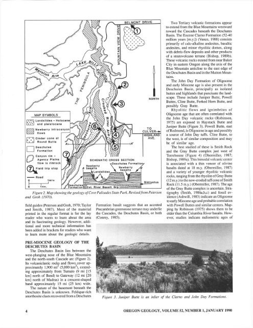
Rhyolitic flows and ignimbrites of<br />
Oligocene age that are often correlated with<br />
the John Day volcanic rocks -{Robinson,<br />
1975) are exposed in Haystack Butte and<br />
Juniper Butte (Figure 3). Powell Butte, east<br />
of Redmond, is Oligocene in age and possibly<br />
a source of John Day tuffs. Cline Butte. to<br />
the west, is of similar composition and may<br />
be of similar age.<br />
The best studied of these is Smith Rock<br />
and the Gray Butte complex just west of<br />
Terrebonne (Figure 4) (Obenniller, 1987:<br />
Bishop, 1989a). This bimodal volcanic center<br />
is associated with a thin veneer of olivine<br />
basalts dated at 18 m.y. (Obenniller, 1987)<br />
and a variety of younger rhyolitic volcanic<br />
rocks, ranging from the rhyolite of Gray Butte<br />
(12 m.y.) to the now-eroded lUff cone of Smith<br />
Rock (11.5 m.y.) (Obermiller, 1987), The age<br />
of the Gray BUlle complex is uncertain. Stratigraphy<br />
(Smith. 1986a,b,c) and fossil evidence<br />
(Ashwill, 1983) indicate an Oligocene<br />
to early Miocene age and probable correlation<br />
with Powell Buttes and similar centers. Map·<br />
ping by Robinson (1975) shows them to be<br />
older than the Columbia River basalts. How·<br />
ever, studies indicate radiometric ages of<br />
PRE-MIOCENE GEOLOGY OF THE<br />
DESCHUTES BASIN<br />
The Deschutes Basin lies between the<br />
west·plunging nose of the Blue Mountains<br />
and the nonh-south Cascade arc (Figure 2).<br />
Its volcaniclastic rocks and flows cover ap·<br />
proximately 1,900 mi 2 (5,000 km 2 ), extend·<br />
ing approximately from Tumalo (9 mi [15<br />
km] nonh of Bend) to Gateway (12 mi 120<br />
km] nonh of Madras) in a crescent-shaped<br />
band approximately 15 mi (25 km) wide.<br />
The nature of the basement beneath the<br />
Deschutes Basin is unknown. Feldspar·rich<br />
anonhosite clasts recovered from a Deschutes<br />
Figure 3. Juniper BUlle is an inlier oj the Clarno and John Day Formatiolls.<br />
4<br />
OREGON GEOLOGY, VOLUME 52, NUMBER I, JANUARY 1990


