Work on the Apache Pass Trail - Southern Trails Chapter
Work on the Apache Pass Trail - Southern Trails Chapter
Work on the Apache Pass Trail - Southern Trails Chapter

You also want an ePaper? Increase the reach of your titles
YUMPU automatically turns print PDFs into web optimized ePapers that Google loves.
groups – Ken and Pat headed west, while Neal, Cam,<br />
Brock, Levida, and Judy went east to meet up with<br />
Tracy and Richard. Rose Ann dropped Tracy and<br />
Richard off at a waypoint taken <strong>on</strong> <strong>the</strong> last trip. Tracy<br />
and Richard found plenty of rust and <strong>the</strong> trail was easy<br />
to follow. Quentin had told Tracy to look for <strong>the</strong> cairns<br />
that he had put <strong>on</strong> <strong>the</strong> trail and we saw plenty of <strong>the</strong>m.<br />
We started around 10:00 a.m. and were d<strong>on</strong>e by 2:00<br />
p.m. Everybody had found trail!<br />
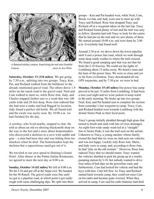
A flattened military canteen, found al<strong>on</strong>g <strong>the</strong> trail near Doubtful<br />
Cany<strong>on</strong>.<br />
photo by Ken White<br />
Saturday, October 13 (110 miles) We got going<br />
by 7:30 a.m., splitting into two groups. Tracy, Ken,<br />
Pat, and Richard walked from <strong>the</strong> bulldozer to <strong>the</strong><br />
already menti<strong>on</strong>ed gravel road. The o<strong>the</strong>rs drove 1.9<br />
miles <strong>on</strong> <strong>the</strong> ranch road to <strong>the</strong> gravel road. Neal and<br />
Cam walked to meet us, while Rose Ann, Judy, and<br />
Charles mapped fur<strong>the</strong>r east to a wash that was 100<br />
yards wide and 20 feet deep. Rose Ann radioed that<br />
she had seen a snake and had flagged its locati<strong>on</strong>.<br />
Judy found a perfect old bottle. We all found trail<br />
and <strong>the</strong> swale was easily seen. By 10:00 a.m. we<br />
had finished for <strong>the</strong> day.<br />
A cowboy, who lived nearby, stopped to chat. He<br />
told us about an old ox-shoeing blacksmith shop <strong>on</strong><br />
<strong>the</strong> way to <strong>the</strong> fort and a story about homesteaders<br />
who discovered a skelet<strong>on</strong> in a cave with saddle and<br />
gear – a man had been shot and was hiding from his<br />
attackers when he died. The homesteaders kept <strong>the</strong><br />
skelet<strong>on</strong> but a superstitious maid got rid of it.<br />
We traveled at our own speed to Deming’s Grand<br />
Hotel. After dinner at <strong>the</strong> Palma Italian Restaurant,<br />
we agreed to meet <strong>the</strong> next day at 8:00 a.m.<br />
Sunday, October 14 (62 miles) We left at 8:00 a.m.<br />
We hit I-10 and got off at <strong>the</strong> Separ exit. We headed<br />
for <strong>the</strong> 96 Ranch. The gravel roads were fine until<br />
we got to a pipeline road, at which point it got really<br />
rough with some challenging dips. We split into three<br />
Around 2:30 p.m. we drove down <strong>the</strong> lower pipeline<br />
until it met a power line road, which we took through<br />
some deep sandy washes to where <strong>the</strong> trail crossed.<br />
We found a good camping spot that was not that far<br />
from <strong>the</strong> I-10 freeway. We could see <strong>the</strong> lights of<br />
Lordsburg about 15 miles away. We heard a train and<br />
<strong>the</strong> hum of <strong>the</strong> power lines. We were so close and yet<br />
so far from civilizati<strong>on</strong>. Tracy downloaded all our<br />
GPS waypoints, and by 7:30 p.m. we were in bed.<br />
M<strong>on</strong>day, October 15 (45 miles) Our power line camp<br />
proved to be just 12 miles from Lordsburg. It had been<br />
a nice cool night and we wore jackets to keep warm<br />
in <strong>the</strong> early morning. We broke up into two groups.<br />
Neal, Ken, and Pat headed east to complete <strong>the</strong> secti<strong>on</strong><br />
from yesterday’s last waypoint to camp. Tracy, Cam,<br />
and Richard headed west towards Lordsburg with <strong>the</strong><br />
distant Steins Peak as <strong>the</strong>ir focal point.<br />
Tracy’s group initially plodded through high grass that<br />
turned to brush and sand with lots of cross drainages.<br />
An eight-foot-wide sandy wash led in a “straight”<br />
line to Steins Peak; it was <strong>the</strong> trail seen <strong>on</strong> <strong>the</strong> aerials.<br />
Unknown to Tracy, a young rancher, whose family<br />
owned <strong>the</strong> land that we were <strong>on</strong>, had seen our vehicles<br />
and was not happy. Luckily <strong>on</strong>ly Rose Ann, Marie,<br />
and Judy were in camp, and, according to Rose Ann,<br />
he had “pity <strong>on</strong> <strong>the</strong> old women.” However, Rose Ann<br />
radioed Tracy that we should return. Tracy wanted<br />
<strong>the</strong> vehicles shuttled to pick his group up at a nearby<br />
pumping stati<strong>on</strong> by I-10, but nobody wanted to drive<br />
four miles of bad dips <strong>on</strong> <strong>the</strong> powerline road, and<br />
fur<strong>the</strong>rmore, Cam had locked his vehicle and had <strong>the</strong><br />
keys with him. Cam left first. As Tracy and Richard<br />
started back towards camp, <strong>the</strong>y could not raise Cam<br />
<strong>on</strong> his radio and became quite worried. When <strong>the</strong>y<br />
arrived in camp, Cam said his radio batteries had died.<br />
Desert Tracks, December 2007 6