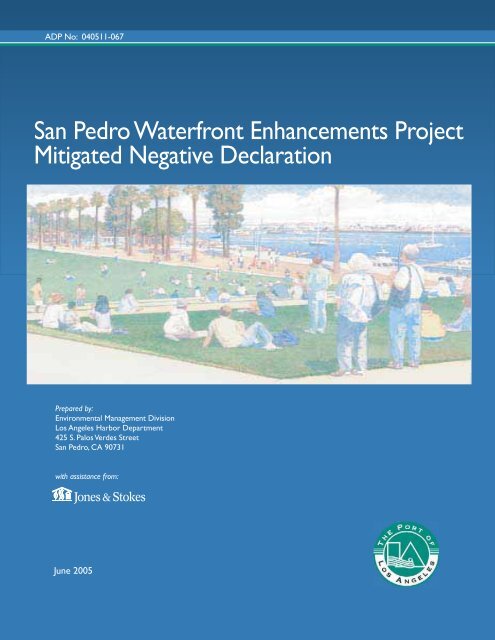
San Pedro Waterfront Enhancements Project Mitigated Negative ...
San Pedro Waterfront Enhancements Project Mitigated Negative ...
San Pedro Waterfront Enhancements Project Mitigated Negative ...

You also want an ePaper? Increase the reach of your titles
YUMPU automatically turns print PDFs into web optimized ePapers that Google loves.
ADP No: 040511-067<br />
<strong>San</strong> <strong>Pedro</strong> <strong>Waterfront</strong> <strong>Enhancements</strong> <strong>Project</strong><br />
<strong>Mitigated</strong> <strong>Negative</strong> Declaration<br />
Prepared by:<br />
Environmental Management Division<br />
Los Angeles Harbor Department<br />
425 S. Palos Verdes Street<br />
<strong>San</strong> <strong>Pedro</strong>, CA 90731<br />
with assistance from:<br />
June 2005
<strong>San</strong> <strong>Pedro</strong><br />
<strong>Waterfront</strong> <strong>Enhancements</strong> <strong>Project</strong><br />
<strong>Mitigated</strong> <strong>Negative</strong> Declaration<br />
ADP No. 040511-067<br />
Prepared by:<br />
Los Angeles Harbor Department<br />
Environmental Management Division<br />
425 S. Palos Verdes Street<br />
<strong>San</strong> <strong>Pedro</strong>, CA 90731<br />
Contact: Ralph G. Appy, Ph.D., Director<br />
c/o Jan Green Rebstock, Environmental Specialist<br />
Phone: (310) 732-3949<br />
With Assistance from:<br />
Jones & Stokes<br />
17310 Red Hill Avenue, Suite 320<br />
Irvine, CA 92614<br />
Contact: Brad Stoneman<br />
Phone: (949) 260-1080<br />
June 2005
Jones & Stokes. 2005. <strong>San</strong> <strong>Pedro</strong> <strong>Waterfront</strong> <strong>Enhancements</strong> <strong>Project</strong> <strong>Mitigated</strong> <strong>Negative</strong> Declaration.<br />
June. (J&S 04591) Irvine, CA. Prepared for the Los Angeles Harbor Department, <strong>San</strong> <strong>Pedro</strong>, CA.
Contents<br />
Page<br />
Chapter 1.0<br />
Chapter 2.0<br />
Introduction...........................................................................................1-1<br />
1.1 Overview........................................................................................1-1<br />
1.2 Authority.........................................................................................1-1<br />
1.3 Lead, Responsible, and Trustee Agencies ....................................1-2<br />
1.4 Scope of the Initial Study/<strong>Mitigated</strong> <strong>Negative</strong><br />
Declaration.....................................................................................1-3<br />
1.5 Impact Terminology .......................................................................1-3<br />
1.6 Availability of the IS/MND ..............................................................1-4<br />
<strong>Project</strong> Description...............................................................................2-1<br />
2.1 Introduction and Overview .............................................................2-1<br />
2.2 <strong>Project</strong> Location and Existing Conditions.......................................2-2<br />
2.2.1 Regional Context................................................................2-2<br />
2.2.2 Local Setting and Surrounding Land Uses.........................2-2<br />
2.3 <strong>Project</strong> Objectives..........................................................................2-4<br />
2.4 Proposed <strong>Project</strong> ...........................................................................2-4<br />
2.4.1 Harbor Boulevard Streetscape and Swinford<br />
Pedestrian Ramp ...............................................................2-4<br />
2.4.2 Downtown Plaza ................................................................2-5<br />
2.4.3 Ports O’Call........................................................................2-6<br />
2.4.4 Southern Pacific Slip..........................................................2-9<br />
2.4.5 Warehouse No. 1 Lookout Point ........................................2-9<br />
2.4.6 22nd Street Landing Area ................................................2-10<br />
2.4.7 Cabrillo Beach Improvements..........................................2-10<br />
2.5 Angels Walk LA Program.............................................................2-11<br />
2.6 Relationship with Other Plans and Policies .................................2-12<br />
2.6.1 Los Angeles General Plan—Port of Los<br />
Angeles Plan....................................................................2-12<br />
2.6.2 Port of Los Angeles Master Plan......................................2-13<br />
2.6.3 Port of Los Angeles <strong>San</strong> <strong>Pedro</strong> <strong>Waterfront</strong><br />
and Promenade Master Development Plan<br />
from the Bridge to the Breakwater ...................................2-14<br />
2.6.4 Los Angeles Zoning Ordinance........................................2-14<br />
2.6.5 Local Coastal Program.....................................................2-15<br />
2.6.6 Risk Management Plan....................................................2-15<br />
2.6.7 Water Quality Control Plan—Los Angeles<br />
River Basin.......................................................................2-16<br />
<strong>San</strong> <strong>Pedro</strong> Surface Improvements <strong>Project</strong> June 2005<br />
<strong>Mitigated</strong> <strong>Negative</strong> Declaration i<br />
J&S 04591
Los Angeles Harbor Department<br />
Contents<br />
2.6.8 Policy for Implementation of Toxic Standards<br />
for Inland Surface Waters, Enclosed Bays,<br />
and Estuaries of California...............................................2-16<br />
2.6.9 Clean Water Act—National Pollutant<br />
Discharge Elimination Systems........................................2-16<br />
2.6.10 Air Quality Management Plans.........................................2-17<br />
2.6.11 City of Los Angeles General Plan—Air Quality<br />
Element............................................................................2-18<br />
2.6.12 “No Net Increase” Air Quality Policy.................................2-18<br />
2.6.13 Tidelands Trust ................................................................2-20<br />
2.6.14 Congestion Management Program ..................................2-20<br />
Chapter 3.0 Environmental Checklist and Impact Analysis ..................................3-1<br />
Environmental Factors Potentially Affected............................................3-3<br />
Determination .........................................................................................3-3<br />
I. Aesthetics...........................................................................3-5<br />
II. Agricultural Resources.....................................................3-10<br />
III. Air Quality.........................................................................3-12<br />
IV. Biological Resources........................................................3-27<br />
V. Cultural Resources...........................................................3-36<br />
VI. Geology and Soils............................................................3-42<br />
VII. Hazards and Hazardous Materials...................................3-46<br />
VIII. Hydrology and Water Quality ...........................................3-51<br />
IX. Land Use and Planning....................................................3-60<br />
X. Mineral Resources ...........................................................3-63<br />
XI. Noise................................................................................3-64<br />
XII. Population and Housing...................................................3-72<br />
XIII. Public Services.................................................................3-73<br />
XIV. Recreation........................................................................3-75<br />
XV. Transportation/Traffic.......................................................3-76<br />
XVI. Utilities and Service Systems...........................................3-80<br />
XVII. Mandatory Findings of Significance .................................3-83<br />
Chapter 4.0 References ............................................................................................4-1<br />
4.1 Printed References ........................................................................4-1<br />
4.2 Personal Communications.............................................................4-5<br />
Chapter 5.0 List of Preparers ...................................................................................5-1<br />
5.1 Los Angeles Harbor Department ...................................................5-1<br />
5.2 Jones & Stokes..............................................................................5-1<br />
<strong>San</strong> <strong>Pedro</strong> Surface Improvements <strong>Project</strong> June 2005<br />
<strong>Mitigated</strong> <strong>Negative</strong> Declaration ii<br />
J&S 04591
Tables<br />
Table<br />
Page<br />
3-1 Inventory of Scenic Views in the <strong>San</strong> <strong>Pedro</strong> Area ..................................3-5<br />
3-2 State and National Ambient Air Quality Standards...............................3-14<br />
3-3 Ambient Air Quality Monitoring Data at the North Long<br />
Beach Station .......................................................................................3-15<br />
3-4 SCAQMD Daily Thresholds for Construction and<br />
Operational Emissions..........................................................................3-17<br />
3-5 Anticipated Construction Equipment.....................................................3-17<br />
3-6 Anticipated Construction Equipment by Phase.....................................3-18<br />
3-7 Construction Emissions Estimates .......................................... follows 3-24<br />
3-8 Operational Emissions Estimates.........................................................3-26<br />
3-9 City of Los Angeles Guidelines for Noise Compatible Land<br />
Use .......................................................................................................3-66<br />
3-10 Construction Equipment Noise Emission Levels ..................................3-68<br />
3-11 Estimated General Construction Noise Near an Active<br />
Construction Site ..................................................................................3-68<br />
3-12 Estimated General Construction Noise Near an Active Pile<br />
Driving Site ...........................................................................................3-69<br />
<strong>San</strong> <strong>Pedro</strong> Surface Improvements <strong>Project</strong> June 2005<br />
<strong>Mitigated</strong> <strong>Negative</strong> Declaration iii<br />
J&S 04591
Figures<br />
Figure<br />
Follows Page<br />
2-1 Regional Location...................................................................................2-2<br />
2-2 Local Vicinity...........................................................................................2-2<br />
2-3 <strong>Project</strong> Site and Surrounding Area .........................................................2-2<br />
2-4 Downtown Plaza.....................................................................................2-2<br />
2-5 Ports O'Call Area ....................................................................................2-2<br />
2-6 Southern Pacific Slip...............................................................................2-2<br />
2-7 22nd Street/Sampson Way and 200 West 22nd Street ..........................2-2<br />
2-8 Cabrillo Beach ........................................................................................2-4<br />
2-9 <strong>Project</strong> Concept Plan..............................................................................2-4<br />
2-10 Harbor Boulevard and Swinford Street Pedestrian Ramp ......................2-6<br />
2-11 Downtown Plaza Concept.......................................................................2-6<br />
2-12 Ports O'Call Village and SP Slip Improvements .....................................2-6<br />
2-13 Sampson Way and 22nd Street Parking.................................................2-6<br />
2-14 Berth 78 Pedestrian and Mudflat <strong>Enhancements</strong> ...................................2-8<br />
2-15 Berth 78 Existing Low Tide Conditions...................................................2-8<br />
2-16 Berth 78 Entrance Sign...........................................................................2-8<br />
2-17 Fishermen's Park and <strong>San</strong> <strong>Pedro</strong> Sign Concept ....................................2-8<br />
2-18 <strong>San</strong> <strong>Pedro</strong> Sign.......................................................................................2-8<br />
2-19 Artist Twilight Rendering of Sign from Fishermen's Park .......................2-8<br />
<strong>San</strong> <strong>Pedro</strong> Surface Improvements <strong>Project</strong> June 2005<br />
<strong>Mitigated</strong> <strong>Negative</strong> Declaration iv<br />
J&S 04591
Los Angeles Harbor Department<br />
Figures<br />
2-20 SP Slip Concept....................................................................................2-10<br />
2-21 SP Slip Concept Model.........................................................................2-10<br />
2-22 22nd Street Recreation and Parking Concept ......................................2-10<br />
2-23 Cabrillo Beach ......................................................................................2-10<br />
2-24 Angeles Walk Stanchion.......................................................................2-12<br />
2-25 Angel's Walk Map .................................................................................2-12<br />
2-26 Angel's Walk Stanchion Site List ..........................................................2-12<br />
3-1 Regional Faults and Geologic Structures .............................................3-44<br />
3-2 Liquefaction Hazard Areas ...................................................................3-44<br />
3-3 Location of Public Service Facilities .....................................................3-74<br />
<strong>San</strong> <strong>Pedro</strong> Surface Improvements <strong>Project</strong> June 2005<br />
<strong>Mitigated</strong> <strong>Negative</strong> Declaration v<br />
J&S 04591
Acronyms<br />
AB<br />
ACOE<br />
AQMP<br />
Basin Plan<br />
Board<br />
Bridge to Breakwater<br />
Bridge to Breakwater Plan<br />
CAAQS<br />
Cal EPA<br />
Caltrans<br />
CARB<br />
CEQA<br />
CERCLA<br />
CMP<br />
CNEL<br />
CO<br />
CPUC<br />
CRA<br />
dB<br />
dBA<br />
DFG<br />
DTSC<br />
EIR<br />
EPA<br />
Assembly Bill<br />
U.S. Army Corps of Engineers<br />
Air Quality Management Plan<br />
Water Quality Control Plan for Region 4, Los Angeles<br />
River Basin<br />
Board of Harbor Commissioners<br />
7 miles of <strong>San</strong> <strong>Pedro</strong>’s waterfront, from the Vincent<br />
Thomas Bridge to the Federal Breakwater<br />
<strong>San</strong> <strong>Pedro</strong> <strong>Waterfront</strong> and Promenade Master<br />
Development Plan from the Bridge to the Breakwater<br />
California Ambient Air Quality Standards<br />
California Environmental Protection Agency<br />
California Department of Transportation<br />
California Air Resources Board<br />
California Environmental Quality Act<br />
Comprehensive Environmental Response,<br />
Compensation, and Liability Act<br />
Congestion Management Program<br />
community noise equivalent level<br />
carbon monoxide<br />
California Public Utilities Commission<br />
City of Los Angeles Community Redevelopment<br />
Agency<br />
decibel<br />
A-weighting<br />
California Department of Fish and Game<br />
California Department of Toxic Substances Control<br />
environmental impact report<br />
U.S. Environmental Protection Agency<br />
<strong>San</strong> <strong>Pedro</strong> Surface Improvements <strong>Project</strong> June 2005<br />
<strong>Mitigated</strong> <strong>Negative</strong> Declaration vi<br />
J&S 04591
Los Angeles Harbor Department<br />
Acronyms<br />
FAA<br />
GCASWP<br />
General Plan<br />
IS/MND<br />
LADOT<br />
LADWP<br />
LAFD<br />
LAHD<br />
LAPD<br />
Los Angeles RWQCB<br />
LUST<br />
mgd<br />
MLLW<br />
MOA<br />
NAAQS<br />
NAAQS<br />
ND<br />
NNI Task Force<br />
NO 2<br />
NOx<br />
NPDES<br />
NPS<br />
O3<br />
OSHA)<br />
PA<br />
Pb<br />
PM10<br />
PMP<br />
Port<br />
Port Plan<br />
ROG<br />
SCAB<br />
SCAG<br />
SCAQMD<br />
SEAs<br />
Federal Aviation Administration<br />
General Construction Activities Stormwater Permit<br />
Los Angeles General Plan<br />
Initial Study/Proposed <strong>Mitigated</strong> <strong>Negative</strong> Declaration<br />
City of Los Angeles Department of Transportation<br />
Los Angeles Department of Water and Power<br />
City of Los Angeles Fire Department<br />
Los Angeles Harbor Department<br />
City of Los Angeles Police Department<br />
Los Angeles Regional Water Quality Control Board<br />
Leaking Underground Storage Tank<br />
million gallons per day<br />
Mean Lower Level Water<br />
Memorandum of Agreement<br />
National ambient air quality standards<br />
National Ambient Air Quality Standards<br />
negative declaration<br />
No Net Increase Task Force<br />
nitrogen dioxide<br />
oxides of nitrogen<br />
National Pollutant Discharge Elimination System<br />
National Park Service<br />
ozone<br />
Occupational Safety and Health Administration<br />
planning areas<br />
lead<br />
particulate matter 10 microns in diameter or less<br />
Port of Los Angeles Master Plan<br />
Port of Los Angeles<br />
Port of Los Angeles Plan<br />
reactive organic gases<br />
South Coast Air Basin<br />
Southern California Association of Government<br />
South Coast Air Quality Management District<br />
Significant Ecological Areas<br />
<strong>San</strong> <strong>Pedro</strong> Surface Improvements <strong>Project</strong> June 2005<br />
<strong>Mitigated</strong> <strong>Negative</strong> Declaration vii<br />
J&S 04591
Los Angeles Harbor Department<br />
Acronyms<br />
SIP<br />
SLC<br />
SLIC<br />
SO 2<br />
SP Slip<br />
SSHSP<br />
SWPPP<br />
SWRCB<br />
ULSD<br />
USCG<br />
USFWS<br />
WES<br />
ZIMAS<br />
state implementation plan<br />
State Lands Commission<br />
Spills, Leaks, Investigations, and Clean Ups Program<br />
sulfur dioxide)<br />
Southern Pacific Slip<br />
site-specific health and safety plan<br />
Storm Water Pollution Prevention Plan<br />
State Water Resources Control Board<br />
ultra low sulfur diesel<br />
U.S. Coast Guard<br />
U.S. Fish and Wildlife Service<br />
Waterways Experiment Station<br />
City of Los Angeles Department of City Planning Zone<br />
Information Mapping System<br />
<strong>San</strong> <strong>Pedro</strong> Surface Improvements <strong>Project</strong> June 2005<br />
<strong>Mitigated</strong> <strong>Negative</strong> Declaration viii<br />
J&S 04591
Chapter 1.0<br />
Introduction
Chapter 1.0<br />
Introduction<br />
1.1 Overview<br />
1.2 Authority<br />
The Los Angeles Harbor Department (LAHD) (also referred to as the Port of Los<br />
Angeles [Port]) has prepared this initial study/mitigated negative declaration<br />
(IS/MND) to evaluate the potential environmental consequences associated with<br />
the <strong>San</strong> <strong>Pedro</strong> <strong>Waterfront</strong> <strong>Enhancements</strong> <strong>Project</strong>. As part of the permitting<br />
process for LAHD, the proposed project is required to undergo an environmental<br />
review pursuant to the California Environmental Quality Act (CEQA).<br />
One of the main objectives of CEQA is to disclose the potential environmental<br />
effects of proposed activities to the public and the decision makers. Under<br />
CEQA, the lead agency prepares an IS to determine whether an environmental<br />
impact report (EIR), a negative declaration (ND), or MND is needed. LAHD is<br />
both the lead agency (Environmental Management Division) and applicant<br />
(Engineering Division) for the proposed project.<br />
The preparation of this IS/MND is governed by two principal sets of documents:<br />
CEQA (Public Resources Code Section 21000, et seq.) and the State CEQA<br />
Guidelines (California Code of Regulations Section 15000, et seq.). Specifically,<br />
Section 15063 of the State CEQA Guidelines guides the preparation of an IS and<br />
Sections 15070–15075 guide the process for the preparation of an MND. Where<br />
appropriate and supportive to an understanding of the issues, reference will be<br />
made either to the statute, the State CEQA Guidelines, or appropriate case law.<br />
This IS/MND contains all of the contents required by CEQA, including a project<br />
description, a description of the environmental setting, potential environmental<br />
impacts, mitigation measures for any significant impacts, discussion of the<br />
project’s consistency with plans and policies, and names of preparers.<br />
The mitigation measures included in this IS/MND are designed to reduce<br />
potentially significant environmental impacts below significant levels or<br />
eliminate the potentially significant environmental impacts described herein.<br />
Where a mitigation measure described in this document has been previously<br />
incorporated into the project, either as a specific feature of design or as a<br />
mitigation measure, this is noted in the discussion. Mitigation measures are<br />
<strong>San</strong> <strong>Pedro</strong> <strong>Waterfront</strong> <strong>Enhancements</strong> <strong>Project</strong> June 2005<br />
<strong>Mitigated</strong> <strong>Negative</strong> Declaration 1-1<br />
J&S 04951.04
Los Angeles Harbor Department<br />
Chapter 1.0 Introduction<br />
structured in accordance with the criteria in Section 15370 of the State<br />
CEQA Guidelines.<br />
1.3 Lead, Responsible, and Trustee Agencies<br />
LAHD is the lead agency for the project, pursuant to Section 15367 of the CEQA<br />
Guidelines, because it has the greatest degree of discretion to approve or deny the<br />
project. The approvals of permits include, but are not limited to, final design of<br />
public spaces and construction and demolition contracts.<br />
In addition to the lead agency, several other agencies have special roles with<br />
respect to the project as responsible or trustee agencies. These agencies will use<br />
this IS/MND as the basis for their decisions to issue any approvals and/or permits<br />
that may be required. The following responsible and trustee agencies may rely<br />
on this IS/MND in a review capacity or as a basis for issuance of permits for the<br />
project.<br />
Federal Agencies<br />
Federal Aviation Administration (FAA)<br />
NOAA Fisheries Service<br />
National Park Service (NPS)<br />
U.S. Army Corps of Engineers (ACOE)<br />
U.S. Fish and Wildlife Service<br />
State Agencies<br />
California Air Resources Board (CARB)<br />
California Coastal Commission<br />
California Department of Transportation (Caltrans)<br />
California Department of Toxic Substances Control (DTSC)<br />
California Environmental Protection Agency (Cal EPA)<br />
California Public Utilities Commission (CPUC)<br />
California Department of Fish and Game<br />
State Lands Commission (SLC)<br />
<strong>San</strong> <strong>Pedro</strong> <strong>Waterfront</strong> <strong>Enhancements</strong> <strong>Project</strong> June 2005<br />
<strong>Mitigated</strong> <strong>Negative</strong> Declaration 1-2<br />
J&S 04951
Los Angeles Harbor Department<br />
Chapter 1.0 Introduction<br />
Regional Agencies<br />
California Regional Water Quality Control Board, Los Angeles Region<br />
(Los Angeles RWQCB)<br />
South Coast Air Quality Management District (SCAQMD)<br />
Southern California Association of Governments (SCAG)<br />
Local Agencies<br />
City of Los Angeles Bureau of Engineering<br />
City of Los Angeles Bureau of <strong>San</strong>itation<br />
City of Los Angeles Community Redevelopment Agency (CRA)<br />
City of Los Angeles Department of Transportation (LADOT)<br />
City of Los Angeles Fire Department (LAFD)<br />
City of Los Angeles Police Department (LAPD)<br />
City of Los Angeles Department of Public Works<br />
1.4 Scope of the Initial Study/<strong>Mitigated</strong> <strong>Negative</strong><br />
Declaration<br />
This IS/MND evaluates the proposed project’s effects on the following resource<br />
topics:<br />
aesthetics,<br />
agricultural resources,<br />
air quality,<br />
biological resources,<br />
cultural resources,<br />
geology and soils,<br />
hazards and hazardous materials,<br />
hydrology and water quality,<br />
land use and planning,<br />
mineral resources,<br />
noise,<br />
population and housing,<br />
public services,<br />
recreation,<br />
transportation/traffic, and<br />
utilities and service systems.<br />
1.5 Impact Terminology<br />
A “significant environmental impact” is generally defined as a substantial<br />
adverse change to the environment. However, LAHD and other public agencies<br />
have identified applicable “thresholds of significance” for certain types of<br />
environmental impacts, such as traffic, noise, and air quality impacts. Thresholds<br />
<strong>San</strong> <strong>Pedro</strong> <strong>Waterfront</strong> <strong>Enhancements</strong> <strong>Project</strong> June 2005<br />
<strong>Mitigated</strong> <strong>Negative</strong> Declaration 1-3<br />
J&S 04951
Los Angeles Harbor Department<br />
Chapter 1.0 Introduction<br />
of significance for this project are based on the Los Angeles Draft CEQA<br />
Thresholds Guide, and are identified in this IS/MND where applicable. The<br />
following terminology is used to describe each impact’s level of significance:<br />
A finding of no impact is appropriate if the analysis concludes that the<br />
project would not affect the particular topic area in any way.<br />
An impact is considered less than significant if the analysis concludes that it<br />
would cause no substantial adverse change to the environment and requires<br />
no mitigation.<br />
An impact is considered less than significant with mitigation incorporated if<br />
the analysis concludes that it would cause no substantial adverse change to<br />
the environment with the inclusion of environmental commitments that have<br />
been agreed to by the applicant.<br />
An impact is considered potentially significant if the analysis concludes that<br />
it could have a substantial adverse effect on the environment.<br />
1.6 Availability of the IS/MND<br />
The IS/MND for the <strong>San</strong> <strong>Pedro</strong> <strong>Waterfront</strong> <strong>Enhancements</strong> <strong>Project</strong> was distributed<br />
directly to numerous agencies, organizations, and interested groups and persons<br />
for comment during the formal review period, which began on June 8, 2005 and<br />
ends on July 8, 2005. During the public review period, the IS/MND is available<br />
for review at the following locations:<br />
Los Angeles Harbor Department<br />
Environmental Management Division<br />
425 South Palos Verdes Street<br />
<strong>San</strong> <strong>Pedro</strong>, CA 90731<br />
Los Angeles Public Library Central Branch<br />
630 West 5 th Street<br />
Los Angeles, CA 90071<br />
Los Angeles Public Library<br />
<strong>San</strong> <strong>Pedro</strong> Branch<br />
921 South Gaffey Street<br />
<strong>San</strong> <strong>Pedro</strong>, CA 90731<br />
Los Angeles Public Library<br />
Wilmington Branch<br />
1300 North Avalon Boulevard<br />
Wilmington, CA 90744<br />
Long Beach Public Library<br />
Main Branch<br />
101 Pacific Avenue<br />
Long Beach, CA 90822<br />
<strong>San</strong> <strong>Pedro</strong> <strong>Waterfront</strong> <strong>Enhancements</strong> <strong>Project</strong> June 2005<br />
<strong>Mitigated</strong> <strong>Negative</strong> Declaration 1-4<br />
J&S 04951
Los Angeles Harbor Department<br />
Chapter 1.0 Introduction<br />
In addition to the printed copies noted above, the IS/MND is available in<br />
electronic format on the LAHD website located at:<br />
http://www.portoflosangeles.org/Environment_pn.htm.<br />
LAHD will receive public input on the IS/MND through written comments<br />
received at:<br />
LAHD Environmental Management Division<br />
425 South Palos Verdes Street<br />
<strong>San</strong> <strong>Pedro</strong>, CA 90731<br />
Attn: Dr. Ralph Appy<br />
Re: The <strong>San</strong> <strong>Pedro</strong> <strong>Waterfront</strong> <strong>Enhancements</strong> <strong>Project</strong><br />
In addition, comments may be sent via email to: jgreenrebstock@portla.org.<br />
Requests for additional information can be directed to 310/732-3675.<br />
<strong>San</strong> <strong>Pedro</strong> <strong>Waterfront</strong> <strong>Enhancements</strong> <strong>Project</strong> June 2005<br />
<strong>Mitigated</strong> <strong>Negative</strong> Declaration 1-5<br />
J&S 04951
Chapter 2.0<br />
<strong>Project</strong> Description
Chapter 2.0<br />
<strong>Project</strong> Description<br />
2.1 Introduction and <strong>Project</strong> Overview<br />
The <strong>San</strong> <strong>Pedro</strong> <strong>Waterfront</strong> <strong>Enhancements</strong> <strong>Project</strong> consists of:<br />
the improvement of existing and construction of new pedestrian walks and<br />
plazas (4 acres),<br />
green public open spaces (10 acres),<br />
associated parking (approximately 11 acres),<br />
two upland pedestrian linkages,<br />
landscaping between Port waterfront attractions,<br />
streetscape and street intersection improvements, and<br />
installation of a pedestrian rail crossing.<br />
The proposed project area is 44.5 acres and begins at the intersection of Harbor<br />
Boulevard and Swinford Avenue and ends at the Fisherman’s Pier near Cabrillo<br />
Beach. This chapter provides a description of:<br />
existing conditions for the region, project site, and surrounding areas;<br />
objectives of the proposed project;<br />
project elements; and<br />
the project’s relationship to existing plans and policies.<br />
Planning for the revitalization of <strong>San</strong> <strong>Pedro</strong>’s waterfront has been ongoing for<br />
many years, beginning with the <strong>Waterfront</strong> Promenade & Interface Report<br />
released in May 2002, the Urban Land Institute Advisory Services Report in<br />
September 2002, and the Port Community Advisory Committee Coordinated<br />
Framework Plan in June 2003. Most recently, LAHD has proposed the <strong>San</strong><br />
<strong>Pedro</strong> <strong>Waterfront</strong> and Promenade Master Development Plan from the Bridge to<br />
the Breakwater (Bridge to Breakwater Plan), which the Los Angeles Board of<br />
Harbor Commissioners (Board) received for consideration in September 2004.<br />
The Bridge to Breakwater Plan encompasses 7 miles of <strong>San</strong> <strong>Pedro</strong>’s waterfront,<br />
from the Vincent Thomas Bridge to the Federal Breakwater at Cabrillo Beach<br />
<strong>San</strong> <strong>Pedro</strong> <strong>Waterfront</strong> <strong>Enhancements</strong> <strong>Project</strong> June 2005<br />
<strong>Mitigated</strong> <strong>Negative</strong> Declaration 2-1<br />
J&S 04591
Los Angeles Harbor Department<br />
Chapter 2.0 <strong>Project</strong> Description<br />
(Bridge to Breakwater). It is phased over 30 years and will soon undergo<br />
environmental review.<br />
A related project, the <strong>Waterfront</strong> Gateway Development <strong>Project</strong>, falls within the<br />
northern part of the Bridge to Breakwater <strong>Project</strong> area. The Board adopted the<br />
MND for this project in January 2004, and construction is expected to end in<br />
December 2005. The project contains the Cruise Ship Promenade, Gateway<br />
Plaza, and Pedestrian Parkway. It consists of 13.6 acres of waterfront promenade<br />
and plazas for walking, biking, skating, and other pedestrian activities.<br />
The <strong>San</strong> <strong>Pedro</strong> <strong>Waterfront</strong> <strong>Enhancements</strong> <strong>Project</strong> is a continuation of LAHD’s<br />
effort to improve existing pedestrian corridors along the waterfront, increase<br />
waterfront access from upland areas, create more open space, and improve<br />
vehicular safety. As discussed in Section 2.6.3 below, the elements of this<br />
project are consistent with LAHD’s proposed Bridge to Breakwater Plan.<br />
2.2 <strong>Project</strong> Location and Existing Conditions<br />
2.2.1 Regional Context<br />
The proposed project is located in the Port of Los Angeles, which is at the<br />
southern end of the city of Los Angeles. Figure 2-1 shows the regional location<br />
of the project site, and Figure 2-2 shows the local vicinity. The Port is composed<br />
of a diverse group of land uses, the primary being industrial, with substantial<br />
recreational and visitor-serving commercial components, such as cruise vessel<br />
terminals, small boat marinas, retail and tourist shops, sport fishing, and a<br />
recreational beach area. Approximately 300 commercial berths accommodate a<br />
variety of uses, ranging from individual commercial fishing to large container<br />
terminal storage. Activities at the Port include commercial fishing, recreation,<br />
tourism, the transfer of containerized goods, shipping of liquid bulk items such as<br />
petroleum products and industrial chemicals, and shipping of dry bulk items such<br />
as food, steel, and scrap metal.<br />
2.2.2 Local Setting and Surrounding Land Uses<br />
The project area is generally bounded by the Vincent Thomas Bridge to the north<br />
and Federal Breakwater to the south. The local project area, which includes the<br />
project site and surrounding areas, is shown in Figure 2-3. The proposed project<br />
area is located along the west side of the Port’s Main Channel, including:<br />
an area at the Harbor Boulevard/Swinford Avenue intersection,<br />
portions of Downtown Plaza (Figure 2-4),<br />
Ports O’ Call Village (Figure 2-5),<br />
Southern Pacific Slip (SP Slip) (Figure 2-6),<br />
22 nd Street/Sampson Way (Figure 2-7),<br />
<strong>San</strong> <strong>Pedro</strong> <strong>Waterfront</strong> <strong>Enhancements</strong> <strong>Project</strong> June 2005<br />
<strong>Mitigated</strong> <strong>Negative</strong> Declaration 2-2<br />
J&S 04591
5<br />
405<br />
BEVERLY<br />
HILLS<br />
101<br />
10<br />
10<br />
60<br />
LOS<br />
ANGELES<br />
SANTA<br />
MONICA<br />
90<br />
INGLEWOOD<br />
SOUTH G ATE<br />
WHITTIER<br />
DOWNEY<br />
1<br />
405<br />
HAWTHORNE<br />
110<br />
105<br />
COMPTON<br />
LYNWOOD<br />
710<br />
BELLFLOWER<br />
19<br />
5<br />
Los Angeles County<br />
Orange County<br />
REDONDO<br />
BEACH<br />
107<br />
TORRANCE<br />
110<br />
CARSON<br />
LAKEWOOD<br />
605<br />
91<br />
CYPRESS<br />
39<br />
213<br />
WILMINGTON<br />
47<br />
LONG BEACH<br />
22<br />
405<br />
P a c i f i c O c e a n<br />
PROJECT<br />
LOCATION<br />
SAN<br />
PEDRO<br />
Los Angeles<br />
Harbor<br />
Long Beach<br />
Harbor<br />
SEAL<br />
BEACH<br />
HUNTINGTON<br />
BEACH<br />
1<br />
0<br />
5<br />
10<br />
04591.04<br />
Source: Port of Los Angeles, 2002.<br />
Miles<br />
Figure 2-1<br />
Regional Location
PacificCoast Highway<br />
Gaffey St.<br />
110<br />
Figueroa St.<br />
Avalon Blvd.<br />
Harry Bridges Ave.<br />
WILMINGTON<br />
Anaheim St.<br />
Alameda St.<br />
103<br />
Dominguez Channel Channel<br />
CITY OF LOS ANGELES<br />
CITY OF LONG BEACH<br />
LONG<br />
BEACH<br />
SAN<br />
PEDRO<br />
Harbor<br />
Freeway<br />
John S. Gibson Blvd.<br />
West<br />
Basin<br />
Turning Basin<br />
East<br />
Basin<br />
T e r m i<br />
Seaside Ave.<br />
47<br />
Ocean Blvd.<br />
n a l I s l a n d<br />
1st St.<br />
47<br />
Long Beach<br />
Harbor<br />
9th St.<br />
Gaffey St.<br />
22nd St.<br />
Pacific Ave.<br />
Harbor Blvd.<br />
Crescent Ave.<br />
<strong>Project</strong> Area<br />
l<br />
Main Channel<br />
PIER 300<br />
PIER 400<br />
25th St.<br />
Los Angeles<br />
Harbor<br />
04591.04<br />
Point Fermin<br />
Source: Port of Los Angeles, 2002.<br />
Approximate Scale<br />
Kilometers<br />
0 .32 .64<br />
0 0.25<br />
Miles<br />
0.5<br />
Figure 2-2<br />
Local Vicinity
04591.04<br />
Source: Port of Los Angeles, 2003.<br />
Figure 2-3<br />
<strong>Project</strong> Site and Surrounding Area
04591.04<br />
Source: Port of Los Angeles, 2005.<br />
Figure 2-4<br />
Downtown Plaza
04591.04<br />
Source: Port of Los Angeles, 2005.<br />
Figure 2-5<br />
Ports O'Call Area
04591.04<br />
Source: Port of Los Angeles, 2005.<br />
Figure 2-6<br />
Southern Pacific Slip
04591.04<br />
Source: Port of Los Angeles, 2005.<br />
Figure 2-7<br />
22nd Street/Sampson Way<br />
and 200 West 22nd Street
Los Angeles Harbor Department<br />
Chapter 2.0 <strong>Project</strong> Description<br />
200 West 22 nd Street (near 22 nd Street Landing) (Figure 2-7),<br />
Cabrillo Marina and Cabrillo Beach areas (Figure 2-8), and<br />
various locations needed to implement the Angels Walk LA Program.<br />
More specifically, the project connects to existing and ongoing improvements at<br />
the northwest corner of the Swinford Avenue/Harbor Boulevard intersection and<br />
extends south of the existing parking area between 5 th Street and 7 th Street<br />
adjacent to Harbor Boulevard, along Nagoya Way, around the SP Slip, and down<br />
Signal Street. The project area continues west along 22 nd Street and then<br />
westerly along Shoshonean Drive to Cabrillo Beach and its eventual terminus at<br />
Fisherman’s Pier.<br />
Most of the proposed enhancements would occur along existing roadways and<br />
within existing pedestrian corridors and Port parking areas. Intersection<br />
improvements as well as other improvements to the Downtown Plaza area would<br />
occur between 5 th Street and 7 th Street, along Harbor Boulevard and Sampson<br />
Way, adjacent to Berths 83–86. This area contains existing uses, including the<br />
John S. Gibson Jr. Park and Merchant Marine Memorial, the Los Angeles<br />
Maritime Museum, the Ralph J. Scott Historic Fire Boat, Fire Station #112, and<br />
parking lots used to access these areas. Improvements would extend south from<br />
the Downtown Plaza along Sampson Way and Nagoya Way through a portion of<br />
Ports O’ Call and the adjacent parking lot bounded by the SP Slip to the south.<br />
Proposed improvements in this portion of the project area would occur within the<br />
large asphalt parking lot and adjacent to a number of small shops and restaurants<br />
next to the docks that are used for smaller private boats associated with<br />
Berths 74–81.<br />
Sidewalk improvements would extend north around the SP Slip and its associated<br />
berths, and then back southwesterly toward Sampson Way. The SP Slip provides<br />
docking opportunities to small private fishing vessels that sell seafood at the local<br />
Municipal fish market, which serves commercial interests. Utro’s Restaurant, the<br />
Fisherman’s Memorial, and Sampson Way are located at the head of the SP Slip.<br />
On the western end of the SP Slip where it joins with the Main Channel,<br />
proposed improvements would extend north along 22 nd Street to the existing Red<br />
Car Station No. 4 at the corner of Miner Street and 22 nd Street. Proposed<br />
improvements to the sidewalk also would continue south along Signal Street<br />
adjacent to the Westway Liquid Bulk Terminal and would terminate near the Los<br />
Angeles Warehouse No. 1 and Los Angeles Pilot Services buildings.<br />
Improvements would continue westerly along 22 nd Street adjacent to the<br />
22 nd Street Landing and across from associated restaurants, small shops, and boat<br />
docks within the Cabrillo Marina.<br />
Improvements would continue along the existing sidewalk southerly along<br />
Cabrillo Marina Drive and Shoshonean Road and would extend to Cabrillo<br />
Beach near the Cabrillo Museum, <strong>San</strong> <strong>Pedro</strong> Bathhouse, the lifeguard station, and<br />
the landside portion of Fisherman’s Pier.<br />
<strong>San</strong> <strong>Pedro</strong> <strong>Waterfront</strong> <strong>Enhancements</strong> <strong>Project</strong> June 2005<br />
<strong>Mitigated</strong> <strong>Negative</strong> Declaration 2-3<br />
J&S 04591
Los Angeles Harbor Department<br />
Chapter 2.0 <strong>Project</strong> Description<br />
2.3 <strong>Project</strong> Objectives<br />
The purpose of this project is to make pedestrian and vehicular safety<br />
improvements along the <strong>San</strong> <strong>Pedro</strong> waterfront and to meet the following<br />
objectives:<br />
provide attractive pedestrian connections from upland to the water and along<br />
the waterfront, between the Vincent Thomas Bridge to the Fisherman’s Pier<br />
at the federal breakwater;<br />
increase the amount of open space and the connectivity of existing public<br />
places and gathering spaces along the waterfront;<br />
provide alternative transportation opportunities to reduce vehicle trips; and<br />
enhance public access along the waterfront and provide informational<br />
signage and a wayfinding system to highlight local landmarks and points of<br />
interest.<br />
2.4 Proposed <strong>Project</strong><br />
The proposed project involves the following distinct elements:<br />
Harbor Boulevard streetscape and Swinford Pedestrian ramp;<br />
Downtown Plaza;<br />
Ports O’ Call, which includes the pedestrian access trail and railroad<br />
crossing, Paseo, Berth 78 and 13 th Street extension, and Fishermen’s Park;<br />
Southern Pacific Slip;<br />
Warehouse No. 1 lookout point;<br />
22 nd Street Landing area;<br />
Cabrillo Beach improvements; and<br />
Angel’s Walk LA Program.<br />
Figure 2-9 shows a project concept plan. Each element of the proposed project is<br />
described in greater detail below.<br />
2.4.1 Harbor Boulevard Streetscape and Swinford<br />
Pedestrian Ramp<br />
The proposed project would extend the streetscape and promenade<br />
enhancements, a part of the Port’s <strong>Waterfront</strong> Gateway <strong>Project</strong>, from 5 th Street to<br />
7 th Street on Harbor Boulevard. A new crosswalk would be provided at the north<br />
side of O’Farrell Street along Harbor Boulevard. Existing lighting and associated<br />
traffic signals from Swinford Avenue to 7 th Street would be upgraded.<br />
<strong>San</strong> <strong>Pedro</strong> <strong>Waterfront</strong> <strong>Enhancements</strong> <strong>Project</strong> June 2005<br />
<strong>Mitigated</strong> <strong>Negative</strong> Declaration 2-4<br />
J&S 04591
04591.04<br />
Source: Port of Los Angeles, 2005.<br />
Figure 2-8<br />
Cabrillo Beach
04591.04<br />
Source: Port of Los Angeles, 2005.<br />
Figure 2-9<br />
<strong>Project</strong> Concept Plan
Los Angeles Harbor Department<br />
Chapter 2.0 <strong>Project</strong> Description<br />
As part of these improvements, a new pedestrian ramp would be constructed at<br />
the southwest corner of Swinford Avenue and Harbor Boulevard (Figure 2-10).<br />
The new pedestrian pathway would be constructed on the small slope adjacent to<br />
the existing Caltrans Park-n-Ride area. The ramp would be compliant with<br />
standards set forth by the Americans with Disabilities Act (ADA) and would<br />
replace the existing pathway to provide enhanced connectivity between nearby<br />
upland residences and Port attractions. The ramp would consist of color-treated<br />
concrete, and new landscaping would be planted. Construction is scheduled from<br />
November 2005 to December 2005. The work would require excavation,<br />
contouring, and pouring of concrete.<br />
2.4.2 Downtown Plaza<br />
The overall goal of the improvements at the Downtown Plaza is to create a<br />
revitalized, attractive, and easily accessible pedestrian-oriented plaza in front of<br />
the Maritime Museum and to enhance the pedestrian connectivity throughout the<br />
area. Figure 2-11 shows these improvements, for which construction is<br />
scheduled to begin in January 2006 and conclude in August 2006. The<br />
improvements would include a plaza between 5 th Street and 6 th Street from<br />
Harbor Boulevard to the waters’ edge. The plaza would create a town-square<br />
feel in front of and adjacent to the Maritime Museum. Sidewalks would be<br />
widened by approximately 5 feet along Sampson Way between 5 th Street and<br />
7 th Street. Parking area improvements would require grinding of the top 2 inches<br />
of concrete and replacement with colored concrete materials. All existing<br />
98 parking spaces in this area would remain after the parking lot is repaved.<br />
Curbs along the streets may be removed and replaced with low-profile rounded<br />
curbs. The crosswalks within the intersection at 6 th Street and Harbor Boulevard<br />
would be ground down and resurfaced with colored concrete. Demolition<br />
associated with this portion of the project would require removing approximately<br />
44,500 square feet of asphalt to a depth of 6 inches. Existing pedestrian<br />
walkways in the downtown area would be improved with new concrete<br />
treatments, and the surrounding hardscape would be removed and replaced with<br />
new landscaping. The project would require limited subsurface excavation to<br />
accommodate proposed improvements.<br />
Other related improvements along the waters’ edge include replacing the existing<br />
railing and shrubs next to the waterline with a fence design that would reflect the<br />
character of the Port. A portion of the pathway in this area may be made of<br />
decomposed granite to enhance the attractiveness of the area and encourage foot<br />
traffic to areas offering view opportunities. This pedestrian theme would extend<br />
south from the Downtown Plaza toward Berths 83–81 along the waterfront<br />
toward the Ports O’ Call area.<br />
Additional project elements in this portion of the project area include painting the<br />
existing topsail building, upgrading portions of the surrounding fence, re-grading<br />
surrounding hardscape, and installing a graphic display.<br />
<strong>San</strong> <strong>Pedro</strong> <strong>Waterfront</strong> <strong>Enhancements</strong> <strong>Project</strong> June 2005<br />
<strong>Mitigated</strong> <strong>Negative</strong> Declaration 2-5<br />
J&S 04591
Los Angeles Harbor Department<br />
Chapter 2.0 <strong>Project</strong> Description<br />
2.4.3 Ports O’ Call<br />
<strong>Enhancements</strong> within and near the Ports O’ Call area are designed to improve<br />
pedestrian access and the attractiveness of the area (see Figure 2-12). One<br />
project element includes formalizing the existing trail near Bloch Field on the<br />
bluff across 13 th Street and Sampson Way, as well as expanding the existing park<br />
area at the south end of Ports O’ Call. All project components are intended to<br />
increase public access to the waterfront, Red Car lines, viewing opportunities,<br />
and passive recreation areas. <strong>Enhancements</strong> in this area would require the<br />
relocation of 275 parking spaces from Ports O’ Call. Construction of these<br />
improvements would occur from January 2006 to May 2007.<br />
Other project components in the Ports O’ Call Village area include the removal<br />
of the bus pad, undergrounding of existing overhead utility lines within the<br />
Fishermen’s Park area, and removal of the low wall that surrounds the Ports O’<br />
Call Village parking lot.<br />
Approximately 2,275 parking spaces serve the Ports O’ Call area. A total of<br />
approximately 275 of these spaces would be relocated. Removal and relocation<br />
of parking is needed due to the realignment of Nagoya Way, the Fishermen’s<br />
Park expansion, and the extension of 13 th Street through the Ports O’ Call parking<br />
lot to Red Car Station No. 3. The parking spaces would be relocated to a<br />
currently dirt and gravel parking area at Sampson Way and 22 nd Street that is<br />
used for event parking. The unimproved lot would be upgraded and would<br />
provide approximately 700 parking spaces (see Figure 2-13). The additional<br />
425 spaces included in the parking area would serve as available event parking<br />
and would accommodate Ports O’ Call patrons on weekends, when parking<br />
demand is high.<br />
Pedestrian Access Trail and Railroad Crossing<br />
This project element includes upgrading the unimproved downslope trail near<br />
Bloch Field from Harbor Boulevard to the 13 th Street/Sampson Way intersection<br />
and installing a pedestrian railroad crossing. The trail would improve pedestrian<br />
safety and waterfront access and would be ADA-compliant. These upland<br />
connections would provide direct and quick access to Red Car Station No. 3, and<br />
to the proposed extension of 13 th Street. This extension would be a 25-foot-wide<br />
tree-lined vehicular and pedestrian corridor that would bisect the Ports O’ Call<br />
Village parking lot and connect the proposed improvements located near the<br />
“Utro’s at the Warf” restaurant to waterfront areas.<br />
Paseo<br />
The Paseo, a multi-surfaced pedestrian pathway, would be extended on the west<br />
side of the existing shops within Ports O’ Call Village. The Paseo would require<br />
removal of approximately 187,000 square feet of asphalt and concrete to a depth<br />
of 4 inches. Landscaping themes along the Paseo would be consistent with other<br />
<strong>San</strong> <strong>Pedro</strong> <strong>Waterfront</strong> <strong>Enhancements</strong> <strong>Project</strong> June 2005<br />
<strong>Mitigated</strong> <strong>Negative</strong> Declaration 2-6<br />
J&S 04591
04591.04<br />
Source: Port of Los Angeles, 2005.<br />
Figure 2-10<br />
Harbor Boulevard and Swinford Street Pedestrian Ramp
04591.04<br />
Source: EDAW, 2004.<br />
Figure 2-11<br />
Downtown Plaza Concept
04591.04<br />
Source: EDAW, 2005.<br />
Figure 2-12<br />
Ports O'Call Village and SP Slip Improvements
04591.04<br />
Source: Port of Los Angeles, 2005.<br />
Figure 2-13<br />
Sampson Way and 22nd Street Parking
Los Angeles Harbor Department<br />
Chapter 2.0 <strong>Project</strong> Description<br />
Ports O’ Call Village improvements and other planting patterns along the<br />
promenade.<br />
To facilitate the Paseo, Nagoya Way would be relocated and realigned 20 to 40<br />
feet west into the existing parking lot. The street would be re-striped and would<br />
require the removal of approximately 75 parking spaces (the first portion of the<br />
275 spaces to be relocated as noted above). The surface would not require<br />
substantial grinding or repaving. Storm drains would be relocated to the new<br />
Nagoya Way and curbs may be replaced. The existing north restroom building<br />
would be remodeled and upgraded, and the southern restroom would be removed<br />
and replaced by four additional restroom buildings along the Paseo.<br />
Berth 78 and 13 th Street Extension<br />
<strong>Enhancements</strong> at Berth 78, an existing mudflat area, include constructing two<br />
new piers (one 20 feet wide and one 30 feet wide) from the new Paseo out to the<br />
pierhead line in the Main Channel (See Figure 2-14). The intent of these piers is<br />
to encourage public access to the waterfront and directly enhance view<br />
opportunities. The southern pier width of 30 feet is consistent with the proposed<br />
Bridge to Breakwater Plan, which envisions a future harbor on each side of the<br />
southern pier, so the width of the pier is large enough to accommodate<br />
pedestrians and any equipment or vehicles needed to service boats at dock. Pier<br />
construction would require the installation of additional concrete piles and the<br />
installation of a new seawall approximately 70 feet west of the existing wooden<br />
bulkhead. The areal extent of the existing mudflat would remain the same, and<br />
the wooden bulkhead would remain in place. A public plaza with benches and<br />
landscaping would be built between the new piers, along the edge of the mudflat<br />
area.<br />
To mitigate the shading effect that the new piers would create along either side<br />
the mudflat, the area within the tidal zone would be enhanced (Figure 2-14).<br />
Within the mudflat area, existing rock in the southeast corner would be removed<br />
to expose mudflat substrate and would be relocated to the outer face of the<br />
existing protective rock dike (Figure 2-15). In addition, the sand built up in the<br />
northwest corner of the mudflat would be removed to bring the elevation of that<br />
area back down to the same elevation as the surrounding mudflat and expose<br />
more viable mudflat substrate. While the new piers would cover 1020 square<br />
feet of the existing mud flat, a minimum of 1120 square feet of open mudflat area<br />
would be improved, for a minimum net gain of 100 square feet of mudflat area.<br />
To improve connectivity to the existing Red Car Station No. 4 on Sampson Way,<br />
a pedestrian pathway and vehicular access road would be extended west from<br />
Berth 78 through the parking lot toward 13 th Street and Sampson Way. This<br />
improvement would require the removal of 75 parking spaces (the second portion<br />
of the 275 spaces to be relocated as noted above) and existing tree planters within<br />
the lot. Removal activities would involve grinding 14,300 square feet of asphalt<br />
to a depth of 4 inches. The entire parking lot would be re-striped.<br />
<strong>San</strong> <strong>Pedro</strong> <strong>Waterfront</strong> <strong>Enhancements</strong> <strong>Project</strong> June 2005<br />
<strong>Mitigated</strong> <strong>Negative</strong> Declaration 2-7<br />
J&S 04591
Los Angeles Harbor Department<br />
Chapter 2.0 <strong>Project</strong> Description<br />
Two berth identity signs, each approximately 20 feet tall, would announce and<br />
span the entrance to Berth 78. One sign, which is shown in Figure 2-16, would<br />
be located at the entrance to the Ports O’ Call parking area, at the intersection of<br />
Sampson Way and the 13 th Street extension. The second sign would be located at<br />
the foot of the 13 th Street extension, along the Paseo. The signs would be lower<br />
than existing structures and are intended to be visual focal points to draw<br />
attention to the adjacent shops, restaurants, and waterfront.<br />
Fishermen’s Park<br />
The existing park at the south end of Ports O’ Call would be expanded from<br />
1 acre to a total of 3.5 acres and would incorporate a 15-foot-tall landscaped<br />
earthen berm, landscaping, outdoor furniture, amphitheatre-style seating, and a<br />
water feature (Figure 2-17). The park would also include a new fixed pier at<br />
Berth 75. The pier would be approximately 25 feet wide and would extend out to<br />
the pierhead line in the Main Channel.<br />
Within Fishermen’s Park, a lighted sign within a metal frame would be placed on<br />
a paved portion of the earthen berm. The sign would be 40 feet high and 60 feet<br />
wide and at its highest point would rise approximately 55 feet above the existing<br />
grade (Figure 2-18). The sign’s frame would feature a lattice design with wide<br />
spaces between the metal supports. The sign would contain lettering on both<br />
sides, reading “Port of Los Angeles” facing south toward the Main Channel and<br />
“<strong>San</strong> <strong>Pedro</strong> Fishermen’s Park” facing north toward the park. The east- and<br />
west-facing ends of the sign would feature banner-style signage. The sign would<br />
be elevated to make it visible above the existing fuel tanks adjacent to the park<br />
on the south. The intent is for the sign to be an entry monument to the Port and<br />
to be seen from the Main Channel as ships enter. On the landward side, the sign<br />
would act as a backdrop to the park, screening the surrounding industrial uses.<br />
The sign would be illuminated at night to welcome visitors to the Port<br />
(Figure 2-19). The lighting would consist of 12- to 18-inch-deep aluminum<br />
channel lettering with inset clear acrylic face and interior neon illumination. The<br />
lighting on the sign would be turned off at midnight to coincide with the lighting<br />
on the Vincent Thomas Bridge. The sign lighting may also stay on longer than<br />
midnight for special events.<br />
Other project elements within this area include benches and informal block and<br />
light boxes for seating, new lighting standards, concrete treatments, new<br />
landscaping, a storyboard, and public interest signage. These elements would<br />
make the site more inviting to visitors and patrons.<br />
Expansion of the park would require the removal of approximately 125 parking<br />
spaces (the final portion of the 275 spaces to be relocated as noted above) and<br />
demolition of three existing wooden commercial structures occupied by small<br />
private retail shops. The shops are on a platform supported by pilings over the<br />
water and comprise a total area of 5,545 square feet. The pilings buried in the<br />
bottom under the water would remain in place, but the wharf deck would be<br />
removed. The existing restroom within the park would be demolished and rebuilt<br />
at a nearby location. The park would be designed for daily pedestrian use and<br />
<strong>San</strong> <strong>Pedro</strong> <strong>Waterfront</strong> <strong>Enhancements</strong> <strong>Project</strong> June 2005<br />
<strong>Mitigated</strong> <strong>Negative</strong> Declaration 2-8<br />
J&S 04591
04591.04<br />
Source: Port of Los Angeles, 2005.<br />
Figure 2-14<br />
Berth 78 Pedestrian and Mudflat <strong>Enhancements</strong>
04591.04<br />
Source: Port of Los Angeles, 2005.<br />
Figure 2-15<br />
Berth 78 Existing Low Tide Conditions
04591.04<br />
Source: EDAW, 2005.<br />
Figure 2-16<br />
Berth 78 Entrance Sign
04591.04<br />
Source: EDAW, 2005.<br />
Figure 2-17<br />
Fishermen's Park and<br />
<strong>San</strong> <strong>Pedro</strong> Sign Concept
04591.04<br />
Source: EDAW, 2005.<br />
Figure 2-18<br />
<strong>San</strong> <strong>Pedro</strong> Sign
04591.04<br />
Source: Selbert Perkins Design, 2005.<br />
Figure 2-19<br />
Artist Twilight Rendering of Sign from Fishermen's Park
Los Angeles Harbor Department<br />
Chapter 2.0 <strong>Project</strong> Description<br />
would also act as an event space, accommodating small and large events for up to<br />
3,500 people.<br />
2.4.4 Southern Pacific Slip<br />
<strong>Enhancements</strong> adjacent to the SP Slip would consist of pedestrian walkway<br />
improvements with lighting and graphics, such as storyboards and point-ofinterest<br />
signs. Figures 2-20 and 2-21 show the proposed improvements, for<br />
which construction is scheduled to occur from July 2006 to November 2006.<br />
The pedestrian walkway would extend from the southern terminus of the SP Slip<br />
near Berth 72 west to the existing Red Car Station No. 4. It would surround the<br />
slip and would be approximately 10 feet wide to accommodate pedestrians and to<br />
facilitate the fishing fleet’s continued use of the area for dockside work.<br />
Walkway improvements would require grinding and resurfacing the area<br />
surrounding the SP Slip, which would result in the excavation of approximately<br />
25,000 square feet of asphalt to a depth of 2 inches. Landscaping improvements<br />
would be made between the SP Slip and parking lot, and interpretive signage and<br />
new lighting would be constructed for the walkway. Two existing restrooms<br />
along the SP Slip would also be upgraded.<br />
As part of the waterfront enhancements, a plaza and landscaping would be<br />
created at the head of the SP Slip to enhance this existing gathering area.<br />
Adjacent to the “Utro’s at the Warf” restaurant, a portion of the wharf deck at the<br />
head of the slip would be removed, the existing viewing platform would be<br />
improved, and the existing Fisherman’s Memorial would be maintained. The<br />
memorial would be incorporated into the proposed design, while the benches and<br />
concrete steps would be removed and ultimately replaced with a new landing.<br />
Within the SP Slip, 30 floating docks would be installed to improve access to<br />
fishing vessels. Each dock would be up to 11 meters long, and new pilings<br />
would not be constructed. The existing hardscape would be regraded, and<br />
handicap access would be maintained. Approximately 2,000 square feet of the<br />
existing wharf deck at the head of the slip would be removed to improve the<br />
views of the slip. A small pedestrian bridge may also be constructed over the<br />
water to connect the new landing with the remaining wharf deck. No piles would<br />
be removed from the water. Improvements would result in a more attractive and<br />
easily accessible gathering place.<br />
2.4.5 Warehouse No. 1 Lookout Point<br />
Pedestrian improvements would extend from the southern boundary of the<br />
SP Slip, south along Signal Street from its intersection with 22 nd Street, and to<br />
the waterline south of Warehouse No. 1. In addition, a viewing pier would<br />
extend over the existing riprap. No pile driving would be required. The work<br />
would require the removal of approximately 25,000 square feet of asphalt and<br />
concrete to a depth of 2 to 4 inches. Existing paving would be replaced with<br />
<strong>San</strong> <strong>Pedro</strong> <strong>Waterfront</strong> <strong>Enhancements</strong> <strong>Project</strong> June 2005<br />
<strong>Mitigated</strong> <strong>Negative</strong> Declaration 2-9<br />
J&S 04591
Los Angeles Harbor Department<br />
Chapter 2.0 <strong>Project</strong> Description<br />
colored asphalt concrete consistent with other parts of the project. Construction<br />
is scheduled to occur from July 2006 to January 2007.<br />
2.4.6 22 nd Street Landing Area<br />
The project components near the 22 nd Street Landing at 200 West 22 nd Street<br />
would consist of green open space, parking, and pedestrian improvements. Grass<br />
would cover 7.8 acres, and 4.4 acres of decomposed granite would be used as<br />
walkways and to define individual spaces in the area. The new parking area<br />
would be a total of 5.9 acres, located on the western portion of the 22 nd Street<br />
Landing area in two separate lots that would contain 450 and 350 spaces,<br />
respectively. The parking area would serve visitors to the open space area and<br />
patrons of nearby establishments. The functionality of this lot would be<br />
enhanced by a pedestrian walkway along 22 nd Street and crosswalks across 22 nd<br />
Street and Harbor Boulevard that would provide direct access to and from the<br />
parking area to nearby establishments and Red Car Station No. 4. The existing<br />
hardscape would be ground and resurfaced with stamped colored concrete and<br />
landscaping would be incorporated. Figure 2-22 shows the location of these<br />
proposed improvements, which would be constructed from February 2006 to<br />
April 2006.<br />
2.4.7 Cabrillo Beach Improvements<br />
<strong>Waterfront</strong> enhancements would be constructed near and within the Cabrillo<br />
Beach area. Figure 2-23 shows the location of these improvements, which would<br />
be constructed from January 2007 to July 2007. Construction would include<br />
demolition of approximately 285,000 square feet of asphalt and would require<br />
removal to a depth of 2 to 4 inches. Landscaping improvements from the<br />
intersection of Shoshonean Way and 22 nd Street to Cabrillo Beach would cover<br />
approximately 200,000 square feet. Changes to existing hardscape would consist<br />
of improvements to the 8-foot-wide pedestrian pathway, and other landscaping<br />
would be planted along Shoshonean Way, but not extending up the existing<br />
slope.<br />
Improvements to the existing sidewalk along Cabrillo Beach would result in a<br />
30- to 60-foot-wide walkway. The walkway would taper to a 20-foot-wide<br />
walkway as the pathway approaches the fishing pier and Cabrillo Beach<br />
Bathhouse. A hardscaped path would be constructed to facilitate travel between<br />
the beach and Cabrillo Marine Aquarium. Other proposed features include a<br />
low-lying mound between the walkway and parking lot. Landscaping<br />
improvements would extend toward the fishing pier and breakwater. Seat walls<br />
would be constructed between the beachfront walkway and the landscaped<br />
embankment. The seat walls would provide a sitting area with views of the<br />
beach and Port and would provide a wind buffer for nearby picnickers. All<br />
405 spaces within the parking area would remain.<br />
<strong>San</strong> <strong>Pedro</strong> <strong>Waterfront</strong> <strong>Enhancements</strong> <strong>Project</strong> June 2005<br />
<strong>Mitigated</strong> <strong>Negative</strong> Declaration 2-10<br />
J&S 04591
04591.04<br />
Source: Port of Los Angeles, 2005.<br />
Figure 2-20<br />
SP Slip Concept
04591.04<br />
Source: EDAW, 2005.<br />
Figure 2-21<br />
SP Slip Concept Model
04591.04<br />
Source: Port of Los Angeles, 2005.<br />
Figure 2-22<br />
22nd Street Recreation and Parking Concept
04591.04<br />
Source: Port of Los Angeles, 2005.<br />
Figure 2-23<br />
Cabrillo Beach
Los Angeles Harbor Department<br />
Chapter 2.0 <strong>Project</strong> Description<br />
Pedestrian improvements would continue seaward along the fishing pier.<br />
Improvements in this area would be located over the existing riprap and consist<br />
of a dual-level promenade, with an upper level corridor for passive recreation,<br />
such as walking, and a lower concourse for more active uses, such as<br />
roller-blading. The overall width of this area would be approximately 40 feet.<br />
The lower area would be paved over the existing riprap above the high-water<br />
mark, and the upper passive boardwalk with seat walls would be located adjacent<br />
to the parking area. Work in this area may require some pile installation in riprap<br />
areas to facilitate construction of the dual-level walkway.<br />
Improvements in this vicinity also include enhancing the vehicular/bus/boat/<br />
trailer parking area and re-striping the parking lot along the breakwater.<br />
Aesthetic improvements, such as new landscaping and replacement landscaping,<br />
would occur adjacent to and between the Cabrillo Marine Aquarium, Cabrillo<br />
Bathhouse, and Coast Guard facility. The existing playground would be<br />
removed and would be modernized and expanded with a new, child-friendly play<br />
surface and new play equipment.<br />
2.5 Angels Walk LA Program<br />
The Angels Walk LA Program is intended to highlight local landmarks and<br />
provide a clearly defined pedestrian corridor to enhance public access along the<br />
waterfront. As part of the program, stanchions would be placed at points of<br />
interest along the walk and would call out specific views from given locations<br />
and notable facts about the area. Figure 2-24 illustrates what the stanchions<br />
would look like, Figure 2-25 shows the proposed stanchion locations, and<br />
Figure 2-26 provides a list of walk sites. The LAHD would develop guidebooks<br />
for the Angels Walk LA Program. The guidebooks would be designed to help<br />
pedestrians along the self-guided tour and would be available at LAHD offices,<br />
various restaurants, attractions within the <strong>San</strong> <strong>Pedro</strong> area, and online. Stanchions<br />
within the contiguous project area would be placed at the following locations:<br />
World Cruise Center,<br />
Pacific Coast Electric Red Car Line,<br />
the Ralph J. Scott,<br />
Los Angeles Maritime Museum,<br />
John S. Gibson Jr. Park,<br />
Ports O’ Call Village,<br />
SP Slip,<br />
Timm’s Point and Landing,<br />
Municipal Fish Market,<br />
Warehouse No. 1 lookout point,<br />
Cabrillo Marina,<br />
<strong>San</strong> <strong>Pedro</strong> <strong>Waterfront</strong> <strong>Enhancements</strong> <strong>Project</strong> June 2005<br />
<strong>Mitigated</strong> <strong>Negative</strong> Declaration 2-11<br />
J&S 04591
Los Angeles Harbor Department<br />
Chapter 2.0 <strong>Project</strong> Description<br />
Cabrillo Marine Aquarium, and<br />
Cabrillo Beach Bathhouse.<br />
Stanchions for other surface improvements would be placed in locations outside<br />
the area but would also be included in the Angels Walk LA Program. These<br />
areas include:<br />
Liberty Hill,<br />
Warner Grand Theater,<br />
<strong>San</strong> <strong>Pedro</strong> Municipal Building,<br />
<strong>San</strong> <strong>Pedro</strong> Main U.S. Post Office,<br />
Fort McArthur, and<br />
S.S. Lane Victory.<br />
2.6 Relationship with Other Plans and Policies<br />
CEQA requires that an IS include a discussion regarding the project’s<br />
consistency with existing plans and policies. The following summary provides a<br />
brief discussion of the project’s consistency with plans and policies that have<br />
jurisdiction over the project. Additional analysis of the project’s consistency<br />
with relevant plans and policies is contained in Chapter 3, Environmental<br />
Checklist, under Land Use and Planning.<br />
2.6.1 Los Angeles General Plan—Port of Los<br />
Angeles Plan<br />
The Los Angeles General Plan (General Plan) is the fundamental policy<br />
document of the City of Los Angeles, as it defines the framework by which the<br />
city’s physical and economic resources are to be managed and used over time.<br />
The General Plan contains a series of 35 community plans that are intended to<br />
promote an arrangement of land uses, streets, and services. The Port of Los<br />
Angeles Plan (Port Plan) is the community plan that applies to the project area. It<br />
provides precise land use designations and determinations of goals, objectives,<br />
policies, programs, and planning decisions that pertain to the Port (City of Los<br />
Angeles 1982).<br />
The Port Plan, adopted in 1982, is an element of the General Plan, and was<br />
created to be consistent with the Port of Los Angeles Master Plan (PMP). It is<br />
intended to provide a 20-year official guide to the continued development and<br />
operation of the Port. The Port Plan describes major land use categories that<br />
encompass the unique nature of Port operations and development. The land uses<br />
for the proposed development site and surrounding area are designated as having<br />
“Commercial/Industrial” land uses with provisions for general and bulk cargo<br />
involving non-hazardous materials.<br />
<strong>San</strong> <strong>Pedro</strong> <strong>Waterfront</strong> <strong>Enhancements</strong> <strong>Project</strong> June 2005<br />
<strong>Mitigated</strong> <strong>Negative</strong> Declaration 2-12<br />
J&S 04591
04591.04<br />
Source: Port of Los Angeles, 2002.<br />
Figure 2-24<br />
Angeles Walk Stanchion
04591.04<br />
Source: Port of Los Angeles, 2002.<br />
Figure 2-25<br />
Angel's Walk Map
04591.04<br />
Source: Port of Los Angeles, 2005.<br />
Figure 2-26<br />
Angel's Walk Stanchion Site List
Los Angeles Harbor Department<br />
Chapter 2.0 <strong>Project</strong> Description<br />
Because of the nature of the project, a pedestrian promenade with streetscape<br />
improvements, it would not be subject to General Plan land-use designations.<br />
2.6.2 Port of Los Angeles Master Plan<br />
The PMP guides development within the Port and was most recently amended in<br />
July 2002. The PMP designates nine individual planning areas (PAs). Elements<br />
of the proposed project are located within PA 1 (West Channel/Cabrillo Beach),<br />
PA 2 (West Bank), and PA 3 (West Turning Basin). These PAs are described<br />
below.<br />
Planning Area 1<br />
The West Channel/Cabrillo Beach area is located in the extreme southwest<br />
portion of the Los Angeles Harbor. It is bounded by the main breakwater on the<br />
south, 22 nd Street on the north, Miner Street on the east, and the Lower Bluff of<br />
Fort Macarthur on the west. It includes the inner Cabrillo Beach, the Lower<br />
Reservation of Fort Macarthur, and lands immediately adjacent to the West<br />
Channel and Watchorn Basin. Land uses for PA 1 include “Recreation,”<br />
“Industrial (light),” “Liquid Bulk,” “General Cargo,” and “Other.”<br />
Planning Area 2<br />
The West Bank is located generally west of the Los Angeles Harbor Main<br />
Channel and south of an extended 4 th Street. Its westerly boundary runs south<br />
along Harbor Boulevard, from 4 th Street to 17 th Street. It then curves along<br />
Crescent Avenue, returns along 22 nd Street, and continues south along Miner<br />
Street to the tip of the Watchorn Basin peninsula on its western side. The PMP<br />
identifies the land uses for PA 2 as “General Cargo,” “Liquid Bulk,” “Dry Bulk,”<br />
“Commercial Fishing,” “Commercial,” “Recreation,” “Institutional,”<br />
“Industrial,” and “Other.”<br />
Planning Area 3<br />
The West Turning Basin area extends from Berth 87 on the south to Berth 115 on<br />
the north. Berths 87–95 interface the Main Channel, Berths 96–98 border the<br />
Turning Basin, and Berths 100–115 belong to the West Basin. The <strong>San</strong> <strong>Pedro</strong><br />
district of the city of Los Angeles bounds PA 3 on the west. The PMP identifies<br />
land uses for PA 3 as “General Cargo,” “Liquid Bulk,” “Commercial,”<br />
“Institutional,” “Industrial,” and “Other.”<br />
The proposed development for this project is consistent with the land uses<br />
identified in the PMP for each of the three PAs in which project elements are<br />
located.<br />
<strong>San</strong> <strong>Pedro</strong> <strong>Waterfront</strong> <strong>Enhancements</strong> <strong>Project</strong> June 2005<br />
<strong>Mitigated</strong> <strong>Negative</strong> Declaration 2-13<br />
J&S 04591
Los Angeles Harbor Department<br />
Chapter 2.0 <strong>Project</strong> Description<br />
2.6.3 Port of Los Angeles <strong>San</strong> <strong>Pedro</strong> <strong>Waterfront</strong> and<br />
Promenade Master Development Plan from the<br />
Bridge to the Breakwater<br />
On September 29, 2004, the Board received and considered the proposed Bridge<br />
to Breakwater Plan. Then the Board directed staff to begin the environmental<br />
review process in accordance with CEQA and the National Environmental Policy<br />
Act. An EIS/EIR for the proposed plan is expected to be completed in late 2006<br />
or early 2007.<br />
The Bridge to Breakwater Plan calls for redevelopment of approximately<br />
422 acres along 7 miles of <strong>San</strong> <strong>Pedro</strong>’s waterfront, from the Vincent Thomas<br />
Bridge to the Federal Breakwater (Bridge to Breakwater). As part of the<br />
proposed plan, several unique districts have been established, each with its own<br />
focal points and character. The plan accommodates new harbors, an improved<br />
grand boulevard, and an opportunity to develop a mix of uses within an<br />
expansive open space system, including a central park, pocket parks, and a<br />
continuous promenade to enhance the waterfront from Bridge to Breakwater.<br />
Implementation of the proposed plan is phased over thirty years.<br />
The proposed <strong>San</strong> <strong>Pedro</strong> <strong>Waterfront</strong> <strong>Enhancements</strong> <strong>Project</strong>, designed to improve<br />
pedestrian connections and vehicular safety, is consistent with the proposed<br />
Bridge to Breakwater Plan. The majority of the project elements constructed<br />
under the proposed project are expected to remain throughout the buildout of the<br />
Bridge to Breakwater Plan. Exceptions may include, but are not limited to, the<br />
Downtown Plaza between 5 th and 6 th Streets, which is expected to be replaced<br />
with a proposed harbor.<br />
2.6.4 Los Angeles Zoning Ordinance<br />
Most of the Port is zoned (Q)M2 ([Qualified] Light Industrial) or<br />
(Q)M3 ([Qualified] Heavy Industrial) in the City of Los Angeles Zoning<br />
Ordinance. The zoning designation for the project site is (Q)M2, allowing<br />
general cargo uses, commercial uses, commercial fishing uses, and supporting<br />
uses.<br />
An area adjacent to Cabrillo Beach is zoned A-1 [Agriculture], which denotes<br />
that no building, structure, or land shall be used and that no building or structure<br />
shall be erected, structurally altered, enlarged, or maintained. However, the<br />
ordinance makes a few exceptions; for example, parks, playgrounds, or<br />
community centers owned and operated by the government agency may be built.<br />
<strong>San</strong> <strong>Pedro</strong> <strong>Waterfront</strong> <strong>Enhancements</strong> <strong>Project</strong> June 2005<br />
<strong>Mitigated</strong> <strong>Negative</strong> Declaration 2-14<br />
J&S 04591
Los Angeles Harbor Department<br />
Chapter 2.0 <strong>Project</strong> Description<br />
2.6.5 Local Coastal Program<br />
Local coastal programs are basic planning tools that local governments, in<br />
partnership with the California Coastal Commission, use to guide development in<br />
the coastal zone. Local coastal programs contain the ground rules for future<br />
development and protection of coastal resources. They specify appropriate<br />
location, type, and scale of new or changed uses of land and water. Local coastal<br />
programs are based on decisions that determine the short- and long-term<br />
conservation and use of coastal resources. Following adoption by a city council<br />
or county board of supervisors, a local coastal program is submitted to the<br />
California Coastal Commission for review for consistency with Coastal Act<br />
requirements (California Coastal Commission 2004). In accordance with this<br />
process, LAHD has approved the PMP, and the California Coastal Commission<br />
has certified it. Under provisions of the California Coastal Act of 1976, the PMP<br />
represents the local coastal program for the Port. Therefore, because the project<br />
is consistent with the PMP, the project is considered to be consistent with the<br />
local coastal program.<br />
2.6.6 Risk Management Plan<br />
The Port’s Risk Management Plan, an element of the PMP, was adopted in 1983,<br />
in accordance with California Coastal Commission requirements. The purpose of<br />
the Port’s Risk Management Plan is to provide siting criteria relative to<br />
vulnerable resources and the handling and storage of potentially hazardous cargo<br />
such as crude oil, petroleum products, and chemicals. Safety is to be achieved<br />
through the physical separation of hazardous sites and vulnerable resources, such<br />
as high-density populations and critical facilities; facility design factors; fire<br />
protection; and other risk-mitigation measures. The Port’s Risk Management<br />
Plan provides guidance for future development of the Port to minimize or<br />
eliminate hazards to vulnerable resources.<br />
An existing fuel tank farm is located at Berth 74, immediately adjacent to the<br />
project area, near the existing park at Ports O’ Call (which would be expanded<br />
and renamed “Fishermen’s Park” under the proposed project). The tank farm is<br />
operated by Jankovich and Son, Inc. and handles four commodities that provide<br />
fuel to various vessels in the Port. Two of the tanks store ammonia and gasoline,<br />
which are considered flammable materials. The hazardous footprint of the two<br />
tanks overlaps with the proposed amphitheater feature of Fishermen’s Park,<br />
which is identified as a vulnerable resource under the Port’s Risk Management<br />
Plan. To make the project consistent with the Port’s Risk Management Plan, the<br />
hazardous footprint overlap would be eliminated prior to project construction.<br />
<strong>San</strong> <strong>Pedro</strong> <strong>Waterfront</strong> <strong>Enhancements</strong> <strong>Project</strong> June 2005<br />
<strong>Mitigated</strong> <strong>Negative</strong> Declaration 2-15<br />
J&S 04591
Los Angeles Harbor Department<br />
Chapter 2.0 <strong>Project</strong> Description<br />
2.6.7 Water Quality Control Plan—Los Angeles River<br />
Basin<br />
The Water Quality Control Plan for Region 4, the Los Angeles River Basin<br />
(Basin Plan), was adopted by the Los Angeles RWQCB in 1978 and updated in<br />
1994. The Basin Plan designates beneficial uses of the basin’s water resources<br />
and describes water quality objectives, implementation plans, and surveillance<br />
programs to protect or restore designated beneficial uses. The proposed project<br />
would be implemented in conformance with objectives of the Basin Plan.<br />
2.6.8 Policy for Implementation of Toxic Standards<br />
for Inland Surface Waters, Enclosed Bays, and<br />
Estuaries of California<br />
On March 2, 2000, the State Water Resources Control Board (SWRCB) adopted<br />
a water quality control policy that applies to discharges of toxic pollutants into<br />
inland surface waters, enclosed bays, and estuaries of California subject to<br />
regulation under the state’s Porter-Cologne Water Quality Control Act and the<br />
federal Clean Water Act. Such regulation may occur through the issuance of<br />
National Pollutant Discharge Elimination System (NPDES) permits, the issuance<br />
or waiver of waste discharge requirements, or other relevant regulatory<br />
approaches. The goal of the policy is to establish a standardized approach for<br />
permitting discharges of toxic pollutants to non-ocean surface waters in a manner<br />
that promotes statewide consistency. The Los Angeles Harbor is considered an<br />
enclosed bay under this policy. The LAHD would work closely with the Los<br />
Angeles RWQCB to obtain approvals and necessary permits for implementation<br />
of the proposed project.<br />
2.6.9 Clean Water Act—National Pollutant Discharge<br />
Elimination Systems<br />
In 1987, the federal Water Pollution Control Act (also referred to as the Clean<br />
Water Act) was amended to provide that the discharge of pollutants to waters of<br />
the United States from stormwater is effectively prohibited, unless the discharge<br />
is in compliance with an NPDES permit. The 1987 amendments to the Clean<br />
Water Act added Section 402(p), which established a framework for regulating<br />
municipal, industrial, and construction stormwater discharges under the NPDES<br />
program. In California, these permits are issued through the SWRCB and the<br />
nine regional water quality control boards.<br />
On December 13, 2001, the Los Angeles RWQCB adopted Order No. 01–182.<br />
This order is the NPDES permit for municipal stormwater and urban runoff<br />
discharges within the County of Los Angeles (NPDES No. CAS004001). As<br />
adopted in December 2001, the requirements of Order No. 01–182 cover<br />
84 cities, including the city of Los Angeles and the unincorporated areas of Los<br />
<strong>San</strong> <strong>Pedro</strong> <strong>Waterfront</strong> <strong>Enhancements</strong> <strong>Project</strong> June 2005<br />
<strong>Mitigated</strong> <strong>Negative</strong> Declaration 2-16<br />
J&S 04591
Los Angeles Harbor Department<br />
Chapter 2.0 <strong>Project</strong> Description<br />
Angeles County. Under Order No. 01–182, the Los Angeles County Flood<br />
Control District is designated as the principal permittee, and the County of Los<br />
Angeles along with the 84 incorporated cities are designated as permittees. The<br />
principal permittee coordinates and facilitates activities necessary to comply with<br />
the requirements of Order No. 01–182, but it is not responsible for ensuring<br />
compliance of any of the permittees. Activities within the Los Angeles Harbor<br />
are subject to NPDES requirements.<br />
2.6.10 Air Quality Management Plans<br />
The U.S. Environmental Protection Agency (EPA), under the provisions of the<br />
Clean Air Act, requires each state that has not attained National Ambient Air<br />
Quality Standards (NAAQS) to prepare a separate local plan detailing how these<br />
standards will be met in each local area. These plans will be prepared by local<br />
agencies designated by the governor of each state and will be incorporated into a<br />
state implementation plan (SIP). The Lewis Air Quality Act of 1976 established<br />
the four-county SCAQMD and mandated a planning process requiring<br />
preparation of an air quality management plan (AQMP). The AQMP is reviewed<br />
every two years and is revised as necessary. The SCAQMD and SCAG jointly<br />
prepared an AQMP, which was adopted by the two agencies on July 12, 1991.<br />
The most recent AQMP was adopted in 1997, and is designed to meet California<br />
Clean Air Act and federal Clean Air Act requirements. Proposed projects in the<br />
basin will be evaluated for conformity with the provisions of the most recently<br />
EPA-approved SIP.<br />
In 1999, the SCAQMD Governing Board adopted the 1999 Amendment to the<br />
1997 Ozone SIP Revision for the South Coast Air Basin (SCAB). The 1999<br />
amendment provides revisions to the ozone portion of the 1997 AQMP that was<br />
submitted to the EPA as a revision to the SCAB portion of the 1994 California<br />
Ozone SIP. The 1999 amendment provides additional short-term stationary<br />
source control measures that implement portions of the 1997 Ozone SIP’s<br />
long-term stationary source control measures. In addition, the amendment<br />
revises the adoption and implementation schedule for the remaining 1997 Ozone<br />
SIP short-term stationary source control measures that SCAQMD is responsible<br />
for implementing. The 1999 amendment addresses EPA concerns relative to the<br />
adoption schedule for the 1997 Ozone SIP revision short-term control measures<br />
and the increased reliance on long-term control measures. The 1999 amendment<br />
does not revise the particulate matter 10 microns in diameter or less (PM10)<br />
portion of the 1997 AQMP, emission inventories, the mobile source portions of<br />
the 1997 Ozone SIP Revision, or the ozone attainment demonstration. However,<br />
with the new short-term stationary source control measures, additional emission<br />
reductions are projected to occur in the near term.<br />
SCAQMD’s Governing Board adopted the 2003 AQMP on August 1, 2003. The<br />
2003 AQMP updates the attainment demonstration for the federal standards for<br />
ozone and PM10; replaces the 1997 attainment demonstration for the federal<br />
carbon monoxide (CO) standard and provides a basis for a maintenance plan for<br />
CO for the future; and updates the maintenance plan for the federal nitrogen<br />
dioxide (NO 2 ) standard that the SCAB has met since 1992. This revision to the<br />
<strong>San</strong> <strong>Pedro</strong> <strong>Waterfront</strong> <strong>Enhancements</strong> <strong>Project</strong> June 2005<br />
<strong>Mitigated</strong> <strong>Negative</strong> Declaration 2-17<br />
J&S 04591
Los Angeles Harbor Department<br />
Chapter 2.0 <strong>Project</strong> Description<br />
AQMP also addresses several state and federal planning requirements and<br />
incorporates significant new scientific data, primarily in the form of updated<br />
emissions inventories, ambient measurements, new meteorological episodes, and<br />
new air quality modeling tools. The 2003 AQMP is consistent with and builds<br />
on the approaches taken in the 1997 AQMP and the 1999 amendments to the<br />
Ozone SIP for the SCAB for the attainment of the federal ozone air quality<br />
standard. However, this revision points to the urgent need for additional<br />
emission reductions (beyond those incorporated in the 1997/99 plan) from all<br />
sources, specifically those under the jurisdiction of CARB and the EPA, which<br />
account for approximately 80% of the ozone precursor emissions in the SCAB.<br />
2.6.11 City of Los Angeles General Plan—Air Quality<br />
Element<br />
The General Plan has an air quality element that contains general goals,<br />
objectives, and policies related to improving air quality in the region.<br />
Policy 5.1.1 relates directly to the Port and requires improvements in harbor<br />
operations and facilities in order to reduce emissions. The LAHD is actively<br />
planning for and pursuing such improvements.<br />
2.6.12 “No Net Increase” Air Quality Policy<br />
At the Port Community Advisory Committee meeting on March 21, 2002, Board<br />
President Commissioner Tonsich established that the “no net increase” baseline<br />
date would be October 10, 2001. On October 10, 2001, the Board, acting on the<br />
request of Mayor James K. Hahn, adopted a “goal that there will be no net<br />
increase in air emissions or traffic impacts from future Port operations.” 1 To<br />
initiate action on meeting the goal, the Board directed staff to plan, schedule, and<br />
carry out several environmental baseline studies on the impact of Port operations<br />
on the surrounding communities. The first step toward preparing a plan to meet a<br />
goal of no net increase in air emissions was the completion of the Final Draft<br />
Port-Wide Baseline Air Emissions Inventory in June 2004, which established the<br />
1 Excerpt from Los Angeles Board of Harbor Commissioners Hearing transcript of October 10, 2001:<br />
“What I am going to request that the staff do, Mr. Keller, is to conduct a baseline air emission inventory of the Port, which focuses on diesel<br />
particulates. Secondly I would like the Port staff to conduct a baseline traffic study with an emphasis on intersections of critical importance to the<br />
community’s [sic] of <strong>San</strong> <strong>Pedro</strong> and Wilmington and coordinate this effort with the Los Angeles Department of Transportation and Caltrans. The<br />
third study, which I would like staff to conduct and provide to the Port Community Advisory Committee, is to evaluate the effects of air<br />
emissions, particularly diesel particulates, from port operations in the local communities and coordinate with the appropriate regulatory agencies<br />
to define the methodologies. The fourth study is to identify the effects of Port operations on the environment of <strong>San</strong> <strong>Pedro</strong> and Wilmington<br />
including, but not limited to, the effects on water quality, transportation, lighting, aesthetics, and other community quality of life issues. The fifth<br />
study I would like to be performed is to identify real measures that will reduce the air emissions from Port operational activities. The sixth study<br />
in conjunction with that, is the staff should further identify a plan to implement a program that will provide for quantifiable reductions in diesel<br />
particulate emissions from Port operations. The seventh study I would like the staff to provide report [sic] which identifies facilities at the Port<br />
which may pose a risk to the community and document, and distribute an evacuation plan for the community in coordination with the Fire<br />
Department and other state, local, and federal agencies with authority in this area. I would like the staff to return to the Board within sixty days a<br />
plan and a schedule to carry this program forward and to develop these seven studies. Additionally, what I would like done is, in regards to the<br />
air study and the traffic study, I would like those baseline studies to be prepared and those will be provided to the Port Community Advisory<br />
Committee and the goal of this Commission, which is in conjunction with Mayor Hahn’s request, that the Port have no further adverse impacts on<br />
the community, is that the air and the traffic study will be provided and our goal will be that there will be no net increase in air emissions or<br />
traffic impact from future Port operations.”<br />
<strong>San</strong> <strong>Pedro</strong> <strong>Waterfront</strong> <strong>Enhancements</strong> <strong>Project</strong> June 2005<br />
<strong>Mitigated</strong> <strong>Negative</strong> Declaration 2-18<br />
J&S 04591
Los Angeles Harbor Department<br />
Chapter 2.0 <strong>Project</strong> Description<br />
baseline of Port-related emissions for 2001. Associated with release of the<br />
inventory, LAHD staff prepared an initial plan to meet the no net increase goal.<br />
Subsequently, this initial plan was withdrawn and the mayor established a No<br />
Net Increase Task Force (NNI Task Force)—which was composed of<br />
community, environmental, industry, and regulatory stakeholders—as a vehicle<br />
to prepare a new no net increase plan by the end of 2004.<br />
In December 2004, Co-Chairs Camilla Townsend and Thomas Warren requested<br />
additional time to allow for the significant technical work that would be needed<br />
and to provide an opportunity to have additional meetings with the NNI Task<br />
Force stakeholders. Those steps have now been completed and, at the<br />
March 2005 Task Force meeting, the NNI Task Force approved a preliminary set<br />
of emission control measures, pending further legal and economic review. In<br />
order to complete its work, the NNI Task Force is preparing legal and financial<br />
analysis of the proposed emission control measures. A report to the mayor is<br />
anticipated before the end of June 2005.<br />
In going forward to meet the no net increase goal, LAHD staff has established a<br />
number of basic assumptions based on the direction the Board provided. The<br />
traffic impact and air studies being carried out in conjunction with the Port<br />
Community Advisory Committee will be the vehicle of study for meeting the<br />
goal of no net increase for air emissions and traffic impacts.<br />
The year 2001 is the baseline year against which meeting the no net increase goal<br />
will be measured. The air and traffic inventories being conducted by LAHD staff<br />
are a necessary first step in establishing the baseline, and will provide a measure<br />
against which future determinations can be made as to whether the no net<br />
increase goal is being achieved. The geographic focus for the studies is the<br />
adjacent communities of <strong>San</strong> <strong>Pedro</strong> and Wilmington.<br />
In the context of CEQA, LAHD staff will apply feasible mitigation measures to<br />
individual projects, which will help achieve the Board’s goal.<br />
2.6.13 Tidelands Trust<br />
The Tidelands Trust, which is incorporated into the Common Law Public Trust<br />
of the City of Los Angeles, was granted submerged tidelands within the Port.<br />
The Port jurisdictional properties are held in trust by the City of Los Angeles and<br />
are administered by the LAHD to promote and develop maritime-related<br />
commerce, navigation, and fisheries. On September 30, 2002, Governor Gray<br />
Davis signed Assembly Bill (AB) 2769, which amends the State Tidelands Trust<br />
to allow for funds in the Port to be spent on education, recreation, culture, and<br />
tourism. This legislation allows the LAHD to expend funds on non-maritime<br />
uses, such as the revitalization of the commercial waterfront.<br />
<strong>San</strong> <strong>Pedro</strong> <strong>Waterfront</strong> <strong>Enhancements</strong> <strong>Project</strong> June 2005<br />
<strong>Mitigated</strong> <strong>Negative</strong> Declaration 2-19<br />
J&S 04591
Los Angeles Harbor Department<br />
Chapter 2.0 <strong>Project</strong> Description<br />
2.6.14 Congestion Management Program<br />
The congestion management program (CMP) is a state-mandated program<br />
intended as the analytical basis for transportation decisions made through the<br />
State Transportation Improvement Program process. As mandated by state<br />
AB 471 (1989), and amended by state ABs 1791 (1990), 1435 (1992), and 3093<br />
(1992), the Los Angeles County Metropolitan Transportation Authority has<br />
prepared a CMP for the county. The CMP was developed to link land use,<br />
transportation, and air quality decisions; develop a partnership among<br />
transportation decision makers on devising appropriate transportation solutions<br />
that include all modes of travel; and propose transportation projects that are<br />
eligible to compete for state gas tax funds.<br />
The CMP includes a land use analysis program that requires local jurisdictions to<br />
analyze the impacts of land use decisions on the regional transportation system.<br />
Development projects required to prepare an IS based on local determination<br />
must incorporate a transportation impact analysis into the CEQA document. This<br />
IS/MND includes a transportation impact analysis and is therefore consistent<br />
with the CMP.<br />
<strong>San</strong> <strong>Pedro</strong> <strong>Waterfront</strong> <strong>Enhancements</strong> <strong>Project</strong> June 2005<br />
<strong>Mitigated</strong> <strong>Negative</strong> Declaration 2-20<br />
J&S 04591
Chapter 3.0<br />
Environmental Checklist and Impact Analysis
Chapter 3.0<br />
Environmental Checklist and Impact Analysis<br />
1. <strong>Project</strong> Title: <strong>San</strong> <strong>Pedro</strong> <strong>Waterfront</strong> <strong>Enhancements</strong> <strong>Project</strong><br />
2. Lead Agency Name and Address: Los Angeles Harbor Department<br />
Environmental Management Division<br />
425 South Palos Verdes Street<br />
<strong>San</strong> <strong>Pedro</strong>, CA 90731<br />
3. Contact Person and Phone Number: Ralph G. Appy, Ph.D., Director of<br />
Environmental Management<br />
c/o Jan Green Rebstock, Environmental Specialist<br />
(310) 732-3949<br />
4. <strong>Project</strong> Location: The proposed project is located at the southern end of<br />
the City of Los Angeles, in the Port. The proposed<br />
project area is located along the west side of the Port’s<br />
Main Channel and extends along the waterfront, from<br />
the intersection of Harbor Boulevard and Swinford on<br />
the north to Cabrillo Beach to the south. The project<br />
includes areas located along the waterfront adjacent to<br />
Berths 86-74 and 22 nd Street Landing. Additional details<br />
regarding the project location are provided in Chapter 2.<br />
5. <strong>Project</strong> Sponsor’s Name and Address: Los Angeles Harbor Department<br />
425 South Palos Verdes Street<br />
<strong>San</strong> <strong>Pedro</strong>, CA 90731<br />
6. General Plan Designation: Commercial/Industrial<br />
7. Zoning: (Q)M2 Qualified Light Industrial,<br />
(Q) M3 Heavy Industrial,<br />
CM/MR2 Commercial Manufacturing/Restricted Light<br />
Industrial,<br />
A-1 Agriculture, and<br />
OS (Open Space)<br />
(City of Los Angeles 2005a)<br />
8. Description of <strong>Project</strong>: Proposed improvements would occur along roadways<br />
and within existing pedestrian corridors and parking lots.<br />
Intersection improvements would generally consist of<br />
visual enhancements such as pouring of colored concrete<br />
and concrete stamping, which would occur along Harbor<br />
Boulevard, Sampson Way, Nagoya Way, and 22 nd<br />
Street. Sidewalk improvements would be located along<br />
most of the waterfront adjacent to the project area and<br />
<strong>San</strong> <strong>Pedro</strong> <strong>Waterfront</strong> <strong>Enhancements</strong> <strong>Project</strong> June 2005<br />
<strong>Mitigated</strong> <strong>Negative</strong> Declaration 3-1<br />
J&S 04591.04
Los Angeles Harbor Department<br />
Chapter 3.0 Environmental Checklist and Impact Analysis<br />
would extend around the SP Slip and west along 22 nd<br />
Street and the proposed parking lot in the 22 nd Street<br />
Landing area. <strong>Project</strong> elements throughout the project<br />
area include enhanced access to the Red Car system,<br />
pedestrian corridors to link parking, transit, and local<br />
businesses, improved landscaping and pedestrian<br />
pathways, and an overall enhancement of passive<br />
recreational and viewing opportunities. Additional<br />
description is available in Chapter 2.<br />
9. Surrounding Land Uses and Setting: The surrounding area contains recreational, commercial,<br />
institutional, and industrial uses, including the John S.<br />
Gibson Jr. Park and Merchant Marine Memorial,<br />
Maritime Museum, Fire Station #112, Westways<br />
terminal, and Cabrillo Marina. Additional description is<br />
available in Chapter 2.<br />
10. Other Public Agencies Whose Approval is Required:<br />
U.S. Army Corps of Engineers<br />
U.S. Fish and Wildlife Service<br />
NOAA Fisheries Service<br />
National Parks Service<br />
U.S. Coast Guard<br />
California Environmental Protection Agency<br />
State Lands Commission<br />
State Water Resources Control Board<br />
California Coastal Commission<br />
California Department of Fish and Game<br />
California Department of Toxic Substances Control<br />
California State Historic Preservation Officer<br />
California Public Utilities Commission<br />
California Department of Boating and Waterways<br />
South Coast Air Quality Management District<br />
Los Angeles Regional Water Quality Control Board<br />
City of Los Angeles Department of Transportation<br />
City of Los Angeles Planning Department<br />
City of Los Angeles Department of Public Works<br />
City of Los Angeles Fire Department<br />
<strong>San</strong> <strong>Pedro</strong> <strong>Waterfront</strong> <strong>Enhancements</strong> <strong>Project</strong> June 2005<br />
<strong>Mitigated</strong> <strong>Negative</strong> Declaration 3-2<br />
J&S 04591.04
Los Angeles Harbor Department<br />
Chapter 3.0 Environmental Checklist and Impact Analysis<br />
Environmental Factors Potentially Affected:<br />
The environmental factors checked below would potentially be affected by this project (i.e., the project<br />
would involve at least one impact that is a “potentially significant impact”), as indicated by the checklist<br />
on the following pages.<br />
Aesthetics Agricultural Resources Air Quality<br />
Biological Resources Cultural Resources Geology/Soils<br />
Hazards and Hazardous Materials Hydrology/Water Quality Land Use/Planning<br />
Mineral Resources Noise Population/Housing<br />
Public Services Recreation Transportation/Traffic<br />
Utilities/Service Systems<br />
Mandatory Findings of Significance<br />
Determination:<br />
On the basis of this initial evaluation:<br />
I find that the proposed project COULD NOT have a significant effect on the environment, and a<br />
NEGATIVE DECLARATION will be prepared.<br />
X<br />
I find that although the proposed project could have a significant effect on the environment, there will<br />
not be a significant effect in this case because revisions to the project have been made by or agreed to<br />
by the project proponent. A MITIGATED NEGATIVE DECLARATION will be prepared.<br />
I find that the proposed project MAY have a significant effect on the environment, and an<br />
ENVIRONMENTAL IMPACT REPORT is required.<br />
I find that the proposed project MAY have an impact on the environment that is “potentially<br />
significant” or “potentially significant unless mitigated” but at least one effect (1) has been adequately<br />
analyzed in an earlier document pursuant to applicable legal standards and (2) has been addressed by<br />
mitigation measures based on the earlier analysis, as described on attached sheets. An<br />
ENVIRONMENTAL IMPACT REPORT is required, but it must analyze only the effects that remain<br />
to be addressed.<br />
I find that although the proposed project could have a significant effect on the environment, because<br />
all potentially significant effects (a) have been analyzed adequately in an earlier ENVIRONMENTAL<br />
IMPACT REPORT or NEGATIVE DECLARATION pursuant to applicable standards, and (b) have<br />
been avoided or mitigated pursuant to that earlier ENVIRONMENTAL IMPACT REPORT or<br />
NEGATIVE DECLARATION, including revisions or mitigation measures that are imposed upon the<br />
project, nothing further is required.<br />
Date<br />
<strong>San</strong> <strong>Pedro</strong> <strong>Waterfront</strong> <strong>Enhancements</strong> <strong>Project</strong> June 2005<br />
<strong>Mitigated</strong> <strong>Negative</strong> Declaration 3-3<br />
J&S 04591.04
Los Angeles Harbor Department<br />
Chapter 3.0 Environmental Checklist and Impact Analysis<br />
Evaluation of Environmental Impacts:<br />
1. A brief explanation is required for all answers except “no impact” answers that are adequately supported by<br />
the information sources a lead agency cites in the parentheses following each question. A “no impact”<br />
answer is adequately supported if the referenced information sources show that the impact simply does not<br />
apply to projects like the one involved (e.g., the project falls outside a fault rupture zone). A “no impact”<br />
answer should be explained if it is based on project-specific factors as well as general standards (e.g., the<br />
project would not expose sensitive receptors to pollutants, based on a project-specific screening analysis).<br />
2. All answers must take account of the whole action involved, including off site as well as on site, cumulative<br />
as well as project-level, indirect as well as direct, and construction- as well as operational impacts.<br />
3. Once the lead agency has determined that a particular physical impact may occur, the checklist answers must<br />
indicate whether the impact is potentially significant, less than significant with mitigation, or less than<br />
significant. “Potentially significant impact” is appropriate if there is substantial evidence that an effect may<br />
be significant. If there are one or more “potentially significant impact” entries when the determination is<br />
made, an EIR is required.<br />
4. “<strong>Negative</strong> declaration: less than significant with mitigation incorporated” applies when the incorporation of<br />
mitigation measures has reduced an effect from a “potentially significant impact” to a “less-than-significant<br />
impact.” The lead agency must describe the mitigation measures and briefly explain how they reduce the<br />
effect to a less than significant level.<br />
5. Earlier analyses—may be used if pursuant to tiering, program EIR, or other CEQA process, an effect has been<br />
adequately analyzed in an earlier EIR or negative declaration (Section 15063[c][3][D]). In this case, a brief<br />
discussion should identify the following:<br />
(a)<br />
(b)<br />
(c)<br />
Earlier analysis used. Identify and state where earlier analyses are available for review.<br />
Impacts adequately addressed. Identify which effects from the above checklist were within the scope<br />
of, and adequately analyzed in an earlier document pursuant to applicable legal standards and state<br />
whether such effects were addressed by mitigation measures based on the earlier analysis.<br />
Mitigation measures. For effects that are “less than significant with mitigation incorporated,” describe<br />
the mitigation measures that were incorporated or refined from the earlier document and the extent to<br />
which they address site-specific conditions for the project.<br />
6. Lead agencies are encouraged to incorporate into the checklist references to information sources for potential<br />
impacts (e.g., general plans, zoning ordinances). Reference to a previously prepared or outside document<br />
should, when appropriate, include a reference to the page or pages where the statement is substantiated.<br />
7. Supporting information sources. A source list should be attached, and other sources used or individuals<br />
contacted should be cited in the discussion.<br />
8. This is only a suggested form, and lead agencies are free to use different formats; however, lead agencies<br />
should normally address the questions from this checklist that are relevant to a project’s environmental effects<br />
in whatever format is selected.<br />
9. The explanation of each issue should identify:<br />
(a)<br />
(b)<br />
the significance criteria or threshold, if any, used to evaluate each question, and<br />
the mitigation measure identified, if any, to reduce the impact to a less than significant level.<br />
<strong>San</strong> <strong>Pedro</strong> <strong>Waterfront</strong> <strong>Enhancements</strong> <strong>Project</strong> June 2005<br />
<strong>Mitigated</strong> <strong>Negative</strong> Declaration 3-4<br />
J&S 04591.04
Los Angeles Harbor Department<br />
Chapter 3.0 Environmental Checklist and Impact Analysis<br />
Potentially<br />
Significant<br />
Impact<br />
Less Than<br />
Significant<br />
with<br />
Mitigation<br />
Incorporated<br />
Less-Than-<br />
Significant<br />
Impact<br />
No<br />
Impact<br />
I. AESTHETICS. Would the project:<br />
a. Have a substantial adverse effect on a scenic vista? <br />
b. Substantially damage scenic resources, including,<br />
but not limited to, trees, rock outcroppings, and<br />
historic buildings along a scenic highway?<br />
c. Substantially degrade the existing visual character<br />
or quality of the site and its surroundings?<br />
d. Create a new source of substantial light or glare<br />
that would adversely affect daytime or nighttime<br />
views in the area?<br />
<br />
<br />
<br />
Discussion:<br />
a. Would the project have a substantial adverse effect on a scenic vista?<br />
Less-Than-Significant Impact. The project site is located along the southern edge of the City of Los<br />
Angeles, where the topography varies from relatively flat areas with low hills near sea level, to steeper<br />
topography to the north and west. The project area is located within the boundary of an industrialized<br />
Port. The City of Los Angeles Community Plan for <strong>San</strong> <strong>Pedro</strong> identifies 11 public, scenic view sites in<br />
the <strong>San</strong> <strong>Pedro</strong> area (City of Los Angeles 1999). Table 3-1 below summarizes the scenic view sites.<br />
Table 3-1. Inventory of Scenic Views in the <strong>San</strong> <strong>Pedro</strong> Area<br />
Location<br />
Approximate Distance From<br />
<strong>Project</strong> Site (Miles)<br />
<strong>Project</strong> Site Visible from Location<br />
John S. Gibson Park 0.6 Yes<br />
Harbor Blvd Bluff 0.4 Yes<br />
Lookout Point 1.6 Yes<br />
Park at Terminous of Pacific Ave 1.8 No – obstructed by development.<br />
Korean Friendship Bell Monument 1.9 No – obstructed by terrain and development.<br />
Osgood-Farley Battery 1.7 No – obstructed by terrain.<br />
Point Fermin Park 1.9 No – obstructed by terrain.<br />
New Bogdanovich Park 2.3 Yes<br />
Friendship Park 2.3 Yes<br />
Whites Point Reservation 2.4 No – obstructed by terrain.<br />
Paseo del Mar Turnout 2.7 No – obstructed by terrain.<br />
Source: City of Los Angeles 1999<br />
<strong>San</strong> <strong>Pedro</strong> <strong>Waterfront</strong> <strong>Enhancements</strong> <strong>Project</strong> June 2005<br />
<strong>Mitigated</strong> <strong>Negative</strong> Declaration 3-5<br />
J&S 04591.04
Los Angeles Harbor Department<br />
Chapter 3.0 Environmental Checklist and Impact Analysis<br />
The project site is visible from five view sites: John S. Gibson Park, Harbor Boulevard Bluff, Lookout<br />
Point, New Bogdanovich Park, and Friendship Park. The project site is on flat terrain within the existing<br />
developed Port and is not visible from the six other scenic vista sites listed on the <strong>San</strong> <strong>Pedro</strong> Community<br />
General Plan Land Use Map because of intervening topography and/or development (City of Los Angeles<br />
1999).<br />
Two of the scenic view sites where the project area is clearly visible are located adjacent to Harbor<br />
Boulevard between 5 th and 6 th Streets (John S. Gibson, Jr. Park) and between Harbor Boulevard and<br />
Beacon Street near 9 th Street (Harbor Boulevard Bluff or <strong>San</strong> <strong>Pedro</strong> Plaza Park). Although these view<br />
sites are located adjacent to the proposed project, the project would not obstruct any scenic views of the<br />
Port area. The other scenic vista sites—Lookout Point, New Bogdanovich Park, and Friendship<br />
Park—represent the higher topography in the area and offer panoramic views of the Port. Lookout Point<br />
is elevated approximately 250 feet above and is located more than one mile south of the project site. New<br />
Bogdanovich Park and Friendship Park are both located more than two miles away. These vantage points<br />
allow distant views of the project site within the industrial development of the Port. The Vincent Thomas<br />
Bridge is visible beyond the project area from these scenic vistas. From such distances, the project area<br />
would appear very small, and though discernable, would likely blend in with the surrounding<br />
development. Therefore, because the proposed project would not adversely affect views from any scenic<br />
vistas, impacts would be less than significant.<br />
The proposed project involves enhancements of public areas, consisting of a pedestrian promenade,<br />
upland pedestrian connections, waterfront viewing piers, and streetscape improvements along the west<br />
side of the Port’s Main Channel. The project would increase public access to the waterfront and increase<br />
view opportunities of the Port, a positive impact.<br />
The proposed project includes construction of the <strong>San</strong> <strong>Pedro</strong> Fishermen’s Park sign within the existing<br />
park at Ports O’ Call, a commercial core near an industrialized portion of the Port. The approximately<br />
40-foot-tall sign would be located on a 15-foot-high landscaped berm that would elevate the sign to make<br />
it visible above the existing fuel tanks located immediately adjacent to the site. The intent is for the sign<br />
to be an entry monument to the Port, to be seen from the Main Channel as ships enter, and also act as a<br />
backdrop to the expanded park. While the details and size of the sign would be noticeably different from<br />
existing conditions, the sign would not obstruct views or be considered a significant visual obstruction in<br />
comparison to the existing surrounding industrial and commercial uses (e.g., fuel tanks, cranes,<br />
warehouses, container vessels, and commercial buildings). The sign would be located in the viewshed of<br />
Harbor Boulevard Bluff (<strong>San</strong> <strong>Pedro</strong> Plaza Park) and the park area at Bloch Field, which provides a<br />
cluttered view of the SP Slip. Although the sign would be visible from these locations, it would not<br />
obstruct, interrupt, or diminish a valued focal and/or panoramic view such as those toward the Vincent<br />
Thomas Bridge. In fact, a pier at Berth 75 would be supported by and connected to the base of the sign,<br />
creating additional view opportunities. From the Harbor Boulevard Bluff vantage point, where the sign<br />
would appear in the viewshed at approximately 50 degrees, the sign would occupy approximately 1% of<br />
the viewshed. The Bloch Field view of the sign would be a side-angle view of approximately 45 degrees.<br />
The sign would be visible above the horizon at this location and occupy approximately 4% of the view<br />
from this area. From the more distant scenic view sights, Lookout Point, New Bogdanovich Park, and<br />
Friendship Park, the sign would appear very small and minimally affect the views from these areas.<br />
Impacts would be less than significant.<br />
As part of the proposed project, wayfinding signage would also be added to the project area. This<br />
includes two berth identity signs (Berth 78 and 81) and a gateway identity sign that would be located at<br />
the entrance to Ports O’ Call from Sampson Way, at the beginning of the 13 th Street extension. These<br />
signs are intended to direct visitors to unique features of the Ports O’ Call Village, and to enhance the<br />
sense of place at the village. The primary Ports O’ Call gateway identity sign would be approximately 25<br />
<strong>San</strong> <strong>Pedro</strong> <strong>Waterfront</strong> <strong>Enhancements</strong> <strong>Project</strong> June 2005<br />
<strong>Mitigated</strong> <strong>Negative</strong> Declaration 3-6<br />
J&S 04591.04
Los Angeles Harbor Department<br />
Chapter 3.0 Environmental Checklist and Impact Analysis<br />
feet high, 60 feet wide, and 6 inches deep, but the sign’s design would substantially reduce the visual<br />
impact implied by these sizable dimensions. In order for emergency vehicles to pass under the sign, the<br />
bottom of the sign must be a minimum of 14’-6” high. The wayfinding signage would not adversely<br />
affect views from any scenic vistas and impacts would be less than significant.<br />
b. Would the project substantially damage scenic resources, including, but not limited to, trees,<br />
rock outcroppings, and historic buildings within a state scenic highway?<br />
Less-Than-Significant Impact. The closest officially designated state scenic highway is approximately<br />
22 miles north of the project site, at the intersection of Interstate 210 and State Highway 2, north of the<br />
City of Los Angeles. The closest eligible state scenic highway is located approximately 7 miles to the<br />
northeast at the intersection of Highway 1 and Lakewood Boulevard (SR-19) in Long Beach (Caltrans<br />
2000). The project site is not visible from either of these locations.<br />
In addition to Caltrans’ officially designated and eligible state scenic highways, the City of Los Angeles<br />
has designated scenic highways that should be considered for local planning and development decisions.<br />
Several city-designated scenic highways in the community of <strong>San</strong> <strong>Pedro</strong> are near the project site,<br />
including:<br />
25th Street from the City of Rancho Palos Verdes boundary east to Western Avenue,<br />
Western Avenue from 25th Street south to Paseo del Mar,<br />
Paseo del Mar from Western Avenue east to Pacific Avenue,<br />
Front Street (Harbor Boulevard) from the Vincent Thomas Bridge to Pacific Avenue, and<br />
Harbor Boulevard from Crescent Avenue north to Vincent Thomas Bridge.<br />
The project site is located along Harbor Boulevard, including portions of the city-designated scenic<br />
roadway, but would not be visible from any of the other above-listed scenic roadways. The <strong>San</strong> <strong>Pedro</strong><br />
Fishermen’s Park sign and other wayfinding signage would be visible to motorists, bicyclists, and<br />
pedestrians traveling along Harbor Boulevard. Views of the proposed signs would join existing views of<br />
warehouses, industrial structures, landscaped parking areas, and occasional unscreened views of Port<br />
waters. The <strong>San</strong> <strong>Pedro</strong> Fishermen’s Park sign would also be distantly visible from the vantage point of<br />
the Vincent Thomas Bridge, but the view would be generally restricted to fleeting glimpses, especially for<br />
eastbound viewers. The proposed project site consists of pedestrian amenities, streetscape improvements,<br />
landscaping, and open space that would enhance, not damage, the existing city-designated scenic<br />
highway. Some trees may be removed as part of the project. Extensive new landscaping and tree<br />
plantings would occur along the project alignment to improve the visual quality and continuity of the<br />
area. The proposed project would not damage any rock outcroppings, historic buildings, or other scenic<br />
resources. As the proposed project would cause minor alteration to natural features, impacts would be<br />
less than significant.<br />
c. Would the project substantially degrade the existing visual character or quality of the site and<br />
its surroundings?<br />
Less-Than-Significant Impact. Most of the land in the Port area is dedicated to industrial uses, where<br />
the primary visual character consists of warehouses and commercial buildings, cargo terminals with large<br />
cranes and stacked cargo containers, berthed ships, dry bulk storage, and storage tanks and structures.<br />
The appearance of most Port industrial facilities is necessarily functional in nature, and industrial<br />
facilities are not typically considered a visual resource. However, the waterfront area south of the<br />
<strong>San</strong> <strong>Pedro</strong> <strong>Waterfront</strong> <strong>Enhancements</strong> <strong>Project</strong> June 2005<br />
<strong>Mitigated</strong> <strong>Negative</strong> Declaration 3-7<br />
J&S 04591.04
Los Angeles Harbor Department<br />
Chapter 3.0 Environmental Checklist and Impact Analysis<br />
Vincent Thomas Bridge contains a mix of commercial, recreational, and industrial uses, and the proposed<br />
project provides an opportunity to enhance the area to accommodate visitors and residents of the local<br />
community.<br />
The surrounding project area is developed with a mix of residential, commercial, industrial, shipping, and<br />
tourism land uses at an urban scale. The proposed project would serve to enhance the visual element of<br />
the land uses and character of the area. The pedestrian promenade and streetscape improvements would<br />
complement the tourist-related uses in the project area. The project would not degrade the existing visual<br />
character of the area. More importantly, the implementation of the project would result in a beneficial<br />
impact on the aesthetic character of the project site and surrounding area, and therefore impacts would be<br />
less than significant.<br />
The redesign of the park and the addition of the <strong>San</strong> <strong>Pedro</strong> Fishermen’s Park sign would not significantly<br />
alter the nature of views of the project site. Existing views of the site and the surrounding area are<br />
currently occupied by large, bulky elements typical of industrial development, such as cranes, container<br />
ships, tank farms, and warehouses. Bulky cruise ships are also regularly visible as they pass through the<br />
channel immediately east of the proposed project site. The park sign and other wayfinding signage would<br />
be visible from surrounding view points, as previously discussed, but would be compatible in bulk and<br />
scale to the existing development and mobile features of this portion of the Port.<br />
The color and font of the <strong>San</strong> <strong>Pedro</strong> Fishermen’s Park sign would be consistent with the festive,<br />
aesthetically pleasing nature of the proposed Ports O’ Call Paseo and Fishermen’s Park. The purpose of<br />
the park sign and wayfinding signage is to enhance the area’s identity to visitors and patrons, making it a<br />
more recognizable and inviting destination. The park sign would be located at the southern end of the<br />
park, separating the park and the existing fuel storage tanks (approximately 35 feet tall) and industrial<br />
uses adjacent to, and further south from, the park. The change in density or massing visible from selected<br />
vantage points would be minimal, except for from within the Ports O’ Call Village, from where the sign is<br />
intended to be a focal point of the landscape. From other off-site vantage points, the sign would occupy a<br />
fraction (from 1% to 4%) of the viewshed. Further, the sign would be similar in bulk and scale to existing<br />
structures and other development within the area. Impacts would be less than significant.<br />
d. Would the project create a new source of substantial light or glare which would adversely<br />
affect day or nighttime views in the area?<br />
Less-Than-Significant Impact. The two major causes of light pollution are glare and spill light. Glare<br />
occurs when one sees a bright object against a darker background, such as when a person experiences<br />
oncoming headlights while driving at night. Spill light is caused by misdirected light that illuminates<br />
areas outside the area intended.<br />
Existing lighting near the project site is largely from street lighting along Harbor Boulevard and other<br />
streets. Other sources of nighttime illumination within the project area include other commercial uses<br />
along Harbor Boulevard and multi-family residential uses to the west of the project site along the west<br />
side of Harbor Boulevard. Lighting sources in these areas include building security lights, parking lot<br />
lights, and illumination from building interiors. Additionally, the existing cargo terminals, cranes, and<br />
other industrial facilities throughout the Port have high-intensity, nighttime lighting that produces a<br />
readily distinguishable glow in the night sky around the project vicinity. Cranes that operate along the<br />
western edge of Terminal Island are lit during operation as needed, up to 24 hours a day. The Port is<br />
currently conducting a Port-wide light and glare study to inventory the sources of light emissions and<br />
propose measures to reduce them. Mobile sources of illumination in the project area include local traffic,<br />
trains that run along Harbor Boulevard, and vessels moving through the Main Channel.<br />
<strong>San</strong> <strong>Pedro</strong> <strong>Waterfront</strong> <strong>Enhancements</strong> <strong>Project</strong> June 2005<br />
<strong>Mitigated</strong> <strong>Negative</strong> Declaration 3-8<br />
J&S 04591.04
Los Angeles Harbor Department<br />
Chapter 3.0 Environmental Checklist and Impact Analysis<br />
The proposed project would include low-wattage ornamental and security lighting, with full cutoff<br />
fixtures to eliminate glare and side spill. The proposed lighting would be an extension of the existing<br />
lighting in the developed urban corridor, and would be consistent with surrounding developed areas. The<br />
project would include low-intensity lighting along pedestrian pathways to provide nighttime illumination<br />
for evening use and security purposes. Security lighting would also be installed in proposed parking<br />
areas, where it does not presently exist. Light sources would be low-intensity and focused toward the<br />
palm trees, interior pathways, and away from adjacent residential receptors. Therefore, although the<br />
proposed project would result in new sources of light, the low-intensity lights with full cutoff fixtures<br />
proposed for inclusion within the project areas would not significantly increase the amount of light and<br />
glare in the area. Impacts would be less than significant.<br />
The <strong>San</strong> <strong>Pedro</strong> Fishermen’s Park sign and some wayfinding signage would be lighted and would be a new<br />
source of nighttime lighting in the project area. The signs would be lit with neon lights encased within<br />
channel letters and are meant to light the letters themselves and not create glare so that the illumination<br />
levels would not increase beyond the property line. The signs’ letters would be lit within the letters and<br />
are not designed to create glare or ambient light. No light-sensitive land uses exist near the signs in Ports<br />
O’ Call. The nearest residential buildings are located along Beacon Street on a bluff (approximately 1600<br />
feet away from the park sign) and would be viewing the edge and main face of the <strong>San</strong> <strong>Pedro</strong> Fishermen’s<br />
Park sign at approximately a 45-degree angle. Therefore, nighttime views from this location would not be<br />
substantially altered from the existing visual environment.<br />
From the Harbor Boulevard Bluff (<strong>San</strong> <strong>Pedro</strong> Plaza Park), the <strong>San</strong> <strong>Pedro</strong> Fishermen’s Park sign would be<br />
a dominant nighttime feature among the lights from Ports O’ Call. However, it would not add<br />
significantly to the glare of the lighting from existing commercial and industrial uses. In nighttime views<br />
of the area from Lookout Point and more distant vantage points, lighting from cranes, streetlights, and<br />
parking and security lights are most prominent. The park sign would appear as a small blur of light in<br />
comparison with the amount of light being generated from port-wide nighttime operations. Even with<br />
anticipated future reductions to existing light and glare, impacts are expected to be less than significant.<br />
Nighttime views of the Fishermen’s Park area from the Vincent Thomas Bridge would not be<br />
substantially altered upon construction of the <strong>San</strong> <strong>Pedro</strong> Fishermen’s Park sign. The Vincent Thomas<br />
Bridge is illuminated with blue LED lights, and the lighting from the sign would serve to enhance the<br />
experience of entering the Port at night with the “Port of Los Angeles” in the foreground and the blue<br />
lights of the bridge in the background. The lights on the landward side of the sign, reading “<strong>San</strong> <strong>Pedro</strong><br />
Fishermen’s Park,” would be turned off after Midnight or after an event being held at the park. Impacts<br />
would be considered less than significant.<br />
Shadow patterns would be altered by the landscaped berm and elevated park sign. Existing trees and<br />
landscaping, as well as the existing tanks located south of the site, create shadows within the project site.<br />
The proposed berm and sign would rise approximately 55 feet above the existing grade, casting shadows<br />
primarily within the site’s park area, although new shadows may occasionally be caused in off-site areas<br />
south and east of the site. The proposed sign features a lattice design with wide spaces between the metal<br />
supports. This design would allow light to pass through the structure and limit the intensity of the<br />
shadows cast by the sign. Impacts would be considered less than significant.<br />
<strong>San</strong> <strong>Pedro</strong> <strong>Waterfront</strong> <strong>Enhancements</strong> <strong>Project</strong> June 2005<br />
<strong>Mitigated</strong> <strong>Negative</strong> Declaration 3-9<br />
J&S 04591.04
Los Angeles Harbor Department<br />
Chapter 3.0 Environmental Checklist and Impact Analysis<br />
II.<br />
AGRICULTURAL RESOURCES. In<br />
determining whether impacts on agricultural<br />
resources are significant environmental effects,<br />
lead agencies may refer to the California<br />
Agricultural Land Evaluation and Site<br />
Assessment Model (1997) prepared by the<br />
California Department of Conservation. Would<br />
the project:<br />
Potentially<br />
Significant<br />
Impact<br />
Less Than<br />
Significant<br />
with<br />
Mitigation<br />
Incorporated<br />
Less-Than-<br />
Significant<br />
Impact<br />
No<br />
Impact<br />
a. Convert Prime Farmland, Unique Farmland, or<br />
Farmland of Statewide Importance (Farmland),<br />
as shown on maps prepared pursuant to the<br />
Farmland Mapping and Monitoring Program of<br />
the California Resources Agency, to nonagricultural<br />
use?<br />
b. Conflict with existing zoning for agricultural use<br />
or conflict with a Williamson Act contract?<br />
c. Involve other changes in the existing<br />
environment that, due to their location or nature,<br />
could result in conversion of Farmland to nonagricultural<br />
use?<br />
<br />
<br />
<br />
Discussion:<br />
a. Would the project convert Prime Farmland, Unique Farmland, or Farmland of Statewide<br />
Importance (Farmland), as shown on the maps prepared pursuant to the Farmland Mapping<br />
and Monitoring Program of the California Resources Agency, to non-agricultural use?<br />
No Impact. The California Department of Conservation’s Farmland Mapping and Monitoring Program<br />
identifies categories of agricultural resources that are significant and therefore require special<br />
consideration. According to the Department of Conservation’s Important Farmland Map, the project site<br />
is not in an area designated as Prime Farmland, Unique Farmland, or Farmland (California Department of<br />
Conservation 1999). No Farmland currently exists on the project site, and, therefore, none would be<br />
converted to accommodate the proposed project. No impacts would occur.<br />
b. Would the project conflict with existing zoning for agricultural use or a Williamson Act<br />
contract?<br />
No Impact. Based on information contained in the City of Los Angeles Department of City Planning<br />
Zone Information Mapping System (ZIMAS), part of the project site that runs along the waterfront<br />
between 26 th Street and Cabrillo Beach is zoned A-1 for agricultural use (City of Los Angeles 2005a).<br />
The area, however, is not currently used for agricultural production, and the feasibility of using the site<br />
for agriculture is extremely low, due to surrounding land uses and the relatively small area the A-1 zone<br />
<strong>San</strong> <strong>Pedro</strong> <strong>Waterfront</strong> <strong>Enhancements</strong> <strong>Project</strong> June 2005<br />
<strong>Mitigated</strong> <strong>Negative</strong> Declaration 3-10<br />
J&S 04591.04
Los Angeles Harbor Department<br />
Chapter 3.0 Environmental Checklist and Impact Analysis<br />
occupies. Therefore, given the nature of the surrounding uses, and the remote potential to use the site for<br />
agriculture, impacts would not occur.<br />
With respect to the Williamson Act, which applies to parcels consisting of at least 20 acres of Prime<br />
Farmland, or at least 40 acres of land not designated as Prime Farmland, the project site is not within a<br />
Prime Farmland designation, and does not consist of more than 40 acres of farmland. No impacts would<br />
occur.<br />
c. Would the project involve other changes in the existing environment that, due to their location<br />
or nature, could individually or cumulatively result in loss of Farmland to non-agricultural<br />
use?<br />
No Impact. The proposed project would neither disrupt nor damage the operation or productivity of any<br />
areas designated as Farmland. As discussed above, no Farmland is within the project site or the<br />
surrounding areas that could be affected by changes in land use. No impacts would occur.<br />
<strong>San</strong> <strong>Pedro</strong> <strong>Waterfront</strong> <strong>Enhancements</strong> <strong>Project</strong> June 2005<br />
<strong>Mitigated</strong> <strong>Negative</strong> Declaration 3-11<br />
J&S 04591.04
Los Angeles Harbor Department<br />
Chapter 3.0 Environmental Checklist and Impact Analysis<br />
III.<br />
AIR QUALITY. When available, the significance<br />
criteria established by the applicable air quality<br />
management or air pollution control district may be<br />
relied upon to make the following determinations.<br />
Would the project:<br />
a. Conflict with or obstruct implementation of the<br />
applicable air quality plan?<br />
b. Violate any air quality standard or contribute<br />
substantially to an existing or projected air quality<br />
violation?<br />
c. Result in a cumulatively considerable net increase<br />
of any criteria pollutant for which the project<br />
region is a non-attainment area for an applicable<br />
federal or state ambient air quality standard<br />
(including releasing emissions that exceed<br />
quantitative thresholds for ozone precursors)?<br />
d. Expose sensitive receptors to substantial pollutant<br />
concentrations?<br />
e. Create objectionable odors affecting a substantial<br />
number of people?<br />
Potentially<br />
Significant<br />
Impact<br />
Less Than<br />
Significant<br />
with<br />
Mitigation<br />
Incorporated<br />
Less-Than-<br />
Significant<br />
Impact<br />
No<br />
Impact<br />
<br />
<br />
<br />
<br />
<br />
Discussion:<br />
The project site is within the SCAB, which includes all of Orange County and the parts of Los Angeles,<br />
Riverside, and <strong>San</strong> Bernardino Counties seaward of the mountains. Air quality conditions in the SCAB<br />
are regulated by SCAQMD. The site is classified as a non-attainment area for several air pollutants,<br />
including CO, PM10 and PM25, and ozone (O 3 ). Although EPA has not officially reclassified SCAB as<br />
in attainment for CO, the federal ambient standards for CO have not been exceeded during the two most<br />
recent years for which CO monitoring data are available. The SCAQMD is in attainment for the lead<br />
(Pb), sulfur dioxide (SO 2 ), and NO 2 standards.<br />
Below is a brief summary of the existing air quality conditions in the area and the regulatory setting,<br />
followed by the impact analysis.<br />
Regional Climate and Meteorology<br />
The distinctive climate of the SCAB is determined by its terrain and geographic location. It is in a coastal<br />
plain with connecting broad valleys and low hills, and is bounded by the Pacific Ocean to the southwest<br />
and high mountains around the rest of its perimeter. The region lies in the semi-permanent, high-pressure<br />
zone of the eastern Pacific, resulting in a mild climate tempered by cool sea breezes, with light average<br />
<strong>San</strong> <strong>Pedro</strong> <strong>Waterfront</strong> <strong>Enhancements</strong> <strong>Project</strong> June 2005<br />
<strong>Mitigated</strong> <strong>Negative</strong> Declaration 3-12<br />
J&S 04591.04
Los Angeles Harbor Department<br />
Chapter 3.0 Environmental Checklist and Impact Analysis<br />
wind speeds. The usually mild climatological pattern is interrupted occasionally by periods of extremely<br />
hot weather, winter storms, or <strong>San</strong>ta Ana winds (warm west winds blowing from east of Los Angeles).<br />
Many of the same factors that make living in southern California so desirable also contribute to one of the<br />
worst smog problems in the nation. Gentle ocean breezes carry pollutants into the inland valleys, where<br />
they are trapped by the surrounding mountains. Thermal inversions act like a lid over the basin. Bright<br />
sunshine and warm temperatures cause some pollutants to react with each other, forming even more<br />
pollution. These natural conditions—along with pollution from more than 9 million motor vehicles,<br />
thousands of businesses and industries, and countless consumer products—create ideal conditions for<br />
smog.<br />
Air Quality Standards<br />
Air quality is determined primarily by the type and amount of contaminants emitted into the atmosphere,<br />
the size and topography of the SCAB, and its meteorological conditions. The SCAB has low mixing<br />
heights and light winds, which are conducive to the accumulation of air pollutants.<br />
Air quality is measured by comparing contaminant levels in ambient air samples to national and state<br />
standards. These standards are set by EPA and CARB at levels determined to be protective of public<br />
health and welfare, with an adequate margin of safety. National ambient air quality standards (NAAQS),<br />
which describe acceptable conditions, were first authorized by the federal Clean Air Act of 1970.<br />
California ambient air quality standards (CAAQS) were authorized by the state legislature in 1967. They<br />
describe adverse conditions; that is, pollution levels must be below these standards before an air basin can<br />
attain the standard. Air quality is considered in attainment if pollutant levels are below or equal to the<br />
standards continuously, exceeding them no more than once each year. California standards are generally<br />
more stringent than national standards.<br />
Air quality standards specify the upper limits of concentrations and duration in the ambient air consistent<br />
with the management goal of preventing specific harmful effects. There are national and state standards<br />
for O 3 , CO, NO 2 , PM10, PM25, NO 2 , and Pb. These are “criteria pollutants.” The SCAQMD also<br />
conducts monitoring for two other state standards: sulfate and visibility. In addition, California has set<br />
standards for hydrogen sulfide and vinyl chloride, but these are not measured at any SCAQMD<br />
monitoring stations because they are not considered to be a problem in the SCAB.<br />
CARB and the Office of Environmental Health Hazard Assessment are currently reviewing the scientific<br />
literature on public exposure, atmospheric chemistry, and health effects of exposure to O 3 and NO 2 . In<br />
addition, new regulations have recently been approved for PM10 and PM25. On June 5, 2003, the Office<br />
of Administrative Law approved the amendments to the regulations for the CAAQS for PM10 and PM25<br />
as well as sulfates. As of July 5, 2003, the annual standard for PM10 has been lowered and a new annual<br />
standard for PM25 was established. The NAAQS and CAAQS are presented in Table 3-2.<br />
<strong>San</strong> <strong>Pedro</strong> <strong>Waterfront</strong> <strong>Enhancements</strong> <strong>Project</strong> June 2005<br />
<strong>Mitigated</strong> <strong>Negative</strong> Declaration 3-13<br />
J&S 04591.04
Los Angeles Harbor Department<br />
Chapter 3.0 Environmental Checklist and Impact Analysis<br />
Table 3-2. State and National Ambient Air Quality Standards<br />
Pollutant Averaging Times CAAQS a NAAQS b<br />
Ozone (O 3 )<br />
Carbon monoxide (CO)<br />
Nitrogen dioxide (NO 2 )<br />
Sulfur dioxide (SO 2 )<br />
1 hour 0.09 ppm c 0.12 ppm<br />
8 hours NA 0.08 ppm<br />
1 hour 20 ppm 35 ppm<br />
8 hours 9 ppm 9 ppm<br />
1 hour 0.25 ppm NA<br />
Annual NA 0.053 ppm<br />
1 hour 0.25 ppm NA<br />
3 hours NA 0.5 ppm<br />
24 hours 0.04 ppm 0.14 ppm<br />
Annual NA 0.03 ppm<br />
Suspended particulate matter (PM10) 24 hours 50 µg/m 3c 150 µg/m 3<br />
Annual 20 µg/m 3 50 µg/m 3<br />
Suspended particulate matter (PM25) 24 hours 25 µg/m 3 65 µg/m 3<br />
Annual 12 µg/m 3 15 µg/m 3<br />
Sulfates 24 hours 25 µg/m 3 NA<br />
Lead (Pb)<br />
30 days 1.5 µg/m 3 NA<br />
Calendar quarter NA 1.5 µg/m 3<br />
Hydrogen sulfide 1 hour 0.03 ppm NA<br />
Vinyl chloride 24 hours 0.01 ppm NA<br />
Notes:<br />
a<br />
CAAQS for O 3 , CO, SO 2 (1 hour and 24 hour), NO 2 , and respirable PM are values not to be exceeded. All<br />
other California standards shown are values not to be equaled or exceeded.<br />
b<br />
c<br />
NAAQS, other than O 3 and those based on annual averages, are not to be exceeded more than once a year. The<br />
O 3 standard is attained when the expected number of days per calendar year with maximum hourly average<br />
concentrations above the standard is equal to or less than one.<br />
ppm = parts per million by volume; µg/m 3 = micrograms per cubic meter.<br />
NA = not applicable.<br />
Existing Air Quality Conditions<br />
The State of California has designated SCAQMD as being in extreme non-attainment for O 3 and in nonattainment<br />
for PM10 and CO. The EPA has designated SCAQMD as being in extreme non-attainment for<br />
O 3 and in serious non-attainment for PM10 and CO. The existing air quality conditions in the proposed<br />
project area can be characterized by monitoring data collected in the region. Air quality monitoring data<br />
for the last three years are presented in Table 3-3. The closest active monitoring station is SCAQMD’s<br />
North Long Beach Station, which is at 3648 North Long Beach Boulevard, Long Beach.<br />
<strong>San</strong> <strong>Pedro</strong> <strong>Waterfront</strong> <strong>Enhancements</strong> <strong>Project</strong> June 2005<br />
<strong>Mitigated</strong> <strong>Negative</strong> Declaration 3-14<br />
J&S 04591.04
Los Angeles Harbor Department<br />
Chapter 3.0 Environmental Checklist and Impact Analysis<br />
Table 3-3. Ambient Air Quality Monitoring Data at the North Long Beach Station<br />
Pollutant Standards 2001 2002 2003<br />
Ozone (O 3 )<br />
Maximum 1-hour concentration (ppm) 0.08 0.1 0.09<br />
Maximum 8-hour concentration (ppm) 0.07 0.07 0.07<br />
Number of Days Standard Exceeded<br />
NAAQS 1-hour (>0.12 ppm) 0 1 0<br />
CAAQS 1-hour (>0.09 ppm) 0 0 0<br />
NAAQS 8-hour (>0.08 ppm) 0 0 0<br />
Carbon Monoxide (CO)<br />
Maximum 8-hour concentration (ppm) 4.6 4.7 3.4<br />
Maximum 1-hour concentration (ppm) 5.8 5.5 4.2<br />
Number of Days Standard Exceeded<br />
NAAQS 8-hour (>9.0 ppm) 0 0 0<br />
CAAQS 8-hour (>9.0 ppm) 0 0 0<br />
NAAQS 1-hour (>35 ppm) 0 0 0<br />
CAAQS 1-hour (>20 ppm) 0 0 0<br />
Particulate Matter (PM10) a<br />
National maximum 24-hour concentration (g/m 3 ) 74 63 72<br />
National second highest 24-hour concentration<br />
(g/m 3 ) 62 57 61<br />
State maximum 24-hour concentration (g/m 3 ) 74 63 72<br />
State second highest 24-hour concentration (g/m 3 ) 62 57 61<br />
National b annual average concentration (g/m 3 ) 36.5 32.8 NA<br />
State c annual average concentration (g/m 3 ) 36 32.8 NA<br />
Number of Days Standard Exceeded<br />
NAAQS 24-hour (>150 g/m 3 ) d 0 0 NA<br />
CAAQS 24-hour (>50 g/m 3 ) d 32.6 24.1 NA<br />
Particulate Matter (PM25)<br />
Maximum 24-hour concentration (g/m 3 ) 62.7 115.2 61.0<br />
Second highest 24-hour concentration (g/m 3 ) 56.8 103.6 51.2<br />
National b annual average concentration (g/m 3 ) 19.5 18.0 NA<br />
State c annual average concentration (g/m 3 ) NA NA NA<br />
Number of Days Standard Exceeded<br />
NAAQS 24-hour (>65 g/m 3 ) 0 3 0<br />
Notes:<br />
NA = Insufficient data available to determine the value.<br />
a<br />
Measurements usually collected every six days.<br />
b<br />
National annual average based on arithmetic mean.<br />
c<br />
State annual average based on geometric mean.<br />
d<br />
Based on an estimate of how many days concentrations would have been greater than the standard.<br />
Sources: CARB 2004, EPA 2004.<br />
<strong>San</strong> <strong>Pedro</strong> <strong>Waterfront</strong> <strong>Enhancements</strong> <strong>Project</strong> June 2005<br />
<strong>Mitigated</strong> <strong>Negative</strong> Declaration 3-15<br />
J&S 04591.04
Los Angeles Harbor Department<br />
Chapter 3.0 Environmental Checklist and Impact Analysis<br />
Table 3-3 indicates that O 3 concentrations exceeded the federal 1-hour standard once during the three<br />
years presented here and that it did not exceed the state standard. CO concentrations did not exceed state<br />
or federal standards during this period, while PM10 often exceeded state standards during this period, and<br />
PM25 exceeded federal standards on few occasions.<br />
O 3 is a respiratory irritant and an oxidant that increases susceptibility to respiratory infections. It is also a<br />
severe eye, nose, and throat irritant. It can cause substantial damage to vegetation and other materials,<br />
attacking synthetic rubber, textiles, and plants. O 3 causes extensive damage to plants by leaf discoloration<br />
and cell damage. O 3 is not emitted directly into the air, but is formed by a photochemical reaction in the<br />
atmosphere. Because photochemical reaction rates depend on the intensity of ultraviolet light and air<br />
temperature, O 3 is primarily a summer air pollution problem. Its precursors, which include reactive<br />
organic gases (ROG) and oxides of nitrogen (NO x ), react in the atmosphere in the presence of sunlight to<br />
form O 3 . ROG and NO x are emitted by mobile sources and stationary combustion equipment.<br />
PM10 and PM25 result from many kinds of dust- and fume-producing activities, such as demolition,<br />
construction, and vehicular traffic. PM10 and PM25 comprise particles that can be inhaled deeply into<br />
the lungs. Extended exposure to PM10 and PM25 can increase the risk of chronic respiratory disease.<br />
Entrained road dust from motor vehicles accounts for approximately more than 60% of the regional<br />
inventory of particulate matter.<br />
Data also indicate that CO concentrations do not approach the state standards; however, CO<br />
concentrations near congested intersections and freeways would be expected to be higher than those<br />
recorded at the monitoring station. CO concentrations are expected to continue to decline in SCAB<br />
because of existing controls and programs and the continued retirement of older, more polluting vehicles.<br />
Sensitive Receptors<br />
A “sensitive receptor” refers to people who are more susceptible to the effects of air pollution than the<br />
population at large (SCAQMD CEQA Handbook, page 5-1). Sensitive receptors generally include people<br />
in hospitals and nursing homes, and young people in parks, daycares, and schools. Sensitive air quality<br />
receptors in the immediate vicinity of the proposed project include:<br />
multi-family residential developments to the west of the project area, across Harbor Boulevard, north<br />
of 3rd Street;<br />
residences along Beacon Street, south of 7th Street;<br />
residences within the Crescent Avenue neighborhood;<br />
John S. Gibson Jr. Park;<br />
Liberty Hill Plaza, a YMCA Worldtots daycare and Boys and Girls Club recreational facility on<br />
Harbor Boulevard at Fifth Street; and<br />
recreational users of Fishermen’s Park and Cabrillo Beach.<br />
a. Would the project conflict with or obstruct implementation of the applicable air quality plans?<br />
No Impact. A project is deemed inconsistent with air quality plans if it would result in population and/or<br />
employment growth that exceeds growth estimates included in the applicable air quality plan. The<br />
proposed project would not result in population or employment growth. The project is consistent with all<br />
zoning and general plan land use designations, which means that it would not conflict with SCAQMD’s<br />
<strong>San</strong> <strong>Pedro</strong> <strong>Waterfront</strong> <strong>Enhancements</strong> <strong>Project</strong> June 2005<br />
<strong>Mitigated</strong> <strong>Negative</strong> Declaration 3-16<br />
J&S 04591.04
Los Angeles Harbor Department<br />
Chapter 3.0 Environmental Checklist and Impact Analysis<br />
AQMP. Consequently, there would be no impacts to the applicable air quality plans, and no mitigation is<br />
required.<br />
b. Would the project violate any air quality standard or contribute substantially to an existing or<br />
projected air quality violation?<br />
Potentially Significant Impact. <strong>Project</strong>-related air emissions would have a significant effect if they<br />
result in concentrations that either create a violation of an ambient air quality standard (as identified in<br />
Table 3-2) or contribute to an existing air quality violation. In addition, SCAQMD has established<br />
significance thresholds to assess the impact on regional air quality. Table 3-4 below presents the<br />
allowable contaminant generation rates at which construction and operational emissions are considered to<br />
have a significant effect on air quality throughout the SCAB.<br />
Table 3-4. SCAQMD Daily Thresholds for Construction and Operational Emissions<br />
Air Pollutant Construction Phase (lbs./day) Operational Phase (lbs./day)<br />
Reactive organic gases (ROGs) 75 55<br />
Carbon monoxide (CO) 550 550<br />
Nitrogen oxides (NO x ) 100 55<br />
Sulfur oxides (SO x ) 150 150<br />
Particulate matter (PM10) 150 150<br />
Source: SCAQMD 1993; City of Los Angeles 1998.<br />
Effects on air quality can be divided into short-term construction-related effects, and those associated<br />
with long-term operation of the project.<br />
Short-Term Construction Impacts<br />
Construction activities for the proposed project would result in short-term impacts on ambient air quality<br />
in the area. Temporary construction emissions would result directly from site clearance, grading, and site<br />
preparation activities, and indirectly from construction equipment emissions and construction worker<br />
commuting patterns. Pollutant emissions would vary daily depending on the level of activity, the specific<br />
operations, and the prevailing weather. Construction emissions were estimated using the URBEMIS2002<br />
model, Version 8.7 (SCAQMD 2005), and were based on the construction equipment listed in Table 3-5<br />
and 3-6.<br />
Table 3-5. Anticipated Construction Equipment<br />
Construction Equipment<br />
Number of Equipment Pieces<br />
Concrete saw 4<br />
Skid loader 6<br />
Haul trucks 20<br />
Backhoe 4<br />
Paver 3<br />
<strong>San</strong> <strong>Pedro</strong> <strong>Waterfront</strong> <strong>Enhancements</strong> <strong>Project</strong> June 2005<br />
<strong>Mitigated</strong> <strong>Negative</strong> Declaration 3-17<br />
J&S 04591.04
Los Angeles Harbor Department<br />
Chapter 3.0 Environmental Checklist and Impact Analysis<br />
Construction Equipment<br />
Number of Equipment Pieces<br />
Roller 4<br />
On-road truck 5<br />
Flatbed truck 4<br />
Water truck 3<br />
Concrete truck 4.5<br />
Concrete pump truck 1<br />
Concrete mixer 1<br />
Vibrating compactor 2<br />
Bulldozer 1<br />
Grader 1<br />
Crane 1<br />
Generator 1<br />
It should be noted that not all of these pieces of equipment would be used simultaneously for the duration<br />
of the project. This table merely represents all the equipment that would be needed to follow the<br />
proposed construction schedule. Table 3-6 shows the types of equipment that would be used for each<br />
phase of construction.<br />
Table 3-6. Anticipated Construction Equipment by Phase<br />
Sub Phase Demolition Surfacing Other<br />
I-110/SR-47 <strong>Waterfront</strong> Landscaping <strong>Project</strong> (Nov. – Dec. 2005)<br />
Clearing and<br />
grubbing<br />
Remove 0.4 HE of hillside<br />
vegetation (Nov. 1–7, 2005)<br />
Backhoe<br />
Skid loader<br />
Water truck<br />
NA<br />
NA<br />
Remove chainlinked<br />
fence<br />
Demolish PCC<br />
walkway<br />
Haul truck<br />
Demolish 230 feet of chainlinked<br />
fence (Nov. 1–7, 2005)<br />
Backhoe<br />
Haul truck<br />
Saw cut 9 feet of PCC<br />
walkway (Nov. 1–7, 2005)<br />
Concrete saw<br />
Demolish PCC walkway<br />
(Nov. 1–7, 2005)<br />
Backhoe<br />
Remove PCC (Nov. 8–14,<br />
2005)<br />
Skid loader<br />
Haul truck<br />
NA<br />
NA<br />
NA<br />
NA<br />
<strong>San</strong> <strong>Pedro</strong> <strong>Waterfront</strong> <strong>Enhancements</strong> <strong>Project</strong> June 2005<br />
<strong>Mitigated</strong> <strong>Negative</strong> Declaration 3-18<br />
J&S 04591.04
Los Angeles Harbor Department<br />
Chapter 3.0 Environmental Checklist and Impact Analysis<br />
Sub Phase Demolition Surfacing Other<br />
Grading NA Excavate 1,300 cubic yards of<br />
soil (Nov. 8–14, 2005)<br />
Bulldozer<br />
Skid loader<br />
Water truck<br />
Haul truck<br />
Construct<br />
retaining wall<br />
Construct new<br />
tourist walkway<br />
NA NA Construct 180 square feet of<br />
reinforced concrete retaining wall<br />
(Nov. 8–14, 2005)<br />
Concrete truck<br />
Backhoe<br />
Vibrating compactor<br />
NA<br />
Construct 315-foot walkway<br />
(Nov. 8–14, 2005)<br />
3.5 Concrete trucks<br />
Concrete pump truck<br />
Vibrating compactor<br />
Construct an approximately<br />
200-square-foot viewpoint<br />
pad (Nov. 15–21, 2005)<br />
Vibrating compactor<br />
0.25-ton concrete truck<br />
Concrete pump truck<br />
Install railing NA Erect 600-foot railing (Nov.<br />
15–21, 2005)<br />
Generator<br />
Install lighting<br />
for walkway,<br />
stairs, viewpoint,<br />
& trees<br />
Install irrigation<br />
system<br />
Install<br />
landscaping<br />
On-road truck<br />
NA NA Install 18 palm tree uplight<br />
fixtures (Nov. 15–21, 2005)<br />
Backhoe<br />
On-road truck<br />
Install 15 bollard light fixtures &<br />
miscellaneous lights (Nov. 15–21,<br />
2005)<br />
Backhoe<br />
On-road truck<br />
NA NA Install irrigation system (Nov. 15–<br />
21, 2005)<br />
Backhoe<br />
Concrete mixer<br />
On-road truck<br />
NA NA Install landscaping (Nov. 15–21,<br />
2005)<br />
Backhoe<br />
Skid loader<br />
Haul truck<br />
4 flatbed delivery trucks<br />
Install furniture NA NA Install furniture (Nov. 15–21,<br />
2005)<br />
Backhoe<br />
Haul truck<br />
NA<br />
NA<br />
NA<br />
<strong>San</strong> <strong>Pedro</strong> <strong>Waterfront</strong> <strong>Enhancements</strong> <strong>Project</strong> June 2005<br />
<strong>Mitigated</strong> <strong>Negative</strong> Declaration 3-19<br />
J&S 04591.04
Los Angeles Harbor Department<br />
Chapter 3.0 Environmental Checklist and Impact Analysis<br />
Sub Phase Demolition Surfacing Other<br />
Downtown <strong>Waterfront</strong> Plaza & Promenade (Jan.–Aug. 2006)<br />
Parking lot<br />
improvements<br />
Pedestrian<br />
walkway<br />
improvements<br />
Landscape<br />
improvements<br />
Extend<br />
streetscape from<br />
5 th to 7 th Street<br />
Remove 44,500 square feet of<br />
asphalt (Jan. 2006)<br />
Concrete saw<br />
Skid loader<br />
Haul truck<br />
Backhoe<br />
Remove 8,000 square feet of<br />
concrete (Aug. 2006)<br />
Concrete saw<br />
Skid loader<br />
Haul truck<br />
Backhoe<br />
Remove railing and replace<br />
with bull rail & boulders<br />
(Aug 2006)<br />
Skid loader<br />
Haul truck<br />
Remove and replace curbs<br />
(Aug. 2006)<br />
Concrete saw<br />
Skid loader<br />
Haul truck<br />
Backhoe<br />
Concrete truck<br />
Grind 43,000 square feet of<br />
asphalt (Jun. 2006)<br />
Concrete saw<br />
Skip loader<br />
Haul truck<br />
Backhoe<br />
Cold Planer<br />
Pave 44,500 square feet with<br />
asphalt (Feb. 2006)<br />
Paver<br />
Roller<br />
Haul truck<br />
Place 8,000 square feet of<br />
decomposed granite<br />
(Aug. 2006)<br />
Skid loader<br />
Haul truck<br />
Roller<br />
Place sunrise deck<br />
(Jul. 2006)<br />
On-road truck<br />
NA<br />
Ports O’ Call Paseo & Fishermen’s Park (Feb. – Jul. 2006)<br />
Multi-surface NA<br />
pedestrian<br />
walkway<br />
Realign Nagoya<br />
Road<br />
Plaza next to<br />
Berth 78,<br />
construct Piers<br />
Trail from Bloch<br />
Field to<br />
pedestrian path<br />
Demolish restroom<br />
(Jul. 2006)<br />
Skid loader<br />
Haul truck<br />
Lay concrete and asphalt<br />
(Feb. 2006)<br />
Paver<br />
Roller<br />
Haul truck<br />
Restripe (Feb. 2006)<br />
On-road truck<br />
NA<br />
NA<br />
NA<br />
NA<br />
NA Restripe (May 2006)<br />
On-road truck<br />
NA NA Grading (Jun. 2006)<br />
Bulldozer<br />
Grader<br />
Water truck<br />
NA<br />
Grade 5,000 cubic yards of<br />
soil (assume 4-inch depth)<br />
(Jan. 2006)<br />
Bulldozer<br />
Grader<br />
Water truck<br />
Relocate boat slips (May 2006)<br />
Haul truck<br />
Crane<br />
<strong>San</strong> <strong>Pedro</strong> <strong>Waterfront</strong> <strong>Enhancements</strong> <strong>Project</strong> June 2005<br />
<strong>Mitigated</strong> <strong>Negative</strong> Declaration 3-20<br />
J&S 04591.04
Los Angeles Harbor Department<br />
Chapter 3.0 Environmental Checklist and Impact Analysis<br />
Sub Phase Demolition Surfacing Other<br />
Fishermen’s Park Create earthen mound (9,000<br />
cubic yards)<br />
(Jul. 2006)<br />
Bulldozer<br />
Water truck<br />
Haul truck<br />
22 nd Street/Sampson Way Parking Lot (Jan.–Jul. 2006)<br />
Add 350 asphalt<br />
parking spaces<br />
NA<br />
Grade 128,500 square feet to<br />
12 inches deep (Jan. 2006)<br />
Bulldozer<br />
Grader<br />
Water truck<br />
Restripe (Jul. 2006)<br />
On-road truck<br />
Add 350<br />
aggregate base<br />
parking spaces<br />
NA<br />
Repave 128,500 square feet<br />
with asphalt (Feb. 2006)<br />
Paver<br />
Roller<br />
2 Haul trucks<br />
Grade 128,500 square feet to<br />
12 inches deep (Apr. 2006)<br />
Bulldozer<br />
Grader<br />
Water truck<br />
Restripe (Apr. 2006)<br />
On-road truck<br />
Construct<br />
sidewalk from<br />
new parking lot<br />
to RCS #4<br />
Remove 1,600 square feet of<br />
sidewalk (Jun. 2006)<br />
Concrete saw<br />
Skid loader<br />
Haul truck<br />
Backhoe<br />
Repave 128,500 square feet<br />
with asphalt (May. 2006)<br />
Paver<br />
Roller<br />
2 Haul trucks<br />
Pour Concrete (Jul. 2006)<br />
Concrete truck<br />
22 nd Street Landing Parking Area and Open Space (Feb.–Apr. 2006)<br />
Construct<br />
pedestrian<br />
sidewalk from<br />
new parking lot<br />
to 22 nd Street<br />
Remove 525 square feet of<br />
asphalt (Feb. 2006)<br />
Concrete saw<br />
Skid loader<br />
Haul truck<br />
Backhoe<br />
NA<br />
NA<br />
NA<br />
<strong>San</strong> <strong>Pedro</strong> <strong>Waterfront</strong> <strong>Enhancements</strong> <strong>Project</strong> June 2005<br />
<strong>Mitigated</strong> <strong>Negative</strong> Declaration 3-21<br />
J&S 04591.04
Los Angeles Harbor Department<br />
Chapter 3.0 Environmental Checklist and Impact Analysis<br />
Sub Phase Demolition Surfacing Other<br />
Construct<br />
parking lot<br />
NA<br />
Grade 18-acre area<br />
(Feb. 2006)<br />
2 graders<br />
Water truck<br />
Skid loader<br />
8 haul trucks<br />
Compact subgrade of parking<br />
areas (Feb. 2006)<br />
Vibrating compactor<br />
Water truck<br />
8 Haul trucks<br />
Pave lower parking with<br />
asphalt concrete (575 spaces)<br />
(Mar. 2006)<br />
Vibrating compactor<br />
Paver<br />
2 haul trucks<br />
NA<br />
Place<br />
decomposed<br />
granite walking<br />
paths<br />
NA<br />
Place decomposed granite<br />
parking surface (225 spaces)<br />
(Mar. 2006)<br />
Vibrating compactor<br />
Water truck<br />
8 Haul trucks<br />
Place decomposed granite<br />
walking paths (Apr. 2006)<br />
Vibrating compactor<br />
Water truck<br />
4 Haul trucks<br />
NA<br />
Berth 78 (September 06)<br />
Remove up to<br />
100 cubic yards<br />
of soil<br />
Install landscaped grass areas<br />
(Apr. 2006)<br />
Backhoe<br />
Flatbed truck<br />
Water truck<br />
NA NA Remove up to 100 cubic yards of<br />
soil (September 2006)<br />
Backhoes<br />
Haul truck<br />
SP Slip pedestrian improvements (Jul.–Nov. 06)<br />
Sidewalk<br />
improvements<br />
Sidewalk removal<br />
(Jul., Sep., and Nov. 2006)<br />
Concrete saw<br />
Skid loader<br />
Haul truck<br />
Backhoe<br />
Repave<br />
(Aug, Oct., and Dec. 2006)<br />
Paver<br />
Roller<br />
Haul truck<br />
NA<br />
<strong>San</strong> <strong>Pedro</strong> <strong>Waterfront</strong> <strong>Enhancements</strong> <strong>Project</strong> June 2005<br />
<strong>Mitigated</strong> <strong>Negative</strong> Declaration 3-22<br />
J&S 04591.04
Los Angeles Harbor Department<br />
Chapter 3.0 Environmental Checklist and Impact Analysis<br />
Sub Phase Demolition Surfacing Other<br />
Extend pathway<br />
from head of slip<br />
to RCS #4<br />
Removal of deck<br />
at head of slip<br />
Landscaping<br />
improvements<br />
NA<br />
Remove 2,000 square feet<br />
(Sep. 2006)<br />
Skid loader<br />
Haul truck<br />
Backhoe<br />
Extend pathway<br />
(Aug 2006)<br />
Paver<br />
Roller<br />
Concrete truck<br />
NA<br />
NA Landscape (Dec. 2006)<br />
Backhoe<br />
Roller<br />
Haul truck<br />
Install 30 docks NA Install docks (Nov. 2006)<br />
Haul truck<br />
Crane<br />
Install Angeles Walk historical signs (Jul.–Dec. 2006)<br />
Landscape<br />
NA<br />
improvements<br />
Remove railing and replace<br />
with bull rail and boulders<br />
(Jul.–Dec. 2006)<br />
Skid loader<br />
Haul truck<br />
Pedestrian walkway to warehouse #1 (Jan. 2006–Apr. 2007)<br />
Create walkway Remove 25,000 square feet of<br />
asphalt and concrete to 2–4<br />
inches deep<br />
(Jan. 2006–Apr. 2007)<br />
Concrete saw<br />
Skid loader<br />
Haul truck<br />
Backhoe<br />
Cabrillo Beach Paseo (Jan.–Jul. 2007)<br />
Demolish/<br />
remove asphalt<br />
Landscaping<br />
improvements<br />
Demolish/remove 285,000<br />
square feet of asphalt to 2–4<br />
inches deep<br />
(Jan.–Mar. 2007)<br />
Concrete saw<br />
Skid loader<br />
Haul truck<br />
Backhoe<br />
Replace walkway with<br />
concrete<br />
(May. 2007–Jul. 2007)<br />
Concrete truck<br />
NA<br />
NA Landscape more than 200,000<br />
square feet<br />
(Apr.–Jun. 2007)<br />
Skid loader<br />
Backhoe<br />
Restriping NA Restripe<br />
(Jul. 2007)<br />
On-road truck<br />
The analysis assumes that the construction of the I-110/SR-47 <strong>Waterfront</strong> Landscaping <strong>Project</strong> would<br />
occur from November - December 2005. The rest of the construction activities would start in January<br />
2006 and run through July 2007. This analysis also assumes that all of the equipment scheduled for use<br />
NA<br />
NA<br />
NA<br />
NA<br />
NA<br />
NA<br />
NA<br />
NA<br />
NA<br />
<strong>San</strong> <strong>Pedro</strong> <strong>Waterfront</strong> <strong>Enhancements</strong> <strong>Project</strong> June 2005<br />
<strong>Mitigated</strong> <strong>Negative</strong> Declaration 3-23<br />
J&S 04591.04
Los Angeles Harbor Department<br />
Chapter 3.0 Environmental Checklist and Impact Analysis<br />
during each phase would run at the same time as all of the other equipment scheduled for use in each<br />
defined time period, with all pieces operating for 8 hours per day. For example, the proposed<br />
construction schedule dictates that portions of the Downtown <strong>Waterfront</strong> Plaza and Promenade, Ports O’<br />
Call and Fishermen’s Park, and 22 nd Street and Sampson Way parking area construction would take place<br />
in January 2006. Specifically, asphalt would be removed from the Downtown Plaza and Fishermen’s<br />
Park area, and land would be graded for the 22 nd Street and Sampson Way parking area and plaza at Berth<br />
78. Contractors would operate all of the equipment needed for these four separate actions simultaneously<br />
during all of January 2006, for 8 hours per day. Table 3-7 summarizes maximum project construction<br />
emissions, and compares the emissions estimates to the SCAQMD’s thresholds for each of the criteria<br />
pollutants.<br />
The values presented in Table 3-7 below show that construction-related emissions from the proposed<br />
project would not exceed the SCAQMD’s thresholds for construction. The table shows that in February<br />
and June 2006, estimated daily NOx emissions would approach within 1 percent of this threshold. It is<br />
likely that the precise estimated construction-phasing schedule discussed in Table 3-6 would not be<br />
followed exactly, resulting in the possibility that actual emissions could exceed the NOx threshold.<br />
Consequently, construction impacts on air quality could be significant before mitigation.<br />
Mitigation Measures<br />
To ensure that the thresholds are not exceeded due to a change in the construction schedule, the following<br />
mitigation measure will be implemented.<br />
MM AQ-1. Port construction contractor shall use the Construction Emissions Calculator 1 , and submit<br />
two weekly reports to the Port Construction Division and Environmental Management Division. One<br />
report will plan out the proposed work for the upcoming week and estimate construction emissions,<br />
demonstrating that emissions for the proposed equipment are below the daily threshold. The other report<br />
will document actual construction equipment emissions from the past week. The weekly reports shall be<br />
monitored by the Environmental Management Division to ensure compliance with SCAQMD daily<br />
thresholds.<br />
In addition, while not required as mitigation to reduce air quality impacts under CEQA, in the spirit of the<br />
port-wide NNI Policy, the LAHD shall implement the following mitigation measures to further reduce air<br />
emissions during construction.<br />
MM AQ-2. Construction contractor shall use low sulfur emulsified diesel in lieu of diesel fuel in<br />
construction equipment that does not rely on horsepower, and ultra low sulfur diesel (ULSD) in lieu of<br />
emulsified diesel when construction equipment is horsepower sensitive.<br />
Best Management Practices<br />
LAHD shall implement additional Best Management Practices to further reduce air emissions during<br />
construction if determined to be feasible by LAHD’s Construction Division. Such measures may include<br />
the following:<br />
using diesel oxidation catalysts and catalyzed diesel particulate traps,<br />
properly maintaining equipment according to manufacturers’ specifications,<br />
1 The Construction Emissions Calculator is an electronic spreadsheet provided by the Port Environmental Management Division.<br />
It was created by Shannon Hatcher, an air quality specialist with Jones & Stokes, for use on the <strong>Waterfront</strong> Gateway<br />
Development <strong>Project</strong>.<br />
<strong>San</strong> <strong>Pedro</strong> <strong>Waterfront</strong> <strong>Enhancements</strong> <strong>Project</strong> June 2005<br />
<strong>Mitigated</strong> <strong>Negative</strong> Declaration 3-24<br />
J&S 04591.04
Table 3-7. Construction Emissions Estimates<br />
2005 2006 2007<br />
Pollutant<br />
Threshold<br />
(pounds/day)<br />
November<br />
(1–7)<br />
November<br />
(8–14)<br />
November<br />
(15–21)<br />
November<br />
(22–30)<br />
January<br />
February<br />
March<br />
April<br />
May<br />
June<br />
July<br />
August<br />
September<br />
October<br />
November<br />
December<br />
January<br />
February<br />
March<br />
April<br />
May<br />
June<br />
July<br />
ROG 75 4 41 2 5 10 51 74 45 11 13 11 17 5 3 4 5 5 5 5 4 1 1 0<br />
CO 550 26 122 16 39 75 185 180 145 83 100 73 86 36 24 35 36 37 37 37 26 10 10 0<br />
NOx 100 29 50 14 40 82 99.6 21 71 84 99 82 77 38 19 32 30 45 45 45 28 9 9 1<br />
PM10 150 1 2 0 1 14 7 1 14 4 5 4 11 2 1 1 1 2 2 2 12 12 12 0<br />
Note:<br />
Emissions generation rates according to URBEMIS2002 Version 8.7 (URBEMIS2002 2005)
Los Angeles Harbor Department<br />
Chapter 3.0 Environmental Checklist and Impact Analysis<br />
using diesel equipment or diesel vehicles with engines built in 1996 or later,<br />
restricting the idling of construction equipment to a maximum of 10 minutes when not in use, and<br />
installing high-pressure injectors on construction equipment vehicles.<br />
Construction-Related Diesel Health Risk<br />
The project area is approximately 2 to 3 miles long, and construction activities will occur in discrete<br />
locations spread throughout the length of the project site. The nearest facilities that would have receptors<br />
sensitive to emissions from project construction activities include Liberty Hill Plaza, a YMCA Worldtots<br />
daycare and Boys and Girls Club recreational facility on Harbor Boulevard at Fifth Street. This facility is<br />
located immediately adjacent to improvements planned for the Harbor Boulevard Streetscape from 5 th<br />
Street to 7 th Street, and within 0.20 mile of the Downtown Plaza improvements. John S. Gibson, Jr. Park<br />
is located immediately adjacent to the proposed Downtown Plaza improvements. Residences in the<br />
project vicinity are located to the west, north of 3 rd Street on Harbor Boulevard, south of 7 th Street along<br />
Beacon Street, and within the Crescent Avenue neighborhood. The Harbor Boulevard residences will be<br />
located within 0.20 mile of the Harbor Boulevard Streetscape improvements. The Beacon Street and<br />
Crescent Avenue residences are located along a bluff, within 0.25 mile of improvements planned for Ports<br />
O’ Call, SP Slip, and the 22 nd Street Landing area. The project area includes the existing park at Ports O’<br />
Call (renamed Fishermen’s Park) and Cabrillo Beach, both frequented by recreational users. Construction<br />
activities near any one of the facilities that have sensitive receptors will be short-lived.<br />
Discussions with SCAQMD staff (Blankson pers. comm.) indicate that SCAQMD does not consider<br />
diesel-related cancer risks from construction equipment likely to exceed thresholds, due to the short-term<br />
nature of construction activities. It is anticipated that construction activities will last approximately 20<br />
months, or 1.7 years. The assessment of cancer risk is typically based on a 70-year exposure period.<br />
Construction activities will be sporadic and short-term in nature. Because exposure to diesel exhaust will<br />
be less than one fortieth of the 70-year exposure period, construction of the proposed project is not<br />
anticipated to result in an elevated cancer risk to exposed persons. Table 3-7 indicates that PM10 from<br />
diesel emissions will be less than 10% of SCAQMD’s daily threshold of 150 pounds. Consequently, the<br />
estimate of diesel health risks associated with construction activities is considered to be less than<br />
significant.<br />
Operational Impacts<br />
The proposed project would not involve any stationary source air emission generators, as it would involve<br />
pedestrian pathways and streetscape improvements. However, because the project would include passive<br />
open space that would be a destination for some members of the local community, the project may<br />
generate additional vehicle trips. Based on Institute of Transportation Engineers rates for a city park, and<br />
the analysis shown in Section XV below, the project would generate about 223 daily trips 2 (Institute of<br />
Transportation Engineers 2004). Table 3-8 shows the project’s operational emissions.<br />
2 <strong>Project</strong>-related vehicle trips are based on the Institute of Transportation Engineers rates for a city park. Institute of<br />
Transportation Engineers rates are based on three studies with traffic generation rates ranging between 1.04 and 8.00<br />
trips per acre. These numbers were then averaged and conservatively rounded to 5.0. Therefore, based on a total<br />
project area of 44.5 acres and a trip generation rate of 5.0 vehicles per acre, the project would generate 223 daily<br />
trips.<br />
<strong>San</strong> <strong>Pedro</strong> <strong>Waterfront</strong> <strong>Enhancements</strong> <strong>Project</strong> June 2005<br />
<strong>Mitigated</strong> <strong>Negative</strong> Declaration 3-25<br />
J&S 04591.04
Los Angeles Harbor Department<br />
Chapter 3.0 Environmental Checklist and Impact Analysis<br />
Table 3-8. Operational Emissions Estimates<br />
ROG<br />
(lbs/day)<br />
CO<br />
(lbs/day)<br />
NO X<br />
(lbs/day)<br />
Vehicle emissions 2.3 23.0 2.4 1.9<br />
Threshold 55 550 55 150<br />
Note:<br />
Emissions calculated for a 44.5-acre city park with a total of 223 daily trips.<br />
PM10<br />
(lbs/day)<br />
As shown in Table 3-8 above, the proposed project emissions from vehicle operations would be well<br />
below thresholds, and the impact is considered to be less than significant.<br />
c. Would the project result in a cumulatively considerable net increase of any criteria pollutant<br />
for which the project region is non-attainment under an applicable federal or state ambient air<br />
quality standard (including releasing emissions which exceed quantitative thresholds for<br />
ozone precursors)?<br />
Less Than Significant with Mitigation Incorporated. As indicated under “b,” construction activities<br />
with implementation of Mitigation Measure AQ-1, will generate emissions below threshold levels.<br />
Mitigation Measures AQ-2 and AQ-3 will further reduce emissions. Since the threshold levels are based<br />
on SCAQMD’s AQMP, which accounts for the total air basin and is therefore cumulative by nature,<br />
cumulative air quality impacts would be less than significant.<br />
d. Would the project expose sensitive receptors to substantial pollutant concentrations?<br />
Less-Than-Significant Impact. Sensitive receptors that have been identified in the immediate vicinity<br />
of the proposed project include the residential developments on the west side of Harbor Boulevard and a<br />
day care and recreational facility used by the YMCA and Boys and Girls Club to the west across Harbor<br />
Boulevard. Since the project area is about 2 to 3 miles long and construction activities would occur in<br />
discrete locations spread throughout the length of the project, construction activities near any one of the<br />
facilities that have sensitive receptors would be short-lived. As such, impacts to sensitive receptors would<br />
be less than significant.<br />
e. Would the project create objectionable odors affecting a substantial number of people?<br />
Less-Than-Significant Impact. Odors are typically associated with industrial or institutional land uses,<br />
as listed in SCAQMD’s CEQA Handbook. This project is a recreational land use and would not create<br />
any odors during operation. Short-term objectionable odors could occur during project construction with<br />
the use of diesel-powered heavy equipment and paving and asphalting. However, these odors would be<br />
short-term in duration. Consequently, this impact is considered less than significant.<br />
<strong>San</strong> <strong>Pedro</strong> <strong>Waterfront</strong> <strong>Enhancements</strong> <strong>Project</strong> June 2005<br />
<strong>Mitigated</strong> <strong>Negative</strong> Declaration 3-26<br />
J&S 04591.04
Los Angeles Harbor Department<br />
Chapter 3.0 Environmental Checklist and Impact Analysis<br />
IV. BIOLOGICAL RESOURCES. Would the<br />
project:<br />
a.<br />
Have a substantial adverse effect, either directly or<br />
through habitat modifications, on any species<br />
identified as a candidate, sensitive, or special-status<br />
species in local or regional plans, policies, or<br />
regulations, or by the California Department of<br />
Fish and Game or U.S. Fish and Wildlife Service?<br />
b. Have a substantial adverse effect on any riparian<br />
habitat or other sensitive natural community<br />
identified in local or regional plans, policies, or<br />
regulations, or by the California Department of<br />
Fish and Game or U.S. Fish and Wildlife Service?<br />
c. Have a substantial adverse effect on federally<br />
protected wetlands as defined by Section 404 of the<br />
Clean Water Act (including, but not limited to,<br />
marshes, vernal pools, coastal wetlands, etc.)<br />
through direct removal, filling, hydrological<br />
interruption, or other means?<br />
d. Interfere substantially with the movement of any<br />
native resident or migratory fish or wildlife species,<br />
or with established native resident or migratory<br />
wildlife corridors, or impede the use of native<br />
wildlife nursery sites?<br />
e. Conflict with any local policies or ordinances<br />
protecting biological resources, such as a tree<br />
preservation policy or ordinance?<br />
f. Conflict with the provisions of an adopted habitat<br />
conservation plan, natural community conservation<br />
plan, or other approved local, regional, or state<br />
habitat conservation plan?<br />
Discussion:<br />
Potentially<br />
Significant<br />
Impact<br />
Less Than<br />
Significant<br />
with<br />
Mitigation<br />
Incorporated<br />
Less-Than-<br />
Significant<br />
Impact<br />
No<br />
Impact<br />
<br />
<br />
<br />
<br />
<br />
<br />
a. Would the project have a substantial adverse impact, either directly or through habitat<br />
modifications, on any species identified as a candidate, sensitive, or special-status species in<br />
local or regional plans, policies, or regulations, or by the California Department of Fish and<br />
Game or the U.S. Fish and Wildlife Service?<br />
Less Than Significant with Mitigation Incorporated. The majority of the project area is located within<br />
previously disturbed areas, areas containing existing hardscape, or areas with ornamental non-native<br />
vegetation such as palm-trees and manicured grass areas and shrubbery. One of the project elements does<br />
<strong>San</strong> <strong>Pedro</strong> <strong>Waterfront</strong> <strong>Enhancements</strong> <strong>Project</strong> June 2005<br />
<strong>Mitigated</strong> <strong>Negative</strong> Declaration 3-27<br />
J&S 04591.04
Los Angeles Harbor Department<br />
Chapter 3.0 Environmental Checklist and Impact Analysis<br />
include work within an existing mudflat, located at Berth 78. The project area contains industrial and<br />
commercial locations that experience high levels of existing activity and associated noise. The project<br />
area is nearly completely developed, and is subject to disturbances from vehicles, trucks, ships, and<br />
workers from cargo terminals, trucking activities, and nearby parking. Implementation of the project<br />
would result in the removal of some existing hardscape structures and landscaping, which would be<br />
replaced with similar elements designed to exhibit a higher visual quality.<br />
Landside construction occurring adjacent to harbor waters, or accidental spills of hazardous substances in<br />
harbor waters could potentially impact sensitive species. Portions of the Downtown Plaza, Berth 78,<br />
Fishermen’s Park, SP Slip, Warehouse No. 1, and Cabrillo Beach improvements occur adjacent to<br />
existing bank protection of harbor waters or within harbor waters.<br />
In conducting excavation or grading close to the water, there is a potential for sediment to be transported<br />
to surface waters. During construction at all sites, the LAHD would use BMPs (e.g., silt fences and hay<br />
bails) to minimize the potential for sediment to be transported to the water. Additionally, the LAHD<br />
would install the pilings and construct the boardwalks during low tidal cycles. Potential impacts to water<br />
quality from sediment transport (turbidity) are not considered significant, and would therefore not<br />
significantly affect marine biological species.<br />
Any potential spills that could occur from construction activities would be contained on site, cleaned up,<br />
and disposed of at an approved location. Therefore, most accidental spills would have minimal impacts<br />
on biological resources. If a spill from the removal of structures or grading activities reached harbor<br />
waters, a variety of marine organisms could be affected. Specific impacts would depend on the type<br />
(chemical composition) and size of the spill, exact location of entry into the harbor, and timing (both<br />
season and time of day relative to tidal cycle, and the effectiveness of emergency response efforts to<br />
contain and clean up the spill).<br />
Contaminants could have indirect effects on sensitive species by affecting prey species such as plankton,<br />
invertebrates, and fish. Insoluble hydrocarbons that would float on the water surface could coat the<br />
feathers of birds using the water surface for resting or those diving into the water. Most impacts would<br />
occur in the immediate vicinity of the spill, but tidal currents could move the pollutant(s) into the Outer<br />
Harbor. Dilution, flushing, and evaporation of volatile materials would reduce concentrations to below<br />
toxic levels and ultimately remove the materials from the harbor.<br />
Impacts would be local and could range from not significant to significant, depending on the number and<br />
species of organisms affected and the size and toxicity of the spill. In accordance with the Clean Water<br />
Act, The LAHD complies with the General Construction Activities Stormwater Permit (GCASWP),<br />
which is issued by the SWRCB and requires all contractors and tenants to develop and implement Storm<br />
Water Pollution Prevention Plans (SWPPPs) to reduce and prevent construction and industrial pollutants<br />
in stormwater discharges. With appropriate operational controls and compliance with the various permit<br />
requirements and regulations, these events are considered unlikely and the potential impacts to sensitive<br />
species are considered less than significant.<br />
Excavation would be limited to the surficial soils in most areas and would not extend below a few feet<br />
except for trees planters, trenching to allow placement of some new utilities and undergrounding of<br />
existing utilities in the Ports O’ Call area, and installation of the new seawall (approximately 70 feet west<br />
from the existing wooden bulkhead, which would remain in place) at Berth 78. The current parking area<br />
at 22 nd Street and Sampson Way and the new parking area at 22 nd Street Landing area are both<br />
undeveloped. The area at 22 nd Street and Sampson Way was the former location of a cotton warehouse,<br />
and more recently has served as an unimproved lot for event parking. The 22 nd Street Landing area is the<br />
former location of a Unocal crude oil tank farm and currently consists of bare ground and areas with<br />
<strong>San</strong> <strong>Pedro</strong> <strong>Waterfront</strong> <strong>Enhancements</strong> <strong>Project</strong> June 2005<br />
<strong>Mitigated</strong> <strong>Negative</strong> Declaration 3-28<br />
J&S 04591.04
Los Angeles Harbor Department<br />
Chapter 3.0 Environmental Checklist and Impact Analysis<br />
grassy vegetation. It is located adjacent to a freshwater marsh, which is nearby, but not included in the<br />
project area. Although most of the proposed project would not modify or disturb any areas containing<br />
habitat considered valuable to candidate, sensitive, or special-status species, some elements of the<br />
proposed project would require work over and within the water column and limited work within the<br />
intertidal zone. Such work would result in minor disturbances and minor changes to the existing aquatic<br />
environment. Impacts to classes of species and habitat are discussed individually below.<br />
Birds<br />
The majority of the birds in the project region are considered water-associated. MEC Analytical Systems<br />
(2002) reported that of the 99 species observed during 2000-2001 surveys, 69 species were considered to<br />
be dependent on marine habitats. The protected harbor environment provides excellent resting sites and<br />
feeding habitats for many species of birds. The Inner Harbor is a major site for resting due to the<br />
generally protected areas in the inner channels, basins, and bulkheads. The majority of the species using<br />
the harbor do not breed in the area.<br />
Two state and federally listed endangered species, the California least tern (Sterna antillarum browni) and<br />
the California brown pelican (Pelecanus occidentalis californicus), regularly use the harbor area.<br />
Additionally, the peregrine falcon (Falco peregrinus anatum) is a state-listed endangered species and is<br />
known to nest in areas within the Port. Several other migratory birds, such as the black-crowned night<br />
heron (Nycticorax nycticorax), are also known to use the harbor area. The Migratory Bird Treaty Act<br />
protects potential disturbances to these migratory species.<br />
The California least tern is a small seabird that migrates north to southern and central California in May to<br />
breed. California least terns nest in coastal areas adjacent to shallow marine and estuarine habitats, where<br />
they can feed on fish at the water surface by diving into the water. The terns generally depart for their<br />
wintering grounds in August. One nesting colony for the California least tern is a 15-acre site on the<br />
southeast portion of Pier 400 within the Port (Jones & Stokes 2002).<br />
California brown pelicans forge along the coast of California all year, but appear in smaller numbers<br />
during the breeding season (approximately January through June). Breeding occurs in Mexico, in the<br />
Gulf of California, and off the coast of California at Anacapa Island, <strong>San</strong>ta Barbara Island, and Scorpion<br />
Rock (<strong>San</strong>ta Cruz Island). Brown pelicans have been observed year-round in the harbor area, although<br />
their numbers fluctuate seasonally due to an influx in the summer of post-breeding pelicans from Mexico.<br />
Within the Outer Harbor, pelicans rest on the middle breakwater, an area with little human disturbance.<br />
Pelicans are diving birds that feed exclusively on fish. During previous studies, pelicans were observed<br />
foraging in open waters off Terminal Island (Jones & Stokes 2002).<br />
The peregrine falcon is a State-protected endangered species that was de-listed by the federal government<br />
in 1999. The peregrine falcon feeds on other birds and typically nests on cliff ledges, but is more<br />
frequently being found on artificial structures, such as bridges and buildings, in high-density urban areas.<br />
Peregrine falcons reside within the <strong>San</strong> <strong>Pedro</strong> Bay area and have been reported nesting on the Vincent<br />
Thomas Bridge for approximately the last 12 years. Peregrine falcons have also been observed on<br />
Terminal Island and flying over the Outer and Inner Harbor.<br />
The black-crowned night heron has gray and white plumage with a distinctive black cap and a pair of<br />
white plumes that extend from the back of the head. The black-crowned night heron feeds along the<br />
margins of lakes, rivers, and fresh and saline emergent habitats and, more rarely, on kelp beds in marine<br />
subtidal habitats (DFG 2002). The black-crowned night heron nests and roosts in dense-foliaged trees<br />
and dense emergent wetlands (DFG 2002). During the 2000-2001 surveys, black-crowned night herons<br />
<strong>San</strong> <strong>Pedro</strong> <strong>Waterfront</strong> <strong>Enhancements</strong> <strong>Project</strong> June 2005<br />
<strong>Mitigated</strong> <strong>Negative</strong> Declaration 3-29<br />
J&S 04591.04
Los Angeles Harbor Department<br />
Chapter 3.0 Environmental Checklist and Impact Analysis<br />
were observed in many locations throughout the Port. They are known to nest and roost in ficus trees at<br />
Ports O’ Call. No ficus trees will be removed under the proposed project.<br />
Construction of the project is not expected to affect the least tern, brown pelican, or peregrine falcon, as<br />
they do not nest in the project or forage in the project area. Construction of the proposed project is<br />
expected to occur within the nesting season for the black-crowned night heron (May through August).<br />
Disturbing the black-crowned night heron, or any other migratory bird species, during nesting season<br />
could result in a significant impact. To avoid disturbing the nesting area of protected species, Mitigation<br />
Measure MM BIO-1 described below has been incorporated to reduce potential impacts to<br />
less-than-significant levels.<br />
Although the 22 nd Street Landing area contains sparse vegetation and is not considered valuable habitat,<br />
avian species could use the area and the nearby freshwater marsh. However, the perimeter of the marsh is<br />
fenced and no work under the proposed project will occur in this area. A variety of shore birds do use the<br />
Berth 78 mudflat as a foraging area. Therefore, while potential impacts could occur, mitigation described<br />
below has been incorporated to reduce impacts to less-than-significant levels.<br />
Fish<br />
Waters within the Port provide habitat for over 130 species of juvenile and adult fish (Horn and Allen<br />
1981; MEC Analytical Systems 1988; ACOE and LAHD 1980). Although fish populations of the entire<br />
harbor appear diverse and abundant, 75% to 85% of the harbor fish community is dominated by three<br />
species: white croaker (Genyonemus lineatus), northern anchovy (Engraulis mordax), and queenfish<br />
(Seriphus politus) (Brewer 1983). Four other species consistently rank high in abundance in all studies<br />
and are considered important residents of the harbor. These are white surfperch (Phanerodon furcatus),<br />
California tonguefish (Symphurus atricauda), speckled sanddab (Citharichthys stigmaeus), and shiner<br />
surfperch (Cymatogaster aggregata) (Horn and Allen 1981). More recent investigations by MEC<br />
Analytical Systems (2002) collected at total of 74 species, most of which were collected at shallow water<br />
(4–6 meter) locations compared to deepwater (11–24 meter) locations. Northern anchovy was the most<br />
abundant species collected with lampara net sampling (68%); white croaker, queenfish, topsmelt<br />
(Atherinops affinis), Pacific sardine (Sardinoops sagax), shiner surfperch, and salema (Xenistius<br />
californiensis) also had high abundances. The five schooling species (northern anchovy, white croaker,<br />
queenfish, topsmelt, and Pacific sardines) accounted for 90% of the total abundance (MEC Analytical<br />
Systems 2002). Although some project elements would occur within the water column, this work would<br />
not substantially degrade the amount of habitat usable by fish species. The additional pilings and docks<br />
could provide additional habitat and cover for some species of fish. Additionally, although the project<br />
would result in short-term increased turbidity, these increases are not expected to be substantial and<br />
would not cause significant impacts to species.<br />
Eelgrass<br />
Eelgrass is an important component of estuarine ecosystems and is considered a “Special Aquatic Site”<br />
under the Clean Water Act. It provides food and habitat for many birds, fish, and invertebrates. Eelgrass<br />
(Zostera marina) is present in the Outer Harbor in shallow water adjacent to Cabrillo Beach and extends<br />
to the southerly perimeter of Cabrillo Marina, off of the Youth Facilities (Southern California Marine<br />
Institute 1996). Eelgrass habitat surveys conducted during March and August of 2000 indicate the<br />
presence of eelgrass beds within Cabrillo Beach and the Pier 300 Shallow Water Habitat (MEC<br />
Analytical Systems 2002).<br />
The collective eelgrass total within the Port ranges from approximately 50 acres in the spring to<br />
approximately 100 acres at their peak in the fall (MEC Analytical Systems 2002). Eelgrass coverage<br />
<strong>San</strong> <strong>Pedro</strong> <strong>Waterfront</strong> <strong>Enhancements</strong> <strong>Project</strong> June 2005<br />
<strong>Mitigated</strong> <strong>Negative</strong> Declaration 3-30<br />
J&S 04591.04
Los Angeles Harbor Department<br />
Chapter 3.0 Environmental Checklist and Impact Analysis<br />
varies over time and undergoes seasonal variations. This pattern of expansion and contraction of eelgrass<br />
habitat is typical in marginal habitat areas. At Cabrillo Beach, eelgrass coverage was 25 acres in 1996, 55<br />
acres in October 1999, 22 acres in March 2000, and 42 acres in August 2000 (MEC Analytical Systems<br />
2002). Studies conducted by the Southern California Marine Institute (1996) reported the eelgrass<br />
adjacent to the Inner Cabrillo Beach and salt marsh area at Cabrillo Beach to be very sparse (estimated to<br />
be less than 10 % bottom coverage); and the eelgrass north of the boat launch ramp and adjoining the<br />
Youth Facilities were reported to be very dense (greater than 90% coverage). Proposed improvements for<br />
the Cabrillo Beach area include the construction of viewing piers along the breakwater, which would<br />
occur over existing riprap (above the high-water mark). Because project elements in this area would be<br />
limited to the shoreside, the potential for the project to impact the eelgrass is considered less than<br />
significant.<br />
Marine Mammals<br />
Marine mammals have not been well studied in Los Angeles Harbor, however both pinnipeds and<br />
cetaceans occur there. California sea lions (Zalophus californianus) and Harbor seals (Phoca vitulina) are<br />
routinely in the Outer Harbor and near the <strong>San</strong> <strong>Pedro</strong> fish markets in the Main Channel. Cetaceans<br />
observed in the Outer Harbor include gray whale (Eschrichtius robustus), Pacific bottlenose dolphin<br />
(Tursiops truncatus), common dolphin (Delphinus delphis), Pacific white-sided dolphin (Lagenorhynchus<br />
obliquidens), Risso’s dolphin (Grampus griseus), and Pacific pilot whale (Globicephala macrorhynchus).<br />
Sightings of these cetacean species within the harbor are rare (Jones & Stokes 2002). Because the project<br />
would be limited to landside improvements and a few locations within the immediate reach of the Port<br />
shoreline, and given the highly mobile nature of marine mammals, the potential for the project to impact<br />
them is remote, and impacts are considered less than significant.<br />
Mudflat Habitat and Invertebrates<br />
The benthic environment of the Port is primarily characterized by a soft bottom (sand and silt). Hard<br />
substrates are represented primarily by rocky dikes and bank protection structures such as riprap, as well<br />
as pilings associated with Port facilities. Due to the larger and heavier grain size, sand particles move<br />
shorter distances and are generally deposited in the Main Channel and Outer Harbor. Silt, however, is<br />
fine grained and is transported to a greater extent. A predominance of silt is present in Cabrillo Beach<br />
and the slips of Inner Harbor. Clay, which usually remains in suspension and is flushed out, makes up<br />
less than 25% of the sediment composition throughout Los Angeles Harbor; clay accumulates primarily<br />
in areas of reduced circulation or in deeper basins that are poorly flushed.<br />
The benthic environment supports a type of marine life that not only lives on and in the sand and silty<br />
bottom, but also contributes to and markedly modifies the character of the bottom. Benthic organisms are<br />
involved in a number of sedimentation processes, increasing oxygen quantities in the water, and are<br />
important as a food source for fish, crabs, and other benthic organisms. In the 1950s, some portions of<br />
the harbor benthos were devoid of macroscopic animal life due to high organic loading, low dissolved<br />
oxygen and anoxic conditions, leading to hydrogen sulfide buildup (HEP 1976, ACOE and Ports of Los<br />
Angeles and Long Beach 1984). Improvements in water quality through regulation of industrial,<br />
domestic sewage, and storm drain discharges to the harbor have helped create diverse assemblages of<br />
benthic animals in the Port (ACOE and LAHD 1980 and 1984).<br />
The soft bottom benthos of the harbor is dominated by polychaetous annelids. Data from the 1970s<br />
showed that the polychaete Tharyx parvus (a pollution-tolerant species) accounted for most of the benthic<br />
organisms identified to the species level from soft bottom benthos samples (HEP 1976, ACOE and<br />
LAHD 1980). Data from 1986, 1987, and 2000 showed that polychaetes were still numerically dominant,<br />
with crustaceans, mollusks, minor phyla, and echinoderms following in decreasing order of abundance<br />
<strong>San</strong> <strong>Pedro</strong> <strong>Waterfront</strong> <strong>Enhancements</strong> <strong>Project</strong> June 2005<br />
<strong>Mitigated</strong> <strong>Negative</strong> Declaration 3-31<br />
J&S 04591.04
Los Angeles Harbor Department<br />
Chapter 3.0 Environmental Checklist and Impact Analysis<br />
(MEC Analytical Systems 1988, 2002). The project would result in the construction of one pier 20 feet<br />
wide and one pier 30 feet wide, located on each side of the soft-bottom/mud-flat at Berth 78. Placement<br />
of these structures on a portion of each side of the mudflat would result in shading of 1020 square feet of<br />
the existing mudflat (530 square feet from the South Pier and 490 square feet from the North Pier),<br />
potentially reducing the number of benthic organisms that could survive there. Because this area is used<br />
by a variety of shore bird as a foraging area, reductions in their food source(s) could result in potentially<br />
significant impacts. Mitigation described below, however, would enhance the existing unshaded mudflat<br />
by a minimum of 1120 feet 2 and provide at least 100 ft 2 of mudflat substrate. Implementation of this<br />
measure will reduce impacts to less-than-significant levels.<br />
Hard substrate habitats also provide substantial habitat and provide surfaces for the attachment of algae<br />
and epifaunal invertebrates, which, in turn, support a diverse community of organisms. The fauna<br />
associated with Riprap habitats form three major zones: upper intertidal, lower intertidal, and subtidal.<br />
The Riprap community was sampled in 2000, when a total of 237 species of invertebrates were present.<br />
Barnacles dominated the upper intertidal and were conspicuous in the middle to lower intertidal strata, the<br />
non-indigenous Mediterranean mussel Mytilus galloprovincialis was a dominant species in the lower<br />
intertidal and shallow subtidal. Tanaid and amphipod crustaceans also were dominant species in the<br />
shallow subtidal. Other commonly observed fauna included crabs, sea anemones, sea urchins, and<br />
starfish in lower intertidal and shallow subtidal zones (MEC Analytical Systems 2002). Communities<br />
within rip-rap were observed with numbers of species increasing with increasing depth, but total<br />
abundances were similar throughout the upper and lower intertidal and subtidal zones (MEC Analytical<br />
Systems 2002). Proposed improvements would occur on the upper levels of Riprap, above the highwater<br />
line in most areas. Construction of the boardwalk in these areas would not occur over the water column<br />
in riprapped areas where the majority of associated species are located. Additionally, the species<br />
generally associated with Riprap area were not identified as candidate, sensitive, or special-status species.<br />
Therefore, based on the inventory of the project site, it was determined that the majority of the project<br />
area does not have the potential to disturb any species identified as a candidate, sensitive, or special-status<br />
species by local or regional plans, policies, or regulations, the California Department of Fish and Game<br />
(DFG) or the U.S. Fish and Wildlife Service (USFWS). However, because potential impacts to some<br />
avian species and the mudflat at Berth 78 could occur, mitigation has been incorporated. These measures<br />
would reduce impacts to sensitive biological species and habitats while also increasing the functionality<br />
of the mudflat by compensating for the shading that would result from the boardwalk construction.<br />
Therefore, impacts associated with these project elements would be less than significant.<br />
Mitigation Measures<br />
MM BIO-1. Prior to ground-disturbing activities, a qualified biologist shall conduct surveys for the<br />
presence of nesting or foraging birds within the Ports O’ Call and 22 nd Street Landing areas. Surveys will<br />
also look for the presence of sensitive avian species in the 22 nd Street Landing area. Surveys shall be<br />
conducted 24 hours prior to the clearing, removal, or grubbing of any vegetation or ground surface. If<br />
active nests of protected species (such as the black-crowned night heron) are located, then a fence barrier<br />
at a 50-100 foot radius from the nest(s), depending on the sensitivity of the species, shall be installed. No<br />
work shall be allowed to occur within the fenced nest zone until a qualified biologist confirms that the<br />
young have fledged. If any sensitive avian species are located, then the species shall be flushed prior to<br />
commencement of any ground-disturbing activities or placement of equipment or vehicles in the location.<br />
MM BIO-2. To reduce impacts at Berth 78 associated with the 1020 square feet of shading from<br />
construction of two piers over the existing mudflat, LAHD shall enhance a minimum of 1120 square feet<br />
of the unshaded substrate within the mudflat area. To accomplish this goal, LAHD shall contract with a<br />
qualified biologist in conjunction with a construction contractor to relocate approximately 240 square feet<br />
<strong>San</strong> <strong>Pedro</strong> <strong>Waterfront</strong> <strong>Enhancements</strong> <strong>Project</strong> June 2005<br />
<strong>Mitigated</strong> <strong>Negative</strong> Declaration 3-32<br />
J&S 04591.04
Los Angeles Harbor Department<br />
Chapter 3.0 Environmental Checklist and Impact Analysis<br />
of the rock from the southeast portion of the mudflat. The rock would be placed on the outer face of the<br />
existing protective rock dike. Additionally, approximately 880 square feet of coarse sediments, sand, and<br />
gravel in the northwest corner of the mudflat shall be removed and excavated to a depth where the<br />
substrate is consistent with the rest of the mudflat. This work will result in a minimum net gain of 100 ft 2<br />
of viable mudflat area. All work within the intertidal zone shall occur during low tide.<br />
b. Would the project have a substantial adverse impact on any riparian habitat or other sensitive<br />
natural community identified in local or regional plans, policies, or regulations, or by the<br />
California Department of Fish and Game or the U.S. Fish and Wildlife Service?<br />
Less Than Significant with Mitigation Incorporated. As noted above, the project could have<br />
significant impacts on the mudflat at Berth 78. Implementation of Mitigation Measure MM BIO-2 would<br />
reduce these impacts to less-than-significant levels. There are no rivers or streams in proximity to the<br />
project area; therefore, no riparian habitat would be affected by the project. There are no sensitive natural<br />
communities, with the exception of the mudflat, that are noted in local or regional plans, policies, or<br />
regulations, or by the California Department of Fish and Game or the U.S. Fish and Wildlife Service.<br />
c. Would the project have a substantial adverse effect on federally protected wetlands as defined<br />
by Section 404 of the Clean Water Act (including, but not limited to, marshes, vernal pools,<br />
coastal wetlands, etc.) through direct removal, filling, hydrological interruption, or<br />
other means?<br />
Less Than Significant with Mitigation Incorporated. Under Section 404 of the Clean Water Act (33<br />
USC, Part 1344) the ACOE regulates discharges to jurisdictional waters of the United States. Waters of<br />
the United States, as applicable to this project, are generally defined as all waters, which are currently<br />
used, or were used in the past, or may be susceptible to use in interstate or foreign commerce, including<br />
all waters subject to the ebb and flow of the tide. Additionally, waters comprise interstate waters,<br />
including interstate wetlands, intrastate lakes, rivers, and streams (including intermittent streams).<br />
Most of the project would be developed on land above the high-water mark and outside of jurisdictional<br />
wetland areas. However, project elements including construction of three new piers (two at Berth 78 and<br />
one at Berth 75), demolition of two buildings located over the water, installation of 30 floating docks, and<br />
removal of the wharf deck at the head of the SP Slip would occur over, on, or in the water column. To<br />
ensure that large amounts of debris from these structures would not fall into the water, Mitigation<br />
Measure MM BIO-3, as described below, shall be incorporated. Even with this measure, very small<br />
pieces of concrete and dust may enter the water. This could result in minor, intermittent increases in<br />
turbidity when the structures are removed. Impacts to water quality from demolition of the structures are<br />
anticipated to be less than significant. Because water quality would not be significantly impacted,<br />
impacts to marine biological species would also be less than significant.<br />
Although the project would result in some modifications to the benthic environment due to pile driving<br />
during pier construction, the project would not substantially alter the function of the existing habitat. The<br />
mudflat is classified as a “special aquatic site” under the Clean Water Act and must be protected. Before<br />
mitigation, improvements at Berth 78 could cause significant adverse impacts to the mudflat. Mitigation<br />
Measure BIO-2 above would improve the mudflat’s functionality and minimize the shading effects of the<br />
boardwalks by relocating rock and removing course sediments, resulting in a less-than--significant<br />
impact.<br />
Improvements within the 22 nd Street Landing area would occur adjacent to a small freshwater marsh at<br />
the base of the bluff. The project has been designed to avoid disturbance to this area and all<br />
improvements in the area would occur outside its boundaries. No impacts to the marsh would occur.<br />
<strong>San</strong> <strong>Pedro</strong> <strong>Waterfront</strong> <strong>Enhancements</strong> <strong>Project</strong> June 2005<br />
<strong>Mitigated</strong> <strong>Negative</strong> Declaration 3-33<br />
J&S 04591.04
Los Angeles Harbor Department<br />
Chapter 3.0 Environmental Checklist and Impact Analysis<br />
Mitigation Measure<br />
MM BIO-3. Prior to demolition of any structure overlying Port waters, netting or other appropriate<br />
barrier shall be installed underlying the structure. The barrier shall be designed to catch any debris that<br />
could otherwise fall into the water during demolition of the structure. The barrier shall be installed and<br />
maintained by the construction contractor and verified daily by the construction inspector to be in good<br />
condition. The barrier shall remain in place until work on the overlying structure has ceased.<br />
d. Would the project interfere substantially with the movement of any native resident or<br />
migratory fish or wildlife species, or with established native resident or migratory wildlife<br />
corridors, or impede the use of wildlife nursery sites?<br />
Less-Than-Significant Impact. There are no wildlife nursery sites on the proposed project site. The<br />
project does include demolition of two structures (one wharf and one building) constructed on pilings<br />
over the water and another structure (an additional building), a portion of which is built on pilings over<br />
the water. Debris from demolition activities could enter the water and result in increased turbidity and<br />
pollution that could harm native resident or migratory aquatic species. Additionally, the project would<br />
require some pile driving to construct two piers adjacent to the existing mudflat at Berth 78 and a new<br />
pier at Berth 75. Installation of piles and relocation of rocks within the mudflat could increase turbidity.<br />
This increase would be short-term in nature and is not expected to substantially impact any fish species.<br />
Because fish are highly mobile species, they would avoid the areas during times of disturbance.<br />
Additionally, mitigation measure MM BIO-3 would be incorporated into this component of the project to<br />
reduce impacts associated with falling debris to less-than-significant levels.<br />
e. Would the project conflict with any local policies or ordinances protecting biological<br />
resources, such as a tree preservation policy or ordinance?<br />
Less-Than-Significant Impact. The majority of the proposed project site is currently paved and<br />
developed with existing landscaping, including palm trees, manicured grass areas, and small shrubs.<br />
There are no locally protected biological resources on or in the zone of influence of the proposed project<br />
site. Therefore, impacts would be less than significant.<br />
f. Would the project conflict with the provisions of an adopted habitat conservation plan, natural<br />
communities conservation plan, or any other approved local, regional, or state habitat<br />
conservation plan?<br />
No Impact. Neither the project area nor adjacent areas are included as part of an adopted habitat<br />
conservation plan, natural communities conservation plan, or any other approved local, regional, or state<br />
habitat conservation plan. The natural communities conservation plan (NCCP) program, which began in<br />
1991 under the State’s Natural Community Conservation Planning Act, is administered by the DFG. It is<br />
a cooperative effort between the resource agencies and developers and takes a broad-based ecosystem<br />
approach to planning for the protection and perpetuation of biological diversity. There is currently only<br />
one NCCP that has been approved or is being considered near the Port. The NCCP for Palos Verdes<br />
Peninsula Sub-Regional Plan is currently under consideration (DFG 2005). This plan intends to protect<br />
coastal sage scrub and does not include Port lands.<br />
HCPs are administered by the USFWS and are intended to identify how impacts will be mitigated when a<br />
project would impact endangered species. HCPs pertain to Incidental Take Permits for otherwise lawful<br />
activities that may harm listed species or their habitats. To obtain a permit, an applicant must submit an<br />
HCP outlining what he or she will do to "minimize and mitigate" the permitted take’s impact on the listed<br />
species. There are no HCPs currently in place for the Port.<br />
<strong>San</strong> <strong>Pedro</strong> <strong>Waterfront</strong> <strong>Enhancements</strong> <strong>Project</strong> June 2005<br />
<strong>Mitigated</strong> <strong>Negative</strong> Declaration 3-34<br />
J&S 04591.04
Los Angeles Harbor Department<br />
Chapter 3.0 Environmental Checklist and Impact Analysis<br />
There is a Memorandum of Agreement (MOA) between the LAHD, DFG, USFWS, and the ACOE to<br />
protect the California Least Tern. The MOA requires a 15-acre nesting site be protected during the<br />
annual nesting season from May to October.<br />
Established biological mitigation planning requires replacement of marine water habitat loss, as measured<br />
at +4.8 Mean Lower Level Water (MLLW). The project will not remove any water area as measured at<br />
+4.8 MLLW or result in a loss of water area.<br />
The County of Los Angeles has also established 61 Significant Ecological Areas (SEAs) (County of Los<br />
Angeles 2001). Los Angeles County developed the concept of SEAs in the 1970s in conjunction with<br />
adopting the original General Plan for the County, and SEAs are defined and delineated in conjunction<br />
with the Land Use and Open Space Elements of the County General Plan. There is one proposed SEA<br />
within Port Boundaries: the Pier 400 California Least Tern Nesting Site. The 15-acre nesting site is<br />
protected during the annual nesting season from May to October. This proposed SEA is located across<br />
the Main Channel from the project site and the Least Terns do not use the project area for nesting. The<br />
proposed project would not adversely impact any areas identified in an adopted conservation plan, habitat<br />
plan, or other plan.<br />
<strong>San</strong> <strong>Pedro</strong> <strong>Waterfront</strong> <strong>Enhancements</strong> <strong>Project</strong> June 2005<br />
<strong>Mitigated</strong> <strong>Negative</strong> Declaration 3-35<br />
J&S 04591.04
Los Angeles Harbor Department<br />
Chapter 3.0 Environmental Checklist and Impact Analysis<br />
Potentially<br />
Significant<br />
Impact<br />
Less Than<br />
Significant<br />
with<br />
Mitigation<br />
Incorporated<br />
Less –Than-<br />
Significant<br />
Impact<br />
No<br />
Impact<br />
V. CULTURAL RESOURCES. Would the project:<br />
a. Cause a substantial adverse change in the<br />
significance of a historical resource as defined in<br />
Section 15064.5?<br />
b. Cause a substantial adverse change in the<br />
significance of an archaeological resource pursuant<br />
to Section 15064.5?<br />
c. Directly or indirectly destroy a unique<br />
paleontological resource or site or unique geologic<br />
feature?<br />
d. Disturb any human remains, including those<br />
interred outside of formal cemeteries?<br />
<br />
<br />
<br />
<br />
Discussion:<br />
Jones & Stokes conducted a cultural resources study for this project and the results were documented in a<br />
technical report (Shaver and Schmidt 2005). The cultural resources study consisted of a record search,<br />
consultation with Native Americans and local interested parties, archival research at the <strong>San</strong> <strong>Pedro</strong> Bay<br />
Historical Society and the Los Angeles Public Library, and a field survey of areas with exposed soil<br />
within the project area. Sources consulted include historic topographic maps, <strong>San</strong>born Fire Insurance<br />
Maps, county histories, Board of Harbor Commissioners annual reports, and ethnographic literature in<br />
conjunction with previous studies to develop the prehistoric and historical contexts for the project area, to<br />
determine if any significant historical resources are within the project area, and to determine the potential<br />
for archaeological deposits within the project area (See Appendix A for prehistoric, ethnographic, and<br />
historic contexts).<br />
A record search was conducted at the South Central Coastal Information Center at California State<br />
University, Fullerton, to gather information on previously identified archaeological and historical<br />
resources within and adjacent to the project area. A total of forty-nine studies have been conducted<br />
within one mile of the project area, eight of which are located within the project area. According to the<br />
record search, there are a total of seven archaeological sites (CA-LAN-144, -145, -146, -147, -283, -<br />
1129H, and –1450H) within one mile of the project area. Two of these sites (CA-LAN-145 and CA-<br />
LAN-1450H) are located within 1/8 of a mile of the project area. One of these sites, CA-LAN-1129H, is<br />
located within the project area.<br />
CA-LAN-1129H is described as the basal remains of a dump, railroad fill and bulkheads, and railroad<br />
trestle built and/or used by the U.S. Army between 1918 and 1938. According to the site record, the site<br />
appears to be all that remains of Lower Fort MacArthur. Test excavations determined site measurements<br />
as 725 meters x 230 meters (166,750 m. squared/ 0.40 acres). Multiple features were exposed including a<br />
railroad bed (made of sand and marine dredging), a retaining wall, dike trestle remains, and portions of<br />
footings for a 1920s pier. Artifacts uncovered included bricks, military china, bottles, and water heaters<br />
all dating from the 1920s and 1930s (Knudson 1983). The testing program indicated that none of the<br />
<strong>San</strong> <strong>Pedro</strong> <strong>Waterfront</strong> <strong>Enhancements</strong> <strong>Project</strong> June 2005<br />
<strong>Mitigated</strong> <strong>Negative</strong> Declaration 3-36<br />
J&S 04591.04
Los Angeles Harbor Department<br />
Chapter 3.0 Environmental Checklist and Impact Analysis<br />
archaeological resources appeared to be eligible for listing to the National Register of Historic Places due<br />
to lack of data potential and lack of integrity (Knudson 1983).<br />
Jones & Stokes contacted the Native American Heritage Commission (NAHC) to request a search of their<br />
sacred lands file and a list of Native American representatives to contact for additional information. The<br />
NAHC responded, stating that no known sacred lands are located within or adjacent to the project area.<br />
The NAHC also provided a list of eleven Native American representatives to be contacted for information<br />
on the proposed project area. Jones & Stokes received one response from Mr. John Tommy Rosas, Vice<br />
Chair of the Gabrielino Tongva Indians of the California Tribal Council. Mr. Rosas was concerned about<br />
the project’s effects on traditional tribal lands. Jones & Stokes attempted to contact Mr. Rosas by<br />
telephone for additional information but was unable to reach him for further comment. No additional<br />
responses were received.<br />
Jones & Stokes also sent a letter describing the project to each representative. Jones & Stokes also sent a<br />
letter describing the project to the <strong>San</strong> <strong>Pedro</strong> Bay Historical Society. No response was received from the<br />
historical society.<br />
Archival research consisted of a review of published literature on <strong>San</strong> <strong>Pedro</strong> available at the <strong>San</strong> <strong>Pedro</strong><br />
Bay Historical Society, previous cultural resources studies, regional prehistoric and ethnographic<br />
materials on file at Jones & Stokes, and:<br />
<strong>San</strong>born fire insurance maps (<strong>San</strong>born Map Company 1888, 1891, 1902, 1908, 1921, 1950)<br />
Historic topographic maps (U.S. Geological Survey 1896, 1944, 1951,1964, 1972, 1981),<br />
A nineteenth century lithograph of the port (Pierce 1892),<br />
A Harbor Belt Line Railroad map (LAHD 1927), Los Angeles Harbor map (Fries 1909),<br />
Lithograph of <strong>San</strong> <strong>Pedro</strong> Harbor (no author),<br />
LAHD port annual reports (Board of Harbor Commissioners 1918-1920, 1924-1925, 1925-1926,<br />
1926-1927)<br />
A majority of the project area is paved and developed, precluding the ability to conduct an archaeological<br />
survey. However, two areas of open space were identified in the project area. The first open space area<br />
was located in Ports O’ Call at Berth 78 (previously a Unocal station). This area was surveyed by a Jones<br />
& Stokes archaeologist. At the time of the survey, the ground appeared to be covered completely in fill<br />
soil and modern trash. Scattered pieces of shell were identified throughout the parcel including Pecten<br />
(Argopecten sp.), California venus (Chione californiensis), and one piece of Native California oyster<br />
(Ostrea lurida) (Strudwick 1999). Most of the shell appeared to be imported with the fill soil, and<br />
possibly dredged from the adjacent harbor. Visibility during the survey excellent (100%). No<br />
archaeological resources were identified in this portion of the project area.<br />
The second area of visible ground surface within the project area was located between 22 nd Street and<br />
Crescent Avenue. These 22 acres once housed a Tank Farm, but at the time of this survey, all of the tanks<br />
had been removed. A Jones & Stokes archaeologist surveyed the Tank Farm. Visibility in a majority of<br />
the project area was excellent (100%); however, small portions throughout the area contained dense<br />
pockets of vegetation (annual grasses). The entire parcel appeared to be covered in fill soil and segments<br />
were covered with deteriorating asphalt. Scattered pieces of shell were identified including Pectin<br />
(Argopecten sp.) and California venus (Chione californiensis) but like Berth 78, appeared to have been<br />
transported to the area as components of fill soil. No archeological resources were identified during this<br />
portion of the survey.<br />
<strong>San</strong> <strong>Pedro</strong> <strong>Waterfront</strong> <strong>Enhancements</strong> <strong>Project</strong> June 2005<br />
<strong>Mitigated</strong> <strong>Negative</strong> Declaration 3-37<br />
J&S 04591.04
Los Angeles Harbor Department<br />
Chapter 3.0 Environmental Checklist and Impact Analysis<br />
a. Would the project cause a substantial adverse change in significance of a historical resource<br />
as defined in State CEQA §15064.5?<br />
The only direct impacts to buildings or structures resulting from the project would be in the Ports O’ Call<br />
area, where the project would include demolition of three commercial buildings (W-1/W-2, W-28/29, and<br />
W-2). Generally, buildings and structures must be at least 50 years old to have potential historical<br />
significance, though exceptions can be made for properties with exceptional significance. The buildings<br />
proposed for demolition were constructed in the mid-1960s and do not appear to have exceptional<br />
historical significance. Therefore, the buildings would not be considered historical resources for the<br />
purposes of CEQA.<br />
There are a number of known or potential historic buildings near the project area, including:<br />
The Fireboat Ralph J. Scott;<br />
The Los Angeles Maritime Museum;<br />
Warehouse No. 1;<br />
Fort MacArthur Lower Reservation Historic District;<br />
Cabrillo Bath House;<br />
Utro’s Restaurant (potentially historic).<br />
Because the project consists of removing or replacing modern buildings and structures, constructing<br />
walkways and plaza areas, and redeveloping landscaping, indirect impacts to historical resources are not<br />
anticipated. Generally, aside from their waterfront locations, the setting around the historic buildings (or<br />
surrounding the historic district) has been previously altered and does not contribute to their historical<br />
significance. Therefore, minor changes, such as the proposed project, would not result in an adverse<br />
change in historical significance and would not be a significant impact.<br />
No Impact. An analysis of the potential for the project to impact the built environment was conducted<br />
and documented in a technical report prepared for the proposed project (Shaver and Schmidt 2004).<br />
b. Would the project cause a substantial adverse change in significance of an archaeological<br />
resource pursuant to State CEQA §15064.5?<br />
Prehistoric Archaeological Potential<br />
According to the record search, no prehistoric archaeological sites have been identified in the project area.<br />
However, two prehistoric archaeological sites (CA-LAN-145, CA-LAN-146) and one historical<br />
archaeological site (CA-LAN-1450H) are located within 1/8 of a mile of the project area. CA-LAN-283,<br />
the <strong>San</strong> <strong>Pedro</strong> Harbor site, is located within ¼ of a mile of the project area. The excavators of CA-LAN-<br />
283 successfully recovered a substantial amount of artifacts that indicated the site was occupied initially<br />
during the Millingstone Horizon (ca. 6000–3500 B.C.), through the Intermediate Period, and into the Late<br />
Prehistoric Period, with a termination date of sometime between A.D. 1000 and A.D. 1500.<br />
<strong>San</strong> <strong>Pedro</strong> and Palos Verdes are known for their active ethnographic histories, with numerous villages<br />
occupying the prehistoric and contact period landscape. Two portions of the project area, the Pedestrian<br />
Access Trail from Bloch field and the Parking and Pedestrian Crosswalk will include ground disturbance<br />
on existing bluffs. While much of the harbor area was graded in the late nineteenth and early twentieth<br />
centuries to accommodate various industries and the widening of Harbor Boulevard, these two portions of<br />
<strong>San</strong> <strong>Pedro</strong> <strong>Waterfront</strong> <strong>Enhancements</strong> <strong>Project</strong> June 2005<br />
<strong>Mitigated</strong> <strong>Negative</strong> Declaration 3-38<br />
J&S 04591.04
Los Angeles Harbor Department<br />
Chapter 3.0 Environmental Checklist and Impact Analysis<br />
the project area are located in areas where the bluffs have not been removed. Although both of these<br />
areas have been disturbed somewhat in the past, given the sensitivity of the area for prehistoric resources,<br />
there appears to be a potential to encounter subsurface prehistoric archaeological resources in these<br />
locations.<br />
Less Than Significant with Mitigation Incorporated. To reduce this impact to less-than-significant<br />
levels, implement Mitigation Measures MM-CULT 1 and MM-CULT 2.<br />
Historical Archaeological Potential<br />
Based on the record search, one historical archaeological site, CA-LAN-1129H is located within the<br />
proposed project area. However, according to the site record, test excavations were conducted at CA-<br />
LAN-1129H, and the site was subsequently demolished.<br />
In addition, archival and historic map research, field survey, and consultation with interested parties, there<br />
appears to be a low potential to impact subsurface historical archaeological deposits in the <strong>San</strong> <strong>Pedro</strong><br />
Surface Improvements project area. Although development occurred in the project area during the late<br />
19 th and early 20 th centuries, this development is limited commercial activities such a lumber yards,<br />
railroad lines, and warehouses.<br />
In addition, although archival research has indicated that the historic 500 Varas Square and 100 Varas<br />
Square are located just north of the proposed streetscape and landscape improvements between Cabrillo<br />
Beach and Crescent Drive, historical accounts of Varas Square indicate that it was designated along the<br />
original cliffs of the <strong>San</strong> <strong>Pedro</strong> Bay. The proposed surface improvements in this area are located just<br />
south of the original coastline, on the artificial landscape created from fill soil. Therefore, both appear to<br />
be outside of the proposed project area and there appears to be a low potential to impact subsurface<br />
historical archaeological deposits associated with either the 500 Varas Square or the 100 Varas Square.<br />
However, due to the historical importance and associations (Spanish, Mexican, and American periods) of<br />
both the 500 Varas Square and 100 Varas Square, Mitigation Measures MM CULT-2 and MM CULT-3<br />
shall be implemented.<br />
The remainder of the project area is situated on fill soil dredged from the Main Harbor in the early 20 th<br />
century, and has been utilized solely for commercial/industrial operations. Therefore, there appears to be<br />
a low potential to encounter subsurface historical archaeological deposits in the project area.<br />
Less Than Significant with Mitigation Incorporated. To reduce this impact to less-than-significant<br />
levels, implement Mitigation Measures MM-CULT 2 and MM-CULT 3.<br />
Mitigation Measures<br />
MM CULT-1. Full-Time Monitoring of All Ground Disturbance in the Vicinity of the Pedestrian Access<br />
Trail from Bloch field and the Parking and Pedestrian Crosswalk and Stop Work if Archaeological<br />
Resources are identified during Ground-Breaking Activities.<br />
To avoid or reduce this potentially significant impact on buried or otherwise unidentified cultural<br />
resources, a qualified archaeologist shall be retained by the LAHD to monitor all ground-disturbing<br />
activities in the vicinity of the Pedestrian Access Trail and the Parking and Pedestrian Crosswalk.<br />
If buried archaeological resources are inadvertently discovered during ground-disturbing activities, work<br />
will stop in that area and within 100 feet of the find until the qualified archaeologist can assess the<br />
significance of the find, and, if necessary, develop appropriate treatment measures. Treatment measures<br />
<strong>San</strong> <strong>Pedro</strong> <strong>Waterfront</strong> <strong>Enhancements</strong> <strong>Project</strong> June 2005<br />
<strong>Mitigated</strong> <strong>Negative</strong> Declaration 3-39<br />
J&S 04591.04
Los Angeles Harbor Department<br />
Chapter 3.0 Environmental Checklist and Impact Analysis<br />
typically include development of avoidance strategies, capping with fill material, or mitigation of impacts<br />
through data recovery programs such as excavation or detailed documentation.<br />
The construction contractor and lead contractor compliance inspector will verify that work is halted until<br />
appropriate treatment measures are implemented if cultural resources are discovered during construction<br />
activities. Concurrence from LAHD on measures to be implemented before resuming construction<br />
activities in the area of the find will be obtained.<br />
MM CULT-2. Stop Work if Previously Unanticipated Archaeological Resources Are Identified During<br />
Ground Disturbing Activities. Because there is always a potential to encounter unanticipated, important<br />
subsurface archaeological deposits, should buried archaeological resources, such as chipped or ground<br />
stone, historic bottles, building foundations, basements, privies, or human bone, are inadvertently<br />
discovered during ground-disturbing activities in the remaining portions of the project area, work will<br />
stop in that area and within 100 feet of the find until a qualified archaeologist can assess the significance<br />
of the find and, if necessary, develop appropriate treatment measures in consultation with the LAHD.<br />
If human remains of Native American origin are discovered during project construction, it is necessary to<br />
comply with state laws relating to the disposition of Native American burials, which fall within the<br />
jurisdiction of the NAHC (Pub. Res. Code Sec. 5097). If any human remains are discovered or<br />
recognized in any location other than a dedicated cemetery, there will be no further excavation or<br />
disturbance of the site or any nearby area reasonably suspected to overlie adjacent human remains until:<br />
1. the LA County coroner has been informed and has determined that no investigation of the cause<br />
of death is required; and<br />
2. if the remains are of Native American origin,<br />
a. the descendants of the deceased Native Americans have made a recommendation to the<br />
landowner or the person responsible for the excavation work, for means of treating or<br />
disposing of, with appropriate dignity, the human remains and any associated grave goods as<br />
provided in Public Resources Code Section 5097.98, or<br />
b. the NAHC was unable to identify a descendant or the descendant failed to make a<br />
recommendation within 24 hours after being notified by the commission.<br />
According to the California Health and Safety Code, six or more human burials at one location constitute<br />
a cemetery (Section 8100), and disturbance of Native American cemeteries is a felony (Section 7052).<br />
Section 7050.5 requires that construction or excavation be stopped in the vicinity of discovered human<br />
remains until the coroner can determine whether the remains are those of a Native American. If the<br />
remains are determined to be Native American, the coroner must contact the California NAHC.<br />
MM CULT-3. Erect Environmentally Sensitive Area (ESA) Fence at the Base of the Slope in the Portion<br />
of the <strong>Project</strong> Area along Via Cabrillo Marina from the Intersection of Via Cabrillo Marina/22 nd Street to<br />
Vista de Vizcaino Park. A temporary ESA fence shall be placed along the base of the slope between the<br />
proposed improvements along Via Cabrillo Marina and Fort MacArthur in consultation with a qualified<br />
archaeologist prior to any ground disturbance and shall remain in place until the completion of ground<br />
disturbance in that portion of the project area. The fence shall be a color easily identifiable to<br />
construction crews. No ground disturbance shall occur inside the ESA fence line without consultation<br />
with the qualified archaeologist. The qualified archaeologist shall attend a preconstruction meeting to<br />
discuss the purpose of the fence with the LAHD and construction contractors.<br />
<strong>San</strong> <strong>Pedro</strong> <strong>Waterfront</strong> <strong>Enhancements</strong> <strong>Project</strong> June 2005<br />
<strong>Mitigated</strong> <strong>Negative</strong> Declaration 3-40<br />
J&S 04591.04
Los Angeles Harbor Department<br />
Chapter 3.0 Environmental Checklist and Impact Analysis<br />
c. Would the project directly or indirectly destroy a unique paleontological resource or site or<br />
unique geologic feature?<br />
Less Than Significant with Mitigation Incorporated. Excavation needed to construct the pedestrian<br />
ramp component of the project proposed for the intersection of Swinford Street and Harbor Boulevard has<br />
the potential to damage or result in the loss of paleontological resources. This portion of the project could<br />
be located on four formations, including <strong>San</strong> <strong>Pedro</strong> <strong>San</strong>d, Palos Verdes <strong>San</strong>d, Quaternary Older<br />
Alluvium, and Quaternary Younger Alluvium, which have historically yielded a number of<br />
paleontological finds. Additionally, eight locations in proximity to this portion of the project area have<br />
been noted to contain fossils. These locations include distinct locales around the Vincent Thomas Bridge.<br />
Damage to these resources would be a significant impact. Therefore, in order to reduce impacts<br />
associated with the potential to damage paleontological resources, the following mitigation would be<br />
implemented.<br />
Mitigation Measure<br />
MM CULT-4. Prior to any work within the southwestern corner of Swinford Street and Harbor<br />
Boulevard, a mitigation plan shall be developed. The mitigation plan shall require all ground-disturbing<br />
activities, and excavation be monitored by a qualified paleontologist. Monitoring shall occur on a fulltime<br />
basis as long as ground disturbance and/or excavation occur. The paleontological monitor shall<br />
inspect all exposed rock and shall be granted the authority to stop work in the vicinity of exposed unique<br />
fossils or paleontological resources. If a unique fossil or resource is located, construction activities shall<br />
cease in the area and procedures for collection of field data, including taking the stratigraphic section and<br />
sample collection, shall occur. All recovered fossils shall be identified by qualified personnel, prepared<br />
for curation, listed in a database, and redeposited in a paleontological curation facility such as the Natural<br />
History Museum of Los Angeles County.<br />
d. Disturb any human remains, including those interred outside of formal cemeteries?<br />
According to historical maps and archival research, the proposed project area is not located within any<br />
known historical or modern cemeteries. In addition, consultation with Native Americans did not result in<br />
the disclosure of information regarding the potential for burials within the project area. However, should<br />
unanticipated burials be encountered during ground disturbing activities, implementation of Mitigation<br />
Measure MM CULT-2 would reduce impacts to less than significant.<br />
Less Than Significant with Mitigation Incorporated. Measure MM CULT-2 would reduce potential<br />
impacts to less than significant.<br />
<strong>San</strong> <strong>Pedro</strong> <strong>Waterfront</strong> <strong>Enhancements</strong> <strong>Project</strong> June 2005<br />
<strong>Mitigated</strong> <strong>Negative</strong> Declaration 3-41<br />
J&S 04591.04
Los Angeles Harbor Department<br />
Chapter 3.0 Environmental Checklist and Impact Analysis<br />
Potentially<br />
Significant<br />
Impact<br />
Less Than<br />
Significant<br />
with<br />
Mitigation<br />
Incorporated<br />
Less-Than-<br />
Significant<br />
Impact<br />
No<br />
Impact<br />
VI.<br />
GEOLOGY AND SOILS. Would the project:<br />
a. Expose people or structures to potential substantial<br />
adverse effects, including the risk of loss, injury, or<br />
death involving:<br />
i) Rupture of a known earthquake fault, as<br />
delineated on the most recent Alquist-Priolo<br />
Earthquake Fault Zoning Map issued by the<br />
state geologist for the area or based on other<br />
substantial evidence of a known fault? Refer to<br />
Division of Mines and Geology Special<br />
Publication 42.<br />
<br />
ii) Strong seismic ground shaking? <br />
iii) Seismic-related ground failure, including<br />
liquefaction?<br />
<br />
iv) Landslides? <br />
b. Result in substantial soil erosion or the loss of<br />
topsoil?<br />
c. Be located on a geologic unit or soil that is unstable<br />
or that would become unstable as a result of the<br />
project and potentially result in an onsite or offsite<br />
landslide, lateral spreading, subsidence,<br />
liquefaction, or collapse?<br />
d. Be located on expansive soil, as defined in Table<br />
18-1-B of the Uniform Building Code (1994),<br />
creating substantial risks to life or property?<br />
e. Have soils incapable of adequately supporting the<br />
use of septic tanks or alternative wastewater<br />
disposal systems in areas where sewers are not<br />
available for the disposal of wastewater?<br />
<br />
<br />
<br />
<br />
<strong>San</strong> <strong>Pedro</strong> <strong>Waterfront</strong> <strong>Enhancements</strong> <strong>Project</strong> June 2005<br />
<strong>Mitigated</strong> <strong>Negative</strong> Declaration 3-42<br />
J&S 04591.04
Los Angeles Harbor Department<br />
Chapter 3.0 Environmental Checklist and Impact Analysis<br />
Discussion:<br />
a. Would the project expose people or structures to potential substantial adverse effects,<br />
including the risk of loss, injury, or death involving:<br />
i) Rupture of a known earthquake fault, as delineated on the most recent Alquist-Priolo<br />
Earthquake Fault Zoning Map issued by the state geologist for the area or based on other<br />
substantial evidence of a known fault? Refer to Division of Mines and Geology Special<br />
Publication 42.<br />
Less-Than-Significant Impact. Fault rupture could occur from a direct break in the Earth’s surface from<br />
the movement of a fault either horizontally or vertically. Several earthquake faults are located within the<br />
boundaries of the Port, but not within the project area. Figure 3-1 shows the regional faults and geologic<br />
structures in the area. None of the faults within the area of the Port is currently designated as a Special<br />
Study Zone under the Alquist-Priolo Earthquake Zoning Act (City of Los Angeles 1994a). However, the<br />
Palos Verdes Fault Zone is designated as a Fault Rupture Study Area within the City of Los Angeles<br />
General Plan Safety Element (City of Los Angeles 1994a). Mapping of the Palos Verdes Fault Zone<br />
indicates that it extends northwesterly through the northeastern tip of Berth 93E, and lies north and east of<br />
the project site. The majority of the improvements that have been proposed as part of the project are<br />
cosmetic, and include such things as landscaping, walking paths, and street improvements, which are not<br />
features that, when affected by geologic motion, threaten safety. In any case, all these project<br />
components would be constructed in compliance with the latest earthquake-resistant design and relevant<br />
codes available. All project components would be built in compliance with the most up-to-date building<br />
codes, which would minimize potential impacts. Therefore impacts would be less than significant.<br />
ii) Strong seismic ground shaking?<br />
Less-Than-Significant Impact. Several principal active faults lie within 25 miles of the proposed<br />
project. These include the Palos Verdes, Newport-Inglewood, Elysian Park, Whittier-Elsinore, and <strong>San</strong>ta<br />
Monica-Raymond faults. The Palos Verdes fault is the closest, and has not generated any major<br />
earthquakes in historical time (i.e., the past 200 years), but geological relationships suggest that it is active<br />
and has a relatively rapid rate of slip compared to other faults in the Los Angeles Basin region. The fault<br />
is capable of causing damage at the site from both ground rupture and shaking. The fault may be capable<br />
of generating a 7.25 magnitude earthquake and surface displacements of about 2.7 meters (Port of Los<br />
Angeles 2003). The other faults are capable of producing strong-to-intense ground movements of a<br />
maximum moment magnitude 6.6–7.1 (Jones & Stokes 2002). Faults such as these are typical of southern<br />
California and it is reasonable to expect a strong ground motion seismic event during the lifetime of any<br />
proposed project in the region. The probability and consequences of such earthquakes are unknown, but<br />
could result in minor structural damage and possible injuries, ranging up to large-scale destruction and<br />
possible fatalities. The majority of the improvements that have been proposed as part of the project are<br />
cosmetic, and include such things as landscaping, walking paths, and street improvements, which are not<br />
features that, when affected by geologic motion, threaten safety. In any case, all these project<br />
components would be constructed in compliance with the latest earthquake-resistant design and relevant<br />
codes available. All project components would be built in compliance with the most up-to-date building<br />
codes, which would minimize potential impacts. Therefore, the project would not expose any people or<br />
structures to strong seismic ground shaking, and impacts would be less than significant.<br />
iii) Seismic-related ground failure, including liquefaction?<br />
Less-Than-Significant Impact. The project site is within a Liquefaction Zone of Investigation, which is<br />
defined as an area where historic occurrences of liquefaction, or local geological, geotechnical, and<br />
groundwater conditions, indicate a potential for permanent ground displacement such that mitigation<br />
<strong>San</strong> <strong>Pedro</strong> <strong>Waterfront</strong> <strong>Enhancements</strong> <strong>Project</strong> June 2005<br />
<strong>Mitigated</strong> <strong>Negative</strong> Declaration 3-43<br />
J&S 04591.04
Los Angeles Harbor Department<br />
Chapter 3.0 Environmental Checklist and Impact Analysis<br />
would be required (California Department of Conservation, Division of Mines and Geology 1999).<br />
Figure 3-2 shows the liquefaction areas near the project area. This is partly due to hydraulic fill soils<br />
used to create the Port.<br />
Most of the project area has been covered by fill to create flat land for harbor facilities (e.g., buildings,<br />
docks, warehouses, and storage yards) and soils may be subject to liquefaction when a large, prolonged<br />
seismic event affects the site. Liquefaction could lead to ground settlement and lateral spreading resulting<br />
in ground movement into the channel areas. The majority of the improvements that have been proposed<br />
as part of the project are cosmetic, and include such things as landscaping, walking paths, and street<br />
improvements, which are not features that, when affected by geologic motion, threaten safety. In any<br />
case, all these project components would be constructed in compliance with the latest earthquake-resistant<br />
design and relevant codes available. All project components would be built in compliance with the most<br />
up-to-date building codes, which would minimize potential impacts. Therefore, the project would not<br />
expose any people or structures to effects of liquefaction, and impacts would be less than significant.<br />
iv) Landslides?<br />
Less-Than-Significant Impact. The proposed project is not within an area that has previously recorded<br />
landslides, or an area identified as having the potential for landslides (City of Los Angeles 1996;<br />
California Department of Conservation, Division of Mines and Geology 1999). The majority of the<br />
project is located in a topographically flat area with no steep slopes, hills, mountains, or inclines adjacent<br />
to it that would pose a threat of landslides. However, some project elements, including proposed<br />
pedestrian ramps, and the 22 nd Street park and parking improvements would be located on and adjacent to<br />
the bluffs along Sampson and Harbor Boulevards. Uses in these areas, however, would be considered<br />
transitive and the project would not place any permanent habitable structures in these locales. As such,<br />
these components of the project would not place a people at a substantial risk due to landsliding.<br />
Therefore, impacts would be less than significant.<br />
b. Would the project result in substantial soil erosion or the loss of topsoil?<br />
Less-Than-Significant Impact. Soil erosion may occur during construction activities. Construction<br />
would be phased with the demolition and removal activities, with each element’s construction period<br />
lasting approximately 6 to 7 months from November 2005 to July 2007. Improvements to Fishermen’s<br />
Park and the parking and open space improvements within the 22 nd Street Landing areas would involve<br />
excavation that would result in bare soils that could be vulnerable to soil erosion. Some areas also would<br />
undergo landscaping improvements that would remove existing ground cover. In these instances,<br />
however, landscaping would be promptly replaced and the duration of activities would be short. The<br />
remainder of the parking area improvements and the majority of the walkway improvements, however,<br />
involve the grinding of the upper layers of asphalt and concrete and would not result in the exposure of<br />
bare soil.<br />
Adherence to the requirements of the General Storm Water Permit for Construction Activities and to<br />
SCAQMD rules and regulations (such as Rule 403 for fugitive dust) will ensure that wind or water<br />
erosion of soils is less than significant. Additionally, during construction, the site will be managed in<br />
accordance with a SWPPP prepared in accordance with the General Construction Activity Storm Water<br />
Permit adopted by the State Water Resources Control Board. This would entail surrounding active work<br />
areas with barriers such as sand bags and silt fences to prevent runoff from carrying eroded materials<br />
offsite. Additionally, the proposed project would result in a landscape or hardscape cover over the entire<br />
project area. Erosion from hardscaped surfaces would not occur, and the majority of water falling on<br />
landscaped areas would be allowed to infiltrate the ground. This would reduce the potential for<br />
<strong>San</strong> <strong>Pedro</strong> <strong>Waterfront</strong> <strong>Enhancements</strong> <strong>Project</strong> June 2005<br />
<strong>Mitigated</strong> <strong>Negative</strong> Declaration 3-44<br />
J&S 04591.04
Palos<br />
Anticline<br />
Synclines<br />
NEWPORT-INGLEWOOD STRUCTURAL ZONE<br />
Avalon-Compton Fault<br />
Avalon-Compton Fault<br />
Palos Verdes Hills Fault<br />
Cherry<br />
Anticline<br />
Hill Fault<br />
Anticline<br />
Dominguez<br />
Channel<br />
<strong>Project</strong><br />
Area<br />
Cabrillo<br />
Zone<br />
Zone<br />
Fault<br />
Fault<br />
P a c<br />
i f i<br />
c<br />
O c e<br />
a n<br />
04591.04<br />
Reference:<br />
Barrows, A.G. 1974 — A Review of the Geology and<br />
Earthquake History of the Newport-Inglewood Structural<br />
Zone, Southern California: California Division of Mines<br />
and Geology, SR 114, PII.<br />
Source: Port of Los Angeles, 2002.<br />
Approximate Scale<br />
Kilometers<br />
0 1.91 3.81<br />
0 1.5<br />
Miles<br />
Figure 3-1<br />
Regional Faults and Geologic Structures<br />
3
<strong>Project</strong><br />
Area<br />
04591.04<br />
Source: California Geological Survey, 2005<br />
Figure 3-2<br />
Liquifaction Hazard Areas
Los Angeles Harbor Department<br />
Chapter 3.0 Environmental Checklist and Impact Analysis<br />
substantial erosion. Therefore, after construction activities, the project would not result in wind or water<br />
erosion of soils and impacts would be less than significant.<br />
c. Is the project located on a geologic unit or soil that is unstable, or that would become<br />
unstable as a result of the project, and potentially result in onsite or offsite landslides, lateral<br />
spreading, subsidence, liquefaction, or collapse?<br />
Less-Than-Significant Impact. The project does occur within an area where historic occurrence of<br />
liquefaction or local geological, geotechnical, and groundwater conditions indicate a potential for<br />
permanent ground displacements (Jones & Stokes 2002). Liquefaction could lead to ground settlement<br />
and lateral spreading resulting in ground movement into the channel areas (Port of Los Angeles 2003).<br />
However, the majority of the improvements that have been proposed as part of the project are cosmetic,<br />
and include such things as landscaping, walking paths, and street improvements, which are not features<br />
that, when affected by geologic motion, threaten safety. In any case, all these project components would<br />
be constructed in compliance with the latest earthquake-resistant design and relevant codes available. All<br />
project components would be built in compliance with the most up-to-date building codes, which would<br />
minimize potential impacts associated with landslides, lateral spreading, subsidence, liquefaction, and<br />
collapse. Therefore, the project would not expose any people or structures to these geologic hazards, and<br />
impacts would be less than significant.<br />
d. Is the project located on expansive soil, as defined in Table 18-1-B of the Uniform Building<br />
Code (1994), creating substantial risks to life or property?<br />
Less-Than-Significant Impact. Expansive soils possess a shrink-swell behavior (expansion and<br />
contraction). Shrink-swell is the cyclic change in volume that occurs in fine-grained clay sediments from<br />
the process of wetting and drying. Structural damage may result over an extended period of time, usually<br />
due to inadequate soil and foundation engineering or the placement of structures directly on expansive<br />
soil. Expansive soil may be present in the project site. These soils would typically impact foundations of<br />
buildings or associated structures or improvements. Impacts resulting from expansive soils would be<br />
reduced to less than significant levels through incorporation of standard geotechnical engineering as<br />
called for in LAHD design guidelines. Therefore, expansive soils impacts would be less than significant.<br />
e. Would the project have soils that are incapable of supporting the use of septic tanks or<br />
alternative wastewater disposal systems where sewers are not available for the disposal of<br />
wastewater?<br />
No Impact. The proposed project would include relocation of existing restrooms within the Ports O’ Call<br />
and would install other restrooms within the project area. Wastewater generated by these facilities would<br />
be conducted to the existing sewers system. Therefore, there is no need for septic tanks or alternative<br />
wastewater disposal systems, thus, no impact.<br />
<strong>San</strong> <strong>Pedro</strong> <strong>Waterfront</strong> <strong>Enhancements</strong> <strong>Project</strong> June 2005<br />
<strong>Mitigated</strong> <strong>Negative</strong> Declaration 3-45<br />
J&S 04591.04
Los Angeles Harbor Department<br />
Chapter 3.0 Environmental Checklist and Impact Analysis<br />
Potentially<br />
Significant<br />
Impact<br />
Less Than<br />
Significant<br />
with<br />
Mitigation<br />
Incorporated<br />
Less-Than-<br />
Significant<br />
Impact<br />
No<br />
Impact<br />
VII.<br />
HAZARDS AND HAZARDOUS MATERIALS.<br />
Would the project:<br />
a. Create a significant hazard to the public or the<br />
environment through the routine transport, use, or<br />
disposal of hazardous materials?<br />
b. Create a significant hazard to the public or the<br />
environment through reasonably foreseeable upset<br />
and accident conditions involving the release of<br />
hazardous materials into the environment?<br />
c. Emit hazardous emissions or involve handling<br />
hazardous or acutely hazardous materials,<br />
substances, or waste within 0.25 mile of an existing<br />
or proposed school?<br />
d. Be located on a site that is included on a list of<br />
hazardous materials sites compiled pursuant to<br />
Government Code Section 65962.5 and, as a result,<br />
would it create a significant hazard to the public or<br />
the environment?<br />
e. Be located within an airport land use plan area or,<br />
where such a plan has not been adopted, be within<br />
2 miles of a public airport or public use airport, and<br />
result in a safety hazard for people residing or<br />
working in the project area?<br />
f. Be located within the vicinity of a private airstrip<br />
and result in a safety hazard for people residing or<br />
working in the project area?<br />
g. Impair implementation of or physically interfere<br />
with an adopted emergency response plan or<br />
emergency evacuation plan?<br />
h. Expose people or structures to a significant risk of<br />
loss, injury, or death involving wildland fires,<br />
including where wildlands are adjacent to<br />
urbanized areas or where residences are intermixed<br />
with wildlands?<br />
<br />
<br />
<br />
<br />
<br />
<br />
<br />
<br />
<strong>San</strong> <strong>Pedro</strong> <strong>Waterfront</strong> <strong>Enhancements</strong> <strong>Project</strong> June 2005<br />
<strong>Mitigated</strong> <strong>Negative</strong> Declaration 3-46<br />
J&S 04591.04
Los Angeles Harbor Department<br />
Chapter 3.0 Environmental Checklist and Impact Analysis<br />
Discussion:<br />
a. Would the project create a significant hazard to the public or the environment through the<br />
routine transport, use, or disposal of hazardous materials?<br />
Less-Than-Significant Impact. Demolition activities would be localized to areas proposed for<br />
improvements. In addition, because most project elements are considered cosmetic, demolition and<br />
construction activities would not require extensive use of heavy equipment or heavy machinery.<br />
Short-term hazards involving the transport of fuels, lubricating fluids, solvents, and other potentially<br />
hazardous materials needed to run such machinery would occur. However, construction would not<br />
involve the handling of large amounts of these substances, and the EPA, DTSC, Occupational Safety and<br />
Health Administration (OSHA), LAFD, and Los Angeles County Fire Department would regulate<br />
storage, handling, and disposal of hazardous materials. Additionally, the mainly pedestrian-oriented land<br />
uses would not involve any dangerous activities that could expose people using the site or in the<br />
surrounding community to any health hazards. Further components of the project would not actively<br />
generate, store, dispose of, or transport hazardous substances. Therefore, implementation of the proposed<br />
project in conformance with applicable laws and regulations would result in less-than-significant impacts.<br />
b. Would the project create a significant hazard to the public or the environment through the<br />
reasonably foreseeable upset and accident conditions involving the likely release of<br />
hazardous materials into the environment?<br />
Less Than Significant Impact with Mitigation Incorporated. Operation of the proposed project is not<br />
expected to result in upset or accidental conditions involving the release of hazardous materials. The<br />
project entails removal of some existing hardscape and replacement and enhancement of these areas.<br />
Other components include the creation of open space, landscaping, and parking facilities. None of the<br />
project components would require the handling or use of acutely hazardous materials on the project site.<br />
As discussed above, the construction of the project may involve the handling of small quantities of<br />
hazardous materials such as fuels and lubricants. Adherence to local, county, and state regulations would<br />
minimize the potential for release of these materials.<br />
An existing fuel tank farm is located at Berth 74, immediately adjacent to the project area, near the<br />
existing park at Ports O’ Call (which would be expanded and renamed “Fishermen’s Park” under the<br />
proposed project). The tank farm is operated by Jankovich and Son, Inc. and handles four commodities<br />
that provide fuel to various vessels in the Port. Two of the commodities, EPA Dyed Diesel and Ultra<br />
Low Sulfur Diesel, have flash points greater than 140 degrees Fahrenheit; therefore, they are not<br />
considered flammable materials and do not pose an explosion risk.<br />
The remaining two commodities, gasoline and kerosene, have flash points below 140 degrees Fahrenheit<br />
and are considered flammable materials. The hazardous footprint of the Jankovich and Son, Inc. tank<br />
farm creates an overlap with the amphitheater feature of Fishermen’s Park, which is identified as a<br />
vulnerable resource under the Port’s Risk Management Plan and could result in a significant hazards<br />
impact. The following mitigation measure would be implemented to eliminate the hazardous footprint<br />
created by the gasoline and kerosene tanks and reduce impacts to a less-than-significant level.<br />
Mitigation Measure<br />
MM HAZ-1: LAHD shall eliminate the hazardous footprint created by the gasoline and kerosene tanks<br />
currently present adjacent to the site for areas affecting the proposed Fishermen’s Park. Eliminating the<br />
footprint shall occur by relocating the tanks so that they are not near a public area, or by undergrounding<br />
or removing the tanks with triple-walled protection and leak detection system, or by some other means<br />
<strong>San</strong> <strong>Pedro</strong> <strong>Waterfront</strong> <strong>Enhancements</strong> <strong>Project</strong> June 2005<br />
<strong>Mitigated</strong> <strong>Negative</strong> Declaration 3-47<br />
J&S 04591.04
Los Angeles Harbor Department<br />
Chapter 3.0 Environmental Checklist and Impact Analysis<br />
that eliminates the potential hazards caused by these facilities. LAHD will work with Jankovich and Son,<br />
Inc. to identify and implement this measure before construction of Fishermen’s Park. The LAHD<br />
Planning Department should provide verification of compliance before construction begins.<br />
c. Would the project emit hazardous emissions or handle hazardous materials or acutely<br />
hazardous materials, substances, or waste within 0.25 mile of an existing or proposed school?<br />
Less-Than-Significant Impact. No existing schools are located within 0.25 mile of the project site. A<br />
proposed charter high school is to be located at 250 5 th Street, which is 0.20 mile west of the project area.<br />
A Boys and Girls Club and YMCA Worldtots daycare is located at the intersection of Harbor Boulevard<br />
and 5 th Street, adjacent to the project area. Construction and operation of the project does not include any<br />
activities or uses that would emit hazardous materials or require the handling of any acutely hazardous<br />
materials. The construction of the project may involve the handling of small quantities of hazardous<br />
materials such as fuels and lubricants, but adherence to local, county, and state regulations would<br />
minimize the potential for the release of these materials. Additionally, as discussed in Section III, Air<br />
Quality, particulate emissions from construction equipment would be at less-than-significant levels.<br />
Therefore, impacts to sensitive receptors from construction emissions would be less than significant.<br />
d. Is the project located on a site that is included on a list of hazardous material sites compiled<br />
pursuant to Government Code Section 65962.5 and, as a result, would it create a significant<br />
hazard to the public or the environment?<br />
Less than Significant Impact with Mitigation Incorporated. Proposed project elements at 200 West<br />
22 nd Street (the 22 nd Street Landing area) include 7.8 acres of green public open space and associated<br />
parking. This property is the location of the former Unocal Harbor Pump Station, a crude oil tank farm<br />
that operated from 1958 to 1988. The site was remediated and closed in 1994. A health screening<br />
analysis was performed following the closure of the site, and there was no indication of a complete<br />
receptor pathway for an impact to human health or the environment. Therefore, potential impacts are<br />
considered less than significant. If any residual contamination is encountered during project construction,<br />
implementation of Mitigation Measure MM HAZ-2 would further reduce potential impacts.<br />
The property located at 260 E. 22 nd Street (Sampson Way and 22 nd Street) is located adjacent to a<br />
Comprehensive Environmental Response, Compensation, and Liability Act (CERCLA)-listed site,<br />
208 22nd Street, which was a former GATX storage and transfer facility. The property was a former tank<br />
farm with aboveground storage tanks and associated pipelines. GATX decommissioned the site in 1983<br />
and performed soil and groundwater remediation under the direction of the DTSC. This work was<br />
completed in May 2002, and the property remains under DTSC oversight. While this property is not<br />
included in the proposed project area, it is included in the planning area for future waterfront<br />
development. Further remediation is required for any future development on the site. As no work related<br />
to the proposed project would be performed on this site, impacts are considered less than significant.<br />
The property at Sampson Way and 22 nd Street was the former location of a cotton warehouse. It is<br />
currently a dirt and gravel lot used for event parking. Groundwater monitoring wells related to the<br />
adjacent site are present and shall be maintained under the proposed project. The site did contain an<br />
underground tank, which has been removed. The site is currently listed in the Los Angeles RWQCB<br />
Spills, Leaks, Investigations, and Clean Ups Program (SLIC) database. The Los Angeles RWQCB may<br />
decide to perform future investigations on the site related to soil or groundwater contamination. As<br />
paving the existing parking lot would reduce any potential receptor pathways, the impact to human health<br />
or the environment is considered less than significant. If any residual contamination is encountered<br />
during project construction, implementation of Mitigation Measure MM HAZ-2 will further reduce<br />
potential impacts.<br />
<strong>San</strong> <strong>Pedro</strong> <strong>Waterfront</strong> <strong>Enhancements</strong> <strong>Project</strong> June 2005<br />
<strong>Mitigated</strong> <strong>Negative</strong> Declaration 3-48<br />
J&S 04591.04
Los Angeles Harbor Department<br />
Chapter 3.0 Environmental Checklist and Impact Analysis<br />
The property adjacent to the mudflat at Berth 78 was the former Unocal Marine Station and was a listed<br />
Leaking Underground Storage Tank (LUST) site. The underground tanks were removed, and the site was<br />
remediated and closed by the Los Angeles RWQCB in December 2004. However, soil contamination<br />
located approximately 5 feet below ground surface remains in the vicinity. Excavation within the known<br />
areas of contamination near Berth 78 is not expected to go below 3 feet. Exposure to contaminated soil<br />
could create an adverse impact to the health of the construction workers. Mitigation Measure MM HAZ-<br />
2 will reduce this impact to a less-than-significant level.<br />
Mitigation Measure<br />
MM HAZ-2: All excavation work extending beyond 3 feet below ground surface within the known areas<br />
of contamination shall be completed by 40-hr OSHA-certified personnel, working under provisions of the<br />
construction contractor’s site-specific health and safety plan (SSHSP). A SSHSP shall be drafted for<br />
work in the following areas: 22nd Street Landing Area (200 West 22nd Street), 22nd Street and Sampson<br />
Way (260 E. 22nd Street), and Berth 78. The SSHSP shall contain the following components to ensure<br />
worker safety: discussion of key personnel and responsibilities, job hazards analysis, exposure monitoring<br />
plan, site control procedures, personal protective equipment, decontamination measures, standard safety<br />
procedures, and an emergency response plan. A copy of the plan for each area shall be submitted to the<br />
LAHD Construction Division and Environmental Management Division before ground-disturbing<br />
activities begin in these areas.<br />
e. For a project located within an airport land use plan or, where such a plan has not been<br />
adopted, within 2 miles of a public airport or public use airport, would the project result in a<br />
safety hazard for people residing or working in the project area?<br />
Less-Than-Significant Impact. The proposed project site is not within an airport land use plan, nor is it<br />
located within 2 miles of a public airport. There is an existing heliport at Slip 93 and another heliport that<br />
is seldom used that is located over the water approximately 100 feet from the edge of the existing park in<br />
Ports O’ Call. The heliport at Slip 93 is used by Island Express Helicopters for trips in conjunction with<br />
the Catalina Terminal. The heliport is located approximately 0.25 mile north of the project area and is<br />
currently surrounded by a 6-foot-high barrier. In addition, the project area is not within the typical flight<br />
path of helicopters using the heliport. The second heliport is separated from the project site by a dock,<br />
access to which is provided by a locked gate. These facts minimize the potential for hazards to persons<br />
who would use the facilities proposed as part of the project. Impacts would be less than significant.<br />
f. For a project located within the vicinity of a private airstrip, would the project result in a safety<br />
hazard for people residing or working in the project area?<br />
Less-Than-Significant Impact. The proposed project is not within the vicinity of a private airstrip, but<br />
two private helipads are located near the project area. As stated above, persons using the completed<br />
project would not be exposed to undue hazards from the heliport. Impacts would be less than significant.<br />
g. Would the project impair implementation of or physically interfere with an adopted emergency<br />
response plan or emergency evacuation plan?<br />
Less-Than-Significant Impact. The LAFD currently provides emergency medical and fire protection<br />
support, and the LAPD is responsible for coordinating law enforcement and traffic control operations in<br />
emergency situations. Construction activities would not result in any road closures, reduce emergency<br />
access in the project vicinity or surrounding areas, or otherwise affect potential emergency response<br />
routes. Adequate vehicular access would be provided and maintained in accordance with LAFD<br />
requirements, and the LAFD would review all construction and design plans before project<br />
<strong>San</strong> <strong>Pedro</strong> <strong>Waterfront</strong> <strong>Enhancements</strong> <strong>Project</strong> June 2005<br />
<strong>Mitigated</strong> <strong>Negative</strong> Declaration 3-49<br />
J&S 04591.04
Los Angeles Harbor Department<br />
Chapter 3.0 Environmental Checklist and Impact Analysis<br />
implementation to ensure that access is provided for emergency equipment. Impacts would be less than<br />
significant.<br />
h. Would the project expose people or structures to the risk of loss, injury, or death involving<br />
wildland fires, including where wildlands are adjacent to urbanized areas or where residences<br />
are intermixed with wildlands?<br />
No Impact. The project site is in an urban area and is completely surrounded by waters of the Los<br />
Angeles Harbor, built or paved areas, and areas containing limited non-native irrigated landscaping that<br />
are not prone to fire. No wildlands that could be adversely affected are adjacent to the project site, and<br />
there is no potential for wildfires to affect the project site. No impacts would occur.<br />
<strong>San</strong> <strong>Pedro</strong> <strong>Waterfront</strong> <strong>Enhancements</strong> <strong>Project</strong> June 2005<br />
<strong>Mitigated</strong> <strong>Negative</strong> Declaration 3-50<br />
J&S 04591.04
Los Angeles Harbor Department<br />
Chapter 3.0 Environmental Checklist and Impact Analysis<br />
Potentially<br />
Significant<br />
Impact<br />
Less Than<br />
Significant<br />
with<br />
Mitigation<br />
Incorporated<br />
Less-Than-<br />
Significant<br />
Impact<br />
No<br />
Impact<br />
VIII.<br />
HYDROLOGY AND WATER QUALITY.<br />
Would the project:<br />
a. Violate any water quality standards or waste<br />
discharge requirements?<br />
b. Substantially deplete groundwater supplies or<br />
interfere substantially with groundwater recharge,<br />
resulting in a net deficit in aquifer volume or a<br />
lowering of the local groundwater table level<br />
(e.g., the production rate of pre-existing nearby<br />
wells would drop to a level that would not support<br />
existing land uses or planned uses for which<br />
permits have been granted)?<br />
c. Substantially alter the existing drainage pattern of<br />
the site or area, including through the alteration of<br />
the course of a stream or river, in a manner that<br />
would result in substantial erosion or siltation on<br />
site or off site?<br />
d. Substantially alter the existing drainage pattern of<br />
the site or area, including through the alteration of<br />
the course of a stream or river, or substantially<br />
increase the rate or amount of surface runoff in a<br />
manner that would result in flooding on site or<br />
off site?<br />
e. Create or contribute runoff water that would exceed<br />
the capacity of existing or planned stormwater<br />
drainage systems or provide substantial additional<br />
sources of polluted runoff?<br />
<br />
<br />
<br />
<br />
<br />
f. Otherwise substantially degrade water quality? <br />
g. Place housing within a 100-year flood hazard area,<br />
as mapped on a federal Flood Hazard Boundary,<br />
Flood Insurance Rate Map or other flood hazard<br />
delineation map?<br />
h. Place within a 100-year flood hazard area<br />
structures that would impede or redirect flood<br />
flows?<br />
i. Expose people or structures to a significant risk of<br />
loss, injury, or death involving flooding, including<br />
flooding as a result of the failure of a levee or dam?<br />
<br />
<br />
<br />
<strong>San</strong> <strong>Pedro</strong> <strong>Waterfront</strong> <strong>Enhancements</strong> <strong>Project</strong> June 2005<br />
<strong>Mitigated</strong> <strong>Negative</strong> Declaration 3-51<br />
J&S 04591.04
Los Angeles Harbor Department<br />
Chapter 3.0 Environmental Checklist and Impact Analysis<br />
j. Contribute to inundation by seiche, tsunami, or<br />
mudflow?<br />
Potentially<br />
Significant<br />
Impact<br />
Less Than<br />
Significant<br />
with<br />
Mitigation<br />
Incorporated<br />
Less-Than-<br />
Significant<br />
Impact<br />
No<br />
Impact<br />
<br />
Discussion:<br />
a. Would the project violate any water quality standards or waste discharge requirements?<br />
Less-Than-Significant Impact. The project would not violate any water quality standards or waste<br />
discharge requirements. On November 16, 1990, EPA published final regulations that establish<br />
stormwater permit application requirements for specific categories of industries. The regulations,<br />
including subsequent amendments, provide that discharges of stormwater to waters of the United States<br />
from industrial activities and from construction projects that encompass one or more acres of soil<br />
disturbance are effectively prohibited unless the discharge is in compliance with an NPDES permit.<br />
Federal regulations allow two permitting options for stormwater discharges, individual permits and<br />
general permits. At this time, the SWRCB has elected to adopt one statewide general permit for<br />
construction activity, and one statewide general permit for industrial activity. The GCASWP applies to<br />
all stormwater discharges associated with construction activity, and applies to construction in the Port.<br />
Currently, the GCASWP requires all dischargers where construction activity disturbs one acre or more to<br />
take the following actions:<br />
Develop and implement a SWPPP that specifies BMPs to prevent all construction pollutants from<br />
contacting stormwater and keep all products of erosion from moving off site into receiving waters.<br />
While the selection of specific BMPs is at the discretion of the permittee, the selected BMPs must be<br />
adequate to meet all applicable provisions of Sections 301 and 402 of the Clean Water Act. These<br />
provisions require controls of pollutant discharges that use the best available technology<br />
economically achievable, the best conventional pollutant control technology to reduce pollutants, and<br />
any more stringent controls necessary to meet water quality standards.<br />
Eliminate or reduce non-stormwater discharges to storm sewer systems and other waters of the United<br />
States.<br />
Perform inspections of all BMPs.<br />
In accordance with the GCASWP and LAHD’s construction stormwater pollution control procedures, the<br />
following minimum water quality protection requirements shall be adhered to:<br />
Construction during rainy periods shall be avoided and major grading operations will be scheduled<br />
during dry months.<br />
The soil will be stabilized with vegetation or physical means a sufficient amount of time before<br />
rainfall begins.<br />
Open trenches shall be closed and stabilized as soon as possible. Trenching projects shall be<br />
sequenced so that most open portions of the trench are closed before new trenching is begun.<br />
Paving during wet weather shall be avoided.<br />
<strong>San</strong> <strong>Pedro</strong> <strong>Waterfront</strong> <strong>Enhancements</strong> <strong>Project</strong> June 2005<br />
<strong>Mitigated</strong> <strong>Negative</strong> Declaration 3-52<br />
J&S 04591.04
Los Angeles Harbor Department<br />
Chapter 3.0 Environmental Checklist and Impact Analysis<br />
Catch basins and maintenance holes shall be covered when applying seal coat, tack coat, slurry seal,<br />
fog seal, etc.<br />
Vehicles or equipment shall be cleaned or washed in designated contained areas to prevent or reduce<br />
the discharge of pollutants to stormwater.<br />
The construction entrance shall be stabilized to reduce or eliminate sediment tracked onto public<br />
rights-of-way or streets.<br />
If soil disturbance occurs during the rainy season, the contractor shall prepare a wet weather erosion<br />
control plan. This plan shall include a detailed plan description discussing temporary erosion control<br />
measures to prevent sediment transport beyond construction project limits. It shall also include a<br />
layout map showing locations of BMPs. The engineer shall approve this map within 30 days after the<br />
notice to proceed or before September 1, following the notice to proceed. BMPs must be<br />
implemented on the job site as shown on the approved layout map. A wet weather erosion control<br />
plan is required whenever the construction site will have grading between October 1 and April 15,<br />
and when the project involves any type of soil disturbance regardless of the notice to proceed date.<br />
In addition, following a court mandate in 2000, the SWRCB modified the provisions of the GCASWP to<br />
require permittees to implement specific sampling and analytical procedures. The purpose of these<br />
procedures is to determine whether BMPs implemented on a construction site are preventing further<br />
impairment by sediment in stormwaters discharged directly into waters listed as impaired for sediment or<br />
silt. They would also determine whether the BMPs are preventing other pollutants on construction sites<br />
that are known or should be known by permittees—and that are not visually detectable in stormwater<br />
discharges—from causing or contributing to exceedances of water quality objectives.<br />
On January 26, 2000, the Los Angeles RWQCB adopted and approved Board Resolution No. R-00-02,<br />
which requires new development and significant redevelopment projects in Los Angeles County to<br />
control the discharge of stormwater pollutants in post-construction stormwater. The Regional Board<br />
Executive Officer issued the approved SUSMPs on March 8, 2000. The SWRCB, in large part, affirmed<br />
the Los Angeles RWQCB action and SUSMPs in State Board Order No. WQ 2000-11 were issued on<br />
October 5, 2000.<br />
The city of Los Angeles is covered under the Permit for Municipal Storm Water and Urban Runoff<br />
Discharges within Los Angeles County (Los Angeles RWQCB Order No. 01-182) and is obligated to<br />
incorporate provisions of this document in city permitting actions. The municipal permit incorporates<br />
SUSMP requirements, and these include a treatment control BMP for projects falling within certain<br />
development and redevelopment categories.<br />
One of those categories is for significant redevelopment projects, which are defined as “land-disturbing<br />
activit[ies] that result[] in the creation or addition or replacement of 5,000 square feet or more of<br />
impervious surface area on an already developed site.” A second SUSMP category includes “parking lots<br />
with 5,000 square feet or more of surface area or with 25 or more parking spaces.” Accordingly, the<br />
treatment control BMP requirement applies to the proposed project and requires infiltration, filtration, or<br />
treatment of the runoff from the first 0.75 inch of rainfall (or equivalent numerical design criteria) prior to<br />
its discharge to a stormwater conveyance system.<br />
The proposed project would implement infiltration trenches and bioswales, and it would use decomposed<br />
granite (a permeable surface) to minimize runoff from the project areas and meet SUSMP requirements.<br />
The parking area at 22 nd Street and Sampson Way would convert 2.5 acres of dirt to asphalt pavement, an<br />
imperious surface. This area has two existing storm drain pipes. Under the proposed project, a storm<br />
drain system would be constructed on site to treat the first 0.75 inch of rainfall, using a 600-foot bioswale,<br />
<strong>San</strong> <strong>Pedro</strong> <strong>Waterfront</strong> <strong>Enhancements</strong> <strong>Project</strong> June 2005<br />
<strong>Mitigated</strong> <strong>Negative</strong> Declaration 3-53<br />
J&S 04591.04
Los Angeles Harbor Department<br />
Chapter 3.0 Environmental Checklist and Impact Analysis<br />
additional storm drain pipe, infiltration trench, and catch basins and inserts. The system would be<br />
designed to handle flow for a 25-year storm (at 13.65 gallons per square foot per day) and would contain<br />
all flow from this size of storm on site.<br />
The 22 nd Street Landing parking area would convert 4.25 acres of dirt and vegetation to asphalt concrete<br />
pavement, an impervious surface, and 1.7 acres of decomposed granite, a pervious surface. The parking<br />
areas would be located adjacent to 7.8 acres of grass. The 22 nd Street Landing area would comply with<br />
SUSMP requirements by implementing 1000 linear feet of bioswales. The existing drainage pattern of<br />
the 22 nd Street Landing area would be such that the water treated by the bioswales would flow toward the<br />
base of the adjacent bluff and be contained on site. To assist with infiltration, at least 45 poplar trees<br />
would be planted at the base of the bluff, where the root system would take in water and make the soil<br />
more porous.<br />
b. Would the project substantially deplete groundwater supplies or interfere substantially with<br />
groundwater recharge such that there would be a net deficit in aquifer volume or a lowering of<br />
the local groundwater table level (i.e., the production rate of pre-existing nearby wells would<br />
drop to a level that would not support existing land uses or planned uses for which permits<br />
have been granted)?<br />
Less-Than-Significant Impact. The proposed project would result in a slight increased demand for<br />
water resources, due to increased landscaping. Water supplied to the project site would be obtained from<br />
the Los Angeles Department of Water and Power (LADWP). The LADWP gets 60 percent of its water<br />
from Owens Valley in the Sierras, 30 percent from groundwater wells in the Los Angeles Basin, and<br />
10 percent from the Metropolitan Water District of Southern California, which imports water from the<br />
Colorado and Feather Rivers. No drinking water wells are located within a 2-mile radius of the project<br />
site (Los Angeles Harbor Department 2003). The groundwater in the harbor area is non-potable due to<br />
saltwater intrusion.<br />
Overall, the project would create 4 acres of new pervious surface through the creation of landscaping and<br />
open space at Ports O’ Call. The project would create 6.75 new acres of impervious surface by adding<br />
asphalt paved concrete to the existing event parking area at 22 nd Street and Sampson Way (currently a dirt<br />
and gravel unimproved lot) and to the 22 nd Street Landing area, currently a vacant lot covered with dirt<br />
and vegetation. The resulting net increase of 2.75 acres of impervious surface would not substantially<br />
interfere with groundwater recharge and would be a less-than-significant impact.<br />
c. Would the project substantially alter the existing drainage pattern of the site or area, including<br />
through the alteration of the course of a stream or river, in a manner that would result in<br />
substantial erosion or siltation on site or off site?<br />
Less-Than-Significant Impact. The proposed project would implement bioswales to increase<br />
infiltration, which would result in an alteration of the existing drainage pattern and reduce stormwater off<br />
site. Current site runoff is captured and conveyed via a stormwater control system. Although the project<br />
would result in 6.75 acres of new impermeable surfaces, with modifications and extension of drainage<br />
facilities, the same system would continue to capture stormwater runoff after project completion.<br />
Changes to the storm drain system would include the installation of new drains within the Nagoya Road<br />
realignment, and the project design components in the parking areas at 22 nd Street and Sampson Way and<br />
the 22 nd Street Landing area.<br />
The new drains associated with the Nagoya Road realignment would be positioned underneath the road<br />
and would be sized to accommodate stormwater runoff from its drainage area. Runoff from the street and<br />
improved parking area at 22 nd Street and Sampson Way would be conducted to existing stormwater<br />
<strong>San</strong> <strong>Pedro</strong> <strong>Waterfront</strong> <strong>Enhancements</strong> <strong>Project</strong> June 2005<br />
<strong>Mitigated</strong> <strong>Negative</strong> Declaration 3-54<br />
J&S 04591.04
Los Angeles Harbor Department<br />
Chapter 3.0 Environmental Checklist and Impact Analysis<br />
drainage facilities to which water from these areas already flows during rain events. The Nagoya Road<br />
realignment would not increase the amount of impermeable surface in the project area, and runoff from<br />
the proposed parking lot improvements would flow to existing storm drains. The drainage facilities<br />
would have adequate capacity to receive the runoff.<br />
The new parking lot in the 22 nd Street Landing area also would tie into existing drainage facilities.<br />
Considering the relatively small volume of runoff that would result from the new parking and the lack of<br />
points at which flow would be constricted due to the short distance to the outfall point, the existing<br />
stormwater infrastructure would have adequate capacity to serve this area.<br />
Potential construction-related erosion impacts could occur, particularly during demolition and grading<br />
activities. Fishermen’s Park, as well as parking and open space areas at the 22 nd Street Landing, involve<br />
bare soils that could be vulnerable to soil erosion. The remainder of the parking area improvements and<br />
the majority of the walkway improvements involve the grinding of asphalt and would not result in the<br />
exposure of bare soil. Therefore, the potential for water quality impacts from construction-related erosion<br />
from these areas is minimal.<br />
Some improvements would occur adjacent to the water. For portions of the project that would be located<br />
adjacent to or over the waters’ edge where demolition activities such as grinding of asphalt and concrete<br />
would occur, there is the potential for sediment and demolition debris to be transported to surface waters.<br />
During construction throughout all segments of the project, the LAHD would use BMPs (silt fences, hay<br />
bails, etc.) to minimize the potential for sediment to be transported to the water and comply with the<br />
GCASWP. Upon implementation of these measures, the potential impacts to water quality from sediment<br />
transport (turbidity) would be considered less than significant.<br />
Some of the project improvements within the Ports O’ Call, SP Slip, and Warehouse No.1 areas would<br />
occur over the water. Within the Ports O’ Call area, these improvements include the construction of<br />
boardwalks surrounding Berth 78 to the pierhead line in the Main Channel (see Figure 2-12); construction<br />
of a pier at Berth 75; demolition of three existing commercial structures, W-1/W-2, W-28/29, and W-27,<br />
(the pilings from two of which are over water) and removal of their corresponding wharf deck; and<br />
improvements to the Berth 78 mudflat. The construction of the boardwalks at Berth 78 would require<br />
installation of pilings, which would be completed during low tidal cycles. Additionally, work to enhance<br />
the mudflat would require removal and placement of some existing riprap and removal of some heavier<br />
sediments including sand and gravel near the existing timber bulkhead. Turbidity during pile driving and<br />
removal activities would increase temporarily and would be accompanied by localized decreased water<br />
clarity due to the suspension of fine materials during the pile driving process and prior to the settling of<br />
sediments following each installation. The length of time it takes for the suspended material to settle out,<br />
combined with the current velocity, determines the size and duration of the turbidity plume. Turbidity<br />
also would increase during work in the mudflat but would be temporary. Implementation of Mitigation<br />
Measure MM BIO-2, which allows work in the mudflat only to occur during low tidal cycles, would<br />
further reduce effects. Any turbidity impacts are expected to be short-term and localized, quickly<br />
returning to background levels. Water quality impacts from turbidity are expected to be less than<br />
significant.<br />
Regarding the demolition of the buildings and removal of their corresponding wharf deck, a limited<br />
amount of debris could potentially enter the water column. This impact would be less than significant.<br />
The contractor would implement measures to prevent debris from falling into the water. These would<br />
include placing fine gauge netting underneath the structures to be removed in order to catch any small<br />
concrete or falling deck materials. These measures, detailed in Mitigation Measure MM BIO-3, would<br />
further reduce potential impacts.<br />
<strong>San</strong> <strong>Pedro</strong> <strong>Waterfront</strong> <strong>Enhancements</strong> <strong>Project</strong> June 2005<br />
<strong>Mitigated</strong> <strong>Negative</strong> Declaration 3-55<br />
J&S 04591.04
Los Angeles Harbor Department<br />
Chapter 3.0 Environmental Checklist and Impact Analysis<br />
The SP Slip is constructed on pilings over the water. Improvements in this area would consist of grinding<br />
the existing asphalt surface to approximately 2 inches deep on a 4-inch asphalt base. Grinding could<br />
cause an amount of dust and debris to become airborne, so that even with preventive measures, very small<br />
pieces of ground materials and dust may enter the water. This could result in minor, intermittent<br />
increases in turbidity when sections of the SP Slip are ground to remove the surface layers of hardscape.<br />
Because these activities would simply reduce the depth of the existing hardscape and not expose any bare<br />
soil upon completion, potential for stormwater runoff to carry sediments into Port waters is slight. As an<br />
added precaution, sandbags would be lined along the edge of the slip to ensure that no materials would<br />
enter the water. These project components would result in less-than-significant impacts.<br />
Approximately 2,000 square feet of the existing wharf deck at the head of the slip would be removed and<br />
a small pedestrian bridge may be constructed over the water to connect the new landing with the<br />
remaining wharf deck. As described above, the contractor would implement measures to prevent debris<br />
from falling into the water during the removal of the wharf deck. No piles would be removed from the<br />
water and impacts would be less than significant.<br />
Improvements near Warehouse No.1 include a viewing pier that would extend over the existing riprap to<br />
provide a viewing platform toward the Main Channel. No pile driving or work over the water column<br />
would occur; therefore, impacts related to these project components would be less than significant.<br />
<strong>Project</strong> components within some currently landscaped areas within the Downtown Plaza, Ports O’ Call,<br />
Cabrillo Beach, and Fisherman’s Pier areas would experience minimal ground disturbances. These<br />
disturbances would not leave large areas of bare soil. The improvements would consist of replacing<br />
landscaping and would be surrounded by existing vegetated areas and some hardscape. In instances when<br />
bare soil would be exposed, the surrounding vegetation would be a sufficient buffer to prevent stormwater<br />
from carrying sediments off site. In instances when bare soil would be adjacent to hardscape, silt fences<br />
and sandbags would be used to prevent stormwater runoff from carrying sediments off site if vegetation<br />
was not replaced prior to a rain event. These project components would result in less-than-significant<br />
impacts.<br />
The proposed parking lot located in the 22 nd Street Landing area would result in the removal of existing<br />
vegetation and excavation and recompaction of the ground surface to facilitate construction of the<br />
proposed lot. This would result in bare soil that could be exposed to wind and water erosion. To ensure<br />
that offsite waters are not affected by erosion, the construction contractor shall follow BMPs contained in<br />
the SWPPP. Impacts would be less than significant.<br />
d. Would the project substantially alter the existing drainage pattern of the site or area, including<br />
through the alteration of the course of a stream or river, or substantially increase the rate or<br />
amount of surface runoff in a manner that would result in flooding on site or off site?<br />
Less-Than-Significant Impact. The proposed project would include bioswales to increase infiltration,<br />
which would result in an alteration of the existing drainage pattern and reduce stormwater run-off. No<br />
streams or rivers are located within the project area, and the project does not have the capacity to affect<br />
such resources. The proposed project would result in the enhancement of roadways, pedestrian pathways,<br />
parking, and linear access throughout the project area. Improvements would incorporate revitalization of<br />
existing waterfront walkways, landscaping, and parking areas. Overall, the project would create 4 acres<br />
of new pervious surface and 6.75 new acres of impervious surfaces, for a resulting net increase of 2.75<br />
acres of impervious surface. Surface runoff in the 22 nd Street Landing area, due to the parking<br />
improvements, would be incrementally increased but contained on site in the adjacent grass area beneath<br />
the bluff.<br />
<strong>San</strong> <strong>Pedro</strong> <strong>Waterfront</strong> <strong>Enhancements</strong> <strong>Project</strong> June 2005<br />
<strong>Mitigated</strong> <strong>Negative</strong> Declaration 3-56<br />
J&S 04591.04
Los Angeles Harbor Department<br />
Chapter 3.0 Environmental Checklist and Impact Analysis<br />
No substantial changes to the stormwater system are planned. Current site runoff is captured and<br />
conveyed via a stormwater control system. Improvements to Nagoya Way would require the installation<br />
of some new drainage facilities within the road right-of-way, but these would tie into existing trunk<br />
drainage. Additional flow from the 22 nd Street parking area would also flow to existing drainage<br />
facilities, which have adequate capacity to serve the project. Therefore, the proposed project would not<br />
result in flooding on site or off site. Impacts would be less than significant.<br />
e. Would the project create or contribute runoff water that would exceed the capacity of existing<br />
or planned stormwater drainage systems or provide substantial additional sources of polluted<br />
runoff?<br />
Less-Than-Significant Impact. The proposed project would result in more impermeable surfaces than<br />
currently exist on site. Pedestrian walks in some areas would be made of decomposed granite, which<br />
allows for increased permeability when compared to concrete or asphalt, resulting in decreased runoff.<br />
Overall, the project would create 4 acres of new pervious surface due to new landscaping and creation of<br />
green open space. The project would also create 6.75 new acres of impervious surfaces, due to the one<br />
improved and one new parking area, for a resulting net increase of 2.75 acres of impervious surfaces.<br />
Existing stormwater drainage systems, together with planned modifications as detailed above in the<br />
22 nd Street and Sampson Way parking area and 22 nd Street Landing area, would have adequate capacity to<br />
receive the runoff.<br />
The long-term operations of the project have the potential to create an increase in polluted stormwater<br />
runoff, which could increase the amount of urban pollutants entering nearby surface waters. The<br />
proposed project includes the addition of approximately 9 acres of parking in the 22 nd Street/Sampson<br />
Way and 22 nd Street Landing areas. Parking areas often hold auto pollutants such as fuels and oils until<br />
the first hard rain. During this initial storm event the concentrated pollutants would be transported via<br />
runoff to the stormwater drainage system. Anticipated runoff contaminants associated with the proposed<br />
project include sediment, oil and grease, metals, bacteria, and trash. With implementation of postdevelopment<br />
treatment control BMPs that would be used during long-term operations of the project to<br />
reduce erosion and water pollution in accordance with the SUSMP, impacts would be less than<br />
significant.<br />
f. Would the project otherwise substantially degrade water quality?<br />
Less-Than-Significant Impact. As discussed above, construction activities could result in minor<br />
impacts to water quality. Implementation of required construction measures to reduce runoff and<br />
discharge of pollutants would minimize potential impacts. No other project features would substantially<br />
degrade water quality. Impacts would therefore be less than significant.<br />
g. Would the project place housing within a 100-year floodplain, as mapped on a federal Flood<br />
Hazard Boundary, Flood Insurance Rate Map or other flood hazard delineation map?<br />
No Impact. The proposed project does not include the construction of any housing. Further, the<br />
proposed project site is outside the 100-year designated flood zone in the 500-year designated flood zone<br />
(City of Los Angeles General Plan Safety Element 1994b). No impacts would occur.<br />
h. Would the project place within a 100-year floodplain structures that would impede or redirect<br />
flood flows?<br />
Less-Than-Significant Impact. The project would include the construction of non-habitable structures.<br />
However, these improvements would be located outside the 100-year designated flood zone in the 500-<br />
year designated flood zone (City of Los Angeles General Plan Safety Element 1994b). The project would<br />
<strong>San</strong> <strong>Pedro</strong> <strong>Waterfront</strong> <strong>Enhancements</strong> <strong>Project</strong> June 2005<br />
<strong>Mitigated</strong> <strong>Negative</strong> Declaration 3-57<br />
J&S 04591.04
Los Angeles Harbor Department<br />
Chapter 3.0 Environmental Checklist and Impact Analysis<br />
result in the placement of a few structures, such as pilings to support piers, within the existing water<br />
column, which would conceivably rise during flood events. The structures that would be supported in<br />
these areas would be located outside or above the floodplain. Therefore, impacts would be less than<br />
significant.<br />
i. Would the project expose people or structures to a significant risk of loss, injury, or death<br />
involving flooding, including flooding as a result of the failure of a levee or dam?<br />
No Impact. The proposed project site is outside the 100-year designated flood zone and is not within any<br />
potential dam inundation areas (City of Los Angeles 1994c). No impacts would occur.<br />
j. Would the project contribute to inundation by seiche, tsunami, or mudflow?<br />
Less-Than-Significant Impact. The project would not contribute to inundation by mudflows. The<br />
topography of the subject area, which is essentially flat, lacks sufficient relief to support a mudflow.<br />
Tsunamis are gravity waves of long wavelengths generated by a sudden displacement within a body of<br />
water, such as vertical movement of the ocean floor along a fault, or a submarine landslide. A vertical<br />
displacement of this nature leads to a corresponding displacement of the overlying water mass and sets off<br />
transoceanic waves of great lengths (up to hundreds of miles) containing large amounts of energy.<br />
Although such waves are usually hard to detect in relatively deep ocean waters, they amplify significantly<br />
as their lengths become shorter when propagating onto the continental shelf and toward the coast. In the<br />
process of shoaling, the waves often become highly nonlinear and tend to decompose into a series of<br />
solitary waves before they run up on the shore in the form of bores or surges.<br />
Major terminal effects of tsunamis that have historically caused tremendous destruction to low-lying<br />
coastal regions include:<br />
coastal inundation,<br />
damage of onshore structures/properties,<br />
loss of life and livestock,<br />
disruption of natural and built environments, and<br />
harbor surges.<br />
Coastal flooding may be caused by either run-up of broken tsunamis in the form of bores or surges, or by<br />
relatively less dynamic flood waves. In the process of bore/surge run-up, the onshore flow (up to tens of<br />
feet per second) can cause tremendous dynamic loads on the structures onshore in the form of impact<br />
forces and drag forces, in addition to hydrostatic loading. The subsequent drawdown of the water after<br />
run-up exerts the often crippling opposite drags on the structures and washes loose/broken properties and<br />
debris to the sea. The floating debris brought back on the next onshore flow has been found to be a<br />
significant cause of extensive damage after successive run-up and drawdown. As has been shown<br />
historically, the potential loss of human life in the process can be great if such events occur in populated<br />
areas. In addition, tsunamis are capable of causing severe damage to harbor infrastructure/facilities by<br />
exciting resonance or surges, which would not occur under normal wave conditions.<br />
Vertical water motion in the Los Angeles Harbor caused from tsunami-induced resonance has been small,<br />
but large horizontal velocities have occurred. The ACOE Waterways Experiment Station (WES)<br />
conducted a flood insurance study in 1974. It determined that the 100-year and 500-year run-up in the<br />
<strong>San</strong> <strong>Pedro</strong> <strong>Waterfront</strong> <strong>Enhancements</strong> <strong>Project</strong> June 2005<br />
<strong>Mitigated</strong> <strong>Negative</strong> Declaration 3-58<br />
J&S 04591.04
Los Angeles Harbor Department<br />
Chapter 3.0 Environmental Checklist and Impact Analysis<br />
Los Angeles Harbor area, due to tsunamis of distant origin, are 5.3 feet and 8.2 feet above mean lower<br />
low water, respectively.<br />
Seismic activities that have high potential for generating tsunamis are mostly along the Pacific Coast.<br />
The most threatening sources for the West Coast of the United States (except Hawaii) have been<br />
earthquakes in the Aleutian Trench and the Peru-Chile Trench, though tsunamis generated by local<br />
earthquakes were also recorded.<br />
Tsunamis affecting the Los Angeles-Long Beach Harbor complex were historically documented (National<br />
Geophysical Data Center 1993). The data indicate that, of the various tsunami sources, the earthquakes in<br />
the Peru-Chile Trench are potentially the most damaging to the project site due to its nearly direct<br />
exposure to the source region in the Southern Hemisphere. As a result of the 1960 Chilean earthquake,<br />
one person drowned at Cabrillo Beach and another was injured. Small craft moorings in the harbor area,<br />
especially in the Cerritos Channel, were seriously damaged. Hundreds of boats broke loose from the<br />
moorings, with approximately 40 sunk and about 200 damaged. Gasoline from broken boats caused a<br />
significant spill in the harbor waters and, therefore, a fire hazard. Currents up to 8 knots and a 6-foot rise<br />
of water in a few minutes were observed in West Basin. Damage by the fast currents to docks and piers<br />
was significant. The maximum oscillations recorded by gauges were 5 feet at Port Berth 60 (near Pilot<br />
Station) and 5.8 feet in Long Beach Harbor. The surge motions after the slightly longer initial wave are<br />
typically 30 to 45 minutes long, although the rises in water levels can be as fast as a few minutes.<br />
The project site is within an area “potentially impacted by a tsunami” (City of Los Angeles 1994c). The<br />
City Flood Hazard Specific Plan sets forth design criteria for development in coastal zones, including<br />
increased base building elevations. The LAHD works cooperatively with the ACOE relative to<br />
maintenance and protection of the breakwater facilities, which minimize the potential hazards from<br />
tsunamis. Local fire and police departments, as well as the ACOE, participate in the federal tsunami alert<br />
program to warn potentially affected properties and harbor tenants of tsunami threats and to advise them<br />
concerning protective response actions (City of Los Angeles Safety Element November 1996). Although<br />
the project would not result in the construction of any habitable structures, it would likely result in<br />
attracting more visitors to an area that, although unlikely, would be susceptible to tsunamis. However, the<br />
project area would receive tsunami danger warnings as part of a Pacific Coast tsunami watch and warning<br />
system operated by the National Weather System, which would provide residents, business owners, and<br />
project patrons advance notice of dangers. Therefore, considering the available safety and warning<br />
mechanisms in place, and because the project would not result in permanent residences or businesses,<br />
potential impacts from tsunamis are considered less than significant.<br />
While the open harbor system generally allows seismic forces to travel out to sea rather than contain them<br />
in a closed basin, the Los Angeles Harbor is subject to oscillations from seiche activity following<br />
earthquakes and tsunamis. In the event of a tsunami or earthquake, persons visiting the waterfront along<br />
the boardwalk or promenade would be likely to disperse from the area, and would be less likely to<br />
experience impacts from a seiche if it were to occur. No habitable structures that would be subject to<br />
hazardous conditions or evacuation are proposed. Because the potential for tsunamis and seiches within<br />
the Port is extremely low and the probability of impacts occurring are rather unlikely, impacts are<br />
considered to be less than significant.<br />
<strong>San</strong> <strong>Pedro</strong> <strong>Waterfront</strong> <strong>Enhancements</strong> <strong>Project</strong> June 2005<br />
<strong>Mitigated</strong> <strong>Negative</strong> Declaration 3-59<br />
J&S 04591.04
Los Angeles Harbor Department<br />
Chapter 3.0 Environmental Checklist and Impact Analysis<br />
IX.<br />
LAND USE AND PLANNING. Would the<br />
project:<br />
Potentially<br />
Significant<br />
Impact<br />
Less Than<br />
Significant<br />
with<br />
Mitigation<br />
Incorporated<br />
Less-Than-<br />
Significant<br />
Impact<br />
a. Physically divide an established community? <br />
b. Conflict with any applicable land use plan, policy,<br />
or regulation of an agency with jurisdiction over<br />
the project (including, but not limited to, a general<br />
plan, specific plan, local coastal program, or zoning<br />
ordinance) adopted for the purpose of avoiding or<br />
mitigating an environmental effect?<br />
c. Conflict with any applicable habitat conservation<br />
plan or natural community conservation plan?<br />
Discussion:<br />
a. Would the project physically divide an established community?<br />
No<br />
Impact<br />
<br />
<br />
No Impact. The proposed project is along existing rights-of-way within existing pedestrian pathways,<br />
parking lots, and two vacant previously disturbed lots. Established communities are located along various<br />
portions of the site, including to the west of Harbor Boulevard and north of 22 nd Street. However, all land<br />
uses east of Harbor Boulevard and south of 22 nd Street consist of commercial, cultural, recreational, and<br />
light industrial uses. The proposed project is intended to provide passive recreational opportunities for<br />
the local community and regional visitors, as well as link existing commercial, retail, cultural, and<br />
recreational waterfront uses in the project area. Additionally, the proposed streetscape enhancements and<br />
pedestrian ramps at Swinford Avenue and Bloch Field are designed to increase the neighboring<br />
community’s access to the waterfront and Red Car Stations. Therefore, there would not be any significant<br />
impacts to an established community.<br />
b. Would the project conflict with any applicable land use plan, policy, or regulation of an agency<br />
with jurisdiction over the project (including, but not limited to, the general plan, specific plan,<br />
local coastal program, or zoning ordinance) adopted for the purpose of avoiding or mitigating<br />
an environmental effect?<br />
Less-Than-Significant Impact. Land use and planning decisions within the project area fall within the<br />
jurisdiction of the General Plan, City of Los Angeles Zoning Ordinance, and the PMP. Generally,<br />
improvements within roadway rights-of-way would not be subject to land use or zoning requirements.<br />
The project is analyzed for consistency with overall land use goals and plans that have jurisdiction in the<br />
project area. These are discussed separately below.<br />
Port of Los Angeles Plan and <strong>San</strong> <strong>Pedro</strong> Community Plan<br />
The Port Plan (City of Los Angeles 1982) and the <strong>San</strong> <strong>Pedro</strong> Community Plan are two of 35 community<br />
plans prepared as part of the General Plan. The community plans are intended to promote an arrangement<br />
of land uses, streets, and services that will encourage and contribute to the economic, social, and physical<br />
health, safety, welfare, and convenience of the people who live and work in the community. The plans<br />
<strong>San</strong> <strong>Pedro</strong> <strong>Waterfront</strong> <strong>Enhancements</strong> <strong>Project</strong> June 2005<br />
<strong>Mitigated</strong> <strong>Negative</strong> Declaration 3-60<br />
J&S 04591.04
Los Angeles Harbor Department<br />
Chapter 3.0 Environmental Checklist and Impact Analysis<br />
are also indented to guide development to create a healthful and pleasant environment. Goals, objectives,<br />
policies, and programs are created to meet the existing and future needs and desires of the community<br />
through the year 2010. The plans are intended to coordinate development among the various parts of the<br />
city of Los Angeles and adjacent municipalities in a fashion both beneficial and desirable to the residents<br />
of the community (<strong>San</strong> <strong>Pedro</strong> Community Plan 1999).<br />
The plans provide precise land use designations; determinations of goals, objectives, policies, and<br />
programs; and guide planning decisions that pertain to the Port and <strong>San</strong> <strong>Pedro</strong> communities. The<br />
generalized land use designations for the proposed development site and area surrounding the project<br />
within the Port are defined as “non-hazardous general cargo operations, commercial shipping, and other<br />
heavy commercial and industrial uses.” Land use designations within the <strong>San</strong> <strong>Pedro</strong> area adjacent to the<br />
project site consist of residential multiple family, commercial, industrial, public facilities, and open space<br />
(<strong>San</strong> <strong>Pedro</strong> Community Plan 1999).<br />
The proposed project would result in cosmetic roadway improvements, enhanced landscaping<br />
surrounding pedestrian pathways, and improved access to the Red Car Stations. All improvements are<br />
aimed at providing a linkage for businesspeople, residents, and tourists in the communities of <strong>San</strong> <strong>Pedro</strong><br />
and for people using Port facilities and working in the vicinity. Pedestrian walkways are common and are<br />
generally considered to provide a needed and valuable function within all types of land use categories,<br />
including those surrounding waterfronts. Therefore, because the project would enhance existing<br />
pedestrian corridors and increase the functionality of the multi-modal transportation network, the project<br />
would result in an increased number of transportation linkages in the area. These linkages are considered<br />
compatible with the existing land uses and land use designations. Therefore, no impacts would occur.<br />
The Port of Los Angeles Master Plan<br />
The PMP was written to guide development within the Port, and divides the Port into nine individual PAs.<br />
(LAHD 1980.) The proposed development site is within PA-1 and PA-2, West Channel/Cabrillo Beach<br />
and the West Basin, respectively. The PMP identifies the land use classification for the project area<br />
within PA-2 as general cargo, institutional, and commercial. It also identifies the land use classification<br />
for the project area within PA-1 as public recreation and recreational boating facilities, and Port-related<br />
commercial uses. Components of the proposed project, such as pedestrian walkways and parking areas,<br />
facilitate access to waterfront recreational areas and are considered to provide needed and valuable<br />
linkages between such uses. Additionally, LAHD’s current vision for the project area involves orienting<br />
land uses along the west side of the Main Channel toward public recreation and visitor-serving uses in the<br />
Bridge to Breakwater area. Therefore, the project is consistent with the overall informal policies of the<br />
PMP and visions of future Port development. Therefore, no impacts would occur.<br />
City of Los Angeles Zoning Ordinance<br />
Under the Los Angeles Zoning Ordinance (City of Los Angeles 2000), portions of the project within areas<br />
under the jurisdiction of the Port are zoned (Q)M2 (Qualified Light Industrial), (Q) M3 (Heavy<br />
Industrial), CM/MR2 (Commercial Manufacturing/Restricted Light Industrial), A-1 (Agriculture), and OS<br />
(Open Space) (City of Los Angeles 2005a). The (Q)M2 and (Q)M3 zoning designations allow mostly<br />
industrial uses such as cargo, passenger, and bulk terminals; restaurants; sales offices; and retail<br />
businesses, as well as areas with limited industrial uses and supporting uses. The CM/MR2 zone allows<br />
uses such as wholesale businesses, storage buildings, clinics, limiting manufacturing, animal clinics, and<br />
other industrial uses such as limited machine shop. The A-1 zones allow for uses associated with<br />
agriculture, as well as playgrounds, community centers, and golf-courses. The OS zone makes provisions<br />
for recreational facilities including bicycle trails, walking trails, children’s play areas, and picnic facilities<br />
(City of Los Angeles 2005b).<br />
<strong>San</strong> <strong>Pedro</strong> <strong>Waterfront</strong> <strong>Enhancements</strong> <strong>Project</strong> June 2005<br />
<strong>Mitigated</strong> <strong>Negative</strong> Declaration 3-61<br />
J&S 04591.04
Los Angeles Harbor Department<br />
Chapter 3.0 Environmental Checklist and Impact Analysis<br />
While the OS designation provides for recreational trails, none of the other zones within the project area<br />
specifically name pedestrian corridors, parking lots, and public plazas as allowable uses. However, the<br />
majority of the project area within these zones would be within existing street rights-of-way, to which no<br />
specific zoning designation applies, and along existing sidewalks adjacent to the waterfront and existing<br />
businesses. Additionally, for most of the currently undeveloped areas, the proposed project would<br />
provide for either parking or recreational areas designed to enhance the linkage between proposed uses<br />
and those already existing near the project. The proposed project would be considered a supporting use of<br />
these areas. Additionally, the project would enhance and improve upon the existing transportation<br />
network and increase the overall ease-of-use and viability of existing land uses. Therefore, the project is<br />
considered consistent with the intent of various zones, and impacts would be less than significant.<br />
c. Would the project conflict with any applicable habitat conservation plan or natural<br />
communities conservation plan?<br />
No Impact. The proposed project is not within any habitat conservation plan or natural communities<br />
conservation plan. Therefore, no impacts would occur.<br />
<strong>San</strong> <strong>Pedro</strong> <strong>Waterfront</strong> <strong>Enhancements</strong> <strong>Project</strong> June 2005<br />
<strong>Mitigated</strong> <strong>Negative</strong> Declaration 3-62<br />
J&S 04591.04
Los Angeles Harbor Department<br />
Chapter 3.0 Environmental Checklist and Impact Analysis<br />
Potentially<br />
Significant<br />
Impact<br />
Less Than<br />
Significant<br />
with<br />
Mitigation<br />
Incorporated<br />
Less-Than-<br />
Significant<br />
Impact<br />
No<br />
Impact<br />
X. MINERAL RESOURCES. Would the project:<br />
a. Result in the loss of availability of a known<br />
mineral resource that would be of value to the<br />
region and the residents of the state?<br />
b. Result in the loss of availability of a locally<br />
important mineral resource recovery site delineated<br />
on a local general plan, specific plan, or other land<br />
use plan?<br />
<br />
<br />
Discussion:<br />
a. Would the project result in the loss of availability of a known mineral resource that would be<br />
of value to the region and the residents of the state?<br />
No Impact. The project area is not in an aggregate resource zone or oil field drilling area. The site is in a<br />
mineral resource zone area classified as “MRZ-1,” which defines areas where adequate information<br />
indicates that no significant mineral deposits are present, or where it is judged that little likelihood exists<br />
for their presence (California Department of Conservation, Division of Mines and Geology 1994). The<br />
project site is not near an active oil field. The nearest oil field and drilling areas include the Torrance Oil<br />
Field, located north of Pacific Coast Highway, and the Wilmington Oil Field, located in the northern<br />
portion of the Port (City of Los Angeles 1994d). Therefore, no impacts to mineral resources would occur.<br />
b. Would the project result in the loss of availability of a locally important mineral resource<br />
recovery site delineated on a local general plan, specific plan, or other land use plan?<br />
No Impact. As discussed above, the project is not in a mineral resource area. No impacts to mineral<br />
resources would occur.<br />
<strong>San</strong> <strong>Pedro</strong> <strong>Waterfront</strong> <strong>Enhancements</strong> <strong>Project</strong> June 2005<br />
<strong>Mitigated</strong> <strong>Negative</strong> Declaration 3-63<br />
J&S 04591.04
Los Angeles Harbor Department<br />
Chapter 3.0 Environmental Checklist and Impact Analysis<br />
Potentially<br />
Significant<br />
Impact<br />
Less Than<br />
Significant<br />
with<br />
Mitigation<br />
Incorporated<br />
Less-Than-<br />
Significant<br />
Impact<br />
No<br />
Impact<br />
XI.<br />
NOISE. Would the project:<br />
a. Expose persons to or generate noise levels in<br />
excess of standards established in a local general<br />
plan or noise ordinance or applicable standards of<br />
other agencies?<br />
b. Expose persons to or generate excessive<br />
groundborne vibration or groundborne noise<br />
levels?<br />
c. Result in a substantial permanent increase in<br />
ambient noise levels in the project vicinity above<br />
levels existing without the project?<br />
d. Result in a substantial temporary or periodic<br />
increase in ambient noise levels in the project<br />
vicinity above levels existing without the project?<br />
e. Be located within an airport land use plan area, or,<br />
where such a plan has not been adopted, within<br />
2 miles of a public airport or public use airport and<br />
expose people residing or working in the project<br />
area to excessive noise levels?<br />
f. Be located in the vicinity of a private airstrip and<br />
expose people residing or working in the project<br />
area to excessive noise levels?<br />
<br />
<br />
<br />
<br />
<br />
<br />
Discussion:<br />
Sound is mechanical energy transmitted by pressure waves in a compressible medium such as air. Noise<br />
can be defined as unwanted sound. Sound is characterized by various parameters that include the rate of<br />
oscillation of sound waves (frequency), the speed of propagation, and the pressure level or energy content<br />
(amplitude). In particular, the sound pressure level has become the most common descriptor used to<br />
characterize the loudness of an ambient sound level.<br />
The decibel (dB) scale is used to quantify sound intensity. Because sound pressure can vary by more than<br />
one trillion times within the range of human hearing, a logarithmic loudness scale is used to keep sound<br />
intensity numbers at a convenient and manageable level. Since the human ear is not equally sensitive to<br />
all frequencies within the entire spectrum, noise measurements are weighted more heavily within those<br />
frequencies of maximum human sensitivity in a process called A-weighting, written as dBA. To address<br />
the fact that community receptors are more sensitive to unwanted noise intrusion during the evening and<br />
at night, 24-hour noise descriptors, called the community noise equivalent level (CNEL), and the<br />
day/night average noise level have been developed. These descriptors include penalties for noise that<br />
occurs during evening and nighttime hours. Typically, changes in noise levels that are less than 3 dBA<br />
<strong>San</strong> <strong>Pedro</strong> <strong>Waterfront</strong> <strong>Enhancements</strong> <strong>Project</strong> June 2005<br />
<strong>Mitigated</strong> <strong>Negative</strong> Declaration 3-64<br />
J&S 04591.04
Los Angeles Harbor Department<br />
Chapter 3.0 Environmental Checklist and Impact Analysis<br />
are not noticed by the human ear, a change of 5 dBA is clearly noticeable, and a change of 10 dBA is<br />
perceived as doubling or halving sound level.<br />
Noise-Sensitive Land Uses<br />
Noise-sensitive land uses are generally defined as locations where people reside or where the presence of<br />
unwanted sound could adversely affect the use of the land. The City of Los Angeles identifies the<br />
following land uses as being noise-sensitive: single-family and multi-unit dwellings, long-term care<br />
facilities, dormitories, motels, hotels, transient lodgings, and other residential uses; houses of worship;<br />
hospitals; libraries; schools; nature and wildlife preserves; and parks (City of Los Angeles 1999).<br />
Construction Impacts<br />
Construction noise impacts have been assessed using an analysis method recommended by the U.S.<br />
Department of Transportation (Federal Transit Administration 1995). Based on anticipated construction<br />
equipment types and methods of operation, construction noise levels for various elements of the<br />
construction process are calculated. Predicted construction and traffic noise levels are then compared to<br />
noise impact significance criteria to determine if significant impacts are predicted to occur. Where<br />
significant noise impacts have been identified, mitigation measures to reduce noise impacts have been<br />
identified. Analysis of the potential construction noise impacts is provided below.<br />
Operational Impacts<br />
Activities associated with the use of the proposed facilities included as part of the <strong>San</strong> <strong>Pedro</strong> <strong>Waterfront</strong><br />
<strong>Enhancements</strong> <strong>Project</strong> would not generate substantial levels of noise. Enhanced public gathering areas,<br />
such as the Downtown Plaza, Paseo, and Fishermen’s Park may be used to hold events that could generate<br />
noise during the day, on evenings, or weekends, for limited time periods. These areas are already used as<br />
special event and gathering spaces.<br />
In the expanded Fishermen’s Park, speakers will be mounted on lighting poles for use during events. The<br />
speakers will be mounted toward the Main Channel, away from surrounding residences on Beacon Street.<br />
a. Would the project result in exposure of persons to or generation of noise levels in excess of<br />
standards established in the local general plan or noise ordinance or applicable standards of<br />
other agencies?<br />
Less Than Significant with Mitigation Incorporated. Existing noise levels along the project area vary,<br />
depending upon the location. For example, noise along Harbor Boulevard is at higher levels due to the<br />
proximity to high volumes of vehicular traffic, whereas noise levels near the beach area are at lower<br />
decibels. The types of noise sources vary. Areas near the Downtown <strong>Waterfront</strong> Plaza area would be<br />
more characteristic of an active urban environment, and areas near the beach consist of more natural<br />
sounds, including wave action, birds, and recreational activities.<br />
Sensitive noise receptors within the project area include:<br />
residents along Beacon Street, south of 7th Street;<br />
residents along Harbor Boulevard, north of 3rd Street;<br />
residents within the Crescent Avenue neighborhood;<br />
Liberty Plaza, which hosts the YMCA Worldtots daycare and Boys and Girls Club recreational<br />
facility at Harbor Boulevard and 5 th Street;<br />
<strong>San</strong> <strong>Pedro</strong> <strong>Waterfront</strong> <strong>Enhancements</strong> <strong>Project</strong> June 2005<br />
<strong>Mitigated</strong> <strong>Negative</strong> Declaration 3-65<br />
J&S 04591.04
Los Angeles Harbor Department<br />
Chapter 3.0 Environmental Checklist and Impact Analysis<br />
Los Angeles Maritime Museum; and<br />
recreational users of Fishermen’s Park in Ports O’ Call and Cabrillo Beach.<br />
The proposed project is at the southern end of the city and is subject to the General Plan noise element<br />
and noise ordinance.<br />
City of Los Angeles Noise Element<br />
The General Plan noise element establishes standards for exterior sound levels based on land use<br />
categories. The noise element states that the maximum acceptable outdoor noise exposure level for<br />
residential, hospital, and school zones is 65 dBA CNEL, and that silencers and mufflers on intake and<br />
exhaust openings for all construction equipment are required. Table 3-9 summarizes the City’s noise<br />
compatibility guidelines.<br />
Table 3-9. City of Los Angeles Guidelines for Noise Compatible Land Use<br />
Day-Night Average Exterior Sound Level (CNEL dB)<br />
Land Use Category 50 55 60 65 70 75 80<br />
Residential single family, A C C C N U U<br />
duplex, mobile home<br />
Residential multi-family A A C C N U U<br />
Transient lodging, motel, hotel A A C C N U U<br />
School, library, church, hospital, A A C C N N U<br />
nursing home<br />
Auditorium, concert hall, C C C C/N U U U<br />
amphitheater<br />
Sports arena, outdoor spectator C C C C C/U U U<br />
sports<br />
Playground, neighborhood park A A A A/N N N/U U<br />
Golf course, riding stable, water A A A A N A/N U<br />
recreation, cemetery<br />
Office building, business, A A A A/C C C/N N<br />
commercial, professional<br />
Agriculture, industrial,<br />
A A A A A/C C/N N<br />
manufacturing, utilities<br />
Notes:<br />
A = Normally acceptable. Specified land use is satisfactory, based upon the assumption that the buildings<br />
involved are built through conventional construction, without any special noise insulation.<br />
C = Conditionally acceptable. New construction or development only after a detailed analysis of noise<br />
mitigation is made and needed noise insulation features are included in project design. Conventional<br />
construction, but with closed windows and fresh air supply systems or air conditioning normally will suffice.<br />
N = Normally unacceptable. New construction or development generally should be discouraged. A detailed<br />
analysis of noise reduction requirements must be made and noise insulation features included in the design of a<br />
project.<br />
U = Clearly unacceptable. New construction or development generally should not be undertaken.<br />
Source: City of Los Angeles 1999.<br />
<strong>San</strong> <strong>Pedro</strong> <strong>Waterfront</strong> <strong>Enhancements</strong> <strong>Project</strong> June 2005<br />
<strong>Mitigated</strong> <strong>Negative</strong> Declaration 3-66<br />
J&S 04591.04
Los Angeles Harbor Department<br />
Chapter 3.0 Environmental Checklist and Impact Analysis<br />
City of Los Angeles Noise Ordinance<br />
The City of Los Angeles has established policies and regulations concerning the generation and control of<br />
noise that could adversely affect its citizens and noise-sensitive land uses. Chapter IV, Article 1, Section<br />
41.40 of the municipal code specifies hours allowed for construction activities (City of Los Angeles<br />
2000). Construction or other noise generating activity shall not disturb the occupied sleeping quarters of<br />
any dwelling, hotel, apartment, or other place of residence between 9:00 p.m. and 7:00 a.m., nor may such<br />
activity occur on or within 500 feet of residential property between 6:00 p.m. and 8:00 a.m. on Saturday<br />
or federal holiday, or at any time on Sunday. Additionally, the operation, repair, or servicing of<br />
construction equipment and the job site delivering of construction materials are prohibited between<br />
6:00 p.m. and 8:00 a.m. on Saturdays and anytime on Sundays.<br />
Chapter XI, Article 2, Section 112.04 of the Los Angeles Municipal Code states “between the hours of<br />
10:00 p.m. and. 7:00 a.m. of the following day, no person shall operate any lawn mower, backpack<br />
blower, lawn edger, riding tractor, or any other machinery, equipment, or other mechanical or electrical<br />
device, or any hand tool which creates a loud, raucous, or impulsive sound within any residential zone or<br />
within 500 feet of a residence” (City of Los Angeles 2000). Further, the code states that “no person shall<br />
operate (or cause to be operated) any machinery, equipment, tools, or other mechanical or electrical<br />
device, or engage in any other activity in such manner as to create any noise which would cause the noise<br />
level on the premises of any other occupied property, or, of a condominium, apartment, house, duplex, or<br />
attached business, within any adjoining unit, to exceed the ambient noise level by more than 5 dB” (City<br />
of Los Angeles 2000).<br />
Chapter XI, Article 2, Section 112.05 of the Los Angeles Municipal Code specifies the maximum noise<br />
level of powered equipment or powered hand tools. Any powered equipment or powered hand tool that<br />
produces a maximum noise level exceeding 75 dBA at a distance of 50 feet from construction and<br />
industrial machinery shall be prohibited. However, the above noise limitation shall not apply where<br />
compliance is technically infeasible. The City’s code states, “technical infeasibility shall mean that said<br />
noise limitations cannot be complied with despite the use of mufflers, shields, sound barriers, and/or other<br />
noise reduction devices or techniques during the operation of the equipment” (City of Los Angeles 2000).<br />
Noise Impacts<br />
Noise from construction activities includes noise from demolition, site grading, and paving. Additionally,<br />
construction noises result from machinery and equipment used in the construction process.<br />
This noise analysis is based on anticipated construction equipment used during construction activities.<br />
Table 3-10 presents a list of the types of equipment and the noise generation levels for the various types<br />
of equipment that will be used for construction of the proposed project. The noise levels presented on the<br />
list, compiled by the Federal Transit Administration (1995), were used in this analysis to estimate<br />
construction noise. A reasonable worst-case assumption is that the three loudest pieces of equipment<br />
would operate simultaneously and continuously over at least a 1-hour period for a combined source noise<br />
level.<br />
<strong>San</strong> <strong>Pedro</strong> <strong>Waterfront</strong> <strong>Enhancements</strong> <strong>Project</strong> June 2005<br />
<strong>Mitigated</strong> <strong>Negative</strong> Declaration 3-67<br />
J&S 04591.04
Los Angeles Harbor Department<br />
Chapter 3.0 Environmental Checklist and Impact Analysis<br />
Table 3-10. Construction Equipment Noise Emission Levels<br />
Construction Equipment and Phase<br />
Typical Noise Level (dBA) 50 Feet from Source<br />
Truck (haul, on-road, concrete) 88<br />
Dozer 85<br />
Loader 85<br />
Grader 85<br />
Crane 83<br />
Compactor 82<br />
Backhoe 80<br />
Concrete Saw 76<br />
Roller 74<br />
Source: Federal Transit Administration 1995.<br />
Based on the noise levels summarized above in Table 3-11, Table 3-12 calculates estimated sound levels<br />
from construction activities as a function of distance. A reasonable worst-case assumption is that the<br />
three loudest pieces of construction equipment (a loader, dozer, and truck) will operate simultaneously.<br />
Table 3-11. Estimated General Construction Noise Near an Active Construction Site<br />
Distance to Receptor (feet)<br />
Sound Level at Receptor (dBA)<br />
50 91<br />
100 85<br />
200 79<br />
400 72<br />
600 68<br />
800 66<br />
1,000 63<br />
1,500 59<br />
2,000 56<br />
2,500 53<br />
3,000 50<br />
4,000 46<br />
5,280 42<br />
7,500 35<br />
Notes:<br />
The following assumptions were used:<br />
Basic sound level drop-off rate: 6.0dB per doubling of distance<br />
Molecular absorption coefficient: 0.7dB per 1,000 feet<br />
Anomalous excess attenuation: 1.0 dB per 1,000 feet<br />
Reference sound level: 91 dBA<br />
Distance for reference sound level: 50 feet<br />
This calculation does not include the effects, if any, of local shielding, which may reduce sound levels further.<br />
The combined source level would be 91 dBA at 50 feet. Point source attenuation of 6 dB per doubling of<br />
distance, as well as molecular absorption of 0.7 dB per 1,000 feet and anomalous excess attenuation of<br />
1 dB per 1,000 feet, are also assumed (Hoover and Keith 1996). The magnitude of construction noise<br />
<strong>San</strong> <strong>Pedro</strong> <strong>Waterfront</strong> <strong>Enhancements</strong> <strong>Project</strong> June 2005<br />
<strong>Mitigated</strong> <strong>Negative</strong> Declaration 3-68<br />
J&S 04591.04
Los Angeles Harbor Department<br />
Chapter 3.0 Environmental Checklist and Impact Analysis<br />
impacts was assumed to depend on the type of construction activity, the noise level generated by various<br />
pieces of construction equipment, the distance between the activity and noise sensitive receivers, and any<br />
shielding effects that might result from local barriers, including topography.<br />
Based on the noise levels in Table 3-11, sensitive receptors within 300 feet of an active construction site<br />
may be exposed to construction noise in excess of the City’s 75-dB construction noise standard. The<br />
majority of the major construction activities would occur beyond 300 feet from sensitive receptors.<br />
However, some of the proposed improvements would be located near sensitive receptors in the vicinity of<br />
the Boys and Girls Club at Liberty Plaza, the Los Angeles Maritime Museum, and recreational users of<br />
the Cabrillo Beach and Fishermen’s Park at Ports O’ Call.<br />
Consequently, these land uses would be exposed to temporary noise levels in excess of the City’s noise<br />
ordinance for construction. This is considered a significant impact. Implementation of the mitigation<br />
measures below would reduce these impacts to a level in compliance with the City’s municipal code, and,<br />
therefore, would be considered less than significant.<br />
Pile driving activities will be associated with construction of the boardwalks at Berth 78 and Berth 75,<br />
which will extend out to the pierhead line in the Main Channel, and along the breakwater at Cabrillo<br />
Beach. It is anticipated that pile driving will be used as part of the construction process. Pile driving with<br />
an impact pile driver is anticipated to generate a noise level of 101 dBA at a distance of 50 feet from the<br />
source. Table 3-12 calculates estimated sound levels from pile driving activities as a function of distance.<br />
Point source attenuation of 6 dB per doubling of distance, as well as molecular absorption of 0.7 dB per<br />
1,000 feet and anomalous excess attenuation of 1 dB per 1,000 feet, are assumed (Hoover and Keith<br />
1996).<br />
Table 3-12. Estimated General Construction Noise Near an Active Pile Driving Site<br />
Distance to Receptor (feet)<br />
Sound Level at Receptor (dBA)<br />
50 101<br />
100 95<br />
200 89<br />
400 82<br />
600 78<br />
800 76<br />
1,000 73<br />
1,500 69<br />
2,000 66<br />
2,500 63<br />
3,000 60<br />
4,000 56<br />
5,280 52<br />
7,500 45<br />
Notes:<br />
The following assumptions were used:<br />
Basic sound level drop-off rate: 6.0 dB per doubling of distance<br />
Molecular absorption coefficient: 0.7 dB per 1,000 feet<br />
Anomalous excess attenuation: 1.0 dB per 1,000 feet<br />
Reference sound level: 101 dBA<br />
Distance for reference sound level: 50 feet<br />
<strong>San</strong> <strong>Pedro</strong> <strong>Waterfront</strong> <strong>Enhancements</strong> <strong>Project</strong> June 2005<br />
<strong>Mitigated</strong> <strong>Negative</strong> Declaration 3-69<br />
J&S 04591.04
Los Angeles Harbor Department<br />
Chapter 3.0 Environmental Checklist and Impact Analysis<br />
The results in Table 3-12 indicate that receptors within 800 feet of an active impact pile driving<br />
construction site may be exposed to construction noise in excess of the City’s threshold of 75 dB. Within<br />
the area that could be affected by pile driving, the only sensitive receptors within 800 feet are recreational<br />
users of Ports O’ Call and Cabrillo Beach. Consequently, these impacts would be considered potentially<br />
significant. Use of a pile driver with noise shielding equipment in place of an impact pile driver would<br />
reduce noise levels to 90 dBA within 100 feet of the construction site, and would reduce noise levels to 75<br />
dBA within about 500 feet of the site. Implementation of the mitigation measures below would reduce<br />
impacts to less than significant levels.<br />
Implementation of the following mitigation measures would minimize impacts from construction noise,<br />
and would reduce potential impacts to less than significant levels.<br />
Mitigation Measures<br />
MM NOI-1. The contractor shall use a pile driver with noise containment shrouds and/or noise-reducing<br />
hammer technology in place of an impact pile driver to reduce impacts from pile driving activities in<br />
Ports O’ Call and Cabrillo Beach.<br />
MM NOI-2. The construction contractor shall employ noise-reducing construction practices such that<br />
noise from construction does not exceed:<br />
75 dBA at noise sensitive uses between the hours of 7:00 a.m. to 6:00 p.m. Monday through Friday,<br />
and 8:00 a.m. to 6:00 p.m. on Saturday; and<br />
the ambient noise level at noise-sensitive uses by 5 dB or more at any time.<br />
Measures that shall be used to limit noise include the following:<br />
Construction activities shall be scheduled so as to avoid operating several pieces of equipment<br />
simultaneously, which causes high noise levels.<br />
The project contractor shall use power construction equipment with state-of-the-art noise shielding<br />
and muffling devices, where feasible.<br />
The contractor shall locate equipment as far as practical from noise-sensitive receptors.<br />
Noise-reducing enclosures shall be used around noise-generating equipment when feasible.<br />
Temporary noise barriers should be used and relocated, as needed, whenever possible, to block lineof-sight<br />
between the construction equipment and the noise-sensitive receptors.<br />
Truck deliveries and haul-offs should only be permitted between the hours of 7:00 a.m. and 7:00 p.m.,<br />
and should use approved haul routes that are away from noise-sensitive locations.<br />
MM NOI-3. The construction contractor shall implement a complaint/response tracking program and<br />
designate a noise disturbance coordinator who will be responsible for responding to complaints regarding<br />
construction noise. Prior to construction, the construction contractor shall notify in writing residents and<br />
businesses within 800 feet of the construction areas of the construction schedule. The coordinator shall<br />
determine the cause of any complaints received and will ensure that reasonable measures are implemented<br />
to correct the problem. A telephone number for the noise disturbance coordinator shall be conspicuously<br />
posted on construction site fences and shall be included in the written notification of the construction<br />
schedule sent to nearby residents.<br />
<strong>San</strong> <strong>Pedro</strong> <strong>Waterfront</strong> <strong>Enhancements</strong> <strong>Project</strong> June 2005<br />
<strong>Mitigated</strong> <strong>Negative</strong> Declaration 3-70<br />
J&S 04591.04
Los Angeles Harbor Department<br />
Chapter 3.0 Environmental Checklist and Impact Analysis<br />
b. Would the project result in exposure of persons to or generation of excessive groundborne<br />
vibration or groundborne noise levels?<br />
Less Than Significant with Mitigation Incorporated. With implementation of Mitigation Measure<br />
MM NOI-1 above, vibration impacts from pile driving would be minimized and would be less than<br />
significant. No other activities have the potential to generate groundborne vibration or noise.<br />
c. Would the project result in a substantial permanent increase in ambient noise levels in the<br />
project vicinity above levels existing without the project?<br />
Less-Than-Significant Impact. Due to the passive recreational nature of this project, operational noise<br />
impacts from pedestrians walking on the promenade would be minimal. Therefore, the proposed project<br />
is not anticipated to result in a permanent increase in ambient noise levels in the project vicinity above<br />
levels existing without the project. Consequently, this impact is considered less than significant.<br />
d. Would the project result in a substantial temporary or periodic increase in ambient noise<br />
levels in the project vicinity above levels existing without the project?<br />
Less Than Significant with Mitigation Incorporated. Noise impacts associated with project<br />
construction would result in temporary increases in ambient noise levels. Implementation of Mitigation<br />
Measures MM NOI-1 through MM NOI-3 would reduce construction noise to less-than-significant levels.<br />
Since trucks and other mobile equipment cannot be surrounded by noise barriers at all locations, some<br />
temporary noise increase may remain. These noise increases would be periodic in nature, restricted to<br />
daytime hours, similar in nature to existing vehicle noise, and limited by standard noise control measures.<br />
e. For a project located within an airport land use plan or, where such a plan has not been<br />
adopted, within 2 miles of a public airport or public use airport, would the project expose<br />
people residing or working in the project area to excessive noise levels?<br />
Less-Than-Significant Impact. The proposed project is not within a 2-mile radius of an airport. An<br />
existing heliport, operated by Island Express Helicopters, is located adjacent to the new Cruise Ship<br />
Promenade. However, this facility is not located close enough to the proposed project area to generate<br />
elevated noise levels. Additionally, noise from this facility and its associated helicopters would be fairly<br />
infrequent and would occur for short periods of time. The project does not include residences or places of<br />
employment that would have sensitive receptors that would be exposed to this noise. Therefore, the<br />
project would result in less-than-significant impacts.<br />
f. For a project located within the vicinity of a private airstrip, would the project expose people<br />
residing or working in the project area to excessive noise levels?<br />
Less-Than-Significant Impact. The proposed project is not near a private airstrip. As discussed above,<br />
the project area is adjacent to an existing heliport, which is operated for public use. Impacts would be<br />
less than significant.<br />
<strong>San</strong> <strong>Pedro</strong> <strong>Waterfront</strong> <strong>Enhancements</strong> <strong>Project</strong> June 2005<br />
<strong>Mitigated</strong> <strong>Negative</strong> Declaration 3-71<br />
J&S 04591.04
Los Angeles Harbor Department<br />
Chapter 3.0 Environmental Checklist and Impact Analysis<br />
XII.<br />
POPULATION AND HOUSING. Would the<br />
project:<br />
a. Induce substantial population growth in an area,<br />
either directly (e.g., by proposing new homes and<br />
businesses) or indirectly (e.g., through extension of<br />
roads or other infrastructure)?<br />
b. Displace a substantial number of existing housing<br />
units, necessitating the construction of replacement<br />
housing elsewhere?<br />
c. Displace a substantial number of people,<br />
necessitating the construction of replacement<br />
housing elsewhere?<br />
Potentially<br />
Significant<br />
Impact<br />
Less Than<br />
Significant<br />
with<br />
Mitigation<br />
Incorporated<br />
Less-Than-<br />
Significant<br />
Impact<br />
No<br />
Impact<br />
<br />
<br />
<br />
Discussion:<br />
a. Would the project induce substantial population growth in an area, either directly (e.g., by<br />
proposing new homes and business) or indirectly (e.g., through extension of roads or other<br />
infrastructure)?<br />
No Impact. The proposed project would not induce substantial population growth in the area. The<br />
project does not include the development of housing or other uses that would result in direct or indirect<br />
growth inducement in the community. The project is designed to enhance existing streets and<br />
intersections, replace existing parking, replace pavement areas and pedestrian pathways with an attractive<br />
landscaped promenade and street improvements, and increase the multi-modal transportation network<br />
with Red Car expansion. None of these project components would increase overall population in the<br />
region. No impacts would occur.<br />
b. Would the project displace substantial numbers of existing housing, necessitating the<br />
construction of replacement housing elsewhere?<br />
No Impact. The proposed project site consists of existing pedestrian pathways, roadways and<br />
intersections, parking areas, and the Red Car line and stations. Implementation of the proposed project<br />
would not result in the loss of any homes. No impacts would occur.<br />
c. Would the project displace substantial numbers of people, necessitating the construction of<br />
replacement housing elsewhere?<br />
No Impact. The proposed project site consists of existing pedestrian pathways, roadways and<br />
intersections, parking areas, and the Red Car line and stations. Implementation of the proposed project<br />
would not result in the loss of any homes or displace any people. No impacts would occur.<br />
<strong>San</strong> <strong>Pedro</strong> <strong>Waterfront</strong> <strong>Enhancements</strong> <strong>Project</strong> June 2005<br />
<strong>Mitigated</strong> <strong>Negative</strong> Declaration 3-72<br />
J&S 04591.04
Los Angeles Harbor Department<br />
Chapter 3.0 Environmental Checklist and Impact Analysis<br />
Potentially<br />
Significant<br />
Impact<br />
Less Than<br />
Significant<br />
with<br />
Mitigation<br />
Incorporated<br />
Less-Than-<br />
Significant<br />
Impact<br />
No<br />
Impact<br />
XIII.<br />
PUBLIC SERVICES. Would the project:<br />
a. Result in substantial adverse physical impacts<br />
associated with the provision of new or physically<br />
altered governmental facilities or a need for new or<br />
physically altered governmental facilities, the<br />
construction of which could cause significant<br />
environmental impacts, in order to maintain<br />
acceptable service ratios, response times, or other<br />
performance objectives for any of the following<br />
public services:<br />
Discussion:<br />
i) Fire protection? <br />
ii) Police protection? <br />
iii) Schools? <br />
iv) Parks? <br />
v. Other public facilities? <br />
a. Would the project result in substantial adverse physical impacts associated with the provision<br />
of new or physically altered governmental facilities or a need for new or physically altered<br />
governmental facilities, the construction of which could cause significant environmental<br />
impacts, in order to maintain acceptable service ratios, response times, or other performance<br />
objectives for any of the public services:<br />
i) Fire Protection<br />
Less-Than-Significant Impact. The LAFD currently provides fire protection and emergency services to<br />
the project area. LAFD facilities include several land-based fire stations and fireboat companies near the<br />
project site. Figure 3-3 shows the location of fire stations in the project area. The project site is within<br />
LAFD’s Harbor Industrial Service District. Within this district, LAFD Station No. 112 is at 444 South<br />
Harbor Boulevard in <strong>San</strong> <strong>Pedro</strong> (Berth 86), near the northern terminus of the project area. Station<br />
No. 110 is located at 2945 Miner Street, Berth 44-A, nearest to the southern portion of the project site.<br />
The LAFD has a required minimum response time of 9 minutes, and fire protection capabilities are based<br />
on the distance from the emergency to the nearest fire station. The proposed street improvements,<br />
pedestrian pathway and landscaping enhancements, and Red Car expansion are not expected to increase<br />
the amount of emergency or fire calls to the site. Additionally, because both Fire Station No. 110 and 112<br />
are near the project site, response times are expected to be well below the 9-minute response threshold.<br />
Impacts would be less than significant.<br />
<strong>San</strong> <strong>Pedro</strong> <strong>Waterfront</strong> <strong>Enhancements</strong> <strong>Project</strong> June 2005<br />
<strong>Mitigated</strong> <strong>Negative</strong> Declaration 3-73<br />
J&S 04591.04
Los Angeles Harbor Department<br />
Chapter 3.0 Environmental Checklist and Impact Analysis<br />
ii) Police Protection<br />
Less-Than-Significant Impact. Port Police and the LAPD Harbor Division currently provide police<br />
protection and emergency services to the project area. Figure 3-3 shows the location of the nearest Port<br />
and LAPD police stations.<br />
The Port Police are in the Harbor Administration Building at 425 South Palos Verdes Avenue in <strong>San</strong><br />
<strong>Pedro</strong> and are the primary jurisdictional responsibility for first response. This facility maintains a 24-hour<br />
land and water patrol with a fleet of 24 vehicles, three police boats, and a single skiff used to transport<br />
police divers. The Port Police staff includes approximately 89 sworn officers who enforce municipal,<br />
state, and federal laws, as well as Port tariff regulations. While the proposed project would result in an<br />
increased demand on police services to patrol the project area, Port Police staffing would increase by the<br />
completion of project construction. The Port Police are hiring 25 additional people for the 2005–2006<br />
fiscal year, for a total staff of 137. For 2006–2007, a total staff of approximately 150 people is expected.<br />
Port Police estimate that emergency calls to the project site would be responded to within 3 to 5 minutes<br />
or less, and response and patrol services would be well within the existing and future capacity of the Port<br />
Police to serve the project area (Aleman pers. comm). Impacts would be less than significant.<br />
iii) Schools<br />
No Impact. The demand for new schools is generally associated with population increases or impacts on<br />
existing schools. Because the proposed project consists of street improvements, pedestrian walkways,<br />
and transportation enhancements, there would be no associated increased demand on area schools, and no<br />
impacts would occur.<br />
iv) Parks<br />
No Impact. The demand for parks is generally associated with an increase in housing or population in an<br />
area. The project is associated with an increased demand for waterfront parks and open space and<br />
consists of pedestrian walkways or promenades, plazas, and new and existing public open space. The<br />
project would create passive recreational opportunities at the 22 nd Street Landing area, where 7 acres of<br />
green public open space would be created. The existing park at Ports O’ Call would also be expanded by<br />
2.5 acres under the proposed project. No adverse impacts would occur. Additional recreation and park<br />
areas are part of current planning and feasibility studies for nearby surrounding areas of the proposed<br />
project.<br />
v) Other Public Facilities<br />
No Impact. The U.S. Coast Guard (USCG) is a federal agency responsible for a broad scope of<br />
regulatory, law-enforcement, humanitarian, and emergency-response duties. The USCG mission includes<br />
maritime safety, maritime law enforcement, protection of natural resources, maritime mobility, national<br />
defense, and homeland security. The USCG maintains a post within the Port that is on Terminal Island.<br />
Within the Port area, the USCG’s primary responsibility is to ensure the safety of vessel traffic in the<br />
channels of the Port and in coastal waters. The 11 th USCG District would provide USCG support to the<br />
Port area and the proposed project. The USCG, in cooperation with the Marine Exchange, also operates<br />
Vessel Traffic Information Systems. This voluntary service is intended to enhance vessel safety in the<br />
main approaches to the Port (Jones & Stokes 2002). The proposed project would not involve vessel<br />
traffic, and, therefore, would not result in impacts to USCG facilities or operations.<br />
Additionally, due to the nature of the proposed project, no significant impacts on libraries, senior centers,<br />
or other public facilities are anticipated. No impacts would occur.<br />
<strong>San</strong> <strong>Pedro</strong> <strong>Waterfront</strong> <strong>Enhancements</strong> <strong>Project</strong> June 2005<br />
<strong>Mitigated</strong> <strong>Negative</strong> Declaration 3-74<br />
J&S 04591.04
Coast<br />
Gaffey St.<br />
SAN<br />
PEDRO<br />
Harbor<br />
110<br />
Freeway<br />
Figueroa St.<br />
John S. Gibson Blvd.<br />
47<br />
West<br />
Basin<br />
Turning Basin<br />
Avalon Blvd.<br />
Station<br />
#38<br />
Harry Bridges Ave.<br />
WILMINGTON<br />
Anaheim St.<br />
Station<br />
#49<br />
East<br />
Basin<br />
T e r m i<br />
Seaside Ave.<br />
Alameda St.<br />
Dominguez Channel Channel<br />
47<br />
103<br />
CITY OF LOS ANGELES<br />
CITY OF LONG BEACH<br />
Ocean Blvd.<br />
n a l I s l a n d<br />
Long Beach<br />
Harbor<br />
LONG<br />
BEACH<br />
9th St.<br />
Gaffey St.<br />
22nd St.<br />
25th St.<br />
Pacific Ave.<br />
Station<br />
#48<br />
Harbor Blvd.<br />
Crescent Ave.<br />
Station<br />
#112<br />
<strong>Project</strong> Area<br />
Main Channel<br />
Station<br />
#111<br />
PIER 300<br />
PIER 400<br />
Approximate Scale<br />
Kilometers<br />
0 .32 .64<br />
0 0.25 0.5<br />
Miles<br />
Station<br />
#110<br />
Los Angeles<br />
Harbor<br />
LEGEND<br />
Fire Station<br />
04591.04<br />
Point Fermin<br />
Source: Port of Los Angeles, 2002. Los Angeles Fire Deaprtment, 2002.<br />
Los Angeles Police Department<br />
Harbor Division<br />
Port Police<br />
U.S. Coast Guard<br />
Figure 3-3<br />
Location of Public Service Facilities
Los Angeles Harbor Department<br />
Chapter 3.0 Environmental Checklist and Impact Analysis<br />
Potentially<br />
Significant<br />
Impact<br />
Less Than<br />
Significant<br />
with<br />
Mitigation<br />
Incorporated<br />
Less-Than-<br />
Significant<br />
Impact<br />
No<br />
Impact<br />
XIV.<br />
RECREATION. Would the project:<br />
a. Increase the use of existing neighborhood and<br />
regional parks or other recreational facilities such<br />
that substantial physical deterioration of the facility<br />
would occur or be accelerated?<br />
b. Include recreational facilities or require the<br />
construction or expansion of recreational facilities<br />
that might have an adverse physical effect on the<br />
environment?<br />
<br />
<br />
Discussion:<br />
a. Would the project increase the use of existing neighborhood and regional parks or other<br />
recreational facilities such that substantial physical deterioration of the facility would occur or<br />
be accelerated?<br />
No Impact. An increase in the use of recreational facilities is generally a result of significant population<br />
growth in an area. The project would not have the potential to increase the population within the city.<br />
While the proposed project is expected to increase the use of existing parks and recreation areas by<br />
linking them with pedestrian pathways and improving access to the Red Car Line, substantial physical<br />
deterioration of existing parks is not anticipated. While visitors to the site are currently using existing<br />
parks and recreational facilities, the project would provide 7 additional acres of passive open space for<br />
local and regional visitors. No adverse impacts would occur.<br />
b. Does the project include recreational facilities or require the construction or expansion of<br />
recreational facilities that might have an adverse physical effect on the environment?<br />
Less-Than-Significant Impact. The proposed project includes passive recreational facilities, including a<br />
pedestrian promenade and open space areas. The potential impacts of the construction and operation of<br />
these facilities are considered within this environmental document as part of the project. Through that<br />
analysis, it was determined that impacts would be less than significant.<br />
Planning and feasibility studies for additional recreational facilities in the nearby surrounding area are<br />
currently underway by the LAHD as part of the Bridge to Breakwater Plan. This project would be studied<br />
in a separate environmental document.<br />
<strong>San</strong> <strong>Pedro</strong> <strong>Waterfront</strong> <strong>Enhancements</strong> <strong>Project</strong> June 2005<br />
<strong>Mitigated</strong> <strong>Negative</strong> Declaration 3-75<br />
J&S 04591.04
Los Angeles Harbor Department<br />
Chapter 3.0 Environmental Checklist and Impact Analysis<br />
XV.<br />
TRANSPORTATION/TRAFFIC. Would the<br />
project:<br />
a. Cause an increase in traffic that is substantial in<br />
relation to the existing traffic load and capacity of<br />
the street system (i.e., result in a substantial<br />
increase in the number of vehicle trips, the volumeto-capacity<br />
ratio on roads, or congestion at<br />
intersections)?<br />
b. Cause, either individually or cumulatively,<br />
exceedance of a level of service standard<br />
established by the county congestion management<br />
agency for designated roads or highways?<br />
c. Result in a change in air traffic patterns, including<br />
either an increase in traffic levels or a change in<br />
location, that results in substantial safety risks?<br />
d. Substantially increase hazards because of a design<br />
feature (e.g., sharp curves or dangerous<br />
intersections) or incompatible uses (e.g., farm<br />
equipment)?<br />
Potentially<br />
Significant<br />
Impact<br />
Less Than<br />
Significant<br />
with<br />
Mitigation<br />
Incorporated<br />
Less-Than-<br />
Significant<br />
Impact<br />
No<br />
Impact<br />
<br />
<br />
<br />
<br />
e. Result in inadequate emergency access? <br />
f. Result in inadequate parking capacity? <br />
g. Conflict with adopted policies, plans, or programs<br />
supporting alternative transportation (e.g., bus<br />
turnouts, bicycle racks)?<br />
Discussion:<br />
<br />
a. Would the project cause an increase in traffic that is substantial in relation to the existing<br />
traffic load and capacity of the street system (i.e., result in a substantial increase in the<br />
number of vehicle trips, the volume-to-capacity ratio on roads, or congestion at<br />
intersections)?<br />
Less-Than-Significant Impact. The proposed project would be within and near some intersections<br />
along Harbor Boulevard and 22 nd Street. Other improvements would be constructed near roadways or<br />
within roadways, such as Nagoya Way, an internal circulation route within the Ports O’ Call Village<br />
parking area.<br />
The proposed project is intended to serve the existing visitors to the Port and enhance the aesthetic<br />
conditions within the project area. The project does not contain any components, such as housing, that<br />
would cause new residents to move into the <strong>San</strong> <strong>Pedro</strong> area. The project is intended to be used by<br />
community residents and visitors who are already near the Port for other purposes (i.e., Ports O’ Call<br />
<strong>San</strong> <strong>Pedro</strong> <strong>Waterfront</strong> <strong>Enhancements</strong> <strong>Project</strong> June 2005<br />
<strong>Mitigated</strong> <strong>Negative</strong> Declaration 3-76<br />
J&S 04591.04
Los Angeles Harbor Department<br />
Chapter 3.0 Environmental Checklist and Impact Analysis<br />
Village patrons, 22 nd Street Landing area patrons, and Cabrillo Beach visitors). Therefore, the project is<br />
not considered growth-inducing, nor would it generate a substantial increase in vehicle trips to the area.<br />
Because the project is meant to improve the existing waterfront amenities for the benefit of existing users,<br />
the project is not considered a specific destination in and of itself. However, because the project would<br />
include passive open space that may be a destination for some members of the local community, the<br />
project may generate a small amount of vehicle trips. The amount of estimated increase in expected<br />
vehicle trips is based on the Institute of Transportation Engineers rates for a city park (since the project’s<br />
intended purpose is to provide passive and active recreation open space to members of the public).<br />
Institute of Transportation Engineers rates are based on three studies, with traffic generation rates ranging<br />
between 1.04 and 8.00 trips per acre. These numbers were averaged and conservatively rounded to<br />
5.0 trips per acre. Therefore, based on a total project area of 44.5 acres and a trip generation rate of<br />
5.0 vehicles per acre, the project would generate approximately 223 daily trips (with an average of 23 AM<br />
Peak Hour trips and 23 PM Peak Hour trips). This amount of traffic would be negligible as compared to<br />
existing traffic conditions in the area. Therefore, implementation of this project would not result in a<br />
substantial increase in the average daily traffic or roadway congestion within or near the project area.<br />
During construction of surface enhancements, vehicles and equipment would travel to and from the site.<br />
Haul routes and staging areas for construction vehicles and equipment would be located so as not to<br />
disrupt the local circulation network. However, temporary lane closures would occur during construction<br />
of intersections improvements.<br />
LADOT is the authority on approval of construction traffic control on city streets. As part of the project,<br />
a construction traffic control plan would be prepared and would abide by the Work Area Traffic Control<br />
Handbook. LADOT would review and approve any construction-related traffic control plans to minimize<br />
impacts on traffic and circulation in the project area. These components of the proposed project would<br />
result in less-than-significant impacts.<br />
b. Would the project cause, either individually or cumulatively, exceedance of a level of service<br />
standard established by the county congestion management agency for designated roads or<br />
highways?<br />
Less-Than-Significant Impact. The proposed project would not substantially increase traffic on any<br />
roadways in the area. The proposed project would not exceed a level of service standard for 2004 Los<br />
Angeles County CMP intersections. The CMP intersection nearest to the project area is Gaffey Street and<br />
Ninth Street. The threshold for CMP analysis is 50 project-added trips during either AM or PM Peak<br />
Hours. The project would result in an estimated 23 AM and PM Weekday Peak Hour trips of adjacent<br />
street traffic. The proposed project would not meet the 50-trip threshold; therefore, no CMP analysis is<br />
required and impacts would be less than significant.<br />
c. Would the project result in a change in air traffic patterns, including either an increase in<br />
traffic levels or a change in location, that results in substantial safety risks?<br />
Less-Than-Significant Impact. The proposed project would not affect existing or future air traffic<br />
patterns. The nearest airport to the project site is the Long Beach Municipal Airport, which is located<br />
approximately 5 miles to the northeast. Also, while the project is near a heliport, the project does not<br />
include any elements high enough to restrict aircraft overflights or landings. Therefore, impacts would be<br />
less than significant.<br />
<strong>San</strong> <strong>Pedro</strong> <strong>Waterfront</strong> <strong>Enhancements</strong> <strong>Project</strong> June 2005<br />
<strong>Mitigated</strong> <strong>Negative</strong> Declaration 3-77<br />
J&S 04591.04
Los Angeles Harbor Department<br />
Chapter 3.0 Environmental Checklist and Impact Analysis<br />
d. Would the project substantially increase hazards because of a design feature (e.g., sharp<br />
curves or dangerous intersections) or incompatible uses (e.g., farm equipment)?<br />
Less-Than-Significant Impact. <strong>Project</strong>-related congestion would be within existing commercial,<br />
industrial, and recreational areas. The promenade component of the project would be parallel and<br />
sometimes adjacent to existing north-south trending roads, including Harbor Boulevard, Nagoya Way,<br />
Signal Street, 22 nd Street, Sampson Way, Via Cabrillo Marina, and Shoshonean Way, as well as railroad<br />
track used for the Red Car Line. The Red Car Line currently runs from the intersection of 22 nd Street and<br />
Harbor Boulevard to beyond the northern project boundary to the Cruise Terminal at Swinford Street. All<br />
intersection improvements would include lighted and/or signalized marked pedestrian crosswalks, and the<br />
new pedestrian railroad crossing would have flashing warning lights and self-closing swing gates to stop<br />
and physically block pedestrian traffic if a railcar is approaching. The project would result in the<br />
realignment of Nagoya Way, but the realignment would not include any sharp curves or elements that<br />
would be considered hazardous or increase hazards, and the project would not result in the construction of<br />
any other roads with any elements considered dangerous. No other design features of the project would<br />
result in a risk to vehicles or pedestrians.<br />
Therefore, because the project would improve safety by adding crosswalks and off-road pedestrian and<br />
bicycle features and maintain or improve all of the existing safety systems, impacts related to road and<br />
rail crossings are considered less than significant.<br />
e. Would the project result in inadequate emergency access?<br />
Less-Than-Significant Impact. The proposed project would not hinder emergency access in the area.<br />
No access closures would occur during or after construction of the proposed project. Additionally, the<br />
project would comply with city and LAFD requirements for emergency access. Impacts would be less<br />
than significant.<br />
f. Would the project result in inadequate parking capacity?<br />
Less-Than-Significant Impact. <strong>Project</strong> improvements would maintain the 98 parking stalls in the<br />
Downtown Plaza, but would remove 275 parking stalls within Ports O’ Call Village to accommodate the<br />
park expansion, pedestrian enhancements, and Nagoya Way road realignment. The parking spaces within<br />
the Ports O’ Call would be replaced in the improved 700-space parking area at 22 nd Street and Sampson<br />
Way, currently a dirt and gravel lot used for event parking. In addition, project elements at the 22 nd Street<br />
Landing area, which include open space, pedestrian improvements, and a parking area, would provide<br />
800 new parking spaces. As part of the project, the parking improvements at 22 nd Street and Sampson<br />
Way would be phased prior to removals within the Ports O’ Call Village to ensure that an adequate<br />
number of parking stalls are available throughout construction of the project. The project would increase<br />
available parking by a total of approximately 575 spaces (approximately 450 spaces are currently<br />
available at the dirt and gravel lot). As discussed above, following construction, the project would<br />
generate approximately 223 trips per day, which is considered a minor increase compared to the number<br />
of trips that the proposed parking facilities would accommodate. Additionally, the new parking areas<br />
would provide future users direct access to the 22 nd Street Landing area, as well as convenient access to<br />
Red Car Station No. 4 via the enhanced pedestrian walk. Accordingly, the usability and parking areas<br />
would be enhanced from the direct linkages to the Red Car system. Therefore, parking deficiencies<br />
would not occur, and impacts would be less than significant.<br />
<strong>San</strong> <strong>Pedro</strong> <strong>Waterfront</strong> <strong>Enhancements</strong> <strong>Project</strong> June 2005<br />
<strong>Mitigated</strong> <strong>Negative</strong> Declaration 3-78<br />
J&S 04591.04
Los Angeles Harbor Department<br />
Chapter 3.0 Environmental Checklist and Impact Analysis<br />
g. Would the project conflict with adopted policies, plans, or programs supporting alternative<br />
transportation (e.g., bus turnouts, bicycle racks)?<br />
Less-Than-Significant Impact. The proposed project would result in the removal of the existing bus<br />
pad in the Ports O’ Call Village area. However, the project would enhance existing transit opportunities<br />
through expanded pedestrian connections with the Red Car System, which links with other bus stops in<br />
the vicinity. The project would provide a promenade for multiple modes of transportation (e.g., biking,<br />
walking, and rollerblading) and enhance the multi-modal transportation network. It would not conflict<br />
with adopted policies supporting alternative transportation, and impacts would be less than significant.<br />
<strong>San</strong> <strong>Pedro</strong> <strong>Waterfront</strong> <strong>Enhancements</strong> <strong>Project</strong> June 2005<br />
<strong>Mitigated</strong> <strong>Negative</strong> Declaration 3-79<br />
J&S 04591.04
Los Angeles Harbor Department<br />
Chapter 3.0 Environmental Checklist and Impact Analysis<br />
XVI.<br />
UTILITIES AND SERVICE SYSTEMS. Would<br />
the project:<br />
a. Exceed wastewater treatment requirements of the<br />
applicable regional water quality control board?<br />
b. Require or result in the construction of new water<br />
or wastewater treatment facilities or expansion of<br />
existing facilities, the construction of which could<br />
cause significant environmental effects?<br />
c. Require or result in the construction of new<br />
stormwater drainage facilities or expansion of<br />
existing facilities, the construction of which could<br />
cause significant environmental effects?<br />
d. Have sufficient water supplies available to serve<br />
the project from existing entitlements and<br />
resources, or would new or expanded entitlements<br />
be needed?<br />
e. Result in a determination by the wastewater<br />
treatment provider that serves or may serve the<br />
project that it has adequate capacity to serve the<br />
project’s projected demand in addition to the<br />
provider’s existing commitments?<br />
f. Be served by a landfill with sufficient permitted<br />
capacity to accommodate the project’s solid waste<br />
disposal needs?<br />
g. Comply with federal, state, and local statutes and<br />
regulations related to solid waste?<br />
Potentially<br />
Significant<br />
Impact<br />
Less Than<br />
Significant<br />
with<br />
Mitigation<br />
Incorporated<br />
Less-Than-<br />
Significant<br />
Impact<br />
No<br />
Impact<br />
<br />
<br />
<br />
<br />
<br />
<br />
<br />
Discussion:<br />
a. Would the project exceed wastewater treatment requirements of the applicable regional water<br />
quality control board?<br />
Less-Than-Significant Impact. The project site is within the jurisdiction of the Los Angeles RWQCB.<br />
The proposed project would not include the construction of any facilities that would generate wastewater<br />
and would therefore not contribute to violations in waste discharge requirements.<br />
<strong>San</strong> <strong>Pedro</strong> <strong>Waterfront</strong> <strong>Enhancements</strong> <strong>Project</strong> June 2005<br />
<strong>Mitigated</strong> <strong>Negative</strong> Declaration 3-80<br />
J&S 04591.04
Los Angeles Harbor Department<br />
Chapter 3.0 Environmental Checklist and Impact Analysis<br />
b. Would the project require or result in the construction of new water or wastewater treatment<br />
facilities or expansion of existing facilities, the construction of which could cause significant<br />
environmental effects?<br />
Less-Than-Significant Impact. The City of Los Angeles Department of Public Works, Bureau of<br />
<strong>San</strong>itation provides sewer service to areas surrounding the project site. The existing site consists of<br />
parking areas, the existing Red Car System, roadways, and pedestrian walkways. These uses do not<br />
require water or wastewater treatment. As part of the project, the use and functionality of these areas<br />
would be increased and additional parking would be added. The proposed project includes the<br />
replacement of one existing and construction of five new restroom facilities, but would not result in a<br />
need for new systems or supplies, or substantial alterations to local or regional water or wastewater<br />
treatment facilities. If available, reclaimed water would be used to water proposed landscaping. The<br />
landscaping would be considered to require negligible amounts of irrigation water; therefore, if reclaimed<br />
water lines are not accessible the project still would not increase the demand on the domestic water<br />
treatment for the city. Impacts would be less than significant.<br />
c. Would the project require or result in the construction of new stormwater drainage facilities or<br />
expansion of existing facilities, the construction of which could cause significant<br />
environmental effects?<br />
Less-Than-Significant Impact. The proposed project would maintain the existing stormwater drainage<br />
facilities located in the surrounding street network. No relocation or improvement of storm drainage<br />
utilities would be required or occur. The existing stormwater drainage facilities would continue to<br />
operate in conformance with the guidelines and policies set forth in the water quality control policy. The<br />
proposed project would result in the construction of two new impermeable asphalt lots, one adjacent to<br />
the 22 nd Street Landing and the other at 22 nd Street and Sampson Way. The runoff from these lots would<br />
be conducted to existing storm water drainage facilities that would have adequate capacity to serve the<br />
additional flows. Other improvements would consist of increased landscaping and use of permeable<br />
pedestrian pathways, which would decrease some volumes of runoff. Therefore, existing drainage<br />
facilities would be adequate to serve the project, and impacts would be less than significant.<br />
d. Would the project have sufficient water supplies available to serve the project from existing<br />
entitlements and resources, or are new or expanded entitlements needed?<br />
Less-Than-Significant Impact. LADWP currently supplies, treats, and distributes water for domestic,<br />
industrial, agricultural, and firefighting purposes within the city of Los Angeles. Water is supplied to the<br />
city from a variety of sources, which include the Los Angeles aqueducts, local ground water sources that<br />
LADWP uses, and water supplied by the Metropolitan Water District of Southern California. The<br />
existing project site requires only a limited supply of water for existing landscaping and grass areas or the<br />
landscaped and grass areas that use recycled water. The proposed project would connect to existing<br />
water/recycled water lines and would not result in a substantial increase in water demand. Because the<br />
project would simply enhance the existing hardscape and landscaped areas, a substantial increase in<br />
demand for irrigation water would not occur. Therefore, impacts to the existing water supplies are less<br />
than significant.<br />
e. Has the wastewater treatment provider that serves or may serve the project determined that it<br />
has adequate capacity to serve the project’s projected demand in addition to the provider’s<br />
existing commitments?<br />
Less-Than-Significant Impact. Wastewater generated within the Port is currently treated at the City of<br />
Los Angeles Terminal Island Sewage Treatment Plant. The project area generates a very limited volume<br />
of wastewater because it contains predominantly passive recreational opportunities. Similarly, the<br />
<strong>San</strong> <strong>Pedro</strong> <strong>Waterfront</strong> <strong>Enhancements</strong> <strong>Project</strong> June 2005<br />
<strong>Mitigated</strong> <strong>Negative</strong> Declaration 3-81<br />
J&S 04591.04
Los Angeles Harbor Department<br />
Chapter 3.0 Environmental Checklist and Impact Analysis<br />
proposed project would improve these existing recreation resources and would not result in substantial<br />
increases in wastewater generation. The project would replace restrooms that would be removed as part<br />
of the project and would install some new facilities. However, the increase of wastewater generated from<br />
these restrooms would be extremely negligible in terms of the Terminal Island Sewage Treatment Plant’s<br />
treatment capacity, which is 30 million gallons per day (mgd) (though it can handle 45 mgd). Therefore,<br />
the project contribution of wastewater flow to the Terminal Island Sewage Treatment Plant would be<br />
minimal compared to what the area already generates. Impacts would be less than significant.<br />
f. Is the project served by a landfill with sufficient permitted capacity to accommodate the<br />
project’s solid waste disposal needs?<br />
Less-Than-Significant Impact. The City of Los Angeles Bureau of <strong>San</strong>itation and private waste<br />
management services provide solid waste collection and disposal services within the project area. The<br />
proposed project would provide waste receptacles along the pedestrian pathway, Red Car Station, and<br />
proposed parking area. However, a substantial net increase in solid waste generation is not expected.<br />
Therefore, impacts to existing landfill and recycling facilities would be less than significant.<br />
g. Would the project comply with federal, state, and local statutes and regulations related to<br />
solid waste?<br />
No Impact. The project would be compliant with all applicable codes pertaining to solid waste disposal.<br />
No impacts would occur.<br />
<strong>San</strong> <strong>Pedro</strong> <strong>Waterfront</strong> <strong>Enhancements</strong> <strong>Project</strong> June 2005<br />
<strong>Mitigated</strong> <strong>Negative</strong> Declaration 3-82<br />
J&S 04591.04
Los Angeles Harbor Department<br />
Chapter 3.0 Environmental Checklist and Impact Analysis<br />
Potentially<br />
Significant<br />
Impact<br />
Less Than<br />
Significant<br />
with<br />
Mitigation<br />
Incorporated<br />
Less-Than-<br />
Significant<br />
Impact<br />
No<br />
Impact<br />
XVII. MANDATORY FINDINGS OF<br />
SIGNIFICANCE<br />
a. Does the project have the potential to degrade the<br />
quality of the environment, substantially reduce the<br />
habitat of a fish or wildlife species, cause a fish or<br />
wildlife population to drop below self-sustaining<br />
levels, threaten to eliminate a plant or animal<br />
community, reduce the number or restrict the range<br />
of a rare or endangered plant or animal, or<br />
eliminate important examples of the major periods<br />
of California history or prehistory?<br />
b. Does the project have impacts that are individually<br />
limited but cumulatively considerable?<br />
(“Cumulatively considerable” means that the<br />
incremental effects of a project are considerable<br />
when viewed in connection with the effects of past<br />
projects, the effects of other current projects, and<br />
the effects of probable future projects.)<br />
c. Does the project have environmental effects that<br />
will cause substantial adverse effects on human<br />
beings, either directly or indirectly?<br />
<br />
<br />
<br />
Discussion:<br />
a. Does the project have the potential to degrade the quality of the environment, substantially<br />
reduce the habitat of a fish or wildlife species, cause a fish or wildlife population to drop<br />
below self-sustaining levels, threaten to eliminate a plant or animal community, reduce the<br />
number or restrict the range of a rare or endangered plant or animal, or eliminate important<br />
examples of the major periods of California history or prehistory?<br />
Less Than Significant with Mitigation Incorporated. The proposed project would incorporate<br />
mitigation to reduce impacts to habitats of fish, wildlife, and plant species to less-than-significant levels.<br />
Additionally, while implementation of the project could result in impacts to cultural resources, mitigation<br />
measures have been incorporated into the project to minimize impacts to less-than-significant levels.<br />
b. Does the project have impacts that are individually limited, but cumulatively considerable?<br />
(“Cumulatively considerable” means that the incremental effects of a project are considerable<br />
when viewed in connection with the effects of past projects, the effects of other current<br />
projects, and the effects of probable future projects.)<br />
Less Than Significant with Mitigation Incorporated. The proposed project would not result in<br />
cumulatively considerable impacts. Several other development projects are currently under construction,<br />
are planned, or have recently been completed within the Port, including container terminal developments,<br />
pleasure-craft marinas, industrial developments, and other waterfront plans, such as the Bridge to<br />
<strong>San</strong> <strong>Pedro</strong> <strong>Waterfront</strong> <strong>Enhancements</strong> <strong>Project</strong> June 2005<br />
<strong>Mitigated</strong> <strong>Negative</strong> Declaration 3-83<br />
J&S 04591.04
Los Angeles Harbor Department<br />
Chapter 3.0 Environmental Checklist and Impact Analysis<br />
Breakwater Plan. However, the <strong>San</strong> <strong>Pedro</strong> <strong>Waterfront</strong> <strong>Enhancements</strong> <strong>Project</strong> has independent utility, and<br />
future development under the proposed Bridge to Breakwater Plan would not be dependent on this<br />
project. Future projects will be evaluated in a separate environmental document. The potential<br />
cumulative impacts, and the project’s contribution to cumulative impacts, are discussed briefly below for<br />
each environmental discipline.<br />
Aesthetics<br />
The aesthetic character of the Port is industrialized, and the primary visual elements consist of<br />
warehouses and commercial buildings, cargo terminals with large cranes and stacked cargo containers,<br />
berthed ships, dry bulk storage, and storage tanks and structures. The proposed project, along with the<br />
cumulative waterfront development, is designed to enhance the area between the Vincent Thomas Bridge<br />
and the breakwater. It would enhance the visual characteristics within the industrialized Port and would<br />
improve the overall aesthetics of the project area. The proposed project would not contribute adversely to<br />
the aesthetics of the area and therefore would not be considered to result in cumulatively considerable<br />
aesthetic impacts.<br />
Agricultural Resources<br />
The project area does not include any agricultural resources that would have impacts from any cumulative<br />
projects. Therefore, the proposed project would not be considered to result in cumulatively considerable<br />
agricultural impacts.<br />
Air Quality<br />
The projects within the Port will likely contribute to increases of air emissions within the project area.<br />
The LAHD is currently conducting a port-wide air quality study to inventory existing emissions sources<br />
to develop programs to achieve no net increase in air pollution within the Port as future projects come<br />
online. The results of that study are not yet available, and the LAHD is attempting to minimize air<br />
emissions on a project-by-project basis to the extent feasible through incorporation of mitigation<br />
measures.<br />
However, many of the projects will contribute to cumulative impacts that cannot be mitigated in the near<br />
term. The exception is the cumulative waterfront enhancements, which would not substantially contribute<br />
to operational air emissions because they would not include stationary emission sources. The traffic<br />
generated, which could contribute to mobile emission sources, is negligible. Air quality emissions from<br />
other cumulative projects will be addressed on a project-by-project basis, and would be mitigated<br />
accordingly through similar mitigation measures, as feasible. While air emissions from many of the<br />
cumulative projects would likely be significant, SCAQMD considers its daily and quarterly thresholds for<br />
construction and operation to be the same when addressing cumulative contributions to overall air<br />
emissions. As discussed in this document, air emissions from mobile sources during operations would be<br />
well below SCAQMD thresholds, and construction-related air emissions would be reduced to less-thansignificant<br />
levels with the incorporation of mitigation measures. Therefore, the proposed project would<br />
not be considered to result in cumulatively considerable air quality impacts.<br />
Biological Resources<br />
While much of the Port is industrial and does not contain significant amounts of terrestrial habitat for<br />
wildlife, it is inhabited by a variety of fish, invertebrate, and wildlife species that use harbor waters and<br />
adjacent uplands. Construction activities within harbor waters (dredge and fill) are regulated by the<br />
ACOE. Many of the cumulative projects would result in impacts to biological habitat and harbor waters<br />
<strong>San</strong> <strong>Pedro</strong> <strong>Waterfront</strong> <strong>Enhancements</strong> <strong>Project</strong> June 2005<br />
<strong>Mitigated</strong> <strong>Negative</strong> Declaration 3-84<br />
J&S 04591.04
Los Angeles Harbor Department<br />
Chapter 3.0 Environmental Checklist and Impact Analysis<br />
through dredge and fill activities. The LAHD maintains several biological mitigation banks administered<br />
through interagency agreements. These agreements establish a banking system of environmental credits<br />
and debits to be recorded on a project-by-project basis to ensure there are no cumulative impacts. Based<br />
on the parameters of these agreements, the proposed project would not have any impacts requiring<br />
mitigation banking.<br />
The proposed project would have no cumulatively considerable short-term impacts on biological<br />
resources and would not result in any longer term residual impacts upon biological resources in the<br />
harbor. Development of the remaining waterfront area would follow similar design to minimize adverse<br />
effects and enhance biological resources. Therefore, the proposed project would not result in<br />
cumulatively considerable impacts on biological resources.<br />
Cultural Resources<br />
The Port has several historic structures and has been determined to be sensitive to archaeological<br />
resources. The coastal areas of southern California have been known to be inhabited by Gabrielino<br />
Native American groups. The development of the Port began in the mid-1800s, and it spurred the growth<br />
of commercial shipping and rail as a result of increasing trade within the region. Subsequently, the<br />
development of <strong>San</strong> <strong>Pedro</strong> expanded along the edge of the Port and within the immediate vicinity of the<br />
project area (and other waterfront areas). Single-family residences, boarding houses, and small<br />
commercial operations—all likely directly linked to Port activities—appeared by the late 1880s. The<br />
military had early developments within the harbor during World War I and World War II, and numerous<br />
harbor improvements have been developed over time. Warehouses showed up around the early 1900s,<br />
and container terminals were transitioning in from break/bulk methods of shipping around the 1930s. All<br />
of these historic activities have contributed to historic and archaeological resources that are present in and<br />
around the Port. Development of cumulative projects within the Port could result in significant adverse<br />
impacts to historic and/or archaeological resources (prehistoric and historic era).<br />
The proposed project is near a known archaeological site. However, it is unknown whether the resource<br />
still exists due to previous development near the site. Additionally, other areas of the waterfront are<br />
known to have been developed with similar land uses in the past that could contain subterranean<br />
prehistoric and historic archaeological resources. As subsequent development proposals are considered,<br />
similar mitigation programs that have been identified for the proposed project would be developed on a<br />
site-specific basis to address the potential for encountering archaeological resources and address methods<br />
to minimize impacts (such as potential testing and/or construction monitoring). Implementation of the<br />
project-specific mitigation measures identified in this document would reduce the impact from the<br />
proposed project so that the project would not contribute to cumulatively considerable impacts to cultural<br />
resources.<br />
Geology and Soils<br />
Geologic hazards and soil conditions are generally similar within the region, with slight variations on a<br />
project-by-project basis. These variations may be a result of the location of earthquake faults,<br />
liquefaction areas, subsidence areas, and the amount of fill that has occurred within a specific area.<br />
Geologic hazards for cumulative projects are addressed on a project-by-project basis to ensure that the<br />
sites are engineered according to the planned land uses. The proposed project would not contribute to<br />
geologic hazards, and appropriate engineering standards have been incorporated into the project design to<br />
minimize structural damage and safety impacts. Therefore, the proposed project would not contribute to<br />
cumulatively considerable geologic impacts.<br />
<strong>San</strong> <strong>Pedro</strong> <strong>Waterfront</strong> <strong>Enhancements</strong> <strong>Project</strong> June 2005<br />
<strong>Mitigated</strong> <strong>Negative</strong> Declaration 3-85<br />
J&S 04591.04
Los Angeles Harbor Department<br />
Chapter 3.0 Environmental Checklist and Impact Analysis<br />
Hazards and Hazardous Materials<br />
The Port has several potentially hazardous sites that have resulted from previous land uses, as well as<br />
current land uses that could cause a risk of upset. The cumulative projects could potentially be developed<br />
on hazardous sites, and could potentially contribute to additional hazardous conditions within the Port.<br />
Other areas of the waterfront could be located on hazardous sites that will have to be addressed on a sitespecific<br />
basis. Portions of the proposed project would be located on sites that are near businesses that use,<br />
handle, or store hazardous materials and other portions of the project would be located on sites that have<br />
experienced materials spills but have since been remediated. Therefore, the proposed project would not<br />
contribute to cumulatively considerable impacts from hazards or hazardous materials.<br />
Hydrology and Water Quality<br />
The Port is surrounded by water and, due to its location within the watershed, the hydrologic conditions<br />
within the harbor, and the dominating industrial and shipping activities, it is subject to adverse water<br />
quality conditions. Development of cumulative projects within the Port could contribute to adverse water<br />
quality impacts resulting from disturbance of sediments on the harbor floor, pollution from increased<br />
shipping activity, and turbidity from siltation and erosion from construction. The contribution from the<br />
numerous projects within the Port could potentially result in significant cumulative impacts.<br />
Additionally, the proposed project would incorporate BMPs and other pollution prevention measures,<br />
which would minimize its contribution to cumulative adverse water quality conditions. Therefore, the<br />
proposed project would not contribute to cumulatively considerable impacts to water quality.<br />
Land Use and Planning<br />
Land use and planning decisions within the project area fall within the jurisdiction of the General Plan,<br />
City of Los Angeles Zoning Ordinance, and the PMP. Cumulative projects would be required to comply<br />
with these land use plans and policies. The LAHD cannot approve a project that is not consistent with the<br />
general plan or zoning ordinance unless amendments are proposed as part of the project. Therefore, the<br />
cumulative effect of the projects would not be significant. The proposed project would not conflict with<br />
the Port Plan or zoning ordinance. Therefore, the proposed project would not contribute to cumulatively<br />
considerable land use and planning impacts.<br />
Mineral Resources<br />
The project area does not include any mineral resources that would be affected by any cumulative<br />
projects. Therefore, the proposed project would not be considered to result in cumulatively considerable<br />
impacts to mineral resources.<br />
Noise<br />
The majority of the Port is characterized by high-intensity industrial land uses and is dominated by noise<br />
from trucking and other industrial activity. Development of cumulative projects could increase trucking<br />
and other associated cargo and shipping activities that could increase noise levels in and around the Port.<br />
Traffic associated with potential future waterfront development, which would primarily involve passive<br />
and commercial uses along the west side of the Main Channel, could also contribute to noise.<br />
Construction of new projects within the Port, including waterfront development, would result in<br />
construction noise.<br />
Implementation of the proposed project would not result in an increase in noise levels from operation.<br />
However, as discussed in this document, project construction would temporarily increase noise levels,<br />
<strong>San</strong> <strong>Pedro</strong> <strong>Waterfront</strong> <strong>Enhancements</strong> <strong>Project</strong> June 2005<br />
<strong>Mitigated</strong> <strong>Negative</strong> Declaration 3-86<br />
J&S 04591.04
Los Angeles Harbor Department<br />
Chapter 3.0 Environmental Checklist and Impact Analysis<br />
which could cause impacts to sensitive receptors along the west side of Harbor Boulevard.<br />
Implementation of the identified mitigation measures would minimize noise from construction and would<br />
reduce impacts to less-than-significant levels. Construction of cumulative projects would be required to<br />
implement similar mitigation. Implementation of the mitigation identified for the proposed project would<br />
reduce potential cumulatively considerable noise impacts to less-than-significant levels.<br />
Population and Housing<br />
The proposed project would not include any residential units. Some of the cumulative projects may result<br />
in additional demand for employees as the Port expands and new operations come online. However, these<br />
employees would likely come from the existing substantial labor pool within the greater Los Angeles area<br />
and would not induce population growth. The proposed project would not result in the loss of housing or<br />
create any employment, other than small numbers of temporary construction labor. Therefore, the<br />
proposed project would not be considered to result in cumulatively considerable impacts to population<br />
and housing.<br />
Public Services<br />
The project area is served by several public services that are located within the Port and surrounding<br />
areas. The cumulative projects could potentially increase demands on fire, police, and other public<br />
services (with the exception of schools and parks, as none of the cumulative Port projects involve housing<br />
or population increases). The development of the proposed project, and other subsequent waterfront<br />
development, would consist of passive uses that would not substantially burden fire and police services.<br />
Additionally, police and fire services are located within the immediate project area and response times<br />
would be minimal. However, ongoing maintenance services would be required for the promenade area,<br />
and the LAHD has sufficient staff and resources to provide the necessary services. Therefore, the<br />
proposed project would not be considered to result in cumulatively considerable impacts on public<br />
services.<br />
Recreation<br />
The Port currently offers a variety of recreational opportunities, including sportfishing, boating, diving,<br />
museums, cruises, and activities at Ports O’ Call Village. Some of the cumulative projects involve<br />
increasing opportunities for pleasure-craft boating and other recreational activities. The proposed project<br />
would increase passive recreational opportunities within the Port. Additionally, the future plans for the<br />
waterfront would likely include additional recreational components that may include park and open space<br />
development. None of the cumulative projects would result in permanent removal or disruption to<br />
existing recreational resources. Therefore, the project would not contribute adversely to recreation<br />
impacts, and would therefore not be considered to result in cumulatively considerable recreation impacts.<br />
The project would result in beneficial recreation impacts.<br />
Transportation/Traffic<br />
The Port currently experiences substantial traffic at several major intersections and roadway segments<br />
within and around the Port that also have the potential to cause impacts to the surrounding communities<br />
of <strong>San</strong> <strong>Pedro</strong> and Wilmington. The development of cumulative projects within the Port has the potential<br />
to increase traffic and congestion, thereby resulting in significant cumulative traffic impacts. However,<br />
the proposed project would not generate significant traffic to local roadways. These types of projects are<br />
not traffic generators and would be used primarily by pedestrians and bicyclists from the surrounding<br />
community or by people who are already visitors to other Port facilities. Therefore, the proposed project<br />
would not be considered to result in cumulatively considerable traffic impacts.<br />
<strong>San</strong> <strong>Pedro</strong> <strong>Waterfront</strong> <strong>Enhancements</strong> <strong>Project</strong> June 2005<br />
<strong>Mitigated</strong> <strong>Negative</strong> Declaration 3-87<br />
J&S 04591.04
Los Angeles Harbor Department<br />
Chapter 3.0 Environmental Checklist and Impact Analysis<br />
Utilities and Service Systems<br />
Adequate utility capacity exists to serve existing and future cumulative projects within the Port area.<br />
Minor upgrades may be necessary for some cumulative projects and would not prevent existing systems<br />
from being able to accommodate future projects. Some projects, such as the proposed project, may<br />
require relocation of existing utilities to accommodate cumulative development. If required, relocation<br />
would be incorporated into the project and would be conducted as to not significantly affect service for<br />
adjacent uses. As discussed in this document, the proposed project would not require significant utility<br />
use and would not significantly affect the ability of utility and service providers to serve the project area<br />
or surrounding uses. Therefore, the proposed project would not be considered to result in cumulatively<br />
considerable impacts to utilities and service systems.<br />
c. Does the project have environmental effects that would cause substantial adverse effects on<br />
human beings, either directly or indirectly?<br />
Less Than Significant with Mitigation Incorporated. The proposed project includes mitigation<br />
measures to minimize potential environmental effects that could cause adverse affects on human beings,<br />
either directly or indirectly. No significant adverse impacts have been identified for the proposed project.<br />
<strong>San</strong> <strong>Pedro</strong> <strong>Waterfront</strong> <strong>Enhancements</strong> <strong>Project</strong> June 2005<br />
<strong>Mitigated</strong> <strong>Negative</strong> Declaration 3-88<br />
J&S 04591.04
Chapter 4.0<br />
References
Chapter 4.0<br />
References<br />
4.1 Printed References<br />
ACOE and LAHD (U.S. Army Corps of Engineers and Los Angeles Harbor<br />
Department). 1980. Final EIR/EIS for the Los Angeles Harbor Deepening<br />
<strong>Project</strong>.<br />
AOCE (U.S. Army Corps of Engineers) and the Ports of Los Angeles and Long<br />
Beach. 1984. Los Angeles-Long Beach Harbors Landfill Development and<br />
Channel Improvement Studies Cultural Resources Appendix. On file at the<br />
South Central Coastal Information Center, California State University,<br />
Fullerton (LA 4130), CA.<br />
Board of Harbor Commissioners. 1920a. Annual Report of the City of Los<br />
Angeles Harbor Department (1918-1920).<br />
———. 1920b. Annual Report of the City of Los Angeles Harbor Department<br />
(1919-1920).<br />
———. 1925. Annual Report of the City of Los Angeles Harbor Department<br />
(1924-1925).<br />
———. 1926. Annual Report of the City of Los Angeles Harbor Department<br />
(1925-1926).<br />
———. 1927. Annual Report of the City of Los Angeles Harbor Department<br />
(1926-1927)<br />
Brewer, G. 1983. Fish Spawning in the Los Angeles-Long Beach Harbors:<br />
Comparison with Shallow Open Coast Habitats off Southern California.<br />
National Oceanographic and Atmospheric Administration, National Marine<br />
Fisheries Service, Port of Long Beach.<br />
California Coastal Commission. 2004. Local Coastal Programs. Available:<br />
http://www.coastal.ca.gov/lcps.html. Accessed: November 1, 2004. Last<br />
Updated: June 30, 2004.<br />
California Department of Conservation, California Geological Survey. 1999.<br />
Seismic Hazard Zones. <strong>San</strong> <strong>Pedro</strong> quadrangle, 7.5-minute series: scale<br />
<strong>San</strong> <strong>Pedro</strong> <strong>Waterfront</strong> <strong>Enhancements</strong> <strong>Project</strong> June 2005<br />
<strong>Mitigated</strong> <strong>Negative</strong> Declaration 4-1<br />
J&S 03427
Los Angeles Harbor Department<br />
Chapter 4.0 References<br />
1:24,000. Southern California Seismic Hazard Mapping Program Data<br />
Access Page. Available:<br />
http://gmw.consrv.ca.gov/shmp/MapProcessor.asp?Action=Download&Loca<br />
tion=SoCal. Accessed: October 19, 2004.<br />
California Department of Conservation, Division of Mines and Geology. 1994.<br />
Update of mineral land classification of Portland cement concrete aggregate<br />
in Ventura, Los Angeles, and Orange Counties, CA: Part II – Los Angeles<br />
County. Open File Report 94–14. Sacramento, CA.<br />
California Department of Conservation. 1999. Los Angeles County important<br />
farmland 1998 (map). Farmland Mapping and Monitoring Program,<br />
Sacramento, CA.<br />
Caltrans (California Department of Transportation). 2000. The California scenic<br />
highway system: a list of eligible (E) and officially designated (OD) routes<br />
(by route). Last revised: July 25, 2000. Available:<br />
. Accessed:<br />
September 24, 2002.<br />
CARB (California Air Resources Board). 2004. California Air Quality Data<br />
Statistics. url:http://www.arb.ca.gov/adam Accessed: May 17, 2005.<br />
DFG (California Department of Fish and Game). 2002c. Wildlife and Habitat<br />
Data Analysis Branch web page. Black-Crowned Night Heron. Available:<br />
. Accessed: October 31, 2002.<br />
———. 2005. (California Department of Fish and Game) Palos Verdes Peninsula<br />
Subregional Plan. Available: http://www.dfg.ca.gov/nccp/status.htm<br />
Accessed. June 2, 2005.<br />
Federal Transit Administration. 1995. Transit noise and vibration impact<br />
assessment. Washington, D.C.<br />
Fries, Amos A. 1909. Map of the Los Angeles Harbor, California and Vicinity.<br />
U.S. Army Corps. Of Engineers. Available at the Port of Los Angeles,<br />
Environmental Management Department, <strong>San</strong> <strong>Pedro</strong>, CA<br />
HEP (Harbor Environmental <strong>Project</strong>s). 1976. Marine Studies of <strong>San</strong> <strong>Pedro</strong> Bay,<br />
California. The Office of Sea Grant and Allan Hancock Foundation.<br />
University of Southern California, D. Soule and M. Oguri (Eds). Part II.<br />
Biological Investigations.<br />
Hoover, R. M. and R. H. Keith. 1996. Noise control for buildings,<br />
manufacturing plants, equipment, and products. Hoover & Keith, Inc.<br />
Houston, TX.<br />
Horn, M., and L. Allen. 1981. A Review and Synthesis of Ichthyofaunal Studies<br />
in the Vicinity of Los Angeles and Long Beach Harbors, Los Angeles<br />
County, California. U.S. Fish and Wildlife Service.<br />
<strong>San</strong> <strong>Pedro</strong> <strong>Waterfront</strong> <strong>Enhancements</strong> <strong>Project</strong> June 2005<br />
<strong>Mitigated</strong> <strong>Negative</strong> Declaration 4-2<br />
J&S 04591
Los Angeles Harbor Department<br />
Chapter 4.0 References<br />
Institute of Transportation Engineers 2004. Trip Generation, 7 th Edition.<br />
Available: www.ite.org<br />
Jones & Stokes. 2002. Recirculated draft supplemental environmental impact<br />
report, West Channel/Cabrillo Marina phase II development project (Cabrillo<br />
Way Marina). November. (J&S 02358) Irvine, CA.<br />
———. 2005. A Phase I Historical Resources Study for the Proposed <strong>San</strong> <strong>Pedro</strong><br />
<strong>Waterfront</strong> <strong>Enhancements</strong> <strong>Project</strong> located in the Port of Los Angeles, <strong>San</strong><br />
<strong>Pedro</strong>, Los Angeles County, California. Irvine, CA. Prepared for the Los<br />
Angeles Harbor Department, <strong>San</strong> <strong>Pedro</strong>, CA.<br />
Knudsen, Ruthann. 1983. An Archaeological Test of the Lower Fort MacArthur<br />
Area (CA-LAN-1129H) West Channel/Cabrill Beach Complex, Port of Los<br />
Angeles, <strong>San</strong> <strong>Pedro</strong>, California. Prepared for Satina & Thompson, Inc., <strong>San</strong><br />
<strong>Pedro</strong>, CA. Prepared by Woodward-Clyde Consultants. On file at the South<br />
Central Coastal Information Center, California State University, Fullerton.<br />
———. 1983a. Archaeological site record for CA-LAN-1129H. On file at the<br />
South Central Coastal Information Center, California State University,<br />
Fullerton.<br />
———. 1983b. An Archaeological Test of the Lower Fort MacArthur Area<br />
(CA-LAN-1129H) West Channel/Cabrill Beach Complex, Port of Los<br />
Angeles, <strong>San</strong> <strong>Pedro</strong>, California. Prepared for Satina & Thompson, Inc., <strong>San</strong><br />
<strong>Pedro</strong>, CA. Prepared by Woodward-Clyde Consultants. On file at the South<br />
Central Coastal Information Center, California State University, Fullerton.<br />
LAHD (Los Angeles Harbor Department). 1927. Map of the Harbor Belt Line<br />
Railroad, City of Los Angeles. Available at the Los Angeles Harbor<br />
Department.<br />
———. 1980. Port master plan. April.<br />
Lithograph of the <strong>San</strong> <strong>Pedro</strong> (Pre-1900). No date. Provided to Jones & Stokes<br />
by the Environmental Management Department, Port of Los Angeles, <strong>San</strong><br />
<strong>Pedro</strong>, CA.<br />
Los Angeles, City of. 1982. General plan of the City of Los Angeles, Port of<br />
Los Angeles plan. September 28.<br />
———. 1994a. Safety element exhibit A: Alquist-Priolo special study zones &<br />
fault rupture study areas in the City of Los Angeles. March 1994. Los<br />
Angeles, CA.<br />
———. 1994b. Safety element exhibit F: 100-year & 500-year floodplains in<br />
the City of Los Angeles. March 1994. Los Angeles, CA.<br />
———. 1994c. Safety element exhibit G: inundation & tsunami hazard areas in<br />
the City of Los Angeles. March 1994. Los Angeles, CA.<br />
<strong>San</strong> <strong>Pedro</strong> <strong>Waterfront</strong> <strong>Enhancements</strong> <strong>Project</strong> June 2005<br />
<strong>Mitigated</strong> <strong>Negative</strong> Declaration 4-3<br />
J&S 04591
Los Angeles Harbor Department<br />
Chapter 4.0 References<br />
———. 1994d. Safety element exhibit E: oil field & oil drilling areas in the<br />
City of Los Angeles. May 1994. Los Angeles, CA.<br />
———. 1996. Safety element of the Los Angeles general plan. November 26,<br />
1996. Los Angeles, CA.<br />
———. 1998. Los Angeles CEQA Thresholds Guide (draft). On file at the Los<br />
Angeles Cultural Affairs Department.<br />
———. 1999. City of Los Angeles General Plan, <strong>San</strong> <strong>Pedro</strong> Community Plan.<br />
Adopted March 17, 1999. Available: .<br />
Accessed: October 20, 2004<br />
———. 2005a. Department of City Planning. Zone Information Mapping<br />
System (ZIMAS). Available: http://zimas.lacity.org/map.asp. Accessed:<br />
March 11, 2005.<br />
———. 2005b. Los Angeles Municipal Code. Chapter 1 General Provisions<br />
and Zoning. Available:<br />
http://lacodes.lacity.org/NXT/gateway.dll/lamc/code00000.htm/chapter0000<br />
1.htm?f=templates$fn=document-frame.htm$3.0 - JD_12.04.05. Accessed:<br />
March 11, 2005.<br />
MEC Analytical Systems, Inc. 1988. Biological Baseline and Ecological<br />
Evaluation of Existing Habitats in Los Angeles Harbor and Adjacent Waters.<br />
Prepared for the Port of Los Angeles, Environmental Division.<br />
———. 2002. Ports of Long Beach and Los Angeles Year 2000 Biological<br />
Baseline Study of <strong>San</strong> <strong>Pedro</strong> Bay. Prepared for Port of Los Angeles,<br />
Planning Division. Carlsbad, CA. June.<br />
National Geophysical Data Center. 1993. Tsunamis Affecting the West Coast of<br />
the United States 1806-1992. NOAA, U.S. Department of Commerce. Doc.<br />
No. 29.<br />
Pierce, Bert W. 1892. Map of the <strong>San</strong> <strong>Pedro</strong> Harbor. Drawn and Lithographed<br />
by Bert W. Pierce, Los Angeles, CA. Available at the <strong>San</strong> <strong>Pedro</strong> Bay<br />
Historical Society, <strong>San</strong> <strong>Pedro</strong>, CA.<br />
Port of Los Angeles. 2003. <strong>Waterfront</strong> Gateway Development <strong>Project</strong>.<br />
Environmental Impact Report.<br />
<strong>San</strong>born Map Company. 1902 <strong>San</strong> <strong>Pedro</strong>-Wilmington District. Available at the<br />
Los Angeles Public Library.<br />
———. 1908 <strong>San</strong> <strong>Pedro</strong>-Wilmington District. Available at the Los Angeles<br />
Public Library.<br />
———. 1921 <strong>San</strong> <strong>Pedro</strong>-Wilmington District. Available at the Los Angeles<br />
Public Library.<br />
<strong>San</strong> <strong>Pedro</strong> <strong>Waterfront</strong> <strong>Enhancements</strong> <strong>Project</strong> June 2005<br />
<strong>Mitigated</strong> <strong>Negative</strong> Declaration 4-4<br />
J&S 04591
Los Angeles Harbor Department<br />
Chapter 4.0 References<br />
———. 1950 <strong>San</strong> <strong>Pedro</strong>-Wilmington District. Available at the Los Angeles<br />
Public Library.<br />
———. 1888, 1891, 1902, 1908. Fire insurance maps for <strong>San</strong> <strong>Pedro</strong>, CA.<br />
Copies on file at Environmental Data Resources, Inc., Chicago, IL.<br />
———. 1921, 1950, 1969. Fire insurance maps for Los Angeles, CA. Copies<br />
on file at Environmental Data Resources, Inc., Chicago, IL.<br />
———. 1888. <strong>San</strong> <strong>Pedro</strong>-Wilmington District. Available at the Los Angeles<br />
Public Library.<br />
———. 1891 <strong>San</strong> <strong>Pedro</strong>-Wilmington District. Available at the Los Angeles<br />
Public Library.<br />
SCAQMD (South Coast Air Quality Management District). 1993. CEQA air<br />
quality handbook. Office of Planning and Technology Advancement.<br />
Diamond Bar, CA.<br />
Shaver, Noelle C.S. and Andrew Schmidt. 2004. A Phase I Historical Resources<br />
Study for the Proposed <strong>San</strong> <strong>Pedro</strong> <strong>Waterfront</strong> <strong>Enhancements</strong> <strong>Project</strong> located<br />
in the Port of Los Angeles, City of <strong>San</strong> <strong>Pedro</strong>, Los Angeles County,<br />
California. Jones & Stokes, Irvine, CA.<br />
Southern California Marine Institute. 1996. Cabrillo Eel Grass Survey. D.<br />
Gregorio and C. Wolfe. September.<br />
State of California. The California Environmental Information Catalog. 2005.<br />
Available: http://gis.ca.gov/catalog/BrowseRecord.epl?id=4200. Accessed:<br />
June 2, 2005.<br />
U.S. Environmental Protection Agency. 2003. Air data. Last revised: February<br />
4, 2003. Available: . Accessed:<br />
February 26, 2003.<br />
USGS (United States Geological Survey). 1896. <strong>San</strong> <strong>Pedro</strong>, CA 1:62,500<br />
topographic quadrangle<br />
———. 1944. <strong>San</strong> <strong>Pedro</strong>, CA 1:62,500 topographic quadrangle<br />
———. 1951. <strong>San</strong> <strong>Pedro</strong>, CA 1:24,000 topographic quadrangle<br />
———. 1964a. <strong>San</strong> <strong>Pedro</strong>, CA 1:24,000 topographic quadrangle (photorevised<br />
1972).<br />
———. 1964b. <strong>San</strong> <strong>Pedro</strong>, CA 1:24,000 topographic quadrangle (photorevised<br />
1972).<br />
———. 1964c. <strong>San</strong> <strong>Pedro</strong>, CA 1:24,000 topographic quadrangle (photorevised<br />
1981).<br />
———. <strong>San</strong> <strong>Pedro</strong>, CA 1:24,000 topographic quadrangle.<br />
<strong>San</strong> <strong>Pedro</strong> <strong>Waterfront</strong> <strong>Enhancements</strong> <strong>Project</strong> June 2005<br />
<strong>Mitigated</strong> <strong>Negative</strong> Declaration 4-5<br />
J&S 04591
Los Angeles Harbor Department<br />
Chapter 4.0 References<br />
———. <strong>San</strong> <strong>Pedro</strong>, CA 1:24,000 topographic quadrangle (photorevised 1981).<br />
———. <strong>San</strong> <strong>Pedro</strong>, CA 1:62,500 topographic quadrangle<br />
———. 1896. <strong>San</strong> <strong>Pedro</strong>, CA 1:62,500 topographic quadrangle.<br />
———. 1964. <strong>San</strong> <strong>Pedro</strong>, CA 1:24,000 topographic quadrangle (photorevised<br />
1972).<br />
———. Wilmington, CA 1:24,000 topographic quadrangle<br />
4.2 Personal Communications<br />
Aleman. Sergeant, Port of Los Angeles Police Department, <strong>San</strong> <strong>Pedro</strong>, CA.<br />
October 19, 2004—Telephone conversation.<br />
Blankson, Charles. South Coast Air Quality Management District, Diamond Bar,<br />
CA. August 8, 2003—telephone conversation.<br />
<strong>San</strong> <strong>Pedro</strong> <strong>Waterfront</strong> <strong>Enhancements</strong> <strong>Project</strong> June 2005<br />
<strong>Mitigated</strong> <strong>Negative</strong> Declaration 4-6<br />
J&S 04591
Chapter 5.0<br />
List of Preparers
Chapter 5.0<br />
List of Preparers<br />
5.1 Los Angeles Harbor Department<br />
Ralph G. Appy, Ph.D.<br />
Paul Johansen<br />
Jan Green Rebstock<br />
Dennis Hagner<br />
Kathyrn Curtis<br />
Christopher Foley<br />
Ken Ragland<br />
Director of Environmental<br />
Management<br />
Assistant Director of<br />
Environmental Management<br />
Environmental Specialist/<strong>Project</strong> Manager<br />
Marine Environmental Supervisor, CEQA<br />
Marine Environmental Supervisor, Water<br />
Marine Environmental Supervisor, Hazardous<br />
Materials<br />
Environmental Specialist<br />
5.2 Jones & Stokes<br />
Kris Bonner<br />
Brad Stoneman<br />
Chad Beckstrom<br />
Noelle Storey<br />
Shannon Hatcher<br />
Garrick Jones<br />
Julia Pearson<br />
Elizabeth Irvin<br />
Julie Permenter<br />
Principal-in-Charge<br />
<strong>Project</strong> Manager<br />
Quality Assurance/Noise<br />
Archaeologist<br />
Air Quality Analyst<br />
Air Quality Analyst<br />
Graphics<br />
Technical Editor<br />
Technical Editor<br />
<strong>San</strong> <strong>Pedro</strong> <strong>Waterfront</strong> <strong>Enhancements</strong> <strong>Project</strong> June 2005<br />
<strong>Mitigated</strong> <strong>Negative</strong> Declaration 5-1<br />
J&S 04591.04