A 50-YEAR VISION FOR WETLANDS - RSPB
A 50-YEAR VISION FOR WETLANDS - RSPB
A 50-YEAR VISION FOR WETLANDS - RSPB

You also want an ePaper? Increase the reach of your titles
YUMPU automatically turns print PDFs into web optimized ePapers that Google loves.
A <strong>50</strong>-<strong>YEAR</strong> <strong>VISION</strong> <strong>FOR</strong> <strong>WETLANDS</strong><br />
England’s Wetland Landscape: securing a future<br />
for nature, people and the historic environment
LIFEBLOOD OF THE NATURAL WORLD<br />
Freshwater wetlands are among the most important natural resources on Earth.<br />
They store and filter water and help control and buffer the effects of flooding.<br />
They also give us food, fuel and plant fibre; they capture carbon from the air<br />
and lock it up and support a wealth of fascinating and uniquely adapted wildlife.<br />
They form living landscapes giving enjoyment to millions of people, and<br />
contain a unique record of our past where the best-preserved archaeological<br />
remains exist.<br />
Although wetlands were once common in the English landscape, a long history<br />
of drainage, development and pollution means only about 10% of the area<br />
present 1,000 years ago remains. Much of this loss has occurred since the<br />
Industrial Revolution with 100,000 hectares per year drained between 1840 and<br />
1880 alone. Drainage continued into the 20th century, and impacts such as<br />
pollution continue to damage the precious remnants. Our impoverished and<br />
fragmented wetlands, and the wildlife they support, are struggling to survive<br />
just as we are beginning to understand how vital they will be in helping people<br />
and wildlife adapt to an uncertain future.<br />
The Wetland Vision looks forward <strong>50</strong> years to a future where freshwater<br />
wetlands full of wildlife are found across the urban and rural landscapes, and<br />
where they are valued by society for the services they provide.
THE <strong>VISION</strong><br />
Our Vision is of a future in which wetlands form a<br />
significant feature of the landscape, where wildlife can<br />
flourish. It will be a future in which wetland heritage is<br />
recognised and safeguarded; where everyone can enjoy<br />
wetlands for quiet recreation and tranquillity. Vitally, it<br />
will be a future where wetlands are valued both for the<br />
roles they play in helping us deal with some of the<br />
challenges of the 21st century and in improving and<br />
sustaining our quality of life.<br />
To realise this Vision we need to:<br />
Place existing wetlands at the heart of our vision;<br />
enabling them to adapt in the face of climate change by<br />
linking new and existing wetlands across the landscape.<br />
Restore degraded wetlands in the uplands and<br />
lowlands (including peatlands, rivers and lakes), so that,<br />
in functioning more naturally, they can provide<br />
enhanced benefits to society.<br />
Extend, in some cases double, lowland wetland<br />
habitats such as reedbed, ponds and grazing marshes.
Preserve the unique and fragile record of our historic<br />
environment by keeping the most important former<br />
wetland sites wet.<br />
Create and restore wetlands wherever they can<br />
support wildlife, reduce run-off and pollution, and provide<br />
wildlife-rich green spaces for people to enjoy.<br />
scale, where freshwater wetlands could potentially be<br />
restored and created to protect and enhance wildlife, to<br />
preserve our wetland heritage and to deliver valuable<br />
services to society. Case studies of successful wetland<br />
projects demonstrate that our ambitions are achievable.<br />
Other maps show areas where a range of different habitat<br />
types could be sustained.<br />
Make wetlands more relevant to people’s lives by<br />
better understanding and harnessing the benefits<br />
provided by naturally-functioning rivers and wetlands –<br />
that can slow and store flood waters, protect water<br />
quality, recharge groundwaters and store carbon – and<br />
then by communicating these benefits widely throughout<br />
society.<br />
The maps form one tool to help make choices about<br />
where new wetlands could be most effective and<br />
desirable. They should be used together with more<br />
detailed local information that identifies opportunities<br />
and constraints, prior to initiating wetland projects. For<br />
those who want more specific data and maps, more<br />
information is available on the enclosed CD-Rom.<br />
Our Vision is supported by maps that illustrate how<br />
fragmented and threatened wetlands are today and just<br />
how extensive they once were. We show, at a national
THE <strong>VISION</strong> MAPS<br />
The wetlands that once covered large areas of England<br />
were dynamic landscapes, continually subject to<br />
change. In lowlands, rivers flowed through landscapes<br />
of reeds, fen, marsh and woodland. Until relatively<br />
recently these wetlands changed in character and extent<br />
in response to sea level rise and climate change, as well<br />
as human impacts through drainage and enclosure.<br />
Without efficient land drainage, or river and coastal<br />
flood defences, our landscape would be much wetter,<br />
with more naturally functioning floodplains and a<br />
coastal environment more susceptible to change.<br />
over the centuries. It is not a definitive record of<br />
previous extent, but is based on underlying soil<br />
characteristics, and shows the maximum former<br />
extent of wetlands. A case study in this document<br />
describes the progressive loss of wetlands from the<br />
Thames Estuary.<br />
The historic extent of wetlands: Map 1<br />
Wetlands were much larger and more numerous in the<br />
past. Drainage, in particular over the last <strong>50</strong>0 years, has<br />
significantly reduced their area. Before then, a variety of<br />
habitats would have existed; wet, or sometimes only<br />
seasonally wet, and in many cases around the coast<br />
subject to saline or brackish conditions.<br />
This map cannot show where wetlands existed at any<br />
given time because they have fluctuated so extensively<br />
Map 1<br />
The historic extent of wetlands<br />
Landscapes that featured large<br />
and expansive wetlands
The current extent of wetlands: Map 2<br />
Our current wetlands are very different from those of<br />
previous millennia, both in function and form. They have<br />
a much-reduced presence in the English landscape,<br />
being smaller, more fragmented and isolated.<br />
Designated sites cover a fraction of the total extent of<br />
freshwater wetlands that remain today.<br />
We have used the best nationally available and<br />
complete information. Data presented here were<br />
derived from statutory site data, and elements of<br />
national habitat inventories, which can be viewed at<br />
www.natureonthemap.org.uk.<br />
This map almost certainly under-represents the extent of<br />
some wetland habitats, and over-estimates the extent of<br />
coastal and floodplain grazing marsh. Some regions<br />
have more up-to-date information, and this should be<br />
consulted where it exists.<br />
Map 2<br />
Current extent of wetlands<br />
Current freshwater wetlands designated as SSSI<br />
Current freshwater wetlands not protected by<br />
SSSI designation
Future areas for delivery of the Wetland Vision: Map 3<br />
Our Vision is to restore wetlands for the benefit of<br />
society through the conservation of their biodiversity,<br />
the preservation of the historic environment and other<br />
benefits such as flood mitigation and carbon<br />
sequestration. The pale purple areas on the map show<br />
where future wetlands have the greatest potential to<br />
benefit biodiversity and the historic environment, and<br />
where we should look for a range of other socioeconomic<br />
benefits. These will be the main areas where<br />
we will look for significant opportunities for wetland<br />
creation and restoration, but other opportunities<br />
outside these areas should not be ignored, and can be<br />
informed and developed by local data and partnerships.<br />
freshwater and brackish habitats. This map indicates<br />
priorities, but should not be viewed in fine detail.<br />
The data shown are based on an amalgamation of<br />
priority areas for wildlife and the historic environment.<br />
The current wetland extent (in dark purple) provides<br />
context, and in our Vision this will be restored and<br />
managed sustainably. Our coast will be impacted by<br />
rising sea levels. Adjacent land is therefore unlikely to<br />
support new freshwater wetlands in future, but could<br />
support more naturally functioning wetland with both<br />
Map 3<br />
Map of potential for habitat creation<br />
Current extent of wetlands<br />
Future potential of wetlands
WHO IS OUR <strong>VISION</strong> <strong>FOR</strong>?<br />
The Wetland Vision was developed to help visualise the<br />
action needed to deliver sustainable wetland<br />
biodiversity and conserve the historic environment. The<br />
consensus achieved through our partnership adds<br />
weight to the use of this Vision in informing policy<br />
makers. The maps also provide a national context for<br />
those planning and acting locally, such as landowners,<br />
local communities or conservation organisations.<br />
Our Vision was developed to work with current delivery<br />
mechanisms and partnerships, such as<br />
agri-environment schemes and the Environment<br />
Agency’s Regional Habitat Creation Programme. It<br />
complements Regional plans, strategies and local<br />
projects, and provides guidance for those who would<br />
like to develop such initiatives.<br />
Our Vision also complements One future – different<br />
paths, the UK’s framework for sustainable development,<br />
which recognises the importance of living within<br />
environmental limits to conserve biodiversity. An<br />
underlying principle for sustainable development and<br />
the conservation of biodiversity is the ecosystem<br />
approach – a strategy for the integrated management of<br />
land, air, water and living resources that promotes<br />
conservation and sustainable use, and which recognises<br />
that people are an integral part of ecosystems. Key to<br />
its delivery is the enhancement and conservation of<br />
ecosystem structure and functioning, in order to<br />
maintain ecosystem services and the wider benefits<br />
they bring society.
<strong>VISION</strong> MESSAGES<br />
Why we need more wetlands<br />
Wetlands and their wildlife are in trouble. Many once<br />
widespread and familiar wetland species have declined<br />
markedly. Wetland plants such as fen violet, fen ragwort<br />
and fen orchid are now found at only a handful of<br />
locations. One third of lowland breeding wading birds in<br />
England are now confined to just five sites.<br />
Archaeological deposits within former wetlands are also<br />
at risk. More than 100,000 wetland archaeological sites<br />
may have been lost or damaged in the last <strong>50</strong> years.<br />
Our past is decaying and literally blowing away, along<br />
with the peat soils in which it is buried.<br />
Wetlands have the potential to play an effective role in<br />
absorbing floodwaters, recharging aquifers and<br />
capturing carbon. They are now much less able to<br />
provide these services because they are no longer<br />
connected to the river floodplain, more prone to drying<br />
out and vulnerable to pollution.<br />
As the climate changes, there is more reason than ever<br />
to work with our environment’s natural capacity to<br />
regulate the impacts of extreme weather events such as<br />
floods and storm surges. This will become more difficult<br />
if natural habitats such as wetlands are not restored, so<br />
that they can provide essential services to society and<br />
enable wildlife to adapt to very different conditions. Our<br />
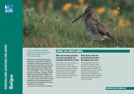
The snipe requires shallow water and<br />
soft mud in which to probe for food.
Vision is for a wider understanding of the importance of<br />
wetlands and of their relevance to people’s lives.<br />
WHAT SCALE OF WETLAND<br />
RESTORATION DO WE NEED?<br />
We envisage a future where freshwater wetlands cover a<br />
much larger area of the landscape than they do today.<br />
We can achieve this by working together with<br />
landowners, using natural processes to recreate or<br />
restore wetlands where they will provide benefits to<br />
both wildlife and society.<br />
Delivering targets for wetland creation and restoration<br />
by 2020 under the UK Biodiversity Action Plan (BAP) will<br />
do much to safeguard the immediate future of wetlands,<br />
but will not meet the challenges of the next <strong>50</strong> years. We<br />
need to double the area of some wetlands, such as<br />
reedbeds, to secure the future of some of our most<br />
threatened bird species, such as the bittern. We need to<br />
increase the area of habitats that support species such<br />
as snipe far above existing targets. This increase in area<br />
will also boost the protection afforded to the important<br />
archaeological legacy buried in our wetland soils.<br />
Our Vision stresses the importance of large-scale and<br />
small-scale wetlands because of the wide range of<br />
benefits they can bring to society. Our maps suggest<br />
that individual locations can often support a range of<br />
different wetland habitat types. Advocating precisely
where habitats should be located is not appropriate at a<br />
national scale. Local knowledge and considerations are<br />
essential for making such decisions. We have chosen to<br />
present a map of wetland potential which should help<br />
to inform answers to these questions at a regional and<br />
local scale. Local considerations may include such<br />
issues as water availability or the locations of airports.<br />
We have produced maps that are intended to assist<br />
such local initiatives.<br />
Preserving the historic environment<br />
Wetlands are fragile archives of history. Their<br />
waterlogged soils help to preserve organic materials<br />
such as plant remains, pollen, wood, textile and leather,<br />
providing our most complete picture of past societies<br />
and the environments in which they lived. This<br />
archaeological evidence is unique and irreplaceable.<br />
Many of the deep deposits of clay and peat, which built<br />
up over thousands of years, have been destroyed in<br />
decades by agriculture and drainage.<br />
Those impacts threatening the survival of wetland<br />
habitats and species often pose an equal threat to the<br />
historic environment. A future shared by both interests<br />
presents a more compelling message about the need to<br />
restore wetlands. A wetland protected for its<br />
biodiversity will be beneficial to its buried archaeology,<br />
and securing areas for their historic environment can<br />
deliver significant rewards for wildlife.<br />
What about climate change?<br />
Climate change will have a profound effect on people<br />
and wildlife. We acknowledge that our existing wetlands<br />
will change significantly. There are considerable<br />
uncertainties about the steps we should take in<br />
response to this, but we have tried to ensure that the<br />
methods we have used to produce our future wetland<br />
map are consistent with the UK BAP principles of<br />
ecological adaptation to climate change. Our Vision<br />
advocates wetlands that are more resilient to climate<br />
impacts. This will require making space, where<br />
appropriate, for our coasts and rivers to re-align and<br />
function naturally. It also means recreating landscapes<br />
that allow migration and relocation of species, by<br />
linking natural areas with wildlife corridors. In the right<br />
locations, such naturally functioning wetlands can help<br />
to protect people and property from the impacts of<br />
increased rainfall and sea-level rise by storing flood<br />
waters and slowing flood flows.<br />
Our existing wetlands form an important carbon store.<br />
The National Trust has estimated that the UK’s uplands<br />
contain some 3 billion tonnes of carbon, equivalent to<br />
20 years of UK CO 2 emissions. It is vital that we stabilise<br />
this resource by restoring water levels together with<br />
sensitive management of our uplands.
The benefits provided by future wetlands<br />
Our Vision seeks to integrate opportunities for future<br />
wetland wildlife with those of the historic environment,<br />
as well as delivering wider benefits to society. Our<br />
future wetlands will be diverse, supporting habitats and<br />
species of current and future conservation concern<br />
(www.ukbap.org.uk). They will often be part of large<br />
mosaics of semi-natural habitat, and contain significant<br />
areas of transition to other terrestrial and coastal<br />
habitats. Some rare wetland habitats, such as fens and<br />
raised bogs, are difficult to recreate but our Vision will<br />
help to secure these too.<br />
Protecting wetlands and the archaeological evidence<br />
they contain for future discovery is a positive choice for<br />
the benefit of society in the future. We look to increase<br />
the public enjoyment of wetlands, and the appreciation<br />
of the functional benefits of rivers and their floodplains.<br />
Restoring floodplain wetlands and natural river flows<br />
can help restore to catchments their capacity for<br />
absorbing rainfall, slowing floodwaters and reducing<br />
surface water run-off.<br />
The Wetland Vision Project examined a range of benefits<br />
provided by a selection of current wetland restoration<br />
projects. These have demonstrated, for example, that<br />
wetlands can also be economically productive<br />
supporting livestock grazing, harvesting of reed, sedge<br />
and willow for traditional craft activity or biomass,<br />
helping to sustain water resources, increasing tourism<br />
and enhancing freshwater fish stocks. As an<br />
example, achieving the Vision for the Great Fen<br />
Project will deliver the following benefits:<br />
nature conservation<br />
education for children and adults<br />
access and enjoyment for local communities<br />
income generation for local businesses through<br />
tourism opportunities<br />
flood water storage to protect farmland.<br />
Rivers and lakes in the Wetland Vision<br />
Rivers and their restoration are core to the delivery<br />
of this Vision. Natural channel forms such as<br />
braided streams, meanders or ox-bow lakes are<br />
created by rivers moving across floodplains, and all<br />
provide particular habitat niches for freshwater<br />
wildlife. Restoration of these floodplain features can<br />
help to slow and store river flows. In our Vision,<br />
rivers will be free from avoidable human impacts<br />
and wherever possible connected physically and<br />
functionally with their floodplains, permitting the<br />
development of an enhanced and characteristic<br />
variety of habitats and wildlife. This will enhance the<br />
natural functions and processes that occur within<br />
rivers, ranging from thriving fish populations, to<br />
water purification, maximising the range of benefits<br />
that they provide for society. Our ‘future wetland’<br />
map starts to show areas where river protection<br />
and restoration could enhance the development of
other wetlands and maximise public benefit. Major<br />
pressures on lakes, such as inadequate water levels and<br />
pollution will be managed, and lakes will operate<br />
naturally where possible within their wetland or<br />
floodplain setting.<br />
Freshwater wetlands at the coast<br />
The English coast supports some of our most important<br />
freshwater habitats, many of which are protected from<br />
inundation by the sea by artificial defences. Often these<br />
sites were reclaimed from intertidal habitats to create<br />
coastal grazing marshes, or have survived simply<br />
because they proved too difficult to drain. Some were<br />
created more recently as wartime defences, whilst<br />
others were once part of the coastal floodplain and are<br />
now protected by man-made sea defences.<br />
Many of these sites will become brackish or inter-tidal as<br />
rising sea levels make artificial defences<br />
environmentally or economically unsustainable, and we<br />
will need to recreate lost coastal freshwater habitats<br />
simply to maintain their current extent. European and<br />
domestic law provides a framework for ensuring action<br />
is taken to help protected habitats and species adapt to<br />
this change. Our Vision maps indicate those areas where<br />
it might be appropriate to relocate vulnerable habitats<br />
and simultaneously deliver large-scale habitat gain.<br />
Rolling back lines of defence could help offset losses of<br />
saltmarsh and mudflat while freeing dunes, shingle<br />
ridges and other features to function more naturally,<br />
helping to sustain those habitats into the future. Most<br />
wetland sites at the coast will remain important seminatural<br />
areas albeit for a different range of habitats<br />
and species.<br />
It would be inappropriate to promote the expansion of<br />
freshwater habitats in coastal areas, especially where<br />
there would be long term reliance on artificial sea<br />
defences, unless very specific conditions are met. For<br />
instance, the decision may have been made to hold a<br />
line of defence on wider socio-economic grounds. The<br />
need for adaptation is recognised in the strategic coastal<br />
management framework established by Shoreline<br />
Management Plans (SMPs) and Coastal Habitat<br />
Management Plans (CHaMPs). The latter were developed<br />
to consider the future and sustainability of existing<br />
freshwater wetlands at the coast in the face of ongoing<br />
losses of coastal habitats.<br />
Delivering the Wetland Vision at the coast: Map 4<br />
Freshwater resources on the coast
This map shows the future potential map (Map 3)<br />
overlain by information showing pressures impacting<br />
the coast, and areas that would once have been<br />
naturally saline. Where these coincide, freshwater<br />
habitats may not be sustainable in the future but there<br />
will be opportunities for more naturally functioning<br />
freshwater and brackish wetlands. The full effects cannot<br />
be accounted for within this project, and will be locally<br />
determined using the outputs from Shoreline<br />
Management Plans and Coastal Habitat Management<br />
Plans. Data are derived from the outputs of the<br />
Futurecoasts project and an extraction from the<br />
Environment Agency Floodmap (2001).<br />
Map 4<br />
The potential impact of coastal and tidal pressures<br />
on the delivery of future freshwater wetlands<br />
Current extent of wetlands<br />
Future potential of wetlands<br />
Highest risk of coastal erosion<br />
Tidal floodplain
WETLAND LOSS AT THE<br />
LOCAL LEVEL<br />
The changing picture of the grazing marshes of<br />
the Thames Estuary: a case study<br />
Between the 1930s and 1980s, two thirds of the coastal<br />
and floodplain grazing marsh in the Thames Estuary<br />
was lost. Of 44,000 ha of grazing marsh within the North<br />
Kent, East Essex, Foulness and Inner Thames area,<br />
28,000 ha were converted to other land uses.<br />
Improvements to flood defences after the 1953 storms,<br />
coupled with government incentives to increase food<br />
production, led to widespread drainage of wet grassland<br />
and cultivation for arable cropping. This was particularly<br />
evident in the Thames Estuary area where the greatest<br />
cause (around two-thirds) of land use change was the<br />
conversion of wet grassland to arable. Most of the rest<br />
was lost to industrial and residential development.<br />
Today the picture is more optimistic. In recognition of<br />
the loss of habitat and species, the Essex Coast and<br />
North Kent Marshes were made Environmentally<br />
Sensitive Areas in the early 1990s. Under these schemes,<br />
more than 3,000 ha of arable land has been returned to<br />
wet grassland habitat and thousands of hectares of<br />
drained grassland have been made wet again.<br />
Building on this progress, partnerships on both banks of<br />
the Thames are now working towards sustainable<br />
regeneration, recreating large areas of wetland habitat,<br />
visitor attractions and ‘green lungs’ for the Thames<br />
Gateway area. This is part of a landscape-scale vision for<br />
Extent of grazing marsh along the Thames Estuary in<br />
1935 and 1989<br />
The area of loss was dramatic, and led to severe<br />
fragmentation of the area’s wetland habitats and<br />
landscape. This land-use change also caused significant<br />
damage to a well-preserved prehistoric landscape<br />
(which is buried beneath later flood deposits),<br />
containing archaeological deposits spanning the last<br />
6,000 years.
the area covering not only the network of nature<br />
reserves and protected sites, but also the wider<br />
landscape around the Thames Estuary, which will need<br />
to take into account the pressures of sea level rise, and<br />
of the new Growth Areas.<br />
References<br />
Thornton, D & Kite DJ (1990) Changes in the extent of Thames<br />
Estuary grazing marsh. NCC Report<br />
Ekins, R (1990) Changes in the extent of grazing marshes in the<br />
Greater Thames Estuary. <strong>RSPB</strong> Report<br />
Wilson, A M, Vickery, J A, Brown, A, Langston, R H, Smallshire, D,<br />
Wotton, S & Vanhinsbergh, D 2005. Changes in the numbers of<br />
breeding waders on lowland wet grasslands in England and Wales<br />
between 1982 and 2002. Bird Study, 52, 55-69.
Wetland visions across the country<br />
Partnerships across the country are at different stages in<br />
developing and realising local and regional visions for<br />
wetlands for the benefit of people, wildlife and the<br />
historic environment. We have looked at more than 120<br />
regional or local scale vision projects to ensure that our<br />
guidance is helpful and our maps consistent with this<br />
local work. The Wetland Vision supports and promotes<br />
local visions which have already been developed, and<br />
provides information on some of the approaches used<br />
in the development of area-based visions. Contained on<br />
the CD-ROM is guidance on interpreting the national<br />
material for use at a more local level, using local data<br />
sources, and using the Vision together with existing<br />
regional biodiversity maps.<br />
Here is a selection of the local and regional visions that<br />
we have examined – more comprehensive information<br />
on these is on the vision website.<br />
Peatlands for People<br />
!<br />
Restoring Eden Project<br />
! !<br />
Swale and Ure Washlands Project<br />
! SPROUT !<br />
!<br />
SCaMP<br />
!<br />
Lower Aire Valley Vision<br />
!<br />
Potteric Carr Vision<br />
!<br />
Cheshire ECOnet<br />
On Trent !<br />
!<br />
!<br />
Wensum SSSI River Project<br />
!<br />
!<br />
The Great Fen Project<br />
! !<br />
!<br />
Needingworth Wetland Project<br />
! !<br />
Waveney/Little Ouse TEN project<br />
Severn & Avon Vales Wetlands Partnership<br />
!<br />
Cotswold Water Park Vision<br />
!<br />
Quaggy River Flood River Management Scheme<br />
! !<br />
Parrett Catchment Project<br />
!<br />
New Forest LIFE 3 Sustainable Wetland Restoration<br />
South West Nature Map !<br />
!<br />
' Wetland Vision, a partnership between Environment Agency, English Heritage, Natural England, <strong>RSPB</strong>, and The Wildlife Trusts, 2007. This map is based upon<br />
Ordnance Survey material with the permission of Ordnance Survey on behalf of the Controller of Her Majesty s Stationery Office ' Crown copyright.<br />
Unauthorised reproduction infringes Crown copyright and may lead to prosecution or civil proceedings. Natural England 100046223 2008
TAKING THE <strong>VISION</strong> <strong>FOR</strong>WARD<br />
Creating this Vision is just a starting point. The<br />
partnership is committed to collectively making a real<br />
change on the ground. We need to work with others to<br />
develop and realise the aspirations of our Vision.<br />
As a partnership, we will:<br />
use the Wetland Vision maps to inform our<br />
conservation, restoration and creation work so that<br />
effort and resources are targeted to the areas with<br />
the most potential<br />
secure the funding for large-scale wetland habitat<br />
creation within a modern landscape<br />
Promote the Vision by:<br />
raising awareness of the importance of wetlands<br />
encouraging more people to experience wetland<br />
green spaces<br />
providing information to farmers, landowners and<br />
planners<br />
supporting new partnerships locally and nationally.<br />
Develop the Vision further by:<br />
working with others to set new long-term targets for<br />
wetland restoration and creation to increase the<br />
resilience of wetland wildlife to change, and to<br />
provide valuable ecosystem services for people.<br />
<br />
<br />
deliver the Wetland Habitat Action Plan target for<br />
landscape-scale naturally functioning wetland<br />
ecosystems, extending them where appropriate<br />
ensure where we can that these areas provide<br />
multiple benefits – for recreation, health and the<br />
historic environment as well as wildlife.
EACH PARTNER ORGANISATION WILL ALSO:<br />
English Heritage will develop priorities for the historic<br />
environment elements of the vision, and identify those<br />
sites where immediate (short term) change will have the<br />
most benefit. We will use the Vision, on a policy and<br />
practical level, to advocate where biodiversity and<br />
historic environment interests coincide.<br />
Natural England will use the outputs from this Vision<br />
to inform agri-environment targeting and to help<br />
identify potential areas for Natural England funding to<br />
restore or create wetland habitats. It will be valuable in<br />
informing our work on climate change adaptation,<br />
including the development of habitat networks. The<br />
Vision outputs will also help to inform the development<br />
of our wider vision for the natural environment, which<br />
fully integrates the conservation and enhancement of<br />
landscapes, wildlife and benefits to people.<br />
The Environment Agency will work to share the<br />
outputs from the Wetland Vision with our own Habitat<br />
Creation work to explore collaborative opportunities for<br />
landscape scale habitat creation.
The <strong>RSPB</strong> will use the Vision to inform priorities for<br />
reserve acquisition and the large-scale wetland<br />
partnership projects we take forward under our<br />
Futurescapes programme. We will use the outputs to<br />
champion wetland restoration and creation as part of a<br />
modern, wildlife-rich countryside, and develop<br />
partnerships through our advocacy and advisory work<br />
on the ground.<br />
The Wildlife Trusts will use the work to inform our<br />
‘Living Landscapes’ initiatives at a national, regional and<br />
local scale. The tools and concepts of the Wetland Vision<br />
will be used to add value to existing local partnerships<br />
championed by local and regional Wildlife Trusts<br />
across England.
Development of the Vision<br />
This Vision has been developed using an objective and<br />
where possible, scientific approach. We involved a widerange<br />
of stakeholders whose input is documented in the<br />
CD enclosed. We established a Technical Advisory Group<br />
to help shape our Vision. This benefited from<br />
representatives from the following organisations:<br />
Wildfowl & Wetland Trust; Pond Conservation ; National<br />
Trust; WWF; Centre for Ecology & Hydrology; Natural<br />
England; Environment Agency; <strong>RSPB</strong>; The Wildlife Trusts;<br />
English Heritage.<br />
Contact details for the project:<br />
Wetland Vision Project<br />
c/o Water Policy Team<br />
The <strong>RSPB</strong>,<br />
The Lodge<br />
Sandy<br />
Beds SG19 2DL<br />
For more information about the development of the<br />
project, including a record of stakeholder engagement,<br />
please consult the contents of the inserted CD-Rom, or<br />
our website www.wetlandvision.org.uk<br />
Front cover image by Carrie Hume, pg 2 by Richard brunning, Pg 8-9 Snipe<br />
by Michael Gore (rspb-images.com), pg 11 by Carrie Hume, pg 16<br />
Excavating the Sweet Track, Somerset. Copyright Somerset Levels Project,<br />
pg 18 by Evan Bowen-Jones, pg 23 by Andy Hay (rspb-imges.com)<br />
Maps: Crown copyright. All rights reserved.<br />
Natural England licence no: 100046223 2008.
Wetland Vision Project<br />
c/o Water Policy Team<br />
The <strong>RSPB</strong>,<br />
The Lodge<br />
Sandy<br />
Bedfordshire<br />
SG19 2DL<br />
English Heritage www.english-heritage.org.uk Tel: 020 7973 3000<br />
Environment Agency www.environment-agency.gov.uk Tel: 08708 <strong>50</strong>6 <strong>50</strong>6<br />
Natural England www.naturalengland.org.uk Tel: 0845 600 3078<br />
The <strong>RSPB</strong> www.rspb.org.uk Tel: 01767 680551<br />
The Wildlife Trusts www.wildlifetrusts.org Tel: 01636 677711<br />
The Royal Society for the Protection of Birds (<strong>RSPB</strong>) is a registered charity:<br />
England & Wales no. 207076, Scotland no. SC037654<br />
Front cover image by Carrie Hume 3<strong>50</strong>-0888-07-08