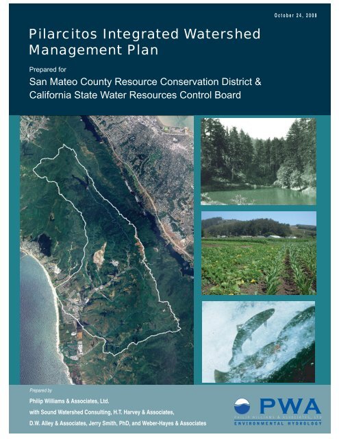
Pilarcitos Integrated Watershed Management Plan - San Mateo ...
Pilarcitos Integrated Watershed Management Plan - San Mateo ...
Pilarcitos Integrated Watershed Management Plan - San Mateo ...

You also want an ePaper? Increase the reach of your titles
YUMPU automatically turns print PDFs into web optimized ePapers that Google loves.
October 24, 2008<br />
<strong>Pilarcitos</strong> <strong>Integrated</strong> <strong>Watershed</strong><br />
<strong>Management</strong> <strong>Plan</strong><br />
Prepared for<br />
<strong>San</strong> <strong>Mateo</strong> County Resource Conservation District &<br />
California State Water Resources Control Board<br />
Prepared by<br />
Philip Williams & Associates, Ltd.<br />
with Sound <strong>Watershed</strong> Consulting, H.T. Harvey & Associates,<br />
D.W. Alley & Associates, Jerry Smith, PhD, and Weber-Hayes & Associates
<strong>Pilarcitos</strong> <strong>Integrated</strong> <strong>Watershed</strong> <strong>Management</strong> <strong>Plan</strong><br />
Prepared for<br />
<strong>San</strong> <strong>Mateo</strong> County Resource Conservation District<br />
Prepared by<br />
Philip Williams & Associates, Ltd.<br />
with<br />
Sound <strong>Watershed</strong> Consulting<br />
H.T. Harvey & Associates<br />
D.W. Alley & Associates<br />
Jerry Smith, PhD<br />
Weber-Hayes & Associates<br />
October 24, 2008<br />
PWA REF. # 1884 T4
Services provided pursuant to this Agreement are intended solely for the<br />
use and benefit of the <strong>San</strong> <strong>Mateo</strong> County Resource Conservation District.<br />
No other person or entity shall be entitled to rely on the services,<br />
opinions, recommendations, plans or specifications provided pursuant<br />
to this agreement without the express written consent of Philip<br />
Williams & Associates, Ltd., 550 Kearny Street, Suite 900, <strong>San</strong><br />
Francisco, CA 94108.<br />
J:\1884_<strong>Pilarcitos</strong>_IWMP\Task4_IWMP\reports\Final <strong>Pilarcitos</strong> IWMP\Final <strong>Pilarcitos</strong> <strong>Integrated</strong> <strong>Watershed</strong> <strong>Management</strong> <strong>Plan</strong>_Public.doc<br />
10/23/08
<strong>Pilarcitos</strong> <strong>Integrated</strong> <strong>Watershed</strong> <strong>Management</strong> <strong>Plan</strong><br />
TABLE OF CONTENTS<br />
Page No.<br />
1. EXECUTIVE SUMMARY 1<br />
2. INTRODUCTION AND PLANNING APPROACH 4<br />
2.1 BACKGROUND 4<br />
2.2 CURRENT IWMP PROCESS 5<br />
3. PLAN GOALS AND OBJECTIVES 7<br />
4. WATERSHED ASSESSMENT SUMMARY 11<br />
4.1 ECOSYSTEM FUNCTIONS AND PROCESSES 11<br />
4.1.1 Fish Passage and Instream Habitat 11<br />
4.1.2 Instream Flows 12<br />
4.1.3 <strong>Watershed</strong> Erosion and Sedimentation 13<br />
4.1.4 Channel Maintenance 14<br />
4.1.5 Riparian Vegetation and Habitat 15<br />
4.1.6 Control of Exotic and Invasive Vegetation 15<br />
4.1.7 Lagoon Habitat 16<br />
4.2 WATER MANAGEMENT 16<br />
4.2.1 Instream Flow Improvement Opportunities 17<br />
4.2.2 Water Supply Infrastructure 17<br />
4.2.3 Gray Water Sources and Uses 18<br />
4.2.4 Recycled Water 19<br />
4.2.5 Water Quality 19<br />
4.3 WATERSHED MANAGEMENT ISSUES 20<br />
4.3.1 Community Engagement 20<br />
4.3.2 Beach Quality 20<br />
4.3.3 Landowner Concerns 20<br />
4.3.4 Landfill Issues 21<br />
5. IDENTIFIED PRIORITY PROJECTS 22<br />
5.1 PROJECT EVALUATION AND IMPLEMENTATION 22<br />
5.1.1 Project Evaluation 22<br />
5.1.2 Implementation Strategy 25<br />
5.2 IMPROVEMENT PROJECT SUMMARIES 28<br />
5.2.1 Recycled Water Project 28<br />
Final <strong>Pilarcitos</strong> <strong>Integrated</strong> <strong>Watershed</strong> <strong>Management</strong> <strong>Plan</strong>_Public.doc<br />
10/23/08 i
<strong>Pilarcitos</strong> <strong>Integrated</strong> <strong>Watershed</strong> <strong>Management</strong> <strong>Plan</strong><br />
5.2.2 <strong>Pilarcitos</strong> Reservoir and Stone Dam Operational Flexibility<br />
Improvement Project 33<br />
5.2.3 Equestrian Bridge 35<br />
5.2.4 Fish Passage Improvement Project 36<br />
5.3 FEASIBILITY STUDY SUMMARIES 41<br />
5.3.1 <strong>Pilarcitos</strong> Lagoon Habitat Enhancement Opportunity Study 41<br />
5.3.2 <strong>Pilarcitos</strong> Creek <strong>Watershed</strong> Protection Easement Program Feasibility<br />
Study 45<br />
5.3.3 Recycled Off-channel Water Storage Feasibility Study 48<br />
5.3.4 Diverted Off-channel Water Storage Feasibility Study 50<br />
5.3.5 Arroyo Leon Pond Sites Conceptual Rehabilitation Restoration<br />
Alternatives Study 53<br />
5.4 PLANNING PROJECT SUMMARIES 57<br />
5.4.1 <strong>Watershed</strong> Monitoring Program 57<br />
5.4.2 Eucalyptus Control and Removal <strong>Plan</strong>ning 61<br />
5.4.3 Stream Habitat Restoration and Enhancement Opportunity Program 63<br />
5.5 ASSESSMENT PROJECT SUMMARIES 65<br />
5.5.1 Water Budget Development Project 65<br />
5.5.2 Road Assessment Project 68<br />
5.5.3 Geomorphic Channel Assessment 71<br />
5.5.4 Riparian Habitat Restoration and Invasive <strong>Plan</strong>t Eradication<br />
Assessment 74<br />
5.5.5 Systematic <strong>Watershed</strong>-Scale Fish Habitat Assessment Project 77<br />
5.5.6 Assess Habitat <strong>Management</strong> and Restoration Opportunities for<br />
Sensitive Wetland Species 80<br />
5.5.7 Preliminary Arroyo Leon Fish Habitat Assessment 82<br />
5.6 PHASE II: DEFERRED PROJECTS 84<br />
5.6.1 Water Conservation Program 84<br />
5.6.2 Lower <strong>Pilarcitos</strong> Streamflow Improvements 84<br />
5.6.3 Tertiary Water Groundwater Recharge 85<br />
5.6.4 Riparian Setback <strong>Management</strong> <strong>Plan</strong>ning 86<br />
5.6.5 Stormwater Impacts Analysis 86<br />
5.6.6 Non-Point Source Pollution Reduction Project 86<br />
5.6.7 Gray Water Utilization Study 87<br />
5.6.8 Stream Restoration and Maintenance Support Program 87<br />
5.6.9 Fish Habitat Enhancement 88<br />
5.6.10 <strong>Watershed</strong>-Scale Sensitive <strong>Plan</strong>ts and Habitats Assessment 88<br />
5.6.11 Beach Water Quality <strong>San</strong>itary Survey 89<br />
5.7 OTHER PROJECTS CONSIDERED 89<br />
5.7.1 Arroyo Leon Pond Rehabilitation 89<br />
Final <strong>Pilarcitos</strong> <strong>Integrated</strong> <strong>Watershed</strong> <strong>Management</strong> <strong>Plan</strong>_Public.doc<br />
10/23/08 ii
<strong>Pilarcitos</strong> <strong>Integrated</strong> <strong>Watershed</strong> <strong>Management</strong> <strong>Plan</strong><br />
6. REFERENCES 91<br />
7. LIST OF PREPARERS 93<br />
8. FIGURES 94<br />
LIST OF APPENDICES<br />
Appendix A.<br />
Appendix B.<br />
<strong>Watershed</strong> Assessment Update<br />
Workgroup Memorandum of Understanding<br />
LIST OF TABLES<br />
Table 1. Project Ranking Tiers from Highest (1) to Lowest (4)<br />
Table 2. Implementation <strong>Plan</strong> Timeline<br />
Final <strong>Pilarcitos</strong> <strong>Integrated</strong> <strong>Watershed</strong> <strong>Management</strong> <strong>Plan</strong>_Public.doc<br />
10/23/08 iii
<strong>Pilarcitos</strong> <strong>Integrated</strong> <strong>Watershed</strong> <strong>Management</strong> <strong>Plan</strong><br />
LIST OF FIGURES<br />
Figure 1. <strong>Pilarcitos</strong> <strong>Watershed</strong> Map<br />
Figure 2. Steelhead Spawning Habitat<br />
Figure 3. Steelhead Rearing Habitat<br />
Figure 4. IWMP Potential Project Location Map<br />
Final <strong>Pilarcitos</strong> <strong>Integrated</strong> <strong>Watershed</strong> <strong>Management</strong> <strong>Plan</strong>_Public.doc<br />
10/23/08 iv
<strong>Pilarcitos</strong> <strong>Integrated</strong> <strong>Watershed</strong> <strong>Management</strong> <strong>Plan</strong><br />
1. EXECUTIVE SUMMARY<br />
The <strong>Pilarcitos</strong> watershed (Figure 1) is a significant area of ecological, cultural and economic<br />
diversity. It is a source of clean drinking water for residents of the central coast and <strong>San</strong> Francisco<br />
Bay Area and supports several natural-resource based economies – including agriculture and<br />
recreational tourism. The watershed is also experiencing increased competition for water between<br />
agricultural, domestic, recreational, commercial and environmental uses.<br />
Public and private stakeholders in the watershed have been working together intermittently since<br />
the mid-1990s. In 2005, a group consisting of over 20 local and regional agencies and advocacy<br />
groups gathered with nearly 200 members of the community at a water summit to discuss<br />
watershed-based approaches for balancing the beneficial uses of water in <strong>Pilarcitos</strong> Creek. The<br />
Coastside County Water District (CCWD), <strong>San</strong> Francisco Public Utilities Commission (SFPUC),<br />
Sewer Authority Mid-Coastside (SAM) and National Oceanic and Atmospheric Administration –<br />
National Marine Fisheries Service (NMFS) echoed comments from the <strong>San</strong> <strong>Mateo</strong> County Board<br />
of Supervisors that continued dialogue is necessary between local stakeholders and the public to<br />
achieve balanced solutions including the use of recycled water.<br />
Following on the 2005 Water Summit, the SFPUC collaborated with CCWD, SAM, and the <strong>San</strong><br />
<strong>Mateo</strong> Resource Conservation District (RCD) to secure a grant from the <strong>San</strong> Francisco Regional<br />
Water Quality Control Board (RWQCB) to develop an <strong>Integrated</strong> <strong>Watershed</strong> <strong>Management</strong> <strong>Plan</strong><br />
(IWMP). Part of the IWMP process includes the formation of the <strong>Pilarcitos</strong> Creek Restoration<br />
Workgroup (Workgroup), which aims to implement restoration and management actions in the<br />
<strong>Pilarcitos</strong> watershed. The Workgroup consists of the aforementioned organizations and agencies<br />
as well as members of the <strong>Pilarcitos</strong> Creek Advisory Committee (PCAC) and other stakeholders.<br />
The RCD is acting as the contact manager and convener of the Workgroup meetings.<br />
The purpose of the IWMP is to promote balanced solutions to effectively manage the <strong>Pilarcitos</strong><br />
Creek watershed that satisfy environmental, public health, domestic water supply, and economic<br />
interests. It will achieve this purpose by prioritizing restoration projects that individually or<br />
collectively help to achieve six key goals, described in Section 3 and summarized here:<br />
1. Protect and recover Steelhead trout and other native aquatic and riparian species<br />
2. Enhance streamflows while maintaining yield<br />
3. Manage stream channel corridors to reduce erosion, sedimentation and flood risks<br />
Executive Summary 1 October, 2008
<strong>Pilarcitos</strong> <strong>Integrated</strong> <strong>Watershed</strong> <strong>Management</strong> <strong>Plan</strong><br />
4. Increase native riparian vegetation<br />
5. Maintain good water quality conditions<br />
6. Promote community and stakeholder collaboration<br />
These goals were developed to address several key watershed management issues that were<br />
identified following a review of information about the existing state of the watershed (Appendix<br />
A). The key watershed management issues include the following:<br />
• Instream flows to support aquatic resources during critical summer and fall periods.<br />
• Other ecosystem factors, including fish passage, instream habitat, watershed erosion,<br />
channel maintenance, riparian vegetation, exotic invasive species, and the spring<br />
estuary/summer lagoon.<br />
• Social issues, including community engagement, landowner concerns, beach quality, and<br />
landfill issues.<br />
The <strong>Pilarcitos</strong> IWMP identifies four improvement projects, five feasibility projects, three<br />
planning projects and seven additional assessment projects. An objective project-evaluation<br />
process was used to integrate project priorities using both scientific and management criteria to<br />
arrive at a ranking of projects. This methodology is described in Section 5.1. Project rankings<br />
were determined through a facilitated process between the consulting team responsible for this<br />
report and stakeholders identified in the Memorandum of Understanding (MOU) (Appendix B).<br />
Implementation of the IWMP will continue through the Workgroup. The key factors affecting the<br />
IWMP Implementation Strategy are outlined in Section 5.1.2. Lead agency responsibilities,<br />
milestones, and funding sources are identified for each proposed project in Section 5.<br />
Executive Summary 2 October, 2008
<strong>Pilarcitos</strong> <strong>Integrated</strong> <strong>Watershed</strong> <strong>Management</strong> <strong>Plan</strong><br />
Acknowledgements<br />
This document is the product of the hard work of many stakeholders in the watershed. In addition<br />
to the many community members who attended public meetings to develop the <strong>Pilarcitos</strong> IWMP,<br />
we would like thank the following people for their contributions.<br />
Rich Allen<br />
Kristine Atkinson<br />
Cathleen Brennan<br />
Julie Casagrande<br />
Sarah Corbin<br />
Bob Feldman<br />
Tim Frahm<br />
Jack Foley<br />
Joe Giustino<br />
Jim Howard<br />
Joanne Kerbavaz<br />
Jane Lavelle<br />
Keith Mangold<br />
Meredith Manning<br />
Chris Mickelsen<br />
John Muller<br />
George Neillands<br />
Kellyx Nelson<br />
Tim Ramirez<br />
Paul Ringgold<br />
Patrick Rutten<br />
Jim Salerno<br />
Kate Symonds<br />
Carolann Towe<br />
<strong>San</strong> <strong>Mateo</strong> County Resource Conservation District<br />
California Department of Fish and Game<br />
Coastside County Water District<br />
<strong>San</strong> <strong>Mateo</strong> County<br />
Surfrider Foundation- <strong>San</strong> <strong>Mateo</strong> County Chapter<br />
Coastside County Water District<br />
<strong>San</strong> <strong>Mateo</strong> County Farm Bureau<br />
Sewer Authority Midcoastside<br />
Coastside County Water District<br />
National Resources Conservation Service<br />
California State Parks<br />
<strong>San</strong> Francisco Public Utilities Commission<br />
<strong>Pilarcitos</strong> Creek Advisory Committee<br />
Midpeninsula Regional Open Space District<br />
Coastside County Water District<br />
City of Half Moon Bay<br />
California Department of Fish and Game<br />
<strong>San</strong> <strong>Mateo</strong> County Resource Conservation District<br />
<strong>San</strong> Francisco Public Utilities Commission<br />
Peninsula Open Space Trust<br />
National Marine Fisheries Service<br />
<strong>San</strong> Francisco Public Utilities Commission<br />
US Fish and Wildlife Service<br />
<strong>San</strong> <strong>Mateo</strong> County Resource Conservation District<br />
Executive Summary 3 October, 2008
<strong>Pilarcitos</strong> <strong>Integrated</strong> <strong>Watershed</strong> <strong>Management</strong> <strong>Plan</strong><br />
2. INTRODUCTION AND PLANNING APPROACH<br />
The <strong>Pilarcitos</strong> watershed (Figure 1) is a significant area of ecological, cultural and economic<br />
diversity. While it is located near one of the most heavily populated areas of California, it remains<br />
relatively undeveloped, and large portions of the watershed retain many of the natural features<br />
that existed prior to European settlement of the watershed.. The <strong>Pilarcitos</strong> watershed is a source<br />
of clean drinking water for residents of the central coast and <strong>San</strong> Francisco Bay Area and remains<br />
rich in native plant and animal species. The watershed supports several natural resource-based<br />
economies – including agriculture and recreational tourism. <strong>Pilarcitos</strong> Creek is also identified as<br />
critical habitat for the recovery of steelhead trout, federally listed as threatened.<br />
<strong>Pilarcitos</strong> Creek originates on the eastern side of Montara Mountain and flows about 12 miles to<br />
the Pacific Ocean near the City of Half Moon Bay in California (Figure 1). It is the principal<br />
watercourse draining a coastal watershed of approximately 17,900 acres (about 28 square miles)<br />
in <strong>San</strong> <strong>Mateo</strong> County. The watershed encompasses seven subwatersheds containing the following<br />
smaller tributaries: Nuff Creek, Corinda Los Trancos Creek, Apanolio Creek, Albert Canyon,<br />
Madonna Creek, Mills Creek, and Arroyo Leon. <strong>Pilarcitos</strong> Creek can be divided into three broad<br />
reaches: Upper <strong>Pilarcitos</strong>, above the confluence with the seven tributaries; Middle <strong>Pilarcitos</strong>,<br />
primarily confined to an agricultural and residential floodplain valley; and Lower <strong>Pilarcitos</strong>,<br />
which flows through the City of Half Moon Bay to the Pacific Coast.<br />
The creek originates on land owned by the SFPUC, then passes through CCWD land, then<br />
private, residential, and agricultural lands and then lands owned by other public entities including<br />
the City of Half Moon Bay, State Parks, and SAM before draining into the Pacific.<br />
2.1 BACKGROUND<br />
Public and private stakeholders in the watershed have been working together intermittently since<br />
the mid-1990s as part of the <strong>Pilarcitos</strong> Creek <strong>Watershed</strong> Restoration Project funded by the<br />
California Department of Fish and Game (CDFG) and the RWQCB. The PCAC was formed to<br />
advise the CDFG and RWQCB with the Restoration Project which resulted in the <strong>Pilarcitos</strong> Creek<br />
Restoration <strong>Plan</strong> (Restoration <strong>Plan</strong>) (PWA, 1996). The 1996 Restoration <strong>Plan</strong> identified<br />
numerous opportunities for restoration in the watershed. In 1999, the RCD became responsible<br />
for implementing the Restoration <strong>Plan</strong>. The PCAC continued in its role as advisor and<br />
stakeholder advocate of issues concerning <strong>Pilarcitos</strong> Creek.<br />
Introduction and <strong>Plan</strong>ning Approach 4 October, 2008
<strong>Pilarcitos</strong> <strong>Integrated</strong> <strong>Watershed</strong> <strong>Management</strong> <strong>Plan</strong><br />
Numerous projects recommended in the Restoration <strong>Plan</strong> were implemented in the watershed<br />
(Appendix A – Section 7). Fish passage barriers were removed in the Apanolio, Arroyo Leon, and<br />
Mills Creek watersheds. As part of continued support, SFPUC performed numerous habitat<br />
surveys and monitoring efforts in the Upper <strong>Pilarcitos</strong> watershed and, in 2007, performed<br />
experimental flow releases below Stone Dam to assess the feasibility of improving streamflow in<br />
Lower <strong>Pilarcitos</strong>.<br />
Recognizing the need for continued effort in the watershed, a group consisting of over 20 local<br />
and regional agencies and advocacy groups gathered with nearly 200 members of the community<br />
at a 2005 Water Summit to discuss watershed-based approaches for balancing the beneficial uses<br />
of water in <strong>Pilarcitos</strong> Creek. The RCD, PCAC, CCWD, SFPUC, SAM and NMFS echoed<br />
comments from the <strong>San</strong> <strong>Mateo</strong> County Board of Supervisors that continued dialogue is necessary<br />
between local stakeholders and the public to achieve balanced solutions including the use of<br />
recycled water. The discussion included a series of presentations that outlined a vision for the<br />
watershed, characterized its existing condition, described recycled water approaches, and updated<br />
the community on actions taken to date.<br />
In November 2005, voters in Half Moon Bay, CA overwhelmingly approved Measure P, with<br />
more than 84 percent of the vote in favor of the measure, which asked:<br />
“Do you want the City of Half Moon Bay to support the development of recycled water through<br />
its participation in the Sewer Authority Mid-Coastside Joint Powers Authority for use by<br />
consenting farmers and large-scale water users such as golf courses and nurseries as a potential<br />
alternative to water these users currently draw from Half Moon Bay creeks?”<br />
2.2 CURRENT IWMP PROCESS<br />
Following on the 2005 Water Summit, the SFPUC collaborated with CCWD, SAM, and the RCD<br />
to secure a grant from the RWQCB to develop an <strong>Integrated</strong> <strong>Watershed</strong> <strong>Management</strong> <strong>Plan</strong><br />
(IWMP). Part of the IWMP process includes the formation of the <strong>Pilarcitos</strong> Creek Restoration<br />
Workgroup (Workgroup), which aims to implement restoration and management actions in the<br />
<strong>Pilarcitos</strong> watershed. The Workgroup consists of the aforementioned organizations and agencies<br />
as well as members of the PCAC and other stakeholders. The RCD is acting as the contact<br />
manager and convener of the Workgroup meetings.<br />
The purpose of the IWMP is to promote balanced solutions to effectively manage the <strong>Pilarcitos</strong><br />
Creek watershed that satisfy environmental, public health, domestic water supply, and economic<br />
interests. This plan updates the 1996 <strong>Pilarcitos</strong> Creek Restoration <strong>Plan</strong>, broadens and formalizes<br />
the participants in the development of the IWMP by creating the new <strong>Pilarcitos</strong> Creek Restoration<br />
Introduction and <strong>Plan</strong>ning Approach 5 October, 2008
<strong>Pilarcitos</strong> <strong>Integrated</strong> <strong>Watershed</strong> <strong>Management</strong> <strong>Plan</strong><br />
Workgroup, and addresses the federal listing of the Steelhead as a threatened species (1996)<br />
while incorporating current and future water supply issues and important economic issues.<br />
The watershed will face several challenges in the next few decades. Housing demands in the <strong>San</strong><br />
Francisco Bay Area will likely cause increased development pressures in the watershed. Dams,<br />
diversions, and indirect impacts from various land-use activities have combined to reduce fish<br />
and wildlife habitat, degrade stream channels, block access to steelhead spawning, and increase<br />
exotic species invasions. The watershed is also experiencing increased competition for water<br />
between agricultural, domestic, recreational, commercial and environmental uses.<br />
The IWMP was developed by a consultant team with the oversight of the <strong>Pilarcitos</strong> Workgroup,<br />
consisting of representatives from over 19 or more partnering entities, including local, state and<br />
federal agencies and local community and advocacy groups. The Workgroup is guided by a<br />
Memorandum of Understanding (MOU) (see Appendix B), and has developed input from all<br />
affected stakeholders in the process, including local utilities, the agricultural community, public<br />
and private landowners, state and federal regulatory agencies, advocacy groups, local residents,<br />
and elected officials.<br />
The success of any planning process hinges upon balancing the issues and concerns of the<br />
stakeholders. The <strong>Pilarcitos</strong> watershed is a relatively small watershed with a diverse set of uses.<br />
Many of the building blocks for achieving watershed improvements are in place, and there is<br />
broad agreement that additional work can be beneficial.<br />
However, there are many uncertainties about specific ecological processes and the effect of<br />
watershed management practices on those processes. To date, incomplete scientific data and<br />
inconsistent monitoring practices limit knowledge of the cumulative effects of land-use practices<br />
on the desired functions and conditions in the watershed. The IWMP documents the<br />
understanding of existing watershed conditions, and identifies data gaps that currently exist.<br />
Based on an analysis of the existing condition of the watershed and public input, the Workgroup<br />
established a set of goals and objectives for the IWMP (Section 3). This document summarizes<br />
key information from the <strong>Watershed</strong> Assessment Summary in Appendix A (Section 4) and<br />
recommends a set of projects that will help to achieve the goals and objectives developed by the<br />
Workgroup (Section 5). The set of projects includes specific improvement projects, feasibility<br />
studies, planning programs, and additional assessment projects that will help close data gaps. It<br />
also includes a description of the process used for evaluating and prioritizing key projects<br />
(Section 5.1), and discusses a strategy to implement identified projects (Section 6).<br />
Introduction and <strong>Plan</strong>ning Approach 6 October, 2008
<strong>Pilarcitos</strong> <strong>Integrated</strong> <strong>Watershed</strong> <strong>Management</strong> <strong>Plan</strong><br />
3. PLAN GOALS AND OBJECTIVES<br />
The purpose of the IWMP is to promote balanced solutions to effectively manage the <strong>Pilarcitos</strong><br />
Creek watershed that satisfy environmental, public health, domestic water supply, and economic<br />
interests. The <strong>Pilarcitos</strong> IWMP establishes a set of goals that define broad types of actions that<br />
will combine to manage and restore the <strong>Pilarcitos</strong> watershed. For each goal, a series of objectives<br />
offers more specific guidance about how each goal will be achieved. The goals and objectives<br />
reflect agreement by the Workgroup achieved through an ongoing dialogue and public input.<br />
Together, the goals and objectives provide a foundation for the Implementation Strategy and<br />
<strong>Plan</strong>.<br />
Goal 1. Protect and recover federally-listed steelhead trout and<br />
other native species that depend on aquatic and riparian<br />
environments by providing habitat sufficient for<br />
sustainable population levels.<br />
Objective 1A: Where practical, remove or modify any significant (population-limiting)<br />
barriers to steelhead access to fair or better spawning or rearing habitat.<br />
Objective 1B: Provide an abundance of rearing habitats by supplementing existing<br />
rearing habitat with additional restored and managed habitat features.<br />
Objective 1C: Implement water conservation measures as well as active and passive<br />
riparian habitat restoration programs to support a robust riparian corridor dominated<br />
by locally-native riparian plant species.<br />
Objective 1D: Increase existing summer and fall streamflow to <strong>Pilarcitos</strong> Creek and its<br />
estuary to maintain sustainable populations of native species that depend on aquatic<br />
and riparian environments.<br />
Objective 1E: Provide guidelines for incorporating large wood (e.g., logs, stumps, and<br />
root wads) in streams while balancing benefits with streambank erosion and flooding<br />
hazards.<br />
Objective 1F: Control non-native predators of California red-legged frog (i.e., bullfrogs)<br />
via managing hydroperiods and implementing active predator eradication programs in<br />
locations where this is feasible (i.e., off-channel ponds).<br />
<strong>Plan</strong> Goals and Objectives 7 October, 2008
<strong>Pilarcitos</strong> <strong>Integrated</strong> <strong>Watershed</strong> <strong>Management</strong> <strong>Plan</strong><br />
Goal 2. Develop cost-effective, stakeholder-supported alternative<br />
water supply and water recycling projects to enhance<br />
streamflow while maintaining yield for users.<br />
Objective 2A: Manage flows to improve aquatic habitat and to improve conditions that<br />
support native, riparian habitat (e.g., willow/alder-dominated riparian habitat, instream<br />
wetlands).<br />
Objective 2B:<br />
systems.<br />
Improve efficiency and operations in existing water storage and delivery<br />
Objective 2C: Implement recycled water projects to reduce demand for <strong>Pilarcitos</strong> Creek<br />
streamflows.<br />
Objective 2D: Control the expansion and begin to reduce the extent of riparian<br />
eucalyptus to reduce summer water loss.<br />
Objective 2E:<br />
Implement Objective 1D above.<br />
Goal 3. Restore or manage stream channels and their floodplains to<br />
resist erosion and sedimentation and to minimize flood<br />
risks.<br />
Objective 3A: Integrate ecologic value into channel treatment designs that accommodate<br />
natural geomorphic processes.<br />
Objective 3B: Implement best management practices to limit erosion along channels and<br />
on hillslopes in the short and long-term, with vegetative cover or other surface<br />
erosion-control measures.<br />
Objective 3C: Re-establish native riparian vegetation on bare streambanks to increase<br />
stability and function and to improve the aesthetic and habitat quality of the riparian<br />
corridor.<br />
Objective 3D: Implement best management practices and projects to reduce total<br />
sediment delivery from both human land use sources and natural background levels.<br />
<strong>Plan</strong> Goals and Objectives 8 October, 2008
<strong>Pilarcitos</strong> <strong>Integrated</strong> <strong>Watershed</strong> <strong>Management</strong> <strong>Plan</strong><br />
Goal 4. Increase native vegetation with prioritized attention to<br />
special-status plant species, while removing exotic and<br />
invasive plant species.<br />
Objective 4A: Improve degraded habitat to increase the spatial extent, distribution, and<br />
amount of native riparian forest, freshwater wetlands, and off-channel ponds/wetlands<br />
and support native species populations and biodiversity.<br />
Objective 4B: Remove invasive non-native plant species from the riparian corridors of<br />
the watershed. See Objective 2D above.<br />
Objective 4C:<br />
Implement Objective 1D above.<br />
Goal 5. Implement activities to maintain good water quality<br />
conditions for both human and biotic uses.<br />
Objective 5A:<br />
network.<br />
Control or mitigate pollution at the source prior to delivery to the stream<br />
Objective 5B: Maintain water quality at the highest practical level, exceeding all<br />
regulatory standards.<br />
Objective 5C:<br />
Objective 5D:<br />
Objective 5E:<br />
Objective 5F:<br />
Develop monitoring program or acquire baseline and monitoring data.<br />
Implement Objective 2B: above.<br />
Implement Objective 2D: above.<br />
Implement Objective 1D: above.<br />
Goal 6. Encourage and facilitate extensive community and<br />
stakeholder collaboration in watershed management.<br />
Objective 6A: Develop and make available essential data to inform watershed<br />
management practices and decisions.<br />
Objective 6B: Increase community awareness of watershed processes and habitat<br />
through such means as newsletters and riparian and agricultural landowner outreach<br />
and educational workshops.<br />
Objective 6C: Provide informational resources for interested organizations and teachers<br />
and a framework for student and volunteer engagement in watershed management<br />
<strong>Plan</strong> Goals and Objectives 9 October, 2008
<strong>Pilarcitos</strong> <strong>Integrated</strong> <strong>Watershed</strong> <strong>Management</strong> <strong>Plan</strong><br />
activities.<br />
Objective 6D: Develop a long-term monitoring and reporting program to evaluate the<br />
success of the restoration projects and to adjust treatments based on the monitoring<br />
results.<br />
<strong>Plan</strong> Goals and Objectives 10 October, 2008
<strong>Pilarcitos</strong> <strong>Integrated</strong> <strong>Watershed</strong> <strong>Management</strong> <strong>Plan</strong><br />
4. WATERSHED ASSESSMENT SUMMARY<br />
The conditions within the <strong>Pilarcitos</strong> watershed form the basis for the projects listed in the IWMP.<br />
The following section outlines some of the more essential information regarding existing<br />
conditions and impacts, including strategies for addressing them, and provides a framework for<br />
collaboration with stakeholders within the watershed. This section summarizes information that is<br />
discussed in considerable detail in the <strong>Watershed</strong> Assessment Update (Appendix A).<br />
4.1 ECOSYSTEM FUNCTIONS AND PROCESSES<br />
One of the primary requirements of integrated watershed management planning is the need to<br />
protect key ecosystem functions and processes. An integrated approach to watershed restoration<br />
involves focusing on the entire ecosystem and the functions and processes necessary to sustain it.<br />
This contrasts with other narrowly focused approaches that concentrate on one habitat or species<br />
or concern (e.g. water quality). Many of the natural functions within the watershed help to<br />
support key watershed beneficial uses. For example, wetlands help to improve water quality.<br />
Stable channels help to reduce flood losses to agricultural entities and streamside residents, as<br />
well as protect capital infrastructure like roads, bridges, buildings, etc. By supporting these<br />
natural functions, the cost of repairs and maintenance of the infrastructure can be reduced.<br />
There are also public resources that must be maintained for the benefit of the entire community.<br />
The broader community places high aesthetic values on riparian areas, streamside corridors and<br />
public beaches. A clean water supply is also a very important public need. All of these functions<br />
can be sustained with attention to these key ecosystem processes.<br />
4.1.1 Fish Passage and Instream Habitat<br />
Culverts are potentially important barriers to adult steelhead migrating upstream. Even when<br />
originally constructed at channel grade level, down cutting frequently occurs at the downstream<br />
ends of culverts, especially in sandy-bedded streams like those within the <strong>Pilarcitos</strong> Creek<br />
watershed. This produces “perched” culverts. A private culvert on Arroyo Leon and an historical<br />
bridge on Mills Creek were modified in 1997-1998 for adult passage following recommendations<br />
by PWA (1996).<br />
However, the (vortex) boulder weirs used to remediate the culverts were also subject to channel<br />
down-cutting and still posed difficulties to steelhead passage in 2007 (Alley 2007b, Alley 2007c).<br />
A private culvert (barrier 3) on Apanolio Creek was modified in 2007 for fish passage with<br />
<strong>Watershed</strong> Assessment Summary 11 October, 2008
<strong>Pilarcitos</strong> <strong>Integrated</strong> <strong>Watershed</strong> <strong>Management</strong> <strong>Plan</strong><br />
boulder weirs that may be subject to down-cutting in the future. A partial barrier to adult<br />
steelhead movement exists at Highway 92 on <strong>Pilarcitos</strong> Creek.<br />
Fish passage barriers can block or impede upstream access for adult steelhead, preventing seeding<br />
of upstream habitats. In response to density induced competition, juvenile steelhead generally<br />
disperse downstream in late spring and summer and saturate downstream habitats, including<br />
reaches where spawning conditions are poor. However, in some cases, barriers can also have<br />
effects by blocking juvenile fish from upstream movements. These movements are probably only<br />
ecologically significant (limiting to steelhead smolt production) where lower reaches become too<br />
warm for rearing or where fish move upstream to or from winter high flow refuges. Even when<br />
lower reaches dry up, it appears that fish generally concentrate in deep pools (which also later dry<br />
up), rather than move upstream. The apparently low relative significance of juvenile movement in<br />
many cases is an important issue, since providing passage for large, high-jumping adults can<br />
often be accomplished relatively easily and cheaply compared to providing passage for juvenile<br />
fish.<br />
There is broad support for improving conditions for resident steelhead and native fish. Steelhead<br />
access to large portions of the watershed is blocked or impeded by manufactured barriers, such as<br />
dams or culverts. Some of these improvements require addressing regulatory issues that may<br />
accompany restoration or enhancement efforts. Instream flow conditions and some land use<br />
practices may also need to be addressed to support habitat improvements. While some fish<br />
passage and habitat improvement opportunities are known, existing data gaps must be filled to<br />
develop more insight into the limiting factors for steelhead in the watershed.<br />
The <strong>Watershed</strong> Assessment Update (Appendix A) summarizes the habitat ratings for <strong>Pilarcitos</strong><br />
stream reaches. On the <strong>Pilarcitos</strong> main stem, stream habitat quality and fish abundance generally<br />
increased upstream. Twelve of 17 spawning habitat reach ratings within the watershed were poor,<br />
and only three were rated as fair. However, with additional investigations of four upstream<br />
reaches, spawning on upper <strong>Pilarcitos</strong> Creek, upper Arroyo Leon and Albert Canyon are rated as<br />
fair or better. In 1996 rearing habitat was rated "fair-good" in only three reaches out of 17, but<br />
three additional reaches investigated since are rated as fair-good or better. The pond above the<br />
second barrier in Apanolio Creek and the two ponds on Arroyo Leon provided, and still<br />
potentially could provide, the only “good” or better rearing habitat for juvenile steelhead.<br />
4.1.2 Instream Flows<br />
Flows in <strong>Pilarcitos</strong> Creek and its tributaries follow an annual pattern consistent with<br />
Mediterranean rainfall-dominated runoff patterns. The median annual hydrograph typically peaks<br />
in February and March near 20 cubic feet per second (cfs). Flows are typically below two cfs<br />
from June through mid-November. The rising and falling limbs of the annual hydrograph<br />
typically take 40-60 days each.<br />
<strong>Watershed</strong> Assessment Summary 12 October, 2008
<strong>Pilarcitos</strong> <strong>Integrated</strong> <strong>Watershed</strong> <strong>Management</strong> <strong>Plan</strong><br />
Streamflows below Stone Dam rarely exceed five cfs and typically do so only during extreme<br />
flow years. The duration of peak flows is short, usually only a few weeks each year. The majority<br />
of flows below Stone Dam are well below one cfs. However, since the channel is relatively small<br />
here, a discharge of one cfs is equivalent to a flow depth of about 0.31 feet.<br />
In general, flows in Middle and Lower <strong>Pilarcitos</strong> Creek are predominantly provided by the<br />
subwatersheds of Middle <strong>Pilarcitos</strong>, Arroyo Leon, and Apanolio. Streamflow in the lower<br />
watershed is affected by diversions, dams, and domestic and irrigation wells. It also is influenced<br />
by water supply infrastructure management practices, land-use practices, allocation of water<br />
rights, and the need to maintain important ecosystem functions and processes. The following<br />
sections briefly describe some of these key issues.<br />
4.1.3 <strong>Watershed</strong> Erosion and Sedimentation<br />
Erosion and impairments to natural hydrologic functions from various land use practices (e.g.,<br />
diverted runoff, increased impermeability, road grading) is a common issue in many watersheds,<br />
and the <strong>Pilarcitos</strong> is no exception. Soil types within portions of the watershed are especially prone<br />
to erosion when disturbed. Sources of erosion are typically associated with agriculture, roads,<br />
trails and streamside encroachment. Cost-effective Best <strong>Management</strong> Practices (BMPs) can often<br />
address erosion and sedimentation. Data from existing studies indicates that the two primary<br />
sources of sediment in the <strong>Pilarcitos</strong> <strong>Watershed</strong> are from Apanolio Creek and Upper <strong>Pilarcitos</strong><br />
Creek below Stone Dam. This is generally consistent with measures of the watershed<br />
geomorphology that also show that the highest rates of erosion come from these sub-basins.<br />
The 1996 Restoration <strong>Plan</strong> stated that approximately 400 acres of floodplain and hillslope are<br />
cultivated for agriculture within the <strong>Pilarcitos</strong> Creek watershed (PWA, 1996). Topsoil eroded<br />
from the farmed area by sheet erosion is carried toward creeks, and in areas with no riparian<br />
buffer, the sediment contribution from agriculture may be high. Agricultural runoff contributes to<br />
sedimentation in Apanolio Creek (Balance 2003b). Aerial photographs reveal that much of the<br />
floodplain in Middle <strong>Pilarcitos</strong> is used for agricultural purposes.<br />
Roads are a particular opportunity within the watershed. Road erosion has been cited by several<br />
of the residents within the watershed as being at least partly responsible for flood-related damage.<br />
Road maintenance issues were also noted during the tour of the upper watershed. Improved road<br />
design and maintenance practices can improve hydrologic conditions, limit sediment delivery to<br />
the stream environment, and prevent road failures.<br />
<strong>Watershed</strong> Assessment Summary 13 October, 2008
<strong>Pilarcitos</strong> <strong>Integrated</strong> <strong>Watershed</strong> <strong>Management</strong> <strong>Plan</strong><br />
4.1.4 Channel Maintenance<br />
A review of current and historic aerial photographs suggests that few large-scale channel<br />
planform changes have occurred over the last six decades. <strong>Plan</strong>form changes typically occur in<br />
response to deposition of coarse sediment or accumulations of large woody debris, both of which<br />
are limited in the watershed. Coarse sediment and woody debris also provide important habitat<br />
structure, and the lack of structure may be a limiting factor in habitat creation within the<br />
watershed.<br />
Grazing, agriculture and, more recently, urbanization, have changed the relationship between<br />
rainfall and the resulting runoff that enters streams and rivers. As a watershed becomes more<br />
intensively developed, a greater proportion of rainfall appears as runoff (as opposed to infiltrating<br />
into the soil or being trapped by vegetation), resulting in more frequent runoff events with greater<br />
volume and higher peak flows. These flow regime changes disturb the channel equilibrium and<br />
often cause erosion of the bed and banks. This process is generally known as hydromodification.<br />
Impacts from hydromodification likely are greatest in Lower <strong>Pilarcitos</strong> and Corinda Los Trancos.<br />
Increasing residential development in Half Moon Bay increases the impervious surface in Lower<br />
<strong>Pilarcitos</strong> increasing the amount of runoff. Lower <strong>Pilarcitos</strong> is particularly susceptible to impacts<br />
from hydromodification because the channel substrate is predominantly sand. The BFI landfill<br />
covers a majority of the Corinda Los Trancos watershed ultimately reducing infiltration and<br />
therefore summer flows. However, as noted above, the reduction in sediment in Corinda Los<br />
Trancos is subject to retention structures, which can fail. The <strong>Pilarcitos</strong> Quarry also increases<br />
runoff in the Nuff Creek watershed.<br />
Another factor that may contribute to sediment is the degree of channel bed instability throughout<br />
the watershed. Channels throughout the watershed are incised, possibly due to long-term land-use<br />
impacts that have altered flow patterns, contributing to higher peak flows. Streamside riparian<br />
management may also play a role in reducing bed stability within the watershed.<br />
The IWMP addresses strategies for improving the natural channel response functions in ways that<br />
can coexist with other land-use needs. Channels are maintained by natural flow conditions that<br />
present a certain frequency of relatively high flow events that can mobilize and sort sediment.<br />
With a change in the natural balance of flooding, channels can become unstable over time. While<br />
specific data is lacking, informal evidence in the <strong>Pilarcitos</strong> <strong>Watershed</strong> suggests that the channels<br />
on the main stem and several of the larger tributaries may be incised (cut deeper and narrower)<br />
relative to their natural condition. Encroachment of land uses on channel banks, and the<br />
conversion of floodplains into human infrastructure may also affect the channel condition.<br />
<strong>Watershed</strong> Assessment Summary 14 October, 2008
<strong>Pilarcitos</strong> <strong>Integrated</strong> <strong>Watershed</strong> <strong>Management</strong> <strong>Plan</strong><br />
4.1.5 Riparian Vegetation and Habitat<br />
Riparian communities have a strong influence on the geomorphic and habitat functions of the<br />
stream environment. The riparian canopy affects stream temperatures and aquatic plant growth.<br />
Instream wood that naturally accumulates in the channel can support channel functions and can<br />
greatly benefit fish spawning and rearing habitat by creating habitat complexity. A functional<br />
riparian community often requires exposure to natural disturbances that create new surfaces for<br />
the germination of native species and limited competition from exotic invasive species. In the<br />
absence of these processes, riparian canopy species die without being replaced by younger<br />
generations.<br />
Riparian vegetation in the <strong>Pilarcitos</strong> varies between the upper and lower portions of the<br />
watershed. Arroyo willow (Salix lasiolepis) and red alder (Alnus rubra) are the dominant trees in<br />
the riparian corridors of the watershed. However, the upper watershed also includes a few<br />
additional closely associated habitats along the riparian corridor; these include the coastal scrub,<br />
chaparral, and Douglas fir forest. The riparian plant communities in the watershed have<br />
previously been classified by various sources within different parts of the watershed (PWA 1996,<br />
EDAW 2002). Riparian areas in the lower watershed have been classified into five categories<br />
according to the dominant tree species: Willow Riparian Forest, Willow-Alder Riparian Forest,<br />
Willow-Mixed Riparian Forest, Eucalyptus-Alder Riparian Forest, or Eucalyptus Grove (PWA,<br />
1996).<br />
4.1.6 Control of Exotic and Invasive Vegetation<br />
Invasive non-native species are present in all seven tributaries of Lower <strong>Pilarcitos</strong>, frequently<br />
occurring with high percent cover (PWA, 1996). Blue gum eucalyptus and Cape ivy appear to be<br />
the most pervasive and cover the greatest surface area. Additional invasive species that occur in<br />
the watershed include poison hemlock, bristly ox-tongue (Picris echioides), black mustard<br />
(Hirschfeldia incana), Italian thistle (Carduus pycnocephalus), milk thistle (Silybum marianum),<br />
periwinkle (Vinca major), garden nasturtium (Tropaeolum majus), pampas grass and jubata grass<br />
(Cortaderia spp.), French broom (Genista monspessulana), and small-leaf spiderwort<br />
(Tradescantia fluminensis). The most highly invaded areas appear to be along lower Nuff Creek<br />
near the confluence with <strong>Pilarcitos</strong> Creek, Mills Creek, and the lower reaches of <strong>Pilarcitos</strong> Creek.<br />
Detailed information about the amount and location of invasive species are not available for the<br />
upper watershed.<br />
These species can present challenges for both ecosystem functions and desired land uses. When<br />
exotic plant species replace native plant communities, they severely alter or destroy critical<br />
linkages, both physical and biological, that maintain ecological function. Exotic plant invasion<br />
reduces complexity and biodiversity in the system and alters essential processes with which the<br />
<strong>Watershed</strong> Assessment Summary 15 October, 2008
<strong>Pilarcitos</strong> <strong>Integrated</strong> <strong>Watershed</strong> <strong>Management</strong> <strong>Plan</strong><br />
ecosystem has evolved. Exotic species prevent recruitment of native vegetation. Invasive species<br />
are often “weedy” species that can infiltrate agricultural fields, increase fire risk, and harm native<br />
species habitat requirements. Exotic and invasive vegetation is rapidly becoming the greatest<br />
threat to ecosystem function in the watershed. Control of exotic species can be resource intensive<br />
and usually requires a commitment of money and resources over a sustained period.<br />
4.1.7 Lagoon Habitat<br />
Lagoons/estuaries provide important spring and summer rearing habitat and saltwater transition<br />
habitat for smolting steelhead (juvenile steelhead migrating to the ocean) in many coastal<br />
watersheds (Smith 1990; Bond 2006). For <strong>Pilarcitos</strong> Creek, the lack of summer stream flow to the<br />
mouth prevents the development of a lagoon in all but the wettest years. Even in systems where<br />
summer water is available, the beach configuration and sandbar dynamics are major factors in the<br />
quality of a lagoon for steelhead rearing in spring and summer. Lagoons support salt-water<br />
acclimation, which improves smolt survival upon ocean entry (Smith 1990). <strong>San</strong>dbar dynamics<br />
are also a factor in lagoon ecology, with early summer sandbar formation damming up inflow and<br />
producing productive, mixed, (but often relatively warm) freshwater lagoons (Smith 1990, Bond<br />
2006). Not only does <strong>Pilarcitos</strong> Creek normally lack a summer lagoon, due to lack of inflows, it<br />
does not provide a spring feeding or salt water transition habitat for smolts because of a lack of<br />
residual depth when the sandbar is not in place; small smolts produced in upstream portions of the<br />
watershed probably have minimal transition habitat and low ocean survival (Bond 2006).<br />
There is interest in restoring functional estuary conditions in the historic lagoon location. This<br />
idea has a number of technical challenges. Sufficient inflows in excess of seepage through the<br />
sandbar are necessary to maintain adequate habitat depth in the lagoon during the summer and<br />
fall. Potential structural improvements to support a more functional lagoon are constrained by<br />
physical limitations at the site and the risk of harming the timing and success of smolt (juvenile<br />
steelhead migrating to the ocean) migration. A restored lagoon may also need to address high<br />
rates of predation, warm water temperatures, and water quality issues. There must also be<br />
sufficient lagoon inflow to sustain a freshwater environment in the lagoon. Otherwise, a saltwater<br />
lens will develop on the lagoon bottom and water temperatures may become too warm for<br />
steelhead. Overcoming these issues will require a more focused analysis.<br />
4.2 WATER MANAGEMENT<br />
One of the most important limiting factors for both fish habitat and possibly for water quality in<br />
the <strong>Pilarcitos</strong> watershed is management of summer instream flows, which typically has been low<br />
under historical conditions. Low flows limit fish migration, reduce available rearing habitat, and<br />
might retain pollutants in the stream environment. Many of the other opportunities for<br />
<strong>Watershed</strong> Assessment Summary 16 October, 2008
<strong>Pilarcitos</strong> <strong>Integrated</strong> <strong>Watershed</strong> <strong>Management</strong> <strong>Plan</strong><br />
improvement in the <strong>Pilarcitos</strong> watershed hinge upon the ability to improve summer and fall<br />
instream flows in the lower watershed.<br />
4.2.1 Instream Flow Improvement Opportunities<br />
The Restoration <strong>Plan</strong> concluded that the most limiting factor to steelhead population was low<br />
streamflow resulting from water diversion, which hinders adult spawning migration, smolt outmigration,<br />
and juvenile rearing conditions. Although the fishery assessments reported in the<br />
Restoration <strong>Plan</strong> were performed in a wet year (1995), summer stream flows were still low<br />
enough to limit steelhead abundance throughout the watershed.<br />
Summertime instream flow conditions in Lower <strong>Pilarcitos</strong> (Figure 1) have been significantly<br />
lower than other creeks along the central coast. Retention of water at <strong>Pilarcitos</strong> Lake and its<br />
diversion at Stone Dam eliminated a significant portion of the contributing watershed area. Base<br />
flows from tributary basins have been insufficient to compensate for the lack of water from Upper<br />
<strong>Pilarcitos</strong>. Prior to 1997, it was not uncommon for <strong>Pilarcitos</strong> Creek at Half Moon Bay to be dry<br />
for 30 or more days each year. After 1998, a minimum flow level has been maintained throughout<br />
the year, although the volume of flow in summer has remained low.<br />
The 2007 summer flows in Lower <strong>Pilarcitos</strong>, as measured at Half Moon Bay by the USGS,<br />
generally have exceeded the 80 th percentile of historic summer flows for this station over its 40<br />
years of record. This trend occurred despite the otherwise dry conditions along most of the other<br />
coastal streams. The source of this additional water can be traced back to releases below Stone<br />
Dam, which are two to four times higher in 2007 than they have been over the last 10 years (the<br />
period of record below Stone Dam). The improved 2007 flow conditions, as well as improved<br />
lagoon conditions, offer a perspective for opportunities to improve instream flows.<br />
4.2.2 Water Supply Infrastructure<br />
The SFPUC operates reservoir facilities in the upper <strong>Pilarcitos</strong> watershed. The facilities include<br />
<strong>Pilarcitos</strong> Reservoir, Stone Dam, water conveyance pipelines and tunnels, various buildings and<br />
roads. The SFPUC owns the land comprising the upper watershed of <strong>Pilarcitos</strong> Creek and the<br />
stream corridor from Stone Dam Reservoir extending downstream approximately one mile.<br />
SFPUC controls access to these lands to protect water quality and has managed the upper<br />
watershed for a number of environmental benefits. EOA (1990) indicated that SFPUC diversions<br />
capture 28 percent of the total watershed runoff, the largest amount among existing water users.<br />
The CCWD serves the City of Half Moon Bay and a part of the unincorporated area of <strong>San</strong> <strong>Mateo</strong><br />
County including Miramar, Princeton by the Sea and El Granada. The District's service territory<br />
encompasses approximately 14 square miles and serves nearly 18,000 people. CCWD has three<br />
<strong>Watershed</strong> Assessment Summary 17 October, 2008
<strong>Pilarcitos</strong> <strong>Integrated</strong> <strong>Watershed</strong> <strong>Management</strong> <strong>Plan</strong><br />
water supply sources that affect <strong>Pilarcitos</strong> watershed: <strong>Pilarcitos</strong> Lake or Reservoir, Crystal<br />
Springs Reservoir, and the <strong>Pilarcitos</strong> Well Field. Supplies from <strong>Pilarcitos</strong> and Crystal Springs<br />
Reservoirs are provided by SFPUC. CCWD also operates a supply reservoir outside the <strong>Pilarcitos</strong><br />
watershed. The entire system consists of two water treatment plants, 17 miles of transmission<br />
pipeline, 83 miles of distribution pipeline, several water storage tanks, and other equipment. The<br />
average annual yield from these four sources is about 2800 acre-feet. Approximately 1,800 acrefeet<br />
of water is supplied from the SFPUC sources and the remaining water is supplied locally.<br />
Domestic and agricultural users throughout the watershed hold additional water rights. The<br />
amount of permitted appropriative diversions in the watershed total about 878 acre-feet per year.<br />
Most appropriative users are prohibited by conditions in their permit or licenses from diverting<br />
water during the summer. The amount of riparian diversion and pre-1914 appropriative diversions<br />
are reported in statements filed with the SWRCB as 2,296 acre-feet per year. The existing water<br />
supply infrastructure depends in part on antiquated delivery systems that were designed and<br />
constructed, in some cases, in the nineteenth century. Water is routinely transferred out of the<br />
basin and stored in Crystal Springs Reservoir.<br />
4.2.3 Gray Water Sources and Uses<br />
Gray water is non-industrial wastewater that has not been exposed to toilet waste. It is generated<br />
from domestic activities such as washing dishes, laundry and bathing. Gray water also can be<br />
runoff from certain light industrial or agricultural uses that do not introduce significant pollutants<br />
(e.g., heavy metals, toxins, fecal waste, etc). By contrast, “black water” typically contains larger<br />
amounts of chemical and biological contaminants (from feces or toxic chemicals). Gray water<br />
gets its name from its cloudy appearance.<br />
Gray water can provide an opportunity to improve the availability of water supply in areas like<br />
the <strong>Pilarcitos</strong> watershed where freshwater supplies exceed available demand. It can be<br />
particularly useful for commercial irrigation, domestic sewage (e.g., flushing toilets), or industrial<br />
cooling applications. Such treatments usually require modest treatments to address public health<br />
and aesthetic concerns.<br />
Existing water use regulations in many jurisdictions preclude the use of gray water, often treating<br />
it as sewage. Many of the regulations preventing the use of gray water are based on public health<br />
issues. However, with water conservation becoming increasingly important in the <strong>Pilarcitos</strong><br />
watershed, it may be appropriate for the community to evaluate the actual risks and potential<br />
benefits. Recently, an increasing number of regulatory jurisdictions are coming to accept that the<br />
microbiological risks of gray water reuse at the individual domestic level can be insignificant, if<br />
well managed. Recent regulatory and law changes in Montana, and overseas in Germany and<br />
<strong>Watershed</strong> Assessment Summary 18 October, 2008
<strong>Pilarcitos</strong> <strong>Integrated</strong> <strong>Watershed</strong> <strong>Management</strong> <strong>Plan</strong><br />
Australia, offer some insight into approaches that can be used to address risks while improving<br />
water supply.<br />
4.2.4 Recycled Water<br />
The community strongly supports recycling water as a means to increase water supplies. Existing<br />
feasibility studies have identified that recycled water could cost-effectively support the Ocean<br />
Colony Golf Courses and agricultural uses.<br />
To develop a recycled water capacity that meets water quality requirements, SAM must upgrade<br />
its Wastewater Treatment <strong>Plan</strong>t from secondary treatment to tertiary treatment. Disinfected<br />
tertiary treatment requires coagulation/flocculation, filtration, and higher levels of disinfection by<br />
either ultraviolet radiation or chlorination. The existing treatment facilities have sufficient space<br />
to accommodate additional needed processes.<br />
4.2.5 Water Quality<br />
Water quality is essential to maintaining public health and often is considered a good indicator of<br />
the health of riparian habitats. Riparian habitats with native vegetation and dynamically stable<br />
stream channels have clean water in which species such as steelhead trout and the California redlegged<br />
frog (CRLF) can thrive. Pollutants degrade water quality and associated habitats for<br />
endangered and special status species. Thus, water quality for multiple beneficial uses is<br />
measured or monitored by tracking the presence of contaminants as well as physical and chemical<br />
properties of the water such as temperature and turbidity.<br />
Extensive water quality monitoring in the <strong>Pilarcitos</strong> Creek watershed resulted in large part from<br />
concerns about degraded conditions at Venice Beach, where <strong>Pilarcitos</strong> Creek enters Half Moon<br />
Bay. A detailed investigation of water quality in the <strong>Pilarcitos</strong> Creek was initiated by the <strong>San</strong><br />
<strong>Mateo</strong> County Public Health and Environmental Protection Division (SMCPHEPD) to determine<br />
the cause of the conditions at Venice Beach. Both the SMCPHEPD data, and those collected by<br />
the Monterey Bay <strong>San</strong>ctuary Citizen <strong>Watershed</strong> Monitoring Network (Network), a consortium of<br />
20 volunteer monitoring groups on the Central Coast, show consistently high fecal coliform<br />
counts compared to other coastal streams (Appendix A). The Network data also indicate that trace<br />
metals, nitrates, and suspended sediment concentrations were elevated periodically over the<br />
period from 2003 to 2006.<br />
<strong>Watershed</strong> Assessment Summary 19 October, 2008
<strong>Pilarcitos</strong> <strong>Integrated</strong> <strong>Watershed</strong> <strong>Management</strong> <strong>Plan</strong><br />
4.3 WATERSHED MANAGEMENT ISSUES<br />
Human uses within the watershed are also an important consideration for the IWMP. Sustainable<br />
watershed management requires that land use and management practices are consistent with<br />
economic needs as well as ecological functions. This section briefly outlines some of these issues.<br />
4.3.1 Community Engagement<br />
Community engagement and support are essential ingredients to success in implementing the<br />
management plan. While the <strong>Pilarcitos</strong> Creek Restoration Workgroup offers an excellent<br />
opportunity to involve key stakeholders, there is interest in involving the community at large in<br />
ways that can be productive and effective. Greater community involvement will help generate<br />
additional support for the various projects recommended in the IWMP. Broad public support can<br />
provide additional motivation for policy-makers and funding sources to help achieve watershed<br />
management goals.<br />
4.3.2 Beach Quality<br />
The beaches near the <strong>Pilarcitos</strong> mouth have been documented as having some of the poorest<br />
water quality on the central California coast. Beach conditions reflect cumulative water quality<br />
conditions from <strong>Pilarcitos</strong> Creek as well as offshore water quality. Beach water quality can serve<br />
as an important indicator of an ecologically sustainable watershed and Steelhead habitat<br />
conditions. It also reflects the economic value of Venice Beach and risks to public health, and as<br />
such, beach water quality is an important component in the IWMP.<br />
Sources of the poor water quality have not been identified, and are generally difficult to isolate in<br />
a large complex watershed. Some public perceptions point to large bird populations, insufficient<br />
streamflows, insufficient sewage treatment, and urban runoff from the city of Half Moon Bay.<br />
The IWMP and its implemented projects will address poor beach water quality, by improving<br />
upstream water quality. Whether or not there will be additional sources of contaminants outside<br />
of the watershed context that continue to impair the water quality at the beach remains unclear.<br />
These additional sources may or may not be appropriate or feasible to address within the context<br />
of the IWMP. Certainly, any identified possible sources of contamination to the watershed at<br />
large, such as those identified by the SMCPHEPD, can be addressed.<br />
4.3.3 Landowner Concerns<br />
Private landowner concerns vary widely. Many commercial and residential landowners have<br />
water rights in the <strong>Pilarcitos</strong> watershed, and there is concern over the future of those rights.<br />
Landowners are also concerned with upstream land management practices that may affect their<br />
<strong>Watershed</strong> Assessment Summary 20 October, 2008
<strong>Pilarcitos</strong> <strong>Integrated</strong> <strong>Watershed</strong> <strong>Management</strong> <strong>Plan</strong><br />
land holdings, particularly as a result of potential flood damage risks. Landowners are also<br />
concerned about the increasing problems associated with invasive weeds.<br />
4.3.4 Landfill Issues<br />
There continues to be concern about the effect of the landfill on watershed resources. The large<br />
population of birds associated with the landfill may affect water quality. There is also concern<br />
about the long-term contamination of groundwater and surface water supplies downstream of the<br />
landfill.<br />
<strong>Watershed</strong> Assessment Summary 21 October, 2008
<strong>Pilarcitos</strong> <strong>Integrated</strong> <strong>Watershed</strong> <strong>Management</strong> <strong>Plan</strong><br />
5. IDENTIFIED PRIORITY PROJECTS<br />
This section describes projects identified by the Workgroup that address the issues described in<br />
Section 4, the <strong>Watershed</strong> Assessment Update (Appendix A), and data gaps identified by the<br />
consultant team. The Workgroup thoroughly reviewed and supports the project list included in<br />
this section. This list of proposed projects describes a series of planned activities that will benefit<br />
the watershed and help achieve the goals and objectives described in Section 3. Five broad<br />
categories of projects are presented here, the top four of which comprise priority projects:<br />
1. Improvement Projects – These projects will directly achieve plan goals and objectives.<br />
Improvement projects can include restoration, enhancement, site acquisition projects and<br />
specific management action projects.<br />
2. Feasibility Studies – These studies will support specific watershed improvements, but<br />
require additional scientific or engineering analysis before a specific project plan can be<br />
developed.<br />
3. <strong>Plan</strong>ning Projects – These projects will aid overall management of the <strong>Pilarcitos</strong><br />
watershed, but are not necessarily associated with a specific project. They may require<br />
general regulatory review, planning, and stakeholder collaboration projects.<br />
4. Assessment Projects – These additional studies, data collection and monitoring projects<br />
are necessary to develop specific improvement projects, to guide watershed management<br />
and planning activities, or to support adaptive management efforts. They build on the<br />
work developed in the <strong>Watershed</strong> Assessment Update (Appendix A), and focus additional<br />
efforts toward priority issues and uncertainties.<br />
5. Other Projects Considered But Not Developed – These projects were initially<br />
identified and prioritized by the Workgroup, but were subsequently deferred for a variety<br />
of reasons. The Workgroup generally recognizes the value that these projects offer, and<br />
reserves the opportunity to reconsider these projects in the future as resources permit.<br />
5.1 PROJECT EVALUATION AND IMPLEMENTATION<br />
5.1.1 Project Evaluation<br />
The Workgroup compared proposed projects against a series of criteria. Objective criteria were<br />
carefully selected to ensure that projects most likely to achieve IWMP goals and objectives would<br />
Identified Priority Projects 22 October, 2008
<strong>Pilarcitos</strong> <strong>Integrated</strong> <strong>Watershed</strong> <strong>Management</strong> <strong>Plan</strong><br />
rank higher than those with less potential benefit. Workgroup members and the Consultant Team<br />
were surveyed to rank projects using the following criteria:<br />
• Estimated Benefit Versus Cost – The project’s approximate value relative to cost based<br />
on the perceptions of the Workgroup.<br />
• Certainty of Benefits – A best professional judgment of the likelihood that project<br />
benefits will be achieved as a result of the project. In most cases, project benefits depend<br />
upon design factors that are beyond the scope of this project to evaluate fully.<br />
• Stakeholder Support – The level of support for the project by the stakeholders.<br />
• Project Synergies – The degree to which the project creates disproportionately larger<br />
benefits when combined with other projects or due to its location at a strategically<br />
important site within the watershed. This category can also include cumulative effects<br />
benefits.<br />
• Goals and Objectives – How many objectives could be addressed by each project<br />
(Section 3).<br />
• Key <strong>Watershed</strong> <strong>Management</strong> Issues – The score describes the number of key<br />
watershed management issues that will be addressed by the project (described in Section<br />
4).<br />
In addition to the objective criteria, Workgroup members and the consultant team subjectively<br />
scored projects, rating from A (high) to E (low). Combining objective and subjective scores,<br />
projects were classified into four tiers. Tier 1 projects received the highest priority ratings and<br />
Tier 4 projects received the lowest. The Workgroup reviewed project scoring during a facilitated<br />
workshop to validate the appropriate scoring of the projects and made slight modifications based<br />
on the group discussion. The results are provided in the table below.<br />
Identified Priority Projects 23 October, 2008
<strong>Pilarcitos</strong> <strong>Integrated</strong> <strong>Watershed</strong> <strong>Management</strong> <strong>Plan</strong><br />
Table 1. Project Ranking Tiers from Highest Priority (1) to Lowest Priority(4)<br />
5.2 IMPROVEMENT PROJECT SUMMARIES<br />
RANKING<br />
TIER<br />
5.2.1 Recycled Water Project 1<br />
5.2.2 <strong>Pilarcitos</strong> Reservoir and Stone Dam Operational Flexibility<br />
1<br />
Improvement Project<br />
5.2.3 Equestrian Bridge 4<br />
5.2.4 Fish Passage Improvement Project 4<br />
5.3 FEASIBILITY STUDY SUMMARIES<br />
5.3.1 <strong>Pilarcitos</strong> Lagoon Habitat Enhancement Opportunity Study 1<br />
5.3.2 <strong>Pilarcitos</strong> Creek <strong>Watershed</strong> Protection Easement Program Feasibility 1<br />
Study<br />
5.3.3 Recycled Off-channel Water Storage Feasibility Study 1<br />
5.3.4 Diverted Off-channel Water Storage Feasibility Study 2<br />
5.3.5 Arroyo Leon Pond Sites Conceptual Rehabilitation Restoration<br />
3<br />
Alternatives Study<br />
5.4 PLANNING PROJECT SUMMARIES<br />
5.4.1 <strong>Watershed</strong> Monitoring Program 1<br />
5.4.2 Eucalyptus Control and Removal <strong>Plan</strong>ning 3<br />
5.4.3 Stream Habitat Restoration and Enhancement Opportunity Program 3<br />
5.5 ASSESSMENT PROJECT SUMMARIES<br />
5.5.1 Water Budget Development Project 1<br />
5.5.2 Road Assessment Project 1<br />
5.5.3 Geomorphic Channel Assessment 2<br />
5.5.4 Riparian Habitat Restoration and Invasive <strong>Plan</strong>t Eradication<br />
2<br />
Assessment<br />
5.5.5 Systematic <strong>Watershed</strong>-Scale Fish Habitat Assessment Project 3<br />
5.5.6 Assess Habitat <strong>Management</strong> and Restoration Opportunities for<br />
3<br />
Sensitive Wetland Species<br />
5.5.7 Preliminary Arroyo Leon Fish Habitat Assessment 1<br />
5.6 OTHER PROJECTS CONSIDERED BUT NOT DEVELOPED<br />
5.6.1 Water Conservation Program 1<br />
5.6.2 Lower <strong>Pilarcitos</strong> Streamflow Improvements 1<br />
5.6.3 Tertiary Water Groundwater Recharge 1<br />
5.6.4 Riparian Setback <strong>Management</strong> <strong>Plan</strong>ning 1<br />
5.6.5 Stormwater Impacts Analysis 2<br />
5.6.6 Non-Point Source Pollution Reduction Project 2<br />
5.6.7 Gray Water Utilization Study 3<br />
5.6.8 Stream Restoration and Maintenance Support 3<br />
5.6.9 Fish Habitat Enhancement 3<br />
5.6.10 <strong>Watershed</strong>-Scale Sensitive <strong>Plan</strong>ts and Habitats Assessment 4<br />
5.6.11 Beach Water Quality <strong>San</strong>itary Survey 4<br />
Identified Priority Projects 24 October, 2008
<strong>Pilarcitos</strong> <strong>Integrated</strong> <strong>Watershed</strong> <strong>Management</strong> <strong>Plan</strong><br />
5.1.2 Implementation Strategy<br />
The implementation of the IWMP will continue to be driven by the <strong>Pilarcitos</strong> Restoration<br />
Workgroup and the collaboration among IWMP stakeholders. This section describes the plan to<br />
ensure that projects identified in the IWMP will be realized to achieve the goals of the IWMP.<br />
5.1.2.1 Continuation of the Workgroup<br />
Workgroup meetings will be held twice a year at publicly noticed meetings of Workgroup<br />
member agencies. The IWMP will be updated every year in order to adjust the plan as needed and<br />
to identify specific upcoming tasks and projects. New projects or project descriptions for Phase II<br />
projects will be developed in coordination with these meetings, or on an ad-hoc basis as specific<br />
opportunities arise. The implementation plan will also be updated annually to reprioritize and<br />
update activities that have occurred throughout the year in the watershed. Additional public<br />
workshops will be conducted as necessary with project sponsors holding public workshops on<br />
their projects as needed. An annual report or newsletter will be prepared and distributed which<br />
will highlight the IWMP’s progress on meeting its milestones.<br />
5.1.2.2 Lead Agency Responsibilities<br />
Lead agencies will be responsible for developing assigned projects. Development may include<br />
obtaining necessary funds, administering contracts, supervising project development, leading<br />
collaboration efforts, and communicating with relevant partners and stakeholders. Lead agencies<br />
are encouraged to coordinate with collaborators in the development of each project. Lead<br />
agencies will also be responsible for reporting on project development and progress, modifying or<br />
amending project descriptions, and coordinating among key stakeholders. Lead agency<br />
assignments may change as the plan is implemented.<br />
5.1.2.3 Project and Implementation Funding Sources<br />
Lead agencies will be responsible for seeking funding for individual projects. Project funding can<br />
be obtained from a wide array of grant resources or direct agency funding. Specific grants or<br />
other funding opportunities will be shared among the workgroup members and other stakeholders<br />
as opportunities arise. Because of the need to rely on external funding and grant opportunities,<br />
project priorities may shift as resources or opportunities become available.<br />
On-going funding or in-kind support requirements for IWMP management, oversight and<br />
implementation will be identified by the Workgroup in the early months following adoption of<br />
this plan. Such implementation funding and support will provide resources to develop grants,<br />
Identified Priority Projects 25 October, 2008
<strong>Pilarcitos</strong> <strong>Integrated</strong> <strong>Watershed</strong> <strong>Management</strong> <strong>Plan</strong><br />
coordinate among stakeholders, hire contractors and consultants, facilitate issues among<br />
workgroup members, develop requests for proposals, develop information resources, and<br />
coordinate data. It can also provide staff resources for the workgroup to accomplish tasks that are<br />
identified in workgroup meetings. Implementation resources will be particularly important as<br />
Phase II project descriptions are developed.<br />
5.1.2.4 Monitoring <strong>Plan</strong><br />
Implementation progress monitoring will be addressed under the <strong>Watershed</strong> Monitoring Program,<br />
a Tier 1 project identified by the workgroup. In addition to monitoring the implementation of the<br />
IWMP, the Monitoring Program will include effectiveness monitoring, status and trend<br />
monitoring, validation monitoring, and resource objectives and performance measures. The<br />
program will also establish an adaptive management framework that will help guide management<br />
decisions and provide feedback to the workgroup for future decision support. More information is<br />
given in the <strong>Watershed</strong> Monitoring Program description, Section 5.4.1.<br />
5.1.2.5 Timeline and Project Milestones<br />
Measurable milestones for implementation of projects and programs are included in individual<br />
project descriptions below. Implementation of the full set of recommendations will address the<br />
goals and objectives of the <strong>Pilarcitos</strong> Restoration Workgroup and the public described in Section<br />
3. The long-term planning horizon of the IWMP supports an adaptive management approach that<br />
allows the flexibility to respond to new information, opportunities, and constraints as they arise in<br />
order to achieve the desired results that are described in the goals and objectives. A timeline for<br />
implementation of individual projects is shown in Table 2.<br />
Identified Priority Projects 26 October, 2008
<strong>Pilarcitos</strong> <strong>Integrated</strong> <strong>Watershed</strong> <strong>Management</strong> <strong>Plan</strong><br />
Table 2. Implementation <strong>Plan</strong> Timeline<br />
Project Extent<br />
5.2 IMPROVEMENT PROJECT SUMMARIES<br />
5.2.1 Recycled Water Project<br />
5.2.2 <strong>Pilarcitos</strong> Reservoir and Stone Dam<br />
Operational Flexibility Improvement Project<br />
5.2.3 Equestrian Bridge<br />
5.2.4 Fish Passage Improvement Project<br />
5.3 FEASIBILITY STUDY SUMMARIES<br />
5.3.1 <strong>Pilarcitos</strong> Lagoon Habitat Enhancement<br />
Opportunity Study<br />
5.3.2 <strong>Pilarcitos</strong> Creek <strong>Watershed</strong> Protection<br />
Easement Program Feasibility Study<br />
5.3.3 Recycled Off-channel Water Storage<br />
Feasibility Study<br />
5.3.4 Diverted Off-channel Water Storage<br />
Feasibility Study<br />
5.3.5 Arroyo Leon Pond Sites Conceptual<br />
Rehabilitation Restoration Alternatives Study<br />
5.4 PLANNING PROJECT SUMMARIES<br />
5.4.1 <strong>Watershed</strong> Monitoring Program<br />
5.4.2 Eucalyptus Control and Removal <strong>Plan</strong>ning<br />
5.4.3 Stream Habitat Restoration and Enhancement<br />
Opportunity Program<br />
5.5 ASSESSMENT PROJECT SUMMARIES<br />
5.5.1 Water Budget Development Project<br />
5.5.2 Road Assessment Project<br />
5.5.3 Geomorphic Channel Assessment<br />
5.5.4 Riparian Habitat Restoration and Invasive<br />
<strong>Plan</strong>t Eradication Assessment<br />
5.5.5 Systematic <strong>Watershed</strong>-Scale Fish Habitat<br />
Assessment Project<br />
5.5.6 Assess Habitat <strong>Management</strong> and Restoration<br />
Opportunities for Sensitive Wetland Species<br />
5.5.7 Preliminary Arroyo Leon Fish Habitat<br />
Assessment<br />
Short-<br />
Term<br />
within<br />
two years<br />
Long-Term<br />
within five<br />
years<br />
Ongoing<br />
Identified Priority Projects 27 October, 2008
<strong>Pilarcitos</strong> <strong>Integrated</strong> <strong>Watershed</strong> <strong>Management</strong> <strong>Plan</strong><br />
5.2 IMPROVEMENT PROJECT SUMMARIES<br />
5.2.1 Recycled Water Project<br />
Priority Ranking: Tier 1<br />
Water Body: <strong>Pilarcitos</strong> <strong>Watershed</strong><br />
Implementation Lead<br />
Sewer Authority Mid-Coastside<br />
John F. Foley III, Manager<br />
1000 N. Cabrillo Highway<br />
Half Moon Bay, CA 94019<br />
(650) 726-0124<br />
(650) 726-7833 Fax<br />
jack@samcleanswater.org<br />
and<br />
Collaborators<br />
• <strong>San</strong> <strong>Mateo</strong> County<br />
Resource Conservation<br />
District<br />
• Farm Bureau<br />
• City of Half Moon Bay<br />
• POST<br />
• Surfrider<br />
• SFPUC<br />
Beneficial Uses<br />
Cold freshwater<br />
habitat, fish<br />
migration,<br />
preservation of rare<br />
and endangered<br />
species, water<br />
supply<br />
Estimated Cost<br />
$5,000,000 to<br />
$15,000,000<br />
Coastside County Water District<br />
David R. Dickson, General Manager<br />
766 Main Street<br />
Half Moon Bay, CA 94019<br />
(650) 726-4405<br />
(650) 726-5245 Fax<br />
ddickson@coastsidewater.org<br />
5.2.1.1 Project Summary<br />
The objective of this project is to increase the available instream water supply by reducing water<br />
demand. This project will develop a recycled water program by a) developing tertiary water<br />
treatment capacity and b) negotiating agreements with specific customers. Primary users for<br />
recycled water include golf courses and various agricultural users within the service area. This<br />
project assumes that reduced pumping withdrawals by primary recycled water users will increase<br />
water availability for <strong>Pilarcitos</strong> Creek. This project has received broad public support as<br />
indicated by overwhelming approval of a recycled water advisory ballot initiative in November<br />
2005.<br />
Identified Priority Projects 28 October, 2008
<strong>Pilarcitos</strong> <strong>Integrated</strong> <strong>Watershed</strong> <strong>Management</strong> <strong>Plan</strong><br />
5.2.1.2 Project Rationale<br />
Recycled water is treated wastewater that has been adequately oxidized, coagulated, filtered, and<br />
disinfected. Proposed uses of the tertiary-treated recycled water include turf grass irrigation (golf<br />
courses, parks, etc), agricultural irrigation (crops, cut flowers, nurseries, etc), and possibly stream<br />
flow augmentation. This Recycled Water Project assumes that reduced pumping withdrawals by<br />
primary recycled water users will increase water availability for <strong>Pilarcitos</strong> Creek, although direct<br />
evidence to this effect has not been developed to date.<br />
5.2.1.3 Project Scope<br />
This project would develop a recycled water customer base, secure commitments and permits,<br />
design and construct a treatment facility to produce recycled water and operate the treatment<br />
facility. Transmission and/or distribution pipelines to deliver recycled water to the customers will<br />
be provided by either by CCWD or specific users.<br />
A study will be conducted to examine developing recycled water facilities to meet California<br />
Title 22 tertiary treatment, unrestricted use requirements. The study focuses on identifying<br />
potential recycled water users and the treatment process improvements required to meet Title 22<br />
tertiary treatment standards for unrestricted use for a dry-weather flow of 1.65 million gallons per<br />
day (mgd) and peak wet-weather flow of 15 mgd. The project will also overview financing<br />
alternatives.<br />
The project must comply with the Inland Surface Water, Enclosed Bays and Estuaries <strong>Plan</strong><br />
(including the State Implementation <strong>Plan</strong> and California and National Toxics Rule) and the <strong>San</strong><br />
Francisco Bay Basin <strong>Plan</strong>. Minimum standards include limits for salt, toxicity, dissolved oxygen,<br />
temperature, ammonia, metals and pesticides. In addition, various permits and/or permit revisions<br />
would be required to implement this project, as follows:<br />
• A revision to the existing National Pollutant Discharge Elimination System (NPDES)<br />
discharge permit would be required because a new discharge location would be added,<br />
namely a reuse site. The NPDES permit would also need modifications because the added<br />
level of treatment due to water reuse would now need to be approved by the California<br />
Department of Public Health.<br />
• A California Coastal Commission Permit is required anytime an agency or person is<br />
proposing development within the coastal zone.<br />
• A new NPDES discharge permit would be required if the SAM WWTP selects to change<br />
from an ocean discharge to a surface water discharge.<br />
Identified Priority Projects 29 October, 2008
<strong>Pilarcitos</strong> <strong>Integrated</strong> <strong>Watershed</strong> <strong>Management</strong> <strong>Plan</strong><br />
• The Recycled Water Project will require environmental review under the California<br />
Environmental Quality Act (CEQA).<br />
SAM is considering two sizing options for the Recycled Water Facility:<br />
Option 1<br />
Year Round Reuse and Winter Ocean Discharge<br />
In this option, all of the current dry-weather flow, 1.65 million gallons per day (mgd), would be<br />
treated to Title 22 tertiary unrestricted reuse standards year round. In the summer, the recycled<br />
water can be used for irrigation of golf courses and agriculture and in the winter, growers would<br />
store the water for their use as needed. Only summer diurnal storage will be provided at SAM’s<br />
WWTP. Because summer diurnal flow variations include peaks of approximately 3.0 mgd and<br />
minimal hourly flows of 0.2 mgd during dry weather, storage would be needed after secondary<br />
treatment to equalize high and low flows to a constant feed rate of 1.65 mgd to the tertiary<br />
treatment facilities. A consistent flow also helps to optimize the tertiary processes. Because both<br />
secondary clarifiers are not needed during dry weather, existing Secondary Clarifier No. 1 can be<br />
used as an equalization basin. The clarifier has a volume of 600,000 gallons. It is envisioned that<br />
the clarified effluent line exiting Secondary Clarifier No. 1 would be converted to both accept<br />
flow and act as equalization storage (in summer months) and discharge flow and act as a clarifier<br />
(in winter months). A gate and other revisions would need to be added at the current clarified<br />
effluent line discharge to accommodate the seasonal change in basin function. Where pipes from<br />
the secondary clarifiers currently join to feed the chlorine contact tank, a diversion structure and<br />
secondary effluent pump station would be built to direct flow from the equalization basin to the<br />
tertiary facilities. It is also envisioned that the gate located in the aeration-basin splitter box that<br />
controls flow to Secondary Clarifier No. 1 would have to be motorized. This would allow the gate<br />
to be closed in the summer season and open, as needed, in the winter season.<br />
The produced tertiary water quality should be sufficient to discharge directly to users, irrigation<br />
wells, or <strong>Pilarcitos</strong> Creek, if ultraviolet (UV) radiation is used for disinfection. If chlorine were<br />
used for disinfection, the water quality would only be sufficient to discharge to the irrigation<br />
wells or users, due to disinfection byproducts associated with chlorine. Aeration Basin No. 4<br />
would be converted to store recycled water produced but not immediately utilized to meet peak<br />
demands. A recycled water pump station would be built into the southern end of Aeration Basin<br />
No. 4 to pump the recycled water off site. In the winter months when flow is greater than 1.65<br />
mgd, the secondary effluent would be discharged to the ocean as is currently permitted, with 1.65<br />
mgd receiving tertiary treatment for distribution to end users.<br />
Identified Priority Projects 30 October, 2008
<strong>Pilarcitos</strong> <strong>Integrated</strong> <strong>Watershed</strong> <strong>Management</strong> <strong>Plan</strong><br />
Option 2<br />
Seasonal Irrigation and Year Round Stream Flow Augmentation<br />
Under this option, all of the dry-weather and wet-weather flow would be treated to Title 22<br />
tertiary standards and used for irrigation or <strong>Pilarcitos</strong> Creek augmentation. UV treatment is<br />
mandatory for this option. The tertiary facilities would be sized for 3.0 mgd to treat the average<br />
wet season flow. Two large storage tanks would be installed to hold flow in excess of 3.0 mgd<br />
until it could be treated. These tanks would hold about 7.0 million gallons (MG) to accommodate<br />
a 10-year storm event. As in Option 1, in the dry season, one of the secondary clarifiers would be<br />
used as an equalization basin to optimize the tertiary processes by providing a steady flow. In the<br />
wet season, both secondary clarifiers would be used for treatment. Flow would be directed to the<br />
tertiary facilities from two locations:<br />
1. A diversion structure/pump station built where pipes from the secondary clarifiers<br />
currently join to feed the chlorine contact basin. The diversion structure and pump station<br />
would allow the chlorination step to be omitted in the dry season, when the tertiary<br />
facilities can handle the maximum flow and storage would not be needed.<br />
2. The 3.5-million-gallon holding tanks. Since the storage tanks may hold water for longer<br />
than several days, the flow to be stored would need to be chlorinated. Option 2 requires a<br />
15-mgd pump station be built in the chlorine contact basin to pump to the holding tanks.<br />
Another pump station, sized at three mgd, would be needed to lift water from the storage<br />
tanks to the tertiary facilities as the water level in the tank would often fall below the 25-<br />
foot height of the tertiary facilities.<br />
As in Option 1, revisions to seasonally convert Secondary Clarifier No. 1 would be required for<br />
Option 2. In addition, as in Option 1, recycled water produced but not immediately utilized would<br />
be stored in the existing Aeration Basin No. 4.<br />
A recycled water pump station will be required to convey recycled water from the recycled water<br />
storage basin (converted Aeration Basin No. 4) to the customers. In these options, it is assumed<br />
that recycled water will be pumped to the well field, across <strong>Pilarcitos</strong> Creek that is currently used<br />
by the golf courses. The pump station can be located in the southern corner of the recycled water<br />
storage basin.<br />
Implementation Schedule<br />
For the long-term schedule, pilot testing of filtration systems is estimated to take about six<br />
months and design/bid/award is estimated to take about 12 months. Construction is estimated to<br />
take approximately 12 months. While there may be unforeseen issues that may arise than can<br />
delay the project, it will likely take two years to complete project permitting, public outreach, and<br />
Identified Priority Projects 31 October, 2008
<strong>Pilarcitos</strong> <strong>Integrated</strong> <strong>Watershed</strong> <strong>Management</strong> <strong>Plan</strong><br />
comment periods, although some permitting can be done concurrently with the design. In<br />
approximately three years, the SAM WWTP could be producing recycled water that meets Title<br />
22 unrestricted use requirements.<br />
Additional Implementation Issues<br />
Administrative and financial details are essential for this recycling project. Financing and funding<br />
of the project will be considered in revenue programs, grants, and loans. The added<br />
administrative implementation details include:<br />
• Negotiate and prepare reuse agreements with customers.<br />
• Prepare Engineering Report for the Permit Application with the California Public Health<br />
Department.<br />
• Develop customer rules and ordinances.<br />
• Conduct cross connections tests and certification.<br />
• Extensive public outreach.<br />
5.2.1.4 Project Benefits<br />
The project will meet California Title 22 tertiary treatment, unrestricted use, requirements, and<br />
may therefore provide water suitable to a number of uses. The project may increase the net<br />
usable supply of water to users within the <strong>Pilarcitos</strong> watershed. While it is not clear specifically<br />
how the recycled water project can directly benefit salmonid habitat in <strong>Pilarcitos</strong> Creek, the<br />
Workgroup believes that the increased supply will reduce pressure on direct water supplies from<br />
<strong>Pilarcitos</strong> Creek, and thus it will yield substantial indirect benefits to the watershed. Recycled<br />
water supplies also increase availability of water to these users during periods of drought, thus<br />
providing supply reliability. Recent feasibility studies (Carollo 2005, 2002) indicate that a supply<br />
of recycled water is safe and feasible.<br />
5.2.1.5 Project Milestones<br />
Obtain funding ♦ Contract for design development ♦ Develop alternatives ♦ Conceptual<br />
design ♦ Final design ♦ Permitting ♦ Bid solicitation ♦ Construction ♦ Monitoring<br />
Identified Priority Projects 32 October, 2008
<strong>Pilarcitos</strong> <strong>Integrated</strong> <strong>Watershed</strong> <strong>Management</strong> <strong>Plan</strong><br />
5.2.2 <strong>Pilarcitos</strong> Reservoir and Stone Dam Operational Flexibility Improvement Project<br />
Priority Ranking: Tier 1<br />
Water Body: <strong>Pilarcitos</strong> Creek middle reach<br />
Implementation Lead<br />
<strong>San</strong> Francisco Public Utilities<br />
Commission<br />
Jim Salerno<br />
1657 Rollins Rd<br />
Burlingame, CA 94010<br />
(650) 652-3125<br />
jsalerno@sfwater.org<br />
Collaborators<br />
• CCWD<br />
• <strong>San</strong> <strong>Mateo</strong> County<br />
Resource Conservation<br />
District<br />
Beneficial Uses<br />
Cold freshwater<br />
habitat, fish<br />
migration,<br />
preservation of rare<br />
and endangered<br />
species, fish<br />
spawning, and<br />
wildlife habitat<br />
Estimated Cost<br />
n/a<br />
5.2.2.1 Project Summary<br />
This project will provide spring and summer/fall flows below Stone Dam to improve adult<br />
steelhead passage and summer rearing of juvenile steelhead in the two miles between Stone Dam<br />
and the CCWD well field.<br />
5.2.2.2 Project Rationale<br />
The project will modify the water right to allow the recovery of all or a portion of the dry-season<br />
bypass flows at the CCWD well field for water supply purposes. It will evaluate and design<br />
infrastructure improvements that can support flow management and will provide operational<br />
guidelines that direct flow releases and support water supply management objectives.<br />
This project will evaluate opportunities for accessing dead storage in <strong>Pilarcitos</strong> Reservoir that<br />
could be used to improve overall water supply conditions for fisheries and other uses. Dead<br />
storage is the volume of water that exists within <strong>Pilarcitos</strong> Reservoir below the water supply<br />
intake structures. Key factors that need to be considered include the water quality in low<br />
limnological horizons within the lake, the cost and feasibility of structural improvements, and the<br />
potential benefits to instream flows and/or general water availability.<br />
5.2.2.3 Project Scope<br />
The purpose of the project is to improve operational flexibility of water system infrastructure in<br />
the <strong>Pilarcitos</strong> Creek watershed to deliver water to CCWD and maintain good environmental<br />
conditions in the reservoir and below <strong>Pilarcitos</strong> and Stone Dams. The project features include:<br />
Identified Priority Projects 33 October, 2008
<strong>Pilarcitos</strong> <strong>Integrated</strong> <strong>Watershed</strong> <strong>Management</strong> <strong>Plan</strong><br />
1. A low-head pump that will allow water from the reservoir to be pumped over the<br />
spillway and flow down <strong>Pilarcitos</strong> Creek to Stone Dam, where it can be diverted to<br />
CCWD and flow over Stone Dam to support native fishes;<br />
2. An aeration system for the reservoir that will avoid anoxic conditions and maintain good<br />
water quality conditions; and<br />
3. Improvements to the spillway flashboards at Stone Dam that will allow for their safe<br />
operation and minimize maintenance. This improved operational flexibility will allow<br />
water to be pumped from the reservoir for release into upper <strong>Pilarcitos</strong> Creek after the<br />
water level has dropped below the spillway (but only until the reservoir level reaches a<br />
minimum pool volume/depth, as conditions allow).<br />
The intent is to allow more water to flow down <strong>Pilarcitos</strong> Creek to Stone Dam, where some will<br />
be diverted to CCWD and some will continue downstream below Stone Dam to support native<br />
fishes. Absent these improvements, in dry years when water in the reservoir drops below the<br />
spillway, <strong>Pilarcitos</strong> Creek below <strong>Pilarcitos</strong> Dam and Stone Dam will not receive water from the<br />
reservoir.<br />
SFPUC will engage in technical analyses and appropriate permitting activities to implement this<br />
project scope.<br />
5.2.2.4 Project Benefits<br />
Low summertime instream flows have been identified as one of the critical limiting factors<br />
affecting fish habitat in lower <strong>Pilarcitos</strong> Creek. The project will improve adult steelhead passage<br />
and summer rearing for juvenile steelhead in a reach with relatively good stream substrate<br />
conditions and that historically has had low-flows or becomes intermittent in summer. The<br />
enhanced steelhead summer rearing habitat from this project below Stone Dam will mitigate loss<br />
of steelhead habitat above Stone Dam. Access to what is presently dead storage in Lake<br />
<strong>Pilarcitos</strong> could provide a significant stored water resource in support of higher summertime<br />
instream flows in <strong>Pilarcitos</strong> Creek below Stone Dam.<br />
5.2.2.5 Project Milestones<br />
The <strong>Pilarcitos</strong> Creek Operational Flexibility Improvement Project will be designed, funded and<br />
implemented in its entirety by the SFPUC. The SFPUC intends to finalize plans during the next<br />
few months, and to complete the project by October 2009. Stream flow monitoring data, currently<br />
available at the USGS gage below Stone Dam, will be used to evaluate project implementation.<br />
Identified Priority Projects 34 October, 2008
<strong>Pilarcitos</strong> <strong>Integrated</strong> <strong>Watershed</strong> <strong>Management</strong> <strong>Plan</strong><br />
5.2.3 Equestrian Bridge<br />
Priority Ranking: Tier 4<br />
Water Body: Lower <strong>Pilarcitos</strong> Creek<br />
Implementation Lead<br />
California State Parks<br />
Joanne Kerbavaz<br />
95 Kelly Ave.<br />
Half Moon Bay, CA 94019<br />
(650) 726-8805<br />
jkerb@parks.ca.gov<br />
Collaborators<br />
• <strong>San</strong> <strong>Mateo</strong> County<br />
Resource Conservation<br />
District<br />
Beneficial Uses<br />
Fish migration,<br />
preservation of rare<br />
and endangered<br />
species, fish<br />
spawning, and<br />
wildlife habitat<br />
Estimated Cost<br />
$400,000 to<br />
$700,000<br />
5.2.3.1 Project Summary<br />
The project will install an equestrian bridge where an existing horse trail passes through <strong>Pilarcitos</strong><br />
Creek, just upstream of the beach.<br />
5.2.3.2 Project Rationale<br />
The existing horse trail allows horses to cross the creek and surrounding riparian area. Horse<br />
traffic can cause erosion of the stream bank and bed, which could add sediment to the stream.<br />
Horse manure and urine deposited directly in the creek has the potential to affect water quality.<br />
5.2.3.3 Project Scope<br />
The project will develop a design for an equestrian bridge and fund permitting, environmental<br />
review, construction, and maintenance of an equestrian bridge. If necessary, the project will<br />
include the relocation of the existing trail to a more appropriate location for the river crossing.<br />
5.2.3.4 Project Benefits<br />
The project will reduce impacts from animal traffic on the creek banks and bed, and will reduce<br />
the direct input of animal waste.<br />
5.2.3.5 Project Milestones<br />
Obtain funding ♦ Develop design alternatives ♦ Select design ♦ Permitting ♦ Construction<br />
bid solicitation ♦ Construction<br />
Identified Priority Projects 35 October, 2008
<strong>Pilarcitos</strong> <strong>Integrated</strong> <strong>Watershed</strong> <strong>Management</strong> <strong>Plan</strong><br />
5.2.4 Fish Passage Improvement Project<br />
Priority Ranking: Tier 4<br />
Water Body: Arroyo Leon, Mills Creek, Apanoilo Creek,<br />
Implementation Lead<br />
<strong>San</strong> <strong>Mateo</strong> County Resource<br />
Conservation District<br />
Kellyx Nelson<br />
625 Miramontes Street, #103<br />
Half Moon Bay, CA 94019<br />
(650) 712-7765<br />
kellyx@sanmateorcd.org<br />
Collaborators<br />
• NOAA Fisheries<br />
• CA Department of Fish<br />
and Game<br />
Beneficial Uses<br />
Fish migration,<br />
preservation of rare<br />
and endangered<br />
species, fish<br />
spawning, and<br />
wildlife habitat<br />
Estimated Cost<br />
TBD<br />
5.2.4.1 Project Summary<br />
This project will continue to evaluate opportunities to improve fish passage throughout the<br />
watershed. There are currently six known fish passage barriers within the watershed. In some<br />
cases, past efforts at mitigating fish passage have met limited success. In other cases, the benefits<br />
of improving passage may not warrant the cost.<br />
Restoring fish passage at these sites will require a comprehensive site analysis, including a<br />
geomorphic, hydraulic, and hydrologic assessment based on calculations of critical thresholds.<br />
The site assessments should include site surveys to develop quantitative information necessary to<br />
support critical entrainment threshold calculations. A site drawing or diagram should be<br />
developed to support a site engineering assessment for each site. Each project assessment should<br />
lead to a recommended treatment option and cost estimate, and each project will require<br />
permitting and construction considerations.<br />
The sites identified below will be evaluated as funding, landowner support, and available<br />
resources permit. The locations of these projects can be found in Figure 2 and Figure 3, which<br />
also show the assessed steelhead spawning and rearing habitats respectively. Habitats in these<br />
areas were characterized in the <strong>Pilarcitos</strong> <strong>Watershed</strong> Assessment Update (Appendix A).<br />
5.2.4.2 Lower Arroyo Leon Creek Upstream of Mills Creek<br />
This site requires reconstruction of the lower vortex weir on Arroyo Leon just upstream from the<br />
Mills Creek confluence by replacing dislodged boulders and constructing a more stable grade<br />
control structure downstream of the driveway weir and above the downstream bend. Design<br />
modifications may include weir packing or other methods to stabilize existing boulders. The<br />
design will address channel incision and establish slope protection along the right (north) bank<br />
Identified Priority Projects 36 October, 2008
<strong>Pilarcitos</strong> <strong>Integrated</strong> <strong>Watershed</strong> <strong>Management</strong> <strong>Plan</strong><br />
upstream of the weir. The design should also identify culvert and riparian vegetation<br />
improvements to stabilize current hillslope failure and stream sedimentation. Hillslope toe<br />
protections may also be necessary at the outside of the sharp bend immediately upstream of the<br />
driveway bridge.<br />
Project Rationale<br />
This site was evaluated by Alley (2007b), and is discussed in the <strong>Watershed</strong> Assessment Update<br />
(Appendix A). Improving fish passage will improve and maintain fish access to the upper portion<br />
of Arroyo Leon over a wider range of storm flows and prevent further erosion and sedimentation<br />
of the creek. Figures 2 and 3 characterize spawning and rearing habitat upstream of the site.<br />
Spawning habitat upstream of this barrier has been rated as “Poor to Fair” to Higgins Road.<br />
Rearing habitat upstream of the barrier to Higgins Road has been rated “Fair.” Spawning and<br />
Rearing habitat upstream of Higgins Road has been rated “Fair,” but limited data exists here.<br />
5.2.4.3 Mills Creek at the Historic Bridge<br />
Alley (2007b) evaluated a drop structure at a perched historic bridge on Mills Creek that had<br />
previously been identified as a barrier (PWA, 1996). PWA performed a brief engineering and<br />
geomorphic evaluation at the site on January 29, 2008. Both of these evaluations are described in<br />
more detail in the <strong>Watershed</strong> Assessment Update (Appendix A).<br />
The bridge has provided grade control for the upper reaches of Mill Creek, stabilizing it at a slope<br />
of roughly one percent. The step structures are providing a fair amount of heterogeneity in the<br />
channel between weirs 4 through 2, where the drop heights are roughly 1 to 1.5 ft. There are jump<br />
barriers to adult steelhead at weirs 6, 5, 4 and 1. Fish passage through the culvert under the<br />
historic bridge also is extremely difficult and probably limited to a narrow range of high flows.<br />
Project Rationale<br />
Alley (2007b) made recommendations that could provide near-term fish passage. Grout may not<br />
be a viable alternative with such short step spacing due to extreme hydraulic forces on<br />
downstream steps at high flows. Several dislodged grouted-boulder specimens were observed<br />
downstream of the project area, demonstrating that this approach may not be effective. A<br />
comprehensive hydrologic and hydraulic analysis should be undertaken to determine adequate<br />
fish passage remedies relative to site constraints. Possible solutions to remediate the conditions at<br />
the historical bridge site might include:<br />
Identified Priority Projects 37 October, 2008
<strong>Pilarcitos</strong> <strong>Integrated</strong> <strong>Watershed</strong> <strong>Management</strong> <strong>Plan</strong><br />
• Fill pools with large material to create a “roughened channel.” This may not be<br />
supported by permitting agencies and design depths and velocities for fish passage flows<br />
may not be able to be met.<br />
• Raise height of step 5. Fill in pool below step 5 and construct a short riffle of tightly<br />
interlocked material. Construct a riffle below step 1 using large boulders with a wide<br />
gradation of gravel and angular rock.<br />
• Build additional weir(s) downstream of weir 6 to lessen overall relief. Repair existing<br />
weir crests with a minimum of one-ton rock.<br />
• Remove weirs 5, 4, and 2 and redistribute steps further downstream to increase step<br />
spacing.<br />
Modification of this project will provide adult steelhead passage past the historic bridge to at least<br />
one mile of spawning and rearing habitat upstream. An onsite biological assessment (Alley<br />
2007b) judged it biologically unnecessary to make the site passable to juvenile steelhead. As<br />
shown in Figure 2, spawning habitat upstream of this barrier has been rated “Fair” and “Poor-<br />
Fair.” Rearing habitat, shown in Figure 3, has been rated as “Fair” and “Poor-Fair.”<br />
5.2.4.4 Barrier 2 on Apanolio Creek<br />
This site contains a passage barrier immediately downstream of a dam on Apanolio Creek that<br />
limits adult steelhead access to the entrance of an inclined culvert through the dam. Modifying the<br />
culvert for adult steelhead passage at this dam can allow steelhead to spawn upstream of the dam<br />
and use the pond for juvenile summer rearing, assuming that downstream barriers are also<br />
addressed.<br />
In addition to the engineering assessment for this site, this project may also benefit by developing<br />
guidelines for operation of the impoundment to support upstream adult steelhead passage,<br />
downstream smolt passage and juvenile steelhead rearing within the pond.<br />
Project Rationale<br />
If downstream barriers are also improved, modifying the culvert for adult steelhead passage at<br />
this site can support improved steelhead access to spawning upstream of the dam and improved<br />
juvenile summer rearing in the pond. Juveniles reared in this pond can be expected to reach smolt<br />
size their first year and in might significantly exceed the numbers of fish produced in the<br />
remainder of Apanolio Creek. Beneficial operation of the Apanolio Pond for steelhead rearing<br />
could help mitigate the loss of valuable <strong>Pilarcitos</strong> lagoon habitat. As shown in Figures 2 and 3,<br />
Habitat at this reach of Apanoilo Creek has been rated as “Poor-Fair” for spawning and “Good”<br />
Identified Priority Projects 38 October, 2008
<strong>Pilarcitos</strong> <strong>Integrated</strong> <strong>Watershed</strong> <strong>Management</strong> <strong>Plan</strong><br />
for rearing. If the pond does not continue to operate in the future, rearing habitat would most<br />
likely be classified as “Fair.”<br />
5.2.4.5 Apanolio Flashboard Dam and Apron Removal, Downstream of the BFI Property Line<br />
This site includes an existing flashboard dam and apron and an unstable (incising) channel grade.<br />
Channel downcutting below the concrete apron at an unused flashboard dam has produced a<br />
nearly impassable barrier to migrating adult steelhead (Alley 2007a). The apron should be<br />
removed to prevent further downcutting, and the channel grade should be stabilized.<br />
Project Rationale<br />
This project would remove a fish passage barrier, reduce sediment production from further<br />
downcutting, and improve downstream habitat if the pond continues to operate. If the<br />
downstream Barrier 1 were modified, this project would allow steelhead access to an additional<br />
one mile of potential steelhead habitat of relatively low quality before encountering the first of<br />
four barriers on BFI Property (Alley 2007a). As shown in Figures 2 and 3, spawning habitat has<br />
been rated as “Fair” upstream of this site, and rearing habitat has been rated as “Poor”.<br />
5.2.4.6 Barrier 3 on Apanolio Creek<br />
The recently installed boulder weirs at Barrier 3 on Apanolio Creek may require maintenance<br />
based upon the observations of boulder transport at similar structures on Arroyo Leon and Mills<br />
Creek in 2007 (Alley 2007b).<br />
Project Rationale<br />
Observations of channel widths upstream suggest that the reconstructed channel is likely to widen<br />
after storm flows to more than five feet. Modifications might include approaches to stabilize the<br />
existing boulder weirs, with particular attention to the stability of the weir boulders and boulders<br />
keyed into the streambanks. The weirs should be re-evaluated after large peak flows (e.g.,<br />
approximately bankfull stage) to assess upstream fish passage opportunities, particularly at the<br />
lowermost weir.<br />
Maintenance of the recently installed weirs will ensure steelhead passage past the new bridge<br />
after downstream barriers have been removed. A relatively short stretch of stream is made<br />
available by this project because the flashboard dam apron upstream (see 5.2.8) has become a<br />
substantial passage barrier due to downcutting below the apron in the last 10 years. As shown in<br />
Figures 2 and 3, spawning habitat has been rated as “Poor-Fair” immediately upstream of this<br />
site, and rearing habitat has been rated as “Fair.”<br />
Identified Priority Projects 39 October, 2008
<strong>Pilarcitos</strong> <strong>Integrated</strong> <strong>Watershed</strong> <strong>Management</strong> <strong>Plan</strong><br />
5.2.4.7 Barrier 1 on Lower Apanolio Creek<br />
This project would re-evaluate existing fish-passage improvement designs for the first barrier on<br />
Apanolio Creek given the failure of similar implemented designs on Mills Creek and Arroyo<br />
Leon (Alley 2007b).<br />
Project Rationale<br />
Designs have been completed for boulder weir passage at the first barrier on Apanolio Creek to<br />
provide passage past a diversion structure. Design modifications should consider methods of<br />
stabilizing existing boulders.<br />
Passage at this barrier will likely allow steelhead access upstream to near the BFI property line in<br />
wetter years, including potentially rearing juvenile steelhead in the Apanolio Pond (Barrier 2).<br />
Much of the benefit depends upon operating the Apanolio Pond for steelhead rearing, as the<br />
amount and quality of accessible stream habitat is low. In general, the recommendations for<br />
Apanolio Creek barrier modifications in PWA (1996) were based on the potentially high rearing<br />
potential in the pond and on the expectation that habitat on BFI property was accessible and of<br />
relatively good quality. Assessment in 2007 (Alley 2007b), however, found relatively poor<br />
habitat and significant barrier problems just downstream of BFI property and on the BFI property.<br />
As shown in Figures 2 and 3, spawning habitat has been rated as “Poor” immediately upstream of<br />
this site, and rearing habitat has been rated as “Fair.”<br />
5.2.4.8 Project Milestones<br />
Obtain funding ♦ Contract for design development ♦ Develop alternatives ♦ Conceptual<br />
design ♦ Final design ♦ Permitting ♦ Bid solicitation ♦ Construction ♦ Monitoring<br />
Identified Priority Projects 40 October, 2008
<strong>Pilarcitos</strong> <strong>Integrated</strong> <strong>Watershed</strong> <strong>Management</strong> <strong>Plan</strong><br />
5.3 FEASIBILITY STUDY SUMMARIES<br />
5.3.1 <strong>Pilarcitos</strong> Lagoon Habitat Enhancement Opportunity Study<br />
Priority Ranking: Tier 1<br />
Water Body: The <strong>Pilarcitos</strong> Creek <strong>Watershed</strong>, Apanolio Creek, <strong>Pilarcitos</strong> Creek, Pacific Ocean<br />
Implementation Lead<br />
<strong>San</strong> <strong>Mateo</strong> County Resource<br />
Conservation District<br />
Kellyx Nelson<br />
625 Miramontes Street, #103<br />
Half Moon Bay, CA 94019<br />
(650) 712-7765<br />
kellyx@sanmateorcd.org<br />
Collaborators<br />
• NOAA Fisheries<br />
• CA Department of Fish<br />
and Game<br />
• California State Parks<br />
Beneficial Uses<br />
Cold freshwater<br />
habitat, fish<br />
migration,<br />
preservation of rare<br />
and endangered<br />
species, fish<br />
spawning, warm<br />
freshwater habitat,<br />
and wildlife habitat<br />
Estimated Cost<br />
$150,000 to<br />
$250,000<br />
5.3.1.1 Project Summary<br />
This project will address two goals: 1) evaluate the controlling factors affecting the morphology<br />
and habitat of the <strong>Pilarcitos</strong> Lagoon and 2) explore the potential for improving adult and smolt<br />
fish passage and enhancing habitat conditions at the lagoon. While the primary focus will be on<br />
fish species of special concern (steelhead and tidewater goby), the analysis will also consider the<br />
potential to benefit or affect other species and communities, particularly other species of concern<br />
(e.g., red-legged frog, western snowy plover).<br />
5.3.1.2 Project Rationale<br />
Lagoons/estuaries provide important spring and summer rearing habitat and saltwater transition<br />
habitat for smolting steelhead (juvenile steelhead migrating to the ocean) in many coastal<br />
watersheds. For <strong>Pilarcitos</strong> Creek, the lack of summer stream flow to the mouth prevents the<br />
development of a lagoon in all but the wettest years, limiting fish passage as well as habitat.<br />
Another constraint on fish passage results from the movement of the outlet of the creek.<br />
Migration of the mouth can create a long reach with very shallow flow, directly limiting passage<br />
and facilitating fish predation by birds. Even in systems where summer water is available, the<br />
beach configuration and sandbar dynamics are major factors in the quality of a lagoon for<br />
steelhead rearing in spring and summer. Lagoons support salt-water acclimation, which improves<br />
smolt survival upon ocean entry. <strong>San</strong>dbar dynamics are also a factor in lagoon ecology, with early<br />
summer sandbar formation damming up inflow and producing productive, mixed, (but often<br />
relatively warm) freshwater lagoons. Not only does <strong>Pilarcitos</strong> Creek normally lack a summer<br />
Identified Priority Projects 41 October, 2008
<strong>Pilarcitos</strong> <strong>Integrated</strong> <strong>Watershed</strong> <strong>Management</strong> <strong>Plan</strong><br />
lagoon, due to lack of inflows, but it also does not provide a spring feeding or salt water transition<br />
habitat for smolts because of a lack of residual depth when the sandbar is not in place. Small<br />
smolts produced in upstream portions of the watershed probably have minimal transition habitat<br />
and low ocean survival.<br />
There is significant interest in restoring functional estuary conditions in the historic lagoon<br />
location. This idea has a number of technical challenges. Sufficient inflows in excess of seepage<br />
through the sandbar are necessary to maintain adequate habitat depth in the lagoon during the<br />
summer and fall. Potential structural improvements to support a more functional lagoon are<br />
constrained by physical limitations at the site and the risk of harming the timing and success of<br />
smolt migration. A restored lagoon may also need to address predation concerns, warm water<br />
temperatures, and other water quality issues. There must be sufficient lagoon inflow to sustain a<br />
freshwater environment in the lagoon. Otherwise, the saltwater lens that typically develops on the<br />
lagoon bottom will limit rearing habitat for steelhead in the lagoon. Identifying a feasible<br />
approach to overcome these challenges requires a focused analysis of opportunities and<br />
constraints.<br />
Investigation of the potential opportunities and constraints for restoring or creating a functional<br />
lagoon at the mouth of <strong>Pilarcitos</strong> creek is both essential and timely. Commitments are currently<br />
being made by the <strong>San</strong> Francisco Public Utilities Commission for enhanced flows below Stone<br />
Dam. Other opportunities to enhance flows in <strong>Pilarcitos</strong> Creek are also being explored. The<br />
lagoon-enhancement opportunity project is closely linked to associated restoration efforts within<br />
the watershed being pursued under the umbrella of the <strong>Pilarcitos</strong> <strong>Integrated</strong> <strong>Watershed</strong><br />
<strong>Management</strong> <strong>Plan</strong>.<br />
5.3.1.3 Project Scope<br />
The investigation will contain four primary components:<br />
1. Developing an understanding of historic lagoon and coastal conditions and evolution to<br />
help identify key factors controlling lagoon form and function;<br />
2. Evaluating current conditions and seasonal cycles of lagoon functioning at <strong>Pilarcitos</strong> and<br />
in comparison to other central coast watersheds, including terrestrial and aquatic species<br />
habitat utilization investigation and assessment;<br />
3. Identifying opportunities and constraints for lagoon habitat enhancement, as well as<br />
management and regulatory considerations; and<br />
4. Formulating draft conceptual enhancement alternatives and assessing their potential<br />
habitat benefits and other anticipated resource and habitat responses.<br />
Identified Priority Projects 42 October, 2008
<strong>Pilarcitos</strong> <strong>Integrated</strong> <strong>Watershed</strong> <strong>Management</strong> <strong>Plan</strong><br />
The first project task will identify the historical (pre-development) characteristics of the lagoon in<br />
terms of physical form, habitat conditions (to the extent possible), and land use patterns including<br />
physical, biological, and chemical components. The context for existing conditions will be<br />
informed by a historical reconstruction using available aerial photographs, surveys, maps, and<br />
historical accounts. These resources will guide geomorphic and ecological interpretations of those<br />
seasonal processes and key events that have influenced the changing dynamic condition of the<br />
lagoon over time. Factors that will be considered will include local land-use, nearshore littoral<br />
cell dynamics, coastal and fluvial geomorphic processes, ecological successional dynamics, local<br />
groundwater conditions, and seasonal and annual surface water conditions. Through spatial<br />
analyses of historic maps and air photos and supplemented with historic accounts and literature<br />
review, this task will develop a historical timeline of changes in the watershed and littoral cell.<br />
The second project task will be to evaluate the seasonality of the physical coastal and watershed<br />
processes that presently influence the lagoon including the cycles in beach dynamics, tidal prism,<br />
stream flow and temperature and salinity changes. This evaluation will lead to a better<br />
understanding of the processes that regulate the opening and closing of the bar-built estuary and<br />
control the habitat quality at different times of the year. For example, at least an approximate<br />
understanding of the following elements may be necessary to assess the feasibility of lagoon<br />
habitat enhancement: location and size (area) of the estuary/lagoon; available seasonal freshwater<br />
inflows; interaction of lagoon water supply with groundwater; freshwater inflows; ocean<br />
conditions; and tide ranges needed for lagoon breaching; littoral cell sediment dynamics,<br />
including sand supply and transport for bar formation; and sediment supply from the watershed<br />
that is delivered to the mouth. <strong>Pilarcitos</strong> Lagoon is a bar-built estuary that is similar to other<br />
Central Coast estuaries (e.g., Pescadero, Waddell, and Scotts Creeks). Studies of similar systems<br />
may provide insight into opportunities and constraints at <strong>Pilarcitos</strong> Lagoon or approaches to<br />
defining them.<br />
Based on the first two tasks leading to an understanding of the various processes involved in<br />
regulating the breaching of the lagoon, the third project task will develop description of project<br />
opportunities and constraints. Study investigators will develop a conceptual model linking<br />
observed evolution of the lagoon from historic to present day conditions to known or<br />
hypothesized changes in habitat conditions. This conceptual model of lagoon evolution will then<br />
be used to help identify opportunities and constraints for habitat enhancement within the present<br />
day and potential future system conditions. Analyses of coastal and watershed processes,<br />
obstructions, and material fluxes are required to understand whether a factor may pose a major<br />
constraint on the feasibility of habitat enhancement. This task will also identify key management<br />
and regulatory concerns of the stakeholders, including the landowner, California State Parks, and<br />
resource management agencies.<br />
Identified Priority Projects 43 October, 2008
<strong>Pilarcitos</strong> <strong>Integrated</strong> <strong>Watershed</strong> <strong>Management</strong> <strong>Plan</strong><br />
The fourth project task will use the information generated in the first three tasks to develop broad<br />
lagoon-habitat enhancement alternatives. Each alternative will be described in terms of habitat<br />
benefits, relative costs, pros/cons, and project uncertainties.<br />
Deliverable: A report that will provide a basis for developing a technically-sound lagoon<br />
ecosystem function enhancement project in a subsequent phase.<br />
5.3.1.4 Project Benefits<br />
This project will provide the basis for determining what, if any, lagoon fish passage and habitat<br />
enhancement approaches have the potential to provide significant benefits for fish or other<br />
species of concern and should therefore be considered for future development as a watershed<br />
enhancement project.<br />
5.3.1.5 Project Milestones<br />
Obtain funding agreement ♦ Bid solicitation ♦ Contractor selection ♦ Develop TAC ♦ Draft<br />
report ♦ Final report<br />
Identified Priority Projects 44 October, 2008
<strong>Pilarcitos</strong> <strong>Integrated</strong> <strong>Watershed</strong> <strong>Management</strong> <strong>Plan</strong><br />
5.3.2 <strong>Pilarcitos</strong> Creek <strong>Watershed</strong> Protection Easement Program Feasibility Study<br />
Priority Ranking: Tier 1<br />
Water Body: The <strong>Pilarcitos</strong> Creek <strong>Watershed</strong><br />
Implementation Leads<br />
POST<br />
Paul Ringgold<br />
222 High Street<br />
Palo Alto, CA 94301<br />
(650) 854-7696<br />
pringgold@openspacetrust.org<br />
and<br />
Farm Bureau<br />
Tim Frahm<br />
315 Magnolia<br />
Half Moon Bay, CA 94019<br />
(650) 560-0232<br />
timfrahm@hotmail.com<br />
Collaborators<br />
• RCD<br />
• CCWD<br />
• SFPUC<br />
Beneficial Uses<br />
Cold freshwater<br />
habitat, fish<br />
migration,<br />
preservation of rare<br />
and endangered<br />
species, fish<br />
spawning, warm<br />
freshwater habitat,<br />
riparian habitat and<br />
wildlife habitat<br />
Estimated Cost<br />
$25,000 to<br />
$40,000<br />
5.3.2.1 Project Summary<br />
A <strong>Watershed</strong> Protection Easement Program will provide opportunities for sustained landscape<br />
management benefits while providing willing landowners appropriate compensation for applying<br />
resource conservation protections along their lands.<br />
5.3.2.2 Project Rationale<br />
This project would explore the feasibility of developing, expanding or applying a conservation<br />
easement program within the <strong>Pilarcitos</strong> Creek <strong>Watershed</strong>. It would evaluate any existing<br />
easement projects within the watershed and study examples of comparable programs featuring<br />
typical projects that demonstrate potential for restoring riparian habitat on private land along<br />
steelhead bearing streams. It would investigate current <strong>San</strong> <strong>Mateo</strong> County Ordinances and Local<br />
Coastal Program stipulations designed to protect riparian habitat, identify any potential barriers to<br />
implementation of these regulations, and locate sites where the riparian corridor has been<br />
adequately protected through these measures.<br />
5.3.2.3 Project Scope<br />
This Feasibility Study would explore opportunities for the development and implementation of a<br />
voluntary <strong>Watershed</strong> Protection Easement Program within the <strong>Pilarcitos</strong> Creek <strong>Watershed</strong>. For<br />
Identified Priority Projects 45 October, 2008
<strong>Pilarcitos</strong> <strong>Integrated</strong> <strong>Watershed</strong> <strong>Management</strong> <strong>Plan</strong><br />
the purposes of this feasibility study, <strong>Watershed</strong> Protection Easements may include flood-way,<br />
riparian or conservation easements within the riparian channel or in associated upland landscapes<br />
within the watershed. This feasibility study would:<br />
1. Provide examples (as background) of comparable programs featuring typical projects that<br />
demonstrate potential for restoring riparian habitat on private or public land along<br />
streams that support populations of steelhead and other sensitive species.<br />
2. Provide examples of floodway, riparian or conservation easement language used in other<br />
models.<br />
3. Detail current sources and feasibility of funding watershed protection easements.<br />
4. Detail current <strong>San</strong> <strong>Mateo</strong> County and City of Half Moon Bay ordinances and Local<br />
Coastal Program stipulations designed to protect riparian habitat.<br />
5. Identify existing <strong>Watershed</strong> Easement Protection projects within the watershed, including<br />
mapping of the following:<br />
a. Existing patterns of private and public ownership within the watershed and<br />
b. Existing floodway, riparian or conservation easements within the watershed.<br />
6. Based on existing protections (4 and 5 above), make a “determination of need” (i.e.,<br />
would <strong>Pilarcitos</strong> Creek <strong>Watershed</strong> benefit from a <strong>Watershed</strong> Protection Easement<br />
Program?). If the program is determined to be needed, then continue to the next step.<br />
7. Develop a method of identifying priority reaches of the watershed to assist in the<br />
development of a resource-based strategy for easement negotiation and acquisition.<br />
Inputs to this process would include:<br />
a. GIS mapping layers, including<br />
i. Private/Public ownership (5-a)<br />
ii. Existing easements (5-b)<br />
b. Comparison of sinuosity from the 1950’s with conditions today<br />
c. Reaches of stream identified as high, fair or low value for rearing and spawning<br />
for steelhead<br />
d. When available, reaches of stream identified for other resource values (such as<br />
other riparian wildlife and water quality)<br />
Identified Priority Projects 46 October, 2008
<strong>Pilarcitos</strong> <strong>Integrated</strong> <strong>Watershed</strong> <strong>Management</strong> <strong>Plan</strong><br />
e. Level of threat to flood-way or inundation from <strong>Pilarcitos</strong> Lake and Stone Dam<br />
breach reports.<br />
8. Based on the existing protections (4, 5-a, 5-b) and the GIS mapping layers, the Study<br />
would determine:<br />
a. Gaps in protection (either location gaps or resource gaps) and<br />
b. Priority resource reaches that are “unprotected” or “under protected.”<br />
5.3.2.4 Project Benefits<br />
A conservation easement program can provide opportunities for sustained landscape management<br />
benefits while providing landowners appropriate compensation for applying conservation<br />
protections along their lands.<br />
5.3.2.5 Project Milestones<br />
Identify sources of funding for consultant (POST to provide in-kind support in the form of<br />
information and mapping layers described in Project Scope Items #5 and 7) ♦ Issue RFP ♦<br />
Contract for feasibility study ♦ Review assessment of existing protections to make “determination<br />
of need” ♦ If “determination of need” deems program necessary/useful, develop method for<br />
identification, prioritization and funding sources for easement projects ♦ Issue final report and<br />
recommendations<br />
Identified Priority Projects 47 October, 2008
<strong>Pilarcitos</strong> <strong>Integrated</strong> <strong>Watershed</strong> <strong>Management</strong> <strong>Plan</strong><br />
5.3.3 Recycled Off-channel Water Storage Feasibility Study<br />
Priority Ranking: Tier 1<br />
Water Body: The <strong>Pilarcitos</strong> Creek <strong>Watershed</strong><br />
Implementation Lead<br />
Farm Bureau<br />
Tim Frahm<br />
315 Magnolia<br />
Half Moon Bay, CA 94019<br />
(650) 560-0232<br />
timfrahm@hotmail.com<br />
Collaborators<br />
• Sewer Authority Mid-<br />
Coastside<br />
• CCWD<br />
• POST<br />
• RCD<br />
Beneficial Uses<br />
Water supply,<br />
agricultural uses,<br />
cold freshwater<br />
habitat, fish<br />
migration,<br />
preservation of rare<br />
and endangered<br />
species, fish<br />
spawning, warm<br />
freshwater habitat,<br />
riparian habitat and<br />
wildlife habitat<br />
Estimated Cost<br />
$TBD<br />
5.3.3.1 Project Summary<br />
This feasibility study would explore opportunities for funding, permitting and constructing,<br />
managing and maintaining off-channel impoundments within the <strong>Pilarcitos</strong> Creek <strong>Watershed</strong><br />
when the source of the stored water comes from treated wastewater from the Sewer Authority<br />
Mid-Coastside (SAM) Recycled Water Project.<br />
5.3.3.2 Project Rationale<br />
Availability of off-channel water impoundments can help farmers reduce their reliance on direct<br />
summer stream diversions for irrigation in order to increase dry season stream flows for the<br />
benefit of instream habitat for fish and other species.<br />
Recycled water will be generated year round by the SAM Recycled Water Project but the primary<br />
irrigation demand for the water is limited to the summer/fall months. In order to maximize the<br />
use of the recycled water, storage ponds would be constructed to impound recycled water<br />
produced during the winter months (low demand months) for use during the high demand<br />
months.<br />
Identified Priority Projects 48 October, 2008
<strong>Pilarcitos</strong> <strong>Integrated</strong> <strong>Watershed</strong> <strong>Management</strong> <strong>Plan</strong><br />
5.3.3.3 Project Scope<br />
The feasibility study is intended to identify permitting pathways, estimated costs of permitting<br />
and construction, and available sources of funding for construction of the ponds and the<br />
infrastructure needed to transport the treated water from the SAM facility to the storage ponds.<br />
This feasibility study will accomplish the following:<br />
1. Provide examples of comparable projects elsewhere in the state of California, along<br />
with assessments of what did and did not work.<br />
2. In coordination with any other past or current water supply and demand studies in the<br />
<strong>Pilarcitos</strong> <strong>Watershed</strong>, provide a determination of need and or interest.<br />
3. Identify opportunities for pond locations in the <strong>Pilarcitos</strong> <strong>Watershed</strong>. Issues to<br />
consider include proximity to demand and feasibility of delivery infrastructure.<br />
4. Investigate current sources and feasibility of funding.<br />
5. Investigate current regulatory authorities that can be used to facilitate the creation of<br />
an off-channel storage project or authorities which may prevent such a project<br />
(including water rights, water quality, Recycled Water Treatment Regulations<br />
California Code of Regulations (Title 22), species considerations (DFG, USFWS),<br />
local and regional land use regulations (City of Half Moon Bay and County of <strong>San</strong><br />
<strong>Mateo</strong> zoning, General <strong>Plan</strong> and Local Coastal <strong>Plan</strong>s).<br />
5.3.3.4 Project Benefits<br />
Improved water storage can provide opportunities for sustained landscape management benefits<br />
by providing landowners with water supply options that are not limited by seasonal flow<br />
conditions.<br />
Identify sources of funding for project ♦ Issue RFP if not conducted by project leads ♦ Contract<br />
for and or conduct feasibility study ♦ Discuss outcome of initial investigations with Project<br />
Leads and Project Collaborators and solicit input ♦ Discuss outcome of initial investigations<br />
with Work group and solicit input ♦ Issue final report and recommendations<br />
Identified Priority Projects 49 October, 2008
<strong>Pilarcitos</strong> <strong>Integrated</strong> <strong>Watershed</strong> <strong>Management</strong> <strong>Plan</strong><br />
5.3.4 Diverted Off-channel Water Storage Feasibility Study<br />
Priority Ranking: Tier 2<br />
Water Body: The <strong>Pilarcitos</strong> Creek <strong>Watershed</strong><br />
Implementation Lead<br />
POST<br />
Paul Ringgold<br />
222 High Street<br />
Palo Alto, CA 94301<br />
(650) 854-7696<br />
pringgold@openspacetrust.org<br />
and<br />
Farm Bureau<br />
Tim Frahm<br />
315 Magnolia<br />
Half Moon Bay, CA 94019<br />
(650) 560-0232<br />
timfrahm@hotmail.com<br />
Collaborators<br />
• RCD<br />
• CCWD<br />
Beneficial Uses<br />
Water supply,<br />
agricultural uses,<br />
cold freshwater<br />
habitat, fish<br />
migration,<br />
preservation of rare<br />
and endangered<br />
species, fish<br />
spawning, warm<br />
freshwater habitat,<br />
riparian habitat and<br />
wildlife habitat<br />
Estimated Cost<br />
approx. $50,000<br />
(rough estimate)<br />
5.3.4.1 Project Summary<br />
This feasibility study would explore opportunities for the funding, permitting and constructing,<br />
managing and maintaining off-channel impoundments within the <strong>Pilarcitos</strong> Creek <strong>Watershed</strong><br />
when the source of the stored water comes from diverting “natural sources,” including overland<br />
run-off, groundwater extraction and or winter diversion of streamflow from the main stem of<br />
<strong>Pilarcitos</strong> Creek or from tributaries of <strong>Pilarcitos</strong> Creek. The feasibility study is intended to<br />
identify permitting pathways, estimated costs of permitting and construction, and available<br />
sources of funding for a pilot project or projects in the <strong>Pilarcitos</strong> Creek <strong>Watershed</strong>.<br />
5.3.4.2 Project Rationale<br />
Availability of off-channel water impoundments can help farmers reduce their reliance on direct<br />
summer stream diversions for irrigation in order to increase dry season stream flows for the<br />
benefit of instream habitat for fish and other species.<br />
These projects are expected to benefit both fish (and other sensitive species) and farmers, as well<br />
as to help resource agencies meet their species and habitat protection goals. The projects would<br />
benefit steelhead populations by increasing streamflows during critical, dry summer months<br />
(increased summer flows would result from reduced summer demand from the creek or from<br />
groundwater). Farmers would benefit from both a more reliable irrigation supply and increased<br />
Identified Priority Projects 50 October, 2008
<strong>Pilarcitos</strong> <strong>Integrated</strong> <strong>Watershed</strong> <strong>Management</strong> <strong>Plan</strong><br />
regulatory certainty about their diversions. The regulatory agencies would benefit by achieving<br />
their species and habitat protection objective of reducing stream diversion during the summer<br />
low-flow months without having to take costly, and often protracted, regulatory enforcement<br />
action.<br />
5.3.4.3 Project Scope<br />
The project will explore three types of storage ponds, with the intention of establishing a template<br />
for permitting, construction, management and evaluation that can be used by landowners to<br />
effectively permit and design storage facilities.<br />
A. Hill Ponds/Stock Ponds that fill with winter runoff (less than 10 ac-ft)<br />
B. Irrigation Ponds that fill with winter runoff (up to 49 ac-ft)<br />
C. Irrigation Ponds that fill with winter stream diversions from <strong>Pilarcitos</strong> Creek<br />
main stem or tributaries.<br />
This feasibility study would include the following:<br />
1. Provide a synthesis of the efforts to date that have been made by local landowners,<br />
Farm Bureau, Resource Conservation District, agencies, and other key partners such<br />
as the State Coastal Conservancy, Sustainable Conservation and Trout Unlimited on<br />
pursuing pilot projects in <strong>San</strong> <strong>Mateo</strong> county.<br />
2. Provide examples of comparable projects elsewhere in the state of California, along<br />
with assessments of what did and did not work.<br />
3. Identify opportunities for a pilot project(s) in the <strong>Pilarcitos</strong> <strong>Watershed</strong>.<br />
4. Investigate current sources and feasibility of funding off-channel storage projects.<br />
5. Investigate current regulatory authorities that can be used to facilitate the creation of<br />
an off-channel storage project.<br />
6. In coordination with any other past or current water supply and demand studies in the<br />
<strong>Pilarcitos</strong> <strong>Watershed</strong>, provide a determination of need for additional off-channel<br />
storage.<br />
Identified Priority Projects 51 October, 2008
<strong>Pilarcitos</strong> <strong>Integrated</strong> <strong>Watershed</strong> <strong>Management</strong> <strong>Plan</strong><br />
5.3.4.4 Project Benefits<br />
Improved water storage can provide opportunities for sustained landscape management benefits<br />
by providing landowners with water supply options that are not limited by seasonal flow<br />
conditions.<br />
5.3.4.5 Project Milestones<br />
Identify sources of funding for consultant ♦ Issue RFP ♦ Contract for feasibility study ♦ Discuss<br />
outcome of initial investigations with <strong>Pilarcitos</strong> IWMP work group and solicit input regarding<br />
<strong>Pilarcitos</strong> watershed pilot project opportunities ♦ Issue final report and recommendations<br />
Identified Priority Projects 52 October, 2008
<strong>Pilarcitos</strong> <strong>Integrated</strong> <strong>Watershed</strong> <strong>Management</strong> <strong>Plan</strong><br />
5.3.5 Arroyo Leon Pond Sites Conceptual Rehabilitation Restoration Alternatives Study<br />
Priority Ranking: Tier 3<br />
Water Body: Arroyo Leon Creek<br />
Implementation Lead<br />
<strong>San</strong> <strong>Mateo</strong> County Resource<br />
Conservation District<br />
Kellyx Nelson<br />
625 Miramontes Street, #103<br />
Half Moon Bay, CA 94019<br />
(650)712-7765<br />
kellyx@sanmateorcd.org<br />
and<br />
Collaborators<br />
• NOAA Fisheries<br />
• CA Department of Fish<br />
and Game<br />
Beneficial Uses<br />
Cold freshwater<br />
habitat, fish<br />
migration,<br />
preservation of rare<br />
and endangered<br />
species, fish<br />
spawning, warm<br />
freshwater habitat,<br />
and wildlife habitat<br />
Estimated Cost<br />
$45,000 to<br />
$120,000<br />
POST<br />
Paul Ringgold<br />
222 High Street<br />
Palo Alto, CA 94301<br />
(650) 854-7696<br />
pringgold@openspacetrust.org<br />
5.3.5.1 Project Summary<br />
This project will identify habitat improvement alternatives that will integrate with dynamic<br />
ecological and geomorphic processes to restore a productive natural channel environment along<br />
the reach of Arroyo Leon near where the ponds historically operated. The primary focus will be<br />
to restore summer rearing habitat for steelhead while retaining fish passage for both adults and<br />
juveniles. Secondary goals include the maintenance of quality riparian habitat and enhancing<br />
California red-legged frog (CRLF) habitat.<br />
5.3.5.2 Project Rationale<br />
The former instream pond system on Arroyo Leon Creek has been shown to provide summer<br />
rearing habitat supporting high densities of large, fast growing juvenile steelhead. The operation<br />
of these ponds was stopped after 2001 by NOAA Fisheries and CDFG in response to concerns<br />
regarding fish passage and requirements under the Endangered Species Act. This project would<br />
rehabilitate the stream along the reach where the ponds formerly operated. The project would: 1)<br />
improve summer rearing habitat for juvenile steelhead, and 2) provide downstream passage for<br />
steelhead smolts. The project could also identify the feasibility of off-channel water-storage (see<br />
Section 5.3.4) to provide summer water supply for irrigated cropland in a manner that does not<br />
Identified Priority Projects 53 October, 2008
<strong>Pilarcitos</strong> <strong>Integrated</strong> <strong>Watershed</strong> <strong>Management</strong> <strong>Plan</strong><br />
affect steelhead. Secondary goals would include riparian habitat restoration and California redlegged<br />
frog (CRLF) habitat improvements.<br />
Summer rearing habitat for juvenile steelhead is limiting production of smolts in the <strong>Pilarcitos</strong><br />
watershed, due to poor habitat conditions that reduce overwinter survival of young-of-year and<br />
yearling fish and limit their size throughout the watershed. The lack of good feeding conditions in<br />
the lower reaches and lagoon for out-migrating fish in spring, and the lack of a saltwater<br />
adjustment zone in the estuary, mean that the small smolts produced in most of the watershed<br />
have a low probability of returning as adults (Bond 2006).<br />
Improved instream habitat on Arroyo Leon Creek could provide summer rearing habitat to<br />
“support older, larger juvenile steelhead. The site is currently responding to the abandonment of<br />
pond operations in the form of vegetative encroachment, localized bed and bank erosion, and<br />
localized channel avulsions. The abandoned dam structures continue to influence geomorphic<br />
processes affecting fish passage conditions, erosion, deposition, and storm hydrology.<br />
A detailed site assessment will help establish the risks and opportunities associated with the<br />
existing channel configuration, abandoned dam structures, and riparian vegetation successional<br />
trends.<br />
5.3.5.3 Project Scope<br />
A conceptual rehabilitation restoration alternatives study would include a detailed site assessment<br />
to evaluate the existing and trending conditions for the reach formerly affected by pond<br />
operations, including the area immediately downstream of the lower dam structures, and<br />
immediately upstream of the uppermost impoundment zone.<br />
The assessment should include the following:<br />
Geomorphic Assessment – By evaluating hillslope and stream sediment conditions, the existing<br />
erosion potential, sediment transportation capacity and the recovery trends expressed in the<br />
existing channel, the project will be able to establish risks and opportunities for recovery of<br />
rearing habitat, fish passage, and spawning conditions. For example, preliminary site review<br />
suggests that potential risks include channel incision, remobilization of fines from dam operation,<br />
and/or channel simplification. The geomorphic assessment will identify opportunities to restore<br />
eco-geomorphic functions that support steelhead habitat and improve channel dynamics<br />
(including both lateral and vertical stability).<br />
Riparian Condition Assessment – As part of the field surveys, stand-level riparian mapping can<br />
help to identify where riparian vegetation influences instream habitat by affecting canopy, wood<br />
Identified Priority Projects 54 October, 2008
<strong>Pilarcitos</strong> <strong>Integrated</strong> <strong>Watershed</strong> <strong>Management</strong> <strong>Plan</strong><br />
supply, erosion controls, litter contributions, etc. It will further evaluate the existing stand<br />
density, species composition, and growth habits to project vegetative successional trends over the<br />
next one to three decades. Using this information, the project will identify opportunities to align<br />
stream and riparian restoration objectives.<br />
Habitat Assessment – By evaluating the habitat quality, availability, distribution and potential in<br />
a systematic and objective manner throughout the reach, the project will establish a useful<br />
baseline and establish the potential habitat and fish production capacity for various restoration<br />
alternatives.<br />
These assessments will be used to identify restoration alternatives and establish the technical<br />
criteria for establishing project feasibility and potential benefits. The project approach should<br />
consider varied approaches to restoration and/or enhancement that might include experimenting<br />
with modifying existing structures to achieve low-cost, but effective habitat improvements.<br />
Alternatives that integrate or modify existing dam structures in support of improving habitat may<br />
be considered. Such alternatives should improve steelhead rearing habitat and provide fish<br />
passage without requiring regular operations or maintenance. Other approaches might include<br />
phased restoration targeted to transition site conditions in support of geomorphic constraints, or<br />
modest enhancement actions targeted to work in collaboration with natural channel evolution.<br />
A first project task will identify the existing and projected near-term characteristics of the stream<br />
in terms of driving eco-geomorphic processes, instream habitat conditions, and riparian<br />
conditions. The existing conditions will be documented by developing maps, photos, descriptions<br />
and an inventory of existing habitats.<br />
A second task will develop geomorphic and ecological interpretations of active geomorphic and<br />
ecological processes that have influenced the changing dynamic condition of the stream over<br />
time. Study investigators will develop a conceptual understanding of the evolution of the stream<br />
following cessation of pond operations in 2002 to present day conditions and will extend that<br />
understanding to project stream conditions that are likely to develop over the next 5-30 years<br />
based on fundamental geomorphic principles and ecological successional pathways. Such factors<br />
will require an integrated understanding of the site hydrology, geomorphology, riparian ecology,<br />
existing instream structures and fish habitat requirements. Using these interpretations, the project<br />
will identify opportunities and constraints for improving instream habitat.<br />
A third task will integrate the results from the first two tasks to identify potential restoration<br />
alternatives, including an assessment of the risks and potential benefits for each alternative<br />
sufficient to select appropriate preferred alternatives.<br />
Identified Priority Projects 55 October, 2008
<strong>Pilarcitos</strong> <strong>Integrated</strong> <strong>Watershed</strong> <strong>Management</strong> <strong>Plan</strong><br />
Deliverable: A report that outlines conceptual alternatives for developing technically sound<br />
stream rehabilitation. The report should include conceptual drawings, existing condition maps,<br />
data summaries, a descriptive narrative, and listed benefits/constraints for each alternative. The<br />
design, permitting and engineering of the selected alternative will be conducted under a separate<br />
project.<br />
5.3.5.4 Project Benefits<br />
Summer rearing habitat for juvenile steelhead is limiting production of smolts in the <strong>Pilarcitos</strong><br />
watershed, in particular due to poor habitat conditions that reduce overwinter survival of young of<br />
year and yearling fish and limit their size throughout the watershed. In addition, the lack of good<br />
feeding conditions in the lower reaches and lagoon for out-migrating fish in spring, and the lack<br />
of a saltwater adjustment zone in the estuary, means that the small smolts produced in most of the<br />
watershed have low probability of returning as adults (Bond 2006).<br />
This project will evaluate the potential to rehabilitate the channel to improve habitat conditions<br />
and encourage the recovery of the site from impacts associated with operations of the ponds.<br />
Rehabilitation of the Arroyo Leon pond sites would also enhance habitat for the California redlegged<br />
frog and restore riparian habitat in the reach. California red-legged frogs were observed at<br />
these ponds during previous fish surveys (Smith, 2007; Smith 2002).<br />
5.3.5.5 Project Milestones<br />
Obtain funding ♦ Bid solicitation ♦ Contractor selection ♦ Develop TAC ♦ Draft report ♦<br />
Final report<br />
Identified Priority Projects 56 October, 2008
<strong>Pilarcitos</strong> <strong>Integrated</strong> <strong>Watershed</strong> <strong>Management</strong> <strong>Plan</strong><br />
5.4 PLANNING PROJECT SUMMARIES<br />
5.4.1 <strong>Watershed</strong> Monitoring Program<br />
Priority Ranking: Tier 1<br />
Water Body: The <strong>Pilarcitos</strong> Creek <strong>Watershed</strong>, Apanolio Creek, <strong>Pilarcitos</strong> Creek, Pacific Ocean<br />
Implementation Lead<br />
<strong>San</strong> <strong>Mateo</strong> County Resource<br />
Conservation District<br />
Kellyx Nelson<br />
625 Miramontes Street, #103<br />
Half Moon Bay, CA 94019<br />
(650) 712-7765<br />
kellyx@sanmateorcd.org<br />
Collaborators<br />
• CCWD<br />
• POST<br />
• Surfrider<br />
• SFPUC<br />
• NOAA Fisheries<br />
• CA Department of Fish<br />
and Game<br />
• California State Parks<br />
Beneficial Uses<br />
Cold freshwater<br />
habitat, fish<br />
migration,<br />
preservation of rare<br />
and endangered<br />
species, fish<br />
spawning, warm<br />
freshwater habitat,<br />
and wildlife habitat<br />
Estimated Cost<br />
$15,000 to<br />
$30,000<br />
5.4.1.1 Project Summary<br />
This program project would establish a detailed watershed monitoring plan, including a funding<br />
mechanism and support for routine watershed monitoring. The watershed monitoring plan will<br />
develop and maintain essential information that tracks key resources in the watershed, including<br />
stream flows, water quality, endangered species, and riparian community dynamics. The plan<br />
and associated program would provide a long-term source of management information that would<br />
help guide continued Workgroup activities and projects. The <strong>Watershed</strong> Monitoring Program<br />
would establish a cost-efficient, systematic data collection strategy that would address ongoing<br />
watershed management concerns. The program will also establish a rigorous adaptive<br />
management framework to guide management decisions and provide feedback on existing<br />
actions. The <strong>Watershed</strong> Monitoring Program would also assist in coordinating stakeholder<br />
collaboration to address key impacts identified by the monitoring practices.<br />
5.4.1.2 Project Rationale<br />
A <strong>Watershed</strong> Monitoring Program would establish a cost-efficient, systematic data collection<br />
strategy that would address ongoing watershed management concerns. An integrated monitoring<br />
and adaptive management framework will provide an ongoing scientific basis for management<br />
with the <strong>Pilarcitos</strong> watershed, and will help identify when various monitoring types should be<br />
applied. The program would also establish a rigorous adaptive management framework to guide<br />
management decisions and provide feedback on existing actions. The <strong>Watershed</strong> Monitoring<br />
Program would also assist in coordinating stakeholder collaboration to address key impacts<br />
Identified Priority Projects 57 October, 2008
<strong>Pilarcitos</strong> <strong>Integrated</strong> <strong>Watershed</strong> <strong>Management</strong> <strong>Plan</strong><br />
identified by the monitoring practices. A Monitoring Program can also provide key metrics that<br />
will be helpful toward long-term IWMP implementation.<br />
5.4.1.3 Project Scope<br />
Implementation of the full set of recommendations will address the goals and objectives of the<br />
<strong>Pilarcitos</strong> Restoration Workgroup and the public described in Section 3. The long-term planning<br />
horizon of the IWMP generally supports an adaptive management approach that allows the<br />
flexibility to respond to new information, opportunities, and constraints as they arise in order to<br />
achieve the desired results that are described in the goals and objectives. Adaptive management<br />
will be incorporated through informal communication within workgroup members as projects are<br />
implemented and monitored. The purpose of the monitoring and adaptive management program<br />
will be to:<br />
• Assist in the development of adaptive management approaches for each project<br />
• Fill critical data gaps that inform watershed management practices and decisions<br />
• Establish and fund monitoring and adaptive management systems that measure the<br />
success of specific watershed management strategies and guide appropriate responses<br />
• Establish systems and processes for sharing data and information<br />
• Establish a regulatory process that reduces the administrative burden associated with<br />
beneficial IWMP projects<br />
The program will utilize several components, including:<br />
Implementation Monitoring - measures the extent that project design and intent are met by<br />
project implementation. It usually is conducted shortly after a project is completed, and is guided<br />
by the specific design documents developed for the project. For example, if the project design<br />
calls for enhancement of 3 instream pools, then the implementation monitoring action verifies<br />
that 3 pools were indeed made deeper with more escape cover than the pre-existing habitat.<br />
Effectiveness Monitoring - is a more comprehensive monitoring approach that evaluates how<br />
well the implemented action achieves the desired results. It usually requires prolonged period of<br />
monitoring and tracking over time. For example, if the basis for the project design was that<br />
additional pools would improve rearing habitat and produce a higher population of smolts, then<br />
the effectiveness monitoring protocols would measure densities of smolt-sized juvenile steelhead<br />
in the newly enhanced pools in relation to densities in this stream segment prior to pool<br />
Identified Priority Projects 58 October, 2008
<strong>Pilarcitos</strong> <strong>Integrated</strong> <strong>Watershed</strong> <strong>Management</strong> <strong>Plan</strong><br />
enhancement and in comparison to other pools in the vicinity at the time the newly enhanced<br />
pools are sampled.<br />
Status & Trend Monitoring – measures and tracks the changes in conditions over time, usually<br />
using periodic sampling protocols. Status and trend information tracks overall watershed<br />
conditions and actions to evaluate the extent that overall watershed management actions affect<br />
aquatic resources (e.g. fish, water quality, etc). Examples could include annual surveys of<br />
steelhead below Stone Dam (autumn survey) focusing on young fish, routine water quality<br />
sampling, returning adults, etc.<br />
Validation Monitoring - involves testing specific working hypotheses that guide land<br />
management. A well-designed monitoring program will integrate data collection protocols<br />
between effectiveness and validation monitoring and will use validation monitoring to<br />
continuously refine performance measures and resources objectives.<br />
Resource Objectives & Performance Measures - specific and quantifiable targets that can be<br />
used to guide management. When resource objectives are met, then overall watershed<br />
management with respect to that resource is considered to be in good shape. An example of a<br />
resource objective is an average annual smolt production of X. Performance measures are costeffective<br />
ways to measure resource objectives. Using the example from above, it may not be cost<br />
effective to measure every outmigrating smolt. However, a sample protocol (or proxy variable)<br />
that is related to the number of smolts (but easier to measure) might be a more effective<br />
monitoring metric (e.g., numbers of redds).<br />
A <strong>Watershed</strong> Monitoring <strong>Plan</strong> should be developed collaboratively with Workgroup participants.<br />
The Monitoring Program should help to inform management of the watershed by developing and<br />
maintaining relevant watershed information and data. The basis for the Monitoring Program can<br />
be developed around a series of Key <strong>Management</strong> Questions, especially those questions that have<br />
been historically difficult to answer during <strong>Integrated</strong> <strong>Watershed</strong> <strong>Management</strong> <strong>Plan</strong>ning projects.<br />
Examples of Key Questions might include:<br />
• How much appropriated water is utilized under various seasonal conditions?<br />
• What is the relationship between fish habitat and fish populations/abundance?<br />
• Where are significant sources of non-point source pollutants?<br />
• Where are the gaining and losing reaches and what is the net exchange between surface<br />
and ground water?<br />
• How effective are erosion control treatments in reducing sediment delivered to streams?<br />
• What are the long-term trends in fish populations and abundance?<br />
Identified Priority Projects 59 October, 2008
<strong>Pilarcitos</strong> <strong>Integrated</strong> <strong>Watershed</strong> <strong>Management</strong> <strong>Plan</strong><br />
• Are fish populations responding to restoration efforts?<br />
• What are the status and trends of fish populations in the watershed?<br />
5.4.1.4 Project Benefits<br />
This program would support landowners and agencies by providing them with improved<br />
knowledge and resources to guide watershed management. The program would complement and<br />
contribute to many of the additional assessment projects (Section 5.5), and would be a resource to<br />
help guide additional data collection efforts within the watershed. It would also act as a<br />
repository for data and reports compiled within the watershed, which will support more effective<br />
long-term watershed management.<br />
5.4.1.5 Project Milestones<br />
Obtain funding/resources ♦ Report synthesizing current monitoring data and identifying gaps ♦<br />
Develop reporting structure to share data ♦ Develop program to fill data gaps ♦ Implement<br />
complete monitoring program<br />
Identified Priority Projects 60 October, 2008
<strong>Pilarcitos</strong> <strong>Integrated</strong> <strong>Watershed</strong> <strong>Management</strong> <strong>Plan</strong><br />
5.4.2 Eucalyptus Control and Removal <strong>Plan</strong>ning<br />
Priority Ranking: Tier 3<br />
Water Body: The <strong>Pilarcitos</strong> Creek <strong>Watershed</strong>, Apanolio Creek, <strong>Pilarcitos</strong> Creek, Pacific Ocean<br />
Implementation Lead<br />
<strong>San</strong> <strong>Mateo</strong> County Resource<br />
Conservation District<br />
Kellyx Nelson<br />
625 Miramontes Street, #103<br />
Half Moon Bay, CA 94019<br />
(650) 712-7765<br />
kellyx@sanmateorcd.org<br />
Collaborators<br />
• CCWD<br />
• POST<br />
• California State Parks<br />
• <strong>San</strong> <strong>Mateo</strong> County<br />
• SFPUC<br />
Beneficial Uses<br />
Cold freshwater<br />
habitat, fish<br />
migration,<br />
preservation of rare<br />
and endangered<br />
species, fish<br />
spawning, warm<br />
freshwater habitat,<br />
and wildlife habitat<br />
Estimated Cost<br />
To Be<br />
Determined<br />
5.4.2.1 Project Summary<br />
This project will coordinate among regulating agencies to establish protocols in support of weed<br />
species removal from riparian zones and uplands by willing landowners. The project will identify<br />
regulatory and permitting guidelines, appropriate removal methods, and perhaps incentive<br />
programs, for removal and control of eucalyptus.<br />
5.4.2.2 Project Rationale<br />
Eucalyptus is an invasive species that is highly aggressive at displacing native riparian vegetation.<br />
It also presents a significant increase in fire risk that increasing the risk of significant<br />
sedimentation associated with wildfire. Existing regulatory requirements often do not support<br />
Eucalyptus removal or management. This project will work with agencies to establish protocols<br />
for effective control and removal where Eucalyptus poses risks to watershed resources.<br />
5.4.2.3 Project Scope<br />
This project will include the following tasks:<br />
1. Identify the extent of eucalyptus and the consequences of removing stands from an<br />
ecological and hydrological perspective;<br />
2. Review existing literature about Eucalyptus control and removal, with a focus toward<br />
a) identifying science-based arguments in favor of more effective Eucalyptus control,<br />
Identified Priority Projects 61 October, 2008
<strong>Pilarcitos</strong> <strong>Integrated</strong> <strong>Watershed</strong> <strong>Management</strong> <strong>Plan</strong><br />
and b) identifying strategies that can address regulatory concerns (e.g., loss of bird<br />
habitat, aesthetic concerns, removal of large trees); and<br />
3. Facilitate collaborative dialogue with relevant regulatory agencies to identify<br />
alternatives that can meet the goals of all stakeholders.<br />
5.4.2.4 Project Benefits<br />
Eucalyptus removal will improve native riparian and upland habitat quality and quantity, increase<br />
native riparian habitat understory diversity, improve riparian habitat for native riparian obligate<br />
(often rare) bird species, improve soil conditions by increasing permeability and decreasing<br />
runoff and erosion, reduce fire risk, and increase inputs of high quality leaf litter into the aquatic<br />
food chain. This project will support landowners seeking more proactive controls against<br />
Eucalyptus proliferation by providing a pathway for addressing existing regulatory constraints. It<br />
will also identify and potentially provide resources for the removal of Eucalyptus trees and<br />
restoration of native vegetation.<br />
5.4.2.5 Project Milestones<br />
Obtain Funding ♦ Map of impacted areas/ Eucalyptus survey ♦ Identify regulatory and<br />
permitting guidelines ♦ Develop summary of policies ♦ Meetings with regulators ♦<br />
Recommendations for addressing regulatory constraints<br />
Identified Priority Projects 62 October, 2008
<strong>Pilarcitos</strong> <strong>Integrated</strong> <strong>Watershed</strong> <strong>Management</strong> <strong>Plan</strong><br />
5.4.3 Stream Habitat Restoration and Enhancement Opportunity Program<br />
Priority Ranking: Tier 3<br />
Water Body: The <strong>Pilarcitos</strong> Creek <strong>Watershed</strong><br />
Implementation Lead<br />
California Department of Fish and<br />
Game<br />
George Neillands<br />
P.O. Box 47<br />
Yountville, CA 94599<br />
(707) 944-5525<br />
gneillands@dfg.ca.gov<br />
Collaborators<br />
• RCD<br />
Beneficial Uses<br />
Cold freshwater<br />
habitat, fish<br />
migration,<br />
preservation of rare<br />
and endangered<br />
species, fish<br />
spawning, warm<br />
freshwater habitat,<br />
and wildlife habitat<br />
Estimated Cost<br />
n/a<br />
5.4.3.1 Project Summary<br />
This goal of this program is to develop collaborative efforts with willing landowners to<br />
implement instream restoration and enhancements for the benefit of fish and other aquatic<br />
organisms. Specific opportunities might include habitat structural improvements, large woody<br />
debris placement, passable grade control structures, etc. Specific attention might be given to<br />
rearing habitat improvements or enhancements, or instream enhancement projects that increase<br />
the storage and sorting of spawning gravels in reaches that can supply competent gravel.<br />
Additional projects could evaluate upstream reaches on Mills, Arroyo Leon and upper <strong>Pilarcitos</strong><br />
for possible spawning gravel retention initiatives.<br />
5.4.3.2 Project Rationale<br />
One of the primary goals of the IWMP is to improve conditions for endangered Steelhead<br />
throughout the watershed. However, the information available at the time of the <strong>Watershed</strong><br />
Assessment Update was limited, and therefore the assessment of existing fish habitat conditions<br />
was unable to identify a comprehensive set of potential improvement projects. Over time, this<br />
program will develop restoration and enhancement opportunities with willing landowners<br />
throughout the watershed that are based on sound scientific assessments.<br />
5.4.3.3 Project Scope<br />
Building on the information provided in the <strong>Watershed</strong> Assessment Update, and additional<br />
information developed by other projects and programs identified within this IWMP, program<br />
Identified Priority Projects 63 October, 2008
<strong>Pilarcitos</strong> <strong>Integrated</strong> <strong>Watershed</strong> <strong>Management</strong> <strong>Plan</strong><br />
managers will identify specific opportunities that could include habitat structural improvements,<br />
large woody debris placement, passable grade control structures, etc. Specific attention should be<br />
given to rearing habitat enhancements and instream enhancement projects that increase the<br />
storage and sorting of spawning gravels in reaches that can supply competent gravel. Program<br />
managers and investigators should evaluate all steelhead habitat reaches throughout the<br />
watershed, with an initial focus on evaluating upstream reaches on Mills, Arroyo Leon, middle<br />
<strong>Pilarcitos</strong> and upper <strong>Pilarcitos</strong>.<br />
5.4.3.4 Project Benefits<br />
This program would increase fish habitat throughout the watershed by leveraging resources<br />
available to willing landowners with guidance from expert staff. Under current conditions, rearing<br />
habitat is generally limiting overall fish production.<br />
5.4.3.5 Project Milestones<br />
Obtain Funding ♦ Develop TAC ♦ Develop Alternatives ♦ Seek Landowner Collaboration ♦<br />
Conceptual Designs ♦ Seek Proposal/Funding for individual projects ♦ Final Design ♦<br />
Permitting ♦ Bid Solicitation ♦ Construction ♦ Monitoring Effectiveness<br />
Identified Priority Projects 64 October, 2008
<strong>Pilarcitos</strong> <strong>Integrated</strong> <strong>Watershed</strong> <strong>Management</strong> <strong>Plan</strong><br />
5.5 ASSESSMENT PROJECT SUMMARIES<br />
5.5.1 Water Budget Development Project<br />
Priority Ranking: Tier 1<br />
Water Body: The <strong>Pilarcitos</strong> Creek <strong>Watershed</strong><br />
Implementation Lead<br />
<strong>San</strong> <strong>Mateo</strong> County Resource<br />
Conservation District<br />
Kellyx Nelson<br />
625 Miramontes Street, #103<br />
Half Moon Bay, CA 94019<br />
(650) 712-7765<br />
kellyx@sanmateorcd.org<br />
Collaborators<br />
• CCWD<br />
• SFPUC<br />
• PCAC<br />
Beneficial Uses<br />
Cold freshwater<br />
habitat, fish<br />
migration,<br />
preservation of rare<br />
and endangered<br />
species, fish<br />
spawning, warm<br />
freshwater habitat,<br />
riparian habitat and<br />
wildlife habitat<br />
Estimated Cost<br />
$30,000 to<br />
$145,000<br />
5.5.1.1 Project Summary<br />
This project will refine the water budget information developed in the <strong>Watershed</strong> Assessment<br />
Update by addressing a number of large data gaps that add significant uncertainty to the existing<br />
water budget.<br />
5.5.1.2 Project Rationale<br />
One of the key limiting factors in identifying and evaluating water supply improvements is<br />
considerable uncertainty about the water budget for the <strong>Pilarcitos</strong> <strong>Watershed</strong>. A detailed water<br />
balance accounts for all the sources and uses of water and typically addresses its availability<br />
throughout the watershed for wet, normal and dry years. Several of the components for such an<br />
understanding are missing.<br />
5.5.1.3 Project Scope<br />
Components of a detailed water balance include (in approximate order of priority):<br />
1. Estimates of Diversions from <strong>Pilarcitos</strong> Reservoir to SFPUC – A detailed accounting<br />
of water diversions from <strong>Pilarcitos</strong> Reservoir to other facilities operated by SFPUC<br />
(e.g., Crystal Springs Reservoir) is not available. This fundamental data will help<br />
Identified Priority Projects 65 October, 2008
<strong>Pilarcitos</strong> <strong>Integrated</strong> <strong>Watershed</strong> <strong>Management</strong> <strong>Plan</strong><br />
identify strategies for more efficient water transfers and maintenance of instream<br />
flows for <strong>Pilarcitos</strong> Creek.<br />
2. Review Existing Gage Data – Previous monitoring studies for several of the<br />
subwatersheds collected streamflow data at 15-minute intervals. However, the<br />
published reports only provide summary results that limit our ability to evaluate more<br />
detailed subwatershed response patterns. Compiling and integrating this data into a<br />
watershed-scale hydrologic analysis could help inform the rainfall-runoff<br />
transformation and baseflow conditions for these tributaries, which could help<br />
establish operational strategies for managing flow releases below <strong>Pilarcitos</strong> Lake and<br />
Stone Dam.<br />
3. Surface Water Hydrologic Model - Detailed hydrologic measurement or modeling of<br />
subwatersheds will improve our understanding of annual flows, storm response, and<br />
baseflow conditions, especially if this model can be calibrated to existing flow<br />
information. A model will allow analysis of various different test scenarios to help<br />
identify the potential benefits and impacts associated with various strategies.<br />
4. Integrate Surface/Subsurface Models – Understanding the interaction between stream<br />
conditions and subsurface withdrawals will help establish sustainable limits to<br />
groundwater use, improved management strategies for groundwater pumping given<br />
instream flow effects and can help improve groundwater storage and conjunctive use<br />
strategies.<br />
5. Estimates of Private Diversions - Improved estimates of actual (versus permitted)<br />
water rights diversions will help to estimate the losses (reductions) associated with<br />
diversions as opposed to all other loss mechanisms. In addition to evaluating<br />
permitted water rights, an estimate of private well usage in the watershed on a<br />
monthly and annual basis would augment the water balance and help to determine the<br />
cumulative level of impact from private well usage.<br />
6. Perennial Flow Distribution for Dry Years – Determine spatial extent of perennial<br />
flow distribution in dry years to help constrain estimates for the water balance<br />
associated with private users (for which current data is unavailable) and to help<br />
develop an understanding of available fish rearing habitat.<br />
7. Open Estuary Days – One of the limiting factors for the lagoon project is the ability<br />
to maintain an open estuary where fish can migrate to and from the ocean at<br />
appropriate times in the steelhead life-cycle. Data to help evaluate the volume of<br />
water necessary to support an open estuary can include the USGS Gage at Half Moon<br />
Bay and sampling estuary groundwater variables (hydraulic conductivity, infiltration,<br />
hydraulic gradient, etc). Other approaches may include systematically collected<br />
time-lapse photography or visual observations. This component of the water budget<br />
Identified Priority Projects 66 October, 2008
<strong>Pilarcitos</strong> <strong>Integrated</strong> <strong>Watershed</strong> <strong>Management</strong> <strong>Plan</strong><br />
may be completed as part of the <strong>Pilarcitos</strong> Lagoon Habitat Enhancement Opportunity<br />
Study.<br />
The specific project scope for these tasks will be developed as this project proceeds. It is<br />
likely that this project will be phased as resources become available, and as information needs<br />
to support other projects become apparent. Project scope may include evaluating existing<br />
data at a higher level of resolution than occurred during the <strong>Watershed</strong> Assessment Update<br />
(Appendix A), collecting new field data, modeling, evaluating proxy data, etc.<br />
5.5.1.4 Project Benefits<br />
A detailed water budget allows managers and stakeholders to quantify and identify the sources<br />
and uses of water throughout the watershed. It will provide objective, numerical data to guide<br />
selection of project priorities, identify potential problem areas, and forecast response to various<br />
proposed projects. A well-maintained water budget will also allow water supply agencies to better<br />
coordinate responses to demand needs and will support the development of improved monitoring<br />
and adaptive management tools.<br />
5.5.1.5 Project Milestones<br />
Establish technical review committee of collaborators ♦ Obtain funding ♦ Selection consultants<br />
♦ Complete literature and data review ♦ Select models that will be used for estimates and<br />
assessments ♦ Generate reports on yield and diversions ♦ Complete updated water budget with<br />
new information that allows managers and stakeholders to quantify and identify the sources and<br />
uses of water throughout the watershed ♦ Develop and refine project scope iteratively as data are<br />
collected<br />
Identified Priority Projects 67 October, 2008
<strong>Pilarcitos</strong> <strong>Integrated</strong> <strong>Watershed</strong> <strong>Management</strong> <strong>Plan</strong><br />
5.5.2 Road Assessment Project<br />
Priority Ranking: Tier 1<br />
Water Body: The <strong>Pilarcitos</strong> Creek <strong>Watershed</strong><br />
Implementation Lead<br />
<strong>San</strong> <strong>Mateo</strong> County Resource<br />
Conservation District<br />
Kellyx Nelson<br />
625 Miramontes Street, #103<br />
Half Moon Bay, CA 94019<br />
(650) 712-7765<br />
kellyx@sanmateorcd.org<br />
Collaborators<br />
• NRCS<br />
• CCWD<br />
• POST<br />
• <strong>San</strong> <strong>Mateo</strong> County<br />
• California State Parks<br />
• SFPUC<br />
Beneficial Uses<br />
Cold freshwater<br />
habitat, fish<br />
migration,<br />
preservation of rare<br />
and endangered<br />
species, fish<br />
spawning, warm<br />
freshwater habitat,<br />
riparian habitat and<br />
wildlife habitat<br />
Estimated Cost<br />
$20,000 to<br />
$45,000<br />
5.5.2.1 Project Summary<br />
This project will develop a prioritized list of road improvement opportunities throughout the<br />
watershed that can reduce sedimentation or hydrologic impacts to existing quality stream habitat<br />
reaches. The road assessment will map and classify existing roads, assess and rate existing<br />
watershed impacts, identify maintenance needs and recommend site treatments using Best<br />
<strong>Management</strong> Practices.<br />
A systematic road assessment project will evaluate and prioritize locations of significant<br />
hydrologic impacts, sediment sources, and sediment delivery and impact to the channel network.<br />
The road assessment will map and classify existing roads, assess and rate level of watershed<br />
impacts, identify maintenance needs and recommend Best <strong>Management</strong> Practices. This effort will<br />
build on existing studies by SFPUC, California State Parks, POST, and others, by integrating and<br />
synthesizing the information for a complete watershed-scale understanding of the impacts from<br />
roads on fish habitat, erosion risk and water quality. The assessment will focus on dirt roads,<br />
private roads, local roads and county roads.<br />
5.5.2.2 Project Rationale<br />
Roads have been widely implicated as significant sources of sediment and hydrologic impacts in<br />
watersheds throughout the western United States. Existing information for the <strong>Pilarcitos</strong><br />
watershed, including both formal reports and informal knowledge from those familiar with the<br />
watershed, has identified road impacts in several portions of the watershed. However, a number<br />
of significant information gaps exist about the location and overall impact from potential sources.<br />
Identified Priority Projects 68 October, 2008
<strong>Pilarcitos</strong> <strong>Integrated</strong> <strong>Watershed</strong> <strong>Management</strong> <strong>Plan</strong><br />
This project will establish the extent that road erosion problems are significant sources of water<br />
quality impairments and instream habitat degradation.<br />
A systematic road assessment project will evaluate and prioritize locations of significant<br />
hydrologic impacts, sediment sources, and sediment delivery and impact to the channel network.<br />
This effort will build on existing studies by SFPUC, California State Parks, Peninsula Open<br />
Space Trust, and others, by integrating and synthesizing the information for a complete<br />
watershed-scale understanding of the impacts from roads on fish habitat, erosion risk and water<br />
quality. The assessment will focus on dirt roads, private roads, local roads and county roads that<br />
contribute to existing high-quality habitat.<br />
5.5.2.3 Project Scope<br />
1. Compile and Review Existing Information –Information will be reviewed from<br />
known existing sources. Information will be compiled into a GIS system so spatial<br />
and inventory information may be compiled and/or collected. Aerial photos, GIS<br />
information, and discussions with key stakeholders will be evaluated to prioritize<br />
field efforts, with priorities going toward 1) known problem sites, 2) road segments<br />
contributing to high-quality habitat reaches, 3) a sample of prior treated sites (to<br />
evaluate treatment effectiveness) and 4) other unsurveyed road segments. Known<br />
existing information sources include:<br />
a. Existing aerial photographs and maps<br />
b. Existing GIS inventory layers<br />
c. Sediment-Transport Reconnaissance of the <strong>Pilarcitos</strong> Creek <strong>Watershed</strong>, <strong>San</strong><br />
<strong>Mateo</strong> County, California – Water Year 2000 (Balance Hydrologics 2001)<br />
d. Catalog of Active Sediment Sources and Control Opportunities, Apanolio<br />
Creek, Half Moon Bay, <strong>San</strong> <strong>Mateo</strong> County, California (Balance Hydrologics<br />
2003)<br />
2. Field inventory – Prioritized sites will be sampled in the field. Roads will be driven<br />
by a geomorphologist, soil scientist, road engineer or others with expertise in road<br />
erosion processes and treatment strategies. These experts will identify problem<br />
source areas that have the potential to deliver to the stream network. Information for<br />
problem sites will be collected, and should include:<br />
a. GPS coordinates of key features (gullies, failing culverts, etc)<br />
b. A narrative and quantitative description of the problem<br />
c. Associated impacts to watershed resources (e.g., water quality, fisheries, etc)<br />
Identified Priority Projects 69 October, 2008
<strong>Pilarcitos</strong> <strong>Integrated</strong> <strong>Watershed</strong> <strong>Management</strong> <strong>Plan</strong><br />
d. Characteristics of sediment sources (typical grain size, volumes, etc)<br />
e. Recommendations for site treatments<br />
f. Cost estimates for repairs<br />
3. Reporting – The project deliverable will include a detailed report that documents the<br />
results of the prior tasks and makes recommendations for prioritized treatments.<br />
Treatment recommendations will include an inventory of erosion control projects and<br />
the estimated magnitude and spatial extent of impacts from each site.<br />
5.5.2.4 Project Benefits<br />
The road inventory and assessment will identify and prioritize sources of sediment and significant<br />
hydrologic impacts associated with roads. Roads are typically one of the largest sources of fine<br />
sediment pollution. Erosion from cut-slopes and bare road surfaces is easily routed to the road<br />
drainage system, which is often connected to the stream environment during large storms. Road<br />
drainage systems can destabilize roads fill-slopes causing landslides. Hydrologic effects from<br />
road can also have significant impacts to both peak flows and baseflows. Several anecdotal<br />
citations and consulting team observations of road problems were noted during the watershedassessment<br />
update process.<br />
5.5.2.5 Project Milestones<br />
Select methodologies for inventory protocols and special assessments ♦ Train field staff or hire<br />
consultants ♦ Develop database ♦ Obtain landowner access permission ♦ Conduct filed<br />
inventory ♦ Complete database of findings ♦ Develop prioritized implementation plan for<br />
remediation.<br />
Identified Priority Projects 70 October, 2008
<strong>Pilarcitos</strong> <strong>Integrated</strong> <strong>Watershed</strong> <strong>Management</strong> <strong>Plan</strong><br />
5.5.3 Geomorphic Channel Assessment<br />
Priority Ranking: Tier 2<br />
Water Body: The <strong>Pilarcitos</strong> Creek <strong>Watershed</strong><br />
Implementation Lead<br />
California Department of Fish and<br />
Game<br />
George Neillands<br />
P.O. Box 47<br />
Yountville, CA 94599<br />
(707) 944-5525<br />
gneillands@dfg.ca.gov<br />
and<br />
NOAA Fisheries<br />
Patrick Rutten<br />
777 Sonoma Ave. Rm. 325<br />
<strong>San</strong>ta Rosa, CA 95404<br />
(707) 575-6059<br />
patrick.rutten@noaa.gov<br />
Collaborators<br />
• RCD<br />
• NRCS<br />
• SFPUC<br />
Beneficial Uses<br />
Cold freshwater<br />
habitat, fish<br />
migration,<br />
preservation of rare<br />
and endangered<br />
species, fish<br />
spawning, warm<br />
freshwater habitat,<br />
riparian habitat and<br />
wildlife habitat<br />
Estimated Cost<br />
$40,000 to<br />
$72,000<br />
5.5.3.1 Project Summary<br />
This project will conduct a geomorphic survey of selected stream reaches and hillslope sediment<br />
sources to establish baseline conditions in support of erosion control projects, stream habitat<br />
improvements, channel incision risk assessment, streamside-vegetation improvement<br />
opportunities, sediment source inventories, and existing infrastructure impacts. The project will<br />
build on data developed in Appendix A (<strong>Watershed</strong> Assessment Update) to identify field sites for<br />
assessment.<br />
5.5.3.2 Project Rationale<br />
A systematic inventory of riparian and channel bank conditions has never been completed for the<br />
<strong>Pilarcitos</strong> watershed. The lack of geomorphic data was a significant limiting constraint in<br />
identifying stream enhancement or restoration opportunities and priorities for this IWMP.<br />
Although these issues are known to occur, the extent of existing channel incision, bank erosion,<br />
and riparian conditions are mostly unknown throughout most of the watershed.<br />
Most of the existing fish habitat assessment is based on the stream conditions at the time of the<br />
assessment. A geomorphic survey will identify the potential for improved fish habitat conditions<br />
Identified Priority Projects 71 October, 2008
<strong>Pilarcitos</strong> <strong>Integrated</strong> <strong>Watershed</strong> <strong>Management</strong> <strong>Plan</strong><br />
based on ecological and geomorphic processes that create and maintain habitat features. For<br />
example, erosion control projects can reduce the level of fine sediment in the creek through<br />
source control, onsite treatment and/or mitigation, improving downstream habitat conditions.<br />
5.5.3.3 Project Scope<br />
A geomorphic channel assessment would build on the watershed-scale assessment provided in<br />
Appendix A (<strong>Watershed</strong> Assessment Update) by collecting and evaluating field data throughout<br />
the watershed. A representative stratified sampling protocol will be developed, using stream<br />
reach priorities as stratified units, and either complete reach-scale inventories or randomly<br />
sampled sub-reaches. Reach-scale inventories will include measures of key geomorphic and<br />
habitat features, including (but not limited to) channel dimensions (width, depth, slope), substrate<br />
conditions, pool frequency and characteristics, erosion inventory, woody debris inventory, standlevel<br />
riparian mapping, etc.<br />
The objective of these data is to provide a systematic array of data that can be used to:<br />
Prioritize habitat improvement opportunities – By evaluating the habitat quality, availability<br />
and potential in a systematic and objective manner throughout the watershed. It will also provide<br />
the data to evaluate the relative benefit of various opportunities across the watershed.<br />
Erosion Control Inventory – By evaluating hillslope and stream sediment sources, the project<br />
will establish a prioritized inventory of sediment control sites that will reduce sediment delivery<br />
to streams and aquatic habitats.<br />
Channel Risk Assessment – By evaluating existing geomorphic channel conditions, the project<br />
will identify risks and opportunities to restore geomorphic channel conditions from degraded bed<br />
and bank conditions, hydraulic effects, channel incision, existing infrastructure impacts, etc. The<br />
project will be able to identify opportunities to restore eco-geomorphic functions that support<br />
steelhead habitat and improve channel stability (both lateral and vertical stability).<br />
Riparian Condition Assessment – As part of the field surveys, stand-level riparian mapping can<br />
help to identify where riparian vegetation influences instream habitat by affecting canopy, wood<br />
supply, erosion controls, litter contributions, etc. The project will identify opportunities to align<br />
stream and riparian restoration opportunities.<br />
Monitoring – The data from this project will provide objective and systematically collected data<br />
that can form the basis for watershed-scale monitoring and adaptive management.<br />
Identified Priority Projects 72 October, 2008
<strong>Pilarcitos</strong> <strong>Integrated</strong> <strong>Watershed</strong> <strong>Management</strong> <strong>Plan</strong><br />
Priorities should include the mainstem <strong>Pilarcitos</strong> Creek below Stone Dam, Arroyo Leon Creek,<br />
Mills Creek, Apanolio Creek and targeted tributaries.<br />
5.5.3.4 Project Benefits<br />
A systematic inventory of stream reaches will provide the technical basis to identify and manage<br />
watershed impacts, establish project priorities, and evaluate cumulative watershed effects. The<br />
assessment will be used to help identify the cost, benefits and level of effort necessary to meet<br />
IWMP objectives at specific project locations throughout the watershed. It will establish an<br />
inventory of stream restoration or enhancement opportunities and erosion control projects that can<br />
provide habitat or mitigate observed degradation (e.g., erosion, channel incision, and habitat<br />
simplification).<br />
Erosion control projects can reduce the amount of fine sediment delivered to the stream, provide<br />
improved habitat for aquatic and terrestrial species, and have a number of other potential benefits,<br />
depending upon the specific site conditions. Existing information regarding potential project sites<br />
is incomplete and largely anecdotal. A systematic inventory and assessment will support a more<br />
efficient and effective resource for identifying specific project sites and priorities.<br />
5.5.3.5 Project Milestones<br />
Obtain Funding ♦ Develop TAC ♦ Bid Solicitation ♦ Contractor Selection ♦ Landowner<br />
Access ♦ Conduct Field Assessment ♦ Draft Report ♦ Final Report<br />
Identified Priority Projects 73 October, 2008
<strong>Pilarcitos</strong> <strong>Integrated</strong> <strong>Watershed</strong> <strong>Management</strong> <strong>Plan</strong><br />
5.5.4 Riparian Habitat Restoration and Invasive <strong>Plan</strong>t Eradication Assessment<br />
Priority Ranking: Tier 2<br />
Water Body: The <strong>Pilarcitos</strong> Creek <strong>Watershed</strong><br />
Implementation Lead<br />
<strong>San</strong> <strong>Mateo</strong> County Resource<br />
Conservation District<br />
Kellyx Nelson<br />
625 Miramontes Street, #103<br />
Half Moon Bay, CA 94019<br />
(650) 712-7765<br />
kellyx@sanmateorcd.org<br />
Collaborators<br />
• MROSD<br />
• SFPUC<br />
Beneficial Uses<br />
Cold freshwater<br />
habitat, fish<br />
migration,<br />
preservation of rare<br />
and endangered<br />
species, fish<br />
spawning, warm<br />
freshwater habitat,<br />
riparian habitat and<br />
wildlife habitat<br />
Estimated Cost<br />
$45,000 to<br />
$55,000<br />
5.5.4.1 Project Summary<br />
This project will fill existing data gaps regarding the distribution of native and invasive riparian<br />
habitats and species, and will identify and prioritize riparian habitat restoration and invasive plant<br />
eradication opportunities and projects.<br />
This project is the first step toward identifying and prioritizing riparian habitat restoration actions<br />
within the watershed. As such, this project will first fill existing data gaps regarding the<br />
distribution of native and invasive riparian habitats and species. It will then identify and prioritize<br />
riparian habitat restoration and invasive plant eradication opportunities/projects. To fill existing<br />
data gaps, this project will survey riparian habitat and invasive plants streamside corridors of the<br />
headwater region in Apanolio Creek, Corinda Los Trancos Creek, Nuff Creek, Madonna Creek,<br />
Mills Creek, and Arroyo Leon Creek. The project will characterize the riparian plant community,<br />
estimate riparian corridor widths, and map invasive plant species to a similar level of detail<br />
presented in the <strong>Pilarcitos</strong> Creek Restoration <strong>Plan</strong> (PWA, 1996). Methods would be similar to<br />
those used for the 1996 plan, namely color aerial photography interpretation (using National<br />
Agricultural Aerial Program imagery; see http://datagateway.nrcs.usda.gov/GatewayHome.html)<br />
and some field surveys. The project will include assessing the historical condition/width of the<br />
riparian corridor from examination of historical aerial imagery to aid in the development of<br />
restoration goals. The products of this project would include the identification of property<br />
ownership and prioritization of specific riparian restoration opportunities.<br />
Such opportunities could generally include:<br />
Identified Priority Projects 74 October, 2008
<strong>Pilarcitos</strong> <strong>Integrated</strong> <strong>Watershed</strong> <strong>Management</strong> <strong>Plan</strong><br />
• Restore ecosystem processes that support the life-cycle requirements for native canopy<br />
species like willow and alder<br />
• Identify setback distances that support stable bank and riparian conditions<br />
• Establish and fund a sustained program to manage exotic invasive species removal and<br />
native species establishment<br />
• Remove eucalyptus from riparian areas and replace with native canopy species (e.g.,<br />
willow, alder, etc)<br />
This project would also prepare a user-friendly brochure for landowners on the impacts,<br />
eradication methods, and permitting requirements for the various riparian, invasive plants in the<br />
watershed.<br />
5.5.4.2 Project Rationale<br />
The riparian assessment contained in the <strong>Watershed</strong> Assessment Update (Appendix A) was<br />
limited to preliminary, large-scale observations based on aerial photography and very limited<br />
field observations. A systematic evaluation of riparian conditions, perhaps in<br />
coordination/collaboration with geomorphic or fish habitat surveys, would significantly improve<br />
the resolution of information available for riparian communities in the <strong>Pilarcitos</strong> watershed.<br />
5.5.4.3 Project Scope<br />
To fill existing data gaps, this project will survey riparian habitat and invasive plants streamside<br />
corridors of the headwater region in Apanolio Creek, Corinda Los Trancos Creek, Nuff Creek,<br />
Madonna Creek, Mills Creek, and Arroyo Leon Creek. The project will characterize the riparian<br />
plant community, estimate riparian corridor widths, and map invasive plant species to a similar<br />
level of detail presented in the <strong>Pilarcitos</strong> Creek Restoration <strong>Plan</strong> (PWA, 1996). Methods would be<br />
similar to those used for the 1996 plan, namely color aerial photography interpretation (using<br />
NAIP 2005 imagery; see http://datagateway.nrcs.usda.gov/GatewayHome.html) and some field<br />
surveys. The project will include assessing the historical condition/width of the riparian corridor<br />
from examination of historical aerial imagery to aid in the development of restoration goals. The<br />
products of this project would include the identification of property ownership and prioritization<br />
of specific riparian restoration opportunities.<br />
Such opportunities could generally include:<br />
• Restore ecosystem processes that support the life-cycle requirements for native canopy<br />
species like willow and alder;<br />
• Identify setback distances that support stable bank and riparian conditions;<br />
Identified Priority Projects 75 October, 2008
<strong>Pilarcitos</strong> <strong>Integrated</strong> <strong>Watershed</strong> <strong>Management</strong> <strong>Plan</strong><br />
• Establish and fund a sustained program to manage exotic invasive species removal and<br />
native species establishment; and<br />
• Remove eucalyptus from riparian areas and replace with native canopy species (e.g.,<br />
willow, alder, etc).<br />
This project would also prepare a user-friendly brochure for landowners on the impacts,<br />
eradication methods, and permitting requirements for the various riparian, invasive plants in the<br />
watershed.<br />
5.5.4.4 Project Benefits<br />
The project would provide a relatively complete baseline of information to assess and prioritize<br />
riparian habitat restoration opportunities in the watershed. These reaches were not covered in the<br />
<strong>Pilarcitos</strong> Creek Restoration <strong>Plan</strong> (PWA, 1996). The surveys will provide important information<br />
about the status of riparian conditions in the identified sub-watersheds, and will identify and<br />
prioritize specific riparian habitat restoration opportunities. It will identify specific riparian<br />
restoration/invasive plant eradication projects. Information about the historical condition of<br />
riparian forest would be used to develop restoration goals for riparian areas in the watershed.<br />
5.5.4.5 Project Milestones<br />
Funding/ partner resources ♦ Map survey of invasives ♦ Develop brochure ♦ Develop program<br />
to manage invasive species<br />
Identified Priority Projects 76 October, 2008
<strong>Pilarcitos</strong> <strong>Integrated</strong> <strong>Watershed</strong> <strong>Management</strong> <strong>Plan</strong><br />
5.5.5 Systematic <strong>Watershed</strong>-Scale Fish Habitat Assessment Project<br />
Priority Ranking: Tier 3<br />
Water Body: The <strong>Pilarcitos</strong> Creek <strong>Watershed</strong><br />
Implementation Lead<br />
California Department of Fish and<br />
Game<br />
George Neillands<br />
P.O. Box 47<br />
Yountville, CA 94599<br />
(707) 944-5525<br />
gneillands@dfg.ca.gov<br />
Collaborators<br />
• RCD<br />
Beneficial Uses<br />
Cold freshwater<br />
habitat, fish<br />
migration,<br />
preservation of rare<br />
and endangered<br />
species, fish<br />
spawning, warm<br />
freshwater habitat,<br />
riparian habitat and<br />
wildlife habitat<br />
Estimated Cost<br />
$60,000 to<br />
$75,000<br />
5.5.5.1 Project Summary<br />
This project will develop a more systematic habitat and fisheries evaluations throughout the<br />
watershed to address variations in flow conditions associated with the existing data and the wide<br />
period between evaluations for various stream segments.<br />
5.5.5.2 Project Rationale<br />
Much of the habitat and fisheries evaluation for the <strong>Pilarcitos</strong> Creek watershed was done in 1995,<br />
a very wet year. Subsequent evaluations were done in a variety of rainfall year types: 1996, 1999,<br />
2000, 2001, and 2004 (average year) and 1998 (very wet/El Niño year). In addition, the 1998 El<br />
Niño storms and the storms in 2005 and 2006 could have substantially changed habitat conditions<br />
within the watershed. Components of such a systematic survey should identify limiting factors<br />
affecting overall habitat quality, and prioritize specific restoration opportunities.<br />
5.5.5.3 Project Scope<br />
The project scope will include the following:<br />
• Habitat will be evaluated in approximately two-kilometer stream reaches distributed<br />
throughout the watershed.<br />
• A representative stratified sampling protocol will be developed, using stream reach<br />
priorities as stratified units, and either complete reach-scale inventories or randomly<br />
Identified Priority Projects 77 October, 2008
<strong>Pilarcitos</strong> <strong>Integrated</strong> <strong>Watershed</strong> <strong>Management</strong> <strong>Plan</strong><br />
sampled sub-reaches. Habitat conditions within reaches throughout the watershed will be<br />
evaluated for channel and bank conditions, substrate composition, meso-habitat (pool,<br />
riffle, run) frequency, average pool depth, complexity and cover, canopy, woody debris<br />
in the channel and potential wood recruitment, etc., such as by habitat typing and<br />
evaluation in each reach. Habitat will be evaluated in two km stream reaches distributed<br />
throughout the watershed. Habitat typing data will be collected, including surface area,<br />
water depth, complexity, escape cover, substrate and embeddedness (visual estimate),<br />
percent fines (visual estimate) and tree canopy closure. Incidence of wood in the creek<br />
and streambank erosion should be documented for each segment.<br />
• Fish densities and sizes will be evaluated in approximately two kilometer stream reaches<br />
distributed throughout the watershed in a single (average) year, especially since surveys<br />
on Apanolio Creek (Alley 2007a) and the barriers on Mills and Arroyo Leon (Alley<br />
2007b) indicate substantial channel changes since the original surveys. Ideally, fish<br />
densities and sizes will be re-evaluated during the same year that habitat conditions are<br />
evaluated through two-stage sampling. The stream above Stone Dam should be studied<br />
because past work there was not coincidental with sampling below Stone Dam. Twostage<br />
sampling similar to the Hankin and Reeve’s (1988) methodology will be conducted<br />
in a proportion of each habitat type (10 percent for riffles and 30 percent for pools and<br />
runs) throughout each reach. Densities of juvenile steelhead and the variance of these<br />
densities will be developed as well as a full stream-reach population estimate by age class<br />
for late summer rearing steelhead. These data will be compared to fish data collected in<br />
1995-96 for the 1996 plan and subsequent sampling in Albert Canyon and above and<br />
below Stone Dam. A report will be provided, summarizing updated quantitative steelhead<br />
densities, age/size structure and habitat use compared to earlier findings.<br />
• The lagoon area should be observed in a general fashion. Past work has indicated that it is<br />
usually dry by late summer or even sooner and is likely to have surface water only<br />
intermittently. It is not believed to have fishery value under the present water diversion<br />
scheme on the creek. If there happens to be surface water at the lagoon during data<br />
collection at stream sites, then size, water depth and presence/absence of fish escape<br />
cover should be measured and photographs should be taken.<br />
5.5.5.4 Project Benefits<br />
The project would provide a relatively complete baseline of information to assess and prioritize<br />
fish-habitat restoration opportunities in the watershed. The surveys will provide important<br />
information about the status of fish habitat and population conditions in each of the identified<br />
sub-watersheds, as well as the overall watershed. It will also identify and prioritize specific<br />
restoration opportunities.<br />
Identified Priority Projects 78 October, 2008
<strong>Pilarcitos</strong> <strong>Integrated</strong> <strong>Watershed</strong> <strong>Management</strong> <strong>Plan</strong><br />
5.5.5.5 Project Milestones<br />
Obtain Funding ♦ Bid Solicitation ♦ Contractor Selection ♦ Landowner Access ♦ Coordinate<br />
with TAC ♦ Conduct Field Assessment ♦ Annual Report ♦ Three-five year Report<br />
Identified Priority Projects 79 October, 2008
<strong>Pilarcitos</strong> <strong>Integrated</strong> <strong>Watershed</strong> <strong>Management</strong> <strong>Plan</strong><br />
5.5.6 Assess Habitat <strong>Management</strong> and Restoration Opportunities for Sensitive Wetland<br />
Species<br />
Priority Ranking: Tier 3<br />
Water Body: The <strong>Pilarcitos</strong> Creek <strong>Watershed</strong><br />
Implementation Lead<br />
California Department of Fish and<br />
Game<br />
George Neillands<br />
P.O. Box 47<br />
Yountville, CA 94599<br />
(707) 944-5525<br />
gneillands@dfg.ca.gov<br />
Collaborators<br />
• RCD<br />
• California State Parks<br />
• SFPUC<br />
• NRCS<br />
• USFWS<br />
Beneficial Uses<br />
Cold freshwater<br />
habitat, fish<br />
migration,<br />
preservation of rare<br />
and endangered<br />
species, fish<br />
spawning, warm<br />
freshwater habitat,<br />
riparian habitat and<br />
wildlife habitat<br />
Estimated Cost<br />
$45,000 to<br />
$60,000<br />
5.5.6.1 Project Summary<br />
This project will collect the necessary information to determine habitat management/enhancement<br />
and restoration opportunities in the watershed for the California red-legged frog, <strong>San</strong> Francisco<br />
garter snake, and western pond turtle.<br />
5.5.6.2 Project Rationale<br />
Little is known about the distribution, condition and use of suitable habitats for California redlegged<br />
frog, <strong>San</strong> Francisco garter snake, and western pond turtle in the watershed. Such habitat<br />
enhancement and restoration would also benefit numerous other associated aquatic and wetland<br />
species in the watershed.<br />
5.5.6.3 Project Scope<br />
The project will conduct reconnaissance-level surveys to assess the suitability and quality of<br />
existing pond and reservoir habitats in the watershed for California red-legged frog, <strong>San</strong><br />
Francisco garter snake, and western pond turtle. Reconnaissance-level surveys (not protocol-level<br />
surveys at this planning stage) would be conducted in suitable habitats for California red-legged<br />
frog, <strong>San</strong> Francisco garter snake, and western pond turtle, as well as for their predators and other<br />
threats to these species that might limit their distribution, within primary habitat (i.e., ponds,<br />
pools within streams, and wetlands) throughout the <strong>Pilarcitos</strong> watershed. This reconnaissance-<br />
Identified Priority Projects 80 October, 2008
<strong>Pilarcitos</strong> <strong>Integrated</strong> <strong>Watershed</strong> <strong>Management</strong> <strong>Plan</strong><br />
survey information will be synthesized to identify specific habitat management and restoration<br />
opportunities as well as population surveys throughout the watershed.<br />
5.5.6.4 Project Benefits<br />
The project will result in a set of specific projects for improving habitat conditions for sensitive<br />
aquatic species within the watershed and population abundance surveys for these species.<br />
5.5.6.5 Project Milestones<br />
Obtain Funding ♦ Bid Solicitation ♦ Contractor Selection ♦ Landowner Access ♦ Coordinate<br />
with TAC ♦ Conduct Assessment ♦ Draft Report ♦ Final Report<br />
Identified Priority Projects 81 October, 2008
<strong>Pilarcitos</strong> <strong>Integrated</strong> <strong>Watershed</strong> <strong>Management</strong> <strong>Plan</strong><br />
5.5.7 Preliminary Arroyo Leon Fish Habitat Assessment<br />
Priority Ranking: Tier 1<br />
Water Body: Arroyo Leon Creek<br />
Implementation Lead<br />
California Department of Fish and<br />
Game<br />
George Neillands<br />
P.O. Box 47<br />
Yountville, CA 94599<br />
(707) 944-5525<br />
gneillands@dfg.ca.gov<br />
Collaborators<br />
• POST<br />
• RCD<br />
Beneficial Uses<br />
Cold freshwater<br />
habitat, fish<br />
migration,<br />
preservation of rare<br />
and endangered<br />
species, fish<br />
spawning, warm<br />
freshwater habitat,<br />
riparian habitat and<br />
wildlife habitat<br />
Estimated Cost<br />
$15,000 to<br />
$20,000<br />
5.5.7.1 Project Summary<br />
This project will survey the length of Arroyo Leon upstream of the Arroyo Leon pond site to<br />
characterize the existing fish habitat, densities and conditions. This project would be superseded<br />
by the more systematic, watershed-scale assessment described in the Systematic <strong>Watershed</strong>-Scale<br />
Fish Habitat Assessment Project (Section 5.5.5).<br />
5.5.7.2 Project Rationale<br />
This assessment will fill the largest remaining data gap on current fish habitat within the<br />
<strong>Pilarcitos</strong> Creek watershed, and will allow comparisons to other project sites using the results in<br />
Appendix A.<br />
5.5.7.3 Project Scope<br />
This project would follow the methodology described in Appendix A to support comparisons<br />
with other reaches within the watershed. The survey would include approximately 2.5 miles of<br />
stream channel, and would entail walking the reach until a natural barrier to adult migration is<br />
found. Habitat typing (evaluating habitat conditions) and electrofishing to determine fish densities<br />
should be done in three selected segments/sites.<br />
Habitat conditions within reaches throughout the watershed should be re-evaluated for channel<br />
and bank conditions, substrate composition, meso-habitat (pool, riffle, run) frequency, average<br />
pool quality, escape cover, canopy, woody debris in the channel and potential wood recruitment,<br />
Identified Priority Projects 82 October, 2008
<strong>Pilarcitos</strong> <strong>Integrated</strong> <strong>Watershed</strong> <strong>Management</strong> <strong>Plan</strong><br />
etc., such as by habitat typing and evaluation in a 0.1 mile section in each reach. Habitat should<br />
be evaluated in 12, 0.15-mile stream segments distributed throughout the watershed. Habitat<br />
typing data should be collected, including water depth, escape cover, substrate embeddedness<br />
(visual estimate), percent fines (visual estimate) and tree canopy closure. Incidence of wood in<br />
the creek and streambank erosion should be documented for each segment. Sources of large wood<br />
recruitment should be inventoried in at least one 200-foot segment of each of the 0.15-mile<br />
habitat typed segments.<br />
5.5.7.4 Project Benefits<br />
The extent and quality of upper Arroyo Leon habitat will be known for the first time. This will<br />
allow proper assessment of benefits of barrier projects downstream, and will provide information<br />
on the relative value of additional restoration or enhancement opportunities in the Arroyo Leon<br />
watershed.<br />
5.5.7.5 Project Milestones<br />
Develop Sampling Universe w/TAC ♦ Landowner Access ♦ Conduct Field Assessment ♦<br />
Draft Report ♦ Final Report<br />
Identified Priority Projects 83 October, 2008
<strong>Pilarcitos</strong> <strong>Integrated</strong> <strong>Watershed</strong> <strong>Management</strong> <strong>Plan</strong><br />
5.6 PHASE II: DEFERRED PROJECTS<br />
Several projects identified during the <strong>Integrated</strong> <strong>Watershed</strong> <strong>Management</strong> <strong>Plan</strong>ning process did not<br />
make the cut as priority projects. The following projects received support by the Workgroup for<br />
future consideration. The status of these projects reflects a variety of constraints on the<br />
Workgroup, including limited staff support, limited funding, existing coverage by other<br />
jurisdictions, or decisions to focus on other priorities. As resources become available, these<br />
projects can be considered for future implementation.<br />
5.6.1 Water Conservation Program<br />
PRIORITY RANKING: TIER 1<br />
A water conservation program was recommended as another cost-effective approach toward<br />
improving water availability in the <strong>Pilarcitos</strong> watershed. A water conservation program would<br />
include education, and outreach to the public and major water users to encourage efficient water<br />
usage. It would also seek to develop tools and strategies that could be used to promote more<br />
efficient usage, and could provide funding for conservation infrastructure (e.g., cisterns).<br />
The Workgroup concluded that water conservation programs that can support other projects are<br />
already in place with CCWD, the RCD, NRCS, Farm Bureau, and others, and that program<br />
elements described above can be considered within these existing programs.<br />
5.6.2 Lower <strong>Pilarcitos</strong> Streamflow Improvements<br />
PRIORITY RANKING: TIER 1<br />
A number of ideas were discussed that could improve streamflow in the lower watershed. The<br />
<strong>Pilarcitos</strong> Reservoir and Stone Dam Operation Flexibility Improvement Project will evaluate<br />
increased summertime releases below Stone Dam. The following project ideas would help<br />
improve streamflows using other approaches. Evaluating the potential of these projects will<br />
require additional hydrologic analysis, and in many cases, these ideas have not been fully<br />
evaluated for feasibility, benefit or cost.<br />
This planning project will identify and evaluate additional alternatives for developing improved<br />
streamflow in lower <strong>Pilarcitos</strong> Creek. The project will develop information that can be used by<br />
the Workgroup to identify additional projects.<br />
Projects that increase summer and fall stream flows to the lower <strong>Pilarcitos</strong> Creek and its<br />
estuary/lagoon could resolve one of the primary limiting factors affecting habitat in the lower<br />
Identified Priority Projects 84 October, 2008
<strong>Pilarcitos</strong> <strong>Integrated</strong> <strong>Watershed</strong> <strong>Management</strong> <strong>Plan</strong><br />
watershed. One approach is described elsewhere (Stone Dam Flow Releases). Specific projects<br />
will be identified collaboratively within the stakeholder group, and could include projects that:<br />
• Improve the Stone Dam gate system to develop more automated flow regulation capacity<br />
and to support more efficient flow management<br />
• Develop efficient water transport and storage systems for more direct delivery to CCWD<br />
• Augment instream flows with recycled water sources OR substitute recycled water for<br />
uses that currently rely on instream flows<br />
• Evaluate the purchase of water rights for dedicated use in maintaining minimum flows to<br />
the summer lagoon<br />
• Evaluate existing stormwater system impacts to baseflows<br />
• Stormwater detention systems that are designed to support increased baseflows to the<br />
lower watershed<br />
• Increased off-channel storage facilities that can store water for summer release<br />
• Increase groundwater levels in gaining stream reaches<br />
• Purchase water rights for dedicated use in maintaining minimum flows to the summer<br />
lagoon<br />
The Workgroup concluded that these ideas were not sufficiently developed into a coherent<br />
project, and thus deferred them until they can be more fully developed. Several of the assessment<br />
projects will help to establish the feasibility and value of many of these ideas.<br />
5.6.3 Tertiary Water Groundwater Recharge<br />
PRIORITY RANKING: TIER 1<br />
This project would develop a feasibility study to evaluate the use of recycled water to recharge<br />
groundwater supply aquifers throughout the watershed. The study would address issues<br />
associated with water quality, storage potential, associated risks, etc.<br />
The Workgroup considered this project as possibly falling within the scope of the Recycled Water<br />
Project, and therefore deferred consideration of the project.<br />
Identified Priority Projects 85 October, 2008
<strong>Pilarcitos</strong> <strong>Integrated</strong> <strong>Watershed</strong> <strong>Management</strong> <strong>Plan</strong><br />
5.6.4 Riparian Setback <strong>Management</strong> <strong>Plan</strong>ning<br />
PRIORITY RANKING: TIER 1<br />
This proposed project would promote and/or establish land-use restrictions in riparian areas.<br />
Riparian buffers or setbacks have been a widely applied Best <strong>Management</strong> Practice that has been<br />
demonstrated to offer much benefit for fish habitat and water quality.<br />
The Workgroup determined that this was not a function of the <strong>Integrated</strong> <strong>Watershed</strong> <strong>Management</strong><br />
<strong>Plan</strong>ning process, but was instead a function of land-use regulation, and that the County<br />
maintained such jurisdiction.<br />
5.6.5 Stormwater Impacts Analysis<br />
PRIORITY RANKING: TIER 2<br />
This project would evaluate the watershed for impacts associated with stormwater management.<br />
Such impacts generally result from increased peak flow runoff from urbanized areas and other<br />
land-uses. Stormwater impacts observed in other jurisdictions typically include increased channel<br />
incision, increased sedimentation, degraded water quality, reduced infiltration, diminished<br />
baseflows, etc.<br />
The Workgroup determined that a thorough stormwater impacts assessment was the responsibility<br />
of the City of Half Moon Bay and other jurisdictions responsible for managing stormwater<br />
infrastructure.<br />
5.6.6 Non-Point Source Pollution Reduction Project<br />
PRIORITY RANKING: TIER 2<br />
This project would identify and design mitigations for significant non-point sources of pollution<br />
throughout the watershed. Non-point sources include pollutants that are delivered to the stream<br />
network through normal runoff processes (i.e., they are not delivered by a pipe discharging into<br />
the creek). Such pollution sources are commonly associated with roads, agricultural fields,<br />
stormwater runoff, and large land disturbance activities (e.g., mining, forest clearing, landfills).<br />
The Workgroup determined that a thorough non-point source assessment was beyond the scope of<br />
the Workgroup, and was generally the responsibility of the Regional Water Quality Control<br />
Board and other jurisdictions. Additionally, several of the more significant elements of this<br />
Identified Priority Projects 86 October, 2008
<strong>Pilarcitos</strong> <strong>Integrated</strong> <strong>Watershed</strong> <strong>Management</strong> <strong>Plan</strong><br />
project will be developed by priority projects already identified by the Workgroup (e.g., Road<br />
Assessment Project, Geomorphic Channel Assessment).<br />
5.6.7 Gray Water Utilization Study<br />
PRIORITY RANKING: TIER 3<br />
This project would will identify opportunities and establish the feasibility of developing a gray<br />
water infrastructure within <strong>Pilarcitos</strong> watershed. The project would identify specific sources of<br />
gray water, potential users, and treatment and delivery system options. A feasibility study would<br />
identify the estimated reduction in virgin water demand that could be achieved by implementing a<br />
gray water system and the estimated cost of design, permitting and development of the required<br />
infrastructure.<br />
A gray water infrastructure that reduces demand for virgin water can increase the availability of<br />
fresh water for instream habitat uses. It would also support greater capacity for beneficial uses of<br />
water within the <strong>Pilarcitos</strong> without increasing the need to import water from other sources.<br />
Adding gray water infrastructure within the <strong>Pilarcitos</strong> watershed could reduce demand for virgin<br />
water supplies, potentially increasing the availability of fresh water for instream habitat uses. It<br />
could also support greater capacity for beneficial uses of water within the <strong>Pilarcitos</strong> without<br />
increasing the need to import water from other sources.<br />
The Workgroup was unable to identify an implementation lead for this project, and thus it was<br />
deferred.<br />
5.6.8 Stream Restoration and Maintenance Support Program<br />
PRIORITY RANKING: TIER 3<br />
This project would seek funding to support technical guidance, technical support and project<br />
funding for stream and watershed maintenance issues throughout the <strong>Pilarcitos</strong> watershed. It<br />
would benefit the ecological integrity of the watershed by supporting community and stakeholder<br />
collaboration in watershed management. Example projects might include establishing guidelines<br />
for consistent bank stabilization treatments that restore the dynamic equilibrium of the creek on<br />
public and private land in the <strong>Pilarcitos</strong> Creek watershed.<br />
The Workgroup recognizes that federal cost-share programs to support payments to landowners<br />
for land improvements are generally considered win-win propositions, but the programs are<br />
shrinking or disappearing. One approach to this issue is to establish an innovative self-funding<br />
plan that attracts landowners to conservation projects as well as additional funds from other<br />
Identified Priority Projects 87 October, 2008
<strong>Pilarcitos</strong> <strong>Integrated</strong> <strong>Watershed</strong> <strong>Management</strong> <strong>Plan</strong><br />
agencies. This approach has been implemented to great success by the Missoula Conservation<br />
District, which offers a compelling case study. High demand has allowed the Missoula<br />
Conservation District to choose high quality projects while the funding is not required to be used<br />
in a single fiscal year, as is the case with many existing federal programs. Unspent funds can be<br />
rolled over into the next year. The <strong>San</strong> <strong>Mateo</strong> County RCD could implement a similar program<br />
with funds raised to provide cost-share for NRCS cooperators or others based on criteria<br />
developed by the RCD.<br />
The Workgroup recognized the value of such a funding mechanism, but felt it extended beyond to<br />
scope of the priority IWMP projects.<br />
5.6.9 Fish Habitat Enhancement<br />
PRIORITY RANKING: TIER 3<br />
This project would develop collaborative efforts with willing landowners to implement instream<br />
enhancements for the benefit of fish. Specific opportunities might include habitat structural<br />
improvements, large woody debris placement, passable grade control structures, etc. Specific<br />
attention might be given to rearing habitat improvements or enhancements, or instream<br />
enhancement projects that increase the storage and sorting of spawning gravels in reaches that can<br />
supply competent gravel. Additional projects could evaluate upstream reaches on Mills, Arroyo<br />
Leon and upper <strong>Pilarcitos</strong> for possible spawning gravel retention initiatives.<br />
The project was not deemed sufficiently developed by the Workgroup. Many geomorphic and<br />
habitat information gaps remain that limit site selection and diagnosis of beneficial projects. The<br />
Workgroup recognizes that as additional assessment projects are completed, more specific<br />
projects will be identified.<br />
5.6.10 <strong>Watershed</strong>-Scale Sensitive <strong>Plan</strong>ts and Habitats Assessment<br />
PRIORITY RANKING: TIER 4<br />
This project would list sensitive habitats and special-status plant species that are either known to<br />
occur or have the potential to occur within the entire <strong>Pilarcitos</strong> watershed, including areas outside<br />
of riparian areas. There are a number of sensitive habitats and special-status plant species in the<br />
watershed outside of the riparian zone that were not considered in the 1996 PWA report that have<br />
value and warrant management consideration (e.g., serpentine grassland, old-growth Douglas fir,<br />
maritime chaparral). The spatial extents of these habitats are mapped in detail for the upper<br />
watershed, but their boundaries beyond SFPUC land are not known. This project will support<br />
more specific habitat mapping projects as deemed appropriate.<br />
Identified Priority Projects 88 October, 2008
<strong>Pilarcitos</strong> <strong>Integrated</strong> <strong>Watershed</strong> <strong>Management</strong> <strong>Plan</strong><br />
The project would research the habitat requirements of special-status plant species, the site<br />
requirements for sensitive habitats, and management concerns for each element. It would conduct<br />
reconnaissance surveys of likely areas within the lower watershed and the headwater regions in<br />
Apanolio Creek, Corinda Los Trancos Creek, Nuff Creek, Madonna Creek, Mills Creek, and<br />
Arroyo Leon Creek to determine the location of sensitive habitats. The estimated cost for this<br />
project is about $10,000.<br />
The project will research the habitat requirements of special-status plant species, the site<br />
requirements for sensitive habitats, and management concerns for each element. It will conduct<br />
reconnaissance surveys of likely areas within the lower watershed and the headwater regions in<br />
Apanolio Creek, Corinda Los Trancos Creek, Nuff Creek, Madonna Creek, Mills Creek, and<br />
Arroyo Leon Creek to determine the location of sensitive habitats.<br />
The Workgroup determined that the focus of this project on plants and upland habitats was<br />
beyond the scope of the current focus on fish habitat, water quality, and watershed integrity.<br />
5.6.11 Beach Water Quality <strong>San</strong>itary Survey<br />
PRIORITY RANKING: TIER 4<br />
This project would develop a <strong>Watershed</strong> <strong>San</strong>itary Survey for the beaches adjacent to the mouth of<br />
<strong>Pilarcitos</strong> Creek. The sanitary survey would identify pollutant sources that are responsible for the<br />
often degraded condition of the beach quality.<br />
The Workgroup determined that existing information is available, and that the scope of this<br />
project extends beyond the boundary of the watershed.<br />
5.7 OTHER PROJECTS CONSIDERED<br />
Several other projects were considered by the Workgroup. Several of these were rolled into<br />
projects described above. Other project ideas were discussed briefly, but not substantially<br />
developed. Only the Arroyo Leon Pond Rehabilitation was developed with some detail, but was<br />
rejected from the plan.<br />
5.7.1 Arroyo Leon Pond Rehabilitation<br />
This project would have restored instream ponds on Arroyo Leon Creek to provide better summer<br />
rearing habitat for juvenile steelhead. Operation of these ponds was stopped by regulatory action<br />
after 2001 in response to concerns regarding fish passage and requirements under the Endangered<br />
Identified Priority Projects 89 October, 2008
<strong>Pilarcitos</strong> <strong>Integrated</strong> <strong>Watershed</strong> <strong>Management</strong> <strong>Plan</strong><br />
Species Act. The rehabilitation would have included construction of overflow flumes suitable for<br />
steelhead smolt passage and modification of the outlet structures on one or both Arroyo Leon<br />
Ponds (Johnson Ranch or Giusti) so that they could quickly drain prior to significant forecasted<br />
storm events. The rehabilitation process would have developed operational guidelines and/or<br />
structural improvements to minimize negative impacts while restoring functional rearing habitat.<br />
It would have also secured permits from the California Department of Fish and Game and the<br />
National Marine Fisheries Service to resume operation of the ponds in a manner that would<br />
provide steelhead rearing and would not significantly interfere with fish passage.<br />
This project was rejected by both the California Department of Fish and Game and the National<br />
Marine Fisheries Service. There were a number of agency concerns that could not be overcome<br />
within the constraints of the site and regulatory requirements.<br />
Identified Priority Projects 90 October, 2008
<strong>Pilarcitos</strong> <strong>Integrated</strong> <strong>Watershed</strong> <strong>Management</strong> <strong>Plan</strong><br />
6. REFERENCES<br />
Alley, D. W. 2007a. Apanolio Creek fishery assessment December. Prepared for this project.<br />
Alley, D. W. 2007b. Evaluation of present condition of past fish passage improvement projects on<br />
Arroyo Leon and Mills Creeks. Prepared for this project.<br />
Bond, M. H. 2006. The importance of estuarine rearing to Central California steelhead<br />
(Oncorhynchus mykiss) growth and marine survival. M. A. Thesis. University of<br />
California, <strong>San</strong>ta Cruz.<br />
Carollo. 2002. Coastside County Water District Preliminary Economic Feasibility Study Water<br />
Reclamation Program. Report to Coastside County Water District December 2002. 56pp.<br />
Carollo. 2005. Water Reuse Feasibility Study Supplement. Report to Coastside County Water<br />
District, August 2005. 150pp.<br />
Fall Creek Engineering, Inc. 2003. Preliminary Layout of Stream Diversion and Off-Stream<br />
Reservoirs Johnston Ranch, Half Moon Bay, <strong>San</strong> <strong>Mateo</strong> County, California. Prepared for<br />
EDAW.<br />
Hankin, D. G. and Reeves, G.H. 1988. Estimating total fish abundance and total habitat area in<br />
small streams based on visual estimation methods, Canadian Journal of Fisheries and<br />
Aquatic Sciences 45:834-844.<br />
PWA (Philip Williams & Associates, Ltd.) with Habitat Restoration Group, Prunuske Chatham<br />
and Callander Associates. 1996. <strong>Pilarcitos</strong> Creek Restoration <strong>Plan</strong>. Prepared for Regional<br />
Water Quality Control Board and California Department of Fish and Game. Report no.<br />
1021.<br />
Smith, Jerry. 2002. Habitat conditions and steelhead in the Arroyo Leon seasonal reservoirs and<br />
adjacent stream in 2001. Unpublished report.<br />
Smith, Jerry. 2007. Personal Communication. Fisheries biologist and member of the consultant<br />
team.<br />
References 91 October, 2008
<strong>Pilarcitos</strong> <strong>Integrated</strong> <strong>Watershed</strong> <strong>Management</strong> <strong>Plan</strong><br />
Smith, J. J. 1990. The effects of sandbar formation and inflow on aquatic habitat and fish<br />
utilization in Pescadero, <strong>San</strong> Gregorio, Waddell and Pomponio creek estuary/lagoon<br />
systems 1985-1989. Report to California Department of Parks and Recreation.<br />
References 92 October, 2008
<strong>Pilarcitos</strong> <strong>Integrated</strong> <strong>Watershed</strong> <strong>Management</strong> <strong>Plan</strong><br />
7. LIST OF PREPARERS<br />
This report was prepared by the following PWA staff:<br />
Christian Nilsen, PE, Project Manager<br />
Setenay Bozkurt, Fluvial Geomorphologist<br />
Elizabeth Andrews, PE, Project Director<br />
Catherine Lee, Production Manager<br />
With:<br />
Mike Liquori, Senior <strong>Plan</strong> Writer/Geomorphologist, Sound <strong>Watershed</strong> Consulting<br />
Max Busnardo, Restoration Ecologist, H. T. Harvey and Associates<br />
Matthew Ramsay, Restoration Ecologist, H. T. Harvey and Associates<br />
Don Alley, Fisheries Biologist, D.W. Alley & Associates<br />
Jerry Smith, PhD, Fisheries Biologist, D.W. Alley & Associates<br />
Joe Hayes, Hydrogeologist, Weber-Hayes and Associates<br />
List of Preparers 93 October, 2008
<strong>Pilarcitos</strong> <strong>Integrated</strong> <strong>Watershed</strong> <strong>Management</strong> <strong>Plan</strong><br />
8. FIGURES<br />
Figure 1.<br />
Figure 2.<br />
Figure 3.<br />
Figure 4.<br />
<strong>Pilarcitos</strong> <strong>Watershed</strong> Map<br />
Steelhead Spawning Habitat<br />
Steelhead Rearing Habitat<br />
IWMP Potential Project Location Map<br />
Figures 94 October, 2008
<strong>Pilarcitos</strong> Reservoir<br />
Upper <strong>Pilarcitos</strong><br />
Project Location<br />
Stone Dam<br />
Lower Crystal Springs Reservoir<br />
Apanolio<br />
Skyline Quarry<br />
Nuff Creek<br />
Corrinda Los Trancos<br />
Upper Crystal Springs Reservoir<br />
Middle <strong>Pilarcitos</strong> Albert Canyon<br />
Lower <strong>Pilarcitos</strong><br />
Madonna Creek<br />
Lower Arroyo Leon<br />
Mills Creek<br />
Upper Arroyo Leon<br />
Source: USGS (DRG, DEM), SFPUC (water bodies)<br />
±<br />
Miles<br />
0 0.3 0.6 1.2<br />
\\Sfo1\GIS\1884\Figures\<strong>Pilarcitos</strong>_IWMP.mxd<br />
figure 1<br />
PWA Ref. # 1884<br />
<strong>Pilarcitos</strong> IWMP<br />
<strong>Pilarcitos</strong> <strong>Watershed</strong>s Location Map
<strong>Pilarcitos</strong> Creek<br />
<strong>Pilarcitos</strong> Creek<br />
Corrinda Los Trancos<br />
! 3 ! 5!4<br />
N uff C reek<br />
Albert Canyon<br />
Apanolio Creek<br />
Spawning Habitat<br />
Poor<br />
Poor-Fair<br />
Fair<br />
Fair-Good<br />
Good<br />
Limited Data<br />
Fish Passage Improvement Projects<br />
!<br />
1 Lower Arroyo Leon Creek Upstream of Mills Creek<br />
!<br />
2 Mills Creek at the Historic Bridge<br />
!<br />
3 Apanolio Creek Pond Operation and Channel<br />
!<br />
4 Apanolio Flashboard Dam and Apron Removal<br />
! 5 Barrier 3 on Apanolio Creek<br />
!<br />
6 Barrier 1 on Lower Apanolio Creek<br />
! 6<br />
<strong>Pilarcitos</strong> Creek<br />
Mado<br />
n na Creek<br />
! 1 ! 2<br />
Arro y o Leon<br />
Mills Creek<br />
Note: Limited data exists for<br />
fish habitat in Upper Arroyo<br />
Leon<br />
Source: USGS (DRG, DEM), SFPUC (water bodies)<br />
±<br />
Miles<br />
0 0.5 1 2<br />
\\Sfo1\GIS\<strong>Pilarcitos</strong>\Figures\<strong>Pilarcitos</strong>_SpawningHabitat_v2.mxd<br />
figure 2<br />
PWA Ref. # 1884<br />
<strong>Pilarcitos</strong> IWMP<br />
Steelhead Rearing Habitat
<strong>Pilarcitos</strong> Creek<br />
Corrinda Los Trancos<br />
! 3 ! 5!4<br />
N uff C reek<br />
Albert Canyon<br />
Apanolio Creek<br />
Rearing Habitat<br />
Poor<br />
Poor-Fair<br />
Fair<br />
Fair-Good<br />
Very-good<br />
Limited Data<br />
Fish Passage Improvement Projects<br />
!<br />
1 Lower Arroyo Leon Creek Upstream of Mills Creek<br />
!<br />
2 Mills Creek at the Historic Bridge<br />
!<br />
3 Apanolio Creek Pond Operation and Channel<br />
!<br />
4 Apanolio Flashboard Dam and Apron Removal<br />
! 5 Barrier 3 on Apanolio Creek<br />
!<br />
6 Barrier 1 on Lower Apanolio Creek<br />
! 6<br />
<strong>Pilarcitos</strong> Creek<br />
Mado<br />
n na Creek<br />
! 1 ! 2<br />
A rroyo Leon<br />
Mills Creek<br />
Note: Limited data exists for<br />
fish habitat in Upper Arroyo<br />
Leon<br />
Source: USGS (DRG, DEM), SFPUC (water bodies)<br />
±<br />
Miles<br />
0 0.5 1 2<br />
\\Sfo1\GIS\<strong>Pilarcitos</strong>\Figures\<strong>Pilarcitos</strong>_RearingHabitat_v2.mxd<br />
figure 3<br />
PWA Ref. # 1884<br />
<strong>Pilarcitos</strong> IWMP<br />
Steelhead Rearing Habitat
Recycled Water Project<br />
Fish Passage Improvement Projects<br />
Lower Arroyo Leon Creek<br />
- !4<br />
Upstream of Mills Creek<br />
!( 1 - !5 Mills Creek at Historic Bridge<br />
<strong>Pilarcitos</strong> Reservoir<br />
- !6 Barrier 1 on Lower Apanolio Creek<br />
!1<br />
!2<br />
!3<br />
Project Title<br />
<strong>Pilarcitos</strong> Reservoir and<br />
Stone Dam Operational<br />
Flexibility Improvement Project<br />
Equestrian Bridge<br />
Section<br />
5.2.1<br />
5.2.2<br />
5.2.3<br />
5.2.4<br />
-<br />
-<br />
-<br />
!7<br />
!8<br />
!9<br />
Barrier 2 on Apanolio Creek<br />
Barrier 3 on Apanolio Creek<br />
Apanoilo flashboard Dam and Apron Removal<br />
Half<br />
Moon<br />
Bay<br />
! !<br />
!<br />
10<br />
3<br />
11<br />
!<br />
1<br />
Arroyo Leon<br />
!<br />
4<br />
!<br />
12<br />
!<br />
6<br />
!<br />
7<br />
!<br />
5<br />
2<br />
Stone Dam<br />
! ! !<br />
8<br />
Apanolio Creek<br />
Corrinda Los Trancos<br />
9<br />
!( 92<br />
Mado n n a Creek<br />
Mills Creek<br />
Nuff Creek<br />
P<br />
ilar c<br />
itos Creek<br />
Albert Canyon<br />
!10<br />
!11<br />
<strong>Pilarcitos</strong> Lagoon Habitat<br />
Enhancement Study<br />
Arroyo Leon Pond Sites<br />
Conceptual Rehabilitation<br />
5.3.1<br />
5.3.5<br />
!12 Preliminary Arroyo Leon<br />
Fish Habitat Assessment 5.5.7<br />
<strong>Watershed</strong>-wide Projects<br />
- Recycled Water Project* 5.2.1<br />
- <strong>Pilarcitos</strong> Creek <strong>Watershed</strong> Protection<br />
Easement Program Feasibility Study 5.3.2<br />
- Recycled Off-Stream Water Storage<br />
Feasibility Study*<br />
5.3.3<br />
- Diverted Off-Stream Water Storage<br />
Feasibility Study*<br />
5.3.4<br />
- <strong>Watershed</strong> Monitoring Project<br />
5.4.1<br />
- Eucalyptus Control & Removal <strong>Plan</strong>ning 5.4.2<br />
- Stream Habitat Restoration and<br />
Invasive <strong>Plan</strong>t Eradication Assessment 5.4.3<br />
- Water Budget Development Project 5.5.1<br />
- Road Assessment Project<br />
5.5.2<br />
- Geomorphic Channel Assessment 5.5.3<br />
- Riparian Habitat Restoration and<br />
Invasive <strong>Plan</strong>t Eradication Assessment 5.5.4<br />
- Systematic <strong>Watershed</strong>-Scale Fish<br />
Habitat Assessment Project<br />
5.5.5<br />
- Assess Habitat <strong>Management</strong> and Restoration<br />
Opportunities for Sensitive Wetland Species 5.5.6<br />
Source: USGS (DRG, DEM), SFPUC (water bodies)<br />
Note: Other projects considered but not developed are not shown<br />
±<br />
Miles<br />
0 0.5 1 2 3<br />
figure 4<br />
PWA Ref. # 1884<br />
* Projects marked with an asterisk may also benefit areas outside<br />
of the <strong>Pilarcitos</strong> watershed.<br />
<strong>Pilarcitos</strong> IWMP<br />
IWMP Potential Project Location Map<br />
\\Sfo1\GIS\1884\Figures\<strong>Pilarcitos</strong>_IWMP_new.mxd
<strong>Pilarcitos</strong> <strong>Integrated</strong> <strong>Watershed</strong> <strong>Management</strong> <strong>Plan</strong><br />
Appendix A<br />
PILARCITOS INTEGRATED WATERSHED MANAGEMENT PLAN<br />
WATERSHED ASSESSMENT UPDATE<br />
<strong>Pilarcitos</strong> <strong>Integrated</strong> <strong>Watershed</strong> <strong>Management</strong> <strong>Plan</strong><br />
Appendices
<strong>Pilarcitos</strong> <strong>Integrated</strong> <strong>Watershed</strong> <strong>Management</strong> <strong>Plan</strong><br />
Appendix B<br />
WORKGROUP MEMORANDUM OF UNDERSTANDING<br />
<strong>Pilarcitos</strong> <strong>Integrated</strong> <strong>Watershed</strong> <strong>Management</strong> <strong>Plan</strong><br />
Appendices