ATM-Weather Integration Plan - Joint Planning and Development ...
ATM-Weather Integration Plan - Joint Planning and Development ...
ATM-Weather Integration Plan - Joint Planning and Development ...

You also want an ePaper? Increase the reach of your titles
YUMPU automatically turns print PDFs into web optimized ePapers that Google loves.
<strong>Joint</strong> <strong>Plan</strong>ning <strong>and</strong> <strong>Development</strong> Office (JPDO)<br />
Next Generation Air Transportation System (NextGen)<br />
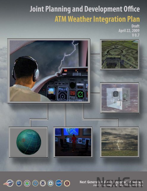
<strong>ATM</strong>-<strong>Weather</strong> <strong>Integration</strong> <strong>Plan</strong><br />
DRAFT<br />
Version 0.7<br />
April 22, 2009
<strong>Joint</strong> <strong>Plan</strong>ning <strong>and</strong> <strong>Development</strong> Office (JPDO)<br />
DRAFT v0.7<br />
<strong>ATM</strong>-<strong>Weather</strong> <strong>Integration</strong> <strong>Plan</strong><br />
EXECUTIVE SUMMARY<br />
<strong>Weather</strong> accounts for 70% 1 of the $41B annual 2 cost of air traffic delays within the United States<br />
NAS, or $28B annually. Approximately two thirds ($19B) of these delays are considered to be<br />
avoidable. 3 The <strong>Weather</strong> - <strong>ATM</strong> <strong>Integration</strong> Working Group (WAIWG) of the National Airspace<br />
System Operations Subcommittee of the FAA’s Research, Engineering <strong>and</strong> <strong>Development</strong><br />
Advisory Committee (REDAC) conducted a twelve-month study to examine the potential<br />
benefits of integrating weather <strong>and</strong> air traffic management. The report of this committee made<br />
several recommendations regarding integration of weather <strong>and</strong> the potential for weather<br />
integration to help reduce delays. The way to mitigate these delays <strong>and</strong> eliminate those that are<br />
avoidable is to improve the quality <strong>and</strong> method of use of weather information <strong>and</strong> evolve<br />
(integrate) the weather support to the NAS.<br />
This NextGen <strong>Weather</strong> <strong>Integration</strong> <strong>Plan</strong> provides the initial requirements, scope, <strong>and</strong><br />
implementation roadmap to achieve the NextGen vision; to enable decision makers to identify<br />
areas where <strong>and</strong> when aircraft can fly safely with weather assimilated into the decision making<br />
process in order to optimize the entire National Airspace System (NAS). It also addresses agency<br />
roles <strong>and</strong> responsibilities <strong>and</strong> includes resource requirements. This plan establishes the approach<br />
to deal with the integration of weather information into the Air Traffic Management (<strong>ATM</strong>)<br />
decision making process.<br />
<strong>Integration</strong>, as used in this plan, refers to the inclusion of weather information into the logic of a<br />
decision process or a decision aid such that weather impacts are taken into account when the<br />
decision is made or recommended. The goal of weather integration is to minimize the need for<br />
humans to gauge NAS weather impacts or to determine the optimum mitigation.<br />
KEY POINT: <strong>Weather</strong> information is not presently integrated into all <strong>ATM</strong> decision<br />
systems <strong>and</strong> processes.<br />
This plan addresses the following problem:<br />
Most weather support to <strong>ATM</strong> is manual, with weather displays that must be interpreted<br />
by the user.<br />
<br />
<br />
<br />
<strong>Weather</strong> products do not have the maturity required for direct insertion without<br />
interpretation.*<br />
Rules for interpretation <strong>and</strong> use of weather data are generally based on the experience<br />
of the user.<br />
<strong>ATM</strong> decisions based upon today’s weather products are inconsistent from user to<br />
user.<br />
* This aspect of the problem is addressed in the NextGen <strong>Weather</strong> <strong>Plan</strong><br />
1 OPSNET<br />
2 Congressional <strong>Joint</strong> Economic Committee; May 2008<br />
3 REDAC <strong>Weather</strong>-<strong>ATM</strong> <strong>Integration</strong> Working Group Report; Oct 3, 2007<br />
i April 22, 2009
<strong>Joint</strong> <strong>Plan</strong>ning <strong>and</strong> <strong>Development</strong> Office (JPDO)<br />
DRAFT v0.7<br />
<strong>ATM</strong>-<strong>Weather</strong> <strong>Integration</strong> <strong>Plan</strong><br />
The figure below illustrates the process of moving from raw current <strong>and</strong> forecast weather data<br />
through the creation of weather products that relate weather data to aviation impacts <strong>and</strong> on to<br />
the generation of rules for decisions to be made by <strong>ATM</strong> operators <strong>and</strong> other users <strong>and</strong> ultimately<br />
to the creation of automated decision support tools.<br />
KEY POINT: The process to flow from information on the state of the atmosphere to<br />
translation into impacts to decision rules on dealing with impacts to inclusion into decision<br />
systems.<br />
At NextGen IOC (2013), some weather data will flow machine-to-machine with real integration<br />
into decision support tools (DST), but most integration of weather information will still be<br />
h<strong>and</strong>led manually, with some data <strong>and</strong> displays provided to the cockpit for pilot decision. By the<br />
2018 mid-term some DSTs will have integrated weather, <strong>and</strong> by 2025, weather information will<br />
be automatically translated to impact <strong>and</strong> ingested into most decision algorithms, both on the<br />
ground <strong>and</strong> in the cockpit.<br />
KEY POINT: An analysis of weather impacts into decision tools has been done.<br />
An analysis of the current state of weather integration was conducted <strong>and</strong> this plan lays out the<br />
weather integration opportunity in the NextGen solution sets; Initiate Trajectory Based<br />
Operations, Increase Arrivals/Departures at High density airports, Increase Flexibility in the<br />
Terminal Environment, Improve Collaborative <strong>ATM</strong>, Increase Safety, Security, <strong>and</strong><br />
ii April 22, 2009
<strong>Joint</strong> <strong>Plan</strong>ning <strong>and</strong> <strong>Development</strong> Office (JPDO)<br />
DRAFT v0.7<br />
<strong>ATM</strong>-<strong>Weather</strong> <strong>Integration</strong> <strong>Plan</strong><br />
Environmental Performance, <strong>and</strong> Transform Facilities. Each solution set was broken down into<br />
swim lanes, <strong>and</strong> then further into capabilities <strong>and</strong> associated Operational Improvements (OIs).<br />
This analysis is reflected in Section 3 of the <strong>Plan</strong>, along with the associated Appendix A.<br />
KEY POINT: An analysis of available weather translation <strong>and</strong> decision methodologies has<br />
been done<br />
<strong>ATM</strong> will require DSTs that can deal with the information from the 4-D <strong>Weather</strong> Data Cube<br />
which has been translated into NAS impacts <strong>and</strong> provide <strong>ATM</strong> with best choice options. The<br />
translation can be obtained by a network service for common use or by imbedding the translation<br />
capability in the DST for unique needs. Section 4 <strong>and</strong> the associated Appendix B provide a<br />
survey that identifies technologies <strong>and</strong> methodologies for translating weather information into<br />
<strong>ATM</strong> impacts in the NAS. The survey includes approaches for addressing weather-related<br />
uncertainty in <strong>ATM</strong> decision making – risk management processes. The survey is organized in<br />
two parts; <strong>ATM</strong>-<strong>Weather</strong> Impact Models <strong>and</strong> <strong>ATM</strong>-<strong>Weather</strong> <strong>Integration</strong> Techniques.<br />
The <strong>Plan</strong> presents a summary of each of the surveyed <strong>ATM</strong>-impact models starting with models<br />
that were derived primarily for convection, <strong>and</strong> ending with a wide variety of models for several<br />
types of aviation hazards. This section assessed the maturity of the <strong>ATM</strong>-impact models<br />
presented, <strong>and</strong> identified gaps in technologies that must be addressed for NextGen.<br />
KEY POINT: A foundation of mature, tested methodologies must be built <strong>and</strong> maintained,<br />
along with a capability for multi-use impacts translation.<br />
Further research is required on the conversion of weather data into specific <strong>ATM</strong> impacts.<br />
The execution of this plan will occur in four steps. The steps will be executed in sequential order<br />
from the start, but the steps will be repeated many times as new weather techniques <strong>and</strong> <strong>ATM</strong><br />
tools are developed <strong>and</strong> may be occurring simultaneously at some point in the future. The steps<br />
are:<br />
1. Align teams with each solution set <strong>and</strong> analyze weather integration requirements for a<br />
service <strong>and</strong> performance-based approach for weather integration as associated with<br />
operational relevance.<br />
2. Identify the specific weather integration insertion points, including performance criteria<br />
<strong>and</strong> value, into <strong>ATM</strong> tool or decision platform functionality.<br />
3. Identify <strong>and</strong> recommend the specific weather integration techniques <strong>and</strong> technologies that<br />
best fit the requirements of a particular traffic flow management tool under development<br />
<strong>and</strong> particularly the insertion points identified in the previous step.<br />
4. Serve as the subject matter expert (SME) for the <strong>ATM</strong> tool development team to assist in<br />
integration of the weather methodologies <strong>and</strong> to evaluate test results.<br />
KEY POINT: A DST-by-DST weather support activity must assist in successful weather<br />
integration.<br />
The key interaction for success in weather integration will be the relationships established<br />
between the AWO <strong>and</strong> the <strong>ATM</strong> tool development community. The AWO role is to ensure<br />
iii April 22, 2009
<strong>Joint</strong> <strong>Plan</strong>ning <strong>and</strong> <strong>Development</strong> Office (JPDO)<br />
DRAFT v0.7<br />
<strong>ATM</strong>-<strong>Weather</strong> <strong>Integration</strong> <strong>Plan</strong><br />
proper use <strong>and</strong> application of weather data <strong>and</strong> techniques in development of specific DSTs.<br />
During development, the AWO will fund demonstrations for specific technologies in order to<br />
demonstrate both the quality <strong>and</strong> usability of weather information in the decision process. As<br />
DST development proceeds, weather data for specific DSTs will transition from a testing<br />
scenario to inclusion of production data directly from the 4-D <strong>Weather</strong> Data Cube.<br />
Anticipated initial activities<br />
FY10:<br />
- Building weather translation <strong>and</strong> decision foundation, including test <strong>and</strong> evaluation<br />
capability.<br />
- St<strong>and</strong> up <strong>Weather</strong> Leadership Team <strong>and</strong> <strong>Integration</strong> Sub-Teams.<br />
- Identify initial set of DSTs that have the potential for successful weather integration by<br />
NextGen IOC. Identify c<strong>and</strong>idate methodologies, brief users, <strong>and</strong> develop demonstrations<br />
of weather methodologies that will yield success.<br />
FY11:<br />
- Conduct successful demonstrations of weather products or methodologies that have the<br />
necessary maturity level for integration<br />
FY12:<br />
- Work with user community <strong>and</strong> DST developers to integrate weather products <strong>and</strong><br />
methodologies into DSTs for IOC implementation<br />
iv April 22, 2009
<strong>Joint</strong> <strong>Plan</strong>ning <strong>and</strong> <strong>Development</strong> Office (JPDO)<br />
DRAFT v0.7<br />
<strong>ATM</strong>-<strong>Weather</strong> <strong>Integration</strong> <strong>Plan</strong><br />
TABLE OF CONTENTS<br />
1 INTRODUCTION .................................................................................................................. 1<br />
1.1 Background ...................................................................................................................... 1<br />
1.2 Purpose ............................................................................................................................. 1<br />
1.2.1 <strong>Integration</strong> Definition ................................................................................................ 1<br />
1.2.2 <strong>Integration</strong> Goal ........................................................................................................ 1<br />
1.3 Scope ................................................................................................................................ 2<br />
1.3.1 Assumptions .............................................................................................................. 2<br />
1.3.2 Roles <strong>and</strong> Responsibilities ........................................................................................ 2<br />
2 NEXTGEN WEATHER INTEGRATION OVERVIEW AND CONCEPT .......................... 4<br />
2.1 Problem Statement ........................................................................................................... 5<br />
2.2 <strong>Weather</strong> Impacts on Solution Sets ................................................................................... 8<br />
2.3 Alternatives Considered for <strong>Integration</strong> ........................................................................... 9<br />
2.3.1 Status Quo – Do Nothing ........................................................................................ 10<br />
2.3.2 Improve <strong>Weather</strong> Products to Enhance Usability by <strong>ATM</strong> .................................... 10<br />
2.3.3 Integrate <strong>Weather</strong> Information into <strong>ATM</strong> Decision Support Tools ........................ 10<br />
2.4 Recommended Solution: Integrate <strong>Weather</strong> into <strong>ATM</strong> Decision Support Tools .......... 11<br />
2.5 Anticipated Benefits <strong>and</strong> Impact .................................................................................... 11<br />
3 NEXTGEN WEATHER INTEGRATION: DECISION SUPPORT TOOLS ...................... 12<br />
3.1 Trajectory Based Operations .......................................................................................... 16<br />
3.1.1 Separation Management .......................................................................................... 16<br />
3.1.2 Trajectory Management .......................................................................................... 16<br />
3.1.3 Capacity Management ............................................................................................ 17<br />
3.2 High Density Airports .................................................................................................... 18<br />
3.2.1 Separation Management .......................................................................................... 18<br />
3.2.2 Trajectory Management .......................................................................................... 18<br />
3.2.3 Capacity Management ............................................................................................ 19<br />
3.3 Flexible Airspace in the Terminal Area ......................................................................... 20<br />
3.3.1 Separation Management .......................................................................................... 20<br />
3.3.2 Trajectory Management .......................................................................................... 21<br />
v April 22, 2009
<strong>Joint</strong> <strong>Plan</strong>ning <strong>and</strong> <strong>Development</strong> Office (JPDO)<br />
DRAFT v0.7<br />
<strong>ATM</strong>-<strong>Weather</strong> <strong>Integration</strong> <strong>Plan</strong><br />
3.3.3 Flight <strong>and</strong> State Data Management ......................................................................... 21<br />
3.4 Collaborative Air Traffic Management .......................................................................... 22<br />
3.4.1 Flight Contingency Management ............................................................................ 22<br />
3.4.2 Capacity Management ............................................................................................ 24<br />
3.4.3 Flight <strong>and</strong> State Data Management ......................................................................... 24<br />
3.5 Increase Safety, Security <strong>and</strong> Environmental Performance (SSE) ................................ 26<br />
3.6 Transform Facilities (Facilities) ..................................................................................... 26<br />
3.7 Additional Initiatives <strong>and</strong> Targets: ................................................................................. 26<br />
4 TECHNOLOGY AND METHODOLOGY CONCEPTS .................................................... 26<br />
4.1 Survey of <strong>ATM</strong>-<strong>Weather</strong> Impact Models ...................................................................... 27<br />
4.2 Maturity <strong>and</strong> Gap Analysis ............................................................................................ 36<br />
4.3 Survey of <strong>ATM</strong>-<strong>Weather</strong> <strong>Integration</strong> Technologies ...................................................... 38<br />
4.4 Maturity <strong>and</strong> Gap Analysis ............................................................................................ 40<br />
5 WEATHER INTEGRATION PLAN EXECUTION ............................................................ 42<br />
5.1 <strong>Plan</strong> Execution ................................................................................................................ 42<br />
5.1.1 Foundation for <strong>Integration</strong> ...................................................................................... 42<br />
5.1.2 <strong>Integration</strong> Process .................................................................................................. 43<br />
5.2 Organization ................................................................................................................... 46<br />
5.2.1 <strong>Weather</strong> Leadership Team ...................................................................................... 46<br />
5.2.2 <strong>Weather</strong> <strong>Integration</strong> Sub-Teams ............................................................................. 47<br />
5.2.3 <strong>Weather</strong> <strong>Integration</strong> Technology Evaluation Board ............................................... 48<br />
5.3 Cost, Benefits, <strong>and</strong> Schedule .......................................................................................... 48<br />
5.4 Relationship of <strong>Integration</strong> with Aviation <strong>Weather</strong> Programs ....................................... 49<br />
6 ALIGNING THE WEATHER INTEGRATION PLAN WITH PREVIOUS FINDINGS<br />
AND RECOMMENDATIONS .................................................................................................... 50<br />
6.1 <strong>Weather</strong> – <strong>ATM</strong> <strong>Integration</strong> Working Group (WAIWG) of the National Airspace<br />
System Operations Subcommittee of the FAA’s Research, Engineering <strong>and</strong> <strong>Development</strong><br />
Advisory Committee (REDAC) ................................................................................................ 51<br />
6.2 NextGen Conference on Integrating <strong>Weather</strong>, Airports, <strong>and</strong> Air Navigation Services . 51<br />
6.3 <strong>Integration</strong> Teams Approach to Tracking the Status on the Previous Findings <strong>and</strong><br />
Recommendations ..................................................................................................................... 52<br />
6.4 Agency Approaches to Implementing the Findings <strong>and</strong> Recommendations ................. 52<br />
vi April 22, 2009
<strong>Joint</strong> <strong>Plan</strong>ning <strong>and</strong> <strong>Development</strong> Office (JPDO)<br />
DRAFT v0.7<br />
<strong>ATM</strong>-<strong>Weather</strong> <strong>Integration</strong> <strong>Plan</strong><br />
A. NEXTGEN WEATHER INTEGRATION: DECISION SUPPORT TOOLS, DECISION<br />
IMPLEMENTATION PLAN AND COST PROCESSES ......................................................... A-1<br />
A-1. Initiate Trajectory Based Operations (TBO) ............................................................ A-1<br />
A-1.1 Separation Management ........................................................................................ A-3<br />
A-1.2 Trajectory Management ........................................................................................ A-6<br />
A-1.3 Capacity Management .......................................................................................... A-8<br />
A-1.4 Flight <strong>and</strong> State Data Management ....................................................................... A-9<br />
A-2. Increase Arrivals/Departures at High Density Airports ......................................... A-10<br />
A-2.1 Integrated Arrival/Departure Airspace Management (OI-0307, OI-104122) ..... A-12<br />
A-2.2 Time-Based Metering Using RNP <strong>and</strong> RNAV Route Assignments (OI-0325, OI-<br />
104123) A-24<br />
A-2.3 Improve Operations to Closely Spaced Parallel Runways (OI-0333, OI-102141) . A-<br />
29<br />
A-2.4 Initial Surface Traffic Management (OI-0320, OI-104209) ............................... A-34<br />
A-3. Increase Flexibility in the Terminal Environment .................................................. A-38<br />
A-3.1 Separation Management ...................................................................................... A-39<br />
A-3.2 Trajectory Management ...................................................................................... A-45<br />
A-3.3 Capacity Management ........................................................................................ A-47<br />
A-3.4 Flight <strong>and</strong> State Data Management ..................................................................... A-48<br />
A-4. Improved Collaborative Air Traffic Management (C<strong>ATM</strong>) .................................. A-55<br />
A-4.1 Flight Contingency Management ........................................................................ A-55<br />
A-4.2 Capacity Management ........................................................................................ A-66<br />
A-4.3 Flight <strong>and</strong> State Data Management ..................................................................... A-67<br />
A-4.4 Additional Initiatives <strong>and</strong> Targets ....................................................................... A-84<br />
A-5. Increase Safety, Security <strong>and</strong> Environmental Performance (SSE) ......................... A-86<br />
A-6. Transform Facilities (Facilities) ............................................................................. A-86<br />
A-7. JPDO Working Group Initiatives ........................................................................... A-86<br />
A-8. AJN Initiatives ........................................................................................................ A-86<br />
A-9. DOD Considerations............................................................................................... A-86<br />
A-7.1 DOD Methodologies for <strong>Weather</strong> <strong>Integration</strong> into <strong>ATM</strong> Decisions .................. A-86<br />
A-7.2 Operation of Civil Aircraft in Military Controlled Airspace <strong>and</strong> Terminals ...... A-86<br />
vii April 22, 2009
<strong>Joint</strong> <strong>Plan</strong>ning <strong>and</strong> <strong>Development</strong> Office (JPDO)<br />
DRAFT v0.7<br />
<strong>ATM</strong>-<strong>Weather</strong> <strong>Integration</strong> <strong>Plan</strong><br />
A-7.3 Transitions Between Civil <strong>and</strong> Military Airspace .............................................. A-86<br />
A-10. Air Carrier Considerations...................................................................................... A-86<br />
A-11. GA Considerations ................................................................................................. A-86<br />
A-9.1 High-End GA ...................................................................................................... A-86<br />
A-9.2 Low-End GA ....................................................................................................... A-86<br />
A-9.3 HEMS ................................................................................................................. A-86<br />
A-12. Commercial Space Transportation Operational Activities ..................................... A-86<br />
B. TECHNOLOGY AND METHODOLOGY ....................................................................... B-1<br />
B-1. Survey of <strong>ATM</strong> <strong>Weather</strong> Impact Models ................................................................. B-1<br />
B-1.1 En route Convective <strong>Weather</strong> Avoidance Modeling ............................................ B-1<br />
B-1.2 Terminal Convective <strong>Weather</strong> Avoidance Modeling ........................................... B-2<br />
B-1.3 Mincut Algorithms to determine Maximum Capacity for an Airspace ................ B-3<br />
B-1.4 <strong>Weather</strong>-Impacted Sector Capacity considering CWAM <strong>and</strong> Flow Structure ..... B-4<br />
B-1.5 Route Availability in Convective <strong>Weather</strong> ........................................................... B-6<br />
B-1.6 Directional Capacity <strong>and</strong> Directional Dem<strong>and</strong> ..................................................... B-7<br />
B-1.7 <strong>ATM</strong> Impact based on the <strong>Weather</strong> Impacted Traffic Index ................................ B-9<br />
B-1.8 <strong>Weather</strong>-Weighted Periodic Auto Regressive Models for Sector Dem<strong>and</strong><br />
Prediction .......................................................................................................................... B-10<br />
B-1.9 <strong>ATM</strong> Impact in terms of a Stochastic Congestion Grid ..................................... B-11<br />
B-1.10 Translation of Ensemble <strong>Weather</strong> Forecasts into Probabilistic <strong>ATM</strong> Impacts B-12<br />
B-1.11<br />
B-1.12<br />
Translation of a Deterministic <strong>Weather</strong> Forecast into Probabilistic <strong>ATM</strong> Impacts<br />
......................................................................................................................... B-13<br />
Sensitivity of NAS-wide <strong>ATM</strong> Performance to <strong>Weather</strong> Forecasting Uncertainty<br />
......................................................................................................................... B-15<br />
B-1.13 Use of Probabilistic Convective <strong>Weather</strong> Forecasts to Assess Pilot Deviation<br />
Probability ......................................................................................................................... B-16<br />
B-1.14 Integrated Forecast Quality Assessment with <strong>ATM</strong> Impacts for Aviation<br />
Operational Applications .................................................................................................. B-17<br />
B-1.15 Conditioning <strong>ATM</strong> Impact Models into User-relevant Metrics...................... B-18<br />
B-1.16 <strong>Integration</strong> of the Probabilistic Fog Burn Off Forecast into TFM Decision<br />
Making ......................................................................................................................... B-20<br />
B-1.17 Mincut Algorithms given Hard/Soft Constraints to determine Maximum<br />
Capacity ......................................................................................................................... B-21<br />
viii April 22, 2009
<strong>Joint</strong> <strong>Plan</strong>ning <strong>and</strong> <strong>Development</strong> Office (JPDO)<br />
DRAFT v0.7<br />
<strong>ATM</strong>-<strong>Weather</strong> <strong>Integration</strong> <strong>Plan</strong><br />
B-1.18 <strong>ATM</strong> Impact of Turbulence ............................................................................ B-22<br />
B-1.19 Tactical Feedback of Automated Turbulence electronic Pilot Reports ........... B-24<br />
B-1.20 <strong>ATM</strong> Impact of Winter <strong>Weather</strong> at Airports ................................................... B-25<br />
B-1.21 <strong>ATM</strong> Impact of In-Flight Icing ....................................................................... B-25<br />
B-1.22 Probabilistic Forecasts for Ceiling <strong>and</strong> Visibility <strong>and</strong> Obstructions to Visibility B-<br />
26<br />
B-1.23 Improved Wind Forecasts to predict Runway Configuration Changes ........... B-27<br />
B-1.24 Improved Wind Forecasts to facilitate Wake Vortex Decision Support ......... B-29<br />
B-1.25 Impact of Winds Aloft on the Compression of Terminal Area Traffic Flows B-31<br />
B-1.26 Oceanic/Remote <strong>Weather</strong> <strong>Integration</strong> ............................................................. B-31<br />
B-1.27 Translation of Volcanic Ash Plume Hazards onto Airspace <strong>and</strong> Airport Impacts ..<br />
......................................................................................................................... B-32<br />
B-1.28 Translation of Atmospheric Effects into Environmental <strong>and</strong> <strong>ATM</strong> Impacts .. B-33<br />
B-1.29 <strong>ATM</strong> Impact of Space <strong>Weather</strong> ...................................................................... B-34<br />
B-1.30 <strong>ATM</strong> Impact of <strong>Weather</strong> Constraints on General Aviation Access to the NAS . B-<br />
35<br />
B-2. Methodologies for <strong>ATM</strong> <strong>Weather</strong> <strong>Integration</strong> ........................................................ B-37<br />
B-2.1<br />
Sequential, Probabilistic Congestion Management for addressing <strong>Weather</strong> Impacts<br />
............................................................................................................................. B-37<br />
B-2.2 Sequential Traffic Flow Optimization with Tactical Flight Control Heuristics . B-39<br />
B-2.3 Airspace Flow Programs to address 4D Probabilistic <strong>Weather</strong> Constraints ....... B-40<br />
B-2.4 Ground Delay Program <strong>Plan</strong>ning under Capacity Uncertainty ........................... B-41<br />
B-2.5 Contingency <strong>Plan</strong>ning with Ensemble <strong>Weather</strong> Forecasts <strong>and</strong> Probabalistic<br />
Decision Trees .................................................................................................................. B-43<br />
B-2.6 Probabilistic Traffic Flow Management ............................................................. B-45<br />
B-2.7 A Heuristic Search for Resolution Actions in Response to <strong>Weather</strong> Impacts .... B-47<br />
B-2.8 Integrated Departure Route <strong>Plan</strong>ning with <strong>Weather</strong> Constraints ........................ B-49<br />
B-2.9 Tactical Flow-based Rerouting ........................................................................... B-50<br />
B-2.10 Tactical On-Dem<strong>and</strong> Coded Departure Routes (CDRs) ................................. B-51<br />
B-3. References .............................................................................................................. B-52<br />
C. INTEGRATION PROGRAM PLAN ................................................................................. C-1<br />
C-1. <strong>Weather</strong> <strong>Integration</strong> Budget ...................................................................................... C-1<br />
ix April 22, 2009
<strong>Joint</strong> <strong>Plan</strong>ning <strong>and</strong> <strong>Development</strong> Office (JPDO)<br />
DRAFT v0.7<br />
<strong>ATM</strong>-<strong>Weather</strong> <strong>Integration</strong> <strong>Plan</strong><br />
C-2. <strong>Weather</strong> <strong>Integration</strong> Benefits .................................................................................... C-1<br />
C-3. Schedule.................................................................................................................... C-1<br />
C-4. Risk Assessment ....................................................................................................... C-6<br />
C-5. Human Factors Considerations ................................................................................. C-6<br />
C-6. Training .................................................................................................................... C-6<br />
C-7. Intellectual Property Rights Considerations ............................................................. C-6<br />
D. INTEGRATION PLAN TRACEABILITY WITH PREVIOUS STUDY GROUPS ......... D-1<br />
D-1. REDAC Recommendations <strong>and</strong> Response ............................................................... D-1<br />
D-2. <strong>Integration</strong> <strong>Plan</strong> Alignment with <strong>Weather</strong> <strong>ATM</strong> <strong>Integration</strong> Conference<br />
Recommendations ................................................................................................................. D-16<br />
E. CURRENT <strong>ATM</strong> TOOLS ................................................................................................... E-1<br />
F. ACRONYMS ....................................................................................................................... F-1<br />
x April 22, 2009
<strong>Joint</strong> <strong>Plan</strong>ning <strong>and</strong> <strong>Development</strong> Office (JPDO)<br />
DRAFT v0.7<br />
<strong>ATM</strong>-<strong>Weather</strong> <strong>Integration</strong> <strong>Plan</strong><br />
LIST OF FIGURES<br />
Figure 2-1 Conceptual Flow ....................................................................................................... 5<br />
Figure B-14 Convective forecast transformed into <strong>ATM</strong> impact in various formats. ............. 27<br />
Figure B-1 CWAM implementation to create WAFs. ............................................................ B-1<br />
Figure B-2 Arriving pilots penetrate weather that departures seek to avoid. .......................... B-3<br />
Figure B-3 The translation of convective weather into maximum <strong>ATM</strong> throughput. ............ B-4<br />
Figure B-4 <strong>Weather</strong> impacted sector capacity estimation ....................................................... B-5<br />
Figure B-5 Mincut/Maxflow <strong>and</strong> Route Blockage estimate route availability in structured, en<br />
route airspace (left) <strong>and</strong> flexible routing to avoid terminal area convective weather (right). .... B-7<br />
Figure B-6 Directional capacity <strong>and</strong> dem<strong>and</strong> rose chart. ........................................................ B-8<br />
Figure B-7 Factors included in a WITI calculation. .............................................................. B-10<br />
Figure B-8 Stochastic congestion grid with combined traffic <strong>and</strong> weather constraint<br />
probabilities. ............................................................................................................................. B-12<br />
Figure B-9 Procedure for translating an ensemble of weather forecasts into a probabilistic<br />
capacity map in terms of likelihood of a given capacity reduction. ......................................... B-13<br />
Figure B-10 <strong>Weather</strong> forecast errors characterized in terms of coverage, timing, <strong>and</strong><br />
translational errors create an ensemble of weather constraints for a probabilistic <strong>ATM</strong>-impact<br />
assessment. ......................................................................................................................... B-14<br />
Figure B-11 NAS performance sensitivities of trajectory-based <strong>and</strong> flow-based operations<br />
performance improvements <strong>and</strong> agile versus non agile decision making. ................................ B-16<br />
Figure B-12 Transforming a probabilistic NCWF-6 forecast into probability of penetration. B-<br />
17<br />
Figure B-13 Sector-based verification of a 2-hour forecast <strong>and</strong> observations (impacted sectors<br />
are color-coded to depict the verification results). .................................................................... B-18<br />
Figure B-14 Convective forecast transformed into <strong>ATM</strong> impact in various formats. ......... B-19<br />
Figure B-15 Convective forecasts for use by automated <strong>ATM</strong> planners (impacted sectors are<br />
red for high impact <strong>and</strong> blue no impact). .................................................................................. B-19<br />
Figure B-16 <strong>Integration</strong> of a Probabilistic Forecast of Stratus Clearing with TFM. ........... B-20<br />
Figure B-17<br />
Capacity computation for two classes of aircraft among hard <strong>and</strong> soft constraints.<br />
......................................................................................................................... B-22<br />
Figure B-18 Causality diagram for turbulence. ................................................................... B-23<br />
Figure B-19 Feedback of e-PIREP CIT turbulence data transformed into hazard regions. B-25<br />
Figure B-20 In-flight icing causes significant <strong>ATM</strong> impacts. ............................................. B-26<br />
xi April 22, 2009
<strong>Joint</strong> <strong>Plan</strong>ning <strong>and</strong> <strong>Development</strong> Office (JPDO)<br />
DRAFT v0.7<br />
<strong>ATM</strong>-<strong>Weather</strong> <strong>Integration</strong> <strong>Plan</strong><br />
Figure B-21 Causality Diagram for Terminal C&V. ........................................................... B-28<br />
Figure B-22 Conceptual timeline showing traffic flow management in response to reduced<br />
wake vortex separations for arrival aircraft. ............................................................................. B-30<br />
Figure B-23 Causality diagram <strong>ATM</strong> impacts of volcanic ash. .......................................... B-33<br />
Figure B-24 The sequential, probabilistic congestion management concept as a control loop. ..<br />
......................................................................................................................... B-38<br />
Figure B-25 Sequential optimization with strategic <strong>and</strong> tactical weather translation. ........ B-39<br />
Figure B-26 In an AFP, routes within the FCA are defined by an FCA planning DST to<br />
maximize throughput given weather constraints; routes outside the FCA are determined by<br />
routing preferences of the user. ................................................................................................. B-41<br />
Figure B-27 A dynamic stochastic algorithm for planning <strong>and</strong> controlling a GDP. ........... B-43<br />
Figure B-28 Probabilistic decision tree reasoning with an ensemble of weather forecasts. B-45<br />
Figure B-29 Example histogram of flight congestion costs. ............................................... B-46<br />
Figure B-30 Congestion management algorithm flow diagram. ......................................... B-48<br />
Figure B-31 Integrated Departure Route <strong>Plan</strong>ning Concept. ............................................... B-50<br />
Figure B-32 Example flow reroute. ..................................................................................... B-50<br />
Figure B-33 On-Dem<strong>and</strong> CDRs between pitch <strong>and</strong> catch gates from Airport A to B. ....... B-52<br />
xii April 22, 2009
<strong>Joint</strong> <strong>Plan</strong>ning <strong>and</strong> <strong>Development</strong> Office (JPDO)<br />
DRAFT v0.7<br />
<strong>ATM</strong>-<strong>Weather</strong> <strong>Integration</strong> <strong>Plan</strong><br />
LIST OF TABLES<br />
Table 2-1 Alternatives Considered for Providing <strong>Weather</strong> Information ....................................... 9<br />
Table 4-1. Level of Maturity for <strong>ATM</strong>-impact Models. ............................................................... 36<br />
Table 4-2. Level of Maturity for <strong>ATM</strong>-<strong>Weather</strong> <strong>Integration</strong> Technologies ................................. 41<br />
Table A-1 Integrated Arrival/Departure Airspace Management – Mid-term <strong>Weather</strong> Needs<br />
Analysis..................................................................................................................................... A-21<br />
Table A-2 Time-Based Metering Using RNP <strong>and</strong> RNAV Route Assignments – Mid-term<br />
<strong>Weather</strong> Needs Analysis ........................................................................................................... A-28<br />
Table A-3 Improve Operations to Closely Spaced Parallel Runways – Mid-term <strong>Weather</strong> Needs<br />
Analysis..................................................................................................................................... A-34<br />
Table A-4 Initial Surface Traffic Management – Mid-term <strong>Weather</strong> Needs Analysis ............. A-38<br />
Table A-5 C<strong>ATM</strong> Concept Engineering Initiatives .................................................................. A-57<br />
xiii April 22, 2009
<strong>Joint</strong> <strong>Plan</strong>ning <strong>and</strong> <strong>Development</strong> Office (JPDO)<br />
DRAFT v0.7<br />
<strong>ATM</strong>-<strong>Weather</strong> <strong>Integration</strong> <strong>Plan</strong><br />
1<br />
2<br />
3<br />
4<br />
5<br />
6<br />
7<br />
8<br />
9<br />
10<br />
11<br />
12<br />
13<br />
14<br />
15<br />
16<br />
17<br />
18<br />
19<br />
20<br />
21<br />
22<br />
23<br />
24<br />
25<br />
26<br />
27<br />
28<br />
29<br />
30<br />
31<br />
32<br />
33<br />
34<br />
35<br />
1 INTRODUCTION<br />
There is a need for a multi-agency, synchronized plan to achieve solutions to the problem of<br />
weather integration into <strong>ATM</strong> operations <strong>and</strong> decisions. As articulated in the NextGen vision, the<br />
solution must enable decision makers to identify areas where <strong>and</strong> when aircraft can fly safely<br />
with weather assimilated into the decision making process in order to optimize the entire national<br />
airspace system. The NextGen <strong>Weather</strong> <strong>Integration</strong> <strong>Plan</strong> provides the initial requirements, scope<br />
<strong>and</strong> implementation roadmap to achieve the NextGen vision. It also addresses agency roles <strong>and</strong><br />
responsibilities <strong>and</strong> includes resource requirements.<br />
1.1 Background<br />
<strong>Weather</strong> accounts for 70 percent of all air traffic delays within the United States National<br />
Airspace System (NAS). The total cost of these delays has been estimated to be as much as $41B<br />
annually with weather delays costing over $28B annually. Approximately two thirds of weather<br />
delays have been estimated to be avoidable. The way to mitigate weather delays <strong>and</strong> eliminate<br />
avoidable delays is to improve the quality of weather information <strong>and</strong> to evolve weather support<br />
to the NAS both in quality <strong>and</strong> in methods of use, from its current levels to new targeted<br />
approaches.<br />
1.2 Purpose<br />
This plan establishes the approach to deal with the integration of weather information into the<br />
<strong>ATM</strong> decision making process.<br />
1.2.1 <strong>Integration</strong> Definition<br />
<strong>Integration</strong> as used in this plan refers to the inclusion of weather information into the logic of a<br />
decision process or a decision aid such that weather impacts are taken into account when the<br />
decision is made or recommended. This applies whether the decision is made individually or<br />
jointly by service providers <strong>and</strong> users.<br />
1.2.2 <strong>Integration</strong> Goal<br />
The goal of weather integration is to minimize the need for humans to gauge NAS weather<br />
impacts or to determine the optimum mitigation. Today, weather integration is nearly all manual<br />
by decision makers after they view st<strong>and</strong>-alone weather products. <strong>Weather</strong> integration in<br />
NextGen will be an evolving process:<br />
At NextGen IOC (2013)<br />
Some weather data will flow machine-to-machine with real integration into<br />
decision support tools (DST).<br />
Most integration of weather information will still be h<strong>and</strong>led manually but with<br />
improved “high glance value” products.<br />
Some data <strong>and</strong> displays will be provided to the cockpit for pilot decisions.<br />
1 April 22, 2009
<strong>Joint</strong> <strong>Plan</strong>ning <strong>and</strong> <strong>Development</strong> Office (JPDO)<br />
DRAFT v0.7<br />
<strong>ATM</strong>-<strong>Weather</strong> <strong>Integration</strong> <strong>Plan</strong><br />
36<br />
37<br />
38<br />
39<br />
40<br />
41<br />
42<br />
43<br />
44<br />
45<br />
46<br />
47<br />
48<br />
49<br />
50<br />
51<br />
52<br />
53<br />
54<br />
55<br />
56<br />
57<br />
58<br />
59<br />
60<br />
61<br />
62<br />
63<br />
64<br />
65<br />
66<br />
67<br />
68<br />
69<br />
70<br />
By the 2018 mid-term some DSTs will have integrated weather.<br />
By 2025, weather information will be automatically translated to impacts <strong>and</strong><br />
ingested into most decision algorithms both on the ground <strong>and</strong> in the cockpit.<br />
1.3 Scope<br />
This <strong>Plan</strong> addresses actions to be taken by the weather community, generally under weather<br />
community funding. Although it calls for close interaction with various user programs, it does<br />
not commit those programs or their managers to take any action or expend any funds. However,<br />
to benefit from the efforts described in the <strong>Plan</strong>, it is understood that the user programs must<br />
cooperate <strong>and</strong> participate in the process.<br />
The cost of implementing the methodologies developed under <strong>and</strong> presented in the <strong>Plan</strong> will be<br />
born by the user programs. For example, where weather integration is to occur in some NAS<br />
system, the manager of that system must write the software code which implements the<br />
methodology. The weather community will support this by providing any reusable code to which<br />
it has access.<br />
In the event that any user tool or capability must be cancelled postponed, its description in this<br />
<strong>Plan</strong> does not in any way obligate the program manager to continue the program.<br />
1.3.1 Assumptions<br />
The creation <strong>and</strong> production of appropriate weather analyses <strong>and</strong> forecasts is to be addressed<br />
elsewhere <strong>and</strong> is outside of the scope of the integration effort. However, the <strong>Integration</strong> effort<br />
will address the identification of user requirements for weather information which will be<br />
conveyed to the developers.<br />
The regulatory approval process for the use of new weather analyses <strong>and</strong> forecasts is to be<br />
addressed elsewhere <strong>and</strong> is outside of the scope of the integration effort. However, the<br />
<strong>Integration</strong> effort will support the regulatory process by providing rationale <strong>and</strong> other supporting<br />
documentation on how the information is to be used.<br />
The SOA/IT infrastructure associated with publication of weather analyses <strong>and</strong> forecasts is to be<br />
addressed elsewhere <strong>and</strong> is outside of the scope of the integration effort. However, the<br />
<strong>Integration</strong> effort will act as an intermediary between the weather IT community <strong>and</strong> the user<br />
system owners to ensure that appropriate weather-related information flow occurs.<br />
1.3.2 Roles <strong>and</strong> Responsibilities<br />
Agency <strong>and</strong> community roles are as follows.<br />
1.3.2.1 FAA<br />
The FAA will be the primary actor to the extent that most <strong>ATM</strong> systems are owned by the FAA<br />
<strong>and</strong> the <strong>ATM</strong>-<strong>Weather</strong> <strong>Integration</strong> Process resides primarily within the FAA. However, for<br />
success, other agencies <strong>and</strong> stakeholders must be involved.<br />
2 April 22, 2009
<strong>Joint</strong> <strong>Plan</strong>ning <strong>and</strong> <strong>Development</strong> Office (JPDO)<br />
DRAFT v0.7<br />
<strong>ATM</strong>-<strong>Weather</strong> <strong>Integration</strong> <strong>Plan</strong><br />
71<br />
72<br />
73<br />
74<br />
75<br />
76<br />
77<br />
78<br />
79<br />
80<br />
81<br />
82<br />
83<br />
84<br />
85<br />
86<br />
87<br />
88<br />
89<br />
90<br />
91<br />
92<br />
93<br />
94<br />
95<br />
96<br />
97<br />
98<br />
99<br />
100<br />
101<br />
102<br />
103<br />
104<br />
1.3.2.2 NASA<br />
NASA will continue to be a major developer of <strong>ATM</strong> tools <strong>and</strong> techniques, <strong>and</strong> also of weather<br />
integration methodologies. NASA will share the fruits of its development with the other<br />
stakeholders for implementation <strong>and</strong> deployment.<br />
1.3.2.3 DOD<br />
The DOD has developed <strong>and</strong> is expected to continuing to develop tools <strong>and</strong> methodologies<br />
which have application to the civil aviation community, including some relevant to weather<br />
integration efforts. To the extent possible, the DOD will share its developments with the broader<br />
NextGen weather integration community.<br />
DOD will also cooperate in the development of weather integration capabilities<br />
When civil aircraft operate in military-controlled airspace.<br />
When civil aircraft operate at military airfields or joint-use fields operated by the<br />
DOD.<br />
When the weather integration community is considering the h<strong>and</strong>-off of aircraft<br />
between civil <strong>and</strong> military control.<br />
1.3.2.4 NOAA<br />
NOAA is the principal provider of weather information in the NextGen 4-D <strong>Weather</strong> Data Cube,<br />
<strong>and</strong> that is the primary NOAA weather role, rather than integration into <strong>ATM</strong> decisions. For<br />
more information on NOAA <strong>and</strong> the 4-D <strong>Weather</strong> Data Cube, see the NEXTGEN <strong>Weather</strong> <strong>Plan</strong>,<br />
which is a companion document to this <strong>Integration</strong> <strong>Plan</strong>.<br />
1.3.2.5 Private Sector<br />
This <strong>Plan</strong> does not in itself obligate the Private Sector to take any action. However, when<br />
weather-integrated <strong>ATM</strong> capabilities become operational, Private Sector users will be affected.<br />
To the maximum extent possible, writers <strong>and</strong> executors of this <strong>Plan</strong> will take the needs of the<br />
Private Sector into account, such as by refraining from unnecessary equipage requirements.<br />
Through the NextGen Institute, members of the Private Sector have participated in the<br />
preparation of the <strong>Plan</strong> <strong>and</strong> will be encouraged to continue their participation. The Government<br />
will make every effort to involve the Private Sector <strong>and</strong> keep the Private Sector informed of any<br />
decision which may affect the Private Sector.<br />
1.3.2.6 International<br />
Both weather <strong>and</strong> aviation are International enterprises. As with other NextGen developments,<br />
the weather <strong>Integration</strong> community will seek to harmonize itself with related International<br />
efforts, such as those in Single European Sky <strong>ATM</strong> Research (SESAR), the International Civil<br />
Aviation Organization (ICAO), <strong>and</strong> the World Meteorological Organization (WMO).<br />
3 April 22, 2009
<strong>Joint</strong> <strong>Plan</strong>ning <strong>and</strong> <strong>Development</strong> Office (JPDO)<br />
DRAFT v0.7<br />
<strong>ATM</strong>-<strong>Weather</strong> <strong>Integration</strong> <strong>Plan</strong><br />
105<br />
106<br />
107<br />
108<br />
109<br />
110<br />
111<br />
112<br />
113<br />
114<br />
115<br />
116<br />
117<br />
118<br />
119<br />
120<br />
121<br />
122<br />
123<br />
124<br />
125<br />
126<br />
127<br />
128<br />
129<br />
130<br />
131<br />
132<br />
133<br />
134<br />
135<br />
136<br />
137<br />
138<br />
2 NEXTGEN WEATHER INTEGRATION OVERVIEW AND CONCEPT<br />
<strong>Weather</strong> integration pertains to the inclusion of weather information into the logic of a decision<br />
process or decision aid such that weather impacts have already been taken into account when the<br />
decision is made or recommended. <strong>Weather</strong> integration into NAS decisions is fundamentally the<br />
responsibility of the user community, with the weather community in a supporting role. The<br />
ultimate goal of integration is to translate weather information as purely meteorological data into<br />
weather impacts on air traffic operations – essentially making weather transparent to its end<br />
users. The JPDO 4-D <strong>Weather</strong> Functional Requirements for <strong>ATM</strong> calls for “weather integrated<br />
directly into sophisticated decision support capabilities to assist decision makers.” Under the<br />
solution set of Reduce <strong>Weather</strong> Impacts within FAA’s OEP program is a goal of making weather<br />
information seamless to users by integrating it into decision-making automation. To the extent<br />
that weather information is truly integrated there is less need for human-readable displays, <strong>and</strong> a<br />
greater dem<strong>and</strong> for direct Machine-to-Machine (M2M) ingest of weather data from the 4-D<br />
<strong>Weather</strong> Data Cube.<br />
Decision support will evolve over the next decade <strong>and</strong> beyond. Today, most weather-related<br />
decisions are made by <strong>ATM</strong> in a completely manual mode. With few exceptions, weather data<br />
are displayed as graphics or text at the Comm<strong>and</strong> Center, at TRACONs, ARTCCs, AOCs, <strong>and</strong> in<br />
cockpits all on st<strong>and</strong>-alone systems. By NextGen IOC in 2013 some weather data flow will be<br />
via M2M means. Most integration will remain in a manual mode but many weather displays will<br />
be improved to a “high glance value” mode. Data <strong>and</strong> displays will also be provided to the<br />
cockpit for pilot decision via electronic flight bags <strong>and</strong> existing on-board systems on some<br />
aircraft. By 2025 it is expected that weather information will be automatically translated into<br />
probabilistic weather impacts on air traffic <strong>and</strong> be ingested into decision algorithms (ground <strong>and</strong><br />
aircraft).<br />
Figure 2-1 first shows the process of moving from weather data which describes the state of the<br />
atmosphere at a current or future time through conversion of that data into weather impact<br />
parameters. As shown in the figure, the creation of the state of the atmosphere <strong>and</strong> then specific<br />
products which translate the raw weather information into impacts on aviation are the<br />
responsibility of the weather community in response to guidance from the user community. The<br />
user community then generates the rules for decisions that rely on weather data <strong>and</strong> impacts <strong>and</strong><br />
then develops automated decision support tools which meet their specific operational needs.<br />
Once the process flow moves from weather impacts to development of decision rules, the<br />
weather community has the responsibility for support <strong>and</strong> advice to the user community related<br />
to the use <strong>and</strong> interpretation of the weather data or derived weather product.<br />
4 April 22, 2009
<strong>Joint</strong> <strong>Plan</strong>ning <strong>and</strong> <strong>Development</strong> Office (JPDO)<br />
DRAFT v0.7<br />
<strong>ATM</strong>-<strong>Weather</strong> <strong>Integration</strong> <strong>Plan</strong><br />
139<br />
140<br />
141<br />
142<br />
143<br />
144<br />
145<br />
146<br />
147<br />
148<br />
149<br />
150<br />
151<br />
Figure 2-1 Conceptual Flow<br />
2.1 Problem Statement<br />
Problem Summary:<br />
Most weather support to <strong>ATM</strong> is manual, with weather displays that must be<br />
interpreted by the user.<br />
<strong>Weather</strong> products do not have the maturity required for direct insertion without<br />
interpretation.*<br />
Rules for interpretation <strong>and</strong> use of weather data are generally based on the experience<br />
of the user.<br />
<strong>ATM</strong> decisions based upon today’s weather products are inconsistent from user to<br />
user.<br />
* This aspect of the problem is addressed in the NextGen <strong>Weather</strong> <strong>Plan</strong><br />
Discussion of the problem:<br />
5 April 22, 2009
<strong>Joint</strong> <strong>Plan</strong>ning <strong>and</strong> <strong>Development</strong> Office (JPDO)<br />
DRAFT v0.7<br />
<strong>ATM</strong>-<strong>Weather</strong> <strong>Integration</strong> <strong>Plan</strong><br />
152<br />
153<br />
154<br />
155<br />
156<br />
157<br />
158<br />
159<br />
160<br />
161<br />
162<br />
163<br />
164<br />
165<br />
166<br />
167<br />
168<br />
169<br />
170<br />
171<br />
172<br />
173<br />
174<br />
175<br />
176<br />
177<br />
178<br />
179<br />
180<br />
181<br />
182<br />
183<br />
184<br />
185<br />
186<br />
187<br />
188<br />
189<br />
190<br />
191<br />
192<br />
193<br />
Today’s national air transportation system is susceptible to weather disruptions causing flight<br />
delays, the impacts of which can be wide spread. Fast moving summer or winter storms<br />
impacting one hub airport or key transcontinental route can ground aircraft thous<strong>and</strong>s of miles<br />
away, further propagating flight delays <strong>and</strong> cancellations. <strong>Weather</strong> delays are more than an<br />
inconvenience; they cost the nation’s airlines, cargo carriers, corporate, <strong>and</strong> private users in<br />
excess of $28 billion annually. While severe weather will likely continue to prevent airspace <strong>and</strong><br />
airport access in the immediate vicinity of the event, many delays could be avoided with better<br />
ways of dealing with weather throughout the national air transportation system.<br />
Current weather products are not at a maturity level which allows direct machine-to-machine,<br />
automated use of weather data; rather, weather products today generally require human<br />
evaluation <strong>and</strong> interpretation. The skill in some key weather forecast products is inconsistent<br />
day-to-day <strong>and</strong> as a result, rules for making use of weather products in decisions are human<br />
derived, leading to inconsistent decisions by the user community. Many weather products or<br />
tools are “bolt on” systems that must be interpreted by the controller <strong>and</strong> figured into traffic<br />
decisions based the controller’s underst<strong>and</strong>ing of the information presented. The weather data<br />
provided by these systems may not be provided in a manner that is useful in human made traffic<br />
flow decisions. Automated systems, many of which are designed around fair weather scenarios,<br />
must be shut down when significant weather impacts operations. Lack of automated tools<br />
necessitates a cognitive, reactive, inefficient weather-related decision making process <strong>and</strong> a<br />
meteorological competency of decision makers. The weather information used for this manual<br />
process is gathered from multiple sources <strong>and</strong> individual controller perceptions are used to<br />
determine the “best source<br />
Where processes disregard weather data, many times this can be traced to the fact that the<br />
present weather data system is a collection of diverse, uncoordinated observations, forecasts <strong>and</strong><br />
supporting systems. This does not support the need for “information rather than data” where<br />
information implies an underlying process <strong>and</strong> system to help make an informed decision.<br />
Indeed, today’s weather system infrastructure to support timely <strong>and</strong> collaborative air<br />
transportation decisions necessary to avoid bad weather does not exist.<br />
DSTs are generally software applications used to automate the weather impact evaluation <strong>and</strong> air<br />
traffic/customer response. Mission Data are input into the DST, typically in the form of a<br />
proposed 4-dimensional trajectory through space <strong>and</strong> time. Along with trajectory information are<br />
added the particular weather sensitivities or risk tolerance of the flight under consideration.<br />
According to the spatial <strong>and</strong> temporal attributes of the mission (takeoff time/place, flight level,<br />
waypoints, <strong>and</strong> estimated l<strong>and</strong>ing time/place) relevant weather information is retrieved by<br />
subscription or by query/response from the 4D <strong>Weather</strong> Data Cube using XML st<strong>and</strong>ard queries.<br />
The DST then automatically compares the weather parameters to particular sensitivities of the<br />
mission under consideration. By applying relevant rules <strong>and</strong> thresholds (pilot l<strong>and</strong>ing minima,<br />
aircraft weather avoidance limits, risk tolerance, Federal Aviation Regulations, etc.) the DST<br />
converts weather information into weather impacts. The result of this logical integration is an<br />
output decision aid. For instance, the latter segments of a proposed trajectory may enter an area<br />
of forecast turbulence. If this forecast turbulence exceeds certain severity or probability limits the<br />
DST automatically flags these segments as Red. More sophisticated DSTs may recommend<br />
6 April 22, 2009
<strong>Joint</strong> <strong>Plan</strong>ning <strong>and</strong> <strong>Development</strong> Office (JPDO)<br />
DRAFT v0.7<br />
<strong>ATM</strong>-<strong>Weather</strong> <strong>Integration</strong> <strong>Plan</strong><br />
194<br />
195<br />
196<br />
197<br />
198<br />
199<br />
200<br />
201<br />
202<br />
203<br />
204<br />
205<br />
206<br />
207<br />
208<br />
209<br />
210<br />
211<br />
212<br />
213<br />
214<br />
215<br />
216<br />
217<br />
218<br />
219<br />
220<br />
221<br />
222<br />
223<br />
224<br />
225<br />
226<br />
227<br />
228<br />
229<br />
230<br />
weather-optimized trajectories through an iterative process of query <strong>and</strong> response. Thus, the<br />
trajectory flagged as Red for turbulence initially may be rendered Green by an earlier takeoff, a<br />
higher flight level, or a different route.<br />
DSTs will take a number of forms <strong>and</strong> functions as NextGen evolves. There are 4 levels of<br />
integration each with increasing levels of complexity:<br />
Level 1: St<strong>and</strong>-alone (little to no weather integration)<br />
Level 2: High “glance value” weather impact products<br />
Operations-oriented weather impact data provided to the operator such as “stop<br />
light” displays, color coded views of aircraft trajectories according to weather<br />
impact<br />
These displays allow the operator to mentally factor weather into decisions<br />
Level 3: User-in-the-loop tools<br />
These tools have a M2M interface with algorithms suggesting solutions to the<br />
user for acceptance, rejection, or modification<br />
Data for these tools will come from the 4D <strong>Weather</strong> Data Cube with associated<br />
confidence values<br />
Level 4: Fully integrated tools<br />
These will be automated DSTs with full M2M data interface<br />
Data will come from the 4D <strong>Weather</strong> Data Cube generally in probabilistic form<br />
with confidence values<br />
No interpretation of weather will be required by the operator but the operator will<br />
be able to drill down into the decision if desired.<br />
<strong>ATM</strong> will require DSTs that deal with weather information which has been translated into traffic<br />
impact values. This translation can be obtained by a network service for common use or by<br />
imbedding the translation capability in the DST for unique needs. AOCs <strong>and</strong> other <strong>ATM</strong> users<br />
will need to develop DSTs that can ingest the impacts or convert the information from the 4-D<br />
Wx Data Cube into impacts <strong>and</strong> provide them best choice options. Typically, modeled weather<br />
data will be input to the DSTs from the 4-D <strong>Weather</strong> Data Cube for evaluation <strong>and</strong> development<br />
of impact fields. AOC’s DSTs will ingest forecast weather information, <strong>and</strong>, based on that<br />
organization’s particular risk level, develop best options. The conversion to DSTs will be<br />
evolutionary over a period of ten to fifteen years <strong>and</strong> will depend upon improvements in the<br />
quality of weather data (observed <strong>and</strong> forecast) <strong>and</strong> the proper conversion of weather data into<br />
<strong>ATM</strong> impact information.<br />
By 2023, weather information will be integrated into decision making but weather per se will not<br />
appear in the output decision at all. Whether the output decision takes the form of a humanreadable<br />
display, or is relayed to a larger decision support mechanism, automated integration<br />
basically renders weather transparent to NextGen decision makers. More complexity is<br />
7 April 22, 2009
<strong>Joint</strong> <strong>Plan</strong>ning <strong>and</strong> <strong>Development</strong> Office (JPDO)<br />
DRAFT v0.7<br />
<strong>ATM</strong>-<strong>Weather</strong> <strong>Integration</strong> <strong>Plan</strong><br />
231<br />
232<br />
233<br />
234<br />
235<br />
236<br />
237<br />
238<br />
239<br />
240<br />
241<br />
242<br />
243<br />
244<br />
245<br />
246<br />
247<br />
248<br />
249<br />
250<br />
251<br />
252<br />
253<br />
254<br />
255<br />
256<br />
257<br />
258<br />
259<br />
260<br />
261<br />
262<br />
263<br />
264<br />
265<br />
introduced by probabilistic weather data <strong>and</strong> probabilistic decision making—in which case the<br />
DST will have to compare input risk tolerance to probabilities of occurrence of the relevant<br />
weather phenomena in order to render a decision-quality output. For instance, a particular flight<br />
may be able to tolerate a 30% probability of thunderstorms along the planned route of flight, but<br />
not a 70% probability, in which case alternatives would be sought.<br />
The expectation is that the number, complexity, <strong>and</strong> sophistication of automated DSTs will<br />
increase over time as the 4-D Wx Data Cube matures, exp<strong>and</strong>ing its available sets of gridded<br />
data. At present the number of automated decision tools in the NAS is fairly limited, with inputs<br />
provided by point-to-point weather data feeds. As the 4-D Wx Data Cube assimilates grids of all<br />
meteorological parameters relevant to aviation, developers will build DSTs tailored to the<br />
particular needs <strong>and</strong> decision spectra of particular users. <strong>Development</strong> of tailored DSTs will be<br />
largely the province of the commercial sector where there is tremendous opportunity for<br />
ingenuity in applying weather to a whole range of decisions. The prime requirement for the<br />
weather community is that the weather information available by subscription from the 4-D<br />
<strong>Weather</strong> Data Cube be in a form, at a resolution <strong>and</strong> at a quality level that meets user needs <strong>and</strong><br />
can be readily translated into impacts <strong>and</strong> assimilated by the users’ DSTs.<br />
2.2 <strong>Weather</strong> Impacts on Solution Sets<br />
This plan addresses weather integration in terms of six of the NextGen OEP Solution Sets;<br />
Initiate Trajectory Based Operations (TBO)<br />
Increase Arrivals/Departures at High Density Airports (HighDensity)<br />
Increase Flexibility in the Terminal Environment (FlexTerm)<br />
Improved Collaborative Air Traffic Management (C<strong>ATM</strong>)<br />
Increase Safety, Security <strong>and</strong> Environmental Performance (SSE)<br />
Transform Facilities (Facilities)<br />
<strong>Weather</strong> impacts these solution sets in several ways at different timeframes from up-front<br />
planning to tactical terminal operations:<br />
Forecast for the TFM (Collaborative Air Traffic Management [C<strong>ATM</strong>]) planning portion of<br />
TBO, FlexTerm <strong>and</strong> HighDensity<br />
Strategic <strong>and</strong> national (or regional; including international) in scope<br />
Takes place 8-10+ hours from the expected operation<br />
Primary goal - risk assessment <strong>and</strong> probabilities<br />
Forecast for flow planning <strong>and</strong> AOC flight planning (C<strong>ATM</strong>) portion of TBO<br />
Strategic <strong>and</strong> regional in scope<br />
Takes place around 3-5 hours from the expected operation<br />
Main planning phase<br />
8 April 22, 2009
<strong>Joint</strong> <strong>Plan</strong>ning <strong>and</strong> <strong>Development</strong> Office (JPDO)<br />
DRAFT v0.7<br />
<strong>ATM</strong>-<strong>Weather</strong> <strong>Integration</strong> <strong>Plan</strong><br />
266<br />
267<br />
268<br />
269<br />
270<br />
271<br />
272<br />
273<br />
274<br />
275<br />
276<br />
277<br />
278<br />
279<br />
280<br />
281<br />
282<br />
283<br />
284<br />
285<br />
286<br />
287<br />
Combination of short term forecast <strong>and</strong> observations/reports<br />
Execution of planning for TBO<br />
For local strategic, for regional tactical<br />
This falls in the 1-2 hour time frame<br />
Tactical enroute operations (TBO, HighDensity <strong>and</strong> FlexTerm)<br />
Nowcast, reports/observations<br />
Execution of flight specific adjustments for TBO<br />
Takes place 0-40 minutes before the operation<br />
Terminal operations (High Density <strong>and</strong> FlexTerm) merging, transition operations<br />
Tactical operations based on conditions of surface environment, operating configurations <strong>and</strong><br />
planning<br />
Nowcast, reports/observations<br />
Execution of flight specific adjustments in the arrival, departure <strong>and</strong> terminal/facility<br />
operations.<br />
Specific weather impacts are discussed in more detail in Section 3 <strong>and</strong> in Appendix A.<br />
2.3 Alternatives Considered for <strong>Integration</strong><br />
The NextGen <strong>Weather</strong> concept of operations (ConOps) team recognized the need to look at<br />
improving the weather information infrastructure before it could be incorporated into the <strong>ATM</strong><br />
decision support processes. This section briefly discusses three alternative approaches to weather<br />
integration. The emphasis of this discussion is on weather integration itself. The source of<br />
weather data (4D <strong>Weather</strong> Data Cube) <strong>and</strong> the network infrastructure that will distribute this<br />
information are considered separately.<br />
Table 2-1 Alternatives Considered for Providing <strong>Weather</strong> Information<br />
Alternatives Description Feasibility Ability to Deliver<br />
NextGen Vision<br />
Status quo –<br />
do nothing<br />
Improve<br />
<strong>Weather</strong><br />
Products to<br />
Enhance<br />
Usability by<br />
<strong>ATM</strong><br />
Integrate<br />
<strong>Weather</strong><br />
Information<br />
Maintain current st<strong>and</strong>-alone text <strong>and</strong><br />
graphical weather products<br />
Overlay weather data on to <strong>ATM</strong> displays<br />
<strong>and</strong> develop new weather displays with<br />
“high glance value”<br />
Leverage net-centric st<strong>and</strong>ards <strong>and</strong><br />
incorporate on-going research into weather<br />
impacts to add new weather algorithms to<br />
Green<br />
Green<br />
Green<br />
Red<br />
Yellow<br />
Green<br />
9 April 22, 2009
<strong>Joint</strong> <strong>Plan</strong>ning <strong>and</strong> <strong>Development</strong> Office (JPDO)<br />
DRAFT v0.7<br />
<strong>ATM</strong>-<strong>Weather</strong> <strong>Integration</strong> <strong>Plan</strong><br />
288<br />
289<br />
290<br />
291<br />
292<br />
293<br />
294<br />
295<br />
296<br />
297<br />
298<br />
299<br />
300<br />
301<br />
302<br />
303<br />
304<br />
305<br />
306<br />
307<br />
308<br />
309<br />
310<br />
311<br />
312<br />
313<br />
314<br />
315<br />
316<br />
317<br />
318<br />
319<br />
320<br />
321<br />
322<br />
323<br />
324<br />
into <strong>ATM</strong><br />
Decision<br />
Support Tools<br />
existing <strong>and</strong> developing TFM decision<br />
support tools.<br />
2.3.1 Status Quo – Do Nothing<br />
There are currently very few instances of the integration of weather data into <strong>ATM</strong> tools. Flight<br />
planning systems incorporate winds aloft <strong>and</strong> temperatures. Some tools are available involving<br />
the timing of deicing. Generally, weather is used manually, with st<strong>and</strong>-alone tools <strong>and</strong> displays.<br />
This situation requires controllers <strong>and</strong> decision makers to consult several unrelated displays in a<br />
manual mode in order to make critical decision. As stated earlier, weather accounts for more than<br />
70% of flight delays. The current system is inadequate to h<strong>and</strong>le this problem.<br />
The baseline, multi-agency weather data processing, access, <strong>and</strong> dissemination architecture<br />
consists of multiple distributed processing systems collecting sensor data <strong>and</strong> producing valueadded<br />
analysis <strong>and</strong> forecast products. Organizations access the data by approaching weather<br />
processing systems <strong>and</strong> agency telecommunication systems to arrange for point-to-point<br />
transport of the weather products. Some data is also available via access to special web pages<br />
(e.g., Aviation Digital Data Service [ADDS]). The status quo is an unacceptable option because<br />
it involves diverse architectures, technologies, <strong>and</strong> st<strong>and</strong>ards; it does not meet numerous<br />
NextGen requirements (e.g., publication/subscription registry, push/pull access, tailored<br />
information, <strong>and</strong> a single authoritative source of weather information).<br />
By maintaining the status quo, integration <strong>and</strong> automation would not be achieved.<br />
2.3.2 Improve <strong>Weather</strong> Products to Enhance Usability by <strong>ATM</strong><br />
The second alternative considered is to improve current weather products in ways that improve<br />
their usability by TFM decision makers. <strong>Weather</strong> information can be overlayed on air traffic<br />
displays <strong>and</strong> weather displays can be upgraded to reduce the amount of interpretation required<br />
for rapid underst<strong>and</strong>ing of the weather situation. These “high glance value” displays reduce the<br />
requirement for decision-makers to have a deep underst<strong>and</strong>ing of weather situations.<br />
This alternative can be accomplished without general improvements to the underlying weather<br />
delivery systems; however, significant improvements are required in weather processing to<br />
achieve reductions in avoidable delays. This alternative would not achieve NextGen goals nor<br />
would it allow for improvements in TFM tools such as TMA which now require the tool to be<br />
turned off during adverse weather because of lack of weather integration. Accordingly, the<br />
integration of a common weather picture into all of the <strong>ATM</strong> decision support systems <strong>and</strong><br />
planned automation systems would not be achieved.<br />
2.3.3 Integrate <strong>Weather</strong> Information into <strong>ATM</strong> Decision Support Tools<br />
The last alternative is to integrate weather information into <strong>ATM</strong> decision support tools. This<br />
alternative meets the goals <strong>and</strong> recommendations set out by the <strong>Weather</strong> – <strong>ATM</strong> <strong>Integration</strong><br />
Working group of the national Airspace Systems Operations Subcommittee, Federal Aviation<br />
Administration Research, Engineering <strong>and</strong> <strong>Development</strong> Advisory Committee (REDAC) in their<br />
report dated October 3, 2007. A key finding of this report “is that a risk management approach<br />
with adaptive, incremental decision making, based on automatically translating weather forecasts<br />
10 April 22, 2009
<strong>Joint</strong> <strong>Plan</strong>ning <strong>and</strong> <strong>Development</strong> Office (JPDO)<br />
DRAFT v0.7<br />
<strong>ATM</strong>-<strong>Weather</strong> <strong>Integration</strong> <strong>Plan</strong><br />
325<br />
326<br />
327<br />
328<br />
329<br />
330<br />
331<br />
332<br />
333<br />
334<br />
335<br />
336<br />
337<br />
338<br />
339<br />
340<br />
341<br />
342<br />
343<br />
344<br />
345<br />
346<br />
347<br />
348<br />
349<br />
350<br />
351<br />
352<br />
353<br />
354<br />
355<br />
356<br />
357<br />
358<br />
359<br />
360<br />
361<br />
362<br />
363<br />
into air traffic impacts, presents a major new opportunity for reducing weather related delays in<br />
the future NAS.” Achievement of this alternative requires development of a new weather data<br />
architecture by heavily leveraging net-centric st<strong>and</strong>ards <strong>and</strong> incorporating legacy architectures.<br />
This option overcomes the deficiencies of the other alternatives, meets all NextGen goals <strong>and</strong><br />
requirements, is the most cost effective, <strong>and</strong> involves acceptable implementation risk. It also<br />
allows for the provision of current regulatory weather products (e.g., convective Significant<br />
Meteorological Information [SIGMETS]), while policy is changed to transition the NAS from a<br />
‘product’ to an ‘information’ environment. This option includes distributed data processing, with<br />
centralized publication/subscription, using much of the current baseline architecture; <strong>and</strong><br />
develops a single authoritative source of weather information for collaborative decision making.<br />
The underlying architecture developed to achieve NextGen goals provides the necessary<br />
platforms <strong>and</strong> capabilities for the integration of weather information directly into DSTs.<br />
2.4 Recommended Solution: Integrate <strong>Weather</strong> into <strong>ATM</strong> Decision Support Tools<br />
The recommended solution is to integrate weather directly into <strong>ATM</strong> Decision Support Tools.<br />
<strong>Weather</strong> integration will simplify the decision process for humans <strong>and</strong> make weather data<br />
seamless to NAS users. <strong>Weather</strong> integration allows user decision tools to have the best available<br />
weather information <strong>and</strong> to use that information in a wide range of decisions both on the ground<br />
<strong>and</strong> in the cockpit.<br />
The 4D <strong>Weather</strong> Data Cube is not part of this plan, however, this alternative assumes the<br />
existence of the 4D <strong>Weather</strong> Data Cube, a virtual database of information - separate weather<br />
databases located in different locations such as National <strong>Weather</strong> Service (NWS), other Agency<br />
processing facilities, research or laboratories, etc. <strong>and</strong> connected via a net-centric infrastructure.<br />
Rapid updates of weather data used in TFM tools is essential to successful weather integration<br />
<strong>and</strong> therefore, the underlying infrastructure being developed for NextGen is key to the success of<br />
the weather integration effort. The 4D <strong>Weather</strong> Data Cube is essential to the development of<br />
DSTs which integrate weather directly into the decision<br />
2.5 Anticipated Benefits <strong>and</strong> Impact<br />
Advances in weather information content <strong>and</strong> dissemination provide users <strong>and</strong>/or their decision<br />
support with the ability to identify specific weather impacts on operations (e.g., trajectory<br />
management <strong>and</strong> impacts on specific airframes, arrival/departure planning) to ensure continued<br />
safe <strong>and</strong> efficient flight. Users will be able to retrieve (<strong>and</strong> subscribe to automatic updates of)<br />
weather information to support assessment of flight-specific thresholds that indicate re-planning<br />
actions are needed. In particular, the 4-D <strong>Weather</strong> Data Cube (<strong>and</strong> later The 4-D <strong>Weather</strong> Single<br />
Authoritative Source (4-D Wx SAS)) will support enhanced volumetric extractions, by time<br />
frame of interest, of weather information by NAS users to quickly filter the enhanced weather<br />
content to the region of interest for impact analysis. This will streamline the process by which<br />
the user with decision support <strong>ATM</strong> tools - conducts system-wide risk management in planning<br />
for both individual flight trajectories <strong>and</strong> flows.<br />
11 April 22, 2009
<strong>Joint</strong> <strong>Plan</strong>ning <strong>and</strong> <strong>Development</strong> Office (JPDO)<br />
DRAFT v0.7<br />
<strong>ATM</strong>-<strong>Weather</strong> <strong>Integration</strong> <strong>Plan</strong><br />
364<br />
365<br />
366<br />
367<br />
368<br />
369<br />
370<br />
371<br />
372<br />
373<br />
374<br />
375<br />
376<br />
377<br />
378<br />
379<br />
380<br />
381<br />
382<br />
383<br />
384<br />
385<br />
386<br />
387<br />
388<br />
389<br />
390<br />
391<br />
392<br />
393<br />
394<br />
395<br />
396<br />
397<br />
398<br />
399<br />
400<br />
401<br />
402<br />
403<br />
Because of the profound impact of adverse weather on the safety, efficiency, <strong>and</strong> capacity of the<br />
NAS, improved decision making when weather impacts operations is a key NextGen objective.<br />
The initial 4-D Wx SAS, a subset of the 4-D <strong>Weather</strong> Data Cube, provides a consistent, deconflicted<br />
common weather picture (e.g., observations, forecasts, <strong>and</strong> climatology, from the<br />
surface to the top of the NAS) that will provide Air Navigation Service Providers (ANSPs) <strong>and</strong><br />
users with a common view of the weather situation.<br />
Using the 4-D WX SAS, ANSPs, users <strong>and</strong> their decision support systems will be able to make<br />
trajectory-oriented or area-oriented requests for weather information so that they can determine<br />
its affect on the flight trajectory being evaluated. This customized weather information will be<br />
integrated into initial tactical <strong>and</strong> strategic decision support tools developed under the TBO,<br />
C<strong>ATM</strong>, Flexible Terminal, <strong>and</strong> High Density Terminal solution sets. These tools will assess the<br />
risk management of the operational impact of weather on flights/trajectories <strong>and</strong> provide<br />
c<strong>and</strong>idate actions to the ANSP that mitigate these impacts on safety <strong>and</strong> traffic flow. These tools<br />
support real time “what if” assessments, support common situation awareness within <strong>and</strong><br />
between domains, <strong>and</strong> can be tailored to support different user preferences (e.g., displays, lists,<br />
alert modes, flight specific probabilistic thresholds, <strong>and</strong> format tailoring). The SAS provides an<br />
unambiguous current weather state <strong>and</strong> prediction of the future weather, as well as the userrequested<br />
high resolution, high temporal characteristics of importance to aviation users. The 4-D<br />
Wx SAS will also provide proactive updates (“push”) to requestors based on user requests.<br />
The combination of consistent weather information integrated into decision support tools will<br />
enable more effective <strong>and</strong> timely decision making by both ANSPs <strong>and</strong> users, for meeting<br />
capacity, efficiency <strong>and</strong> safety objectives. This also supports the alignment of traffic flows that<br />
best achieve capacity balance, safety <strong>and</strong> end user desires. It effectively enables a common<br />
underst<strong>and</strong>ing of the uncertainty of the future state of the atmosphere, supports traffic flow<br />
management by trajectory, <strong>and</strong> provides for improved weather avoidance.<br />
3 NEXTGEN WEATHER INTEGRATION: DECISION SUPPORT TOOLS<br />
This section contains an analysis of the need <strong>and</strong> opportunity for weather integration into NAS<br />
operations. This section <strong>and</strong> its associated Appendix A are to be exp<strong>and</strong>ed <strong>and</strong> refined as more<br />
information becomes available through execution of the <strong>Plan</strong>. Until more facts are know about<br />
the target capabilities, the section will rely on appropriate assumptions on the kinds of weather<br />
information required for integration into decision support tools <strong>and</strong> capabilities. It is aimed at<br />
ATO solution sets as defined in the NextGen Implementation <strong>Plan</strong> (NIP): Initiate Trajectory<br />
Based Operations (TBO), Increase Arrivals/Departures at High-Density Airports (High Density),<br />
Increase Flexibility in the Terminal Environment (Flex Term), Improved Collaborative Air<br />
Traffic Management (C<strong>ATM</strong>), Increase Safety, Security, <strong>and</strong> Environmental Performance (SSE),<br />
<strong>and</strong> Transform Facilities (Facilities).<br />
Each solution set was broken down into swim lanes <strong>and</strong> then further into Capabilities <strong>and</strong><br />
associated Operational Improvements (OIs). Capabilities fell within either the Near, Mid, or Far-<br />
Term time frame as consistent with the solution set. Where possible, an assessment of each<br />
capability was done with reference to its link to weather <strong>and</strong> current developments, from the<br />
12 April 22, 2009
<strong>Joint</strong> <strong>Plan</strong>ning <strong>and</strong> <strong>Development</strong> Office (JPDO)<br />
DRAFT v0.7<br />
<strong>ATM</strong>-<strong>Weather</strong> <strong>Integration</strong> <strong>Plan</strong><br />
404<br />
405<br />
406<br />
407<br />
408<br />
409<br />
410<br />
411<br />
412<br />
exploration (CE) to development (CD) to prototype (PD) phase. Beginning with a set of<br />
assumptions the value of integrated weather was examined within the context of an overarching<br />
scenario or concept of operations. The scenario was further broken down into individual use<br />
cases, where possible, to help define <strong>and</strong> draw out user needs <strong>and</strong> points of integration. Decision<br />
support tools, information threads, <strong>and</strong> weather linkages were closely examined, where possible<br />
to fully inform the integration solution. The work is iterative <strong>and</strong> will require continued effort as<br />
time, resources <strong>and</strong> underst<strong>and</strong>ing evolve.<br />
The information for each solution set below follows the same general flow as mentioned above,<br />
with minor variances due to inherent differences in individual solution sets.<br />
413<br />
414<br />
415<br />
416<br />
417<br />
418<br />
419<br />
420<br />
The expected weather <strong>and</strong> weather integration requirements of the capabilities were extracted<br />
from several different sources, including the REDAC <strong>Weather</strong>/<strong>ATM</strong> <strong>Integration</strong> report, the<br />
JPDO <strong>Weather</strong> <strong>Integration</strong> Conference report, the MITRE Initial Evolution Analysis for<br />
Achieving NAS Mid-term Operations <strong>and</strong> Capabilities report, the MIT/LL Roadmap for <strong>Weather</strong><br />
integration into Traffic Flow Management Modernization report, the FAA Traffic Flow<br />
Management Concept Engineering <strong>Plan</strong> FY09 <strong>and</strong> the FAA Infrastructure Roadmap – Mid-term<br />
<strong>Integration</strong> Worksheets.<br />
13 April 22, 2009
<strong>Joint</strong> <strong>Plan</strong>ning <strong>and</strong> <strong>Development</strong> Office (JPDO)<br />
DRAFT v0.7<br />
<strong>ATM</strong>-<strong>Weather</strong> <strong>Integration</strong> <strong>Plan</strong><br />
421<br />
422<br />
423<br />
424<br />
425<br />
426<br />
427<br />
428<br />
429<br />
430<br />
431<br />
432<br />
433<br />
434<br />
435<br />
436<br />
437<br />
438<br />
439<br />
440<br />
441<br />
442<br />
443<br />
444<br />
445<br />
446<br />
447<br />
448<br />
449<br />
450<br />
451<br />
452<br />
453<br />
454<br />
455<br />
Beyond this, additional commentary, analysis, or planning information or planning information<br />
was added. Interviews with JPDO WG Subject Matter Experts <strong>and</strong> FAA Solution Set<br />
Coordinators, to the extent possible, helped to extract additional capability/weather information.<br />
Assumptions were written based on viewpoints of the three Collaborative Decision Making<br />
(CDM) participants (Aircraft, Airline Operations Control, <strong>and</strong> Air Traffic Control). In some<br />
cases, scenarios were created in which the use of weather information in support of the mid-term<br />
capability was explored.<br />
General Assumptions<br />
One of the assumptions associated with all the solution sets is that near-term st<strong>and</strong>-alone decision<br />
tools will begin to move from the current state of little to no weather integration to being fully<br />
integrated with weather (including uncertainty) in the far-term. Specifically, four levels of<br />
weather integration are expected:<br />
Level 1 St<strong>and</strong> alone (little to no weather integration)<br />
Level 2 Over-lapping (high “glance value” weather impact information overlaid with<br />
decision support tool outputs)<br />
Level 3 Minor human involvement (user-in-the-loop tools: <strong>Weather</strong> fully integrated within<br />
tool but separate weather information for human underst<strong>and</strong>ing)<br />
Level 4 Fully integrated (machine-to-machine: <strong>Weather</strong> <strong>and</strong> uncertainty fully integrated into<br />
decision tool outputs)<br />
Another assumption is that weather is addressed for all temporal <strong>and</strong> spatial operational needs for<br />
all airspace from strategic planning <strong>and</strong> risk assessment to the tactical environment that<br />
surrounds or is on the airport surface. For example, weather must be considered within the<br />
context of the solution sets as follows:<br />
Forecast for the TFM (Collaborative Air Traffic Management [C<strong>ATM</strong>]) planning<br />
portion of TBO<br />
Strategic <strong>and</strong> national (or regional; including international) in scope<br />
Takes place 8-10+ hours from the expected operation<br />
Primary goal - risk assessment <strong>and</strong> probabilities<br />
Forecast for flow planning <strong>and</strong> AOC flight planning (C<strong>ATM</strong>) portion of TBO<br />
Strategic <strong>and</strong> regional in scope<br />
Takes place around 3-5 hours from the expected operation<br />
Main planning phase<br />
Combination of short term forecast <strong>and</strong> observations/reports<br />
Execution of planning for TBO<br />
For local strategic, for regional tactical<br />
14 April 22, 2009
<strong>Joint</strong> <strong>Plan</strong>ning <strong>and</strong> <strong>Development</strong> Office (JPDO)<br />
DRAFT v0.7<br />
<strong>ATM</strong>-<strong>Weather</strong> <strong>Integration</strong> <strong>Plan</strong><br />
456<br />
457<br />
458<br />
459<br />
460<br />
461<br />
462<br />
463<br />
464<br />
465<br />
466<br />
467<br />
468<br />
469<br />
470<br />
471<br />
472<br />
473<br />
474<br />
475<br />
476<br />
477<br />
478<br />
479<br />
480<br />
481<br />
482<br />
483<br />
484<br />
485<br />
486<br />
487<br />
488<br />
This falls in the 1-2 hour time frame<br />
Tactical enroute operations<br />
Nowcast, reports/observations<br />
Execution of flight specific adjustments for TBO<br />
Takes place 0-40 minutes before the operation<br />
Terminal operations (High Density) merging, transition operations<br />
Tactical operations based on conditions of surface environment, operating<br />
configurations <strong>and</strong> planning<br />
Nowcast, reports/observations<br />
Execution of flight specific adjustments in the arrival, departure <strong>and</strong><br />
terminal/facility operations.<br />
Flexible Airspace in the Terminal operations<br />
Tactical support for CSPR operations<br />
Tactical availability <strong>and</strong> integrity for l<strong>and</strong>ing: <strong>Integration</strong> of space weather effects<br />
Departure time estimates (tactical <strong>and</strong> strategic application)<br />
Solution Set Representation<br />
The Initiate TBO solution set represents a shift from clearance-based to trajectory-based control.<br />
Aircraft will fly negotiated trajectories <strong>and</strong> air traffic control will transition to trajectory<br />
management. Tactical components of trajectory management include the evaluation <strong>and</strong><br />
adjustment of individual trajectories to provide appropriate access to airspace system assets<br />
(depending on aircraft capabilities) <strong>and</strong> separation assurance to ensure safe separation among all<br />
aircraft. <strong>Weather</strong> integration is closely tied to this capability.<br />
The Increase Arrivals/Departures at High Density Airports (High Density) solution set involves<br />
airports (<strong>and</strong> the airspaces that access those airports) in which:<br />
Dem<strong>and</strong> for runway capacity is high;<br />
There are multiple runways with both airspace <strong>and</strong> taxiing interactions, or;<br />
There are close proximity airports with the potential for airspace or approach<br />
interference.<br />
High density airports require all the capabilities of flexible terminals <strong>and</strong> surrounding airspace<br />
plus integrated tactical <strong>and</strong> strategic flow capabilities. Decision support tools may require higher<br />
performance navigation <strong>and</strong> communications capabilities, including higher fidelity weather<br />
information for integration, for air traffic <strong>and</strong> the aircraft to support these additional operational<br />
requirements. High density corridors will serve as transitions to <strong>and</strong> from trajectory-based en-<br />
15 April 22, 2009
<strong>Joint</strong> <strong>Plan</strong>ning <strong>and</strong> <strong>Development</strong> Office (JPDO)<br />
DRAFT v0.7<br />
<strong>ATM</strong>-<strong>Weather</strong> <strong>Integration</strong> <strong>Plan</strong><br />
489<br />
490<br />
491<br />
492<br />
493<br />
494<br />
495<br />
496<br />
497<br />
498<br />
499<br />
500<br />
501<br />
502<br />
503<br />
504<br />
505<br />
506<br />
507<br />
508<br />
509<br />
510<br />
511<br />
512<br />
513<br />
514<br />
515<br />
516<br />
517<br />
518<br />
519<br />
520<br />
521<br />
522<br />
523<br />
524<br />
525<br />
526<br />
527<br />
route airspace. High density operations will seamlessly integrate surface operations through<br />
transition altitudes to en-route airspace.<br />
The Flexible Terminal solution set has a focus on improvements to the management of<br />
separation at all airports. Such capabilities will improve safety, efficiency <strong>and</strong> maintain capacity<br />
in reduced visibility high density terminal operations. At airports where traffic dem<strong>and</strong> is lower,<br />
<strong>and</strong> at high density airports during times of low dem<strong>and</strong>, operations requiring lesser aircraft<br />
capability are conducted, allowing access to a wider range of operators while retaining the<br />
throughput <strong>and</strong> efficiency advantages of high density operations. Both trajectory <strong>and</strong> non<br />
trajectory-based operations may be conducted within flexible terminal operations.<br />
The Collaborative Air Traffic Management (C<strong>ATM</strong>) solution set covers strategic <strong>and</strong> tactical<br />
flow management, including interactions with operators to mitigate situations when the desired<br />
use of capacity cannot be accommodated. This solution set includes flow programs <strong>and</strong><br />
collaboration on procedures that will shift dem<strong>and</strong> to alternate resources (e.g. routings, altitudes,<br />
<strong>and</strong> times). C<strong>ATM</strong> also includes the foundational information elements for managing National<br />
Airspace System (NAS) flights. These elements include development <strong>and</strong> management of<br />
aeronautical information, management of airspace reservation, <strong>and</strong> management of flight<br />
information from pre-flight to post-analysis.<br />
A summary of results is given here, with more details presented in Appendix A.<br />
3.1 Trajectory Based Operations<br />
3.1.1 Separation Management<br />
Delegated Responsibility for Separation includes enhanced surveillance <strong>and</strong> new procedures that<br />
enable the Air Navigation Source Provider (ANSP) to delegate aircraft-to-aircraft separation.<br />
Improved display avionics <strong>and</strong> broadcast positional data provide detailed traffic situational<br />
awareness to the flight deck. When authorized by the controller, pilots will implement delegated<br />
separation between equipped aircraft using established procedures. It was concluded that<br />
improved weather observations, especially airborne, will support this desired capability.<br />
Oceanic In-trail Climb <strong>and</strong> Descent involves ANSP automation enhancements that will take<br />
advantage of improved communication, navigation, <strong>and</strong> surveillance coverage in the oceanic<br />
domain. When authorized by the controller, pilots of equipped aircraft will use established<br />
procedures for climbs <strong>and</strong> descents. It was concluded that enhanced forecasts of flight level<br />
winds will support this desired capability.<br />
Automation Support for Mixed Environments involves ANSP automation that provides the<br />
controller with tools to manage aircraft in a mixed equipage environment. It was concluded that<br />
weather integration would not support this desired capability.<br />
3.1.2 Trajectory Management<br />
Initial Conflict Resolution Advisories are supported with an enhanced ANSP conflict probe to<br />
not only recognize conflicts but to provide rank-ordered resolution advisories to the provider,<br />
who may select one of the resolutions to issue to the aircraft. Automation enables ANSP to better<br />
accommodate pilot requests for trajectory changes by providing conflict detection, trial flight<br />
16 April 22, 2009
<strong>Joint</strong> <strong>Plan</strong>ning <strong>and</strong> <strong>Development</strong> Office (JPDO)<br />
DRAFT v0.7<br />
<strong>ATM</strong>-<strong>Weather</strong> <strong>Integration</strong> <strong>Plan</strong><br />
528<br />
529<br />
530<br />
531<br />
532<br />
533<br />
534<br />
535<br />
536<br />
537<br />
538<br />
539<br />
540<br />
541<br />
542<br />
543<br />
544<br />
545<br />
546<br />
547<br />
548<br />
549<br />
550<br />
551<br />
552<br />
553<br />
554<br />
555<br />
556<br />
557<br />
558<br />
559<br />
560<br />
561<br />
planning, <strong>and</strong> development of resolutions <strong>and</strong> an optimal ranking of resolutions. It was<br />
concluded that enhanced forecasts of winds, convection <strong>and</strong> turbulence will support this desired<br />
capability.<br />
Flexible Entry Times for Oceanic Tracks involves flows that will allow greater use of userpreferred<br />
trajectories. Automation enhancements enable increased flexibility to change sector<br />
boundaries <strong>and</strong> airspace volume definitions in accordance with pre-defined configurations. It was<br />
concluded that weather integration may have a supporting role in the following Traffic Flow<br />
Management concept engineering Mid-Term initiatives:<br />
Control by Time of Arrival (CbTA)<br />
Dynamic allocation of NAS resources<br />
Network Flow Model (NetFM)<br />
System Enhancement for Versatile Electronic Negotiation (SEVEN)<br />
Apply sequential decision making to GDPs<br />
A closer examination of these initiatives <strong>and</strong> their functionality will be required to determine the<br />
role <strong>and</strong> fidelity of weather integration.<br />
Point-in-Space Metering involves the ANSP using scheduling tools <strong>and</strong> trajectory-based<br />
operations to assure a smooth flow of traffic <strong>and</strong> increase the efficient use of airspace. Point-inspace<br />
metering can be associated with a departure fix, arrival fix, en-route airspace volume or<br />
boundary, or point-in-space. Decision support tools will allow traffic managers to develop<br />
scheduled arrival times for constrained resources <strong>and</strong> allow controllers to manage aircraft<br />
trajectories to meet the scheduled meter times. It was concluded that weather integration may<br />
have a role in supporting the following Traffic Flow Management concept engineering Mid-<br />
Term initiatives:<br />
Time-based metering simulation <strong>and</strong> analysis<br />
TMA data integration<br />
3.1.3 Capacity Management<br />
Flexible Airspace Management involves ANSP automation that supports the reallocation of<br />
trajectory information, surveillance, communications, <strong>and</strong> display information to different<br />
positions or different facilities. It was concluded that weather integration would not support this<br />
desired capability.<br />
Increase Capacity <strong>and</strong> Efficiency Using RNAV <strong>and</strong> RNP occurs when these technologies enable<br />
more efficient aircraft trajectories. RNAV <strong>and</strong> RNP combined with airspace changes, increase<br />
airspace efficiency <strong>and</strong> capacity. It was concluded that weather integration would not support<br />
this desired capability.<br />
17 April 22, 2009
<strong>Joint</strong> <strong>Plan</strong>ning <strong>and</strong> <strong>Development</strong> Office (JPDO)<br />
DRAFT v0.7<br />
<strong>ATM</strong>-<strong>Weather</strong> <strong>Integration</strong> <strong>Plan</strong><br />
562<br />
563<br />
564<br />
565<br />
566<br />
567<br />
568<br />
569<br />
570<br />
571<br />
572<br />
573<br />
574<br />
575<br />
576<br />
577<br />
578<br />
579<br />
580<br />
581<br />
582<br />
583<br />
584<br />
585<br />
586<br />
587<br />
588<br />
589<br />
590<br />
591<br />
592<br />
593<br />
594<br />
595<br />
596<br />
597<br />
3.2 High Density Airports<br />
3.2.1 Separation Management<br />
Improved Operations to Closely Spaced Parallel Runways is enabled by improvements in<br />
parallel runway access <strong>and</strong> reduces the impact to airport/runway throughput in lower visibility<br />
conditions. <strong>Weather</strong> information <strong>and</strong> its integration is needed to support the determination if an<br />
airport should be:<br />
Operating under IFR or VFR conditions<br />
Running dependent or independent operations<br />
Using parallel offset procedures.<br />
<strong>Weather</strong> thresholds, closely tied to operational thresholds, are established to assist in these<br />
determinations. Mid-term weather integration may consist of integrating these calculations into<br />
DST rules based algorithms but this must be validated..<br />
3.2.2 Trajectory Management<br />
Initial Surface Traffic Management will provide improved sequencing <strong>and</strong> staging of surface<br />
traffic flow at high density airports, enhanced local collaboration between ANSP <strong>and</strong> airport<br />
stakeholders, <strong>and</strong> an increased opportunity for aircraft operators to meet their operational <strong>and</strong><br />
business objectives. In the mid-term, DSTs recommend runway assignment, departure<br />
scheduling, <strong>and</strong> surface sequencing <strong>and</strong> staging lists, based on an analysis of traffic density,<br />
performance capabilities of the aircraft, environmental considerations in effect, plus numerous<br />
weather factors at various points around the airport <strong>and</strong> en-route, including terminal area winds,<br />
winds aloft, convection, ceiling <strong>and</strong> visibility, as well as rapidly changing weather conditions<br />
(e.g., pop-up thunderstorms). For surface sequencing <strong>and</strong> staging lists, taxi speed will be affected<br />
by visibility.<br />
Time-Based Metering Using RNP <strong>and</strong> RNAV Route Assignments involves Controlled Time of<br />
Arrival (CTA) that are assigned by the Air Navigation Service Provider (ANSP) for arrival fix<br />
metering. This should more accurately reflect what the aircraft can actually fly, given existing<br />
weather conditions along its trajectory. This will make high density airport operations <strong>and</strong><br />
negotiations between the controller <strong>and</strong> dispatcher more efficient, decreasing workload <strong>and</strong><br />
increasing arrival capacity. <strong>Weather</strong>, such as turbulence <strong>and</strong> icing, impacts aircraft performance<br />
in varying degrees including:<br />
Reduced maximum speed while flying through turbulence, <strong>and</strong><br />
Change in idle thrust speed on OPD when icing systems are turned on.<br />
Winds also affect the speed of an aircraft, <strong>and</strong> temperature <strong>and</strong> barometric pressure profiles are<br />
needed to calculate geometric altitude.<br />
Today, sophisticated user’s DSTs already integrate such weather information into their trajectory<br />
estimation calculations. Therefore, to aid negotiation of a CTA to a metering fix between an<br />
18 April 22, 2009
<strong>Joint</strong> <strong>Plan</strong>ning <strong>and</strong> <strong>Development</strong> Office (JPDO)<br />
DRAFT v0.7<br />
<strong>ATM</strong>-<strong>Weather</strong> <strong>Integration</strong> <strong>Plan</strong><br />
598<br />
599<br />
600<br />
601<br />
602<br />
603<br />
604<br />
605<br />
606<br />
607<br />
608<br />
609<br />
610<br />
611<br />
612<br />
613<br />
614<br />
615<br />
616<br />
617<br />
618<br />
619<br />
620<br />
621<br />
622<br />
623<br />
624<br />
625<br />
626<br />
627<br />
628<br />
629<br />
630<br />
631<br />
ANSP <strong>and</strong> user, ANSP DSTs need to integrate this same weather information into their DST<br />
algorithms, so that they recommend CTAs which aircraft are able to meet.<br />
3.2.3 Capacity Management<br />
Integrated Arrival/Departure Airspace Management supports optimal terminal area configuration<br />
management by tailoring capacity to meet dem<strong>and</strong>, managing delay, giving consideration to<br />
environmental factors, <strong>and</strong> limiting metroplex inter-dependencies. It was concluded that<br />
functional weather needs must consider that the initial integration of weather information into<br />
arrival/departure airspace management DSTs may be both tactical <strong>and</strong> strategic. From a strategic<br />
st<strong>and</strong>point, DSTs may recommend an optimal configuration plan for the flight day plus one or 2<br />
alternates, from among the increased number <strong>and</strong> complexity of mid-term arrival/departure<br />
configurations, based on an analysis of<br />
Traffic density,<br />
Performance capabilities of the aircraft involved,<br />
Environmental considerations in effect, plus<br />
<br />
<br />
<br />
<br />
<br />
<br />
Numerous weather factors at various points around the airport, including terminal<br />
area winds, winds aloft, convection, <strong>and</strong> ceiling/visibility<br />
<strong>Weather</strong> conditions, whether they are adverse (e.g., convection) or routine (e.g.,<br />
winds), always are a major factor in the selection of an optimal arrival/departure<br />
configuration.<br />
Since arrival/departure configuration needs to be stable <strong>and</strong> changed infrequently,<br />
weather information input into DSTs needs to accurately forecast conditions a<br />
number of hours out in time<br />
In order for DSTs to recommend a baseline (strategic) arrival/departure configuration<br />
plan for flight day, weather forecasts out several hours are needed including terminal<br />
area winds, winds aloft, convection, <strong>and</strong> ceiling/visibility<br />
In order for DSTs to recommend airport configurations far enough in advance to<br />
efficiently move traffic to new airport arrival/departure configurations, weather<br />
forecasts out an hour or so are needed including wind shift timing, terminal area<br />
winds, <strong>and</strong> ceiling/visibility<br />
In order for DSTs to recommend optimal airport arrival/departure configuration due<br />
to rapidly changing weather conditions, convective weather forecasts out 20 minutes<br />
or so are needed including sufficient spatial resolution to identify pop-up<br />
thunderstorms blocking individual arrival/departure routes, as well as information of<br />
initiation, growth, <strong>and</strong> movement of the storms<br />
19 April 22, 2009
<strong>Joint</strong> <strong>Plan</strong>ning <strong>and</strong> <strong>Development</strong> Office (JPDO)<br />
DRAFT v0.7<br />
<strong>ATM</strong>-<strong>Weather</strong> <strong>Integration</strong> <strong>Plan</strong><br />
632<br />
633<br />
634<br />
635<br />
636<br />
637<br />
638<br />
639<br />
640<br />
641<br />
642<br />
643<br />
644<br />
645<br />
646<br />
647<br />
648<br />
649<br />
650<br />
651<br />
652<br />
653<br />
654<br />
655<br />
656<br />
657<br />
658<br />
659<br />
660<br />
661<br />
662<br />
663<br />
664<br />
665<br />
666<br />
667<br />
668<br />
669<br />
670<br />
671<br />
3.3 Flexible Airspace in the Terminal Area<br />
3.3.1 Separation Management<br />
Wake Turbulence Mitigation for Departures (WTMD) - Wind-Based Wake Procedures involve<br />
changes to implemented wake rules based on wind measurements. Procedures will allow more<br />
closely-spaced departure operations to maintain airport/runway capacity. <strong>Weather</strong> support for<br />
WTMD functionalities is envisioned to mean real time local wind data <strong>and</strong> high resolution, high<br />
refresh wind profile forecasts integrated into the wind forecast algorithm. This in turn needs to be<br />
integrated into the Tower WTMD processing function. It was concluded that enhanced forecasts<br />
of terminal winds would additionally support the WV system. For example, wake vortex<br />
avoidance are anticipated to create high temporal <strong>and</strong> spatial wind observation <strong>and</strong> reporting<br />
requirements.<br />
WTMD weather integration is envisioned to mean that high resolution, real time local<br />
wind data <strong>and</strong> high resolution, high refresh rate wind forecasts are part of a wind<br />
forecast algorithm which in turn is integrated into the WTMD processing function.<br />
ATC policies <strong>and</strong> procedures will have to be changed to allow differing<br />
separation criteria based on information from wake turbulence mitigation models,<br />
regardless of whether the separation criteria are calculated <strong>and</strong> assigned manually<br />
or automatically.<br />
Integrated Work <strong>Plan</strong> (IWP) enablers (i.e., EN-0029 <strong>and</strong> EN-0030) describe a<br />
ground-based wake vortex advisory system that presumably includes high spatial <strong>and</strong><br />
temporal wind observations <strong>and</strong> whose sole focus is on wake vortex detection,<br />
prediction <strong>and</strong> departure spacing guidance in the terminal area – especially for<br />
impacts to operations on CSPR. It has been estimated in the NextGen Portfolio Work<br />
<strong>Plan</strong> on Resource <strong>Plan</strong>ning Data (RPD) that several additional departures per hour<br />
from closely-spaced parallel runways are possible, if the dissipation of the wake<br />
turbulence can be predicted. Regardless of where or how weather information is<br />
integrated, the net effect on improved operations will be driven by changes in<br />
separation st<strong>and</strong>ards <strong>and</strong> procedures.<br />
Ground-Based Augmentation System (GBAS) Precision Approaches will support precision<br />
approaches to Category I (as a non-federal system), <strong>and</strong> eventually Category II/III minimums for<br />
properly equipped runways <strong>and</strong> aircraft. GBAS can support approach minimums at airports with<br />
fewer restrictions to surface movement <strong>and</strong> offers the potential for curved precision approaches.<br />
GBAS also can support high-integrity surface movement requirements.<br />
The effects of weather <strong>and</strong> its integration within GBAS calculations may be driven by functions<br />
that perform differential corrections (to improve accuracy), integrity monitoring (to ensure that<br />
errors are within tolerable limits with a very high probability <strong>and</strong> thus ensure safety), <strong>and</strong> ranging<br />
(to improve availability). Additional corrections that may be affected by weather include<br />
ionospheric errors which may be dependent on lattice points of a virtual grid of lines of constant<br />
latitude <strong>and</strong> longitude at the height of the ionosphere. There may be additional consideration for<br />
degraded GBAS signal on the flight deck before ground-based detection. This would infer the<br />
20 April 22, 2009
<strong>Joint</strong> <strong>Plan</strong>ning <strong>and</strong> <strong>Development</strong> Office (JPDO)<br />
DRAFT v0.7<br />
<strong>ATM</strong>-<strong>Weather</strong> <strong>Integration</strong> <strong>Plan</strong><br />
672<br />
673<br />
674<br />
675<br />
676<br />
677<br />
678<br />
679<br />
680<br />
681<br />
682<br />
683<br />
684<br />
685<br />
686<br />
687<br />
688<br />
689<br />
690<br />
691<br />
692<br />
693<br />
694<br />
695<br />
696<br />
697<br />
698<br />
699<br />
700<br />
701<br />
702<br />
703<br />
704<br />
705<br />
706<br />
707<br />
708<br />
709<br />
710<br />
need for weather integration into cockpit avionics for this application. Thus, space weather<br />
information for integration focus should include arrival (begin time), duration, or end time of<br />
solar radiation maximums, geomagnetic storm activity, solar flares, coronal mass ejections, other<br />
regions of high solar energy <strong>and</strong> radio blackouts or degraded communication frequencies.<br />
Performance needs or space weather fidelity TBD.<br />
3.3.2 Trajectory Management<br />
Optimized Profile Descents (OPDs) (also known as Continuous Decent Arrivals -- CDAs) will<br />
permit aircraft to remain at higher altitudes on arrival at the airport <strong>and</strong> use lower power settings<br />
during descent. OPD arrival procedures will provide for lower noise <strong>and</strong> more fuel-efficient<br />
operations. The air navigation service provider procedures <strong>and</strong> automation to accommodate<br />
OPDs will be employed, when operationally advantageous.<br />
The integration of high resolution terminal winds into aircraft equipped with onboard energy<br />
management guidance systems may allow these aircraft to fly precise 4DTs that are highly<br />
optimized for fuel efficiency. Minimally equipped aircraft, in contrast, may fly a more basic<br />
OPD that simply applies idle thrust wherever possible. In addition, the precise 4DT flown by an<br />
aircraft on an OPD will vary by a number of factors including winds aloft, aircraft weight, <strong>and</strong><br />
top of descent point.<br />
This capability focused on the need for accurate winds aloft data for aircraft to fly OPD<br />
operations. Pilots <strong>and</strong> controllers will need more detailed information to plan <strong>and</strong> complete the<br />
operations, including forecast data for surface winds, ceiling <strong>and</strong> visibility (surface <strong>and</strong> aloft),<br />
turbulence convection, improved airborne observation capabilities including near real-time wind,<br />
turbulence, temperature, humidity <strong>and</strong> icing. Any or all of these weather factors could impact<br />
OPD operations <strong>and</strong> need to be further investigated, together with OPD-related decision support<br />
guidance, as to how to integrate them to improve OPD planning <strong>and</strong> operations.<br />
It would seem that the eventual migration of the Descent Advisor functionality would be the<br />
likely target for weather integration of high resolution terminal winds <strong>and</strong> wind shear zones.<br />
Tools that help determine compression spacing needs would also likely need similar weather<br />
information integration.<br />
3.3.3 Flight <strong>and</strong> State Data Management<br />
Provision of Full Surface Situation Information will involve automated broadcasts of aircraft <strong>and</strong><br />
vehicle position to ground <strong>and</strong> aircraft sensors/receivers will provide a digital display of the<br />
airport environment. Aircraft <strong>and</strong> vehicles will be identified <strong>and</strong> tracked to provide a full<br />
comprehensive picture of the surface environment to the Air Navigation Service Provider<br />
(ANSP), equipped aircraft, <strong>and</strong> Airline Operations Centers (AOCs).<br />
<strong>Weather</strong> integration into decision support system algorithms will use enhanced target data to<br />
support identification <strong>and</strong> alerting of those aircraft at risk of runway incursion. This Surface<br />
Situation Information will complement visual observation of the airport surface. Service<br />
providers, AOCs, <strong>and</strong> equipped aircraft need an accurate real time view of airport surface traffic<br />
<strong>and</strong> movement, as well as obstacle location, to increase situational awareness of surface<br />
21 April 22, 2009
<strong>Joint</strong> <strong>Plan</strong>ning <strong>and</strong> <strong>Development</strong> Office (JPDO)<br />
DRAFT v0.7<br />
<strong>ATM</strong>-<strong>Weather</strong> <strong>Integration</strong> <strong>Plan</strong><br />
711<br />
712<br />
713<br />
714<br />
715<br />
716<br />
717<br />
718<br />
719<br />
720<br />
721<br />
722<br />
723<br />
724<br />
725<br />
726<br />
727<br />
728<br />
729<br />
730<br />
731<br />
732<br />
733<br />
734<br />
735<br />
736<br />
737<br />
738<br />
739<br />
740<br />
741<br />
742<br />
743<br />
744<br />
745<br />
746<br />
747<br />
748<br />
749<br />
750<br />
751<br />
operations. Currently, this can be difficult because of several factors, including, but not limited to<br />
poor visibility caused by weather or nighttime conditions.<br />
It seems additionally likely that appropriate surface weather information, along with other<br />
surface data, should be integrated into Traffic Flow Management System (TFMS) to improve the<br />
accuracy of departure time estimates. Surface weather information of interest could include low<br />
visibility, icing conditions (<strong>and</strong> delays from de-icing activities) including runway icing<br />
conditions, near term changes in surface winds for runway configuration changes, <strong>and</strong> possibly<br />
weather impacting airspace near or around departure ascent routes (causing some delay in takeoff<br />
until impacting weather moves or decreases). Reduction of surface congestion <strong>and</strong><br />
improvement in local air quality at airports is also important. <strong>Weather</strong> integration, such as wind<br />
or other elements for dispersion effects, into developed tools is envisioned. Reductions in taxi<br />
times <strong>and</strong> queuing delays via TFM concepts could have significant environmental benefits in<br />
both fuel-efficiency <strong>and</strong> emissions.<br />
Enhanced Surface Traffic Operations involve data communication between aircraft <strong>and</strong> Air<br />
Navigation Service Provider (ANSP) <strong>and</strong> is envisioned to be used to exchange clearances,<br />
amendments, requests, NAS status, weather information, <strong>and</strong> surface movement instructions. At<br />
specified airports data communications is the principle means of communication between ANSP<br />
<strong>and</strong> equipped aircraft. Among the information being sent to the aircraft <strong>and</strong> integrated into onboard<br />
aircraft systems will be On-Dem<strong>and</strong> NAS Information from the Super Computer Aided<br />
Operational Support System (S-CAOSS), the tower platform for Data Comm Program Segment<br />
1 (e.g., OI 103305 for 2013-2017). Terminal aeronautical information will be available to<br />
equipped aircraft <strong>and</strong> provided on dem<strong>and</strong> via data communications between the FAA ground<br />
automation <strong>and</strong> the aircraft. This includes current weather, altimeter settings, runways in use, <strong>and</strong><br />
other departure <strong>and</strong> destination airport information.<br />
This initiative has a communications focus aspect – not necessarily the weather information<br />
aspect. However, there needs to be adequate b<strong>and</strong>width provided for the communication of<br />
weather information so that it can then be integrated. It is understood that other informational<br />
sources will comm<strong>and</strong> higher availability. To this extent, advanced on-board Flight Management<br />
Systems, integrated with surface weather conditions need to be coupled with the broadcast of<br />
aircraft position, state, <strong>and</strong> intent information. There is a need to assist air traffic controllers to<br />
clear aircraft to follow other aircraft on the cockpit display on an approach, at separation<br />
minimums much less than those that are applied today in bad weather.<br />
3.4 Collaborative Air Traffic Management<br />
3.4.1 Flight Contingency Management<br />
Continuous Flight Day Evaluation concepts involve ANSPs <strong>and</strong> users to collaboratively <strong>and</strong><br />
continuously assess (monitor <strong>and</strong> evaluate) constraints (e.g., airport, airspace, hazardous weather,<br />
sector workload, Navigational Aid (NAVAID) outages, security) <strong>and</strong> associated TMI mitigation<br />
strategies. Performance analysis, where throughput is constrained, is the basis for strategic<br />
operations planning. Continuous (real time) constraints are provided to ANSP traffic<br />
management decision support tools <strong>and</strong> National Airspace System (NAS) users. Evaluation of<br />
NAS performance is both a real time activity feedback tool <strong>and</strong> a post-event analysis process.<br />
22 April 22, 2009
<strong>Joint</strong> <strong>Plan</strong>ning <strong>and</strong> <strong>Development</strong> Office (JPDO)<br />
DRAFT v0.7<br />
<strong>ATM</strong>-<strong>Weather</strong> <strong>Integration</strong> <strong>Plan</strong><br />
752<br />
753<br />
754<br />
755<br />
756<br />
757<br />
758<br />
759<br />
760<br />
761<br />
762<br />
763<br />
764<br />
765<br />
766<br />
767<br />
768<br />
769<br />
770<br />
771<br />
772<br />
773<br />
774<br />
775<br />
776<br />
777<br />
778<br />
779<br />
780<br />
781<br />
782<br />
783<br />
784<br />
785<br />
786<br />
Flight day evaluation metrics are complementary <strong>and</strong> consistent with collateral sets of metrics<br />
for airspace, airport, <strong>and</strong> flight operations.<br />
Mid-term continuous flight day evaluation with integrated weather supports performance<br />
analysis <strong>and</strong> improvement capabilities, congestion prediction <strong>and</strong> decision-making, <strong>and</strong><br />
enhanced post operations analysis. Capacity prediction improvements especially are a significant<br />
enhancement for TFM in the mid-term, with the most value resulting from the integration of<br />
weather prediction information (uncertainty). This will allow weather information to be used not<br />
only in capacity predictions, but in dem<strong>and</strong> prediction <strong>and</strong> aircraft trajectory modeling displays<br />
as well, further improving the TMs underst<strong>and</strong>ing of NAS status <strong>and</strong> manage risk. Later in the<br />
mid-term, automation will predict sector capacity based on traffic flows <strong>and</strong> weather predictions<br />
instead of using the Monitor Alert Parameter as a proxy for sector capacity. Mitigation of<br />
congestion will be supported by TFM automation which will disseminate probabilistic<br />
(integrated weather uncertainty) dem<strong>and</strong> <strong>and</strong> capacity predictions for all monitored NAS<br />
resources to TMs <strong>and</strong> NAS customers.<br />
It was concluded that weather integration may additionally have a role in the support of the<br />
following Traffic Flow Management concept engineering C<strong>ATM</strong>-related Mid-Term initiatives:<br />
Enhanced Flight Segment Forecasting<br />
Airborne Delay Research<br />
Integrated Program Execution (IPE)<br />
Integrated Program Modeling (IPM) Phase 2<br />
NextGen of FSM slot assignment logic<br />
Pre-day of Operations TFM concepts<br />
System Integrated TMI’s<br />
Analyze Uncertainty in Sector Dem<strong>and</strong> Prediction<br />
Prototype a New Metric for Sector Alerts<br />
Traffic Management Initiatives with Flight-Specific Trajectories (Go Button) refers to individual<br />
flight-specific trajectory changes resulting from Traffic Management Initiatives (TMIs) will be<br />
disseminated to the appropriate Air Navigation Service Provider (ANSP) automation for tactical<br />
approval <strong>and</strong> execution. This capability will increase the agility of the NAS to adjust <strong>and</strong> respond<br />
to dynamically changing conditions such as bad weather, congestion, <strong>and</strong> system outages.<br />
Decision support tool functionality that support this capability will require integration of<br />
probabilistic information, management of uncertainty, what-if analysis, <strong>and</strong> incremental<br />
resolution of alternatives supporting development <strong>and</strong> implementation of flexible, incremental<br />
traffic management strategies to maintain the congestion risk to an acceptable level <strong>and</strong> to<br />
minimize the impact to the flights involved in the congestion.<br />
23 April 22, 2009
<strong>Joint</strong> <strong>Plan</strong>ning <strong>and</strong> <strong>Development</strong> Office (JPDO)<br />
DRAFT v0.7<br />
<strong>ATM</strong>-<strong>Weather</strong> <strong>Integration</strong> <strong>Plan</strong><br />
787<br />
788<br />
789<br />
790<br />
791<br />
792<br />
793<br />
794<br />
795<br />
796<br />
797<br />
798<br />
799<br />
800<br />
801<br />
802<br />
803<br />
804<br />
805<br />
806<br />
807<br />
808<br />
809<br />
810<br />
811<br />
812<br />
813<br />
814<br />
815<br />
816<br />
817<br />
818<br />
819<br />
820<br />
821<br />
822<br />
823<br />
3.4.2 Capacity Management<br />
Improved Management of Airspace for Special Use includes assignments, schedules,<br />
coordination, <strong>and</strong> status changes of special use airspace (SUA) are conducted automation-toautomation.<br />
Changes to status of airspace for special use are readily available for operators <strong>and</strong><br />
Air Navigation Service Providers (ANSPs). Status changes are transmitted to the flight deck via<br />
voice or data communications. Flight trajectory planning is managed dynamically based on real<br />
time use of airspace.<br />
The need for weather integration is envisioned to be similar to that for flight contingency<br />
management with an emphasis on more effective informational exchange between TFM <strong>and</strong><br />
NAS users. <strong>Weather</strong> informational needs will include predicted weather constraints (e.g.<br />
convection, turbulence, ceiling/visibility or runway winds limitations at an airport), estimates of<br />
weather uncertainty, <strong>and</strong> quantitative, time-varying forecasts of the reduction in NAS resource<br />
availability due to the weather.<br />
Informational exchange between TFM <strong>and</strong> controllers, including Tower/TRACON supervisors<br />
<strong>and</strong> en-route area managers would benefit from broad-area depictions of weather-related<br />
constraints in place, forecasts of future constraints <strong>and</strong> an effective means of collaborating with<br />
their facility’s Traffic Management unit in developing tactical response strategies for these<br />
constraints. National TM personnel should have improved visibility into weather constraints<br />
affecting the tactical environment in key en-route <strong>and</strong> terminal facilities.<br />
Additionally, Trajectory Flight Data Management capabilities <strong>and</strong> related functionality may<br />
require integrated weather <strong>and</strong> needs to be further validated.<br />
3.4.3 Flight <strong>and</strong> State Data Management<br />
Trajectory Flight Data Management improves the operational efficiency <strong>and</strong> increase the use of<br />
available capacity by providing for improved flight data coordination between facilities. This<br />
will enable access to airports by readily facilitating reroutes. Additionally, it will support more<br />
flexible use of controller/capacity assets by managing data based on volumes of interest that can<br />
be redefined to meet change to airspace/routings. Trajectory Flight Data Management will also<br />
provide continuous monitoring of the status of all flights – quickly alerting the system to<br />
unexpected termination of a flight <strong>and</strong> rapid identification of last known position. <strong>Weather</strong><br />
integration can support this capability <strong>and</strong> likely will consist of improved observations, enhanced<br />
forecasts <strong>and</strong> a de-conflicted common weather picture.<br />
It was concluded that weather integration may additionally have a supporting role in the<br />
following Traffic Flow Management concept engineering C<strong>ATM</strong>-related Mid-Term initiatives:<br />
Additional AFP capabilities <strong>and</strong> usage<br />
Environmental modeling <strong>and</strong> analysis of TFM performance (fuel burn estimation)<br />
Reroute impact assessment<br />
Special use airspace information research<br />
24 April 22, 2009
<strong>Joint</strong> <strong>Plan</strong>ning <strong>and</strong> <strong>Development</strong> Office (JPDO)<br />
DRAFT v0.7<br />
<strong>ATM</strong>-<strong>Weather</strong> <strong>Integration</strong> <strong>Plan</strong><br />
824<br />
825<br />
826<br />
827<br />
828<br />
829<br />
830<br />
831<br />
832<br />
833<br />
834<br />
835<br />
836<br />
837<br />
838<br />
839<br />
840<br />
841<br />
842<br />
843<br />
844<br />
845<br />
846<br />
847<br />
848<br />
849<br />
850<br />
851<br />
852<br />
853<br />
854<br />
855<br />
856<br />
857<br />
858<br />
859<br />
860<br />
861<br />
862<br />
863<br />
864<br />
<strong>Weather</strong> integration in support of common flight profiles may have value for functions that<br />
determine airspace changes <strong>and</strong> problem predictions/resolutions (aircraft-to-aircraft, aircraft-toairspace,<br />
aircraft-to-TFM Flow Constraint, Aircraft-to-Severe <strong>Weather</strong>).<br />
The functional evolution Traffic Management Advisor (TMA) is a likely c<strong>and</strong>idate for weather<br />
integration since the TMA is envisioned to continue in operation at several locations that are<br />
frequently impacted by convective weather <strong>and</strong> hence could be used for experimental testing of<br />
concepts.<br />
Integrated Time-Based Flow Management (ITBFM) will provide traffic managers an improved<br />
capability to develop, execute <strong>and</strong> adjust a common <strong>and</strong> integrated departure-to-arrival schedule<br />
for all aircraft that supports both TFM objectives <strong>and</strong>, to the extent possible, NAS customer<br />
preferences. There may well be differences in the details of the weather forecast translation into<br />
ATC impacts for DFM versus TMA. Hence, it will be important to determine the anticipated<br />
mode of operation for ITBFM so as to determine if there are additional weather-to-capacity<br />
translation issues that need to be considered in achieving an operationally useful ITBFM.<br />
Provide Full Flight <strong>Plan</strong> Constraint Evaluation with Feedback involves timely <strong>and</strong> accurate NAS<br />
information that allows users to plan <strong>and</strong> fly routings that meet their objectives. Constraint<br />
information that impacts proposed flight routes is incorporated into Air Navigation Service<br />
Provider (ANSP) automation, <strong>and</strong> is available to users for their pre-departure flight planning.<br />
Examples of constraint information include special use airspace status, significant<br />
meteorological information (SIGMET), infrastructure outages, <strong>and</strong> significant congestion events.<br />
<strong>Weather</strong> needs identified include a de-conflicted common weather picture of enhanced forecasts<br />
of convection, turbulence <strong>and</strong> icing. Improved observations are also needed.<br />
Specifically the feedback will include weather information, probabilistic information, TMIs<br />
(including delay information), airspace information (e.g., High Performance Airspace<br />
(HPA)/Mixed Performance Airspace (MPA), Area Navigation (RNAV) routes), required aircraft<br />
performance characteristics (e.g., Required Navigation Performance (RNP), RNAV<br />
requirements), active routes, restrictions (e.g., Letter of Agreements (LOAs), St<strong>and</strong>ard Operating<br />
Procedures (SOPs), Special Activity Airspace (SAA)), terminal status information (e.g., airport<br />
conditions, runway closures, wind, arrival rates, Runway Visual Range (RVR), airport (current<br />
<strong>and</strong> planned) configurations, surface information <strong>and</strong> other NAS status information <strong>and</strong> changes<br />
along the path of the evaluated route or filed route.<br />
Realizing a robust capacity prediction capability will require major effort in at least three areas.<br />
Continued progress in diagnosing <strong>and</strong> forecasting relevant weather phenomena over the 0-8 hour<br />
time scales needed for TFM is essential. Research may be focused on extending the look-aheadtime<br />
for convective weather forecasts to 6-8 hours, <strong>and</strong> on improved 0-2 hour “nowcasts” of<br />
turbulence <strong>and</strong> airport weather conditions (ceiling <strong>and</strong> visibility, winds, winter precipitation) that<br />
affect capacity. Viable methods for estimating <strong>and</strong> conveying the uncertainty of future resource<br />
capacity predictions must be defined. It is envisioned that “ensemble” approaches are most likely<br />
to be effective – that is a set of discrete weather forecasts will be developed that span the<br />
expected range of future scenarios, <strong>and</strong> these will be translated individually to associated<br />
estimates of capacity constraints on specific NAS resources.<br />
25 April 22, 2009
<strong>Joint</strong> <strong>Plan</strong>ning <strong>and</strong> <strong>Development</strong> Office (JPDO)<br />
DRAFT v0.7<br />
<strong>ATM</strong>-<strong>Weather</strong> <strong>Integration</strong> <strong>Plan</strong><br />
865<br />
866<br />
867<br />
868<br />
869<br />
870<br />
871<br />
872<br />
873<br />
874<br />
875<br />
876<br />
877<br />
878<br />
879<br />
880<br />
881<br />
882<br />
883<br />
884<br />
885<br />
886<br />
887<br />
888<br />
889<br />
890<br />
891<br />
892<br />
893<br />
894<br />
895<br />
896<br />
897<br />
898<br />
899<br />
On-Dem<strong>and</strong> NAS Information means that National Airspace System (NAS) <strong>and</strong> aeronautical<br />
information will be available to users on dem<strong>and</strong>. NAS <strong>and</strong> aeronautical information is<br />
consistent across applications <strong>and</strong> locations, <strong>and</strong> available to authorized subscribers <strong>and</strong><br />
equipped aircraft. Proprietary <strong>and</strong> security sensitive information is not shared with unauthorized<br />
agencies/individuals. Dynamic NAS status information includes current weather constraints <strong>and</strong><br />
Significant Meteorological Advisory (SIGMETs). As mentioned before for other C<strong>ATM</strong><br />
capabilities, weather integration will need to be accompanied by a de-conflicted common<br />
weather picture <strong>and</strong> made available for TFM <strong>and</strong> AOCs.<br />
3.5 Increase Safety, Security <strong>and</strong> Environmental Performance (SSE)<br />
3.6 Transform Facilities (Facilities)<br />
3.7 Additional Initiatives <strong>and</strong> Targets:<br />
The System Enhancement for Versatile Electronic Negotiation (SEVEN) initiative involves<br />
rerouting flights. This can be a manually intensive, time <strong>and</strong> attention-consuming effort while<br />
giving little consideration to NAS customer input. SEVEN provides a concept for managing enroute<br />
congestion that allows NAS customers to submit prioritized lists of alternative routing<br />
options for their flights. SEVEN has the potential to reduce traffic manager workload, while<br />
allowing better traffic control in uncertain weather situations.<br />
Traffic managers can assess the impact of various flight plan options on system congestion using<br />
an Interactive Dynamic Flight Lists (IFDL) <strong>and</strong> choose an option from the customer submitted<br />
list that provides weather avoidance <strong>and</strong> meets airspace capacity constraints. The utility of this<br />
concept when it is used to mitigate weather impacts on NAS customers will vary substantially<br />
from case to case, depending on the skill of the weather forecasts (which is a function of the type<br />
of weather <strong>and</strong> the look-ahead-time needed), the ability to accurately estimate NAS resource<br />
constraints from these forecasts, <strong>and</strong> the sophistication of the customer’s process for utilizing this<br />
information to define <strong>and</strong> prioritize alternatives for the impacted aircraft.<br />
4 TECHNOLOGY AND METHODOLOGY CONCEPTS<br />
This section, with more detail in Appendix B provides a survey that identifies technologies <strong>and</strong><br />
methodologies for translating weather information into Air Traffic Management (<strong>ATM</strong>) impacts<br />
in the National Airspace System (NAS). The survey includes approaches for addressing weatherrelated<br />
uncertainty in <strong>ATM</strong> decision making – risk management processes. The survey is<br />
organized into two parts:<br />
<strong>ATM</strong>-<strong>Weather</strong> Impact Models – these describe the translation of weather information<br />
into <strong>ATM</strong> impacts as outputs, <strong>and</strong><br />
26 April 22, 2009
<strong>Joint</strong> <strong>Plan</strong>ning <strong>and</strong> <strong>Development</strong> Office (JPDO)<br />
DRAFT v0.7<br />
<strong>ATM</strong>-<strong>Weather</strong> <strong>Integration</strong> <strong>Plan</strong><br />
900<br />
901<br />
902<br />
903<br />
904<br />
905<br />
906<br />
907<br />
908<br />
909<br />
910<br />
911<br />
912<br />
913<br />
914<br />
915<br />
916<br />
<strong>ATM</strong>-<strong>Weather</strong> <strong>Integration</strong> Techniques – these describe how <strong>ATM</strong>-weather impact<br />
models may be integrated into Decision Support Tools (DSTs) or in other ways to<br />
manage uncertainties in NAS decision making.<br />
For each part, the maturity of the state of the art is determined <strong>and</strong> gaps in technology are<br />
identified. These methodologies emphasize solutions for <strong>ATM</strong>-weather integration for the Next<br />
Generation Air Transportation System (NextGen).<br />
4.1 Survey of <strong>ATM</strong>-<strong>Weather</strong> Impact Models<br />
In the NAS, en route Traffic Flow Management (TFM) balances air traffic dem<strong>and</strong> against<br />
available capacity, to ensure a safe <strong>and</strong> expeditious flow of aircraft. TFM resources may be<br />
expressed in terms of airspace availability; this includes fix availability, route availability, <strong>and</strong><br />
airspace availability (e.g., grid cell, hex cell, sector, center, or Flow Constrained Area (FCA)).<br />
For example, Figure C-14 illustrates the transformation of weather forecast data into pointimpacts<br />
(suitable for assessing fix availability), route-impacts (suitable for assessing route<br />
blockage), <strong>and</strong> sector-based impacts (suitable for TFM flow planning). TFM resources also<br />
include airport resources, including Airport Arrival Rate (AAR), Airport Departure Rate (ADR),<br />
runway availability, <strong>and</strong> others. All these resources are important <strong>and</strong> are mentioned in the<br />
survey where applicable.<br />
917<br />
918<br />
919<br />
920<br />
921<br />
922<br />
923<br />
924<br />
925<br />
926<br />
927<br />
928<br />
929<br />
930<br />
931<br />
932<br />
(a) Convective Forecast (b) Pixel-based impact (c) Sector-based impact (d) Route-based impact<br />
Figure B-14 Convective forecast transformed into <strong>ATM</strong> impact in various formats.<br />
The majority of the <strong>ATM</strong>-impact models address airspace capacity issues. In today’s NAS, there<br />
is no automation tool to predict airspace capacity, since there is no established <strong>and</strong> accepted<br />
indicator of airspace capacity. The Enhanced Traffic Management System (ETMS) [E02]<br />
provides a congestion alerting function which uses the peak one-minute aircraft count as a sector<br />
congestion alerting criterion (the Monitor Alert Parameter (MAP)). The MAP is not meant to be<br />
a measure of airspace capacity, but rather a threshold which, when exceeded by predicted<br />
dem<strong>and</strong>, alerts traffic managers to examine the sector for potential congestion. The MAP value is<br />
typically designed to account for the nominal traffic structure experienced in the airspace rather<br />
than a hypothetical structure designed to maximize capacity. <strong>ATM</strong>-impact models that address<br />
the structure from nominal routing along today’s jet routes as well as <strong>ATM</strong>-impact models that<br />
design new traffic flow structures that maximize capacity are included in the survey, since it is<br />
clear that airspace capacity models are needed for today’s routing structures as well as<br />
NextGen’s more flexible routing structures.<br />
27 April 22, 2009
<strong>Joint</strong> <strong>Plan</strong>ning <strong>and</strong> <strong>Development</strong> Office (JPDO)<br />
DRAFT v0.7<br />
<strong>ATM</strong>-<strong>Weather</strong> <strong>Integration</strong> <strong>Plan</strong><br />
933<br />
934<br />
935<br />
936<br />
937<br />
938<br />
939<br />
940<br />
941<br />
942<br />
943<br />
944<br />
945<br />
946<br />
947<br />
948<br />
949<br />
950<br />
951<br />
952<br />
953<br />
954<br />
955<br />
956<br />
957<br />
958<br />
959<br />
960<br />
961<br />
962<br />
963<br />
964<br />
965<br />
966<br />
967<br />
968<br />
969<br />
970<br />
971<br />
972<br />
973<br />
974<br />
As demonstrated by the survey, estimating capacity has many difficulties due to the complexity<br />
of weather forecasting <strong>and</strong> dem<strong>and</strong> estimation. One difficulty is that weather forecasts all have<br />
some degree of uncertainty. To address this, several of the <strong>ATM</strong>-impact methods go beyond<br />
deterministic weather forecasts <strong>and</strong> into probabilistic weather forecasts, both in terms of<br />
probability distributions as well as ensemble weather forecasts. In addition to weather forecast<br />
errors, minor differences in how weather develops, for instance, the weather organization, can<br />
lead to major differences in the impacts on the NAS. Small storms located at critical locations in<br />
the NAS can have more impact than larger storms in less critical locations. In the case of a squall<br />
line, for instance, many of the westbound flights in a sector may be blocked, while several<br />
northbound flights can make it through. One <strong>ATM</strong>-impact method specifically addresses the<br />
issue of directional capacity. Furthermore, <strong>ATM</strong>-impact models for en route airspace must be<br />
modified to address transition or terminal area airspaces. Sector capacity in particular, is a<br />
function of the traffic flow pattern, whether it is a pattern established by jet routes, a uniform<br />
distribution of flow in a st<strong>and</strong>ard direction (e.g., East-to-West), or r<strong>and</strong>om, as is the case of Free<br />
Flight (if implemented in NextGen). Capacity is not strictly independent of dem<strong>and</strong>; the<br />
trajectories <strong>and</strong> altitude profiles of flights that plan to use an airspace can significantly alter how<br />
many flights can be managed. Some researchers refer to this as “dem<strong>and</strong>-driven capacity.”<br />
Next, we present a summary of each of the surveyed <strong>ATM</strong>-impact models starting with models<br />
that were derived primarily for convection, <strong>and</strong> ending with a wide variety of models for several<br />
types of aviation hazards.<br />
Empirical Methods. Empirical methods do not model capacity directly. They infer the capacity<br />
from historical traffic data <strong>and</strong> they infer the relationship between capacity reduction <strong>and</strong><br />
weather by comparing historical traffic to weather data. This may be accomplished from a range<br />
of techniques from statistical testing to cluster analysis. Empirical methods may be applied to all<br />
types of weather, such as convective weather, turbulence, icing, ceiling <strong>and</strong> visibility, <strong>and</strong><br />
surface winds. Also, empirical methods may be applied to assess the capacity of a wide variety<br />
of NAS resources, including metering fix capacity, route capacity, sector <strong>and</strong> center capacity,<br />
<strong>and</strong> even overall NAS capacity.<br />
Rational Methods. Rational methods model capacity directly. They deduce the capacity from<br />
traffic models, operational procedures, airspace geometry, weather models, <strong>and</strong> so forth. Some<br />
models use current-day jet routes, while others assume that the routing across the airspace can be<br />
redesigned to maximize capacity (e.g., parallel flows of traffic across FCAs) or maximize user<br />
preferences (Free Flight). The <strong>ATM</strong>-impact evaluation can be done for different<br />
parameterizations (from conservative to aggressive, with a variety of safety margins representing<br />
pilot <strong>and</strong> airline preferences), to evaluate a range of impacts of the weather on the nominal<br />
capacity. Modeling errors will result in capacity estimation errors.<br />
En route Convective <strong>Weather</strong> Avoidance Modeling. An en route Convective <strong>Weather</strong><br />
Avoidance Model (CWAM) calculates <strong>Weather</strong> Avoidance Fields (WAFs) as a function of<br />
observed <strong>and</strong>/or forecast weather. WAFs are 2D or 3D grids whose grid points are assigned<br />
either a probability of deviation or a binary deviation decision value (0 or 1). CWAM requires<br />
both the inference of pilot intent from an analysis of trajectory <strong>and</strong> weather data <strong>and</strong> an<br />
operational definition of deviation. Two approaches have been taken to model <strong>and</strong> validate<br />
28 April 22, 2009
<strong>Joint</strong> <strong>Plan</strong>ning <strong>and</strong> <strong>Development</strong> Office (JPDO)<br />
DRAFT v0.7<br />
<strong>ATM</strong>-<strong>Weather</strong> <strong>Integration</strong> <strong>Plan</strong><br />
975<br />
976<br />
977<br />
978<br />
979<br />
980<br />
981<br />
982<br />
983<br />
984<br />
985<br />
986<br />
987<br />
988<br />
989<br />
990<br />
991<br />
992<br />
993<br />
994<br />
995<br />
996<br />
997<br />
998<br />
999<br />
1000<br />
1001<br />
1002<br />
1003<br />
1004<br />
1005<br />
1006<br />
1007<br />
1008<br />
1009<br />
1010<br />
1011<br />
1012<br />
1013<br />
1014<br />
1015<br />
weather-avoiding deviations using trajectory <strong>and</strong> weather data: trajectory classification <strong>and</strong><br />
spatial cross-correlation.<br />
Terminal Convective <strong>Weather</strong> Avoidance Modeling. In order to determine the impacts of<br />
convective weather on terminal air traffic operations, CWAM models must be modified to take<br />
into account the constraints of terminal area flight to calculate WAFs that apply specifically to<br />
terminal area operations. Each WAF grid point is assigned a probability <strong>and</strong>/or a binary value (0<br />
or 1) that represents that likelihood that pilots will choose to avoid convective weather at a point<br />
location in the terminal area. For instance, departures <strong>and</strong> arrivals are constrained to follow<br />
ascending or descending trajectories between the surface <strong>and</strong> cruise altitude, leaving little<br />
flexibility to avoid weather by flying over it. Aircraft flying at low altitudes in the terminal area<br />
appear to penetrate weather that en route traffic generally avoids. The willingness of pilots to<br />
penetrate severe weather on arrival increases as they approach the ground.<br />
Mincut Algorithms to determine Maximum Airspace Capacity. For NextGen when jet routes<br />
can be dynamically redefined to adjust flows of traffic around weather constraints, the maximum<br />
capacity of an airspace may be determined using extensions of MaxFlow/Mincut Theory. A<br />
continuous flow version of the network MaxFlow/Mincut Theorem is suitable for estimating the<br />
maximum throughput across an en route airspace given a traffic flow pattern, a uniform<br />
distribution of flow monotonically traversing in a st<strong>and</strong>ard direction (e.g., East-to-West), or<br />
r<strong>and</strong>om, Free Flight conditions. Given a required gap size between weather constraints (how big<br />
the gap must be to safely fly through it), an algorithm identifies the mincut bottleneck line – this<br />
mincut determines the maximum capacity in terms of the maximum number of air lanes that can<br />
pass through the gaps in the weather. Capacity is determined by analyzing mincut values as a<br />
function of time given a weather forecast.<br />
<strong>Weather</strong>-Impacted Sector Capacity considering CWAM <strong>and</strong> Flow Structure. NAS sectors<br />
typically exhibit a small set of common traffic flow patterns, <strong>and</strong> different patterns represent<br />
different levels of traffic complexity. Quantifying sector capacity as a function of traffic flow<br />
pattern provides a basis for capturing weather impact on sector capacity. The future traffic flow<br />
pattern in the sector is predicted <strong>and</strong> described with flows <strong>and</strong> flow features. The available flow<br />
capacity ratio of each flow in the predicted traffic flow pattern is determined by<br />
MaxFlow/Mincut Theory applied to a <strong>Weather</strong> Avoidance Altitude Field (WAAF) – a 3D<br />
version of the CWAM WAF. The available sector capacity ratio is a weighted average of the<br />
available flow capacity ratio of all the flows in the predicted traffic flow pattern. The weatherimpacted<br />
sector capacity is the available sector capacity ratio times the normal sector capacity<br />
given the predicted flow pattern.<br />
Route Availability. Several <strong>ATM</strong> tasks, including departure <strong>and</strong> arrival flow management <strong>and</strong><br />
the planning of weather-avoiding reroutes, require the assessment of the availability <strong>and</strong>/or<br />
capacity of individual traffic routes or flows. Thus, it is natural to extend Mincut/Maxflow,<br />
CWAM, <strong>and</strong> WAF concepts into route availability. A route is available if traffic can follow a<br />
route <strong>and</strong> stay within the spatial bounds around the route centerline while avoiding hazardous<br />
weather. The route capacity indicates the rate of traffic flow that an available route can support.<br />
Estimating route availability may be achieved by Mincut/Maxflow <strong>and</strong> Route Blockage<br />
29 April 22, 2009
<strong>Joint</strong> <strong>Plan</strong>ning <strong>and</strong> <strong>Development</strong> Office (JPDO)<br />
DRAFT v0.7<br />
<strong>ATM</strong>-<strong>Weather</strong> <strong>Integration</strong> <strong>Plan</strong><br />
1016<br />
1017<br />
1018<br />
1019<br />
1020<br />
1021<br />
1022<br />
1023<br />
1024<br />
1025<br />
1026<br />
1027<br />
1028<br />
1029<br />
1030<br />
1031<br />
1032<br />
1033<br />
1034<br />
1035<br />
1036<br />
1037<br />
1038<br />
1039<br />
1040<br />
1041<br />
1042<br />
1043<br />
1044<br />
1045<br />
1046<br />
1047<br />
1048<br />
1049<br />
1050<br />
1051<br />
1052<br />
1053<br />
1054<br />
1055<br />
1056<br />
1057<br />
techniques. Capacity estimates must account for the workload <strong>and</strong> uncertainty involved in flying<br />
the weather-avoiding trajectories that they identify.<br />
Directional Capacity <strong>and</strong> Directional Dem<strong>and</strong>. Since traffic flow patterns are directional,<br />
capacity is also directional. The capacity of an airspace can be estimated for a series of ‘cardinal’<br />
directions, e.g., North (N), East (E), South (S), West (W) <strong>and</strong> the diagonals NE, NW, SE, <strong>and</strong><br />
SW. Also, directions can be quantified every degrees (e.g., =20 deg.), spaced around a given<br />
NAS resource, for instance, around an airport, metroplex, or fix location, or within a section of<br />
airspace. For each angular wedge of airspace, the maximum capacity for traffic arriving from or<br />
traveling in that direction may be established. MaxFlow/Mincut techniques as well as scan line<br />
techniques have been demonstrated. The maximum capacity for a particular angular wedge of<br />
airspace will quantify the permeability of the weather with respect to traffic arriving from or<br />
traveling in that particular direction.<br />
The <strong>Weather</strong> Impacted Traffic Index. The <strong>Weather</strong> Impacted Traffic Index (WITI) measures<br />
the number of flights impacted by weather. Each weather constraint is weighted by the number<br />
of flights encountering that constraint in order to measure the impact of weather on NAS traffic<br />
at a given location. Historically, WITI has focused on en route convective weather, but the<br />
approach is now applied to other weather hazard types as well. A WITI-B variation evaluates the<br />
extent to which a flight would have to reroute in order to avoid severe weather. The En route<br />
WITI (E-WITI) for a flow is the product of its hourly flight frequency <strong>and</strong> the amount of<br />
convective reports in a region of airspace. Another approach apportions all en route WITI<br />
measures to origin <strong>and</strong> destination airports. Terminal WITI (T-WITI) considers terminal area<br />
weather, ranked by severity of impact, <strong>and</strong> weights it by the departures <strong>and</strong> arrivals at an airport.<br />
The National <strong>Weather</strong> Index (NWX) implements the WITI on a NAS-wide scale.<br />
<strong>Weather</strong>-Weighted Periodic Auto Regressive Models for Sector Dem<strong>and</strong> Prediction.<br />
Traditional air traffic flow prediction models track the aircraft count in a region of the airspace<br />
based on the trajectories of proposed flights. Deterministic forecasting of sector dem<strong>and</strong> is<br />
routinely done within ETMS, which relies on the computation of each aircraft's entry <strong>and</strong> exit<br />
times at each sector along the flight path. Since the accuracy of these predictions is impacted by<br />
departure time <strong>and</strong> weather uncertainties, <strong>and</strong> since weather forecast uncertainty causes errors in<br />
the sector count predictions, traditional methods can only predict the behavior of NAS for short<br />
durations of time – up to 20 minutes or so. It is difficult to make sound strategic <strong>ATM</strong> decisions<br />
with such a short prediction time. An empirical sector prediction model accounts for weather<br />
impact on both short-term (15 minutes) <strong>and</strong> mid-term (30 minutes to 2 hours) predictions.<br />
Different from traditional trajectory-based methods, Periodic Auto-Regressive (PAR) models<br />
evaluate the performance of various dem<strong>and</strong> prediction models considering both the historical<br />
traffic flows to capture the mid-term trend, <strong>and</strong> flows in the near past to capture the transient<br />
response. A component is embedded in the model to reflect weather impacts on sector dem<strong>and</strong>.<br />
Stochastic Congestion Grids. A stochastic congestion grid quantifies congestion (density of<br />
aircraft) in a way that accounts for the uncertainty of the aircraft dem<strong>and</strong> <strong>and</strong> uncertainty of the<br />
weather forecast (convection, turbulence, or icing) for long look-ahead times, as required by<br />
strategic TFM planning processes. Each grid cell records an estimate of the probability that the<br />
expected traffic exceeds a threshold level. In NextGen, 4D trajectories are stored in the 4D<br />
30 April 22, 2009
<strong>Joint</strong> <strong>Plan</strong>ning <strong>and</strong> <strong>Development</strong> Office (JPDO)<br />
DRAFT v0.7<br />
<strong>ATM</strong>-<strong>Weather</strong> <strong>Integration</strong> <strong>Plan</strong><br />
1058<br />
1059<br />
1060<br />
1061<br />
1062<br />
1063<br />
1064<br />
1065<br />
1066<br />
1067<br />
1068<br />
1069<br />
1070<br />
1071<br />
1072<br />
1073<br />
1074<br />
1075<br />
1076<br />
1077<br />
1078<br />
1079<br />
1080<br />
1081<br />
1082<br />
1083<br />
1084<br />
1085<br />
1086<br />
1087<br />
1088<br />
1089<br />
1090<br />
1091<br />
1092<br />
1093<br />
1094<br />
1095<br />
1096<br />
1097<br />
1098<br />
1099<br />
congestion grid by projecting the 4D trajectory onto the grid with an error model for along track<br />
error <strong>and</strong> cross track error. An increase in probability of congestion occurs where the traffic flow<br />
increase coincides with a predicted weather constraint. A probability that a weather constraint<br />
will exist is described on a grid cell instead of a binary value for a constraint versus no<br />
constraint. If the probability that traffic in any 4D grid cell exceeds tolerable thresholds, then<br />
appropriate TFM planning is warranted.<br />
Translation of Ensemble <strong>Weather</strong> Forecasts into Probabilistic <strong>ATM</strong> Impacts. In NextGen,<br />
in order to capture the uncertainties posed by long-term weather forecasting, strategic TFM<br />
planning will rely on probabilistic ensemble weather forecast information. Ensemble forecast<br />
systems generate a series of deterministic forecasts of potential weather outcomes (i.e., members<br />
of the ensemble). Each forecast represents a possible weather scenario that may emerge later in<br />
the day. These weather forecasts, in turn, are translated into <strong>ATM</strong> impacts with relative<br />
likelihoods <strong>and</strong> probability density functions (pdfs) for either use by humans-over-the-loop or<br />
computer-to-computer <strong>ATM</strong> applications. The definition of a weather hazard could be for<br />
convection, turbulence, icing, or other aviation-relevant hazards <strong>and</strong> events (e.g., major wind<br />
shifts at an airport), <strong>and</strong> any appropriate weather hazard model can be placed into the ensembletranslation<br />
process; for instance, the CWAM WAF for a given altitude range.<br />
Translation of a Deterministic <strong>Weather</strong> Forecast into Probabilistic <strong>ATM</strong> Impacts. NextGen<br />
systems can benefit from underst<strong>and</strong>ing how a single deterministic forecast in a grid-based<br />
format, <strong>and</strong> some error bounds associated with the forecast, can be used to create probabilistic<br />
<strong>ATM</strong> impacts for airspace regions. Variations on a single deterministic forecast are created by<br />
considering error models that account for errors in timing, errors in coverage, translational errors,<br />
<strong>and</strong> echo top errors. A synthetic ensemble of forecasts is created that are similar (perturbations)<br />
to the input deterministic forecast. The set of erroneous forecasts represents “what if” cases;<br />
“what if the weather system arrives early (late)”, “what if it is larger (smaller) than expected”,<br />
etc. The underlying assumption is that the weather organization has been correctly forecasted,<br />
but the speed, growth, or decay of weather cells may be in error. The synthetic ensemble of<br />
erroneous forecasts is then input into an <strong>ATM</strong>-impact model, for instance, a Mincut/Maxflow<br />
method, route blockage method, or CWAM model, <strong>and</strong> a set of <strong>ATM</strong>-impacts is output.<br />
Sensitivity of NAS-wide <strong>ATM</strong> Performance to <strong>Weather</strong> Forecasting Uncertainty. <strong>Plan</strong>ners<br />
need to underst<strong>and</strong> sensitivity of <strong>ATM</strong> performance to the weather forecasting uncertainty in<br />
order to make research <strong>and</strong> development decisions. The <strong>ATM</strong> performance improvement<br />
(benefit) is determined by comparing the performance sensitivity <strong>and</strong> a contemplated forecasting<br />
uncertainty reduction. Simulation is typically required to model <strong>ATM</strong> performance. Such a<br />
simulation must include effects of the weather <strong>and</strong> its forecast in order to model the sensitivity to<br />
the weather forecasting uncertainty. For instance, such effects might include the modeling of<br />
vectoring, rerouting <strong>and</strong> ground hold decision making models in response to weather forecasts.<br />
The <strong>ATM</strong> performance simulations require weather forecasts of varying accuracy in order to<br />
evaluate the sensitivity to forecasting uncertainty.<br />
Use of Probabilistic Convective <strong>Weather</strong> Forecasts to Assess Pilot Deviation Probability.<br />
The operational probabilistic weather product called the National Convective <strong>Weather</strong> Product–6<br />
(NCWP-6) provides up to 6-hour forecasts of the probability of convection. One way to translate<br />
31 April 22, 2009
<strong>Joint</strong> <strong>Plan</strong>ning <strong>and</strong> <strong>Development</strong> Office (JPDO)<br />
DRAFT v0.7<br />
<strong>ATM</strong>-<strong>Weather</strong> <strong>Integration</strong> <strong>Plan</strong><br />
1100<br />
1101<br />
1102<br />
1103<br />
1104<br />
1105<br />
1106<br />
1107<br />
1108<br />
1109<br />
1110<br />
1111<br />
1112<br />
1113<br />
1114<br />
1115<br />
1116<br />
1117<br />
1118<br />
1119<br />
1120<br />
1121<br />
1122<br />
1123<br />
1124<br />
1125<br />
1126<br />
1127<br />
1128<br />
1129<br />
1130<br />
1131<br />
1132<br />
1133<br />
1134<br />
1135<br />
1136<br />
1137<br />
1138<br />
1139<br />
1140<br />
1141<br />
probabilities of convective to <strong>ATM</strong> impact is to determine a correlation between aircraft position<br />
<strong>and</strong> NCWF-6 convective probability values. Using the correlation, a decision-maker could assess<br />
the NCWF-6 probability that aircraft are willing to traverse, <strong>and</strong> in turn, the risk associated with<br />
traveling in the vicinity of forecasted NCWF-6 probability contours. The Probability Cut-off<br />
Parameter (PCP) is the maximum NCWF-6 probability contour which correlates with a majority<br />
of aircraft positions based on historical analysis. PCP values differ with forecast times <strong>and</strong> they<br />
can be established for a local scope, at sector <strong>and</strong> center levels.<br />
Integrated Forecast Quality Assessment with <strong>ATM</strong> Impacts. In order to better underst<strong>and</strong> the<br />
application of convective weather forecasts into the <strong>ATM</strong> planning process, convective forecast<br />
products need to be objectively evaluated at key strategic decision points throughout the day. For<br />
example, a sector-based verification approach along <strong>ATM</strong> strategic planning decision points <strong>and</strong><br />
a measure of weather impact across the NAS can be used to evaluate convective weather forecast<br />
quality in an operational context. The fundamental unit of measure is applied to super high<br />
sectors – the volumes that are used for strategic air traffic planning of en route air traffic. The<br />
goal is to correctly transform the forecast into sector impacts quantified by the <strong>ATM</strong> impact<br />
model that applies, for instance a directional capacity impact in the direction of flow established<br />
by the <strong>ATM</strong> flow plan. <strong>ATM</strong> impact models must be tied into the evaluation of weather forecast<br />
quality in a way that the <strong>ATM</strong> impact is accurately predicted in measures that are meaningful to<br />
the <strong>ATM</strong> application.<br />
Conditioning <strong>ATM</strong> Impact Models into User-relevant Metrics. In order to translate weather<br />
forecasts into useful information for <strong>ATM</strong> planners, weather forecasts need to be calibrated, not<br />
with respect to meteorological criteria, but with respect to operational planning criteria. Since the<br />
airlines participate in the <strong>ATM</strong> process through Collaborative Decision Making (CDM)<br />
processes, calibrated <strong>ATM</strong>-impacts must be expressed in meaningful terms to the airlines<br />
(dispatch <strong>and</strong> ATC coordinators) as well as to the ATSP. When planning <strong>and</strong> scheduling flows of<br />
air traffic to cross the NAS, one must project flight schedules <strong>and</strong> trajectories <strong>and</strong> weather<br />
forecast information into an <strong>ATM</strong> impact model to arrive at delay estimates (arrival <strong>and</strong> airborne<br />
delays), cancellation estimates, <strong>and</strong> cost estimates. In NextGen, post-process analysis can be<br />
used to adjust the bias on <strong>ATM</strong> impact models so that future <strong>ATM</strong> impacts best model actual<br />
costs. In NextGen, it will be critical that the impacts of weather information be calibrated with<br />
respect to <strong>ATM</strong> operational decisions for effective planning <strong>and</strong> automated decision support.<br />
<strong>Integration</strong> of the Probabilistic Fog Burn Off Forecast into TFM Decision Making. The<br />
situation at San Francisco (SFO) International Airport provides an opportunity to explore the<br />
integration of probabilistic weather forecasts into TFM decision making. This case involves a<br />
forecast of a single weather parameter – the marine stratus (fog) burn off time – at a fixed<br />
geographical location (the SFO approach zone). Traffic managers initiate a Ground Delay<br />
Program (GDP) to reduce the inflow of aircraft when fog at SFO lingers well into the morning<br />
arrival rush, thereby reducing the AAR in half (because only one runway can be used instead of<br />
two). One must rate the confidence of each of several forecasts, <strong>and</strong> use empirical errors of<br />
historical forecasts in order to create a probabilistic forecast in terms of a cumulative distribution<br />
function of clearing time. To address the <strong>ATM</strong> impact, a weather translation model must<br />
integrate SFO’s probabilistic fog burn off forecast in with GDP algorithms.<br />
32 April 22, 2009
<strong>Joint</strong> <strong>Plan</strong>ning <strong>and</strong> <strong>Development</strong> Office (JPDO)<br />
DRAFT v0.7<br />
<strong>ATM</strong>-<strong>Weather</strong> <strong>Integration</strong> <strong>Plan</strong><br />
1142<br />
1143<br />
1144<br />
1145<br />
1146<br />
1147<br />
1148<br />
1149<br />
1150<br />
1151<br />
1152<br />
1153<br />
1154<br />
1155<br />
1156<br />
1157<br />
1158<br />
1159<br />
1160<br />
1161<br />
1162<br />
1163<br />
1164<br />
1165<br />
1166<br />
1167<br />
1168<br />
1169<br />
1170<br />
1171<br />
1172<br />
1173<br />
1174<br />
1175<br />
1176<br />
1177<br />
1178<br />
1179<br />
1180<br />
1181<br />
1182<br />
1183<br />
Mincut Algorithms given Hard/Soft Constraints to determine Maximum Capacity. The<br />
Mincut/Maxflow problem assumes that weather hazards are classified in a binary way:<br />
traversable or not (hazardous or not). The assumption is that all hazards are hard constraints.<br />
However, weather hazards, including the “types” of convection, turbulence, icing, <strong>and</strong> other<br />
weather effects may more generally be classified into hard <strong>and</strong> soft constraints. Hard constraints<br />
are formed by weather hazards that no aircraft can safely fly through (e.g., severe convection,<br />
turbulence or in-flight icing). Soft constraints are formed by weather hazards which some pilots<br />
or airlines decide to fly through while others do not (e.g., moderate turbulence or icing). Define<br />
Class 1 aircraft to be those that avoid both hard <strong>and</strong> soft constraints, <strong>and</strong> Class 2 aircraft to be<br />
those that avoid hard constraints but are willing to fly through soft constraints. The problem is<br />
that of multi-commodity flow, in which the goal is to determine if there exists a set of air lanes,<br />
each with an associated Class of aircraft (the “commodity”), such that each air lane satisfies all<br />
constraints from the weather types that impact the Class, <strong>and</strong> such that the air lanes yield a set of<br />
flows that satisfy the dem<strong>and</strong>, or some fraction of the dem<strong>and</strong>.<br />
<strong>ATM</strong> Impact of Turbulence. Unexpected turbulence injures crew <strong>and</strong> passengers, <strong>and</strong><br />
potentially can damage aircraft. The hazard results from several different atmospheric<br />
phenomena including jet stream interaction, shear, mountain wave generation, <strong>and</strong> convection.<br />
Two distinct types of turbulence are of concern – Clear Air Turbulence (CAT) <strong>and</strong> Convective<br />
Induced Turbulence (CIT). The <strong>ATM</strong> impact results from pilots desiring to avoid or exit<br />
turbulent conditions for safety reasons. This may happen tactically or strategically. Alerting to<br />
potential turbulence is important so that the cabin can be properly secured prior to an encounter.<br />
Exiting an unplanned encounter requires information to identify an acceptable exit strategy (that<br />
is, climb or descend to airspace clear of turbulence, or avoid by changing horizontal flight path to<br />
a region clear of turbulence). The exit strategy can be determined tactically, essentially as an<br />
aircraft is experiencing turbulence, or is warned that it is about to enter it, or strategically, with<br />
sufficient planning time to enter into a region of potential turbulence or avoid it altogether.<br />
Tactical Feedback of Automated Turbulence electronic Pilot Reports. NextGen will likely<br />
automate the process of collecting <strong>and</strong> distributing turbulence (as well as other) PIREP<br />
information. Such automated e-PIREPs will automatically <strong>and</strong> frequently report PIREPs by data<br />
link to ATC <strong>and</strong> to nearby aircraft. With a collection of e-PIREP information reported at a wide<br />
variety of flight levels (null as well as hazard reports), turbulence information can be data linked<br />
directly to nearby aircraft or collected <strong>and</strong> distributed via a centralized database. Thus, hazardous<br />
airspace as well as airspace clear of turbulence can be communicated to nearby aircraft that are<br />
soon to pass into such airspace. Since turbulence is a transient hazard, this process needs to be<br />
automated, a data link needs to quickly communicate information to nearby aircraft, <strong>and</strong> the<br />
process must repeat throughout the day for detecting CIT <strong>and</strong> CAT hazards.<br />
<strong>ATM</strong> Impact of Winter <strong>Weather</strong> at Airports. The accumulation of ice on aircraft prior to take<br />
off is a significant safety hazard affecting aircraft. Research indicates that the icing hazard for<br />
aircraft directly corresponds to the amount of water in the snow, rather than visibility – the<br />
traditional metric used to determine de-icing <strong>and</strong> take off decisions. Results from field tests of<br />
de-icing fluids have identified the liquid-equivalent snowfall rate as the most important factor<br />
determining the holdover time (time until a fluid fails to protect against further ice build-up). The<br />
33 April 22, 2009
<strong>Joint</strong> <strong>Plan</strong>ning <strong>and</strong> <strong>Development</strong> Office (JPDO)<br />
DRAFT v0.7<br />
<strong>ATM</strong>-<strong>Weather</strong> <strong>Integration</strong> <strong>Plan</strong><br />
1184<br />
1185<br />
1186<br />
1187<br />
1188<br />
1189<br />
1190<br />
1191<br />
1192<br />
1193<br />
1194<br />
1195<br />
1196<br />
1197<br />
1198<br />
1199<br />
1200<br />
1201<br />
1202<br />
1203<br />
1204<br />
1205<br />
1206<br />
1207<br />
1208<br />
1209<br />
1210<br />
1211<br />
1212<br />
1213<br />
1214<br />
1215<br />
1216<br />
1217<br />
1218<br />
1219<br />
1220<br />
1221<br />
1222<br />
1223<br />
<strong>ATM</strong> impact of decisions made regarding aircraft de-icing holdover times, de-icing fluid types,<br />
<strong>and</strong> application procedures have yet to be defined <strong>and</strong> integrated into a NextGen gate-to-gate<br />
concept of operations.<br />
<strong>ATM</strong> Impact of In-Flight Icing. In-flight icing impacts air traffic flow in complex ways. For<br />
aircraft not certified for icing conditions, all known or forecast icing is prohibited airspace. Some<br />
situations have icing severity <strong>and</strong> aircraft equipage combined to define a “soft” constraint – some<br />
properly equipped aircraft may penetrate the icing volume for limited exposure times. In-flight<br />
icing is typically a low altitude hazard, generally less than FL200. Major <strong>ATM</strong> impacts,<br />
therefore, are seen for low-end General Aviation (GA) <strong>and</strong> for all aircraft in the arrival/departure<br />
<strong>and</strong> terminal phases of flight. National <strong>ATM</strong> impact can be significant when icing affects large<br />
airport metroplexes.<br />
Ceiling <strong>and</strong> Visibility <strong>and</strong> Obstructions to Visibility. The Ceiling <strong>and</strong> Visibility (C&V), <strong>and</strong><br />
Obstructions to Visibility (OTV) impacts differ depending on the flight regime (terminal, en<br />
route, ground operations) <strong>and</strong> type of aircraft operation. The core forecast technology for OTV,<br />
plus translation to <strong>ATM</strong> impact <strong>and</strong> decision support dealing with uncertainty, are technology<br />
gaps that still need to be addressed for NextGen.<br />
Improved Wind Forecasts to predict Runway Configuration Changes. The airport<br />
configuration is a primary factor in various airport characteristics such as arrival <strong>and</strong> departure<br />
capacities (AARs <strong>and</strong> ADRs) <strong>and</strong> terminal area traffic patterns. The wind speed <strong>and</strong> direction is<br />
essential in determining which runways are feasible. Terminal Aerodrome Forecasts (TAFs) do<br />
not currently predict wind conditions precisely enough or accurately enough to enable airport<br />
configuration prediction. NextGen weather forecast systems must correct this in order to<br />
assimilate weather into DSTs for airport surface operations as well as TFM decision making. As<br />
for modeling the <strong>ATM</strong> impact, there is also research needed to establish the relationship between<br />
how controllers choose between viable configurations to meet the arrival <strong>and</strong> departure dem<strong>and</strong>s<br />
of an airport.<br />
Improved Wind Forecasts to facilitate Wake Vortex Decision Support. Knowledge of wake<br />
vortex characteristics <strong>and</strong> behavior in near real time allows the opportunity to safely reduce<br />
existing separation st<strong>and</strong>ards to increase throughput, particularly within the terminal airspace.<br />
Recent efforts have focused on wind dependent solutions where a very short term wind forecast<br />
(20 minutes) is sufficient to determine when persistent transport crosswinds protect specific<br />
Closely Spaced Parallel Runways (CSPR) from the threat of a wake vortex moving into the<br />
departure flight path, thereby safely allowing reduced separations.<br />
Impact of Winds Aloft on the Compression of Terminal Area Traffic Flows. Generally, when<br />
strong winds aloft are present, the wind speed will vary considerably with altitude. This will<br />
cause large variations in groundspeeds between aircraft at different altitudes <strong>and</strong> thus in trail<br />
spacing becomes difficult to maintain. From an <strong>ATM</strong> perspective, larger MIT restrictions will be<br />
issued to deal with this effect, which controllers refer to as compression. Generally when winds<br />
aloft impact the airspace, MIT restrictions have to be increased, <strong>and</strong> there is also the possibility<br />
of impacting performance with a lower AARs with the potential of GDPs <strong>and</strong> Ground Stops<br />
34 April 22, 2009
<strong>Joint</strong> <strong>Plan</strong>ning <strong>and</strong> <strong>Development</strong> Office (JPDO)<br />
DRAFT v0.7<br />
<strong>ATM</strong>-<strong>Weather</strong> <strong>Integration</strong> <strong>Plan</strong><br />
1224<br />
1225<br />
1226<br />
1227<br />
1228<br />
1229<br />
1230<br />
1231<br />
1232<br />
1233<br />
1234<br />
1235<br />
1236<br />
1237<br />
1238<br />
1239<br />
1240<br />
1241<br />
1242<br />
1243<br />
1244<br />
1245<br />
1246<br />
1247<br />
1248<br />
1249<br />
1250<br />
1251<br />
1252<br />
1253<br />
1254<br />
1255<br />
1256<br />
1257<br />
1258<br />
1259<br />
1260<br />
1261<br />
1262<br />
1263<br />
(GS). The outst<strong>and</strong>ing issue is how to translate this information to determine compression effects<br />
on <strong>ATM</strong>, <strong>and</strong> how the requirements relate to the weather forecast accuracy.<br />
Oceanic/Remote <strong>Weather</strong> <strong>Integration</strong>. The NextGen Concept of Operations envisions a<br />
seamless transition between CONUS, terminal, <strong>and</strong> oceanic domains. <strong>Weather</strong> information for<br />
oceanic <strong>and</strong> remote areas will be integrated with <strong>ATM</strong> at the same level as for CONUS<br />
operations. However, weather information for remote <strong>and</strong> oceanic regions is more difficult to<br />
create than for the CONUS because data is sparse. This requires creative use of available data<br />
from satellites <strong>and</strong> other limited sources, <strong>and</strong> is an area of active research. Prototype algorithms<br />
have been developed for regional use, but not integrated with <strong>ATM</strong> procedures. For instance,<br />
studies demonstrate how wind data can be used to generate wind optimal routes, transitioning<br />
away from the fixed oceanic routes to user-preferred routes. While such routing takes advantage<br />
of the jet stream, it also must take into account turbulence that can be found near the jet stream,<br />
which is an area of future research.<br />
Translation of Volcanic Ash Plume Hazards onto <strong>ATM</strong> Impacts. Advanced techniques are<br />
needed in NextGen that will detect, forecast, <strong>and</strong> disseminate information on volcanic ash plume<br />
hazards <strong>and</strong> how the hazards will affect <strong>ATM</strong> resources to aviation operators <strong>and</strong> users. Airborne<br />
volcanic ash constitutes a recognized threat to aviation that can severely damage jet aircraft<br />
engines through erosion, corrosion, <strong>and</strong> congestion. Volcanic ash contamination may render<br />
large volumes of airspace unavailable, necessitating costly rerouting contingencies, degrades<br />
breaking action at affected airports, as well as completely closes contaminated airports. The<br />
weather translation model for volcanic ash plume hazards requires further advancement of both<br />
science <strong>and</strong> operational modeling.<br />
Translation of Atmospheric Effects into Environmental <strong>and</strong> <strong>ATM</strong> Impacts. Environmental<br />
impacts will be significant constraints on the capacity <strong>and</strong> flexibility of NextGen. The major<br />
environmental effects include emissions of pollutants, greenhouse gases, aircraft noise, <strong>and</strong> water<br />
pollution via de-icing agents, spilled fuel, etc. Most environmental impacts are affected by the<br />
atmosphere <strong>and</strong> will require the integration of probabilistic weather forecast elements for proper<br />
risk management. <strong>Weather</strong> affects the strength <strong>and</strong> direction of acoustic propagation, dispersion<br />
of mixing of air pollutants, <strong>and</strong> effects on engine performance <strong>and</strong> fuel usage. Environmental<br />
impacts are translated into <strong>ATM</strong> impacts via several mechanisms, including: Mitigation<br />
measures such as specialized departure <strong>and</strong> arrival procedures <strong>and</strong> routings, as well as restricted<br />
periods of operation; Routing <strong>and</strong> altitude assignments that seek to minimize fuel consumption<br />
(<strong>and</strong> possibly contrail formation); <strong>and</strong> Surface <strong>and</strong> system management that seeks to minimize<br />
taxi times <strong>and</strong> delays on the ground with engines running.<br />
<strong>ATM</strong> Impact of Space <strong>Weather</strong>. There is a growing threat from space weather as aviation’s<br />
dependence on space <strong>and</strong> terrestrial networks vulnerable to solar weather continues to grow. The<br />
threat also exists for communication <strong>and</strong> navigation services for long-haul polar flights. Even<br />
relatively minor solar storms can affect these services <strong>and</strong> cause flights to divert or not even<br />
dispatch over polar regions. We can expect an as-yet undefined impact to the net-centric<br />
NextGen infrastructure in the CONUS as well.<br />
35 April 22, 2009
<strong>Joint</strong> <strong>Plan</strong>ning <strong>and</strong> <strong>Development</strong> Office (JPDO)<br />
DRAFT v0.7<br />
<strong>ATM</strong>-<strong>Weather</strong> <strong>Integration</strong> <strong>Plan</strong><br />
1264<br />
1265<br />
1266<br />
1267<br />
1268<br />
1269<br />
1270<br />
1271<br />
1272<br />
1273<br />
1274<br />
1275<br />
1276<br />
1277<br />
1278<br />
1279<br />
1280<br />
1281<br />
1282<br />
1283<br />
1284<br />
1285<br />
<strong>ATM</strong> Impact of <strong>Weather</strong> Constraints on General Aviation. While the number of studies that<br />
have been performed to build <strong>ATM</strong> impact translation models has been increasing over the<br />
years, few <strong>and</strong> possibly none of these have focused on the particular parameters that model GA<br />
aircraft in particular, or have quantified the overall impacts to GA pilots in the aggregate.<br />
4.2 Maturity <strong>and</strong> Gap Analysis<br />
This section is to assess the maturity of the <strong>ATM</strong>-impact models presented, <strong>and</strong> to identify gaps<br />
in technologies that must be addressed for NextGen. In order to assess the maturity of each<br />
<strong>ATM</strong>-impact model, we use the following criteria:<br />
Low Maturity – The concept is defined, however, there is no theoretical foundation or<br />
scientific data gathered to build the mathematical model for the concept<br />
Medium Maturity – The concept is defined <strong>and</strong> a theoretical foundation or scientific<br />
data is gathered for a mathematical model for the concept<br />
High Maturity – The concept is defined, a mathematical model is established, <strong>and</strong><br />
effort has been made to verify <strong>and</strong> refine the model for acceptable operational use,<br />
<strong>and</strong><br />
Full Maturity – The concept is an acceptable method of modeling <strong>ATM</strong>-impact <strong>and</strong> is<br />
in operational use.<br />
Note that no <strong>ATM</strong>-impact model that has been reviewed is at full maturity. For instance, there is<br />
no established <strong>and</strong> accepted indicator of airspace capacity in the NAS today. Most of the <strong>ATM</strong>impact<br />
models fall in the low <strong>and</strong> medium maturity levels, with further research, development,<br />
<strong>and</strong> deployment needed. Table 1 provides an assessment of the maturity of the <strong>ATM</strong>-impact<br />
models described in this survey.<br />
Table 4-1. Level of Maturity for <strong>ATM</strong>-impact Models.<br />
CWAM for En Route Airspace<br />
CWAM for Terminal Airspace<br />
CWAM with Flow Structures<br />
<strong>ATM</strong>-impact Model Low Medium High Full<br />
Mincut/Maxflow Methods for Convection<br />
Route Availability Methods<br />
Directional Capacity Methods<br />
WITI Metric Models<br />
Periodic Auto Regressive (PAR) Models<br />
Stochastic Congestion Grids<br />
Ensemble Forecasts translated into Probabilistic <strong>ATM</strong><br />
impacts<br />
x<br />
x<br />
x<br />
x<br />
x<br />
x<br />
x<br />
x<br />
x<br />
x<br />
36 April 22, 2009
<strong>Joint</strong> <strong>Plan</strong>ning <strong>and</strong> <strong>Development</strong> Office (JPDO)<br />
DRAFT v0.7<br />
<strong>ATM</strong>-<strong>Weather</strong> <strong>Integration</strong> <strong>Plan</strong><br />
1286<br />
1287<br />
1288<br />
1289<br />
1290<br />
1291<br />
1292<br />
1293<br />
Table 4-1. Level of Maturity for <strong>ATM</strong>-impact Models.<br />
<strong>ATM</strong>-impact Model Low Medium High Full<br />
Deterministic Forecasts translated into Probabilistic <strong>ATM</strong><br />
impacts<br />
Sensitivity of <strong>ATM</strong> Performance to <strong>Weather</strong> Forecast<br />
Uncertainty<br />
Probabilistic Convective Forecasts <strong>and</strong> Pilot Deviation<br />
Models<br />
Integrated Forecast Quality Metrics in <strong>ATM</strong>-impact Models<br />
Conditioning <strong>ATM</strong>-impact models for User relevant Metrics x<br />
Probabilistic Fog-Burnoff Modeling for AAR <strong>Plan</strong>ning<br />
Mincut/Maxflow Methods for Hard/Soft Constraints<br />
Tactical e-PIREP Feedback<br />
<strong>ATM</strong>-impact Models for Turbulence<br />
<strong>ATM</strong>-impact Models for In-flight Icing<br />
<strong>ATM</strong>-impact Models for Winter <strong>Weather</strong> at Airports<br />
<strong>ATM</strong>-impact Models for C&V <strong>and</strong> OTV<br />
Improved Wind Forecasts to Predict Runway Configuration<br />
Changes<br />
Improved Tactical Wind Forecasts for Wake Vortex<br />
Mitigation<br />
<strong>ATM</strong>-impact Models for Oceanic/Remote <strong>Weather</strong><br />
<strong>ATM</strong>-impact Models for Volcanic Ash<br />
<strong>ATM</strong>-impact Models for Space <strong>Weather</strong><br />
<strong>ATM</strong>-impact Models based on Environmental Factors<br />
<strong>ATM</strong>-impact Models affecting GA<br />
Gaps in <strong>ATM</strong>-impact modeling include the following:<br />
Human Factors need be included into <strong>ATM</strong>-impact models to adequately address<br />
capacity limitations that are driven by controller, dispatcher, <strong>and</strong> pilot workload,<br />
complexity, displays, collaboration <strong>and</strong> team work between various decision makers,<br />
etc.<br />
Any model that observes how pilots fly in today’s NAS does not represent how pilots<br />
may fly in NextGen when new technology <strong>and</strong> new procedures are likely to be in<br />
place. There is a need to transform a lot of <strong>ATM</strong>-impact models into NextGen<br />
x<br />
x<br />
x<br />
x<br />
x<br />
x<br />
x<br />
x<br />
x<br />
x<br />
x<br />
x<br />
x<br />
x<br />
x<br />
x<br />
x<br />
x<br />
37 April 22, 2009
<strong>Joint</strong> <strong>Plan</strong>ning <strong>and</strong> <strong>Development</strong> Office (JPDO)<br />
DRAFT v0.7<br />
<strong>ATM</strong>-<strong>Weather</strong> <strong>Integration</strong> <strong>Plan</strong><br />
1294<br />
1295<br />
1296<br />
1297<br />
1298<br />
1299<br />
1300<br />
1301<br />
1302<br />
1303<br />
1304<br />
1305<br />
1306<br />
1307<br />
1308<br />
1309<br />
1310<br />
1311<br />
1312<br />
1313<br />
1314<br />
1315<br />
1316<br />
1317<br />
1318<br />
1319<br />
1320<br />
1321<br />
1322<br />
1323<br />
1324<br />
1325<br />
1326<br />
1327<br />
1328<br />
1329<br />
1330<br />
1331<br />
1332<br />
1333<br />
1334<br />
conditions. However, it is difficult to validate such models, except in simulation<br />
environments. Similarly, as various air traffic automation tools to assist in separation<br />
of aircraft from other aircraft are introduced, it will be necessary to recalibrate the<br />
models that translate weather impacts into capacity impacts. Here again, simulations<br />
may be needed.<br />
Work is also required to determine how to properly combine impacts from multiple<br />
<strong>ATM</strong>-impact models to evaluate the magnitude of expected <strong>ATM</strong> impact from<br />
multiple weather types. For example a segment of airspace may be simultaneously<br />
experiencing impacts from convection, elevated haze, turbulence <strong>and</strong> volcanic ash.<br />
The impact of each environmental condition may be calculated (deterministically or<br />
stochastically) by individual impact models; yet rolling them up into an integrated<br />
impact will not likely be commutative since each of these events are not likely<br />
statistically independent.<br />
4D hazard information needs to be integrated with winds <strong>and</strong> temperature effects on<br />
all flight profiles. Airline dispatchers, air traffic managers, <strong>and</strong> pilots can then<br />
strategically plan flight profiles <strong>and</strong>, most importantly, pilots can prepare to react<br />
tactically to real-time hazard information prior to an encounter with any aviation<br />
weather hazard.<br />
4.3 Survey of <strong>ATM</strong>-<strong>Weather</strong> <strong>Integration</strong> Technologies<br />
Many of the <strong>ATM</strong>-impact models will eventually be integrated into DSTs in order to help users<br />
reason about the impacts of weather while solving <strong>ATM</strong> problems. The survey includes<br />
approaches for addressing weather-related uncertainty in <strong>ATM</strong> decision making for strategic<br />
look ahead times – risk management processes – as well as approaches that wait until the tactical<br />
look ahead times to address deterministic forecasts after the uncertainties diminish. The <strong>ATM</strong>weather<br />
integration techniques make reference to <strong>ATM</strong>-impact models as appropriate. An<br />
assessment of maturity of these <strong>ATM</strong>-weather integration technologies <strong>and</strong> a gap analysis are<br />
given at the end of the section.<br />
Sequential, Probabilistic Congestion Management for addressing <strong>Weather</strong> Impacts.<br />
Flexibility <strong>and</strong> adaptability in the presence of severe weather is an essential NextGen<br />
characteristic. Sequential, probabilistic congestion management describes how to incrementally<br />
manage en route airspace congestion in the presence of uncertainties. Sequential, probabilistic<br />
congestion management can take advantage of probabilistic weather forecasts to reduce weather<br />
impact on en route airspace. It would also provide an effective “inner loop” to be used in<br />
conjunction with strategic flow management initiatives, based on longer-range weather forecasts.<br />
Note that an alternate, multiple-timescale sequential congestion management approach has also<br />
been proposed. This method does not employ probabilistic forecasts, but rather relies on adapting<br />
to observed weather development.<br />
Sequential Traffic Flow Optimization with Tactical Flight Control Heuristics. A<br />
deterministic sequential optimization approach integrates a strategic departure control model<br />
with a fast-time simulation environment to reactively control flights subject to system<br />
uncertainties, such as imperfect weather <strong>and</strong> flight intent information. To reduce the<br />
38 April 22, 2009
<strong>Joint</strong> <strong>Plan</strong>ning <strong>and</strong> <strong>Development</strong> Office (JPDO)<br />
DRAFT v0.7<br />
<strong>ATM</strong>-<strong>Weather</strong> <strong>Integration</strong> <strong>Plan</strong><br />
1335<br />
1336<br />
1337<br />
1338<br />
1339<br />
1340<br />
1341<br />
1342<br />
1343<br />
1344<br />
1345<br />
1346<br />
1347<br />
1348<br />
1349<br />
1350<br />
1351<br />
1352<br />
1353<br />
1354<br />
1355<br />
1356<br />
1357<br />
1358<br />
1359<br />
1360<br />
1361<br />
1362<br />
1363<br />
1364<br />
1365<br />
1366<br />
1367<br />
1368<br />
1369<br />
1370<br />
1371<br />
1372<br />
1373<br />
1374<br />
1375<br />
computational complexity of the strategic model, only departure delays are assigned, while<br />
tactical en route flight control is accomplished through heuristic techniques.<br />
Airspace Flow Programs to address 4D Probabilistic <strong>Weather</strong> Constraints. An Airspace<br />
Flow Program (AFP) is a particular type of Traffic Management Innitiative (TMI) that controls<br />
traffic flowing into an airspace where dem<strong>and</strong> is predicted to exceed capacity. A FCA is defined<br />
to be the boundary of the region of airspace where dem<strong>and</strong> exceeds capacity – most typically,<br />
due to convective weather constraints. Today’s AFPs use fixed locations for FCA boundaries<br />
used for AFPs, <strong>and</strong> these regions are defined by air traffic control center <strong>and</strong> sector boundaries,<br />
not the location of the weather constraint itself. In NextGen, the FCA is likely to be a 4D volume<br />
that describes the space-time region where weather constraints (not only convection, but severe<br />
turbulence <strong>and</strong> icing regions as well) cause significant <strong>ATM</strong> impacts. Because the AFP must<br />
reason about the effects of weather on airspace capacity for long lookahead times, it is necessary<br />
for the AFP to reason about a probabilistic estimate of capacity.<br />
Ground Delay Program <strong>Plan</strong>ning under Capacity Uncertainty. Uncertainty in capacity<br />
forecasts poses significant challenge in planning <strong>and</strong> controlling a GDP. There are two main<br />
decisions associated with any GDP: (1) setting the AAR, <strong>and</strong> (2) allocating l<strong>and</strong>ing slots to<br />
flights, <strong>and</strong> hence, to the airlines who operate those flights. Static <strong>and</strong> dynamic stochastic<br />
optimization models are appropriate for NextGen.<br />
Contingency <strong>Plan</strong>ning with Ensemble <strong>Weather</strong> Forecasts <strong>and</strong> Probabalistic Decision Trees.<br />
Management of the complex interaction between potential weather outcomes <strong>and</strong> TMIs can be<br />
modeled using a collection of potential weather scenarios. These would be retained in an<br />
ensemble forecast, which would serve as input to a Probabilistic Decision Tree. Flow planners<br />
would make use of this to form a primary plan <strong>and</strong> contingency flow plans (one for each possible<br />
weather scenario) (for instance, strategic two to four hours in the future). This assists in the<br />
strategic planning of GDPs, AFPs across FCAs as well as tactical GSs, holding, MIT restrictions,<br />
reroutes, <strong>and</strong> other plans.<br />
Probabilistic Traffic Flow Management. The strategic TFM problem is inherently stochastic<br />
since both the traffic loadings <strong>and</strong> system capacities are difficult to forecast precisely over such<br />
long time horizons. Strategic TFM solutions need to account for forecasting uncertainties,<br />
forecasted traffic loadings, <strong>and</strong> estimated system capacities. The specific solution method can<br />
take several forms. One is a resource allocation solution involving a combination of rerouting<br />
<strong>and</strong> ground delay. This probabilistic TFM concept has a high maturity level, as it has been<br />
defined, analyzed <strong>and</strong> verified at various levels.<br />
A Heuristic Search for Resolution Actions in Response to <strong>Weather</strong> Impacts. Uncertainties<br />
present in dem<strong>and</strong>, weather, <strong>and</strong> capacity, create a need to resolve congestion in an efficient <strong>and</strong><br />
flexible manner. In both the strategic <strong>and</strong> tactical time frames, the methods utilized to resolve<br />
congestion should provide metrics to measure the quality of the proposed solutions. A<br />
Generalized R<strong>and</strong>om Adaptive Search Procedure (GRASP) can address this problem through a<br />
computationally-efficient heuristic optimization approach. GRASP finds feasible solutions<br />
quickly <strong>and</strong> evaluates proposed solutions against defined metrics to determine the set of<br />
resolution maneuvers that best satisfies the objectives.<br />
39 April 22, 2009
<strong>Joint</strong> <strong>Plan</strong>ning <strong>and</strong> <strong>Development</strong> Office (JPDO)<br />
DRAFT v0.7<br />
<strong>ATM</strong>-<strong>Weather</strong> <strong>Integration</strong> <strong>Plan</strong><br />
1376<br />
1377<br />
1378<br />
1379<br />
1380<br />
1381<br />
1382<br />
1383<br />
1384<br />
1385<br />
1386<br />
1387<br />
1388<br />
1389<br />
1390<br />
1391<br />
1392<br />
1393<br />
1394<br />
1395<br />
1396<br />
1397<br />
1398<br />
1399<br />
1400<br />
1401<br />
1402<br />
1403<br />
1404<br />
1405<br />
1406<br />
1407<br />
1408<br />
1409<br />
1410<br />
1411<br />
1412<br />
1413<br />
1414<br />
Integrated Departure Route <strong>Plan</strong>ning with <strong>Weather</strong> Constraints. NextGen will require an<br />
Integrated Departure Route <strong>Plan</strong>ning (IDRP) capability in order to h<strong>and</strong>le departure traffic<br />
efficiently <strong>and</strong> safely. The IDRP capability must integrate departure route <strong>and</strong> en route sector<br />
congestion information, especially when weather constraints are present <strong>and</strong> traffic dem<strong>and</strong> must<br />
dynamically adjust to predicted downstream capacity fluctuations. This concept also applies to<br />
downstream weather constraints such as convection, turbulence, or icing. The IDRP capability<br />
reduces the time needed to coordinate <strong>and</strong> implement TMIs <strong>and</strong> supporting departure<br />
management plans.<br />
Tactical Flow-based Rerouting. This concept for rerouting air traffic flows around severe<br />
weather is for a tactical timeframe (0 to 2 hours out) <strong>and</strong> requires an <strong>ATM</strong>-impact model for<br />
route blockage. In this timeframe, weather predictions are relatively good, so the reroutes can be<br />
closer to the weather than strategic reroutes <strong>and</strong> thread through smaller gaps between weather<br />
cells. Automated solutions makes tactical rerouting easier, increasing the ability of traffic<br />
managers to implement them. Moving this activity from controllers to traffic managers will<br />
reduce controller workload, thereby safely increasing airspace capacity during severe weather.<br />
Tactical On-Dem<strong>and</strong> Coded Departure Routes. This concept for rerouting air traffic flows<br />
around severe weather is based on moving today’s static, fixed Coded Departure Route (CDR)<br />
framework for rerouting traffic on jet routes during severe weather events into a dynamically<br />
defined “On Dem<strong>and</strong>” CDR framework for NextGen for routing 4D trajectories in a tactical<br />
timeframe (0 to 2 hours out). An <strong>ATM</strong>-impact model is needed to identify route blockage ahead<br />
of time as well as the ability to design space-time reroutes between city pairs with a 1-2 hour<br />
look ahead time. The purpose of On-Dem<strong>and</strong> CDRs is to move the rerouting decision as close to<br />
the tactical time horizon as possible to eliminate the uncertainty in rerouting – eliminating the<br />
potential for several weather outcomes, as is the case in ensemble weather forecasts, <strong>and</strong><br />
focusing in on one projected weather outcome in the tactical time frame.<br />
4.4 Maturity <strong>and</strong> Gap Analysis<br />
This section is to assess the maturity of the <strong>ATM</strong>-weather integration technologies, <strong>and</strong> to<br />
identify gaps in technologies that must be addressed for NextGen. In order to assess the maturity<br />
of each <strong>ATM</strong>-weather integration technology, we use the following criteria:<br />
Low Maturity – The concept is defined (e.g., in the form of an operational concept),<br />
however, there is no theoretical foundation or scientific data gathered to explore the<br />
<strong>ATM</strong>-impact models <strong>and</strong> performance of the <strong>ATM</strong>-weather integration technology.<br />
Medium Maturity – The concept is defined <strong>and</strong> a theoretical foundation <strong>and</strong>/or<br />
scientific data is gathered for a mathematical model for <strong>ATM</strong>-impact components,<br />
components of the technology have been assembled in a prototype system, <strong>and</strong> some<br />
evaluation of performance has been demonstrated.<br />
High Maturity – The concept is defined, a models have been established, <strong>and</strong> effort<br />
has been made to verify <strong>and</strong> refine the models <strong>and</strong> prepare the technology for<br />
acceptable operational use, <strong>and</strong><br />
40 April 22, 2009
<strong>Joint</strong> <strong>Plan</strong>ning <strong>and</strong> <strong>Development</strong> Office (JPDO)<br />
DRAFT v0.7<br />
<strong>ATM</strong>-<strong>Weather</strong> <strong>Integration</strong> <strong>Plan</strong><br />
1415<br />
1416<br />
1417<br />
1418<br />
1419<br />
1420<br />
1421<br />
1422<br />
1423<br />
1424<br />
1425<br />
1426<br />
1427<br />
1428<br />
1429<br />
1430<br />
1431<br />
1432<br />
1433<br />
1434<br />
1435<br />
1436<br />
1437<br />
1438<br />
Full Maturity – The integrated technology is an acceptable technology in operational<br />
use integrating an <strong>ATM</strong>-impact model with a deployed DST in the NAS.<br />
Note that no <strong>ATM</strong>-integration technology that has been reviewed is at full maturity. For instance,<br />
just as there is no established <strong>and</strong> accepted indicator of airspace capacity in the NAS today, there<br />
is also no indicated airspace capacity <strong>ATM</strong>-model imbedded into any DST in use in the NAS.<br />
Most of the <strong>ATM</strong>-impact models fall in the low <strong>and</strong> medium maturity levels, with further<br />
research, development, <strong>and</strong> deployment needed. Table 2 provides an assessment of the maturity<br />
of the <strong>ATM</strong>-weather integration technologies described in this survey.<br />
Table 4-2. Level of Maturity for <strong>ATM</strong>-<strong>Weather</strong> <strong>Integration</strong> Technologies<br />
<strong>ATM</strong>-<strong>Weather</strong> <strong>Integration</strong> Technology Low Medium High Full<br />
Sequential Probabilistic Congestion Management<br />
x<br />
Sequential TFM with Tactical Flight Control<br />
x<br />
AFPs with 4D Probabilistic <strong>Weather</strong> Constraints<br />
x<br />
GDPs with Capacity Uncertainty<br />
x<br />
Contingency planning with Probabilistic Decision Trees x<br />
Probabilistic TFM<br />
x<br />
Heuristic Search for Resolution Actions<br />
x<br />
Integrated Departure Route <strong>Plan</strong>ning<br />
x<br />
Tactical Flow-based Rerouting<br />
x<br />
Tactical On-Dem<strong>and</strong> CDRs<br />
x<br />
Gaps in <strong>ATM</strong>-weather integration technologies include the following:<br />
As was the case in <strong>ATM</strong>-impact models, human factors work seems to be missing in<br />
a lot of the <strong>ATM</strong>-weather integration technologies.<br />
Many of the <strong>ATM</strong>-weather integration technologies are tied to how pilots may fly in<br />
the NAS today, using jet routes, current day sector definitions, <strong>and</strong> current day traffic<br />
dem<strong>and</strong> loads. In NextGen when new technology <strong>and</strong> new procedures are likely to be<br />
in place, <strong>and</strong> when new concepts allow for more flexible routing strategies (no longer<br />
tied to Navaids <strong>and</strong> jet routes), some technologies may have to change to address<br />
such conditions. There is a need to transform <strong>ATM</strong>-impact models into NextGen<br />
conditions, <strong>and</strong> a need to transform <strong>ATM</strong>-weather integration technologies to<br />
NextGen conditions.<br />
Work is required for NextGen to determine how to combine impacts from multiple<br />
<strong>ATM</strong>-impact models to ensure the DSTs receive proper magnitude of expected <strong>ATM</strong><br />
impact from multiple weather types. Not only may an airspace be simultaneously<br />
experiencing multiple types of weather impacts, the effects from these impacts in one<br />
part of the NAS may affect <strong>ATM</strong> in other parts of the NAS with upstream <strong>and</strong><br />
41 April 22, 2009
<strong>Joint</strong> <strong>Plan</strong>ning <strong>and</strong> <strong>Development</strong> Office (JPDO)<br />
DRAFT v0.7<br />
<strong>ATM</strong>-<strong>Weather</strong> <strong>Integration</strong> <strong>Plan</strong><br />
1439<br />
1440<br />
1441<br />
1442<br />
1443<br />
1444<br />
1445<br />
1446<br />
1447<br />
1448<br />
1449<br />
1450<br />
1451<br />
1452<br />
1453<br />
1454<br />
1455<br />
1456<br />
1457<br />
1458<br />
1459<br />
1460<br />
1461<br />
1462<br />
1463<br />
1464<br />
1465<br />
1466<br />
1467<br />
1468<br />
1469<br />
1470<br />
1471<br />
1472<br />
1473<br />
1474<br />
1475<br />
downstream propagation. The <strong>ATM</strong>-integration effort should not be limited in spatial<br />
or temporal scope nor or in the breadth of weather phenomena.<br />
5 WEATHER INTEGRATION PLAN EXECUTION<br />
The purpose of this section of the plan is to describe first, how the plan will be executed, second,<br />
organizational issues <strong>and</strong> the <strong>Weather</strong> <strong>Integration</strong> Methodologies Management Team, <strong>and</strong> third,<br />
the relationship between weather integration, <strong>ATM</strong> tool developers <strong>and</strong> the major Aviation<br />
<strong>Weather</strong> Office programs: Reduce <strong>Weather</strong> Impact (RWI), NextGen Network Enabled <strong>Weather</strong><br />
(NNEW), <strong>Weather</strong> Technology in the Cockpit (WTIC), <strong>and</strong> Aviation <strong>Weather</strong> Research Program<br />
(AWRP).<br />
5.1 <strong>Plan</strong> Execution<br />
The execution of this plan will occur in four steps. The steps will be executed more or less in<br />
sequential order from the start for any given <strong>ATM</strong> tool, but as will become evident, the steps will<br />
be repeated many times as new weather techniques <strong>and</strong> <strong>ATM</strong> tools are developed <strong>and</strong> may be<br />
occurring simultaneously at some point in the future. Note that the term “tool” may refer to an<br />
automation system for decision support or to a human decision process. The execution steps are:<br />
First, to align teams with each solution set <strong>and</strong> analyze weather integration requirements for a<br />
service <strong>and</strong> performance-based approach for weather integration as associated with<br />
operational relevance. This step will require a mix of operations, programmatic, <strong>and</strong><br />
meteorological personnel.<br />
Second, to identify the specific weather integration need <strong>and</strong> insertion points, including<br />
performance criteria <strong>and</strong> value, into <strong>ATM</strong> tool or decision platform functionality. This<br />
step will be highly dependent upon collaboration with the <strong>ATM</strong> user community <strong>and</strong><br />
decision tool developers. This step will require a mix of system engineering, tool/design,<br />
operations, <strong>and</strong> meteorological personnel.<br />
Third, to identify <strong>and</strong> recommend the specific weather integration techniques <strong>and</strong><br />
technologies that best fit the requirements of a particular TFM tool under development<br />
<strong>and</strong> particularly the insertion points identified in the previous step. This step will require<br />
a combination of meteorological, system engineering, <strong>and</strong> programmatic personnel.<br />
Fourth, to serve as the SME for the <strong>ATM</strong> Tool development team to assist in interpretation<br />
<strong>and</strong> integration of the weather impacts <strong>and</strong> methodologies <strong>and</strong> to evaluate test results.<br />
This step will require meteorological <strong>and</strong> system engineering personnel.<br />
Prior to proceeding with full-scale integration, it is essential that the weather community develop<br />
the foundation of data, products <strong>and</strong> methodologies that will make integration possible.<br />
5.1.1 Foundation for <strong>Integration</strong><br />
In order for weather integration to be successful, a robust set of <strong>Weather</strong> Methodologies must be<br />
available. The Methodologies may deal with the translation of weather into impacts or may<br />
center more on decision processes, such as dealing with uncertainty in weather forecasts.<br />
42 April 22, 2009
<strong>Joint</strong> <strong>Plan</strong>ning <strong>and</strong> <strong>Development</strong> Office (JPDO)<br />
DRAFT v0.7<br />
<strong>ATM</strong>-<strong>Weather</strong> <strong>Integration</strong> <strong>Plan</strong><br />
1476<br />
1477<br />
1478<br />
1479<br />
1480<br />
1481<br />
1482<br />
1483<br />
1484<br />
1485<br />
1486<br />
1487<br />
1488<br />
1489<br />
1490<br />
1491<br />
1492<br />
1493<br />
1494<br />
1495<br />
1496<br />
1497<br />
1498<br />
1499<br />
1500<br />
1501<br />
1502<br />
1503<br />
1504<br />
1505<br />
1506<br />
1507<br />
1508<br />
1509<br />
1510<br />
1511<br />
Appendix B to this plan shows the Methodology set. Members of the set are at varying levels of<br />
maturity. Before they are ready for implementation, they will be winnowed down to the most<br />
applicable methodologies, brought to a high level of maturity, prototyped in a generic<br />
application, <strong>and</strong> classified according to their proper use <strong>and</strong> their Technology Readiness Level.<br />
The following will be accomplished in establishing the foundation for integration:<br />
Conduct preliminary selection of the most promising methodologies based on<br />
potential skill, applicability to NextGen needs, cost, <strong>and</strong> schedule<br />
Continue engineering development of selected methodologies<br />
Establish <strong>and</strong> apply a testbed<br />
Perform TRL assessments of selected methodologies<br />
Characterize appropriate applications for each selected methodology<br />
Perform gap analysis to identify un-met user needs<br />
Demonstrate the methodologies with sample NextGen applications<br />
Establish a network service for generating multiple-use translated products <strong>and</strong><br />
supplying them to user systems<br />
For unique applications, provide user systems with documentation<br />
5.1.2 <strong>Integration</strong> Process<br />
The following sections describe the four steps for weather integration. These steps are executed<br />
sequentially; however, while later steps are being executed, the process can be started at step 1<br />
when new tools or methodologies are developed that support additional integration possibilities.<br />
5.1.2.1 Step 1: Team Alignment <strong>and</strong> Analysis<br />
There will be teams aligned with the six non-weather Solution Sets: Initiate Trajectory-Based<br />
Operation (TBO), Improve Collaborative Air Traffic Management (C<strong>ATM</strong>), Increase Flexibility<br />
in the Terminal Environment (FlexTerm), Increase Arrivals/Departures at High Density Airports<br />
(HiDensity), Increase Safety, Security, <strong>and</strong> Environmental Performance (SSE), <strong>and</strong> Transform<br />
Facilities (Facilities). Some teams may support more than one Solution Set. Using the identified<br />
assumptions <strong>and</strong> determination for weather integration for decision support in section 5, each<br />
team is to identify the set of operational tools, processes <strong>and</strong> initiatives which will support of<br />
their solution set capabilities.<br />
The team is to be comprised of a broad cross-section of operational users, planners, <strong>and</strong><br />
engineers, who are intimately familiar with the use <strong>and</strong> relative value of each identified tool.<br />
Additional team members include those who can describe Near-Term functional migration of<br />
these tools (operational functions) <strong>and</strong> who could verify/validate further functional migration<br />
into Mid-Term <strong>and</strong> Far-Term timeframes. If there is no migration path, then team members must<br />
be capable of joining with the Solution Set Coordinators in making appropriate assumptions in<br />
regard to what tools <strong>and</strong> what functions will support the capabilities.<br />
43 April 22, 2009
<strong>Joint</strong> <strong>Plan</strong>ning <strong>and</strong> <strong>Development</strong> Office (JPDO)<br />
DRAFT v0.7<br />
<strong>ATM</strong>-<strong>Weather</strong> <strong>Integration</strong> <strong>Plan</strong><br />
1512<br />
1513<br />
1514<br />
1515<br />
1516<br />
1517<br />
1518<br />
1519<br />
1520<br />
1521<br />
1522<br />
1523<br />
1524<br />
1525<br />
1526<br />
1527<br />
1528<br />
1529<br />
1530<br />
1531<br />
1532<br />
1533<br />
1534<br />
1535<br />
1536<br />
1537<br />
1538<br />
1539<br />
1540<br />
1541<br />
1542<br />
1543<br />
1544<br />
1545<br />
1546<br />
1547<br />
1548<br />
There is a need for team members who can identify, either through previous documentation or<br />
perception, which of the entire operational tool list qualifies as a potential c<strong>and</strong>idate for weather<br />
integration need. This will be a subset of the entire tool set.<br />
The team is to contain operational users that can describe various levels of real or perceived tool<br />
improvement (first based on current operational practices <strong>and</strong> use <strong>and</strong> then via assumptions on<br />
how functionality from tool migration may work). Many tools for the mid-term <strong>and</strong> far-term do<br />
not yet exist, <strong>and</strong> the team is to apply their judgment, with that of the tool creators/owners. By<br />
underst<strong>and</strong>ing the kinds of output changes a tool must demonstrate for value to be perceived, the<br />
relative value of weather, including the relative success of the integration, can be more easily<br />
measured against tool improved value from the perspective of the end user.<br />
The meteorological team members would verify/validate the assumptions used in Section 3 <strong>and</strong><br />
Appendix A of this plan for the need for <strong>and</strong> use of weather. They would also validate the<br />
methodology described there. Programmatic team members would verify migration <strong>and</strong>/or<br />
functionality evolution plan within the enterprise architecture, office coordination <strong>and</strong> funding.<br />
Information developed in Step 1 will be documented as an update to Appendix A of this plan.<br />
Step 1 Exit Criteria: Step 1 has been completed when the weather team has identified decision<br />
functionality that requires integrated weather <strong>and</strong> has developed a framework or roadmap for<br />
moving forward toward user capabilities. This includes the human resources required to<br />
complete the integration process.<br />
5.1.2.2 Step 2: <strong>Weather</strong> <strong>Integration</strong> Insertion Determination<br />
Step 2 addresses user needs <strong>and</strong> tool requirements for weather integration <strong>and</strong> specifically where<br />
weather integration should focus (i.e., weather insertion points within the tools or processes as<br />
identified in Step 1).<br />
Together with the user tool developers, the weather integration team members during this<br />
step considers the decision processes <strong>and</strong> tool functionality that would be affected when<br />
weather occurs. For example:<br />
The presence of convective weather would reduce the capacity of a route <strong>and</strong> alter use of that<br />
route, that would be noted as a weather impact point.<br />
Ceiling <strong>and</strong> visibility conditions may determine whether an airport should be operating under<br />
IFR or VFR, thereby impacting airport capacity.<br />
Cross winds <strong>and</strong> turbulence paired with lateral runway separation may determine impact the<br />
decision of whether an airport should run dependant or independent runway operations.<br />
Space weather introducing errors into GPS position information may impact the l<strong>and</strong>ing<br />
categories.<br />
The weather phenomena will be prioritized according to the severity <strong>and</strong> likelihood of<br />
occurrence of their impacts. If it is not practical to address all possible weather impacts,<br />
the prioritization will be a basis for choosing among them.<br />
44 April 22, 2009
<strong>Joint</strong> <strong>Plan</strong>ning <strong>and</strong> <strong>Development</strong> Office (JPDO)<br />
DRAFT v0.7<br />
<strong>ATM</strong>-<strong>Weather</strong> <strong>Integration</strong> <strong>Plan</strong><br />
1549<br />
1550<br />
1551<br />
1552<br />
1553<br />
1554<br />
1555<br />
1556<br />
1557<br />
1558<br />
1559<br />
1560<br />
1561<br />
1562<br />
1563<br />
1564<br />
1565<br />
1566<br />
1567<br />
1568<br />
1569<br />
1570<br />
1571<br />
1572<br />
1573<br />
1574<br />
1575<br />
1576<br />
1577<br />
1578<br />
1579<br />
1580<br />
1581<br />
1582<br />
1583<br />
1584<br />
1585<br />
1586<br />
The combined team will consider the time scale of the impact <strong>and</strong> whether probabilistic<br />
information can be applied as a risk management technique. On very short time scales,<br />
especially with regard to an individual flight, the single best deterministic weather impact<br />
information may be called for. For strategic decisions over a multi-hour period or when a<br />
number of aircraft may be affected, a probabilistic forecast may be the appropriate way to<br />
deal with uncertainty.<br />
This analysis identifies (with assumptions) where weather needs to be integrated into tools <strong>and</strong><br />
processes that can affect decisions, the types of weather information needed, <strong>and</strong> may provide a<br />
preliminary indication of the performance requirements for the weather impact information.<br />
<strong>Weather</strong> informational gaps can be identified (weather information available today vs. what is<br />
needed) to satisfy the need for weather integration within each application at the identified<br />
insertion points.<br />
Information developed in Step 2 will be documented as an update to Appendix A of this plan.<br />
Step 2 Exit Criteria: Step 2 has been completed there has been a decomposition of a decision<br />
tool or process to determine the weather integration insertion points <strong>and</strong> the weather impacts <strong>and</strong><br />
their characteristics have been identified <strong>and</strong> prioritized.<br />
5.1.2.3 Step 3: Identification of Specific <strong>Weather</strong> Techniques<br />
Step 3 is the crucial intersection of user needs <strong>and</strong> weather impact support. The weather team<br />
will support users in considering the decision, tool, <strong>and</strong> process characteristics from Step 2 <strong>and</strong><br />
compare those to available weather translation <strong>and</strong> decision methodologies documented in<br />
Appendix B of this plan to identify the best concept to apply. It is incumbent upon the weather<br />
community to supply needed weather information. In this step, performance needs (e.g.<br />
resolution in time <strong>and</strong> space of the weather information) will be determined <strong>and</strong> relayed to the<br />
weather provider teams.<br />
This step will be taken in close cooperation with the <strong>ATM</strong> tool owners, who have the overall say<br />
as to what goes into their tool. It will also be done after coordination with the weather team<br />
leadership.<br />
A key technique for making the methodology selection is the use of a demonstration or<br />
prototype. <strong>Weather</strong> methodologies can be demonstrated in a generic sense as a means of showing<br />
their benefits <strong>and</strong> application possibilities. If needed, the <strong>ATM</strong> tool owners together with<br />
weather team members can view the methodology in prototype action in an <strong>Integration</strong><br />
Laboratory. This will help them to envision how the methodology would be applicable to their<br />
own <strong>ATM</strong> tool.<br />
“Intersections” are a consideration when choosing a methodology. In this use, “intersections”<br />
refers to decisions with more than one tool involved or even more than one solution set. The<br />
weather team representatives must coordinate with their counterparts on related decision tool<br />
teams to ensure that the concept is consistent with team doctrine <strong>and</strong> a collaborative <strong>and</strong> coherent<br />
NAS.<br />
45 April 22, 2009
<strong>Joint</strong> <strong>Plan</strong>ning <strong>and</strong> <strong>Development</strong> Office (JPDO)<br />
DRAFT v0.7<br />
<strong>ATM</strong>-<strong>Weather</strong> <strong>Integration</strong> <strong>Plan</strong><br />
1587<br />
1588<br />
1589<br />
1590<br />
1591<br />
1592<br />
1593<br />
1594<br />
1595<br />
1596<br />
1597<br />
1598<br />
1599<br />
1600<br />
1601<br />
1602<br />
1603<br />
1604<br />
1605<br />
1606<br />
1607<br />
1608<br />
1609<br />
1610<br />
1611<br />
1612<br />
1613<br />
1614<br />
1615<br />
1616<br />
1617<br />
1618<br />
1619<br />
1620<br />
1621<br />
1622<br />
In the text of this plan, weather methodologies <strong>and</strong> user capabilities were kept separate in order<br />
to facilitate the use of any given methodology with multiple user capabilities. In actual practice,<br />
during Step 3, the two may overlap. Tailoring of a methodology to need the needs of a particular<br />
user capability can occur. What’s more, a developmental effort can occur in which user<br />
capabilities <strong>and</strong> weather methodologies can be matured together. What’s more, the developments<br />
can cross over lines between tools, solution sets, near-mid-far-term, strategic versus tactical, <strong>and</strong><br />
agency roles. Flexibility, focus, discipline, <strong>and</strong> creativity will all be hallmarks of successful<br />
integration.<br />
Key decisions in the process are which specific weather impact parameters are needed for<br />
decision support <strong>and</strong> whether the impacts could be taken from a common use network service or<br />
are sufficiently unique that the translation should occur within the <strong>ATM</strong> tool itself.<br />
Information developed in Step 3 will be documented as an update to Appendix A of this plan <strong>and</strong><br />
also to Appendix B if applicable.<br />
Step 3 Exit Criteria: Step 3 has been completed when a weather integration methodology has<br />
been developed by the tool owners with the assistance of the weather team representative.<br />
5.1.2.4 Step 4: <strong>Integration</strong> of <strong>Weather</strong> Technology into TFM Tool<br />
Step 4 takes the selections made in Step 3 <strong>and</strong> turns them into reality in the context of an <strong>ATM</strong><br />
tool or decision process. The weather team representative continues to work with the tool<br />
owners, providing advice, interpretation, <strong>and</strong> assistance throughout the development cycle. This<br />
extends even into the development of user training.<br />
Information developed in Step 4 will be documented as an update to Appendix A of this plan.<br />
Roadmaps <strong>and</strong> other baseline documents will also be updated if that has not already occurred.<br />
Step 4 Exit Criteria: Step 4 has been completed when a the <strong>ATM</strong> tool or decision process has<br />
successfully reached a mature state suitable for operational use.<br />
5.2 Organization<br />
5.2.1 <strong>Weather</strong> Leadership Team<br />
The <strong>Weather</strong> Leadership Team is the senior management level for weather integration into <strong>ATM</strong><br />
operations. It consists of the weather integration manager, the FAA Reduce <strong>Weather</strong> Impact<br />
Solution Set Coordinator, representatives from other stakeholder agencies (NASA, DOD, <strong>and</strong><br />
NOAA), <strong>and</strong> the leaders of all sub-teams, <strong>and</strong> others as needed.<br />
The <strong>Weather</strong> Leadership Team has the following functions <strong>and</strong> responsibilities<br />
Carrying out the tasks in the <strong>Integration</strong> <strong>Plan</strong><br />
Track TRL of target programs<br />
Provide basis for business decisions, including benefits, cost, risk, schedule<br />
Track <strong>and</strong> project <strong>Integration</strong> level (1 to 4) for target programs, with benefits<br />
being derived from each level increase<br />
46 April 22, 2009
<strong>Joint</strong> <strong>Plan</strong>ning <strong>and</strong> <strong>Development</strong> Office (JPDO)<br />
DRAFT v0.7<br />
<strong>ATM</strong>-<strong>Weather</strong> <strong>Integration</strong> <strong>Plan</strong><br />
1623<br />
1624<br />
1625<br />
1626<br />
1627<br />
1628<br />
1629<br />
1630<br />
1631<br />
1632<br />
1633<br />
1634<br />
1635<br />
1636<br />
1637<br />
1638<br />
1639<br />
1640<br />
1641<br />
1642<br />
1643<br />
1644<br />
1645<br />
1646<br />
1647<br />
1648<br />
1649<br />
1650<br />
1651<br />
1652<br />
1653<br />
1654<br />
1655<br />
Manage <strong>Integration</strong> Laboratory activities <strong>and</strong> infrastructure for testing <strong>and</strong><br />
prototyping <strong>and</strong> objective inputs to the <strong>Weather</strong> <strong>Integration</strong> Technology<br />
Evaluation Board on TRL levels<br />
Track progress<br />
Make commitments on progress<br />
5.2.2 <strong>Weather</strong> <strong>Integration</strong> Sub-Teams<br />
<strong>Weather</strong> integration sub-teams will carry out the actual work of the integration effort. They will<br />
be comprised of systems engineers with an operations background/underst<strong>and</strong>ing, programmatic<br />
personnel, <strong>and</strong> meteorologists. The team will execute the steps described in section 5.1.<br />
5.2.2.1 <strong>Weather</strong> <strong>Integration</strong> Customer Team.<br />
The <strong>Weather</strong> <strong>Integration</strong> Customer Team is predominately a team of operations personnel <strong>and</strong><br />
<strong>ATM</strong> Tool developers with knowledge <strong>and</strong> training in tool operation <strong>and</strong> weather<br />
methodologies. This team will interface directly with members of the target <strong>ATM</strong> tool <strong>and</strong><br />
process owners <strong>and</strong> developers. They will be the weather team representatives whose work is<br />
described in Steps 1 through 4 of Section 5.1 of this plan. They will serve as subject matter<br />
experts, assisting tool development experts in the best methodologies for insertion of weather<br />
into <strong>ATM</strong> tools.<br />
Members of the <strong>Weather</strong> <strong>Integration</strong> Customer Team will be trained on all current weather<br />
integration methodologies, <strong>ATM</strong> operations, NextGen plans <strong>and</strong> priorities.<br />
5.2.2.2 <strong>Weather</strong> <strong>Integration</strong> Techniques Team.<br />
The <strong>Weather</strong> <strong>Integration</strong> Techniques Team: is composed of FAA, NASA, NOAA, <strong>and</strong> DOD<br />
representatives with knowledge of weather integration research <strong>and</strong> <strong>ATM</strong> decision processes.<br />
This team’s work is described in Section 5.1 of this plan. This sub-team will conduct weather<br />
integration laboratory activities. Roles include:<br />
Estimate the time needed to advance to the next TRL<br />
Track <strong>and</strong> manage methodology developments<br />
Document what problems are being solved by each developer<br />
Give users (e.g. DST developers) insight into technologies<br />
Recommend developmental priorities<br />
Recommend developmental funding<br />
Establish <strong>and</strong> maintain a prototype <strong>and</strong> demonstration capability for use in<br />
refining weather methodologies <strong>and</strong> in conjunction with users, for assessing <strong>and</strong><br />
choosing methodologies for a specific integration opportunity.<br />
47 April 22, 2009
<strong>Joint</strong> <strong>Plan</strong>ning <strong>and</strong> <strong>Development</strong> Office (JPDO)<br />
DRAFT v0.7<br />
<strong>ATM</strong>-<strong>Weather</strong> <strong>Integration</strong> <strong>Plan</strong><br />
1656<br />
1657<br />
1658<br />
1659<br />
1660<br />
1661<br />
1662<br />
1663<br />
1664<br />
1665<br />
1666<br />
1667<br />
1668<br />
1669<br />
1670<br />
1671<br />
1672<br />
1673<br />
1674<br />
1675<br />
1676<br />
1677<br />
1678<br />
1679<br />
1680<br />
1681<br />
1682<br />
1683<br />
1684<br />
1685<br />
1686<br />
1687<br />
1688<br />
5.2.2.3 <strong>Weather</strong> <strong>Integration</strong> Program Team.<br />
The <strong>Weather</strong> <strong>Integration</strong> Program Team will support programmatic elements of the integration<br />
effort, including budget, schedule, benefits assessments, <strong>and</strong> other tasks needed by the<br />
integration manager.<br />
5.2.3 <strong>Weather</strong> <strong>Integration</strong> Technology Evaluation Board<br />
The role of the <strong>Weather</strong> <strong>Integration</strong> Technology Evaluation Board is to provide objective<br />
evaluation <strong>and</strong> grading of the methodologies presented by the <strong>Weather</strong> <strong>Integration</strong> Techniques<br />
Team. Specifically they will:<br />
Oversee development of methodologies<br />
Evaluate <strong>and</strong> assign TRLs<br />
Recommend developmental priorities<br />
State deliverables for each developmental project <strong>and</strong> evaluate their completion<br />
Bring focus, discipline, <strong>and</strong> creativity to the methodology engineering process<br />
Sponsor development of new weather methodologies to meet needs expressed by<br />
the <strong>ATM</strong> community for which current methodologies do not meet the need on a<br />
resolution, accuracy, or timeliness bases.<br />
Partner with a "Strategic <strong>Plan</strong>ning Advisory Review Cadre" (SPARC) to help<br />
with TRL assessments.<br />
5.3 Cost, Benefits, <strong>and</strong> Schedule<br />
Anticipated initial activities<br />
FY10:<br />
- Building weather translation <strong>and</strong> decision foundation, including test <strong>and</strong> evaluation<br />
capability.<br />
- St<strong>and</strong> up <strong>Weather</strong> Leadership Team <strong>and</strong> <strong>Integration</strong> Sub-Teams.<br />
- Identify initial set of DSTs that have the potential for successful weather integration by<br />
NextGen IOC. Identify c<strong>and</strong>idate methodologies, brief users, <strong>and</strong> develop demonstrations<br />
of weather methodologies that will yield success.<br />
FY11:<br />
- Conduct successful demonstrations of weather products or methodologies that have the<br />
necessary maturity level for integration<br />
FY12:<br />
- Work with user community <strong>and</strong> DST developers to integrate weather products <strong>and</strong><br />
methodologies into DSTs for IOC implementation<br />
48 April 22, 2009
<strong>Joint</strong> <strong>Plan</strong>ning <strong>and</strong> <strong>Development</strong> Office (JPDO)<br />
DRAFT v0.7<br />
<strong>ATM</strong>-<strong>Weather</strong> <strong>Integration</strong> <strong>Plan</strong><br />
1689<br />
1690<br />
1691<br />
1692<br />
1693<br />
1694<br />
1695<br />
1696<br />
1697<br />
1698<br />
1699<br />
1700<br />
1701<br />
1702<br />
1703<br />
1704<br />
1705<br />
1706<br />
1707<br />
1708<br />
1709<br />
1710<br />
1711<br />
1712<br />
1713<br />
1714<br />
1715<br />
1716<br />
1717<br />
1718<br />
1719<br />
1720<br />
1721<br />
1722<br />
1723<br />
1724<br />
1725<br />
1726<br />
1727<br />
1728<br />
Detailed weather integration Cost, Benefits, <strong>and</strong> Schedule information is available in Appendix<br />
C.<br />
5.4 Relationship of <strong>Integration</strong> with Aviation <strong>Weather</strong> Programs<br />
DSTs essentially remain outside the purview of aviation weather. While weather information<br />
drawn from the SAS must be consistent—i.e., the same published forecast value for a given time<br />
<strong>and</strong> place—the uses to which that information can be put is potentially limitless. The weather<br />
may be the same, but its impact is highly variable. The Aviation <strong>Weather</strong> Office (AWO)<br />
communicates with the weather data user community ensuring that the 4D <strong>Weather</strong> Data Cube<br />
<strong>and</strong> especially the SAS contains current <strong>and</strong> forecast weather data in the form <strong>and</strong> at the temporal<br />
<strong>and</strong> spatial resolution required to meet all user requirements.<br />
The AWO operates four key programs which play a critical role in the integration of weather into<br />
DSTs.<br />
Aviation <strong>Weather</strong> Research Program (AWRP): The program develops new technologies<br />
to provide weather observations, warnings, <strong>and</strong> forecasts that are accurate, accessible,<br />
<strong>and</strong> efficient. It works to enable flight deck weather information technologies that allow<br />
pilots <strong>and</strong> aircrews to engage in shared situational awareness <strong>and</strong> shared responsibilities<br />
with controllers, dispatchers, Flight Service Station specialists, <strong>and</strong> others, pertaining to<br />
safe <strong>and</strong> efficient preflight, en route, <strong>and</strong> post flight aviation safety decisions involving<br />
weather. As the <strong>Integration</strong> effort works with NextGen decision process designers, it will<br />
uncover more information about specific user weather requirements. AWRP is addressing<br />
those requirements which were identified in preliminary analyses. If additional weather<br />
capabilities are identified through the <strong>Integration</strong> process as new or refined requirements,<br />
they will be forwarded through RWI for AWRP to address.<br />
Reduce <strong>Weather</strong> Impact (RWI): RWI <strong>Weather</strong> Forecast Improvements (RWI) addresses<br />
providing improved forecasts, <strong>and</strong> providing weather forecast information tailored for<br />
integration into traffic management decision support systems. RWI <strong>Weather</strong> Forecast<br />
Improvements addresses the need to enable better weather decision making <strong>and</strong> use of<br />
weather information in the transformed NAS. RWI <strong>Weather</strong> Forecast Improvements will<br />
conduct planning, prototyping, demonstrations, engineering evaluation <strong>and</strong> investment<br />
readiness activities leading to an implementation of operational capabilities throughout<br />
NextGen near, mid <strong>and</strong> far terms. RWI is the primary funding <strong>and</strong> implementation<br />
program for <strong>Integration</strong> activities. User requirements for weather observations <strong>and</strong><br />
forecasts identified by the <strong>Integration</strong> process will be relayed to RWI to ensure that the<br />
weather infrastructure can support them.<br />
<strong>Weather</strong> Technology in the Cockpit (WTIC): The <strong>Weather</strong> Technology in the Cockpit<br />
(WTIC) is a research <strong>and</strong> development program which seeks to ensure the adoption of<br />
cockpit, ground, <strong>and</strong> communication technologies, practices, <strong>and</strong> procedures that will:<br />
Provide pilots with shared <strong>and</strong> consistent weather information to enhance common<br />
situational awareness<br />
Provide airborne tools to exploit the common weather picture<br />
49 April 22, 2009
<strong>Joint</strong> <strong>Plan</strong>ning <strong>and</strong> <strong>Development</strong> Office (JPDO)<br />
DRAFT v0.7<br />
<strong>ATM</strong>-<strong>Weather</strong> <strong>Integration</strong> <strong>Plan</strong><br />
1729<br />
1730<br />
1731<br />
1732<br />
1733<br />
1734<br />
1735<br />
1736<br />
1737<br />
1738<br />
1739<br />
1740<br />
1741<br />
1742<br />
1743<br />
1744<br />
1745<br />
1746<br />
1747<br />
1748<br />
1749<br />
1750<br />
1751<br />
1752<br />
1753<br />
1754<br />
1755<br />
1756<br />
1757<br />
1758<br />
1759<br />
1760<br />
1761<br />
1762<br />
1763<br />
1764<br />
1765<br />
1766<br />
Utilize the “aircraft as a node”, functions to autonomously exchange weather<br />
information with surrounding aircraft <strong>and</strong> ground systems<br />
Facilitate integration of weather information into cockpit NextGen capabilities (e.g.<br />
Trajectory Based Operations)<br />
Result from WTIC R&D supporting certification <strong>and</strong> operational approvals.<br />
WTIC is essentially an <strong>Integration</strong> effort--one dimension of the overall <strong>Integration</strong> <strong>Plan</strong>.<br />
WTIC efforts will be applied to cockpit weather integration.<br />
NextGen Network Enabled <strong>Weather</strong> (NNEW): The NextGen Network Enabled <strong>Weather</strong><br />
(NNEW) develops the st<strong>and</strong>ards necessary to support universal user access to needed<br />
weather information. It enables the seamless access to st<strong>and</strong>ard weather data sets by all<br />
NextGen users by establishing the 4-D Wx Data Cube. There will be demonstration<br />
efforts to resolve key technical questions <strong>and</strong> reduce implementation risk of a networkenabled<br />
weather environment to the FAA <strong>and</strong> external system users. This will include<br />
assurance that NNEW is fully compatible <strong>and</strong> consistent with the evolved System-Wide<br />
Information Management (SWIM) infrastructure. This will also serve to define open<br />
st<strong>and</strong>ards <strong>and</strong> requirements necessary for overall NextGen weather dissemination<br />
compatibility. NNEW is the delivery mechanism by which weather information will be<br />
provided from weather sources to decision makers. The <strong>Integration</strong> Team will ensure that<br />
the user systems are informed about applicable network-centric st<strong>and</strong>ards so that they can<br />
obtain <strong>and</strong> apply the weather information from NNEW capabilities.<br />
The AWRP will fill the technology gap when observing <strong>and</strong> forecast techniques are not<br />
sufficient either in time/space resolution or quality to enable TFM DSTs to have the weather<br />
information required to make automated decisions. The RWI program provides a programmatic<br />
platform for the AWO to test prototype applications of weather techniques in order to<br />
demonstrate that they offer the accuracy <strong>and</strong> quality for direct application into DSTs. NNEW<br />
will provide the means for direct access by DSTs to appropriate weather data.<br />
The key interaction for success in weather integration will be the relationships established<br />
between the AWO <strong>and</strong> the <strong>ATM</strong> tool development community. The AWO role is to ensure<br />
proper use <strong>and</strong> application of weather data <strong>and</strong> techniques in development of specific DSTs.<br />
During development, the AWO will fund demonstrations for specific technologies in order to<br />
demonstrate both the quality <strong>and</strong> usability of weather information in the decision process. As<br />
DST development proceeds, weather data for specific DSTs will transition from a testing<br />
scenario to inclusion of production data directly from the 4-D <strong>Weather</strong> Data Cube.<br />
6 ALIGNING THE WEATHER INTEGRATION PLAN WITH PREVIOUS FINDINGS<br />
AND RECOMMENDATIONS<br />
There is a need for a multi-agency, synchronized plan to achieve solutions to the problem of<br />
weather integration into <strong>ATM</strong> operations <strong>and</strong> decisions. As articulated in the NextGen vision, the<br />
solution must enable decision makers to identify areas where <strong>and</strong> when aircraft can fly safely<br />
50 April 22, 2009
<strong>Joint</strong> <strong>Plan</strong>ning <strong>and</strong> <strong>Development</strong> Office (JPDO)<br />
DRAFT v0.7<br />
<strong>ATM</strong>-<strong>Weather</strong> <strong>Integration</strong> <strong>Plan</strong><br />
1767<br />
1768<br />
1769<br />
1770<br />
1771<br />
1772<br />
1773<br />
1774<br />
1775<br />
1776<br />
1777<br />
1778<br />
1779<br />
1780<br />
1781<br />
1782<br />
1783<br />
1784<br />
1785<br />
1786<br />
1787<br />
1788<br />
1789<br />
1790<br />
1791<br />
1792<br />
1793<br />
1794<br />
1795<br />
1796<br />
1797<br />
1798<br />
1799<br />
1800<br />
1801<br />
1802<br />
1803<br />
1804<br />
1805<br />
with weather assimilated into the decision making process in order to optimize the entire national<br />
airspace system. The NextGen <strong>Weather</strong> <strong>Integration</strong> <strong>Plan</strong> provides the initial requirements, scope<br />
<strong>and</strong> implementation roadmap to achieve the NextGen vision. It also addresses agency roles <strong>and</strong><br />
responsibilities <strong>and</strong> includes resource requirements.<br />
6.1 <strong>Weather</strong> – <strong>ATM</strong> <strong>Integration</strong> Working Group (WAIWG) of the National Airspace<br />
System Operations Subcommittee of the FAA’s Research, Engineering <strong>and</strong><br />
<strong>Development</strong> Advisory Committee (REDAC)<br />
The <strong>Weather</strong> – <strong>ATM</strong> <strong>Integration</strong> Working Group (WAIWG) of the National Airspace System<br />
Operations Subcommittee of the FAA’s Research, Engineering <strong>and</strong> <strong>Development</strong> Advisory<br />
Committee (REDAC) conducted a twelve-month study to examine the potential benefits of<br />
integrating weather <strong>and</strong> air traffic management.<br />
The group, with members from airlines, general aviation, NASA, the National <strong>Weather</strong> Service,<br />
national research centers <strong>and</strong> academia, gathered information during visits to airline operations<br />
centers terminals <strong>and</strong> en route air traffic facilities <strong>and</strong> research centers. The following key<br />
findings <strong>and</strong> recommendation were reported back to the FAA:<br />
<br />
<br />
<br />
<br />
Few instances of integrated tools exist: time-of-flight estimates incorporating winds<br />
aloft; storm free departure times at one airport, <strong>and</strong> winter deicing timing. All other<br />
NAS decision tools use weather manually, as traffic display overlays or on separate<br />
displays.<br />
Aviation weather forecasts have much more accuracy in 0-2 hour, tactical time frame,<br />
than the 2-10 hour, strategic time frame. However, the size <strong>and</strong> shape of the 0-2 hour<br />
solution space is much smaller <strong>and</strong> with increasing congestion, more decisions will<br />
have to be made in the latter. Conversely the more the tactical solution space can be<br />
exp<strong>and</strong>ed, the more decisions can be delayed adaptively <strong>and</strong> traffic optimized to meet<br />
business objectives.<br />
A risk management approach with adaptive, incremental decision making, based on<br />
automatically translating weather forecasts into air traffic impacts, presents a major<br />
new opportunity for reducing weather related delays in the future NAS.<br />
The key recommendation is that a cross cutting research program, involving public<br />
<strong>and</strong> private sector air traffic management <strong>and</strong> aviation weather experts, is needed to<br />
exploit these key findings.<br />
6.2 NextGen Conference on Integrating <strong>Weather</strong>, Airports, <strong>and</strong> Air Navigation Services<br />
Over 200 aviation professionals – user, agency <strong>and</strong> industry stakeholders – converged on<br />
Washington, DC for two days in February 2008 to discuss the challenges of meeting NextGen<br />
with regards to weather <strong>and</strong> weather integration. Several of the plenary speakers urged<br />
participants to “think outside the current ways of doing business” - be novel <strong>and</strong> non-traditional.<br />
The group broke into relatively small working groups to address the issues of policy, research,<br />
planning, simulations, demonstrations <strong>and</strong> metrics with regard to weather integration within each<br />
of the four major pillars of NextGen – Trajectory Based Operations, Super Density Operations,<br />
51 April 22, 2009
<strong>Joint</strong> <strong>Plan</strong>ning <strong>and</strong> <strong>Development</strong> Office (JPDO)<br />
DRAFT v0.7<br />
<strong>ATM</strong>-<strong>Weather</strong> <strong>Integration</strong> <strong>Plan</strong><br />
1806<br />
1807<br />
1808<br />
1809<br />
1810<br />
1811<br />
1812<br />
1813<br />
1814<br />
1815<br />
1816<br />
1817<br />
1818<br />
1819<br />
1820<br />
1821<br />
1822<br />
1823<br />
1824<br />
1825<br />
1826<br />
1827<br />
1828<br />
1829<br />
1830<br />
1831<br />
1832<br />
1833<br />
1834<br />
1835<br />
1836<br />
1837<br />
1838<br />
1839<br />
1840<br />
1841<br />
1842<br />
1843<br />
1844<br />
1845<br />
1846<br />
Surface Airport Operations, <strong>and</strong> Net-Centric availability <strong>and</strong> access to common weather<br />
information.<br />
A common theme that prevailed across the working groups was that while the language in the<br />
NextGen Concept of Operations (ConOps) has been embraced by all National Airspace System<br />
(NAS) stakeholders, there are several considerations towards the reduction of weather impact<br />
that must be taken into account before many of the envisioned operational (non-weather) benefits<br />
are realized. These involve operational constructs <strong>and</strong> nuances as perceived by the intended user<br />
of the information. Such considerations (i.e., where the rubber meets the road) go beyond any<br />
specific scientific improvements in weather underst<strong>and</strong>ing <strong>and</strong> behavior, airborne or groundbased<br />
weather sensor density, weather forecast skill or modeling <strong>and</strong> ultimate weather<br />
integration. These considerations include how <strong>and</strong> when the information is presented, the<br />
consistency of the information among differing operators, common interpretation of the<br />
information in terms that are relevant to the operation, <strong>and</strong> the risks or consequences (real or<br />
perceived) of the use of the information. There was general agreement that the most important<br />
considerations of all will be the policies that facilitate change, the regulations that dictate change,<br />
<strong>and</strong> the transitional stages in operations that will enable operational evolution (e.g., continuity of<br />
services/conservation of functionality) while providing perceived benefits <strong>and</strong> safety. The<br />
general consensus of the participants in the NextGen <strong>Weather</strong> work group determined that while<br />
network enabled digital data is a key to success, there was a lack of clarity <strong>and</strong> messaging<br />
(outside the <strong>Joint</strong> <strong>Plan</strong>ning <strong>and</strong> <strong>Development</strong> Office (JPDO)) regarding government <strong>and</strong> industry<br />
roles for populating <strong>and</strong> operating the weather 4-D <strong>Weather</strong> Cube. <strong>Weather</strong> dissemination to, <strong>and</strong><br />
access by, aircraft is also vital to satisfying the ‘aircraft as nodes on the net’ concept. Industry is<br />
prepared to join the government in identifying options to make NextGen <strong>Weather</strong> a reality.<br />
6.3 <strong>Integration</strong> Teams Approach to Tracking the Status on the Previous Findings <strong>and</strong><br />
Recommendations<br />
The <strong>Weather</strong> <strong>Integration</strong> Team has developed a spread sheet to track the stat of the major<br />
findings <strong>and</strong> recommendations from these two groups. The spreadsheet is contained in Appendix<br />
D.<br />
6.4 Agency Approaches to Implementing the Findings <strong>and</strong> Recommendations<br />
In the NextGen concept, weather information used by <strong>ATM</strong> decision-makers will come from a<br />
net-centric, virtual, data repository of aviation weather data, referred to as the “four-dimensional<br />
weather data cube.” This concept allows each Federal agency to leverage <strong>and</strong> merge their<br />
existing agency-specific efforts <strong>and</strong> aviation-weather requirements into a mutually supportable<br />
national <strong>and</strong> eventually global, construct. This Federal effort addresses a way to combine public<br />
<strong>and</strong> private sector aviation weather needs into the <strong>ATM</strong> process as well as allowing each agency<br />
to maintain various independent capabilities consistent with their own weather needs. The<br />
weather communities within NOAA, FAA, DoD have developed a plan to ensure accessible,<br />
network-enabled weather information will be available to meet the user’s integration/operation<br />
needs.<br />
Currently, the FAA is the lead agency charged with developing integration tools. The FAA’s<br />
NextGen Implementation <strong>Plan</strong> (NIP) includes the Reduce <strong>Weather</strong> Impact (RWI) Program.<br />
52 April 22, 2009
<strong>Joint</strong> <strong>Plan</strong>ning <strong>and</strong> <strong>Development</strong> Office (JPDO)<br />
DRAFT v0.7<br />
<strong>ATM</strong>-<strong>Weather</strong> <strong>Integration</strong> <strong>Plan</strong><br />
1847<br />
1848<br />
1849<br />
1850<br />
1851<br />
1852<br />
1853<br />
Activities in the near term will focus on: developing a concept of use <strong>and</strong> initial requirements for<br />
weather dissemination; preparing for <strong>and</strong> conducting a weather dissemination interoperability<br />
demonstration; developing a concept of use <strong>and</strong> requirements for weather information needed by<br />
manual <strong>and</strong> automated traffic management <strong>and</strong> cockpit decision-support tools; assessing gaps<br />
<strong>and</strong> redundancies in the current aviation weather observation networks; development of a preprototype<br />
multifunction phased array radar; <strong>and</strong> development of improved forecasts (e.g.,<br />
convection, turbulence, icing).<br />
53 April 22, 2009
<strong>Joint</strong> <strong>Plan</strong>ning <strong>and</strong> <strong>Development</strong> Office (JPDO)<br />
DRAFT v0.7<br />
<strong>ATM</strong>-<strong>Weather</strong> <strong>Integration</strong> <strong>Plan</strong><br />
1<br />
2<br />
3<br />
4<br />
5<br />
6<br />
7<br />
8<br />
9<br />
10<br />
11<br />
12<br />
13<br />
14<br />
15<br />
16<br />
17<br />
18<br />
19<br />
20<br />
21<br />
22<br />
23<br />
24<br />
25<br />
26<br />
27<br />
28<br />
29<br />
30<br />
31<br />
32<br />
33<br />
34<br />
35<br />
36<br />
37<br />
38<br />
APPENDICES<br />
A. NEXTGEN WEATHER INTEGRATION: DECISION SUPPORT TOOLS,<br />
DECISION IMPLEMENTATION PLAN AND COST PROCESSES<br />
An analysis of the current state of weather integration was performed <strong>and</strong> this plan was<br />
developed for weather integration in six of the NextGen solution sets: Initiate Trajectory Based<br />
Operations (TBO), Increase Arrivals/Departures at High density Airports (High Density),<br />
Increase Flexibility in the Terminal Environment (Flex Term), Improved Collaborative Air<br />
Traffic Management (C<strong>ATM</strong>), Increase Safety, Security <strong>and</strong> Environmental Performance (SSE),<br />
<strong>and</strong> Transform Facilities (Facilities).<br />
For this first draft, each solution set was broken down into the strategic timeline components of<br />
Separation Management, Trajectory Management, Capacity Management, <strong>and</strong> Flight Data<br />
Management, <strong>and</strong> then further into capabilities, also identified as Operational Improvements<br />
(OIs). Each capability fell within either the near-, mid- or far-term timeframe. Capabilities in the<br />
mid-term were the focus of this effort. For reference, current TFM tools are described in<br />
Appendix E.<br />
The expected weather <strong>and</strong> weather integration requirements of the mid-term capabilities were<br />
extracted from several different sources, including the REDAC <strong>Weather</strong>/<strong>ATM</strong> <strong>Integration</strong> report,<br />
the JPDO <strong>Weather</strong> <strong>Integration</strong> Conference report, the MITRE Initial Evolution Analysis for<br />
Achieving NAS Mid-term Operations <strong>and</strong> Capabilities report, the MIT/LL Roadmap for <strong>Weather</strong><br />
integration into Traffic Flow Management Modernization report, the FAA Traffic Flow<br />
Management Concept Engineering <strong>Plan</strong> FY09 <strong>and</strong> the FAA Infrastructure Roadmap – Mid-term<br />
<strong>Integration</strong> Worksheets.<br />
Beyond this, each of the writing groups added additional commentary, analysis or planning<br />
information. Interviews with JPDO WG Subject Matter Experts <strong>and</strong> FAA Solution Set<br />
Coordinators helped to extract additional capability/weather information. Assumptions were<br />
written based on viewpoints of the three Collaborative Decision Making (CDM) participants<br />
(Aircraft [PIC], Airline Operations Center [AOC] <strong>and</strong> Air Traffic Control [ATC]). In some<br />
cases, scenarios were created in which the use of weather information in support of the mid-term<br />
capability was explored<br />
A-1. Initiate Trajectory Based Operations (TBO)<br />
The Initiate Trajectory Based Operations (TBO) solution set represents a shift from clearancebased<br />
to trajectory-based control. Aircraft will fly negotiated trajectories <strong>and</strong> air traffic control<br />
will transition to trajectory management. Tactical components of trajectory management include<br />
the evaluation <strong>and</strong> adjustment of individual trajectories to provide appropriate access to airspace<br />
system assets (depending on aircraft capabilities) <strong>and</strong> separation assurance to ensure safe<br />
separation among all aircraft. <strong>Weather</strong> integration is closely tied to this capability. [Solution Set<br />
Smart Sheets – Summary Description]<br />
General Assumptions<br />
A-1 April 22, 2009
<strong>Joint</strong> <strong>Plan</strong>ning <strong>and</strong> <strong>Development</strong> Office (JPDO)<br />
DRAFT v0.7<br />
<strong>ATM</strong>-<strong>Weather</strong> <strong>Integration</strong> <strong>Plan</strong><br />
39<br />
40<br />
41<br />
42<br />
43<br />
44<br />
45<br />
46<br />
47<br />
48<br />
49<br />
50<br />
51<br />
52<br />
53<br />
54<br />
55<br />
56<br />
57<br />
58<br />
59<br />
60<br />
61<br />
62<br />
63<br />
64<br />
65<br />
66<br />
67<br />
68<br />
69<br />
70<br />
One of the assumptions associated with TBO is that current st<strong>and</strong>-alone weather products will<br />
begin to move from the current state of little to no integration to being fully integrated in the farterm.<br />
Specifically, four levels of weather integration are expected:<br />
Level 1 St<strong>and</strong> alone (little to no integration)<br />
Level 2 Over-lapping (high “glance value” weather impact products)<br />
Level 3 Minor human involvement (user-in-the-loop tools)<br />
Level 4 Fully integrated (machine-to-machine)<br />
Another assumption is that weather is taken into account throughout the full TBO time spectrum,<br />
from strategic planning <strong>and</strong> risk assessment to tactical situations involving unanticipated hazards<br />
<strong>and</strong> in the environment that surrounds an airport. Specifically, weather must be considered<br />
within the context of TBO as follows:<br />
Forecast for the TFM (Collaborative Air Traffic Management [C<strong>ATM</strong>]) planning<br />
portion of TBO<br />
Strategic <strong>and</strong> national (or regional; including international) in scope<br />
Takes place greater than 8 hours <strong>and</strong> up to 24 hours in advance from the expected<br />
operation<br />
Primary goal - risk assessment <strong>and</strong> probabilities<br />
Forecast for flow planning <strong>and</strong> AOC flight planning (C<strong>ATM</strong>) portion of TBO<br />
Strategic <strong>and</strong> regional in scope<br />
Takes place around 3-5 hours from the expected operation<br />
Main planning phase<br />
• Combination of short term forecast <strong>and</strong> observations/reports<br />
Execution of planning for TBO<br />
For local strategic, for regional tactical<br />
This falls in the 1-2 hour time frame<br />
Tactical enroute operations<br />
Nowcast, reports/observations/on-board sensors<br />
Execution of flight specific adjustments for TBO<br />
Takes place 0-40 minutes before the operation<br />
Terminal operations (High Density) merging, transition operations<br />
Tactical operations based on conditions of surface environment, operating<br />
configurations <strong>and</strong> planning<br />
A-2 April 22, 2009
<strong>Joint</strong> <strong>Plan</strong>ning <strong>and</strong> <strong>Development</strong> Office (JPDO)<br />
DRAFT v0.7<br />
<strong>ATM</strong>-<strong>Weather</strong> <strong>Integration</strong> <strong>Plan</strong><br />
71<br />
72<br />
73<br />
Nowcast, reports/observations/on-board sensors<br />
Execution of flight specific adjustments in the arrival, departure <strong>and</strong><br />
terminal/facility operations.<br />
74<br />
75<br />
76<br />
77<br />
78<br />
79<br />
80<br />
81<br />
82<br />
83<br />
84<br />
85<br />
86<br />
87<br />
88<br />
A-1.1 Separation Management<br />
<strong>Development</strong> of separation automation enhancements to conflict-alert <strong>and</strong> conflict-probe will be<br />
used to support separation st<strong>and</strong>ard changes related to performance-based navigation <strong>and</strong> new<br />
aircraft entrants into the Enroute system. To ensure successful implementation of effective<br />
decision support tools, weather products must be integrated.<br />
Considerations for TBO vs Separation Management<br />
1) TBO vs. Separation Management<br />
a) Ratio of Ground <strong>and</strong> Airborne infrastructure required of each.<br />
b) Potential combination of the two systems in an interim state.<br />
c) Investment burden required of each.<br />
d) Potential cross purpose of one vs. the other<br />
e) TBO Specifics<br />
i) TBO is dependent on the ability to fly a TBO profile <strong>and</strong> many current aircraft<br />
have the basic components of a TBO system with a Flight Management System (FMS)<br />
A-3 April 22, 2009
<strong>Joint</strong> <strong>Plan</strong>ning <strong>and</strong> <strong>Development</strong> Office (JPDO)<br />
DRAFT v0.7<br />
<strong>ATM</strong>-<strong>Weather</strong> <strong>Integration</strong> <strong>Plan</strong><br />
89<br />
90<br />
91<br />
92<br />
93<br />
94<br />
95<br />
96<br />
97<br />
98<br />
99<br />
100<br />
101<br />
102<br />
103<br />
104<br />
105<br />
106<br />
107<br />
108<br />
109<br />
110<br />
111<br />
112<br />
113<br />
114<br />
115<br />
116<br />
117<br />
118<br />
119<br />
120<br />
121<br />
122<br />
123<br />
124<br />
that has a Required Time of Arrival (RTA) capability, <strong>and</strong> a basic data link system for<br />
up-linking flight plans. With proper wind data the current capability on many aircraft<br />
could be plus or minus 5 seconds.<br />
ii) This approach will require an extensive ground system to provide:<br />
(1) A Collaborative Decision Making (CDM) environment for initial planning <strong>and</strong><br />
resolving en route constraints.<br />
(2) A robust ground system to offer flight plan choices for initial filing, identify<br />
conflict resolution during the tactical execution <strong>and</strong> provide alternatives to the end<br />
users for maximizing airspace <strong>and</strong> runway utilization.<br />
(3) Tools for the ANSP to monitor conflicts <strong>and</strong> provide automated or manual<br />
resolutions mainly through an Airline Operations Center (AOC) type environment<br />
either directly to the end users or a contractor.<br />
f) Separation Management Specifics<br />
i) Aircraft-to-aircraft separation through enhanced surveillance is delegated by<br />
ANSP <strong>and</strong> facilitated by new procedures <strong>and</strong> data provided from on-board displays.<br />
ii) Delegated separation will require a bigger investment in the cockpit versus the<br />
ground because of the need to install the displays, build the systems to allow tracking<br />
by the pilot of the designated traffic.<br />
iii) This will require significant training for the flight crews<br />
iv) The integration of this system with negotiated trajectories will also require<br />
additional investment to determine the mix of the two approaches.<br />
2) <strong>Weather</strong> requirements of TBO <strong>and</strong> Separation Management<br />
a) General Requirement differences for TBO <strong>and</strong> Separation Management<br />
i) The capabilities will vary between the two approaches since TBO tends to be<br />
more ground centric especially in the C<strong>ATM</strong> portion <strong>and</strong> lends itself to more machine to<br />
machine decisions based on constraints presented by weather.<br />
ii) Separation management requires more tactical display capability since the flight<br />
crews must flight following the lead aircraft requiring a tactical confirmation of the<br />
weather involved. Few crews will blindly trust the guy in front without some sort of<br />
confirmation in the cockpit with traffic overlaying weather.<br />
b) TBO Specific – Mid Term<br />
i) Improved definitions of weather hazards versus traditional reflectivity e.g.<br />
Aircraft radars have Red, Yellow <strong>and</strong> Green representing rainfall amounts that do not<br />
correlate with actual hazards as turbulence, lightning, <strong>and</strong> frozen precipitation.<br />
(1) With new definitions of hazards, new systems such as enhanced turbulence<br />
radars, better forecast models, <strong>and</strong> more objective reporting of the hazards such as<br />
A-4 April 22, 2009
<strong>Joint</strong> <strong>Plan</strong>ning <strong>and</strong> <strong>Development</strong> Office (JPDO)<br />
DRAFT v0.7<br />
<strong>ATM</strong>-<strong>Weather</strong> <strong>Integration</strong> <strong>Plan</strong><br />
125<br />
126<br />
127<br />
128<br />
129<br />
130<br />
131<br />
132<br />
133<br />
134<br />
135<br />
136<br />
137<br />
138<br />
139<br />
140<br />
141<br />
142<br />
143<br />
144<br />
145<br />
turbulence. Currently the RAPT development in NYC is based on storm movement<br />
rather than actual hazards within the activity.<br />
(2) Providing these hazards to the 4D <strong>Weather</strong> cube for distribution to the ground<br />
based systems for C<strong>ATM</strong> <strong>and</strong> up linking to the aircraft Flight Management System<br />
(FMS) for airspace constraints in developing common solutions for the ground <strong>and</strong><br />
airborne systems will allow better management of TBO.<br />
ii) Since the precision of TBO is based on accurate winds, better systems need to be<br />
developed to provide better wind data such as:<br />
(1) Down linking more winds from aircraft<br />
(2) Better wind data from other sources such as satellite <strong>and</strong> ground soundings<br />
(3) Providing these winds to the 4D <strong>Weather</strong> cube for distribution to the ground<br />
based systems for C<strong>ATM</strong> <strong>and</strong> up linking to the aircraft Flight Management System<br />
(FMS) for common solutions <strong>and</strong> precision<br />
iii) More machine to machine<br />
c) Separation Management – This approach will have similar requirements as described in<br />
the TBO <strong>and</strong> the differences for Separation Management will be highlighted<br />
i) More need for tactical displays in the cockpit since the pilot following the lead<br />
aircraft will want to confirm the weather being negotiated is acceptable to the st<strong>and</strong>ards<br />
of his company.<br />
ii) The need for precision in the winds is somewhat different since Separation<br />
Management is based on relative flight following instead of exact arrival times.<br />
146<br />
147<br />
148<br />
149<br />
150<br />
151<br />
152<br />
153<br />
154<br />
Near-Term Commitments<br />
Separation reduction - 50 longitudinal miles in Anchorage Oceanic airspace<br />
<strong>Weather</strong> <strong>Integration</strong> Considerations – Infrastructure Roadmap (IR)<br />
50 NM lateral separation in WATRS (Western Atlantic Track System)<br />
<strong>Weather</strong> <strong>Integration</strong> Considerations – Infrastructure Roadmap (IR)<br />
ADS-B in Gulf of Mexico<br />
<strong>Weather</strong> <strong>Integration</strong> Considerations – Infrastructure Roadmap (IR)<br />
Mid-Term Capabilities<br />
A-5 April 22, 2009
<strong>Joint</strong> <strong>Plan</strong>ning <strong>and</strong> <strong>Development</strong> Office (JPDO)<br />
DRAFT v0.7<br />
<strong>ATM</strong>-<strong>Weather</strong> <strong>Integration</strong> <strong>Plan</strong><br />
155<br />
156<br />
157<br />
158<br />
159<br />
160<br />
161<br />
162<br />
163<br />
164<br />
165<br />
166<br />
167<br />
168<br />
169<br />
170<br />
171<br />
172<br />
173<br />
174<br />
175<br />
176<br />
177<br />
178<br />
179<br />
180<br />
181<br />
182<br />
183<br />
184<br />
185<br />
186<br />
187<br />
188<br />
A-1.1.1 Delegated Responsibility for Separation<br />
Enhanced surveillance <strong>and</strong> new procedures enable the Air Navigation Source Provider (ANSP)<br />
to delegate aircraft-to-aircraft separation. Improved display avionics <strong>and</strong> broadcast positional<br />
data provide detailed traffic situational awareness to the flight deck. When authorized by the<br />
controller, pilots will implement delegated separation between equipped aircraft using<br />
established procedures.<br />
<strong>Weather</strong> <strong>Integration</strong> Considerations – Infrastructure Roadmap (IR)<br />
Improved observations<br />
Enhanced forecast tailed for the operation, especially needed for longer en-route<br />
flight plans, including winds, turbulence, convection, <strong>and</strong> icing.<br />
A-1.1.2 Oceanic In-trail Climb <strong>and</strong> Descent<br />
ANSP automation enhancements will take advantage of improved communication, navigation,<br />
<strong>and</strong> surveillance coverage in the oceanic domain. When authorized by the controller, pilots of<br />
equipped aircraft will use established procedures for climbs <strong>and</strong> descents.<br />
<strong>Weather</strong> <strong>Integration</strong> Considerations – Infrastructure Roadmap (IR)<br />
Enhanced forecasts – flight level winds<br />
A-1.1.3 Automation Support for Mixed Environments<br />
ANSP automation provides the controller with tools to manage aircraft in a mixed equipage<br />
environment.<br />
<strong>Weather</strong> <strong>Integration</strong> Considerations – Infrastructure Roadmap (IR)<br />
None listed in the referenced document, Infrastructure Roadmap; however, more analysis is<br />
required to determine what weather consideration are required for integration into DST’s<br />
Far-term Capabilities<br />
Tactical trajectory management<br />
<strong>Weather</strong> <strong>Integration</strong> Considerations – Infrastructure Roadmap (IR)<br />
Reduced horizontal separation st<strong>and</strong>ards<br />
<strong>Weather</strong> <strong>Integration</strong> Considerations – Infrastructure Roadmap (IR)<br />
NextGen Oceanic procedures<br />
<strong>Weather</strong> <strong>Integration</strong> Considerations – Infrastructure Roadmap (IR)<br />
A-1.2 Trajectory Management<br />
<strong>Development</strong> of point-in-space metering for Traffic Management Advisor (TMA) using research<br />
completed by NASA will be applied to enhance the use, capacity, <strong>and</strong> efficiency of the Airborne<br />
Flow Program.<br />
A-6 April 22, 2009
<strong>Joint</strong> <strong>Plan</strong>ning <strong>and</strong> <strong>Development</strong> Office (JPDO)<br />
DRAFT v0.7<br />
<strong>ATM</strong>-<strong>Weather</strong> <strong>Integration</strong> <strong>Plan</strong><br />
189<br />
190<br />
191<br />
192<br />
193<br />
194<br />
195<br />
196<br />
197<br />
198<br />
199<br />
200<br />
201<br />
202<br />
203<br />
204<br />
205<br />
206<br />
207<br />
208<br />
209<br />
210<br />
211<br />
212<br />
213<br />
214<br />
215<br />
216<br />
217<br />
Near-term Commitments<br />
No current commitments<br />
Mid-term Capabilities<br />
A-1.2. Initial Conflict Resolution Advisories<br />
The ANSP conflict probe is enhanced to not only recognize conflicts but to provide rank-ordered<br />
resolution advisories to the provider, who may select one of the resolutions to issue to the<br />
aircraft. Automation enables ANSP to better accommodate pilot requests for trajectory changes<br />
by providing conflict detection, trial flight planning, <strong>and</strong> development of resolutions <strong>and</strong> an<br />
optimal ranking of resolutions.<br />
<strong>Weather</strong> <strong>Integration</strong> Considerations – Infrastructure Roadmap (IR)<br />
Enhanced forecasts – winds, convection, icing <strong>and</strong> turbulence<br />
A-1.2.2 Flexible Entry Times for Oceanic Tracks<br />
Flexible entry times into oceanic tracks or flows will allow greater use of user-preferred<br />
trajectories. Automation enhancements enable increased flexibility to change sector boundaries<br />
<strong>and</strong> airspace volume definitions in accordance with pre-defined configurations.<br />
<strong>Weather</strong> <strong>Integration</strong> Considerations – Infrastructure Roadmap (IR)<br />
None listed in reference document; however, need to determine how weather will<br />
affect resource availability for ocean tracks<br />
Concept engineering initiatives for the mid-term include<br />
Control by CTA (CbTA)<br />
Dynamic allocation of NAS resources<br />
NetFM<br />
System Enhancement for Versatile Electronic Negotiation (SEVEN)<br />
Apply sequential decision making to GDPs<br />
A-1.2.3 Point-in-Space Metering<br />
ANSP uses scheduling tools <strong>and</strong> trajectory-based operations to assure a smooth flow of traffic<br />
<strong>and</strong> increase the efficient use of airspace. Point-in-space metering can be associated with a<br />
A-7 April 22, 2009
<strong>Joint</strong> <strong>Plan</strong>ning <strong>and</strong> <strong>Development</strong> Office (JPDO)<br />
DRAFT v0.7<br />
<strong>ATM</strong>-<strong>Weather</strong> <strong>Integration</strong> <strong>Plan</strong><br />
218<br />
219<br />
220<br />
221<br />
222<br />
223<br />
224<br />
225<br />
226<br />
227<br />
228<br />
229<br />
230<br />
231<br />
232<br />
233<br />
234<br />
235<br />
236<br />
237<br />
238<br />
239<br />
departure fix, arrival fix, enroute airspace volume or boundary, or point-in-space. Decision<br />
support tools will allow traffic managers to develop scheduled arrival times for constrained<br />
resources <strong>and</strong> allow controllers to manage aircraft trajectories to meet the scheduled meter times.<br />
<strong>Weather</strong> <strong>Integration</strong> Considerations – Infrastructure Roadmap (IR)<br />
None listed in reference document, Infrastructure Roadmap; however, more analysis<br />
is required to determine how increased <strong>and</strong> efficient use of airspace can be achieved<br />
in the presence of weather.<br />
Concept engineering initiatives for the Mid-term include<br />
Time-based metering simulation <strong>and</strong> analysis<br />
TMA data integration<br />
Far-term Capabilities<br />
Exp<strong>and</strong>ed conflict resolution via data communication<br />
<strong>Weather</strong> <strong>Integration</strong> Considerations – Infrastructure Roadmap (IR)<br />
Use aircraft-provided intent data to improve conflict resolution<br />
<strong>Weather</strong> <strong>Integration</strong> Considerations – Infrastructure Roadmap (IR)<br />
A-1.3 Capacity Management<br />
Collaboration between the ANSP <strong>and</strong> operators will maximize utility of airspace to meet ANSP<br />
productivity <strong>and</strong> operator goals. Around major airports, TBO would be flexibly managed,<br />
significantly reducing the “footprint” of today’s Class B airspace to only the active arrival <strong>and</strong><br />
departure corridors, <strong>and</strong> allowing vastly improved access to other trajectory-based <strong>and</strong> nontrajectory-based<br />
flights in the vicinity. A key enabling activity is the development of the<br />
NextGen DME network to support the RNP/RNAV concept <strong>and</strong> roadmap.<br />
240<br />
241<br />
242<br />
243<br />
244<br />
Near-term Commitments<br />
No current commitments<br />
Mid-term Capabilities<br />
A-8 April 22, 2009
<strong>Joint</strong> <strong>Plan</strong>ning <strong>and</strong> <strong>Development</strong> Office (JPDO)<br />
DRAFT v0.7<br />
<strong>ATM</strong>-<strong>Weather</strong> <strong>Integration</strong> <strong>Plan</strong><br />
245<br />
246<br />
247<br />
248<br />
249<br />
250<br />
251<br />
252<br />
253<br />
254<br />
255<br />
256<br />
257<br />
258<br />
259<br />
260<br />
261<br />
262<br />
263<br />
264<br />
265<br />
A-1.3.1 Flexible Airspace Management<br />
ANSP automation supports reallocation of trajectory information, surveillance, communications,<br />
<strong>and</strong> display information to different positions or different facilities.<br />
<strong>Weather</strong> <strong>Integration</strong> Considerations – Infrastructure Roadmap (IR)<br />
None listed on the reference document, Infrastructure Roadmap; however, this item<br />
needs further analysis/research on how weather impacts the airspace capacity, <strong>and</strong><br />
how a weather constraint is identified <strong>and</strong> mitigated through flexible airspace<br />
management.<br />
A-1.3.2 Increase Capacity <strong>and</strong> Efficiency Using RNAV <strong>and</strong> RNP<br />
Both Area Navigation (RNAV) <strong>and</strong> Required Navigational Performance (RNP) enable more<br />
efficient aircraft trajectories. RNAV <strong>and</strong> RNP combined with airspace changes, increase airspace<br />
efficiency <strong>and</strong> capacity.<br />
<strong>Weather</strong> <strong>Integration</strong> Considerations – Infrastructure Roadmap (IR)<br />
None listed<br />
Far-term Capabilities<br />
No capabilities currently planned<br />
A-1.4 Flight <strong>and</strong> State Data Management<br />
Complete specification <strong>and</strong> full set of requirements for Flight Object (a collection of common<br />
information elements describing an individual flight). This will support the exchange of<br />
advanced information required to improve the integration of ATC tools <strong>and</strong> enhance<br />
collaboration with NAS users.<br />
266<br />
267<br />
268<br />
269<br />
270<br />
271<br />
272<br />
273<br />
274<br />
275<br />
Near-term Commitments<br />
No current commitments<br />
Mid-term Capabilities<br />
No capabilities currently planned<br />
Far-term Capabilities<br />
Provide Interactive Flight <strong>Plan</strong>ning from anywhere.<br />
<strong>Weather</strong> <strong>Integration</strong> Considerations – Infrastructure Roadmap (IR)<br />
TBO Issues, Risks, Comments:<br />
A-9 April 22, 2009
<strong>Joint</strong> <strong>Plan</strong>ning <strong>and</strong> <strong>Development</strong> Office (JPDO)<br />
DRAFT v0.7<br />
<strong>ATM</strong>-<strong>Weather</strong> <strong>Integration</strong> <strong>Plan</strong><br />
276<br />
277<br />
278<br />
279<br />
280<br />
281<br />
282<br />
283<br />
284<br />
285<br />
286<br />
287<br />
288<br />
289<br />
290<br />
291<br />
292<br />
293<br />
294<br />
295<br />
296<br />
297<br />
298<br />
299<br />
300<br />
301<br />
302<br />
303<br />
304<br />
305<br />
306<br />
307<br />
308<br />
309<br />
310<br />
311<br />
Needed place holder for Space <strong>Weather</strong> as polar trajectories become more prevalent over the<br />
NextGen period of development.<br />
Variations in the ionosphere’s density can affect radio communication at all latitudes. Solar flare<br />
ultraviolet <strong>and</strong> x-ray bursts, solar energetic particles (SEP), or intense aurora can all bring on<br />
these conditions. A sudden increase of x-ray emissions from a flare will increase the ionization in<br />
the lower ionosphere on the sunlit side of the Earth <strong>and</strong> cause a Sudden Ionospheric Disturbance<br />
(SID) of radio signals. At High Frequency (HF), <strong>and</strong> occasionally at Very High Frequency<br />
(VHF), an SID may appear as a short-wave fade, which can last for minutes to hours. If the flare<br />
is sufficiently large the effects may become especially strong, causing a total communications<br />
blackout. SEPs produce a particular type of disturbance called Polar Cap Absorption (PCA) that<br />
can last for many days. When very energetic particles enter the atmosphere over the Polar<br />
Regions, the enhanced ionization produced at these low altitudes is particularly effective in<br />
absorbing HF radio signals <strong>and</strong> can render HF communications impossible throughout the Polar<br />
Regions. Nine major airlines are now flying polar routes <strong>and</strong> by 2010 it is envisaged there will be<br />
100 flights per day. Several US airlines indicated that they have either had to cancel, delay or<br />
divert trans-polar flights due to such space weather events: numerous flights sustained en route<br />
time penalties of up to 180 minutes during the September 2005 solar activity. An assumption of<br />
increased polar routes by the global community should be one of the assumptions that the JPDO<br />
makes so that any future disruptions can be mitigated now while we are in the planning phase.<br />
A-2. Increase Arrivals/Departures at High Density Airports<br />
“The Increase Arrivals/Departures at High-Density Airports solution set involves airports (<strong>and</strong><br />
the airspaces that access those airports) in which:<br />
Dem<strong>and</strong> for runway capacity is high;<br />
There are multiple runways with both airspace <strong>and</strong> taxiing interactions, or;<br />
There are close proximity airports with the potential for airspace or approach<br />
interference.<br />
The above defined airports require all the capabilities of the flexible terminals <strong>and</strong> airspace plus<br />
integrated tactical <strong>and</strong> strategic flow capabilities. They may require higher performance<br />
navigation <strong>and</strong> communications capabilities for ANS providers <strong>and</strong> the aircraft to support these<br />
additional operational requirements.” [Increase Arrivals/ Departures at High-Density Airports<br />
Solution Set Smart Sheet, 2008]<br />
As the following figure indicates, the mid-term OIs of interest for this solution set are:<br />
Integrated Arrival/Departure Airspace Management<br />
Time-Based Metering Using RNAV <strong>and</strong> RNP Route Assignments<br />
Improved Operations to Closely Spaced Parallel Runways<br />
Initial Surface Traffic Management<br />
A-10 April 22, 2009
<strong>Joint</strong> <strong>Plan</strong>ning <strong>and</strong> <strong>Development</strong> Office (JPDO)<br />
DRAFT v0.7<br />
<strong>ATM</strong>-<strong>Weather</strong> <strong>Integration</strong> <strong>Plan</strong><br />
312<br />
313<br />
314<br />
315<br />
316<br />
317<br />
318<br />
319<br />
320<br />
321<br />
322<br />
323<br />
324<br />
325<br />
326<br />
327<br />
328<br />
329<br />
To-date, the following mid-term, high density airport, weather-related, operational decisions<br />
have been identified as ‘potential’ c<strong>and</strong>idates for inclusion into decision support tools (DSTs).<br />
Much more analysis <strong>and</strong> discussion are required before a final set can be presented.<br />
Recommend a stable, baseline arrival/departure configuration plan for the flight day<br />
<br />
<br />
<br />
<br />
Proactively recommend airport configuration modifications, far enough in advance of<br />
predicted weather (e.g., wind shift), to efficiently move traffic to new airport arrival/<br />
departure configurations<br />
Reactively recommend airport arrival/departure configuration modifications in<br />
response to rapidly changing weather conditions (e.g., pop-up weather)<br />
Calculation of a set of ‘attainable’ Controlled Time of Arrivals (CTAs) to an arrival<br />
metering fix, taking weather’s impact on aircraft speed <strong>and</strong> performance into account<br />
Recommend surface sequencing <strong>and</strong> staging lists <strong>and</strong> determine (current <strong>and</strong><br />
predicted) average departure delays<br />
Graphics in A-2 are sourced from the Increase Arrivals/Departures at High-Density Airports<br />
solution set smart sheet, as well as the Terminal Airspace Reconfiguration scenarios developed<br />
by MITRE’s Center for Advanced Aviation System <strong>Development</strong> (CAASD) as a product of the<br />
FAA Implementation <strong>and</strong> <strong>Integration</strong> (I&I) team.<br />
A-11 April 22, 2009
<strong>Joint</strong> <strong>Plan</strong>ning <strong>and</strong> <strong>Development</strong> Office (JPDO)<br />
DRAFT v0.7<br />
<strong>ATM</strong>-<strong>Weather</strong> <strong>Integration</strong> <strong>Plan</strong><br />
330<br />
331<br />
332<br />
333<br />
334<br />
335<br />
336<br />
337<br />
338<br />
339<br />
340<br />
341<br />
342<br />
343<br />
344<br />
345<br />
346<br />
347<br />
348<br />
349<br />
350<br />
351<br />
352<br />
353<br />
354<br />
355<br />
356<br />
357<br />
358<br />
359<br />
360<br />
361<br />
362<br />
363<br />
364<br />
365<br />
366<br />
367<br />
368<br />
Sections A-2.1 through A-2.4 address each of the four mid-term OIs listed above for the Increase<br />
Arrivals/Departures at High-Density Airports Solution Set. These sections document existing OI<br />
goals, needs/shortfalls, descriptions, <strong>and</strong> design/architecture; develop assumptions as to what<br />
these OIs really intend; identify <strong>and</strong> describe c<strong>and</strong>idates for weather integration; develop<br />
scenarios; <strong>and</strong> identify weather needs.<br />
A-2.1 Integrated Arrival/Departure Airspace Management (OI-0307, OI-104122)<br />
A-2.1.1 Major Mid-term Goals<br />
Support optimal terminal area configuration management by tailoring capacity to meet dem<strong>and</strong>,<br />
managing delay, giving consideration to environmental factors, <strong>and</strong> better addressing metroplex<br />
inter-dependencies.<br />
A-2.1.2 Mid-term Operational Needs/Shortfalls<br />
“Current airspace structure in high-density terminal areas is complex <strong>and</strong> inefficient <strong>and</strong> does not<br />
provide the structure to support the dem<strong>and</strong>s for increased capacity. Complexity is created by the<br />
closeness <strong>and</strong> interaction between arrival/departure flow of several major airports, satellite<br />
airports, <strong>and</strong> over flight flow.” [Increase Arrivals/ Departures at High-Density Airports Solution<br />
Set Smart Sheet, 2008]<br />
A-2.1.3 Mid-term <strong>Plan</strong>ned Capabilities<br />
The mid-term capabilities described in section A-2.1.3.1 are direct quotes from NextGen<br />
documents <strong>and</strong> those in A-2.1.3.2 are clarifications developed via discussions with subject matter<br />
experts. At this point in time, the clarified capabilities in A-2.1.3.2 are only assumptions.<br />
Documented Capabilities<br />
“New airspace design takes advantage of exp<strong>and</strong>ed use of terminal procedures <strong>and</strong> separation<br />
st<strong>and</strong>ards. This is particularly applicable in major metropolitan areas supporting multiple highvolume<br />
airports. This increases aircraft flow <strong>and</strong> introduces additional routes <strong>and</strong> flexibility to<br />
reduce delays. Air Navigation Service Provider (ANSP) decision support tools are instrumental<br />
in scheduling <strong>and</strong> staging arrivals <strong>and</strong> departures based on airport dem<strong>and</strong>, aircraft capabilities,<br />
<strong>and</strong> gate assignments. This capability exp<strong>and</strong>s the use of terminal separation st<strong>and</strong>ards <strong>and</strong><br />
procedures (e.g., 3 nm, degrees divergence, <strong>and</strong> visual separation) within the newly defined<br />
transition airspace. It extends further into current en route airspace (horizontally <strong>and</strong> vertically).<br />
A redesign of the airspace will permit a greater number of Area Navigation (RNAV) <strong>and</strong><br />
Required Navigation Performance (RNP) procedures within the transition airspace to allow for<br />
increased throughput.” [NextGen Integrated Work <strong>Plan</strong> (IWP) v1.0, 2008]<br />
“Departure performance will be improved by implementing multiple precise departure paths<br />
from each runway end. This will allow each departing aircraft to be placed on its own, separate<br />
path, keeping the aircraft safely separated from other aircraft <strong>and</strong> wake vortices. These multiple<br />
paths also will be an important aid to circumnavigating thunderstorms <strong>and</strong> other severe weather<br />
in the airport vicinity. Precise departure paths will optimize system operations for entire<br />
metropolitan areas, reducing delays by allowing each airport to operate more independently. This<br />
will provide for better balance of arrivals <strong>and</strong> departure flow to airports within close proximity.<br />
A-12 April 22, 2009
<strong>Joint</strong> <strong>Plan</strong>ning <strong>and</strong> <strong>Development</strong> Office (JPDO)<br />
DRAFT v0.7<br />
<strong>ATM</strong>-<strong>Weather</strong> <strong>Integration</strong> <strong>Plan</strong><br />
369<br />
370<br />
371<br />
372<br />
373<br />
374<br />
375<br />
376<br />
377<br />
378<br />
379<br />
380<br />
381<br />
382<br />
383<br />
384<br />
385<br />
386<br />
387<br />
388<br />
389<br />
390<br />
391<br />
392<br />
393<br />
394<br />
395<br />
396<br />
397<br />
398<br />
399<br />
400<br />
401<br />
402<br />
403<br />
404<br />
405<br />
406<br />
These precise departures can also be designed to support airports that are now limited by terrain<br />
<strong>and</strong> other obstacles or during periods of reduced visibility. Precise paths will reduce flight time,<br />
fuel burn <strong>and</strong> emissions. They may also decrease the impact of aircraft noise to surrounding<br />
communities.<br />
Enhanced traffic management tools will analyze flights approaching an airport from hundreds of<br />
miles away, across the facility boundaries that limit the capability today, <strong>and</strong> will calculate<br />
scheduled arrival times to maximize arrival capacity. This will provide controllers with<br />
automated information on airport arrival dem<strong>and</strong> <strong>and</strong> available capacity to improve sequencing<br />
<strong>and</strong> better balance arrival <strong>and</strong> departure rates. With the improved precision of NextGen systems,<br />
separation between aircraft can be safely reduced. This will allow for more efficient transitions<br />
to the approach phase of flight to high density airports because controllers will have access to<br />
more usable airspace. Therefore, descending aircraft can be managed as a unified operation <strong>and</strong><br />
the airspace can be structured to have multiple precision paths that maintain individual flows to<br />
each runway.<br />
Today, the structure of arrival <strong>and</strong> departure routes does not allow for the most efficient use of<br />
the airspace. By redesigning airspace, precision three-dimensional paths can be used in<br />
combination to provide integrated arrival <strong>and</strong> departure operations. More importantly, this more<br />
flexible airspace will give controllers better options to safely manage departure <strong>and</strong> arrival<br />
operations during adverse weather, restoring capacity that is currently lost in inclement<br />
conditions. Poor visibility conditions dramatically reduce capacity for closely spaced runways.<br />
These capacity losses ripple as delays throughout the system. NextGen capabilities will allow us<br />
to continue using those runways safely by providing precise path assignments <strong>and</strong> appropriate<br />
safe separation between aircraft assigned on parallel paths, restoring capacity <strong>and</strong> reducing<br />
delays throughout the NAS.” [NextGen Implementation <strong>Plan</strong> (NIP), 2009]<br />
Capabilities Clarified<br />
Initial, mid-term DST capabilities for integrated arrival/departure airspace management<br />
operations may include:<br />
Increased number/complexity of static arrival/departure configurations supported by<br />
introducing decision support automation (see figure below), including:<br />
More diverse configurations<br />
RNP routes closer to one another allowing additional static arrival <strong>and</strong> departure<br />
routes<br />
More complex merging<br />
Bi-directional routes (180 degree switching of routes between configurations)<br />
More timely changes of airport configuration using DSTs integrated with weather<br />
information to better predict the timing of configuration changes <strong>and</strong> more quickly<br />
carry them out<br />
Today<br />
Mid-Term<br />
A-13 April 22, 2009
<strong>Joint</strong> <strong>Plan</strong>ning <strong>and</strong> <strong>Development</strong> Office (JPDO)<br />
DRAFT v0.7<br />
<strong>ATM</strong>-<strong>Weather</strong> <strong>Integration</strong> <strong>Plan</strong><br />
407<br />
408<br />
409<br />
410<br />
411<br />
412<br />
413<br />
414<br />
415<br />
416<br />
417<br />
418<br />
419<br />
420<br />
421<br />
422<br />
423<br />
424<br />
<br />
Extension, further into today’s en route airspace, of terminal procedures <strong>and</strong><br />
separation st<strong>and</strong>ards (e.g., 3 nautical mile separation, visual separation), allowing for<br />
more efficient use of airspace to support higher capacity flows of traffic into highdensity<br />
airports. The Figures below depict this Big Airspace (BA) concept.<br />
The 3 nautical mile spacing reference may involve separation between aircraft<br />
merging into one or more streams before they reach the merge point or separation<br />
between streams of aircraft; this would require sophisticated decision support<br />
automation <strong>and</strong> use of Required Time of Arrival (RTAs)/CTAs, rather than<br />
vectoring for spacing.<br />
The visual separation reference relates to the NextGen goal to augment/ replace<br />
visual separation with airborne separation maneuvers (based on Automatic<br />
Dependent Surveillance – Broadcast mode [ADS-B] signals), including Cockpit<br />
Display of Traffic Information (CDTI) Assisted Visual Separation CAVS that<br />
enable aircraft briefly passing through a thin cloud layer to maintain visual<br />
separation augmented by CDTI.<br />
A-14 April 22, 2009
<strong>Joint</strong> <strong>Plan</strong>ning <strong>and</strong> <strong>Development</strong> Office (JPDO)<br />
DRAFT v0.7<br />
<strong>ATM</strong>-<strong>Weather</strong> <strong>Integration</strong> <strong>Plan</strong><br />
Mid‐Term<br />
425<br />
426<br />
427<br />
428<br />
429<br />
430<br />
431<br />
432<br />
433<br />
434<br />
435<br />
436<br />
437<br />
438<br />
439<br />
440<br />
441<br />
442<br />
443<br />
444<br />
445<br />
446<br />
447<br />
448<br />
449<br />
450<br />
451<br />
452<br />
453<br />
454<br />
455<br />
A-2.1.4 Mid-term Design/Architecture<br />
“The integrated arrival/departure airspace structure <strong>and</strong> supporting infrastructure is primarily<br />
applicable to high-density, complex metropolitan areas. RNAV-equipped aircraft <strong>and</strong> trained<br />
crew <strong>and</strong> controllers (on new RNAV procedures) are essential. In order to take full advantage of<br />
these capabilities <strong>and</strong> to increase flexibility over time, terminal separation procedures are linked<br />
to a required surveillance performance for the positional information, rather than an equipmentspecific<br />
requirement.<br />
Key enabling programs include: (1) En Route Automation Modernization (ERAM) Release 3<br />
(2011-2012) <strong>and</strong> (2) Traffic Management Advisor (TMA) Upgrades (2008-2011).” [Increase<br />
Arrivals/ Departures at High-Density Airports Solution Set Smart Sheet, 2008]<br />
A-2.1.5 Mid-term C<strong>and</strong>idate <strong>Weather</strong> <strong>Integration</strong><br />
DSTs retrieve/subscribe to updates of weather information to support planning/re-planning. In<br />
particular, the 4-D <strong>Weather</strong> Data Cube (<strong>and</strong> later The 4-D <strong>Weather</strong> Single Authoritative Sources<br />
(4-D Wx SAS)) support enhanced volumetric extractions, by time frame of interest, of weather<br />
information to quickly filter the enhanced weather content to the region of interest for impact<br />
analysis. Subscriptions provide weather information updates, when DST/user provided weather<br />
parameter thresholds are met.<br />
Initial integration of weather information into arrival/departure airspace management DSTs may<br />
be both tactical <strong>and</strong> strategic. From a strategic st<strong>and</strong>point, DSTs may recommend an optimal<br />
configuration plan for the flight day plus one or 2 alternates, from among the increased number<br />
<strong>and</strong> complexity of mid-term arrival/departure configurations, based on an analysis of<br />
Traffic density,<br />
Performance capabilities of the aircraft involved,<br />
Environmental considerations in effect, plus<br />
Numerous weather factors at various points around the airport, including terminal<br />
area winds, winds aloft, convection, <strong>and</strong> ceiling/visibility.<br />
<strong>Weather</strong> conditions, whether they are adverse (e.g., convection) or routine (e.g., winds), always<br />
are a major factor in the selection of an optimal arrival/departure configuration. From a tactical<br />
perspective, DSTs receive weather information updates from the 4D weather Cube when weather<br />
A-15 April 22, 2009
<strong>Joint</strong> <strong>Plan</strong>ning <strong>and</strong> <strong>Development</strong> Office (JPDO)<br />
DRAFT v0.7<br />
<strong>ATM</strong>-<strong>Weather</strong> <strong>Integration</strong> <strong>Plan</strong><br />
456<br />
457<br />
458<br />
459<br />
460<br />
461<br />
462<br />
463<br />
464<br />
465<br />
466<br />
467<br />
468<br />
469<br />
470<br />
471<br />
472<br />
473<br />
474<br />
parameter thresholds they define are reached, so they can continually evaluate the timing of<br />
upcoming meteorological conditions (e.g., wind shift, ceiling <strong>and</strong> visibility) to better predict<br />
when a change in runway <strong>and</strong> airport configuration would be required. In the same way, DSTs<br />
may also monitor rapidly changing weather conditions (e.g., pop-up thunderstorms) to determine<br />
when an airport configuration needs to be dynamically altered (e.g., routing an arrival route<br />
around a weather cell). The figures below represent the difference between today’s <strong>and</strong> mid-term<br />
arrival/departure configurations. The rings represent the mid-term’s expansion of terminal<br />
separation st<strong>and</strong>ards <strong>and</strong> procedures usage into today’s en route airspace (e.g., from 50 nm today,<br />
out to 150 nm in the mid-term). In the figures, departure routes are shown on the outside wedges,<br />
<strong>and</strong> are intended to wrap around to the opposite end of the runway as the arrival routes, which<br />
are shown in the middle wedge. The figure below <strong>and</strong> to the left demonstrates that today there is<br />
limited maneuverability <strong>and</strong> route flexibility due to airspace constraints, requiring significant<br />
coordination when airport arrival/departure configuration or tactical maneuvers occur (e.g.,<br />
maneuvering into adjacent terminal areas of control to avoid a pop-up thunderstorm). The figure<br />
below <strong>and</strong> to the right demonstrates the improved mid-term flexibility of airspace, resulting from<br />
expansion of terminal separation st<strong>and</strong>ards <strong>and</strong> procedures farther into today’s en route airspace<br />
<strong>and</strong> an increased number <strong>and</strong> complexity of arrival/departure configurations (including 180<br />
degree switching of predefined bidirectional routes).<br />
Today<br />
Mid-Term<br />
475<br />
476<br />
477<br />
478<br />
479<br />
480<br />
481<br />
482<br />
483<br />
484<br />
A-2.1.6 Linkage to Near- <strong>and</strong> Far-term<br />
The mid-term OI, Integrated Arrival/Departure Airspace Management, is a first step towards a<br />
full NextGen capability. The following Table describes this initial ‘baby’ step, links it back to<br />
today’s capabilities <strong>and</strong> commitments, <strong>and</strong> describes its future evolution. Section A-2.1.7 then<br />
develops scenarios, based on this mid-term capability, which are subsequently used in section A-<br />
2.1.8 to assist us in identifying mid-term weather needs.<br />
Integrated Arrival/Departure Airspace Management – Linkage to Near- <strong>and</strong> Far-term<br />
Near –Term<br />
A-16 April 22, 2009
<strong>Joint</strong> <strong>Plan</strong>ning <strong>and</strong> <strong>Development</strong> Office (JPDO)<br />
DRAFT v0.7<br />
<strong>ATM</strong>-<strong>Weather</strong> <strong>Integration</strong> <strong>Plan</strong><br />
485<br />
486<br />
487<br />
488<br />
489<br />
490<br />
491<br />
492<br />
493<br />
494<br />
495<br />
496<br />
497<br />
498<br />
499<br />
500<br />
501<br />
502<br />
503<br />
504<br />
505<br />
506<br />
507<br />
508<br />
509<br />
510<br />
511<br />
512<br />
513<br />
514<br />
515<br />
516<br />
517<br />
518<br />
519<br />
520<br />
521<br />
522<br />
a) There is no common weather picture available to all users, weather information is<br />
gathered from multiple sources (e.g., Integrated Terminal <strong>Weather</strong> System [ITWS],<br />
Collaborative Convective Forecast Product [CCFP], Terminal Area Forecast [TAF]), <strong>and</strong><br />
individual ANSP perceptions are used to determine the “best source”.<br />
b) The number <strong>and</strong> complexity of static arrival/departure configuration options is limited.<br />
c) Configuring the airport is reactive <strong>and</strong> the selection of an optimal configuration is a<br />
manual process, with weather impact cognitively determined.<br />
d) ANSPs have little DST capability to assist in airport configuration changes.<br />
Mid-Term (Transition to NextGen)<br />
a) <strong>Weather</strong> common situational awareness is available to all aviation stakeholders <strong>and</strong><br />
automation capabilities (i.e., NextGen 4D <strong>Weather</strong> Cube SAS).<br />
b) Terminal airspace designers use climatological studies to generate additional, more<br />
complex, static arrival/departure configurations.<br />
c) DSTs recommend an optimal day of flight arrival/departure configuration plus one or 2<br />
alternates, based on a rules based examination of traffic density, performance capabilities<br />
of associated aircraft, environmental considerations in effect, plus numerous weather<br />
factors at various points around the airport, including terminal area winds, winds aloft,<br />
convection, <strong>and</strong> ceiling/visibility. Then, the Traffic Management Coordinator (TMC),<br />
collaborating with the facility supervisor, manually selects an arrival/departure<br />
configuration guided by the DST recommendation <strong>and</strong> alternatives.<br />
d) DSTs recommend when major changes to day of flight arrival/departure configuration<br />
may be needed (e.g., after an examination of wind shift timing information) <strong>and</strong> proceed<br />
to make recommendations as described in item c above.<br />
e) DSTs recommend a modified arrival/departure configuration plus one or 2 alternates to<br />
avoid unexpected weather, based on a rules based examination of traffic density,<br />
performance capabilities of associated aircraft, environmental considerations in effect,<br />
plus numerous weather factors at various points around the airport, including terminal<br />
area winds, winds aloft, convection, ceiling/visibility, as well as rapidly changing<br />
weather conditions (e.g., pop-up thunderstorms). Then, the Traffic Management<br />
Coordinator (TMC), collaborating with the facility supervisor, manually selects a<br />
modified arrival/departure configuration guided by the DST recommendation <strong>and</strong><br />
alternatives. In the mid-term, NextGen moves toward being more proactive rather than<br />
reactive, because weather predictions are integrated into DSTs.<br />
f) Integrated Arrival/Departure Airspace Management DSTs are not integrated with other<br />
mid-term high density OIs; this capability will be implemented via far-term OIs.<br />
Far-Term (Full NextGen)<br />
a) The mid-term’s Integrated Arrival/Departure Airspace Management (OI-0307) is the first<br />
of three steps leading to the full NextGen arrival/departure airspace management<br />
A-17 April 22, 2009
<strong>Joint</strong> <strong>Plan</strong>ning <strong>and</strong> <strong>Development</strong> Office (JPDO)<br />
DRAFT v0.7<br />
<strong>ATM</strong>-<strong>Weather</strong> <strong>Integration</strong> <strong>Plan</strong><br />
523<br />
524<br />
525<br />
526<br />
527<br />
528<br />
529<br />
530<br />
531<br />
532<br />
533<br />
534<br />
535<br />
536<br />
537<br />
538<br />
539<br />
540<br />
541<br />
542<br />
543<br />
544<br />
545<br />
546<br />
547<br />
548<br />
549<br />
550<br />
551<br />
552<br />
553<br />
554<br />
555<br />
556<br />
557<br />
558<br />
capability; the two remaining steps, which involve integration with other OIs, are listed<br />
below:<br />
<strong>Integration</strong> with Other Capabilities<br />
OI-0331: Integrated Arrival/Departure <strong>and</strong> Surface Operations<br />
OI-0339: Integrated Arrival/Departure <strong>and</strong> Surface Traffic Management for<br />
Metroplex<br />
b) By breaking this complex implementation into more manageable steps, benefits are<br />
realized sooner <strong>and</strong> implementation risks are reduced.<br />
c) <strong>Weather</strong> OIs also evolve in the far-term to include:<br />
OI-103119a: Full (2016-2025) Initial <strong>Integration</strong> of <strong>Weather</strong> Information into NAS<br />
Automation <strong>and</strong> Decision Making<br />
OI-103xxx: Full (2016-2025) Improved <strong>Weather</strong> Information from Improved <strong>and</strong><br />
Right-Sized Sensors<br />
OI-103121: Full (2016-2025) Improved <strong>Weather</strong> Information <strong>and</strong> Dissemination<br />
A-2.1.7 Mid-term Operational Scenarios<br />
This section contains the following three scenarios:<br />
Baseline (strategic) arrival/departure configuration plan for the flight day, using<br />
weather forecasts out several hours,<br />
Proactive change in airport configuration due to forecasted wind shift, <strong>and</strong><br />
Reactive arrival/departure airport configuration changes due to pop-up weather.<br />
Baseline (strategic) Arrival/Departure Configuration <strong>Plan</strong> for the Flight Day, Using<br />
<strong>Weather</strong> Forecasts out Several Hours<br />
Step 0: <strong>Weather</strong> information is made available by the NextGen net-centric 4D <strong>Weather</strong> Cube<br />
<strong>and</strong> its initial SAS. High-density airport DSTs subscribe to the weather information<br />
needed to plan the arrival/departure airport configuration plan of the flight day. These<br />
DSTs also obtain information concerning traffic density, the performance capabilities of<br />
associated aircraft, as well as environmental considerations in effect.<br />
Step 1: DSTs recommend an optimal airport arrival/departure configuration, plus one or 2<br />
alternates, from among the increased number <strong>and</strong> complexity of airport arrival/departure<br />
configurations. DSTs base this recommendation on an analysis of traffic density, the<br />
performance capabilities of associated aircraft, environmental considerations in effect,<br />
plus numerous weather factors at various points around the airport, including terminal<br />
area winds, winds aloft, convection, <strong>and</strong> ceiling/visibility.<br />
Step 2: DST’s recommended airport arrival/departure configurations are coordinated within<br />
the facility, with National Airspace System (NAS) users, <strong>and</strong> with adjacent facilities as<br />
necessary.<br />
A-18 April 22, 2009
<strong>Joint</strong> <strong>Plan</strong>ning <strong>and</strong> <strong>Development</strong> Office (JPDO)<br />
DRAFT v0.7<br />
<strong>ATM</strong>-<strong>Weather</strong> <strong>Integration</strong> <strong>Plan</strong><br />
559<br />
560<br />
561<br />
562<br />
563<br />
564<br />
Step 3: The TMC, collaborating with the facility supervisor <strong>and</strong> guided by the decision<br />
support recommendation <strong>and</strong> alternatives, as well as the coordination in the Step 2,<br />
evaluates the options <strong>and</strong> selects an airport arrival/departure configuration.<br />
Step 4: The TMC notifies stakeholders of the configuration plan for the flight day <strong>and</strong> starts<br />
system-wide implementation.<br />
Recommended Configuration<br />
565<br />
566<br />
567<br />
568<br />
569<br />
570<br />
571<br />
572<br />
573<br />
574<br />
575<br />
576<br />
577<br />
578<br />
579<br />
580<br />
581<br />
582<br />
Proactive Change in Airport Configuration Due to Forecasted Wind Shift<br />
Step 0: <strong>Weather</strong> information is made available by the NextGen net-centric 4D <strong>Weather</strong> Cube<br />
<strong>and</strong> its initial SAS. High-density airport DSTs subscribe to the weather information<br />
needed to identify <strong>and</strong> plan for airport configurations.<br />
Step 1: DSTs monitor wind shift timing information to better predict when changes to airport<br />
runway <strong>and</strong> arrival/departure configuration would be required.<br />
Step 2: As a wind shift approaches (i.e., far enough in advance to efficiently move traffic to<br />
the new arrival/departure configuration), DSTs recommend an optimal airport runway<br />
<strong>and</strong> arrival/departure configuration. DSTs may base this recommendation on weather<br />
comparisons with the results of historical ASPM data analysis that empirically identify<br />
weather-parameter thresholds (e.g., winds) that are associated with historical runway<br />
configuration usage, or they may use other methodologies to make their recommendation.<br />
In addition to a resultant airport arrival/departure configuration change, the DSTs might<br />
also recommend a set of interim changes that could be made to facilitate this major<br />
change in configuration, such as switching some subset of the arrival/departure routes<br />
before doing the major swap so the configuration change happens in steps <strong>and</strong> has a less<br />
drastic impact on capacity.<br />
A-19 April 22, 2009
<strong>Joint</strong> <strong>Plan</strong>ning <strong>and</strong> <strong>Development</strong> Office (JPDO)<br />
DRAFT v0.7<br />
<strong>ATM</strong>-<strong>Weather</strong> <strong>Integration</strong> <strong>Plan</strong><br />
583<br />
584<br />
585<br />
586<br />
587<br />
588<br />
589<br />
590<br />
591<br />
592<br />
593<br />
594<br />
595<br />
596<br />
597<br />
598<br />
599<br />
600<br />
601<br />
602<br />
603<br />
604<br />
605<br />
606<br />
607<br />
608<br />
609<br />
610<br />
611<br />
612<br />
613<br />
614<br />
615<br />
616<br />
617<br />
618<br />
619<br />
620<br />
621<br />
Step 3: The decision support recommended airport configuration is coordinated within the<br />
facility, with NAS users, <strong>and</strong> with adjacent facilities as necessary.<br />
Step 4: The TMC, collaborating with the facility supervisor <strong>and</strong> guided by the decision<br />
support recommendation, as well as the coordination in the Step 1, evaluates options <strong>and</strong><br />
selects an airport configuration.<br />
Step 5: The TMC notifies stakeholders of the airport configuration change <strong>and</strong> starts a<br />
proactive system-wide implementation.<br />
Reactive Airport Arrival/Departure Configuration Changes Due to Pop-Up <strong>Weather</strong><br />
Step 0: <strong>Weather</strong> information is made available by the NextGen net-centric 4D <strong>Weather</strong> Cube<br />
<strong>and</strong> its initial SAS. High density airport DSTs subscribe to the weather information<br />
needed to identify <strong>and</strong> plan for dynamic airport arrival/departure configurations. These<br />
DSTs also obtain information concerning traffic density, the performance capabilities of<br />
associated aircraft, as well as environmental considerations in effect.<br />
Step 1: DSTs, responding to rapidly changing weather conditions (e.g., pop-up thunderstorm<br />
blocking a departure route), recommend a minor configuration change, plus one or 2<br />
alternates, to deal with the temporary interruption. DSTs base this recommendation on an<br />
analysis of traffic density, performance capabilities of associated aircraft, environmental<br />
considerations in effect, plus numerous weather factors at various points around the<br />
airport, including terminal area winds, winds aloft, convection, ceiling/ visibility, as well<br />
as rapidly changing weather conditions. For example, a pop-up thunderstorm blocking a<br />
departure route may result in the DST recommending that an arrival route be closed <strong>and</strong><br />
opened as a departure route (see example in figure below). This option is made possible<br />
because of the mid-term DST capability to recommend 180 degree switching of routes<br />
between configurations.<br />
Step 2: The decision support recommended airport configuration is coordinated within the<br />
facility, with NAS users, <strong>and</strong> with adjacent facilities as necessary.<br />
Step 3: The TMC, collaborating with the facility supervisor <strong>and</strong> guided by the decision<br />
support recommendation, as well as the coordination in the Step 1, evaluates options <strong>and</strong><br />
determines whether or not to perform the recommended change, for example a 180<br />
degree switching of an arrival route to a departure route.<br />
Step 4: The ANSP identifies which upstream arrival aircraft will be last to use the arrival<br />
route before it is deactivated <strong>and</strong> which aircraft is first to be routed to the alternate<br />
St<strong>and</strong>ard Terminal Arrival (STAR).<br />
Step 5: Flights allocated to use the arrival route before it is deactivated are allowed to clear<br />
the airspace. ANSP manually deactivates the arrival route, activates the departure route,<br />
<strong>and</strong> performs the predefined configuration.<br />
Step 6: The terminal facility coordinates flight plan amendments of flights outside terminal<br />
airspace with upstream facility. Traffic Flow Management (TFM) provides amended<br />
flight plans to appropriate entities (e.g., affected users or Tower).<br />
A-20 April 22, 2009
<strong>Joint</strong> <strong>Plan</strong>ning <strong>and</strong> <strong>Development</strong> Office (JPDO)<br />
DRAFT v0.7<br />
<strong>ATM</strong>-<strong>Weather</strong> <strong>Integration</strong> <strong>Plan</strong><br />
622<br />
623<br />
624<br />
625<br />
626<br />
627<br />
Step 7: Flights in en route airspace are rerouted to alternate STARs by upstream facility. The<br />
tower controller issues clearance of the alternate St<strong>and</strong>ard Instrument Departures (SID)<br />
via uplink (or voice when necessary) to surface traffic in the terminal airspace.<br />
Step 8: The controller maintains responsibility for aircraft separation <strong>and</strong> monitoring flight<br />
conformance to the RNAV procedures.<br />
<strong>Weather</strong> Constraint<br />
Recommended Configuration<br />
628<br />
629<br />
630<br />
631<br />
632<br />
633<br />
634<br />
635<br />
636<br />
637<br />
638<br />
639<br />
A-2.1.8 Mid-term <strong>Weather</strong> Needs Analysis<br />
Based on the scenarios developed in the previous section, weather needs are analyzed in the<br />
Table below. The 1st column identifies the weather integration need (i.e., the operational<br />
decision that will be supported by a DST), the 2nd column attempts to identify the functional<br />
weather needs of that DST, the 3rd column identifies the weather information that will be<br />
available in the mid-term (according to current plans), <strong>and</strong> the 4th column identifies gaps, <strong>and</strong><br />
the 5th column provides recommendations.<br />
Work on this table has only just begun. The next immediate steps are to focus on <strong>and</strong> complete<br />
columns 2 <strong>and</strong> 3, so that columns 4 <strong>and</strong> 5 can be addressed. Please note that in its final form,<br />
column 3 will not reference weather ‘products’, rather it will identify the characteristics of the<br />
weather ‘information’ available in the mid-term.<br />
Table A-1 Integrated Arrival/Departure Airspace Management – Mid-term <strong>Weather</strong> Needs<br />
Analysis<br />
Mid-Term Wx<br />
<strong>Integration</strong> Need<br />
Mid-Term Wx<br />
Information Need<br />
Mid-Term 4D Wx<br />
Cube Capability<br />
Mid-Term Wx<br />
Information Gap<br />
Recommendations<br />
Recommend a<br />
stable, baseline<br />
arrival/departure<br />
configuration plan<br />
for flight day<br />
Forecasts out ~8 hrs:<br />
Terminal area winds<br />
(defined by a cone<br />
with a radius of 150<br />
nm about the airport,<br />
with height up to<br />
FL270)<br />
Terminal Area Winds<br />
Terminal Winds<br />
Diagnostic<br />
a) 10 km<br />
horizontal, 50<br />
mb vertical,<br />
30 min update,<br />
sfc-50,000 ft<br />
TBD<br />
TBD<br />
A-21 April 22, 2009
<strong>Joint</strong> <strong>Plan</strong>ning <strong>and</strong> <strong>Development</strong> Office (JPDO)<br />
DRAFT v0.7<br />
<strong>ATM</strong>-<strong>Weather</strong> <strong>Integration</strong> <strong>Plan</strong><br />
Table A-1 Integrated Arrival/Departure Airspace Management – Mid-term <strong>Weather</strong> Needs<br />
Analysis<br />
Mid-Term Wx<br />
<strong>Integration</strong> Need<br />
<br />
<br />
Mid-Term Wx<br />
Information Need<br />
Convection<br />
Ceiling/visibility<br />
Accuracy TBD<br />
Resolution TBD<br />
Mid-Term 4D Wx<br />
Cube Capability<br />
b) 2 km<br />
horizontal, 50<br />
mb vertical,<br />
5 min update,<br />
sfc-18,000 ft<br />
Hi-Res Rapid<br />
Refresh (HRRR)<br />
a) 3 km<br />
horizontal,<br />
hourly update,<br />
15 min<br />
resolution,<br />
CONUS<br />
RUC<br />
a) 13 km<br />
horizontal, 50<br />
vertical levels,<br />
hourly update,<br />
0-12 hr<br />
forecasts,<br />
CONUS<br />
WRF Rapid<br />
Refresh<br />
Mid-Term Wx<br />
Information Gap<br />
Recommendations<br />
<br />
<br />
Convection<br />
CIWS (0-2 hr)<br />
CoSPA (2-8 hr)<br />
<br />
<br />
<br />
<br />
Ceiling/Visibility<br />
TAFs<br />
SIGMETs<br />
AIRMETs<br />
G-AIRMETS<br />
Proactively<br />
recommend airport<br />
configuration<br />
modifications, far<br />
enough in advance<br />
of predicted<br />
weather (e.g.,<br />
wind shift), to<br />
efficiently move<br />
traffic to new<br />
airport arrival/<br />
departure<br />
configurations<br />
Forecasts out ~1 hr:<br />
Wind shift timing<br />
Terminal area winds<br />
(defined by a cone<br />
with a radius of 150<br />
nm about the airport,<br />
with height up to<br />
FL270)<br />
Convection<br />
Ceiling/visibility<br />
Accuracy TBD<br />
Wind shift timing<br />
Terminal Winds<br />
Diagnostic<br />
Terminal area winds<br />
Terminal Winds<br />
Diagnostic<br />
a) 10 km<br />
horizontal, 50<br />
mb vertical,<br />
30 min update,<br />
sfc-50,000 ft<br />
TBD<br />
TBD<br />
A-22 April 22, 2009
<strong>Joint</strong> <strong>Plan</strong>ning <strong>and</strong> <strong>Development</strong> Office (JPDO)<br />
DRAFT v0.7<br />
<strong>ATM</strong>-<strong>Weather</strong> <strong>Integration</strong> <strong>Plan</strong><br />
Table A-1 Integrated Arrival/Departure Airspace Management – Mid-term <strong>Weather</strong> Needs<br />
Analysis<br />
Mid-Term Wx<br />
<strong>Integration</strong> Need<br />
Mid-Term Wx<br />
Information Need<br />
Resolution TBD<br />
Mid-Term 4D Wx<br />
Cube Capability<br />
b) 2 km<br />
horizontal, 50<br />
mb vertical,<br />
5 min update,<br />
sfc-18,000 ft<br />
Hi-Res Rapid<br />
Refresh (HRRR)<br />
a) 3 km<br />
horizontal,<br />
hourly update,<br />
15 min<br />
resolution,<br />
CONUS<br />
RUC<br />
a) 13 km<br />
horizontal, 50<br />
vertical levels,<br />
hourly update,<br />
0-12 hr<br />
forecasts,<br />
CONUS<br />
WRF Rapid<br />
Refresh<br />
Mid-Term Wx<br />
Information Gap<br />
Recommendations<br />
<br />
Convection<br />
CIWS (0-2 hr)<br />
<br />
<br />
<br />
<br />
<br />
Ceiling/Visibility<br />
METAR<br />
TAFs<br />
SIGMETs<br />
AIRMETs<br />
G-AIRMETS<br />
Reactively<br />
recommend airport<br />
arrival/departure<br />
configuration<br />
modifications in<br />
response to rapidly<br />
changing weather<br />
conditions (e.g.,<br />
pop-up weather)<br />
Convective weather<br />
forecasts out ~1 hr:<br />
High spatial <strong>and</strong><br />
temporal resolution<br />
(to identify pop-up<br />
thunderstorms<br />
blocking individual<br />
arrival/ departure<br />
routes)<br />
Initiation, growth,<br />
decay, <strong>and</strong><br />
movement of<br />
individual storms<br />
<br />
Convection<br />
CIWS (0-2 hr)<br />
TBD<br />
TBD<br />
A-23 April 22, 2009
<strong>Joint</strong> <strong>Plan</strong>ning <strong>and</strong> <strong>Development</strong> Office (JPDO)<br />
DRAFT v0.7<br />
<strong>ATM</strong>-<strong>Weather</strong> <strong>Integration</strong> <strong>Plan</strong><br />
Table A-1 Integrated Arrival/Departure Airspace Management – Mid-term <strong>Weather</strong> Needs<br />
Analysis<br />
Mid-Term Wx<br />
<strong>Integration</strong> Need<br />
Mid-Term Wx<br />
Information Need<br />
Mid-Term 4D Wx<br />
Cube Capability<br />
Mid-Term Wx<br />
Information Gap<br />
Recommendations<br />
640<br />
641<br />
642<br />
643<br />
644<br />
645<br />
646<br />
647<br />
648<br />
649<br />
650<br />
651<br />
652<br />
653<br />
654<br />
655<br />
656<br />
657<br />
658<br />
659<br />
660<br />
661<br />
662<br />
663<br />
664<br />
665<br />
666<br />
667<br />
668<br />
669<br />
Accuracy TBD<br />
Resolution TBD<br />
A-2.2 Time-Based Metering Using RNP <strong>and</strong> RNAV Route Assignments (OI-0325, OI-<br />
104123)<br />
A-2.2.1 Major Mid-term Goals<br />
Metering orderly flows of aircraft into the extended terminal area of high-density airports to<br />
maximize capacity <strong>and</strong> support user-efficient operations. Flows are managed via assignment of<br />
CTAs to arrival fixes, which set up streams of aircraft sequenced <strong>and</strong> appropriately spaced to<br />
efficiently conduct airborne merging <strong>and</strong> spacing, optimal profile descents, parallel runway<br />
operations, wake-based spacing, etc.<br />
A-2.2.2 Mid-term Operational Needs/Shortfalls<br />
“The current airport environment requires additional capacity. In addition, orderly arrivalspacing<br />
of traffic is necessary if congestion, delays, <strong>and</strong> risky terminal area maneuvering are to<br />
be avoided. Currently, spacing is monitored though a series of vectors <strong>and</strong> speed changes, based<br />
on existing fixes.” [Increase Arrivals/ Departures at High-Density Airports Solution Set Smart<br />
Sheet, 2008]<br />
A-2.2.3 Mid-term <strong>Plan</strong>ned Capabilities<br />
The mid-term capabilities described in section A-2.2.3.1 are direct quotes from NextGen<br />
documents <strong>and</strong> those in A-2.2.3.2 are clarifications developed via discussions with subject matter<br />
experts. At this point in time, the clarified capabilities in A-2.2.3.2 are only assumptions.<br />
Documented Capabilities<br />
“RNAV, RNP, <strong>and</strong> time-based metering provide efficient use of runways <strong>and</strong> airspace in highdensity<br />
airport environments. RNAV <strong>and</strong> RNP provide users with more efficient <strong>and</strong> consistent<br />
arrival <strong>and</strong> departure routings <strong>and</strong> fuel-efficient operations. Metering automation will manage the<br />
flow of aircraft to meter fixes, thus permitting efficient use of runways <strong>and</strong> airspace. Building on<br />
increased capacity in terminal separation procedures, time-based metering will facilitate efficient<br />
arrival <strong>and</strong> departure flows. This will be accomplished using RNAV <strong>and</strong> RNP routings, coupled<br />
with meter fix crossing times. These will be issued to the flight crew via voice or data<br />
communications for input into the Flight Management System (FMS). Arrivals will be issued a<br />
RNAV routing to link arrival procedures to designated runways. Aircraft will navigate from en<br />
route to approach <strong>and</strong> l<strong>and</strong>ing phases with minimal adjustments (i.e., speed adjustments) or<br />
A-24 April 22, 2009
<strong>Joint</strong> <strong>Plan</strong>ning <strong>and</strong> <strong>Development</strong> Office (JPDO)<br />
DRAFT v0.7<br />
<strong>ATM</strong>-<strong>Weather</strong> <strong>Integration</strong> <strong>Plan</strong><br />
670<br />
671<br />
672<br />
673<br />
674<br />
675<br />
676<br />
677<br />
678<br />
679<br />
680<br />
681<br />
682<br />
683<br />
684<br />
685<br />
686<br />
687<br />
688<br />
689<br />
690<br />
691<br />
692<br />
693<br />
694<br />
695<br />
696<br />
697<br />
698<br />
699<br />
700<br />
701<br />
702<br />
703<br />
704<br />
705<br />
706<br />
changes to flight trajectories by ANSP. Departures will be issued clearances that specify<br />
departure routings linked from RNAV routes into the en route phase of flight. This will reduce<br />
ANSP <strong>and</strong> flight crew workload, providing flexibility as well as maximizing arrival <strong>and</strong><br />
departure throughput at high-density airports.<br />
Collaborative Air Traffic Management (C-<strong>ATM</strong>) <strong>and</strong> time-based metering replace miles in trail<br />
restrictions. This OI provides consistent delivery of aircraft into the terminal area to match<br />
runway acceptance rates, enabling efficient <strong>and</strong> high-throughput operations. Where practical, this<br />
OI enables the application of Optimized Profile Descent (OPD) operations with RNP approaches<br />
under moderate traffic conditions, with ground-based automation providing conflict-free, timebased<br />
metering solutions for En Route <strong>and</strong> transition airspace segments. OPD is also known as<br />
Continuous Descent Arrival (CDA).” [NextGen IWP v1.0, 2008]<br />
Capabilities Clarified<br />
This RNAV/RNP time-based metering capability is assumed to set up an arrival stream by<br />
providing a set of CTAs to a metering fix. This includes assigning aircraft to a runway <strong>and</strong><br />
arrival stream, <strong>and</strong> sequencing the aircraft to maximize runway capacity based on aircraft<br />
performance (e.g., speed <strong>and</strong> descent profile) <strong>and</strong> aircraft performance level (e.g., RNP, parallel<br />
runway capability, airborne merging <strong>and</strong> spacing capability). This also includes establishing the<br />
aircraft’s 4D trajectory to the runway, but not the management of that 4D trajectory.<br />
After long discussion, the consensus is that the setting up of the departure stream is left to the<br />
mid-term OI: Initial Surface Traffic Management.<br />
A-2.2.4 Mid-term Design/Architecture<br />
“Additional RNAV <strong>and</strong> RNP routes will be defined that will provide longer <strong>and</strong> shorter paths.<br />
Controller tools will suggest from among the pre-defined RNAV <strong>and</strong> RNP routes those that<br />
efficiently ensure adequate spacing between aircraft. Sites will be selected based on available<br />
high levels of equipage to support this operation. Metering will occur in en route airspace in the<br />
mid-term.<br />
Key Enabling Programs include: (1) Traffic Flow Management System Work Package 2 (2011-<br />
2016) <strong>and</strong> (2) ERAM Mid-Term Work Package (2013-2017).” [Increase Arrivals/ Departures at<br />
High-Density Airports Solution Set Smart Sheet, 2008]<br />
A-2.2.5 Mid-term C<strong>and</strong>idate <strong>Weather</strong> <strong>Integration</strong><br />
A CTA to an arrival metering fix needs to reflect all aspects of the operations from that metering<br />
fix to the runway threshold, including for example pairing for closely spaced runway operations<br />
<strong>and</strong> longitudinal spacing to enable optimal profile descents. The CTA must also reflect what an<br />
aircraft can <strong>and</strong> will actually fly, given the weather conditions along its trajectory. <strong>Weather</strong>, such<br />
as turbulence <strong>and</strong> icing, impacts aircraft performance including:<br />
Reduced maximum speed while flying through turbulence <strong>and</strong><br />
Change in idle thrust speed on OPD when icing systems are turned on.<br />
A-25 April 22, 2009
<strong>Joint</strong> <strong>Plan</strong>ning <strong>and</strong> <strong>Development</strong> Office (JPDO)<br />
DRAFT v0.7<br />
<strong>ATM</strong>-<strong>Weather</strong> <strong>Integration</strong> <strong>Plan</strong><br />
707<br />
708<br />
Winds affect the speed of an aircraft, <strong>and</strong> temperature <strong>and</strong> barometric pressure profiles are<br />
needed to calculate geometric altitude.<br />
CTA to an Arrival Metering Fix<br />
709<br />
710<br />
711<br />
712<br />
713<br />
714<br />
715<br />
716<br />
717<br />
718<br />
719<br />
720<br />
721<br />
722<br />
723<br />
724<br />
725<br />
726<br />
727<br />
728<br />
729<br />
730<br />
731<br />
732<br />
733<br />
A-2.2.6 Linkage to Near- <strong>and</strong> Far-term<br />
The mid-term OI, Time-Based Metering Using RNP <strong>and</strong> RNAV Route Assignments, is a first<br />
step towards a full NextGen capability. The following Table describes this initial ‘baby’ step,<br />
links it back to today’s capabilities <strong>and</strong> commitments, <strong>and</strong> describes its future evolution. Section<br />
A-2.2.7 then develops scenarios, based on this mid-term capability, which are subsequently used<br />
in section A-2.2.8 to assist us in identifying mid-term weather needs.<br />
Time-Based Metering Using RNP <strong>and</strong> RNAV Route Assignments – Linkage to Near- <strong>and</strong> Farterm<br />
Near –Term<br />
a) There is no common weather picture available to all users, weather information is<br />
gathered from multiple sources (e.g., ITWS, Corridor Integrated <strong>Weather</strong> System<br />
[CIWS]), <strong>and</strong> individual ANSP perceptions are used to determine the “best source”.<br />
b) ANSPs do not currently have DSTs integrated with weather <strong>and</strong> aircraft performance<br />
information.<br />
Mid-Term (Transition to NextGen)<br />
a) Common weather situational awareness is available to all aviation stakeholders <strong>and</strong><br />
automation capabilities (i.e., NextGen 4D <strong>Weather</strong> Cube SAS).<br />
b) ANSP DSTs integrate weather values directly into algorithms to calculate CTAs to<br />
metering fixes, given existing weather conditions, in order to set up streams of traffic to<br />
maximize airport capacity, while also supporting user-efficient operations <strong>and</strong><br />
environmental constraints.<br />
c) Time-Based Metering Using RNP <strong>and</strong> RNAV Route Assignment DSTs are not integrated<br />
with other mid-term high density operational improvements.<br />
Far-Term (Full NextGen)<br />
A-26 April 22, 2009
<strong>Joint</strong> <strong>Plan</strong>ning <strong>and</strong> <strong>Development</strong> Office (JPDO)<br />
DRAFT v0.7<br />
<strong>ATM</strong>-<strong>Weather</strong> <strong>Integration</strong> <strong>Plan</strong><br />
734<br />
735<br />
736<br />
737<br />
738<br />
739<br />
740<br />
741<br />
742<br />
743<br />
744<br />
745<br />
746<br />
747<br />
748<br />
749<br />
750<br />
751<br />
752<br />
753<br />
754<br />
755<br />
756<br />
757<br />
758<br />
759<br />
760<br />
761<br />
762<br />
763<br />
764<br />
765<br />
766<br />
767<br />
768<br />
769<br />
770<br />
771<br />
a) This capability will evolve <strong>and</strong> improve over time, but there are no follow-on OIs<br />
planned; improvements will be due to lessons learned, integration with other OIs, <strong>and</strong><br />
availability of improved weather information.<br />
b) <strong>Weather</strong> OIs also evolve in the far-term to include:<br />
OI-103119a: Full (2016-2025) Initial <strong>Integration</strong> of <strong>Weather</strong> Information into NAS<br />
Automation <strong>and</strong> Decision Making<br />
OI-103xxx: Full (2016-2025) Improved <strong>Weather</strong> Information from Improved <strong>and</strong><br />
Right-Sized Sensors<br />
OI-103121: Full (2016-2025) Improved <strong>Weather</strong> Information <strong>and</strong> Dissemination<br />
A-2.2.7 Mid-term Operational Scenarios<br />
Calculate a Sequence of Recommended CTAs to an Arrival Metering Fix – Integrating<br />
<strong>Weather</strong>, User Preferences, <strong>and</strong> Aircraft Performance Information<br />
Step 0: <strong>Weather</strong> information is made available by the NextGen net-centric 4D <strong>Weather</strong> Cube<br />
<strong>and</strong> its initial SAS. High density airport DSTs subscribe to the weather information<br />
needed to calculate lists of CTAs to an arrival metering fix. Users (Airline Operations<br />
Center [AOC] or pilot) have a time window in which they can input their preferred<br />
arrival profile information <strong>and</strong>/or CTA preferences.<br />
Step 1: DST recommends a sequence of CTAs. The DST recommendation is based on<br />
aircraft performance <strong>and</strong> weather information that may impact the flight trajectory of the<br />
aircraft. The weather information includes: detailed wind field particularly near merge<br />
points, additional wind information near jet stream (if present), temperature <strong>and</strong><br />
barometric pressure profiles used to calculate geometric altitude, <strong>and</strong> icing <strong>and</strong> turbulence<br />
because of their impact on aircraft performance. The DST integrates this information into<br />
trajectory estimation to set up an efficient flow of aircraft.<br />
Step 2: The ANSP may access a ‘what if’ capability of the DST to explore other options or<br />
the ANSP can accept the DST recommendations.<br />
Step 3: The ANSP uses the CTA information to manage the aircraft arriving at the fix, either<br />
through providing the CTA to the pilot, who is then responsible for meeting it, or through<br />
issuing speed changes to non-RTA capable aircraft.<br />
A-2.2.8 Mid-term <strong>Weather</strong> Needs Analysis<br />
Based on the scenarios developed in the previous section, weather needs are analyzed in the<br />
Table below. The 1st column identifies the weather integration need (i.e., the operational<br />
decision that will be supported by a DST), the 2nd column attempts to identify the functional<br />
weather needs of that DST, the 3rd column identifies the weather information that will be<br />
available in the mid-term (according to current plans), <strong>and</strong> the 4th column identifies gaps, <strong>and</strong><br />
the 5th column provides recommendations.<br />
Work on this table has only just begun. The next immediate steps are to focus on <strong>and</strong> complete<br />
columns 2 <strong>and</strong> 3, so that columns 4 <strong>and</strong> 5 can be addressed. Please note that in its final form,<br />
A-27 April 22, 2009
<strong>Joint</strong> <strong>Plan</strong>ning <strong>and</strong> <strong>Development</strong> Office (JPDO)<br />
DRAFT v0.7<br />
<strong>ATM</strong>-<strong>Weather</strong> <strong>Integration</strong> <strong>Plan</strong><br />
772<br />
773<br />
column 3 will not reference weather ‘products’, rather it will identify the characteristics of the<br />
weather ‘information’ available in the mid-term.<br />
Table A-2 Time-Based Metering Using RNP <strong>and</strong> RNAV Route Assignments – Mid-term<br />
<strong>Weather</strong> Needs Analysis<br />
Mid-Term Wx<br />
<strong>Integration</strong> Need<br />
Mid-Term Wx<br />
Information Need<br />
Mid-Term 4D Wx<br />
Cube Capability<br />
Mid-Term Wx<br />
Information Gap<br />
Recommendations<br />
Calculation of a set<br />
of ‘attainable’<br />
CTAs to an arrival<br />
metering fix, taking<br />
weather’s impact<br />
on aircraft speed<br />
<strong>and</strong> performance<br />
into account<br />
Forecasts out ~1 hr:<br />
Terminal area<br />
winds because of<br />
their impact on<br />
aircraft speed<br />
(defined by a cone<br />
with a radius of<br />
150 nm about the<br />
airport, with height<br />
up to FL270), with<br />
detail particularly<br />
near merge points<br />
<strong>and</strong> areas of hard<br />
to predict winds<br />
near the jet<br />
stream’s edge<br />
Temperature <strong>and</strong><br />
barometric<br />
pressure profiles to<br />
calculate geometric<br />
altitude<br />
In-flight icing <strong>and</strong><br />
turbulence because<br />
of their impact on<br />
aircraft<br />
performance<br />
(defined by a cone<br />
with a radius of<br />
150 nm about the<br />
airport, with height<br />
up to FL270)<br />
Terminal Area Winds<br />
Terminal Winds<br />
Diagnostic<br />
a) 10 km<br />
horizontal, 50<br />
mb vertical, 30<br />
min update, sfc-<br />
50,000 ft<br />
b) 2 km<br />
horizontal, 50<br />
mb vertical, 5<br />
min update,<br />
sfc-18,000 ft<br />
Hi-Res Rapid<br />
Refresh (HRRR)<br />
a) 3 km<br />
horizontal,<br />
hourly update,<br />
15 min<br />
resolution,<br />
CONUS<br />
RUC<br />
a) 13 km<br />
horizontal, 50<br />
vertical levels,<br />
hourly update,<br />
0-12 hr<br />
forecasts,<br />
CONUS<br />
WRF Rapid<br />
Refresh<br />
TBD<br />
TBD<br />
Accuracy TBD<br />
Resolution TBD<br />
<br />
<br />
Terminal Area<br />
Temperatures<br />
Hi-Res Rapid<br />
Refresh (HRRR)<br />
a) 3 km<br />
horizontal,<br />
hourly update,<br />
15 min<br />
resolution,<br />
CONUS<br />
RUC<br />
a) 13 km<br />
horizontal, 50<br />
vertical levels,<br />
hourly update,<br />
A-28 April 22, 2009
<strong>Joint</strong> <strong>Plan</strong>ning <strong>and</strong> <strong>Development</strong> Office (JPDO)<br />
DRAFT v0.7<br />
<strong>ATM</strong>-<strong>Weather</strong> <strong>Integration</strong> <strong>Plan</strong><br />
Table A-2 Time-Based Metering Using RNP <strong>and</strong> RNAV Route Assignments – Mid-term<br />
<strong>Weather</strong> Needs Analysis<br />
Mid-Term Wx<br />
<strong>Integration</strong> Need<br />
Mid-Term Wx<br />
Information Need<br />
<br />
Mid-Term 4D Wx<br />
Cube Capability<br />
0-12 hr<br />
forecasts,<br />
CONUS<br />
WRF Rapid<br />
Refresh<br />
Mid-Term Wx<br />
Information Gap<br />
Recommendations<br />
Barometric Pressure<br />
RUC<br />
In-flight Icing<br />
Current Icing<br />
Products (CIP) &<br />
1-9hr Forecast<br />
Icing Products<br />
(FIP) (Severity,<br />
probability, supercooled<br />
large<br />
droplets)<br />
Turbulence<br />
Analysis <strong>and</strong> 1-<br />
12hr Graphical<br />
Turbulence<br />
Guidance (GTG)<br />
774<br />
775<br />
776<br />
777<br />
778<br />
779<br />
780<br />
781<br />
782<br />
783<br />
784<br />
785<br />
786<br />
787<br />
788<br />
789<br />
A-2.3 Improve Operations to Closely Spaced Parallel Runways (OI-0333, OI-102141)<br />
A-2.3.1 Major Mid-term Goals<br />
This capability enables continued operations at parallel runways without reduction in throughput<br />
in lower visibility conditions.<br />
A-2.3.2 Mid-term Operational Needs/Shortfalls<br />
“Currently, dependent (staggered) operations are allowed in Instrument Meteorological<br />
Conditions (IMC) on parallel runways between 2500 feet <strong>and</strong> 4300 feet. Improved throughput is<br />
needed during ceiling <strong>and</strong> visibility conditions that are less than Visual Meteorological<br />
Conditions (VMC) on these runways, as well as those more closely spaced than 2500 feet.<br />
Establishing criteria for closely-spaced runways will allow airports to include new runway<br />
construction plans compatible with long-term NextGen operations.” [Increase Arrivals/<br />
Departures at High-Density Airports Solution Set Smart Sheet, 2008]<br />
A-2.3.3 Mid-term <strong>Plan</strong>ned Capabilities<br />
The mid-term capabilities described in section A-2.3.3.1 are direct quotes from NextGen<br />
documents <strong>and</strong> those in A-2.3.3.2 are clarifications developed via discussions with subject matter<br />
experts. At this point in time, the clarified capabilities in A-2.3.3.2 are only assumptions.<br />
A-29 April 22, 2009
<strong>Joint</strong> <strong>Plan</strong>ning <strong>and</strong> <strong>Development</strong> Office (JPDO)<br />
DRAFT v0.7<br />
<strong>ATM</strong>-<strong>Weather</strong> <strong>Integration</strong> <strong>Plan</strong><br />
790<br />
791<br />
792<br />
793<br />
794<br />
795<br />
796<br />
797<br />
798<br />
799<br />
800<br />
801<br />
802<br />
803<br />
804<br />
805<br />
806<br />
807<br />
808<br />
809<br />
810<br />
811<br />
812<br />
813<br />
814<br />
815<br />
816<br />
817<br />
818<br />
Documented Capabilities<br />
“This OI involves enhanced procedures (cockpit <strong>and</strong> ground) enabling parallel runway<br />
improvements, reducing impact to airport/runway throughput in lower visibility conditions. It<br />
maintains access to closely-spaced parallel runways in limited visibility conditions by integrating<br />
new aircraft technologies that will ensure safety through<br />
Precision navigation,<br />
Aircraft-based monitoring of the aircraft on the parallel approach, <strong>and</strong><br />
Flight guidance to avoid wake vortex generated by parallel traffic.<br />
This capability will apply aircraft-based technologies to maintain closely spaced parallel runway<br />
access in IMC, as well as support a new Instrument Flight Rules (IFR) st<strong>and</strong>ard for runway<br />
spacing.<br />
This OI seeks VMC arrival <strong>and</strong> departure rates in IMC through use of onboard displays <strong>and</strong><br />
alerting for independent parallel runways. Using precision navigation, cooperative surveillance,<br />
<strong>and</strong> onboard algorithms <strong>and</strong> displays allows the reduction of lateral separation requirements for<br />
parallel runway operations in IMC. It also includes independent approaches to parallel runways<br />
that are centerline distances greater than 2500 ft.” [NextGen IWP v1.0, 2008]<br />
Capabilities Clarified<br />
It is thought that this capability addresses lateral position relative to paired parallel traffic,<br />
whereas Flexible Terminal wake vortex related capabilities address longitudinal separation.<br />
Additionally, it is assumed that this OI encompasses all IFR parallel runway operations, ranging<br />
from a lateral runway separation of 4300 feet down to as little as 750 feet or possibly even less.<br />
This distance is a contradiction to the OI’s title, which infers only closely spaced parallel<br />
runways are being considered, although the IWP OI description in the preceding section states<br />
independent approaches to parallel runways with centerline distances greater than 2500 feet are<br />
also included. Operationally, the pilot will be advised of the type of operation in effect <strong>and</strong> will<br />
maintain the required lateral position relative to paired parallel traffic that is specified for that<br />
type of operation. The aircraft may be operating under ground-managed time-based spacing (OI-<br />
0325) or airborne merging <strong>and</strong> spacing (OI-0326); current thinking is that both types of<br />
operations will be supported <strong>and</strong> may even peacefully co-exist within a single arrival stream.<br />
A-30 April 22, 2009
<strong>Joint</strong> <strong>Plan</strong>ning <strong>and</strong> <strong>Development</strong> Office (JPDO)<br />
DRAFT v0.7<br />
<strong>ATM</strong>-<strong>Weather</strong> <strong>Integration</strong> <strong>Plan</strong><br />
Lateral Position Relative to Paired<br />
Parallel Traffic on Approach<br />
819<br />
820<br />
821<br />
822<br />
823<br />
824<br />
825<br />
826<br />
827<br />
828<br />
829<br />
830<br />
831<br />
832<br />
833<br />
834<br />
835<br />
836<br />
837<br />
838<br />
839<br />
840<br />
841<br />
842<br />
843<br />
844<br />
845<br />
A-2.3.4 Mid-term Design/Architecture<br />
“To achieve closely-spaced parallel approaches, it is assumed responsibility for separation<br />
between aircraft would be delegated to the aircraft, minimizing the latency of any corrective<br />
actions. Aircraft may need assistance during initiation of a paired-approach to ensure they<br />
maintain an acceptable along-track tolerance. This maintenance will support other runway<br />
procedures (as close as 700 feet) in IMC conditions.<br />
Key Enabling Programs include: ADS-B.” [Increase Arrivals/Departures at High-Density<br />
Airports Solution Set Smart Sheet, 2008]<br />
A-2.3.5 Mid-term C<strong>and</strong>idate <strong>Weather</strong> <strong>Integration</strong><br />
<strong>Weather</strong> information is needed to determine whether a set of parallel runways should be:<br />
a) Operating under IFR or VFR conditions,<br />
b) Running dependent or independent operations, <strong>and</strong><br />
c) Using parallel offset procedures.<br />
<strong>Weather</strong> thresholds are established for these determinations. There are probably no mid-term<br />
needs for integrating weather into DST rules based algorithms.<br />
A-2.3.6 Linkage to Near- <strong>and</strong> Far-term<br />
The mid-term OI, Improve Operations to Closely Spaced Parallel Runways, is a first step<br />
towards a full NextGen capability. The following Table describes this initial ‘baby’ step, links it<br />
back to today’s capabilities <strong>and</strong> commitments, <strong>and</strong> describes its future evolution. Section A-2.3.7<br />
then develops scenarios, based on this mid-term capability, which are subsequently used in<br />
section A-2.3.8 to assist us in identifying mid-term weather needs.<br />
Improve Operations to Closely Spaced Parallel Runways – Linkage to Near- <strong>and</strong> Far-term<br />
Near –Term<br />
a) There is no common weather picture available to all users, weather information is<br />
gathered from multiple sources (e.g., Meteorological Aviation Report [METAR]), <strong>and</strong><br />
individual ANSP perceptions are used to determine the “best source”.<br />
A-31 April 22, 2009
<strong>Joint</strong> <strong>Plan</strong>ning <strong>and</strong> <strong>Development</strong> Office (JPDO)<br />
DRAFT v0.7<br />
<strong>ATM</strong>-<strong>Weather</strong> <strong>Integration</strong> <strong>Plan</strong><br />
846<br />
847<br />
848<br />
849<br />
850<br />
851<br />
852<br />
853<br />
854<br />
855<br />
856<br />
857<br />
858<br />
859<br />
860<br />
861<br />
862<br />
863<br />
864<br />
865<br />
866<br />
867<br />
868<br />
869<br />
870<br />
871<br />
872<br />
873<br />
874<br />
875<br />
876<br />
877<br />
b) In the near term, determining whether a set of runways should be operating under IFR or<br />
VFR conditions, running dependent or independent operations, <strong>and</strong> using parallel offset<br />
procedures is based on established rules for that runway pair involving values of ceiling<br />
<strong>and</strong> visibility.<br />
Mid-Term (Transition to NextGen)<br />
a) Common weather situational awareness is available to all aviation stakeholders <strong>and</strong><br />
automation capabilities (i.e., NextGen 4D <strong>Weather</strong> Cube SAS)<br />
b) <strong>Weather</strong> integration consists of the following:<br />
None – the TMC looks at the ceiling <strong>and</strong> visibility <strong>and</strong> determines the operations in<br />
effect based on established rules for that runway pair. The determination of<br />
independent vs. dependent (paired) operations is based on the lateral separation<br />
between runways.<br />
It is possible that some runway pairs may be safely operated as independent in the<br />
presence of significant crosswinds <strong>and</strong>/or atmospheric turbulence <strong>and</strong> must be<br />
operated as dependent in low-wind conditions, but this is a stretch for a mid-term<br />
capability.<br />
c) The pilot is informed whether operations are IFR or VFR, if runway operations are<br />
dependent or independent, <strong>and</strong> whether parallel runway offset procedures are in effect.<br />
d) The pilot maintains the required lateral position relative to paired parallel traffic,<br />
specified by the type of operations.<br />
e) Improve Operations to Closely Spaced Parallel Runways DSTs are not integrated with<br />
other mid-term high density operational improvements.<br />
Far-Term (Full NextGen)<br />
a) This capability will evolve <strong>and</strong> improve over time, but there are no follow-on OIs<br />
planned; improvements may include more advanced techniques <strong>and</strong> procedures for<br />
h<strong>and</strong>ling runway blunders, triples, <strong>and</strong> quads.<br />
b) <strong>Weather</strong> OIs also evolve in the far-term to include:<br />
OI-103119a: Full (2016-2025) Initial <strong>Integration</strong> of <strong>Weather</strong> Information into NAS<br />
Automation <strong>and</strong> Decision Making<br />
OI-103xxx: Full (2016-2025) Improved <strong>Weather</strong> Information from Improved <strong>and</strong><br />
Right-Sized Sensors<br />
OI-103121: Full (2016-2025) Improved <strong>Weather</strong> Information <strong>and</strong> Dissemination<br />
A-32 April 22, 2009
<strong>Joint</strong> <strong>Plan</strong>ning <strong>and</strong> <strong>Development</strong> Office (JPDO)<br />
DRAFT v0.7<br />
<strong>ATM</strong>-<strong>Weather</strong> <strong>Integration</strong> <strong>Plan</strong><br />
878<br />
879<br />
880<br />
881<br />
882<br />
883<br />
884<br />
885<br />
886<br />
887<br />
888<br />
889<br />
890<br />
891<br />
892<br />
893<br />
894<br />
895<br />
896<br />
897<br />
898<br />
899<br />
900<br />
901<br />
902<br />
903<br />
904<br />
905<br />
906<br />
907<br />
A-2.3.7 Mid-term Operational Scenarios<br />
Determine Runway Operations, Given Existing <strong>Weather</strong> Conditions<br />
Step 0: <strong>Weather</strong> information is made available by the NextGen net-centric 4D <strong>Weather</strong> Cube<br />
<strong>and</strong> its initial SAS. TMC consults weather information to determine whether a runway<br />
pair should be:<br />
Operating under IFR or VFR conditions,<br />
Running dependant or independent runway operations, <strong>and</strong><br />
Using parallel runway offset procedures.<br />
Step 1: TMC looks at ceiling <strong>and</strong> visibility conditions to determine whether parallel runway<br />
offset procedures can be used. Then, TMC looks at ceiling <strong>and</strong> visibility conditions to<br />
determine whether the airport is operating under IFR or VFR conditions. Possibly TMC<br />
looks at cross winds <strong>and</strong> turbulence conditions paired with lateral runway separation to<br />
determine dependant vs. independent runway operations, although this is a huge stretch<br />
for mid-term. Perhaps space weather is also examined to determine whether procedures<br />
are prohibited due to the impact of solar conditions on GPS.<br />
Step 2: The controller advises the pilot of whether airport operations are IFR or VFR,<br />
dependent or independent, <strong>and</strong> whether parallel runway offset procedures are in effect.<br />
Step 3: The pilot maintains the required lateral position relative to paired parallel traffic,<br />
specified for the type of operation.<br />
A-2.3.8 Mid-term <strong>Weather</strong> Needs Analysis<br />
Based on the scenarios developed in the previous section, weather needs are analyzed in the<br />
Table below. The 1st column identifies the weather integration need (i.e., the operational<br />
decision that will be supported by a DST), the 2nd column attempts to identify the functional<br />
weather needs of that DST, the 3rd column identifies the weather information that will be<br />
available in the mid-term (according to current plans), <strong>and</strong> the 4th column identifies gaps, <strong>and</strong><br />
the 5th column provides recommendations.<br />
Work on this table has only just begun. The next immediate steps are to focus on <strong>and</strong> complete<br />
columns 2 <strong>and</strong> 3, so that columns 4 <strong>and</strong> 5 can be addressed. Please note that in its final form,<br />
column 3 will not reference weather ‘products’, rather it will identify the characteristics of the<br />
weather ‘information’ available in the mid-term.<br />
A-33 April 22, 2009
<strong>Joint</strong> <strong>Plan</strong>ning <strong>and</strong> <strong>Development</strong> Office (JPDO)<br />
DRAFT v0.7<br />
<strong>ATM</strong>-<strong>Weather</strong> <strong>Integration</strong> <strong>Plan</strong><br />
Table A-3 Improve Operations to Closely Spaced Parallel Runways – Mid-term <strong>Weather</strong><br />
Needs Analysis<br />
Mid-Term Wx<br />
<strong>Integration</strong> Need<br />
Mid-Term Wx<br />
Information Need<br />
Mid-Term 4D Wx<br />
Cube Capability<br />
Mid-Term Wx<br />
Information Gap<br />
Recommendations<br />
Displays make<br />
weather<br />
information<br />
available to the<br />
TMC, who<br />
determines the<br />
operations in effect<br />
(i.e., parallel<br />
runway offset<br />
procedures,<br />
IFR/VFR) based on<br />
established rules<br />
for the runway pair<br />
Forecasts out ~x hrs:<br />
Ceiling/visibility<br />
Accuracy TBD<br />
Resolution TBD<br />
<br />
<br />
<br />
<br />
<br />
Ceiling/Visibility<br />
METAR<br />
TAFs<br />
SIGMETs<br />
AIRMETs<br />
G-AIRMETS<br />
TBD<br />
TBD<br />
908<br />
909<br />
910<br />
911<br />
912<br />
913<br />
914<br />
915<br />
916<br />
917<br />
918<br />
919<br />
920<br />
921<br />
922<br />
923<br />
924<br />
925<br />
926<br />
927<br />
928<br />
929<br />
930<br />
931<br />
932<br />
A-2.4 Initial Surface Traffic Management (OI-0320, OI-104209)<br />
A-2.4.1 Major Mid-term Goals<br />
This capability provides improved sequencing <strong>and</strong> staging of surface traffic flow at high density<br />
airports with consideration for en route weather constraints <strong>and</strong> availability of routes, enhanced<br />
local collaboration between ANSP <strong>and</strong> airport stakeholders, <strong>and</strong> an increased opportunity for<br />
aircraft operators to meet their operational <strong>and</strong> business objectives.<br />
A-2.4.2 Mid-term Operational Needs/Shortfalls<br />
“Currently, air traffic dem<strong>and</strong> exceeds inadequate NAS resources. Traffic-flow managers apply a<br />
variety of tools, particularly various types of traffic management initiatives (TMIs), to h<strong>and</strong>le<br />
departure runways at high-density airports. These initiatives depend upon the capability of<br />
controllers. Managing surface traffic to enable aircraft to depart or l<strong>and</strong> at airport runways within<br />
tightly scheduled time windows is a daunting task. There is an increasing dem<strong>and</strong> for decisionsupport<br />
tools to assist controllers in accomplishing this daunting task. Appropriate surface data,<br />
when developed, will be shared with flight planners, airline operations centers (AOCs), as well<br />
as airport authorities.” [Increase Arrivals/Departures at High-Density Airports Solution Set<br />
Smart Sheet, 2008]<br />
A-2.4.3 Mid-term <strong>Plan</strong>ned Capabilities<br />
The mid-term capabilities described in section A-2.4.3.1 are direct quotes from NextGen<br />
documents <strong>and</strong> those in A-2.4.3.2 are clarifications developed via discussions with subject matter<br />
experts. At this point in time, the clarified capabilities in A-2.4.3.2 are only assumptions.<br />
Documented Capabilities<br />
“Departures are sequenced <strong>and</strong> staged to maintain throughput. ANSP automation uses departurescheduling<br />
tools to flow surface traffic at high-density airports. Automation provides surface<br />
sequencing <strong>and</strong> staging lists for departures <strong>and</strong> average departure delay (current <strong>and</strong> predicted).<br />
ANSP DSTs integrate surveillance data to include weather data, departure queues, aircraft flight<br />
A-34 April 22, 2009
<strong>Joint</strong> <strong>Plan</strong>ning <strong>and</strong> <strong>Development</strong> Office (JPDO)<br />
DRAFT v0.7<br />
<strong>ATM</strong>-<strong>Weather</strong> <strong>Integration</strong> <strong>Plan</strong><br />
933<br />
934<br />
935<br />
936<br />
937<br />
938<br />
939<br />
940<br />
941<br />
942<br />
943<br />
944<br />
945<br />
946<br />
947<br />
948<br />
949<br />
950<br />
951<br />
952<br />
953<br />
954<br />
955<br />
956<br />
957<br />
958<br />
959<br />
960<br />
961<br />
962<br />
963<br />
964<br />
965<br />
966<br />
967<br />
968<br />
plan information, runway configuration, expected departure times, <strong>and</strong> gate assignments.<br />
Automation provides surface sequencing <strong>and</strong> staging lists for departures <strong>and</strong> average departure<br />
delay (current <strong>and</strong> predicted). Local collaboration between ANSP <strong>and</strong> airport stakeholders<br />
improves information flow to decision support as well as the ability for aircraft operators to meet<br />
their operational <strong>and</strong> business objectives.” [NextGen IWP v1.0, 2008]<br />
Capabilities Clarified<br />
As was indicated in section A-2.2, it is assumed that Initial Surface Traffic Management sets up<br />
the departure stream.<br />
In the mid-term, the assumption is that ‘existing’ surface traffic management operations are<br />
automated through the development of DSTs, plus there is a capability added to facilitate looking<br />
out into en route flow acceptance rates to determine a more effective flow for high-density<br />
airport departures <strong>and</strong> then to better sequence, stage, <strong>and</strong> flow surface traffic. This initial midterm<br />
departure-scheduling tool provides runway assignment, surface sequencing <strong>and</strong> staging<br />
lists, as well as average departure delays (current <strong>and</strong> predicted). To accomplish this, DSTs<br />
integrate the following surveillance information into the decision making process:<br />
<strong>Weather</strong> information,<br />
Aircraft flight plans,<br />
Runway configuration,<br />
Expected departure times, <strong>and</strong><br />
Departure Gate.<br />
Then, in the far-term, follow-on surface traffic management OIs will introduce ‘new’ or more<br />
sophisticated NextGen capabilities, building on this mid-term capability.<br />
A-2.4.4 Mid-term Design/Architecture<br />
“The surface traffic management tool suite will receive data from <strong>and</strong> provide data to automation<br />
systems using application programming interfaces (APIs) <strong>and</strong> services provided by those<br />
systems. Information must be shared with the appropriate systems, such as Traffic Flow<br />
Management System (TFMS) infrastructure <strong>and</strong> En Route Automation Modernization (ERAM).<br />
Appropriate surface management tools may be distributed as needed to support required response<br />
times.<br />
Key Enabling Programs include: Tower Flight Data Management System (2011 – 2013).”<br />
[Increase Arrivals/Departures at High-Density Airports Solution Set Smart Sheet, 2008]<br />
A-2.4.5 Mid-term C<strong>and</strong>idate <strong>Weather</strong> <strong>Integration</strong><br />
In the mid-term, DSTs recommend runway assignment, departure scheduling, <strong>and</strong> surface<br />
sequencing <strong>and</strong> staging lists, based on an analysis of traffic density, performance capabilities of<br />
the aircraft, environmental considerations in effect, plus numerous weather factors at various<br />
points around the airport <strong>and</strong> en route, including terminal area winds, winds aloft, convection,<br />
A-35 April 22, 2009
<strong>Joint</strong> <strong>Plan</strong>ning <strong>and</strong> <strong>Development</strong> Office (JPDO)<br />
DRAFT v0.7<br />
<strong>ATM</strong>-<strong>Weather</strong> <strong>Integration</strong> <strong>Plan</strong><br />
969<br />
970<br />
971<br />
972<br />
973<br />
974<br />
975<br />
976<br />
977<br />
978<br />
979<br />
980<br />
981<br />
982<br />
983<br />
984<br />
985<br />
986<br />
987<br />
988<br />
989<br />
990<br />
991<br />
992<br />
993<br />
994<br />
995<br />
996<br />
997<br />
998<br />
999<br />
1000<br />
1001<br />
1002<br />
ceiling/ visibility, as well as rapidly changing weather conditions (e.g., pop-up thunderstorms).<br />
For surface sequencing <strong>and</strong> staging lists, taxi speed will be affected by visibility.<br />
A-2.4.6 Linkage to Near- <strong>and</strong> Far-term<br />
The mid-term OI, Initial Surface Traffic Management, is a first step towards a full NextGen<br />
capability. The following Table describes this initial ‘baby’ step, links it back to today’s<br />
capabilities <strong>and</strong> commitments, <strong>and</strong> describes its future evolution. Section A-2.4.7 then develops<br />
scenarios, based on this mid-term capability, which are subsequently used in section A-2.4.8 to<br />
assist us in identifying mid-term weather needs.<br />
Initial Surface Traffic Management – Linkage to Near- <strong>and</strong> Far-term<br />
Near –Term<br />
a) There is no common weather picture available to all users, weather information is<br />
gathered from multiple sources (e.g., CIWS, CCFP), <strong>and</strong> individual ANSP perceptions<br />
are used to determine the “best source”.<br />
b) ANSPs do not have DSTs to aid them in sequencing <strong>and</strong> staging surface traffic flow <strong>and</strong><br />
in determining current <strong>and</strong> future average departure delay.<br />
Mid-Term (Transition to NextGen)<br />
a) Common weather situational awareness is available to all aviation stakeholders <strong>and</strong><br />
automation capabilities (i.e., NextGen 4D <strong>Weather</strong> Cube SAS).<br />
b) Mid-term automated departure-scheduling tools plug weather values directly into<br />
equations to produce surface sequencing <strong>and</strong> staging lists <strong>and</strong> to determine average<br />
departure delays (current <strong>and</strong> predicted).<br />
c) Surface traffic management DSTs are not integrated with other mid-term high density<br />
OIs.<br />
Far-Term (Full NextGen)<br />
a) The mid-term’s Integrated Arrival/Departure Airspace Management (OI-0307) is the first<br />
of eight steps leading to the full NextGen surface traffic management capability; the<br />
remaining seven steps are:<br />
Additional Surface Traffic Management Capabilities<br />
OI-0321: Enhanced Surface Traffic Operations<br />
OI-0332: Ground-Based <strong>and</strong> On-Board Runway Incursion Alerting<br />
OI-0322: Low-Visibility Surface Operations<br />
OI-0327: Surface Management - Arrivals/Winter Ops/Runway Configuration<br />
OI-0340: Near-Zero-Visibility Surface Operations<br />
<strong>Integration</strong> with Other Capabilities<br />
A-36 April 22, 2009
<strong>Joint</strong> <strong>Plan</strong>ning <strong>and</strong> <strong>Development</strong> Office (JPDO)<br />
DRAFT v0.7<br />
<strong>ATM</strong>-<strong>Weather</strong> <strong>Integration</strong> <strong>Plan</strong><br />
1003<br />
1004<br />
1005<br />
1006<br />
1007<br />
1008<br />
1009<br />
1010<br />
1011<br />
1012<br />
1013<br />
1014<br />
1015<br />
1016<br />
1017<br />
1018<br />
1019<br />
1020<br />
1021<br />
1022<br />
1023<br />
1024<br />
1025<br />
1026<br />
1027<br />
1028<br />
1029<br />
1030<br />
1031<br />
1032<br />
1033<br />
1034<br />
1035<br />
OI-0331: Integrated Arrival/Departure <strong>and</strong> Surface Operations<br />
OI-0339: Integrated Arrival/Departure <strong>and</strong> Surface Traffic Management for<br />
Metroplex<br />
By breaking this complex implementation into more manageable steps, benefits are<br />
realized sooner <strong>and</strong> implementation risks are reduced.<br />
c) <strong>Weather</strong> OIs also evolve in the far-term to include:<br />
OI-103119a: Full (2016-2025) Initial <strong>Integration</strong> of <strong>Weather</strong> Information into NAS<br />
Automation <strong>and</strong> Decision Making<br />
OI-103xxx: Full (2016-2025) Improved <strong>Weather</strong> Information from Improved <strong>and</strong><br />
Right-Sized Sensors<br />
OI-103121: Full (2016-2025) Improved <strong>Weather</strong> Information <strong>and</strong> Dissemination<br />
A-2.4.7 Mid-term Operational Scenarios<br />
Support Departure Staging of Surface Traffic Flow, Using DSTs to Recommend<br />
Sequencing <strong>and</strong> Staging Lists <strong>and</strong> Calculate Average Departure Delays<br />
Step 0: <strong>Weather</strong> information is made available by the NextGen net-centric 4D <strong>Weather</strong> Cube<br />
<strong>and</strong> its initial SAS. High density airport DSTs subscribe to the weather information<br />
needed to set up the departure flow.<br />
Step 1: DSTs integrate weather information, current departure queues, aircraft flight plans,<br />
runway configuration, expected departure times, <strong>and</strong> departure gate to determine<br />
sequencing <strong>and</strong> staging lists <strong>and</strong> average departure delays.<br />
A-2.4.8 Mid-term <strong>Weather</strong> Needs Analysis<br />
Based on the scenarios developed in the previous section, weather needs are analyzed in the<br />
Table below. The 1st column identifies the weather integration need (i.e., the operational<br />
decision that will be supported by a DST), the 2nd column attempts to identify the functional<br />
weather needs of that DST, the 3rd column identifies the weather information that will be<br />
available in the mid-term (according to current plans), <strong>and</strong> the 4th column identifies gaps, <strong>and</strong><br />
the 5th column provides recommendations.<br />
Work on this table has only just begun. The next immediate steps are to focus on <strong>and</strong> complete<br />
columns 2 <strong>and</strong> 3, so that columns 4 <strong>and</strong> 5 can be addressed. Please note that in its final form,<br />
column 3 will not reference weather ‘products’, rather it will identify the characteristics of the<br />
weather ‘information’ available in the mid-term. Please note that in its final form, column 3 will<br />
not reference weather ‘products’, rather it will identify the characteristics of the weather<br />
‘information’ available in the mid-term.<br />
A-37 April 22, 2009
<strong>Joint</strong> <strong>Plan</strong>ning <strong>and</strong> <strong>Development</strong> Office (JPDO)<br />
DRAFT v0.7<br />
<strong>ATM</strong>-<strong>Weather</strong> <strong>Integration</strong> <strong>Plan</strong><br />
Table A-4 Initial Surface Traffic Management – Mid-term <strong>Weather</strong> Needs Analysis<br />
Mid-Term Wx<br />
<strong>Integration</strong> Need<br />
Mid-Term Wx<br />
Information Need<br />
Mid-Term 4D Wx<br />
Cube Capability<br />
Mid-Term Wx<br />
Information Gap<br />
Recommendations<br />
Recommend<br />
surface sequencing<br />
<strong>and</strong> staging lists<br />
<strong>and</strong> determine<br />
(current <strong>and</strong><br />
predicted) average<br />
departure delays<br />
Forecasts out ~x hrs:<br />
Terminal area<br />
winds because of<br />
their impact on<br />
aircraft speed<br />
(defined by a cone<br />
with a radius of<br />
150 nm about the<br />
airport, with height<br />
up to FL270)<br />
Convection<br />
(including pop-up<br />
thunderstorms)<br />
Ceiling/ visibility<br />
Accuracy TBD<br />
Resolution TBD<br />
Terminal Area Winds<br />
Terminal Winds<br />
Diagnostic<br />
a) 10 km<br />
horizontal, 50<br />
mb vertical, 30<br />
min update, sfc-<br />
50,000 ft<br />
b) 2 km horizontal,<br />
50 mb vertical,<br />
5 min update,<br />
sfc-18,000 ft<br />
Hi-Res Rapid<br />
Refresh (HRRR)<br />
a) 3 km horizontal,<br />
hourly update,<br />
15 min<br />
resolution,<br />
CONUS<br />
RUC<br />
a) 13 km<br />
horizontal, 50<br />
vertical levels,<br />
hourly update,<br />
0-12 hr<br />
forecasts,<br />
CONUS<br />
WRF Rapid<br />
Refresh<br />
TBD<br />
TBD<br />
<br />
Convection<br />
CIWS (0-2 hr)<br />
1036<br />
1037<br />
1038<br />
1039<br />
1040<br />
1041<br />
1042<br />
1043<br />
Ceiling/Visibility<br />
TAFs<br />
SIGMETs<br />
AIRMETs<br />
G-AIRMETS<br />
A-3. Increase Flexibility in the Terminal Environment<br />
Flexible terminal solutions focus on improvements to the management of separation at all<br />
airports. Such capabilities will improve safety, efficiency <strong>and</strong> maintain capacity in reduced<br />
visibility high density terminal operations. At airports where traffic dem<strong>and</strong> is lower, <strong>and</strong> at high<br />
density airports during times of low dem<strong>and</strong>, operations requiring lesser aircraft capability are<br />
conducted, allowing access to a wider range of operators while retaining the throughput <strong>and</strong><br />
efficiency advantages of high density operations. Both trajectory <strong>and</strong> non trajectory-based<br />
operations may be conducted within flexible terminal operations.<br />
A-38 April 22, 2009
<strong>Joint</strong> <strong>Plan</strong>ning <strong>and</strong> <strong>Development</strong> Office (JPDO)<br />
DRAFT v0.7<br />
<strong>ATM</strong>-<strong>Weather</strong> <strong>Integration</strong> <strong>Plan</strong><br />
1044<br />
1045<br />
1046<br />
1047<br />
1048<br />
1049<br />
1050<br />
1051<br />
1052<br />
1053<br />
1054<br />
1055<br />
1056<br />
1057<br />
1058<br />
1059<br />
1060<br />
1061<br />
1062<br />
1063<br />
1064<br />
1065<br />
1066<br />
1067<br />
1068<br />
1069<br />
1070<br />
1071<br />
1072<br />
1073<br />
A-3.1 Separation Management<br />
Near-term Commitments<br />
STL Revised Wake Separation St<strong>and</strong>ards<br />
This initiative will provide for dependent, staggered operations at St. Louis on closely-spaced<br />
parallels based on an underst<strong>and</strong>ing of wake transport limits.<br />
<strong>Weather</strong> <strong>Integration</strong> Considerations – Infrastructure Roadmap (IR)<br />
None listed<br />
Comments<br />
Prediction of wake transport <strong>and</strong> decay requires accurate ambient winds <strong>and</strong> turbulence, even in<br />
the near term.<br />
WAAS 200-Foot Minima<br />
This initiative will extend the use of the Wide-Area Augmentation System down to 200 feet<br />
above an airport’s elevation at runway ends without instrument l<strong>and</strong>ing systems in Alaska.<br />
<strong>Weather</strong> <strong>Integration</strong> Considerations – Infrastructure Roadmap (IR)<br />
None listed<br />
Mid-term Capabilities<br />
A-3.1.1. Wake Turbulence Mitigation for Departures (WTMD) - Wind-Based<br />
Wake Procedures<br />
Changes to wake rules will be implemented based on wind measurements. Procedures will allow<br />
more closely-spaced departure operations to maintain airport/runway capacity.<br />
Framework Assumptions (AOC = Airline Operations Center, ATC = Air Traffic Control, PIC =<br />
Aircraft)<br />
Today / Near-term (current to 2010)<br />
(ATC) The impact of current weather on wake turbulence is not a factor in the<br />
development of arrival/departure rates<br />
(ATC) The impact of wake turbulence is manually mitigated through the application<br />
of miles in trail between departure aircraft following st<strong>and</strong>ards based on the<br />
application of FAA rules<br />
(ATC) The impact of wake turbulence on the airport operation is manually computed<br />
A-39 April 22, 2009
<strong>Joint</strong> <strong>Plan</strong>ning <strong>and</strong> <strong>Development</strong> Office (JPDO)<br />
DRAFT v0.7<br />
<strong>ATM</strong>-<strong>Weather</strong> <strong>Integration</strong> <strong>Plan</strong><br />
1074<br />
1075<br />
1076<br />
1077<br />
1078<br />
1079<br />
1080<br />
1081<br />
1082<br />
1083<br />
1084<br />
1085<br />
1086<br />
1087<br />
1088<br />
1089<br />
1090<br />
1091<br />
1092<br />
1093<br />
1094<br />
1095<br />
1096<br />
1097<br />
1098<br />
1099<br />
1100<br />
1101<br />
1102<br />
1103<br />
1104<br />
1105<br />
1106<br />
1107<br />
1108<br />
1109<br />
(AOC, PIC) Neither the dispatcher nor the pilot has any awareness of the real time<br />
impact of wake turbulence on the airport operation<br />
(ATC) The estimation of traffic dem<strong>and</strong> is derived from multiple sources <strong>and</strong> then<br />
manually adjusted based on history <strong>and</strong> controller experience<br />
(ATC, PIC) Pilots are allowed to use their judgment of the impact of wake turbulence<br />
on their flight during visual approach only in following traffic<br />
Mid-term (2010-2018)<br />
<br />
<br />
<br />
<br />
<br />
(ATC) A wake turbulence mitigation model based on actual local weather conditions<br />
will be developed <strong>and</strong> used by local ATC<br />
(ATC) The impact of wake turbulence on airport arrival/departure rates will continue<br />
to be manually derived through human interpretation of the wake turbulence<br />
mitigation models <strong>and</strong> related information<br />
(ATC) Human interpretation of tower displays will be used to make departure runway<br />
assignments <strong>and</strong> apply departure separation criteria on the basis of wake turbulence<br />
(PIC) There will be no change in cockpit wake turbulence information or rules<br />
(AOC, PIC) The dispatcher <strong>and</strong> the pilot will continue to be unaware of the real time<br />
impact of wake turbulence on the airport operation<br />
Far-term (2018-2025)<br />
<br />
<br />
<br />
<br />
<br />
(ATC) Decision support tools (DSTs) which include an integrated wake turbulence<br />
mitigation model based on local weather conditions will be used to automatically<br />
calculate wake turbulence-based separation criteria <strong>and</strong> make related operational<br />
decisions<br />
(AOC, ATC, PIC) These DSTs will provide a visual display of wake turbulence<br />
impact zones to AOC, ATC <strong>and</strong> aircraft cockpit display systems<br />
(ATC) These DSTs will automatically adjust airport arrival <strong>and</strong> departure rates based<br />
on the integrated wake turbulence mitigation model <strong>and</strong> local weather conditions<br />
(AOC, ATC, PIC) Dispatchers, controllers <strong>and</strong> pilots will all see a common view of<br />
wake turbulence, <strong>and</strong> share a common underst<strong>and</strong>ing of the impact of wake<br />
turbulence on the airport operation<br />
(AOC, ATC) When coupled with more accurate <strong>and</strong> detailed surface forecasts,<br />
dispatchers <strong>and</strong> controllers will share an early <strong>and</strong> common underst<strong>and</strong>ing of the<br />
impact of wake turbulence on the capacity of the airport later in the day<br />
Comments<br />
WTMD weather integration is envisioned to mean that high resolution, real time local<br />
wind data <strong>and</strong> high resolution, high refresh rate wind forecasts are part of a wind<br />
forecast algorithm which in turn is integrated into the WTMD processing function<br />
A-40 April 22, 2009
<strong>Joint</strong> <strong>Plan</strong>ning <strong>and</strong> <strong>Development</strong> Office (JPDO)<br />
DRAFT v0.7<br />
<strong>ATM</strong>-<strong>Weather</strong> <strong>Integration</strong> <strong>Plan</strong><br />
1110<br />
1111<br />
1112<br />
1113<br />
1114<br />
1115<br />
1116<br />
1117<br />
1118<br />
1119<br />
1120<br />
1121<br />
1122<br />
1123<br />
1124<br />
1125<br />
1126<br />
1127<br />
1128<br />
1129<br />
1130<br />
1131<br />
1132<br />
1133<br />
1134<br />
1135<br />
1136<br />
1137<br />
1138<br />
1139<br />
1140<br />
1141<br />
1142<br />
1143<br />
1144<br />
1145<br />
1146<br />
1147<br />
1148<br />
Prediction of wake transport <strong>and</strong> decay requires accurate ambient winds <strong>and</strong><br />
turbulence, even in the near term. Terminal area (<strong>and</strong>/or airborne - longer term) wake<br />
sensor systems are also important to confirm predictions, <strong>and</strong> for safety.<br />
ATC policies <strong>and</strong> procedures will have to be changed to allow differing separation<br />
criteria based on information from wake turbulence mitigation models, regardless of<br />
whether the separation criteria are calculated <strong>and</strong> assigned manually or automatically<br />
<strong>Weather</strong> <strong>Integration</strong> Considerations – Infrastructure Roadmap (IR)<br />
Enhanced Forecasts - Terminal Winds – must be input to wake vortex (WV) system. More<br />
specifically, wake vortex prediction systems are anticipated to create high temporal <strong>and</strong> spatial<br />
wind observation <strong>and</strong> reporting requirements.<br />
Integrated Work <strong>Plan</strong> (IWP) Review<br />
There are two IWP Operational Improvements (OIs) <strong>and</strong> several underlying Enablers (ENs) that<br />
support the envisioned capabilities for Wake Turbulence Mitigation found in the NextGen<br />
Implementation <strong>Plan</strong> (NIP) Flex Terminal Solution Set Separation Management Swim Lane.<br />
OI-0402 - Wake Turbulence Mitigation: Departures - Dynamic Wind Procedures (2018) has<br />
as its focus predicting wake drift <strong>and</strong> decay. It is envisioned that this will be used to<br />
dynamically adjust longitudinal departure spacing <strong>and</strong> separation rules based on groundbased<br />
winds, aircraft type <strong>and</strong> algorithms. This OI builds on the ability to adjust for<br />
lateral wake effects <strong>and</strong> associated static procedures for Closely Spaced Parallel Runways<br />
(CSPR).<br />
EN-0029 - Wake Detection/Prediction with Dynamic Wake Spacing - Level 1 Wake Drift<br />
(2014) is a ground-based wake vortex advisory system based solely on wake transport.<br />
EN-0030 - Wake Detection/Prediction with Dynamic Wake Spacing - Level 2 Wake<br />
Drift/Decay (2016) builds on EN-0029 to include wake decay.<br />
Comment: EN-0029 <strong>and</strong> EN-0030 describe a ground-based wake vortex advisory system<br />
that presumably includes high spatial <strong>and</strong> temporal wind observations <strong>and</strong> whose sole<br />
focus is on wake vortex detection, prediction <strong>and</strong> departure spacing guidance in the<br />
terminal area, <strong>and</strong> especially for impacts to operations on closely spaced parallel runways<br />
(CSPR). It has been estimated in the NextGen Portfolio Work <strong>Plan</strong> on Resource <strong>Plan</strong>ning<br />
Data (RPD) that several additional departures per hour from CSPRs are possible, if the<br />
dissipation of the wake turbulence can be predicted. Regardless, however, of where or<br />
how weather information is integrated, the net effect on improved operations will be<br />
driven by changes in separation st<strong>and</strong>ards <strong>and</strong> procedures.<br />
OI-0409 - Net-Centric Virtual Facility (2018) is an overarching OI that supports Flex<br />
Terminal as well as other airport-based improvements. This OI has a focus of obtaining<br />
situational awareness information remotely. The OI is aided by weather, traffic <strong>and</strong> other<br />
surface surveillance information displayed on a tower information display system <strong>and</strong> a<br />
suite of decision support tools using ground system <strong>and</strong> aircraft-derived data.<br />
REDAC Review<br />
A-41 April 22, 2009
<strong>Joint</strong> <strong>Plan</strong>ning <strong>and</strong> <strong>Development</strong> Office (JPDO)<br />
DRAFT v0.7<br />
<strong>ATM</strong>-<strong>Weather</strong> <strong>Integration</strong> <strong>Plan</strong><br />
1149<br />
1150<br />
1151<br />
1152<br />
1153<br />
1154<br />
1155<br />
1156<br />
1157<br />
1158<br />
1159<br />
1160<br />
1161<br />
1162<br />
1163<br />
1164<br />
1165<br />
1166<br />
1167<br />
1168<br />
1169<br />
1170<br />
1171<br />
1172<br />
1173<br />
1174<br />
1175<br />
1176<br />
1177<br />
1178<br />
1179<br />
1180<br />
1181<br />
1182<br />
1183<br />
1184<br />
Nothing noted<br />
<strong>Weather</strong>/<strong>ATM</strong> <strong>Integration</strong> Conference Review<br />
Nothing noted<br />
A-3.1.2 Ground-Based Augmentation System (GBAS) Precision Approaches<br />
Global Positioning System (GPS)/GBAS will support precision approaches to Category I (as a<br />
non-federal system), <strong>and</strong> eventually Category II/III minimums for properly equipped runways<br />
<strong>and</strong> aircraft. GBAS can support approach minimums at airports with fewer restrictions to surface<br />
movement <strong>and</strong> offers the potential for curved precision approaches. GBAS also can support<br />
high-integrity surface movement requirements.<br />
As an integral part of the overall <strong>ATM</strong> system, it is essential that airports provide <strong>and</strong> manage<br />
surface guidance systems, maximizing the airport capacity, <strong>and</strong> providing enhanced protection<br />
against runway incursions <strong>and</strong> misrouting, under all weather conditions. Currently surface<br />
movement radar is the basic means for ATC surface surveillance. However radar only provides<br />
an approximate position of the aircraft <strong>and</strong> by itself does not provide the required accuracy for<br />
surface movement under zero visibility conditions to increase situational awareness <strong>and</strong> mitigate<br />
potential runway incursions. Further, it is envisioned that the current IFR L<strong>and</strong>ing Systems will<br />
not be able to meet future capacity <strong>and</strong> safety needs of CAT III approaches Thus, in order to<br />
optimize travel operational capacity, the functionality for surface movement <strong>and</strong> potential effects<br />
from weather should be incorporated into the GBAS architecture for Category-III l<strong>and</strong>ings.<br />
The Global Positioning System (GPS)/GBAS will support precision approaches to Category I (as<br />
a non-federal system), <strong>and</strong> eventually Category II/III minimums for properly equipped runways<br />
<strong>and</strong> aircraft. GBAS can support approach minimums at airports with fewer restrictions to surface<br />
movement <strong>and</strong> offers the potential for curved precision approaches. GBAS also can support<br />
high-integrity surface movement requirements.<br />
Framework Assumptions (AOC = Airline Operations Center, ATC = Air Traffic Control, PIC =<br />
Aircraft)<br />
Today / Near-term (current to 2010)<br />
(ATC) The instrument l<strong>and</strong>ing system (ILS) is the current st<strong>and</strong>ard at most major<br />
airports, with the equipment <strong>and</strong> level of ILS (Cat I/II/III) based on level of traffic<br />
<strong>and</strong> the level of weather impact.<br />
(PIC) Aircraft equipment <strong>and</strong> pilot training can impact the ILS Cat the flight is able to<br />
use.<br />
(AOC, PIC) Some aircraft operators equip <strong>and</strong> train to a cost/benefit level for the<br />
normal operations at the airport.<br />
(ATC) RNAV approaches have been developed at number of airports<br />
(ATC) RNAV STARS have been developed for a number of airports<br />
A-42 April 22, 2009
<strong>Joint</strong> <strong>Plan</strong>ning <strong>and</strong> <strong>Development</strong> Office (JPDO)<br />
DRAFT v0.7<br />
<strong>ATM</strong>-<strong>Weather</strong> <strong>Integration</strong> <strong>Plan</strong><br />
1185<br />
1186<br />
1187<br />
1188<br />
1189<br />
1190<br />
1191<br />
1192<br />
1193<br />
1194<br />
1195<br />
1196<br />
1197<br />
1198<br />
1199<br />
1200<br />
1201<br />
1202<br />
1203<br />
1204<br />
1205<br />
1206<br />
1207<br />
1208<br />
1209<br />
1210<br />
1211<br />
1212<br />
1213<br />
1214<br />
1215<br />
1216<br />
1217<br />
1218<br />
1219<br />
1220<br />
(ATC) Surface radar is installed at most of the major airports for tracking surface<br />
operations<br />
(ATC, PIC) Visual observation on surface operations is still the primary mode used<br />
today with pilot position reports as a supplements<br />
Mid-term (2010-2018)<br />
GBAS is based on the current RNAV equipment <strong>and</strong>, augmented by Local Area<br />
Augmentation System (LAAS), transition should be seamless.<br />
Current RNAV approach development should lead to rapid transition to GBS<br />
approaches.<br />
Current satellite system is being replaced <strong>and</strong> should be completed by 2010. Note –<br />
KS-M suggests that, based on her knowledge of satellite launch schedules, this date<br />
will not be met. I have asked her for more information <strong>and</strong>/or to change the words<br />
appropriately. St<strong>and</strong>ing by for feedback.<br />
Ground based system is under development at MEM.<br />
Transition from ground based equipment to satellite based will be cost driven for both<br />
the FAA <strong>and</strong> customers life cycle of equipment <strong>and</strong> airport needs will be a factor.<br />
Based on the cost to upgrade aircraft equipment, the development of a program<br />
atmospheric impact on system may be needed.<br />
Far-term (2018-2025)<br />
Continue development as needed.<br />
<strong>Weather</strong> <strong>Integration</strong> Considerations – Infrastructure Roadmap (IR)<br />
Enhanced Forecasts – Forecasts of Space <strong>Weather</strong> - solar activity can degrade GPS<br />
signal<br />
Issues/Risks/Comments<br />
The effects of weather <strong>and</strong> its integration within GBAS calculations may be driven by functions<br />
that perform differential corrections (to improve accuracy), integrity monitoring (to ensure that<br />
errors are within tolerable limits with a very high probability <strong>and</strong> thus ensure safety), <strong>and</strong> ranging<br />
(to improve availability). Additional corrections that may be affected by weather include<br />
ionospheric errors which may be dependent on lattice points of a virtual grid of lines of constant<br />
latitude <strong>and</strong> longitude at the height of the ionosphere. In the late mid-term, aircraft based systems<br />
including radar <strong>and</strong> imaging sensors may be used to confirm the aircraft’s position by comparing<br />
sensor data to databases of terrain <strong>and</strong> cultural features, confirming <strong>and</strong> augmenting GPS/GBAS<br />
to provide enhanced accuracy <strong>and</strong> integrity. There may be additional consideration for degraded<br />
GBAS signal on the flight deck before ground-based detection. This would infer the need for<br />
weather integration into cockpit avionics for this application.<br />
Integrated Work <strong>Plan</strong> (IWP) Review<br />
A-43 April 22, 2009
<strong>Joint</strong> <strong>Plan</strong>ning <strong>and</strong> <strong>Development</strong> Office (JPDO)<br />
DRAFT v0.7<br />
<strong>ATM</strong>-<strong>Weather</strong> <strong>Integration</strong> <strong>Plan</strong><br />
1221<br />
1222<br />
1223<br />
1224<br />
1225<br />
1226<br />
1227<br />
1228<br />
1229<br />
1230<br />
1231<br />
1232<br />
1233<br />
1234<br />
1235<br />
1236<br />
1237<br />
1238<br />
1239<br />
1240<br />
1241<br />
1242<br />
1243<br />
1244<br />
1245<br />
1246<br />
1247<br />
1248<br />
1249<br />
1250<br />
1251<br />
1252<br />
1253<br />
1254<br />
1255<br />
The IWP OI which supports the IFTE NIP Swim Lane capabilities for GBAS is OI-0381 GBAS<br />
Precision Approaches (2017). It is envisioned that a single GBAS system would provide<br />
precision-approach capabilities to multiple runways or l<strong>and</strong>ing areas when combined with other<br />
technologies such as enhanced lighting systems.<br />
GBAS provides a service that is robust to atmospheric phenomena that might cause loss of<br />
Satellite-Based Augmentation Systems (SBAS) vertical guidance. However all radio systems<br />
which rely on radio wave communication through the atmosphere are sensitive to the effects of<br />
atmospheric disturbances such as those produced by solar storms. Space weather impacts on<br />
GNSS include the introduction of range errors <strong>and</strong> the loss of signal reception. As such, the<br />
arrival (begin time), duration, or end time of solar radiation maximums, geomagnetic storm<br />
activity, solar flares, coronal mass ejections <strong>and</strong> other high solar energy, radio blackout or<br />
degraded communication frequency events may be needed. The space weather performance <strong>and</strong><br />
fidelity requirements will need to be determined.<br />
No supporting enablers were identified.<br />
REDAC Review<br />
Nothing noted<br />
<strong>Weather</strong>/<strong>ATM</strong> <strong>Integration</strong> Conference Review<br />
Nothing noted<br />
Far-term Capabilities<br />
Provide Surface Situation to Pilots, Service Providers <strong>and</strong> Vehicle Operators for All-weather<br />
Operations<br />
Aircraft <strong>and</strong> surface vehicle positions are displayed to air navigation service providers (ANSP)<br />
<strong>and</strong> equipped aircraft <strong>and</strong> vehicles. This capability increases situational awareness in restricted<br />
visibility conditions <strong>and</strong> provides more efficient surface movement.<br />
<strong>Weather</strong> <strong>Integration</strong> Considerations – Infrastructure Roadmap (IR)<br />
<strong>Weather</strong> Information in user specified resolution for integration to DSTs<br />
Provide Improved <strong>Weather</strong> Information Distribution<br />
Issues/Risks/Comments<br />
<strong>Weather</strong> capability support: Near-real time dissemination of weather information<br />
To all ground users: High resolution observed visibility<br />
ADS-B Services to Secondary Airports<br />
Exp<strong>and</strong>ed Automatic Dependent Surveillance-Broadcast (ADS-B) coverage, combined with<br />
other radar sources, provides equipped aircraft with radar-like services to secondary airports.<br />
Equipped aircraft automatically receive airborne broadcast traffic information. Surface traffic<br />
information is available at select non-towered satellite airports.<br />
A-44 April 22, 2009
<strong>Joint</strong> <strong>Plan</strong>ning <strong>and</strong> <strong>Development</strong> Office (JPDO)<br />
DRAFT v0.7<br />
<strong>ATM</strong>-<strong>Weather</strong> <strong>Integration</strong> <strong>Plan</strong><br />
1256<br />
1257<br />
1258<br />
<strong>Weather</strong> <strong>Integration</strong> Considerations – Infrastructure Roadmap (IR)<br />
None listed<br />
A-3.2 Trajectory Management<br />
1259<br />
1260<br />
1261<br />
1262<br />
1263<br />
1264<br />
1265<br />
1266<br />
1267<br />
1268<br />
1269<br />
1270<br />
1271<br />
1272<br />
1273<br />
1274<br />
1275<br />
1276<br />
1277<br />
1278<br />
1279<br />
1280<br />
1281<br />
1282<br />
1283<br />
1284<br />
1285<br />
1286<br />
1287<br />
1288<br />
1289<br />
1290<br />
Near-term Commitments<br />
Limited Use of Continuous Descent Arrivals at SDF, LAX, ATL<br />
This will extend the use of Continuous Descent Arrivals during very low traffic situations at<br />
Louisville, Los Angeles, <strong>and</strong> Atlanta so that aircraft can perform efficient, low noise <strong>and</strong> low<br />
pollution arrivals.<br />
<strong>Weather</strong> <strong>Integration</strong> Considerations – Infrastructure Roadmap (IR)<br />
None listed<br />
Mid-term Capabilities<br />
A-3.2.1 Use Optimized Profile Descent<br />
Optimized Profile Descents (OPDs) (also known as Continuous Decent Arrivals -- CDAs) will<br />
permit aircraft to remain at higher altitudes on arrival at the airport <strong>and</strong> use lower power settings<br />
during descent. OPD arrival procedures will provide for lower noise <strong>and</strong> more fuel-efficient<br />
operations. The air navigation service provider procedures <strong>and</strong> automation to accommodate<br />
OPDs will be employed, when operationally advantageous.<br />
Comments<br />
The integration of high resolution terminal winds into aircraft equipped with onboard energy<br />
management guidance systems may allow these aircraft to fly precise 4DTs that are highly<br />
optimized for fuel efficiency. Minimally equipped aircraft, in contrast, may fly a more basic<br />
OPD that simply applies idle thrust wherever possible. In addition, the precise 4DT flown by an<br />
aircraft on an OPD will vary by a number of factors including winds aloft, aircraft weight, <strong>and</strong><br />
top of descent point.<br />
This capability focused on the need for accurate winds aloft data for aircraft to fly OPD<br />
operations. Pilots <strong>and</strong> controllers will need more detailed information to plan <strong>and</strong> complete the<br />
operations, including forecast data for surface winds, ceiling <strong>and</strong> visibility (surface <strong>and</strong> aloft),<br />
turbulence convection, etc. Any or all of these weather factors could impact OPD operations.<br />
Framework Assumptions (AOC = Airline Operations Center, ATC = Air Traffic Control, PIC =<br />
Aircraft)<br />
Today / Near-term (current to 2010)<br />
Current arrival procedures limit OPD to low traffic volume times, late night <strong>and</strong> midnight<br />
operations.<br />
A-45 April 22, 2009
<strong>Joint</strong> <strong>Plan</strong>ning <strong>and</strong> <strong>Development</strong> Office (JPDO)<br />
DRAFT v0.7<br />
<strong>ATM</strong>-<strong>Weather</strong> <strong>Integration</strong> <strong>Plan</strong><br />
1291<br />
1292<br />
1293<br />
1294<br />
1295<br />
1296<br />
1297<br />
1298<br />
1299<br />
1300<br />
1301<br />
1302<br />
1303<br />
1304<br />
1305<br />
1306<br />
1307<br />
1308<br />
1309<br />
1310<br />
1311<br />
1312<br />
1313<br />
1314<br />
1315<br />
1316<br />
1317<br />
1318<br />
1319<br />
1320<br />
1321<br />
1322<br />
1323<br />
1324<br />
Current TRACON Controllers lack DST’s to support OPD operations.<br />
Current weather forecast provides limited use for the detailed preplanning of OPD<br />
operations.<br />
Mid-term (2010-2018)<br />
Develop arrival procedures to enable pilots <strong>and</strong> equipped aircraft to utilize OPD<br />
operations.<br />
Increase the scale of terminal forecast to provide for OPD planning <strong>and</strong> operations<br />
Improved airborne observation capabilities including near real-time wind, turbulence,<br />
temperature, humidity <strong>and</strong> icing will be used to improve OPD planning <strong>and</strong><br />
operations, along with 4D weather <strong>and</strong> the SAS<br />
Far-term (2018-2025)<br />
ADS-B will allow aircraft to aircraft separation <strong>and</strong> link aircraft to follow each other.<br />
<strong>Weather</strong> <strong>Integration</strong> Considerations – Infrastructure Roadmap (IR)<br />
Enhanced Forecast – Terminal Winds<br />
Issues/Risks/Comments<br />
Model output – Improved Forecast of Winds throughout descents<br />
4D <strong>Weather</strong> SAS – Improved Forecast Winds throughout descent<br />
Sensors feeding the SAS: Wind shear detection (e.g. LLWAS), ASR-WSP, TDWR,<br />
LIDAR, ASR-8/9/11, NEXRAD, F-420, DASI, ASOS, AWOS, AWSS, SAWS,<br />
NextGen Surface Observing<br />
NextGen surface observation sensors that are networked <strong>and</strong> then combined to form a<br />
common, de-conflicted weather source<br />
Integrated Work <strong>Plan</strong> (IWP) Review<br />
The IWP OI which supports the IFTE NIP Swim Lane capabilities for OPD is OI-0329 Airborne<br />
Merging <strong>and</strong> Spacing with OPD (2015). This OI suggests that, together with airborne merging<br />
<strong>and</strong> spacing capability <strong>and</strong> airborne guidance, optimized OPD is performed while staying within<br />
assigned lateral <strong>and</strong> vertical airspace corridor limits. This results in improved individual aircraft<br />
fuel reduction through onboard energy guidance <strong>and</strong> enables reduced spacing buffers (increased<br />
throughput from precision airborne spacing). This OI requires an Implementation Decision to<br />
determine appropriate trajectory restrictions laterally, vertically, <strong>and</strong> in time, based on trade off<br />
between aircraft performance/efficiency versus optimal use of airspace, including weather <strong>and</strong><br />
environmental constraints.<br />
It would seem that the eventual migration of the Descent Advisor functionality would be the<br />
likely target for weather integration of high resolution terminal winds <strong>and</strong> wind shear zones.<br />
A-46 April 22, 2009
<strong>Joint</strong> <strong>Plan</strong>ning <strong>and</strong> <strong>Development</strong> Office (JPDO)<br />
DRAFT v0.7<br />
<strong>ATM</strong>-<strong>Weather</strong> <strong>Integration</strong> <strong>Plan</strong><br />
1325<br />
1326<br />
1327<br />
1328<br />
1329<br />
1330<br />
1331<br />
1332<br />
1333<br />
1334<br />
1335<br />
1336<br />
1337<br />
1338<br />
1339<br />
1340<br />
1341<br />
1342<br />
1343<br />
1344<br />
1345<br />
1346<br />
1347<br />
1348<br />
1349<br />
Tools that help determine compression spacing needs would also likely need similar weather<br />
information integration.<br />
REDAC Review<br />
Nothing noted<br />
<strong>Weather</strong>/<strong>ATM</strong> <strong>Integration</strong> Conference Review<br />
A key finding from the report was the need for common de-conflicted forecast winds throughout<br />
descent. This was specifically illustrated in the finding that NextGen Network Enabled <strong>Weather</strong><br />
(NNEW) needs to provide wind observations along descent approaches to support high density<br />
operations, <strong>and</strong> analysis needs to be conducted to determine the performance requirements of<br />
these wind observations.<br />
Conference attendees noted that strong winds, combined with wind shear between vertical layers,<br />
lead to trajectory complexity that limits the ability of human controllers to maintain high density<br />
operations. In order to address the super density compression problems resulting from these wind<br />
conditions, controllers need automation assistance. This automation will require accurate <strong>and</strong><br />
timely wind observations along descent approaches.<br />
During “nominal” days, weather information is needed to support high density operation<br />
automated capabilities (e.g., merging <strong>and</strong> spacing, Continuous Decent Approaches (CDA), wake<br />
vortex procedures, runway configuration management). For example, CDAs <strong>and</strong> wake vortex<br />
avoidance are anticipated to create high temporal <strong>and</strong> spatial wind observation <strong>and</strong> reporting<br />
requirements. These <strong>and</strong> other SDO routine weather requirements need to be determined.<br />
It is noted that the <strong>Weather</strong>/<strong>ATM</strong> <strong>Integration</strong> Conference report findings are consistent with the<br />
IWP language <strong>and</strong> interpretation for weather integration for CDAs.<br />
Far-term Capabilities<br />
None currently planned<br />
A-3.3 Capacity Management<br />
1350<br />
1351<br />
1352<br />
1353<br />
Near-term Commitments<br />
RNAV SIDs <strong>and</strong> STARs<br />
A-47 April 22, 2009
<strong>Joint</strong> <strong>Plan</strong>ning <strong>and</strong> <strong>Development</strong> Office (JPDO)<br />
DRAFT v0.7<br />
<strong>ATM</strong>-<strong>Weather</strong> <strong>Integration</strong> <strong>Plan</strong><br />
1354<br />
1355<br />
1356<br />
1357<br />
1358<br />
1359<br />
1360<br />
1361<br />
1362<br />
1363<br />
1364<br />
1365<br />
1366<br />
1367<br />
1368<br />
1369<br />
1370<br />
1371<br />
1372<br />
1373<br />
1374<br />
1375<br />
1376<br />
1377<br />
This will provide additional St<strong>and</strong>ard Instrument Departures <strong>and</strong> St<strong>and</strong>ard Terminal Arrival<br />
Routes based on increased RNAV equipage at more locations.<br />
<strong>Weather</strong> <strong>Integration</strong> Considerations – Infrastructure Roadmap (IR)<br />
None listed<br />
RNP Public SAAAR Approaches<br />
This will provides additional RNP public Special Aircraft <strong>and</strong> Aircrew Requirements based<br />
approaches at more locations.<br />
<strong>Weather</strong> <strong>Integration</strong> Considerations – Infrastructure Roadmap (IR)<br />
None listed<br />
LPV Approaches<br />
This will provide vertically guided approaches at more locations. When vertical guidance is not<br />
possible, an LP approach is provided.<br />
<strong>Weather</strong> <strong>Integration</strong> Considerations – Infrastructure Roadmap (IR)<br />
None listed<br />
T Routes/GPS Minimum enroute Altitudes (MEAs)<br />
This will provide RNAV routes (Tango routes <strong>and</strong> GPS MEAs) in support of Airspace<br />
Management Program <strong>and</strong> industry requests.<br />
<strong>Weather</strong> <strong>Integration</strong> Considerations – Infrastructure Roadmap (IR)<br />
None listed<br />
Mid-term Capabilities<br />
None currently planned<br />
Far-term Capabilities<br />
None currently planned<br />
A-3.4 Flight <strong>and</strong> State Data Management<br />
1378<br />
1379<br />
1380<br />
1381<br />
Near-term Commitments<br />
Exp<strong>and</strong>ed Traffic Advisory Services Using Digital Traffic Data (Nationwide)<br />
A-48 April 22, 2009
<strong>Joint</strong> <strong>Plan</strong>ning <strong>and</strong> <strong>Development</strong> Office (JPDO)<br />
DRAFT v0.7<br />
<strong>ATM</strong>-<strong>Weather</strong> <strong>Integration</strong> <strong>Plan</strong><br />
1382<br />
1383<br />
1384<br />
1385<br />
1386<br />
1387<br />
1388<br />
1389<br />
1390<br />
1391<br />
1392<br />
1393<br />
1394<br />
1395<br />
1396<br />
1397<br />
1398<br />
1399<br />
1400<br />
1401<br />
1402<br />
1403<br />
1404<br />
1405<br />
1406<br />
1407<br />
1408<br />
1409<br />
1410<br />
1411<br />
1412<br />
1413<br />
1414<br />
1415<br />
1416<br />
1417<br />
1418<br />
Surrounding traffic information will be available to the flight deck, including Automatic<br />
Dependent Surveillance (ADS) information <strong>and</strong> the broadcast of non-transmitting targets to<br />
equipped aircraft. Surveillance <strong>and</strong> traffic broadcast services will improve situational awareness<br />
in the cockpit with more accurate <strong>and</strong> timely digital traffic data provided directly to aircraft<br />
avionics for display to the pilot.<br />
<strong>Weather</strong> <strong>Integration</strong> Considerations – Infrastructure Roadmap (IR)<br />
None listed<br />
Increase Access, Efficiency, <strong>and</strong> Capacity by Using Vision Systems in Reduced Visibility<br />
Conditions<br />
Vision systems will enable more aircraft to l<strong>and</strong>, roll out, taxi, <strong>and</strong> take off in reduced visibility<br />
conditions, thus increasing access, efficiency, <strong>and</strong> capacity.<br />
<strong>Weather</strong> <strong>Integration</strong> Considerations – Infrastructure Roadmap (IR)<br />
None listed<br />
Mid-term Capabilities<br />
A-3.4.1 Provide Full Surface Situation Information<br />
Automated broadcast of aircraft <strong>and</strong> vehicle position to ground <strong>and</strong> aircraft sensors/receivers will<br />
provide a digital display of the airport environment. Aircraft <strong>and</strong> vehicles will be identified <strong>and</strong><br />
tracked to provide a full comprehensive picture of the surface environment to the Air Navigation<br />
Service Provider (ANSP), equipped aircraft, <strong>and</strong> Airliine Operations Centers (AOCs).<br />
<strong>Weather</strong> integration into decision support system algorithms will use enhanced target data to<br />
support identification <strong>and</strong> alerting of those aircraft at risk of runway incursion. This Surface<br />
Situation Information will complement visual observation of the airport surface. Service<br />
providers, AOCs, <strong>and</strong> equipped aircraft need an accurate real time view of airport surface traffic<br />
<strong>and</strong> movement, as well as obstacle location, to increase situational awareness of surface<br />
operations. Currently, this can be difficult because of several factors, including, but not limited to<br />
poor visibility caused by weather or nighttime conditions.<br />
General Comment<br />
Although the above description would suggest that this OI is only about displaying surface traffic<br />
information to pilots, dispatchers <strong>and</strong> controllers, the underlying OI <strong>and</strong> EN would lead one to<br />
believe that there are traffic management decision support tools that are part of, or associated<br />
with, this capability. Consequently, the associated weather integration needs will be viewed from<br />
that traffic management DST perspective. That integration of airport weather, both current <strong>and</strong><br />
forecast will be needed to develop a complete picture of airport operation. In the development of<br />
a plan for airport operations, weather is an integral part.<br />
Framework Assumptions (AOC = Airline Operations Center, ATC = Air Traffic Control, PIC =<br />
Aircraft)<br />
Today / Near-term (current to 2010)<br />
A-49 April 22, 2009
<strong>Joint</strong> <strong>Plan</strong>ning <strong>and</strong> <strong>Development</strong> Office (JPDO)<br />
DRAFT v0.7<br />
<strong>ATM</strong>-<strong>Weather</strong> <strong>Integration</strong> <strong>Plan</strong><br />
1419<br />
1420<br />
1421<br />
1422<br />
1423<br />
1424<br />
1425<br />
1426<br />
1427<br />
1428<br />
1429<br />
1430<br />
1431<br />
1432<br />
1433<br />
1434<br />
1435<br />
1436<br />
1437<br />
1438<br />
1439<br />
1440<br />
1441<br />
1442<br />
1443<br />
1444<br />
1445<br />
1446<br />
1447<br />
1448<br />
1449<br />
1450<br />
1451<br />
1452<br />
1453<br />
Surface operations are human based at the present time.<br />
<strong>Weather</strong> information is based on METAR for current conditions <strong>and</strong> TAF for forecast<br />
weather.<br />
Mid-term (2010-2018)<br />
Far-term (2018-2025)<br />
<strong>Weather</strong> <strong>Integration</strong> Considerations – Infrastructure Roadmap (IR)<br />
None listed<br />
Issues/Risks/Comments<br />
No weather supported by this timeframe<br />
Comments<br />
See the General Comment above, <strong>and</strong> note the REDAC <strong>and</strong> JPDO <strong>Weather</strong>/<strong>ATM</strong> <strong>Integration</strong><br />
Conference reports below, all in light of the supporting OI <strong>and</strong> EN.<br />
The level of detail required of both observed <strong>and</strong> forecast weather will be much greater than<br />
current METARs <strong>and</strong> TAFs. <strong>Weather</strong> forecast will need to be tailored to the airport needs <strong>and</strong><br />
operations.<br />
Integrated Work <strong>Plan</strong> (IWP) Review<br />
There are two Integrated Work <strong>Plan</strong> (IWP) Operational Improvements (OIs) <strong>and</strong> supporting<br />
enabler elements (ENs) identified that support the IFTE NIP Swim Lane capabilities for<br />
providing full surface situation information. These are highlighted below.<br />
OI-0331 Integrated Arrival/Departure <strong>and</strong> Surface Operations (2018) describes the<br />
integration of advanced arrival/departure flow management with advanced surface<br />
operation functions to improve overall airport capacity <strong>and</strong> efficiency. Associated<br />
decision support tools enable ANSP flow managers to work collaboratively with flight<br />
operators <strong>and</strong> with ANSP flow contingency managers to effectively manage high<br />
capacity arrival <strong>and</strong> departure flows in the presence of various weather conditions.<br />
EN-0026 - Surface Movement Decision Support - Level 2 Mid-term (2015) describes tools<br />
needed to enable safe <strong>and</strong> efficient flow of aircraft <strong>and</strong> ground equipment on the surface.<br />
This includes decision support automation for efficient flow management, real time<br />
information distribution, such as runway braking action reports, <strong>and</strong> ground-based<br />
runway incursion detection <strong>and</strong> alerting.<br />
REDAC Review<br />
(4.4.2.3) Finding: Integrating Airport Surface <strong>and</strong> Terminal Area <strong>Weather</strong> <strong>and</strong> <strong>ATM</strong> Tools could<br />
improve system performance <strong>and</strong> capacity.<br />
Surface <strong>and</strong> terminal airspace operations could be improved if weather <strong>and</strong> traffic information<br />
were combined into a single system that computes the impact of the weather on potential traffic<br />
A-50 April 22, 2009
<strong>Joint</strong> <strong>Plan</strong>ning <strong>and</strong> <strong>Development</strong> Office (JPDO)<br />
DRAFT v0.7<br />
<strong>ATM</strong>-<strong>Weather</strong> <strong>Integration</strong> <strong>Plan</strong><br />
1454<br />
1455<br />
1456<br />
1457<br />
1458<br />
1459<br />
1460<br />
1461<br />
1462<br />
1463<br />
1464<br />
1465<br />
1466<br />
1467<br />
1468<br />
1469<br />
1470<br />
1471<br />
1472<br />
1473<br />
1474<br />
1475<br />
1476<br />
1477<br />
1478<br />
1479<br />
1480<br />
1481<br />
1482<br />
1483<br />
1484<br />
1485<br />
1486<br />
1487<br />
1488<br />
1489<br />
1490<br />
management decisions <strong>and</strong> provides the results in simple, easily understood display of decision<br />
options.<br />
Recommendations: Exp<strong>and</strong> the use of route availability tools to integrate airport <strong>and</strong> terminal<br />
area weather data <strong>and</strong> <strong>ATM</strong> Tools.<br />
Exp<strong>and</strong> the deployment of integrated tools, such as route availability, to additional airports <strong>and</strong><br />
terminal regions to improve NAS performance at the largest airports impacted by convective<br />
activity.<br />
Conduct research on enhancing the Traffic Management Advisor (TMA) to achieve a weather<br />
sensitive arrival planning tool.<br />
Integrate RAPT, ITWS, DFM <strong>and</strong> TMA with surface management systems to provide a singular<br />
terminal management tool spanning departures, arrivals <strong>and</strong> surface movement. Consider<br />
common use by air traffic <strong>and</strong> operators for collaborative decisions.<br />
Comment<br />
It would seem that REDAC deemed the impact of weather on potential traffic management<br />
decisions to be important. While this is true, the DST should provide the guidance <strong>and</strong> the user<br />
of the DST should ultimately determine the impact.<br />
<strong>Weather</strong>/<strong>ATM</strong> <strong>Integration</strong> Conference Review<br />
The JPDO <strong>Weather</strong>/<strong>ATM</strong> <strong>Integration</strong> Conference provided a significant amount of feedback<br />
concerning runway surface information, as detailed below.<br />
Section 2: Airport Operations<br />
Finding: Need for improved forecasts of runway conditions.<br />
The next area of research which was agreed upon was the need for better sensing <strong>and</strong> runway<br />
condition forecasts. With improved forecast reliability <strong>and</strong> accuracy, operators would be able to<br />
better trust in the weather information they were given. This would then allow them to more<br />
efficiently plan around anticipated hazardous weather events.<br />
Finding: Need to take into account an integrated approach to weather impacts on airport parking,<br />
terminal <strong>and</strong> ramp areas, surface maneuvering of all vehicles, as well as aircraft.<br />
Finding: De-icing activities need reduced costs <strong>and</strong> increased flexibility.<br />
Continued research toward more efficient <strong>and</strong> environmentally-friendly anti/deicing<br />
methods/technologies was seen as highly beneficial by the group. An improvement toward more<br />
environmentally-friendly methods/technologies was seen as having the dual benefits of<br />
decreased costs <strong>and</strong> increased flexibility in usage. Increased efficiency of anti/deicing methods<br />
would also increase the efficiency of overall operations. Additionally, alternative delivery<br />
methods of both runway <strong>and</strong> aircraft deicing fluids were determined to be necessary avenues of<br />
research for the same reasons.<br />
The group concluded that deicing by aircraft type would be advantageous in two primary ways.<br />
First, this would help to increase the safety of operations by maximizing the benefits gained.<br />
A-51 April 22, 2009
<strong>Joint</strong> <strong>Plan</strong>ning <strong>and</strong> <strong>Development</strong> Office (JPDO)<br />
DRAFT v0.7<br />
<strong>ATM</strong>-<strong>Weather</strong> <strong>Integration</strong> <strong>Plan</strong><br />
1491<br />
1492<br />
1493<br />
1494<br />
1495<br />
1496<br />
1497<br />
1498<br />
1499<br />
1500<br />
1501<br />
1502<br />
1503<br />
1504<br />
1505<br />
1506<br />
1507<br />
1508<br />
1509<br />
1510<br />
1511<br />
1512<br />
1513<br />
1514<br />
1515<br />
1516<br />
1517<br />
1518<br />
1519<br />
1520<br />
1521<br />
1522<br />
1523<br />
1524<br />
1525<br />
1526<br />
1527<br />
1528<br />
Second, this would help to reduce cost <strong>and</strong> economic impact by minimizing potential inefficient<br />
use of deicing fluids.<br />
Recommendation: Address runway sensors that are non-representative of actual conditions.<br />
Improve runway forecasts’ accuracy <strong>and</strong> reliability.<br />
Recommendation: Develop <strong>and</strong> validate a requirements matrix to address user needs for weather<br />
as integrated with various surface movement operations.<br />
Recommendation: Deicing should be st<strong>and</strong>ardized by aircraft type.<br />
Finding: Derive <strong>and</strong> validate metrics from operational users.<br />
The metrics to use would be the ability to predict delta from scheduled departure time from the<br />
gate <strong>and</strong> off runway during weather impacted operations. It is important that additional metrics<br />
be both derived <strong>and</strong> validated from operational users to insure their accuracy <strong>and</strong> applicability.<br />
<strong>Weather</strong> <strong>Integration</strong> focus from the Airport Operations sub group<br />
While the group’s findings were on envisioned improvements in runway condition forecasts <strong>and</strong><br />
de-icing techniques, via research initiatives, true weather integration into current operational or<br />
planned decision support functionality was not identified. The high confidence in forecast<br />
perception for runways is noted <strong>and</strong> must be well considered when weather information fidelity<br />
performance requirements are identified. The integration of runway/taxi/ramp/gate surface<br />
temperatures together with the onset/cessation of icing conditions into airport management<br />
decision tools would provide greater proactive guidance which in turn could lead to greater<br />
surface movement <strong>and</strong> de-icing efficiencies.<br />
The group did start to address more weather integration issues with the identification of the<br />
numerous surface movement activities that should be integrated with regard to weather impact.<br />
Each of the identified activities will have decision issues in time <strong>and</strong> location on the airport that<br />
may be affected by weather. These need to be examined for commonality so that differing<br />
activities affected by weather in similar ways can be better coordinated.<br />
The discussion on metrics was very important in regard to weather integration in that operational<br />
metrics must be considered over more traditional meteorological metrics. This will eventually<br />
prove user perceived value. Operational metrics of user value will also drive weather integration<br />
fidelity performance requirements.<br />
Trajectory Based Operations (TBO)<br />
Finding: Need to quantify the effect of weather on the ability for aircraft to meet ‘wheels off<br />
time’ while still on the ground, to maintain a given trajectory, <strong>and</strong> to arrive at designated<br />
waypoints at expected points in time.<br />
The ability for an aircraft to meet ‘wheels off time’ initiates a TBO construct. The continued<br />
ability of an aircraft or a flow of aircraft to maintain a given trajectory <strong>and</strong>/or arrive at designated<br />
waypoints at expected times are equally critical to successful TBO. Current weather, forecasted<br />
weather <strong>and</strong> its affect on aircraft performance will disrupt all these abilities. Equipage <strong>and</strong><br />
unique agency concepts of operations will need to be taken into account.<br />
A-52 April 22, 2009
<strong>Joint</strong> <strong>Plan</strong>ning <strong>and</strong> <strong>Development</strong> Office (JPDO)<br />
DRAFT v0.7<br />
<strong>ATM</strong>-<strong>Weather</strong> <strong>Integration</strong> <strong>Plan</strong><br />
1529<br />
1530<br />
1531<br />
1532<br />
1533<br />
1534<br />
1535<br />
1536<br />
1537<br />
1538<br />
1539<br />
1540<br />
1541<br />
1542<br />
1543<br />
1544<br />
1545<br />
1546<br />
1547<br />
1548<br />
1549<br />
1550<br />
1551<br />
1552<br />
1553<br />
1554<br />
1555<br />
1556<br />
1557<br />
1558<br />
1559<br />
1560<br />
1561<br />
1562<br />
1563<br />
1564<br />
1565<br />
1566<br />
1567<br />
Recommendation: There is a need to conduct TBO <strong>and</strong> weather research (e.g., time-based<br />
research) that overlaps with airport surface movement <strong>and</strong> weather research to underst<strong>and</strong> <strong>and</strong><br />
categorize wheels off departure/wheel on arrival times. This could be enhanced through the<br />
combined use of ground vehicles <strong>and</strong> aircraft sensors to determine position.<br />
Recommendation: Research is needed to establish a set of agreed-upon thresholds that are not<br />
based on operations as described earlier, but based on aircraft performance <strong>and</strong> requirements for<br />
safe operation for weather phenomena such as icing for deicing, lightning for refueling, etc.<br />
Similar issues as previously identified emerge, such as what are the risk factors, who has<br />
authority to take the risk, levels of action (go/no/go) or can there be shades (red/yellow/green).<br />
Super Density Operations (SDO)<br />
A major conclusion identified by the Super Density Operations (SDO) group was that weather<br />
integrated into various SDO (automated) solutions may be different by location – due to varying<br />
operational nuances in major terminal areas. <strong>Weather</strong> research initiatives for SDO must be an<br />
early NextGen priority to identify specific airport impacts (both today <strong>and</strong> in NextGen).<br />
It was also noted that a lack of wind velocity (calm wind conditions) can increase runway<br />
occupancy time <strong>and</strong> be considered “off-nominal.” Airport surface weather needs to be<br />
considered along with the weather conditions on approach <strong>and</strong> departure trajectories to maximize<br />
the efficient utilization of both airports <strong>and</strong> airspace.<br />
<strong>Weather</strong> <strong>Integration</strong> focus from the SDO sub group<br />
It seems that the significance of the comments from the SDO sub group is that each airport will<br />
likely have its own set of important operational thresholds. While the weather fidelity or<br />
performance attributes can be the same (such as from the SAS), the impact trigger thresholds will<br />
vary <strong>and</strong> as such, decision support tools should be made to allow for adaptative control with<br />
regard to weather information. This could be a ‘pull’ type set up from the tool end or a ‘push’<br />
type set up from the SAS end.<br />
A-3.4.2 Enhanced Surface Traffic Operations<br />
Data communication between aircraft <strong>and</strong> Air Navigation Service Provider (ANSP) will be used<br />
to exchange clearances, amendments, requests, NAS status, weather information, <strong>and</strong> surface<br />
movement instructions. At specified airports data communications is the principle means of<br />
communication between ANSP <strong>and</strong> equipped aircraft.<br />
Among the information being sent to the aircraft <strong>and</strong> integrated into on-board aircraft systems<br />
will be On-Dem<strong>and</strong> NAS Information from the Super Computer Aided Operational Support<br />
System (S-CAOSS), the tower platform for Data Comm Program Segment 1 (NAS EA OI:<br />
103305, 2013-2017). Terminal aeronautical information will be available to equipped aircraft<br />
<strong>and</strong> provided on dem<strong>and</strong> via data communications between the FAA ground automation <strong>and</strong> the<br />
aircraft. This includes current weather, altimeter settings, runways in use, <strong>and</strong> other departure<br />
<strong>and</strong> destination airport information.<br />
Framework Assumptions (AOC = Airline Operations Center, ATC = Air Traffic Control, PIC =<br />
Aircraft)<br />
A-53 April 22, 2009
<strong>Joint</strong> <strong>Plan</strong>ning <strong>and</strong> <strong>Development</strong> Office (JPDO)<br />
DRAFT v0.7<br />
<strong>ATM</strong>-<strong>Weather</strong> <strong>Integration</strong> <strong>Plan</strong><br />
1568<br />
1569<br />
1570<br />
1571<br />
1572<br />
1573<br />
1574<br />
1575<br />
1576<br />
1577<br />
1578<br />
1579<br />
1580<br />
1581<br />
1582<br />
1583<br />
1584<br />
1585<br />
1586<br />
1587<br />
1588<br />
1589<br />
1590<br />
1591<br />
1592<br />
1593<br />
1594<br />
1595<br />
1596<br />
1597<br />
1598<br />
1599<br />
1600<br />
1601<br />
1602<br />
1603<br />
1604<br />
Today / Near-term (current to 2010)<br />
Mid-term (2010-2018)<br />
Far-term (2018-2025)<br />
Comments<br />
The question of how will weather be used/integrated into DSTs for tower taxi route<br />
generation needs attention. It would appear that the condition of the airport runway,<br />
taxiway <strong>and</strong> ramp surfaces will play a role in determining how quickly an aircraft can<br />
move between two points on the airport surface, <strong>and</strong> that DSTs (e.g., taxi route<br />
generators) which calculate <strong>and</strong> suggest surface movement trajectories have to take<br />
this into account. Similarly, changing surface weather conditions <strong>and</strong>/or<br />
surface/boundary layer weather must have an influence on taxi route generation,<br />
especially when shifting combined with arrival <strong>and</strong> departure flows drive runway<br />
configuration changes. Improved airborne observation capabilities including near<br />
real-time wind, temperature, humidity <strong>and</strong> icing may be used to improve<br />
underst<strong>and</strong>ing of surface weather conditions <strong>and</strong> its impact on aircraft movement on<br />
the airport surface.<br />
The generation of initial <strong>and</strong> revised departure clearances <strong>and</strong> taxi route clearances<br />
direct to the aircraft will require changes to both aircraft <strong>and</strong> aircraft operator,<br />
automation, e.g., aircraft communication management units <strong>and</strong> possibly AOC<br />
operations management automation systems.<br />
<strong>Weather</strong> <strong>Integration</strong> Considerations – Infrastructure Roadmap (IR)<br />
Enhanced Forecasts - Surface Conditions <strong>and</strong> Terminal <strong>Weather</strong>.<br />
Issues/Risks/Comments<br />
Ground-to-Air Data Communications<br />
NextGen WP1 – Enhanced Forecasts – Surface Conditions<br />
4D <strong>Weather</strong> SAS - Enhanced Observations<br />
Sensors feeding the SAS: Wind shear detection (e.g. LL-WAS), ASR-WSP, TDWR,<br />
LIDAR, ASR-8/9/11, NEXRAD, F-420, DASI, ASOS, AWOS, AWSS, SAWS,<br />
NextGen Surface Observing<br />
Integrated Work <strong>Plan</strong> (IWP) Review<br />
There is an Integrated Work <strong>Plan</strong> (IWP) Operational Improvement (OI) <strong>and</strong> supporting enabler<br />
element (EN) identified that support the IFTE NIP Swim Lane capabilities for providing full<br />
surface situation information, both of which are highlighted below.<br />
OI-0327 - Surface Management - Arrivals/Winter Ops/Runway Configuration (2018) calls for<br />
improvements in efficiency <strong>and</strong> safety of surface traffic movement, with a corresponding<br />
reduction in environmental impacts. Efficiency of surface movement is increased through the use<br />
of automation, on-board displays <strong>and</strong> data link of taxi instructions on arrival to properly<br />
A-54 April 22, 2009
<strong>Joint</strong> <strong>Plan</strong>ning <strong>and</strong> <strong>Development</strong> Office (JPDO)<br />
DRAFT v0.7<br />
<strong>ATM</strong>-<strong>Weather</strong> <strong>Integration</strong> <strong>Plan</strong><br />
1605<br />
1606<br />
1607<br />
1608<br />
1609<br />
1610<br />
1611<br />
1612<br />
1613<br />
1614<br />
1615<br />
1616<br />
1617<br />
1618<br />
1619<br />
1620<br />
1621<br />
1622<br />
1623<br />
1624<br />
1625<br />
1626<br />
1627<br />
1628<br />
1629<br />
1630<br />
1631<br />
1632<br />
1633<br />
1634<br />
1635<br />
1636<br />
1637<br />
1638<br />
1639<br />
1640<br />
equipped aircraft to reduce delay <strong>and</strong> environmental impacts <strong>and</strong> improve safety. This OI<br />
assumes the development of surface automation that is fully integrated with airborne operations<br />
<strong>and</strong> applies this to surface management operations.<br />
EN-5004 - Airport GSE Surface Management System (2013) suggests that surveillance systems,<br />
either active or passive, will track Ground Support Equipment (GSE) on the airport surface. GSE<br />
location data will be available to the Ramp Operator, Air Navigation Service Provider (ANSP),<br />
<strong>and</strong> pilots as needed. Specifically, pilots will be aware of GSE movements which will be shown<br />
on flight deck situational displays. The system is needed to support low-visibility aircraft taxi<br />
operations, collision avoidance, <strong>and</strong> surface management. The system provides for<br />
interoperability between different types of GSE <strong>and</strong> aircraft.<br />
Comment<br />
The importance of this initiative is the communications aspect, <strong>and</strong> not necessarily the weather<br />
information aspect. There needs to be adequate b<strong>and</strong>width provided for the communication of<br />
weather information so that it can then be integrated. It is understood that other informational<br />
sources will comm<strong>and</strong> higher availability.<br />
REDAC Review<br />
Nothing noted<br />
<strong>Weather</strong>/<strong>ATM</strong> <strong>Integration</strong> Conference Review<br />
Nothing noted<br />
Far-term Capabilities<br />
None currently planned<br />
A-4. Improved Collaborative Air Traffic Management (C<strong>ATM</strong>)<br />
This solution set covers strategic <strong>and</strong> tactical flow management, including interactions with<br />
operators to mitigate situations when the desired use of capacity cannot be accommodated.<br />
Collaborative Air Traffic Management (C<strong>ATM</strong>) solution set includes flow programs <strong>and</strong><br />
collaboration on procedures that will shift dem<strong>and</strong> to alternate resources (e.g. routings, altitudes,<br />
<strong>and</strong> times). C<strong>ATM</strong> also includes the foundational information elements for managing National<br />
Airspace System (NAS) flights. These elements include development <strong>and</strong> management of<br />
aeronautical information, management of airspace reservation, <strong>and</strong> management of flight<br />
information from pre-flight to post-analysis.<br />
A-4.1 Flight Contingency Management<br />
Near-term Commitments<br />
Airspace Flow Program<br />
Enroute congestion due to weather will be reduced by equitable management of departure times<br />
(e.g. ground delay to an airspace volume).<br />
Integrated Surface Data: (ATL, ORD, <strong>and</strong> JFK)<br />
A-55 April 22, 2009
<strong>Joint</strong> <strong>Plan</strong>ning <strong>and</strong> <strong>Development</strong> Office (JPDO)<br />
DRAFT v0.7<br />
<strong>ATM</strong>-<strong>Weather</strong> <strong>Integration</strong> <strong>Plan</strong><br />
1641<br />
1642<br />
1643<br />
1644<br />
1645<br />
1646<br />
1647<br />
1648<br />
1649<br />
1650<br />
1651<br />
1652<br />
1653<br />
1654<br />
1655<br />
1656<br />
1657<br />
1658<br />
1659<br />
1660<br />
1661<br />
1662<br />
1663<br />
1664<br />
1665<br />
1666<br />
1667<br />
1668<br />
1669<br />
1670<br />
1671<br />
1672<br />
1673<br />
1674<br />
1675<br />
1676<br />
1677<br />
1678<br />
Better surface flight event knowledge will be integrated into decision support tools, to improve<br />
accuracy of down-stream dem<strong>and</strong> estimation <strong>and</strong> improve the use of flow management tools.<br />
Reroute Impact Assessment <strong>and</strong> Resolution<br />
Automation will be provided to support identification of flight-specific reroutes for weather<br />
related congestion <strong>and</strong> assessing the impact of those planned reroutes in resolving the congestion<br />
problem.<br />
Execution of Flow Strategies<br />
Exchange of aircraft-specific reroutes (required to resolve enroute congestion) between TFM <strong>and</strong><br />
ATC automation.<br />
International Flight Object Demonstration<br />
This demonstration is part of the development of the U.S. flight object <strong>and</strong> collaboration on an<br />
international st<strong>and</strong>ard. It will show how, in a System Wide Information Management (SWIM)<br />
environment, subscribing to the flight object can provide continually updated status <strong>and</strong> be a<br />
vehicle for negotiation for Air Navigation Service Providers (ANSPs), Airline Operations<br />
Centers (AOCs), airports, <strong>and</strong> others.<br />
Mid-term Capabilities<br />
A-4.1.1 Continuous Flight Day Evaluation<br />
Performance analysis, where throughput is constrained, is the basis for strategic operations<br />
planning. Continuous (real time) constraints are provided to ANSP traffic management decision<br />
support tools <strong>and</strong> National Airspace System (NAS) users. Evaluation of NAS performance is<br />
both a real time activity feedback tool <strong>and</strong> a post-event analysis process. Flight day evaluation<br />
metrics are complementary <strong>and</strong> consistent with collateral sets of metrics for airspace, airport, <strong>and</strong><br />
flight operations.<br />
Needs/Shortfall<br />
Traffic-flow managers currently assess their performance after each day <strong>and</strong> use this information<br />
in future operations. This activity is not routine during the day, nor are consistent performance<br />
measures used among traffic flow managers. A robust suite of decision support tools is required<br />
in continuous real time. These tools will be used to monitor, evaluate, <strong>and</strong> adjust traffic flow<br />
management initiatives (TMIs). The intended purpose will be based on a commonly agreed upon<br />
set of system performance measures. The measures should impose minimum constraints on<br />
airport, terminal airspace, <strong>and</strong> enroute airspace capacity.<br />
Operational Concept<br />
ANSPs <strong>and</strong> users collaboratively <strong>and</strong> continuously assess (monitor <strong>and</strong> evaluate) constraints<br />
(e.g., airport, airspace, hazardous weather, sector workload, Navigational Aid (NAVAID)<br />
outages, security) <strong>and</strong> associated TMI mitigation strategies. Users <strong>and</strong> the ANSP dynamically<br />
adjust both pre-departure <strong>and</strong> airborne trajectories in response to anticipated <strong>and</strong> real time<br />
constraints. The ANSP, in collaboration with users, develops mitigation strategies that consider<br />
the potential constraints. A pre-defined set of alternatives is developed that maximizes airspace<br />
A-56 April 22, 2009
<strong>Joint</strong> <strong>Plan</strong>ning <strong>and</strong> <strong>Development</strong> Office (JPDO)<br />
DRAFT v0.7<br />
<strong>ATM</strong>-<strong>Weather</strong> <strong>Integration</strong> <strong>Plan</strong><br />
1679<br />
1680<br />
1681<br />
1682<br />
1683<br />
1684<br />
1685<br />
1686<br />
1687<br />
1688<br />
1689<br />
1690<br />
1691<br />
1692<br />
1693<br />
1694<br />
1695<br />
1696<br />
1697<br />
1698<br />
1699<br />
1700<br />
1701<br />
1702<br />
1703<br />
1704<br />
1705<br />
1706<br />
1707<br />
1708<br />
1709<br />
1710<br />
<strong>and</strong> airport capacity <strong>and</strong> throughput. The ANSP <strong>and</strong> users use (real time) constraint information<br />
<strong>and</strong> these mitigation strategies to increase operational predictability <strong>and</strong> throughput.<br />
ANSP automation traffic management decision support tools perform a post-operational<br />
assessment of NAS performance. This capability includes ANSP automation to collect <strong>and</strong><br />
support the analysis of airspace, airport, <strong>and</strong> flight day operational data as part of a<br />
comprehensive post-flight day analysis capability applicable to multiple domains <strong>and</strong> for<br />
multiple purposes. Flight day metrics are compared with performance metrics from each element<br />
of the system (e.g., aircraft, pilot, controller, airspace). NAS <strong>and</strong> operational resources are<br />
aligned to meet anticipated dem<strong>and</strong>. This improves the ANSP pre-defined shared plans.<br />
Long-term planning functions will improve due to continuous flight day evaluation. NAS<br />
performance will be improved <strong>and</strong> decision-makers will be able to predict <strong>and</strong> plan operations<br />
based on a validated tool.<br />
Design/Architecture<br />
The TFMS infrastructure will serve as the focal point for continuous flight day evaluation<br />
capability. The performance monitoring <strong>and</strong> evaluation tool suite will be integrated with other<br />
TFM decision support capabilities being developed to facilitate the identification of TFM<br />
problems, the generation <strong>and</strong> assessment of potential resolution strategies, <strong>and</strong> automation-based<br />
execution of TMIs. These other capabilities will include support for such features as reroute<br />
impact assessment, miles-in-trail impact assessment, integrated TMIs (this can include<br />
combinations of altitude, speed, <strong>and</strong> rerouting maneuvers), progressive planning (the use of<br />
multiple TMIs applied progressively to a particular traffic flow), future traffic display <strong>and</strong><br />
congestion prediction.<br />
<strong>Weather</strong> <strong>Integration</strong> Considerations – Infrastructure Roadmap (IR)<br />
None listed<br />
<strong>Weather</strong> Involvement – Preliminary Review: TFM Concept Engineering <strong>Plan</strong><br />
Performance analysis, where throughput is constrained, is the basis for strategic operations<br />
planning. Continuous (real time) constraints are provided to Air Navigation Service Provider<br />
(ANSP) traffic management decision support tools <strong>and</strong> National Airspace System (NAS) users.<br />
Evaluation of NAS performance is both a real time activity feedback tool <strong>and</strong> a post-event<br />
analysis process. Flight day evaluation metrics are complementary <strong>and</strong> consistent with collateral<br />
sets of metrics for airspace, airport, <strong>and</strong> flight operations. Concept Engineering initiatives<br />
classified in this Solution Set <strong>and</strong> promoting this Capability are listed in the table below<br />
Table A-5 C<strong>ATM</strong> Concept Engineering Initiatives<br />
Organization Topic Concept<br />
Maturity<br />
CSC Enhanced Flight Segment Forecasting CE<br />
A-57 April 22, 2009
<strong>Joint</strong> <strong>Plan</strong>ning <strong>and</strong> <strong>Development</strong> Office (JPDO)<br />
DRAFT v0.7<br />
<strong>ATM</strong>-<strong>Weather</strong> <strong>Integration</strong> <strong>Plan</strong><br />
Table A-5 C<strong>ATM</strong> Concept Engineering Initiatives<br />
Organization Topic Concept<br />
Maturity<br />
Metron<br />
Aviation<br />
Metron<br />
Aviation<br />
Metron<br />
Aviation<br />
Metron<br />
Aviation<br />
Metron<br />
Aviation<br />
Metron<br />
Aviation<br />
Airborne Delay Research<br />
Integrated Program Execution (IPE)<br />
Integrated Program Modeling (IPM) Phase 2<br />
NextGen of FSM slot assignment logic<br />
Pre-day of Operations TFM concepts<br />
System Integrated TMIs<br />
Volpe Analyze Uncertainty in Sector Dem<strong>and</strong> Prediction CE<br />
FSD<br />
PD<br />
CE<br />
Volpe Prototype a New Metric for Sector Alerts CE<br />
1711<br />
1712<br />
1713<br />
1714<br />
1715<br />
1716<br />
1717<br />
1718<br />
1719<br />
1720<br />
1721<br />
1722<br />
1723<br />
1724<br />
1725<br />
1726<br />
1727<br />
1728<br />
1729<br />
Based on the programs listed in the table above, the following programs may require integration<br />
of weather information in current or future phases:<br />
1. Airborne Delay Research (Metron Aviation, CE Phase): The project proposes the<br />
development of an application of existing algorithms for measuring where airborne delays occur,<br />
extension of prototype simulation capabilities to develop an Airspace Congestion Predictor<br />
(ACP), metrics for measuring existing airspace congestion, a capability to predict airborne delays<br />
<strong>and</strong> congestion, metrics for comparing c<strong>and</strong>idate TFM strategies, <strong>and</strong> potential enhancement to<br />
Jupiter. Potential weather integration needs include but are not limited to historical weather data<br />
for areas of weather impacted airspace.<br />
2. Analyze Uncertainty in Sector Dem<strong>and</strong> Prediction (VOLPE, CE Phase): The current methods<br />
used for of sector dem<strong>and</strong> prediction are subjected to "flickering" as a sector goes in <strong>and</strong> out of<br />
alert status. This reduces traffic managers' confidence in the TFMS sector dem<strong>and</strong> predictions.<br />
Underst<strong>and</strong>ing the uncertainty in the predicted dem<strong>and</strong> will lead to more usable dem<strong>and</strong><br />
predictions. Previous work characterized the uncertainty in predictions of airport dem<strong>and</strong>, but<br />
this analysis will analyze the uncertainty in sector dem<strong>and</strong>. The results of the analysis will<br />
present predicted future dem<strong>and</strong>s to traffic managers in a more useful way that avoids misleading<br />
predictions <strong>and</strong> unnecessary workload. Potential weather integration needs include examining<br />
the impact of various weather phenomena such as convective weather, turbulence <strong>and</strong> in-flight<br />
icing to allow for more dynamic predictions of uncertainty in sector dem<strong>and</strong>.<br />
A-58 April 22, 2009
<strong>Joint</strong> <strong>Plan</strong>ning <strong>and</strong> <strong>Development</strong> Office (JPDO)<br />
DRAFT v0.7<br />
<strong>ATM</strong>-<strong>Weather</strong> <strong>Integration</strong> <strong>Plan</strong><br />
1730<br />
1731<br />
1732<br />
1733<br />
1734<br />
1735<br />
1736<br />
1737<br />
1738<br />
1739<br />
1740<br />
1741<br />
1742<br />
1743<br />
1744<br />
1745<br />
1746<br />
1747<br />
1748<br />
1749<br />
1750<br />
1751<br />
1752<br />
1753<br />
1754<br />
1755<br />
1756<br />
1757<br />
1758<br />
1759<br />
1760<br />
1761<br />
1762<br />
1763<br />
1764<br />
1765<br />
1766<br />
1767<br />
1768<br />
1769<br />
1770<br />
3. Integrated Program Modeling (IPM) Phase 2 (Metron Aviation, PD Phase): Integrated<br />
Program Modeling (IPM) is an attempt to display the interactions between AFPs <strong>and</strong> GDPs in<br />
terms of dem<strong>and</strong> profiles <strong>and</strong> to aggregate delay statistics before programs are implemented.<br />
IPM Phase I, which was deployed in spring of 2008, provides the capability to model the effects<br />
of a program on multiple resources. The Phase I capability is useful for analyzing the effects of<br />
one AFP on many airports, or one GDP cancellation on many FCAs. The second, known as the<br />
IPM Phase II prototype will have the ability to see the effect of multiple AFPs on airport<br />
dem<strong>and</strong>, will provide total delay estimations for combinations of GDPs <strong>and</strong> AFPs <strong>and</strong><br />
effectiveness comparisons of AFPs versus GDPs. IPM will be a tool to support Traffic Managers<br />
to validate decisions to implement traffic management initiatives (TMIs) or to avoid unnecessary<br />
programs. Potential weather integration needs include examining the impact of various weather<br />
phenomena such as convective weather, turbulence, in-flight icing <strong>and</strong> ceiling <strong>and</strong> visibility to<br />
allow for more dynamic assessments of TMIs.<br />
4. Pre-day of Operations TFM concepts (Metron Aviation): There are a number of airports that<br />
experience congestion on a regular basis. Some of this congestion can be traced to too many<br />
flights being scheduled collectively by all customers during busy time periods. This project will<br />
explore <strong>and</strong> evaluate concepts for conducting Traffic Flow Management activities before the day<br />
of operations using predominately airline schedule information <strong>and</strong>/or historical data. Potential<br />
weather integration needs include but are not limited to long range forecasts (12-24 hours) of<br />
convective weather, turbulence, ceiling <strong>and</strong> visibility.<br />
5. System Integrated TMIs (Metron Aviation, CE Phase): Congestion problems on a national<br />
scale are usually remedied through Ground Delay Programs (GDPs), Airspace Flow Programs<br />
(AFPs), <strong>and</strong> national-level reroutes. These TMIs are highly structured <strong>and</strong> robust, but only<br />
address the management of dem<strong>and</strong> at the constrained resource. Each program may produce<br />
residual effects at different resources throughout the NAS. System-Integrated TMIs (SIT) will<br />
research the interactions of multiple initiatives for system-wide effects. . The SIT effort will<br />
examine interactions between over-lapping initiatives. It will provide insight that will create a<br />
foundation for a pre-implementation system-impact assessment tool that provides common<br />
situational awareness, increases certainty on how multiple TMIs may interact, <strong>and</strong> provides<br />
adequate metrics to facilitate planning. Potential weather integration needs include examining the<br />
impact of various weather phenomena such as convective weather, turbulence, in-flight icing <strong>and</strong><br />
ceiling <strong>and</strong> visibility to allow for more dynamic assessements of TMIs.<br />
<strong>Weather</strong> Involvement – Preliminary Review: MITRE Initial Evolution Analysis for Mid-Term<br />
Operations <strong>and</strong> Capabilities<br />
Mid-term continuous flight day evaluation will provide performance analysis <strong>and</strong> improvement<br />
capabilities which address two distinct operational areas: current day congestion prediction <strong>and</strong><br />
decision-making; <strong>and</strong> enhanced post operations analysis.<br />
Current Day Congestion Prediction<br />
Enhancements to congestion prediction will focus on improving dem<strong>and</strong> <strong>and</strong> capacity prediction<br />
accuracy by integrating data from multiple sources to get a better picture of the status of the<br />
NAS. <strong>Integration</strong> of surface event data from terminal systems will improve predictions on flight<br />
A-59 April 22, 2009
<strong>Joint</strong> <strong>Plan</strong>ning <strong>and</strong> <strong>Development</strong> Office (JPDO)<br />
DRAFT v0.7<br />
<strong>ATM</strong>-<strong>Weather</strong> <strong>Integration</strong> <strong>Plan</strong><br />
1771<br />
1772<br />
1773<br />
1774<br />
1775<br />
1776<br />
1777<br />
1778<br />
1779<br />
1780<br />
1781<br />
1782<br />
1783<br />
1784<br />
1785<br />
1786<br />
1787<br />
1788<br />
1789<br />
1790<br />
1791<br />
1792<br />
1793<br />
1794<br />
1795<br />
1796<br />
1797<br />
1798<br />
1799<br />
1800<br />
1801<br />
1802<br />
1803<br />
1804<br />
1805<br />
1806<br />
1807<br />
1808<br />
1809<br />
1810<br />
1811<br />
departures, while integration of trajectory data from other sources, such as enroute automation,<br />
will improve accuracy <strong>and</strong> ensure consistency with the TFM-specific trajectory modeling<br />
capability.<br />
Dem<strong>and</strong> prediction will be further improved through enhanced modeling capabilities, including<br />
flight trajectory <strong>and</strong> Miles-in-Trail (MIT) restriction modeling. Modeling enhancements will<br />
provide the basis for what-if analysis <strong>and</strong> planning that will allow traffic managers to better<br />
underst<strong>and</strong> the potential impacts of changing flight patterns in the NAS. Automation <strong>and</strong><br />
displays will be enhanced to account for uncertainty <strong>and</strong> risk in predictions by depicting<br />
probability distributions, as well as to allow traffic managers to view graphical depictions of<br />
current <strong>and</strong> predicted future flight positions in conjunction with convective weather forecasts.<br />
TMs will have access to improved real time situational awareness of NAS conditions through the<br />
use of a ‘NAS Performance’ dashboard function. Automation will allow TMs to select from<br />
various performance metrics for display on a tailored, web-based display page, providing<br />
dynamically updated NAS situational information in a concise, integrated fashion. This display<br />
capability will be able to be tailored by Traffic Management Unit (TMU) personnel to individual<br />
requirements.<br />
Capacity prediction improvements are another significant enhancement for TFM in the mid-term,<br />
with the most significant improvement resulting from the enhancement <strong>and</strong> integration of<br />
weather prediction information. This will allow weather information to be used not only in<br />
capacity predictions, but in dem<strong>and</strong> prediction <strong>and</strong> aircraft trajectory modeling displays as well,<br />
further improving the TMs underst<strong>and</strong>ing of NAS status. Later in the mid-term, automation will<br />
predict sector capacity based on traffic flows <strong>and</strong> weather predictions, instead of using the<br />
Monitor Alert Parameter as a proxy for sector capacity.<br />
Post Operations Analysis<br />
In the mid-term, Post Operations Analysis improvements must first focus on establishing a<br />
baseline data collection, storage <strong>and</strong> analysis capability. Once this is accomplished, it will enable<br />
improvements in the ability to provide significant next day post operations analysis <strong>and</strong><br />
operational improvements. NAS status information (such as congested routes, severe weather,<br />
<strong>and</strong> runway visibility range information) will be gathered from various TFM, Enroute<br />
Automation Modernization (ERAM) <strong>and</strong> Terminal domain automation systems <strong>and</strong> stored<br />
according to a consistent <strong>and</strong> common information model, supporting ‘what-if’ analysis <strong>and</strong><br />
prediction through stored <strong>and</strong> ad-hoc queries. A common meta-data model will maximize the<br />
ability to correlate information across multiple sources <strong>and</strong> domains.<br />
In the later mid-term, automation will evolve to monitor <strong>and</strong> record traffic flow patterns <strong>and</strong> the<br />
TMIs taken in response to them, in addition to recording NAS situation <strong>and</strong> performance data.<br />
This advanced NAS Situation <strong>and</strong> TFM planning snapshot capability will provide for more indepth<br />
<strong>and</strong> timely quality assurance reporting <strong>and</strong> post-ops analysis of TMI effectiveness. In the<br />
far-term, this capability could evolve to allow automation to perform comparative analysis of<br />
potential resolution actions by showing several courses of action that have historically been<br />
suggested given similar circumstances, <strong>and</strong> the historical effectiveness of each, improving the<br />
information provided to TFM planners.<br />
A-60 April 22, 2009
<strong>Joint</strong> <strong>Plan</strong>ning <strong>and</strong> <strong>Development</strong> Office (JPDO)<br />
DRAFT v0.7<br />
<strong>ATM</strong>-<strong>Weather</strong> <strong>Integration</strong> <strong>Plan</strong><br />
1812<br />
1813<br />
1814<br />
1815<br />
1816<br />
1817<br />
1818<br />
1819<br />
1820<br />
1821<br />
1822<br />
1823<br />
1824<br />
1825<br />
1826<br />
1827<br />
1828<br />
1829<br />
1830<br />
1831<br />
1832<br />
1833<br />
1834<br />
1835<br />
1836<br />
1837<br />
1838<br />
1839<br />
1840<br />
1841<br />
1842<br />
1843<br />
1844<br />
1845<br />
1846<br />
1847<br />
1848<br />
1849<br />
<strong>Weather</strong> Involvement – Preliminary Review: MIT/LL <strong>Weather</strong> <strong>Integration</strong> Roadmap<br />
<strong>Weather</strong> <strong>Integration</strong> into Enhanced Congestion Prediction<br />
More accurate predictions of NAS resource congestion (enroute sector, airspace flow evaluation<br />
area <strong>and</strong> airport) are a major focus of future Traffic Flow Management concepts. Traffic<br />
managers use congestion predictions to establish the type, timing <strong>and</strong> scope of TMIs. Because of<br />
the uncertainty in today’s predictions, TMs often implement highly conservative strategies as a<br />
hedge against worse-than-forecast conditions.<br />
Uncertainty in future resource congestion arises from both inaccuracies in estimating future<br />
dem<strong>and</strong>, <strong>and</strong> from very limited capability to predict the future capacity of NAS resources during<br />
adverse weather. Dem<strong>and</strong> predictions today do not even fully account for the impact of currently<br />
approved TMIs (for example MIT or arrival fix restrictions), <strong>and</strong> certainly do not attempt to<br />
estimate the impact of future TMIs that may be imposed as new weather constraints develop.<br />
Quantitative, dynamic predictions of resource capacity are not currently available <strong>and</strong> as a result,<br />
TMs must subjectively estimate the impacts of adverse weather on future airport operations rates<br />
<strong>and</strong> enroute airspace capacity.<br />
Sector Dem<strong>and</strong> Prediction<br />
Probabilistic resource dem<strong>and</strong> predictions must model not only currently approved TMIs but the<br />
likely effects of future TMIs that will be needed in response to weather constraints that are<br />
worsening or may not yet have developed. To properly model these future flow restrictions, a<br />
NAS-wide model accounting for time-varying future resource capacities <strong>and</strong> total (scheduled <strong>and</strong><br />
pop-up) dem<strong>and</strong> is needed. Since the skill of the dem<strong>and</strong> <strong>and</strong> weather constraint predictions will<br />
generally improve rapidly for shorter look-ahead times, this model must cycle rapidly (~ twice<br />
per hour) in order to take advantage of the improving information on future constraints.<br />
<strong>Development</strong> of such a real time model that fully integrates state-of-the-art weather predictions,<br />
weather-impact translations <strong>and</strong> traffic dem<strong>and</strong> forecasts is a major undertaking that does not<br />
appear to be adequately supported in the current weather <strong>and</strong> TFM research portfolios.<br />
Resource Capacity Prediction<br />
“C<strong>ATM</strong> Report 2007” states that CIWS forecast data will be used in the mid-term timeframe to<br />
predict the reduction in expected resource capacity. Further, for each resource <strong>and</strong> each lookahead<br />
time, the probability distribution function of the capacity will be determined by TFM. This<br />
may be implemented for enroute sectors as a reduction in the Monitor Alert Parameters (MAP),<br />
based on the weather coverage, route blockage or other considerations. Realizing a robust<br />
capacity prediction capability will require major effort in at least three areas.<br />
Continued progress in diagnosing <strong>and</strong> forecasting relevant weather phenomena over<br />
the 0-8 hour time scales needed for TFM is essential with research focused on<br />
extending the look-ahead time for convective weather forecasts to 6-8 hours, <strong>and</strong> on<br />
improved 0-2 hour “nowcasts” of turbulence <strong>and</strong> airport weather conditions (ceiling<br />
<strong>and</strong> visibility, winds, winter precipitation) that effect capacity.<br />
A-61 April 22, 2009
<strong>Joint</strong> <strong>Plan</strong>ning <strong>and</strong> <strong>Development</strong> Office (JPDO)<br />
DRAFT v0.7<br />
<strong>ATM</strong>-<strong>Weather</strong> <strong>Integration</strong> <strong>Plan</strong><br />
1850<br />
1851<br />
1852<br />
1853<br />
1854<br />
1855<br />
1856<br />
1857<br />
1858<br />
1859<br />
1860<br />
1861<br />
1862<br />
1863<br />
1864<br />
1865<br />
1866<br />
1867<br />
1868<br />
1869<br />
1870<br />
1871<br />
1872<br />
1873<br />
1874<br />
1875<br />
1876<br />
1877<br />
1878<br />
1879<br />
1880<br />
1881<br />
1882<br />
1883<br />
1884<br />
1885<br />
1886<br />
1887<br />
1888<br />
1889<br />
1890<br />
1891<br />
Validated models for translating the weather information into quantitative resource<br />
constraint metrics are required. Research in this area is in its infancy. For airspace<br />
constraints, it is believed that approaches based on algorithms for reduction of sector<br />
MAPs are problematic. MAPs are widely recognized to be subjectively determined<br />
<strong>and</strong> inconsistent across the NAS, even during nominal conditions. Scaling of MAPs<br />
to account for weather impacts must account for the directionality of major flows<br />
within a sector <strong>and</strong>, that the associated weather blockage that may be quite different<br />
for different major flows. Objective models for airspace capacity during both nominal<br />
<strong>and</strong> off-normal conditions are likely to be more useful (e.g., Welch et al., 2007;<br />
Martin et al, 2007; Song et al., 2007) but these approaches must be integrated,<br />
validated <strong>and</strong> adapted as necessary to future, more automated ATC paradigms.<br />
Augmented research on the impacts of non-convective weather phenomena<br />
(turbulence, icing) on airspace capacity is needed, as is a more comprehensive<br />
capability for predicting weather impacts on future airport operating rates.<br />
Viable methods for estimating <strong>and</strong> conveying the uncertainty of future resource<br />
capacity predictions must be defined. This will require tightly coupled effort<br />
involving the meteorological forecasting <strong>and</strong> <strong>ATM</strong> research communities. It is felt<br />
that “ensemble” approaches are most likely to be effective – that is, a set of discrete<br />
weather forecasts will be developed that span the expected range of future scenarios,<br />
<strong>and</strong> these will be translated individually to associated estimates of capacity<br />
constraints on specific NAS resources. From these ensembles, appropriate metrics<br />
<strong>and</strong> visualizations of uncertainty can be transmitted to automated decision support<br />
tools <strong>and</strong> TMs.<br />
Route Blockage <strong>and</strong> Route Congestion Prediction<br />
In the mid-term time frame, route blockage will be determined for airport departures <strong>and</strong> arrivals<br />
<strong>and</strong> for transition <strong>and</strong> high-altitude enroute operations. This capability will expedite Departure<br />
Flow Management, in-flight rerouting <strong>and</strong> arrival management. While these concepts are based<br />
on the Route Availability <strong>Plan</strong>ning Tool (RAPT) already in operational use at New York City<br />
airports, considerable effort is needed to adapt the concept to departure operations at other<br />
airports, to integrate it with other information on departure constraints (surface <strong>and</strong> downstream)<br />
<strong>and</strong> to extend it to enroute <strong>and</strong> arrival operations.<br />
A major first step is to develop flight-specific route blockage prediction capability which is tied<br />
to the aircraft trajectory (“wheels up time”, arrival-time at flight path “way points”) <strong>and</strong> to an<br />
efficient capability to determine viable alternatives when the filed route of flight is blocked by<br />
adverse weather. Route congestion prediction will require the additional development of<br />
algorithms for translating “partial blockage” scenarios into estimates of required Miles (or<br />
Minutes) in-trail constraints. The approach described by Martin et al. (2007) for calculating the<br />
impact of partial route blockage on route throughput could be interpreted in terms of increased<br />
miles-in-trail restrictions although the authors do not discuss this point explicitly nor show any<br />
experimental data to confirm this interpretation. Significant additional research is needed to<br />
determine what transpires operationally in route usage when the route availability determined by<br />
this method is intermediate between 0 <strong>and</strong> 1. More generally, there is an urgent need to validate<br />
A-62 April 22, 2009
<strong>Joint</strong> <strong>Plan</strong>ning <strong>and</strong> <strong>Development</strong> Office (JPDO)<br />
DRAFT v0.7<br />
<strong>ATM</strong>-<strong>Weather</strong> <strong>Integration</strong> <strong>Plan</strong><br />
1892<br />
1893<br />
1894<br />
1895<br />
1896<br />
1897<br />
1898<br />
1899<br />
1900<br />
1901<br />
1902<br />
1903<br />
1904<br />
1905<br />
1906<br />
1907<br />
1908<br />
1909<br />
1910<br />
1911<br />
1912<br />
1913<br />
1914<br />
1915<br />
1916<br />
1917<br />
1918<br />
1919<br />
1920<br />
1921<br />
1922<br />
1923<br />
1924<br />
1925<br />
1926<br />
1927<br />
1928<br />
1929<br />
1930<br />
1931<br />
1932<br />
the route blockage models for airspace usage (e.g., storm impacts on routes, merge points, use of<br />
adjacent routes carrying traffic in a given direction when one of those routes is blocked) under<br />
various degrees of intersections by weather avoidance fields (WAF).<br />
Work (similar to the RAPT concept) needs to be exp<strong>and</strong>ed to explicitly forecast when arrivals<br />
deviating into departure airspace will become an operational constraint to departures. There is a<br />
research item that needs to be considered:<br />
There is a need to provide an enhanced capability for tactical adaptive, incremental traffic<br />
routing as a complement to “strategic” flight planning that requires much higher<br />
accuracies in 2-8 hour convective forecasts than seems achievable in the near-term. This<br />
was recommended by the REDAC WAIWG (REDAC, 2007). Also, the approach used to<br />
forecast Airspace Flow Program (AFP) throughput could be used to forecast throughput<br />
rates for “overlap AFPs” under investigation currently by the CDM Flow Evaluation<br />
Team (FET). A critical next step in evaluating the operational applications <strong>and</strong> benefits of<br />
this AFP throughput forecast will be to exercise the route blockage/flow rate restriction<br />
model with CIWS forecast products, as opposed to actual VIL <strong>and</strong> Echo Tops data used<br />
for the results reported in Robinson, Martin, Evans <strong>and</strong> DeLaura (2008). The use of<br />
specific TMIs for appropriately modulating dem<strong>and</strong> through AFP regions, based on<br />
guidance from the AFP throughput model, needs to be modeled <strong>and</strong> assessed for multiple<br />
real weather case scenarios. This work would benefit from the participation from<br />
operational Traffic Management subject matter experts (SMEs). To the extent possible,<br />
benefits of the dynamic AFP rate concept would be assessed relative to actual NAS<br />
operations on the case days considered. This research work should be accomplished in<br />
close collaboration with the work underway by the CDM Flow Evaluation Team (FET) to<br />
develop “adaptive AFP” concepts.<br />
<strong>Weather</strong> <strong>Integration</strong> into Automated Airspace Congestion Resolution<br />
Automated airspace congestion resolution concepts build on improved customer information<br />
exchange <strong>and</strong> enhanced congestion prediction capabilities to provide automated assistance to<br />
TMs in developing <strong>and</strong> executing reroute <strong>and</strong> delay programs.<br />
In the mid-term time frame (2010-2015) TFM automation will disseminate probabilistic dem<strong>and</strong><br />
<strong>and</strong> capacity predictions for all monitored NAS resources to TMs <strong>and</strong> NAS customers. TMs will<br />
specify flow evaluation areas (FEA) indicating the airspace volumes where dem<strong>and</strong> may need to<br />
be reduced, <strong>and</strong> will notify customers via a <strong>Plan</strong>ning Advisory. After customers review this<br />
information <strong>and</strong> submit prioritized flight preferences, TMs will use the Automated Airspace<br />
Congestion Resolution capability as an aid in resolving the predicted congestion. TMs can guide<br />
the automated solution via input on preferred resolution strategies (ground delay vs. rerouting),<br />
special guidance for individual airports, maximum ground delay <strong>and</strong> maximum distance increase<br />
for reroutes.<br />
In the initial phase (2011-2014), the current FAA plan is to implement an initial Automated<br />
Airspace Congestion Resolution (AACR) capability in which the TMs will identify the Flow<br />
Evaluation Areas (FEAs) <strong>and</strong> then the automation will propose a single, one-time resolution that<br />
will attempt to resolve the congestion that arises from the FEA all at once.<br />
A-63 April 22, 2009
<strong>Joint</strong> <strong>Plan</strong>ning <strong>and</strong> <strong>Development</strong> Office (JPDO)<br />
DRAFT v0.7<br />
<strong>ATM</strong>-<strong>Weather</strong> <strong>Integration</strong> <strong>Plan</strong><br />
1933<br />
1934<br />
1935<br />
1936<br />
1937<br />
1938<br />
1939<br />
1940<br />
1941<br />
1942<br />
1943<br />
1944<br />
1945<br />
1946<br />
1947<br />
1948<br />
1949<br />
1950<br />
1951<br />
1952<br />
1953<br />
1954<br />
1955<br />
1956<br />
1957<br />
1958<br />
1959<br />
1960<br />
1961<br />
1962<br />
1963<br />
1964<br />
1965<br />
1966<br />
1967<br />
1968<br />
1969<br />
1970<br />
In the post 2011-2014 time frame, TFM automation will identify the congestion problems <strong>and</strong><br />
c<strong>and</strong>idate FEAs <strong>and</strong> will propose incremental resolutions that maintain congestion risk at an<br />
acceptable level, while retaining the flexibility to modify the or exp<strong>and</strong> the resolutions as the<br />
future dem<strong>and</strong> <strong>and</strong> constraint situation evolves. This approach will presumably reduce the<br />
number of flights affected by the initial TMIs. Thus if the congestion problem turns out to be less<br />
severe than originally forecast, the overall impact on customer operations will be reduced.<br />
<strong>Weather</strong> <strong>Integration</strong> into Phase 1 Mid-Term Automated Airspace Congestion Resolution<br />
An efficient “one time” automated congestion resolution would require high fidelity forecasts of<br />
the weather out to 0-6 hours as well as accurate translation of these forecasts into capacity<br />
impacts. Although multi-hour CoSPA forecasts of convection will be introduced during this<br />
phase, it is to date uncertain as to whether their accuracy (or the accuracy of necessary weathercapacity<br />
impact models) will be sufficient to support such onetime resolutions. In addition, errors<br />
in the capacity forecasts will translate into uncertainty about what future flow constraints will be<br />
necessary. This uncertainty in turn will result in errors in dem<strong>and</strong> prediction that will also make<br />
one time, automated congestion resolution strategies very problematic.<br />
The MIT/LL view is that in the 2010-2015 timeframe, the major emphasis should be on<br />
improving the performance of human TMs through the provision of increasingly high quality<br />
information on future constraints. This capability will fall out of the enhanced information<br />
exchange <strong>and</strong> congestion prediction thrusts described previously, <strong>and</strong> will lead to both better<br />
NAS operational performance <strong>and</strong> “real-world” experience with strategies for exploiting the<br />
enhanced information to improve congestion resolution.<br />
It is recommended that proposed concepts for these Phase 1 congestion resolution strategies be<br />
vetted through analysis <strong>and</strong> HITL simulations using realistic projections for future weather<br />
forecast capabilities. This should be accomplished as a precursor to any investment decision in<br />
this area to quantify the frequency with which the automated congestion resolution produces<br />
substantive investment decisions.<br />
A-4.1.2 Traffic Management Initiatives with Flight-Specific Trajectories (Go<br />
Button)<br />
Individual flight-specific trajectory changes resulting from Traffic Management Initiatives<br />
(TMIs) will be disseminated to the appropriate Air Navigation Service Provider (ANSP)<br />
automation for tactical approval <strong>and</strong> execution. This capability will increase the agility of the<br />
NAS to adjust <strong>and</strong> respond to dynamically changing conditions such as bad weather, congestion,<br />
<strong>and</strong> system outages.<br />
Needs/Shortfall<br />
The current automation does not support the assignment of flight-specific trajectories. The ANSP<br />
needs to incrementally perform more surgical flight-specific TMIs that will be less disruptive to<br />
the system.<br />
Operational Concept<br />
A-64 April 22, 2009
<strong>Joint</strong> <strong>Plan</strong>ning <strong>and</strong> <strong>Development</strong> Office (JPDO)<br />
DRAFT v0.7<br />
<strong>ATM</strong>-<strong>Weather</strong> <strong>Integration</strong> <strong>Plan</strong><br />
1971<br />
1972<br />
1973<br />
1974<br />
1975<br />
1976<br />
1977<br />
1978<br />
1979<br />
1980<br />
1981<br />
1982<br />
1983<br />
1984<br />
1985<br />
1986<br />
1987<br />
1988<br />
1989<br />
1990<br />
1991<br />
1992<br />
1993<br />
1994<br />
1995<br />
1996<br />
1997<br />
1998<br />
1999<br />
2000<br />
2001<br />
2002<br />
2003<br />
2004<br />
2005<br />
2006<br />
2007<br />
2008<br />
Traffic Flow Management (TFM) automation prepares TMIs appropriate to the situation at the<br />
flight-specific level. After ANSP approval, changes/amendments are electronically delivered to<br />
the controller for in-flight operations.<br />
Design/Architecture<br />
Traffic managers <strong>and</strong> applications within the TFMS infrastructure will interact with air traffic<br />
controllers <strong>and</strong> Enroute Automation Modernization (ERAM) to implement this capability. TFMS<br />
automation will support identification of flights that are subject to TMIs. The TFMS automation<br />
will then communicate the requested flight plan adjustments to ATC automation for tactical<br />
evaluation, approval, <strong>and</strong> execution of those flights subject to TMIs, to bring them into<br />
conformance with the TMIs.<br />
<strong>Weather</strong> <strong>Integration</strong> Considerations – Infrastructure Roadmap (IR)<br />
While no weather integration considerations were identified in the Infrastructure Roadmap, space<br />
weather alerts should be integrated into TFM to allow for aircraft altitude adjustments during<br />
significant solar activity.<br />
<strong>Weather</strong> Involvement – Preliminary Review: TFM Concept Engineering <strong>Plan</strong><br />
No specific plans noted.<br />
<strong>Weather</strong> Involvement – Preliminary Review: MITRE: Initial Evolution Analysis for Mid-Term<br />
Operations <strong>and</strong> Capabilities<br />
TFM automation will continue to incorporate enhancements, including decision support tools to<br />
enable the collaborative process among service providers <strong>and</strong> NAS users in the development <strong>and</strong><br />
implementation of congestion resolutions. Decision support tools will encompass integration of<br />
probabilistic information, management of uncertainty, what-if analysis, <strong>and</strong> incremental<br />
resolution of alternatives supporting development <strong>and</strong> implementation of flexible, incremental<br />
traffic management strategies to maintain the congestion risk to an acceptable level <strong>and</strong> to<br />
minimize the impact to the flights involved in the congestion. The strategies are monitored <strong>and</strong><br />
modified or canceled to avoid underutilization of resources <strong>and</strong> over conservative actions.<br />
The resolutions may include one or more TMIs such as ground delay, reroutes, altitude profile<br />
changes, airspace schedules <strong>and</strong> if necessary miles-in-trail. The automation will propose to the<br />
traffic manager flight-specific tailored resolutions or changes (reroutes, altitude, schedules<br />
changes) that take into account <strong>and</strong> accommodate NAS user preference when possible. Impact<br />
assessment of the resolution is also presented to the traffic manager to enable the decision to<br />
modify, cancel or execute a given initiative.<br />
Once the traffic manager decides on the initiative, flight-specific changes are disseminated with<br />
automation support (“Go Button”) to ATC personnel <strong>and</strong> NAS users to enable the<br />
implementation of the strategy <strong>and</strong> maintain common situational awareness (i.e., knowing why a<br />
given flight has been changed).<br />
<strong>Weather</strong> Involvement – Preliminary Review: MIT/LL <strong>Weather</strong> <strong>Integration</strong> Roadmap<br />
No specific plans noted.<br />
A-65 April 22, 2009
<strong>Joint</strong> <strong>Plan</strong>ning <strong>and</strong> <strong>Development</strong> Office (JPDO)<br />
DRAFT v0.7<br />
<strong>ATM</strong>-<strong>Weather</strong> <strong>Integration</strong> <strong>Plan</strong><br />
2009<br />
2010<br />
2011<br />
2012<br />
2013<br />
2014<br />
2015<br />
2016<br />
2017<br />
2018<br />
2019<br />
2020<br />
2021<br />
2022<br />
2023<br />
2024<br />
2025<br />
2026<br />
2027<br />
2028<br />
2029<br />
2030<br />
2031<br />
2032<br />
2033<br />
2034<br />
2035<br />
2036<br />
2037<br />
2038<br />
2039<br />
2040<br />
2041<br />
2042<br />
2043<br />
2044<br />
2045<br />
Far-term Capabilities<br />
TBD<br />
A-4.2 Capacity Management<br />
Near-term Commitments<br />
Currently, there are no defined near-term commitments.<br />
Mid-term Capabilities<br />
A-4.2.1 Improved Management of Airspace for Special Use<br />
Assignments, schedules, coordination, <strong>and</strong> status changes of special use airspace (SUA) are<br />
conducted automation-to-automation. Changes to status of airspace for special use are readily<br />
available for operators <strong>and</strong> Air Navigation Service Providers (ANSPs). Status changes are<br />
transmitted to the flight deck via voice or data communications. Flight trajectory planning is<br />
managed dynamically based on real time use of airspace.<br />
Needs/Shortfall<br />
Both National Airspace System (NAS) service providers <strong>and</strong> NAS users need a common,<br />
accurate, <strong>and</strong> timely underst<strong>and</strong>ing of the status of SUAs so that their collaborative planning <strong>and</strong><br />
decision-making can be done both efficiently <strong>and</strong> effectively. Currently, although most daily<br />
SUA status information is readily available in electronic form for immediate use by enroute<br />
<strong>and</strong>/or traffic flow management (TFM) automation via the Federal Aviation Administration’s<br />
(FAA’s) Special Use Airspace Management System (SAMS), there has been no integration of<br />
this information across FAA systems. Automated computer–to-computer communications, with<br />
acknowledgements, is needed between the Department of Defense scheduling agencies <strong>and</strong><br />
SAMS.<br />
Operational Concept<br />
Airspace use is optimized <strong>and</strong> managed in real time, based on actual flight profiles <strong>and</strong> real time<br />
operational use parameters. Airspace reservations for military operations, unmanned aircraft<br />
system flights, space flight <strong>and</strong> re-entry, restricted or warning areas, <strong>and</strong> flight training areas are<br />
managed on an as-needed basis. Enhanced automation-to-automation communications <strong>and</strong><br />
collaboration enables decision makers to dynamically manage airspace for special use, increasing<br />
real time access <strong>and</strong> use of unused airspace. This will enable ANSP decision support tools,<br />
integrated with automation-to-automation flight planning, to have increased access <strong>and</strong> improved<br />
coordination of airspace use. Flight deck automation is enhanced to include data communications<br />
capabilities <strong>and</strong> to recognize SUA-encoded data. The SUA status is available via uplink to the<br />
cockpit in graphical <strong>and</strong> automation-readable form, supporting pre-flight <strong>and</strong> in-flight planning.<br />
Aircraft <strong>and</strong> Operator Requirements<br />
There are no aircraft or operator requirements associated with this capability. Operators can<br />
choose the degree to which they use the SUA scheduling information in their flight planning.<br />
Operators choosing to participate in this capability must interface their airline operations center<br />
A-66 April 22, 2009
<strong>Joint</strong> <strong>Plan</strong>ning <strong>and</strong> <strong>Development</strong> Office (JPDO)<br />
DRAFT v0.7<br />
<strong>ATM</strong>-<strong>Weather</strong> <strong>Integration</strong> <strong>Plan</strong><br />
2046<br />
2047<br />
2048<br />
2049<br />
2050<br />
2051<br />
2052<br />
2053<br />
2054<br />
2055<br />
2056<br />
2057<br />
2058<br />
2059<br />
2060<br />
2061<br />
2062<br />
2063<br />
2064<br />
2065<br />
2066<br />
2067<br />
2068<br />
2069<br />
2070<br />
2071<br />
2072<br />
2073<br />
2074<br />
2075<br />
2076<br />
2077<br />
2078<br />
with SWIM. Aircraft equipped with Flight Information Service-Broadcast (FIS-B) can receive<br />
SUA status in the cockpit.<br />
Design/Architecture<br />
The source of information regarding the definition <strong>and</strong> status of SUAs is likely to be SAMS.<br />
This information will be shared among NAS stakeholders during flight planning, supported by<br />
the SWIM infrastructure. The Surveillance Broadcast Services (SBS) will distribute this<br />
information to the aircraft.<br />
<strong>Weather</strong> <strong>Integration</strong> Considerations – Infrastructure Roadmap (IR)<br />
None listed<br />
<strong>Weather</strong> Involvement – Preliminary Review: TFM Concept Engineering <strong>Plan</strong><br />
None listed.<br />
<strong>Weather</strong> Involvement – Preliminary Review: MITRE Initial Evolution Analysis for Mid-Term<br />
Operations <strong>and</strong> Capabilities<br />
Airspace use is optimized <strong>and</strong> managed in real-time, based on actual flight profiles <strong>and</strong> real-time<br />
operational use parameters. Airspace reservations for military operations, unmanned aircraft<br />
system flights, space flight <strong>and</strong> re-entry, restricted or warning areas, <strong>and</strong> flight training areas are<br />
managed on an as-needed basis. Enhanced automation-to-automation communications <strong>and</strong><br />
collaboration enables decision-makers to dynamically manage airspace for special use,<br />
increasing real-time access <strong>and</strong> use of unused airspace.<br />
This will enable ANSP decision-support tools, integrated with automation-to-automation flight<br />
planning, to have increased access <strong>and</strong> improved coordination of airspace use.<br />
Flight deck automation is enhanced to include data communications capabilities <strong>and</strong> to recognize<br />
SUA-encoded data. The SUA status is available via uplink to the cockpit in graphical <strong>and</strong><br />
automation-readable form, supporting pre-flight <strong>and</strong> in-flight planning.<br />
No specific weather integration needs were identified.<br />
<strong>Weather</strong> Involvement – Preliminary Review: MIT/LL <strong>Weather</strong> <strong>Integration</strong> Roadmap<br />
None listed.<br />
Far-term Capabilities<br />
TBD<br />
A-4.3 Flight <strong>and</strong> State Data Management<br />
Near-term Commitments<br />
Currently, there are no defined near-term commitments.<br />
Mid-term Capabilities<br />
A-67 April 22, 2009
<strong>Joint</strong> <strong>Plan</strong>ning <strong>and</strong> <strong>Development</strong> Office (JPDO)<br />
DRAFT v0.7<br />
<strong>ATM</strong>-<strong>Weather</strong> <strong>Integration</strong> <strong>Plan</strong><br />
2079<br />
2080<br />
2081<br />
2082<br />
2083<br />
2084<br />
2085<br />
2086<br />
2087<br />
2088<br />
2089<br />
2090<br />
2091<br />
2092<br />
2093<br />
2094<br />
2095<br />
2096<br />
2097<br />
2098<br />
2099<br />
2100<br />
2101<br />
2102<br />
2103<br />
2104<br />
2105<br />
2106<br />
2107<br />
2108<br />
2109<br />
2110<br />
2111<br />
2112<br />
2113<br />
2114<br />
2115<br />
2116<br />
2117<br />
2118<br />
A-4.3.1 Trajectory Flight Data Management<br />
Trajectory Flight Data Management will improve the operational efficiency <strong>and</strong> increase the use<br />
of available capacity by providing for improved flight data coordination between facilities. This<br />
will enable access to airports by readily facilitating reroutes. Additionally, it will support more<br />
flexible use of controller/capacity assets by managing data based on volumes of interest that can<br />
be redefined to meet change to airspace/routings. Trajectory Flight Data Management will also<br />
provide continuous monitoring of the status of all flights – quickly alerting the system to<br />
unexpected termination of a flight <strong>and</strong> rapid identification of last known position.<br />
Needs/Shortfall<br />
The current flight data management systems are a related set of functionalities that are not<br />
complementary, limiting the ability of various Air Traffic Management (<strong>ATM</strong>) processes to link<br />
decisions. The current system has limited capacity, which forces a reliance on Official Airline<br />
Guide (OAG) for future schedules <strong>and</strong> the use of historical routings in the strategic flow<br />
planning. Computational efficiencies required by legacy computer systems inhibit the ability to<br />
distribute <strong>and</strong> share flight progressive information <strong>and</strong> coordination leading to limitations on<br />
clearance management. Further, there is a fundamental need to facilitate trajectory negotiation<br />
<strong>and</strong> update in a collaborative manner if both the traffic flow objectives of ANSPs <strong>and</strong> NAS<br />
airspace users’ flight preferences are to be met. Currently, ANSPs use a variety of traffic<br />
management initiatives (TMIs), scheduling tools, <strong>and</strong> trajectory-based operations agreements.<br />
These achieve the traffic flow management (TFM) goal of balancing air traffic dem<strong>and</strong> with<br />
system capacity to ensure the safe, orderly, <strong>and</strong> expeditious flow of air traffic while minimizing<br />
delays. At the same time, airspace users need approved flight plans that match, as closely as<br />
possible, their operational needs.<br />
Operational Concept<br />
In trajectory flight data management, there will be complete end-to-end management of the flight<br />
from pre-flight to post analysis. Flight planning <strong>and</strong> filing will be supported up to flight<br />
departure. This will replace reliance on OAG for future schedules <strong>and</strong> historical routing to<br />
identify potential flight profiles <strong>and</strong> will provide information commensurate with development of<br />
longer-term strategic flow initiatives. Further, by filing early, the user will receive updates until<br />
departure date, identifying changes in constraint status, <strong>and</strong> permitting early reevaluation <strong>and</strong><br />
replanning of the flight. This will include restrictions for special events or planned NAS outages.<br />
The flight plan management system will use “volumes of interest” to determine the relationship<br />
of the projected trajectory <strong>and</strong> the interest of service providers. This supports the separation<br />
assurance <strong>and</strong> advisory services through more flexible distribution of flight data, the automatic<br />
generation of point-outs <strong>and</strong> the coordination functions for control of aircraft. This move to<br />
volumes will also mean that the flight data management system can support user preference from<br />
runway-to-runway without requiring any fixed-routing segments for processing. The flight data<br />
processing system will increasingly incorporates flight data information provided by the flight<br />
deck into the trajectory <strong>and</strong> conformance modeling, improving the support to service-provider<br />
<strong>and</strong> decision support tools.<br />
A-68 April 22, 2009
<strong>Joint</strong> <strong>Plan</strong>ning <strong>and</strong> <strong>Development</strong> Office (JPDO)<br />
DRAFT v0.7<br />
<strong>ATM</strong>-<strong>Weather</strong> <strong>Integration</strong> <strong>Plan</strong><br />
2119<br />
2120<br />
2121<br />
2122<br />
2123<br />
2124<br />
2125<br />
2126<br />
2127<br />
2128<br />
2129<br />
2130<br />
2131<br />
2132<br />
2133<br />
2134<br />
2135<br />
2136<br />
2137<br />
2138<br />
2139<br />
2140<br />
2141<br />
2142<br />
2143<br />
2144<br />
2145<br />
2146<br />
Finally there will be a change in the “ownership” of the active profile. Changes to flight profiles<br />
beyond the window of the tactical service providers will be negotiated with a strategic planner<br />
<strong>and</strong> updated without requiring tactical service-provider involvement. This will reduce the<br />
workload on the tactical-provider while placing responsibility in the h<strong>and</strong>s of strategic-flow,<br />
ensuring change will be consistent with current flow objectives.<br />
Design/Architecture<br />
This integrated advancement will leverage new capabilities in TFM <strong>and</strong> Enroute Automation<br />
Modernization (ERAM), as well as allow for exp<strong>and</strong>ed opportunities by the flight object to move<br />
to a full trajectory flight data management. This will be made possible by the implementation of<br />
System-Wide Information Management (SWIM). This implementation will also require the NAS<br />
to move to a common information grid structure.<br />
<strong>Weather</strong> <strong>Integration</strong> Considerations – Infrastructure Roadmap (IR)<br />
Improved Observations, Enhanced Forecasts <strong>and</strong> a de-conflicted common weather picture is<br />
needed.<br />
<strong>Weather</strong> Involvement – Preliminary Review: TFM Concept Engineering <strong>Plan</strong><br />
Trajectory Flight Data Management will improve operational efficiency by increasing the use of<br />
available capacity. Advanced flight data coordination between facilities will maintain access to<br />
airports by facilitating reroutes, <strong>and</strong> supporting more flexible use of controller/capacity assets.<br />
By managing data based on volumes of interest, airspace/routings can be redefined to<br />
accommodate change. Trajectory Flight Data Management will also maintain continuous<br />
monitoring of the status of all flights, quickly alerting the system to unexpected termination of a<br />
flight <strong>and</strong> rapid identification of last known position. Concept Engineering initiatives classified<br />
in this Solution Set <strong>and</strong> promoting this Capability are listed in the table below.<br />
Organization Topic Concept<br />
Maturity<br />
Metron<br />
Aviation<br />
Metron<br />
Aviation<br />
Metron<br />
Aviation<br />
Metron<br />
Aviation<br />
Additional AFP Capabilities <strong>and</strong> Usage<br />
Environmental Modeling & Analysis of TFM<br />
performance (fuel burn estimation)<br />
Reroute Impact Assessment (RRIA)<br />
Special Use Airspace (SUA) Information Research<br />
Based on the programs listed in the table above, the following programs may require integration<br />
of weather information in current or future phases:<br />
1. Control by CTA (Metron Aviation, CE Phase): The objective of a GDP is to create a managed<br />
flow of arrivals within the capacity of the arrival airports constraints. However, the GDPs are<br />
implemented at the departure end by assuming that flight operators will prefer to fly the same<br />
CE<br />
CD<br />
A-69 April 22, 2009
<strong>Joint</strong> <strong>Plan</strong>ning <strong>and</strong> <strong>Development</strong> Office (JPDO)<br />
DRAFT v0.7<br />
<strong>ATM</strong>-<strong>Weather</strong> <strong>Integration</strong> <strong>Plan</strong><br />
2147<br />
2148<br />
2149<br />
2150<br />
2151<br />
2152<br />
2153<br />
2154<br />
2155<br />
2156<br />
2157<br />
2158<br />
2159<br />
2160<br />
2161<br />
2162<br />
2163<br />
2164<br />
2165<br />
2166<br />
2167<br />
2168<br />
2169<br />
2170<br />
2171<br />
2172<br />
2173<br />
2174<br />
2175<br />
2176<br />
2177<br />
2178<br />
2179<br />
2180<br />
2181<br />
2182<br />
2183<br />
2184<br />
2185<br />
2186<br />
2187<br />
ETE. This ignores additional constraints that may exist in the airspace or at the departure airport.<br />
This research proposes the development of the concept for managing a GDP via controlling the<br />
arrival time, thus allowing the carriers to conserve fuel by flying more efficient routes/speeds<br />
<strong>and</strong> still meet GDP objectives. Potential weather integration needs include but are not limited to<br />
convective weather, turbulence, in-flight icing, <strong>and</strong> ceiling <strong>and</strong> visibility.<br />
2. Environmental Modeling & Analysis of TFM Performance - Fuel Burn Estimation (Metron<br />
Aviation, CE Phase): The goal for this research is to develop (using, e.g., POET-R <strong>and</strong><br />
NASEIM) methods to compute fuel burn for individual flights. This capability would allow<br />
performing analyses that show the impact of various TFM actions on fuel burn. For instance, a<br />
reroute might cause NAS users to need to burn additional fuel, <strong>and</strong> this could be weighed against<br />
the benefits of the reroute. In addition to enabling analysis of historical performance from a fuel<br />
burn perspective, this would represent a first step towards a fuel burn analysis capability that<br />
could be incorporated into decision support tools. Potential weather integration needs include but<br />
are not limited to accurate <strong>and</strong> reliable flight level wind information as well as determination of<br />
weather impacted airspace.<br />
3. Reroute Impact Assessment (RRIA) (Metron Aviation, CD Phase): Existing rerouting<br />
strategies require the traffic manager to manually identify route alternatives via a process that<br />
can be both time-consuming <strong>and</strong> ineffective at mitigating the underlying capacity constraints.<br />
The purpose of the RRIA project is to conduct analysis <strong>and</strong> rapid prototyping capabilities for<br />
evaluating alternative rerouting strategies. Proposed task areas include integration methods for<br />
querying the RMT database <strong>and</strong> functionality from TSD, Reroute Data Analysis to for historical<br />
data analysis to enable predictions of which reroute option will be selected, <strong>and</strong> Graphical<br />
Reroute Construction (Reroute Builder) to provide point <strong>and</strong> click creation of flyable reroutes.<br />
Potential weather integration needs include but are not limited to convective weather, turbulence,<br />
in-flight icing, flight level winds <strong>and</strong> ceiling <strong>and</strong> visibility.<br />
<strong>Weather</strong> Involvement – Preliminary Review: MITRE Initial Evolution Analysis for Mid-Term<br />
Operations <strong>and</strong> Capabilities<br />
An important part of Trajectory Flight Data Management (TFDM) will be the success of the<br />
System Wide Information Management (SWIM) program, incorporating the concept of Net-<br />
Centricity which was developed by the Department of Defense (DoD) to address data sharing<br />
issues. To successfully integrate into the SWIM environment <strong>and</strong> meet the NextGen vision, the<br />
concept of a common flight profile has to be fully deployed.<br />
The flight profile describes a single flight with a compilation of information elements, available<br />
for distribution (electronically) <strong>and</strong> used by both the NAS users <strong>and</strong> the ANSPs. As the NAS<br />
advances with new capabilities, this concept enables the sharing of flight information elements<br />
among new <strong>and</strong> existing functions. Sharing common information elements improves the<br />
accuracy <strong>and</strong> availability of flight information updates, the consistency of flight planning in<br />
different <strong>ATM</strong> system domains, <strong>and</strong> enhances the availability of user preferences <strong>and</strong> recorded<br />
history information.<br />
In a limited fashion, the concept of a common flight profile is currently available in the future<br />
enroute automation system to make data available to various internal components. Interim<br />
A-70 April 22, 2009
<strong>Joint</strong> <strong>Plan</strong>ning <strong>and</strong> <strong>Development</strong> Office (JPDO)<br />
DRAFT v0.7<br />
<strong>ATM</strong>-<strong>Weather</strong> <strong>Integration</strong> <strong>Plan</strong><br />
2188<br />
2189<br />
2190<br />
2191<br />
2192<br />
2193<br />
2194<br />
2195<br />
2196<br />
2197<br />
2198<br />
2199<br />
2200<br />
2201<br />
2202<br />
2203<br />
2204<br />
2205<br />
2206<br />
2207<br />
2208<br />
2209<br />
2210<br />
2211<br />
2212<br />
2213<br />
2214<br />
2215<br />
2216<br />
2217<br />
2218<br />
2219<br />
2220<br />
2221<br />
2222<br />
2223<br />
2224<br />
2225<br />
2226<br />
2227<br />
transition measures are in place for the sharing of enroute flight data information in the near term<br />
with other domains once the future enroute system is fielded.<br />
It is expected that the mid-term evolution of the common flight profile managed from predeparture<br />
to post-flight will be adopted across the NAS, offering a single reference for each<br />
flight in the NAS. While collaborating with NAS users, TFM trajectory flight data management<br />
services will be responsible for instantiating <strong>and</strong> publishing the common flight profile when the<br />
flight plan is filed. Other domains will have access to the flight data elements through publishsubscribe,<br />
request-response, <strong>and</strong> other exchange mechanisms available through SWIM core<br />
messaging services. TFM TFDM Services must also subscribe to updates from enroute, terminal,<br />
user systems <strong>and</strong> others in order to continuously monitor for changes that may impact each predeparture<br />
flight <strong>and</strong> provide feedback to the user. Updates from enroute <strong>and</strong> terminal TFDM<br />
Services may include status such as airspace changes <strong>and</strong> problem predictions/resolutions<br />
(aircraft-to-aircraft, aircraft-to-airspace, aircraft-to-TFM Flow Constraint, Aircraft-to-Severe<br />
<strong>Weather</strong>), <strong>and</strong> changes in the Terminal Area. A parameter time before departure, control of the<br />
active profile will be transferred to the appropriate ATC domain (terminal or enroute)<br />
responsible for the departure airport. Each <strong>ATM</strong> system will have the responsibility to create <strong>and</strong><br />
maintain specific information elements within the common profile in an operationally acceptable<br />
manner.<br />
In TFDM, the aircraft’s trajectory is monitored during all phases of the flight. The interaction of<br />
that trajectory with other trajectories or hazards will be managed to achieve the optimum system<br />
outcome, with minimal deviation from the user-request flight trajectory, whenever possible.<br />
During enroute “ownership” of the flight profile as the aircraft progresses through enroute<br />
airspace, dynamic information, including 4D trajectories, position, controlling entity,<br />
conformance status <strong>and</strong> security risk elements will be maintained. To improve support for<br />
service providers <strong>and</strong> decision support tools, flight data information provided by the flight deck<br />
will be increasingly incorporated into the more precise <strong>and</strong> complete trajectory modeling.<br />
Trajectories will also be shared between terminal <strong>and</strong> enroute domains, allowing for more<br />
consistency <strong>and</strong> better coordination as aircraft transition between enroute <strong>and</strong> terminal airspaces.<br />
Additionally, data-link capable aircraft will down link dynamic information such as state <strong>and</strong><br />
weight which will allow for trajectories to be more precisely calculated.<br />
<strong>Weather</strong> Involvement – Preliminary Review: MIT/LL <strong>Weather</strong> <strong>Integration</strong> Roadmap<br />
<strong>Weather</strong> <strong>Integration</strong> into Departure Flow Management (DFM)<br />
Departure flow management deals with the efficient movement of aircraft from their gates to the<br />
active runway, the timing <strong>and</strong> sequencing of departures so as maintain runway throughput <strong>and</strong><br />
overhead aircraft flows (particularly when MIT are in effect). Congestion constraints further<br />
downstream are also important in managing departures since it may not be possible to clear<br />
aircraft for takeoff if enroute facilities along their route of flight are overloaded.<br />
Considerable effort is underway to develop concepts for integration of weather information into<br />
DFM. One needs to consider weather impacts on the departing flights <strong>and</strong> the flights that are in<br />
the overhead stream.<br />
A-71 April 22, 2009
<strong>Joint</strong> <strong>Plan</strong>ning <strong>and</strong> <strong>Development</strong> Office (JPDO)<br />
DRAFT v0.7<br />
<strong>ATM</strong>-<strong>Weather</strong> <strong>Integration</strong> <strong>Plan</strong><br />
2228<br />
2229<br />
2230<br />
2231<br />
2232<br />
2233<br />
2234<br />
2235<br />
2236<br />
2237<br />
2238<br />
2239<br />
2240<br />
2241<br />
2242<br />
2243<br />
2244<br />
2245<br />
2246<br />
2247<br />
2248<br />
2249<br />
2250<br />
2251<br />
2252<br />
2253<br />
2254<br />
2255<br />
2256<br />
2257<br />
2258<br />
2259<br />
2260<br />
2261<br />
2262<br />
2263<br />
2264<br />
2265<br />
2266<br />
Departing aircraft weather constraints<br />
The prototype Route Availability <strong>Plan</strong>ning Tool (RAPT) in operation at New York utilizes<br />
CIWS forecasts of storm intensity <strong>and</strong> height to compute the time intervals where departures<br />
from a specific airport will be impacted by storms along specific departure routes. This<br />
operational tool incorporates many elements of the weather integration paradigm (frequently<br />
updated, automated forecasts of relevant weather parameters, <strong>and</strong> “translation” of these forecasts<br />
into time varying determinations of the availability of a specific NAS resource, in this case a<br />
departure route).<br />
Ongoing RAPT work is directed at improving the weather blockage models, developing usable<br />
metrics for the uncertainty of the route blockage estimates <strong>and</strong> extending the concept of<br />
operations to less rigid departure route structures than those in use in the NYC airspace where<br />
RAPT is being prototyped. There is a need to develop <strong>and</strong> validate pilot weather avoidance<br />
models for terminal areas as well as developing <strong>and</strong> validating models for terminal airspace<br />
usage when impacted by convective weather.<br />
Operational testing of RAPT has illustrated the need for a more integrated departure<br />
management process which covers surface movement, rapid reroute planning when the filed<br />
route for an aircraft on the surface becomes blocked by weather, integration of overhead stream<br />
<strong>and</strong> downstream sector constraints into the departure planning, <strong>and</strong> much-improved information<br />
exchange involving tower, TRACON <strong>and</strong> ARTCC controllers <strong>and</strong> TMs. <strong>Weather</strong> information<br />
requirements for this more integrated departure management process include:<br />
<br />
<br />
<br />
<br />
<br />
Nowcasts of airport weather conditions that affect runway usage <strong>and</strong> airport<br />
operations rates (storms, wind shear, wind shifts, winter precipitation, ceiling <strong>and</strong><br />
visibility changes), in support of proactive replanning of surface operations so as to<br />
minimize runway throughput losses <strong>and</strong> recovery time when major weather changes<br />
occur<br />
Nowcasts of weather conditions (temperature, precipitation rate <strong>and</strong> type) that affect<br />
de-icing holdover time<br />
Nowcasts of weather conditions that affect gate <strong>and</strong> ramp operations (lightning,<br />
winter precipitation, intense precipitation or hail)<br />
Accurate gridded wind data <strong>and</strong> short term forecasts (0-30 minutes) which should<br />
extend from the surface to flight level, with horizontal <strong>and</strong> vertical grid spacing to be<br />
established based on analysis of the trajectory modeling requirements, all in support<br />
of trajectory planning from the runway through the departure fixes <strong>and</strong> transition<br />
airspace<br />
Highly reliable wind estimates (effectively measurements) <strong>and</strong> short-term forecasts<br />
(0-20 min) extending from the surface to approximately 1000’ AGL to support winddependent<br />
wake turbulence departure procedures (see Lang et al., <strong>ATM</strong>2005) (Note:<br />
ongoing wake turbulence research will develop analogous arrival procedures which<br />
will facilitate both arrival <strong>and</strong> departure operations at some airports during<br />
A-72 April 22, 2009
<strong>Joint</strong> <strong>Plan</strong>ning <strong>and</strong> <strong>Development</strong> Office (JPDO)<br />
DRAFT v0.7<br />
<strong>ATM</strong>-<strong>Weather</strong> <strong>Integration</strong> <strong>Plan</strong><br />
2267<br />
2268<br />
2269<br />
2270<br />
2271<br />
2272<br />
2273<br />
2274<br />
2275<br />
2276<br />
2277<br />
2278<br />
2279<br />
2280<br />
2281<br />
2282<br />
2283<br />
2284<br />
2285<br />
2286<br />
2287<br />
2288<br />
2289<br />
2290<br />
2291<br />
2292<br />
2293<br />
2294<br />
2295<br />
2296<br />
2297<br />
2298<br />
2299<br />
2300<br />
2301<br />
2302<br />
2303<br />
2304<br />
2305<br />
2306<br />
2307<br />
appropriate conditions. These require reliable wind estimates to approximately 6000’<br />
AGL <strong>and</strong> must extend outwards approximately 6 nmi from the airport)<br />
Forecasts of convective parameters (intensity, height, turbulence) necessary to<br />
evaluate departure route availability <strong>and</strong> to assess the uncertainty associated with<br />
these evaluations (Note - the 0-2 hour look-ahead-times provided by CIWS forecasts<br />
have proven to be useful for this function although longer forecast horizons would be<br />
valuable)<br />
Diagnoses <strong>and</strong> forecasts of weather conditions that may change the rate <strong>and</strong>/or routes<br />
at which arrivals can be brought into the airport (Note - examples of such conditions<br />
include icing conditions or turbulence in holding areas, or storms blocking major<br />
arrival flows to an airport. Operation of the RAPT prototype at New York has shown<br />
that when major arrival routes are blocked, the stream of arrivals can deviate into<br />
departure airspace which in turn prevents departures from using that airspace<br />
[Robinson, DeLaura, Evans <strong>and</strong> McGettigan, 2008])<br />
A possible vehicle for addressing the above weather factors in improving departure operations is<br />
a set of automation-assisted, tower user support tools collectively designated as the<br />
Arrival/Departure Management Tool (A/DMT). A/DMT integrates information from a variety of<br />
systems (including airport surveillance) <strong>and</strong> decision support tools to create a comprehensive<br />
data base characterizing arrival <strong>and</strong> departure dem<strong>and</strong>, relevant airport operating parameters <strong>and</strong><br />
surface/airspace constraints that may affect capacity, efficiency <strong>and</strong> safety. This data base will be<br />
used to develop <strong>and</strong> manage an integrated plan for active <strong>and</strong> scheduled arrival <strong>and</strong> departure<br />
operations at the airport, based on 4Dtrajectory assignments.<br />
In particular, A/DMT will provide decision support for tower controllers working traffic from the<br />
enroute environment to the gate, <strong>and</strong> for departure movements from the gate to the<br />
tower/TRACON h<strong>and</strong>off to enroute control. It will also assist traffic management functions in<br />
the tower, TRACON <strong>and</strong> overlying ARTCC by providing integrated information on constraints<br />
<strong>and</strong> dem<strong>and</strong>.<br />
The vision is that A/DMT will integrate the TFM constraints provided by the Departure Flow<br />
Manager (DFM) with weather constraints, wake vortex constraints, runway occupancy<br />
constraints, surface congestion constraints <strong>and</strong> airline constraints to determine the best departure<br />
route <strong>and</strong> associated departure time for each flight. For each aircraft subject to TFM restrictions,<br />
DFM would provide a list of departure times for each such aircraft that ensures compliance with<br />
the constraints. The A/DMT receives lists of possible departure times from multiple sources<br />
[e.g., DFM, Route Analysis <strong>and</strong> <strong>Plan</strong>ning Tool (RAPT), airlines, surface congestion model, etc.],<br />
<strong>and</strong> combines them to determine the set of time windows that each flight can depart to satisfy all<br />
constraints. A/DMT provides the window of times for each aircraft for display to the ATCT<br />
Controllers. The ATCT Controller selects a departure time from the range in the window, <strong>and</strong><br />
sends this selected time (<strong>and</strong> the range of available times) back to DFM in the ARTCC. The<br />
communications <strong>and</strong> displays in the tower would be accomplished by Tower Flight Data<br />
Manager (TFDM) which is a new terminal local area network that will establish a highly capable<br />
data collection <strong>and</strong> processing architecture for tower operations. TFDM will consolidate<br />
A-73 April 22, 2009
<strong>Joint</strong> <strong>Plan</strong>ning <strong>and</strong> <strong>Development</strong> Office (JPDO)<br />
DRAFT v0.7<br />
<strong>ATM</strong>-<strong>Weather</strong> <strong>Integration</strong> <strong>Plan</strong><br />
2308<br />
2309<br />
2310<br />
2311<br />
2312<br />
2313<br />
2314<br />
2315<br />
2316<br />
2317<br />
2318<br />
2319<br />
2320<br />
2321<br />
2322<br />
2323<br />
2324<br />
2325<br />
2326<br />
2327<br />
2328<br />
2329<br />
2330<br />
2331<br />
2332<br />
2333<br />
2334<br />
2335<br />
2336<br />
2337<br />
2338<br />
2339<br />
2340<br />
2341<br />
2342<br />
2343<br />
2344<br />
2345<br />
2346<br />
2347<br />
functionality provided today by systems such as Flight Data Input/Output (FDIO), Electronic<br />
Flight Strip Transfer System <strong>and</strong> the Airport Resource Management Tool. TFDM will drive a<br />
versatile tower-user display suite consisting of a surface surveillance display, a terminal traffic<br />
display, an extended electronic flight strip or “flight data report (FDR)” display, an airport<br />
information display <strong>and</strong> an airport systems status display.<br />
The combination of an upgraded ITWS could provide the wind shear, winds <strong>and</strong> wind shift<br />
information discussed above (albeit the current ITWS surface winds forecast capability is not<br />
adequate in terms of lead time for forecasts <strong>and</strong> the ability to forecast non gust front induced<br />
changes). The plan is for the CoSPA to provide both the forecasts of precipitation (including<br />
snow) <strong>and</strong> convective storm impacts.<br />
Overhead traffic weather constraints<br />
If convective weather is present in the terminal area <strong>and</strong>/or ARTCC, there is a good likelihood<br />
that the overhead streams of traffic may also be impacted by convective weather. In particular,<br />
when flights deviate around storms such that their flight trajectories no longer correspond to the<br />
flight trajectory expected by the DFM software, the DFM computation of flight time from the<br />
airport to fit into the overhead stream (or, arrive at a metering fix) will not be accurate. As a<br />
result, the departing aircraft might not fit into the expected slot in the overhead stream or at the<br />
metering fix. Since the DFM functions that involve departure time adjustments to fit aircraft into<br />
the overhead stream are a particular instance of time-based flow management, there will be a<br />
need to conduct research on how time-based flow management system can successfully operate<br />
in convective weather.<br />
<strong>Weather</strong> <strong>Integration</strong> into Time-Based Arrival Flow Management (TMA)<br />
Although neither arrival flow management nor the Traffic Management Advisor (TMA) were<br />
addressed in the “C<strong>ATM</strong> Report 2007”, it is logical to consider this function in this roadmap<br />
since TMA is in operation at several locations that are frequently impacted by convective<br />
weather <strong>and</strong> hence could be used for experimental testing of concepts.<br />
TMA determines the probable time of arrival of aircraft in enroute airspace to an terminal area<br />
arrival fix <strong>and</strong> then determines how much a plane needs to be sped up or slowed down to yield<br />
an appropriate sequence of arrivals over that arrival fix. The desired change in aircraft arrival<br />
time to the arrival fix is provided to enroute controllers who then accomplish speed <strong>and</strong>/or<br />
trajectory changes such that the plane passes over the arrival fix at the desired time. The required<br />
arrival fix time adjustment is continually updated as the plane proceeds to the arrival fix to<br />
provide closed loop control.<br />
The TMA software currently assumes that an aircraft will fly the normal fair weather trajectory.<br />
If the plane deviates from the expected flight profile so much that the computed time difference<br />
between the desired arrival time at an arrival fix <strong>and</strong> the current expectation is too large to adjust<br />
(especially, when the plane will be quite late in arriving), then the only recourse would be to<br />
modify the time sequence of aircraft over the arrival fix. An important feature of the current<br />
TMA software is the “freeze horizon” which is typically a range ring from 200 nautical miles to<br />
400 nautical miles around the airport inside which the time sequence of aircraft over an arrival<br />
A-74 April 22, 2009
<strong>Joint</strong> <strong>Plan</strong>ning <strong>and</strong> <strong>Development</strong> Office (JPDO)<br />
DRAFT v0.7<br />
<strong>ATM</strong>-<strong>Weather</strong> <strong>Integration</strong> <strong>Plan</strong><br />
2348<br />
2349<br />
2350<br />
2351<br />
2352<br />
2353<br />
2354<br />
2355<br />
2356<br />
2357<br />
2358<br />
2359<br />
2360<br />
2361<br />
2362<br />
2363<br />
2364<br />
2365<br />
2366<br />
2367<br />
2368<br />
2369<br />
2370<br />
2371<br />
2372<br />
2373<br />
2374<br />
2375<br />
2376<br />
2377<br />
2378<br />
2379<br />
2380<br />
2381<br />
2382<br />
2383<br />
2384<br />
2385<br />
2386<br />
2387<br />
fix is frozen. The time sequences of aircraft over the various arrival fixes are coordinated so as to<br />
yield an appropriate sequence of aircraft l<strong>and</strong>ing on the various runways assuming the aircraft fly<br />
the expected flight profile from the arrival fix to the runway.<br />
It is our underst<strong>and</strong>ing that TMA can be operated in some cases where there is limited<br />
convective impacts in the enroute airspace of concern to TMA. If the storm impacts are limited<br />
to the area near one or more arrival fixes, aircraft scheduled for those fixes which are outside the<br />
“freeze horizon” can be transferred to a different arrival fix <strong>and</strong> TMA will resequence them. If a<br />
small number of aircraft deviate around storms such that TMs could accurately estimate the<br />
additional flight time to the arrival fix, <strong>and</strong> determine that there would a suitable arrival fix time<br />
slot associated with the extra flight time, then in theory it might be possible to manually<br />
resequence the planes. However, if large numbers of aircraft are deviating around storms <strong>and</strong> it<br />
cannot be determined manually what the extra time of flight will be <strong>and</strong> what sequence order is<br />
appropriate, then the current practice is to shut down the operation of TMA <strong>and</strong> revert to the<br />
previous manual control methods.<br />
Research needs to be conducted on methods of making TMA more useful in convective weather.<br />
Key elements of the required research include:<br />
Convective weather events need to be analyzed to determine the fraction of time that<br />
convection impacts the region between the “freeze points” <strong>and</strong> the arrival fixes<br />
without also impacting the arrival routes within the TRACON<br />
If it appears that an operationally useful capability can be achieved by only improving<br />
TMA capability when convection is impacting the ARTCC (as opposed to both the<br />
ARTCC <strong>and</strong> terminal), development of a pilot weather avoidance model for<br />
descending aircraft in enroute airspace is clearly a first step<br />
The ability of TMA to consider non st<strong>and</strong>ard routings from the principal jet routes to<br />
arrival fixes (e.g., routes that might be manually drawn around a FCA using the<br />
C<strong>ATM</strong> phase 1 reroute assessment utility) needs to be investigated.<br />
We have recommended manually input routes as opposed to automatically generated routes<br />
around storms (e.g. routes generated by algorithms of the type described in Krozel, et. al., 2004)<br />
since it appears that the current automatic route generation algorithms do not consider<br />
complexity (Histon, et. al., 2002) in determining merge points whereas humans would consider<br />
controller complexity.<br />
Extensive testing of various modifications to the TMA software using data sets from the current<br />
TMA sites (e.g., ATL, DFW, or IAH) seems essential. Given that NASA Ames was the principal<br />
research organization for the development of the TMA algorithms <strong>and</strong>, has been the principal<br />
source of funding to date for development of pilot weather avoidance models, it would seem<br />
logical for the FAA to conduct discussions with NASA to determine if Ames would be interested<br />
in investigating near-term modifications to the TMA algorithms to provide some enhancement in<br />
the ability to use TMA in convective weather.<br />
In parallel, the FAA should utilize existing experienced TMA sites with significant convective<br />
weather impacts (e.g., ZTL) as locations to conduct exploratory investigations of how the ATL<br />
A-75 April 22, 2009
<strong>Joint</strong> <strong>Plan</strong>ning <strong>and</strong> <strong>Development</strong> Office (JPDO)<br />
DRAFT v0.7<br />
<strong>ATM</strong>-<strong>Weather</strong> <strong>Integration</strong> <strong>Plan</strong><br />
2388<br />
2389<br />
2390<br />
2391<br />
2392<br />
2393<br />
2394<br />
2395<br />
2396<br />
2397<br />
2398<br />
2399<br />
2400<br />
2401<br />
2402<br />
2403<br />
2404<br />
2405<br />
2406<br />
2407<br />
2408<br />
2409<br />
2410<br />
2411<br />
2412<br />
2413<br />
2414<br />
2415<br />
2416<br />
2417<br />
2418<br />
2419<br />
2420<br />
2421<br />
2422<br />
2423<br />
2424<br />
2425<br />
2426<br />
2427<br />
2428<br />
traffic managers could utilize CIWS weather products (<strong>and</strong> WAF fields) in determining<br />
approaches to extending the ability to use TMA with slight or moderate convective weather<br />
impacts. Since the controllers play a key role in the overall operation of TMA (by “closing the<br />
feedback loop” to achieve the desired arrival times at arrival fixes, it would be very important for<br />
the ZTL areas to have access to the CIWS products (<strong>and</strong>, additional experimental products that<br />
might be developed out of the interaction between TFM weather researchers <strong>and</strong> the ZTL<br />
operational community).<br />
<strong>Weather</strong> <strong>Integration</strong> into Integrated Time-Based Flow Management<br />
Integrated Time-Based Flow Management (ITBFM) will provide traffic managers an improved<br />
capability to develop, execute <strong>and</strong> adjust a common <strong>and</strong> integrated departure-to-arrival schedule<br />
for all aircraft that supports both TFM objectives <strong>and</strong>, to the extent possible, NAS customer<br />
preferences. The vision is that this capability will integrate or replace today’s separate,<br />
uncoordinated <strong>and</strong> sometimes conflicting time-based metering restrictions (GDP, EDCT, AFP)<br />
to provide a more consolidated strategy for NAS resource management. Although ITBFM can be<br />
viewed as extension to the time-based flow management concepts embodied in DFM, the need<br />
for a departure-to-arrival schedule plan imposes a considerably broader set of requirements<br />
relative to weather information. There is a considerable difference between the Metron DFM<br />
prototype <strong>and</strong> TMA to accomplish what appear to be quite similar functions of achieving a<br />
desired arrival time at a location (arrival slots or metering fixes for DFM, arrival fix for TMA).<br />
The DFM prototype functions essentially as an open loop system that relies on the controllers to<br />
manually determine if a flight’s trajectory needs to be adjusted to merge into traffic at the desired<br />
aircraft in trail spacing whereas the TMA software seeks to arrive at the arrival fix at a specific<br />
time.<br />
As a consequence of these differences, there may well be differences in the details of the weather<br />
forecast translation into ATC impacts for DFM versus TMA. Hence, it will be important to<br />
determine the anticipated mode of operation for ITBFM so as to determine if there are additional<br />
weather-to-capacity translation issues that need to be considered in achieving an operationally<br />
useful ITBFM. For example, RAPT <strong>and</strong> the Metron DFM prototype are basically not concerned<br />
about forecasting departure rates. Rather, they simply attempt to optimize the departure rate for<br />
the sequence of planes that is ready to depart. One might be able from the current RAPT<br />
timelines to infer a departure rate for the next 30 minutes. But, such a short duration rate estimate<br />
would hardly be helpful for ITBFM <strong>and</strong>/or GDPs due to convective weather in the terminal area.<br />
A major problem is forecasting arrival or departure rates at an airport an hour or more in advance<br />
is that the circumstance where the greatest capacity rate impact is likely to occur is when storms<br />
are over or very near the airport (e.g., within 5 nmi). Achieving high accuracy multi-hour<br />
forecasts of storms impacts over such a relatively small region for anything other than strong<br />
synoptic squall lines is a very difficult challenge.<br />
It may well be that the operational concepts for ITBFM may have to be adjusted to have a much<br />
more limited scope of operation (e.g., use of TBFM over relatively short look ahead intervals<br />
such as an hour) during convective weather. We recommend that early on in the ITBFM<br />
development that there be simulations with representative convective weather data sets so as to<br />
A-76 April 22, 2009
<strong>Joint</strong> <strong>Plan</strong>ning <strong>and</strong> <strong>Development</strong> Office (JPDO)<br />
DRAFT v0.7<br />
<strong>ATM</strong>-<strong>Weather</strong> <strong>Integration</strong> <strong>Plan</strong><br />
2429<br />
2430<br />
2431<br />
2432<br />
2433<br />
2434<br />
2435<br />
2436<br />
2437<br />
2438<br />
2439<br />
2440<br />
2441<br />
2442<br />
2443<br />
2444<br />
2445<br />
2446<br />
2447<br />
2448<br />
2449<br />
2450<br />
2451<br />
2452<br />
2453<br />
2454<br />
2455<br />
2456<br />
2457<br />
2458<br />
2459<br />
2460<br />
2461<br />
2462<br />
2463<br />
2464<br />
2465<br />
address concerns at the outset rather than attempting to add on fixes to a deployed system such as<br />
will have to be accomplished with TMA.<br />
A-4.3.2 Provide Full Flight <strong>Plan</strong> Constraint Evaluation with Feedback<br />
Timely <strong>and</strong> accurate NAS information allows users to plan <strong>and</strong> fly routings that meet their<br />
objectives. Constraint information that impacts proposed flight routes is incorporated into Air<br />
Navigation Service Provider (ANSP) automation, <strong>and</strong> is available to users for their pre-departure<br />
flight planning. Examples of constraint information include special use airspace status,<br />
significant meteorological information (SIGMET), infrastructure outages, <strong>and</strong> significant<br />
congestion events.<br />
Needs/Shortfall<br />
Aircraft operators must plan flights to best meet business objectives. Concurrently, traffic flow<br />
managers need to underst<strong>and</strong> the impact of future aircraft operator dem<strong>and</strong> on system capacity.<br />
The current system does not provide feedback on any advisories or constraints that affect the<br />
flight plan. Currently, the resolution of traffic flow management (TFM) issues are often done<br />
without specific input concerning user flight preferences, or with limited underst<strong>and</strong>ing of<br />
operator impact of actual or planned NAS constraints on preferred route of flight.<br />
Operational Concept<br />
Constraint information is both temporal <strong>and</strong> volumetric. Constraint volumes can be “hard<br />
constraints” (no access to this volume for this time period), “conditional constraints” (flights are<br />
subject to access control), <strong>and</strong> “advisory constraints” (service reduction or significant weather).<br />
Flight trajectories are built from the filed flight plan <strong>and</strong> the trajectory is evaluated against the<br />
constraint volumes. Feedback is provided to the filer (not the flight deck) on the computed<br />
trajectory with a listing of constraints, the time period for the constraints, <strong>and</strong> the nature of<br />
access. A user can adjust the flight plan based on available information, <strong>and</strong> refile as additional<br />
information is received, or can wait for a later time to make adjustments. Up to NAS departure<br />
time, as constraints change, expire, or are newly initiated, currently filed flight plans are retested.<br />
Update notifications are provided to filers if conditions along the trajectory change. In addition,<br />
the user can submit alternative flight plans.<br />
Design/Architecture<br />
It is likely that the TFM System (TFMS) infrastructure will serve as the focal point for full flight<br />
plan constraint-evaluation <strong>and</strong> feedback capability prior to activation of the flight. TFMS, as one<br />
of its many services, will<br />
Accept aircraft operator trial plans<br />
Evaluate those plans for how they would be impacted by NAS system constraints<br />
Provide the operator with timely, accurate, <strong>and</strong> complete feedback on relevant system<br />
constraints<br />
Accept early intent <strong>and</strong> filed flight plans<br />
A-77 April 22, 2009
<strong>Joint</strong> <strong>Plan</strong>ning <strong>and</strong> <strong>Development</strong> Office (JPDO)<br />
DRAFT v0.7<br />
<strong>ATM</strong>-<strong>Weather</strong> <strong>Integration</strong> <strong>Plan</strong><br />
2466<br />
2467<br />
2468<br />
2469<br />
2470<br />
2471<br />
2472<br />
2473<br />
2474<br />
2475<br />
2476<br />
2477<br />
2478<br />
2479<br />
2480<br />
2481<br />
2482<br />
2483<br />
2484<br />
2485<br />
2486<br />
2487<br />
2488<br />
2489<br />
2490<br />
2491<br />
2492<br />
2493<br />
2494<br />
2495<br />
2496<br />
2497<br />
2498<br />
2499<br />
2500<br />
2501<br />
2502<br />
2503<br />
2504<br />
Forward such flight plans to the TFMS for trajectory-modeling <strong>and</strong> resource-dem<strong>and</strong><br />
prediction<br />
<strong>Weather</strong> <strong>Integration</strong> Considerations – Infrastructure Roadmap (IR)<br />
<strong>Weather</strong> needs identified include a de-conflicted common weather picture of enhanced forecasts<br />
of convection, turbulence <strong>and</strong> icing. Improved observations are also needed.<br />
<strong>Weather</strong> Involvement – Preliminary Review: TFM Concept Engineering <strong>Plan</strong><br />
No specific information found.<br />
<strong>Weather</strong> Involvement – Preliminary Review: MITRE Initial Evolution Analysis for Mid-Term<br />
Operations <strong>and</strong> Capabilities<br />
The “Flight <strong>Plan</strong> Constraint Evaluation <strong>and</strong> Feedback” capability will allow the NAS user to be a<br />
pro-active participant in the collaborative process, by selecting the most efficient routes that<br />
conform to both overall NAS objectives <strong>and</strong> own business needs. Likewise, the ANSP will have<br />
access to common flight plan evaluation capabilities to support the planning of Traffic<br />
Management Initiatives (TMIs), the coordination with the NAS user <strong>and</strong> the allocation of user<br />
requested preferences when possible. Prioritized user-preferences will be used by the Traffic<br />
Manager (TM) whenever possible to implement a traffic management initiative. In this case, the<br />
NAS user will receive feedback indicating that one of its submitted preferences will be used or<br />
the TM assigned resolution.<br />
This evaluation capability will provide the user with feedback that is based on consistent<br />
information to that of the ANSP, thereby increasing common situational awareness. The<br />
feedback will include current <strong>and</strong> predicted information for a flight along its complete flight path<br />
(i.e., full route) throughout the flight’s life cycle.<br />
The feedback will include weather information, probabilistic information, TMIs (including delay<br />
information), airspace information (e.g., High Performance Airspace (HPA)/Mixed Performance<br />
Airspace (MPA), Area Navigation (RNAV) routes), required aircraft performance characteristics<br />
(e.g., Required Navigation Performance (RNP), RNAV requirements), active routes, restrictions<br />
(e.g., Letter of Agreements (LOAs), St<strong>and</strong>ard Operating Procedures (SOPs), Special Activity<br />
Airspace (SAA)), terminal status information (e.g., airport conditions, runway closures, wind,<br />
arrival rates, Runway Visual Range (RVR), airport (current <strong>and</strong> planned) configurations, surface<br />
information <strong>and</strong> other NAS status information <strong>and</strong> changes along the path of the evaluated route<br />
or filed route. In addition, the nature (e.g., fully restricted or conditional access), the time, <strong>and</strong><br />
the impact (e.g., distance, delay) associated with any restriction or constraint will be provided. It<br />
is expected that the evaluation feedback will evolve as changes in airspace, new information <strong>and</strong><br />
systems become integrated <strong>and</strong> available.<br />
The NAS user will also have the ability to evaluate one or more prioritized alternatives for a<br />
single flight or a group of flights. The evaluation capability will be able to provide flight-specific<br />
feedback (e.g., estimated departure time, estimated delay <strong>and</strong> additional distance for a given<br />
route) <strong>and</strong> more generic feedback (e.g., icing conditions at a given airport, restricted airspace)<br />
along the path of the flight. The evaluation will also support what if functionality to provide the<br />
A-78 April 22, 2009
<strong>Joint</strong> <strong>Plan</strong>ning <strong>and</strong> <strong>Development</strong> Office (JPDO)<br />
DRAFT v0.7<br />
<strong>ATM</strong>-<strong>Weather</strong> <strong>Integration</strong> <strong>Plan</strong><br />
2505<br />
2506<br />
2507<br />
2508<br />
2509<br />
2510<br />
2511<br />
2512<br />
2513<br />
2514<br />
2515<br />
2516<br />
2517<br />
2518<br />
2519<br />
2520<br />
2521<br />
2522<br />
2523<br />
2524<br />
2525<br />
2526<br />
2527<br />
2528<br />
2529<br />
2530<br />
2531<br />
2532<br />
2533<br />
2534<br />
2535<br />
2536<br />
2537<br />
2538<br />
2539<br />
2540<br />
2541<br />
2542<br />
NAS user with greater flexibility during the evaluation (i.e., time, altitude, routes, <strong>and</strong> aircraft<br />
characteristics).<br />
Based on the evaluation feedback, the NAS user will have the options to:<br />
Provide intended flights (i.e., as early intents) which represent the best known<br />
information about a future flight or intended flight by the NAS user<br />
File a flight plan or modify an existing filed flight plan<br />
Provide prioritized alternative routings (i.e., user preferences) for a given flight to<br />
address possible events such as the implementation of planned traffic management<br />
initiatives, the modification or cancellation of them (i.e., concept System<br />
Enhancements for Versatile Electronic Negotiation (SEVEN) <strong>and</strong> user preference<br />
negotiation)<br />
The ANSP will be able to accommodate the user preferences as much as possible based on<br />
common consistent evaluation feedback. The NAS user will receive feedback on the selected<br />
option from the traffic manager to address a given traffic management initiative. Note that the<br />
flight plan negotiation <strong>and</strong> rules of engagement between the NAS user <strong>and</strong> the ANSP are to be<br />
defined <strong>and</strong> developed in collaboration with the user community.<br />
It is expected that airline operators, general aviation, <strong>and</strong> military users will have access to<br />
varying levels of the capability depending on their own level of sophistication of flight planning<br />
capabilities. The information, however, is consistent with that of the ANSP.<br />
Beyond the mid-term (i.e., 2019+), this capability could evolve to allow the NAS user the option<br />
to automatically file an evaluated flight plan or to submit a route modification (i.e., amendment)<br />
to a filed flight plan based on the feedback received <strong>and</strong> NAS user pre-defined criteria. In the farterm,<br />
this capability may evolve into an automated, interactive flight planning <strong>and</strong> coordination<br />
capability to support the NAS user <strong>and</strong> ANSP negotiation of trajectories.<br />
<strong>Weather</strong> Involvement – Preliminary Review: MIT/LL <strong>Weather</strong> <strong>Integration</strong> Roadmap<br />
More accurate predictions of NAS resource congestion (enroute sector, airspace flow evaluation<br />
area <strong>and</strong> airport) are a major focus of future Traffic Flow Management concepts. Traffic<br />
managers use congestion predictions to establish the type, timing <strong>and</strong> scope of TMIs. Because of<br />
the uncertainty in today’s predictions, TMs often implement highly conservative strategies as a<br />
hedge against worse-than-forecast conditions.<br />
Uncertainty in future resource congestion arises from both inaccuracies in estimating future<br />
dem<strong>and</strong> <strong>and</strong> from very limited capability to predict the future capacity of NAS resources during<br />
adverse weather. Dem<strong>and</strong> predictions today do not even fully account for the impact of currently<br />
approved TMIs (for example MIT or arrival fix restrictions), <strong>and</strong> certainly do not attempt to<br />
estimate the impact of future TMIs that may be imposed as new weather constraints develop.<br />
Quantitative, dynamic predictions of resource capacity are not currently available <strong>and</strong> as a result,<br />
TMs must subjectively estimate the impacts of adverse weather on future airport operations rates<br />
<strong>and</strong> enroute airspace capacity.<br />
A-79 April 22, 2009
<strong>Joint</strong> <strong>Plan</strong>ning <strong>and</strong> <strong>Development</strong> Office (JPDO)<br />
DRAFT v0.7<br />
<strong>ATM</strong>-<strong>Weather</strong> <strong>Integration</strong> <strong>Plan</strong><br />
2543<br />
2544<br />
2545<br />
2546<br />
2547<br />
2548<br />
2549<br />
2550<br />
2551<br />
2552<br />
2553<br />
2554<br />
2555<br />
2556<br />
2557<br />
2558<br />
2559<br />
2560<br />
2561<br />
2562<br />
2563<br />
2564<br />
2565<br />
2566<br />
2567<br />
2568<br />
2569<br />
2570<br />
2571<br />
2572<br />
2573<br />
2574<br />
2575<br />
2576<br />
2577<br />
2578<br />
2579<br />
2580<br />
2581<br />
2582<br />
2583<br />
2584<br />
In the initial mid-term time frame (2010-2011) CIWS weather forecasts will be integrated with<br />
the traffic display to allow TMs to visualize the impact of the weather on major routes, sectors<br />
<strong>and</strong> other airspace volumes. The display of CIWS product information on traffic management<br />
displays (as opposed to being provided on separate CIWS displays) will significantly enhance<br />
traffic flow decision making in adverse weather because traffic flow <strong>and</strong> weather information<br />
will now be available on a single display. Additionally, this transition will free up display space<br />
at crowded facilities <strong>and</strong>, provide CIWS products to some decision makers that could not easily<br />
view the CIWS demonstration system displays due to facility space restrictions. Additionally,<br />
TMUs <strong>and</strong> area managers in ARTCCs west <strong>and</strong> south of the northeast quadrant of the United<br />
States will obtain access to the CIWS products.<br />
CIWS weather forecasts will be integrated with the “future traffic display” to allow TMs to<br />
visualize the impact of the weather on the specific flights that are expected to be traveling on<br />
major routes, sectors <strong>and</strong> other airspace volumes. This should assist the TM in determining<br />
which flights to move or conversely, when to cancel currently active TMIs that may no longer be<br />
needed. Use of more explicit mappings of the weather diagnoses/forecasts into constraint<br />
estimates, such as the WAF described previously, would further enhance the operational utility<br />
of the future traffic display. Use of the CoSPA forecast should facilitate extension of this concept<br />
to longer (0-6 hour) look ahead times in the mid-term time frame (2012-2013).<br />
Probabilistic resource dem<strong>and</strong> predictions must model not only currently approved TMIs but the<br />
likely effects of future TMIs that will be needed in response to weather constraints that are<br />
worsening or may not yet have developed. To properly model these future flow restrictions, a<br />
NAS-wide model accounting for time-varying future resource capacities <strong>and</strong> total (scheduled <strong>and</strong><br />
pop-up) dem<strong>and</strong> is needed. Since the skill of the dem<strong>and</strong> <strong>and</strong> weather constraint predictions will<br />
generally improve rapidly for shorter look-ahead times, this model must cycle rapidly (~ twice<br />
per hour) in order to take advantage of the improving information on future constraints.<br />
<strong>Development</strong> of such a real time model that fully integrates state-of-the-art weather predictions,<br />
weather-impact translations <strong>and</strong> traffic dem<strong>and</strong> forecasts is a major undertaking that does not<br />
appear to be adequately supported in the current weather <strong>and</strong> TFM research portfolios.<br />
“C<strong>ATM</strong> Report 2007” states that CIWS forecast data will be used in the mid-term time-frame to<br />
predict the reduction in expected resource capacity. Further, for each resource <strong>and</strong> each lookahead<br />
time, the probability distribution function of the capacity will be determined by TFM. The<br />
authors speculate that this may be implemented for enroute sectors as a reduction in the Monitor<br />
Alert Parameters (MAP), based on the weather coverage, route blockage or other considerations.<br />
Realizing a robust capacity prediction capability will require major effort in at least three areas.<br />
Continued progress in diagnosing <strong>and</strong> forecasting relevant weather phenomena over the 0-8 hour<br />
time scales needed for TFM is essential. Research may be focused on extending the look-aheadtime<br />
for convective weather forecasts to 6-8 hours, <strong>and</strong> on improved 0-2 hour “nowcasts” of<br />
turbulence <strong>and</strong> airport weather conditions (ceiling <strong>and</strong> visibility, winds, winter precipitation) that<br />
affect capacity.<br />
Validated models for translating the weather information into quantitative resource constraint<br />
metrics are required. Research in this area is in its infancy. For airspace constraints, the authors<br />
believe that approaches based on algorithms for reduction of sector MAPs are problematic.<br />
A-80 April 22, 2009
<strong>Joint</strong> <strong>Plan</strong>ning <strong>and</strong> <strong>Development</strong> Office (JPDO)<br />
DRAFT v0.7<br />
<strong>ATM</strong>-<strong>Weather</strong> <strong>Integration</strong> <strong>Plan</strong><br />
2585<br />
2586<br />
2587<br />
2588<br />
2589<br />
2590<br />
2591<br />
2592<br />
2593<br />
2594<br />
2595<br />
2596<br />
2597<br />
2598<br />
2599<br />
2600<br />
2601<br />
2602<br />
2603<br />
2604<br />
2605<br />
2606<br />
2607<br />
2608<br />
2609<br />
2610<br />
2611<br />
2612<br />
2613<br />
2614<br />
2615<br />
2616<br />
2617<br />
2618<br />
2619<br />
2620<br />
2621<br />
2622<br />
2623<br />
2624<br />
MAPs are widely recognized to be subjectively determined <strong>and</strong> inconsistent across the NAS,<br />
even during nominal conditions. Scaling of MAPs to account for weather impacts must account<br />
for the directionality of major flows within a sector <strong>and</strong>, that the associated weather blockage<br />
that may be quite different for different major flows. Objective models for airspace capacity<br />
during both nominal <strong>and</strong> off-normal conditions are likely to be more useful (e.g., Welch et al.,<br />
2007; Martin et al, 2007; Song et al., 2007) but these approaches must be integrated, validated<br />
<strong>and</strong> adapted as necessary to future, more automated ATC paradigms. Augmented research on the<br />
impacts of non-convective weather phenomena (turbulence, icing) on airspace capacity is<br />
needed, as is a more comprehensive capability for predicting weather impacts on future airport<br />
operating rates.<br />
Viable methods for estimating <strong>and</strong> conveying the uncertainty of future resource capacity<br />
predictions must be defined. This will require tightly coupled effort involving the meteorological<br />
forecasting <strong>and</strong> <strong>ATM</strong> research communities. The authors believe that “ensemble” approaches are<br />
most likely to be effective – that is a set of discrete weather forecasts will be developed that span<br />
the expected range of future scenarios, <strong>and</strong> these will be translated individually to associated<br />
estimates of capacity constraints on specific NAS resources. From these ensembles, appropriate<br />
metrics <strong>and</strong> visualizations of uncertainty can be transmitted to automated decision support tools<br />
<strong>and</strong> TMs.<br />
A-4.3.3 On-Dem<strong>and</strong> NAS Information<br />
National Airspace System (NAS) <strong>and</strong> aeronautical information will be available to users on<br />
dem<strong>and</strong>. NAS <strong>and</strong> aeronautical information is consistent across applications <strong>and</strong> locations, <strong>and</strong><br />
available to authorized subscribers <strong>and</strong> equipped aircraft. Proprietary <strong>and</strong> security sensitive<br />
information is not shared with unauthorized agencies/individuals.<br />
Needs/Shortfall<br />
Aircraft operators depend on the timely distribution of information on the status of NAS assets<br />
<strong>and</strong> aeronautical information to plan <strong>and</strong> conduct safe flights. Currently, the distribution of NAS<br />
information is sporadic, at times incomplete, <strong>and</strong> implemented with a variety of communication<br />
methods. Many aviation accidents have been traced to incomplete or untimely reception of NAS<br />
information.<br />
Operational Concept<br />
Information is collected from both ground systems <strong>and</strong> airborne users (via ground support<br />
services), aggregated, <strong>and</strong> provided via a system-wide information environment, data<br />
communications, or other means. Information <strong>and</strong> updates are obtained in near real time <strong>and</strong><br />
distributed in a user- friendly digital or graphic format. The data is machine-readable <strong>and</strong><br />
supports automated data processing. Flight Service Stations will be able to provide improved<br />
information for flight planning <strong>and</strong> in-flight advisories.<br />
Aircraft & Operator<br />
Operators can choose among an assortment of information services to access the NAS data.<br />
Equipment to receive Flight Information Services-Broadcast (FIS-B) will provide access to<br />
Special-Use Airspace status <strong>and</strong> Notice-to-Airmen (NOTAM)-related data over the Universal<br />
A-81 April 22, 2009
<strong>Joint</strong> <strong>Plan</strong>ning <strong>and</strong> <strong>Development</strong> Office (JPDO)<br />
DRAFT v0.7<br />
<strong>ATM</strong>-<strong>Weather</strong> <strong>Integration</strong> <strong>Plan</strong><br />
2625<br />
2626<br />
2627<br />
2628<br />
2629<br />
2630<br />
2631<br />
2632<br />
2633<br />
2634<br />
2635<br />
2636<br />
2637<br />
2638<br />
2639<br />
2640<br />
2641<br />
2642<br />
2643<br />
2644<br />
2645<br />
2646<br />
2647<br />
2648<br />
2649<br />
2650<br />
2651<br />
2652<br />
2653<br />
2654<br />
2655<br />
2656<br />
2657<br />
2658<br />
2659<br />
Access Transceiver (UAT) link. Data communications will provide access to Digital Automated<br />
Terminal Information System (ATIS) data. For flight planning, any user can access the NAS<br />
information through System-Wide Information Management (SWIM).<br />
Design/Architecture<br />
The SWIM program office will coordinate Communities of Interest (COI) to define producer <strong>and</strong><br />
consumer requirements for the improved distribution of NAS information. Using st<strong>and</strong>ards <strong>and</strong><br />
technology approved by the SWIM Program Office, COI producers employ approved st<strong>and</strong>ards<br />
<strong>and</strong> technologies to develop the services required to publish necessary NAS information. Such<br />
information can then be made available quickly <strong>and</strong> easily, using st<strong>and</strong>ard uniform interfaces to<br />
COI consumers. In parallel, COI consumers will develop interfaces to subscribe to provider<br />
services that can provide information tailored to user-specified information needs. Due to the<br />
loosely coupled nature of SWIM technology, the on-dem<strong>and</strong> NAS information capability will<br />
evolve as each producer <strong>and</strong> consumer completes their individual developments. For those<br />
equipped with UAT FIS-B, special use airspace status <strong>and</strong> NOTAM data will be available. For<br />
those equipped with data communications, digital ATIS information will be available.<br />
<strong>Weather</strong> <strong>Integration</strong> Considerations – Infrastructure Roadmap (IR)<br />
Deconflicted Common <strong>Weather</strong> Picture available for TFM <strong>and</strong> AOCs<br />
<strong>Weather</strong> Involvement – Preliminary Review: TFM Concept Engineering <strong>Plan</strong><br />
No specific tasks noted.<br />
<strong>Weather</strong> Involvement – Preliminary Review: MITRE Initial Evolution Analysis for Mid-Term<br />
Operations <strong>and</strong> Capabilities<br />
On-Dem<strong>and</strong> NAS Information (ODNI) will support the need for shared situational awareness<br />
between ANSPs <strong>and</strong> NAS users by supporting the dissemination of consistent <strong>and</strong> accurate NAS<br />
status information in a st<strong>and</strong>ard, structured format to ground-based <strong>and</strong> aircraft-based NAS users.<br />
NAS status information is any information concerning the establishment, condition, or change in<br />
any component (facility, service, or procedure, hazard, airspace, or route) of the NAS. This is<br />
distinct from flight-specific information, which provides information related to a specific flight.<br />
NAS status information may be either static or dynamic in nature. Examples of static information<br />
include:<br />
Airspace structures<br />
Airway definitions<br />
NAS facility locations<br />
Inter-facility letters of agreement, <strong>and</strong> memor<strong>and</strong>ums of underst<strong>and</strong>ing<br />
St<strong>and</strong>ard procedures<br />
Special Activity Airspace (SAA) definitions<br />
A-82 April 22, 2009
<strong>Joint</strong> <strong>Plan</strong>ning <strong>and</strong> <strong>Development</strong> Office (JPDO)<br />
DRAFT v0.7<br />
<strong>ATM</strong>-<strong>Weather</strong> <strong>Integration</strong> <strong>Plan</strong><br />
2660<br />
2661<br />
2662<br />
2663<br />
2664<br />
2665<br />
2666<br />
2667<br />
2668<br />
2669<br />
2670<br />
2671<br />
2672<br />
2673<br />
2674<br />
2675<br />
2676<br />
2677<br />
2678<br />
2679<br />
2680<br />
2681<br />
2682<br />
2683<br />
2684<br />
2685<br />
2686<br />
2687<br />
2688<br />
2689<br />
2690<br />
2691<br />
2692<br />
2693<br />
2694<br />
2695<br />
2696<br />
Static information does not typically require immediate dissemination <strong>and</strong> is most often used by<br />
NAS users to baseline their own information <strong>and</strong> systems. However, dynamic NAS status<br />
information requires timely <strong>and</strong> reliable dissemination for NAS users to be able to respond<br />
appropriately. Some examples of dynamic NAS status information include:<br />
Congestion predictions<br />
<strong>Plan</strong>ned <strong>and</strong> active Traffic Management Initiatives (TMIs)<br />
Current weather constraints <strong>and</strong> Significant Meteorological Advisory (SIGMETs)<br />
SAA usage schedules<br />
Facility outages <strong>and</strong> runway closures<br />
Airspace constraints<br />
The ODNI capability will provide automation which will:<br />
Collect constituent data from ANSP authoritative data sources.<br />
Process collected data into NAS Status information in a st<strong>and</strong>ardized format.<br />
Disseminate the information to NAS users in a timely manner via most appropriate<br />
means.<br />
Raw data which provides the basis for st<strong>and</strong>ard, consistent <strong>and</strong> usable NAS status information is<br />
maintained in systems across the various FAA domains. This information will be collected,<br />
stored <strong>and</strong> processed to create the NAS status information elements to be provided to the NAS<br />
user community. Processing of the data will result in st<strong>and</strong>ardized, structured machine-readable<br />
information formats to support automated information sharing. This information must also be<br />
easily transformed for display in human readable format as well, to support dissemination to<br />
NAS users who lack the sophisticated automation to receive the machine-readable information.<br />
St<strong>and</strong>ardized information exchange models will be developed <strong>and</strong>/or adopted, with consensus<br />
from appropriate Community(-ies) of Interest (COI), to ensure broad NAS status information<br />
interoperability. The Aeronautical Information Exchange Model (AIXM), currently being<br />
developed by the FAA <strong>and</strong> the International Civil Aviation Organization (ICAO), is an example<br />
of a c<strong>and</strong>idate information exchange model which will support interoperability st<strong>and</strong>ards for<br />
NAS status information. Research is required to identify whether other st<strong>and</strong>ards may be<br />
applicable.<br />
NAS status information will be disseminated to ground-based NAS users in one of two ways,<br />
depending on the ability of the NAS users to receive the NAS status information. NAS users that<br />
can take advantage of system-to-system information exchange will receive NAS status<br />
information via a SWIM-based external service interface. NAS users that do not have the ability<br />
to process SWIM-based service interface digital data will be able to access NAS Status<br />
information through an improved web capability which will provide rich <strong>and</strong> dynamic<br />
functionality. This improved NAS Status web capability will allow users to maintain login<br />
profiles with tailored content <strong>and</strong> display preferences.<br />
A-83 April 22, 2009
<strong>Joint</strong> <strong>Plan</strong>ning <strong>and</strong> <strong>Development</strong> Office (JPDO)<br />
DRAFT v0.7<br />
<strong>ATM</strong>-<strong>Weather</strong> <strong>Integration</strong> <strong>Plan</strong><br />
2697<br />
2698<br />
2699<br />
2700<br />
2701<br />
2702<br />
2703<br />
2704<br />
2705<br />
2706<br />
2707<br />
2708<br />
2709<br />
2710<br />
2711<br />
2712<br />
2713<br />
2714<br />
2715<br />
2716<br />
2717<br />
2718<br />
2719<br />
2720<br />
2721<br />
2722<br />
2723<br />
2724<br />
2725<br />
2726<br />
2727<br />
2728<br />
2729<br />
2730<br />
2731<br />
2732<br />
2733<br />
2734<br />
2735<br />
NAS status information will be disseminated to properly equipped aircraft via planned<br />
enhancements to data communications which will allow modernized Flight Management<br />
Systems (FMSs) to receive <strong>and</strong> display the status information. Aircraft equipped with Universal<br />
Access Transceiver (UAT) Flight Information Services-Broadcast (FIS-B) will have access to<br />
Special Use Airspace status <strong>and</strong> Notice to Airmen (NOTAM) data. For those equipped with Data<br />
Communications, digital Automated Terminal Information System (ATIS) information will be<br />
available.<br />
Consumers of NAS information, regardless of whether they are systems or direct users, will be<br />
able to request subsets of the information to maximize the efficiency of data communications.<br />
Information will be made available in both request/response (pull) <strong>and</strong> publish/subscribe (push)<br />
style interchanges.<br />
Although NAS users will be able to access a wide range of information representing the status of<br />
the NAS, as understood by various systems used by ANSPs, they will not have access to the<br />
same level of detail or, in some cases, all of the types of information which can be accessed by<br />
ANSP personnel. Appropriate security <strong>and</strong> information safeguards will be implemented to ensure<br />
that NAS users will only be provided the appropriate level of information in NAS status<br />
information feeds or web-pages.<br />
<strong>Weather</strong> Involvement – Preliminary Review: MIT/LL <strong>Weather</strong> <strong>Integration</strong> Roadmap<br />
Sector Dem<strong>and</strong> Prediction<br />
Probabilistic resource dem<strong>and</strong> predictions must model not only currently approved TMIs but the<br />
likely effects of future TMIs that will be needed in response to weather constraints that are<br />
worsening or may not yet have developed. To properly model these future flow restrictions, a<br />
NAS-wide model accounting for time-varying future resource capacities <strong>and</strong> total (scheduled <strong>and</strong><br />
pop-up) dem<strong>and</strong> is needed. Since the skill of the dem<strong>and</strong> <strong>and</strong> weather constraint predictions will<br />
generally improve rapidly for shorter look-ahead times, this model must cycle rapidly (~ twice<br />
per hour) in order to take advantage of the improving information on future constraints.<br />
<strong>Development</strong> of such a real time model that fully integrates state-of-the-art weather predictions,<br />
weather-impact translations <strong>and</strong> traffic dem<strong>and</strong> forecasts is a major undertaking that does not<br />
appear to be adequately supported in the current weather <strong>and</strong> TFM research portfolios.<br />
Far-term Capabilities<br />
TBD<br />
A-4.4 Additional Initiatives <strong>and</strong> Targets<br />
<strong>Weather</strong> <strong>Integration</strong> Review: TFM Concept Engineering <strong>Plan</strong><br />
System Enhancement for Versatile Electronic Negotiation (SEVEN) (Metron Aviation. PD<br />
Phase): Rerouting flights can be manually intensive, time an attention-consuming while giving<br />
little consideration to NAS customer input. SEVEN provides a concept for managing enroute<br />
congestion that allows NAS customers to submit prioritized lists of alternative routing options<br />
for their flights. It also provides traffic managers with a tool that algorithmically takes these<br />
customer preferences into consideration as it assigns reroutes <strong>and</strong> delays to flights subject to<br />
A-84 April 22, 2009
<strong>Joint</strong> <strong>Plan</strong>ning <strong>and</strong> <strong>Development</strong> Office (JPDO)<br />
DRAFT v0.7<br />
<strong>ATM</strong>-<strong>Weather</strong> <strong>Integration</strong> <strong>Plan</strong><br />
2736<br />
2737<br />
2738<br />
2739<br />
2740<br />
2741<br />
2742<br />
2743<br />
2744<br />
2745<br />
2746<br />
2747<br />
2748<br />
2749<br />
2750<br />
2751<br />
2752<br />
2753<br />
2754<br />
2755<br />
2756<br />
2757<br />
2758<br />
2759<br />
2760<br />
2761<br />
2762<br />
2763<br />
2764<br />
2765<br />
2766<br />
2767<br />
2768<br />
2769<br />
2770<br />
2771<br />
2772<br />
2773<br />
2774<br />
2775<br />
traffic flow constraints. SEVEN has the potential to reduce traffic manager workload, while<br />
allowing better traffic control in uncertain weather situations. Thus, SEVEN gives NAS<br />
customers greater flexibility to operate their flights according to their business priorities.<br />
Input from MIT/LL <strong>Weather</strong> <strong>Integration</strong> Roadmap<br />
During the mid- to late WP2 time frame (2012-2015) it assumed that the NAS customer will be<br />
able to submit to TFM multiple, priority-ordered flight plan alternatives for each flight during<br />
both pre-departure planning <strong>and</strong> airborne flight phases. It is assumed that the customer will<br />
determine the selected alternatives <strong>and</strong> their priorities based on information from TFM<br />
describing the location <strong>and</strong> probability of congestion that aircraft are expected to encounter<br />
based on their early-intent flight plan. The customer, will in fact, be able to use this information<br />
to “distribute” the expected impact of TMIs amongst their affected flights so as to minimize the<br />
overall disruption to their operations. For example, delay on “critical” flights could be traded off<br />
to other less critical flights. The “System Enhancements for Versatile Electronic Negotiation<br />
(SEVEN)” concept under development by Metron Corporation can be viewed as a prototype for<br />
this capability.<br />
The TFM system would be able to choose between the various flight plans prior to take off <strong>and</strong><br />
then modify the routing later in the flight when shorter lead time <strong>and</strong> more accurate information<br />
was available.<br />
Traffic managers can assess the impact of various flight plan options on system congestion using<br />
an Interactive Dynamic Flight Lists (IFDL) <strong>and</strong> choose an option from the customer submitted<br />
list that provides weather avoidance <strong>and</strong> meets airspace capacity constraints. Changes to the filed<br />
flight plan are executed automatically <strong>and</strong> does not require coordination with the customer nor<br />
other facilities.<br />
The utility of this concept when it is used to mitigate weather impacts on NAS customers will<br />
vary substantially from case to case, depending on the skill of the weather forecasts (which is a<br />
function of the type of weather <strong>and</strong> the look-ahead-time needed), the ability to accurately<br />
estimate NAS resource constraints from these forecasts, <strong>and</strong> the sophistication of the customer’s<br />
process for utilizing this information to define <strong>and</strong> prioritize alternatives for the impacted<br />
aircraft. At minimum, we believe that the TFM weather information system supporting this<br />
concept should provide the following capabilities.<br />
The phenomenology <strong>and</strong> severity of the predicted weather constraint should be identified (e.g.<br />
convection, turbulence, ceiling/visibility or runway winds limitations at an airport).<br />
The observing <strong>and</strong>/or forecast systems used to determine the constraint should be identified, <strong>and</strong><br />
the “raw” meteorological observations/forecasts provided by these systems should be available<br />
as an optional source of information for the NAS customer. This provides customers the ability<br />
to potentially improve their operational processes through use of private-sector aviation weather<br />
forecasting services.<br />
Quantitative, time-varying forecasts of the reduction in NAS resource availability due to the<br />
weather should be provided. Appropriate metrics may are discussed in section 4. Useable<br />
estimates of the uncertainty in NAS resource availability should be provided.<br />
A-85 April 22, 2009
<strong>Joint</strong> <strong>Plan</strong>ning <strong>and</strong> <strong>Development</strong> Office (JPDO)<br />
DRAFT v0.7<br />
<strong>ATM</strong>-<strong>Weather</strong> <strong>Integration</strong> <strong>Plan</strong><br />
2776<br />
2777<br />
2778<br />
2779<br />
2780<br />
2781<br />
2782<br />
2783<br />
2784<br />
2785<br />
2786<br />
2787<br />
2788<br />
2789<br />
2790<br />
2791<br />
2792<br />
2793<br />
2794<br />
2795<br />
2796<br />
2797<br />
2798<br />
2799<br />
2800<br />
2801<br />
2802<br />
2803<br />
A-5. Increase Safety, Security <strong>and</strong> Environmental Performance (SSE)<br />
A-6. Transform Facilities (Facilities)<br />
A-7. JPDO Working Group Initiatives<br />
A-8. AJN Initiatives<br />
A-9. DOD Considerations<br />
A-7.1 DOD Methodologies for <strong>Weather</strong> <strong>Integration</strong> into <strong>ATM</strong> Decisions<br />
A-7.2 Operation of Civil Aircraft in Military Controlled Airspace <strong>and</strong> Terminals<br />
A-7.3 Transitions Between Civil <strong>and</strong> Military Airspace<br />
A-10. Air Carrier Considerations<br />
A-11. GA Considerations<br />
A-9.1 High-End GA<br />
A-9.2 Low-End GA<br />
A-9.3 HEMS<br />
A-12. Commercial Space Transportation Operational Activities<br />
A-86 April 22, 2009
<strong>Joint</strong> <strong>Plan</strong>ning <strong>and</strong> <strong>Development</strong> Office (JPDO)<br />
DRAFT v0.7<br />
<strong>ATM</strong>-<strong>Weather</strong> <strong>Integration</strong> <strong>Plan</strong><br />
1<br />
2<br />
3<br />
4<br />
5<br />
6<br />
7<br />
8<br />
9<br />
10<br />
11<br />
12<br />
13<br />
14<br />
15<br />
16<br />
17<br />
18<br />
19<br />
20<br />
B. TECHNOLOGY AND METHODOLOGY<br />
B-1. Survey of <strong>ATM</strong> <strong>Weather</strong> Impact Models<br />
B-1.1 En route Convective <strong>Weather</strong> Avoidance Modeling<br />
In order to determine the impacts of convective weather on en route air traffic operations, it is<br />
necessary first to partition airspace into passable <strong>and</strong> impassable regions. As shown in Figure B-<br />
1, en route Convective <strong>Weather</strong> Avoidance Models (CWAM) calculate <strong>Weather</strong> Avoidance<br />
Fields (WAFs) as a function of observed <strong>and</strong>/or forecast weather. WAFs are 2D or 3D grids<br />
whose grid points are assigned either a probability of deviation or a binary deviation decision<br />
value (0 or 1).<br />
Since the pilot is responsible for weather avoidance, CWAM requires both the inference of pilot<br />
intent from an analysis of trajectory <strong>and</strong> weather data <strong>and</strong> an operational definition of deviation.<br />
Two approaches have been taken to model <strong>and</strong> validate weather-avoiding deviations using<br />
trajectory <strong>and</strong> weather data: trajectory classification [RKP02, DE06, DRP08, CRD07] <strong>and</strong> spatial<br />
cross-correlation [PBB02, K08].<br />
In the trajectory classification approach, planned <strong>and</strong> actual trajectories of individual flights are<br />
compared <strong>and</strong> each flight is classified as a deviation or non-deviation, based on criteria derived<br />
from fair weather operations (e.g., operational route boundaries) or the judgment of a human<br />
analyst. Characteristics of the weather encountered along the planned trajectories <strong>and</strong> the<br />
trajectory classification are input to statistical pattern classification algorithms to identify the<br />
weather characteristics that best predict deviations.<br />
21<br />
22<br />
23<br />
24<br />
Figure B-1 CWAM implementation to create WAFs.<br />
In the spatial cross-correlation approach, spatial grids of aircraft occupancy are cross-correlated<br />
with grids of weather data. Occupancy counts on weather-impacted days are compared to fair-<br />
B-1 April 22, 2009
<strong>Joint</strong> <strong>Plan</strong>ning <strong>and</strong> <strong>Development</strong> Office (JPDO)<br />
DRAFT v0.7<br />
<strong>ATM</strong>-<strong>Weather</strong> <strong>Integration</strong> <strong>Plan</strong><br />
25<br />
26<br />
27<br />
28<br />
29<br />
30<br />
31<br />
32<br />
33<br />
34<br />
35<br />
36<br />
37<br />
38<br />
39<br />
40<br />
41<br />
42<br />
43<br />
44<br />
45<br />
46<br />
47<br />
48<br />
49<br />
50<br />
51<br />
52<br />
53<br />
54<br />
55<br />
56<br />
57<br />
58<br />
59<br />
60<br />
61<br />
62<br />
63<br />
64<br />
65<br />
weather counts. Regions where weather-impacted counts are low relative to fair-weather counts<br />
are assumed to be areas that pilots are avoiding due to the weather present in the area. The<br />
correlation of observed weather with areas of avoidance is used to identify the weather<br />
characteristics that best predict the observed weather avoidance.<br />
Both approaches have strengths <strong>and</strong> weaknesses. Trajectory classification is highly labor<br />
intensive, restricting the size of the statistical dataset used in the model, but gives very detailed<br />
insights into pilot behavior. Spatial cross-correlation greatly reduces the labor involved in the<br />
analysis, vastly increasing the modeling dataset, but does not provide information about<br />
individual decisions. Spatial cross-correlation is also subject to errors arising from the displaced<br />
weather impacts (e.g., local air traffic counts are abnormally low because airways leading to the<br />
region are blocked by weather upstream) or traffic management initiatives that distort dem<strong>and</strong><br />
(e.g., pro-active reroutes to avoid predicted weather that does not materialize as expected).<br />
To date, CWAM studies have only considered weather characteristics derived from groundbased<br />
weather radar products (precipitation intensity, echo top height). Studies using both<br />
methodologies have identified the difference between aircraft altitude <strong>and</strong> echo top height as the<br />
primary predictor of weather-avoiding deviation in en route airspace, with precipitation intensity<br />
playing a secondary role. Current CWAM are most prone to error for en route traffic flying at<br />
altitudes near the echo top, particularly in regions of moderate precipitation intensity. Since<br />
current CWAM are based only on ground-based weather radar, they do not readily discriminate<br />
between relatively benign decaying convection <strong>and</strong> stratiform rain <strong>and</strong> turbulent downwind from<br />
thunderstorms, both of which are often characterized by echo tops in the 30-40 kft. range <strong>and</strong><br />
moderate precipitation intensities [DCF09]. Further research is needed to examine additional<br />
weather information (e.g., satellite, winds, convectively-induced turbulence estimates [CML04])<br />
that may help differentiate between benign <strong>and</strong> hazardous regions with similar radar signatures.<br />
Research is also needed to identify the human factors associated with pilot decision-making,<br />
particularly in circumstances where CWAM performs poorly.<br />
B-1.2 Terminal Convective <strong>Weather</strong> Avoidance Modeling<br />
In order to determine the impacts of convective weather on terminal air traffic operations, it is<br />
necessary to partition terminal area airspace into passable <strong>and</strong> impassable regions. CWAM that<br />
take into account the constraints of terminal area flight need to calculate WAFs that apply<br />
specifically to terminal area operations. Each WAF grid point is assigned a probability <strong>and</strong>/or a<br />
binary value (0 or 1) that represents that likelihood that pilots will choose to avoid convective<br />
weather at a point location in the terminal area.<br />
CWAM for terminal areas are likely to differ from en route CWAM in significant ways.<br />
Departures <strong>and</strong> arrivals are constrained to follow ascending or descending trajectories between<br />
the surface <strong>and</strong> cruise altitude, leaving little flexibility to avoid weather by flying over it. Pilots<br />
of aircraft ascending or descending through weather are likely to have few or no visual cues to<br />
inform their decision, unlike those in en route airspace who may have clear views of distant<br />
thunderstorms as they fly above the clouds. Aircraft flying at low altitudes in the terminal area<br />
appear to penetrate weather that en route traffic generally avoids [K08]. The willingness of pilots<br />
to penetrate severe weather on arrival increases as they approach the ground [RP98].<br />
B-2 April 22, 2009
<strong>Joint</strong> <strong>Plan</strong>ning <strong>and</strong> <strong>Development</strong> Office (JPDO)<br />
DRAFT v0.7<br />
<strong>ATM</strong>-<strong>Weather</strong> <strong>Integration</strong> <strong>Plan</strong><br />
66<br />
67<br />
68<br />
69<br />
70<br />
71<br />
72<br />
73<br />
CWAM for departures <strong>and</strong> arrivals are also likely to differ from each other, for example, as<br />
illustrated in Figure B-2. The observed difference in behavior is not completely surprising, since<br />
arriving <strong>and</strong> departing flights are characterized by very different constraints <strong>and</strong> circumstances:<br />
arrivals must get down from the sky, while departures can wait on the ground until the weather is<br />
more favorable; departures must climb out at full power <strong>and</strong> hence have little opportunity to<br />
deviate to avoid weather in the first few minutes of flight, while arrivals have flexibility to<br />
maneuver until final approach; arrivals descending from above the cloud base have less<br />
information about the severity of the weather below than departures climbing from the ground.<br />
74<br />
75<br />
76<br />
77<br />
78<br />
79<br />
80<br />
81<br />
82<br />
83<br />
84<br />
85<br />
86<br />
87<br />
88<br />
89<br />
90<br />
91<br />
92<br />
View of thunderstorm <strong>and</strong> turbulent rotor (at right of<br />
photo), seen from underneath the cloud base.<br />
Ascending departures sometimes have a clear view<br />
of thunderstorm details that may be hidden from the<br />
view of arrivals descending into the airspace from<br />
above the cloud base.<br />
Figure B-2 Arriving pilots penetrate weather that departures seek to avoid.<br />
For NextGen, terminal area CWAM research is needed both to underst<strong>and</strong> the factors that affect<br />
pilot decision making in the terminal area during departures <strong>and</strong> arrivals, to identify the set of<br />
weather characteristics that correlate best with observed weather avoidance in the terminal area,<br />
<strong>and</strong> to underst<strong>and</strong> how unstructured routing <strong>and</strong> Required Navigation Performance (RNP) in<br />
NextGen may change the characteristics of terminal area throughputs [KPM08].<br />
B-1.3 Mincut Algorithms to determine Maximum Capacity for an Airspace<br />
For NextGen when jet routes can be dynamically redefined to adjust flows of traffic around<br />
weather constraints <strong>and</strong> when controller workload is not a significant constraint, the maximum<br />
capacity of an airspace region may be determined using extensions of MaxFlow/Mincut Theory<br />
[AMO93,M90,KMP07]. The network MaxFlow/Mincut Theorem has been extended to a<br />
continuous version of the maximum flow problem [M90, I79, St83], which is suitable for<br />
estimating the maximum throughput across an en route airspace given a traffic flow pattern<br />
[SWG08], a uniform distribution of flow monotonically traversing in a st<strong>and</strong>ard direction (e.g.,<br />
East-to-West), or r<strong>and</strong>om, Free Flight conditions [KMP07]. The maximum capacity of transition<br />
airspace may also be determined by transforming the problem into an analysis over the ascent or<br />
descent cone modeling terminal airspace [KPM08].<br />
B-3 April 22, 2009
<strong>Joint</strong> <strong>Plan</strong>ning <strong>and</strong> <strong>Development</strong> Office (JPDO)<br />
DRAFT v0.7<br />
<strong>ATM</strong>-<strong>Weather</strong> <strong>Integration</strong> <strong>Plan</strong><br />
93<br />
94<br />
95<br />
96<br />
97<br />
98<br />
99<br />
100<br />
101<br />
102<br />
103<br />
104<br />
105<br />
106<br />
The translation is shown in Figure B-3. Given convective weather constraints <strong>and</strong> a method of<br />
defining the weather hazard (e.g., thresholding convective weather at NWS Level 3 or using the<br />
CWAM model [CRD07]), a geometric hazard map (or WAF) may be determined. Next, one<br />
defines the width of an air lane (equivalently, the required gap size between adjacent hazardous<br />
weather cells) that is required for a flow of traffic passing through the airspace, any geometric<br />
polygonal shape (such as a sector, FCA, grid cell, or hex cell) in a given period of time. The<br />
required gap size between weather constraints may be expressed in terms of RNP requirements<br />
for aircraft using the air lane passing through those gaps. In one version of the problem, mixed<br />
air lane widths are used to represent a non-uniform RNP equipage <strong>and</strong>/or set of preferences by<br />
aircraft arriving into the airspace [KPM08]. An algorithmic solution identifies the mincut<br />
bottleneck line – this mincut line determines the maximum capacity in terms of the maximum<br />
number of air lanes that can pass through the gaps in the weather hazards. The maximum number<br />
of air lanes can be determined by analyzing weather constraints as a function of time given a<br />
weather forecast product.<br />
107<br />
(a) <strong>Weather</strong> hazard is defined<br />
(b) Mincut bottleneck determines the maximum<br />
number of lanes of traffic that may pass<br />
108<br />
109<br />
110<br />
111<br />
112<br />
113<br />
114<br />
115<br />
116<br />
117<br />
Figure B-3 The translation of convective weather into maximum <strong>ATM</strong> throughput.<br />
The described approach is a geometric analysis of the weather constraints transformed into<br />
maximum throughput for a given flight level. For NextGen, complexity <strong>and</strong> human workload<br />
(controller <strong>and</strong>/or pilot) limitations must be taken into account for determining the capacity of an<br />
airspace.<br />
B-1.4 <strong>Weather</strong>-Impacted Sector Capacity considering CWAM <strong>and</strong> Flow<br />
Structure<br />
Sector capacity as an indicator of controllers’ workload threshold is not a single value even on<br />
clear weather days, since controller workload is not only a function of the number of aircraft, but<br />
also a function of traffic complexity. One way to describe traffic complexity is with traffic flow<br />
B-4 April 22, 2009
<strong>Joint</strong> <strong>Plan</strong>ning <strong>and</strong> <strong>Development</strong> Office (JPDO)<br />
DRAFT v0.7<br />
<strong>ATM</strong>-<strong>Weather</strong> <strong>Integration</strong> <strong>Plan</strong><br />
118<br />
119<br />
120<br />
121<br />
122<br />
123<br />
124<br />
125<br />
126<br />
127<br />
128<br />
129<br />
130<br />
131<br />
132<br />
133<br />
134<br />
135<br />
136<br />
137<br />
patterns [SWG06]. Traffic flow patterns are described with clustered flow features, which are<br />
more predictable <strong>and</strong> perturbation-resistant than metrics which rely on single-aircraft events or<br />
aircraft-to-aircraft interactions. NAS sectors typically exhibit a small set of common traffic flow<br />
patterns, <strong>and</strong> different patterns represent different levels of traffic complexity. In highercomplexity<br />
conditions, it takes fewer flights to generate high workload for the controller team,<br />
<strong>and</strong> thus the sector capacity is lower.<br />
As illustrated in Figure B-4, quantifying sector capacity as a function of traffic flow pattern<br />
[SWG06] provides a basis for capturing weather impact on sector capacity. In addition to the size<br />
of the weather, the shape <strong>and</strong> the location of the weather in a sector are also captured in a flowbased<br />
weather-impacted sector capacity prediction [SWG07]. A <strong>Weather</strong> Avoidance Altitude<br />
Field (WAAF) that most aircraft would deviate is generated based on a CWAM model [DE06,<br />
CRD07]. (Note: The WAAF is a 3D version of the WAF of the CWAM.) The future traffic flow<br />
pattern in the sector is predicted <strong>and</strong> described with flows (sector transit triplets) <strong>and</strong> flow<br />
features. The available flow capacity ratio of each flow in the predicted traffic flow pattern is<br />
then determined by the MaxFlow/Mincut Theory [AMO93, M90, KMP07]. The available sector<br />
capacity ratio is the weighted average of the available flow capacity ratio of all the flows in the<br />
predicted traffic flow pattern. The weather-impacted sector capacity is the available sector<br />
capacity ratio times the normal sector capacity given the predicted traffic flow pattern. The flowbased<br />
available sector capacity ratio has a strong linear correlation with the estimated actual<br />
sector capacity for the sectors with dominant flows [SWG08].<br />
138<br />
139<br />
Figure B-4<br />
<strong>Weather</strong> impacted sector capacity estimation<br />
B-5 April 22, 2009
<strong>Joint</strong> <strong>Plan</strong>ning <strong>and</strong> <strong>Development</strong> Office (JPDO)<br />
DRAFT v0.7<br />
<strong>ATM</strong>-<strong>Weather</strong> <strong>Integration</strong> <strong>Plan</strong><br />
140<br />
141<br />
142<br />
143<br />
144<br />
145<br />
146<br />
147<br />
148<br />
149<br />
150<br />
151<br />
152<br />
153<br />
154<br />
155<br />
156<br />
157<br />
158<br />
159<br />
160<br />
161<br />
162<br />
163<br />
164<br />
165<br />
166<br />
167<br />
168<br />
An alternative approach to quantifying sector capacity given the fair weather traffic flow patterns<br />
is to determine to what extent the fair weather routes are blocked <strong>and</strong> the fraction of the overall<br />
sector traffic carried by those routes [M07]. This model estimates the usage of the sector<br />
predicted by a route blockage algorithm (which is discussed next).<br />
B-1.5 Route Availability in Convective <strong>Weather</strong><br />
Several <strong>ATM</strong> tasks, including departure <strong>and</strong> arrival flow management <strong>and</strong> the planning of<br />
weather-avoiding reroutes, require the assessment of the availability <strong>and</strong>/or capacity of<br />
individual traffic routes or flows. Thus, it is natural to extend Mincut/Maxflow, CWAM, <strong>and</strong><br />
WAF concepts into route availability prediction tools.<br />
A route defines a spatially bounded trajectory. A route is available if there is a way for traffic to<br />
generally follow the trajectory <strong>and</strong> stay within the bounds while avoiding hazardous weather.<br />
The route capacity is the rate of traffic flow that an available route can support. Estimating route<br />
availability may be achieved by Mincut/Maxflow (MM) [M90, KMP07, SWG07, SWG08] <strong>and</strong><br />
Route Blockage (RB) techniques [M07]. Both methods identify weather-avoiding paths that<br />
traverse a portion of airspace along a route. Capacity estimates based on MM <strong>and</strong> RB must<br />
account for the workload <strong>and</strong> uncertainty involved in flying the weather-avoiding trajectories<br />
that they identify.<br />
MM begins with a deterministic partition of the airspace into passable <strong>and</strong> impassible regions.<br />
MM identifies all paths that traverse the airspace without crossing weather obstacles, <strong>and</strong><br />
characterizes each path by its minimum width. Route availability <strong>and</strong> capacity are related to the<br />
number, required width (gap between hazardous weather cells), <strong>and</strong> complexity of paths<br />
identified.<br />
RB uses a probabilistic partition of airspace, in which each pixel is assigned a probability of<br />
deviation around the pixel. RB finds the best path that traverses the space, defined as the widest<br />
path that encounters the minimum probability of deviation in the traversal. The route blockage is<br />
a weighted average of all pixels in the space with deviation probabilities ≥ the minimum<br />
probability encountered by the best path. RB differs from MM in that it identifies a single path<br />
that traverses the airspace, <strong>and</strong> it takes into account the nature of the weather that trajectories are<br />
likely to encounter on their traversal of the airspace (Figure B-5, left).<br />
B-6 April 22, 2009
<strong>Joint</strong> <strong>Plan</strong>ning <strong>and</strong> <strong>Development</strong> Office (JPDO)<br />
DRAFT v0.7<br />
<strong>ATM</strong>-<strong>Weather</strong> <strong>Integration</strong> <strong>Plan</strong><br />
169<br />
170<br />
171<br />
172<br />
173<br />
174<br />
175<br />
176<br />
177<br />
178<br />
179<br />
180<br />
181<br />
182<br />
183<br />
184<br />
185<br />
186<br />
187<br />
188<br />
189<br />
190<br />
191<br />
192<br />
193<br />
194<br />
Figure B-5 Mincut/Maxflow <strong>and</strong> Route Blockage estimate route availability in<br />
structured, en route airspace (left) <strong>and</strong> flexible routing to avoid terminal area convective<br />
weather (right).<br />
Estimating route availability in terminal areas has additional difficulties. Air traffic controllers<br />
have considerable flexibility to route aircraft around weather in terminal areas, <strong>and</strong> the bounds<br />
on traffic flows may be fluid <strong>and</strong> difficult to define (Figure B-5, right). Route availability in the<br />
terminal area may not be accurately determined simply by characterizing the weather impacts on<br />
nominal (i.e., fair weather) departure <strong>and</strong> arrival routes <strong>and</strong> sector geometry. The constraints on<br />
traffic flows at any given time depend on specific details of the flow structure <strong>and</strong> the nature of<br />
the dem<strong>and</strong> (balance between arrivals <strong>and</strong> departures). Uncertainty in predicting flight time from<br />
runway to departure fix (or from metering fix to runway) when aircraft are maneuvering to avoid<br />
weather also has an impact on capacity that is difficult to estimate. Significant research is needed<br />
to develop terminal area airspace usage models that can be combined with WAFs to provide<br />
reliable estimates of route availability <strong>and</strong> time of flight between the runway <strong>and</strong> en route<br />
airspace.<br />
B-1.6 Directional Capacity <strong>and</strong> Directional Dem<strong>and</strong><br />
In addition to capacity being a function of flow pattern for a given airspace unit, airborne<br />
separation <strong>and</strong> RNP requirements, <strong>and</strong> convective weather impacting the airspace, capacity is<br />
also a function of traffic dem<strong>and</strong>, both spatial <strong>and</strong> temporal. Since traffic flow patterns are<br />
directional, capacity is also directional. If the majority of traffic in a given period of time wants<br />
to traverse a center in the east-west direction <strong>and</strong> the center airspace capacity cannot<br />
accommodate this dem<strong>and</strong> (e.g. due to weather blocking large portions of the east-west flows),<br />
the fact that the center might have, in principle, plenty of capacity to accommodate north-south<br />
traffic does not help. Consider for instance, the case of a squall line weather system, <strong>and</strong> traffic<br />
flow trying to pass through gaps in the squall line vs. parallel to it. Queuing delays will ensue<br />
B-7 April 22, 2009
<strong>Joint</strong> <strong>Plan</strong>ning <strong>and</strong> <strong>Development</strong> Office (JPDO)<br />
DRAFT v0.7<br />
<strong>ATM</strong>-<strong>Weather</strong> <strong>Integration</strong> <strong>Plan</strong><br />
195<br />
196<br />
197<br />
198<br />
199<br />
200<br />
201<br />
202<br />
203<br />
204<br />
205<br />
206<br />
207<br />
208<br />
209<br />
210<br />
211<br />
212<br />
213<br />
214<br />
215<br />
216<br />
217<br />
218<br />
219<br />
220<br />
when the capacity is limited in a particular direction, <strong>and</strong> upstream traffic will be forced to<br />
deviate around the constraint, be held upstream, <strong>and</strong>/or back at origin airports.<br />
The capacity of an airspace can be estimated for a series of ‘cardinal’ directions, e.g., the<br />
st<strong>and</strong>ard directions of North (N), East (E), South (S), West (W) <strong>and</strong> the diagonals NE, NW, SE,<br />
<strong>and</strong> SW [ZKK09]. Also, directions can be quantified every degrees (e.g., =20 deg.), spaced<br />
around a given NAS resource, for instance, around an airport, metroplex, or fix location, or<br />
within a section of airspace [KPM08, KCW08]. For each angular wedge of airspace, the<br />
maximum capacity for traffic arriving from or traveling in that direction may be established.<br />
MaxFlow/Mincut techniques [ZKK09, KPM08] as well as scan line techniques [KCW08] have<br />
been demonstrated for this purpose. The maximum capacity for a particular angular wedge of<br />
airspace will quantify the permeability of the weather with respect to traffic arriving from<br />
[KPM08] or traveling in [KCW08] this particular direction. The permeability can be calculated<br />
using pre-defined permeability thresholds [SSM07] that indicate at what probability or actual<br />
intensity of convective weather will most aircraft be likely to deviate (or plan the flight around<br />
the weather in the first place).<br />
Directional capacity percent reductions may be used to determine the acceptable number of<br />
aircraft that can be accepted from or can travel in a particular direction. This may be expressed in<br />
units relative to the maximum capacity for the airspace when no weather is present. Dem<strong>and</strong> can<br />
also be calculated in each direction using the primary direction a flight will take within a given<br />
unit of airspace (grid cell, hex cell, sector, center, FCA, etc.). By comparing directional capacity<br />
vs. dem<strong>and</strong> on a rose chart, for instance as illustrated in Figure B-6, directional dem<strong>and</strong>-capacity<br />
imbalances can be identified as well as regions where there may be excess directional capacity to<br />
accommodate additional dem<strong>and</strong>. In NextGen, en route traffic flow patterns may be adjusted<br />
[ZKK09] or terminal traffic flow patterns may be adjusted (e.g., route structures <strong>and</strong> metering fix<br />
locations around a metroplex [KPM08]) in order to maximize the capacity by restructuring the<br />
traffic flow pattern (dem<strong>and</strong>) to best meet the directional capacity.<br />
ZID, 2100Z<br />
Maximum Capacity<br />
per Cardinal 300<br />
Direction (red)<br />
evenly distributed<br />
280<br />
261<br />
320<br />
340<br />
60<br />
50<br />
40<br />
30<br />
20<br />
10<br />
0<br />
0<br />
20<br />
40<br />
60<br />
81<br />
100<br />
Quantification<br />
of Directional<br />
Dem<strong>and</strong> (blue)<br />
exceeds<br />
capacity<br />
estimate in this<br />
direction<br />
221<br />
240<br />
220<br />
200<br />
180<br />
160<br />
140<br />
120<br />
Quantification<br />
of Directional<br />
Capacity (red)<br />
222<br />
(a) Forecasted <strong>Weather</strong> Constraint<br />
(b) Directional Impact<br />
223<br />
Figure B-6<br />
Directional capacity <strong>and</strong> dem<strong>and</strong> rose chart.<br />
B-8 April 22, 2009
<strong>Joint</strong> <strong>Plan</strong>ning <strong>and</strong> <strong>Development</strong> Office (JPDO)<br />
DRAFT v0.7<br />
<strong>ATM</strong>-<strong>Weather</strong> <strong>Integration</strong> <strong>Plan</strong><br />
224<br />
225<br />
226<br />
227<br />
228<br />
229<br />
230<br />
231<br />
232<br />
233<br />
234<br />
235<br />
236<br />
237<br />
238<br />
239<br />
240<br />
241<br />
242<br />
243<br />
244<br />
245<br />
246<br />
247<br />
248<br />
249<br />
250<br />
251<br />
252<br />
253<br />
254<br />
255<br />
256<br />
257<br />
258<br />
259<br />
260<br />
261<br />
262<br />
263<br />
264<br />
NextGen researchers must still address how directional capacity should consider the complexity<br />
of the traffic dem<strong>and</strong> <strong>and</strong> controller workload issues. Hence, if flow is largely directional, but<br />
there are very important traffic merge points within the region of interest [HH02], or if there are<br />
occasional crossing traffic constraints, then the directional capacity estimates must address these<br />
issues.<br />
B-1.7 <strong>ATM</strong> Impact based on the <strong>Weather</strong> Impacted Traffic Index<br />
The <strong>Weather</strong> Impacted Traffic Index (WITI) measures the number of flights impacted by<br />
weather (Figure B-7). Each weather constraint is weighted by the number of flights encountering<br />
that weather constraint in order to measure the impact of weather on NAS traffic at a given<br />
location. Historically, WITI has focused on en route convective weather, but the approach is now<br />
applied to other weather hazard types as well. In WITI’s basic form, every grid cell of a weather<br />
grid W is assigned a value of 1 if above a severe weather threshold <strong>and</strong> a value of 0 otherwise.<br />
The CWAM model [CRD07] can be used to identify whether a pilot will fly through a weather<br />
hazard or will deviate around it at a given altitude. The number of aircraft T in each grid cell of<br />
the weather grid W is counted. The WITI can then be computed for any time period (such as 1<br />
minute intervals) as the sum over all grid cells of the product of W <strong>and</strong> T for each grid cell<br />
[CDC01]. A WITI-B variation evaluates the extent to which a flight would have to reroute in<br />
order to avoid severe weather [KCWS08]. If a planned trajectory encounters severe weather, the<br />
algorithm finds the closest point in a perpendicular direction to the flow where no severe weather<br />
is present. The WITI score for that route is then weighted by the number of cells between the<br />
original impeded cell <strong>and</strong> the unimpeded cell found for the re route.<br />
Various methods for determining the traffic count have been explored. WITI can use actual flight<br />
tracks from “good weather days” as the traffic data source [CS04], current day flight plan<br />
trajectories [PBB02], or great circle tracks between the origin <strong>and</strong> destination airports as the<br />
ideal, shortest-path unimpeded flight trajectories [KJL07]. Actual scheduled flight frequencies on<br />
these flows for the day in question are used. The En route WITI (E-WITI) for a flow is the<br />
product of its hourly flight frequency <strong>and</strong> the amount of convective reports in rectangular or<br />
hexagonal grid cells. This is then aggregated to the NAS level <strong>and</strong> to a 24-hour day, as well as by<br />
center, sector, or general airspace geometry. Another approach apportions all en route WITI<br />
measures to origin <strong>and</strong> destination airports. Even though en route delays may not be due to any<br />
local airport weather, the resulting delays will originate <strong>and</strong>/or eventuate at the departure or<br />
arrival airports. A grid cell’s WITI score for a flow is apportioned to each airport proportional to<br />
the square root of the distance from the cell to those airports. The closer a weather cell is to an<br />
airport, the larger the portion of the WITI will be assigned to that airport. This provides a<br />
national WITI score broken out by airport – consistent with how NAS delays are recorded in<br />
ASPM today [KJL07].<br />
Given that the WITI is an estimation of NAS performance, WITI has also been used as a<br />
measure of NAS delays [S06]. Multiple years of weather, traffic, <strong>and</strong> delay data have been<br />
analyzed, <strong>and</strong> a strong correlation exists between the WITI metric <strong>and</strong> NAS delays. Recent<br />
research considers other factors in addition to delay, such as the number of cancellations,<br />
diversions, <strong>and</strong> excess miles flown in reroutes [Kl05].<br />
B-9 April 22, 2009
<strong>Joint</strong> <strong>Plan</strong>ning <strong>and</strong> <strong>Development</strong> Office (JPDO)<br />
DRAFT v0.7<br />
<strong>ATM</strong>-<strong>Weather</strong> <strong>Integration</strong> <strong>Plan</strong><br />
265<br />
266<br />
267<br />
268<br />
269<br />
270<br />
271<br />
272<br />
273<br />
274<br />
275<br />
276<br />
The correlation between the WITI <strong>and</strong> delays has improved as additional types of weather<br />
besides en route convection have been considered. Terminal WITI (T-WITI) considers terminal<br />
area weather, ranked by severity of impact, <strong>and</strong> weights it by the departures <strong>and</strong> arrivals at an<br />
airport. Types of weather include local convection, terminal area winds (direction, severity, <strong>and</strong><br />
altitude), freezing precipitation, <strong>and</strong> low ceilings/visibility. The impact of turbulence on en route<br />
flows is also being studied as an inclusion to WITI [CKW08].<br />
The National <strong>Weather</strong> Index (NWX) implements the WITI for the FAA. In addition to<br />
calculating E-WITI <strong>and</strong> T-WITI, it considers the additional delays due to queuing during periods<br />
where dem<strong>and</strong> exceeds capacity, both en route <strong>and</strong> at airports. This 4-component NWX is<br />
referred to as the NWX4 [CKW08]. Current research is now exploring the use of the WITI for<br />
airline route evaluation, departure <strong>and</strong> arrival fix evaluation at TRACONs, <strong>and</strong> principal fix<br />
evaluation in <strong>ATM</strong> centers [KMK09].<br />
277<br />
278<br />
279<br />
280<br />
281<br />
282<br />
283<br />
284<br />
285<br />
286<br />
Figure B-7 Factors included in a WITI calculation.<br />
B-1.8 <strong>Weather</strong>-Weighted Periodic Auto Regressive Models for Sector Dem<strong>and</strong><br />
Prediction<br />
Traditional air traffic flow prediction models track the aircraft count in a region of the airspace<br />
based on the trajectories of the proposed flights. Deterministic forecasting of sector dem<strong>and</strong> is<br />
routinely done within ETMS, which relies on the computation of each aircraft's entry <strong>and</strong> exit<br />
times at each sector along the path of flight. Since the accuracy of these predictions is impacted<br />
by departure time <strong>and</strong> weather uncertainties [MC02, E01], <strong>and</strong> since weather forecast uncertainty<br />
causes errors in the sector count predictions [KRG02, WCG03], traditional methods can only<br />
B-10 April 22, 2009
<strong>Joint</strong> <strong>Plan</strong>ning <strong>and</strong> <strong>Development</strong> Office (JPDO)<br />
DRAFT v0.7<br />
<strong>ATM</strong>-<strong>Weather</strong> <strong>Integration</strong> <strong>Plan</strong><br />
287<br />
288<br />
289<br />
290<br />
291<br />
292<br />
293<br />
294<br />
295<br />
296<br />
297<br />
298<br />
299<br />
300<br />
301<br />
302<br />
303<br />
304<br />
305<br />
306<br />
307<br />
308<br />
309<br />
310<br />
311<br />
312<br />
313<br />
314<br />
315<br />
316<br />
317<br />
318<br />
319<br />
320<br />
321<br />
322<br />
323<br />
predict the behavior of NAS for short durations of time – up to 20 minutes. It is difficult to make<br />
sound strategic <strong>ATM</strong> decisions with such a short prediction accuracy. If a severe storm blocks a<br />
sector or regions near it, both sector capacity <strong>and</strong> dem<strong>and</strong> may drop dramatically [SWG07<br />
SWG08]; trajectory predictions must account for this.<br />
An empirical sector prediction model accounts for weather impact on both short-term (15<br />
minutes) <strong>and</strong> mid-term (30 minutes to 2 hours) predictions. Different from traditional trajectorybased<br />
methods, a Periodic Auto-Regressive (PAR) model <strong>and</strong> its variants [Lj99, FP03] evaluate<br />
the performance of various dem<strong>and</strong> prediction models considering both the historical traffic<br />
flows to capture the mid-term trend, <strong>and</strong> flows in the near past to capture the transient response.<br />
A component is embedded in the model to reflect weather impacts on sector dem<strong>and</strong>. In addition,<br />
to capture the impact on all low, high, <strong>and</strong> super high sectors, storm echo tops information is<br />
needed. Only the storms with the echo tops above the lower boundary of the sector are<br />
considered. Results indicate improvements over the traditional sector dem<strong>and</strong> models [CS09].<br />
B-1.9 <strong>ATM</strong> Impact in terms of a Stochastic Congestion Grid<br />
The effects of weather (convection, turbulence, or icing) on airspace capacity may be formulated<br />
in terms of a Stochastic Congestion Grid (SCG) [J05]. The SCG quantifies congestion (density<br />
of aircraft) in a way that accounts for the uncertainty of the aircraft dem<strong>and</strong> <strong>and</strong> uncertainty of<br />
the weather forecast for long look-ahead times, as required by strategic TFM planning processes.<br />
As illustrated in Figure B-8, each grid cell (a horizontal 2D grid is shown) records an estimate of<br />
the probability that the expected traffic exceeds a threshold level established by the Air Traffic<br />
Service Provider (ATSP). In NextGen, 4D trajectories are submitted for each aircraft flying in<br />
the NAS, they are stored in the 4D congestion grid by projecting the 4D trajectory onto the grid<br />
with an error model for along track error <strong>and</strong> cross track error. An increase in probability of<br />
congestion occurs where the traffic flow increase coincides with the predicted weather<br />
constraint. A probability that a weather constraint will exist is described on a grid cell instead of<br />
a binary value for a constraint versus no constraint. If the probability that traffic in any 4D grid<br />
cell exceeds tolerable thresholds set by ATSP (dependent on a weather-to-<strong>ATM</strong> impact model<br />
[CRD07, SWG08]), then an airspace resource conflict is monitored <strong>and</strong> appropriate action is<br />
taken by the ATSP.<br />
For strategic look-ahead times, all information is probabilistic for when <strong>and</strong> where TFM<br />
strategies must take action. As an aircraft nears a location of a weather constraint, the probability<br />
for when <strong>and</strong> where the aircraft traverses the grid cell becomes more tightly bounded (that is,<br />
more deterministic as the variance goes down). Furthermore, the geometry <strong>and</strong> severity of the<br />
forecasted weather constraints are also more tightly bounded. This congestion management<br />
method limits the number of aircraft within a given region of airspace, but at this point it does<br />
not need to specifically determine which aircraft are in conflict with one another, nor the specific<br />
conflict geometry between two aircraft; the SCG is simply a congestion monitor.<br />
B-11 April 22, 2009
<strong>Joint</strong> <strong>Plan</strong>ning <strong>and</strong> <strong>Development</strong> Office (JPDO)<br />
DRAFT v0.7<br />
<strong>ATM</strong>-<strong>Weather</strong> <strong>Integration</strong> <strong>Plan</strong><br />
324<br />
(a) before addition of aircraft dem<strong>and</strong> at time t<br />
(b) congestion prediction after addition of the<br />
probability of an aircraft passing at time t<br />
325<br />
326<br />
327<br />
328<br />
329<br />
330<br />
331<br />
332<br />
333<br />
334<br />
335<br />
336<br />
337<br />
338<br />
339<br />
340<br />
341<br />
342<br />
343<br />
344<br />
345<br />
346<br />
347<br />
348<br />
349<br />
350<br />
351<br />
Figure B-8 Stochastic congestion grid with combined traffic <strong>and</strong> weather constraint<br />
probabilities.<br />
The SCG is a prediction of large-scale regions of high aircraft density, including bottleneck<br />
regions between weather constraints or airspace regions with high dem<strong>and</strong>. The SCG may be<br />
implemented with square or hex cells, <strong>and</strong> may be applied to sectors, centers, or the entire NAS.<br />
The ATSP can use the SCG to help make strategic decisions to identify FCAs <strong>and</strong> manage the<br />
predicted congestion.<br />
B-1.10 Translation of Ensemble <strong>Weather</strong> Forecasts into Probabilistic <strong>ATM</strong><br />
Impacts<br />
In NextGen, in order to capture the uncertainties posed by long-term weather forecasting, <strong>ATM</strong><br />
will rely on utilizing automated Decision Support Tools (DSTs) that will integrate probabilistic<br />
ensemble weather forecast information into <strong>ATM</strong> impacts [SM08, SB09], thus forming the basis<br />
for strategic TFM planning. The use of probabilistic forecasts will provide better tools to assist<br />
with a risk-based decision making. In the coming years, however, an underst<strong>and</strong>ing of the<br />
operational use of probabilistic forecasts will need to be developed, where probability may be<br />
either a measure of how likely it is that an event will occur (in space <strong>and</strong> time) or a number<br />
expressing the ratio of favorable cases to the whole number of cases possible. The move to<br />
probabilistic forecasting has been helped with the continued development of high-resolution<br />
Numerical <strong>Weather</strong> Prediction (NWP) models <strong>and</strong> ensemble prediction systems, both spurred by<br />
increases in computing power <strong>and</strong> a decrease of equipment cost, which enables NWP models to<br />
process more data in a shorter time period.<br />
Figure B-9 illustrates the ensemble-based translation concept. Ensemble forecast systems<br />
generate a series of deterministic forecasts of potential weather outcomes (i.e., members of the<br />
ensemble). Each ensemble forecast represents a possible weather scenario that may emerge later<br />
in the day. These ensemble weather forecasts, in turn, are translated into <strong>ATM</strong> impacts with<br />
relative likelihoods <strong>and</strong> probability density functions (pdfs) for either use by humans-over-theloop<br />
or computer-to-computer <strong>ATM</strong> applications [SK09].<br />
B-12 April 22, 2009
<strong>Joint</strong> <strong>Plan</strong>ning <strong>and</strong> <strong>Development</strong> Office (JPDO)<br />
DRAFT v0.7<br />
<strong>ATM</strong>-<strong>Weather</strong> <strong>Integration</strong> <strong>Plan</strong><br />
Mincut Bottleneck<br />
1 of Many<br />
Ensemble<br />
Forecasts<br />
Mincut Bottleneck processes<br />
CWAM Obstacles to determine<br />
Local Throughput Limit<br />
Mincut Bottleneck<br />
75% likelihood of<br />
30% Capacity Reduction in<br />
East-West Flow<br />
352<br />
353<br />
354<br />
355<br />
356<br />
357<br />
358<br />
359<br />
360<br />
361<br />
362<br />
363<br />
364<br />
365<br />
366<br />
367<br />
368<br />
369<br />
370<br />
371<br />
372<br />
373<br />
374<br />
375<br />
376<br />
377<br />
378<br />
379<br />
Mincut Throughput calculated for Each Grid Cell for Each<br />
Ensemble Member <strong>and</strong> combined for probabilistic capacity<br />
(a) Ensemble of Forecasts (b) Local <strong>ATM</strong> impact per Grid Cell (c) <strong>ATM</strong> Impact Map<br />
Figure B-9 Procedure for translating an ensemble of weather forecasts into a<br />
probabilistic capacity map in terms of likelihood of a given capacity reduction.<br />
This process will be adapted to the needs of particular <strong>ATM</strong> applications. It can be performed<br />
using tactical 1-hour as well as strategic 2, 4, or 6-hour forecasts, processing anything from 2-<br />
member to 30-member (or more) ensemble weather forecasts. The definition of a weather hazard<br />
could be for convection, turbulence, icing, or other aviation-relevant hazards <strong>and</strong> events (e.g.,<br />
major wind shifts at an airport), <strong>and</strong> any appropriate weather hazard model can be placed into the<br />
ensemble-translation process; for instance, the CWAM WAF [DE06, CRD07] for a given<br />
altitude range. The airspace capacity reduction could be directional [KCW08, ZKK09], for<br />
instance, in the East-West direction, or in any particular direction where TFM plans to organize<br />
<strong>and</strong> direct traffic.<br />
The resulting probabilistic <strong>ATM</strong> impact maps, once they become routinely available during the<br />
NextGen era (perhaps a decade from now), will be used by many decision makers to assess risks<br />
when formulating tactical <strong>and</strong> strategic plans. Air traffic controllers, traffic flow managers,<br />
airline dispatchers, airport operators, <strong>and</strong> NextGen automated DSTs, for example, will use these<br />
results to help reason about the weather forecast uncertainties when making decisions about<br />
traffic flows <strong>and</strong> operational impacts from one to several hours into the future.<br />
B-1.11 Translation of a Deterministic <strong>Weather</strong> Forecast into Probabilistic <strong>ATM</strong><br />
Impacts<br />
While the previously mentioned ensemble approach for characterizing uncertainty of forecasts is<br />
promising for long term weather forecasts, other methods may be useful in short look ahead<br />
times. In NextGen, systems can benefit from underst<strong>and</strong>ing how a single deterministic forecast<br />
in a grid-based format, <strong>and</strong> some error bounds associated with the forecast, can be used to create<br />
probabilistic <strong>ATM</strong> impacts for a given region of airspace [KZM09].<br />
Figure B-10 illustrates the concept for convective weather. A single deterministic forecast is<br />
input, <strong>and</strong> variations on this forecast are created by considering error models that account for<br />
B-13 April 22, 2009
<strong>Joint</strong> <strong>Plan</strong>ning <strong>and</strong> <strong>Development</strong> Office (JPDO)<br />
DRAFT v0.7<br />
<strong>ATM</strong>-<strong>Weather</strong> <strong>Integration</strong> <strong>Plan</strong><br />
380<br />
381<br />
382<br />
383<br />
384<br />
385<br />
386<br />
387<br />
388<br />
389<br />
390<br />
391<br />
392<br />
393<br />
394<br />
395<br />
396<br />
397<br />
398<br />
399<br />
400<br />
401<br />
possible errors in timing, errors in coverage, translational errors, or echo top errors. Given a<br />
st<strong>and</strong>ard deviation that describes the potential error in each of these dimensions, a synthetic<br />
ensemble of forecasts is created that are similar (perturbations) to the input deterministic<br />
forecast. The intermediate ensemble of erroneous forecasts is then input into an <strong>ATM</strong>-impact<br />
model, for instance, a Mincut/Maxflow method, route blockage method, or CWAM model, <strong>and</strong> a<br />
set of <strong>ATM</strong>-impacts is output. The <strong>ATM</strong> impacts may be quantified in terms of a cumulative<br />
distribution function (cdf), probability density function (pdf), a set of scenarios or maps <strong>and</strong><br />
associated metrics, or some other format. The set of erroneous forecasts represents “what if”<br />
cases; “what if the weather system arrives early”, “what if it arrives late”, “what if it is larger<br />
than expected”, “what if it is smaller than expected”, etc. The underlying assumption is that the<br />
weather organization has been correctly forecasted, but the growth or decay of weather cells may<br />
be in question. The <strong>ATM</strong> impact model can determine, say, through a cdf, what is the probability<br />
that two lanes of traffic will be available for routing traffic through transition airspace to the<br />
North-East quadrant around a metroplex.<br />
This process will be adapted to the needs of the particular <strong>ATM</strong> application. This process can be<br />
performed using tactical 15-minute to 1-hour look ahead. At some point, true ensemble methods<br />
(ensembles of NWP forecasts) will perform better than this method of creating synthetic<br />
ensembles, so future research is needed to identify at what look ahead time this method should<br />
be replaced with the processing of true ensemble forecasts. The benefit of the synthetic ensemble<br />
method is that it provides a well-defined sensitivity estimate of the <strong>ATM</strong> impact given errors in a<br />
single deterministic forecast. This method helps the user (or DST) reason about potential weather<br />
forecast uncertainties when making decisions about traffic flows <strong>and</strong> operational impacts.<br />
402<br />
403<br />
404<br />
405<br />
Figure B-10 <strong>Weather</strong> forecast errors characterized in terms of coverage, timing, <strong>and</strong><br />
translational errors create an ensemble of weather constraints for a probabilistic <strong>ATM</strong>impact<br />
assessment.<br />
B-14 April 22, 2009
<strong>Joint</strong> <strong>Plan</strong>ning <strong>and</strong> <strong>Development</strong> Office (JPDO)<br />
DRAFT v0.7<br />
<strong>ATM</strong>-<strong>Weather</strong> <strong>Integration</strong> <strong>Plan</strong><br />
406<br />
407<br />
408<br />
409<br />
410<br />
411<br />
412<br />
413<br />
414<br />
415<br />
416<br />
417<br />
418<br />
419<br />
420<br />
421<br />
422<br />
423<br />
424<br />
425<br />
426<br />
427<br />
428<br />
429<br />
430<br />
431<br />
432<br />
433<br />
434<br />
435<br />
436<br />
437<br />
438<br />
439<br />
440<br />
441<br />
442<br />
443<br />
444<br />
445<br />
446<br />
B-1.12 Sensitivity of NAS-wide <strong>ATM</strong> Performance to <strong>Weather</strong> Forecasting<br />
Uncertainty<br />
<strong>Plan</strong>ners need to underst<strong>and</strong> sensitivity of <strong>ATM</strong> performance to the weather forecasting<br />
uncertainty in order to make research <strong>and</strong> development decisions. The <strong>ATM</strong> performance<br />
improvement (benefit) is determined by comparing the performance sensitivity <strong>and</strong> the<br />
contemplated forecasting uncertainty reduction.<br />
The <strong>ATM</strong> performance sensitivity to the weather forecasting uncertainty is difficult to<br />
underst<strong>and</strong> for several reasons. First, there are challenges to modeling the <strong>ATM</strong> response to<br />
weather constraints. For instance, <strong>ATM</strong> performance can be characterized in a variety of ways,<br />
<strong>and</strong> likewise weather includes a variety of phenomena <strong>and</strong> no two scenarios are exactly alike.<br />
Second, not only must the <strong>ATM</strong> response to weather be modeled, but the <strong>ATM</strong> response to<br />
weather forecasts must also be modeled. Also, weather forecasting improvements may reduce<br />
uncertainty in a variety of ways. For instance, the forecasting may be improved for the shortterm,<br />
but not the long-term. For these <strong>and</strong> other reasons, <strong>ATM</strong> performance sensitivity to the<br />
weather forecasting uncertainty is difficult to model <strong>and</strong> evaluate.<br />
<strong>ATM</strong> performance has several nonlinear dependencies on independent variables such as the<br />
weather. Therefore simulation is typically required to model <strong>ATM</strong> performance. Of course, the<br />
simulation must include effects of the weather <strong>and</strong> its forecast in order to model the sensitivity to<br />
the weather forecasting uncertainty. For instance, such effects might include vectoring, rerouting<br />
<strong>and</strong> ground hold decision making models in response to weather forecasts. Such simulations<br />
have been constructed at a regional level [HB95,BH98, KPP07] <strong>and</strong> NAS wide level [RBH06,<br />
KD07].<br />
The <strong>ATM</strong> performance simulations require weather forecasts of varying accuracy in order to<br />
evaluate the sensitivity to forecasting uncertainty. This uncertainty variation can be modeled<br />
using different approaches. For instance, two broad, <strong>and</strong> well developed, types of solution to this<br />
simulation problem are covariance propagation <strong>and</strong> Monte Carlo methods [Ge74]. In this<br />
problem, covariance propagation varies the forecast uncertainty while Monte Carlo varies the<br />
forecast itself. Of course, the covariance propagation requires that the simulation take as input<br />
the forecast uncertainty, <strong>and</strong> not merely the forecast itself. On the other h<strong>and</strong>, the Monte Carlo<br />
method requires a large number of weather forecasts. This can be accomplished with a forecast<br />
ensemble, or with forecasts from several different days.<br />
In many problems, simple bounding cases which provide worst <strong>and</strong> best possible results are quite<br />
useful to help guide further research <strong>and</strong> planning. This is conveniently available for weather<br />
forecasts in the form of the persistence (i.e., the current weather is the forecast) <strong>and</strong> perfect (i.e.,<br />
the future weather is the forecast) weather forecasts.<br />
For example, in Figure B-11 persistence <strong>and</strong> perfect convection forecasts were used to compare<br />
the effect of the convection forecast with two <strong>ATM</strong> capabilities: trajectory-based operations<br />
traffic flow decision making where the delays <strong>and</strong> reroutes are assigned to specific flights rather<br />
than to flows, <strong>and</strong> agile decision making where flights can be rerouted or delayed minutes prior<br />
to departure [HR07]. For this scenario, these results indicate that NAS performance was most<br />
sensitive to the trajectory-based versus flow-based operations. The trajectory-based operations<br />
B-15 April 22, 2009
<strong>Joint</strong> <strong>Plan</strong>ning <strong>and</strong> <strong>Development</strong> Office (JPDO)<br />
DRAFT v0.7<br />
<strong>ATM</strong>-<strong>Weather</strong> <strong>Integration</strong> <strong>Plan</strong><br />
447<br />
448<br />
449<br />
450<br />
451<br />
452<br />
453<br />
454<br />
455<br />
case significantly moved the NAS performance tradeoff curve to lower levels of congestion <strong>and</strong><br />
delay, compared to the flow-based operations. TFM agility was the next most significant factor<br />
influencing <strong>ATM</strong> performance. The agile TFM moved the NAS performance to lower levels of<br />
congestion <strong>and</strong> delay, compared to the non agile TFM case. Also, the non agile, flow-based<br />
operations was the best approximation of the NAS performance as measured by ETMS <strong>and</strong><br />
ASPM data sources. Finally, the convection forecast uncertainties were the least significant<br />
factors influencing <strong>ATM</strong> performance. Improving these forecasts resulted in second order NAS<br />
performance improvement compared to the other factors. These results, however, may not hold<br />
for other types of NAS weather or traffic days, which should be explored in future research.<br />
456<br />
457<br />
458<br />
459<br />
460<br />
461<br />
462<br />
463<br />
464<br />
465<br />
466<br />
467<br />
468<br />
469<br />
470<br />
471<br />
472<br />
473<br />
474<br />
Figure B-11 NAS performance sensitivities of trajectory-based <strong>and</strong> flow-based operations<br />
performance improvements <strong>and</strong> agile versus non agile decision making.<br />
B-1.13 Use of Probabilistic Convective <strong>Weather</strong> Forecasts to Assess Pilot<br />
Deviation Probability<br />
Probabilistic weather forecasts for convection are being developed today <strong>and</strong> for NextGen. For<br />
instance, the operational 0-6 hour National Convective <strong>Weather</strong> Forecast (NCWF-6) product<br />
provides up to 6-hour forecasts of the probability of convection. Efforts have been made to<br />
determine how to use this forecast in <strong>ATM</strong> automation where probabilities of convective need to<br />
be translated to <strong>ATM</strong> impact. One approach is to determine a correlation between aircraft<br />
position <strong>and</strong> NCWF-6 convective probability values [SSM07]. Using the derived correlation, a<br />
decision-maker could assess the NCWF-6 probability that aircraft are willing to traverse, <strong>and</strong> in<br />
turn, the risk associated with traveling in the vicinity of forecasted NCWF-6 probability<br />
contours. The Probability Cut-off Parameter (PCP) is the maximum NCWF-6 probability contour<br />
which correlates with a majority of aircraft positions based on historical analysis. With a 1-hour<br />
NCWF-6 forecast, the 80th percentile value (PCP) for all aircraft flying through the probability<br />
field across the continental US is around 35% using four months of flight track <strong>and</strong> weather data<br />
[SSM07]. PCP values differ for longer forecast times. Also, PCP values can be established for a<br />
local scope, at center <strong>and</strong> sector levels [SAG09]. Figure 13 shows the method to create the PCP.<br />
B-16 April 22, 2009
<strong>Joint</strong> <strong>Plan</strong>ning <strong>and</strong> <strong>Development</strong> Office (JPDO)<br />
DRAFT v0.7<br />
<strong>ATM</strong>-<strong>Weather</strong> <strong>Integration</strong> <strong>Plan</strong><br />
475<br />
476<br />
477<br />
478<br />
479<br />
A flight traversed an NCWF-6 forecast <strong>and</strong> the contours it coincided with are recorded. These<br />
data can then be aggregated for many flights. The bottom of Figure B-12 shows an aggregation<br />
of many flights of similar aircraft to develop a PCP for aircraft type. Future research must<br />
address how storm echo tops can be included in the analysis of probabilistic weather forecasts<br />
<strong>and</strong> PCP analysis.<br />
480<br />
481<br />
482<br />
483<br />
484<br />
485<br />
486<br />
487<br />
488<br />
489<br />
490<br />
491<br />
492<br />
493<br />
494<br />
495<br />
Figure B-12 Transforming a probabilistic NCWF-6 forecast into probability of<br />
penetration.<br />
B-1.14 Integrated Forecast Quality Assessment with <strong>ATM</strong> Impacts for Aviation<br />
Operational Applications<br />
The <strong>ATM</strong> planning process uses specific weather information to develop strategic traffic flow<br />
plans. <strong>Plan</strong>s often reroute traffic when hazardous convective weather occurs within the NAS. In<br />
order to better underst<strong>and</strong> the application of convective weather forecasts into the <strong>ATM</strong> planning<br />
process, convective forecast products are objectively evaluated at key strategic decision points<br />
throughout the day.<br />
An example of how forecasts can be evaluated in the context of <strong>ATM</strong> strategic planning<br />
processes is illustrated in Figure B-13. A sector-based verification approach along with the <strong>ATM</strong><br />
strategic planning decision points <strong>and</strong> a measure of weather impact across the NAS [KMM07,<br />
MLL08] can be used to evaluate convective weather forecast quality in an operational context.<br />
The fundamental unit of measure is applied to super high sectors – the volumes that are used for<br />
strategic air traffic planning of en route air traffic. In Figure B-13, a squall line is moving into the<br />
B-17 April 22, 2009
<strong>Joint</strong> <strong>Plan</strong>ning <strong>and</strong> <strong>Development</strong> Office (JPDO)<br />
DRAFT v0.7<br />
<strong>ATM</strong>-<strong>Weather</strong> <strong>Integration</strong> <strong>Plan</strong><br />
496<br />
497<br />
498<br />
499<br />
500<br />
501<br />
502<br />
Tennessee Valley. The goal is to correctly transform the forecast into sector impacts quantified<br />
by the <strong>ATM</strong> impact model that applies, for instance CWAM model [CRD07, SWG08]. The<br />
<strong>ATM</strong>-impact model may have a flow plan <strong>and</strong> decision points as an input in order to determine<br />
the dem<strong>and</strong> flow direction <strong>and</strong> quantity. In this example, the northern polygons were false alarms<br />
– areas where events were forecast, but did not occur. Convection occurring over the southeast,<br />
ahead of the squall line, was not captured by the forecast, <strong>and</strong> the sectors were considered missed<br />
events.<br />
503<br />
504<br />
505<br />
506<br />
507<br />
508<br />
509<br />
510<br />
511<br />
512<br />
513<br />
514<br />
515<br />
516<br />
517<br />
518<br />
519<br />
520<br />
521<br />
522<br />
Figure B-13 Sector-based verification of a 2-hour forecast <strong>and</strong> observations (impacted<br />
sectors are color-coded to depict the verification results).<br />
In NextGen, accurate <strong>and</strong> consistent weather information will be the foundation of the 4D<br />
weather Single Authoritative Source (SAS) for <strong>ATM</strong> operations. User-specific evaluation of<br />
weather forecast quality plays a significant role in providing accurate <strong>and</strong> consistent weather<br />
information to the SAS. <strong>ATM</strong> impact models must be tied into the evaluation of weather forecast<br />
quality in a way that the <strong>ATM</strong> impact is accurately predicted in measures that are meaningful to<br />
the <strong>ATM</strong> application.<br />
B-1.15 Conditioning <strong>ATM</strong> Impact Models into User-relevant Metrics<br />
NextGen <strong>ATM</strong> planners <strong>and</strong> automated DSTs need useful weather information for efficiently<br />
planning, managing, <strong>and</strong> scheduling the flow of air traffic across the NAS. Significant efforts are<br />
currently underway to provide improved forecasts of convective weather for traffic flow<br />
managers to help them increase air space usage efficiency during times of convective weather<br />
impacts. However, due to the increased workload created by convective weather impacting<br />
congested air traffic routes <strong>and</strong> other factors, increased forecast performance does not always<br />
translate directly into more efficient operations. <strong>Weather</strong> forecasts need to be processed in a way<br />
that accounts for the <strong>ATM</strong> strategic planning procedures making weather information easily<br />
digestible for <strong>ATM</strong> DSTs <strong>and</strong> their users, in the particular format that is required (e.g., as shown<br />
in Figure B-14). In order to translate the weather forecasts into useful information for <strong>ATM</strong><br />
B-18 April 22, 2009
<strong>Joint</strong> <strong>Plan</strong>ning <strong>and</strong> <strong>Development</strong> Office (JPDO)<br />
DRAFT v0.7<br />
<strong>ATM</strong>-<strong>Weather</strong> <strong>Integration</strong> <strong>Plan</strong><br />
523<br />
524<br />
525<br />
526<br />
527<br />
528<br />
529<br />
530<br />
planners, weather forecasts need to be calibrated, not with respect to meteorological criteria, but<br />
with respect to operational planning criteria. Since the airlines participate in the <strong>ATM</strong> process<br />
through Collaborative Decision Making (CDM) processes [BCH08], calibrated <strong>ATM</strong>-impacts<br />
must be expressed in meaningful terms to the airlines (dispatch <strong>and</strong> ATC coordinators) as well as<br />
to the ATSP. When planning <strong>and</strong> scheduling flows of air traffic to cross the NAS, one must<br />
project flight schedules <strong>and</strong> trajectories <strong>and</strong> weather forecast information into an <strong>ATM</strong> impact<br />
model to arrive at delay estimates (arrival <strong>and</strong> airborne delays), cancellation estimates, <strong>and</strong> cost<br />
estimates.<br />
531<br />
532<br />
533<br />
534<br />
535<br />
536<br />
537<br />
538<br />
539<br />
540<br />
541<br />
542<br />
543<br />
544<br />
(a) Convective Forecast (b) Pixel-based impact (c) Sector-based impact (d) Route-based impact<br />
Figure B-14 Convective forecast transformed into <strong>ATM</strong> impact in various formats.<br />
TFM planning requires accurate, consistent, <strong>and</strong> calibrated impacts, as illustrated in Figure B-15.<br />
For instance, weather information (un-calibrated <strong>and</strong> operationally calibrated) must be ingested<br />
into <strong>ATM</strong> impact models that properly account for sector-to-sector queuing in order to measure<br />
delay costs associated with the weather forecast <strong>and</strong> expected dem<strong>and</strong> on sectors. When<br />
operationally calibrated weather information is introduced into <strong>ATM</strong> impact models, costs must<br />
be close to those cost associated with ‘perfect’ knowledge of the weather [MKL09]. In NextGen,<br />
post-process analysis can be used to adjust the bias on <strong>ATM</strong> impact models so that future <strong>ATM</strong><br />
impacts best model actual costs. Ultimately, improving the transformation of weather<br />
information into <strong>ATM</strong> impacts will reduce air traffic delay costs. In NextGen, it will be critical<br />
that the impacts of weather information be calibrated with respect to <strong>ATM</strong> operational decisions<br />
for effective planning <strong>and</strong> automated decision support.<br />
545<br />
546<br />
547<br />
548<br />
(a) Original Convective Forecast (b) <strong>ATM</strong> Impact Uncalibrated (c) <strong>ATM</strong> Impact Calibrated<br />
Figure B-15 Convective forecasts for use by automated <strong>ATM</strong> planners (impacted sectors<br />
are red for high impact <strong>and</strong> blue no impact).<br />
B-19 April 22, 2009
<strong>Joint</strong> <strong>Plan</strong>ning <strong>and</strong> <strong>Development</strong> Office (JPDO)<br />
DRAFT v0.7<br />
<strong>ATM</strong>-<strong>Weather</strong> <strong>Integration</strong> <strong>Plan</strong><br />
549<br />
550<br />
551<br />
552<br />
553<br />
554<br />
555<br />
556<br />
557<br />
558<br />
559<br />
560<br />
561<br />
562<br />
563<br />
564<br />
565<br />
566<br />
567<br />
568<br />
569<br />
570<br />
571<br />
572<br />
573<br />
574<br />
575<br />
576<br />
B-1.16 <strong>Integration</strong> of the Probabilistic Fog Burn Off Forecast into TFM<br />
Decision Making<br />
Convective weather forecasts in the en route environment include uncertainty in multiple<br />
dimensions, including time, space, <strong>and</strong> severity. Attempts at integrating probabilistic weather<br />
forecasts into operational decision making in order to address these uncertainties has proven to<br />
be challenging – it requires complex models to integrate probabilistic weather forecasts with<br />
TFM decision making. The situation at San Francisco (SFO) International Airport provides an<br />
opportunity to explore the integration of probabilistic weather forecasts into TFM decision<br />
making in a less complex scenario [CW03]. This case involves a forecast of a single weather<br />
parameter – the marine stratus (fog) burn off time – at a fixed geographical location (the SFO<br />
approach zone). Traffic managers initiate a Ground Delay Program (GDP) to reduce the inflow<br />
of aircraft when fog at SFO lingers well into the morning arrival rush, thereby reducing the AAR<br />
in half (because only one runway can be used instead of two). One must rate the confidence of<br />
each of several forecasts, <strong>and</strong> use empirical errors of historical forecasts in order to create a<br />
probabilistic forecast in terms of a cumulative distribution function (CDF) of clearing time<br />
[CIR06].<br />
To address the <strong>ATM</strong> impact (Figure B-16), a weather translation model must integrate SFO’s<br />
probabilistic fog burn off forecast in with GDP algorithms [Cl09]. One model uses a Monte-<br />
Carlo simulation approach to find the optimal GDP parameters based on objectives of<br />
minimizing unnecessary delay <strong>and</strong> managing the risk of airborne holding [CW09]. The model<br />
samples multiple times from the CDF of the forecast of stratus clearing time, calculating the key<br />
measures for each possible GDP end time <strong>and</strong> scope under consideration. The mean value of<br />
each metric is calculated over all clearing time samples for each GDP parameters scenario,<br />
providing the expected value of each metric given the uncertainty in the clearing time. An<br />
objective function uses these key metrics to select the GDP parameters that minimize cost. This<br />
model places a high importance on managing the risk of excessive holding if the stratus clears<br />
later than anticipated. This is addressed by using an objective function that permits low<br />
probabilities of <strong>ATM</strong> risk, <strong>and</strong> quickly increases to heavily penalize risky end time decisions.<br />
577<br />
578<br />
579<br />
(a) For Burn off Time Estimate (b) <strong>ATM</strong> Impact (c) TFM <strong>Plan</strong><br />
Figure B-16 <strong>Integration</strong> of a Probabilistic Forecast of Stratus Clearing with TFM.<br />
B-20 April 22, 2009
<strong>Joint</strong> <strong>Plan</strong>ning <strong>and</strong> <strong>Development</strong> Office (JPDO)<br />
DRAFT v0.7<br />
<strong>ATM</strong>-<strong>Weather</strong> <strong>Integration</strong> <strong>Plan</strong><br />
580<br />
581<br />
582<br />
583<br />
584<br />
585<br />
586<br />
587<br />
588<br />
589<br />
590<br />
591<br />
592<br />
593<br />
594<br />
595<br />
596<br />
597<br />
598<br />
599<br />
600<br />
601<br />
602<br />
603<br />
604<br />
605<br />
606<br />
607<br />
608<br />
609<br />
610<br />
611<br />
The planning, implementing, <strong>and</strong> controlling a GDP under uncertainty in stratus clearance time<br />
at SFO is both stochastic <strong>and</strong> dynamic in nature. Decisions related to airport rates, scope, <strong>and</strong><br />
flight departure delays require revision in response to updated forecasts. Towards this, a parallel<br />
body of research is underway to develop an algorithm for setting AARs <strong>and</strong> allocating slots to<br />
flights, <strong>and</strong> dynamically revising those decisions based on updated forecasts [MHG09]. The<br />
primary input to the algorithm is a set of capacity scenarios <strong>and</strong> their probabilities, generated<br />
from forecasts. Given a distribution of stratus clearing time, one algorithm applies a stochastic<br />
optimization model [BHO03] to decide on optimum AARs, following which a slot allocation<br />
algorithm is applied to assign l<strong>and</strong>ing slots to airlines [HBM07]. After airlines perform<br />
substitutions <strong>and</strong> cancellations, the revised schedule <strong>and</strong> updated forecasts are fed back to the<br />
algorithm, which is re-applied in response to changing conditions.<br />
Stochastic dynamic optimization models that simultaneously decide AARs <strong>and</strong> delays of<br />
individual flights require more than just capacity scenarios as input [MH07]. Typically these<br />
models apply a wait-<strong>and</strong>-see policy where certain decisions are delayed until updated<br />
information on airport capacity becomes available. Such models could be applied in NextGen if<br />
weather forecasts provide a capacity scenario tree whose branching points provide information<br />
on when to expect updates in forecasts <strong>and</strong> the conditional probabilities of scenarios associated<br />
with those updates.<br />
B-1.17 Mincut Algorithms given Hard/Soft Constraints to determine Maximum<br />
Capacity<br />
While the continuous version of the maximum flow problem [M90, KMP07] is suitable for<br />
estimating the maximum throughput across an en route airspace given a traffic flow pattern<br />
[SWG08], it assumes that weather hazards are classified in a binary way: traversable or not<br />
(hazardous or not). The assumption is that all hazards are hard constraints. However, weather<br />
hazards, including the “types” of convection, turbulence, icing, <strong>and</strong> other weather effects may<br />
more generally be classified into hard <strong>and</strong> soft constraints. Hard constraints are formed by<br />
weather hazards that no aircraft can safely fly through (e.g., severe convection, turbulence or inflight<br />
icing). Soft constraints are formed by weather hazards which some pilots or airlines decide<br />
to fly through while others do not (e.g., moderate turbulence or icing); these can be characterized<br />
as user “business rules”. As illustrated in Figure B-17, one can consider two aircraft “classes”:<br />
Class 1 aircraft that avoid both hard <strong>and</strong> soft constraints, <strong>and</strong> Class 2 aircraft that avoid hard<br />
constraints but are willing to fly through soft constraints.<br />
612<br />
613<br />
(a) Flight Level Turbulence Data<br />
(b) Hard <strong>and</strong> Soft Constraints Model<br />
B-21 April 22, 2009
<strong>Joint</strong> <strong>Plan</strong>ning <strong>and</strong> <strong>Development</strong> Office (JPDO)<br />
DRAFT v0.7<br />
<strong>ATM</strong>-<strong>Weather</strong> <strong>Integration</strong> <strong>Plan</strong><br />
614<br />
615<br />
616<br />
617<br />
618<br />
619<br />
620<br />
621<br />
622<br />
623<br />
624<br />
625<br />
626<br />
627<br />
628<br />
629<br />
630<br />
631<br />
632<br />
633<br />
634<br />
635<br />
636<br />
637<br />
638<br />
639<br />
640<br />
641<br />
642<br />
643<br />
644<br />
(c) Some aircraft avoid hard constraints <strong>and</strong> other aircraft avoid hard <strong>and</strong> soft constraints.<br />
Figure B-17 Capacity computation for two classes of aircraft among hard <strong>and</strong> soft<br />
constraints.<br />
The problem that arises within this mathematical weather to TFM translation model is that of<br />
multi-commodity flow, in which the goal is to determine if there exists a set of air lanes, each<br />
with an associated Class of aircraft (the “commodity”), such that each air lane satisfies all<br />
constraints from the weather types that impact the Class, <strong>and</strong> such that the air lanes yield a set of<br />
flows that satisfy the dem<strong>and</strong>, or some fraction of the dem<strong>and</strong>. We quantify the capacity of the<br />
resulting region of interest in terms of what fraction f of dem<strong>and</strong> is satisfiable, given the multiple<br />
types of constraints for various classes of aircraft. The fraction f may be less than 1, indicating<br />
that the constraints result in reduced capacity below dem<strong>and</strong> level, or it may be greater than 1,<br />
indicating that there is excess capacity available.<br />
B-1.18 <strong>ATM</strong> Impact of Turbulence<br />
Unexpected turbulence may injure crew <strong>and</strong> passengers, <strong>and</strong> potentially can damage aircraft. The<br />
hazard results from several different atmospheric phenomena including jet stream interaction,<br />
shear, mountain wave generation, <strong>and</strong> convection. Two distinct types of turbulence are of<br />
concern – Clear Air Turbulence (CAT) <strong>and</strong> Convective Induced Turbulence (CIT). Turbulence<br />
within convection is addressed by avoiding convective storms.<br />
The <strong>ATM</strong> impact (Figure B-18) [KlK09] results from pilots desiring to avoid or exit turbulent<br />
conditions for safety reasons. This may happen tactically or strategically. Alerting to potential<br />
turbulence is important so that the cabin can be properly secured prior to an encounter. Exiting<br />
an unplanned encounter requires information to identify an acceptable exit strategy (that is, climb<br />
or descend to airspace clear of turbulence, or avoid by changing horizontal flight path to a region<br />
clear of turbulence). The exit strategy can be determined tactically, essentially as an aircraft is<br />
experiencing turbulence, or is warned that it is about to enter it, or strategically, with sufficient<br />
planning time to enter into a region of potential turbulence or avoid it altogether. Given a<br />
turbulence forecast for advanced warning of potential Moderate-or-Greater (MoG) or of Severeor-Greater<br />
(SoG) turbulence, a pilot or dispatcher can decide to enter into a region of potential<br />
MoG turbulence if acceptable to the pilot or airlines (a pilot decision or airline policy decision),<br />
or in the case of potential SoG, the region should be avoided.<br />
B-22 April 22, 2009
<strong>Joint</strong> <strong>Plan</strong>ning <strong>and</strong> <strong>Development</strong> Office (JPDO)<br />
DRAFT v0.7<br />
<strong>ATM</strong>-<strong>Weather</strong> <strong>Integration</strong> <strong>Plan</strong><br />
645<br />
646<br />
647<br />
648<br />
649<br />
650<br />
651<br />
652<br />
653<br />
654<br />
655<br />
Turbulence is capable of producing both workload <strong>and</strong> airspace utilization impacts. Tactical<br />
information about actual turbulence encounters are conveyed through Pilot Reports (PIREPs or<br />
AIREPs). PIREPs are broadcast to controllers <strong>and</strong> then relayed to other pilots. Today, this occurs<br />
by voice communications; in NextGen this process is expected to be automated for many aircraft<br />
through electronic PIREPs (e-PIREPs). Processing of PIREPs increases pilot, flight dispatch, <strong>and</strong><br />
controller workload but does not, strictly speaking, close airspace. MoG turbulence tends to close<br />
en route airspace given that passenger comfort <strong>and</strong> safety is a high priority for many airlines.<br />
However, there are some types of aircraft that may fly through MoG turbulence, for instance,<br />
cargo aircraft, ferry flights, or some business jets. Forecasted or reported SoG turbulence is an<br />
immediate safety hazard which closes airspace <strong>and</strong>, if encountered, may require diversion due to<br />
the likelihood of passenger/pilot injuries <strong>and</strong>/or required aircraft inspections.<br />
656<br />
657<br />
658<br />
659<br />
660<br />
661<br />
662<br />
663<br />
664<br />
665<br />
666<br />
Figure B-18 Causality diagram for turbulence.<br />
Traffic flow impacts are 4D <strong>and</strong> temporally sensitive because of the dynamic <strong>and</strong> r<strong>and</strong>om nature<br />
of turbulence. Current turbulence forecasts predict the potential for turbulence in a given region<br />
of airspace, altitude, at a given time in the future. NWP algorithms use coarse grids that cannot<br />
directly model <strong>and</strong> detect the existence of the “subscale” occurrence of turbulence. While fine<br />
grids may offer hope for detailed analysis in small airspace studies (e.g., accident investigations),<br />
the ability to have a NAS-wide description of exactly where the boundary of the turbulence<br />
hazards reside (space <strong>and</strong> time) is beyond current technology <strong>and</strong> perhaps may not be achieved<br />
in NextGen. Thus, in NextGen, 4D representations of hard constraints for turbulence (SoG level<br />
– where no aircraft should enter) <strong>and</strong> soft constraints for turbulence (MoG level – where some<br />
B-23 April 22, 2009
<strong>Joint</strong> <strong>Plan</strong>ning <strong>and</strong> <strong>Development</strong> Office (JPDO)<br />
DRAFT v0.7<br />
<strong>ATM</strong>-<strong>Weather</strong> <strong>Integration</strong> <strong>Plan</strong><br />
667<br />
668<br />
669<br />
670<br />
671<br />
672<br />
673<br />
674<br />
675<br />
676<br />
677<br />
678<br />
679<br />
680<br />
681<br />
682<br />
683<br />
684<br />
685<br />
686<br />
687<br />
688<br />
689<br />
690<br />
691<br />
692<br />
693<br />
694<br />
695<br />
696<br />
697<br />
698<br />
699<br />
700<br />
701<br />
702<br />
703<br />
pilots <strong>and</strong> airlines may choose to go through) will be based on probabilistic information for the<br />
potential for where MoG <strong>and</strong> SoG turbulence may exist. DSTs for dispatchers <strong>and</strong> controllers<br />
must then be designed in NextGen to reason about the risk of entering into turbulence, rather<br />
than avoiding a well-defined region of turbulence. It is possible in NextGen that a tactical e-<br />
PIREP feedback process of quickly communicating to pilots <strong>and</strong> controllers where turbulence<br />
hazards actually exist will complement long term strategic forecasts of the potential for<br />
turbulence to exist.<br />
B-1.19 Tactical Feedback of Automated Turbulence electronic Pilot Reports<br />
Currently turbulence encounters are reported from cockpit crews either verbally or by text data<br />
link. PIREPs are subjective, late – transmitted only when pilot or controller workload permits,<br />
<strong>and</strong> not easily disseminated to all users. Pilots need to know how turbulence will affect their<br />
aircraft in order to make route change decisions. Different aircraft respond to turbulence<br />
differently, therefore considerable inference is required on the part of crews to transform<br />
turbulence PIREPs from larger or smaller aircraft into the hazard to their own aircraft.<br />
NextGen will likely automate the process of collecting <strong>and</strong> distributing turbulence (as well as<br />
other) PIREP information. Automated e-PIREPs, where human judgment on the magnitude of<br />
the turbulence encounter is replaced by an automatic measurement of the turbulence, will<br />
automatically <strong>and</strong> frequently report PIREPs by data link to ATC <strong>and</strong> to nearby aircraft.<br />
Essentially, all e-PIREP equipped aircraft become sensors in the sky for turbulence.<br />
With a collection of e-PIREP information reported at a wide variety of flight levels (null as well<br />
as hazard reports), turbulence information can be data linked directly to nearby aircraft or<br />
collected <strong>and</strong> distributed via a centralized database (e.g., NNEW) [KRB09]. Given turbulence<br />
data at or above a given threshold (note: the threshold differs based on aircraft type, velocity,<br />
altitude, <strong>and</strong> weight), crews can determine which regions of airspace may be a hazard <strong>and</strong> which<br />
are safe to traverse. Clusters of point e-PIREP data classified as hazardous can be identified<br />
(Figure B-19), as well as clusters of clear air data (null or low magnitude reports). Thus,<br />
hazardous airspace as well as airspace clear of turbulence can be communicated to nearby<br />
aircraft that are soon to pass into such airspace. Since turbulence is a transient hazard, this<br />
process needs to be automated, a datalink needs to quickly communicate information to nearby<br />
aircraft, <strong>and</strong> the process must repeat throughout the day for detecting CIT <strong>and</strong> CAT hazards.<br />
Current turbulence forecasts predict the potential for turbulence in a given region of airspace,<br />
altitude, at a given time in the future. NWP algorithms use coarse grids that cannot directly<br />
model <strong>and</strong> detect the existence of the “subscale” occurrence of turbulence. The ability to have a<br />
description of exactly where the boundary of the turbulence hazard resides (space <strong>and</strong> time) is<br />
beyond current technology <strong>and</strong> perhaps may not be achieved in NextGen. However, the tactical<br />
feedback process of where turbulence hazards actually exist will complement long term strategic<br />
forecasts of the potential for turbulence to exist.<br />
B-24 April 22, 2009
<strong>Joint</strong> <strong>Plan</strong>ning <strong>and</strong> <strong>Development</strong> Office (JPDO)<br />
DRAFT v0.7<br />
<strong>ATM</strong>-<strong>Weather</strong> <strong>Integration</strong> <strong>Plan</strong><br />
704<br />
705<br />
706<br />
707<br />
708<br />
709<br />
710<br />
711<br />
712<br />
713<br />
714<br />
715<br />
716<br />
717<br />
718<br />
719<br />
720<br />
721<br />
722<br />
723<br />
724<br />
725<br />
726<br />
727<br />
728<br />
729<br />
730<br />
731<br />
(a) Data Collection (b) Data Clustering (c) Hazard Impact Model<br />
Figure B-19 Feedback of e-PIREP CIT turbulence data transformed into hazard regions.<br />
B-1.20 <strong>ATM</strong> Impact of Winter <strong>Weather</strong> at Airports<br />
The accumulation of ice on aircraft prior to take off is a significant safety hazard affecting<br />
aircraft. Research [RCM00] indicates that the icing hazard for aircraft directly corresponds to the<br />
amount of water in the snow, rather than visibility – the traditional metric used to determine deicing<br />
<strong>and</strong> take off decisions. Results from field tests of de-icing fluids have identified the liquidequivalent<br />
snowfall rate as the most important factor determining the holdover time (time until a<br />
fluid fails to protect against further ice build-up) [RVC99].<br />
Furthermore, winter weather also impacts other areas of the airport, e.g. roads into <strong>and</strong><br />
out of the airport, parking areas <strong>and</strong> transportation to the terminals. This adds to the difficulty of<br />
loading passengers <strong>and</strong> cargo for travel.<br />
The <strong>ATM</strong> impact of decisions made regarding aircraft de-icing holdover times, de-icing fluid<br />
types, <strong>and</strong> application procedures have yet to be defined <strong>and</strong> integrated into a NextGen gate-togate<br />
concept of operations. From initial field evaluations using st<strong>and</strong>-alone DSTs, significant<br />
impacts to an airport occur from de-icing operations [RCM00], including airport ground<br />
congestion, decreased arrival rates, <strong>and</strong> decreased departure rates. Metrics affecting severity of<br />
impacts include precise timing of the snow event start <strong>and</strong> stop times, characterization of<br />
snowfall in terms of Liquid Water Equivalent (LWE), optimal deicer mix <strong>and</strong> temperature to<br />
maximize holdover times, <strong>and</strong> precise timing of the sequence of events from pushback, to deicing,<br />
taxi, <strong>and</strong> takeoff to prevent additional de-icing. NextGen integration needs further decision<br />
support requirements for winter weather impact in order to optimize gate-to-gate performance.<br />
B-1.21 <strong>ATM</strong> Impact of In-Flight Icing<br />
In-flight icing impacts air traffic flow in complex ways. For aircraft not certified for icing<br />
conditions, all known or forecast icing is prohibited airspace <strong>and</strong> considered a “hard” constraint<br />
– these aircraft are not allowed to fly into such an airspace. A SIGMET issued by the National<br />
<strong>Weather</strong> Service (NWS) is considered a hard constraint for all aircraft. Today, SIGMETs are<br />
B-25 April 22, 2009
<strong>Joint</strong> <strong>Plan</strong>ning <strong>and</strong> <strong>Development</strong> Office (JPDO)<br />
DRAFT v0.7<br />
<strong>ATM</strong>-<strong>Weather</strong> <strong>Integration</strong> <strong>Plan</strong><br />
732<br />
733<br />
734<br />
735<br />
736<br />
737<br />
738<br />
739<br />
740<br />
741<br />
742<br />
743<br />
744<br />
745<br />
746<br />
747<br />
typically valid for up to 4 hours <strong>and</strong> usually affect a large volume of airspace. Some situations<br />
have icing severity <strong>and</strong> aircraft equipage combined to define a “soft” constraint – some aircraft<br />
may penetrate the icing volume for limited exposure times.<br />
In-flight icing is typically a low altitude hazard, generally less than FL200. Major <strong>ATM</strong> impacts,<br />
therefore, are seen for low-end General Aviation (GA) <strong>and</strong> for all aircraft in the arrival/departure<br />
<strong>and</strong> terminal phases of flight. National <strong>ATM</strong> impact can be significant when icing affects large<br />
airport metroplexes. Figure B-20 illustrates some of the air traffic responses due to SIGMETs<br />
issued for severe icing [KrK09]. The traffic density is significantly decreased by a SIGMET<br />
when compared to the same day a week before <strong>and</strong> a week after – the effect is strongest if the<br />
SIGMET has a lower altitude that reaches ground level. Holding patterns are established outside<br />
of the SIGMET volume to allow aircraft to descend below the SIGMET prior to arrival if the<br />
SIGMET does not extend to ground level. Other impacts include increased ground delays until<br />
the SIGMET is released, cancellations of flights scheduled to take of when the SIGMET is<br />
active, <strong>and</strong> aircraft forced to fly above or below the SIGMET altitude ranges, thus increasing<br />
densities above <strong>and</strong> below the SIGMET volume <strong>and</strong> increasing controller workload for those<br />
altitudes.<br />
748<br />
749<br />
750<br />
751<br />
752<br />
753<br />
754<br />
755<br />
756<br />
757<br />
758<br />
759<br />
760<br />
761<br />
762<br />
763<br />
764<br />
765<br />
(a) Icing Forecast (b) Decrease in density of Traffic (c) Holding <strong>and</strong> Delays Impact<br />
Figure B-20 In-flight icing causes significant <strong>ATM</strong> impacts.<br />
NextGen traffic flow impacts will be 4D <strong>and</strong> temporally sensitive. In NextGen, flight data<br />
objects representing aircraft <strong>and</strong> traffic flows will integrate with 4D representations of hard <strong>and</strong><br />
soft constraints due to current <strong>and</strong> forecast icing conditions. NextGen icing forecasts will be<br />
automatically generated. The SIGMET for NextGen will likely be a 4D airspace that is shaped<br />
by the 4D forecasted icing volumetric icing phenomenon. Icing decision support can then be<br />
provided to flight crews, air traffic managers <strong>and</strong> controllers, dispatchers, <strong>and</strong> automated DSTs<br />
in the same spatial <strong>and</strong> temporal context. A 4D gridded format will be highly consistent with<br />
planned NNEW formats. Future products needed to fully address <strong>ATM</strong> impacts include<br />
calibrated icing probability <strong>and</strong> icing severity. Further, a better underst<strong>and</strong>ing <strong>and</strong> mathematical<br />
model of the in-flight icing <strong>ATM</strong> impact in both the terminal <strong>and</strong> en route environments is<br />
needed.<br />
B-1.22 Probabilistic Forecasts for Ceiling <strong>and</strong> Visibility <strong>and</strong> Obstructions to<br />
Visibility<br />
The Ceiling <strong>and</strong> Visibility (C&V), <strong>and</strong> Obstructions to Visibility (OTV) impacts differ<br />
depending on the flight regime (terminal, en route, ground operations) <strong>and</strong> type of aircraft<br />
B-26 April 22, 2009
<strong>Joint</strong> <strong>Plan</strong>ning <strong>and</strong> <strong>Development</strong> Office (JPDO)<br />
DRAFT v0.7<br />
<strong>ATM</strong>-<strong>Weather</strong> <strong>Integration</strong> <strong>Plan</strong><br />
766<br />
767<br />
768<br />
769<br />
770<br />
771<br />
772<br />
773<br />
774<br />
775<br />
776<br />
777<br />
778<br />
779<br />
780<br />
781<br />
782<br />
783<br />
784<br />
785<br />
786<br />
787<br />
788<br />
789<br />
790<br />
791<br />
792<br />
793<br />
794<br />
795<br />
796<br />
797<br />
798<br />
799<br />
800<br />
801<br />
802<br />
803<br />
804<br />
operation (Part 91 vs. Part 135 or Part 121). For the en route NAS, <strong>ATM</strong> impact for IFRequipped<br />
aircraft results from reduced AARs <strong>and</strong> Miles-in-Trail (MIT) restrictions that originate<br />
from the impacts of OTV on terminal airspace <strong>and</strong> airport ground areas. This impact can greatly<br />
reduce air route capacity <strong>and</strong> may propagate from sector to sector as passback MIT restrictions.<br />
OTV impact on terminal arrival <strong>and</strong> departure operations (see Figure B-21) include restrictions<br />
on VFR operations, increased MIT requirements on final approach, increased missed approach<br />
potential, higher workload for pilots <strong>and</strong> controllers (e.g., Pilot Report (PIREP)<br />
communications), <strong>and</strong> restrictions on use of L<strong>and</strong> And Hold Short Operations (LAHSO). Impacts<br />
result from ground fog, low ceiling, low visibility due to precipitation, <strong>and</strong> smoke <strong>and</strong> haze.<br />
These conditions are further influenced by day/night effects <strong>and</strong> by viewing angle relative to<br />
solar angle. For ground operations, the OTV impacts come from ground fog, low visibility due to<br />
precipitation, blowing snow, plus day/night <strong>and</strong> viewing angle effects as above. For non-IFR<br />
equipped GA aircraft, the OTV impact to <strong>ATM</strong> is minimal; however, the safety impact to<br />
inadvertent penetration into IMC during VFR operations is significant.<br />
The core OTV forecast technology, plus translation to <strong>ATM</strong> impact <strong>and</strong> decision support dealing<br />
with uncertainty, are NextGen technology gaps. NAS systems need realistic system-wide impact<br />
assessment models that use current <strong>and</strong> forecast probabilistic OTV-impacted AARs at individual<br />
terminals to forecast resulting composite air route MIT restrictions. The assessment models must<br />
represent the system-wide impacts of propagating passback MIT restrictions, which result in<br />
impacts on air route capacity as well as reduced AARs, ground holds <strong>and</strong> departure delays at<br />
remote airports where OTV conditions are not present.<br />
B-1.23 Improved Wind Forecasts to predict Runway Configuration Changes<br />
The airport configuration is a primary factor in various airport characteristics such as arrival <strong>and</strong><br />
departure capacities (AARs) <strong>and</strong> ADRs) <strong>and</strong> terminal area traffic patterns. Since the airport<br />
configuration is largely dependent on airport wind conditions, an <strong>ATM</strong>-impact model must<br />
translate the wind conditions (<strong>and</strong> other factors) into AAR, ADR, <strong>and</strong> other impacts. Today there<br />
is poor dissemination throughout the NAS of the airport configurations in use at each airport at<br />
any given time, with very little known about expected future configuration changes. AARs,<br />
ADRs, <strong>and</strong> terminal traffic patterns are central to a variety of <strong>ATM</strong> decisions, such as setting<br />
arrival restrictions to avoid airborne holding as well as the effects certain airport configurations<br />
have on nearby airport traffic flows <strong>and</strong> configurations. Consequently, as uncertainty from wind<br />
conditions translates into uncertainty about the current or future airport configuration, this results<br />
in traffic management decisions that underutilize or overload airports, resulting in unnecessary or<br />
inefficient delays.<br />
B-27 April 22, 2009
<strong>Joint</strong> <strong>Plan</strong>ning <strong>and</strong> <strong>Development</strong> Office (JPDO)<br />
DRAFT v0.7<br />
<strong>ATM</strong>-<strong>Weather</strong> <strong>Integration</strong> <strong>Plan</strong><br />
805<br />
806<br />
807<br />
808<br />
809<br />
810<br />
811<br />
812<br />
813<br />
814<br />
815<br />
Figure B-21 Causality Diagram for Terminal C&V.<br />
In order to build a model for translating wind conditions into <strong>ATM</strong> impacts, both meteorological<br />
<strong>and</strong> <strong>ATM</strong> modeling need to be addressed. The wind speed <strong>and</strong> direction is essential in<br />
determining which runways are feasible. Terminal Aerodrome Forecasts (TAFs) do not currently<br />
predict wind conditions precisely enough or accurately enough to enable airport configuration<br />
prediction. NextGen weather forecast systems must correct this in order to assimilate weather<br />
into DSTs for airport surface operations as well as TFM decision making. Accurately predicting<br />
wind conditions at an airport is difficult, <strong>and</strong> viable automated methods are only now emerging<br />
due to recent scientific advances <strong>and</strong> gains in computer performance. Furthermore, TAFs are<br />
intended primarily to provide information for filing flight plans, so they are not required to<br />
B-28 April 22, 2009
<strong>Joint</strong> <strong>Plan</strong>ning <strong>and</strong> <strong>Development</strong> Office (JPDO)<br />
DRAFT v0.7<br />
<strong>ATM</strong>-<strong>Weather</strong> <strong>Integration</strong> <strong>Plan</strong><br />
816<br />
817<br />
818<br />
819<br />
820<br />
821<br />
822<br />
823<br />
824<br />
825<br />
826<br />
827<br />
828<br />
829<br />
830<br />
831<br />
832<br />
833<br />
834<br />
835<br />
836<br />
837<br />
838<br />
839<br />
840<br />
841<br />
842<br />
843<br />
844<br />
845<br />
846<br />
847<br />
848<br />
849<br />
850<br />
851<br />
852<br />
853<br />
854<br />
855<br />
856<br />
include certain changes in wind speed or direction that may cause a change in airport<br />
configuration.<br />
As for modeling the <strong>ATM</strong> impact, there is also research needed to establish the relationship<br />
between how controllers choose between viable configurations to meet the arrival <strong>and</strong> departure<br />
dem<strong>and</strong>s of an airport. Controllers usually have 30 minutes or more leeway in the time at which<br />
runway usage can be changed while maintaining safety. This leeway is generally used to choose<br />
a time at which to implement a runway configuration change so as to minimize inefficiencies<br />
associated with making the change. The timing of the arrival <strong>and</strong> departure traffic dem<strong>and</strong>,<br />
weather (winds as well as possibly convective weather constraints), <strong>and</strong> other factors need to be<br />
modeled. Furthermore, there is generally a preferred configuration that will be used if it is<br />
feasible for a sufficiently long period of time. There is a need to build a mathematical model that<br />
relates these factors to the forecasted weather (<strong>and</strong> traffic) conditions.<br />
B-1.24 Improved Wind Forecasts to facilitate Wake Vortex Decision Support<br />
Turbulence associated with aircraft wake vortices pose a potential hazard to other aircraft,<br />
especially lighter aircraft following at low altitude. This risk is mitigated by increased separation<br />
st<strong>and</strong>ards when wake turbulence avoidance is a concern. Historically, these separation st<strong>and</strong>ards<br />
were established under the assumption that little or no information is available in near real time<br />
with regard to the location, severity, or movement of wake vortices. As a result, they are<br />
designed conservatively, presuming the existence of a significant wake threat following each<br />
Heavy aircraft, <strong>and</strong> atmospheric conditions that would allow the wake turbulence to persist at a<br />
severe intensity for a relatively long duration (several minutes) in a location that encroaches on<br />
the flight path of the trailing aircraft.<br />
Knowledge of wake vortex characteristics <strong>and</strong> behavior in near real time allows the opportunity<br />
to safely reduce existing separation st<strong>and</strong>ards to increase throughput, particularly within the<br />
terminal airspace [LMC03]. Early attempts to develop operational systems to mitigate wake<br />
impact focused on detection of vortices, with concurrent meteorological sensing to anticipate<br />
wake behavior, particularly wake dissipation rate <strong>and</strong> vertical displacement [HCB00]. Groundbased<br />
systems (e.g. Lidar) have proven extremely effective in local (on-airport) detection; their<br />
primary weakness is limited detection range in inclement weather, <strong>and</strong> they are relatively<br />
expensive. Furthermore, prediction of wake behavior based on meteorological measurements of<br />
atmospheric stability produced mixed results.<br />
More recent efforts have focused on wind dependent solutions [LTL05, LTD07, RC08]. A very<br />
short term wind forecast (20 minutes) is sufficient to determine when persistent transport<br />
crosswinds protect specific Closely Spaced Parallel Runways (CSPR) from the threat of a wake<br />
vortex moving into the departure flight path, thereby safely allowing reduced separations.<br />
Analogous wind dependent solutions currently under investigation for arrival operations have<br />
more substantial implications for TFM. Unlike departures, for which a ground queue of aircraft<br />
may be immediately available to exploit available capacity, reduced separations for arrivals<br />
implies TFM planning to ensure aircraft availability to fill available slots. This puts more<br />
rigorous dem<strong>and</strong>s on wind forecast performance. First, it requires sufficient forecast lead time to<br />
allow for positioning of en route aircraft, which requires additional release of ground held<br />
B-29 April 22, 2009
<strong>Joint</strong> <strong>Plan</strong>ning <strong>and</strong> <strong>Development</strong> Office (JPDO)<br />
DRAFT v0.7<br />
<strong>ATM</strong>-<strong>Weather</strong> <strong>Integration</strong> <strong>Plan</strong><br />
857<br />
858<br />
859<br />
860<br />
861<br />
862<br />
863<br />
864<br />
865<br />
866<br />
867<br />
868<br />
869<br />
870<br />
871<br />
872<br />
873<br />
874<br />
875<br />
876<br />
aircraft. Furthermore, the burden of managing the flow of airborne planes (as opposed to a<br />
ground queue) requires that the forecast window of opportunity be of sufficient length to<br />
provide commensurate benefits, <strong>and</strong> that the end time of favorable crosswinds be forecast with<br />
high reliability to avoid an oversupply of airborne arrivals.<br />
These concepts are illustrated in Figure B-22. (1) The initial forecast of future arrival capacity<br />
increase will likely require at least a 1-hour lead time to indicate the potential for increased<br />
capacity. (2) When winds are verified as favorable, <strong>and</strong> the current forecast indicates an expected<br />
duration of at least 3 hours of favorable crosswind, <strong>ATM</strong> can increase upstream throughput,<br />
presumably involving the release of additional ground-held aircraft. (3) Additional arrival<br />
dem<strong>and</strong> becomes available locally to fully utilize arrival slots made available by reduced<br />
separations. Typically this would be expected 60-90 minutes after release of additional aircraft.<br />
(4) At some point during the increased capacity window, the wind forecast would indicate an<br />
expected end to favorable winds. This would require at least 1 hour lead time to reduce flow of<br />
upstream arrivals <strong>and</strong> absorb existing en route arrivals. (5) Crosswinds no longer favorable for<br />
reduced separations. Note that this example represents a minimum acceptable benefits scenario,<br />
i.e. a 3-hour wind of favorable crosswinds, during which at least 1.5-2.0 hours could be exploited<br />
with a sufficiently increased supply of incoming arrivals. A more aggressive approach to further<br />
exploit capacity would be to increase the upstream flow rate immediately upon the initial<br />
forecast of favorable conditions occurring within 1 hour. This, of course, adds additional risk of<br />
oversupply in the event of an incorrect forecast.<br />
877<br />
878<br />
879<br />
880<br />
881<br />
882<br />
883<br />
884<br />
885<br />
886<br />
887<br />
Figure B-22 Conceptual timeline showing traffic flow management in response to reduced<br />
wake vortex separations for arrival aircraft.<br />
In NextGen, an increased availability of aircraft meteorological data (e.g. via the Meteorological<br />
Data Collection <strong>and</strong> Reporting System (MDCRS)) <strong>and</strong> aircraft surveillance technology (e.g.<br />
ADS-B) may provide the necessary near real time information for wind dependent solutions<br />
without the high cost of more sophisticated ground-based sensors. In particular, flight path<br />
observations could be used to validate favorable conditions aloft (nominally up to a few thous<strong>and</strong><br />
feet) to support the concept. Additionally, continuing advancement in NWP modeling<br />
performance <strong>and</strong> resolution is expected to be of central importance for meeting the wind forecast<br />
lead time <strong>and</strong> precision requirements. Since the capacity impact of wake separation restrictions is<br />
B-30 April 22, 2009
<strong>Joint</strong> <strong>Plan</strong>ning <strong>and</strong> <strong>Development</strong> Office (JPDO)<br />
DRAFT v0.7<br />
<strong>ATM</strong>-<strong>Weather</strong> <strong>Integration</strong> <strong>Plan</strong><br />
888<br />
889<br />
890<br />
891<br />
892<br />
893<br />
894<br />
895<br />
896<br />
897<br />
898<br />
899<br />
900<br />
901<br />
902<br />
903<br />
904<br />
905<br />
906<br />
907<br />
908<br />
909<br />
910<br />
911<br />
912<br />
913<br />
914<br />
915<br />
916<br />
917<br />
918<br />
919<br />
920<br />
921<br />
922<br />
923<br />
924<br />
925<br />
926<br />
highly dependent upon aircraft mix, solutions must also integrate sequence optimization schemes<br />
to fully exploit available capacity.<br />
B-1.25 Impact of Winds Aloft on the Compression of Terminal Area Traffic<br />
Flows<br />
Strong winds aloft impact an airspace by causing aircraft spacing problems. Generally, when<br />
strong winds aloft are present, the wind speed will vary considerably with altitude. This will<br />
cause large variations in groundspeeds between aircraft at different altitudes <strong>and</strong> in trail spacing<br />
becomes difficult to maintain. The effect on one flow direction may be very different from the<br />
effect in the opposite flow direction, for instance, traffic flying East with the wind will have<br />
different effects from traffic flying West into the wind. From an <strong>ATM</strong> perspective, greater MIT<br />
restrictions will be issued to deal with this effect, which controllers refer to as compression.<br />
Generally when winds aloft impact the airspace, MIT restrictions have to be increased, <strong>and</strong> there<br />
is also the possibility of impacting performance with a lower AARs with the potential of GDPs<br />
<strong>and</strong> Ground Stops (GS).<br />
Vertical wind information, both observed <strong>and</strong> forecasted, can be used to manage the impact of<br />
compression. Current hourly updated vertical profiles of forecast winds will need to be more<br />
frequent in NextGen to facilitate better wind forecasts for this <strong>ATM</strong> application. The outst<strong>and</strong>ing<br />
issue is how to translate this information to determine compression effects on <strong>ATM</strong>, specifically<br />
predicting MIT <strong>and</strong> any reduced AAR or the need for GDPs or GSs. In NextGen, a larger<br />
percentage of traffic will be following Continuous Descent Approaches (CDAs) <strong>and</strong> tracking<br />
Area Navigation (RNAV) routes within a required RNP level, <strong>and</strong> these procedures will also<br />
drive wind forecast accuracy requirements. How the requirements relate to the weather forecast<br />
accuracy is an open research question.<br />
B-1.26 Oceanic/Remote <strong>Weather</strong> <strong>Integration</strong><br />
The NextGen Concept of Operations envisions a seamless transition between CONUS, terminal,<br />
<strong>and</strong> oceanic domains. <strong>Weather</strong> information for oceanic <strong>and</strong> remote areas will be integrated with<br />
<strong>ATM</strong> at the same level as for CONUS operations. A number of oceanic procedures are already<br />
being implemented as wide-spread use of Automatic Dependent Surveillance – Broadcast (ADS-<br />
B) exp<strong>and</strong>s. For example, airlines are already exploiting the benefits from Dynamic Airborne<br />
Reroute Procedures (DARP) which allow airborne aircraft to take advantage of updated<br />
atmospheric conditions <strong>and</strong> cruise-climb more efficiently for better fuel consumption. Oceanic<br />
routes integrate with CDAs into gateway terminals to permit idle thrust descents from cruise to<br />
short final approach. All of these capabilities depend on timely weather updates on hazards<br />
(convection, turbulence, volcanic ash, in-flight icing), winds, <strong>and</strong> Outside Air Temperature<br />
(OAT).<br />
<strong>Weather</strong> information for remote <strong>and</strong> oceanic regions is more difficult to create than for the<br />
CONUS because data is sparse. This requires creative use of available data from satellites <strong>and</strong><br />
other limited sources, <strong>and</strong> is an area of active research. Prototype algorithms have been<br />
developed for regional use, but not integrated with <strong>ATM</strong> procedures.<br />
B-31 April 22, 2009
<strong>Joint</strong> <strong>Plan</strong>ning <strong>and</strong> <strong>Development</strong> Office (JPDO)<br />
DRAFT v0.7<br />
<strong>ATM</strong>-<strong>Weather</strong> <strong>Integration</strong> <strong>Plan</strong><br />
927<br />
928<br />
929<br />
930<br />
931<br />
932<br />
933<br />
934<br />
935<br />
936<br />
937<br />
938<br />
939<br />
940<br />
941<br />
942<br />
943<br />
944<br />
945<br />
946<br />
947<br />
948<br />
949<br />
950<br />
951<br />
952<br />
953<br />
954<br />
955<br />
956<br />
957<br />
958<br />
959<br />
960<br />
961<br />
962<br />
963<br />
Studies in the Central East Pacific [GSC06], for instance, demonstrate how wind data can be<br />
used to generate wind optimal routes, transitioning away from the fixed Central East Pacific<br />
routes to user-preferred routes. While such routing takes advantage of the jet stream, it also must<br />
take into account turbulence that can be found near the jet stream, which is an area of future<br />
research.<br />
Direct integration of winds <strong>and</strong> temperature into flight planning systems on the ground, <strong>and</strong> via<br />
data link into flight management systems (FMSs) while airborne, is occurring. Flight plans are<br />
optimized prior to departure, <strong>and</strong> changed as needed en route to take advantage of updated winds<br />
<strong>and</strong> OAT (for cruise-climb). 4D, flight path specific, descriptions of weather hazards<br />
(convection, turbulence, volcanic ash, in-flight icing) are needed to complete the NextGen<br />
seamless transition to CONUS <strong>and</strong> terminal operations. 4D hazard information needs to be<br />
integrated with winds <strong>and</strong> temperature effects on flight profiles. Airline dispatchers, oceanic air<br />
traffic managers, <strong>and</strong> pilots can then strategically plan flight profiles <strong>and</strong>, most importantly,<br />
pilots can prepare to react to real-time hazard information prior to an encounter.<br />
B-1.27 Translation of Volcanic Ash Plume Hazards onto Airspace <strong>and</strong> Airport<br />
Impacts<br />
Advanced techniques are needed in NextGen that will detect, forecast, <strong>and</strong> disseminate<br />
information on volcanic ash plume hazards <strong>and</strong> how the hazards will affect <strong>ATM</strong> resources to<br />
aviation operators <strong>and</strong> users. Airborne volcanic ash constitutes a recognized threat to aviation<br />
that can severely damage jet aircraft engines through erosion, corrosion <strong>and</strong> congestion. Volcanic<br />
ash contamination may render large volumes of airspace unavailable, necessitating costly<br />
rerouting contingencies, degrades breaking action at affected airports, as well as completely<br />
closes contaminated airports [KMP08]. Problematic ash-related aircraft encounters have been<br />
reported days after an eruption <strong>and</strong> thous<strong>and</strong>s of miles from the source. There are a number of<br />
technical issues that need to be addressed to identify volumes of airspace that should be avoided.<br />
The weather translation model for volcanic ash plume hazards (Figure B-23) requires further<br />
advancement of both science <strong>and</strong> operational modeling. Science issues for NextGen include:<br />
Timely detection of eruption <strong>and</strong> resulting ash cloud<br />
Discrimination of ash from water/ice <strong>and</strong> sulfur clouds<br />
Missed detections <strong>and</strong> false alarms<br />
Sensor response function, measurement precision, calibration<br />
Dispersion models<br />
What concentration <strong>and</strong> ash particle size constitute a hazard<br />
How the concentration <strong>and</strong> ash particle size determined<br />
Operational issues for NextGen include:<br />
Timely advice of the mathematical model for eruption / ash cloud<br />
Dispersion model development <strong>and</strong> validation, <strong>and</strong><br />
B-32 April 22, 2009
964<br />
<br />
<strong>Joint</strong> <strong>Plan</strong>ning <strong>and</strong> <strong>Development</strong> Office (JPDO)<br />
DRAFT v0.7<br />
<strong>ATM</strong>-<strong>Weather</strong> <strong>Integration</strong> <strong>Plan</strong><br />
More automation needed for integration of <strong>ATM</strong> impact with NextGen systems.<br />
Volcanic<br />
Ash<br />
Ash Cloud<br />
Present<br />
Unusable<br />
Airspace<br />
Ash Cloud<br />
Forecasted<br />
PIREPs<br />
Distributed<br />
Increased<br />
Controller<br />
Workload<br />
Reduced<br />
Airspace<br />
Capacity<br />
Entry Into<br />
Unforcast Ash<br />
Cloud<br />
Emergency<br />
H<strong>and</strong>ling<br />
Required<br />
Surface<br />
Ash Present<br />
Probable<br />
Airport Closure<br />
Airport Closed<br />
Zero AAR<br />
Zero ADR<br />
Degraded<br />
Braking<br />
Action<br />
Increased Runway<br />
Occupancy Time<br />
Lowered AAR<br />
Full-Stop Taxi<br />
Not<br />
Recommended<br />
965<br />
Rolling<br />
Takeoffs<br />
Recommended<br />
Lowered ADR<br />
966<br />
967<br />
968<br />
969<br />
970<br />
971<br />
972<br />
973<br />
974<br />
975<br />
976<br />
977<br />
Figure B-23 Causality diagram <strong>ATM</strong> impacts of volcanic ash.<br />
The <strong>ATM</strong> impact is so severe that any forecast or actual volcanic ash above a threshold<br />
concentration <strong>and</strong> particle size is considered a hard constraint. A 4D airspace volume defining<br />
the hard constraint is required for NextGen. Application of the constraint would be the same as<br />
for any 4D weather hazard. It represents a no-fly volume that most likely is deterministic versus<br />
probabilistic (pending further research on the above technical issues).<br />
B-1.28 Translation of Atmospheric Effects into Environmental <strong>and</strong> <strong>ATM</strong><br />
Impacts<br />
The large increase in air traffic associated with NextGen will have a growing impact on the<br />
environment. Environmental impacts will be significant constraints on the capacity <strong>and</strong><br />
flexibility of NextGen unless these impacts are managed <strong>and</strong> mitigated [GTA09]. The major<br />
environmental effects of aviation are:<br />
B-33 April 22, 2009
<strong>Joint</strong> <strong>Plan</strong>ning <strong>and</strong> <strong>Development</strong> Office (JPDO)<br />
DRAFT v0.7<br />
<strong>ATM</strong>-<strong>Weather</strong> <strong>Integration</strong> <strong>Plan</strong><br />
978<br />
979<br />
980<br />
981<br />
982<br />
983<br />
984<br />
985<br />
986<br />
987<br />
988<br />
989<br />
990<br />
991<br />
992<br />
993<br />
994<br />
995<br />
996<br />
997<br />
998<br />
999<br />
1000<br />
1001<br />
1002<br />
1003<br />
1004<br />
1005<br />
1006<br />
1007<br />
1008<br />
1009<br />
1010<br />
1011<br />
1012<br />
1013<br />
Emission of pollutants affecting local air quality, such as NOx, SOx, CO, <strong>and</strong><br />
particulate matter;<br />
Emission of greenhouse gases such as CO2;<br />
Aircraft noise; <strong>and</strong><br />
Water pollution via de-icing agents, spilled fuel, etc.<br />
Note that the discussion of fuel consumption in the NextGen Concept of Operations is not an<br />
environmental impact but is a surrogate for greenhouse-gas <strong>and</strong> air-pollution impacts. All of the<br />
weather-integration applications discussed here, of course, have an impact on fuel consumption<br />
as related to <strong>ATM</strong> efficiency.<br />
Most of the above environmental impacts are affected by the atmosphere <strong>and</strong> will require the<br />
integration of probabilistic weather forecast elements for proper risk management. The weather<br />
elements include, but are not limited to: wind <strong>and</strong> temperature profiles; probabilistic model<br />
output of Atmospheric Impact Variables (AIVs); translation of atmospheric conditions to<br />
environmental impact; <strong>and</strong> translation of environmental impact to <strong>ATM</strong> impact.<br />
Examples of the translation mechanisms coupling atmospheric conditions to environmental<br />
impact include:<br />
<br />
<br />
<br />
<br />
<br />
<br />
<br />
Noise intensity on the ground is affected by wind <strong>and</strong> temperature via their influence<br />
on the strength <strong>and</strong> directionality of acoustic propagation, <strong>and</strong> also via their influence<br />
on aircraft performance (e.g., climb rates).<br />
Dispersion <strong>and</strong> mixing of air pollutants is affected by wind, temperature, <strong>and</strong><br />
humidity via their impacts on atmospheric mixing <strong>and</strong> chemistry.<br />
Generation of greenhouse gases is affected by wind, temperature, <strong>and</strong> humidity via<br />
their impacts on engine performance <strong>and</strong> fuel consumption.<br />
Environmental impacts are translated into <strong>ATM</strong> impacts via several mechanisms,<br />
including:<br />
Mitigation measures such as specialized departure <strong>and</strong> arrival procedures <strong>and</strong><br />
routings, as well as restricted periods of operation;<br />
Routing <strong>and</strong> altitude assignments that seek to minimize fuel consumption (<strong>and</strong><br />
possibly contrail formation); <strong>and</strong><br />
Surface <strong>and</strong> system management that seeks to minimize taxi times <strong>and</strong> delays on the<br />
ground with engines running.<br />
To the degree that the above change the capacity or throughput of airspace or airport elements,<br />
then environmental considerations will impact NAS operations.<br />
B-1.29 <strong>ATM</strong> Impact of Space <strong>Weather</strong><br />
There is a growing threat from space weather as aviation’s dependence on space <strong>and</strong> terrestrial<br />
networks vulnerable to space weather continues to grow. The threat also exists within the<br />
B-34 April 22, 2009
<strong>Joint</strong> <strong>Plan</strong>ning <strong>and</strong> <strong>Development</strong> Office (JPDO)<br />
DRAFT v0.7<br />
<strong>ATM</strong>-<strong>Weather</strong> <strong>Integration</strong> <strong>Plan</strong><br />
1014<br />
1015<br />
1016<br />
1017<br />
1018<br />
1019<br />
1020<br />
1021<br />
1022<br />
1023<br />
1024<br />
1025<br />
1026<br />
1027<br />
1028<br />
1029<br />
1030<br />
1031<br />
1032<br />
1033<br />
1034<br />
1035<br />
1036<br />
1037<br />
1038<br />
1039<br />
1040<br />
1041<br />
1042<br />
1043<br />
1044<br />
1045<br />
1046<br />
1047<br />
1048<br />
1049<br />
1050<br />
1051<br />
1052<br />
1053<br />
1054<br />
1055<br />
aircraft, affecting communication <strong>and</strong> navigation abilities for long-haul polar flights. In addition,<br />
there is an increasing need to characterize the radiation environment that changes as a<br />
consequence of space weather eruptions. Even relatively minor solar storms can affect<br />
communications, navigation, <strong>and</strong> radiation exposure, <strong>and</strong> this can cause flights to divert or not<br />
even dispatch over polar regions. We can expect an as-yet undefined impact to the net-centric<br />
NextGen infrastructure in the CONUS as well. Moreover, the human exposure to space radiation<br />
is significantly higher on polar routes, which poses a potential health risk.<br />
Information on space weather is currently sparse <strong>and</strong> not well applied to aviation applications.<br />
Recent popularity of polar routes has driven the requirement to include adding appropriate space<br />
weather information into the normal operating procedures of commercial aviation. This<br />
requirement also extends all over the globe, as communication <strong>and</strong> navigation issues in particular<br />
reach far beyond the polar regions. The physical units describing these events are not translatable<br />
to aviation <strong>and</strong> net-centric impact. First, impact thresholds for both net-centric operations <strong>and</strong><br />
communications/navigation systems need to be established in terms of the physical units<br />
describing solar events. This is an area of active research. Once thresholds are better understood,<br />
solar events can be translated into such <strong>ATM</strong> impacts as alternative communications <strong>and</strong><br />
navigation methods required for flight; backup net-centric systems for flights through affected<br />
regions; support for airline dispatch <strong>and</strong> air traffic control decisions to close routes <strong>and</strong> airspace;<br />
<strong>and</strong> restrictions to human exposure to radiation. Forecasts of solar eruptions <strong>and</strong> their impact<br />
time-of-arrival for the Earth’s atmosphere are necessary to mitigate these impacts to aviation in<br />
NextGen.<br />
B-1.30 <strong>ATM</strong> Impact of <strong>Weather</strong> Constraints on General Aviation Access to the<br />
NAS<br />
Although GA aircraft operations make up approximately half of all flight hours in the NAS,<br />
quantification of the impact of weather upon their operations in the NAS is complicated due to a<br />
number of factors. At one extreme, these GA flights are non-scheduled, <strong>and</strong> thus cancellation<br />
<strong>and</strong> delay data are not available. When these fights do enter into controlled airspace, then ETMS<br />
<strong>and</strong> other trajectory data sources can be mined to yield statistical models of pilot behavior<br />
[DE06] however, it is expected that the results will vary considerably compared to the models<br />
that have been emerging to characterize commercial airline pilot behavior. Further, GA aircraft<br />
cover a wide spectrum from day VFR-only to extremely weather-capable aircraft matching those<br />
in scheduled Part 121 service. This diversity in aircraft capability is matched by that of the pilot<br />
qualifications <strong>and</strong> the airports from which the aircraft operate. This variability will be reflected<br />
in the response of these aircraft to weather constraints. These constraints include convective<br />
activity, turbulence/wind, flight icing, ground icing, <strong>and</strong> Ceiling <strong>and</strong> Visibility (C&V).<br />
One example of this variability is in the behavior of pilots when using datalinked reflectivity data<br />
to avoid thunderstorm cells. Some pilots interpret the data tactically <strong>and</strong> penetrate the convective<br />
areas while others interpret it strategically, avoiding the entire region of convective activity<br />
[B08]. There is considerable variability in pilot behavior near convective areas, making it<br />
difficult to model the diversion probability. Pilot experience <strong>and</strong> training, as well as aircraft<br />
equipment, vary considerably, <strong>and</strong> these will strongly affect weather avoidance strategies. The<br />
evolving nature of onboard weather detection can reasonably be expected to ensure that GA pilot<br />
B-35 April 22, 2009
<strong>Joint</strong> <strong>Plan</strong>ning <strong>and</strong> <strong>Development</strong> Office (JPDO)<br />
DRAFT v0.7<br />
<strong>ATM</strong>-<strong>Weather</strong> <strong>Integration</strong> <strong>Plan</strong><br />
1056<br />
1057<br />
1058<br />
1059<br />
1060<br />
1061<br />
1062<br />
1063<br />
1064<br />
1065<br />
1066<br />
1067<br />
1068<br />
1069<br />
1070<br />
1071<br />
1072<br />
1073<br />
1074<br />
1075<br />
1076<br />
1077<br />
1078<br />
1079<br />
1080<br />
1081<br />
1082<br />
1083<br />
1084<br />
1085<br />
1086<br />
1087<br />
1088<br />
1089<br />
1090<br />
1091<br />
1092<br />
1093<br />
1094<br />
1095<br />
1096<br />
deviation behavior will continue to be nonuniform. Existing simulation methodologies can be<br />
rapidly configured to explore pilot response to cockpit weather <strong>and</strong> traffic displays [HMB06].<br />
Terminal area winds <strong>and</strong> turbulence will also have varied impacts. The decision of whether or<br />
not an aircraft will accept an approach to a given runway can depend more upon pilot skill,<br />
runway width, <strong>and</strong> flow field complexity than upon aircraft type <strong>and</strong> may be difficult to quantify.<br />
This is because most GA aircraft do not have well-defined crosswind limits, although some have<br />
a maximum demonstrated crosswind.<br />
En route turbulence will usually result in a request for a higher altitude, although pilots with<br />
headwinds may choose to sacrifice ride quality for a higher groundspeed, as headwinds will have<br />
a lesser impact at lower altitudes. Orogenic turbulence over major mountain ridges can render<br />
some altitudes unusable if downdrafts approach or equal climb rate. Clear air turbulence in the<br />
vicinity of jet streams will have similar impacts upon GA jets <strong>and</strong> air carrier aircraft.<br />
Both in-flight icing <strong>and</strong> ground icing show high variability in their NAS impacts for GA flights.<br />
In addition to having less effective anti-icing provisions, smaller GA aircraft typically operate at<br />
altitudes where icing is more frequent, so it is likely that GA aircraft will be more affected by inflight<br />
icing than studies show for larger commercial aircraft [KrK09]. Larger, particularly jet,<br />
aircraft will experience icing primarily during ascent or decent from or into terminal areas.<br />
Aircraft are classified as approved or not approved for flight into known icing conditions. This<br />
classification does not capture the degree of ice protection possessed by the aircraft.<br />
Furthermore, not all aircraft sharing a single type certificate have the same status with regard to<br />
icing. This wide spectrum of ice protection is matched by a large variability in pilot strategies to<br />
avoid ice. However, regardless of the level of ice protection, pilots will avoid areas of potential<br />
or reported icing as much as possible. This can make some altitudes unavailable for holding<br />
traffic, resulting in aircraft being spread out over large areas. Most GA airports have limited deicing<br />
services, with hangaring being the most common option. A thin layer of overnight frost can<br />
cause cancellation or lengthy delay for all unprotected aircraft, particularly impacting early<br />
morning departures.<br />
As for C&V, under Part 91, aircraft may begin an instrument approach even if there are no<br />
official visibility measurements or if such measurements are below minimums for the approach.<br />
This may lead to a greater probability of missed approach procedures being flown compared to<br />
Part 135 <strong>and</strong> Part 121 operations. Pilots of en route VFR GA aircraft may request IFR clearances<br />
in the event of sudden reduction in C&V. Others may require special assistance. Either action<br />
adds to ATC workload. New cockpit displays, such as moving map <strong>and</strong> synthetic vision, have<br />
the potential to improve VFR into Instrument Meteorological Conditions (IMC) accident rates<br />
but may also increase the proportion of VFR pilots who choose to continue toward the<br />
destination rather than diverting or changing to IFR, [JWW06] potentially increasing complexity<br />
for controllers managing low altitude IFR operations. Non-towered, non-radar airports are<br />
typically “one in – one out” for IFR operations, creating significant delays for both arrivals <strong>and</strong><br />
departures.<br />
While the number of studies that have been performed to build <strong>ATM</strong> impact translation models<br />
has been increasing over the years, few <strong>and</strong> possibly none of these have focused on the particular<br />
B-36 April 22, 2009
<strong>Joint</strong> <strong>Plan</strong>ning <strong>and</strong> <strong>Development</strong> Office (JPDO)<br />
DRAFT v0.7<br />
<strong>ATM</strong>-<strong>Weather</strong> <strong>Integration</strong> <strong>Plan</strong><br />
1097<br />
1098<br />
1099<br />
1100<br />
1101<br />
1102<br />
1103<br />
1104<br />
1105<br />
1106<br />
1107<br />
1108<br />
1109<br />
1110<br />
1111<br />
1112<br />
1113<br />
1114<br />
1115<br />
1116<br />
1117<br />
1118<br />
1119<br />
1120<br />
1121<br />
1122<br />
1123<br />
1124<br />
1125<br />
1126<br />
parameters that model GA aircraft in particular, or have quantified the overall impacts to GA<br />
pilots in the aggregate.<br />
B-2. Methodologies for <strong>ATM</strong> <strong>Weather</strong> <strong>Integration</strong><br />
Many of the <strong>ATM</strong>-impact models will eventually be integrated into DSTs in order to help users<br />
reason about the impacts of weather while solving <strong>ATM</strong> problems. The survey includes<br />
approaches for addressing weather-related uncertainty in <strong>ATM</strong> decision making for strategic<br />
look ahead times – risk management processes – as well as approaches that wait until the tactical<br />
look ahead times to address deterministic forecasts after the uncertainties diminish. The <strong>ATM</strong>weather<br />
integration techniques make reference to <strong>ATM</strong>-impact models as appropriate.<br />
B-2.1 Sequential, Probabilistic Congestion Management for addressing<br />
<strong>Weather</strong> Impacts<br />
Flexibility <strong>and</strong> adaptability in the presence of severe weather is an essential NextGen<br />
characteristic. But even at tactical flow management planning times (0 to 2 hours), weather <strong>and</strong><br />
traffic forecasts contain significant uncertainties. Sequential, probabilistic congestion<br />
management [WG08] describes how to incrementally manage en route airspace congestion in the<br />
presence of these uncertainties.<br />
The concept is illustrated in Figure B-24 as a control loop, where congestion management<br />
decisions are made continually at regular intervals (e.g., every 15 minutes). The distribution of<br />
traffic dem<strong>and</strong> in en route sectors is predicted based on flight plans (or downlinked Flight<br />
Management System (FMS) data), track data, wind forecasts, aircraft performance data, <strong>and</strong><br />
other adapted elements. Several methods of predicting traffic dem<strong>and</strong> distributions have been<br />
developed. [WZS05, GS07, WSZ05] Convective weather forecasts, which will include measures<br />
of forecast uncertainty, are used to predict the probabilistic capacity of en route sectors. This<br />
calculation may include the predicted traffic dem<strong>and</strong>, since the true capacity of sectors is<br />
sensitive to the traffic flow patterns <strong>and</strong> how they interact with the weather. Methods for<br />
estimating weather impact on sector capacity have been proposed [KMP07, SWG07, M07],<br />
however, none have been developed for estimating the distribution of possible sector capacities<br />
based on a probabilistic weather forecast product. The distributions of dem<strong>and</strong> <strong>and</strong> capacity are<br />
convolved to produce a probabilistic congestion forecast, where congestion is simply defined as<br />
when dem<strong>and</strong> exceeds capacity.<br />
B-37 April 22, 2009
<strong>Joint</strong> <strong>Plan</strong>ning <strong>and</strong> <strong>Development</strong> Office (JPDO)<br />
DRAFT v0.7<br />
<strong>ATM</strong>-<strong>Weather</strong> <strong>Integration</strong> <strong>Plan</strong><br />
1127<br />
1128<br />
1129<br />
1130<br />
1131<br />
1132<br />
1133<br />
1134<br />
1135<br />
1136<br />
1137<br />
1138<br />
1139<br />
1140<br />
1141<br />
1142<br />
1143<br />
1144<br />
1145<br />
1146<br />
1147<br />
1148<br />
1149<br />
1150<br />
1151<br />
Figure B-24 The sequential, probabilistic congestion management concept as a control<br />
loop.<br />
Given a probabilistic congestion forecast, a decision needs to be made. How much control is<br />
needed to ensure that the congestion has an acceptable level of risk? This decision is made<br />
knowing that the strategy will be modified at the next decision time, <strong>and</strong> thus it need not be a<br />
complete solution to the problem. If too-aggressive action is taken, then some flights will be<br />
affected unnecessarily. If insufficient action is taken, then more intrusive maneuvers, such as<br />
airborne rerouting, may be required to manage congestion. This is a classic decision-theoretic<br />
tradeoff between acting early on uncertain information <strong>and</strong> waiting for better information. Note<br />
that the system goal (congestion risk) <strong>and</strong> desired types of flight maneuvers can be modified by<br />
traffic management personnel at this stage.<br />
Once a congestion management goal has been chosen, specific actions must be developed. If<br />
congestion resolution is required, flight-specific maneuvers can be developed in a variety of<br />
ways [WG08, TW08, RH06, BS98, SMW07]. If the weather turns out to be less disruptive than<br />
predicted, delay recovery actions to undo previous maneuvers may be needed. In both cases, it is<br />
anticipated that relatively few aircraft would be maneuvered at any single decision time, as<br />
compared to the large-scale traffic flow initiatives commonly used today. At this step, airspace<br />
users can collaborate with the ATSP to coordinate resolution or recovery actions with their<br />
business needs. This may be via user preferences, or eventually via a 4D trajectory negotiation<br />
process. The final step is to execute the actions such that departure times <strong>and</strong> cleared flight plans,<br />
or the agreed-upon 4D trajectory, are updated.<br />
Sequential, probabilistic congestion management can take advantage of probabilistic weather<br />
forecasts to reduce weather impact on en route airspace. It would also provide an effective “inner<br />
loop” to be used in conjunction with strategic flow management initiatives, based on longer-<br />
B-38 April 22, 2009
<strong>Joint</strong> <strong>Plan</strong>ning <strong>and</strong> <strong>Development</strong> Office (JPDO)<br />
DRAFT v0.7<br />
<strong>ATM</strong>-<strong>Weather</strong> <strong>Integration</strong> <strong>Plan</strong><br />
1152<br />
1153<br />
1154<br />
1155<br />
1156<br />
1157<br />
1158<br />
1159<br />
1160<br />
1161<br />
1162<br />
1163<br />
1164<br />
1165<br />
1166<br />
range weather forecasts [HKD07]. Note that an alternate, multiple-timescale sequential<br />
congestion management approach has also been proposed [GSM08]. This method does not<br />
employ probabilistic forecasts, but rather relies on adapting to observed weather development.<br />
B-2.2 Sequential Traffic Flow Optimization with Tactical Flight Control<br />
Heuristics<br />
A deterministic sequential optimization approach integrates a strategic departure control model<br />
with a fast-time simulation environment to reactively control flights subject to system<br />
uncertainties, such as imperfect weather <strong>and</strong> flight intent information [GSM08]. To reduce the<br />
computational complexity of the strategic model, only departure delays are assigned, while<br />
tactical en route flight control is accomplished through heuristic techniques. These heuristics rely<br />
on a shortest path routing algorithm <strong>and</strong> an airborne holding model that is used only as a control<br />
strategy of last resort.<br />
This closed-loop, integrated optimization-simulation system is illustrated in Figure B-25. System<br />
inputs consist of user schedules <strong>and</strong> flight plans, weather data, <strong>and</strong> airspace adaptation data. The<br />
weather forecast inputs are suitable for establishing CWAM WAFs [DE06].<br />
1167<br />
1168<br />
1169<br />
1170<br />
1171<br />
1172<br />
1173<br />
1174<br />
Figure B-25 Sequential optimization with strategic <strong>and</strong> tactical weather translation.<br />
A Primary Simulation updates state information (e.g., latitude, longitude, speed, altitude, <strong>and</strong><br />
heading) for all aircraft in the simulation every minute, while updates to the weather forecasts are<br />
provided every five minutes. This updated state information is used every two hours to develop<br />
<strong>and</strong> refine deterministic, strategiB-level flow control initiatives, assigning pre-departure delays to<br />
flights subject to airport <strong>and</strong> airspace capacity constraints. The first step in developing these<br />
strategiB-level controls is to translate the weather data into reduced sector capacity estimates<br />
B-39 April 22, 2009
<strong>Joint</strong> <strong>Plan</strong>ning <strong>and</strong> <strong>Development</strong> Office (JPDO)<br />
DRAFT v0.7<br />
<strong>ATM</strong>-<strong>Weather</strong> <strong>Integration</strong> <strong>Plan</strong><br />
1175<br />
1176<br />
1177<br />
1178<br />
1179<br />
1180<br />
1181<br />
1182<br />
1183<br />
1184<br />
1185<br />
1186<br />
1187<br />
1188<br />
1189<br />
1190<br />
1191<br />
1192<br />
1193<br />
1194<br />
1195<br />
1196<br />
1197<br />
1198<br />
[KMP07, M07, SWG08]. Subsequently, the predicted positions of all airborne <strong>and</strong> scheduled<br />
flights over a user defined planning horizon is calculated. The forecasted system dem<strong>and</strong> <strong>and</strong><br />
capacity estimates are used as inputs for strategic departure control, assigning flight specific predeparture<br />
delays.<br />
Refinements to the strategiB-level traffic flow management plan to account for uncertainties in<br />
the dem<strong>and</strong> <strong>and</strong> capacity estimates are accomplished through two tactical control loops. The first<br />
is called at a frequency that ranges between 5 <strong>and</strong> 30 minutes, <strong>and</strong> assigns tactical reroutes to<br />
flights to ensure that aircraft do not venture into regions of significant convective weather. The<br />
variable calling frequency is allowed here to account for the confidence in the weather forecast<br />
accuracy. Regions of significant convective weather are defined by CWAM WAFs. The<br />
trajectories of all flights over a 100 nmi to 400 nmi look-ahead horizon are checked to determine<br />
if any flight intersects a WAF. Flights found to intersect these regions are rerouted. The lowest<br />
level control loop that is called every minute is a strategy of last resort to immediately assign<br />
airborne delay to any flight that will encounter an en route weather hazard within the next<br />
minute.<br />
B-2.3 Airspace Flow Programs to address 4D Probabilistic <strong>Weather</strong><br />
Constraints<br />
An AFP [Br07, KJP06] is a particular type of Traffic Management Innitiative (TMI) that controls<br />
traffic flowing into an airspace where dem<strong>and</strong> is predicted to exceed capacity, as illustrated by<br />
Figure B-26. A FCA is defined to be the boundary of the region of airspace where dem<strong>and</strong><br />
exceeds capacity – most typically, due to convective weather constraints. Today’s AFPs use<br />
fixed locations for FCA boundaries used for AFPs, typically a line segment connecting sector<br />
boundaries that aircraft cross at they travel toward eastward destinations, <strong>and</strong> these regions are<br />
defined by air traffic control sector boundaries, not the location of the weather constraint itself.<br />
All slots (routes <strong>and</strong><br />
time periods open)<br />
within the FCA are<br />
allocated by a National<br />
FCA planning DST.<br />
FCA<br />
Users determine<br />
user-preferred<br />
routes leading to<br />
<strong>and</strong> from the FCA.<br />
1199<br />
Flights are routed through the FCA<br />
using parallel weather avoidance<br />
routing, defining the number of<br />
routes <strong>and</strong> definition of routes on a<br />
30 minute update cycle basis.<br />
FCA<br />
B-40 April 22, 2009
<strong>Joint</strong> <strong>Plan</strong>ning <strong>and</strong> <strong>Development</strong> Office (JPDO)<br />
DRAFT v0.7<br />
<strong>ATM</strong>-<strong>Weather</strong> <strong>Integration</strong> <strong>Plan</strong><br />
1200<br />
1201<br />
1202<br />
1203<br />
1204<br />
1205<br />
1206<br />
1207<br />
1208<br />
1209<br />
1210<br />
1211<br />
1212<br />
1213<br />
1214<br />
1215<br />
1216<br />
1217<br />
1218<br />
1219<br />
1220<br />
1221<br />
1222<br />
1223<br />
1224<br />
1225<br />
1226<br />
1227<br />
1228<br />
1229<br />
1230<br />
1231<br />
1232<br />
1233<br />
1234<br />
1235<br />
1236<br />
1237<br />
1238<br />
1239<br />
1240<br />
Figure B-26 In an AFP, routes within the FCA are defined by an FCA planning DST to<br />
maximize throughput given weather constraints; routes outside the FCA are determined by<br />
routing preferences of the user.<br />
In NextGen, the FCA is likely to be a 4D volume that describes the space-time region where<br />
weather constraints (not only convection, but severe turbulence <strong>and</strong> icing regions as well) cause<br />
significant <strong>ATM</strong> impacts. This 4D volume is likely to be derived from weather forecast data<br />
from the NextGen 4D data cube <strong>and</strong> from information about the expected dem<strong>and</strong> at a given time<br />
<strong>and</strong> location that reflects user preferences. The FCA is thus a product of the translation of<br />
weather into <strong>ATM</strong> impact; it requires a capacity estimation technique to define the capacity<br />
reduction due to the forecasted weather [CRD07, KMP07, SWG06, SWG07, SWG08]. The AFP<br />
is a TMI that responds to the <strong>ATM</strong> impact in terms of a TFM plan that adjusts periodically (e.g.,<br />
every 30 minutes) as long as the scheduled dem<strong>and</strong> continues to exceed the FCA capacity.<br />
The AFP for NextGen is able to control a number of factors. Strategically, the AFP controls the<br />
takeoff time (ground delay) for aircraft heading to the FCA in order to control the flow rate of<br />
traffic entering the FCA. Tactically, the AFP defines the entry points into the FCA as a function<br />
of time. As aircraft approach the FCA boundary, the AFP defines safe routes (routes that avoid<br />
hazardous convection, turbulence, or icing constriants) across the FCA in order to maximize<br />
capacity usage within the FCA region subject to the dynamic 4D weather constraints. One<br />
algorithmic solution to the AFP minimizes the sum of all delays experienced by all flights in the<br />
AFP [KJP06].<br />
Because the AFP must reason about the effects of weather on airspace capacity for long<br />
lookahead times, it is necessary for the AFP to reason about a probabilistic estimate of capacity<br />
[MPK06, SB09]. Thus, the FCA boundary is not known precisely, but it represents the general<br />
vicinity in 4D where the constrained airspace is likely to occur. As the time horizon shortens<br />
(when most aircraft are en route), the exact boundaries of where the FCA must control traffic<br />
flow is known more precisely based on deterministic estimates of capacity. Because the routes<br />
across the FCA may not be synthesized until flights are within about 1 hour from entry into the<br />
FCA, a datalink is required in NextGen to inform air crews of the routing needed for safe <strong>and</strong><br />
efficient travel across the FCA. Thus, the AFP is an implementation of strategic TFM plans to<br />
continuously adjust the flow rate of traffic entering the FCA in order to match dem<strong>and</strong> with the<br />
capacity estimates that were initially set using probabilistic techniques <strong>and</strong> later refined through<br />
deterministic means.<br />
B-2.4 Ground Delay Program <strong>Plan</strong>ning under Capacity Uncertainty<br />
Uncertainty in capacity forecasts poses significant challenge in planning <strong>and</strong> controlling a GDP.<br />
There are two main decisions associated with any GDP: (1) setting the AAR, <strong>and</strong> (2) allocating<br />
l<strong>and</strong>ing slots to flights, <strong>and</strong> hence, to the airlines who operate those flights.<br />
The AAR is dependent on uncertain weather conditions; it is not known in advance with<br />
certainty. Therefore, when a GDP is implemented, a planned AAR (PAAR) must be set based on<br />
stochastic information. A “static” stochastic optimization model for deciding optimum PAAR<br />
was presented in [BHO03]. There are other variants of such models [KR06, RO93]. The models<br />
require an input arrival schedule, a finite set of capacity scenarios, <strong>and</strong> their probabilities. A<br />
B-41 April 22, 2009
<strong>Joint</strong> <strong>Plan</strong>ning <strong>and</strong> <strong>Development</strong> Office (JPDO)<br />
DRAFT v0.7<br />
<strong>ATM</strong>-<strong>Weather</strong> <strong>Integration</strong> <strong>Plan</strong><br />
1241<br />
1242<br />
1243<br />
1244<br />
1245<br />
1246<br />
1247<br />
1248<br />
1249<br />
1250<br />
1251<br />
1252<br />
1253<br />
1254<br />
1255<br />
1256<br />
1257<br />
1258<br />
1259<br />
1260<br />
1261<br />
1262<br />
1263<br />
1264<br />
1265<br />
1266<br />
1267<br />
scenario represents time-varying profile of airport capacity. A cost-ratio between ground <strong>and</strong><br />
airborne delay can be adjusted to penalize excessive airborne delays. Given these inputs, the<br />
static optimization model [BHO03] generates the optimum PAAR.<br />
Uncertainty in airport capacity is represented by a set of scenarios in stochastic optimization<br />
models. Probabilistic weather forecasts are needed. Past research has addressed this issue for<br />
specific airports [Wi04]. Research is currently underway to generate probabilistic weather<br />
forecasts at airports <strong>and</strong> en route airspaces. One methodology generates capacity scenarios by<br />
analyzing historical observations of AAR [LHM08]. In the future, a combination of probabilistic<br />
weather forecasts <strong>and</strong> empirical data analysis could be used to generate capacity scenarios for<br />
airports.<br />
After setting the PAAR, the next step in a GDP is to assign slots to airlines. In today’s system,<br />
this is done by executing a Ration-by-Schedule (RBS) algorithm, which is based on firstscheduled-first-served<br />
principle. Before RBS is applied, certain flights are exempted from the<br />
GDP. The primary reason for exempting flights is to mitigate capacity uncertainty. The RBS<br />
algorithm, which lexicographically minimizes the maximum delay of included flights [Vo06],<br />
has been accepted as the st<strong>and</strong>ard for equitable slot allocation. In a recent study, a new algorithm<br />
– Equity-based Ration-by-Distance (E-RBD) – was proposed that considers both equity <strong>and</strong><br />
efficiency factors in slot allocation [HBM07].<br />
A GDP is a stochastic <strong>and</strong> a dynamic process. Changing conditions at an airport, for instance due<br />
to weather constraints, requires revision of GDP parameters <strong>and</strong> flight delays. In static<br />
optimization models [BHO03, KR06, RO93] decisions are made once <strong>and</strong> are not revised later<br />
based on updated information. This deficiency is overcome by dynamic optimization models<br />
[MH07, RO94]. However, it is possible to re-apply static models, <strong>and</strong> revise decisions, whenever<br />
updated forecast becomes available. Figure B-27 presents an algorithm for planning a GDP<br />
under uncertainty, <strong>and</strong> dynamically revising decisions in response to updates in the information<br />
on dem<strong>and</strong> <strong>and</strong> capacity. The steps within the algorithm are similar to how GDPs are planned in<br />
today’s system under the Collaborative Decision Making (CDM) paradigm<br />
B-42 April 22, 2009
<strong>Joint</strong> <strong>Plan</strong>ning <strong>and</strong> <strong>Development</strong> Office (JPDO)<br />
DRAFT v0.7<br />
<strong>ATM</strong>-<strong>Weather</strong> <strong>Integration</strong> <strong>Plan</strong><br />
Flight schedules<br />
<strong>Weather</strong> forecas ts translated<br />
to capacity scenarios<br />
<strong>and</strong> their probabilities<br />
Upda ted<br />
schedule<br />
Static stochastic optimization<br />
model<br />
Upda tes<br />
<strong>Plan</strong>ned airport arrival rates<br />
Slot allocation to flights<br />
(i.e., to airlines who operate them)<br />
1268<br />
Compression<br />
algorithm<br />
Intra-airline substitutions<br />
<strong>and</strong> cancellations<br />
1269<br />
1270<br />
1271<br />
1272<br />
1273<br />
1274<br />
1275<br />
1276<br />
1277<br />
1278<br />
1279<br />
1280<br />
1281<br />
1282<br />
1283<br />
1284<br />
1285<br />
1286<br />
1287<br />
1288<br />
1289<br />
1290<br />
Figure B-27 A dynamic stochastic algorithm for planning <strong>and</strong> controlling a GDP.<br />
Dynamic stochastic optimization models simultaneously decide PAAR <strong>and</strong> slot allocation to<br />
flights [MH07, RO94]. The dynamic models typically assign scenario-contingent slots to<br />
individual flights. These models allow revision of delays based on updated forecasts. Along with<br />
a set of capacity scenarios, these models require as input a scenario tree, whose branching points<br />
reflect changing AARs. What complicates the applicability of dynamic models is the fact that the<br />
branching points in time must be predicted in advance <strong>and</strong> provided as input to the models.<br />
Techniques for generating scenario trees from empirical data were explored in [LHM08].<br />
Performance-wise, however, dynamic models outperform the static models. Application of the<br />
dynamic models for GDP planning would require a change in the intra-airline flight substitution<br />
process. Unlike in today’s system where each flight receives one slot, the dynamic models would<br />
assign a portfolio of scenario-specific slots to a single flight. Thus the flight substitutions would<br />
also become scenario-specific, <strong>and</strong> hence, more complex.<br />
Along with capacity uncertainty, there could be uncertainty in flight arrival dem<strong>and</strong> [BVH01].<br />
This could result from flight cancellations, deviation from scheduled or controlled arrival times,<br />
<strong>and</strong> arrivals of un-scheduled flights. Developing models that account for both dem<strong>and</strong> <strong>and</strong><br />
capacity uncertainty is a potential research topic.<br />
B-2.5 Contingency <strong>Plan</strong>ning with Ensemble <strong>Weather</strong> Forecasts <strong>and</strong><br />
Probabalistic Decision Trees<br />
Management of the complex interaction between potential weather outcomes <strong>and</strong> TMIs can be<br />
modeled using a collection of potential weather scenarios. These would be retained in an<br />
ensemble forecast, which would serve as input to a Probabilistic Decision Tree [DKG04]. Flow<br />
B-43 April 22, 2009
<strong>Joint</strong> <strong>Plan</strong>ning <strong>and</strong> <strong>Development</strong> Office (JPDO)<br />
DRAFT v0.7<br />
<strong>ATM</strong>-<strong>Weather</strong> <strong>Integration</strong> <strong>Plan</strong><br />
1291<br />
1292<br />
1293<br />
1294<br />
1295<br />
1296<br />
1297<br />
1298<br />
1299<br />
1300<br />
1301<br />
1302<br />
1303<br />
1304<br />
1305<br />
1306<br />
1307<br />
1308<br />
1309<br />
1310<br />
1311<br />
1312<br />
1313<br />
1314<br />
1315<br />
1316<br />
1317<br />
1318<br />
1319<br />
1320<br />
1321<br />
1322<br />
1323<br />
1324<br />
1325<br />
1326<br />
1327<br />
planners would make use of this to form a primary plan <strong>and</strong> contingency flow plans (one for<br />
each possible weather scenario) (for instance, strategic two to four hours in the future). This<br />
assists in the strategic planning of GDPs, AFPs across FCAs as well as tactical GSs, holding,<br />
MIT restrictions, reroutes, <strong>and</strong> other plans.<br />
Ensemble weather forecasts aim to represent the spread of possible outcomes of the weather.<br />
Since there could be hundreds of different weather scenarios, the secret to this techinque is to<br />
group the scenarios by general natural <strong>and</strong> impact on air traffic. <strong>Weather</strong> organization (e.g. squall<br />
line versus popcorn storms) is one such way to group scenarios into a more managable number.<br />
Each representative scenario would have associated with it a likelihood (probability) of<br />
occurrence. This technique allows for automated routines to propose hedging strategies. Hedging<br />
strategies are a proven way to take a wide range of possible outcomes into account without<br />
falling back on an overly conservative (worst-case scenario) strategy. Some weight is given to<br />
dire outcomes, but other more optimistic outcomes are considered as well. This leads to a more<br />
balanced strategy that peforms well on average; cost savings are incurred with repeated use<br />
[HKD07]. Probabilistic forecasts <strong>and</strong> the use of probabilistic decision trees will have failures on<br />
a daily review, but over the long-term will show improvement in operations.<br />
The probabilistic decision tree manages the <strong>ATM</strong> impacts <strong>and</strong> probabilities of occurance. As<br />
illustrated in Figure B-28, the decision tree is set up to reason about the general dimensions of<br />
forecast error that are possible in the future, <strong>and</strong> how these should be linked to strategic <strong>and</strong><br />
tactical TMIs that will address those scenarios. The tree is mainly for benefit of the human users.<br />
It provides a map of key TMI <strong>and</strong> flow planning decisions that need to be made. Decision<br />
makers <strong>and</strong> other stakeholders can follow along to see which critical decisions must be made,<br />
when, <strong>and</strong> <strong>ATM</strong>-impact costs associated with the course of action.<br />
First, the ensemble captures potential variations in weather types that may emerge, <strong>and</strong><br />
associated probabilities. Errors in timing, coverage, echo tops, <strong>and</strong> translational errors may be<br />
considered in the tree. In order to process such errors, the appropriate weather to <strong>ATM</strong> impact<br />
models must be invoked, requiring potentially a wide range of <strong>ATM</strong> impact models from<br />
capacity estimates, route blockage probabilities, affects of weather on AARs, or other impacts.<br />
Associated with each branch of the tree is a set of TMIs that would be used if the future evolves<br />
to that state.<br />
For NextGen, the use of probabilistic decision trees to manage traffic in the NAS requires both<br />
<strong>ATM</strong> impact models to mature as well as the underst<strong>and</strong>ing of how to best assemble TMIs into a<br />
probabilistic decision tree that meet the objectives of a strategic plan of operations. Given that<br />
the amount of weather forecasts in an ensemble is likely to be large, <strong>and</strong> the space-time<br />
dimensions of potential uncertainty further exp<strong>and</strong> the number of scenarios, NextGen will<br />
require research on how to best manage probabilistic decision trees using computers as the<br />
number of possible futures is far larger than humans could cognitively grasp<br />
B-44 April 22, 2009
<strong>Joint</strong> <strong>Plan</strong>ning <strong>and</strong> <strong>Development</strong> Office (JPDO)<br />
DRAFT v0.7<br />
<strong>ATM</strong>-<strong>Weather</strong> <strong>Integration</strong> <strong>Plan</strong><br />
1328<br />
1329<br />
1330<br />
1331<br />
1332<br />
1333<br />
1334<br />
1335<br />
1336<br />
1337<br />
1338<br />
1339<br />
1340<br />
1341<br />
1342<br />
1343<br />
1344<br />
1345<br />
1346<br />
1347<br />
1348<br />
1349<br />
Figure B-28 Probabilistic decision tree reasoning with an ensemble of weather forecasts.<br />
B-2.6 Probabilistic Traffic Flow Management<br />
An important goal of TFM is to ensure that traffic loadings do not exceed system capacities.<br />
TFM problems often involve time horizons extending to one or more hours into the future. This<br />
strategic TFM problem is inherently stochastic since both the traffic loadings <strong>and</strong> system<br />
capacities are difficult to forecast precisely over such long time horizons [WSZ05]. Strategic<br />
TFM solutions need to account for forecasting uncertainties.<br />
The strategic TFM problem is difficult even in the absence of forecasting uncertainties [BS98].<br />
This difficult problem is solved mainly by human operators in today’s NAS. A strength of<br />
human decision making is its intuitive ability to rapidly assess <strong>and</strong> approximately account for<br />
uncertainties. Such powerful intuition will be a challenge to replace in automated strategic TFM<br />
solutions in NextGen. These future TFM solutions hold the promise of significantly improving<br />
NAS performance <strong>and</strong> repeatability, but first they must match the robustness inherent in human<br />
decision making.<br />
Any strategic planning activity within the NAS requires forecasts which contain uncertainties<br />
since all forecasted quantities are r<strong>and</strong>om variables. For instance, surveillance reports, navigation<br />
data, communications, user intent <strong>and</strong> conformance, weather, <strong>and</strong> the possibility of anomalous<br />
events all introduce uncertainty into NAS forecasted quantities. These processes could be<br />
modeled <strong>and</strong> their r<strong>and</strong>om variables estimated in a classic covariance propagation [Ge74]. But<br />
this is difficult due to the magnitude of the problem <strong>and</strong> the substantial modeling effort required.<br />
Perhaps the biggest drawback to the approach, however, is the difficulty in accounting for the<br />
B-45 April 22, 2009
<strong>Joint</strong> <strong>Plan</strong>ning <strong>and</strong> <strong>Development</strong> Office (JPDO)<br />
DRAFT v0.7<br />
<strong>ATM</strong>-<strong>Weather</strong> <strong>Integration</strong> <strong>Plan</strong><br />
1350<br />
1351<br />
1352<br />
1353<br />
1354<br />
1355<br />
1356<br />
1357<br />
1358<br />
1359<br />
1360<br />
1361<br />
1362<br />
1363<br />
1364<br />
1365<br />
1366<br />
1367<br />
1368<br />
1369<br />
1370<br />
1371<br />
1372<br />
1373<br />
1374<br />
1375<br />
1376<br />
1377<br />
substantial human-in-the-loop decision making that critically affects these processes. In fact, in<br />
the absence of such an accounting, the variances of many r<strong>and</strong>om variables (e.g., aircraft<br />
position) can rapidly grow. In this case distributions flatten <strong>and</strong> the strategic TFM problem<br />
reduces to a non problem due to an absence of information.<br />
An alternative to the classic covariance propagation approach is to identify the key r<strong>and</strong>om<br />
variables in the strategic TFM problem <strong>and</strong> model them with aggregate uncertainty models,<br />
based on system domain knowledge <strong>and</strong> historical data. In this rational-empirical approach, one<br />
(i) constructs mathematical models describing the r<strong>and</strong>om variable uncertainty as a function of<br />
the relevant independent variables <strong>and</strong> (ii) fits these models to the historical data [WSZ05, H07a,<br />
HR08, HW08]. This approach also has the advantage that many r<strong>and</strong>om variables can be ignored<br />
as irrelevant. For instance, though surveillance error should be accounted for in a classic<br />
covariance propagation approach, it becomes irrelevant in the aggregate model of traffic loading<br />
uncertainty [WSZ05].<br />
In the strategic TFM problem, forecasted traffic loadings <strong>and</strong> system capacities are the most<br />
important r<strong>and</strong>om variables that need to be estimated. Since loading <strong>and</strong> capacity are typically<br />
expressed as integers, these r<strong>and</strong>om variables can be expressed as discrete distributions, known<br />
as probability mass functions (PMFs). Properly constructed, these PMFs faithfully represent the<br />
forecast accuracy. They are neither less accurate (wider) nor more accurate (thinner) than the<br />
forecast accuracy. Given PMFs that faithfully represent the forecast accuracy, the probabilistic<br />
TFM solution can then use them to account for the uncertainties that are unavoidable at the<br />
planning stage.<br />
A misconception is that a probabilistic TFM solution is limited to probabilistic, or multiple,<br />
solutions. Such solutions would be difficult to implement but are easily avoided. Probabilistic<br />
TFM solutions can use probabilistic forecasts to produce a deterministic solution. An obvious<br />
approach is to compare the traffic loading <strong>and</strong> system capacity PMFs to evaluate a congestion<br />
cost (e.g., by convolving the PMFs). Such a metric can be forecasted for NAS elements, such as<br />
airports <strong>and</strong> regions of airspace, <strong>and</strong> for flights. Figure 30 shows an example of the distribution<br />
of flight costs in a day [H07a].<br />
Log10(Frequency)<br />
Jan 7, 07<br />
The critical flights<br />
- High congestion<br />
- Low frequency<br />
1378<br />
1379<br />
Log10(Flight congestion cost)<br />
Figure B-29 Example histogram of flight congestion costs.<br />
B-46 April 22, 2009
<strong>Joint</strong> <strong>Plan</strong>ning <strong>and</strong> <strong>Development</strong> Office (JPDO)<br />
DRAFT v0.7<br />
<strong>ATM</strong>-<strong>Weather</strong> <strong>Integration</strong> <strong>Plan</strong><br />
1380<br />
1381<br />
1382<br />
1383<br />
1384<br />
1385<br />
1386<br />
1387<br />
1388<br />
1389<br />
1390<br />
1391<br />
1392<br />
1393<br />
1394<br />
1395<br />
1396<br />
1397<br />
1398<br />
1399<br />
1400<br />
1401<br />
1402<br />
1403<br />
1404<br />
1405<br />
1406<br />
Such congestion forecasts, by flight or by airspace / airport, are crucial in the probabilistic TFM<br />
solution. They can be used to guide flight selection, for delaying or rerouting. And they can be<br />
used to manage system congestion to acceptable levels. And this approach is well-suited to the<br />
NextGen principles of trajectory-based operations <strong>and</strong> user involvement.<br />
The specific solution method can take several forms. One is a resource allocation solution<br />
involving a combination of rerouting <strong>and</strong> ground delay. This probabilistic TFM concept has a<br />
high maturity level, as it has been defined, analyzed <strong>and</strong> verified at various levels. Also, it has<br />
been simulated for several different types of traffic <strong>and</strong> weather days, <strong>and</strong> has been tested in a<br />
real-time system testbed [H07a, H07b, H08].<br />
B-2.7 A Heuristic Search for Resolution Actions in Response to <strong>Weather</strong><br />
Impacts<br />
Uncertainties present in dem<strong>and</strong>, weather, <strong>and</strong> capacity, create a need to resolve congestion in an<br />
efficient <strong>and</strong> flexible manner. In both the strategic <strong>and</strong> tactical time frames, the methods utilized<br />
to resolve congestion should provide metrics to measure the quality of the proposed solutions. As<br />
it is desirable to have flight-specific resolution actions, there are many potential solutions <strong>and</strong> the<br />
challenge is to find a good solution quickly. A Generalized R<strong>and</strong>om Adaptive Search Procedure<br />
(GRASP) can address this problem through a computationally-efficient heuristic optimization<br />
approach. GRASP finds feasible solutions quickly <strong>and</strong> evaluates proposed solutions against<br />
defined metrics to determine the set of resolution maneuvers that best satisfies the objectives.<br />
Figure B-30 illustrates the decision loop. The process creates an ordered list of flights <strong>and</strong> then<br />
examines each flight individually to determine if it can remain on its original path or if it must be<br />
delayed <strong>and</strong>/or rerouted. <strong>Weather</strong> information is used to predict sector capacities in <strong>and</strong> around<br />
the congested area, <strong>and</strong> flight options that violate the congestion resolution goal are less<br />
desirable. The flight list is ordered probabilistically, using specified priority criteria such as firstcome<br />
first-served (FCFS), to determine the likelihood of placement in the sort order. This is<br />
useful because it exploits the fact that the chosen prioritization criteria may not fully capture the<br />
best situation <strong>and</strong> therefore minor modification in the ordering may be beneficial [FR95].<br />
B-47 April 22, 2009
<strong>Joint</strong> <strong>Plan</strong>ning <strong>and</strong> <strong>Development</strong> Office (JPDO)<br />
DRAFT v0.7<br />
<strong>ATM</strong>-<strong>Weather</strong> <strong>Integration</strong> <strong>Plan</strong><br />
1407<br />
1408<br />
1409<br />
1410<br />
1411<br />
1412<br />
1413<br />
1414<br />
1415<br />
1416<br />
1417<br />
1418<br />
1419<br />
1420<br />
1421<br />
1422<br />
1423<br />
1424<br />
Figure B-30 Congestion management algorithm flow diagram.<br />
Once all flights are examined, an objective function is used to measure solution quality against a<br />
variety of goals. Objective functions are formulated to evaluate the quality of the solution as a<br />
whole, such as congestion resolution effectiveness, total delay, or the equitable distribution of<br />
resolution actions among users. After iterating, the algorithm returns the best solution found.<br />
This process for air traffic congestion provides a flexible <strong>and</strong> computationally efficient<br />
alternative to more traditional heuristic optimization algorithms [MWG06, SMW07]. Given its<br />
computational efficiency, GRASP could be employed within a larger decision making process,<br />
such as sequential probabilistic congestion management [WG08], to optimize the resolution<br />
maneuvers at each stage of the decision process.<br />
Another useful application is to evaluate quantitative measures of the impact on a policy<br />
objective that result from implementing a given prioritization criteria. For example, by choosing<br />
a FCFS prioritization, the impact on delay <strong>and</strong> equitable distribution can be compared to the<br />
results obtained from the choice of an alternative prioritization (e.g., sort flights by the number of<br />
congested sectors they currently are planned to traverse). This type of analysis can provide<br />
feedback as to which choice of prioritization criteria is desirable, based on the trade-offs<br />
obtained in the policy objectives considered.<br />
B-48 April 22, 2009
<strong>Joint</strong> <strong>Plan</strong>ning <strong>and</strong> <strong>Development</strong> Office (JPDO)<br />
DRAFT v0.7<br />
<strong>ATM</strong>-<strong>Weather</strong> <strong>Integration</strong> <strong>Plan</strong><br />
1425<br />
1426<br />
1427<br />
1428<br />
1429<br />
1430<br />
1431<br />
1432<br />
1433<br />
1434<br />
1435<br />
1436<br />
1437<br />
1438<br />
1439<br />
1440<br />
1441<br />
1442<br />
1443<br />
1444<br />
1445<br />
1446<br />
1447<br />
1448<br />
1449<br />
1450<br />
1451<br />
1452<br />
1453<br />
1454<br />
1455<br />
1456<br />
1457<br />
1458<br />
1459<br />
1460<br />
1461<br />
1462<br />
B-2.8 Integrated Departure Route <strong>Plan</strong>ning with <strong>Weather</strong> Constraints<br />
NextGen will require an Integrated Departure Route <strong>Plan</strong>ning (IDRP) capability in order to<br />
h<strong>and</strong>le departure traffic efficiently <strong>and</strong> safely. The IDRP capability must integrate departure<br />
route <strong>and</strong> en route sector congestion information, especially when weather constraints are present<br />
<strong>and</strong> traffic dem<strong>and</strong> must dynamically adjust to predicted downstream capacity fluctuations. This<br />
concept also applies to downstream weather constraints such as convection, turbulence, or icing.<br />
The IDRP capability reduces the time needed to coordinate <strong>and</strong> implement TMIs <strong>and</strong> supporting<br />
departure management plans.<br />
A variety of TMIs such as reroutes, MIT restrictions, <strong>and</strong> GDPs are generated to control the NAS<br />
when air traffic dem<strong>and</strong> on specific resources – sectors, routes, <strong>and</strong> fixes – is predicted to exceed<br />
capacity. This is especially crucial when system capacity is reduced by severe weather. In current<br />
operations, with limited automation support, traffic managers must mentally integrate the traffic,<br />
weather, <strong>and</strong> airspace resource information <strong>and</strong> project that information into the future. This<br />
process is difficult, time consuming, <strong>and</strong> inaccurate. In NextGen, in order to maximize airspace<br />
capacity while maintaining safety, it is desirable to minimize the impact of TMIs on operations<br />
<strong>and</strong> to implement only those TMIs necessary to maintain system integrity.<br />
Route availability [DRT08] feedback helps traffic managers determine the specific departure<br />
routes, altitudes, <strong>and</strong> departure times that will be affected by significant convective weather,<br />
turbulence, or icing. NextGen DSTs will assist users in deciding when departure routes or fixes<br />
should be opened or closed <strong>and</strong> to identify alternative departure routes that are free of weather<br />
constraints. DSTs need to help traffic managers answer the questions:<br />
If a route is impacted by the weather constraint during a particular time window,<br />
which <strong>and</strong> how many aircraft are affected?<br />
What alternative departure routes are free of weather constraints during a particular<br />
time window, <strong>and</strong> how many aircraft can the route h<strong>and</strong>le?<br />
The IDRP concept (Figure B-31) translates weather constraints into <strong>ATM</strong> impacts, <strong>and</strong> thus<br />
helps decision makers evaluate <strong>and</strong> implement different TMIs [MBD08] in response to the<br />
projected <strong>ATM</strong> impacts. The concept takes into account multiple factors that can have significant<br />
effects on departure management when weather constraints are present. In evaluating the impact<br />
of congestion <strong>and</strong> downstream weather constraints on departure operations <strong>and</strong> potential actions<br />
to mitigate those impacts, traffic managers must consider filed flight plans <strong>and</strong> acceptable<br />
alternatives, surface departure queues, predicted weather impacts (route availability) along both<br />
departure <strong>and</strong> arrival routes in the terminal area <strong>and</strong> nearby en route airspace, the current state of<br />
departure routes (open, closed, MIT, etc.), predicted congestion <strong>and</strong> flight times along weatheravoiding<br />
reroutes, <strong>and</strong> the weather forecast uncertainty. By bringing all of these factors into an<br />
integrated environment, IDRP can reduce the time needed to make departure management<br />
decisions <strong>and</strong> coordinate their implementation. If it is integrated with surface <strong>and</strong> arrival<br />
management systems, IDRP can improve efficiency over the NAS considerably.<br />
B-49 April 22, 2009
<strong>Joint</strong> <strong>Plan</strong>ning <strong>and</strong> <strong>Development</strong> Office (JPDO)<br />
DRAFT v0.7<br />
<strong>ATM</strong>-<strong>Weather</strong> <strong>Integration</strong> <strong>Plan</strong><br />
1463<br />
1464<br />
1465<br />
1466<br />
1467<br />
1468<br />
1469<br />
1470<br />
1471<br />
1472<br />
Figure B-31 Integrated Departure Route <strong>Plan</strong>ning Concept.<br />
B-2.9 Tactical Flow-based Rerouting<br />
This concept for rerouting air traffic flows around severe weather is for a tactical timeframe (0 to<br />
2 hours out) <strong>and</strong> requires an <strong>ATM</strong>-impact model for route blockage, as illustrated by Figure B-<br />
32. In this timeframe, weather predictions are relatively good, so the reroutes can be closer to the<br />
weather than strategic reroutes <strong>and</strong> thread through smaller gaps between weather cells.<br />
Automated solutions makes tactical rerouting easier, increasing the ability of traffic managers to<br />
implement them. Moving this activity from controllers to traffic managers will reduce controller<br />
workload, thereby safely increasing airspace capacity during severe weather.<br />
1473<br />
1474<br />
Figure B-32 Example flow reroute.<br />
B-50 April 22, 2009
<strong>Joint</strong> <strong>Plan</strong>ning <strong>and</strong> <strong>Development</strong> Office (JPDO)<br />
DRAFT v0.7<br />
<strong>ATM</strong>-<strong>Weather</strong> <strong>Integration</strong> <strong>Plan</strong><br />
1475<br />
1476<br />
1477<br />
1478<br />
1479<br />
1480<br />
1481<br />
1482<br />
1483<br />
1484<br />
1485<br />
1486<br />
1487<br />
1488<br />
1489<br />
1490<br />
1491<br />
1492<br />
1493<br />
1494<br />
1495<br />
1496<br />
1497<br />
1498<br />
1499<br />
1500<br />
1501<br />
1502<br />
1503<br />
1504<br />
1505<br />
1506<br />
A Flow-based Tactical Rerouting DST identifies flights that are likely to need deviations from<br />
their current routes to avoid severe weather. The flights considered can be limited to the flights<br />
in a Flow Evaluation Area (FEA) flight list [CDM04] to narrow the focus to particular flows or<br />
areas. To determine severe weather encounters, predicted 4D trajectories are probed against a<br />
WAF [DRP08] that is based on a dynamic 4D weather forecast, including echo tops. Parameters<br />
are provided to allow the traffic manager to adjust the sensitivity of the probe.<br />
The DST groups the flights identified with WAF encounters into flows according to weather<br />
impacted route segment, arrival airport, sectors traversed, or some other manner, <strong>and</strong> presents<br />
those to the traffic manager. The traffic manager can select one or more flows to examine in<br />
more detail in a flight list or on a map display, <strong>and</strong> advance time to view the predicted future<br />
situation. The traffic manager can select one or more of the impacted flows <strong>and</strong> request reroutes<br />
from the DST. The DST can then generate reroutes that avoid the WAF. It may achieve this<br />
based on historical routes, a network algorithm, or both. A ground delay can also be used with<br />
the current route to allow the weather to move off of the route. The resulting clear routes are<br />
ranked <strong>and</strong> filtered based on a number of criteria such as delay, required coordination,<br />
consistency with existing traffic flows, sector congestion, <strong>and</strong> closeness to weather.<br />
Traffic managers determine the best reroutes for each flow. The reroutes go into a list with all the<br />
information necessary to implement them, including identification of air traffic managers<br />
(external facility or internal area) that need to approve them. After coordination, an air traffic<br />
manager in a rerouted flight’s controlling facility can accept <strong>and</strong> implement the reroute.<br />
B-2.10 Tactical On-Dem<strong>and</strong> Coded Departure Routes (CDRs)<br />
This concept for rerouting air traffic flows around severe weather is based on moving today’s<br />
static, fixed Coded Departure Route (CDR) framework for rerouting traffic on jet routes during<br />
severe weather events into a dynamically defined “On Dem<strong>and</strong>” CDR framework [KPM06] for<br />
NextGen for routing 4D trajectories in a tactical timeframe (0 to 2 hours out). The method<br />
requires an <strong>ATM</strong>-impact model for route blockage to identify ahead of time when On-Dem<strong>and</strong><br />
CDRs are needed, as previously illustrated by Figure B-32, <strong>and</strong> the ability to design space-time<br />
reroutes between city pairs with a 1-2 hour look ahead time (Figure B-33). The purpose of On-<br />
Dem<strong>and</strong> CDRs is to move the rerouting decision as close to the tactical time horizon as possible<br />
to eliminate the uncertainty in rerouting – eliminating the potential for several weather outcomes,<br />
as is the case in ensemble weather forecasts, <strong>and</strong> focusing in on one projected weather outcome<br />
in the tactical time frame.<br />
B-51 April 22, 2009
<strong>Joint</strong> <strong>Plan</strong>ning <strong>and</strong> <strong>Development</strong> Office (JPDO)<br />
DRAFT v0.7<br />
<strong>ATM</strong>-<strong>Weather</strong> <strong>Integration</strong> <strong>Plan</strong><br />
1507<br />
1508<br />
1509<br />
1510<br />
1511<br />
1512<br />
1513<br />
1514<br />
1515<br />
1516<br />
1517<br />
1518<br />
1519<br />
1520<br />
1521<br />
1522<br />
1523<br />
1524<br />
1525<br />
1526<br />
1527<br />
Figure B-33 On-Dem<strong>and</strong> CDRs between pitch <strong>and</strong> catch gates from Airport A to B.<br />
Today, CDRs are generated far in advance of the day that they are implemented. The routes are<br />
maintained in a database <strong>and</strong> distributed between the ATSP <strong>and</strong> the users (airlines). If the<br />
weather forecast is highly predictable, the ATSP selects the CDR that best solves a weather<br />
avoidance problem, given other TFM constraints. For less predictable weather, the ATSP<br />
identifies CDRs that could be used to avoid multiple weather constraint scenarios, asks the NAS<br />
users to prepare for this full set of contingencies (alternative CDRs), <strong>and</strong> then assigns the actual<br />
route to the flight as it departs. However, today’s CDRs often take aircraft far out of the way as<br />
they do not shape the weather avoidance route to the actual movement of the weather constraint.<br />
The On-Dem<strong>and</strong> CDR concept dynamically generates CDRs approximately 1-2 hours in advance<br />
of take off time based on the latest deterministic weather forecast. The benefit of generating<br />
CDRs as needed to meet the constraints imposed by the weather forecast is that the routing<br />
solution adapts <strong>and</strong> best fits both the emergent weather pattern <strong>and</strong> latest traffic flow<br />
requirements. Such weather avoidance routes can be generated with a space-time weather<br />
avoidance algorithm [P07] that takes into consideration the weather forecast, CWAM WAF<br />
[DE06, CRD07] or other weather avoidance constraints, <strong>and</strong> relevant human factors <strong>and</strong> domain<br />
knowledge requirements [KPM06]. The weather avoidance routes do not have to be based on<br />
today’s jet routes <strong>and</strong> Naviads, since in NextGen, RNAV routing <strong>and</strong> RNP performance will<br />
allow routes to be defined anywhere in the sky<br />
B-3. References<br />
[AMO93]<br />
[B08]<br />
Ahuja, R. K., Magnanti, T. L., <strong>and</strong> Orlin, J. B., Network Flows: Theory, Algorithms, <strong>and</strong><br />
Applications, Prentice Hall, Englewood Cliffs, NJ, 1993.<br />
Ball, J. “The Impact of Training on General Aviation Pilots’ Ability to Make Strategic<br />
<strong>Weather</strong>-Related Decisions” DOT/FAA/AM-08/3, Feb., 2008.<br />
B-52 April 22, 2009
<strong>Joint</strong> <strong>Plan</strong>ning <strong>and</strong> <strong>Development</strong> Office (JPDO)<br />
DRAFT v0.7<br />
<strong>ATM</strong>-<strong>Weather</strong> <strong>Integration</strong> <strong>Plan</strong><br />
[BCH08] Berge, M., Carter, M.L., Haraldsdottir, A., <strong>and</strong> Repetto, B.W. “Collaborative Flow<br />
Management: Analysis of Benefits During Convective <strong>Weather</strong> Disruption,” 26th Intern.<br />
Congress of the Aeronautical Sciences, Anchorage, AK, 2008.<br />
[BH98] Bortins, R., Hunter G. “Sensitivity of Air Traffic Control Automation System Performance<br />
to Storm Forecast Accuracy,” AIAA Guidance, Navigation <strong>and</strong> Control Conf., Boston,<br />
MA, Aug., 1998.<br />
[BHO03] Ball, M.O., Hoffman, R., Odoni, A., <strong>and</strong> Rifkin, R., “A Stochastic Integer Program with<br />
Dual Network Structure <strong>and</strong> its Application to the Ground-Holding Problem”, Operations<br />
Research, Vol. 51, pp. 167-171, 2003.<br />
[Br07] Brennan, M., “Airspace Flow Programs – A Fast Path to Deployment,” Journal of Air<br />
Traffic Control, Vol. 49, No. 1, pp. 51-55, Spring, 2007.<br />
[BS98] Bertsimas, D., Stock-Patterson, S., “The Air Traffic Flow Management Problem with En<br />
Route Capacities,” Operations Research, Vol. 46, pp. 406-422, 1998.<br />
[BVH01 ] Ball, M.O., Vossen, T., <strong>and</strong> Hoffman, R., “Analysis of Dem<strong>and</strong> Uncertainty in Ground<br />
Delay Programs,” 4th USA/Europe Air Traffic Management R&D Seminar, Santa Fe,<br />
NM, 2001.<br />
[CDC01] Callaham, M., J. DeArmon, A. Cooper, J. Goodfriend, D. Moch-Mooney, <strong>and</strong> G. Solomos,<br />
“Assessing NAS Performance: Normalizing for the Effects of <strong>Weather</strong>,” 4th USA/Europe<br />
Air Traffic Management R&D Seminar, Santa Fe, NM, 2001.<br />
[CDM04] Collaborative Decision Making (CDM) FCA/Reroutes Workgroup, “Flow Evaluation Area<br />
/ Flow Constrained Area (FEA/FCA) Concept of Operations”, located at:<br />
cdm.fly.faa.gov/Workgroups/FCA-Reroute/FEAConOps%20rev5OCT04.doc, Oct., 2004.<br />
[CIR06] Clark, D. A., Ivaldi, C. F., Robasky, F. M., MacKenzie, K., Hallowell, R. G., Wilson, F.<br />
W., <strong>and</strong> Sinton, D. M., SFO Marine Stratus Forecast System Documentation, FAA Project<br />
Report ATB-319, MIT Lincoln Laboratory, Oct., 2006.<br />
[CKW08] Cook, L. Klein, A. <strong>and</strong> Wood, B., Translating <strong>Weather</strong> Information into TFM Constraints:<br />
Report of the <strong>Weather</strong> Translation Model, Mosaic <strong>ATM</strong>, Inc., NASA Contract<br />
NNA07BC57C Deliverable, Leesburg, VA, June 30, 2008.<br />
[Cl09] Clark, D., “Investigating a New Ground Delay Program Strategy for Coping with SFO<br />
Stratus,” Aviation, Range <strong>and</strong> Aerospace Meteorology Special Symposium on <strong>Weather</strong>-<br />
Air Traffic Management <strong>Integration</strong>, Phoenix, AZ, Jan., 2009.<br />
[CML04] Cornman, L.B., Meymaris, G., Limber, M., “An Update on the FAA <strong>Weather</strong> Research<br />
Program’s in situ Turbulence Measurement <strong>and</strong> Reporting System”, 11th Conf. on<br />
Aviation, Range <strong>and</strong> Aerospace Meteorology, American Meteorological Society, Hyannis,<br />
MA, Jan., 2004.<br />
[CRD07] Chan, W., Refai, M., <strong>and</strong> DeLaura, R., “Validation of a Model to Predict Pilot Penetrations<br />
of Convective <strong>Weather</strong>”, AIAA Aviation, Technology, <strong>Integration</strong> <strong>and</strong> Operations Conf.,<br />
Belfast, Northern Irel<strong>and</strong>, Sept., 2007.<br />
[CS04]<br />
Chatterji, G., <strong>and</strong> Sridhar, B., “National Airspace System Delay Estimation Using <strong>Weather</strong><br />
Weighted Traffic Counts,” AIAA Guidance, Navigation, <strong>and</strong> Control Conf., San<br />
Francisco, CA, 2004.<br />
B-53 April 22, 2009
<strong>Joint</strong> <strong>Plan</strong>ning <strong>and</strong> <strong>Development</strong> Office (JPDO)<br />
DRAFT v0.7<br />
<strong>ATM</strong>-<strong>Weather</strong> <strong>Integration</strong> <strong>Plan</strong><br />
[CS09] Chen, N.Y., <strong>and</strong> Sridhar, B., “<strong>Weather</strong>-Weighted periodic Auto Regressive Models for<br />
Sector Dem<strong>and</strong> Prediction,” AIAA Guidance, Navigation <strong>and</strong> Control Conf., Chicago, IL,<br />
Aug., 2009.<br />
[CW03] Clark, D. A., <strong>and</strong> Wilson, F. W., “The San Francisco Marine Stratus Initiative,” 7th Conf.<br />
on Aviation, Range <strong>and</strong> Aerospace Meteorology, Long Beach, CA, pp. 384-389, 2003.<br />
[CW09] Cook, L., Wood, B., “A Model for Determining Ground Delay Program Parameters Using<br />
a Probabilistic Forecast of Stratus Clearing,” submitted, Air Traffic Management R&D<br />
Seminar, Napa, CA, June, 2009.<br />
[DA03] DeLaura, R., <strong>and</strong> Allan, S., “Route Selection Decision Support in Convective <strong>Weather</strong>: A<br />
Case Study of the Effects of <strong>Weather</strong> <strong>and</strong> Operational Assumptions on Departure<br />
Throughput,” 5th Eurocontrol/FAA Air Traffic Management R&D Seminar, Budapest,<br />
Hungary, 2003.<br />
[DCF09] DeLaura, R., Crowe, B., Ferris, R., Love, J.F., <strong>and</strong> Chan, W., “Comparing Convective<br />
<strong>Weather</strong> Avoidance Models <strong>and</strong> Aircraft-Based Data,” 89th Annual Meeting of the<br />
American Meteorological Society Special Symposium on <strong>Weather</strong> – <strong>ATM</strong> Impacts,<br />
Phoenix, AZ, 2009.<br />
[DE06] DeLaura, R., <strong>and</strong> Evans, J., “An Exploratory Study of Modeling Enroute Pilot Convective<br />
Storm Flight Deviation Behavior”, 12th Conf. on Aviation, Range <strong>and</strong> Aerospace<br />
Meteorology, American Meteorological Society, Atlanta, GA, 2006.<br />
[DKG04] Davidson, G., Krozel, J., Green, S., <strong>and</strong> Mueller, C., “Strategic Traffic Flow Management<br />
Concept of Operations”, AIAA Aviation Technology, <strong>Integration</strong>, <strong>and</strong> Operations Conf.,<br />
Chicago, IL, Sept., 2004.<br />
[DRP08] DeLaura, R., Robinson, M., Pawlak, M., <strong>and</strong> Evans, J., “Modeling Convective <strong>Weather</strong><br />
Avoidance in Enroute Airspace”, 13th Conf. on Aviation, Range <strong>and</strong> Aerospace<br />
Meteorology, American Meteorological Society, New Orleans, LA, 2008.<br />
[DRT08] DeLaura, R., Robinson, M., Todd, R., <strong>and</strong> MacKenzie, K., “Evaluation of <strong>Weather</strong> Impact<br />
Models in Departure Management Decision Support: Operational Performance of the<br />
Route Availability <strong>Plan</strong>ning Tool (RAPT) Prototype,” 13th Conf. on Aviation, Range, <strong>and</strong><br />
Aerospace Meteorology, New Orleans, LA, Jan., 2008.<br />
[E02] Enhanced Traffic Management System (ETMS) Reference Manual, Version 7.5, Report<br />
No. VNTSB-DTS56-TMS-004, Volpe National Transportation Systems Center, U.S.<br />
Department of Transportation, Nov., 2002.<br />
[FP03] Franses, P. <strong>and</strong> Papp, R., Periodic Time Series Models, Oxford Univ. Press, London, UK,<br />
2003.<br />
[FR95] Feo, T., <strong>and</strong> Resende, M. “Greedy R<strong>and</strong>omized Adaptive Search Procedure” Journal of<br />
Global Optimization, Vol. 6, No. 2, March, 1995.<br />
[GAO08] Government Accountability Office, Aviation <strong>and</strong> the Environment: NextGen <strong>and</strong> Research<br />
<strong>and</strong> <strong>Development</strong> Are Keys to Reducing Emissions <strong>and</strong> Their Impact on Health <strong>and</strong><br />
Climate, Technical Report GAO-08-706T, 2008.<br />
[Ge74] Gelb, A. (Ed), Applied Optimal Estimation, MIT Press, Cambridge, MA, 1974.<br />
B-54 April 22, 2009
<strong>Joint</strong> <strong>Plan</strong>ning <strong>and</strong> <strong>Development</strong> Office (JPDO)<br />
DRAFT v0.7<br />
<strong>ATM</strong>-<strong>Weather</strong> <strong>Integration</strong> <strong>Plan</strong><br />
[GS07]<br />
[GSC06]<br />
[GSM08]<br />
[GTA09]<br />
[H07a]<br />
[H07b]<br />
[H08]<br />
[HB95]<br />
[HBM07]<br />
[HCB00]<br />
[HH02]<br />
[HKD07]<br />
[HMB06]<br />
[HR07]<br />
Gilbo, E, <strong>and</strong> Smith, S., “A New Model to Improve Aggregate Air Traffic Dem<strong>and</strong><br />
Predictions,” AIAA Guidance, Navigation, <strong>and</strong> Control Conf., Hilton Head, SC, Aug.,<br />
2007.<br />
Grabbe, S., Sridhar, B., <strong>and</strong> Cheng, N., “Central East Pacific Flight Routing,” AIAA<br />
Guidance, Navigation, <strong>and</strong> Control Conf., Keystone, CO, Aug., 2006.<br />
Grabbe, S., Sridhar, B., <strong>and</strong> Mukherjee, A., “Sequential Traffic Flow Optimization with<br />
Tactical Flight Control Heuristics,” AIAA Guidance, Navigation, <strong>and</strong> Control Conf.,<br />
Honolulu, HI, Aug., 2008.<br />
Graham, M., Thompson, T., Augustin, S., Ermatinger, C., DiFelici, J., Marcolini, M., <strong>and</strong><br />
Creedon, J., “Evaluating the Environmental Performance of the U.S. Next Generation Air<br />
Transportation System: Quantitative Estimation of Noise, Air Quality, <strong>and</strong> Fuel-Efficiency<br />
Performance”, submitted, 8th USA/Europe Air Traffic Management Research <strong>and</strong><br />
<strong>Development</strong> Seminar, Napa, CA, Jan.., 2009.<br />
Hunter, G., Ramamoorthy, K., “Evaluation of National Airspace System Aggregate<br />
Performance Sensitivity,” Digital Avionics Systems Conf., Dallas, TX, Oct., 2007.<br />
Hunter, G., Boisvert, B., Ramamoorthy, K., “Advanced Traffic Flow Management<br />
Experiments for National Airspace Performance Improvement,” 2007 Winter Simulation<br />
Conf., Washington, DC, Dec., 2007.<br />
Hunter, G., “Toward an Economic Model to Incentivize Voluntary Optimization of NAS<br />
Traffic Flow,” AIAA Aviation, Technology, <strong>Integration</strong> <strong>and</strong> Operations Conf., Anchorage,<br />
AK, Sept., 2008.<br />
Hunter, G., Bortins, R. “Effects of <strong>Weather</strong> Forecasting Errors on Air Traffic Control<br />
Automation System Performance,” AIAA Guidance, Navigation <strong>and</strong> Control Conf.,<br />
Baltimore, MD, August 1995.<br />
Hoffman, R., Ball, M.O., <strong>and</strong> Mukherjee, A., “Ration-by-Distance with Equity<br />
Guarantees: A New Approach to Ground Delay Program <strong>Plan</strong>ning <strong>and</strong> Control,” 7th<br />
USA/Europe Air Traffic Management R&D Seminar, Barcelona, Spain, 2007.<br />
Hinton, D.A., J.K. Charnock, D.R. Bagwell, “Design of an Aircraft Vortex Spacing<br />
System for Airport Capacity Improvement,” 38th Aerospace Sciences Meeting <strong>and</strong><br />
Exhibit, Reno, NV, Jan., 2000.<br />
Histon, J., Hansman, R.J., Gottlieb, B., Kleinwaks, H., Yenson, S., Delahaye, D., <strong>and</strong><br />
Puechmorel, S., “Structural considerations <strong>and</strong> cognitive complexity in air traffic control”,<br />
21st Digital Avionics Systems Conf., Piscataway, NY, 2002.<br />
Hoffman, B., Krozel, J., Davidson, G., <strong>and</strong> Kierstead, D., “Probabilistic Scenario-Based<br />
Event <strong>Plan</strong>ning for Traffic Flow Management,” AIAA Guidance, Navigation, <strong>and</strong> Control<br />
Conf., Hilton Head, SC, Aug., 2007.<br />
Hamilton, P; McKinley, J, <strong>and</strong> Britain, R, “Rapid <strong>Development</strong> of a Multi-Aircraft<br />
Aviation System Simulation,” Intern. Conf. on Modeling, Simulation & Visualization<br />
Methods, Las Vegas, NV, June, 2006.<br />
Hunter, G., Ramamoorthy, K., “Evaluation of National Airspace System Aggregate<br />
Performance Sensitivity,” AIAA Digital Avionics Systems Conf., Dallas, TX, Oct., 2007.<br />
B-55 April 22, 2009
<strong>Joint</strong> <strong>Plan</strong>ning <strong>and</strong> <strong>Development</strong> Office (JPDO)<br />
DRAFT v0.7<br />
<strong>ATM</strong>-<strong>Weather</strong> <strong>Integration</strong> <strong>Plan</strong><br />
[HR08] Hunter, G., Ramamoorthy, K., “<strong>Integration</strong> of terminal area probabilistic meteorological<br />
forecasts in NAS-wide traffic flow management decision making,” 13th Conference on<br />
Aviation, Range <strong>and</strong> Aerospace Meteorology, New Orleans, LA, Jan., 2008.<br />
[HW08] Hunter, G., Wiel<strong>and</strong>, F., “Sensitivity of the National Airspace System Performance to<br />
<strong>Weather</strong> Forecast Accuracy,” Integrated Communications, Navigation, <strong>and</strong> Surveillance<br />
Conf., Herndon, VA, May, 2008.<br />
[I79] Iri, M., Survey of Mathematical Programming, North-Holl<strong>and</strong>, Amsterdam, Netherl<strong>and</strong>s,<br />
1979.<br />
[J05] Jardin, M., “Grid-Based Strategic Air Traffic Conflict Detection”, AIAA Guidance,<br />
Navigation, <strong>and</strong> Control Conf., San Francisco, CA, Aug., 2005.<br />
[JWW06] Johnson, N; Wiegmann, D; <strong>and</strong> Wickens, C, “Effects of Advanced Cockpit Displays on<br />
General Aviation Pilots’ Decisions to Continue Visual Flight Rules Flight into Instrument<br />
Meteorological Conditions”; Proc. of the Human Factors <strong>and</strong> Ergonomics Society 50th<br />
Annual Meeting, San Francisco, CA, Oct., 2006.<br />
[K08] Kuhn, K., “Analysis of Thunderstorm Effects on Aggregated Aircraft Trajectories,”<br />
Journal of Aerospace Computing, Information <strong>and</strong> Communication, Vol. 5, April, 2008.<br />
[KCW08] Klein, A., Cook, L., Wood, B., “Airspace Availability Estimates for Traffic Flow<br />
Management Using the Scanning Method”, 27th Digital Avionics Systems Conf., St. Paul,<br />
MN, 2008.<br />
[KCWS08] Klein, A., Cook, L., Wood, B., Simenauer, D., <strong>and</strong> Walker, C., “Airspace Capacity<br />
Estimation using Flows <strong>and</strong> <strong>Weather</strong> Impacted Traffic Index,” Integrated<br />
Communications, Navigation <strong>and</strong> Surveillance Conf., Bethesda, MD, May, 2008.<br />
[KD07] Krozel, J., <strong>and</strong> Doble, N., “Simulation of the National Airspace System in Inclement<br />
<strong>Weather</strong>,” AIAA Modeling, Simulation Technologies Conf., Hilton Head, SC, Aug., 2007.<br />
[KJL07] Klein, A., Jehlen, R., <strong>and</strong> Liang, D., <strong>Weather</strong> Index with Queuing Component for National<br />
Airspace System Performance Assessment, 7th USA/Europe Air Traffic Management<br />
R&D Seminar, Barcelona, Spain, 2007.<br />
[KJP06] Krozel, J., Jakobovits, R., <strong>and</strong> Penny, S., “An Algorithmic Approach for Airspace Flow<br />
Programs,” Air Traffic Control Quarterly, Vol. 14, No. 3, 2006.<br />
[Kl05] Klein, A., “Cost Index as a Metric for Assessing NAS Performance <strong>and</strong> <strong>Weather</strong> Impact,”<br />
Proc. of the 2005 ATCA Conf., Ft. Worth, TX, 2005.<br />
[KlK09] Klimenko, V., <strong>and</strong> Krozel, J., “Impact Analysis of Clear Air Turbulence Hazards,” AIAA<br />
Guidance, Navigation, <strong>and</strong> Control Conf., Chicago, IL, Aug., 2009.<br />
[KMK09] Klein, A., MacPhail, T., Kavoussi, D., Hickman, D., Phaneuf, M., Lee, R., <strong>and</strong> Simenauer,<br />
D., “NAS <strong>Weather</strong> Index: Quantifying Impact of Actual <strong>and</strong> Forecast En-Route <strong>and</strong><br />
Surface <strong>Weather</strong> on Air Traffic,” 14th Conf. on Aviation, Range <strong>and</strong> Aerospace<br />
Meteorology, Phoenix, AZ, 2009.<br />
[KMM07]<br />
Kay, M.P, S. Madine, J.L. Mahoney, J.E. Hart, 2007 Convective Forecast Scientific<br />
Evaluation. FAA System Operations Programs, Traffic Flow Management <strong>Weather</strong><br />
Programs. Report available from author. 2007.<br />
B-56 April 22, 2009
<strong>Joint</strong> <strong>Plan</strong>ning <strong>and</strong> <strong>Development</strong> Office (JPDO)<br />
DRAFT v0.7<br />
<strong>ATM</strong>-<strong>Weather</strong> <strong>Integration</strong> <strong>Plan</strong><br />
[KMP07]<br />
[KMP08]<br />
[KPM06]<br />
[KPM08]<br />
[KPP07]<br />
[KR06]<br />
[KRB09]<br />
[KRG02]<br />
[KrK09]<br />
[KZM09]<br />
[LHM08]<br />
[Lj99]<br />
[LMC03]<br />
[LTD07]<br />
Krozel, J., Mitchell, J.S.B., Polishchuk, V., <strong>and</strong> Prete, J., “Maximum Flow Rates for<br />
Capacity Estimation in Level Flight with Convective <strong>Weather</strong> Constraints,” Air Traffic<br />
Control Quarterly, Vol. 15, No. 3, 2007.<br />
Krozel, J., McNichols, W., Prete, J., <strong>and</strong> Lindholm, T., "Causality Analysis for Aviation<br />
<strong>Weather</strong> Hazards," AIAA Aviation Technology, <strong>Integration</strong>, <strong>and</strong> Operations Conf.,<br />
Anchorage, AK, Sept., 2008.<br />
Krozel, J., Prete, J., Mitchell, J.S.B., Smith, P., Andre, A., “Designing On-Dem<strong>and</strong> Coded<br />
Departure Routes,” AIAA Guidance, Navigation, <strong>and</strong> Control Conf., Keystone, CO, Aug.,<br />
2006.<br />
Krozel, J., Prete, J., Mitchell, J.S.B., Kim, J., <strong>and</strong> Zou, J., “Capacity Estimation for Super-<br />
Dense Operations,” AIAA Guidance, Navigation, <strong>and</strong> Control Conf., Honolulu, HI, Aug.,<br />
2008.<br />
Krozel, J. Penny, S., Prete, J., <strong>and</strong> Mitchell, J.S.B., "Automated Route Generation for<br />
Avoiding Deterministic <strong>Weather</strong> in Transition Airspace," Journal of Guidance, Control,<br />
<strong>and</strong> Dynamics, Vol. 30, No. 1, Jan./Feb., 2007.<br />
Kotnyek, B., <strong>and</strong> Richetta, O., “Equitable Models for the Stochastic Ground Holding<br />
Problem under Collaborative Decision Making,” Transportation Science, Vol. 40, pp. 133-<br />
146. 2006.<br />
Krozel, J., Robinson, P., Buck, B., <strong>and</strong> Wang, D., “Modeling <strong>and</strong> Feedback of Turbulence<br />
Hazards based on Automated Real-time Pilot Reports,” AIAA Guidance, Navigation, <strong>and</strong><br />
Control Conf., Chicago, IL, Aug., 2009.<br />
Krozel, J., Rosman, D., <strong>and</strong> Grabbe, S., “Analysis of En Route Sector Dem<strong>and</strong> Error<br />
Sources,” AIAA Guidance, Navigation <strong>and</strong> Control Conf., Monterey, CA, Aug., 2002.<br />
Krishna, S., <strong>and</strong> Krozel, J., “Impact of In-Flight Icing <strong>Weather</strong> Hazards on Air Traffic<br />
Management,” AIAA Guidance, Navigation, <strong>and</strong> Control Conf., Chicago, IL, Aug., 2009.<br />
Kim, J., Zou, J., Mitchell, J.S.B., <strong>and</strong> Krozel, J., “Sensitivity of Capacity Estimation<br />
Results subject to Convective <strong>Weather</strong> Forecast Errors,” AIAA Guidance, Navigation, <strong>and</strong><br />
Control Conf., Chicago, IL, Aug., 2009.<br />
Liu, P.-c, Hansen, M., <strong>and</strong> Mukherjee, A., “Scenario-Based Air Traffic Flow Management:<br />
From Theory to Practice,” Transportation Research Part-B, Vol. 42, pp. 685-702, 2008.<br />
Ljung, L., System Identification: Theory for the User, Prentice Hall, Englewood Cliffs, NJ,<br />
2nd ed., 1999.<br />
Lang, S., A.D. Mundra, W.W. Cooper, B.S. Levy, C.R. Lunsford, A.P. Smith, J.A.<br />
Tittsworth, “A Phased Approach to Increase Airport Capacity Through Safe Reduction of<br />
Existing Wake Turbulence Constraints,” 5th USA/Europe <strong>ATM</strong> Research & <strong>Development</strong><br />
Seminar, Budapest, Hungary, 2003.<br />
Lang, S., J. Tittsworth, D. Domino, C. Lunsford, D. Clark, F. Robasky, G. Lohr, “Wake<br />
Turbulence Mitigation for Departures from Closely Spaced Parallel Runways: A Research<br />
Update,” 1st CEAS European Air <strong>and</strong> Space Conf., Deutscher Luft- und<br />
Raumfahrtkongress Frankfurt, Germany, 2007.<br />
B-57 April 22, 2009
<strong>Joint</strong> <strong>Plan</strong>ning <strong>and</strong> <strong>Development</strong> Office (JPDO)<br />
DRAFT v0.7<br />
<strong>ATM</strong>-<strong>Weather</strong> <strong>Integration</strong> <strong>Plan</strong><br />
[LTL05]<br />
[M07]<br />
[M90]<br />
[MBD08]<br />
[MH07]<br />
[MHG09]<br />
[MKL09]<br />
[MLL08]<br />
[MPK06]<br />
[MWG06]<br />
[PBB02]<br />
[RDE08]<br />
[PHK05]<br />
[Pr07]<br />
Lang, S., J.A. Tittsworth, C.R. Lunsford, W.W. Cooper, L. Audenard, J. Sherry, <strong>and</strong> R.E.<br />
Cole, “An Analysis of Potential Capacity Enhancements Through Wind Dependent Wake<br />
Turbulence Procedures,” 6th USA/Europe <strong>ATM</strong> Research & <strong>Development</strong> Seminar,<br />
Baltimore, MD, 2005.<br />
Martin, B. D., “Model Estimates of Traffic Reduction in Storm Impacted En route<br />
Airspace,” AIAA Aviation Technology, <strong>Integration</strong> <strong>and</strong> Operations Conf., Belfast, Irel<strong>and</strong>,<br />
2007.<br />
Mitchell, J. S. B., “On maximum Flows in Polyhedral Domains," Journal of Comput. Syst.<br />
Sci., Vol. 40, pp. 88-123, 1990.<br />
Masalonis, A., Bateman, H., DeLaura, R., Song, L., Taber, N., <strong>and</strong> Wanke, C., “Integrated<br />
Departure Route <strong>Plan</strong>ning,” 27th Digital Avionics System Conf., St. Paul, MN, Oct., 2008.<br />
Mukherjee, A., <strong>and</strong> Hansen, M.,“A Dynamic Stochastic Model for the Single Airport<br />
Ground Holding Problem,” Transportation Science, Vol. 41, pp. 444-456, 2007.<br />
Mukherjee, A., Hansen, M., <strong>and</strong> Grabbe, S., “Ground Delay Program <strong>Plan</strong>ning under<br />
Uncertainty in Airport Capacity”, AIAA Guidance, Navigation, <strong>and</strong> Control Conf.,<br />
Chicago, IL, Aug., 2009.<br />
Madine, S., Kay, M.P., Lack, S.A., Layne, G. J., <strong>and</strong> Mahoney, J., “Conditioning Forecasts<br />
of Convection for Use in Air Traffic Management: A Step toward Measuring Economic<br />
Value,” Aviation, Range <strong>and</strong> Aerospace Meteorology Special Symposium on <strong>Weather</strong> –<br />
Air Traffic Management <strong>Integration</strong>, American Meteorological Society, Phoenix, AZ,<br />
2009.<br />
Madine, S., S. Lack, G. Layne, M.P Kay, J.L. Mahoney, Forecast Assessment for the New<br />
York 2008 Convective <strong>Weather</strong> Project. FAA System Operations Program, Traffic Flow<br />
Management <strong>Weather</strong> Programs. Report available from author. 2008.<br />
Mitchell, J.S.B., Polishchuk, V., <strong>and</strong> Krozel, J., “Airspace Throughput Analysis<br />
considering Stochastic <strong>Weather</strong>,” AIAA Guidance, Navigation, <strong>and</strong> Control Conf.,<br />
Keystone, CO, Aug., 2006<br />
Mulgund S., Wanke, C., Greenbaum, D., <strong>and</strong> Sood N., “A Genetic Algorithm Approach to<br />
Probabilistic Airspace Congestion Management,” AIAA Guidance, Navigation, <strong>and</strong><br />
Control Conf., Keystone, CO, Aug., 2006.<br />
Post, J., Bonn, J., Bennett, M., Howell, D., <strong>and</strong> Knorr, D., “The Use of Flight Track <strong>and</strong><br />
Convective <strong>Weather</strong> Densities for National Airspace System Efficiency Analysis,” 21st<br />
Digital Avionics Systems Conf., Piscataway, NY, 2002.<br />
Robinson, M., R. A. DeLaura, <strong>and</strong> J. E. Evans, Operational Usage of the Route<br />
Availability <strong>Plan</strong>ning Tool During the 2007 Convective <strong>Weather</strong> Season,” 13th Conf. on<br />
Aviation, Range, <strong>and</strong> Aerospace Meteorology, New Orleans, LA,2008.<br />
Penny, S., Hoffman, B., Krozel, J., <strong>and</strong> Roy, A., “Classification of Days in the National<br />
Airspace System using Cluster Analysis”, Air Traffic Control Quarterly, Vol. 13, No. 1,<br />
pp. 29-54, 2005.<br />
Prete, J. Aircraft Routing in the Presence of Hazardous <strong>Weather</strong>, Ph.D. Thesis, Stony<br />
Brook University, 2007.<br />
B-58 April 22, 2009
<strong>Joint</strong> <strong>Plan</strong>ning <strong>and</strong> <strong>Development</strong> Office (JPDO)<br />
DRAFT v0.7<br />
<strong>ATM</strong>-<strong>Weather</strong> <strong>Integration</strong> <strong>Plan</strong><br />
[RBH06]<br />
[RC08]<br />
[RCM00]<br />
[RH06]<br />
[RKP02]<br />
[RO93]<br />
[RO94]<br />
[RP98]<br />
[RVC99]<br />
[S06]<br />
[SAG09]<br />
[SB09]<br />
[SK09]<br />
[SM08]<br />
Ramamoorthy, K., Boisvert, B., Hunter, G., “A Real-Time Probabilistic Traffic Flow<br />
Management Evaluation Tool,” 25th Digital Avionics Systems Conf., Portl<strong>and</strong>, OR, Oct.,<br />
2006.<br />
Robasky, F.M. <strong>and</strong> D.A. Clark, “A Wind Forecast Algorithm to Support Wake Turbulence<br />
Mitigation for Departures,” 13th Conf. on Aviation, Range, <strong>and</strong> Aerospace Meteorology,<br />
New Orleans, LA, 2008.<br />
Rasmussen, R., Cole, J., Moore R.K., <strong>and</strong> Kuperman, M., “Common Snowfall Conditions<br />
Associated with Aircraft Takeoff Accidents,” Journal of Aircraft, Vol. 37, No. 1, pp. 110-<br />
116, Jan./Feb., 2000.<br />
Ramamoorthy, K., <strong>and</strong> Hunter, G., “Modeling <strong>and</strong> Performance of NAS in Inclement<br />
<strong>Weather</strong>,” AIAA Aviation, <strong>Integration</strong>, <strong>and</strong> Operations Conf., Wichita, KS, Sept., 2006.<br />
Rhoda, D. A., Kocab, E. A. <strong>and</strong> Pawlak, M. L., “Aircraft Encounters with Thunderstorms<br />
in Enroute vs. Terminal Airspace above Memphis, Tennessee,” 10th Conf. on Aviation,<br />
Range <strong>and</strong> Aerospace Meteorology, Portl<strong>and</strong>, OR, 2002.<br />
Richetta, O., <strong>and</strong> Odoni, A.R., “Solving Optimally the Static Ground-Holding Problem in<br />
Air Traffic Control,” Transportation Science, Vol. 27, pp. 228-238, 1993.<br />
Richetta, O., <strong>and</strong> Odoni, A.R., “Dynamic Solution to the Ground-Holding Problem in Air<br />
Traffic Control,” Transportation Research, Vol. 28, pp. 167-185, 1994.<br />
Rhoda, D. A. <strong>and</strong> Pawlak, M. L., “The Thunderstorm Penetration / Deviation Decision in<br />
the Terminal Area,” 8th Conf. on Aviation, Range <strong>and</strong> Aerospace Meteorology, Dallas,<br />
TX, 1998.<br />
Rasmussen, R.M., Vivekan<strong>and</strong>an, J., Cole, J., Myers B., <strong>and</strong> Masters, C., “The Estimation<br />
of Snowfall Rate using Visibility.,” Journal of Applied Meteorology, Vol. 38, No. 10, pp.<br />
1542-1563, 1999.<br />
Sridhar, B., “Relationship between <strong>Weather</strong>, Traffic, <strong>and</strong> Delay based on Empirical<br />
Methods,” NEXTOR NAS Performance Workshop, Asilomar, CA, 2006.<br />
Sheth, K., Amis, T. J., <strong>and</strong> Guiterrez-Nolasco, S., “Analysis Of Probabilistic <strong>Weather</strong><br />
Forecasts For Use In Air Traffic Management,” 89th Meeting of the American<br />
Meteorological Society, Phoenix, AZ, Jan., 2009.<br />
Steiner, M., Bateman, R.E., Megenhardt, D., <strong>and</strong> Pinto, J.O., “Evaluation of Ensemblebased<br />
Probabilistic <strong>Weather</strong> Information for Air Traffic Management,” Aviation, Range<br />
<strong>and</strong> Aerospace Meteorology Special Symposium on <strong>Weather</strong> – Air Traffic Management<br />
<strong>Integration</strong>, American Meteorological Society, Phoenix, AZ, 2009.<br />
Steiner, M., <strong>and</strong> Krozel, J., Translation of Ensemble-based <strong>Weather</strong> Forecasts into<br />
Probabilistic Air Traffic Capacity Impact, submitted to 8th USA/Europe Air Traffic<br />
Management R&D Seminar, Napa, CA, 2009.<br />
Steiner, M., Mueller, C.K., Davidson, G., <strong>and</strong> Krozel, J., “<strong>Integration</strong> of Probabilistic<br />
<strong>Weather</strong> Information with Air Traffic Management Decision Support Tools: A Conceptual<br />
Vision for the Future,” 13th Conf. on Aviation, Range <strong>and</strong> Aerospace Meteorology,<br />
American Meteorological Society, New Orleans, LA, 2008.<br />
B-59 April 22, 2009
<strong>Joint</strong> <strong>Plan</strong>ning <strong>and</strong> <strong>Development</strong> Office (JPDO)<br />
DRAFT v0.7<br />
<strong>ATM</strong>-<strong>Weather</strong> <strong>Integration</strong> <strong>Plan</strong><br />
1528<br />
[SMW07]<br />
[SSM07]<br />
[St83]<br />
[SWG06]<br />
[SWG07]<br />
[SWG08]<br />
[TW08]<br />
[Vo06]<br />
[WCG03]<br />
[WG08]<br />
[Wi04]<br />
[WSZ05]<br />
[WZS05]<br />
[ZKK09]<br />
Sood, N., Mulgund, S., Wanke, C., <strong>and</strong> Greenbaum, D., “A Multi-Objective Genetic<br />
Algorithm for Solving Airspace Congestion Problems,” AIAA Guidance, Navigation, <strong>and</strong><br />
Control Conf., Hilton Head, SC, Aug., 2007.<br />
Sheth, K., Sridhar, B., <strong>and</strong> Mulfinger, D., “Application of Probabilistic Convective<br />
<strong>Weather</strong> Forecasts for Flight Routing Decisions,” AIAA Aviation Technology, <strong>Integration</strong><br />
<strong>and</strong> Operations Conf., Belfast, Northern Irel<strong>and</strong>, Sept., 2007.<br />
Strang, G., “Maximal Flow through a Domain," Mathematical Programming, Vol. 26, pp.<br />
123-143, 1983.<br />
Song, L., Wanke, C., <strong>and</strong> Greenbaum, D., “Predicting Sector Capacity for TFM Decision<br />
Support,” AIAA Technology, <strong>Integration</strong>, <strong>and</strong> Operations Conf., Wichita, KS, Sept., 2006.<br />
Song, L., Wanke, C. <strong>and</strong> Greenbaum, D., “Predicting Sector Capacity under Severe<br />
<strong>Weather</strong> Impact for Traffic Flow Management,” AIAA Aviation Technology, <strong>Integration</strong>,<br />
<strong>and</strong> Operations Conf., Belfast, Northern Irel<strong>and</strong>, Sept., 2007.<br />
Song., L., Wanke, C., Greenbaum, D., Zobell, S, <strong>and</strong> Jackson, C., “Methodologies for<br />
Estimating the Impact of Severe <strong>Weather</strong> on Airspace Capacity,” 26th Intern. Congress of<br />
the Aeronautical Sciences, Anchorage, AK, Sept., 2008.<br />
Taylor, C. <strong>and</strong> Wanke, C., “A Generalized R<strong>and</strong>om Adaptive Search Procedure for<br />
Solving Airspace Congestion Problems,” AIAA Guidance, Navigation, <strong>and</strong> Control Conf.,<br />
Honolulu, HI, Aug., 2008.<br />
Vossen, T., <strong>and</strong> Ball, M.O., “Optimization <strong>and</strong> Mediated Bartering Models for Ground<br />
Delay Programs,” Naval Research Logistics, Vol. 51, pp. 75-90, 2006.<br />
Wanke, C. R., Callaham, M. B., Greenbaum, D. P., <strong>and</strong> Masalonis, A. J., “Measuring<br />
Uncertainty in Airspace Dem<strong>and</strong> Predictions for Traffic Flow Management Applications,”<br />
AIAA Guidance, Navigation <strong>and</strong> Control Conf., Austin, TX, Aug., 2003.<br />
Wanke, C. <strong>and</strong> Greenbaum, D., “Sequential Congestion Management with <strong>Weather</strong><br />
Forecast Uncertainty,” AIAA Guidance, Navigation, <strong>and</strong> Control Conf., Honolulu, HI,<br />
Aug., 2008.<br />
Wilson, F.W., “A Stochastic Air Traffic Management Model that Incorporates<br />
Probabilistic Forecasts,” 20th Intern. Conf. on Interactive Information <strong>and</strong> Processing<br />
Systems for Meteorology, Oceanography, <strong>and</strong> Hydrology, 2004.<br />
Wanke, C., Song, L., Zobell, S., Greenbaum, D., <strong>and</strong> Mulgund, S., “Probabilistic<br />
Congestion Management,” 6th USA/Europe Air Traffic Management R&D Seminar,<br />
Baltimore, MD, June, 2005.<br />
Wanke, C, Zobell, S., <strong>and</strong> Song, L., “Probabilistic Airspace Congestion Management,” 5th<br />
Aviation Technology, <strong>Integration</strong>, <strong>and</strong> Operations Conf., Arlington, VA, Sept., 2005.<br />
Zou, J., Krozel, J., Krozel, J., <strong>and</strong> Mitchell, J.S.B., “Two Methods for Computing<br />
Directional Capacity given Convective <strong>Weather</strong> Constraints,” AIAA Guidance,<br />
Navigation, <strong>and</strong> Control Conf., Chicago, IL, Aug., 2009.<br />
B-60 April 22, 2009
<strong>Joint</strong> <strong>Plan</strong>ning <strong>and</strong> <strong>Development</strong> Office (JPDO)<br />
DRAFT v0.7<br />
<strong>ATM</strong>-<strong>Weather</strong> <strong>Integration</strong> <strong>Plan</strong><br />
1<br />
2<br />
3<br />
4<br />
5<br />
6<br />
7<br />
8<br />
9<br />
10<br />
C. INTEGRATION PROGRAM PLAN<br />
This appendix contains projected budget, benefits, schedule <strong>and</strong> other activities for the execution<br />
of this plan.<br />
C-1. <strong>Weather</strong> <strong>Integration</strong> Budget<br />
Budget information is under development.<br />
C-2. <strong>Weather</strong> <strong>Integration</strong> Benefits<br />
Benefits information is under development.<br />
C-3. Schedule<br />
The schedule shown on the following 4 pages will be revised <strong>and</strong> updated when the schedules of<br />
each of the target capabilities are established.<br />
C-1 April 22, 2009
<strong>Joint</strong> <strong>Plan</strong>ning <strong>and</strong> <strong>Development</strong> Office (JPDO)<br />
DRAFT v0.7<br />
<strong>ATM</strong>-<strong>Weather</strong> <strong>Integration</strong> <strong>Plan</strong><br />
11<br />
C-2 April 22, 2009
<strong>Joint</strong> <strong>Plan</strong>ning <strong>and</strong> <strong>Development</strong> Office (JPDO)<br />
DRAFT v0.7<br />
<strong>ATM</strong>-<strong>Weather</strong> <strong>Integration</strong> <strong>Plan</strong><br />
12<br />
C-3 April 22, 2009
<strong>Joint</strong> <strong>Plan</strong>ning <strong>and</strong> <strong>Development</strong> Office (JPDO)<br />
DRAFT v0.7<br />
<strong>ATM</strong>-<strong>Weather</strong> <strong>Integration</strong> <strong>Plan</strong><br />
13<br />
C-4 April 22, 2009
<strong>Joint</strong> <strong>Plan</strong>ning <strong>and</strong> <strong>Development</strong> Office (JPDO)<br />
DRAFT v0.7<br />
<strong>ATM</strong>-<strong>Weather</strong> <strong>Integration</strong> <strong>Plan</strong><br />
14<br />
C-5 April 22, 2009
15<br />
16<br />
17<br />
18<br />
19<br />
20<br />
21<br />
22<br />
23<br />
C-4.<br />
C-5.<br />
C-6.<br />
C-7.<br />
<strong>Joint</strong> <strong>Plan</strong>ning <strong>and</strong> <strong>Development</strong> Office (JPDO)<br />
DRAFT v0.7<br />
<strong>ATM</strong>-<strong>Weather</strong> <strong>Integration</strong> <strong>Plan</strong><br />
Risk Assessment<br />
Human Factors Considerations<br />
Training<br />
Intellectual Property Rights Considerations<br />
C-6 April 22, 2009
<strong>Joint</strong> <strong>Plan</strong>ning <strong>and</strong> <strong>Development</strong> Office (JPDO)<br />
DRAFT v0.7<br />
<strong>ATM</strong>-<strong>Weather</strong> <strong>Integration</strong> <strong>Plan</strong><br />
1<br />
D. INTEGRATION PLAN TRACEABILITY WITH PREVIOUS STUDY GROUPS<br />
2<br />
D-1.<br />
REDAC Recommendations <strong>and</strong> Response<br />
REDAC Recommendation<br />
Overarching Requirements<br />
Crosscutting Research Program<br />
1) Initiate <strong>and</strong> fund a crosscutting research program<br />
in <strong>ATM</strong>/<strong>Weather</strong> integration <strong>and</strong> insure that<br />
weather aspects are an integral part of all new<br />
<strong>ATM</strong> initiatives from the beginning.<br />
Leadership<br />
2) Establish Senior Leadership over-sight.<br />
3) Establish REDAC monitoring.<br />
4) Revitalize joint advisory committee reviews of<br />
FAA <strong>and</strong> NASA joint research such as weather –<br />
<strong>ATM</strong> integration. FAA <strong>and</strong> NASA should hold<br />
joint meetings of their advisory committees <strong>and</strong><br />
include the identification of current <strong>and</strong> future<br />
cross agency research opportunities in support of<br />
integrating advanced aviation weather <strong>and</strong> air<br />
traffic management tools. Furthermore, a<br />
Memor<strong>and</strong>um of Underst<strong>and</strong>ing (MOU) or<br />
Agreement of Underst<strong>and</strong>ing (AOU), between<br />
FAA <strong>and</strong> NASA, <strong>and</strong> encompassing weather <strong>and</strong><br />
<strong>ATM</strong> research, may be needed to clearly elucidate<br />
the needed connection between these agencies.<br />
Requirements Process<br />
5) Develop requirements for weather <strong>ATM</strong><br />
integration participation within the AWRP.<br />
<strong>Integration</strong> <strong>Plan</strong><br />
Alignment<br />
Research Recommendations: Near Term - IOC 2010<br />
Assessment of Avoidable Delay<br />
6) Research is needed to identify <strong>and</strong> quantify<br />
avoidable delay. Quantitative research studies of<br />
“avoidable” delay, should be conducted each year,<br />
based on significant summer or winter storm<br />
events, to identify opportunities to reduce delay <strong>and</strong><br />
to evaluate the performance of weather – <strong>ATM</strong><br />
integration capabilities as they are developed <strong>and</strong><br />
Comments<br />
D-1 April 22, 2009
<strong>Joint</strong> <strong>Plan</strong>ning <strong>and</strong> <strong>Development</strong> Office (JPDO)<br />
DRAFT v0.7<br />
<strong>ATM</strong>-<strong>Weather</strong> <strong>Integration</strong> <strong>Plan</strong><br />
fielded.<br />
REDAC Recommendation<br />
7) <strong>ATM</strong>/TFM/AOC involvement is needed.<br />
Translating <strong>Weather</strong> Data into ATC Impacts<br />
8) Exp<strong>and</strong> research on the translation of convective<br />
weather impacts into ATC impacts so that this<br />
information can be used to effectively support<br />
decision making. Research should be conducted to<br />
address the following elements:<br />
a. Improve the models for convective weather<br />
impacts, e.g., route blockage <strong>and</strong> airspace capacity.<br />
b. Determine if pilot thresholds for weather<br />
conditions that lead to deviations can be reduced,<br />
since unexpected deviations around storm regions<br />
in high density airspace can lead to prolonged,<br />
unnecessary route closures.<br />
c. Determine if the data link transfer of ground<br />
derived weather <strong>and</strong> ATC domain information<br />
(spatial boundaries acceptable for maneuvering) to<br />
the pilot achieve a more consistent pilot response to<br />
convective weather.<br />
d. Determine if the airspace usage differs between<br />
various en route facilities [e.g., the Jacksonville<br />
Center (ZJX) appears to have very different<br />
procedures for convective weather <strong>ATM</strong> than many<br />
of the ARTCCs in the northeast].<br />
e. Develop models for storm impacts on arrival <strong>and</strong><br />
departure flows in both en route <strong>and</strong> terminal<br />
airspace.<br />
<strong>Integration</strong> <strong>Plan</strong><br />
Alignment<br />
Comments<br />
Improved <strong>Weather</strong> Input into Collaborative Traffic Flow Management<br />
9) Develop a six-eight-ten hour convective forecast<br />
for strategic flow management decisions with<br />
automatically generated <strong>and</strong> updated forecasts of<br />
flow impacts. This should be a joint program<br />
between the AWRP <strong>and</strong> the TFM R & D programs<br />
D-2 April 22, 2009
<strong>Joint</strong> <strong>Plan</strong>ning <strong>and</strong> <strong>Development</strong> Office (JPDO)<br />
DRAFT v0.7<br />
<strong>ATM</strong>-<strong>Weather</strong> <strong>Integration</strong> <strong>Plan</strong><br />
REDAC Recommendation<br />
with involvement by representatives of the CDM<br />
<strong>Weather</strong> Team.<br />
10) Improve the Traffic Management interaction<br />
with AOC’s during weather impacts. Develop<br />
collaborative TFM systems that allow operators to<br />
better manage risks in meeting their own business<br />
objectives. Specifically, collaborative TFM systems<br />
should be developed that give operators the<br />
following capabilities:<br />
- Enable visibility into probabilistic TFM weather<br />
mitigation strategies through robust TFM data<br />
feeds for integration into their own internal systems<br />
via CDMnet <strong>and</strong> eventually System Wide<br />
Information Management (SWIM).<br />
- Electronically pre-negotiate multiple trajectory<br />
options with Traffic Managers.<br />
- Select viable route/altitude/delay options during<br />
severe weather impacts.<br />
- Integrate <strong>and</strong> ingest ATC-approved trajectories<br />
onto the flight deck for execution consistent with<br />
their own corporate infrastructure, business<br />
objectives <strong>and</strong> regulatory requirements.<br />
- Exp<strong>and</strong> collaboration to include flight deck<br />
capabilities <strong>and</strong> decision making tools consistent<br />
with NextGen <strong>and</strong> within the corporate<br />
infrastructure, business objectives <strong>and</strong> regulatory<br />
requirements of the operator.<br />
<strong>Integration</strong> <strong>Plan</strong><br />
Alignment<br />
Comments<br />
D-3 April 22, 2009
<strong>Joint</strong> <strong>Plan</strong>ning <strong>and</strong> <strong>Development</strong> Office (JPDO)<br />
DRAFT v0.7<br />
<strong>ATM</strong>-<strong>Weather</strong> <strong>Integration</strong> <strong>Plan</strong><br />
REDAC Recommendation<br />
<strong>Weather</strong> Information <strong>and</strong> Pilot Decision Making<br />
11) Initiate a research program to develop<br />
procedures <strong>and</strong> guidance on the integration of<br />
weather <strong>and</strong> airspace congestion information for<br />
preflight <strong>and</strong> in-flight decision making tools.<br />
The program should include the following<br />
objectives:<br />
Develop appropriate rule sets for weather<br />
avoidance decision making in both non congested<br />
<strong>and</strong>, highly congested airspace.<br />
Develop ways to incorporate the same rule set into<br />
preflight, cockpit, AOC, <strong>and</strong> <strong>ATM</strong> decision support<br />
tools.<br />
Develop methods to integrate or display current<br />
<strong>and</strong> forecast weather impact to flight profile,<br />
airspace congestion information, <strong>and</strong> weather<br />
decision support information in preflight <strong>and</strong><br />
cockpit systems to enable greater shared situational<br />
awareness <strong>and</strong> improved collaborative decision<br />
making.<br />
Conduct research on the direct, machine to<br />
machine, information transfer among cockpit,<br />
AOC, <strong>and</strong> <strong>ATM</strong> computing systems <strong>and</strong> determine<br />
whether this will facilitate consistent <strong>and</strong><br />
expeditious decision making. This will place the<br />
users more “over the loop” than “in the loop” with<br />
respect to weather decision making.<br />
<strong>Integration</strong> <strong>Plan</strong><br />
Alignment<br />
Comments<br />
Integrating <strong>Weather</strong> Impacts with Airport Surface <strong>and</strong> Terminal Management Systems<br />
12) Exp<strong>and</strong> the use of route availability tools to<br />
integrate airport <strong>and</strong> terminal area weather data <strong>and</strong><br />
<strong>ATM</strong> tools.<br />
Exp<strong>and</strong> the deployment of integrated tools, such as<br />
route availability, to additional airports <strong>and</strong><br />
terminal regions to improve NAS performance at<br />
the largest airports impacted by convective activity.<br />
D-4 April 22, 2009
<strong>Joint</strong> <strong>Plan</strong>ning <strong>and</strong> <strong>Development</strong> Office (JPDO)<br />
DRAFT v0.7<br />
<strong>ATM</strong>-<strong>Weather</strong> <strong>Integration</strong> <strong>Plan</strong><br />
REDAC Recommendation<br />
13) Conduct research on enhancing the Traffic<br />
Management Advisor (TMA) to achieve a weather<br />
sensitive arrival planning tool.<br />
14) Integrate RAPT, ITWS, DFM, <strong>and</strong> TMA with<br />
surface management systems to provide a singular<br />
terminal management tool spanning departures,<br />
arrivals, <strong>and</strong> surface movement. Consider common<br />
use by air traffic <strong>and</strong> operators for collaborative<br />
decisions.<br />
15) Support CDM <strong>and</strong> other efforts to provide<br />
meaningful <strong>and</strong> integrated terminal <strong>and</strong> TRACON<br />
specific weather forecast information.<br />
<strong>Integration</strong> <strong>Plan</strong><br />
Alignment<br />
Research Recommendations: Mid Term - IOC 2015<br />
Adaptive Integrated <strong>ATM</strong> Procedures for Incremental Route <strong>Plan</strong>ning<br />
16) Develop <strong>Weather</strong> Impact Forecasts versus<br />
Time (for different planning horizons). Develop<br />
weather forecasting capabilities that incorporate<br />
representations of the uncertainties associated with<br />
different weather phenomenon for different<br />
planning horizons. This should be included in the<br />
research recommended in Section 6 B, translating<br />
weather into <strong>ATM</strong> impacts.<br />
17) Develop Adaptive <strong>ATM</strong>/TFM Procedures.<br />
Develop TFM procedures that are adaptive, <strong>and</strong><br />
that take advantage of changes in uncertainty over<br />
time. These procedures should incorporate<br />
distributed work strategies that match the focus of<br />
control for a specific decision with the person or<br />
group that has access to the knowledge, data,<br />
motivation <strong>and</strong> tools necessary to effectively make<br />
that decision. Such adaptive procedures require an<br />
integrated approach to strategic planning <strong>and</strong><br />
tactical adaptation.<br />
Comments<br />
D-5 April 22, 2009
<strong>Joint</strong> <strong>Plan</strong>ning <strong>and</strong> <strong>Development</strong> Office (JPDO)<br />
DRAFT v0.7<br />
<strong>ATM</strong>-<strong>Weather</strong> <strong>Integration</strong> <strong>Plan</strong><br />
REDAC Recommendation<br />
18) Manage at the Flight Level<br />
Take advantage of trajectory-based management so<br />
that control actions <strong>and</strong> their impacts can be more<br />
directly <strong>and</strong> precisely localized at the points in the<br />
system where they are required to deal with a given<br />
scenario. In particular, this means that tools <strong>and</strong><br />
procedures need to be developed to adaptively<br />
manage at the flight level instead of traffic flows,<br />
<strong>and</strong> that the air traffic management user does not<br />
need detailed meteorology experience.<br />
<strong>Integration</strong> <strong>Plan</strong><br />
Alignment<br />
Comments<br />
19) Translate weather information <strong>and</strong> forecasts to<br />
parameters relevant to decision support tools.<br />
Develop decision support tools that translate the<br />
implications of probabilistic weather forecasts into<br />
the decision parameters that are relevant to the<br />
application of particular TFM procedures <strong>and</strong> in a<br />
way that the air traffic management user does not<br />
require significant meteorological training.<br />
20) Develop human-centered designs.<br />
Develop human-centered designs for these decision<br />
support tools that enable their users to underst<strong>and</strong><br />
the current state of the relevant parts of the NAS,<br />
<strong>and</strong> that support these users in underst<strong>and</strong>ing the<br />
basis <strong>and</strong> implications of recommendations<br />
generated by their decision support tools that<br />
automatically generate options for users to<br />
consider.<br />
D-6 April 22, 2009
<strong>Joint</strong> <strong>Plan</strong>ning <strong>and</strong> <strong>Development</strong> Office (JPDO)<br />
DRAFT v0.7<br />
<strong>ATM</strong>-<strong>Weather</strong> <strong>Integration</strong> <strong>Plan</strong><br />
REDAC Recommendation<br />
21) Develop tools <strong>and</strong> automation enabling<br />
operations <strong>and</strong> implementation.<br />
Develop computer-supported communication tools<br />
<strong>and</strong> automated decision support tools that enable<br />
effective coordination <strong>and</strong> collaboration in this<br />
distributed work system, <strong>and</strong> that enable timely<br />
implementation of the decisions that are made.<br />
<strong>Integration</strong> <strong>Plan</strong><br />
Alignment<br />
Comments<br />
<strong>Weather</strong> Impacts <strong>and</strong> Tactical Trajectory Management<br />
22) Implement Tactical Trajectory Management<br />
with integrated weather information.<br />
Develop a highly automated advanced Tactical<br />
Trajectory Management (TTM) decision support<br />
capability integrated with convective weather <strong>and</strong><br />
turbulence to decrease controller <strong>and</strong> pilot<br />
workload, <strong>and</strong> increase safety. This would be a<br />
mostly automated system. This capability would<br />
assist the controller in a shared severe weather<br />
separation responsibility with the pilot.<br />
23) Investigate the human factors issues<br />
(communication, information display, safety nets,<br />
cognitive complexity, <strong>and</strong> mental workload)<br />
associated with new paradigms for tactical<br />
trajectory management.<br />
D-7 April 22, 2009
<strong>Joint</strong> <strong>Plan</strong>ning <strong>and</strong> <strong>Development</strong> Office (JPDO)<br />
DRAFT v0.7<br />
<strong>ATM</strong>-<strong>Weather</strong> <strong>Integration</strong> <strong>Plan</strong><br />
REDAC Recommendation<br />
Airspace Designs for <strong>Weather</strong> Impacts<br />
24) Airspace designs should enable route flexibility<br />
during adverse weather conditions.<br />
If the vision of 4D trajectories is to become a<br />
reality, the airspace must be designed to support<br />
seamless adjustments of the route of flight in all<br />
four dimensions, as required by weather impacts.<br />
The development of <strong>ATM</strong> decision support tools<br />
must be done jointly with the weather research<br />
community so that decisions will adequately<br />
address impacts of adverse weather.<br />
Foundational efforts that reach across the<br />
disciplines of airspace design, weather translation<br />
into <strong>ATM</strong> impact <strong>and</strong> <strong>ATM</strong> decision support are<br />
required to achieve effective integration.<br />
<strong>Integration</strong> <strong>Plan</strong><br />
Alignment<br />
Comments<br />
25) Investigate the human factors issues associated<br />
with the dynamic reconfiguration of airspace,<br />
including issues associated with information<br />
display, training, <strong>and</strong> cognitive complexity.<br />
Research Recommendations: Far Term - IOC Post 2015<br />
Advanced <strong>Weather</strong>-<strong>ATM</strong> <strong>Integration</strong> Concepts<br />
26) Develop methods which combine the use of<br />
both probabilistic <strong>and</strong> deterministic forecasts <strong>and</strong><br />
observations, to maximize throughput using<br />
multiple dynamic flight lanes or “tubes” in weather<br />
impacted areas.<br />
27) Develop methods to transition from a<br />
probabilistic trajectory or flight envelope to a 4D<br />
trajectory which is useable for separation <strong>and</strong><br />
safety assurance. Establish an independent biannual<br />
review of this work to determine the<br />
potential benefits <strong>and</strong> costs to aviation.<br />
28) Conduct research into replacement of surrogate<br />
weather indicators such as radar reflectivity with<br />
D-8 April 22, 2009
<strong>Joint</strong> <strong>Plan</strong>ning <strong>and</strong> <strong>Development</strong> Office (JPDO)<br />
DRAFT v0.7<br />
<strong>ATM</strong>-<strong>Weather</strong> <strong>Integration</strong> <strong>Plan</strong><br />
REDAC Recommendation<br />
reflectivity with actual indicators such as<br />
turbulence, icing, lightning, or wind shear, <strong>and</strong> an<br />
estimate of <strong>ATM</strong> impact. For example, radar<br />
reflectivity can be translated to <strong>ATM</strong> impact by<br />
estimated airspace pilots will avoid <strong>and</strong> the<br />
associated airspace capacity loss.<br />
29) Develop methods to use gridded <strong>and</strong> scenario<br />
based probabilistic weather data for <strong>ATM</strong> decision<br />
making.<br />
Develop methods to translate deterministic <strong>and</strong><br />
probabilistic convective forecasts to <strong>ATM</strong> impact<br />
for use in network based capacity estimate models.<br />
Determine the reduction in capacity of an airspace<br />
region due to convective weather using a network<br />
model.<br />
<strong>Integration</strong> <strong>Plan</strong><br />
Alignment<br />
Comments<br />
30) Investigate the human factors issues associated<br />
with the integration of such probabilistic modeling<br />
into decision support tools.<br />
D-9 April 22, 2009
<strong>Joint</strong> <strong>Plan</strong>ning <strong>and</strong> <strong>Development</strong> Office (JPDO)<br />
DRAFT v0.7<br />
<strong>ATM</strong>-<strong>Weather</strong> <strong>Integration</strong> <strong>Plan</strong><br />
REDAC Recommendation<br />
Human Factors Considerations for Integrated Tools<br />
31) Develop advanced information sharing <strong>and</strong><br />
display concepts for the design of integrated<br />
decision- support tools.<br />
Develop strategies for information representation<br />
<strong>and</strong> display that enable people to maintain situation<br />
awareness regarding weather <strong>and</strong> traffic impacts,<br />
develop shared mental models, <strong>and</strong> evaluate inputs<br />
to the decision process provided by technology.<br />
Of particular importance is the need to conduct<br />
research on strategies for representing integrating<br />
<strong>and</strong> displaying probabilistic information about<br />
uncertainty regarding weather <strong>and</strong> traffic<br />
constraints <strong>and</strong> its predicted impacts as a function<br />
of look-ahead time. Equally important is the need<br />
to research new strategies for risk management that<br />
make use of such information. Research on the<br />
effective use of probabilistic information by ATC,<br />
TFM, <strong>and</strong> AOCs is a major challenge that needs to<br />
commence in the near term in order to obtain short<br />
term benefits <strong>and</strong> to enable more powerful<br />
solutions in the longer term. This research need to<br />
consider human factors as well as technology<br />
development challenges.<br />
<strong>Integration</strong> <strong>Plan</strong><br />
Alignment<br />
Comments<br />
D-10 April 22, 2009
<strong>Joint</strong> <strong>Plan</strong>ning <strong>and</strong> <strong>Development</strong> Office (JPDO)<br />
DRAFT v0.7<br />
<strong>ATM</strong>-<strong>Weather</strong> <strong>Integration</strong> <strong>Plan</strong><br />
REDAC Recommendation<br />
32) Develop new approaches <strong>and</strong> strategies for<br />
effective distributed decision making <strong>and</strong><br />
cooperative problem solving.<br />
Develop effective strategies <strong>and</strong> technologies<br />
(decision support <strong>and</strong> communication tools) to<br />
enable distributed decision making to address the<br />
interaction of weather <strong>and</strong> traffic constraints, <strong>and</strong> to<br />
adaptively respond to situations as they evolve.<br />
This requires consideration of cognitive<br />
complexity, workload, <strong>and</strong> the ability of people to<br />
develop <strong>and</strong> maintain necessary levels of skill <strong>and</strong><br />
expertise. It requires consideration of the need to<br />
design a resilient system that provides effective<br />
safety nets. And it requires system engineering<br />
decisions concerning when to design the system to<br />
provide coordination as a result of the completion<br />
of independent subtasks <strong>and</strong> when to design the<br />
system to support collaboration in order to ensure<br />
that important interactions occur. Develop<br />
technologies that support cooperative problem<br />
solving environments that allow people to work<br />
interactively with decision support technologies<br />
<strong>and</strong> with each other to assess situations as they<br />
develop, <strong>and</strong> to interactively generate <strong>and</strong> evaluate<br />
potential solutions.<br />
<strong>Integration</strong> <strong>Plan</strong><br />
Alignment<br />
Comments<br />
33) Develop methods for implementing humancentered<br />
designs for decision support tools.<br />
Develop effective procedures <strong>and</strong> technologies to<br />
ensure effective communication <strong>and</strong> coordination<br />
in the implementation <strong>and</strong> adaptation of plans in<br />
this widely distributed work system that includes<br />
meteorologists, traffic managers, controllers,<br />
dispatchers, ramp controllers <strong>and</strong> pilots.<br />
D-11 April 22, 2009
<strong>Joint</strong> <strong>Plan</strong>ning <strong>and</strong> <strong>Development</strong> Office (JPDO)<br />
DRAFT v0.7<br />
<strong>ATM</strong>-<strong>Weather</strong> <strong>Integration</strong> <strong>Plan</strong><br />
REDAC Recommendation<br />
34) Proactively enable new training on integrated<br />
tools.<br />
The FAA <strong>and</strong> aviation industry should proactively<br />
develop training curricula for controllers, traffic<br />
managers, pilots, dispatchers, <strong>and</strong> weather<br />
personnel which cover<br />
- The new roles <strong>and</strong> responsibilities in the use of<br />
supporting technologies.<br />
- The roles, responsibilities <strong>and</strong> expectations of<br />
other decision makers with whom each group must<br />
interface.<br />
- The training doctrine, developed in concert with<br />
the integrated tools development, leveraging that<br />
real-world experience to maximize early benefits<br />
<strong>and</strong> refinements.<br />
- The training cadre, deployed to all major new<br />
facilities as the tools are deployed to both assist in<br />
training <strong>and</strong> to maximize early benefits <strong>and</strong> identify<br />
problems.<br />
The resulting procedures <strong>and</strong> rules must be<br />
translated into controlling documents such as the<br />
Federal Air Regulations (FARs), the Airman<br />
Information Manual (AIM), Air Traffic Manuals,<br />
Flight Manuals, <strong>and</strong> Aircraft Manuals.<br />
<strong>Integration</strong> <strong>Plan</strong><br />
Alignment<br />
Comments<br />
D-12 April 22, 2009
<strong>Joint</strong> <strong>Plan</strong>ning <strong>and</strong> <strong>Development</strong> Office (JPDO)<br />
DRAFT v0.7<br />
<strong>ATM</strong>-<strong>Weather</strong> <strong>Integration</strong> <strong>Plan</strong><br />
REDAC Recommendation<br />
35) Identify best weather practices of air traffic<br />
facilities <strong>and</strong> train these practices system wide.<br />
Identify facilities with superior performance <strong>and</strong><br />
develop best practices guidance for use by other<br />
facilities. Do not limit benchmarking to NAS<br />
facilities only. Seek global examples <strong>and</strong> new<br />
visions of innovative weather management<br />
techniques.<br />
Develop <strong>and</strong> train ARTCC <strong>and</strong> TRACON ATC <strong>and</strong><br />
TFM staff on “best practices” during the<br />
introduction <strong>and</strong> first five years of all new weather<br />
<strong>and</strong> weather-<strong>ATM</strong> integrated tools.<br />
Establish metrics which compare alternative<br />
processes.<br />
<strong>Integration</strong> <strong>Plan</strong><br />
Alignment<br />
Comments<br />
Implications on Airline Operations Centers<br />
36) Ensure strong industry participation in CDM<br />
<strong>and</strong> NextGen concept development <strong>and</strong><br />
implementation <strong>and</strong> consider exp<strong>and</strong>ing industry<br />
participation on review boards.<br />
Industry must have voice <strong>and</strong> buy-in to future<br />
developments to ensure that internal corporate<br />
infrastructure <strong>and</strong> business systems can support,<br />
blend with <strong>and</strong> interact effectively with the NAS<br />
service provider systems.<br />
<strong>Joint</strong> development of these systems is possibly the<br />
key component of a successful future capability.<br />
D-13 April 22, 2009
<strong>Joint</strong> <strong>Plan</strong>ning <strong>and</strong> <strong>Development</strong> Office (JPDO)<br />
DRAFT v0.7<br />
<strong>ATM</strong>-<strong>Weather</strong> <strong>Integration</strong> <strong>Plan</strong><br />
REDAC Recommendation<br />
Implications on FAA <strong>and</strong> NextGen Enterprise Architectures<br />
37) Ensure that direct <strong>ATM</strong> automation-weather<br />
integration is a key focus of the development of<br />
OEP/NAS Enterprise Architecture operational <strong>and</strong><br />
technical views for the transition to NextGen.<br />
To achieve the capacity <strong>and</strong> safety goals for<br />
NextGen, weather <strong>and</strong> <strong>ATM</strong> automation<br />
developments must become aligned <strong>and</strong> focused to<br />
define the operational <strong>and</strong> system views for the<br />
evolution to highly automated weather impact<br />
analysis <strong>and</strong> solution-generation system, where the<br />
human operators are no longer the “glue” for<br />
trajectory level decisions. This is a necessary <strong>and</strong><br />
fundamental shift from today where weather<br />
display <strong>and</strong> human interpretations the norm. The<br />
resultant operational <strong>and</strong> technical views must be<br />
reflected in the OEP <strong>and</strong> companion NAS EA in<br />
order to enable timely investment decision on<br />
deploying these needed integrated automationweather<br />
capabilities. This information must also be<br />
(constantly) coordinated with NextGen concept <strong>and</strong><br />
EA development to ensure consistency.<br />
<strong>Integration</strong> <strong>Plan</strong><br />
Alignment<br />
Comments<br />
D-14 April 22, 2009
<strong>Joint</strong> <strong>Plan</strong>ning <strong>and</strong> <strong>Development</strong> Office (JPDO)<br />
DRAFT v0.7<br />
<strong>ATM</strong>-<strong>Weather</strong> <strong>Integration</strong> <strong>Plan</strong><br />
REDAC Recommendation<br />
Implications on FAA Aviation <strong>Weather</strong> Research Program<br />
38) Support for the AWRP should be increased<br />
beyond previous levels.<br />
Support for the AWRP should be increased to<br />
enable further improvements in the 0-8 hour<br />
forecast time frame, <strong>and</strong> to allow the weather<br />
research community to enter into joint<br />
collaborations with the automation research<br />
community in integration of weather information<br />
into <strong>ATM</strong> DSS. Additionally, the FAA ATO-P<br />
organization should reexamine the R&D goals for<br />
AWRP in light of the needs of NextGen.<br />
Support for the National Ceiling <strong>and</strong> Visibility<br />
Program should be restored.<br />
Related efforts to support <strong>and</strong> benefit individual<br />
sectors of the industry should be prioritized <strong>and</strong><br />
addressed. For example:<br />
1. <strong>Development</strong> of the Helicopter Emergency<br />
Medical Evacuation System (HEMS) tool.<br />
2. Rewriting FAR 121 limitations regarding Ceiling<br />
<strong>and</strong> Visibility such as FAR 121.619 (also known as<br />
the “1, 2, 3 Rule” for alternate fuel specifications<br />
<strong>Integration</strong> <strong>Plan</strong><br />
Alignment<br />
Comments<br />
3<br />
39) Conduct research to develop improved methods<br />
of sensing turbulence taking advantage of a multisensor<br />
approach using radar, profilers,<br />
anemometers, satellite imagery, GPS, <strong>and</strong><br />
instrumented aircraft to improve the forecasting<br />
<strong>and</strong> now casting of convective <strong>and</strong> non-convective<br />
turbulence.<br />
D-15 April 22, 2009
<strong>Joint</strong> <strong>Plan</strong>ning <strong>and</strong> <strong>Development</strong> Office (JPDO)<br />
DRAFT v0.7<br />
<strong>ATM</strong>-<strong>Weather</strong> <strong>Integration</strong> <strong>Plan</strong><br />
4<br />
5<br />
6<br />
D-2. <strong>Integration</strong> <strong>Plan</strong> Alignment with <strong>Weather</strong> <strong>ATM</strong> <strong>Integration</strong> Conference<br />
Recommendations<br />
Wx <strong>ATM</strong> <strong>Integration</strong> Conference<br />
Recommendation<br />
NextGen <strong>Weather</strong> Group<br />
Policy Issues<br />
1) Develop an information paper that describes<br />
the SAS <strong>and</strong> 4-D cube <strong>and</strong> their relationship.<br />
2) A dedicated team needs to focus on the scope<br />
<strong>and</strong> content of the SAS.<br />
Research <strong>and</strong> <strong>Development</strong><br />
3) Encourage industry to participate in NextGen<br />
<strong>Weather</strong> IOC development team efforts to identify<br />
domain authority, st<strong>and</strong>ards, catalogs, ontologies,<br />
etc.<br />
4) Work with non-federal organizations to identify<br />
how to incorporate their sensor information into the<br />
4-D cube.<br />
Simulations <strong>and</strong> Demonstrations<br />
5) Accomplish a demonstration to see if we can<br />
collect additional weather data from on-board <strong>and</strong><br />
ground sensors <strong>and</strong> transfer it to government<br />
system(s) in a net-centric manner.<br />
6) Have the NEO, Aircraft, <strong>and</strong> <strong>Weather</strong> Working<br />
Groups sponsor a team to identify options of how<br />
we get information into the cockpit<br />
Performance Metrics<br />
7) Have weather SMEs review how the reliability<br />
of the cube can be demonstrated to operational<br />
users<br />
8) Task the Airport <strong>and</strong> Air Navigation Services<br />
Working Groups to set DST quality <strong>and</strong> reliability<br />
as they identify new tools that will be developed.<br />
<strong>Integration</strong> <strong>Plan</strong><br />
Alignment<br />
Comments<br />
D-16 April 22, 2009
<strong>Joint</strong> <strong>Plan</strong>ning <strong>and</strong> <strong>Development</strong> Office (JPDO)<br />
DRAFT v0.7<br />
<strong>ATM</strong>-<strong>Weather</strong> <strong>Integration</strong> <strong>Plan</strong><br />
Wx <strong>ATM</strong> <strong>Integration</strong> Conference<br />
Recommendation<br />
Airport Operations Group<br />
Policy Initiatives<br />
9) Data sharing agreements need to be<br />
reviewed <strong>and</strong> updated. Effective<br />
communication <strong>and</strong> information/data sharing,<br />
across all levels, is critical.<br />
10) <strong>Weather</strong> information needs to be translated<br />
into impact information specific to user needs.<br />
11) Operational users need to be involved in the<br />
entire requirements process<br />
12) Use liquid equivalent water instead of visibility<br />
to determine deicing needs <strong>and</strong> holdover times.<br />
Research <strong>and</strong> <strong>Development</strong><br />
13) Legacy system integration is very important.<br />
Prioritize legacy system value according to<br />
NextGen requirements<br />
14) Improve runway forecasts accuracy <strong>and</strong><br />
reliability. Address runway sensors that are nonrepresentative<br />
of actual conditions.<br />
<strong>Integration</strong> <strong>Plan</strong><br />
Alignment<br />
Comments<br />
15) Need to take into account an integrated<br />
approach to weather impacts on airport parking,<br />
terminal <strong>and</strong> ramp areas, surface maneuvering of<br />
all vehicles, as well as aircraft. Develop <strong>and</strong><br />
validate a requirements matrix to address user<br />
needs for weather as integrated with various<br />
surface movement operations.<br />
Simulations <strong>and</strong> Demonstrations<br />
16) Investigate use of the “Theory of Serious<br />
Games” for simulation development.<br />
17) Demonstrate integrated weather for winter<br />
operations at ORD<br />
18) Derive <strong>and</strong> validate metrics from operational<br />
users. Determine metrics of value from operational<br />
personnel<br />
D-17 April 22, 2009
<strong>Joint</strong> <strong>Plan</strong>ning <strong>and</strong> <strong>Development</strong> Office (JPDO)<br />
DRAFT v0.7<br />
<strong>ATM</strong>-<strong>Weather</strong> <strong>Integration</strong> <strong>Plan</strong><br />
Wx <strong>ATM</strong> <strong>Integration</strong> Conference<br />
Recommendation<br />
Trajectory Operations Based Group<br />
Policy Issues<br />
19) Establish a weather data st<strong>and</strong>ard that is<br />
compliant with ICAO st<strong>and</strong>ards <strong>and</strong> use this<br />
st<strong>and</strong>ard in TBO.<br />
20) Bring stakeholders together early in the<br />
development of TBO implementation roadmap to<br />
ensure weather integration at the inception. Do not<br />
follow the path of treating weather as an “add-on”<br />
in later phases of TBO development, as this will<br />
delay or negate the value of a fully-integrated<br />
solution that assimilates weather information.<br />
21) Establish policy that allows flexible trajectory<br />
re-negotiation as weather information is updated<br />
throughout the NAS.<br />
<strong>Integration</strong> <strong>Plan</strong><br />
Alignment<br />
Comments<br />
22) There is a need to establish policies that<br />
encourage NextGen users to incorporate<br />
capabilities that meet or exceed new performancebased<br />
st<strong>and</strong>ards. Develop an agency policy for user<br />
performance capabilities in parallel with policy that<br />
supports incentives across all stakeholders to meet<br />
or exceed performance st<strong>and</strong>ards.<br />
23) Develop agency policy that is adaptive to<br />
system performance increases as equipage evolves.<br />
24) Support efforts (including funding) devoted to<br />
the development of the single authoritative source<br />
concept, implementation, human factors <strong>and</strong><br />
governance to enable NextGen TBO.<br />
D-18 April 22, 2009
<strong>Joint</strong> <strong>Plan</strong>ning <strong>and</strong> <strong>Development</strong> Office (JPDO)<br />
DRAFT v0.7<br />
<strong>ATM</strong>-<strong>Weather</strong> <strong>Integration</strong> <strong>Plan</strong><br />
Wx <strong>ATM</strong> <strong>Integration</strong> Conference<br />
Recommendation<br />
25) Existing policies are inadequate to support<br />
TBO including a number of factors such as the use<br />
of probabilistic weather forecasts, conflict<br />
resolution <strong>and</strong> data sharing. Develop policy for the<br />
use of probabilistic weather as it pertains to<br />
decision support tools <strong>and</strong> NextGen system users.<br />
26) Develop appropriate precedence <strong>and</strong><br />
procedures to determine proper course of action an<br />
operator must make when conflicting weather<br />
information is presented.<br />
<strong>Integration</strong> <strong>Plan</strong><br />
Alignment<br />
Comments<br />
27) Make <strong>ATM</strong> data available to the research<br />
community at large to facilitate research <strong>and</strong><br />
development efforts supporting NextGen.<br />
28) Find ways to test <strong>and</strong> implement new science<br />
<strong>and</strong> innovation into the NAS in an expedient<br />
manner to incorporate the latest technology.<br />
29) Carefully consider the affects of implementing<br />
NextGen concepts in terms of organizational<br />
changes. Identify “cross boundary” issues that<br />
affect more than one organization, <strong>and</strong> determine<br />
whether a new division of responsibilities is<br />
necessary prior to implementing NextGen concepts<br />
<strong>and</strong> systems.<br />
30) Define a transition strategy, but do not<br />
perpetuate traditional organizational<br />
responsibilities <strong>and</strong> relationships unless they<br />
clearly benefit the governance <strong>and</strong> operation of<br />
NextGen.<br />
31) There is a need to establish a certification or<br />
validation process for weather information that will<br />
be used in TBO. Develop a certification or<br />
validation process for weather information <strong>and</strong><br />
forecasts used in the SAS that test for reliability<br />
<strong>and</strong> recognized safety <strong>and</strong> traffic flow management<br />
conventions.<br />
D-19 April 22, 2009
<strong>Joint</strong> <strong>Plan</strong>ning <strong>and</strong> <strong>Development</strong> Office (JPDO)<br />
DRAFT v0.7<br />
<strong>ATM</strong>-<strong>Weather</strong> <strong>Integration</strong> <strong>Plan</strong><br />
Wx <strong>ATM</strong> <strong>Integration</strong> Conference<br />
Recommendation<br />
Research <strong>and</strong> <strong>Development</strong><br />
32) Human reaction, response <strong>and</strong> risk of product<br />
use that contain integrated weather must be<br />
examined. Human factors research is needed to<br />
quantify the effects of inherent human<br />
conservatism <strong>and</strong> caution <strong>and</strong> the effect of<br />
inconsistent forecast skill on operational decision<br />
making.<br />
33) Conduct human factors research to underst<strong>and</strong><br />
how controllers will h<strong>and</strong>le air traffic in a TBO<br />
world – specifically their reactions to weather that<br />
affects sector loading, controller workload,<br />
transition to dynamic sectors <strong>and</strong> delegation of<br />
separation responsibilities to the flight deck.<br />
34) Continue research to quantify predictions of<br />
pilot/controller actions when faced with current<br />
weather impacts.<br />
35) Underst<strong>and</strong> the human-machine interface role<br />
for each stakeholder, including weather information<br />
integrated into a single display. Related research<br />
should eventually embrace the transition to<br />
complex technological systems designed for use<br />
with NextGen constructs.<br />
36) There is a need for research into how forecast<br />
uncertainty can be ‘partitioned’ into spatial <strong>and</strong><br />
temporal elements as a possible way to quantify<br />
<strong>and</strong> reduce risk <strong>and</strong> impact of uncertainty <strong>and</strong><br />
forecast errors.<br />
37) There is a need to determine who has the<br />
authority to take the risk <strong>and</strong> what are the allowed<br />
levels of action for both systemic approaches<br />
Traffic Management Initiative <strong>and</strong> individual<br />
trajectory negotiations (e.g., go/no go, red/green, or<br />
shades such as red/yellow/green, etc.).<br />
38) A weather translation model could be<br />
developed to select different convective forecast<br />
<strong>and</strong> now-cast products <strong>and</strong> assess how they help<br />
achieve a more accurate airspace capacity estimate<br />
– separately <strong>and</strong> as an ensemble forecast.<br />
Additional research would be needed to determine<br />
<strong>Integration</strong> <strong>Plan</strong><br />
Alignment<br />
Comments<br />
D-20 April 22, 2009
<strong>Joint</strong> <strong>Plan</strong>ning <strong>and</strong> <strong>Development</strong> Office (JPDO)<br />
DRAFT v0.7<br />
<strong>ATM</strong>-<strong>Weather</strong> <strong>Integration</strong> <strong>Plan</strong><br />
Wx <strong>ATM</strong> <strong>Integration</strong> Conference<br />
Recommendation<br />
how to validate <strong>and</strong> to determine the granularity<br />
(e.g., ARTCC/Sector/Flow/Airway/Gate/Fix).<br />
<strong>Integration</strong> <strong>Plan</strong><br />
Alignment<br />
Comments<br />
39) There is a need for operationally relevant<br />
research that translates <strong>and</strong> integrates weather<br />
forecast probability into language (e.g., triggers or<br />
sliding scales or time smears, etc.) that can be used<br />
by <strong>ATM</strong> tools.<br />
40) There is an overall need to determine weather<br />
performance requirements/characteristics for all<br />
stakeholders <strong>and</strong> decision support tools. There is a<br />
need to conduct applications research to identify<br />
<strong>and</strong> then match the performance of the weather<br />
information with user functional needs for TBO<br />
41) There is a need to conduct research that<br />
identifies the weather performance requirements<br />
for the entire environment in which TBO-based<br />
systems act (e.g., TBO performance changing<br />
triggers, how they change <strong>and</strong> by how much).<br />
42) There is research needed to quantify how to<br />
develop higher fidelity <strong>and</strong> st<strong>and</strong>ardized trajectory<br />
predictions with lower fidelity weather (i.e., what is<br />
good enough weather for a trajectory prediction<br />
<strong>and</strong> how does such fidelity change from operation<br />
to operation).<br />
43) There needs to be research conducted to<br />
determine if there are significant benefits<br />
(consistent with 5.2.6) in obtaining more accurate<br />
weather forecasts. There is a further need to<br />
identify tools, models (e.g., Numerical <strong>Weather</strong><br />
Prediction), techniques, etc., that validate <strong>and</strong><br />
measure the real or perceived improvements.<br />
44) There is a need to conduct TBO <strong>and</strong> weather<br />
research (e.g., time-based research) that overlaps<br />
with airport surface movement <strong>and</strong> weather<br />
research to underst<strong>and</strong> <strong>and</strong> categorize wheels off<br />
departure/wheel on arrival times. This could be<br />
enhanced through the combined use of ground<br />
vehicles <strong>and</strong> aircraft sensors to determine position.<br />
D-21 April 22, 2009
<strong>Joint</strong> <strong>Plan</strong>ning <strong>and</strong> <strong>Development</strong> Office (JPDO)<br />
DRAFT v0.7<br />
<strong>ATM</strong>-<strong>Weather</strong> <strong>Integration</strong> <strong>Plan</strong><br />
Wx <strong>ATM</strong> <strong>Integration</strong> Conference<br />
Recommendation<br />
45) Research is needed to establish a set of agreedupon<br />
thresholds that are not based on operations as<br />
described earlier, but based on aircraft performance<br />
<strong>and</strong> requirements for safe operation for weather<br />
phenomena such as icing for deicing, lightning for<br />
refueling, etc. Similar issues as previously<br />
identified emerge, such as what are the risk factors,<br />
who have authority to take the risk, levels of action<br />
(go/no go) or can there be shades<br />
(red/yellow/green).<br />
46) In the first (departure) or final (arrival) stages<br />
of TBO, research is needed to quantify the affects<br />
of weather on aircraft performance in 4DT SDO<br />
with regard to trajectory <strong>and</strong> arrival times in space<br />
<strong>and</strong> the ability to penetrate weather when there are<br />
the fewest options available for safe flight.<br />
47) Research is needed to underst<strong>and</strong> the<br />
capabilities of the aircraft with respect to weather<br />
factors to reduce the uncertainty of meeting TBO<br />
objectives. In the worst-case weather scenarios,<br />
research is needed to define airspace which cannot<br />
be accessed based on high weather impact<br />
phenomena.<br />
48) In the (legacy) en route portion of TBO,<br />
research is needed to quantify the effects of aircraft<br />
trajectory performance based on convective<br />
(especially) <strong>and</strong> other (e.g., icing) weather<br />
characteristics. There is a need to know what<br />
aspects (echo tops, storm tops, cloud/visibility tops,<br />
turbulence, vertical impact altitudes, etc) most<br />
significantly affect aircraft performance from<br />
meeting time <strong>and</strong> space TBO objectives. There is a<br />
need to determine how much equipage <strong>and</strong><br />
differing agency operations (civil vs. military) will<br />
play a role in meeting this objective.<br />
49) Research is needed to identify how weather<br />
forecast uncertainty <strong>and</strong> associated operational<br />
risks change over the entire course of the trajectory<br />
50) There is a need to conduct fundamental weather<br />
research regarding specific weather phenomena,<br />
over specific areas, occurring or lasting over a<br />
<strong>Integration</strong> <strong>Plan</strong><br />
Alignment<br />
Comments<br />
D-22 April 22, 2009
<strong>Joint</strong> <strong>Plan</strong>ning <strong>and</strong> <strong>Development</strong> Office (JPDO)<br />
DRAFT v0.7<br />
<strong>ATM</strong>-<strong>Weather</strong> <strong>Integration</strong> <strong>Plan</strong><br />
Wx <strong>ATM</strong> <strong>Integration</strong> Conference<br />
Recommendation<br />
range of times, <strong>and</strong> achieving <strong>and</strong>/or maintaining<br />
specific levels of magnitude that can impact TBO<br />
<strong>Integration</strong> <strong>Plan</strong><br />
Alignment<br />
Comments<br />
51) Applications research is additionally needed to<br />
identify important weather thresholds that trigger<br />
trajectory-based operation changes.<br />
Simulations <strong>and</strong> Demonstrations<br />
52) CDM between all decision makers (pilots,<br />
dispatchers, controllers) needs to be simulated<br />
under varied weather conditions <strong>and</strong> varied TBO<br />
activities to quantify relative workload on each,<br />
quantify response differences/reactions, <strong>and</strong> to<br />
quantify the relative flexibility (or not) to combined<br />
operations/impacting weather scenarios.<br />
53) Conduct simulations to explore information<br />
overload<br />
54) Simulations are needed to quantify TBO<br />
sensitivity to weather. This should include<br />
modeling or simulating the value of DST’s over a<br />
range of weather fidelity or outcomes<br />
55) This also includes the simulation of weather<br />
probability translation upon TBO constructs (i.e.,<br />
how each probability ‘level’ is translated <strong>and</strong><br />
weighted within the DST components).<br />
56) The value of the integrated weather needs to be<br />
simulated <strong>and</strong> measured in terms of the metrics<br />
highlighted in question 6 or from a cost/benefit<br />
perspective. In this regard, the value of continued<br />
‘improvement’ in weather information fidelity<br />
needs to be modeled against real or perceived<br />
‘improvement’ in DST outputs.<br />
57) Simulations of NAS users operating in a mixed<br />
equipage mode need to be conducted to determine<br />
consequences <strong>and</strong> relative sensitivity of continued<br />
mixed equipage towards achieving TBO objectives.<br />
58) The cost/benefit of optimal or minimal<br />
equipage needs to be simulated<br />
59) There needs to be simulations performed that<br />
D-23 April 22, 2009
<strong>Joint</strong> <strong>Plan</strong>ning <strong>and</strong> <strong>Development</strong> Office (JPDO)<br />
DRAFT v0.7<br />
<strong>ATM</strong>-<strong>Weather</strong> <strong>Integration</strong> <strong>Plan</strong><br />
Wx <strong>ATM</strong> <strong>Integration</strong> Conference<br />
Recommendation<br />
describe the cost to benefit of further improvements<br />
in weather products <strong>and</strong> forecasts beyond those so<br />
matched in informational integrity to TBO<br />
constructs. In this regard, there may be, for<br />
example trending routines that could be designed<br />
that allow more frequent weather updates to be<br />
time-based averaged before integrating.<br />
60) Simulate value of integrated weather with TBO<br />
by simulating various NAS performance measures<br />
(e.g., route timing, fuel savings, operational<br />
options, etc.) to determine sensitivity to weather.<br />
61) An approach to initial transition in general is to<br />
capture the experience of successful recent trials<br />
(e.g., ADS-B in Alaska) <strong>and</strong> extrapolate or leverage<br />
to achieve perceived NextGen benefits.<br />
62) There is a need to demonstrate both tactical <strong>and</strong><br />
strategic use of probabilistic convective impacts<br />
under various levels of uncertainty<br />
63) There is a need to demonstrate the operational<br />
effectiveness of weather integrated DST’s under<br />
various levels of uncertainty.<br />
64) There is a need to demonstrate operational<br />
value (tactical) to using predicted convection<br />
locations rather than planning based on current<br />
convection locations<br />
65) For more strategic assessment, there is a need<br />
to demonstrate effective risk management both for<br />
strategic TFM approaches <strong>and</strong> at the individual<br />
flight or trajectory level<br />
66) In the spirit of leveraging from current<br />
operations, demonstrations could be designed to<br />
use existing systems <strong>and</strong> begin rolling in new<br />
‘numeric’ systems for integration of convective<br />
uncertainty forecasting.<br />
67) On-going research efforts at NASA - Ames <strong>and</strong><br />
the United States Air Force’s Air Mobility<br />
Comm<strong>and</strong> could be demonstrated for flight profile<br />
data to underst<strong>and</strong> 4-D uncertainties.<br />
68) There is a need to demonstrate automation of<br />
<strong>Integration</strong> <strong>Plan</strong><br />
Alignment<br />
Comments<br />
D-24 April 22, 2009
<strong>Joint</strong> <strong>Plan</strong>ning <strong>and</strong> <strong>Development</strong> Office (JPDO)<br />
DRAFT v0.7<br />
<strong>ATM</strong>-<strong>Weather</strong> <strong>Integration</strong> <strong>Plan</strong><br />
Wx <strong>ATM</strong> <strong>Integration</strong> Conference<br />
Recommendation<br />
dispatcher/controller/pilot/traffic manager actions –<br />
especially to demonstrate the optimization of<br />
routing around a weather obstruction. This could be<br />
demonstrated using a variety of weather<br />
information to determine the most optimal set for<br />
final integration.<br />
69) There is a need to separately demonstrate then<br />
integrate the value of specific weather information<br />
– not just convection – as integrated into automated<br />
tools. The demonstrations needs to be separate for<br />
each stakeholder – cockpit, AOC, ATC, etc<br />
70) There is a need to demonstrate a sufficient<br />
number of off-nominal (bad weather) scenarios to<br />
test the boundaries of NextGen system adaptability<br />
71) There needs to be demonstrations that<br />
incorporate scenario-based research initiatives to<br />
help quantify, in a more strategic way, the potential<br />
risks prior to entering into these more tactical<br />
scenarios<br />
72) Related to both tactical <strong>and</strong> strategic focus,<br />
there needs to be follow-on demonstrations to<br />
illustrate what kinds of safety nets (i.e., fall back or<br />
alternative operations) are available when weather<br />
reaches such triggers (tactically) – or in a more<br />
strategic sense, at what point is the commitment<br />
made to continue a TBO given an availability of<br />
alternate (operational) options that will exist in the<br />
future.<br />
73) There needs to be various demonstrations that<br />
highlight the relative effects of weather forecast<br />
errors with trajectory prediction studies. This could<br />
be performed using canned wind forecasts having<br />
increasing degrees of error.<br />
74) There is a need to demonstrate the viability of<br />
the 4-D Cube <strong>and</strong> SAS <strong>and</strong> to show the risks<br />
(costs/safety) associated with not having “NextGen<br />
<strong>Weather</strong>”.<br />
75) Trajectories in the NAS should ultimately<br />
satisfy two objectives:<br />
- Separation from other trajectories by the<br />
<strong>Integration</strong> <strong>Plan</strong><br />
Alignment<br />
Comments<br />
D-25 April 22, 2009
<strong>Joint</strong> <strong>Plan</strong>ning <strong>and</strong> <strong>Development</strong> Office (JPDO)<br />
DRAFT v0.7<br />
<strong>ATM</strong>-<strong>Weather</strong> <strong>Integration</strong> <strong>Plan</strong><br />
Wx <strong>ATM</strong> <strong>Integration</strong> Conference<br />
Recommendation<br />
minimum separation st<strong>and</strong>ard of the occupied<br />
airspace. Satisfaction of this objective is generally<br />
best defined by the ATSP.<br />
- The user-preferred trajectory provides optimum<br />
cost <strong>and</strong> satisfaction of other operator defined<br />
objectives such as safety of flight, passenger<br />
comfort <strong>and</strong> emissions. These are generally<br />
objectives best defined by the system user.<br />
Super Density Operations<br />
Policy Issues<br />
76) Re-examine the ADS-B ‘IN’ timeline. It may<br />
need to be accelerated if we are going to more fully<br />
realize NextGen benefits, including NextGen<br />
<strong>Weather</strong> integration, by 2025.<br />
Research <strong>and</strong> <strong>Development</strong><br />
77) Perform analysis/research to determine SDO<br />
weather <strong>and</strong> weather translation requirements for<br />
NextGen. Near-term efforts should include:<br />
- Analyze all NextGen SDO operational<br />
improvements to see how weather impacts them<br />
- Analyze sensitivity of NextGen SDO procedures<br />
<strong>and</strong> decision support tools to winds aloft in order to<br />
establish weather observation <strong>and</strong> forecast<br />
requirements<br />
- Determine how SDO differ with location (e.g.,<br />
major airports, Metroplexes) in order to better<br />
underst<strong>and</strong> their unique NextGen requirements<br />
<strong>Integration</strong> <strong>Plan</strong><br />
Alignment<br />
Comments<br />
78) Send weather integration researchers into the<br />
field to learn current deterministic SDO strategies,<br />
so that they are better able to develop more<br />
strategic SDO weather integration<br />
concepts/capabilities.<br />
D-26 April 22, 2009
<strong>Joint</strong> <strong>Plan</strong>ning <strong>and</strong> <strong>Development</strong> Office (JPDO)<br />
DRAFT v0.7<br />
<strong>ATM</strong>-<strong>Weather</strong> <strong>Integration</strong> <strong>Plan</strong><br />
7<br />
8<br />
Wx <strong>ATM</strong> <strong>Integration</strong> Conference<br />
Recommendation<br />
Simulations <strong>and</strong> Demonstrations<br />
79) Establish a mechanism to solve SDO problems<br />
(through joint community involvement). This could<br />
include the use of integration laboratories (to<br />
include weather integration) <strong>and</strong> computer<br />
simulations to better underst<strong>and</strong> the problems we<br />
need to address in implementing NextGen.<br />
<strong>Integration</strong> <strong>Plan</strong><br />
Alignment<br />
Comments<br />
D-27 April 22, 2009
<strong>Joint</strong> <strong>Plan</strong>ning <strong>and</strong> <strong>Development</strong> Office (JPDO)<br />
DRAFT v0.7<br />
<strong>ATM</strong>-<strong>Weather</strong> <strong>Integration</strong> <strong>Plan</strong><br />
1<br />
E. CURRENT <strong>ATM</strong> TOOLS<br />
Tool<br />
Description<br />
Tool<br />
<strong>Weather</strong><br />
Interaction<br />
Current <strong>Plan</strong>s<br />
Future <strong>Plan</strong>s<br />
AIR TRAFIC MANAGEMENT<br />
TFM-S<br />
TDS<br />
CCSD<br />
WSD<br />
(Replaced<br />
ETMS) Includes:<br />
Traffic Situation<br />
Display,<br />
Common<br />
Constraint<br />
System Display,<br />
Web Situation<br />
Display<br />
It is the principle component of the TFM<br />
infrastructure used by the FAA <strong>and</strong> NAS<br />
stakeholders to predict dem<strong>and</strong>, identify constraints,<br />
mitigate delays <strong>and</strong> maintain common situation<br />
awareness. TFMS is based on an open architecture<br />
platform supporting the integration of TFM<br />
subsystems, facilitating integration with other<br />
domains, <strong>and</strong> supporting responses to new initiatives.<br />
In addition to improving development b<strong>and</strong>width,<br />
TFMS establishes a platform that is sustainable <strong>and</strong><br />
scalable for the next decade <strong>and</strong> beyond.<br />
TFMS displays certain<br />
weather products (CCFP,<br />
NCWF, <strong>and</strong> WSI Radar<br />
mosaic) onto the Traffic<br />
Situation Display function of<br />
the TFMS.<br />
TFM-S will incorporate CIWS in<br />
2011. NextGen <strong>Weather</strong> Processor<br />
WP2 will replace CIWS's function<br />
in 2017.<br />
FSM<br />
GDP<br />
AFP<br />
GS<br />
Flight Schedule<br />
Monitor Includes:<br />
Ground Delay<br />
Program,<br />
Airspace Flow<br />
Program, <strong>and</strong><br />
Ground Stops<br />
FSM creates a common situational awareness among<br />
all users <strong>and</strong> service providers in the National<br />
Airspace System. All parties need to be aware of<br />
NAS constraints in order to make collaborative air<br />
traffic decisions. Designed to effectively interact<br />
with existing FAA systems, FSM displays the<br />
Aggregate Dem<strong>and</strong> List (ADL) information for both<br />
airport <strong>and</strong> airspace data elements for its users,<br />
which means everyone is looking at the same picture.<br />
NONE<br />
FAA <strong>and</strong> airlines use FSM to<br />
monitor dem<strong>and</strong> through<br />
receipt of FSM dem<strong>and</strong><br />
pictures of airports updated<br />
every 5 minutes. FSM<br />
constructs "what if" scenarios<br />
for best options (i.e., best<br />
parameters) prior to making a<br />
GDP, AFP, or GS decision.<br />
Software upgrades with no<br />
weather integration through 2025<br />
TMA<br />
Traffic<br />
Management<br />
Advisor<br />
Traffic Management Advisor (TMA) analyses traffic<br />
approaching an airport from hundreds of miles away<br />
<strong>and</strong> can calculate scheduled arrival times in order to<br />
maximize arrival capacity.<br />
NONE<br />
Current plans are for multicenter<br />
integration of TMA <strong>and</strong><br />
for weather integration so<br />
TMA can work re-routes due<br />
to convection.<br />
ARMT<br />
Airport Resource<br />
Management<br />
Tool<br />
The ARMT gathers additional flight information<br />
from the Atlanta Common Automated Radar<br />
Terminal System (CARTS) IIIE <strong>and</strong> the manual<br />
scanning of bar coded paper flight strips at the<br />
Atlanta Airport Traffic Control Tower (ATCT). This<br />
manual bar code scanning is used to produce a near<br />
real-time recording of taxi clearance <strong>and</strong> takeoff<br />
clearance times. The ARMT also captures the traffic<br />
flow management (TFM) constraints, airport<br />
configuration <strong>and</strong> weather conditions currently in<br />
effect. The ARMT prototype system is also in the<br />
Potomac TRACON <strong>and</strong> the Chicago TRACON.<br />
ARMT captures the<br />
weather conditions<br />
currently in effect.<br />
Begin decommissioning of<br />
ARMT in 2010 with complete<br />
decommissioning in 2017. The<br />
purpose of decommissioning<br />
is so that it can be<br />
incorporated into the Tower<br />
Flight Data Manager.<br />
SEVEN<br />
System<br />
Enhancements<br />
for Versatile<br />
Electronic<br />
Negotiation<br />
(Under<br />
development by<br />
CDM FCT<br />
workgroup)<br />
Allows NAS customers to submit a prioritized list of<br />
alternative routing options for their flights. SEVEN<br />
provides traffic managers with a tool that<br />
algorithmically takes these customer preferences into<br />
consideration as it assigns reroutes <strong>and</strong> delays to<br />
flights subject to traffic flow constraints<br />
<strong>Weather</strong> is not a<br />
function of the tool<br />
at this time,<br />
SEVEN's goal is<br />
for an impact value<br />
of weather on<br />
normal traffic<br />
flows.<br />
Phase 1 will be deployed in a<br />
selected geographic area for<br />
testing/evaluation. Phase 2<br />
will exp<strong>and</strong> Phase 1 functions<br />
throughout the NAS 2011<br />
timeframe. (Phase 1<br />
functionality still not fully<br />
defined.)<br />
IDRP<br />
Integrated<br />
Departure Route<br />
<strong>Plan</strong>ning<br />
(under<br />
development<br />
MITRE/MIT-LL)<br />
IDRP takes the benefits identified from RAPT <strong>and</strong><br />
integrating active traffic into the DST.<br />
MITRE working<br />
with MIT/LL are<br />
working to develop<br />
a new weather<br />
model that can<br />
provide a 3D<br />
display of<br />
convection <strong>and</strong> its<br />
impact on traffic<br />
flows.<br />
Deployment date not defined<br />
EFPT<br />
Enroute Flow<br />
<strong>Plan</strong>ning Tool<br />
(under<br />
development<br />
MITRE/MIT-LL)<br />
Builds on the development of RAPT <strong>and</strong> the work<br />
being done on IDRP applied to enroute airspace.<br />
Once an area of weather is selected <strong>and</strong> timeframe to<br />
evaluate aircraft through the area can be selected <strong>and</strong><br />
options for reroutes are given.<br />
MITRE working<br />
with MIT/LL are<br />
working to develop<br />
a new weather<br />
model that can<br />
provide a 3D<br />
display of<br />
convection <strong>and</strong> its<br />
impact on traffic<br />
flows.<br />
Deployment date not defined<br />
E-1 April 22, 2009
<strong>Joint</strong> <strong>Plan</strong>ning <strong>and</strong> <strong>Development</strong> Office (JPDO)<br />
DRAFT v0.7<br />
<strong>ATM</strong>-<strong>Weather</strong> <strong>Integration</strong> <strong>Plan</strong><br />
Tool<br />
Description<br />
Tool<br />
<strong>Weather</strong><br />
Interaction<br />
Current <strong>Plan</strong>s<br />
Future <strong>Plan</strong>s<br />
Future Traffic<br />
Display<br />
Under development by Volpe 2010 - 2011<br />
timeframe. A function of the TFMS system giving<br />
the traffic manager the ability to move the traffic<br />
along its filed flight path <strong>and</strong> view the systems<br />
impact.<br />
NONE<br />
Reroute<br />
Impact<br />
Tool<br />
Under development by Volpe 2010 - 2011<br />
timeframe. A function of the TFMS system giving<br />
the traffic manager the ability to view <strong>and</strong> evaluate<br />
the impact of reroutes on NAS sectors<br />
NONE<br />
DSP<br />
Departure<br />
Spacing Program<br />
(ZNHY, N90 <strong>and</strong><br />
Towers only)<br />
DSP enables air traffic controllers to work more<br />
efficiently with traffic management coordinators to<br />
better use existing capacity for departing aircraft by<br />
reducing departure sequencing delays <strong>and</strong><br />
minimizing terminal-area ground, airspace <strong>and</strong><br />
telephone congestion. DSP also reduces the need for<br />
voice communication between air traffic control<br />
facilities by providing dynamic flight plan<br />
information <strong>and</strong> reports, via data transfer through the<br />
DSP network, to air traffic control towers, terminal<br />
radar approach control facilities <strong>and</strong> air route traffic<br />
control centers.<br />
NONE<br />
KVDT<br />
Keyboard Video<br />
Display Terminal<br />
A tool which allows air traffic controllers to amend<br />
flight plans<br />
NONE<br />
DSR<br />
Display System<br />
Replacement<br />
Provides controller workstation displays <strong>and</strong><br />
input/output devices <strong>and</strong> a communications<br />
infrastructure to connect the DSR with external<br />
processing elements of the en route air traffic control<br />
automation system.<br />
Since this is a<br />
display system<br />
only, any weather<br />
integration will be<br />
associated with the<br />
ERAM system that<br />
it supports.<br />
Currently in a technology<br />
refresh 2005 - 2020 with <strong>and</strong><br />
end of service of 2022.<br />
ERAM<br />
En Route<br />
Automated<br />
Modernization<br />
ERAM will replace HOST <strong>and</strong> will increase capacity<br />
<strong>and</strong> improve efficiency in the nation’s skies. En route<br />
controllers will be able to track 1,900 aircraft at a<br />
time, instead of the current 1,100. Coverage will also<br />
extend beyond facility boundaries, enabling<br />
controllers to h<strong>and</strong>le additional traffic more<br />
efficiently, made possible by processing data from 64<br />
radars instead of the current 24. Controllers will be<br />
able to share <strong>and</strong> coordinate information seamlessly<br />
between centers, making the use of three-mile (rather<br />
than five-mile) separation. Flight plan processing<br />
will also improve, <strong>and</strong> h<strong>and</strong>-offs performed when<br />
planes divert from their planned course will be done<br />
automatically rather than manually. This will<br />
improve operational efficiency during weather <strong>and</strong><br />
congestion.<br />
ERAM will be<br />
delivered in<br />
multiple releases<br />
<strong>and</strong> varying<br />
capability<br />
improvements will<br />
occur with each<br />
release.<br />
<strong>Weather</strong> data integration: Air<br />
traffic controllers will use<br />
information from weather<br />
systems to help pilots route<br />
away from storms, avoid<br />
turbulence, <strong>and</strong> give<br />
passengers smoother flights.<br />
URET<br />
User Request<br />
Evaluation Tool<br />
combines real-time flight plan <strong>and</strong> radar track data<br />
with site adaptation, aircraft performance<br />
characteristics, <strong>and</strong> winds <strong>and</strong> temperatures aloft to<br />
construct four dimensional flight profiles, or<br />
trajectories, for pre-departure <strong>and</strong> active flights. For<br />
active flights, it also adapts itself to the observed<br />
behavior of the aircraft, dynamically adjusting<br />
predicted speeds, climb rates, <strong>and</strong> descent rates based<br />
on the performance of each individual flight as it is<br />
tracked through en route airspace, all to maintain<br />
aircraft trajectories to get the best possible prediction<br />
of future aircraft positions. URET uses its predicted<br />
trajectories to continuously detect potential aircraft<br />
conflicts up to 20 minutes into the future <strong>and</strong> to<br />
provide strategic notification to the appropriate<br />
sector. URET enables controllers to "look ahead" for<br />
potential conflicts through "what if" trial planning of<br />
possible flight path amendments. URET enables<br />
controllers to accommodate user-preferred, offairway<br />
routing to enable aircraft to fly more efficient<br />
routes, which reduce time <strong>and</strong> fuel consumption.<br />
RUC Winds <strong>and</strong> Temperature<br />
The future plans call for<br />
integrating URET into ERAM.<br />
NTML<br />
National Traffic<br />
Management Log<br />
The National Traffic Management Log (NTML) was<br />
developed to provide a single system for automated<br />
logging, coordination, <strong>and</strong> dissemination of traffic<br />
management initiatives throughout the National<br />
Airspace System.<br />
NONE<br />
E-2 April 22, 2009
<strong>Joint</strong> <strong>Plan</strong>ning <strong>and</strong> <strong>Development</strong> Office (JPDO)<br />
DRAFT v0.7<br />
<strong>ATM</strong>-<strong>Weather</strong> <strong>Integration</strong> <strong>Plan</strong><br />
Tool<br />
Description<br />
Tool<br />
<strong>Weather</strong><br />
Interaction<br />
Current <strong>Plan</strong>s<br />
Future <strong>Plan</strong>s<br />
VSCS<br />
Voice Switching<br />
<strong>and</strong><br />
Communications<br />
System<br />
VSCS allows air traffic controllers to establish all<br />
air-to-ground <strong>and</strong> ground-to-ground communications<br />
with pilots <strong>and</strong> other air traffic controllers. The<br />
system offers unprecedented voice quality, touchscreen<br />
technology, dynamic reconfiguration<br />
capabilities to meet changing needs, <strong>and</strong> an<br />
operational availability of 0.9999999.<br />
NONE<br />
ESIS<br />
Displays<br />
Enhanced Status<br />
Information<br />
System<br />
ESIS is a display system which is coupled with<br />
NTML to provide controllers <strong>and</strong> NAS managers<br />
with pertinent information<br />
NONE<br />
ERIDS<br />
En Route<br />
Information<br />
Display System<br />
ERIDS provide real-time access to air traffic control<br />
information not currently available from the Host<br />
Computer System (HCS) <strong>and</strong> makes this auxiliary<br />
information readily available to controllers. ERIDS<br />
is installed at various positions, including the Traffic<br />
Management Units (TMU), Center <strong>Weather</strong> Service<br />
Units (CWSU), <strong>and</strong> ARTCC Monitor <strong>and</strong> Control<br />
(M&C) Centers. ERIDS is integrated into the display<br />
system consoles at each sector, uses the center's<br />
airspace configuration for sector assignments, <strong>and</strong><br />
allows changes in sector assignments. ERIDS<br />
displays graphic <strong>and</strong> text data products, including air<br />
traffic control documents, Notices to Airmen<br />
(NOTAMS), <strong>and</strong> general information.<br />
NONE<br />
IDS – 4<br />
Information<br />
Distribution<br />
System, Model 4<br />
Integrates several National Airspace System (NAS)<br />
data weather sensors <strong>and</strong> operational data onto a<br />
single display platform. The information is used by<br />
several thous<strong>and</strong> air traffic controllers.<br />
IDS is a general<br />
weather<br />
information<br />
display.<br />
Decomissioning of IDS-4<br />
(Systems Atlanta Information<br />
Display System - SAIDS) is<br />
scheduled for 2009 - 2015.<br />
TFDM (Tower Flight Data<br />
Management System) will be<br />
replacing the SAIDS <strong>and</strong> IDS-4<br />
system beginning in 2010 <strong>and</strong> will<br />
continue through 2030.<br />
HOST<br />
Facility located at the ARTCC which operates user<br />
application software, as well as certain peer network<br />
layer protocols required to communicate with<br />
adjacent ATN routers.<br />
Host displays<br />
NEXRAD weather<br />
data.<br />
STARS<br />
St<strong>and</strong>ard<br />
Terminal<br />
Automation<br />
Replacement<br />
System<br />
STARS is a joint Federal Aviation Administration<br />
(FAA) <strong>and</strong> Department of Defense (DoD) program<br />
to replace capacity-constrained, older technology<br />
systems at FAA <strong>and</strong> DoD terminal radar approach<br />
control facilities <strong>and</strong> associated towers. Controllers<br />
use STARS to provide air traffic control services to<br />
pilots in the airspace immediately around many<br />
major airports. These air traffic control services<br />
include the separation <strong>and</strong> sequencing of air traffic,<br />
the provision of traffic alerts <strong>and</strong> weather advisories,<br />
<strong>and</strong> radar vectoring for departing <strong>and</strong> arriving traffic.<br />
Displays are<br />
specially developed<br />
for air traffic<br />
control <strong>and</strong> are<br />
capable of<br />
displaying six<br />
distinct levels of<br />
weather data<br />
Currently in 49 FAA facilities<br />
<strong>and</strong> 50 DOD facilities, FAA is<br />
evaluating future deployment<br />
based on possibly combining<br />
smaller facilities.<br />
WEATHER TOOLS<br />
RAPT<br />
Route<br />
Availability<br />
<strong>Plan</strong>ning Tool<br />
The Route Availability <strong>Plan</strong>ning Tool (RAPT)<br />
addresses an urgent need to increase the airport<br />
departure capacity in convective weather. In busy<br />
metroplexes such as New York, airways are tightly<br />
clustered <strong>and</strong> the proximity of adjacent arrival flows<br />
means that deviations around thunderstorms by<br />
departures cause serious disruptions to arrivals. As a<br />
result the departure flows are often shut down. The<br />
RAPT is a weather-assimilated decision support tool<br />
(DST) that supports the development <strong>and</strong> execution<br />
of departure management plans that more fully<br />
utilize the available departure capacity during Severe<br />
<strong>Weather</strong> Avoidance <strong>Plan</strong>s (SWAP).<br />
The RAPT<br />
integrates 3-<br />
dimensional (3-D)<br />
convective weather<br />
forecasts from the<br />
Corridor Integrated<br />
<strong>Weather</strong> System<br />
(CIWS) with the<br />
National Airspace<br />
System (NAS)<br />
airspace structure<br />
information<br />
(including aircraft<br />
trajectory<br />
information) to<br />
predict the<br />
availability of the<br />
filed departure<br />
route <strong>and</strong>,<br />
specifically<br />
designated coded<br />
alternative<br />
departure routes for<br />
an aircraft.<br />
Specifically the<br />
RAPT algorithms<br />
are dependent on<br />
CIWS convective<br />
Test <strong>and</strong> evaluation in NY<br />
metropolitan area<br />
Using CIWS weather information<br />
to determine route availability <strong>and</strong><br />
using automation to select best<br />
flight/flights to operate on the<br />
available route. i.e. Working to<br />
improve the modeling capabilities.<br />
E-3 April 22, 2009
<strong>Joint</strong> <strong>Plan</strong>ning <strong>and</strong> <strong>Development</strong> Office (JPDO)<br />
DRAFT v0.7<br />
<strong>ATM</strong>-<strong>Weather</strong> <strong>Integration</strong> <strong>Plan</strong><br />
Tool<br />
Description<br />
Tool<br />
<strong>Weather</strong><br />
Interaction<br />
Current <strong>Plan</strong>s<br />
Future <strong>Plan</strong>s<br />
<strong>and</strong> echo tops<br />
forecast products.<br />
ITWS<br />
Integrated<br />
Terminal<br />
<strong>Weather</strong> System<br />
The Integrated Terminal <strong>Weather</strong> System (ITWS) is<br />
a recent technology that helps make air traffic flow<br />
more efficient in periods of adverse weather at NAS<br />
pacing airports. The ITWS is an air traffic<br />
management (<strong>ATM</strong>) tool that provides terminal air<br />
traffic managers <strong>and</strong> controllers plus airline<br />
dispatchers with highly accurate, easily understood<br />
<strong>and</strong> immediately useable graphical weather<br />
information <strong>and</strong> hazard alerts on a single, integrated<br />
color display. The ITWS provides aviation-oriented<br />
weather products via situation displays to air traffic<br />
control (ATC) personnel in Airport Traffic Control<br />
Tower (ATCT), Terminal Radar Approach Control<br />
(TRACON), <strong>and</strong> some Air Route Traffic Control<br />
Center (ARTCC) facilities, as well as in the FAA's<br />
Air Traffic Control System Comm<strong>and</strong> Center<br />
(ATCSCC). These products are immediately usable<br />
without further meteorological interpretation. In<br />
addition, the ITWS subsumes the functionality of<br />
Terminal <strong>Weather</strong> Information for Pilots (TWIP)<br />
[from TDWR] <strong>and</strong> provides depictions of impacting<br />
weather to jetliner flight decks via a communications<br />
service provider (ARINC).<br />
The ITWS uses<br />
highly<br />
sophisticated<br />
meteorological<br />
algorithms to<br />
integrate <strong>and</strong><br />
analyze data from<br />
multiple FAA <strong>and</strong><br />
National <strong>Weather</strong><br />
Service (NWS)<br />
sources, including<br />
data from the<br />
Terminal Doppler<br />
<strong>Weather</strong> Radar<br />
(TDWR), Airport<br />
Surveillance Radar<br />
Model 9 (ASR-9)<br />
weather channel,<br />
the Next<br />
Generation<br />
<strong>Weather</strong> Radar<br />
(NEXRAD) or<br />
WSR-88, the Low-<br />
Level Windshear<br />
Alert System<br />
(LLWAS),<br />
Automated<br />
<strong>Weather</strong> Observing<br />
System (AWOS)<br />
Data Acquisition<br />
System (ADAS),<br />
aircraft<br />
observations from<br />
Meteorological<br />
Data Collection<br />
<strong>and</strong> Reporting<br />
System (MDCRS),<br />
<strong>and</strong> NWS gridded<br />
model data to<br />
display current <strong>and</strong><br />
near-term forecasts<br />
of weather<br />
conditions <strong>and</strong><br />
hazards in the<br />
terminal area. The<br />
ITWS gets 1-<br />
minute ASOS data<br />
<strong>and</strong> ground stroke<br />
lightning data from<br />
ADAS.<br />
CIWS<br />
Corridor<br />
Integrated<br />
<strong>Weather</strong> System<br />
CIWS is a web-based, Nation-wide operational<br />
decision support tool to improve traffic flow<br />
management. It is envisioned that the CIWS will be<br />
implemented at the FAA's Tech Center to provide<br />
traffic flow managers with comprehensive<br />
convective weather information needed for tactical<br />
modifications (0-2 hours). CIWS provides<br />
information on the current convective weather<br />
situation as well as fully automated forecasts of<br />
convection <strong>and</strong> attributes, e.g., Echo Tops, out to 2<br />
hours.<br />
The CIWS collects<br />
various data, then<br />
processes,<br />
generates, displays,<br />
<strong>and</strong> distributes<br />
convective<br />
(thunderstorm)<br />
weather products to<br />
traffic managers at<br />
the FAA David J.<br />
Hurley Air Traffic<br />
Control System<br />
Comm<strong>and</strong> Center<br />
(ATCSCC),<br />
numerous Air<br />
Route Traffic<br />
Control Center<br />
(ARTCC) facilities,<br />
large Terminal<br />
Radar Approach<br />
Control<br />
(TRACON)<br />
facilities, <strong>and</strong> some<br />
large airports. By<br />
concentrating its<br />
CIWS will be operational<br />
through 2017.<br />
CIWS is a developmental<br />
prototype for COSPA <strong>and</strong> will be<br />
integrated with the TSD in 2011<br />
E-4 April 22, 2009
<strong>Joint</strong> <strong>Plan</strong>ning <strong>and</strong> <strong>Development</strong> Office (JPDO)<br />
DRAFT v0.7<br />
<strong>ATM</strong>-<strong>Weather</strong> <strong>Integration</strong> <strong>Plan</strong><br />
Tool<br />
Description<br />
Tool<br />
<strong>Weather</strong><br />
Interaction<br />
Current <strong>Plan</strong>s<br />
Future <strong>Plan</strong>s<br />
two-hour forecast<br />
product over busy<br />
National Airspace<br />
System (NAS)<br />
corridors, CIWS<br />
would enable<br />
traffic managers to<br />
plan for routing/rerouting<br />
due to<br />
impacts on the<br />
airspace from<br />
major thunderstorm<br />
disruptions. The<br />
CIWS receives<br />
weather data from<br />
multiple sensors<br />
(primarily radars)<br />
<strong>and</strong> distributes<br />
processed<br />
information to<br />
NAS traffic<br />
managers via<br />
situation displays,<br />
<strong>and</strong> later via the<br />
System Wide<br />
Information<br />
Management<br />
(SWIM) network.<br />
WARP<br />
<strong>Weather</strong> <strong>and</strong><br />
Radar Processor<br />
The primary purpose of the WARP system is to<br />
improve the timeliness <strong>and</strong> quality of weather<br />
information provided to Air Traffic Control (ATC)<br />
<strong>and</strong> Traffic Flow Management (TFM) specialists at<br />
the Air Route Traffic Control Center (ARTCC)<br />
facilities <strong>and</strong> at the David J. Hurley Air Traffic<br />
Control System Comm<strong>and</strong> Center (ATCSCC) in<br />
order to support the tactical <strong>and</strong> strategic decisionmaking<br />
process. WARP has an interface to the<br />
Display System Replacement (DSR) in order to<br />
provide mosaics of Next Generation <strong>Weather</strong> Radar<br />
(NEXRAD) data to air traffic controllers. It also<br />
provides imagery depicting traffic-impacting<br />
thunderstorm activity to the traffic management unit<br />
(TMU) <strong>and</strong> weather coordinator on briefing<br />
terminals.<br />
The <strong>Weather</strong> <strong>and</strong><br />
Radar Processor<br />
(WARP) system<br />
provides the<br />
capability to<br />
simultaneously <strong>and</strong><br />
continuously<br />
receive, process,<br />
generate, store, <strong>and</strong><br />
display aviationrelated<br />
weather<br />
information <strong>and</strong><br />
radar products from<br />
external sources<br />
<strong>and</strong> to disseminate<br />
this information to<br />
other National<br />
Airspace System<br />
(NAS) subsystems.<br />
TOWER<br />
DBRITE<br />
Digital Bright<br />
Radar Indicator<br />
Tower<br />
Equipment<br />
Provides tower controllers with radar workstation<br />
displays <strong>and</strong> input/output devices <strong>and</strong> a<br />
communications infrastructure to connect the DSR<br />
with external processing elements of the en route air<br />
traffic control automation system.<br />
NONE<br />
End of Service 2012 replaced<br />
by Remote Automated Radar<br />
Terminal System Color<br />
Display End of service 2014<br />
TDLS<br />
PDC<br />
FDIO<br />
ATIS<br />
The Tower Data Link System (TDLS) automates<br />
tower-generated information for transmission to<br />
aircraft via data link. The TDLS interfaces with<br />
sources of local weather data <strong>and</strong> flight data <strong>and</strong><br />
provides pilots with Pre-Departure Clearance (PDC),<br />
Digital-Automatic Terminal Information System (D-<br />
ATIS), <strong>and</strong> emulated Flight Data Input/Output<br />
(FDIO). The PDC helps tower clearance delivery<br />
specialists compose <strong>and</strong> deliver departure clearances.<br />
The Digital Automatic Terminal Information Service<br />
(D-ATIS) provides high reliability messages of<br />
runway <strong>and</strong> taxiway instructions, information on<br />
avionics equipment, frequency outages, <strong>and</strong> local<br />
weather conditions worldwide. The TDLS data is<br />
transmitted in text form via the Aircraft<br />
Communication <strong>and</strong> Reporting System (ACARS) to<br />
an ACARS-equipped aircraft for review <strong>and</strong><br />
acknowledgment by the flight crew.<br />
IDS-4 (5)<br />
(see above)<br />
DSM<br />
AMASS<br />
The Airport Movement Area Safety System<br />
E-5 April 22, 2009
<strong>Joint</strong> <strong>Plan</strong>ning <strong>and</strong> <strong>Development</strong> Office (JPDO)<br />
DRAFT v0.7<br />
<strong>ATM</strong>-<strong>Weather</strong> <strong>Integration</strong> <strong>Plan</strong><br />
Tool<br />
Description<br />
(AMASS) with Airport Surface Detection Equipment<br />
(ASDE) provides controllers with automatically<br />
generated visual <strong>and</strong> aural alerts of potential runway<br />
incursions <strong>and</strong> other potential unsafe conditions.<br />
AMASS includes the Terminal Automation Interface<br />
Unit (TAIU) that processes arrival flight data from<br />
the Terminal Approach Control (TRACON)<br />
automation system <strong>and</strong> beacon target data from the<br />
Airport Surveillance Radar (ASR) <strong>and</strong> generates a<br />
track. The track is compared with the movement of<br />
aircraft <strong>and</strong> ground vehicles on the airport surface<br />
based upon surveillance data from the Airport<br />
Surface Detection Equipment (ASDE-3). AMASS<br />
adds to the ASDE-3 by presenting alarms to the<br />
tower controllers when evasive action is required.<br />
AMASS integrates <strong>and</strong> displays data from ASDE-3<br />
<strong>and</strong> the ASR. The FAA has installed AMASS at the<br />
nation's top 34 airports.<br />
Tool<br />
<strong>Weather</strong><br />
Interaction<br />
Current <strong>Plan</strong>s<br />
Future <strong>Plan</strong>s<br />
ETVS<br />
The ETVS (installed in the ATCT) provides the air<br />
traffic control (ATC) operational ground-to-ground<br />
(G/G) voice communications intra-connectivity<br />
between controllers within an ATCT (intercom),<br />
interconnectivity between controllers in separate<br />
ATCTs (interphone), <strong>and</strong> interconnectivity between<br />
ATCT controllers <strong>and</strong> TRACON controllers/Air<br />
Route Traffic Control Center (ARTCC)<br />
controllers/Flight Service Station (FSS)<br />
specialists/David J. Hurley Air Traffic Control<br />
System Comm<strong>and</strong> Center (ATCSCC) specialists.<br />
Air-to-ground (A/G) radio connectivity between<br />
ATCT controllers <strong>and</strong> pilots is also supported by the<br />
ETVS.<br />
TOWER WEATHER<br />
Wind <strong>and</strong> Wind<br />
Shear<br />
Equipment<br />
ASOS /<br />
AWOS<br />
Automated<br />
Surface<br />
Observation<br />
System<br />
/Automated<br />
<strong>Weather</strong><br />
Observation<br />
System<br />
The Automated Surface Observing Systems (ASOS)<br />
program is a joint effort of the National <strong>Weather</strong><br />
Service (NWS), the Federal Aviation Administration<br />
(FAA), <strong>and</strong> the Department of Defense (DOD). The<br />
ASOS systems serves as the nation's primary surface<br />
weather observing network. ASOS is designed to<br />
support weather forecast activities <strong>and</strong> aviation<br />
operations <strong>and</strong>, at the same time, support the needs<br />
of the meteorological, hydrological, <strong>and</strong><br />
climatological research communities.<br />
REPORTS BASIC<br />
WEATHER<br />
ELEMENTS: Sky<br />
condition: cloud<br />
height <strong>and</strong> amount<br />
(clear, scattered,<br />
broken, overcast)<br />
up to 12,000 feet<br />
Visibility (to at<br />
least 10 statute<br />
miles)<br />
Basic present<br />
weather<br />
information: type<br />
<strong>and</strong> intensity for<br />
rain, snow, <strong>and</strong><br />
freezing rain<br />
Obstructions to<br />
vision: fog, haze<br />
Pressure: sea-level<br />
pressure, altimeter<br />
setting<br />
Ambient<br />
temperature, dew<br />
point temperature<br />
Wind: direction,<br />
speed <strong>and</strong> character<br />
(gusts, squalls)<br />
Precipitation<br />
accumulation<br />
Selected significant<br />
remarks including-<br />
With the largest <strong>and</strong> most<br />
modern complement of<br />
weather sensors, ASOS has<br />
significantly exp<strong>and</strong>ed the<br />
information available to<br />
forecasters <strong>and</strong> the aviation<br />
community. The ASOS<br />
network has more than<br />
doubled the number of fulltime<br />
surface weather<br />
observing locations. ASOS<br />
works non-stop, updating<br />
observations every minute, 24<br />
hours a day, every day of the<br />
year.<br />
E-6 April 22, 2009
<strong>Joint</strong> <strong>Plan</strong>ning <strong>and</strong> <strong>Development</strong> Office (JPDO)<br />
DRAFT v0.7<br />
<strong>ATM</strong>-<strong>Weather</strong> <strong>Integration</strong> <strong>Plan</strong><br />
Tool<br />
Description<br />
Tool<br />
<strong>Weather</strong><br />
Interaction<br />
Current <strong>Plan</strong>s<br />
Future <strong>Plan</strong>s<br />
variable cloud<br />
height, variable<br />
visibility,<br />
precipitation<br />
beginning/ending<br />
times, rapid<br />
pressure changes,<br />
pressure change<br />
tendency, wind<br />
shift, peak wind.<br />
RVR<br />
TDWR<br />
METAR<br />
FMS<br />
MDCRS<br />
EFB<br />
Runway Visual<br />
Range<br />
Terminal<br />
Doppler<br />
<strong>Weather</strong> Radar<br />
Flight <strong>Plan</strong>ning<br />
Systems<br />
Flight Following<br />
Systems<br />
Includes:<br />
CCSD, Flight<br />
Explorer (vendor<br />
tools), Internet<br />
<strong>Weather</strong><br />
Flight<br />
Management<br />
System<br />
Meteorological<br />
Data Collection<br />
<strong>and</strong> Reporting<br />
System<br />
Electronic Flight<br />
Bag<br />
Runway Visual Range (RVR) systems provide<br />
support to precision l<strong>and</strong>ing <strong>and</strong> takeoff operations in<br />
the NAS. RVR is a system that will measure<br />
visibility, background luminance, <strong>and</strong> runway light<br />
intensity to determine the distance a pilot should be<br />
able to see down the runway. RVRs consist of<br />
visibility sensor, ambient light sensor, runway light<br />
intensity monitor, <strong>and</strong> processing units. The RVR<br />
interfaces with the ASOS system as well which<br />
enhance safety, increase system capacity, <strong>and</strong><br />
improve maintenance with in CONUS.<br />
The Terminal Doppler <strong>Weather</strong> Radar (TDWR)<br />
system detects hazardous weather conditions such as<br />
wind-shear, micro-bursts <strong>and</strong> gust fronts, tornadoes,<br />
winds, heavy precipitation (inferring thunderstorms<br />
at an airport). This weather information is generated<br />
by the Radar Product Generator (RPG) <strong>and</strong> provided<br />
to air traffic on displays at terminal facilities. In<br />
addition, a TDWR provides alerts (both aural <strong>and</strong><br />
textual) of detection wind shear/microburst activity<br />
in the approach/departure corridors. The TDWR also<br />
provides a 10- <strong>and</strong> 20-minute prediction of gust front<br />
location <strong>and</strong> movement using a Machine Intelligent<br />
Gust Front Algorithm (MIGFA).<br />
A flight management system is a fundamental part of<br />
a modern aircraft in that it controls the navigation.<br />
The flight management system (FMS) is the avionics<br />
that holds the flight plan, <strong>and</strong> allows the pilot to<br />
modify as required in flight. The FMS uses various<br />
sensors to determine the aircraft's position. Given the<br />
position <strong>and</strong> the flight plan, the FMS guides the<br />
aircraft along the flight plan. The FMS is normally<br />
controlled through a small screen <strong>and</strong> a keyboard.<br />
The FMS sends the flight plan for display on the<br />
electronic flight instrument system (EFIS),<br />
Navigation Display (ND) or Multi-Function Display<br />
(MFD).<br />
The system collects <strong>and</strong> organizes up to 28,000 realtime,<br />
automated position <strong>and</strong> weather reports per day<br />
from participating aircraft. The data is then<br />
forwarded in BUFR format to the National <strong>Weather</strong><br />
Service World Area Forecasting Center in Maryl<strong>and</strong>,<br />
USA, where it's used as input for their predictive<br />
weather models.<br />
It is an electronic information management device<br />
that helps flight crews perform flight management<br />
OPERATORS<br />
AIRCRAFT<br />
RADAR<br />
E-7 April 22, 2009
<strong>Joint</strong> <strong>Plan</strong>ning <strong>and</strong> <strong>Development</strong> Office (JPDO)<br />
DRAFT v0.7<br />
<strong>ATM</strong>-<strong>Weather</strong> <strong>Integration</strong> <strong>Plan</strong><br />
Tool<br />
Description<br />
tasks more easily <strong>and</strong> efficiently with less paper. It is<br />
a general purpose computing platform intended to<br />
reduce, or replace, paper-based reference material<br />
often found in the Pilot's carry-on Flight Bag,<br />
including the Aircraft Operating Manual, Aircrew<br />
Operating Manual, <strong>and</strong> Navigational Charts<br />
(including moving map for air <strong>and</strong> ground<br />
operations). In addition, the EFB can host purposebuilt<br />
software applications to automate other<br />
functions normally conducted by h<strong>and</strong>, such as<br />
performance take-off calculations.<br />
Tool<br />
<strong>Weather</strong><br />
Interaction<br />
Current <strong>Plan</strong>s<br />
Future <strong>Plan</strong>s<br />
2<br />
E-8 April 22, 2009
<strong>Joint</strong> <strong>Plan</strong>ning <strong>and</strong> <strong>Development</strong> Office (JPDO)<br />
DRAFT v0.7<br />
<strong>ATM</strong>-<strong>Weather</strong> <strong>Integration</strong> <strong>Plan</strong><br />
1<br />
F. ACRONYMS<br />
ACRONYM DEFINITION<br />
2D<br />
Two Dimension<br />
3D<br />
Three Dimension<br />
4D<br />
Four Dimension<br />
4D Wx Data Cube Four Dimension <strong>Weather</strong> Data Cube<br />
4D Wx SAS Four Dimension <strong>Weather</strong> Single Authoritative Source<br />
4DT<br />
Four Dimension Trajectory<br />
A/DMT<br />
Arrival / Departure Management Tool<br />
AACR<br />
Automated Airspace Congestion Resolution<br />
AAR<br />
Airport Arrival Rate<br />
ACP<br />
Airspace Congestion Predictor<br />
ADDS<br />
Aviation Digital Data Service<br />
ADR<br />
Airport Departure Rate<br />
ADS<br />
Automatic Dependent Surveillance<br />
ADS-B<br />
Automatic Dependent Surveillance Broadcast<br />
AFP<br />
Airspace Flow Program<br />
AGL<br />
Above Ground Level<br />
AIRMET Airman’s Meteorological Information<br />
AIV<br />
Atmospheric Impact Variable<br />
AIXM<br />
Aeronautical Information Exchange Model<br />
AJN<br />
FAA Operations Organization<br />
ANS<br />
Aviation Network Service<br />
ANSP<br />
Air Navigation Service Provider<br />
AOC<br />
Air Operations Center<br />
API<br />
Application Programming Interface<br />
ARR<br />
Arrival<br />
ARTCC<br />
Air Route Traffic Control Center<br />
ASOS<br />
Automated Surface Observing System<br />
ASPM<br />
Aviation System Performance Metrics<br />
ASR-8/9/11 Airport Surveillance Radar Models 8, 9, <strong>and</strong> 11<br />
F-1 April 22, 2009
<strong>Joint</strong> <strong>Plan</strong>ning <strong>and</strong> <strong>Development</strong> Office (JPDO)<br />
DRAFT v0.7<br />
<strong>ATM</strong>-<strong>Weather</strong> <strong>Integration</strong> <strong>Plan</strong><br />
ASR-WSP<br />
ATC<br />
ATCSCC<br />
ATCT<br />
ATIS<br />
ATL<br />
<strong>ATM</strong><br />
<strong>ATM</strong>-WIP<br />
ATSP<br />
AWO<br />
AWOS<br />
AWRP<br />
AWSS<br />
BA<br />
C&V<br />
CAASD<br />
CAT<br />
CAT I<br />
CAT II<br />
CAT III<br />
C<strong>ATM</strong> / C-<strong>ATM</strong><br />
C<strong>ATM</strong>-T<br />
CAVS<br />
CbTA<br />
CCFP<br />
CD<br />
CDA<br />
CDF / cdf<br />
CDM<br />
Airport Surveillance Radar <strong>Weather</strong> System Processor<br />
Air Traffic Control<br />
Air Traffic Control System Comm<strong>and</strong> Center<br />
Air Traffic Control Tower<br />
Automated Terminal Information System<br />
Hartsfield-Jackson Atlanta International Airport<br />
Air Traffic Management<br />
Air Traffic Management – <strong>Weather</strong> <strong>Integration</strong> Process<br />
Air Traffic Service Provider<br />
Aviation <strong>Weather</strong> Office<br />
Automated <strong>Weather</strong> Observing System<br />
Aviation <strong>Weather</strong> Research Program<br />
Automated <strong>Weather</strong> Sensor System<br />
Big Airspace<br />
Ceiling <strong>and</strong> Visibility<br />
Center for Advanced Aviation System <strong>Development</strong><br />
Clear Air Turbulence<br />
Facility providing operation down to 200 feet decision height <strong>and</strong> runway visual<br />
range not less than 2600 feet.<br />
Facility providing operation down to 100 feet decision height <strong>and</strong> runway visual<br />
range not less than 1200 feet.<br />
Facility providing operation possibly down to no decision height <strong>and</strong> no runway<br />
visual range. Can possibly use auto pilot for l<strong>and</strong>ing.<br />
Collaborative Air Traffic Management<br />
Collaborative Air Traffic Management Technologies<br />
Cockpit Display of Traffic Information Assisted Visual Separation<br />
Control by Time of Arrival<br />
Collaborative Convective Forecast Product<br />
Concept <strong>Development</strong><br />
Continuous Decent Arrival<br />
Cumulative Distribution Function<br />
Collaborative Decision Making<br />
F-2 April 22, 2009
<strong>Joint</strong> <strong>Plan</strong>ning <strong>and</strong> <strong>Development</strong> Office (JPDO)<br />
DRAFT v0.7<br />
<strong>ATM</strong>-<strong>Weather</strong> <strong>Integration</strong> <strong>Plan</strong><br />
CDR<br />
CDTI<br />
CE<br />
CIP<br />
CIT<br />
CIWS<br />
CO<br />
CO2<br />
COI<br />
ConOps<br />
CONUS<br />
CoSPA<br />
CSC<br />
CSPR<br />
CTA<br />
CWAM<br />
DARP<br />
DASI<br />
DEP<br />
DFM<br />
DFW<br />
DME<br />
DOC<br />
DOD<br />
DOT<br />
DST<br />
EDCT<br />
EN<br />
ERAM<br />
E-RBD<br />
ETE<br />
Coded Departure Route<br />
Cockpit Display of Traffic Information<br />
Concept Exploration<br />
Current Icing Product<br />
Convective Induced Turbulence<br />
Corridor Integrated <strong>Weather</strong> System<br />
Carbon Monoxide<br />
Carbon Dioxide<br />
Communities of Interest<br />
Concept of Operations<br />
Continental United States<br />
Consolidated Storm Prediction for Aviation<br />
Computer Sciences Corporation<br />
Closely Spaced Parallel Runways<br />
Controlled Time of Arrival<br />
Convective <strong>Weather</strong> Avoidance Model<br />
Dynamic Airborne Reroute Procedures<br />
Digital Altimeter Setting Indicator<br />
Departure<br />
Departure Flow Management<br />
Dallas Fort Worth International Airport<br />
Distance Measuring Equipment<br />
Department of Commerce<br />
Department of Defense<br />
Department of Transportation<br />
Decision Support Tool<br />
Expected Departure Clearance Time<br />
Enabler<br />
En Route Automation Modernization<br />
Equity-based Ration-by-Distance<br />
Estimated Time Enroute<br />
F-3 April 22, 2009
<strong>Joint</strong> <strong>Plan</strong>ning <strong>and</strong> <strong>Development</strong> Office (JPDO)<br />
DRAFT v0.7<br />
<strong>ATM</strong>-<strong>Weather</strong> <strong>Integration</strong> <strong>Plan</strong><br />
ETMS<br />
E-WITI<br />
FAA<br />
Facilities<br />
FAR<br />
Far-Term<br />
FAWB<br />
FCA<br />
FCFS<br />
FDIO<br />
FDR<br />
FEA<br />
FET<br />
FIP<br />
FIS-B<br />
FL<br />
FlexTerm<br />
FMS<br />
FSD<br />
FSM<br />
GA<br />
G-AIRMET<br />
GBAS<br />
GDP<br />
GNSS<br />
GPS<br />
GRASP<br />
GS<br />
GSE<br />
GTG<br />
HEMS<br />
Enhanced Traffic Management system<br />
En-route <strong>Weather</strong> Impacted Traffic Index<br />
Federal Aviation Administration<br />
Transform Facilities<br />
Federal Aviation Regulation<br />
2018 – 2025 (Full NextGen)<br />
Federal Aviation <strong>Weather</strong> Board<br />
Flow Constrained Area<br />
First-Come First-Served<br />
Flight Data Input/Output<br />
Flight Data Report<br />
Flow Evaluation Area<br />
Flow Evaluation Team<br />
Forecast Icing Product<br />
Flight Information Service-Broadcast<br />
Flight Level<br />
Flexibility in the Terminal Environment<br />
Flight Management System<br />
Full System <strong>Development</strong><br />
Flight Schedule Monitor<br />
General Aviation<br />
Graphical Airman’s Meteorological Information<br />
Ground-Based Augmentation System<br />
Ground Delay Program<br />
Global Navigation Satellite System<br />
Global Positioning Satellite<br />
Generalized R<strong>and</strong>om Adaptive Search Procedure<br />
Ground Stop<br />
Ground Support Equipment<br />
Graphical Turbulence Guidance<br />
Helicopter Emergency Management System<br />
F-4 April 22, 2009
<strong>Joint</strong> <strong>Plan</strong>ning <strong>and</strong> <strong>Development</strong> Office (JPDO)<br />
DRAFT v0.7<br />
<strong>ATM</strong>-<strong>Weather</strong> <strong>Integration</strong> <strong>Plan</strong><br />
HF<br />
HighDensity<br />
HITL<br />
HPA<br />
HRRR<br />
hrs<br />
I&I<br />
IAH<br />
ICAO<br />
ICR<br />
IDRP<br />
IFDL<br />
IFR<br />
ILS<br />
IMC<br />
IOC<br />
IPE<br />
IPM<br />
IR<br />
ITBFM<br />
ITWS<br />
IWP<br />
JFK<br />
JMBL<br />
JMDB<br />
JPDO<br />
JPDO WG<br />
km<br />
LAAS<br />
LAHSO<br />
LAX<br />
High Frequency<br />
High Density Airports<br />
Human In The Loop<br />
High Performance Airspace<br />
High Resolution Rapid Refresh<br />
Hours<br />
Implementation <strong>and</strong> <strong>Integration</strong><br />
George Bush Intercontinental Airport<br />
International Civil Aviation Organization<br />
Integrated Collaborative Routing<br />
Integrated Departure Route <strong>Plan</strong>ning<br />
Interactive Dynamic Flight List<br />
Instrument Flight Rules<br />
Instrument L<strong>and</strong>ing System<br />
Instrument Meteorological Conditions<br />
Interim Operational Capability<br />
Integrated Program Execution<br />
Integrated Program Modeling<br />
Infrastructure Roadmap<br />
Integrated Time-Based Flow Management<br />
Integrated Terminal <strong>Weather</strong> System<br />
Integrated Work <strong>Plan</strong><br />
John F. Kennedy Airport<br />
<strong>Joint</strong> Meteorological <strong>and</strong> Oceanographic Brokering Language<br />
<strong>Joint</strong> Meteorological <strong>and</strong> Oceanographic Data Base<br />
<strong>Joint</strong> <strong>Plan</strong>ning <strong>and</strong> <strong>Development</strong> Office<br />
<strong>Joint</strong> <strong>Plan</strong>ning <strong>and</strong> <strong>Development</strong> Office Working Group<br />
Kilometer<br />
Local Area Augmentation System<br />
L<strong>and</strong> And Hold Short Operations<br />
Los Angeles International Airport<br />
F-5 April 22, 2009
<strong>Joint</strong> <strong>Plan</strong>ning <strong>and</strong> <strong>Development</strong> Office (JPDO)<br />
DRAFT v0.7<br />
<strong>ATM</strong>-<strong>Weather</strong> <strong>Integration</strong> <strong>Plan</strong><br />
LIDAR<br />
Light Detection <strong>and</strong> Ranging<br />
LLWAS<br />
Low Level Windshear Alerting System<br />
LOA<br />
Letter of Agreement<br />
LP<br />
Localizer Performance<br />
LPV<br />
Localizer Performance with Vertical Guidance<br />
LR<br />
Lagrangian Relaxation<br />
LWE<br />
Liquid Water Equivalent<br />
M2M<br />
Machine-to-Machine<br />
MAP<br />
Monitor Alert Parameter<br />
mb<br />
Millibar<br />
MDCRS<br />
Meteorological Data Collection <strong>and</strong> Reporting System<br />
MEA<br />
Minimum En Route Altitude<br />
METAR<br />
Aviation Routine <strong>Weather</strong> Report (an hourly surface weather observation)<br />
METOC<br />
Meteorological <strong>and</strong> Oceanographic<br />
Mid-Term 2010 – 2018 (Transition to NextGen)<br />
MIT<br />
Miles in Trail<br />
MIT/LL<br />
Massachusetts Institute of Technology Lincoln Laboratories<br />
MITRE<br />
The MITRE Corporation<br />
MM<br />
Mincut/Maxflow<br />
MoG<br />
Moderate or Greater<br />
MPA<br />
Mixed Performance Airspace<br />
NAS<br />
National Airspace System<br />
NAS EA<br />
National Airspace System Enterprise Architecture<br />
NASA<br />
National Aeronautics <strong>and</strong> Space Administration<br />
NASEIM NAS-Wide Environmental Modeling<br />
NAVAID Navigational Aid<br />
NCWF-6 National Convective <strong>Weather</strong> Forecast - 6<br />
NCWP-6 National Convective <strong>Weather</strong> Product - 6<br />
NDFD<br />
National Digital Forecast Database<br />
Near-Term Current to 2010<br />
NetFM<br />
Network Flow Model<br />
F-6 April 22, 2009
<strong>Joint</strong> <strong>Plan</strong>ning <strong>and</strong> <strong>Development</strong> Office (JPDO)<br />
DRAFT v0.7<br />
<strong>ATM</strong>-<strong>Weather</strong> <strong>Integration</strong> <strong>Plan</strong><br />
NEXTGEN<br />
NIP<br />
nm<br />
NNEW<br />
NOAA<br />
NOTAM<br />
NOx<br />
NWP<br />
NWS<br />
NWX<br />
NYC<br />
OAG<br />
OAT<br />
ODNI<br />
OEP<br />
OGC<br />
OI<br />
OPD<br />
ORD<br />
OTV<br />
PAAR<br />
PAR<br />
PCA<br />
PCP<br />
PD<br />
PDF / pdf<br />
PIC<br />
PIREP<br />
PMF<br />
POET-R<br />
R&D<br />
Next Generation Air Transportation System<br />
NextGen Implementation <strong>Plan</strong><br />
Nautical Mile<br />
Next Generation Air Transportation System Network Enabled <strong>Weather</strong><br />
National Oceanic <strong>and</strong> Atmospheric Administration<br />
Notice to Airmen<br />
Nitrogen Oxides<br />
NextGen <strong>Weather</strong> Processor<br />
National <strong>Weather</strong> Service<br />
National <strong>Weather</strong> Index<br />
New York Center Airspace<br />
Official Airline Guide<br />
Outside Air Temperature<br />
On-Dem<strong>and</strong> NAS Information<br />
Operational Evolution Partnership<br />
Open Geospatial Consortium<br />
Operational Improvements<br />
Optimized Profile Decent<br />
Chicago O’Hare Airport<br />
Obstructions to Visibility<br />
<strong>Plan</strong>ned Arrival<br />
Periodic Auto-Regressive<br />
Polar Cap Absorption<br />
Probability Cut-off Parameter<br />
Prototype <strong>Development</strong><br />
Probability Density Function<br />
Aircraft<br />
Pilot Report<br />
Probability Mass Function<br />
Research Version of the Post Operations Evaluation Tool<br />
Research <strong>and</strong> <strong>Development</strong><br />
F-7 April 22, 2009
<strong>Joint</strong> <strong>Plan</strong>ning <strong>and</strong> <strong>Development</strong> Office (JPDO)<br />
DRAFT v0.7<br />
<strong>ATM</strong>-<strong>Weather</strong> <strong>Integration</strong> <strong>Plan</strong><br />
RAPT<br />
RB<br />
RBS<br />
REDAC<br />
RNAV<br />
RNP<br />
RPD<br />
RRIA<br />
RTA<br />
RUC<br />
RVR<br />
RWI<br />
SAA<br />
SAAAR<br />
SAMS<br />
SAS<br />
SAWS<br />
SBAS<br />
SBS<br />
S-CAOSS<br />
SCG<br />
SDF<br />
SDO<br />
SEP<br />
SESAR<br />
SEVEN<br />
sfc<br />
SFO<br />
SID<br />
SIGMET<br />
SIT<br />
Route Availability <strong>Plan</strong>ning Tool<br />
Route Blockage<br />
Ration-by-Schedule<br />
Research Engineering <strong>and</strong> <strong>Development</strong> Advisory Committee<br />
Area Navigation<br />
Required Navigation Performance<br />
Resource <strong>Plan</strong>ning Data<br />
Reroute Impact Assessment<br />
Required Time of Arrival<br />
Rapid Update Cycle<br />
Runway Visual Range<br />
Reduced <strong>Weather</strong> Impact<br />
Special Activity Airspace<br />
Special Aircraft <strong>and</strong> Aircrew Authorization Required<br />
Special Use Airspace Management System<br />
Single Authoritative Source<br />
St<strong>and</strong> Alone <strong>Weather</strong> Sensor<br />
Satellite-Based Augmentation System<br />
Surveillance Broadcast Services<br />
Super Computer Aided Operational Support System<br />
Stochastic Congestion Grid<br />
Louisville International-St<strong>and</strong>iford Airport<br />
Super Density Operations<br />
Solar Energetic Particles<br />
Single European Sky Air Traffic Management Research<br />
System Enhancement for Versatile Electronic Negotiation<br />
Surface<br />
San Francisco International Airport<br />
Sudden Ionospheric Disturbance / St<strong>and</strong>ard Instrument Departure<br />
Significant Meteorological Information<br />
System-Integrated TMI<br />
F-8 April 22, 2009
<strong>Joint</strong> <strong>Plan</strong>ning <strong>and</strong> <strong>Development</strong> Office (JPDO)<br />
DRAFT v0.7<br />
<strong>ATM</strong>-<strong>Weather</strong> <strong>Integration</strong> <strong>Plan</strong><br />
SM<br />
SME<br />
SOA/IT<br />
SoG<br />
SOP<br />
SOx<br />
SSE<br />
STAR<br />
STL<br />
SUA<br />
SWIM<br />
T Routes<br />
TAF<br />
TBD<br />
TBO<br />
TDWR<br />
TFDM<br />
TFM<br />
TFMS<br />
TM<br />
TMA<br />
TMC<br />
TMI<br />
TMU<br />
TRACON<br />
TRL<br />
TSD<br />
T-WITI<br />
UAT<br />
US<br />
VFR<br />
Statute Mile<br />
Subject Matter Expert<br />
Service Oriented Architecture<br />
Severe or Greater<br />
St<strong>and</strong>ard Operating Procedure<br />
Sulfur Oxides<br />
Safety, Security, <strong>and</strong> Environmental<br />
St<strong>and</strong>ard Terminal Arrival<br />
St Louis International Airport<br />
Special Use Airspace<br />
System-Wide Information Management<br />
Trajectory Routes<br />
Terminal Area Forecast<br />
To Be Determined<br />
Trajectory Based Operations<br />
Terminal Doppler <strong>Weather</strong> Radar<br />
Trajectory Flight Data Management<br />
Traffic Flow Management<br />
Traffic Flow Management System<br />
Traffic Manager<br />
Traffic Management Advisor<br />
Traffic Management Coordinator<br />
Traffic Management Initiative<br />
Traffic Management Unit<br />
Terminal Radar Approach Control<br />
Technology Readiness Level<br />
Traffic Situation Display<br />
Terminal <strong>Weather</strong> Impacted Traffic Index<br />
Universal Access Transceiver<br />
United States<br />
Visual Flight Rules<br />
F-9 April 22, 2009
<strong>Joint</strong> <strong>Plan</strong>ning <strong>and</strong> <strong>Development</strong> Office (JPDO)<br />
DRAFT v0.7<br />
<strong>ATM</strong>-<strong>Weather</strong> <strong>Integration</strong> <strong>Plan</strong><br />
2<br />
VHF<br />
Very High Frequency<br />
VMC<br />
Visual Meteorological Conditions<br />
VOLPE<br />
Volpe Center / Volpe National Transportation Systems Center<br />
WAAF<br />
<strong>Weather</strong> Avoidance Altitude Field<br />
WAAS<br />
Wide-Area Augmentation System<br />
WAF<br />
<strong>Weather</strong> Avoidance Field<br />
WAIWG<br />
<strong>Weather</strong> Air Traffic Management <strong>Integration</strong> Working Group<br />
WATRS<br />
Western Atlantic Track Route System<br />
WIST-1 <strong>Weather</strong> <strong>Integration</strong> Sub Team Number 1<br />
WITI<br />
<strong>Weather</strong> Impacted Traffic Index<br />
WITI-B<br />
<strong>Weather</strong> Impacted Traffic Index for Sever <strong>Weather</strong><br />
WMO<br />
World Meteorological Organization<br />
WP2 Work <strong>Plan</strong> 2<br />
WRF<br />
<strong>Weather</strong> Research <strong>and</strong> Forecasting Model<br />
WTIC<br />
<strong>Weather</strong> Technology in the Cockpit<br />
WTMD<br />
Wake Turbulence Mitigation for Departures<br />
WV<br />
Wake Vortex<br />
Wx<br />
<strong>Weather</strong><br />
XML<br />
Extensible Markup Language<br />
ZTL<br />
Atlanta Air Route Traffic Control Center<br />
F-10 April 22, 2009