Tidal_PAD_V1_Sec4.pdf - Snohomish County PUD
Tidal_PAD_V1_Sec4.pdf - Snohomish County PUD
Tidal_PAD_V1_Sec4.pdf - Snohomish County PUD

You also want an ePaper? Increase the reach of your titles
YUMPU automatically turns print PDFs into web optimized ePapers that Google loves.
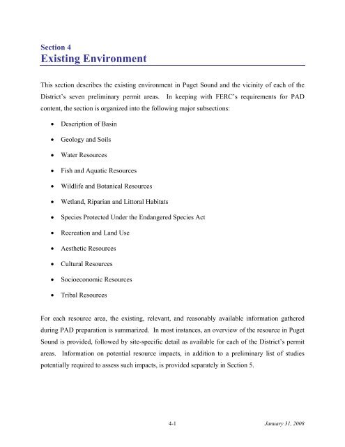
Section 4<br />
Existing Environment<br />
This section describes the existing environment in Puget Sound and the vicinity of each of the<br />
District’s seven preliminary permit areas. In keeping with FERC’s requirements for <strong>PAD</strong><br />
content, the section is organized into the following major subsections:<br />
• Description of Basin<br />
• Geology and Soils<br />
• Water Resources<br />
• Fish and Aquatic Resources<br />
• Wildlife and Botanical Resources<br />
• Wetland, Riparian and Littoral Habitats<br />
• Species Protected Under the Endangered Species Act<br />
• Recreation and Land Use<br />
• Aesthetic Resources<br />
• Cultural Resources<br />
• Socioeconomic Resources<br />
• Tribal Resources<br />
For each resource area, the existing, relevant, and reasonably available information gathered<br />
during <strong>PAD</strong> preparation is summarized. In most instances, an overview of the resource in Puget<br />
Sound is provided, followed by site-specific detail as available for each of the District’s permit<br />
areas. Information on potential resource impacts, in addition to a preliminary list of studies<br />
potentially required to assess such impacts, is provided separately in Section 5.<br />
4-1 January 31, 2008
<strong>Snohomish</strong> <strong>County</strong> <strong>PUD</strong> –Pre-Application Document<br />
4 – Description of Existing Environment<br />
4.1 Description of Basin<br />
Cradled by the Cascade Mountains and the Olympic Peninsula, and open to the Pacific Ocean<br />
through the Strait of Juan de Fuca, Puget Sound is the centerpiece of one of the largest estuarine<br />
basins in the world, encompassing more than 41,500 km 2 in western Washington State. Its<br />
waters are delimited to the north by Vancouver Island and the Canadian border, and occupy<br />
approximately 8,300 km 2 (Taylor 2000). Abutting and binding this expanse are more than 3,700<br />
kilometers of complex inland coastline that contain several distinct regions within the basin,<br />
including: the Main Basin region, which contains the Admiralty Inlet, Agate Passage, and Rich<br />
Passage project areas; the North Puget Sound region, which contains the Spieden Channel,<br />
Guemes Channel, and the San Juan Channel project areas; the Whidbey Basin region, which<br />
contains the Deception Pass project area; the South Puget Sound region; and the Hood Canal<br />
region (Gustafson et al. 2000; Taylor 2000).<br />
The basin’s climate is largely a function of its geographic location and the orientation of nearby<br />
mountain ranges. Offshore westerly winds bring cloudy skies, mild temperatures, high humidity<br />
(approximately 76 percent through most of the year), and large amounts of precipitation to the<br />
region (DON 2000, 2006; Greenland 1998). Temperatures across the Sound typically range<br />
from 1-5°C (34-41°F) with infrequent light snowfall during the winter months to 15-27°C<br />
(59-81°F) during the summer (DON 2000, 2006). Within the basin, seasonal winds are generally<br />
from the north or northwest during spring and summer and from the south or southwest during<br />
the winter and fall (DON 2000, 2006). Although their strength is typically weak year-round,<br />
with velocities of approximately 4.5 m/s, winds can be occasionally quite strong during the<br />
winter and fall, reaching speeds of 18-25 m/s as the Aleutian low-pressure system directs intense<br />
Pacific storms into the coastal northwest (DON 2006). This general climate scheme is<br />
compounded by the influence of both El Nino Southern Oscillation (ENSO) and Pacific Decadal<br />
Oscillation (PDO) events. Warmer sea surface temperatures, increased rainfall, and enhanced<br />
westerly and southerly winds occur during El Nino events and the longer-term positive phases of<br />
the PDO (Airamé et al. 2003; Conlan and Service 2000; DON 2006; Donguy et al. 1982; Mantua<br />
2002). During La Nina events and negative phases of the PDO, cooler sea surface temperatures,<br />
4-2 January 31, 2008
<strong>Snohomish</strong> <strong>County</strong> <strong>PUD</strong> –Pre-Application Document<br />
4 – Description of Existing Environment<br />
reduced rainfall, and increased offshore flow of winds and waters prevail (Airamé et al. 2003;<br />
DON 2006; Mantua 2002).<br />
Located on the western edge of the North American Plate and adjacent to the Cascadia<br />
subduction zone, Puget Sound is bound to the south and east by post-orogenic volcanic cover,<br />
folded and uplifted Mesozoic deposits and massive batholiths. The tectonic processes that gave<br />
rise to these structures are a constant feature in the geodynamics of the basin and are similarly<br />
responsible for the earthquakes which have occurred within its confines (DON 2006; Kennett<br />
1982). Eight of the ten most severe events recorded in western Washington have taken place in<br />
Puget Sound, making it the most seismically active region in Washington State (DON 2006; City<br />
of Seattle 2007).<br />
Throughout the Quaternary, the Pacific Northwest has been repeatedly subjected to continental<br />
and alpine glaciation (DON 2006; NOAA and WSDE 1999). Now, in the absence of large ice<br />
cover, the basin is undergoing post-glacial rebound whereby the North American Plate is<br />
attempting to reach isostatic equilibrium. Consequently, the region as a whole is lifting up at a<br />
rate of between 0.1 to several millimeters per year. It is also the advance and retreat of ice sheets<br />
and Piedmont glaciers during the most recent ice age at the end of the Pleistocene that carved<br />
and scoured out Puget Sound from the lowlands (Gustafson 2000; NOAA and WSDE 1999;<br />
Taylor 2000). A fjord-like estuary, the Sound is characterized by deep channels, distinct<br />
oceanographic basins, narrow marine terraces, and discrete littoral zones with a depth that ranges<br />
from an average of 62.5 m at mean low tide (MLT) to a maximum of over 390 meters.<br />
Catastrophic sculpting events such as floods, severe winter storms, and earthquakes serve to<br />
impart additional dynamism to both the Sound’s intricate bathymetry and to its shoreline<br />
morphology. Coastal landforms include: bluff-backed barrier and pocket beaches; open inlets;<br />
barrier estuaries and lagoons; closed lagoons and marshes; river-dominated, wave-dominated,<br />
tidally-dominated and fan-type deltas; and plunging rocky shores and rocky platforms (Fung and<br />
Davis 2005). Exposed bedrock, gravel, and sand, relicts of the glacial scouring and weathering<br />
associated with the basin’s formation, dominate the substrate of moderate- to high-energy<br />
4-3 January 31, 2008
<strong>Snohomish</strong> <strong>County</strong> <strong>PUD</strong> –Pre-Application Document<br />
4 – Description of Existing Environment<br />
shorelines and channels, while mud and mixed fine sediments derived from biogenic processes<br />
and the discharge of numerous rivers blanket the seafloors of the deeper benthos and<br />
the sheltered near-shore environments (DON 2006; EPRI 2007; Gustafson 2000; Palsson<br />
et al. 2003).<br />
As the drainage endpoint for a watershed of more than 33,000 km 2 , and incorporating an average<br />
of 3.4 trillion liters of fresh water into its volume each day, Puget Sound is a marine body that is<br />
further characterized by estuarine properties (Gelfenbaum et al. 2006; Gustafson et al. 2000).<br />
Salinities within the basin range from 5 to 42 ppt, while water exported from the Sound through<br />
the Strait of Juan de Fuca average 31 ppt (DON 2000, 2006). Stratification of the water column<br />
is typical of an estuary, with denser, saltier, inflowing waters of oceanic origin overlain by<br />
fresher waters derived from the basin flowing seaward (DON 2006; Gustafson et al. 2000;<br />
NOAA and WSDE 1997; Taylor 2000). Stratification can be weak due to intense tidal mixing<br />
but generally tends to increase from west to east and varies seasonally, with upwelling occurring<br />
at sill structures, specifically those adjacent to the Tacoma Narrows (DON 2006; Gustafson et al.<br />
2000). Sea surface temperatures average 10-12°C (50-54°F) but can occasionally be as low as<br />
3°C (37°F) during the winter and as high as 23°C (73°F) in enclosed areas during the summer<br />
(DON 2000, 2006). The thermocline is typically found between 2 and 20 m of water depth<br />
(DON 2006; Dunne et al., 2002).<br />
In addition, Puget Sound is subject to a complex current regime, driven primarily by tidal<br />
oscillation and to a lesser extent by freshwater flux and wind (DON 2006; Gustafson et al.<br />
2000). The large tidal exchanges that occur basin-wide generate significant flow velocities that<br />
range from typical values of 25-80 cm/s to more than 400 cm/sec in restricted channels. These<br />
exchanges reduce the flushing rate of nutrients and result in consistently elevated levels of<br />
nitrates, phosphates and other bio-essential compounds (DON 2006; Gustafson et al. 2000).<br />
4-4 January 31, 2008
<strong>Snohomish</strong> <strong>County</strong> <strong>PUD</strong> –Pre-Application Document<br />
4 – Description of Existing Environment<br />
4.2 Geology and Soils<br />
4.2.1 Introduction<br />
The District’s seven permit areas lie in the Puget Sound and San Juan Islands area of Washington<br />
State. Puget Sound is a large estuary, shaped by glacial activity during the last glacial period,<br />
approximately 20,000 years ago, and lies between the volcanic Cascade Range to the east, and<br />
the Olympic Range to the west (USGS 2002). Figure 3-1 shows the locations of all of the<br />
project sites.<br />
This section presents regional geologic and soils information, followed by site-specific<br />
information and maps of site soils, and geology at the seven project sites. The site maps in<br />
Appendix C present topography and bathymetry of the potential project areas.<br />
4.2.2 Regional Geology<br />
4.2.2.1 Geologic History and Volcanic, Seismic, and Glacial Activity<br />
The Puget Sound and San Juan Islands area of Washington State is a unique geologic location,<br />
and is composed primarily of thick deposits of sedimentary rock derived from a long history of<br />
glaciation (USGS 2006). Tectonic and volcanic stresses have significantly shaped the area,<br />
driven by the northeastward subduction of the Juan de Fuca plate and the northward migration of<br />
the Pacific plate along the San Andreas Fault to the south (Finlayson 2006). The Juan de Fuca<br />
plate is a small remnant of the larger Farallon plate, which has been subducted under the North<br />
American plate (Finlayson 2006).<br />
The faulting and volcanism of the Cascadia subduction zone in western Washington State cause<br />
the area to be prone to both volcanic and seismic activity (Bourgeois 2001). Mount Rainier is<br />
the dominant site of volcanic activity in the area’s recent geologic history (Swanson et al. 1989).<br />
Stratigraphic investigations show Quaternary volcanic andesite deposits, tephras, lava flows, and<br />
4-5 January 31, 2008
<strong>Snohomish</strong> <strong>County</strong> <strong>PUD</strong> –Pre-Application Document<br />
4 – Description of Existing Environment<br />
lahars, originating from the now-4,300-meter-high mountain within the past approximately 0.85<br />
million years (Swanson et al. 1989). A number of more-recent volcanic events have occurred<br />
during the Holocene era, within the past 10,000 years, since the retreat of the Cordilleran ice<br />
sheet.<br />
Seismic activity occurs in the region in three different zones: subduction zone earthquakes<br />
where the North American plate and the Juan de Fuca plate make contact; deep earthquakes,<br />
where the subducted portions of oceanic plate slip into the upper mantle; and shallow quakes,<br />
which occur on faults within the North American continental area (USGS 2006b). The largest of<br />
these quakes are subduction quakes; magnitudes of earthquakes in the Cascadia subuction zone<br />
can exceed 9.0 on the Richter scale (USGS 2006b). Deep zone or Benioff zone earthquakes may<br />
be as large as magnitude 7.5, but are generally more dispersed, and are not accompanied by<br />
aftershocks (USGS 2006). Shallow quakes generally have somewhat smaller magnitudes, but<br />
their proximity to the surface and to urban areas as well as the potential to trigger liquefaction<br />
events or mass-wasting can make shallow earthquakes just as devastating as deeper earthquakes<br />
(USGS 2006b). Figure 4-1 shows the major surface faults of the Puget Sound area, which<br />
cause shallow, crustal earthquakes. Table 4-1 summarizes which potential project sites contain<br />
known faults.<br />
The Seattle fault is the only crustal fault in the area that has been verified to be recently active,<br />
and has been responsible for a number of crustal earthquakes within the past 14,000 years<br />
(Johnson 1999). It has not, however, been the source of the 20 th -century earthquakes in the<br />
Seattle area; the 1949 and 1965 earthquakes originated in the Benioff zone (USGS 2006). The<br />
North Whidbey Island and South Whidbey Island faults are currently being studied, but no recent<br />
activity has proven them to be currently or recently active. Geologic investigations indicate that<br />
seismic events associated with the Seattle fault have caused liquefaction and ground subsidence<br />
in the past and that the potential for liquefaction still exists (Johnson et al. 2006).<br />
4-6 January 31, 2008
<strong>Snohomish</strong> <strong>County</strong> <strong>PUD</strong> –Pre-Application Document<br />
4 – Description of Existing Environment<br />
Figure 4-1. The tectonics of northwestern Washington and the extent of the Cordilleran Ice sheet<br />
(James et al. 2006)<br />
To the west of Puget Sound lies the Olympic subduction complex. Subduction of the Juan de<br />
Fuca plate has formed the modern Olympic Range through uplift, folding, and metamorphosis of<br />
the Cascadia subduction zone accretionary wedge, where surface material of the oceanic Farallon<br />
plate has accumulated during subduction (USGS 2004). The Olympic Range is the northern<br />
continuation of the mountains generally referred to as the Coast Ranges of the west coast of<br />
North America. The various Coast Ranges originated from a number of orogenic events; the<br />
Olympic Range uplift is separate from that which created the Coastal Range of Oregon to the<br />
south (USGS 2002). To the north of the Sound lies Vancouver Island, which is composed of the<br />
Insular Ranges, also a “Coast Range” albeit of a different geologic origin (USGS 2002).<br />
4-7 January 31, 2008
<strong>Snohomish</strong> <strong>County</strong> <strong>PUD</strong> –Pre-Application Document<br />
4 – Description of Existing Environment<br />
To the north, between Puget Sound and the Strait of Georgia lies the San Juan archipelago. Two<br />
of the potential project sites are adjacent to San Juan Island; two others are located in the eastern<br />
San Juan Islands to the north and south of Fidalgo Island. The archipelago between the mainland<br />
and Vancouver Island (Canada) originated as an oceanic island arc. Over the course of the<br />
Farallon plate subduction, the islands accreted into a compact archipelago (Dawes 2001). Within<br />
more recent geologic history, glacial forces also left their marks on the San Juan Islands, carving<br />
valleys, coves, and scouring the land surface.<br />
Puget Sound was formed during the Fraser glaciation, a period spanning about 10,000 years<br />
(USGS 2002). Approximately 20,000 years ago, the glaciation was at its maximum extent, and<br />
the Cordilleran ice sheet blanketed Puget Sound and Vancouver Island with over 1.5 km of ice,<br />
covering everything between the Olympic and Cascade mountains (James et al. 2006).<br />
Figure 4-1 shows the current tectonic setting of Puget Sound and the maximum extent of the<br />
Cordilleran ice sheet. The advance and retreat of glaciers formed the characteristic glacial<br />
landforms of Puget Sound’s shoreline and seabed and carved the fjords of the areas rimming the<br />
basin, many of which are now above water. During glaciation, the weight of the ice sheet<br />
depressed the earth’s crust; upon retreat of the glacier, the decrease in lithostatic pressure<br />
allowe d isostatic rebound of the crust and land surfaces rise during the process known as postrebound.<br />
Recent measurements show that the post-glacial rebound has essentially ended,<br />
glacial<br />
and the Puget Sound area is rising at a rate of less than 1 mm/year (James et al. 2006).<br />
Analysis of high-resolution digital elevation models (DEMs) reveals five distinct morphological<br />
units and their relationships to the Pleistocene glaciation in Puget Sound (Finlayson 2006):<br />
1.<br />
The oldest of the morphologic units includes the cores of the Olympic and Cascade<br />
Mountains and the Olympic Range’s basaltic, Eocene Crescent formation. The peaks of<br />
the ranges remained well above the ice sheet and do not include glaciation features shown<br />
in the topography of the lower elevations.<br />
2. The second major morphological unit is the surface layers of the lowland fill.<br />
Streamlined hills left by the glacier show the distinct east-to-southwest limitations in the<br />
topography.<br />
4-8 January 31, 2008
<strong>Snohomish</strong> <strong>County</strong> <strong>PUD</strong> –Pre-Application Document<br />
4 – Description of Existing Environment<br />
3. The third major morphological unit is associated with the channels of Puget Sound itself.<br />
Massive sub-glacial water flows carved the channels of the Sound, resulting in overdeepened<br />
basins with shallow sills.<br />
4. The fourth geomorphic unit is associated with modern erosion processes that have<br />
reworked the topography since ice retreat. These small-stream delta deposits have<br />
accumulated in lobes at the base of steep trough walls from sediment eroded from the<br />
coastal bluffs.<br />
5. The fifth geomorphic unit is the Holocene terrace on which the beaches in Puget Sound<br />
are formed. This narrow, wave-cut shelf typifies the morphology of Puget Sound<br />
beaches, which occupy Holocene benches cut into the sheer walls of the glacially-formed<br />
marine basins (Finlayson 2006).<br />
The terrestrial geology around all seven potential sites is dominated by Fraser-age glacial till and<br />
glacial outwash. Unfortunately, no analogous comprehensive data are available for sub-marine<br />
geology at the potential project sites (USGS 2007). Regionally, some of the deeper<br />
unconsolidated deposits pose a liquefaction risk when subjected to significant seismic activity<br />
(Crawford et al. 2001). There are known to be small pockets of unconsolidated deposits on<br />
Whidbey Island near the Admiralty Inlet site (USGS 2006; WSDE 2007). According to a seabed<br />
geology survey completed for the Agate Pass bridge, Agate Pass is the site of some moderately<br />
unconsolidated sediments, although they overlie a hard stratum on the west side of the channel<br />
(Polagye et al. 2007). No unconsolidated deposits have been recorded in or around Rich<br />
Passage. No information is available on specific unconsolidated deposits at the San Juan<br />
Channel, Spieden Channel, Guemes Channel, or Deception Pass sites, although generally,<br />
unconsolidated deposits in the area occur primarily in alluvial valleys on the mainland (USGS<br />
2006).<br />
The formation and bursting of a massive proglacial lake also contributed to the landscape of<br />
Puget Sound. The lake, formed by glacial melt-waters, swelled to 37 m above the current Sound<br />
(James 2006). When the lake drained, it carved a large valley and distributed giant slabs of ice<br />
carrying mud, sand, and gravel over most of Puget Sound (James 2006). These deposits, known<br />
4-9 January 31, 2008
<strong>Snohomish</strong> <strong>County</strong> <strong>PUD</strong> –Pre-Application Document<br />
4 – Description of Existing Environment<br />
as a glaciomarine drift, still form an important part of the surficial geology of the Sound, as do<br />
the lacustrine sediment deposits from the proglacial lakes themselves (Easterbrook 1999).<br />
The final retreat of the glaciers left behind deeply gouged channels, river valleys, fjords, northsouth<br />
oriented passages, and bays. Over the past 10,000 years, weathering, fluvial and eolian<br />
processes and wave erosion have reworked glacial sediment to form beaches, bluffs, rocky<br />
intertidal zones, marshes and tidal flats in Puget Sound (WSDE 2007).<br />
Snowmelt and glacial-melt waters still feed a number of the rivers flowing into the Sound.<br />
Fourteen major rivers flow into Puget Sound: the Nooksack, Samish, Skagit, Stillaguamish,<br />
<strong>Snohomish</strong>, Cedar, Green/Duwamish, Puyallup, Nisqually, Deschutes, Skokomish, Dosewallips,<br />
Dungeness, and the Elwha rivers (Puget Sound Partnership 2007). These rivers continue to<br />
deposit sediments into the Sound, some of which are remnant glacial tills or drifts from the<br />
interior of Washington and British Columbia. The strong daily currents within the Sound<br />
distribute these fluvial sediments over large areas of the basin and carry them far beyond the<br />
extent of the river deltas (Puget Sound Partnership 2007).<br />
At their mouths, these rivers are characterized by variable topography and diverse vegetation. In<br />
their deltaic regions, they variously form tidal marshes, often dominated by eelgrass, or tidal<br />
(mud) flats, or they flow into rockier intertidal zones (DON 2006). These near-shore habitats are<br />
present all around Puget Sound, depending on the geometry of the different areas. The height of<br />
tides in<br />
Puget Sound also varies with the geometry of the inlet or location. Tides in the Port<br />
Townsend area of the northern Sound average around 2.4 m, while tides toward the southern end<br />
of the Sound, near Olympia, average 4.3 m (Puget Sound Partnership 2007).<br />
4.2.2.2 Landslides and Tsunamis<br />
Although normal tidal action is currently the primary shoreline-shaping force in Puget Sound, it<br />
is not the only type of wave erosion present; tsunamis have also played a part in forming the<br />
Sound. The largest known Holocene tsunami event occurred about 1,100 years ago, when the<br />
Puget Sound area experienced a large seismic event accompanied by a northward-moving<br />
4-10 January 31, 2008
<strong>Snohomish</strong> <strong>County</strong> <strong>PUD</strong> –Pre-Application Document<br />
4 – Description of Existing Environment<br />
tsunami (Bourgeois 2001). Recent research in the Puget Sound area indicated substantial tidalmarsh<br />
subsidence followed the seismic event and tsunami. Areas that had been freshwater<br />
mar sh,<br />
and even coastal uplands outside the tidal zone, subsequently sank to become saltwater<br />
marsh, or were submerged entirely (USGS 2007). The most recent major tsunami event occurred<br />
around the year 1700, and there is still the potential for large seismic events and associated<br />
tsunamis to occur today (Bourgeois 2001).<br />
4.2.3<br />
Soils and Marine Substrate<br />
Potential project site surface materials can be grouped into two classes: terrestrial soils, and<br />
marine or channel-bottom substrates. Typically derived from glacial deposits, these materials<br />
have been shaped primarily by glaciation (Cogger 2007). Soil depth varies around Puget Sound<br />
and the San Juan Islands; in some locations the soil is very deep, while in other locations, such as<br />
some parts of the San Juan Islands, very shallow soils are underlain by bedrock (USFWS 2007;<br />
WSDNR 2005). Most of the area’ s soils are classified as mesic, and are thus of moderate<br />
moisture content given the climate. Soils maps are presented in Appendix D.<br />
In general, Puget Sound and San Juan Islands soils can be classified into the following groups<br />
(Cogger 2007):<br />
• Glacial till: These soils were carried and deposited by retreating glacial ice, and are<br />
characterized by thick, dense, clayey deposits of poorly-sorted sediment.<br />
• Glacial outwash: Unlike glacial till, these deposits were carried and deposited by water<br />
in glacial-melt rivers or Jökulhlaup (glacial outbursts) from proglacial lakes formed by<br />
melting glaciers. Deposits are well-sorted, generally layered in size, and include rounded<br />
grains of sand, gravel and rocks.<br />
• Lacustrine: These soils originated from inflow to glacial lakes, and include very fine silt<br />
and clay deposits.<br />
• Volcanic soils: These soils tend to be of low density, contain tephra or deposited ash,<br />
and have a high capacity for water. Many volcanic soils in Puget Sound include tephra<br />
from the Mt. Mazama eruption (present-day Crater Lake) around 6,800 years ago.<br />
4-11 January 31, 2008
<strong>Snohomish</strong> <strong>County</strong> <strong>PUD</strong> –Pre-Application Document<br />
4 – Description of Existing Environment<br />
• Lahar soils: Deposited by volcanically-induced mud and debris flows called lahars,<br />
these soils include mixed particle sizes, much like glacial till soils, and can be dominated<br />
by sticky, fine mud.<br />
• Alluvial: While these soils may have similar glacial-parentage, the sandy and loamy<br />
soils deposited by modern rivers are distinct from other Puget Sound soils in their<br />
suitability for agriculture. The soils are not rocky, and drain quickly.<br />
Coastal erosion and mass-wasting occur on much of the Puget Sound shoreline, as with any<br />
marine shoreline (WSDE 2007; DON 2006). Table 4-1 notes the potential for or known<br />
existence of terrestrial mass-wasting near each of the seven potential project sites, according to<br />
the Washington Department of Ecology Coastal Zone Atlas of slope stability maps (WSDE<br />
2007). Several of the potential project sites also include sand or gravel beaches, which are<br />
dynamic erosional features where erosion is ongoing; Table 4-1 also denotes sites with these<br />
features (DON 2006).<br />
Vegetation and robust marine riparian ecosystems help anchor soils and minimize slope stability<br />
problems. Puget Sound lies primarily in the coastal Western Hemlock Zone; this zone is<br />
dominated by western hemlock, western red cedar, and Douglas and grand fir trees. Some pine<br />
forests, oak groves, prairies, swamp and bog, deciduous forests are also present in the Puget<br />
Sound area (Brennan 2007). Most of the potential grid interconnection sites will likely have<br />
been urbanized or disturbed, increasing the likelihood for preexisting large substations or high-<br />
voltage lines being present for grid-interconnection. A number of the sites also include sand<br />
beach areas with minimal vegetation.<br />
Marine substrates are not subject to the same pedogenic forces as terrestrial soils, but share some<br />
of the origins and grain-size characteristics. Due to seismically-induced subsidence, some of the<br />
now-inundated near-shore areas have terrestrial soil profiles, albeit submerged. Some of these<br />
areas include what are sometimes deemed “drowned forests”, where terrestrial vegetation<br />
remnants are still present in tidal or salt marsh areas (USGS 2007). Daily tidal inflow and<br />
outflow in Puget Sound distributes the glacial till, outwash, and new alluvial sediment across<br />
large areas of the Sound. It is understood that in some locations turbidity, eddies, and strong<br />
4-12 January 31, 2008
<strong>Snohomish</strong> <strong>County</strong> <strong>PUD</strong> –Pre-Application Document<br />
4 – Description of Existing Environment<br />
currents have stripped some channels in the sound of any deep sediment deposition, leaving<br />
bedrock and only a thin layer of larger gravels and cobbles (Polagye et al. 2007). Table 4-1<br />
below describes the primary, or overall, bottom composition known for the seven project sites.<br />
Marine sediment composition of the sites may vary across each site, however; existing data do<br />
not provide detail on bottom substrate on a fine scale.<br />
Little information is available on the submarine mass-wasting potential of the project areas, but<br />
geologic history indicates that Puget Sound is prone to submarine landslides. Marine slope failures<br />
occur when shear stresses acting down-slope exceed the sediment shear strength. Submarine masswasting<br />
can be triggered by earthquakes, storm waves, extreme tidal excursions, artesian pressures,<br />
construction, and vibrations, or may occur somewhat spontaneously under the normal forces of<br />
gravity (Finlayson 2007). Some of the site bathymetry reveals very steep areas around the project<br />
sites, generally near the deepest parts of the channel. Depending on the substrate, these areas may<br />
be the most prone to submarine landslides, either spontaneously occurring or seismically induced.<br />
Potential project sites with steep areas are indicted in Table 4-1.<br />
Marine vegetation may help sediment cohesion and create more stable submarine slopes.<br />
Eelgrass, surfgrass, kelp forest, sargassum, and macroalgae are all present across large areas of<br />
Puget Sound (DON 2006). More information on the extent and types of terrestrial and marine<br />
vegetation is provided in Section 4.5, regarding wildlife and botanical resources.<br />
4.2.4 Site-Specific Information<br />
Table 4-1 contains a summary of the geology and soils characteristics of the seven potential<br />
project sites. Geologic and soils maps showing more site detail are included in Appendix E. The<br />
following section provides more detail regarding the potential Admiralty Inlet test-installation<br />
site.<br />
4.2.4.1 Admiralty Inlet<br />
The Pleistocene glacial activity that formed most of Puget Sound also carved Admiralty Inlet.<br />
The inlet runs between Whidbey Island to the northeast, and the mainland Olympic peninsula to<br />
4-13 January 31, 2008
<strong>Snohomish</strong> <strong>County</strong> <strong>PUD</strong> –Pre-Application Document<br />
4 – Description of Existing Environment<br />
the southwest. Admiralty Inlet is somewhat shallow relative to the rest of Puget Sound; a<br />
shallow sill, approximately 60 m deep at its deepest, separates Puget Sound from the Strait of<br />
Juan de Fuca. To the southeast of the sill, the channel deepens to over 100 m.<br />
The geology around the site is dominated by Fraser-era glacial till, with smaller areas of Fraser-<br />
glacial drift and outwash on Whidbey Island. Soils around the Admiralty Inlet site are<br />
era<br />
closely related to the geologic depositions, and consist mostly of loamy-skeletal, fine-mixed,<br />
sandy-mixed, and mixed-mesic soils from the glacial till material.<br />
The South Whidbey Island fault runs northwest to southeast within the potential project area, but<br />
is understood to terminate south of the shallow-sill portion of the inlet. The land around the inlet<br />
is a source of some mineral resources, primarily sand and gravel.<br />
The channel substrate is estimated to be gravel near the channel center, a mixture of sand and<br />
gravel toward the shores, and a mixture of more sand than gravel to the west between Point<br />
Wilson and Marrowstone Point. Toward the southern portion of the Inlet, near Bush Point, the<br />
channel bottom has small sand dunes, which migrate northward with the current (Polagye et al.<br />
2007). A survey of the inlet’s seabed in the 1970s indicated exposed bedrock or bedrock<br />
covered by thin layer of sediments, although USGS publications show more than a hundred<br />
meters of sediment overlying bedrock (Polagye et al. 2007).<br />
The potential for marine landslides at the site is not well studied, although the inlet has a very<br />
steep portion just east of its deepest point. Terrestrial mass-wasting, however, has been better<br />
documented. Figures 4-2 through 4-4, from the Washington Department of Ecology Coastal<br />
Zone Atlas of slope stability maps (WSDE 2007), include the three areas of potential electricalgrid<br />
interconnection for the Admiralty Inlet site. Figure 4-2 shows the Fort Casey area, the<br />
northern of the two potential grid connection sites on Whidbey Island; Figure 4-3 shows the<br />
Admiralty Head area on Whidbey Island; and Figure 4-4 shows the Port Townsend site. Each of<br />
the above sites exhibits some historical or existing slope instability.<br />
4-14 January 31, 2008
<strong>Snohomish</strong> <strong>County</strong> <strong>PUD</strong> –Pre-Application Document<br />
4 – Description of Existing Environment<br />
Figure 4-2.<br />
Northern Admiralty Inlet (Whidbey Island, Fort Casey) potential grid-connection<br />
site; slope stability (WSDE 2007)<br />
4-15 January 31, 2008
<strong>Snohomish</strong> <strong>County</strong> <strong>PUD</strong> –Pre-Application Document<br />
4 – Description of Existing Environment<br />
Figure 4-3.<br />
Eastern Admiralty Inlet (Whidbey Island, Admiralty Head) potential grid-connection<br />
site; slope stability (WSDE 2007)<br />
4-16 January 31, 2008
<strong>Snohomish</strong> <strong>County</strong> <strong>PUD</strong> –Pre-Application Document<br />
4 – Description of Existing Environment<br />
Figure 4-4. Western Admir alty Inlet (Port Townsen d) potential gr id-connection site; slope<br />
stability (WSDE 2007)<br />
4-17 Janua ry 31, 2008
<strong>Snohomish</strong> <strong>County</strong> <strong>PUD</strong> – Pre-Application Document<br />
4 – Description of Existing Environment<br />
Table 4-1. Terrestria l an d marine geological and soils characteris tics of the potential Puget Sound tidal project sites<br />
Site<br />
Name Characteristic<br />
Primary<br />
topography, geology<br />
Admiralty<br />
Inlet<br />
Spieden<br />
Channel<br />
Guemes<br />
Channel<br />
San Juan<br />
Channel<br />
Deception<br />
Pass<br />
Agate<br />
Passage<br />
Rich<br />
Passage<br />
shallow sill 60 m<br />
deep at main<br />
channel,<br />
deepens to east<br />
to 70-120+ m<br />
30 m in center at<br />
shallowest,<br />
deepens to 100+<br />
m away from<br />
narrowest pt<br />
under 10m at<br />
center, deepens<br />
to 30m away<br />
from narrowest<br />
pt<br />
shallow on<br />
edges, 30 m in<br />
center at<br />
shallowest,<br />
deepens to 90+<br />
m away from<br />
narrowest pt<br />
center under 15<br />
m<br />
10 m, uniform<br />
depth<br />
10 m, deepening<br />
to 30 m to the<br />
east<br />
Fraser-age<br />
glacial till,<br />
glacial<br />
outwash,<br />
glacial<br />
lacustine<br />
metasedimen<br />
tary,<br />
sedimentary<br />
(Spieden<br />
Island),<br />
Fraser glacial<br />
till<br />
Fraser-age<br />
glacial till,<br />
intrusives<br />
Fraser glacial<br />
till, glacial<br />
drift,<br />
Fraser glacial<br />
till, glacial<br />
drift,metasedi<br />
mentary,<br />
volcanic/volc<br />
aniclastic<br />
Fraser glacial<br />
till, glacial<br />
outwash<br />
Fraser glacial<br />
till, glacial<br />
outwash,<br />
alluvium (sm<br />
amts)<br />
(DON 2006, WSDE 2007, DNR 2000, DNR 2005)<br />
Terrestrial Geology and Characteristics<br />
Marine Characteristics<br />
Primary<br />
soils<br />
loamyskeletal,<br />
fine<br />
mixed, sandy<br />
mixed, mixed<br />
mesic<br />
coarse<br />
loamy, coase<br />
loamy over<br />
sand, fine<br />
mixed<br />
loamyskeletal,<br />
fine<br />
mixed,<br />
loamy-mixed<br />
coasrseloamy,<br />
coarse-loamy<br />
over sand<br />
sandy<br />
skeletal,<br />
loamy<br />
skeletal,<br />
medial<br />
skeletal<br />
coarse loam,<br />
skeletal<br />
mixed, loamy<br />
skeletal,<br />
mixed medial<br />
medial,<br />
coarse-loamy<br />
Nearby<br />
mineral<br />
resources?<br />
sand &<br />
gravel, rock,<br />
geothermal<br />
Shoreline<br />
steepness or<br />
instability<br />
yes; old and new<br />
slides in vicinity of<br />
Port Townsend<br />
potential grid<br />
connection,<br />
unstable slopes at<br />
northern Whidbey<br />
Isl. Connection<br />
site<br />
Erodible<br />
shoreline?<br />
(i.e., sand<br />
beaches)<br />
yes<br />
none no S. shore of<br />
Spieden<br />
island<br />
Bottom<br />
composition<br />
Sha llow sand<br />
and gravel;<br />
finer toward<br />
channel sides<br />
rock, gravel &<br />
sand<br />
Bottom<br />
habitat<br />
gravel and<br />
sand, sand<br />
beach,<br />
gravel beach<br />
rocky<br />
intertidal<br />
none yes yes mixed, gravel gravel and<br />
sand, sand<br />
beach<br />
none no yes mud, sand &<br />
gravel<br />
rocky<br />
intertidal,<br />
gravel and<br />
sand beach<br />
rock, sand &<br />
gravel<br />
yes; steep, mostly<br />
bedrock but some<br />
narrow areas of<br />
minimal<br />
(small rocky<br />
beaches)<br />
mixed, bedrock rocky<br />
inte rtidal and<br />
har bottom<br />
instability and old<br />
slides<br />
none<br />
none<br />
yes, including<br />
recent slides<br />
toward S. end of<br />
site on Kitshap<br />
peninsula<br />
yes, primarily<br />
small areas on<br />
Kitshap peninsula<br />
yes<br />
yes<br />
mud, mixed gravel and<br />
sand, sand<br />
beach<br />
mud, mixed gravel and<br />
sand, sand<br />
beach<br />
Submerged<br />
steep<br />
areas?<br />
on east side<br />
of deepest<br />
part of<br />
channel<br />
south side of<br />
deepest<br />
channel part<br />
Faults?<br />
yes<br />
yes<br />
Primary<br />
vegetation<br />
Kelp,<br />
sargassum<br />
Kelp<br />
no no Sargassum,<br />
mixed<br />
macroalgae<br />
Nearshore<br />
vegetation:<br />
surfgrass,<br />
eelgrass?<br />
surfgrass,<br />
eelgrass<br />
eelgrass<br />
eelgrass<br />
no yes Kelp surfgrass,<br />
eelgrass<br />
no (all<br />
shallow)<br />
no (all<br />
shallow)<br />
at very<br />
southwest<br />
corner<br />
yes<br />
no<br />
yes<br />
Kelp<br />
sargassum<br />
sargassum<br />
surfgrass,<br />
eelgrass<br />
eelgrass<br />
eelgrass<br />
4-18 January 31, 2008
<strong>Snohomish</strong> <strong>County</strong> <strong>PUD</strong> – Pre-Application Document<br />
4 – Description of Existing Environment<br />
4.3 Water Resources<br />
Puget Sound is the second-largest estuary in the United States, where salt water from the Pacific<br />
Ocean is mixed with fresh water draining from the surrounding watershed. More than 10,000<br />
rivers and streams drain into Puget Sound (Puget Sound Action Team 2000a). The entire drainage<br />
basin has been estimated to have more than 33,000 km 2 of watershed and 8,000 km 2 of marine<br />
waters environment (Gelfenbaum et al. 2006).<br />
This section summarizes the existing water resources, both quantity and quality, and applicable<br />
water quality standards in the project area.<br />
4.3.1 Wind, Tide and Current Characteristics<br />
Puget Sound is bordered to the west and east by the Olympic and Cascade mountain ranges,<br />
respectively. This topography generally channels winds in a north/south direction, although wind<br />
conditions across the Sound can vary depending on local effects. Winds are strongest in the winter<br />
and early spring, when sustained winds of 10 to 17 m/s (20-33 knots) from the south are common<br />
and gale winds (17.5 to 21 m/s; 34-47 knots) occur. From late spring through early fall, winds are<br />
lighter, with speeds of 4 to 7.7 m/s (8-15 knots) in the afternoons (NOAA 2007a).<br />
Each day, approximately 6.1 km 3 of water flows in and out of Puget Sound. Tides in Puget Sound<br />
generally follow a semi-diurnal cycle over a 25-hour period, w ith two high and t wo low tides that<br />
tend to be different in range and timing. The average daily tidal variation is 2.4 m in northern areas<br />
of the Sound and 4.3 m in southern areas of the Sound. However, geographic variation in the<br />
shape and depth of the Sound influences local tida l patterns.<br />
Currents<br />
within the Sound are primarily driven by tides and the inputs from surface water sources,<br />
although the speed and direction of winds can also be influential. Generally, current velocities in<br />
the Sound range from 0.3 to 1.0 m/s (0.5-2.0 knots), although 1.5 m/s (3.0 knots) is normal in some<br />
regions (Gilmore et al. 1996). Narrow channels tend to have stronger currents due to the restricted<br />
4-19 January 31, 2008
<strong>Snohomish</strong> <strong>County</strong> <strong>PUD</strong> –Pre-Application Document<br />
4 – Existing Environment<br />
flow area. As an example, the Deception Pass channel has current velocities ranging from 3.6 to<br />
4.1 m/s (7.0-8.0 knots).<br />
The following is a description of the general current velocities within or near the seven project<br />
sites. Information on current velocities is limited for most sites due to the paucity of gauges<br />
located within the confines of each project area. Due to the nature of hydrokinetic energy projects,<br />
tidal cycle channel power and monthly average channel power is considered a substitute for the<br />
<strong>PAD</strong> requirements that the applicant provide monthly duration curves and stream flow data to<br />
determine the project’s dependable capacity.<br />
4.3.1.1 Admiralty Inlet<br />
Admiralty Inlet is the major connection between Pug et Sound and the Strait of Juan de Fuca, with<br />
Deception Pass being a minor connection. Strong currents occur within the site because the<br />
relatively narrow and shallow channel reduces the cross-sectional area (213,000 to 317,000 m 2 )<br />
and regulates flow. Currents in the main portion of the inlet are effectively bi-directional, with a<br />
typical velocity of 2.6 m/s. This finding is consistent with previously reported current velocities of<br />
2.2 m/s (NOAA 2007a). Outside of the deep channel, current velocities are reduced due to the<br />
shallow depths and eddies.<br />
Table 4-2. Northern Admiralty Inlet site parameters (Polagye et al. 2007)<br />
Site<br />
1.3 km NE<br />
of Pt.<br />
Wilson<br />
2.3 km NE<br />
of Pt.<br />
Wilson<br />
1.8 km NW<br />
of Pt.<br />
Wilson<br />
0.8 km W<br />
of Adm.<br />
Head<br />
2.6 km NE<br />
of Marrow.<br />
Point<br />
Channel Width (m) 4680 4680 4680 3240 4260<br />
Average Depth (MLLW reference) 54 66 59 64 71<br />
Deepest Point (m) 90 114 91 81 122<br />
Average Cross-sectional Area (m 2 ) 259,000 317,000 283,000 213,000 310,000<br />
Maximum Surface Current (m/s) 2.6 3.5 2.6 2.6 2.6<br />
4-20 January 31, 2008
<strong>Snohomish</strong> <strong>County</strong> <strong>PUD</strong> –Pre-Application Document<br />
4 – Existing Environment<br />
4.3.1.2 Spieden Channel<br />
Spieden Channel lies between Spieden and San Juan Islands. The 3.5 km channel narrows from<br />
west to east, with a minimum width of just less than 1,000 meters (Polagye et al. 2007). The<br />
reduced cross-sectional area at the eastern end of Spieden Channel produces the greatest current<br />
velocities, which have been estimated at 2.7 m/s. However, this estimate is based on gauges<br />
located to the west of the narrowest point in the channel and therefore may underestimate the true<br />
velocities within the narrowest point of the channel. The Coast Pilot (NOAA 2007) reports that<br />
severe rip and eddy currents occur when flood currents meet.<br />
Table 4-3. Spieden Channel site parameters (Polagye et al. 2007)<br />
Site<br />
Channel Width<br />
1260 m<br />
Average Depth (MLLW reference)<br />
69 m<br />
Deepest Point<br />
126 m<br />
Average Cross-sectional Area 88,220 m 2<br />
Maximum Surface Current<br />
2.7 m/s<br />
4.3.1.3 Guemes Channel<br />
Guemes Channel separates Guemes and Fidalgo islands and is approximately five kilometers long.<br />
Channel width decreases as it approaches its middle, reaching its narrowest point (1000 m) at the<br />
approximate midway point (Polagye et al. 2007). The Coast Pilot (NOAA 2007) states that<br />
current velocities in the channel can exceed 2.6 m/s (5 knots). However, a NOAA station<br />
positioned at the western end of the channel reported a maximum velocity of 2.1 m/s (NOAA<br />
2007a). Polagye et al. (2007) used the NOAA station data and the change in cross-sectional area<br />
to calculate a maximum velocity of 3.5 m/s.<br />
Table 4-4. Guemes Channel site parameters (Polagye et al. 2007)<br />
Site<br />
Western<br />
Entrance<br />
Estimated<br />
Station<br />
Channel Width (m)<br />
2340 1140<br />
Average Depth (m; MLLW reference)<br />
12 14<br />
Deepest Point (m)<br />
18 24<br />
Average Cross-sectional Area (m 2 ) 30,800<br />
17,800<br />
Maximum Surface Current (m/s) 2.0 3.5<br />
4-21 January 31, 2008
<strong>Snohomish</strong> <strong>County</strong> <strong>PUD</strong> –Pre-Application Document<br />
4 – Existing Environment<br />
4.3.1.4 San Juan Channel<br />
San Juan Channel is one of the three primary passageways from the Strait of Juan de Fuca to the<br />
Strait of Georgia. The channel is 21 km long and constricts overall from north to south, reaching<br />
its narrowest point (1200 m) at the approximate midway point (Polagye et al. 2007).<br />
The<br />
maximum surface current velocity has been calculated to be 2.6 m/s, based on data obtained from a<br />
nearby station (NOAA 2007a). The Coast Pilot (NOAA 2007) reports severe rip and eddy currents<br />
occur in the southern portion of the San Juan Channel.<br />
Table 4-5. San Juan Channel site parameters (Polagye et al. 2007)<br />
Site<br />
Channel Width<br />
Average Depth (MLLW reference)<br />
Deepest Point<br />
Average Cross-sectional Area<br />
Maximum Surface Current<br />
1200 m<br />
63 m<br />
135 m<br />
76,450 m<br />
2.6 m/s<br />
2<br />
4.3.1.5 Deception Pass<br />
Approximately 3.2 km in length, Deception Pass separates Whidbey and Fidalgo islands. The<br />
channel becomes increasingly narrow as it approaches its middle, reaching a minimum width of<br />
approximately 350 m south of Pass Island (Polagye et al. 2007). The decreased cross-sectional<br />
area causes an increase in velocity by a factor of five compared to the eastern and western portions<br />
of the channel and produces strong eddies along the shoreline. Current velocities within the pass<br />
have been reported in excess of 4.4 m/s (8 knots) (NOAA 2007a).<br />
Table 4-6. Deception site parameters (Polagye et al. 2007)<br />
Site<br />
Channel Width<br />
150 m<br />
Average Depth (MLLW reference)<br />
30 m<br />
Deepest Point<br />
40 m<br />
Average Cross-sectional Area 4,760 m 2<br />
Maximum Surface Current<br />
4.4 m/s<br />
4-22 January 31, 2008
<strong>Snohomish</strong> <strong>County</strong> <strong>PUD</strong> –Pre-Application Document<br />
4 – Existing Environment<br />
Figure 4-5. Absolute velocity (in color) and flow direction (as arrows), for ebb (University of<br />
Washington 2007)<br />
4.3.1.6 Agate Passage<br />
Agate Passage is an approximately 1.6-km-long channel that separates Bainbridge Island from the<br />
Kitsap Peninsula. Decreasing cross-sectional area causes current velocities to be greatest at the<br />
southern end of the channel, with an estimated maximum surface current of 3.5 m/s.<br />
Table 4-7. Agate Passage site parameters (Polagye et al. 2007)<br />
Site<br />
Channel Width<br />
240 m<br />
Average Depth (MLLW reference)<br />
6.0 m<br />
Deepest Point<br />
8.8 m<br />
Average Cross-sectional Area 1920 m 2<br />
Maximum Surface Current<br />
3.5 m/s<br />
4-23 January 31, 2008
<strong>Snohomish</strong> <strong>County</strong> <strong>PUD</strong> –Pre-Application Document<br />
4 – Existing Environment<br />
4.3.1.7 Rich Passage<br />
The five-kilometer-long Rich Passage separates the southern end of Bainbridge Island from the<br />
Kitsap Peninsula. The channel bends at its western end and the resulting decrease in crosssectional<br />
area produces the highest current velocities in that area of Rich Passage (Polagye et al.<br />
2007). The Coast Pilot (NOAA 2007) states that the maximum average velocity in that area is 1.2<br />
m/s (2.4 knots) during flow and 1.5 m/s (3.1 knots) during ebb conditions, with ferry pilots<br />
reporting ebb currents of 3 m/s (6 knots) in the area. Polagye et al. (2007) estimated that the<br />
maximum velocity within the study area would be 2.9 meters per second.<br />
Table 4-8. Rich Passage site parameters (Polagye et al. 2007)<br />
Site<br />
Channel Width<br />
630 m<br />
Average Depth (MLLW reference)<br />
15.0 m<br />
Deepest Point<br />
25.5 m<br />
Average Cross-sectional Area 10,725 m 2<br />
Maximum Surface Current<br />
2.9 m/s<br />
4.3.2 Water Quality<br />
The U.S. Environmental Protection Agency (EPA) designated Puget Sound as an Estuary of<br />
National Significance in 1988. The beauty, biological richness and economic opportunities<br />
associated with Puget Sound contribute to the appeal of the region, which attracts new residents<br />
and visitors from all over the world each year. However, there are indications that the increase in<br />
human disturbance threatens the health of the Sound. These indicators include the loss or<br />
impairment of habitat, historic and current toxic contamination of sediment and organisms, and<br />
diminished populations of certain species.<br />
In response to these concerns, a number of governmental programs have been established related<br />
to restoring the water quality of Puget Sound. The EPA’s Region 10 cooperates with the Canadian<br />
government on the Puget Sound Georgia Basin Ecosystem Project, which monitors certain key<br />
indicators, including transboundary air quality, and organizes an annual conference to share<br />
information on progress and emerging challenges. The USGS maintains a Puget Sound Basin<br />
4-24 January 31, 2008
<strong>Snohomish</strong> <strong>County</strong> <strong>PUD</strong> –Pre-Application Document<br />
4 – Existing Environment<br />
study unit under the National Water-Quality Assessment (NAWQA) Program, which collects and<br />
analyzes surface- and ground-water quality data (USGS 2006). In 2007, the state of Washington<br />
established the Puget Sound Partnership to direct long-term efforts to protect and restore the<br />
Sound. This agency replaced the Puget Sound Action Team, which in turn replaced the Puget<br />
Sound Water Quality Authority in 1996 (Puget Sound Action Team 2000b).<br />
The newly developed Puget Sound Partnership is a state agency created to lead and coordinate<br />
efforts to protect and restore Puget Sound and will be an important component of coordinating<br />
tidal project development. The Partnership includes a citizen-based Leadership Council, an<br />
Ecosystem Coordination Board, a Science Panel and an Executive Director to lead activities. The<br />
Partnership works collaboratively with all levels of the government, tribes, businesses and citizen<br />
groups to achieve its mission. Its primary objectives are to develop an action plan for restoring the<br />
Puget Sound by 2020, oversee the implementation of the action plan and ensure accountability for<br />
spent funds, promote public awareness and engagement, and employ the Science Panel to define<br />
data gaps and recommend research (Puget Sound Action T eam 2000b)<br />
.<br />
4.3.2.1 Water Quality Standards<br />
In 1972, Congress passed the Clean Water Act and designated the EPA as the federal agency<br />
responsible for implementing and enforcing the law. The law requires implem<br />
entation of water<br />
quality standards in each state that protect surface waters for beneficial uses (e.g., recreation,<br />
agriculture, domestic and industrial uses). The Washington State Department of Ecology (WSDE)<br />
is responsible for developing water quality standards for the state of Washington. In 2003, the<br />
WSDE completed a significant revision of these standards, although aspects related to temperature<br />
criteria were not approved by the EPA at that time. Revised rules were implemented in December<br />
of 2006 that addressed the issues identified by the EPA.<br />
The Washington water quality standards establish an existing and/or designated use for every body<br />
of water in the State. Each use has its own set of associated criteria that are designed to ensure that<br />
all waterbodies are used as intended (Washington State Legislature 2006a). Table 4-9 presents the<br />
designated uses for waters within the project areas. “Aquatic Life Uses” refers to the character and<br />
4-25 January 31, 2008
<strong>Snohomish</strong> <strong>County</strong> <strong>PUD</strong> –Pre-Application Document<br />
4 – Existing Environment<br />
integrity of fish (including salmonid) migration, rearing and spawning; clam, oyster, mussel, and<br />
other shellfish rearing and spawning; and crustacean (e.g., crab, shrimp, crayfish etc.) rearing and<br />
spawning. “Shellfish Harvest” is related to whether harvesting for shellfish (clam, oyster, and<br />
mussel) is expected. All of the sites are designated as areas of primary contact recreation, where<br />
activities potentially involve total body immersion and/or incidental water exposure. Such<br />
activities include but are not limited to swimming, canoeing, kayaking, and SCUBA diving. Other<br />
uses include fishing (both for salmonids and other species), shellfish harvesting, commerce and<br />
navigation, boating, the viewing of aesthetic features such as landscapes, and the provision of<br />
wildlife habitat.<br />
Table 4-9.<br />
Use designations for project sites<br />
Aquatic Life<br />
Uses<br />
Shellfish<br />
Harvest<br />
Recreational<br />
Uses<br />
O ther Uses<br />
ct<br />
Prim ar y Cont a<br />
ry<br />
Seconda<br />
Contact<br />
Admiralty Inlet Extraordinary NA <br />
Spieden Channel Extraordinary NA <br />
Guemes Channel Excellent N A <br />
San Juan Channel Extraordinary NA <br />
t<br />
a<br />
life Habit<br />
Wild<br />
g<br />
vestin<br />
Har<br />
tion<br />
viga<br />
Com/Na<br />
ting<br />
Boa<br />
tics<br />
e<br />
Aesth<br />
Deception Pass<br />
(west of Highway 20)<br />
Deception Pass<br />
(east of Highway 20)<br />
Extraordinary NA <br />
Excellent NA <br />
Agate Passage Extraordinary NA <br />
Rich Passage Extraordinary NA <br />
Source: Chapter 173-201A-612 WAC<br />
The state of Washington has established water quality criteria for each of the designated uses.<br />
Table 4 -10 outlines the requirements for the two “aquatic life” categories found within the project<br />
area . To protect shellfish harvesting and primary contact recreational activities, fecal coliform<br />
organism levels must not exceed a geometric mean value of 14 colonies/100 mL, and not have<br />
4-26 January 31, 2008
<strong>Snohomish</strong> <strong>County</strong> <strong>PUD</strong> –Pre-Application Document<br />
4 – Existing Environment<br />
more<br />
than 10 percent of all samples (or any single sample when less than ten sample points exist)<br />
obtained for calculating the geometric mean value exceeding 43 colonies/100 m (Washington State<br />
Legislature 2006b). Aesthetic qualities must not be impaired by the presence of materials or their<br />
effects, excluding those of natural origin, which offend the senses of sight, smell, touch, or taste.<br />
In addition, established limits have been set on the discharge of toxic, radioactive and other<br />
contamination in order to protect water uses, biota, and the public health.<br />
Table 4-10.<br />
Criteria for aquatic life uses<br />
Extraordinary Quality<br />
Excellent Quality<br />
Aquatic Life Temperature: 1-day<br />
maximum temperature (1-DMax) due to<br />
human activities<br />
Aquatic Life Dissolved Oxygen Criteria:<br />
Lowest 1-Day Minimum<br />
13°C (55.4°F) 16°C (60.8°F)<br />
7.0 mg/L 6.0 mg/L<br />
Turbidity must not exceed: Turbidity must not exceed:<br />
Aquatic Life Turbidity Criteria<br />
Aquatic Life pH Criteria<br />
(Washington State Legislature 2006b)<br />
• 5 NTU over background when<br />
the background is 50 NTU or<br />
less; or<br />
• A 10 percent increase in<br />
turbidity when the background<br />
turbidity is more than 50 NTU.<br />
pH must be within the range of<br />
7.0 to 8.5 with a human-caused<br />
variation within the above range<br />
of less than 0.2 units.<br />
• 5 NTU over background when<br />
the background is 50 NTU or<br />
less; or<br />
• A 10 percent increase in<br />
turbidity when the background<br />
turbidity is more than 50 NTU<br />
pH must be within the range of<br />
7.0 to 8.5 with a human-caused<br />
variation within the above range<br />
of less than 0.5 units.<br />
4.3.2.2<br />
Water Quality Data<br />
The Puget Sound Assessment and Monitoring Program (PSAMP) serves as the organizing entity<br />
for the monitoring and assessment activities of local, state and federal agencies. The following<br />
state, local and federal agencies and other organizations are involved in directing and<br />
implementing the PSAMP:<br />
• Puget Sound Partnership (a Washington State agency)<br />
• Washington State Department of Ecology (sediments, marine and fresh water)<br />
4-27 January 31, 2008
<strong>Snohomish</strong> <strong>County</strong> <strong>PUD</strong> –Pre-Application Document<br />
4 – Existing Environment<br />
• Washington State Department of Fish and Wildlife (fish contaminants, fish abundance and<br />
marine birds and mammals)<br />
• Washington State Department of Health (shellfish growing areas publications)<br />
• Washington State Department of Natural Resources (nearshore habitat)<br />
• King <strong>County</strong> Department of Natural Resources (marine water, sediment and shellfish)<br />
• National Marine Fisheries Service (fish health)<br />
• U.S. Environmental Protection Agency<br />
• U.S. Fish and Wildlife Service<br />
Established in 1988, the PSAMP is one of the nation’s longest-running marine monitoring<br />
programs (Puget Sound Action Team 2000b).<br />
Approximately every two years, the PSAMP releases a report entitled the Puget Sound Update,<br />
which summarizes the findings of research and monitoring efforts. The latest Update (PSAT<br />
2007a) included the following key findings related to water quality in Puget Sound:<br />
• Overall dissolved oxygen (DO) concentrations in Puget Sound appear to be continuing a<br />
downward trend.<br />
• Analysis of sediment samples collected from 1997 to 2003 indicate that approximately<br />
1 percent of Puget Sound sediments are highly degraded, 31 percent are of intermediate<br />
quality, and 68 percent are of high quality. The 1 percent of highly degraded sediments is<br />
located primarily in urban bays.<br />
• Chinook salmon sampled from Puget Sound in 2005 had three to five times the<br />
polycholorinated biphenyl (PCB) levels of Chinook from Alaska, British Columbia, and<br />
Oregon.<br />
• Flame retardants or polybrominated diphenyl ethers (PBDEs) occurred in 16 percent of the<br />
samples from 10 Puget Sound sampling sites in 2005. Scientists estimate that PBDE levels<br />
4-28 January 31, 2008
<strong>Snohomish</strong> <strong>County</strong> <strong>PUD</strong> –Pre-Application Document<br />
4 – Existing Environment<br />
are doubling every four years in marine mammals, including harbor seals and orcas, and<br />
will surpass PCB levels in these species by 2020.<br />
• Pre-spawn mortality occurred in 25 to 90 percent of female coho salmon returning to urban<br />
streams between 2002 and 2005, suggesting that contaminants from stormwater were<br />
posing a threat.<br />
• The most recent water quality assessment lists 76 water bodies in Puget Sound with fecal<br />
coliform problems, although data suggests that there has been an overall decline in this<br />
contaminant from 2001 to 2005.<br />
• Twenty percent of the 428 recreational beaches in 12 Puget Sound counties are threatened<br />
by fecal pollution, while 5 percent of these beaches are closed because of biotoxins.<br />
• In 2003, a short-lived pseudo-nitzschia bloom occurred near Port Townsend and in 2005<br />
blooms occurred in four northern Puget Sound locations (Sequim Bay, Port Townsend,<br />
Holmes Harbor and Penn Cove). All four areas were closed to shellfish harvest.<br />
Concurrent with the release of the Update document, the Puget Sound Action Team produces a<br />
State of the Sound report. This study traces more than two dozen environmental indicators,<br />
providing a rating on both their current condition on a scale from one to five (with one being the<br />
worst) and their overall trend (positive or negative). The findings related to water quality<br />
(includ ing the condition rating) in the most recent report (PSAT 2007b) are as follows:<br />
• Marine water quality (rating = 2, negative trend): Out of 39 monitoring sites, eight were<br />
rated as highest concern and ten were rated as high concern.<br />
• Marine and fresh water health (rating = 2, negative trend): In 2004, approximately 1,474<br />
fresh and marine water bodies in the Puget Sound Basin were deemed to be “impaired”.<br />
Fifty-nine percent were found to be impaired as a result of toxic contamination, pathogens,<br />
low dissolved oxygen, or high temperatures.<br />
• Toxics in sediments (rating = 2, no trend): In a study of 2360 km 2 of submerged lands,<br />
about 1 percent were found to have high levels of toxic contaminants while another 31<br />
percent were moderately contaminated.<br />
4-29 January 31, 2008
<strong>Snohomish</strong> <strong>County</strong> <strong>PUD</strong> –Pre-Application Document<br />
4 – Existing Environment<br />
• Toxics in Chinook and coho salmon (rating = 2, negative trend): PCB levels in salmon<br />
are remaining stable but rising PBDE levels in seals suggest that PBDE levels in salmon<br />
are also increasing.<br />
• Toxics in mussels (rating = 2, positive trend): Mussel Watch data collected from 1984<br />
shows that Puget Sound mussels exceed national averages for PAHs, i.e., polyaromatic<br />
hydrocarbons (100 – 1,000 percent), PCBs (60 percent) and mercury (20 percent). There<br />
have been declines in the levels of PCB and PAH concentrations reported.<br />
• Toxics in harbor seals (rating = 2, negative trend): Harbor seal pups in south Puget<br />
Sound are seven times more contaminated with PCBs than those in Georgia Basin. Over<br />
the last twenty years PBDE levels have risen from less than 50 parts per billion in fatty<br />
tissue to more than 1,000 parts per billion in harbor seals within south Puget Sound.<br />
• Liver disease in English sole (rating = 2, no trend): While there is an increased risk of<br />
developing liver disease in parts of the Sound, overall there has been a general decrease.<br />
• Safe swimming beaches (rating = 4, no trend): During the summer of 2005, 24 of 65<br />
Puget Sound beaches violated water quality standards for bacteria, a 12 percent decrease<br />
from 2004.<br />
• Safe, edible shellfish (rating = 3, no trend): Between 1995 and 2005, improved water<br />
quality reduced harvest restrictions on 51.1 km 2 , while 21.1 km 2 were downgraded due to<br />
pollution and a high number of areas were classified as “threatened.”<br />
The report concluded that, while there were positive signs, the overall trend was one of decline.<br />
The primary threat was determined to be the pace of growth, which resulted in more impervious<br />
surfaces with increased urban runoff, loss of habitat and the introduction of contaminants in the air<br />
and water (PSAT 2007b)<br />
The WSDE is currently responsible for marine water quality monitoring in Puget Sound.<br />
Monitoring sites are located throughout the water body as depicted in Figure 4-6. Parameters<br />
monitored include profiles of temperature, salinity, density, dissolved oxygen, light transmission,<br />
pH, as well as discrete samples at various depths for fecal coliform bacteria, chlorophyll a,<br />
4-30 January 31, 2008
<strong>Snohomish</strong> <strong>County</strong> <strong>PUD</strong> –Pre-Application Document<br />
4 – Existing Environment<br />
phaeopigment, nitrate, nitrite, ammonium, orthophosphate, silicate and Secchi disk depth.<br />
Generally samples were taken at depths of 0, 10, and 30 meters.<br />
Figure 4-6.<br />
Source: WSDE 2007a<br />
Marine water-monitoring stations in greater Puget Sound<br />
4-31 January 31, 2008
<strong>Snohomish</strong> <strong>County</strong> <strong>PUD</strong> –Pre-Application Document<br />
4 – Existing Environment<br />
The WSDE provides public access to data collected from 1990 to present on their website. The<br />
following is a synthesis of available water quality data for each of the project areas. Data is<br />
limited for most sites, however, due to a paucity of monitoring locations within the project areas<br />
themselves. Also included in this section is data from the state of Washington’s 303(d) report for<br />
2004 to the EPA (WSDE 2004).<br />
Admiralty Inlet<br />
Two monitoring stations are located within Admiralty Inlet, the largest of the seven potential<br />
project areas. Admiralty Inlet (ADM001) is located to the west of Bush Point, in the center portion<br />
of the channel. The observed pattern of stratification or layering of waters due to density was<br />
classified as moderate-infrequent. Dissolved oxygen (DO) levels are generally higher than those<br />
reported at the outside of Admiralty Inlet (ADM002), which is due to the mixing and aeration that<br />
occurs as water flows over the sill at the entrance to the Inlet (WSDE 2007a).<br />
The second site within this project area is the Port Townsend Harbor (PTH005). The observed<br />
pattern of stratification or layering of waters due to density was classified as moderate-infrequent.<br />
Low levels of dissolved oxygen (< 5 mg/L) have been reported at this site, generally at depths of<br />
6.0 m or deeper. This area commonly has upwellings that can bring anaerobic water from deep<br />
waters to the surface lowering dissolved oxygen levels (City of Port Townsend 2007). Shallow<br />
euphotic zones, most likely due to algal blooms, have been reported at this site from late spring<br />
through early fall.<br />
Chimacum Creek enters Port Townsend bay just south of Kala Point. This waterway is listed on<br />
the 2004 303(d) report due to an elevated temperature regime (WSDE 2004).<br />
4-32 January 31, 2008
<strong>Snohomish</strong> <strong>County</strong> <strong>PUD</strong> –Pre-Application Document<br />
4 – Existing Environment<br />
Spieden Channel<br />
There are no monitoring stations located either within the Spieden Channel project area or in close<br />
enough proximity to serve as a surrogate. However, the largely undeveloped nature of the<br />
surrounding landscape and lack of any industrial uses in the nearby area suggests that water quality<br />
may not be impaired.<br />
Guemes Channel<br />
There are no monitoring stations located either within the Guemes Channel project area or in close<br />
enough proximity to serve as a surrogate. However, the 303(d) report for 2004 lists<br />
Guemes Channel as impaired due to the presence of contaminated sediments (WSDE 2004).<br />
Parameters of concern for the project area include: hexachlorobutadiene, 4-methylphenol,<br />
2-methyphenol, phenol, pentachlorophenol, benzyl alcohol, benzoic acid, 2,4-dimethylphenol,<br />
1,2,4-triclorobenzene, and 1,2-dischlorobenzne (WSDE 2004).<br />
San Juan Channel<br />
There are no monitoring stations located either within the San Juan Channel permit area or in close<br />
enough proximity to serve as a surrogate. However, the largely undeveloped nature of the<br />
surrounding landscape and lack of any industrial uses in the nearby area suggests that water quality<br />
may not be impaired.<br />
Deception Pass<br />
There is one monitoring station in the vicinity of the Deception Pass permit area, Fidalgo<br />
Bay (FID001), which is located to north of the eastern entrance to the passage. Available<br />
biological monitoring data at the WSDE’s biological monitoring website<br />
(http://www.ecy.wa.gov/apps/eap/marinewq/mwdataset.asp) does not indicate any water quality<br />
issues at this site in terms of exceeding of the state of Washington’s water quality standards. In<br />
addition, these waters are not on the 303(d) list for 2004 (WSDE 2004).<br />
4-33 January 31, 2008
<strong>Snohomish</strong> <strong>County</strong> <strong>PUD</strong> –Pre-Application Document<br />
4 – Existing Environment<br />
Agate Passage<br />
There is one monitoring station in the vicinity of the Agate Passage project area, Port Madison<br />
(PMA001), which is located near the northern entrance to the passage. Available biological<br />
monitoring data for this site does not indicate any water quality issues at this site in terms of<br />
exceeding of the state of Washington’s water quality standards. In 2004, the state of Washington<br />
reclassified sediments at the site from Category 5 (listed on the state’s 303(d) report) to a 4(b)<br />
designation due to the presence of a cleanup plan in place that will result in the attainment of water<br />
quality standards within a reasonable time (EPA 2005). The pollutants of concern are benzyl<br />
alcohol, hexachlorobenzene, hexachlorobutadienne, silver, mercury,<br />
1,2,4-trichlorobenzene, 1,4-dichlorobenzene, 2-methylphenol, 1,2-dichlorobenzene, and<br />
2,4-dimethylphenol. The 2004 303(d) report lists an unnamed water body that discharges into the<br />
Agate Passage project area as impaired due to elevated fecal coliform levels (WSDE 2004).<br />
Rich Passage<br />
There are no monitoring stations located within the Rich Passage project area, nor are there any<br />
located in close-enough proximity to serve as a surrogate. The state of Washington reclassified the<br />
sediments in this waterbody from the “Contaminated Sediment” Category 5 to the 4(b) designation<br />
due to the presence of a cleanup plan in place that will result in the attainment of water<br />
quality standards within a reasonable time (EPA 2005). The pollutants of concern are benzyl<br />
alcohol, hexachlorobenzene, hexachlorobutadienne, silver, mercury, 1,2,4-trichlorobenzene,<br />
1,4-dichlorobenzene, 2-methylphenol, 1,2-dichlorobenzene, and 2,4-dimethylphenol. The 303(d)<br />
report lists Beaver Creek, which discharges into the Rich Passage project area, as an impaired<br />
waterbody due to elevated fecal coliform levels in the water (WSDE 2004).<br />
4.3.3<br />
Water Rights<br />
Water rights are assigned legal authorizations to use a pre-defined volume of water for a<br />
designated use. In the state of Washington, as is the case in most western states, water rights are<br />
based largely on “first in time, first in right.” This principle means that a senior right cannot be<br />
4-34 January 31, 2008
<strong>Snohomish</strong> <strong>County</strong> <strong>PUD</strong> –Pre-Application Document<br />
4 – Existing Environment<br />
impaired by a junior right. WSDE has jurisdiction over the water rights program, including the<br />
trackin g of rights and issuing of new certificates (WSDE 2007d). No water right certification is<br />
required for this project as water will not be diverted or withdrawn.<br />
4.3.4<br />
Water Discharge Permits<br />
The WSDE is delegated by the EPA as the state water pollution control agency, responsible for<br />
implementing all federal and state water pollution control laws and regulations. Wastewater<br />
discharge is regulated primarily by National Pollutant Discharge Elimination System (NPDES)<br />
permits, which stipulate specific limits and conditions of allowable discharge. A wastewater<br />
discharge permit is required for disposal of waste material into “waters of the state,” which include<br />
rivers, lakes, streams, and all underground waters and aquifers. A wastewater discharge permit is<br />
also required for certain industrial users that discharge industrial waste into sanitary sewer systems<br />
(WSDE 2004a).<br />
The following is a listing and description of facilities within the project areas that are regulated<br />
by the WSDE. The location of the facilities was determined using databases made<br />
publicly available on the WSDE’s Geographic Information System website<br />
(ww w.<br />
ecy.wa.gov/services/gis) and EPA’s EnvironMapper application for the Envirofacts<br />
database (www.epa.gov/enviro/emef).<br />
4.3.4.1<br />
Admiralty Inlet<br />
• Fleet Marine Inc (NPDES Permit WAG031003): This facility provides marine services<br />
including boat repair, long-term boat storage, working-boat storage, and boat haul-out.<br />
Readily available state and EPA records do not provide any information about the<br />
permit limitations for this facility, although the EPA database suggests it is related to<br />
excavation work.<br />
• Port Townsend Port Washington (State Permit WAG031006): This facility provides boat<br />
repair and maintenance services. The general permit allows for wastewater discharges<br />
4-35 January 31, 2008
<strong>Snohomish</strong> <strong>County</strong> <strong>PUD</strong> –Pre-Application Document<br />
4 – Existing Environment<br />
from an industrial facility, although readily available state records do not provide any<br />
information about the permit limitations for this facility.<br />
• Port Townsend Shipwrights (State Permit WAG031004): This facility provides boat repair<br />
and maintenance services. The general permit allows for wastewater discharges from an<br />
industrial facility, although readily available state records do not provide any information<br />
about the permit limitations for this facility.<br />
• Port Townsend Foundry (State Permit WAG031002): This facility provides boat repair<br />
and maintenance services. The general permit allows for wastewater discharges from an<br />
industrial facility, although readily available state records do not provide any information<br />
about the permit limitations for this facility.<br />
• Grant Seran (State Permit WAG031041): This facility provides boat repair and<br />
maintenance services. The general permit allows for wastewater discharges from an<br />
industrial facility, although readily available state records do not provide any information<br />
about the permit limitations for this facility.<br />
• Baird Boat Co (State Permit WAG031007): This facility provides boat repair and<br />
maintenance services. The general permit allows for wastewater discharges from an<br />
industrial facility, although readily available state records do not provide any information<br />
about the permit limitations for this facility.<br />
• Integrated Marine Systems (State Permit WAG031005): This facility provides boat repair<br />
and maintenance services. The general permit allows for wastewater discharges from an<br />
industrial facility, although readily available state records do not provide any information<br />
about the permit limitations for this facility.<br />
• New Day Fisheries Inc (NPDES Permit WA0042048): The facility is a processor of<br />
seafood (primarily shrimp, crab and salmon) located on a site leased from Port Townsend.<br />
While historically this facility discharged its waste to the local sewage treatment plant, it<br />
now discharges its effluent at least 0.8 km offshore using a vessel. The current permit for<br />
the facility includes limitations on biochemical oxygen demand (BOD), total suspended<br />
solids (TSS), pH, fecal coliform bacteria, and total residual chlorine.<br />
4-36 January 31, 2008
<strong>Snohomish</strong> <strong>County</strong> <strong>PUD</strong> –Pre-Application Document<br />
4 – Existing Environment<br />
• Fort Flagler State Park STP (State Permit WA0037282): This facility has a water<br />
discharge permit to discharge to a minor municipal facility. Readily available state records<br />
do not provide any information about the permit limitations for this facility.<br />
• WPNSTA Seal Beach Detachment Port Hadlock (NPDES Permit WA0021997): This<br />
facility is licensed as<br />
a sewage-treatment facility. The current permit for the facility<br />
includes limitations on five-day biochemical oxygen demand (BOD5), total suspended<br />
solids (TSS), pH, and fecal coliform bacteria.<br />
• Boundary Industries H Street Gravel (State Permit WAG503339): This facility is engaged<br />
in sand and gravel operations. It has a general water discharge permit, although readily<br />
available state records do not provide any information about the limitations imposed by the<br />
permit.<br />
• Island <strong>County</strong> PW Lagoon Point Pit (State Permit WAG503011): This facility has a<br />
general water discharge permit. Readily available state records do not provide any<br />
information about the permit limitations for this facility, although the WSDE database<br />
suggests it is related to discharges from a sand and gravel operation.<br />
• Rempel Bros Concrete Greenbank Inc. (State Permit WAG503224): This facility has a<br />
general water discharge permit. Readily available state records do not provide any<br />
information about the permit limitations for this facility, although the WSDE database<br />
suggests it is related to discharges from a gravel operation.<br />
• Marrowstone Field Station (NPDES Permit WA0025879): This facility is a field station<br />
for the Western Fisheries Research Center, which conducts research and provides technical<br />
assistance related to fish health, fish, ecology, and aquatic systems. Readily available state<br />
and EPA records do not provide any information about the permit limitations for this<br />
facility, although the EPA database suggests it is related to discharges from fish hatchery<br />
and preserve activities.<br />
• Port Townsend Paper (NPDES Permit WA0000922): This facility produces pulp and<br />
paper for mills, converters, and retailers. The current permit for the facility includes<br />
limitations on temperature, five-day biochemical oxygen demand (BOD5), pH, total<br />
suspended solids (TSS), fecal coliform bacteria and total residual chlorine.<br />
4-37 January 31, 2008
<strong>Snohomish</strong> <strong>County</strong> <strong>PUD</strong> –Pre-Application Document<br />
4 – Existing Environment<br />
4.3.4.2 Spieden Channel<br />
There are no WSDE-issued water quality discharge permits within the project area.<br />
4.3.4.3 Guemes Channel<br />
• Metropolitan Stevedore Co. P2 A (NPDES Permit WAR003430): Metropolitan Stevedore<br />
is in charge of the export of bulk cargoes at the Port of Anacortes. Operations at Port Dock<br />
Number 2 include the handling of petroleum coke delivered from a local Texaco refinery.<br />
The current permit for the facility includes limitations on turbidity, pH, and oil and grease.<br />
• Dakota Creek Industries (NPDES Permit WA-0031141): This shipbuilding and repair<br />
facility discharges into drydock outfall 2, which is located in Guemes Channel. Wastes<br />
generated by shipyard activities include spent abrasive grits and wash water from pressure<br />
cleaning boats, spent solvents, antifreeze, oils and points, and various cleaners and anticorrosive<br />
compounds. Wastewater is run through three settling ponds and the resultant<br />
sludge is sent to the Anacortes Wastewater Treatment Facility for treatment.<br />
• Anacortes WWTP (NPDES Permit WA-002025-7): The city of Anacortes Waste Water<br />
Treatment Plant discharges disinfected secondary effluent into the Guemes Channel. The<br />
current permit for the facility includes limitations on five-day biochemical oxygen demand<br />
(BOD5), dissolved oxygen, temperature, turbidity, toxics, total suspended solids (TSS), pH,<br />
fecal coliform bacteria, and total residual chlorine.<br />
• Trident Seafood (State Permit ST-7397): This permit allows pretreated process<br />
wastewater from the facility’s bread and batter operation to discharge into the City of<br />
Anacortes Wastewater Treatment Plant. Readily available state records do not provide any<br />
information about the permit limitations for this facility.<br />
• Lovrics Sea Craft (NPDES Permit WAG30090): Lovrics is marine repair facility located<br />
on the Guemes Channel, along the south shore. Readily available State and EPA records<br />
do not provide any information about the permit limitations for this facility, although the<br />
EPA database suggests it is related to excavation work.<br />
4-38 January 31, 2008
<strong>Snohomish</strong> <strong>County</strong> <strong>PUD</strong> –Pre-Application Document<br />
4 – Existing Environment<br />
4.3.4.4<br />
San Juan Channel<br />
The re are no WSDE-issued water quality discharge permits within the project area.<br />
4.3.4.5<br />
Deception Pass<br />
• Marine Services and Assist (NPDES Permit WAG030083): Located in Cornet Bay, this<br />
facility provides repairs to and rentals of marine vessels, as well as salvage and towing<br />
support. Readily available state and EPA records do not provide any information about the<br />
permit limitations for this facility, although the EPA database suggests it is related to<br />
excavation work.<br />
• EQ Harbor Service Inc (NPDES Permit WAG030093): This boatyard provides service<br />
and sales for marine vessels. Readily available state and EPA records do not provide any<br />
information about the permit limitations for this facility.<br />
4.3.4.6<br />
Agate Passage<br />
• Suquamish Sewage Treatment Plant (NPDES Permit WA-0023256): The primary source<br />
of wastewater to the Suquamish Treatment Plant was domestic sewage from residential and<br />
light commercial activities in the town of Suquamish, and the new Clearwater Hotel and<br />
Resort Casino. The treatment plant effluent is discharged into Port Madison Bay, Puget<br />
Sound. The effluent is discharged approximately 700 m offshore at a depth of 13 m below<br />
mean low water. The current permit for the facility includes limitations on five-day<br />
biochemical oxygen demand (BOD 5 ), dissolved oxygen, temperature, turbidity, toxics, total<br />
suspended solids (TSS), pH, fecal coliform bacteria, and total residual chlorine.<br />
4.3.4.7 Rich Passage<br />
• Kitsap Sewer Dist 7 (NPDES Permit WA-003031): Located at the southern tip of<br />
Bainbridge Island, this wastewater treatment plant uses extended aeration activated sludge<br />
technology for secondary treatment. The plant discharges the effluent from this process<br />
into Rich Passage. The outfall pipe extends 270 m from shore to a discharge depth of 18 m<br />
below mean lower low water. The current permit for the facility includes limitations on<br />
4-39 January 31, 2008
<strong>Snohomish</strong> <strong>County</strong> <strong>PUD</strong> –Pre-Application Document<br />
4 – Existing Environment<br />
five-day biochemical oxygen demand (BOD5), dissolved oxygen, temperature, turbidity,<br />
toxics, total suspended solids (TSS), pH, fecal coliform bacteria, and total residual chlorine.<br />
• American Gold Seafoods Fort Ward (NPDES Permit WA-003153); American Gold<br />
Seafoods Clam Bay (NPDES Permit WA-003152; American Gold Seafoods Orchard<br />
Rock (NPDES Permit WA-003154): These three permits relate to marine salmon net-pen<br />
facilities, where salmon are raised for eventual harvest and market sale. Each site has a<br />
pollution prevention plan in place that outlines the best management practices for cleaning<br />
the associated nets. Wastes from these facilities may contain fish feed, organic fish waste,<br />
disease control medications (administrated through feed), and marine fouling organisms<br />
displaced during the maintenance of the nets. The current permits for the facilities include<br />
limitations on disease control medications, nutrients, settleable solids, turbidity,<br />
biochemical oxygen demand (BOD), total suspended solids (TSS), pH, fecal coliform<br />
bacteria, and oil and grease.<br />
• Fleet and Industrial Supply Center Puget Sound (NPDES Permit WA-0002780): This<br />
facility is one of seven Fleet and Industrial Supply Centers operated by the Naval Supply<br />
Systems Command and has a particular expertise in providing support to the TRIDENT<br />
program and to the nuclear propulsion repair activity at Puget Sound Naval Shipyard. As<br />
this site is a military installation, descriptive information is restricted. The current permit<br />
for the facility includes limitations on pH, total suspended solids (TSS), zinc, total organic<br />
carbon (TOC), and oil and grease.<br />
4.4 Fish and Aquatic Resources<br />
4.4.1 Overview of Coastal Habitat and Associated Species<br />
Set against the rugged geology and tectonic history of the Pacific Northwest, and defined by a host<br />
of complex environmental features, Puget Sound is one of the most diverse and productive coastal<br />
ecosystems in the world. It supports a wide range of habitats that are home to thousands of floral<br />
and invertebrate species, as well as more than 200 species of fish, 100 species of marine birds, and<br />
nine species of marine mammal (Gustafson et al. 2000; Palsson et al. 1997).<br />
4-40 January 31, 2008
<strong>Snohomish</strong> <strong>County</strong> <strong>PUD</strong> –Pre-Application Document<br />
4 – Existing Environment<br />
Generally constrained by a number of unique parameters, habitat can be defined as the sum total of<br />
environmental conditions associ ated with a spe cific place or area norm ally occupied by a particular<br />
organism (DON 2006; Proctor et al. 1980; Williams et al. 2003). However, as multiple species<br />
frequently share similar environmental preferenc es and tolerances (e.g. substrate type, nutrient<br />
availability, exposure to light, air, and agitation), it is not uncommon for numerous organisms to<br />
inhabit the same environment simultaneously and to thrive under the same conditions.<br />
Consequently, habitat can often be more broadly defined and better understood as the preferred<br />
environment of a community or population of organisms. Habitat type, therefore, may be<br />
considered as referring to an overarching environmental setting, readily distinguishable from<br />
others on the basis of its general physical and geological character. As such, a given habitat type<br />
will likely comprise numerous more narrowly defined species specific habitats that, as a group,<br />
exhibit overwhelming similarities and only limited or subtle variability – for example, the tidal flat<br />
or rocky inter-tidal habitat. Moreover, when the presence of a single species, o r an assemblage of<br />
species, represents an essential feature of anothe r organism’s habitat, or when that presence<br />
significantly alters the environmental conditions of an area, then the shared habitat may be<br />
conveniently referred to by its keystone species as a biogenic habi tat – for example, the eelgrass<br />
meadow and the kelp forest (DON 2006; Gustafson et al. 2000).<br />
Given these considerations, the major coastal habitats of Puget Sound include salt marshes, tidal<br />
flats, beaches, rocky inter-tidal habitats, eelgrass beds, kelp forests, hard-bottom and soft substrate<br />
benthic habitats, coral communities, sponge reefs, and open-neritic environments (DON 2006;<br />
Proctor et al. 1980; Williams et al. 2003). Tables 4-11 and 4-12 provide a summary of the habitats<br />
associated with each of the project areas.<br />
4-41 January 31, 2008
<strong>Snohomish</strong> <strong>County</strong> <strong>PUD</strong> –Pre-Application Document<br />
4 – Existing Environment<br />
Table 4-11. Littoral habitats within permit sites<br />
Site Salt Marsh <strong>Tidal</strong> Flat Beach Rocky Inter-tidal<br />
Admiralty Inlet<br />
X<br />
Spieden Channel Adjacent X<br />
Guemes Channel<br />
X<br />
San Juan Channel Adjacent X<br />
Deception Pass X X<br />
Agate Pass<br />
X<br />
Rich Pass<br />
X<br />
Table 4-12. Sub-littoral habitats within permit sites<br />
Site<br />
Eelgrass<br />
Bed<br />
Kelp Forest Hard-bottom Soft Substrate Coral<br />
Admiralty Inlet X X X X<br />
Spieden Channel X X X X<br />
Guemes Channel X X X<br />
San Juan Channel X X X X<br />
Deception Pass X X X X<br />
Agate Pass X X<br />
Rich Pass X X<br />
Sources: DON 2006; EPRI, 2007; Friends of the San Juans, 2007; Gustafson et al. 2000; PSWQA 1992.<br />
Sponge<br />
Reef<br />
4.4.1.1 The Littoral Habitats<br />
Found between the highest reaches of tidal splash and the lowest stand of tidal retreat, the habitats<br />
of the littoral zone are, per square area, among the most productive environments in the world.<br />
They provide crucial feeding, nesting, spawning, and nursery grounds as well as shelter and refuge<br />
for countless invertebrate, fish, avian, and mammal species (DON 2006). They form the transition<br />
between terrestrial and marine systems, and in many instances, they serve to improve water<br />
quality and to mitigate both flood damage and shoreline erosion (DON 2006; Phillips and Meñez<br />
1988; WSDNR 2007b, c). In Puget Sound, these habitats are associated with the 3,700 km of<br />
inland coastline that circumscribe the basin and are influenced daily by a tidal rise and fall that<br />
varies on average from 2.4 m at the northern end of the Sound to 4.6 m at the southern end<br />
(Gustafson et al. 2000).<br />
4-42 January 31, 2008
<strong>Snohomish</strong> <strong>County</strong> <strong>PUD</strong> –Pre-Application Document<br />
4 – Existing Environment<br />
Salt Marshes<br />
Found primarily along the margins of Hood Canal, the southwestern reaches of Puget Sound, and<br />
the eastern peripheries of both Skagit and Padilla Bays to the north, salt marshes represent a<br />
significant portion of the sub-aerial and inter-tidal wetlands that cover more than 176 km 2 (DON<br />
2006; Fung and Davis 2005). These and similar wetlands across the Pacific Northwest provide, at<br />
one life stage or another, essential habitat for more than 315 species of wildlife, including one-<br />
of Washington State’s threatened or endangered species and one-half of the commercially<br />
third<br />
harvested fish and shellfish species during some stage of life (DON 2006; Lane and<br />
Taylor 1997).<br />
Bound by water on one side and land on the other, these habitats possess both marine and<br />
te rrestrial features. And like all littoral habitats, salt marshes exhibit strong vertical zonation with<br />
respect to the composition of their various floral and faunal communities. This distribution is<br />
based primar ily on where each community is loc ated relative to the tidal range (i.e. upper –<br />
including th e splash zone – middle, or lower inter-t idal). For salt marshes, diversity within zones<br />
tends to increase landward, or towards the upper zones. The salt mar sh habitats of Puget Sound<br />
ar e generally characterized by the p resence of six dominant floral species including salt grass<br />
(Distichlis spicata) and pickleweed (Salicornia virginica) in th e mid- to lower inter-tidal zones,<br />
and Lyngby sedge (Carex lyngbyei), tufted hairg rass (Deschampsia caespitosa), Reed canary grass<br />
(Phalaris arundinacea) and seaside arrowgrass (Triglochin maritima) in the upper<br />
inter-tidal zone (DON 2006; Kozloff 1993; Lane and Taylor 1997; Thom et al. 2002;<br />
Williams et al. 2003).<br />
Faunal species associated with salt marsh habitats include small anemones (Nematostella<br />
vectensis), snails (Ovatella myosotis, Assiminea californica, Littorina sitkana, Algamorda<br />
newcombiana), amphipods (Traskorchestia traskiana), crabs (Hemigrapsus spp.), and<br />
pseudoscorpions (Halobisium occidentale) (Kozloff 1993; Williams et al. 2003).<br />
4-43 January 31, 2008
<strong>Snohomish</strong> <strong>County</strong> <strong>PUD</strong> –Pre-Application Document<br />
4 – Existing Environment<br />
<strong>Tidal</strong> Flats<br />
Encompassing some 246 km 2 , tidal flats comprise one of the major habitats present in Puget Sound<br />
(Gustafson et al. 2000). Typically broad, flat, and intersected by channels and creeks, these unique<br />
environments are submerged daily during high tide, and the nutrient-rich detritus with which they<br />
are associated supports an abundance of faunal species that in turn forms the food base for regional<br />
populations of both fish and birds (see Table 4-13).<br />
Table 4-13. Select faunal species associated with tidal flats<br />
Common Name Scientific Name Common Name Scientific Name<br />
Sand Dollar Dendraster excentricus Butter Clam Saxidomus giganteus<br />
Moon Snail Polinices lewisii Jackknife Clam Solen sicarius<br />
Channeled Basket-whelk Nassarius fossatus Soft-shelled Clam Mya arenaria<br />
Lean Basket-whelk Nassarius mendicus Oyster Ostrea lurida<br />
Burrowing Sea Cucumber Leptosynapta clarki Japanese Oyster Crassostrea gigas<br />
Sand Clam Macoma secta Horse Mussel Modiolus modiolus<br />
Staghorn Sculpin Leptocottus armatus Sea anemone Anthopleura artemisia<br />
Sand Sole Psettichthys melanostictus Bamboo Worm Axiothella rubrocincta<br />
Bent-nosed Clam Macoma nasuta Terebellid Polychaete Pista pacifica<br />
Horse Clam Tresus spp. Lugworm Abarenicola spp.<br />
Geoduck Panopea generosa Tongue Worm Saccoglossus spp.<br />
Heart Cockle Clinocardium nuttallii Ghost Shrimp Callianassa californiensis<br />
Littleneck Clam Protothaca spp. Blue Mud Shrimp Upogebia pugettensis<br />
Manila Clam Tapes japonica Goby Clevelandia ios<br />
Sources: Kozloff 1993; Proctor et al., 1980.<br />
The diversity and productivity of tidal flats are to a large extent based on their sediment<br />
composition, and therefore also on the physical characteristics of the environments in which they<br />
are found. Flats formed in regions of moderate to high current and wave energy tend to be<br />
composed primarily of sand-sized sediment particles and possess only a minimal complement of<br />
organic material (1 to 2 percent by content) (DON 2006). These sand flats, typically no more than<br />
one kilometer wide, are characterized by low biological diversity and productivity and are<br />
generally inhabited by limited populations of cockles (Clinocardium nuttalli), white-sand clams<br />
(Macoma secta), and bent-nosed clams (Macoma nasuta) (DON 2006; Proctor et al. 1980).<br />
4-44 January 31, 2008
<strong>Snohomish</strong> <strong>County</strong> <strong>PUD</strong> –Pre-Application Document<br />
4 – Existing Environment<br />
Flats formed in regions of low current and wave energy, on the other hand, tend to be composed of<br />
finer clay and silt-sized sediment particles and possess a substantially higher load of organic matter<br />
(DON 2006; Williams et al. 2003). The small size of these particles allows for the sediment bed to<br />
become highly compacted, thereby fostering the emergence of anaerobic conditions and the<br />
proliferation of microbial communities (Williams et al. 2003). Commonly called mudflats, these<br />
environments are stable, richly organic and productive.<br />
In addition to supporting the same faunal populations that are found in sand flats, mud flats are<br />
also home to a number of other invertebrates, including polychaete worms and soft-shell clams<br />
(Mya arenaria), as well as to several species of fish that inhabit the area during high tide<br />
(Proctor et al. 1980; Williams et al. 2003). Moreover, the broad expanses of this fertile<br />
environment, which usually exceed five kilometers in width, frequently serve as essential refuge<br />
and secondary habitat for migratory water birds (DON 2006).<br />
As a result of the current velocities and water column turbidity associated with mudflats, eelgrass<br />
and other emergent vegetation are prevented from becoming established in this environment (DON<br />
2006). Consequently, algae dominate the floral assemblages of this littoral habitat and provide a<br />
crucial source of food for avian and invertebrate species (DON 2006; Kozloff 1993).<br />
In Puget Sound, tidal flats are found primarily in Skagit, Padilla, and Samish Bays, and to a much<br />
lesser extent in the southern extremities of the basin (DON 2006).<br />
Beaches<br />
Beach habitats extend from the low water margin to the upper edge of the splash zone. Composed<br />
primarily of unconsolidated material, their morphology is often subject to change with sediment<br />
being continuously added and removed through the deposition and erosion effected by local winds<br />
and waves (Airamé et al. 2003). However, as much of Puget Sound’s shoreline is protected from<br />
heavy surf and swell by limited fetch and the dampening of numerous islands and promontories,<br />
many of the basin’s beaches are also low energy environments. They typically exhibit little<br />
vertical relief and are frequently dominated by sand-sized grains of sediment coupled with a<br />
4-45 January 31, 2008
<strong>Snohomish</strong> <strong>County</strong> <strong>PUD</strong> –Pre-Application Document<br />
4 – Existing Environment<br />
substantially greater complement of organic material than is found in the more exposed beaches of<br />
Washington’s outer coast (DON 2006).<br />
Like salt marsh habitats, beaches exhibit distinct community zonation based on the degree of tidal<br />
inundation. The upper inter-tidal beach is a somewhat hostile area, as it is only submerged for<br />
brief periods and often exposed to a wide range of temperatures. Moreover, sources of food in this<br />
region are scarce and unreliable (DON 2006). As a result, few species venture to inhabit this<br />
section of the habitat, although, for a variety of pinnipeds and birds, it offers a suitable<br />
environment for breeding. The middle inter-tidal beach, on the other hand, is alternately<br />
submerged and exposed for moderate periods of time, and is populated by highly mobile species<br />
such as isopods, crabs, and polychaetes (see Table 4-14) (DON 2006). Below this portion of the<br />
habitat are the lower inter-tidal beach and the surf zone – regions that are only exposed for short<br />
spans of time during the lowest tides, and where organisms are often subject to regular physical<br />
agitation (Airamé et al. 2003; Proctor et al. 2006). Here, faunal assemblages are primarily<br />
comprised of species that are capable of burying into the sediment for protection (see<br />
Table 4-14).<br />
In Puget Sound, beach habitats are associated with essentially the entire coastline, except around<br />
the San Juan archipelago (Williams et al. 2003). Sandy beach is the dominant beach in Hood<br />
Canal, the southern reaches of the basin, northern Bellingham Bay, Birch Bay, and Boundary Bay,<br />
while gravelly sand lines the remainder of the basin, except the western half of the Strait of Juan de<br />
Fuca, which is characterized by gravel beach (DON 2006).<br />
Table 4-14. Select faunal species associated with beach habitats<br />
Common Name Scientific Name Common Name Scientific Name<br />
Razor Clam Siliqua patula Beach Hopper/Sand Flea Traskorchestia spp.<br />
Pismo Clam Tivela stultorum Beach Hopper/Sand Flea Megalorchestia spp.<br />
Purple Olive Snail Olivella biplicata/O. baetica Rove Beetle Staphylinidae<br />
Predacious Polychaete<br />
Nephtys spp.<br />
Goose Barnacle<br />
Lepas spp.<br />
Shrimp Crangon spp. Blood Worm Euzonus mucronatus<br />
Opossum Shrimp Archaeomysis grebnitzkii Isopod Excirolana spp.<br />
Amphipod Haustorridae/Phoxocephalidae Mole Crab Emirita analoga<br />
Source: Kozloff 1993.<br />
4-46 January 31, 2008
<strong>Snohomish</strong> <strong>County</strong> <strong>PUD</strong> –Pre-Application Document<br />
4 – Existing Environment<br />
Rocky Inter-<strong>Tidal</strong> Habitats<br />
Perhaps the most extreme of all nearshore environments, the rocky inter-tidal habitat is continually<br />
subjected to moderate and high-energy surf, waves, and currents. It is this exposure to constant<br />
and severe weatherin g and erosion (City of Port Townsend 2007), coupled with frequently near<br />
vertical orientations and steep submarine slopes, that results in the removal of fine sediment, the<br />
exposure of rock faces, and the formation of an impenetrable and irregular surficial environment<br />
(Airamé e t al. 2003) . Organisms that dwell in these regions must be able to withstand not only<br />
harsh physical agitation, but also tidal inundation, exposure to air, wide temperature ranges,<br />
occasional to prolonged desiccation, and fierce competition (DON 2006). Like beach habitats, the<br />
rocky intertidal environment displays tidal zonation in the distribution of resident organisms, and<br />
also as with beach habitats, diversity tends to increase with depth as conditions become more<br />
stable and less hostil e (Airamé et al. 2003). Typical inhabitants include various sea anemones, sea<br />
stars, brittle stars, barnacles, and mussels, with surfgrass (Phyllospadix spp.), nearshore kelp<br />
(Nereocystis spp.), and other macroalgae dominating the floral assemblages (Proctor et al. 1980;<br />
DON 2006). Table 4-15 presents a summary of the faunal species commonly associated with<br />
rocky inter-tidal habitats in Puget Sound.<br />
In Puget Sound, this habitat is largely confined to the shores of the San Juan archipelago and<br />
Deception Pass (DON 2006).<br />
Table 4-15. Select faunal species associated with rocky inter-tidal habitats<br />
Common Name<br />
Scientific Name<br />
Mite<br />
Periwinkle<br />
Limpet<br />
Barnacle<br />
Isopod<br />
Snail<br />
Hermit Crab<br />
Sculpin<br />
Mussel<br />
Neomolgus spp.<br />
Littorina spp.<br />
Collisella, Notoacmea, Acmea, Diodora spp.<br />
Cthamalus, Balanus, Endocladia, Semibalanus, Pollicipes spp.<br />
Ligia, Idotea, Gnorimosphaeroma spp.<br />
Nucella, Searlesia, Calliostoma, Margarites, Lirularia, Homalopoma, Fusitriton, Amphissa,<br />
Bittium, Ceratostoma, Ocenebra, Petaloconchus, Trichotropis spp.<br />
Pagurus, Discorsopagurus spp.<br />
Oligocottus, Clincottus, Ascelichthys, Artedius spp.<br />
Myrtilus spp.<br />
4-47 January 31, 2008
<strong>Snohomish</strong> <strong>County</strong> <strong>PUD</strong> –Pre-Application Document<br />
4 – Existing Environment<br />
Common Name<br />
Sea Cucumber<br />
Polychaete<br />
Chiton<br />
Crab<br />
Sea Star<br />
Sea Anemone<br />
Sponge<br />
Sea Slug<br />
Hydroid<br />
Coral<br />
Brittle Star<br />
Sea Urchin<br />
Brachiopod<br />
Abalone<br />
Scallop<br />
Rock Oyster<br />
Octopus<br />
Shrimp<br />
Clingfish<br />
Blenny Eels<br />
Source: Kozloff 1993.<br />
Scientific Name<br />
Cucumaria, Stichopus, Eupentacta, Psolus spp.<br />
Nereis, Serpula, Spirorbis, Eudistylia, Thelepus, Cirratulus, Dodecaceria spp.<br />
Katharina, Lepidochitona, Cryptochiton, Tonicella, Lepidozona, Mopalia spp.<br />
Hemigrapsus, Petrolisthes, Lophopanopeus, Cancer, Pugettia, Oregonia, Scyra,<br />
Telmessus, Hapalogaster, Cryptolithodes spp.<br />
Pisaster, Evasterias, Orthasterias, Dermasterias, Solaster, Leptasterias, Henricia,<br />
Pycnopodia spp.<br />
Anthopleura, Urticina, Metridium, Epiactis, Aulactinia, Cnidopus spp.<br />
Haliclona, Halichondria, Ophlitaspongia, Cliona spp.<br />
Rostanga, Doridella, Corambe, Eubranchus, Phidiana, Aeolidia, Archidoris<br />
Onchidoris, Triopha, Laila, Cadlina, Dirona, Janolus spp.<br />
Obelia, Sarsia, Tubularia, Aglaophenia, Abietinaria spp.<br />
Balanophyllia spp.<br />
Ophiopholis, Amphipholis spp.<br />
Strongylocentrotus spp.<br />
Terebratalia spp.<br />
Haliotis spp.<br />
Pecten, Chlamys, Hinnites spp.<br />
Pododesmus spp.<br />
Octopus spp.<br />
Heptacarpus spp.<br />
Gobiesox spp.<br />
Anoplarchus, Apodichthys spp.<br />
4.4.1.2 The Sub-Littoral Habitats<br />
Between the lowest spring tide line and the deepest recesses of the basin more than 390 m below,<br />
in an environment continuously enveloped by water, the benthic life of Puget Sound thrives. At<br />
times carpeting the seafloor and at other times only scattered across it, the organisms that inhabit<br />
the region’s benthos are diverse, representing nearly every phyla, and include plants, algae,<br />
invertebrates and ground fish all well adapted to their unique existence. Like those of the littoral<br />
habitats, the species that occupy the sub-littoral environment also exhibit vertical zonation, but<br />
here distribution is based primarily on the availability of light, wave action, type of substrate, and<br />
temperature (DON 2006). In the photic zone, flora is nearly ubiquitous, with numerous species<br />
serving as shelter, substrate, and an essential food source for grazing invertebrates and fish. Their<br />
4-48 January 31, 2008
<strong>Snohomish</strong> <strong>County</strong> <strong>PUD</strong> –Pre-Application Document<br />
4 – Existing Environment<br />
presence and productivity forms the foundation for countless complex food webs and the entire<br />
shallow near-shore ecosystem. As depth increases, however, light intensity diminishes, as does the<br />
ability for plants and algae to survive (DON 2006). Eventually, insufficient light exists to support<br />
photosynthesis, and where floral food sources are absent, faunal communities must obtain the<br />
energy and the nutrition necessary for life by active predation of other benthic animals, the<br />
scavenging of organic falls, or by filter feeding.<br />
Yet even where it is dark and cold, where diversity and population density are reduced, organisms<br />
exist and communities succeed. Reflecting the variable light conditions and substrate types that<br />
describe the basin’s benthos, the sub-littoral environment of Puget Sound is comprised of several<br />
distinct major habitats, which are addressed below.<br />
Eelgrass Beds<br />
Eelgrass (Zostera marina) is one of approximately 60 species of submerged vascular plant,<br />
commonly referred to as seagrass, found in shallow subtidal depths world-wide (DON 2006;<br />
Thayer et al. 1984). The extensive underwater meadows formed by these plants are not only<br />
among the most productive habitats in the world, but they also stabilize sediment and promote its<br />
deposition, thereby preventing coastline erosion, by slowing currents and waves (DON 2006).<br />
They play a significant role in nutrient cycling and carbon sequestration and improve water quality<br />
by filtering sediment and sediment-borne pollutants (DON 2006). Collectively, seagrasses are also<br />
an important element in the promotion of sustainable fisheries, and the conservation of marine<br />
mammals, sea turtles, waterfowl, and benthic invertebrates (DON 2006).<br />
Eelgrass beds are associated with soft sediments and small-grained unconsolidated substrates and<br />
can be found in depths ranging from the intertidal to 10 m below sea level (Airamé et al. 2003;<br />
DON 2006; Proctor et al. 1980; Williams et al. 2003). They provide important nursery and<br />
spawning grounds and an essential food resource for numerous fish and invertebrates, including<br />
Pacific herring (Clupea pallasi), juvenile chum salmon (Oncorhynchus keta) and amphipods, and<br />
they therefore also serve as an important foraging territory for larger predators such as the Great<br />
Blue Heron (DON 2006; Proctor et al. 1980; City of Port Townsend 2007; Williams et al. 2003).<br />
4-49 January 31, 2008
<strong>Snohomish</strong> <strong>County</strong> <strong>PUD</strong> –Pre-Application Document<br />
4 – Existing Environment<br />
Table 4-16 presents a summary of the faunal species commonly associated with eelgrass beds in<br />
Puget Sound.<br />
In Puget Sound, eelgrass beds are common throughout the subtidal zone, with the exception of the<br />
southwest corners of the Sound, the entrance to Admiralty Inlet, the southern edge of the San Juan<br />
archipelago, and the western half of the Strait of Juan de Fuca. Together with kelp forests, they<br />
cover almost 1000 km 2 (DON 2006; Gustafson et al. 2000). Local distributions of eelgrass beds at<br />
each project site are described in Section 4.4.1.4.<br />
Table 4-16. Select faunal species associated with eelgrass beds<br />
Common Name<br />
Hydroid<br />
Jellyfish<br />
Sea Anemone<br />
Snail<br />
Nudibranch/Sea Slug<br />
Clam<br />
Sea Star<br />
Burrowing Sea Cucumber<br />
Isopod<br />
Crab<br />
Barnacle<br />
Polychaete<br />
Rough Piddock<br />
Source: Kozloff 1993.<br />
Scientific Name<br />
Obelia dichotoma.<br />
Gonionemus vertens<br />
Epiactis prolifera<br />
Lacuna, Alia spp.<br />
Melibe, Phidiana, Aeolidia, Phyllaplysia spp.<br />
Transenella, Gemma, Macoma, Petricola spp.<br />
Leptasterias, Pisaster, Amphiodia spp.<br />
Leptosynapta spp.<br />
Idotea spp.<br />
Cancer, Pugettia, Telmessus spp.<br />
Balanus glandula<br />
Polydora proboscidea<br />
Zirfaea pilsbryi<br />
Kelp Forests<br />
Perhaps the mo st visible benthic flora in Puget Sound, kelp comprises several species of brown<br />
macroalgae<br />
and can be fo und growing in depths of up to 60 m in both protected and high energy<br />
environments (DON 2006). Typically associated with hard or rocky low-relief substrates, kelp<br />
frequently forms complex, vertically structured forest-like habitats (Don 2006; Proctor et al. 1980).<br />
These algal stands possess a canopy composed of two species, bull kelp ( Nereocystis luetkeana),<br />
which is dominant in exposed regions, and giant kelp (Macrocystsis pyrifera) which is more<br />
prevalent in sheltered lower energy environments; an understory formed by several<br />
species,<br />
including walking kelp ( Pterygophora californica), drilly kelp (Alaria marginata), laminariales<br />
4-50 January 31, 2008
<strong>Snohomish</strong> <strong>County</strong> <strong>PUD</strong> –Pre-Application Document<br />
4 – Existing Environment<br />
(Laminaria saccharina and L. setchellii), and feather boa kelp (Egregia menziesii); a turf layer<br />
consisting of filamentous and thallose red algae; and a crustose layer made up of encrusting<br />
(Lithophyllum spp.) and articulated corallines (e.g., Calliarthron spp. and Bossiella spp.) algae<br />
(Airamé et al. 2003; DON 2006; Proctor et al. 1980; Williams et al. 2003).<br />
Extensive, p roductive and elaborate, kelp forests constitute one of Puget Sound’s largest and most<br />
vibrant habitats. They provide shelter and refuge, foraging grounds and nursery areas to<br />
innumerable species, from the microscopic to the massive, from invertebrate to mammal (Williams<br />
et al. 2003). Permanent and temporary inhabitants are similar to other rocky substrate habitats (i.e.<br />
rocky inter-tidal habitat and hard-bottom benthic habitat) and include, among others, sea urchins,<br />
sea stars, crabs, mollusks, polychaete worms, and rockfish (see Table 4-17) (DON 2006; Kozloff<br />
1993).<br />
In Puget Sound, kelp forests are found along the margins of the Strait of Juan de Fuca, the San<br />
Juan archipelago, Deception Pass, the entrance to and north eastern shore of Admiralty Inlet, the<br />
eastern coastline of the main basin – from Seattle to Edmonds, and the Tacoma Narrows<br />
(DON 2006). Local distributions of kelp and other marine macroalgae at each project site are<br />
described in Section 4.4.1.4.<br />
Table 4-17. Selected faunal species associated with kelp forests<br />
Common Name<br />
Flatworm<br />
Limpet<br />
Barnacle<br />
Snail<br />
Hermit Crab<br />
Sculpin<br />
Sea Cucumber<br />
Polychaete<br />
Chiton<br />
Crab<br />
Sea Star<br />
Kaburakai, Freemania, Notoplana spp.<br />
Acmea, Diodora spp.<br />
Balanus, Semibalanus spp.<br />
Scientific Name<br />
Calliostoma, Margarites, Lirularia, Homalopoma, Fusitriton, Amphissa, Bittium,<br />
Ceratostoma, Ocenebra, Petaloconchus, Trichotropis spp.<br />
Pagurus spp.<br />
Oligocottus, Clincottus, Ascelichthys, Artedius spp.<br />
Cucumaria, Stichopus, Eupentacta, Psolus spp.<br />
Serpula, Spirorbis, Eudistylia, Thelepus, Cirratulus, Dodecaceria spp.<br />
Katharina, Cryptochiton, Tonicella, Lepidozona, Mopalia spp.<br />
Cancer, Pugettia, Oregonia, Scyra, Telmessus, Hapalogaster, Cryptolithodes<br />
spp.<br />
Pisaster, Evasterias, Orthasterias, Dermasterias, Solaster, Leptasterias,<br />
Henricia, Pycnopodia spp.<br />
4-51 January 31, 2008
<strong>Snohomish</strong> <strong>County</strong> <strong>PUD</strong> –Pre-Application Document<br />
4 – Existing Environment<br />
Common Name<br />
Scientific Name<br />
Sea Anemone Anthopleura, Urticina, Metridium, Epiactis, Aulactinia, Cnidopus spp.<br />
Sponge<br />
Sea Slug<br />
Hydroid<br />
Coral<br />
Brittle Star<br />
Sea Urchin<br />
Brachiopod<br />
Abalone<br />
Scallop<br />
Rock Oyster<br />
Octopus<br />
Shrimp<br />
Clingfish<br />
Blenny Eels<br />
Source: Kozloff 1993.<br />
Haliclona, Halichondria, Ophlitaspongia, Cliona spp.<br />
Rostanga, Doridella, Corambe, Eubranchus, Phidiana, Aeolidia, Archidoris<br />
Onchidoris, Triopha, Laila, Cadlina, Dirona, Janolus spp.<br />
Obelia, Sarsia, Tubularia, Aglaophenia, Abietinaria spp.<br />
Balanophyllia spp.<br />
Ophiopholis, Amphipholis spp.<br />
Strongylocentrotus spp.<br />
Terebratalia spp.<br />
Haliotis spp.<br />
Pecten, Chlamys, Hinnites spp.<br />
Pododesmus spp.<br />
Octopus spp.<br />
Heptacarpus spp.<br />
Gobiesox spp.<br />
Anoplarchus, Apodichthys spp.<br />
Hard-Bottom Benthic Habitat<br />
Bedrock, boulders, and larger-grained unconsolidated substrates such as cobble and cobble-gravel<br />
m ixtures form the foundation for some of Puget Sound’s most diverse habitats. These hard<br />
substrates provide attachment sites not only for kelp but also for numerous other floral species,<br />
such as surfgrass (Phyllospadix scouleri / Phyllospadix torreyi), algal wrack (Fucus spp.),<br />
sargassum (Sargassum muticum), and southern sea palm (Eisenia arborea) (DON 2006). These<br />
s pecies in turn provide important habitat outside of the kelp forest for a wide variety of fish,<br />
p articularly groundfish, and countless invertebrates including sponges, bryozoans, coelenterates,<br />
echinoderms, annelids, arthropods, and mollusks (see Table 4-18) (DON 2006; Kozloff 1993).<br />
Moreover, the frequently broken and irregular topography of these substrates themselves provides<br />
places of shelter and refuge for many organisms (e.g., octopuses), and attachment surfaces for<br />
sessile species.<br />
4-52 January 31, 2008
<strong>Snohomish</strong> <strong>County</strong> <strong>PUD</strong> –Pre-Application Document<br />
4 – Existing Environment<br />
Table 4-18. Select faunal species associated with hard-bottom benthic habitats<br />
Common Name<br />
Flatworm<br />
Limpet<br />
Barnacle<br />
Snail<br />
Hermit Crab<br />
Sculpin<br />
Sea Cucumber<br />
Polychaete Worm<br />
Chiton<br />
Crab<br />
Sea Star<br />
Sea Anemones<br />
Sponge<br />
Sea Slug<br />
Hydroid<br />
Coral<br />
Brittle Star<br />
Sea Urchin<br />
Brachiopod<br />
Abalone<br />
Scallop<br />
Rock Oyster<br />
Octopus<br />
Shrimp<br />
Clingfish<br />
Blenny Eel<br />
Source: Kozloff 1993.<br />
Kaburakai, Freemania, Notoplana spp.<br />
Acmea, Diodora spp.<br />
Balanus, Semibalanus spp.<br />
Scientific Name<br />
Calliostoma, Margarites, Lirularia, Homalopoma, Fusitriton, Amphissa, Bittium,<br />
Ceratostoma, Ocenebra, Petaloconchus, Trichotropis spp.<br />
Pagurus spp.<br />
Oligocottus, Clincottus, Ascelichthys, Artedius spp.<br />
Cucumaria, Stichopus, Eupentacta, Psolus spp.<br />
Serpula, Spirorbis, Eudistylia, Thelepus, Cirratulus, Dodecaceria spp.<br />
Katharina, Cryptochiton, Tonicella, Lepidozona, Mopalia spp.<br />
Cancer, Pugettia, Oregonia, Scyra, Telmessus, Hapalogaster, Cryptolithodes spp.<br />
Pisaster, Evasterias, Orthasterias, Dermasterias, Solaster, Leptasterias, Henricia,<br />
Pycnopodia spp.<br />
Anthopleura, Urticina, Metridium, Epiactis, Aulactinia, Cnidopus spp.<br />
Haliclona, Halichondria, Ophlitaspongia, Cliona spp.<br />
Rostanga, Doridella, Corambe, Eubranchus, Phidiana, Aeolidia, Archidoris<br />
Onchidoris, Triopha, Laila, Cadlina, Dirona, Janolus spp.<br />
Obelia, Sarsia, Tubularia, Aglaophenia, Abietinaria spp.<br />
Balanophyllia spp.<br />
Ophiopholis, Amphipholis spp.<br />
Strongylocentrotus spp.<br />
Terebratalia spp.<br />
Haliotis spp.<br />
Pecten, Chlamys, Hinnites spp.<br />
Pododesmus spp.<br />
Octopus spp.<br />
Heptacarpus spp.<br />
Gobiesox spp.<br />
Anoplarchus, Apodichthys spp.<br />
Generally found in shallower regions near shore, hard-bottom habitats typically occur where<br />
current and wave energy is sufficient to remove fine and unconsolidated sediment from overlaying<br />
strata. Consequently, at greater depths, where currents are generally very weak to non-existent,<br />
4-53 January 31, 2008
<strong>Snohomish</strong> <strong>County</strong> <strong>PUD</strong> –Pre-Application Document<br />
4 – Existing Environment<br />
these habitats are very uncommon, with only 3 percent of the seafloor below kelp depth being<br />
composed of them.<br />
In Puget Sound, hard-bottom habitats occur primarily around the San Juan archipelago, along the<br />
margins of the Strait of Juan de Fuca and Deception Pass, at the entrance to Admirality Inlet and<br />
bordering the Tacoma Narrows, all of which are identified with kelp forests (DON 2006). Hardbottom<br />
habitats, however, are also found lining Hood Canal and the southwest region of the Sound<br />
where they support large stands of sargassum (DON 2006). Below kelp depth, in the aphotic zone,<br />
they are found near Deception Pass and southwest of the San Juan archipelago (DON 2006).<br />
Moreover, with the addition of numerous artificial and man-made features to the seafloor of Puget<br />
Sound, the range and area of hard substrate benthic habitats have also been expanded. Quarry<br />
rock, automobiles, railroad ca rs, aircraft, home appliances, discarded construction materials, tires,<br />
prefabricated concrete structu res, and more than 600 shipwrecks all offer sites of attachment for<br />
floral communities and therefore all support faunal assemblages similar to those associated with<br />
the naturally occurring hard substrates (DON 2006; Gibbs 1957).<br />
Soft Substrate Benthic Habitats<br />
Soft and small-grained unconsolidated substrates such as gravel, sand, mud, organic matter, and<br />
combinations thereof characterize the most of the seafloor, particularly the deeper benthos, both worldwide<br />
and within Puget Sound. Due to their size, these sediments are subject to focusing and<br />
winnowing even under weak currents and wave action. As a result, soft substrate benthic habitats can<br />
be often highly dynamic, especially nearshore where the continual migration and movement of<br />
substrate may be a defining feature. Furthermore, these commonly loose sediments offer little<br />
purchase and infrequent attachment sites for flora in the photic zone. Consequently, the relatively few<br />
floral species associated with these habitats are typically restricted to low energy or sheltered<br />
environments, with the exception of crustose species (DON 2006). Floral residents of these habitats<br />
include both red (Rhodophyta) and green (Chlorophyta) turf algae, eelgrass, sea lettuce (Ulva spp.),<br />
and occasionally sargassum (Sargassum muticum) (DON 2006). With limited flora available for food<br />
and shelter, faunal assemblages in these regions are not as diverse nor as abundant as those associated<br />
with hard substrates; nevertheless, they are composed of representatives from a number of phyla and<br />
include isopods, adult Dungeness crabs (Cancer magister), several species of shrimp, echinoderms<br />
4-54 January 31, 2008
<strong>Snohomish</strong> <strong>County</strong> <strong>PUD</strong> –Pre-Application Document<br />
4 – Existing Environment<br />
(e.g. Molpadia intermedia, Brisaster latifrons), polychaete worms (e.g. Cossura spp., Levinsenia<br />
gracilis, Sigambra tentaculata), and bivalves (Macoma nasuta / Macoma yoldiformis), as well as a<br />
number of cultivated species such as Pacific oysters (Crassostrea gigas) and geoducks (Panope<br />
abrupta) (see Table 4-19) (DON 2006; Kozloff 1993).<br />
Table 4-19. Select faunal species associated with soft substrate benthic habitats<br />
Isopod<br />
Hydrozoan<br />
Flat Worm<br />
Common Name<br />
Ribbon Worm<br />
Polychaete Worm<br />
Sea Snail<br />
Sea Slug<br />
Bivalve (Clams, Oysters)<br />
Sea Cucumber<br />
Sea Star<br />
Brittle Star<br />
Amphipod<br />
Shrimp<br />
Crab<br />
Scientific Name<br />
Paramunnidae, Idoteidae, Sphaeromatidae, Limnoriidae<br />
Corymorphidae, Virgulariidae, Actiniidae, Edwardsiidae, Halcampidae<br />
Kaburakia, Notoplana spp.<br />
Tubulanidae, Lineidae, Amphiporidae, Tetrastemmatidae<br />
Polynoidae, Sigalionidae, Phyllodocidae, Hesionidae, Pilargidae, Syllidae,<br />
Nereididae, Nephtyidae, Goniadidae, Onuphidae, Lumbrineridae,<br />
Dorvilleidae, Orbiniidae, Paraonidae, Spionidae, Capitellidae, Maldanidae,<br />
Ampharetidae, Terebellidae, Trichobranchidae, Sabellidae<br />
Lacunidae, Littorinidae, Rissoidae, Cerithiidae, Trochidae, Columbellidae,<br />
Diaphanidae, Cylichnidae, Pyramidellidae<br />
Chaetoderma spp.<br />
Panope, Crassostrea, Mya, Axinopsida, Psephidiai, Macoma, Yoldia, Mytilus,<br />
Clinocardium, Tellina, Cardiomya, Pandora, Megacrenella spp.<br />
Molpadia spp.<br />
Schizasteridae, Luidiidae, Asteriidae<br />
Amphiuridae, Amphiodia, Amphipholis, Amphiura spp.<br />
Isaeidae, Ischyroceridae, Eusiridae, Corophiidae, Aoridae, Ampeliscidae,<br />
Lysianassidae, Phoxocephalidae, Caprellidae, Oedicerotidae<br />
Callianassidae, Crangonidae, Hippolytidae, Pasiphaeidae<br />
Cancridae, Pinnotheridae, Xanthidae, Majidae, Paguridae<br />
Sources: Laetz, 1998; Llansó, 1998; NOAA and WSDE, 1999.<br />
Below the photic zone, wave and current energy is low, but due to the absence of light, the growth<br />
of flora is prohibited and the faunal density of soft substrate habitats is further reduced. However,<br />
due to the sheer size of these habitats, they dwarf any other single environment in terms of total<br />
biomass.<br />
In Puget Sound, soft substrate habitats are found along much of the coastline where they are<br />
primarily identified with eelgrass beds, but they are also found in sheltered embayments such as<br />
Skagit and Padilla Bays, and they dominate almost all of the deeper benthos below the photic zone<br />
(DON 2006).<br />
4-55 January 31, 2008
<strong>Snohomish</strong> <strong>County</strong> <strong>PUD</strong> –Pre-Application Document<br />
4 – Existing Environment<br />
Coral Communities and Sponge Reefs<br />
Amid the vast swathes of soft substrate that stretch out across the aphotic seafloor and adjacent to<br />
the occasional rocky or hard outcropping, the sub-littoral benthos of Puget Sound is punctuated by<br />
two additional habitats that are as diverse as they are unique: deep-sea coral communities and<br />
sponge reefs.<br />
Typically found below the photic zone, reef-forming deep-sea corals derive sustenance from the<br />
falling detritus of overhead waters and in turn serve as the foundation for an oasis of life in a dark<br />
and otherwise sparsely populated world. Deep-sea coral communities are composed of both<br />
sessile and motile species. Sponges, polychaete worms, crabs, lobsters, clams, snails, octopuses,<br />
sea stars, sea urchins, brittle stars, feather stars, bryozoans, and fish all inhabit the complex<br />
habitats formed by deep-sea corals (Freiwald et al. 2004). In Puget Sound, the dominant habitatare<br />
found in Sequim Bay, the<br />
forming coral family is the Stylasteriidae, or the hydrocorals. They<br />
Commencement Bay region, and around Friday Harbor west of Bowen Island (Etnoyer and<br />
Morgan 2003).<br />
In addition to possessing deep-sea coral comm unities, Puget Sound is also home to three spongereef<br />
complexes. Capitalizing on the rich silica content of regional waters, the hexactinellid<br />
sponges of the Pacific Northwest are globally unique in their reef-building ability (DON 2006).<br />
After death, their siliceous skeletons remain intact and provide a suitable substrate for the next<br />
generation’s grow th, resulting in the construction of a viable reef structure that can reach up to<br />
21 m in height and extend for tens of kilometers (DON 2006). In northern Puget Sound, at N.<br />
McCall Bank, S. McCall Bank, and Fraser Ridge, two glass sponge species, the chalice or vas<br />
sponge (Heterochone calyx) and the cloud sponge (Aphrocallistes vastus), are responsible for more<br />
than 117,000 m 2 of reef constructed below the photic zone in 90 to 210 m of water depth (Conway<br />
et al. 2005; DON 2006). Like the deep-sea coral structures, these sponge reefs provide habitat for<br />
numerous fish and invertebrate species.<br />
4-56 January 31, 2008
<strong>Snohomish</strong> <strong>County</strong> <strong>PUD</strong> –Pre-Application Document<br />
4 – Existing Environment<br />
Fish Species Associated with the Sub-Littoral Benthos<br />
While the sub-littoral environments of Puget Sound support thousands of invertebrate and floral<br />
species, the basin’ s benthos also provides esse ntial habitat for many species of fish, particularly<br />
groundfish. These nektonic macrofauna often cross and occupy multiple environments and habitat<br />
types in search of food, shelter, potential mates, and spawning grounds. Consequently, although<br />
general fish types are commonly identified wit h specific habitats (e.g. flatfish with soft-substrate<br />
habitats, rockfish with hard-bottom or kelp- forest habitats etc. ), it is convenient, given the<br />
somewhat flexible or plastic range of these organisms, to enumerate groundfish species on the<br />
basis of their association with the sub-littoral benthos in general rather than with each specific<br />
habitat. Table 4-20 below lists some of the major fish species of Puget Sound that are associated<br />
with the sub-littoral benthos.<br />
Table 4-20. Select groundfish associated with the sub-littoral benthos<br />
Common Name<br />
Flatfish<br />
Arrowtooth Flounder<br />
Butter Sole<br />
Curlfin Sole<br />
Dover Sole<br />
English Sole<br />
Flathead Sole<br />
Petrale Sole<br />
Rex Sole<br />
Rock Sole<br />
Sand Sole<br />
Starry Flounder<br />
Pacific Sanddab<br />
Rockfish<br />
Black Rockfish<br />
Blue Rockfish<br />
Bocaccio<br />
Brown Rockfish<br />
Canary Rockfish<br />
China Rockfish<br />
Copper Rockfish<br />
Atheresthes stomias<br />
Isopsetta isopleis<br />
Scientific Name<br />
Pleuronichthys decurrens<br />
Microstomus pacificus<br />
Parophrys vetulus<br />
Hippoglossoides elassodon<br />
Eopsetta jordani<br />
Glyptocephalus zachirus<br />
Lepidopsetta polyxstra/L. bilineata<br />
Psettichthys melanostictus<br />
Platichthys stellatus<br />
Citharichthys sordidus<br />
Sebastes melanops<br />
Sebastes mystinus<br />
Sebastes paucispinis<br />
Sebastes auriculatus<br />
Sebastes pinniger<br />
Sebastes nebulosus<br />
Sebastes caurinus<br />
4-57 January 31, 2008
<strong>Snohomish</strong> <strong>County</strong> <strong>PUD</strong> –Pre-Application Document<br />
4 – Existing Environment<br />
Common Name Scientific Name<br />
Darkblotched Rockfish<br />
Greenstriped Rockfish<br />
Pacific Ocean Perch<br />
Quillback Rockfish<br />
Redbanded Rockfish<br />
Redstripe Rockfish<br />
Rosethorn Rockfish<br />
Rosy Rockfish<br />
Rougheye Rockfish<br />
Sharpchin Rockfish<br />
Silvergray Rockfish<br />
Splitnose Rockfish<br />
Stripetail Rockfish<br />
Tiger Rockfish<br />
Vermillon Rockfish<br />
Widow Rockfish<br />
Yelloweye Rockfish<br />
Yellowtail Rockfish<br />
Thornyhead<br />
Shortspine Thornyhead<br />
Roundfish<br />
Sebastes crameri<br />
Sebastes elongates<br />
Sebastes alutus<br />
Sebastes maliger<br />
Sebastes babcocki<br />
Sebastes proriger<br />
Sebastes helvomaculatus<br />
Sebastes rosaceus<br />
Sebastes aleutianus<br />
Sebastes zacentrus<br />
Sebastes brevispinis<br />
Sebastes diploproa<br />
Sebastes saxicola<br />
Sebastes nigrocinctus<br />
Sebastes miniatus<br />
Sebastes entomelas<br />
Sebastes ruberrimus<br />
Sebastes flavidus<br />
Sebastolobus alascanus<br />
Cabezon Scorpaeni chthys marmoratus<br />
Kelp Greenling<br />
Lingcod<br />
Pacific Cod<br />
Pacific Hake<br />
Sablefish<br />
Skates/Sharks/Chimeras<br />
Big Skate<br />
California Skate<br />
Longnose Skate<br />
Spiny Dogfish<br />
Spotted Ratfish<br />
Sources: DON 2006; Gu stafson et al. 2000.<br />
Hexagrammos decagrammus<br />
Opiodon elongates<br />
Gadus macrocephalus<br />
Merluccius productus<br />
Anoplopoma fimbria<br />
Raja binoculata<br />
Raja inornata<br />
Raja rhina<br />
Squalus acanthias<br />
Hydrolagus colliei<br />
4-58 January 31, 2008
<strong>Snohomish</strong> <strong>County</strong> <strong>PUD</strong> –Pre-Application Document<br />
4 – Existing Environment<br />
4.4.1.3 The Neritic Environment and Associated Macrofauna<br />
Bound by the shoreline and cradled by the seafloor, the neritic waters of Puget Sound occupy an<br />
immense three-dimensio nal space. This vast environment not only serves as a natural buffer,<br />
maintaini ng the health of the basin’s coastal habitats, but it also supports several important<br />
fisheries (DON 2006). It is home to a wide variety of organisms, both planktonic and nektonic,<br />
ranging from diatoms and copepods to herring and sea lions (see Table 4-21) (DON 2006;<br />
Gustafson et al. 2000). Without substrate available for attachment, primary productivity in this<br />
environment is accomplished largely by phytoplankton, and to a very small extent also by detached<br />
and floating macroalgae, such as sargassum. Although much too small to provide shelter or refuge<br />
for faunal organisms, phytoplankton are an essential food source for zooplankton and form the first<br />
fundamental link in countless food webs. They form the foundation of the entire open-water<br />
ecosystem. From zooplankton to slightly larger secondary consumers and schooling fish species to<br />
gray whales and orcas, the carbon fixation effected by phytoplankton is manifest at all levels in the<br />
hierarchy of the neritic environment.<br />
Table 4-21. Select species associated with the neritic environment<br />
Common Name<br />
Zooplankton<br />
Copepod<br />
Krill<br />
Salmonids<br />
Chinook Salmon<br />
Coho Salmon<br />
Chum Salmon<br />
Pink Salmon<br />
Sockeye Salmon<br />
Anadromous Steelhead<br />
Cutthroat Trout<br />
Forage Fish<br />
Pacific Herring<br />
Surf Smelt<br />
Pacific Sand Lance<br />
Northern Anchovy<br />
Pacific Sardine<br />
Longfin Smelt<br />
Pacific Mackerel<br />
Scientific Name<br />
Pseudocalanus, Corycaeus, Acartia, Oithona spp.<br />
Euphausia, Nematocelis, Nyctiphanes, Thysanoessa spp.<br />
Oncorhynchus tshawytscha<br />
Oncorhynchus kisutch<br />
Oncorhynchus keta<br />
Oncorhynchus gorbuscha<br />
Oncorhynchus nerka<br />
Oncorhynchus mykiss<br />
Oncorhynchus clarki clarki<br />
Clupea harengus<br />
Hypomesus pretiosus<br />
Ammodytes hexapterus<br />
Engraulis mordax mordax<br />
Sardinops sagax<br />
Spirinchus thaleichthys<br />
Scomber japonicus<br />
4-59 January 31, 2008
<strong>Snohomish</strong> <strong>County</strong> <strong>PUD</strong> –Pre-Application Document<br />
4 – Existing Environment<br />
Common Name Scientific Name<br />
Marine Mammals<br />
Harbor Seal<br />
Phoca vitulina<br />
California Sea Lion Zalophus californianus<br />
Steller Sea Lion<br />
Eumetopias jubatus<br />
Northern Elephant Seal Mirounga angustirostris<br />
Harbor Porpoise<br />
Phocoena phocoena<br />
Dall’s Porpoise<br />
Phocoenoides dalli<br />
Killer Whale<br />
Orcinus orca<br />
Gray Whale<br />
Eschrichtius robustus<br />
Minke Whale<br />
Balaenoptera acutorostrata<br />
Source: DON 2006; Gustafson et al. 2000.<br />
While the distribution and dispersal of planktonic species is dependant on regional and local<br />
currents, the nektonic organisms of the neritic environment are typically highly mobile species.<br />
Frequently they are migratory or transient fauna, but equally as often they are resident species that<br />
travel great distances within the basin in pursuit of prey or food. Like the groundfish, the neritic<br />
nekton possess ranges that frequently cross general habitat boundaries, such that their specific<br />
habitat includes or encompasses multiple environments and habitat types depending on the activity<br />
undertaken. This is particularly true for larger organisms such as marine mammals.<br />
4.4.1.4 The Coastal Habitats Associated with the Seven Permit Areas<br />
While each of the sites considered by the District for tidal energy conversion is unique with respect<br />
to its geological and physical setting and habitat composition, they do share a couple of defining<br />
features. First, tidal current and exchange, by necessity, are relatively higher at these sites than<br />
elsewhere in the basin. Consequently, they are all at least moderate-energy environments,<br />
suggesting that fine sediments, such as silts, mud and other finer-grained elements will be absent,<br />
and habitats founded on those sediments (e.g., salt marshes, tidal flats) will therefore also likely be<br />
either few in number or absent altogether. Second, due to the elevated energy requirements and<br />
the technology available for tidal energy conversion projects, these sites are all situated in shallow<br />
to intermediate-depth waters, generally less than 100 meters. As such, all are located either<br />
entirely or mostly within the photic zone, and will therefore contain floral and phytoplankton<br />
species, primary producers, throughout their entire volume.<br />
4-60 January 31, 2008
<strong>Snohomish</strong> <strong>County</strong> <strong>PUD</strong> –Pre-Application Document<br />
4 – Existing Environment<br />
Admiralty Inlet<br />
This site has an average depth of 60/90 m and a maximum depth of 90/130 m in the northern and<br />
southern portions respectively (EPRI 2007). The littoral region of this site is characterized by sand<br />
and gravel beach habitat. The shoreline displays some armoring that can be dominated with riprap<br />
in some areas (City of Port Townsend 2007). The sub-littoral environment, due to a seabed<br />
composed of cobbles, gravel, sand and possibly bedrock, comprises of both hard-bottom and soft<br />
substrate benthic habitats (EPRI 2007; Gustafson et al. 2000; PSWQA 1992). Along the margins<br />
of the northern entrance, the nearshore habitats are dominated by surfgrass and perhaps eelgrass,<br />
and by kelp forest (DON 2006; PSWQA 1992; City of Port Townsend 2007). Eastward, eelgrass<br />
habitat exists within the site along both northern and southern shores (DON 2006; PSWQA 1992).<br />
The site is also within the normal range of both minke and grey whales, as well as harbor and<br />
Dall’s porpoises (PSWQA 1987). Southern resident killer whales are intermittently present within<br />
the site, with the number of sightings increasing slightly during fall and winter, especially in<br />
September when the pods take advantage of the chum and Chinook salmon runs (NOAA/NWFS<br />
2006a, b). The site also possesses a small region of Pacific herring spawning grounds which<br />
occupy part of the southwestern shoreline of the inlet (PSWQA 1987).<br />
Spieden Channel<br />
This site has an average depth of 70 m and a maximum depth of 125 m (EPRI 2007). The littoral<br />
region of this site is characterized by rocky intertidal habitat, although a small area of adjacent salt<br />
marsh habitat can be found to the south of the western entrance of the channel (DON 2006; EPRI<br />
2007). Due to a seabed composed largely of gravel and perhaps cobblet, the sub-littoral<br />
environment includes hard-bottom and soft-substrate benthic habitats as well as kelp-forest habitat<br />
(DON 2006; EPRI 2007; Gustafson et al. 2000). Eelgrass is found in extensive meadows adjacent<br />
to the western entrance of the site, and may also exist within the confines of the site as patchy beds<br />
along the southern shore near the western entrance (DON 2006; Friends of the San Juans 2007;<br />
PSWQA 1992). The site is also within the normal range of minke whales, as well as harbor and<br />
Dall’s porpoises and within the summer core area for the southern resident killer whale population<br />
(PSWQA 1987; NOAA/NMFS 2006a, b). It also encompasses several seal and sea lion haul-out<br />
4-61 January 31, 2008
<strong>Snohomish</strong> <strong>County</strong> <strong>PUD</strong> –Pre-Application Document<br />
4 – Existing Environment<br />
sites and may possess potential spawning grounds for surf smelt and Pacific sand lance (PSWQA<br />
1987; Friends of the San Juans 2004a,b).<br />
Guemes Channel<br />
This site has an average depth of 15 m and a maximum depth of 25 m (EPRI 2007). The littoral<br />
region of this site is characterized by beach habitat, while the sub-littoral environment, with a<br />
seabed largely composed of rocky sediments, comprises both hard-bottom and soft-substrate<br />
benthic habitats, dominated nearshore by sargassum and by eelgrass beds (DON 2006; EPRI 2007;<br />
PSWQA 1992). The site is also within the normal range of harbor porpoises and within the<br />
summer core area for the southern resident killer whale population (PSWQA 1987; NOAA/NMFS<br />
2006a, b).<br />
San Juan Channel<br />
This site has an average depth of 60 m and a maximum depth of 135 m (EPRI 2007). The littoral<br />
region of this site is characterized by rocky intertidal habitat, while the sub-littoral environment,<br />
with a seabed composed largely of gravel, comprises hard-bottom and soft-substrate benthic<br />
habitats, dominated nearshore by surfgrass, kelp forest habitat, and eelgrass (DON 2006; EPRI<br />
2007; Friends of the San Juans 2007; Gustafson et al. 2000; PSWQA 1992). Eelgrass beds can be<br />
further found adjacent to the channel’s northern entrance, while a small area of salt marsh exists<br />
west of the channel’s southern entrance (DON 2006; PSWQA 1992). The site is located within the<br />
normal range of minke whales, as well as both harbor and Dall’s porpoises and within the summer<br />
core area for the southern resident killer whale population (PSWQA 1987; NOAA/NMFS<br />
2006a,b). It also encompasses three pinniped haul-out sites, and a small spawning beach used by<br />
two species of forage fish, the surf smelt and Pacific sand lance (PSWQA 1987; Friends of the San<br />
Juans 2004a, b).<br />
4-62 January 31, 2008
<strong>Snohomish</strong> <strong>County</strong> <strong>PUD</strong> –Pre-Application Document<br />
4 – Existing Environment<br />
Deception Pass<br />
This site has an average depth of 25 m and a maximum depth of 40 m (EPRI 2007). The littoral<br />
region of this site is characterized by rocky intertidal habitat to the west and sandy gravel beach<br />
habitat to the east (DON 2006). The sub-littoral environment is similarly divided with a seabed<br />
composed primarily of bedrock to the west, which supports both hard-bottom benthic habitats and<br />
kelp forest, and a seabed composed of bedrock, gravel and sand to the east, which supports<br />
eelgrass beds as well as hard-bottom and soft-substrate benthic habitats (DON 2006; EPRI 2007;<br />
Gustafson et al. 2000; PSWQA 1992). The site is also adjacent to, and may be within, the normal<br />
range of harbor porpoises and the summer core area for the southern resident killer whale<br />
population (PSWQA 1987; NOAA/NMFS 2006a,b).<br />
Agate Passage<br />
This site has an average depth of 6 m and a maximum depth of 10 m (EPRI 2007). The littoral<br />
region of this site is characterized by sand and gravel beach habitat, while the sub-littoral<br />
environment, with a seabed composed of gravel and clay, comprises both eelgrass habitat and softsubstrate<br />
benthic habitat, the latter being dominated nearshore by sargassum (DON 2006, EPRI<br />
2007; Gustafson et al. 2000; PSWQA 1992; Williams et al. 2003). Southern resident killer whales<br />
are rare within the site, but a small number of sightings have occurred at both entrances to the Pass<br />
(NOAA/NMFS 2006a, b). The site also encompasses pacific herring spawning grounds along its<br />
southern shore (PSWQA 1987; Williams et al. 2003).<br />
Rich Passage<br />
This site has an average depth of 15 m and a maximum depth of 30 m (EPRI 2007). The littoral<br />
region of this site is characterized by sand and gravel beach habitat, while the sub-littoral<br />
environment, with a seabed composed of gravel and sand, comprises both eelgrass habitat and softsubstrate<br />
benthic habitat (DON 2006; EPRI 2007; Gustafson et al. 2000; PSWQA 1992). The<br />
latter is dominated nearshore by sargassum (DON 2006); EPRI 2007). Southern resident killer<br />
4-63 January 31, 2008
<strong>Snohomish</strong> <strong>County</strong> <strong>PUD</strong> –Pre-Application Document<br />
4 – Existing Environment<br />
whales may be found within the site during fall and winter, and a significant number of sightings<br />
have occurred adjacent to the entrances of the Pass (NOAA/NMFS 2006a,b).<br />
4.4.2 Salmonids<br />
Puget Sound provides a diverse array of habitats extending through hundreds of kilometers of<br />
protected waterways and nearshore refuges. The productive waters provide shelter and a migration<br />
corridor and for growing juvenile fish as well as pelagic foraging grounds for adults. The habitat<br />
requirements for salmon vary both by species and by lifestage. As a whole, salmon share an<br />
anadromous life history—spawning in freshwater streams. Fry emerge from gravel redds and<br />
subsequently migrate to the marine environment. In saline waters, salmon initially inhabit<br />
estuaries, nearshore habitats and eelgrass. As young salmonids grow, they generally move towards<br />
deeper pelagic areas and feed on nekton. Upon reaching sexual maturity, salmonids generally<br />
return to their natal streams to spawn and complete their lifecycle.<br />
There are a total of eight unique salmonid species that reside within the Sound. These species<br />
include: bull trout, Chinook, chum, steelhead, coho, pink, cutthroat, and sockeye. Bull trout,<br />
Puget Sound Chinook salmon, steelhead and chum salmon are ESA-listed species that are federally<br />
protected (DON 2006). Federally protected species are addressed in Section 4.7, which discusses<br />
rare, threatened and endangered species. The remaining species that are not federally protected are<br />
addressed below and include: coho, pink, cutthroat, and sockeye.<br />
4.4.2.1 Coho Salmon<br />
Coho salmon (Oncorhynchus kisutch) have a large oceanic range and can be found throughout Puget<br />
Sound (PFMC 2000). Their range extends through the San Juan Islands and British Columbia<br />
(NOAA 1995a). Coho salmon generally exhibit a three-year life cycle (PFMC 2000). Adults begin<br />
the freshwater migration in late summer and fall, spawn by mid-winter and then die. Eggs spawned<br />
into gravel redds will incubate between one and a half and four months before hatching as alevins<br />
(i.e., larval salmon; NOAA 1995a). Coho differ from other anadromous salmonids by staying for an<br />
extended period in freshwater streams after emergence from redds. Coho may be over two years old<br />
before leaving streams to migrate to the ocean; however, freshwater residence generally doesn’t<br />
4-64 January 31, 2008
<strong>Snohomish</strong> <strong>County</strong> <strong>PUD</strong> –Pre-Application Document<br />
4 – Existing Environment<br />
exceed 15 months (NOAA 1995a). Upon entering an estuary, a smaller subset of coho may never<br />
venture into oceanic waters. These smaller “jacks” return early to spawn, foregoing extended ocean<br />
rearing (PFMC 2000). Most maturing coho eventually migrate into the ocean to feed and grow large.<br />
Adults typically remain for two years in the ocean before returning to their natal streams as threeyear-olds<br />
(NOAA 1995a).<br />
While the coho salmon is not listed as threatened or endangered, it was categorized as a species of<br />
concern in July 1995 (NOAA 1995a). Puget Sound coho salmon are heavily supported through<br />
artificial propagation. Production and release of smolts tallies several million annually.<br />
Challenges associated with identifying natural production in comparison to hatchery fish have<br />
made species assessment and listing challenging (NOAA 1995a). Escapement data had little<br />
clarification as to whether individual fish were of wild or hatchery origin. Available data that was<br />
assessed show mixed population trends, with strong declines from the 1930s to 1970s and no<br />
significant declines in the 1980s (Bledsoe et al. 1989).<br />
Coho’s extended residence in freshwater makes them highly susceptible to alterations in<br />
freshwater habitat. Consequently, it is the alteration and degradation of freshwater habitat due to<br />
development and timber harvest that represents the primary factor contributing to the depletion and<br />
decline of wild populations. Point and non-point source run-off and commercial pollution were<br />
identified as the primary marine factors associated with depleted populations, while fish disease<br />
resulting from concentrations of contaminants within Puget Sound sediment represented another<br />
more local factor (NOAA 1995a). Contaminant levels in Puget Sound sediment are among the<br />
highest in the nation (NOAA 1995a). The decision to list coho as a species of concern rather than<br />
as threatened was largely due to the artificial propagation programs that have not accurately<br />
documented differences in wild and hatchery coho. This lack of information did not provide<br />
sufficient support to display a significant downward trend in natural populations and resulted in<br />
only a species-of-concern listing (NOAA 1995a).<br />
4-65 January 31, 2008
<strong>Snohomish</strong> <strong>County</strong> <strong>PUD</strong> –Pre-Application Document<br />
4 – Existing Environment<br />
Figure 4-7. Coho salmon stream habitat for Puget Sound (Streamnet 2005)<br />
4.4.2.2 Pink Salmon<br />
Pink salmon (Oncorhynchus gorbushcha) are relatively unique within the salmon family,<br />
displaying several life history traits that distinguish them from other salmonid species (NOAA<br />
1995b). For example, juveniles display schooling behavior, adults are smaller overall, and strong<br />
sexual dimorphism is common. Pink salmon range on the West Coast from southern Puget Sound<br />
to Alaska. Sizeable populations of pink salmon spawn in both large and small river systems during<br />
late summer and fall. Approximately 70 percent of spawning occurs in northern Puget Sound<br />
4-66 January 31, 2008
<strong>Snohomish</strong> <strong>County</strong> <strong>PUD</strong> –Pre-Application Document<br />
4 – Existing Environment<br />
(WDF et al. 1993 via 60fr1928). Juvenile pink salmon migrate rapidly downstream in schools,<br />
residing in estuaries from several weeks to a few months and then enter the ocean environment.<br />
Ocean residence is from twelve to sixteen months (Heard 1991). Maturing at two years of age,<br />
pink salmon display a unique and rigid age structure (Turner and Bilton 1968). This structure<br />
results in two broodlines that include both even and odd-year populations. Odd-year pink salmon<br />
are commonly found in the southern range of the species, while even-year salmon are densely<br />
populated in the northern range towards Alaska (Heard 1991).<br />
Odd-year pink salmon are found throughout the Sound and are genetically isolated from<br />
populations north of the Johnstone Strait region of British Columbia (NOAA 1995b). In their<br />
1995 review, NMFS found that odd-year pink salmon evolutionarily significant units (ESUs)<br />
appeared to be healthy with an overall abundance close to historic levels. Furthermore, NMFS did<br />
not identify any factors that may threaten the near-term survival of genetically important<br />
populations such as the Nisqually and Nooksack runs (NOAA 1995b).<br />
Only a single population of even-year pink salmon occurs in the United States south of Alaska<br />
(NOAA 1995b). The <strong>Snohomish</strong> River serves as the natal stream. While the size of the<br />
population is relatively small, it is stable and gradually increasing. Moreover genetic differences<br />
between the <strong>Snohomish</strong> River population and other runs in southern British Columbia have not<br />
been found to be significant.<br />
WDFW estimated the 2007 run of pink salmon would be an estimated 3.3 million, an increase<br />
of 1.3 million from the relatively large runs of 2005. Most pink salmon are wild fish. WDFW<br />
projected the 2007 population would include less than 6,000 area hatchery fish. The biggest<br />
runs were projected to return to the Green, Puyallup and <strong>Snohomish</strong> rivers during the summer.<br />
The reasoning for this was that the Green and Puyallup Rivers did not flood during spawning<br />
season and the fish were doing well in the Pacific Ocean (Allen 2007).<br />
4-67 January 31, 2008
<strong>Snohomish</strong> <strong>County</strong> <strong>PUD</strong> –Pre-Application Document<br />
4 – Existing Environment<br />
Figure 4-8. Pink salmon stream habitat for Puget Sound (Streamnet 2005)<br />
4.4.2.3 Coastal Cutthroat Trout<br />
Puget Sound provides habitat for the anadromous cutthroat trout (Oncorhynchus clarki clarki)—<br />
one of four potential life-history forms displayed by cutthroat trout. Cutthroat have a single<br />
anadromous sea-run and three freshwater life-history forms that include fluvial (riverine),<br />
adfluvial (lacustrine), and resident (stream headwaters). Only the anadromous form exists within<br />
Puget Sound.<br />
Anadromous, or sea-run, cutthroat trout generally spawn from January through April in freshwater<br />
streams throughout the Puget Sound basin. After six to seven weeks, the fry emerge from their<br />
4-68 January 31, 2008
<strong>Snohomish</strong> <strong>County</strong> <strong>PUD</strong> –Pre-Application Document<br />
4 – Existing Environment<br />
gravel nests. They remain in freshwater for an additional two to four years until, during one<br />
spring, they migrate to a marine environment (WDFW 2000a; Giger 1972). Upon reaching coastal<br />
waters, cutthroat will generally remain in estuaries and nearshore areas. There have been reports<br />
of cutthroat being found kilometers offshore, but this is generally uncommon (WDFW 2000;<br />
Pearcy 1997).<br />
After feeding for several months in marine waters, most cutthroat return to their natal stream to<br />
overwinter and spawn (WDFW 2000a). Notably in Puget Sound, two entry times—early and<br />
late—are seen. Larger river systems see fish returning from August through October (i.e., early),<br />
and smaller streams see return from December through February (i.e., late) (WDFW 2000a).<br />
These returns are timed so that sufficient stream flows are available to facilitate migration. This is<br />
particularly important in smaller streams.<br />
Anecdotal reports identified a relatively high abundance of coastal cutthroat trout in northern Puget<br />
Sound but only a low abundance of trout in the streams of the basin’s southwestern region (NOAA<br />
1999). There are also some additional reports indicating that juvenile coastal cutthroat trout are<br />
relatively well distributed in the Skagit and Stillaguamish river basins and along the Strait of Juan<br />
de Fuca.<br />
The current status of cutthroat trout is being debated. In April of 2000, the once shared<br />
management of cutthroat was primarily designated to FWS. The Umpqua River ESU remains<br />
under NMFS management. There are no federal protection measures currently applied to the<br />
species; however, mixed reports and feelings expressed by the Biological Resource Team (BRT)<br />
have led to the request for additional information. A majority of the BRT has stated that they<br />
believe that the coastal cutthroat population of Puget Sound is not presently, nor within the near<br />
future, in danger of becoming extinct (Good et al. 2005). With the change of management by<br />
NMFS to FWS, the remaining portion of the review conducted by the BRT will be completed<br />
by FWS.<br />
4-69 January 31, 2008
<strong>Snohomish</strong> <strong>County</strong> <strong>PUD</strong> –Pre-Application Document<br />
4 – Existing Environment<br />
4.4.2.4 Sockeye Salmon<br />
There are a total of six sockeye salmon ESU’s residing within the Puget Sound. These populations<br />
include: Ozette Lake, Baker River, Okanogan River, Quinalt Lake, Lake Pleasant and Lake<br />
Wenatchee ESUs (Good et al. 2005). The Ozette Lake ESU located on the Olympic Peninsula is<br />
federally listed as threatened and is ESA-protected (Good et al. 2005).<br />
Sockeye salmon exhibit a variety of life-history patterns. River, lake and sea-type life history<br />
strategies result in a wide range of sockeye spawning grounds including lakes, streams, rocky<br />
lakeshores, and beaches (DON 2006). The vast majority of sockeye salmon spawn either in the<br />
inlet or outlet streams of lakes or in the lakes themselves (Sandercock 1991). Depending upon<br />
available habitat and evolved life-history strategy, juvenile sockeye may remain within lake<br />
systems or the slow segments of rivers for one to three years and may also spend as many as four<br />
years in the ocean.<br />
Smolt migration typically occurs between sunset and sunrise. Migration generally begins in late<br />
April and extends through early July, with southern stocks migrating earliest (Emmett et al. 1991).<br />
Some sockeye salmon smolts undergo a complicated migration to reach the lake system outlet<br />
(Johnson and Groot 1963). Once in the ocean, sockeye salmon feed on copepods, euphausiids,<br />
amphipods, crustacean larvae, fish larvae, squid, and pteropods (Emmett et al. 1991). Increase in<br />
length is typically greatest in the first year of ocean life, whereas increase in weight is greater<br />
during the second year. Northward migration of juveniles to the Gulf of Alaska occurs in a band<br />
relatively close to shore, and offshore movement of juveniles occurs in late autumn or winter.<br />
Sockeye prefer cooler ocean conditions than other Pacific salmon species (Burgner 1991).<br />
Populations of sockeye salmon have a genetic disposition to specific migratory patterns in the<br />
ocean (Burgner 1991). Ocean distribution of sockeye salmon has been studied using various<br />
methodologies (Margolis et al. 1966, French et al. 1976, Forrester 1987); season, temperature,<br />
salinity, age, size, and prey distribution can all affect sockeye salmon movements in pelagic<br />
marine waters. Research suggests that sockeye salmon juveniles travel northward from<br />
Washington and British Columbia to the Gulf of Alaska. During migration sockeye remain in a<br />
4-70 January 31, 2008
<strong>Snohomish</strong> <strong>County</strong> <strong>PUD</strong> –Pre-Application Document<br />
4 – Existing Environment<br />
migratory band relatively close to the coast (Har tt 1980). Once in the Gulf of Alaska, offshore<br />
movement of juveniles is thought to take place in late autumn or winter.<br />
Populations of sockeye salmon from British Columbia and Washington use the area east and south<br />
of Kodiak Island in concert with Alaskan stocks, but tend to be distributed further south than the<br />
latter (French et al. 1976, Burgner 1991). There are no data nor reports that are able to distinguish<br />
between the general ocean distribution of Washington, Oregon, and British Columbia sockeye<br />
salmon or of individual stocks from these regions.<br />
4.4.2.5 Site-Specific Discussion of Salmonids in Washington<br />
Salmon repetitiously return to their natal stream and spawn, but repeated use of specific marine<br />
locations is less predictable. Hinke et al. (2005a) assessed tracking and archival tag data collected<br />
on 15 adult salmonids to determine what specific areas and physical parameters of the California<br />
and Oregon coast best suit Chinook salmon. They found that salmon can travel over 160 km, to<br />
depths of over 76 m, and in water temperatures ranging from 8°C to 12°C (46-53°F). They<br />
identified that water temperature was a limiting factor to habitat selection; however, habitat use<br />
varied within that range based upon seasonal changes in food resources. Deeper water was used in<br />
the winter and during warm conditions, while shallower nearshore areas were used during younger<br />
lifestages and also when the waters themselves were highly productive (i.e., food resources)<br />
(Hinke et al. 2005b). The repeated use of a habitat was not entirely reliable for predicting the<br />
presence of salmon, and they concluded that the exact locations of salmon were driven by the tides<br />
and currents that affect the range of water temperature and location of nekton (Hinke et al. 2005a).<br />
Due to these life-history characteristics and the lack of specific marine site dependence by salmon,<br />
analyses and predictions of salmon presence within project areas is relatively limited. Upon this<br />
basis, discussion of salmonid presence within project areas will be based upon proximity to<br />
freshwater habitat (i.e., natal streams or rivers), angling reports, and any descriptions of marine<br />
habitat supporting the needs of salmonids.<br />
4-71 January 31, 2008
<strong>Snohomish</strong> <strong>County</strong> <strong>PUD</strong> –Pre-Application Document<br />
4 – Existing Environment<br />
Figure 4-9. Sockeye salmon stream habitat for Puget Sound (Streamnet 2005)<br />
4-72 January 31, 2008
<strong>Snohomish</strong> <strong>County</strong> <strong>PUD</strong> –Pre-Application Document<br />
4 – Existing Environment<br />
Salmonids in Admiralty Inlet<br />
A large population of coho resides in the Hood Canal and surrounding freshwater streams<br />
(NOAA, 1995). Coho spend a large portion of their rearing in freshwater, but do venture into<br />
marine waters for significant periods of time (DON 2006). The proximity of Admiralty Inlet<br />
to the Hood Canal and the surrounding freshwater streams suggests that coho are likely found<br />
in and around the inlet. In addition, Chimacum Creek supports coho and flows directly into<br />
Admiralty Inlet. During the fall, anglers fish for coho in Useless Bay and at Indian Point,<br />
which is along the southern end of Admiralty Inlet (Keizer and Nelson 2007).<br />
Freshwater habitat for sockeye salmon is along the western portion of the Sound within Lake<br />
Washington, <strong>Snohomish</strong> River, and Stillaguamish River. Sockeye are documented to travel to<br />
Alaska, but remain near the shoreline during that travel (DON 2006). Admiralty Inlet likely<br />
provides a migratory corridor leading towards Rosario Strait, as juvenile sockeye move along the<br />
shoreline north.<br />
Coastal cutthroat trout are well distributed in the Strait of Juan de Fuca and Hood Canal. Both of<br />
these areas are proximal to the permit area; however, cutthroat trout tend to remain near their natal<br />
streams, residing mostly in estuarine waters. There is a strong potential for cutthroat to forage or<br />
reside intermittently in Admiralty Inlet. The predominant use of nearshore estuarine areas<br />
suggests that the inlet is not a commonly used grazing area.<br />
Odd-year pink salmon are common throughout the Sound and are likely to be found within the<br />
Admiralty Inlet project area. Strong projections for 2007 population abundance suggest an<br />
increased potential for odd-year pink salmon to be found in the inlet in the near term, while evento<br />
be found within the project area as they primarily occur in more<br />
year pink salmon are less likely<br />
northern waters.<br />
4-73 January 31, 2008
<strong>Snohomish</strong> <strong>County</strong> <strong>PUD</strong> –Pre-Application Document<br />
4 – Existing Environment<br />
Salmonids in Spieden and San Juan Channel<br />
Both the San Juan Channel and the Spieden Channel lie within the range of the Puget Sound coho<br />
ESU, and as the two project areas are also in proximity to each other, they display similar salmonspecific<br />
site characteristics. There are no significant freshwater streams nearby that sustain coho,<br />
and only Cascade Creek, a coastal stream near Rosario Point on Orcas Island, has been<br />
documented as supporting coho populations (SPSS 2007). The project areas appear to be used by<br />
coho primarily for foraging, and in the past anglers would congregate at a site south of the San<br />
Juan Channel called ‘salmon bank’ (Keizer and Nelson 2007). Notably, this site supported large<br />
schools of coho in both nearshore and offshore waters. Recent angling in the western portion of<br />
the site has been closed, due to regulations, and may result in an increased potential for coho to be<br />
present in the San Juan Channel.<br />
Although a review of the existing literature did not identify any specific sightings of either<br />
cutthroat trout or sockeye salmon in the Spieden Channel or San Juan Channel project areas, both<br />
species are documented to occur generally within the San Juan Islands (SPSS 2007). Cutthroat<br />
exploit select portions of the small coastal streams located throughout the islands, while sockeye<br />
are known to prey upon the nekton found within the islands’ nearshore habitat (Good et al. 2005).<br />
However, there have been no specific sightings of either salmonid in the Spieden or San Juan<br />
project areas.<br />
Pink salmon do not appear to occupy the San Juan Islands area (SSPS 2007). Their preferred habitat is<br />
not located within the island complex, although some pelagic foraging may overlap into the San Juan<br />
Islands by odd-year populations that reside in the Samish River, but documentation of any such<br />
occurrences has not been identified.<br />
Salmonids in Guemes Channel<br />
Freshwater coho habitat exists in several areas surrounding the channel. The nearby Sammamish<br />
River is a moderate-sized stream providing habitat for a notable run of coho. Runs from the Skagit<br />
River may also pass through Guemes Channel after migrating through Deception Pass.<br />
4-74 January 31, 2008
<strong>Snohomish</strong> <strong>County</strong> <strong>PUD</strong> –Pre-Application Document<br />
4 – Existing Environment<br />
Guemes Channel is located within the distribution range of both odd- and even-year pink salmon.<br />
Even-year salmon reside in and around the <strong>Snohomish</strong> River and individuals may venture north<br />
into the project area, although documented sightings of even-year pink salmon in Guemes Channel<br />
have not been not identified (NOAA 1996b). Odd-year salmon are more abundant and widespread<br />
(NOOA 1996). Populations are concentrated in the lower Puget Sound, but due to high projections<br />
for the current odd-year population, it may be more likely to see odd-year pink salmon in the<br />
project area than even-year salmon (Allen, 2007; NOAA, 1996b).<br />
Populations of cutthroat trout reside near Guemes Channel in the Nooksack, Skagit and <strong>Snohomish</strong><br />
Rivers. Cutthroat typically spend only a small amount of time in pelagic ocean waters and<br />
generally occupy nearshore marine habitats or estuarine waters. During the marine rearing phase<br />
of development, juvenile and adult cutthroat may venture into Guemes Chanel to forage. No<br />
documents identified during <strong>PAD</strong> information gathering identified Guemes Channel as notable<br />
cutthroat habitat.<br />
During their northward migration to Alaska, sockeye salmon moving out of the Skagit River pass<br />
through Deception Pass and Rosario Strait. During this nearshore transit, sockeye may temporarily<br />
move inshore or stray and into Guemes Channel. Spatially, Guemes does not appear to pose a<br />
migration bottleneck or lie directly within a northward migration route.<br />
Salmonids in Deception Pass<br />
There are runs of coho, pink, cutthroat (trout) and sockeye salmon that reside in Skagit River.<br />
Deception Pass provides a migratory corridor from Skagit River to Rosario Strait, and it is likely<br />
that juveniles of each of the salmonid species may hold in nearshore areas around Deception Pass<br />
before migrating to Rosario Strait or the open ocean. The nearshore habitat surrounding Deception<br />
Pass provides near to long-term habitat for these salmonids. Furthermore, all salmonids migrating<br />
to Rosario Strait will travel through Deception Pass.<br />
4-75 January 31, 2008
<strong>Snohomish</strong> <strong>County</strong> <strong>PUD</strong> –Pre-Application Document<br />
4 – Existing Environment<br />
Salmonids in Agate and Rich Passages<br />
Agate and Rich Passages both display similar habitat characteristics for salmonids and are located<br />
close to Lake Washington and the Duwamish River—notable areas for sockeye and coho<br />
production (Good et al., 2005; SSPS, 2007). In addition, the Duwamish River also supports a run<br />
of odd-year pink salmon (NOAA, 1996). The passages are surrounded by small coastal freshwater<br />
streams that are used by coho for spawning, and coho populations produced in Port Orchard waters<br />
are likely to pass through either Agate or Rich Passage upon entry into the primary Puget Sound<br />
channel (SSPS 2007). Coho species may hold in and around Agate or Rich Passage before<br />
entering into the Sound, creating the possibility for species to be present year around. In addition,<br />
the sheltered waters of Port Orchard may also provide foraging areas for juvenile and adult<br />
sockeye and pink salmon (NOAA 1996b; Williams et al. 2003).<br />
The freshwater streams and rivers adjacent to Agate and Rich Passages also provide habitat for<br />
coastal cutthroat trout. Notable nearby rivers include the Cedar, White, Puyallup, and Nisqually.<br />
These freshwater bodies support anadromous cutthroat that move into the proximal nearshore<br />
marine habitats. During the m arine rearing phase, it is likely that a small number of cutthroat may<br />
move into either Agate or Rich Passage to feed along the adjacent shorelines. Cutthroat may be<br />
present year around, but neither project area was identified as primary marine rearing habitat for<br />
cutthroat trout (Williams et al. 2003).<br />
4.4.3 Non-Salmonid Fish<br />
The following section addresses important fish guilds within Puget Sound. It is expected that at<br />
least a portion of each fish guild will be present in all project areas. Salmonids are addressed<br />
separately in Section 4.4.2, due to life histo ry complexity and overall importance to numerous<br />
parties. ESA-listed species are covered sepa rately in Section 4.7. The species that are addressed<br />
within this section include demersal fish, pelagic schooling fish, anadromous fish (other than<br />
salmonids), and sharks, skates and rays (elasmobranchs).<br />
4-76 January 31, 2008
<strong>Snohomish</strong> <strong>County</strong> <strong>PUD</strong> –Pre-Application Document<br />
4 – Existing Environment<br />
4.4.3.1 Demersal Fish<br />
Groundfish are an important species fo r both commercial and recreational harvest in the Pacific<br />
Northwest. They are managed by the Pacific Fisheries Management Council (PFMC) and their<br />
harvest is closely monitored to ensure overharvesting does not occur. Section 4.4.5 addresses the<br />
essential fish habitat (EFF) designated for groundfish by PFMC and includes additional life history<br />
information. It is estimated that 75 of the 82 groundfish species managed by PMFC occupy the<br />
Puget Sound area at least once during their life cycle (DON 2006). Moreover, WDFW estimates<br />
that over 80 species of groundfish occur within the basin altogether, of which 21 are additionally<br />
managed by WDFW including: spi ny dogfish, skates, spotted ratfish, Pacific cod, walleye pollock,<br />
Pacific whiting (hake), rockfish, sablefish, greenlings, lingcod, sculpins, wolf-eel, surfperches,<br />
Pacific halibut, Dover sole, English sole, starry flounder, rock sole, sand sole, other bottomfishes,<br />
and unclassified m arine fishes (Palsson et al. 1998). These species were selected based upon<br />
commercial, recreational, and ecological importance. Table 4-22 below presents a list of important<br />
groundfish species found in Puget Sound.<br />
Table 4-22. Important species of bottomfish in Puget Sound<br />
Common Name<br />
Spiny dogfish<br />
Skates<br />
Big skate<br />
Longnose skate<br />
Spotted ratfish<br />
Pacific cod<br />
Walleye pollock<br />
Pacific whiting (hake)<br />
Plainfin midshipman<br />
Rockfish<br />
Brown rockfish<br />
Copper rockfish<br />
Greenstriped rockfish<br />
Widow rockfish<br />
Yellowtail rockfish<br />
Quillback rockfish<br />
Black rockfish<br />
Blue rockfish<br />
China rockfish<br />
Tiger rockfish<br />
Bocaccio<br />
Canary rockfish<br />
Redstripe rockfish<br />
Yelloweye rockfish<br />
Sablefish<br />
Scientific Name<br />
Squalus acanthias<br />
Raja rhina<br />
Raja binoculata<br />
Hydrolagus colliei<br />
Gadus macrocephalus<br />
Theragra chalcogramma<br />
Merluccius productus<br />
Porichthys notatus<br />
Sebastes auriculatus<br />
Sebastes caurinus<br />
Sebastes elongatus<br />
Sebastes entomelas<br />
Sebastes flavidus<br />
Sebastes maliger<br />
Sebastes melanops<br />
Sebastes mystinus<br />
Sebastes nebulosus<br />
Sebastes nigrocinctus<br />
Sebastes paucispinis<br />
Sebastes pinniger<br />
Sebastes proriger<br />
Sebastes ruberrimus<br />
Anoplopoma fimbria<br />
4-77 January 31, 2008
<strong>Snohomish</strong> <strong>County</strong> <strong>PUD</strong> –Pre-Application Document<br />
4 – Existing Environment<br />
Common Name<br />
Greenlings<br />
Kelp greenling<br />
Whitespotted greenling<br />
Lingcod<br />
Sculpins<br />
Cabezon<br />
Great sculpin<br />
Buffalo sculpin<br />
Pacific staghorn sculpin<br />
Wolfeel<br />
Surfperches<br />
Striped seaperch<br />
Pile perch<br />
Flatfishes<br />
Pacific sanddab<br />
Pacific halibut<br />
Butter sole<br />
Rock sole<br />
Dover sole<br />
English sole<br />
Starry flounder<br />
Sand sole<br />
Scientific Name<br />
Hexagrammos decagrammus<br />
Hexagrammos stelleri<br />
Ophiodon elongatus<br />
Scorpaenichthys marmoratus<br />
Myoxocephalus polyacanthocephalus<br />
Enophrys bison<br />
Leptocottus armatus<br />
Anarrichthys ocellatus<br />
Embiotoca lateralis<br />
Rhacochilus vacca<br />
Citharichthys sordidus<br />
Hippoglossus stenolepis<br />
Isopsetta isolepis<br />
Lepidopsetta bilineata<br />
Microstomus pacficus<br />
Parophrys vetulus<br />
Platichthys stellatus<br />
Psettichthys melanostictus<br />
Source: http://artedi.fish.washington.edu/FishKey/taxon.html<br />
The diverse species incorporated within the general grouping of ‘groundfish’ exhibit a wide range<br />
of life histories, and habitat use within the group is, as a result, also quite variable. Rockfish are<br />
the most diverse group regarding habitat use and can be found in nearshore areas as well as deeper<br />
shelf waters. Habitat use also changes by life-cycle stage with dispersed eggs and larvae<br />
frequently occupying large areas, and adults often being tightly associated with sand, gravel, or<br />
exposed rocky areas (PFMC 2003). Currents also determine species location.<br />
The California Current and counter current play a major role in determining habitat use<br />
(PFMC 2003).<br />
The reliance upon groundfish for recreational and commercial harvest is high, and within the<br />
Sound, the Strait of Juan de Fuca and the San Juan Islands are common fishing locations due to<br />
their rocky shelf habitats (Palsson et al. 1998). Commercial ships use numerous methods to collect<br />
fish including bottom trawls, pelagic trawls, dogfish set nets, set lines, drag seines, and bottomfish<br />
pots (Palsson et al. 1998). Anglers use hook and line from piers, private vessels and charter boats<br />
(Palsson et al. 1998). Additional pressure is placed on bottomfish due to bycatch, as anglers<br />
fishing for other species may accidentally capture bottomfish. During retrieval at the water’s<br />
4-78 January 31, 2008
<strong>Snohomish</strong> <strong>County</strong> <strong>PUD</strong> –Pre-Application Document<br />
4 – Existing Environment<br />
surface, the rupturing of their airbladders can result in an unintended increase in the mortality of<br />
managed species.<br />
Overharvest has left the groundfish populations near an all-time low. In the past, commercial<br />
catch has reached as much as 12,250 metric tons in one year, but now it is reduced to nearly just<br />
2270 metric tons per year. Black rockfish and shortspine thornyhead are two commonly<br />
overfished species (Palsson et al. 1998). However, increased regulation and new methods of<br />
reducing bycatch mortality are slowly increasing numbers within depleted populations.<br />
Groundfish reproduce slowly, so recovery efforts will need to be sustained over long periods of<br />
time to create a notable recovery (Palsson et al. 1998).<br />
4.4.3.2 Pelagic Schooling Fish<br />
Pelagic fish are an important base component of marine food chains and serve as prey for<br />
numerous predatory species. Pelagic fish are found near the top of the water column and feed on<br />
small invertebrate species. Most pelagic fish are found in the warmer waters of California, but<br />
several important species are found within Puget Sound including northern anchovy, Pacific<br />
sardine, and Pacific mackerel. The abundance of each species can fluctuate greatly, varying<br />
considerably from year to year.<br />
While not sizeable, a fishery for Pacific sardine, northern anchovy, jack mackerel, and chub<br />
mackerel exists on a year-round basis (DON 2006). Consistent with native distribution, the<br />
schooling pelagic fishery is largest in California but greatly reduced in Oregon and Washington.<br />
In Washington, Pacific sardine is managed under Emerging Commercial Fishery provisions as an<br />
experimental fishery (DON 2006). Sardine take generally occurs within 65 km (35 nautical miles)<br />
of the shore (DON 2006). Northern anchovy is also a smaller fishery with some recent years not<br />
registering any landings at all, although catches in 2003 were reported to be as much as 214 metric<br />
tons. Similarly, jack mackerel has ranged from no landings to 11.5 metric tons in 2002.<br />
4-79 January 31, 2008
<strong>Snohomish</strong> <strong>County</strong> <strong>PUD</strong> –Pre-Application Document<br />
4 – Existing Environment<br />
The current status of the pelagic species is good. Pacific sardine and mackerel are increasing in<br />
abundance. Northern anchovy and jack mackerel are not identified as overfished and are not<br />
listed as warranting additional monitoring or concern (PFMC 2005a).<br />
4.4.3.3 Anadromous Fish<br />
Anadromous fish are those species that live their adult life in the ocean but reproduce in fresh<br />
water. Hatched young eventually make their way downstream into marine waters to feed and grow<br />
to maturity. Upon reaching maturity the adult fish return to their natal streams to reproduce, and<br />
the cycle repeats itself. Salmon are the most well known species, and because of their commercial<br />
and cultural value these fish are discussed in detail in section 4.4.2. Other notable anadromous<br />
species within Puget Sound include green sturgeon (Acipenser medirostris), white sturgeon<br />
(Acipenser transmontanus), river lamprey (Lampetra ayresii) and Pacific lamprey (Lampetra<br />
tridentate).<br />
The Pacific and river lamprey undergo dramatic morphological changes to develop from a blind<br />
freshwater filter-feeding larvae to a parasitic marine adult. Some Native American tribes have<br />
placed cultural value in lamprey and harvest adults for food and other unique purposes. Both<br />
species are listed in Washington State as species of concern. Both can also be found in large<br />
streams and rivers, such as the Skagit River (USFWS 2007a), while Pacific lamprey have an<br />
additional oceanic distribution that generally parallels their host, which is generally salmon or<br />
another large pelagic fish. Lamprey can be fairly common in Puget Sound (UOW 2007).<br />
Green and white sturgeon are large-bodied, cryptic, bottom-dwel ling species that migrate long<br />
distances from Californ ia (Beamesderfer et al. 2007). Little is known regarding the purpose of<br />
these long migrations, but this species can be found in deep water along the Oregon coastline and<br />
within larger tributaries. Populations of sturgeon are relatively low and observations of sturgeon<br />
are rare (Beamesder fer et al. 2007). Sturgeon have a soft-lipped mouth that allows them to<br />
carefully find and consume copepods and other invertebrates in sandy substrate. Sturgeon provide<br />
a recreational and chartere d fishery. Green sturgeon are not commonly consumed (their meat is<br />
oily) and are primarily bycatch to anglers fishing for the more-palatable white sturgeon. While not<br />
4-80 January 31, 2008
<strong>Snohomish</strong> <strong>County</strong> <strong>PUD</strong> –Pre-Application Document<br />
4 – Existing Environment<br />
common, green and white sturgeon are noted to occur in the Puget Sound and Hood Canal<br />
(PFMC 1996).<br />
4.4.3.4 Sharks, Skates, and Rays (Elasmobranchs)<br />
Comprising sharks, skates and rays, elasmobranchs are fish with a cartilaginous rather than bony<br />
skeleton. Puget Sound provides shelter for a number of such species including ten sharks, one ray<br />
and five skates (see Table 4-23). Skates and rays spend much of their time either skimming along<br />
sandy sea floors or buried in the sand (Hosie 1997). There are six species of sharks and skates that<br />
are harvested to varying degrees along the Washington coastline (DON 2006); these species<br />
include the leopard shark, soupfin shark, spiny dogfish, big skate, California skate, and longnose<br />
skate (DON 2006). Only the spiny dogfish, big skate and longnose skate were documented within<br />
Puget Sound (DON 2006).<br />
Elasmobranchs provide a small and limited commercial fishery to foreign markets. And while<br />
soupfin and leopard sharks constitute only a minor portion of this fishery, the spiny dogfish is<br />
more abundant and important with Washington State, making up 91 percent of exports over the<br />
last 10 years (DON 2006). Skate harvest is also important as an export to foreign markets.<br />
Although, declines have been recently noted in the California skate fishery, Washington’s<br />
populations and catch have remained relatively stable.<br />
Table 4-23. Sharks, skates and rays found within Puget Sound and associated habitat<br />
Common Name<br />
Scientific Name<br />
Occurrence In<br />
Puget Sound<br />
Orienation or<br />
Habitat Usage Type<br />
Brown Cat Shark Apristurus brunneus Common demersal, deep water<br />
Blue Shark Prionace glauca Rare Epipelagic<br />
Common Thresher Alopias vulpinus Rare Pelagic<br />
Basking Shark Cetorhinus maximus Rare Pelagic<br />
Salmon Shark Lamna ditropis Infrequent Pelagic<br />
Sixgill Shark Hexanchus griseus Infrequent Deepwater<br />
Sevengill Shark Notorynchus cepedianus Infrequent Deepwater<br />
Spiny Dogfish Squalus acanthias Common Widespread<br />
Sleeper Shark Somniosus pacificus Rare Deepwater<br />
4-81 January 31, 2008
<strong>Snohomish</strong> <strong>County</strong> <strong>PUD</strong> –Pre-Application Document<br />
4 – Existing Environment<br />
Common Name<br />
Scientific Name<br />
Occurrence In<br />
Puget Sound<br />
Orienation or<br />
Habitat Usage Type<br />
Pacific Angel Shark Squatina californica Rare demersal, shallow water<br />
Pacific Electric Ray Torpedo californica Infrequent Demersal<br />
Sandpaper Skate Bathyraja kincaidi Common Demersal<br />
Big Skate Raja binoculata<br />
Common Demersal<br />
California Skate<br />
Raja inornata<br />
Common Demersal<br />
Longnose Skate Raja rhina Common Demersal<br />
Starry Skate Raja stellulata Common Demersal<br />
Source: DON 2006<br />
4.4.4 Invertebrates<br />
Through out the oceans and ma rine environments of the world, from the surface waters to the<br />
seafloor, invertebrates dominate the faunal asse mblage of nearly every habitat. They are<br />
comprised of countless planktonic, nektonic, and benthic species and range from primary<br />
consumers to apex predators. As grazers, filter-feeders and scavengers, invertebrates play an<br />
essential role in the decomposition of biotic matter, the cycling of nutrients and the mobilization of<br />
organic carbon. They facilitate the transfer of energy from the autotrophic domain to the<br />
heterotrophic domain, and form a critical food base for larger invertebrates as well as for myriad<br />
fish, birds and mammals.<br />
With its d iverse coastal environment and numerous nearshore habitats, Puget Sound is home to<br />
representative species from every invertebrate phylum (see Table 4-24). Across the basin, these<br />
organisms inhabit a vertical range of more than 400 m, from the upper littoral zone to the deepest<br />
subtidal depression. They can be found suspended in the water column, clinging to the blades of<br />
algae, crawling over rocky substrates, and buried within the sediment. They provide important<br />
fodder not only for migratory birds and juvenile fi sh that venture into the shallows to forage, but<br />
also for groundfish populations that stalk the benthic environments in search of prey. Similarly,<br />
schools of pelagic fish and a number of marine mammals are also dependant on invertebrates, as<br />
they rely on the presence of zooplankton communities to sustain their transit through the Sound.<br />
Consequently, invertebrates are vital to the biological health of Puget Sound as well as to the<br />
success of several fisheries-dependant economies. Selected marine invertebrates that are known to<br />
4-82 January 31, 2008
<strong>Snohomish</strong> <strong>County</strong> <strong>PUD</strong> –Pre-Application Document<br />
4 – Existing Environment<br />
occur in Puget Sound are<br />
below.<br />
listed in Table 4-24; those of commercial importance are described<br />
Table 4-24. Select invertebrates found in Puget Sound<br />
Phylum Common Representatives Habitat Present<br />
Porifera Sponges Rocky inter-tidal habitats, kelp forests, hard-bottom<br />
benthic habitats, coral communities, sponge reefs<br />
Coelenterata (Cnidaria) Corals, jellyfish, sea<br />
anemones, hydroids<br />
Salt marshes, tidal flats, rocky inter-tidal habitats,<br />
eelgrass beds, kelp forests, hard-bottom benthic<br />
habitats, soft substrate benthic habitats, coral<br />
communities, sponge reefs, neritic environments<br />
Ctenophora Comb jellies Neritic environments<br />
Platyhelmentes Flatworms Beaches, eelgrass beds, kelp forests, hard-bottom<br />
benthic habitats, soft substrate benthic habitats<br />
Nemertea Ribbon worms Salt marshes, tidal flats, beaches, eelgrass beds,<br />
kelp forests, hard-bottom benthic habitats, soft<br />
substrate benthic habitats<br />
Rotifera Rotifers Neritic Environments<br />
Gastrotricha Gastrotriches Hard-bottom benthic habitats, soft substrate benthic<br />
habitats<br />
Nematomorpha Horsehair worms Salt marshes, beaches, neritic environments<br />
Nematoda<br />
Round worms and thread<br />
worms<br />
Salt marshes, tidal flats, beaches, hard-bottom<br />
benthic habitats, soft substrate benthic habitats<br />
Acanthocephala Spiny-headed worms Parasitic - salt marshes, tidal flats, beaches, rocky<br />
inter-tidal habitats, eelgrass beds, kelp forests, hardbottom<br />
benthic habitats, soft substrate benthic<br />
habitats, coral communities, sponge reefs, neritic<br />
environments<br />
Bryozoa Bryozoans Rocky inter-tidal habitats, kelp forests, hard-bottom<br />
benthic habitats, coral communities, sponge reefs<br />
Tardigrada Water bears Salt marshes, tidal flats, rocky inter-tidal habitats,<br />
eelgrass beds, hard-bottom benthic habitats, soft<br />
substrate benthic habitats<br />
Brachiopoda Brachiopods Rocky inter-tidal habitats, kelp forests, hard-bottom<br />
benthic habitats<br />
Mollusca<br />
Chitons, snails, limpets,<br />
bivalves, octopuses, squid,<br />
nudibranchs (sea slugs)<br />
Salt marshes, tidal flats, beaches, rocky inter-tidal<br />
habitats, eelgrass beds, kelp forests, hard-bottom<br />
benthic habitats, soft substrate benthic habitats, coral<br />
communities, sponge reefs<br />
Annelida Polychaete worms Salt marshes, tidal flats, beaches, rocky inter-tidal<br />
habitats, eelgrass beds, kelp forests, hard-bottom<br />
benthic habitats, soft substrate benthic habitats, coral<br />
communities, sponge reefs<br />
Sipunculoidea Peanut worms Kelp forests, hard-bottom benthic habitats<br />
Arthropoda<br />
Shrimp, crabs, barnacles,<br />
isopods, amphipods, krill,<br />
copepods, caprellids<br />
Chaetognatha Arrow worms Neritic environments<br />
Echinodermata<br />
Sea stars, brittle stars, sea<br />
urchins, sand dollars, sea<br />
cucumbers<br />
Salt marshes, tidal flats, beaches, rocky inter-tidal<br />
habitats, eelgrass beds, kelp forests, hard-bottom<br />
benthic habitats, soft substrate benthic habitats, coral<br />
communities, sponge reefs, neritic environments<br />
Salt marshes, tidal flats, rocky inter-tidal habitats,<br />
eelgrass beds, kelp forests, hard-bottom benthic<br />
habitats, soft substrate benthic habitats, coral<br />
communities, sponge reefs<br />
Hemichordata Acorn worms, tongue worms Salt marshes, tidal flats<br />
Sources: DON 2006; Gustafson et al. 2000; Kozloff 1993; Laetz, 1998; Llansó, 1998; NOAA and WSDE,<br />
1999; Proctor et al., 1980; PSWQA 1992.<br />
4-83 January 31, 2008
<strong>Snohomish</strong> <strong>County</strong> <strong>PUD</strong> –Pre-Application Document<br />
4 – Existing Environment<br />
4.4.4.1 Dungeness Crab<br />
Dungeness crab are broadly dispersed subtidally and favor a sandy or muddy seafloor (SCOD<br />
2007). They are an important component of sandy-bottom communities and are located on the<br />
surface of the sand as well as buried beneath it (ODFW 2006b). They are tolerant of salinity<br />
changes and can be found in both marine and estuarine environments. Dungeness crabs are<br />
endemic to the North Pacific and range from central California to the Gulf of Alaska. Scavenging<br />
the sandy ocean floor for organisms that are partly or completely buried, their foraging behavior is<br />
well adapted to the surrounding habitat. Dungeness crabs are carnivores, with a diet that can<br />
include shrimp, mussels, small crabs, clams, and worms (SCOD 2007). Their persistence and<br />
annual abundance are driven by meteorological and biological conditions (ODFW 2006b).<br />
Dungeness crab (Cancer magister) is the most commercially important crab species along the<br />
West Coast (ODFW 2001; DON 2006). It is a recruitment-based fishery that is subject to both<br />
commercial and recreational harvest, with take being restricted by size, sex and season.<br />
Dungeness crabs are found from the shallow intertidal habitat to depths of approximately 170 m in<br />
areas with moderate to strong currents (Emmett et al. 1991; DON 2006). The crab’s affinity for<br />
areas of strong current may concentrate several populations within range of the project sites.<br />
Within Admiralty Inlet, crabs are known to occur in Killuit Harbor, Port Townsend and Oak Bay.<br />
Dungeness crab are also concentrated in Deception Pass, Guemes Inlet, and Agate Passage. Crabs<br />
were not identified, however, in Spieden Channel, San Juan Channel or Rich Passage (PSEP<br />
1992).<br />
4.4.4.2 Pink Shrimp<br />
Pink shrimp spawn from March into early April (Pacific Marine Fishery Council [PFMC] 2004a,<br />
2004b) and represent an important commercial fishery that begins on April 1 (ODFW 2005).<br />
Although estimates of pink shrimp abundance are not available for the West Coast, over 70 percent<br />
of the commercial catch occurs along the northern Oregon Coast (ODFW 2006a; PFMC 2004).<br />
Concentrated populations are found in water depths over 90 m (ODFW 2005). Population<br />
abundance appears to be driven almost entirely by environmental conditions and predator<br />
abundance (Pacific whiting), which cause natural fluctuations in recruitment (i.e., addition of<br />
4-84 January 31, 2008
<strong>Snohomish</strong> <strong>County</strong> <strong>PUD</strong> –Pre-Application Document<br />
4 – Existing Environment<br />
young shrimp to the fishable population), rather than by fishing pressure (PFMC 2004; Collier and<br />
Hannah 2001). Heavy fishing pressure can, however, still reduce the stock size of recruited shrimp.<br />
Pink shrimp are found within the San Juan Channel (PSEP 1992), and suitable habitat was<br />
identified near Deception Pass in Skagit Bay and near Admiralty Inlet in Discovery Bay (PSEP<br />
1992). Shrimp were not documented in Spieden Channel, Guemes Channel, Agate Passage or<br />
Rich Passage (PSEP 1992).<br />
4.4.4.3 Sea Urchins and Cucumbers<br />
Sea urchins and cucumbers are two commercially important invertebrate species that reside in the<br />
rocky intertidal zone. These species are harvested for export to foreign markets. Along the West<br />
Coast, annual harvest for sea urchins has averaged 7,416 metric tons (92 percent occurring in<br />
California) and 500 metric tons for sea cucumbers (60 percent occurring in Washington). Of<br />
important note, sea cucumber harvest is only legally done by SCUBA divers, making populated<br />
areas also important dive sites.<br />
Sea urchins and cucumbers can be found throughout the Sound, with most of the populations being<br />
concentrated in nearshore areas rather than open water. Sea urchins are found along the northern<br />
shore of Quimper Peninsula in Admiralty Inlet, the shores of Spieden Channel, the shores of San<br />
Juan Channel, the western side of Guemes Channel and within Deception Pass (PSEP 1992).<br />
Urchins were not documented in Rich or Agate passages (PSEP 1992). Sea cucumbers were found<br />
along the shores of Admiralty Inlet, Spieden Channel, San Juan Channel, within Guemes Channel,<br />
and within Deception Pass (PSEP 1992). Sea urchins were not documented in Agate or Rich<br />
Passages (PSEP 1992).<br />
4-85 January 31, 2008
<strong>Snohomish</strong> <strong>County</strong> <strong>PUD</strong> –Pre-Application Document<br />
4 – Existing Environment<br />
4.4.4.4 Shellfish<br />
Shellfish are commonly represented by clams and oysters. There are numerous species of shellfish<br />
within Puget Sound, but those of particular commercial importance within Washington include:<br />
Pacific razor clam (Siliqua patula), geoduck (Panopea abrupta), Manila clam (Veneruplis<br />
philippinarum) and Pacific oyster (Crassostrea gigas). Shellfish harvest within Puget Sound is an<br />
important fishery to a number of private, commercial and tribal entities. As a result, harvest is<br />
closely managed to reduce the potential for overfishing (DON 2006).<br />
Shellfish are present throughout the Sound, but the particular ranges of individual species varies by<br />
life-his tory requirements. The Pacific razor clam is found on flat or sloping sandy beaches with<br />
heavy to moderate surf (Moore 2001b). Notable harvest of razor clams occurs in Long Beach,<br />
Twin Harbors, Copalis Beach, Mocrocks, and Kalaloch (DON 2006). Geoducks are found in the<br />
muddy substrates of bays or sloughs, from the lower intertidal zone to depths of 100 meters.<br />
Manila clams are also found in the intertidal zone, but only to a depth of 10 meters. They can be<br />
fou nd in mud, sand, gravel or mixed substrate. The Pacific oyster is similarly found in the lower<br />
intertidal zone to depths of 7 m, and is associated with mud or mixed mud-sand substrate (DON<br />
2006). Table 4-25 below identifies species presence based upon project area. Both Agate and<br />
Rich passages present suitable habitat for shellfish and species are expected to be present. Data<br />
confirming their presence was not identified.<br />
Table 4-25. Identified shellfish range (PSWQA 1987; PSEP 1992; Williams et al. 2003)<br />
Shellfish<br />
Project Area Clams Geoducks Oysters Scallops Abalone<br />
Admiralty Inlet X X X X X<br />
Spieden Channel X X X<br />
Guemes Island<br />
San Juan Channel X X<br />
Deception Pass<br />
X<br />
Agate Passage X X<br />
Rich Passage X X<br />
4-86 January 31, 2008
<strong>Snohomish</strong> <strong>County</strong> <strong>PUD</strong> –Pre-Application Document<br />
4 – Existing Environment<br />
Washin gton Department of Fish and Wildlife (WDFW) datasets include its Marine Resources<br />
database, which contains digital records of marine invertebrate distributions at each permit site.<br />
Appendix E provides mapping of mollusk, echinoderm and arthropod distributions in the vicinity<br />
of eac h of the District’s permit areas; the results are summarized below. The data are current as of<br />
December 2007; because the data are frequently updated, WDFW recommends using data requests<br />
no older than six months in evaluating proposed activities (WDFW 2006).<br />
The mapped distribution of mollusk, echinoderm and arthropods varies by project area. Species<br />
wit hin Admiralty Inlet and Spieden Channel include:<br />
• northern abalone,<br />
• hardshell intertidal and subtidal clams,<br />
• subtidal geoduck clams,<br />
• oyster beds,<br />
• Pandalid shrimp,<br />
• Dungeness crab, and<br />
• Red Sea urchin.<br />
Species within San Juan Channel include:<br />
• northern abalone,<br />
• h ardshell intertidal clams,<br />
• Pandalid shrimp, and<br />
• Red Sea urchin.<br />
Species within Guemes Channel and Deception Pass include:<br />
• northern abalone,<br />
• hardshell intertidal clams,<br />
• Pandalid shrimp,<br />
• Dungeness crab, and<br />
4-87 January 31, 2008
<strong>Snohomish</strong> <strong>County</strong> <strong>PUD</strong> –Pre-Application Document<br />
4 – Existing Environment<br />
• Red Sea urchin.<br />
Species within Agate Passage include:<br />
• hardshell intertidal and subtidal clams,<br />
• subtidal geoduck clams, and<br />
• Dungeness crab.<br />
Species within Rich Passage include:<br />
• hardshell intertidal clams,<br />
• harshell subtidal clams, and<br />
• subtidal geoduck clams.<br />
4.4.4.5 Krill<br />
Krill are small euphasiid invertebrates found throughout Puget Sound. These zooplankton are<br />
harvested for commercial uses such as aquarium food and can provide a notable economic<br />
resource. They are also an important base component of the ecological food chain for numerous<br />
marine species. Euphausia pacifica is one of the most dominant species found in the Sound.<br />
Curren tly, harvest of krill in U.S. waters is prohibited. Krill are expected to be present within all<br />
project areas (DON 2006).<br />
4.4.5 Essential Fish Habitat<br />
Section 305(b)(2) of the Magnuson-Stevens Fishery Conservation and Management Act requires<br />
federal agencies to consult with the Secretary of Commerce regarding all actions or proposed<br />
actions that are authorized, funded, or undertaken by the agency that may adversely affect essential<br />
fish habitat (EFH).<br />
4-88 January 31, 2008
<strong>Snohomish</strong> <strong>County</strong> <strong>PUD</strong> –Pre-Application Document<br />
4 – Existing Environment<br />
EFH is defined as (NOAA 2007):<br />
…those waters and substrate necessary to fish for spawning, breeding, feeding, or growth<br />
to maturity” (Magnuson-Stevens Act, 16 U.S.C. 1801 et seq). For the purpose of<br />
interpreting the definition of essential fish habitat: Waters include aquatic areas and<br />
their associated physical, chemical, and biological properties that are used by fish and<br />
may include aquatic areas historically used by fish where appropriate; substrate includes<br />
sediment, hard bottom, structures underlying the waters, and associated biological<br />
communities; necessary means the habitat required to support a sustainable fishery and<br />
the managed species’ contribution to a healthy ecosystem; and spawning, breeding,<br />
feeding, or growth to maturity covers a species’ full life cycle (EFH Interim Final Rule,<br />
62 FR 66531).<br />
EFH is determined by identifying the spatial habitat and habitat characteristics that are required for<br />
each federally managed fish species. This is accomplished through a cooperative effort by NOAA<br />
Fisheries, regional fishery management councils, and federal and state agencies. These<br />
descriptions provide the basis for assessing development activities in marine areas. Within the<br />
project area, four general fish categories were identified:<br />
• highly migratory species<br />
• pacific groundfish<br />
• salmonids<br />
• pelagic species.<br />
EFH identifies certain limiting habitat characteristics that are required for select notable species to<br />
persist. The absence of EFH for a species grouping within an area does not represent the absence<br />
of those species, but the absences of key habitat characteristics that would better support those<br />
species. Table 4-26 summarizes the key parameters defining EFH for the four fish categories.<br />
Following the table is a more detailed discussion of EFH specific to each of the four fish<br />
categories.<br />
4-89 January 31, 2008
<strong>Snohomish</strong> <strong>County</strong> <strong>PUD</strong> –Pre-Application Document<br />
4 – Existing Environment<br />
Table 4-26. Description<br />
area.<br />
of the requirements of each EFH category and presence within the project<br />
EFH Category General Definition Project Areas Containing EFH<br />
Highly migratory species Found in contiguous waters exceeding None<br />
180 m of depth along the continental<br />
shelf<br />
Pacific groundfish<br />
From the mean higher high water line to All projects<br />
the boundary of the Exclusive Economic<br />
Zone<br />
Salmonids<br />
From nearshore rearing areas to the All projects<br />
Exclusive Economic Zone<br />
Pelagic species<br />
All marine waters to the Exclusive<br />
Economic Zone with water<br />
All projects except the San Juan Channel<br />
and Spieden Channel during the months<br />
temperatures between 10°C to 26°C of May through December (may change<br />
during warm winters)<br />
4.4.5.1 Highly Migratory Species in Washington Waters<br />
Highly migratory species (HMS) include fish that travel great distances globally. They are found<br />
not only within the U.S. Exclusive Economic Zone (EEZ; the zone extending out to 370 km or 200<br />
nautical miles from shore), but also within the open waters of the high seas (PFMC 2003) and<br />
other areas beyond the jurisdiction of U.S.-managed fisheries. To effectively manage this<br />
expansive area, cooperation is required by numerous international groups that have influence over<br />
the regulation of HMS. Fish managed as HMS include tuna (albacore, bigeye, yellowfin, skipjack,<br />
and northern bluefin), billfish (striped marlin), shark (bigeye thresher, blue, common thresher,<br />
shortfin mako and pelagic thresher), dorado (dolphinfish) and broadbill swordfish (PFMC 2005a).<br />
Highly migratory species generally share similar life histories, each involving pelagic<br />
reproduction, development and migration (PFMC 2003). The preference for open water and<br />
offshore habitat means that it is less common for most HMS to reside in the nearshore<br />
waters where project sites are located; however, some species do move inshore. Generally, HMS<br />
are found in the warm southerly waters close to Mexico and southern California (PFMC 2005), but<br />
some species do venture north, with higher concentrations being found as ocean temperatures rise.<br />
4-90 January 31, 2008
<strong>Snohomish</strong> <strong>County</strong> <strong>PUD</strong> –Pre-Application Document<br />
4 – Existing Environment<br />
Albacore Tuna Fishery<br />
Albacore tuna represent an important HMS fishery in the Pacific Northwest. In 1981, the<br />
U.S./Canada Albacore Treaty established an agreement between Canada and the U.S that allows<br />
both U.S. and Canadian vessels to fish for albacore in each country’s waters 22 km (12 nautical<br />
miles) seaward from shore. There is also additional regulation allowing for each country to share<br />
seaports for services and equipment (PFMC 2005a).<br />
Albacore harvest is generally conducted by trawlers with live bait in offshore open water. Other<br />
capture methods involve the use of handlines, longlines, drift gillnets, and purse seines.<br />
Participants can also include charter and recreational anglers (PFMC 2005a). Along the West<br />
Coast, albacore are primarily harvested from July through September. The West Coast albacore<br />
fishery has steadily increased in landings from 1995 through 2004 (Figure 4-10). Recent warming<br />
of ocean waters has shifted the concentrations of landings from California to Oregon and<br />
Washington (PFMC 2005a). In 2004, commercial landings of albacore in Washington State<br />
amounted to 8,309 metric tons—over half of the almost 15,000 metric ton total between California,<br />
Oregon and Washington. However, the fishing areas do not occur in or near any of the permit sites.<br />
Figure 4-10. Annual landings of albacore tuna for California, Oregon and Washington between 1995<br />
to 2004. Adapted from PFMC 2005a.<br />
4-91 January 31, 2008
<strong>Snohomish</strong> <strong>County</strong> <strong>PUD</strong> –Pre-Application Document<br />
4 – Existing Environment<br />
Other Highly Migratory Fisheries<br />
The two remaining HMS species with essential fish habitat in Washington do not support a<br />
substantial fishery. Bluefin tuna are harvested around the Southern California Bight. Harvest has<br />
dramatically ranged from 4,687 metric tons in 1996 to 9.7 metric tons in 2002 (PFMC 2005a).<br />
Blue shark supports a limited surface longline fishery that is based out of Oregon and managed by<br />
the Oregon Department of Fish and Wildlife. Landings are generally under 10 metric tons<br />
annually (NMFS-NWR 2004).<br />
Site-Specific Summary for Highly Migratory Fish in Washington<br />
For highly migratory fish along the Washington Coast, EFH for three species of shark and tuna<br />
were found. EFH for albacore tuna and northern bluefin tuna does exist near Puget Sound where<br />
waters exceed 180 m of depth (see Appendix H Table 1); however, all of the project areas are<br />
shallower than 180 m of depth (see Table 4-27). Therefore, no EFH exists for HMS in any of the<br />
project areas. The lack of EFH within the Puget Sound area does not preclude the presence of the<br />
species, but signifies that the integral habitat necessary for reproduction, rearing or foraging was<br />
not found.<br />
Table 4-27. Project area specific maximum water depth in meters, feet and fathoms (Polagye et al.<br />
(2007)<br />
Site<br />
Maximum Depth<br />
Meters Feet Fathoms<br />
Admiralty Inl et 124 406.7 67.8<br />
Spieden Channel 126 413.3 68.9<br />
Guemes Chan nel 24 78.7 13.1<br />
San Juan Channe l 135 442.8 73.8<br />
Deception Pass 40 131.2 21.9<br />
Agate Passage 8.8 28.9 4.8<br />
Rich Passage 25.5 83.6 13.9<br />
EFH does not overlap with any of the project areas due to insufficient depth. Furthermore, the<br />
project areas are not in open pelagic water, but are located in calm and protected environments<br />
4-92 January 31, 2008
<strong>Snohomish</strong> <strong>County</strong> <strong>PUD</strong> –Pre-Application Document<br />
4 – Existing Environment<br />
within Puget Sound. Pelagic species may therefore pass through the project areas, but the project<br />
areas do not represent essential fish habitat.<br />
4.4.5.2 Pacific Groundfish<br />
Pacific groundfish comprise a large number of species that are resident along the coast of the<br />
Pacific Northwest and within the protected waters of Puget Sound. Habitat use varies both by<br />
species and by life-cycle stage. In 1998, the Pacific Marine Fisheries Council (PFMC 2005b)<br />
reviewed 82 demersal species including 12 flatfish, 52 rockfish, 2 thornyheads,<br />
1 scorpionfish, 8 groundfish, and 7 skates, sharks and chimaeras. From this review, the PFMC<br />
identified over 400 distinct EFHs (PFMC 2005b). This led to the definition of a new, broader,<br />
more-encompassing EFH boundary that included “…all waters from the mean higher high water<br />
line, and the upriver extent of saltwater intrusion in river mouths, along the coasts of Washington,<br />
Oregon, and California seaward to the boundary of the U.S. Exclusive Economic Zone” (PFMC<br />
2005b). This cited boundary covers all the permit sites.<br />
Table 4-28. Species captured by either sport catch or trawling within or proximal to project areas<br />
Site Species Season<br />
Admiralty Inlet<br />
Rockfish<br />
Lingcod<br />
All year<br />
April-December<br />
Pacific halibut<br />
April-October<br />
Spieden Channel Rockfish; lingcod May-October<br />
Guemes Channel<br />
Rock sole; sand sole<br />
starry flounder; Pacific cod; rockfish<br />
January-April<br />
May-October<br />
San Juan Channel Rockfish; lingcod May-October<br />
Deception Pass<br />
Agate Passage<br />
Rich Passage<br />
Rockfish<br />
Lingcod<br />
Pacific cod<br />
Rockfish<br />
Pacific cod<br />
Rockfish<br />
All year<br />
April-December<br />
December-April<br />
All year<br />
December-April<br />
All year<br />
Since this boundary was very broad and encompassing, the commission additionally defined<br />
highly important habitat more narrowly by species and by life-cycle stage. To address the<br />
relatively large number of species, data created by the PFMC (2005b) that shows habitat correlated<br />
4-93 January 31, 2008
<strong>Snohomish</strong> <strong>County</strong> <strong>PUD</strong> –Pre-Application Document<br />
4 – Existing Environment<br />
with the needs of specific groundfish species were reviewed. The data was created using a GIS<br />
model that weighted the existing physical habitat’s intrinsic potential for use by certain species.<br />
This information indicates that preferable habitat exists for many groundfish within the project<br />
areas and that these habitats would likely fulfill the needs of the groundfish species during some<br />
portion of their development. The table does not indicate actual presence or absence. Appendix H<br />
Table 2 lists the species of groundfish for which the probability of habitat suitability during one or<br />
more life-cycle stages in Puget Sound is 0.4 or higher and summarizes their range and habitat<br />
needs. The 0.4 rating reflects an environmental setting that meets 40 percent of the physical<br />
habitat criteria (i.e., depth, substrate, etc.) necessary to support a specific species and life-cycle<br />
stage. Additional supporting data that identifies species collected by sport angling and trawling is<br />
presented in Table 4-28 above.<br />
Site-Specific Summary of Pacific Groundfish in Washington Waters<br />
All project areas are part of designated essential fish habitat, and fishing records confirm that<br />
select species are present within the specific project areas; this is documented in Table 4-28.<br />
Appendix H Table 2 indicates that habitat displaying a suitability rating greater than 0.4 exists for<br />
select species and life-cycle stages within each project area. The table does not necessarily<br />
preclude or ensure the presence of the noted species, but it suggests that there is an increased<br />
potential for those species to be present based upon the nature of existing habitat.<br />
4.4.5.3 Salmon<br />
The PFMC listed that EFH existed for Chinook, coho and pink salmon in Puget Sound. Other<br />
species, including sockeye, steelhead, chum and cutthroat trout, are not managed by the PFMC as<br />
incidental catches of these species in PFMC-managed ocean waters are rare (PFMC 1999).<br />
Therefore, all references to salmonid essential fish habitat pertain to the PFMC-managed species,<br />
namely Chinook, coho and pink salmon. These<br />
salmonids are anadromous, spawning in<br />
freshwater and migrating to the ocean as juveniles to rear. Duri ng this latter oceanic stage of<br />
development, the salmon use both littoral and pelagic habitats (PFMC 2000). Although some<br />
salmonids use nearshore littoral habitats as juveniles and subsequently move into deeper water as<br />
they mature, research has shown that there is no actual significant preference for the littoral<br />
4-94 January 31, 2008
<strong>Snohomish</strong> <strong>County</strong> <strong>PUD</strong> –Pre-Application Document<br />
4 – Existing Environment<br />
habitats by juveniles (PFMC 2000). Larger juveniles and adult salmonids are primarily found in<br />
pelagic waters feeding on zooplankton, schooling fish and squid (PF MC 2000). A more detailed<br />
description of salm onid life history is addressed in Secti<br />
on 4.4.2.<br />
The specific habitat range of salmonids varies with water temperature, prey availability and current<br />
(PFMC 2000). The PFMC commented on developing specific E FH for salmonids and is quoted as<br />
saying, “Determina tion of a specific or uniform westw ard boundary within the EEZ which covers the<br />
distribution of essen tial marine habitat is difficult and would contain considerable uncertainty.” As a<br />
result, the council adopted a broader, more-encompassing boundary.<br />
Generally, salmonids concentrate near shelf habitat where food resources and appropriate water<br />
temperature can be found (PFMC 2000). Table 4-29 summarizes the listed salmonids by their natal<br />
streams and shows the extent of freshwater rearing habitat within the Puget Sound basin. From these<br />
streams, salmonids move into the marine waters of the Sound to feed and further develop. The<br />
developed boundary was required to include, “…those waters and substrates necessary for salmon<br />
production to support a long-term sustainable salmon fishery…” (PFMC 1999). To satisfy this<br />
requirement, the PFMC defined the marine extent of salmonid habitat as, “…the nearshore and tidal<br />
submerged environments within state territorial waters out to the full extent of the exclusive economic<br />
zone (EEZ) offshore of Washington…” (PFMC 1999). Figure 4-11 shows the project sites relative to<br />
the EEZ boundary.<br />
Table 4-29. PFMC-managed salmonids listed by their natal streams in Puget Sound<br />
Stream Name<br />
Salmonids<br />
Chinook Coho Pink<br />
Fraser (Whatcom)<br />
X<br />
Strait of Georgia X X X<br />
San Juan Islands X X<br />
Nooksack River X X X<br />
Upper Skagit X X X<br />
Sauk River X X X<br />
Lower Skagit River X X X<br />
Stillaguamish River X X X<br />
Skykomish River X X X<br />
Puget Sound X X<br />
4-95 January 31, 2008
<strong>Snohomish</strong> <strong>County</strong> <strong>PUD</strong> –Pre-Application Document<br />
4 – Existing Environment<br />
Stream Name<br />
Salmonids<br />
Chinook Coho Pink<br />
Snoqualmie River X X X<br />
<strong>Snohomish</strong> River X X X<br />
Lake Washington X X<br />
Duwamish River X X<br />
Puyallup River X X X<br />
Nisqually River X X X<br />
Deschutes River X X<br />
Skokomish River X X<br />
Hood Canal X X X<br />
Figure 4-11. Project area in relation to the exclusive economic zone (EEZ) boundary (DON 2006)<br />
4-96 January 31, 2008
<strong>Snohomish</strong> <strong>County</strong> <strong>PUD</strong> –Pre-Application Document<br />
4 – Existing Environment<br />
4.4.5.4 Site-Specific Summary for Salmonids<br />
Admiralty Inlet<br />
Admiralty Inlet lies proximal to the Hood Canal, which is a glacial fjord located between Puget<br />
Sound and the Olympic Peninsula. The canal is the drainage endpoint for numerous freshwater<br />
streams and provides marine habitat for Chinook, coho and pink salmon, which are the primary<br />
species with EFH designations addressed by the PFMC. Connecting Hood Canal with the Strait of<br />
Juan de Fuca, Admiralty Inlet is used by salmon residing in the nearby canal. Consequently,<br />
Admiralty Inlet constitutes essential fish habitat for Hood Canal salmonids and as well as for other<br />
populations inhabiting Puget Sound.<br />
Spieden Channel<br />
Although it is relatively distant from salmonid natal streams, Spieden Channel lies within the EFH<br />
boundary for the Pacific species listed by PFMC. It is situated between San Juan Island and<br />
Spieden Island, and foraging salmon venture into the Channel to feed on pelagic nekton. While it<br />
is ulikely that Spieden Channel represents an important migratory corridor, it is likely used for<br />
foraging.<br />
Guemes Channel<br />
Guemes Channel is situated between Guemes and Fidalgo islands and lies within the EFH<br />
boundary for salmonids. It represents one of two paths available for salmonids migrating to the<br />
Samish River, and may also be used by salmonids migrating to the Nooksack River; however,<br />
there are several other larger channels for Nooksack salmonids to use. Chinook, coho and pink<br />
salmon may all pass through the channel on their way to their natal streams.<br />
San Juan Channel<br />
The San Juan Channel lies within the EFH boundary. Bordered by San Juan Island and Lopez<br />
Island, it is relatively distant from freshwater habitats and all Pacific salmonid natal streams.<br />
4-97 January 31, 2008
<strong>Snohomish</strong> <strong>County</strong> <strong>PUD</strong> –Pre-Application Document<br />
4 – Existing Environment<br />
However, foraging salmon may venture into San Juan Channel to feed on pelagic nekton, and<br />
although the remote location of the Channel suggests that it is not a major migratory corridor, the<br />
Channel likely provides important refuge and foraging habitat.<br />
Deception Pass<br />
Deception Pass lies between Fidalgo and Whidbey islands and is part of the defined EFH for<br />
salmonids. The moderately sized channel is approximately 150 m wide and provides the primary<br />
migratory pathway to the Skagit River. The Skagit River is the largest watershed in Puget Sound<br />
and provides a natal stream to all salmonid species found within the basin including six of the<br />
region’s threatened species. Deception Pass represents a migratory corridor for Puget Sound<br />
salmonids.<br />
Agate Passage<br />
Agate Passage lies between Bainbridge Island and the Kitsap Peninsula, where it is geographically<br />
recessed from the primary channel of Puget Sound’s main basin. As the entire Sound is designated<br />
as EFH, Agate Passage also represents EFH, although it is moderately secluded location likely<br />
reduces the use of the channel by migrating salmonids. Nonetheless, the Passage is located in<br />
proximity to the Lake Washington watershed where both Chinook and coho spawn. Chinook or<br />
coho may, therefore, be present within the channel, and it is not unlikely that a small number of<br />
salmon may forage within the channel or stray into the channel while migrating to natal streams.<br />
Even so, Agate Passage is not likely to represent a primary migration corridor.<br />
Rich Passage<br />
Rich Passage also lies between Bainbridge Island and the Kitsap Peninsula and falls within the<br />
broad Puget Sound EFH. South of Rich Passage is a notable Chinook salmon angling location<br />
(Keizer and Nelson 2007). The Passage is also located near the Lake Washington watershed<br />
where both Chinook and coho spawn. Chinook or coho may be present within the channel, and it<br />
is not unlikely that a small number of salmon may stray into the channel while migrating to<br />
natal streams.<br />
4-98 January 31, 2008
<strong>Snohomish</strong> <strong>County</strong> <strong>PUD</strong> –Pre-Application Document<br />
4 – Existing Environment<br />
4.4.5.5 Coastal Pelagic Species<br />
Coastal pelagic species (CPS) occurring in offshore waters along the Washington Coast include<br />
five species: northern anchovy (Engraulis mordax), Pacific sardine (Sardinosp sagax), Pacific<br />
mackerel (Scomber japonicus), jack mackerel (Trachurus symmetricus), and market squid (Loligo<br />
opalescens) (PFMC 2003). CPS are important because they represent the base forage fish of the<br />
food web. The availability of forage or coastal pelagic fish to other predatory species can greatly<br />
affect species population numbers.<br />
All of these species share notably similar life-history characteristics, except for market squid<br />
which are more widespread. The geographic range of these species varies widely over time in<br />
response to the temperature of the mixed upper layer of the ocean (PFMC 2003). They are<br />
generally found in waters with temperatures that range between 10°C to 26°C (50-78°F) (PFMC<br />
2003). Geographically, the EFH boundary for these species is defined to be all marine and<br />
estuarine waters from the coastline of Washington offshore to the limits of the EEZ and above the<br />
thermocline where sea surface temperatures range between 10°C to 26°C (50-78°F). Based upon<br />
these criteria, sardine and mackerels are seasonally more abundant in the Washington-to-Alaska<br />
region during the summer and warm-water years (e.g., El Niño) than during the winter and coldwater<br />
years (PFMC 2003). Furthermore, desirable sea surface temperatures and habitat boundaries<br />
extend farther north during the summer than during the winter. Regardless, sea surface<br />
temperatures and habitat use vary seasonally and from year to year, with variation being most<br />
pronounced during the summer (PFMC 2003). For this reason jack mackerel—which prefer<br />
warmer water temperatures—do not spawn or rear in northern waters (adult lifestages may exist,<br />
Appendix H, Table 3).<br />
The northern anchovy is a pelagic spawner that does not rely upon shorelines for successful<br />
reproduction, the majority of which occurs near the California and Mexico border (Bargmann<br />
1998). Current anchovy production is a shadow of historic records; however, the northern sardine<br />
is making a comeback in the Pacific Northwest. Bargmann (1998) indicated that while sardine<br />
abundance has increased in the northwest, the status of local reproduction was yet to be<br />
determined.<br />
4-99 January 31, 2008
<strong>Snohomish</strong> <strong>County</strong> <strong>PUD</strong> –Pre-Application Document<br />
4 – Existing Environment<br />
Site-Specific Summary for Coastal Pelagic Fish in Washington Waters<br />
EFH is defined for all CPS as extending from the shoreline to the EEZ boundary; however, this<br />
definition is contingent upon the water temperature ranging from 10°C to 25.5°C (50-78°F). All<br />
project areas are spatially included within the EFH boundaries for CPS, but any site may be<br />
excluded temporarily, or seasonally, from the EFH designation if its waters become too cool.<br />
Based upon 11-year mean water temperature data, ranging from above the San Juan Islands to<br />
below Rich Passage, all areas would be within the temperature range and considered EFH from<br />
May through December—except the San Juan Islands, which only falls within the requisite<br />
temperature range from May through November ( see Figure 4-13) (WDFW, 2000). Warmer years<br />
and global trends in warming ocean water may increase the potential for water to remain within the<br />
required temperature range.<br />
Figure 4-12. Distribution of jack mackerel and nort hern anchovy eggs, 2006 (Source: UCSD 2006)<br />
4-100 January 31, 2008
<strong>Snohomish</strong> <strong>County</strong> <strong>PUD</strong> –Pre-Application Document<br />
4 – Existing Environment<br />
Figure 4-13. Mea n water temperature calculated over 11 years of monitoring. Adapted from<br />
WDFW water temperature data.<br />
4.4.6 Special-Status Species<br />
Aquatic special-status species potentially occurring in t he project vicinity are listed in Table 4-30.<br />
This table was compiled based upon ODFW and NOAA listings. Species listed under the ESA<br />
(federally-listed species) are further described in Section 4.7, Species Listed under the Endangered<br />
Species Act.<br />
Table 4-30. List of species of special concern. The list includes federal and state status and a brief<br />
summary of habitat requirements.<br />
Common Name<br />
Scientific Name<br />
Federal<br />
Status<br />
State<br />
Status<br />
Habitat Requirements<br />
River Lamprey Lampetra ayresi FCo SC Early lifestages rear in freshwater. Parasitic adults<br />
feed in marine water<br />
Pacific Herring Clupea Pallasi FC SC Young found in shallow, vegetated areas in the<br />
intertidal and subtidal zones. Developed young<br />
and adults found in pelagic waters<br />
Chin ook Salmon<br />
(Puget Sound)<br />
Oncorhynchus<br />
tshawytscha<br />
FT SC Spawning occurs in freshwater streams. Smolts,<br />
juveniles and adults rear in nearshore habitat and<br />
pelagic marine water.<br />
Steelhead Oncorhynchus mykiss FT none Spawning occurs in freshwater streams. Smolts,<br />
(Puget Sound)<br />
juveniles and adults rear in nearshore and pelagic<br />
marine waters.<br />
Bull Trout Salvelinus confluentus FT SC Spawning occurs in freshwater streams. Juveniles<br />
(Coastal/Puget<br />
and adults rear primarily in nearshore habitat and<br />
Sound)<br />
some pelagic marine waters.<br />
4-101 January 31, 2008
<strong>Snohomish</strong> <strong>County</strong> <strong>PUD</strong> –Pre-Application Document<br />
4 – Existing Environment<br />
Federal State<br />
Common Name Scientific Name Status Status Habitat Requirements<br />
Eulachon Thaleichthys pacificus none SC Spawning occurs in freshwater streams. Young<br />
are quickly swept to estuary and pelagic water.<br />
Young and adults reside in pelagic marine waters<br />
Pacific Cod<br />
(Puget Sound)<br />
Pacific Hake<br />
(Puget Sound)<br />
Walleye Pollock<br />
(South Puget<br />
Sound)<br />
Gadus macrocephalus FCo SC Eggs are demersal and found sublittorally. Larvae<br />
and small juveniles are pelagic; large juveniles<br />
and adults are parademersal<br />
Merluccius productus FCo SC Eggs and larvae of the coa stal stock are pelagic in<br />
40–140 m of wa ter; adults are epi-meso<br />
pelagic<br />
Theragra<br />
chalcog ramma<br />
FCo SC Midwater to bottom-dwelling fish, living anywhere<br />
between shallow, nearshore waters to 1000 m.<br />
Most occur between 100-300 m depth.<br />
Brown Rockfish Sebastes auriculatus FCo SC Common in waters less than 53 m and the young<br />
are widely di stributed in shallow water bays.<br />
Copper Rockfish Sebastes caurinus FCo SC Young are pelagic and associated with s urface<br />
waters. Adults occur in nearshore waters from the<br />
surface to 183 m in depth.<br />
Greenstriped<br />
Rockfish<br />
Sebastes elongatus none SC Young found in 60-100 m depths. Adults generally<br />
reside in deep water from 52-828 m, but can move<br />
inshore.<br />
Widow Rockfish Sebastes entomelas none SC Larvae are neritic and epipelagic, occurring from<br />
near surface to 20 m deep. Adults are sublittoral<br />
to bathyal from depths of 24-549 m.<br />
Yellowtail Sebastes flavidus none SC Yellowtail rockfish is a common species that is<br />
Rockfish most abundant over the mi ddle shelf. They are<br />
most common near the bottom, but not<br />
on the<br />
bottom. They are found generally 24+ km offshore<br />
Quillback<br />
Rockfish<br />
Sebastes maliger FCo SC Young quillback rockfish occur along the shores at<br />
depths less than 60 m and adults usually in<br />
deeper waters to 140 m.<br />
Black Rockfish Sebastes melanops none SC Black r ockfish occ ur from the surface t o 366 m,<br />
but are most common at depths shallower than 55<br />
m. Off Oregon, they are most common in waters<br />
from 12 to 90 m.<br />
China Rockfish Sebastes nebulosus none SC China rockfish occur both inshore and along the<br />
open coast from 3 to 128 m . They<br />
are most<br />
commonly found in<br />
waters between 18 and 92 m. The juveniles are<br />
pelagic, but the a dults are sedentary,<br />
associated<br />
with rocky reefs or cobble.<br />
Tiger Rockfish Sebastes nigrocinctus none SC Tiger rockfish are generally found in waters less<br />
than 30 m in Puget Sound. Juveniles are found<br />
near surface around floating plant matter. Adults<br />
are found near reefs and undersea caves.<br />
Bocaccio<br />
Rockfish<br />
Sebastes paucispinis none SC Nearshore and offshore species commonly found<br />
from 50 to 250 m depths. Categorized as a middle<br />
shelf-mesobenthal species.<br />
Canary Rockfish Sebastes pinniger none SC Middle shelf-mesobenthal species. Young start in<br />
shallow water and move to greater depths with<br />
age. Depth range is from shallow to 425 m of<br />
depth.<br />
4-102 January 31, 2008
<strong>Snohomish</strong> <strong>County</strong> <strong>PUD</strong> –Pre-Application Document<br />
4 – Existing Environment<br />
Common Name<br />
Redstripe<br />
Rockfish<br />
Yelloweye<br />
Rockfish<br />
Leatherback Sea<br />
Turtle<br />
Green Sea<br />
Turtle<br />
Loggerhead Sea<br />
Turtle<br />
Scientific Name<br />
Federal<br />
Status<br />
State<br />
Status<br />
Habitat Requirements<br />
Sebastes proriger none SC Inhabit the outer shelf and upper slope. Reported<br />
between 12 and 425 m in depth, but are most<br />
common (95%) between 150 an d 275 m.<br />
Sebastes ruberrimus none SC middle shelf-mesobenthal species. Occur in water<br />
25–475 m de ep; they most commonly occur at<br />
depths from 91 to 180 m.<br />
Dermochelys coriacea FE SE Young born on southern beach habitat. Maturing<br />
young adults reside in pelagic marine waters.<br />
Chelonia mydas FT ST Young born on southern beach habitat. Maturing<br />
young adults reside in pelagic marine waters.<br />
Caretta caretta FT ST Young born on southern beach habitat. Maturing<br />
young adults reside in pelagic marine waters.<br />
4.5 Wildlife and Botanical Resources<br />
4.5.1 Wildlife Habitats in the Vicinity of the Permit Areas<br />
No site-specific descriptions of wildlife habitats in the direct vicinity of the District’s permits<br />
were located during <strong>PAD</strong> information-gathering efforts. However, Johnson and O’ Neil (2001)<br />
present habitat mapping and classifications of wildlife habitats in Oregon<br />
and Washington,<br />
including each of the seven permit sites. A total of thirteen w ildlife habitat types are noted<br />
(Table 4-31).<br />
Table 4-31. Wildlife habitats located in project vicinities (calculated from Johnson and O’Neil 2001)<br />
Habitat<br />
Admiralty<br />
Inlet<br />
Agate<br />
Passage<br />
Acres within 0.25 mile of Proje ct Sites<br />
San<br />
Deception Guemes Rich Juan<br />
Pass Channel Passage Channel<br />
Spieden<br />
Channel<br />
Total<br />
Agriculture, Pasture, and 557. 2 258.3 30.4 236.9 1082.8<br />
Mixed Environs<br />
Bays and Estuaries 434.8 2.5 1.7 4.3 443.3<br />
Coastal Headlands and 12.2<br />
Islets<br />
1.4 1.2 14.8<br />
Herbaceous Wetlands 122.3 73.0 3.1 1.5 200.0<br />
Inland Marine Deeper 70767.5 716.8<br />
Waters<br />
1991.3 1179.2 2617.9 1315.0 3295.7 81883.5<br />
Lakes, Rivers, Ponds, and 106.5<br />
2.4 108.9<br />
Reservoirs<br />
Marine Nearshore 1855.2 215.5 2884.1 702.6 891.5 6548.9<br />
4-103 January 31, 2008
<strong>Snohomish</strong> <strong>County</strong> <strong>PUD</strong> –Pre-Application Document<br />
4 – Existing Environment<br />
Admiralty Agate<br />
Habitat Inlet Passage<br />
Acres within 0.25 mile of Project Sites<br />
San<br />
Deception Guemes Rich Juan<br />
Pass Channel Passage Channel<br />
Spieden<br />
Channel<br />
Marine Shelf 1.4 1.4<br />
Urban and Mixed 2215.2 465.2 31.1 631.5 986.4 4329.4<br />
Environs<br />
Westside Grasslands 114.0 21.9 128.5 264.3<br />
Total<br />
Westside Lowlands<br />
Conifer-Hardwood Forest<br />
6754.7 181. 5 981.9 593.2 406.9 502.1 524.1 9944.2<br />
Westside Oak and Dry<br />
Douglas-fir Forest and<br />
Woodlands<br />
14.2<br />
14.2<br />
Westside Riparian-<br />
Wetlands<br />
1941.5 20.8 5.2 88.4 2055.9<br />
Total 84881.2 1363.5 3506.2 5383.6 4023.8 2550.0 5183.3 106891.6<br />
4.5.2 Washington Natural Heritage Program Records<br />
The Washington Natural Heritage Program (WNHP) maintains GIS records of high-quality natural<br />
communities and state-listed and federally listed plant species in Washington State. Results of the<br />
District’s query of the WNHP database for current records in the vicinity of the permit areas are<br />
presented below. No current records were returned for Rich Passage or Agate Passage.<br />
Table 4-32. Washington Natural Heritage Program Records within 0.25 miles of the District’s<br />
permit areas<br />
WNHP Record<br />
Federal<br />
Status<br />
State<br />
Status<br />
Admiralty Inlet<br />
Alaska Alkaligrass None Sensitive<br />
Douglas-fir - Western Hemlock/Pacific Rhododendron - Evergreen Huckleberry None None<br />
Douglas-fir - Western Hemlock / Swordfern None None<br />
High salinity lagoon None None<br />
Sandy, high salinity, low marsh None None<br />
Saltgrass - Pickleweed None None<br />
Pickleweed None None<br />
Douglas-fir - Western Hemlock / Oceanspray / Swordfern None None<br />
Douglas-fir - Western Hemlock / Oceanspray / Swordfern None None<br />
Douglas-fir - Western Hemlock / Swordfern None None<br />
Bigleaf Maple - Red Alder / Swordfern - Fringecup Community None None<br />
Golden Paintbrush Threatened Endangered<br />
Douglas-fir - Western Hemlock / Salal None None<br />
Transition zone wetland None None<br />
Broad-leaf Cattail None None<br />
High salinity lagoon None None<br />
Coastal Spit with Native Vegetation None None<br />
American Dunegrass - Japanese Beachpea None None<br />
Red Fescue - Silver Burweed None None<br />
4-104 January 31, 2008
<strong>Snohomish</strong> <strong>County</strong> <strong>PUD</strong> –Pre-Application Document<br />
4 – Existing Environment<br />
WNHP Record<br />
Federal State<br />
Status Status<br />
Red Fescue - Great Camas – Oregon Gumweed<br />
None None<br />
Sandy, high salinity, low marsh<br />
None None<br />
Sandy, moderate salinit y, low marsh N one None<br />
Saltgrass - Pickleweed<br />
None None<br />
Pickleweed<br />
None None<br />
Silty, moderate salinity, low marsh None None<br />
Pickleweed - Saltgrass - Seaside Arro wgrass - (Fleshy Jaumea)<br />
None None<br />
Vanc ouver Ground-cone<br />
None None<br />
Alaska Alkaligrass<br />
None None<br />
Douglas-fir - Western Hemlock / Pacific Rhododendron - Evergreen<br />
Huckleberry<br />
None None<br />
Douglas-fir – Western Hemlock / Swordfern None None<br />
Silty, moderate salinity, low marsh None None<br />
Saltgrass - (Pickleweed) None None<br />
Deception Pass<br />
Alaska Alkaligrass None Sensitive<br />
White Meconella None Threatened<br />
Douglas-fir - Western Hemlock / Salal None None<br />
Douglas-fir - Western Hemlock / Swordfern None None<br />
Douglas-fir / Salal – Oceanspray None None<br />
Douglas-fir / Common Snowberry - Oceanspray None None<br />
Douglas-fir – Pacific Madrone / American Purple Vetch None None<br />
Douglas-fir - Western Hemlock / Swordfern None None<br />
Douglas-fir - Western Hemlock / Dwarf Oregongrape None None<br />
Roemer's Fescue - Field Chickweed - Prairie Junegrass None None<br />
Roemer's Fescue - Field Chickweed - Prairie Junegrass None None<br />
Douglas-fir / Salal – Oceanspray None None<br />
Douglas-fir - Western Hemlock / Salal / Swordfern None None<br />
Douglas-fir - Western Hemlock / Salal None None<br />
Douglas-fir - Western Hemlock / Swordfern None None<br />
Douglas-fir / Salal – Oceanspray None None<br />
Roemer's Fescue - Field Chickweed - Prairie Junegrass None None<br />
Alaska Alkaligrass None None<br />
White Meconella None None<br />
Douglas-fir - Western Hemlock / Salal None None<br />
Douglas-fir - Western Hemlock / Swordfern None None<br />
Douglas-fir / Salal – Oceanspray None None<br />
Douglas-fir / Common Snowberry – Oceanspray None None<br />
Douglas-fir – Pacific Madrone / American Purple Vetch None None<br />
Douglas-fir - Western Hemlock / Swordfern None None<br />
Roemer's Fescue - Field Chickweed - Prairie Junegrass None None<br />
Guemes Channel<br />
Low Elevation Freshwater Wetland None None<br />
Coontail<br />
None None<br />
Cusick's Sedge - (Marsh Cin quefoil) None None<br />
San Juan Channel<br />
Sharpfruited Peppergrass None Threatened<br />
Nuttall's Quillwort None Sensitive<br />
California Buttercup None Threatened<br />
Shore Pine - Douglas-fir / Salal None None<br />
Douglas-fir - Western Hemlock / Salal None None<br />
Spieden Channel<br />
Erect Pygmy-weed None Threatened<br />
4-105 January 31, 2008
<strong>Snohomish</strong> <strong>County</strong> <strong>PUD</strong> –Pre-Application Document<br />
4 – Existing Environment<br />
4.5.3 Wildlife in the Vicinity of the Permit Areas<br />
4.5.3.1 Occurrence Models<br />
Wildlife potentially occurring in the vicinity of the project sites was assessed using occurrence<br />
models presented by Johnson and O’Neil (2001), based on habitats occurring within 0.4 km (0.25<br />
miles) of each project site. These potentially occurring species were cross-referenced against the<br />
Washington Nature Mapping Program (NatureMapping, 2007) and Vertebrate Distribution Models<br />
from Washington GAP Data Products (WDFW 2007) , and against actual sightings for marine<br />
mammals (King <strong>County</strong>, 2007; Orcanetwork, 2007b; WDF W, 2007 ), resulting in a maxi mum of<br />
302 vertebrates predicted to potent ially o ccur in the vicinity of the project sites (at Admiralty<br />
I nlet ), and a minimum of 232 (at Agate Passage). Differences between sites primarily reflect<br />
variance in bird distributions. Admiralty Inlet is predicted to potentially support 11 amphibian<br />
species, 217 birds, 55 mammals, 9 reptiles, and 10 marine mammals (Table 4-33). The entire list of<br />
wildlife predicted to potentially occur in the project vicinities by Johnson and O’Neil is provided<br />
in Appendix E. Additional information on wildlif e listed under the Endangered Spec ies Act is<br />
provided in Section 4.7; additional information on other special-status wildlife is provided in<br />
Section 4.5.5.<br />
Table 4-33.<br />
Wildife potentially occurring in the project vicinities, as predicted by Johnson and<br />
O’Neil (2001) and WDFW (2007).<br />
Number of Species Potentially Occurring<br />
Project Area Amphibians Birds Mammals Reptiles Marine Mammals Total<br />
Admiralty Inlet 11 217 55 9 10 302<br />
Spieden Channel 11 213 55 9 10 298<br />
San Juan Channel 11 199 55 9 10 284<br />
Guemes Channel 11 213 55 9 10 298<br />
D eception Pass 11 215 55 9 10 300<br />
Agate Passage 11 147 55 9 10 232<br />
Rich Passage 11 213 55 9 10 298<br />
4.5.3.2 Marine Mammal Sightings<br />
<strong>PAD</strong> information-gathering efforts located two multi-species survey datasets identifying marine<br />
mammal occurrences in Puget Sou nd. The firs t dataset represents twelve ye ars of vessel surveys<br />
4-106 January 31, 2008
<strong>Snohomish</strong> <strong>County</strong> <strong>PUD</strong> –Pre-Application Document<br />
4 – Existing Environment<br />
conducted by the Washington Department of Fish and Wildlife. These surveys were conducted<br />
basin-wide, and with the results available in a spatially rectified database, an analysis of each<br />
project site is possibl e (Table 4-34). The San Juan Channel site had the highest number of<br />
sightings, with the majority representing harbor seals. Admiralty Inlet had the second-highest<br />
observation total and the greatest diversity of species si ghtings. Harbor sea<br />
ls were the most<br />
common species and represented the only species sighted in Agate Passage and Deception Pass<br />
( Table 4-34). Additional information on marine mammals listed under the Endangered Species<br />
Act is provided in Section 4.7. Additional information on other special-status marine mammals is<br />
provided in Section 4.4.6.<br />
Tabl e 4-34. Marine mammal sightings within 0.4 km (0.25 miles) of the project areas from<br />
WDF W vessel surveys ( 1992 to 2004).<br />
Species<br />
Observed<br />
Admiralty<br />
Inlet<br />
Agate<br />
Passage<br />
Project Are a (buffered by 0.4 km o r 0.25 miles)<br />
Deception<br />
Pass<br />
Guemes<br />
Channel<br />
Rich<br />
Passage<br />
San Juan Spieden<br />
Channel Channel<br />
California Sea Lion 8 0 0 0 20 8<br />
4<br />
Dall's Porpoise 16 0 0 0 0 0<br />
0<br />
Harbor Porpoise 67 0 0 0 0 1<br />
0<br />
Harbor Seal 687 2 16 21 14<br />
869 671<br />
Orca 10 0 0 0 0 0 0<br />
River Otter 12 0 0 1 0 14 0<br />
Stellar Sea Lion 0 0 0 0 0 0 15<br />
Total Sightings 800 2 16 22 34 892 690<br />
Puget Sound marine mammal sightings are also available as datasets compiled from recreational<br />
land-based surveys conducted by the public (OrcaNetwork 2007a) (Tables 4-35 and 4-36).<br />
Because they do not rely on rigorous sampling designs, these data may understate the presence or<br />
absence of some species.<br />
Table 4-35. Land-based recreational marine mammal sightings occurring by project area in 2006.<br />
Cell contents displays both month of sighting and number of sightings that occurred.<br />
2006 Marine Mammals<br />
Sightings<br />
Jan - Mar<br />
Admiralty<br />
Inlet<br />
Spieden<br />
Channel<br />
Guemes<br />
Channel<br />
Project Area<br />
San Juan<br />
Channel<br />
Deception<br />
Pass<br />
Agate<br />
Passage<br />
Orca Feb(1) March(1) Feb(2)<br />
Gray Whale<br />
Humpback Whale<br />
Jan(1) March(1)<br />
Rich<br />
Passage<br />
4-107 January 31, 2008
<strong>Snohomish</strong> <strong>County</strong> <strong>PUD</strong> –Pre-Application Document<br />
4 – Existing Environment<br />
2006 Marine Mammals<br />
Sightings<br />
Apr - Jun<br />
Jul - Sep<br />
Oct - Dec<br />
Minke<br />
Pseudorca<br />
Fin Whale<br />
Admiralty<br />
Inlet<br />
Spieden<br />
Channel<br />
Guemes<br />
Channel<br />
Project Area<br />
San Juan<br />
Channel<br />
Orca May(1) June(4)<br />
Gray Whale<br />
Humpback Whale<br />
Minke<br />
Pseudorca<br />
Fin Whale<br />
Deception<br />
Pass<br />
Agate<br />
Passage<br />
April(4)<br />
Orca August(1) August(1) Sept(1)<br />
Gray Whale<br />
Humpback Whale<br />
August(1)<br />
Minke Sept(1) Sept(1)<br />
Pseudorca<br />
Fin Whale<br />
Orca<br />
Gray Whale<br />
Humpback Whale<br />
Minke<br />
Pseudorca<br />
Fin Whale<br />
Oct(4) Nov(4) Dec(7)<br />
Oct(1)<br />
Rich<br />
Passage<br />
Table 4-36. Recreational land-based marine mammal sightings occufring by project area in 2005.<br />
Cell contents displays both month of sighting and number of sightings that occurred.<br />
2005 Marine Mammals<br />
Sightings<br />
Jan - Mar<br />
Apr – Jun<br />
Jul – Sep<br />
Admiralty<br />
Inlet<br />
Spieden<br />
Channel<br />
Project Area<br />
Guemes San Juan<br />
Channel Channel<br />
Deception<br />
Pass<br />
Agate<br />
Passage<br />
Rich<br />
Passage<br />
Orca Jan(2) March(1) Jan(1) Jan(5)<br />
Gray Whale March(4) March(2) Feb(1) March(3)<br />
Humpback Whale<br />
Minke<br />
March(1)<br />
Pseudorca<br />
Fin Whale<br />
Orca April(1) April(1) May(2)<br />
Gray Whale April(2) May(2) April(1)<br />
Humpback Whale<br />
Minke<br />
Pseudorca<br />
Fin Whale<br />
Orca Sept(1) July(1)<br />
Gray Whale<br />
July(1)<br />
Humpback Whale<br />
Minke<br />
August(1)<br />
Pseudorca<br />
Fin Whale<br />
4-108 January 31, 2008
<strong>Snohomish</strong> <strong>County</strong> <strong>PUD</strong> –Pre-Application Document<br />
4 – Existing Environment<br />
2005 Marine Mammals Admiralty Spieden<br />
Sightings<br />
Inlet Channel<br />
Oct – Dec<br />
Project Area<br />
Guemes San Juan<br />
Channel Channel<br />
Deception<br />
Pass<br />
Agate<br />
Passage<br />
Rich<br />
Passage<br />
Orca Oct(2) Dec(1) Nov(11) Dec(2)<br />
Gra y Whale<br />
Oc t(2)<br />
Humpback Whale<br />
Minke<br />
Pseudorca<br />
Fin Whale<br />
In addition to these sighting data, WDFW m aintains digital records for marine ma<br />
mmal haulout<br />
s ites in the vicinity of four of the seven project sites: Admiralty Inlet (four sites); Spieden Channel<br />
( greater than ten sites); San Juan Channel ( nine s ites); and Rich Passage (two sites). The data are<br />
current as of the District’s Decembe r 2007 data request; an overview of marine mammal haulout<br />
sites in the vicinity of the project sites is presented in App endix E.<br />
4.5.3.3 Sho rebird and Seabird Sightings<br />
Shorebird and seabird observational data from WDFW vessel surveys are available from 1992<br />
through 2004 (Table 4-37). These data were processed in GIS so as to include birds sighted<br />
within 0.4 km (0.25 miles) of each project site. The greatest (55,590 sightings) and most diverse<br />
(57 species) representation of birds was found at Admiralty In let. Dece ption Pass had the fewest<br />
number (1,476 sightings) of bird sightings. Agate Passage had the lowest number of species (33).<br />
In addition, WDFW maintains records for seabird colonies in the vicnity of five of the project<br />
sites: Admiralty Inlet (alcids, cormorants, and “other” spe cies); Spieden Channel (alcids and other<br />
species); Guemes Channel (al cids), San Juan Channel (alcids and cormorants and other species);<br />
and Decepti on Pass (alcids and cormorants). Mapping of these seabird colonies is provided in<br />
Appendix E.<br />
4-109 January 31, 2008
<strong>Snohomish</strong> <strong>County</strong> <strong>PUD</strong> –Pre-Application Document<br />
4 – Existing Environment<br />
Table 4-37. Shore and seabird sightings within 0.4 km (0.25 miles) of the Proejct area from WDFW<br />
vesse l surveys (1992 to 2004).<br />
Species<br />
Admiralty<br />
Inlet<br />
Project Area (b uffered 0.4 km or 0.25 miles)<br />
Agate Deception<br />
Guemes<br />
Rich San Juan<br />
Passage<br />
Pass Channel<br />
Passage<br />
Channel<br />
Spieden<br />
Channel<br />
American Wigeon 2,698 332 286 122 5,259 12<br />
Ancient Murrelet 152 65 17<br />
Bald Eagle 83 2 6 18 4 11 25<br />
Barrows Goldeneye 67 48 12 6 178 3 3<br />
Belted Kingfisher 38 2 13 9 5 2 2<br />
Black Brant 1,635 79 1 6<br />
Black Oystercatcher 8<br />
4 3 54 3<br />
Black Scoter 258 4 1 263 1<br />
3<br />
Black Turnstone 8<br />
12<br />
Black-Bellied Plover 20<br />
Bonapartes Gull 1,879 2 58 2 67 310 48<br />
Brandts Cormorant 10 1 6 1<br />
1<br />
Bufflehead 9,455 550 170 452 328 526 1,208<br />
California Gull 99 1 1 1 7<br />
Canada Goose 35 19<br />
Canvasback 25<br />
Caspian Tern 74 5 3 2<br />
Common Goldeneye 662 596 19 61 414 9 82<br />
Common Loon 240 26 13 25 5 11 5<br />
Common Merganser 124 149 6 15 96 11 44<br />
Common Murre 6,062 3 49 30 314 32<br />
Double-Crested Cormorant 789 72 105 272 382 25 43<br />
Dunlin 200<br />
Gadwall 77<br />
Glaucous-Winged Gull 4,713 121 230 674 589 435 207<br />
Great Blue Heron 419 13 68 23 34 7 13<br />
Greater Scaup 121 40 15 157 57<br />
Green-Winged Teal 141 1<br />
Harlequin Duck 1,117 9 2 22 97 221 157<br />
Heermann's Gull 3,853 13 5 345 2<br />
Herring Gull 386 66<br />
Hooded Merganser 183 6 8 5 20 43<br />
Horned Grebe 408 30 11 15 59 30 26<br />
Killdeer 2 5<br />
Mallard 889<br />
8 31 7 70 7 7<br />
Marbled Murrelet 250 3 2 65 2 51 40<br />
Mew Gull 432 4 11 69<br />
42 357 124<br />
Northern Pintail 444<br />
Northwestern Crow 930 136 7 136 682 26 103<br />
Oldsquaw 398 48 1 41 22 45<br />
Osprey 3 1<br />
4-110 January 31, 2008
<strong>Snohomish</strong> <strong>County</strong> <strong>PUD</strong> –Pre-Application Document<br />
4 – Existing Environment<br />
Species<br />
Admiralty<br />
Inlet<br />
Agate<br />
Passage<br />
Project Area (buffered 0.4 km or 0.25 miles)<br />
Deception<br />
Pass<br />
Guemes<br />
Channel<br />
Rich<br />
Passage<br />
San Juan<br />
Channel<br />
Spieden<br />
Channel<br />
Pacific Loon 502 23 1 3 56 50 32<br />
Pelagic Cormorant 98 25 18 4 3<br />
Pigeon Guillemot 1,897 194 79 440 46 111 104<br />
Red-Breasted Merganser 815 639 23 114 291 43 118<br />
Red-Necked Grebe 318 13 31 78 40 7<br />
Red-Tailed Hawk 4<br />
Red-Throated Loon 143 14 18 20 11 2 6<br />
Rhinoceros Auklet 5,177 16 150 9 207 36<br />
Rock Dove 1 1<br />
Ruddy Duck 166 12 2 15 2<br />
Sanderling 5<br />
Surf Scoter 2,748 318 23 102 1,061 81 98<br />
Tufted Puffin 1<br />
Western Grebe 3,129 25 215 18 3,557 2<br />
Whimbrel 1<br />
White-Winged Scoter 1,198 84 5 5 200 13 9<br />
Species Total 57 33 34 40 41 38 35<br />
Observational Total 55,590 3,522 1,476 3,256 14,052 3,503 2,702<br />
4.5.3.4 Priority Habitats and Species and Wildlife Heritage Databases<br />
WDFW datasets include its Priority Habitats and Species (PHS) and Wildlife Heritage databases,<br />
which include digital<br />
records of important wildlife habitats and sensitive and other wildlife<br />
occurrences at each project site. Appendix E provides mapping of P HS data in the vicinity of each<br />
of the District’s permit areas; the results are summarized below. The data are current as of<br />
December 2007; because the data are frequently updated, WDFW recommends using data requests<br />
no older than six months in evaluating proposed activities (WDFW 2006).<br />
Table 4-38. Presence of WDFW PHS and Wildlife Heritage database records in the vicinity of the<br />
District’s permit areas.<br />
Resource<br />
Admiralty<br />
Inlet<br />
Agate<br />
Passage<br />
Deception<br />
Pass<br />
Guemes<br />
Channel<br />
Rich<br />
Passage<br />
San Juan<br />
Channel<br />
Speiden<br />
Channel<br />
Bald eagle X X X X X X X<br />
Band-tailed pigeon<br />
X<br />
Black oystercatcher X X<br />
Cliffs/bluffs X X X<br />
4-111 January 31, 2008
<strong>Snohomish</strong> <strong>County</strong> <strong>PUD</strong> –Pre-Application Document<br />
4 – Existing Environment<br />
Resource<br />
Common loon<br />
Admiralty<br />
Inlet<br />
Agate<br />
Passage<br />
Deception<br />
Pass<br />
X<br />
Guemes<br />
Channel<br />
Rich<br />
Passage<br />
San Juan<br />
Channel<br />
Speiden<br />
Channel<br />
Estuarine zone X X X X X X<br />
Great blue heron X X X X<br />
Harbor seal X X X<br />
Harlequin duck<br />
Islands X X<br />
Lagoons<br />
Long-legged myotis<br />
Mountain quail<br />
Old-growth/ mature<br />
forest<br />
X<br />
X<br />
X<br />
Osprey X X X<br />
Pacific lamprey<br />
X<br />
Peregrine falcon X X X<br />
Purple martin X X X X<br />
Red-legged frog<br />
Seabird<br />
concentrations<br />
Shorebird<br />
concentrations<br />
Slough<br />
X<br />
X<br />
X<br />
Surf scoter X X X<br />
Townsend’s bigeared<br />
bat<br />
Turkey vulture<br />
Urban open natural<br />
space<br />
Waterfowl<br />
concentrations<br />
X<br />
X<br />
X X X X<br />
X X X<br />
Wetlands X X X X X<br />
Yuma myotis<br />
X<br />
X<br />
X<br />
X<br />
X<br />
4.5.4 Eelgrass<br />
4.5.4.1 Overview of Eelgrass in Puget<br />
Sound<br />
In Puget Sound and the entire Pacific Northwest, the dominant species of eelgrass is Zostera<br />
marina, although populations of an exotic dwarf eelgrass, Z. japonica (synonym: Z. nana), have<br />
become establishe d near Bellingham in the northern reaches of the basin (DON 2006; Kozloff<br />
1993). Rarely exposed at low tide and found to depths of 10 m under ideal light conditions,<br />
4-112 January 31, 2008
<strong>Snohomish</strong> <strong>County</strong> <strong>PUD</strong> –Pre-Application Document<br />
4 – Existing Environment<br />
eelgrass is a vascular plant and an obligate halophile which remains submerged or partially<br />
floating throughout its entire life cycle (Airamé et al. 2003; DON 2006; WSDNR 2007b, c, d).<br />
Eelgrass colonizes approximately 200-205 km 2 in Puget Sound and has a primary production rate<br />
that reaches as much as 84-480 grams of carbon per square meter per year (Airamé et al. 2003;<br />
DON 2006; Green and Short, 2003, WSDNR 2007b). Eelgrass beds provide habitat and refuge for<br />
many larger organisms including sea anemones, jellyfish, snails, limpets, nudibranchs, clams, sea<br />
stars, brittle stars, sea cucumbers, isopods, crabs (e.g. red crabs, graceful crabs, spider crabs, and<br />
helmet crabs), and many species of fish (e.g. gunnels and pipefish) (DON 2006; Kozloff 1993;<br />
WSDE 2007; WSDNR 2007c; Williams et al. 2003). Several economically important species<br />
similarly depend on eelgrass communities for food, shelter, and nursery grounds. These include<br />
chum salmon (Oncorhynchus keta), Pacific herring (Clupea pallasi), and Dungeness crabs (Cancer<br />
magister) which move into the protection of the beds to molt during the spring (DON 2006;<br />
Kozloff 1993).<br />
4.5.4.2 Distribution of Eelgrass at the Seven Permit Sites<br />
The project sites represent areas with relatively higher energy than the rest of Puget Sound. As a<br />
result, fine organic material and mud are less common as substrate materials, limiting eelgrass<br />
distributions at each project site. Nevertheless, each of the permit sites either supports eelgrass<br />
beds or presents an environmental setting favorable to the establishment of eelgrass beds<br />
somewhere within their confines (see Table 4-39). As eelgrass is typically limited to a maximum<br />
depth of approximately 10 m, extant eelgrass beds are restricted to the periphery of each of the<br />
permit sites, or to recesses outside the main flow of the channel (Figure 4-14).<br />
Table 4-39. Distribution of eelgrass beds at project sites<br />
Site Present Adjacent Absent<br />
Admiralty Inlet X X<br />
Spieden Channel Minimal X<br />
Guemes Channel<br />
X<br />
San Juan Channel X X<br />
Deception Pass X X<br />
Agate Pass X X<br />
Rich Passage X X<br />
Sources: DON 2006; Friends of the San Juans, 2007; PSWQA 1992.<br />
4-113 January 31, 2008
<strong>Snohomish</strong> <strong>County</strong> <strong>PUD</strong> –Pre-Application Document<br />
4 – Existing Environment<br />
Figure 4-14. Distribution of eelgrass beds at project sites<br />
Admiralty Inlet<br />
Within Admiralty Inlet, eelgrass beds are found in narrow strips along both the northeast and<br />
southwest shores of the southern half of the site (DON 2006). In addition, eelgrass beds encircle<br />
Indian Island and are present on all shores except that nearest the Olympic Peninsula (DON 2006;<br />
PSWQA 1992). Eelgrass beds may exist along the southern shore of the seaward entrance,<br />
although surfgrass may dominate in this region. The site is also adjacent to small beds that exist<br />
further south (DON 2006; PSWQA 1992).<br />
Spieden Channel<br />
Within Spieden Channel, eelgrass is largely absent, although minimal beds may exist along<br />
the southern shores<br />
of the western entrance (DON 2006; Friends of the San Juans 2007; PSWQA<br />
4-114 January 31, 2008
<strong>Snohomish</strong> <strong>County</strong> <strong>PUD</strong> –Pre-Application Document<br />
4 – Existing Environment<br />
1992). These may be the result of incursions from large populations that exist adjacent to the<br />
western entrance and south of the site (DON 2006; Friends of the San Juans, 2007; PSWQA 1992).<br />
Guemes Channel<br />
Within Guemes Channel, eelgrass exists in extremely narrow beds that extend along the southern<br />
shore (DON 2006; PSWQA 1992).<br />
San Juan Channel<br />
Within San Juan Channel, broad eelgrass beds are found along the eastern shore of the northern<br />
entrance (DON 2006; Friends of the San Juans, 2007; PSWQA 1992). The site is also adjacent to<br />
eelgrass beds that exist west of the northern entrance and east of the southern entrance (DON<br />
2006; Friends of the San Juans, 2007; PSWQA 1992) .<br />
Deception Pass<br />
Within Deception Pass, eelgrass is found in long narrow beds along both north and south shores of<br />
the eastern entrance to the site (DON 2006; PSWQA 1992). Eelgrass is also found in large beds<br />
outside of the main channel in Cornet Bay (DON 2006; PSWQA 1992).<br />
Agate Pass<br />
Within Agate Pass, broad eelgrass beds are found along both the northwest and southeast shores<br />
(DON 2006; PSWQA 1992). Due to the shallow depths of the pass, the southern beds extend<br />
almost to the center of the channel (DON 2006; PSWQA 1992; Williams et al. 2003). The site is<br />
also adjacent significant meadows of eelgrass that are found to the south of both entrances and to<br />
the north of the east entrance (DON 2006; PSWQA 1992).<br />
Rich Passage<br />
Within Rich Passage, large beds of eelgrass are found on both shores, with those found towards the<br />
western entrance being concentrated on the northern shore, and those towards the eastern entrance<br />
4-115 January 31, 2008
<strong>Snohomish</strong> <strong>County</strong> <strong>PUD</strong> –Pre-Application Document<br />
4 – Existing Environment<br />
being concentrated on the southern shore (DON 2006; PSWQA 1992; Williams et al. 2003).<br />
Significant eelgrass beds are also found adjacent to the eastern entrance of the site (DON 2006;<br />
PSWQA 1992).<br />
4.5.5 Macroalgae<br />
Marine macroalgae occur throughout Puget Sound, from above the high water mark where they are<br />
only occasionally wetted by the splash of waves, in tide pools, throughout the shallow sub-tidal<br />
zone, and when the clarity of the water column permits, to depths of more than 60 m (Guiry 2007;<br />
Kozloff 1993). Although some species, such as Sargassum spp., can survive unattached to the<br />
seafloor as fully planktonic organisms, seaweeds are generally sessile and typically associated with<br />
rocks, hard-bottom and larger-grained unconsolidated substrates as well as man-made structures<br />
(DON 2006; Guiry 2007; Williams et al. 2003). Within Puget Sound, marine macroalgae of the<br />
supra-littoral fringe (greater than approximately two meters above mean lower low water) are<br />
dominated by the green algae genus Prasiola (Kozloff 1993). However, below this level,<br />
within the inter-tidal and sub-tidal zones, a diverse range of seaweeds are present in abundance<br />
(Table 4-40).<br />
Table 4-40.<br />
Common seaweed species of Puget Sound<br />
Seaweed<br />
Red Algae<br />
(Rhodophyta)<br />
Green Algae<br />
(Chlorophyta)<br />
Brown Algae<br />
(Phaeophyta)<br />
Source: Kozloff 1993.<br />
Inter-tidal<br />
Endocladia muricata, Bangia<br />
fuscopurpurea, Porphyra perforata, P.<br />
torta, Gigartina papillata, Halosaccion<br />
glandiforme, Microcladia borealis,<br />
Hymenena flabelligera, Botryoglossum<br />
farlowianum, Cryptopleura lobulifera,<br />
Opuntiella californica<br />
Cladophora columbiana, Ulva spp.,<br />
Acrosiphonia coalita<br />
Fucus distichus, F. spiralis, Scytosiphon<br />
lomentaria, Hedophyllum sessile,<br />
Leathesia difformis<br />
Sub-tidal<br />
Smithora naia dum, Constantinea simplex, C.<br />
subulifera, Gi gartina exasperata, Iridaea cordata,<br />
Odonthalia floccose, O. washingtoniensis,<br />
Rhodomela larix, Hymenena flabelligera,<br />
Botryoglossum farlowianum, Cryptopleura<br />
lobulifera, Erythrophy llum delesserioides,<br />
Plocamium cartilagin eum, Laurencia spectabilis,<br />
Gymnogongrus spp., Gracilaria sjoestedtii,<br />
Sarcodiotheca gaudichaudii<br />
Codium fragile<br />
Laminaria saccharina, L. groenlandica, L.<br />
setchellii, Costaria costata, Agarum fimbriatum,<br />
Cymathere triplicate, Egregia menziesii,<br />
Pterygophora californica, Alaria marginata,<br />
Desmarestia ligulata, D. viridis, Nereocystis<br />
luetkeana, Sargassum muticum, Cystoseira<br />
geminate, Coilodesme californica, Analipus<br />
japonicus, Colpomenia bullosa<br />
4-116 January 31, 2008
<strong>Snohomish</strong> <strong>County</strong> <strong>PUD</strong> –Pre-Application Document<br />
4 – Existing Environment<br />
Although seaweeds, and macroalgae in general, are an important food source and provide both<br />
shelter and a substrate for attachment for many grazing organisms, one order of brown algae,<br />
Laminariales, is unmatched in its capacity to form biogenic habitat (DON 2006; Guiry 2007;<br />
MBARI 2007). Commonly referred to as kelp, the laminarians often form complex, vertically<br />
structured forests that provide unique foraging, breeding, and nursery grounds as well as shelter for<br />
a wide range of fauna including sponges, worms, barnacles, snails, crabs, shrimp, sea cucumbers,<br />
sea stars, urchins, sea anemones, scallops, oysters, abalones, octopi, numerous species of<br />
groundfish, as well as several marine mammals (DON 2006; Kozloff 1993; Gustafson<br />
et al. 2000).<br />
Kelp consists of 30 genera that are found in cold (less than 20ºC or 68ºF), nutrient-rich waters<br />
worldwide. They are generally light sensitive, and are restricted from depths shallower than two<br />
meters; however, under ideal light conditions, they can be found growing at depths of more than<br />
60 m (DON 2006; Guiry 2007; Rodriguez et al. 2001; Rodriguez 2003). Kelp is typically<br />
associated with hard substrates such as solid rock, boulders, cobble and man-made structures, and<br />
the most persistent populations of these highly visible macroalgae are generally found in<br />
environments characterized by moderate relief and moderate to low sand coverage (DON 2006;<br />
Graham 1997; Williams et al. 2003). The primary productivity of kelp can reach 350-2800 grams<br />
of carbon per square meter per year, with some species such as bull kelp and giant kelp growing<br />
half a meter each day (DON 2006). Of all algae, the laminarians possess perhaps the most highly<br />
specialized and advanced morphological structures, which include not only blades, stipes and<br />
holdfasts, but also gas filled bladders, pneumatocysts, that enable the larger species to extend from<br />
the seafloor to the surface and to remain floating within zones of greater light intensity (Guiry<br />
2007; MBARI 2007).<br />
Kelp forests typically posses a canopy composed of two species, bull kelp (Nereocystis<br />
luetkeana), which is dominant in exposed regions, and giant kelp (Macrocystsis pyrifera) which<br />
is more prevalent in sheltered lower energy environments; an understory formed by several<br />
species, including walking kelp (Pterygophora californica), drilly kelp (Alaria marginata),<br />
laminariales (Laminaria saccharina and L. setchellii), and feather boa kelp (Egregia menziesii);<br />
a turf layer consisting of filamentous and thallose red algae; and a crustose layer made<br />
4-117 January 31, 2008
<strong>Snohomish</strong> <strong>County</strong> <strong>PUD</strong> –Pre-Application Document<br />
4 – Existing Environment<br />
up of encrusting (Lithophyllum spp.) and articulated corallines (e.g., Calliarthron spp. and<br />
Bossiella spp.) algae (Airamé et al., 2003; DON 2006; Kozloff 1993; Proctor et al. 1980;<br />
Williams et al. 2003).<br />
Table 4-41. Distribution of kelp at the District’s permit areas<br />
Site Canopy-Forming Kelp Understory Kelp<br />
Admiralty Inlet X X<br />
Spieden Channel X X<br />
Guemes Channel<br />
X<br />
San Juan Channel X X<br />
Deception Pass X X<br />
Agate Passage<br />
X<br />
Sources: DON 2006; WSDNR 2007.<br />
Figure 4-15. Kelp distributions in the permit areas<br />
4-118 January 31, 2008
<strong>Snohomish</strong> <strong>County</strong> <strong>PUD</strong> –Pre-Application Document<br />
4 – Existing Environment<br />
Admiralty Inlet<br />
Within Admiralty Inlet, canopy-forming kelp are found along both shores of the northwest<br />
entrance, and patches of stand-alone understory kelp are spread throughout the remainder of the<br />
site along both shores as well as around Indian I sland (DON 2006; WSDNR 2007; City of Port<br />
Townsend 2007).<br />
Spieden Channel<br />
Within Spieden Channel, canopy-forming kelp as well as uncomplexed understory kelp are found<br />
throughout the site along both shores (D ON 2006;<br />
WSDNR 2007).<br />
Guemes Channel<br />
Within Guemes Channel, patchy understory kelp exists along both shores (DON 2006;<br />
WSDNR 2007).<br />
S an Juan Channel<br />
Within San Juan Channel, canopy-forming kelp and stand-alone understory kelp are found<br />
throughout the site along both shores (D ON 2006;<br />
WSDNR 2007).<br />
Deception Pass<br />
Within Deception Pass, canopy-forming kelp as well as uncomplexed understory kelp are found<br />
throughout the site along both shores (DON 2006; WSDNR 2007).<br />
Agate Pass<br />
Within Agate Pass, canopy-forming kelp are largely absent, but sparse patches of stand-alone<br />
understory kelp are found (DON 2006; WSD NR 2007).<br />
Rich Passage<br />
Within Rich Passage, canopy-forming kelp are larg ely absent, but sparse patches of stand-alone<br />
understory kelp are found (DON 2006; WSDNR 2007).<br />
4-119 January 31, 2008
<strong>Snohomish</strong> <strong>County</strong> <strong>PUD</strong> –Pre-Application Document<br />
4 – Existing Environment<br />
4.5.6 Special-Status Wildlife Not Listed under the Endangered Species Act<br />
Based on WDFW PHS and Wildlife Heritage data, Washington GAP occurrence data, and<br />
information on species habitat requirements, it is expected that a total of 32 special-status wildlife<br />
species (state-listed species not li sted under t he ESA) potentially occur in the vicinity of the<br />
District’s permit areas (Table 4-42). Wildlife spec ies listed under the ESA are further described in<br />
Section 4.7.<br />
Table 4-42. Special-status wildife known to occur or potentially occurring in the project vicinities<br />
Common Name<br />
Scientific<br />
Name<br />
Federal<br />
Status<br />
State<br />
Status<br />
Habitat Requirements<br />
Common Loon Gavia immer none SS Spend breeding season on large secluded lakes, deep<br />
inlets and bays, and near a good supply of small fish.<br />
In winter, they are usually found on salt water, but<br />
occasionally on fresh water. WDFW records for<br />
Deception Pass.<br />
Western Grebe Aechmophorus<br />
occidentalis<br />
none SC In winter they are found mostly on saltwater bays.<br />
During breeding season they are found on freshwater<br />
wetlands with a mix of open water and emergent<br />
Brown Pelican<br />
Brandt's<br />
Cormorant<br />
Golden Eagle<br />
Bald Eagle<br />
Northern<br />
Goshawk<br />
Merlin<br />
Peregrine Falcon<br />
Pelecanus<br />
occidentalis<br />
Phalacrocorax<br />
penicillatus<br />
Aquila<br />
chrysaetos<br />
Haliaeetus<br />
leucocephalus<br />
vegetation.<br />
FE SE Nest on islands off the coasts of southern California<br />
and Mexico. After the breeding season, they move<br />
north along the coast, frequenting shallow marine<br />
areas such as bays, offshore islands, spits,<br />
breakwaters, and open sandy beaches.<br />
none SC Almost always found on salt or brackish water, they<br />
inhabit rocky shorelines and open ocean. Nesting<br />
colonies are typically on slopes and occasionally on<br />
steep cliffs.<br />
none SC During the nesting season, they require open areas<br />
with large, rocky cliffs or large trees, such as<br />
Ponderosa pines. They are often found in alpine<br />
parkland and mid-elevation clear-cuts, as well as in<br />
shrub-steppe areas and open forests.<br />
FCo ST They are generally found in coastal areas or near large<br />
inland lakes and rivers that have abundant fish and<br />
shores with large trees. WDFW records for all permit<br />
sites.<br />
Accipiter gentilis FCo SC They inhabit mature coniferous forests, often on<br />
moderate slopes, especially at mid- to high elevations.<br />
They are often found along the forest edge, and will<br />
use mixed coniferous and deciduous forests as well.<br />
Falco<br />
none SC Breed in places with trees for nests and open areas for<br />
columbarius<br />
Falco<br />
peregrinus<br />
FCo<br />
SS<br />
hunting. Found in small numbers near openings in<br />
coniferous forests in the Puget Sound area and<br />
Cascades. In winter, they are found in coastal areas,<br />
estuaries, agricultural lands, and suburban towns.<br />
They are typically found hunting in open areas,<br />
especially along the coast and near other bodies of<br />
water that provide habitat for their prey. They nest on<br />
cliffs and man-made cliff-like structures. WDFW<br />
records for Deception Pass, Guemes Channel, and<br />
4-120 January 31, 2008
<strong>Snohomish</strong> <strong>County</strong> <strong>PUD</strong> –Pre-Application Document<br />
4 – Existing Environment<br />
Common Name<br />
Scientific<br />
Name<br />
Federal<br />
Status<br />
State<br />
Status<br />
Habitat Requirements<br />
Speiden Channel.<br />
American<br />
Peregrine Falcon<br />
Arctic Peregrine<br />
Falcon<br />
Peal's Peregrine<br />
Falcon<br />
Sandhill Crane<br />
Falco<br />
peregrinus<br />
anatum<br />
Falco<br />
peregrinus<br />
tundrius<br />
FCo SS This subspecies has similar habitat requirements as<br />
the Peregrine Falcon. Primarily inhabit inland North<br />
America.<br />
FCo SS This subspecies has similar habitat requirements as<br />
the Peregrine Falcon. Does not breed in Washington.<br />
Falco FCo SS They are found along the coast and in Puget Sound.<br />
peregrinus<br />
pealei<br />
This subspecies has similar habitat requirements as<br />
the Peregrine Falcon.<br />
Grus<br />
canadensis<br />
Common Murre Uria aalge none SC<br />
Marrbled<br />
Murrelet<br />
Cassin's Auklet<br />
Tufted Puffin<br />
Yellow-billed<br />
Cuckoo<br />
Brachyramphus<br />
marmoratus<br />
Ptychoramphus<br />
aleuticus<br />
Fratercula<br />
cirrhata<br />
Coccyzus<br />
americanus<br />
none SE In Washington, they nest in wetlands with emergent<br />
vegetation in areas that are surrounded by coniferous<br />
forests. During migration and in winter they live in<br />
more open prairie, agricultural fields, and river valleys.<br />
Most colonies in Washington are located on sea stacks<br />
and flat-topped islands. They are found closer to rocky<br />
shorelines during the breeding season, and farther<br />
offshore during the non-breeding season.<br />
FT ST Marbled Murrelets inhabit calm, shallow, coastal<br />
waters and bays, but breed inland, up to 70 km from<br />
shore, in mature, wet forest.<br />
FCo SC When breeding, they come inland and nest on islands.<br />
In the non-breeding season, they are found in the open<br />
ocean, at the outer edge of the continental shelf.<br />
FCo SC They can be found in many coastal habitats adjacent<br />
to the northern Pacific coast, with the exception of<br />
estuaries. They breed in colonies on islands with<br />
steep, grassy slopes or on cliff tops. Winter habitat is<br />
well offshore, in mid-ocean.<br />
FC SC Only rarely seen in summer in western Washington.<br />
Generaly live in western North America along forested<br />
stream-sides.<br />
Vaux's Swift Chaetura vauxi none SC They usually roost and nest arround either coniferous<br />
or mixed forest, in natural cavities such as hollow<br />
trees. Foraging habitat is open sky over woodlands,<br />
lakes, and rivers, where flying insects are abundant.<br />
Purple Martin Progne subis none SC In Washington State, open land near water is their<br />
primary nesting and foraging habitat. They can be<br />
found in developed areas, along waterfronts, and in<br />
fields, wetlands, and clearings. WDFW records for<br />
Admiralty Inlet, Agate passage, Deception Pass, and<br />
Rich Passage.<br />
Oregon Vesper<br />
Sparrow<br />
Streaked Horned<br />
Lark<br />
Pooecetes<br />
gramineus<br />
affinis<br />
Eremophila<br />
alpestris strigata<br />
FCo SC They are commonly found in dry grasslands and<br />
agricultural fields at low to moderate elevations. They<br />
nest on the ground in a small depression, often near<br />
the base of a grass clump, weed, or shrub.<br />
FC SE They inhabit open ground with short grass or scattered<br />
bushes. It is primarily found on prairies, sandbars, and<br />
grassy ocean dunes in western Washington. Nest<br />
sites are usually on open ground next to a clump of<br />
grass or similar feature.<br />
Sea Otter Enhydra lutris FCo SE Live in coastal waters usually within 2 km of shore,<br />
especially shallows with kelp beds and abundant<br />
shellfish.<br />
4-121 January 31, 2008
<strong>Snohomish</strong> <strong>County</strong> <strong>PUD</strong> –Pre-Application Document<br />
4 – Existing Environment<br />
Common Name<br />
Gray Whale<br />
Sei Whale<br />
Scientific<br />
Name<br />
Eschrichtius<br />
robustus<br />
Balaenoptera<br />
borealis<br />
Federal<br />
Status<br />
State<br />
Status<br />
Habitat Requirements<br />
none SS Eastern north Pacific stock migrates from Alaska to<br />
Mexico. Uses marine near shore pelagic, and<br />
estuarine bay/sound, lagoon habitats. Lives mainly in<br />
coastal and shallow shelf waters. Young are born in<br />
lagoons and bays in southern range.<br />
FE SE Generally found in deep water, along edge of<br />
continental shelf and in open ocean. Migrates<br />
between lower-latitude wintering grounds and higherlatitude<br />
feeding grounds.<br />
Fin Whale Balaenoptera FE SE Pelagic, usually found in largest numbers 40 km or<br />
physalus<br />
more from shore. Migrates seasonally to colder highlatitude<br />
waters for summer feeding, to warmer lowerlatitude<br />
waters for winter breeding. Young are born in<br />
the warmer waters of the lower latitudes.<br />
Blue Whale Balaenoptera<br />
musculus<br />
FE SE Mainly pelagic, generally prefers cold waters and open<br />
seas, but young are born in warmer waters of lower<br />
latitudes.<br />
Humpback<br />
Whale<br />
Megaptera<br />
novaeangliae<br />
Orca (Killer Orcinus orca FE SE Mainl<br />
Whale)<br />
FE SE Pelagic and coastal waters, sometimes frequenting<br />
inshore areas such as bays. Winters largely in<br />
tropical/subtropical waters near islands or coasts,<br />
summers in temperate and subpolar waters.<br />
y in coastal waters, but may occur anywhere in<br />
all oceans and major seas at any time of year.<br />
Pacific Harbor<br />
Porpoise<br />
Sperm Whale<br />
Steller Sea Lion<br />
Phocoena<br />
phocoena<br />
Physeter<br />
macrocephalus<br />
Eumetopias<br />
jubatus<br />
none SC Coastal waters and adjacent offshore shallows, also<br />
inhabits inshore areas such as bays, channels, and<br />
rivers. Mothers and young tend to move into sheltered<br />
coves and similar sites soon after parturition.<br />
FE SE Pelagic, prefers deep water, sometimes around islands<br />
or in shallow shelf waters. Seasonal north-south<br />
migration, from higher latitudes in summer to lower in<br />
winter.<br />
FT ST Marine habitats include coastal waters near shore and<br />
over the continental slope, sometimes rivers are<br />
ascended in pursuit of prey. Terrestrial habitats consist<br />
of a variety of shoreline types.<br />
4.6 Wetlands, Riparian, and Littoral Habitat<br />
Wetland, riparian, and littoral habitat occurring within 0.4 km (0.25miles) of the permit sites are<br />
described below based on USFWS National Wetland Inventory (NWI) mapping, which provides<br />
information on wetland habitats (including riparian and littoral areas) using remote sensing and<br />
aerial photo interpretation techniques. Mapping of wetland, riparian, and littoral habitats is<br />
provided in Appendix E. Wildlife species lists for the project vicinity, including wetland habitats,<br />
are provided in Section 4-5.<br />
4-122 January 31, 2008
<strong>Snohomish</strong> <strong>County</strong> <strong>PUD</strong> –Pre-Application Document<br />
4 – Existing Environment<br />
4.6.1 Admiralty Inlet<br />
Within Admiralty Inlet, a total of 29,300 hectares (293 km 2 ) of wetland habitat are currently<br />
identified. Of this total area, 6,430 hectares (64.3 km 2 ) are marine systems, while estuarine<br />
systems, which dominate the overall wetland type, represent 22,800 hectares (228 km 2 ).<br />
Lacustrine and palustrine habitats, 29.5 hectares and 83.0 hectares respectively, account for less<br />
than 1 percent of the total area (see Table 4-43).<br />
4.6.2 Spieden Channel<br />
Within Spieden Channel, 1,680 hectares of wetland habitat are currently identified by NWI maps.<br />
Of this total area, 1,670 hectares are marine systems, while estuarine and lacustrine wetlands are<br />
entirely absent. Palustrine habitat accounts for 1.6 hectares and represents less than 1 percent of<br />
the total area (see Table 4-43).<br />
4.6.3 San Juan Channel<br />
Within San Juan Channel, 813 hectares of wetland habitat are currently identified by NWI. Of this<br />
total area, 812 hectares are marine systems, while estuarine and lacustrine wetlands are again<br />
entirely absent. Freshwater palustrine habitat accounts for less than 0.4 hectares and represents<br />
less than 1 percent of the total area (see Table 4-43).<br />
4.6.4 Guemes Channel<br />
Within Guemes Chann el, a total of 1, 670 hectares of wetland habitat are currently identified. Of<br />
this total area, 1,270 hectar es are marine system s, while estuarine systems comprise 363 hectares.<br />
Lacustrine wetlands are not prese nt, and palustrine habitat accounts fo r 39.3 hectares,<br />
approximately 2.3 percent of the total area (see Table 4-43).<br />
4-123 January 31, 2008
<strong>Snohomish</strong> <strong>County</strong> <strong>PUD</strong> –Pre-Application Document<br />
4 – Existing Environment<br />
4.6.5 Deception Pass<br />
Within Deception Pass, 875 h ectares of wetland habi tat are currently identified by NWI. Of this<br />
total area, 127 hectares are marine systems, while estuarine systems, which dominate the overall<br />
wetland type, represent 747 hectares. Palustrine habitat is not pr esent, and freshwater lacus trine<br />
habitat accounts for 0.8 hectares, less than 1 percent of the total area (see Table 4-43).<br />
4.6.6 Agate Passage<br />
Within Agate Passage, a total of 290 hectares of wetland habitat are currently identified by NWI.<br />
This entire area is comprised solely of estuarine systems, as marine, lacustrine and palustrine<br />
habitats are completely absent (see Table 4-43).<br />
4.6.7 Rich Passage<br />
Within Rich Passage, a total of 1,030 hectares of wetland habitat are currently identified. Of this<br />
total area, more than 99 percent is estuarine in nature. Marine and lacustrine wetlands are entirely<br />
absent, and freshwater palustrine habitat accounts for just 4.0 hectares, representing less than 1<br />
percent of the total area (see Table 4-43).<br />
Table 4-43. NWI-identified wetlands identified within 0.4 km (0.25 miles) of the permit site<br />
Wetland Type<br />
Hectares of Wetland by Project Area (buffered by 0.4 km or 0.25 miles)<br />
Admiralty Inlet Agate Passage Deception Pass Guemes Channel<br />
% of<br />
% of<br />
% of<br />
% of<br />
Hectares Area Hectares Area Hectares Area Hectares Area<br />
Estuarine 22757.5 77.67 290.0 100.00 746.5 85.35 363.0 21.78<br />
Lacustrine 29.5 0.10 0 0 1.0 0.11 0 0<br />
Marine 6430.5 21.95 0 0 127.0 14.54 1265.0 75.87<br />
Palustrine 83.0 0.28 0 0 0 0 39.5 2.35<br />
Aquatic Bed 2.5 0.01 0 0 0 0 5.5 0.35<br />
Emergent 52.0 0.18 0 0 0 0 24.0 1.43<br />
Forrested 2.0 0.01 0 0 0 0 8.5 0.52<br />
Open Water 15.0 0.05 0 0 0 0 0 0<br />
Scrub Shrub 11.5 0.04 0 0 0 0 1.0 0.05<br />
Total 29300.5 100.00 290.0 100.00 874.5 100.00 1667.5 100.00<br />
4-124 January 31, 2008
<strong>Snohomish</strong> <strong>County</strong> <strong>PUD</strong> –Pre-Application Document<br />
4 – Existing Environment<br />
Wetland Type<br />
Hectares of Wetland by Project Area (buffered by 0.4 km or 0.25 miles)<br />
Rich Passage San Juan Channel Spieden Channel<br />
Hectares % of Area Hectares % of Area Hectares % of Area<br />
Estuarine 1027.0 99.60 0 0 0 0<br />
Lacustrine 0<br />
0 0 0 0 0<br />
Marine 0 0 812.0 99.98 1674.5 99.91<br />
Palustrine 4.0 0.40
<strong>Snohomish</strong> <strong>County</strong> <strong>PUD</strong> –Pre-Application Document<br />
4 – Existing Environment<br />
Table 4-44. ESA-listed and candidate species potentially occurring within and around the District’s<br />
permit areas<br />
Fish<br />
Common Name<br />
Scientific Name<br />
Federal<br />
Status<br />
Relevant Recovery Plans and<br />
Status Reports<br />
Chinook Salmon (Puget Sound) Oncorhynchus tshawytscha CH T Good et al. 2005; NOAA 2005b<br />
Steelhead (Puget Sound) Oncorhynchus mykiss T Good et al. 2005; NOAA 2005b<br />
Bull Trout (Coastal/Puget Sound) Salvelinus confluentus CH T Good et al. 2005; NOAA 2005b<br />
Chum Salmon (Summer-run) Oncorhynchus keta CH T NOAA 2007c,d; 2005b<br />
Birds<br />
Snowy Plover Charadrius alexandrinus nivosus CH T USFWS 2006c; 2001<br />
Brown Pelican Pelecanus occidentalis E USFWS 2006b<br />
Marbled Murrelet Brachyramphus marmoratus CH T USFWS 2006a; 2003; 1997<br />
Marine Mammals<br />
Sei Whale Balaenoptera borealis E NMFS 2003a<br />
Fin Whale Balaenoptera physalus E NMFS 2006a; 2003b<br />
Blue Whale Balaenoptera musculus E NMFS 2004; 2000; 1998<br />
Humpback Whale Megaptera novaeangliae E NMFS 2005e;1991<br />
Orca (Killer Whale) Orcinus orca CH E Krahn et al. 2004; NMFS 2006c<br />
Sperm Whale Physeter macrocephalus E NMFS 2006b; 2003c<br />
Steller Sea Lion Eumetopias jubatus T<br />
Reptiles<br />
Angliss and Outlaw 2006; NMFS<br />
2007; 1992<br />
Leatherback Sea Turtle Dermochelys coriacea CH E NMFS and USFWS 1998c<br />
Green Sea Turtle Chelonia mydas T NMFS and USFWS 1998a<br />
Loggerhead Sea Turtle Caretta caretta T NMFS and USFWS 1998b<br />
Plants<br />
Golden paintbrush Castilleja levisecta T USFWS 2000<br />
Status definitions: CH - critical habitat has been designated; E – endangered; T - threatened<br />
4.7.1 Fish<br />
The following summary addresses rare, threatened or endangered fish species expected to occur<br />
within or near the project area.<br />
4.7.1.1 Chinook Salmon Puget Sound ESU<br />
Chinook salmon within Puget Sound are a threatened species and represent an evolutionarily<br />
significant unit (ESU) – that is, a population, or group of populations, within a species that<br />
4-126 January 31, 2008
<strong>Snohomish</strong> <strong>County</strong> <strong>PUD</strong> –Pre-Application Document<br />
4 – Existing Environment<br />
are reproductively isolated. The Puget Sound ESU currently has 22 extant populations (see<br />
Table 4-45) (Good et al. 2006). Chinook salmon are an anadromous species—reproducing in<br />
freshwater streams and then migrating to rear in marine waters. Chinook migrations are separated<br />
into runs and divided by season (i.e., spring, summer, fall and winter). The Puget Sound ESU has<br />
spring, summer and fall runs. Table 4-46 describes the presence of Puget Sound Chinook salmon<br />
in each of the project areas.<br />
Chinook spend most of their life growing in productive marine waters. Although some juvenile<br />
Chinook use littoral habitats while developing, adults are primarily found in pelagic waters.<br />
Chinook generally migrate north upon entering the ocean, but detailed biotelemetric studies<br />
indicate that salmon do not display a set migration route; alternatively, they follow nektonic and<br />
planktonic food sources, the distributions of which are influen ced by tidal currents, upwelling<br />
events and ocean temperature (DON 2006; Hinke et al. 2005). Chinook will remain in the ocean<br />
for up to five years and can be found in marine waters year around.<br />
Assessing salmon presence and repetitive habitat use is challenging an d not always reliable, as<br />
pr eviously discussed in the general assessm ent of salmonids ( not ESA-listed) in Section 4.4.2.<br />
However, information provided by anglers can offer an alternative and important resource for<br />
determining species presence and potential repetitive habitat use. One popular website<br />
(www.salmonuniversity.com - Keizer and Nelson 2007) logs reliable fishing locations for Chinook<br />
salmon. Several angling sites were identified near project areas including: ‘ Salmon Bank’ near the San<br />
Juan Channel, ‘Mid-Channel Bank’ near Admiralty I nlet, and ‘Manchester’ near Rich Passage. Each<br />
site represents a nearshore foraging area that consistently produces adult Chinook salmon catch.<br />
As a whole, Puget Sound offers important and unique habi tat to Chinook salmon. The Sound is a<br />
sheltered fjord providing ample nearshore r efuge (FWS 2005). A review conducted by the<br />
National Marine Fisheries Service determined that, “…waters adjacent to the shoreline and<br />
extending out to the m aximum depth of the photic zone (i.e., from the line of extreme high tide out<br />
to a depth no greater than 30 m relative to the mean lower low water),” represented critical marine<br />
habitat (FWS 2005). This designation applied to 3,510 km of shoreline and adjacent nearshore<br />
marine habitat (NOAA 2005a). In addition, due to the opportunistic feeding nature of salmon and<br />
the dispersion of their prey, a number of deepwater and pelagic areas were also protected as<br />
important habitats (FWS 2005; NOAA 2005a).<br />
4-127 January 31, 2008
<strong>Snohomish</strong> <strong>County</strong> <strong>PUD</strong> –Pre-Application Document<br />
4 – Existing Environment<br />
The Puget Sound Chinook ESU is currently in overall decline and is likely to become endangered<br />
(Good et al. 2005). The primary issues contributing to the decline of its populations are the blockage<br />
or degradation of habitats necessary for the freshwater stages of their lifecycles. Blocked or<br />
degraded habitat is cited as the result of dredging, flow alteration, dams and diversions (Good et al.<br />
2005) .<br />
Table 4-45. Run timing of current populations of Puget Sound Chinook salmon and their associated<br />
regions. Table adapted from Good et al. 2006.<br />
Population 1<br />
Geometric mean of natural<br />
spawners<br />
Run-timing 3 Bio-geographic Region<br />
(1998-2002) 2<br />
North Fork Nooksack 1,538 Early Strait of Georgia<br />
South Fork Nooksack 338 Early Strait of Georgia<br />
Lower Skagit 2,527 Late Whidbey Basin<br />
Upper Skagit 9,489 Late Whidbey Basin<br />
Lower Sauk 601 Late Whidbey Basin<br />
Upper Sauk 324 Early Whidbey Basin<br />
Suiattle 365 Early Whidbey Basin<br />
Upper Cascade 274 Early Whidbey Basin<br />
North Fork Stillaguamish 1,154 Late Whidbey Basin<br />
South Fork Stillaguamish 270 Late Whidbey Basin<br />
Stillaguamish early n/a Early Whidbey Basin<br />
Skykomish 4,262 Late Whidbey Basin<br />
Snoqualamie 2,067 Late Whidbey Basin<br />
Cedar 327 Late Main/South Basins<br />
North Lake Washington 331 Late Main/South Basins<br />
Green/Duwamish 8,884 Late Main/South Basins<br />
Puyallup 1,653 Late Main/South Basins<br />
White 844 Early Main/South Basins<br />
Nisqually 1,195 Late Main/South Basins<br />
Skokomish 1,392 Late Hood Canal<br />
Dosewallips 48 Late Hood Canal<br />
Dungeness 222 Late Strait of Juan de Fuca<br />
Elwha 688 Late Strait of Juan de Fuca<br />
1<br />
Puget Sound Technical Recovery Team (2001).<br />
2<br />
Good et al. 2005<br />
3<br />
Puget Sound Technical Recovery Team (2001, 2002).<br />
4-128 January 31, 2008
<strong>Snohomish</strong> <strong>County</strong> <strong>PUD</strong> –Pre-Application Document<br />
4 – Existing Environment<br />
Table 4-46. Site-specific description of the presence of the Puget Sound Chinook salmon by project<br />
area<br />
Puget Sound Chinook Salmon (Oncorhynchus tshawytscha) - Status: Threatened<br />
Site<br />
Admiralty Inlet<br />
Species Present:<br />
Yes<br />
Spieden Channel<br />
Species Present:<br />
Yes<br />
San Juan Channel<br />
Species Present:<br />
Yes<br />
Guemes Channel<br />
Species Present:<br />
Yes<br />
Deception Pass<br />
Species Present:<br />
Yes<br />
Agate Passage<br />
Species Present:<br />
Yes<br />
Rich Passage<br />
Species Present:<br />
Yes<br />
Description<br />
The project area provides a sizeable amount of littoral and pelagic habitat that is used<br />
by both juvenile and adult salmonids (Good et al. 2005). Critical habitat exists within<br />
the project area and consists primarily of littoral habitat (NMFS 2005a). The Mid-<br />
Channel Bank near the project area is a common salmon fishing location and<br />
represents a confirmation of the presence of salmonids within the project area (Keizer<br />
and Nelson 2007). Critical stream habitat was not identified within the project area,<br />
but proximal streams (Elwha River) do occur less than 15 km away.<br />
The project area provides critical littoral habitat (NMFS 2005a). There were not any<br />
identified critical freshwater stream habitat areas within or proximal to the project area.<br />
Furthermore, there were no local angling sites near the project area (Keizer and Nelson<br />
2007). Habitat within the project area is likely used by larger juveniles and adults for<br />
foraging.<br />
Critical habitat exists along the shorelines and mid-water of the project area (NMFS<br />
2005a). Critical freshwater stream habitat was not identified within or near the project<br />
area. Salmon Bank, a notable nearby salmon fishing area (Keizer and Nelson 2007)<br />
located southwest of the project area highlights the presence of adult Chinook. Habitat<br />
use within the project area is likely by larger juveniles and adults.<br />
The entire project area lies within designated critical habitat (NMFS 2005a). The<br />
project area is also less than eight kilometers from critical freshwater habitat and is<br />
within a short distance to the Skagit River, which provides extensive freshwater habitat<br />
to Chinook (NMFS 2005a). Angling activity was not identified within the area (Keizer<br />
and Nelson 2007). Based upon location, it is likely that young juveniles and adults<br />
rear and forage within the project area.<br />
The entire project area lies within designated critical habitat and represents a migratory<br />
corridor for species residing in the Skagit River Basin (NMFS 2005a). Species leaving<br />
Skagit Bay can either move southward through Saratoga Passage or westward through<br />
Deception Pass. This makes the project area important to the migratory pathway of<br />
Chinook. Surrounding the project area is abundant enclosed habitat that provides a<br />
calm water refuge for rearing smolts (Good et al. 2005). It is likely that young and<br />
adult Chinook are frequently present in the project area based upon available habitat.<br />
The entire project area lies within designated critical habitat (NMFS 2005a). The site<br />
is also surrounded by numerous critical freshwater streams. Spawned offspring<br />
migrating to the main Puget Sound Channel will have to pass through either Rich or<br />
Agate Passage—making the project area an important migratory corridor.<br />
The entire project area lies within designated critical habitat (NMFS 2005a). The site<br />
is also s urrounded by numerous critical freshwater streams. Spawned offspring<br />
migrating to the main Puget Sound Channel will have to pass through either Rich or<br />
Agate Passage--making the project area an important migratory corridor. South of the<br />
project area is a nearby angling location, Manchester, which has been noted for its use<br />
by adult Chinook (Keizer and Nelson 2007).<br />
4-129 January 31, 2008
<strong>Snohomish</strong> <strong>County</strong> <strong>PUD</strong> –Pre-Application Document<br />
4 – Existing Environment<br />
Figure 4-16. Freshwater stream and marine critical habitat area for the Puget Sound ESU of<br />
Chinook salmon. Source: NMFS 2005a<br />
4.7.1.2 Chum Salmon<br />
Puget Sound supports two chum salmon ESUs, including the Hood Canal summer-run and the<br />
Puget Sound and Strait of Georgia chum salmon population. Only the Hood Canal run is federally<br />
protected and considered to be in critical condition. The chum salmon is different from many<br />
other salmon in that it is obligatorily an anadromous species—meaning there are no landlocked<br />
4-130 January 31, 2008
<strong>Snohomish</strong> <strong>County</strong> <strong>PUD</strong> –Pre-Application Document<br />
4 – Existing Environment<br />
freshwater variations (Johnson et al. 1997). Chum salmon spawn in coastal streams and quickly<br />
emerge to spend most of their development in estuarine and ocean waters. This close association<br />
with the marine environment makes the chum salmon less dependant upon freshwater streams and<br />
more susceptible to changes in the ocean.<br />
Although Hood Canal summer-run populations can be found in the Discovery and Sequim bays of<br />
the Strait of Juan de Fuca, only half of the ESU’s historical 16 populations remains, with many of<br />
these being enhanced by injections of hatchery fish (Fresh 2006; Good et al. 2005; WDFW 2003;<br />
WDFW and PNPTT 2000 2001). Table 4-47 below presents a list of extant Hood River chum<br />
populations by river basin. A 4-year geometric mean abundance of summer-run salmon in<br />
population bearing streams adjacent Hood Canal was calculated for 1999 through 2002 and ranged<br />
from 10 to slightly more than 4,500 spawners (median = 576, mean = 1,064; Good et al. 2005).<br />
The summer run spawns from mid-September through mid-October.<br />
Table 4-47. List of extant Hood River chum salmon stock in and around the Puget Sound by river<br />
basin. Table adapted from Good et al. 2006.<br />
Stock<br />
Union River<br />
Lilliwaup Creek<br />
Hamma Hamma River<br />
Duckabush River<br />
Dosewallips River<br />
Big/Little Quilcene rivers<br />
Snow/Salmon creeks<br />
Jimmycomelately Creek<br />
Dungeness River<br />
Status<br />
Extant<br />
Extant<br />
Extant<br />
Extant<br />
Extant<br />
Extant<br />
Extant<br />
Extant<br />
Unknown<br />
The range of the summer-run ESU is limited and relatively well defined. Sequim Bay, Discovery<br />
Bay, and nearshore areas along Admiralty Inlet and Hood Canal all represent designated critical<br />
habitat for these salmonids. Amounting to 607 km of coastal environment, this critical habitat is<br />
primarily located along marine shorelines, which is consistent with chum salmon’s obligatory and<br />
predominant use of oceanic and estuarine waters (NOAA 2005a). Table 4-48 describes the<br />
presence of Hood Canal chum salmon in each of the project areas.<br />
4-131 January 31, 2008
<strong>Snohomish</strong> <strong>County</strong> <strong>PUD</strong> –Pre-Application Document<br />
4 – Existing Environment<br />
The Hood Canal summer-run chum salmon is classified as likely to become endangered.<br />
Comprising populations are in decline due to several factors, including competition with hatchery<br />
and fall run chum salmon, high incidental harvest, low coastal stream flows, and elevated water<br />
temperatures (Good et al. 2005; Fresh 2006). Another growing concern is pinniped predation<br />
which can account for up to 29 percent of spawning run mortality (Good et al. 2005).<br />
Table 4-48. Site-specific description of the presence of the Hood Canal chum salmon by project<br />
area.<br />
Hood Canal Chum Salmon (Oncorhynchus keta) - Status: Threatened<br />
Site<br />
Admiralty Inlet<br />
Species Present:<br />
Yes<br />
Description<br />
The project area contains critical habitat that is an extension of that from Hood<br />
Canal (NMFS 2005b). The Inlet constitutes an important marine habitat that is<br />
frequently used by both juveniles and adults (Good et al. 2005). Since spawning<br />
occurs within Hood Canal (Good et al. 2005), the Inlet provides a migratory<br />
pathway for all species migrating into the eastern portions of Puget Sound.<br />
All remaining sites<br />
Species Present:<br />
Yes, low potential<br />
These project areas do not represent critical habitat and are not primary areas for<br />
feeding or rearing (NMFS 2005b). Populations are concentrated in and around<br />
the Hood Canal and the eastern portions of the Strait of Juan de Fuca (Good et<br />
al. 2005). Chum salmon can move into other marine areas such as the San Juan<br />
Islands or the northern basins of greater Puget Sound; however, use of these<br />
areas is minimal and primarily for foraging (Good et al. 2005). It is anticipated<br />
that a small number of chum may be present intermittently in these project areas.<br />
4-132 January 31, 2008
<strong>Snohomish</strong> <strong>County</strong> <strong>PUD</strong> –Pre-Application Document<br />
4 – Existing Environment<br />
Figure 4-17.<br />
Freshwater and marine critical habitat for the Hood Canal chum salmon<br />
Source: NMFS 2005b<br />
4.7.1.3 Bull Trout<br />
Puget Sound and the coastal waters off of the Olympic Peninsula contain a diverse group of bull<br />
trout populations identified as the Coastal-Puget Sound bull trout distinct population segment<br />
(DPS). This DPS includes all bull trout populations within the Pacific coast drainages of<br />
Washington as well as within Puget Sound. The Columbia River and the Cascade Mountains form<br />
4-133 January 31, 2008
<strong>Snohomish</strong> <strong>County</strong> <strong>PUD</strong> –Pre-Application Document<br />
4 – Existing Environment<br />
the southern and eastern boundaries that separate this group from other bull trout population<br />
segments.<br />
The bull trout can assume any one of several life history strategies that include: spawning in<br />
streams and rearing in lakes (adfluvial), spawning in small tributaries and rearing in mainstem<br />
streams (fluvial), spawning and remaining in small headwater streams (resident), and spawning in<br />
freshwater and maturing in saltwater (anadromous) (WDFW 2000b). The Coastal-Puget Sound<br />
DPS is the only known DPS in the coterminous United States to contain all life history forms—<br />
including anadromy. This unique diversity of life history strategies makes the Coastal-Puget<br />
Sound DPS increasingly important for the maintenance of genetic diversity and range within the<br />
species (FWS 2004).<br />
Bull trout have specific habitat requirements (Rieman and McIntyre 1993) that dictate their<br />
distribution and abundance. Integral habitat parameters include water temperature, cover, channel<br />
form and stability, valley form, spawning and rearing substrates, and migratory corridors. These<br />
requirements, which are relatively numerous and specific compared to other salmonids, increase<br />
the susceptibility of the species to decline as a result of habitat loss and degradation. Table 4-49<br />
describes the presence of Coastal-Puget Sound bull trout in each of the project areas.<br />
Bull trout populations in Puget Sound are currently in decline as a result of both historical and<br />
current land use activities. These activities include: the construction of dams and diversions, forest<br />
management, fisheries management, agriculture, road construction and maintenance, and urban<br />
development (FWS 2004). The Coastal-Puget Sound DPS bull trout was listed as a threatened<br />
species on November 1, 1999 (FWS 1999).<br />
4-134 January 31, 2008
<strong>Snohomish</strong> <strong>County</strong> <strong>PUD</strong> –Pre-Application Document<br />
4 – Existing Environment<br />
Table 4-49. Site-specific description of the presence of the coastal Puget Sound bull trout<br />
Site<br />
Admiralty Inlet<br />
Species Present:<br />
Yes<br />
Spieden Channel<br />
Species Present:<br />
Uncertain<br />
San Juan Channel<br />
Species Present:<br />
Uncertain<br />
Guemes Channel<br />
Species Present:<br />
Yes<br />
Deception Pass<br />
Species Present:<br />
Yes<br />
Agate Passage<br />
Species Present:<br />
Uncertain<br />
Rich Passage<br />
Species Present:<br />
Uncertain<br />
Bull trout (Salvelinus confluentus) - Status: Threatened<br />
Description<br />
Freshwater stream habitat does not occur within the project area but is<br />
proximally located to the west along the Strait of Juan de Fuca (USFWS 2004).<br />
The project area's large size and favorable nearshore habitat (Rieman and<br />
McIntyre 1993) likely provides rearing and foraging areas for juvenile and adult<br />
bull trout.<br />
Species were not identified within the project area. However, adults are known<br />
to forage in pelagic waters and to follow available nekton (Rieman and McIntyre<br />
1993). There is, consequently, the potential for larger juveniles and adults to<br />
forage near or within the project area, but documented confirmation of such<br />
activity was not found.<br />
Species were not identified within the project area. However, adults are known<br />
to forage in pelagic waters and follow available nekton (Rieman and McIntyre<br />
1993). Consequently, there is a potential for larger juveniles and adults to forage<br />
near or within the project area, but documented confirmation of such activity<br />
was not found.<br />
Documented habitat use exists for the eastern outer perimeter of the project area,<br />
and the persistent presence of juveniles and adults is likely (USFWS 2004). The<br />
Channel is likely used by trout for both rearing and foraging. Padilla Bay is<br />
located to the east of the project area and there is northerly access to Bellingham<br />
Bay without passing through Guemes Channel. The Channel does provide<br />
westerly migratory access to Rosario Strait.<br />
There are numerous areas within and around the Pass that are used by bull trout<br />
(USFWS 2004). In addition, the project area serves as a migratory corridor to<br />
Rosario Strait for trout populations from the Skagit River. The project area is of<br />
notable importance due to its relatively small size and its documented high usage<br />
by bull trout (USFWS 2004).<br />
Freshwater spawning habitat does not occur within the stream systems<br />
surrounding Port Orchard, but does occur east of the project area within Lake<br />
Washington (USFWS 2004). It is likely that larger juveniles and adults may be<br />
found within the project area foraging, but the Passage does not serve as a<br />
primary migratory corridor.<br />
Freshwater spawning habitat does not occur within stream systems surrounding<br />
Port Orchard, but does occur northeast of the project area within Lake<br />
Washington (USFWS 2004). It is likely that larger juveniles and adults may be<br />
found within the project area foraging, but the Passage does not serve as a<br />
primary migratory corridor.<br />
4-135 January 31, 2008
<strong>Snohomish</strong> <strong>County</strong> <strong>PUD</strong> –Pre-Application Document<br />
4 – Existing Environment<br />
Figure 4-18.<br />
Freshwater and marine habitat for the Coastal Puget Sound bull trout<br />
(Source: USFWS 2004)<br />
4.7.1.4 Puget Sound Steelhead<br />
The Puget Sound steelhead (Oncorhynchus mykiss) DPS exhibits a diverse and unique life history.<br />
Steelhead are an anadromous variation of the rainbow trout, and rear in freshwater for one to three<br />
years before migrating to marine waters to further develop. In the Pacific Northwest, steelhead<br />
spend two years in freshwater and two years in oceanic water—sexually maturing at four years of<br />
4-136 January 31, 2008
<strong>Snohomish</strong> <strong>County</strong> <strong>PUD</strong> –Pre-Application Document<br />
4 – Existing Environment<br />
age (Busby et al. 1996). Adults have excellent homing abilities during their return to natal<br />
streams, and unlike many other salmonids, steelhead are iteroperous—potentially spawning<br />
multiple times. Researchers have found that repeat spawning events are not common, generally<br />
not occurring more than twice, and are notably rare north of Oregon (Busby et al. 1996).<br />
Within the Puget Sound DPS, steelhead exhibit two unique life history types that differ in the<br />
timing of sexual development and return migration to natal streams. These life-history types are<br />
classified as summer- and winter-run. Summer-run steelhead—also called stream-maturing—enter<br />
freshwater between May to October at an early stage of maturation. They migrate through the<br />
stream during lower flows to access the headwaters where they continue to mature till spring<br />
before spawning. Winter-run, or ocean-maturing, steelhead enter freshwater between December to<br />
April at an advanced stage of maturation. They migrate through the stream at higher flows and<br />
spawn from mid-April to May. Although winter- and summer-run spawning may temporally<br />
overlap, the two runs are generally separated spatially during this period, with summer-run<br />
steelhead spawning higher up in the streams (Behnke 1992).<br />
During the marine phase of steelhead maturation, they can be found throughout Puget Sound. And<br />
although they migrate to the open Pacific Ocean, steelhead may spend considerable time in the<br />
calm fjord-like protection of Puget Sound. The Sound offers excellent shelter as well as highly<br />
productive areas that support the foraging activity and rapid growth of juveniles. The ocean phase<br />
of steelhead maturation is poorly understood. Steelhead can be found throughout the water column<br />
from the surface to depths of 200 m (DON 2006). Water temperature preferences vary by lifecycle<br />
stage, but 10°C is generally optimal with 24°C representing the upper threshold (DON 2006).<br />
Evidence from past tagging and genetic research has indicated that Puget Sound steelhead<br />
eventually travel to the central North Pacific Ocean (French et al. 1975, Hartt and Dell 1986,<br />
Burgner et al. 1992).<br />
There are 15 unique populations identified for West Coast steelhead. As of 2006, 10 of the 15<br />
populations were designated with threatened or endangered status (DON 2006). As a result of<br />
downward trends in recent stock abundance, the Puget Sound DPS was listed as threatened on May<br />
11, 2007. Although the Skagit and <strong>Snohomish</strong> river populations, the two largest stocks of the<br />
4-137 January 31, 2008
<strong>Snohomish</strong> <strong>County</strong> <strong>PUD</strong> –Pre-Application Document<br />
4 – Existing Environment<br />
ESU, have been increasing, the Hood Canal area populations, the Lake Washington winter<br />
steelhead, and the Deer Creek (i.e. North Fork of the Stillaguamish River) summer steelhead have<br />
received notable attention due to steep declines (NOAA 1996a).<br />
Table 4-50. Site-specific description of the presence of the Puget Sound steelhead by project area.<br />
Puget Sound Steelhead (Oncorhynchus mykiss) - Status: Threatened<br />
Site<br />
Admiralty Inlet<br />
Species Present:<br />
Yes<br />
Description<br />
The Admiralty Inlet project area overlaps with freshwater winter steelhead habitat near<br />
Port Townsend. There are also additional streams extending from the shoreline up to<br />
Dungeness Spit. South of Admiralty Inlet are several small streams that also provide<br />
habitat for winter steelhead. Summer steelhead habitat lies approximately 25 to 30 km<br />
south of the site in Hood Canal. The proximity of habitat increases the potential for<br />
migrating freshwater juveniles to pass through and forage within the project area. There<br />
is also a limited possibility that the more distantly located summer steelhead may also<br />
forage within the project area. *Species distribution description above based upon<br />
Streamnet (2005).<br />
Spieden Channel<br />
Species Present:<br />
Yes<br />
Spieden Channel is located on the northwest end of the San Juan Island archipelago and<br />
is over 48 km from identified freshwater steelhead habitat (Streamnet 2005); however,<br />
the area does lie within the designated DPS boundary (Good et al. 2005) and is likely<br />
used as marine foraging habitat for large juveniles and adults. Steelhead were also<br />
identified as present within the San Juan Islands by the Shared Strategy for Puget Sound<br />
restoration group.<br />
San Juan Channel<br />
Species Present:<br />
Yes<br />
Guemes Channel<br />
Species Present:<br />
Yes<br />
Deception Pass<br />
Species Present:<br />
Yes<br />
Agate Passage<br />
San Juan Channel is located between San Juan Island and Lopez Island and is over 30<br />
km from freshwater steelhead habitat; however, the area does lie within the designated<br />
DPS boundary (Good et al. 2005) and is likely used as marine foraging habitat for large<br />
juveniles and adults. Steelhead were also identified as present within the San Juan<br />
Islands by the Shared Strategy for Puget Sound restoration group.<br />
Guemes Channel is approximately 16 km from the Samish River, which supports a<br />
winter-run population of steelhead (Streamnet 2005). While not a primary migratory<br />
pathway for steelhead, it is likely that juveniles and adults may forage within the<br />
channel. Furthermore, the nearshore habitat between Guemes Island and Fidalgo Island<br />
may provide habitat for smaller juveniles.<br />
Deception Pass is a narrow corridor that provides a migratory pathway for both summer<br />
and winter-run steelhead from the Skagit River to the ocean (DON 2006). The sheltered<br />
waters leading to the narrow pass provide calm habitat for juveniles to rear. Juvenile and<br />
adult individuals may be present year around taking advantage of the extensive nearshore<br />
habitat (Streamnet 2005).<br />
Agate Passage possesses nearshore habitat that is adjacent to several small freshwater<br />
4-138 January 31, 2008
<strong>Snohomish</strong> <strong>County</strong> <strong>PUD</strong> –Pre-Application Document<br />
4 – Existing Environment<br />
Species Present:<br />
Yes<br />
Rich Passage<br />
Species Present:<br />
Yes<br />
Puget Sound Steelhead (Oncorhynchus mykiss) - Status: Threatened<br />
streams supporting winter-run steelhead (Streamnet 2005). Summer-run habitat in the<br />
Duwamish River south of the Lake Washington is also proximal to the site. Agate<br />
Passage is part of the Kitsap Peninsula, which constitutes over 580 km of saltwater<br />
shoreline used by rearing juvenile steelhead and other salmonids (SSPS 2007). Sampling<br />
conducted by King <strong>County</strong> found that few steelhead occupied the surrounding area, with<br />
catch accounting for less than 2.5 percent, by composition, of the total salmonid presence<br />
(Brenman et al. 2004).<br />
Like nearby Agate Passage, Rich Passage possesses nearshore habitat that is adjacent to<br />
several small freshwater streams supporting winter-run steelhead (Streamnet 2005). The<br />
passage is also proximally located to summer-run habitat in the Duwamish River.<br />
Additionally, Rich Passage is part of the Kitsap Peninsula, which provides saltwater<br />
shoreline habitat used by rearing juvenile steelhead (SSPS 2007). Sampling conducted<br />
by King <strong>County</strong> found that few steelhead occupied the surrounding area, with catch<br />
accounting for less than 2.5 percent, by composition, of the total salmonid presence<br />
(Brenman et al. 2004).<br />
4-139 January 31, 2008
<strong>Snohomish</strong> <strong>County</strong> <strong>PUD</strong> –Pre-Application Document<br />
4 – Existing Environment<br />
Figure 4-19.<br />
Freshwater and marine habitat (not critical habitat) for the Puget Sound steelhead.<br />
Source: Streamnet 2005<br />
4-140 January 31, 2008
<strong>Snohomish</strong> <strong>County</strong> <strong>PUD</strong> –Pre-Application Document<br />
4 – Existing Environment<br />
4.7.2 Birds<br />
4.7.2.1 Western Snowy Plover<br />
The western snowy plover is a small seabird that resides along the west coast of North America.<br />
The plover primarily resides in beach habitat and dunes (Contreras 1998). Adults move along<br />
wave breaks of sandy beaches, where they forage for small insects, crustaceans, and fish. Unlike<br />
other seabirds, snowy plovers remain along the coastline and do not make extensive seaward<br />
flights. Nesting generally occurs from March through September in small divots on sandy beaches<br />
(USFWS 2001).<br />
Figure 4-20.<br />
Breeding and year-round distribution of the snowy plover along the Washington<br />
coast (Source: BirdWeb 2007)<br />
Although the snowy plover is found along the southern Washington coast, it is primarily<br />
concentrated in Oregon, with populations slowly tapering northward. The snowy plover is not<br />
expected to overlap the project area. Table 4-51 describes the presence of the snowy plover in<br />
each of the project areas.<br />
4-141 January 31, 2008
<strong>Snohomish</strong> <strong>County</strong> <strong>PUD</strong> –Pre-Application Document<br />
4 – Existing Environment<br />
Table 4-51. Site-specific description of the presence of the snowy plover by project area<br />
Site<br />
All Sites<br />
Species Present:<br />
Unlikely<br />
Snowy Plover (Charadrius alexandrinus nivosus) - Status: Threatened<br />
Description<br />
The range of the snowy plover extends to approximately Cape Flattery and does<br />
not overlap with the site footprint or surrounding terrestrial area (Birdweb 2007,<br />
USFWS 2001). Individuals are not expected to be present, and there is no<br />
overlap of critical habitat.<br />
4.7.2.2 Marbled Murrelet<br />
The marbled murrelet (Brachyramphus marmoratus) is a small seabird of the Alcidae family<br />
which inhabits the eastern Pacific coastline from Alaska to southern California (USFWS 2006a).<br />
Spending much of its life at sea, the marbled murrelet is generally found in association with calm,<br />
shallow coastal waters and bays typically less than 1-1.6 km from shore (Seattle Audubon Society<br />
2007). It is most often observed alone or in pairs, and appears to be solitary to moderately social<br />
with interactions among larger groups primarily occurring en route to nesting or foraging activities<br />
(Seattle Audubon Society 2007; USFWS 1997).<br />
Early in the spring, as the marbled murrelets’ winter plumage of gray, black and white begins to<br />
give way to the cryptic brown plumage of the breeding season, long term pair bonds are initiated<br />
between mates (Seattle Audubon Society 2007). These bonds form the foundation of a nesting<br />
strategy that is unique among the alcids, for although marbled murrelets forage at sea, they nest,<br />
from late March to late September, in coniferous old-growth forests or stands that may be as many<br />
as 70-80 km inland (Seattle Audubon Society 2007; USFWS 1997, 2006a). Mates take 24-hour<br />
shifts incubating the sole egg laid by the female sometime between April and July, and as one<br />
remains in the nest, the other flies out to sea and forages for food (Seattle Audubon Society 2007;<br />
USFWS 1997). This pattern is maintained for four weeks until the hatchling emerges, and for<br />
another four weeks afterwards until the semi-precocious chick itself departs for the sea in the<br />
middle of the night in search of food (Seattle Audubon Society 2007; USFWS 1997). Following<br />
this departure and with the onset of fall, the adult murrelets return to the sea full time, where they<br />
undergo a flightless molt of their breeding plumage, again vesting their characteristic fall and<br />
winter colors (USFWS 1997).<br />
4-142 January 31, 2008
<strong>Snohomish</strong> <strong>County</strong> <strong>PUD</strong> –Pre-Application Document<br />
4 – Existing Environment<br />
Like all alcids, marbled murrelets forage for prey by diving and swimming underwater, propelling<br />
themselves with their wings (Seattle Audubon Society 2007). They generally forage in nearshore<br />
waters shallower than 30 m but are capable of diving to depths of up to 50 m (Seattle Audubon<br />
Society 2007; WSDNR 2006; USFWS 1997). During summer, when nourishment of nestlings and<br />
frequent long flights inland are required, fish form a significant part of their diet, with typical prey<br />
including Pacific sand lance (Ammodytes hexapterus), Pacific herring (Clupea harengus), northern<br />
anchovy (Engraulis mordax), smelts (Osmeridae), and sea perch (Cymatogaster aggregata)<br />
(USFWS 1997). While adult and sub-adult marbled murrelets primarily feed on the larval and<br />
juvenile stages of prey fish, chicks are normally fed larger second-year fish (Seattle Audubon<br />
Society 2007; USFWS 1997). During winter and spring, outside of the nestling and fledgling<br />
periods, fish are less important and invertebrates such as euphausiids, mysids, and gammarid<br />
amphipods may represent a considerable fraction of their total diet (USFWS 1997). As such,<br />
marbled murrelets are considered opportunistic feeders, requiring primarily that their prey fall<br />
within certain size classes (USFWS 1997). Although some uncertainty remains regarding the<br />
actual composition of the marbled murrelet’s diet in the Pacific Northwest, it appears that the most<br />
common food source for both adults and chicks across their entire range is the Pacific sand lance<br />
(USFWS 1997; Speich and Wahl 1995).<br />
Once thought to be abundant in the Pacific Northwest, marbled murrelets are now only considered<br />
common during certain times of the year (USFWS 1997). Increased mortality due to by-catch<br />
complications and oil spills, and the loss of nesting habitat through the logging of old-growth<br />
forests and coastal development have led to a perceived decline in the population of marbled<br />
murrelets in Washington and to the consequent listing of the species as threatened by both federal<br />
and state authorities (Seattle Audubon Society 2007; USFWS 1997). Hampered by their nongregarious<br />
nature, the relative isolation of their nests, and their generally low density,<br />
approximations of the number of marbled murrelets in Washington are problematic (Piatt et al.<br />
2007). However, statewide estimates currently range from a breeding population of approximately<br />
5,000 to almost 9,800, while within Puget Sound, population estimates range from 1,490 to 2,580<br />
(Seattle Audubon Society 2007; SEI 1996; Speich and Wahl 1995; WSDNR 2006).<br />
Due to its sheltered waters, mixed rock and sandy shorelines, and its proximity to old-growth<br />
forests, Puget Sound is used heavily during the breeding season (Strong 1995; USFWS 1997). It is<br />
also believed to be a vital wintering area for populations of marbled murrelets moving south from<br />
4-143 January 31, 2008
<strong>Snohomish</strong> <strong>County</strong> <strong>PUD</strong> –Pre-Application Document<br />
4 – Existing Environment<br />
British Columbia to take advantage of the basin’s protected bays and channels (Speich and Wahl<br />
1995; USFWS 1997). During the breeding season, murrelets are concentrated where food and<br />
nearby nesting habitat are abundant, including the Strait of Juan de Fuca, the south shore of Lopez<br />
Island, the southwest shore of Lummi Island, Obstruction and Peavine passes between Orcas and<br />
Blakely islands in the San Juans, Point Wilson, Point Roberts, Cattle Point, Green Point, Tongue<br />
Point, and Dungeness Wildlife Refuge and Spit (Seattle Audubon Society 2007; Speich and Wahl<br />
1995). Areas of winter concentration include Sequim, Discovery and Chuckanut bays; the waters<br />
around the San Juan and Whatcom <strong>County</strong> islands; and, the inland waters east of and including<br />
Admiralty Inlet (Seattle Audubon Society 2007; Speich and Wahl 1995).<br />
Table 4-52. Site-specific description of the presence of the marbled murrelet by project area<br />
Site<br />
Admiralty Inlet<br />
Species Present:<br />
Yes<br />
Spieden Channel<br />
Species Present:<br />
Yes<br />
San Juan Channel<br />
Species Present:<br />
Yes<br />
Guemes Channel<br />
Species Present:<br />
Yes<br />
Deception Pass<br />
Species Present:<br />
Yes<br />
Agate Passage<br />
Species Present:<br />
Yes<br />
Rich Passage<br />
Species Present:<br />
Yes<br />
Marbled Murrelet (Brachyramphus marmoratus) - Status: Threatened<br />
Description<br />
Admiralty Inlet is characterized by several features that make it favorable to the<br />
presence of marbled murrelets. It possesses both under-story and canopy-forming<br />
kelp, elevated current velocities as well as sill-type structures at both entrances which<br />
promote enhanced mixing. It also possesses Pacific herring spawning grounds within<br />
its confines.<br />
Spieden Channel is also characterized by several features that make it favorable to the<br />
presence of marbled murrelets. Like Admiralty Inlet, it possesses both under-story<br />
and canopy-forming kelp, elevated current velocities as well as a narrow-shelf<br />
shoreline of mixed rock substrate. It also possesses Pacific sand lance and smelt<br />
spawning grounds within its confines.<br />
San Juan Channel possesses both under-story and canopy-forming kelp, elevated<br />
current velocities, and a narrow-shelf shoreline with a gravel based substrate. It also<br />
possesses Pacific sand lance and smelt spawning grounds within its confines.<br />
While Guemes Channel does not possess all of the same qualities as the above sites, it<br />
does possess under-story kelp and elevated current velocities. It is also very near the<br />
San Juan and Whatcom <strong>County</strong> islands, which are areas of year round marbled<br />
murrelet concentration.<br />
Deception Pass possesses several features that make it favorable to the presence of<br />
marbled murrelets including both under-story and canopy-forming kelp, elevated<br />
current velocities, and a narrow-shelf shoreline of mixed bedrock, gravel and sand<br />
substrate.<br />
Agate Passage is characterized by several features that also make it favorable to the<br />
presence of marbled murrelets. Like Guemes Channel, it possesses only under-story<br />
kelp, but elevated current velocities and the presence of Pacific herring spawning<br />
grounds within its confines may attract marbled murrelets.<br />
Rich Passage is perhaps the least favorable of all the sites for the presence of marbled<br />
murrelets. Although it does not possess spawning grounds for any of the forage fish<br />
species nor canopy-forming kelp, it does possess under-story kelp and elevated<br />
current velocities as well as benthic substrates of mixed gravel and sand.<br />
Sources: 1982 Survey - Speich and Wahl, 1989; DON, 2006; Evans- Hamilton, Inc., 1987; PSWQA, 1992;<br />
4-144 January 31, 2008
<strong>Snohomish</strong> <strong>County</strong> <strong>PUD</strong> –Pre-Application Document<br />
4 – Existing Environment<br />
4.7.2.3 Brown Pelican<br />
The brown pelican is moderate-sized seabird that nests in colonies on small coastal islands. The<br />
pelican is found primarily in California, where the California brown pelican subspecies occurs.<br />
Pelicans feed in shallow estuarine waters and seldom venture more than 30 km out to sea;<br />
however, flights of up to 65 km have been observed when fishing conditions are good and prey<br />
species are abundant (USFWS 2006b).<br />
Nesting generally occurs in spring and summer, and both males and females actively invest in<br />
rearing young. Daily loafing and nocturnal roost areas are located on sand spits and along offshore<br />
sand bars. Small coastal islands provide protection from predators and are preferred nesting sites<br />
(USFWS 2006b).<br />
Figure 4-21. Distribution of the brown pelican along Washington State (Source: Birdweb 2007)<br />
In Washington, brown pelicans can be expected along the outer coast from June to October.<br />
Commonly used areas include the mouth of the Columbia River, Ocean Shores in Gray's Harbor,<br />
and Copalis National Wildlife Refuge, which is a collection of coastal islands, rocks, and reefs that<br />
extends from Clallam <strong>County</strong> to Grays Harbor <strong>County</strong> (BirdWeb 2007).<br />
4-145 January 31, 2008
<strong>Snohomish</strong> <strong>County</strong> <strong>PUD</strong> –Pre-Application Document<br />
4 – Existing Environment<br />
The status of the brown pelican has greatly improved. The primary factor associated with the<br />
initial decline of the species was the use of DDT, a harmful pesticide that reduced eggshell<br />
thickness (USFWS 2006b). Subsequent banning of DDT and additional regulatory measures have<br />
resulted in population growth (USFWS 2006b).<br />
Brown pelicans can occur around Puget Sound, but are more common south of Cape Flattery.<br />
Twelve years of vessel monitoring conducted by WDFW resulted in only 28 brown pelican<br />
sightings within Washington. Only one sighting was in proximity (within 19 km of Admiralty<br />
Inlet and Agate Passage) to the project areas. The remaining sightings occurred off of the central<br />
and southern Washington coastline (WDFW 2004). Table 4-53 describes the presence of the<br />
brown pelican in each of the project areas.<br />
Table 4-53. Site-specific description of the presence of the brown pelican by project area<br />
Brown Pelican (Pelecanus occidentalis) - Status: Endangered<br />
Site<br />
All Sites<br />
Species Present:<br />
Rare<br />
Description<br />
The brown pelican is rarely found within Puget Sound (Birdweb 2007).<br />
Populations roost in southern Washington estuaries including, Willapa Bay and<br />
Grays Harbor. Only one sighting occurred during twelve years of monitoring.<br />
The sighting was in the southern portion of the Sound (WDFW 2004). The<br />
likelihood of species presence is greatest in southern sites and decreases towards<br />
northern sites. Brown pelicans are capable of flying long distances (USFWS<br />
2006b), so there is potential for an individual to be present in a project area, but<br />
the overall likelihood is low.<br />
4.7.3 Pinnipeds<br />
The following summary addresses rare, threatened or endangered pinniped species expected to<br />
occur within or near the permit areas.<br />
4-146 January 31, 2008
<strong>Snohomish</strong> <strong>County</strong> <strong>PUD</strong> –Pre-Application Document<br />
4 – Existing Environment<br />
4.7.3.1 Steller Sea Lion<br />
The Steller sea lion has a widespread distribution, occurring from northern Japan and the western<br />
Gulf of Alaska to the west coast of northern California. The species consists of two designated<br />
population segments, the western stock and the eastern stock (NOAA 2007e). The western stock<br />
occurs from the western Gulf of Alaska west to Japan, while the eastern stock is found from<br />
Alaska south along the West Coast states of California, Oregon and Washington (NOAA 2007e).<br />
Sea lion habitat includes both marine waters and terrestrial rookeries (i.e., breeding grounds and<br />
haulouts), with the primary factor influencing habitat selection being prey availability. Males are<br />
the primary occupants of haulout sites. And although sea lions may be found on gravel or cobble<br />
beaches, their preferred terrestrial habitat typically consists of exposed rocky shorelines associated<br />
with shallow well mixed waters, average tidal speeds and gradual bottom slopes (NOAA 2007e).<br />
Within Washington, there is no habitat that has been identified as critical for Steller sea lions.<br />
Breeding primarily occurs during June and July in rookeries situated on remote islands, rocks and<br />
reefs (NOAA 2007e). Females remain with pups for one week after birth and then leave for<br />
varying lengths of time to feed. During June and July, sea lions show high fidelity to their natal<br />
rookeries. Outside of June and July, however, sea lions can travel great distances to feed.<br />
Foraging sea lions have been observed traveling up to 1,770 km from their natal grounds at travel<br />
rates exceeding 160 km/day (NOAA 2007e).<br />
There are no rookeries within Washington State, however adolescent and adult Steller sea lions can<br />
be found along the coast throughout the year (NMFS 2007). There are four major haulout areas<br />
within Washington. The majority of counted individuals are assumed to be immature and nonbreeding<br />
adults possibly associated with rookeries in southeast Alaska or the Rogue Reef in Oregon<br />
(NMFS 2007). Table 4-54 describes the presence of Steller sea lions in each of the project areas.<br />
The eastern stock of Steller sea lions is increasing, although the current populations remain listed<br />
as threatened. Populations appear to be improving at a rate of 3-4 percent annually (NOAA 2007).<br />
The highest concentrations of sea lions are found in southeast Alaska and British Columbia. South<br />
of Alaska, the largest reproductive sub-population of sea lions can be found in northern California<br />
and southern Oregon.<br />
4-147 January 31, 2008
<strong>Snohomish</strong> <strong>County</strong> <strong>PUD</strong> –Pre-Application Document<br />
4 – Existing Environment<br />
While the eastern stock is improving, threats still exist. In order of relative importance, these<br />
include environmental variability, competition with fisheries, predation from killer whales, toxins,<br />
inadvertent commercial take, Alaskan native harvest, disease, and adverse interactions associated<br />
with tourism and research (NMFS 2007).<br />
Table 4-54. Site-specific description of the presence of the Steller sea lion by project area.<br />
Site<br />
Admiralty Inlet<br />
Species Present:<br />
Yes<br />
Spieden Channel<br />
Species Present:<br />
Yes<br />
San Juan Channel<br />
Species Present:<br />
Yes<br />
Guemes Channel<br />
Species Present:<br />
Yes<br />
Steller Sea Lion (Eumetopias jubatus) - Status: Threatened<br />
Description<br />
Admiralty Inlet is a large open inlet that contains numerous species of pelagic fish. It is<br />
likely that Steller sea lions may forage within the Inlet. The project area does not<br />
provide critical habitat for the species (NOAA 2007). There was a single individual<br />
sighted by WDFW within 16 km of the eastern portion of the inlet (Seamap 1992).<br />
Spieden Channel is adjacent to Spieden Island, which is noted for its use as a haul out<br />
site for large numbers of pinnipeds (Seamap 1992). There are numerous sightings of<br />
Steller sea lions within the project area and in the surrounding marine waters, with<br />
additional sightings occurring within 16 km south of the project area. Spieden Channel<br />
is not critical habitat (NOAA 2007).<br />
San Juan Channel is south of Spieden Channel, where numerous Steller sea lion<br />
sightings occur. WDFW documented sea lion sightings both slightly north of the San<br />
Juan Channel and within the southern portion of the project area (Seamap 1992). There<br />
are also three additional sightings within 16 km south of the project area. San Juan<br />
Channel is not critical habitat (NOAA 2007).<br />
Guemes Channel is a notable area for harbor seal haulout and may provide intermittent<br />
foraging habitat for Steller sea lions (Seamap 1992). The Channel is close to Black<br />
Rock, which is a notable haulout area for Steller sea lions (NOAA 2007). The closest<br />
documented sightings by WDFW were approximately 16 km north, off of Orcas Island.<br />
Guemes Channel is not identified as critical habitat (NOAA 2007).<br />
Deception Pass<br />
Species Present:<br />
Uncertain<br />
Agate Passage<br />
Species Present:<br />
Uncertain<br />
Rich Passage<br />
Species Present:<br />
Uncertain<br />
The project area does not provide notable habitat for Steller sea lions, nor does critical<br />
habitat exist within the project area (NOAA 2007). WDFW ocean surveys did identify<br />
Steller sea lions within 19 km of the project area, but there were no additional sightings<br />
or haulouts within the area (Seamap 1992).<br />
The project area does not provide notable habitat for Steller sea lions, nor does critical<br />
habitat exist within the project area (NOAA 2007). WDFW ocean surveys did not<br />
identify a single Steller sea lion within 65 km of the project area (Seamap 1992).<br />
The project area does not provide notable habitat for Steller sea lions, nor does critical<br />
habitat exist within the project area (NOAA 2007). WDFW ocean surveys did not<br />
identify a single Steller sea lion with 80 km of the project area (Seamap 1992).<br />
4-148 January 31, 2008
<strong>Snohomish</strong> <strong>County</strong> <strong>PUD</strong> –Pre-Application Document<br />
4 – Existing Environment<br />
Figure 4-22. Steller sea lion sightings collected during WDFW vessel surveys.<br />
Source: Seamap 1992<br />
4.7.4 Cetaceans<br />
The following summary addresses rare, threatened or endangered cetacean species expected to<br />
occur within or near the project area.<br />
4-149 January 31, 2008
<strong>Snohomish</strong> <strong>County</strong> <strong>PUD</strong> –Pre-Application Document<br />
4 – Existing Environment<br />
4.7.4.1 Fin Whale<br />
Fin whales occur in the major oceans of the world and tend to be more prominent in temperate and<br />
polar waters. Based on ship surveys in the summer and autumn of 1993 and 1996, the California,<br />
Oregon, and Washington stock of fin whales is estimated at 1,851 individuals (Barlow and Taylor<br />
2001). The fin whale is federally listed as endangered.<br />
Fin whales feed on krill and small pelagic fish, such as herring, but probably do not make largescale<br />
migrations (Reeves et al. 2002). Fin whales are generally rare within Puget Sound and are<br />
not expected to be common near the project area. However, in December 2005, one posting on the<br />
OrcaNetwork (OrcaNetwork 2007a) reported a single sighting of a fin whale 10 km south of Race<br />
Rocks within the Strait of Juan de Fuca. The posting and report included identification<br />
photographs that confirm the potential for fin whale presence within the Sound. However, this was<br />
the only sighting identified during research and review of extant literature. Table 4-55 describes<br />
the presence of fin whales in each of the project areas.<br />
Table 4-55. Site-specific description of the presence of the fin whale by project area.<br />
Site<br />
All Sites<br />
Species Present:<br />
Uncertain<br />
Fin Whale (Balaenoptera physalus) - Status: Endangered<br />
Description<br />
Review of 12 years of vessel surveys searching for bird and marine mammals<br />
did not report a single sighting of a fin whale (WDFW 2004). Only one sighting<br />
was reported in the Strait of Juan de Fuca by a recreational whale watcher<br />
(OrcaNetwork 2007). The likelihood for fin whales to be present in the project<br />
area is minimal.<br />
4.7.4.2 Humpback Whale<br />
The humpback whale (Megaptera novaeangliae) is a highly migratory marine mammal that is<br />
found both along the West Coast and worldwide (NMFS 2005c). Humpback whales grow up to 15<br />
m in length and feed on krill and other small marine organisms. Populations of the humpback<br />
whale are classified as endangered; however, numbers are improving. Population estimates<br />
suggest an increase of 6-7 percent annually over the last 20 years (NMFS 2005c).<br />
4-150 January 31, 2008
<strong>Snohomish</strong> <strong>County</strong> <strong>PUD</strong> –Pre-Application Document<br />
4 – Existing Environment<br />
The humpback whale migrates seasonally for feeding and mating. While the International<br />
Whaling Commission (IWC) recognizes only one Pacific stock of whales, research suggests that at<br />
least three distinct stocks may exist (NMFS 2005c):<br />
• Eastern North Pacific Stock - a stock that resides in Central America and Mexico during<br />
winter and spring but migrates along the West Coast to British Columbia during summer<br />
and fall.<br />
• Central North Pacific Stock - a stock that resides in the Hawaiian Islands during winter<br />
and spring but migrates to northern British Columbia or southern Alaska through Prince<br />
Williams Sound during summer and fall.<br />
• Western North Pacific Stock - a stock that resides in Japan during winter and spring but<br />
migrates to the Bering Sea and Aleutian Islands during summer and fall.<br />
Based upon these definitions, two of the three populations migrate through Washington’s coastal<br />
waters annually. While the migratory routes of the whales are not known precisely, the three<br />
identified stocks do follow general trends, with movement along the coastline primarily occurring<br />
during summer and fall (NMFS 1991). Recreational whale watching groups monitoring humpback<br />
whales have identified several individuals within the Strait of Juan de Fuca (OrcaNetwork 2007a).<br />
Other less frequent sightings have occurred in Haro Strait, off Vancouver and Camano islands, and<br />
near the Tacoma Ferry dock. Table 4-56 describes the presence of humpback whales in each of<br />
the project areas.<br />
4-151 January 31, 2008
<strong>Snohomish</strong> <strong>County</strong> <strong>PUD</strong> –Pre-Application Document<br />
4 – Existing Environment<br />
Table 4-56. Site-specific description of the presence of the humpback whale by project area<br />
Site<br />
Admiralty Inlet<br />
Species Present:<br />
Yes<br />
Spieden Channel<br />
Species Present:<br />
Uncertain<br />
Humpback Whale (Megaptera novaeangliae) - Status: Endangered<br />
Description<br />
Humpback whale sightings were greatest along the Strait of Juan de Fuca<br />
(OrcaNetwork 2007a), which is proximally located west of the project area.<br />
Individuals were also seen at Camano Island and the Tacoma Ferry dock and would<br />
have likely passed through the project area to reach those locations. Presence<br />
appears to be seasonal and is concentrated in summer and fall (OrcaNetwork<br />
2007a). The project area does not provide critical habitat for the species, but may<br />
provide intermittent foraging grounds during migration NMFS 2005c).<br />
Sightings have occurred along Haro Strait which is closely located west of the<br />
project site (OrcaNetwork 2007a). No sightings were identified within the project<br />
area. The potential for species presence within the project area is low and expected<br />
to only occur briefly during migration.<br />
San Juan Channel<br />
Species Present:<br />
Uncertain<br />
Guemes Channel<br />
Species Present:<br />
Uncertain<br />
Deception Pass<br />
Species Present:<br />
Yes<br />
Agate Passage<br />
Species Present:<br />
Uncertain<br />
Rich Passage<br />
Species Present:<br />
Uncertain<br />
Sightings have occurred along Haro Strait and along the southern portion of<br />
Vancouver Island (OrcaNetwork 2007a). No sightings were identified within the<br />
project area. The potential for species presence within the project area is low and<br />
expected to only occur briefly during migration.<br />
The sightings closest to the project area occurred along Camano Island<br />
(OrcaNetwork 2007a). The possibility does exist for whales moving within the<br />
Sound to pass through the Channel, but they have not been sighted within or near<br />
the project area nor has there been any documented use of the site by the species.<br />
Nearby sightings at Camano Island suggest that humpbacks do migrate through the<br />
Pass (OrcaNetwork 2007a). Whales would have to travel through Possession Sound<br />
and Saratoga Passage to reach the Island from the south or pass directly through<br />
Deception Pass to reach Camano Island from the west. The project area does not<br />
provide notable habitat but does constitute a migratory corridor for individuals on an<br />
intermittent basis.<br />
Other whales have been identified near the Passage (OrcaNetwork 2007a), so the<br />
shallow depth and recessed location does not seem to pose an issue for large marine<br />
mammals. The closest sighting to the project area occurred at the Tacoma Ferry<br />
dock, which is over 48 km south of the site (OrcaNetwork 2007a). However, to<br />
reach the ferry terminal, the humpback had to pass near the project area. No<br />
sightings were reported for Port Orchard or for other areas closer to the project area<br />
than the Tacoma Ferry dock.<br />
The closest sighting to the project area occurred at the Tacoma Ferry dock, which is<br />
over 32 km south of the site (OrcaNetwork 2007a). However, to reach the ferry, the<br />
humpback had to pass near the project area. No sightings were reported for Port<br />
Orchard or for other areas closer to the project area than the Tacoma Ferry dock.<br />
4-152 January 31, 2008
<strong>Snohomish</strong> <strong>County</strong> <strong>PUD</strong> –Pre-Application Document<br />
4 – Existing Environment<br />
Note: Dashed line represents the U.S.;<br />
thick line indicates the outer boundary<br />
of all surveys combined.<br />
Source: NMFS 2005c.<br />
Figure 4-23.<br />
Humpback whale sightings based on shipboard surveys off California, Oregon, and<br />
Washington, 1991 to 2001.<br />
4.7.4.3 Orca (Killer Whale)<br />
The eastern killer whale is a large predatory cetacean from the dolphin family that can assume one<br />
of three life history forms. These forms include resident (which is a colloquial term referring not<br />
necessarily to site fidelity but rather to centralized movement patterns), transient, and offshore.<br />
There are five populations of resident orcas or killer whales in the northeast Pacific. Of these five,<br />
4-153 January 31, 2008
<strong>Snohomish</strong> <strong>County</strong> <strong>PUD</strong> –Pre-Application Document<br />
4 – Existing Environment<br />
only one southern population occurs within Puget Sound (MarineBio 2007). This population<br />
spends the majority of the summer in and around the Sound and consists of three resident pods<br />
(i.e., J, K and L pods) that generally occupy the west side of the San Juan Island, Haro Strait and<br />
the southern end of Vancouver Island. Pods can be found in the Sound year around, but during<br />
fall, winter and spring, southern residents are more prone to excursions and can be seen as far<br />
south as California. Less is known about offshore movements during non-summer months<br />
(NOAA 2007b).<br />
Orcas are opportunistic feeders that prey upon an array of fish and marine mammals. Orcas hunt<br />
in pods and corral fish or other prey in a cooperative manner. The orca is an apex predator that has<br />
been known to hunt cetaceans, pinnipeds, fish, squid and even polar bears (MarineBio 2007).<br />
The specific diet of pods varies both by location and by resident or transient behavior. Resident<br />
pods generally eat fish with few attacks on marine mammals, while transient pods are more prone<br />
to aggressive attacks on larger prey.<br />
Based upon the repetitive use of specific regions within the basin, critical habitat has been defined<br />
for the three southern resident pods (i.e. J, K and L) that are found in Puget Sound. This critical<br />
habitat comprises three distinct areas identified as the summer core area, Puget Sound, and the<br />
Strait of Juan de Fuca (NOAA 2006); see Figure 4-38). These regions constitute the majority of<br />
Washington’s northwestern coastline and exclude only a few small areas. Table 4-57 describes the<br />
presence of resident orcas in each of the project areas.<br />
Currently, the southern population of orcas is listed as endangered. Population trends have<br />
fluctuated over the years, but population numbers are up since the 1970s when an estimated 71<br />
whales existed (MarineBio 2007). In 2003, a total of 83 whales were tallied; however, this number<br />
was down from 97 animals in 1996 (a primary motivation to list the orca). Census activities<br />
estimate that there are 3.0 births per year and 2.7 mortalities, creating a relatively fine margin. The<br />
reproductive cycle of an orca is long and slow. Females are sexually mature after 6 to 10 years,<br />
while males mature later at approximately 10 to 13 years. Gestation lasts approximately 17<br />
months and a female may only have one calf every 3 to 5 years. This slow reproductive cycle<br />
makes any recovery a long process.<br />
4-154 January 31, 2008
<strong>Snohomish</strong> <strong>County</strong> <strong>PUD</strong> –Pre-Application Document<br />
4 – Existing Environment<br />
Several factors continue to pose a threat or risk to orcas within the Sound. These factors can<br />
include: depleted prey abundance (i.e., salmon), low genetic diversity due to inbreeding,<br />
underwater noise pollution (e.g., commercial, recreational, and research), disease, and<br />
environmental contaminants. Close monitoring and routine evaluation of orcas and their habitat<br />
within the Sound are being maintained in an effort to support the long-term recovery of the<br />
southern resident population (NOAA 2006).<br />
Table 4.1-57. Site-specific description of the presence of the southern resident killer whale by project<br />
area<br />
Southern Resident Killer Whale (Orcinas orca) - Status: Endangered<br />
Site<br />
Admiralty Inlet<br />
Species Present:<br />
Yes<br />
Spieden Channel<br />
Species Present:<br />
Yes<br />
San Juan Channel<br />
Species Present:<br />
Yes<br />
Guemes Channel<br />
Species Present:<br />
Yes<br />
Deception Pass<br />
Species Present:<br />
Yes<br />
Agate Passage<br />
Species Present:<br />
Yes<br />
Rich Passage<br />
Species Present:<br />
Yes<br />
Description<br />
The site is not identified as a primary residence area for orcas, but is part of both<br />
the Strait of Juan de Fuca and Puget Sound critical habitat areas (NOAA 2006).<br />
Numerous sightings have occurred within the project area and there is a good<br />
possibility that the species will be present (WDFW 2004; OrcaNetwork 2007a).<br />
The site is located on the north end of San Juan Island and within the Summer<br />
Core critical habitat area (NOAA 2006). There is a possibility that orcas will be<br />
present, and there have been several sightings of orcas less than one kilometer<br />
from the project area (WDFW 2004).<br />
The Channel is located near Haro Strait and situated on the east side of<br />
Vancouver Island, both of which are primary locations for orca feeding and<br />
residence. The site lies within the Summer Core critical habitat area and there is<br />
a possibility that orcas will be present (NOAA 2006). There have been several<br />
sightings of orcas within and around the project area (WDFW 2004; OrcaNetwork<br />
2007a).<br />
The Channel is somewhat distant from the noted habitats adjacent Vancouver<br />
and San Juan Islands, but it is situated within the Summer Core critical habitat<br />
area (NOAA 2006), and there is a good possibility that orcas will be present.<br />
There have been several sightings of orcas within and around the project area<br />
(WDFW 2004; OrcaNetwork 2007a).<br />
The site is not identified as a primary residence area for orcas, but is part of the<br />
Puget Sound critical habitat area (NOAA 2006). There is a good possibility that<br />
the species will be present. There have been several sightings of orcas within<br />
and around the project area (WDFW 2004; OrcaNetwork 2007a).<br />
The site is not identified as a primary residence area for orcas, but is part of the<br />
Puget Sound critical habitat area. There have been several sightings of orcas<br />
within and around the project area (WDFW 2004; OrcaNetwork 2007a).<br />
The site is not identified as a primary residence area for orcas (NOAA 2006), but<br />
it is part of the Puget Sound critical habitat area. There have been several<br />
sightings of orcas within and around the project area (WDFW 2004; OrcaNetwork<br />
2007a).<br />
4-155 January 31, 2008
<strong>Snohomish</strong> <strong>County</strong> <strong>PUD</strong> –Pre-Application Document<br />
4 – Existing Environment<br />
Figure 4-24.<br />
Southern resident killer whale critical habitat and sightings collected during twelve<br />
years of WDFW vessel surveys (Source: NOAA 2006)<br />
4.7.4.4 Sperm Whale<br />
The sperm whale (Physeter macrocephalus) is a deep-diving odontocete (toothed whale; NOAA<br />
2007b). This species is unique in many ways, having a disproportionately large head, the largest<br />
brain of any animal and strong sexual dimorphism. Adult males can grow up to 16 m long, but<br />
females are considerably smaller, not exceeding 11 m (NOAA 2007b).<br />
There are several sperm whale stocks found throughout the world, including a West Coast stock<br />
(i.e., California, Oregon, and Washington; NOAA 2007b). This population resides primarily in<br />
California but has also been historically observed off the Oregon and Washington coasts in every<br />
4-156 January 31, 2008
<strong>Snohomish</strong> <strong>County</strong> <strong>PUD</strong> –Pre-Application Document<br />
4 – Existing Environment<br />
season except winter (December through February). Population estimates have varied—at times<br />
dramatically—and show no apparent trend. However, estimates from 1996 to 2001 suggest the<br />
West Coast stock is comprised of 1,233 whales (NOAA 2007b). The species is listed as<br />
endangered.<br />
Upon conducting a thorough search, no sightings of sperm whales within Puget Sound were<br />
identified. Since the sperm whale is a deep-diving mammal, it requires deepwater habitat. Sperm<br />
whales spend their life in water averaging over 395 m in depth (NOAA 2007b). There, they prey<br />
on native deepwater species including squid, shark, skates and bony fish (NOAA 2007b). And<br />
while sperm whales can be found along the Washington Coast, it is likely they occur in the deeper<br />
waters offshore. The likelihood of sperm whales straying into the vicinity of the Project is<br />
therefore minimal due to the relatively shallow depth of Puget Sound and the absence of suitable<br />
diving habitat within the Project’s seven areas. Table 4-58 describes the presence of sperm whales<br />
in each of the project areas.<br />
Table 4-58. Site-specific description of the presence of the sperm whale by project area<br />
Site<br />
All Sites<br />
Species Present:<br />
Unlikely<br />
Sperm Whale (Physeter macrocephalus) - Status: Endangered<br />
Description<br />
Review of 12 years of bird and marine mammal surveys did not identify a single<br />
sighting of a sperm whale in Puget Sound (USFWS 2004). All reported sightings<br />
were offshore in deeper pelagic waters. The sperm whale is deep-diving and<br />
both forages and migrates in deepwater habitat. It is unlikely that the species will<br />
be present in the project area.<br />
4.7.5 Sea Turtles<br />
Although sea turtles are considered to be warm water marine reptiles, several species, including<br />
the green turtle (Chelonia mydas), the loggerhead turtle (Caretta caretta), and the leatherback<br />
turtle (Dermochelys coriacea), have been documented (from strandings along the Oregon and<br />
Washington Coast) to occur in the Pacific Northwest (Bruggeman et al. 1992). During the 1989-<br />
1991 Oregon and Washington Marine Mammal and Seabird Survey, observers documented 16<br />
leatherback turtles, five of which occurred off of northern Oregon along the continental slope<br />
while the remaining 11 were sighted off the coast of Washington. All sightings were between June<br />
and September, and no other sea turtle species was observed during the survey (Bruggeman et al.<br />
4-157 January 31, 2008
<strong>Snohomish</strong> <strong>County</strong> <strong>PUD</strong> –Pre-Application Document<br />
4 – Existing Environment<br />
1992). The following summary addresses rare, threatened or endangered sea turtle species<br />
potentially occurring in or near the project areas.<br />
4.7.5.1 Leatherback Sea Turtle<br />
The endangered leatherback sea turtle (Dermochelys coriacea) is the most commonly observed sea<br />
turtle on the West Coast. Sightings are, however, still infrequent and generally occur in open<br />
water (NMFS and USFWS 1998c). Leatherback turtles predictably reside in tropical latitudes (i.e.,<br />
Central America) during the nesting season, but following nesting, they undergo poorly<br />
documented feeding migrations that range over 1600 km and extend along the West Coast to<br />
Alaska. During these migrations, leatherbacks feed primarily on mid-water jellyfish,<br />
siphonophores, and salps (NMFS and USFWS 1998c). They surface only to breathe.<br />
Observations of leatherbacks in Washington are made primarily during recreational boating<br />
activities or commercial seining operations that occur kilometers offshore in pelagic areas and<br />
along the continental slope (NMFS and USFWS 1998c). During the 1989-1991 Oregon and<br />
Washington Marine Mammal and Seabird Survey, the 11 leatherback turtles observed in<br />
Washington’s coastal waters were also located no less than 61 km offshore, again along the<br />
continental slope (Bruggeman et al. 1992). The likelihood of leatherback turtles migrating through<br />
the project vicinity is therefore minimal (see Table 4-59).<br />
Table 4-59.<br />
Site-specific description of the presence of the leatherback sea turtle by project area<br />
Leatherback Sea Turtle (Dermochelys coriacea) - Status: Endangered<br />
Site<br />
All Sites<br />
Species Present:<br />
Unlikely<br />
Description<br />
The species is concentrated in tropical latitudes, with the only Washington sightings<br />
occurring in pelagic waters along the continental slope. No documented sightings within<br />
Puget Sound were identified (NMFS and USFWS 1998c).<br />
4-158 January 31, 2008
<strong>Snohomish</strong> <strong>County</strong> <strong>PUD</strong> –Pre-Application Document<br />
4 – Existing Environment<br />
4.7.5.2 Green Sea Turtle<br />
The green sea turtle (Chelonia mydas) is federally listed as endangered and is rarely observed in<br />
the Pacific Northwest (NMFS and USFWS 1998a).<br />
Although it has a global distribution, it<br />
primarily resides in warm coastal waters. And as there are no known nesting sites along the West<br />
Coast, and the majority of observations occur in the marine waters south of San Diego, little is<br />
known regarding the limited remaining numbers of green sea turtles inhabiting the West Coast.<br />
(NMFS and USFWS 1998a). There have been no recent documented sightings of the green sea<br />
turtle in or near the coastal waters of Washington State, but both adult and juvenile green turtles<br />
have been reported from gillnet bycatch and from beach strandings as far north as Gray’s Harbor<br />
(Eckert 1993; NMFS and USFWS 1998a). These instances are, however, rare and generally<br />
associated with El Nino events (Stinson 1984). The presence of green sea turtles within the project<br />
vicinity is unlikely (see Table 4-60).<br />
Table 4-60. Site-specific description of the presence of the green sea turtle by project area<br />
Site<br />
All Sites<br />
Species<br />
Present:<br />
Unlikely<br />
Green Sea Turtle (Chelonia midas) - Status: Threatened<br />
Description<br />
Sightings of the species in Washington are rare with the furthest north sighting<br />
occurring distantly south of the project areas, in Gray's Harbor. Sightings in Gray's<br />
Harbor are considered rare and generally only occur during warm water El Nino events.<br />
No sightings were identified within Puget Sound (NMFS and USFWS 1998a).<br />
4.7.5.3 Loggerhead Sea Turtle<br />
Similar to the green sea turtle, the loggerhead sea turtle (Caretta caretta) is federally listed as<br />
endangered and is rarely observed in the Pacific Northwest. The loggerhead has a global<br />
distribution and primarily resides in waters south of San Diego, California. Even though they<br />
undergo extensive migrations to feed on mid-water organisms in the open ocean, there are no<br />
known loggerhead nesting sites on the West Coast (NMFS and USFWS 1998b). Sightings of<br />
juvenile loggerhead turtles have occurred in Washington no further north than Gray’s Harbor<br />
(NMFS and USFWS 1998b). The presence of loggerhead sea turtles within the project vicinity is<br />
therefore unlikely (see Table 4-61 below).<br />
4-159 January 31, 2008
<strong>Snohomish</strong> <strong>County</strong> <strong>PUD</strong> –Pre-Application Document<br />
4 – Existing Environment<br />
Table 4-61. Site-specific description of the presence of the loggerhead sea turtle by project area<br />
Site<br />
All Sites<br />
Species Present:<br />
Unlikely<br />
Loggerhead Sea Turtle (Caretta caretta) - Status: Threatened<br />
Description<br />
Sightings of the species in Washington are rare with the furthest north sighting<br />
occurring distantly south of the project areas, in Gray's Harbor. No sightings<br />
were identified in Puget Sound (NMFS and USFWS 1998b).<br />
4.7.5.4 Golden Paintbrush<br />
Golden paintbrush (Castilleja levisecta) is an herbaceous hemiparasitic plant known from a total of<br />
eleven populations in Western Washington and British Columbia. Golden paintbrush habitat<br />
consists of Puget Sound Trough grasslands, including on coastal bluffs, and islands, from sea level<br />
to approximately 300 feet in elevation. The plant was listed as threatened on June 11, 1997; a<br />
recovery plan for the species was issued on August 23, 2000 (USFWS 2000). No critical habitat<br />
has been designated. GIS data maintained by the WNHP indicates that one occurrence of golden<br />
paintbrush is known from the vicinity of the Admiralty Inlet permit area; although none are known<br />
to occur adjacent to the District’s other permit areas, suitable habitat is likely to occur.<br />
4.8 Recreation and Land Use<br />
The District’s seven permit sites, together with their associated underwater cables and terrestrial<br />
transmission corridors, lie within or bisect five Washington counties: Jefferson <strong>County</strong>, San Juan<br />
<strong>County</strong>, Island <strong>County</strong>, Kitsap <strong>County</strong>, and Skagit <strong>County</strong>. Major land and water uses in the<br />
project area include recreation, commercial fishing, transportation, and commerce. The permit<br />
sites also include portions of the Cascadia Marine Trail, which was certified as a National<br />
Recreational Trail in 1994 (Washington Water Trails Association 2008), as well as several features<br />
of the San Juan Islands Wildlife Refuge, which consists of rocks, reefs, grassy islands, and forested<br />
islands scattered throughout northern Puget Sound.<br />
4-160 January 31, 2008
<strong>Snohomish</strong> <strong>County</strong> <strong>PUD</strong> –Pre-Application Document<br />
4 – Existing Environment<br />
4.8.1 Recreational Use in the District’s Permit Areas<br />
4.8.1.1 Overview<br />
Puget Sound is a national tourist destination, and tourism generates an estimated $5.2 billion in<br />
revenue and 68,000 jobs annually (WSDE 2007). The Puget Sound Partnership reports that this<br />
represents nearly 80 percent of the statewide revenues from tourism and travel and 75 percent of<br />
all tourism related jobs.<br />
Public access to Puget Sound has been identified as an important issue (ICOR, 2002). Soon after<br />
statehood in 1889, Washington State began to sell tidelands in order to raise money and to<br />
encourage both marine commerce and shellfish harvesting (WDFW 2000). The sale of publicly<br />
owned tidelands and shorelines continued until the passage of the Shoreline Management Act in<br />
the early 1970s. According to a Trust for Public Land report (2005), only 425 miles or 19 percent<br />
of Puget Sound’s shoreline are publicly assessable. However, as only half of these public shores<br />
have upland access points, only ten percent of Washington’s inland marine waters are readily<br />
accessible.<br />
Approximately 390,000 people participate in a wide range of recreational activities in, on, or<br />
around Puget Sound at least once a year. Activities include kayaking, scuba diving, windsurfing,<br />
fishing, whale watching and boating (WSDE 2006). The following is a description of the<br />
recreational resources that generally occur within the project area.<br />
Boating-Related Activities<br />
Recreational boating provides relaxation and enjoyment for thousands of Puget Sound area<br />
residents and visitors. Residents own more than 165,000 powerboats, 21,500 sailboats, and 45,000<br />
canoes, kayaks, inflatable boats and other personal watercraft (PSAT 2003). There are 331 launch<br />
sites for small boats throughout the region and an additional 244 marinas that have a total of over<br />
39,000 mooring slips.<br />
4-161 January 31, 2008
<strong>Snohomish</strong> <strong>County</strong> <strong>PUD</strong> –Pre-Application Document<br />
4 – Existing Environment<br />
The Cascadia Marine Trail, a National Recreation Trail designed for non-motorized boats,<br />
intersects a number of the District’s permit sites (WWTA 2008). This salt water trail extends 225<br />
km from the Canadian border in the north to Olympia in the south. It was built through the<br />
cooperative efforts of the Washington State Parks and Recreation Commission, Washington Water<br />
Trails Association, Washington State Department of Natural Resources and other state and local<br />
government agencies. While there are currently more than 50 campsites that are part of the trail,<br />
the stated goal is to establish a campsite every 8 to 13 km along the length of Puget Sound’s<br />
shoreline. The trail was designated a National Recreation Trail in 1994 and selected as one of 16<br />
National Millennium Trails by the White House in 2000 (WWTA 2008).<br />
Whale watching has increased in popularity over the past two decades, particularly in the Strait of<br />
Juan de Fuca. In 2003 there were approximately 80 commercial whale watching boats in the Puget<br />
Sound area (PSAT 2003). The revenue from whale watching in the state of Washington is<br />
estimated at $13.5 million (with $9.6 million generated by commercial boat tours and the<br />
remainder from land-based viewing) (Hoyt 2001). More than 500,000 people each year participate<br />
in whale watching aboard commercial vessels, while another 3,000 to 8,000 people whale watch<br />
from private boats (Whale Museum, 2007).<br />
Recreational Fishing / Shellfishing<br />
Sportfishing for salmon, sturgeon and other marine fish is a popular activity throughout Puget<br />
Sound. The value of recreational fishing is estimated to be $117 million annually (WSDE 2007a).<br />
Salmon are a particularly important species with 618,274 fishing trips for salmon made in Puget<br />
Sound a resulting catch of 375,558 salmon according to the Washington Department of Fish and<br />
Wildlife (IE 2006).<br />
The recreational value of shellfishing has been estimated to be approximately $25 million a year<br />
(WSDE 2007a). Crabbing is one of Puget Sound’s most popular recreational fisheries with<br />
recreational crabbers collecting about three million pounds of hard shell crabs annually (PSWQAT<br />
2000). The most popular species is the Dungeness crab, which is caught using pots, ring nets and<br />
bare hands. Other crabs frequently caught include the Red Rock crab and Shore crab.<br />
4-162 January 31, 2008
<strong>Snohomish</strong> <strong>County</strong> <strong>PUD</strong> –Pre-Application Document<br />
4 – Existing Environment<br />
Swimming-Related Activities<br />
In Puget Sound and the Strait of Juan de Fuca, over 450 sites have been identified where the public<br />
may enter the water (WSDE 2002). The surface temperature and waves at these locations make<br />
swimming difficult; however, state studies have indicated that beachcombing is a popular activity<br />
with many residents (ICOR 2002).<br />
SCUBA Diving<br />
Despite cold water temperatures and generally limited visibility, SCUBA diving is a popular<br />
pastime in Puget Sound. Washington State ranks fourth in the nation in terms of per capita dive<br />
participation, and there is consequently a large number of charter operations and dive shops in the<br />
vicinity (Washington Scuba Alliance, 2007). The Washington State Parks and Recreation<br />
Commission established the Underwater Park System to preserve unique marine resources in<br />
Washington as well as to provide quality dive sites for recreational purposes.<br />
An important and unique component of recreational SCUBA diving within Puget Sound is the<br />
exploration of sunken ships. Puget Sound has several sunken ships that are both historically<br />
significant and accessible to divers by way of SCUBA. One such ship, the S. S. Governor, is<br />
located within Admiralty Inlet. This ship is regarded as a site of historical importance and is also a<br />
popular deep water dive site for experienced divers (Polagye et al. 2007). The S.S. Governor and<br />
its cultural debris cover slightly more than 0.4 hectares of seafloor, and approval from the US<br />
Coast Guard is required prior to any dive. More information regarding the S.S. Governor and<br />
other sunken ships within Puget Sound are addressed in the cultural resources Section 4.1.10.<br />
Parks<br />
Numerous parks, open spaces, and recreational facilities are located throughout the Puget Sound<br />
region. These spaces occur on both private and publicly-owned lands, with the public resources<br />
being operated and administered by an array of federal, state, and local government agencies. In<br />
4-163 January 31, 2008
<strong>Snohomish</strong> <strong>County</strong> <strong>PUD</strong> –Pre-Application Document<br />
4 – Existing Environment<br />
2007, the WSDE recorded 38 state parks, national parks, wildlife refuges, forests and several local<br />
parks within the region, many of which have been developed from decommissioned military bases<br />
(WSDE 2007b). In addition, efforts exist to expand the number of new parks within Puget Sound,<br />
and in June 2006, the Alliance for Puget Sound Shorelines (a coalition of the People For Puget<br />
Sound, The Trust for Public Land, and The Nature Conservancy) announced a three year, $80<br />
million campaign to restore and protect hundreds of kilometers of shoreline and to create several<br />
new parks.<br />
A notable open space resource within Puget Sound is the San Juan Islands National Wildlife<br />
Refuge. The refuge consists of 83 features scattered throughout northern Puget Sound, including<br />
rocks, reefs, grassy islands, and forested islands. The islands, totaling almost 182 hectares, were<br />
set aside to protect colonies of nesting seabirds, including pigeon guillemots, double-crested<br />
cormorants, and pelagic cormorants. The islands also attract a variety of other wildlife, including<br />
bald eagles and harbor seals (USFWS 2008). In order to help maintain the natural character of<br />
these islands, all (except Matia and Turn islands) are closed to public access, including an 180-<br />
meter (200-yard) buffer extending out from the islands’ shorelines.<br />
A review of U.S. Fish and Wildlife Service (USFWS) maps identified seven refuge features that<br />
occur within the project area (Murray 1998). Three of these features are located in the San Juan<br />
Channel area (Shark Reef, Harbor Rock, and “Islets and Rocks”) and four in the Spieden Channel<br />
area (Barren Island, Center Reef, Battleship Island, and Sentinel Rock).<br />
4.8.1.2 Specific Recreational Opportunities<br />
This section describes the recreational resources known to exist within or near the specific permit<br />
areas. Due to their popularity, it is highly likely that the recreational activities described above as<br />
well as others will occur, to varying degrees, in each of the permit areas. The precise use and the<br />
extent of this use, however, is not readily known for any of the sites. Known recreational<br />
opportunities for each of the seven project sites are addressed below.<br />
4-164 January 31, 2008
<strong>Snohomish</strong> <strong>County</strong> <strong>PUD</strong> –Pre-Application Document<br />
4 – Existing Environment<br />
Admiralty Inlet<br />
Admiralty Inlet is the largest of the seven permit areas and includes several known recreational<br />
resources within its confines. The Inlet is popular for both whale-watching and boating activities,<br />
and the S.S. Governor wreck – 1.6 km off Point Wilson - is a popular deep-water dive for<br />
experienced divers. In total, at least 13 parks are designated in the vicinity of Admiralty Inlet.<br />
Information describing nine of these parks – seven state, one county, and one local – is provided<br />
below based on information provided by Washington State Parks and Recreation Commission<br />
(2008a-h). Detailed information for the other parks (e.g., Ebey’s Landing National Historic<br />
Reserve, North Beach Park, Jefferson <strong>County</strong> Park, East Beach Park and Lions Club Park) was not<br />
readily available.<br />
• Fort Worden State Park - Fort Worden State Park is a 176-hectare multi-use public space<br />
that includes a marine park with over 3.2 km of saltwater shoreline (Washington State<br />
Parks and Recreation Commission 2008a). The park, punctuated by historic nineteenthcentury<br />
military fort buildings, is set atop a high bluff overlooking Puget Sound. Fort<br />
Worden offers a variety of activities including hiking, biking, boating, diving, fishing,<br />
swimming, water skiing, and crabbing; the park includes an underwater marine component.<br />
An artificial reef, composed of tires and concrete, was constructed within the park to<br />
improve the quality of recreational diving by providing additional habitat for marine<br />
organisms. Camping is available at two campgrounds. The beach campground features 50<br />
full-service hookup sites including water, electric, and sewer. The upper campground<br />
features 30 sites with water and electricity, and a sewer dump station nearby. An additional<br />
recreational vehicle (RV) rally site is also available at Fort Worden for groups with 10 to<br />
22 self-contained RVs. Moreover, Fort Worden State Park boasts a conference center that<br />
houses a variety of meeting rooms and guest accommodations and offers both food service,<br />
and recreational opportunities.<br />
• Fort Casey State Park - Fort Casey State Park is a 189-hectare park with a lighthouse and<br />
views of both Admiralty Inlet and the Strait of Juan de Fuca (Washington State Parks and<br />
Recreation Commission 2008b). The park includes more than 3.2 km of saltwater shoreline<br />
and adjacent nearshore habitat that supports a variety of fish and sea life including crabs,<br />
4-165 January 31, 2008
<strong>Snohomish</strong> <strong>County</strong> <strong>PUD</strong> –Pre-Application Document<br />
4 – Existing Environment<br />
octopuses, scallops, sea birds, sea cucumbers, seals, sea stars, cod, eel, perch, salmon, and<br />
steelhead. Activities at Fort Casey State Park include hiking, beachcombing, bird<br />
watching, boating, fishing and diving; the park includes an underwater marine component.<br />
The park offers picnic and camping facilities on a first-come, first-served basis. The picnic<br />
grounds include 68 unsheltered picnic tables, and the campground includes 35 tent sites, a<br />
restroom, and a shower. In addition, the park has an amphitheater and fire circles, and<br />
offers interpretive activities.<br />
• South Whidbey Island State Park - South Whidbey Island State Park is a 140-hectare park<br />
with 1,370 m of saltwater shoreline on Admiralty Inlet (Washington State Parks and<br />
Recreation Commission 2008c). The park is open year round for camping and day use.<br />
Activities at South Whidbey Island State Park include hiking, saltwater fishing, saltwater<br />
swimming, clamming, crabbing, and wildlife viewing. The park contains 46 tent spaces,<br />
eight utility spaces, one dump station, two restrooms (one ADA) and four showers. One<br />
group camp site with water, vault toilets, and accommodations for up to 100 people is also<br />
available. The park further offers one kitchen shelter without electricity, plus four<br />
sheltered and 19 unsheltered picnic tables. The park is closed December to January, and all<br />
campsites are on a first-come, first-served basis.<br />
• Mystery Bay State Park - Mystery Bay State Park is a four-hectare park with 209 m of<br />
saltwater shoreline on Mystery Bay (Washington State Parks and Recreation Commission<br />
2008d). The park is open year-round for day use only. Overnight camping is not<br />
available. The park offers a variety of activities including boating, diving, clamming,<br />
crabbing, and oyster collecting. The site has 208 m of moorage, and watercraft can be<br />
launched at the park’s boat ramp with a daily or annual permit from the State Parks<br />
headquarters in Olympia. The park provides one kitchen shelter without electricity as well<br />
as four unsheltered picnic tables. No camping is available at Mystery Bay State Park.<br />
• Fort Flagler State Park - Fort Flagler State Park is a 317-hectare park bound on three sides<br />
by more than 5.6 km of saltwater shoreline (Washington State Parks and Recreation<br />
Commission 2008e). Formerly an established military fort, the park includes many<br />
historic nineteenth-century buildings. It is open year-round for day use but is closed to<br />
camping from November 1 to March 1. Fort Flagler offers a number of activities including<br />
4-166 January 31, 2008
<strong>Snohomish</strong> <strong>County</strong> <strong>PUD</strong> –Pre-Application Document<br />
4 – Existing Environment<br />
boating (with mooring available along 78 m of shoreline), hiking, biking, saltwater fishing,<br />
swimming, water skiing, clamming, and crabbing. The launching of watercraft is allowed<br />
from the park’s two boat ramps with a $5 daily permit. The park provides 19 sheltered and<br />
40 unsheltered picnic tables, and one kitchen shelter without electricity which is available<br />
on the west side of the Island.<br />
The Park contains 101 standard tent sites, 14 utility spaces, one dump station, four<br />
restrooms (one ADA), and eight showers (two ADA). Two primitive group campsites are<br />
also available. The scout area group campsite accommodates a maximum of 40 people and<br />
includes a fire ring, one open-sided shelter, and one vault toilet. The wagon wheel area<br />
group campsite includes two vault toilets and no hookups.<br />
Fort Flagler State Park also offers unique indoor accommodations at the Fort Flagler<br />
Environmental Learning Center (ELC), the Hospital Steward’s House, the Waterway<br />
House, and two Non-commissioned Officers’ Quarters - north and south. The Fort Flagler<br />
ELC consists of Camp Hoskins (capacity of 180), Camp Richmond (capacity 52), and<br />
Camp Wilson (capacity 29). All of the Fort Flagler ELC accommodations are dormitory<br />
camp arrangements and include restroom and shower facilities, a dining hall, and a kitchen.<br />
The Hospital Steward’s House has an occupancy of four guests with two bedrooms, a bath,<br />
a kitchen, a dining room, and a living room. The Waterway House has an occupancy of<br />
eight guests with four bedrooms, two baths, a kitchen, a dining room, and a living room.<br />
Both of the Non-commissioned Officers’ Quarters have an occupancy of four guests with<br />
two bedrooms, one bath, a kitchen, a dining area, and a living room.<br />
• Old Fort Townsend State Park - Old Fort Townsend State Park is a 149-hectare park that<br />
includes more than 1,190 m of saltwater shoreline on Port Townsend Bay (Washington<br />
State Parks and Recreation Commission 2008f). It is open year-round for day use, with<br />
camping permitted only during the summer. Activities at Old Fort Townsend State Park<br />
include boating, hiking, diving, saltwater fishing, and crabbing. The park offers 40<br />
campsites, one dump station, two restrooms, and one shower. Three picnic shelters and 43<br />
picnic tables are also available at the park. The boat launches located nearest to Old Fort<br />
Townsend State Park are at Port Townsend, Fort Flagler, and Hadlock. Daily and annual<br />
moorage permits are available.<br />
4-167 January 31, 2008
<strong>Snohomish</strong> <strong>County</strong> <strong>PUD</strong> –Pre-Application Document<br />
4 – Existing Environment<br />
• Fort Ebey State Park - Originally built for coastal defense in World War II, Fort Ebey is<br />
now a 261-hectare state park with five kilometers of saltwater coastline on Whidbey Island<br />
(Washington State Parks and Recreation Commission 2008g). Activities at the park<br />
include hiking, biking, freshwater fishing, paragliding, surfing, and seaweed harvesting.<br />
Watercraft can be launched from the park with a $5 daily permit. The Park is open year<br />
round for camping and day use. The park contains 40 standard campsites, ten utility spaces<br />
with electricity and water hook-ups, one restroom (ADA), and two showers (one ADA).<br />
One campsite is available solely to those traveling by human powered watercraft on the<br />
Cascadia Marine Trail. Group camping accommodations are also available for up to 75<br />
people. A vault toilet and running water are available at the group site, and both flush<br />
toilets and showers are available within a five minute walk from the site. The Park has 25<br />
unsheltered picnic tables located at the Gun Battery, the beach area, and the Point Partridge<br />
area. Two log picnic shelters are available for reservation. These shelters include two<br />
covered picnic tables, two uncovered picnic tables, and two large BBQ grills. One shelter<br />
is located at the Gun Battery Picnic area and can accommodate up to 150 people. The<br />
other shelter is located at the beach area and can accommodate up to 100 people.<br />
• North Beach Park - North Beach Park offers access to the shoreline of the Strait of Juan de<br />
Fuca and is both owned and operated by Jefferson <strong>County</strong> (City of Port Townsend, 2008a).<br />
Boat watching, beachcombing, and dog walking are popular activities in the park.<br />
• Chetzemoka Park - Chetzemoka Park comprises approximately two hillside hectares<br />
commanding a view of the Cascade Mountains. The keystone of Port Townsend's parks,<br />
this Victorian park was established in 1904. Chetzemoka Park includes 25 parking spaces,<br />
several picnic areas, a shelter, a playground, restrooms, and a bandstand (City of Port<br />
Townsend, 2008b).<br />
Spieden Channel<br />
As discussed above, four features of the San Juan Islands National Wildlife Refuge (Barren Island,<br />
Center Reef, Battleship Island, and Sentinel Rock) are found within the Spieden Channel permit<br />
4-168 January 31, 2008
<strong>Snohomish</strong> <strong>County</strong> <strong>PUD</strong> –Pre-Application Document<br />
4 – Existing Environment<br />
area. Posey Island State Park, which has two campsites that are available exclusively for camping<br />
along the Cascadia Marine Trail, also falls within the project area.<br />
Guemes Channel<br />
The 89-hectare Washington Park lies within the Guemes Channel permit area. Owned and<br />
operated by the City of Anacortes, Washington Park offers a number of activities including<br />
walking, biking, boating and camping. Saddlebag Island is also located within the project area.<br />
The Island is comprised of a pair of wooded headlands connected by a narrow low pass and<br />
provides a campsite dedicated to users of the Cascadia Marine Trail.<br />
San Juan Channel<br />
As discussed above, three features of the San Juan Islands National Wildlife Refuge (Shark Reef,<br />
Harbor Rock, and “Islets and Rocks”) are found within the San Juan Channel permit area.<br />
Deception Pass<br />
Deception Pass State Park is a 1,673-hectare park with more than 23.5 km of saltwater shoreline<br />
and almost 10.5 km of freshwater shoreline on three lakes. The marine portion of the park is<br />
located both within and adjacent to the Deception Pass permit area. The park features a variety of<br />
trails including hiking trails, biking trails, and horse trails. Other activities at the park include<br />
freshwater and saltwater boating, freshwater and saltwater fishing, freshwater swimming, whitewater<br />
kayaking, diving, clamming, crabbing, mountain biking, camping and sailboarding.<br />
Agate Passage<br />
There were no significant recreational resources identified within the permit area. However, as<br />
with the other project areas, activities such as boating and fishing are popular within Agate<br />
4-169 January 31, 2008
<strong>Snohomish</strong> <strong>County</strong> <strong>PUD</strong> –Pre-Application Document<br />
4 – Existing Environment<br />
Passage. Drift-diving has also been identified as being a common activity in this area (Polagye et<br />
al 2007).<br />
Rich Passage<br />
To the southwest, Rich Passage is bordered by the 22-hectare Wynn-Jones Preserve. Wynn-Jones<br />
Preserve is owned by Kitsap <strong>County</strong> and offers saltwater access and walking trails. In addition,<br />
there are four state parks located within the Rich Passage permit area, each of which is described<br />
below (Washington State Parks and Recreation Commission 2008h).<br />
• Fort Ward State Park - Fort Ward State Park is a 55-hectare park with 1,310 m of<br />
saltwater shoreline on Rich Passage. The park possesses a number of historic structures<br />
that reflect the past military significance of the area. It offers 16 unsheltered picnic tables<br />
divided into upper and lower areas. The upper picnic area is accessible by automobile,<br />
while the lower area, along Rich Passage, is accessible only by foot. The park is open<br />
year-round from 8 a.m. to dusk, however, day-use of the upper area is closed from October<br />
18 to April 8. The facility is especially popular with divers, as it has an underwater park<br />
specifically designed for use by SCUBA divers. Besides diving, other activities possible at<br />
Fort Ward State Park include hiking, boating, fishing, water skiing, crabbing, sailboarding,<br />
and bird watching. No public overnight camping is available at Fort Ward State Park. The<br />
park is, however, part of the Cascadia Marine Trail and has one campsite available solely<br />
for those arriving by human-powered watercraft. This campsite is available on a firstcome,<br />
first-served basis.<br />
• Kopachuck State Park - Kopachuck State Park is a 44-hectare park with more than 1.6 km<br />
of saltwater shoreline on Henderson Bay. One portion of the park, Cutts Island (or<br />
“Deadman's Island”), is 0.8 km from shore and reachable only by boat. The park provides<br />
scenic views of sunsets, the Olympic Mountains and Puget Sound. Available activities<br />
include hiking, boating, diving, fishing, swimming, water skiing, shellfishing, crabbing,<br />
and beach combing. The park offers 41 campsites, one dump site, one restroom (ADA),<br />
and two showers. The park also has two group campsites that are available for reservation<br />
and suitable for tents. One group campsite can accommodate up to 35 people, the other<br />
4-170 January 31, 2008
<strong>Snohomish</strong> <strong>County</strong> <strong>PUD</strong> –Pre-Application Document<br />
4 – Existing Environment<br />
approximately 20 people. Kopachuck State Park provides four kitchen shelters with<br />
electricity as well as 16 sheltered and 76 unsheltered picnic tables on a first-come, firstserved<br />
basis.<br />
• Blake Island State Park - Blake Island State Park is a 192-hectare park with magnificent<br />
views of both the Olympic Mountains and the Seattle skyline. It has eight kilometers of<br />
saltwater shoreline, more than 5.2 of which are associated with an underwater park. Blake<br />
Island State Park can only be reached by tour boat or by private boat, and both Indian-style<br />
salmon dinners and demonstrations of Northwest Indian dancing are offered at Tillicum<br />
Village, a concession on the island. Activities at the park include hiking and biking (with<br />
25 km of trail), boating (with 460 m of moorage), diving, fishing, clamming, crabbing, and<br />
beachcombing. Additional features include two volleyball courts and two horseshoe pits.<br />
Twenty-one mooring buoys are available for overnight boaters, and fees are charged yearround<br />
for mooring at the park’s docks. The park is open year-round for camping and day<br />
use with 51 available tent spaces, one dump station, four restrooms (one ADA), and one<br />
shower area. Campsites dedicated to use by canoers and kayakers of the Cascadia Marine<br />
Trail are available on the west end of the island. Two picnic shelters, complete with fire<br />
pits, are also available for groups of 100 people or less. BBQ grills are available in the<br />
day-use area of Blake Island State Park.<br />
• Manchester State Park - Manchester State Park is a 45-hectare park with 1,040 m of<br />
saltwater shoreline on Rich Passage. It represents the western border of the Rich Passage<br />
project area and is open year-round for both day use and camping. Manchester State Park<br />
offers activities such as mountain biking, hiking, wildlife viewing, diving and saltwater<br />
fishing. It also possesses one volleyball court and two horseshoe pits. Kayaks and other<br />
small watercraft may be carried to the beach and launched from the shore. The park has 35<br />
tent spaces, 15 utility spaces, and two restrooms with showers. Three campsites are<br />
reserved specifically for hikers and bikers on a first-come, first-served basis. Group<br />
accommodations are also available. One group campsite can accommodate 20 to 130<br />
people and includes a large fire circle, 12 RV hookups, and a covered shelter with eight<br />
picnic tables and electricity. Several unsheltered picnic tables and braziers as well as two<br />
unisex restrooms with showers are included in the group campsite. Picnic facilities at<br />
4-171 January 31, 2008
<strong>Snohomish</strong> <strong>County</strong> <strong>PUD</strong> –Pre-Application Document<br />
4 – Existing Environment<br />
Manchester State Park include 36 unsheltered picnic tables, one large picnic shelter, and<br />
two small picnic shelters.<br />
4.8.2 Shoreline Management<br />
4.8.2.1 Shoreline Management Act<br />
Washington’s Shoreline Management Act (SMA) was adopted by public referendum in 1972. Its<br />
stated goal was “to prevent the inherent harm” associated with "an uncoordinated and piecemeal<br />
development of the State’s shorelines” (WSDE 2007b). The SMA establishes management policy<br />
that encourages water-dependent uses, protects the quality of the natural environment and local<br />
waters, promotes public access, and increases recreational opportunities (WSDE 2007b).<br />
Permitted uses of the State’s shorelines are to be designed and conducted in a manner that<br />
minimizes, insofar as practical, any damage to the ecology and environment of the shoreline area<br />
or any interference with the public's use of the water.<br />
Under the SMA, “shorelines of the State” (RCW 90.58.030(2)) are defined, in part, as the State’s<br />
marine waters and the adjacent shorelands that extend 61 m (200 feet) landward from the ordinary<br />
high water mark (OHWM). The State has generally interpreted the OHWM as being equivalent to<br />
the mean high water mark.<br />
In addition, the SMA affords special consideration to “Shorelines of Statewide Significance”. The<br />
preferred uses for these shorelines include those that: 1) recognize and protect statewide interest<br />
over local interest; 2) preserve the natural character of the shoreline; 3) result in more long term<br />
than short term benefit; 4) protect the resources and ecology of the shoreline; 5) increase public<br />
access to publicly owned shoreline areas; and 6) increase recreational opportunities for the public<br />
within the shoreline area. Shorelines of statewide significance are defined as including all the<br />
waters of Puget Sound and the Strait of Juan de Fuca, as well as specific Puget Sound shorelines.<br />
Under the SMA, each city and county that encompasses some portion of the "shorelines of the<br />
State" must adopt a Shoreline Master Program (SMP). This program must be based on state laws<br />
4-172 January 31, 2008
<strong>Snohomish</strong> <strong>County</strong> <strong>PUD</strong> –Pre-Application Document<br />
4 – Existing Environment<br />
and rules but be tailored to the specific geographic, economic and environmental needs of the<br />
community. The SMP is essentially a comprehensive and environmentally oriented shoreline plan<br />
and zoning ordinance that is applicable to shoreline areas and customized to local circumstances.<br />
The WSDE provides technical guidance for creating SMPs and reviews the final documents.<br />
Currently each of Washington’s 39 counties and more than 200 cities administer Shoreline Master<br />
programs in Washington, including the City of Port Townsend (2007), and the City of Anacortes<br />
(2007).<br />
4.8.2.2 Coastal Zone Management<br />
In 1976, Washington became the first state to design and implement a federally-approved Coastal<br />
Zone Management (CZM) program. The CZM program is a voluntary state and federal partnership<br />
that encourages states to adopt their own management programs in order to meet the federal goals<br />
of protection, restoration, and appropriate development of coastal zone resources. Washington’s<br />
CZM program is based primarily upon the Shoreline Management Act of 1971 and to a lesser<br />
degree on other state land use and resource management laws. Washington’s program document,<br />
Managing Washington’s Coast, was most recently updated in 2003.<br />
Washington’s Coastal Zone Management Act (CZMA) recognizes ten “Areas of Particular<br />
Concern.” These areas occur where resource features are considered to be of greater than local<br />
significance, where particular concerns are identified, or where the potential for more than one<br />
major land or water use exists. Two of the ten “Areas of Particular Concern” include waters that<br />
extend into adjacent project sites:<br />
• The Skagit and Padilla Bays - The Skagit River system is the source for over 35 percent of<br />
the fresh water entering Puget Sound and the Strait of Juan de Fuca. The Skagit River is<br />
the only system in the state that supports all five species of Pacific salmon, and has the<br />
largest pink salmon stock in the state (Shared Strategy for Puget Sound 2007). The river is<br />
responsible for, and closely associated with, the largest area of tidal flats in the Puget<br />
Sound basin, an area that offers significant winter habitat to waterfowl (Garrett 2006).<br />
And while Skagit Bay and Padilla Bay are physically separated, they are treated as one<br />
system due to their connection via the Swinomish Channel. Skagit Bay is in the vicinity of<br />
4-173 January 31, 2008
<strong>Snohomish</strong> <strong>County</strong> <strong>PUD</strong> –Pre-Application Document<br />
4 – Existing Environment<br />
the Deception Pass project area while Padilla Bay is connected to the Guemes Channel<br />
project area.<br />
• Northern Straits and Puget Sound Petroleum Transfer and Processing Area - The<br />
Northern Straits include the San Juan Islands, Northern Puget Sound, and the Strait of Juan<br />
de Fuca. A major petroleum transportation corridor runs through these waters, as<br />
Washington is one of the largest crude oil refining centers along the West Coast. Each<br />
year, vessels transport about 57 billion liters of crude oil and refined petroleum products<br />
through Puget Sound, and shipments are expected to increase in the future. This area was<br />
listed in part due to concerns over the volume of oil and number of ocean-going ships<br />
moving through this region. The Northern Straits region includes the project areas of<br />
Spieden Channel and San Juan Channel.<br />
4.8.3 Current and Future Recreation Needs<br />
For over two decades, the state of Washington has had a statewide comprehensive outdoor<br />
recreation plan (SCORP). Washington State legislation (RCW 79A.25.020(3) has mandated that<br />
the Interagency Committee for Outdoor Recreation (IAC) (now the Recreation and Conservation<br />
Office) must “prepare and update a strategic plan for the acquisition, renovation, and development<br />
of recreational resources and the preservation and conservation of open space” (WRC 2007). The<br />
SCORP sets state goals for the development of walking and biking trails in populated areas, water<br />
access sites and parks (including but not limited to camping areas, natural open space, unpaved<br />
trails, picnic areas and water viewpoints). Plans rely on public meetings, on surveys of<br />
participation in recreational activities, and on focus groups to determine whether recreation<br />
providers are meeting the demand for resources.<br />
In 2002, the Recreation and Conservation Funding Board completed the 2002-2005 SCORP<br />
assessment. This document incorporated all previous Washington SCORPs (IAC 1900, 1995a) as<br />
well as the Washington State Trails Plan (IAC 1991). The IAC examined the assessment of<br />
outdoor recreation in Washington State by dividing the report into six sections: participation<br />
(demand), inventory (supply), recreation needs analysis, recommendations to meet needs, funding<br />
sources, and strategic options open to the State. Similar to previous SCORPs, a statewide survey<br />
discussing participation in outdoor recreation was conducted with over 1,500 people across the<br />
4-174 January 31, 2008
<strong>Snohomish</strong> <strong>County</strong> <strong>PUD</strong> –Pre-Application Document<br />
4 – Existing Environment<br />
state who were randomly recruited to keep track of recreational activities during a calendar year<br />
(IAC 1995b).<br />
The 2002 SCORP reported that more than half of the State’s population participates in some form<br />
of outdoor recreation. Approximately half of this activity is local, as it involves open space, parks,<br />
playgrounds, trails and other facilities located in close proximity to the participant’s residence.<br />
The remaining recreational activity that occurs in Washington is evenly dispersed over both state<br />
and federal lands. Approximately 7 percent of all state lands (almost 263,000 hectares) are set<br />
aside for the primary purpose of recreation. However, most state lands are still accessible for<br />
recreational activities, even though they may have a different primary purpose. Approximately 91<br />
percent of all federal lands (~3.5 million hectares) are recreational in nature, although their remote<br />
location and higher elevations make them less accessible to most recreational users (IAC 2002).<br />
From the data collected, seven major issues were identified by the IAC:<br />
• There is a critical need to provide better-managed land and facilities that support outdoor<br />
recreation;<br />
• Linear activities are the most popular recreational activities. A large portion of linear<br />
activity, walking and biking, takes place close to home on sidewalks and roads;<br />
• Individual and team sports are the second most popular recreational activity that strains<br />
available facilities;<br />
• Nature and natural settings play a crucial role in many of the activities listed, underscoring<br />
the importance of fish and wildlife habitat preservation;<br />
• There is a need to address the role of outdoor recreation in helping to reverse the current<br />
trend of declining public health which is related to inactivity;<br />
• There is a need to find acceptable means to pay for maintenance and operation of public<br />
land and facilities; and,<br />
• There is a need for improved data on the public’s recreational behavior and preferences as<br />
well as for an up-to-date inventory of available facilities in order to ensure that public<br />
resources are used effectively to address the public’s interests.<br />
4-175 January 31, 2008
<strong>Snohomish</strong> <strong>County</strong> <strong>PUD</strong> –Pre-Application Document<br />
4 – Existing Environment<br />
In terms of specific recommendations, the IAC noted that entities operating under FERC licenses<br />
have a duty to provide public access to recreational lands and waters at their project sites. Most<br />
licensed projects in Washington provide traditional facilities such as boat ramps and campgrounds.<br />
The IAC recommended that non-federal hydropower project operators: 1) enhance the inventory of<br />
trails for walking and biking; 2) manage dispersed shoreline camping; 3) improve access for onwater<br />
recreation; and 4) improve opportunities for non-consumptive interaction with nature<br />
including fish and wildlife.<br />
The 2002-2005 SCORP assessment also addressed future recreational trends and needs. Since the<br />
previous assessment was completed in 1995, Washington’s population has grown 20 percent. This<br />
growth has resulted in an increased number of people being engaged in recreation, even though the<br />
percentage of people actively participating in outdoor recreation has declined. As an example, the<br />
1990 surveys found that 76 percent of Washington households walked or hiked for recreation,<br />
while twelve years later, that number dropped to 53 percent. This shift may be due to an aging of<br />
the population or to an overall decline in public health. While not specifically stated in the report,<br />
this finding suggests that there may be an increased demand for parks and sight-seeing vistas in<br />
and around urban centers.<br />
Drawing upon the survey work completed during the development of the 2002 SCORP document,<br />
the IAC projected future participation in recreational activities over the next 10 to 20 years (IAC<br />
2003). The results from the 15 categories analyzed (see Table 4-62 below) suggest that there will<br />
be an increased participation in, and hence demand for, all activities except fishing and hunting.<br />
Table 4-62. Estimated change in participation rates compared to current levels<br />
Activity 10 Year Change 20 Year Change<br />
Walking +23% +34%<br />
Hiking +10% +20%<br />
Outdoor team and individual sports +6% +12%<br />
Nature Activities +23% +37%<br />
Sightseeing +10% +20%<br />
Bicycle riding +19% +29%<br />
Picnicking +20% +31%<br />
Motor Boating +10% No Estimate<br />
Non-pool swimming +19% +29%<br />
Visiting a Beach +21% +33%<br />
Canoeing/Kayaking +21% +30%<br />
Downhill skiing +21% No Estimate<br />
Cross-country Skiing +23% No Estimate<br />
4-176 January 31, 2008
<strong>Snohomish</strong> <strong>County</strong> <strong>PUD</strong> –Pre-Application Document<br />
4 – Existing Environment<br />
Activity 10 Year Change 20 Year Change<br />
Snowmobile Riding +42% No Estimate<br />
Fishing -5% -10%<br />
Camping – primitive dispersed +5% No Estimate<br />
Camping – backpacking +5% +8%<br />
Camping – developed (RV style) +10% +20%<br />
Off-road Vehicle Riding +10% +20%<br />
Hunting-shooting -15% -21%<br />
Equestrian +5% +8%<br />
4.8.4 Recreation Designations in the Project Vicinities<br />
The Washington Department of Fish and Wildlife has established Marine Protected Areas throughout<br />
the Puget Sound Region for the protection and preservation of species and/or habitat, but to also serve<br />
as places designated areas where recreation occurs. Marine Protected Areas were developed for the<br />
benefit of fish and wildlife resources as many of the protected areas are some sort of “no-take” marine<br />
areas. The map below depicts the marine protected areas in Puget Sound.<br />
Figure 4-25. Protected Marine Areas in Puget Sound (Source: WDFW, 2007a)<br />
4-177 January 31, 2008
<strong>Snohomish</strong> <strong>County</strong> <strong>PUD</strong> –Pre-Application Document<br />
4 – Existing Environment<br />
4.8.4.1 Orchard Rocks Conservation Area<br />
Orchard Rocks lies in the eastern portion of Rich Passage, a high-current channel separating<br />
Bainbridge Island and the eastern portion of the Kitsap Peninsula (WSFW 2007b). The sites lies in<br />
the middle of the channel and consists of rocky ridges, bedrock, and cobble and pebble habitats<br />
that extend from intertidal depths to depths of 70 feet (MLLW). Recreational and commercial<br />
fishing is prohibited in the conservation area, as is the taking of invertebrates and fishes. Orchard<br />
Rocks Conservation Area is located in close proximity to the Rich Passage permit area.<br />
Source: WSFW, 2007b<br />
Figure 4-26. Orchard Rocks Conservation Area<br />
4.8.4.2 Keystone Conservation Area<br />
The site is along the southern shore of Fort Casey State Park (WDFW 2007c). It includes the<br />
eastern side of the jetty into Keystone Ferry harbor and extends eastward to the eastern row of<br />
pilings under the old military dock. The jetty is a man-made structure composed of large revetment<br />
boulders that creates high-relief, structurally complex habitat within the site. The area is a wellknown<br />
dive location and is frequented by recreational divers and student researchers. Keystone is<br />
a fully protected marine reserve for non-tribal citizens; thus, recreational and commercial fishing<br />
4-178 January 31, 2008
<strong>Snohomish</strong> <strong>County</strong> <strong>PUD</strong> –Pre-Application Document<br />
4 – Existing Environment<br />
and harvesting is prohibited, as is the taking of invertebrates and species. Keystone Conservation<br />
Area is located in close proximity to the Admiralty Inlet permit area.<br />
Source: WDFW2007c.<br />
Figure 4-27.<br />
Keystone Conservation Area<br />
4.8.4.3 Admiralty Head Marine Preserve<br />
The Admiralty Head Marine Preserve incorporates a near shore kelp bed that grows upon a mix of<br />
rocks, boulders and ridges of hardpan and bedrock just north of Fort Casey State Park (WDFW<br />
2007d). The reserve extends offshore from the extreme low water mark and extends down to<br />
depths of 40 feet (mllw). Admiralty Head is considered a partially-protected marine reserve for<br />
non-tribal citizens. Recreational and commercial fishing/harvesting activities are generally<br />
prohibited, although dive fishing for sea urchins and sea cucumbers is allowed. Admiralty Head<br />
Marine Preserve is located in close proximity to the Admiralty Inlet permit area.<br />
4-179 January 31, 2008
<strong>Snohomish</strong> <strong>County</strong> <strong>PUD</strong> –Pre-Application Document<br />
4 – Existing Environment<br />
Source: WDFW,2007d.<br />
Figure 4-28.<br />
Admiralty Head Marine Preserve<br />
4.8.4.4 Haro Strait and San Juan and Upright Channels Sea Cucumber and Sea Urchin<br />
Commercial Harvest Exclusion Zones<br />
Two Sea Cucumber and Sea Urchin Harvest Exclusion Zones were created in Puget Sound:<br />
1) Haro Strait and 2) San Juan and Upright Channels. These reserves prohibit non-tribal<br />
commercial fishers from harvesting sea urchins and sea cucumbers and by agreement treaty tribes<br />
also do not harvest in these areas. The Haro Strait Urchin and Cucumber Reserve is bounded on<br />
the west by the International Border with Canada and to the east by the west shore of San Juan<br />
Island (WDFW 2007e). The San Juan and Upright Channel reserve is bounded on the west by the<br />
east shore of San Juan Island and to the east by the west shore of Shaw Island (WDFW 2007f).<br />
Many small islands are included in the reserve including Jones, Yellow, Low, Brown, O’Neal, and<br />
McConnell Islands. The southern portion of the reserve includes the town of Friday Harbor. The<br />
reserve includes the Friday Harbor, Shaw Island, and Yellow and Low Marine Preserves.<br />
4-180 January 31, 2008
<strong>Snohomish</strong> <strong>County</strong> <strong>PUD</strong> –Pre-Application Document<br />
4 – Existing Environment<br />
4.8.5 Non-Recreational Land Use<br />
4.8.5.1 Marine Land Uses<br />
While the waters of Puget Sound are used for a wide variety of non-recreational purposes, three are<br />
of particular relevance to the District’s permit areas, each of which is discussed below.<br />
Shipping and Transportation<br />
Maritime travel on Puget Sound is heavy, as people and goods are moved across the Sound and<br />
around the world. The ports of Puget Sound provide a gateway to the world, with Seattle and<br />
Tacoma in 2006 having a combined container traffic that ranks third among all U.S. ports after Los<br />
Angeles/Long Beach and New York City (American Association of Port Authorities 2006). In<br />
2005, more than $70 billion worth of goods traveled through these two ports (Trade Development<br />
Alliance of Greater Seattle 2004).<br />
Additional traffic on Puget Sound is created by the frequent runs of the Washington State ferry<br />
system, which is the largest in the United States. Ferries are a popular mode of transportation<br />
throughout the Puget Sound region with over 25 million passengers annually. As shown in Figure<br />
4-29, some of the ferry routes lie in close proximity to, or intersect, several of the project areas.<br />
The Anacortes to Sidney, British Columbia route is adjacent to, or crosses, both the Guemes<br />
Channel and Spieden Channel project areas. And the Keystone to Port Townsend route bisects the<br />
Admiralty Inlet site. In addition, many small commercial craft also operate throughout the waters<br />
of the Puget Sound basin.<br />
4-181 January 31, 2008
<strong>Snohomish</strong> <strong>County</strong> <strong>PUD</strong> –Pre-Application Document<br />
4 – Existing Environment<br />
Source: Washington State Ferries, 2007.<br />
Figure 4-29.<br />
Washington State ferries routes<br />
Fisheries and Aquaculture<br />
Commercial fishing is an important economic interest for Washington. The State's fishing and<br />
aquaculture industries are sustained by the catch and harvest of salmon, clams, oysters, herring,<br />
4-182 January 31, 2008
<strong>Snohomish</strong> <strong>County</strong> <strong>PUD</strong> –Pre-Application Document<br />
4 – Existing Environment<br />
cod, trout, perch, sole and flounder, as well as algae, sea urchin roe, geoducks, and sea cucumbers.<br />
The net economic value of commercial salmon fishing has been estimated at over $7 million<br />
annually, while the average commercial revenue of shellfish (including crab, shrimp, mussel,<br />
oysters, and geoduck clams) has been estimated at $59.3 million annually (IE 2006; WSDE 2007).<br />
Tribal fishing uses of the project sites are described in Sections 4.10 and 4.12.<br />
U.S. Military<br />
The U.S. Navy operates a number of important military facilities in Puget Sound. These facilities<br />
include: the Naval Station in Everett; the Puget Sound Naval Shipyard in Bremerton; the Naval<br />
Submarine Base in Bangor; the Naval Undersea Weapons Engineering Station in Keyport; the<br />
Naval Air Station and Seaplane Base on Whidbey Island; the Port of Seattle; and the Port of<br />
Tacoma. The Puget Sound Naval Shipyard is the largest shipyard on the West Coast as well as the<br />
second largest industrial facility in Washington in terms of plant investment and the number of<br />
civilians employed (Federation of American Scientists 1998).<br />
4-183 January 31, 2008
<strong>Snohomish</strong> <strong>County</strong> <strong>PUD</strong> –Pre-Application Document<br />
4 – Existing Environment<br />
Source: http://www.globalsecurity.org/military/facility/puget-sound.htm<br />
Figure 4-30.<br />
Military facilities in Puget Sound<br />
4.8.5.2 Existing Land and Water Uses<br />
Admiralty Inlet<br />
The main urban area along this channel is Port Townsend, which is located at the southwest corner<br />
of the project area. Much of the site’s western shoreline is characterized by forest and light<br />
residential development, while a majority of the eastern half of the channel, particularly along the<br />
Whidbey Island shore, is characterized by forest and agriculture (City of Port Townsend 2007).<br />
Although the only significant source of commercial traffic at Port Townsend is a paper plant<br />
southwest of the city, all maritime traffic bound for, or departing from, the ports of Seattle, Everett,<br />
Tacoma and Olympia also transits through the Inlet via a major shipping lane that bisects the<br />
project area (NOAA 2007). In addition to commercial shipping, two ferry routes cross through the<br />
project area (see Figure 4-46) (City of Port Townsend 2007).<br />
4-184 January 31, 2008
<strong>Snohomish</strong> <strong>County</strong> <strong>PUD</strong> –Pre-Application Document<br />
4 – Existing Environment<br />
The U.S. Navy also has a strong presence in Admiralty Inlet. The extreme western edge of the<br />
project area is the Admiralty Bay Mining Range - restricted area 7/R-6701; no anchors, fishing<br />
gear, grapnels, or dumping of non-buoyant objects are allowed in this area.<br />
Source: PSWQA 1987<br />
Figure 4-31.<br />
Shipping lanes and ferry routes in Admiralty Head<br />
4-185 January 31, 2008
<strong>Snohomish</strong> <strong>County</strong> <strong>PUD</strong> –Pre-Application Document<br />
4 – Existing Environment<br />
Source: PSWQA 1987<br />
Figure 4-32.<br />
Shipping lanes and ferry routes in the San Juan Islands (ferry foutes in solid lines)<br />
Source: PSWQA 1987<br />
Figure 4-33<br />
Ferry routes near Skagit Bay (ferry routes in solid lines; map shows the lack of ferry<br />
routes).<br />
4-186 January 31, 2008
<strong>Snohomish</strong> <strong>County</strong> <strong>PUD</strong> –Pre-Application Document<br />
4 – Existing Environment<br />
Spieden Channel<br />
The southern shore of the Channel is characterized both by forest and by a small number of<br />
residential homes. To the north, the Channel is bound by Spieden Island, which possesses a<br />
shoreline of beach and barren rocks. Maritime traffic in Spieden Channel is dominated by<br />
recreational vessels, the Anacortes-Sidney, BC ferry, and the occasional tug or barge (NOAA<br />
2007). Commercial fishing for pink and sockeye salmon is permitted from July through December<br />
(Polagye et al. 2007).<br />
Guemes Channel<br />
To the north, Guemes Channel is bound by Guemes Island, which is primarily pastoral, although<br />
some limited urban development exists near the town of Guemes. To the south, the Channel is<br />
bound by Fidalgo Island, which, in contrast to Guemes Island, is dominated by an urbanized<br />
municipality - Anacortes. The southern beaches tend towards sand and cobble. Tankers travel<br />
through the passage to deliver oil to refineries at March Point, and a small car ferry also transits<br />
between the two islands and across the project area.<br />
San Juan Channel<br />
The eastern shore of the Channel is primarily forested and only minimally developed. The western<br />
shore is a combination of residential homes and mixed forest. Maritime traffic in San Juan<br />
Channel is limited to recreational boats and the occasional tug or barge. Moreover, the project<br />
area lies within the San Juan National Wildlife Refuge, which restricts the range of permissible<br />
land uses. San Juan <strong>County</strong>’s economy is heavily supported by tourism-related revenue (San Juan<br />
Island Chamber of Commerce 2007).<br />
Deception Pass<br />
The majority of the channel is bordered by Deception Pass State Park, although the town of Dewey<br />
occupies the Pass’s northeast corner. Sheer rock cliffs line the water’s edge for much of the<br />
project area, and State Highway 20 crosses over Deception Pass via a steel bridge whose trusses lie<br />
4-187 January 31, 2008
<strong>Snohomish</strong> <strong>County</strong> <strong>PUD</strong> –Pre-Application Document<br />
4 – Existing Environment<br />
within the confines of the site. Most of the maritime traffic is recreational, although commercial<br />
traffic and the Victoria Clipper may use the pass as an alternate route if Puget Sound is too choppy.<br />
Agate Passage<br />
The lands on either side of this channel are primarily forested and residential in nature. Beaches<br />
tend towards sand and cobble. The Port Madison Indian Reservation, which includes a casino,<br />
occupies the western shore of the Passage, and State Highway 305 crosses the channel on a steel<br />
bridge whose trusses fall within the confines of the project area. Maritime traffic is primarily<br />
limited to recreational vessels.<br />
Rich Passage Project<br />
Land use along this channel is dominated by a combination of forest, beach and residential<br />
development. Beaches tend to be a mixture of sand and cobbles. Fort Ward State Park is located<br />
along the northern shore of the Passage, while Manchester State Park lies along the southern. To<br />
the south of Manchester State Park is the Middle Point and Orchard Point Military Reservation.<br />
Naval vessels, including aircraft carriers, pass through the channel to reach the Puget Sound Naval<br />
Shipyard at Bremerton. A ferry travels from Seattle through the channel to Bremerton and back<br />
again. In addition, commercial vessels use the passage to transport goods and materials (Polagye<br />
et al. 2007).<br />
4.9 Aesthetic Resources<br />
Residents and visitors are drawn to the Sound to enjoy its scenic vistas, relax on its shores, and to<br />
observe its abundant wildlife. The basin was shaped by the carving and till deposition of glaciers<br />
that retreated as recently as 13,000 years ago (Booth and Goldstein 1994). Nestled between the<br />
Olympic Mountains to the west and the Cascade Mountains to the east, the basin is surrounded by<br />
valley walls that descend through rolling hills before reaching the lowlands that form the periphery<br />
of the Sound itself. The estuary has over 4,000 km of shoreline that encompass 7,250 square<br />
kilometers of inland marine waters (Gelfenbaum et al 2006). These waters are fed both by the<br />
Pacific Ocean and by the rivers and major streams that drain the adjacent watershed.<br />
4-188 January 31, 2008
<strong>Snohomish</strong> <strong>County</strong> <strong>PUD</strong> –Pre-Application Document<br />
4 – Existing Environment<br />
The topography of the basin greatly contributes to the aesthetics of the region. Views of the Sound<br />
and its many tributaries as well as of the surrounding mountains, particularly Mount Rainier and<br />
Mount Baker, are highly valued (PSRC 2006). Numerous local, state and national parks, as well<br />
as wildlife refuges and scenic viewpoints, have been established within and around Puget Sound.<br />
The visual character of each of the sites is described below.<br />
4.9.1 Admiralty Inlet<br />
Admiralty Inlet is a wide channel bordered on the northern side by Whidbey Island. The shoreline<br />
is largely undeveloped and includes both forested areas and bluff-backed sandy beaches (National<br />
Park Service 2008). Seven state parks, as well as several county and local parks, provide<br />
viewpoints from which to observe the waters of Puget Sound and the neighboring landscape. Fort<br />
Worden State Park encompasses the highest point west of Point Wilson, and most of the land on<br />
Admiralty Head is occupied by Fort Casey State Park and Ebey’s Landing National Historic<br />
Reserve. Views of both the Olympic and Cascade mountains are available from within the<br />
perimeter of the project (Larsen 2003).<br />
4.9.2 Spieden Channel<br />
The southern shore of the Channel is characterized by forest, a small number of residential homes<br />
and Posey Island State Park. Posey Island is part of the Cascadia Marine Trail and serves as a<br />
camping area for people utilizingon the trail (WWTA 2008). The Island is also popular as it<br />
provides spectacular views of Puget Sound sunsets. The northern shore of the Channel is formed<br />
by Spieden Island, which is comprised primarily of beach and barren rocks.<br />
4.9.3 Guemes Channel<br />
Guemes Channel is bordered by Guemes Island to the north and by Fidalgo Island to the south.<br />
The former is largely undeveloped but does possess some residential homes (PSAT 2005). Kelly’s<br />
4-189 January 31, 2008
<strong>Snohomish</strong> <strong>County</strong> <strong>PUD</strong> –Pre-Application Document<br />
4 – Existing Environment<br />
Bluff, situated on the island’s southeast corner, provides excellent views of Puget Sound as well as<br />
neighboring mountain ranges. The City of Anancortes occupies the majority of the the Channel’s<br />
southern shore. The project area also includes six islands (Jack, Vendovi, Cone, Sinclair,<br />
Saddlebag, and Huckleberry islands), all of which are uninhabited or sparsely populated homes<br />
(PSAT 2005).<br />
4.9.4 San Juan Channel<br />
The San Juan Islands are a group of several hundred islands, islets, rocks, and reefs (USFS 2008).<br />
The project area is a mixture of light residential housing and forest lands, with rocky shorelines<br />
(PSAT 2005). It is also part of the San Juan National Wildlife Refuge, and much of the<br />
surrounding area is protected from future development.<br />
4.9.5 Deception Pass<br />
The Deception Pass project area is bordered by Deception Pass State Park. This park is<br />
characterized by rugged and sheer cliffs that drop abruptly into the turbulent waters below<br />
(Washington State Parks and Recreation Commission 2008). Deception Pass also offers views of<br />
old-growth forests and abundant wildlife.<br />
4.9.6 Agate Passage<br />
Agate Passage is bordered to the south by Bainbridge Island and to the north by the Port Madison<br />
Indian Reservation. Lands adjacent this portion of the sound are characterized by forest, beach,<br />
and a limited number of residential dwellings.<br />
4.9.7 Rich Passage<br />
The shorelines of this channel are characterized by a combination of forest, beach and limited<br />
residential (Pacific International Engineering 2005). Fort Ward State Park is located along the<br />
4-190 January 31, 2008
<strong>Snohomish</strong> <strong>County</strong> <strong>PUD</strong> –Pre-Application Document<br />
4 – Existing Environment<br />
northern shore while Manchester State Park lies along the southern. To the south of Manchester<br />
State Park are the Middle Point and Orchard Point military reservations.<br />
4.10 Cultural Resources<br />
Section 106 of the 1966 National Historic Preservation Act (NHPA), as amended, and its<br />
implementing regulations found in 36 C.F.R. § 800, require that federal agencies take into account<br />
the effects that their undertakings may have on historic properties. To accomplish this, the<br />
significant cultural resources within a project’s Area of Potential Effects (APE) must be identified,<br />
the potential effects of the project on these resources must be assessed, and the options for treating<br />
such effects must be considered. This section provides the results of data gathering using existing,<br />
relevant, and reasonably available information to identify significant cultural remains and locations<br />
currently documented within the project’s APE.<br />
This section is divided into five parts. Section 4.10.1 provides the nomenclature and synonymy<br />
used throughout the cultural section. The APE is defined in Section 4.10.2, and the methods<br />
employed to collect information about known cultural resources in the project area is detailed in<br />
Section 4.10.3. Section 4.10.4 provides an overview of the cultural context for the project area,<br />
and the results of the data gathering follow in Section 4.10.5.<br />
4.10.1 Nomenclature and Synonymy<br />
Certain terms used throughout this section warrant definition. As defined under 36 C.F.R.<br />
§ 800.16, “historic property” refers to any prehistoric or historic district, site, building, structure,<br />
object, or Traditional Cultural Property (TCP) included in, or eligible for inclusion in, the National<br />
Register of Historic Places (NRHP) [36 C.F.R. § 800.16(1)].<br />
TCPs are defined as cultural resources eligible for inclusion in the NRHP because of their<br />
“association with cultural practices or beliefs of a living community that are (a) rooted in that<br />
community’s history, and (b) are important in maintaining the continuing cultural identity of the<br />
community” (NR Bulletin 38 1998).<br />
4-191 January 31, 2008
<strong>Snohomish</strong> <strong>County</strong> <strong>PUD</strong> –Pre-Application Document<br />
4 – Existing Environment<br />
For purposes of this document, the term “cultural resources” is used in the broad sense to refer to<br />
“those parts of the physical environment—natural and built—that have cultural value of some kind<br />
to some sociocultural group” (King 1998). Thus, the term cultural resources is used to discuss any<br />
prehistoric or historic district, site, building, structure, or object, regardless of its National Register<br />
eligibility.<br />
4.10.2 Area of Potential Effects<br />
A project’s APE is defined as “...the geographic area or areas within which an undertaking may<br />
directly or indirectly cause changes in the character or use of historic properties, if any such<br />
properties exist” [Under 36 C.F.R. § 800.16(d)]. Under 36 C.F.R. § 800.4(a)(1), the APE is<br />
identified and documented early in the planning process and is thus considered to be a preliminary<br />
designation until concurrence is obtained from the State Historic Preservation Officer (SHPO).<br />
The District has initially identified the preliminary APE for the project as all lands immediately<br />
surrounding each permit site, extending 30.5 m (100 feet) up to the natural high waterline at shore.<br />
In general, this includes all land necessary for construction, operation, and maintenance of the<br />
project and takes into account potential wave action that may occur along the exposed shoreline<br />
because of turbine operation. The APE also includes the location of the power cables and their<br />
linear extent up to the point of interconnection to the grid. The APE may be modified following<br />
consultation with interested parties if the consultation identifies additional lands outside of the<br />
project area that may be affected by project-related activities.<br />
4.10.3 Cultural Context<br />
4.10.3.1 Prehistory and Archaeology<br />
Archaeological investigations in the vicinity of the project suggest that native groups of Puget<br />
Sound diverged from migrating groups that may have reached the Puget Sound area approximately<br />
12,000 years ago, immediately following the glacial melt that began around 14,000 years ago<br />
(Fladmark 1983; Hopkins 1979). This is known as the Paleo-Indian Period, and is marked by the<br />
4-192 January 31, 2008
<strong>Snohomish</strong> <strong>County</strong> <strong>PUD</strong> –Pre-Application Document<br />
4 – Existing Environment<br />
early migration of small bands of unspecialized hunter-gatherer-fishers into Washington State until<br />
approximately 7,500 years ago (Blukis-Onat et al. 2000). Northwest Coast archaeological<br />
assemblages from the Paleoindian Period have been dated to as early as 10,000-5,000 years ago,<br />
with other evidence suggesting possible human occupation up to 2,000 years prior to that (Carlson<br />
1990; Mitchell 1990). However, sites with indisputable ages over 5,000 years are uncommon.<br />
The artifact assemblages identified from early sites in coastal Washington and the Puget Sound<br />
area indicate that people from this period used riverine, lacustrine, marine, and littoral<br />
environments. As environmental conditions stabilized after the recession of the glaciers, groups of<br />
people began to disperse. Some spread into the upland plateaus and relict terraces, while others<br />
remained in the lowland areas. Although few habitation sites from this period are well-defined,<br />
archaeological evidence indicates that seasonal habitation sites (e.g. winter villages; spring,<br />
summer, and fall resource procurement and processing camps; lithic workshop sites; and fishing<br />
stations) were indeed used (Blukis-Onat et al. 2000).<br />
Four early technological complexes have been identified in the Pacific Northwest region: the<br />
Fluted Point Tradition, the Stemmed Point Tradition, the Pebble Tool Tradition, and the<br />
Microblade Tradition (Carlson 1990). Relevant to the project area are the Fluted Point Tradition<br />
and Pebble Tool Tradition. Very few non-lithic artifacts associated with these traditions have been<br />
found, and the limited number of remains from hunting and weaponry do not provide much insight<br />
into the lifeways of these early inhabitants beyond their lithic technology. Sites identified with<br />
these two traditions have been found inland from current shorelines (sometimes up to 30.5 m), on<br />
remnant river terraces, or on landforms created by glacial outwash (Blukis-Onat et al. 2000). One<br />
of the earliest dates associated with these traditions comes from an archaeological site near<br />
Groundhog Bay in southeast Alaska and is radiocarbon dated to 7,800 B.C.-3,500 B.C. Some of<br />
the earliest examples of basketry (found at Silver Hole and Kilgii Gwaay) and fish nets (found at<br />
Lanaak) in the Pacific Northwest date to the latter part of this same period (Foster and Croes 2004;<br />
Croes et al 2005). Artifact assemblages that date prior to 3,000 B.C. have also been found<br />
throughout the Puget Sound area on Whidbey Island, in Olympia, and further north in the Strait of<br />
Georgia at Dionisio Point, Birch Bay, and Glenrose (Carlson 1990).<br />
4-193 January 31, 2008
<strong>Snohomish</strong> <strong>County</strong> <strong>PUD</strong> –Pre-Application Document<br />
4 – Existing Environment<br />
The Fluted Point (Clovis) Tradition has been found from Whidbey Island through the south Puget<br />
Sound lowlands to the Columbia River and dates to between 10,800 B.C. and 10,500 B.C. This<br />
tradition is identified at the Manis Mastodon Site in Sequim, Washington, which dates to 10,800<br />
B.C. and possibly provides the earliest evidence for human occupation of coastal Washington. At<br />
this site, Gustafson and Manis (1984) recovered bison and mastodon remains from a stratum<br />
radiocarbon dated to 10,000 B.C.-9,000 B.C. A pointed bone fragment was discovered in one of<br />
the mastodon ribs, as were polishing and striations on other bones (Carlson 1990). No other<br />
cultural artifacts were identified, although elephant remains were recovered from an older stratum.<br />
The Pebble Tool Tradition extended from the Fraser River to the Oregon coast but was<br />
concentrated in the Strait of Georgia, the Strait of Juan de Fuca, Johnson Strait, Puget Sound, and<br />
the lower reaches of regional streams inhabited by anadromous fish species (Carlson 1990). It is<br />
defined by a reliance on pebble and cobble tools and also by the additional use of leaf-shaped<br />
bifaces, which occurred during the early part of the Tradition. A component of this tradition was<br />
identified at the Manis Mastodon Site and dated to 8,000 B.C.-4,000 B.C. (Carlson 1990). Other<br />
sites containing pebble tool assemblages have provided dates comparable to the period identified at<br />
the Manis Mastodon Site (Carlson 1990). Archaeological sites investigated immediately north of<br />
Vancouver Island during the 1970s and 1980s (Apland 1982; Carlson 1979; Hester and Nelson<br />
1978) suggest that local cultural assemblages, dating to after 6,500 B.C., likely represent the<br />
interface between this tradition and the Microblade Tradition to the north (Carlson 1990).<br />
The period from about 4,500 to 3,300 years ago represents a time of increasing differentiation<br />
between peoples living inland and those living near the coast. Native coastal groups within the<br />
project area relied on a complex system of hunting and gathering that reflected the seasonal<br />
abundance of mammals, birds, fish, and shellfish (Goetz and Tingwall 2006). In the Puget Sound<br />
and Strait of Georgia localities, the remains of cervids, canids, and phocids have been found at<br />
sites dating to the latter part of the Pebble Tool Tradition, ca. 4,500-3,000 B.C. (Carlson 1990).<br />
The appearance of these remains roughly coincides with the transition to, and the emergence of,<br />
shell middens; a ubiquitous component of coastal Washington archaeology that dates to slightly<br />
less than 4,000 years ago. Fish remains show up in assemblages at this time as well, and have<br />
included salmon, rockfish, cod, and other marine fish species.<br />
4-194 January 31, 2008
<strong>Snohomish</strong> <strong>County</strong> <strong>PUD</strong> –Pre-Application Document<br />
4 – Existing Environment<br />
The cultural sequence developed for the Strait of Georgia provides the best framework for<br />
understanding the subsistence-settlement patterns of project vicinity inhabitants after 4,000 years<br />
ago. This period is characterized by a significant increase in sedentism and dependence on<br />
salmonids, and a decrease in the reliance on large land mammals. This change is reflected in the<br />
composition of the inhabitants’ tool kits, which came to include toggling harpoon points - a<br />
demonstration of increased specialization in marine mammal hunting. With the adoption of a more<br />
sedentary lifestyle came the implementation of other cultural materials and practices, including<br />
basketry and bent-wood box technology, ground stone adzes, antler and bone wedges (indicating<br />
the continued development of timber-based technology), and the construction of permanent houses<br />
within villages (Blukis-Onat et al. 2000).<br />
The tremendous wealth of environmental resources during this time, combined with the<br />
development of food storage capabilities, is believed to be a major factor in the increased<br />
complexity of the Puget Sound cultures. This era is known as the Locarno Beach Phase, which is<br />
identified as the earliest phase of the Strait of Georgia sequence and dates from 3,500 to 2,500<br />
years ago. R.G. Matson (1989) theorized that control over shellfish beaches during this phase<br />
represents the region’s first foray into corporate (family) ownership of resources. This control, and<br />
the management of shellfish beds and fishing grounds (and the economic stability implied by this<br />
innovation), led to the development of a ranked society (Matson 1989). The Locarno Beach Phase<br />
was followed by the Marpole Phase, dating roughly from 2,500 to 1,500 years ago. Davy (1996)<br />
notes that the Marpole Phase is characterized by symbols of socio-economic stability that include<br />
large multi-family houses, a ranked society, a sedentary settlement system, and a diverse<br />
economy, as evinced by solid archaeological evidence (Davy 1996). Large plank houses and the<br />
extraordinary art emblematic of the Pacific Northwest cultures have their roots in the Marpole<br />
Phase. The final phase of the Strait of Georgia sequence is known as the Strait of Georgia or San<br />
Juan Phase, dating from 1,500 to 100 years ago. At this time, the development of bone and antler<br />
tool technology increased almost to the exclusion of stone tool technology. Archaeological sites<br />
from this time reveal the use of spindle whorls, blanket pins, and looms, indicating that site<br />
occupants developed an increased specialization in household weaving.<br />
4-195 January 31, 2008
<strong>Snohomish</strong> <strong>County</strong> <strong>PUD</strong> –Pre-Application Document<br />
4 – Existing Environment<br />
4.10.3.2 Ethnohistory<br />
Prior to the arrival of Europeans, the Puget Sound basin was populated by a number of native<br />
peoples. Some of the tribal groups and lineages that historically occupied the area have dispersed<br />
or been subsumed by other tribal groups. The native peoples who inhabited Puget Sound at the<br />
beginning of the historic period represent five relatively distinct ethnic groups: the Central Coast<br />
Salish, the Northern and Southern Lushootseed, the Twana, and the Clallam peoples. These<br />
groups in turn represent five major linguistic stocks, including the Clallam, the North Straits, the<br />
Nooksack, the Lushootseed, and the Salishan language families. Within these major stocks were<br />
16 coastal languages and seven languages spoken in the interior of Washington. Of the tribes<br />
identified within the project area, 19 are federally-recognized (DON 2006).<br />
The tribes in the Puget Sound area have a long history of both peaceful and hostile interactions<br />
with each other. A number of tribes have traditional and accustomed fishing grounds that overlap<br />
in many portions of the Sound; the Samish and the Snoqualmie are the primary exceptions to this<br />
in that they do not retain any federally-recognized rights to traditional fishing areas (DON 2006).<br />
The current fishing grounds differ from ancestral fishing and gathering areas in one significant<br />
way: the modern, federally-recognized fishing grounds are fixed locations. Consequently,<br />
fisheries management is especially crucial to tribes since they cannot move their designated fishing<br />
areas if, or when, stocks are depleted. The extent and details of these fishing grounds are<br />
described in Section 4.12 and Appendix F based on maps provided in PSWQA (1992).<br />
Regionally, tribes had similar subsistence patterns based on fishing in both the ocean and the<br />
rivers, the gathering of other marine resources, hunting of game, and the gathering of various<br />
native plants. Salmon is of primary importance to the tribes, both for subsistence purposes and for<br />
ceremonial and religious purposes (DON 2006). Ancestral groups relied on salmon and<br />
considered the fish a symbol of their tribal and individual identity. Sockeye, coho, chum, Chinook<br />
and pink salmon are all harvested in the Puget Sound area (DON 2006).<br />
Shellfish are also a traditional resource used for subsistence and for symbolic, ceremonial, religious,<br />
and other cultural purposes. Several Puget Sound tribes retain the right to harvest various intertidal<br />
4-196 January 31, 2008
<strong>Snohomish</strong> <strong>County</strong> <strong>PUD</strong> –Pre-Application Document<br />
4 – Existing Environment<br />
shellfish in traditional gathering grounds, including Manila, butter, native little neck, horse, geoduck,<br />
and eastern soft shell clams as well as cockles and oysters (DON 2006).<br />
4.10.3.3 History<br />
The Coast Salish name for the Sound, Whulge (WulcH, whulj), is a Lushootseed word meaning<br />
Salt Water (Kruckeberg 1991; Thrush 2007). Puget Sound (or Puget’s Sound) received its current<br />
name from George Vancouver, who claimed the territory for Great Britain in 1792. Vancouver’s<br />
expedition to the Pacific Northwest was preceded by Manuel Quimper’s 1790 voyage and<br />
Francisco Eliza’s 1791 voyage. The Sound was named for Lieutenant Peter Puget, who explored<br />
the southern end of this body of water in 1792. Originally, “Puget Sound” only referred to the<br />
southern portion of the Sound (south of Poverty Bay); the northern part of the Sound was called<br />
Admiralty Inlet. Quimper Peninsula, on which Port Townsend is located, is named for Manuel<br />
Quimper.<br />
One of the most profound influences imposed on the project area was the arrival of European fur<br />
traders. The Europeans sought sea otter pelts and quickly developed trade relationships with the<br />
tribes (Cole and Darling 1990). In 1799, the Russians established a permanent trading post with<br />
the Tlingit. In 1811, American traders established a permanent post on the Columbia River.<br />
However, by 1821, the Hudson’s Bay Company held a monopoly on the fur trade. Eventually, the<br />
fur traders decimated the coastal sea otter population and sought opportunities to barter with the<br />
tribes for beaver, raccoon, bear, and deer. Brisk fur trade between the tribes and Hudson’s Bay<br />
Company encouraged the establishment of Fort Nisqually and Fort Vancouver (Goetz and<br />
Tingwall 2006). The Hudson Bay Company traders became known to the tribes as “Boston Men”.<br />
Both forts fast became centers for white settlement, agriculture, and raising livestock (Kirk and<br />
Alexander 1990).<br />
The increasing Euro-American population and the search for more resources led to numerous<br />
mapping and survey expeditions in the project vicinity. One such expedition was the Wilkes and<br />
Fremont expedition in the late 1840s, which was designed to map Admiralty Inlet. The area<br />
around Port Townsend and Hadlock Bay was Chemakum (or Á-hwa-ki-lu) Territory. Vancouver<br />
4-197 January 31, 2008
<strong>Snohomish</strong> <strong>County</strong> <strong>PUD</strong> –Pre-Application Document<br />
4 – Existing Environment<br />
documented the presence of three abandoned villages along the bay, one of which was a stockaded<br />
village near Chimacum Creek (Kent 2004). The area near Chimacum Creek was visited in 1859<br />
by James Swan; his report described a sawmill but made no mention of a stockaded village (Willis<br />
and Sharley 2005). The combined effect of illness and war led to the demise of many people, and<br />
by the 1850s, the S’Klallam (or Nuxwsl’a’yem) living along the western shore of Admiralty Inlet<br />
had assimilated the remaining Chemakum people (Willis and Sharley 2005).<br />
Washington Territory was organized in 1853 under Governor Isaac Stevens. Stevens arranged a<br />
series of treaties with regional Indian tribes. Tribal people were forcibly relocated to reservations<br />
in the mid-1850s to permit the expansion of white settlement and the continued development of<br />
early agriculture, logging and mining industries (Willis and Sharley 2005). The completion of the<br />
transcontinental railroad and the Klondike gold discovery contributed to a boom in economic<br />
development. Port Townsend, in particular, became a major shipping port for goods and gold<br />
hunters headed for the mining camps. San Francisco’s economic boom contributed to a<br />
corresponding boom in the Washington Territory, with northwest logging businesses and timber<br />
mills supplying much of the materials used to build the growing metropolis of San Francisco<br />
(Willis and Sharley 2005).<br />
Increasing settlement and industrial development led to the further deterioration of tribal and white<br />
relations during the 1850s, and in 1855-1856, a series of tribal uprisings occurred. The uprisings<br />
were suppressed by the US Army, which established forts such as Fort Townsend and Fort<br />
Nisqually throughout the Territory. Conflicts, driven by territorial issues and disagreements over<br />
the definition of usual and accustomed fishing rights, continued between tribal and white<br />
populations throughout the late 1800s. Washington Territory’s admittance to statehood in 1889<br />
marked the continuation of this long struggle over fishing rights, which would continue until the<br />
latter part of the twentieth century. A series of court cases (US et al. v. Alaska Packers Association<br />
in 1897; US v. Winans in 1905; Makah Indian Tribe v. Schoettler in 1951; and State of Washington<br />
v. Satiacum in 1857, among others), culminating with Judge Boldt’s landmark decision in 1974<br />
(US v State of Washington), sought to clarify established treaty rights as they pertain to the<br />
regulation of tribal use of usual and accustomed fishing grounds (Marino 1998).<br />
4-198 January 31, 2008
<strong>Snohomish</strong> <strong>County</strong> <strong>PUD</strong> –Pre-Application Document<br />
4 – Existing Environment<br />
4.10.4. Background Research Methods<br />
The District conducted a records search at the Washington State Department of Archaeology and<br />
Historic Preservation (DAHP) between November 11 - 28, 2007. The DAHP office houses all<br />
cultural resources data (e.g., archaeological survey reports, archaeological site records, etc.) for the<br />
state of Washington. The records inspected at the DAHP office include archaeological site records,<br />
base maps depicting archaeological site and survey locations, archaeological investigation reports<br />
(i.e., letter reports, survey reports, site testing and evaluation reports), the NRHP, Washington<br />
Register, Washington Historical Landmarks, and Washington Points of Historic Interest. Because<br />
the District’s initial pilot installation is envisioned in Admiralty Inlet the records search was limted<br />
to this site. In the event additional developments are initiated, additional research will be<br />
conducted after project plans have been developed in more detail.<br />
The area included in the records search included all lands within the Admiratly Inlet APE as<br />
described above. Specifically, this includes all submerged lands immediately surrounding the<br />
permit area and extending approximately 30.5 m (100 feet) shoreward to the natural high-water<br />
line. It also further includes a 0.4 km (0.25 mile) radius around three potential upland interconnect<br />
points.<br />
4.10.5 Results<br />
4.10.5.1 Admiralty Inlet<br />
The records search identified 19 previous cultural investigations and 51 previously recorded<br />
archaeological sites within the Admiralty Inlet APE. Twenty-eight prehistoric archaeological sites<br />
are included in the records search results. These consist of shell middens, burials, village sites,<br />
camp sites, and lithic scatters. Fifteen historic-era archaeological sites are also found within the<br />
project area and include shipwrecks, Chinese laborer camps, military fortifications, and early<br />
examples of northwest industry such as railroads, logging mills, and historic-era buildings. In<br />
addition, several historic districts are adjacent to the Admiralty Inlet project area. Eight sites<br />
contain both prehistoric and historic-era cultural remains which are represented by combinations of<br />
4-199 January 31, 2008
<strong>Snohomish</strong> <strong>County</strong> <strong>PUD</strong> –Pre-Application Document<br />
4 – Existing Environment<br />
shell middens, petroglyphs, lithics with trash scatters, historic-era homesteads, and other<br />
miscellaneous historic-era debris and artifacts. Moreover, mammoth remains have also been<br />
identified at some sites within the APE. Previous studies and previously documented<br />
archaeological sites are discussed below.<br />
Previous Cultural Investigations in the Admiralty Inlet APE<br />
Nineteen cultural studies have been performed within the Admiralty Inlet APE (Table 4-63).<br />
Reports for seven of these studies provide details regarding archaeological excavations at the<br />
Bugge Spit Site (45 JE 06) and the Walan Point Site (45 JE 16). Two reports focus on historic-era<br />
cultural resources, including lighthouses and military fortifications.<br />
Table 4-63. Previous cultural investigations within the Admiralty Inlet area of potential effects (APE)<br />
NADB # Author/Year Title Investigation<br />
1348107 Berger, M. 2006 Preliminary Cultural Resources Assessment for the<br />
Marrowstone Island Water System Project, Marrowstone<br />
Island, Jefferson <strong>County</strong>, Washington. On File at the<br />
Washington State Department of Archaeology and Historic<br />
Preservation.<br />
Surface survey<br />
Blukis-Onat, A.<br />
1976<br />
Blukis-Onat, A.<br />
1990<br />
1346353 Blukis-Onat, A.<br />
1999<br />
Archaeological Excavations at Site 45 JE 16, Indian Island,<br />
Jefferson <strong>County</strong>, Washington. Washington Archaeological<br />
Research Center, Washington State University, Project<br />
Report No. 30, Pullman. On File at the Washington State<br />
Department of Archaeology and Historic Preservation.<br />
Letter to LCDR Hiursch, Naval Undersea Warfare<br />
Engineering Station, Indian Island Detatchment, Hadlock,<br />
Washington, 1 July. On file at Washington Stae Department<br />
of Archaeology and Historic Preservation.<br />
Lighthouse Shores 7375. On File at the Washington State<br />
Department of Archaeology and Historic Preservation.<br />
Test excavations<br />
Test excavations<br />
Surface survey<br />
1345798 Davy, D. 1996 Archaeological Test Investigations at the Bugge Spit Site<br />
45JE06 Site 10-Northend Landfill Construction of Landfill<br />
Cap and Shoreline Protection System. On File at the<br />
Washington State Department of Archaeology and Historic<br />
Preservation.<br />
1345790 Davy, D. 1997 Human Remains, Bugge Spit Archaeological Site Northend<br />
Landfill Project, D.O. 002, Navy RAC II. On File at the<br />
Washington State Department of Archaeology and Historic<br />
Preservation.<br />
Test excavation<br />
Excavation Unit<br />
4-200 January 31, 2008
<strong>Snohomish</strong> <strong>County</strong> <strong>PUD</strong> –Pre-Application Document<br />
4 – Existing Environment<br />
NADB # Author/Year Title Investigation<br />
1345779 Davy, D. 1998 Final Archaeological Data Recovery Excavations at the<br />
Bugge Spit Site, 45JE06 Site 10, Northend Landfill Cap and<br />
Shoreline Protection System.<br />
1345784 Davy, D. 1998 Draft Final Archaeological Data Recovery Excavations at the<br />
Bugge Spit Site, (45JE06) Site 10, Northend Landfill Cap<br />
and Shoreline Protection System. On File at the Washington<br />
State Department of Archaeology and Historic Preservation.<br />
Data recovery<br />
Data recovery<br />
1345787 Dugas, Amy E.<br />
and Harvey S.<br />
Rice 1997<br />
Ebasco<br />
Environmental<br />
1994<br />
Walan Point Site / Sherman Point. For Larson<br />
Anthropological/Archaeological Services. Washington<br />
Archaeological Site Inventory Form (addendum). On File at<br />
the Washington State Department of Archaeology and<br />
Historic Preservation.<br />
Archaeological Closure Report Interim Removal Action Sites<br />
11 and 12, Naval Ordnance Center Pacific Division<br />
Detatchment Port Hadlock, Hadlock, Washington. Submitted<br />
to the Naval Ordnance Center, Pacific Division, Detatchment<br />
Port Hadlock, Hadlock, Washington. Contract No. N44255-<br />
93-D-4050, Delivery Order No. 0005. On File at the<br />
Washington State Department of Archaeology and Historic<br />
Preservation.<br />
Test excavations<br />
Test Excavations<br />
/ backhoe testing<br />
1345792 Forbes, R. Gerald<br />
Thorsen, and<br />
Samuel Johnson<br />
1993<br />
Paleoseismogenic Significance of Submerged Trees Near<br />
Pt. Wilson, Pt. Townsend, Washington. On File at the<br />
Washington State Department of Archaeology and Historic<br />
Preservation.<br />
Surface survey<br />
1339483 Goetz, L. 1998 Results of a Cultural Resources Inventory of the Niva<br />
Property on Mutiny Bay, Whidbey Island, WA. On File at<br />
the Washington State Department of Archaeology and<br />
Historic Preservation.<br />
Augering<br />
1348102 Goetz, L. and D.<br />
Tingwall 2006<br />
Hussey, J. and<br />
J.N. Gibson 1995<br />
Cultural Resources Report, Indian Point Property Cleanup<br />
Project, Jefferson <strong>County</strong>, Port Townsend, Washington. On<br />
File at the Washington State Department of Archaeology<br />
and Historic Preservation.<br />
Fort Casey Military Reservation, near Coupeville, Island<br />
<strong>County</strong>, Washington. Report on application by Washington<br />
State Parks and Recreation Commission for Transfer of<br />
Surplus Properties for a Historical Monument. Report on<br />
File at National Park Service, Region Four, San Francisco.<br />
Backhoe<br />
Historic<br />
Properties<br />
Inventory<br />
1343609 Kent, R. 2004 Cultural Resources Reconnaissance Survey for the Little<br />
Oak Bay Restoration Project on Portage Canal near Port<br />
Hadlock, Jefferson <strong>County</strong>, Washington.<br />
1347183 Kent, R. 2006 Cultural Resources Survey for the Lake Crocket Navigation<br />
Channel Maintenance Dredging and Adjacent Beach<br />
Nourishment Project, Whidbey Island, Island <strong>County</strong>,<br />
Washington. On File at the Washington State Department<br />
of Archaeology and Historic Preservation.<br />
Surface survey<br />
Surface survey<br />
4-201 January 31, 2008
<strong>Snohomish</strong> <strong>County</strong> <strong>PUD</strong> –Pre-Application Document<br />
4 – Existing Environment<br />
NADB # Author/Year Title Investigation<br />
Luttrell, C 2007<br />
Cultural Resources Investigations for the Washington State<br />
Parks and Recreation Commission Fort Flagler State Park<br />
Wastewater Improvement Project, Jefferson <strong>County</strong>,<br />
Washington. On File at the Washington State Department of<br />
Archaeology and Historic Preservation.<br />
Shovel test<br />
1343751 Weaver, D. 2004 Cultural Resource Assessment for the Bon Air Community<br />
Water Reservoir, Booster Pump Station and Water<br />
Distribution System, Whidbey Island, Island <strong>County</strong>,<br />
Washington. On File at the Washington State Department<br />
of Archaeology and Historic Preservation.<br />
Shovel test<br />
1346660 Willis, W. and A.<br />
Sharley 2005<br />
Cultural Resources Investigations of the Proposed<br />
Chimacum Creek Beach Inprovement and Fill Removal<br />
Project at the Chimacum Creek Estuary, Jefferson <strong>County</strong>,<br />
Washington. On File at the Washington State Department<br />
of Archaeology and Historic Preservation.<br />
Excavation/<br />
Backhoe<br />
Previously Recorded Archaeological Sites<br />
As shown on Table 4-64, the majority of sites (n=36) in the APE contain prehistoric cultural<br />
remains, of which 29 are shell middens or include shell midden components. Four of these sites<br />
are villages and include three known ethnographic locations, including a Chimakum village called<br />
Tséts-i-bûs or C’ic’abus (Tweddell 1974; Elmendorf 1990; Eells 1985 and 1996). A second<br />
village, identified on an 1856 map, also appears to be a Chimakum site and includes five houses<br />
(Indian Claims Commission 1974; Kent 2004). A third ethnographic site is the <strong>Snohomish</strong> village<br />
of SHET’LH-shet-lhuts; it contains at least three houses and a cemetery (Tweddell 1974). Seven<br />
additional ethnohistoric sites have also been documented in the area, outside of the APE (Willis<br />
and Sharley 2005).<br />
Table 4-64. Previously recorded archaeological sites within the Admiralty Inlet area of potential<br />
effects (APE)<br />
Trinomial Site Description 1 Recorders NRHP 2 Status WHR 3 Status<br />
Prehistoric Sites<br />
45 IS 025 Shell midden, FST, historic dump, Wessen 1988a Unevaluated Unevaluated<br />
mammoth tooth<br />
45 IS 026 Shell midden, FST Bryon 1953 Unevaluated Unevaluated<br />
45 IS 027 Shell midden, burial noted on 1953 site Wessen 1988b Unevaluated Unevaluated<br />
form (not confirmed)<br />
45 IS 028 Shell midden, FST, potential potlatch Wessen 1988c Unevaluated Unevaluated<br />
4-202 January 31, 2008
<strong>Snohomish</strong> <strong>County</strong> <strong>PUD</strong> –Pre-Application Document<br />
4 – Existing Environment<br />
Trinomial Site Description 1 Recorders NRHP 2 Status WHR 3 Status<br />
house (not confirmed)<br />
45 IS 029 Shell midden, faunal remains, FAR Wessen 1988d Unevaluated Unevaluated<br />
45 IS 088 Shell midden, earthworks, faunal Wessen 1988e Unevaluated Unevaluated<br />
remains, lithic debris, FAR<br />
45 IS 121 Shell midden, lithics (FST, ground Wessen 1988f Unevaluated Unevaluated<br />
stone adzes)<br />
45 IS 202 Shell midden, faunal remains, hearth, Blukis-Onat 1994 Unevaluated Unevaluated<br />
burial cairn (human remains collected),<br />
pit feature<br />
45 IS 206 Shell midden Robinson 1999a; Unevaluated Unevaluated<br />
Thomson 2002<br />
45 IS 208 Petroglyph Greengo, Black, and Unevaluated Unevaluated<br />
Black 2000<br />
45 IS 222 Shell midden Robinson 1999b Unevaluated Unevaluated<br />
45 JE 007 Shell midden, faunal remains, FAR Coale 1956 Unevaluated Unevaluated<br />
45 JE 013 Mammoth bone Illegible Unevaluated Unevaluated<br />
45 JE 016 Chemakum or K'lallam village: shell Blukis-Onat 1976; Unevaluated Unevaluated<br />
midden, harpoon valve, awls, abrading<br />
stones<br />
Daugherty and Rice<br />
1974a; Rice and<br />
Daugherty 1974a<br />
45 JE 017 Shell midden Daugherty 1975a; Unevaluated Unevaluated<br />
Rice and Daugherty<br />
1975b<br />
45 JE 018 Shell midden Daugherty 1975b; Unevaluated Unevaluated<br />
Rice and Daugherty<br />
1975c<br />
45 JE 019 Shell midden Daugherty 1975c; Unevaluated Unevaluated<br />
Rice and Daugherty<br />
1975d<br />
45 JE 020 Shell midden Daugherty 1975d; Unevaluated Unevaluated<br />
Rice and Daugherty<br />
1975e<br />
45 JE 021 Shell midden Rice and Daugherty Unevaluated Unevaluated<br />
1975f<br />
45 JE 022 Shell midden Daugherty 1975e; Unevaluated Unevaluated<br />
Rice and Daugherty<br />
1975g<br />
45 JE 024 Shell midden Daugherty 1975f; Unevaluated Unevaluated<br />
Rice and Daugherty<br />
1975h<br />
45 JE 025 Shell midden Daugherty 1975g; Unevaluated Unevaluated<br />
Rice and Daugherty<br />
1975i<br />
45 JE 074 Shell midden, burial Kramer 2005 Unevaluated Unevaluated<br />
45 JE 200 Shell midden, faunal remains, antler Wessen 1989 Unevaluated Unevaluated<br />
wedge, bone point fragment, charcoal,<br />
lithic debris<br />
45 JE 213 Shell midden, faunal remains, FAR, Wessen 1994 Unevaluated Unevaluated<br />
charcoal<br />
45 JE 275 Village, shell midden, FAR Kent 2004a Unevaluated Unevaluated<br />
45 JE 276 Village, shell midden Kent 2004b Unevaluated Unevaluated<br />
45 JE 286 Isolated toggling harpoon valve Willis 2005 Unevaluated Unevaluated<br />
fragment, lithic debitage<br />
Historic-Era Sites<br />
45 IS 101 Lighthouse, associated structural Collins 1971 Unevaluated Unevaluated<br />
remains (oil house, barn), built in 1858<br />
45 IS 103 Fort Casey, est. late-1890s Collins 1971 Unevaluated Unevaluated<br />
46 JE 026 Timber fort built ca.1856, additional Hunt 1972 Unevaluated Eligible<br />
4-203 January 31, 2008
<strong>Snohomish</strong> <strong>County</strong> <strong>PUD</strong> –Pre-Application Document<br />
4 – Existing Environment<br />
Trinomial Site Description 1 Recorders NRHP 2 Status WHR 3 Status<br />
structures built 1874-1926<br />
45 JE 033 Victorian Architecture Hunt n.d. Eligible Unevaluated<br />
45 JE 035 Victorian Architecture, French<br />
Hunt 1969a Eligible Eligible<br />
Renaissance Influence, built 1890<br />
45 JE 037 Octagonal lighthouse, built 1879 Hunt 1969b Eligible Eligible<br />
45 JE 057 Built 1889-1891 Harwood 1974 Unevaluated Unevaluated<br />
45 JE 058 Built in 1885, Italinate Architecture Hunt 1969c Unevaluated Eligible<br />
45 JE 073 40-block city park Hunt 1970a Unevaluated Unevaluated<br />
45 JE 84 Fort, built 1875-1899, Italian – Hansen 1975 Eligible Eligible<br />
Italianate Architecture<br />
45 JE 086 Marrowstone Point Lighthouse (1888), Hunt 1970b Eligible Unevaluated<br />
Point Wilson Lighthouse (1879), Point<br />
Hudson Lighthouse (1887)<br />
45 JE 201 Shipwrecks: Southern Chief (threemasted<br />
Barnard 1990a;<br />
Traveler – Unevaluated<br />
barkentine); Traveler,<br />
Ferndale, Warhawk; bottles, nails,<br />
copper spikes (collected)<br />
Barnard 1990b Eligible Southern<br />
Chief -Ineligible<br />
45 JE 273 Historic bridge George 2001 Unevaluated Eligible<br />
45 JE 289 Historic pilings alignment, ca.<br />
Sharley 2006 Unevaluated Unevaluated<br />
nineteenth century<br />
45 JE 304 Historic dock (1890s-1960s) Stilson 2007 Unevaluated Unevaluated<br />
Prehistoric/Historic-Era Sites<br />
45 JF 012 Unknown Wyatt 1996 Unevaluated Unevaluated<br />
45 IS 120/<br />
45 IS 200<br />
Shell midden, faunal materials, lithic<br />
debris, FAR, early historic debris/<br />
dump.<br />
45 JE 006 Shell midden, faunal remains, FAR,<br />
FST, adzes, bone/antler needle,<br />
historic debris<br />
45 JE 011 Rectangular and sub-rectangular<br />
depressions with structural remains,<br />
historic glass<br />
45 JE 023 Shell midden, historic farmstead,<br />
historic grave/headstone<br />
45 JE 027 Ethnographic site: shell midden,<br />
residential remains, petroglyph, historic<br />
Chinese workers camp and mill (1890-<br />
1910), alcohol plant (1913)<br />
Wessen 1988g Unevaluated Unevaluated<br />
Coale 1956 Unevaluated Unevaluated<br />
Solland and Stenholm<br />
1963<br />
Rice and Daugherty<br />
1975j<br />
Hansen and Stump<br />
1974; Hunt 1970c;<br />
McClure and Stump<br />
1979<br />
Unevaluated<br />
Unevaluated<br />
Eligible<br />
Unevaluated<br />
Unevaluated<br />
Eligible<br />
45 JE 212 Shell midden, camp, faunal remains, Nelson 1993 Unevaluated Unevaluated<br />
FAR, charcoal, brick, nails<br />
45 JE 277 Ethnographic site: S'Klallam or Kent 2004 Unevaluated Unevaluated<br />
Chemakum stockade village, five<br />
houses, FAR, ceramics<br />
45 JE 285 Isolated lithic debitage, glass Willis 2005 Unevaluated Unevaluated<br />
1 FAR = Fire Affected Rock; FST = Flaked Stone Tool<br />
2 NRHP = National Register of Historic Places<br />
3 WHR = Washington Historic Register<br />
A significant effort was made in the 1970s to evaluate historic-era cultural resources in the<br />
Admiralty Inlet area. Seventeen sites within the project area have been evaluated for inclusion in<br />
4-204 January 31, 2008
<strong>Snohomish</strong> <strong>County</strong> <strong>PUD</strong> –Pre-Application Document<br />
4 – Existing Environment<br />
either the NRHP or the Washington Historic Register (WHR). Eight are eligible for inclusion in<br />
the NRHP and seven are eligible for inclusion in the WHR. The Fort Casey Lighthouse (45 IS<br />
101) and State Park (45 IS 103) are documented within the project area but have not been<br />
evaluated (Collins 1971). The Point Wilson Lighthouse (45 JE 037) has been evaluated and is<br />
eligible for listing in both the NRHP and the WHR. Port Wilson (45 JE 86), which includes the<br />
Marrowstone Point and Point Hudson lighthouses, is also eligible for listing in the NRHP (Hunt<br />
1970). Old Fort Townsend State Park, Port Townsend Art Gallery, and the Portage Canal Bridge)<br />
are all eligible for inclusion in the WHR, while the Port Hadlock Mill Site, the Fort Flagler<br />
Historic District, and the Old German Consulate/Frank’s Folly/Olsen-Hastings House are eligible<br />
for inclusion in both the NRHP and WHR. In addition, the Hastings Building is also eligible for<br />
inclusion in the NRHP.<br />
Recent research on submerged resources has led to the identification of at least four shipwrecks in<br />
Admiralty Inlet - the Southern Chief (three-mast barkentine), the Traveler, the Ferndale, and the<br />
Warhawk. After evaluation, the Traveler was determined to be eligible for inclusion in the NRHP,<br />
while the Southern Chief was determined to be ineligible (Barnard 1990). The Ferndale and<br />
Warhawk ships have not yet been evaluated. All of the ships are recorded as archaeological site 45<br />
JE 201. The SS Governor is not formally documented as a cultural resource, but it is a well-known<br />
dive site for technical SCUBA diving excursions.<br />
Most of the archaeological sites were recorded during, or prior to, the mid-1970s when many were<br />
documented during pedestrian surveys for military construction projects. Documents associated<br />
with these studies offer little more than rough site descriptions, and only a few of the sites have<br />
actually been evaluated. Gary Wessen’s efforts to re-document shell midden sites from 1988 –<br />
1999 is the notable exception.<br />
Traditional Cultural Properties<br />
The records search did not reveal previously documented Traditional Cultural Properties (TCPs) in<br />
the Admiralty Inlet APE.<br />
4-205 January 31, 2008
<strong>Snohomish</strong> <strong>County</strong> <strong>PUD</strong> –Pre-Application Document<br />
4 – Existing Environment<br />
4.11 Socioeconomic Resources<br />
This seven project sites are located in the following counties:<br />
• Jefferson <strong>County</strong> (Admiralty Inlet)<br />
• San Juan <strong>County</strong> (San Juan Channel, Spieden Channel)<br />
• Island <strong>County</strong> (Deception Pass, Admiralty Inlet)<br />
• Kitsap <strong>County</strong> (Agate Passage, Rich Passage)<br />
• Skagit <strong>County</strong> (Guemes Channel, Deception Pass)<br />
Socioeconomic resources associated with each county are discussed below.<br />
4.11.1 General Land Use Patterns<br />
Each of the project areas are predominantly marine environments. In terms of the terrestrial<br />
portions of the project areas, the coastal lands surrounding each of the sites under consideration are<br />
actively used by various groups. And although the areas around San Juan Channel and Spieden<br />
Channel are generally forested or undeveloped, much of the land near Agate Passage and Rich<br />
Passage is urban in nature. Overall, the dominant land types are forest and residential, but a more<br />
detailed discussion of land use within the project areas is provided in Section 4.8.5, Non-<br />
Recreational Land Use.<br />
One concern within the Puget Sound watershed is the affect of heightened development pressures<br />
which may lead to an increase in impervious surfaces. Impervious surface area increases the<br />
amount of stormwater run-off, which the Washington Department of Ecology has stated is the<br />
leading cause of pollution in state waters which fail to meet water quality standards. From 1991 to<br />
2001, there was a 10.4 percent increase in impervious surfaces within the entire watershed and an<br />
estimated 7.3 percent of the total area below 305 m (1,000 feet) in elevation was covered by<br />
impervious surface (PSAT, 2004). The EPA’s Puget Sound Georgia Basin Ecosystem project used<br />
Landsat Thematic Mapper and Landsat Enhanced Thematic Mapper satellite imagery to classify<br />
4-206 January 31, 2008
<strong>Snohomish</strong> <strong>County</strong> <strong>PUD</strong> –Pre-Application Document<br />
4 – Existing Environment<br />
land uses within the Puget Sound watershed (EPA, 2007). Figures 4-34 and 4-35 below show the<br />
average annual change in urbanization for the regions which encompass the project sites.<br />
Figures 4-34 and 4-35.<br />
Puget Sound water and San Juan watershed average annual change in<br />
urbanization, 1995-2000<br />
4.11.2 Population Patterns<br />
Approximately 4 million people, or 70 percent of the population of Washington State, live within<br />
the Puget Sound Watershed. The population within the region is growing at an estimated rate of<br />
50,000 people per year and projections suggest that 1.4 million new residents will reside within the<br />
region by 2025 (PSAT, 2007). Information on recent population trends for the five affected<br />
counties is presented in Table 4-65. The statewide population density in 2005 was 36 persons per<br />
square kilometer.<br />
4-207 January 31, 2008
<strong>Snohomish</strong> <strong>County</strong> <strong>PUD</strong> –Pre-Application Document<br />
4 – Existing Environment<br />
Table 4-65. Population trends in project area<br />
Item<br />
Island Jefferson Kitsap San Juan Skagit<br />
<strong>County</strong> <strong>County</strong> <strong>County</strong> <strong>County</strong> <strong>County</strong><br />
1990 Total Population 60,195 20,146 189,731 10,035 79,545<br />
2005 Total Population (Est.) 76,000 27,600 240,400 15,500 110,900<br />
Percent Change in Population 1990 -2005 +26% +37% +27% +54% +39%<br />
Land Area in Square Kilometers 539.8 4,698 1,026 453.0 4,494<br />
Density (Persons per Square Kilometer) 140.8 5.9 234.3 34.2 24.7<br />
2005<br />
Housing Units 2005 35,515 15,526 98,431 10,867 46,476<br />
Sources: Washington Office of Financial Management (population), U.S. Bureau of the Census (housing, land area)<br />
4.11.3 Income and Employment Sources<br />
In general, the economy of the state of Washington is comparable to the rest of the country. The<br />
median household income in Washington in 2004 was $48,438, and the per capita income in 1999<br />
was $22,973, while the national figures were $44,334 and $21,587 respectively (US Census<br />
Bureau 2008). The 1999 poverty rate in the state of Washington was 10.6 percent (Bishaw and<br />
Iceland 2003), which fell below the figure of 11.8 percent for the country as a whole (Weinberg<br />
2000). However, the unemployment rate for the state of Washington was determined to be 4.9<br />
percent in 2006, compared to the national average of 4.7 percent that same year (Washington<br />
Employment Security Department, 2006). Income statistics for the five affected counties are<br />
presented in Table 4-66.<br />
Table 4-66. Economic statistics for project area<br />
Item<br />
Island<br />
<strong>County</strong><br />
Jefferson<br />
<strong>County</strong><br />
Kitsap<br />
<strong>County</strong><br />
San Juan<br />
<strong>County</strong><br />
Skagit<br />
<strong>County</strong><br />
Median Household Income, 2004 $47,345 $42,965 $52,503 $45,461 $45,192<br />
Per Capita Income, 2000 $21,472 $22,211 $22,317 $30,603 $21,256<br />
Poverty Status, Percent of Population, 2004 8.3% 10.9% 9.3% 8.4% 12.2%<br />
Annual Average Unemployment Rate, 2006 4.9% 4.7% 4.9 3.6% 5.1%<br />
Annual Job Growth, 2006 4.7% 1.6% 2.0% 3.3% 1.7%<br />
Sources: U.S. Bureau of the Census (income, poverty status), Washington State Employment Security Department<br />
(unemployment, job growth)<br />
Puget Sound plays an integral role in the region's economy. Within Puget Sound an estimated<br />
142,000 firms provide 1.8 million jobs in a variety of industries (WSDE 2007). Shipping and<br />
transportation, fishing and shellfish harvesting, recreational boating and tourism are some of the<br />
4-208 January 31, 2008
<strong>Snohomish</strong> <strong>County</strong> <strong>PUD</strong> –Pre-Application Document<br />
4 – Existing Environment<br />
many industries that depend on Puget Sound, each of which is described in Sections 4.8 (tourism<br />
and sports fishing) and 4.9 ( non-recreational land uses). Table 4-67 provides employment and<br />
payroll data, based on 2002 North American Industry Classification System (NAICS) definitions,<br />
for key business sectors in the five affected counties.<br />
4-209 January 31, 2008
<strong>Snohomish</strong> <strong>County</strong> <strong>PUD</strong> –Pre-Application Document<br />
4 – Existing Environment<br />
Table 4-67. Project area employment data (2004)<br />
2002 NAICS Sector<br />
Forestry, Fishing, related<br />
activities and others<br />
Number of<br />
Employees<br />
Island <strong>County</strong> Jefferson <strong>County</strong> Kitsap <strong>County</strong> San Juan <strong>County</strong> Skagit <strong>County</strong><br />
Annual<br />
Payroll<br />
($1000)<br />
Number of<br />
Employees<br />
Annual<br />
Payroll<br />
($1000)<br />
Number of<br />
Employees<br />
Annual<br />
Payroll<br />
($1000)<br />
Source: U.S. Census Bureau 2004 <strong>County</strong> Business Patterns, accessed at: http://censtats.census.gov/cbpnaic/cbpnaic.shtml<br />
P:\SnohmshCty\079.0005_Strategic_Planning_Suppor\Research\Preliminary Issues\Sean's work\Socioeconomic Resources.doc<br />
Number of<br />
Employees<br />
Annual<br />
Payroll<br />
($1000)<br />
Number of<br />
Employees<br />
Annual<br />
Payroll<br />
($1000)<br />
17 233 57 1720 74 4028 49 1625 383 18170<br />
Mining 26 681 50 2263 39 1361 0 0 44 2133<br />
Utilities 20-99 0 0-19 0 129 6305 68 3432 100-249 0<br />
Construction 1089 34914 734 22388 4234 158629 731 23972 2906 112078<br />
Manufacturing (Durable and<br />
Non-Durable Goods)<br />
559 23544 755 28940 1777 66502 181 6795 5467 234979<br />
Wholesale Trade 170 6591 20-99 0 1346 52684 20-99 0 1529 72466<br />
Retail Trade 2493 52706 1150 24433 11537 273371 685 17625 7238 184745<br />
Transportation and<br />
Warehousing<br />
223 8582 20-99 0 913 31582 67 2319 1271 46755<br />
Information (includes<br />
publishing and<br />
254 11422 188 6031 1457 62469 110 4975 473 16664<br />
telecommunications)<br />
Finance and Insurance 648 22868 194 7080 2395 101944 154 6618 1156 47792<br />
Real Estate and Rental and<br />
Leasing<br />
286 6802 210 3955 1323 32931 121 3206 671 17216<br />
Professional, Scientific and<br />
Technical Services<br />
481 15920 225 6383 3046 128407 211 9130 1237 45705<br />
Management of Companies<br />
and Enterprises<br />
Administration Support and<br />
Waste Services<br />
34 2534 20-99 0 212 7863 0-19 0 5 463<br />
393 9077 212 3920 3443 95885 121 3123 1229 24608<br />
Educational Services 159 3207 1,000-2,499 0 771 18527 20-99 0 215 4720<br />
Health Care and Social<br />
Assistance<br />
2134 61313 1148 35631 10652 336149 333 7540 5784 195089<br />
Arts, Entertainment and<br />
Recreation<br />
295 5178 134 2044 2055 39462 190 3901 931 17925<br />
Accommodation and Food<br />
Services<br />
1690 18776 918 11221 6309 77736 750 16456 4446 64099<br />
Other Services, except Public<br />
Administration<br />
746 11983 431 7929 3139 59258 172 3180 1756 34973<br />
Devine Tarbell Corporation 4-210 January 31, 2008
<strong>Snohomish</strong> <strong>County</strong> <strong>PUD</strong> –Pre-Application Document<br />
4 – Existing Environment<br />
4.12 Tribal Resources<br />
As noted in Section 4.10 (Cultural Resources), Section 106 of the National Historic Preservation<br />
Act (NHPA) of 1966, as amended, and its implementing regulations found in 36 C.F.R. § 800,<br />
require federal agencies to take into account the effects of their undertakings on historic<br />
properties, which include locations and resources of traditional importance to potentially affected<br />
Indian tribes. To accomplish this, cultural resources within the project’s APE must be identified,<br />
potential project effects must be assessed, and options for treating effects on significant resources<br />
must be considered. This section provides the results of data gathering using existing, relevant,<br />
and reasonably available information to identify significant cultural resources currently<br />
documented within the project’s APE.<br />
This section is divided into five parts. Section 4.12.1 provides the nomenclature and synonymy<br />
used throughout the tribal interests section. The APE is defined in Section 4.12.2 and the<br />
methods employed to collect information about known cultural resources in the project area is<br />
detailed in Section 4.12.3. Section 4.12.4 provides a discussion of tribal interests and the results<br />
of the data gathering.<br />
4.12.1 Nomenclature and Synonymy<br />
Certain terms used throughout this section warrant definition. As defined under 36 C.F.R.<br />
§ 800.16, “historic property” refers to any prehistoric or historic district, site, building, structure,<br />
object, or Traditional Cultural Property (TCP) included in or eligible for inclusion in the<br />
National Register of Historic Places (NRHP) [36 C.F.R. § 800.16(1)].<br />
TCPs are defined as cultural resources eligible for inclusion in the NRHP because of their<br />
“association with cultural practices or beliefs of a living community that are (a) rooted in that<br />
community’s history, and (b) are important in maintaining the continuing cultural identity of the<br />
community” (NR Bulletin 38, 1998).<br />
For purposes of this document, the term “cultural resources” is used in the broad sense to refer to<br />
“those parts of the physical environment—natural and built—that have cultural value of some<br />
Devine Tarbell Corporation 4-211 January 31, 2008
<strong>Snohomish</strong> <strong>County</strong> <strong>PUD</strong> –Pre-Application Document<br />
4 – Existing Environment<br />
kind to some sociocultural group” (King 1998). Thus, the term “cultural resources” is used to<br />
discuss any prehistoric or historic district, site, building, structure, or object, regardless of its<br />
National Register eligibility.<br />
TCPs can be further defined as:<br />
• Locations associated with the traditional beliefs of a Native American group about its<br />
origins, its cultural history, or the nature of the world.<br />
• A rural community whose organization, buildings and structures, or patterns of land use<br />
reflect the cultural traditions valued by its long-term residents.<br />
• An urban neighborhood that is the traditional home of a particular cultural group, and that<br />
reflects its beliefs and practices.<br />
• Locations where Native American religious practitioners have historically gone and are<br />
known or thought to go to today, to perform ceremonial cultural rules of practice.<br />
• Locations where a community has traditionally carried out economic, artistic or other<br />
cultural practices important in maintaining its historic identity. (National Register<br />
Bulletin 38, 1998).<br />
4.12.2 Area of Potential Effects<br />
As noted in section 4.10, the District has initially identified the preliminary APE for each of its<br />
project sites as all lands immediately surrounding each permit area and extending 30.5 m (100<br />
ft.) up to the natural high water line at shore.<br />
4.12.3 Background Research<br />
The District conducted a records search at the Washington State Department of Archaeology and<br />
Historic Preservation (DAHP) between November 11 and November 28, 2007 and on January 9,<br />
2008. The DAHP office houses all cultural resources data (e.g., archaeological survey reports,<br />
archaeological site records, etc.) for the state of Washington. The records inspected at the DAHP<br />
office include archaeological site records, base maps depicting archaeological site and survey<br />
4-212 January 31, 2008
<strong>Snohomish</strong> <strong>County</strong> <strong>PUD</strong> –Pre-Application Document<br />
4 – Existing Environment<br />
locations, archaeological investigation reports (i.e., letter reports, survey reports, site testing and<br />
evaluation reports), the NRHP, Washington Register, Washington Historical Landmarks, and<br />
Washington Points of Historic Interest.<br />
The Study Area included in the records search for the project area is the same as the APE<br />
described above. Specifically, this includes all submerged lands immediately surrounding the<br />
turbine location and extending approximately 100 feet inland to the natural high-waterline at<br />
shore and further includes a 0.25-mile radius around three upland interconnect points.<br />
4.12.4 Results<br />
Indian Trust Assets (ITAs) are legal interests in assets held in trust by the federal government for<br />
Indian tribes or individual Indians. Assets can be real property, physical assets or intangible<br />
property rights. A characteristic of an ITA is that it cannot be sold, leased or otherwise alienated<br />
without the United States government’s approval. Examples of ITAs are lands, including<br />
reservations and public domain allotment; minerals; water rights; hunting and fishing rights; other<br />
natural resources; money or claims. ITAs do not include things in which a tribe or individuals have<br />
no legal interest. For example, off-reservation sacred lands or archaeological sites in which a tribe<br />
has no interest are not ITAs.<br />
Many of the tribes in the Puget Sound area have ITAs in the form of “usual and accustomed<br />
grounds and stations” (U&A) for fishing (DON 2006) that overlap in many portions of the Puget<br />
Sound area. As noted in Section 4.10, the Samish and the Snoqualmie are the<br />
primary exceptions to this with no federally recognized rights to traditional fishing areas (DON<br />
2006). Fisheries management is especially crucial to tribes since they cannot move their<br />
designated fishing areas when or if stocks are depleted. Table 4-68 lists the U&A fishing<br />
locations within or adjacent to the project areas, as depicted by PSWQA (1992).<br />
4-213 January 31, 2008
<strong>Snohomish</strong> <strong>County</strong> <strong>PUD</strong> –Pre-Application Document<br />
4 – Existing Environment<br />
Table 4-68. Usual and Accustomed fishing locations by project area and Tribe<br />
Tribe<br />
Jamestown<br />
Klallam<br />
Lower Elwha<br />
Kallam<br />
Admiralty<br />
Inlet<br />
Spieden<br />
Channel<br />
Guemes<br />
Channel<br />
San Juan<br />
Channel<br />
Deception<br />
Pass<br />
Agate<br />
Passage<br />
Rich<br />
Passage<br />
X X X X - - -<br />
X - - - - - -<br />
Lummi X X X X X - -<br />
Muckleshoot - - - - - X X<br />
Port Gamble<br />
Kallam<br />
X X X X<br />
Suquamish X X X X X - X<br />
Swinomish X X X X X - -<br />
Tulalip X - - - - - X<br />
Sources: Puget Sound Environmental Atlas (PSWQA 1992)<br />
Admiralty Inlet<br />
The Chemakum Tribe is known to have inhabited the western side of Admiralty Inlet, from Port<br />
Townsend to Hood Canal. Two principal Chemakum villages are situated in the area, but there<br />
is no formal, modern group of Chemakum descendents. The Chemakum had warred at times<br />
with Clallam, Makah, Twana, <strong>Snohomish</strong>, and Duwamish. A violent campaign by the<br />
Suquamish Salish to exterminate the Chemakum appears to have taken place as late as the 1850s<br />
(Suttles 1990). By the early twentieth century, the remaining Chemakum were absorbed by the<br />
Clallam and Twana groups and the Chemakum language was no longer spoken (Suttles 1990).<br />
Three unnamed and three named Central Coast Salish village sites may lie in or near the<br />
Admiralty Inlet project area (Dailey 2007; Suttles 1990). Lower Skagit legend holds that one of<br />
these is the oldest of the Skagit villages. After contact with Europeans, the site was not occupied<br />
by Lower Skagit peoples, but by the <strong>Snohomish</strong> peoples (Dailey 2007).<br />
About the mid-1800s, the <strong>Snohomish</strong> village of SHET’LH-shet-lhuts (burnt leaves) reportedly<br />
contained three houses measuring about 50x16 feet, a potlatch house, and burial grounds (Dailey<br />
2007).<br />
4-214 January 31, 2008
<strong>Snohomish</strong> <strong>County</strong> <strong>PUD</strong> –Pre-Application Document<br />
4 – Existing Environment<br />
The Lower Skagit village site of no-BAHKS was heavily populated and a primary resource<br />
location for horse clams, mussels, sole, flounder and cockles (Dailey 2007). The third and largest<br />
of the Lower Skagit village sites was known as the village of bah-TSAHD-ah-lee (snake place)<br />
(Dailey 2007).<br />
In 1854 and 1855, treaty agreements, executive orders, or acts of Congress were enacted to<br />
transfer lands around the Puget Sound and San Juan Islands into the control of the United States.<br />
Puget Sound tribes staged a brief but ultimately unsuccessful uprising in the winter of 1855-1856<br />
in response to the dispossession, epidemics, and encroachment by white settlers. Treaties ratified<br />
in this same period of time also guaranteed tribal fishing rights for various tribes, although the<br />
terms of these rights have been the subject of legal disputes for over a century. U&A fishing<br />
grounds are used to harvest fish, shellfish, and other species or for any traditional purpose, as<br />
established under the treaties and under the case law of the U.S. versus Washington rulings in<br />
1998, 1999, and 1974.<br />
Spieden Channel<br />
Spieden Channel, located between San Juan Island and Spieden Island in San Juan <strong>County</strong>, is an<br />
area traditionally occupied by Central Coast Salish of the Northern Straits language group<br />
(Polagy et al. 2007). This area is said to be the original home of Songish/Lummi and is strongly<br />
identified with the group’s creation story (Dailey 2007). The Songish/Lummi village site<br />
of “WH’LEHL-kluh” lies in or near this project area and is associated with four other villages in<br />
the area.<br />
Guemes Channel<br />
Guemes Channel is located in western Skagit <strong>County</strong> and was traditionally occupied by the<br />
Northern Lushootseed of the Northern Straits language group. This is the location of two principal<br />
Samish village sites (Suttles 1990). One is known as SWHAH-ee-melh and was first recorded by<br />
Spanish explorers in 1792 as two large houses. When the village became crowded in the early<br />
1800s, a portion of the group moved to form the new village of keh-LEH-tseelch. The SWHAH-ee-<br />
4-215 January 31, 2008
<strong>Snohomish</strong> <strong>County</strong> <strong>PUD</strong> –Pre-Application Document<br />
4 – Existing Environment<br />
melh village was abandoned around 1850 when people moved to eh-TSEH-kun village (Dailey<br />
2007). Also in the area is the village of keh-LEH-tseelch (ironwoods), established in the early<br />
1800s by the Samish, who relocated from the SWHAH-ee-melh village (Dailey 2007).<br />
San Juan Channel<br />
The San Juan Channel location is in San Juan <strong>County</strong> and was historically occupied by Central<br />
Coast Salish of the Northern Straits language group. The Songish/Lummi Tribe was the primary<br />
group on San Juan Island. The shallower portions of the San Juan Channel have been identified<br />
as U&A fishing areas for various tribes (Polagye et al. 2007)<br />
The archaeological sites of Cattle Point, Jekyll’s Lagoon, and the Richardson site are located in<br />
or near the project area (Suttles 1990). Excavations at the Cattle Point site indicate that<br />
occupation occurred there at least seasonally for the past 5,000 years (Dailey 2007).<br />
An unnamed village site lies near the project area and was potentially occupied by the Lummi. It<br />
may have been established after contact with Europeans. Historical records describe the village<br />
as having had more than one large building (Dailey 2007).<br />
Deception Pass<br />
The narrow and turbulent Deception Pass, located between Island <strong>County</strong> to the south and Skagit<br />
<strong>County</strong> to the north, is within the area historically occupied by the Northern Lushootseed of the<br />
Northern Straits language group. The current Swinomish Indian Reservation is located<br />
immediately east of Deception Pass. The main Swinomish village of SDEE-oos is in or near the<br />
Swinomish Indian Reservation (Dailey 2007).<br />
Agate Passage<br />
Agate Passage, located in Kitshap <strong>County</strong>, was historically occupied by the Southern<br />
Lushootseed (Polagy et al. 2007). The Suquamish Tribe operates a casino and resort at the Port<br />
Madison Suquamish Indian Reservation, located to the west of the project area.<br />
4-216 January 31, 2008
<strong>Snohomish</strong> <strong>County</strong> <strong>PUD</strong> –Pre-Application Document<br />
4 – Existing Environment<br />
The Agate Passage area contains a number of historical village sites associated with the<br />
Suquamish including:<br />
• The main Suquamish village of ts'KOOB (clear saltwater) was the home of Chief Seattle,<br />
who lived there following the treaties of the 1850s. Residents of this location were called<br />
the sook-WAHBSH (clear saltwater dwellers) (Dailey 2007).<br />
• An unnamed village lies near the ts’KOOB village (Dailey 2007).<br />
• The village site of CHOO-kwohp is reported to contain four large buildings that were<br />
destroyed by construction of a sawmill in the mid- to late-1800s (Dailey 2007). The<br />
sook-WAHBSH (clear saltwater dwellers) group had inhabited the village.<br />
• One other unnamed village site in the area was also inhabited by the sook-WAHBSH<br />
(clear saltwater dwellers) group (Dailey 2007).<br />
Rich Passage<br />
Rich Passage, located in Kitshap <strong>County</strong>, was historically inhabited by the Southern Lushootseed<br />
and, more specifically, by the Suquamish peoples. Two Suquamish village sites have been<br />
identified in the area and include the beh-beh-HOO-dee (dancing place), which was abandoned<br />
by the late 1800s; only two buildings remain (Dailey 2007). Near the beh-beh-HOO-dee site is<br />
the village of too-kwah-HAH-duhch, meaning goose droppings (Dailey 2007).<br />
4-217 January 31, 2008