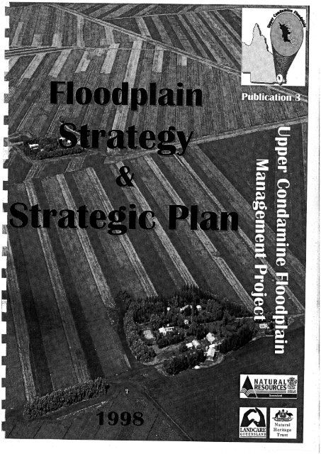
floodplain-strategy-strategic-plan.pdf | 3125.39 KB - South West NRM
floodplain-strategy-strategic-plan.pdf | 3125.39 KB - South West NRM
floodplain-strategy-strategic-plan.pdf | 3125.39 KB - South West NRM
Create successful ePaper yourself
Turn your PDF publications into a flip-book with our unique Google optimized e-Paper software.
The <strong>floodplain</strong>s of the Upper Condamine are one of the most valuable<br />
resources in Queensland.<br />
Meeting the challenges of <strong>strategic</strong> <strong>plan</strong>ning is vital to the sustainable<br />
use of this highly productive area.<br />
There is only one facet of <strong>strategic</strong> <strong>plan</strong>ning that is more important than<br />
the <strong>plan</strong> itself and that is the implementation of that <strong>plan</strong>. It is therefore<br />
imperative that processes used to develop the <strong>plan</strong> should also develop<br />
stakeholder ownership of that <strong>plan</strong>.<br />
Forming a partnership of local knowledge and experience with technical<br />
expertise and state of the art technology will be key aspects of the<br />
<strong>strategy</strong>.<br />
Linkages with 'Riparian' and 'U<strong>plan</strong>ds' projects need to be established<br />
and maintained to ensure <strong>plan</strong>s are complementary and total catchment<br />
needs are met.<br />
This document outlines a <strong>strategy</strong> and <strong>strategic</strong> <strong>plan</strong> to facilitate<br />
sustainable <strong>floodplain</strong> management in harmony with the Condamine<br />
Catchment Strategic Plan and the Queensland Murray-Darling Basin<br />
Natural Resource Management Strategy.<br />
John McLatchey and Clive Knowles-Jackson<br />
Upper Condarnine Floodplain Project<br />
October 1998<br />
Floodplain Strategy and Strategic Ran 1
CONTENTS<br />
FOREWORD ............................................................................................................................ i<br />
ACKNOWLEDGEMENTS<br />
...<br />
................................................................................................... 111<br />
INTRODUCTION ................................................................................................................... 1<br />
A . FLOODPLAIN STRATEGY .......................................................................................... 2<br />
GOAL ............................................................................................................................... 2<br />
STRATEGIC DIRECTION ................................................................................................... 2<br />
CHALLENGES .................................................................................................................... 3<br />
OVERVIEW OF PRIORITY ISSUES .................................................................................. 3<br />
CONTEXT FOR ACTION .................................................................................................... 4<br />
STRATEGIES TO ACHIEVE OBJECTIVE ........................................................................ 4<br />
CURRENT ACTIVITIES ................................................................................................... 5<br />
KEY FUTURE ACTIVITIES ................................................................................................ 6<br />
OBJECTIVES ................................................................................................................. 7<br />
PERFORMANCE INDICATORS ......................................................................................... 7<br />
I3 . STRATEGIC PLAN ..................... ............................................................................ 13<br />
KEY ISSUES IDENTIFIED ................................................................................................ 13<br />
1 . LAND MANAGEMENT AND USE .......................................................................... 14<br />
2 . WATER QUANTITY AND QUALITY .................................................................. 16<br />
3 . COMMUNICATION. EDUCATION AND AWARENESS ...................................... 18<br />
4 . RIPARIAN ZONE MANAGEMENT ...................................................................... 20<br />
5 . RESEARCH AND LEGISLATION ............................................................................ 22<br />
EVALUATION ............................................................................................................... 2 4<br />
ALLOCATION OF RESOURCES ..................................................................................... 24<br />
C . RESOURCES AVAILABLE 25<br />
........................................................................................<br />
LAND RESOURCE AREAS .............................................................................................. 25<br />
SOILS ............................................................................................................................... 25<br />
VEGETATION .................................................................................................................... 25<br />
CLIMATE ............................................................................................................................ 25<br />
APPENDICES .............. ............ ............................................................................................. 30<br />
A FLOODPLAIN MANAGEMENT PRINCIPLES ...................................................... 30<br />
B ISSUES IDENTIFICATION MEETING OUTCOMES ............................................ 3 1<br />
. .<br />
Floodplain Strategy and Strategic Plan 11
OWLEDGEMENTS<br />
This publication was produced by the Upper Condamine Floodplain Project with major input<br />
from Sarah Moles and Geoff Bass. The project team members are:<br />
Clive Knowles-Jackson<br />
John McLatchey<br />
Elyse Klupfel<br />
Steve Goudie<br />
Project Leader<br />
Project Officer<br />
Extension Officer<br />
Extension Officer<br />
The project team was guided by the Project Steering Committee and supported by the District<br />
Officers:<br />
Peter Pearce<br />
Geoff Bass<br />
Mark Genrich<br />
Clive Knowles- Jackson<br />
Paul Harris<br />
Nev Booth<br />
Wanvick<br />
Pittsworth<br />
Millmerran<br />
Oakey<br />
Dalby<br />
Chinchilla<br />
The contributions of the Project Team, members of the Project Steering Committee and the<br />
Staff in the Department of Natural Resources are gratefully acknowledged.<br />
..*<br />
Floodplain Strategy and Strategic Plan 111
INTRODUCTION<br />
The Floodplain Strategy and Strategic Plan has been prepared by the Upper Condamine<br />
Floodplain Project Steering Committee and Project Team to provide a <strong>strategic</strong> <strong>plan</strong>ning<br />
direction for the development of a Management Plan for the natural resources of the Upper<br />
Condamine Floodplain.<br />
The Plan outlines the broad strategies to appropriately address issues identified by the<br />
<strong>floodplain</strong> community during a series of public meetings in late 1997. This document is<br />
aligned with:<br />
the Queensland Murray-Darling Basin Catchment Natural Resource Management<br />
Strategic Plan 1996 - 2000, which outlines a vision and <strong>strategy</strong> for Integrated Catchment<br />
Management in the Queensland section of the Murray-Darling Basin; and<br />
The Condamine Catchment Strategic Plan, which outlines the broad strategies to<br />
appropriately manage the natural resource management issues identified by the Catchment<br />
Community.<br />
The document is divided into three sections:<br />
A. Floodplain Strategy;<br />
B. Strategic Plan; and<br />
C. Resources Available.<br />
The Strategy, or <strong>plan</strong> of action, documents the objectives, challenges, context for action, key<br />
future activities and performance indicators to achieve the desired objectives.<br />
The Strategic Plan provides an objective way of prioritising issues and activities for the<br />
<strong>floodplain</strong>s and establishes the roles various organisations and individuals play in<br />
implementing the <strong>plan</strong>. Evaluation of the processes and activities is an important step in<br />
<strong>strategic</strong> <strong>plan</strong>ning, therefore suitable performance indicators need to be incorporated.<br />
The natural resources of the Condarnine Floodplain are discussed in the Resources Available<br />
section.<br />
The Floodplain Strategy and Strategic Plan is a "living" document and will evolve and<br />
develop in response to new knowledge and understanding of the <strong>floodplain</strong>s.<br />
Floodplain Strategy and Strategic Plan<br />
I
A. FLOODPLAIN ST<br />
The ecological sensitivity, flow variability, competing demands on the use of the resources,<br />
and limited knowledge of physical, hydrological and biological process renders <strong>floodplain</strong><br />
management as one of the most challenging natural resources issues.<br />
Development (including irrigation, urban growth, land management and infrastructure)<br />
continues to change the volume, extent and pattern of drainage of floodwater flows across the<br />
Condamine <strong>floodplain</strong>s. Overland flows maintain wetland and <strong>floodplain</strong> ecosystems,<br />
providing beneficial inundation for dryland crops and pastures, and stock, domestic, and<br />
irrigation water supplies.<br />
Integrated <strong>plan</strong>ning and coordinated management is essential to ensure healthy, productive<br />
<strong>floodplain</strong>s and should incorporate the precautionary principle of adopting Better<br />
Management Practices (BMPs) to avoid serious resource and environmental damage.<br />
GOAL<br />
Healthy, productive <strong>floodplain</strong>s supporting sustainable natural resource use.<br />
TEGIC DIRECTION<br />
Cooperative and coordinated action is required by all involved in the management and use of<br />
the <strong>floodplain</strong> to effectively address land and water degradation and economic issues<br />
associated with natural resource management.<br />
Community concern over the degradation of the <strong>floodplain</strong> lead to the establishment of the<br />
Upper Condarnine Floodplain Project. This Natural Heritage Trust funded project is a<br />
partnership of landholders and Department of Natural Resources and incorporates the<br />
interests of all stakeholders on the <strong>floodplain</strong>, including local authorities and state<br />
government agencies. This community owned project is focused on the implementation of<br />
better management practices across the <strong>floodplain</strong> and will be achieved through the following<br />
processes:<br />
Situation analysis;<br />
Identification of need;<br />
Development of a Floodplain Management Plan through a community participation<br />
process; and<br />
Implementation of the Plan.<br />
Forming a partnership of local knowledge and experience with technical expertise and state of<br />
the art technology will be key aspects of the <strong>strategy</strong>.<br />
Floodplain Strategy and Strategic Plan
CHALLENGES<br />
Coordinated <strong>plan</strong>ning needs to be undertaken by State Government agencies, Local<br />
Government authorities, landholders and the wider community.<br />
Our knowledge and understanding of ecological, hydraulic and hydrological processes of<br />
the <strong>floodplain</strong> must be improved if sustainable resource use is to be achieved.<br />
Infrastructure on the <strong>floodplain</strong>s must be designed, located and managed to allow flows to<br />
move across the plains without jeopardy to sustainable management for all users.<br />
Land management practices that degrade the <strong>floodplain</strong>, such as erosion, accelerated<br />
siltation, diversion and chemical contamination, must be minimised.<br />
Loss of riparian vegetation through clearing, dieback and inappropriate management needs<br />
to be stopped.<br />
Better management practices need to be adopted across the entire catchment.<br />
OVERVIEW OF PRIORITY ISSUES<br />
The following list ranks <strong>floodplain</strong> issues in the catchment in order of importance. Increasing<br />
numbers of C1' show increasing priority.<br />
@g;#'#'&' Uncontrolled and uncoordinated runoff along with inappropriately sited<br />
development infrastructure has lead to unnatural flow concentrations, and<br />
extensive land degradation. It is imperative that there is a coordinated<br />
approach to management of the <strong>floodplain</strong>, including fanning<br />
practices/systems.<br />
&'p&'#'e Increased interest in water resources, for agricultural industry and urban<br />
usage, has lead to increased pressure to maintain water quality and quantity.<br />
Uncontrolled extraction of overland flows from the <strong>floodplain</strong> and excess<br />
groundwater use impacts on ecosystem health and resource reliability.<br />
&<br />
F1 oodplain management issues and processes are not understood or<br />
appropriately <strong>plan</strong>ned for by the community and all levels of government.<br />
Communication and education needs to be integral to all strategies and<br />
activities.<br />
&:&:&:#:&:<br />
Floodplain management issues cannot be considered in isolation from the<br />
adjacent areas of the u<strong>plan</strong>ds and riparian zone, as each impact on the other.<br />
&kc-' &:&:&.<br />
Current legislation is inadequate (or non-existent) to address the emerging<br />
issues on the <strong>floodplain</strong>. There is a need for the development of a water<br />
sharing policy including environmental needs.<br />
&:&:&'&:&,<br />
Future effective, sustainable management of the <strong>floodplain</strong> is dependent<br />
upon extensive research including hydrologic and hydraulic modelling of<br />
overland flows and groundwater, and scientific investigation of fauna and<br />
flora (terrestrial and aquatic) requirements.<br />
F'loodplain Strategy and Strategic Plan 3
CONTEXT FOR ACTION<br />
The river and its <strong>floodplain</strong> are inextricably linked to and affected by land use<br />
management in u<strong>plan</strong>d areas.<br />
The ecological, cultural, economic and social value of the river and <strong>floodplain</strong> should be<br />
identified, quantified and the impact of human activity on these values determined as far as<br />
practical before decisions are made (in accordance with the precautionary principle).<br />
River and <strong>floodplain</strong> functions and values should be conserved within the context of<br />
integrated natural resource management.<br />
The rehabilitation of degraded rivers, creeks and <strong>floodplain</strong>s is important and should be<br />
undertaken where necessary.<br />
I<br />
A coordinated and cooperative catchment approach to river and <strong>floodplain</strong> management is<br />
essential and must involve all stakeholders.<br />
Ongoing research into <strong>floodplain</strong> processes and management, and the dissemination of this<br />
knowledge to the community is important for their ecologically sustainable use.<br />
TEGIES TO ACHIEVE OBJECTIVE<br />
Support the development and implementation of coordinated ecological and cultural<br />
assessment, monitoring and reporting programs for <strong>floodplain</strong>s.<br />
Support research that increases knowledge and understanding of ecological processes,<br />
hydrological cycles and aquatic biota, and improves practices for integrated management<br />
of river, <strong>floodplain</strong> and production systems.<br />
Support processes for developing equitable sharing and integrated management of river,<br />
<strong>floodplain</strong> and overland flows.<br />
I<br />
Foster investigation and development of effective techniques including; communication,<br />
education and awareness and 'better practise' guidelines for conservation, rehabilitation<br />
and management of the river and its <strong>floodplain</strong>.<br />
Floodplain Strategy and Strategic PIan 4
CURRENT ACTIVITIES<br />
Formation of a Project Steering Committee and its continued activities.<br />
Survey of the community to identify <strong>floodplain</strong> issues.<br />
Development of BMPs and Case Studies with the community.<br />
Development of an Upper Condamine Floodplain Resource Inventory and presentation to<br />
clients in a readily useable form.<br />
Investigation of legislative processes at both State and Local levels.<br />
Developing Floodplain Principles (Appendix A) and Criteria for use in the <strong>plan</strong>ning<br />
process and future hydraulic and hydrological modelling.<br />
Development and implementation of coordinated resource management <strong>plan</strong>s.<br />
Development of a Case Study on all aspects of water allocation and sharing on the<br />
<strong>floodplain</strong>s for referral to the Minister for Natural Resources for future consideration.<br />
Continued consultation with the <strong>floodplain</strong> community.<br />
Continued investigation of advanced technologies to determine methods of accelerating<br />
the <strong>plan</strong>ning processes.<br />
Continued linkages with other <strong>floodplain</strong> projects - Liverpool Plains, Waggamba Shire,<br />
Brigalow-Jimbour Floodplains Project, etc.<br />
Continued input to Shire Planning Schemes.<br />
Floodplain Strategy and Strategic Plan 5
KEY FUTURE ACTIVITIES<br />
Essential<br />
Establish and implement the framework and protocols to monitor and report on <strong>floodplain</strong><br />
condition and trend against regionally defined benchmarks and national guidelines.<br />
Undertake a detailed Resource Inventory of the Upper Condamine Floodplain to be used<br />
for benchmarking, situation analysis and <strong>strategic</strong> <strong>plan</strong>ning.<br />
Develop and implement, with the community, a Management Plan for the whole of the<br />
Upper Condamine Floodplain.<br />
l<br />
Promote and maintain linkages with other activities, projects and <strong>plan</strong>ning schemes<br />
impacting on the <strong>floodplain</strong>s.<br />
Develop principles, guidelines, criteria and strategies appropriate for use in Shire Planning<br />
Schemes across the plains.<br />
Initiate and implement legislation supporting appropriate <strong>floodplain</strong> development and<br />
water sharing.<br />
Highly Desirable<br />
The development and promote the adoption of better management practice guidelines.<br />
Provide technical assistance and incentives for on-ground works to improve management<br />
of <strong>floodplain</strong> habitats.<br />
Develop strategies, with other projects, to minimise impacts of sediment, nutrient and<br />
pesticide loads, on the <strong>floodplain</strong> environment and water quality.<br />
Undertake hydrological studies to identify the dynamics of overland flows and the<br />
.- I influences of management practices on the <strong>floodplain</strong> environment.<br />
Support the development and implementation of riparian vegetation retention and<br />
rehabilitation <strong>plan</strong>s at catchment and sub-catchment level.<br />
Coordinate with other projects to develop and promote cost effective methods to minimise<br />
channel and stream bank erosion at critical locations on the plains.<br />
Promote the development of <strong>strategic</strong> Land Management Planning in the U<strong>plan</strong>ds to<br />
compliment <strong>floodplain</strong> <strong>plan</strong>ning.<br />
Floodplain Strategy and Strategic Plan 6
OBJECTIVES<br />
Integrated and coordinated <strong>plan</strong>ning and management between the local community, state<br />
government agencies and local government.<br />
Development on the <strong>floodplain</strong> located to minimise overland flow concentration,<br />
diversion, land degradation and flood damage and allied to historical flood flow patterns.<br />
Effective monitoring processes providing useful information for effective <strong>floodplain</strong><br />
management.<br />
Comprehensive inventory of ecological, physical and cultural characteristics of <strong>floodplain</strong><br />
areas.<br />
I<br />
! Adoption of better management practice, through community and education programs, to<br />
reduce adverse impacts on the <strong>floodplain</strong> and instream biota.<br />
Floodplain hydrological cycle clearly documented and incorporated into <strong>plan</strong>ning and<br />
decision making.<br />
Legislation supporting appropriate development and equitable water sharing on the<br />
<strong>floodplain</strong>.<br />
ANCE INDICATORS<br />
Percentage of community and resource managers adopting BMPs.<br />
Number and extent of management <strong>plan</strong>s prepared and implemented for priority <strong>floodplain</strong><br />
areas.<br />
Reduction in levels of disaster relief funding.<br />
A community with a higher level of knowledge and understanding of <strong>floodplain</strong> issues.<br />
Linkages with other projects maintained including complementary u<strong>plan</strong>d and riparian<br />
projects.<br />
e Extent, diversity and quality of riparian buffer zone vegetation retained or re<strong>plan</strong>ted.<br />
Floodplain Strategy and Strategic Plan 7
FLOODPLAIN MANAGEMENT ST<br />
Objectives<br />
Integrated<br />
and<br />
coordinated <strong>plan</strong>ning<br />
and management<br />
between the local<br />
community, state<br />
government agencies<br />
and local government.<br />
Strategy<br />
1. Develop and implement a community<br />
owned management <strong>plan</strong> for the whole<br />
of the Upper Condamine Floodplain.<br />
2. Promote and maintain linkages between<br />
activities influencing <strong>floodplain</strong><br />
management (WAMP, CRBIA, Vision<br />
2000, etc.).<br />
3. Incorporate between management<br />
practices into local authority <strong>plan</strong>ning<br />
schemes.<br />
la<br />
I b<br />
lc<br />
2a<br />
2b<br />
2c<br />
2d<br />
3a<br />
3b<br />
Action required<br />
Identify existing and potential land<br />
degradation areas and causes.<br />
Implement appropriate management<br />
practices.<br />
Establish guiding principles for<br />
<strong>floodplain</strong> management.<br />
Identify existing activities on the<br />
<strong>floodplain</strong>.<br />
Establish common meeting forums.<br />
Promote coordination.<br />
Minimise the duplication/overlap of<br />
activities through effective<br />
communication.<br />
Ensure local authorities represented at<br />
policy forum and on working parties.<br />
Ensure appropriatelrelevant input into<br />
<strong>plan</strong>ning schemes.<br />
Priority<br />
Essential<br />
Essential<br />
Highly<br />
Desirable<br />
Desirable<br />
Desirable<br />
Desirable<br />
Highly<br />
Desirable<br />
Highly<br />
Desirable<br />
Highly<br />
Desirable<br />
Reconznsended Lead<br />
Respo,rsibility<br />
DNR in partnership with the<br />
Community<br />
Local Governments and Community<br />
UCFPP<br />
CCMA<br />
DNR and CCMA<br />
DNR and CCMA<br />
DNR and CCMA<br />
DNR and Local Governments<br />
DNR<br />
Floorlplain Strategy and Strategic Plan 8
Objectives<br />
Development on the<br />
<strong>floodplain</strong> located to<br />
minimise overland<br />
flow concentration,<br />
diversion, land<br />
degradation and flood<br />
damage and to maintain<br />
historical flood flow<br />
patterns.<br />
Strategy<br />
1. Identify existing and natural flow paths<br />
and recommend appropriate<br />
development and use.<br />
2. Develop uniform guidelineslcriteria<br />
appropriate for use in local government<br />
<strong>plan</strong>ning schemes across the <strong>floodplain</strong>.<br />
3. Develop and promote cost effective<br />
methods to minimise channel and bank<br />
erosion on <strong>floodplain</strong> waterways and<br />
streams.<br />
4. Promote community awareness of water<br />
development and management issues.<br />
la<br />
1 b<br />
2a<br />
2b<br />
2c<br />
2d<br />
3a<br />
3b<br />
4a<br />
Action required<br />
Conduct and complete topographic<br />
interpretation of the natural flowpaths.<br />
Conduct community workshops drawing<br />
on local knowledge to identify existing<br />
flow paths.<br />
Identify <strong>floodplain</strong> activities requiring<br />
detailed guidelines.<br />
Through community engagement of all<br />
stakeholders, develop <strong>floodplain</strong><br />
guidelines.<br />
Promote the adoption of guidelines.<br />
Ensure regular review of guidelines to<br />
maintain their relevance.<br />
Review relevant knowledge on<br />
techniques to minimise erosion.<br />
Implement effective management<br />
techniques through technical assistance<br />
and incentives.<br />
Conduct a communication program to<br />
build awareness of water as a valuable<br />
and finite resource.<br />
Priority<br />
Essential<br />
Highly<br />
Desirable<br />
Highly<br />
Desirable<br />
Desirable<br />
Desirable<br />
Desirable<br />
Desirable<br />
Highly<br />
Desirable<br />
Desirable<br />
Recot~ztizctz ded Lend<br />
Respotzsibility<br />
UCFPP<br />
UCFPP<br />
UCFPP in partnership with the<br />
community<br />
UCFPP in partnership with the<br />
community<br />
DNR and community<br />
DNR<br />
DNR<br />
Community with assistance from DNR<br />
and Landcare groups<br />
DNR<br />
Fioodplain Strategy and Strategic Plan 9
Objectives<br />
Effective monitoring<br />
processes providing<br />
useful information for<br />
effective <strong>floodplain</strong><br />
management.<br />
Comprehensive<br />
inventory of ecological,<br />
physical and cultural<br />
characteristics<br />
<strong>floodplain</strong> areas.<br />
of<br />
Strategy<br />
I. Establish and implement the framework<br />
and protocols to monitor and report<br />
<strong>floodplain</strong> condition and trend against<br />
regionally defined benchmark and<br />
national guidelines.<br />
1. Undertake a detailed resource inventory<br />
of the Condamine Floodplain to be used<br />
for benchmarking situation analysis and<br />
informed resource management<br />
decisions.<br />
la<br />
1 b<br />
1c<br />
la<br />
lb<br />
1 c<br />
Id<br />
Action required<br />
Identify areas requiring assessment and<br />
monitoring (Eg. Silt deposition, water<br />
heights, recharge areas, etc.).<br />
Establish a monitoring and reporting<br />
network.<br />
Ensure monitoring results are<br />
interpreted and utilised in better<br />
<strong>floodplain</strong> management.<br />
Collect and collate all available natural<br />
resource information on the Condamine<br />
Floodplain.<br />
Collect and collate information on<br />
existing development activities.<br />
Identify knowledge gaps.<br />
Promote scientific research into areas of<br />
identified information/ knowledge<br />
deficiencies.<br />
Priority<br />
Highly<br />
Desirable<br />
Desirable<br />
Desirable<br />
Highly<br />
Desirable<br />
Highly<br />
Desirable<br />
Highly<br />
Desirable<br />
Highly<br />
Desirable<br />
Recorrzrrzerz~ied Lend<br />
Respotzsibility<br />
DNR in partnership with the<br />
community<br />
DNR<br />
DNR<br />
UCFPP<br />
UCFPP<br />
UCFPP<br />
DNR and CCMA<br />
Floodplain Strategy and Strategic Plan 10<br />
! .' - . w--.. - .
Objectives<br />
Adoption of better<br />
management practice,<br />
through community and<br />
education programs, to<br />
reduce adverse impacts<br />
on the <strong>floodplain</strong> and<br />
instream biota.<br />
Strategy<br />
I. Promote continuing development and<br />
adoption of better management practices<br />
within the community.<br />
la<br />
I b<br />
I c<br />
Id<br />
le<br />
If<br />
Action required<br />
Review existing management practices.<br />
Seek industry support.<br />
Conduct effective extension activities to<br />
promote adoption.<br />
Provide technical assistance and<br />
incentives for on-ground works.<br />
Continue to review management<br />
practices in light of increased<br />
knowledge and technology.<br />
Ensure all relevant information is<br />
considered in better management<br />
practise process.<br />
Priority<br />
Desirable<br />
Desirable<br />
Highly<br />
Desirable<br />
Highly<br />
Desirable<br />
Desirable<br />
Desirable<br />
Recotnt~zert ded Lend<br />
Respottsibility<br />
DNR in partnership with the<br />
Community<br />
Community, DNR and CCMA<br />
DNR<br />
DNR<br />
DNR in partnership with the<br />
community<br />
DNR in partnership with the<br />
Community<br />
Floo(lp1uin Strutegy cmd Strategic Plan<br />
II
Objectives<br />
Floodplain hydrological<br />
cycle clearly documented<br />
and incorporated into<br />
<strong>plan</strong>ning and decision<br />
making.<br />
Legislation supporting<br />
appropriate<br />
development and<br />
equitable water sharing<br />
on the <strong>floodplain</strong>.<br />
Strategy<br />
1. Conduct hydrologic and hydraulic<br />
studies to identify the dynamics of<br />
overland flows and the influences of<br />
management practices on the <strong>floodplain</strong>.<br />
2. Determine long-term sustainable water<br />
(surface and groundwater) availability.<br />
1. Initiate and implement legislation<br />
supporting appropriate <strong>floodplain</strong><br />
development and an equitable water<br />
sharing regime.<br />
la<br />
1 b<br />
lc<br />
2a<br />
2b<br />
2c<br />
la<br />
lb<br />
1 c<br />
Id<br />
Action required<br />
Access funding to conduct modelling<br />
studies.<br />
Utilise best available modelling tools to<br />
conduct studies into the hydrologic and<br />
hydraulic nature of the <strong>floodplain</strong>s.<br />
Incorporate modelling results into<br />
<strong>plan</strong>ning and decision making for better<br />
<strong>floodplain</strong> management.<br />
Conduct studies into catchment yield.<br />
Collect and collate data on existing use.<br />
Undertake studies of groundwater use,<br />
yield and recharge.<br />
Collect and collate data to identify the<br />
deficiencies1 inadequacies in applying<br />
existing legislation to the <strong>floodplain</strong>.<br />
Determine appropriate directions for<br />
legislative intervention.<br />
Determine appropriate regulatory<br />
mechanisms.<br />
Lobby government for implementation<br />
of legislative and regulatory support.<br />
Priority<br />
Essential<br />
Highly<br />
Desirable<br />
Desirable<br />
Essential<br />
Highly<br />
Desirable<br />
Desirable<br />
Highly<br />
Desirable<br />
Highly<br />
Desirable<br />
Desirable<br />
Desirable<br />
DNR<br />
DNR<br />
Recofizinerlded Lend<br />
Rrspoitsibility<br />
DNR in partnership with the<br />
community<br />
DNR<br />
DNR<br />
DNR<br />
UCFPP and the Ministerial Resource<br />
Management Advisory Council<br />
UCFPP in pal-tnrrship with the<br />
community<br />
UCFPP in partnership with the<br />
community<br />
Community<br />
Floodplnin Strategy and Strategic Pian<br />
I2
TEGIC PLAN<br />
In its natural state. the <strong>floodplain</strong> was a mostly treeless, gilgaied grass area that dispersed<br />
flood flows over a wide front. Development (irrigation, urban growth, land management<br />
infrastructure etc.) continues to alter the extent, patterns and volumes of flood flows across<br />
the plains. Overland flows provide beneficial inundation for crops and pastures, provide<br />
stock, domestic and irrigation supplies as well as helping to maintain flood plain ecosystems.<br />
To effectively address land and water degradation, and economic issues associated with<br />
natural resource management, cooperative and coordinated action is required by all involved<br />
in the management and use of the <strong>floodplain</strong>.<br />
The main aim is to maintain a sustainable, productive and healthy <strong>floodplain</strong> by having<br />
landholders cooperating to coordinate farming and infrastructure activities. This cooperative<br />
process has commenced and community meetings have been held to identify key issues.<br />
KEY ISSUES IDENTIFIED<br />
The key issues and concerns identified by the <strong>floodplain</strong> community (Appendix B) include:<br />
1. Runoff Coordination;<br />
2. Infrastructure - Road, Rail, Irrigation, etc.;<br />
3. Erosion;<br />
4. Farming Systems;<br />
5. Legislation;<br />
6. Water harvesting;<br />
7. Communication;<br />
8. U<strong>plan</strong>ds effect;<br />
9. Riparian and environmental issues;<br />
10. Water use;<br />
11. Silt deposition;<br />
12. Water Quality;<br />
13. Research Needs;<br />
14. Other;<br />
15. Soil Fertility; and<br />
16. Research Modelling.<br />
These 16 issues can be grouped into five major topics:<br />
1. Land Management and Use;<br />
2. Water Quality and Quantity;<br />
3. Communication, Education and Awareness;<br />
4. Riparian Zone Management; and<br />
5. Research and Legislation.<br />
Curiously, no mention was made of weeds, which are generally considered a major problem<br />
in the area.<br />
Floodplain Strategy and Strategic Plan 13
1. LAND MANAGEMENT AND USE<br />
GOAL<br />
improve the bulunce between economic viability and szrstuinable use of the fiodpluin resources.<br />
The <strong>floodplain</strong> is one of the most productive agricultural areas in the country. Land degradation<br />
costs, productive capacity and ecological sustainability as well as off site effects are<br />
considerable.<br />
THE ISSUES<br />
Runoff Coordination<br />
Uncontrolled and uncoordinated runoff is allowing concentrations of flood flows to flow in paths<br />
detrimental to the plains, with some landholders concentrating flows for flood harvesting thus<br />
producing new flow paths and new off site problems.<br />
Infrastructure<br />
Current road, rail and flood harvesting infrastructure cause flow to concentrate in areas on the<br />
<strong>floodplain</strong> that are not natural. To keep roads and rail accessible in times of flood, construction<br />
has been above ground level thus creating diversions. The advent of flood harvesting with its<br />
associated infrastructure for storage's and supply ditches can create large 'flood shadows' across<br />
the <strong>floodplain</strong>.<br />
Soil Erosion and Silt Depositions<br />
Although identified as separate issues soil erosion and silt deposition are a product of lack of<br />
runoff and infrastructure coordination. The lack of integrated <strong>plan</strong>ning has led to flow<br />
concentrations which reach erodible velocities and result in severe soil movement. The<br />
subsequent slowing down of water then produces siltation which can exacerbate erosion and<br />
siltation processes and can result in changes to runoff patterns.<br />
Farming Systems<br />
With such a diversity of crops grown and both dryland and irrigation regimes in place, farming<br />
systems are complicated. The simple system to emulate nature and spread flood flows over as<br />
wide an area as possible are complicated by irrigation practices and cropping patterns and<br />
rotations.<br />
U<strong>plan</strong>d Effects<br />
Increased cultivation in the u<strong>plan</strong>d catchments has increased the volume of water running off the<br />
land, while land conservation systems (Eg. waterways and contour banks) concentrate runoff into<br />
localised areas. This results in erosive overland flooding on the plains.<br />
Soil Fertility<br />
Soil Fertility is not generally considered limiting to sustainable production of <strong>floodplain</strong>s because<br />
artificial fertilisers can be used in the area. The fertility issue raised may relate to the decline of<br />
soil structures, losses due to soil erosion and stream siltation.<br />
Floodplain Strategy and Strategic Plan 14
LAND MANAGEMENT AND USE<br />
Objectives<br />
Strategy<br />
Repair and reduce land 1 . Identify eroded and silted areas<br />
degradation.<br />
and their cause.<br />
2. Identify runoff coordination<br />
problems<br />
Integrate and coordinate 3. Identify problems with<br />
sustainable land use,<br />
infrastructure<br />
management, developments 1 4. Identify soil fertility problems<br />
I and practices through a<br />
I<br />
I<br />
I<br />
coordinated participative<br />
<strong>plan</strong>ning process.<br />
I<br />
DPI - Dept of Primary Industries<br />
5. Control and manage land<br />
degradation<br />
1 6. Recommend improved farming<br />
systems<br />
7. Reduce affects from u<strong>plan</strong>d<br />
catchment<br />
Action Required<br />
a) Prioritise issues and identify remedy.<br />
b) Implement appropriate erosion control practices.<br />
c) Prepare and implement coordinated <strong>plan</strong>s.<br />
d) Negotiate with local government about<br />
coordination issues.<br />
e) Prepare local area Floodplain Management Plans<br />
to overcorne problems with infrastructure.<br />
f) Negotiate with local government and others Eg.<br />
road grading more suitable actions.<br />
g) Research and development programs to address<br />
the land degradation problerns (Eg. consider<br />
controlled traffic techniques, farm size/viability,<br />
who When<br />
Stakeholders @ 0612000<br />
workshops<br />
Stakeholders (@ 0612000<br />
workshops<br />
Stakeholders @ 0612000<br />
workshops<br />
Stakeholders @ 0612000<br />
workshops<br />
Stakeholders @ 0612000<br />
workshops<br />
Stakeholders @ 0612000<br />
workshops<br />
DPI, DNR and ongoing<br />
Stakeholders<br />
1 cooperative farming, and subcatchment <strong>plan</strong>ning I I I<br />
implementation and maintenance).<br />
h) Develop and distribute better management<br />
practice guidelines for <strong>floodplain</strong> management.<br />
i) Develop uniform guidelines for local government<br />
activities on <strong>floodplain</strong>.<br />
j) Develop methods to reduce effects of elusive<br />
I overland flow flooding particularly at 'outlet' I workshops 1 I<br />
areas Eg. flood spreaders, flood mitigation dams<br />
etc.<br />
k) Update inventory of <strong>floodplain</strong> resources<br />
regularly.<br />
1) Develop Floodplain Principles.<br />
m) Develop Floodplain Criteria.<br />
n) Develop overall Floodplain Management Plan.<br />
DNR and<br />
Stakeholders<br />
Local Govt. and<br />
DN R<br />
Stakeholders @<br />
m-+<br />
I<br />
10198<br />
12198<br />
06/2000<br />
ongoing<br />
Stakeholders 1 12/98<br />
I<br />
Stakeholders 1 06/99<br />
Stakeholders 1 1212000<br />
tpartment of Natural Resources<br />
Floorlplain Strategy and Strategic Plan 15
WATER QUANTITY AND QUALITY<br />
GOALS<br />
To have hulmced consumption crnd environmental usage of water bused on filir and<br />
equitable distribution principlesfor all stukeholders.<br />
To maintain and improve wafer quulity.<br />
Droughts and low commodity prices have seen increased interest in the water resource for<br />
agricultural industry and urban usage. This has lead to increased pressure on maintaining<br />
water quantity and quality (both under ground and surface water supplies).<br />
THE ISSUES<br />
Water hawesting<br />
The interest in harvesting of overland flows for irrigation is increasing. Applications for<br />
licences to build storage's are continuing due to fears that a 'stop7 could be put to this<br />
practice. There is a feeling that a successful application for a licence to build infers an<br />
allocation. Uncontrolled extraction of overland flow from the <strong>floodplain</strong> impacts on<br />
stream performance #and existing users consider that it effects their perceived 'established<br />
water rights' - where in fact no prior rights to this water exists, except as defined by<br />
common law.<br />
Water Use<br />
Currently all stream and groundwater systems are deemed to be hlly committed so<br />
overland flow harvesting is the best avenue available for access to water for agricultural<br />
purposes.<br />
Water access and utilisation of surface and shallow groundwater supplies - urban, stock,<br />
domestic and irrigation - is causing concern relating to the reliability of this resource.<br />
Capturing overland flow is seen by landholders as a means of easing their situation.<br />
There is a need for the development of water sharing policy including environmental<br />
needs. Industry groups are working towards the development of these policies in<br />
' 1 conjunction with the Upper Condamine Floodplain Project.<br />
Other issues include: improved information and understanding of what and how much<br />
environmental flow is required and the efficient use of the existing water resource.<br />
Water Quality<br />
Concerns were expressed relating to the possible pollution of water supplies by farming<br />
and urban activities - turbidity, chemicals, salinity and sewage - evidenced by poor<br />
ecological health of waterways. The Condamine Balonne Water Committee is<br />
coordinating and overseeing water quality monitoring. More funding is needed to<br />
continue and expand this process.<br />
Floodplain Strategy and Strategic Plan 16
WATER<br />
Obiective<br />
Prepare and implement<br />
coordinated <strong>plan</strong>s addressing<br />
management and allocation<br />
I issues in participation with the<br />
<strong>floodplain</strong> community<br />
c<br />
DNR - Dept. of Natural Resources<br />
Strategy<br />
1. Determine long term sustainable<br />
water availability and quantities<br />
2. Determine environmental flow<br />
requirements for the <strong>floodplain</strong> in<br />
conjunction with WAMP.<br />
3. Develop and implement appropriate<br />
Action Required<br />
a) Collect andlor collate data into a useable format<br />
for the water system.<br />
b) Develop and reconuinend management options to<br />
secure sustainable water use.<br />
c) Collect, collate, and coordinate water harvesting<br />
Who<br />
DNR, Stakeholders<br />
<strong>plan</strong>s to achieve long term I activities. I I I<br />
sustainable water use.<br />
4. Maintain and/or improve water<br />
quality<br />
5. Increase water quality monitoring.<br />
d) Set a clear direction for development, where it is<br />
sustainably possible.<br />
e) Recommend practices to minimise environmental<br />
impacts.<br />
f) Determine scope for further water development on<br />
the <strong>floodplain</strong> in conjunction with WAMP.<br />
g) Promote community awareness of water<br />
development and management issues.<br />
h) Identify gaps in existing water monitoring and<br />
address.<br />
i) Initiate processes to maintain/improve water<br />
quality.<br />
j) Raise community awareness to water quality<br />
projects and issues.<br />
k) Implement overland flow measuring program.<br />
1) Involve all stakeholders io developing an overland<br />
flow <strong>strategy</strong> on the <strong>floodplain</strong>s.<br />
1n)Develop <strong>floodplain</strong> modelling skills across the<br />
<strong>floodplain</strong>.<br />
n) Identify existing flow paths across the <strong>floodplain</strong>.<br />
CRBIA - Condamine River Basin Irrigators Associati011<br />
DNR, Stakel~oldrrs<br />
DNR, Stakeholders<br />
DNR, Stakeholders<br />
DNR, Stakellolders<br />
CRBIA, CBWC<br />
DNR, Stakeholders<br />
CRBl A<br />
DNR, Stakeholders<br />
CRBIA<br />
DNR, Stakeholders<br />
When<br />
Ongoing<br />
Ooguing<br />
011goi11y<br />
Ongoing<br />
DNR, Stakeholders 12/98<br />
Schools, CBWC<br />
DNR, Stakeholders 98 &<br />
Schools. CBWC<br />
DNR, Stakeholders 1 1/98<br />
DNR, Stakeholders ongoing<br />
CRBIA<br />
DNR, Stakellolders 11/98 S:<br />
ongoing<br />
DNR, Stakeholders 8/98 S:<br />
CBWC - Condamine Balonne Water Committee Inc.<br />
Ongoing<br />
Ongoing<br />
Ongoing<br />
Ongoing<br />
1 ongoing I<br />
Fhodpkain Strategy and Strategic Plan 17
3. COMMUNICATION, EDUCATION AND AWARENESS<br />
GOALS<br />
A community with a higher level of understanding and knowledge of<strong>floodplain</strong> isszies and<br />
management.<br />
A better informed communi@ will make better informed decisions relating to <strong>floodplain</strong><br />
matters.<br />
THE ISSUES<br />
Floodplain management processes are not properly understood or appropriately <strong>plan</strong>ned<br />
for by the community and all levels of government. The benefits of natural resource<br />
management projects are not readily accepted by the community or associated and<br />
identified with any particular group.<br />
Community groups and individuals are not well informed on <strong>floodplain</strong> general issues but<br />
know what happens on "their own patch" and who to "blame" when "out of the ordinary"<br />
circumstances arise.<br />
Communication and education are integral to all strategies.<br />
Floodplain Strategy and Strategic Plan 18
4. RIPARIAN ZONE MANAGEMENT<br />
GOAL<br />
To enhance the physical and biological condition of instream cmd riparicin zones.<br />
Link with the Ncltional Heritage Trust project for the Qzreensland section ofthe Murray<br />
Darling Busin that is dealing with implementation of Sustainable Riverine Management.<br />
Little knowledge of appropriate management techniques exists and available information<br />
indicates a general degradation of this zone.<br />
THE ISSUES<br />
There is a poor understanding of processes within a riparian zone. In fact, there are<br />
differing opinions on what constitutes a riparian zone. It is considered that land use and<br />
management adjacent to and within the zone are major contributors to its degradation. The<br />
lead agencies for riparian management appear to be with River Improvement Trusts, but<br />
not all shires in the area have Trusts. There does not appear to be an appreciation of the<br />
aesthetic and recreation benefits possible in riparian zones.<br />
Weeds such as Lippia, Eucalyptus die back and community consultation are major<br />
problems of the riparian zone.<br />
Floodplain Strategy and Strategic Plan 20
RIPARIAN ZONE MANAGEMENT<br />
I<br />
I<br />
Objectives<br />
Develop and implement <strong>plan</strong>s which<br />
foster balanced riparian<br />
Strategy<br />
1. To ensure healthy intact streams<br />
and associated ecosystems.<br />
management. I I and prevent fi~rtlier<br />
To enhance instream healtl~ and<br />
promote ecological habitat values of<br />
1 2. To maintain/improve water quality<br />
Action Required<br />
Who<br />
a) Implement onground works to repair DNR,<br />
and/or reduce existing degradation CCMA,<br />
degradation. I Stakeholders, R:<br />
River Improvement<br />
Trust<br />
b) Instigate a community awareness CCMA,<br />
I in watercourses. 1 campaign. I DNR,<br />
I I ( CRBIA, &<br />
3. To manage riparian zones to<br />
maintain and enhance physical and<br />
Industrv groups<br />
c) Participate in the development of CCMA,<br />
riparian zone management guidelines. 1 Community,<br />
water courses I biological values. QMDB,<br />
I I I DNR, &<br />
4. To encourage community<br />
I understanding of the role and value I rigorous consultation procedures. I Community,<br />
of riparian zones.<br />
d) Participate in the development of<br />
I<br />
Industry groups<br />
CCMA,<br />
When<br />
08/98 Br<br />
ongoing<br />
ongoing<br />
ongoing<br />
ongoing<br />
I<br />
5. To reverse native vegetation<br />
I decline. 1 flow management, the River I DNR,<br />
Improvement Trust activities, CRBIA, &<br />
WAMP, the conjunctive water use QMDB<br />
project, and other <strong>floodplain</strong> projects. I<br />
DNR - Dept. of Natural Resources QMDB - Queensland Murray Darling Basin WAMP - Water Allocation Management Plan<br />
CCMA - Condamine Catch~ner~t Management Association<br />
CRBlA - Condaniine River Basin Irrigation Association<br />
e) Create linkages between overland<br />
Industry groups<br />
CCMA,<br />
07/98 &r<br />
ongoing<br />
Floodplain Strategy and Strategic Plan 21
5. RESEARCH AND LEGISLATION<br />
GOAL<br />
To develop rnnnugement programs within the 1egi.slutiveframework to influence changes<br />
necessary to make the legislation more workable.<br />
To identlfy gaps in <strong>floodplain</strong> knowledge and implement research to fill these gaps (Eg.<br />
farming systems, new spray technology and cooperative farming systems).<br />
THE ISSUES<br />
The activities recommended in <strong>floodplain</strong> management are all the product of past research<br />
and current legislation. Effective management needs to meet gaps in knowledge by further<br />
research. Landholders identified the need for on going research and monitoring of<br />
pollution levels in waterways.<br />
Landholders expressed concern at the lack of 'controls' on their activities due to gaps in<br />
current legislation but were united in needing legislative protection (support) and<br />
guidelines to direct certain activities. There was a general feeling that a local authority was<br />
best equipped to understand and implement their legislative needs.<br />
Current legislation is inadequate to address the emerging environment issues on the<br />
<strong>floodplain</strong>.<br />
Legislation needs regular review to meet the challenges of new technology.<br />
Floodplain Strategy and Strategic Ran 22
RESEARCH AND LEGISLATION<br />
Objective<br />
Develop legislation and/or local<br />
laws for effective <strong>floodplain</strong><br />
management.<br />
Gain an understanding wliich<br />
leads to integrating improved<br />
practices of riverine, <strong>floodplain</strong><br />
and production syste~ns.<br />
Strategy<br />
1. To encourage the nine Shire<br />
Councils of the <strong>floodplain</strong>s to adopt<br />
and interpret common local laws<br />
similarly.<br />
2.To speed up aggregation of<br />
legislation as it affects <strong>floodplain</strong>.<br />
3. Identify threatening processes to<br />
<strong>floodplain</strong> and riverine habitats.<br />
4. Develop and implement processes to<br />
identify and monitor pollutants and<br />
Actions<br />
a) Collect and collate data wliicli identifies<br />
differences in applying existing<br />
legislation. Provide input to the<br />
development of relevant <strong>floodplain</strong><br />
legislation.<br />
b) Instigate a community awareness<br />
program.<br />
c) Catalogue known threatening processes to<br />
a sustainable <strong>floodplain</strong> and develop<br />
projects to contain them.<br />
d) Identify and access funding sources to<br />
carry out research and implementation<br />
Who<br />
DNR,<br />
UCPSC, &<br />
MRMAC<br />
CRBI A,<br />
DNR, &<br />
UCPSC<br />
DNR,<br />
Stakeholders,<br />
DEH,<br />
Industry, &<br />
groups<br />
DNR &<br />
EDROC<br />
When<br />
1 1/97 &<br />
ongoing<br />
ongoing<br />
ongoing<br />
their sources. programs. I I<br />
DNR - Dept. of'Natural Ilcsourccs CRRlA - C'ondaminc River Rasin Irrigators Associatioli I)EI 1 - Dcpt. of Iinviro~it~ic~it<br />
ii~id 1 ICI it;~gc<br />
ELIROC - iiaslcrn Ilowns Kegional organisation ol'Councils MICMAC - Miliisterial Resource Management Advisory Council UCI'SC - Upper Condatilinc I'roject Stcrring C'on~niiltee<br />
Floodplain Strategy and Stmtegic Plan 23
EVALUATION<br />
Evaluation of the <strong>strategic</strong> <strong>plan</strong> will revolve around the development of action <strong>plan</strong>s for<br />
each issue identified and how community involvement and acceptance of the principles<br />
are received and adopted.<br />
Indicators will include the:<br />
nature and extent of management <strong>plan</strong>s for the <strong>floodplain</strong>;<br />
success of implementation of BMPs; and<br />
degree of coordination of activities on the <strong>floodplain</strong>.<br />
Other indicators such as riparian zone <strong>plan</strong>s and improvements in the diversity of aquatic<br />
riverine environments will also be available.<br />
ALLOCATION OF RESOURCES<br />
The resources available include a project leader offering 0.6 person equivalent, 2 new<br />
technical staff offering 1.2 person equivalent, a full time project officer (1 person<br />
equivalent) and 6 other persons with specialist skills producing another 1.6 person<br />
equivalents. In all, about 4 full time person equivalents. All these staff will be mobile<br />
but will have some budgetary constraints for field activity and community consultation.<br />
With support from the local authorities as promised, and a specialist journalist and<br />
consultancy available for specific issues, the project should move forward.<br />
FIoodplain Strategy and Strategic Plan 24
C. SOURCES AVAILABLE<br />
The <strong>floodplain</strong>s of the Upper Condamine are widely recognised as one of the most<br />
valuable natural resources in Queensland.<br />
LAND RESOURCE AREAS<br />
A land resource area is an area of land with a particular combination of soils, geological<br />
material, topography and vegetation. The Condamine Floodplains contain some of the<br />
most fertile soils in the world and is one of the most productive agricultural area in<br />
Australia.<br />
J<br />
There are five major land resource areas (Figure 1) on the <strong>floodplain</strong>s:<br />
1. Recent Alluvial Plains<br />
2. Older Alluvial Plains<br />
3. Brigalow Plains<br />
4. Cypress Pine Sand Plains<br />
5. Poplar Box Solodic Plains<br />
SOILS<br />
The fertile soils of the <strong>floodplain</strong>s (Figure 2) include:<br />
1. Black Vertosols;<br />
2. Grey Vertosols;<br />
3. Black Sodosols; and<br />
4. Red Sodosols.<br />
VEGETATION<br />
The fertile soils of the <strong>floodplain</strong>s have resulted in the <strong>plan</strong>ting of crops and improved<br />
pastures).<br />
Major vegetation communities (Figure 3) on the <strong>floodplain</strong>s include:<br />
1. Crops or improved pasture;<br />
2. Open Forest (along the major creeks and rivers); and<br />
3. Isolated trees.<br />
CLIMATE<br />
The <strong>floodplain</strong>s are in an intermediate climatic zone between the moisture coastal climate<br />
and the drier inland with an average annual rainfall of between 600 mrn and 700 mm. For<br />
a map of the annual rainfall distribution refer to Figure 4.<br />
Floodplain Strategy and Strategic Plan 25
I<br />
Upper Condamine<br />
ain Pro<br />
LAND RESOURCE<br />
AREAS<br />
SCALE 1 :I050 000<br />
w*.<br />
kilometres<br />
kilometres<br />
0<br />
6<br />
i<br />
I<br />
I<br />
1A Recent Alluvial Plains<br />
1 B Recent Alluvial Plains<br />
1 C Older Alluvial Plains<br />
1 D Older Alluvial Plains<br />
1 E Older Alluvial Plains<br />
2A Poplar Box Solodic Plains<br />
2B Poplar Box Solodic Plains<br />
3A Cypress Pine Sand Plains<br />
3B Cypress Pine Sand Plains<br />
4A Brigalow Plains<br />
4B Brigalow Plains<br />
4C Brigalow Plains<br />
5A Brigalow Rises<br />
5B Brigalow Rises<br />
5C Brigalow Rises<br />
6A Rolling DownsNValloons<br />
66 Rolling DownsNValloons<br />
7A lronbark Solodics<br />
78 lronbark Solodics<br />
7C lronbark Solodics<br />
8A PoplarBox Solodics<br />
88 Poplar Box Solodics<br />
' - 9A Marburg Sandstone<br />
9B Marburg Sandstone<br />
9C Marburg Sandstone<br />
$88 1 OA Basaltic U<strong>plan</strong>ds<br />
10B Basaltic U<strong>plan</strong>ds<br />
10C Basaltic U<strong>plan</strong>ds<br />
11 A Granite Hills<br />
12A Traprock Hills<br />
13A Mixed Marburg/Walloon/BasaIt Hills<br />
COMPOSITES<br />
2AnA<br />
2BOA<br />
4N4B<br />
5B/5C<br />
-33B ssnc<br />
11 58/98<br />
6AnB<br />
7N9B<br />
a Upper Condamine Floodplain Project Area<br />
I<br />
I<br />
i<br />
i<br />
I<br />
I<br />
4 a<br />
-<br />
X11h11.nl<br />
Herilugc i+<br />
'1'rllsL<br />
@The State of Queenshnd (Dept of Nalwal Resources) 1998<br />
Produced by Graphics Unit. DNR. Toowaomba September 1998
Upper Condamine<br />
SCALE 1 : 1 050 000<br />
kilometres<br />
kilometres<br />
10 0 10 20 30<br />
I<br />
I Red Kandosols<br />
Yellow/Brown Sodosols<br />
Red Sodosols<br />
~rown sodosols<br />
Black Sodosols<br />
Black Vertosols<br />
n Grey Vertosols<br />
F q<br />
Brown Vertosols<br />
.<br />
Rudosols<br />
17<br />
.r<br />
Red Ferrosols<br />
Brown Dermosols<br />
Upper Condamine Floodplain Project Area<br />
Soil groups based on Australian Soils Classification<br />
Soils information derived from Atlas of Australian Soils<br />
@The State of Queenshnd (Dept of Natural Resoums) 1998
VEGETAT<br />
SCALE 1 : 1 050 000<br />
Y<br />
A kilometres kilometres<br />
FORESTED<br />
1 Closed Forest (~80% CCP)'<br />
Open Forest (50 -80% CCP)<br />
Woodland (20 -50% CCP)<br />
UNIMPROVED PASTURE<br />
Open Woodland (0.2 -20% CCP)<br />
Isolated Trees (~0.2% CCP)<br />
OTHER<br />
Orchard<br />
Plantation<br />
Water<br />
Barren<br />
Settlement<br />
Crops or Improved Pasture<br />
vA Upper Condamine Floodplain Project Area<br />
Vegetation data was obtained from the Murray Darling<br />
Basin Commission (MDBC). The data was interpreted from<br />
Landsat TM data (1 9894991). No responsibility can be<br />
accepted by the Department of Natural resources for the<br />
accuracy of this data.<br />
@The State of Queensland (Dept of Natutal Resources) 1998<br />
Produced by Graphics Unit, DNR, Towvoornba September 1998-<br />
I
Upper Condamine<br />
ain Pro<br />
SCALE 1 : 1 050 000<br />
kilometres<br />
kilometres<br />
10 0 10 20 30<br />
500 to 550 mm Annual Rainfall<br />
1-1<br />
550 to 600 mm Annual Rainfall<br />
600 to 650 mm Annual Rainfall<br />
]-, CEt-<br />
650 to 700 mm Annual Rainfall<br />
700 to 750 mm Annual Rainfall<br />
750 to 800 mm Annual Rainfall<br />
800 to 900 mm Annual Rainfall<br />
11 900 to 1000 mm Annual Rainfall<br />
1000 to 1 100 mm Annual Rainfall<br />
1 100 to 1200 mm Annual Rainfall<br />
1200 to 1300 mm Annual Rainfall<br />
1300 to 1400 mm Annual Rainfall<br />
Upper Condamine Floodplain Project Area<br />
@The Shte of Queensland (Dept of Natural Resources) 1998<br />
Producsd by Graphics Unit. DNR, Towoomba September 1998
APPENDICES<br />
A<br />
FLOODPLAIN MANAGEMENT PRINCIPLES<br />
The Condamine Floodplain is part of the Queensland Murray-Darling Basin. The Upper<br />
Condamine Floodplain Project and the Brigalow-Jimbour Floodplain Project form a large<br />
part of the Condamine <strong>floodplain</strong> and recognise that <strong>plan</strong>ning for the sustainable<br />
management of the natural resources needs to take into account the overall catchment<br />
<strong>strategy</strong> and <strong>strategic</strong> <strong>plan</strong> of the QMDB. A wide range of <strong>floodplain</strong> stakeholders<br />
contributed to the development of broad principles to guide the <strong>plan</strong>ning process.<br />
Performance indicators will fiuther refine these principles and reflect their local<br />
application.<br />
The nine principles agreed to are listed below. They are not in any order of priority.<br />
1 Floodplain <strong>plan</strong>ning should be coordinated and involve all stakeholders, including<br />
the environment.<br />
2 Natural flowpaths should be maintained, except where alterations are accepted by<br />
the community and are technically and environmentally sound.<br />
3 All development should be coordinated across the <strong>floodplain</strong> and be in accordance<br />
with best management practices.<br />
4 Change in flood heights and velocity caused by development should be restrained<br />
to acceptable levels (linked to performance criteria).<br />
5 Erosion should be minimised to an acceptable level (linked to performance<br />
criteria).<br />
6 Each <strong>floodplain</strong> holding should have access to a share of overland flow as<br />
determined by a catchment <strong>plan</strong>ning process.<br />
7 Each holding should be allowed to choose how best to make use of its share of an<br />
overland flow.<br />
8 The action or inaction of an individual or group should not impact adversely on<br />
other stakeholders.<br />
9 Endeavour to maintain the security of existing investment for both irrigation and<br />
dryland farms and other stakeholders of the <strong>floodplain</strong>s.<br />
Definitions<br />
Outcome - What we want to achieve.<br />
Principle - Values that underpin the outcome.<br />
Criteria - Requirements. (Standard by which things can be judged.)<br />
Guideline - Specific requirements. Options for criteria. Benchmarks.<br />
Monitoring - Feedback. Gauge how/if we are achieving our outcome.<br />
Implementation - Onground works to achieve outcome.<br />
Floodplain Strategy and Strategic Plan
Rwon<br />
C~ldl~b0n<br />
Inhsnbus(ure<br />
Erouon<br />
----<br />
Erosion 1 1<br />
Famung<br />
Sy8tams<br />
Lsgldabon<br />
Wale1<br />
Haweabng<br />
:Ommumcabon<br />
R~panan<br />
Envlronmanl<br />
u<strong>plan</strong>ds<br />
Wator Use<br />
Slbbon<br />
Infrastructure<br />
- --<br />
Farming<br />
Systems<br />
Legislation<br />
Water<br />
Harvesting<br />
Water Use<br />
Slilal~on<br />
Deposn~on<br />
Water Quality<br />
Research<br />
Needs<br />
Other<br />
So11 Fertllrly<br />
Research<br />
Modelllng<br />
water Quality r<br />
Research 1<br />
Needs<br />
Other<br />
So11 Fertllity<br />
Research<br />
Modelllng


