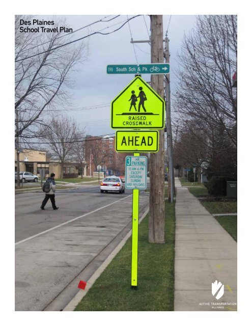
Des Plaines School Travel Plan - Active Transportation Policy
Des Plaines School Travel Plan - Active Transportation Policy
Des Plaines School Travel Plan - Active Transportation Policy

You also want an ePaper? Increase the reach of your titles
YUMPU automatically turns print PDFs into web optimized ePapers that Google loves.
<strong>Des</strong> <strong>Plaines</strong><br />
<strong>School</strong> <strong>Travel</strong> <strong>Plan</strong>
<strong>Des</strong> <strong>Plaines</strong><br />
<strong>School</strong> <strong>Travel</strong> <strong>Plan</strong><br />
Presented by <strong>Active</strong> <strong>Transportation</strong> Alliance April 2012
Acknowledgements<br />
This plan represents the combined vision and goals of the<br />
steering committee, residents and other key stakeholders. Thank<br />
you to these residents as well as to the members of the steering<br />
committee for donating their time to this project.<br />
Tex Bullock, City of <strong>Des</strong> <strong>Plaines</strong> Police Department and Parent<br />
Gina Cheeks, Parent<br />
Brad Kitzerow, Algonquin Middle <strong>School</strong><br />
Scott Mangum, City of <strong>Des</strong> <strong>Plaines</strong> Department of Community<br />
and Economic Development<br />
Peter Martin, Chippewa Middle <strong>School</strong><br />
Renee Miller, Crossing Guard Coordinator, City of <strong>Des</strong> <strong>Plaines</strong><br />
Police Department<br />
Jeff Paul, Community Service Officer, <strong>Des</strong> <strong>Plaines</strong> Police<br />
Department<br />
Derek Peebles, City of <strong>Des</strong> <strong>Plaines</strong> Public Works and<br />
Engineering Department<br />
Brad Voehringer, Asst. Superintendent of Student Services, <strong>Des</strong><br />
<strong>Plaines</strong> <strong>School</strong> District 62<br />
About the Consultants<br />
The mission of <strong>Active</strong> <strong>Transportation</strong> Alliance is to make<br />
bicycling, walking, and public transit so safe, convenient, and<br />
fun that we will achieve a significant shift from environmentally<br />
harmful, sedentary travel to clean, active travel. We advocate<br />
for transportation that encourages and promotes safety,<br />
physical activity, health, recreation, social interaction, equity,<br />
environmental stewardship and resource conservation.<br />
We are both Chicagoland’s voice for better biking, walking,<br />
and transit and a premier consultancy. Our staff includes<br />
planning, policy, and education experts who developed many<br />
of the best practice programs and policies included in this plan.<br />
By partnering with us on this project, you not only get the best<br />
plan possible, you also support our mission to improve active<br />
transportation throughout the Chicagoland region.<br />
The <strong>Active</strong> <strong>Transportation</strong> Alliance Project Team:<br />
Brett Mohr, GIS Specialist<br />
Heather Schady, <strong>Transportation</strong> <strong>Plan</strong>ner<br />
Eric Bjorlin, <strong>School</strong> Programs Manager<br />
Barb Cornew, North Suburban Coordinator<br />
About Communities Putting Prevention to Work<br />
The <strong>Des</strong> <strong>Plaines</strong> <strong>School</strong> <strong>Travel</strong> <strong>Plan</strong> was made possible through<br />
funding from the Department of Health and Human Services:<br />
Communities Putting Prevention to Work (CPPW) grant. CPPW<br />
is a joint project between the Cook County Department of Public<br />
Health and the Public Health Institute of Metropolitan Chicago.<br />
<strong>Des</strong> <strong>Plaines</strong> <strong>School</strong> <strong>Travel</strong> <strong>Plan</strong>
Contents<br />
Acknowledgements<br />
Executive Summary 4<br />
1 Introduction 6<br />
1.1 Community Overview 7<br />
1.2 Goals and Vision 7<br />
1.3 <strong>School</strong> <strong>Travel</strong> <strong>Plan</strong> Process 8<br />
1.4 Timeframe 9<br />
2 Existing Conditions 10<br />
2.1 <strong>School</strong> Demographics 13<br />
2.2 Student <strong>Travel</strong> Environment 14<br />
2.3 <strong>School</strong> Arrival and Dismissal Process 16<br />
2.4 Existing Roadway Conditions 16<br />
2.5 Barriers to Walking and Biking to <strong>School</strong> 18<br />
3 Recommendations 21<br />
3.1 Education 23<br />
3.2 Encouragement 25<br />
3.3 Enforcement 27<br />
3.4 Engineering 29<br />
3.5 Evaluation 34<br />
4 Implementation and Oversight 35<br />
4.1 Implementation 36<br />
4.2 Oversight 36<br />
4.3 Implementation Matrix 37<br />
5 Appendices 39<br />
5.1 Appendix A: Parent Surveys 40<br />
5.2 Appendix B: Student <strong>Travel</strong> Tallies 41<br />
5.3 Appendix C: Arrival and Dismissal Process 42<br />
5.4 Appendix D: Bicycle and Pedestrian Crash Maps 44<br />
5.5 Appendix E: Sidewalk Gap Map 46<br />
5.6 Appendix F: Education Resources 47<br />
5.7 Appendix G: International Walk to <strong>School</strong> Day Resolution 48<br />
5.8 Appendix H: Preferred Walking Route Maps 49<br />
5.9 Appendix I: Crossing Guard Appreciation Day Resolution 50<br />
5.10 Appendix J: Evaluation Resources 51
Executive Summary
Executive Summary<br />
Safe Routes to <strong>School</strong> (SRTS) is an international movement that enables and encourages students to safely walk and bike to and from<br />
school. Recognizing that safety—or the perception of safety—is dependent on a variety of factors, Safe Routes to <strong>School</strong> programs take<br />
a holistic approach to addressing the barriers to walking and bicycling to school. SRTS seeks to both improve walking and bicycling<br />
infrastructure (sidewalks, crosswalks, bike facilities, etc.) as well as change social norms and behaviors around student transportation<br />
(increased awareness, better road user knowledge, increased popularity of walking and biking, etc.)<br />
The City of <strong>Des</strong> <strong>Plaines</strong> and <strong>Des</strong> <strong>Plaines</strong> <strong>School</strong> District 62 partnered with <strong>Active</strong> <strong>Transportation</strong> Alliance to create a school travel<br />
plan centered on “the Five E’s” of Safe Routes to <strong>School</strong>: education, encouragement, enforcement, engineering, and evaluation. The<br />
school travel plan acts as a road map designed to analyze the social and physical barriers to walking and bicycling to school in <strong>Des</strong><br />
<strong>Plaines</strong> and provide recommendations to make walking and bicycling to school the safe, healthy, and convenient choice.<br />
The recommendations addressed in this plan are organized according to the Five E’s of SRTS. When applied in the right<br />
combination, these strategies have been shown to increase rates of walking and bicycling to school, decrease vehicle traffic on and<br />
around school campus, and improve safety along the route to school.<br />
Recommendations included in this plan for each of the 5 Es are as follows:<br />
Education<br />
• Educate students on bicycle and pedestrian safety.<br />
• Educate parents on safe routes to school and drop-off and<br />
pick-up procedures.<br />
• Educate community on Safe Routes to <strong>School</strong> during<br />
community events.<br />
Encouragement<br />
• Celebrate International Walk to <strong>School</strong> Day.<br />
• Create a schedule for regular Walk to <strong>School</strong> Day events.<br />
• Distribute preferred walking route maps to parents.<br />
• Start a walking school bus program.<br />
Engineering<br />
• Construct new sidewalks along school routes.<br />
• Construct new off-street walking and biking facilities near<br />
schools.<br />
• Install crosswalks along all school routes.<br />
• Install new traffic signals on school routes.<br />
• Install traffic calming measures around schools.<br />
Evaluation<br />
• Distribute annual Parent Surveys.<br />
• Conduct annual Student <strong>Travel</strong> Tallies.<br />
• Initiate a walking/biking mileage program.<br />
Enforcement<br />
• Adopt formal standards for selecting and prioritizing school<br />
crossing guard locations.<br />
• Celebrate Crossing Guard Appreciation Day.<br />
• Create targeted enforcement events.<br />
Executive Summary<br />
5
Introduction<br />
1.1 Community Overview 7<br />
1.2 Goals and Vision 7<br />
1.3 <strong>School</strong> <strong>Travel</strong> <strong>Plan</strong> Process 8<br />
1.4 Timeframe 9<br />
1
1.1 Community Overview 1.2 Goals and Vision<br />
<strong>Des</strong> <strong>Plaines</strong> is a community that works together to maintain the<br />
health, safety, and well-being for all.<br />
Tree-lined streets connect neighborhoods to parks, schools,<br />
and businesses, a historic main street is centered in the heart<br />
of the community, and residents are always willing to lend a<br />
hand. Consistent with the historic nature of the community,<br />
<strong>Des</strong> <strong>Plaines</strong> <strong>School</strong> District 62 schools are centered in the<br />
neighborhoods they serve.<br />
The City of <strong>Des</strong> <strong>Plaines</strong> has many assets when it comes to<br />
walkability. All of its schools are neighborhood schools and<br />
many are supported by a near complete network of sidewalks.<br />
The City is also working steadily to create a bike network that<br />
can further encourage active forms of transportation. Yet, more<br />
can be done to improve safety and conditions for student walkers<br />
in the City of <strong>Des</strong> <strong>Plaines</strong>. Unsafe driver behavior during school<br />
arrival and dismissal time make parents question whether<br />
it is truly safe for their kids to walk or bike to school. Lack<br />
of awareness of crossing guard locations is another cause for<br />
concern.<br />
Recent Safe Routes to <strong>School</strong> initiatives at Central Elementary<br />
<strong>School</strong> have demonstrated that traffic calming, education, and<br />
encouragement can lead to an increase in student walk rates.<br />
The Central <strong>School</strong> Safe Routes to <strong>School</strong> pilot project can serve<br />
as a model for other schools in the community.<br />
The connection between home, community, and school is a<br />
critical component of <strong>Des</strong> <strong>Plaines</strong> <strong>School</strong> District 62’s mission.<br />
With that in mind, this plan was developed by a steering<br />
committee made up of diverse representatives from community<br />
agencies and organizations.<br />
The <strong>Des</strong> <strong>Plaines</strong> <strong>School</strong> <strong>Travel</strong> <strong>Plan</strong> provides practical solutions<br />
to increase safety for students and their families when walking<br />
and biking to school. The recommendations will help form<br />
partnerships between the city, police department, school district,<br />
parents, and other community partners to ensure that student<br />
health and safety is addressed.<br />
The shared vision of the steering committee is as follows:<br />
Improve roadways and intersections and encourage school and community<br />
partnerships to create an environment that enables students and their<br />
families to choose physically active forms of transportation to school.<br />
The following goals were identified by the <strong>Des</strong> <strong>Plaines</strong> Safe<br />
Routes to <strong>School</strong> steering committee:<br />
• Improve unsafe or insufficient crossings and walkways on<br />
school routes.<br />
• Increase student health through active forms of<br />
transportation.<br />
• Reduce speeding and reckless driving near schools.<br />
• Address parent and community concerns regarding student<br />
safety.<br />
The strategies recommended in this plan aim to address these<br />
goals through a comprehensive approach.<br />
The steering committee was tasked with developing a common<br />
vision and identifying shared goals to increase the number of<br />
walking and biking trips, improving walking and bicycling<br />
conditions, and reducing the number of vehicle trips. The <strong>Des</strong><br />
<strong>Plaines</strong> <strong>School</strong> <strong>Travel</strong> <strong>Plan</strong> aims to strategically address barriers<br />
to walking and bicycling to school to ensure that students can<br />
enjoy safe, healthy, and physically active transportation as a<br />
means of travel to school.<br />
Introduction<br />
7
1.3 <strong>School</strong> <strong>Travel</strong> <strong>Plan</strong> Process<br />
The recommendations made in the <strong>Des</strong> <strong>Plaines</strong> <strong>School</strong> <strong>Travel</strong><br />
<strong>Plan</strong> are based on input from parents, residents, school district<br />
staff, and municipal staff. The consultant team and the steering<br />
committee engaged in the following activities:<br />
• <strong>Des</strong> <strong>Plaines</strong> <strong>School</strong> District 62 surveyed parents in the fall of<br />
2011 about their concerns related to walking and biking to<br />
school.<br />
• <strong>Des</strong> <strong>Plaines</strong> <strong>School</strong> District 62 surveyed students about their<br />
primary mode of travel to school in the fall of 2011.<br />
• Parents and community members attended a Safe Routes to<br />
<strong>School</strong> Public Workshop on October 25, 2011. Participants<br />
were asked to identify the barriers and solutions to walking<br />
and biking to school through a mapping activity.<br />
• Consultants conducted field reviews of school walk zones.<br />
• Consultants observed arrival and dismissal at Forest<br />
Elementary.<br />
<strong>Des</strong> <strong>Plaines</strong> residents and stakeholders participate in the Safe Routes to<br />
<strong>School</strong> workshop.<br />
• City staff and the consultants gathered and reviewed other<br />
information, including crash data, traffic speeds, average<br />
daily traffic, city and regional plans, and crime and public<br />
safety statistics.<br />
Stakeholders discuss preferred walking routes and hazards.<br />
8<br />
<strong>Des</strong> <strong>Plaines</strong> <strong>School</strong> <strong>Travel</strong> <strong>Plan</strong>
1.4 Timeframe<br />
The recommendations in this plan are divided into three<br />
categories: near-term, mid-term, and long-term. These categories<br />
should help the City and the District coordinate efforts with<br />
staffing plans and work plans.<br />
1.4.1 Near-Term Priorities<br />
Education, Encouragement, and Enforcement: Near-term<br />
projects should be completed in less than two years. These<br />
projects involve little to no start-up costs or long-term<br />
organization. Many education and encouragement initiatives are<br />
proposed for near-term implementation to build support for later<br />
projects.<br />
Engineering: Near-term recommendations are generally school<br />
routes and intersections that are currently walkable and bikeable<br />
but may be aided by some low-cost improvements, such as<br />
signage, pavement markings, or bike racks.<br />
Walking school buses and special events can be achieved in a short period<br />
time with minimal cost.<br />
1.4.2 Mid-Term Priorities<br />
Education, Encouragement, and Enforcement: Mid-term projects<br />
should be completed in three to five years. Mid-term education,<br />
encouragement and enforcement projects are focused on<br />
changing behavior through sustained strategies. These projects<br />
may have initial start-up costs and may require coordination<br />
with community organizations. Mid-term projects generally<br />
involve more planning and coordination.<br />
Engineering: Mid-term recommendations are projects on school<br />
routes where current conditions could be easily improved<br />
to become more walkable and bikeable, with a moderate<br />
construction budget. Examples are sidewalk completion and<br />
traffic calming measures.<br />
1.4.3 Long-Term Priorities<br />
Education, Encouragement, and Enforcement: These projects,<br />
expected to begin implementation after five years, frequently<br />
depend on the completion of earlier projects and local support.<br />
Long-term projects may include policy changes that need board<br />
approval.<br />
Traffic calming and other engineering strategies are considered long-term<br />
projects.<br />
Engineering: Long-term recommendations are often complicated<br />
by jurisdictional issues. These recommendations may have other<br />
feasibility issues, such as high average daily traffic (ADT) or<br />
restricted road width or right-of-way.<br />
Introduction<br />
9
Existing Conditions<br />
2.1 Existing Conditions 13<br />
2.2 Student <strong>Travel</strong> Environment 14<br />
2.3 <strong>School</strong> Arrival and Dismissal Procedures 16<br />
2.4 Existing Conditions Roadway 16<br />
2.5 Barriers to Walking and Biking to <strong>School</strong> 18<br />
2
2. Existing Conditions<br />
The <strong>Des</strong> <strong>Plaines</strong> <strong>School</strong> <strong>Travel</strong> <strong>Plan</strong> addresses the needs of<br />
students and families of <strong>Des</strong> <strong>Plaines</strong> <strong>School</strong> District 62. The<br />
following schools are included in the plan:<br />
Engineering recommendations for District 59 schools are also<br />
included in this plan. The following District 59 schools were also<br />
considered:<br />
• Algonquin Middle <strong>School</strong><br />
• Central Elementary <strong>School</strong><br />
• Chippewa Middle <strong>School</strong><br />
• Cumberland Elementary <strong>School</strong><br />
• Forest Elementary <strong>School</strong><br />
• Brentwood Elementary <strong>School</strong><br />
• Devonshire Elementary<br />
• Friendship Middle <strong>School</strong><br />
A map of <strong>Des</strong> <strong>Plaines</strong> schools can be found on the following page.<br />
• Iroquois Community <strong>School</strong><br />
• North Elementary <strong>School</strong><br />
• Orchard Place Elementary <strong>School</strong><br />
• Plainfield Elementary <strong>School</strong><br />
• South Elementary <strong>School</strong><br />
• Terrace Elementary <strong>School</strong><br />
Chippewa Middle <strong>School</strong>, <strong>Des</strong> <strong>Plaines</strong><br />
EXISTING CONDITIONS<br />
11
Elmhurst Rd<br />
Elmhurst Rd<br />
Cavan Ln<br />
Beau Dr<br />
Arnold Ct<br />
Perda Ln<br />
Marshall Dr<br />
Bell Dr<br />
Inner Cir<br />
Anita St<br />
Mount Prospect Rd<br />
Radcliffe Ave<br />
Vassar Ln<br />
Manor Ct<br />
S Westgate Rd<br />
Amherst Ave<br />
Clearwater Dr<br />
Oxford Rd<br />
Oxford Rd<br />
Alfini Dr<br />
S Wolf Rd<br />
N Wolf Rd<br />
S 6th Ave<br />
S 6th Ave<br />
Elmira Ave<br />
S 5th Ave<br />
N 5th Ave<br />
Sprucewood Ave<br />
Cindy Ln<br />
Douglas Ave<br />
Westview Dr<br />
W Vil<br />
Earl Ave<br />
N 4th Ave<br />
Westview Dr<br />
Heather Ln<br />
Plainfield Dr<br />
N 3rd Ave<br />
S 3rd Ave<br />
Kingston Ct<br />
Webster Ln<br />
Webster Ln<br />
Webster Ln<br />
Eastview Dr<br />
S 2nd Ave<br />
Margret St<br />
Jeanette Ave<br />
Lee St<br />
Spruce Ave<br />
Ash St<br />
Elm St<br />
Cora St<br />
Mannheim Rd<br />
Orchard St<br />
College Dr<br />
Maple St<br />
Locust St<br />
Birch St<br />
Peter Rd<br />
Craig Dr<br />
Tri-State Tlwy<br />
Bellaire Ave<br />
Potter Rd<br />
n<br />
2.1 Existing Conditions<br />
<strong>Des</strong> <strong>Plaines</strong><br />
<strong>School</strong>s & Parks<br />
n<br />
¯<br />
n<br />
n<br />
Prospect High <strong>School</strong><br />
<strong>School</strong>s<br />
n<br />
n<br />
n<br />
River Trails Middle <strong>School</strong><br />
Private <strong>School</strong><br />
Public <strong>School</strong><br />
!"$ Crossing Gaurd<br />
Dursey Ln<br />
n<br />
n<br />
Secondary <strong>School</strong> District<br />
Elementary <strong>School</strong> District<br />
<strong>School</strong> Property<br />
<strong>School</strong> Zone<br />
Recreational Area<br />
Park View Montessori Inc<br />
Infrastructure<br />
Interstate<br />
Arterial<br />
Street<br />
Railroad<br />
Water<br />
0 0.375 0.75 1.5 2.25 3<br />
Miles<br />
n<br />
Glenview<br />
n<br />
n<br />
n<br />
Fairview Elem <strong>School</strong><br />
Longford Dr<br />
Callen Ln<br />
KYLEMORE<br />
GREENS<br />
Gregory St<br />
n<br />
Quigley Dr<br />
Joseph Academy<br />
n<br />
Carlow Dr<br />
n<br />
n<br />
n<br />
n<br />
n<br />
n<br />
Lincoln Middle <strong>School</strong><br />
St Raymond <strong>School</strong><br />
Golf Rd<br />
!"$<br />
St Zachary <strong>School</strong><br />
n<br />
n<br />
n<br />
n<br />
Lions Park Elem <strong>School</strong><br />
Metropolitan Preparatory <strong>School</strong>s<br />
St Paul Lutheran <strong>School</strong><br />
!"$<br />
n<br />
St Emily <strong>School</strong><br />
n<br />
!"$<br />
!"$<br />
CORNELL PARK Chippewa<br />
Middle<br />
KUTCHEN PARK <strong>School</strong><br />
!"$<br />
n n<br />
!"$<br />
Cumberland<br />
Elem <strong>School</strong><br />
!"$<br />
Algonquin Middle <strong>School</strong><br />
!"$ !"$<br />
n<br />
WINNEBAGO PARK<br />
Devonshire <strong>School</strong> Forest Elem <strong>School</strong><br />
n<br />
!"$ !"$ !"$<br />
Maine West High <strong>School</strong><br />
n<br />
n<br />
Our Lady of <strong>Des</strong>tiny<br />
Plainfield Elem <strong>School</strong><br />
ARNDT<br />
PARK<br />
!"$ !"$<br />
APACHE PARK<br />
!"$<br />
n<br />
!"$<br />
KIWANIS PARK<br />
!"$<br />
MCKAY NEALIS PARK<br />
South Elem <strong>School</strong><br />
!"$<br />
n<br />
nn<br />
IROQUOIS POOL !"$<br />
!"$<br />
Iroquois Community <strong>School</strong> Angel Town Private <strong>School</strong><br />
!"$ n<br />
Apollo Elem <strong>School</strong><br />
BRENTWOOD PARK TOMAHAWK PARK<br />
MENOMINEE PARK !"$<br />
!"$ n!"$<br />
CUMBERLAND TERRACE<br />
North Elementary <strong>School</strong><br />
Brentwood Elem <strong>School</strong><br />
!"$<br />
!"$ !"$ n BIG BEND MOHAWK PARK<br />
DES PLAINES MANOR PARK<br />
Robert Frost Elem <strong>School</strong><br />
LAKE WOODS<br />
WEST PARK WOODLAWN PARK<br />
St John the Baptist Gac<br />
!"$ TERRACE SCHOOL<br />
POTOWATOMIE PARK<br />
PAROUBECK<br />
HIGH RIDGE KNOLLS PARKn<br />
GARDEN PLOTS<br />
!"$<br />
PARK<br />
!"$<br />
n<br />
Brentwood Baptist Christian Acad<br />
Willows Academy<br />
Science and Arts Academy<br />
nTerrace Elem <strong>School</strong><br />
n<br />
Immanuel n<br />
Lutheran<br />
Central Elem<br />
Maine East High <strong>School</strong><br />
!"$ !"$ !"$<br />
n <strong>School</strong><br />
RAND<br />
W Dempster St<br />
!"$ !"$ !"$ n!"$<br />
PARK<br />
CENTRAL !"$ PARK<br />
NW Tlwy<br />
Dulles Rd<br />
Friendship Jr High <strong>School</strong><br />
Elk Grove Village<br />
Mount Prospect<br />
Debra Dr<br />
Westmere Rd<br />
W Golf Rd<br />
Sandy Ln<br />
W Millers Rd<br />
Beau Ct<br />
Holida y Ln<br />
Cordial Dr<br />
W Lincoln Ln<br />
Willson Dr<br />
DIMUCCI-LOWENBERG<br />
PARK<br />
EINSTEIN PARK<br />
FRIENDSHIP<br />
PARK<br />
Courtesy Ln<br />
Dover Dr<br />
W Oakton St<br />
Mo nroe Cir<br />
DEVONSHIRE PARK<br />
Wille Rd<br />
King Ln<br />
Walnut Ave<br />
L eahy Cir<br />
W Algonquin Rd<br />
MAJEWSKI METRO ATHLETIC COMPLEX<br />
NW Tlwy<br />
W Touhy Ave<br />
Old Higgins Rd<br />
Norman Ct<br />
Ingram Pl<br />
Princeton St<br />
SIOUX<br />
PARK<br />
NORTHSHIRE PARK<br />
Westfield Ln<br />
Jeffery Ln<br />
Service Dr<br />
J arvis Ave<br />
BLACKHAWK PARK<br />
S Mount Prospect Rd<br />
WESTFIELD<br />
GARDENS<br />
Rawls Rd<br />
I- 90<br />
E Central Rd<br />
Cornell Ave<br />
Harvey Ave<br />
Columbia Ave<br />
Ashland Ave<br />
Oakwood Ave<br />
<strong>Des</strong> <strong>Plaines</strong><br />
E Algonquin Rd<br />
Braddock Dr<br />
Winthrop Dr<br />
Ardmore Rd<br />
Stratford Rd<br />
TETON PARK<br />
PRAIRIE LAKES PARK<br />
E Touhy Ave<br />
Willow Crk<br />
Patricia Ln<br />
Jon Ln<br />
CHEYENNE<br />
PARK<br />
Harvey Ave<br />
Oxford Rd<br />
CRAIG<br />
MANOR<br />
PARK<br />
Berkshire Ln<br />
CHIPPEWA<br />
PARK<br />
YALE COURT<br />
HAWAII<br />
PARK<br />
Rand Rd<br />
Wieboldt Dr<br />
Ti m<br />
Miner St<br />
Prairie Ave<br />
Oakwood Ct<br />
Van Buren Ave<br />
Santa Rosa Dr<br />
E Thacker St<br />
la Dr<br />
othy Ln<br />
Yorkshire Ln<br />
5th Ct<br />
S 4th Ave<br />
Howard Ave<br />
Birchwood Ave<br />
I- 90<br />
HARRY<br />
SEMROW<br />
DRIVING<br />
RANGE<br />
GOLF<br />
CUL DE SAC<br />
PARKS<br />
North Ave<br />
E Central Rd<br />
Wellers Crk<br />
Hollywood Ave<br />
Woodlawn Ave<br />
E Oakton St<br />
Everett Ave<br />
Lee St<br />
LAKE PARK<br />
GOLF COURSE<br />
I- 90<br />
1st Ave<br />
Maryville Dr<br />
Campground Rd<br />
I- 90<br />
N River Rd<br />
WILLOW PARK<br />
Harding Ave<br />
Perry St<br />
Webford Ave<br />
Alley<br />
Van Buren Ave<br />
Forest Ave<br />
Wicke Ave<br />
Pine St<br />
Fargo Ave<br />
GOLF CENTER<br />
E Golf Rd<br />
Redeker Rd<br />
Evergreen Ave<br />
Alles Ave<br />
Center St<br />
LIONS WOODS<br />
SESQUICENTENNIAL PARK<br />
Lee St<br />
E Walnut Ave<br />
Hazel Ct<br />
Henry Ave<br />
Campbell Ave<br />
Pearson St<br />
Van Buren Ave<br />
CHEROKEE PARK<br />
JAYCEE PARK<br />
E Lincoln Ave<br />
Rosemont<br />
Frontage Rd<br />
E Central Rd<br />
Woodland Ave<br />
Sherman Pl<br />
Rand Rd<br />
River St<br />
White St<br />
Mannheim Rd<br />
NORTHWESTERN<br />
WOODS<br />
S River Rd<br />
E Algonquin Rd<br />
Forest Ave<br />
Wicke Ave<br />
Riverview Ave<br />
Birchwood Ave<br />
IROQUOIS PARK<br />
Greenleaf Ave<br />
Pratt Ave<br />
I- 90<br />
Circle Dr<br />
S River Rd<br />
Birch St<br />
Busse Hwy<br />
Berr<br />
Stockton Ave<br />
I- 294<br />
I- 294<br />
CAMP GROUND<br />
ROAD WOODS<br />
Cedar St<br />
I- 294<br />
Orchard Place Elem <strong>School</strong><br />
n<br />
Franklin Elementary <strong>School</strong><br />
COOK COUNTY<br />
FOREST PRESERVE<br />
E Touhy Ave<br />
Morse Ave<br />
N Shore Ave<br />
Nimitz Dr<br />
y Ln<br />
Bennett Ct<br />
Everett Ave<br />
Scott St<br />
Bender Rd<br />
Acres Ln<br />
Chase Ave<br />
Laura Ln<br />
Trailside Ln<br />
Crabtree Ln<br />
<strong>Des</strong> <strong>Plaines</strong> Riv<br />
COOK COUNTY<br />
FOREST PRESERVE<br />
David Dr<br />
EATON FIELD<br />
Golf Rd<br />
Church St<br />
Dempster St<br />
S River Rd<br />
I- 294<br />
E Emerson St<br />
Good Ave<br />
Rita Rd<br />
Seminary Ave<br />
n<br />
Park Ridge<br />
n<br />
n<br />
n<br />
n<br />
n<br />
n<br />
n<br />
n<br />
n<br />
n<br />
n<br />
n<br />
Patton Dr<br />
Chicago<br />
SEMINOLE PARK<br />
Prepared By: <strong>Active</strong> <strong>Transportation</strong> Alliance 3/30/2011<br />
Data Source: <strong>Active</strong> <strong>Transportation</strong> Alliance, City of <strong>Des</strong> <strong>Plaines</strong> & CMAP<br />
Devon Ave<br />
Rosemont<br />
12<br />
<strong>Des</strong> <strong>Plaines</strong> <strong>School</strong> <strong>Travel</strong> <strong>Plan</strong><br />
n
2.1 Existing Conditions<br />
<strong>School</strong> Demographics<br />
The chart below includes the demographic distribution of students by District 62 school. Data was obtained from the Illinois State<br />
Board of Education 2011 <strong>School</strong> Report Card.<br />
Student Demographics by <strong>School</strong><br />
<strong>School</strong> Name White Black Hispanic Asian<br />
Native<br />
American<br />
Multiracial/<br />
Ethnic<br />
Low-<br />
Income<br />
Limited<br />
English<br />
Proficient<br />
Students<br />
Algonquin Middle<br />
<strong>School</strong><br />
36% 3% 51% 9% 0% 1% 55% 17%<br />
Central Elementary<br />
<strong>School</strong><br />
62% 3% 27% 6% 0% 2% 26% 25%<br />
Chippewa Middle<br />
<strong>School</strong><br />
56% 8% 24% 12% 0% 1% 39% 9%<br />
Cumberland<br />
Elementary <strong>School</strong><br />
56% 4% 19% 20% 0% 0% 23% 30%<br />
Forest Elementary<br />
<strong>School</strong><br />
62% 1% 32% 4% 1% 1% 26% 28%<br />
Iroquois<br />
Community <strong>School</strong><br />
55% 2% 27% 14% 0% 1% 25% 15%<br />
North Elementary<br />
<strong>School</strong><br />
34% 13% 37% 14% 0% 2% 61% 49%<br />
Orchard Place<br />
Elementary <strong>School</strong><br />
18% 0% 77% 5% 0% 1% 75% 65%<br />
Plainfield<br />
Elementary <strong>School</strong><br />
15% 2% 68% 15% 1% 1% 68% 66%<br />
South Elementary<br />
<strong>School</strong><br />
35% 1% 55% 8% 1% 1% 54% 52%<br />
Terrace<br />
Elementary <strong>School</strong><br />
59% 3% 27% 10% 0% 1% 25% 28%<br />
District Average 43% 4% 11% 0% 0% 1% 46% 33%<br />
EXISTING CONDITIONS<br />
13
2.2 Student <strong>Travel</strong> Environment<br />
Student <strong>Travel</strong> Tally<br />
<strong>Des</strong> <strong>Plaines</strong> <strong>School</strong> District 62 students were surveyed in the fall of 2011 about their trip to school. Students in 70 classrooms<br />
participated in the survey. A summary of the data collected for all schools is shown below:<br />
Student <strong>Travel</strong> Mode By <strong>School</strong><br />
Walk Bike <strong>School</strong> Bus Family<br />
Vehicle<br />
Carpool<br />
Public<br />
Transit<br />
<strong>School</strong> Name AM PM AM PM AM PM AM PM AM PM AM PM AM PM<br />
Central Elementary 21% 24% 1% 1% 13% 12% 55% 51% 0% 11% 0% 0% 1% 2%<br />
Chippewa Elementary 17% 28% 2% 2% 54% 54% 26% 14% 2% 1% 0% 0% 0% 1%<br />
Cumberland Middle 12% 14% 1% 1% 27% 28% 58% 55% 1% 2% 0% 1% 0% 1%<br />
<strong>School</strong><br />
Forest Elementary 12% 14% 1% 1% 27% 28% 58% 55% 1% 2% 0% 0% 0% 1%<br />
Orchard Place Elementary 12% 17% 0% 0% 51% 49% 34% 29% 3% 4% 0% 0% 0% 0%<br />
South Elementary 26% 30% 3% 4% 21% 21% 47% 43% 2% 2% 0% 0% 0% 0%<br />
Terrace Elementary 26% 30% 3% 4% 21% 21% 47% 43% 2% 2% 0% 0% 0% 0%<br />
Average 16% 23% 2% 1% 35% 35% 43% 36% 3% 4% >1% >1% >1% >1%<br />
Among students that responded to the student travel tally survey, 16% reportedly walked to school during the October 2011 survey<br />
period, 2% biked, 35% took the school bus, and 46% arrived via family vehicle or carpool in the morning. In the afternoon, the<br />
percentage of walkers increases to 23%.<br />
Walking and biking rates are greater than 20% at Central Elementary, South Elementary and Terrace Elementary. Chippewa<br />
Elementary, Cumberland Middle <strong>School</strong>, Forest Elementary and Orchard Place Elementary all reported that less than 20% of<br />
students walked or biked during the survey period. A summary of the the average data collected for all schools surveyed is shown<br />
below:<br />
Other<br />
The national school walking and biking rate is 13%. Because <strong>Des</strong> <strong>Plaines</strong> schools are neighborhood schools, the walking and biking<br />
rate should be much higher than the national average. The current walking and biking rates can be increased through Safe Routes<br />
to <strong>School</strong> strategies.<br />
14<br />
<strong>Des</strong> <strong>Plaines</strong> <strong>School</strong> <strong>Travel</strong> <strong>Plan</strong>
2.2 Student <strong>Travel</strong> Environment (continued)<br />
Parent Surveys<br />
In addition to the student travel tally, a more detailed survey was distributed to parents of children in District 62. A total of 569<br />
responses were received. A summary of some of the survey results is below.<br />
Parents surveyed were asked to identify their primary mode of transportation to school by the distance to school from their home.<br />
Surprisingly, among respondents about 45% of students that live within ¼ of a mile from school (less than a 10 minute walk) are<br />
driven to school, and 57% of students are driven that live within ¼ to ½ mile of school. Refer to the table below for more details:<br />
Aggregated Student Walk Rate by Distance Lived From <strong>School</strong><br />
Distance Arrival Departure Average<br />
Less than 1/4 mile 45% 57% 51%<br />
1/4 mile up to 1/2 mile 23% 36% 29%<br />
1/2 mile up to 1 mile 13% 16% 14%<br />
More than 2 miles 0% 2% 1%<br />
Average 17% 23% 20%<br />
Parents surveyed were also asked whether or not their child had asked for permission to walk to or from school during the past year.<br />
The table below includes parents responses to this question by distance compared to the actual walk rate by distance. Regardless of<br />
the distance, more students asked permission to walk than are currently walking. This represents an untapped potential to increase<br />
the walk rate amongst students in District 62.<br />
*Rate is from the Parent Surveys, which represent only a sample of the total student population. The walk rate from the Student Survey is a more complete<br />
representation of the walk rate for the student population at large.<br />
EXISTING CONDITIONS<br />
15
2.2 Student <strong>Travel</strong> Environment (continued)<br />
Finally, parents were asked to identify their primary concerns for disallowing their child to walk to school. Parents that responded<br />
to the parent survey reported that weather (70%), safety of intersections and crossings (61%), distance (56%), and speed of traffic along<br />
routes (55%) are the biggest issues that affect the decision to allow their child to walk or bike to and from school. Through targeted<br />
safety improvements within a ½ mile radius of each school, the City of <strong>Des</strong> <strong>Plaines</strong> and District 62 may be able to increase the<br />
number of students that use active forms of transportation to get to school.<br />
Top Parent Concerns that Affect Decision to Allow Child to Walk or Bike to <strong>School</strong><br />
23%<br />
29%<br />
Weather<br />
Safety of Intersections and Crossings<br />
Distance<br />
Speed of Traffic Along Routes<br />
23%<br />
25%<br />
16<br />
<strong>Des</strong> <strong>Plaines</strong> <strong>School</strong> <strong>Travel</strong> <strong>Plan</strong>
2.3. <strong>School</strong> Arrival and Dismissal Procedures<br />
2.4 Existing Roadway Conditions<br />
Each school in <strong>Des</strong> <strong>Plaines</strong> <strong>School</strong> District 62 is equipped with<br />
a crossing guard, a student patrol, has staff presence during<br />
drop-off and pick-up time, and has a school traffic safety plan.<br />
District 62 recently renovated all of the buildings in the district.<br />
Drop-off and pick-up areas were reconstructed to improve traffic<br />
flow. Detailed descriptions of each school’s arrival and dismissal<br />
process are included in Appendix C.<br />
The City of <strong>Des</strong> <strong>Plaines</strong> inventoried existing traffic signals,<br />
crossing guards, crosswalks, and signage in the in the District<br />
62 boundary area. The existing conditions are detailed in the<br />
Existing Conditions map on the following page.<br />
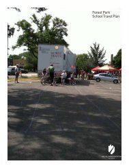
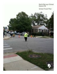
Forest Elementary <strong>School</strong> arrival and dismissal process.<br />
EXISTING CONDITIONS<br />
17
MAPLE ST<br />
MAPLE ST<br />
MARSHALL DR<br />
MARSHALL DR<br />
OWEN ST<br />
WILLIAM ST<br />
PHOENIX DR<br />
LOUIS ST<br />
LOUIS ST<br />
EDWARD ST<br />
GEORGE ST<br />
ALBERT ST<br />
WESTGATE RD<br />
VASSAR LN<br />
CORNELL AVE<br />
OXFORD RD<br />
WOLF RD<br />
WOLF RD<br />
WOLF RD<br />
6TH AVE<br />
ELMIRA AVE<br />
5TH AVE<br />
4TH AVE<br />
DOUGLAS AVE<br />
3RD AVE<br />
WEBSTER LN<br />
WEBSTER LN<br />
EASTVIEW DR<br />
2ND AVE<br />
2ND AVE<br />
MARGARET ST<br />
LEE ST<br />
LEE ST<br />
ASH ST<br />
BARRY ST<br />
PINE ST<br />
PATTON DR<br />
ELM ST<br />
WHITE ST<br />
ORCHARD PL<br />
ORCHARD ST<br />
MAPLE ST<br />
BIRCH ST<br />
RIVER RD<br />
LYMAN AVE<br />
ELLIOTT AVE<br />
GOODWIN DR<br />
OAK LN<br />
POTTER RD<br />
ELM TER<br />
HAMLIN AVE<br />
2.4 Existing Roadway Conditions (continued)<br />
District 62<br />
0 1,600 3,200 4,800 6,400<br />
Feet<br />
Miles<br />
0 0.3 0.6 0.9 1.2<br />
Prepared By: <strong>Active</strong> <strong>Transportation</strong> Alliance 10/25/2011 &-<br />
Data Source: <strong>Active</strong> Transporrtatio Alliance, CMAP, ISBE &<br />
Navteq<br />
&-<br />
#*<br />
<strong>School</strong>s<br />
n District 62<br />
n Other<br />
Elementary <strong>School</strong> Boundaries<br />
Name<br />
Central<br />
Cumberland<br />
Forest<br />
North<br />
Ochard Place<br />
Plainfield<br />
South<br />
Terrace<br />
n<br />
&-<br />
&-<br />
Infrastructure<br />
Highway<br />
Arterial<br />
Collector<br />
Street<br />
Land Use<br />
&-<br />
Water<br />
Park<br />
<strong>School</strong> Zones<br />
Stop Sign<br />
!( Traffic Light<br />
#* Pedestrian Crossings<br />
") Crossing Guard Locations<br />
&-<br />
n<br />
n<br />
&-<br />
n<br />
#* !( #* !( &- &- &- &- &- #* !( &- &- &- &- #* !(<br />
&-<br />
&-<br />
&-<br />
&-&-&-&-<br />
&-<br />
Lions Park Elem <strong>School</strong><br />
#* !( &-&-&-<br />
!(<br />
&- &- &-&-&-<br />
&-&-&-<br />
&-&-&- &-<br />
&-&-&-&- &-&-&-&-<br />
&-&-&-<br />
&-&-&-&- &-&-&-&-<br />
&-<br />
&-<br />
&-<br />
&-<br />
&-<br />
#* !(<br />
&-<br />
&-&-&-<br />
&- &-<br />
#* !( &-<br />
&-&-&-<br />
Brentwood Elem<br />
n<br />
&-&- &-&-&-&- &-&-&- <strong>School</strong><br />
&-<br />
&-<br />
&-&-&-&- &-&-&- &-&-&- &-<br />
&- &-&-&-&-&- &-<br />
") ") &- &- &-&-<br />
#* !( &-&-&-&- &-&-&-&- &-&-<br />
&- &-&-&-&- &- &- &-&-&-&- &-&-&-&- &- &- &-&-&-&- Brentwood &- &-&-&-&- &- Baptist &- Christian Acad<br />
n<br />
&- ") &-&-&-&-<br />
&- &-&-&-&- &-&-&-&- &-&-&-&- &-&- &-&-<br />
&- n<br />
!( &-&- &- !( &- &- &- &- &-<br />
#* #* &- #* !( ")<br />
&-<br />
&-&-&-&- &-&- &-<br />
&- &-&-<br />
&-<br />
&-&-&-&-<br />
&-&-&-&-<br />
&-&-&-&- &-&-<br />
&-&-&- &-&-&-&-<br />
&-<br />
#*<br />
&-&- &- &-<br />
&- &-<br />
&- &- &- &- &-<br />
!(<br />
!(<br />
&- !(<br />
#* #* ") St Zachary <strong>School</strong> #*<br />
n<br />
&-&-&- &-<br />
&-<br />
&- n<br />
") &-&- Devonshire <strong>School</strong><br />
n &-&- &- &-<br />
&- &-&-&- &-&-&-<br />
&-&-&-<br />
&-<br />
&- &-<br />
&- &-&-&-<br />
&-<br />
&-&- &- &-&-&-&-<br />
!( &- &- &- &- #* !(<br />
#*<br />
HENRY ST<br />
IL-58<br />
St Paul Lutheran <strong>School</strong><br />
PROSPECT AVE<br />
SUNSET RD<br />
DULLES RD<br />
DEMPSTER ST<br />
TAFT ST<br />
BUSSE AVE<br />
COUNCIL TRL<br />
WILLE RD<br />
BRAD LE Y ST<br />
KATHLEEN DR<br />
KING LN<br />
WALNUT AVE<br />
STARK PL<br />
DOVER D R<br />
ALBERT ST<br />
#* !(<br />
&-<br />
&-<br />
&-<br />
&-<br />
JARVIS AVE<br />
&-<br />
!(<br />
&-&-&-&-<br />
&-<br />
&-&-&-<br />
PINEHURST DR<br />
MEYER CT<br />
GOLF RD<br />
RAWLS RD<br />
DR A KE LN<br />
St Emily <strong>School</strong> &-<br />
&-&- &-&-<br />
&-<br />
#* ")<br />
!(<br />
&-&-<br />
&-&-<br />
&-&- &-<br />
nn<br />
&-<br />
") !(<br />
&-&- &-<br />
Chippewa Middle <strong>School</strong><br />
Cumberland Elementary <strong>School</strong><br />
&-<br />
&- &- &- &- &-<br />
&- &- &- &- &-&- &- !(<br />
&- !(!( #* !(<br />
#*<br />
&-&- !(<br />
")<br />
&- &-<br />
") !( #* #*<br />
#* #*<br />
&-<br />
&- &- &-<br />
#* !(<br />
&-<br />
#* &-<br />
&- &-&-&-<br />
&-&-<br />
&-<br />
&- #* ") !(<br />
&- &-<br />
&- &-&-&-&-<br />
&-<br />
&- &-<br />
&-<br />
&-<br />
&-<br />
&-&-&- &-<br />
&- !(<br />
&-<br />
&-&- &-&-&-&- &-&- &- #*<br />
&- &-&-&-<br />
#* &-&-&- §¨¦ I-294<br />
!( &-<br />
&-&-&- &-&-<br />
&- #*<br />
&-&-&-<br />
") !(<br />
&-<br />
&- &- &-&-&- !(<br />
&- &-<br />
&- &- #* &-<br />
&-&- &-&-<br />
&- n<br />
&-&-&-&-<br />
&-&-<br />
&-<br />
&-&-&- &-<br />
&-&-&-<br />
") &-<br />
&-&- &-<br />
&-&-<br />
&-<br />
&-<br />
&-<br />
&-<br />
&-&-&-&- &-&-&-&- &-&- &-&-&-&-<br />
&-<br />
&-&- &-&-<br />
&- &-<br />
!(<br />
!(<br />
!(<br />
!(!(<br />
") ")<br />
#*<br />
#*<br />
#*<br />
North Elementary <strong>School</strong> #*<br />
#* #*<br />
&- &- &- &-&-&- &- !(<br />
&-<br />
&- &- !(<br />
&-<br />
&-<br />
n<br />
&-&- &-&- &-&-&-&- &-&- &-&-&-&- &- &-<br />
!( &-<br />
&-&- !(<br />
!(<br />
#* ") #* #* #*<br />
&- &-&-<br />
#* ") &-&-&-<br />
#*<br />
!(<br />
Willows Academy<br />
&-&- &-<br />
&- &-&-&-&-<br />
n<br />
n<br />
&- &-<br />
&- &-&- &- &-<br />
!( &- &- &- &-&-&-&- &- &-<br />
&-&-&-&- #* !( Science and Arts Academy<br />
&- &- &- &- #* !(!(<br />
&- &- ") #* ")<br />
!( n<br />
&-<br />
&-<br />
Immanuel<br />
#* n<br />
&-&-&-&-<br />
&-&-&-&-<br />
&-<br />
#* ") !( Lutheran ") &-&- &-&- &- ") Central<br />
")<br />
Elementary &-&-<br />
<strong>School</strong><br />
&-&-&- &-&-&-&- &-&-&-&- &-<br />
&-<br />
&-&- &-&-&-&- &-<br />
&- &-&- ") &-<br />
&-<br />
&-<br />
&-&-&-<br />
&- &-&- &-<br />
&- &-<br />
&-<br />
&-&-<br />
&-&-&-&- &-&-&-&- &-&-&-&- &-&-&-<br />
&-&-&-&- &-&-&- &-&-&- &-<br />
&-&-<br />
&- &-&-&-&- &-&- &-&-&-&- &-&-<br />
&- &-&- &-<br />
&-&-<br />
&-&-&-&-<br />
&-<br />
&-<br />
&- &- &-&- &- &- !(<br />
&-<br />
&-<br />
&-&-&-&-<br />
&-<br />
&-&-&-&- &-&- !(<br />
&-&- &-<br />
&-<br />
!( ")<br />
#* ") #*<br />
#* ")<br />
Algonquin Middle <strong>School</strong><br />
&-&-<br />
&- n<br />
&-&- &-&-&-&- &-<br />
&-<br />
&-&- &-&- &- &-<br />
Forest Elementary <strong>School</strong><br />
n<br />
&-&-<br />
&-&-&-&-<br />
&-&-&-&-<br />
&-&-&-&- &-&-&-&- &-<br />
&-&- #* &-&- ") ") &-&-&-&- ") &-&-&- &-&- &-&-&-&-<br />
&-<br />
&-&-&-&- &-&- &-<br />
&-&- &-&- &-&-&-&- &-&- &-<br />
&- &-<br />
&-&-<br />
&- &- &- &-<br />
&-<br />
&- !(<br />
&- &- &- &- &- &- &- &- &- &-&- &-<br />
&- !( !(<br />
!(<br />
!(<br />
") #*<br />
#* #* #*<br />
#* #*<br />
&- &-<br />
&- #*<br />
#* &-&-&- &-&- &-&-&-&- &-&-&-&- &- &-&-&-&- &-&- &-&-&-&- &-&- &-<br />
!(<br />
Maine West High <strong>School</strong> #* &-<br />
n<br />
&- ") &-&-<br />
&-<br />
&-<br />
&-<br />
&-&-&-&- &-<br />
&-<br />
Our<br />
&-&-&- &-&-&-&- &- &- &-&-&-&- Lady &-&-&-&- of &- <strong>Des</strong>tiny &-&-&-&-&- ") &- &-&-&-&- &-&-&-&- &-&-<br />
South Elementary <strong>School</strong><br />
n<br />
n<br />
n<br />
&-<br />
Plainfield Elementary <strong>School</strong><br />
PROSPECT &- LN<br />
&-&-&-<br />
&- &-&-&-&- &-&-&-&- &-&- &- #* !( &-&-&-&- &-&- &-&-&-&- &-&-<br />
&-<br />
&-&-&-&-<br />
&-<br />
&-&-&- &-&-&-&- &-&-<br />
!( &- &- &-&-<br />
&-<br />
&- &-<br />
&-&- &-&- &-&- &- &-&- &-<br />
&-&- &-&- ") &-&-&-&- &-<br />
")<br />
&- #*<br />
&-<br />
&-<br />
&- &-&- &-<br />
&- &-&-&-&- &-<br />
&-<br />
&- &-<br />
&- &-&-&-&- &-&-&-&- &- &- &-&- &-<br />
&-<br />
&- &-&-&-<br />
&-<br />
§¨¦ I-90 Iroquois Community <strong>School</strong><br />
n")<br />
n &-<br />
&-<br />
&-<br />
!(<br />
&- &-<br />
!( &- &- &-<br />
&- !( &- &-&- !(<br />
#* !( !( #* #* ") #*<br />
#*<br />
#*<br />
&-&-&-&-<br />
#* !(<br />
&-<br />
Terrace Elementary <strong>School</strong><br />
RAND RD<br />
&-<br />
&-<br />
&- &- &-<br />
IL-72<br />
#*<br />
NORTHWEST HWY MINER ST<br />
THACKER ST<br />
HOWARD ST<br />
SEEGERS RD<br />
GREENVIEW AVE<br />
HOWARD AVE HOWARD AVE<br />
TOUHY CT<br />
HARVEY ST<br />
BRADLEY ST<br />
ASHLAND AVE<br />
WINTHROP DR<br />
OXFORD RD<br />
JON LN<br />
BERKSHIRE LN<br />
7TH AVE<br />
6TH AVE<br />
3RD AVE<br />
INNOVATION DR<br />
PRAIRIE AVE<br />
GRANT DR<br />
4TH AVE<br />
NORTH AVE<br />
WOODLAWN AVE<br />
WALTER AVE<br />
UPPER EXPRESS DR<br />
LOWER EXPRESS DR<br />
JEANNETTE ST<br />
JEANNETTE ST<br />
OAKTON ST<br />
LEE ST<br />
#*<br />
DES PLAINES RIVER RD<br />
#* !(<br />
REDEKER RD<br />
HARDING AVE<br />
HENRY AVE<br />
CENTER ST<br />
PINE ST<br />
MANNHEIM RD<br />
ELK BLVD<br />
ELLINWOOD AVE<br />
WHITCOMB AVE<br />
FOREST AVE<br />
LINCOLN AVE<br />
CHESTNUT ST<br />
LYNDON ST<br />
ALLES ST<br />
WOODLAND AVE<br />
PARK PL<br />
OAKWOOD AVE<br />
LUNT AVE<br />
VAN BUREN AVE<br />
WICKE AVE<br />
GRECO AVE<br />
#*<br />
&- &-<br />
#* !(<br />
&-<br />
&-&-&-&-<br />
") n&-<br />
&-&-<br />
#* !(<br />
CENTRAL RD<br />
CIRCL E DR<br />
PROSPECT AVE<br />
SHERWIN AVE<br />
DALE ST<br />
LOCUST ST<br />
MORSE AVE<br />
CURTIS ST<br />
ZEMKE BLVD<br />
BI G BEN D DR<br />
BALLARD RD<br />
FARGO A V E<br />
&-<br />
&-<br />
Angel Town Private <strong>School</strong><br />
&- &-&-&-&-<br />
&-&-<br />
&- &-&-<br />
&-&-&-<br />
&-&-<br />
&-&-&-&- &-&-&-&-<br />
LAURA L<br />
Orchard Place Elementary <strong>School</strong><br />
SCOTT ST<br />
N<br />
CR A<br />
&-&-&-<br />
RIVER RD<br />
CHASE AVE<br />
ESTES AVE<br />
IG DR<br />
RUSTY DR<br />
LINDA LN<br />
&-<br />
&-&-&-&-<br />
#*<br />
&-&-<br />
&-&-&-<br />
#*<br />
!( &- &-<br />
!(<br />
#* #*<br />
HOPE ST<br />
ESTELLE DR<br />
TEELA LN<br />
STILLWELL DR<br />
BELLAIRE AVE<br />
&-&-<br />
n<br />
#* !(<br />
n<br />
n<br />
Apollo Elem <strong>School</strong><br />
Mark Twain Elem <strong>School</strong><br />
n<br />
n<br />
n<br />
n<br />
n<br />
&-&- &-&-<br />
&-&-&-<br />
Stevenson <strong>School</strong><br />
&- n<br />
&-&- &- &- #* !(<br />
&-<br />
St John the Baptist Gac<br />
&-&- &-<br />
RIVER RD<br />
DEVON AVE<br />
ZENIT H D R<br />
LYMAN AVE<br />
DEMPSTER ST<br />
RIVERSIDE DR<br />
HARRISON ST<br />
DES PLAINES RIVER RD<br />
POTTER RD<br />
LINNEA LN<br />
MEADOW LN<br />
GOOD AVE<br />
CHURCH ST<br />
BALLARD RD<br />
GOOD AVE<br />
EMERSON ST<br />
FARRELL AVE<br />
Maine East High <strong>School</strong><br />
Franklin Elementary <strong>School</strong><br />
Jeanine Schultz Memorial <strong>School</strong><br />
VIRGINIA ST<br />
Embers Elementary <strong>School</strong><br />
SIBLEY ST<br />
DEE RD<br />
ROBIN DR<br />
George B Carpenter Elem <strong>School</strong><br />
TOUHY AVE<br />
OAKS AVE<br />
BUSSE HWY<br />
Maine South High <strong>School</strong><br />
VERNON AVE<br />
GLENVIEW AVE<br />
ROSE AVE<br />
GOLF TER<br />
WALNUT ST<br />
ELM ST<br />
CRESCENT AVE<br />
HAMLIN AVE<br />
HOME AVE<br />
HOME AVE<br />
SEMINARY AVE<br />
n<br />
n<br />
n<br />
18<br />
<strong>Des</strong> <strong>Plaines</strong> <strong>School</strong> <strong>Travel</strong> <strong>Plan</strong><br />
n
2.5 Barriers to Walking and Biking to <strong>School</strong><br />
While <strong>Des</strong> <strong>Plaines</strong> has a number of safety measures already in<br />
place to ensure that all members of the community can safely<br />
travel on bike or on foot, there are still social and physical<br />
barriers impeding safety or perceptions thereof. The community<br />
and consultants identified several barriers to walking and biking<br />
to school:<br />
• Traffic crashes within two miles of school.<br />
• Missing or insufficient walkways.<br />
• Crossing streets and intersections is difficult or dangerous.<br />
• A major roadway or expressway divides the school from<br />
residential areas.<br />
• Dangerous driving and speeding on streets.<br />
• Drop-off and pick-up process creates congestion and unsafe<br />
behaviors.<br />
• Public safety concerns.<br />
• <strong>School</strong> policies.<br />
2.5.1 Walkways and crossings<br />
• Plainfield Elementary <strong>School</strong>: Everett Avenue between<br />
Plainfield Drive and Dexter Lane, Everett Lane and<br />
Prospect Lane between Lee Street and Everett Ave,<br />
Dexter Lane between Prospect Lane and Everett Lane,<br />
Neighborhood between Howard-Touhy and Wolf-Eastview,<br />
Oxford/Wedgewood/Forest/Lincoln neighborhood west of<br />
Wolf Road.<br />
• Devonshire Elementary <strong>School</strong>: Lincoln Lane/Ridge Road<br />
between Elmhurst Road and Oakton Street, Short Terrace<br />
between Lincoln Lane and Oakton Street, Pedestrian cutthrough<br />
from Ridge Lane to Dover Drive.<br />
• North Elementary <strong>School</strong>: Hawthorne Lane between Rand<br />
Road and Big Bend Drive, Busse Highway between Crabtree<br />
Lane and Mason Lane, Ballard Road between Bender Road<br />
and Good Avenue.<br />
• Cumberland Elementary <strong>School</strong>: Marcella/Berkshire/<br />
Albany between Central Road and Rand Road, Rand Road<br />
east of Albany Lane (north side).<br />
• Terrace Elementary <strong>School</strong>: Cumberland Parkway from<br />
Golf Road to Harvey Ave, Warrington Road between Golf<br />
Road and Washington Street (west side).<br />
Traffic crashes within two miles of school<br />
The consultants and the City of <strong>Des</strong> <strong>Plaines</strong> gathered data on<br />
all traffic crashes within the school district boundary area and<br />
specifically on bicycle and pedestrian crashes that occurred<br />
between 2006 and 2009. The majority of bicycle crashes during<br />
this time period occurred on high traffic streets, including<br />
Oakton Street, Algonquin Road, Wolf Road, Lee Street and<br />
Rand Road. The City of <strong>Des</strong> <strong>Plaines</strong> had one fatal bike crash<br />
during this time period on Wolf Road and Thacker Street.<br />
Pedestrian crashes occurred along Lee/Mannheim Road, Touhy<br />
Avenue, and the Northwest Highway. Four fatal pedestrian<br />
crashes occurred during this time period. Traffic crash maps are<br />
included in Appendix D.<br />
Missing or insufficient walkways<br />
The City of <strong>Des</strong> <strong>Plaines</strong> collected data on sidewalk gaps in 2007.<br />
A map of sidewalk gaps is included in Appendix E. A lack of<br />
sidewalks along school walking routes is considered a barrier to<br />
walking and biking to school. Sidewalk gaps that impact schools<br />
include:<br />
Sidewalk gap on Van Buren Avenue near Lee Street.<br />
EXISTING CONDITIONS<br />
19
2.5 Barriers to Walking and Biking to <strong>School</strong> (continued)<br />
Crossing Streets is Difficult or Dangerous<br />
Parents identified speeding and failure to obey traffic control<br />
devices at crossings and intersections as a primary concern.<br />
Additional concerns were noted by the City engineering<br />
department and consulting team, including mid-block crossings,<br />
crossings at signalized intersections, and railroad crossings.<br />
Additional improvements may be warranted over time:<br />
Major roadway/expressway/railroad divides school from<br />
residential areas<br />
Several roadways with high traffic volumes cut through school<br />
walk boundaries, which make it difficult for students to safely<br />
get to school. These roadways include: Rand Road (North<br />
Elementary <strong>School</strong>), Algonquin Road (Devonshire <strong>School</strong>,<br />
Forest <strong>School</strong>), Thacker/Dempster Street (Terrace Elementary<br />
<strong>School</strong>), <strong>Des</strong> <strong>Plaines</strong> River Road (Central <strong>School</strong>), Touhy Avenue<br />
(Iroquois <strong>School</strong>, Orchard Place Elementary <strong>School</strong>), and Wolf<br />
Road (Forest <strong>School</strong>).<br />
2.5.2 Road User Behavior<br />
Dangerous driving and/or speeding on streets<br />
Parents who participated in the Parent Survey reported concerns<br />
about speeding and dangerous behavior. Drivers failing to<br />
yield the right of way to pedestrians, drivers using cell phones in<br />
school zones, and speeding were commonly reported as barriers<br />
to student safety during the trip to school.<br />
Drop-off or pick-up process is unsafe<br />
All schools experience chaos during morning drop-off and<br />
afternoon pick-up. <strong>Des</strong> <strong>Plaines</strong> schools are no exception. Parent<br />
education about drop-off and pickup procedures, locations of<br />
crossing guards and the benefits to walking and biking to school<br />
can help create a safer environment.<br />
Walkways not accessible to students with disabilities<br />
Not all curb ramps are ADA compliant in the City of <strong>Des</strong><br />
<strong>Plaines</strong>, representing a barrier to active forms of transportation<br />
for disabled students. Walkways and crossings located on<br />
preferred walking routes should be prioritized to ensure that the<br />
routes are accessible to and inclusive of all students.<br />
Railroad crossing on<br />
Dempster Street.<br />
The traffic circle on Golf Road/Wolf Road is a safety concern for students that<br />
attend Chippewa Middle <strong>School</strong> and Cumberland Elementary <strong>School</strong>.<br />
20<br />
<strong>Des</strong> <strong>Plaines</strong> <strong>School</strong> <strong>Travel</strong> <strong>Plan</strong>
2.5 Barriers to Walking and Biking to <strong>School</strong> (continued)<br />
2.5.3 Distance<br />
Some students are eligible for distance busing in District 62.<br />
Addressing school bus stops is beyond the scope of this plan,<br />
however, recommendations included in this plan aim to ensure<br />
that Safe Routes to <strong>School</strong> efforts are inclusive of all students.<br />
Distracted driving<br />
is one of the many<br />
barriers to student<br />
safety during the trip to<br />
school.<br />
2.5.4 Personal Safety Concerns<br />
Parents reported concerns about safety of their students along<br />
the route to school. Of particular concern was a lack of trusted<br />
adult presence. The recommendations in this plan aim to ensure<br />
that parents concerns are addressed by creating an environment<br />
with more community surveillance of student walking areas (i.e.<br />
‘eyes are on the street’).<br />
2.5.5 <strong>School</strong> Policies<br />
Drop-off at Forest<br />
Elementary <strong>School</strong>.<br />
Not all District 62 student handbooks include information about<br />
crossing guard locations, preferred walking routes and Safe<br />
Routes to <strong>School</strong>. Parents and students can benefit from having<br />
this information clearly stated. Customized sheets that list<br />
crossing guard locations should be distributed to parents along<br />
with handbooks.<br />
EXISTING CONDITIONS<br />
21
Recommendations<br />
3.1 Education 23<br />
3.2 Encouragement 25<br />
3.3 Enforcement 27<br />
3.4 Engineering 29<br />
3.5 Evaluation 34<br />
3
3 Recommendations<br />
In order to meet the steering committee’s goals identified in Section 1.2, each recommendation is designed to mitigate the physical<br />
and social barriers identified by the community and the consultants. The steering committee members and community members<br />
who participated in the development of this plan have prioritized several education, encouragement, enforcement, and engineering<br />
strategies to be implemented. A comprehensive list of strategies is also detailed in the Implementation and Oversight chapter of this<br />
plan.<br />
Images listed clockwise: Signage and traffic calming are engineering improvements that can address safety concerns (top left), Central Elementary students<br />
celebrate International Walk to <strong>School</strong> Day (top right), enforcement campaigns can lead to increased driver awareness of laws in school zones (bottom left<br />
and bottom right).<br />
RECOMMENDATIONS<br />
23
3.1 Education<br />
Education efforts are critical to creating a safe environment<br />
for student walkers and cyclists. Education efforts should be<br />
focused on all users of the road during school time—including<br />
motorists, bus drivers, walkers, and cyclists. All road users need<br />
to understand their rights and responsibilities to ensure the<br />
safety of others. Parents will benefit both from education on safe<br />
driving practices and on ways to participate in walk- or bike-toschool<br />
initiatives; students will benefit from bike and pedestrian<br />
safety training; and the community as a whole will benefit from<br />
exposure to and awareness of Safe Routes to <strong>School</strong>.<br />
The following strategies are recommended based on the barriers<br />
that were identified by the consultants and steering committee:<br />
3.1.1 Teach Bicycle and Pedestrian Safety Skills<br />
to Parents and Students<br />
Priority: Near-term<br />
The <strong>Des</strong> <strong>Plaines</strong> Police Department has offered students a<br />
bicycle safety training course to students at Central Elementary<br />
in conjunction with their Safe Routes to <strong>School</strong> initiative. The<br />
police department should strive to hold annual trainings at all<br />
schools in the community.<br />
• <strong>Des</strong> <strong>Plaines</strong> <strong>School</strong> District 62 could adopt or create a<br />
bicycle and pedestrian curricula or lessons that are provided<br />
to all students each year.<br />
• The City of <strong>Des</strong> <strong>Plaines</strong> could use existing community<br />
events to promote bike and pedestrian safety in the school<br />
zone and provide educational messages for children,<br />
parents, and drivers.<br />
• Additional educational efforts may be coordinated through<br />
the <strong>Des</strong> <strong>Plaines</strong> Park District. This plan recommends<br />
that a Safe Routes to <strong>School</strong> Committee be established<br />
through District 62 PTOs to work towards engaging more<br />
community partners on Safe Routes to <strong>School</strong> educational<br />
initiatives.<br />
A listing of additional educational resources can be found in Appendix F.<br />
Annual community<br />
helmet fitting in <strong>Des</strong><br />
<strong>Plaines</strong>.<br />
3.1.2 Create or Adopt Educational Materials<br />
Priority: Near- to Mid-term<br />
The City, Park District, and <strong>School</strong> District have supported<br />
several bike safety initiatives over the years, but none have<br />
been coordinated nor institutionalized. In order to prioritize<br />
Safe Routes to <strong>School</strong> and ensure that students are equipped<br />
with the knowledge to safely travel to and from school, as well<br />
as within the community during non-school hours, this plan<br />
recommends that the <strong>Des</strong> <strong>Plaines</strong> Police Department, the <strong>Des</strong><br />
<strong>Plaines</strong> Park District, <strong>Des</strong> <strong>Plaines</strong> <strong>School</strong> District 62, the PTOs<br />
and other community partners coordinate efforts around bike<br />
and pedestrian safety education. Education efforts for students<br />
could take shape in the following ways:<br />
Police can offer bike<br />
safety training to<br />
students in the community.<br />
• <strong>Des</strong> <strong>Plaines</strong> <strong>School</strong> District 62 could disseminate<br />
information to parents about Safe Routes to <strong>School</strong> to<br />
parents at annual orientations, including preferred walking<br />
route maps. Additional publications could be adapted to<br />
ensure that parents are aware of walking routes and crossing<br />
guard locations, including the Student Parent Handbook<br />
and each school’s web page.<br />
24<br />
<strong>Des</strong> <strong>Plaines</strong> <strong>School</strong> <strong>Travel</strong> <strong>Plan</strong>
3.1 Education (continued)<br />
Central Elementary <strong>School</strong>’s Student Parent Handbook cover sheet includes information about Safe Walking Routes.<br />
RECOMMENDATIONS<br />
25
3.2 Encouragement<br />
Encouragement strategies are fun events and activities designed<br />
to get students, their families, and the broader community to test<br />
out and celebrate walking and biking to school. Encouragement<br />
programs are often low-cost or no-cost and are a great way for a<br />
community to start implementing a comprehensive Safe Routes<br />
to <strong>School</strong> program.<br />
This plan recommends that <strong>Des</strong> <strong>Plaines</strong> <strong>School</strong> District 62<br />
work with PTOs to establish Safe Routes to <strong>School</strong> committees<br />
that can take the lead on encouragement strategies. Many<br />
communities find success in working with PTOs to organize<br />
Walking <strong>School</strong> Buses or Bike Trains, which are adult-supervised<br />
walking or biking groups that travel along a pre-determined<br />
route and make pre-determined stops. Regular events such as<br />
these can help establish long-term change and remind parents<br />
and children how fun it is to walk and bike to school. Providing<br />
incentives and holding competitions amongst classrooms or<br />
buildings can help increase support for walk-to-school day<br />
programs.<br />
walk to school day events.<br />
3.2.3 Distribute Preferred Walking Route Maps<br />
to Parents at the Beginning of the <strong>School</strong> Year<br />
Priority: Near-Term<br />
The City of <strong>Des</strong> <strong>Plaines</strong> and the consultant team developed a<br />
preferred walking route map for the district. Copies of the maps<br />
can be distributed to parents at registration and can be included<br />
on the district website. The District and City of <strong>Des</strong> <strong>Plaines</strong><br />
could also partner to seek funding for printing and distribution<br />
of the maps. As changes are made to infrastructure in the<br />
community, the City and District should work together to ensure<br />
that the routes are up to date and safe for student walkers. Maps<br />
for each of the schools are available in Appendix H.<br />
3.2.1 Host International Walk to <strong>School</strong> Day<br />
Priority: Near-Term<br />
District 62 could encourage all of its schools to celebrate<br />
International Walk to <strong>School</strong> Day each year on the first<br />
Wednesday in October. International Walk to <strong>School</strong> Day is a<br />
world wide celebration of the simple act of walking and biking<br />
to school. Walking safety information and preferred walking<br />
route maps should be distributed to parents and students prior to<br />
the event. The City of <strong>Des</strong> <strong>Plaines</strong> could adopt an International<br />
Walk to <strong>School</strong> Day resolution to support the celebration.<br />
Appendix G includes a draft International Walk to <strong>School</strong> Day<br />
resolution.<br />
Students in Gorham, NH walk to school in the winter with their principal and<br />
PE teacher.<br />
3.2.2 Create a Regular Schedule for Walk to <strong>School</strong><br />
Day Events<br />
Priority: Mid-Term<br />
Following a successful Walk and Bike to <strong>School</strong> Day event, many<br />
schools find success in choosing to hold a regular walking and<br />
biking event on a selected day of the week or month. Several<br />
District 62 parents reported that they are driven during the<br />
winter months. By holding special winter walk to school days,<br />
parents may ‘warm up’ to the idea of allowing their children to<br />
walk to school in cold weather. The district should partner with<br />
PTOs to help organize and support a regular Walk to <strong>School</strong><br />
Day schedule. The District may also want to consider working<br />
with principals or other community “celebrities” to lead regular<br />
Central Elementary <strong>School</strong> celebrates International Walk to <strong>School</strong> Day.<br />
26<br />
<strong>Des</strong> <strong>Plaines</strong> <strong>School</strong> <strong>Travel</strong> <strong>Plan</strong>
3.2 Encouragement (continued)<br />
3.2.4 Start a Walking <strong>School</strong> Bus Program<br />
Priority: Mid-term<br />
Walking <strong>School</strong> Buses are adult-supervised walk-to-school<br />
groups. Parents may choose to informally create a Walking<br />
<strong>School</strong> Bus by calling a few neighbors and arranging dates and<br />
times to lead a walk. PTOs may choose to implement a more<br />
formal walking school bus program by developing routes, stops,<br />
and schedules. A sample preferred walking route map is located<br />
in Appendix H to help parents get started. A Safe Routes to<br />
<strong>School</strong> grant could be used to purchase safety supplies such as<br />
reflective vests and providing pedestrian safety education to both<br />
students and parents.<br />
3.2.5 Initiate a Walking/Biking Mileage Challenge<br />
Priority: Mid-term<br />
<strong>Des</strong> <strong>Plaines</strong> <strong>School</strong> District 62 could encourage students to log<br />
the miles that they walk and bike to school. A mileage log can<br />
help students keep track of their daily physical activity while<br />
practicing academic skills like measuring distance and basic<br />
math. District 62 could hold a competition amongst classrooms,<br />
grade levels, or school buildings to encourage students to walk<br />
and bike more regularly.<br />
District 62 parents can help organize Walking <strong>School</strong> Buses that run along<br />
preferred walking routes.<br />
Central Elementary <strong>School</strong> students receive wristbands for participating in<br />
International Walk to <strong>School</strong> Day. Incentives such as these can be distributed<br />
to students who regularly log miles walked throughout the year.<br />
RECOMMENDATIONS<br />
27
3.3 Enforcement<br />
Law enforcement is an important component in any Safe<br />
Routes to <strong>School</strong> initiative, but enforcement need not be limited<br />
to the role of the local police department. Parents, students,<br />
and community volunteers can work together with police<br />
departments to ensure that safe walking, biking, and driving<br />
practices are demonstrated at district schools each day.<br />
Section 3.3 includes recommended roadway improvements,<br />
programs, policies, and enforcement initiatives that should<br />
be implemented by the City of <strong>Des</strong> <strong>Plaines</strong>, the <strong>Des</strong> <strong>Plaines</strong><br />
Police Department, <strong>Des</strong> <strong>Plaines</strong> <strong>School</strong> District 62 and other<br />
community partners.<br />
3.3.1 Adopt formal standards for selecting and<br />
prioritizing school crossing guard locations<br />
Timeframe: Near-term<br />
Crossing guards are very important to the safety of children<br />
walking and bicycling to school as they supervise children and<br />
directing traffic. To ensure that the City of <strong>Des</strong> <strong>Plaines</strong> uses the<br />
most effective strategies for local crossing guard deployment,<br />
and that key locations are prioritized appropriately in the event<br />
of budgetary constraints, it is recommended that the City adopt<br />
and consistently apply metrics for siting crossing guards.<br />
Issues to consider when siting crossing guards include ages of<br />
students using a particular crossing, vehicle speeds and sight<br />
lines. One established model has been created by the State of<br />
California, and additional information can be found in the<br />
Manual on Uniform Traffic Control Devices.<br />
One immediate change that can be made is to move crossing<br />
guard on Golf/Wolf/Broadway/State to the north leg of Wolf<br />
Road and Drake Lane.<br />
A crossing guard waits to cross students at Forest <strong>School</strong>.<br />
28<br />
<strong>Des</strong> <strong>Plaines</strong> <strong>School</strong> <strong>Travel</strong> <strong>Plan</strong>
3.3 Enforcement (continued)<br />
3.3.2 Celebrate Crossing Guard Appreciation Day<br />
Priority: Near-term<br />
The City of <strong>Des</strong> <strong>Plaines</strong> has many crossing guards supervise<br />
intersections to ensure that students can safely cross the street<br />
on the way to and from school each day. The <strong>Des</strong> <strong>Plaines</strong><br />
Police Department recognizes the hard work of crossing guards<br />
throughout the year in various ways. The <strong>Des</strong> <strong>Plaines</strong> Police<br />
Department should continue to recognize the work of its crossing<br />
guards each year, and identify a uniform way to celebrate the<br />
work of all guards. One way to do this is by celebrating Crossing<br />
Guard Appreciation Day, observed on the first Tuesday in May<br />
in the State of Illinois. District 62 could support the celebration<br />
by encouraging students to hand certificates of appreciation to<br />
their crossing guards on the day of the event. In recognition<br />
of the service provided by the crossing guards, the City of <strong>Des</strong><br />
<strong>Plaines</strong> should adopt a resolution to celebrate Crossing Guard<br />
Appreciation Day each year (see Appendix I for example<br />
resolution).<br />
A crossing guard waits<br />
to cross students at<br />
Forest <strong>School</strong>.<br />
Forest Park cell<br />
phone enforcement<br />
campaign.<br />
3.3.3 Create Targeted Enforcement Efforts<br />
Priority: Mid-term<br />
No police department can aggressively enforce all laws in all<br />
locations at all times. The City of <strong>Des</strong> <strong>Plaines</strong> can continue to<br />
use existing crash data to identify the most dangerous locations<br />
and target enforcement at those sites. Stings focused on reckless<br />
behavior by motorists have proven particularly successful in<br />
other communities. The City of <strong>Des</strong> <strong>Plaines</strong> should target its law<br />
enforcement efforts in these locations. Targeted enforcement<br />
efforts should begin with an education or warning campaign<br />
prior to ticketing to raise awareness of the problem. The City<br />
of <strong>Des</strong> <strong>Plaines</strong> should review these efforts on an annual basis to<br />
ensure appropriate allocation of enforcement resources.<br />
Forest Park cell<br />
phone enforcement<br />
campaign.<br />
RECOMMENDATIONS<br />
29
3.4 Engineering<br />
Having safe and accessible walking and bicycling infrastructure<br />
is a prerequisite for any SRTS effort. Infrastructure<br />
improvements can be made to calm traffic and create safer<br />
conditions for student pedestrians and cyclists. Although many<br />
of the recommended changes will be implemented in the long<br />
term, many low-cost and easily implemented solutions such as<br />
repainting crosswalks or patching sidewalks can be done right<br />
away. The following is a list of projects that the City of <strong>Des</strong><br />
<strong>Plaines</strong> can undertake to improve the built environment. This<br />
list may change over time as improvements are made.<br />
3.4.1 Create On-Street Bike Facilities<br />
Target: On-going<br />
Bike facilities were not a focus of the <strong>Des</strong> <strong>Plaines</strong> <strong>School</strong> <strong>Travel</strong><br />
<strong>Plan</strong> as the City is also currently engaged in implementing<br />
recommendations in its <strong>Active</strong> <strong>Transportation</strong> <strong>Plan</strong>. The bike<br />
corridors recommended in the <strong>Active</strong> <strong>Transportation</strong> <strong>Plan</strong> will<br />
also support safer bike trips to school for students in <strong>Des</strong> <strong>Plaines</strong>.<br />
3.4.2 Review Locations of Bike Racks<br />
New bike route signage on Cora Street directs cyclists to Central <strong>School</strong> and<br />
South <strong>School</strong>.<br />
Target: Near-term<br />
<strong>Des</strong> <strong>Plaines</strong> <strong>School</strong> District 62 should assess its bike rack<br />
inventory at each school and ensure that racks are sited in visible<br />
and secure locations, preferably near the front entrance of each<br />
school.<br />
3.4.3 Make Existing Walkways Accessible to Students<br />
with Disabilities<br />
Target: On-going<br />
Crossings along school routes should be prioritized for<br />
reconstruction to facilitate safe crossings for students with<br />
disabilities. ADA (guidelines strongly recommend two curb<br />
ramps at every corner). Providing two ramps ensures that<br />
pedestrians enter the roadway within the crosswalk (compared<br />
to one single ramp, which can bring a pedestrian out into the<br />
middle of the intersection), and provides better guidance to<br />
vision impaired pedestrians. Curb ramps must be perpendicular<br />
to the curb. ADA guidelines also require use of truncated dome<br />
warning strips at the bottom of every curb ramp. These domes<br />
provide a tactile warning to visually impaired pedestrians who<br />
would otherwise be given warning by the presence of a curb.<br />
They also must be a contrasting color.<br />
30<br />
<strong>Des</strong> <strong>Plaines</strong> <strong>School</strong> <strong>Travel</strong> <strong>Plan</strong><br />
Curb ramps and tactile pads provide access for all students.
3.4 Engineering (continued)<br />
3.4.4 Install Street Crossing Improvements<br />
Update crosswalks as needed<br />
Ladder-style crosswalks<br />
should be used along<br />
spines of school routes.<br />
Target: Ongoing<br />
Crosswalks along school routes should be restriped in<br />
conjunction with roadway projects. All school crossings along<br />
preferred walking routes should be upgraded to highly visible<br />
crosswalks and crosswalks along the spines of school routes<br />
should be striped as ladder-style crosswalks.<br />
Install pedestrian countdown timers on school routes<br />
Target: Long-term<br />
All signalized crossings along school routes should be upgraded<br />
to countdown pedestrian signals. These signals show pedestrians<br />
how much time they have to cross the street and prevent<br />
pedestrians from running across the street when there is not<br />
enough time. This plan includes a recommendation that the<br />
following intersections be upgraded:<br />
Standard style crosswalks<br />
should be striped across<br />
spines of school routes.<br />
• Golf Road at 6th Avenue<br />
• Oakton Street and White Street<br />
• Algonquin Road at <strong>Des</strong> <strong>Plaines</strong> River Road<br />
• Algonquin Road at Seymour/Kolpin<br />
• Wolf Road at Algonquin Road<br />
• Wolf Road at Thacker/Dempster<br />
• Rand Road at <strong>Des</strong> <strong>Plaines</strong> River Road<br />
• Touhy Avenue at Maple Street<br />
Additional intersections may be considered by the City of <strong>Des</strong><br />
<strong>Plaines</strong> in the future.<br />
Signalized intersections<br />
along school routes<br />
should be upgraded to<br />
included pedestrian countdown<br />
timers.<br />
RECOMMENDATIONS<br />
31
3.4 Engineering (continued)<br />
Install new traffic signals<br />
Target: Long-term<br />
New traffic signals should be considered at the following<br />
locations:<br />
• Lee Street and Perry Street<br />
• <strong>Des</strong> <strong>Plaines</strong> River Road at Elk Boulevard (pedestrian signal)<br />
and Good Avenue<br />
• Cumberland Elementary <strong>School</strong>: Marcella/Berkshire/<br />
Albany between Central Road and Rand Road (complete<br />
network), Rand Road east of Albany Lane (north side)<br />
• Forest and Algonquin <strong>School</strong>s: Oxford/Wedgewood/Forest/<br />
Lincoln neighborhood west of Wolf Road<br />
• Terrace Elementary <strong>School</strong>: Cumberland Parkway from<br />
Golf Road to Harvey Ave (west side), Warrington Road<br />
between Golf Road and Washington Street (west side gaps)<br />
Pedestrian HAWK signals should be considered at the following<br />
locations:<br />
• Algonquin Road at Pennsylvania Avenue<br />
• Golf Road at Cumberland Parkway<br />
Improve UPRR railroad crossing on Dempster/Thacker<br />
Target: Long-term<br />
The UPRR Railroad crossing is a safety hazard for students.<br />
The City of <strong>Des</strong> <strong>Plaines</strong> can work with UPRR to improve<br />
the crossing by installing gates at the tracks, restriping the<br />
crosswalks and making additional improvements to pavement<br />
markings adjacent to the tracks.<br />
3.4.5 Construct, Repair, and Replace Sidewalks<br />
Target: Long-term<br />
The City of <strong>Des</strong> <strong>Plaines</strong> should prioritize sidewalk infill along<br />
school routes. The following sidewalk construction projects<br />
should be prioritized:<br />
HAWK signals help to reduce crashes at mid-block crossings and at intersections.<br />
Students who attend<br />
Plainfield Elementary<br />
could have a safer<br />
route to school by<br />
constructing a new<br />
sidewalk on the north<br />
side of Everett Lane<br />
between Plainfield<br />
Drive and Dexter Lane.<br />
• Plainfield Elementary <strong>School</strong>: Everett Avenue between<br />
Plainfield Drive and Dexter Lane, Everett Lane and<br />
Prospect Lane between Lee Street and Everett Ave,<br />
Dexter Lane between Prospect Lane and Everett Lane,<br />
neighborhood between Howard-Touhy and Wolf-Eastview.<br />
Sidewalk gap on Rand<br />
Road.<br />
• Devonshire Elementary <strong>School</strong>: Lincoln Lane/Ridge Road<br />
between Elmhurst Road and Oakton Street, Short Terrace<br />
between Lincoln Lane and Oakton Street, pedestrian cutthrough<br />
from Ridge Lane to Dover Drive<br />
• North Elementary <strong>School</strong>: Hawthorne Lane between Rand<br />
Road and Big Bend Drive, Busse Highway between Crabtree<br />
Lane and Mason Lane, Ballard Road between Bender Road<br />
32<br />
<strong>Des</strong> <strong>Plaines</strong> <strong>School</strong> <strong>Travel</strong> <strong>Plan</strong>
3.4 Engineering (continued)<br />
3.4.6 Build Off-Street Walking/Biking Paths<br />
Target: Long-term<br />
Additional connections to schools can be created through offstreet<br />
walking and biking paths. Rand Road and the Northwest<br />
Highway were identified as problem areas for students trying<br />
to access Chippewa Middle <strong>School</strong>. Both roads have high<br />
traffic volumes and could benefit from an off-street facility. The<br />
following locations are recommended for off-street facilities:<br />
• Lee Street at Highland Drive (west side)<br />
• Lee Street at Fargo Ave (west side)<br />
• Howard Avenue at Ash Street (east and west legs)<br />
• Howard Avenue at Maple Street (east and west legs)<br />
• Bicycle and Pedestrian underpass on Seegers Road to<br />
connect to Chippewa Middle <strong>School</strong>.<br />
• Sidepath on Rand Road connecting downtown <strong>Des</strong> <strong>Plaines</strong><br />
to Chippewa Middle <strong>School</strong> and Cumberland Elementary<br />
<strong>School</strong>.<br />
3.4.7 Install Traffic Calming and Speed Reduction<br />
Measures<br />
Install curb extensions<br />
Target: Mid-term<br />
Curb extensions help to calm traffic, reduce pedestrian crossing distance,<br />
and increase visibility for both drivers and pedestrians.<br />
Curb extensions can help to increase visibility of students<br />
crossing streets. They can also help to calm traffic at<br />
intersections. The following school crossings should be<br />
prioritized for curb extensions:<br />
• Algonquin Road at 5th Avenue<br />
• Dempster Street at 2nd Avenue<br />
• Graceland Avenue at Harding Avenue (north and south leg)<br />
• Graceland Avenue at Perry Street (north, south and east<br />
legs)<br />
• Harding Avenue at Alles Street (one side Harding only)<br />
• Harding Avenue at Willow Road (one side Harding only)<br />
• Pratt Avenue at Maple/Curtis (north, east and west legs)<br />
• Pratt Avenue at Scott Street (all legs)<br />
• Maple Street at Farwell Avenue (north and south legs)<br />
• Howard Avenue at Plainfield Drive (east and west legs)<br />
• Howard Avenue at Lee Street (east and west legs)<br />
• Howard Avenue at Koehler Drive (east and west legs)<br />
Sidepaths, like this one on Ballard Road, can be used to create a dedicated<br />
space for pedestrians and bicyclists to walk on high traffic volume streets.<br />
RECOMMENDATIONS<br />
33
3.4 Engineering (continued)<br />
Install raised crosswalks<br />
Target: Mid-term<br />
Raised crosswalks help to calm traffic by slowing traffic down at<br />
the crossing. Raised crosswalks are most appropriate on local<br />
roads. The following school crossings could benefit from raised<br />
crosswalks:<br />
• Westgate Road at ComEd Right-of-Way street crossing<br />
• South leg of 8th Avenue and Drake Lane<br />
• North leg of Maple Street and Farwell Avenue<br />
• 5th Avenue near Forest <strong>School</strong> entrance<br />
• West leg of Everett Avenue and Cora Street<br />
• Washington Street at Cumberland Parkway<br />
Raised crosswalks are a traffic calming tool.<br />
Road diet<br />
Target: Long-term<br />
Road diets are conversions of four-lane undivided roads into<br />
three lanes (two through lanes and a center two-way left turn<br />
lane). Narrowing a roadway by reducing the number of lanes<br />
or lane width is a traffic calming strategy used to decrease<br />
congestion caused by left turning vehicles, making space for<br />
other roadway user types. The former right of way of the fourth<br />
lane could be used for bicycle lanes, sidewalks, and/or on-street<br />
parking. Pedestrian refuge islands, bump-outs, and flare-outs<br />
can easily be coupled with road diets. The City of <strong>Des</strong> <strong>Plaines</strong><br />
should consider the following roads for road diets:<br />
• Dempster/Thacker between Elmhurst Road and Wolf Road<br />
A road diet is a is a traffic calming strategy used to decrease congestion<br />
caused by left turning vehicles, making space for other roadway users.<br />
• Wolf Road between Golf Road and Touhy Avenue<br />
Add pedestrian refuge island<br />
Target: Long-term<br />
Center islands or medians allow pedestrians to find an adequate<br />
gap in one direction of traffic at a time, as the pedestrians are<br />
able to stop, if necessary, in the center-island or median area and<br />
wait for an adequate gap in the other direction of traffic before<br />
crossing the second half of the street or highway. They are<br />
ideally installed along school routes with suggested mid-block<br />
crossings, such as at Golf Road and Cumberland Parkway.<br />
Center islands provide a space for pedestrians to stop and wait for a gap in<br />
traffic half-way through a crossing.<br />
34<br />
<strong>Des</strong> <strong>Plaines</strong> <strong>School</strong> <strong>Travel</strong> <strong>Plan</strong>
3.5 Evaluation<br />
Regular evaluation of SRTS programs helps communities keep<br />
track or progress and assess whether or not the strategies being<br />
implemented are working. <strong>Des</strong> <strong>Plaines</strong> <strong>School</strong> District 62 should<br />
conduct student travel tallies each fall and spring during the<br />
school year and survey parents at least once a year to gauge<br />
changes in attitudes and opinions towards walking and biking to<br />
school. Free travel tally sheets and parent surveys are available<br />
through the National Center for Safe Routes to <strong>School</strong>. The<br />
center also provides free analysis of data collected by school<br />
districts. Both evaluation tools are included in Appendix J.<br />
RECOMMENDATIONS<br />
35
Implementation and Oversight<br />
4.1 Implementation 36<br />
4.2 Oversight 36<br />
4.3 Implementation Matrix 37<br />
4
4.1 Implementation 4.2 Oversight<br />
Throughout the <strong>Des</strong> <strong>Plaines</strong> <strong>Travel</strong> <strong>Plan</strong>, the consultants have<br />
listed implementation strategies and parties responsible for<br />
each recommendation. The plan outlines strategies that will be<br />
implemented over several years. Effective implementation of the<br />
<strong>Des</strong> <strong>Plaines</strong> <strong>School</strong> <strong>Travel</strong> <strong>Plan</strong> requires successful partnership,<br />
oversight, and ownership by parents, the school district, the<br />
municipality, and the community at large. In order for this<br />
plan to be successful, District 62 should consider establishing<br />
a Safe Routes to <strong>School</strong> Committee in each of its PTOs. The<br />
recommendations may also require partnerships with the Illinois<br />
Department of <strong>Transportation</strong> and the Cook County Highway<br />
Department.<br />
The Safe Routes to <strong>School</strong> steering committee should continue<br />
to meet on a regular basis to ensure that the goals and strategies<br />
recommended in the <strong>Des</strong> <strong>Plaines</strong> <strong>School</strong> <strong>Travel</strong> <strong>Plan</strong> are being<br />
implemented. The <strong>Des</strong> <strong>Plaines</strong> <strong>School</strong> <strong>Travel</strong> <strong>Plan</strong> should be<br />
updated at least once every five years to ensure that goals are<br />
being met and strategies are effectively contributing to the<br />
overall goals of the school district and community.<br />
To help guide implementation, a complete list of proposed<br />
projects is included in the charts on the following three<br />
pages. In addition, a map with all recommended engineering<br />
improvements is included on page 42.<br />
Implementation and oversight<br />
37
4.1 Implementation (continued)<br />
Below is an implementation matrix for the non-infrastructure projects proposed in this plan. Included are a comprehensive list of<br />
recommended strategies and a timeline for prioritization and completion.<br />
3.1 Education Lead Agency/Organization <strong>School</strong>s Targeted Timeline<br />
3.1.1<br />
Teach bicycle and pedestrian safety skills to<br />
parents and students<br />
<strong>Des</strong> <strong>Plaines</strong> Police Department All Near-term<br />
3.1.2 Create or adopt educational materials <strong>Des</strong> <strong>Plaines</strong> PTOs All Near-term<br />
3.2 Encouragement Lead Agency/Organization <strong>School</strong>s Impacted Timeline<br />
3.2.1 Host International Walk to <strong>School</strong> Day <strong>Des</strong> <strong>Plaines</strong> <strong>School</strong> District 62 All Near-term<br />
3.2.2<br />
Distribute Preferred Walking Route maps to<br />
parents and students<br />
<strong>Des</strong> <strong>Plaines</strong> <strong>School</strong> District 62 All Near-term<br />
3.2.3<br />
Creat a regular schedule for Walk to <strong>School</strong><br />
Day events<br />
<strong>Des</strong> <strong>Plaines</strong> <strong>School</strong> District 62 and PTOs All<br />
Mid-term<br />
3.2.4 Start a walking school bus program District 62 PTOs All Mid-term<br />
3.2.5 Initiate a walking/biking mileage challenge <strong>Des</strong> <strong>Plaines</strong> <strong>School</strong> District 62 and PTOs All Mid-term<br />
3.3 Enforcement Lead Agency/Organization <strong>School</strong>s Impacted Timeline<br />
3.3.1<br />
Adopt formal standards for prioritizing<br />
crossing guard locations<br />
<strong>Des</strong> <strong>Plaines</strong> Police Department All Near-term<br />
3.3.2 Celebrate crossing guard appreciation day<br />
<strong>Des</strong> <strong>Plaines</strong> Police Department and<br />
PTOs<br />
All<br />
Near-term<br />
3.3.3 Create targeted enforcement events <strong>Des</strong> <strong>Plaines</strong> Police Department All Mid-term<br />
38<br />
<strong>Des</strong> <strong>Plaines</strong> <strong>School</strong> <strong>Travel</strong> <strong>Plan</strong>
4.1 Implementation (continued)<br />
3.4.1 Create On-Street Bike Facilities Location <strong>School</strong>s Impacted Timeline<br />
Create on-street bike facilities<br />
See <strong>Des</strong> <strong>Plaines</strong> <strong>Active</strong> <strong>Transportation</strong><br />
<strong>Plan</strong><br />
All <strong>School</strong>s<br />
Ongoing<br />
3.4.2 Review locations of bike racks<br />
Review locations of bike racks All schools All <strong>School</strong>s Near-term<br />
3.4.3<br />
3.4.4<br />
Make existing walkways<br />
accessible to students with Location <strong>School</strong>s Impacted Timeline<br />
disabilities<br />
Make existing walkways<br />
accessible to students with<br />
disabilities<br />
Citywide All <strong>School</strong>s Ongoing<br />
Install Street Crossing<br />
Improvements<br />
Location <strong>School</strong>s Impacted Timeline<br />
Update crosswalks All spines of school walking routes All schools Ongoing<br />
Install pedestrian countdown<br />
timers on school routes<br />
Golf Road at 6 th Avenue<br />
Chippewa Middle <strong>School</strong> and<br />
Cumberland Elementary <strong>School</strong><br />
Long-term<br />
Install pedestrian countdown<br />
timers on school routes<br />
Golf Road at 6 th Avenue<br />
Chippewa Middle <strong>School</strong> and<br />
Cumberland Elementary<br />
Long-term<br />
Install pedestrian countdown<br />
timers on school routes<br />
Oakton Street at White Street South Elementary Long-term<br />
Install pedestrian countdown<br />
timers on school routes<br />
Algonquin Road at <strong>Des</strong> <strong>Plaines</strong> River<br />
Road<br />
Central Elementary<br />
Long-term<br />
Install pedestrian countdown<br />
timers on school routes<br />
Algonquin Road at Seymour Avenue/<br />
Kolpin Drive<br />
Devonshire Elementary<br />
Long-term<br />
Install pedestrian countdown<br />
timers on school routes<br />
Wolf Road at Algonquin Road<br />
Forest Elementary and Algonquin<br />
Middle <strong>School</strong><br />
Long-term<br />
Install pedestrian countdown<br />
timers on school routes<br />
Wolf Road at Thacker/Dempster Streets Terrace Elementary<br />
Long-term<br />
Install pedestrian countdown<br />
timers on school routes<br />
Rand Road at <strong>Des</strong> <strong>Plaines</strong> River Road North Elementary Long-term<br />
Install new traffic signal Lee Street and Perry Street North Elementary Near-term<br />
Install new traffic signal<br />
<strong>Des</strong> <strong>Plaines</strong> River Road and Elk<br />
Boulevard<br />
North Elementary<br />
Long-term<br />
Install HAWK signal Algonquin Road at Pennsylvania Avenue Devonshire Elementary Long-term<br />
Install HAWK signal Golf Road at Cumberland Parkway Terrace Elementary Long-term<br />
Implementation and oversight<br />
39
4.1 Implementation (continued)<br />
3.4.5<br />
Improve UPRR Railroad<br />
Crossing<br />
Construct, Repair, Replace<br />
Sidewalks<br />
Construct sidewalks<br />
Dempster/Thacker Streets Terrace Elementary Long-term<br />
Location <strong>School</strong>s Impacted Timeline<br />
Everett Avenue between Plainfield Drive<br />
and Dexter Lane<br />
Plainfield<br />
Long-term<br />
Construct sidewalks<br />
Construct sidewalks<br />
Construct sidewalks<br />
Construct sidewalks<br />
Construct sidewalks<br />
Construct sidewalks<br />
Construct sidewalks<br />
Construct sidewalks<br />
Construct sidewalks<br />
Construct sidewalks<br />
Everett Lane and Prospect Lane<br />
Between Lee Street and Everett Avenue Plainfield<br />
Neighborhood between Touhy-Howard<br />
and Wolf-Eastview<br />
Lincoln Lane/Ridge Road between<br />
Elmhurst Road and Oakton Street<br />
Plainfield<br />
Devonshire<br />
Short Terrace between Lincoln Lane and<br />
Devonshire<br />
Oakton Street<br />
Pedestrian cut-through from Ridge Lane<br />
Devonshire<br />
to Dover Drive<br />
Hawthorne Lane between Rand Road<br />
and Big Bend Drive<br />
Busse Highway between Crabtree Lane<br />
and Mason Lane<br />
Ballard Road between Bender Road and<br />
Good Avenue<br />
Marcella/Berkshire/Albany between<br />
Central Road and Rand Road<br />
Rand Road east of Albany Lane<br />
North Elementary <strong>School</strong><br />
North Elementary <strong>School</strong><br />
North Elementary <strong>School</strong><br />
Cumberland Elementary <strong>School</strong><br />
and Chippewa Middle <strong>School</strong><br />
Cumberland Elementary <strong>School</strong><br />
and Chippewa Middle <strong>School</strong><br />
Long-term<br />
Long-term<br />
Long-term<br />
Long-term<br />
Long-term<br />
Long-term<br />
Long-term<br />
Long-term<br />
Long-term<br />
Long-term<br />
Construct sidewalks<br />
Oxford/Wedgewood/Forest/Lincoln<br />
neighborhood west of Wolf Road<br />
Forest Elementary and Algonquin<br />
Middle <strong>School</strong> <strong>School</strong>s<br />
Long-term<br />
3.4.6<br />
3.4.7<br />
Construct sidewalks<br />
Construct sidewalks<br />
Build Off-Street Walking/<br />
BikingPaths<br />
Build off-street walking/biking<br />
paths<br />
Build off-street walking/biking<br />
paths<br />
Install Traffic Calming and<br />
Speed Reduction Measures<br />
Install curb extensions<br />
Install curb extensions<br />
Install curb extensions<br />
Cumberland Parkway from Golf Road to<br />
Terrace Elementary<br />
Harvey Ave<br />
Warrington Road between Golf Road and<br />
Terrace Elementary<br />
Washington Street<br />
Long-term<br />
Long-term<br />
Location <strong>School</strong>s Impacted Timeline<br />
Seegers Road bicycle and pedestrian<br />
underpass<br />
Rand Road sidepath<br />
Chippewa Middle <strong>School</strong><br />
Chippewa Middle <strong>School</strong> and<br />
Cumberland Elementary<br />
Long-term<br />
Long-term<br />
Location <strong>School</strong>s Impacted Timeline<br />
Algonquin Road at 5 th Avenue<br />
Dempster Street at 2 nd Avenue<br />
Graceland Avenue at Harding Avenue<br />
(north and south legs)<br />
Forest Elementary and Algonquin<br />
Middle <strong>School</strong><br />
Algonquin Middle <strong>School</strong>/Forest<br />
Elementary <strong>School</strong><br />
North Elementary<br />
Mid-term<br />
Mid-term<br />
Mid-term<br />
40<br />
<strong>Des</strong> <strong>Plaines</strong> <strong>School</strong> <strong>Travel</strong> <strong>Plan</strong>
4.1 Implementation (continued)<br />
3.4.7<br />
Install Traffic Calming and<br />
Speed Reduction Measures<br />
Continued<br />
Install curb extensions<br />
Install curb extensions<br />
Install curb extensions<br />
Install curb extensions<br />
Location <strong>School</strong>s Impacted Timeline<br />
Graceland Avenue at Perry Street (north,<br />
North Elementary<br />
south, and east legs)<br />
Harding Avenue at Alles Street (Harding<br />
North Elementary<br />
only)<br />
Harding Avenue at Willow Road (Harding<br />
North Elementary<br />
only)<br />
Pratt Avenue at Maple/Curtis Streets<br />
Orchard Place Elementary<br />
(north, east, and west legs)<br />
Mid-term<br />
Mid-term<br />
Mid-term<br />
Mid-term<br />
Install curb extensions Pratt Avenue at Scott Street (all legs) Orchard Place Elementary Mid-term<br />
Install curb extensions<br />
Maple Street at Farwell Avenue (north<br />
and south legs)<br />
Orchard Place Elementary<br />
Mid-term<br />
Install curb extensions<br />
Howard Avenue at Plainfield Drive (east<br />
and west legs)<br />
Plainfield Elementary<br />
Mid-term<br />
Install curb extensions<br />
Howard Avenue at Lee street (east and<br />
west legs)<br />
Plainfield Elementary<br />
Mid-term<br />
Install curb extensions<br />
Howard Avenue at Koehler Drive (east<br />
and west legs)<br />
Plainfield Elementary<br />
Mid-term<br />
Install curb extensions Lee Street at Highland Drive (west side) Plainfield Elementary Mid-term<br />
Install curb extensions Lee Street at Fargo Avenue (west side) Plainfield Elementary Mid-term<br />
Install curb extensions<br />
Howard Avenue at Ash Street (east and<br />
west legs)<br />
Plainfield Elementary<br />
Mid-term<br />
Install curb extensions<br />
Howard Avenue at Maple Street (east<br />
and west legs)<br />
South Elementary<br />
Mid-term<br />
Install raised crosswalks South leg of 8 th Avenue and Drake Lane<br />
Chippewa Elementary/Cumberland<br />
Mid-term<br />
Middle <strong>School</strong><br />
Install raised crosswalks<br />
North leg of Maple Street and Farwell<br />
Avenue<br />
Orchard Place Elementary<br />
Mid-term<br />
Install raised crosswalks<br />
5 th Avenue at Forest Elementary<br />
entrance<br />
Forest Elementary<br />
Mid-term<br />
Install raised crosswalks<br />
West leg of Everett Avenue and Cora<br />
Street<br />
South Elementary<br />
Mid-term<br />
Install raised crosswalks<br />
Washington Street at Cumberland<br />
Parkway<br />
Terrace Elementary<br />
Mid-term<br />
Install raised crosswalks<br />
Westgate Road at the ComEd Right-of-<br />
Way street crossing<br />
Terrace Elementary<br />
Mid-term<br />
Add pedestrian refuge island Golf Road and Cumberland Parkway Terrace Elementary Long-term<br />
Implementation and oversight<br />
41
MAPLE ST<br />
MAPLE ST<br />
MARSHALL DR<br />
OWEN ST<br />
WILLIAM ST<br />
WILLIAM ST<br />
LOUIS ST<br />
LOUIS ST<br />
EDWARD ST<br />
GEORGE ST<br />
ALBERT ST<br />
VASSAR LN<br />
CORNELL AVE<br />
WOLF RD<br />
OXFORD RD<br />
WOLF RD<br />
WOLF RD<br />
6TH AVE<br />
8TH AVE<br />
ELMIRA AVE<br />
6TH AVE<br />
5TH AVE<br />
SPRUCEWOOD AVE<br />
4TH AVE<br />
DOUGLAS AVE<br />
WESTVIEW DR<br />
4TH AVE<br />
3RD AVE<br />
WESTVIEW DR<br />
EASTVIEW DR<br />
2ND AVE<br />
MARGARET ST<br />
2ND AVE<br />
LEE ST<br />
LEE ST<br />
ASH ST<br />
BARRY ST<br />
PATTON DR<br />
ILLINOIS ST<br />
WHITE ST<br />
ORCHARD ST<br />
MAPLE ST<br />
BIRCH ST<br />
GOODWIN DR<br />
OAK LN<br />
POTTER RD<br />
ELM TER<br />
DEE RD<br />
ROBIN DR<br />
HAMLIN AVE<br />
HAMLIN AVE<br />
DAVID PL<br />
4.1 Implementation (continued)<br />
District 62<br />
0 1,600 3,200 4,800 6,400<br />
Feet<br />
Miles<br />
0 0.3 0.6 0.9 1.2<br />
Prepared By: <strong>Active</strong> <strong>Transportation</strong> Alliance 10/25/2011<br />
Data Source: <strong>Active</strong> Transporrtatio Alliance, CMAP, ISBE &<br />
Navteq<br />
<strong>School</strong>s<br />
n District 62<br />
n Other<br />
Elementary <strong>School</strong> Boundaries<br />
Name<br />
Central<br />
Cumberland<br />
Forest<br />
North<br />
Orchard Place<br />
Plainfield<br />
South<br />
Terrace<br />
n<br />
Infrastructure<br />
Highway<br />
Arterial<br />
Collector<br />
Street<br />
Railroad<br />
Land Use<br />
Water<br />
Park<br />
Recommended Sidewalk Installations<br />
Recommended Corridors for Road Diets<br />
Recommended Bicycle Facilities<br />
!( Recommended Railroad Crossing Improvements<br />
!( Recommended Raised Crosswalks<br />
!( Recommended Crosswalk Signals<br />
!( Recommended Pedestrian Refuges<br />
!( Recommended HAWK Signals<br />
! Recommended Curb Extensions<br />
n<br />
n<br />
!(<br />
n<br />
n<br />
ELM ST<br />
n<br />
n<br />
St Paul Lutheran <strong>School</strong><br />
Lions Park Elem <strong>School</strong><br />
IL-58<br />
n<br />
n<br />
DEMPSTER ST<br />
MARSHALL DR<br />
HENRY ST<br />
DULLES RD<br />
LANCE DR<br />
TAFT ST<br />
PROSPECT AVE<br />
St Zachary <strong>School</strong><br />
MIAMI LN<br />
n<br />
!( !(<br />
Brentwood Elem <strong>School</strong><br />
!(<br />
Devonshire <strong>School</strong><br />
n<br />
Brentwood Baptist Christian Acad<br />
CLARK LN<br />
WESTMERE RD<br />
KATHLEEN DR<br />
WILLE RD<br />
KING LN<br />
WALNUT AVE<br />
E AHY CIR<br />
L<br />
DOVER DR<br />
ALBERT ST<br />
AMBLESIDE RD<br />
MT PROSPECT RD<br />
JARVIS AVE<br />
WISCONSIN DR<br />
PINEHURST DR<br />
St Emily <strong>School</strong><br />
NORTHWEST HWY MINER ST<br />
MEYER CT<br />
GOLF RD<br />
BRADLEY ST<br />
D R AKE LN<br />
!(<br />
!(<br />
nn<br />
Chippewa Middle <strong>School</strong><br />
!(<br />
Terrace Elementary <strong>School</strong><br />
n !(!( !(<br />
!( !<br />
!(<br />
ASHLAND AVE<br />
RAWLS RD<br />
OAKTON ST<br />
IL-72<br />
JON LN<br />
BERKSHIRE LN<br />
PRAIRIE AVE<br />
n<br />
n<br />
Forest Elementary <strong>School</strong><br />
n<br />
Plainfield Elementary <strong>School</strong><br />
Cumberland Elementary <strong>School</strong><br />
Willows Academy<br />
n<br />
! n<br />
Algonquin Middle <strong>School</strong><br />
RAND RD<br />
DES PLAINES RIVER RD<br />
n<br />
n<br />
Maine West High <strong>School</strong><br />
Our Lady of <strong>Des</strong>tiny<br />
!!! !(<br />
!(<br />
! !(<br />
§¨¦ I-294<br />
! ! ! ! !<br />
!<br />
! §¨¦ I-294<br />
§¨¦ I-90 Iroquois Community <strong>School</strong><br />
!( nn<br />
HOWARD ST<br />
3RD AVE<br />
SEEGERS RD<br />
GREENVIEW AVE<br />
GRANT DR<br />
VILLA DR<br />
WEBSTER LN<br />
KINGSTON CT<br />
HOWARD AVE<br />
UPPER EXPRESS DR<br />
LOWER EXPRESS DR<br />
JEANNETTE ST<br />
IRWIN AVE<br />
REDEKER RD<br />
HARDING AVE<br />
BROWN ST<br />
PINE ST<br />
CHESTNUT ST<br />
CENTER ST<br />
TOUHY AVE<br />
n<br />
HENRY AVE<br />
n!(<br />
HIGGINS RD<br />
ELK BLVD<br />
!(<br />
CENTRAL RD<br />
n<br />
North Elementary <strong>School</strong><br />
!(<br />
n<br />
Central Elementary <strong>School</strong><br />
WHITCOMB AVE<br />
FRONTA GE RD<br />
LUNT AVE<br />
JOHNSON RD<br />
FOREST AVE<br />
WICKE AVE<br />
South Elementary <strong>School</strong><br />
GRECO AVE<br />
MANNHEIM RD<br />
C<br />
SHERMAN PL<br />
OAKWOOD AVE<br />
MILL ST<br />
WHITE ST<br />
I RCL<br />
VAN BUREN AVE<br />
Science and Arts Academy<br />
LOCUST ST<br />
MORSE AVE<br />
!( n<br />
E DR<br />
BI G BE N D DR<br />
!! !!<br />
CURTIS ST<br />
RIVER RD<br />
BALLARD RD<br />
FARGO AVE<br />
Orchard Place Elementary <strong>School</strong><br />
n<br />
ALGONQUIN RD<br />
Angel Town Private <strong>School</strong><br />
LAURA LN<br />
SCOTT ST<br />
HOPE ST<br />
TEELA LN<br />
CHASE AVE<br />
DAVID DR<br />
FOX LN<br />
IG DR<br />
CR A<br />
RUSTY DR<br />
ZENIT H D R<br />
LINDA LN<br />
BELLAIRE AVE<br />
FOREST PL<br />
n<br />
n<br />
n<br />
Apollo Elem <strong>School</strong><br />
Mark Twain Elem <strong>School</strong><br />
St John the Baptist Gac<br />
BUSSE HWY<br />
RIVERSIDE DR<br />
GOLF RD<br />
n<br />
n<br />
n<br />
n<br />
n<br />
n<br />
Stevenson <strong>School</strong><br />
Maine East High <strong>School</strong><br />
Franklin Elementary <strong>School</strong><br />
Embers Elementary <strong>School</strong><br />
George B Carpenter Elem <strong>School</strong><br />
DES PLAINES RIVER RD<br />
DEVON AVE<br />
HARRISON ST<br />
MEADOW LN<br />
RITA RD<br />
SUFFIELD ST<br />
GOOD AVE<br />
HAMILTON CT<br />
BALLARD RD<br />
DEMPSTER ST<br />
TYRELL AVE<br />
VIRGINIA ST<br />
NORTHWEST HWY<br />
DEE RD<br />
CENTRAL RD<br />
TERRACE DR<br />
EMERSON ST<br />
OAKS AVE<br />
CHURCH ST<br />
FARRELL AVE<br />
DEE RD<br />
GLENVIEW AVE<br />
TALCOTT RD<br />
Maine South High <strong>School</strong><br />
ROSE AVE<br />
WEEG W AY<br />
DE COOK AVE<br />
WALNUT ST<br />
ROSE AVE<br />
HOME AVE<br />
CHERRY ST<br />
HOME AVE<br />
SEMINARY AVE<br />
n<br />
n<br />
n<br />
n<br />
n<br />
n<br />
42<br />
<strong>Des</strong> <strong>Plaines</strong> <strong>School</strong> <strong>Travel</strong> <strong>Plan</strong>
Appendices<br />
5.1 Appendix A: Parent Surveys 40<br />
5.2 Appendix B: Student <strong>Travel</strong> Tallies 41<br />
5.3 Appendix C: Arrival and Dismissal Process 42<br />
5.4 Appendix D: Bicycle and Pedestrian Crash Maps 44<br />
5.5 Appendix E: Sidewalk Gap Map 46<br />
5.6 Appendix F: Education Resources 47<br />
5.7 Appendix G: International Walk to <strong>School</strong> Day Resolution 48<br />
5.8 Appendix H: Preferred Walking Route Maps 49<br />
5.9 Appendix I: Crossing Guard Appreciation Day Resolution 50<br />
5.10 Appendix J: Evaluation Resources 51<br />
5
5.1 Appendix A: Parent Surveys<br />
Attached in separate report.<br />
44<br />
<strong>Des</strong> <strong>Plaines</strong> <strong>School</strong> <strong>Travel</strong> <strong>Plan</strong>
5.1 Appendix B: <strong>School</strong> <strong>Travel</strong> Tallies<br />
Attached in separate report<br />
Appendices<br />
45
5.1 Appendix C: <strong>School</strong> Arrival and Dismissal Processes<br />
Algonquin Middle <strong>School</strong><br />
For Pedestrians and Bicyclists: Bike racks are situated<br />
at the back of Algonquin Middle <strong>School</strong>. Students that bike to<br />
school are asked to walk their bikes on school grounds.<br />
For <strong>School</strong> Buses: <strong>School</strong> buses drop-off using the bus<br />
concourse.<br />
For Private Vehicles: Students are dropped-off and picked-up<br />
in the west school lot in the drop-off zone or on the south side of<br />
Algonquin Road.<br />
Central Elementary <strong>School</strong><br />
For Pedestrians and Bicyclists: Supervision is not<br />
available in the morning until 8:45 AM. No students are<br />
allowed on campus prior to 8:45 AM. Morning kindergarten<br />
dismissal is at noon, and afternoon kindergarten and grades 1-5<br />
are dismissed at 3:30 PM. Kindergartners use the northwest<br />
kindergarten classroom entrance. Students in grades 1-3<br />
use the southeast primary entrance and grades 4-5 use the<br />
northeast entrance. Students are encouraged to use primary<br />
walking routes and to cross intersections with crossing guards.<br />
Students younger than 4th grade are not encouraged to bike to<br />
school. Bike racks are available for 4-5 grade students on school<br />
property.<br />
For <strong>School</strong> Buses: Arrival and dismissal times are the same<br />
for all modes of transportation. Three special education buses<br />
drop-off and pick-up on Thacker near the main south entrance<br />
to the school. One regular education bus drops off and picks up<br />
north of the school on Prairie Avenue.<br />
For Private Vehicle Drop-off/Pick-up: Arrival and<br />
dismissal times are the same for all modes of transportation.<br />
Parents of kindergartners are instructed to park on Prairie<br />
Avenue and walk students to and from the appropriate building<br />
entrance. First, second and third graders are dropped off on the<br />
school’s circular driveway. Fourth and fifth grade students are<br />
dropped off and picked up on Prairie Avenue.<br />
Chippewa Middle <strong>School</strong><br />
For Private Vehicle Drop-off/Pick-up: Families are<br />
instructed to use the U-shaped lot between Chippewa and<br />
Cumberland, or 8th Avenue, opposite the school bus drop-off<br />
area.<br />
Cumberland Elementary <strong>School</strong><br />
For Pedestrians and Bicyclists: Students are not allowed<br />
on campus until 8:40 AM each day. Morning kindergarten<br />
dismisses at 11:330 AM. Afternoon kindergarten at grades 1-5<br />
dismiss at 3:30 PM, 3:15 PM on Mondays.<br />
For Buses: Buses drop-off and pick-up in front of the school<br />
building on the west side.<br />
For private vehicles: Private vehicles drop-off and pick-up<br />
students between Cumberland and Chippewa on the west side of<br />
the campus. No stopping or parking is allowed.<br />
Forest Elementary<br />
For Bicycles and Pedestrians: Students are allowed to enter<br />
the building at 8:55 AM through grade level designated doors on<br />
the playground. No student is allowed to be on campus without<br />
parent supervision until 8:45 AM. Forest <strong>School</strong> dismisses at<br />
3:30 PM Tuesday through Thursday and 3:15 PM on Monday.<br />
Parents are encouraged to walk with their students to school.<br />
Students riding bicycles are instructed to walk their bikes once<br />
they reach campus. Student walkers are instructed to stay on<br />
the sidewalks when they reach campus. Bike racks are located in<br />
front of the school for student cyclists.<br />
For <strong>School</strong> Buses: <strong>School</strong> buses drop-off on the north side<br />
of campus in the school bus drop-off area. Private vehicles are<br />
instructed not to use the entrance.<br />
Private Vehicles: Parents are instructed to drop-off using the<br />
driveway on the west side of the campus.<br />
North Elementary <strong>School</strong><br />
For Bicycles and Pedestrians: Children who cross at Rand<br />
Road are instructed to cross at the intersection of Elk Boulevard.<br />
Children are also instructed to cross with a crossing guard.<br />
Students in grades K-3 are not encouraged to ride bikes to<br />
school. Third graders may ride if parents sign a permission slip.<br />
Student cyclists are encouraged to wear helmets.<br />
For Buses: Buses drop-off using the side parking lot.<br />
For Private Vehicles: Parents are instructed to use the front<br />
parking lot of the school.<br />
46<br />
<strong>Des</strong> <strong>Plaines</strong> <strong>School</strong> <strong>Travel</strong> <strong>Plan</strong>
5.1 Appendix C: <strong>School</strong> Arrival and Dismissal Processes<br />
Orchard Place Elementary <strong>School</strong><br />
For Bicycles and Pedestrians: Pedestrians arrive and are<br />
dismissed onto the school playground from their designated<br />
grade level doors.<br />
For <strong>School</strong> Buses: The bus pick-up zone is located at the<br />
front of the school.<br />
Plainfield Elementary <strong>School</strong><br />
South Elementary <strong>School</strong><br />
K-2 Students enter the building through the southeast entrance.<br />
Grade 3-5 students enter through the southwest entrance.<br />
Terrace Elementary <strong>School</strong><br />
For Bicyclists and Pedestrians: Students are encouraged<br />
to take the safest route and to cross where crossing guards<br />
are located. Student cyclists must walk their bikes on school<br />
grounds. Bike racks are provided for students on school<br />
grounds. Students below fourth grade must obtain written<br />
permission to bike to school.<br />
For Private Vehicles: All students are dismissed via the front<br />
door. All students are picked up and dropped off in the circle in<br />
front of the main door.<br />
Appendices<br />
47
5.4 Appendix D: Bicycle and Pedestrian Crash Maps<br />
48<br />
<strong>Des</strong> <strong>Plaines</strong> <strong>School</strong> <strong>Travel</strong> <strong>Plan</strong>
5.4 Appendix D: Bicycle and Pedestrian Crash Maps<br />
Appendices<br />
49
POTTER RD<br />
MAIN ST<br />
WOLF RD<br />
ELMHURST RD<br />
ELMHURST RD<br />
IL-58<br />
LEE ST<br />
8TH AVE<br />
MT PROSPECT RD<br />
WOLF RD<br />
WOODBRIDGE RD<br />
OXFORD RD<br />
PROSPECT AVE<br />
WOLF RD<br />
5.5 Appendix E: Sidewalk Gap Map<br />
EVERGREEN AVE HILLS AVE<br />
STONE ST<br />
HARDING AVE<br />
ELK BLVD<br />
RAND RD<br />
OAK ST<br />
WASHINGTON ST<br />
ALLES ST<br />
WOLF RD<br />
DRAKE LN<br />
BROWN ST<br />
PERRY ST<br />
PERRY ST<br />
DES PLAINES RIVER RD<br />
STATE ST<br />
JEFFERSON ST<br />
WEBFORD AVE<br />
MINER ST<br />
PRAIRIE AVE<br />
LEE ST<br />
THACKER ST<br />
GRACELAND AVE<br />
LAUREL AVE<br />
BROADWAY ST<br />
GOLF RD<br />
COLUMBIA AVE<br />
HARVEY ST<br />
WARRINGTON RD<br />
ASHLAND AVE<br />
OAKWOOD AVE<br />
WALNUT AVE<br />
CENTER ST<br />
OAKWOOD AVE<br />
WARRINGTON RD<br />
HENRY AVE<br />
LAKE AVE<br />
Arlington Heights<br />
Mount Prospect<br />
Elk Grove Village<br />
Chicago<br />
Rosemont<br />
Glenview<br />
GLENVIEW RD<br />
IL-21<br />
GREENWOOD RD<br />
MILWAUKEE AVE<br />
WASHINGTON RD<br />
WASHINGTON ST<br />
Niles<br />
BUSSE HWY<br />
Park Ridge<br />
DEE RD<br />
GREENWOOD AVE<br />
BELLE PLAINE AVE<br />
TALCOTT RD<br />
CUMBERLAND AVE<br />
DEMPSTER ST<br />
TOUHY AVE<br />
DEARLOVE RD<br />
CENTRAL RD<br />
MILWAUKEE AVE<br />
NORTHWEST HWY<br />
DEVON AVE<br />
GOLF RD<br />
RIVERSIDE DR<br />
RIVER RD<br />
RIVER RD<br />
BENDER RD<br />
BALLARD RD<br />
HIGGINS RD<br />
ELK BLVD<br />
RIVER RD<br />
DES PLAINES RIVER RD<br />
MINER ST<br />
GRACELAND AVE<br />
BITTERSWEET CT<br />
MANNHEIM RD<br />
KENSINGTON RD<br />
WATERMAN AVE<br />
CENTRAL RD<br />
RAND RD<br />
BROADWAY ST<br />
NORTHWEST HWY<br />
GOLF RD<br />
GOLF RD<br />
THACKER ST<br />
DEMPSTER ST<br />
ALGONQUIN RD<br />
OAKTON ST<br />
OAKTON ST<br />
OAKTON ST<br />
HOWARD AVE<br />
HOWARD ST<br />
HOWARD AVE<br />
HIGGINS RD<br />
LANDMEIER RD<br />
IL-72<br />
TOUHY AVE<br />
0 0.5 1 1.5 2<br />
Miles<br />
<strong>Des</strong> <strong>Plaines</strong> Sidewalk Gaps<br />
Sidewalk Gap<br />
Infrastructure<br />
Highway<br />
Arterial or Collector<br />
Street<br />
Railroad<br />
0 1,480<br />
Feet<br />
Cumberland Metra<br />
Station Area<br />
0 2,600<br />
Feet<br />
Downtown <strong>Des</strong> <strong>Plaines</strong><br />
Prepared By: <strong>Active</strong> <strong>Transportation</strong> Alliance<br />
Data Source: <strong>Active</strong> <strong>Transportation</strong> Alliance, City of <strong>Des</strong><strong>Plaines</strong><br />
& NAVTEQ 3/13/2012<br />
50<br />
<strong>Des</strong> <strong>Plaines</strong> <strong>School</strong> <strong>Travel</strong> <strong>Plan</strong>
5.6 Appendix F: Education Resources<br />
Education Resources<br />
Contact <strong>Active</strong> <strong>Transportation</strong> Alliance for trainings and<br />
teacher resources. <strong>Active</strong> <strong>Transportation</strong> Alliance offers<br />
curricula and instruction for multiple grade levels and courses,<br />
as well as walking and bicycling safety skills trainings. Visit<br />
http://www.activetrans.org/education for more information.<br />
The League of Illinois Bicyclists offers downloadable bike<br />
safety sheets for Grades K-3 and Grades 3-7 focused on safe<br />
riding skills. The single-page format can easily be reprinted in<br />
newsletters, copied for bike rodeos, etc. Visit http://www.bikelib.<br />
org/safety-education/kids/bike-safety-sheet/ to download or learn<br />
more.<br />
Metra’s Operation Lifesaver Train Safety Awareness Program<br />
provides free safety trainings for students from Pre-Kindergarten<br />
to high school. Visit http://metrarail.com/content/metra/en/<br />
home/utility_landing/riding_metra/rail_safety_security/school_<br />
safety.html for details.<br />
National Resources<br />
The Safe Routes to <strong>School</strong> National Center offers a listing<br />
of educational resources searchable by state. To view, visit:<br />
http://www.saferoutesinfo.org/program-tools/access-classroomresources<br />
Visit the Safe Routes to <strong>School</strong> National Partnership for a<br />
downloadable “Bicycle and Pedestrian Curricula Guide.” View<br />
the guide for a full inventory of bicycle and pedestrian curricula<br />
and several best practices and case studies. Available for<br />
download at: http://www.saferoutespartnership.org/mediacenter/<br />
publications<br />
The National Highway Traffic Safety Administration<br />
published a free and comprehensive K-5 pedestrian<br />
safety curriculum available at http://www.nhtsa.gov/<br />
ChildPedestrianSafetyCurriculum.<br />
Appendices<br />
51
5.7 Appendix G: International Walk to <strong>School</strong> Day Resolution<br />
Sample International Walk to <strong>School</strong> Day Resolution<br />
Whereas, the Safe Routes to <strong>School</strong> National Partnership, the<br />
Safe Routes to <strong>School</strong> National Center, the Illinois Department<br />
of <strong>Transportation</strong>, the <strong>Active</strong> <strong>Transportation</strong> Alliance, the<br />
Illinois Safe Routes to <strong>School</strong> Network, and schools across the<br />
State of Illinois are working together to promote Walk to <strong>School</strong><br />
Day in Illinois,<br />
Whereas, the health and safety of our children is of highest<br />
concern to the citizens of Illinois; and<br />
Whereas, a lack of physical activity plays a leading role in<br />
rising rates of obesity, diabetes and other health problems among<br />
children and being able to walk or bicycle to school offers an<br />
opportunity to build activity into daily routine.<br />
Whereas, driving students to school by private vehicle<br />
contributes to traffic congestion and air pollution, creating over<br />
25% of community traffic at the beginning and end of each<br />
school day; and<br />
Whereas, an important role for parents and caregivers is to<br />
teach children about pedestrian safety and become aware of the<br />
difficulties and dangers that children face on their trip to school<br />
each day and the health and environmental risks related to<br />
physical inactivity and air pollution.<br />
Whereas, community members and leaders should make a<br />
plan to make immediate changes to enable Illinois' children to<br />
safely walk and bicycle in our communities and develop a list of<br />
suggestions for improvements that can be done over time.<br />
Whereas, children, parents and community leaders around<br />
the world are joining together to walk to school and evaluate<br />
walking and bicycling conditions in their communities.<br />
Whereas, Walk and Bicycle to <strong>School</strong> Month in October and<br />
Walk and Bicycle to <strong>School</strong> Week the first week in October have<br />
proven to be helpful in encouraging children to safely walk and<br />
bicycle to school and in creating and promoting local Safe Route<br />
to <strong>School</strong>s programs across the United States and throughout the<br />
world:<br />
Therefore, Be It Resolved that, [MUNICIPALITY NAME],<br />
proclaim the [MONTH] of October [YEAR] as Walk and Bicycle<br />
to <strong>School</strong> Month [AND/OR] proclaim October [DATE, YEAR],<br />
"International Walk to <strong>School</strong> Day" in [MUNICIPALITY<br />
NAME]. [MUNICIPALITY Name] urges all students, parents,<br />
teachers, administrators, schools, and school districts to<br />
participate in these events, and encourages everyone to consider<br />
the safety and health of children this month and every month<br />
52<br />
<strong>Des</strong> <strong>Plaines</strong> <strong>School</strong> <strong>Travel</strong> <strong>Plan</strong>
5.8 Appendix H: Preferred Walking Route Maps<br />
• Algonquin Middle <strong>School</strong><br />
• Central Elementary <strong>School</strong><br />
• Chippewa Middle <strong>School</strong><br />
• Cumberland Elementary <strong>School</strong><br />
• Forest Elementary <strong>School</strong><br />
• Iroquois Community <strong>School</strong><br />
• North Elementary <strong>School</strong><br />
• Orchard Place Elementary <strong>School</strong><br />
• Plainfield Elementary <strong>School</strong><br />
• South Elementary <strong>School</strong><br />
• Terrace Elementary <strong>School</strong><br />
Appendices<br />
53
5TH AVE<br />
6TH AVE<br />
WOLF RD<br />
2ND AVE<br />
LEE ST<br />
5TH AVE<br />
4TH AVE<br />
MARGARET ST<br />
HOFFMAN PKY<br />
6TH AVE<br />
EARL AVE<br />
OLIVIA ST<br />
ASH ST<br />
4TH AVE<br />
2ND AVE<br />
WEBSTER LN<br />
6TH AVE<br />
##<br />
##<br />
5.8 Appendix H: Preferred Walking Route Maps (continued)<br />
#<br />
#<br />
#<br />
#<br />
#<br />
#<br />
#<br />
54<br />
!(<br />
!(<br />
!(<br />
# # # # # # #<br />
# #<br />
#<br />
#<br />
#<br />
#<br />
#<br />
#<br />
#<br />
#<br />
#<br />
#<br />
#<br />
#<br />
#<br />
#<br />
#<br />
#<br />
#<br />
#<br />
#<br />
# #<br />
#<br />
#<br />
#<br />
#<br />
#<br />
#<br />
#<br />
#<br />
#<br />
#<br />
#<br />
#<br />
#<br />
#<br />
#<br />
#<br />
#<br />
#<br />
#<br />
#<br />
#<br />
#<br />
#<br />
# #<br />
!(<br />
!(<br />
!(<br />
<strong>Des</strong> <strong>Plaines</strong> <strong>School</strong> <strong>Travel</strong> <strong>Plan</strong><br />
#<br />
#<br />
# #<br />
<strong>Des</strong> <strong>Plaines</strong><br />
Algonquin Middle <strong>School</strong><br />
<strong>School</strong> <strong>Travel</strong> <strong>Plan</strong><br />
#<br />
BROWN ST<br />
NORTH AVE<br />
# # # # # # #<br />
#<br />
#<br />
I NNO VA TION DR<br />
WASHINGTON ST<br />
#<br />
#<br />
#<br />
#<br />
#<br />
#<br />
# # # # #<br />
#<br />
#<br />
!(<br />
# #<br />
#<br />
#<br />
#<br />
n<br />
#<br />
# #<br />
# #<br />
#<br />
# #<br />
#<br />
##<br />
#<br />
HOLLYWOOD AVE<br />
n<br />
# # # # # #<br />
#<br />
#<br />
#<br />
#<br />
#<br />
#<br />
#<br />
5TH CT<br />
MINER ST<br />
WOODLAWN AVE<br />
# # # # # # ##<br />
I EBOLDT D R<br />
Secondary Route<br />
WEBFORD A VE<br />
#<br />
#<br />
#<br />
#<br />
#<br />
#<br />
#<br />
#<br />
#<br />
#<br />
#<br />
#<br />
#<br />
#<br />
ARLINGTON AVE<br />
W<br />
GREENVIEW AVE<br />
East<br />
# North<br />
#<br />
WALTER AVE<br />
ORCHARD CT<br />
Northeast<br />
#<br />
#<br />
# #<br />
# #<br />
# #<br />
#<br />
#<br />
#<br />
# #<br />
#<br />
#<br />
#<br />
#<br />
# #<br />
n<br />
!(<br />
n<br />
#<br />
#<br />
#<br />
#<br />
#<br />
GRACELAND AVE<br />
LAUREL AVE<br />
PRAIRIE AVE<br />
CRESTWOOD DR<br />
##Northwest<br />
South<br />
ROSE AVE<br />
Willows Academy<br />
ROSE AVE<br />
#<br />
#<br />
#<br />
Terrace Elementary <strong>School</strong><br />
Southeast<br />
Crossing Guard<br />
n<br />
District 62<br />
n Other<br />
!(<br />
!(<br />
#<br />
#<br />
!( !(<br />
!(<br />
!(<br />
# # #<br />
#<br />
THACKER ST<br />
Southwest<br />
#<br />
Main Route<br />
#<br />
#<br />
!(<br />
Elementary Central <strong>School</strong> Elementary Boundaries <strong>School</strong><br />
Central<br />
#<br />
#<br />
#<br />
#<br />
#<br />
#<br />
#<br />
#<br />
#<br />
#<br />
#<br />
# # #<br />
#<br />
#<br />
#<br />
# #<br />
#<br />
#<br />
#<br />
#<br />
# # # #<br />
#<br />
#<br />
# # # #<br />
#<br />
#<br />
#<br />
#<br />
#<br />
#<br />
#<br />
#<br />
#<br />
#<br />
#<br />
#<br />
#<br />
#<br />
#<br />
#<br />
#<br />
#<br />
#<br />
#<br />
!(<br />
# # # # # #<br />
#<br />
#<br />
#<br />
#<br />
#<br />
#<br />
#<br />
JEANNETTE ST<br />
OAKWOOD CT<br />
West<br />
#<br />
NORTHW<br />
Secondary Route (no sidewalk)<br />
OAKWOOD AVE<br />
3RD AVE<br />
#<br />
#<br />
#<br />
#<br />
#<br />
# # # #<br />
EST PL<br />
#<br />
#<br />
# North<br />
East<br />
#<br />
Cumberland<br />
OAKWOOD AVE<br />
Forest<br />
#<br />
Northeast<br />
#<br />
# # #<br />
WALNUT AVE<br />
WEBSTER LN<br />
HOFFMAN PKY<br />
#<br />
#<br />
North<br />
HENRY AVE<br />
WALNUT AVE<br />
GRANT DR<br />
VILLA DR<br />
##Northwest<br />
South<br />
Ochard Place<br />
#<br />
Southest<br />
Plainfield<br />
ALFINI DR<br />
WALNUT CT<br />
#<br />
#<br />
WALNUT CT<br />
#<br />
South<br />
#<br />
#<br />
#<br />
#<br />
#<br />
#<br />
#<br />
#<br />
#<br />
#<br />
#<br />
n<br />
!(<br />
#<br />
#<br />
#<br />
#<br />
#<br />
ALGONQUIN RD<br />
Southwest<br />
#<br />
Terrace<br />
West<br />
#<br />
DEANE ST<br />
# # # # #<br />
VAN BUREN ST<br />
Algonquin Middle <strong>School</strong><br />
# # #<br />
#<br />
#<br />
!(<br />
#<br />
#<br />
#<br />
#<br />
#<br />
# #<br />
#<br />
#<br />
#<br />
#<br />
#<br />
#<br />
VAN BUREN ST<br />
#<br />
#<br />
#<br />
#<br />
#<br />
# # #<br />
#<br />
#<br />
#<br />
#<br />
#<br />
#<br />
JEANNETTE ST<br />
DENNIS PL<br />
#<br />
#<br />
#<br />
#<br />
Forest Elementary <strong>School</strong><br />
CAROL LN<br />
n<br />
#<br />
!(<br />
# #<br />
#<br />
# # #<br />
#<br />
#<br />
#<br />
#<br />
!(<br />
#<br />
#<br />
#<br />
#<br />
#<br />
#<br />
!(<br />
#<br />
FOREST AVE<br />
WICKE AVE<br />
#<br />
# #<br />
#<br />
#<br />
#<br />
EXECUTIVE WAY<br />
#<br />
#<br />
CINDY LN<br />
!(<br />
#<br />
KINGSTON CT<br />
HEATHER LN<br />
#<br />
LINCOLN AVE<br />
0 500 1,000 2,000 3,000 4,000<br />
#<br />
#<br />
#<br />
#<br />
#<br />
#<br />
#<br />
#<br />
#<br />
#<br />
#<br />
#<br />
#<br />
OAKTON ST<br />
#<br />
#<br />
#<br />
#<br />
TIMES DR<br />
LINCOLN AVE<br />
Feet<br />
#<br />
# #<br />
#<br />
OXFORD RD<br />
Presented By: <strong>Active</strong> <strong>Transportation</strong> Alliance<br />
Data Source: <strong>Active</strong> <strong>Transportation</strong> Alliance, Village of <strong>Des</strong> <strong>Plaines</strong> & Navteq<br />
# # #<br />
#<br />
#<br />
# # #<br />
#<br />
#<br />
#<br />
Disclaimer: These walking routes are recommendations, and may or may not reflect a resident's preferred way to get to school. These routes were developed to use crossing guards, traffic signals, stop<br />
signs, and off-street pathways to the fullest extent. These maps can be a good tool for parents to use to identify, and avoid, potential hazards along the route. Please note that these route maps are subject<br />
#<br />
#<br />
#<br />
#<br />
#<br />
#<br />
#<br />
##<br />
!(<br />
#<br />
#<br />
#<br />
#<br />
#<br />
#<br />
#<br />
to change. Also, note that school boundaries change from time to time, and changes may not be immediately reflected on some of these maps. The routes will have no impact on eligibility for free busing<br />
under the State of Illinois.<br />
South Elementary <strong>School</strong><br />
!(<br />
n<br />
#<br />
#<br />
#<br />
n<br />
# #<br />
#<br />
#<br />
# #<br />
# #<br />
# #<br />
# #<br />
#<br />
#<br />
n<br />
#<br />
#<br />
#<br />
#<br />
#<br />
#<br />
#<br />
#<br />
n<br />
Plainfield Elementary <strong>School</strong><br />
#<br />
#<br />
#<br />
#<br />
#
WHITE ST<br />
ORCHARD ST<br />
MAPLE ST<br />
LAUREL AVE<br />
MASON LN<br />
##<br />
##<br />
5.8 Appendix H: Preferred Walking Route Maps (continued)<br />
#<br />
#<br />
#<br />
#<br />
#<br />
#<br />
#<br />
#<br />
#<br />
#<br />
n<br />
# # # # # # #<br />
#<br />
#<br />
#<br />
#<br />
#<br />
#<br />
#<br />
#<br />
#<br />
#<br />
#<br />
<strong>Des</strong> <strong>Plaines</strong><br />
Central Elementary<br />
<strong>School</strong> <strong>Travel</strong> <strong>Plan</strong><br />
ELK BLVD<br />
#<br />
#<br />
#<br />
#<br />
#<br />
#<br />
RAND RD<br />
OAK ST<br />
#<br />
#<br />
ALLES ST<br />
BROWN ST<br />
#<br />
#<br />
#<br />
n<br />
!(<br />
!(<br />
!( !(<br />
!(<br />
!( #<br />
#<br />
n<br />
!( !(<br />
!( #<br />
#<br />
#<br />
#<br />
#<br />
# !(<br />
#<br />
# #<br />
# #<br />
# # #<br />
#<br />
!(<br />
PERRY ST<br />
#<br />
#<br />
#<br />
#<br />
#<br />
#<br />
PERRY ST<br />
#<br />
#<br />
#<br />
##<br />
#<br />
#<br />
#<br />
North Elementary <strong>School</strong><br />
Secondary Route<br />
#<br />
JEFFERSON ST<br />
#<br />
W EBFORD AVE<br />
East<br />
# North<br />
#<br />
#<br />
#<br />
RIVER ST<br />
#<br />
#<br />
PEARSON ST<br />
#<br />
# #<br />
PARK PL<br />
#<br />
#<br />
#<br />
Northeast<br />
#<br />
#<br />
#<br />
ARLINGTON AVE<br />
!(<br />
MILL ST<br />
!(<br />
#<br />
#<br />
#<br />
#<br />
#<br />
#<br />
#<br />
#<br />
##Northwest<br />
South<br />
Science and Arts Academy<br />
#<br />
#<br />
#<br />
#<br />
#<br />
#<br />
#<br />
# # # # # # #<br />
#<br />
n<br />
# # # # # #<br />
Immanuel Lutheran<br />
n<br />
#<br />
# #<br />
#<br />
GRACELAND AVE<br />
LAUREL AVE<br />
#<br />
Southeast<br />
#<br />
#<br />
1ST AVE<br />
PRAIRIE AVE<br />
Southwest<br />
#<br />
Crossing Guard<br />
n<br />
District 62<br />
n Other<br />
#<br />
#<br />
#<br />
#<br />
#<br />
#<br />
#<br />
#<br />
#<br />
# # # # # # #<br />
Main Route<br />
#<br />
THACKER ST<br />
#<br />
West<br />
#<br />
BUSSE HWY<br />
#<br />
#<br />
#<br />
!(<br />
#<br />
#<br />
#<br />
#<br />
#<br />
#<br />
Secondary Route (no sidewalk)<br />
Elementary <strong>School</strong> Boundaries<br />
Central Elementary <strong>School</strong><br />
ASHLAND AVE<br />
Central<br />
PARKVIEW LN<br />
#<br />
#<br />
#<br />
#<br />
#<br />
#<br />
#<br />
#<br />
# #<br />
#<br />
#<br />
#<br />
#<br />
# # # #<br />
#<br />
#<br />
#<br />
#<br />
#<br />
#<br />
#<br />
#<br />
# # # #<br />
#<br />
#<br />
#<br />
# # # # # #<br />
#<br />
LEE ST<br />
JEANNETTE ST<br />
# North<br />
East<br />
#<br />
Cumberland<br />
OAKWOOD AVE<br />
Northeast<br />
#<br />
Forest<br />
#<br />
#<br />
#<br />
#<br />
#<br />
WALNUT AVE<br />
North<br />
#<br />
##Northwest<br />
South<br />
Ochard Place<br />
WHITE ST<br />
CAMPGROUND RD<br />
HENRY AVE<br />
WALNUT AVE<br />
CAMPBELL AVE<br />
#<br />
Southest<br />
#<br />
Plainfield<br />
CAMPBELL AVE<br />
South<br />
#<br />
#<br />
#<br />
#<br />
ALGONQUIN RD<br />
Southwest<br />
#<br />
#<br />
#<br />
#<br />
#<br />
Terrace<br />
West<br />
#<br />
VAN BUREN AVE<br />
#<br />
#<br />
#<br />
#<br />
#<br />
#<br />
#<br />
#<br />
#<br />
RIVER DR<br />
VAN BUREN ST<br />
#<br />
#<br />
DEANE ST<br />
# # # # #<br />
VAN BUREN ST<br />
WHITCOMB AVE<br />
in Middle <strong>School</strong><br />
#<br />
#<br />
#<br />
#<br />
#<br />
#<br />
#<br />
#<br />
#<br />
#<br />
#<br />
# #<br />
#<br />
#<br />
#<br />
#<br />
#<br />
#<br />
# # #<br />
#<br />
#<br />
#<br />
#<br />
#<br />
#<br />
# # #<br />
#<br />
#<br />
#<br />
#<br />
#<br />
#<br />
#<br />
#<br />
#<br />
#<br />
#<br />
# # #<br />
#<br />
#<br />
#<br />
#<br />
DES PLAINES RIVER RD<br />
CORA ST<br />
FOREST AVE<br />
Y LN<br />
B<br />
CENTER ST<br />
JEANNETTE ST<br />
FOREST AVE<br />
ERR<br />
WICKE AVE<br />
LINCOLN AVE<br />
#<br />
#<br />
#<br />
#<br />
# #<br />
0 485 970 1,940 2,910 3,880<br />
Feet<br />
#<br />
#<br />
#<br />
#<br />
#<br />
#<br />
#<br />
#<br />
#<br />
#<br />
#<br />
#<br />
#<br />
OAKTON ST<br />
Presented By: <strong>Active</strong> <strong>Transportation</strong> Alliance<br />
Data Source: <strong>Active</strong> <strong>Transportation</strong> Alliance, Village of <strong>Des</strong> <strong>Plaines</strong> & Navteq<br />
#<br />
#<br />
#<br />
#<br />
TIMES DR<br />
Disclaimer: These walking routes are recommendations, and may or may not reflect a resident's preferred way to get to school. These routes were developed to use crossing guards, traffic signals, stop<br />
signs, and off-street pathways to the fullest extent. These maps can be a good tool for parents to use to identify, and avoid, potential hazards along the route. Please note that these route maps are subject<br />
to change. Also, note that school boundaries change from time to time, and changes may not be immediately reflected on some of these maps. The routes will have no impact on eligibility for free busing<br />
!(<br />
under the State of Illinois.<br />
#<br />
#<br />
#<br />
#<br />
#<br />
#<br />
# # #<br />
#<br />
# # # # # # #<br />
#<br />
#<br />
#<br />
#<br />
# # #<br />
#<br />
#<br />
#<br />
#<br />
#<br />
Appendices<br />
#<br />
#<br />
#<br />
#<br />
#<br />
#<br />
#<br />
#<br />
#<br />
#<br />
#<br />
#<br />
##<br />
#<br />
#<br />
#<br />
#<br />
55<br />
##<br />
# # # # #<br />
#<br />
#<br />
#<br />
South Elementary <strong>School</strong><br />
#<br />
#<br />
#<br />
#<br />
#<br />
#<br />
#<br />
#<br />
#<br />
#<br />
#<br />
#<br />
#<br />
l<br />
#
HENRY ST<br />
MARK AVE<br />
STRATFORD RD<br />
4TH AVE<br />
3RD AVE<br />
PINEHURST DR<br />
7TH AVE<br />
CORNELL AVE<br />
WOLF RD<br />
AMHERST AVE<br />
6TH AVE<br />
VASSAR LN<br />
RADCLIFFE AVE<br />
8TH AVE<br />
WESTGATE RD<br />
OXFORD RD<br />
5.8 Appendix H: Preferred Walking Route Maps (continued)<br />
n<br />
<strong>Des</strong> <strong>Plaines</strong><br />
Chippewa Middle <strong>School</strong><br />
<strong>School</strong> <strong>Travel</strong> <strong>Plan</strong><br />
CARLOW DR<br />
THERESE TER<br />
JERRY DR<br />
St Emily <strong>School</strong><br />
TI M OTHY LN<br />
GREEN LN<br />
n<br />
MARCELLA RD<br />
WESTGATE RD<br />
MT PROSPECT PLZ<br />
Secondary Route<br />
DEBBIE DR<br />
CENTRAL RD<br />
East<br />
# North<br />
#<br />
#<br />
#<br />
#<br />
#<br />
#<br />
#<br />
#<br />
#<br />
JON LN<br />
#<br />
#<br />
Northeast<br />
#<br />
!(<br />
BERKSHIRE LN<br />
NELSON LN<br />
#<br />
PATRICIA LN<br />
CLAYTON LN<br />
MARCELLA RD<br />
ALBANY LN<br />
YORKSHIRE LN<br />
#<br />
#<br />
#<br />
WISCONSIN DR<br />
TRACY TER<br />
#<br />
POLYNESIAN DR<br />
#<br />
#<br />
#<br />
#<br />
#<br />
##Northwest<br />
South<br />
#<br />
#<br />
Southeast<br />
Crossing Guard<br />
n<br />
District 62<br />
n Other<br />
#<br />
#<br />
#<br />
#<br />
#<br />
SIMONE DR<br />
#<br />
# #<br />
#<br />
#<br />
#<br />
#<br />
#<br />
5TH AVE<br />
HARVARD ST<br />
Southwest<br />
#<br />
Main Route<br />
LUAU DR<br />
# #<br />
West<br />
#<br />
Elementary <strong>School</strong> Boundaries<br />
!(<br />
#<br />
!(<br />
# #<br />
#<br />
#<br />
#<br />
#<br />
#<br />
#<br />
#<br />
# #<br />
# # #<br />
#<br />
#<br />
#<br />
#<br />
#<br />
#<br />
#<br />
#<br />
Secondary Route (no sidewalk)<br />
CAMBRIDGE RD<br />
Central<br />
#<br />
# # #<br />
3RD AVE<br />
PRINCETON ST<br />
#<br />
# North<br />
East<br />
#<br />
Cumberland<br />
#<br />
WAIKIKI DR<br />
#<br />
Forest<br />
Northeast<br />
#<br />
#<br />
#<br />
ARDMORE RD<br />
STONE ST<br />
#<br />
#<br />
#<br />
#<br />
#<br />
RAND RD<br />
# # #<br />
CAMBRIDGE ST<br />
CRANBROOK DR<br />
North<br />
R<br />
MEA D<br />
##Northwest<br />
South<br />
Ochard Place<br />
O W D<br />
DRAKE LN<br />
#<br />
#<br />
#<br />
Southest<br />
Plainfield<br />
VILLAGE CT<br />
Chippewa Middle <strong>School</strong><br />
South<br />
Cumberland Elementary <strong>School</strong><br />
Terrace<br />
n n<br />
#<br />
#<br />
#<br />
#<br />
Southwest<br />
#<br />
West<br />
#<br />
STATE ST GOLF RD<br />
# #<br />
!(<br />
!(<br />
#<br />
WARRINGTON RD<br />
#<br />
GOLF CUL DE SAC ST<br />
SEEGERS RD<br />
#<br />
#<br />
5TH AVE<br />
#<br />
#<br />
#<br />
#<br />
#<br />
6TH AVE<br />
#<br />
7TH AVE<br />
#<br />
#<br />
INNER CIRCLE DR<br />
#<br />
#<br />
#<br />
BROADWAY ST<br />
# # # # #<br />
MEYER CT<br />
#<br />
#<br />
#<br />
#<br />
#<br />
#<br />
CUMB E RLAND PKY<br />
FLETCHER DR<br />
#<br />
#<br />
!(<br />
#<br />
#<br />
#<br />
#<br />
#<br />
#<br />
#<br />
NORTHWEST HWY<br />
COLU MBIA AVE<br />
HARVEY ST<br />
#<br />
#<br />
GOLF RD<br />
#<br />
WIEBOLDT DR<br />
WOODBRIDGE RD<br />
# #<br />
#<br />
#<br />
HARVEY ST<br />
0 485 970 1,940 2,910 3,880<br />
Feet<br />
#<br />
#<br />
#<br />
#<br />
#<br />
#<br />
#<br />
#<br />
#<br />
#<br />
#<br />
#<br />
#<br />
# #<br />
HARVEY ST<br />
WOLF RD<br />
WARRINGTON RD<br />
COLUMBIA AVE<br />
COLUMBIA AVE<br />
Presented By: <strong>Active</strong> <strong>Transportation</strong> Alliance<br />
Data Source: <strong>Active</strong> <strong>Transportation</strong> Alliance, Village of <strong>Des</strong> <strong>Plaines</strong> & Navteq<br />
Disclaimer: These walking routes are recommendations, and may or may not reflect a resident's preferred way to get to school. These routes were developed to use crossing guards, traffic signals, stop<br />
signs, and off-street pathways to the fullest extent. These maps can be a good tool for parents to use to identify, and avoid, potential hazards along the route. Please note that these route maps are subject<br />
#<br />
to change. Also, note that school boundaries change from time to time, and changes may not be immediately reflected on some of these maps. The routes will have no impact on eligibility for free busing<br />
under the State of Illinois.<br />
#<br />
#<br />
#<br />
#<br />
#<br />
##<br />
#<br />
# # #<br />
#<br />
#<br />
#<br />
#<br />
#<br />
#<br />
#<br />
#<br />
# # #<br />
#<br />
# # #<br />
#<br />
#<br />
#<br />
# #<br />
#<br />
#<br />
#<br />
#<br />
# #<br />
# # #<br />
#<br />
56<br />
<strong>Des</strong> <strong>Plaines</strong> <strong>School</strong> <strong>Travel</strong> <strong>Plan</strong>
HENRY ST<br />
MARK AVE<br />
STRATFORD RD<br />
4TH AVE<br />
3RD AVE<br />
PINEHURST DR<br />
7TH AVE<br />
CORNELL AVE<br />
WOLF RD<br />
AMHERST AVE<br />
6TH AVE<br />
VASSAR LN<br />
RADCLIFFE AVE<br />
8TH AVE<br />
WESTGATE RD<br />
OXFORD RD<br />
5.8 Appendix H: Preferred Walking Route Maps (continued)<br />
n<br />
<strong>Des</strong> <strong>Plaines</strong><br />
Cumberland Elementary<br />
<strong>School</strong> <strong>Travel</strong> <strong>Plan</strong><br />
CARLOW DR<br />
THERESE TER<br />
JERRY DR<br />
St Emily <strong>School</strong><br />
TI M OTHY LN<br />
GREEN LN<br />
n<br />
MARCELLA RD<br />
WESTGATE RD<br />
MT PROSPECT PLZ<br />
Secondary Route<br />
DEBBIE DR<br />
CENTRAL RD<br />
East<br />
# North<br />
#<br />
#<br />
#<br />
#<br />
#<br />
#<br />
#<br />
#<br />
#<br />
JON LN<br />
#<br />
#<br />
Northeast<br />
#<br />
!(<br />
BERKSHIRE LN<br />
NELSON LN<br />
#<br />
PATRICIA LN<br />
CLAYTON LN<br />
MARCELLA RD<br />
ALBANY LN<br />
YORKSHIRE LN<br />
#<br />
#<br />
#<br />
WISCONSIN DR<br />
TRACY TER<br />
#<br />
POLYNESIAN DR<br />
#<br />
#<br />
#<br />
#<br />
#<br />
##Northwest<br />
South<br />
#<br />
#<br />
Southeast<br />
Crossing Guard<br />
n<br />
District 62<br />
n Other<br />
#<br />
#<br />
#<br />
#<br />
#<br />
SIMONE DR<br />
#<br />
# #<br />
#<br />
#<br />
#<br />
#<br />
#<br />
5TH AVE<br />
HARVARD ST<br />
Southwest<br />
#<br />
Main Route<br />
LUAU DR<br />
# #<br />
West<br />
#<br />
Elementary <strong>School</strong> Boundaries<br />
!(<br />
#<br />
!(<br />
# #<br />
#<br />
#<br />
#<br />
#<br />
#<br />
#<br />
#<br />
# #<br />
# # #<br />
#<br />
#<br />
#<br />
#<br />
#<br />
#<br />
#<br />
#<br />
Secondary Route (no sidewalk)<br />
CAMBRIDGE RD<br />
Central<br />
#<br />
# # #<br />
3RD AVE<br />
PRINCETON ST<br />
#<br />
# North<br />
East<br />
#<br />
Cumberland<br />
#<br />
WAIKIKI DR<br />
#<br />
Forest<br />
Northeast<br />
#<br />
#<br />
#<br />
ARDMORE RD<br />
STONE ST<br />
#<br />
#<br />
#<br />
#<br />
#<br />
RAND RD<br />
# # #<br />
CAMBRIDGE ST<br />
CRANBROOK DR<br />
North<br />
R<br />
MEA D<br />
##Northwest<br />
South<br />
Ochard Place<br />
O W D<br />
DRAKE LN<br />
#<br />
#<br />
#<br />
Southest<br />
Plainfield<br />
VILLAGE CT<br />
Chippewa Middle <strong>School</strong><br />
South<br />
Cumberland Elementary <strong>School</strong><br />
Terrace<br />
n n<br />
#<br />
#<br />
#<br />
#<br />
Southwest<br />
#<br />
West<br />
#<br />
STATE ST GOLF RD<br />
# #<br />
!(<br />
!(<br />
#<br />
WARRINGTON RD<br />
#<br />
GOLF CUL DE SAC ST<br />
SEEGERS RD<br />
#<br />
#<br />
5TH AVE<br />
#<br />
#<br />
#<br />
#<br />
#<br />
6TH AVE<br />
#<br />
7TH AVE<br />
#<br />
#<br />
INNER CIRCLE DR<br />
#<br />
#<br />
#<br />
BROADWAY ST<br />
# # # # #<br />
MEYER CT<br />
#<br />
#<br />
#<br />
#<br />
#<br />
#<br />
CUMB E RLAND PKY<br />
FLETCHER DR<br />
#<br />
#<br />
!(<br />
#<br />
#<br />
#<br />
#<br />
#<br />
#<br />
#<br />
NORTHWEST HWY<br />
COLU MBIA AVE<br />
HARVEY ST<br />
#<br />
#<br />
GOLF RD<br />
#<br />
WIEBOLDT DR<br />
WOODBRIDGE RD<br />
# #<br />
#<br />
#<br />
HARVEY ST<br />
0 485 970 1,940 2,910 3,880<br />
Feet<br />
#<br />
#<br />
#<br />
#<br />
#<br />
#<br />
#<br />
#<br />
#<br />
#<br />
#<br />
#<br />
#<br />
# #<br />
HARVEY ST<br />
WOLF RD<br />
WARRINGTON RD<br />
COLUMBIA AVE<br />
COLUMBIA AVE<br />
Presented By: <strong>Active</strong> <strong>Transportation</strong> Alliance<br />
Data Source: <strong>Active</strong> <strong>Transportation</strong> Alliance, Village of <strong>Des</strong> <strong>Plaines</strong> & Navteq<br />
Disclaimer: These walking routes are recommendations, and may or may not reflect a resident's preferred way to get to school. These routes were developed to use crossing guards, traffic signals, stop<br />
signs, and off-street pathways to the fullest extent. These maps can be a good tool for parents to use to identify, and avoid, potential hazards along the route. Please note that these route maps are subject<br />
#<br />
to change. Also, note that school boundaries change from time to time, and changes may not be immediately reflected on some of these maps. The routes will have no impact on eligibility for free busing<br />
under the State of Illinois.<br />
#<br />
#<br />
#<br />
#<br />
#<br />
##<br />
#<br />
# # #<br />
#<br />
#<br />
#<br />
#<br />
#<br />
#<br />
#<br />
#<br />
# # #<br />
#<br />
# # #<br />
#<br />
#<br />
#<br />
# #<br />
#<br />
#<br />
#<br />
#<br />
# #<br />
# # #<br />
#<br />
Appendices<br />
57
5TH AVE<br />
6TH AVE<br />
WOLF RD<br />
2ND AVE<br />
LEE ST<br />
5TH AVE<br />
4TH AVE<br />
MARGARET ST<br />
HOFFMAN PKY<br />
6TH AVE<br />
EARL AVE<br />
OLIVIA ST<br />
ASH ST<br />
4TH AVE<br />
2ND AVE<br />
WEBSTER LN<br />
6TH AVE<br />
##<br />
##<br />
5.8 Appendix H: Preferred Walking Route Maps (continued)<br />
#<br />
#<br />
#<br />
#<br />
#<br />
#<br />
#<br />
58<br />
!(<br />
!(<br />
!(<br />
# # # # # # #<br />
# #<br />
#<br />
#<br />
#<br />
#<br />
#<br />
#<br />
#<br />
#<br />
#<br />
#<br />
#<br />
#<br />
#<br />
#<br />
#<br />
#<br />
#<br />
#<br />
#<br />
# #<br />
#<br />
#<br />
#<br />
#<br />
#<br />
#<br />
#<br />
#<br />
#<br />
#<br />
#<br />
#<br />
#<br />
<strong>Des</strong> <strong>Plaines</strong><br />
Forest Elementary<br />
<strong>School</strong> <strong>Travel</strong> <strong>Plan</strong><br />
#<br />
#<br />
#<br />
#<br />
#<br />
#<br />
#<br />
#<br />
#<br />
#<br />
#<br />
# # # # #<br />
#<br />
# #<br />
!(<br />
!(<br />
#<br />
!(<br />
<strong>Des</strong> <strong>Plaines</strong> <strong>School</strong> <strong>Travel</strong> <strong>Plan</strong><br />
#<br />
#<br />
BROWN ST<br />
NORTH AVE<br />
# # # # # # #<br />
#<br />
#<br />
I NNO VA TION DR<br />
WASHINGTON ST<br />
#<br />
#<br />
#<br />
#<br />
!(<br />
# #<br />
#<br />
#<br />
n<br />
#<br />
# #<br />
# #<br />
#<br />
# #<br />
#<br />
##<br />
#<br />
HOLLYWOOD AVE<br />
n<br />
# # # # # #<br />
#<br />
#<br />
#<br />
#<br />
#<br />
#<br />
#<br />
5TH CT<br />
MINER ST<br />
WOODLAWN AVE<br />
# # # # # # ##<br />
I EBOLDT D R<br />
Secondary Route<br />
WEBFORD A VE<br />
#<br />
#<br />
#<br />
#<br />
#<br />
#<br />
#<br />
#<br />
#<br />
#<br />
#<br />
#<br />
#<br />
#<br />
ARLINGTON AVE<br />
W<br />
GREENVIEW AVE<br />
East<br />
# North<br />
#<br />
WALTER AVE<br />
ORCHARD CT<br />
Northeast<br />
#<br />
#<br />
# #<br />
# #<br />
# #<br />
#<br />
#<br />
#<br />
# #<br />
#<br />
#<br />
#<br />
#<br />
# #<br />
n<br />
!(<br />
n<br />
#<br />
#<br />
#<br />
#<br />
#<br />
GRACELAND AVE<br />
LAUREL AVE<br />
PRAIRIE AVE<br />
CRESTWOOD DR<br />
##Northwest<br />
South<br />
ROSE AVE<br />
Willows Academy<br />
ROSE AVE<br />
#<br />
#<br />
#<br />
Terrace Elementary <strong>School</strong><br />
Southeast<br />
Crossing Guard<br />
n<br />
District 62<br />
n Other<br />
!(<br />
!(<br />
#<br />
#<br />
!( !(<br />
!(<br />
!(<br />
# # #<br />
#<br />
THACKER ST<br />
Southwest<br />
#<br />
Main Route<br />
#<br />
#<br />
!(<br />
Elementary Central <strong>School</strong> Elementary Boundaries <strong>School</strong><br />
Central<br />
#<br />
#<br />
#<br />
#<br />
#<br />
#<br />
#<br />
#<br />
#<br />
#<br />
#<br />
# # #<br />
#<br />
#<br />
#<br />
# #<br />
#<br />
#<br />
#<br />
#<br />
# # # #<br />
#<br />
#<br />
# # # #<br />
#<br />
#<br />
#<br />
#<br />
#<br />
#<br />
#<br />
#<br />
#<br />
#<br />
#<br />
#<br />
#<br />
#<br />
#<br />
#<br />
#<br />
#<br />
#<br />
#<br />
!(<br />
# # # # # #<br />
#<br />
#<br />
#<br />
#<br />
#<br />
#<br />
#<br />
JEANNETTE ST<br />
OAKWOOD CT<br />
West<br />
#<br />
NORTHW<br />
Secondary Route (no sidewalk)<br />
OAKWOOD AVE<br />
3RD AVE<br />
#<br />
#<br />
#<br />
#<br />
#<br />
# # # #<br />
EST PL<br />
#<br />
#<br />
# North<br />
East<br />
#<br />
Cumberland<br />
OAKWOOD AVE<br />
Forest<br />
#<br />
Northeast<br />
#<br />
# # #<br />
WALNUT AVE<br />
WEBSTER LN<br />
HOFFMAN PKY<br />
North<br />
HENRY AVE<br />
WALNUT AVE<br />
GRANT DR<br />
VILLA DR<br />
##Northwest<br />
South<br />
Ochard Place<br />
#<br />
Southest<br />
Plainfield<br />
ALFINI DR<br />
WALNUT CT<br />
#<br />
#<br />
WALNUT CT<br />
#<br />
South<br />
#<br />
#<br />
#<br />
#<br />
#<br />
#<br />
#<br />
#<br />
#<br />
#<br />
#<br />
n<br />
!(<br />
#<br />
#<br />
#<br />
#<br />
#<br />
ALGONQUIN RD<br />
Southwest<br />
#<br />
Terrace<br />
West<br />
#<br />
DEANE ST<br />
# # # # #<br />
VAN BUREN ST<br />
Algonquin Middle <strong>School</strong><br />
# # #<br />
#<br />
#<br />
!(<br />
#<br />
#<br />
#<br />
#<br />
#<br />
# #<br />
#<br />
#<br />
#<br />
#<br />
#<br />
#<br />
VAN BUREN ST<br />
#<br />
#<br />
#<br />
#<br />
#<br />
# # #<br />
#<br />
#<br />
#<br />
#<br />
#<br />
#<br />
JEANNETTE ST<br />
DENNIS PL<br />
#<br />
#<br />
#<br />
#<br />
Forest Elementary <strong>School</strong><br />
CAROL LN<br />
n<br />
#<br />
!(<br />
# #<br />
#<br />
# # #<br />
#<br />
#<br />
#<br />
#<br />
!(<br />
#<br />
#<br />
#<br />
#<br />
#<br />
#<br />
!(<br />
#<br />
FOREST AVE<br />
WICKE AVE<br />
#<br />
# #<br />
#<br />
#<br />
#<br />
EXECUTIVE WAY<br />
#<br />
#<br />
CINDY LN<br />
!(<br />
#<br />
KINGSTON CT<br />
HEATHER LN<br />
#<br />
LINCOLN AVE<br />
0 500 1,000 2,000 3,000 4,000<br />
#<br />
#<br />
#<br />
#<br />
#<br />
#<br />
#<br />
#<br />
#<br />
#<br />
#<br />
#<br />
#<br />
OAKTON ST<br />
#<br />
#<br />
#<br />
#<br />
TIMES DR<br />
LINCOLN AVE<br />
Feet<br />
#<br />
# #<br />
#<br />
OXFORD RD<br />
Presented By: <strong>Active</strong> <strong>Transportation</strong> Alliance<br />
Data Source: <strong>Active</strong> <strong>Transportation</strong> Alliance, Village of <strong>Des</strong> <strong>Plaines</strong> & Navteq<br />
# # #<br />
#<br />
#<br />
# # #<br />
#<br />
#<br />
#<br />
Disclaimer: These walking routes are recommendations, and may or may not reflect a resident's preferred way to get to school. These routes were developed to use crossing guards, traffic signals, stop<br />
signs, and off-street pathways to the fullest extent. These maps can be a good tool for parents to use to identify, and avoid, potential hazards along the route. Please note that these route maps are subject<br />
#<br />
#<br />
#<br />
#<br />
#<br />
#<br />
#<br />
##<br />
!(<br />
#<br />
#<br />
#<br />
#<br />
#<br />
#<br />
#<br />
to change. Also, note that school boundaries change from time to time, and changes may not be immediately reflected on some of these maps. The routes will have no impact on eligibility for free busing<br />
under the State of Illinois.<br />
South Elementary <strong>School</strong><br />
!(<br />
n<br />
#<br />
#<br />
#<br />
n<br />
# #<br />
#<br />
#<br />
# #<br />
# #<br />
# #<br />
# #<br />
#<br />
#<br />
n<br />
#<br />
#<br />
#<br />
#<br />
#<br />
#<br />
#<br />
#<br />
n<br />
Plainfield Elementary <strong>School</strong><br />
#<br />
#<br />
#<br />
#<br />
#
##<br />
##<br />
WHITE ST<br />
SPRUCE AVE<br />
ELM ST<br />
ILLINOIS ST<br />
MAPLE ST<br />
BIRCH ST<br />
PINE ST<br />
BARRY ST<br />
PINE ST<br />
LYNDON ST<br />
PETER RD<br />
CHESTNUT ST<br />
5.8 Appendix H: Preferred Walking Route Maps (continued)<br />
#<br />
#<br />
#<br />
#<br />
#<br />
#<br />
#<br />
#<br />
#<br />
#<br />
#<br />
#<br />
# #<br />
#<br />
#<br />
#<br />
#<br />
#<br />
#<br />
!(<br />
# # #<br />
#<br />
#<br />
#<br />
#<br />
#<br />
#<br />
#<br />
#<br />
#<br />
#<br />
#<br />
#<br />
#<br />
#<br />
#<br />
#<br />
#<br />
#<br />
# # # # #<br />
#<br />
#<br />
#<br />
#<br />
#<br />
<strong>Des</strong> <strong>Plaines</strong><br />
Iroquois Community<br />
<strong>School</strong> <strong>Travel</strong> <strong>Plan</strong><br />
WHITCOMB AVE<br />
le <strong>School</strong><br />
#<br />
#<br />
#<br />
#<br />
#<br />
#<br />
# #<br />
#<br />
#<br />
#<br />
#<br />
Y LN<br />
#<br />
#<br />
CORA ST<br />
FOREST AVE<br />
# # #<br />
#<br />
#<br />
#<br />
R<br />
R<br />
BE<br />
#<br />
#<br />
#<br />
#<br />
#<br />
WICKE AVE<br />
# # #<br />
#<br />
#<br />
#<br />
#<br />
#<br />
Secondary Route<br />
# # #<br />
#<br />
#<br />
#<br />
East<br />
# North<br />
#<br />
LINCOLN AVE<br />
#<br />
#<br />
#<br />
#<br />
#<br />
#<br />
#<br />
#<br />
Northeast<br />
#<br />
!(<br />
#<br />
#<br />
#<br />
#<br />
#<br />
!(<br />
#<br />
#<br />
#<br />
CENTER ST<br />
#<br />
#<br />
OAKTON ST<br />
#<br />
#<br />
#<br />
#<br />
#<br />
# #<br />
##Northwest<br />
South<br />
#<br />
#<br />
#<br />
#<br />
#<br />
# # #<br />
#<br />
# # # # # # #<br />
LOCUST ST<br />
RIVERVIEW AVE<br />
#<br />
#<br />
#<br />
#<br />
# # #<br />
#<br />
#<br />
#<br />
#<br />
#<br />
#<br />
#<br />
#<br />
#<br />
#<br />
#<br />
#<br />
LINDEN ST<br />
CORA ST<br />
#<br />
Southeast<br />
Crossing Guard<br />
n<br />
District 62<br />
n Other<br />
KENNICOTT CT<br />
#<br />
##<br />
!(<br />
#<br />
Southwest<br />
#<br />
Main Route<br />
EVERETT AVE<br />
#<br />
#<br />
#<br />
#<br />
n !(<br />
#<br />
##<br />
# # # # #<br />
#<br />
#<br />
#<br />
West<br />
#<br />
Elementary <strong>School</strong> Boundaries<br />
CEDAR CT<br />
# #<br />
South Elementary <strong>School</strong><br />
#<br />
#<br />
#<br />
#<br />
# #<br />
# #<br />
# #<br />
# #<br />
Our Lady of <strong>Des</strong>tiny<br />
Secondary Route (no sidewalk)<br />
#<br />
#<br />
n<br />
#<br />
#<br />
#<br />
#<br />
#<br />
#<br />
#<br />
#<br />
#<br />
#<br />
Central<br />
# North<br />
East<br />
#<br />
Cumberland<br />
#<br />
#<br />
#<br />
#<br />
#<br />
#<br />
#<br />
#<br />
##<br />
#<br />
ORCHARD ST<br />
PROSPECT AVE<br />
STOCKTON AVE<br />
#<br />
Forest<br />
DEANE ST<br />
Northeast<br />
#<br />
HOWARD AVE<br />
North<br />
#<br />
#<br />
#<br />
#<br />
!(<br />
#<br />
#<br />
# #<br />
#<br />
#<br />
#<br />
#<br />
#<br />
#<br />
#<br />
#<br />
#<br />
#<br />
#<br />
#<br />
# # # #<br />
#<br />
#<br />
# #<br />
#<br />
#<br />
#<br />
#<br />
#<br />
#<br />
#<br />
#<br />
# #<br />
#<br />
#<br />
DES PLAINES RIVER RD<br />
HOWARD AVE<br />
##Northwest<br />
South<br />
Ochard Place<br />
#<br />
BIRCHWOOD AVE<br />
WELWYN AVE<br />
Southest<br />
Plainfield<br />
LOCUST ST<br />
South<br />
CHESTNUT ST<br />
FARGO AVE<br />
Southwest<br />
#<br />
JARVIS AVE<br />
Terrace<br />
West<br />
#<br />
ASH ST<br />
#<br />
#<br />
#<br />
#<br />
#<br />
#<br />
#<br />
# #<br />
# # #<br />
#<br />
CEDAR ST<br />
BIRCH ST<br />
SHERWIN AVE<br />
CHASE AVE<br />
Iroquois Community <strong>School</strong><br />
Angel Town Private <strong>School</strong><br />
n<br />
#<br />
!(<br />
n<br />
#<br />
#<br />
#<br />
#<br />
#<br />
#<br />
!(<br />
TOUHY AVE<br />
LEE ST<br />
#<br />
#<br />
#<br />
#<br />
#<br />
RUSTY DR<br />
# #<br />
#<br />
IRIS LN<br />
DALE ST<br />
#<br />
#<br />
LAURA LN<br />
#<br />
#<br />
FRONTAGE RD GRECO AVE<br />
ANN CT<br />
ESTES AVE<br />
ESTES AVE<br />
GREENLEAF AVE<br />
0 550 1,100 2,200 3,300 4,400<br />
Feet<br />
#<br />
#<br />
#<br />
#<br />
#<br />
SCOTT ST<br />
#<br />
#<br />
n<br />
# # # # #<br />
HIGGINS RD<br />
LUNT AVE<br />
DAVID DR<br />
LUNT AVE<br />
Presented By: <strong>Active</strong> <strong>Transportation</strong> Alliance<br />
Data Source: <strong>Active</strong> <strong>Transportation</strong> Alliance, Village of <strong>Des</strong> <strong>Plaines</strong> & Navteq<br />
MORSE AVE<br />
#<br />
#<br />
#<br />
#<br />
#<br />
#<br />
#<br />
Disclaimer: These walking routes are recommendations, and may or may not reflect a resident's preferred way to get to school. These routes were developed to use crossing guards, traffic signals, stop<br />
signs, and off-street pathways to the fullest extent. These maps !( can be a good tool for parents to use to identify, and avoid, potential hazards along the route. Please note that these route maps are subject<br />
Orchard Place Elementary <strong>School</strong><br />
to change. Also, note that school boundaries change from time to time, and changes may not be immediately reflected on some of these maps. The routes will have no impact on eligibility for free busing<br />
under the State of Illinois.<br />
#<br />
#<br />
#<br />
#<br />
#<br />
Appendices<br />
#<br />
#<br />
#<br />
59<br />
#<br />
#<br />
#<br />
#<br />
#<br />
#<br />
#<br />
#<br />
#<br />
# #<br />
#<br />
#
WESTERN AVE<br />
LAUREL AVE<br />
5.8 Appendix H: Preferred Walking Route Maps (continued)<br />
tary <strong>School</strong><br />
60<br />
<strong>Des</strong> <strong>Plaines</strong><br />
North Elementary<br />
<strong>School</strong> <strong>Travel</strong> <strong>Plan</strong><br />
REDEKER RD<br />
Secondary Route<br />
RAND RD<br />
East<br />
# North<br />
#<br />
GROVE AVE<br />
Northeast<br />
#<br />
!(<br />
RAND ROAD MOBILE HOME COMMUNITY<br />
<strong>Des</strong> <strong>Plaines</strong> <strong>School</strong> <strong>Travel</strong> <strong>Plan</strong><br />
WOODLAND AVE<br />
#<br />
##Northwest<br />
South<br />
SHERMAN PL<br />
#<br />
#<br />
#<br />
#<br />
SAKAS DR<br />
Southeast<br />
#<br />
#<br />
HILLS AVE<br />
#<br />
#<br />
#<br />
#<br />
#<br />
#<br />
WILLOW AVE<br />
!(<br />
n<br />
!(<br />
# # # # # #<br />
EVERGREEN AVE<br />
Southwest<br />
#<br />
Crossing Guard<br />
n<br />
District 62<br />
n Other<br />
#<br />
Main Route<br />
HAWTHORNE LN<br />
SHERWOOD RD<br />
LVD<br />
West<br />
#<br />
#<br />
HARDING AVE<br />
#<br />
#<br />
Secondary Route (no sidewalk)<br />
Elementary <strong>School</strong> Boundaries<br />
ELK B<br />
#<br />
#<br />
#<br />
Central<br />
JUNIOR TER<br />
#<br />
#<br />
#<br />
WASHINGTON ST<br />
# North<br />
East<br />
#<br />
Cumberland<br />
OAK ST<br />
#<br />
#<br />
#<br />
#<br />
#<br />
#<br />
#<br />
#<br />
#<br />
GRACELAND AVE<br />
BROWN ST<br />
Northeast<br />
#<br />
Forest<br />
BROWN ST<br />
ALLES ST<br />
North<br />
PERRY ST<br />
##Northwest<br />
South<br />
Ochard Place<br />
!(<br />
PERRY ST<br />
#<br />
Southest<br />
#<br />
Plainfield<br />
North Elementary <strong>School</strong><br />
#<br />
JEFFERSON ST<br />
#<br />
#<br />
South<br />
Southwest<br />
#<br />
#<br />
Terrace<br />
#<br />
# #<br />
##<br />
#<br />
#<br />
#<br />
#<br />
#<br />
#<br />
# #<br />
#<br />
#<br />
#<br />
#<br />
#<br />
#<br />
#<br />
#<br />
#<br />
n<br />
# # # # # # #<br />
#<br />
#<br />
#<br />
#<br />
#<br />
Science and Arts Academy<br />
DES PLAINES RIVER RD<br />
WEBFORD AVE<br />
West<br />
#<br />
RIVER ST<br />
MARKET ST<br />
PARK PL<br />
MILL ST<br />
ARLINGTON AVE<br />
!(<br />
!(<br />
!(<br />
#<br />
#<br />
PEARSON ST<br />
LAUREL AVE<br />
PR A<br />
#<br />
IRIE AVE<br />
#<br />
#<br />
#<br />
#<br />
Immanuel Lutheran<br />
n<br />
# #<br />
n<br />
#<br />
#<br />
#<br />
#<br />
THACKER ST<br />
#<br />
#<br />
GRACELAND AVE<br />
0 385 770 1,540 2,310 3,080<br />
Feet<br />
#<br />
#<br />
!( !(<br />
#<br />
!(<br />
#<br />
!(<br />
#<br />
#<br />
#<br />
!(<br />
Central Elementary <strong>School</strong><br />
#<br />
BUSSE HWY<br />
ASHLAND AVE<br />
#<br />
#<br />
LEE ST<br />
Presented By: <strong>Active</strong> <strong>Transportation</strong> Alliance<br />
Data Source: <strong>Active</strong> <strong>Transportation</strong> Alliance, Village of <strong>Des</strong> <strong>Plaines</strong> & Navteq<br />
#<br />
#<br />
#<br />
#<br />
#<br />
#<br />
# #<br />
#<br />
# # #<br />
#<br />
#<br />
#<br />
#<br />
#<br />
#<br />
#<br />
#<br />
#<br />
#<br />
# # # #<br />
#<br />
# # # # #<br />
#<br />
Disclaimer: These walking routes are recommendations, and may or may not reflect a resident's preferred way to get to school. These routes were developed to use crossing guards, traffic signals, stop<br />
signs, and off-street pathways to the fullest extent. These maps can be a good<br />
#<br />
tool for parents to use to identify, and avoid, potential hazards along the route. Please note that these route maps are subject<br />
to change. Also, note that school # boundaries change from time to time, and changes may not be immediately reflected on some of these maps. The routes will have no impact on eligibility for free busing<br />
under the State of Illinois.<br />
#<br />
#<br />
#<br />
#<br />
#<br />
#<br />
#<br />
#<br />
#<br />
#<br />
#
##<br />
##<br />
LYNDON ST PINE ST<br />
MANNHEIM RD<br />
SCOTT ST<br />
BARRY ST<br />
PINE ST<br />
PETER RD<br />
JOHNSON RD<br />
PATTON DR<br />
KIRSCHOFF ST<br />
CHESTNUT ST<br />
ANDY LN<br />
BYRON ST<br />
ORCHARD PL<br />
SCHILLING RD<br />
5.8 Appendix H: Preferred Walking Route Maps (continued)<br />
##<br />
# # # # #<br />
n !(<br />
#<br />
# #<br />
South Elementary <strong>School</strong><br />
#<br />
#<br />
#<br />
#<br />
# #<br />
# #<br />
# #<br />
# #<br />
#<br />
#<br />
n<br />
#<br />
#<br />
#<br />
#<br />
#<br />
#<br />
#<br />
#<br />
#<br />
#<br />
#<br />
#<br />
#<br />
#<br />
##<br />
<strong>Des</strong> <strong>Plaines</strong><br />
Orchard Place Elementary<br />
<strong>School</strong> <strong>Travel</strong> <strong>Plan</strong><br />
#<br />
#<br />
#<br />
#<br />
#<br />
#<br />
#<br />
#<br />
#<br />
#<br />
#<br />
#<br />
#<br />
#<br />
#<br />
!(<br />
# # # #<br />
#<br />
#<br />
# #<br />
#<br />
#<br />
#<br />
#<br />
#<br />
#<br />
#<br />
# #<br />
#<br />
#<br />
#<br />
#<br />
#<br />
#<br />
#<br />
#<br />
# #<br />
# # #<br />
DES PLAINES RIVER RD<br />
BIRCH ST<br />
LOCUST ST<br />
BIRCHWOOD AVE<br />
WELWYN AVE<br />
FARGO AVE<br />
JARVIS AVE<br />
Secondary Route<br />
MAPLE ST<br />
CHESTNUT ST<br />
ASH ST<br />
East<br />
# North<br />
#<br />
FRONTAGE RD<br />
#<br />
CEDAR ST<br />
BIRCH ST<br />
SHERWIN AVE<br />
CHASE AVE<br />
Northeast<br />
#<br />
!(<br />
Iroquois Community <strong>School</strong><br />
##Northwest<br />
South<br />
#<br />
#<br />
#<br />
n<br />
#<br />
!(<br />
§¨¦ I-294<br />
§¨¦ I-294<br />
Angel Town Private <strong>School</strong><br />
#<br />
#<br />
n<br />
!(<br />
TOUHY AVE<br />
#<br />
#<br />
#<br />
Southeast<br />
Crossing Guard<br />
n<br />
District 62<br />
n Other<br />
#<br />
#<br />
#<br />
# #<br />
#<br />
DALE ST<br />
#<br />
ANN CT<br />
IRIS LN<br />
ESTES AVE<br />
ESTES AVE<br />
Southwest<br />
#<br />
Main Route<br />
GREENLEAF AVE<br />
West<br />
#<br />
Elementary <strong>School</strong> Boundaries<br />
RUSTY DR<br />
#<br />
LAURA LN<br />
Secondary Route (no sidewalk)<br />
Central<br />
§¨¦ # # #<br />
I-294<br />
#<br />
!( n<br />
#<br />
Orchard Place Elementary <strong>School</strong><br />
#<br />
§¨¦ I-90 #<br />
#<br />
#<br />
#<br />
CRAIG DR<br />
#<br />
#<br />
# # # # #<br />
GRECO AVE<br />
LUNT AVE<br />
DAVID DR<br />
#<br />
#<br />
#<br />
#<br />
#<br />
#<br />
#<br />
MORSE AVE<br />
RUSTY DR<br />
JOSEPH AVE<br />
PAULA LN<br />
LUNT AVE<br />
# North<br />
East<br />
#<br />
Cumberland<br />
Forest<br />
Northeast<br />
#<br />
North<br />
FOX LN<br />
FARWELL AVE<br />
#<br />
#<br />
##Northwest<br />
South<br />
Ochard Place<br />
#<br />
#<br />
§¨¦ I-90<br />
PRATT AVE<br />
#<br />
Southest<br />
Plainfield<br />
South<br />
#<br />
#<br />
# # # #<br />
#<br />
#<br />
NORTHSHORE AVE<br />
Southwest<br />
#<br />
#<br />
Terrace<br />
#<br />
#<br />
#<br />
# #<br />
#<br />
NIMITZ DR<br />
H A LSEY DR<br />
SYCAMORE ST<br />
NIMITZ DR<br />
West<br />
#<br />
COACH DR<br />
ALPINE LN<br />
#<br />
PATTON DR<br />
# #<br />
#<br />
#<br />
STILLWELL DR<br />
#<br />
SUNSET D R<br />
#<br />
#<br />
DEVON AVE<br />
HIGGINS RD<br />
DEVON AVE<br />
ZEMKE BLVD<br />
HOPE ST<br />
0 550 1,100 2,200 3,300 4,400<br />
Feet<br />
ESTELLE DR<br />
Presented By: <strong>Active</strong> <strong>Transportation</strong> Alliance<br />
Data Source: <strong>Active</strong> <strong>Transportation</strong> Alliance, Village of <strong>Des</strong> <strong>Plaines</strong> & Navteq<br />
Disclaimer: These walking routes are recommendations, and may or may not reflect a resident's preferred way to get to school. These routes were developed to use crossing guards, traffic signals, stop<br />
signs, and off-street pathways to the fullest extent. These maps can be a good tool for parents to use to identify, and avoid, potential hazards along the route. Please note that these route maps are subject<br />
to change. Also, note that school boundaries change from time to time, and changes may not be immediately reflected on some of these maps. The routes will have no impact on eligibility for free busing<br />
n<br />
under the State of Illinois.<br />
# #<br />
#<br />
#<br />
#<br />
#<br />
# #<br />
#<br />
#<br />
Appendices<br />
61
LEE ST<br />
ELM ST<br />
SPRUCE AVE<br />
5.8 Appendix H: Preferred Walking Route Maps (continued)<br />
#<br />
#<br />
#<br />
#<br />
#<br />
n<br />
#<br />
#<br />
#<br />
# #<br />
#<br />
#<br />
#<br />
#<br />
#<br />
#<br />
#<br />
##<br />
## # ## # #<br />
PINE ST<br />
WOLF RD<br />
LEE ST<br />
WOLF RD<br />
DOUGLAS AVE<br />
EASTVIEW DR<br />
5TH AVE<br />
ELMIRA AVE<br />
BARRY ST<br />
4TH AVE<br />
SPRUCEWOOD AVE<br />
OAKTON PL<br />
6TH AVE<br />
HIGGINS RD<br />
WESTVIEW DR<br />
PLAINFIELD DR<br />
WEBSTER LN<br />
WEBSTER LN<br />
PINE ST<br />
JARVIS AVE<br />
WESTVIEW DR<br />
WEBSTER LN<br />
LYNDON ST<br />
LOWER EXPRESS DR<br />
#<br />
# # # #<br />
#<br />
#<br />
#<br />
#<br />
#<br />
#<br />
#<br />
# #<br />
<strong>Des</strong> <strong>Plaines</strong><br />
# #<br />
Plainfield Elementary<br />
<strong>School</strong> <strong>Travel</strong> <strong>Plan</strong><br />
!(<br />
#<br />
# # #<br />
#<br />
#<br />
#<br />
#<br />
#<br />
#<br />
Forest Elementary <strong>School</strong><br />
n<br />
#<br />
!(<br />
# #<br />
#<br />
# # #<br />
#<br />
#<br />
#<br />
#<br />
#<br />
!(<br />
#<br />
WICKE AVE<br />
#<br />
#<br />
#<br />
#<br />
!(<br />
#<br />
# #<br />
#<br />
#<br />
#<br />
#<br />
#<br />
#<br />
#<br />
#<br />
#<br />
#<br />
#<br />
#<br />
#<br />
#<br />
#<br />
#<br />
#<br />
#<br />
#<br />
#<br />
#<br />
#<br />
CENTER ST<br />
EXECUTIVE WAY<br />
CINDY LN<br />
#<br />
#<br />
OAKTON ST<br />
#<br />
#<br />
#<br />
#<br />
TIMES DR<br />
LINCOLN AVE<br />
LINCOLN AVE<br />
Secondary Route<br />
#<br />
# #<br />
#<br />
# # # # #<br />
#<br />
#<br />
#<br />
#<br />
#<br />
# # #<br />
#<br />
East<br />
# North<br />
#<br />
#<br />
#<br />
#<br />
#<br />
#<br />
#<br />
#<br />
#<br />
#<br />
#<br />
!(<br />
n !(<br />
##<br />
!(<br />
#<br />
Northeast<br />
#<br />
Crossing Guard<br />
n<br />
District 62<br />
South # Elementary # # # <strong>School</strong><br />
n Other<br />
#<br />
#<br />
#<br />
#<br />
#<br />
EVERETT AVE<br />
#<br />
Maine West High <strong>School</strong><br />
#<br />
#<br />
#<br />
n<br />
##Northwest<br />
South<br />
#<br />
Our Lady of <strong>Des</strong>tiny<br />
#<br />
#<br />
# #<br />
# #<br />
# #<br />
# #<br />
#<br />
#<br />
n<br />
#<br />
#<br />
#<br />
#<br />
#<br />
#<br />
#<br />
#<br />
Southeast<br />
#<br />
DEANE ST<br />
PROSPECT LN<br />
PROSPECT AVE<br />
DEXTER LN<br />
#<br />
#<br />
n<br />
Plainfield Elementary <strong>School</strong><br />
Southwest<br />
#<br />
#<br />
#<br />
#<br />
Main Route<br />
#<br />
##<br />
IRWIN AVE<br />
West<br />
#<br />
Elementary <strong>School</strong> Boundaries<br />
#<br />
#<br />
#<br />
#<br />
#<br />
PLAINFIELD DR<br />
!(<br />
#<br />
#<br />
STOCKTON AVE<br />
#<br />
#<br />
#<br />
E S LN<br />
# #<br />
TUR<br />
#<br />
Secondary Route (no sidewalk)<br />
Central<br />
HOWARD AVE<br />
#<br />
#<br />
#<br />
#<br />
#<br />
#<br />
# # # #<br />
!(<br />
HOWARD ST<br />
# North<br />
East<br />
#<br />
Cumberland<br />
Forest<br />
CHESTNUT ST<br />
HIGHLAND DR<br />
#<br />
BIRCHWOOD AVE<br />
Northeast<br />
#<br />
#<br />
#<br />
#<br />
#<br />
#<br />
#<br />
#<br />
#<br />
#<br />
#<br />
North<br />
#<br />
# #<br />
ASH ST<br />
#<br />
##Northwest<br />
South<br />
Ochard Place<br />
# #<br />
#<br />
#<br />
Plainfield<br />
#<br />
#<br />
#<br />
#<br />
JARVIS AVE<br />
Southest<br />
#<br />
#<br />
#<br />
#<br />
#<br />
South<br />
Southwest<br />
#<br />
Terrace<br />
West<br />
#<br />
#<br />
#<br />
#<br />
#<br />
§¨¦ I-90 # # # # #<br />
IL-72<br />
TOUHY AVE<br />
#<br />
#<br />
ANN CT<br />
LEE ST<br />
# # # # #<br />
LUNT AVE<br />
§¨¦ I-90<br />
ETHEL CT<br />
UPPER EXPRESS DR<br />
0 500 1,000 2,000 3,000 4,000<br />
Feet<br />
MIDDLE EXPRESS DR<br />
Presented By: <strong>Active</strong> <strong>Transportation</strong> Alliance<br />
Data Source: <strong>Active</strong> <strong>Transportation</strong> Alliance, Village of <strong>Des</strong> <strong>Plaines</strong> & Navteq<br />
Disclaimer: These walking routes are recommendations, and may or may not reflect a resident's preferred way to get to school. These routes were developed to use crossing guards, traffic signals, stop signs, and<br />
off-street pathways to the fullest extent. These maps can be a good tool for parents to use to identify, and avoid, potential hazards along the route. Please note that these route maps are subject to change. Also,<br />
note that school boundaries change from time to time, and changes may not be immediately reflected on some of these maps. The routes will have no impact on eligibility for free busing under the State of Illinois.<br />
# #<br />
#<br />
#<br />
62<br />
<strong>Des</strong> <strong>Plaines</strong> <strong>School</strong> <strong>Travel</strong> <strong>Plan</strong>
##<br />
##<br />
WHITE ST<br />
SPRUCE AVE<br />
ELM ST<br />
ILLINOIS ST<br />
MAPLE ST<br />
BIRCH ST<br />
PINE ST<br />
BARRY ST<br />
PINE ST<br />
LYNDON ST<br />
PETER RD<br />
CHESTNUT ST<br />
5.8 Appendix H: Preferred Walking Route Maps (continued)<br />
#<br />
#<br />
#<br />
#<br />
#<br />
#<br />
#<br />
#<br />
#<br />
#<br />
#<br />
#<br />
# #<br />
#<br />
#<br />
#<br />
#<br />
#<br />
#<br />
!(<br />
# # #<br />
#<br />
#<br />
#<br />
#<br />
#<br />
#<br />
#<br />
#<br />
#<br />
#<br />
#<br />
#<br />
#<br />
#<br />
#<br />
#<br />
#<br />
#<br />
# # # # #<br />
#<br />
#<br />
#<br />
#<br />
#<br />
<strong>Des</strong> <strong>Plaines</strong><br />
South Elementary<br />
<strong>School</strong> <strong>Travel</strong> <strong>Plan</strong><br />
WHITCOMB AVE<br />
le <strong>School</strong><br />
#<br />
#<br />
#<br />
#<br />
#<br />
#<br />
# #<br />
#<br />
#<br />
#<br />
#<br />
Y LN<br />
#<br />
#<br />
CORA ST<br />
FOREST AVE<br />
# # #<br />
#<br />
#<br />
#<br />
R<br />
R<br />
BE<br />
#<br />
#<br />
#<br />
#<br />
#<br />
WICKE AVE<br />
# # #<br />
#<br />
#<br />
#<br />
#<br />
#<br />
Secondary Route<br />
# # #<br />
#<br />
#<br />
#<br />
East<br />
# North<br />
#<br />
LINCOLN AVE<br />
#<br />
#<br />
#<br />
#<br />
#<br />
#<br />
#<br />
#<br />
Northeast<br />
#<br />
!(<br />
#<br />
#<br />
#<br />
#<br />
#<br />
!(<br />
#<br />
#<br />
#<br />
CENTER ST<br />
#<br />
#<br />
OAKTON ST<br />
#<br />
#<br />
#<br />
#<br />
#<br />
# #<br />
##Northwest<br />
South<br />
#<br />
#<br />
#<br />
#<br />
#<br />
# # #<br />
#<br />
# # # # # # #<br />
LOCUST ST<br />
RIVERVIEW AVE<br />
#<br />
#<br />
#<br />
#<br />
# # #<br />
#<br />
#<br />
#<br />
#<br />
#<br />
#<br />
#<br />
#<br />
#<br />
#<br />
#<br />
#<br />
LINDEN ST<br />
CORA ST<br />
#<br />
Southeast<br />
Crossing Guard<br />
n<br />
District 62<br />
n Other<br />
KENNICOTT CT<br />
#<br />
##<br />
!(<br />
#<br />
Southwest<br />
#<br />
Main Route<br />
EVERETT AVE<br />
#<br />
#<br />
#<br />
#<br />
n !(<br />
#<br />
##<br />
# # # # #<br />
#<br />
#<br />
#<br />
West<br />
#<br />
Elementary <strong>School</strong> Boundaries<br />
CEDAR CT<br />
# #<br />
South Elementary <strong>School</strong><br />
#<br />
#<br />
#<br />
#<br />
# #<br />
# #<br />
# #<br />
# #<br />
Our Lady of <strong>Des</strong>tiny<br />
Secondary Route (no sidewalk)<br />
#<br />
#<br />
n<br />
#<br />
#<br />
#<br />
#<br />
#<br />
#<br />
#<br />
#<br />
#<br />
#<br />
Central<br />
# North<br />
East<br />
#<br />
Cumberland<br />
#<br />
#<br />
#<br />
#<br />
#<br />
#<br />
#<br />
#<br />
##<br />
#<br />
ORCHARD ST<br />
PROSPECT AVE<br />
STOCKTON AVE<br />
#<br />
Forest<br />
DEANE ST<br />
Northeast<br />
#<br />
HOWARD AVE<br />
North<br />
#<br />
#<br />
#<br />
#<br />
!(<br />
#<br />
#<br />
# #<br />
#<br />
#<br />
#<br />
#<br />
#<br />
#<br />
#<br />
#<br />
#<br />
#<br />
#<br />
#<br />
# # # #<br />
#<br />
#<br />
# #<br />
#<br />
#<br />
#<br />
#<br />
#<br />
#<br />
#<br />
#<br />
# #<br />
#<br />
#<br />
DES PLAINES RIVER RD<br />
HOWARD AVE<br />
##Northwest<br />
South<br />
Ochard Place<br />
#<br />
BIRCHWOOD AVE<br />
WELWYN AVE<br />
Southest<br />
Plainfield<br />
LOCUST ST<br />
South<br />
CHESTNUT ST<br />
FARGO AVE<br />
Southwest<br />
#<br />
JARVIS AVE<br />
Terrace<br />
West<br />
#<br />
ASH ST<br />
#<br />
#<br />
#<br />
#<br />
#<br />
#<br />
#<br />
# #<br />
# # #<br />
#<br />
CEDAR ST<br />
BIRCH ST<br />
SHERWIN AVE<br />
CHASE AVE<br />
Iroquois Community <strong>School</strong><br />
Angel Town Private <strong>School</strong><br />
n<br />
#<br />
!(<br />
n<br />
#<br />
#<br />
#<br />
#<br />
#<br />
#<br />
!(<br />
TOUHY AVE<br />
LEE ST<br />
#<br />
#<br />
#<br />
#<br />
#<br />
RUSTY DR<br />
# #<br />
#<br />
IRIS LN<br />
DALE ST<br />
#<br />
#<br />
LAURA LN<br />
#<br />
#<br />
FRONTAGE RD GRECO AVE<br />
ANN CT<br />
ESTES AVE<br />
ESTES AVE<br />
GREENLEAF AVE<br />
0 550 1,100 2,200 3,300 4,400<br />
Feet<br />
#<br />
#<br />
#<br />
#<br />
#<br />
SCOTT ST<br />
#<br />
#<br />
n<br />
# # # # #<br />
HIGGINS RD<br />
LUNT AVE<br />
DAVID DR<br />
LUNT AVE<br />
Presented By: <strong>Active</strong> <strong>Transportation</strong> Alliance<br />
Data Source: <strong>Active</strong> <strong>Transportation</strong> Alliance, Village of <strong>Des</strong> <strong>Plaines</strong> & Navteq<br />
MORSE AVE<br />
#<br />
#<br />
#<br />
#<br />
#<br />
#<br />
#<br />
Disclaimer: These walking routes are recommendations, and may or may not reflect a resident's preferred way to get to school. These routes were developed to use crossing guards, traffic signals, stop<br />
signs, and off-street pathways to the fullest extent. These maps !( can be a good tool for parents to use to identify, and avoid, potential hazards along the route. Please note that these route maps are subject<br />
Orchard Place Elementary <strong>School</strong><br />
to change. Also, note that school boundaries change from time to time, and changes may not be immediately reflected on some of these maps. The routes will have no impact on eligibility for free busing<br />
under the State of Illinois.<br />
#<br />
#<br />
#<br />
#<br />
#<br />
Appendices<br />
#<br />
#<br />
#<br />
63<br />
#<br />
#<br />
#<br />
#<br />
#<br />
#<br />
#<br />
#<br />
#<br />
# #<br />
#<br />
#
CORNELL AVE<br />
MT PROSPECT RD<br />
5TH AVE<br />
KENILWORTH CT<br />
8TH AVE<br />
WOODBRIDGE RD<br />
LA SALLE ST<br />
OXFORD RD<br />
WESTGATE RD<br />
BEDFORD LN<br />
ANITA ST<br />
WARRINGTON RD<br />
##<br />
3RD AVE<br />
SPRUANCE PL<br />
6TH AVE<br />
4TH AVE<br />
WESTGATE RD<br />
6TH AVE<br />
ANITA ST<br />
KING LN<br />
WESTGATE RD<br />
HOFFMAN PKY<br />
5.8 Appendix H: Preferred Walking Route Maps (continued)<br />
#<br />
#<br />
#<br />
#<br />
#<br />
!(<br />
#<br />
#<br />
#<br />
#<br />
#<br />
#<br />
#<br />
# # #<br />
#<br />
#<br />
#<br />
#<br />
<strong>Des</strong> <strong>Plaines</strong><br />
Terrace Elementary<br />
<strong>School</strong> <strong>Travel</strong> <strong>Plan</strong><br />
Cumberland Elementary <strong>School</strong><br />
Chippewa Middle <strong>School</strong><br />
n n<br />
#<br />
#<br />
#<br />
#<br />
STATE ST GOLF RD<br />
WOLF RD<br />
# #<br />
!(<br />
!(<br />
#<br />
WARRINGTON RD<br />
#<br />
GOLF CUL DE SAC ST<br />
SEEGERS RD<br />
#<br />
#<br />
#<br />
#<br />
#<br />
Secondary Route<br />
5TH AVE<br />
#<br />
#<br />
6TH AVE<br />
#<br />
7TH AVE<br />
#<br />
#<br />
INNER CIRCLE DR<br />
#<br />
East<br />
# North<br />
#<br />
#<br />
#<br />
BROADWAY ST<br />
# # # # #<br />
MEYER CT<br />
#<br />
#<br />
#<br />
#<br />
#<br />
#<br />
CUMB E RLAND PKY<br />
FLETCHER DR<br />
Northeast<br />
#<br />
!(<br />
HARVEY ST<br />
##Northwest<br />
South<br />
#<br />
#<br />
!(<br />
#<br />
#<br />
#<br />
#<br />
#<br />
#<br />
#<br />
#<br />
#<br />
GOLF RD<br />
#<br />
NORTHWEST HWY<br />
COLU MBIA AVE<br />
Southeast<br />
Crossing Guard<br />
n<br />
District 62<br />
n Other<br />
WIEBOLDT DR<br />
#<br />
# #<br />
#<br />
#<br />
HARVEY ST<br />
# #<br />
#<br />
#<br />
HARVEY ST<br />
Southwest<br />
#<br />
Main Route<br />
#<br />
COLUMBIA AVE<br />
#<br />
COLUMBIA AVE<br />
West<br />
#<br />
Elementary <strong>School</strong> Boundaries<br />
WARRINGTON RD<br />
#<br />
#<br />
INNOVATION DR<br />
#<br />
HARDING AVE<br />
HARDING AVE<br />
Secondary Route (no sidewalk)<br />
Central<br />
#<br />
#<br />
#<br />
#<br />
#<br />
# North<br />
East<br />
#<br />
Cumberland<br />
WASHINGTON ST<br />
#<br />
#<br />
#<br />
#<br />
NORTH AVE<br />
Forest<br />
#<br />
#<br />
Northeast<br />
#<br />
#<br />
# # # # # # #<br />
#<br />
#<br />
#<br />
#<br />
#<br />
#<br />
#<br />
#<br />
#<br />
#<br />
#<br />
##<br />
#<br />
#<br />
#<br />
# # # # #<br />
#<br />
#<br />
!(<br />
#<br />
#<br />
#<br />
# #<br />
#<br />
#<br />
#<br />
#<br />
n<br />
# # # # # #<br />
#<br />
#<br />
#<br />
#<br />
#<br />
#<br />
#<br />
FREMONT AVE<br />
North<br />
HOLLYWOOD AVE<br />
5TH CT<br />
# # # # # # ##<br />
BRADLEY ST<br />
##Northwest<br />
South<br />
Ochard Place<br />
WOODLAWN AVE<br />
#<br />
Southest<br />
Plainfield<br />
GREENVIEW AVE<br />
#<br />
#<br />
#<br />
#<br />
#<br />
#<br />
#<br />
#<br />
#<br />
South<br />
LITTLE PATH RD<br />
Southwest<br />
#<br />
# #<br />
#<br />
#<br />
#<br />
Terrace<br />
ORCHARD CT<br />
WALTER AVE<br />
West<br />
#<br />
# #<br />
#<br />
PRAIRIE AVE<br />
#<br />
K ATHLEEN DR<br />
#<br />
#<br />
#<br />
#<br />
#<br />
#<br />
ROSE AVE<br />
# #<br />
CRESTWOOD DR<br />
ROSE AVE<br />
#<br />
#<br />
Terrace Elementary <strong>School</strong><br />
n<br />
#<br />
#<br />
# # #<br />
#<br />
!(<br />
THACKER ST<br />
#<br />
!( !(<br />
#<br />
#<br />
#<br />
VICTORIA RD<br />
#<br />
#<br />
#<br />
#<br />
#<br />
#<br />
#<br />
#<br />
GRANT DR<br />
OAKWOOD CT<br />
#<br />
#<br />
#<br />
#<br />
#<br />
# #<br />
#<br />
#<br />
#<br />
#<br />
#<br />
#<br />
#<br />
# # # #<br />
#<br />
#<br />
#<br />
#<br />
#<br />
#<br />
#<br />
#<br />
#<br />
#<br />
#<br />
#<br />
#<br />
#<br />
#<br />
#<br />
#<br />
#<br />
# # # #<br />
ASHLAND AVE<br />
#<br />
WEBSTER LN<br />
VILLA DR<br />
WOLF RD<br />
ALFINI DR<br />
#<br />
WARRINGTON RD<br />
# # #<br />
OAKWOOD AVE<br />
0 485 970 1,940 2,910 3,880<br />
Feet<br />
#<br />
#<br />
#<br />
HOFFMAN PKY<br />
WALNUT AVE<br />
#<br />
Presented By: <strong>Active</strong> <strong>Transportation</strong> Alliance<br />
Data Source: <strong>Active</strong> <strong>Transportation</strong> Alliance, Village of <strong>Des</strong> <strong>Plaines</strong> & Navteq<br />
Disclaimer: These walking routes are recommendations, and may or may not reflect a resident's preferred way to get to school. These routes were developed to use crossing guards, traffic signals, stop<br />
signs, and off-street pathways to the fullest extent. These maps can be a good tool for parents to use to identify, and avoid, potential hazards along the route. Please note that these route maps are subject<br />
to change. Also, note that school boundaries change from time to time, and changes may not be immediately reflected on some of these maps. The routes will have no impact on eligibility for free busing<br />
under the State of Illinois.<br />
!( !( Algonquin Middle <strong>School</strong><br />
#<br />
#<br />
#<br />
#<br />
#<br />
#<br />
#<br />
#<br />
#<br />
#<br />
#<br />
# # # # #<br />
#<br />
#<br />
n<br />
#<br />
#<br />
#<br />
#<br />
# # #<br />
#<br />
#<br />
#<br />
# #<br />
#<br />
64<br />
<strong>Des</strong> <strong>Plaines</strong> <strong>School</strong> <strong>Travel</strong> <strong>Plan</strong>
5.9 Appendix I: Crossing Guard Appreciation Day Resolution<br />
Sample Crossing Guard Appreciation Day Resolution<br />
Whereas approximately 20,000 children under the age of<br />
fourteen suffer from motor vehicle-related pedestrian injuries<br />
every year, and more than half of those injuries require<br />
hospitalization; and<br />
Whereas many of these injuries could be avoided if children<br />
had proper road-safety education and did not choose to cross<br />
streets or use intersections unsupervised; and<br />
Whereas crossing guards are a dependable means of helping<br />
children to avoid unnecessary accidents and injuries; and<br />
Whereas motorists should be aware of children walking to and<br />
from school and be especially cautious in and around school<br />
zones. They also should follow the directions of all crossing<br />
guards and recognize that by doing so, road safety can be<br />
improved; and<br />
Whereas crossing guards play an integral role in our<br />
communities, working hard to ensure the security of children as<br />
they walk to and from school and cross streets. In addition, they<br />
teach children to look both ways before crossing streets, as well<br />
as other essential safety rules; and<br />
Whereas crossing guards are an important component of<br />
the Illinois Safe Routes to <strong>School</strong> program, which makes<br />
communities safer for kids to walk and bicycle to school,<br />
promotes physical activity and reduces harmful impacts to the<br />
environmental and community health:<br />
Therefore, Be it Resolved That [INSERT<br />
MUNICIPALITY NAME] hereby proclaims [INSERT DATE]<br />
as CROSSING GUARD APPRECIATION DAY in recognition<br />
of the services that these dedicated professionals provide to keep<br />
our citizens and their children safe.<br />
Appendices<br />
65
5.10 Appendix J: Evaluation Tools<br />
The Safe Routes to <strong>School</strong> National Center provides free<br />
analysis of Parent Surveys and Student <strong>Travel</strong> Tallies to school<br />
districts participating in Safe Routes to <strong>School</strong> Programs.<br />
Data collection forms are available by using the following url:<br />
http://www.saferoutesinfo.org/data-central/data-collection-forms<br />
Data is submitted and stored using this link:<br />
http://www.saferoutesdata.org/<br />
66<br />
<strong>Des</strong> <strong>Plaines</strong> <strong>School</strong> <strong>Travel</strong> <strong>Plan</strong>
9 West Hubbard Street<br />
Suite 402<br />
Chicago, IL 60654-6545<br />
t 312.427.3325<br />
f 312.427.4907<br />
info@activetrans.org<br />
www.activetrans.org