Developing GIS indicators and metrics - Colorado State University
Developing GIS indicators and metrics - Colorado State University
Developing GIS indicators and metrics - Colorado State University

You also want an ePaper? Increase the reach of your titles
YUMPU automatically turns print PDFs into web optimized ePapers that Google loves.
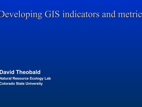
eveloping <strong>GIS</strong> <strong>indicators</strong> <strong>and</strong> metric<br />
avid Theobald<br />
atural Resource Ecology Lab<br />
olorado <strong>State</strong> <strong>University</strong>
FUNDING SOURCE<br />
This presentation was developed under the STAR<br />
Research Assistance Agreement CR-829095<br />
awarded by the U.S. Environmental Protection<br />
Agency (EPA) to <strong>Colorado</strong> <strong>State</strong> <strong>University</strong>. This<br />
report have not been formally reviewed by EPA.<br />
The views expressed here are solely those of its<br />
author <strong>and</strong> the STARMAP Program. EPA does<br />
not endorse any products or commercial services<br />
mentioned in this presentation.
Goals of indicator development<br />
Develop <strong>and</strong> evaluate l<strong>and</strong>scape-level<br />
<strong>indicators</strong> suitable for spatial <strong>and</strong><br />
temporal analyses of EMAP data<br />
Investigate limitations of currentlyavailable<br />
data <strong>and</strong> offer new, robust<br />
methodologies
Current effort<br />
• Linkage between watershed <strong>and</strong><br />
hydrologic networks<br />
• Refine surrogates with direct<br />
measures of area <strong>and</strong> discharge<br />
• <strong>GIS</strong>-based tools<br />
• RWTools for ArcView<br />
• Catchment delineation & discharge in<br />
Arc<strong>GIS</strong>
1. Watershed–hydrological<br />
network linkage<br />
• “…in every respect, the valley rules<br />
the stream.” – Hynes 1975<br />
• Indirect measures based on<br />
hydrological properties (e.g.,<br />
Strahler order, drainage density,<br />
etc.)
Distance:<br />
As the crow flies<br />
(Euclidean)
Distance:<br />
As the crow flies<br />
As the seed floats<br />
(downstream)
Distance:<br />
As the crow flies<br />
As the seed floats<br />
As the fish swims<br />
(down & up stream)
Distance:<br />
As the crow flies<br />
As the seed floats<br />
As the fish swims<br />
(down & up stream)<br />
Upstream length<br />
- mainstem (2)<br />
- arbolate (1+2+3+4)
Distance:<br />
As the crow flies<br />
As the seed floats<br />
As the fish swims<br />
Upstream length<br />
Network (dams,<br />
fragmentation)
What <strong>indicators</strong> measure<br />
watershed-stream linkage?<br />
• Length of stream line<br />
– Dam alteration of flow at a downstream<br />
gauge?<br />
• RWTools extension (ArcView v3.2)
Upstream<br />
66 km<br />
Mainstem<br />
Upstream<br />
37 km<br />
Downstream<br />
298 km<br />
Network<br />
16 km (do<br />
6 km (up)
2. Direct measures of discharge<br />
• Surrogates developed, e.g. Strahler<br />
order:<br />
The usefulness of stream order assumes,<br />
with a sufficiently large sample, that order is<br />
proportional to stream discharge<br />
– Strahler 1957<br />
• Alternatives:<br />
- basin area<br />
- discharge
Delineate reach catchments<br />
• Robust method (no pre-processing)<br />
• 1 to 1 relationship NHD reach <strong>and</strong><br />
catchment<br />
• “Grow” watershed from reach line<br />
based on flow direction iteratively
Stream discharge<br />
Precipitation<br />
D = C * P
8 acft<br />
20 acft<br />
10 acft
R 2 =0.7282<br />
P-value=3.407e-006
Stream discharge<br />
• Encouraging preliminary results<br />
• Additional factors (Infiltration, E.T.):<br />
– Geology<br />
– L<strong>and</strong> cover<br />
– Exposure<br />
D = f(C, G, L, E)
3. <strong>GIS</strong>-based tools<br />
• Interactive query <strong>and</strong> analysis of<br />
watersheds (RWTools) (ArcView<br />
v3.2)<br />
• Arc<strong>GIS</strong> Geometric network
Plans for next year<br />
• Initial release of <strong>GIS</strong> tools:<br />
– RWTools for Arc<strong>GIS</strong><br />
– Functional-based spatial weights
Spatial weights<br />
11<br />
2<br />
W =<br />
0 0 0 0 0<br />
0 0 0 0 0<br />
0 0 0 0 0<br />
1 0 1 0 0<br />
3<br />
4<br />
5<br />
0 1 0 1 0
Functional weighting<br />
W =<br />
0 0 0 0 0 0 0<br />
0.7 0 0 0 0 0 0<br />
0 0 0 0 0 0 0<br />
1<br />
0 0 0 0 0 0 0<br />
4<br />
1<br />
5<br />
2 3<br />
6 7<br />
0 0 0 0.7 0 0 0<br />
0.2 0.8 0 0.2 0.8 0 0<br />
0.1 0.2 1.0 0.1 0.2 1.0 0<br />
E.g., downstream hydrology
Functional weighting<br />
W =<br />
0 1 0 0 0 0 0<br />
1 0 0 0 1 1 0<br />
0 0 0 0 0 0 0<br />
1<br />
0 0 0 0 1 0 0<br />
4<br />
1<br />
5<br />
2 3<br />
6 7<br />
0 1 0 1 0 1 0<br />
0 1 0 0 1 0 1<br />
0 0 0 0 0 1 0<br />
E.g., macroinvertebrates
Plans for next year<br />
• Initial release of <strong>GIS</strong> tools:<br />
• Perennial/intermittent frame<br />
problem in western US<br />
• Development of network<br />
fragmentation indices