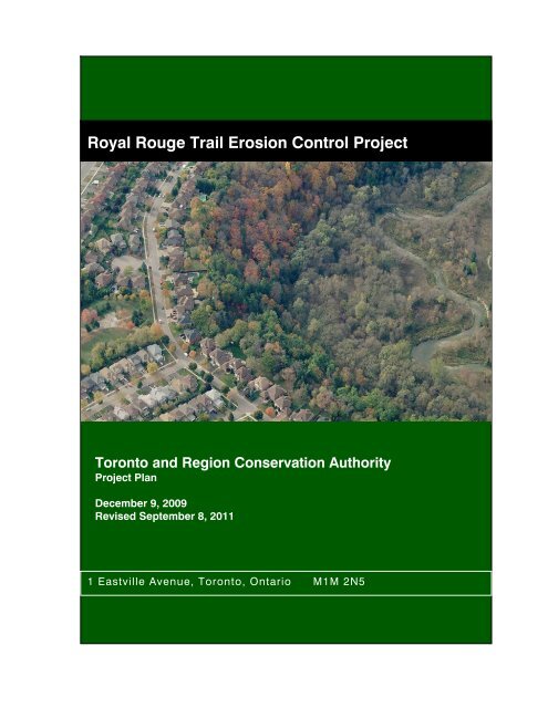
Royal Rouge Trail Erosion Control Project - Toronto and Region ...
Royal Rouge Trail Erosion Control Project - Toronto and Region ...
Royal Rouge Trail Erosion Control Project - Toronto and Region ...

Create successful ePaper yourself
Turn your PDF publications into a flip-book with our unique Google optimized e-Paper software.
<strong>Royal</strong> <strong>Rouge</strong> <strong>Trail</strong> <strong>Erosion</strong> <strong>Control</strong> <strong>Project</strong><br />
<strong>Toronto</strong> <strong>and</strong> <strong>Region</strong> Conservation Authority<br />
<strong>Project</strong> Plan<br />
December 9, 2009<br />
Revised September 8, 2011<br />
1 Eastville Avenue, <strong>Toronto</strong>, Ontario M1M 2N5
Acknowledgements<br />
<strong>Toronto</strong> <strong>and</strong> <strong>Region</strong> Conservation Authority gratefully acknowledges the following people for<br />
their contributions to the <strong>Royal</strong> <strong>Rouge</strong> <strong>Trail</strong> <strong>Erosion</strong> <strong>Control</strong> <strong>Project</strong>.<br />
Abdool Jhuman<br />
Resident<br />
Cathy Crinnion<br />
<strong>Toronto</strong> <strong>and</strong> <strong>Region</strong> Conservation Authority<br />
Carlo Corvese<br />
Resident<br />
Charles Kingsley<br />
City of <strong>Toronto</strong><br />
Councillor Ron Moeser<br />
City of <strong>Toronto</strong><br />
Debora Gyimah<br />
Resident<br />
Danielle Giggie<br />
Resident<br />
Edward Giggie<br />
Resident<br />
Honourable Dan McTeague<br />
Member of Parliament – Pickering – Scarborough<br />
East<br />
Jamie Sparks<br />
Resident<br />
Jamie Thomas<br />
Resident<br />
Janice Teichroeb<br />
<strong>Toronto</strong> <strong>and</strong> <strong>Region</strong> Conservation Authority<br />
Jason Crowder<br />
Terraprobe Limited<br />
Jim Berry<br />
<strong>Toronto</strong> <strong>and</strong> <strong>Region</strong> Conservation Authority<br />
Kathy Sparks<br />
Resident<br />
Ken Sharpe<br />
City of <strong>Toronto</strong><br />
Korah Thomas<br />
Resident<br />
Linda Foster<br />
Resident<br />
Lindsay Prihoda<br />
<strong>Toronto</strong> <strong>and</strong> <strong>Region</strong> Conservation Authority<br />
Malcom Wilson<br />
Resident<br />
Maria Papoulias<br />
<strong>Rouge</strong> Park<br />
Mark Preston<br />
<strong>Toronto</strong> <strong>and</strong> <strong>Region</strong> Conservation Authority<br />
Mike Tanos<br />
Terraprobe Limited<br />
Moranne McDonnell<br />
<strong>Toronto</strong> <strong>and</strong> <strong>Region</strong> Conservation Authority<br />
Patricia Newl<strong>and</strong><br />
<strong>Toronto</strong> <strong>and</strong> <strong>Region</strong> Conservation Authority<br />
Shakira Naraine<br />
Resident<br />
Steve Foster<br />
Resident<br />
Trevor D’Souza<br />
Resident<br />
Wayne McArthurs Member of Provincial Parliament – Pickering –<br />
Scarborough<br />
Winnie D’Souza<br />
Resident<br />
i
Executive Summary<br />
<strong>Toronto</strong> <strong>and</strong> <strong>Region</strong> Conservation Authority (TRCA) continues to work towards ensuring<br />
healthy rivers <strong>and</strong> shorelines, greenspace <strong>and</strong> biodiversity, <strong>and</strong> sustainable communities. One<br />
key step in this process is the design <strong>and</strong> implementation of erosion control works for<br />
projects, such as this one. The <strong>Royal</strong> <strong>Rouge</strong> <strong>Trail</strong> <strong>Erosion</strong> <strong>Control</strong> <strong>Project</strong> has been<br />
completed in accordance with the Class Environmental Assessment for Remedial Flood <strong>and</strong><br />
<strong>Erosion</strong> <strong>Control</strong> <strong>Project</strong>s (Conservation Ontario 2002) (Class EA), with the purpose of reducing<br />
risk to life <strong>and</strong> property, as per the m<strong>and</strong>ate of conversation authorities, under the<br />
Conservation Authorities Act (1948).<br />
Concerns regarding erosion of the crest of the valley wall at <strong>Royal</strong> <strong>Rouge</strong> <strong>Trail</strong> were first<br />
brought to the attention of TRCA in 1989, when the homeowner of No. 42 <strong>Royal</strong> <strong>Rouge</strong> <strong>Trail</strong><br />
identified concern regarding ongoing l<strong>and</strong>slides, <strong>and</strong> potential drainage issues on the valley<br />
wall adjacent to their property. Several attempts were made over the years to improve the<br />
drainage <strong>and</strong> to halt the ongoing erosion on the localized over steepened area of the upper<br />
valley wall behind No. 42 <strong>Royal</strong> <strong>Rouge</strong> <strong>Trail</strong>, however a comprehensive assessment of the<br />
entire reach was not completed until 2007 when TRCA retained the services of Terraprobe Ltd<br />
to complete an erosion risk <strong>and</strong> slope stability assessment for the study area.<br />
The outcome of the study completed by Terraprobe in 2008, identified that the slope is<br />
anticipated to recede by approximately 0.18 metres per year, until the long-term angle of<br />
repose is attained, <strong>and</strong> that there is a need for remedial works to prevent further loss of table<br />
l<strong>and</strong>, <strong>and</strong> risk to existing structures. In 2009, TRCA commenced a Class EA: The <strong>Royal</strong> <strong>Rouge</strong><br />
<strong>Trail</strong> <strong>Erosion</strong> <strong>Control</strong> <strong>Project</strong> for the purpose of developing the preferred solution to address<br />
the ongoing erosion <strong>and</strong> risk to property <strong>and</strong> public safety.<br />
To assist with the evaluation of the alternative options <strong>and</strong> provide input into the planning <strong>and</strong><br />
design process, a Community Liaison Committee or CLC was formed. Composed of technical<br />
staff, stakeholders, provincial agency staff, community activists <strong>and</strong> interested members of the<br />
public, the CLC became an integral part of the Class EA process. Through a series of CLC<br />
meetings, a range of alternative options were considered.<br />
As part of the initial planning <strong>and</strong> investigation, the study area was divided into two sections<br />
(Site A <strong>and</strong> Site B) based on the type <strong>and</strong> extent of erosion activity affecting those properties.<br />
Site A spans from Nos. 30 to 40 <strong>Royal</strong> <strong>Rouge</strong> <strong>Trail</strong>, while Site B spans from the remaining<br />
properties of Nos. 42 to 48 <strong>Royal</strong> <strong>Rouge</strong> <strong>Trail</strong>.<br />
The preferred solution determined through the Class EA process for Site A includes trimming<br />
the upper slope <strong>and</strong> over-steepened areas to a sustainable stable inclination of approximately<br />
1.3 : 1 (H : V). <strong>and</strong> intensely vegetating the entire area. For Site B an Envirolok retaining wall be<br />
will installed along the length of the slope from Nos. 42 – 48 <strong>Royal</strong> <strong>Rouge</strong> <strong>Trail</strong> to provide longterm<br />
stability <strong>and</strong> improved drainage to the valley wall in this area.<br />
Following the thirty (30) day public review period of this <strong>Project</strong> Plan <strong>and</strong> the successful<br />
resolution of an concerns received during the review period, TRCA intends to finalize the<br />
detailed design of the preferred solution <strong>and</strong> obtain the necessary approvals required to<br />
proceed to the implementation phase of this project.<br />
ii
Table of Contents<br />
1.0 INTRODUCTION ....................................................................................................................1<br />
1.1 Relationship of the Undertaking to the Environmental Assessment Act................................. 2<br />
1.2 Purpose of the Undertaking........................................................................................................ 3<br />
1.3 Site Description ........................................................................................................................... 4<br />
1.4 General Description of the Undertaking .................................................................................... 7<br />
1.5 Rationale for Undertaking........................................................................................................... 9<br />
2.0 BACKGROUND......................................................................................................................9<br />
2.1 History of the Problem ................................................................................................................ 9<br />
2.1.1 History of Subdivision Development .................................................................................. 9<br />
2.2<br />
2.1.2 History of the Instability <strong>and</strong> <strong>Erosion</strong> of Slope ................................................................. 12<br />
Identification of Previous Studies ............................................................................................ 13<br />
2.2.1 Geotechnical Reports ....................................................................................................... 13<br />
2.2.2 Planning Documents ........................................................................................................ 14<br />
2.2.3 Aquatic <strong>and</strong> Terrestrial Habitat Reports ........................................................................... 16<br />
2.3<br />
2.2.4 Socioeconomic <strong>and</strong> Cultural Heritage Studies ................................................................ 16<br />
Stage 1 <strong>and</strong> 2 Archaeological Assessment ............................................................................. 22<br />
2.4 Stage 3 <strong>and</strong> 4 Archaeological Assessment ............................................................................. 23<br />
2.4.1 Gyimah Sparks site (AkGs-044) ....................................................................................... 24<br />
2.4.2 Jhuman Site (AKGs-045).................................................................................................. 26<br />
2.5<br />
2.4.3 Corvese Site (AKGs-046).................................................................................................. 29<br />
Justification of Conservation Authority Involvement.............................................................. 31<br />
3.0 BASELINE ENVIRONMENTAL INVENTORY....................................................................... 32<br />
3.1 Existing Site Conditions............................................................................................................ 33<br />
3.1.1<br />
3.1.2<br />
Physical Environment ....................................................................................................... 33<br />
Biological Environment..................................................................................................... 36<br />
3.1.3 Cultural Environment ........................................................................................................ 45<br />
3.1.4 Socioeconomic Environment ........................................................................................... 47<br />
3.1.5 Engineering/Technical Environment ................................................................................ 48<br />
4.0 EVALUATION OF REMEDIAL ALTERNATIVE OPTIONS ................................................... 50<br />
4.1 Description of Preliminary Concepts ....................................................................................... 50<br />
4.1.1 “Do Nothing” Alternative................................................................................................... 51<br />
4.1.2 Site A: Preliminary Concept 1 – Intense Vegetation......................................................... 53<br />
4.1.3<br />
4.1.4<br />
Site A: Preliminary Concept 2 – Slope Trimming with Intense Vegetation....................... 53<br />
Site B: Preliminary Concept 1 – Retaining Wall <strong>and</strong> Filling.............................................. 54<br />
4.1.5 Site B: Preliminary Concept 2 – Extended Retaining Wall <strong>and</strong> Trimming........................ 55<br />
4.2 Evaluation of Preliminary Concepts......................................................................................... 56<br />
4.2.1<br />
4.2.2<br />
Site A - Evaluation of Preliminary Concepts..................................................................... 56<br />
Site B - Evaluation of Preliminary Concepts..................................................................... 57<br />
4.3 Selection of the Preferred Alternative...................................................................................... 58<br />
4.4 Refinement of the Preferred Alternative for Site B.................................................................. 58<br />
5.0 ENVIRONMENTAL SCREENING......................................................................................... 59<br />
5.1 Detailed Environmental Analysis of the Preferred Alternatives ............................................. 59<br />
5.1.1 Physical Environment ....................................................................................................... 62<br />
iii
5.1.2 Biological Environment..................................................................................................... 62<br />
5.1.3 Cultural Environment ........................................................................................................ 64<br />
5.1.4<br />
5.1.5<br />
Socioeconomic Environment ........................................................................................... 64<br />
Engineering/Technical Environment ................................................................................ 65<br />
6.0 SUMMARY ........................................................................................................................... 65<br />
6.1 Role of the Community Liaison Committee ............................................................................. 65<br />
6.2 Public Notifications <strong>and</strong> Consultation ..................................................................................... 66<br />
6.2.1 <strong>Project</strong> Initiation ................................................................................................................ 67<br />
6.2.2 Notice of Intent.................................................................................................................. 67<br />
6.2.3 Community Liaison Committee Meeting #1 .................................................................... 67<br />
6.2.4 Community Liaison Committee Meeting #2 .................................................................... 68<br />
6.2.5<br />
6.2.6<br />
Meeting with Affected L<strong>and</strong>owners .................................................................................. 69<br />
Community Liaison Committee Meeting #3 .................................................................... 69<br />
6.2.7 Notice of Filing.................................................................................................................. 69<br />
6.2.8 Notice of <strong>Project</strong> Approval................................................................................................ 69<br />
6.3 First Nations <strong>and</strong> Aboriginal Group Consultation ................................................................... 69<br />
6.4 Monitoring Program .................................................................................................................. 70<br />
7.0 REFERENCES......................................................................................................................70<br />
iv
Figures<br />
Figure 1. General location of study area. .................................................................................................. 1<br />
Figure 2. Study limits at the rear of 30 - 48 <strong>Royal</strong> <strong>Rouge</strong> <strong>Trail</strong>, City of <strong>Toronto</strong>........................................ 2<br />
Figure 3. Class Environmental Assessment Planning <strong>and</strong> Design Process. ............................................ 3<br />
Figure 4. <strong>Erosion</strong> scar below Nos. 42 <strong>and</strong> 44 <strong>Royal</strong> <strong>Rouge</strong> <strong>Trail</strong>. ............................................................ 5<br />
Figure 5. Active erosion behind Nos. 48 to 44 <strong>Royal</strong> <strong>Rouge</strong> <strong>Trail</strong>. ........................................................... 6<br />
Figure 6. Slope conditions below No. 42 <strong>Royal</strong> <strong>Rouge</strong> <strong>Trail</strong>. ................................................................... 6<br />
Figure 7. Active erosion behind Nos. 32 to 30 <strong>Royal</strong> <strong>Rouge</strong> <strong>Trail</strong>. ........................................................... 7<br />
Figure 8. General study area with new regulation line (166/06) for the subdivision, May 2006. ............ 12<br />
Figure 9. Boundaries of <strong>Rouge</strong> Hill Community...................................................................................... 17<br />
Figure 10. Boundaries of <strong>Rouge</strong> Community.......................................................................................... 18<br />
Figure 11. Aerial photograph taken in 1950 showing the rural nature of the project area ..................... 11<br />
Figure 12. Aerial photograph taken in 1987 showing the housing development ……….……………….12<br />
Figure 13. Location of positive test pits as a result of stage 2 testing.……………………………..………23<br />
Figure 14. General location of the “L” rating flora species within the vicinity of project area................. 38<br />
Figure 15. General location of the “L” rating fauna species within the vicinity of project area............... 40<br />
Figure 16. General area of bird sightings in the <strong>Rouge</strong> River watershed. .............................................. 43<br />
Figure 17. General area of <strong>Rouge</strong> River Valley, Life Science – ANSI...................................................... 45<br />
Figure 18. Long-term stable slope line without any remedial protection................................................ 52<br />
Figure 19. Proposed Preliminary Concept 1 for Site A. .......................................................................... 53<br />
Figure 20. Proposed Preliminary Concept 2 for Site A. .......................................................................... 54<br />
Figure 21. Proposed Preliminary Concept 1 for Site B. .......................................................................... 55<br />
Figure 22. Proposed Preliminary Concept 2 for Site B. .......................................................................... 56<br />
Tables<br />
Table 1. Closest Distance from the Residential Dwellings to the Crest of the Slope................................ 4<br />
Table 2. Air Quality Readings for Eastern <strong>Toronto</strong> (August 20, 2009) .................................................... 34<br />
Table 3. Air Quality Readings for Eastern <strong>Toronto</strong> (October 20, 2009) .................................................. 34<br />
Table 4. Typical L - Rank Description...................................................................................................... 36<br />
Table 5. Flora Species <strong>and</strong> Level of Concern within TRCA’s Jurisdiction. ............................................. 38<br />
Table 6. Fauna Species <strong>and</strong> Level of Concern within TRCA’s Jurisdiction. ........................................... 40<br />
Table 7. <strong>Rouge</strong> River Watershed Mammal Species................................................................................ 42<br />
Table 8. Bird Species observed within the <strong>Rouge</strong> River watershed. ...................................................... 43<br />
Table 9. <strong>Project</strong>ed property loss from Nos. 30 to 48 <strong>Royal</strong> <strong>Rouge</strong> <strong>Trail</strong>................................................. 48<br />
Table 10. MNR Recommended Minimum Design Factors of Safety. ..................................................... 49<br />
Table 11. Results of the Slope Stability Analysis. ................................................................................... 50<br />
Table 12. Estimate of Time to Long-Term Stable Slope Crest................................................................ 51<br />
Table 13. Evaluation of Preliminary Concepts for Site A.........................................................................57<br />
Table 14. Evaluation of Preliminary Concepts for Site B.........................................................................57<br />
Table 15. Detailed Environmental Analysis of the Preferred Alternative. ................................................ 60<br />
v
1.0 INTRODUCTION<br />
<strong>Toronto</strong> <strong>and</strong> <strong>Region</strong> Conservation Authority (TRCA) is proposing to carry out remedial<br />
erosion control works for a section of the <strong>Rouge</strong> Valley corridor behind the properties at Nos.<br />
30 – 48 <strong>Royal</strong> <strong>Rouge</strong> <strong>Trail</strong>, where slope instability <strong>and</strong> ongoing erosion are creating a risk to<br />
private property <strong>and</strong> existing residential structures. The study area is delineated in Figures 1<br />
& 2.<br />
The following <strong>Project</strong> Plan has been prepared as documentation of the decision-making<br />
process exercised in determining the preferred measures for the proposed remedial works,<br />
<strong>and</strong> to establish that there are no negative impacts or outst<strong>and</strong>ing concerns held by TRCA or<br />
reviewers associated with the proposed works.<br />
Figure 1. General location of study area. Source: TRCA, 2009.<br />
1<br />
<strong>Project</strong> Plan<br />
<strong>Toronto</strong> <strong>and</strong> <strong>Region</strong> Conservation Authority<br />
<strong>Royal</strong> <strong>Rouge</strong> <strong>Trail</strong> <strong>Erosion</strong> <strong>Control</strong> <strong>Project</strong> January 2010
Figure 2. Study limits at the rear of 30 - 48 <strong>Royal</strong> <strong>Rouge</strong> <strong>Trail</strong>, City of <strong>Toronto</strong>. Source: TRCA, 2009.<br />
1.1 Relationship of the Undertaking to the Environmental Assessment Act<br />
TRCA is defined as a public body in Section 3 of Regulation 334/90 in the Environmental<br />
Assessment Act (R.S.O. 1990), <strong>and</strong> as such, must conduct its remedial flood <strong>and</strong> erosion<br />
control projects in accordance with said Act.<br />
Recognizing that common elements exist in addressing flood <strong>and</strong> erosion problems, a<br />
coordinated approach to environmental assessments was developed by Conservation<br />
Ontario in 1993 for use by all of the Conservation Authorities (CAs) referred to as the Class<br />
Environmental Assessment for Remedial Flood <strong>and</strong> <strong>Erosion</strong> <strong>Control</strong> <strong>Project</strong>s (Class EA).<br />
According to the Class EA document,<br />
“Remedial Flood <strong>and</strong> <strong>Erosion</strong> <strong>Control</strong> <strong>Project</strong>s refer to those projects<br />
undertaken by Conservation Authorities, which are required to protect human<br />
life <strong>and</strong> property, in previously developed areas, from an impending flood or<br />
erosion problem. Such projects do not include works which facilitate or<br />
anticipate development. Major flood <strong>and</strong> erosion control undertakings which do<br />
not suit this definition, such as multipurpose projects, lie outside the limits of<br />
this Class require an Individual Environmental Assessment” (Conservation<br />
Ontario, 2002).<br />
2<br />
<strong>Project</strong> Plan<br />
<strong>Toronto</strong> <strong>and</strong> <strong>Region</strong> Conservation Authority<br />
<strong>Royal</strong> <strong>Rouge</strong> <strong>Trail</strong> <strong>Erosion</strong> <strong>Control</strong> <strong>Project</strong> January 2010
Almost twenty years of experience have demonstrated that using the Class EA approach is<br />
an effective way of complying with the Act requirements. Approval of the Class EA allows<br />
CAs to carry out these types of projects without applying for formal approval under the Act,<br />
on the condition that all other necessary federal <strong>and</strong> provincial approvals are obtained. A<br />
chart illustrating the key steps of the Class EA planning <strong>and</strong> design process is shown in<br />
Figure 3.<br />
Figure 3. Class Environmental Assessment Planning <strong>and</strong> Design Process. Source: Conservation<br />
Ontario, 2002.<br />
1.2 Purpose of the Undertaking<br />
The objective of the <strong>Royal</strong> <strong>Rouge</strong> <strong>Trail</strong> <strong>Erosion</strong> <strong>Control</strong> <strong>Project</strong> (the project), is to protect<br />
human life <strong>and</strong> property from the hazards of erosion <strong>and</strong> slope instability by providing longterm,<br />
low maintenance protection which is compatible with the surrounding physical,<br />
biological, social <strong>and</strong> cultural environment.<br />
The proposed undertaking will be carried out in accordance with TRCA’s Criteria &<br />
Implementation Procedures for Valley & Stream Corridor Regeneration <strong>and</strong> Remedial Works<br />
3<br />
<strong>Project</strong> Plan<br />
<strong>Toronto</strong> <strong>and</strong> <strong>Region</strong> Conservation Authority<br />
<strong>Royal</strong> <strong>Rouge</strong> <strong>Trail</strong> <strong>Erosion</strong> <strong>Control</strong> <strong>Project</strong> January 2010
<strong>Project</strong>s (Design Criteria), which seeks to reduce <strong>and</strong> eliminate existing flood, erosion <strong>and</strong><br />
slope instability hazards <strong>and</strong> to rehabilitate valley <strong>and</strong> stream corridors on private <strong>and</strong> public<br />
l<strong>and</strong>s (Appendix A).<br />
1.3 Site Description<br />
The study area is located in the East Scarborough community of <strong>Rouge</strong>, a suburb located<br />
along the eastern most boundary of the City of <strong>Toronto</strong>. The site is bounded by <strong>Rouge</strong> Park<br />
to the north, residential l<strong>and</strong>s to the east <strong>and</strong> west, <strong>and</strong> a residential road (<strong>Royal</strong> <strong>Rouge</strong> <strong>Trail</strong>)<br />
to the south.<br />
In general, surface water in East Scarborough is directed to drain into the <strong>Rouge</strong> River, which<br />
flows from the north-northwest to the southeast <strong>and</strong> empties into Lake Ontario. In the<br />
immediate vicinity of the study area the <strong>Rouge</strong> River flows generally from east to west in the<br />
valleyl<strong>and</strong>s of the <strong>Rouge</strong> Park, to the north <strong>and</strong> east of <strong>Royal</strong> <strong>Rouge</strong> <strong>Trail</strong>.<br />
The ten single-family residences from Nos. 30 to 48 <strong>Royal</strong> <strong>Rouge</strong> <strong>Trail</strong> back onto the <strong>Rouge</strong><br />
Park, <strong>and</strong> are located at varying distances from the crest of the valley wall. Measurements of<br />
the closest distance from three points on each house, as well as from swimming pools (if<br />
present) to the crest of the valley wall are documented in Table 1.<br />
Table 1. Closest Distance from the Residential Dwellings to the Crest of the Slope.<br />
CLOSEST DISTANCE TO SLOPE CREST<br />
Lot No.<br />
West Corner of Centre of East Corner of<br />
Dwelling Dwelling Dwelling<br />
Pool<br />
#30 26 20 22 -<br />
#32 19 15 16 -<br />
#34 17 18 21 -<br />
#36 24 22 32 -<br />
#38 31 11 18 10<br />
#40 15 18 22 -<br />
#42 23 14 22 -<br />
#44 23 15 16 4<br />
#46 19 14 18 -<br />
#48 16 15 17 4<br />
Source: Terraprobe, 2008.<br />
The valley wall at the project site is approximately 20 to 30 metres (m) high <strong>and</strong> exhibits a<br />
slope angle between 0.25 - 0.05 : 1 (horizontal : vertical or h : v) to about 1.1 - 1.35 : 1 (h : v)<br />
(Terraprobe, 2008). The slope appears well vegetated with trees of varying maturity with the<br />
exception of slope segments most severely affected by the erosion.<br />
In the vicinity of the project area, sections of the slope are saturated several metres down<br />
from the crest of slope <strong>and</strong> in several areas, gullies have formed to channel the water down<br />
to the floodplain at the base of the slope. There is no evidence of water being directed from<br />
pools or drains over the slope crest, <strong>and</strong> it is assumed that the groundwater is from natural<br />
sources (rainfall etc)<br />
The predominant vegetative community found on the valley wall adjacent to the project site is<br />
a Hemlock-hardwood mixed forest with common species such as; Eastern hemlock (Tsuga<br />
4<br />
<strong>Project</strong> Plan<br />
<strong>Toronto</strong> <strong>and</strong> <strong>Region</strong> Conservation Authority<br />
<strong>Royal</strong> <strong>Rouge</strong> <strong>Trail</strong> <strong>Erosion</strong> <strong>Control</strong> <strong>Project</strong> January 2010
Canadensis), Eastern white pine (Pinus strobus), Paper birch (Betula papyrifera) <strong>and</strong> Sugar<br />
maple (Acer saccharum) present. There are several dead or dying trees specifically in or<br />
adjacent to the sites of active erosion on the slope. There are also native <strong>and</strong> invasive lowlying<br />
plants present in the understorey, <strong>and</strong> a small pocket of Manitoba maple (Acer<br />
negundo) is located within the erosion gully on the lower slope. A Willow swamp with<br />
st<strong>and</strong>ing water is located at the base of the slope.<br />
Although <strong>Rouge</strong> River generally flows from northwest to southeast towards Lake Ontario, the<br />
section of the river located in the valley l<strong>and</strong>s approximately 200 m north of project area has a<br />
general me<strong>and</strong>er flow from west to east. Therefore for the purpose of this report the <strong>Rouge</strong><br />
River is referred to as running from west to east in direction. Photographs of the site follow in<br />
Figures 4 to Figure 7.<br />
Figure 4. <strong>Erosion</strong> scar below Nos. 42 <strong>and</strong> 44 <strong>Royal</strong> <strong>Rouge</strong> <strong>Trail</strong>. Source: TRCA, 1991.<br />
5<br />
<strong>Project</strong> Plan<br />
<strong>Toronto</strong> <strong>and</strong> <strong>Region</strong> Conservation Authority<br />
<strong>Royal</strong> <strong>Rouge</strong> <strong>Trail</strong> <strong>Erosion</strong> <strong>Control</strong> <strong>Project</strong> January 2010
Figure 5. Area of active erosion behind Nos. 48 to 44 <strong>Royal</strong> <strong>Rouge</strong> <strong>Trail</strong>. Source: Terraprobe, 2009.<br />
Figure 6. Slope conditions below No. 42 <strong>Royal</strong> <strong>Rouge</strong> <strong>Trail</strong>, geotextile matting used in previous<br />
localized erosion control works visible in the centre of the shot. Source: Terraprobe, 2009.<br />
6<br />
<strong>Project</strong> Plan<br />
<strong>Toronto</strong> <strong>and</strong> <strong>Region</strong> Conservation Authority<br />
<strong>Royal</strong> <strong>Rouge</strong> <strong>Trail</strong> <strong>Erosion</strong> <strong>Control</strong> <strong>Project</strong> January 2010
Figure 7. Active erosion behind Nos. 32 to 30 <strong>Royal</strong> <strong>Rouge</strong> <strong>Trail</strong>. Source: Terraprobe, 2009.<br />
1.4 General Description of the Undertaking<br />
There are four situations in which remedial flood <strong>and</strong> erosion control projects may be<br />
undertaken within the Class EA:<br />
i) Riverine flooding<br />
ii) Riverine <strong>and</strong> valley slope erosion<br />
iii) Shoreline flooding<br />
iv) Shoreline erosion<br />
The primary objective of the project is to provide long-term protection against<br />
(ii)<br />
Riverine <strong>and</strong> valley slope erosion. Alternative remedial measures to address this problem<br />
include:<br />
Soil bioengineering with the use of vegetation to stabilize soil, slow runoff, <strong>and</strong><br />
dissipate erosive energy<br />
Improvements to internal drainage through the use of French drains, interceptor<br />
drains, or tile drains<br />
Improvements to surface drainage by redirecting water away from the slope, or by<br />
providing swales<br />
Regrading of the slope to provide a long-term stable angle of repose<br />
Secondary objectives include the protection of existing l<strong>and</strong> uses, improved aesthetics, <strong>and</strong><br />
improved terrestrial habitat. As such, the project will examine a number of alternatives to<br />
7<br />
<strong>Project</strong> Plan<br />
<strong>Toronto</strong> <strong>and</strong> <strong>Region</strong> Conservation Authority<br />
<strong>Royal</strong> <strong>Rouge</strong> <strong>Trail</strong> <strong>Erosion</strong> <strong>Control</strong> <strong>Project</strong> January 2010
achieve the primary <strong>and</strong> secondary objectives as outlined in the Class EA document,<br />
including:<br />
<br />
<br />
<br />
<br />
Intense re-vegetation of slope<br />
Slope trimming <strong>and</strong> intense re-vegetation of slope<br />
Retaining wall with slope filling<br />
Extended retaining wall with slope trimming<br />
In accordance with the Class EA planning process, a full range of alternatives must be<br />
developed, including both traditional <strong>and</strong> innovative approaches. The type <strong>and</strong> range of<br />
alternatives developed, such as the ones listed above, will vary by project as they are based<br />
on the nature, cause <strong>and</strong> extent of the problem, <strong>and</strong> must be tailored to the individual<br />
characteristics of each site.<br />
The decision-making process used in the selection of the preferred remedial solution is<br />
documented in detail in Section 4.0.<br />
In determining the preferred method of remediation for the erosion <strong>and</strong> slope instability<br />
problem two major factors were considered: risk to structure(s); <strong>and</strong> the cause(s) of the<br />
hazard. According to TRCA’s Design Criteria, potential risk to existing structures is deemed<br />
to be the most important factor <strong>and</strong> accordingly is given more weight than the physical <strong>and</strong><br />
geological condition associated with the cause of erosion <strong>and</strong>/or instability.<br />
In all cases, the design of erosion control <strong>and</strong> slope stabilization works must provide<br />
protection compatible with TRCA’s Design Criteria, which includes improvements to or<br />
enhancements of the existing terrestrial habitat conditions through natural designs.<br />
Due to the size of the site, <strong>and</strong> the significant different in the conditions of the valley wall<br />
between the two extents of the project limits (Nos. 30 <strong>and</strong> 48 <strong>Royal</strong> <strong>Rouge</strong> <strong>Trail</strong>), the project<br />
area was divided into two sites, with the transition from Site A to Site B occurring between<br />
Nos. 40 <strong>and</strong> 42 <strong>Royal</strong> <strong>Rouge</strong> <strong>Trail</strong>.<br />
Site A spans the houses from Nos. 30 to 40 <strong>Royal</strong> <strong>Rouge</strong> <strong>Trail</strong>, <strong>and</strong> the recommended<br />
remedial course of action consists of slope trimming with intense re-vegetation of the slope to<br />
address the over steepened areas of instability while providing strength to the valley wall<br />
thought the use of vegetation.<br />
Site B is located between Nos. 42 – 48 <strong>Royal</strong> <strong>Rouge</strong> <strong>Trail</strong>, <strong>and</strong> is identified as the more<br />
serious of the two sites. At Site B the proposed remedial works include extensive trimming<br />
<strong>and</strong> reinforcement with a vegetated retaining wall system.<br />
The decision-making process used in selecting the preferred remedial action is documented<br />
in detail in Section 4.0 of this report. The proposed undertaking meets all TRCA planning <strong>and</strong><br />
policy objectives, <strong>and</strong> satisfies the needs <strong>and</strong> concerns of the affected property owners <strong>and</strong><br />
general public.<br />
8<br />
<strong>Project</strong> Plan<br />
<strong>Toronto</strong> <strong>and</strong> <strong>Region</strong> Conservation Authority<br />
<strong>Royal</strong> <strong>Rouge</strong> <strong>Trail</strong> <strong>Erosion</strong> <strong>Control</strong> <strong>Project</strong> January 2010
1.5 Rationale for Undertaking<br />
In 2008 TRCA retained Terraprobe Limited to undertake a geotechnical investigation of the<br />
slope stability <strong>and</strong> erosion risk assessment for the ten (10) residential properties; Nos. 30 –<br />
48 <strong>Royal</strong> <strong>Rouge</strong> <strong>Trail</strong>. The recommendations of the investigation identified that there was a<br />
potential risk to the existing structures on the aforementioned properties, <strong>and</strong> that major earth<br />
works would be required to halt the active erosion on the upper portion of the valley wall <strong>and</strong><br />
provide long-term stability to the area.<br />
As part of the initial planning for the Class EA for this site, TRCA evaluated the “Do Nothing”<br />
option, as per the Class EA requirements. The results of the assessment indicated that the<br />
likelihood for substantial loss of valuable table l<strong>and</strong>, the risk to life <strong>and</strong> property, <strong>and</strong> the<br />
value of the properties at risk illustrated the overall net benefit of addressing the slope<br />
stability concerns through the Class EA process. It is for this reason that TRCA made the<br />
determination to proceed with the Class EA for this site.<br />
2.0 BACKGROUND<br />
This section provides factual information as to the causes, effects, extent <strong>and</strong> associated<br />
hazards relating to erosion <strong>and</strong> slope instability at the project site. The findings <strong>and</strong><br />
recommendations of previous studies are presented herein, as justification for TRCA<br />
involvement.<br />
2.1 History of the Problem<br />
2.1.1 History of Subdivision Development<br />
The development <strong>and</strong> approval of the Deauville subdivision where <strong>Royal</strong> <strong>Rouge</strong> <strong>Trail</strong> is<br />
located, was reviewed <strong>and</strong> approved by TRCA staff prior to the development of the<br />
Comprehensive Basin Management Plan, <strong>and</strong> the Valley <strong>and</strong> Stream Corridor Management<br />
Program developed <strong>and</strong> adopted by TRCA in the 1990’s.<br />
Planning of the subdivision began in 1983 with a comprehensive site analysis <strong>and</strong> inspection.<br />
The initial inspections were conducted by the geotechnical engineering firm Soil Eng on<br />
behalf of Deauville Developments Limited, <strong>and</strong> concluded with the following<br />
recommendations:<br />
<br />
<br />
<br />
Vegetation, topsoil, <strong>and</strong> slope should remain undisturbed;<br />
Concentrated runoff should not be allowed to drain onto the slope face;<br />
Structures should be set back at least 10 metres away from the existing top of bank.<br />
The report also identified that there is potential for shallow slope failures in the upper section<br />
of the valley wall in the proposed area of development as the result of the water drainage<br />
pattern for the tablel<strong>and</strong>.<br />
This report was included with the draft site development plan, when circulated to TRCA staff<br />
for review in October of 1984. The compiled comments from staff regarding the draft<br />
subdivision plan addressed the following concerns:<br />
9<br />
<strong>Project</strong> Plan<br />
<strong>Toronto</strong> <strong>and</strong> <strong>Region</strong> Conservation Authority<br />
<strong>Royal</strong> <strong>Rouge</strong> <strong>Trail</strong> <strong>Erosion</strong> <strong>Control</strong> <strong>Project</strong> January 2010
Grading;<br />
Stormwater Management;<br />
Acquisition of the valley l<strong>and</strong>s;<br />
Fencing; <strong>and</strong><br />
Set back requirements for all structures.<br />
TRCA comments also addressed a circulated Zoning By-Law (15907) Amendment pertaining<br />
to the <strong>Royal</strong> <strong>Rouge</strong> <strong>Trail</strong> Development which specified that all buildings <strong>and</strong> structures be set<br />
back 10 metres from the rear property line, coincidental to the TRCA staked top of slope.<br />
As part of the planning process for the subdivision, The City of Scarborough arranged the<br />
sale of the valley slope l<strong>and</strong>s included in the parcel owned by Deauville Developments<br />
Limited to TRCA, to be added to the network of acquired l<strong>and</strong>s within the <strong>Rouge</strong> Valley<br />
Corridor.<br />
TRCA’s Senior Plans Analyst provided comments to the City of Scarborough in September<br />
1985 regarding the final registration of the subdivision stating that all of TRCA’s concerns, as<br />
previously noted, had been addressed <strong>and</strong> there were no further objections regarding the<br />
proposed plan.<br />
Final approval of the subdivision was authorized by the City of Scarborough. In conjunction<br />
with the approval of this site development plan a By-law (15907) was established for the<br />
subdivision that required a 10 metre structural setback limit from the rear property line for all<br />
major earth works including houses, <strong>and</strong> swimming pools.<br />
At that time, TRCA’s role in the approval <strong>and</strong> permitting of subdivision developments was<br />
limited to acting in a review capacity, to aid the Municipality in reviewing stormwater<br />
management plans <strong>and</strong> geotechnical reports, <strong>and</strong> to provide comments <strong>and</strong><br />
recommendations to the Municipality for consideration in the approval <strong>and</strong> issuance of<br />
permits for the application.<br />
The adoption of the Valley <strong>and</strong> Stream Corridor Management Program in 1994 marked a<br />
significant step forward in TRCA’s role in the planning of new subdivisions within the Greater<br />
<strong>Toronto</strong> Area. The Valley <strong>and</strong> Stream Corridor Management Program represents the<br />
establishment of new policy directions based on the evolution of previous planning<br />
documents including:<br />
- 1980 Watershed Plan <strong>and</strong> 1986 Update;<br />
o Flood <strong>Control</strong> Program;<br />
o <strong>Erosion</strong> <strong>Control</strong> Program (Valleyl<strong>and</strong>s component only);<br />
o Conservation L<strong>and</strong> Management Program;<br />
o Stormwater Management Program;<br />
- 1982 Environmentally Significant Areas Study;<br />
- 1985 Parking Lot Policy<br />
- 1987 Flood Susceptible Sites Policy;<br />
- 1990 Comprehensive Basin Management Strategy for the <strong>Rouge</strong> River Watershed;<br />
<strong>and</strong><br />
- 1991 Special Policy Areas Policies.<br />
10<br />
<strong>Project</strong> Plan<br />
<strong>Toronto</strong> <strong>and</strong> <strong>Region</strong> Conservation Authority<br />
<strong>Royal</strong> <strong>Rouge</strong> <strong>Trail</strong> <strong>Erosion</strong> <strong>Control</strong> <strong>Project</strong> January 2010
The results of the adoption of the Valley <strong>and</strong> Stream Corridor Management Program represent<br />
the amalgamation of a number of updated planning policies including the introduction of<br />
designated corridors from which setbacks be required to adhere to, creating green space<br />
between developed parcels of l<strong>and</strong>, <strong>and</strong> environmentally significant areas. This program<br />
specifically promoted the establishment of a st<strong>and</strong>ard 10 metre buffer between the long-term<br />
stable slope crest <strong>and</strong> the proposed development area. Further, it provided TRCA with a<br />
strategic direction for the implementation of the 1989 TRCA (Former MTRCA) Greenspace<br />
Strategy. With respect to this subdivision specifically, the properties in question are<br />
immediately adjacent to <strong>Rouge</strong> Park <strong>and</strong> fall within the area that is governed by the more<br />
restrictive policies <strong>and</strong> principles of the <strong>Rouge</strong> Park Management Plan, May 1994 which was<br />
introduced the same year as the Valley <strong>and</strong> Stream Corridor Management Program. The<br />
<strong>Rouge</strong> Park Management Plan is a Provincial Plan which states that where comprehensive<br />
redevelopment is proposed, the park boundaries are to be extended 30 metres inl<strong>and</strong> from<br />
the long-term stable slope crest<br />
In 1998 a minor variance application to install a swimming pool in the rear lot at No. 48 <strong>Royal</strong><br />
<strong>Rouge</strong> <strong>Trail</strong> (Lot 32) was approved by the City of <strong>Toronto</strong>. TRCA’s involvement with this<br />
process was limited to providing property clearance for the site as the proposed placement of<br />
the structure did not fall within the regulated 10 metre structural setback limit from the top of<br />
bank. The following recommendations were also provided to the City of <strong>Toronto</strong> regarding<br />
the installation of the swimming pool:<br />
1) All excavated fill material from pool installation works will be removed from the site.<br />
2) Under no circumstance should any pool discharge be directed to the rear, over the<br />
slope.<br />
3) All discharge should be directed into the homeowner’s sanitary system.<br />
As TRCA did not issue a permit in this instance, there is no way of assuring that the<br />
recommendations provided to the City of <strong>Toronto</strong> were incorporated as restrictions in the<br />
permit, or enforced during construction. Further, it is noted that the comments to the City of<br />
<strong>Toronto</strong> identified that residents with properties directly adjacent to the crest of the valley<br />
slope in this subdivision had been cautioned previously about developing in their rear lots, as<br />
the area may be subject to future erosion.<br />
An in-depth review of TRCA files indicate that the approved rear property line for this<br />
subdivision was generally the visual crest of the valley slope as staked by TRCA, concurrent<br />
with the recommendations of the Soil Eng report for the original subdivision development<br />
plan, <strong>and</strong> that the permitting <strong>and</strong> approval of swimming pools within this subdivision was<br />
regulated by the City of <strong>Toronto</strong> (Former City of Scarborough), with TRCA providing only<br />
property clearance, for works not located within the 10 metre setback limit from the crest of<br />
the valley slope.<br />
At the time that the properties on <strong>Royal</strong> <strong>Rouge</strong> <strong>Trail</strong> were developed, the setback limit was<br />
applied specifically to protect structures, <strong>and</strong> not the long-term value of the properties<br />
themselves. With changes to the planning process through the introduction of the Valley <strong>and</strong><br />
Stream Corridor Management Program, development setbacks are now applied from the<br />
long-term stable slope crest, whereby areas susceptible to natural processes such as erosion<br />
remain undeveloped.<br />
11<br />
<strong>Project</strong> Plan<br />
<strong>Toronto</strong> <strong>and</strong> <strong>Region</strong> Conservation Authority<br />
<strong>Royal</strong> <strong>Rouge</strong> <strong>Trail</strong> <strong>Erosion</strong> <strong>Control</strong> <strong>Project</strong> January 2010
As of May 2006, new regulation lines for this subdivision were put into effect requiring that a<br />
TRCA Permit be obtained for any proposed site works within the regulated area under<br />
Regulation 166/06 as illustrated in Figure 8.<br />
Figure 8. General study area with new regulation line (166/06) for the subdivision, May 2006. Source:<br />
TRCA, 2009.<br />
2.1.2 History of the Instability <strong>and</strong> <strong>Erosion</strong> of Slope<br />
<strong>Royal</strong> <strong>Rouge</strong> <strong>Trail</strong> is a residential subdivision backing onto the <strong>Rouge</strong> Valley corridor. The<br />
height of the valley wall in the affected area is greater than 30 m. TRCA was first made aware<br />
of the erosion problem at the rear of 42 <strong>Royal</strong> <strong>Rouge</strong> <strong>Trail</strong> in the summer of 1989 <strong>and</strong> carried<br />
out minor drainage improvement works in 1992. Despite TRCA’s efforts to control the<br />
erosion, slides continued at the rear of the property prompting TRCA to retain Terraprobe Ltd.<br />
in 1994 to complete a slope stability assessment.<br />
Terraprobe concluded that a perched water table <strong>and</strong> groundwater seepage were the primary<br />
causes of the erosion at this location, <strong>and</strong> that although there appeared to be no immediate<br />
12<br />
<strong>Project</strong> Plan<br />
<strong>Toronto</strong> <strong>and</strong> <strong>Region</strong> Conservation Authority<br />
<strong>Royal</strong> <strong>Rouge</strong> <strong>Trail</strong> <strong>Erosion</strong> <strong>Control</strong> <strong>Project</strong> January 2010
danger to the existing dwelling, some additional crest loss would be expected. It was<br />
recommended by Terraprobe that temporary stabilization measures be carried out using<br />
staked timbers <strong>and</strong> vegetation on the exposed areas, <strong>and</strong> that french drains be considered<br />
for a more permanent solution.<br />
As a result, temporary stabilization works were carried out by TRCA in 1998 <strong>and</strong> again in<br />
2003. Although these measures have reduced localized erosion <strong>and</strong> instability to some<br />
degree, ongoing groundwater seepage remains a problem at the site.<br />
In 2004, the owners at 30 <strong>and</strong> 48 <strong>Royal</strong> <strong>Rouge</strong> <strong>Trail</strong> notified TRCA of similar erosion<br />
conditions <strong>and</strong> expressed concern over the potential risk to their properties over the long<br />
term. Inspections were carried out at these properties shortly thereafter, at which time they<br />
were added to TRCA’s erosion site list for annual monitoring. Staff monitoring records<br />
indicated that the erosion appears active at several sections of valley wall between 30 <strong>and</strong> 48<br />
<strong>Royal</strong> <strong>Rouge</strong> <strong>Trail</strong>, <strong>and</strong> recommended that a slope stability analysis be carried out to<br />
determine the level of risk to these properties. A letter followed in October 2004 signed by the<br />
owners of 30, 32, 34, 36, 38, 40, 42, 44, 46 <strong>and</strong> 48 <strong>Royal</strong> <strong>Rouge</strong> <strong>Trail</strong> requesting a<br />
“comprehensive assessment <strong>and</strong> plan for permanent repair” be carried out behind all<br />
properties from 30 – 48 <strong>Royal</strong> <strong>Rouge</strong> <strong>Trail</strong>.<br />
A comprehensive assessment of the slope, <strong>and</strong> an updated risk assessment for the<br />
properties on the affected tablel<strong>and</strong> was completed in 2007/08, <strong>and</strong> the results of the study<br />
indicate that there is significant risk to property as a result of slope instability. The<br />
assessment report recommended that large scale remedial works be implemented in order to<br />
provide long term protection to the ten properties currently at risk.<br />
This information was conveyed to the residents of the 30 – 48 <strong>Royal</strong> <strong>Rouge</strong> <strong>Trail</strong> in a public<br />
information meeting held in July of 2008, with the underst<strong>and</strong>ing that TRCA would be<br />
requesting permission to commence a Class Environmental Assessment (EA) for the<br />
development of remedial erosion control works in 2009, pending the approval of funding for<br />
the project.<br />
2.2 Identification of Previous Studies<br />
2.2.1 Geotechnical Reports<br />
Soil Engineering Limited (1984) – Soil Investigation for Bank Stability Assessment<br />
Prior to the development of the subdivision the developer, Deauville Developments Limited,<br />
retained Soil-Eng Limited to conduct a geotechnical investigation to assess the stability of the<br />
deep valley bank of the <strong>Rouge</strong> Valley corridor for a residential subdivision. The Soil-Eng<br />
report concluded the bank was stable <strong>and</strong> suitable for residential development provided that<br />
the bank face be left intact, runoff be diverted away from the slope, <strong>and</strong> structures have a<br />
minimum setback of 10 m.<br />
Furthermore, Soil-Eng identified the potential for shallow translation failures along the upper<br />
slope due to the perched water table along the slope.<br />
13<br />
<strong>Project</strong> Plan<br />
<strong>Toronto</strong> <strong>and</strong> <strong>Region</strong> Conservation Authority<br />
<strong>Royal</strong> <strong>Rouge</strong> <strong>Trail</strong> <strong>Erosion</strong> <strong>Control</strong> <strong>Project</strong> January 2010
Terraprobe Limited (1994) – Bank Stability Assessment<br />
Terraprobe Limited conducted a slope stability assessment of the valley wall directly behind<br />
Nos. 40 - 42 <strong>Royal</strong> <strong>Rouge</strong> <strong>Trail</strong> to assess ongoing erosion concerns. The firm concluded the<br />
residential dwelling was not in jeopardy; however there would be additional crest loss in<br />
order for the slope to re-position to a stable slope angle. Furthermore, Terraprobe outlined<br />
several temporary stabilization <strong>and</strong> maintenance alternatives to help stabilize the slope in the<br />
short term, <strong>and</strong> noted that further planning <strong>and</strong> finances were required to develop a design<br />
that would offer long-term stabilization.<br />
Terraprobe Limited (2008) – Geotechnical Investigation <strong>and</strong> Slope Stability Assessment<br />
As a result of the ongoing concern regarding active erosion in the area, TRCA retained<br />
Terraprobe Limited in 2007 to conduct a geotechnical investigation to re-asses the risk to the<br />
properties at Nos. 30 to 48 <strong>Royal</strong> <strong>Rouge</strong> <strong>Trail</strong>. The results of the investigation revealed there<br />
was significant risk of additional property loss at all to all 10 of the residential properties, <strong>and</strong><br />
as a result Terraprobe recommended that large scale remedial works be undertaken to<br />
provide long term protection to each of the properties at risk. As such, this investigation<br />
initiated the need for a Class EA to examine slope stability alternatives from Nos. 30 to 48<br />
<strong>Royal</strong> <strong>Rouge</strong> <strong>Trail</strong>.<br />
2.2.2 Planning Documents<br />
The study area has received extensive scrutiny at all levels of government as part of the<br />
<strong>Toronto</strong> Watershed planning process. In developing the range of alternatives for evaluation<br />
under the Class EA guidelines, TRCA incorporated many of the planning recommendations<br />
from the municipal, provincial <strong>and</strong> federal governments into the study.<br />
Greenspace Strategy (1989)<br />
The <strong>Toronto</strong> <strong>and</strong> <strong>Region</strong> Conservation Authority completed the Greenspace Strategy (the<br />
strategy) for the Greater <strong>Toronto</strong> <strong>Region</strong>, a strategic planning exercise to establish long-term<br />
goals for the management of greenspace within the Authority’s jurisdiction. This strategy<br />
provided direction for the conservation of the Lake Ontario waterfront, the river valleys, <strong>and</strong><br />
the Oak Ridges Moraine, <strong>and</strong> identified the need for greater cooperation to achieve more<br />
integrated natural resource planning <strong>and</strong> management. It proposed that the TRCA establish a<br />
planning task force for each major watershed, <strong>and</strong> for the Lake Ontario waterfront within the<br />
TRCA’s jurisdiction.<br />
As per the strategy a watershed defined as the total area of l<strong>and</strong> drained by a watercourse<br />
<strong>and</strong> its tributaries, <strong>and</strong> the objective of the strategy is to provide direction on natural systems<br />
protection, restoration, public education, recreation, <strong>and</strong> cultural <strong>and</strong> heritage planning<br />
activities within a watershed. To date, the TRCA has established planning task forces <strong>and</strong><br />
completed watershed management strategies for three of the nine watersheds within its<br />
jurisdiction. In 1990, the TRCA adopted the Comprehensive Basin Management Strategy for<br />
the <strong>Rouge</strong> River Watershed, the first watershed management strategy. Forty Steps to a New<br />
Don, was published by the Don Watershed Task Force in 1994, <strong>and</strong> in 1997 Legacy: A<br />
Strategy for a Healthy Humber <strong>and</strong> A Call To Action were published as an integrated<br />
watershed management strategy for the Humber River (TRCA 1999).<br />
Comprehensive Basin Management Strategy for <strong>Rouge</strong> River (1990)<br />
14<br />
<strong>Project</strong> Plan<br />
<strong>Toronto</strong> <strong>and</strong> <strong>Region</strong> Conservation Authority<br />
<strong>Royal</strong> <strong>Rouge</strong> <strong>Trail</strong> <strong>Erosion</strong> <strong>Control</strong> <strong>Project</strong> January 2010
A <strong>Rouge</strong> Watershed Task Force was formed of staff from the <strong>Toronto</strong> <strong>and</strong> <strong>Region</strong><br />
Conservation Authority, <strong>Rouge</strong> Park Alliance <strong>and</strong> multi-stakeholders to help develop an<br />
integrated watershed plan for the <strong>Rouge</strong> River watershed. As previously noted, this initiative<br />
was led by TRCA’s commitment, under its 1989 Greenspace Strategy, to prepare a watershed<br />
strategy for each of the nine watersheds within its jurisdiction.<br />
Valley <strong>and</strong> Stream Corridor Management Program (1994)<br />
The Valley <strong>and</strong> Stream Corridor Management Program is a guideline document developed by<br />
TRCA to direct l<strong>and</strong> use activities <strong>and</strong> development within valley <strong>and</strong> stream corridors. This<br />
Program acknowledges the need for risk management related to flooding, erosion, slope<br />
instability, while ensuring that future environmental degradation is prevented, <strong>and</strong> natural<br />
areas are restored. This Program includes policies <strong>and</strong> criteria that govern any change to<br />
existing resource-based uses of valley <strong>and</strong> stream corridors. The Program also offers<br />
recommendations for the rehabilitation of valley <strong>and</strong> stream corridors that helps to direct<br />
short <strong>and</strong> long-term resource planning activities.<br />
<strong>Rouge</strong> Park Management Plan (1994)<br />
The <strong>Rouge</strong> Park Management Plan is a provincial plan that was developed to maintain <strong>and</strong><br />
enhance the ecological <strong>and</strong> cultural integrity of the park. It should be noted that the plan<br />
distinctively states that where comprehensive l<strong>and</strong> redevelopment is proposed, the park<br />
boundaries are to be extended 30 m inl<strong>and</strong> from the long-term stable slope crest.<br />
<strong>Toronto</strong> <strong>and</strong> <strong>Region</strong> Remedial Action Plan (1994)<br />
The <strong>Toronto</strong> <strong>and</strong> <strong>Region</strong> Remedial Action Plan (RAP) was developed by all levels of<br />
government <strong>and</strong> multi-stakeholders. The plan encompasses 2000 km 2 within the TRCA<br />
jurisdiction within the City of <strong>Toronto</strong> for areas of concern including the Lake Ontario<br />
waterfront <strong>and</strong> all the watersheds from Etobicoke Creek on the west to <strong>Rouge</strong> River on the<br />
east. The <strong>Toronto</strong> RAP Team consists of Environment Canada, Ontario Ministry of Natural<br />
Resources <strong>and</strong> TRCA, who implement the RAP throughout the <strong>Toronto</strong> area. The remedial<br />
action plan works towards the following goals:<br />
<br />
<br />
<br />
<br />
<br />
Clean waters<br />
Healthy Habitats<br />
Science <strong>and</strong> Monitoring<br />
Sustainability<br />
Education <strong>and</strong> Involvement<br />
Terrestrial Natural Heritage System Strategy (2006)<br />
<strong>Toronto</strong> <strong>and</strong> <strong>Region</strong> Conservation’s Terrestrial Natural Heritage System Strategy (TNHSS) was<br />
designed to enhance biodiversity <strong>and</strong> the quality of life for residents by seeking to increase<br />
the amount of forest <strong>and</strong> wetl<strong>and</strong> habitats. It uses a science-based analytical tool, based on<br />
ecological criteria to identify an exp<strong>and</strong>ed <strong>and</strong> targeted l<strong>and</strong> base for inclusion in a terrestrial<br />
natural heritage system. The TNHSS was designed for the entire TRCA jurisdiction as<br />
terrestrial systems <strong>and</strong> their interactions span watershed boundaries. The target system<br />
relates to the terrestrial component of the natural heritage system. Although increases in<br />
natural cover benefits many other system components, such as promoting natural water<br />
budget, the target terrestrial natural heritage system was designed using terrestrial ecological<br />
criteria. The TNHSS contains a number of strategic directions including proposed l<strong>and</strong> use<br />
15<br />
<strong>Project</strong> Plan<br />
<strong>Toronto</strong> <strong>and</strong> <strong>Region</strong> Conservation Authority<br />
<strong>Royal</strong> <strong>Rouge</strong> <strong>Trail</strong> <strong>Erosion</strong> <strong>Control</strong> <strong>Project</strong> January 2010
planning policies, l<strong>and</strong> management, stewardship <strong>and</strong> education opportunities, <strong>and</strong> longterm<br />
monitoring.<br />
2.2.3 Aquatic <strong>and</strong> Terrestrial Habitat Reports<br />
In the past twenty years, management plans have been developed to preserve <strong>and</strong> improve<br />
the aquatic <strong>and</strong> terrestrial conditions along the <strong>Rouge</strong> River watershed. The <strong>Rouge</strong> River<br />
watershed is viewed is the largest natural environment park in an urban area in North<br />
America, <strong>and</strong> as such it is important to sustain this rare environment of aquatic <strong>and</strong> terrestrial<br />
habitats for future generations.<br />
This Class EA incorporates a number of studies completed over the last thirty years in order<br />
to provide a broad underst<strong>and</strong>ing of the environmental conditions within the <strong>Rouge</strong> River<br />
watershed. The following sources of information are only several of the resources that were<br />
used to define the aquatic <strong>and</strong> terrestrial conditions for the study area:<br />
CFN# 38392: Nos. 30 – 48 <strong>Royal</strong> <strong>Rouge</strong> <strong>Trail</strong> Slope Stability Analysis <strong>and</strong> <strong>Erosion</strong><br />
Risk Assessment, TRCA Corporate Records.<br />
CFN# 21901: <strong>Royal</strong> <strong>Rouge</strong> <strong>Trail</strong>, TRCA Corporate Records.<br />
Environment Canada, Ministry of the Environment, Ministry of Natural Resources,<br />
<strong>Toronto</strong> <strong>and</strong> <strong>Region</strong> Conservation Authority.1989. Metro <strong>Toronto</strong> <strong>and</strong> <strong>Region</strong><br />
Remedial Action Plan. Stage 1. Environmental Conditions <strong>and</strong> Problem Definition.<br />
<strong>Toronto</strong> <strong>and</strong> <strong>Region</strong> Conservation Authority (TRCA). 1982. Environmentally<br />
Significant Areas Study.<br />
<strong>Toronto</strong> Ornithological Club. 2007. Species of Birds in <strong>Rouge</strong> River Watershed.<br />
Retrieved November 17, 2009. (www.torontobirding.ca).<br />
Ontario Ministry of Natural Resources (OMNR). 2008. Natural Heritage Information<br />
Centre, <strong>Rouge</strong> River Watershed. Retrieved December 1, 2009.<br />
(nhic.mnr.gov.on.ca/nhic_old.cfm).<br />
Government of Canada. Committee on the Status of Endangered Wildlife in<br />
Canada (COSWIC). 2009. Retrieved December 1 2009. (www.cosewic.gc.ca).<br />
Terrestrial <strong>and</strong> aquatic data was obtained by TRCA. Data from these inventories are<br />
referenced in this report where applicable.<br />
2.2.4 Socioeconomic <strong>and</strong> Cultural Heritage Studies<br />
The following sources of information are only several of the resources that were used to<br />
define the socioeconomic conditions <strong>and</strong> cultural heritage resources for the study area:<br />
<br />
<strong>Toronto</strong> <strong>and</strong> <strong>Region</strong> Conservation Authority. 2009. Archaeology Department.<br />
City of <strong>Toronto</strong> website. 2001 <strong>and</strong> 2006. <strong>Royal</strong> <strong>Rouge</strong> Neighbourhood Profile.<br />
(http://www.toronto.ca/demographics/cns_profiles/cns131.htm).<br />
Roots, B., Chant, D.A. <strong>and</strong> Heidenreich, C.1999. Special Places: The Changing<br />
Ecosystems of the <strong>Toronto</strong> <strong>Region</strong>.<br />
<strong>Toronto</strong> Neighbourhoods website. 2009. <strong>Rouge</strong> Hill. (http://www.torontoneigh<br />
bourhoodguide.com/regions/scarborough/139.html).<br />
16<br />
<strong>Project</strong> Plan<br />
<strong>Toronto</strong> <strong>and</strong> <strong>Region</strong> Conservation Authority<br />
<strong>Royal</strong> <strong>Rouge</strong> <strong>Trail</strong> <strong>Erosion</strong> <strong>Control</strong> <strong>Project</strong> January 2010
<strong>Toronto</strong> Transit Commission (TTC) website. 2009. Bus Routes, 85 Sheppard East.<br />
(www.ttc.on.ca).<br />
The community of <strong>Rouge</strong> Hill was predominately agricultural until the construction of<br />
Highway 401in the 1950s. The construction of the highway prompted the development of<br />
residential subdivisions that continued well through the 1970s <strong>and</strong> 1980s. The <strong>Rouge</strong> Hill<br />
community is located south of the <strong>Toronto</strong> Zoo, west of the <strong>Rouge</strong> River watershed, <strong>and</strong><br />
north of Highway 401.<br />
<strong>Royal</strong> <strong>Rouge</strong> <strong>Trail</strong> is situated along the eastern border of the community, bounded by the<br />
crest of the <strong>Rouge</strong> Valley Corridor within the <strong>Rouge</strong> Valley Park. The <strong>Rouge</strong> Hill subdivision is<br />
located within the larger community of <strong>Rouge</strong>. Figures 9 <strong>and</strong> 10 illustrate the boundaries of<br />
<strong>Rouge</strong> Hill, <strong>and</strong> <strong>Rouge</strong>.<br />
Prior to the settlement of the <strong>Rouge</strong> community by European Settlers in the late 18 th century,<br />
there is an extensive history of aboriginal activity in the area, predominantly surrounding the<br />
<strong>Rouge</strong> River, as a major watercourse <strong>and</strong> trading route, <strong>and</strong> in relation to the coastline of<br />
Lake Iroquois following the last intercontinental ice age, approximately 12,000 year ago.<br />
Figure 9. Boundaries of <strong>Rouge</strong> Hill Community. Source: <strong>Toronto</strong> Neighbourhoods, 2009.<br />
17<br />
<strong>Project</strong> Plan<br />
<strong>Toronto</strong> <strong>and</strong> <strong>Region</strong> Conservation Authority<br />
<strong>Royal</strong> <strong>Rouge</strong> <strong>Trail</strong> <strong>Erosion</strong> <strong>Control</strong> <strong>Project</strong> January 2010
Figure 10. Boundaries of <strong>Rouge</strong> Community. Source: City of <strong>Toronto</strong>, 2006.<br />
PalaeoIndian Period – 12,000 to 10,000 B.P.<br />
Twelve thous<strong>and</strong> years ago, as the glaciers retreated from southern Ontario, nomadic<br />
peoples gradually moved into areas recently vacated by the massive ice-sheets. These<br />
people lived in small family groups <strong>and</strong> it is presumed that they hunted caribou <strong>and</strong> other<br />
fauna associated with the cooler environment of this time period. It should be remembered<br />
that as the glaciers melted at the end of the last ice age, the l<strong>and</strong>scape of southern Ontario<br />
was very much like the tundra of the present day eastern sub-arctic. Traditionally, the<br />
PalaeoIndian occupation of southern Ontario has been associated with glacial lake<br />
shorelines, however recent investigations in the <strong>Toronto</strong> vicinity indicate that these peoples<br />
also exploited interior locations situated inl<strong>and</strong> from the glacial lakes.<br />
Archaic Period – 10,000 to 2800 B.P.<br />
As the climate in southern Ontario warmed, Aboriginal populations adapted to these new<br />
environments <strong>and</strong> associated fauna. Thus, many new technologies <strong>and</strong> subsistence<br />
strategies were introduced <strong>and</strong> developed by the Archaic peoples of this time period.<br />
Woodworking implements such as groundstone axes, adzes <strong>and</strong> gouges began to appear,<br />
as did net-sinkers (for fishing), numerous types of spear points <strong>and</strong> items made from native<br />
copper, which was mined from the Lake Superior region. The presence of native copper on<br />
archaeological sites in southern Ontario <strong>and</strong> adjacent areas suggests that Archaic groups<br />
18<br />
<strong>Project</strong> Plan<br />
<strong>Toronto</strong> <strong>and</strong> <strong>Region</strong> Conservation Authority<br />
<strong>Royal</strong> <strong>Rouge</strong> <strong>Trail</strong> <strong>Erosion</strong> <strong>Control</strong> <strong>Project</strong> January 2010
were involved in long range exchange <strong>and</strong> interaction. The trade networks established at this<br />
time were to persist between Aboriginal groups until European contact. To harvest the new<br />
riches of the warming climate, the Archaic b<strong>and</strong>s of southern Ontario followed an annual<br />
cycle, which exploited seasonably available resources in differing geographic locales within<br />
watersheds. As the seasons changed, these b<strong>and</strong>s split into smaller groups <strong>and</strong> moved<br />
inl<strong>and</strong> to exploit other resources that were available during the fall <strong>and</strong> winter such as deer,<br />
rabbit, squirrel <strong>and</strong> bear, which thrived in the forested margins of these areas.<br />
Initial Woodl<strong>and</strong> Period – approximately 1000 B.C. (3000/2800 B.P.) to A.D. 700<br />
Early in the Initial Woodl<strong>and</strong> period, b<strong>and</strong> size <strong>and</strong> subsistence activities were generally<br />
consistent with the groups of the preceding Archaic Period. Associated with the earliest<br />
components of this cultural period is the introduction of clay pots. Additionally, around two<br />
thous<strong>and</strong> years ago a revolutionary new technology, the bow <strong>and</strong> arrow, was brought into<br />
southern Ontario <strong>and</strong> radically changed the approach to hunting <strong>and</strong> warfare. These two<br />
technological innovations allowed for major changes in subsistence <strong>and</strong> settlement patterns.<br />
As populations became larger, camps <strong>and</strong> villages with more permanent structures were<br />
occupied longer <strong>and</strong> more consistently. Generally, these larger sites are associated with the<br />
gathering of macrob<strong>and</strong>s. Often these larger groups would reside in favourable locations to<br />
cooperatively take advantage of readily exploitable resources. It was also during this period<br />
that elaborate burial rituals <strong>and</strong> the interment of numerous exotic grave goods with the<br />
deceased began to take place. Increased trade <strong>and</strong> interaction between southern Ontario<br />
populations <strong>and</strong> groups as far away as the Atlantic coast <strong>and</strong> the Ohio Valley was also taking<br />
place.<br />
Late Woodl<strong>and</strong> Period – A.D. 700 to 1650<br />
Around A.D. 700, maize was introduced into southern Ontario from the south. With the<br />
development of horticulture as the predominant subsistence base, the Late Woodl<strong>and</strong> Period<br />
gave rise to a tremendous population increase <strong>and</strong> the establishment of permanent villages.<br />
These villages consisted of longhouses measuring six metres wide <strong>and</strong> high <strong>and</strong> extending<br />
anywhere from three to 15 metres in length. Quite often these villages, some of which are one<br />
to four hectares in size, were surrounded by multiple rows of palisades suggesting that<br />
defence was a community concern. Aside from villages, Late Woodl<strong>and</strong> peoples also<br />
inhabited hamlets <strong>and</strong> special purpose cabins <strong>and</strong> campsites that are thought to have been<br />
associated with larger settlements. Social changes were also taking place, as reflected in the<br />
fluorescence of smoking pipes; certain burial rituals, including community burials in<br />
ossuaries; increased settlement size; <strong>and</strong> distinct clustering of both longhouses within<br />
villages (clan development) <strong>and</strong> villages within a region (tribal development). One interesting<br />
socio-cultural phenomenon that occurred during this period as a result of the shift in<br />
emphasis from hunting to horticulture was a movement away from the traditional patrilineal<br />
<strong>and</strong> patrilocal societies of the preceding b<strong>and</strong>-oriented groups to a matrilineal orientation.<br />
According to oral traditions, Anishinabe peoples migrated from the Eastern coast into the<br />
Great Lakes region around 1400. Living on the Canadian Shield, these groups remained<br />
largely nomadic well into the Historic or EuroCanadian Period. The Late Woodl<strong>and</strong> groups<br />
that inhabited the <strong>Toronto</strong> area eventually moved their villages northward toward Georgian<br />
Bay. It was these <strong>and</strong> other groups in southwest Ontario that eventually evolved into the<br />
Aboriginal nations who interacted with <strong>and</strong> were described by French missionaries <strong>and</strong><br />
explorers during the early seventeenth century.<br />
19<br />
<strong>Project</strong> Plan<br />
<strong>Toronto</strong> <strong>and</strong> <strong>Region</strong> Conservation Authority<br />
<strong>Royal</strong> <strong>Rouge</strong> <strong>Trail</strong> <strong>Erosion</strong> <strong>Control</strong> <strong>Project</strong> January 2010
PostContact Period – 1650 to 1805<br />
Also called the Early Historic Period, these years are characterized by the arrival of a small<br />
number of Europeans interested in exploration, trade, <strong>and</strong> establishing missions, coupled<br />
with a gradual adoption of European materials by First Nations peoples. In terms of material<br />
culture, it is often difficult to distinguish between Haudenosaunee, Anishinaabe, Métis <strong>and</strong><br />
colonial settler campsites during these early years. This is due to the interaction <strong>and</strong> adoption<br />
of each others’ material goods <strong>and</strong> subsistence strategies which blur cultural boundaries.<br />
Such interaction was essential to early explorers <strong>and</strong> missionaries who relied on local people<br />
for survival strategies <strong>and</strong> knowledge of the local l<strong>and</strong>scape. These permeable boundaries<br />
continued until the Crown established segregated reserves in the eighteenth <strong>and</strong> early<br />
nineteenth centuries for the Haudenosaunee <strong>and</strong> Anishinaabe communities who remained<br />
here while granting properties to European settlers.<br />
EuroCanadian Period –1787 to Present (York County)<br />
Following the American Revolutionary War, the British government decided to reopen the<br />
overl<strong>and</strong> trade route from Lake Ontario to Lake Huron, known as the “Passage de Taronto.”<br />
Consequently, in 1783 the British bought from the native Mississauga a tract of l<strong>and</strong><br />
stretching from Cataraqui (Bay of Quinte) to the Etobicoke Creek at the west end of <strong>Toronto</strong>.<br />
Due to irregularities in the treaty <strong>and</strong> in order to establish the actual l<strong>and</strong>s negotiated, on<br />
September 23, 1787 the Crown further purchased l<strong>and</strong>s from the Mississauga; which is<br />
known as the “<strong>Toronto</strong> Purchase.” Additional negotiations in 1805 led to clarification <strong>and</strong> the<br />
l<strong>and</strong>s were finally settled in 1923 by the Williams Commission. Since 1788 the l<strong>and</strong> north of<br />
Lake Ontario formed part of the District of Nassau in the Province of Quebec. Following the<br />
creation of the Province of Upper Canada in 1791 Colonel John Graves Simcoe, the first<br />
lieutenant-governor, in 1792 renamed it the Home District <strong>and</strong> formed nineteen distinct<br />
counties including York County. York County originally incorporated modern day York<br />
<strong>Region</strong>, Peel <strong>Region</strong>, Halton <strong>Region</strong>, <strong>Toronto</strong>, parts of Durham <strong>Region</strong> <strong>and</strong> the City of<br />
Hamilton. It was divided into two ridings known as East <strong>and</strong> West York. Ten other townships<br />
formed York County <strong>and</strong> these included, East Gwillimbury, East York, Etobicoke, Georgina,<br />
King, North Gwillimbury, North York, Scarborough, Vaughan, Whitchurch <strong>and</strong> York (Reaman<br />
1971:20). “Simcoe made every effort to give English names to countries, towns, townships<br />
<strong>and</strong> rivers, in order to impress on the Loyalists that there was a continuing British presence<br />
north of the lost American Colonies” (Rayburn 1996). Unfortunately no survey diaries are<br />
available for York Township earlier than 1821 <strong>and</strong> accordingly, there is no record of this area<br />
or the terrain as it existed when it was initially surveyed. However, early accounts provide<br />
insight into the conditions of the area during the late eighteenth century from Lady Simcoe’s<br />
descriptions <strong>and</strong> drawings from her diary that dates between 1791 <strong>and</strong> 1796.<br />
Scarborough Township<br />
The l<strong>and</strong>s that became Scarborough Township are believed to have been acquired by the<br />
British from the native Mississaugas in 1787 negotiations outside of the larger <strong>Toronto</strong><br />
Purchase. Originally called Glasgow, the township was later named in honour of the Duke of<br />
York <strong>and</strong> the Yorkshire town of Scarborough. The white lakeside cliffs reminded Simcoe’s<br />
wife Elizabeth of the grey cliffs of the English town. Incorporated as a township in 1850,<br />
Scarborough Township was included in the East Riding of York County. In 1967 Scarborough<br />
became a borough of Metropolitan <strong>Toronto</strong>, then a city in 1983 <strong>and</strong> finally in 1998 it was<br />
amalgamated with other municipalities as the City of <strong>Toronto</strong>. Scarborough Township was<br />
surveyed by the Surveyor Generals office between 1793 <strong>and</strong> 1794 by Abraham Iredell. It was<br />
later completed in 1833 by John Galbraith. Scarborough was laid out in nine concessions,<br />
20<br />
<strong>Project</strong> Plan<br />
<strong>Toronto</strong> <strong>and</strong> <strong>Region</strong> Conservation Authority<br />
<strong>Royal</strong> <strong>Rouge</strong> <strong>Trail</strong> <strong>Erosion</strong> <strong>Control</strong> <strong>Project</strong> January 2010
four of which are interrupted by the shore of Lake Ontario. Each concession is one <strong>and</strong> a<br />
quarter miles (two kilometers) apart, running west of the boundary with Pickering Township<br />
<strong>and</strong> the angled lakefront. They were divided by side roads a half mile (0.8 kilometers) apart<br />
running south <strong>and</strong> north. Other than the gore lots along the lakefront, <strong>and</strong> those smaller lots<br />
along the east <strong>and</strong> north boundaries, each concession was divided into 200 acre (81 hectare)<br />
lots, two between every side road, numbered east to west.<br />
The first wave of immigration to the Scarborough area was by settlers of Scottish, Irish, <strong>and</strong><br />
English descent <strong>and</strong> in smaller numbers settlers of French, German <strong>and</strong> Dutch descent. By<br />
1809 only 140 people were living in Scarborough Township, <strong>and</strong> by 1812 there was an abrupt<br />
halt to the l<strong>and</strong> patenting due to the war. The process of l<strong>and</strong> grants <strong>and</strong> patents resumed<br />
<strong>and</strong> in 1861 there was huge growth in the Scarborough area (Myrvold 1997). Like most of the<br />
Greater <strong>Toronto</strong> Area, this area of northeast Scarborough or the “<strong>Rouge</strong>”, underwent massive<br />
development due to urban sprawl which tapered off in the early 1990s (Kelman 1999). Prior to<br />
the 1950s the area was predominantly rural. Once Highway 401 was built, development<br />
progressed in the 1960s along Sheppard Avenue. The 1970s <strong>and</strong> 1980s saw the most<br />
development in mixed use shopping, parks <strong>and</strong> housing <strong>and</strong> by the end of the century,<br />
residential development was increasing. The current project area is situated north of a<br />
housing development that was built in the late 1980s. Aerial photos illustrate the gradual<br />
change in development in the area. An aerial view dating to 1950 highlights the rural nature of<br />
the area at that time (Figure 11). The Graham farm can be seen in the central area of the<br />
photograph. The current project area is located slightly north <strong>and</strong> west of the farm. A later<br />
aerial photograph dating to 1987 shows the aforementioned housing as it was being<br />
constructed (Figure 12). Interestingly, the farmstead still appears at the eastern boundary of<br />
the neighbourhood with the farm lane extending north from Kingston Road.<br />
Figure 11. Aerial photograph taken in 1950 showing the rural nature of the project area. Source:<br />
TRCA, 2010<br />
21<br />
<strong>Project</strong> Plan<br />
<strong>Toronto</strong> <strong>and</strong> <strong>Region</strong> Conservation Authority<br />
<strong>Royal</strong> <strong>Rouge</strong> <strong>Trail</strong> <strong>Erosion</strong> <strong>Control</strong> <strong>Project</strong> January 2010
Figure 12. Aerial photograph taken in 1987 showing the housing development. Source: TRCA, 2010a<br />
Although no structures were indicated on any nineteenth century maps within the immediate<br />
project area it should be noted that not every feature of potential interest today would have<br />
been illustrated. Given the close proximity of the project area to two registered Aboriginal<br />
sites <strong>and</strong> the extensive use of the area during the nineteenth century, the likelihood of<br />
encountering both historic era materials <strong>and</strong> aboriginal materials is very high. Due to this, a<br />
Stage 1 <strong>and</strong> 2 Archeological Assessment was completed prior to any l<strong>and</strong> disturbance.<br />
Additionally, a licensed archaeologist was recommended to be on-site during ground<br />
disturbance construction activities to ensure that any additional finds were documented <strong>and</strong><br />
registered appropriately.<br />
2.3 Stage 1 <strong>and</strong> 2 Archaeological Assessment<br />
As part of the planning process for the Class EA, <strong>and</strong> as per TRCA protocol regarding<br />
projects of this nature, a Stage 1 <strong>and</strong> Stage 2 archaeological assessment was completed in<br />
the spring of 2010. The objectives of this assessment were twofold; to determine the<br />
presence of any historical or archaeological resources of interest, <strong>and</strong> if so to determine the<br />
nature, extent <strong>and</strong> condition of any cultural heritage resources on the properties subject to<br />
potential disturbance resulting from the proposed erosion control works, <strong>and</strong> to assess the<br />
value of any such resources in terms of their importance within the context of the surrounding<br />
cultural l<strong>and</strong>scape. Both of these objectives had to be met prior to determining the required<br />
course of action to mitigate any damage to potentially valuable cultural or heritage resources<br />
present.<br />
The fieldworks were completed over the course of two days in the Spring of 2010, utilizing the<br />
protocol outlined in the Ontario Ministry of Culture License to Conduct Archaeological<br />
Exploration Survey or Fieldwork guidelines.<br />
22<br />
<strong>Project</strong> Plan<br />
<strong>Toronto</strong> <strong>and</strong> <strong>Region</strong> Conservation Authority<br />
<strong>Royal</strong> <strong>Rouge</strong> <strong>Trail</strong> <strong>Erosion</strong> <strong>Control</strong> <strong>Project</strong> January 2010
Three sites of potential importance were identified as the result of the Stage 2 investigation, in<br />
the rear yards of the properties at 32, 36 <strong>and</strong> 38 <strong>Royal</strong> <strong>Rouge</strong> <strong>Trail</strong> (Figure 13). AkGs-044 is<br />
located at 32 <strong>Royal</strong> <strong>Rouge</strong> <strong>Trail</strong>. Eight lithics <strong>and</strong> one body sherd were recovered from the<br />
site. AkGs-045 is situated approximately 30 metres east of AkGs-044, in the backyard of 36<br />
<strong>Royal</strong> <strong>Rouge</strong> <strong>Trail</strong>, <strong>and</strong> four lithic flakes were identified at this site. At AkGs-046, located<br />
approximately 30 metres east of AkGs-045 behind 38 <strong>Royal</strong> <strong>Rouge</strong> <strong>Trail</strong>, six lithic items were<br />
uncovered. In total, 18 lithics <strong>and</strong> one body sherd were recovered.<br />
Figure 13. Location of positive test pits as a result of stage 2 testing. Source: TRCA, 2110a<br />
Due to the findings of the Stage 2 investigation, TRCA was required to undertake Stage 3,<br />
<strong>and</strong> Stage 4 investigations of the subject areas; AkGs-044, AkGs-045 <strong>and</strong> AkGs-046, <strong>and</strong><br />
coordinated the presence of a First Nations monitor to be present during the completion of<br />
the Stage 3 & 4 investigation.<br />
2.4 Stage 3 <strong>and</strong> 4 Archaeological Assessment<br />
The area surrounding the AkGs-044 (Gyimah Sparks), AkGs-045 (Jhuman) <strong>and</strong> AkGs-046<br />
(Corvese) sites has a long history of occupation. During the initial background study of the<br />
general area, five provincially registered archaeological sites were identified within a two<br />
kilometer radius of the project area. Of particular interest are two archaeological sites: the<br />
<strong>Rouge</strong> Hill Stables site (AkGs-005), a Post Contact Seneca burial, <strong>and</strong> the Graham site<br />
23<br />
<strong>Project</strong> Plan<br />
<strong>Toronto</strong> <strong>and</strong> <strong>Region</strong> Conservation Authority<br />
<strong>Royal</strong> <strong>Rouge</strong> <strong>Trail</strong> <strong>Erosion</strong> <strong>Control</strong> <strong>Project</strong> January 2010
(AkGs-008), which is a Post Contact Seneca Village. These sites are located approximately<br />
500 metres east of the three sites, <strong>and</strong> are collectively known as Bead Hill, a National Historic<br />
Site. The Graham site is one of three known Seneca villages in the Greater <strong>Toronto</strong> Area <strong>and</strong><br />
it is the only one that remains relatively intact. It is a seventeenth century Post Contact site<br />
<strong>and</strong> its location adjacent to both the <strong>Rouge</strong> River <strong>and</strong> the Carrying Place <strong>Trail</strong> suggests that it<br />
was likely an important meeting <strong>and</strong> trading place. Early European residents of the area were<br />
familiar with the village <strong>and</strong> over the years, amateur <strong>and</strong> professional archaeologists have<br />
visited the site (Mayer, et al. 1988). Limited excavations undertaken between 1985 <strong>and</strong> 1987<br />
recovered over 3,000 artifacts <strong>and</strong> identified one midden <strong>and</strong> several artifact concentrations<br />
that are indicative of multiple longhouses. The topography <strong>and</strong> artifact distribution also<br />
strongly suggest the possibility of a palisade (Mayer et al. 1988). Existing archaeological<br />
evidence of Aboriginal settlement in the vicinity of the current project includes Bead Hill, the<br />
site of a seventeenth century Seneca village. Also documented nearby is the <strong>Rouge</strong> River<br />
branch of the Carrying Place <strong>Trail</strong>, an Aboriginal portage route that linked Lake Ontario to<br />
Lake Simcoe.<br />
2.4.1 Gyimah Sparks site (AkGs-044)<br />
The Gyimah Sparks site (AkGs-044), is named for the current owners of 32 <strong>and</strong> 30 <strong>Royal</strong><br />
<strong>Rouge</strong> <strong>Trail</strong> respectively where the largest concentrations of artifacts were located. The<br />
properties are located on Lot 1, Concession II on the border that historically divided the<br />
Scarborough <strong>and</strong> Pickering Townships, York County.<br />
The Gyimah Sparks site (AkGs-044) is situated on tablel<strong>and</strong> in the manicured back yards of<br />
30, 32 <strong>and</strong> 34 <strong>Royal</strong> <strong>Rouge</strong> <strong>Trail</strong>. The topography is level on the tablel<strong>and</strong> <strong>and</strong> slopes very<br />
steeply towards the <strong>Rouge</strong> Valley. Severe erosion is an inherent risk to these properties that<br />
are located on s<strong>and</strong>y soils (Brighton S<strong>and</strong>y Loam, a grey-brown podzolic with good drainage<br />
<strong>and</strong> no stones) on the edge of a ravine. Root structures of trees shrubs <strong>and</strong> other plantings<br />
provide some stability to the slopes, <strong>and</strong> consequently, an absence of plantings or disruption<br />
of plantings can contribute to slope instability. Plantings in each of these back yards included<br />
grass lawns with some trees around the perimeter <strong>and</strong> extensive trees <strong>and</strong> shrubs on the<br />
slope outside of the fenced yard. Additionally, 30 <strong>Royal</strong> <strong>Rouge</strong> <strong>Trail</strong> has a swimming pool<br />
with interlocking stone pool deck <strong>and</strong> established gardens, while 34 <strong>Royal</strong> <strong>Rouge</strong> <strong>Trail</strong> had<br />
extensive perennial gardens intermixed with trees <strong>and</strong> shrubs along the entire perimeter of<br />
the yard. Even though these properties have been significantly impacted by 20 th century<br />
construction, the soil profile remains intact throughout most of the yards largely due to<br />
capping of the original A horizon by fill <strong>and</strong> topsoil after construction of the houses.<br />
The primary purpose of the Stage 3 investigation was to determine the limits of the site<br />
encountered during Stage 2 assessment where eight lithic flakes <strong>and</strong> one bodysherd was<br />
located in seven separate test pits in the backyard of 32 <strong>Royal</strong> <strong>Rouge</strong> <strong>Trail</strong>. Since the artifacts<br />
were distributed throughout the backyard it was anticipated that the site might continue<br />
across property lines to both 30 <strong>and</strong> 34 <strong>Royal</strong> <strong>Rouge</strong> <strong>Trail</strong>. The Stage 3 assessment targeted<br />
30 <strong>and</strong> 32 <strong>Royal</strong> <strong>Rouge</strong> <strong>Trail</strong> but no Stage 3 units were excavated at 30 <strong>and</strong> 34 <strong>Royal</strong> <strong>Rouge</strong><br />
<strong>Trail</strong>. The Stage 3 assessment began on August 24, 2010 <strong>and</strong> was immediately followed by<br />
the Stage 4 excavation which was completed on September 20, 2010. All excavation was<br />
performed under the project direction <strong>and</strong> field direction of Janice Teichroeb (P338). All<br />
fieldwork was conducted under the Ontario Ministry of Tourism <strong>and</strong> Culture Licence to<br />
24<br />
<strong>Project</strong> Plan<br />
<strong>Toronto</strong> <strong>and</strong> <strong>Region</strong> Conservation Authority<br />
<strong>Royal</strong> <strong>Rouge</strong> <strong>Trail</strong> <strong>Erosion</strong> <strong>Control</strong> <strong>Project</strong> January 2010
Conduct Archaeological Exploration Survey or Fieldwork (P338) issued to Janice Teichroeb,<br />
archaeologist at the <strong>Toronto</strong> <strong>and</strong> <strong>Region</strong> Conservation Authority in accordance with Part IV of<br />
the Ontario Heritage Act (R.S.O. 1990, c 0.18).<br />
Seventeen 1m² units were excavated during the Stage 3 investigation within the back yard of<br />
32 <strong>Royal</strong> <strong>Rouge</strong> <strong>Trail</strong>. No additional diagnostic Woodl<strong>and</strong> artifacts, such as body sherds,<br />
were encountered; instead all artifacts found were lithics. A total of 220 artifacts were<br />
collected from the seventeen 1m 2 units. This included 211 flakes, 3 chipped stone tools or<br />
tool fragments, 1 groundstone tool fragment, <strong>and</strong> 5 soil stained faunal fragments. The Stage<br />
3 investigation concluded that even though a Woodl<strong>and</strong> bodysherd was encountered during<br />
the Stage 2 assessment the Gyimah Sparks site contained predominantly lithic material <strong>and</strong><br />
was likely an archaic campsite with a Woodl<strong>and</strong> component. Due to the threat of erosion <strong>and</strong><br />
the proposed erosion control measures to be implemented, it was determined that avoidance<br />
<strong>and</strong> protection was not a viable option for this sensitive resource <strong>and</strong> that Stage 4 excavation<br />
was required.<br />
The purpose of the Stage 4 excavation of the Gyimah Sparks site was to document <strong>and</strong><br />
remove the site data as completely as possible given the constraints of working in a<br />
subdivision with fences, decks, swimming pools, gardens <strong>and</strong> disturbed soils <strong>and</strong> also with<br />
the inherent risks of moving large quantities of soil in an area at risk of severe erosion. In<br />
accordance with Ministry technical st<strong>and</strong>ards, Stage 4 1m² units were excavated surrounding<br />
any Stage 3 or Stage 4 units that contained lithic artifacts numbering ten or more, or with<br />
diagnostic lithic artifacts. The Stage 4 units were excavated in stratigraphic layers to five<br />
centimeters below subsoil. Wherever possible the excavation of 1m² units continued until<br />
there were yields or fewer than ten artifacts at the edge of the block excavation. Exceptions<br />
included areas disturbed by previous construction of houses <strong>and</strong> pools as well as areas<br />
within the drip line of trees on the property which were deemed inaccessible due to risks<br />
associated with damage to root structures that may result in stress to the trees <strong>and</strong> disruption<br />
of the root mat that aids in the stability of the adjacent failing slope.<br />
The Stage 3 <strong>and</strong> 4 excavations at the Gyimah Sparks site (AkGs-044) have resulted in the<br />
identification of a high-density multi-component Middle <strong>and</strong> Late Archaic site (ca. 5000 to<br />
2800 BP) with a small Woodl<strong>and</strong> (ca. 1000 BCE to 1600 CE) component. A preliminary count<br />
of 3,944 artifacts across 142 1m² units demonstrates the rather dense nature of this site.<br />
Preliminary dating for the Middle <strong>and</strong> Late Archiac is attributed to two projectile points that<br />
have been identified as Brewerton points dating to the Middle Archaic (ca. 5000 to 4500 BP),<br />
two projectile points that has been identified as Normanskill points dating to the Late Archaic<br />
(ca. 4500 to 2800 BP), <strong>and</strong> one projectile point that has been identified as a Snook Kill point<br />
dating to the Late Archaic (ca. 4000 to 3500 BP). Preliminary dating for the Woodl<strong>and</strong><br />
component is attributed to the small ceramic assemblage <strong>and</strong> the possible Saugeen<br />
projectile point recovered from the site <strong>and</strong> dated to the Middle Woodl<strong>and</strong> (ca. 500 to 500<br />
CE). While the density of the artifacts suggested this was a longer term camp taking<br />
advantage of the plentiful resources in the area such as fish from the river <strong>and</strong> nuts from the<br />
mast forest, the presence of unfinished biface fragments, in addition to early <strong>and</strong> late stage<br />
flaking debris, suggested that one of the primary activities of the site was manufacturing<br />
<strong>and</strong>/or rejuvenation of flaked stone tools. No cultural features were identified during the<br />
investigation.<br />
25<br />
<strong>Project</strong> Plan<br />
<strong>Toronto</strong> <strong>and</strong> <strong>Region</strong> Conservation Authority<br />
<strong>Royal</strong> <strong>Rouge</strong> <strong>Trail</strong> <strong>Erosion</strong> <strong>Control</strong> <strong>Project</strong> January 2010
Together with the neighboring Jhuman site (AkGs-045) <strong>and</strong> Corvese site (AkGs-046) the<br />
Gyimah Sparks site (AkGs-044) is a rare example of intensive use of the l<strong>and</strong> by Aboriginal<br />
peoples during the Middle <strong>and</strong> Late Archaic (ca. 5000 to 2800 BP) <strong>and</strong> the Woodl<strong>and</strong> period<br />
(ca. 1000BC to AD1600). The site is considered an Archaic camp with a small Middle<br />
Woodl<strong>and</strong> component. Previous provincially registered sites in the vicinity include both a Late<br />
Woodl<strong>and</strong> Period village <strong>and</strong> an Archaic campsite both situated approximately 500 metres<br />
east of the Gyimah Sparks site. Close proximity to the <strong>Rouge</strong> River was likely an important<br />
factor in selecting a settlement, whether temporary or permanent.<br />
The Gyimah Sparks site (AkGs-044) has been fully mitigated through excavation <strong>and</strong> may be<br />
considered free from archaeological concerns. A total of 3,944 artifacts have been recovered<br />
from this site, including 3,899 lithic items, 37 faunal items, <strong>and</strong> eight ceramic items. Six<br />
diagnostic projectile points were identified <strong>and</strong> have been preliminarily dated to the Middle<br />
<strong>and</strong> Late Archaic, with one point identified as possibly being Middle Woodl<strong>and</strong>. It is therefore<br />
recommended that there are no further archaeological concerns for impacts to the Gyimah<br />
Sparks site (AkGs-044) under Section 48 of the Ontario Heritage Act.<br />
2.4.2 Jhuman Site (AKGs-045)<br />
The Jhuman site (AkGs-045), named for the current owners of 36 <strong>Royal</strong> <strong>Rouge</strong> <strong>Trail</strong>, is<br />
located on Lot 1, Concession II in the former Borough of Scarborough. During the Stage 2<br />
assessment, a lithic site consisting of four flakes from four separate test pits were identified in<br />
the backyard of 36 <strong>Royal</strong> <strong>Rouge</strong> <strong>Trail</strong>. A Stage 3 investigation was undertaken for this site<br />
with the expectation that if required, a Stage 4 excavation would immediately follow based on<br />
discussions with the Ministry of Tourism <strong>and</strong> Culture’s Archaeological Review Officer. The<br />
objectives of the Stage 3 assessment were to determine the spatial extent of the site, to<br />
evaluate the cultural heritage value of the site <strong>and</strong> to develop a mitigation strategy if<br />
warranted. The objectives of the Stage 4 excavation were to fully document <strong>and</strong> mitigate the<br />
site since protection <strong>and</strong> long term preservation of the site was not feasible due to the threat<br />
of severe erosion. The assessment <strong>and</strong> excavation of the Jhuman site were conducted over a<br />
period of eight days in the summer of 2010. The Stage 3 assessment began on July 20, 2010<br />
<strong>and</strong> was immediately followed by the Stage 4 excavation which was completed on July 30,<br />
2010. All excavation was performed under the project direction <strong>and</strong> field direction of Janice<br />
Teichroeb (P338). All fieldwork was conducted under the Ontario Ministry of Tourism <strong>and</strong><br />
Culture Licence to Conduct Archaeological Exploration Survey or Fieldwork (P338) issued to<br />
Janice Teichroeb, archaeologist at the <strong>Toronto</strong> <strong>and</strong> <strong>Region</strong> Conservation Authority in<br />
accordance with Part IV of the Ontario Heritage Act (R.S.O. 1990, c 0.18).<br />
The Jhuman site (AkGs-045) is situated on tablel<strong>and</strong> in the manicured back yards of 34 <strong>and</strong><br />
36 <strong>Royal</strong> <strong>Rouge</strong> <strong>Trail</strong>. The topography is level on the tablel<strong>and</strong> <strong>and</strong> slopes very steeply<br />
towards the <strong>Rouge</strong> Valley. Severe erosion is an inherent risk to these properties that are<br />
located on s<strong>and</strong>y soils (Brighton S<strong>and</strong>y Loam, a greybrown podzolic with good drainage <strong>and</strong><br />
no stones) on the edge of a ravine. Root structures of trees shrubs <strong>and</strong> other plantings<br />
provide some stability to the slopes, <strong>and</strong> consequently, an absence of plantings or disruption<br />
of plantings can contribute to slope instability. Plantings in each of these back yards included<br />
grass lawns with some trees around the perimeter <strong>and</strong> extensive trees <strong>and</strong> shrubs on the<br />
slope outside of the fenced yard. Additionally, 34 <strong>Royal</strong> <strong>Rouge</strong> <strong>Trail</strong> had extensive perennial<br />
gardens intermixed with trees <strong>and</strong> shrubs along the entire perimeter of the yard.<br />
26<br />
<strong>Project</strong> Plan<br />
<strong>Toronto</strong> <strong>and</strong> <strong>Region</strong> Conservation Authority<br />
<strong>Royal</strong> <strong>Rouge</strong> <strong>Trail</strong> <strong>Erosion</strong> <strong>Control</strong> <strong>Project</strong> January 2010
The primary purpose of the Stage 3 investigation was to determine the limits of the site<br />
encountered during Stage 2 assessment where four lithic flakes were located in four separate<br />
test pits along the western boundary of 36 <strong>Royal</strong> <strong>Rouge</strong> <strong>Trail</strong>. Because the artifacts were<br />
found along the fence line, the Stage 3 assessment was targeted for both 34 <strong>and</strong> 36 <strong>Royal</strong><br />
<strong>Rouge</strong> <strong>Trail</strong>. A second objective of the investigation was to determine the cultural affiliation of<br />
the site <strong>and</strong> determine if it was associated with the Seneca Village located nearby. This<br />
seemed possible despite the fact that no Woodl<strong>and</strong> artifacts had been encountered in this<br />
yard during Stage 2, however a single body sherd had been recovered in a test pit at 32<br />
<strong>Royal</strong> <strong>Rouge</strong> <strong>Trail</strong> during the same Stage 2 assessment (TRCA 2010a). Due to the sensitive<br />
nature of the Bead Hill site nearby, <strong>and</strong> because a Woodl<strong>and</strong> artifact was found during the<br />
Stage 2 assessment, First Nations Liaison Corrine Hill was retained to work at this site during<br />
the Stage 3 investigation <strong>and</strong> to remain during the Stage 4 excavation if required. The third<br />
<strong>and</strong> final objective of the Stage 3 investigation was to determine the soil profile <strong>and</strong> the<br />
degree of disturbance at the site.<br />
Stage 3 investigative units were h<strong>and</strong> excavated in 1m² units according to current technical<br />
st<strong>and</strong>ards on a five meter grid until units contained no artifacts, or until areas of severe<br />
disturbance or obstacles were reached, or until a property with a registered site was reached<br />
that was to be assessed independently. Occasionally, units were slightly relocated if trees,<br />
shrubs or other immovable objects were in the way. The TRCA restoration/erosion control<br />
staff responsible for the slope remediation advised that excavations within the drip line of<br />
trees on the properties be avoided <strong>and</strong> that any plantings that contributed to the stability of<br />
the adjacent slope be avoided. However, it was determined that individual units, as opposed<br />
to block excavations, would do minimal harm to the plantings if the roots were left intact <strong>and</strong><br />
would still provide a clear assessment of the site limits. Units were excavated in stratigraphic<br />
layers to five centimetres below subsoil. Once the limits of the site were identified, additional<br />
units comprising at least 20% of the grid unit total were excavated in areas of dense artifact<br />
concentrations or where positive test pits were encountered during the Stage 2 assessment.<br />
All soil was screened through 6mm mesh to facilitate artifact recovery <strong>and</strong> all artifacts were<br />
collected <strong>and</strong> retained.<br />
Twenty-seven 1m² units were excavated during the Stage 3 investigation. Twenty-one units<br />
were excavated on a five metre grid across the two properties. An additional six units were<br />
excavated in areas of dense artifact concentrations or in locations where positive Stage 2 test<br />
pits were encountered. No diagnostic Woodl<strong>and</strong> artifacts such as body sherds were<br />
encountered; instead all artifacts found were lithics <strong>and</strong> the single diagnostic projectile point<br />
which dated to the Late Archaic (3500-2800 BP). A total of 355 artifacts were collected from<br />
the 27 1m 2 units. This included 347 flakes, 4 chipped stone tools or tool fragments, 3 soil<br />
stained faunal fragments, <strong>and</strong> 1 calcined bone. The Stage 3 investigation concluded that the<br />
Jhuman site contained far more cultural information than was indicated during the Stage 2<br />
assessment <strong>and</strong> appears to be a high-density multi-component Middle <strong>and</strong> Late Archaic<br />
campsite. Due to the threat of erosion <strong>and</strong> the proposed erosion control measures to be<br />
implemented, it was determined that avoidance <strong>and</strong> protection was not a viable option for<br />
this sensitive resource <strong>and</strong> that Stage 4 excavation was required.<br />
The purpose of the Stage 4 excavation of the Jhuman site was to document <strong>and</strong> remove the<br />
site data as completely as possible given the constraints of working in a subdivision with<br />
fences, decks, swimming pools, gardens <strong>and</strong> disturbed soils <strong>and</strong> also with the inherent risks<br />
of moving large quantities of soil in an area at risk of severe erosion. In accordance with<br />
27<br />
<strong>Project</strong> Plan<br />
<strong>Toronto</strong> <strong>and</strong> <strong>Region</strong> Conservation Authority<br />
<strong>Royal</strong> <strong>Rouge</strong> <strong>Trail</strong> <strong>Erosion</strong> <strong>Control</strong> <strong>Project</strong> January 2010
Ministry technical st<strong>and</strong>ards, Stage 4 1m² units were excavated surrounding any Stage 3 or<br />
Stage 4 units that contained lithic artifacts numbering ten or more, or with diagnostic lithic<br />
artifacts. A total of 73 1m 2 units were excavated during the block excavation. However, no<br />
block excavation was undertaken at 34 <strong>Royal</strong> <strong>Rouge</strong> <strong>Trail</strong> since no Stage 3 units contained<br />
diagnostic artifacts, calcined bone or artifacts in excess of nine. The Stage 4 units were<br />
excavated in stratigraphic layers to five centimetres below subsoil. Wherever possible the<br />
excavation of 1m² units continued until there were yields or fewer than ten artifacts at the<br />
edge of the block excavation. Exceptions were limited to areas within the drip line of trees on<br />
the property which were deemed inaccessible due to risks associated with damage to root<br />
structures that may result in stress to the trees <strong>and</strong> disruption of the root mat that aids in the<br />
stability of the adjacent failing slope. One small area avoided was located along the<br />
northwest corner of the block excavation <strong>and</strong> the other was located more centrally along the<br />
north edge. Ordinarily test units would be excavated up to 10 metres beyond the block<br />
excavation but in this instance the limits were constrained by a steep slope to the north, a<br />
deck to the south <strong>and</strong> a swimming pool located at 38 <strong>Royal</strong> <strong>Rouge</strong> <strong>Trail</strong> to the east. A site<br />
located northeast of the Jhuman site <strong>and</strong> north of the pool at 38 <strong>Royal</strong> <strong>Rouge</strong> <strong>Trail</strong> was fully<br />
excavated under PIF P338-011-2010 (TRCA 2010b). In total, 1,785 artifacts were collected<br />
during the Stage 4 excavation, including 1,677 flakes, 11 chipped stone tools, 1 groundstone<br />
tool, <strong>and</strong> 95 soil stained faunal fragments.<br />
Seventeen stone tools <strong>and</strong> tool fragments were recovered from the Jhuman site. Fifteen are<br />
considered projectile points or projectile point fragments, one is a flake scraper, <strong>and</strong> one is a<br />
groundstone celt. Preliminary analysis of the diagnostic lithic artifacts from the Jhuman site<br />
indicates a date range of Middle to Late Archaic (ca. 5000 to 2800 BP). Five Brewerton<br />
Corner Notched projectile points date to the Middle Archaic (ca. 5000 to 4500 BP), two of<br />
which have been repurposed into bunts <strong>and</strong>/or scrapers. One Innes projectile point was also<br />
recovered, dating to the Late Archaic (ca. 3500 to 2800 BP). The remaining nine projectile<br />
point fragments are considered too fragmentary to determine a cultural or temporal affiliation.<br />
The Stage 3 <strong>and</strong> 4 excavations at the Jhuman site (AkGs-045) have resulted in the<br />
identification of a high density multi-component Middle <strong>and</strong> Late Archaic (ca. 5000 to 2800<br />
BP) site. A preliminary count of 2,140 artifacts across 100 1m² units demonstrated the rather<br />
dense nature of this site. Preliminary dating is attributed to five projectile points that have<br />
been identified as Brewerton points dating to the Middle Archaic (ca. 5000 to 4500 BP) <strong>and</strong><br />
one projectile point that has been identified as an Innes point dating to the Late Archaic (ca.<br />
3500 to 2800 BP). While the density of the artifacts suggested this was a longer term camp<br />
taking advantage of the plentiful resources in the area such as fish from the river <strong>and</strong> nuts<br />
from the mast forest, the presence of unfinished biface fragments, in addition to early <strong>and</strong> late<br />
stage flaking debris, suggested that one of the primary activities of the site was<br />
manufacturing <strong>and</strong>/or rejuvenation of flaked stone tools. No cultural features were identified<br />
during this investigation.<br />
The objectives of the archaeological excavation have been met. The Jhuman site (AkGs-045)<br />
has been fully mitigated through excavation <strong>and</strong> may be considered free from archaeological<br />
concerns. The complete excavation has removed <strong>and</strong> documented all resources within the<br />
proposed area of impact <strong>and</strong> as a result, it is therefore recommended that there are no<br />
further archaeological concerns for impacts to the Jhuman site (AkGs-045) under Section 48<br />
of the Ontario Heritage Act.<br />
28<br />
<strong>Project</strong> Plan<br />
<strong>Toronto</strong> <strong>and</strong> <strong>Region</strong> Conservation Authority<br />
<strong>Royal</strong> <strong>Rouge</strong> <strong>Trail</strong> <strong>Erosion</strong> <strong>Control</strong> <strong>Project</strong> January 2010
2.4.3 Corvese Site (AKGs-046)<br />
The Corvese site (AkGs-046), is named for the current owner of 38 <strong>Royal</strong> <strong>Rouge</strong> <strong>Trail</strong>. The<br />
property is located on Lot 1, Concession II in the former Borough of Scarborough. A Stage 3<br />
investigation was undertaken for this site with the expectation that if required, a Stage 4<br />
excavation would immediately follow based on discussions with the Ministry of Tourism <strong>and</strong><br />
Culture’s Archaeological Review Officer. The objectives of the Stage 3 assessment were to<br />
determine the spatial extent of the site, to evaluate the cultural heritage value of the site <strong>and</strong><br />
to develop a mitigation strategy if warranted. The objectives of the Stage 4 excavation were to<br />
fully document <strong>and</strong> mitigate the site since protection <strong>and</strong> long term preservation of the site<br />
was not feasible due to the threat of severe erosion. TRCA’s Archaeology Resource<br />
Management Services was granted permission by the homeowners at 38 <strong>Royal</strong> <strong>Rouge</strong> <strong>Trail</strong><br />
to conduct this archaeological program <strong>and</strong> to remove artifacts for analysis. The assessment<br />
<strong>and</strong> excavation of the Corvese site were conducted over a period of five days in the summer<br />
of 2010. The Stage 3 assessment began on September 20, 2010 <strong>and</strong> was immediately<br />
followed by the Stage 4 excavation which was completed on October 4, 2010. All excavation<br />
was performed under the project direction <strong>and</strong> field direction of Janice Teichroeb (P338). All<br />
fieldwork was conducted under the Ontario Ministry of Tourism <strong>and</strong> Culture Licence to<br />
Conduct Archaeological Exploration Survey or Fieldwork (P338) issued to Janice Teichroeb,<br />
archaeologist at the <strong>Toronto</strong> <strong>and</strong> <strong>Region</strong> Conservation Authority in accordance with Part IV of<br />
the Ontario Heritage Act (R.S.O. 1990, c 0.18).<br />
The Corvese site (AkGs-046) is situated on a tablel<strong>and</strong> in the manicured back yard of 38<br />
<strong>Royal</strong> <strong>Rouge</strong> <strong>Trail</strong>. The topography is level on the tablel<strong>and</strong> <strong>and</strong> slopes very steeply towards<br />
the <strong>Rouge</strong> Valley. Severe erosion is an inherent risk to these properties that are located on<br />
s<strong>and</strong>y soils (Brighton S<strong>and</strong>y Loam, a grey-brown podzolic with good drainage <strong>and</strong> no<br />
stones) on the edge of a ravine. Root structures of trees shrubs <strong>and</strong> other plantings provide<br />
some stability to the slopes, <strong>and</strong> consequently, an absence of plantings or disruption of<br />
plantings can contribute to slope instability. Plantings in the back yard included grass lawns<br />
with some trees around the perimeter <strong>and</strong> extensive trees <strong>and</strong> shrubs on the slope outside of<br />
the fenced yard. Past disturbance of the deep soil profile on this property prior to<br />
construction of the house in the 1980’s included ploughing during the 19 th <strong>and</strong> 20 th centuries<br />
when this l<strong>and</strong> was farmed. Disturbances <strong>and</strong> l<strong>and</strong> alterations related to the subdivision<br />
construction <strong>and</strong> homeowner improvements include construction of the house foundations,<br />
some evidence of topsoil stripping, leveling of the back yard through addition of fill <strong>and</strong><br />
topsoil, plus installation of a swimming pool, deck <strong>and</strong> irrigation system. Even though this<br />
property has been significantly impacted by 20 th century construction, the soil profile remains<br />
intact throughout most of the site area due to capping of the original A horizon by fill <strong>and</strong><br />
topsoil after construction of the house.<br />
The primary purpose of the Stage 3 investigation was to determine the limits of the site<br />
encountered during Stage 2 assessment where six lithic flakes were located in four separate<br />
test pits in the backyard of 38 <strong>Royal</strong> <strong>Rouge</strong> <strong>Trail</strong>. Though the artifacts were tightly clustered to<br />
the north of the swimming pool it was anticipated that the site might continue east of the pool<br />
as well. The Stage 3 assessment targeted the entirety of the undisturbed portions of the back<br />
yard at 38 <strong>Royal</strong> <strong>Rouge</strong> <strong>Trail</strong>. A second objective of the investigation was to determine the<br />
cultural affiliation of the site. A single bodysherd recovered in a test pit at 32 <strong>Royal</strong> <strong>Rouge</strong><br />
<strong>Trail</strong> during the same Stage 2 assessment (TRCA 2010a) suggested the possibility that the<br />
site could be dated to the Woodl<strong>and</strong> period. However, since the Stage 4 excavations of the<br />
29<br />
<strong>Project</strong> Plan<br />
<strong>Toronto</strong> <strong>and</strong> <strong>Region</strong> Conservation Authority<br />
<strong>Royal</strong> <strong>Rouge</strong> <strong>Trail</strong> <strong>Erosion</strong> <strong>Control</strong> <strong>Project</strong> January 2010
neighboring Gyimah Sparks site (AkGs-044) (TRCA 2010b) <strong>and</strong> Jhuman site (AkGs-045)<br />
(TRCA 2010c) were dated predominantly to the Middle <strong>and</strong> Late Archaic, it was anticipated<br />
that this site would also prove to date to the Archaic as well. The third <strong>and</strong> final objective of<br />
the Stage 3 investigation was to determine the soil profile <strong>and</strong> the degree of disturbance at<br />
the site, particularly because the cluster identified during the Stage 2 assessment was<br />
located within three meters of an in-ground swimming pool. Additionally, Stage 2 testing<br />
across the entire project area indicated that soil depths varied <strong>and</strong> that there were pockets of<br />
disturbance with intermixture of 19 th <strong>and</strong> 20 th century materials. Stage 3 investigative units<br />
were h<strong>and</strong> excavated in 1m² units according to current technical st<strong>and</strong>ards on a five metre<br />
grid until units contained no artifacts, until areas of severe disturbance or obstacles were<br />
reached, or until a property with a registered site was reached that was to be assessed<br />
independently. Occasionally units were slightly relocated if stumps, rock gardens or other<br />
immovable objects were in the way. The TRCA restoration/erosion control staff responsible<br />
for the slope remediation advised that excavations within the drip line of trees on the<br />
properties be avoided <strong>and</strong> that any plantings that contribute to the stability of the adjacent<br />
slope be avoided. However, no large trees were encountered within the area excavated for<br />
this site. Units were excavated in stratigraphic layers to five centimeters below subsoil. Once<br />
the limits of the site were identified, additional units comprising at least 20% of the grid unit<br />
total were excavated in areas of dense artifact concentrations or where positive test pits were<br />
encountered during the Stage 2 assessment. Soil was screened through 6mm mesh to<br />
facilitate artifact recovery <strong>and</strong> all artifacts were collected <strong>and</strong> retained.<br />
Fourteen 1m² units were excavated during the Stage 3 investigation. Ten units were<br />
excavated on a five meter grid with an additional unit attempted but the area was thoroughly<br />
disturbed from pool <strong>and</strong> patio construction. An additional four units were excavated in areas<br />
of dense artifact concentration or in selected locations where positive Stage 2 test pits were<br />
encountered. No diagnostic Woodl<strong>and</strong> artifacts, such as body sherds, were encountered;<br />
instead all artifacts found were lithics. A total of 118 artifacts were collected from the 14 1m 2<br />
units. This included 117 flakes, <strong>and</strong> 1 projectile point fragment. The Stage 3 investigation<br />
suggested that the Corvese site is a Late Archaic campsite. Due to the threat of erosion <strong>and</strong><br />
the proposed erosion control measures to be implemented, it was determined that avoidance<br />
<strong>and</strong> protection was not a viable option for this sensitive resource <strong>and</strong> that Stage 4 excavation<br />
was required.<br />
The purpose of the Stage 4 excavation of the Corvese site was to document <strong>and</strong> remove the<br />
site data as completely as possible given the constraints of working in a subdivision with<br />
fences, decks, swimming pools, gardens <strong>and</strong> disturbed soils <strong>and</strong> also with the inherent risks<br />
of moving large quantities of soil in an area at risk of severe erosion. In accordance with<br />
Ministry technical st<strong>and</strong>ards, Stage 4 1m² units were excavated surrounding any Stage 3<br />
units that contained lithic artifacts numbering ten or more, or with diagnostic lithic artifacts. A<br />
total of 37 1m 2 units were excavated during the block excavation. The Stage 4 units were<br />
excavated in stratigraphic layers to five centimeters below subsoil. Wherever possible the<br />
excavation of 1m² units continued until there were yields or fewer than ten artifacts at the<br />
edge of the block excavation. Exceptions were limited to areas of disturbance alongside the<br />
swimming pool. Ordinarily test units would be excavated up to 10 metres beyond the block<br />
excavation, however in this instance the limits were constrained by a steep slope to the north,<br />
<strong>and</strong> a swimming pool <strong>and</strong> deck to the south. To the west, the Jhuman site (AkGs-045) was<br />
fully excavated under PIF P338-010-2010 (TRCA 2010b). In total, 602 artifacts were collected<br />
30<br />
<strong>Project</strong> Plan<br />
<strong>Toronto</strong> <strong>and</strong> <strong>Region</strong> Conservation Authority<br />
<strong>Royal</strong> <strong>Rouge</strong> <strong>Trail</strong> <strong>Erosion</strong> <strong>Control</strong> <strong>Project</strong> January 2010
during the Stage 4 excavation, which included 558 flakes, 9 chipped stone tool fragments<br />
<strong>and</strong> 35 faunal fragments.<br />
Six lithic flakes were recovered from four separate test pits during the Stage 2 investigation at<br />
the Corvese site (AkGs-046). Stage 3 <strong>and</strong> 4 excavations yielded an additional 720 artifacts<br />
from within 51 1m 2 units with no subsoil cultural features encountered. The Stage 3 <strong>and</strong> 4<br />
excavations at the Corvese site (AkGs-046) have resulted in the identification of a Late<br />
Archaic campsite (ca. 3500 to 2800 BP). The preliminary count of 720 artifacts across 51 1m²<br />
units demonstrated the rather dense nature of this site. Preliminary dating of this site was<br />
attributed to one projectile point that has been identified as an Innes point dated to the Late<br />
Archaic (ca. 3500 to 2800 BP). The density of the artifacts suggested this was a longer term<br />
camp which took advantage of the plentiful resources in the area such as fish from the river<br />
<strong>and</strong> nuts from the mast forest. In addition, the presence of spent cores along with early <strong>and</strong><br />
late stage flaking debris, suggested that one of the primary activities of the site was<br />
manufacturing <strong>and</strong>/or rejuvenation of flaked stone tools.<br />
The objectives of the archaeological excavation have been met since the complete<br />
excavation has removed <strong>and</strong> documented all resources within the proposed area of impact.<br />
The Corvese site (AkGs-046) has been fully mitigated through excavation <strong>and</strong> can be<br />
considered free from archaeological concerns. The artifacts <strong>and</strong> all documentation relating to<br />
this project are permanently curated with the <strong>Toronto</strong> <strong>and</strong> <strong>Region</strong> Conservation Authority <strong>and</strong><br />
it is therefore recommended that there are no further archaeological concerns for impacts to<br />
the Corvese site (AkGs-046) under Section 48 of the Ontario Heritage Act.<br />
2.5 Justification of Conservation Authority Involvement<br />
TRCA has a m<strong>and</strong>ate to carry out remedial erosion control works as set out in Section 20 of<br />
the Conservation Authorities Act (R.S.O. 1990):<br />
“The objects of an authority are to establish <strong>and</strong> undertake, in the area<br />
which it has jurisdiction, a program designed to further the<br />
conservation, restoration, development <strong>and</strong> management of natural<br />
resources other than gas, oil, coal <strong>and</strong> minerals (R.S.O. 1990, C.27,<br />
s.20).”<br />
As part of this broad m<strong>and</strong>ate, CAs are considered to have prime responsibility over water<br />
management in terms of water quantity <strong>and</strong> related hazards through administrative <strong>and</strong><br />
regulatory powers. In the 1980 Watershed Plan, TRCA developed <strong>and</strong> implemented its<br />
<strong>Erosion</strong> <strong>and</strong> Sediment <strong>Control</strong> Program (ESCP) with two major directions:<br />
“To minimize the aggravation or creation of erosion or sediment<br />
problems as a result of new development, <strong>and</strong> to rectify existing<br />
problems through protective works” (TRCA, 1980).<br />
These directions are categorized as either preventative, or protective, respectively. The<br />
project falls under the protection component of the ESCP, which is designed to protect lives<br />
<strong>and</strong> minimize loss of property through the construction of suitable remedial works. Through<br />
annual capital funding from the City of <strong>Toronto</strong>, TRCA is able to implement a program or<br />
major remedial works for shoreline protection <strong>and</strong> slope stabilization throughout the<br />
31<br />
<strong>Project</strong> Plan<br />
<strong>Toronto</strong> <strong>and</strong> <strong>Region</strong> Conservation Authority<br />
<strong>Royal</strong> <strong>Rouge</strong> <strong>Trail</strong> <strong>Erosion</strong> <strong>Control</strong> <strong>Project</strong> January 2010
watersheds within the City of <strong>Toronto</strong>. The goal of TRCA through this project is to prevent,<br />
eliminate or reduce the risk of hazard to life <strong>and</strong> property, <strong>and</strong> to protect <strong>and</strong> enhance the<br />
natural attributes along the Metropolitan, Lake Ontario shoreline <strong>and</strong> the primary river valleys<br />
within Metropolitan <strong>Toronto</strong>.<br />
The results of the geotechnical assessment carried out by Terraprobe (2008) as described in<br />
Section 2.2 indicate that erosion <strong>and</strong> slope instability will likely continue at the site, <strong>and</strong> will<br />
eventually affect the residential dwellings located on <strong>Royal</strong> <strong>Rouge</strong> <strong>Trail</strong> if remedial action is<br />
not taken.<br />
The extent to which the slope is expected to recede is identified by the long-term stable slope<br />
line, which illustrates the required inclination of a given slope to be considered stable. Based<br />
in the conditions of this site, the stable slope is in the order of 1.6 : 1 (h : v) for vegetated<br />
areas <strong>and</strong> 1.9 : 1(h : v) for bare areas. The current projected stable slope lines are illustrated<br />
in Figure 18.<br />
3.0 BASELINE ENVIRONMENTAL INVENTORY<br />
Once the determination has been made that remedial works are warranted at a given site, a<br />
baseline inventory is prepared. The baseline inventory provides the information needed to<br />
evaluate the alternative options developed through the Class EA process, <strong>and</strong> a baseline<br />
from which to monitor the types <strong>and</strong> level of environmental impacts that may result from<br />
implementing the preferred alternative.<br />
TRCA has developed the following baseline inventory of the existing conditions of the <strong>Royal</strong><br />
<strong>Rouge</strong> <strong>Trail</strong> valley wall <strong>and</strong> surrounding environments. The baseline environmental inventory<br />
provides the information required to evaluate the alternative methods, <strong>and</strong> the forms of the<br />
baseline from which the preferred alternative will be compared to determine its effectiveness,<br />
<strong>and</strong> environmental impact.<br />
The inventory involves the examination <strong>and</strong> documentation of:<br />
the erosion problem<br />
existing site conditions, including physical, biological, cultural <strong>and</strong> socioeconomic<br />
characteristics<br />
engineering/technical aspects to be considered<br />
previous protective measures that have been implemented within the study area<br />
This baseline environmental inventory takes into consideration the directly <strong>and</strong> indirectly<br />
affected environment. The indirect area affected by the project includes the <strong>Rouge</strong> valley<br />
corridor. This indirect area is referred to as the regional study area. The area directly<br />
affected by the project is referred to as the study area or project site.<br />
Baseline environmental data was collected from the following organizations due to their<br />
specific expertise relevant to the regional <strong>and</strong> local study area:<br />
<br />
<br />
<br />
Environment Canada<br />
Ontario Ministry of Natural Resources<br />
Ontario Ministry of the Environment<br />
32<br />
<strong>Project</strong> Plan<br />
<strong>Toronto</strong> <strong>and</strong> <strong>Region</strong> Conservation Authority<br />
<strong>Royal</strong> <strong>Rouge</strong> <strong>Trail</strong> <strong>Erosion</strong> <strong>Control</strong> <strong>Project</strong> January 2010
<strong>Toronto</strong> Field Naturalists<br />
<strong>Toronto</strong> Ornithological Club<br />
<strong>Rouge</strong> Park Alliance<br />
To assist with the review <strong>and</strong> expansion of the baseline inventory, as well as the design of the<br />
preferred alternative, TRCA retained the services of the geotechnical engineering firm<br />
Terraprobe Limited in 2008.<br />
Several groups were contacted for their input into the inventory process. This included local<br />
l<strong>and</strong>owners, community groups, <strong>Rouge</strong> Park Alliance <strong>and</strong> local Councillor Ron Moeser.<br />
3.1 Existing Site Conditions<br />
In accordance with the Class EA process, the broad definition of ‘environment’, as provided<br />
in the Environmental Assessment Act, is applied to this section. The prepared<br />
environmental description is “an inventory of elements for which a given project is likely to<br />
have an impact” (Conservation Ontario, 1993). The inventory includes an evaluation of the<br />
presence <strong>and</strong> extent of physical, biological, cultural, social, economic, <strong>and</strong> technical<br />
engineering elements applicable to the study area.<br />
A drawing of the existing site conditions for the project area is in Appendix B.<br />
3.1.1 Physical Environment<br />
Unique L<strong>and</strong>forms<br />
There are no unique l<strong>and</strong>forms within the study area.<br />
Existing Mineral/Aggregated Resource Extraction Industries<br />
There are no existing mineral/aggregate resource extraction industries within the study area.<br />
Earth Science – Areas of Natural <strong>and</strong> Scientific Interest (ANSI)<br />
There is no Earth Science or Areas of Natural Scientific Interest (ANSI-ES) within the project<br />
area.<br />
Specialty Crop Area /Agricultural L<strong>and</strong>s or Production<br />
There are no specialty crop areas or agricultural l<strong>and</strong>s within the study area.<br />
Niagara Escarpment/Oak Ridges Moraine<br />
The study area is not located in the Niagara Escarpment or the Oak Ridges Moraine.<br />
Environmentally Significant Areas (ESA) – Physical<br />
There are no physical, Environmentally Significant Areas (ESA’s) within the study area.<br />
Air Quality<br />
The study area is located to the northeast of <strong>Toronto</strong>’s downtown core. The project area<br />
experiences similar air quality conditions found throughout the <strong>Toronto</strong> region as a result of<br />
urbanization <strong>and</strong> industrial development in Southern Ontario. Atmospheric pollutants that are<br />
sampled on an hourly basis in the <strong>Toronto</strong> area include carbon monoxide (CO), nitrogen<br />
dioxide (NO2), ground level ozone (O3), sulphur dioxide (SO2), <strong>and</strong> suspended particulates<br />
33<br />
<strong>Project</strong> Plan<br />
<strong>Toronto</strong> <strong>and</strong> <strong>Region</strong> Conservation Authority<br />
<strong>Royal</strong> <strong>Rouge</strong> <strong>Trail</strong> <strong>Erosion</strong> <strong>Control</strong> <strong>Project</strong> January 2010
<strong>and</strong> total reduced sulphur compounds. Typically, most air pollutants have decreased in<br />
concentration or remained relatively stable since the late 1960’s (TRCA, 2004).<br />
The Air Quality Index (AQI) is an indicator of air quality, based on hourly pollutant<br />
measurements of some or all of the six most common air pollutants listed above <strong>and</strong> is used<br />
to inform <strong>Toronto</strong> residents of the existing air quality <strong>and</strong> to provide health advisories when<br />
the combined levels of the pollutants exceed certain levels of the index (MOE, 2009). If the<br />
air quality value is below 32, the air quality is considered relatively good. If the AQI value is in<br />
the range of 32 to 49 (moderate category), there may be some adverse effects on very<br />
sensitive people. An index value in the 50 to 99 range (poor category), may have some<br />
short-term adverse effects on the human or animal populations, or may cause significant<br />
damage to vegetation <strong>and</strong> property. An AQI value of 100 or more (very poor category) may<br />
cause adverse effects on a large proportion of those exposed (MOE, 2009).<br />
Elevated air temperatures during the summer are related to increased air quality index<br />
advisories <strong>and</strong> warnings may be issued for up to several weeks at a time depending on<br />
weather conditions. Overall, air quality in <strong>Toronto</strong> is below National Ambient Air Quality<br />
Objectives (MOE, 2009). Below are two examples of testing during spring <strong>and</strong> summer<br />
months. The AQI ratings in July are much lower than the ratings in August <strong>and</strong> are typical to<br />
what is found during these months.<br />
Table 2. Air Quality Readings for Eastern <strong>Toronto</strong> (August 20, 2009)<br />
Air Quality for TORONTO EAST<br />
Date Time AQI Cause<br />
20-Aug-09 12:00 AM 32 Ozone (O3)<br />
20-Aug-09 1:00 AM 31 Ozone (O3)<br />
20-Aug-09 2:00 AM 29 Ozone (O3)<br />
20-Aug-09 3:00 AM 27 Ozone (O3)<br />
20-Aug-09 4:00 AM 22 Ozone (O3)<br />
20-Aug-09 5:00 AM 20 Ozone (O3)<br />
20-Aug-09 6:00 AM 17 Ozone (O3)<br />
20-Aug-09 7:00 AM 17 Ozone (O3)<br />
20-Aug-09 8:00 AM 15 Ozone (O3)<br />
20-Aug-09 9:00 AM 18 Fine Particulate Matter (PM2.5)<br />
20-Aug-09 10:00 AM 22 Fine Particulate Matter (PM2.5)<br />
20-Aug-09 11:00 AM 21 Fine Particulate Matter (PM2.5)<br />
20-Aug-09 12:00 PM 24 Ozone (O3)<br />
Source: MOE, 2009<br />
Table 3. Air Quality Readings for Eastern <strong>Toronto</strong> (October 20, 2009)<br />
Air Quality for TORONTO EAST<br />
Date Time AQI Cause<br />
20-Oct-09 12:00 AM 15 Ozone (O3)<br />
20-Oct-09 1:00 AM 16 Ozone (O3)<br />
20-Oct-09 2:00 AM 15 Ozone (O3)<br />
20-Oct-09 3:00 AM 13 Ozone (O3)<br />
20-Oct-09 4:00 AM 13 Ozone (O3)<br />
20-Oct-09 5:00 AM 11 Ozone (O3)<br />
34<br />
<strong>Project</strong> Plan<br />
<strong>Toronto</strong> <strong>and</strong> <strong>Region</strong> Conservation Authority<br />
<strong>Royal</strong> <strong>Rouge</strong> <strong>Trail</strong> <strong>Erosion</strong> <strong>Control</strong> <strong>Project</strong> January 2010
20-Oct-09 6:00 AM 10 Ozone (O3)<br />
20-Oct-09 7:00 AM 10 Fine Particulate Matter (PM2.5)<br />
20-Oct-09 8:00 AM 11 Fine Particulate Matter (PM2.5)<br />
20-Oct-09 9:00 AM 12 Fine Particulate Matter (PM2.5)<br />
20-Oct-09 10:00 AM 14 Fine Particulate Matter (PM2.5)<br />
20-Oct-09 11:00 AM 16 Fine Particulate Matter (PM2.5)<br />
20-Oct-09 12:00 PM 18 Fine Particulate Matter (PM2.5)<br />
Source: MOE, 2009<br />
At a local scale, no significant sources of air pollution exist within the immediate <strong>and</strong><br />
surrounding study area. No component of this project is anticipated to significantly degrade<br />
air quality or be influenced by local or regional sources of air pollution. Any impacts from<br />
machinery <strong>and</strong>/or vehicles used as part of the construction phase will be temporary <strong>and</strong><br />
minimal, <strong>and</strong> are therefore not deemed to be significant.<br />
Agricultural Tile or Surface Drains<br />
The l<strong>and</strong> use is predominately residential; therefore no agricultural drains exist within the<br />
project area. According to Terraprobe (2008), no surface water is being directed over the<br />
slope from pools, drains, or any other unnatural sources.<br />
Noise Levels <strong>and</strong> Vibration<br />
The project site is located within an urban residential area. As such, most noise within the<br />
study area is typically associated with vehicular traffic on Kingston Road or Sheppard Avenue<br />
East.<br />
Water Flow Regime (High / Base <strong>and</strong> Low / Base)<br />
There is no water body within the project limits. The closest water body is the <strong>Rouge</strong> River<br />
approximately 300 metres north of the project site.<br />
Existing Surface Drainage / Groundwater Seepage /Groundwater Recharge <strong>and</strong> Discharge<br />
Zones<br />
According to Terraprobe (2008), water runoff <strong>and</strong> seepage exits along the valley wall several<br />
metres from the crest of the slope <strong>and</strong> no surface water was being directed over the slope<br />
from pools, drains, or any other unnatural sources. Gullies were formed along the lower slope<br />
to channel the seepage, natural runoff <strong>and</strong> rain water into the valley.<br />
Littoral Drift/Other Coastal Processes<br />
As the subject project site is located within a valley corridor, the closest water body is <strong>Rouge</strong><br />
River approximately 300 m from the study area. Therefore, there are no coastal processes at<br />
the project site.<br />
Water Quality<br />
Water quality is not deemed to be an applicable component of the project <strong>and</strong> is not<br />
sampled.<br />
Soil/Fill Quality<br />
In general, the subsurface soil conditions encountered in the boreholes consisted of a layer<br />
of topsoil (approximately 150 mm to 200 mm thick) underlain by a layer of silty s<strong>and</strong>. The<br />
silt/silty s<strong>and</strong> layer is underlain by a thin layer of clayey silt that contains trace s<strong>and</strong>. The<br />
35<br />
<strong>Project</strong> Plan<br />
<strong>Toronto</strong> <strong>and</strong> <strong>Region</strong> Conservation Authority<br />
<strong>Royal</strong> <strong>Rouge</strong> <strong>Trail</strong> <strong>Erosion</strong> <strong>Control</strong> <strong>Project</strong> January 2010
clayey silt layer is considered to have a firm to stiff consistency. A layer of glacial till<br />
encountered in the boreholes consisted of a matrix of silty s<strong>and</strong> with some to trace clay <strong>and</strong><br />
trace gravel. The till is in a dense to very dense condition.<br />
Contaminated Soils/Sediment/Seeps<br />
No sampling was conducted. If excavated material is to be taken off the site, it will be<br />
sampled to determine the appropriate method of disposal.<br />
Existing Transportation Routes<br />
The main transportation routes surrounding the study area are Kingston Road to the south<br />
<strong>and</strong> Sheppard Avenue East to the west. The closest main transportation route is Sheppard<br />
Avenue East which is approximately 285 m west of the project site.<br />
Major arterial roads that service the study area include Kingston Road (Highway 2), Highway<br />
401 <strong>and</strong> Sheppard Avenue East. The <strong>Toronto</strong> Transit Commission (TTC) has public transit<br />
buses through the <strong>Rouge</strong> Hill community along the Sheppard Avenue East (e.g. Bus 85<br />
Sheppard East) with various routes <strong>and</strong> times (TTC, 2009).<br />
There is no access road at the base of the slope within the <strong>Rouge</strong> valley in the vicinity of the<br />
project area.<br />
Constructed Crossings<br />
There are currently no constructed crossings within the study area.<br />
3.1.2 Biological Environment<br />
Wildlife Habitat<br />
The forested areas <strong>and</strong> grassl<strong>and</strong>s within the study area provide a continuous corridor of<br />
habitat for mammal, bird <strong>and</strong> reptile species within the <strong>Rouge</strong> River Parkl<strong>and</strong>s.<br />
Significant Vegetation Linkages or Corridors<br />
A local significance “L-Rank” has been created by the TRCA <strong>and</strong> it is applied to species, or<br />
communities to provide a measure of their biological significance, or abundance in a Greater<br />
<strong>Toronto</strong> <strong>Region</strong>al context. Local ranks “L-Ranks” are assigned according a variety of<br />
biological criteria including provincial <strong>and</strong> national significance. L-Ranks represent a scale of<br />
significance that ranges from L1 to L5. L1 or a low L-score represents a high significance,<br />
<strong>and</strong> high L-score represents low significance. Also included is L+, which indicates a nonnative<br />
species or community which is not ranked in the range.<br />
Table 4. Typical L - Rank Description<br />
Status<br />
L1<br />
L2<br />
L3<br />
Description<br />
Extremely significant in TRCA <strong>Region</strong> due to rarity, stringent habitat needs, <strong>and</strong>/or<br />
threat to habitat<br />
Highly significant: occurs in high-quality natural areas <strong>and</strong> is probably declining in<br />
the <strong>Toronto</strong> area, often already rare<br />
Locally significant: generally occurs in natural rather than cultural areas; may be<br />
vulnerable to decline<br />
36<br />
<strong>Project</strong> Plan<br />
<strong>Toronto</strong> <strong>and</strong> <strong>Region</strong> Conservation Authority<br />
<strong>Royal</strong> <strong>Rouge</strong> <strong>Trail</strong> <strong>Erosion</strong> <strong>Control</strong> <strong>Project</strong> January 2010
L4<br />
Generally secure; may be a conservation concern in a few specific situations<br />
L5 Dependent on degraded, often urban habitats; not a conservation concern<br />
Non-native species or community which generally requires management unless<br />
L+ special conservation concern exists<br />
Source: TRCA<br />
Some of the criteria used in this database include: local occurrence, population trend, habitat<br />
dependence, area sensitivity, mobility restriction, <strong>and</strong> sensitivity to development. The<br />
following table <strong>and</strong> figure represents the “L” rating for flora species for the <strong>Rouge</strong> Valley<br />
within the vicinity of the project area.<br />
Figure 14. General location of the “L” rating flora species within the vicinity of project area. Source:<br />
TRCA, 2009<br />
Several of the species in the table have an “L” rating of L4 indicating that this area contains<br />
species of concern <strong>and</strong> should be protected <strong>and</strong> maintained in order to enhance diversity.<br />
37<br />
<strong>Project</strong> Plan<br />
<strong>Toronto</strong> <strong>and</strong> <strong>Region</strong> Conservation Authority<br />
<strong>Royal</strong> <strong>Rouge</strong> <strong>Trail</strong> <strong>Erosion</strong> <strong>Control</strong> <strong>Project</strong> January 2010
Table 5. Flora Species <strong>and</strong> Level of Concern within TRCA’s Jurisdiction.<br />
Flora Species of Concern<br />
<strong>Rouge</strong> Valley<br />
Scientific Name Common Name Level of Concern (L1-L4)<br />
Acer spicatum Mountain maple L4<br />
Adiantum pedatum Northern maidenhair fern L3<br />
Amelanchier laevis Smooth serviceberry L4<br />
Apois americana Ground-nut L4<br />
Aquilegia canadensis Wild columbine L3<br />
Asarum canadensis Canadian wild ginger L4<br />
Aster umbellatus Flat-topped white aster L3<br />
Betula allegheniensis Yellow birch L4<br />
Betula papyrifera Paper Birch L4<br />
Boehmeria cylindrica False nettle L4<br />
Carex arctata Nodding Wood Sedge L4<br />
Carpinus caroliniana Blue Beech L4<br />
Carex cephaloidea Thin-leaved Sedge L3<br />
Carex communis Fibrous-rooted Sedge L4<br />
Cardamine diphylla Broad-leaved Toothwort L4<br />
Carex laxiflora Loose-flowered Sedge L4<br />
Carex platyphylla Broad-leaved Sedge L3<br />
Carex retrorsa Retrorse Sedge L4<br />
Carex tenera Straw Sedge L4<br />
Caulophyllum giganteum Long-styled Blue Cohosh L4<br />
Chelone glabra Turtlehead L3<br />
Cornus rugosa Round-leaved Dogwood L4<br />
Cystopteris bulbifera Bulblet Fern L4<br />
Eupatorium perfoliatum Boneset L4<br />
Fagus gr<strong>and</strong>ifolia American Beech L4<br />
Fraxinus nigra Black Ash L4<br />
Impatiens pallida Pale Touch-me-not L4<br />
Maianthemum canadense Canada Mayflower L4<br />
Monarda didyma Bee–balm L3<br />
Myosotis laxa Smaller Forget-me-not L4<br />
Oryzopsis asperifolia<br />
White-grained Mountainricegrass<br />
Parthenocissus quinquefolia Virginia Creeper L4<br />
Picea glauca White Spruce L3<br />
Pinus strobus White Pine L4<br />
Quercus rubra Red Oak L4<br />
Ranunculus hispidus Swamp Buttercup L3<br />
L3<br />
38<br />
<strong>Project</strong> Plan<br />
<strong>Toronto</strong> <strong>and</strong> <strong>Region</strong> Conservation Authority<br />
<strong>Royal</strong> <strong>Rouge</strong> <strong>Trail</strong> <strong>Erosion</strong> <strong>Control</strong> <strong>Project</strong> January 2010
Flora Species of Concern<br />
<strong>Rouge</strong> Valley<br />
Scientific Name Common Name Level of Concern (L1-L4)<br />
Thuja occidentalis White Cedar L4<br />
Trillium erectum Red Trillium L4<br />
Tsuga canadensis Eastern Hemlock L4<br />
Source: TRCA, 2009.<br />
Environmentally Sensitive/Significant Areas (biological)<br />
There is a biological environmental sensitive area (ESA) identified as the Little <strong>Rouge</strong> Forest,<br />
located approximately 400 m north of the project area (Figure 17). This ESA was selected to<br />
represent the significant vegetation features found in the Little <strong>Rouge</strong> Forest.<br />
Fish Habitat<br />
There is no water body within the project site.<br />
Species of Concern – Flora<br />
As described above in the Significant Vegetation Linkages or Corridors section, TRCA has<br />
identified species of regional interest within the vicinity of the project area. Furthermore,<br />
TRCA specialists recently completed an inventory of local flora, which identified the following<br />
ten species of interest that were observed within the general study area:<br />
<br />
<br />
<br />
<br />
<br />
<br />
<br />
<br />
<br />
<br />
Wild Columbine (Aquilegia canadensis)<br />
Maidenhair Fern (Adiantum pedatum)<br />
Swamp Buttercup (Ranunculus hispidus)<br />
Bee-balm (Monarda didyma)<br />
Lesser Forget-me-not (Myosotis laxa)<br />
Flat-topped Aster (Aster umbellatus)<br />
Small Yellow Lady Slipper (Cypripedium parviflorum)<br />
Thin-Leaved Sedge (Carex cephaloidea)<br />
Broad-leaved Sedge (Carex platyphylla)<br />
Round-leaved Dogwood (Cornus rugosa)<br />
The Small Yellow Lady Slipper (Cypripedium parviflorum), Thin-Leaved Sedge (Carex<br />
cephaloidea), <strong>and</strong> Broad-leaved Sedge (Carex platyphylla) are listed on the Natural Heritage<br />
Information Centre as S5 species of interest (MNR, 2009), that are demonstrably secure in<br />
Ontario. It should also be noted that the Small Yellow Lady Slipper (Cypripedium parviflorum)<br />
was not listed in Table 4.<br />
Species of Concern – Fauna<br />
As described above in the Significant Vegetation Linkages or Corridors section, TRCA has<br />
categorized <strong>and</strong> ranked the fauna species depending on the level of concern, known as “L-<br />
Ranks”. The following table <strong>and</strong> figure represents the “L” rating for flora species for the<br />
<strong>Rouge</strong> Valley within the vicinity of the project area.<br />
39<br />
<strong>Project</strong> Plan<br />
<strong>Toronto</strong> <strong>and</strong> <strong>Region</strong> Conservation Authority<br />
<strong>Royal</strong> <strong>Rouge</strong> <strong>Trail</strong> <strong>Erosion</strong> <strong>Control</strong> <strong>Project</strong> January 2010
Figure 15. General location of the “L” rating fauna species within the vicinity of project area. Source:<br />
TRCA, 2009.<br />
Table 6. Fauna Species <strong>and</strong> Level of Concern within TRCA’s Jurisdiction.<br />
Fauna Species of Concern<br />
<strong>Rouge</strong> River Watershed<br />
Scientific Name Common Name Level of Concern (L1-L4)<br />
Setophaga ruticilla American Redstart L3<br />
Bufo americanus American Toad L4<br />
Polioptila caerulea Blue-grey Gnatcatcher L4<br />
Geothlpis trichas Common Yellowthroat L4<br />
Thamnophis sirtalis sirtalis Garter Snake L4<br />
Tyrannus tyrannus Eastern Kingbird L4<br />
Contopus virens Eastern Wood-pewee L4<br />
Dumetella carolinensis Grey Catbird L4<br />
Picoides villosus Hairy Woodpecker L4<br />
Passerina cyanea Indigo Bunting L4<br />
40<br />
<strong>Project</strong> Plan<br />
<strong>Toronto</strong> <strong>and</strong> <strong>Region</strong> Conservation Authority<br />
<strong>Royal</strong> <strong>Rouge</strong> <strong>Trail</strong> <strong>Erosion</strong> <strong>Control</strong> <strong>Project</strong> January 2010
Fauna Species of Concern<br />
<strong>Rouge</strong> River Watershed<br />
Scientific Name Common Name Level of Concern (L1-L4)<br />
Oporornis philadelphia Mourning Warbler L3<br />
Stelgidoptery x serripennis<br />
Northern Rough-winged<br />
Swallow<br />
Pheuctiscus ludovicianus Rose-breasted Grosbeak L4<br />
Vireo olivaceus Red-eyed Vireo L4<br />
Archilochus colubris Ruby-throated Hummingbird L4<br />
Actitis macularia Spotted S<strong>and</strong>piper L4<br />
Catharus fusecescens Veery L3<br />
Sitta carolinensis White-breasted Nuthatch L4<br />
Troglodytes troglodytes Winter Wren L3<br />
Rana sylvatica Wood Frog L3<br />
Hylocichla mustelina Wood Thrush L3<br />
Source: TRCA, 2009.<br />
TRCA specialists recently completed an inventory of local fauna, which observed three<br />
species of interest within the general study area, including Wood Thrush (Hylocichla<br />
mustelina), Winter Wren (Troglodytes troglodytes), <strong>and</strong> Wood Frog (Rana sylvatica).<br />
Exotic/Alien <strong>and</strong> Invasive Species<br />
There are several terrestrial exotic/alien <strong>and</strong> invasive species found within the project area,<br />
which can cause problems with the local environment. These species include: dog-strangling<br />
vine (Pale swallowwort), Common reed (Phragmites australis), <strong>and</strong> Manitoba maple (Acer<br />
negundo). These species reproduce prolifically <strong>and</strong> tend to out-compete many desirable<br />
plant species.<br />
Wildlife/Bird Migration Patterns<br />
The study area is located within an important migratory zone, which encompasses both the<br />
Atlantic <strong>and</strong> Mississippi flyways. Songbirds rely on the vegetated <strong>Rouge</strong> River watershed<br />
when in need of rest, food, or shelter from adverse weather conditions during migration. This<br />
habitat serves as an important staging area for these birds when they are most vulnerable.<br />
Waterfowl, shorebirds, <strong>and</strong> birds of prey are also common migrants. Shorebirds utilize the<br />
beaches, marshes <strong>and</strong> river banks of the <strong>Rouge</strong> River watershed to forage during migration.<br />
Wildlife Population<br />
The beaches, river, wetl<strong>and</strong>s, marshes, valley, <strong>and</strong> woodl<strong>and</strong> habitats of the <strong>Rouge</strong> River<br />
watershed support several fauna species. Recorded mammal species are considered well<br />
adapted to living in close proximity to urban development. Larger mammals such as coyote<br />
<strong>and</strong> white-tailed deer have large ranges <strong>and</strong> find temporary forage <strong>and</strong> shelter within the<br />
habitats associated with the study area. The remainder are relatively small mammals that can<br />
be sustained within the limited habitat within the <strong>Rouge</strong> River watershed.<br />
L4<br />
41<br />
<strong>Project</strong> Plan<br />
<strong>Toronto</strong> <strong>and</strong> <strong>Region</strong> Conservation Authority<br />
<strong>Royal</strong> <strong>Rouge</strong> <strong>Trail</strong> <strong>Erosion</strong> <strong>Control</strong> <strong>Project</strong> January 2010
Table 7. <strong>Rouge</strong> River Watershed Mammal Species.<br />
Eptesicus fusus<br />
Tamias sriatus<br />
Sciurus carolinensis<br />
Scientific Name<br />
Microtus pennsylvanicus<br />
Eptesicus fusus<br />
Tamias sriatus<br />
Sylvilagus floridanus<br />
Marmota monax<br />
Myotis lucifugus<br />
Ondatra zibethicus<br />
Sylvilagus floridanus<br />
Marmota monax<br />
Mustela vison<br />
Blarina brevicauda<br />
Canis latrans<br />
Tamiasciurus hudsonicus<br />
Mustela erminea<br />
Mustela vison<br />
Blarina brevicauda<br />
Castor canadensis<br />
Vulpes vulpes<br />
Procyon lotor<br />
Parascalops breweri<br />
Mephitis mephitis<br />
Peromyscus leucopus<br />
Didelphis virginiana<br />
Odocoileus virginianus<br />
Condylura cristata<br />
Source: TRCA, 2009.<br />
Big Brown Bat<br />
Eastern Chipmunk<br />
Gray Squirrel<br />
Meadow Vole<br />
Big Brown Bat<br />
Eastern Chipmunk<br />
Eastern Cottontail<br />
Woodchuck<br />
Little Brown Bat<br />
Muskrat<br />
Eastern Cottontail<br />
Woodchuck<br />
Mink<br />
Short-tailed Shrew<br />
Eastern Coyote<br />
Red Squirrel<br />
Short-tailed Weasel<br />
Mink<br />
Short-tailed Shrew<br />
Beaver<br />
Red Fox<br />
Raccoon<br />
Hairy-Tailed Mole<br />
Striped Skunk<br />
White-footed Mouse<br />
Virginia Opossum<br />
White-tailed Deer<br />
Star-nosed Mole<br />
Common Name<br />
Furthermore, the <strong>Rouge</strong> River watershed provides an important habitat to birds when in need<br />
of rest, food, or shelter. During 2007, the <strong>Toronto</strong> Ornithological Club identified seventeen<br />
(17) important species of birds within the watershed (Table 7); however, none of these birds<br />
were sighted within the vicinity of the project area (Figure 16). The majority of the birds were<br />
observed within <strong>Rouge</strong> Beach Park <strong>and</strong> <strong>Rouge</strong> River Marshes, approximately 2.5 kilometers<br />
(km) south of the project area. While the Wood Duck was observed along the <strong>Rouge</strong> River,<br />
approximately 0.5 km south of the project area <strong>and</strong> the American White Pelican was<br />
observed approximately 3 km north of the project area, near the Metro <strong>Toronto</strong> Zoo.<br />
42<br />
<strong>Project</strong> Plan<br />
<strong>Toronto</strong> <strong>and</strong> <strong>Region</strong> Conservation Authority<br />
<strong>Royal</strong> <strong>Rouge</strong> <strong>Trail</strong> <strong>Erosion</strong> <strong>Control</strong> <strong>Project</strong> January 2010
Table 8. Bird Species observed within the <strong>Rouge</strong> River watershed.<br />
Scientific Name Common Name Location of Sighting<br />
Pelecanus erythrorhynchos American white pelican <strong>Rouge</strong> River<br />
Nycticorax nycticorax Black-crowned night heron <strong>Rouge</strong> Beach Park<br />
Aythya valisineria Canvasback <strong>Rouge</strong> River Marshes<br />
Petrochelidon pyrrhonota Cliff swallow <strong>Rouge</strong> Beach Park<br />
Ardea herodias Great blue beron <strong>Rouge</strong> Beach Park<br />
Ardea alba Great egret <strong>Rouge</strong> Beach Park<br />
Podiceps auritus Horned grebe <strong>Rouge</strong> Beach Park<br />
Calidris or Erolia minutilla, Least s<strong>and</strong>piper <strong>Rouge</strong> Beach Park<br />
Colaptes auratus Northern flicker <strong>Rouge</strong> Beach Park<br />
Dryocopus pileatus Pileated woodpecker <strong>Rouge</strong> Beach Park<br />
Melanerpes carolinus Red – Bellied woodpecker <strong>Rouge</strong> Beach Park<br />
Euphagus carolinus Rusty blackbird <strong>Rouge</strong> Beach Park<br />
Calidris pusilla Semipalmated s<strong>and</strong>piper <strong>Rouge</strong> Beach Park<br />
Calidris himantopus Stilt s<strong>and</strong>piper <strong>Rouge</strong> Beach Park<br />
Cygnus buccinator Trumpeter swan <strong>Rouge</strong> River Marshes<br />
Erolia mauri Western s<strong>and</strong>piper <strong>Rouge</strong> Beach Park<br />
Aix sponsa Wood duck <strong>Rouge</strong> Park<br />
Source: <strong>Toronto</strong> Ornithological Club, 2007.<br />
Figure 16. General area of bird sightings in the <strong>Rouge</strong> River watershed. Source: <strong>Toronto</strong><br />
Ornithological Club, 2007.<br />
43<br />
<strong>Project</strong> Plan<br />
<strong>Toronto</strong> <strong>and</strong> <strong>Region</strong> Conservation Authority<br />
<strong>Royal</strong> <strong>Rouge</strong> <strong>Trail</strong> <strong>Erosion</strong> <strong>Control</strong> <strong>Project</strong> January 2010
Wetl<strong>and</strong>s<br />
TRCA specialists did observe a willow swamp with stagnant water at the base of the valley<br />
wall. This type of willow community grows on peat or muck soils in a moist environment.<br />
Typically, these swamps are flooded seasonally, potentially with a variety of wetl<strong>and</strong> trees<br />
<strong>and</strong> shrubs. Aside from the willow swamp, there are no wetl<strong>and</strong>s within the study area.<br />
The willow swamp area will need to be assessed further prior to the implementation of the<br />
remedial works to determine that appropriate mitigation measures are in place during<br />
construction.<br />
Microclimate<br />
There are no unique microclimate areas within the study area.<br />
Unique Habitats<br />
As described in the section Wetl<strong>and</strong>s, TRCA specialists did observe a willow swamp with<br />
stagnant water at the base of the valley wall. This type of willow community grows on peat or<br />
muck soils in a moist environment. Typically, these swamps are flooded seasonally.<br />
Areas of Natural Scientific Interest - Life Science (ANSI-LS)<br />
As previously noted, there was no earth science, areas of natural scientific interest (ANSI-ES)<br />
within the project area. However, there is a life science ANSI, referred to as the <strong>Rouge</strong> River<br />
Valley, selected by the MNR to depict the range of species within the valley. The entire <strong>Rouge</strong><br />
River watershed is considered an ANSI for life science (Figure 17), as the valley possess the<br />
following notable life science features:<br />
“A remarkable diversity of native ecosystems; mature upl<strong>and</strong> forests of<br />
White Pine, White Cedar, Hemlock, Red Oak, White Oak, Red Maple,<br />
Sugar Maple <strong>and</strong> Beech - with many trees over a century old - as well as<br />
successional forests, <strong>Toronto</strong>'s largest marsh, extensive wooded<br />
bottoml<strong>and</strong> terraces, Great Lakes shoreline beaches, spectacular<br />
erosional bluffs, horsetail streamside meadows, old pastures <strong>and</strong><br />
ab<strong>and</strong>oned homesteads” (OMNR, 1991).<br />
As the project area is along the valley wall, TRCA recognizes that the life science features of<br />
the <strong>Rouge</strong> River watershed are significant. Any works conducted along this sector will be<br />
conducted to minimize <strong>and</strong> mitigate potential negative impacts.<br />
44<br />
<strong>Project</strong> Plan<br />
<strong>Toronto</strong> <strong>and</strong> <strong>Region</strong> Conservation Authority<br />
<strong>Royal</strong> <strong>Rouge</strong> <strong>Trail</strong> <strong>Erosion</strong> <strong>Control</strong> <strong>Project</strong> January 2010
Figure 17. General area of <strong>Rouge</strong> River Valley, Life Science – ANSI. Source: TRCA, 2009.<br />
3.1.3 Cultural Environment<br />
Traditional L<strong>and</strong> Uses<br />
As discussed in Section 2.3 <strong>and</strong> 2.4, it was determined that the rear yards of the properties at<br />
Nos. 32 – 38 <strong>Royal</strong> <strong>Rouge</strong> <strong>Trail</strong>, that form the Jhuman site (AkGs-045) <strong>and</strong> Corvese site<br />
(AkGs-046) the Gyimah Sparks site (AkGs-044) represent a rare example of intensive use of<br />
the l<strong>and</strong> by Aboriginal peoples during the Middle <strong>and</strong> Late Archaic (ca. 5000 to 2800 BP) <strong>and</strong><br />
the Woodl<strong>and</strong> period (ca. 1000BC to AD1600). The site is considered an Archaic camp with a<br />
small Middle Woodl<strong>and</strong> component. Previous provincially registered sites in the vicinity<br />
include both a Late Woodl<strong>and</strong> Period village <strong>and</strong> an Archaic campsite both situated<br />
approximately 500 metres east of the Gyimah Sparks site.<br />
Aboriginal Reserve or Community<br />
There are no known reserves or communities within the study area.<br />
Outst<strong>and</strong>ing Native L<strong>and</strong> Claims<br />
There are no known native l<strong>and</strong> claims within the study area.<br />
Transboundary Water Management Issues<br />
There are no transboundary water management issues within the study area.<br />
45<br />
<strong>Project</strong> Plan<br />
<strong>Toronto</strong> <strong>and</strong> <strong>Region</strong> Conservation Authority<br />
<strong>Royal</strong> <strong>Rouge</strong> <strong>Trail</strong> <strong>Erosion</strong> <strong>Control</strong> <strong>Project</strong> January 2010
Riparian Uses<br />
The study area is located within the <strong>Rouge</strong> community subdivision of <strong>Rouge</strong> Hill, in the<br />
former City of Scarborough. The majority of the properties in this area are owned by private<br />
l<strong>and</strong>owners, <strong>and</strong> the 10 residential properties within the study area are situated along the<br />
crest of the <strong>Rouge</strong> Valley, with the closest water body located approximately 300 m northeast<br />
of the site down in the floodplain, in <strong>Rouge</strong> Park. The valley wall <strong>and</strong> the <strong>Rouge</strong><br />
parkl<strong>and</strong>s are owned by TRCA <strong>and</strong> managed by the <strong>Rouge</strong> Park Alliance. It should be noted<br />
that the majority of the proposed work will be completed on TRCA property.<br />
Recreational or Tourist Uses of a Waterbody <strong>and</strong>/or Adjacent L<strong>and</strong>s<br />
There are no water bodies within the project area, however, the <strong>Rouge</strong> River, approximately<br />
300 m north of the project area in the floodplain of <strong>Rouge</strong> Park, is used for recreational<br />
purposes such as canoeing, <strong>and</strong> the parkl<strong>and</strong>s adjacent are used for walking <strong>and</strong> cycling.<br />
Recreational or Tourist Uses of Existing Shoreline Access Locations<br />
There are no water bodies within the project area, <strong>and</strong> there is no existing recreational or<br />
tourist uses of the shoreline access within <strong>Rouge</strong> Park<br />
Aesthetic or Scenic L<strong>and</strong>scapes or Views<br />
The study area is located in a low-density residential area bounded by open greenspace, <strong>and</strong><br />
is generally perceived as having high aesthetic value.<br />
Archaeological Resources, Built Heritage Resources <strong>and</strong> Cultural Heritage L<strong>and</strong>scapes<br />
TRCA archaeological staff reported no archaeological sites within the project area. However,<br />
the staff did report that there were five archaeological sites within a few kilometers of the<br />
project area. Of these five, four are Aboriginal in origin. The following five archeological sites<br />
were identified:<br />
1) <strong>Rouge</strong> Hill Stables Site Burial (AkGs-005)<br />
2) Graham Site Seneca Village, Poulton 1991 (AkGs-008)<br />
3) William Brown Site EuroCanadian Mill Complex, Mayer 1987 (AkGs-011)<br />
4) <strong>Rouge</strong> <strong>Trail</strong> Site Woodl<strong>and</strong> Findspot – 2 Shreds, Mayer 1988 AkGs-012)<br />
5) Stonechurch Site Lithic Scatter, Warrick 1994 (AkGs-017)<br />
The Graham Site Seneca Village is approximately 0.5 km to the east of the project area,<br />
where hillside middens (Aboriginal garbage/artifact areas) have been encountered along the<br />
valley wall. Therefore, TRCA archeology staff are required to complete an investigation prior<br />
to any construction activities.<br />
The TRCA archaeologists provided the name <strong>and</strong> contact information of the five aboriginal<br />
groups affiliated with the above-noted archeological sites to the TRCA project planning team.<br />
The following five aboriginal groups were informed of the <strong>Royal</strong> <strong>Rouge</strong> <strong>Trail</strong> <strong>Erosion</strong> <strong>Control</strong><br />
<strong>Project</strong> <strong>and</strong> were invited to become a member of the Community Liaison Committee<br />
established by TRCA:<br />
1) Conseil de la Nation Huronne - Wendat<br />
2) Kawartha Nishnawbe First Nation<br />
3) Métis Nation of Ontario<br />
4) Mississaugas of Scugog Isl<strong>and</strong> First Nation<br />
46<br />
<strong>Project</strong> Plan<br />
<strong>Toronto</strong> <strong>and</strong> <strong>Region</strong> Conservation Authority<br />
<strong>Royal</strong> <strong>Rouge</strong> <strong>Trail</strong> <strong>Erosion</strong> <strong>Control</strong> <strong>Project</strong> January 2010
5) Six Nations of the Gr<strong>and</strong> River Territory<br />
Furthermore, the Ontario Ministry of Aboriginal Affairs was contacted to determine the<br />
presence or absence of treaty claims within the project area.<br />
Correspondence The letters to each of the aboriginal groups <strong>and</strong> the Ontario Ministry of<br />
Aboriginal Affairs is provided in Appendix D.<br />
It should be noted that on April 6 th , 2009, TRCA received a response from Chief Kris<br />
Nahrgang of the Kawartha Nishawbe First Nation with a description of the Treaty <strong>and</strong><br />
Aboriginal rights in relation to conservation <strong>and</strong> preservation of archeological sites, cultural<br />
<strong>and</strong> sacred sites. The letter to TRCA from Chief Kris Nahrgang is provided in Appendix D.<br />
Due to the sensitivity of the site with potential burials <strong>and</strong> undocumented traditional l<strong>and</strong> use<br />
TRCA attempted to undertake additional consultation with the aforementioned groups to<br />
ensure all concerns are addressed appropriately.<br />
Historical Canals<br />
There are no water bodies or historic canals within the project area.<br />
Federal Property<br />
There is no federal property within the project area.<br />
Heritage River System<br />
There are no water bodies with the project area. However, the <strong>Rouge</strong> River is approximately<br />
300 m north of the project site, in the valley <strong>and</strong>s of <strong>Rouge</strong> Park <strong>and</strong> has not been designated<br />
a Canadian Heritage River.<br />
3.1.4 Socioeconomic Environment<br />
Surrounding Neighbourhood or Community<br />
The neighbourhood of <strong>Rouge</strong> Hill is situated on l<strong>and</strong>s formerly designated as agricultural that<br />
were re-developed as a low-density residential subdivision after the construction of Highway<br />
401 in the 1950’s. The neighbourhood is located south of the <strong>Toronto</strong> Zoo, west of the<br />
<strong>Rouge</strong> Park, <strong>and</strong> north of Highway 401 (Figure 9). <strong>Royal</strong> <strong>Rouge</strong> <strong>Trail</strong> is situated on the<br />
eastern boundary of the community, adjacent to <strong>Rouge</strong> Park.<br />
The <strong>Rouge</strong> Hill subdivision is located in the larger community of <strong>Rouge</strong>. This area is located<br />
within Ward 36 of the City of <strong>Toronto</strong> (Figure 10). <strong>Rouge</strong> is bounded to the north by Steeles<br />
Avenue East, the <strong>Rouge</strong> River, <strong>and</strong> the Pickering town line to the east, Lake Ontario to the<br />
south, <strong>and</strong> Markham Road <strong>and</strong> Port Union Road to the west.<br />
The <strong>Rouge</strong> community is home to approximately 43,180 people <strong>and</strong> consists of about 8,485<br />
households. The community is composed of 20.6 % children (0 – 14), 15.9 % youth (15 – 24<br />
yrs), 55.7 % working age individuals (25 – 64 yrs), <strong>and</strong> 7.7 % seniors (65 years or greater)<br />
(City of <strong>Toronto</strong>, 2001). The average household income is $79, 996, which is well above that<br />
of the larger city, which averages $69,125 (City of <strong>Toronto</strong>, 2001).<br />
Surrounding L<strong>and</strong> Uses <strong>and</strong> Growth Pressure<br />
47<br />
<strong>Project</strong> Plan<br />
<strong>Toronto</strong> <strong>and</strong> <strong>Region</strong> Conservation Authority<br />
<strong>Royal</strong> <strong>Rouge</strong> <strong>Trail</strong> <strong>Erosion</strong> <strong>Control</strong> <strong>Project</strong> January 2010
The study area is located within a well-established residential neighborhood, <strong>and</strong> as such is<br />
subject to limited growth pressure. Due to the age of the homes within the study area, there<br />
is evidence of several properties undergoing major renovations; however presently there is<br />
no new development.<br />
Existing Infrastructure, Support Services, Facilities<br />
There is typical residential infrastructure (e.g., storm <strong>and</strong> sanitary sewers, watermains) within<br />
the project area; however there is no infrastructure within the limits of the proposed work area<br />
(e.g., valley wall).<br />
Pedestrian Traffic Routes<br />
<strong>Rouge</strong> Park, located immediately adjacent to the north of the project area provides a trail<br />
system thought the park, for recreational pedestrian traffic. Although the trail network is<br />
extensive within the park, it is not form part of a greater pedestrian through-way. Additionally,<br />
in the floodplain area adjacent to the valley wall in the study area, there are no existing formal<br />
or informal trails.<br />
Property Values or Ownership<br />
The properties being protected by the proposed works located at the top of slope are<br />
privately owned residential properties. However, the <strong>Rouge</strong> parkl<strong>and</strong>s (e.g., valley wall) is<br />
owned by TRCA <strong>and</strong> managed by the <strong>Rouge</strong> Park Alliance.<br />
Existing Tourism Operation<br />
There are no known tourism operations within the study area.<br />
Property/Farm Accessibility<br />
There is currently no access to the affected area, other than via the existing residential roads,<br />
<strong>and</strong> the creation of a temporary construction access route between the houses in the study<br />
area to the slope; as such TRCA must acquire permission from each of the residents with<br />
proposed accessibility prior to any commencement of remedial works.<br />
3.1.5 Engineering/Technical Environment<br />
Rate of <strong>Erosion</strong> in Ecosystem<br />
If no remedial work is undertaken on the slope, property loss is anticipated at each of the<br />
properties from Nos. 30 to 48 <strong>Royal</strong> <strong>Rouge</strong> <strong>Trail</strong> based on the results of the most recent study<br />
completed by Terraprobe Ltd. The projected loss is identified in Table 9.<br />
Table 9. <strong>Project</strong>ed property loss from Nos. 30 to 48 <strong>Royal</strong> <strong>Rouge</strong> <strong>Trail</strong>.<br />
<strong>Project</strong>ed Crest Loss for Stable Slope Inclinations<br />
Lot. No.<br />
Shortest Distance from<br />
<strong>Project</strong>ed Crest Loss (m)<br />
House to Crest (m) (Vegetated Slope) (Bare Slope)<br />
30 19 4 7<br />
32 15 4 7<br />
34 17 4 7<br />
36 23 5 8<br />
38 16 2 5<br />
40 15 5 8<br />
48<br />
<strong>Project</strong> Plan<br />
<strong>Toronto</strong> <strong>and</strong> <strong>Region</strong> Conservation Authority<br />
<strong>Royal</strong> <strong>Rouge</strong> <strong>Trail</strong> <strong>Erosion</strong> <strong>Control</strong> <strong>Project</strong> January 2010
42 14 3 5<br />
44 14 6 9<br />
46 14 9 11<br />
48 15 9 11<br />
Source: Terraprobe, 2009.<br />
Sediment Deposition Zones in Ecosystem<br />
There are no water bodies within the project area.<br />
Flood Risk in Ecosystem<br />
There are no water bodies within the project area; however there is a floodplain within the<br />
parkl<strong>and</strong>s between the project area <strong>and</strong> the <strong>Rouge</strong> River. During high flow storm events the<br />
waters of the <strong>Rouge</strong> River, naturally spills out over the south bank of the river into the<br />
adjacent floodplain, however the flooding typically does not extend as far south as the valley<br />
wall contact.<br />
Slope Stability<br />
Slope instability in the study area the result natural groundwater seepage issues<br />
approximately 6 to 10 m below the slope crest of the residential properties located at Nos. 32,<br />
36, 38, <strong>and</strong> 44 to 48 <strong>Royal</strong> <strong>Rouge</strong> <strong>Trail</strong>. The seepage has resulted in the formation of bare<br />
<strong>and</strong> unstable areas on the slope causing the loss of vegetation with the loosening of root<br />
systems.<br />
All detailed geotechnical slope stability analyses require the selection of a design minimum<br />
Factor of Safety (F.S.); the values for which are used to determine the long-term stable slope<br />
inclination. According to the Ministry of Natural Resources (MNR) Policy Guidelines a<br />
minimum F.S for active l<strong>and</strong> use, including at residential properties such as Nos. 30 to 48<br />
<strong>Royal</strong> <strong>Rouge</strong> <strong>Trail</strong>, typically are between 1.3 to 1.5 (MNR, 1994). The following table has<br />
further details on the MNR Policy Guidelines of F.S:<br />
Table 10. MNR Recommended Minimum Design Factors of Safety.<br />
Type<br />
L<strong>and</strong> – Uses<br />
PASSIVE: no buildings near slope; farm field, bush, forest,<br />
A<br />
timberl<strong>and</strong>, woods, wastel<strong>and</strong>s, badl<strong>and</strong>s, tundra<br />
LIGHT: no habitable structures near slope; recreational parks,<br />
B golf courses, buried small utilities, tile beds, barns, garages,<br />
swimming pools, shed, satellite dishes, dog houses<br />
ACTIVE: habitable or occupied structures near slopes;<br />
C residential, commercial, <strong>and</strong> industrial buildings, retaining<br />
walls, storage/warehousing of non-hazardous substances<br />
INFRASTRUCTURE <strong>and</strong> PUBLIC USE: public use structures<br />
<strong>and</strong> buildings (i.e. hospitals, school, stadiums), cemeteries,<br />
D bridges, high voltage power transmission lines, towers,<br />
storage/warehousing of hazardous materials, waste<br />
management areas<br />
Source: MNR, 1994.<br />
Design Minimum<br />
Factor of Safety<br />
1.1<br />
1.20 to 1.30<br />
1.30 to 1.50<br />
1.40 to 1.50<br />
49<br />
<strong>Project</strong> Plan<br />
<strong>Toronto</strong> <strong>and</strong> <strong>Region</strong> Conservation Authority<br />
<strong>Royal</strong> <strong>Rouge</strong> <strong>Trail</strong> <strong>Erosion</strong> <strong>Control</strong> <strong>Project</strong> January 2010
Based on the five (5) selected cross-sections (e.g., A-A, B-B, C-C, D-D, <strong>and</strong> E-E) <strong>and</strong> the<br />
representative soils the following table outlines the minimum F.S for each of the cross<br />
sections:<br />
Table 11. Results of the Slope Stability Analysis.<br />
Minimum Factor of Safety for Potential Slope Slides<br />
Section<br />
Vegetated Slope<br />
Bare Slope<br />
Shallow Deep Shallow Deep<br />
A-A 1.2 1.6 1.0 1.6<br />
B-B 1.2 1.8 1.0 1.4<br />
C-C 1.6 1.8 1.1 1.5<br />
D-D 1.4 1.6 1.1 1.3<br />
E-E 1.0 1.3 1.0 1.3<br />
Source: Terraprobe, 2008.<br />
Figure 18 illustrates the locations of each of the five (5) selected cross sections. Based on<br />
the slope stability analysis results, the areas most susceptible to slope instability or erosion<br />
are at the residential properties located at 32, 36, 38, <strong>and</strong> 44 – 48 <strong>Royal</strong> <strong>Rouge</strong> <strong>Trail</strong>.<br />
4.0 EVALUATION OF REMEDIAL ALTERNATIVE OPTIONS<br />
The information obtained in completing the baseline inventory is used in the evaluation of<br />
alternative options, giving specific consideration to the advantages <strong>and</strong> disadvantages of<br />
each method.<br />
4.1 Description of Preliminary Concepts<br />
In March 2009, TRCA retained the services of Terraprobe Ltd for the purpose of developing<br />
site-appropriate remedial alternative options to address the ongoing erosion through the<br />
Class EA process. Terraprobe was selected based on previous experience <strong>and</strong> a strong<br />
underst<strong>and</strong>ing of the processes occurring at this site.<br />
During the initial phases of the project, Terraprobe identified that it would be difficult to<br />
develop one solution for the entire length of the study area, based on the underst<strong>and</strong>ing that<br />
the types <strong>and</strong> extent of the erosion varies between two distinct sections. As a result the<br />
project was divided into two sections as follows:<br />
<br />
<br />
Site A – Nos. 30 to 40 <strong>Royal</strong> <strong>Rouge</strong> <strong>Trail</strong><br />
Site B – Nos. 42 to 48 <strong>Royal</strong> <strong>Rouge</strong> <strong>Trail</strong><br />
For each of the two sites (Site A <strong>and</strong> Site B) two preliminary site appropriate remedial options<br />
were prepared, in addition to the overall assessment of the Do Nothing option.<br />
Site A – Preliminary Concepts<br />
1. Concept 1 – Intense Vegetation<br />
2. Concept 2 – Slope Trimming with Intense Vegetation<br />
Site B – Preliminary Concepts<br />
1. Concept 1 – Retaining Wall <strong>and</strong> Filling<br />
50<br />
<strong>Project</strong> Plan<br />
<strong>Toronto</strong> <strong>and</strong> <strong>Region</strong> Conservation Authority<br />
<strong>Royal</strong> <strong>Rouge</strong> <strong>Trail</strong> <strong>Erosion</strong> <strong>Control</strong> <strong>Project</strong> January 2010
2. Concept 2 – Extended Retaining Wall <strong>and</strong> Trimming<br />
These options were formally reviewed <strong>and</strong> discussed by the Community Liaison Committee<br />
(CLC) at Meeting #1, held on the evening of June 18 th , 2009 at the Tall Pines Community<br />
Centre located at 64 Ryl<strong>and</strong>er Boulevard in <strong>Toronto</strong>, Ontario. A description <strong>and</strong> evaluation of<br />
the preliminary alternatives follows. The evaluation includes an examination of the types <strong>and</strong><br />
extents of impacts, both positive <strong>and</strong> negative, of each alternative.<br />
4.1.1 “Do Nothing” Alternative<br />
The “do nothing” option is a m<strong>and</strong>atory alternative that must be considered in the Class EA<br />
process, as it is used to justify the need to undertake a remedial flood or erosion control<br />
project. Should the “do nothing” option, or other Conservation Authority programs such as<br />
l<strong>and</strong> acquisition be deemed to be a more acceptable solution, then there is no further<br />
consideration for remedial action <strong>and</strong> the Class EA process terminates.<br />
Under the “do-nothing” alternative recession is expected to continue until the slope reaches a<br />
stable inclination, referred to as the long-term stable slope crest (LTSSC), which would result<br />
in loss of a significant portion of the existing tablel<strong>and</strong>, <strong>and</strong> an additional amount, including<br />
two existing swimming pools, being placed within the erosion hazard limit. In general, the<br />
recession rate was calculated to be approximately 0.18 metres per year. The following table<br />
provides an estimate of the projected length <strong>and</strong> time it will take for each of the properties to<br />
recede to the LTSSC:<br />
Table 12. Estimate of Time to Long-Term Stable Slope Crest.<br />
Lot No.<br />
Total <strong>Project</strong>ed Crest Loss (m)<br />
Time Estimated to<br />
LTSSC<br />
LTSSC<br />
LTSSC (years)<br />
(Vegetated Slope) (Bare Slope)<br />
30 4 7 20 to 40<br />
32 4 7 20 to 40<br />
34 4 7 20 to 40<br />
36 5 8 15 to 20<br />
38 2 5 10 to 25<br />
40 5 8 30 to 45<br />
42 3 5 15 to 25<br />
44 6 9 30 to 50<br />
46 9 11 5 to 15<br />
48 9 11 5 to 15<br />
Source: Terraprobe, 2008.<br />
Figure 18 shows the anticipated position of the slope crest in 100 years, based on an<br />
average annual recession rate of 0.18 m / yr away from the instability of the valley wall. It<br />
should be noted that the planning horizon for the do-nothing scenario is 100 years.<br />
51<br />
<strong>Project</strong> Plan<br />
<strong>Toronto</strong> <strong>and</strong> <strong>Region</strong> Conservation Authority<br />
<strong>Royal</strong> <strong>Rouge</strong> <strong>Trail</strong> <strong>Erosion</strong> <strong>Control</strong> <strong>Project</strong> January 2010
Figure 18. Long-term stable slope line without any remedial protection. Source: Terraprobe, 2009.<br />
52<br />
<strong>Project</strong> Plan <strong>Toronto</strong> <strong>and</strong> <strong>Region</strong> Conservation Authority<br />
<strong>Royal</strong> <strong>Rouge</strong> <strong>Trail</strong> <strong>Erosion</strong> <strong>Control</strong> <strong>Project</strong> January 2010
As this option does not address, reduce, or remove the existing safety hazard, it is not<br />
recommended as a preferred alternative <strong>and</strong> was therefore eliminated as a viable option.<br />
4.1.2 Site A: Preliminary Concept 1 – Intense Vegetation<br />
This alternative provides the least disturbance due to construction activity by maintaining the<br />
current inclination of the valley wall, while increasing the vegetative cover. A conceptual plan<br />
view of this option is shown in Figure 19.<br />
Figure 19. Proposed Preliminary Concept 1 for Site A. Source: Terraprobe, 2009.<br />
4.1.3 Site A: Preliminary Concept 2 – Slope Trimming with Intense Vegetation<br />
This alternative proposes trimming of the oversteepened areas of the upper slope to a stable<br />
inclination of approximately 1.3 : 1 (H : V), <strong>and</strong> intensive plantings over the length of the<br />
affected area. A conceptual plan view of the proposed work is illustrated in Figure 20.<br />
53<br />
<strong>Project</strong> Plan<br />
<strong>Toronto</strong> <strong>and</strong> <strong>Region</strong> Conservation Authority<br />
<strong>Royal</strong> <strong>Rouge</strong> <strong>Trail</strong> <strong>Erosion</strong> <strong>Control</strong> <strong>Project</strong> January 2010
Figure 20. Proposed Preliminary Concept 2 for Site A. Source: Terraprobe, 2009.<br />
4.1.4 Site B: Preliminary Concept 1 – Retaining Wall <strong>and</strong> Filling<br />
This alternative provides full protection of the valley wall in Site B by filling the over steepened<br />
areas on the upper slope to create a stable slope inclination behind Nos. 42 to 44 <strong>Royal</strong><br />
<strong>Rouge</strong> <strong>Trail</strong>, <strong>and</strong> the construction of a retaining wall system behind Nos. 44 to 48 <strong>Royal</strong><br />
<strong>Rouge</strong> <strong>Trail</strong>. Both the filled area <strong>and</strong> face of the retaining wall would be planted <strong>and</strong> seeded<br />
to enhance the vegetative coverage <strong>and</strong> long-term stability of the structure. This alternative is<br />
designed to prevent further recession of the valley wall <strong>and</strong> to provide a long-term stable<br />
inclination. A conceptual plan view of this option is shown in Figure 21.<br />
54<br />
<strong>Project</strong> Plan<br />
<strong>Toronto</strong> <strong>and</strong> <strong>Region</strong> Conservation Authority<br />
<strong>Royal</strong> <strong>Rouge</strong> <strong>Trail</strong> <strong>Erosion</strong> <strong>Control</strong> <strong>Project</strong> January 2010
Figure 21. Proposed Preliminary Concept 1 for Site B. Source: Terraprobe, 2009.<br />
4.1.5 Site B: Preliminary Concept 2 – Extended Retaining Wall <strong>and</strong> Trimming<br />
Concept 2 (Site B) proposes an extended retaining wall structure that spans the entire length<br />
of the properties from Nos. 44 – 48 <strong>Royal</strong> <strong>Rouge</strong> <strong>Trail</strong>, <strong>and</strong> ties in on the property at 42 <strong>Royal</strong><br />
<strong>Rouge</strong> <strong>Trail</strong>. This concept also proposes re-grading the oversteepened portion of the valley<br />
wall behind Nos. 42 – 44 <strong>Royal</strong> <strong>Rouge</strong> <strong>Trail</strong> to a stable inclination of approximately 1.3 : 1 (H :<br />
V). A conceptual plan view of this option is shown in Figure 22.<br />
55<br />
<strong>Project</strong> Plan<br />
<strong>Toronto</strong> <strong>and</strong> <strong>Region</strong> Conservation Authority<br />
<strong>Royal</strong> <strong>Rouge</strong> <strong>Trail</strong> <strong>Erosion</strong> <strong>Control</strong> <strong>Project</strong> January 2010
Figure 22. Proposed Preliminary Concept 2 for Site B. Source: Terraprobe, 2009.<br />
4.2 Evaluation of Preliminary Concepts<br />
4.2.1 Site A - Evaluation of Preliminary Concepts<br />
Both concepts 1 <strong>and</strong> 2 incorporate the use of intense vegetation to increase the shear<br />
strength of the valley wall through the formation of a dense rooting mat, <strong>and</strong> minimizes the<br />
lateral (slope) erosion rates along the site to a gradual long term rate.. Additionally, the<br />
vegetation will increase the potential for fauna habitat along the valley wall.<br />
The major disadvantage of Concept 1 are that the success of this method is completely<br />
dependent on plant survivorship rate, <strong>and</strong> establishment period for the plantings as it is<br />
anticipated that vegetation will take approximately one to two years to fully establish. This<br />
provides a delay in the final stability of the site, <strong>and</strong> the long-term stability would be low, as it<br />
would be completely subjective based on plant survivorship.<br />
The key advantages of Concept 2 are that re-grading the over steepened areas provides<br />
instant stability to the slope, <strong>and</strong> minimal long-term loss of tablel<strong>and</strong>. However, Concept 2<br />
would be more expensive to undertake <strong>and</strong> has the potential to disrupt any existing habitat<br />
temporarily along the valley wall during the construction period.<br />
56<br />
<strong>Project</strong> Plan<br />
<strong>Toronto</strong> <strong>and</strong> <strong>Region</strong> Conservation Authority<br />
<strong>Royal</strong> <strong>Rouge</strong> <strong>Trail</strong> <strong>Erosion</strong> <strong>Control</strong> <strong>Project</strong> January 2010
Table 13 provides a comparison of the anticipated impacts of the proposed options for Site A<br />
(not including the “Do Nothing” option), used to aid in the selection of the preferred<br />
alternative.<br />
Table 13. Evaluation of Preliminary Concepts for Site A.<br />
Potential Impact<br />
Preliminary Concept 1:<br />
Intense Re-Vegetation<br />
Preliminary Concept 2:<br />
Trimming & Intense<br />
Re-Vegetation<br />
Cost Low Medium<br />
Level of Stabilization to Existing Slopes Low Medium<br />
Amount of Tablel<strong>and</strong> Loss Medium Very Low<br />
Loss of Habitat /Vegetation on Slope Low Medium<br />
Production of New Habitat N/A N/A<br />
Access Requirements on Private Property Low Medium<br />
Construction Equipment on Private<br />
Property<br />
None<br />
Medium<br />
Disruption During Construction Very Low Medium<br />
Valley L<strong>and</strong> Impact Low Medium<br />
Source: Terraprobe, 2009.<br />
4.2.2 Site B - Evaluation of Preliminary Concepts<br />
The advantage of implementing either Concept 1 or 2 is that each alternative would provide<br />
immediate slope stabilization from possible future failure, <strong>and</strong> there would be some<br />
improvements to natural features on the slope.<br />
There are similar disadvantages for each of these alternatives including high costs, extensive<br />
valley wall modifications, short term slope disturbance <strong>and</strong> habitat impacts, <strong>and</strong> a lengthy<br />
construction period (anticipated to be approximately 8 weeks).<br />
Table 14 provides a comparison of the anticipated impacts of the proposed options for Site B<br />
(not including the “Do Nothing” option), used to aid in the selection of the preferred<br />
alternative.<br />
Table 14. Evaluation of Preliminary Concepts for Site B.<br />
Potential Impact<br />
Preliminary Concept 1:<br />
Retaining Wall<br />
<strong>and</strong> Filling<br />
Preliminary Concept 2:<br />
Extended Retaining<br />
Wall <strong>and</strong> Trimming<br />
Cost High High<br />
Level of Stabilization to Existing Slopes High High<br />
Amount of Tablel<strong>and</strong> Loss Very Low Low<br />
Loss of Habitat /Vegetation on Slope High Medium<br />
Production of New Habitat High High<br />
Access Requirements on Private Property High High<br />
Construction Equipment on Private<br />
Property<br />
High<br />
High<br />
Disruption During Construction High High<br />
Valley L<strong>and</strong> Impact High Medium<br />
Source: Terraprobe, 2009.<br />
57<br />
<strong>Project</strong> Plan<br />
<strong>Toronto</strong> <strong>and</strong> <strong>Region</strong> Conservation Authority<br />
<strong>Royal</strong> <strong>Rouge</strong> <strong>Trail</strong> <strong>Erosion</strong> <strong>Control</strong> <strong>Project</strong> January 2010
4.3 Selection of the Preferred Alternative<br />
The preferred alternatives for Sites A & B were determined based on discussion with TRCA<br />
staff <strong>and</strong> Terraprobe Ltd., <strong>and</strong> the review involving a review of the comments provided by the<br />
CLC following CLC Meeting 1.<br />
Option 2 was selected as the preferred alternative for Site A, as it provides immediate longterm<br />
stability by trimming the over steepened areas, <strong>and</strong> intensive re-vegetation of the whole<br />
site. For Site B, Option 2 was also selected for the structural integrity provided by the<br />
installation of the retaining wall structure along the lengths of the properties from Nos. 44 –<br />
48, <strong>and</strong> for a portion of the property at No. 42 <strong>Royal</strong> <strong>Rouge</strong> <strong>Trail</strong>.<br />
Primary considerations for these selections included:<br />
<br />
<br />
<br />
<br />
<br />
Providing adequate long-term stability of the valley wall <strong>and</strong> protection of public<br />
safety;<br />
Compatibility with, <strong>and</strong> minimizing impacts on, the surrounding physical <strong>and</strong><br />
biological environment;<br />
Providing terrestrial enhancements to the greatest extent possible;<br />
Cost effectiveness; <strong>and</strong><br />
Public opinion<br />
Design drawings of the preferred alternatives for Site A <strong>and</strong> B are found in Appendix C.<br />
Public evaluation of the alternative options leading to development of the preferred<br />
alternatives for Site A <strong>and</strong> Site B are discussed further in Section 6.0 of this report; detailed<br />
minutes of the Community Liaison Committee meetings can be found in Appendix D.<br />
4.4 Refinement of the Preferred Alternative for Site B<br />
The development of the detailed design drawings for the preferred alternative (Option 2) for<br />
Site B identified the need to address the transition of the proposed retaining wall, into the<br />
native material on the valley wall, through the property at No. 42 RRT.<br />
In the consideration of possible methods to address this transition point, a retaining wall<br />
system comprised primarily of stacked interlocking bags (Envirolok) was proposed for this<br />
area.<br />
Upon further consideration of the envirolok structure, it was determined that the structural<br />
integrity, flexibility of the material, <strong>and</strong> the incorporation of vegetation into the retaining<br />
structure would be a more appropriate treatment for the entire length of the retaining wall<br />
from Nos. 42 – 49 <strong>Royal</strong> <strong>Rouge</strong> <strong>Trail</strong>, rather than the original proposed material (Sierrascape).<br />
58<br />
<strong>Project</strong> Plan<br />
<strong>Toronto</strong> <strong>and</strong> <strong>Region</strong> Conservation Authority<br />
<strong>Royal</strong> <strong>Rouge</strong> <strong>Trail</strong> <strong>Erosion</strong> <strong>Control</strong> <strong>Project</strong> January 2010
5.0 ENVIRONMENTAL SCREENING<br />
5.1 Detailed Environmental Analysis of the Preferred Alternatives<br />
To complete the detailed environmental analysis of the preferred alternatives, the information<br />
collected for the baseline inventory is examined in greater detail to confirm potential impacts,<br />
refine methods of mitigation, <strong>and</strong> to identify any unforeseen impacts. The evaluation of<br />
impacts includes both temporary impacts during construction of the undertaking, <strong>and</strong><br />
permanent impacts due to function <strong>and</strong> maintenance of the works after construction. Table<br />
15 screens the potential negative <strong>and</strong> positive effects of the proposed undertaking on the<br />
environment during construction <strong>and</strong> maintenance phases. It includes the consideration of<br />
the magnitude, geographic extent, duration, frequency, permanence or reversibility <strong>and</strong><br />
ecological context of the effects, as well as proposed mitigation measures <strong>and</strong> any residual<br />
effects.<br />
Environmental components that have been identified as potentially having an effect on the<br />
environment, both positive <strong>and</strong> negative, are discussed herein. Those that have been<br />
determined as not applicable (n/a) as identified in Table 15, have been omitted from further<br />
discussion.<br />
59<br />
<strong>Project</strong> Plan<br />
<strong>Toronto</strong> <strong>and</strong> <strong>Region</strong> Conservation Authority<br />
<strong>Royal</strong> <strong>Rouge</strong> <strong>Trail</strong> <strong>Erosion</strong> <strong>Control</strong> <strong>Project</strong> January 2010
Table 15. Detailed Environmental Analysis of the Preferred Alternative.<br />
Rating of Potential Effects<br />
Screening Criteria -H -M -L NIL +L +M +H NA Comments<br />
Physical<br />
Unique L<strong>and</strong>forms ●<br />
Existing Mineral/Aggregate Resources Extraction Industries ●<br />
Earth Science - Areas of Natural <strong>and</strong> Scientific Interest ● Construction will not occur within ANSI – ES area.<br />
Specialty Crop Areas ●<br />
Agricultural L<strong>and</strong>s or Production ●<br />
Niagara Escarpment ●<br />
Oak Ridges Moraine ●<br />
Environmentally Sensitive/Significant Areas (physical) ● No physical ESA within or surrounding the project area.<br />
Air Quality ● Mitigative measures will be taken to minimize impacts of equipment use during construction.<br />
Agricultural Tile or Surface Drains ●<br />
Noise Levels <strong>and</strong> Vibration ● Mitigative measures will be taken to minimize impacts of equipment use during construction.<br />
High/Storm Water Flow Regime ●<br />
Low/Base Water Flow Regime ●<br />
Existing Surface Drainage <strong>and</strong> Groundwater Seepage ● Proposed remedial work will improve drainage system along the valley wall.<br />
Groundwater Recharge/Discharge Zones ● <br />
Littoral Drift ●<br />
Other Coastal Processes (Wave Climate) ●<br />
Water Quality ●<br />
Soil/Fill Quality ● Only clean aggregates <strong>and</strong>/or rubble will be used in construction.<br />
Contaminated Soils/Sediment/Seeps (Sediment Quality) ●<br />
Existing Transportation Routes ● Existing residential roads will be used to gain access to the site.<br />
Constructed Crossings (e.g. bridges, culverts) ●<br />
Geomorphology ●<br />
Other ●<br />
Biological<br />
Wildlife Habitat ● Proposed remedial work will improve terrestrial habitat currently threatened by erosion.<br />
Habitat Linkages or Corridors ● <strong>Project</strong> will result in an improvement to habitat linkages <strong>and</strong> corridors.<br />
Significant Vegetation Communities ● Proposed remedial work will help with the re-establishment of vegetation on the valley wall.<br />
Environmentally Sensitive/ Significant Areas (biological) ● Construction will not occur within the area of the Little <strong>Rouge</strong> Forest ESA.<br />
Fish Habitat ● There is no construction proposed in or near water or other potential fish habitat<br />
Species of Concern ● Species of concerns will be protected or re-planted during construction.<br />
Exotic/Alien <strong>and</strong> Invasive Species ● Restoration plan will include only native vegetation.<br />
Wildlife/Bird Migration Patterns ● Temporary disruption only; long-term positive effect through increased vegetation cover.<br />
Wildlife Population ● Short-term disruption only.<br />
Wetl<strong>and</strong>s ● No wetl<strong>and</strong>s; Any potential negative impacts to willow swamp will be minimal or mitigated.<br />
60<br />
<strong>Project</strong> Plan <strong>Toronto</strong> <strong>and</strong> <strong>Region</strong> Conservation Authority<br />
<strong>Royal</strong> <strong>Rouge</strong> <strong>Trail</strong> <strong>Erosion</strong> <strong>Control</strong> <strong>Project</strong> January 2010
Rating of Potential Effects<br />
Screening Criteria -H -M -L NIL +L +M +H NA Comments<br />
Microclimate ●<br />
Unique Habitats ● Mitigative measures will be taken to protect the Willow swamp from any impacts of equipment use during construction <strong>and</strong> operation.<br />
Life Science - Areas of Natural <strong>and</strong> Scientific Interest ● During construction any potential negative impacts to this ANSI (Life Science) will be minimized or completely mitigated.<br />
Other<br />
Cultural<br />
Traditional L<strong>and</strong> Uses ●<br />
Aboriginal Reserve or Community ●<br />
Outst<strong>and</strong>ing Native L<strong>and</strong> Claim ●<br />
Transboundary Water Management Issues ●<br />
Riparian Uses ●<br />
Recreational/Tourist Uses of Water Body <strong>and</strong>/or Adjacent L<strong>and</strong> ●<br />
Recreational/Tourist Uses of Existing Shoreline Access ●<br />
Aesthetic or Scenic L<strong>and</strong>scapes or Views ● In the long term, the views of the valley wall will improve with the increase in vegetation growth.<br />
Culturally Significant Resources ● <br />
Archeological investigation will be completed prior to any construction activities to ensure no cultural significant areas/artifacts<br />
are undocumented.<br />
Historic Canals ●<br />
Federal Property ●<br />
Heritage River System ●<br />
Other ●<br />
Socioeconomic<br />
Surrounding Neighbourhood or Community ● Temporary disruption only.<br />
Surrounding L<strong>and</strong> Uses or Growth Pressure ● <br />
Existing Infrastructure, Support Services, Facilities ● Protects existing infrastructure <strong>and</strong> services.<br />
Pedestrian Traffic Routes ●<br />
Property Values or Ownership ● Protection work will reduce or eliminate further loss of property <strong>and</strong> protect property values from Nos. 30 to 48 <strong>Royal</strong> <strong>Rouge</strong> <strong>Trail</strong>.<br />
Existing Tourism Operations ●<br />
Property/Farm Accessibility ●<br />
Other ●<br />
Engineering/Technical<br />
Rate of <strong>Erosion</strong> in Ecosystem ● Proposed works will stop erosion along the crest of the valley wall.<br />
Sediment Deposition Zones in Ecosystem ●<br />
Flood Risk in Ecosystem ●<br />
Slope Stability ● Proposed works will minimize loss of tablel<strong>and</strong>.<br />
Existing Structures ● Provides protection for existing structures in the long term.<br />
Hazardous L<strong>and</strong>s/Hazardous Sites ● Slope instability will be reduced.<br />
Other Engineering <strong>Project</strong>s at this Location ●<br />
Note. Screening of potential effects as negative (-), neutral (NIL) or positive (+) <strong>and</strong> rating them as relatively high (H), medium (M), low (L) or not applicable (NA). From Conservation Ontario, Class Environmental Assessment for Remedial<br />
Flood <strong>and</strong> <strong>Erosion</strong> <strong>Control</strong> <strong>Project</strong>s, 2002, p23, Table 3.<br />
61<br />
<strong>Project</strong> Plan <strong>Toronto</strong> <strong>and</strong> <strong>Region</strong> Conservation Authority<br />
<strong>Royal</strong> <strong>Rouge</strong> <strong>Trail</strong> <strong>Erosion</strong> <strong>Control</strong> <strong>Project</strong> January 2010
5.1.1 Physical Environment<br />
Air Quality<br />
No component of this project is anticipated to degrade air quality or be influenced by local or<br />
regional sources of air pollution.<br />
Noise <strong>and</strong> Vibration<br />
Implementation of the proposed undertaking will result in a limited <strong>and</strong> temporary increase in<br />
noise <strong>and</strong> vibration levels from the presence of construction equipment <strong>and</strong> vehicles. The<br />
effects of noise <strong>and</strong> vibration will be minimized by limiting work hours between 7:00 am –<br />
5:00 pm, Monday to Friday when the majority of local residents are not at home.<br />
Existing Surface Drainage <strong>and</strong> Groundwater Seepage<br />
At Site A the proposed works will provide deep-rooting vegetation to reduce groundwater<br />
seepage. At Site B the proposed works will install a geo-composite sheet drain between the<br />
native <strong>and</strong> fill layers to prevent groundwater seepage from compromising the stability of the<br />
slope by conveying subsurface flow to safely outlet behind the retaining wall.<br />
Soil/Fill Quality<br />
At Site A, top soil will be mixed into the native soils to provide additional nutrients to the new<br />
vegetation, providing an overall improvement in the quality of existing soil composition. At<br />
Site B the existing soils are highly susceptible to erosion; the vegetated retaining wall will<br />
effectively replace this poor soil quality with site appropriate fill material that will improve<br />
drainage <strong>and</strong> prevent future over steepening in the project area.<br />
Existing Transportation Routes<br />
There is no access road at the base of the valley wall within the <strong>Rouge</strong> Park in the vicinity of<br />
the project area <strong>and</strong> TRCA does not consider the base as an ideal access point due to the<br />
height <strong>and</strong> condition of the wall. Furthermore, TRCA does not want to disrupt the Willow<br />
swamp at the base of the valley wall during construction. Therefore, the most beneficial route<br />
to access the project area is via the existing residential roads in the subdivision <strong>and</strong> between<br />
the various residential properties.<br />
5.1.2 Biological Environment<br />
Wildlife Habitat<br />
Temporary disruption of wildlife habitat will occur during construction due to the clearing<br />
required for the access route <strong>and</strong> construction stockpile <strong>and</strong> staging areas.<br />
Through conscientious design for the surrounding environment, all attempts will be made to<br />
minimize the amount of disturbance required by limiting the site <strong>and</strong> location of the stockpile<br />
<strong>and</strong> staging areas to those while require the least loss of vegetation. All disturbed areas will<br />
be restored using appropriate native species; therefore there is no long-term negative impact<br />
on wildlife habitat.<br />
The increase in total vegetation at the project site through the proposed restoration plan will<br />
result in an overall net positive effect on wildlife habitat.<br />
62<br />
<strong>Project</strong> Plan<br />
<strong>Toronto</strong> <strong>and</strong> <strong>Region</strong> Conservation Authority<br />
<strong>Royal</strong> <strong>Rouge</strong> <strong>Trail</strong> <strong>Erosion</strong> <strong>Control</strong> <strong>Project</strong> August 17, 2011
Habitat Linkages or Corridors<br />
The proposed project will have no adverse impacts on the existing habitat linkages or<br />
corridors within <strong>Rouge</strong> River watershed.<br />
Significant Vegetation Communities<br />
Species of interest identified at this site include Level 3 (L3) <strong>and</strong> Level 4 (L4) ranked species,<br />
which are identified as species able to withst<strong>and</strong> minor to moderate disturbance. There were<br />
no species identified within the study area that were not able to withst<strong>and</strong> minor<br />
disturbances, <strong>and</strong> all practical measures will be taken to ensure that site disruption is<br />
minimized, therefore no significant adverse impacts are expected.<br />
Species of Concern – Flora <strong>and</strong> Fauna<br />
With respect to the floral species of interest in the project area, the conservation concern is<br />
the protection of the Yellow Lady Slipper (Cypripedium parviflorum), Oval-headed Sedge<br />
(Carex cephalophora), <strong>and</strong> Broad-leaved Sedge (Carex platyphylla). These three species are<br />
listed on the Natural Heritage Information Centre as rare species of interest (MNR, 2006). To<br />
prevent damage to or loss of these significant communities, the population will be staked off<br />
before construction begins, <strong>and</strong> will be avoided during construction.<br />
Faunal species of interest will be temporary disrupted during the construction period,<br />
however TRCA expects the wildlife habitat will improve as vegetation growth increases on the<br />
valley wall.<br />
Exotic/Alien <strong>and</strong> Invasive Species<br />
The impacts to the existing vegetation will be minimized, <strong>and</strong> only native materials will be<br />
used in the restoration of the site. No new exotic or invasive species will be introduced to the<br />
project area as the result of the site restoration plan. During construction, any invasive<br />
species (such as Dog-strangling vine, Phragmites <strong>and</strong> Manitoba maple) located within the<br />
limits of construction activities will be removed <strong>and</strong> replaced with native species.<br />
Wildlife/Bird Migration Patterns<br />
Construction activities are only expected to temporarily displace resident wildlife only. No<br />
residual impacts are anticipated. In the long term, the wildlife habitat will improve as<br />
vegetation growth increases on the valley wall.<br />
Wildlife Population<br />
Impacts to existing wildlife populations within the project limits are likely to occur as the result<br />
of implementing the proposed undertaking due to the increase in noise <strong>and</strong> vibration levels<br />
from construction vehicles <strong>and</strong> equipment. Any displacement of wildlife populations is<br />
anticipated to be short-term, <strong>and</strong> when weighed against the overall increased vegetative<br />
cover <strong>and</strong> improved quality of wildlife habitat by using native species, this temporary impact<br />
is deemed acceptable.<br />
Unique Habitats<br />
With respect to the unique l<strong>and</strong>forms in the project area, the only conservation concern is the<br />
protection of the willow swamp at the base of the valley wall. To prevent damage to or loss of<br />
this significant community, the area will be staked off before construction begins, <strong>and</strong> will be<br />
63<br />
<strong>Project</strong> Plan<br />
<strong>Toronto</strong> <strong>and</strong> <strong>Region</strong> Conservation Authority<br />
<strong>Royal</strong> <strong>Rouge</strong> <strong>Trail</strong> <strong>Erosion</strong> <strong>Control</strong> <strong>Project</strong> August 17, 2011
avoided during construction. Furthermore, to prevent any disruption of sediment to the willow<br />
swamp, silt fencing will be used to act as a barrier.<br />
Life Science - Areas of Natural <strong>and</strong> Scientific Interest (ANSI)<br />
As the project area is located within a life science ANSI, known as the <strong>Rouge</strong> River Valley.<br />
TRCA recognizes that the life science features of the <strong>Rouge</strong> River watershed are significant<br />
<strong>and</strong> any works conducted along the valley wall will be conducted to minimize <strong>and</strong> mitigate<br />
potential negative impacts.<br />
5.1.3 Cultural Environment<br />
Aesthetic or Scenic L<strong>and</strong>scapes or Views<br />
The increase of vegetative cover at the project site, <strong>and</strong> on the eroding valley wall in<br />
particular, is generally perceived as improving the aesthetic l<strong>and</strong>scape.<br />
Archaeological Resources, Built Heritage Resources <strong>and</strong> Cultural Heritage L<strong>and</strong>scapes<br />
A preliminary review of the TRCA database of known archaeological sites identified five (5)<br />
archaeological sites within a 2km radius of the project area. These included the <strong>Rouge</strong> Hill<br />
Stables, Graham, William Brown, <strong>Rouge</strong> <strong>Trail</strong> <strong>and</strong> Stonechurch Sites.<br />
An application of the TRCA’s Archaeological Site Predictive Model further indicated that the<br />
project area was classified as a High Probability Area due to its proximity to a major water<br />
course, <strong>and</strong> as a result Stage 1 <strong>and</strong> 2 investigations were completed for all of the properties<br />
in the study area. Several artifacts were uncovered during the Stage 1 <strong>and</strong> 2 assessments,<br />
<strong>and</strong> based on the findings, as discussed in Section 2.3 <strong>and</strong> 2.4, stage 3 <strong>and</strong> 4 investigations<br />
were completed for the properties at Nos. 32-38 <strong>Royal</strong> <strong>Rouge</strong> <strong>Trail</strong>.<br />
At the end of the investigation over 10,000 artifacts including, lithic items, faunal fragments<br />
<strong>and</strong> a body sherd was discovered. These items were cataloged <strong>and</strong> registered in accordance<br />
with the requirements of the Ontario Heritage Act, <strong>and</strong> upon completion of a review of the site<br />
reports filed in January of 2011, it was determined that there is no further archaeological<br />
concerns with the site under Section 48 of the Ontario Heritage Act. Copies of the clearance<br />
letters provided by the Ministry of Culture <strong>and</strong> from the City of <strong>Toronto</strong> are included in<br />
Appendix E.<br />
As a result of the quantity of archaeological materials found at the site, it was recommended<br />
that a licensed archaeologist be on-site during ground disturbance construction activities to<br />
ensure that any additional finds are documented <strong>and</strong> registered appropriately.<br />
5.1.4 Socioeconomic Environment<br />
Surrounding Neighbourhood or Community<br />
The surrounding neighbourhood will be temporary disrupted during construction, as<br />
construction vehicles will be accessing the project area using the existing residential roads of<br />
the subdivision. TRCA will implement precautions to minimize <strong>and</strong> mitigate any potential<br />
negative impacts to the surrounding neighbourhood during construction.<br />
Surrounding L<strong>and</strong> Uses or Growth Pressure<br />
The surrounding l<strong>and</strong> uses or growth pressure will not be affected by the proposed works.<br />
64<br />
<strong>Project</strong> Plan<br />
<strong>Toronto</strong> <strong>and</strong> <strong>Region</strong> Conservation Authority<br />
<strong>Royal</strong> <strong>Rouge</strong> <strong>Trail</strong> <strong>Erosion</strong> <strong>Control</strong> <strong>Project</strong> August 17, 2011
Existing Infrastructure, Support Services, Facilities<br />
There is no existing infrastructure within the limits of the proposed work.<br />
Property Values or Ownership<br />
The proposed undertaking is not likely to have an adverse effect on property values for the<br />
homeowners on <strong>Royal</strong> <strong>Rouge</strong> <strong>Trail</strong>. Conversely, the long-term protection of the affected<br />
slope is expected to protect property values at the subject site.<br />
5.1.5 Engineering/Technical Environment<br />
Rate of <strong>Erosion</strong> in Ecosystem<br />
The final design is expected to effectively stabilize the slope against further erosion.<br />
Slope Stability<br />
The stability of the upper slope will be greatly increased through the implementation of the<br />
proposed remedial works at both Sites A & B.<br />
Existing Structures<br />
The proposed works will provide long-term protection for the existing residential dwellings on<br />
<strong>Royal</strong> <strong>Rouge</strong> <strong>Trail</strong>. All construction equipment will enter the site from the proposed access<br />
points between various residential dwellings located from 30 to 48 <strong>Royal</strong> <strong>Rouge</strong> <strong>Trail</strong> (e.g, 30<br />
<strong>and</strong> 34, 38 <strong>and</strong> 40, 44 <strong>and</strong> 46, or 46 <strong>and</strong> 48). TRCA will implement precautions to minimize<br />
<strong>and</strong> mitigate any potential negative impacts to structures on the tablel<strong>and</strong> resulting from<br />
construction activities.<br />
Hazardous L<strong>and</strong>s/Hazardous Sites<br />
The preferred alternatives for Site A <strong>and</strong> Site B will decrease the angle of repose of the valley<br />
wall thus reducing slope instability.<br />
6.0 SUMMARY<br />
This section of the <strong>Project</strong> Plan provides a summary of comments received during the<br />
planning <strong>and</strong> design phases of the project, a discussion of how these concerns have been<br />
addressed, <strong>and</strong> an outline of the monitoring program which will be implemented both during<br />
construction <strong>and</strong> once the project is completed.<br />
6.1 Role of the Community Liaison Committee<br />
The following information is provided from Conservation Ontario’s Class Environmental<br />
Assessment for Remedial Flood <strong>and</strong> <strong>Erosion</strong> <strong>Control</strong> <strong>Project</strong>s (January 2002).<br />
“In an effort to facilitate more on-going public involvement at the<br />
project level, the Conservation Authority shall, based on its contact<br />
group mailing lists <strong>and</strong> expressions of interest from the local<br />
l<strong>and</strong>owners, members of the general public, interest groups, or<br />
agencies, establish a Community Liaison Committee (CLC) to assist<br />
65<br />
<strong>Project</strong> Plan<br />
<strong>Toronto</strong> <strong>and</strong> <strong>Region</strong> Conservation Authority<br />
<strong>Royal</strong> <strong>Rouge</strong> <strong>Trail</strong> <strong>Erosion</strong> <strong>Control</strong> <strong>Project</strong> August 17, 2011
the Authority by obtaining additional public input concerning the<br />
planning <strong>and</strong> design process of an individual flood <strong>and</strong>/or erosion<br />
control project, <strong>and</strong> to review information <strong>and</strong> provide input to the<br />
Conservation Authority throughout the process. The Conservation<br />
Authority shall strive to ensure that the membership of the CLC is<br />
representative of all views respecting a proposed remedial <strong>and</strong><br />
erosion control project. (Conservation Ontario, 2002).”<br />
“As the name implies, the function of the CLC, in the Class EA<br />
process, will be to assist the Conservation Authority to reach out <strong>and</strong><br />
maintain contact with community residents, groups, associations <strong>and</strong><br />
organizations. The CLC will provide direct input into the process. At<br />
the end of the process, the entire committee will have been exposed<br />
to the entire process, will have understood how decisions have been<br />
reached <strong>and</strong> will have had their questions answered during the<br />
process.<br />
To fulfill its function, the CLC will:<br />
• Identify items of public concern with regard to the impact <strong>and</strong><br />
design of proposed erosion control alternatives;<br />
• Provide direct input on these concerns to the Conservation Authority<br />
to be utilized throughout the planning <strong>and</strong> design process;<br />
• Co-host, with Authority Staff, meetings organized by the Authority to<br />
facilitate the resolution of concerns relating to a proposed remedial<br />
work;<br />
• Review any Part II Order Requests made by members of the public<br />
<strong>and</strong> attempt to resolve the issues of concern between the Part II<br />
Order requesters <strong>and</strong> the Conservation Authority before the request<br />
gets referred to the Minister of the Environment for a decision; <strong>and</strong><br />
• Where appropriate, submit an assessment to the Conservation<br />
Authority, upon project completion, commenting on the<br />
effectiveness of the Class EA process for meeting public concerns<br />
for the specific project, <strong>and</strong> where relevant, identify possible<br />
improvements (pp.36-37) (Conservation Ontario, 2002).”<br />
More information regarding the CLC is described in the following section.<br />
6.2 Public Notifications <strong>and</strong> Consultation<br />
The following is a summary of comments received during the consultation process for the<br />
<strong>Royal</strong> <strong>Rouge</strong> <strong>Trail</strong> <strong>Erosion</strong> <strong>Control</strong> <strong>Project</strong>. Documents related to public outreach component<br />
of this project; including all published notices, meeting materials <strong>and</strong> minutes, <strong>and</strong> comment<br />
forms are included in Appendix D.<br />
66<br />
<strong>Project</strong> Plan<br />
<strong>Toronto</strong> <strong>and</strong> <strong>Region</strong> Conservation Authority<br />
<strong>Royal</strong> <strong>Rouge</strong> <strong>Trail</strong> <strong>Erosion</strong> <strong>Control</strong> <strong>Project</strong> August 17, 2011
Comment forms were distributed by TRCA following each public consultation session to<br />
ensure that an underst<strong>and</strong>ing of the project objectives <strong>and</strong> direction was maintained<br />
throughout the planning process. The forms also provided a means of soliciting input into<br />
the planning <strong>and</strong> design phases of the project, <strong>and</strong> were utilized in the development of the<br />
alternative options considered <strong>and</strong> in the selection <strong>and</strong> refinement of the preferred alternative.<br />
Written comments ensured that ideas <strong>and</strong> concerns were investigated <strong>and</strong> addressed at<br />
meetings, facilitating open dialogue between staff <strong>and</strong> the general public.<br />
6.2.1 <strong>Project</strong> Initiation<br />
In July 2008, TRCA held a meeting with the affected residents to discuss the findings of the<br />
slope stability <strong>and</strong> erosion risk assessment completed by Terraprobe Limited for the<br />
properties at Nos. 30 to 48 <strong>Royal</strong> <strong>Rouge</strong> <strong>Trail</strong>. At that meeting TRCA informed the residents<br />
that a Class EA for Remedial Food <strong>and</strong> <strong>Erosion</strong> <strong>Control</strong> Protection would need to be<br />
conducted to develop <strong>and</strong> evaluate alternative options to determine the most ideal preferred<br />
alternative to stabilize the valley wall, <strong>and</strong> that staff would ask for permission to commence.<br />
On February 27 th , 2009, TRCA received permission from the TRCA’s Board of Directors to<br />
proceed with the <strong>Royal</strong> <strong>Rouge</strong> <strong>Trail</strong> <strong>Erosion</strong> <strong>Control</strong> <strong>Project</strong>.<br />
6.2.2 Notice of Intent<br />
In accordance with the Class EA process, the first point of public contact occurred when the<br />
Notice of Intent was published in the Scarborough Mirror on Friday March 13, 2009. The<br />
Notice of Intent was also delivered to the following:<br />
<br />
<br />
<br />
<br />
<br />
<br />
<br />
<br />
<br />
<br />
Residents of Nos. 30 to 48 <strong>Royal</strong> <strong>Rouge</strong> <strong>Trail</strong><br />
TRCA staff with an interest in the project<br />
City of <strong>Toronto</strong> staff with an interest in the project<br />
Councillor Moeser, Ward 44 – Scarborough East<br />
Wayne Arthurs, M.P.P., Pickering – Scarborough East<br />
Honourable Dan McTeague, M.P., Pickering – Scarborough East<br />
Ministry of the Environment<br />
Conservation Ontario<br />
General Manager of <strong>Rouge</strong> Park<br />
<strong>Rouge</strong> Park Alliance<br />
A Community Liaison Committee (CLC) was subsequently formed, which included the<br />
affected l<strong>and</strong>owners, TRCA staff, Terraprobe Ltd., Councillor Moeser, <strong>Rouge</strong> Park Alliance,<br />
<strong>Rouge</strong> Park staff <strong>and</strong> other interested individuals who expressed an interest in the project.<br />
6.2.3 Community Liaison Committee Meeting #1<br />
The first CLC meeting, held on June 18, 2009 at the Tall Pines Community Centre, was<br />
attended by several staff from TRCA, Councillor Ron Moeser, several local property owners,<br />
an employee from <strong>Rouge</strong> Park, <strong>and</strong> staff from Terraprobe Limited. The following five (5)<br />
aboriginal groups <strong>and</strong> the Ontario Ministry of Aboriginal Affairs were also sent invitations;<br />
however representatives were not in attendance at the meeting:<br />
67<br />
<strong>Project</strong> Plan<br />
<strong>Toronto</strong> <strong>and</strong> <strong>Region</strong> Conservation Authority<br />
<strong>Royal</strong> <strong>Rouge</strong> <strong>Trail</strong> <strong>Erosion</strong> <strong>Control</strong> <strong>Project</strong> August 17, 2011
Conseil de la Nation Huronne – Wendat<br />
Kawartha Nishnawbe First Nation<br />
Métis Consultation Unit<br />
Mississaugas of Scugog Isl<strong>and</strong> First Nation<br />
Six Nations of the Gr<strong>and</strong> River Confederacy Council<br />
The project area was divided into two (2) sites, identified as Site A (Nos. 30 to 40 <strong>Royal</strong><br />
<strong>Rouge</strong> <strong>Trail</strong>) <strong>and</strong> Site B (Nos. 42 to 48 <strong>Royal</strong> <strong>Rouge</strong> <strong>Trail</strong>). There were two (2) separate<br />
preliminary remedial alternative options developed <strong>and</strong> presented for each of the erosion<br />
sites.<br />
Site A – Preliminary Concepts<br />
1. Concept 1 – Intense Vegetation<br />
2. Concept 2 – Slope Trimming with Intense Vegetation<br />
Site B – Preliminary Concepts<br />
1. Concept 1 – Retaining Wall <strong>and</strong> Filling<br />
2. Concept 2 – Extended Retaining Wall <strong>and</strong> Trimming<br />
Additionally, the “Do Nothing” option was discussed. Examining this option is a required<br />
step in the Class EA process, <strong>and</strong> is used as a tool to demonstrate the long-term results of<br />
not undertaking remedial works. Through the examination of the Do Nothing option it was<br />
illustrated that the long-term, stable slope crest for this unprotected section of the valley wall<br />
would place numerous residential structures at risk.<br />
At the conclusion of the meeting, a comment form was distributed to the participants asking<br />
for input into the next steps of the planning process for the project. Based on the comment<br />
sheets received there was a strong preference for the trimming <strong>and</strong> intense re-vegetation for<br />
Site A, <strong>and</strong> an extended retaining wall <strong>and</strong> trimming for Site B. Reasons cited for the<br />
preference include:<br />
<br />
<br />
<br />
Encourages immediate stability.<br />
Provides native species along the valley wall.<br />
Improves slope stability in short as well as long-term.<br />
The documentation of this meeting is contained in Appendix D.<br />
6.2.4 Community Liaison Committee Meeting #2<br />
A CLC meeting was held at the West <strong>Rouge</strong> Community Centre on December 9 th , 2009 to<br />
discuss the selected preferred alternatives for Site A <strong>and</strong> Site B for the <strong>Royal</strong> <strong>Rouge</strong> <strong>Erosion</strong><br />
<strong>Control</strong> <strong>Project</strong>. The meeting was attended by several staff from TRCA, a staff from<br />
Terraprobe Limited, Councillor Ron Moeser, a staff member from <strong>Rouge</strong> Park Alliance, <strong>and</strong><br />
several local property owners.<br />
Terraprobe Limited (Terraprobe) presented the alternative design concepts for Site A <strong>and</strong> Site<br />
B. A comment form was distributed to the CLC Committee to provide feedback on each of<br />
68<br />
<strong>Project</strong> Plan<br />
<strong>Toronto</strong> <strong>and</strong> <strong>Region</strong> Conservation Authority<br />
<strong>Royal</strong> <strong>Rouge</strong> <strong>Trail</strong> <strong>Erosion</strong> <strong>Control</strong> <strong>Project</strong> August 17, 2011
the options presented, to select the preferred design concept, <strong>and</strong> to assess the importance<br />
of the evaluation criteria for each of the concepts presented.<br />
A draft version of the Environmental Study Report was also provided to the CLC Committee<br />
for preliminary review at the meeting.<br />
6.2.5 Meeting with Affected L<strong>and</strong>owners<br />
On June 22, 2010 a meeting with the affected l<strong>and</strong>owners was held at the West <strong>Rouge</strong><br />
Community Centre to discuss the preliminary findings of the Stage 1 & 2 Archaeological<br />
Assessment that was completed in the Spring of 2010.<br />
At the meeting, staff from TRCA Archaeology Resources Department discussed the initial<br />
findings of the Stage 1 <strong>and</strong> 2 archaeological assessment of the site, <strong>and</strong> outlined the<br />
importance of completing Stage 3 <strong>and</strong> 4 assessments on several of the properties in the<br />
study area.<br />
6.2.6 Community Liaison Committee Meeting #3<br />
A CLC Meeting was held on Wednesday August 17, 2011 at the Tall Pines Community Centre<br />
to present the refined, final designs to the CLC, <strong>and</strong> to discuss the next steps for the project.<br />
6.2.7 Notice of Filing<br />
The second public notification will occur when the <strong>Project</strong> Plan is filed on August 26 th , 2011.<br />
As per the requirements of Section 4.2 of the Class EA document, a Notice of Filing will be<br />
distributed to all of the parties contacted in the Notice of Intent that expressed interest in the<br />
project <strong>and</strong> to the Conservation Ontario <strong>and</strong> the Ministry of the Environment. Copies of this<br />
report will be provided at the local Councillor’s office, the Port Union Public Library, on the<br />
TRCA website http://www.trca.on.ca/protect/environmental-assessment-projects/royalrouge-trail-erosion-control-project.dot,<br />
<strong>and</strong> at the TRCA Eastville office for public review<br />
during the 30 day review period.<br />
6.2.8 Notice of <strong>Project</strong> Approval<br />
In the interest of good project management, a Notice of <strong>Project</strong> Approval <strong>and</strong> a Notice of<br />
<strong>Project</strong> Completion shall be sent to all parties who expressed an interest in the project <strong>and</strong> to<br />
Conservation Ontario.<br />
6.3 First Nation <strong>and</strong> Aboriginal Group Consultation<br />
As discussed in Section 3.1.3 TRCA contacted the Ontario Ministry of Aboriginal Affairs to<br />
inquire about the status of any l<strong>and</strong> claims within the study area. As confirmed by the<br />
Ministry, there are no active claims in the study area<br />
Further, the following Aboriginal Groups, as provided by TRCA Archaeological Resources<br />
Staff, were contacted regarding the proposed project, <strong>and</strong> provided with the opportunity to<br />
provide feedback on any concerns regarding the study area, <strong>and</strong> to participate in public<br />
consultation for this project.<br />
69<br />
<strong>Project</strong> Plan<br />
<strong>Toronto</strong> <strong>and</strong> <strong>Region</strong> Conservation Authority<br />
<strong>Royal</strong> <strong>Rouge</strong> <strong>Trail</strong> <strong>Erosion</strong> <strong>Control</strong> <strong>Project</strong> August 17, 2011
Conseil de la Nation Huronne – Wendat<br />
Kawartha Nishnawbe First Nation<br />
Métis Consultation Unit<br />
Mississaugas of Scugog Isl<strong>and</strong> First Nation<br />
Six Nations of the Gr<strong>and</strong> River Confederacy Council<br />
Staff did not receive any indication from any of the aforementioned groups that there was<br />
interest in participating in, or in the receipt any further information regarding this project.<br />
Upon the identification of archaeological resources within the study area in the Spring of<br />
2010 as discussed in Sections 2.3 & 2.4, notification of the commencement of the Stage 3 &<br />
4 archaeological investigations was issued, <strong>and</strong> an Aboriginal Monitor from the Six Nations of<br />
the Gr<strong>and</strong> River Confederacy Council was present during the excavation.<br />
6.4 Monitoring Program<br />
A program to monitor the performance of the slope stabilization works will consist of frequent<br />
visual inspections <strong>and</strong> formal surveys, with comparisons being made to expected<br />
performance. Immediately following construction, the visual inspection will be completed<br />
after each major storm event for the period of 1 year. Surveys will be conducted annually<br />
until a period of 5 years has passed, after which time inspection will be adjusted to an<br />
appropriate frequency depending on structure condition.<br />
If a significant deviation from expected performance is noted during a visual inspection,<br />
additional surveys will be undertaken immediately. If a survey detects a significant deviation<br />
from expected performance, then remediation construction will be planned <strong>and</strong> implemented<br />
immediately such that the stabilized slope meets design performance criteria at all times.<br />
7.0 REFERENCES<br />
Canadian Council of Ministers of the Environment (CCME) website. 1999. Canadian<br />
Environmental Quality Guidelines. (www.ec.gc.ca).<br />
City of <strong>Toronto</strong> website. 2001 <strong>and</strong> 2006. <strong>Rouge</strong> Neighbourhood Profile. (http://www.toronto.<br />
ca/demographics/cns_profiles/cns131.htm).<br />
Conservation Ontario. 1993 & 2002. Class Environmental Assessment for Remedial Flood<br />
<strong>and</strong> <strong>Erosion</strong> <strong>Control</strong> <strong>Project</strong>s.<br />
Environment Canada, Ministry of the Environment, Ministry of Natural Resources, <strong>Toronto</strong><br />
<strong>and</strong> <strong>Region</strong> Conservation Authority.1989. Metro <strong>Toronto</strong> <strong>and</strong> <strong>Region</strong> Remedial Action Plan.<br />
Stage 1. Environmental Conditions <strong>and</strong> Problem Definition.<br />
Environment Canada, Ontario Ministry of Environment, Ontario Ministry of Natural Resources,<br />
<strong>and</strong> <strong>Toronto</strong> <strong>and</strong> <strong>Region</strong> Conservation Authority. 1994. <strong>Toronto</strong> <strong>and</strong> <strong>Region</strong> Remedial Action<br />
Plan. Retrieved November 18 th , 2009. (torontorap.ca).<br />
70<br />
<strong>Project</strong> Plan<br />
<strong>Toronto</strong> <strong>and</strong> <strong>Region</strong> Conservation Authority<br />
<strong>Royal</strong> <strong>Rouge</strong> <strong>Trail</strong> <strong>Erosion</strong> <strong>Control</strong> <strong>Project</strong> August 17, 2011
Government of Canada. Committee on the Status of Endangered Wildlife in Canada<br />
(COSEWIC). 2009. Retrieved December 1 2009. (www.cosewic.gc.ca).<br />
Kelman, D.,1999. Your Guide to <strong>Toronto</strong> Neighbourhoods. Maple Tree Publishing, <strong>Toronto</strong>.<br />
Mayer, Pihl, Poulton <strong>and</strong> Associates Incorporated.1988. The Archaeological Facility Master<br />
Plan Study of the Northeast Scarborough Study Area, Volume III & IV. Ms. on file with the<br />
<strong>Toronto</strong> <strong>and</strong> <strong>Region</strong> Conservation Authority.<br />
Myrvold, B.,1997. The People of Scarborough a History. Grenville Printing, Don Mills, ON.<br />
Ontario Ministry of the Environment. 1994. <strong>Rouge</strong> Park Management Plan. (www.rougepark.<br />
com/about/plans/pdfs/RP_mgt_plan1994.pdf).<br />
Ontario Ministry of Natural Resources. 1991. Ecological Survey of the <strong>Rouge</strong> Valley Park.<br />
Parks <strong>and</strong> Recreational Areas Section, Central <strong>Region</strong>, Aurora, Ontario. Retrieved November<br />
17, 2009. (nhic.mnr.gov.on.ca).<br />
Ontario Ministry of Natural Resources. 2008. Natural Heritage Information Centre, <strong>Rouge</strong><br />
River Watershed. Retrieved December 1, 2009. (nhic.mnr.gov.on.ca/nhic_old.cfm).<br />
Rayburn, A. 1996. Yorkshire Names in Canada. www.bifhsgo.ca/classics/classics_arayburn.htm,<br />
accessed. Feb. 19, 2008.<br />
Reaman, G. Elmore. 1971. A History of Vaughan Township, University of <strong>Toronto</strong> Press.<br />
Roots, B., Chant, D.A. <strong>and</strong> Heidenreich, C.1999. Special Places: The Changing Ecosystems<br />
of the <strong>Toronto</strong> <strong>Region</strong>.<br />
Soil – Eng Limited. 1984. A Soil Investigation for Bank Stability Assessment, N.W. Quadrant of<br />
Sheppard Avenue <strong>and</strong> Kingston Road, City of Scarborough.<br />
Terraprobe Limited. 1994. Slope Stability Assessment, 42 <strong>Royal</strong> <strong>Rouge</strong> <strong>Trail</strong>.<br />
Terraprobe Limited. 2008. Geotechnical Investigation <strong>and</strong> Slope Stability Analysis, Nos. 30 to<br />
48 <strong>Royal</strong> <strong>Rouge</strong> <strong>Trail</strong>.<br />
<strong>Toronto</strong> <strong>and</strong> <strong>Region</strong> Conservation Authority. 1982. Environmentally Significant Areas Study.<br />
Final Report. Metro. <strong>Toronto</strong> <strong>and</strong> <strong>Region</strong> Conservation Authority, North York, Ontario.<br />
<strong>Toronto</strong> <strong>and</strong> <strong>Region</strong> Conservation Authority. 1989. Green Space Strategy.<br />
<strong>Toronto</strong> <strong>and</strong> <strong>Region</strong> Conservation Authority. 1990. Comprehensive Basin Management<br />
Strategy for <strong>Rouge</strong> River.<br />
<strong>Toronto</strong> <strong>and</strong> <strong>Region</strong> Conservation Authority. 1994. Valley <strong>and</strong> Stream Corridor Management<br />
Program. Retrieved November 20, 2009. (trca.on.ca/dotAsset/40105.pdf).<br />
<strong>Toronto</strong> <strong>and</strong> <strong>Region</strong> Conservation Authority (TRCA). 1999. State of the Watershed Report:<br />
Highl<strong>and</strong> Creek Watershed.<br />
71<br />
<strong>Project</strong> Plan<br />
<strong>Toronto</strong> <strong>and</strong> <strong>Region</strong> Conservation Authority<br />
<strong>Royal</strong> <strong>Rouge</strong> <strong>Trail</strong> <strong>Erosion</strong> <strong>Control</strong> <strong>Project</strong> August 17, 2011
<strong>Toronto</strong> <strong>and</strong> <strong>Region</strong> Conservation Authority. 2006. Regulation of Development, Interference<br />
with Wetl<strong>and</strong>s <strong>and</strong> Alterations to Shorelines <strong>and</strong> Watercourses, Ontario Regulation 166/06<br />
Under Conservation Authorities Act. Retrieved November 20, 2009. (trca.on.ca/dot<br />
Asset/15293.pdf).<br />
<strong>Toronto</strong> <strong>and</strong> <strong>Region</strong> Conservation Authority (TRCA). 2006. Terrestrial Natural Heritage System<br />
Strategy. Retrieved November 18, 2009. (trca.on.ca/protect/l<strong>and</strong>/terrestrial-natural-heritage).<br />
<strong>Toronto</strong> <strong>and</strong> <strong>Region</strong> Conservation Authority. 2009. TRCA Archeological Sites Database.<br />
<strong>Toronto</strong> <strong>and</strong> <strong>Region</strong> Conservation Authority (TRCA). 2010a. Archaeological Assessment of<br />
TRCA Property in the City of <strong>Toronto</strong> (Stage 1<strong>and</strong> 2), <strong>Royal</strong> <strong>Rouge</strong><strong>Trail</strong> <strong>Erosion</strong> <strong>Control</strong> (P303-<br />
056-2010). Manuscript on file with the <strong>Toronto</strong> <strong>and</strong> <strong>Region</strong> Conservation Authority.<br />
<strong>Toronto</strong> <strong>and</strong> <strong>Region</strong> Conservation Authority (TRCA). 2010b. Archaeological Investigation <strong>and</strong><br />
Excavation in the City of <strong>Toronto</strong> (Stage 3 <strong>and</strong> 4), Preliminary Excavation Report, The Corvese<br />
Site (AkGs-046) <strong>Royal</strong> <strong>Rouge</strong> <strong>Trail</strong> <strong>Erosion</strong> <strong>Control</strong> (P338-011-2010). Manuscript on file with<br />
the <strong>Toronto</strong> <strong>and</strong> <strong>Region</strong> Conservation Authority.<br />
<strong>Toronto</strong> <strong>and</strong> <strong>Region</strong> Conservation Authority (TRCA). 2010c. Archaeological Investigation <strong>and</strong><br />
Excavation in the City of <strong>Toronto</strong> (Stage 3 <strong>and</strong> 4), Preliminary Excavation Report, The Jhuman<br />
Site (AkGs-045) <strong>Royal</strong> <strong>Rouge</strong> <strong>Trail</strong> <strong>Erosion</strong> <strong>Control</strong> (P338-010-2010). Manuscript on file with<br />
the <strong>Toronto</strong> <strong>and</strong> <strong>Region</strong> Conservation Authority.<br />
<strong>Toronto</strong> Neighbourhoods website. 2009. <strong>Rouge</strong> Hill Community. Retrieved November 17,<br />
2009. (www.torontoneighbourhoodguide.com/regions/scarborough/139.html).<br />
<strong>Toronto</strong> Ornithological Club. 2007. Species of Birds in <strong>Rouge</strong> River Watershed. Retrieved<br />
November 17, 2009. (www.torontobirding.ca).<br />
<strong>Toronto</strong> Transit Commission (TTC) website. 2009. Bus Routes, 85 Sheppard East.<br />
(www.ttc.on.ca).<br />
72<br />
<strong>Project</strong> Plan<br />
<strong>Toronto</strong> <strong>and</strong> <strong>Region</strong> Conservation Authority<br />
<strong>Royal</strong> <strong>Rouge</strong> <strong>Trail</strong> <strong>Erosion</strong> <strong>Control</strong> <strong>Project</strong> August 17, 2011
APPENDIX A<br />
Criteria & Implementation Procedures for Valley & Stream<br />
Corridor Regeneration <strong>and</strong> Remedial Works <strong>Project</strong>s
APPENDIX B<br />
Existing Conditions
APPENDIX C<br />
Design Drawings of the Preferred Alternative
APPENDIX D<br />
Public, Agency <strong>and</strong> Aboriginal Consultation
28<br />
SCARBOROUGH MIRROR | Friday, March 13, 2009 |<br />
Houses for Sale<br />
OPEN House Sunday 2-<br />
4, 8 Porchester Drive.<br />
Just Reduced, Great Value.<br />
$315000. 5 Bedroom<br />
Bungalow with 1 Bedroom<br />
Basement Apartment.<br />
Steps to Eglinton<br />
Go, 4 Car Parking. To<br />
View Call: Ruth Abbott,<br />
Sales Representative,<br />
<strong>Royal</strong> Lepage Homeward,<br />
Brokerage. 416-<br />
698-2090 .<br />
POWER of Sale.<br />
416-800-0695<br />
Re/Max Hallmark.<br />
www.ByTheBank.com<br />
Business<br />
Opportunities<br />
$$$<br />
ATTN: BUSINESS<br />
OWNERS<br />
Add thous<strong>and</strong>s to<br />
your bottom line by<br />
becoming<br />
a U-Haul Dealer.<br />
Call<br />
1-800-270-2792<br />
$384 DAILY! No experience<br />
required! Data entry<br />
positions available Now!<br />
Internet access needed!<br />
Income is Guaranteed!<br />
Apply today! www.datahomeworker.com<br />
DATA ENTRY PROCES-<br />
SORS NEEDED! Earn<br />
$3,500-$5,000 Weekly<br />
Working from Home!<br />
Guaranteed paychecks!<br />
No Experience Necessary!<br />
Positions Available<br />
Today! Register Online<br />
Now! www.DataCash<br />
Now.com<br />
BELLAMY/ Lawrence.<br />
Large, bright, clean 1<br />
bedroom basement.<br />
Steps to TTC & shopping.<br />
Separate entrance.<br />
Cable, laundry. No smoking/<br />
pets. Furnished or<br />
unfurnished. $650 inclusive.<br />
416-438-9697<br />
BIRCHMOUNT/ Eglinton.<br />
Furnished Bachelor with<br />
Separate entrance, in<br />
raised bungalow. Steps to<br />
TTC/GO. Includes internet,<br />
cable, utilities. $600.<br />
Call 416-752-7539<br />
BRIGHT, sunny 1 bedroom<br />
basement. Clean,<br />
quiet home. Separate entrance.<br />
Laundry. Parking.<br />
Cable. TTC. $680 inclusive.<br />
Ellesmere/ Markham.<br />
416-697-8129, 416-<br />
431-7968<br />
DANFORTH Rd. & Eglinton,<br />
Danforth Estates. 1<br />
bedroom $769, 2 bedroom<br />
$859, 3 Bedroom<br />
$1,199 - 416-264-3411<br />
www.metcap.com<br />
DANFORTH/ St. Clair. 2<br />
bedroom basement. Carpet.<br />
Front separate entrance.<br />
Available immediately.<br />
$800. 647-204-<br />
5788, 647-669-7088<br />
KENNEDY/ Eglinton. 3<br />
bedroom bungalow, main<br />
floor. CAC, parking, laundry.<br />
No smoking/ pets.<br />
$1250 inclusive. 416-<br />
648-2058<br />
MIDLAND/ Sheppard. 2<br />
bedroom. No smoking/<br />
pets. Lease required.<br />
Quiet area. 416-291-3517<br />
Tax & Financial<br />
Directory<br />
Free Tax Preparation for<br />
Low Income Earners<br />
$25,000/Individual; $30,000/family<br />
(add $2,000/child; interest income < $1000)<br />
To book an appointment, please call<br />
416-494-3269<br />
From Tuesday to Friday, 9am- 12noon<br />
Unfortunately, voice messages will not be returned<br />
Clinics conducted:<br />
Beginning March 14th<br />
Saturdays 9:30 A.M. – 1:00 P.M.<br />
First Alliance Church<br />
3250 Finch Ave. East<br />
Scarborough, Ontario<br />
Business<br />
Opportunities<br />
JOIN TODAY!<br />
Become a<br />
consultant with<br />
“GATHERINGS”<br />
a shop at home<br />
experience.<br />
For Seminar Dates<br />
<strong>and</strong> Location call:<br />
416-548-8417<br />
Or visit<br />
www.<br />
Gatheringsliving.com<br />
Tax & Financial<br />
Directory<br />
SMALL corporations &<br />
contractors. Specialists<br />
for 30 years. John Woitzik<br />
BCom. 416-918-0455<br />
APTS FOR RENT<br />
KENNEDY/ Ellesmere.<br />
Bright, clean 2 bedroom<br />
basement, full bath, close<br />
to TTC/ amenities, $750<br />
inclusive. No pets/ smoking.<br />
Immediate. 416-289-<br />
3753<br />
MARKHAM/ Kingston.<br />
2 bedroom, $959. Hardwood<br />
fl oors, balcony,<br />
laundry, newly renovated.<br />
416-738-5516<br />
MCCOWAN/<br />
Bright, clean, 1 bedroom<br />
+ kitchen, basement<br />
apartment. Separate entrance.<br />
Town Centre, RT.<br />
Quiet Neighborhood.<br />
$650 Including cable,<br />
utilities & laundry.<br />
Available immediatly.<br />
416-999-6923.<br />
MCCOWAN/ Ellesmere;<br />
Two bedroom basement,<br />
four appliances, Separate<br />
Entrance, TTC, nonsmoking.<br />
$750+ inclusive.<br />
905-472-6660.<br />
MORNINGSIDE & Ellesmere,<br />
80 Mornelle Crt., 1<br />
Bedroom- $799.00, 2<br />
Bedrooms- $839.00, 3<br />
Bedroom- $1099.00, 416-<br />
284-8011,<br />
www.metcap.com<br />
MORNINGSIDE/ Morningview.<br />
2 bedroom<br />
basement. Close to TTC,<br />
UofT. March 1st. Price<br />
negotiated. Call Kugan<br />
416-724-4622, 416-418-<br />
7614<br />
Tax & Financial<br />
Directory<br />
Tax & Financial<br />
Directory<br />
$$$ ACCESS LAWSUIT<br />
CASH NOW!!! AS seen<br />
on TV. Injury Lawsuit<br />
Dragging? Need $500-<br />
$500,000++ within<br />
48/hrs? Low rates. AP-<br />
PLY NOW BY PHONE! 1-<br />
888-271-0463 www.cashfor-cases.com<br />
ONE STOP<br />
ACCOUNTING<br />
SERVICE<br />
Personal <strong>and</strong><br />
Corporate Taxes<br />
Accounting <strong>and</strong><br />
Bookkeeping.<br />
Serviced by a<br />
Professional<br />
Accountant.<br />
Amir Hudani C.G.A.<br />
416-795-2647<br />
Mortgages, Loans<br />
$$MONEY$$ Consolidate<br />
Debts Mortgages to 95%<br />
No income, Bad credit<br />
OK! Mortgage Centre<br />
#10969 1-800-282-1169<br />
www.<br />
mortgageontario.com<br />
PRIVATE FUNDS! Power<br />
of sale stopped! 1st, 2nd<br />
mortgages. Any situation,<br />
bad credit ok, low rates,<br />
low payments. Peter<br />
416-460-4594.<br />
Furnished Rentals<br />
A large Furnished Bachelor<br />
Studio Apartment with<br />
Separate Entrance<br />
available for Rent for April<br />
1/ 09. Close to all<br />
Amenities. Include Laundry,<br />
Cable, Parking & all<br />
Utilities. First & Last<br />
month deposit required<br />
Serious Applicants,<br />
Please call 416-887-5428<br />
Ellesmere.<br />
Houses for Rent<br />
AGINCOURT! Sunny 2<br />
Bedroom Bungalow, New<br />
Paint & Carpet. Huge Private<br />
Deck & Yard. Appliances<br />
& Laundry Included.<br />
$1250/ mo+ 50%<br />
Utilities. Tiffany Lee<br />
Re/Max. 416-599-7766.<br />
BIRCHMOUNT/ Ellesmere<br />
3 bedroom, Sunroom,<br />
A/C, close to<br />
amenities. No pets/<br />
smokers. $1250+utilities.<br />
Available immediately or<br />
April. 416-755-1484<br />
GOLF Club/ Lawrence. 3<br />
bedroom, 1.5 bathrooms.<br />
Central air. 4 appliances.<br />
Finished basement.<br />
Close to schools, Hospitals,<br />
shopping. $1350+<br />
utilities. Available March<br />
15/ April 1. 416-831-8700<br />
Tax & Financial<br />
Directory<br />
Houses for Rent<br />
KINGSTON/ Lawrence.<br />
Newly renovated 3 bedroom.<br />
Non-smoking.<br />
Shared laundry. $1,200 +.<br />
416-897-5950<br />
KINGSTON/ Lawrence.<br />
Upper level 1<br />
bedroom house. 4<br />
piece washroom, livingroom,<br />
kitchen, Separate<br />
entrance. $680.<br />
April 1st. Humaira:<br />
416-724-2670<br />
Townhouses for Rent<br />
FRIENDLY Neighbourhood.<br />
Morningside/ Milner,<br />
3 bedroom townhouse,<br />
$979+ utilities.<br />
Market rent only. 416-<br />
282-3976<br />
MARKHAM COR-<br />
NERS. 30 Kimbercroft<br />
Court. Markham Rd/<br />
401. Park like setting.<br />
Town homes (Patios,<br />
in-suite laundry, carpeted).<br />
Apartments<br />
(Balconies, hardwood<br />
fl oors). Access to<br />
Pool, playgrounds,<br />
Onsite daycare. Ask<br />
about move in incentives.<br />
OPEN HOUSE<br />
M-F 10am-6pm, Sat-<br />
Sun 12pm-4pm. 416-<br />
292-0118<br />
www.realstar.ca<br />
Shared Accommodation<br />
FINCH/ McCowan. Furnished<br />
separate room.<br />
$400 including utilities,<br />
laundry. Internet/ cable.<br />
No parking. Male preferred.<br />
24 hour TTC. Immediately.<br />
416-786-7177<br />
NEILSON/ Sheppard.<br />
Room for rent. $350 including<br />
utilities/ cable.<br />
working person. Male<br />
preferred. Close to mall/<br />
TTC. 416-282-7319.<br />
Available Immediately.<br />
Vacation Properties<br />
SELL/RENT YOUR<br />
TIMESHARE NOW!!!<br />
Maintenance fees too<br />
high? Need Cash? Sell<br />
your unused timeshare<br />
today. No commissions or<br />
Broker Fees. Free Consultation.<br />
www.sellatimeshare.com<br />
1-866-708-<br />
3690<br />
Travel<br />
BUS trip. New York,<br />
NY. May 16- 18.<br />
$220/ person. Includes:<br />
bus, hotel.<br />
Call Tess 416-265-<br />
0861, 416-315-7692<br />
Public Notices<br />
SEARCHING for Jean<br />
Pierre. If you know his<br />
whereabouts please contact<br />
416-320-9418<br />
Tenders<br />
INVITATION<br />
TO TENDER<br />
<strong>Toronto</strong> Community News is<br />
accepting tenders to deliver<br />
newspapers between its 2 offices<br />
in Scarborough <strong>and</strong> Etobicoke<br />
Contracts commence March 23 rd , 2009.<br />
Bid packages are available at <strong>Toronto</strong><br />
Community News,<br />
100 Tempo Ave, Willowdale,<br />
2nd floor reception or<br />
307 Humberline Dr, Etobicoke<br />
Tender due date:<br />
Wednesday, March 18 th , 2009.<br />
To the attention of:<br />
Julie Montgomery<br />
Lowest or any bid not necessarily accepted.<br />
INVITATION<br />
TO TENDER<br />
<strong>Toronto</strong> Community News is accepting<br />
tenders to deliver newspapers on<br />
Fridays to retail locations in the<br />
Etobicoke area.<br />
Contracts commence March 23 rd , 2009.<br />
Bid packages are available at<br />
<strong>Toronto</strong> Community News,<br />
100 Tempo Ave, Willowdale,<br />
2nd floor reception or<br />
307 Humberline Dr, Etobicoke<br />
Tender due date:<br />
Wednesday, March 18 th , 2009.<br />
To the attention of:<br />
Julie Montgomery<br />
Lowest or any bid not necessarily accepted.<br />
Nannies<br />
LIVE- in nanny. 2 year<br />
old daughter. FT. Schomberg<br />
CPR/ First Aid.<br />
$9.25/ hr. Fax resume attention<br />
Brian: 416-265-<br />
3939<br />
LIVE-IN nanny required<br />
for 4 & 1 year old children.<br />
More than 1 year<br />
experience. $9.35/ hour.<br />
Warden/ Ellesmere. Call<br />
Jean 416-751-5941<br />
Private Tuition/Schools<br />
TUTORING, in-home, by<br />
certified teachers, all<br />
grades <strong>and</strong> subjects. Excellent<br />
service guaranteed.<br />
416-410-4591<br />
www.alittleextrahelptutoring.com<br />
Check<br />
Out:<br />
Tenders<br />
Tutoring Service<br />
French, Chemistry, Physics,<br />
Biology, Calculus,<br />
English, Math, Accounting<br />
& More. From Grade<br />
2-12. Groups/One-on-<br />
One, Good rates<br />
(416)609-9508<br />
MATH<br />
WORKSHOPS<br />
Grade 3 & Up<br />
Multiplication,<br />
division, number<br />
theory, fractions,<br />
decimals<br />
Saturdays:<br />
12 ‘til 2pm<br />
Starts:<br />
Feb 7 ‘til April 11<br />
For schedule &<br />
cost call:<br />
416-266-0424<br />
4637 Kingston<br />
Road @ Manse<br />
Public Notices<br />
Public Notices<br />
NOTICE<br />
Pursuant to the Cemeteries Act (Revised)<br />
Section #30, Resthaven Memorial Gardens<br />
will be applying to the Registrar of<br />
the Cemeteries Act for a Declaration that<br />
the interment rights of the follow people<br />
are ab<strong>and</strong>oned.<br />
Gordon Rogers, 39 Kitson Drive, Scarborough ON<br />
Andrew Rodgers, 9 Bardwell Crescent,<br />
Scarborough ON<br />
Douglas Robinson, 4010 Lawrence Avenue,<br />
Scarborough ON<br />
Donald Pearl, 381 Friendship Avenue,<br />
Scarborough ON<br />
Joseph Perrin, 4205 Lawrence Avenue,<br />
Scarborough ON<br />
Joyce Prestwick, 93 Beechgrove Drive,<br />
Scarborough ON<br />
Alfred Mills, 98 Elinor Avenue, Scarborough ON<br />
Annie Morrison, 67 Fenwood Heights,<br />
Scarborough ON<br />
James Murray, 7 Palacky Street, Scarborough ON<br />
Donald Patterson, RR#2 Midl<strong>and</strong> Avenue,<br />
Scarborough ON<br />
Anyone knowing any of these people's<br />
whereabouts is asked to contact:<br />
Resthaven Memorial Garden at:<br />
1-416-267-4653<br />
Ask for Melissa Fraser, Assistant Manager<br />
March 6th, 2009<br />
www.insidetoronto.com<br />
Public Notices<br />
Public Notices<br />
Places of Worship<br />
EL CURSO ALPHA<br />
NOTICE OF INTENT<br />
Diseñado para explorar la razon de vivir.<br />
Este Curso es Gratis y empieza el Martes<br />
24 de Marzo a 6:30 pm y continua todos<br />
los Martes por 10 semanas.<br />
Cada sesión empieza con una cena,<br />
seguida por un video, en Español o Ingles,<br />
como usted prefiera y luego una discusion<br />
en pequeños grupos.<br />
Lo esperamos en: 330 Bellamy Road, N.<br />
Scarborough (Lawrence Av & Bellamy)<br />
Para mas Informacion llamar a Juan Carlos<br />
o Mirian: 416-439-2521 o 416-697-4504<br />
The ALPHA COURSE<br />
<strong>Royal</strong> <strong>Rouge</strong> <strong>Trail</strong> <strong>Erosion</strong> <strong>Control</strong> <strong>Project</strong><br />
<strong>Toronto</strong> <strong>and</strong> <strong>Region</strong> Conservation Authority (TRCA) has<br />
commenced a study regarding the fi nal design of alternatives<br />
to remediate ongoing slope erosion that is occurring along a<br />
section of the <strong>Rouge</strong> River Valley at the rear of the properties<br />
located at Nos. 30 – 48 <strong>Royal</strong> <strong>Rouge</strong> <strong>Trail</strong> in the City of<br />
<strong>Toronto</strong>.<br />
TRCA invites you to participate in this study, which is subject<br />
to approval under the Class Environmental Assessment for<br />
Remedial Flood <strong>and</strong> <strong>Erosion</strong> <strong>Control</strong> <strong>Project</strong>s. Your input will<br />
be incorporated in the planning <strong>and</strong> design process for this<br />
project.<br />
If you wish to be involved in this study, or to receive further<br />
information, please contact:<br />
Patricia Newl<strong>and</strong><br />
Supervisor, <strong>Project</strong> Planning<br />
<strong>Toronto</strong> <strong>and</strong> <strong>Region</strong> Conservation Authority<br />
1 Eastville Avenue<br />
<strong>Toronto</strong>, ON M1M 2N5<br />
Phone: (416) 392-9690<br />
Fax : (416) 392-9726<br />
Email: pnewl<strong>and</strong>@trca.on.ca<br />
TODOS SON<br />
BIENVENIDOS<br />
ALL WELCOME<br />
Designed to explore the meaning of life.<br />
This FREE course begins with a complimentary<br />
Information Dinner on Tuesday, March 24 th<br />
at 6:30pm, then starts on March 31 st ,<br />
<strong>and</strong> runs every Tuesday for 10 weeks.<br />
Every evening starts with a dinner,<br />
followed by a video, <strong>and</strong> small group<br />
open discussions.<br />
Held at BENDALE BIBLE CHAPEL,<br />
330 Bellamy Road N., Scarborough<br />
For Information Call Stellis Robinson<br />
at 416-266-4221<br />
Public Notices<br />
Places of Worship<br />
Public Notices<br />
Subject to comments received as a result of this study <strong>and</strong> the<br />
receipt of necessary approvals <strong>and</strong> funding, TRCA intends to<br />
proceed with the construction of this project.
onserRvaNuon<br />
for The Living City<br />
1 Eastville Avenue<br />
<strong>Toronto</strong>, ON<br />
M1M 2N5<br />
CFN 38329.1<br />
83-33-2<br />
April 29, 2009<br />
Honourable Dan McTeague, M.P.<br />
Pickering - Scarborough East<br />
Constituency Office<br />
6758 Kingston Road, Unit 3<br />
<strong>Toronto</strong>, ON<br />
M1B 1G8<br />
Dear Honourable<br />
Dan McTeague,<br />
Re: #30 - 48 <strong>Royal</strong> <strong>Rouge</strong> <strong>Trail</strong> Class Environmental Assessment<br />
Please be advised that the <strong>Toronto</strong> <strong>and</strong> <strong>Region</strong> Conservation Authority (TRCA) recently<br />
commenced a study regarding the final design of alternatives to remediate ongoing erosion on a<br />
section of the <strong>Rouge</strong> River Valley at the rear of Nos. 30 - 48 <strong>Royal</strong> <strong>Rouge</strong> <strong>Trail</strong> in the City of<br />
<strong>Toronto</strong>. This project is subject to the Class Environmental Assessment for Remedial Flood <strong>and</strong><br />
<strong>Erosion</strong> <strong>Control</strong> <strong>Project</strong>s. A "Notice of Intent" formally initiating the project appeared in the<br />
Scarborough Mirror on Friday, March 13, 2009.<br />
As part of the Class Environmental Assessment (Class EA) process, a Community Liaison<br />
Committee, or CLC, will be formed to aid in the collection of public input through the planning<br />
<strong>and</strong> design phases of this project. The first CLC meeting for this project is scheduled for<br />
Thursday May 14, 2009 at 7:30 pm at the Tall Pines Community Centre. Should you or your staff<br />
be unable to attend these meetings, please be assured that we will keep you updated regularly<br />
of the project status should you wish to participate in the process.<br />
A package of information accompanies this letter providing a brief update on the history of this<br />
site, <strong>and</strong> information on the Class EA process.<br />
If you have any questions or would like more detailed information about the project, please do<br />
not hesitate to contact the undersigned at (416) 392-9690, or by email atpnewl<strong>and</strong>@trca.on.ca<br />
Sincerely,<br />
~a~<br />
Supervisor,<br />
Restoration<br />
<strong>Project</strong> Planning <strong>and</strong> Monitoring<br />
Services<br />
Enc!.<br />
cc:<br />
Jim Berry,<br />
Moranne McDonnell,<br />
TRCA<br />
TRCA<br />
Member of Conservation Ontario<br />
5 Shoreham Drive, Downsview, Ontario M3N 1S4 (416) 661-6600 FAX 661-6898 www.trca.on.ca
onserRvaoon<br />
for The Living City<br />
1 Eastville Avenue<br />
<strong>Toronto</strong>, ON<br />
M1M 2N5<br />
CFN 38329.1<br />
B3-33-2<br />
April 23, 2009<br />
Wayne Arthurs<br />
M.P.P., Pickering - Scarborough<br />
Constituency Office<br />
Suite 13<br />
300 Kingston Road<br />
Pickering, ON<br />
L1V 6Z9<br />
Dear Mr. Arthurs,<br />
Re: #30 - 48 <strong>Royal</strong> <strong>Rouge</strong> <strong>Trail</strong> Class Environmental Assessment<br />
Please be advised that the <strong>Toronto</strong> <strong>and</strong> <strong>Region</strong> Conservation Authority (TRCA) recently<br />
commenced a study regarding the final design of alternatives to remediate ongoing erosion on a<br />
section of the <strong>Rouge</strong> River Valley at the rear of Nos. 30 - 48 <strong>Royal</strong> <strong>Rouge</strong> <strong>Trail</strong> in the City of<br />
<strong>Toronto</strong>. This project is subject to the Class Environmental Assessment for Remedial Flood <strong>and</strong><br />
<strong>Erosion</strong> <strong>Control</strong> <strong>Project</strong>s. A "Notice of Intent" formally initiating the project appeared in the<br />
Scarborough Mirror on Friday, March 13, 2009.<br />
As part of the Class Environmental Assessment (Class EA) process, a Community Liaison<br />
Committee, or CLC, will be formed to aid in the collection of public input through the planning<br />
an'd design phases of this project. The first CLC meeting for this project is scheduled for<br />
Thursday May 14, 2009 at 7:30 pm at the Tall Pines Community Centre. Should you or your staff<br />
be unable to attend these meetings, please be assured that we will keep you updated regularly<br />
of the project status should you wish to participate in the process.<br />
A package of information accompanies this letter providing a brief update on the history of this<br />
site, <strong>and</strong> information on the Class EA process.<br />
If you have any questions or would like more detailed information about the project, please do<br />
not hesitate to contact the undersigned at (416) 392-9690, or by email atpnewl<strong>and</strong>@trca.on.ca<br />
Sincerely,<br />
Patricia Newl<strong>and</strong><br />
Supervisor, <strong>Project</strong> Planning <strong>and</strong> Monitoring<br />
Restoration Services<br />
Ene!.<br />
cc:<br />
Jim Berry,<br />
Moranne McDonnell,<br />
TRCA<br />
TRCA<br />
Member of Conservation Ontario<br />
·a~<br />
5 Shoreham Drive, Downsview, Ontario M3N 1S4 (416) 661-6600 FAX 661-6898 www.trca.on.ca ~~" ..•.,.~~'
onserRvaNuon<br />
for The Living City<br />
1 Eastville Avenue<br />
<strong>Toronto</strong>, ON<br />
M1M 2N5<br />
CFN 38392.1<br />
B3-33-2<br />
April 24, 2009<br />
Natasha Leahy<br />
Conservation Ontario<br />
P.O. Box 11<br />
120 Bayview Avenue<br />
Newmarket, ON<br />
L3Y 4W3<br />
Dear Ms. Leahy,<br />
Re: #30 - 48 <strong>Royal</strong> <strong>Rouge</strong> <strong>Trail</strong> Class Environmental Assessment<br />
Please be advised that the <strong>Toronto</strong> <strong>and</strong> <strong>Region</strong> Conservation Authority (TRCA) recently<br />
commenced a study regarding the final design of alternatives to remediate ongoing erosion on a<br />
section of the <strong>Rouge</strong> River Valley at the rear of Nos. 30 - 48 <strong>Royal</strong> <strong>Rouge</strong> <strong>Trail</strong> in the City of<br />
<strong>Toronto</strong>. This project is subject to the Class Environmental Assessment for Remedial Flood <strong>and</strong><br />
<strong>Erosion</strong> <strong>Control</strong> <strong>Project</strong>s. A "Notice of Intent" formally initiating the project appeared in the<br />
Scarborough Mirror on Friday, March 13, 2009.<br />
If you have any questions or would like more detailed information about the project, please do<br />
not hesitate to contact the undersigned at (416) 392-9690, or by email atpnewl<strong>and</strong>@trca.on.ca<br />
Sincerely,<br />
~//LJ<br />
Patricia Newl<strong>and</strong><br />
Supervisor,<br />
Restoration<br />
Enc!.<br />
<strong>Project</strong> Planning <strong>and</strong> Monitoring<br />
Services<br />
cc:<br />
Jim Berry,<br />
Moranne McDonnell,<br />
TRCA<br />
TRCA<br />
Member of Conservation Ontario<br />
5 Shoreham Drive, Downsview, Ontario M3N 1S4 (416) 661-6600 FAX 661-6898 www.trca.on.ca<br />
.~. .~t.<br />
' ..-..'
onserRvaNiiOn<br />
for The Living City<br />
1 Eastville Avenue<br />
<strong>Toronto</strong>, ON<br />
M1M 2N5<br />
CFN 38392.1<br />
83-33-2<br />
April 29, 2009<br />
Shannon McNeill<br />
Environmental Resource Planner <strong>and</strong> Environmental Assessment Coordinator<br />
Central <strong>Region</strong> Technical Support Section<br />
Ministry of the Environment<br />
5775 Yonge Street, 9th Floor<br />
<strong>Toronto</strong>, ON<br />
M2M 4J1<br />
Dear Ms. McNeill,<br />
Re: #30 - 48 <strong>Royal</strong> <strong>Rouge</strong> <strong>Trail</strong> Class Environmental Assessment<br />
Please be advised that the <strong>Toronto</strong> <strong>and</strong> <strong>Region</strong> Conservation Authority (TRCA) recently<br />
commenced a study regarding the final design of alternatives .to remediate ongoing erosion on a<br />
section of the <strong>Rouge</strong> River Valley at the rear of Nos. 30 - 48 <strong>Royal</strong> <strong>Rouge</strong> <strong>Trail</strong> in the City of<br />
<strong>Toronto</strong>. This project is subject to the Class Environmental Assessment for Remedial Flood <strong>and</strong><br />
<strong>Erosion</strong> <strong>Control</strong> <strong>Project</strong>s. A "Notice of Intent" formally initiating the project appeared in the<br />
Scarborough Mirror on Friday, March 13,2009.<br />
As part of the Class Environmental Assessment (Class EA) process, a Community Liaison<br />
Committee, or CLC, will be formed to aid in the collection of public input through the planning<br />
<strong>and</strong> design phases of this project. The first CLC meeting is scheduled for May 14, 2009 at 7:30<br />
pm at the Tall Pines Community Centre should you or your staff be interested in attending.<br />
If you have any questions or would like more detailed information about the project, please do<br />
not hesitate to contact the undersigned at (416) 392-9690, or by email atpnewl<strong>and</strong>@trca.on.ca<br />
Sincerely,<br />
Patricia Newl<strong>and</strong><br />
Supervisor, <strong>Project</strong> Planning <strong>and</strong> Monitoring<br />
Restoration Services<br />
Enc!.<br />
cc:<br />
Jim 8erry,<br />
Moranne McDonnell,<br />
TRCA<br />
TRCA<br />
Member of Conservation Ontario<br />
5 Shoreham Drive, Downsview, Ontario M3N 1S4 (416) 661-6600 FAX 661-6898 www.trca.on.ca ;~\ ~<br />
.••.••Rt:'i'
onserRvaNfiOn<br />
for The Living City<br />
1 Eastville Avenue<br />
<strong>Toronto</strong>, ON<br />
M1M 2N5<br />
CFN 38329.1<br />
B3-33-2<br />
April 29, 2009<br />
Lewis Yeager<br />
General Manager, <strong>Rouge</strong> Park<br />
<strong>Rouge</strong> Park Office<br />
50 Bloomington Road West,<br />
Aurora, Ontario<br />
Canada<br />
L4G 3G8<br />
Dear Mr. Yeager,<br />
Re:<br />
#30 - 48 <strong>Royal</strong> <strong>Rouge</strong> <strong>Trail</strong> Class Environmental Assessment<br />
Please be advised that the <strong>Toronto</strong> <strong>and</strong> <strong>Region</strong> Conservation Authority (TRCA) recently<br />
commenced a study regarding the final design of alternatives to remediate ongoing erosion on a<br />
section of the <strong>Rouge</strong> River Valley at the rear of Nos. 30 - 48 <strong>Royal</strong> <strong>Rouge</strong> <strong>Trail</strong> in the City of<br />
<strong>Toronto</strong>. This project is subject to the Class Environmental Assessment for Remedial Flood <strong>and</strong><br />
<strong>Erosion</strong> <strong>Control</strong> <strong>Project</strong>s. A "Notice of Intent" formally initiating the project appeared in the<br />
Scarborough Mirror on Friday, March 13, 2009.<br />
As part of the Class Environmental Assessment (Class EA) process, a Community Liaison<br />
Committee, or CLC, will be formed to aid in the collection of public input through the planning<br />
<strong>and</strong> design phases of this project. The first CLC meeting for this project is scheduled for<br />
Thursday May 14, 2009 at 7:30 pm at the Tall Pines Community Centre. Should you or your staff<br />
be unable to attend these meetings, please be assured that we will keep you updated regularly<br />
of the project status should you wish to participate in the process.<br />
A package of information accompanies this letter providing a brief update on the history of this<br />
site, <strong>and</strong> information on the Class EA process.<br />
If you have any questions or would like more detailed information about the project, please do<br />
~4<br />
not hesitate to contact the undersigned at (416) 392-9690, or by email atpnewl<strong>and</strong>@trca.on.ca<br />
Patricia Newl<strong>and</strong><br />
Supervisor, <strong>Project</strong> Planning <strong>and</strong> Monitoring<br />
Restoration Services<br />
Ene!.<br />
cc:<br />
Nick Saccone,<br />
Jim Berry,<br />
Moranne McDonnell,<br />
TRCA<br />
TRCA<br />
TRCA<br />
Member of Conservation Ontario<br />
5 Shoreham Drive, Downsview, Ontario M3N 1S4 (416) 661-6600 FAX 661-6898 www.trca.on.ca<br />
~;~' '~.'
Patricia Newl<strong>and</strong>/MTRCA<br />
04/29/2009 03:30 PM<br />
To widget@sympatico.ca, fostersteve@rogers.com,<br />
sal.jhuman@averydennison.com, mlcorvese@gmail.com,<br />
estherto@rogers.com, trevordsouzaca@yahoo.ca,<br />
cc Jim Berry/MTRCA@MTRCA, Moranne<br />
McDonnell/MTRCA@MTRCA,<br />
councillor_moeser@toronto.ca<br />
bcc<br />
Subject <strong>Royal</strong> <strong>Rouge</strong> <strong>Trail</strong> - <strong>Erosion</strong> <strong>Control</strong> <strong>Project</strong> Meeting #1<br />
Dear Residents,<br />
As you are aware, a slope stability <strong>and</strong> erosion risk assessment was completed for the ravine at<br />
the rear of the properties between 30 <strong>and</strong> 48 <strong>Royal</strong> <strong>Rouge</strong> <strong>Trail</strong> in late 2007. The final report<br />
was received by the <strong>Toronto</strong> <strong>and</strong> <strong>Region</strong> Conservation Authority (TRCA) Eastville Office in<br />
January 2008. Pending the allocation of proper resources, a review of final design options has<br />
now been implemented under the Class Environmental Assessment for Remedial Flood <strong>and</strong><br />
<strong>Erosion</strong> <strong>Control</strong> <strong>Project</strong>s (Class EA).<br />
A public meeting has been scheduled with staff from TRCA <strong>and</strong> Terraprobe Limited, the<br />
consulting engineers, to discuss the options regarding the development of the preferred<br />
engineering solution to address the areas affected by erosion.<br />
The meeting will be held:<br />
Thursday, May 14 th , 2009<br />
7:30 PM – 9:30 PM<br />
Tall Pines Community Centre<br />
64 Ryl<strong>and</strong>er Boulevard, Scarborough<br />
A package of information providing a brief overview of the Class EA process, the anticipated<br />
project timelines, <strong>and</strong> a map of the community centre has been attached for your convenience.<br />
[attachment "TALL PINES_CLC Map.pdf" deleted by Patricia Newl<strong>and</strong>/MTRCA] [attachment<br />
"CLC Package 29Apr09.pdf" deleted by Patricia Newl<strong>and</strong>/MTRCA] [attachment "Notice of<br />
Intent.pdf" deleted by Patricia Newl<strong>and</strong>/MTRCA]<br />
Please RSVP for the meeting by Friday, May 8th, 2009 at (416)392-9690 or<br />
pnewl<strong>and</strong>@trca.on.ca.<br />
We thank you for your ongoing patience regarding this study <strong>and</strong> look forward to your<br />
attendance at next months’ meeting.<br />
Patricia Newl<strong>and</strong> B.Sc., A.Sc.T.<br />
Supervisor, <strong>Project</strong> Planning <strong>and</strong> Monitoring<br />
Restoration Services<br />
Tel: (416) 392-9690<br />
Fax: (416) 392 - 9726<br />
E-mail: pnewl<strong>and</strong>@trca.on.ca
onserRvaNuon<br />
for The Living City<br />
1 Eastville Avenue<br />
<strong>Toronto</strong>, ON<br />
M1M 2N5<br />
CFN 38329.1<br />
83-33-2<br />
April 29, 2009<br />
Honourable Dan McTeague, M.P.<br />
Pickering - Scarborough East<br />
Constituency Office<br />
6758 Kingston Road, Unit 3<br />
<strong>Toronto</strong>, ON<br />
M1B 1G8<br />
Dear Honourable<br />
Dan McTeague,<br />
Re: #30 - 48 <strong>Royal</strong> <strong>Rouge</strong> <strong>Trail</strong> Class Environmental Assessment<br />
Please be advised that the <strong>Toronto</strong> <strong>and</strong> <strong>Region</strong> Conservation Authority (TRCA) recently<br />
commenced a study regarding the final design of alternatives to remediate ongoing erosion on a<br />
section of the <strong>Rouge</strong> River Valley at the rear of Nos. 30 - 48 <strong>Royal</strong> <strong>Rouge</strong> <strong>Trail</strong> in the City of<br />
<strong>Toronto</strong>. This project is subject to the Class Environmental Assessment for Remedial Flood <strong>and</strong><br />
<strong>Erosion</strong> <strong>Control</strong> <strong>Project</strong>s. A "Notice of Intent" formally initiating the project appeared in the<br />
Scarborough Mirror on Friday, March 13, 2009.<br />
As part of the Class Environmental Assessment (Class EA) process, a Community Liaison<br />
Committee, or CLC, will be formed to aid in the collection of public input through the planning<br />
<strong>and</strong> design phases of this project. The first CLC meeting for this project is scheduled for<br />
Thursday May 14, 2009 at 7:30 pm at the Tall Pines Community Centre. Should you or your staff<br />
be unable to attend these meetings, please be assured that we will keep you updated regularly<br />
of the project status should you wish to participate in the process.<br />
A package of information accompanies this letter providing a brief update on the history of this<br />
site, <strong>and</strong> information on the Class EA process.<br />
If you have any questions or would like more detailed information about the project, please do<br />
not hesitate to contact the undersigned at (416) 392-9690, or by email atpnewl<strong>and</strong>@trca.on.ca<br />
Sincerely,<br />
~a~<br />
Supervisor,<br />
Restoration<br />
<strong>Project</strong> Planning <strong>and</strong> Monitoring<br />
Services<br />
Enc!.<br />
cc:<br />
Jim Berry,<br />
Moranne McDonnell,<br />
TRCA<br />
TRCA<br />
Member of Conservation Ontario<br />
5 Shoreham Drive, Downsview, Ontario M3N 1S4 (416) 661-6600 FAX 661-6898 www.trca.on.ca
onserRvaoon<br />
for The Living City<br />
1 Eastville Avenue<br />
<strong>Toronto</strong>, ON<br />
M1M 2N5<br />
CFN 38329.1<br />
B3-33-2<br />
April 23, 2009<br />
Wayne Arthurs<br />
M.P.P., Pickering - Scarborough<br />
Constituency Office<br />
Suite 13<br />
300 Kingston Road<br />
Pickering, ON<br />
L1V 6Z9<br />
Dear Mr. Arthurs,<br />
Re: #30 - 48 <strong>Royal</strong> <strong>Rouge</strong> <strong>Trail</strong> Class Environmental Assessment<br />
Please be advised that the <strong>Toronto</strong> <strong>and</strong> <strong>Region</strong> Conservation Authority (TRCA) recently<br />
commenced a study regarding the final design of alternatives to remediate ongoing erosion on a<br />
section of the <strong>Rouge</strong> River Valley at the rear of Nos. 30 - 48 <strong>Royal</strong> <strong>Rouge</strong> <strong>Trail</strong> in the City of<br />
<strong>Toronto</strong>. This project is subject to the Class Environmental Assessment for Remedial Flood <strong>and</strong><br />
<strong>Erosion</strong> <strong>Control</strong> <strong>Project</strong>s. A "Notice of Intent" formally initiating the project appeared in the<br />
Scarborough Mirror on Friday, March 13, 2009.<br />
As part of the Class Environmental Assessment (Class EA) process, a Community Liaison<br />
Committee, or CLC, will be formed to aid in the collection of public input through the planning<br />
an'd design phases of this project. The first CLC meeting for this project is scheduled for<br />
Thursday May 14, 2009 at 7:30 pm at the Tall Pines Community Centre. Should you or your staff<br />
be unable to attend these meetings, please be assured that we will keep you updated regularly<br />
of the project status should you wish to participate in the process.<br />
A package of information accompanies this letter providing a brief update on the history of this<br />
site, <strong>and</strong> information on the Class EA process.<br />
If you have any questions or would like more detailed information about the project, please do<br />
not hesitate to contact the undersigned at (416) 392-9690, or by email atpnewl<strong>and</strong>@trca.on.ca<br />
Sincerely,<br />
Patricia Newl<strong>and</strong><br />
Supervisor, <strong>Project</strong> Planning <strong>and</strong> Monitoring<br />
Restoration Services<br />
Ene!.<br />
cc:<br />
Jim Berry,<br />
Moranne McDonnell,<br />
TRCA<br />
TRCA<br />
Member of Conservation Ontario<br />
·a~<br />
5 Shoreham Drive, Downsview, Ontario M3N 1S4 (416) 661-6600 FAX 661-6898 www.trca.on.ca ~~" ..•.,.~~'
onserRvaNiiOn<br />
for The Living City<br />
1 Eastville Avenue<br />
<strong>Toronto</strong>, ON<br />
M1M 2N5<br />
CFN 38392.1<br />
83-33-2<br />
April 29, 2009<br />
Shannon McNeill<br />
Environmental Resource Planner <strong>and</strong> Environmental Assessment Coordinator<br />
Central <strong>Region</strong> Technical Support Section<br />
Ministry of the Environment<br />
5775 Yonge Street, 9th Floor<br />
<strong>Toronto</strong>, ON<br />
M2M 4J1<br />
Dear Ms. McNeill,<br />
Re: #30 - 48 <strong>Royal</strong> <strong>Rouge</strong> <strong>Trail</strong> Class Environmental Assessment<br />
Please be advised that the <strong>Toronto</strong> <strong>and</strong> <strong>Region</strong> Conservation Authority (TRCA) recently<br />
commenced a study regarding the final design of alternatives .to remediate ongoing erosion on a<br />
section of the <strong>Rouge</strong> River Valley at the rear of Nos. 30 - 48 <strong>Royal</strong> <strong>Rouge</strong> <strong>Trail</strong> in the City of<br />
<strong>Toronto</strong>. This project is subject to the Class Environmental Assessment for Remedial Flood <strong>and</strong><br />
<strong>Erosion</strong> <strong>Control</strong> <strong>Project</strong>s. A "Notice of Intent" formally initiating the project appeared in the<br />
Scarborough Mirror on Friday, March 13,2009.<br />
As part of the Class Environmental Assessment (Class EA) process, a Community Liaison<br />
Committee, or CLC, will be formed to aid in the collection of public input through the planning<br />
<strong>and</strong> design phases of this project. The first CLC meeting is scheduled for May 14, 2009 at 7:30<br />
pm at the Tall Pines Community Centre should you or your staff be interested in attending.<br />
If you have any questions or would like more detailed information about the project, please do<br />
not hesitate to contact the undersigned at (416) 392-9690, or by email atpnewl<strong>and</strong>@trca.on.ca<br />
Sincerely,<br />
Patricia Newl<strong>and</strong><br />
Supervisor, <strong>Project</strong> Planning <strong>and</strong> Monitoring<br />
Restoration Services<br />
Enc!.<br />
cc:<br />
Jim 8erry,<br />
Moranne McDonnell,<br />
TRCA<br />
TRCA<br />
Member of Conservation Ontario<br />
5 Shoreham Drive, Downsview, Ontario M3N 1S4 (416) 661-6600 FAX 661-6898 www.trca.on.ca ;~\ ~<br />
.••.••Rt:'i'
onserRvaNfiOn<br />
for The Living City<br />
1 Eastville Avenue<br />
<strong>Toronto</strong>, ON<br />
M1M 2N5<br />
CFN 38329.1<br />
B3-33-2<br />
April 29, 2009<br />
Lewis Yeager<br />
General Manager, <strong>Rouge</strong> Park<br />
<strong>Rouge</strong> Park Office<br />
50 Bloomington Road West,<br />
Aurora, Ontario<br />
Canada<br />
L4G 3G8<br />
Dear Mr. Yeager,<br />
Re:<br />
#30 - 48 <strong>Royal</strong> <strong>Rouge</strong> <strong>Trail</strong> Class Environmental Assessment<br />
Please be advised that the <strong>Toronto</strong> <strong>and</strong> <strong>Region</strong> Conservation Authority (TRCA) recently<br />
commenced a study regarding the final design of alternatives to remediate ongoing erosion on a<br />
section of the <strong>Rouge</strong> River Valley at the rear of Nos. 30 - 48 <strong>Royal</strong> <strong>Rouge</strong> <strong>Trail</strong> in the City of<br />
<strong>Toronto</strong>. This project is subject to the Class Environmental Assessment for Remedial Flood <strong>and</strong><br />
<strong>Erosion</strong> <strong>Control</strong> <strong>Project</strong>s. A "Notice of Intent" formally initiating the project appeared in the<br />
Scarborough Mirror on Friday, March 13, 2009.<br />
As part of the Class Environmental Assessment (Class EA) process, a Community Liaison<br />
Committee, or CLC, will be formed to aid in the collection of public input through the planning<br />
<strong>and</strong> design phases of this project. The first CLC meeting for this project is scheduled for<br />
Thursday May 14, 2009 at 7:30 pm at the Tall Pines Community Centre. Should you or your staff<br />
be unable to attend these meetings, please be assured that we will keep you updated regularly<br />
of the project status should you wish to participate in the process.<br />
A package of information accompanies this letter providing a brief update on the history of this<br />
site, <strong>and</strong> information on the Class EA process.<br />
If you have any questions or would like more detailed information about the project, please do<br />
~4<br />
not hesitate to contact the undersigned at (416) 392-9690, or by email atpnewl<strong>and</strong>@trca.on.ca<br />
Patricia Newl<strong>and</strong><br />
Supervisor, <strong>Project</strong> Planning <strong>and</strong> Monitoring<br />
Restoration Services<br />
Ene!.<br />
cc:<br />
Nick Saccone,<br />
Jim Berry,<br />
Moranne McDonnell,<br />
TRCA<br />
TRCA<br />
TRCA<br />
Member of Conservation Ontario<br />
5 Shoreham Drive, Downsview, Ontario M3N 1S4 (416) 661-6600 FAX 661-6898 www.trca.on.ca<br />
~;~' '~.'
Patricia Newl<strong>and</strong>/MTRCA<br />
05/12/2009 02:48 PM<br />
To<br />
cc<br />
bcc<br />
widget@sympatico.ca, fostersteve@rogers.com,<br />
sal.jhuman@averydennison.com, mlcorvese@gmail.com,<br />
estherto@rogers.com, trevordsouzaca@yahoo.ca,<br />
Jim Berry/MTRCA@MTRCA, Moranne<br />
McDonnell/MTRCA@MTRCA,<br />
councillor_moeser@toronto.ca, jcrowder@terraprobe.ca,<br />
Subject <strong>Royal</strong> <strong>Rouge</strong> <strong>Trail</strong> - <strong>Erosion</strong> <strong>Control</strong> <strong>Project</strong> Meeting #1 -<br />
RESCHEDULE NOTICE<br />
Dear Residents,<br />
Further to my last email, the meeting scheduled for May 14th, 2009 will have to be rescheduled, to<br />
ensure that Terraprobe has time to re-inspect your properties prior to the meeting. This inspection is<br />
important to ensure that the information presented is as accurate as possible.<br />
We anticipate that the new meeting date will be confirmed shortly depending on the availability of<br />
meeting space, <strong>and</strong> participants.<br />
Sincerely,<br />
Patricia Newl<strong>and</strong> B.Sc., A.Sc.T.<br />
Supervisor, <strong>Project</strong> Planning <strong>and</strong> Monitoring<br />
Restoration Services<br />
Tel: (416) 392-9690<br />
Fax: (416) 392 - 9726<br />
E-mail: pnewl<strong>and</strong>@trca.on.ca<br />
__________________<br />
Dear Residents,<br />
As you are aware, a slope stability <strong>and</strong> erosion risk assessment was completed for the ravine at<br />
the rear of the properties between 30 <strong>and</strong> 48 <strong>Royal</strong> <strong>Rouge</strong> <strong>Trail</strong> in late 2007. The final report<br />
was received by the <strong>Toronto</strong> <strong>and</strong> <strong>Region</strong> Conservation Authority (TRCA) Eastville Office in<br />
January 2008. Pending the allocation of proper resources, a review of final design options has<br />
now been implemented under the Class Environmental Assessment for Remedial Flood <strong>and</strong><br />
<strong>Erosion</strong> <strong>Control</strong> <strong>Project</strong>s (Class EA).<br />
A public meeting has been scheduled with staff from TRCA <strong>and</strong> Terraprobe Limited, the<br />
consulting engineers, to discuss the options regarding the development of the preferred<br />
engineering solution to address the areas affected by erosion.<br />
The meeting will be held:<br />
Thursday, May 14 th , 2009<br />
7:30 PM – 9:30 PM<br />
Tall Pines Community Centre<br />
64 Ryl<strong>and</strong>er Boulevard, Scarborough<br />
A package of information providing a brief overview of the Class EA process, the anticipated<br />
project timelines, <strong>and</strong> a map of the community centre has been attached for your convenience.
[attachment "TALL PINES_CLC Map.pdf" deleted by Patricia Newl<strong>and</strong>/MTRCA] [attachment<br />
"CLC Package 29Apr09.pdf" deleted by Patricia Newl<strong>and</strong>/MTRCA] [attachment "Notice of<br />
Intent.pdf" deleted by Patricia Newl<strong>and</strong>/MTRCA]<br />
Please RSVP for the meeting by Friday, May 8th, 2009 at (416)392-9690 or<br />
pnewl<strong>and</strong>@trca.on.ca.<br />
We thank you for your ongoing patience regarding this study <strong>and</strong> look forward to your<br />
attendance at next months’ meeting.<br />
Patricia Newl<strong>and</strong> B.Sc., A.Sc.T.<br />
Supervisor, <strong>Project</strong> Planning <strong>and</strong> Monitoring<br />
Restoration Services<br />
Tel: (416) 392-9690<br />
Fax: (416) 392 - 9726<br />
E-mail: pnewl<strong>and</strong>@trca.on.ca
History:<br />
STEVE FOSTER<br />
<br />
05/19/2009 09:14 PM<br />
Please respond to<br />
fostersteve@rogers.com<br />
This message has been forwarded.<br />
To Patricia Newl<strong>and</strong> <br />
cc<br />
bcc<br />
Subject Re: Invitation: <strong>Royal</strong> <strong>Rouge</strong> <strong>Trail</strong> CLC Meeting #1 (Jun 18<br />
06:30 PM EDT in Tall Pines Community Centre)<br />
Hi Patricia:<br />
I will attend on June 18th.<br />
Thanks .... Steve<br />
--- On Tue, 5/19/09, Patricia Newl<strong>and</strong> wrote:<br />
From: Patricia Newl<strong>and</strong> <br />
Subject: Invitation: <strong>Royal</strong> <strong>Rouge</strong> <strong>Trail</strong> CLC Meeting #1 (Jun 18 06:30 PM EDT in Tall Pines Community Centr<br />
To: chope@toronto.ca, councillor_moeser@toronto.ca, estherto@rogers.com, fostersteve@rogers.com, jcrowde<br />
"Kyle Reyes" , "Lindsay Prihoda" , "Mark Preston"
onservaNuon<br />
for The Living City<br />
1 Eastville Avenue<br />
<strong>Toronto</strong>, ON<br />
M1M 2N5<br />
CFN 38329.1<br />
B3-33-2<br />
May 19,2009<br />
Mr. Alan Wells<br />
Chair, <strong>Rouge</strong> Park Alliance<br />
C/O <strong>Rouge</strong> Park Office<br />
50 Bloomington Road West,<br />
Aurora, Ontario<br />
Canada<br />
L4G3G8<br />
Dear Mr. Wells,<br />
Re: #30 - 48 <strong>Royal</strong> <strong>Rouge</strong> <strong>Trail</strong> Class Environmental Assessment<br />
Please be advised that the <strong>Toronto</strong> <strong>and</strong> <strong>Region</strong> Conservation Authority (TRCA) recently<br />
commenced a study regarding the final design of alternatives to remediate ongoing erosion on a<br />
section of the <strong>Rouge</strong> River Valley at the rear of Nos. 30 - 48 <strong>Royal</strong> <strong>Rouge</strong> <strong>Trail</strong> in the City of<br />
<strong>Toronto</strong>. This project is subject to the Class Environmental Assessment for Remedial Flood <strong>and</strong><br />
<strong>Erosion</strong> <strong>Control</strong> <strong>Project</strong>s.<br />
As part of the Class Environmental Assessment (Class EA) process, a Community Liaison<br />
Committee, or CLC, will be formed to aid in the collection of public input through the planning<br />
<strong>and</strong> design phases of this project. The first CLC meeting for this project is scheduled for<br />
Thursday June 18, 2009 at 6:30 pm at the Tall Pines Community Centre. If you wish to<br />
participate as a member of the CLC for this project, please RSVP by June 5th, 2009. Should you<br />
be unable to attend these meetings, staff will keep you updated regularly of the project status.<br />
Please find attached a copy of the communication received by the Authority on April 24, 2009<br />
discussing the planning history of the subdivision, as well as a communication package<br />
compiled for parties interested in the project which includes a brief update on the history of the<br />
site, <strong>and</strong> information on the Class EA process.<br />
If you have any questions or would like more detailed information about the project, please do<br />
not hesitate to contact the undersigned at (416) 392-9690, or by email atpnewl<strong>and</strong>@trca.on.ca<br />
onserRvaNuon<br />
for The Living City<br />
1 Eastville Avenue<br />
<strong>Toronto</strong>, ON<br />
M1M 2N5<br />
CFN 39382.1<br />
B3~33-2<br />
May 19, 2009<br />
Attn: Mr. Luc Laine<br />
Conseil de la Nation Huronne-Wendat<br />
255 Place Chef Michel Laveau<br />
Wendake Lake, QC<br />
GOA4VO<br />
Dear Mr. Laine<br />
Re: #30 - 48 <strong>Royal</strong> <strong>Rouge</strong> <strong>Trail</strong> Class Environmental Assessment<br />
Please be advised that the <strong>Toronto</strong> <strong>and</strong> <strong>Region</strong> Conservation Authority (TRCA) has commenced<br />
a study regarding the development of remedial alternatives for the stabilization of a valley wall in<br />
the <strong>Rouge</strong> Valley Corridor. The project area is located near Kingston Road <strong>and</strong> Sheppard<br />
Avenue East in the City of <strong>Toronto</strong> <strong>and</strong> is subject to the Class Environmental Assessment for<br />
Remedial Flood <strong>and</strong> <strong>Erosion</strong> <strong>Control</strong> <strong>Project</strong>s (2002), or Class EA.<br />
To assist with your evaluation of interest in this project a brief summary of known archaeological<br />
sites in the area is provided. While there are no known archaeological points of interest within<br />
the project limits, there are five sites within a few kilometres of the project. Of these five, four are<br />
Aboriginal in origin. The list of sites is included below.<br />
1) AkGs-005 - <strong>Rouge</strong> Hill Stables Site Burial<br />
2) AkGs-008 - Graham Site Seneca Village, Poulton 1991<br />
3) AkGs-011 -"William Brown Site EuroCanadian Mill Complex, Mayer 1987<br />
4) AkGs-012 - <strong>Rouge</strong> <strong>Trail</strong> Site Woodl<strong>and</strong> Findspot - 2 Sherds, Mayer 1988<br />
5) AkGs-017 - Stonechurch Site Lithic Scatter, Warrick 1994<br />
A public meeting has been scheduled with staff from the TRCA <strong>and</strong> Terraprobe Limited, the<br />
consulting engineers, to discuss the Class EA process <strong>and</strong> options for the design of remedial<br />
slope stability works. The details for the public meeting are as follows:<br />
Thursday, June 18th, 2009<br />
6:30 PM - 8:30 PM<br />
Tall Pine Community Centre<br />
64 Ryl<strong>and</strong>er Boulevard,<br />
Scarborough, ON<br />
Please RSVP attendance by Friday June 5th, 2009.<br />
Please find enclosed a package of information providing a brief overview of the Class EA<br />
process <strong>and</strong> the anticipated project timelines.<br />
Member of Conservation Ontario<br />
5 Shoreham Drive, Downsview, Ontario M3N 1S4 (416) 661-6600 FAX 661-6898 www.trca.on.ca 5~~ m·<br />
• '"'BR~S .
If you have any questions or would like more detailed information about the project, please do<br />
not hesitate to contact the undersigned at (416) 392-9690 or pnewl<strong>and</strong>@trca.on.ca.<br />
Sincerely,<br />
Patricia Newl<strong>and</strong><br />
Supervisor, Environmental Engineering <strong>Project</strong>s<br />
Restoration Services<br />
Encl:<br />
cc:<br />
Jim Berry, TRCA<br />
Moranne McDonnell, TRCA<br />
Cathy Crinnion, TRCA
onserRvaoon<br />
for The Living City<br />
1 Eastville Avenue<br />
<strong>Toronto</strong>, ON<br />
M1M 2N5<br />
CFN 39382.1<br />
83-33-2<br />
May 19, 2009<br />
Chief Kris Nahrgang<br />
Kawartha Nishnawbe First Nation<br />
257 Big Cedar Lake Rd<br />
Big Cedar, ON<br />
KOL2HO<br />
Dear Chief Nahrgang,<br />
Re: #30 - 48 <strong>Royal</strong> <strong>Rouge</strong> <strong>Trail</strong> Class Environmental Assessment<br />
)<br />
Please be advised that the <strong>Toronto</strong> <strong>and</strong> <strong>Region</strong> Conservation Authority (TRCA) has commenced<br />
a study regarding the development of remedial alternatives for the stabilization of a valley wall in<br />
the <strong>Rouge</strong> Valley Corridor. The project area is located near Kingston Road <strong>and</strong> Sheppard<br />
Avenue East in the City of <strong>Toronto</strong> <strong>and</strong> is subject to the Class Environmental Assessment for<br />
Remedial Flood <strong>and</strong> <strong>Erosion</strong> <strong>Control</strong> <strong>Project</strong>s (2002), or Class EA.<br />
To assist with your evaluation of interest in this project a brief summary of known archaeological<br />
sites in the area is provided. While there are no known archaeological points of interest within<br />
the project limits, there are five sites within a few kilometres of the project. Of these five, four are<br />
Aboriginal in origin. The list of sites is included below.<br />
1) AkGs-005 - <strong>Rouge</strong> Hill Stables Site Burial<br />
2) AkGs-008 - Graham Site Seneca Village, Poulton 1991<br />
3) AkGs-011 - William Brown Site EuroCanadian Mill Complex, Mayer 1987<br />
4) AkGs-012 - <strong>Rouge</strong> <strong>Trail</strong> Site Woodl<strong>and</strong> Findspot - 2 Sherds, Mayer 1988<br />
5) AkGs-017 - Stonechurch Site Lithic Scatter, Warrick 1994<br />
A public meeting has been scheduled with staff from the TRCA <strong>and</strong> Terraprobe Limited, the<br />
consulting engineers, to discuss the Class EA process <strong>and</strong> options for the design of remedial<br />
slope stability works. The details for the public meeting are as follows:<br />
Thursday, June 18th, 2009<br />
6:30 PM - 8:30 PM<br />
Tall Pine Community Centre<br />
64 Ryl<strong>and</strong>er Boulevard,<br />
Scarborough, ON<br />
Please RSVP attendance by Friday June 5th, 2009.<br />
Please find enclosed a package of information providing a brief overview of the Class EA<br />
process <strong>and</strong> the anticipated project timelines.<br />
Member of Conservation Ontario<br />
5 Shoreham Drive, Downsview, Ontario M3N 1S4 (416) 661-6600 FAX 661-6898 www.trca.on.ca ;~t;, m. ~18~" •
If you have any questions or would like more detailed information about the project, please do<br />
not hesitate to contact the undersigned at (416) 392-9690 or pnewl<strong>and</strong>@trca.on.ca.<br />
Sincerely,<br />
~/d1<br />
Patricia Newl<strong>and</strong> '<br />
Supervisor, Environmental Engineering <strong>Project</strong>s<br />
Restoration Services<br />
Encl:<br />
cc:<br />
Jim Berry, TRCA<br />
Moranne McDonnell, TRCA<br />
Cathy Crinnion, TRCA
onservaoon<br />
for The Living City<br />
1 Eastville Avenue<br />
<strong>Toronto</strong>, ON<br />
M1M 2N5<br />
CFN 38329.1<br />
B3-33-2<br />
May 19, 2009<br />
Mr. Martin Rukevina<br />
Ontario Ministry of Aboriginal Affairs<br />
Aboriginal Relations & Ministry Branch<br />
160 Bloor Street East - 9th Floor<br />
<strong>Toronto</strong>, ON M7A 2E6<br />
Dear Mr. Rukevina,<br />
Re:<br />
#30 - 48 <strong>Royal</strong> <strong>Rouge</strong> <strong>Trail</strong> <strong>Erosion</strong> <strong>Control</strong> <strong>Project</strong><br />
Please be advised that the <strong>Toronto</strong> <strong>and</strong> <strong>Region</strong> Conservation Authority (TRCA) has commenced<br />
a study regarding the development of remedial alternatives for the stabilization of a valley wall in<br />
the <strong>Rouge</strong> Valley Corridor. The project area is located near Kingston Road <strong>and</strong> Sheppard<br />
Avenue East in the City of <strong>Toronto</strong> <strong>and</strong> is subject to the Class Environmental Assessment for<br />
Remedial Flood <strong>and</strong> <strong>Erosion</strong> <strong>Control</strong> <strong>Project</strong>s (2002). A map of the project area is enclosed for<br />
your reference.<br />
TRCA is requesting that the Ontario Ministry of Aboriginal Affairs provide information regarding<br />
any conflicts with l<strong>and</strong> claims <strong>and</strong> / or treaties fot the area of the above mentioned project. As<br />
part of the project outreach, staff have notified the following First Nations groups:<br />
1) Mississaugas of Scugog Isl<strong>and</strong> First Nation<br />
2) Kawartha Nishnawbe First Nation<br />
3) Six Nations of the Gr<strong>and</strong> River Confederacy Council<br />
4) Conseil de la Nation Huronne-Wendat<br />
5) Metis Nation of Ontario (<strong>Region</strong> 8)<br />
If you have any questions or would like more detailed information about the project, please do<br />
not hesitate to contact the undersigned at (416) 392-9690, or by email atpnewl<strong>and</strong>@trca.on.ca<br />
Sincerely,<br />
·~djJ<br />
Patricia Newl<strong>and</strong> ~<br />
Supervisor, <strong>Project</strong> Planning <strong>and</strong> Monitoring<br />
Restoration Services<br />
Ene!.<br />
cc:<br />
Jim Berry, TRCA<br />
Moranne McDonnell, TRCA<br />
Cathy Crinnion, TRCA<br />
Member of Conservation Ontario<br />
5 Shoreham Drive, Downsview, Ontario M3N 1S4 (416) 661-6600 FAX 661-6898 www.trca.on.ca ;~\ 1ft<br />
. "I8RE~ •
onservaoon<br />
for The Living City<br />
1 Eastville Avenue<br />
<strong>Toronto</strong>, ON<br />
M1M 2N5<br />
CFN 38329.1<br />
B3-33-2<br />
May 19, 2009<br />
Mr. Martin Rukevina<br />
Ontario Ministry of Aboriginal Affairs<br />
Aboriginal Relations & Ministry Branch<br />
160 Bloor Street East - 9th Floor<br />
<strong>Toronto</strong>, ON M7A 2E6<br />
Dear Mr. Rukevina,<br />
Re: #30 - 48 <strong>Royal</strong> <strong>Rouge</strong> <strong>Trail</strong> <strong>Erosion</strong> <strong>Control</strong> <strong>Project</strong><br />
Please be advised that the <strong>Toronto</strong> <strong>and</strong> <strong>Region</strong> Conservation Authority (TRCA) has commenced<br />
a study regarding the development of remedial alternatives for the stabilization of a valley wall in<br />
the <strong>Rouge</strong> Valley Corridor. The project area is located near Kingston Road <strong>and</strong> Sheppard<br />
Avenue East in the City of <strong>Toronto</strong> <strong>and</strong> is subject to the Class Environmental Assessment for<br />
Remedial Flood <strong>and</strong> <strong>Erosion</strong> <strong>Control</strong> <strong>Project</strong>s (2002). A map of the project area is enclosed for<br />
your reference.<br />
TRCA is requesting that the Ontario Ministry of Aboriginal Affairs provide information regarding<br />
any conflicts with l<strong>and</strong> claims <strong>and</strong> / or treaties fot the area of the above mentioned project. As<br />
part of the project outreach, staff have notified the following First Nations groups:<br />
1) Mississaugas of Scugog Isl<strong>and</strong> First Nation<br />
2) Kawartha Nishnawbe First Nation<br />
3) Six Nations of the Gr<strong>and</strong> River Confederacy Council<br />
4) Conseil de la Nation Huronne-Wendat<br />
5) Metis Nation of Ontario (<strong>Region</strong> 8)<br />
If you have any questions or would like more detailed information about the project, please do<br />
not hesitate to contact the undersigned at (416) 392-9690, or by email atpnewl<strong>and</strong>@trca.on.ca<br />
Sincerely,<br />
~~~ Patricia Newla~ /?~/ I<br />
Supervisor,<br />
Restoration<br />
Ene!.<br />
<strong>Project</strong> Planning <strong>and</strong> Monitoring<br />
Services<br />
cc:<br />
Jim Berry, TRCA<br />
Moranne McDonnell, TRCA<br />
Cathy Crinnion, TRCA<br />
Member of Conservation Ontario<br />
5 Shoreham Drive, Downsview, Ontario M3N 1S4 (416) 661-6600 FAX 661-6898 www.trca.on.ca 5'4;1' ~<br />
""'8RES·
onserRvaNuon<br />
for The Living City<br />
1 Eastville Avenue<br />
<strong>Toronto</strong>, ON<br />
M1M 2N5<br />
CFN 39382.1<br />
83-33-2<br />
May 19, 2009<br />
Attn: Janet Leader<br />
Director of Communications<br />
Metis Consultation Unit<br />
Metis Nation of Ontario Head Office<br />
500 Old Patrick Street, Unit D<br />
Ottawa, ON<br />
K1N 9G4<br />
Dear Ms. Leader,<br />
Re: #30 - 48 <strong>Royal</strong> <strong>Rouge</strong> <strong>Trail</strong> Class Environmental Assessment<br />
Please be advised that the <strong>Toronto</strong> <strong>and</strong> <strong>Region</strong> Conservation Authority (TRCA) has commenced<br />
a study regarding the development of remedial alternatives for the stabilization of a valley wall in<br />
the <strong>Rouge</strong> Valley Corridor. The project area is located near Kingston Road <strong>and</strong> Sheppard<br />
Avenue East in the City of <strong>Toronto</strong> <strong>and</strong> is subject to the Class Environmental Assessment for<br />
Remedial Flood <strong>and</strong> <strong>Erosion</strong> <strong>Control</strong> <strong>Project</strong>s (2002), or Class EA.<br />
To assist with your evaluation of interest in this project a brief summary of known archaeological<br />
sites in the area is provid~d. While there are no known archaeological points of interest within<br />
the project limits, there are five sites within a few kilometres of the project. Of these five, four are<br />
Aboriginal in origin. The list of sites is included below.<br />
1) AkGs-005 - <strong>Rouge</strong> Hill Stables Site Burial<br />
2) AkGs-008 - Graham Site Seneca Village, Poulton 1991<br />
3) AkGs-011 - William Brown Site EuroCanadian Mill Complex, Mayer 1987<br />
4) AkGs-012 - <strong>Rouge</strong> <strong>Trail</strong> Site Woodl<strong>and</strong> Findspot - 2 Sherds, Mayer 1988<br />
5) AkGs-017 - Stonechurch Site Lithic Scatter, Warrick 1994<br />
A public meeting has been scheduled with staff from the TRCA <strong>and</strong> Terraprobe Limited, the<br />
consulting engineers, to discuss the Class EA process <strong>and</strong> options for the design of remedial<br />
slope stability works. The details for the public meeting are as follows:<br />
Thursday, June 18th, 2009<br />
6:30 PM - 8:30 PM<br />
Tall Pine Community Centre<br />
64 Ryl<strong>and</strong>er Boulevard,<br />
Scarborough, ON<br />
Please RSVP attendance by Friday June 5th, 2009.<br />
Please find enclosed a package of information providing a brief overview of the Class EA<br />
process <strong>and</strong> the anticipated project timelines.<br />
Member of Conservation Ontario<br />
5 Shoreham Drive, Downsview, Ontario M3N 1S4 (416) 661-6600 FAX 661-6898 www.trca.on.ca ;~; m""'8Rt'O'
If you have any questions or would like more detailed information about the project, please do<br />
not hesitate to contact the undersigned at (416) 392-9690 or pnewl<strong>and</strong>@trca.on.ca.<br />
Sincerely,<br />
Patricia Newl<strong>and</strong><br />
Supervisor, Environmental Engineering <strong>Project</strong>s<br />
Restoration Services<br />
Encl:<br />
cc:<br />
Jim Berry, TRCA<br />
Moranne McDonnell, TRCA<br />
Cathy Crinnion,<br />
TRCA
onserRvifNoon<br />
for The Living City<br />
1 Eastville Avenue.<br />
<strong>Toronto</strong>, ON<br />
M1M 2N5<br />
CFN 39382.1<br />
83-33-2<br />
May 19, 2009<br />
Chief Tracy Gauthier<br />
Mississaugas of Scugog Isl<strong>and</strong> First Nation<br />
22521 Isl<strong>and</strong> Road<br />
Port Perry, ON<br />
L9L 1B6<br />
Dear Chief Gauthier,<br />
Re:<br />
#30 - 48 <strong>Royal</strong> <strong>Rouge</strong> <strong>Trail</strong> Class Environmental Assessment<br />
Please be advised that the <strong>Toronto</strong> <strong>and</strong> <strong>Region</strong> Conservation Authority (TRCA) has commenced<br />
a study regarding the development of remedial alternatives for the stabilization of a valley wall in<br />
the <strong>Rouge</strong> Valley Corridor. The project area is located near Kingston Road <strong>and</strong> Sheppard<br />
Avenue East in the City of <strong>Toronto</strong> <strong>and</strong> is subject to the Class Environmental Assessment for<br />
Remedial Flood <strong>and</strong> <strong>Erosion</strong> <strong>Control</strong> <strong>Project</strong>s (2002), or Class EA.<br />
To assist with your evaluation of interest in this project a brief summary of known archaeological<br />
sites in the area is provided. While there are no known archaeological points of interest within<br />
the project limits, there are five sites within a few kilometres of the project. Of these five, four are<br />
Aboriginal in origin. The list of sites is included below.<br />
1) AkGs-005 - <strong>Rouge</strong> Hill Stables Site Burial<br />
2) AkGs-008 - Graham Site Seneca Village, Poulton 1991<br />
3) AkGs-011 - William Brown Site EuroCanadian Mill Complex, Mayer 1987<br />
4) AkGs-012 - <strong>Rouge</strong> <strong>Trail</strong> Site Woodl<strong>and</strong> Findspot - 2 Sherds, Mayer 1988<br />
5) AkGs-017 - Stonechurch Site Lithic Scatter, Warrick 1994<br />
A public meeting has been scheduled with staff from the TRCA <strong>and</strong> Terraprobe Limited, the<br />
consulting engineers, to discuss the Class EA process <strong>and</strong> options for the design of remedial<br />
slope stability works. The details for the public meeting are as follows:<br />
Thursday, June 18th, 2009<br />
6:30 PM - 8:30 PM<br />
Tall Pine Community Centre<br />
64 Ryl<strong>and</strong>er Boulevard,<br />
Scarborough, ON<br />
Please RSVP attendance by Friday June 5th, 2009.<br />
Please find enclosed a package of information providing a brief overview of the Class EA<br />
process <strong>and</strong> the anticipated project timelines.<br />
Member of Conservation Ontario<br />
5 Shoreham Drive, Downsview, Ontario M3N 1S4 (416) 661-6600 FAX 661-6898 www.trca.on.ca ;~~ a·<br />
• "ISR('.S·
If you have any questions or would like more detailed information about the project, please do<br />
not hesitate to contact the undersigned at (416) 392-9690 or pnewl<strong>and</strong>@trca.on.ca.<br />
Sincerely,<br />
~/lJ<br />
Patricia Newl<strong>and</strong><br />
Supervisor, Environmental Engineering <strong>Project</strong>s<br />
Restoration Services<br />
Encl:<br />
cc:<br />
Jim Berry, TRCA<br />
Moranne McDonnell, TRCA<br />
Cathy Crinnion, TRCA
onserRvaNoon<br />
for The Living City<br />
1 Eastville Avenue<br />
<strong>Toronto</strong>, ON<br />
M1M 2N5<br />
CFN 39382.1<br />
83-33-2<br />
May 19, 2009<br />
Mr. Leroy Hill<br />
Council Secretary<br />
Six Nations of the Gr<strong>and</strong> River Confederacy<br />
1695 Chiefswood Road<br />
Oshweken, ON<br />
NOA 1MO<br />
Council<br />
Dear Mr. Hill,<br />
Re:<br />
#30 - 48 <strong>Royal</strong> <strong>Rouge</strong> <strong>Trail</strong> Class Environmental Assessment<br />
Please be advised that the <strong>Toronto</strong> <strong>and</strong> <strong>Region</strong> Conservation Authority (TRCA) has commenced<br />
a study regarding the development of remedial alternatives for the stabilization of a valley wall in<br />
the <strong>Rouge</strong> Valley Corridor. The project area is located near Kingston Road <strong>and</strong> Sheppard<br />
Avenue East in the City of <strong>Toronto</strong> <strong>and</strong> is subject to the Class Environmental Assessment for<br />
Remedial Flood <strong>and</strong> <strong>Erosion</strong> <strong>Control</strong> <strong>Project</strong>s (2002), or Class EA<br />
To assist with your evaluation of interest in this project a brief summary of known archaeological<br />
sites in the area is provided. While there are no known archaeological points of interest within<br />
the project limits, there are five sites within a few kilometres of the project. Of these five, four are<br />
Aboriginal in origin. The list of sites is included below.<br />
1) AkGs-005 - <strong>Rouge</strong> Hill Stables Site Burial<br />
2) AkGs-008 - Graham Site Seneca Village, Poulton 1991<br />
3) AkGs-011 - William Brown Site EuroCanadian Mill Complex, Mayer 1987<br />
4) AkGs-012 - <strong>Rouge</strong> <strong>Trail</strong> Site Woodl<strong>and</strong> Findspot - 2 Sherds, Mayer 1988<br />
5) AkGs-017 - Stonechurch Site Lithic Scatter, Warrick 1994<br />
A public meeting has been scheduled with staff from the TRCA <strong>and</strong> Terraprobe Limited, the<br />
consulting engineers, to discuss the Class EA process <strong>and</strong> options for the design of remedial<br />
slope stability works. The details for the public meeting are as follows:<br />
Thursday, June 18th, 2009<br />
6:30 PM - 8:30 PM<br />
Tall Pine Community Centre<br />
64 Ryl<strong>and</strong>er Boulevard,<br />
Scarborough, ON<br />
Please RSVP attendance by Friday June 5th, 2009.<br />
Please find enclosed a package of information providing a brief overview of the Class EA<br />
process <strong>and</strong> the anticipated project timelines.<br />
Member of Conservation Ontario<br />
5 Shoreham Drive, Downsview, Ontario M3N 1S4 (416) 661-6600 FAX 661-6898 www.trca.on.ca ;'4;1' ~<br />
• "'S~$'
If you have any questions or would like more detailed information about the project, please do<br />
not hesitate to contact the undersigned at (416) 392-9690 or pnewl<strong>and</strong>@trca.on.ca.<br />
Sincerely,<br />
~dj<br />
Patricia Newl<strong>and</strong><br />
Supervisor, Environmental Engineering <strong>Project</strong>s<br />
Restoration Services<br />
Encl:<br />
cc:<br />
Jim Berry, TRCA<br />
Moranne McDonnell, TRCA<br />
Cathy Crinnion, TRCA
COMMUNITY LIAISON COMMITTEE<br />
INFORMATION PACKAGE<br />
<strong>Royal</strong> <strong>Rouge</strong> <strong>Trail</strong> <strong>Erosion</strong> <strong>Control</strong> <strong>Project</strong><br />
City of <strong>Toronto</strong><br />
Prepared by<br />
<strong>Toronto</strong> <strong>and</strong> <strong>Region</strong> Conservation Authority<br />
April 2009
This document has been prepared exclusively for those who expressed an interest in<br />
participating on the Community Liaison Committee (CLC) for the <strong>Royal</strong> <strong>Rouge</strong> <strong>Trail</strong> <strong>Erosion</strong><br />
<strong>Control</strong> <strong>Project</strong>, <strong>and</strong> for those cited on the project Contact List as part of the Class<br />
Environmental Assessment process.<br />
TABLE OF CONTENTS<br />
1.0 PROJECT DESCRIPTION............................................................................................. 1<br />
1.1 Study Area.................................................................................................................... 1<br />
1.2 Background ................................................................................................................. 1<br />
1.3 <strong>Project</strong> Objectives...................................................................................................... 2<br />
2.0 THE CLASS ENVIRONMENTAL ASSESSMENT PROCESS................................. 2<br />
2.1 Relationship to the Environmental Assessment Act......................................... 2<br />
2.2 Definitions of Undertakings Within the Class..................................................... 3<br />
2.3 Environmental Planning <strong>and</strong> Design Principles................................................. 3<br />
2.4 Planning <strong>and</strong> Design Process................................................................................. 4<br />
2.4.1 The Baseline Inventory........................................................................................ 5<br />
2.4.2 Evaluation of Alternative Options ...................................................................... 5<br />
2.4.3 Selecting a Preferred Alternative ....................................................................... 5<br />
2.4.3.1 Detailed Environmental Analysis of the Preferred Alternative ................ 6<br />
2.4.4 Documentation <strong>and</strong> Approval ............................................................................ 6<br />
3.0 PUBLIC INVOLVEMENT IN THE CLASS EA PROCESS........................................ 6<br />
3.1 Role of the Community Liaison Committee ........................................................ 6<br />
4.0 PROJECT TIMELINES ................................................................................................... 7<br />
5.0 SUMMARY........................................................................................................................ 8<br />
6.0 GLOSSARY OF TERMS................................................................................................. 9<br />
LIST OF FIGURES AND TABLES<br />
Figure 1. Map of the project area .................................................................................................. 1<br />
Figure 2. Class Environmental Assessment Planning <strong>and</strong> Design Process ................................ 4<br />
CLC Information Package<br />
<strong>Toronto</strong> <strong>and</strong> <strong>Region</strong> Conservation Authority<br />
<strong>Royal</strong> <strong>Rouge</strong> <strong>Trail</strong> <strong>Erosion</strong> <strong>Control</strong> <strong>Project</strong> April 29, 2009
1.0 PROJECT DESCRIPTION<br />
The <strong>Toronto</strong> <strong>and</strong> <strong>Region</strong> Conservation Authority (TRCA) recently received approval to<br />
commence a study regarding the development of alternatives to remediate the ongoing erosion<br />
occurring along a section of valley wall in the <strong>Rouge</strong> Valley behind the properties at 30 – 48<br />
<strong>Royal</strong> <strong>Rouge</strong> <strong>Trail</strong> in the City of <strong>Toronto</strong>. The purpose of the study is to determine a preferred<br />
measure of erosion control through the planning <strong>and</strong> design process prescribed in the Class<br />
Environmental Assessment for Remedial Flood <strong>and</strong> <strong>Erosion</strong> <strong>Control</strong> <strong>Project</strong>s (2002)(Class EA).<br />
More information about this process is presented in Section 2.0.<br />
1.1 Study Area<br />
The area of concern is a section of valley wall in the <strong>Rouge</strong> Valley behind the properties at 30 –<br />
48 <strong>Royal</strong> <strong>Rouge</strong> <strong>Trail</strong>, where upper slope instability is creating a risk to private property. A map<br />
of the area is presented in Figure 1.<br />
Area of Concern<br />
Figure 1. Map of the project area<br />
1.2 Background<br />
The <strong>Toronto</strong> <strong>and</strong> <strong>Region</strong> Conservation Authority (TRCA) was first made aware of erosion<br />
problems on <strong>Royal</strong> <strong>Rouge</strong> <strong>Trail</strong> in the summer of 1989. Over the past 20 years several minor<br />
stabilization works have been implemented by TRCA at isolated locations within the project<br />
site, <strong>and</strong> although these measures have reduced localized erosion <strong>and</strong> instability to some<br />
degree, ongoing groundwater seepage remains a problem at the site.<br />
In 2007 staff undertook a comprehensive risk assessment <strong>and</strong> slope stability analysis at the<br />
request of the residents of 30 – 48 <strong>Royal</strong> <strong>Rouge</strong> <strong>Trail</strong> <strong>and</strong> the results indicate that large scale<br />
1<br />
CLC Information Package<br />
<strong>Toronto</strong> <strong>and</strong> <strong>Region</strong> Conservation Authority<br />
<strong>Royal</strong> <strong>Rouge</strong> <strong>Trail</strong> <strong>Erosion</strong> <strong>Control</strong> <strong>Project</strong> April 29, 2009
emedial works are required to provide long-term protection to the 10 properties currently at<br />
risk. Staff subsequently requested permission <strong>and</strong> funding from the Authority to commence a<br />
Class EA for the development of remedial erosion control works in 2009, which was approved<br />
on February 27, 2009 at the Annual Authority Meeting.<br />
1.3 <strong>Project</strong> Objectives<br />
The objective of the <strong>Royal</strong> <strong>Rouge</strong> <strong>Trail</strong> <strong>Erosion</strong> <strong>Control</strong> <strong>Project</strong> (the project) is to provide longterm,<br />
low maintenance protection against erosion <strong>and</strong> slope instability that will prevent further<br />
loss of private property, reduce the risk to public safety <strong>and</strong> existing structures, <strong>and</strong> improve<br />
terrestrial habitat wherever possible.<br />
The proposed undertaking will be carried out in accordance with the Environmental Planning<br />
<strong>and</strong> Design Principles described further in Section 2.3.<br />
2.0 THE CLASS ENVIRONMENTAL ASSESSMENT PROCESS<br />
2.1 Relationship to the Environmental Assessment Act<br />
TRCA is defined as a public body in Section 3 of Regulation 334/90 in the Environmental<br />
Assessment Act (R.S.O. 1990), <strong>and</strong> as such, must conduct its remedial flood <strong>and</strong> erosion<br />
control projects with said Act.<br />
Recognizing that common elements exist in addressing flood <strong>and</strong> erosion problems, a<br />
coordinated approach to environmental assessments was developed by Conservation Ontario<br />
for all Conservation Authorities (CAs) known as the Class Environmental Assessment for<br />
Remedial Flood <strong>and</strong> <strong>Erosion</strong> <strong>Control</strong> <strong>Project</strong>s (Class EA). According to the Class EA document,<br />
Remedial Flood <strong>and</strong> <strong>Erosion</strong> <strong>Control</strong> <strong>Project</strong>s refer to those projects undertaken<br />
by Conservation Authorities, which are required to protect human life <strong>and</strong><br />
property, in previously developed areas, from an impending flood or erosion<br />
problem. Such projects do not include works which facilitate or anticipate<br />
development. Major flood <strong>and</strong> erosion control undertakings which do not suit<br />
this definition, such as multipurpose projects, lie outside the limits of this Class<br />
require an Individual Environmental Assessment (Conservation Ontario, 2002,<br />
s.2.3).<br />
Nearly 20 years of experience have demonstrated that using the Class EA approach for dealing<br />
with flood <strong>and</strong> erosion control projects is an effective way of complying with Environmental<br />
Assessment Act requirements. Approval of the Class EA allows CAs to carry out these types of<br />
projects without applying for formal approval under the Environmental Assessment Act, on the<br />
condition that all other necessary federal <strong>and</strong> provincial approvals are obtained.<br />
2<br />
CLC Information Package<br />
<strong>Toronto</strong> <strong>and</strong> <strong>Region</strong> Conservation Authority<br />
<strong>Royal</strong> <strong>Rouge</strong> <strong>Trail</strong> <strong>Erosion</strong> <strong>Control</strong> <strong>Project</strong> April 29, 2009
2.2 Definitions of Undertakings Within the Class<br />
There are four situations in which remedial flood <strong>and</strong> erosion control projects may be<br />
undertaken within the Class EA:<br />
1. Riverine flooding<br />
2. Riverine <strong>and</strong> valley slope erosion<br />
3. Shoreline flooding<br />
4. Shoreline erosion<br />
The primary objective of the <strong>Royal</strong> <strong>Rouge</strong> <strong>Trail</strong> Road <strong>Erosion</strong> <strong>Control</strong> <strong>Project</strong> is to provide longterm<br />
protection against ii) Riverine <strong>and</strong> valley slope erosion. Alternative remedial measures to<br />
address this situation may include:<br />
• Soil bioengineering with the use of vegetation to stabilize soil, slow runoff, <strong>and</strong> dissipate<br />
erosive energy<br />
• Improvements to internal drainage through the use of French drains, interceptor drains ,<br />
or tile drains<br />
• Improvements to surface drainage by redirecting water way from the slope, or by<br />
providing swales<br />
• Regrading of the slope to provide a long-term stable angle of repose<br />
2.3 Environmental Planning <strong>and</strong> Design Principles<br />
It is important to ensure that the planning <strong>and</strong> design of remedial flood <strong>and</strong> erosion control<br />
projects reflect a concern for ecosystems. This requires that emphasis be placed not only on<br />
the prevention <strong>and</strong> mitigation of environmental impacts but also on environmental<br />
enhancement. As outlined in the Class EA Document (pg. 19) the following principles<br />
endeavour to promote these goals, <strong>and</strong> will be applied during the planning <strong>and</strong> design process<br />
for the <strong>Royal</strong> <strong>Rouge</strong> <strong>Trail</strong> <strong>Erosion</strong> <strong>Control</strong> <strong>Project</strong>:<br />
• Remedial works shall be carried out only for the protection of existing development.<br />
These works will not be implemented for the sole purpose of facilitating development.<br />
• Alternatives which replicate the natural environment shall be given preference over<br />
“hard” alternatives wherever possible, <strong>and</strong>, all projects should evaluate opportunities for<br />
enhancement of terrestrial or aquatic habitats as part of project design.<br />
• Detailed technical design, as well as specific requirements for supervision <strong>and</strong><br />
monitoring of projects undertaken shall be completed by a multidisciplinary team.<br />
Collectively this team should possess all of the necessary qualifications to address<br />
technical issues surrounding the implantation of the undertaking.<br />
• Remedial project design shall strive to re-establish, maintain or enhance the natural<br />
function (both biological <strong>and</strong> physical) <strong>and</strong> appearance of the watercourse or shoreline<br />
<strong>and</strong> associated features (floodplain, valley, wetl<strong>and</strong>s, beaches, etc.) while recognizing<br />
<strong>and</strong> preserving existing cultural <strong>and</strong> archaeological features of significance in the study<br />
area.<br />
3<br />
CLC Information Package<br />
<strong>Toronto</strong> <strong>and</strong> <strong>Region</strong> Conservation Authority<br />
<strong>Royal</strong> <strong>Rouge</strong> <strong>Trail</strong> <strong>Erosion</strong> <strong>Control</strong> <strong>Project</strong> April 29, 2009
• Remedial measures shall be designed based on a thorough underst<strong>and</strong>ing of the<br />
biological, physical <strong>and</strong> hydrologic characteristics of the watercourse or the coastal<br />
processes of the lake. Characteristics include ecosystem structures/features, functions,<br />
boundaries <strong>and</strong> thresholds. Where remedial works are necessary in a riverine situation,<br />
the solution shall be developed based upon an appropriate river reach or valley system.<br />
Likewise, in a shoreline situation, the entire littoral cell will be considered.<br />
• During rehabilitation, provide for the re-establishment of vegetative cover within the<br />
shoreline or valley system, particularly adjacent to the watercourse (riparian zone) or<br />
shoreline (backshore). Vegetation re-establishment shall be compatible with the<br />
existing, local or disrupted community <strong>and</strong> efforts should be made to use native species<br />
of the local flora.<br />
• The design of remedial works, involving migratory corridors, shall strive to ensure<br />
preservation or enhancement of the migratory character of the feature. This includes the<br />
valley system; watercourse <strong>and</strong> shoreline interface both for terrestrial <strong>and</strong> aquatic fauna.<br />
• In identifying the objectives for the aquatic/terrestrial environments, the potential quality<br />
of the ecosystem, as well as its existing condition, shall be considered.<br />
2.4 Planning <strong>and</strong> Design Process<br />
This section describes the specific planning process followed once a remedial flood or erosion<br />
control project has been identified <strong>and</strong> the Class EA process has been initiated. Figure 2<br />
illustrates the planning <strong>and</strong> design process that will be followed to evaluate the alternative<br />
options in determining the preferred remedial measure.<br />
Figure 2. Class Environmental Assessment Planning <strong>and</strong> Design Process. Source: Class Environmental<br />
Assessment for Remedial Flood <strong>and</strong> <strong>Erosion</strong> <strong>Control</strong> <strong>Project</strong>s, Conservation Ontario, 2002, p18.<br />
4<br />
CLC Information Package<br />
<strong>Toronto</strong> <strong>and</strong> <strong>Region</strong> Conservation Authority<br />
<strong>Royal</strong> <strong>Rouge</strong> <strong>Trail</strong> <strong>Erosion</strong> <strong>Control</strong> <strong>Project</strong> April 29, 2009
2.4.1 The Baseline Inventory<br />
The baseline inventory provides the information needed to evaluate the alternative options<br />
developed through the Class EA process, <strong>and</strong> a foundation from which to monitor the types<br />
<strong>and</strong> level of environmental impacts that may result from implementing the preferred alternative.<br />
The inventory involves the examination <strong>and</strong> documentation of:<br />
• The erosion problem,<br />
• Existing site conditions, including physical, biological, cultural <strong>and</strong> socioeconomic<br />
characteristics;<br />
• Engineering/technical aspects to be considered; <strong>and</strong><br />
• Previous protective measures that have been implemented within the study area, if any.<br />
The results of the baseline inventory will be discussed during CLC meetings, <strong>and</strong> will be<br />
formally documented at the conclusion of the study by TRCA in the final report.<br />
2.4.2 Evaluation of Alternative Options<br />
The information obtained in completing the baseline inventory is used in the evaluation of<br />
alternative options, giving specific consideration to the advantages <strong>and</strong> disadvantages of each<br />
method.<br />
Several alternatives will be examined by TRCA <strong>and</strong> members of the Community Liaison<br />
Committee (CLC) at meetings <strong>and</strong> through the distribution of materials <strong>and</strong> feedback forms.<br />
The evaluation of these alternatives will include an examination of the types <strong>and</strong> extents of<br />
impacts, both positive <strong>and</strong> negative, which would likely result with each alternative.<br />
Once the examination of the potential impacts of each alternative are reviewed <strong>and</strong> discussed<br />
by the CLC, a preferred alternative will be selected. Additional input from the CLC will be<br />
sought to ensure that the concerns of all interested <strong>and</strong> affected parties are taken into<br />
consideration <strong>and</strong> addressed as part of the detailed environmental analysis of the preferred<br />
alternative, discussed further in the following section.<br />
2.4.3 Selecting a Preferred Alternative<br />
In determining the preferred measure to remediate the erosion <strong>and</strong> slope instability problem,<br />
two major factors will be considered: risk to structure(s) <strong>and</strong> the cause of the hazard. The<br />
potential risk to existing structures is deemed the most important factor <strong>and</strong> accordingly is<br />
given more weight than the physical <strong>and</strong> geological condition associated with the cause of the<br />
erosion <strong>and</strong>/or instability. Valley wall conditions considered include slope height, slope angle,<br />
percentage of vegetative cover, groundwater characteristics <strong>and</strong> the soil type <strong>and</strong> composition.<br />
In all cases, the design of erosion control <strong>and</strong> slope stabilization works must provide protection<br />
compatible with the Environmental Planning <strong>and</strong> Design Principles described in Section 2.3<br />
<strong>and</strong> with TRCA’s own design criteria, which includes improvements to or enhancements of<br />
habitat through natural designs.<br />
5<br />
CLC Information Package<br />
<strong>Toronto</strong> <strong>and</strong> <strong>Region</strong> Conservation Authority<br />
<strong>Royal</strong> <strong>Rouge</strong> <strong>Trail</strong> <strong>Erosion</strong> <strong>Control</strong> <strong>Project</strong> April 29, 2009
TRCA remedial erosion control works are carried out within the context of a comprehensive<br />
plan which balances the various resource management <strong>and</strong> ecological benefits of these works<br />
with public access <strong>and</strong> related issues, <strong>and</strong> are further analyzed on the basis of financial<br />
cost/benefit. The preferred measure must meet all TRCA planning <strong>and</strong> policy objectives, <strong>and</strong><br />
must satisfy the needs <strong>and</strong> concerns of the affected property owners <strong>and</strong> general public.<br />
2.4.3.1 Detailed Environmental Analysis of the Preferred Alternative<br />
In order to determine the impacts likely to be associated with implementation of the preferred<br />
alternative, a Detailed Environmental Analysis is required. To complete this environmental<br />
analysis, the information collected for the baseline inventory will examined in greater detail to<br />
confirm potential impacts, refine methods of mitigation, <strong>and</strong> identify any unforeseen impacts.<br />
The evaluation includes both temporary impacts during construction, <strong>and</strong> permanent impacts<br />
resultant from the installation of the proposed works.<br />
This stage of the Class EA process screens the potential impacts of the proposed undertaking<br />
on the environment during construction <strong>and</strong> maintenance phases. It includes the consideration<br />
of the magnitude, geographic extent, duration, frequency, permanence or reversibility, <strong>and</strong><br />
ecological context of the effects, as well as proposed mitigation measures <strong>and</strong> any residual<br />
effects.<br />
2.4.4 Documentation <strong>and</strong> Approval<br />
The Class EA process will systematically identify all areas of concern with the proposed<br />
undertaking, <strong>and</strong> will document all methods of mitigation required to address these concerns<br />
<strong>and</strong> outline any concerns that cannot be resolved through mitigation measures. This process<br />
will be fully documented <strong>and</strong> included in a final report available to all interested parties.<br />
Upon completion of the final document, the report will be filed for public review for a period of<br />
30 calendar days. If there are no objections during this review, the project is considered<br />
approved under the Class EA process, at which time TRCA will seek to obtain authorizations<br />
from the required provincial <strong>and</strong> federal agencies, such as the Department of Fisheries <strong>and</strong><br />
Oceans, Ministry of Natural Resources, among others. The length of time required to obtain<br />
approvals depends on the scope <strong>and</strong> complexity of the project.<br />
3.0 PUBLIC INVOLVEMENT IN THE CLASS EA PROCESS<br />
The Class EA process has been developed to provide avenues through which the public, local<br />
interest groups, non-government organizations <strong>and</strong> federal <strong>and</strong> provincial agencies can<br />
participate. The following section outlines the role of the CLC, as it is the most intensive form of<br />
public involvement <strong>and</strong> pertains directly to the intended readers of this document.<br />
3.1 Role of the Community Liaison Committee<br />
The following information is provided from Conservation Ontario’s Class Environmental<br />
Assessment for Remedial Flood <strong>and</strong> <strong>Erosion</strong> <strong>Control</strong> <strong>Project</strong>s (2002).<br />
In an effort to facilitate more on-going public involvement at the project level, the<br />
Conservation Authority shall, based on its contact group mailing lists <strong>and</strong> expressions<br />
6<br />
CLC Information Package<br />
<strong>Toronto</strong> <strong>and</strong> <strong>Region</strong> Conservation Authority<br />
<strong>Royal</strong> <strong>Rouge</strong> <strong>Trail</strong> <strong>Erosion</strong> <strong>Control</strong> <strong>Project</strong> April 29, 2009
of interest from the local l<strong>and</strong>owners, members of the general public, interest groups, or<br />
agencies, establish a Community Liaison Committee (CLC) to assist the Authority by<br />
obtaining additional public input concerning the planning <strong>and</strong> design process of an<br />
individual flood <strong>and</strong>/or erosion control project, <strong>and</strong> to review information <strong>and</strong> provide<br />
input to the Conservation Authority throughout the process. The Conservation Authority<br />
shall strive to ensure that the membership of the CLC is representative of all views<br />
respecting a proposed remedial project.<br />
As the name implies, the function of the CLC in the Class EA process will be to assist<br />
the Conservation Authority to reach out <strong>and</strong> maintain contact with community residents,<br />
groups, associations <strong>and</strong> organizations. The CLC will provide direct input into the<br />
process. At the end of the process, the committee members will have a clear<br />
underst<strong>and</strong>ing of how decisions have been reached <strong>and</strong> what value judgments have<br />
been made in the development of a detailed design.<br />
To fulfill its function, the CLC will:<br />
• Identify items of public concern with regard to the impact <strong>and</strong> design of proposed flood<br />
<strong>and</strong> erosion reduction alternatives;<br />
• Provide direct input on these concerns to the Conservation Authority to be utilized<br />
throughout the planning <strong>and</strong> design process,<br />
• Co-host, with Authority staff, meetings organized by the Authority to facilitate the<br />
resolution of concerns relating to a proposed remedial work;<br />
• Review Part II Order requests made by members of the public <strong>and</strong> attempt to resolve<br />
the issues of concern between the Part II Order requesters <strong>and</strong> the Conservation<br />
Authority before the request gets referred to the Minister of the Environment for a<br />
decision;<br />
• Where appropriate, submit an assessment to the Conservation Authority, upon project<br />
completion, commenting on the effectiveness of the Class EA process for meeting<br />
public concerns for the specific project, <strong>and</strong> where relevant, identify possible<br />
improvements (pg. 73).<br />
4.0 PROJECT TIMELINES<br />
The following is an outline of the proposed timeline for the project. Please note that this<br />
timeline is based on prior experience by TRCA on projects of this nature, <strong>and</strong> does not take<br />
into account any significant deviations in the planning, design <strong>and</strong> approvals phases of the<br />
project due to actions beyond the control of the project planning staff.<br />
7<br />
CLC Information Package<br />
<strong>Toronto</strong> <strong>and</strong> <strong>Region</strong> Conservation Authority<br />
<strong>Royal</strong> <strong>Rouge</strong> <strong>Trail</strong> <strong>Erosion</strong> <strong>Control</strong> <strong>Project</strong> April 29, 2009
The following is an outline of the tentative project schedule:<br />
5.0 SUMMARY<br />
The <strong>Royal</strong> <strong>Rouge</strong> <strong>Trail</strong> <strong>Erosion</strong> <strong>Control</strong> <strong>Project</strong> will examine <strong>and</strong> address the on-going slope<br />
instability <strong>and</strong> long-term risk to property through the Class EA process.<br />
The Class EA process is a self-assessment process m<strong>and</strong>ated by Conservation Ontario for use<br />
by all CA’s for the purpose of addressing Remedial Flood <strong>and</strong> <strong>Erosion</strong> <strong>Control</strong> <strong>Project</strong>s. The<br />
Class EA includes a strong public input component through the planning <strong>and</strong> design phases of<br />
the project.<br />
8<br />
CLC Information Package<br />
<strong>Toronto</strong> <strong>and</strong> <strong>Region</strong> Conservation Authority<br />
<strong>Royal</strong> <strong>Rouge</strong> <strong>Trail</strong> <strong>Erosion</strong> <strong>Control</strong> <strong>Project</strong> April 29, 2009
6.0 GLOSSARY OF TERMS (Excerpt from Class EA Document - Appendix J)<br />
9<br />
CLC Information Package<br />
<strong>Toronto</strong> <strong>and</strong> <strong>Region</strong> Conservation Authority<br />
<strong>Royal</strong> <strong>Rouge</strong> <strong>Trail</strong> <strong>Erosion</strong> <strong>Control</strong> <strong>Project</strong> April 29, 2009
10<br />
CLC Information Package<br />
<strong>Toronto</strong> <strong>and</strong> <strong>Region</strong> Conservation Authority<br />
<strong>Royal</strong> <strong>Rouge</strong> <strong>Trail</strong> <strong>Erosion</strong> <strong>Control</strong> <strong>Project</strong> April 29, 2009
11<br />
CLC Information Package<br />
<strong>Toronto</strong> <strong>and</strong> <strong>Region</strong> Conservation Authority<br />
<strong>Royal</strong> <strong>Rouge</strong> <strong>Trail</strong> <strong>Erosion</strong> <strong>Control</strong> <strong>Project</strong> April 29, 2009
12<br />
CLC Information Package<br />
<strong>Toronto</strong> <strong>and</strong> <strong>Region</strong> Conservation Authority<br />
<strong>Royal</strong> <strong>Rouge</strong> <strong>Trail</strong> <strong>Erosion</strong> <strong>Control</strong> <strong>Project</strong> April 29, 2009
13<br />
CLC Information Package<br />
<strong>Toronto</strong> <strong>and</strong> <strong>Region</strong> Conservation Authority<br />
<strong>Royal</strong> <strong>Rouge</strong> <strong>Trail</strong> <strong>Erosion</strong> <strong>Control</strong> <strong>Project</strong> April 29, 2009
14<br />
CLC Information Package<br />
<strong>Toronto</strong> <strong>and</strong> <strong>Region</strong> Conservation Authority<br />
<strong>Royal</strong> <strong>Rouge</strong> <strong>Trail</strong> <strong>Erosion</strong> <strong>Control</strong> <strong>Project</strong> April 29, 2009
15<br />
CLC Information Package<br />
<strong>Toronto</strong> <strong>and</strong> <strong>Region</strong> Conservation Authority<br />
<strong>Royal</strong> <strong>Rouge</strong> <strong>Trail</strong> <strong>Erosion</strong> <strong>Control</strong> <strong>Project</strong> April 29, 2009
16<br />
CLC Information Package<br />
<strong>Toronto</strong> <strong>and</strong> <strong>Region</strong> Conservation Authority<br />
<strong>Royal</strong> <strong>Rouge</strong> <strong>Trail</strong> <strong>Erosion</strong> <strong>Control</strong> <strong>Project</strong> April 29, 2009
Monday, April 06, 2009<br />
Aaniin,<br />
In an effort to answer any questions as to the validity of Kawartha Nishnawbe First<br />
Nation <strong>and</strong> to offer the history of our Mississauga community to relevant agencies, <strong>and</strong><br />
institutions, I have on behalf of our community requested a letter of opinion from our<br />
legal council for your files.<br />
The following should serve to enlighten the reader <strong>and</strong> to clarify the existing legal duty<br />
for our community to be consulted with. Further, we wish to notify relevant parties of<br />
our intention to exert our right to be consulted within our Treaty Territory on issues<br />
which may affect these Rights. (see attached map),<br />
Please feel free to forward this document to any of your colleagues, or associates, that<br />
may benefit from this information.<br />
Meegwich,<br />
Chief Kris Nahrgang<br />
Kawartha Nishnawbe First Nation,<br />
Burleigh Falls Ontario.
Christopher M. Reid<br />
Barrister & Solicitor<br />
l5,l Monarch Park Ave., <strong>Toronto</strong> ON M4J 4R6<br />
Tef : (,116) 166-9928 * Fax: (416) 466-1852 * tawreid@aot.com<br />
April 3.200c)<br />
Kris Nahrgang. C'hiel'<br />
Kawartha Nishnan'be First Nation<br />
P.O. Box 1432<br />
Lakelield. ON KOl, 2l{0<br />
[)ear('hicf Nahrgang:<br />
I anr writillg in rcsponse to yclrr recluest lirr an opinion lettcr dcscribipg the l'rcaty ancl<br />
Ahoriginal rights of'tlic tttcl.ttbers ol'Kawartha Nishnawbc First Nation with rcipcct to tracliti.nal<br />
harvestirrg practises artd the care ancl protection of archaeological. cultural apd sacred sites.<br />
Suurmar),<br />
Kau'artha Nislrrlaw'be is a conttnultity whose rlentbers are clescendec'l fi6lt thc originiil<br />
irlhabitallts ol-('urvc Lakc / [3Lrrleigh Falls arca. Thcir ancestors usecl <strong>and</strong> occr-rpic6 a large area"<br />
slrtrwn on the attached rttap. AlthoLrgh ncvel" registered as a "bancl" uncler the Indiun Ac,t<br />
(('unutlu)^ Kawartha Nishnawbc has bcen recognizecl by the Supreme Courl ol'Canadal as a<br />
distinct First Natiun cor.nrnunity with a traclitional form of governance.2<br />
f n thc casc of R. r. ,lo:t,1th.ltthnstm'r<br />
the Oltario Court of Justice hclcl that the mentbers o1-<br />
Kawartha Nishnaw'be havc constitutionally protected harvesting rights pursuant to T'reaty No. 20"<br />
signcd in ltil8. 'l'he Court Iurther held in ,lohnson that Kawartha Nishnawbe was ror a pa*),rc)<br />
thc Williams'l'reatics of lc)23 in which their neighbouring [rirst Nation copmupiticsi sold t'heir<br />
oll'-reservc Aboriginal <strong>and</strong> -freaty rights to thc (lrown.<br />
'l'rcaty<br />
Kaw,artha Nishnawbe's Aboriginal <strong>and</strong><br />
rights thcrefbrc' retnain intacthroughout the community's traclitional territor\,.<br />
' Ltt'cltrcc t'. Onlurirt. [2000i I S.C.R. 9-50. In ref-erring to Kawartha Nishnawbc the Supreme Court said: .'l'heir<br />
ancestral. conlnlunitr'^ political <strong>and</strong> social structures are tamily - or clan-based. where firnilies have been linked<br />
together by' shared use clf l<strong>and</strong>s <strong>and</strong> comrron social interests."<br />
- As discussed below under the heading "Discrimination Against<br />
'Non-Status' First Natiols". whether or not a First<br />
Nationcotrrllttttlity isanlndiun.!c'l"b<strong>and</strong>"isirrelevanttowhetherthecommunityholdsAboriginal<br />
orTreat.vrights.<br />
<strong>and</strong> has no relevance with respecto the Crown's obligation to respect<br />
r<br />
<strong>and</strong> accorr.rrrodate thoseiights.<br />
Decided Januarv 29.2002 ui Pete.bororgh" Ont.; unreported. The Crown filed a notice of appeal but ab<strong>and</strong>oned<br />
the appeal.<br />
'The williams Treaties rvere signed by Christian Isl<strong>and</strong>. ceorgina Isl<strong>and</strong>. Rama, Rice l-ake. Curve Lake. Scugog Lake<br />
<strong>and</strong> Alderville First ),lation communities.
2<br />
The efTect of the Williams Treaties in extinguishing the off-reserve harvesting rights of<br />
Kar'lartha Nishnawbe's neighbours was confirmed by the Supreme Court of Canada in the 1994<br />
Hov'ttrd5 case- <strong>and</strong> again more recently by the Oniario Superior Courl of .lustice(Divisional<br />
Cotrrt) in Hiuvrulltu First llulion v. Onlario (Minister o/ the Environment)6.<br />
'fhis case. also<br />
knowi as the Settlon kmcl,s case. also confirmed tliat the care <strong>and</strong> protection of'burial sites is an<br />
Aboriginal righl protected by section 35(l) of rhe Con,stitution Act, 1982, provicied" of course.<br />
that a comnlunitv can establish that it has existing Aboriginal or Treaty r.ig'ht, in respect of the<br />
lancls in question. or a credible claim to such rights.<br />
The law is clear that all government agents. employees <strong>and</strong> offlcials have a duty to engage in<br />
consultaticlns with Kawafiha Nishnawbe whenever they contemplate permitting activities which<br />
coLrld impact on thc rights of Kawartha Nishnawbe's members.<br />
Kawartl hnawbe Burlci<br />
T'hc lacts oLrtlined out itt this scctiorr werc proven in thc .Johnson case" largely thr.r.rgh the cxpcrt<br />
testirllol-lv of Ms..loan IlollrtesT. in acldition to the evidence ol'several other witnesses.<br />
Karvartha Nishnawbe l'irst Nation is a Mississauga communitv. 'l'he Mississaugas are a subgroup<br />
o1'thc O.iibway Nation. Thc MississaLlga <strong>and</strong> Ojibway are part ol'a larger gro,ping of'<br />
Aboriginal nations callcd '"Algonkian". T'hc Algonkians inclLrcle tlrc O1ibway. Cree. Chippcwa<br />
ancl other First Nations grollps.<br />
Bl thc carll' 1700s thc Mississar-rga occupiecl the arca now known as central C)ntario. inclLrdins<br />
the arcas around Ilurleigh lialls" Lovesick I-ake <strong>and</strong> Mud Lake.<br />
Mississauga conrnrunitics werc traditionally based on kinship tics. They spent sunrmers togelhcr<br />
at a '"base" locatiorr. <strong>and</strong> tlien dispersed in thc winter months to thcir rcspective farnily trap-1;n.r.<br />
Mississar"rga corrlnturtities did not traditiclnally<br />
'l'hcre<br />
live ycar-round in a single location or..reser'e".<br />
was llo "perlllallcllt" village in the sense ol- a year-round rcsidelce. The b<strong>and</strong> wclr_rlcl<br />
gatller cluring the sunlnrer nronths at a village site. but thcn disperse clurirrg the winter t.<br />
individr"ral l'amily trap lines or logging cantps.<br />
Mississauga cott-tnrunitics. or "b<strong>and</strong>s", have traditionally been ntadc up ol petworks ol'extcncled<br />
l-anlilies ri'liich Ltsc a particular area o1'l<strong>and</strong> lbr traditional harvesting" sLrch as hunting. fishing.<br />
trapping <strong>and</strong> bcrry' harvesting. 'l'he lamilies which cornprise tlie banil would recogpize certai'<br />
respectcd older nicn as leaders. or "headmen". who could speak fbr the commulity in political<br />
matters. Ovcr tirnc. somc o1'these men came to be known as "Clhiefs". T'he Chiel's w.erc not<br />
clected. thcy were chosen bv community consensus.<br />
Mississauga b<strong>and</strong>s did not have rigidly fixed memberships.<br />
'fraditionally. b<strong>and</strong>s wor-rldivicie<br />
atld neu' b<strong>and</strong>s lbrnl as a rcsult of family alliances, economic or political chalges or other<br />
' R. t'. Htnrut'Ll Ll99112 S.C.R. 299.<br />
" I{iuv'uthu Flrst Nutiortt'. Onturio (trlinister o/ the Environnlent),2007 L'unLII 3185 (ON<br />
t S('.D.('.;<br />
The Historical Developrrent of Kawartha Nishnawbe (200 l; Joan Holmes & Associates).
3<br />
factors. These divisions into new b<strong>and</strong>s were oflen necessary to avoid intra-group contlicts. or to<br />
respond to economic or political pressures on the b<strong>and</strong>.<br />
lJntil the late I [100s. the f-amilies which comprise Kawarlha Nishnawbe were associatecl with the<br />
Cun'e Lake b<strong>and</strong>. They lived at Burleigh Falls fiom April to November every 1'ear. <strong>and</strong> spent<br />
thc rvinter months oll their f-antily trap lines. During the late 1800s. a distinct cgnrmunitv bega'<br />
to crlerge at Burleigli Falls as certain lamilies took up guiding <strong>and</strong> logging to augnrentheir<br />
incomes liom trapping. hLrnting <strong>and</strong> fishing.<br />
'['hc cconomy o1- tlie Burleigh Falls comrnunity diverged liom the economy of the C]urve [,ake<br />
bancl durirtg this pcriod as the members of the Br-rrleigli Falls community continued to fbllow zr<br />
more traditional lifbstl,le. primarily based on traditional trapping. hr-urting <strong>and</strong> fishing ancl otltcr<br />
harvesting. At the satrtc titne. the Curve Lake b<strong>and</strong> began to ab<strong>and</strong>on these traditional econontic<br />
pursuits <strong>and</strong> devclop an ccollorny based more on fbrming <strong>and</strong> labouring in tlie wage ecoltopt\'.<br />
At thc samc timc as thesc cconomic changcs \ cre ()ccurr.ing. (during the late lc)tl' cerrtr-rry) the<br />
l-cdcral governltlcnt began imposing Ihc Indiun At't on l-irst Nation conlmllnities in southern <strong>and</strong><br />
cclttral Ontaritl. Members of thesc communitics were classillcd as either "status Indians" or<br />
"rtott-status lrtdians"'. Only statr-rs Indians had the right to live on thc rcsen,c. votc in b<strong>and</strong><br />
council clections. <strong>and</strong> reccive certain beneflts liom thc l'edcral govcrnmcnt. "No1-statgs"<br />
Indians werc cxcluded.<br />
'l'lte classiflcation o1'l'irst Nalions pcople as "status Indians" or "non-status Indians" was ofien<br />
arbitrary' <strong>and</strong> had little or nothing to do with whelher or rrot a person was "lirll-bloodcd" or not.<br />
Nevertheless. the "non-status Indians" who settlecl at Burleigh Falls were olten callccl "Hall'-<br />
Brccds" or "Mctis" to clistinguisli them fiom the status lndians who wcre membcrs of resen,cbascd<br />
b<strong>and</strong>s registered undcr the Int{iun Act. Many non-status Irrdians eventually came to refbr<br />
to thet-nsclves as "Mctis". ln rccent years. however. thc Br-rrleigh Falls community has adopted<br />
thc ttatue "Kawartha Nislinawbe First Nation". to ref'lect their Mississauga heritage <strong>and</strong> culture.<br />
Sotnc nrcrnbers ol'Kau'artlia Nishnawbc continuc to ref-er to thcmselvcs as both "Metis" <strong>and</strong><br />
"Nishnawbc".<br />
By 1912 a lirlly distinct community or "'b<strong>and</strong>" had emerged. with its base at llurlcigh l.'alls.<br />
Some rnembcrs o1- this ncw b<strong>and</strong> continued to spend winters with relatives on the Curvc Lake<br />
rcscrvc. or on thcir lamily' trap lines. but it is clear that a separatc b<strong>and</strong> now existed.<br />
The Burlcigh lralls b<strong>and</strong> had its own leadcrship (.lack.lacobs was the acknowledged Clhief of the<br />
comuunitl') <strong>and</strong> a distinct political. social <strong>and</strong> economic lif'e liom the flurve Lake reserve. The<br />
members of'the ncw b<strong>and</strong> wcre primarily "non-status" Indians whose ancestors had oncc been<br />
menrbers ol-the Clurve Lake b<strong>and</strong>.<br />
The new community' \\'as comprised of the members of flve extended lamilies.s All of these<br />
lantilies had at onc time been members of the C'urve Lake b<strong>and</strong>. but they were not registered as<br />
"status" Indiarrs under the Incliun Acl. They had established close ties to each other <strong>and</strong> to the<br />
Burleigh Falls area during the late 1800s <strong>and</strong> early 20'" century.<br />
" The surnantes of the five families: Jacobs. Hoggarth. Johnson Brown <strong>and</strong> Taylor.
4<br />
The Treat.v- of 1818<br />
'freaty No.20 w'as sig'ed in l8l8 betweenthe "Honourable wm. claus. Deputl,superintendenl<br />
Cieneral of Indian Affbirs. in behalf of t-lis Malesty, ... <strong>and</strong> principal Men of the Chippewa<br />
Nation of Indians inhabiting the back part of the New Castle District ...". In this Treatv the<br />
Mississaugancestors of Kawartha Nishnawbe purportedly ceded title to surrounding the Kawartha Lakes. from east of Rice Lake to the southern tip of l.ake ";;;.i^oi'r*j Muskoka. in<br />
return lbr f7zl0 w'orth o1-goods. but they did not cecle their hunting <strong>and</strong> fishing rights.<br />
The'Curve I-ake b<strong>and</strong> <strong>and</strong> Kawartha Nishnawbe did not exist as separate b<strong>and</strong>s in 1g1g. Indeecl.<br />
tlrerc was no Intliun Ac't at that time <strong>and</strong> therelbre no Intliun Ac.t "b<strong>and</strong>s"'or..status<br />
"non-status<br />
lndians..or<br />
Indians"'. Prior to the enactment of the flrst Indiun Act in 1g76. only traditional<br />
kinship-based b<strong>and</strong>s existed. l'he distinct Mississauga b<strong>and</strong>s which pow exist. whether In4iun<br />
barlcls such as (lurl'c<br />
"1c'1<br />
l,akc. or "non-status" bancls suclr as Kawartha Nishnawbe. arc<br />
descendants liunr tlie clans <strong>and</strong> tribcs which signed the'freaty in lglg.<br />
Althougli they ma1'tlot havc bcen a distinct. scparate comnrunity in 1818. there is no cloubthat<br />
the ancestors o1- Kawartha Nishrlawbe were signatories to the Treaty <strong>and</strong> that any rights f'lowing<br />
fiorrr the T'rcaty llow cqually to status <strong>and</strong> non-status dcsccndants of the signatories. This fact<br />
was conceded b1'the Crclwn's expert witness in the ,lohn,son case <strong>and</strong> confirrlcd b1, thc Court.<br />
T'he (Englisli onl,v) text of the l8l8'frearty docs not explicitly mention hr-rnting or fishing rights.<br />
Hower"cr. in l98l thc Ontario (lclurt of Appeal held in R. r,. Tuyltn untl ilittir,*.i,,-n"r.-r-i<br />
history. conllnncd by the minutes of the Treaty negotiations ancl coirespondence liom the Treatv<br />
Cotnnlissit)l]ers. provccl that thc Ilrdian signatories had bcen promised durirrg tr-l. rr.rti<br />
negotiations that the 1'reaty woulcl havc no cfl'ect on their harvesting traclilions. l'he Court fbu'd<br />
that these promiscs conslitr-rtccl a part ol-the 'l'reaty, although they were rever acjded to thc<br />
writtcn texl of the '|rcatv.<br />
The Tuykt'casewas trcated by the Crowu as a test case on thc issue of whether oral promises<br />
whicli were not rradc explicit in the written text clf thc 'l'reaty could ncvcrtht--less conslitute<br />
l'reaty righls. In 7'u1'171v. thcretore. the Crown did not argLle tliat the 'l'rcaty rights w[ich werc<br />
conllrmccl in the I'rcaty ol- lUl8 were extinguished by the Williams'l'reaties of 1923. 'l'his issue<br />
was addrcssed by tlre Suprerne Court in the Ilov'ard case .<br />
'fhe Williarrs T'reaties<br />
ln the earll' 1920s thr.: government of Ontario came to the conclusicln thatthc Mississaug<strong>and</strong><br />
Chippewa Nations continued to hold Aboriginal rights <strong>and</strong> title throughout large parts of central<br />
<strong>and</strong> sor-rthern Ontario. This led to uncertainty with respecto l<strong>and</strong> title <strong>and</strong>the validity of deeds.<br />
leases <strong>and</strong> l<strong>and</strong> use permits issued to non-Aboriginar interests.<br />
In 1923 a Treatl'' Comtnission was appointed to negotiate a Treaty which would achieve a<br />
surrender of the rights <strong>and</strong> title of the Mississaug<strong>and</strong> Chippewa. The Comntission visited the<br />
' R. t, Tut'lor ctntl lL'illiums ( l98l ). 34 O.R. (2d) 360.
communities to gather evidence of the extent of their harvesting territories ancl negotiate the<br />
terms fbr purchasing their existing rights <strong>and</strong> title.<br />
The William Treaties cover a lir"rge l<strong>and</strong> area in central Ontario lrom the Quebec border along the<br />
Ottawa River to the l.ake Ontario shoreline. Signatories to the Treaties were the Mississauga<br />
cot.nmttnities of Rice Lake. Mud L,ake. Lake Scugog <strong>and</strong> Alderville; <strong>and</strong> the Chippe*,o of<br />
Christian Isl<strong>and</strong>. Georgina Isl<strong>and</strong> <strong>and</strong> Rama. The Treaty negotiations involved both the<br />
Gor''ernment o1- Canada <strong>and</strong> the Government of Ontario. These Treaties wcre diflbrent in manv<br />
respccts fioni other treaties in that they did not secure hunting <strong>and</strong> fishing rights nor dicl thej<br />
guetrantee possessiort of rcserves. Instead the Crown purchased the First Nations' hunting <strong>and</strong><br />
fishing riglrts. <strong>and</strong> other rights <strong>and</strong> title. in exchange for cash.<br />
Kau'artha Nishnaw'be did not participate<br />
'freaties.'l'herc<br />
in the Williams is 6ral cvidcnce tltat<br />
Kan'artha Nishnau'be's ('hiel. .lack.lacobs.<br />
attemptcd to attenrJ the freaty negotiatiorrs in 6rder<br />
to warn his f-ellow ('hief.s that thcy should not sell their rights <strong>and</strong> title, bLrt hc was excluded b1'<br />
thc "status" Indian Clhiefs who did not recogrrize him as "legitimate"' because his cgmnrupil\, w4s<br />
not an Indiun At'tb<strong>and</strong>.<br />
Legal Framework<br />
Section 35 of thc ('on,s'titutittn Act. 1982provides:<br />
35 (l ) The aboriginal <strong>and</strong> trcatyrights of the aboriginal pcoples ol'C'anada arc hercbr,<br />
recognized <strong>and</strong> allirmcd.<br />
(2) In this Act. "aboriginal peoples of Canada" includcs thc Indian. Inuit <strong>and</strong> Mctis<br />
peoplcs of C'anada.<br />
Irr R. r'. I'un dcr I'aaltt'the Slrprernc Court articulated tl-re test to identify whcther an applicant has<br />
cstabfishedanAboriginal rightprotectedbys.35(l)ol'the('on.;tittrtionAct. IgS2.1l_paragraph<br />
[46] the ('ourt said. ''in order to be an aboriginal right an activity rnust be an elcment of a<br />
practice" custom or tradition integral to the distinctive culturc of the aboriginal group clairning<br />
the right." Certainly the traditional harvesting practices ol-Kawartha Nishnawbe mcmbers would<br />
hc pr()tccted br s. 15.<br />
ltt Hiuv'ulhrr the Ontario Sr-rperior Court of .lustice lbund that "l'here is general agrecmenthat<br />
thc Anishnaabcg practicc ol-honouring the burial sites o1'their ancestors (also) nteets this tcst..."<br />
<strong>and</strong> is protected by s. 35( 1 ).<br />
ln Sptrrrov'". the Supreme Court held that treaty or Aboriginal rights which were regulated b1.<br />
fbderal or provittcialegislation prior to 1982 were not extinguished merely because the1,'were<br />
regLrlated. Evert riglits which were heavily regulated may nevertheless be "existing" rights<br />
protected bv section 35( 1 ).<br />
5<br />
tt' R. r,. L'un der Peet. [1996] 2 S.C.R.507.<br />
t' R. t'. Spurnlr'[990] I S.C.R. 1075.
The burden of proving that a Treaty or Aboriginalright has been extinguished prior to l9g2 is on<br />
the Crown. Extinguishment cannot be implGd. The Crown must provide ..strict proof-.' of the<br />
fact of extinguishment<br />
each case. It must be "plain <strong>and</strong><br />
extinguished treatl, rights.<br />
r 2<br />
clear', that the Crown intentionallr.<br />
As discussed belou'. the []rown must.iustify any infringement of Aboriginal or 'l reaty rights or<br />
any such rights which have been credibly assefted. In order to justify infiingement the Crown<br />
must prove<br />
-where<br />
that it has consulted u,ith the afl'ectcd comr"nunity <strong>and</strong>. necessary.<br />
accommodated the community's concerns.<br />
APPLICATION OF LAW TO FACTS<br />
6<br />
Irt'l'u1'lot' untl Williunz^r the Ontario Clourt of Appcal helcl that the sections 9f o.tario's (jume uncl<br />
l''i'sh Acl which restrict hunting <strong>and</strong> lishing to certain seasons could not apply t. clcscendants of<br />
tlic Mississauga w'ho hold rights under'frcaty No.20 in lSltirr. ln Trrt,'l,,t.untl williun.r the<br />
dcf-errdarlts wcrc Ilrenrbers ol'thc Curve Lake b<strong>and</strong>. In the .kthnson case iiwas also conceded by<br />
the Crowrl's expert w'ittless that the mernbcrs of Kawartha Nishnawbe are descendants of thosc<br />
who signed'freaty No. 20.<br />
'fhere is no<br />
'l'reaty doubt thcrefbre that No. 20 includes a righr to hunt <strong>and</strong> llsh in the Burleigh<br />
Falls arca" ancl throughouthc area coverecl by that Treaty. ln ,kthnsr.rn the Crown. s expert<br />
wittless acknowledged that any benclits which flow fiom the l8l8'freaty would llow<br />
the dcscendants who signccl thc 'freaty. to all ol'<br />
regardless of whether or no1 thcy are registcrecl "status"<br />
Indiarrs undcr thc Indiun Ac,t.<br />
Afthotrgh Kawartha Nislinawbe is not recognizecl under rhe Incliun Ac't as a "'bancl". <strong>and</strong> rnosl ol.<br />
its rrlembers are not registered "status" Indians, the Suprenie Court has held that therc is rro<br />
conriectiorl bctween registration as a "status" Indian under the Intliun Ac't <strong>and</strong> whcthcr or not a<br />
person holds -l-reat)' rights.l+ Thc Intliun Ac't rs essentially the legislative regir'e firr thc<br />
administration of rcgistered b<strong>and</strong>s <strong>and</strong> reserves. It does not purport to clellne who is arr<br />
..lndian"<br />
firr all purposes. or to deflne who is <strong>and</strong> who is not a "treaty Indian" with 'l-reaty rights. N.r<br />
cottld the Indiun lc't have such an el'tbct since treaty rights are constitutionally protected.<br />
ln ./ohn,s'on tlieretbre. the Court held that it is sufhcient that Kalr,artha Nishnawbe is a lrirst<br />
Nation conrmunitl'whosc ancestorsigned the Treaty o1'1818. 'fhe tribes which signccl the<br />
Treatv of l8l8 w'ere not divided irfio Indian lc'l b<strong>and</strong>s <strong>and</strong> "status" ancl "non-status" I'dians<br />
until decades alier signing the Treaty.<br />
t,t.R.<br />
t'. Budgar [1996] I s.c.R. 77r; Miki.seu'crce I-'N<br />
1i<br />
r,. Canudu [2005] 3 s.c.R. igg<br />
In this case the court did not consider the eftbcts of<br />
'fhe the Williarns Treaties. Supreme Couft has since he16 in<br />
R t'. Hov'urti that the "status" Indian lcl b<strong>and</strong>s which signed the Willianrs Treaties in 1923 knorvingly,surrendered<br />
their rights under Treatl No. 20 in return fbr cash payments.<br />
'- Simon l R., il9851 2 S.C.R.387.
The Williams Treaties of 1923<br />
Once it r'vas established in ,lohnson that the members of Kawarlha Nishnawbe are directh,<br />
connected to the First Nations which signed the Treaty of 1818" <strong>and</strong> therefbre hold Treatl,.righti.<br />
tlte ouus shifted 1o the Crown to prove that their Treaty rights had been extingr,rishei. fn.<br />
Sttprenle C'ourt o1'Canada has consistently held that extinguishmcnt cannot be irnpliecl. The<br />
crorvn nrust provide'-strict proo f'-' ol' the f-act of extinguishment.<br />
In the 1991 Htn'trrrlt5 case, the Supreme Court addressed the 1923 Williams'l'reaties which<br />
pr-rrport to extingr"rish the harvesting rights of the signatory First Natiops in return fbr cash<br />
pa)'ments. Tlie Court emphasized that the evidence presented by the Crown in that case showed<br />
that the b<strong>and</strong>s which were parties to thc 1923 Treaty had engaged in extensive negotiations 'lith<br />
the Crowtl prior to signirrg thc 'l'rcaty. The Court also emphasized tliat the b<strong>and</strong>s w.hich signed<br />
the'l'rcatl'wcrc firlly'aware o1'thc contents o1'the'l-reaty <strong>and</strong> had gir,,cn their infbrrled consc.nt to<br />
the ternrs of the 'frcaty. 'l'heir cclnsent to the ternts of the'l'reaty extingr-rishing thcir rights was<br />
not implied but rather bascd on clear evidence.<br />
ln .ltthn^srtn the flrowrl argued that even though Kawartha Nishnawbe hacl rrot participated in thc<br />
Willianls'l'rcaties their Aboriginal rights were nevertheless extinguished by virtue of the fact that<br />
thc Crowti. ill executillg thc Williams'freaties. had show.n its intention to extingLrish thc rights o1'<br />
af l lrirst Natiorls itr the area. I{owever. in tlie Sktuit' case the Supremc Court held that trcat'<br />
rigllts callllot be cxtingr,rishcd "'without the consent of the Indians conccrncd". ,\ipr2 contlrnts<br />
that thc conscrtt tll-the all-ectcci Indians cannot be implicd. nor can it be givel o' thcir behalt'b1.<br />
other parties. There nlust bc strict prool'ol'the fact of extinguish1ncnt <strong>and</strong> evide'ce ol'a plain<br />
arld clear irrtcntion otl tlic part of the golernrnr'nt t() r'xtingr-rish trcaty rights. T.hc flourt cannot<br />
inl'cr or inlply'cxtinguishment<br />
the absence o1-"plain <strong>and</strong> clear" eviclencc <strong>and</strong>'"strict pro.f'.<br />
Tfre C'oLrrt lreld in .ltthrr.sttrt that Kawartlta Nislrnawbe was an indepenclerrt First Nation cor,nru'itr,.<br />
separatc altcl clistittct liorrl the ('urve Lake rescrvc cclrnrnunity ancl other Williams'l-rcaty ba.cls:<br />
"Alt Indialt ctltrlltrttttity ccrtainly does exist at tsurleigh Falls <strong>and</strong> is p11w klgr.vrr as the Kar.r,artha<br />
Nishnar'vbe. I)espite thc ttalne. whetlter it is the Burleigh Falls cc'rrnrnunity or the Kawartha<br />
Nishnarvbc. in nly opiniorl it is representativc o1'the original group w6i1 settlecl ip the BLrrleigh<br />
lalls al'eit.<br />
ln ,lohnsort it ll'as clearll' proven that Kawartha<br />
'l'reatics<br />
Nishnawbe was not a party to the Williams<br />
of 1923. In f-act. there is cvidcncc that thc then Chief of Kawartha Nishnawbe. .lack<br />
.lacobs. atter-nptcd to take part in the 'freaty negotiations, in order to express his communitv's<br />
opposition to the Treaty. btrt hc was excluded by the "status" Chief,s ol-the Incliunlc,l b<strong>and</strong>s. N.<br />
representative of the Burleigh Falls community sigr-red the Trcaties.<br />
The rr-rcmbers o1- the b<strong>and</strong>s which signed the Williams Treaties o1' 1923 received cash payments<br />
in return fbr surrendering their 1'reaty hunting <strong>and</strong> fishing rights. With the exceptio'r oi a f'e*<br />
rnet]rbers ol- one lamily who were members of the Curve Lake b<strong>and</strong> <strong>and</strong> had married into the<br />
t5 R. t'. Httrurd ll991l2 S.C.R. 299<br />
'" R. r,. Siorri U9901 I S,C.R. 1025.
8<br />
Burleigh Falls community. no members of Kawartha Nishnawbe ever received any of those<br />
payments or any benefrts under the Williams Treaty.<br />
As the Clcrurt fbund in ,kthn'son the Williams Treaties of 1923 could not have extinguished thc<br />
T'rcaty hunting <strong>and</strong> fishing rights of the members of Kawarlha Nishnawbe. Nor could the<br />
williams Treaties affect the existing Aboriginal rights <strong>and</strong> title of Kawartha Nishnawbe<br />
mentbers throughout tlieir traditional territorl.<br />
Thc eftect of thc Williants l'reaties in extinguishing the ofl:reserve harvcsting rights of<br />
Kaw'artha Nishnawbe's neighbouring First Nation communities was confirmed recentliby tne<br />
Ontario Supcrior Clourt of .lustice(Divisional Courl) in Hitnruthcr l-ir.yt Nuti,n v. Onturi,<br />
(Mini'slar d thc Envirttnmcnl). 'fhis case conf-rrmed that the b<strong>and</strong>s which signed the Williams<br />
Treaties havc no existing Aboriginal or 'freaty rights which require thenr to be consulted with<br />
respect to archacological sites not localed on their respective reservesince thcy sold all of'their<br />
Aboriginal <strong>and</strong>'l'rcaty rights in 1923. with thc exccption ol'thcir rights to hunt <strong>and</strong> flsh on their<br />
reserVes.<br />
Geographical F.xtent o1' Kawartha Nishnawbe Rights<br />
Thc Aboriginal rights of Kawartha Nishnawbe are not limited to the tcrritory covercd by, the<br />
T'reaty of 1818. That'l'rcaty confirntcd tlic cornmunity's harvesting rights the area covered by it<br />
(see map attached) but did not purport to recognize or cxtinguiih the rights <strong>and</strong> titlc of thc<br />
signatorics throughout thcir traditional territory. This view is conflrrncd by the Williants Treatv<br />
negotiations oi I923.<br />
Following thc.lohn,sttn decision. ancl the Crown's ab<strong>and</strong>onment o1'the appeal of that clecisio'.<br />
ontario's Ministry o1' Natural Resources acknowledged that the niernbers of' Kawartha<br />
Nishnawbc ltavc Aboriginal righls with respcct to harvcsting <strong>and</strong> cultural" sacred ancl<br />
archaeological sites throughout thcir traditional territory, including rnuch of the area c.vcred by,<br />
tlre Willianrs l'reatr.<br />
The attachcd n'rap shows thc arca. surrounded by a broken blue line. in respect of which Ontario<br />
has acknor,r,'lcdgcd thc existing Aboriginal rights of Kawartha Nishnaw,be.<br />
The DLrty to Consult <strong>and</strong> Accommodate<br />
'l'herc is no question that Aboriginal peoples have a right to be consulted on rnatters af1-ecting<br />
their hunting <strong>and</strong> lishing rights <strong>and</strong> other Aboriginal rights.lT 'fhe duty to consult llows fiom<br />
recognition of the Crown's fiduciary duty toward Aboriginal Peoples.'8-Th. Supreme Court has<br />
said that the dutl'to consult is grounded in the honour of the crown.l"<br />
t'- Delgtrmtruktr t'. Briti,sh ('olutnhiu.[lg91l 3 s.c.R. 1010, at para 168; Hctidu Nati0n y. Britislt coluntbiu(Minister<br />
of Forests). [200,1] 3 S.C.R. 5l l. at para 40.<br />
'* R , .\i,r'urr.ll990 l I S.C.R. l0J5:Gtr,,t.irtt. ('anLt(lLt.I lgg4] I S.C.R. ji5.<br />
HuiJu' Ttktr Rivc'r'Tlingit f:irst Nution v. British Columbiu (<strong>Project</strong> Assessment Director), t2004] 3 S.C.R. 550;<br />
.t I tKt.\c|'.
9<br />
The duty of the Crown to consult with First Nation communities is triggered as soon as the<br />
Crow'n considers permitting an activity which could impact on the community's Aboriginal or<br />
Treaty rights. ln F{uidu the Supreme Court said: ''the duty arises when the Crown has<br />
knowledge. real or constructive, of the potential existence of the Aboriginal right or title <strong>and</strong><br />
contetttplates conduct that might adversely aflbct it: see Hulfit,uy Rit:er Fir.gt l\,ittti6n t,. Briti.rh<br />
('olumbiu(trlinistrv<br />
of'l''orest^s) . [1997] 4 C.N.L.R. 45 (B.C.S.C.), at p. 71. per Dorgan J.'"<br />
with rcspecto the scope of the duty to consult, the courl said in Huicla:<br />
[37] There is a distinction belwecn knowledge suflcient to trigger a duty to consult <strong>and</strong>.<br />
if appropriate. accommodate. <strong>and</strong> the contenl or scope of the duty in a particular case.<br />
Knowlcdge of a credible but Lrnproven claim sulllces to trigger a duty to consult <strong>and</strong><br />
accommodale. The content ol' thc duty, however, varies with the circumstances. as<br />
discussed rnore fr-rlly bclow. A dubior"rs<br />
peripheral clainr may attract a mere dr-rtv of<br />
notice. r,vhile a strongcr claim may attract more stringcrrt duties. Thc law, is capahlc ol'<br />
difl-crerrtiating between tenuous claims. clairns posscssing a strong prirna f-acie case. ancl<br />
cstablished claims. Partics can assess these matters <strong>and</strong> if they cannot agree. tribunals<br />
<strong>and</strong> courts can assist. Ditllculties associated with thc abscnce ol'prool'ancl definition o1-<br />
clainls arc adclressccl by assigning appropriate content to the durty. not by dcniring the<br />
existence ol'a dut1,'.<br />
With rcspccto thc determining tl.re scope ol- consultations required in a particular situation. the<br />
C'ourt saicl:<br />
[3t)l 'l'he content ol'tl-re duty to consult <strong>and</strong> acconrmodate varics with the circunrstanccs.<br />
Preciscly' what duties arisc in different situations will bc definccl as the case law in this<br />
enlerging arca develops. Iu general terms. however. it may be asserted that the scope o1'<br />
the duty' is proportionate to a preliminary assessment of the strcngth of the case<br />
sr-rpporting thc existcnce ol- the right or titlc. <strong>and</strong> 1o thc seriousness o1- the potentially<br />
adverscfl'ect upon thc right or titlc claimed.<br />
Significantly" thc Cottrt set out the lbllowing ground rules which must be observed in cascs<br />
where the Crown is requircd to consull with First Nations:<br />
[42] At all stagcs. good faith on both sides is required.<br />
'fhc common thread on the<br />
('rowu's part mlrst be'"the intention o1'substantially addressing [Aboriginal] concents" as<br />
they are raised (Delgumuulot,, ,supru, at para. 168). through a nteaningful process o1-<br />
consultation. Sharp dealing is not permitted. Ilowever. there is no duty to agree: rather.<br />
the commitntent is to a meaninglul process of consultation. As fbr Aboriginal claimants.<br />
thcv must not fir-rstrate the Crown's reasonable good f-aith attenipts. nor sliould they take<br />
unreasonable positions to thwart government fiom making decisions or acting in cases<br />
where. despite meaningful consultation, agreement is not reached: see Ilct|/tt'(ry) River<br />
Fir.st i\tution y. Briti,;h ('olumbiu(Ministr! of Forest.s:). [1999] 4 C.N.L.R. I (B.C.C.A.).<br />
at p. 44: Heiltsuk Tribal ()ouncil v. Briti.sh (olumbia (Minister o/'sustuinuble Re.source<br />
llunugement). (2003). I I B.C'.L.R. (4''') 107 (B.C.S.C.).
10<br />
clearlv' whenever any branch or department of the fbderal or provincial government<br />
contemplates perrnitting any activity which could impact on the l<strong>and</strong>s or resources within<br />
Kawartha Nishnawbe's traditional tenitory, as shown on the attached map. it must thoroughly,<br />
consult in good faith with Kawar-tha Nishnawbe. In most cases there will be a duty<br />
accommodate<br />
to<br />
the community's concerns. Accommodation could take the fbrm of measures<br />
prevent<br />
to<br />
or Ilitigate potential impacts <strong>and</strong>/or compensation lbr irnpacts which cannot be avoided.<br />
Finally' itt Miku'scvt'. the Court also held that the clrown nrust consult in good faith <strong>and</strong> cannot<br />
decicle the outcotre o1- the consultations belbre they begin. This type oT ..consultations.. was<br />
dcscribecl bl the Suprcnte Court as".meaningless,.:<br />
"collsullatitln tllat excludes frorrr the outset any lorm ol'accornmodation rvclulcl be rneaningless.<br />
l'lte contenlplated proccss is not sirnply one of giving the Mikisew an oppoftLprity to blow<br />
stealn<br />
ofF<br />
befbre the Minister proceeds to clo what she intended to clo all along.' lreat),rnaking<br />
il-tlpoftant<br />
is a'<br />
stage ill thc long process of reconciliation, but it is only a stage. what occurred at Fort<br />
chipewy'an in 1899 r'vas trot tltc complete discharge of thc dLrtl, arisir[<br />
('rolvrr.<br />
ftgnr the 56'.ur o1't6e<br />
but a redcdication of it.'.r,,<br />
As ntrted above. Kaw'arlha Nishnawbe has never bcen registcrecl as a "b<strong>and</strong>" under the Indiun<br />
'+ct' nctr could thet' become a b<strong>and</strong> sincc the proccss is ciicular: only members ot'communities<br />
recognizecl as Indiun lcl "b<strong>and</strong>s" are considered "status Indians". <strong>and</strong> o.ly a communitv<br />
cornprised errtirely of "stzrtr-rs" Indians can apply to bc recognized as a..b<strong>and</strong>...rl<br />
Discrinlination agaitrst so-called "non-status" First Nation cornmunities <strong>and</strong> ..nor-r-status.. Ifirst<br />
Natitltls pefsolls cotltinues to be widespreacl. with nrany govcrnment deparlments a1d ofllcials<br />
crroncouslv presunling that only Indiun lc'l b<strong>and</strong>s <strong>and</strong> "status Inclians;' have constit,tionallr,,<br />
protected Aboriginal <strong>and</strong> l'reaty rights. So-called "non-status" comntunities. includi,rg Ii;;;il;<br />
Nishnawbe are licquentli' ignored because it is contmonly thought that the In4iurt Ac,t is a<br />
statutorv tnechanisrr lbr identilying those communities which hold Aboriginal <strong>and</strong> Jrcatl rights.<br />
This vicw is wholly incorrect <strong>and</strong> has been consistently re.iectcd by the courts.lr f n iu.t] tf-'.<br />
Indiun ,'1t't has nothing to do with identilying the holclers olt Aboriginal ancl Treaty rights. It is<br />
nlercly the statutory fiamework fbr the adrninistration of "b<strong>and</strong>s" <strong>and</strong> rcserves.<br />
-fhere is rlo legal basis r.l'hatsoever for treating so-called "non-status" communities difl-erentl_v<br />
tlran comnrunities r,vhich are rccognized as "'b<strong>and</strong>s" under the Intliun Ac't. In fact. it has been<br />
dctermined that sr-rch diffbrential treatment constitr-rtes discrimination. contrary to section l5 of<br />
lhe ('uruttliun('hurtar ol Right,s untl Freedonts.23<br />
-" lllikisew Cree t,. ('unudu. paragraph 54.<br />
., INDIAN STATUS AND BAND MEMBL,RSHIP ISSUES.<br />
tt<br />
Library of Parliament, 1996.<br />
R. r,. Fctw'ler (1993), 134 N.B.R. (2d) 361 (prov. Ct.); R. v. Harclttail(1993). 144 N.B.R. (2d) 146 (prov. Ct.). R. r.,.<br />
Cheyrier. [989] I C.N.L.R. 128 (Ont. Dist.Ct.).<br />
-' ('antttlu(Attornet Generul) v. trli.sc1uuclis,2003 FCA 370.
n<br />
CON{CLTJSION<br />
fhe commlrnity.ol-Kawartha Nishnawbe, based at Burleigh F-alls, is comprised of descendants of<br />
the Mississauga signatories<br />
Treaty No. 20 of 1818. The community arose fiom a division of<br />
the Curve Lake (MLrd Lake) b<strong>and</strong> which began in the late 1800s <strong>and</strong> culminated in the l9l0s.<br />
81 l9l2 a distinct community had emerged.<br />
Kawartha Nishnaw'be did not participate in the williams-freaties of lc)23 which extinguished the<br />
rights <strong>and</strong> title of those lrirst Nation communities which did participate. <strong>and</strong> received none ol'the<br />
bencllts undcr thosc'frcaties. Their rigltts uncler the l8l8 Treaty. as well as their Aboriginal<br />
rights throughoLrt their traditional territory, therefore remain intact today <strong>and</strong> are protected by s.<br />
35 of thc ('onslilutittn Ac'|,19,92.'fhesc rights include traditional harvesting <strong>and</strong> a iight to proiect<br />
<strong>and</strong> care fbr cr.rltural" sacred <strong>and</strong> archaeological sites.<br />
J'hc C'rou''n. at all levels" has a duty to consult with Kawartha Nishnaw,bc whencver it<br />
contcnlplates pcrmitting any activities which coulcl impact on the rights of Kawarlha<br />
Nishnawbe's menrbcrs. Consultations must be in good faith with a vi.ir. to substantially<br />
addrcssing the community's conccrns. In rnany cases it will be necessary to accomnrodate<br />
Kawartha Nishrrawbe throLrgh modiflcations to the proposccl activity to avoid or mitigate<br />
impacts. Itl cases whcre irnpacts catrnot be avoided, compensation will nornrally be rcqLrircd.<br />
Sincercly.<br />
C'hlislophcr M. Rcid
TORONTO AND REGION CONSERVATION AUTHORITY<br />
ROYAL ROUGE TRAIL EROSION CONTROL PROJECT<br />
COMMUNITY LIAISON COMMITTEE MEETING #1<br />
THURSDAY, JUNE 18, 2009<br />
6:30 PM – 8:30 PM<br />
TALL PINES COMMUNITY CENTRE<br />
64 RYLANDER BLVD, SCARBOROUGH<br />
AGENDA<br />
6:30 – 6:45 Attendance sign in, welcome <strong>and</strong> opening remarks<br />
6:45 – 7:30 Presentation by TRCA<br />
• The Class EA process<br />
• Brief overview of past TRCA <strong>Erosion</strong> Monitoring <strong>and</strong><br />
Remedial Works at <strong>Royal</strong> <strong>Rouge</strong> <strong>Trail</strong><br />
7:30 – 8:30 Discussion Period<br />
Comment Form<br />
Next Steps<br />
Meeting adjournment<br />
Presentation by Terraprobe Limited<br />
• Review of geotechnical investigation <strong>and</strong> slope stability<br />
analysis<br />
• Overview of design concepts for slope remediation<br />
• Discussion of potential construction access locations
28<br />
SCARBOROUGH MIRROR | Friday, March 13, 2009 |<br />
Houses for Sale<br />
OPEN House Sunday 2-<br />
4, 8 Porchester Drive.<br />
Just Reduced, Great Value.<br />
$315000. 5 Bedroom<br />
Bungalow with 1 Bedroom<br />
Basement Apartment.<br />
Steps to Eglinton<br />
Go, 4 Car Parking. To<br />
View Call: Ruth Abbott,<br />
Sales Representative,<br />
<strong>Royal</strong> Lepage Homeward,<br />
Brokerage. 416-<br />
698-2090 .<br />
POWER of Sale.<br />
416-800-0695<br />
Re/Max Hallmark.<br />
www.ByTheBank.com<br />
Business<br />
Opportunities<br />
$$$<br />
ATTN: BUSINESS<br />
OWNERS<br />
Add thous<strong>and</strong>s to<br />
your bottom line by<br />
becoming<br />
a U-Haul Dealer.<br />
Call<br />
1-800-270-2792<br />
$384 DAILY! No experience<br />
required! Data entry<br />
positions available Now!<br />
Internet access needed!<br />
Income is Guaranteed!<br />
Apply today! www.datahomeworker.com<br />
DATA ENTRY PROCES-<br />
SORS NEEDED! Earn<br />
$3,500-$5,000 Weekly<br />
Working from Home!<br />
Guaranteed paychecks!<br />
No Experience Necessary!<br />
Positions Available<br />
Today! Register Online<br />
Now! www.DataCash<br />
Now.com<br />
BELLAMY/ Lawrence.<br />
Large, bright, clean 1<br />
bedroom basement.<br />
Steps to TTC & shopping.<br />
Separate entrance.<br />
Cable, laundry. No smoking/<br />
pets. Furnished or<br />
unfurnished. $650 inclusive.<br />
416-438-9697<br />
BIRCHMOUNT/ Eglinton.<br />
Furnished Bachelor with<br />
Separate entrance, in<br />
raised bungalow. Steps to<br />
TTC/GO. Includes internet,<br />
cable, utilities. $600.<br />
Call 416-752-7539<br />
BRIGHT, sunny 1 bedroom<br />
basement. Clean,<br />
quiet home. Separate entrance.<br />
Laundry. Parking.<br />
Cable. TTC. $680 inclusive.<br />
Ellesmere/ Markham.<br />
416-697-8129, 416-<br />
431-7968<br />
DANFORTH Rd. & Eglinton,<br />
Danforth Estates. 1<br />
bedroom $769, 2 bedroom<br />
$859, 3 Bedroom<br />
$1,199 - 416-264-3411<br />
www.metcap.com<br />
DANFORTH/ St. Clair. 2<br />
bedroom basement. Carpet.<br />
Front separate entrance.<br />
Available immediately.<br />
$800. 647-204-<br />
5788, 647-669-7088<br />
KENNEDY/ Eglinton. 3<br />
bedroom bungalow, main<br />
floor. CAC, parking, laundry.<br />
No smoking/ pets.<br />
$1250 inclusive. 416-<br />
648-2058<br />
MIDLAND/ Sheppard. 2<br />
bedroom. No smoking/<br />
pets. Lease required.<br />
Quiet area. 416-291-3517<br />
Tax & Financial<br />
Directory<br />
Free Tax Preparation for<br />
Low Income Earners<br />
$25,000/Individual; $30,000/family<br />
(add $2,000/child; interest income < $1000)<br />
To book an appointment, please call<br />
416-494-3269<br />
From Tuesday to Friday, 9am- 12noon<br />
Unfortunately, voice messages will not be returned<br />
Clinics conducted:<br />
Beginning March 14th<br />
Saturdays 9:30 A.M. – 1:00 P.M.<br />
First Alliance Church<br />
3250 Finch Ave. East<br />
Scarborough, Ontario<br />
Business<br />
Opportunities<br />
JOIN TODAY!<br />
Become a<br />
consultant with<br />
“GATHERINGS”<br />
a shop at home<br />
experience.<br />
For Seminar Dates<br />
<strong>and</strong> Location call:<br />
416-548-8417<br />
Or visit<br />
www.<br />
Gatheringsliving.com<br />
Tax & Financial<br />
Directory<br />
SMALL corporations &<br />
contractors. Specialists<br />
for 30 years. John Woitzik<br />
BCom. 416-918-0455<br />
APTS FOR RENT<br />
KENNEDY/ Ellesmere.<br />
Bright, clean 2 bedroom<br />
basement, full bath, close<br />
to TTC/ amenities, $750<br />
inclusive. No pets/ smoking.<br />
Immediate. 416-289-<br />
3753<br />
MARKHAM/ Kingston.<br />
2 bedroom, $959. Hardwood<br />
fl oors, balcony,<br />
laundry, newly renovated.<br />
416-738-5516<br />
MCCOWAN/<br />
Bright, clean, 1 bedroom<br />
+ kitchen, basement<br />
apartment. Separate entrance.<br />
Town Centre, RT.<br />
Quiet Neighborhood.<br />
$650 Including cable,<br />
utilities & laundry.<br />
Available immediatly.<br />
416-999-6923.<br />
MCCOWAN/ Ellesmere;<br />
Two bedroom basement,<br />
four appliances, Separate<br />
Entrance, TTC, nonsmoking.<br />
$750+ inclusive.<br />
905-472-6660.<br />
MORNINGSIDE & Ellesmere,<br />
80 Mornelle Crt., 1<br />
Bedroom- $799.00, 2<br />
Bedrooms- $839.00, 3<br />
Bedroom- $1099.00, 416-<br />
284-8011,<br />
www.metcap.com<br />
MORNINGSIDE/ Morningview.<br />
2 bedroom<br />
basement. Close to TTC,<br />
UofT. March 1st. Price<br />
negotiated. Call Kugan<br />
416-724-4622, 416-418-<br />
7614<br />
Tax & Financial<br />
Directory<br />
Tax & Financial<br />
Directory<br />
$$$ ACCESS LAWSUIT<br />
CASH NOW!!! AS seen<br />
on TV. Injury Lawsuit<br />
Dragging? Need $500-<br />
$500,000++ within<br />
48/hrs? Low rates. AP-<br />
PLY NOW BY PHONE! 1-<br />
888-271-0463 www.cashfor-cases.com<br />
ONE STOP<br />
ACCOUNTING<br />
SERVICE<br />
Personal <strong>and</strong><br />
Corporate Taxes<br />
Accounting <strong>and</strong><br />
Bookkeeping.<br />
Serviced by a<br />
Professional<br />
Accountant.<br />
Amir Hudani C.G.A.<br />
416-795-2647<br />
Mortgages, Loans<br />
$$MONEY$$ Consolidate<br />
Debts Mortgages to 95%<br />
No income, Bad credit<br />
OK! Mortgage Centre<br />
#10969 1-800-282-1169<br />
www.<br />
mortgageontario.com<br />
PRIVATE FUNDS! Power<br />
of sale stopped! 1st, 2nd<br />
mortgages. Any situation,<br />
bad credit ok, low rates,<br />
low payments. Peter<br />
416-460-4594.<br />
Furnished Rentals<br />
A large Furnished Bachelor<br />
Studio Apartment with<br />
Separate Entrance<br />
available for Rent for April<br />
1/ 09. Close to all<br />
Amenities. Include Laundry,<br />
Cable, Parking & all<br />
Utilities. First & Last<br />
month deposit required<br />
Serious Applicants,<br />
Please call 416-887-5428<br />
Ellesmere.<br />
Houses for Rent<br />
AGINCOURT! Sunny 2<br />
Bedroom Bungalow, New<br />
Paint & Carpet. Huge Private<br />
Deck & Yard. Appliances<br />
& Laundry Included.<br />
$1250/ mo+ 50%<br />
Utilities. Tiffany Lee<br />
Re/Max. 416-599-7766.<br />
BIRCHMOUNT/ Ellesmere<br />
3 bedroom, Sunroom,<br />
A/C, close to<br />
amenities. No pets/<br />
smokers. $1250+utilities.<br />
Available immediately or<br />
April. 416-755-1484<br />
GOLF Club/ Lawrence. 3<br />
bedroom, 1.5 bathrooms.<br />
Central air. 4 appliances.<br />
Finished basement.<br />
Close to schools, Hospitals,<br />
shopping. $1350+<br />
utilities. Available March<br />
15/ April 1. 416-831-8700<br />
Tax & Financial<br />
Directory<br />
Houses for Rent<br />
KINGSTON/ Lawrence.<br />
Newly renovated 3 bedroom.<br />
Non-smoking.<br />
Shared laundry. $1,200 +.<br />
416-897-5950<br />
KINGSTON/ Lawrence.<br />
Upper level 1<br />
bedroom house. 4<br />
piece washroom, livingroom,<br />
kitchen, Separate<br />
entrance. $680.<br />
April 1st. Humaira:<br />
416-724-2670<br />
Townhouses for Rent<br />
FRIENDLY Neighbourhood.<br />
Morningside/ Milner,<br />
3 bedroom townhouse,<br />
$979+ utilities.<br />
Market rent only. 416-<br />
282-3976<br />
MARKHAM COR-<br />
NERS. 30 Kimbercroft<br />
Court. Markham Rd/<br />
401. Park like setting.<br />
Town homes (Patios,<br />
in-suite laundry, carpeted).<br />
Apartments<br />
(Balconies, hardwood<br />
fl oors). Access to<br />
Pool, playgrounds,<br />
Onsite daycare. Ask<br />
about move in incentives.<br />
OPEN HOUSE<br />
M-F 10am-6pm, Sat-<br />
Sun 12pm-4pm. 416-<br />
292-0118<br />
www.realstar.ca<br />
Shared Accommodation<br />
FINCH/ McCowan. Furnished<br />
separate room.<br />
$400 including utilities,<br />
laundry. Internet/ cable.<br />
No parking. Male preferred.<br />
24 hour TTC. Immediately.<br />
416-786-7177<br />
NEILSON/ Sheppard.<br />
Room for rent. $350 including<br />
utilities/ cable.<br />
working person. Male<br />
preferred. Close to mall/<br />
TTC. 416-282-7319.<br />
Available Immediately.<br />
Vacation Properties<br />
SELL/RENT YOUR<br />
TIMESHARE NOW!!!<br />
Maintenance fees too<br />
high? Need Cash? Sell<br />
your unused timeshare<br />
today. No commissions or<br />
Broker Fees. Free Consultation.<br />
www.sellatimeshare.com<br />
1-866-708-<br />
3690<br />
Travel<br />
BUS trip. New York,<br />
NY. May 16- 18.<br />
$220/ person. Includes:<br />
bus, hotel.<br />
Call Tess 416-265-<br />
0861, 416-315-7692<br />
Public Notices<br />
SEARCHING for Jean<br />
Pierre. If you know his<br />
whereabouts please contact<br />
416-320-9418<br />
Tenders<br />
INVITATION<br />
TO TENDER<br />
<strong>Toronto</strong> Community News is<br />
accepting tenders to deliver<br />
newspapers between its 2 offices<br />
in Scarborough <strong>and</strong> Etobicoke<br />
Contracts commence March 23 rd , 2009.<br />
Bid packages are available at <strong>Toronto</strong><br />
Community News,<br />
100 Tempo Ave, Willowdale,<br />
2nd floor reception or<br />
307 Humberline Dr, Etobicoke<br />
Tender due date:<br />
Wednesday, March 18 th , 2009.<br />
To the attention of:<br />
Julie Montgomery<br />
Lowest or any bid not necessarily accepted.<br />
INVITATION<br />
TO TENDER<br />
<strong>Toronto</strong> Community News is accepting<br />
tenders to deliver newspapers on<br />
Fridays to retail locations in the<br />
Etobicoke area.<br />
Contracts commence March 23 rd , 2009.<br />
Bid packages are available at<br />
<strong>Toronto</strong> Community News,<br />
100 Tempo Ave, Willowdale,<br />
2nd floor reception or<br />
307 Humberline Dr, Etobicoke<br />
Tender due date:<br />
Wednesday, March 18 th , 2009.<br />
To the attention of:<br />
Julie Montgomery<br />
Lowest or any bid not necessarily accepted.<br />
Nannies<br />
LIVE- in nanny. 2 year<br />
old daughter. FT. Schomberg<br />
CPR/ First Aid.<br />
$9.25/ hr. Fax resume attention<br />
Brian: 416-265-<br />
3939<br />
LIVE-IN nanny required<br />
for 4 & 1 year old children.<br />
More than 1 year<br />
experience. $9.35/ hour.<br />
Warden/ Ellesmere. Call<br />
Jean 416-751-5941<br />
Private Tuition/Schools<br />
TUTORING, in-home, by<br />
certified teachers, all<br />
grades <strong>and</strong> subjects. Excellent<br />
service guaranteed.<br />
416-410-4591<br />
www.alittleextrahelptutoring.com<br />
Check<br />
Out:<br />
Tenders<br />
Tutoring Service<br />
French, Chemistry, Physics,<br />
Biology, Calculus,<br />
English, Math, Accounting<br />
& More. From Grade<br />
2-12. Groups/One-on-<br />
One, Good rates<br />
(416)609-9508<br />
MATH<br />
WORKSHOPS<br />
Grade 3 & Up<br />
Multiplication,<br />
division, number<br />
theory, fractions,<br />
decimals<br />
Saturdays:<br />
12 ‘til 2pm<br />
Starts:<br />
Feb 7 ‘til April 11<br />
For schedule &<br />
cost call:<br />
416-266-0424<br />
4637 Kingston<br />
Road @ Manse<br />
Public Notices<br />
Public Notices<br />
NOTICE<br />
Pursuant to the Cemeteries Act (Revised)<br />
Section #30, Resthaven Memorial Gardens<br />
will be applying to the Registrar of<br />
the Cemeteries Act for a Declaration that<br />
the interment rights of the follow people<br />
are ab<strong>and</strong>oned.<br />
Gordon Rogers, 39 Kitson Drive, Scarborough ON<br />
Andrew Rodgers, 9 Bardwell Crescent,<br />
Scarborough ON<br />
Douglas Robinson, 4010 Lawrence Avenue,<br />
Scarborough ON<br />
Donald Pearl, 381 Friendship Avenue,<br />
Scarborough ON<br />
Joseph Perrin, 4205 Lawrence Avenue,<br />
Scarborough ON<br />
Joyce Prestwick, 93 Beechgrove Drive,<br />
Scarborough ON<br />
Alfred Mills, 98 Elinor Avenue, Scarborough ON<br />
Annie Morrison, 67 Fenwood Heights,<br />
Scarborough ON<br />
James Murray, 7 Palacky Street, Scarborough ON<br />
Donald Patterson, RR#2 Midl<strong>and</strong> Avenue,<br />
Scarborough ON<br />
Anyone knowing any of these people's<br />
whereabouts is asked to contact:<br />
Resthaven Memorial Garden at:<br />
1-416-267-4653<br />
Ask for Melissa Fraser, Assistant Manager<br />
March 6th, 2009<br />
www.insidetoronto.com<br />
Public Notices<br />
Public Notices<br />
Places of Worship<br />
EL CURSO ALPHA<br />
NOTICE OF INTENT<br />
Diseñado para explorar la razon de vivir.<br />
Este Curso es Gratis y empieza el Martes<br />
24 de Marzo a 6:30 pm y continua todos<br />
los Martes por 10 semanas.<br />
Cada sesión empieza con una cena,<br />
seguida por un video, en Español o Ingles,<br />
como usted prefiera y luego una discusion<br />
en pequeños grupos.<br />
Lo esperamos en: 330 Bellamy Road, N.<br />
Scarborough (Lawrence Av & Bellamy)<br />
Para mas Informacion llamar a Juan Carlos<br />
o Mirian: 416-439-2521 o 416-697-4504<br />
The ALPHA COURSE<br />
<strong>Royal</strong> <strong>Rouge</strong> <strong>Trail</strong> <strong>Erosion</strong> <strong>Control</strong> <strong>Project</strong><br />
<strong>Toronto</strong> <strong>and</strong> <strong>Region</strong> Conservation Authority (TRCA) has<br />
commenced a study regarding the fi nal design of alternatives<br />
to remediate ongoing slope erosion that is occurring along a<br />
section of the <strong>Rouge</strong> River Valley at the rear of the properties<br />
located at Nos. 30 – 48 <strong>Royal</strong> <strong>Rouge</strong> <strong>Trail</strong> in the City of<br />
<strong>Toronto</strong>.<br />
TRCA invites you to participate in this study, which is subject<br />
to approval under the Class Environmental Assessment for<br />
Remedial Flood <strong>and</strong> <strong>Erosion</strong> <strong>Control</strong> <strong>Project</strong>s. Your input will<br />
be incorporated in the planning <strong>and</strong> design process for this<br />
project.<br />
If you wish to be involved in this study, or to receive further<br />
information, please contact:<br />
Patricia Newl<strong>and</strong><br />
Supervisor, <strong>Project</strong> Planning<br />
<strong>Toronto</strong> <strong>and</strong> <strong>Region</strong> Conservation Authority<br />
1 Eastville Avenue<br />
<strong>Toronto</strong>, ON M1M 2N5<br />
Phone: (416) 392-9690<br />
Fax : (416) 392-9726<br />
Email: pnewl<strong>and</strong>@trca.on.ca<br />
TODOS SON<br />
BIENVENIDOS<br />
ALL WELCOME<br />
Designed to explore the meaning of life.<br />
This FREE course begins with a complimentary<br />
Information Dinner on Tuesday, March 24 th<br />
at 6:30pm, then starts on March 31 st ,<br />
<strong>and</strong> runs every Tuesday for 10 weeks.<br />
Every evening starts with a dinner,<br />
followed by a video, <strong>and</strong> small group<br />
open discussions.<br />
Held at BENDALE BIBLE CHAPEL,<br />
330 Bellamy Road N., Scarborough<br />
For Information Call Stellis Robinson<br />
at 416-266-4221<br />
Public Notices<br />
Places of Worship<br />
Public Notices<br />
Subject to comments received as a result of this study <strong>and</strong> the<br />
receipt of necessary approvals <strong>and</strong> funding, TRCA intends to<br />
proceed with the construction of this project.
TORONTO AND REGION CONSER<br />
ROYAL ROUGE TRAIL EROSION CONTROL PROJECT<br />
COMMUNITY LIAISON COMMITTEE MEETING #1<br />
(f)<br />
THURSDAY, JUNE 18, 2009<br />
6:30 PM - 8:30 PM<br />
TALL PINES COMMUNITY CENTRE<br />
64 RYLANDER BOULEVARD, SCARBOROUGH<br />
RECORD OF ATTENDEES<br />
ADDRESS/ORGANIZATION<br />
/\VCL..D<br />
v<br />
DAYTIME PHONE<br />
TaA..-\ .<br />
(,/1/.9 q(J~IT B'}<br />
~(p - Z r~~L:.-o<br />
LiIG- Z &'b- 55~<br />
7'/b -- ~;).- I ()2-8"<br />
til- 3yy- 13gs<br />
'116'" J-~2 - VII 7<br />
r05 -7/5 -b3ci<br />
~(0 2.1{I b 1-3<br />
l U?d-C o-I..f /17·<br />
~\(.,4~S-'1Sq<br />
EMAIL<br />
ADDRESS<br />
onserRvifUon<br />
for The Living City<br />
Member of Conservation Ontario<br />
1 of 2
TORONTO AND REGION CONSER'<br />
ROYAL ROUGE TRAIL EROSION CONTROL PROJECT<br />
COMMUNITY LIAISON COMMITTEE MEETING #1<br />
THURSDAY, JUNE 18, 2009<br />
6:30 PM - 8:30 PM<br />
TALL PINES COMMUNITY CENTRE<br />
64 RYLANDER BOULEVARD, SCARBOROUGH<br />
I<br />
fie, [N)-;J~c ~V'<br />
mutt-<br />
NAME (Please print) ADDRESS/ORGANIZATION<br />
EMAIL SIGNATURE<br />
DAYTIME PHONE<br />
~ {'JI/\<br />
'bur'V\ f\JM",Do~'Il~.J(<br />
e:..) \t., ~<br />
rR..e-A f1~v."'C::) L(tC. p ro::> 1& ~t-- '-;-!f{c...A r -<br />
'~AO~ QQM ~,<br />
'lRLA-.<br />
"fUTrA~rc;)1.:\(..<br />
T(2.cA<br />
RECORD OF ATTENDEES (CONTINUED)<br />
.<br />
onserRillfUon<br />
for The Living City<br />
2 of 2<br />
"-I~_L-..._ .t! £""' .••...•_".., .•..••_ ••• _s: __ r'\._s __:_
<strong>Project</strong> Location<br />
30 – 48 <strong>Royal</strong> <strong>Rouge</strong> <strong>Trail</strong><br />
<strong>Erosion</strong> <strong>Control</strong> <strong>Project</strong><br />
Community Liaison Committee<br />
Meeting #1<br />
June 18 th , 2009<br />
Background Information<br />
‣ <strong>Erosion</strong> behind <strong>Royal</strong> <strong>Rouge</strong> <strong>Trail</strong> was first brought to the attention of TRCA in 1989<br />
‣ Minor stabilization works have been carried out at isolated sections over the past 20<br />
years with limited success<br />
‣ Risk assessment <strong>and</strong> slope stability analysis completed in 2007 for 30-48 <strong>Royal</strong><br />
<strong>Rouge</strong> <strong>Trail</strong> at the request of the property owners results indicate that remedial<br />
works are required to provide long-term protection for the properties<br />
‣ Capital funding for remedial erosion control works received from the City of <strong>Toronto</strong><br />
in January 2009<br />
‣ Permission to initiate Class Environmental Assessment (EA) process granted from<br />
the Authority on February 27, 2009<br />
‣ Terraprobe retained by TRCA in March 2009 to assist with the technical aspects of<br />
the Class EA process, including the final design of remedial works<br />
<strong>Project</strong> Objectives<br />
‣ Provide long-term, low maintenance protection against erosion<br />
<strong>and</strong> slope instability<br />
‣ Prevent loss of property <strong>and</strong> eliminate risk to existing structures<br />
‣ Include enhancements to terrestrial habitat wherever possible<br />
‣ Complete the project following the Class Environmental<br />
Assessment process<br />
‣ Implement the proposed works within the next year<br />
Class EA Planning <strong>and</strong> Design Process<br />
The<br />
Class Environmental Assessment<br />
(Class EA)<br />
Process<br />
Step 1: Notify<br />
Public<br />
1
Step 1: Notify Public<br />
• “Notice of Intent” published in<br />
The Scarborough Mirror on March<br />
13, 2009<br />
• Copies of Notice also sent to<br />
agencies <strong>and</strong> individuals who<br />
may have an interest in the<br />
project including: Federal,<br />
Provincial, <strong>and</strong> Municipal<br />
Politicians, Parks Department,<br />
<strong>Rouge</strong> Park Alliance, Cultural <strong>and</strong><br />
Heritage Interest Groups<br />
Step 2 :<br />
Establish CLC<br />
Class EA Planning <strong>and</strong> Design Process<br />
The CLC is…<br />
Step 2: Establish CLC<br />
Step 2: Establish CLC<br />
‣ A group of individuals<br />
involved/interested in a given<br />
remedial project<br />
‣ Formed to ensure that all views<br />
regarding the proposed works are<br />
represented<br />
‣ Structured according to amount<br />
of public interest shown<br />
Key Functions:<br />
• To assist the TRCA in obtaining public input<br />
• To identify issues of concern regarding a remedial project<br />
• To review information <strong>and</strong> provide comments to be utilized<br />
during the planning <strong>and</strong> design process<br />
‣ An essential component of the Class<br />
Environmental (EA) process<br />
Step 3: Prepare<br />
Baseline<br />
Class EA Planning <strong>and</strong> Design Process<br />
Step 3: The Baseline Inventory<br />
The Baseline Inventory provides the information needed to evaluate the<br />
alternative options developed through the Class EA process, <strong>and</strong> includes:<br />
• Existing site conditions, (physical,<br />
biological, cultural <strong>and</strong> socioeconomic)<br />
• Historical site usage, including<br />
archaeological data, <strong>and</strong> migration patterns<br />
• Engineering/technical aspects to<br />
be considered<br />
2
Step 3: The Baseline Inventory<br />
Class EA Planning <strong>and</strong> Design Process<br />
A full description of the baseline will be documented in the final report for this<br />
project that will:<br />
• Ensure that both the directly <strong>and</strong> indirectly<br />
affected environments are taken into<br />
consideration during the development <strong>and</strong><br />
design of the preferred remedial measure<br />
• Serve as a baseline from which to<br />
monitor the effectiveness of the<br />
action taken<br />
Geotechnical Investigation <strong>and</strong><br />
Slope Stability Analysis<br />
Geotechnical Investigation <strong>and</strong><br />
Slope Stability Analysis<br />
#30 to #48 <strong>Royal</strong> <strong>Rouge</strong> <strong>Trail</strong><br />
<strong>Toronto</strong>, Ontario<br />
Prepared by Terraprobe Ltd.<br />
Mike Tanos, P.Eng.<br />
Jason Crowder, P.Eng.<br />
June 18, 2009<br />
Terraprobe<br />
Ltd.<br />
Site Overview - Previous Investigations<br />
Outline of Work<br />
● Site Overview – Previous Investigations<br />
● Geology <strong>and</strong> Subsurface Conditions<br />
● Site Inspection 2007<br />
● Existing Conditions 2009<br />
● Development of Remedial Alternatives<br />
● 1984 - Geotechnical Investigation (Soil-Eng) for subdivision plan<br />
approval<br />
● 1985 - Stormwater Management Report (Fred Shaeffer & Assoc) as part<br />
of TRCA purchase of ravine l<strong>and</strong><br />
● 1994 - TRCA retains Terraprobe to complete a slope stability<br />
assessment behind 42 <strong>Royal</strong> <strong>Rouge</strong> <strong>Trail</strong> following collapse of fence.<br />
Note: tree planting <strong>and</strong> gravel blanket placed previous year by TRCA T<br />
(1993)<br />
● 1997 - Terraprobe submits report of updated slope stability assessment<br />
for 42 <strong>Royal</strong> <strong>Rouge</strong> <strong>Trail</strong>, following complaint of additional loss of<br />
property. Buttress <strong>and</strong> plantings subsequently installed (1998)<br />
● 2001 - Terraprobe completes updated slope stability assessment for 42<br />
<strong>Royal</strong> <strong>Rouge</strong> <strong>Trail</strong> following complaint of additional loss of property.<br />
Timber retaining wall, gravel <strong>and</strong> plantings subsequently installed<br />
(2003)<br />
● 2007 - Slope stability assessment for 30-48 <strong>Royal</strong> <strong>Rouge</strong> <strong>Trail</strong> by<br />
Terraprobe commences following petition by residents (2004)<br />
● 2008 – Terraprobe presents results of study to community<br />
Terraprobe Ltd.<br />
3
Geology of the Area<br />
BH1<br />
BH2<br />
BH3<br />
Terraprobe Ltd.<br />
Subsurface<br />
Conditions<br />
BH1<br />
#32<br />
Ground water level<br />
from 4.6 to 5.0<br />
metres below<br />
ground (in s<strong>and</strong> ~1<br />
to 2 metres above<br />
clayey silt layer)<br />
Areas of less vegetation<br />
Seepage<br />
Bare areas (no vegetation)<br />
Gravel fill<br />
Observed crest of slope<br />
Terraprobe Ltd.<br />
Terraprobe Ltd.<br />
General Slope Observations<br />
● Generally well vegetated<br />
● some downed trees<br />
● Several bare areas<br />
● indications of recent erosion, slumping or sloughing<br />
of upper silty s<strong>and</strong><br />
● Some undercutting <strong>and</strong> seepage in same areas<br />
● No evidence of water directed over slope<br />
● Large tree toppled at #48 (spring 2007)<br />
● Slope steep & bare, <strong>and</strong> has regressed close to pool<br />
● Gravel infilling at #42<br />
Terraprobe Ltd.<br />
Terraprobe Ltd.<br />
4
Existing Conditions<br />
● Slope re-inspected in May 2009<br />
● Scarp below #48 & 46 considerably larger,<br />
seepage <strong>and</strong> wet zones<br />
● Surficial fill found below eastern portions of #48<br />
● Found new scarp below #30 <strong>and</strong> 32, with seepage<br />
● New pool at #30<br />
● Small timber retaining wall below #44<br />
● Gravel infill below #42<br />
● Generally no loss of crest west of #44<br />
● Two main areas of concern<br />
● #44 to 48 <strong>and</strong> #30 to 32<br />
Terraprobe Ltd.<br />
Terraprobe Ltd.<br />
Existing Conditions 2009<br />
48 to 44<br />
<strong>Royal</strong><br />
<strong>Rouge</strong> <strong>Trail</strong><br />
Terraprobe Ltd.<br />
48 to 44<br />
<strong>Royal</strong><br />
<strong>Rouge</strong> <strong>Trail</strong><br />
48 to 44<br />
<strong>Royal</strong><br />
<strong>Rouge</strong> <strong>Trail</strong><br />
5
48 to 44<br />
<strong>Royal</strong> <strong>Rouge</strong><br />
<strong>Trail</strong><br />
42<br />
<strong>Royal</strong> <strong>Rouge</strong><br />
<strong>Trail</strong><br />
42<br />
<strong>Royal</strong><br />
<strong>Rouge</strong> <strong>Trail</strong><br />
42<br />
<strong>Royal</strong> <strong>Rouge</strong><br />
<strong>Trail</strong><br />
38<br />
<strong>Royal</strong> <strong>Rouge</strong><br />
<strong>Trail</strong><br />
30-32<br />
32<br />
<strong>Royal</strong> <strong>Rouge</strong><br />
<strong>Trail</strong><br />
6
30 to 32<br />
<strong>Royal</strong> <strong>Rouge</strong><br />
<strong>Trail</strong><br />
Evaluation of Remedial<br />
Alternative Options<br />
“Do Nothing Scenario”<br />
M<strong>and</strong>atory component of the Class EA process to<br />
demonstrate that remedial works are justified<br />
If no remedial works are undertaken for <strong>Royal</strong> <strong>Rouge</strong><br />
<strong>Trail</strong>:<br />
● Slope will eventually stabilize to a stable inclination<br />
● Not necessarily at LTSSC as defined by FS = 1.5, but by<br />
an inclination defined by a lower FS<br />
● Pools, sheds, <strong>and</strong> a significant portion of tablel<strong>and</strong><br />
are within the erosion hazard limit<br />
Terraprobe Ltd.<br />
• Pros<br />
“Do Nothing” Scenario<br />
Pros<br />
• Very low cost<br />
• Very low effort<br />
• No construction impacts to slope or vegetation<br />
• Cons<br />
• Estimated loss of tablel<strong>and</strong>, loss of use, risk to<br />
structures<br />
• Loss of vegetation / habitat in areas of failure or<br />
slumping<br />
• Unknown timeframe<br />
Terraprobe Ltd.<br />
“Do Nothing” Scenario – Typical Section<br />
“Do Nothing” Scenario – Typical Section<br />
Terraprobe Ltd.<br />
7
Remediation Options<br />
• Site divided into two sections<br />
• Site “A” – from #30 to #40 <strong>Royal</strong> <strong>Rouge</strong> <strong>Trail</strong><br />
• Site “B” – from #42 to #48 <strong>Royal</strong> <strong>Rouge</strong> <strong>Trail</strong><br />
• Two preliminary concepts for each section<br />
Site A – Preliminary Concept 1<br />
• Intense Re-Vegetation<br />
• No structures at risk in Site A – only portions of<br />
tablel<strong>and</strong> at risk<br />
• Increased planting <strong>and</strong> / or seeding<br />
• Could involve placement of perforated cellular<br />
confinement system – topsoil & vegetation<br />
• Other options: live staking, bio-fascines<br />
• Remove all debris from slope face prior to re-<br />
vegetating<br />
• Some long term loss of tablel<strong>and</strong> is possible<br />
Terraprobe Ltd.<br />
Terraprobe Ltd.<br />
Site A – Plan of Preliminary Concept 1<br />
Site A – Plan of Preliminary Concept 1<br />
Terraprobe Ltd.<br />
Terraprobe Ltd.<br />
Site A – Preliminary Concept 2<br />
Site A – Plan of Preliminary Concept 2<br />
• Slope Trimming & Intense Re-Vegetation<br />
• Trim the upper, over-steepened areas to a more<br />
stable inclination<br />
– Use FS of 1.25 – generally acceptable engineering FS<br />
for slopes to establish more stable trimmed inclination<br />
– More stable inclination of 1.3 H : 1 V<br />
• Intensely re-vegetate areas of trimming<br />
• Intensely re-vegetate other areas on the upper<br />
slope area that have less-dense or no vegetative<br />
cover<br />
• Little long term loss of tablel<strong>and</strong> is anticipated<br />
Terraprobe Ltd.<br />
Terraprobe Ltd.<br />
8
Site A – Preliminary Concept 2<br />
Typical Section<br />
Site A – Evaluation of Concepts<br />
Potential Impact<br />
Preliminary<br />
Concept 1:<br />
Intense Re-<br />
Vegetation<br />
Preliminary<br />
Concept 2:<br />
Trimming & Intense<br />
Re-Vegetation<br />
Cost Low Medium<br />
Level of Stabilization to Existing Slopes Low Medium<br />
Amount of Tablel<strong>and</strong> Loss Medium Very Low<br />
Loss of Habitat / Vegetation on Slope Low Medium<br />
Production of New Habitat N/A N/A<br />
Access Requirements on Private Property Low Medium<br />
Construction Equipment on Private Property None Medium<br />
Disruption During Construction Very Low Medium<br />
Valley L<strong>and</strong> Impact Low Medium<br />
Terraprobe Ltd.<br />
Terraprobe Ltd.<br />
Site B – Preliminary Concept 1<br />
• Retaining Wall <strong>and</strong> Filling<br />
• Construct retaining wall over parts of #44 to #48<br />
» Hard stone face - Siena Stone facing (no long term<br />
maintenance)<br />
– Soft vegetated Face - SierraScape wire basket (some<br />
maintenance of vegetated face required)<br />
» Geogrid reinforced soil<br />
• Infill the upper, over-steepened areas behind #42<br />
<strong>and</strong> #44<br />
– Rubble or rock fill (coarse(<br />
angular gravel, blast rock,<br />
broken concrete rubble, etc.)<br />
– Clear stone filter at slope / fill interface to facilitate<br />
drainage of ground water <strong>and</strong> to prevent piping<br />
– Re-vegetate areas of filling - top dressing <strong>and</strong> seeding<br />
Terraprobe Ltd.<br />
Site B – Plan of Preliminary Concept 1<br />
Terraprobe Ltd.<br />
Site B – Preliminary Concept 1<br />
Typical Retaining Wall Section<br />
Site B – Preliminary Concept 1<br />
Typical Retaining Wall Section<br />
Terraprobe Ltd.<br />
Terraprobe Ltd.<br />
9
Site B – Preliminary Concept 1<br />
Typical Fill Section<br />
Rubble Fill –<br />
Top Dumping<br />
Terraprobe Ltd.<br />
Terraprobe Ltd.<br />
Late 1980s<br />
1979<br />
Terraprobe Ltd.<br />
Terraprobe Ltd.<br />
2005 2008<br />
CIV 523 –JAN –APR<br />
2009<br />
Terraprobe Ltd.<br />
10
Construction of<br />
Siena Stone Walls<br />
Examples of Siena<br />
Stone Retaining<br />
Walls<br />
Terraprobe Ltd.<br />
Construction of<br />
SierraScape Walls<br />
Examples of<br />
Vegetated<br />
SierraScape Walls<br />
Terraprobe Ltd.<br />
Site B – Preliminary Concept 2<br />
Site B – Plan of Preliminary Concept 2<br />
• Extended Retaining Wall <strong>and</strong> Trimming<br />
• Construct retaining wall over from #44 to #48<br />
» Hard stone face - Siena Stone facing<br />
» Soft vegetated Face - SierraScape wire basket<br />
» Geogrid reinforced soil<br />
• Trim the upper, over-steepened areas to a more<br />
stable inclination<br />
– Use FS of 1.25 – generally acceptable engineering FS<br />
for slopes to establish more stable trimmed inclination<br />
– More stable inclination of 1.3 H : 1 V<br />
– Intensely re-vegetate areas of trimming<br />
Terraprobe Ltd.<br />
Terraprobe Ltd.<br />
11
Site B – Preliminary Concept 2<br />
Typical Retaining Wall Section<br />
Site B – Evaluation of Concepts<br />
Potential Impact<br />
Preliminary<br />
Concept 1:<br />
Retaining Wall<br />
<strong>and</strong> Filling<br />
Preliminary<br />
Concept 2:<br />
Extended Retaining<br />
Wall <strong>and</strong> Trimming<br />
Cost High High<br />
Level of Stabilization to Existing Slopes High High<br />
Amount of Tablel<strong>and</strong> Loss Very Low Low<br />
Loss of Habitat / Vegetation on Slope High Medium<br />
Access Requirements on Private Property High High<br />
Construction Equipment on Private Property High High<br />
Disruption During Construction High High<br />
Valley L<strong>and</strong> Impact High Medium<br />
Terraprobe Ltd.<br />
Potential Site Access Points<br />
Between<br />
#32 & #34<br />
Between<br />
#38 & #40<br />
Terraprobe Ltd.<br />
10 Bram Court<br />
Brampton, ON L6W 3R6<br />
P: 905.796.2650<br />
F: 905.796.2250<br />
E: brampton@terraprobe.ca<br />
Between<br />
#44 & #46<br />
Between<br />
#46 & #48<br />
Terraprobe Ltd.<br />
Class EA Process – Next Steps<br />
Next Steps<br />
• CLC members to complete questionnaire <strong>and</strong> return to TRCA by June 25th,<br />
2009<br />
• TRCA to work with Terraprobe Ltd. to modify/add/omit alternative options<br />
based on input received<br />
• Next CLC meeting tentatively scheduled for mid to end of July, 2009<br />
12
Thank you for your time ☺<br />
13
CFN 39382.1<br />
B3-33-2<br />
MINUTES<br />
ROYAL ROUGE TRAIL EROSION CONTROL PROJECT<br />
COMMUNITY LIAISON COMMITTEE MEETING #1<br />
LOCATION: Tall Pines Community Centre, 64 Ryl<strong>and</strong>er Boulevard, Scarborough, ON<br />
DATE: June 18, 2009<br />
TIME: 6:30 – 8:30 pm<br />
PARTICIPANTS<br />
Jim Berry, TRCA Moranne McDonnell, TRCA Kyle Reyes, TRCA<br />
Jason Crowder, Terraprobe<br />
Ltd.<br />
Tom Deile, 44 <strong>Royal</strong> <strong>Rouge</strong><br />
<strong>Trail</strong><br />
Trevor D’Souza, 42 <strong>Royal</strong><br />
<strong>Rouge</strong> <strong>Trail</strong><br />
Danielle Giggie, 48 <strong>Royal</strong><br />
<strong>Rouge</strong> <strong>Trail</strong><br />
Ed Giggie, 48 <strong>Royal</strong> <strong>Rouge</strong><br />
<strong>Trail</strong><br />
Councillor Ron Moeser<br />
Patricia Newl<strong>and</strong>, TRCA<br />
Maria Papoulias, <strong>Rouge</strong> Park<br />
Jim Petit, 44 <strong>Royal</strong> <strong>Rouge</strong> <strong>Trail</strong><br />
Mark Preston, TRCA<br />
Jamie Sparks, 30 <strong>Royal</strong><br />
<strong>Rouge</strong> <strong>Trail</strong><br />
Kathy Sparks, 30 <strong>Royal</strong><br />
<strong>Rouge</strong> <strong>Trail</strong><br />
Malcolm Wilson, 46 <strong>Royal</strong><br />
<strong>Rouge</strong> <strong>Trail</strong><br />
Shakira Wilson, 46 <strong>Royal</strong><br />
<strong>Rouge</strong> <strong>Trail</strong><br />
Mike Tanos,<br />
Terraprobe Ltd.<br />
DISTRIBUTION<br />
Wayne Arthurs,<br />
M.P.P., Pickering-Scarborough<br />
Carlo Corvese, 38 <strong>Royal</strong><br />
<strong>Rouge</strong> Trali<br />
David Chung, 40 <strong>Royal</strong> <strong>Rouge</strong><br />
<strong>Trail</strong><br />
Steve Foster, 34 <strong>Royal</strong> <strong>Rouge</strong><br />
<strong>Trail</strong><br />
File Participants<br />
Debora Gyimah, 32 <strong>Royal</strong> Ryan Ness, TRCA<br />
<strong>Rouge</strong> <strong>Trail</strong><br />
Steve Heuchert, TRCA<br />
Maria Parish, TRCA<br />
Chris Hope, City of <strong>Toronto</strong><br />
Dan McTeague,<br />
M.P., Pickering-Scarborough<br />
East<br />
Lewis Yeager, <strong>Rouge</strong> Park,<br />
General Manager<br />
MINUTES<br />
Item Description Action By<br />
Introductions<br />
Presentation<br />
• Jim Berry (JB) starts the meeting by welcoming the<br />
group to the CLC meeting, introduces Councillor<br />
Moeser, TRCA staff, <strong>and</strong> Terraprobe Engineering<br />
Consultants. He then invites the attendees to introduce<br />
themselves.<br />
• Patricia Newl<strong>and</strong> (PN) begins the presentation by<br />
recapping TRCAs history of involvement with <strong>Royal</strong><br />
<strong>Rouge</strong> <strong>Trail</strong>, <strong>and</strong> discusses the Class Environmental<br />
Assessment (Class EA) process.<br />
1 of 6
CFN 39382.1<br />
B3-33-2<br />
• Jason Crowder (JC) continues the presentation with a<br />
recap of the results of geotechnical investigation<br />
conducted by Terraprobe Ltd. in 2007, comparing that<br />
information to the updated visual assessment of the<br />
slope completed in May 2009. He then reviewed some<br />
of the typical methods used to stabilize slopes.<br />
• JC continues on to explain that the site has been divided<br />
into two sectors based on the type <strong>and</strong> extent of erosion<br />
activity on the slope. Site A spans from Nos. 30 - 40<br />
<strong>Royal</strong> <strong>Rouge</strong> <strong>Trail</strong>; Site B spans from Nos. 42 – 48 <strong>Royal</strong><br />
<strong>Rouge</strong> <strong>Trail</strong>. JC then introduces the preliminary design<br />
concepts for Sites A <strong>and</strong> B <strong>and</strong> discusses the<br />
advantages <strong>and</strong> disadvantages of each.<br />
Site A Preliminary Design Concepts include:<br />
1. Intense Re-vegetation<br />
2. Slope Trimming with Intense Re-Vegetation<br />
Site B Preliminary Design Concepts include:<br />
1. Retaining Wall with Slope Filling<br />
2. Extended Retaining Wall with Slope Trimming<br />
• Two variations of the retaining wall option were<br />
presented: one with a traditional vertical stone face; the<br />
other being a slightly terraced wire basket structure with<br />
a vegetated face. Both options require the inclusion of<br />
geogrids (a geosynthetic material usually made from<br />
polyester or polypropylene fibres bonded together in a<br />
grid-like pattern) in the soil behind the face of the<br />
retaining wall for reinforcement. JC completes his<br />
presentation with a discussion on potential construction<br />
access points on <strong>Royal</strong> <strong>Rouge</strong> <strong>Trail</strong>.<br />
Discussion Period<br />
• Malcom Wilson (MW) inquires about the positioning of<br />
the geogrid in the Site B options.<br />
‣ JC explains that the geogrid retaining wall system<br />
can be designed to be closer to the existing slope<br />
face, or farther out depending on the extent of<br />
cutting or filling permitted.<br />
• Trevor D’Souza (TDS) inquires as to how the perched<br />
water table will be addressed in the design of works for<br />
Site B, as neither or the proposed options appears to<br />
address the drainage issue.<br />
‣ JC responds that none of the options will obstruct<br />
the natural flow of groundwater.<br />
‣ PN adds that the drainage will be addressed during<br />
construction, to ensure that the problem is not<br />
shifted to another portion of the slope.<br />
2 of 6
CFN 39382.1<br />
B3-33-2<br />
‣ Mike Tanos (MT) clarifies that the materials used are<br />
free-draining.<br />
‣ TDS states that he does not feel that seepage is<br />
being adequately addressed.<br />
‣ JC & MT explain that intense re-vegetation of the<br />
slope will aid in the uptake of the groundwater.<br />
‣ Moranne McDonnell (MM) adds that TRCA has<br />
implemented similar bioengineering measures at<br />
other sites where seepage has been an issue with<br />
great success, <strong>and</strong> suggested that staff bring<br />
photographs of these sites to the next meeting.<br />
• Danielle Giggie (DG) refers to one of the presentation<br />
slides that shows heavy machinery <strong>and</strong> asks how the<br />
machinery will access the slope to implement the works.<br />
‣ JC replies that the machinery should be able to<br />
access the slope from the top.<br />
‣ MM adds that site access will be addressed as part<br />
of the detailed analysis of the final design, noting<br />
that the sensitivity of the <strong>Rouge</strong> Valley must be<br />
acknowledged.<br />
‣ Jim Petit (JP) inquires as to whether there will access<br />
from the base of the slope<br />
‣ Mark Preston (MP) replied that he did not feel that it<br />
would be beneficial to access the site from the base<br />
of the valley wall, based on the height of the slope<br />
<strong>and</strong> its condition.<br />
‣ TDS adds that there is a swamp at the base of the<br />
slope, making it difficult for machine access.<br />
• TDS inquires into the type of machinery required to<br />
complete the project, wondering if a conveyer belt<br />
system or something similar can be used to ensure that<br />
track machines do not destroy the residents’ rear yards.<br />
‣ MP explains that the type machinery needed cannot<br />
be confirmed until the final design is selected,<br />
however TRCA has access to a wide variety of<br />
machines.<br />
‣ JP inquires if there are any specific machines that<br />
will be required.<br />
‣ MP replies that the type of machines is unknown at<br />
this point, but suggests that a backhoe, dozer <strong>and</strong><br />
perhaps a rubber tire loader would be required. MM<br />
adds that the machines would probably work their<br />
way down from the top of slope.<br />
• MW asks about the costs associated with the retaining<br />
wall option. He refers to the access options presented,<br />
<strong>and</strong> raises his concern over the potential removal of<br />
fences <strong>and</strong> plantings, wondering who is responsible for<br />
the cost of repairing damages.<br />
‣ PN replies that the access routes have yet to be<br />
3 of 6
determined, but that there may be some expenses<br />
for the homeowners, which will be addressed at the<br />
appropriate time.<br />
‣ MM adds that legal agreements must be secured<br />
with each of the property owners prior to<br />
commencing construction, <strong>and</strong> that a representative<br />
from TRCA’s Property Department will be involved in<br />
that component of the project.<br />
• TDS inquires as to when the work is going to be<br />
implemented, adding that erosion problems at this site<br />
have been ongoing for 20 years.<br />
‣ MM replies that it is TRCA’s intention is to implement<br />
work in late 2009/early 2010.<br />
‣ JB adds that this site is one of many that feature<br />
significant erosion at present, <strong>and</strong> that it is TRCA’s<br />
position that this site will have works implemented by<br />
2010.<br />
‣ Councillor Ron Moeser also adds that he would like<br />
to see a long-term solution implemented, <strong>and</strong> that it<br />
must be environmentally sound to minimize impact<br />
to all parties affected, including <strong>Rouge</strong> Park, which is<br />
situated at the base of the valley slope.<br />
• JP states that he shares a tree with 46 <strong>Royal</strong> <strong>Rouge</strong> <strong>Trail</strong>.<br />
He asks whether this tree <strong>and</strong> others like it will have to be<br />
removed in order to be able to access the project area.<br />
‣ MM explains that it is likely tree removals will be<br />
necessary, however the removal of specific trees will<br />
not be determined until the final design is completed.<br />
MM adds that TRCA works closely with Urban<br />
Forestry, <strong>and</strong> that it is st<strong>and</strong>ard practice to replace<br />
removed trees at a ratio of 3:1.<br />
• DG inquires about the project timelines indicated in the<br />
CLC Package <strong>and</strong> whether or not TRCA is adhering to it.<br />
‣ PN explains that while the project meeting schedule<br />
is off-track, TRCA intends to commence the<br />
implementation of works by 2010 as illustrated in the<br />
tentative project timeline, but that the final design will<br />
dictate the appropriate time to commence works.<br />
‣ DG then asks for a more precise date.<br />
‣ MM replies that winter construction is most probable,<br />
but that final site restoration would have to take<br />
place in the spring.<br />
• TDS inquires about the total project budget.<br />
‣ JB explains that $200,000 has been allocated for<br />
2009, <strong>and</strong> $190,000 is anticipated for 2010, for an<br />
overall project budget of $390,000.<br />
‣ TDS questions whether this is enough to<br />
implement the proposed works.<br />
CFN 39382.1<br />
B3-33-2<br />
4 of 6
‣ JB & MM explain further about the capital budget<br />
process, <strong>and</strong> reassure the CLC members that<br />
funding was not something to be concerned about.<br />
• Tom Deile (TD) asks when the final design will be<br />
completed.<br />
‣ MM replies that based on the result of the comment<br />
forms, internal review of the proposed concepts, <strong>and</strong><br />
the recommendations of Terraprobe, TRCA would<br />
like to come back with the preferred alternatives for<br />
both sites (A & B) at the next meeting.<br />
• Kathy Sparks (KS) inquires as to whether the CLC<br />
members will actually have any say in the selection of<br />
the preferred alternatives.<br />
‣ MM explains that all opinions will be taken into<br />
account in the selection of the preferred<br />
alternatives, but that the impact evaluation of the<br />
options ultimately determines the preferred<br />
approach. MM adds that while public opinion is<br />
critical to the process, it is not the only factor to<br />
consider. TRCA’s job in this process is to take all<br />
things into consideration <strong>and</strong> demonstrate that the<br />
approach taken is justified given the merits of the<br />
work.<br />
• TDS inquires about the possibility if having a copy of the<br />
presentation emailed out to the CLC participants.<br />
‣ MM explains that TRCA will provide a copy of the<br />
presentation on CD to anyone that requests it.<br />
• Jamie Sparks (JS) inquires about whether the concepts<br />
provided for Site A will address overl<strong>and</strong> drainage.<br />
‣ JC replies that he is not aware of water draining over<br />
the slope <strong>and</strong> then refers to the borehole logs which<br />
indicate that the upper slope is relatively permeable<br />
where water can infiltrate <strong>and</strong> exit downslope.<br />
‣ MT adds that the proposed plantings would include<br />
around the seepage areas <strong>and</strong> that the types of<br />
plantings selected are chosen to absorb water <strong>and</strong><br />
anchor the soil. He explained that this is the<br />
preferred method of addressing seepage at Site A<br />
because this area is not as steep as Site B.<br />
• TD inquires as to whether or not there is a wetl<strong>and</strong> at the<br />
base of the valley wall, <strong>and</strong> that he thinks that having the<br />
slope stabilized will protect the area by preventing the<br />
valley wall from falling into it, adding that he hopes the<br />
construction works will not impact the ecosystem.<br />
‣ PN explains that the TRCA ecology group has<br />
indicated that this is a swampy wetl<strong>and</strong> area at the<br />
base of the slope with some ecologically sensitive<br />
CFN 39382.1<br />
B3-33-2<br />
5 of 6
species present.<br />
‣ MM adds that all impacts are assessed as part of the<br />
Class EA process, however TRCA is committed to<br />
minimizing the impacts of the proposed works <strong>and</strong><br />
will work closely with the <strong>Rouge</strong> Park Alliance to<br />
ensure that impacts to the <strong>Rouge</strong> Park are<br />
minimized.<br />
• JP inquires if any resistance is expected from other<br />
parties not present at the meeting.<br />
‣ MM replies that she doesn’t anticipate any resistance<br />
with this project, <strong>and</strong> that staff will be working closely<br />
with internal reviewers from the ecology, <strong>and</strong><br />
engineering departments of TRCA, as well as<br />
coordinating the flow of information from external<br />
agencies such as the <strong>Rouge</strong> Park Alliance, <strong>and</strong> any<br />
interested First Nations groups. MM goes on to<br />
assure the CLC that staff would keep them apprised<br />
of any potential delays.<br />
CFN 39382.1<br />
B3-33-2<br />
Next Steps<br />
Meeting<br />
Adjournment<br />
• PN summarizes TRCA’s next steps regarding the EA<br />
process, adding that the next meeting will be scheduled<br />
during the summer, <strong>and</strong> that vacation schedules would<br />
be appreciated. She also asks that everyone fill out the<br />
comment form provided, <strong>and</strong> send it back to TRCA either<br />
by fax or email.<br />
• Meeting adjourned at 8:30 pm.<br />
Prepared By: KR, PN, MM Date Published: June 30, 2009<br />
This confirms <strong>and</strong> records TRCA’s interpretation of the discussions which occurred during this<br />
meeting.<br />
6 of 6
TORONTO AND REGION CONSERVATION AUTHORITY<br />
ROYAL ROUGE TRAIL EROSION CONTROL PROJECT<br />
COMMUNITY LIAISON COMMITTEE MEETING #1<br />
THURSDAY, JUNE 18,2009<br />
6:30 PM - 8:30 PM<br />
TALL PINES COMMUNITY CENTRE<br />
64 RYLANDER BOULEVARD, SCARBOROUGH<br />
COMMENT<br />
FORM<br />
1. Do you underst<strong>and</strong> <strong>and</strong> agree with the <strong>Project</strong> Objectives? If not, please explain.<br />
2. Please share your thoughts regarding each of the alternatives presented.<br />
Site A - Concept<br />
1: Intense Re-vegetation<br />
Site A - Concept 2: Slope Trimming <strong>and</strong> Intense Re-vegetation<br />
Site B - Concept<br />
1: Retaining Wall <strong>and</strong> Slope Filling<br />
Site B - Concept 2: Extended Retaining Wall <strong>and</strong> Slope Trimming<br />
onservaNoon<br />
for The Living City<br />
1 of 2<br />
Member of Conservation Ontario
3. Please rank your responses to the following questions in order of importance (i.e., do not<br />
circle the same number more than once)<br />
How important is it that the remedial works ...<br />
(a) maintain a "natural" look?-~ 1<br />
(b) protect/enhance terrestrial habitat? ': cP<br />
(c) cause minimal disturbance during construction1f' 1<br />
(d) are cost effective? l' 1<br />
(e) are low maintenance? 1. 1<br />
(g) Other (please specify) 1<br />
1 = most important 6= least<br />
2@<br />
2 3<br />
2 3<br />
2 3<br />
(Y 3<br />
2 3<br />
4<br />
4<br />
4<br />
(V<br />
4<br />
4<br />
important<br />
5<br />
5<br />
~<br />
5<br />
5<br />
5<br />
6<br />
6<br />
6<br />
6<br />
6<br />
6<br />
4. Please circle the concept for each site that you would most like to be given further<br />
consideration through the Class EA process.<br />
Site A:<br />
Concept<br />
1: Intense Re-vegetation<br />
concep@Slope Trimming <strong>and</strong> Intense Re-vegetation<br />
Site B:<br />
Concept<br />
1: Retaining Wall <strong>and</strong> Slope Filling<br />
concep@Extended<br />
Retaining Wall <strong>and</strong> Slope Trimming<br />
5. Please use this space to express any concerns with the concepts currently being evaluated or<br />
with the project in general; make suggestions regarding other concepts that you feel may have<br />
been overlooked; <strong>and</strong> provide any other information that you feel may be important to the project.<br />
Name (please print):<br />
Please complete this questionnaire/comment sheet <strong>and</strong> leave it a the sign-in table or forward it to<br />
the address below by June 26,2009 to:<br />
<strong>Toronto</strong> <strong>and</strong> <strong>Region</strong> Conservation Authority<br />
1 Eastville Avenue<br />
Scarborough, ON M1 M 2N5<br />
Attention: Patricia Newl<strong>and</strong><br />
Phone: (416)392-9690 • Fax: (416) 392-9726 • Email: pnewl<strong>and</strong>@trca.on.ca<br />
onserRvaNoon<br />
for The Living City<br />
Member of Conservation Ontario<br />
2 of 2
TORONTO AND REGION CONSERVATION AUTHORITY<br />
ROYAL ROUGE TRAIL EROSION CONTROL PROJECT<br />
COMMUNITY LIAISON COMMITTEE MEETING #1<br />
THURSDAY, JUNE 18, 2009<br />
6:30 PM- 8:30 PM<br />
TALL PINES COMMUNITY CENTRE<br />
64 RYLANDER BOULEVARD, SCARBOROUGH<br />
COMMENT<br />
FORM<br />
1. Do you underst<strong>and</strong> <strong>and</strong> agree with the <strong>Project</strong> Objectives? If not, please explain.<br />
'I-t-C;., :I<br />
u..v...~J4.~ c:.-t-av-..l A-~6 .::s:: o..c~~r.u<br />
2. Please share your thoughts regarding each of the alternatives presented.<br />
Site A - Concept 1: Intense Re-vegetation .<br />
~ e-- \""r\ 0.{\.<br />
5~~ r~CJ(\O\.~~ - ~~IY\ K-~\~\As.+- ~O\. e.cS1 - ~'A-~<br />
~<br />
Site A - Concept 2: Slope Trimming <strong>and</strong> Intense Re-vegetation ~ \ I<br />
$e.bYl-S ..ecs \\1\\.5<br />
~~-\-\Jc..."\.~~ L.\'-t. K~\c.. \ KU\.4.~ \> }lA.sT \? ~ C;\'lI\lI\tll\.~. -n ~~<br />
~'("\cM., ~\f'l.}"" \CN\<br />
onserRvaNUon<br />
for The Living City 1 of 2<br />
Member of Conservation Ontario
3. Please rank your responses to the following questions in order of importance (i.e., do not<br />
circle the same number more than once)<br />
How important is itthat the remedial works...<br />
1 = most important 6= least<br />
important<br />
4.<br />
(a)...maintain a "natural" look?<br />
(b).. .protect/enhance terrestrial habitat?<br />
(c)... cause minimal disturbance during construction?<br />
(d)...are cost effective?<br />
(e).. .are low maintenance?<br />
(g)... Other (please specify)<br />
~ ~
danielle giggie<br />
<br />
06/30/2009 12:42 AM<br />
To<br />
cc<br />
bcc<br />
Subject<br />
Kyle Reyes <br />
eddie wallace giggie <br />
Re: 30 -48 <strong>Royal</strong> <strong>Rouge</strong> <strong>Trail</strong> CLC COMMENT FORM<br />
Follow-Up<br />
Hi Kyle........ We are very excited about the concepts presented, <strong>and</strong> are looking forward to you finally starting<br />
terrified as to the speed in which we have been loosing the l<strong>and</strong> <strong>and</strong> trees behind our home. Thank you so much<br />
needs to be started before the next spring (2010) as this is when the majority of the l<strong>and</strong> loss occurrs.<br />
<strong>Rouge</strong> <strong>Trail</strong><br />
--- On Mon, 6/29/09, Kyle Reyes wrote:<br />
From: Kyle Reyes <br />
Subject: 30 -48 <strong>Royal</strong> <strong>Rouge</strong> <strong>Trail</strong> CLC COMMENT FORM Follow-Up<br />
To: trevordsouzaca@yahoo.ca, sal.jhuman@averydennison.com, widget@sympatico.ca, dgiggie@yahoo.ca, spr<br />
Cc: PNewl<strong>and</strong>@trca.on.ca, "Moranne McDonnell" <br />
Date: Monday, June 29, 2009, 8:38 PM<br />
Good Afternoon Everyone,<br />
Just a friendly reminder that we are still waiting on some outst<strong>and</strong>ing Comment Forms (they were due back on Friday June<br />
presented , or even just a quick email stating that you are satisfied / dissatisfied with the progress that TRCA is making on<br />
Attached is a copy of Comment Form in pdf format. You can fill out the form <strong>and</strong> email or fax (or mail) it back to the attentio<br />
to pnewl<strong>and</strong>@trca.on.ca stating your opinions.<br />
We appreciate everyone's feedback, <strong>and</strong> ongoing involvement in the project.<br />
Also, copies of the presentation will be made available on a CD for those that request it.<br />
Thank you kindly,<br />
Kyle Reyes<br />
Environmental Engineering Technician<br />
Restoration Services Division<br />
<strong>Toronto</strong> <strong>Region</strong> Conservation Authority<br />
1 Eastville Ave, <strong>Toronto</strong>, ON<br />
416.393.6346 / Fax: 416.392.9726<br />
email: kreyes@trca.on.ca
Sparks<br />
<br />
06/30/2009 03:12 PM<br />
To<br />
cc<br />
bcc<br />
Subject<br />
<br />
RE: 30 -48 <strong>Royal</strong> <strong>Rouge</strong> <strong>Trail</strong> CLC COMMENT FORM<br />
Follow-Up<br />
Yes we underst<strong>and</strong> what has been proposed by the conservation.<br />
For Site A - I would prefer the intense re-vegetation over the slope trimming. I would also<br />
like to know if we can get some fill behind #32. There is such a drop now <strong>and</strong> with the<br />
undercutting <strong>and</strong> 1 tree that is growing on an angle. It can take out a huge area if a storm<br />
takes it.<br />
For site B - I thin that the extended slope filling is the best idea. With a wall I am afraid of<br />
it becoming a hazard with safety of people walking at the top. With no railing <strong>and</strong> a 30 - 40<br />
foot drop that can be very dangerous.<br />
3. a) 1<br />
b) 2<br />
c) 5<br />
d)3<br />
e)2<br />
4. site A intense re-vegetation<br />
site B Extended retaining wall <strong>and</strong> slope trimming<br />
5. Please consider putting some fill behind #32. We are quite worried about the hill<br />
slipping. This is not a new slide that has happened or new water that has started coming<br />
out. But we have noticed over the past couple of years that the vegetation behind there is<br />
becoming quite sparse. We are worried that if just intense re-vegetation is done you<br />
wouldn't come back to fix it in years when we discovered it didn't work.<br />
Thank you very much for helping us with the issue of our hill. I am very happy to see<br />
things progressing this quickly.<br />
Kathy Sparks<br />
To: KReyes@TRCA.on.ca<br />
Subject: Re: 30 -48 <strong>Royal</strong> <strong>Rouge</strong> <strong>Trail</strong> CLC COMMENT FORM Follow-Up<br />
From: KReyes@TRCA.on.ca<br />
Date: Tue, 30 Jun 2009 08:25:01 -0400<br />
Good Morning Everyone,<br />
I apologize for not attaching the questionnaire as stated in the email I sent yesterday afternoon. Please<br />
find attached the questionnaire in pdf format. Also attached below is the email I sent yesterday regarding<br />
how to return your response.
Thank you kindly,<br />
Kyle Reyes<br />
Environmental Engineering Technician<br />
Restoration Services Division<br />
<strong>Toronto</strong> <strong>Region</strong> Conservation Authority<br />
1 Eastville Ave, <strong>Toronto</strong>, ON<br />
416.393.6346 / Fax: 416.392.9726<br />
email: kreyes@trca.on.ca<br />
Kyle Reyes/TRCA<br />
06/29/2009 03:38 PM<br />
To trevordsouzaca@yahoo.ca, sal.jhuman@averydennison.com, widget@sympatico.ca,<br />
dgiggie@yahoo.ca, sprinklerfitter1@yahoo.ca, maria_papoulias@rougepark.com<br />
cc PNewl<strong>and</strong>@trca.on.ca, Moranne McDonnell/MTRCA<br />
Sub 30 -48 <strong>Royal</strong> <strong>Rouge</strong> <strong>Trail</strong> CLC COMMENT FORM Follow-Up<br />
ject<br />
Good Afternoon Everyone,<br />
Just a friendly reminder that we are still waiting on some outst<strong>and</strong>ing Comment Forms (they were due<br />
back on Friday June 26, 2009). We would appreciate everyone's feedback regarding the design concepts<br />
presented , or even just a quick email stating that you are satisfied / dissatisfied with the progress that<br />
TRCA is making on this project.<br />
Attached is a copy of Comment Form in pdf format. You can fill out the form <strong>and</strong> email or fax (or mail) it<br />
back to the attention of Patricia Newl<strong>and</strong>, or alternately, you can cross reference the questions in an email<br />
to pnewl<strong>and</strong>@trca.on.ca stating your opinions.<br />
We appreciate everyone's feedback, <strong>and</strong> ongoing involvement in the project.<br />
Also, copies of the presentation will be made available on a CD for those that request it.<br />
Thank you kindly,<br />
Kyle Reyes<br />
Environmental Engineering Technician<br />
Restoration Services Division<br />
<strong>Toronto</strong> <strong>Region</strong> Conservation Authority<br />
1 Eastville Ave, <strong>Toronto</strong>, ON<br />
416.393.6346 / Fax: 416.392.9726<br />
email: kreyes@trca.on.ca
"Maria Papoulias"<br />
<br />
07/02/2009 04:49 PM<br />
To<br />
cc<br />
bcc<br />
Subject<br />
<br />
"'Kyle Reyes'" <br />
RE: 30 -48 <strong>Royal</strong> <strong>Rouge</strong> <strong>Trail</strong> CLC COMMENT FORM<br />
Follow-Up<br />
Hello Patricia,<br />
With regard to the <strong>Royal</strong> <strong>Rouge</strong> <strong>Trail</strong> erosion control project, I would like to offer a few comments on<br />
behalf of <strong>Rouge</strong> Park.<br />
- Intense revegetation for the purpose of erosion control is a good option, provided that native<br />
species are used <strong>and</strong> that every effort is made to maintain the natural appearance of the<br />
vegetated slope.<br />
- We do not oppose slope trimming where it is considered necessary. However, care must<br />
be taken to properly dispose of the fill material <strong>and</strong> avoid sedimentation of the wetl<strong>and</strong>s<br />
downslope.<br />
- Slope trimming is preferable to filling, since fill material may introduce foreign contaminants.<br />
- If a retaining wall must be used, we prefer the “soft” retaining wall option (with vegetation<br />
consisting of native species), rather than a hard retaining wall.<br />
- We discourage any passage of equipment through the natural areas of <strong>Rouge</strong> Park for<br />
construction purposes.<br />
- The primary concerns of <strong>Rouge</strong> Park are the preservation / enhancement of natural<br />
ecosystems <strong>and</strong> the quality of experience provided to park visitors.<br />
I apologize for the late response – as I’m sure you know, this is a very busy time of year. Please feel free<br />
to give me a call if you have any questions or wish to discuss the project further.<br />
Thanks,<br />
Maria<br />
Maria Papoulias<br />
Manager, Natural Heritage<br />
<strong>Rouge</strong> Park<br />
50 Bloomington Road West<br />
Aurora, ON L4G 3G8<br />
Tel: 905-713-6308<br />
maria_papoulias@rougepark.com<br />
www.rougepark.com<br />
From: Kyle Reyes [mailto:KReyes@TRCA.on.ca]<br />
Sent: June 30, 2009 8:25 AM<br />
To: Kyle Reyes<br />
Subject: Re: 30 -48 <strong>Royal</strong> <strong>Rouge</strong> <strong>Trail</strong> CLC COMMENT FORM Follow-Up<br />
Good Morning Everyone,<br />
I apologize for not attaching the questionnaire as stated in the email I sent yesterday afternoon. Please
find attached the questionnaire in pdf format. Also attached below is the email I sent yesterday regarding<br />
how to return your response.<br />
Thank you kindly,<br />
Kyle Reyes<br />
Environmental Engineering Technician<br />
Restoration Services Division<br />
<strong>Toronto</strong> <strong>Region</strong> Conservation Authority<br />
1 Eastville Ave, <strong>Toronto</strong>, ON<br />
416.393.6346 / Fax: 416.392.9726<br />
email: kreyes@trca.on.ca<br />
Kyle<br />
Reyes/TRCA<br />
06/29/2009<br />
03:38 PM<br />
Totrevordsouzaca@yahoo.ca, sal.jhuman@averydennison.com, widget@sympatico.ca, dgiggie@yahoo.ca,<br />
sprinklerfitter1@yahoo.ca, maria_papoulias@rougepark.com<br />
cc PNewl<strong>and</strong>@trca.on.ca, Moranne McDonnell/MTRCA<br />
Subj30 -48 <strong>Royal</strong> <strong>Rouge</strong> <strong>Trail</strong> CLC COMMENT FORM Follow-Up<br />
ect<br />
Good Afternoon Everyone,<br />
Just a friendly reminder that we are still waiting on some outst<strong>and</strong>ing Comment Forms (they were due<br />
back on Friday June 26, 2009). We would appreciate everyone's feedback regarding the design concepts<br />
presented , or even just a quick email stating that you are satisfied / dissatisfied with the progress that<br />
TRCA is making on this project.<br />
Attached is a copy of Comment Form in pdf format. You can fill out the form <strong>and</strong> email or fax (or mail) it<br />
back to the attention of Patricia Newl<strong>and</strong>, or alternately, you can cross reference the questions in an email<br />
to pnewl<strong>and</strong>@trca.on.ca stating your opinions.<br />
We appreciate everyone's feedback, <strong>and</strong> ongoing involvement in the project.<br />
Also, copies of the presentation will be made available on a CD for those that request it.<br />
Thank you kindly,<br />
Kyle Reyes<br />
Environmental Engineering Technician<br />
Restoration Services Division<br />
<strong>Toronto</strong> <strong>Region</strong> Conservation Authority<br />
1 Eastville Ave, <strong>Toronto</strong>, ON<br />
416.393.6346 / Fax: 416.392.9726<br />
email: kreyes@trca.on.ca
e~<br />
.J'd<br />
(;<br />
#~~?~d<br />
~ ~ ~ ~ AILe>
NOTICE OF PUBLIC MEETING<br />
ROYAL ROUGE TRAIL EROSION CONTROL PROJECT<br />
Please be advised that the next Community Liaison Committee (CLC) meeting is scheduled for<br />
7:00 pm on the evening of Wednesday, December 9 th , 2009 at the West <strong>Rouge</strong> Community<br />
Centre located at 270 <strong>Rouge</strong> Hills Drive (see map below), to discuss the results of the<br />
environmental assessment <strong>and</strong> to present the preferred alternative options selected to address<br />
the areas affected by erosion for the <strong>Royal</strong> <strong>Rouge</strong> <strong>Trail</strong> <strong>Erosion</strong> <strong>Control</strong> <strong>Project</strong>.<br />
Please RSVP your attendance at the meeting by Friday December 4 th , 2009. If you have any<br />
questions in advance of the meeting please feel free to contact Patricia Newl<strong>and</strong> by telephone<br />
at (416) 392-9690, or by email at pnewl<strong>and</strong>@trca.on.ca<br />
Your attendance is appreciated.
Lindsay Prihoda/TRCA<br />
11/25/2009 03:43 PM<br />
To<br />
cc<br />
bcc<br />
Subject<br />
chope@toronto.ca, councillor_moeser@toronto.ca,<br />
shenders@toronto.ca, estherto@rogers.com,<br />
fostersteve@rogers.com, klyeager@rougepark.com,<br />
Maria Parish/MTRCA@MTRCA, pdawson@toronto.ca, Ryan<br />
Ness/MTRCA@MTRCA, Steve Heuchert/MTRCA@MTRCA,<br />
Nick Saccone/MTRCA@MTRCA, Laura<br />
Public Meeting - <strong>Royal</strong> <strong>Rouge</strong> <strong>Trail</strong> <strong>Erosion</strong> <strong>Control</strong> <strong>Project</strong><br />
Dear Residents,<br />
Please be advised that a public meeting has been scheduled with staff from TRCA <strong>and</strong><br />
Terraprobe Limited, to discuss the results of the environmental assessment <strong>and</strong> to present the<br />
preferred alternative options selected to address the areas affected by erosion for the <strong>Royal</strong><br />
<strong>Rouge</strong> <strong>Trail</strong> <strong>Erosion</strong> <strong>Control</strong> <strong>Project</strong>.<br />
The meeting details are as follows:<br />
Wednesday, December 9 th , 2009<br />
7:00 PM – 9:00 PM<br />
West <strong>Rouge</strong> Community Centre<br />
270 <strong>Rouge</strong> Hills Drive, Scarborough<br />
Please refer to the map attached below for the location of the community centre.<br />
Please RSVP your attendance at the meeting by Friday December 4th. If you have any<br />
questions in advance of the meeting please feel free to contact Patricia Newl<strong>and</strong> by telephone<br />
at (416) 392-9690, or by email at pnewl<strong>and</strong>@trca.on.ca<br />
Your on-going patience with this project is appreciated. We look forward to seeing you at the<br />
meeting.<br />
Kindest Regards,<br />
Lindsay Prihoda, CEPIT<br />
Environmental Engineering Technician<br />
Environmental Engineering <strong>Project</strong>s<br />
Restoration Services<br />
1 Eastville Avenue, <strong>Toronto</strong>, Ontario<br />
Tel: (416) 393-6346<br />
Fax: (416) 392-9726<br />
E-mail: lprihoda@trca.on.ca
"*PLEASE CONSIDER THE ENVIRONMENT WHEN DECIDING TO PRINT THIS MESSAGE*<br />
<strong>Toronto</strong> <strong>and</strong> <strong>Region</strong> Conservation Authority Confidentiality Notice:<br />
The information contained in this communication including any attachments may be confidential, is intended only for use of the<br />
recipient(s) named above, <strong>and</strong> may be legally privileged. If the reader of the message is not the intended recipient, you are hereby<br />
notified that any dissemination, distribution,disclosure or copying of this communication is strictly prohibited. If you have received this<br />
communication in error, please resend this communication to the sender <strong>and</strong> delete it permanently from your computer system.<br />
Thank you."
TORONTO AND REGION CONSERVATION AUTHORITY<br />
ROYAL ROUGE TRAIL EROSION CONTROL PROJECT<br />
COMMUNITY LIAISON COMMITTEE MEETING #2<br />
WEDNESDAY, DECEMBER 9, 2009<br />
7:00 PM – 8:30 PM<br />
WEST ROUGE COMMUNITY CENTRE<br />
270 ROUGE HILLS DRIVE, SCARBOROUGH<br />
AGENDA<br />
7:00 – 7:15 Attendance sign in, welcome <strong>and</strong> opening remarks<br />
7:15 – 7:45 Presentation by TRCA<br />
• Review of the comments from CLC #1<br />
7:45 – 8:30 Discussion Period<br />
Comment Form<br />
Next Steps<br />
Meeting adjournment<br />
Presentation by Terraprobe Limited<br />
• Presentation of the Preferred Design Options
30 – 48 <strong>Royal</strong> <strong>Rouge</strong> <strong>Trail</strong><br />
<strong>Erosion</strong> <strong>Control</strong> <strong>Project</strong><br />
Community Liaison Committee<br />
Meeting #2<br />
Agenda<br />
• 7:00 – 7:15 Welcome<br />
• 7:15 – 7:45 Presentations<br />
• 7:45 – 8:30 Discussion Period<br />
• 8:30 Meeting Adjourned<br />
December 9 th , 2009<br />
CLC Meeting #2 :<br />
Summary of Comments Received<br />
CLC #1 – Comments Received<br />
Site A (Nos. 30 to 40 <strong>Royal</strong> <strong>Rouge</strong> <strong>Trail</strong>)<br />
Strong preference for a Slope Trimming <strong>and</strong> Intense Re-vegetation<br />
Reasons cited for the preference:<br />
þ<br />
Provides long-term stability of the valley wall from Nos.<br />
30 to 40 <strong>Royal</strong> <strong>Rouge</strong> <strong>Trail</strong><br />
þ It would be aesthetically pleasing<br />
þ Potential to protect <strong>and</strong> enhance terrestrial habitat<br />
þ<br />
Encourages non-native species to be removed <strong>and</strong><br />
native species to be planted<br />
CLC #1 – Comments Received Con’td<br />
Site B (Nos. 42 to 48 <strong>Royal</strong> <strong>Rouge</strong> <strong>Trail</strong>)<br />
Strong preference for a Extended Retaining Wall <strong>and</strong> Trimming<br />
Reasons cited for the preference:<br />
þ Encourages immediate protection of the valley wall<br />
þ<br />
Maintains a “natural” look of the valley wall with the<br />
implementation of the vegetated retaining wall<br />
þ Potential to protect <strong>and</strong> enhance terrestrial habitat<br />
þ<br />
Addresses all of the erosion issues along the valley<br />
wall from Nos. 42 to 48 <strong>Royal</strong> <strong>Rouge</strong> <strong>Trail</strong><br />
Geotechnical Design<br />
#30 to #48 <strong>Royal</strong> <strong>Rouge</strong> <strong>Trail</strong><br />
<strong>Toronto</strong>, Ontario<br />
Prepared by Terraprobe<br />
Mike Tanos, P.Eng.<br />
Jason Crowder, P.Eng.<br />
December 9, 2009<br />
Terraprobe<br />
1
Outline of Work<br />
Subsurface <strong>and</strong> Slope Conditions<br />
Slope Remediation Alternatives Assessment<br />
<br />
<br />
<br />
<br />
Do Nothing<br />
Re-Vegetation, Re-Grading, Retaining Wall<br />
Site A - #30 to 40 <strong>Royal</strong> <strong>Rouge</strong> <strong>Trail</strong><br />
Site B - #42 to 48 <strong>Royal</strong> <strong>Rouge</strong> <strong>Trail</strong><br />
Retaining Wall Design<br />
Construction Access<br />
Summary<br />
Terraprobe<br />
SILTY SAND,<br />
compact to<br />
very dense,<br />
brown, moist<br />
--- wet<br />
CLAYEY SILT,<br />
firm, grey, moist<br />
to wet<br />
SANDY SILT TILL,<br />
very dense, grey, moist<br />
Subsurface<br />
Conditions<br />
BH1<br />
#32<br />
Ground water level<br />
from 4.6 to 5.0<br />
metres below<br />
ground (in s<strong>and</strong> ~1<br />
to 2 metres above<br />
clayey silt layer)<br />
Terraprobe<br />
Subsurface Conditions<br />
Design<br />
Elevation<br />
at 109 m<br />
Slope Conditions<br />
• Slope re-inspected in May 2009<br />
• Scarp below #48 & 46 considerably larger,<br />
seepage <strong>and</strong> wet zones<br />
• Surficial fill found below eastern portions of #48<br />
• Found new scarp below #30 <strong>and</strong> 32, with seepage<br />
• New pool at #30<br />
• Small timber retaining wall below #44<br />
• Generally no loss of crest west of #44<br />
• Two main areas of concern<br />
• #44 to 48 <strong>and</strong> #30 to 32<br />
Terraprobe<br />
Terraprobe<br />
48 to 44<br />
<strong>Royal</strong> <strong>Rouge</strong><br />
<strong>Trail</strong><br />
48 to 44<br />
<strong>Royal</strong> <strong>Rouge</strong><br />
<strong>Trail</strong><br />
Terraprobe<br />
Terraprobe<br />
2
• “Do Nothing”<br />
Do Nothing Scenario<br />
Slope Remediation Alternatives<br />
Assessment<br />
• Slope will eventually self-stabilize stabilize to a stable<br />
inclination<br />
Not necessarily at LTSSC as defined by FS = 1.5, but by an<br />
inclination defined by a lower FS<br />
• Chain-link fence should be re-located to a safer<br />
distance back from the slope crest<br />
Terraprobe<br />
Terraprobe<br />
• Pros<br />
Do Nothing Scenario<br />
Pros<br />
• Very low cost<br />
• Very low effort<br />
• No construction impacts to slope or vegetation<br />
Cons<br />
• Loss of tablel<strong>and</strong> will occur but is only estimated<br />
• Loss of use<br />
• Loss of vegetation / habitat in areas of failure or<br />
slumping<br />
• Unknown timeframe<br />
• Cons<br />
Remediation Options<br />
• Site divided into two sections<br />
• Site “A” – from #30 to #40 <strong>Royal</strong> <strong>Rouge</strong> <strong>Trail</strong><br />
• Site “B” – from #42 to #48 <strong>Royal</strong> <strong>Rouge</strong> <strong>Trail</strong><br />
• Two preliminary concepts for each section<br />
Terraprobe<br />
Terraprobe<br />
Site A – Preliminary Concept 1<br />
• Intense Re-Vegetation<br />
• No structures at risk in Site A – only portions of<br />
tablel<strong>and</strong> at risk<br />
• Increased planting <strong>and</strong> / or seeding<br />
• Could involve placement of perforated cellular<br />
confinement system – topsoil & vegetation<br />
• Other options: live staking, bio-facines<br />
• Required to remove all debris from slope face prior<br />
to re-vegetating<br />
• Some long term loss of tablel<strong>and</strong> is likely, at<br />
unknown timeframe<br />
Site A – Preliminary Concept 2<br />
• Slope Re-Grading & Intense Re-Vegetation<br />
• Trim the upper, over-steepened areas to a more<br />
stable inclination<br />
Use FS of 1.25 – generally acceptable engineering FS for<br />
slopes to establish more stable trimmed inclination<br />
More stable inclination of 1.4 H : 1 V<br />
• Intensely re-vegetate areas of trimming<br />
• Intensely re-vegetate other areas on the upper<br />
slope area that have less-dense vegetation cover,<br />
or no vegetative cover<br />
• Little long term loss of tablel<strong>and</strong> is anticipated<br />
Terraprobe<br />
Terraprobe<br />
3
Potential Impact<br />
Site A – Evaluation of Concepts<br />
Preliminary<br />
Concept 1:<br />
Intense Re-<br />
Vegetation<br />
Preliminary<br />
Concept 2:<br />
Trimming & Intense<br />
Re-Vegetation<br />
Cost Low Medium<br />
Level of Stabilization to Existing Slopes Low Medium<br />
Amount of Tablel<strong>and</strong> Loss Medium Very Low<br />
Loss of Habitat / Vegetation on Slope Low Medium<br />
Production of New Habitat N/A N/A<br />
Access Requirements on Private Property Low Medium<br />
Construction Equipment on Private Property None Medium<br />
Disruption During Construction Very Low Medium<br />
Valley L<strong>and</strong> Impact Low Medium<br />
Site A – Recommended Concept<br />
• Some tablel<strong>and</strong> loss anticipated at #32 <strong>Royal</strong><br />
<strong>Rouge</strong> <strong>Trail</strong> if only re-vegetated, but at unknown<br />
timeline<br />
• Option 2 is preferred choice<br />
Slope re-grading <strong>and</strong> re-vegetation<br />
Known timeframe, under controlled conditions<br />
Higher level of stabilization<br />
Terraprobe<br />
Terraprobe<br />
Site A –Recommended Concept<br />
Site A – Recommended Concept<br />
Terraprobe<br />
Terraprobe<br />
Site A – Recommended Concept<br />
• Requires erosion control blanket, min. 100<br />
mm thick layer of topsoil, <strong>and</strong> hydroseed with<br />
native grass mixture (or other as specified by<br />
TRCA) with shrub planting<br />
Terraprobe<br />
Site B – Preliminary Concept 1<br />
• Retaining Wall <strong>and</strong> Filling<br />
• Construct retaining wall over parts of #44 to #48<br />
• Hard stone face - Siena Stone facing (no long term<br />
maintenance)<br />
• Soft vegetated Face - SierraScape wire basket (some<br />
maintenance of vegetated face required)<br />
• Geogrid reinforced soil<br />
• Infill the upper, over-steepened areas behind #42<br />
<strong>and</strong> #44<br />
Rubble or rock fill (coarse(<br />
angular gravel, blast rock,<br />
broken concrete rubble, etc.)<br />
Clear stone filter at slope / fill interface to facilitate<br />
drainage of ground water <strong>and</strong> to prevent piping<br />
Re-vegetate areas of filling - top dressing <strong>and</strong> seeding<br />
Terraprobe<br />
4
Site B – Preliminary Concept 2<br />
• Larger Retaining Wall <strong>and</strong> Trimming<br />
• Construct retaining wall over from #44 to #48<br />
• Hard stone face - Siena Stone facing<br />
• Soft vegetated Face - SierraScape wire basket<br />
• Geogrid reinforced soil<br />
• Trim the upper, over-steepened areas to a more<br />
stable inclination<br />
Use FS of 1.25 – generally acceptable engineering FS<br />
for slopes to establish more stable trimmed inclination<br />
More stable inclination of 1.4 H : 1 V<br />
Intensely re-vegetate areas of trimming<br />
Examples of SienaStone<br />
Retaining Walls<br />
Terraprobe<br />
Terraprobe<br />
Examples of Vegetated<br />
SierraScape Walls<br />
Potential Impact<br />
Site B – Evaluation of Concepts<br />
Preliminary<br />
Concept 1:<br />
Retaining Wall<br />
<strong>and</strong> Filling<br />
Preliminary<br />
Concept 2:<br />
Larger Retaining<br />
Wall <strong>and</strong> Trimming<br />
Cost High High<br />
Level of Stabilization to Existing Slopes High High<br />
Amount of Tablel<strong>and</strong> Loss Very Low Low<br />
Loss of Habitat / Vegetation on Slope High Medium<br />
Access Requirements on Private Property High High<br />
Construction Equipment on Private Property High High<br />
Disruption During Construction High High<br />
Valley L<strong>and</strong> Impact High Medium<br />
Terraprobe<br />
Terraprobe<br />
Site B – Recommended Concept<br />
• Concept 2 – Larger Retaining Wall <strong>and</strong> Re-Grading<br />
Both concepts have high level of construction & disruption<br />
Infilling causes larger loss of habitat <strong>and</strong> larger impact<br />
“Soft” face retaining wall recommended<br />
• Allows for vegetation growth<br />
• Potential habitat creation (birds)<br />
• Light-weight construction<br />
• Smaller equipment to construct<br />
Examples of Vegetated<br />
SierraScape Walls<br />
Terraprobe<br />
Terraprobe<br />
5
Example of a Vegetated SierraScape Wall<br />
Site B – Recommended Concept<br />
Terraprobe<br />
Terraprobe<br />
Site B – Recommended Concept – Re-Grading<br />
Site B – Recommended Concept – SierraScape Wall<br />
• Requires erosion control<br />
blanket, min. 100 mm thick<br />
layer of topsoil, <strong>and</strong><br />
hydroseed with native grass<br />
mixture (or other as<br />
specified by TRCA) with<br />
shrub planting<br />
Terraprobe<br />
Terraprobe<br />
Site B – Recommended Concept – SierraScape Wall<br />
Terraprobe<br />
Wall Design<br />
• Tablel<strong>and</strong> at Elev. 118 m<br />
• Bearing layer at Elev. 109 m<br />
• Therefore, wall height 9 m<br />
• Since built on slope, require 1.5 m embedment,<br />
therefore it will look like a 7.5 m high wall<br />
• Length = 50 m<br />
• Batter = 18 deg. from vertical ( 1 H : 3 V )<br />
• Designed for 8 kPa surcharge (light traffic)<br />
• Geogrid length of 6.3 m<br />
• 120 year design life<br />
Terraprobe<br />
6
Wall Design<br />
• Assessed for Global Stability<br />
• Factor of safety > 1.5<br />
• New crest of retaining wall = LTSSC<br />
New<br />
LTSSC<br />
Assessed for Global Stability<br />
Factor of safety > 1.5<br />
New crest of retaining wall =<br />
LTSSC<br />
Terraprobe<br />
Terraprobe<br />
Construction of<br />
SierraScape Walls<br />
SierraScape RSS<br />
Walls<br />
Terraprobe<br />
Terraprobe<br />
Details of wire<br />
basket, turf<br />
reinforcement<br />
mat <strong>and</strong> drainage<br />
Approximate<br />
Height of<br />
Proposed<br />
<strong>Royal</strong> <strong>Rouge</strong> <strong>Trail</strong><br />
Wall<br />
Terraprobe<br />
Terraprobe<br />
7
Site Access Points<br />
Between<br />
#32 & #34<br />
Between<br />
#38 & #40<br />
• Site A<br />
• Site B<br />
Summary<br />
• Re-Grade slope to 1.4 H : 1 V, <strong>and</strong> Re-Vegetate<br />
• Access from between #32 & #34<br />
• SierraScape Retaining Wall<br />
50 m long from #44 to #48 <strong>Royal</strong> <strong>Rouge</strong> <strong>Trail</strong><br />
9 m high, with 6.3 m length of geogrid RSS<br />
• Re-Grade slope to 1.4 H : 1 V, <strong>and</strong> re-vegetate<br />
• Access from between #38 & #40, <strong>and</strong> from<br />
between #46 & #48<br />
Between<br />
#44 & #46<br />
Between<br />
Terraprobe<br />
#46 & #48<br />
Terraprobe<br />
Terraprobe Ltd.<br />
10 Bram Court<br />
Brampton, ON L6W 3R6<br />
P: 905.796.2650<br />
F: 905.796.2250<br />
E: brampton@terraprobe.ca<br />
Next Steps<br />
Terraprobe<br />
Class EA Process – Next Steps<br />
• CLC to complete questionnaire <strong>and</strong> return to TRCA by December 16 th , 2009<br />
• CLC to review Draft <strong>Project</strong> Plan <strong>and</strong> provide feedback to TRCA by December 18 th , 2009<br />
• TRCA Staff to undertake Stage 2 Archeological Investigation<br />
• TRCA Staff to insure that no additional consultation separate from the CLC is required<br />
Thank you for your time ☺<br />
• <strong>Project</strong> Plan to be filed with Conservation Ontario <strong>and</strong> Ministry of Environment for 30<br />
day review period<br />
• All permits <strong>and</strong> approvals to be obtained<br />
• TRCA Property Department will coordinate obtaining cost-sharing agreements with<br />
each of the residential property owners from Nos. 30 to 48 <strong>Royal</strong> <strong>Rouge</strong> <strong>Trail</strong>.<br />
• Construction tentatively scheduled for May/June 2010<br />
8
TORONTO AND REGION CONSERVATION AUTHORITY<br />
ROYAL ROUGE TRAIL EROSION CONTROL PROJECT<br />
COMMUNITY LIAISON COMMITTEE MEETING #2<br />
WEDNESDAY, DECEMBER 9, 2009<br />
7:00 PM – 9:00 PM<br />
WEST ROUGE COMMUNITY CENTRE<br />
270 ROUGE HILLS DRIVE, SCARBOROUGH<br />
COMMENT FORM<br />
1. Do you have any comments, questions or concerns regarding the <strong>Royal</strong> <strong>Rouge</strong> <strong>Trail</strong> <strong>Erosion</strong><br />
<strong>Control</strong> <strong>Project</strong>? Note: if you would like TRCA to reply to your comments please ensure that<br />
your contact information is provided below.<br />
_______________________________________________________________________________________<br />
_______________________________________________________________________________________<br />
_______________________________________________________________________________________<br />
_______________________________________________________________________________________<br />
_______________________________________________________________________________________<br />
_______________________________________________________________________________________<br />
_______________________________________________________________________________________<br />
_______________________________________________________________________________________<br />
2. Please provide suggestions for ways that TRCA can improve upon its current construction projects<br />
(e.g., public access, safety, signage, design considerations).<br />
_______________________________________________________________________________________<br />
_______________________________________________________________________________________<br />
_______________________________________________________________________________________<br />
_______________________________________________________________________________________<br />
_______________________________________________________________________________________<br />
Name (please print):<br />
Address:<br />
Daytime Phone:<br />
_______________________________________________________________<br />
_______________________________________________________________<br />
_____________________ Email: _________________________________<br />
Please complete this comment sheet <strong>and</strong> leave it at the sign-in table, or forward it by Wednesday,<br />
December 16, 2009 to:<br />
<strong>Toronto</strong> <strong>and</strong> <strong>Region</strong> Conservation Authority ● 1 Eastville Avenue, Scarborough, ON, M1M 2N5 ● Attn:<br />
Patricia Newl<strong>and</strong> ● Phone (416) 392-9690 ● Fax: (416) 392-9726 ● Email: pnewl<strong>and</strong>@trca.on.ca
CFN 38392<br />
B3-33-2<br />
MINUTES<br />
CLC Meeting #2<br />
PROJECT: <strong>Royal</strong> <strong>Rouge</strong> <strong>Trail</strong> <strong>Erosion</strong> <strong>Control</strong> <strong>Project</strong><br />
LOCATION: West <strong>Rouge</strong> Community Centre, 270 <strong>Rouge</strong> Hill Drive, <strong>Toronto</strong><br />
DATE: December 9, 2009<br />
TIME: 7:00 – 9:00 pm<br />
PARTICIPANTS<br />
Jim Berry, TRCA<br />
Councillor Ron Moeser, City of<br />
<strong>Toronto</strong><br />
Shakira Naraine, 46 <strong>Royal</strong><br />
<strong>Rouge</strong> <strong>Trail</strong><br />
Patricia Newl<strong>and</strong>, TRCA Maria Papoulias, <strong>Rouge</strong> Park Tom Deile, 44 <strong>Royal</strong> <strong>Rouge</strong><br />
<strong>Trail</strong><br />
Mark Preston, TRCA Jamie Sparks, 30 <strong>Royal</strong> <strong>Rouge</strong> <strong>Trail</strong> Jim Petit, 44 <strong>Royal</strong> <strong>Rouge</strong><br />
<strong>Trail</strong><br />
Lindsay Prihoda, TRCA<br />
Jason Crowder,<br />
Terraprrobe Ltd<br />
Abdool Jhuman, 36 <strong>Royal</strong> <strong>Rouge</strong><br />
<strong>Trail</strong><br />
Trevor D’Souza, 42 <strong>Royal</strong> <strong>Rouge</strong><br />
<strong>Trail</strong><br />
Ed Giggie, 48 <strong>Royal</strong> <strong>Rouge</strong><br />
<strong>Trail</strong><br />
DISTRIBUTION<br />
File Participants<br />
Debora Gyimah, 32 <strong>Royal</strong> <strong>Rouge</strong> <strong>Trail</strong><br />
Steve Foster, 34 <strong>Royal</strong> <strong>Rouge</strong> <strong>Trail</strong><br />
Carlo Corvese, 38 <strong>Royal</strong> <strong>Rouge</strong> <strong>Trail</strong><br />
David Chueng, 40 <strong>Royal</strong> <strong>Rouge</strong> <strong>Trail</strong><br />
MINUTES<br />
Item Description Action By<br />
Introductions<br />
Summary of<br />
CLC Meeting<br />
#1<br />
• Patricia Newl<strong>and</strong> (PN) welcomes the group to the <strong>Royal</strong><br />
<strong>Rouge</strong> <strong>Trail</strong> Community Liaison Committee Meeting #2.<br />
• PN presents a summary of the previous CLC meeting <strong>and</strong><br />
reviews the selected preferred alternative for each erosion<br />
site (A <strong>and</strong> B). She went on to note the attendee’s<br />
comments on each of the preferred alternatives.<br />
• PN introduces Jason Crowder (JC), the geotechnical<br />
engineer from Terraprobe Limited.<br />
Presentation<br />
by<br />
Terraprobe<br />
Limited<br />
• JC begins his presentation with a summary of additional<br />
work that has been completed since CLC meeting #1,<br />
including the advancement of 3 boreholes, <strong>and</strong> a reinspection<br />
of the slope. JC also summarizes the slope<br />
remediation options considered when developing the<br />
preferred alternative:<br />
1. Do Nothing Scenario<br />
2. Site A: Concept 1 – Intense re-vegetation<br />
3. Site A: Concept 2 – Trimming with re-vegetation<br />
4. Site B: Concept 1 – Retaining wall <strong>and</strong> filling<br />
1 of 8
CFN 38392<br />
B3-33-2<br />
5. Site B: Concept 2 – Extended retaining wall <strong>and</strong><br />
Trimming<br />
• JC goes on to explain the preferred design alternatives for<br />
each site (A <strong>and</strong> B) in more detail <strong>and</strong> discusses the<br />
design <strong>and</strong> construction of the proposed Sierrascape<br />
retaining wall. As well, discusses the predicted position of<br />
the long-term stable slope crest (LTSSC) with the<br />
implementation of the remedial erosion works. The<br />
preferred alternatives for each site are the following:<br />
Site A: Concept 2 – Trimming with intense re-vegetation<br />
Site B: Concept 2 – Extended retaining wall <strong>and</strong><br />
trimming<br />
• JC continues the presentation to summarize the potential<br />
access points between the residential properties.<br />
• JC thanks the attendees for attending the meeting <strong>and</strong><br />
invites TRCA to complete the presentation.<br />
Next Steps<br />
• PN concludes the presentation with a discussion on the<br />
following next steps:<br />
1. CLC to complete comment form <strong>and</strong> return to TRCA<br />
by December 16th, 2009.<br />
2. CLC to review Draft <strong>Project</strong> Plan <strong>and</strong> provide feedback<br />
to TRCA by December 18 th , 2009.<br />
3. TRCA staff to undertake Stage 2 Archeological<br />
Investigation.<br />
4. TRCA staff to insure that no additional consultation<br />
separate from the CLC is required.<br />
5. <strong>Project</strong> Plan to be filed with Conservation Ontario <strong>and</strong><br />
Ministry of the Environment for 30 day review period.<br />
6. All permits <strong>and</strong> approvals to be obtained<br />
7. TRCA Property Department will coordinate obtaining<br />
cost-sharing agreements with each of the residential<br />
property owners from 30 to 48 <strong>Royal</strong> <strong>Rouge</strong> <strong>Trail</strong>.<br />
8. Construction tentatively scheduled from May/June<br />
2010.<br />
Discussion<br />
Period<br />
• Attendee inquires on the number of boreholes drilled<br />
during the additional work.<br />
‣ JC explains that there were 3 boreholes drilled at the<br />
base of the three most eastern properties from Nos.<br />
44, 46, <strong>and</strong> 48 <strong>Royal</strong> <strong>Rouge</strong> <strong>Trail</strong>.<br />
• Attendee inquires if the trimming is beyond the fence line<br />
at each of the affected residential properties.<br />
‣ JC explains at the rear of No. 38 <strong>Royal</strong> <strong>Rouge</strong> <strong>Trail</strong> the<br />
slope crest will not be beyond the current fence line,<br />
<strong>and</strong> at the rear of No. 40 <strong>Royal</strong> <strong>Rouge</strong> <strong>Trail</strong> the slope<br />
2 of 8
CFN 38392<br />
B3-33-2<br />
crest will be beyond the current fence line.<br />
• Attendee inquires if there is a height restriction for the<br />
proposed retaining wall.<br />
‣ JC replies that there are height restrictions <strong>and</strong> that the<br />
height of a retaining wall is determined through<br />
engineering exercises. JC also explained that the<br />
height allowance for the wall is dependant on the type<br />
of material used to construct it.<br />
• Attendee inquires on the life expectancy of the retaining<br />
wall.<br />
‣ JC replies the life expectancy of the proposed wall is<br />
approximately 120 years.<br />
• Attendee inquires if there will be any type of drainage<br />
system implemented within the retaining wall.<br />
‣ JC replies that there will be a drainage system<br />
constructed within the retaining wall; as well toe<br />
protection at the base of the wall to ensure the water<br />
dissipates properly.<br />
• Attendee inquires about the trimming at the rear of No. 42<br />
<strong>Royal</strong> <strong>Rouge</strong> <strong>Trail</strong>.<br />
‣ JC informs the attendee that there will be a<br />
maximum of 4 m that would be trimmed from the rear<br />
of this residential property.<br />
‣ Attendee further inquires if the trimming will interfere<br />
with the current position of the fence line.<br />
‣ JC adds that the trimming will interfere with the current<br />
fence line on the west portion of the property.<br />
• Attendee inquires the type of material that will be used to<br />
construct the retaining wall.<br />
‣ JC replies that free draining gravel will be used to<br />
construct the retaining wall, <strong>and</strong> adds it is a 3.5 inch<br />
stone which will encourage excellent drainage.<br />
• Attendee inquires on the type of material that will be<br />
placed in front of the stone material inside the retaining<br />
wall.<br />
‣ JC informs the attendees that topsoil will be placed 6<br />
inches along the face of the retaining wall in order for<br />
vegetation to be planted.<br />
• Attendee inquires if trees will be able to be planted <strong>and</strong><br />
grow along the tablel<strong>and</strong> on the retaining wall from Nos.<br />
44 to 48 <strong>Royal</strong> <strong>Rouge</strong> <strong>Trail</strong>.<br />
‣ JC replies that the weight <strong>and</strong> roots of the large trees<br />
would disrupt the material <strong>and</strong> function of the retaining<br />
wall, which will eventually deteriorate the structure.<br />
Therefore, Jason recommends no trees be planted<br />
3 of 8
CFN 38392<br />
B3-33-2<br />
along the tablel<strong>and</strong> in the vicinity of the retaining wall.<br />
• Attendee states their concern with the proposed trimming<br />
<strong>and</strong> the loss of additional tablel<strong>and</strong>.<br />
• Attendee comments that their was no erosion behind the<br />
residential properties located at Nos. 44 to 48 <strong>Royal</strong> <strong>Rouge</strong><br />
<strong>Trail</strong> prior to the stabilization works completed in the<br />
1990’s at No. 42 <strong>Royal</strong> <strong>Rouge</strong> <strong>Trail</strong>. Attendee inquires if<br />
the construction of the retaining wall will cause the erosion<br />
to shift to the west towards No. 42 <strong>Royal</strong> <strong>Rouge</strong> <strong>Trail</strong>.<br />
‣ JC explains that the erosion will not shift to the west<br />
once the retaining wall is constructed. More<br />
specifically the valley wall on the east portion of No. 42<br />
<strong>Royal</strong> <strong>Rouge</strong> <strong>Trail</strong> has stabilized <strong>and</strong> once the west<br />
portion of the property is trimmed, the entire valley wall<br />
at No. 42 <strong>Royal</strong> <strong>Rouge</strong> <strong>Trail</strong> will be stabilized<br />
• Attendee comments that they have already lost a<br />
significant amount of property over the last 25 years <strong>and</strong> is<br />
not interested in losing additional tablel<strong>and</strong>.<br />
‣ JC reiterates that the engineering analysis shows once<br />
the property is trimmed there will be no more loss of<br />
tablel<strong>and</strong> as the valley slope will be stabilized.<br />
• Attendee inquires about the proposed slope inclination at<br />
the rear of No. 42 <strong>Royal</strong> <strong>Rouge</strong> <strong>Trail</strong>.<br />
‣ JC informs the attendees that the proposed inclination<br />
at the rear of this property is 2: 1 (Horizontal: Vertical).<br />
‣ Attendee commented that the retaining wall should be<br />
extended across the rear of No. 42 <strong>Royal</strong> <strong>Rouge</strong> <strong>Trail</strong>.<br />
‣ JB informed the attendee that TRCA will inspect the<br />
rear of the property <strong>and</strong> discuss further with<br />
Terraprobe Limited (Action Item #1).<br />
Jim Berry<br />
11- Dec- 2009<br />
• Attendees comment that they have no issues with the<br />
construction equipment accessing the project area<br />
through their residential properties. They will be happy<br />
once the remedial work is complete.<br />
‣ PN adds that TRCA will complete a pre-construction<br />
assessment of all areas proposed to be accessed by<br />
construction equipment to ensure there is no damage<br />
to any property.<br />
• Attendee inquires if there will be a drainage system<br />
incorporated as part of the remedial work from Nos. 30 to<br />
42 <strong>Royal</strong> <strong>Rouge</strong> <strong>Trail</strong>.<br />
‣ JC informs the attendees that the remedial work<br />
completed on from the above-noted properties does<br />
not require a drainage system that the proposed<br />
intense re-vegetation will remediate the current<br />
drainage issues.<br />
4 of 8
CFN 38392<br />
B3-33-2<br />
• Attendee inquires if they would be able to acquire a digital<br />
copy of the presentation.<br />
‣ Patricia informs the attendees that a digital copy of the<br />
presentation will be e-mailed to each of the attendees<br />
(Action Item #2).<br />
Lindsay<br />
Prihoda<br />
11-Feb-2010<br />
• Councillor Moeser inquires about the potential costs of<br />
completing the proposed remedial works.<br />
‣ Mark Preston (MP) informs the attendees that the cost<br />
of the project is currently unknown <strong>and</strong> will not be able<br />
to be formulated until Terraprobe finalizes the designs.<br />
‣ JC adds that the detailed designs are approximately<br />
90% complete, <strong>and</strong> once TRCA reviews <strong>and</strong> approves<br />
the designs for each site, a cost can be formulated.<br />
• Attendee inquiries if the archeological investigation will<br />
delay the project.<br />
‣ PN informs the attendees that the archeological<br />
investigation may delay the filing of the <strong>Project</strong> Plan for<br />
approvals, but that TRCA is hopeful that construction<br />
will not be significantly delayed as a result.<br />
• Attendee comments that the valley wall is extremely<br />
saturated during the spring <strong>and</strong> the most ideal time to<br />
begin construction would be winter.<br />
• An attendee inquires the extent of the archeological<br />
investigation.<br />
‣ PN informs the attendees that it is anticipated that the<br />
investigation will be limited to the valley wall, <strong>and</strong> that<br />
the residential properties will not be affected as a<br />
result.<br />
• Attendee inquires if an archeological investigation should<br />
have been completed prior to the development of the<br />
subdivision.<br />
‣ PN replies that the regulations regarding the<br />
development of subdivisions in the early 1980’s were<br />
different than today, <strong>and</strong> that there are more stringent<br />
protocol that are followed today.<br />
• Attendee comments that prior to the development of the<br />
subdivision residents from the surrounding area use to<br />
dump garbage along the valley wall.<br />
• Attendee inquires about what the procedure is if an artifact<br />
is found within the project area, before or during<br />
construction.<br />
‣ PN replies that construction will be prohibited until the<br />
Ministry of Culture is notified about the artifact, <strong>and</strong> the<br />
artifact is documented <strong>and</strong> registered with the ministry.<br />
5 of 8
CFN 38392<br />
B3-33-2<br />
In the event that an artifact is found during<br />
construction, the works are put on hold until The<br />
Ministry of Culture clears the site.<br />
• Councillor Moeser inquires about the total cost of the<br />
project, <strong>and</strong> how much of a contribution will each of the<br />
homeowners be required to pay, of the overall project cost.<br />
‣ JB responds that TRCA has a st<strong>and</strong>ard formula utilized<br />
to calculate the cost<br />
‣ PN explains that TRCA has a Cost Sharing Agreement<br />
for Benefitting L<strong>and</strong>owners that will need to be<br />
discussed with the affected l<strong>and</strong>owners prior to<br />
construction. Essentially the affected l<strong>and</strong>owners are<br />
required to contribute to a cost-sharing program that is<br />
based on the total costs of the project.<br />
• Councillor Moeser inquires when the detailed design will<br />
be complete to determine the total costs <strong>and</strong> cost-sharing<br />
for the project.<br />
‣ JC reiterates that the detailed designs are<br />
approximately 90% complete, <strong>and</strong> once TRCA reviews<br />
<strong>and</strong> approves the designs for each site, a cost can be<br />
formulated.<br />
• Councillor Moeser requested more information on TRCA’s<br />
cost-sharing program (Action Item #3).<br />
Jim Berry<br />
10-Dec-2009<br />
• Attendee inquires about more information on TRCA’s costsharing<br />
program.<br />
‣ PN informs the attendees that the affected l<strong>and</strong>owners<br />
are responsible for some sort of contribution to the<br />
project.<br />
‣ JB apologizes that TRCA’s representative from the<br />
Property Department was unable to attend the<br />
meeting. TRCA will organize a meeting with the<br />
affected l<strong>and</strong>owners <strong>and</strong> Property Department prior to<br />
construction to discuss the matter further. JB adds that<br />
typically there are two types of contributions either a<br />
sum of money or percentage of property.<br />
• Attendee inquires who approved the subdivision prior to<br />
development.<br />
‣ PN informs the attendees that the City of Scarborough,<br />
currently City of <strong>Toronto</strong>, approved the project while<br />
TRCA only reviewed the permit.<br />
‣ JB adds that TRCA was not a regulated agency at the<br />
time of the approval process for the subdivision. TRCA<br />
was only responsible to provide comment on the<br />
permit to the city.<br />
• Attendee inquires about available funds to complete the<br />
project.<br />
6 of 8
CFN 38392<br />
B3-33-2<br />
‣ JB explains that $390,000 has been allocated to the<br />
completion of this project, <strong>and</strong> that approximately<br />
$50,000 has been spent on completing the Class EA.<br />
• Attendee inquires about a date that the <strong>Project</strong> Plan will be<br />
filed with Conservation Ontario <strong>and</strong> the Ministry of the<br />
Environment.<br />
‣ PN informs the attendees that TRCA requires the<br />
results of the Archeological Investigation prior to filling<br />
the <strong>Project</strong> Plan.<br />
• Attendee inquires if there is a time period the archeological<br />
investigation must be completed.<br />
‣ PN replies that there is no st<strong>and</strong>ard time frame for this<br />
type of investigation, but that staff were working very<br />
closely with TRCA archaeologists to complete the<br />
investigation as soon as possible.<br />
• Attendee inquires about details of the trimming proposed<br />
from Nos. 30 to 42 <strong>Royal</strong> <strong>Rouge</strong> <strong>Trail</strong>.<br />
‣ JC explains that the majority of the trimming has been<br />
proposed at Nos. 32 <strong>and</strong> 34 <strong>Royal</strong> <strong>Rouge</strong> <strong>Trail</strong>.<br />
‣ Attendee inquires specifically about No. 30 <strong>Royal</strong><br />
<strong>Rouge</strong> <strong>Trail</strong>.<br />
‣ JC adds that there is limited trimming proposed at No.<br />
30 <strong>Royal</strong> <strong>Rouge</strong> <strong>Trail</strong>, there has mainly been intense<br />
re-vegetation proposed at the rear of this property.<br />
• Attendee inquires if the trees within the proposed trimming<br />
area will be removed.<br />
‣ JC replies that all the trees within the proposed<br />
trimming area will be removed.<br />
• Attendee requests more details of the 30 day filing period.<br />
‣ PN explains that the <strong>Project</strong> Plan will be submitted to<br />
the Ministry of the Environment (MOE), <strong>and</strong> a Notice of<br />
Filing will be published in the local newspaper<br />
(Scarborough Mirror). There is a 30 day period for the<br />
MOE <strong>and</strong> general public to review <strong>and</strong> comment on<br />
the proposed remedial work. The general public will be<br />
able to review the <strong>Project</strong> Plan at the local library. If<br />
there are any foreseen potential issues with the<br />
proposed work, the project may be subjected to a<br />
“Bump- Up” request, which will require a more detailed<br />
assessment to be completed of the project to mitigate<br />
all issues raised by the MOE or general public.<br />
• Attendee inquires about the construction period to<br />
complete the proposed remedial work.<br />
‣ MP replies that he anticipates construction to be<br />
completed in the summer / fall of 2010.<br />
‣ Attendee inquires specifically about the retaining wall.<br />
7 of 8
CFN 38392<br />
B3-33-2<br />
‣ JC adds the retaining wall will take approximately 1 -2<br />
months to construct.<br />
Meeting<br />
Adjournment<br />
Meeting adjourned at 8:45 pm.<br />
Prepared By: LP/PN Date Issued: February 11, 2010<br />
Revised by:<br />
Date Revision Issued:<br />
This confirms <strong>and</strong> records TRCA’s interpretation of the discussions which occurred during this<br />
meeting.<br />
8 of 8
deborag@rogers.com<br />
02/12/2010 10:11 AM<br />
To<br />
cc<br />
bcc<br />
Subject<br />
pnewl<strong>and</strong>@trca.on.ca<br />
<strong>Royal</strong> <strong>Rouge</strong> <strong>Trail</strong> <strong>Erosion</strong> <strong>Control</strong> <strong>Project</strong><br />
History:<br />
This message has been replied to.<br />
Hi Patricia. I read the proposal for this project. Thanks for sending it as well as the presentation, especially sinc<br />
<strong>Rouge</strong> <strong>Trail</strong> so my property would come under the proposed action plan for site A.<br />
1. Please define "trimming" in lay terms. I am assuming it means regrading the slope so that it is not as steep bu<br />
2. It is hard to tell from the diagram actually how much property we will lose to this project. Do you have this i<br />
3. What happens to the tree at the back of the property (a Manitoba Maple, I believe), as well as my garden plan<br />
4. Is the fence replaced or must the property owners look after this themselves?<br />
5. When can we expect to hear from you next?<br />
Thanks. Have a good weekend.<br />
Debora Gyimah<br />
32 <strong>Royal</strong> <strong>Rouge</strong> <strong>Trail</strong>
"trevor d'souza"<br />
<br />
01/04/2010 01:15 PM<br />
To<br />
cc<br />
bcc<br />
Subject<br />
Patricia Newl<strong>and</strong> <br />
Re: <strong>Royal</strong> <strong>Rouge</strong> <strong>Trail</strong> <strong>Erosion</strong> <strong>Control</strong> <strong>Project</strong> - Comment<br />
Form<br />
From: Patricia Newl<strong>and</strong> <br />
To: trevor d'souza <br />
Cc: Jim Berry ; Lindsay Prihoda <br />
Sent: Mon, January 4, 2010 11:24:59 AM<br />
Subject: Re: <strong>Royal</strong> <strong>Rouge</strong> <strong>Trail</strong> <strong>Erosion</strong> <strong>Control</strong> <strong>Project</strong> - Comment Form<br />
Hi Trevor,<br />
I did get an email from you back in December, saying that we should refer to the comments that you were<br />
sending...but no attachment. At the time I thought that perhaps you were mailing the comment form in,<br />
but perhaps that was a misunderst<strong>and</strong>ing on my part. If you could please re-send your comments that<br />
would be great.<br />
Looks like you've been having a real adventure over the past couple of weeks.<br />
Safe Journey & Happy New Year!<br />
Patricia Newl<strong>and</strong> B.Sc., A.Sc.T.<br />
Supervisor, <strong>Project</strong> Planning
Patricia Newl<strong>and</strong>/MTRCA<br />
01/04/2010 02:12 PM<br />
To<br />
cc<br />
bcc<br />
Subject<br />
"Maria Papoulias" <br />
Lindsay Prihoda/TRCA@MTRCA<br />
Re: Comments - <strong>Royal</strong> <strong>Rouge</strong> <strong>Trail</strong> <strong>Erosion</strong> <strong>Control</strong> <strong>Project</strong><br />
Hi Maria,<br />
Thank you for reviewing the documentation <strong>and</strong> providing feed-back. We will make the<br />
necessary changes to the <strong>Project</strong> Plan, <strong>and</strong> ensure that additional measures are incorporated in<br />
the construction drawings to ensure that there is no infilling of the wetl<strong>and</strong> area due to<br />
sedimentation from construction.<br />
Further we plan to minimize impact during breeding season as much as possible. Do you have a<br />
window of time when it would be optimal to avoid doing construction? Our optimal timeline for<br />
the implementation of works is May - July to minimize disturbance to the residents, <strong>and</strong> to<br />
hopefully catch the end of the spring planting season for site restoration.<br />
Alternately, we will be looking at implementation for the Fall of this year pending the outcome<br />
of the additional Aboriginal Consulation that is being undertaken as part of the project.<br />
Thanks for your assistance in this matter.<br />
Sincerely,<br />
Patricia Newl<strong>and</strong> B.Sc., A.Sc.T.<br />
Supervisor, <strong>Project</strong> Planning<br />
Restoration Services<br />
Tel: (416) 392-9690<br />
Fax: (416) 392 - 9726<br />
E-mail: pnewl<strong>and</strong>@trca.on.ca<br />
-----"Maria Papoulias" wrote: -----<br />
To: "'Patricia Newl<strong>and</strong>'" <br />
From: "Maria Papoulias" <br />
Date: 01/04/2010 11:17AM<br />
Subject: Comments - <strong>Royal</strong> <strong>Rouge</strong> <strong>Trail</strong> <strong>Erosion</strong> <strong>Control</strong> <strong>Project</strong><br />
Hello Patricia,<br />
Welcome back – I hope you enjoyed the holidays.
I have a few comments on the <strong>Royal</strong> <strong>Rouge</strong> <strong>Trail</strong> <strong>Erosion</strong> <strong>Control</strong> project report that was distributed at<br />
the last CLC meeting on December 9 th . The preferred alternatives look fine – I am pleased to see that<br />
the vegetated retaining wall was chosen where necessary, as this will help to maintain the natural<br />
l<strong>and</strong>scape of the <strong>Rouge</strong> Valley . I trust that the planting plan will incorporate native species that are<br />
appropriate to the site, <strong>and</strong> that care will be taken to establish plant species that are compatible with the<br />
surrounding forest.<br />
On p. 49, it is mentioned that the Willow Swamp at the base of the slope will be staked off <strong>and</strong> avoided<br />
during construction. In addition to this, I would hope that additional precautions will be taken to prevent<br />
deposition of excessive sediments <strong>and</strong> other construction debris in the wetl<strong>and</strong> as a result of the<br />
construction. Silt fencing upslope from the wetl<strong>and</strong> will be required. Also, as I’m sure you are aware,<br />
work should not take place during bird <strong>and</strong> amphibian breeding periods in the spring.<br />
Throughout the report, there is some inconsistency in referring to the <strong>Rouge</strong> Park :PlaceType – the<br />
entire valley is part of :place<strong>Rouge</strong> Park . On p. 19, the <strong>Rouge</strong> Park Alliance is referred to as a<br />
community group, which it is not.<br />
Finally, please be sure to keep <strong>Rouge</strong> Park staff (through me) informed of the progress of this work, to<br />
ensure that we can effectively coordinate other activities that may be happening in this part of the park.<br />
Thank you – please feel free to give me a call if you have any questions.<br />
Maria<br />
Maria Papoulias<br />
Manager, Natural Heritage<br />
<strong>Rouge</strong> Park<br />
50 Bloomington Road West<br />
Aurora , ON<br />
L4G 3G8<br />
Tel: 905-713-6308<br />
maria_papoulias@rougepark.com<br />
www.rougepark.com
Patricia Newl<strong>and</strong>/MTRCA<br />
02/12/2010 02:23 PM<br />
To<br />
cc<br />
bcc<br />
Subject<br />
deborag@rogers.com<br />
Lindsay Prihoda/TRCA@MTRCA<br />
Re: <strong>Royal</strong> <strong>Rouge</strong> <strong>Trail</strong> <strong>Erosion</strong> <strong>Control</strong> <strong>Project</strong><br />
Hello Debora,<br />
Thank you for reviewing the information so quickly. To answer your questions...<br />
1. "trimming" refers to slope regrading, where the oversteepened portions of the slope will be regraded to<br />
make them less steep.<br />
2. The proposed trimming across the back of your property will range from 0.5 - 1.5 metres back from the<br />
crest of the slope, with the majority of the crest only requiring slight modification.<br />
3. TRCA will take every effort to protect the existing vegetation, however there will be some ground<br />
disturbance <strong>and</strong> tree removals required as part of the works. Perhaps you might want to consider<br />
transplanting your garden temporarily during construction.<br />
4. The fencing will be addressed as part of the site restoration. Site restoration will include repairing any<br />
damage to yard space resulting from construction access <strong>and</strong> activities, as well as re-vegetating areas<br />
where there are tree / shrub removals.<br />
5. Currently TRCA is waiting for the completion of some additional consultation, <strong>and</strong> archaeological<br />
investigations that have to be documented in the <strong>Project</strong> Plan. As soon as the document is updated, we<br />
will notify all of the CLC members, <strong>and</strong> file the report for the 30 day public review period. I anticipate that<br />
this will be happening within the next month or so.<br />
If you have any further questions, please let me know.<br />
Sincerely,<br />
Patricia Newl<strong>and</strong> B.Sc., A.Sc.T.<br />
Supervisor, <strong>Project</strong> Planning<br />
Restoration Services<br />
Tel: (416) 392-9690<br />
Fax: (416) 392 - 9726<br />
E-mail: pnewl<strong>and</strong>@trca.on.ca<br />
deborag@rogers.com<br />
deborag@rogers.com<br />
02/12/2010 10:11 AM<br />
To<br />
cc<br />
Subject<br />
pnewl<strong>and</strong>@trca.on.ca<br />
<strong>Royal</strong> <strong>Rouge</strong> <strong>Trail</strong> <strong>Erosion</strong> <strong>Control</strong> <strong>Project</strong><br />
Hi Patricia. I read the proposal for this project. Thanks for sending it as well as the presentation, especially sinc<br />
at 32 <strong>Royal</strong> <strong>Rouge</strong> <strong>Trail</strong> so my property would come under the proposed action plan for site A.
1. Please define "trimming" in lay terms. I am assuming it means regrading the slope so that it is not as steep bu<br />
2. It is hard to tell from the diagram actually how much property we will lose to this project. Do you have this i<br />
3. What happens to the tree at the back of the property (a Manitoba Maple, I believe), as well as my garden plan<br />
4. Is the fence replaced or must the property owners look after this themselves?<br />
5. When can we expect to hear from you next?<br />
Thanks. Have a good weekend.<br />
Debora Gyimah<br />
32 <strong>Royal</strong> <strong>Rouge</strong> <strong>Trail</strong><br />
"*PLEASE CONSIDER THE ENVIRONMENT WHEN DECIDING TO PRINT THIS MESSAGE*<br />
<strong>Toronto</strong> <strong>and</strong> <strong>Region</strong> Conservation Authority Confidentiality Notice:<br />
The information contained in this communication including any attachments may be confidential, is intended only for use of the<br />
recipient(s) named above, <strong>and</strong> may be legally privileged. If the reader of the message is not the intended recipient, you are hereby<br />
notified that any dissemination, distribution,disclosure or copying of this communication is strictly prohibited. If you have received this<br />
communication in error, please resend this communication to the sender <strong>and</strong> delete it permanently from your computer system.<br />
Thank you."
Patricia Newl<strong>and</strong>/MTRCA<br />
04/15/2010 09:19 AM<br />
To<br />
cc<br />
korah.thomas@ca.pwc.com<br />
pv<strong>and</strong>er2@toronto.ca, Moranne<br />
McDonnell/MTRCA@MTRCA, Lindsay<br />
Prihoda/TRCA@MTRCA<br />
bcc<br />
Subject Re: <strong>Royal</strong> <strong>Rouge</strong> (Scarborough) lot number 30-48<br />
Hello Korah,<br />
Thank you for your interest in the <strong>Royal</strong> <strong>Rouge</strong> <strong>Trail</strong> <strong>Project</strong>, a Class Environmental Assessment for the<br />
development of erosion control works at 30 - 48 <strong>Royal</strong> <strong>Rouge</strong> <strong>Trail</strong>. Please find attached the information<br />
that has been disseminated regarding this project, to the Community Liaison Committee. As discussed<br />
on the phone yesterday, the project has not yet been finalized, <strong>and</strong> is still subject to some revision.<br />
[attachment "CLC Package 29Apr09.pdf" deleted by Patricia Newl<strong>and</strong>/MTRCA] [attachment "CLC 1<br />
Presentation FINALreduced.pdf" deleted by Patricia Newl<strong>and</strong>/MTRCA] [attachment "RRT CLC 1 Minutes<br />
FINAL.pdf" deleted by Patricia Newl<strong>and</strong>/MTRCA] [attachment "2010-02-11 Public Meeting Minutes<br />
FINAL.pdf" deleted by Patricia Newl<strong>and</strong>/MTRCA] [attachment "CLC 2 Presentation FINAL w<br />
terraprobe.pdf" deleted by Patricia Newl<strong>and</strong>/MTRCA] [attachment "Notice of Intent.pdf" deleted by Patricia<br />
Newl<strong>and</strong>/MTRCA]<br />
If you have any further questions please let me know.<br />
Sincerely,<br />
Patricia Newl<strong>and</strong> B.Sc., A.Sc.T.<br />
Supervisor, <strong>Project</strong> Planning<br />
Restoration Services<br />
Tel: (416) 392-9690<br />
Fax: (416) 392 - 9726<br />
E-mail: pnewl<strong>and</strong>@trca.on.ca<br />
korah.thomas@ca.pwc.com<br />
korah.thomas@ca.pwc.com<br />
04/14/2010 01:59 PM<br />
To pnewl<strong>and</strong>@trca.on.ca<br />
cc<br />
Subject <strong>Royal</strong> <strong>Rouge</strong> (Scarborough) lot number 30-48<br />
Hi Patricia,<br />
We spoke just awhile ago - here's my email address.<br />
Many thanks,<br />
___________________________________<br />
Korah Thomas<br />
PricewaterhouseCoopers LLP (http://www.pwc.com/ca)
<strong>Royal</strong> Trust Tower, TD Centre, Suite 3000<br />
<strong>Toronto</strong>, ON M5K 1G8<br />
Telephone: +1 (416) 815-5041<br />
Cell : +1 (416) 917-8315<br />
ADVS<br />
korah.thomas@ca.pwc.com<br />
Please consider the environment before printing this email.<br />
Pensez à l’environnement avant d’imprimer ce courriel.<br />
This e-mail is intended only for the person to whom it is addressed (the "addressee") <strong>and</strong> may<br />
contain confidential <strong>and</strong>/or privileged material. Any review, retransmission, dissemination or<br />
other use that a person other than the addressee makes of this communication is prohibited <strong>and</strong><br />
any reliance or decisions made based on it, are the responsibility of such person. We accept no<br />
responsibility for any loss or damages suffered by any person other than the addressee as a result<br />
of decisions made or actions taken based on this communication or otherwise. If you received<br />
this in error, please contact the sender <strong>and</strong> destroy all copies of this e-mail.<br />
Ce courriel est strictement reserve a l'usage de la personne a qui il est adresse (le destinataire). Il<br />
peut contenir de l'information privilegiee et confidentielle. L'examen, la reexpedition et la<br />
diffusion de ce message par une personne autre que son destinataire est interdite. Nous declinons<br />
toute responsabilite a l'egard des pertes ou des dommages subis par une personne autre que le<br />
destinataire par suite de decisions ou de mesures fondees sur le contenu de cette communication<br />
ou autrement. Si vous avez recu ce courriel par erreur, veuillez communiquer avec son<br />
expediteur et en detruire toutes les copies.<br />
"*PLEASE CONSIDER THE ENVIRONMENT WHEN DECIDING TO PRINT THIS MESSAGE*<br />
<strong>Toronto</strong> <strong>and</strong> <strong>Region</strong> Conservation Authority Confidentiality Notice:<br />
The information contained in this communication including any attachments may be confidential, is intended only for use of the<br />
recipient(s) named above, <strong>and</strong> may be legally privileged. If the reader of the message is not the intended recipient, you are hereby<br />
notified that any dissemination, distribution,disclosure or copying of this communication is strictly prohibited. If you have received this<br />
communication in error, please resend this communication to the sender <strong>and</strong> delete it permanently from your computer system.<br />
Thank you."
TORONTO AND REGION CONSERVATION AUTHORITY<br />
ROYAL ROUGE TRAIL EROSION CONTROL PROJECT<br />
MEETING WITH AFFECTED LANDOWNERS<br />
TUESDAY, JUNE 22, 2010<br />
6:30 PM – 8:30 PM<br />
WEST ROUGE COMMUNITY CENTRE<br />
270 ROUGE HILLS DRIVE, SCARBOROUGH<br />
AGENDA<br />
6:30 – 6:45 Attendance sign in<br />
6:45 – 7:00 Welcome <strong>and</strong> opening remarks<br />
7:00 – 7:30 Presentation by TRCA<br />
Recap of TRCA activities to date<br />
Archaeological Investigation<br />
7:30 – 8:30 Discussion Period<br />
Comment Form<br />
Next Steps<br />
Meeting adjournment
30 – 48 <strong>Royal</strong> <strong>Rouge</strong> <strong>Trail</strong><br />
<strong>Erosion</strong> <strong>Control</strong> <strong>Project</strong><br />
Meeting with Affected Homeowners<br />
June 22 nd , 2010<br />
• 6:30 – 6:45 Attendance sign in<br />
Agenda<br />
• 6:45 – 7:00 Welcome <strong>and</strong> opening remarks<br />
• 7:00 – 7:30 Presentation by TRCA<br />
• Recap of TRCA activities to date<br />
• Archaeological Investigation<br />
• 7:30 – 8:30 Discussion Period<br />
• Comment Form<br />
• Next Steps<br />
• Meeting adjournment<br />
Recap of TRCA Activities To Date<br />
• CLC to complete questionnaire <strong>and</strong> return to TRCA by December 16 th , 2009<br />
• CLC to review Draft <strong>Project</strong> Plan <strong>and</strong> provide feedback to TRCA by December 18 th , 2009<br />
• TRCA Staff to undertake Stage 2 Archaeological Investigation<br />
• TRCA Staff to insure that no additional consultation separate from the CLC is required<br />
Archaeological Investigation<br />
• <strong>Project</strong> Plan to be filed with Conservation Ontario <strong>and</strong> Ministry of Environment for 30<br />
day review period<br />
• All permits <strong>and</strong> approvals to be obtained<br />
• Construction tentatively scheduled for May/June 2010<br />
Stages of an Archaeological Investigation<br />
Archaic period artifacts (about 3,000 to 8,000 years old)<br />
• Stage 1: Background research <strong>and</strong> evaluation of archaeological potential<br />
• Stage 2: Field assessment (30 cm² test pits)<br />
• Stage 3: Determine limits of the archaeological site (1m² units)<br />
• Stage 4: Excavation of the archaeological site (block excavation)<br />
1
17 th century Seneca Village<br />
19 th Century Homestead, ca. 1969<br />
Taiagon – on the Humber River<br />
Stage 2 Assessment<br />
Findings of the Stage 2 Investigation<br />
Findings of<br />
the Stage 2<br />
Investigation<br />
Findings of<br />
the Stage 2<br />
Investigation<br />
2
Proposed Stage 3 Investigation<br />
Next Steps<br />
Next Steps<br />
• Questionnaire to be completed <strong>and</strong> submitted to TRCA by July 9, 2010<br />
• TRCA Staff to insure that no additional consultation separate from the CLC is required<br />
• TRCA staff to undertake advanced archaeological investigation (Stage 3 / Stage 4)<br />
• TRCA staff to file a report with the Ministry of Tourism <strong>and</strong> Culture regarding the results<br />
of the archaeological investigation<br />
• TRCA staff to consult with Aboriginal First Nations Groups regarding findings of the<br />
investigation, <strong>and</strong> the proposed erosion control works<br />
• TRCA to continue to work with consultant to revise the final designs pending the<br />
outcome of the archaeological investigation<br />
Thank you for your time <br />
• CLC Meeting to be held to discuss the final outcome of the archaeological investigation<br />
<strong>and</strong> revisions to the final design<br />
• <strong>Project</strong> Plan to be filed with Conservation Ontario <strong>and</strong> Ministry of Environment for 30<br />
day review period<br />
• All permits <strong>and</strong> approvals to be obtained<br />
• Construction tentatively scheduled for Late Fall 2010 / Winter 2011<br />
3
CFN 38392<br />
B3-33-2<br />
MINUTES<br />
Meeting with the Affect L<strong>and</strong>owners<br />
PROJECT: <strong>Royal</strong> <strong>Rouge</strong> <strong>Trail</strong> <strong>Erosion</strong> <strong>Control</strong> <strong>Project</strong><br />
LOCATION: West <strong>Rouge</strong> Community Centre, 270 <strong>Rouge</strong> Hill Drive, <strong>Toronto</strong><br />
DATE: June 22, 2010<br />
TIME: 6:30 – 8:30 pm<br />
PARTICIPANTS<br />
Moranne McDonnell,<br />
TRCA<br />
Jamie Sparks, 30 <strong>Royal</strong> <strong>Rouge</strong> <strong>Trail</strong><br />
Danielle Giggie, 48 <strong>Royal</strong><br />
<strong>Rouge</strong> <strong>Trail</strong><br />
Patricia Newl<strong>and</strong>, TRCA Debora Gyimah, 32 <strong>Royal</strong> <strong>Rouge</strong><br />
<strong>Trail</strong><br />
Ed Giggie, 48 <strong>Royal</strong> <strong>Rouge</strong><br />
<strong>Trail</strong><br />
Lindsay Prihoda, TRCA Alex Gyimah, 32 <strong>Royal</strong> <strong>Rouge</strong> <strong>Trail</strong> Alban Moniz, 52 <strong>Royal</strong> <strong>Rouge</strong><br />
<strong>Trail</strong><br />
Janice Teichroes, TRCA Steve Foster, 34 <strong>Royal</strong> <strong>Rouge</strong> <strong>Trail</strong> Gloria Moniz, 52 <strong>Royal</strong> <strong>Rouge</strong><br />
<strong>Trail</strong><br />
Councillor Ron Moeser,<br />
City of <strong>Toronto</strong><br />
Kathy Sparks, 30 <strong>Royal</strong><br />
<strong>Rouge</strong> <strong>Trail</strong><br />
Trevor D’Souza, 42 <strong>Royal</strong> <strong>Rouge</strong><br />
<strong>Trail</strong><br />
Shakira Naraine, 46 <strong>Royal</strong> <strong>Rouge</strong><br />
<strong>Trail</strong><br />
Kenneth McGowen, 460<br />
Brownfield Gardens<br />
DISTRIBUTION<br />
File Participants<br />
Abdul Jhuman, 36 <strong>Royal</strong> <strong>Rouge</strong> <strong>Trail</strong><br />
David Chueng, 40 <strong>Royal</strong> <strong>Rouge</strong> <strong>Trail</strong><br />
Carlo Corvese, 38 <strong>Royal</strong> <strong>Rouge</strong> <strong>Trail</strong><br />
New Residents, 44 <strong>Royal</strong> <strong>Rouge</strong> <strong>Trail</strong><br />
MINUTES<br />
Item Description Action By<br />
Introductions<br />
Summary of<br />
CLC Meeting<br />
#2<br />
• Patricia Newl<strong>and</strong> (PN) welcomes the group to the meeting<br />
<strong>and</strong> introduces the <strong>Toronto</strong> <strong>and</strong> <strong>Region</strong> Conservation<br />
Authority (TRCA) staff. Furthermore, PN informs the group<br />
that Moranne McDonnell (MM) has been promoted <strong>and</strong><br />
replaced Jim Berry, who has recently retired as Senior<br />
Manager of the TRCA‘s Environmental Engineering group.<br />
• PN presents a summary of TRCA’s activities since the last<br />
Community Liaison Committee (CLC) Meeting held on<br />
December 9, 2009.<br />
• PN introduces Janice Teichroeb (JT), an Archaeologist<br />
from TRCA.<br />
Presentation<br />
by TRCA<br />
Archaeology<br />
Staff<br />
• JT begins her presentation with a summary of the four (4)<br />
Stages of an Archaeological Investigation.<br />
1. Background research <strong>and</strong> evaluation of<br />
archaeological potential<br />
2. Field Assessment (30 cm 2 test pits)<br />
1 of 8
CFN 38392<br />
B3-33-2<br />
3. Determine limits of archaeological site (block<br />
excavation)<br />
4. Excavation of archaeological site (block excavation)<br />
• JT continues the presentation to explain why there is a<br />
high potential for archaeology artifacts in the area of the<br />
project, including its close proximity to a historic site,<br />
known as <strong>Rouge</strong> Hill; Kingston Road <strong>and</strong> Sheppard<br />
Avenue East, an area considered to be sensitive; <strong>and</strong> a<br />
17 th century Seneca Village located at the mouth of the<br />
<strong>Rouge</strong> River.<br />
• Attendee inquires if an archeological investigation should<br />
have been completed prior to the development of the<br />
subdivision.<br />
‣ JT <strong>and</strong> PN replies that the regulations regarding the<br />
development of subdivisions in the early 1980’s were<br />
different than today <strong>and</strong> that there are more stringent<br />
protocols that are followed today.<br />
• JT continues to explain there is also a 19 th century<br />
Homestead (circa 1969) within the area of the project,<br />
including a Midden along the valley wall.<br />
• PN defines a Midden as a garbage dump mainly for<br />
domestic waste.<br />
• JT goes on to explain the archaeological work completed<br />
to date (i.e., Stage 1 <strong>and</strong> 2 Assessment), which included<br />
numerous testpits in the rear yards of each residential<br />
property from 30 to 48 <strong>Royal</strong> <strong>Rouge</strong> <strong>Trail</strong>. There were<br />
several artifacts discovered in four (4) of the residential<br />
properties from 32 to 38 <strong>Royal</strong> <strong>Rouge</strong> <strong>Trail</strong>.<br />
• Attendee inquires on the depth of the testpits.<br />
‣ JT explains that each testpit was sampled down to the<br />
subsoil which ranged from 30 centimeters (cm) to 1<br />
metre (m).<br />
• JT discusses the type of artifacts on each of the properties<br />
from 32 to 38 <strong>Royal</strong> <strong>Rouge</strong> <strong>Trail</strong>, including pottery <strong>and</strong><br />
stone making tools.<br />
• Attendee inquires about the yellow line illustrated on the<br />
drawings.<br />
‣ JT explains the yellow line indicates the proposed area<br />
to be disturbed during construction.<br />
• Attendee comments that the properties would have<br />
already been disturbed during the construction of the<br />
residential development.<br />
‣ JT replies that there was no evidence of disturbance<br />
2 of 8
CFN 38392<br />
B3-33-2<br />
<strong>and</strong> the Archaeological staff were shocked on the<br />
pristine condition of the site.<br />
• Attendee inquires why the archaeological investigation is<br />
impacting the project from proceeding. Another attendee<br />
adds that if the slope is unprotected the artifacts would be<br />
lost in the erosion.<br />
‣ MM informs the group that the project cannot proceed<br />
without conducting the investigation as it is part of the<br />
Class Environmental Assessment process, which must<br />
be approved prior to construction.<br />
• Councillor Moeser inquires on the current legislation.<br />
‣ MM explains that under the Environmental Assessment<br />
Act the project is considered a Class Environmental<br />
Assessment (Class EA), which must be incompliance<br />
with the Class Environmental Assessment for Remedial<br />
Flood <strong>and</strong> <strong>Erosion</strong> <strong>Control</strong> <strong>Project</strong>s document.<br />
Therefore, the Archaeological investigation must be<br />
completed in order to secure provincial <strong>and</strong> federal<br />
approvals to proceed with the construction of this<br />
project.<br />
• Attendee inquires if the Conservation Authority could<br />
proceed with the trimming of the residential properties<br />
prior to the completion of the archaeological investigation.<br />
‣ JT explains that the legislation outlined by the Ministry<br />
of Culture depicts that the area within 10 m of the<br />
project must be cleared prior to any type of<br />
construction.<br />
• Attendee inquires why the Conservation Authority does not<br />
proceed with the protection of the valley wall then proceed<br />
with the archaeological investigation.<br />
‣ MM reiterates that the Conservation Authority must<br />
follow the Class EA process <strong>and</strong> only if the project was<br />
deemed an emergency could the construction proceed<br />
prior to the investigation.<br />
‣ Attendee inquires what is considered an emergency.<br />
‣ MM explains that a permanent structure, not including<br />
a pool or shed, must be in imminent risk, for example,<br />
the foundation of the residents must be exposed.<br />
• Attendee inquires on the anticipated start date of the<br />
construction.<br />
‣ MM explains the Archaeological investigation must be<br />
complete <strong>and</strong> the Environmental Study Report will be<br />
submitted to the Ministry of the Environment (MOE) for<br />
a 30 day period for the MOE <strong>and</strong> general public to<br />
review <strong>and</strong> comment on the proposed remedial work.<br />
TRCA anticipates the construction to commence in late<br />
Fall or early Winter 2010.<br />
3 of 8
CFN 38392<br />
B3-33-2<br />
• Attendee inquires on the length of time to complete Stage<br />
3 <strong>and</strong> 4 of the Archaeological investigation.<br />
‣ JT informs the group that it will take approximately 6 to<br />
7 days to complete the field work.<br />
• Attendee inquires about Stage 4 of the investigation.<br />
‣ JT informs the group that a Stage 4 would be the<br />
excavation of all the area that had not be test pitted in<br />
Stage 2 or 3 of the investigation. JT further explains<br />
that due to the findings at 32 <strong>Royal</strong> <strong>Rouge</strong> <strong>Trail</strong> (i.e.,<br />
pottery) there will be no Stage 3, only a Stage 4.<br />
‣ Attendee inquires if their entire backyard will need to<br />
be excavated<br />
‣ JT explains that their backyard will need to be<br />
excavated as they are the owner of 32 <strong>Royal</strong> <strong>Rouge</strong><br />
<strong>Trail</strong>.<br />
• Attendee inquires about the restoration of the property<br />
once the investigation is complete.<br />
‣ MM explains that the property will be completely<br />
restored with soil, sod, <strong>and</strong> plantings. MM continues to<br />
explain TRCA policy, as it is policy to document (i.e.,<br />
photographs) the present condition of the property to<br />
ensure it is properly restored to the original condition,<br />
which is at the cost of TRCA.<br />
• Attendee inquires on the ownership of the artifacts.<br />
‣ JT explains that the artifacts are owned by trust to<br />
TRCA.<br />
‣ Attendee inquires if TRCA will preserve the artifacts.<br />
‣ JT informs the group that TRCA will responsible to<br />
preserve each of the artifacts.<br />
• JT comments that Section 48 of the Heritage Act notes that<br />
all artifacts must be removed by an Archaeologist.<br />
• PN summarizes the worse case scenario of the<br />
Archaeological Stage 3 <strong>and</strong> 4, which would be to discover<br />
a burial / human remains. This would require a forensic<br />
unit to complete an investigation to confirm the age of the<br />
remains.<br />
• Councillor Moeser thanks the residents for attending the<br />
meeting <strong>and</strong> noted the following:<br />
1. Recommends each the residents document the<br />
condition of their properties<br />
2. Legislation must be followed throughout the project<br />
3. The project should be completed as soon as possible<br />
4. It is important to continue the partnership with TRCA<br />
for the implementation of the project<br />
5. Thanks the residents for their patience<br />
4 of 8
CFN 38392<br />
B3-33-2<br />
• Attendee inquires if all areas of the property have to be<br />
excavated<br />
‣ MM informs the residents that no existing structures,<br />
including interlocking brick, under decks, <strong>and</strong> fencing,<br />
will not be disturbed during the archaeological<br />
investigation. TRCA will document the current<br />
conditions of the properties which require Stage 3 <strong>and</strong><br />
4. At the cost of the TRCA, all areas distributed during<br />
the investigation will be restored. TRCA will contact<br />
each homeowner next week to document the condition<br />
of the properties (Action Item #1).<br />
‣ JT adds that gardens may need to be disturbed<br />
depending on their location.<br />
Patricia<br />
Newl<strong>and</strong><br />
29-June-2010<br />
• Attendee inquires if trees will be disturbed during the<br />
investigation.<br />
‣ MM replies that TRCA will attempt to complete the<br />
investigation outside of each of the tree’s drip line (i.e.,<br />
canopy) to reduce any negative impacts.<br />
• Attendee inquires if trees will be removed during the<br />
investigation.<br />
‣ JT informs the group that no trees will be removed<br />
during the investigation; however there may be trees<br />
that may need to be removed during construction.<br />
• Attendee inquires if the property at 54 <strong>Royal</strong> <strong>Rouge</strong> <strong>Trail</strong> is<br />
included in the project, as there is erosion along the valley<br />
wall.<br />
‣ MM informs the group that at this time, the project site<br />
is from 30 to 48 <strong>Royal</strong> <strong>Rouge</strong> <strong>Trail</strong>. TRCA can complete<br />
a visual inspection of the valley wall at 54 <strong>Royal</strong> <strong>Rouge</strong><br />
<strong>Trail</strong> to determine the extent of the erosion.<br />
• Attendee inquires if the archaeological investigation is<br />
being financed by the project budget <strong>and</strong> if so, how will it<br />
affect the budget.<br />
‣ MM confirms that the money allocated for the project is<br />
financing the archaeological investigation; however<br />
this project is a priority project for TRCA <strong>and</strong> if<br />
additional finances are required they will be pulled<br />
from lower priority projects.<br />
• Attendee inquires if a contractor has been retained to<br />
complete the construction of the retaining wall.<br />
‣ MM explains that the contractor cannot be retained<br />
until we secure all provincial <strong>and</strong> federal approvals.<br />
• Attendee inquires when the archaeological investigation<br />
will be completed.<br />
‣ JT replies that the Ministry of Culture will need to be<br />
informed of the results of Stage 2 <strong>and</strong> then TRCA will<br />
5 of 8
CFN 38392<br />
B3-33-2<br />
be able to proceed with Stage 3 <strong>and</strong>/or Stage 4 of the<br />
investigation.<br />
‣ MM comments that the conditions of each property<br />
must be documented before we proceed with Stage 3<br />
<strong>and</strong>/or Stage 4.<br />
• Attendee inquires about the anticipated commencement of<br />
construction.<br />
‣ MM informs the group that construction is anticipated<br />
to commence by the end of the year, as the winter will<br />
be the most ideal construction period with limited<br />
saturation of the valley wall.<br />
• Attendee inquires about the potential Stage 3 at the<br />
property located at 30 <strong>Royal</strong> <strong>Rouge</strong> <strong>Trail</strong>.<br />
‣ JT comments that it is unknown if a Stage 3 will be<br />
required at this property, as the results of the Stage 4<br />
at 32 <strong>Royal</strong> <strong>Rouge</strong> <strong>Trail</strong> will determine if additional<br />
investigation must be completed at 30 <strong>Royal</strong> <strong>Rouge</strong><br />
<strong>Trail</strong>.<br />
• Attendee inquires about the ramifications if one (1) of the<br />
(10) properties decides to not participate in the project.<br />
‣ MM explains that TRCA will continue with the project<br />
<strong>and</strong> the design will be modified to not incorporate the<br />
property. TRCA has completed projects in the past<br />
with a property being eliminated from a project.<br />
• Attendee requests a clarification of Stage 3 versus Stage 4<br />
Archaeological Investigation.<br />
‣ JT explains that a Stage 3 would be additional testpits,<br />
approximately 1 m by 1 m. While a Stage 4 would be<br />
the excavation of the existing area that had not been<br />
testpitted during Stage 2 <strong>and</strong> 3 of the investigation.<br />
Furthermore, it depends on the quantity <strong>and</strong> type of<br />
artifacts found which determines if a Stage 4 is<br />
required.<br />
• Attendee inquires on the comments <strong>and</strong> concerns noted at<br />
the last meeting.<br />
‣ MM <strong>and</strong> PN explain that all comments were reviewed<br />
<strong>and</strong> provided to the consultant to determine if the<br />
design could be modified to satisfy all residents. All of<br />
the revisions will be discussed in the Environmental<br />
Study Report (ESR), or the resident will be contacted<br />
to discuss their concerns individually.<br />
Next Steps<br />
• PN concludes the presentation with a discussion on the<br />
following next steps:<br />
1. Complete questionnaire by July 9, 2010<br />
2. TRCA to undertake Stage 3 <strong>and</strong> 4 of Archaeological<br />
6 of 8
CFN 38392<br />
B3-33-2<br />
Investigation<br />
3. TRCA to consult with Aboriginal Groups of findings<br />
4. TRCA to continue to work with consultant to complete<br />
final design<br />
5. CLC meeting to be held to discuss archaeological<br />
findings <strong>and</strong> final design<br />
6. ESR to be filed with Ministry of Environment for a 30<br />
day review period<br />
7. Secure approvals <strong>and</strong> permits<br />
8. Construction tentatively scheduled for Fall/Winter 2010<br />
• JT informs the residents that the City of <strong>Toronto</strong> has hired<br />
an archaeological team to complete an investigation along<br />
the <strong>Rouge</strong> River.<br />
Discussion<br />
Period<br />
• An attendee inquires when TRCA will be documenting the<br />
current condition of the properties requiring Stage 3 or 4<br />
investigations.<br />
‣ MM explains the documentation will be completed as<br />
soon as possible preferably next week (week of June<br />
27). The condition of each property will be attached to<br />
the access agreements required to be signed prior to<br />
the commencement of Stage 3 or 4.<br />
• MM comments that TRCA will provide the residents with a<br />
project schedule to inform them of the timelines.<br />
• Attendee inquires about the cost-sharing agreement.<br />
‣ PN informs the attendees that the affected l<strong>and</strong>owners<br />
are responsible for some sort of contribution to the<br />
project (i.e., l<strong>and</strong> or finances).<br />
‣ MM adds that TRCA will organize a meeting with the<br />
affected l<strong>and</strong>owners <strong>and</strong> Property Department prior to<br />
construction to discuss the matter further. Typically<br />
there are two types of contributions either a sum of<br />
money or percentage of property. Furthermore, MM<br />
informs the residents that it is preferable if the l<strong>and</strong> is<br />
transferred to TRCA for any future monitoring or<br />
maintenance of the slope/structure. A legal survey will<br />
be completed to determine the extent of l<strong>and</strong> to be<br />
transferred.<br />
• Attendee inquires if the residents are able to consult with a<br />
lawyer regarding the cost-sharing l<strong>and</strong> agreement.<br />
‣ MM informs the residents that they are allowed to<br />
retain a lawyer for legal advise at the cost of TRCA.<br />
• Attendee inquires if they would be able to acquire a digital<br />
copy of the presentation.<br />
‣ PN informs the attendees that a digital copy of the<br />
presentation will be e-mailed to each of the attendees<br />
(Action Item #2).<br />
Lindsay<br />
Prihoda<br />
12-July-2010<br />
7 of 8
CFN 38392<br />
B3-33-2<br />
• PN thanks the attendees for attending the meeting <strong>and</strong><br />
invites TRCA to complete the presentation.<br />
Meeting<br />
Adjournment<br />
Meeting adjourned at 8:15 pm.<br />
Prepared By: LP/PN/MM Date Issued: July 12, 2010<br />
Revised by:<br />
Date Revision Issued:<br />
This confirms <strong>and</strong> records TRCA’s interpretation of the discussions which occurred during this<br />
meeting.<br />
8 of 8
Moranne McDonnell/MTRCA<br />
06/28/2010 10:15 AM<br />
To<br />
cc<br />
bcc<br />
Subject<br />
"trevor d'souza" <br />
Patricia Newl<strong>and</strong>/MTRCA@MTRCA<br />
Re: Meeting with Winnie <strong>and</strong> Trevor<br />
Hi Trevor,<br />
No problem, Patricia will contact you to reschedule. Please note that I will be out of the office between<br />
July 1 to 9, returning on July 12th.<br />
With respect to the stabilization options for your property, as you <strong>and</strong> I discussed at the last information<br />
session regarding the archaeological investigation currently underway, there are a number of other<br />
products available that are more appropriate for the site conditions. While we are not recommending the<br />
same structure as proposed for 44-48 <strong>Royal</strong> <strong>Rouge</strong> <strong>Trail</strong>, we would like to meet with you <strong>and</strong> your wife on<br />
site to look at the current condition of the slope, discuss your concerns, <strong>and</strong> talk about other options for<br />
your property that are satisfactory to all parties prior to finalizing the design.<br />
I look forward to meeting with you <strong>and</strong> Winnie in July.<br />
Sincerely,<br />
Moranne McDonnell<br />
Senior Manager, Environmental Engineering <strong>Project</strong>s<br />
Restoration Services<br />
<strong>Toronto</strong> <strong>and</strong> <strong>Region</strong> Conservation Authority<br />
1 Eastville Avenue<br />
Scarborough, ON M1M 2N5<br />
T: (416) 392-9725<br />
F: (416) 392-9726<br />
"trevor d'souza" <br />
"trevor d'souza"<br />
<br />
06/28/2010 09:48 AM<br />
To<br />
cc<br />
Subject<br />
Moranne McDonnell <br />
Patricia Newl<strong>and</strong> <br />
Meeting with Winnie <strong>and</strong> Trevor<br />
Hi Moranne,<br />
I recd. your telephone message on Friday requesting a<br />
meeting at 9 am on Tuesday 2010.. Winnie is a teacher will not be<br />
available during that time.. She will be available <strong>and</strong> looking forward for a<br />
meeting after the 30th June 2010.<br />
She too is extremely upset that after waiting patientely for<br />
over 2 decades she became aware after last week's meeting that the initial<br />
report showed the backyard wall does not extend to behind our eroding<br />
backyard.<br />
Trevor
Patricia Newl<strong>and</strong>/MTRCA<br />
08/24/2010 11:45 AM<br />
To<br />
cc<br />
korah.thomas@ca.pwc.com<br />
Lindsay Prihoda/TRCA@MTRCA, Moranne<br />
McDonnell/MTRCA@MTRCA<br />
bcc<br />
Subject Re: <strong>Royal</strong> <strong>Rouge</strong> (Scarborough) lot number 30-48<br />
Hi Korah,<br />
I don't know if you remember, but we spoke a while ago about the property at # 44 <strong>Royal</strong> <strong>Rouge</strong> <strong>Trail</strong>....<br />
As we discussed at that time, the property is currently part of a large-scale project to address ongoing<br />
erosion concerns for the slope crest at the rear of the properties from 30 - 48 <strong>Royal</strong> <strong>Rouge</strong> <strong>Trail</strong>.<br />
Since you are the new owners of the property, TRCA is sending out a comprehensive package today via<br />
purolator so that you have the opportunity to familiarize yourself with the project, <strong>and</strong> with the works that<br />
are proposed, prior to the project moving forward.<br />
Please feel free to give me a call or send me an email if you have any questions,<br />
Sincerely,<br />
Patricia Newl<strong>and</strong> B.Sc., A.Sc.T.<br />
<strong>Project</strong> Manager, Environmental Engineering <strong>Project</strong>s<br />
Restoration Services<br />
Tel: (416) 392-9690<br />
Fax: (416) 392 - 9726<br />
E-mail: pnewl<strong>and</strong>@trca.on.ca<br />
korah.thomas@ca.pwc.com<br />
korah.thomas@ca.pwc.com<br />
04/14/2010 01:59 PM<br />
To pnewl<strong>and</strong>@trca.on.ca<br />
cc<br />
Subject <strong>Royal</strong> <strong>Rouge</strong> (Scarborough) lot number 30-48<br />
Hi Patricia,<br />
We spoke just awhile ago - here's my email address.<br />
Many thanks,<br />
___________________________________<br />
Korah Thomas<br />
PricewaterhouseCoopers LLP (http://www.pwc.com/ca)<br />
<strong>Royal</strong> Trust Tower, TD Centre, Suite 3000<br />
<strong>Toronto</strong>, ON M5K 1G8<br />
Telephone: +1 (416) 815-5041
Cell : +1 (416) 917-8315<br />
ADVS<br />
korah.thomas@ca.pwc.com<br />
Please consider the environment before printing this email.<br />
Pensez à l’environnement avant d’imprimer ce courriel.<br />
This e-mail is intended only for the person to whom it is addressed (the "addressee") <strong>and</strong> may<br />
contain confidential <strong>and</strong>/or privileged material. Any review, retransmission, dissemination or<br />
other use that a person other than the addressee makes of this communication is prohibited <strong>and</strong><br />
any reliance or decisions made based on it, are the responsibility of such person. We accept no<br />
responsibility for any loss or damages suffered by any person other than the addressee as a result<br />
of decisions made or actions taken based on this communication or otherwise. If you received<br />
this in error, please contact the sender <strong>and</strong> destroy all copies of this e-mail.<br />
Ce courriel est strictement reserve a l'usage de la personne a qui il est adresse (le destinataire). Il<br />
peut contenir de l'information privilegiee et confidentielle. L'examen, la reexpedition et la<br />
diffusion de ce message par une personne autre que son destinataire est interdite. Nous declinons<br />
toute responsabilite a l'egard des pertes ou des dommages subis par une personne autre que le<br />
destinataire par suite de decisions ou de mesures fondees sur le contenu de cette communication<br />
ou autrement. Si vous avez recu ce courriel par erreur, veuillez communiquer avec son<br />
expediteur et en detruire toutes les copies.<br />
"*PLEASE CONSIDER THE ENVIRONMENT WHEN DECIDING TO PRINT THIS MESSAGE*<br />
<strong>Toronto</strong> <strong>and</strong> <strong>Region</strong> Conservation Authority Confidentiality Notice:<br />
The information contained in this communication including any attachments may be confidential, is intended only for use of the<br />
recipient(s) named above, <strong>and</strong> may be legally privileged. If the reader of the message is not the intended recipient, you are hereby<br />
notified that any dissemination, distribution,disclosure or copying of this communication is strictly prohibited. If you have received this<br />
communication in error, please resend this communication to the sender <strong>and</strong> delete it permanently from your computer system.<br />
Thank you."
Moranne McDonnell/MTRCA<br />
05/27/2011 12:53 PM<br />
To<br />
cc<br />
bcc<br />
Subject<br />
widget@sympatico.ca, deborag@rogers.com,<br />
fostersteve@rogers.com, sal.jhuman@averydennison.com,<br />
mlcorvese@gmail.com, estherto@rogers.com,<br />
Nick Saccone/MTRCA, Mark Preston/MTRCA,<br />
councillor_moeser@toronto.ca, Joe Delle Fave/MTRCA,<br />
30 - 48 <strong>Royal</strong> <strong>Rouge</strong> <strong>Trail</strong> <strong>Erosion</strong> <strong>Control</strong> - Update<br />
Dear Residents,<br />
Further to the last meeting held on June 22, 2010 <strong>and</strong> the detailed archaeological investigation <strong>and</strong><br />
analysis that followed over the summer <strong>and</strong> early fall of 2010, please find an update on the status of the<br />
<strong>Royal</strong> <strong>Rouge</strong> <strong>Trail</strong> <strong>Erosion</strong> <strong>Control</strong> <strong>Project</strong> below.<br />
1.<br />
Archaeological Investigation<br />
The archaeological reports were submitted to the Ministry of Culture <strong>and</strong> City of <strong>Toronto</strong> several months<br />
ago, however we do not yet have all approvals required to submit the EA for approval. Staff are checking<br />
the status of the permits/approvals on a regular basis. At this time we anticipate having all permits <strong>and</strong><br />
approvals related to the archaeological clearances in place by mid June.<br />
2. Detailed Design<br />
Since the meeting there have been some modifications to the design that was presented at the last CLC<br />
meeting. The retaining wall originally proposed for #44 - 48 <strong>Royal</strong> <strong>Rouge</strong> <strong>Trail</strong> has been extended to<br />
include the property at #42. The type of retaining wall originally proposed was called Sierrascape - we are<br />
currently working with another supplier through our consulting engineer to determine if another product<br />
called Envirolok can provide the same level of protection <strong>and</strong> habitat potential for less cost. Due to the<br />
unforseen costs for the archaeological investigation, we are required to look for efficiencies in the design<br />
to ensure that we can complete the work with the funds available. Our consultant is currently preparing<br />
an estimate for the two retaining wall options <strong>and</strong> will provide their recommendation within the next 1 - 2<br />
weeks.<br />
In the interim, staff are preparing the construction access <strong>and</strong> restoration plans to include on the detailed<br />
design plans. The design will be broken down by individual property so that each owner can see what is<br />
proposed to take place on their propert in detail. Once the detailed plans for the each property becomes<br />
available, individual meetings with TRCA will be arranged to discuss the legal agreements that will be<br />
needed prior to construction. Please note that TRCA Construction Services staff will be visiting the<br />
properties between 30-48 <strong>Royal</strong> <strong>Rouge</strong> <strong>Trail</strong> over the next week to confirm the design details . If you<br />
have any concerns with them accessing your rear yard , please advise (staff will knock before attempting<br />
to enter).<br />
3. Environmental Assessment Process<br />
The EA report was drafted some time ago, however we have made some major revisions as a result of<br />
the findings from the archaeological investigation. The report is currently waiting to be updated with the<br />
design drawings currently underway <strong>and</strong> for the required archaeological clearances. Once this information<br />
has been included, the revised draft <strong>and</strong> design will be distributed for comment.<br />
A final CLC meeting will be scheduled approximately one week after the detailed design <strong>and</strong> the report<br />
have been distributed for comment. At this time we anticipate that this meeting will take place in late June.<br />
The purpose of the meeting will be to discuss the report <strong>and</strong> design, <strong>and</strong> answer any quetsions that you<br />
may prior to the document <strong>and</strong> drawings being finalized <strong>and</strong> submitted for approval.<br />
Once the EA is submitted for approval, there is a m<strong>and</strong>atory 30 day public review period. During this time<br />
TRCA will work to finalize the legal agreements with each property owner <strong>and</strong> secure other necessary
approvals needed to commence construction.<br />
4. Timing<br />
Given the extremely wet spring <strong>and</strong> the known seepage issues on the slope, TRCA is recommending that<br />
the slope stabilization work be delayed until the late summer when the slope conditions are likely to be at<br />
their driest, which is best for this type of work. There are also potential issues with the Migratory Birds<br />
Convention Act at this time of year when tree removals are required, which places restrictions on this<br />
activity generally between May 1 <strong>and</strong> August 1 annually to avoid disturbing migratory birds during their<br />
active breeding <strong>and</strong> nesting season. In light of the aforementioned, TRCA is recommending that the work<br />
commence shortly after Labour Day, which also provides sufficient time to secure approvals <strong>and</strong> leads<br />
nicely into the fall planting season.<br />
Finally, please be advised that Patricia Newl<strong>and</strong> will be returning on June 6, 2011, <strong>and</strong> will resume her<br />
role as <strong>Project</strong> Manager at that time. In the interim please feel free to contact me should you have any<br />
questions.<br />
Sincerely,<br />
Moranne McDonnell | Senior Manager | Environmental Engineering <strong>Project</strong>s | Restoration Services Division |<br />
<strong>Toronto</strong> <strong>and</strong> <strong>Region</strong> Conservation Authority |1 Eastville Avenue, <strong>Toronto</strong>, ON | M1M 2N5 | 416.392.9725 | <br />
416.392.9726 | mmcdonnell@trca.on.ca
Greetings everyone,<br />
Patricia Newl<strong>and</strong>/TRCA<br />
07/18/2011 02:17 PM<br />
To<br />
cc<br />
bcc<br />
Subject<br />
estherto@rogers.com, fostersteve@rogers.com,<br />
klyeager@rougepark.com, Ksharpe@toronto.ca,<br />
mlcorvese@gmail.com, mwilson@drps.ca,<br />
Moranne McDonnell/MTRCA@MTRCA, Mark<br />
Preston/MTRCA@MTRCA, Deanna Cotter/TRCA@MTRCA,<br />
Andrew Jules/TRCA@MTRCA, Mike<br />
<strong>Royal</strong> <strong>Rouge</strong> <strong>Trail</strong> Class Environmental Assessment - CLC<br />
Update<br />
I trust that everyone is enjoying their summer! I apologize for the length of time between project updates,<br />
we were waiting on all of the archaeology clearance documents, before moving forward. That said, all<br />
approvals regarding the archaeological investigation that took place last summer / fall are now in place,<br />
<strong>and</strong> TRCA is in a position to move forward with the project.<br />
During the past few months staff have also been looking into new greener technologies for stabilizing<br />
valley walls such as those at <strong>Royal</strong> <strong>Rouge</strong> <strong>Trail</strong>, <strong>and</strong> have been working on modifying the designs slightly<br />
to incorporate more green materials into the final design. This alteration to the final design will allow for<br />
the slope to regain a more natural appearance by incorporating more site appropriate vegetation into the<br />
final product.<br />
We are currently in the process of revising the final Environmental Study Report (<strong>Project</strong> Plan), based on<br />
the findings of the archaeological investigation, <strong>and</strong> the addition of new technology to the final design of<br />
works, <strong>and</strong> anticipate that the final draft will be distributed for your review by the week of August 8th.<br />
Additionally, we are in the process of scheduling the final CLC meeting for the week of August 15th to the<br />
19th, 2011. With the tentative dates being Tuesday August 16th, Wednesday August 17th, or Thursday<br />
August 18th, based on availability of a meeting space at one of the local community centres. As soon as I<br />
have confirmation on the booking, I will provide an update. We hope that you will all be able to attend.<br />
If you have any questions regarding this information, please feel free to email, or call me.<br />
Thanks,<br />
Patricia<br />
Patricia Newl<strong>and</strong> | <strong>Project</strong> Manager | Environmental Engineering <strong>Project</strong>s | Restoration Services Division | <strong>Toronto</strong> <strong>and</strong> <strong>Region</strong><br />
Conservation Authority | 1 Eastville Avenue, <strong>Toronto</strong>, ON | M1M 2N5 | 416.392.9690 | 416.392.9726 | <br />
pnewl<strong>and</strong>@trca.on.ca<br />
"*PLEASE CONSIDER THE ENVIRONMENT WHEN DECIDING TO PRINT THIS MESSAGE*
<strong>Toronto</strong> <strong>and</strong> <strong>Region</strong> Conservation Authority Confidentiality Notice:<br />
The information contained in this communication including any attachments may be confidential, is intended only for use of the<br />
recipient(s) named above, <strong>and</strong> may be legally privileged. If the reader of the message is not the intended recipient, you are hereby<br />
notified that any dissemination, distribution,disclosure or copying of this communication is strictly prohibited. If you have received this<br />
communication in error, please resend this communication to the sender <strong>and</strong> delete it permanently from your computer system.<br />
Thank you."
Patricia Newl<strong>and</strong>/TRCA<br />
07/19/2011 03:45 PM<br />
To<br />
cc<br />
bcc<br />
Patricia Newl<strong>and</strong>/TRCA@MTRCA<br />
Andrew Jules/TRCA@MTRCA, ckinsle@toronto.ca,<br />
councillor_moeser@toronto.ca, Deanna<br />
Cotter/TRCA@MTRCA, deborag@rogers.com,<br />
Subject Re: <strong>Royal</strong> <strong>Rouge</strong> <strong>Trail</strong> Class Environmental Assessment -<br />
CLC Update<br />
Hello again,<br />
Further to my last email please be advised that the date of the next CLC meeting has been confirmed for<br />
Wednesday August 17th, 2011, 6:00 pm at the Tall Pines Community Centre.<br />
We look forward to seeing you all there.<br />
Have a nice evening!<br />
Patricia<br />
Patricia Newl<strong>and</strong> | <strong>Project</strong> Manager | Environmental Engineering <strong>Project</strong>s | Restoration Services Division | <strong>Toronto</strong> <strong>and</strong> <strong>Region</strong><br />
Conservation Authority | 1 Eastville Avenue, <strong>Toronto</strong>, ON | M1M 2N5 | 416.392.9690 | 416.392.9726 | <br />
pnewl<strong>and</strong>@trca.on.ca<br />
Patricia Newl<strong>and</strong>/TRCA<br />
Patricia Newl<strong>and</strong>/TRCA<br />
07/18/2011 02:17 PM<br />
To<br />
cc<br />
Subject<br />
estherto@rogers.com, fostersteve@rogers.com,<br />
klyeager@rougepark.com, Ksharpe@toronto.ca,<br />
mlcorvese@gmail.com, mwilson@drps.ca,<br />
papuan@rogers.com, sal.jhuman@averydennison.com,<br />
trevordsouzaca@yahoo.ca, widget@sympatico.ca,<br />
deborag@rogers.com, dgiggie@yahoo.ca,<br />
sprinklerfitter1@yahoo.ca, korah.thomas@ca.pwc.com,<br />
ckinsle@toronto.ca<br />
Moranne McDonnell/MTRCA@MTRCA, Mark<br />
Preston/MTRCA@MTRCA, Deanna Cotter/TRCA@MTRCA,<br />
Andrew Jules/TRCA@MTRCA, Mike<br />
Fenning/MTRCA@MTRCA, mtanos@terraprobe.ca,<br />
jcrowder@terraprobe.ca, councillor_moeser@toronto.ca<br />
<strong>Royal</strong> <strong>Rouge</strong> <strong>Trail</strong> Class Environmental Assessment - CLC<br />
Update<br />
Greetings everyone,<br />
I trust that everyone is enjoying their summer! I apologize for the length of time between project updates,<br />
we were waiting on all of the archaeology clearance documents, before moving forward. That said, all<br />
approvals regarding the archaeological investigation that took place last summer / fall are now in place,<br />
<strong>and</strong> TRCA is in a position to move forward with the project.<br />
During the past few months staff have also been looking into new greener technologies for stabilizing<br />
valley walls such as those at <strong>Royal</strong> <strong>Rouge</strong> <strong>Trail</strong>, <strong>and</strong> have been working on modifying the designs slightly<br />
to incorporate more green materials into the final design. This alteration to the final design will allow for<br />
the slope to regain a more natural appearance by incorporating more site appropriate vegetation into the<br />
final product.
We are currently in the process of revising the final Environmental Study Report (<strong>Project</strong> Plan), based on<br />
the findings of the archaeological investigation, <strong>and</strong> the addition of new technology to the final design of<br />
works, <strong>and</strong> anticipate that the final draft will be distributed for your review by the week of August 8th.<br />
Additionally, we are in the process of scheduling the final CLC meeting for the week of August 15th to the<br />
19th, 2011. With the tentative dates being Tuesday August 16th, Wednesday August 17th, or Thursday<br />
August 18th, based on availability of a meeting space at one of the local community centres. As soon as I<br />
have confirmation on the booking, I will provide an update. We hope that you will all be able to attend.<br />
If you have any questions regarding this information, please feel free to email, or call me.<br />
Thanks,<br />
Patricia<br />
Patricia Newl<strong>and</strong> | <strong>Project</strong> Manager | Environmental Engineering <strong>Project</strong>s | Restoration Services Division | <strong>Toronto</strong> <strong>and</strong> <strong>Region</strong><br />
Conservation Authority | 1 Eastville Avenue, <strong>Toronto</strong>, ON | M1M 2N5 | 416.392.9690 | 416.392.9726 | <br />
pnewl<strong>and</strong>@trca.on.ca<br />
"*PLEASE CONSIDER THE ENVIRONMENT WHEN DECIDING TO PRINT THIS MESSAGE*<br />
<strong>Toronto</strong> <strong>and</strong> <strong>Region</strong> Conservation Authority Confidentiality Notice:<br />
The information contained in this communication including any attachments may be confidential, is intended only for use of the<br />
recipient(s) named above, <strong>and</strong> may be legally privileged. If the reader of the message is not the intended recipient, you are hereby<br />
notified that any dissemination, distribution,disclosure or copying of this communication is strictly prohibited. If you have received this<br />
communication in error, please resend this communication to the sender <strong>and</strong> delete it permanently from your computer system.<br />
Thank you."<br />
"*PLEASE CONSIDER THE ENVIRONMENT WHEN DECIDING TO PRINT THIS MESSAGE*
<strong>Toronto</strong> <strong>and</strong> <strong>Region</strong> Conservation Authority Confidentiality Notice:<br />
The information contained in this communication including any attachments may be confidential, is intended only for use of the<br />
recipient(s) named above, <strong>and</strong> may be legally privileged. If the reader of the message is not the intended recipient, you are hereby<br />
notified that any dissemination, distribution,disclosure or copying of this communication is strictly prohibited. If you have received this<br />
communication in error, please resend this communication to the sender <strong>and</strong> delete it permanently from your computer system.<br />
Thank you."
TORONTO AND REGION CONSERVATION AUTHORITY<br />
ROYAL ROUGE TRAIL EROSION CONTROL PROJECT<br />
COMMUNITY LIAISON COMMITTEE MEETING #3<br />
WEDNESDAY, AUGUST 17, 2011<br />
6:00 PM – 8:00 PM<br />
TALL PINES COMMUNITY CENTRE<br />
64 RYLANDER BLVD, SCARBOROUGH<br />
AGENDA<br />
6:00 Attendance sign in<br />
6:15 Welcome <strong>and</strong> opening remarks<br />
6:30 Presentation by TRCA<br />
• <strong>Project</strong> Recap<br />
• Envirolok Materials<br />
7:00 Discussion Period<br />
• Comment Form<br />
• Next Steps<br />
• Meeting adjournment
30 – 48 <strong>Royal</strong> <strong>Rouge</strong> <strong>Trail</strong><br />
<strong>Erosion</strong> <strong>Control</strong> <strong>Project</strong><br />
CLC Meeting #3<br />
August 17 th , 2011<br />
• 6:00 Attendance sign in<br />
Agenda<br />
• 6:15 Welcome <strong>and</strong> opening remarks<br />
• 6:30 Presentation by TRCA<br />
• <strong>Project</strong> Recap<br />
• Envirolok Materials<br />
• 7:00 Discussion Period<br />
• Comment Form<br />
• Next Steps<br />
• Meeting adjournment<br />
<strong>Project</strong> Recap<br />
Archaic period artifacts (about 3,000 to 8,000 years old)<br />
• 2007/2008 TRCA retained Terraprobe Ltd to complete a geotechnical investigation<br />
• 2009 TRCA was granted approval to commence the Class EA<br />
• Nov /Dec 2009 Staff prepared to finalize the <strong>Project</strong> Plan for the Class EA <strong>and</strong> were<br />
scheduling construction to commence pending receipt of all necessary approvals in the<br />
Spring / Summer of 2010<br />
• Dec 2009 High potential for archaeological resources were identified <strong>and</strong> staff were<br />
notified by TRCA Archaeology Department that further assessment prior to<br />
construction was required<br />
• Spring 2010 Stage 1 & 2 Archaeology assessment found artifacts on site requiring further<br />
investigation<br />
• Summer / Fall 2010 Stage 3 & 4 Archaeology assessment field work was completed,<br />
over 10,000 artifacts were recovered<br />
• Summer 2010 Review of final design identified inconsistency in the proposed<br />
transition zone for the retaining wall tie-back at 42 <strong>Royal</strong> <strong>Rouge</strong> <strong>Trail</strong><br />
<strong>Project</strong> Recap<br />
• Fall 2010 Staff worked with Terraprobe to revise the designs of the retaining wall to<br />
provide an appropriate transition zone at 42 <strong>Royal</strong> <strong>Rouge</strong> <strong>Trail</strong><br />
Archaeological Clearance Letters<br />
• Dec 2010 TRCA staff filed Stage 3 & 4 reports with the Ministry of Tourism <strong>and</strong><br />
Culture for clearance<br />
• January 2011 Clearance granted by the Ministry of Tourism <strong>and</strong> Culture<br />
• Winter / Spring 2011 City of <strong>Toronto</strong> reviewed Archaeological assessments <strong>and</strong><br />
Aboriginal Consultation component of the investigation – Clearance provided June<br />
2011<br />
• Winter / Spring 2011 problems were identified with the proposed retaining wall<br />
materials (Sierrascape wire basket system)<br />
• Spring / Summer 2011 Staff <strong>and</strong> Terraprobe met with manufactures <strong>and</strong> worked on<br />
revising the final design to incorporate new material for the retaining wall structure<br />
• July 2011 Terraprobe finalized revised designs to include the new retaining wall material<br />
(Envirolok)<br />
1
Envirolok Retaining Wall Systems<br />
Envirolok Retaining Wall System<br />
Envirolok Retaining Wall Systems<br />
Envirolok Retaining Wall System<br />
Envirolok Retaining Wall System<br />
Next Steps<br />
2
Key Upcoming <strong>Project</strong> Milestones<br />
<strong>Project</strong> Feedback Form<br />
1. Do you have any outst<strong>and</strong>ing comments,<br />
questions or concerns regarding the <strong>Royal</strong><br />
<strong>Rouge</strong> <strong>Trail</strong> <strong>Erosion</strong> <strong>Control</strong> <strong>Project</strong>?<br />
2. Do you have any suggestions for TRCA<br />
regarding the planning process for future<br />
projects of this nature.<br />
TRCA would like to thank you for all of<br />
your time <strong>and</strong> input for this project<br />
☺<br />
3
TORONTO AND REGION CONSERVATION AUTHORITY<br />
ROYAL ROUGE TRAIL EROSION CONTROL PROJECT<br />
COMMUNITY LIAISON COMMITTEE MEETING #3<br />
WEDNESDAY, AUGUST 17, 2011<br />
6:00 PM – 8:00 PM<br />
TALL PINES COMMUNITY CENTRE<br />
64 RYLANDER BLVD, SCARBOROUGH<br />
COMMENT FORM<br />
1. Do you have any outst<strong>and</strong>ing comments, questions or concerns regarding the <strong>Royal</strong> <strong>Rouge</strong> <strong>Trail</strong><br />
<strong>Erosion</strong> <strong>Control</strong> <strong>Project</strong>? Note: if you would like TRCA to reply to your comments please<br />
ensure that your contact information is provided below.<br />
_______________________________________________________________________________________<br />
_______________________________________________________________________________________<br />
_______________________________________________________________________________________<br />
_______________________________________________________________________________________<br />
_______________________________________________________________________________________<br />
_______________________________________________________________________________________<br />
_______________________________________________________________________________________<br />
_______________________________________________________________________________________<br />
2. If you have any suggestions for TRCA regarding improvements to the planning process for future<br />
projects of this nature please provide them below.<br />
_______________________________________________________________________________________<br />
_______________________________________________________________________________________<br />
_______________________________________________________________________________________<br />
_______________________________________________________________________________________<br />
_______________________________________________________________________________________<br />
Name (please print):<br />
Address:<br />
Daytime Phone:<br />
_______________________________________________________________<br />
_______________________________________________________________<br />
_____________________ Email: _________________________________<br />
Please complete this comment sheet <strong>and</strong> leave it at the sign-in table, or forward it by Thursday, August<br />
25, 2011 to:<br />
<strong>Toronto</strong> <strong>and</strong> <strong>Region</strong> Conservation Authority ● 1 Eastville Avenue, Scarborough, ON, M1M 2N5 ●<br />
Attn: Patricia Newl<strong>and</strong> ● Phone (416) 392-9690 ● Fax: (416) 392-9726 ● Email: pnewl<strong>and</strong>@trca.on.ca
CFN 38392<br />
B3-33-2<br />
MINUTES<br />
CLC Meeting #3<br />
PROJECT: <strong>Royal</strong> <strong>Rouge</strong> <strong>Trail</strong> <strong>Erosion</strong> <strong>Control</strong> <strong>Project</strong><br />
LOCATION: Tall Pines Community Centre, 64 Ryl<strong>and</strong>er Blvd. <strong>Toronto</strong><br />
DATE: August 17, 2011<br />
TIME: 6:00 – 8:00 pm<br />
PARTICIPANTS<br />
Abdool Jhuman, 36 <strong>Royal</strong><br />
<strong>Rouge</strong> <strong>Trail</strong><br />
Andrew Jules, TRCA<br />
Ashour Rehana, TRCA<br />
Danielle Giggie, 48 <strong>Royal</strong><br />
<strong>Rouge</strong> <strong>Trail</strong><br />
Debora Gyimah, 32 <strong>Royal</strong><br />
<strong>Rouge</strong> <strong>Trail</strong><br />
Ed Giggie, 48 <strong>Royal</strong> <strong>Rouge</strong> <strong>Trail</strong><br />
Jaime Thomas, 44 <strong>Royal</strong> <strong>Rouge</strong><br />
<strong>Trail</strong><br />
Korah Thomas, 44 <strong>Royal</strong> <strong>Rouge</strong><br />
<strong>Trail</strong><br />
Linda Foster, 34 <strong>Royal</strong> <strong>Rouge</strong> <strong>Trail</strong><br />
Malcom Wilson, 46 <strong>Royal</strong> <strong>Rouge</strong><br />
<strong>Trail</strong><br />
Maria Papoulias, <strong>Rouge</strong> Park<br />
Mark Preston, TRCA<br />
Patricia Newl<strong>and</strong>, TRCA<br />
Steve Foster, 34 <strong>Royal</strong> <strong>Rouge</strong><br />
<strong>Trail</strong><br />
Shakira Naraine, 46 <strong>Royal</strong><br />
<strong>Rouge</strong> <strong>Trail</strong><br />
DISTRIBUTION<br />
File Participants<br />
Carlo Corvese, 38 <strong>Royal</strong> <strong>Rouge</strong> <strong>Trail</strong><br />
Councillor Ron Moeser, City of <strong>Toronto</strong><br />
David Chueng, 40 <strong>Royal</strong> <strong>Rouge</strong> <strong>Trail</strong><br />
Jamie Sparks, 30 <strong>Royal</strong> <strong>Rouge</strong> <strong>Trail</strong><br />
Kathy Sparks, 30 <strong>Royal</strong> <strong>Rouge</strong> <strong>Trail</strong><br />
Moranne McDonnell, TRCA<br />
Trevor D’Souza, 42 <strong>Royal</strong> <strong>Rouge</strong> <strong>Trail</strong><br />
Winnie D’Souza, 42 <strong>Royal</strong> <strong>Rouge</strong> <strong>Trail</strong><br />
MINUTES<br />
Item Description Action By<br />
Introductions<br />
&<br />
Welcome<br />
<strong>Project</strong><br />
Summary<br />
Presentation<br />
by TRCA<br />
• Patricia Newl<strong>and</strong> (PN) welcomes the group <strong>and</strong> everyone<br />
introduced themselves for the benefit of new members to<br />
the CLC. Information packages for each of the properties<br />
were also distributed at this time.<br />
• PN presents an overview of the project evolution from<br />
commencement as a geotechnical investigation in 2007,<br />
through to the anticipated completion of the Class EA<br />
process in September 2011, with particular detail to the<br />
archaeological assessment completed in 2010, where<br />
more than 10,000 artifacts were recovered from the<br />
project site.<br />
• PN presented the final designs for Site A & B, outlining the<br />
alterations to the design for Site B which primarily<br />
consisted of changing the facing material of the retaining<br />
wall from the original Sierrascape ridged wire basket<br />
system, to the Envirolok system, <strong>and</strong> explaining (with<br />
assistance from MP) the benefit of changing the design<br />
material, <strong>and</strong> the extension of the envirolok treatment on<br />
1 of 5
CFN 38392<br />
B3-33-2<br />
the property at #42 RRT to create a better transition for<br />
the final retaining wall. Photographs of the product were<br />
also presented illustrating during <strong>and</strong> after construction,<br />
<strong>and</strong> the vegetation establishment period.<br />
• An updated project schedule for the remainder of the<br />
Class EA process <strong>and</strong> for the implementation of<br />
construction was discussed by PN <strong>and</strong> MP, highlighting<br />
key milestones including the publication of the final<br />
<strong>Project</strong> Plan for the 30 day public review period at the end<br />
of August, <strong>and</strong> the commencement of construction in<br />
mid-October. PN also discussed the need for TRCA staff<br />
to meet with each homeowner individually to discuss legal<br />
agreements before the commencement of construction.<br />
Discussion<br />
Period<br />
• Q1 – an attendee inquired as to whether or not Envirolok<br />
has been used before, or if this is a completely new<br />
project.<br />
• PN explained that Envirolok has been used<br />
extensively in British Columbia, <strong>and</strong> in other places,<br />
but that TRCA was not aware of the use of this<br />
material in applications such as those proposed at<br />
<strong>Royal</strong> <strong>Rouge</strong> <strong>Trail</strong> until recently.<br />
• Q2 – an attendee inquired about the lifespan of the<br />
product (Envirolok).<br />
• MP explained that this product has a long lifespan,<br />
<strong>and</strong> that while there may be minor degradation of<br />
the bag material over time due to long-term UV<br />
exposure, but that the rate of degradation is very<br />
long-term (50+ years), <strong>and</strong> that the growth of<br />
vegetation through <strong>and</strong> around the material will<br />
compensate for any minor adjustments in the<br />
structure.<br />
• Q3 – an attendee inquired about how the drainage of the<br />
native soils will be addressed, <strong>and</strong> whether or not they will<br />
have an affect on the stability of the proposed Envirolok<br />
retaining system, <strong>and</strong> whether or not freeze – thaw cycles<br />
will have any affect on the wall<br />
• PN explained that during the installation of the wall,<br />
there will be excavation of the native soils, <strong>and</strong><br />
replacement with site-appropriate backfill materials<br />
(free draining gravel etc), that will facilitate better<br />
drainage at the site, <strong>and</strong> will not be affected by<br />
freeze-thaw cycles. MP also referred attendees to<br />
the cross-sections shown on Drawing A6 <strong>and</strong><br />
outlined the area of excavation where the subsurface<br />
structure of the retaining wall, <strong>and</strong> the<br />
2 of 5
CFN 38392<br />
B3-33-2<br />
backfill materials will be placed.<br />
• Q4 – An attendee inquired about how construction will<br />
affect the existing vegetation on the affected properties,<br />
<strong>and</strong> how TRCA intends to address this.<br />
• PN explained that TRCA intends to complete<br />
existing conditions surveys for each of the<br />
properties, with the intention of restoring them on a<br />
property specific basis to the agreed upon<br />
restoration plan developed for each property. She<br />
further explained that in the package distributed at<br />
the beginning of the meeting to each of the<br />
homeowners there is a site plan for each property<br />
that each homeowner is to use to identify any<br />
existing gardens, trees, structures etc that are not<br />
illustrated on the drawing to aid in the development<br />
of the final restoration plans.<br />
• Q5 – An attendee inquired about the width of the<br />
construction access road as illustrated in the design<br />
package, <strong>and</strong> where / how it will get into their backyards.<br />
• MP explained that the construction access road will<br />
be at least 4 m wide to accommodate the<br />
machinery required for the re-grading <strong>and</strong><br />
excavation of the slope. MP also explained that the<br />
proposed access point is between #38 & 40 <strong>Royal</strong><br />
<strong>Rouge</strong> <strong>Trail</strong>, as this is the least disruptive route.<br />
• Q6 – An attendee inquired as to whether or not there will<br />
be a warranty on the Envirolok wall<br />
• MP explained that the Envirolok wall will have a<br />
warranty on it <strong>and</strong> that it will be written into the<br />
contract tender documents for the construction of<br />
the wall.<br />
• Q7 – An attendee inquired about the timing for the<br />
removal of the existing trees <strong>and</strong> whether or not the whole<br />
area is going to be replanted, or just the face of the<br />
retaining wall.<br />
• MP explains that the trees will be removed as part of<br />
the site prep for the project, <strong>and</strong> that the whole area<br />
will be re-planted as per the restoration plans<br />
• Q8 – An attendee inquired as to the duration of the<br />
construction for the retaining wall, <strong>and</strong> how it will proceed.<br />
• MP explains that the construction of the retaining<br />
wall, not including restoration, will take<br />
3 of 5
CFN 38392<br />
B3-33-2<br />
approximately 1 month to complete, <strong>and</strong> should be<br />
completed by mid December. MP went on to<br />
describe the anticipated construction sequence<br />
• Site prep <strong>and</strong> the construction of the access<br />
road (mid-october)<br />
• Trimming <strong>and</strong> re-grading at Site 1 (mid – late<br />
october)<br />
• Installation of the Envirolok wall (November)<br />
• Site Restoration / Stabilization (December) with<br />
final plantings possibly occurring in the spring<br />
of 2012 depending on weather conditions.<br />
• Q9 – An attendee inquired if there is anything that the<br />
homeowners can do in preparation for construction<br />
• PN asked that the residents review the materials in<br />
the packages provided at the beginning of the<br />
meeting in anticipation of the upcoming individual<br />
meetings, <strong>and</strong> that homeowners with swimming<br />
pools will be asked to drain them prior to the<br />
completion of the existing conditions surveys, <strong>and</strong><br />
that sprinkler systems be identified on the site<br />
plans, as well as any other features currently<br />
missing from the site plans. PN also explained that<br />
any damage to structures (i.e. swimming pools)<br />
caused as the result of construction activities will be<br />
repaired during site restoration by TRCA.<br />
• Q10 – An attendee inquired as to whether or not all of the<br />
trees on the slope are going to be removed, <strong>and</strong> whether<br />
or not they will be replaced.<br />
• PN explained that the majority of the trees on the<br />
slope will be removed, but that TRCA will work to<br />
save as many as possible, especially in the area of<br />
re-grading at Site A. PN also went on to explain that<br />
the restoration of the area will include mostly shrub<br />
species.<br />
• Q11 – Attendees inquired as to when the individual<br />
meetings will be taking place, <strong>and</strong> who they would be<br />
meeting with.<br />
• PN explained that the meetings will be held within<br />
the next few weeks, probably not starting until the<br />
beginning of September, <strong>and</strong> that she would be in<br />
attendance along with a representative from TRCA’s<br />
property department.<br />
4 of 5
CFN 38392<br />
B3-33-2<br />
• Q12 – An attendee inquired about the cost-sharing<br />
agreements discussed at previous meetings, <strong>and</strong> how<br />
much money this project will cost each of the<br />
homeowners.<br />
• PN explained that in lieu of financial contributions to<br />
the project TRCA will be discussing the transfer of<br />
l<strong>and</strong>s with each of the affected homeowners,<br />
whereby TRCA would take ownership of the areas<br />
where the works are to be completed, in exchange<br />
for the completion of the works. PN went on to<br />
clarify that this is the preferred course of action by<br />
TRCA, as the valley wall is part of the <strong>Rouge</strong> Valley<br />
Corridor within <strong>Rouge</strong> Park.<br />
• Q13 – An attendee inquired about Maria Papoulias (MPa)<br />
interest / role in the project.<br />
• MPa explained that she was attending as a representative<br />
of <strong>Rouge</strong> Park, <strong>and</strong> that their interest in the project has to<br />
do with the potential impacts to the rouge valley from the<br />
construction of the retaining wall, <strong>and</strong> the removal <strong>and</strong><br />
replacement of existing vegetation. They are also<br />
interested in the archaeological materials recovered at the<br />
site.<br />
Next Steps<br />
• Notice of Filing <strong>and</strong> <strong>Project</strong> Plan to be filed for 30 Day<br />
Public Review Period (August 26, 2011)<br />
• DELAYED to Monday September 12, 2011<br />
• Individual L<strong>and</strong>owner Meetings (September 2011)<br />
• Existing Conditions Surveys to be completed (September<br />
/ October 2011)<br />
• Regulatory approvals (October 2011)<br />
• Commencement of Construction (October 2011)<br />
• Final Site Restoration (December 2011 / Spring 2012*)<br />
*depending on weather conditions<br />
Meeting adjourned at 7:30 pm.<br />
Prepared By: AR/PN Date Issued: September 8, 2011<br />
Revised by:<br />
Date Revision Issued:<br />
This confirms <strong>and</strong> records TRCA’s interpretation of the discussions which occurred during this<br />
meeting.<br />
5 of 5
NOTICE OF FILING<br />
30 – 48 ROYAL ROUGE TRAIL<br />
EROSION CONTROL PROJECT<br />
<strong>Toronto</strong> <strong>and</strong> <strong>Region</strong> Conservation Authority (TRCA) has now completed the <strong>Project</strong><br />
Plan regarding the 30 – 48 <strong>Royal</strong> <strong>Rouge</strong> <strong>Trail</strong> <strong>Erosion</strong> <strong>Control</strong> <strong>Project</strong>, located<br />
along a section of the <strong>Rouge</strong> Valley Corridor, at the rear of the properties at 30 – 48<br />
<strong>Royal</strong> <strong>Rouge</strong> <strong>Trail</strong> in the City of <strong>Toronto</strong>. The <strong>Project</strong> Plan has been prepared in<br />
accordance with the Class Environmental Assessment for Remedial Flood <strong>and</strong><br />
<strong>Erosion</strong> <strong>Control</strong> <strong>Project</strong>s (2002), approved for projects of this type.<br />
As described in the <strong>Project</strong> Plan, TRCA is proposing to remediate ongoing slope<br />
instability through the construction of an envirolok retaining structure, re-grading,<br />
<strong>and</strong> intensive plantings to stabilize the upper valley wall.<br />
Interested persons are invited to review this document at the TRCA Waterfront<br />
Office at 1 Eastville Avenue, or on-line at:<br />
http://www.trca.on.ca/protect/environmental-assessment-projects/royal-rouge-trailerosion-control-project.dot<br />
. Copies are also available for review at the following<br />
<strong>Toronto</strong> locations:<br />
Port Union Library, 5450 Lawrence Avenue<br />
Highl<strong>and</strong> Creek Library, 3550 Elllesmere Road<br />
Office of Councillor Ron Moeser, 100 Queen Street West, Suite B33<br />
Constituency Office for Councillor Ron Moeser, 5504 Lawrence Ave. E.<br />
You may provide written comments within 30 calendar days from the date of this<br />
Notice to:<br />
<strong>Toronto</strong> <strong>and</strong> <strong>Region</strong> Conservation Authority<br />
1 Eastville Avenue<br />
<strong>Toronto</strong>, ON<br />
M1M 2N5<br />
Phone: (416) 392-9690<br />
Fax: (416) 392-9726<br />
Email: pnewl<strong>and</strong>@trca.on.ca<br />
Subject to comments received as a result of this study <strong>and</strong> the receipt of necessary<br />
approvals <strong>and</strong> funding, TRCA intends to proceed with the construction of this<br />
project. If any individual feels that serious environmental concerns remain<br />
unresolved after consulting with TRCA staff, it is their right to request that the<br />
project be subject to a Part II order by the Minister of the Environment. Part II Order<br />
requests must be received by the Minister, with a copy to TRCA, at the following<br />
address within 30 calendar days following the date of this Notice:<br />
Minister of the Environment<br />
135 St. Clair Avenue West, 15 th Floor<br />
<strong>Toronto</strong>, ON<br />
M4V 1P5
APPENDIX E<br />
Archaeological Site Clearance Letters
Ministry of Tourism <strong>and</strong> Culture<br />
Ministère du Tourisme et de la Culture<br />
Culture Programs Unit<br />
Unité des programmes culturels<br />
Programs <strong>and</strong> Services Branch Direction des programmes et des services<br />
401 Bay Street, Suite 1700 401 Rue Bay, Bureau 1700<br />
<strong>Toronto</strong>, ON, M7A 0A7<br />
<strong>Toronto</strong>, ON, M7A 0A7<br />
Telephone: 416-212-8003 Téléphone: 416-212-8003<br />
Facsimile: 416-314-7175 Télécopieur: 416-314-7175<br />
Email : Norbert.Stanchly@ontario.ca Email : Norbert.Stanchly@ontario.ca<br />
January 14, 2011<br />
Ms. Janice Teichroeb<br />
TRCA<br />
Archaeology Resource Management Services<br />
5 Shoreham Drive<br />
Downsview ON M3N 1S4<br />
RE:<br />
Recommendation of No Further Concerns for Impacts to Archaeological Resources, <strong>Royal</strong><br />
<strong>Rouge</strong> <strong>Trail</strong> Slope Failure <strong>and</strong> <strong>Erosion</strong> <strong>Control</strong> <strong>Project</strong>, 30-48 <strong>Royal</strong> <strong>Rouge</strong> <strong>Trail</strong> <strong>and</strong> Part of<br />
Lot 1, Concession II, City of <strong>Toronto</strong><br />
Dear Ms. Teichroeb:<br />
This office has reviewed the reports entitled:<br />
“Preliminary Excavation Report, Archaeological Investigation <strong>and</strong> Excavation in the City of <strong>Toronto</strong><br />
(Stages 3 <strong>and</strong> 4), The Gyimah Sparks Site (AkGs-044), Lot 1, Concession II, Former Borough of<br />
Scarborough, City of <strong>Toronto</strong>” (PIF P338-009-2010)<br />
“Preliminary Excavation Report, Archaeological Investigation <strong>and</strong> Excavation in the City of <strong>Toronto</strong><br />
(Stages 3 <strong>and</strong> 4), The Jhuman Site (AkGs-045), Lot 1, Concession II, Former Borough of Scarborough, City<br />
of <strong>Toronto</strong>” (PIF P338-010-2010)<br />
“Preliminary Excavation Report, Archaeological Investigation <strong>and</strong> Excavation in the City of <strong>Toronto</strong><br />
(Stages 3 <strong>and</strong> 4), The Corvese Site (AkGs-046), Lot 1, Concession II, Former Borough of Scarborough, City<br />
of <strong>Toronto</strong>” (PIF P338-011-2010)<br />
The reports detail the archaeological assessment of an approximately 0.3 hectare property in the City of<br />
<strong>Toronto</strong> undertaken in advance of a proposed development project to remediate ongoing slope erosion.<br />
During the Stage 2 archaeological survey of the property three archaeological sites were discovered:<br />
Corvese (AkGs-046), Jhuman (AkGs-045), <strong>and</strong> Ghyimah Sparks (AkGs-044). It was recommended that<br />
they be considered significant enough to warrant Stage 3 investigations <strong>and</strong> Stage 4 mitigation involving<br />
detailed documentation <strong>and</strong> removal through excavation. Subsequently, Stage 3 <strong>and</strong> 4 investigations have<br />
been conducted at the Corvese (AkGs-046), Jhuman (AkGs-045), <strong>and</strong> Ghyimah Sparks (AkGs-044) sites<br />
concluding with the detailed documentation <strong>and</strong> removal of the sites through excavation.<br />
Upon review of the above noted preliminary reports associated with the Stage 3 <strong>and</strong> Stage 4 work<br />
conducted at the Corvese (AkGs-046), Jhuman (AkGs-045), <strong>and</strong> Ghyimah Sparks (AkGs-044) sites, this<br />
ministry issued letters, dated December 22, 2010 concurring with the recommendations made in the Stage<br />
3 <strong>and</strong> 4 preliminary reports that the Provincial interest in the archaeological sites identified as Corvese<br />
(AkGs-046), Jhuman (AkGs-045), <strong>and</strong> Ghyimah Sparks (AkGs-044) have been addressed.
Given the above, this Ministry is satisfied that concerns for archaeological resources have been met for the<br />
subject property, identified as “<strong>Project</strong> Area” as depicted by Figure 10 of the archaeological assessment<br />
report entitled "Archaeological Assessment of TRCA Property in the City of <strong>Toronto</strong> (Stage 1 <strong>and</strong> 2), <strong>Royal</strong><br />
<strong>Rouge</strong> <strong>Trail</strong> <strong>Erosion</strong> <strong>Control</strong>, Lot 1, Concession II, City of <strong>Toronto</strong>, Former Borough of Scarborough”<br />
(P303-056-2010).<br />
Should you require further information, please do not hesitate to contact me.<br />
Sincerely,<br />
Norbert Stanchly<br />
Archaeology Review Officer<br />
cc.<br />
Archaeological Licensing Office<br />
Susan Hughes, Heritage Preservation Services, City of <strong>Toronto</strong>
"Susan Hughes"<br />
<br />
06/29/2011 02:58 PM<br />
To<br />
cc<br />
bcc<br />
Subject<br />
"Janice Teichroeb" <br />
, <br />
Re: <strong>Royal</strong> <strong>Rouge</strong> <strong>Trail</strong> Archaeological Excavation - report<br />
review<br />
Hello Janice:<br />
In order to expedite your EA process I am providing this email correspondence.<br />
Heritage Preservation Services (HPS) has received <strong>and</strong> reviewed the following reports:<br />
1. Archaeological Assessment of TRCA property in the City of <strong>Toronto</strong> ( Stage 1 <strong>and</strong> 2) <strong>Royal</strong><br />
<strong>Rouge</strong> <strong>Trail</strong> <strong>Erosion</strong> <strong>Control</strong>, TRCA, September 16, 2010.<br />
2. Archaeological Investigation <strong>and</strong> Excavation in the City of <strong>Toronto</strong> ( Stages 3-4) Preliminary<br />
Excavation Report, The Gyimah Sparks Site ( AkGs-044), TRCA, November 9, 2010.<br />
3. Archaeological Investigation <strong>and</strong> Excavation in the City of <strong>Toronto</strong> (Stages 3 <strong>and</strong> 4)<br />
Preliminary Excavation Report, The Corvese Site (AkGs-046), TRCA, November 9, 2010.<br />
4. Archaeological Investigation <strong>and</strong> Excavation in the City of <strong>Toronto</strong> (Stages 3 <strong>and</strong> 4),<br />
Preliminary Excavation Report, The Jhuman Site (AkGs-045), TRCA, November 9, 2010.<br />
The archaeological assessment work cited was undertaken in order to prepare for planned<br />
stabilization work on slope erosion occurring along a portion of the <strong>Rouge</strong> River Valley at the<br />
rear of several residential properties on <strong>Royal</strong> <strong>Rouge</strong> <strong>Trail</strong> in the City of <strong>Toronto</strong>.<br />
Heritage Preservation Services concurs with the archaeological assessment report findings <strong>and</strong><br />
agrees that archaeological concerns with the sites have now been addressed. We will also<br />
require copies of all final reports completed for these archaeological sites.<br />
In addition, as we discussed, Heritage Preservation Services will be meeting with TRCA staff at<br />
a future date to determine a protocol for how First Nations engagement <strong>and</strong> consultation will<br />
take place for archaeological sites located within the City of <strong>Toronto</strong>.<br />
Finally, Heritage Preservation Services has the following advisory comment on the above-noted<br />
assessment reports:<br />
1. In the event that deeply buried archaeological remains are encountered on the property<br />
during construction activities, the Heritage Operations Unit of the Ministry of Tourism<br />
<strong>and</strong> Culture be notified immediately at (416) 314-7146 as well as the City of <strong>Toronto</strong>,<br />
Heritage Preservation Services Unit (416) 338-1096.
2. In the event that human remains are encountered during construction, the proponent<br />
should immediately contact both the Ministry of Tourism <strong>and</strong> Culture, <strong>and</strong> the Registrar<br />
or Deputy Registrar of Cemeteries at the Cemeteries Regulation Unit, Ministry of<br />
Government Services, (416) 326-8393.<br />
Regards,<br />
Thanks Susan,<br />
I will wait for your next email. In the meantime Margie <strong>and</strong> I will organize our concerns for discussion.<br />
The letter for the EA should be copied to Morrane McDonnell at mmcdonnell@trca.on.ca <strong>and</strong> to Patricia<br />
Newl<strong>and</strong> at pnewl<strong>and</strong>@trca.on.ca<br />
Janice<br />
___________________________________________________________<br />
Janice Teichroeb, M.A.<br />
Archaeologist, Field Supervision <strong>and</strong> Reporting<br />
Archaeology Resource Management Services<br />
<strong>Toronto</strong> <strong>and</strong> <strong>Region</strong> Conservation Authority<br />
Tel: (416) 661-6600 ext. 6406 Cell: 416 991-3591 Email: jteichroeb@trca.on.ca<br />
Archaeology is not what you find, it’s what you find out. David Hurst Thomas<br />
"Susan<br />
06/24/2011 03:16 PM<br />
To "Janice Teichroeb" <br />
cc "Margie Kenedy" <br />
Subject Re: <strong>Royal</strong> <strong>Rouge</strong> <strong>Trail</strong> Archaeological Excavation - report review
"Susan Hughes" <br />
06/14/2011 12:49 P<br />
To "Janice Teichroeb" <br />
M<br />
cc "Margie Kenedy" <br />
Subject Re: <strong>Royal</strong> <strong>Rouge</strong> <strong>Trail</strong> Archaeological Excavation - report review<br />
Susan Hughes<br />
Supervisor Special <strong>Project</strong>s - Archaeology<br />
Heritage Preservation Services<br />
Policy <strong>and</strong> Research Division<br />
City Planning<br />
<strong>Toronto</strong> City Hall,<br />
2nd Floor, Suite A16,<br />
100 Queen Street West,<br />
<strong>Toronto</strong>, Ontario<br />
M5H 2N2<br />
Phone:(416) 338-1096<br />
Fax: (416) 392-1973
email: shughes@toronto.ca<br />
Website: www.toronto.ca/heritage-preservation/archaeology.htm<br />
Susan Hughes<br />
Supervisor Special <strong>Project</strong>s - Archaeology<br />
Heritage Preservation Services<br />
Policy <strong>and</strong> Research Division<br />
City Planning<br />
<strong>Toronto</strong> City Hall,<br />
2nd Floor, Suite A16,<br />
100 Queen Street West,<br />
<strong>Toronto</strong>, Ontario<br />
M5H 2N2<br />
Phone:(416) 338-1096<br />
Fax: (416) 392-1973<br />
email: shughes@toronto.ca<br />
Website: www.toronto.ca/heritage-preservation/archaeology.htm<br />
>>> Janice Teichroeb 06/09/2011 9:01 AM >>><br />
Thanks Susan.<br />
___________________________________________________________<br />
Janice Teichroeb, M.A.<br />
Archaeologist, Field Supervision <strong>and</strong> Reporting<br />
Archaeology Resource Management Services<br />
<strong>Toronto</strong> <strong>and</strong> <strong>Region</strong> Conservation Authority<br />
Tel: (416) 661-6600 ext. 6406 Cell: 416 991-3591 Email: jteichroeb@trca.on.ca<br />
Archaeology is not what you find, it’s what you find out. David Hurst Thomas<br />
"Susan Hughes" <br />
06/08/2011 03:47 PM<br />
To "Janice Teichroeb" <br />
cc<br />
Subject Re: <strong>Royal</strong> <strong>Rouge</strong> <strong>Trail</strong> Archaeological Excavation - report review
Hi Janice<br />
I will put it back on the top of the list. Sorry about this.<br />
Susan<br />
Susan Hughes<br />
Supervisor Special <strong>Project</strong>s - Archaeology<br />
Heritage Preservation Services<br />
Policy <strong>and</strong> Research Division<br />
City Planning<br />
<strong>Toronto</strong> City Hall,<br />
2nd Floor, Suite A16,<br />
100 Queen Street West,<br />
<strong>Toronto</strong>, Ontario<br />
M5H 2N2<br />
Phone:(416) 338-1096<br />
Fax: (416) 392-1973<br />
email: shughes@toronto.ca<br />
Website: www.toronto.ca/heritage-preservation/archaeology.htm<br />
>>> Janice Teichroeb 05/26/2011 3:43 PM >>><br />
Hello Susan,<br />
The EA for the <strong>Royal</strong> <strong>Rouge</strong> <strong>Trail</strong> project will be submitted within the upcoming month. Can you please<br />
expedite the review of the archaeological excavation reports so that the EA submission <strong>and</strong> the<br />
construction program can proceed as planned. It would be ideal if the reports were reviewed before<br />
June 17th.<br />
Please let me know when we can expect the review to be completed.<br />
Thanks,<br />
Janice<br />
___________________________________________________________<br />
Janice Teichroeb, M.A.<br />
Archaeologist, Field Supervision <strong>and</strong> Reporting<br />
Archaeology Resource Management Services<br />
<strong>Toronto</strong> <strong>and</strong> <strong>Region</strong> Conservation Authority<br />
Tel: (416) 661-6600 ext. 6406 Cell: 416 991-3591 Email: jteichroeb@trca.on.ca<br />
Archaeology is not what you find, it’s what you find out. David Hurst Thomas
"*PLEASE CONSIDER THE ENVIRONMENT WHEN DECIDING TO PRINT THIS MESSAGE*<br />
<strong>Toronto</strong> <strong>and</strong> <strong>Region</strong> Conservation Authority Confidentiality Notice:<br />
The information contained in this communication including any attachments may be confidential, is intended only for use of the<br />
recipient(s) named above, <strong>and</strong> may be legally privileged. If the reader of the message is not the intended recipient, you are hereby<br />
notified that any dissemination, distribution,disclosure or copying of this communication is strictly prohibited. If you have received<br />
this communication in error, please resend this communication to the sender <strong>and</strong> delete it permanently from your computer system.<br />
Thank you."