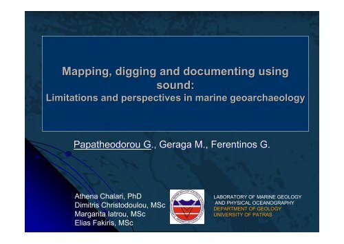
Mapping, digging and documenting using sound - The Cyprus Institute
Mapping, digging and documenting using sound - The Cyprus Institute
Mapping, digging and documenting using sound - The Cyprus Institute

You also want an ePaper? Increase the reach of your titles
YUMPU automatically turns print PDFs into web optimized ePapers that Google loves.
<strong>Mapping</strong>, <strong>digging</strong> <strong>and</strong> <strong>documenting</strong> <strong>using</strong><br />
<strong>sound</strong>:<br />
Limitations <strong>and</strong> perspectives in marine geoarchaeology<br />
Papatheodorou G.,<br />
Geraga M., Ferentinos G.<br />
Αthena Chalari, PhD<br />
Dimitris Christodoulou, MSc<br />
Margarita Iatrou, MSc<br />
Elias Fakiris, MSc<br />
LABORATORY OF MARINE GEOLOGY<br />
AND PHYSICAL OCEANOGRAPHY<br />
DEPARTMENT OF GEOLOGY<br />
UNIVERSITY OF PATRAS
Marine Geoarchaeology<br />
(Archaeological Oceanography)<br />
A recent scientific field that uses:<br />
• a wide range of remote sensing techniques<br />
• in conjunction with the disciplines from Marine Sciences <strong>and</strong> Ocean<br />
Engineering
<strong>The</strong>re are two approaches regarding the application of marine<br />
geoarchaeological methods to the underwater archaeology:<br />
(i) mapping of submerged sites of archaeological interest (submerged<br />
ancient cities, settlements, ports <strong>and</strong> man-made structures) –<br />
palaeogeographic reconstruction<br />
NGDC coastal model<br />
(ii) detection <strong>and</strong> investigation of ancient shipwrecks lying on the<br />
seafloor or partly buried in it<br />
Croatia/UNESCO
Palaeogeographic reconstruction<br />
of Ptolemaic Alex<strong>and</strong>ria<br />
<strong>using</strong> acoustic remote sensing<br />
techniques*<br />
<strong>The</strong> survey was planned <strong>and</strong> carried out by<br />
the Laboratory of Marine Geology <strong>and</strong> Physical Oceanography of the University<br />
of Patras (Greece)<br />
in co-operation with<br />
the Centres d’É tudes Alex<strong>and</strong>rines<br />
the Hellenic <strong>Institute</strong> of Ancient <strong>and</strong> Medieval Alex<strong>and</strong>rian Studies<br />
<strong>and</strong> the Conseil Supreme Des Antiquites Egyptiennes<br />
* Chalari et al., 2009
Alex<strong>and</strong>ria 331 BC
“……entering the Great Port, the lighthouse on the Pharos<br />
isl<strong>and</strong> lie to the right while on the left are seen scattered rocks<br />
<strong>and</strong> the Cape Lochias with a palace st<strong>and</strong>ing on it …”<br />
Strabo (XVII)
<strong>The</strong> Aim<br />
<strong>The</strong> Method<br />
<strong>The</strong> reconstruction of the coastal<br />
palaeogeography where the<br />
Hellenistic Alex<strong>and</strong>ria was<br />
developed.<br />
• Sidescan sonar system EG&G<br />
• High-resolution sub-bottom bottom profiling<br />
system (3.5 kHz)<br />
• DGPS (accuracy ±2m)<br />
a simple methodological scheme for the<br />
processing of analogue bathymetrical<br />
<strong>and</strong> marine geophysical data<br />
developed in a GIS <strong>and</strong> a MATLAB<br />
computer environment
Methodology – Field work<br />
Subbottom profiler system<br />
(3.5kHz) track lines (90km,<br />
32.5km 2 )<br />
Sidescan Sonar tracklines (186km, 44.3km 2 )
Data Analysis<br />
Seafloor map
Bathymetric map<br />
Ridge (-1): 3km length, SW-NE<br />
direction, with a planar top (-11m<br />
water depth)<br />
Data analysis<br />
(echograms – seismic profiles)
Examination of the 3.5 kHz profiles<br />
on the rocky seafloor surface around<br />
the Eastern Harbour reveals<br />
numerous small scarps which can be<br />
considered as palaeoshorelines
Subsidence rates<br />
Tide Gauge data<br />
Archaeological<br />
evidence<br />
• 1.6-2.9 mm/year (60 years)<br />
(El- Fishawi & Fanos, 1989; Frihy 1992; 2003)<br />
• 6.5 – 8.5 m (Jondet 1912, 1916, 1921)<br />
• 5.5 - 6.5 m (Goddio, 2000)<br />
• 7 m (Tzalas, 2000)<br />
• 2.8-3.4 mm/year relative sea-level change.<br />
Geological data<br />
• 3 mm/year (8000 years) (Stanley & Warne,<br />
1993)<br />
~8 m subsidence (2300)<br />
~ the same rate from 8000 until today
Cape Lochias (an extended part<br />
is now under the m.s.l<br />
(0.721km 2 – 92% submerged<br />
today)<br />
<strong>The</strong> 8m subsidence scenario<br />
<strong>The</strong> entrance of Great Port was very narrow (600m)<br />
(today 1700m). <strong>The</strong> depth of Great Port was 4.5-9m<br />
<strong>and</strong> covered bigger area than today.<br />
<strong>The</strong> existence of a small reef above msl.<br />
Existence of small reefs<br />
above m.s.l<br />
<strong>and</strong> features like «piers»<br />
<strong>The</strong> rocky ridge (-1) was 3m under<br />
the 2300 BP sea surface<br />
(i) A natural breakwater protecting<br />
the Eastern Harbor from heavy weather<br />
(4m wave height)<br />
(ii) Dangerous reef for ancient mariners<br />
331BC (~2300BP)
Detection of ancient shipwrecks at<br />
the coastal zone of Alex<strong>and</strong>ria<br />
<strong>using</strong> acoustic remote sensing<br />
techniques<br />
<strong>The</strong> survey was planned <strong>and</strong> carried out by<br />
the Laboratory of Marine Geology <strong>and</strong> Physical Oceanography of the University<br />
of Patras (Greece)<br />
in co-operation with<br />
the Centres d’É tudes Alex<strong>and</strong>rines<br />
the Hellenic <strong>Institute</strong> of Ancient <strong>and</strong> Medieval Alex<strong>and</strong>rian Studies<br />
<strong>and</strong> the Conseil Supreme Des Antiquites Egyptiennes
<strong>The</strong> Aim<br />
<strong>The</strong> Method<br />
Detection <strong>and</strong> positioning of targets which<br />
may represent shipwreck or man<br />
made items (Chalari et al., 2003)<br />
• PHASE A<br />
FIELD WORK<br />
• Sidescan sonar system<br />
• DGPS (accuracy ± 2m) & GPS<br />
(accuracy ±10m)<br />
• PHASE B<br />
• Ground-truthing <strong>using</strong> divers <strong>and</strong><br />
R.O.V.
PHASE A<br />
During the side scan sonar survey<br />
a total of 57 targets were detected
PHASE B<br />
Ground Truthing*: Results<br />
Man-made targets<br />
Modern<br />
Historical - Ancient<br />
Total<br />
number<br />
Natural<br />
formations<br />
Didn’t<br />
found<br />
Reexamination<br />
ropes, cables,<br />
tires, fishing<br />
equipment, e.t.c.<br />
Historical anchors,<br />
2 nd World War<br />
torpedo, ship ballast<br />
Ancient shipwreck<br />
57 18 8 11 14 6<br />
100% 32% 14% 19% 25% 10%<br />
* J-Y. Empereur, G. Soukassian, J. Curnier, R. Leffy
TARGAN: A USEFUL TOOL FOR<br />
SIDESCAN SONAR TARGET<br />
CLASSIFICATION<br />
Targan is a MATLAB-based software that<br />
reprocesses analogue side scan sonar records<br />
in order to:<br />
•quantify the nature of the targets on the basis<br />
of shape <strong>and</strong> backscatter characteristics<br />
•create a database with the characteristics of<br />
each target<br />
•classify the targets into meaningful groups<br />
<strong>using</strong> multivariate statistical analysis<br />
•minimize the diving time
TARGAN<br />
•Cluster Analysis <strong>using</strong> the<br />
•Average Linkage algorithm<br />
DATA SET<br />
57 Targets – 9 parameters<br />
•Cluster Analysis <strong>using</strong> the<br />
•Ward’s Error Sum of Squares<br />
algorithm<br />
•K – means<br />
•Q-Factor Analysis<br />
TARGET CLASSIFICATION
…instead of concluding remarks
References<br />
Chalari, A., G. Papatheodorou, M. Geraga, D. Christodoulou G. Ferentinos (2009). A marine geophysical survey<br />
illustrates Alex<strong>and</strong>ria’s Hellenistic past. Zeitschrift fur Geomorphologie, vol. 53, no.1, pp. 191-212.<br />
Chalari, A., Christodoulou, D., Papatheodorou, G., Geraga, M., Stefatos, A., Ferentinos, G.(2008): Use of remote<br />
sensing <strong>and</strong> GIS in the reconstruction of coastal palaeogeography of Alex<strong>and</strong>ria, Egypt, In: Y. Facorellis, N.<br />
Zacharias, K. Polikreti (eds), British Archaeological Reports (BAR) International Series 1746, ISBN 978 1<br />
4073 01884, pp. 119-128.<br />
Chalari Α., D. Christodoulou, G. Papatheodorou, M. Geraga, <strong>and</strong> G. Ferentinos (2003): "Marine Geophysical<br />
Investigation around the Site of the Famous Pharos of Alex<strong>and</strong>ria (Egypt) for the Detection of Ancient<br />
Shipwrecks. (Preliminary Results)". 2nd World Congress. Ancient Greece "<strong>The</strong> Modern World", Ancient<br />
Olympia (International Olympic Academy), 12-17 July 2002, pp. 62-73.<br />
El Fishawi, N.M., Fanos, A.M., 1989: ‘Prediction of sea level rise by 2100, Nile delta coast’. INQUA, Commission<br />
on Quaternary Shorelines, Newsletter, 11:43–47.<br />
Frihy, O.E., 1992: ‘Sea-level rise <strong>and</strong> shoreline retreat of the Nile delta promontories, Egypt’. Natural Hazards, 5:<br />
65–81.<br />
Frihy, O.Ε., 2003: ‘<strong>The</strong> Nile delta-Alex<strong>and</strong>ria coast: vulnerability to Sea-level rise, consequences <strong>and</strong> adaptation’.<br />
Mitigation <strong>and</strong> Adaptation Strategies for Global Change, 8: 115–138<br />
Jondet, M.G., 1912: ‘Les Ports antiques de Pharos’. Bulletin de la Socié té Arché ologique d’Alex<strong>and</strong>rie, 14: 252-<br />
266, Alex<strong>and</strong>ria.<br />
Jondet, M.G., 1916: ‘Les Ports Submergé s de l'ancienne Île de Pharos. Cairo’. Mé moires de l'Institut d'Egypte,<br />
IX: 101.<br />
Jondet, M.G., 1921: Atlas Historique de la Ville et des Ports d’Alex<strong>and</strong>rie, Imprimerie de l’Institut Français<br />
d’Arché ologie Orientale, Cairo, 54 map plates.<br />
Goddio, F., 2000: ‘Underwater archaeological survey of Alex<strong>and</strong>ria’s Eastern Harbour’. In Mostafa, M.H., Grimal,<br />
N., Nakashima, D., (Eds), Coastal management sourcebooks 2, UNESCO Publishing: 60-63.<br />
Stanley, J-D., Warne, A.G., 1993: ‘Nile Delta: Recent Geological Evolution <strong>and</strong> Human Impact’. Science, New<br />
Series, 260 (5108): 628-634.<br />
Tzalas, H.E., 2000: ‘<strong>The</strong> two ports of Alex<strong>and</strong>ria. Plans <strong>and</strong> maps from the 14th century to the time of Mohamed<br />
Ali’. In Mostafa, M.H., Grimal, N., Nakashima, D., (Eds), Coastal management sourcebooks 2, UNESCO: 22-<br />
32.
We would like to thank:<br />
•Dr. J-Y .Empereur <strong>and</strong> H. Tzalas for their keen interest <strong>and</strong><br />
encouragement<br />
•<strong>The</strong> members-divers of CEAlex <strong>and</strong> HIAMAS <strong>and</strong> especially<br />
Jean Curnier, Robert Leffy <strong>and</strong> George Soukassian.<br />
Many thanks also go to a lot of people for giving us the<br />
opportunity to participate to amazing projects:<br />
•Dr. K. Baika, University of Peloponnesus<br />
•Dr. J. Pakkanen, Dept of Classics Royal Holloway, University of London<br />
•Dr. S. Demesticha, University of <strong>Cyprus</strong> <strong>and</strong> <strong>The</strong>tis Foundation<br />
•C. Agouridis, Archaeologist M.A., H.I.M.A<br />
•M. Garras, Physicist, H.I.M.A<br />
•Dr. D. Sakellariou <strong>and</strong> Dr. V. Lykousis, HCMR<br />
•Greek Ephorate of Underwater Antiquities<br />
•Mr. A. Paleokrassas (Akti Engineering Co.) is thanked for his<br />
assistance in positioning during the first three campaigns in Alex<strong>and</strong>ria