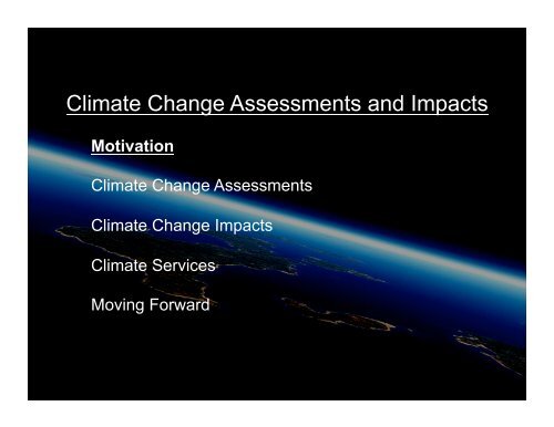
Climate Change Assessments and Impacts
Climate Change Assessments and Impacts
Climate Change Assessments and Impacts

You also want an ePaper? Increase the reach of your titles
YUMPU automatically turns print PDFs into web optimized ePapers that Google loves.
<strong>Climate</strong> <strong>Change</strong> <strong>Assessments</strong> <strong>and</strong> <strong>Impacts</strong><br />
Motivation<br />
<strong>Climate</strong> <strong>Change</strong> <strong>Assessments</strong><br />
<strong>Climate</strong> <strong>Change</strong> <strong>Impacts</strong><br />
<strong>Climate</strong> Services<br />
Moving Forward
<strong>Climate</strong> 2.0 - Usable Science for Society<br />
The fundamental question that society is asking<br />
of climate science has dramatically changed.<br />
<strong>Climate</strong> 1.0 Is anthropogenic climate change occurring?<br />
• Classic, low-res, global climate modeling & obs systems (past 40 years)<br />
• After IPCC AR4 findings, the question is now….<br />
<strong>Climate</strong> 2.0 What is the impact of this climate change<br />
on our coupled human & natural systems?<br />
• Magnitude <strong>and</strong> speed? Direct <strong>and</strong> indirect impacts?<br />
• Adaptation <strong>and</strong> mitigation - options & limits?<br />
• Regional/Local focus on “usable” science<br />
• Interlinked Systems: Energy, Food, Water, Health, Cities, Ecosystems<br />
• Societal <strong>Impacts</strong>: GIS, extremes, climate services<br />
Addressing these much more complex, questions requires:<br />
• Vast improvements to existing climate tools ( CESM & WRF/NRCM )<br />
• Integrating new approaches, priorities, capabilities,<br />
• New collaborators & partners<br />
Image courtesy of Canada DND
<strong>Climate</strong> <strong>Change</strong> <strong>Assessments</strong> <strong>and</strong> <strong>Impacts</strong><br />
Motivation<br />
<strong>Climate</strong> <strong>Change</strong> <strong>Assessments</strong><br />
IPCC<br />
Bridging the Social <strong>and</strong> Physical Sciences<br />
<strong>Climate</strong> <strong>Change</strong> <strong>Impacts</strong><br />
<strong>Climate</strong> Services<br />
Moving Forward
CCSM4 IPCC AR5 Simulations<br />
NCAR IBM P575 “Bluefire”
Multi-decadal Regional <strong>Climate</strong> Predictions of High-<br />
Impact Weather Over North America & the Caribbean<br />
36 km<br />
4 km<br />
12 km<br />
4 km<br />
• Global Model: 3 Ensembles from 1950-2060<br />
• NRCM: 1995-2005 Obs, 1995-2005, 2020-2030, 2045-2055,<br />
• 3 ensembles at 36km, 1 at 12 km, specific cases at 4 km.<br />
• Use of statistical downscaling to fill in intermediate periods<br />
NCAR<br />
Greg Holl<strong>and</strong>
NARCCAP PLAN – Phase II<br />
A2 Emissions Scenario<br />
GFDL<br />
Time slice<br />
50 km<br />
GFDL<br />
CGCM3<br />
HADCM3<br />
CCSM<br />
CAM3<br />
Time slice<br />
50km<br />
1971-2000 current Provide boundary conditions 2041-2070 future<br />
MM5<br />
Iowa State/<br />
PNNL<br />
RegCM3<br />
UC Santa Cruz<br />
ICTP<br />
CRCM<br />
Quebec,<br />
Ouranos<br />
HADRM3<br />
Hadley Centre<br />
RSM<br />
Scripps<br />
WRF<br />
NCAR/<br />
PNNL<br />
www.narccap.ucar.edu<br />
(Linda Mearns / NCAR)
N-VIA: Quantifying Societal <strong>Impacts</strong><br />
to <strong>Climate</strong> <strong>and</strong> Weather Risks<br />
Policies<br />
Decisions<br />
Governance<br />
Scenarios<br />
Resource use<br />
<strong>and</strong><br />
management<br />
<strong>Impacts</strong>, outcomes,<br />
decision-making<br />
Resource<br />
management<br />
(N-VIA: NCAR - Vulnerability, <strong>Impacts</strong>, Adaptation framework)
Extreme heat vulnerability research<br />
framework<br />
(Wilhelmi <strong>and</strong> Hayden (2010)
<strong>Climate</strong> <strong>Change</strong> <strong>Assessments</strong> <strong>and</strong> <strong>Impacts</strong><br />
Motivation<br />
<strong>Climate</strong> <strong>Change</strong> <strong>Assessments</strong><br />
<strong>Climate</strong> <strong>Change</strong> <strong>Impacts</strong><br />
Natural resources<br />
Headwaters & Working with utilities (Yates)<br />
Ecosystem impacts<br />
CSAP Health, Cities, GIS programs<br />
<strong>Climate</strong> Services<br />
Moving Forward
InterAmerican Development Bank<br />
Sustainable Energy & <strong>Climate</strong> <strong>Change</strong> Initiative<br />
“Support <strong>and</strong> advance our University consortium”<br />
International WRF Training & Scenarios.<br />
Lead: University of Nebraska, Lincoln<br />
Water/Ag Olmos, Lambayeque, Peru<br />
CCSM WRF Noah WEAP
Water/Ag/Hydro Project in Peru<br />
Precipitation<br />
Temperature!!
NCAR’s Water Cycle, “Headwater’s Program”
6-mo. Total Precipitation (mm) Comparison<br />
1 Nov. 2007-1 May 2008<br />
36 km 6 km 2 km <br />
SNOTEL Obs.
Vertical velocity along a cross section<br />
1 December 2007 0500 UTC<br />
Topography<br />
6 km 36 km
“Pseudo-Global Warming” (PGW) Methodology <br />
Schär et al (1996), Sato et al. (2007), Hara et al. (2008), <br />
Kawase et al. (2009)#<br />
1. Calculate perturbation in 10-yr monthly mean values of U, V, T, geopot.<br />
hgt., P sfc <strong>and</strong> Q v between current <strong>and</strong> future climate periods from a CGCM<br />
(1995-2005 <strong>and</strong> 2045-2055, SRES-A2, NCAR CCSM CGCM). #<br />
2. Add perturbation to current analyses of atmospheric conditions (North<br />
American Regional Reanalysis, 3-hrly) <strong>and</strong> extract regional model initial<br />
<strong>and</strong> lateral boundary conditions#<br />
Monthly mean of<br />
past condition<br />
CCSM 1995-2005<br />
Monthly mean of<br />
future condition<br />
CCSM 2045-2055<br />
Decadal monthly<br />
perturbation of<br />
CCSM<br />
NARR<br />
(initial <strong>and</strong> 3-hrly<br />
boundary conditions)<br />
Caveat:#<br />
<br />
No change in transient spectra (i.e. same climate variability in the future<br />
except for intensification of storms within the domain)#
700 mb Annual Mean Temperature<br />
from CCSM3 (A2)<br />
Current <strong>Climate</strong> : 1995-2005 Future <strong>Climate</strong> : 2045-2055<br />
Future - Current<br />
An increase of Q v is on<br />
the order of 15-20 %
Seasonal precipitation evolution over the CO<br />
Headwaters region#<br />
Sub-domain Average Precipitation<br />
2001-2002 2003-2004<br />
PGW<br />
Current <strong>Climate</strong><br />
2005-2006 2007-2008
6-mo. total precipitation map from PGW <strong>and</strong> Current <strong>Climate</strong><br />
simulations <strong>and</strong> differences<br />
1Nov. 2007 - 1 May 2008<br />
Current <strong>Climate</strong><br />
Total precipitation<br />
PGW<br />
(Precipitation)<br />
= PGW-Current<br />
(Snow)<br />
(Rain)<br />
Freezing level height increased by ~173 m, leading to a decrease of the area covered by snow by ~10%.<br />
Fraction of snow decreased by ~10% of the total grid cell precip. Fraction of rain increased by a similar amount.<br />
The PGW run indicates higher snowfall intensity at the mountain peaks.<br />
The increase in snow in the valleys suggests mesoscale circulation differences.
Colorado Springs Utilities IRP<br />
75% from West Slope 25% from East Side<br />
19
InterAmerican Development Bank<br />
Sustainable Energy & <strong>Climate</strong> <strong>Change</strong> Initiative<br />
Water/Ag Olmos, Lambayeque, Peru<br />
CCSM WRF Noah WEAP
IDB International WRF Training & Scenarios.<br />
Lead: University of Nebraska, Lincoln<br />
WRF Training<br />
NCAR, July 2009<br />
<strong>Climate</strong> Scenarios<br />
1. Mexico City - Jan 2010<br />
2, Panama – Aug 2010<br />
• Queretaro <strong>and</strong> Mexico: water resources l<strong>and</strong> use changes, denudation of hillsides.<br />
• Morelos:concerns that vast natural springs may have reduced<br />
• Tabasco:increase in the number, duration, <strong>and</strong> magnitude of the floods<br />
• Guerrero <strong>and</strong> Oaxaca: preserving their natural resources under future climate change<br />
• Yucatan: rising sea level & reduced precipitation/increased evaporation<br />
• Tamaulipas:impacts on agriculture <strong>and</strong> aquaculture
Continental-scale Natural Disturbances in Forests<br />
Warmer winter <strong>and</strong> drought<br />
Beetle infestation<br />
Forest burned area<br />
5 mm<br />
Mountain Pine Beetle<br />
Regions of identi,ied beetle infestation from <br />
aerial surveys from 1997-2005 (in red in the left <br />
panel) <strong>and</strong> burned area perimeters reported to <br />
the USGS from 2001-2007 (in gray in the right <br />
panel) for the western U.S<br />
22
Worst combination is<br />
beetle-killed + wildfire<br />
Beetle-killed lodge pole<br />
pine fueled a 473-acre<br />
wildfire near Fraser,<br />
Colorado, on October 4,<br />
2010.
Focus on biogeophysical effects<br />
• Local <strong>and</strong> watershed scale: produce<br />
10-year (2000-2010) surface<br />
reanalysis #<br />
– using 1-km uncoupled High Resolution<br />
L<strong>and</strong> Data Assimilation system<br />
(HRLDAS) with the Noah l<strong>and</strong> model #<br />
– Examine surface fluxes, soil moisture,<br />
snow, runoff with reanalysis with <strong>and</strong><br />
without disturbed forests #<br />
• Regional-continental scale: conduct<br />
high-resolution Weather Research<br />
<strong>and</strong> Forecasting (WRF)/Noah LSM<br />
regional climate simulations for<br />
selected summer <strong>and</strong> winter months#<br />
– Analyze precipitation <strong>and</strong> interannual<br />
climate variability #<br />
24
Manitou Site<br />
Hayman Site<br />
25
Weather, <strong>Climate</strong> <strong>and</strong> Health<br />
Mary Hayden, Andy Monaghan<br />
Ghana: The WX-Meningitis Project<br />
Phoenix: An Framework of local Vulnerability<br />
& Adaptive capacity to Extreme Heat<br />
North America: Aedes aegyti range<br />
expansion in the Americas<br />
Mexico: Dengue transects
North America: Aedes aegyti range<br />
expansion in the Americas
A village in rural Ug<strong>and</strong>a<br />
Photo courtesy of Brant Foote
Interviewing a witch doctor<br />
Photo courtesy of Brant Foote
The treatment room<br />
Photo courtesy of Brant Foote
Urban development <strong>and</strong> vulnerability<br />
Paty Romero-Lankao<br />
ADAPTE<br />
• Cities <strong>and</strong> climate are co-evolving in a<br />
manner that could place more populations at<br />
risk from exposure to extreme temperature<br />
<strong>and</strong> air pollution<br />
• ADAPTE brings together experts from<br />
different countries <strong>and</strong> disciplines<br />
• Independent <strong>and</strong> combined effects of climate,<br />
air pollution <strong>and</strong> social vulnerability on health<br />
outcomes<br />
• How populations are actually adapting Projected increased severity of the worst annual heat<br />
events by 2030. CCSM-3 simulations A2 scenario<br />
Source: Wilhelmi (2009).
NCAR GIS Program
CAPRA Example:<br />
Costa Rican earthquake <strong>and</strong> historical hurricane<br />
risk at canton level, using a general socioeconomic<br />
model to assess exposed value <strong>and</strong> vulnerability.<br />
What is Costa Rica’s risk in 2050?
Knowledge Innovation at the Science-Policy Interface
<strong>Climate</strong> <strong>Change</strong> <strong>Assessments</strong> <strong>and</strong> <strong>Impacts</strong><br />
Motivation<br />
<strong>Climate</strong> <strong>Change</strong> <strong>Assessments</strong><br />
<strong>Climate</strong> change <strong>Impacts</strong><br />
<strong>Climate</strong> Services<br />
Next Steps
<strong>Climate</strong> Services:<br />
“The timely production <strong>and</strong> delivery of useful climate<br />
data, information <strong>and</strong> knowledge to decision makers”<br />
(NRC, 2001)<br />
“Give me information in such a way that I can make decisions at a local<br />
level. What does this mean for me in the next 3-5 years”<br />
• Jargon-free, clear,<br />
• actionable,<br />
• expose the uncertainties<br />
• Science-brokers/translators are important<br />
(Pew Report “Lost in Translation”)<br />
“Official” climate products & processes allow planners to<br />
make major, climate-informed, infrastructure decisions<br />
….<strong>and</strong> stay out of court.
<strong>Climate</strong> Services:<br />
“Official” climate products & processes allow planners to make major,<br />
climate-informed, infrastructure decisions…. <strong>and</strong> stay out of court.<br />
• Decision makers are being approached by many consultants,<br />
but can’t tell good from bad<br />
• How to define ‘official’ or ‘certified’ processes?<br />
• What metrics would regions/sectors have for success?<br />
• What baselines are needed <strong>and</strong> who creates them<br />
• Effective quantification & communication of uncertainty <strong>and</strong> applicability?<br />
• Issued ≠ perfect (e.g. NWS weather forecasts)<br />
• WH OSTP/CEQ: not 1 big center, nor many new small centers,<br />
-> interface between existing data centers <strong>and</strong> local knowledge expertise<br />
• Connecting existing public & private sector data <strong>and</strong> decision networks?<br />
• Roles <strong>and</strong> Responsibilities –<br />
NOAA operations <strong>and</strong> research, NCAR research, private industry –<br />
• Structure still under development, yet decisions are being made NOW
<strong>Climate</strong> Services in US:<br />
NOAA <strong>Climate</strong> Services (NCS):<br />
• Tom Karl (NCDC) & Chet Koblinsky (CPO) interim leads<br />
• Sep. Nat’l Academy of Public Administration (NAPA) report,<br />
Affirmed NOAA as lead agency<br />
Suggested realignment of existing groups<br />
• Six Regional <strong>Climate</strong> directors named (at NWS centers)<br />
• RISAs (Regional Integrated Science & <strong>Assessments</strong>)<br />
• Sep. Vision/Mission draft, draft Implementation plan,<br />
1. <strong>Climate</strong> impacts on water resources<br />
2. Coasts <strong>and</strong> climate resilience<br />
3. Sustainability of marine ecosystems<br />
4. <strong>Change</strong>s in extremes in weather <strong>and</strong> <strong>Climate</strong><br />
5. Informing climate policy
US <strong>Climate</strong> Services beyond NOAA:<br />
Dept of Interior<br />
• New <strong>Climate</strong> Science Centers ( including one at CSU)<br />
• MOU with NOAA on <strong>Climate</strong> Services<br />
• Reclaimation: Statistical & Dyamical Downscaling products.<br />
Other Agencies<br />
• EPA, NASA, USDA, DOE, DOD, FAA etc<br />
NCAS <strong>and</strong> upcoming National <strong>Climate</strong> Assessment<br />
• Nat’l <strong>Climate</strong> <strong>Change</strong> Adaptation Task Force report<br />
• <strong>Climate</strong> Services <strong>and</strong> Information Roundtable<br />
International<br />
• Numerous national climate services offices being set up, usually<br />
connected with national weather service offices<br />
• WMO High-level Taskforce - Global Framework for <strong>Climate</strong> Services<br />
(GFCS). Report due out next year.<br />
• International climate services director's workshop in Fall 2011<br />
• Of great interest to international aid <strong>and</strong> development agencies
<strong>Climate</strong> Services at NCAR:<br />
• RAL’s ‘Science in Service to Society” programs<br />
• New CCSM end-user applications working group<br />
• Obs data <strong>and</strong> WRF downscaling products at the forefront<br />
• NARCCAP multi-model approach being accepted<br />
• Data systems (Earth System Grid) to be linked to GIP<br />
• Pilot project with Water Utilities <strong>Climate</strong> Alliance<br />
Opportunities<br />
• Increasing focus on “applicable climate science”<br />
• UCAR universities input to climate adaptation studies<br />
• End-to-end systems: Science->Decision making<br />
• Great need for capacity building, curricula & training<br />
Risks<br />
• As a research org, how to stay out of operations (& court)<br />
• Doing a credible job in a challenging political <strong>and</strong> budget env
<strong>Climate</strong> Services Pilot Project <br />
• Pilo@ng U@lity Modeling Applica@ons (PUMA) <br />
• NOAA/NCAR Collabora@on with WUCA <br />
• Pilot project on large-‐scale water availability <strong>and</strong> <br />
storm / waste water drainage. <br />
• What climate products do WUCA members need?<br />
Global -> Regional -> Hydrology -> Decision Mgt<br />
CESM WRF LSM WEAP/LEAP<br />
SoCal Water Reserves<br />
WUCA: Water Utilities <strong>Climate</strong> Alliance<br />
• Denver Water,<br />
• Metropolitan Water District of Southern California,<br />
• NYC Department of Environmental Protection,<br />
• Portl<strong>and</strong> Water Bureau <strong>and</strong><br />
• San Diego County Water Authority,<br />
• San Francisco Public Utilities Commission,<br />
• Seattle Public Utilities<br />
• Southern Nevada Water Authority.
<strong>Climate</strong> <strong>Change</strong> <strong>Assessments</strong> <strong>and</strong> <strong>Impacts</strong><br />
Motivation<br />
<strong>Climate</strong> <strong>Change</strong> <strong>Assessments</strong><br />
<strong>Climate</strong> <strong>Change</strong> <strong>Impacts</strong><br />
<strong>Climate</strong> Services<br />
Moving Forward
Moving Forward<br />
• Keep focus on building NCAR’s Social Science program<br />
• Build partnerships in the Social Sciences community<br />
• Collaborations with non-traditional NCAR partners<br />
CDC, IDB/ADB/WB, USAID, UN<br />
• Update CSAP Strategic Plan<br />
Current plan reflects old structure<br />
NCAR
Spin, Science <strong>and</strong> <strong>Climate</strong> <strong>Change</strong><br />
“<strong>Climate</strong> <strong>Change</strong><br />
is undeniable”<br />
“<strong>Climate</strong>gate”<br />
4 Core Conclusions from <strong>Climate</strong> Science<br />
1. <strong>Climate</strong> <strong>Change</strong> is occurring.<br />
2. Main cause is human activity.<br />
3. <strong>Change</strong>s in climate are already<br />
harming humans & the environment.<br />
4. Harm is like to grow to higher levels<br />
w/o extensive Adaptation & Mitigation<br />
Robust results, independent of hacked<br />
emails or minor errata in the IPCC report<br />
“Society has three choices: Mitigate, Adapt or Suffer”<br />
John Holdren (US Science Adviser)