

ukho cartographic training - United Kingdom Hydrographic Office
ukho cartographic training - United Kingdom Hydrographic Office
ukho cartographic training - United Kingdom Hydrographic Office

Create successful ePaper yourself
Turn your PDF publications into a flip-book with our unique Google optimized e-Paper software.
UKHO CARTOGRAPHIC TRAINING<br />
COURSE: HYDROGRAPHIC DATA<br />
PROCESSING AND MARINE CARTOGRAPHY<br />
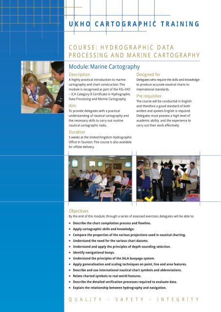
Module: Marine Cartography<br />
Description<br />
A highly practical introduction to marine<br />
cartography and chart construction. This<br />
module is recognised as part of the FIG–IHO<br />
– ICA Category B Certificate in <strong>Hydrographic</strong><br />
Data Processing and Marine Cartography.<br />
Aim<br />
To provide delegates with a practical<br />
understanding of nautical cartography and<br />
the necessary skills to carry out routine<br />
nautical <strong>cartographic</strong> tasks.<br />
Duration<br />
5 weeks at the <strong>United</strong> <strong>Kingdom</strong> <strong>Hydrographic</strong><br />
<strong>Office</strong> in Taunton. This course is also available<br />
for offsite delivery.<br />
Designed for<br />
Delegates who require the skills and knowledge<br />
to produce accurate nautical charts to<br />
international standards.<br />
Pre requisites<br />
The course will be conducted in English<br />
and therefore a good standard of both<br />
written and spoken English is required.<br />
Delegates must possess a high level of<br />
academic ability and the experience to<br />
carry out their work effectively.<br />
Objectives<br />
By the end of this module, through a series of assessed exercises, delegates will be able to:<br />
●<br />
●<br />
●<br />
●<br />
●<br />
●<br />
●<br />
●<br />
●<br />
●<br />
●<br />
●<br />
Describe the chart compilation process and flowline.<br />
Apply <strong>cartographic</strong> skills and knowledge.<br />
Compare the properties of the various projections used in nautical charting.<br />
Understand the need for the various chart datums.<br />
Understand and apply the principles of depth sounding selection.<br />
Identify navigational buoys.<br />
Understand the principles of the IALA buoyage system.<br />
Apply generalisation and scaling techniques on point, line and area features.<br />
Describe and use international nautical chart symbols and abbreviations.<br />
Relate charted symbols to real world features.<br />
Describe the detailed verification processes required to evaluate data.<br />
Explain the relationship between hydrography and navigation.<br />
Q U A L I T Y - S A F E T Y - I N T E G R I T Y
UKHO CARTOGRAPHIC TRAINING<br />
COURSE: HYDROGRAPHIC DATA<br />
PROCESSING AND MARINE CARTOGRAPHY<br />
Module: <strong>Hydrographic</strong> Data Processing<br />
Description<br />
A highly practical introduction to hydrographic<br />
data processing, data assessment and resulting<br />
chart maintenance. This module is recognised<br />
as part of the FIG–IHO–ICA Category B<br />
Certificate in <strong>Hydrographic</strong> Data Processing<br />
and Marine Cartography.<br />
Aim<br />
To provide delegates with a practical<br />
understanding of hydrographic data<br />
processing, the skills to carry out accurate<br />
assessment and an appreciation of the issues<br />
surrounding chart maintenance.<br />
Duration<br />
5 weeks at the <strong>United</strong> <strong>Kingdom</strong> <strong>Hydrographic</strong><br />
<strong>Office</strong> in Taunton. This course is also available<br />
for offsite delivery.<br />
Designed for<br />
Delegates who require the skills and<br />
knowledge to process hydrographic data<br />
into a published form.<br />
Pre-requisites<br />
The course will be conducted in English<br />
and therefore a good standard of both<br />
written and spoken English is required.<br />
Delegates must possess a high level of<br />
academic ability and the experience to<br />
carry out their work effectively.<br />
Objectives<br />
By the end of this module, through a series of assessed exercises, delegates will be able to:<br />
●<br />
●<br />
●<br />
●<br />
●<br />
●<br />
●<br />
Describe and apply the methods used in keeping nautical charts up-to-date.<br />
Identify, compile and classify all source information.<br />
Identify and explain different sources of information providing bathymetric data.<br />
Identify National and International Organisations related to nautical charting.<br />
Describe hydrographic data acquisition, processing and management procedures.<br />
Explain hydrographic survey operations essential to ensure safety of navigation.<br />
Define and describe the source data diagram.<br />
Q U A L I T Y - S A F E T Y - I N T E G R I T Y
UKHO CARTOGRAPHIC TRAINING<br />
COURSE: HYDROGRAPHIC DATA<br />
PROCESSING AND MARINE CARTOGRAPHY<br />
Specialism Module: The Electronic Navigational Chart<br />
Description<br />
A highly practical introduction to the Electronic<br />
Navigational Chart (ENC), international<br />
standards for ENC, and the production and<br />
maintenance of ENC data. This module is<br />
recognised as part of the FIG–IHO–ICA<br />
Category B Certificate in <strong>Hydrographic</strong> Data<br />
Processing and Marine Cartography.<br />
Aim<br />
The aim of this course will be to provide<br />
delegates with the skills and knowledge to<br />
produce ENCs.<br />
Duration<br />
5 weeks at the <strong>United</strong> <strong>Kingdom</strong> <strong>Hydrographic</strong><br />
<strong>Office</strong> in Taunton. This course is also available<br />
for offsite delivery.<br />
Designed for<br />
Delegates who require the skills and<br />
knowledge to produce and maintain ENCs.<br />
Pre requisites<br />
The course will be conducted in English<br />
and therefore a good standard of both<br />
written and spoken English is required.<br />
Delegates must possess a high level of<br />
academic ability and the experience to<br />
carry out their work effectively.<br />
Objectives<br />
By the end of this module, through a series of assessed exercises, delegates will be able to:<br />
●<br />
●<br />
Define the Electronic Navigational Chart.<br />
Explain the constraints in electronic chart production.<br />
● Identify the content of international digital chart standards, such as S52 and S57.<br />
●<br />
●<br />
●<br />
●<br />
●<br />
●<br />
●<br />
Explain how objects and attributes work.<br />
Capture and edit ENC data.<br />
Describe the ENC base cell concept.<br />
Explain and apply quality procedures as appropriate to ENCs.<br />
Verify and validate ENC processes using validation software.<br />
Explain the distribution and maintenance processes for ENC.<br />
Describe an ECDIS system and supporting regulations.<br />
Q U A L I T Y - S A F E T Y - I N T E G R I T Y
UKHO CARTOGRAPHIC TRAINING<br />
COURSE: A TWO WEEK INTRODUCTION<br />
TO HYDROGRAPHIC DATA PROCESSING<br />
AND MARINE CARTOGRAPHY<br />
Description<br />
A highly practical introduction providing<br />
an intensive overview of <strong>Hydrographic</strong> Data<br />
Processing and Marine Cartography.<br />
Aim<br />
To provide delegates with a practical<br />
understanding of nautical cartography<br />
and the associated issues of source data,<br />
assessment and maintenance.<br />
Duration<br />
2 weeks, designed to be delivered in the<br />
country that has requested the <strong>training</strong>.<br />
For further details please contact the<br />
UKHO Training Manager.<br />
Designed for<br />
Delegates from international hydrographic<br />
organisations that would benefit from basic<br />
<strong>training</strong> in <strong>Hydrographic</strong> Data Processing<br />
and Marine Cartography.<br />
Pre requisites<br />
The course will be conducted in English<br />
and therefore a good standard of both<br />
written and spoken English is required.<br />
Delegates must possess a high level of<br />
academic ability and the experience to<br />
carry out their work effectively.<br />
Objectives<br />
By the end of this course delegates will be able to:<br />
●<br />
●<br />
●<br />
●<br />
●<br />
●<br />
●<br />
●<br />
●<br />
●<br />
●<br />
●<br />
●<br />
●<br />
Describe the chart compilation process and flowline.<br />
Describe the main projections used in nautical charting.<br />
Describe some of the various nautical chart datums.<br />
Understand the principles of depth sounding selection.<br />
Understand the principles of the IALA buoyage system.<br />
Understand the need for generalisation and scaling.<br />
Describe and use international nautical chart symbols and abbreviations.<br />
Relate charted symbols to real world features.<br />
Describe the verification processes.<br />
Describe the methods used to keep nautical charts up-to-date.<br />
Identify source information.<br />
Identify sources of bathymetric data.<br />
List the main International Organisations related to nautical charting.<br />
Understand the source diagram.<br />
Q U A L I T Y - S A F E T Y - I N T E G R I T Y
UKHO CARTOGRAPHIC TRAINING<br />
COURSE: A TWO WEEK INTRODUCTION TO<br />
THE ELECTRONIC NAVIGATIONAL CHART<br />
Description<br />
A highly practical introduction providing an<br />
overview of The Electronic Navigational Chart<br />
(ENC) and the international standards for ENC<br />
and ECDIS.<br />
Aim<br />
To provide delegates with a practical<br />
introduction to S-57 data.<br />
Duration<br />
2 weeks, designed to be delivered in the<br />
country that has requested the <strong>training</strong>.<br />
For further details please contact the UKHO<br />
Training Manager.<br />
Designed for<br />
Delegates from international hydrographic<br />
organisations that would benefit from an<br />
overview of the production of an ENC.<br />
Pre-requisites<br />
A basic knowledge of the nautical chart,<br />
its content and construction. The course will<br />
be conducted in English and therefore a<br />
good standard of both written and spoken<br />
English is required.<br />
Objectives<br />
By the end of this course delegates will be able to:<br />
●<br />
●<br />
●<br />
●<br />
●<br />
●<br />
●<br />
●<br />
●<br />
Describe an Electronic Navigational chart.<br />
Explain the history and development of ENC.<br />
Understand the IHO transfer standard for digital hydrographic data.<br />
Explain how objects and attributes work.<br />
Explain the constraints in electronic chart production.<br />
Describe the use of polygons.<br />
Understand the distribution of ENCs.<br />
Explain the ENC product specification.<br />
Describe the use of topology within an ENC.<br />
Note: This course is designed around the IHO transfer standard for digital hydrographic data S-57.<br />
It is not software related.<br />
Q U A L I T Y - S A F E T Y - I N T E G R I T Y
UKHO CARTOGRAPHIC TRAINING<br />
COURSE: CHART AWARENESS<br />
Description<br />
An introduction to the content and<br />
construction of a nautical chart.<br />
Aim<br />
To provide delegates with an overview of<br />
the nautical chart, its content, design<br />
and construction.<br />
Duration<br />
3 Days.<br />
Designed for<br />
Delegates, who are not cartographers, but<br />
who require a basic understanding of the<br />
nautical chart.<br />
Pre requisites<br />
The course will be conducted in English<br />
and therefore a good standard of both<br />
written and spoken English is required.<br />
Delegates must possess a high level of<br />
academic ability and the experience to<br />
carry out their work effectively.<br />
Objectives<br />
By the end of this course delegates will be able to:<br />
●<br />
●<br />
●<br />
●<br />
●<br />
●<br />
●<br />
●<br />
●<br />
Identify the projections used in nautical charting.<br />
Demonstrate a basic understanding of geographical plotting.<br />
Describe types of chart datums.<br />
Understand the principles of the IALA buoyage system.<br />
Recognise basic nautical chart symbols.<br />
Describe the method used to keep nautical charts up-to-date.<br />
Describe several different sources of information.<br />
Define the elements in a source diagram.<br />
Appreciate the roles of other delegates within the organisation.<br />
Q U A L I T Y - S A F E T Y - I N T E G R I T Y
UKHO CARTOGRAPHIC TRAINING<br />
COURSE: AN INTRODUCTION<br />
TO PLOTTING<br />
Description<br />
A highly practical introduction to plotting<br />
geographical positions on a standard<br />
nautical chart.<br />
Aim<br />
To provide delegates with the knowledge<br />
required to plot accurately to a maximum of<br />
three decimal places using a standard paper<br />
nautical vigational chart.<br />
Duration<br />
2 Days.<br />
Designed for<br />
Delegates who require the skills and<br />
knowledge to be able to plot positions<br />
on a nautical chart.<br />
Pre requisites<br />
Delegates should have a basic<br />
understanding of chart content.<br />
Objectives<br />
By the end of this course delegates will be able to:<br />
●<br />
●<br />
●<br />
●<br />
●<br />
Demonstrate the ability to plot geographical positions, using latitude and longitude,<br />
to an accuracy of up to three decimal places by completing associated chart exercises.<br />
Demonstrate the ability to read geographical positions, and plot those positions<br />
accurately, using bearing and distance in related chart exercises.<br />
Name the main projections used in nautical charting.<br />
Show an understanding of the need for care and accuracy when plotting positions.<br />
Understand the need for chart datums.<br />
Q U A L I T Y - S A F E T Y - I N T E G R I T Y
UKHO CARTOGRAPHIC TRAINING<br />
COURSE: CHART UPDATING<br />
Description<br />
A highly practical introduction to updating<br />
paper charts based on NP 294 How to keep<br />
your Admiralty charts up-to-date.<br />
Aim<br />
To provide delegates with a practical<br />
overview of how to update the paper chart.<br />
Duration<br />
5 Days.<br />
Designed for<br />
Delegates who require the skills and<br />
knowledge to update the standard paper<br />
nautical chart.<br />
Pre requisites<br />
The course will be conducted in English<br />
and therefore a good standard of both<br />
written and spoken English is required.<br />
Delegates must possess a high level of<br />
academic ability and the experience to<br />
carry out their work effectively.<br />
Objectives<br />
By the end of this course delegates will be able to:<br />
●<br />
●<br />
●<br />
●<br />
●<br />
●<br />
●<br />
●<br />
●<br />
●<br />
●<br />
●<br />
Understand the requirement for chart updating.<br />
Demonstrate a basic understanding of geographical plotting.<br />
Describe types of chart datums.<br />
Understand the principles of the IALA buoyage system.<br />
Recognise basic nautical chart symbols.<br />
Update charts using textual Notice to Mariners.<br />
Update charts using Notice to Mariners tracings.<br />
Update charts by the use of Notice to Mariners blocks and notes.<br />
Describe and apply a miscellaneous update.<br />
Describe the interactive nmwebsearch facility.<br />
Describe the component parts that make up a Notice to Mariners weekly.<br />
Understand the requirement for the NP133A chart correction log.<br />
Q U A L I T Y - S A F E T Y - I N T E G R I T Y


