Bilston Corridor - Wolverhampton City Council - Home Page
Bilston Corridor - Wolverhampton City Council - Home Page
Bilston Corridor - Wolverhampton City Council - Home Page

Create successful ePaper yourself
Turn your PDF publications into a flip-book with our unique Google optimized e-Paper software.
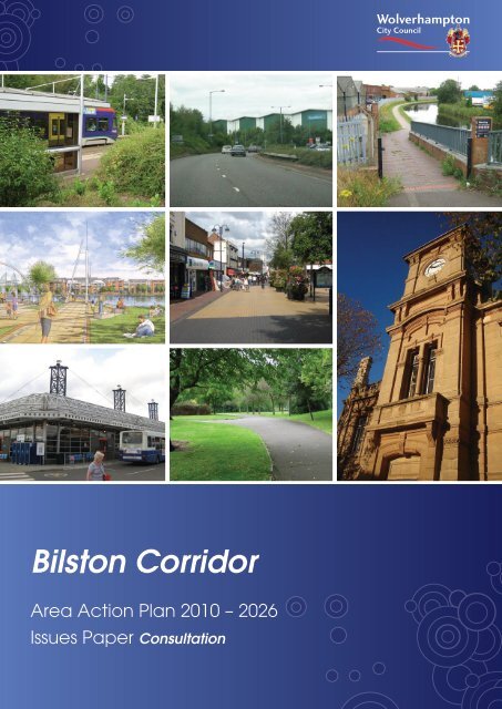
<strong>Bilston</strong> <strong>Corridor</strong><br />
Area Action Plan 2010 – 2026<br />
Issues Paper Consultation
Polish<br />
„Niniejszy dokument może zostać udostępniony w językach innych niż<br />
angielski oraz drukowany dużą czcionką, alfabetem Braille’a lub w formacie<br />
audio. Jeśli chcieliby go Państwo otrzymać w jednym z powyższych<br />
formatów, proszę się skontaktować z:<br />
Planning Policy & Urban Design, <strong>Wolverhampton</strong> <strong>City</strong> <strong>Council</strong>, Civic Centre<br />
St. Peter's Square, <strong>Wolverhampton</strong>, WV1 1SH. Tel: 01902 551155<br />
Email: Planning.policy@wolverhampton.gov.uk”<br />
Punjabi<br />
“fJj d;skt/}$ikDekoh nzrq/}h dh pikfJ j'oBK GkFktK, t`v/ nỳoK, pq/b iK nk`vhU ftu<br />
T[gbpX eokJh ik ;edh j?. i/ s[jk~ fJ;dh fJjBK o{gK ftu'I fe;/ fJ`e ftu b'V j?, sK<br />
feogk eoe/ ;zgoe eo'L<br />
Planning Policy & Urban Design, <strong>Wolverhampton</strong> <strong>City</strong> <strong>Council</strong>, Civic Centre<br />
St. Peter's Square, <strong>Wolverhampton</strong>, WV1 1SH. N?bh\'BL 01902 551155<br />
Jhw/bL Planning.policy@wolverhampton.gov.uk”<br />
This document / information can be made<br />
available in languages other than English,<br />
large print, Braille or audio. If you require it in<br />
one of these formats please contact:<br />
Planning Policy & Urban Design,<br />
<strong>Wolverhampton</strong> <strong>City</strong> <strong>Council</strong>, Civic Centre<br />
St. Peter’s Square, <strong>Wolverhampton</strong>, WV1 1SH.<br />
Tel: 01902 551155 Email:<br />
planning.policy@wolverhampton.gov.uk.<br />
Urdu<br />
"يہ دستاويز/معلومات انگلش کے علاوہ دوسری زبانوں، جلی حروف، بريل يا آڈيو ميں بهی<br />
دستياب کرائے جاسکتے ہيں۔ اگر آپ کو ان ميں سے کسی ايک شکل ميں يہ درکار ہو تو براہ کرم<br />
رابطہ کريں:<br />
Planning Policy & Urban Design, <strong>Wolverhampton</strong> <strong>City</strong> <strong>Council</strong>, Civic Centre<br />
St. Peter's Square, <strong>Wolverhampton</strong>, WV1 1SH ٹيلی فون 01902 551155<br />
ای ميل: "Planning.policy@wolverhampton.gov.uk<br />
Arabic<br />
يمكن توفير هذا المستند/ المعلومات بلغات أخرى غير الإنجليزية، مطبوعة بالأحرف الكبيرة، وبلغة<br />
بريل أو الشريط السمعي. إذا آنت بحاجة إلى أي من هذه الأشكالف ر ج ا ءً اتصل:<br />
Planning Policy & Urban Design, <strong>Wolverhampton</strong> <strong>City</strong> <strong>Council</strong>, Civic Centre<br />
01902 551155 St. Peter's Square, <strong>Wolverhampton</strong>, WV1 1SH<br />
“Planning.policy@wolverhampton.gov.uk<br />
الهاتف:<br />
"<br />
البريد الإلكتروني:<br />
Bengali<br />
"AcO V×__/TööUî c÷OeãÌ[×L KçQÍç %Xî \çbçÌ^,[QÍ KçYçÌ[ %lãÌ[, ã[Òc÷O_ %Uç[ç %×QCãT YçCÌ^ç ã^ãT<br />
YçãÌ[ * %çY×X ^×V A»RôOç AcO Ì[Eõ] ãEõçX AEõ×»RôO %çEõçãÌ[ ãYãT JçX Töçcã_ %XÇGÒc EõãÌ[ ã^çGçã^çG<br />
EõÌ[ÓX:<br />
Planning Policy & Urban Design, <strong>Wolverhampton</strong> <strong>City</strong> <strong>Council</strong>, Civic Centre<br />
St. Peter's Square, <strong>Wolverhampton</strong>, WV1 1SH. ãZõçX: 01902 551155<br />
c÷Oã]_: Planning.policy@wolverhampton.gov.uk"<br />
Farsi<br />
"اين متن/اطلاعات را می توانيم به زبان هايی بغير از انگليسی، با حروف چاپی درشت، به خط بريل<br />
يا بصورت صوتی ارائه نماييم. اگر مايل به دريافت متن يا اطلاعات به يکی از فرمت های ذکر شده<br />
هستيد، لطفاً با اينجا تماس بگيريد:<br />
Planning Policy & Urban Design, <strong>Wolverhampton</strong> <strong>City</strong> <strong>Council</strong>, Civic Centre<br />
St. Peter's Square, <strong>Wolverhampton</strong>, WV1 1SH شماره تلفن: 01902 551155<br />
ايميل: "Planning.policy@wolverhampton.gov.uk<br />
Gujerati<br />
"+É qö»lÉÉ´ÉàW{Éà/©ÉÉʾúlÉÒ{Éàð, +ÅOÉàYð ʻɴÉÉ«É{ÉÒ +{«É §ÉɺÉÉ+Éà©ÉÉÅ, ©ÉÉà`òÒ Ê¡É{`ò©ÉÉÅ, ¦Éà
Help us Plan the Future of your Area<br />
BILSTON CORRIDOR AREA ACTION PLAN, 2010 – 2026<br />
<strong>Wolverhampton</strong> <strong>City</strong> <strong>Council</strong> is working with<br />
the local community and public, private<br />
and voluntary sector partners to prepare an<br />
exciting new plan for the <strong>Bilston</strong> <strong>Corridor</strong>.<br />
The <strong>Bilston</strong> <strong>Corridor</strong> extends from the edge of<br />
<strong>Wolverhampton</strong> <strong>City</strong> Centre in the north to<br />
Loxdale Industrial Area in the south. It includes<br />
<strong>Bilston</strong> Town Centre and parts of East Park,<br />
Ettingshall, Monmore Green, <strong>Bilston</strong>, Ladymoor<br />
and Loxdale.<br />
The <strong>Bilston</strong> <strong>Corridor</strong> Area Action Plan (the AAP)<br />
will guide the transformation of the <strong>Bilston</strong><br />
<strong>Corridor</strong> area up to 2026. It will identify the<br />
location of new development in the area and<br />
help make decisions on planning applications.<br />
It will also influence decisions about transport,<br />
community facilities and jobs.<br />
<strong>Bilston</strong> <strong>Corridor</strong> is one of the main regeneration<br />
areas in <strong>Wolverhampton</strong> and so a successful<br />
AAP is key to <strong>Wolverhampton</strong>’s future. It is vital<br />
that the AAP provides a strong framework for<br />
regeneration which responds to local needs<br />
and will benefit everyone.<br />
Local people need better housing and<br />
services, secure jobs and a transformed<br />
environment.<br />
Local Businesses need room to modernise and<br />
expand, and access to a skilled workforce.<br />
Retailers need attractive shopping centres<br />
which are easy to get to.<br />
The AAP will belong to the local community.<br />
An Engagement Strategy has been developed<br />
which will ensure local views are reflected<br />
throughout the AAP process.<br />
The AAP will build on plans already in place for<br />
<strong>Bilston</strong> <strong>Corridor</strong>. There are many regeneration<br />
sites in the <strong>Corridor</strong> with detailed proposals,<br />
such as <strong>Bilston</strong> Urban Village and Ward Street<br />
Masterplan area. Beyond this, the Black<br />
Country Core Strategy sets out broad proposals<br />
for further large-scale regeneration up to 2026.<br />
<strong>Bilston</strong> Town Centre is a key driver for<br />
change in the <strong>Bilston</strong> <strong>Corridor</strong>. The<br />
historic Town Centre is attractive and<br />
successful. There is potential to strengthen<br />
and expand Town Centre services even<br />
further, to serve new communities.<br />
The AAP will be deliverable. To bring about<br />
regeneration and growth in the <strong>Bilston</strong><br />
<strong>Corridor</strong> will be challenging and require the<br />
support of many partners. The AAP will make<br />
a huge change to the area and will require<br />
intensive effort and focussing of resources. The<br />
economic downturn will limit regeneration<br />
opportunities in the next few years, but the AAP<br />
will establish a long term vision which will be<br />
ready to deliver when the economy recovers.<br />
The AAP will be flexible. The AAP must<br />
provide certainty, for businesses, land owners<br />
and residents, regarding future plans and<br />
infrastructure requirements for the area.<br />
However, it must also be flexible enough to<br />
allow businesses to expand and prosper and<br />
to attract available investment opportunities.<br />
This Issues Paper sets out what we think are<br />
the broad issues that need to be considered in<br />
preparing the AAP. The Paper asks your views<br />
on what the area should be like in 2026 and<br />
what changes need to happen to achieve<br />
this. Many of these changes will mean new<br />
development to provide additional housing,<br />
jobs, shopping and transport facilities. But it’s<br />
also about protecting areas of environmental<br />
assets and making them even better. We want<br />
to make sure that these changes benefit the<br />
whole community.<br />
Your views on these issues are needed as this<br />
will help make sure that new development<br />
creates job opportunities for local residents,<br />
economic prosperity, quality of environment<br />
and a better housing, retail and leisure offer<br />
which will benefit the whole community.<br />
We would like your response to the questions<br />
and issues raised in this Issues Paper by 28th<br />
February 2011.<br />
Stafford Road <strong>Corridor</strong><br />
3
Section Introduction Heading<br />
What is an Area<br />
Action Plan?<br />
The <strong>Bilston</strong> <strong>Corridor</strong> Area Action Plan (the<br />
AAP) is being produced as part of the new<br />
planning strategy for the <strong>City</strong>, called the<br />
Local Development Framework (LDF) 1 . In<br />
the coming years the LDF will replace the<br />
Unitary Development Plan (adopted 2006) as<br />
the main consideration when guiding future<br />
development in the <strong>City</strong>. It will also be key to<br />
the delivery of <strong>Wolverhampton</strong>’s Sustainable<br />
Community Strategy (SCS)², which was<br />
adopted by the <strong>Council</strong> in March 2009.<br />
The LDF is a collection of different plans,<br />
including a Core Strategy, Area Action Plans<br />
and a Proposals Map showing site specific<br />
land use allocations.<br />
The Black Country Core Strategy³ is being<br />
produced on a joint basis by Dudley,<br />
Sandwell, Walsall and <strong>Wolverhampton</strong><br />
<strong>Council</strong>s. The Core Strategy will be the key<br />
strategic planning document guiding the<br />
regeneration of the Black Country up to<br />
2026. It sets out a Vision, a spatial strategy,<br />
development planning policies and broad<br />
locations for new development.<br />
The Core Strategy carries forward the successful<br />
joint working which began in 2004 with the<br />
preparation of the Black Country Study and<br />
Phase 1 Revision of the West Midlands Regional<br />
Spatial Strategy, adopted in 2008.<br />
Three Area Action Plans are currently being<br />
prepared for <strong>Wolverhampton</strong>. These are the<br />
<strong>Wolverhampton</strong> <strong>City</strong> Centre AAP, the Stafford<br />
Road <strong>Corridor</strong> AAP and the <strong>Bilston</strong> <strong>Corridor</strong><br />
AAP (see Map 1). The purpose of the AAPs is<br />
to provide a more detailed framework at the<br />
local level to show how the Core Strategy will<br />
be delivered.<br />
The AAPs will set out a detailed land use<br />
and urban design framework and direct<br />
development investment. They will allocate<br />
land for development, make proposals for<br />
infrastructure and define the steps to be<br />
taken to ensure delivery. The AAPs will have<br />
the same lifespan as the Core Strategy,<br />
running to 2026.<br />
Contents:<br />
Introduction<br />
What is an Area Action Plan?<br />
• The Issues Paper<br />
• Evidence<br />
Part 1 – The Story so Far<br />
• The Black Country Core Strategy<br />
• A Vision for the AAP Area<br />
Part 2 – Directions of Change<br />
• Strengthening <strong>Bilston</strong> Town Centre<br />
• Climate Change<br />
• Creating Sustainable Communities<br />
• Transformation of the Environment<br />
• Supporting Economic Prosperity<br />
Part 3 – Emerging AAP Proposals<br />
Part 4 – Delivering the AAP<br />
1<br />
www.wolverhampton.gov.uk/ldf<br />
² www.wton-partnership.org.uk/page.php?identity=the-big-plan<br />
³ www.blackcountrycorestrategy.dudley.gov.uk<br />
Part 5 – How to get involved<br />
4 <strong>Bilston</strong> <strong>Corridor</strong> Area Action Plan - Issues Paper
Map 1 - Sub-Regional Context<br />
Sub Regional Context<br />
Sub-Regional Context<br />
11<br />
M54<br />
2<br />
Featherstone<br />
1<br />
10a<br />
Codsall<br />
A449<br />
Oxley<br />
Bushbury<br />
Bloxwich<br />
A460<br />
A41<br />
Tettenhall<br />
Staffordshire Staffordshire and and Worcestershire Worcestershire Canal Canal<br />
& Wyrley Essington Canal<br />
Wednesfield<br />
WALSALL<br />
M6<br />
A454<br />
WOLVERHAMPTON<br />
A454<br />
Willenhall<br />
10<br />
Black Route<br />
Country<br />
<strong>Bilston</strong><br />
Canal Canal<br />
Walsall Walsall<br />
Darlaston<br />
9<br />
A4123<br />
Birmingham Canal<br />
<strong>Wolverhampton</strong><br />
Level<br />
A449<br />
Canal<br />
Birmingham<br />
A4098<br />
Wednesbury<br />
Wombourne<br />
This map is based upon Ordnance Survey material with the<br />
permission of Ordnance Survey on behalf of the Controller of Her<br />
Majesty's Stationery Office © Crown copyright. Unauthorised<br />
reproduction infringes Crown copyright and may lead to prosecution or<br />
civil proceedings. <strong>Wolverhampton</strong> <strong>City</strong> <strong>Council</strong> 100019537 2008.<br />
Tipton<br />
Coseley<br />
DUDLEY<br />
Urban Area<br />
<strong>Bilston</strong> <strong>Corridor</strong> AAP<br />
<strong>Wolverhampton</strong> <strong>City</strong> Centre AAP<br />
Stafford Road <strong>Corridor</strong> AAP<br />
Local Authority Boundary<br />
Black Country Boundary<br />
Motorway<br />
Major Road<br />
Black Country Route<br />
Railway and Station<br />
Metro and Station<br />
Waterways<br />
0 0.5 1 2<br />
Miles<br />
¯<br />
<strong>Bilston</strong> <strong>Corridor</strong> Area Action Plan<br />
Baseline Report<br />
<strong>Bilston</strong> <strong>Corridor</strong> Area Action Plan - Issues reviewed<br />
drawn by: lg<br />
Paper by: jf<br />
August 2008<br />
drawing no. fig 2.03<br />
5
Introduction<br />
The Issues Paper<br />
This Paper is only the start of the process of<br />
the production of the AAP – the Issues stage.<br />
•z<br />
•z<br />
•z<br />
•z<br />
•z<br />
Strengthening <strong>Bilston</strong> Town Centre<br />
Climate Change<br />
Creating Sustainable Communities<br />
Transforming the Environment<br />
Supporting Economic Prosperity<br />
The main purposes of this document are<br />
to inform communities, businesses and<br />
other organisations about the scope of the<br />
AAP and the AAP preparation process, to<br />
generate discussion about the main issues<br />
facing the area and to prompt developers<br />
and other interested parties to put forward<br />
sites / proposals for consideration.<br />
The Paper is divided into a number of Parts:<br />
•z Part One summarises the story so far,<br />
identifying key messages that have<br />
emerged from the Core Strategy and<br />
other relevant strategies. It sets out<br />
a proposed Vision for the area.<br />
•z Part Two is structured around five key<br />
‘Directions of Change’, which cover all<br />
aspects of development, growth and<br />
change that we believe the AAP has to<br />
prepare for in the period up to 2026. These<br />
correspond to the Directions of Change<br />
identified in the Core Strategy as crucial<br />
to the delivery of sustainable regeneration<br />
in the Black Country, and are particularly<br />
relevant to the <strong>Bilston</strong> <strong>Corridor</strong> AAP area:<br />
•z<br />
•z<br />
•z<br />
There are a series of aims under each<br />
Direction of Change, linked to the<br />
delivery of specific Core Strategy<br />
policies. The key issues arising from<br />
the delivery of these aims in the <strong>Bilston</strong><br />
<strong>Corridor</strong> area are highlighted.<br />
Part Three describes the emerging<br />
proposals for areas that have been<br />
identified as locations for major change.<br />
Part Four sets out potential issues<br />
affecting delivery of the AAP. Delivery<br />
is a crucial consideration, particularly<br />
in the current economic climate.<br />
Part Five sets out the AAP preparation<br />
timetable and explains how to get<br />
involved in the AAP preparation process.<br />
Throughout the Paper there are a series of<br />
questions (highlighted in blue boxes) to find<br />
out what you think about the issues raised.<br />
You do not have to restrict your response<br />
to these issues, we would welcome any<br />
comments you may have on the issues raised<br />
by this document.<br />
We will use the feedback from this Paper to<br />
help put together alternative proposals to<br />
address the Issues that have been raised.<br />
This is called the Options stage. Details of<br />
the stages in the AAP process and how to<br />
provide feedback on the Issues Paper are<br />
explained in Part Five.<br />
6 <strong>Bilston</strong> <strong>Corridor</strong> Area Action Plan - Issues Paper
Evidence<br />
This Issues Paper is guided by a number of<br />
existing reports, studies and strategies. This is<br />
called the ‘evidence base’. A key element<br />
of this evidence base is the <strong>Bilston</strong> <strong>Corridor</strong><br />
Area Action Plan Baseline Report, accessible<br />
from the LDF website 1 . This Report helps us<br />
understand what the area is like now and<br />
what the key issues are that need to be<br />
addressed in the AAP. The majority of the<br />
evidence base collected for the AAP to<br />
date is referenced in the Baseline Report and<br />
available on the LDF website.<br />
Further information, including detailed maps<br />
and key statistics, is provided in the following<br />
documents accessible from the LDF website:<br />
•z<br />
•z<br />
•z<br />
<strong>Bilston</strong> <strong>Corridor</strong> Area Action Plan Baseline<br />
Report (Taylor Young consultants)<br />
<strong>Bilston</strong> <strong>Corridor</strong> Sustainability<br />
Appraisal (SA) Scoping Report<br />
Core Strategy Evidence, Submission<br />
Report and Representations<br />
We will continue to gather additional<br />
evidence throughout the AAP production<br />
process. For example, we have recently<br />
commissioned studies to understand<br />
more about the ground conditions and<br />
land ownership patterns in employment<br />
areas which may be subject to change,<br />
and to look at the potential impact of<br />
development on waste water infrastructure.<br />
All background evidence will be made<br />
available on the LDF website.<br />
1) What further evidence do you think will<br />
be needed to inform the AAP?<br />
Sustainability Appraisal<br />
As the AAP takes shape, its preparation is<br />
being informed by an on-going Sustainability<br />
Appraisal (SA) and Strategic Environmental<br />
Assessment (SEA) process, carried out by<br />
independent consultants. SEA is a process for<br />
evaluating the environmental consequences<br />
of proposed policies, plans or programmes to<br />
ensure sustainability issues are fully integrated<br />
and addressed at the earliest appropriate<br />
stage of decision making. SAs are broader<br />
and promote sustainable development<br />
by integrating environmental, social and<br />
economic considerations throughout the plan’s<br />
preparation. The overall aim of the SA process<br />
is to inform and influence the development of<br />
the AAP and maximise its sustainability value.<br />
A SA Scoping Report has been produced for<br />
the <strong>Bilston</strong> <strong>Corridor</strong> AAP, setting out the scope<br />
and methodology for the SA and summarising<br />
the tasks and outcomes for the first stage of the<br />
SA process. The Scoping Report also presents<br />
information on the AAP to enable the required<br />
consultation bodies to form a view on the detail<br />
that will be appropriate for the SA Report.<br />
The information provided in the Scoping<br />
Report incorporates the full range of<br />
sustainability topics relevant to the <strong>Bilston</strong><br />
<strong>Corridor</strong>, including climate change;<br />
deprivation; economy; health; transportation;<br />
historic environment and townscape;<br />
material assets (including energy and waste);<br />
and population and equality.<br />
The Scoping Report highlights the key<br />
sustainability issues and problems that the<br />
AAP should address. This will then inform<br />
the development of a SA Framework of<br />
objectives, indicators and targets, against<br />
which the developing AAP can be assessed.<br />
1<br />
www.wolverhampton.gov.uk/ldf<br />
The SA process will continue to inform and<br />
influence the AAP throughout its development<br />
to adoption and seek to maximise its<br />
sustainability value wherever possible.<br />
<strong>Bilston</strong> <strong>Corridor</strong> Area Action Plan - Issues Paper<br />
7
Introduction<br />
Habitats Regulations<br />
Assessment<br />
A Habitats Regulations Assessment (HRA) will<br />
be required to demonstrate that the AAP<br />
proposals and policies will not adversely<br />
affect any European Special Areas of<br />
Conservation (SACs). This will include looking<br />
at the potential for population growth in<br />
the AAP area to increase visitor activities at<br />
Cannock Chase SAC. A Cannock Chase<br />
visitor survey and impact assessment, to<br />
be completed during 2011, will inform the<br />
HRA. The AAP will need to demonstrate<br />
appropriate and proportionate measures<br />
sufficient to avoid or mitigate any identified,<br />
significant, adverse impacts.<br />
8 <strong>Bilston</strong> <strong>Corridor</strong> Area Action Plan - Issues Paper
Part One – The Story So Far<br />
The <strong>Bilston</strong> <strong>Corridor</strong> –<br />
A Focus For Change<br />
and Regeneration<br />
There has been a settlement on the site<br />
of <strong>Bilston</strong> for at least 1000 years, and it<br />
became one of the key industrial towns<br />
in the “Black Country” in the 19th and<br />
20th centuries. The <strong>Bilston</strong> <strong>Corridor</strong> lies<br />
over the South Staffordshire coalfield and<br />
rich deposits of iron and coal could be<br />
extracted and used in the many blast<br />
furnaces located in the area.<br />
The <strong>Bilston</strong> <strong>Corridor</strong> has been in a constant<br />
state of change since the industrial revolution.<br />
When mines and steel works closed they<br />
were replaced by industrial estates and open<br />
space, and, more recently, by new housing.<br />
After the Second World War, slum clearances<br />
made way for large council estates, and the<br />
closure of local steel works brought about a<br />
decline in social and economic conditions for<br />
local people.<br />
Today, the <strong>Bilston</strong> <strong>Corridor</strong> is one of the key<br />
regeneration areas in <strong>Wolverhampton</strong> and<br />
acts as a “gateway” linking <strong>Wolverhampton</strong><br />
to the Black Country and Birmingham by rail,<br />
Metro, road and canal. Modern transport<br />
connections make the <strong>Bilston</strong> <strong>Corridor</strong> an<br />
attractive area for development and growth,<br />
with quick access to the motorway network<br />
via the Black Country Route and sustainable<br />
access to <strong>Wolverhampton</strong> <strong>City</strong> Centre and<br />
Birmingham via the Metro line.<br />
At the heart of the <strong>Bilston</strong> <strong>Corridor</strong> is the<br />
largest concentration of industrial land in the<br />
<strong>City</strong>, reflecting <strong>Bilston</strong>’s industrial heritage.<br />
This industrial core, fringed by housing, is<br />
anchored by <strong>Wolverhampton</strong> <strong>City</strong> Centre<br />
in the north, and <strong>Bilston</strong> Town Centre in<br />
the south. <strong>Bilston</strong> Town Centre acts as a<br />
significant focus for the local community,<br />
offering a range of shopping, leisure and<br />
community facilities.<br />
There are around 3,500 people living in the<br />
AAP area, in 1,500 homes. Much of the<br />
housing is semi-detached, typically built<br />
interwar / post war, and there is a mix of<br />
social and private housing. The area is served<br />
by some potentially high quality open spaces,<br />
including East Park, and walking and cycling<br />
routes along the canal and disused railway.<br />
A number of important heritage features are<br />
focused in <strong>Bilston</strong> Town Centre and along the<br />
canal and railway.<br />
The AAP area covers a number of “priority<br />
neighbourhoods”, including Millfields, <strong>Bilston</strong><br />
Town and Loxdale - places in <strong>Wolverhampton</strong><br />
which have the lowest quality of life in terms<br />
of joblessness, crime, levels of education,<br />
physical environment and housing. East<br />
Park, Ettingshall and Heath Town wards<br />
are in the top 5% most deprived wards<br />
in the Country. This is demonstrated<br />
by high unemployment, low levels of<br />
qualifications and low car ownership.<br />
The AAP area naturally divides into three<br />
character areas – Heath Town and East<br />
Park in the north, Ettingshall in the centre,<br />
and <strong>Bilston</strong> in the south east. Heath Town<br />
/ East Park is a series of industrial estates<br />
separated by canal, rail and Metro routes,<br />
with strong connections to the <strong>City</strong> Centre.<br />
Ettingshall provides a mix of modern industry<br />
and housing, in Spring Vale / Millfields, and<br />
traditional industrial estates and social<br />
housing. <strong>Bilston</strong> centres on <strong>Bilston</strong> Town<br />
Centre and <strong>Bilston</strong> Urban Village, with Loxdale<br />
Industrial Area to the east.<br />
The <strong>Bilston</strong> <strong>Corridor</strong> continues to be a<br />
key employment area in the <strong>City</strong>, hosting<br />
a number of successful, international<br />
businesses. However, industrial and<br />
manufacturing uses in the area are<br />
declining and are vulnerable to long term<br />
economic restructuring and job losses, and<br />
there is limited office and service sector<br />
employment. In recent years there has<br />
been a steady process of redevelopment<br />
<strong>Bilston</strong> <strong>Corridor</strong> Area Action Plan - Issues Paper<br />
9
Part One – The Story So Far<br />
of poorer quality employment land at the<br />
fringes of the industrial core for housing and<br />
community uses, for example at Millfields<br />
and Loxdale Sidings. There are currently<br />
a number of large housing-led schemes in<br />
the pipeline, evidenced by cleared sites at<br />
<strong>Bilston</strong> Urban Village, Bankfield Works, Ward<br />
Street, and Cable Street / Steelhouse Lane.<br />
Within the industrial core, there has been<br />
a gradual move from outdated heavy<br />
industry to more modern employment, in<br />
line with 21st Century expectations and<br />
working practices – for example, at Spring<br />
Vale Industrial Estate and Citadel Junction.<br />
However, there are still large areas of local<br />
quality employment land, concentrated<br />
around the <strong>City</strong> Centre.<br />
<strong>Bilston</strong> Town Centre has excellent transport<br />
connections, served by the Metro, a bus<br />
station and the Black Country Route, and<br />
boasts a bustling high street, popular indoor<br />
and outdoors markets, a Craft Centre and<br />
refurbished Town Hall. <strong>Bilston</strong> has been<br />
successful in securing investment, and the<br />
recently extended <strong>Wolverhampton</strong> College<br />
<strong>Bilston</strong> Campus, new police station and<br />
regenerated historic core will soon be joined<br />
by a new Leisure Centre and Academy<br />
building, to be provided in the first phase of<br />
the <strong>Bilston</strong> Urban Village development. These<br />
facilities will help to knit together <strong>Bilston</strong> Town<br />
Centre and the Urban Village.<br />
There are a number of major features and<br />
developments in areas around the <strong>Bilston</strong><br />
<strong>Corridor</strong> which have an impact on the AAP<br />
area (see Map 2). These include:<br />
•z <strong>Wolverhampton</strong> <strong>City</strong> Centre – The main<br />
shopping and services destination<br />
for the <strong>City</strong>, with proposals for retail<br />
expansion, major office development<br />
and new public transport interchange.<br />
•z Heath Town – Inner city, high-rise public<br />
housing estate which is a focus for future<br />
investment to deliver major improvements.<br />
•z Royal Hospital / All Saints – development<br />
site / housing renewal project to<br />
regenerate deprived inner city area and<br />
provide new housing and other uses.<br />
•z Moxley Regeneration Framework –<br />
Plans are being developed for Moxley,<br />
in Walsall local authority area.<br />
•z <strong>Bilston</strong> Campus of the <strong>Wolverhampton</strong><br />
College – recently renovated<br />
and extended to provide sports<br />
and childcare facilities.<br />
•z New <strong>Bilston</strong> Academy building and<br />
major refurbishment of Deansfield High<br />
School and Moseley Park School through<br />
Building Schools for the Future project.<br />
•z East Park – Large housing renewal<br />
area reaching final phase to replace<br />
outdated “tarran” bungalows.<br />
•z The Lunt – Targeted housing renewal<br />
underway in public housing area<br />
Without a clear plan, there will no doubt<br />
continue to be piecemeal change in the<br />
<strong>Bilston</strong> <strong>Corridor</strong> over the next 20 years.<br />
However, the AAP provides a unique<br />
opportunity to plan for comprehensive,<br />
balanced and sustainable regeneration,<br />
which allows the <strong>Bilston</strong> <strong>Corridor</strong> to play a<br />
full part in realising urban renaissance in<br />
<strong>Wolverhampton</strong> and the wider Black Country.<br />
A key role for the AAP is to understand the<br />
forces currently shaping the area and to<br />
guide and manage the processes of change<br />
in the long term.<br />
The implications of the AAP for communities<br />
living within and around the area is<br />
important to consider as development<br />
proposals have the potential to affect<br />
everyone. For example, new employment<br />
development could increase local job<br />
opportunities, and access and transport<br />
improvements will help local people<br />
to access facilities such as health,<br />
education, jobs and fresh food. The Local<br />
Neighbourhood Partnerships will help<br />
ensure that communities are engaged in<br />
the AAP process.<br />
10 <strong>Bilston</strong> <strong>Corridor</strong> Area Action Plan - Issues Paper
Map 2 - <strong>Bilston</strong> <strong>Corridor</strong> Context<br />
<strong>Bilston</strong> <strong>Corridor</strong> Context<br />
<strong>City</strong> Boundary<br />
<strong>Bilston</strong> <strong>Corridor</strong> AAP<br />
Heath<br />
Park<br />
High<br />
School<br />
New Cross<br />
Hospital<br />
<strong>City</strong> Centre AAP<br />
Stafford Road AAP<br />
Open Space & Leisure<br />
Shopping Centre<br />
Community<br />
Regeneration Areas<br />
HEATH<br />
TOWN<br />
Metro Existing<br />
Passenger Rail<br />
Regeneration of<br />
<strong>Wolverhampton</strong><br />
<strong>City</strong> Centre<br />
Deansfield<br />
High<br />
School<br />
Freight Rail<br />
Willenhall Road<br />
East Park<br />
Royal<br />
Hospital<br />
All Saints<br />
Area<br />
Road<br />
<strong>Bilston</strong><br />
East Park<br />
Monmore<br />
Stadium<br />
Moseley<br />
Park<br />
School<br />
<strong>Bilston</strong><br />
Campus<br />
Blakenhall<br />
Local<br />
Centre<br />
Walk-In<br />
Health<br />
Centre<br />
Thompson Avenue<br />
Ward Street<br />
Hickman<br />
Park<br />
The<br />
Lunt<br />
Route<br />
Country Black<br />
<strong>Bilston</strong><br />
Town<br />
Centre<br />
<strong>Bilston</strong><br />
Academy<br />
<strong>Bilston</strong><br />
Urban<br />
Village<br />
Moxley<br />
Regeneration<br />
Area<br />
Ladymoor<br />
Pool<br />
Coseley<br />
Housing<br />
Growth Area<br />
0 200<br />
400 800<br />
Metres<br />
ù<br />
10 mins<br />
ù<br />
¯<br />
<strong>Bilston</strong> <strong>Corridor</strong> Area Action Plan<br />
drawn by MS<br />
reviewed by MW<br />
April 2010<br />
Drawing no. 5104<br />
<strong>Bilston</strong> <strong>Corridor</strong> Area Action Plan - Issues Paper<br />
11
Part One – The Story So Far<br />
The Black Country<br />
Core Strategy<br />
The starting point for the AAP is the Black<br />
Country Core Strategy. This Issues Paper is<br />
based on the Publication Core Strategy (Nov<br />
2009), which was submitted to the Secretary<br />
of State in February 2010, together with a<br />
list of suggested amendments arising from<br />
consultation. A public examination was held<br />
in summer 2010 to consider outstanding issues<br />
and, following any necessary amendments,<br />
the Core Strategy should be adopted<br />
in March 2011. The main Core Strategy<br />
document sets out a Vision, Sustainability<br />
Principles, Spatial Objectives and a Spatial<br />
Strategy for the whole of the Black Country,<br />
supported by Key Diagrams, a set of Core<br />
Spatial Policies and more detailed policies<br />
covering different subject areas e.g.<br />
economy, transport and waste.<br />
Four Strategic Centres (including<br />
<strong>Wolverhampton</strong> <strong>City</strong> Centre) and sixteen<br />
Regeneration <strong>Corridor</strong>s are proposed across<br />
the Black Country, where the majority of<br />
regeneration, new housing and employment<br />
development and environmental<br />
improvements will be focused up to 2026.<br />
<strong>Bilston</strong> Town Centre is designated as a<br />
second tier centre in the retail hierarchy, the<br />
tier below Strategic Centres, and performs<br />
well in this role, providing appropriate town<br />
centre uses to serve its catchment area.<br />
An Appendix sets out detailed spatial<br />
strategies and broad land use proposals for<br />
each of the Regeneration <strong>Corridor</strong>s and<br />
Strategic Centres. The spatial strategy for<br />
Regeneration <strong>Corridor</strong> 4 is shown on page 14.<br />
However, the Core Strategy is not a detailed<br />
planning document and does not contain<br />
proposals for individual sites.<br />
The Core Strategy identifies the <strong>Bilston</strong><br />
<strong>Corridor</strong> as one of the most important<br />
regeneration areas in the Black Country.<br />
The AAP boundary covers:<br />
•z All of Regeneration <strong>Corridor</strong> 4:<br />
<strong>Wolverhampton</strong> – <strong>Bilston</strong><br />
•z The Loxdale part of Regeneration<br />
<strong>Corridor</strong> 5: Loxdale – Moxley*<br />
•z <strong>Bilston</strong> Town Centre<br />
•z Barton Industrial Estate, Springvale<br />
Industrial Estate and Perry Trading Estate<br />
(called “free-standing employment<br />
sites” in the Core Strategy)<br />
* Detailed proposals for the Moxley area, which falls within Walsall<br />
Borough, are set out in the Moxley Regeneration Framework.<br />
Regeneration <strong>Corridor</strong> 16, in Dudley, is<br />
located to the south of the AAP area, where<br />
420 homes are proposed near to Coseley<br />
Railway Station, with green infrastructure links<br />
proposed to Ladymoor Pool.<br />
The Core Strategy highlights the need to<br />
protect and improve existing high quality<br />
employment locations in the area and<br />
to make the most of the benefits of new<br />
investment opportunities. It also seeks to<br />
realise the potential of areas of outdated<br />
surplus employment land for a variety of new<br />
housing to meet the needs of a growing<br />
and changing population. A larger and<br />
more balanced population will help to<br />
provide a diverse workforce and support<br />
local services such as shops, the Metro,<br />
schools and health centres. Regeneration<br />
also has the potential to deliver significant<br />
environmental improvements, if it is<br />
managed in a way that respects valuable<br />
aspects of the heritage, character and<br />
distinctiveness of the <strong>Bilston</strong> <strong>Corridor</strong> and<br />
creates a quality network of open space<br />
and other environmental infrastructure.<br />
These development opportunities need<br />
to be balanced with the role the area<br />
has as a key transportation corridor. It<br />
is important to reduce congestion and<br />
improve the reliability of public and private<br />
transport to support economic growth,<br />
12 <strong>Bilston</strong> <strong>Corridor</strong> Area Action Plan - Issues Paper
while at the same time ensuring that<br />
transport infrastructure is not reinforced<br />
as a barrier between neighbourhoods.<br />
There will be major challenges in addressing<br />
these issues and accommodating and<br />
delivering the changes envisaged in the Core<br />
Strategy, particularly in the current economic<br />
climate. This is why it is important to prepare<br />
the <strong>Bilston</strong> <strong>Corridor</strong> AAP now, so that these<br />
issues can be addressed and the economic<br />
recovery can be planned for.<br />
Many of the Core Strategy policies, covering<br />
such subjects as affordable and sustainable<br />
housing, urban design, shopping, waste<br />
management capacity and environmental<br />
infrastructure, will influence and guide the<br />
development of policies in the AAP.<br />
<strong>Bilston</strong> <strong>Corridor</strong> Area Action Plan - Issues Paper<br />
13
Part One – The Story So Far<br />
Black Country Joint Core Strategy<br />
Regeneration <strong>Corridor</strong> 4 - <strong>Wolverhampton</strong> - <strong>Bilston</strong><br />
Regeneration <strong>Corridor</strong> 4<br />
RC1<br />
RC15<br />
Heath Town<br />
- Neighbourhood Renewal Assessment of<br />
large high rise <strong>Council</strong> estate to explore<br />
potential for renewal/remodelling.<br />
RC2<br />
<strong>Wolverhampton</strong><br />
RC3<br />
RC10<br />
RC6<br />
RC4<br />
RC5<br />
RC7<br />
Walsall<br />
RC16<br />
RC8<br />
RC9 West<br />
Bromwich<br />
RC11<br />
RC12<br />
Brickheath<br />
Road<br />
Park<br />
Brierley<br />
Hill<br />
RC13<br />
RC14<br />
<strong>Wolverhampton</strong><br />
<strong>City</strong> Centre<br />
Royal<br />
Hospital<br />
All<br />
Saints<br />
Mayfields-<br />
Large scale<br />
redevelopment of<br />
<strong>Council</strong> estate to<br />
create mixed<br />
community (partially<br />
complete)<br />
Stowlawn<br />
Wood<br />
72ha retained local employment land to<br />
provide relocation zone for displaced<br />
East Park<br />
firms following environmental improvements.<br />
Hickman Avenue<br />
<strong>Council</strong> Depot and<br />
other Strategic<br />
Waste<br />
Management<br />
Facilities.<br />
Dixon<br />
Street<br />
Park<br />
E<br />
<strong>City</strong> of <strong>Wolverhampton</strong> College -<br />
Wellington Road Campus:<br />
improvements underway.<br />
Ward Street - Planning permission for<br />
520 family homes and new neighbourhood<br />
park and canal improvements.<br />
Aspirational Canalside Suburbs<br />
- 2,810 family homes<br />
(980 of which committed)<br />
- local shops<br />
- canalside green infrastructure<br />
- 24ha retained employment land.<br />
Consolidation of existing town<br />
centre with Metro/bus<br />
interchange, as focus for<br />
shopping and services.<br />
Tarmac<br />
Headquarters,<br />
includes<br />
Strategic Waste<br />
Management<br />
Facilities.<br />
Ettingshall<br />
<strong>Bilston</strong><br />
Retention of 119ha best quality<br />
local and high quality employment<br />
land along railway line in central<br />
area with possible potential for<br />
rail freight movements.<br />
Spring<br />
Vale<br />
Ladymoor<br />
Pool<br />
Coseley<br />
<strong>Bilston</strong> Urban Village and<br />
adjoining area<br />
- 1,500 homes for smaller<br />
households (1,230 of which committed)<br />
- new District Park<br />
- new Academy,leisure centre and<br />
health centre<br />
- 7ha modern employment premises.<br />
N<br />
Anchor Lane HWRC and<br />
other Strategic Waste<br />
Management Facilities.<br />
©Crown copyright. All rights reserved. Sandwell MBC Licence No. 100032119 2009<br />
14 <strong>Bilston</strong> <strong>Corridor</strong> Area Action Plan - Issues Paper
A Vision for the AAP Area<br />
The consultation feedback and work we<br />
have done so far on the Core Strategy has<br />
enabled us to establish a Vision for the two<br />
Regeneration <strong>Corridor</strong>s that fall within the<br />
AAP area (RC4 <strong>Wolverhampton</strong> – <strong>Bilston</strong><br />
and RC5 Loxdale – Moxley). This Vision is<br />
important because it defines how the area<br />
will change and what it will be like by 2026.<br />
The detailed proposals to be contained in<br />
the AAP must contribute to delivering the<br />
AAP Vision.<br />
The Core Strategy Vision for the <strong>Bilston</strong><br />
<strong>Corridor</strong> is that by 2026…<br />
•z Delivery will be achieved by making<br />
the area a major focus for partnershipled<br />
regeneration in <strong>Wolverhampton</strong><br />
and securing long-term commitment,<br />
investment and marketing in order<br />
to overcome major constraints and<br />
deliver high quality development.<br />
The Core Strategy Publication Report sets out<br />
how this Vision should be achieved in terms<br />
of targets for new homes and employment<br />
land, and identification of associated service<br />
and infrastructure needs. A key role of the<br />
AAP is to deliver these targets.<br />
The key targets are:<br />
•z<br />
•z<br />
•z<br />
•z<br />
•z<br />
•z<br />
There will be major new residential areas<br />
on poor quality surplus industrial land<br />
clustered around <strong>Wolverhampton</strong> <strong>City</strong><br />
Centre and <strong>Bilston</strong> Town Centre. This will<br />
be characterised by high quality design<br />
which protects and enhances historic<br />
character and local distinctiveness.<br />
New communities will be served by high<br />
quality networks of green infrastructure<br />
and residential services, focused on<br />
the Metro route and canal corridor,<br />
and a sustainable transport network.<br />
Retained employment land,<br />
concentrated in the centre of the<br />
<strong>Corridor</strong>, will serve local employment<br />
needs and also provide some<br />
high quality job opportunities.<br />
Loxdale employment area, to the east<br />
of <strong>Bilston</strong> Town Centre, will have fulfilled<br />
its potential to become a high quality<br />
industrial hub, through a programme<br />
of environmental and local access<br />
improvements, creating an improved<br />
image and attracting new investment.<br />
Housing renewal activity in adjoining<br />
deprived communities will have reinforced<br />
the new image and spread benefits.<br />
Residents will have good access to<br />
job and educational opportunities in<br />
<strong>Wolverhampton</strong>, Walsall and Birmingham.<br />
•z To deliver 2,100 dwellings at moderate<br />
densities (35-45 dwellings per hectare<br />
net) on 60 hectares of redundant<br />
employment land within Regeneration<br />
<strong>Corridor</strong> 4, in addition to 2,200 dwellings<br />
on housing commitment sites – together<br />
accommodating 10,000 new residents.<br />
•z To protect and improve 282 hectares of<br />
local and high quality employment land<br />
within Regeneration <strong>Corridor</strong>s 4 & 5.<br />
•z To determine whether Springvale Industrial<br />
Estate, Barton Industrial Estate and Perry<br />
Trading Estate (21 ha) will be protected for<br />
employment or redeveloped for housing.<br />
•z To improve and attract further<br />
investment to <strong>Bilston</strong> Town Centre.<br />
•z To identify and provide the services<br />
and infrastructure necessary to<br />
serve new development and<br />
benefit existing communities.<br />
•z To ensure proposals take account<br />
of the historic character and local<br />
distinctiveness of the area.<br />
•z To demonstrate how development<br />
will be phased and delivered.<br />
2) Does the Core Strategy Vision for the<br />
AAP area represent the type of area in<br />
which you would like to live / work?<br />
<strong>Bilston</strong> <strong>Corridor</strong> Area Action Plan - Issues Paper<br />
15
Part One – The Story So Far<br />
Sustainable<br />
Community Strategy<br />
The <strong>Wolverhampton</strong> Sustainable Community<br />
Strategy (SCS) is about the people of<br />
<strong>Wolverhampton</strong> and the places where they<br />
live. It describes the kind of <strong>City</strong> that residents,<br />
organisations and stakeholders would like<br />
<strong>Wolverhampton</strong> to be by 2026:<br />
“By 2026, <strong>Wolverhampton</strong> will be a <strong>City</strong><br />
where people can thrive. The economy is<br />
transformed and the gap in health, wealth<br />
and prosperity between communities and<br />
neighbourhoods in the <strong>City</strong> is substantially<br />
reduced. <strong>Wolverhampton</strong> is a place with safe,<br />
strong, diverse and popular neighbourhoods;<br />
a place where everyone has an improved<br />
quality of life and the chance to reach his or<br />
her full potential and where the benefits of the<br />
<strong>City</strong>’s growth are widely shared.”<br />
In short, we intend <strong>Wolverhampton</strong> to be<br />
known as a “<strong>City</strong> where people can thrive”.<br />
The Strategy also identifies seven targets for<br />
the <strong>City</strong> to be achieved by 2026:<br />
1.<br />
2.<br />
3.<br />
4.<br />
5.<br />
6.<br />
7.<br />
Our population will have<br />
grown to at least 252,000.<br />
We will match the Government’s<br />
target of 40% of our population<br />
having a Level 4 qualification.<br />
We will have built at least an<br />
additional 10,250 homes<br />
We will match the national<br />
average life expectancy of age<br />
82 for men and 85 for women.<br />
We will have an employment<br />
rate of at least 76%.<br />
The majority of the <strong>City</strong>’s<br />
residents will feel safe.<br />
We will reduce our carbon emissions<br />
to 4.9 tonnes per person<br />
The LDF, including the AAP, will have a<br />
positive impact in delivering the vision and<br />
the targets of the SCS.<br />
Local Neighbourhood<br />
Partnerships<br />
The AAP Vision also needs to be informed by<br />
priorities identified at the local neighbourhood<br />
level through Local Neighbourhood<br />
Partnerships (LNP’s). There are 15 LNPs<br />
across the <strong>City</strong> bringing together all the<br />
interests in the area: local people, local<br />
community groups, councillors, voluntary<br />
and community sector partners and public<br />
sector organisations 1 . The AAP area includes<br />
significant parts of <strong>Bilston</strong> East and Ettingshall<br />
LNPs and smaller parts of East Park, <strong>Bilston</strong><br />
North, Heathfield Park and Spring Vale LNPs.<br />
Each LNP prepared an updated Action Plan in<br />
2009, following extensive resident consultation,<br />
to establish a vision, aspirations and priorities<br />
for their neighbourhood up to 2026. These<br />
Action plans should be reflected in the AAP<br />
Vision and help shape the development of the<br />
Options stage of the AAP.<br />
The vision for <strong>Bilston</strong> East LNP is to tackle<br />
crime and community safety problems,<br />
improve the quality of public space and<br />
traffic management, and increase leisure,<br />
community and health services available to<br />
local people, including young people.<br />
The LNP aims to engage residents<br />
and businesses in regeneration and<br />
neighbourhood renewal decisions, including<br />
joined-up working on <strong>Bilston</strong> Urban Village,<br />
which will in turn raise aspirations of attaining<br />
higher skill levels and economic well being.<br />
1<br />
Further information is available from<br />
http://www.wton-partnership.org.uk<br />
16 <strong>Bilston</strong> <strong>Corridor</strong> Area Action Plan - Issues Paper
The vision for Ettingshall LNP is also focused on<br />
achieving community safety, environmental<br />
quality and good local services, improving<br />
qualification and job opportunities, and ensuring<br />
local communities are proud of their area and<br />
fully engaged in decision-making processes.<br />
To fully reflect local priorities it may be best<br />
to retain the broad AAP Vision established<br />
in the Core Strategy and to supplement<br />
this with more detailed visions for individual<br />
neighbourhoods and areas within the AAP,<br />
reflecting local objectives. For example, in<br />
one area the local objectives may be to<br />
provide affordable housing and improved<br />
local shopping facilities. Taken together, the<br />
“local” visions would show how and where<br />
the overall AAP Vision would be delivered.<br />
Housing Strategy<br />
Economic<br />
Development Strategy<br />
The <strong>Wolverhampton</strong> Economic Development<br />
Strategy has a vision of economic<br />
renaissance in the <strong>City</strong> by 2026 and is a key<br />
supporting document of the SCS.<br />
Seven short term and four medium to long<br />
term initiatives have been identified to<br />
achieve the vision. These include various<br />
initiatives to support local businesses and<br />
industry. The Strategy also looks to sustain<br />
and support the development of current and<br />
future regeneration projects in the <strong>City</strong>.<br />
The aspirations and initiatives of the Strategy<br />
have strong links to the AAP and will be<br />
integrated within it as it develops.<br />
The <strong>Council</strong> is in the process of preparing<br />
a new housing strategy which will support<br />
the ambitions of the SCS to enable<br />
<strong>Wolverhampton</strong> to be a place where people<br />
can thrive. The Housing Strategy will provide<br />
a long-term strategy and an action plan that<br />
will steer the housing activities of the <strong>Council</strong><br />
and its partners in the shorter term (3-5 years).<br />
There are two emerging strands to the<br />
Housing Futures Plan:<br />
•z<br />
•z<br />
Neighbourhoods and <strong>Home</strong>s<br />
People<br />
The Strategy has strong links to the Local<br />
Housing Company and Local Investment<br />
Plan (LIP), produced by the <strong>Council</strong> and the<br />
<strong>Home</strong>s and Communities Agency, which will<br />
help deliver neighbourhood renewal and<br />
contribute towards the delivery of economic<br />
regeneration in the <strong>City</strong>. <strong>Bilston</strong> is highlighted<br />
as a priority regeneration area in the LIP. The<br />
Strategy and related initiatives will inform and<br />
be integrated into the AAP.<br />
<strong>Bilston</strong> <strong>Corridor</strong> Area Action Plan - Issues Paper<br />
17
Part Two – The Key Directions of Change<br />
Delivering the Vision for the AAP area will<br />
require some major changes over the next<br />
15 years. Five ‘Directions of Change’ have<br />
been identified, in line with the Core Strategy,<br />
which cover all aspects of development,<br />
growth and change that the AAP has to<br />
prepare for.<br />
For each of the Directions of Change we have<br />
identified a series of aims. We anticipate that<br />
these aims will form the basis for Policy Areas<br />
to be developed at Options stage.<br />
Direction of Change 1<br />
Strengthening <strong>Bilston</strong><br />
Town Centre<br />
<strong>Bilston</strong> Town Centre lies at the heart of the<br />
AAP area and provides a range of retail,<br />
office, community and leisure facilities<br />
which local communities can easily access<br />
by Metro, bus and road. Facilities include<br />
a pedestrianised High Street, car parking,<br />
a successful market, Morrisons foodstore,<br />
refurbished <strong>Bilston</strong> Town Hall, <strong>Bilston</strong> Craft<br />
Gallery, <strong>Bilston</strong> Library and <strong>Bilston</strong> Community<br />
Centre. A conservation area covers part<br />
of the Town Centre and a Heritage Lottery<br />
funded Townscape Heritage Initiative has<br />
restored many historic buildings. Many new<br />
state-of-the-art buildings are also in the<br />
pipeline, including a Leisure Centre and<br />
Academy. Other projects include the High<br />
Street Link, to enhance pedestrian access<br />
between the Town Centre and <strong>Bilston</strong><br />
Urban Village, and the Orchard Masterplan<br />
and Mount Pleasant Development Brief, to<br />
regenerate parts of the conservation area.<br />
Map 3 illustrates the main features and<br />
emerging proposals in and around <strong>Bilston</strong><br />
Town Centre.<br />
The Black Country Centres Study (2009)<br />
concluded that <strong>Bilston</strong> is an attractive<br />
centre with a good quality retail and service<br />
offer, which is performing well. It is the<br />
only shopping centre in the AAP area and<br />
is one of two town centres designated in<br />
<strong>Wolverhampton</strong>, through the UDP and the<br />
Core Strategy. There are several vacant<br />
units, which are in a poor condition, and<br />
a number of identified opportunities for<br />
future development. <strong>Bilston</strong> Town Centre is<br />
well placed to meet shopping and service<br />
needs in the <strong>Bilston</strong> <strong>Corridor</strong>. New housing<br />
and employment development around<br />
<strong>Bilston</strong> Town Centre up to 2026, particularly<br />
<strong>Bilston</strong> Urban Village, has the potential to<br />
enhance viability, support service use and<br />
create demand for new facilities. The High<br />
Street Link project will be key in promoting<br />
integration between the Town Centre<br />
and the Urban Village, where limited local<br />
shopping facilities will be provided to serve<br />
new residents.<br />
The adopted UDP contains objectives,<br />
policies and proposals for <strong>Bilston</strong> Town Centre,<br />
many of which are still relevant. <strong>Bilston</strong> is<br />
identified as an “important town centre<br />
at the core of strong local communities”<br />
and the second commercial centre in<br />
<strong>Wolverhampton</strong>. Opportunities are identified<br />
to extend the local catchment to cover south<br />
east <strong>Wolverhampton</strong> and nearby residential<br />
areas in Walsall and Sandwell.<br />
18 <strong>Bilston</strong> <strong>Corridor</strong> Area Action Plan - Issues Paper
Map 3 - <strong>Bilston</strong> Town Centre Context and Emerging Proposals<br />
<strong>Bilston</strong> Town Centre Context<br />
and Emerging Proposals<br />
AAP Boundary<br />
CP<br />
<strong>Bilston</strong> Town Centre Boundary<br />
Free-standing Industrial Estates<br />
Car Parks<br />
Key Open Spaces<br />
Regeneration Opportunities<br />
Existing Regeneration Sites<br />
Prouds<br />
Lane<br />
Playing<br />
Fields<br />
Peascroft<br />
Wood<br />
Barton<br />
Industrial<br />
Estate<br />
Metro Station<br />
Existing / Proposed<br />
WOLVERHAMPTON<br />
CITY CENTRE<br />
Hickman<br />
Park<br />
WELLINGTON ROAD<br />
METRO<br />
CP<br />
MOUNT<br />
PLEASANT<br />
PLEASANT<br />
MOUNT<br />
<strong>Bilston</strong><br />
<strong>Bilston</strong> Craft<br />
Gallery Craft &<br />
Gallery Library<br />
CP<br />
Springvale<br />
Industrial<br />
Estate<br />
COSELEY<br />
ROAD<br />
ISLAND<br />
BIRMINGHAM NEW ROAD<br />
WESTERN<br />
GATEWAY<br />
HIGH STREET<br />
LIDL<br />
CP<br />
BLACK COUNTRY ROUTE<br />
CP<br />
PRIMARY<br />
SHOPPING<br />
AREA<br />
HIGH ST LINK<br />
CP<br />
New<br />
Leisure<br />
Centre<br />
HISTORIC<br />
CP<br />
CORE CP<br />
TOWN HALL<br />
THE<br />
ORCHARD<br />
BUS /<br />
CP NEW<br />
METRO<br />
POLICE<br />
STATION<br />
STATION<br />
CP<br />
MARKETS<br />
MORRISONS CP<br />
LICHFIELD ST<br />
COUNTRY<br />
BLACK<br />
ROUTE<br />
New Academy<br />
and<br />
Playing Fields<br />
<strong>Bilston</strong> Urban Village<br />
INDUSTRY<br />
OXFORD<br />
STREET<br />
ISLAND<br />
PROPOSED<br />
METRO<br />
PARK & RIDE<br />
METRO<br />
NEW<br />
HOUSING<br />
OXFORD STREET<br />
M6 BIRMINGHAM<br />
<strong>Bilston</strong> <strong>Corridor</strong> Area Action Plan - Issues Paper<br />
19
Part Two – The Key Directions of Change<br />
This would require a strengthening of the<br />
primary shopping area, a diversified range<br />
of activities and an uplift in environmental<br />
quality, building on Metro links and the<br />
potential provided by <strong>Bilston</strong> Urban Village<br />
and other residential opportunities.<br />
Policy BTC1: <strong>Bilston</strong> Town Centre Wide<br />
Initiatives promotes a detailed strategy<br />
to improve linkages between character<br />
areas within the town centre and between<br />
‘gateways’ and destinations, reviews parking<br />
provision, further involves local people and<br />
other stakeholders in the management and<br />
improvement of the town and identifies<br />
opportunities for residential development<br />
and ‘Living Over the Shop’ initiatives. Other<br />
overarching initiatives include those to<br />
explore further the archaeological history and<br />
local character and distinctiveness of the<br />
town. A signage strategy is also proposed to<br />
address issues highlighted above.<br />
The UDP <strong>Bilston</strong> Town Centre chapter provides<br />
proposals for four character areas within the<br />
Town Centre (shown on Map 3):<br />
•z Mount Pleasant Area – clarify and<br />
enhance the role and historic character<br />
of the area, secure the re-use of vacant<br />
buildings / sites and ensure that new<br />
development is sensitively designed,<br />
to enhance the Conservation Area.<br />
•z Historic Core – increase economic<br />
activity, enhance the historic character<br />
of the area, improve linkage to the<br />
High Street area and secure re-use<br />
and redevelopment of underused<br />
buildings and sites. Its new role should<br />
embrace both commercial and<br />
community objectives, with a wider<br />
range of uses. To enhance the historic<br />
character of this area (one of its principal<br />
assets), will require a comprehensive<br />
programme of public realm<br />
enhancement, with measures to promote<br />
reinvestment in buildings and sites.<br />
•z Primary Shopping Area – protect for A1<br />
retail, strengthen the retail function of<br />
the Town Centre, enhance the linkage<br />
between Church Street, the markets<br />
and Morrisons and realise the potential<br />
of the markets area, which plays a vital<br />
role in defining <strong>Bilston</strong> as a retail centre.<br />
Strengthening the retail function may<br />
involve new retail floorspace, but should<br />
also build on the existing features and<br />
improving quality of both the retail<br />
facilities and the shopping environment.<br />
•z Western Gateway – broaden economic<br />
activity, introduce residential / mixed-use<br />
development, strengthen the gateway<br />
role and improve environmental quality.<br />
3) Should the UDP character areas and<br />
unimplemented policies for <strong>Bilston</strong> Town<br />
Centre be taken forward into the AAP?<br />
4) Do you think that the <strong>Bilston</strong><br />
Town Centre boundary shown<br />
on Map 3 should be amended<br />
or extended in any way?<br />
20 <strong>Bilston</strong> <strong>Corridor</strong> Area Action Plan - Issues Paper
At present, there is significant capacity for<br />
extra convenience retail floorspace (providing<br />
everyday items such as food) in the <strong>Bilston</strong><br />
catchment area over the Plan period. This<br />
could be met by extensions to existing facilities<br />
and / or by new food store provision.<br />
There are some development opportunities<br />
within the Town Centre, notably The<br />
Orchard and Mount Pleasant. There are<br />
also opportunities around the edge of the<br />
Town Centre - <strong>Bilston</strong> Urban Village to the<br />
south, and the redundant Leisure Centre<br />
and Barton Industrial Estate to the north. It<br />
may be appropriate to extend the Town<br />
Centre boundary to include sites identified for<br />
potential town centre uses.<br />
5) How could the shopping and service<br />
facilities provided by <strong>Bilston</strong> Town<br />
Centre be improved? Should the AAP<br />
identify potential locations for extra<br />
convenience retail floorspace?<br />
There are a number of surface car parks in<br />
and around <strong>Bilston</strong> Town Centre, providing<br />
1340 spaces. There may be scope for<br />
remodelling of some of these car parks to<br />
assist in regeneration and help create better<br />
pedestrian links.<br />
6) Should the AAP look at alternative<br />
use of car parking areas in and<br />
around <strong>Bilston</strong> Town Centre?<br />
Direction of Change 2<br />
Climate Change<br />
The Planning Act 2008 has introduced a<br />
requirement that all Development Plan<br />
Documents (including AAP’s) include policies<br />
to contribute to the mitigation of, and<br />
adaptation to, climate change. However<br />
it will be important to get the right balance<br />
between requiring exemplar sustainable<br />
development and getting development to<br />
happen in ‘sustainable locations’, many of<br />
which may have viability issues (see Part 4).<br />
Aim 1 – Climate<br />
Change Mitigation<br />
In November 2008 the Climate Change Act<br />
became law, committing the UK Government<br />
to an 80 percent reduction in greenhouse gas<br />
emissions by 2050 and a 26% reduction in CO2<br />
emissions by 2020, compared to 1990 levels.<br />
A key role for the AAP will be to support these<br />
commitments by realising opportunities to<br />
reduce greenhouse gas and CO2 emissions<br />
(climate change mitigation) in the <strong>Bilston</strong><br />
Road <strong>Corridor</strong>. For example, emissions from<br />
transport could be reduced through the<br />
location and design of new development<br />
that seeks to reduce the need to travel by<br />
car, and encourages walking, cycling and<br />
public transport. Improvements to the energy<br />
efficiency of new and existing buildings could<br />
also make a significant contribution.<br />
Such measures will need to be supported by<br />
policy requirements that include targets for<br />
renewable energy provision and minimum<br />
design standards for new development, such<br />
as the Code for Sustainable <strong>Home</strong>s.<br />
<strong>Wolverhampton</strong> <strong>Council</strong> has a Planning for<br />
Sustainable Communities Supplementary<br />
Planning Document which incorporates a<br />
<strong>Bilston</strong> <strong>Corridor</strong> Area Action Plan - Issues Paper<br />
21
Part Two – The Key Directions of Change<br />
Sustainable Planning Checklist. All major<br />
planning applications must be accompanied<br />
by a detailed report covering all the issues<br />
on the checklist. The Core Strategy may set<br />
minimum targets that need to be met, for<br />
example providing a certain percentage<br />
of renewable energy as part of new<br />
development. However, the AAP offers<br />
the opportunity to set more detailed, local<br />
targets for assessment through the checklist.<br />
Local production of renewable energy could<br />
be a key means of reducing greenhouse<br />
gas emissions in the AAP area. Renewable<br />
energy generation is likely to become<br />
cheaper and more common over the Plan<br />
period. Energy generation can be buildingbased,<br />
each block having its own communal<br />
energy system, site-wide, where an energy<br />
generation source or sources serve a<br />
number of buildings via a community energy<br />
network, or even AAP area-scale energy<br />
production. Combined Heat and Power<br />
(CHP) generators could be provided as part<br />
of new developments. However, some types<br />
of renewable energy are not suited to a builtup<br />
area like <strong>Wolverhampton</strong> e.g. large scale<br />
wind turbines.<br />
7) What level of guidance should the AAP<br />
provide on climate change mitigation?<br />
For example, should the AAP set local<br />
targets for assessment through the<br />
Sustainable Planning Checklist? Are<br />
certain sites identified on Map 8 suitable<br />
for particular types of renewable energy<br />
such as Combined Heat and Power to<br />
serve large housing developments?<br />
Aim 2 – Climate<br />
Change Adaptation<br />
The AAP will play a key role in determining<br />
how successfully the area adapts to the<br />
effects of climate change up to 2026 and<br />
beyond. In <strong>Wolverhampton</strong>, these effects are<br />
likely to include:<br />
•z increased wind speeds and an<br />
increase in storm events<br />
•z average temperature<br />
increase of 1°C - 2.5°C<br />
•z drier (up to 30%) and warmer summers<br />
•z wetter (up to 20%) and warmer winters<br />
•z drier soils in summer and higher soil<br />
moisture levels in winter, increasing<br />
the probability of flooding<br />
The extent of these effects, for example, will<br />
be strongly influenced by the location of<br />
new development within the corridor. The<br />
AAP could seek opportunities to incorporate<br />
adaptation into both new and existing<br />
development. The most appropriate response<br />
will differ depending on the scale at which<br />
the effects operate – whether AAP areawide,<br />
neighbourhoods or individual buildings<br />
- and consideration will need to be given<br />
to adapting the public realm and spaces<br />
between buildings and developments. For<br />
example, only parts of the AAP area are at<br />
risk of flooding.<br />
The types of features and measures which<br />
can be incorporated into the <strong>Bilston</strong> <strong>Corridor</strong><br />
to help the area adapt to the effects of<br />
climate change could include the following:<br />
Increased summer temperatures:<br />
•z<br />
•z<br />
•z<br />
Solar control – including shading,<br />
orientation and building layout<br />
Better ventilation through<br />
orientation and design<br />
Insulating or reflective building materials<br />
on roofs, façades and pavements<br />
22 <strong>Bilston</strong> <strong>Corridor</strong> Area Action Plan - Issues Paper
•z<br />
Trees, green spaces and water<br />
bodies to absorb heat<br />
Use of materials in construction can be<br />
reduced through:<br />
Increased risk of flooding:<br />
•z Making use of flood risk information<br />
and avoiding development in<br />
floodplains where possible<br />
•z Safeguarding land required for current<br />
and future flood risk management<br />
•z Reducing flood risks to and from<br />
new development through location,<br />
layout and flood resilient design.<br />
•z Use of sustainable drainage systems;<br />
•z Use of trees, open spaces and green roofs<br />
to soak up rainwater and reduce pressure<br />
on drainage systems during heavy rainfall<br />
Well designed environmental infrastructure<br />
(see Aim 8) can help regulate both extreme<br />
temperatures and flood risk.<br />
Aim 3 – Resource Efficiency<br />
Resource efficiency relates to managing<br />
raw materials, energy and water in order<br />
to minimise use, waste and cost. The AAP<br />
could support this aspect of sustainability in a<br />
number of ways.<br />
Water efficiency can be encouraged<br />
through measures such as:<br />
•z<br />
•z<br />
•z<br />
8) What level of guidance should<br />
the AAP provide on climate<br />
change adaptation?<br />
Setting water efficiency standards<br />
Encouraging grey water<br />
harvesting and recycling<br />
Design of townscapes and<br />
planting to conserve water<br />
•z Reducing construction waste,<br />
reusing building materials, and<br />
recycling demolition waste<br />
•z Requiring Site Waste Management<br />
Plans for new development<br />
•z Adopting standards and targets to<br />
achieve resource efficiency (including<br />
the Code for Sustainable <strong>Home</strong>s<br />
and BREEAM) and encouraging the<br />
use of appropriate toolkits (such<br />
as those developed by WRAP)<br />
9) What level of guidance should the<br />
AAP provide on resource efficiency?<br />
Direction of Change 3<br />
Creating Sustainable<br />
Communities<br />
The AAP will seek to create cohesive,<br />
healthy and prosperous communities,<br />
with equal access to a mix of affordable<br />
and aspirational housing, and a range of<br />
community services and facilities, including<br />
lifelong learning, healthcare and sport.<br />
Aim 4 - Provide Sufficient<br />
Levels of Housing<br />
Although the AAP area is mostly industrial<br />
today, there are some residential<br />
neighbourhoods, concentrated in Freezeland<br />
and Millfields. There are currently 1,500 dwellings<br />
in the AAP area, predominantly semi-detached<br />
houses. They mostly date from the early 20th<br />
Century, although there are some late 20th<br />
Century developments. The Core Strategy<br />
anticipates that the area could accommodate<br />
an additional 4,300 new homes.<br />
<strong>Bilston</strong> <strong>Corridor</strong> Area Action Plan - Issues Paper<br />
23
Part Two – The Key Directions of Change<br />
Half of these homes will be provided on sites<br />
already identified for housing, and half will<br />
be provided in areas of search for housing<br />
and employment land over the period 2016-<br />
26, as detailed in Part Three – Emerging AAP<br />
Proposals. This means that, by 2026, the<br />
current population of 3,500 could increase to<br />
13,500 residents.<br />
Aim 5 - Getting the Right<br />
Type and Mix of Housing<br />
The <strong>Wolverhampton</strong> Housing Needs Study<br />
(HNS) 2007 looked at the type and mix of<br />
housing needed in different parts of the<br />
<strong>City</strong>. The ‘<strong>Bilston</strong> Area’ of the HNS covers<br />
the majority of the AAP area. In the <strong>Bilston</strong><br />
Area, there is a shortage of 2 and 4 bedroom<br />
market houses, and a shortage of 2-4<br />
bedroom affordable houses. The Housing<br />
Strategy aims to provide more 3+ bedroom<br />
houses across the city.<br />
Policy HOU2 of the Core Strategy requires<br />
the provision of a range and choice of good<br />
quality housing across the Black Country up<br />
to 2026, to accommodate the following mix<br />
of households:<br />
•z<br />
•z<br />
•z<br />
10) In proposed new housing areas<br />
(see Part 3), what other uses should<br />
be provided? For example, are<br />
there opportunities for mixed use<br />
developments that could also include<br />
employment, community services<br />
and local retail opportunities?<br />
20% one person<br />
40% two person<br />
40% three persons or more<br />
The <strong>Bilston</strong> <strong>Corridor</strong> area offers the<br />
opportunity to provide more family housing,<br />
such as at <strong>Bilston</strong> Urban Village, but also<br />
potentially more smaller units on sites closer to<br />
the <strong>City</strong> Centre, subject to demand. The Core<br />
Strategy assumes a moderate housing density<br />
(35-45 dwellings per hectare net) for areas<br />
of search for housing and employment land.<br />
This allows for the majority of new dwellings to<br />
be houses if required.<br />
Access to residential services by<br />
public transport or walking could also<br />
influence the density of development<br />
in each area, in line with Policy HOU2<br />
of the Core Strategy (see Aim 7).<br />
The proportion of older people living in<br />
<strong>Wolverhampton</strong> will increase significantly in<br />
future years and much of the demand for<br />
new housing will arise from an increase in<br />
single and couple elderly households. This<br />
means that there will be an increasing need<br />
for new housing to be designed to meet<br />
the needs of older people and for specialist<br />
supported housing for the elderly to be<br />
provided. This is an example of special needs<br />
housing which may need to be planned for in<br />
the AAP area up to 2026.<br />
The Core Strategy has identified a need to<br />
provide an extra 36 residential pitches for<br />
Gypsies and Travellers in <strong>Wolverhampton</strong> and<br />
10-12 transit pitches to serve the Black Country<br />
as a whole, by 2018. There may be suitable<br />
sites for these facilities within the AAP area.<br />
11) What contribution should the AAP<br />
area make to the general household<br />
mix targets put forward in the Core<br />
Strategy, taking into account the<br />
characteristics of the <strong>Bilston</strong> <strong>Corridor</strong>?<br />
12) What types of special needs housing<br />
are required in the AAP area, and how<br />
and where should these be provided?<br />
13) Is there scope to provide Gypsy and<br />
Traveller accommodation in the AAP<br />
area? Can you suggest suitable sites?<br />
24 <strong>Bilston</strong> <strong>Corridor</strong> Area Action Plan - Issues Paper
Aim 6 - Providing the Right<br />
Level of Affordable Housing<br />
In the <strong>Bilston</strong> Area, 52% of existing housing<br />
is owner occupied and 35% is “affordable<br />
housing” provided by <strong>Wolverhampton</strong><br />
<strong>Home</strong>s or a Housing Association. Affordable<br />
housing is that which is provided through<br />
subsidy, for rent or sale, at a price which is<br />
affordable to local people in housing need<br />
and which meets their housing requirements.<br />
<strong>City</strong> wide, there is an estimated shortfall of<br />
620 affordable dwellings each year. The<br />
Core Strategy sets a target for the Black<br />
Country which equates to an average<br />
of 115 affordable dwellings per year for<br />
<strong>Wolverhampton</strong>. However, around 150 new<br />
affordable dwellings are currently built each<br />
year and many existing affordable dwellings<br />
are lost through right to buy and demolition.<br />
There is a low turnover of local authority<br />
housing in the <strong>Bilston</strong> Area and low average<br />
incomes, indicating a strong need for more<br />
affordable housing.<br />
Most new affordable housing in the <strong>City</strong> is<br />
provided by Housing Associations through<br />
Government grant, and some is also provided<br />
by developers on private market housing<br />
sites through planning agreements (Section<br />
106). The Core Strategy proposes that 25%<br />
affordable housing should continue to be<br />
sought on private market sites of 15 dwellings<br />
or more, in line with the <strong>Wolverhampton</strong> UDP.<br />
Many housing sites in <strong>Wolverhampton</strong> tend to<br />
be more expensive to develop than in other<br />
parts of the country, due to poor ground<br />
conditions. Poor ground conditions affect<br />
all housing sites in the <strong>Bilston</strong> <strong>Corridor</strong>, some<br />
to a significant extent, and housing sales<br />
values also tend to be low. This, along with<br />
the current depressed nature of the housing<br />
market, has implications for the ability of<br />
housing developments in the AAP area to<br />
provide affordable housing.<br />
For this reason it may be appropriate to set a<br />
specific affordable housing target for sites in<br />
the AAP area. This target could have regard<br />
to the characteristics of individual sites, for<br />
example viability considerations or the need<br />
to achieve a balanced mix of tenures in the<br />
local area.<br />
14) What targets should be set for<br />
affordable housing in the AAP area?<br />
Aim 7 – Ensuring<br />
Good Access to<br />
Community Facilities<br />
Community facilities include places that<br />
communities use as part of their daily routine,<br />
such as health centres, shops and schools,<br />
and those that have an important cultural<br />
and leisure role. Most significant community<br />
facilities in the <strong>Bilston</strong> <strong>Corridor</strong> are located<br />
in and around <strong>Bilston</strong> Town Centre. These<br />
include the <strong>Bilston</strong> Craft Gallery, <strong>Bilston</strong> Library,<br />
<strong>Bilston</strong> Town Hall (newly refurbished), <strong>Bilston</strong><br />
Community Centre and <strong>Bilston</strong> Leisure Centre<br />
– soon to be replaced by a new leisure centre<br />
as the first phase of <strong>Bilston</strong> Urban Village.<br />
Other leisure facilities include Monmore Green<br />
Stadium and <strong>Bilston</strong> Football Club.<br />
Policy HOU2 of the Core Strategy provides<br />
sustainable access standards for four major<br />
types of community service: employment;<br />
health; fresh food; and education. The<br />
standards are to be used to determine the<br />
density / type of housing development<br />
appropriate in an area and whether<br />
improvements in either service provision<br />
or access are required. Maps 3-6 show<br />
performance against these standards across<br />
the AAP area.<br />
<strong>Bilston</strong> <strong>Corridor</strong> Area Action Plan - Issues Paper<br />
25
Part Two – The Key Directions of Change<br />
Poor health, low sports participation and low<br />
educational attainment are key issues for the<br />
Black Country and improvements to provision<br />
of education and health facilities will help<br />
to address these issues and also retain and<br />
attract A and B households. A great deal of<br />
investment is currently underway in the AAP<br />
Area. The <strong>Wolverhampton</strong> College <strong>Bilston</strong><br />
Campus, just outside the AAP area on the<br />
<strong>Bilston</strong> Road, has recently invested in a new<br />
nursery and sports facilities and investment is<br />
taking place in health facilities and schools.<br />
Policy HOU5 of the Core Strategy promotes<br />
the focussing of this investment to support<br />
Centres, address accessibility gaps, generate<br />
maximum service improvements and secure<br />
community benefits.<br />
A major issue for the <strong>Bilston</strong> <strong>Corridor</strong> will<br />
be how far existing community services<br />
are capable of meeting the needs of new<br />
residents, whether their capacity can be<br />
increased through improvements, and<br />
what type and scale of new facilities need<br />
to be provided within new development<br />
to provide for remaining needs. It will be<br />
important to assess the combined effect of<br />
proposals in all three AAPs on the central<br />
part of <strong>Wolverhampton</strong> (focused on the<br />
<strong>City</strong> Centre). Housing growth is likely to be<br />
concentrated in this area, which is now<br />
mostly non-residential.<br />
There is one secondary school in the AAP<br />
area, the South <strong>Wolverhampton</strong> and <strong>Bilston</strong><br />
Academy, which opened in 2009 and<br />
currently operates out of the former <strong>Bilston</strong><br />
Annexe of Parkfields High School. A new<br />
building to house the Academy, to be built<br />
on the site of the existing school, is due to<br />
open in September 2012, funded through<br />
the <strong>Wolverhampton</strong> schools investment<br />
programme - Building Schools for the Future<br />
(BSF). Two other secondary schools serving<br />
the area, Deansfield High and Moseley Park,<br />
will also be refurbished through BSF.<br />
There are three Primary Schools in the AAP<br />
area and other primary schools and nurseries<br />
nearby. There are limited primary school<br />
places available in the <strong>Bilston</strong> East area<br />
and recent trends suggest that demand for<br />
places will increase in future. Housing growth<br />
is likely to increase this demand.<br />
Sustainable transport access to primary<br />
schools is generally good, although transport<br />
provision to and within the Urban Village<br />
would need to be addressed at an early<br />
stage of its development (see Map 4). Public<br />
transport access to secondary schools in the<br />
northern part of the AAP area is considered<br />
to be relatively poor (see Map 5). These<br />
public transport ‘gaps’ would need to be<br />
examined during the Plan period, in the<br />
context of Building Schools for the Future, the<br />
schools redevelopment programme.<br />
New Cross Hospital, to the north-east of<br />
<strong>Wolverhampton</strong> <strong>City</strong> Centre, serves this area.<br />
The majority of GP surgeries, pharmacies<br />
and opticians are located around <strong>Bilston</strong><br />
Town Centre. A temporary surgery has been<br />
created in Ettingshall to fill an identified gap<br />
in provision and if this were established on a<br />
permanent basis, there would be sufficient<br />
sustainable transport access (15 minutes) to<br />
GP surgeries across the AAP area to meet<br />
Policy HOU2 requirements (see Map 6). Fresh<br />
food access is covered under Aim 19.<br />
15) Do you feel that increased levels<br />
of housing will create a need<br />
for new community facilities or<br />
is there capacity to cope?<br />
16) What is the best way to address<br />
any increased demand for<br />
community services? For example,<br />
is it better to make improvements<br />
to existing facilities or improve<br />
access where feasible, rather<br />
than building new facilities?<br />
26 <strong>Bilston</strong> <strong>Corridor</strong> Area Action Plan - Issues Paper
Map 4 - Areas with Good Sustainable Transport Access to a Primary School<br />
<strong>Bilston</strong> <strong>Corridor</strong> Area Action Plan - Issues Paper<br />
27
Part Two – The Key Directions of Change<br />
Map 5 - Areas with Good Sustainable Transport Access to a Secondary School<br />
28 <strong>Bilston</strong> <strong>Corridor</strong> Area Action Plan - Issues Paper
Map 6 - Areas with Good Sustainable Transport Access to a GP<br />
<strong>Bilston</strong> <strong>Corridor</strong> Area Action Plan - Issues Paper<br />
29
Part Two – The Key Directions of Change<br />
Map 7 - Areas with Good Sustainable Transport Access to a Source of Fresh Food<br />
30 <strong>Bilston</strong> <strong>Corridor</strong> Area Action Plan - Issues Paper
Direction of Change 4<br />
Transformation of<br />
the Environment<br />
The AAP will seek the delivery of high quality,<br />
liveable and distinct places which respect<br />
and make the most of the existing diversity<br />
of the area’s natural and built environment,<br />
particularly its canals, open spaces, and<br />
industrial and architectural heritage.<br />
Aim 8 – Contributing<br />
to Black Country<br />
Environmental Infrastructure<br />
Black Country Environmental Infrastructure<br />
Guidance (EIG) is currently being prepared<br />
to provide a framework for environmental<br />
transformation in the Black Country.<br />
Environmental infrastructure covers open<br />
space, sport and recreation facilities, areas<br />
of biodiversity and geodiversity importance,<br />
wildlife corridors, the canal network,<br />
watercourses and drainage systems, air quality<br />
and renewable energy generation, pedestrian<br />
and cycle routes, areas and buildings of high<br />
design quality, and the special character and<br />
historic aspects of locally distinctive elements<br />
of the Black Country.<br />
The EIG will inform local policies and<br />
proposals. Therefore, <strong>Bilston</strong> <strong>Corridor</strong><br />
AAP policies and proposals will need to<br />
recognise the importance of Black Countrywide,<br />
strategic networks of parks, wildlife<br />
corridors, leisure routes, etc. and help to<br />
achieve Black Country-wide objectives<br />
and standards, as well as addressing<br />
environmental priorities for <strong>Wolverhampton</strong><br />
and for the <strong>Bilston</strong> <strong>Corridor</strong> area.<br />
The <strong>Bilston</strong> <strong>Corridor</strong> is capable of providing<br />
some key environmental infrastructure<br />
functions in the Black Country. In particular,<br />
the canal corridor could link with restored<br />
and new natural areas to act as a quality<br />
route for both people and wildlife to move<br />
between <strong>Wolverhampton</strong> <strong>City</strong> Centre and<br />
<strong>Bilston</strong>, and beyond. The southern part of the<br />
AAP area is a priority for new park provision,<br />
in terms of both existing deprivation and low<br />
sports participation levels and increased<br />
demand through new housing. Priority<br />
Geological Heritage Consideration Zones<br />
also cover parts of the AAP area, providing<br />
opportunities to create new geological<br />
exposures through development.<br />
Aim 9 – Creating Places<br />
where People want<br />
to Live and Work<br />
Creating vibrant, welcoming, and interesting<br />
places and spaces that are well connected<br />
will make the AAP area a place where<br />
people want to live and work. The Core<br />
Strategy sets out a Black Country-wide<br />
approach to ensure high quality design is a<br />
fundamental requirement for all aspects of<br />
the built and natural environment.<br />
The Baseline Report provides an Urban Design<br />
and Spatial Audit of the AAP area, and a<br />
Detailed Historic Landscape Characterisation<br />
Study 1 has also been carried out. A strong<br />
message of this work is that the <strong>Bilston</strong> <strong>Corridor</strong><br />
has been greatly shaped by its industrial past.<br />
Parts of the area, such as <strong>Bilston</strong> Town Centre<br />
and the canal corridor, are rich in heritage<br />
and of high townscape value.<br />
1<br />
http://archaeologydataservice.ac.uk/archives/view/blackcountry_hlc_2009/<br />
<strong>Bilston</strong> <strong>Corridor</strong> Area Action Plan - Issues Paper<br />
31
Part Two – The Key Directions of Change<br />
However, much of the AAP area is characterised<br />
by piecemeal, poor quality development of low<br />
townscape value which does not contribute<br />
to a sense of place or identity. The transport<br />
infrastructure running through the <strong>Corridor</strong> also<br />
forms barriers in some places.<br />
Development provides the opportunity<br />
to raise the quality of urban design<br />
and create a high quality mixed use<br />
environment. Given the significant<br />
development proposals for the AAP area,<br />
it is important that new development<br />
achieves high levels of design quality.<br />
18) What do you think are the key<br />
“gateways” in the AAP area and<br />
what specific design guidance<br />
should the AAP provide for<br />
developments in gateway locations?<br />
Aim 11 - Protecting<br />
and Enhancing Historic<br />
Character and Local<br />
Distinctiveness<br />
17) How can we ensure that new<br />
developments will be of a high<br />
design quality? For example, should<br />
the AAP provide design guidance<br />
to address specific issues or is this<br />
best addressed in more detailed<br />
development briefs for certain sites?<br />
Aim 10 – The <strong>Bilston</strong><br />
<strong>Corridor</strong> as a Gateway<br />
Location to the <strong>City</strong><br />
The Black Country Route, the Metro and<br />
railway lines and the canal are main<br />
“gateways” to the <strong>City</strong>, and on into the <strong>City</strong><br />
Centre, and the views from these routes<br />
have the potential to give people a positive<br />
feeling about coming into <strong>Wolverhampton</strong>.<br />
The Baseline Report found that whilst there<br />
were some positive elements about gateway<br />
routes, some features / buildings have a<br />
detrimental impact on the image of the area.<br />
There are a number of locations within the<br />
AAP area (see pages 42 - 43) that could be<br />
enhanced to create more positive gateways,<br />
such as <strong>Bilston</strong> Urban Village (BC16) and<br />
potential redevelopment adjoining the <strong>City</strong><br />
Centre and the canal (BC1).<br />
Whilst most of the current townscape and<br />
buildings in the AAP area date from the<br />
20th Century, there are areas, buildings<br />
and structures of historic character which<br />
should be recognised through the AAP.<br />
Development proposals also offer an<br />
opportunity to enhance the area and<br />
create local distinctiveness and to add to<br />
knowledge of the areas’ heritage through<br />
archaeological investigations, ensuring that<br />
remains are recorded or protected and<br />
respected in the design of new development,<br />
where appropriate.<br />
<strong>Bilston</strong> Town Centre has origins dating back to<br />
the early medieval periods and is covered, in<br />
part, by a conservation area, which includes<br />
a number of listed and locally listed buildings.<br />
In the rest of the AAP area there are three<br />
listed buildings and some locally listed<br />
buildings, structures and landscapes e.g. East<br />
Park. There are a range of other heritage<br />
sites recorded on the <strong>Wolverhampton</strong> Historic<br />
Environment Record and there may be future<br />
opportunities for new listings, archaeological<br />
discoveries and conservation area<br />
designations e.g. parts of the canal network.<br />
32 <strong>Bilston</strong> <strong>Corridor</strong> Area Action Plan - Issues Paper
Black Country EIG objectives. This will include<br />
how existing valued areas of open space<br />
will be protected and improved, and what<br />
additional open space, sport and recreational<br />
facilities will be required to serve new residential<br />
developments up to 2026, in accordance with<br />
current standards and priorities.<br />
The Detailed Historic Landscape<br />
Characterisation Study provides a<br />
comprehensive analysis of the local<br />
character and distinctiveness of the area<br />
and identifies previously unknown heritage<br />
assets. This work will be critical in informing the<br />
development of the AAP Options.<br />
19) How can we ensure that new<br />
developments will protect and<br />
enhance historic character<br />
and local distinctiveness?<br />
20) What do you think are the<br />
most valuable areas / buildings<br />
for historic character or local<br />
distinctiveness in the AAP area?<br />
Aim 12 – Creating a Quality<br />
Open Space Network<br />
There are a number of significant open<br />
spaces in and around the AAP area, including<br />
East Park and Stowlawn Wood in the north,<br />
and Ladymoor Pool in the south. Many<br />
of these open spaces are relic industrial<br />
landscapes which provide a tangible link to<br />
the heritage of the area and opportunities for<br />
site interpretation. The AAP will need to set<br />
out a strategy for the creation of a quality,<br />
multifunctional open space network in the<br />
area which contributes to achievement of<br />
The <strong>Wolverhampton</strong> Open Space Audit<br />
and Needs Assessment (2008) identifies<br />
current shortfalls against <strong>Wolverhampton</strong><br />
standards (which cover quantity, quality and<br />
accessibility) for the following types of open<br />
space in the <strong>Bilston</strong> area:<br />
•z Neighbourhood Parks – additional<br />
parks needed as part of development<br />
at <strong>Bilston</strong> Urban Village and Ward<br />
Street, and in the Lunt area;<br />
•z Provision for children – quality<br />
improvements needed to existing<br />
play areas and new play areas<br />
required in new parks;<br />
•z Outdoor sports facilities –<br />
largest deficiency in the <strong>City</strong>,<br />
new facilities needed;<br />
•z Allotments<br />
These shortfalls do not take into account<br />
the potential effects of new development<br />
proposed in the Core Strategy. Therefore, it is<br />
important to consider how far existing facilities<br />
meet the needs of residents in the area and<br />
whether new facilities, or improvements to<br />
existing facilities, are needed to serve new<br />
residents up to 2026.<br />
<strong>Bilston</strong> <strong>Corridor</strong> Area Action Plan - Issues Paper<br />
33
Part Two – The Key Directions of Change<br />
Some parts of the AAP area have large<br />
amounts of open space, but this is of poor<br />
quality and limited function. In these areas<br />
there may be the potential to release open<br />
space for development in exchange for<br />
contributions to improve the quality of existing<br />
open space or provide new facilities. It is<br />
also important to consider how open spaces<br />
link up to form a network of greenways to<br />
encourage walking and cycling and to<br />
create wildlife corridors. There is already<br />
the potential to create a greenway network<br />
in the AAP area, making use of the disused<br />
railway cutting and canal network.<br />
21) What do you think are the most<br />
valuable open spaces in the AAP<br />
area and how could open spaces<br />
in the area be improved?<br />
22) What new open space, sport and<br />
recreation facilities do you think<br />
are needed to serve the AAP area<br />
and how could these be provided<br />
through new development?<br />
Aim 13 – Enhancing<br />
Wildlife Habitats<br />
The AAP area contains a limited number<br />
of protected nature conservation sites of<br />
regional and local value. These include<br />
Ladymoor Pool Site of Importance for<br />
Nature Conservation (SINC) and stretches<br />
of the disused railway cutting running from<br />
<strong>Wolverhampton</strong> <strong>City</strong> Centre to <strong>Bilston</strong><br />
Town Centre. There are also natural areas<br />
acting as landscape buffers alongside<br />
transport infrastructure and industrial areas.<br />
It is important to consider wildlife habitats<br />
when redeveloping sites, ensuring they are<br />
protected, enhanced and made accessible,<br />
where appropriate.<br />
Source: Black Country Historic Landscape Characterisation<br />
The <strong>Council</strong> is currently undergoing a<br />
programme of re-surveys of existing<br />
ecological and geological sites in the <strong>City</strong>,<br />
with sites in the AAP areas surveyed during<br />
2009 and 2010. The AAP will continue to<br />
offer strong protection to existing designated<br />
sites and designate new sites in line with<br />
the survey results, particularly where sites<br />
are vulnerable or subject to development<br />
pressures and where there are additional<br />
opportunities for conservation. Opportunities<br />
will also arise to create new wildlife habitats<br />
through development as part of the open<br />
space network, potentially linking into existing<br />
wildlife corridors.<br />
23) How should the AAP improve<br />
and extend nature conservation<br />
assets in the area? For example<br />
should we encourage the<br />
creation of new habitats as part<br />
of all new development?<br />
34 <strong>Bilston</strong> <strong>Corridor</strong> Area Action Plan - Issues Paper
Aim 14 – Making Best<br />
Use of the Canal<br />
The Birmingham Canal runs through the<br />
centre of the <strong>Bilston</strong> <strong>Corridor</strong>, with the<br />
Bradley Arm canal ending just to the south<br />
of <strong>Bilston</strong> Town Centre. This canal links to<br />
the wider Birmingham Canal Navigations<br />
network, offering a range of leisure and<br />
travel opportunities.<br />
potential for high quality regeneration<br />
e.g. Power House and the statutorily listed<br />
Chillington Interchange, and opportunities<br />
to re-open former canal basins through<br />
development. The environment in such areas<br />
is often inaccessible and unwelcoming.<br />
Chillington Wharf Source: Black Country<br />
Historic Landscape Characterisation<br />
Source: Black Country Historic Landscape Characterisation<br />
Access to the canal varies across the AAP<br />
area. Where the canal enters the <strong>City</strong> Centre<br />
it forms the focus for the Canalside Quarter,<br />
recently enjoying a renaissance, with new<br />
residential development and a number of<br />
commitments for future development. The<br />
canal is generally more accessible and safer<br />
to use in this area.<br />
The canal has the potential to provide<br />
improved local walking and cycling routes<br />
for leisure and commuting purposes and<br />
for increased use as a touring canal.<br />
Improvements could be achieved through<br />
development fronting the canal offering<br />
natural overlooking and improving safety,<br />
towpath enhancements and better access<br />
points in appropriate locations. The canal<br />
also has the potential to be designated for<br />
its nature conversation and historic value,<br />
subject to appropriate survey.<br />
Further from the <strong>City</strong> Centre, the canal<br />
is hemmed in by unsightly industrial<br />
development that backs onto it, although<br />
there are some heritage buildings with<br />
24) How do you think we can maximise<br />
the potential of the canal<br />
network in the <strong>Bilston</strong> <strong>Corridor</strong>?<br />
<strong>Bilston</strong> <strong>Corridor</strong> Area Action Plan - Issues Paper<br />
35
Part Two – The Key Directions of Change<br />
Direction of Change 5<br />
Supporting Economic<br />
Prosperity<br />
The AAP will seek to improve the wealth and<br />
image of the area. It will make the most of<br />
the areas accessibility and location to attract<br />
and retain new employment opportunities,<br />
providing jobs for the local community.<br />
The AAP will also deliver a sustainable and<br />
successful network of shops and services,<br />
concentrated in <strong>Bilston</strong> Town Centre.<br />
Aim 15 - Providing Sufficient<br />
Employment Land<br />
353 ha of the AAP area is currently in industrial<br />
use - providing half of <strong>Wolverhampton</strong>’s<br />
employment land. This includes a wide range<br />
of employment locations and varied quality<br />
of accommodation for manufacturing,<br />
logistics and some office uses. The Core<br />
Strategy aims to retain 282 ha of employment<br />
land by 2026, with the poorest quality<br />
employment land redeveloped for housing or<br />
mixed use.<br />
A detailed assessment of existing<br />
employment land has been carried out as a<br />
key piece of evidence to support the Core<br />
Strategy. This work has identified how much<br />
land we need to provide within the Black<br />
Country as a whole to meet employment<br />
needs, and has set targets for how much<br />
employment land should be provided in<br />
each of the Regeneration <strong>Corridor</strong>s. The work<br />
has also identified what kinds of locations are<br />
appropriate to meet the needs of modern<br />
high technology businesses, and which areas<br />
are better suited to more traditional, localised<br />
activity. Employment sites where there is<br />
currently opportunity for redevelopment have<br />
also been highlighted.<br />
For the AAP area, the Core Strategy<br />
employment land targets are:<br />
•z Retained Strategic High Quality<br />
Employment Land - 59 ha<br />
•z Potential Strategic High Quality<br />
Employment Land - 80 ha<br />
•z Retained Local Employment Land - 143 ha<br />
•z Long term supply of land for<br />
new employment development<br />
through recycling - 44 ha<br />
The AAP will help to deliver these targets<br />
by identifying, in detail, the areas that will<br />
be safeguarded for employment activity,<br />
and providing more detailed guidance on<br />
the kinds of activity that are best suited to<br />
particular sites. The AAP will also identify<br />
what improvements need to be made to<br />
protected employment areas, for example<br />
access, infrastructure or new development,<br />
to make them attractive to investors.<br />
Aim 16 – Meeting the<br />
Needs of the Industrial<br />
and Distribution Sectors<br />
The Core Strategy identifies areas of<br />
industrial land to be protected for high<br />
quality and local employment use.<br />
However, some poorer quality employment<br />
areas have been identified as areas of<br />
search for housing development. These<br />
sites tend to be less attractive to investors<br />
as a result of poor quality buildings or<br />
restricted vehicle access. However there<br />
are some industrial uses that could remain<br />
in these areas without detracting from or<br />
disrupting regeneration.<br />
25) Within the Areas of Search for Housing<br />
and Employment Land detailed<br />
in the “Emerging AAP Proposals”<br />
section, are there any existing uses<br />
that could remain without prejudicing<br />
the regeneration of the wider area?<br />
36 <strong>Bilston</strong> <strong>Corridor</strong> Area Action Plan - Issues Paper
Aim 17 - Creating Stronger<br />
Links between New<br />
Employment Opportunities<br />
and the Local Workforce<br />
It is recognised that people commuting<br />
into <strong>Wolverhampton</strong> will take up some of<br />
the new jobs created when existing firms<br />
expand or new employers are attracted<br />
to the <strong>City</strong>. It is important however, that<br />
as many of these new jobs as possible are<br />
made available to residents, especially in<br />
the current economic climate.<br />
Lower than average qualification levels<br />
and incomes are an issue for the whole<br />
of <strong>Wolverhampton</strong>, but are particularly<br />
a problem in the AAP area, where the<br />
majority (56%) of the population have<br />
no qualifications and the unemployment<br />
rate is currently 12% - 4% above the<br />
<strong>Wolverhampton</strong> rate. Therefore there is a<br />
need to promote skills development in the<br />
area to meet local employment needs.<br />
The need to improve access to the labour<br />
market for local people is recognised in Core<br />
Strategy Policy EMP5, which requires major<br />
job creating developments to secure the<br />
recruitment and training of local people.<br />
The adopted UDP Policy B12 has been<br />
successful in securing contributions towards<br />
the recruitment and training of local people.<br />
The AAP presents the opportunity to develop<br />
this approach further by establishing links<br />
between development proposals and<br />
particular training and skills programmes.<br />
26) How can the AAP create stronger<br />
links between local employment<br />
opportunities and proposed<br />
employment developments?<br />
Aim 18 – Providing for Waste<br />
Management Facilities<br />
In 2009/10, approximately 36% of<br />
<strong>Wolverhampton</strong>’s household waste was<br />
recycled or composted. The <strong>Council</strong> have a<br />
target to recycle 38% of this waste by 2011.<br />
The National Waste Strategy targets are 40%<br />
by 2010 and 50% by 2020.<br />
To help achieve future targets it is important<br />
that the design and layout of all new<br />
developments supports the sustainable<br />
management of waste. Such considerations<br />
are requirements of the Code for Sustainable<br />
<strong>Home</strong>s. Considering the waste management<br />
requirements for commercial and industrial<br />
development also has the potential to<br />
reduce costs for occupiers.<br />
There are seven Strategic Waste<br />
Management Facilities in the AAP area,<br />
including the Hickman Avenue Depot,<br />
Anchor Lane Civic Amenity Site at Deepfields<br />
Industrial area and the Tarmac Aggregates<br />
Recycling Plant at Spring Road (see Map<br />
9). There are also a range of other waste<br />
management sites throughout the <strong>Corridor</strong>,<br />
with clusters of smaller facilities at Withy Road<br />
(BC12) and near Hickman Avenue (BC2).<br />
The AAP will need to protect and allocate<br />
appropriate sites / areas for waste<br />
management, in line with Core Strategy<br />
policies. Allocations may be needed to meet<br />
capacity gaps in managing waste, or to<br />
allow the relocation of waste facilities from<br />
areas where redevelopment is planned.<br />
27) Do you have any proposals<br />
to develop new or expand<br />
existing waste management<br />
facilities in the AAP area?<br />
28) Are there employment areas in<br />
the <strong>Bilston</strong> <strong>Corridor</strong> which you<br />
feel are particularly suitable for<br />
waste management facilities?<br />
<strong>Bilston</strong> <strong>Corridor</strong> Area Action Plan - Issues Paper<br />
37
Part Two – The Key Directions of Change<br />
Aim 19 – Meeting Shopping<br />
and Service Needs outside<br />
<strong>Bilston</strong> Town Centre<br />
The northern part of the <strong>Bilston</strong> <strong>Corridor</strong><br />
benefits from proximity to <strong>Wolverhampton</strong><br />
<strong>City</strong> Centre and St Johns Retail Park. Although<br />
there are no other centres in the south-east of<br />
<strong>Wolverhampton</strong>, Map 7 shows that all of the<br />
Areas of Search for Housing and Employment<br />
Land have good sustainable transport access<br />
to a centre or supermarket. There are also<br />
small parades of local shops, such as at<br />
New St, Ettingshall and along <strong>Bilston</strong> Road.<br />
However, there may still be opportunities to<br />
improve existing local shopping areas and<br />
create local shops to better meet existing<br />
and future local needs.<br />
29) Are there any suitable locations<br />
other than <strong>Bilston</strong> Town Centre that<br />
could be developed for meeting<br />
future shopping / service needs?<br />
Aim 20 – Improve<br />
Access and Transport<br />
Transport issues are pivotal to the delivery of<br />
economic growth and regeneration in the<br />
<strong>Bilston</strong> <strong>Corridor</strong> and the <strong>City</strong> as a whole. There<br />
are a wide range of transport options in the<br />
AAP area that should be capitalised upon.<br />
The AAP Area is served by the Black Country<br />
Route (A463) and the Black Country New<br />
Road (A41), a key transport corridor which<br />
provides easy access to the M5 and M6<br />
motorways. There is traffic congestion along<br />
this corridor at peak times.<br />
The <strong>Bilston</strong> <strong>Corridor</strong> is well served by public<br />
transport. <strong>Wolverhampton</strong> Station, on the<br />
West Coast Main railway line, lies at the<br />
northern end of the <strong>Corridor</strong>, and the Midland<br />
Metro Line One runs from <strong>Wolverhampton</strong><br />
<strong>City</strong> Centre through <strong>Bilston</strong> Town Centre and<br />
beyond to West Bromwich and Birmingham. The<br />
corridor is also served by a bus network focussed<br />
on <strong>Wolverhampton</strong> and <strong>Bilston</strong> Centres, including<br />
a number of more frequent core routes.<br />
Provision for cyclists and pedestrians is<br />
variable. There are a number of off-road<br />
facilities but a lack of comprehensive<br />
networks, with main roads, railways<br />
and canals forming barriers and a lack<br />
of permeable routes through residential and<br />
commercial areas. The Birmingham Canal<br />
also runs through the corridor.<br />
The AAP will need to provide a strategy that<br />
maximises the capacity and efficiency of each<br />
of these transport corridors and supports the<br />
regeneration of both the area and the <strong>City</strong> as<br />
a whole. This will be achieved by maximising<br />
the efficiency of the transport network and<br />
providing a balance between modes,<br />
recognising that they play differing roles and<br />
generate differing demands. It is important<br />
to consider the role of each of the transport<br />
modes and how they relate to each other, for<br />
example, could public transport improvements<br />
help to relieve congestion on the A41 / A463?<br />
At this stage, we do not think there is a<br />
need for additional new major highways or<br />
transportation schemes in the area, though<br />
new development will inevitably put pressure<br />
on the existing network and may require<br />
local improvements.<br />
38 <strong>Bilston</strong> <strong>Corridor</strong> Area Action Plan - Issues Paper
30) Should the existing key transport<br />
corridors in the AAP area (A41, A463,<br />
West Coast Railway Line, Metro<br />
Line and Canal network) continue<br />
to be the focus for investment?<br />
31) Is there scope for investment in other<br />
transport corridors in the area?<br />
Aim 21 – Reducing Barriers<br />
for Pedestrians and Cyclists<br />
Most of the pedestrian network in the area<br />
is on pavements as part of the highway<br />
network. Although the A41 and the Black<br />
Country Route are considered to be barriers to<br />
pedestrian movement for much of their length,<br />
they do contain a number of pedestrian<br />
crossings that link residential areas with key<br />
local destinations such as schools, open<br />
spaces and local shopping areas (for example<br />
between Morrisons and <strong>Bilston</strong> Town Centre).<br />
Cycling provision mainly follows the highway<br />
network. Part of the National Cycle Network<br />
runs through the area, along the Birmingham<br />
Canal. The main highway network, such as the<br />
A41, is suitable for experienced and confident<br />
cyclists but large parts of the highway network,<br />
including many residential estates, are suitable<br />
for less experienced cyclists.<br />
The lack of links across some key barriers,<br />
such as main roads, restricts the ability of<br />
both pedestrians and cyclists to access<br />
work, education and other services. Some<br />
areas, such as parts of the canal network,<br />
can be remote, unlit and with poor surfaces.<br />
This generates concerns about personal<br />
safety and restricts their suitability for use<br />
in winter and in poor weather. The area<br />
would benefit from investment in key routes<br />
for both pedestrians and cyclists to address<br />
these barriers, as well as in quality cycle<br />
parking at key locations. On roads such as<br />
the A41 <strong>Bilston</strong> Road, Wellington Road and<br />
Lichfield Street, a careful balance is required<br />
between the needs of pedestrians and<br />
cyclists and their role as part of the strategic<br />
highway network<br />
Road safety and the reduction of road traffic<br />
accidents and casualties also need to be<br />
a key consideration when considering the<br />
management of the highway network.<br />
Enhancing the environment and improving<br />
access and security along canal towpaths<br />
and other routes would increase their use for<br />
cycling and walking for travel and leisure.<br />
This would benefit existing and new residents<br />
by reducing congestion, improving health<br />
and providing recreational opportunities.<br />
Disused Railway Source: Black Country Historic<br />
Landscape Characterisation<br />
32) What improvements need to be made<br />
to the cycling network and pedestrian<br />
routes to help raise levels of walking<br />
and cycling in the AAP Area?<br />
<strong>Bilston</strong> <strong>Corridor</strong> Area Action Plan - Issues Paper<br />
39
Part Two – The Key Directions of Change<br />
Aim 22 – Improving Public<br />
Transport Infrastructure<br />
A high quality and integrated public<br />
transport network is essential for economic<br />
regeneration, accessibility and social<br />
inclusion and sustainable travel patterns. It<br />
is important that key facilities are readily<br />
accessible by all sectors of the community<br />
and that the ability to use these facilities is not<br />
dependent upon the availability of a car.<br />
The key element of an integrated and<br />
improved public transport service is the bus.<br />
Over 90% of public transport journeys are<br />
made by bus and even with the expansion of<br />
the Metro and rail networks, the bus network<br />
will continue to carry the majority of public<br />
transport users.<br />
The A41 is a key high frequency bus route<br />
in the area, with services every 10 minutes<br />
or less during the day time. There are also<br />
numerous local bus routes serving residential<br />
and employment areas, which link primarily<br />
to the Bus Stations in the <strong>City</strong> Centre and<br />
<strong>Bilston</strong> Town Centre. Despite some sections<br />
of bus lane along <strong>Bilston</strong> Road, congestion still<br />
delays buses at peak times. There is a need to<br />
consider opportunities to improve bus service<br />
frequency, reliability and quality within the<br />
AAP area, through more intensive use of<br />
existing routes and provision of high quality<br />
waiting facilities, real time information and<br />
consideration of walking routes to stops, and<br />
also through the consideration of new routes,<br />
particularly in the context of new education,<br />
health and leisure facilities and the Urban<br />
Village development.<br />
33) What improvements need to be<br />
made to the public transport<br />
network to enhance accessibility<br />
and reduce congestion within the<br />
AAP Area and surrounding areas?<br />
The potential to improve services on Midland<br />
Metro in light of new development, in<br />
particular <strong>Bilston</strong> Urban Village, also requires<br />
further consideration.<br />
40 <strong>Bilston</strong> <strong>Corridor</strong> Area Action Plan - Issues Paper
Aim 23 – Establishing the<br />
Roles of the Strategic<br />
Highway Network<br />
The A41 <strong>Bilston</strong> Road / Wellington Road /<br />
Lichfield Street / Oxford Street provides a key<br />
strategic link through the corridor from the<br />
<strong>City</strong> Centre to <strong>Bilston</strong> Town Centre, the Black<br />
Country New Road and beyond. The A41<br />
is an urban road with a 30 mph speed limit<br />
and performs a range of functions beside its<br />
strategic role. It provides linkages with other<br />
strategic and more local routes as well as<br />
direct access for properties with frontages<br />
on the highway. On part of its length it<br />
accommodates the Midland Metro and it<br />
carries a high frequency bus service. It also<br />
performs an important role for cyclists and<br />
pedestrians, particularly in <strong>Bilston</strong> Town Centre,<br />
where there is a high level of pedestrian<br />
movements across Lichfield Street. The A41<br />
carries over 22,000 vehicles per day with a<br />
high proportion being heavy goods vehicles.<br />
Congestion is evident at peak and some offpeak<br />
times, particularly at junctions around<br />
and to the north of <strong>Bilston</strong> Town Centre, where<br />
through traffic conflicts with local movement,<br />
servicing, on-street parking, pedestrian<br />
movements and the needs of buses and the<br />
on-street section of Midland Metro.<br />
The A463 Black Country Route and<br />
A4444/ A41 Black Country New Road are<br />
modern dual carriageways with a mix of 40<br />
mph and 50 mph speed limits. They provide<br />
links between <strong>Bilston</strong>, the A4124 Birmingham<br />
New Road, Junction 10 of the M6 and West<br />
Bromwich. Congestion on the Black Country<br />
Route and the A41 occurs at peak times<br />
around the Oxford Street junction. There is no<br />
frontage access and provision for pedestrians<br />
and cyclists is limited to dedicated footways<br />
and cycleways in some parts plus a limited<br />
range of crossing points.<br />
The A4039 Millfields Road also provides<br />
a key strategic link between <strong>Bilston</strong> Town<br />
Centre and the Black Country Route and<br />
the south and west of <strong>Wolverhampton</strong>. It<br />
is a 30mph urban road with direct frontage<br />
access and a number of junctions with<br />
adjoining roads.<br />
To the north of the area, the A454 Willenhall<br />
Road provides a key strategic link between<br />
the <strong>City</strong> Centre and Junction 10 of the M6.<br />
Further assessment of these routes will<br />
be required to identify what measures<br />
are appropriate to minimise demand for<br />
highway space and manage what<br />
space is available more efficiently. This<br />
will take place in the context of the<br />
planning of new developments to<br />
minimise the need to travel, maximise<br />
accessibility to local services and promote<br />
sustainable travel measures.<br />
There is a rail freight terminal in the AAP area,<br />
at Corus, and this should be protected unless<br />
alternative facilities can be provided. From<br />
assessments carried out on the Core Strategy,<br />
there is little scope at present for additional<br />
rail based freight or canal based freight in the<br />
AAP area.<br />
34) What measures are required to<br />
better manage travel demand on<br />
the strategic highway network and<br />
to facilitate new development?<br />
<strong>Bilston</strong> <strong>Corridor</strong> Area Action Plan - Issues Paper<br />
41
Part Three - Emerging AAP Proposals<br />
The Black Country Core Strategy provides<br />
guidance on the broad land use change<br />
that the AAP will need to plan for in detail up<br />
to 2026. The Core Strategy identifies areas of<br />
major change, but also areas where existing<br />
uses will be retained. The AAP will need to<br />
establish detailed boundaries for these areas<br />
and make phased site allocations within<br />
them. The emerging detailed boundaries for<br />
the areas identified in the Core Strategy are<br />
shown on Map 8. Table 1 highlights the key<br />
proposals for each area. Emerging proposals<br />
for <strong>Bilston</strong> Town Centre are covered under<br />
Direction of Change 1 above.<br />
35) Do you think the proposed AAP<br />
boundary includes the key<br />
regeneration areas and development<br />
opportunities in this part of the<br />
<strong>City</strong>? Should the AAP boundary be<br />
amended or extended in any way?<br />
The following section sets out what we<br />
think are the key issues for each of these<br />
areas (further details are provided in the<br />
Baseline Report), including an assessment<br />
of development opportunities over the AAP<br />
period. We need your views / proposals to<br />
help inform what will happen in each of<br />
these areas.<br />
Table 1 – Emerging AAP Proposals<br />
Area Ref. Name Emerging AAP Proposals<br />
BC3<br />
BC5<br />
BC6<br />
BC16<br />
BC17<br />
BC1<br />
BC4<br />
BC10<br />
BC18<br />
BC20<br />
BC21<br />
Cable Street / Steelhouse Lane<br />
Dixon Street<br />
Ward Street & Chestom Road<br />
<strong>Bilston</strong> Urban Village<br />
Bankfield Works<br />
East of <strong>Wolverhampton</strong> <strong>City</strong> Centre<br />
<strong>Bilston</strong> Road to Millfields Road<br />
Springvale Industrial Estate<br />
Greenway Road<br />
Barton Industrial Estate<br />
Perry Trading Estate<br />
BC8 Tarmac and TITAN 10<br />
BC11<br />
BC14<br />
Springvale Business Park<br />
North of Anchor Lane<br />
Housing and Mixed Use<br />
Commitments<br />
Areas of Search for Housing<br />
and Employment Land<br />
Existing High Quality Employment<br />
Land (to be retained)<br />
BC9 East of Spring Road Potential High Quality Employment<br />
BC13<br />
Ladymoor Road<br />
Land (in need of investment)<br />
BC19<br />
BC2<br />
BC7<br />
BC12<br />
BC15<br />
Loxdale Industrial Area<br />
Monmore Green<br />
West of Spring Road<br />
Withy Road<br />
South of Anchor Lane<br />
Local Employment Land<br />
(to be retained)<br />
42 <strong>Bilston</strong> <strong>Corridor</strong> Area Action Plan - Issues Paper
Map 8 - Emerging AAP Proposals<br />
<strong>Bilston</strong> <strong>Corridor</strong> Area Action Plan - Issues Paper<br />
43
Part Three - Emerging AAP Proposals<br />
Areas for New Housing<br />
These are areas which are already allocated<br />
or have planning permission for housing, or<br />
a mix of uses including housing. All of these<br />
sites were previously employment land and all<br />
are now cleared and ready for development.<br />
BC3 - Cable Street / Steelhouse Lane<br />
This 8 ha site has a development brief and<br />
outline planning permission for 365 new<br />
homes and a care home. The site benefits<br />
from extensive canal frontage and is located<br />
close to the <strong>City</strong> Centre.<br />
BC16 - <strong>Bilston</strong> Urban Village<br />
This 40 hectare cleared site to the south of<br />
<strong>Bilston</strong> Town Centre is the largest regeneration<br />
project in the Black Country, promoted by<br />
the <strong>Council</strong> and Advantage West Midlands.<br />
The mixed-use scheme will provide around<br />
1,000 new homes, employment and local<br />
retail floorspace, a new Academy building<br />
and District Park. Work is now underway on<br />
the first phase – a new Leisure Centre.<br />
BC5 – Dixon Street<br />
The cleared site to the north of Dixon Street is<br />
allocated in the <strong>Wolverhampton</strong> UDP for the<br />
creation of new playing fields, as part of a<br />
land exchange with Thompson Avenue Open<br />
Space. Industrial land to the south of Dixon<br />
Street is allocated for 100 new homes.<br />
BC6 - Ward Street & Chestom Road<br />
The 16 ha Ward Street site has a development<br />
brief and outline planning permission for<br />
up to 520 dwellings. Much of the site was<br />
previously occupied by a gas works and<br />
an energy from waste plant. The proposals<br />
include redevelopment of existing poorly<br />
located open space and school playing<br />
fields, and their replacement with a new<br />
Neighbourhood Park and improved playing<br />
fields. Part of the disused railway cutting<br />
running through the <strong>Bilston</strong> <strong>Corridor</strong> will also<br />
be filled and re-landscaped. Part of the<br />
Reliance Trading Estate to the east of the<br />
Ward Street site also has planning permission<br />
for 56 homes.<br />
BC17 - Bankfield Works<br />
Buildings on the former Bankfield Works site,<br />
immediately to the south of <strong>Bilston</strong> Urban<br />
Village, have now been demolished and this<br />
6 ha site has full planning permission for 230<br />
new homes and some light industrial units.<br />
Areas of Search for Housing<br />
and Employment Land<br />
These are areas of poor quality local<br />
employment land, totalling 100 ha, that the<br />
Core Strategy considers are most likely to<br />
have high levels of vacancy or under-use<br />
over the Plan period, and would therefore be<br />
suitable for some redevelopment for housing.<br />
At least 60 ha will need to be released for<br />
2,100 new homes, to be built between 2016<br />
and 2026, in order to meet housing targets.<br />
44 <strong>Bilston</strong> <strong>Corridor</strong> Area Action Plan - Issues Paper
Redevelopment should be carefully phased<br />
to ensure that successful business areas<br />
can continue to operate and to avoid<br />
inappropriate or early loss of employment land<br />
which could create local unemployment.<br />
BC1 – East of <strong>Wolverhampton</strong> <strong>City</strong> Centre<br />
This large industrial area, located between the<br />
<strong>City</strong> Centre canalside quarter, Heath Town<br />
estate and Lower Walsall Street, includes the<br />
modern Royal Mail Sorting Depot, the Manders<br />
and New Cross Industrial Estates and Qualcast<br />
Road. Units are typically large, modern and of<br />
good quality. Occupancy levels are generally<br />
good, although there are some vacant and<br />
derelict sites, and the area generally attracts<br />
local firms.<br />
Millfields Road, Source: Black Country Historic<br />
Landscape Characterisation<br />
BC10 - Springvale Industrial Estate<br />
This small free-standing industrial estate lies<br />
at the western edge of <strong>Bilston</strong> Town Centre<br />
and provides poorer quality, 1970-80’s units.<br />
There are currently some vacant units on the<br />
estate. Springvale Sports and Social Club<br />
adjoins the estate.<br />
Source: Black Country Historic Landscape Characterisation<br />
BC4 – <strong>Bilston</strong> Road to Millfields Road<br />
This is a ribbon of average to poor quality<br />
industrial estates located along the canal<br />
and rail routes between <strong>Wolverhampton</strong> <strong>City</strong><br />
Centre and <strong>Bilston</strong>, including Millfields Road<br />
and Waterside, Webner, Monmore Park and<br />
Landport Road industrial estates. Buildings<br />
are generally old, external environment is<br />
poor and the area generally attracts local<br />
firms. The estates have an extensive 3km of<br />
canal frontage.<br />
BC18 – Northcott Road / Bankfield Road<br />
Around the Bankfield Works site there are<br />
three parcels of land with potential for<br />
<strong>Bilston</strong> <strong>Corridor</strong> Area Action Plan - Issues Paper<br />
45
Part Three - Emerging AAP Proposals<br />
redevelopment, where building quality<br />
and external environment are poor and<br />
local firms predominate. The Loxdale<br />
industrial estates and the McAuliffe concrete<br />
reclamation and recycling plant lie along<br />
the north bank of the canal, next to the<br />
Latif retail warehouse. The McAuliffe waste<br />
management site generates noise and dust,<br />
but performs an important waste function<br />
which would need to be replaced if the<br />
plant were lost through development.<br />
Occupancy levels are generally good, but<br />
access to the strategic highway network is<br />
poor, and the area is generally attractive to<br />
local firms.<br />
A large (1 ha) warehouse lies to the south<br />
of the Bankfield Works site, between the<br />
canal and Greenway playing fields. There<br />
are further small units around Hatton Street<br />
and Salop Street, sandwiched between the<br />
Bankfield Works site and housing to the south.<br />
BC20 - Barton Industrial Estate<br />
This free-standing, 1980’s estate is located<br />
to the north east of <strong>Bilston</strong> Town Centre. The<br />
estate is surrounded by housing and access is<br />
via residential areas. The estate is generally in<br />
a poor to average state of upkeep with some<br />
vacant units.<br />
Existing High Quality<br />
Employment Land<br />
These are among the best quality locations<br />
for industrial and logistics activity in the Black<br />
Country, with rapid motorway access and<br />
a high quality of buildings and environment<br />
sufficient to attract modern businesses. Some<br />
limited redevelopment of these areas may<br />
occur over the Plan period but large scale<br />
change is not anticipated.<br />
BC8 – Tarmac and TITAN 10<br />
BC21 – Perry Trading Estate<br />
This small free-standing estate is situated<br />
to the north of Highfields and Bradley, and<br />
provides a mix of units, including poorer<br />
quality industrial premises and factory works.<br />
This area is bounded by Ettingshall Road,<br />
the railway and the canal and is dominated<br />
by two major sites. TITAN 10 is a 25,000 sqm<br />
distribution warehouse which was developed<br />
in 2009 on a speculative basis with AWM<br />
assistance and is now occupied. Adjoining<br />
TITAN 10 is the 11 ha Tarmac site, which<br />
includes Tarmac business headquarters, an<br />
aggregates recycling plant and a concrete<br />
producing plant. The site is a strategically<br />
important waste management facility.<br />
Buildings and environment are generally<br />
good quality in this area.<br />
46 <strong>Bilston</strong> <strong>Corridor</strong> Area Action Plan - Issues Paper
uilding quality, attracting some national and<br />
international firms.<br />
Potential High Quality<br />
Employment Land<br />
TITAN 10 Source: Black Country Historic<br />
Landscape Characterisation<br />
BC11 - Springvale Business Park<br />
This is the best quality modern industrial<br />
estate in the AAP area, with direct access<br />
to the Black Country Route and excellent<br />
levels of occupancy, external environment<br />
and building quality. The area attracts some<br />
national and international firms, including<br />
Poundland and Dolphin Bathrooms. The<br />
adjoining popular retail park includes B&Q,<br />
Halfords and Matalan.<br />
These are areas with the potential to meet<br />
the needs of high quality employment<br />
sectors, but which require a combination<br />
of new infrastructure, redevelopment<br />
and environmental improvement. The<br />
Core Strategy protects these areas for<br />
employment use and supports proposals for<br />
ongoing improvement<br />
BC9 - East of Spring Road<br />
This area, bounded by the canal, the railway<br />
and Spring Road, includes a mix of older and<br />
modern units of varying condition, with few<br />
vacancies. Key tenants include <strong>City</strong> Electrical<br />
Factors and <strong>Bilston</strong> Engineering. The area<br />
currently does not attract the sub-regional,<br />
national and international firms required to<br />
bring it up to a high quality standard.<br />
BC14 - North of Anchor Lane<br />
There are a number of modern buildings<br />
in this area, which has good access to the<br />
Black Country Route and excellent levels<br />
of occupancy, external environment and<br />
<strong>Bilston</strong> <strong>Corridor</strong> Area Action Plan - Issues Paper<br />
47
Part Three - Emerging AAP Proposals<br />
BC13 – Ladymoor Road<br />
This is a cleared site allocated for<br />
employment use in the UDP, with dedicated<br />
access to the Black Country Route.<br />
Local Employment Land<br />
It is important to retain a supply of land and<br />
premises for the types of industrial, logistics<br />
and commercial activity that do not require<br />
high quality, high profile locations but provide<br />
important sources of employment for local<br />
people. The Core Strategy identifies areas of<br />
‘local’ employment land to accommodate<br />
this kind of activity that will be protected from<br />
redevelopment to other uses.<br />
BC2 – Monmore Green<br />
Source: Black Country Historic Landscape Characterisation<br />
BC19 - Loxdale Industrial Area<br />
This is a large, established industrial area, in<br />
a strategic location on the Black Country<br />
Route, with excellent access and good<br />
occupancy rates. The area provides areas of<br />
open storage and a mix of accommodation,<br />
ranging from older large works and forge units,<br />
such as Mueller Works (9,000 sqm), to estates<br />
of smaller units (around 2,000 sqm), such as the<br />
1980s Oxford Street Industrial Estate. Buildings<br />
are generally old and the area currently does<br />
not attract the sub-regional, national and<br />
international firms required to bring it up to a<br />
high quality standard.<br />
This large industrial area stretches from<br />
Commercial Street near the <strong>City</strong> Centre to<br />
the western edge of the historic East Park. The<br />
railway, Metro line, canal and disused railway<br />
cutting all run north to south through the area,<br />
which is characterised by older, poor quality<br />
buildings and high vacancy rates. There are a<br />
number of scrap, waste transfer and recycling<br />
uses in the area, and many large areas of<br />
open storage. There are also a number<br />
of uses which would constrain residential<br />
development and could not reasonably be<br />
relocated. These include a rail goods terminal,<br />
the British Oxygen Company storage depot,<br />
Monmore Green Stadium and strategically<br />
important waste management facilities.<br />
The Citadel Junction site, with direct access<br />
to the Black Country Route, has recently<br />
been developed for logistics use with<br />
assistance from AWM.<br />
Source: Black Country Historic Landscape Characterisation<br />
48 <strong>Bilston</strong> <strong>Corridor</strong> Area Action Plan - Issues Paper
BC7 – West of Spring Road<br />
This industrial area, fringed to the west by<br />
open space, contains a number of outdated,<br />
larger units centred around the 2.5 ha Rolls<br />
Royce site - former playing fields allocated in<br />
the UDP for employment use. Buildings are<br />
generally old and external environment poor.<br />
BC15 - South of Anchor Lane<br />
This area provides cost effective<br />
accommodation which is attractive to a<br />
variety of local uses, and includes the Anchor<br />
Lane Civic Amenity Site (a recycling centre)<br />
and some scrap metal businesses.<br />
Source: Black Country Historic Landscape Characterisation<br />
BC12 - Withy Road<br />
This estate is located alongside and has<br />
relatively good access to the Black Country<br />
Route and accommodates a number of<br />
scrap / recycling uses, mainly as a result of a<br />
<strong>Council</strong> initiative in the 1970s to relocate nonconforming<br />
uses to this area. Two scrapyards<br />
have been recently relocated here from the<br />
former Brook Terrace yards at <strong>Bilston</strong> Urban<br />
Village. There are a number of industrial<br />
buildings of varying styles and condition<br />
and building quality and environment are<br />
generally poor.<br />
36) Do you agree with the emerging<br />
AAP proposals for the areas listed<br />
in Table 1 and shown on Map 8? In<br />
particular, what uses do you think<br />
are most appropriate for Barton<br />
Industrial Estate, Springvale Industrial<br />
Estate and Perry Trading Estate (see<br />
<strong>Page</strong> 15, Core Strategy Targets)?<br />
37) Are there any sites that you wish to<br />
propose for development in the AAP<br />
area? These can be within or outside<br />
the areas listed in Table 1. Please<br />
provide us with the following details:<br />
• Detailed location plan & area<br />
reference from Map 8 (e.g. BC1)<br />
• Type of proposed development<br />
• Timescale for development<br />
• Features, constraints and any<br />
viability issues related to the site<br />
• Any specific infrastructure requirements<br />
38) What sort of improvements do you<br />
think are needed to enable areas<br />
BC9, BC13 and BC19 to become<br />
high quality employment areas? For<br />
example, do certain sites / buildings<br />
need redevelopment / modernising, or<br />
are transport improvements needed?<br />
<strong>Bilston</strong> <strong>Corridor</strong> Area Action Plan - Issues Paper<br />
49
Part Four - Delivering the AAP<br />
The AAP proposals must be capable of being<br />
taken forward effectively. This means setting<br />
out a clear framework to identify responsibility<br />
for implementation and to demonstrate that<br />
proposals are practical, realistic, feasible and<br />
deliverable. This will be essential to generate<br />
certainty and confidence amongst investors<br />
and existing business owners.<br />
Viability and Constraints<br />
The <strong>Council</strong> will need to be able to demonstrate<br />
that the AAP proposals are capable of being<br />
implemented – or “viable” - over the Plan<br />
period. Particular regard must be had to<br />
the potential effects of the economic cycle<br />
on housing and commercial development<br />
schemes, including the current downturn. There<br />
are currently relatively low development values<br />
in the <strong>Bilston</strong> area, and this has an impact on<br />
viability. Improving the image and attractiveness<br />
of the area through improvements to<br />
environmental infrastructure, jobs and services<br />
should help to increase development values<br />
and improve viability, over time.<br />
Even in a good economic climate,<br />
development in the AAP area is constrained<br />
by poor ground conditions - the legacy<br />
of previous mining and industrial activity.<br />
This can considerably increase the cost of<br />
certain types of new development. We<br />
have commissioned work to identify ground<br />
condition hotspots in the AAP area to help<br />
inform the Options stage of the AAP. The AAP<br />
could set out an approach to dealing with<br />
contaminated soils, for example temporary<br />
hubs, to help facilitate regeneration.<br />
Land ownership is also likely to be a key constraint.<br />
Employment land in the AAP area is generally<br />
characterised by fragmented and complex land<br />
ownership patterns. It will be important to bring<br />
together all those with an interest in land and<br />
work in partnership to ensure comprehensive<br />
development. Relocation sites may need to be<br />
found for some occupiers before development<br />
can take place. Compulsory purchase orders<br />
(CPOs) may be necessary in some cases to bring<br />
forward key sites. We have begun work to identify<br />
key land owners and occupiers in the AAP area<br />
and to start a dialogue with them about the<br />
future of their land and businesses.<br />
Other constraints have been identified in the<br />
Baseline Report, as shown on Map 9. There are<br />
some localised areas at risk of flooding in the<br />
southern part of the AAP Area. While flooding<br />
issues can be overcome, we will need to ensure<br />
that appropriate flood risk assessments and<br />
management measures are put in place through<br />
development. Improving sustainable drainage<br />
across the AAP area through new development<br />
will also help to reduce flood risk generally.<br />
Water quality needs to be improved across<br />
the <strong>City</strong> to help meet Water Framework<br />
Directive targets. The SA Scoping Report<br />
states that groundwater in the northern third<br />
of the AAP Area could be highly vulnerable<br />
to contamination due to the sandstone which<br />
lies beneath the area. We need to ensure<br />
that, where relevant, any developments<br />
enhance and protect water quality.<br />
There are currently two hazardous installations<br />
in the area, which are subject to very careful<br />
controls. The Health and Safety Executive<br />
(HSE) would need to offer advice on the<br />
suitability of any sites near these installations<br />
for redevelopment.<br />
High levels of traffic congestion around <strong>Bilston</strong><br />
Town Centre create pockets of poor air<br />
quality. The <strong>Wolverhampton</strong> Annual Progress<br />
Report on Air Quality identifies the A41 / A463<br />
junction as exceeding the Government’s<br />
objectives for levels of nitrogen dioxide<br />
targets. The AAP will need to consider how to<br />
improve air quality in problems areas.<br />
39) Are there any other constraints<br />
within the area that could<br />
limit development?<br />
50 <strong>Bilston</strong> <strong>Corridor</strong> Area Action Plan - Issues Paper
Figure 18<br />
Constraints<br />
Map 9 - Constraints Map<br />
Constraints<br />
Figure 18<br />
Constraints<br />
Character Areas<br />
HSE Consultation Zones<br />
124<br />
A4124 A4124<br />
A4124 A4124<br />
A4124<br />
A454<br />
B4484<br />
A4124<br />
A454<br />
A4124<br />
B4484<br />
B4484<br />
Constraints Moderate Flood Risk -<br />
Flood Zone 2<br />
Character Areas (0.1% - 1% Annually)<br />
HSE Consultation Zones<br />
Figure 18<br />
High Flood Risk -<br />
Moderate Constraints Flood Zone 3<br />
Flood Risk -<br />
Flood Zone 2(Greater than 1%<br />
(0.1% - 1% Annually)<br />
High Flood Risk -<br />
Flood Zone 3 BOC Site<br />
Constraints<br />
(Greater than 1%<br />
Annually)<br />
Character Landfill AreasGas Sites<br />
BOC Site<br />
HSE Consultation Landfill Gas Zones Sites 250<br />
Landfill Gas Sites<br />
Metre Buffer Zone<br />
Moderate Flood Risk -<br />
Landfill Gas<br />
Flood<br />
Sites<br />
Zone<br />
250<br />
2<br />
Metre Buffer<br />
(0.1%<br />
Zone Suface - 1% Annually) Coal Mining<br />
Suface Coal High Mining Flood Risk -<br />
Flood Coal Zone 3Resources<br />
Coal Resources (Greater than 1%<br />
Annually)<br />
Corus Steel BOC Rail Corus SiteGoods<br />
Steel Rail Goods<br />
Terminal Terminal<br />
Major Roads Landfill Gas Sites<br />
Major Roads<br />
Air Quality Landfill Hotspot Gas Sites 250<br />
Metre Air Buffer Quality Zone Hotspot<br />
Railway<br />
Metro Line<br />
Suface Railway Coal Mining<br />
A454<br />
Canals Coal Resources Metro Line<br />
A4126 A4126<br />
A4039<br />
A41<br />
A4126 A4126<br />
A41<br />
A463<br />
Barrier Corus Canals Steel Rail Goods<br />
Terminal<br />
Low Bridge<br />
Major Roads<br />
Barrier<br />
Strategic Air Waste Quality Facilities Hotspot<br />
Railway Low Bridge<br />
Metro Line<br />
Strategic Waste Facilities<br />
Canals<br />
B4162 B4162<br />
A463<br />
Barrier<br />
A4039<br />
A4123 A4123<br />
A4126 A4126<br />
A41<br />
Low Bridge<br />
Strategic Waste Facilities<br />
B4162 B4162<br />
A463<br />
A4039<br />
A4098 A4098<br />
B4162 B4162<br />
A4123 A4123<br />
A4123 A4123<br />
A4098 A4098<br />
A4098 A4098<br />
ù¯<br />
0 200 400 800<br />
Metres<br />
10 mins<br />
This map is based upon Ordnance Survey material with the<br />
permission of Ordnance Survey on behalf of the Controller of Her<br />
Majesty's Stationery Office © Crown copyright. Unauthorised<br />
reproduction infringes Crown copyright and may lead to prosecution or<br />
civil proceedings. <strong>Wolverhampton</strong> <strong>City</strong> <strong>Council</strong> 100019537 2008.<br />
This map is based upon Ordnance Survey material with the<br />
permission of Ordnance Survey on behalf of the Controller of Her<br />
0 200 400<br />
ù<br />
¯<br />
<strong>Bilston</strong> <strong>Corridor</strong> Area Action Plan<br />
200<br />
ù¯<br />
Baseline Report<br />
0 400 drawn by EH<br />
reviewed by JF<br />
800<br />
Metres<br />
<strong>Bilston</strong> AAP Issues Aug 2008 Report 10 mins<br />
ù¯<br />
Drawing no fig. 42.03<br />
0 200 400 800<br />
Metres<br />
0 200 400<br />
re 10 mins<br />
ù<br />
<strong>Bilston</strong> <strong>Corridor</strong> Area Action Plan - Issues Paper<br />
¯<br />
<strong>Bilston</strong> <strong>Corridor</strong> Area Action Plan<br />
Baseline Report<br />
0 200 400<br />
drawn by EH<br />
51
Part Four - Delivering the AAP<br />
Infrastructure<br />
The AAP will establish what infrastructure is<br />
needed to support development in the area<br />
and how it will be provided. Infrastructure<br />
requirements range from transport, education<br />
and health facilities to energy and water<br />
supplies. The Black County Infrastructure Study<br />
and the AAP Baseline Report identify the<br />
broad infrastructure requirements needed to<br />
support development in the <strong>Bilston</strong> <strong>Corridor</strong>. In<br />
particular, there is a need to carry out further<br />
work to ensure that the waste water needs of<br />
new development can be met. There is also a<br />
need to identify funding for improvements to<br />
Metro services to accommodate the demand<br />
generated by <strong>Bilston</strong> Urban Village. It is<br />
important that the AAP Issues stage identifies<br />
any further local needs.<br />
40) Are there any particular infrastructure<br />
requirements that need to be<br />
identified in the <strong>Bilston</strong> <strong>Corridor</strong> to<br />
enable development to be delivered?<br />
Developer Contributions<br />
Developer contributions are an important<br />
mechanism for funding the infrastructure<br />
required to serve new development,<br />
including open space and play facilities,<br />
transport improvements, affordable housing<br />
and public art. Contributions are currently<br />
secured through Section 106 Agreements,<br />
but there is now the potential to set a<br />
Community Infrastructure Levy (CIL) to fund<br />
infrastructure. A CIL would set out a standard<br />
‘charging’ formula for new development, for<br />
example for each new house or amount of<br />
commercial floorspace. This formula must be<br />
related to the infrastructure required to bring<br />
development forward, and have regard to<br />
commercial viability.<br />
In the current economic climate, in particular,<br />
development viability is generally low, and<br />
so developer contributions are unlikely to<br />
be able to support all the infrastructure<br />
requirements necessary to deliver good<br />
quality, sustainable development in the AAP<br />
area. This will mean difficult decisions will<br />
need to be made about priorities for both<br />
developer and public funding. For example,<br />
we may need to prioritise limited developer<br />
funding between affordable housing, open<br />
space and other community infrastructure.<br />
41) What should be the priorities<br />
for developer contributions<br />
in the AAP area?<br />
42) Should we set a CIL as a means<br />
of providing infrastructure<br />
for the AAP area?<br />
Phasing<br />
The AAP will need to set out the timetable<br />
for the implementation of the proposals and<br />
allocations. Phasing will need to be based on<br />
a number of key factors, such as constraints,<br />
site remediation requirements, and delivery of<br />
supporting infrastructure capacity. The AAP will<br />
also need to be flexible enough to deal with<br />
external influences that could alter the phasing,<br />
such as changing economic conditions.<br />
43) Are there any areas where<br />
infrastructure will need to be provided<br />
before development can take place<br />
e.g. transport improvements?<br />
52 <strong>Bilston</strong> <strong>Corridor</strong> Area Action Plan - Issues Paper
Development Partners<br />
It will be essential for the <strong>Council</strong>, key<br />
agencies and the private sector to work<br />
together to achieve the AAP Vision. The<br />
Core Strategy has already begun the<br />
process of involving key partners. These<br />
have included Advantage West Midlands<br />
and the <strong>Home</strong>s and Communities Agency,<br />
who have a key role to play in delivering<br />
initiatives through the <strong>Wolverhampton</strong><br />
“Single Conversation” process. The<br />
Local Enterprise Partnership covering<br />
<strong>Wolverhampton</strong> will be a key partner<br />
in the delivery of the AAP in coming<br />
years. The AAP process will need to<br />
bring key agencies together with local<br />
firms and landowners to discuss and<br />
ultimately help deliver the proposed<br />
changes. The successful partnership<br />
approach to the <strong>Bilston</strong> Urban Village<br />
development is a good model to follow.<br />
The <strong>Council</strong>’s Statement of Community<br />
Involvement and Involvement Strategy<br />
will ensure that the <strong>Council</strong> involves local<br />
organisations and communities appropriately<br />
during the AAP process, so that the AAP<br />
represents, as far as possible, the consensus of<br />
the area. We have a consultation database<br />
of people and organisations with an interest<br />
in development of the <strong>City</strong>, but we need<br />
to make sure we are getting to key local<br />
representatives as well.<br />
44) Can you suggest any key local<br />
firms, landowners or local groups<br />
that we should engage with<br />
during production of the AAP?<br />
<strong>Bilston</strong> <strong>Corridor</strong> Area Action Plan - Issues Paper<br />
53
Part Five – Getting Involved<br />
Engagement<br />
The <strong>City</strong> <strong>Council</strong>, Heantun Housing Association,<br />
West Midlands Planning Aid and the Local<br />
Neighbourhood Partnerships covering the<br />
<strong>Bilston</strong> <strong>Corridor</strong> have worked together to<br />
prepare an Engagement Plan for the <strong>Bilston</strong><br />
<strong>Corridor</strong> AAP Issues Stage. A <strong>Wolverhampton</strong><br />
AAP Engagement Strategy has also been<br />
produced. Both documents are available on<br />
the <strong>Bilston</strong> <strong>Corridor</strong> AAP webpage.<br />
45) Will the <strong>Wolverhampton</strong> AAP<br />
Engagement Strategy and Issues<br />
Stage Engagement Plan ensure that<br />
the local community, businesses and<br />
stakeholders are effectively involved<br />
in the preparation of the AAP?<br />
Consultation details will be made available<br />
primarily through the website and in<br />
consultation documents. The current<br />
programme for specific consultation periods<br />
on the <strong>Bilston</strong> <strong>Corridor</strong> AAP is as follows:<br />
Milestone<br />
Date<br />
Issues Paper December 2010<br />
/ February 2011<br />
Options Report Summer 2011<br />
Publication of Area<br />
Action Plan<br />
Submission of Area<br />
Action Plan to<br />
Secretary of State<br />
Early 2012<br />
Summer 2012<br />
Examination in Public End 2012<br />
Adoption of Area<br />
Action Plan<br />
Early 2013<br />
Providing Your Response<br />
to the Issues Paper<br />
Your views are crucial to help shape the<br />
future development of the <strong>Bilston</strong> <strong>Corridor</strong>.<br />
We will then be able to identify the detailed<br />
changes that need to take place and how<br />
they can be managed effectively.<br />
46) Are there any development issues that<br />
are not discussed in this paper that<br />
you think the AAP should address?<br />
Your response to the questions and issues<br />
raised in this Issues Paper (highlighted in blue<br />
boxes throughout the document) should be<br />
submitted by 28th February 2011.<br />
We would prefer for you to submit your<br />
response electronically. A comments form<br />
is available on request and on the <strong>Bilston</strong><br />
<strong>Corridor</strong> AAP webpage.<br />
We are also happy to receive your response<br />
in other ways. You only need to give answers<br />
to questions you wish to reply to. Contact<br />
details are provided below:<br />
Planning Policy & Area Plans<br />
Regeneration and Environment<br />
<strong>Wolverhampton</strong> <strong>City</strong> <strong>Council</strong><br />
Civic Centre<br />
St Peter’s Square<br />
<strong>Wolverhampton</strong><br />
WV1 1RP<br />
E-mail: planning.policy@wolverhampton.gov.uk<br />
Phone: 01902 554038<br />
Website: www.wolverhampton.gov.uk/<br />
environment/planning/policy/ldf<br />
Please note that all responses will be treated<br />
as public documents.<br />
54 <strong>Bilston</strong> <strong>Corridor</strong> Area Action Plan - Issues Paper
<strong>Bilston</strong> <strong>Corridor</strong> Area Action Plan - Issues Paper<br />
55
End of Consultation: 28th February 2011<br />
Planning Policy & Area Plans<br />
Regeneration and Environment<br />
<strong>Wolverhampton</strong> <strong>City</strong> <strong>Council</strong><br />
Civic Centre<br />
St Peter’s Square<br />
<strong>Wolverhampton</strong><br />
WV1 1RP<br />
Email: planning.policy@wolverhampton.gov.uk<br />
Phone: 01902 554038<br />
Website: www.wolverhampton.gov.uk/environment/planning/policy/ldf