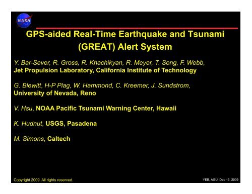
GPS-aided Real-Time Earthquake and Tsunami (GREAT) Alert ... - IGS
GPS-aided Real-Time Earthquake and Tsunami (GREAT) Alert ... - IGS
GPS-aided Real-Time Earthquake and Tsunami (GREAT) Alert ... - IGS

You also want an ePaper? Increase the reach of your titles
YUMPU automatically turns print PDFs into web optimized ePapers that Google loves.
<strong>GPS</strong>-<strong>aided</strong> <strong>Real</strong>-<strong>Time</strong> <strong>Earthquake</strong> <strong>and</strong> <strong>Tsunami</strong><br />
(<strong>GREAT</strong>) <strong>Alert</strong> System<br />
Y. Bar-Sever, R. Gross, R. Khachikyan, R. Meyer, T. Song, F. Webb,<br />
Jet Propulsion Laboratory, California Institute of Technology<br />
G. Blewitt, H-P Plag, W. Hammond, C. Kreemer, J. Sundstrom,<br />
University of Nevada, Reno<br />
V. Hsu, NOAA Pacific <strong>Tsunami</strong> Warning Center, Hawaii<br />
K. Hudnut, USGS, Pasadena<br />
M. Simons, Caltech<br />
Copyright 2009. All rights reserved.<br />
YEB, AGU, Dec 15, 2009 1
<strong>Time</strong> (Minutes)<br />
2
The Global Differential <strong>GPS</strong> (GD<strong>GPS</strong>) System<br />
http://www.gdgps.net<br />
Tracking Network (100+ sites)<br />
99.999% Reliability<br />
since inception in 2000<br />
Triple Redundant Operation Centers<br />
Measurements<br />
Internet, Frame<br />
Commercial Services<br />
Internet, Frame<br />
Public Services:<br />
APPS – Automatic Precise Positioning Service<br />
RT-PPP – <strong>Real</strong> <strong>Time</strong> Precise Point Positioning<br />
<strong>Real</strong>-time PPP http://ppp.gdgps.net<br />
• Position streams at 1 Hz from 100+ sites globally are<br />
currently available. Target 1000s of sites<br />
• Strictly for natural hazard monitoring<br />
• Share your 1 Hz real-time measurement stream, get<br />
real-time position time series<br />
3
Local Networks Augmentation<br />
GD<strong>GPS</strong>-based PPP enables local networks<br />
to be anchored to the ITRF<br />
4
Displacement Detection in <strong>GPS</strong> PPP <strong>Time</strong> Series<br />
dX = X 2 – X 1<br />
Detection Threshold: ABPO<br />
Cumulative Distribution<br />
99% confidence<br />
0.05 m<br />
Displacement (m)<br />
Blewitt et al., 2006 demonstrated accurate retrieval of the magnitude of the 2004<br />
Sumatra earthquake from <strong>GPS</strong> displacements (Rapid determination of earthquake magnitude<br />
using <strong>GPS</strong> for tsunami warning systems, Geophys. Res. Letters)<br />
5
<strong>Earthquake</strong> Source Determination with the<br />
Fingerprint Method<br />
Fingerprint: static displacement field due to a unit slip on a fault element<br />
Slip size<br />
Pre-Analysis Steps:<br />
Dip-Slip Fingerprint<br />
Slip size<br />
Strike-Slip Fingerprint<br />
1. Built a fault data base: reasonably sized (~100 km) elements for all tsunamigenic<br />
faults. (Gica et al., 2008, Development of the Forecast Propagation Database for NOAA's<br />
Short Term Inundation Forecast for <strong>Tsunami</strong>s (SIFT), NOAA Technical Report)<br />
• Fault planes for 573 fault elements<br />
• For each element, upper <strong>and</strong> lower starting point plane; 1146 planes<br />
2. Compute “fingerprints” for all fault elements<br />
6
Fingerprint Method: Operations<br />
1. Get alert with first estimates of earthquake epicenter<br />
2. Identify <strong>GPS</strong>/GNSS sites that are in a certain radius <strong>and</strong> acquire position time series<br />
3. Identify likely fault elements <strong>and</strong> prepare search<br />
4. Determine displacement at <strong>GPS</strong> sites<br />
5. Determine displacement field <strong>and</strong> magnitude through search in model space<br />
6. Inform tsunami assessment component<br />
Current Setup (configurable):<br />
• 100 km fault element (can be grouped)<br />
• Displacement are determined on a concentric grid<br />
Radial sampling (in degrees): R j = (0.3 + j 0.03) 3 , j = 1,112<br />
Angular sampling: every 2°<br />
• Interpolate grid displacements to <strong>GPS</strong> sites<br />
(≈ 3 - 5400 km)<br />
7
Sea Floor Displacement <strong>and</strong> Energy Transfer<br />
See floor displacement can be inferred from the Fingerprint model or from<br />
alternative models, e.g., Song’s empirical model<br />
Determine the potential <strong>and</strong> kinetic energy<br />
transferred to the ocean<br />
• The 2004 Sumatra tsunami was primarily<br />
driven by kinetic energy (K e /K p = 5:1)<br />
8
Determining <strong>Tsunami</strong> Scale <strong>and</strong> Propagation<br />
<strong>Tsunami</strong> Scale Formulation: S T = log 10 E T - 10<br />
<strong>Earthquake</strong> Magnitude <strong>Tsunami</strong> Energy<br />
(from <strong>GPS</strong>)<br />
<strong>Tsunami</strong> Scale<br />
(from <strong>GPS</strong>)<br />
Basin-Wide Warning?<br />
S T = 5 Threshold<br />
2004 Sumatra (M w 9.2) 6.0*10 15 J 5.8 Yes<br />
1964 Alaska (M w 9.1) 8.2*10 15 J (Geodesy) 5.9 (Geodesy) Yes<br />
2005 Nias (M w 8.7) 2.8*10 14 J 4.4 No<br />
Current PTWC alerts are based<br />
solely on earthquake magnitude<br />
9
Results from the M8.8 Chile <strong>Earthquake</strong><br />
10