Elko County Nevada Water Resource Management Plan 2007
Elko County Nevada Water Resource Management Plan 2007
Elko County Nevada Water Resource Management Plan 2007

Create successful ePaper yourself
Turn your PDF publications into a flip-book with our unique Google optimized e-Paper software.
PRIVATE OWNERSHIP AND DEVELOPMENT:<br />
SECTION 1<br />
<strong>Elko</strong> <strong>County</strong> <strong>Water</strong> <strong>Resource</strong> <strong>Management</strong> <strong>Plan</strong><br />
<strong>Plan</strong> Development Information<br />
Private land ownership is diverse due to past history of subdivision and development. Development of<br />
residential areas has occurred through subdivision of lands previously used for agricultural purposes. Many of<br />
these subdivision were created in the early 1960's, prior to N.R.S. subdivision law or <strong>Elko</strong> <strong>County</strong> ordinance<br />
and did not provide access, utilities or legal water rights. Many of these subdivisions have never been fully<br />
developed or inhabited.<br />
Development of residential uses has historically been within municipal boundaries and areas surrounding the<br />
City of <strong>Elko</strong>, including Spring Creek, Lamoille, South Fork and areas directly adjacent to the City of <strong>Elko</strong>. A<br />
recent trend is division of land into large parcels of 40 acres or more. This trend has generated many residential<br />
parcels with agricultural potential. Most of these divisions of land occur in close proximity to incorporated<br />
cities.<br />
The City of West Wendover is <strong>Elko</strong> <strong>County</strong>’s second largest city. Since incorporation in 1991 the City of West<br />
Wendover has increased its population to 4,871. The development of legalized gambling, retail sales and<br />
services required residential development to accommodate the new employees and families. The City of West<br />
Wendover currently has limited expansion ability potential due to the lack of developed water supply. The City<br />
of West Wendover currently pipes water from a source approximately 35 miles to west to accommodate its water<br />
needs. Some non-potable water is available from ground locations within the corporate limits for irrigation use<br />
only.<br />
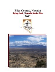
Other areas that developed during the 1990's include the rural subdivision of Spring Creek. The area has<br />
commercial, industrial, recreation and residential uses. As of 2006 approximately 13,000 people live in the<br />
Spring Creek, Lamoille and South Fork areas. Other areas such as Osino, Ryndon and River Ranch have also<br />
developed with primarily residential uses.<br />
TRANSPORTATION:<br />
<strong>Elko</strong> <strong>County</strong> has ten primary highway transportation routes crossing the county from east to west and north to<br />
south. Interstate 80 is a four-lane divided highway that extends approximately 130 miles from the eastern state<br />
line at West Wendover to the western boundary with Eureka <strong>County</strong> near Carlin. This route bisects <strong>Elko</strong><br />
<strong>County</strong>. The second most traveled route is Highway 93 which is a two-lane highway 140 miles long from the<br />
southern boundary with White Pine <strong>County</strong> to the northern state line at Jackpot. State Route 225 begins in the<br />
city of <strong>Elko</strong> and traverses north approximately 90 miles to the Idaho border. State Routes 227 and 228 are<br />
primarily local area access routes. State Route 227 begins in the City of <strong>Elko</strong> and traverses southeast<br />
approximately 25 miles to the town of Lamoille. State Route 228 intersects State Route 227 in the most<br />
northerly portion of Spring Creek area, and trends southerly approximately 30 miles, providing access to the<br />
South Fork Recreation Area, the community of Jiggs and the Ruby Marshes Wildlife Refuge, to the base of the<br />
Ruby Mountains at Harrison Pass.<br />
State Routes 27B and 766 cross a small area of southwestern <strong>Elko</strong> <strong>County</strong> and both are two-lane roads<br />
originating in the City of Carlin. State Route 27B is a major transportation route to the Town of Eureka, in<br />
Eureka <strong>County</strong>. Highway 766 provides access to the mining areas in northern Eureka <strong>County</strong> and western <strong>Elko</strong><br />
<strong>County</strong>. State Route 226 intersects State Route 225 near Lone Mountain Station in central <strong>Elko</strong> <strong>County</strong> and<br />
SECTION 1 - Page -19-