PLANNING RATIONALE - Oakville
PLANNING RATIONALE - Oakville
PLANNING RATIONALE - Oakville

You also want an ePaper? Increase the reach of your titles
YUMPU automatically turns print PDFs into web optimized ePapers that Google loves.
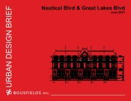
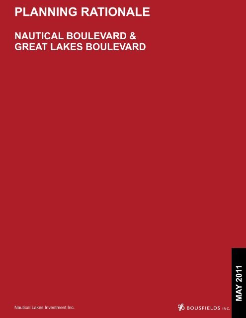
<strong>PLANNING</strong> <strong>RATIONALE</strong><br />
Nautical Boulevard &<br />
GReat Lakes Boulevard<br />
MAY 2011<br />
Nautical Lakes Investment Inc.
Planning Rationale - Nautical Boulevard & Great Lakes Boulevard<br />
May 2011<br />
Job No. 1120<br />
Table of Contents<br />
1.0 INTRODUCTION 1<br />
2.0 SITE AND SURROUNDINGS 2<br />
2.1 Site 2<br />
2.2 Surroundings 2<br />
2.3 The Transportation Network 5<br />
3.0 PROPOSAL 6<br />
3.1 Description of the Proposal 6<br />
3.2 Required Approvals 7<br />
4.0 POLICY AND REGULATORY CONTEXT 8<br />
4.1 Provincial Policy Statement (2005) 8<br />
4.2 Growth Plan for the Greater Golden Horseshoe 9<br />
4.3 Halton Region Official Plan (2006) 9<br />
4.3.1 Land Use 10<br />
4.3.2 Intensification 10<br />
4.3.3 Housing 11<br />
4.4 History of Official Plan Designation 12<br />
4.4.1 Former Town of <strong>Oakville</strong> Official Plan 12<br />
4.5 New <strong>Oakville</strong> Official Plan (Livable <strong>Oakville</strong>) 14<br />
4.5.1 Urban Structure 14<br />
4.5.2 Land Use Designation 15<br />
4.5.3 Development Criteria 17<br />
4.6 Existing Zoning 17<br />
5.0 ANALYSIS 19<br />
5.1 Land Use 19<br />
5.2 Intensification 19<br />
5.3 Urban Design 20<br />
5.4 Transportation 21<br />
5.5 Functional Servicing Report 21<br />
6.0 CONCLUSION 22<br />
i
Planning Rationale - Nautical Boulevard & Great Lakes Boulevard<br />
May 2011<br />
List of Figures<br />
Figure 1 Air Photo 3<br />
Figure 2 Site Plan 6<br />
Figure 3 Conceptual West Elevation 7<br />
Figure 4 Halton Region Official Plan - Map 1, Regional Structure 10<br />
Figure 5 Town of <strong>Oakville</strong> Official Plan, Figure B - General Land Use 12<br />
Figure 6 Bronte Community West of Third Line, Figure I2 - Land Use 13<br />
Figure 7 Livable <strong>Oakville</strong> Schedule A1, Urban Structure Map 15<br />
Figure 8 Livable <strong>Oakville</strong> Schedule F, South West Land Use 16<br />
Figure 9 Town of <strong>Oakville</strong>’s Comprehensive Zoning By-law 1984-063 18<br />
ii
Planning Rationale - Nautical Boulevard & Great Lakes Boulevard<br />
May 2011<br />
1.0 INTRODUCTION<br />
This Planning Rationale has been prepared in support of an application by Nautical<br />
Lakes Investments Inc. to amend the Official Plan and Zoning By-law to permit a<br />
residential development for a 0.82 hectare vacant site located at the northeast corner<br />
of Nautical Boulevard and Great Lakes Boulevard in the Town of <strong>Oakville</strong>.<br />
The rezoning and Official Plan amendment would permit the development of 40 freehold<br />
townhouse units. In total the development would provide 6,540 m 2 of residential area.<br />
This report concludes that the proposed development is consistent with the planning<br />
policy framework established in the Provincial Policy Statement, the Growth Plan<br />
for the Greater Golden Horseshoe, the Halton Region Official Plan and the <strong>Oakville</strong><br />
Official Plan. In particular, the proposal is consistent with the new emphasis on<br />
intensification set out in recent amendments to the Halton Region Official Plan and in<br />
the new <strong>Oakville</strong> Official Plan (Livable <strong>Oakville</strong>).<br />
In terms of land use, the site is within a neighbourhood consisting of single detached<br />
houses interspersed with townhouse units. From an urban form and design perspective,<br />
the design of the proposed development would be complementary to the surrounding<br />
residential neighbourhood. The design and siting of the townhouse units would form<br />
an appropriate relationship with the street and with adjacent land uses.<br />
1
Planning Rationale - Nautical Boulevard & Great Lakes Boulevard<br />
May 2011<br />
2.0 SITE AND SURROUNDINGS<br />
2.1 Site<br />
The site is located at the northeast corner of Great Lakes Boulevard and Nautical<br />
Boulevard in the Bronte Community neighbourhood of <strong>Oakville</strong>. The site is irregularly<br />
shaped, with 106.97 metres (350.62 feet) of curvilinear frontage along the north side<br />
of Nautical Boulevard and 49.61 metres of frontage on the east side of Great Lakes<br />
Boulevard. The site is generally flat and has a total area of 0.82 hectares (2.03 acres).<br />
The site, which is currently vacant, is shown as Block 1161 of the plan of subdivision<br />
for an existing development, Lakeshore Woods, and is labeled as a church.<br />
Subject site facing east from Great Lakes Boulevard<br />
Subject site looking north from Nautical Boulevard along<br />
the eastern boundary of the site<br />
2.2 Surroundings<br />
The site is located within the Bronte Community in the southwest quadrant of the Town<br />
of <strong>Oakville</strong>. The site is located at the interface of the Burloak Employment District to<br />
the north of Rebecca Street and the existing residential neighbourhoods to the south<br />
and west of the site (see Figure 1).<br />
2
Planning Rationale - Nautical Boulevard & Great Lakes Boulevard<br />
May 2011<br />
Figure 1 Air Photo<br />
SUBJECT<br />
SITE<br />
To the immediate north of the site, at the southeast corner of Great Lakes Boulevard<br />
and Rebecca Street, is a single storey neighbourhood commercial plaza, which is<br />
occupied by a variety of commercial and retail uses including restaurants, a food store,<br />
a hair salon, a daycare and medical offices.<br />
Commercial Plaza<br />
Further north, on the northwest corner of Great Lakes Boulevard and Rebecca Street<br />
is a Shell gas station. The lands to the west of the gas station have approvals in place<br />
for 7,600 square metres of convenience retail and commercial retail uses.<br />
3
Planning Rationale - Nautical Boulevard & Great Lakes Boulevard<br />
May 2011<br />
To the immediate east of the site is<br />
the Burloak Water Purification Plant.<br />
Vehicular access to the plant is provided<br />
from the south side of Rebecca Street,<br />
with the rear yard of the property extending<br />
south to Nautical Boulevard. An open<br />
landscaped area is located between the<br />
rear of the plant and Nautical Boulevard<br />
with a portion flanking the subject site to<br />
the east.<br />
Water Purification Facility facing north from Nautical<br />
Boulevard<br />
To the west of the site is an existing residential development known as “Lakeshore<br />
Woods”, which extends westerly from Nautical Boulevard to Burloak Drive. The<br />
community is comprised of what appears to be an equal mix of recently built townhouse<br />
dwellings and 2-3 storey detached dwellings. A linear park feature, approximately 30<br />
metres in width, flanks the neighbourhood to the east along the west side of Nautical<br />
Boulevard.<br />
Typical Townhouse units in Lakeshore Woods<br />
Community<br />
Park Feature<br />
To the south of the site is an existing residential neighbourhood comprised of detached<br />
homes.<br />
Looking east along Nautical Avenue<br />
Looking south from the subject site - typical detached<br />
home<br />
4
Planning Rationale - Nautical Boulevard & Great Lakes Boulevard<br />
May 2011<br />
2.3 The Transportation Network<br />
The site is well located with respect to the existing road network. Great Lakes Boulevard<br />
is designated a Major Collector in the Official Plan, while Rebecca Boulevard to the<br />
north is designated as a Minor Arterial road. Burloak Drive to the west of the subject site<br />
is designated as a Minor Arterial road and serves as the municipal boundary between<br />
the Town of <strong>Oakville</strong> and the City of Burlington. West of Burloak Drive, Rebecca Street<br />
continues as New Street terminating at Brant Street. Burloak Drive provides easy<br />
access to the QEW, approximately 2 kms to the north of the subject site.<br />
The site is well-served by bus routes. <strong>Oakville</strong> Transit Bus Route 32 (Burloak North)<br />
runs west from Hopedale Mall (at Third Line) along Rebecca Street and continues<br />
north along Burloak Drive to Wyecroft Road (RioCan Centre <strong>Oakville</strong>). A bus stop<br />
and shelter serving this route is located on the north side of Rebecca Street at Great<br />
Lakes Boulevard. <strong>Oakville</strong> Transit Bus Route 31 (Bridge-Great Lakes) travels to and<br />
from Bronte GO Station and makes a stop at Great Lakes Boulevard and Rebecca<br />
Street. Burlington Transit Route 10 runs from the Burlington GO Station east along<br />
New Street and south along Burloak Drive, eventually connecting with the Appleby<br />
GO Station. Burlington Transit Route 4 extends south from Appleby GO Station, east<br />
along New Street, curving around Great Lakes Boulevard, and continues north on<br />
Burloak to RioCan Centre. Bus stops and shelters are located on both the north and<br />
south sides of New Street at Burloak Drive.<br />
Great Lakes Boulevard includes bicycle lanes in both the north and southbound lanes.<br />
5
Planning Rationale - Nautical Boulevard & Great Lakes Boulevard<br />
May 2011<br />
3.0 PROPOSAL<br />
3.1 Description of the Proposal<br />
The proposed townhouse development consists of 40 residential units in six blocks.<br />
Access would be provided from a new crescent shaped private road with two vehicular<br />
access points from the north side of Nautical Boulevard (see Figure 2). Ten parking<br />
spaces for visitors will also be provided along the northern portion of the private road.<br />
The development will have a total gross floor area (GFA) of approximately 7,260<br />
square metres with an overall density of 0.89 FSI or 48.86 units per hectare.<br />
Figure 2 Site Plan<br />
The units will be 2½ to 3 storeys in height with garages facing the proposed new private<br />
road. As shown in the accompanying Urban Design Brief, the proposed townhouse<br />
units will have a traditional design with brick and stone masonry treatments.<br />
As shown in Figure 3, units flanking Great Lakes Boulevard also address the public<br />
street. The units adjacent to Nautical Boulevard have been oriented to address the<br />
street, with front doors located at the side of the units.<br />
6
Planning Rationale - Nautical Boulevard & Great Lakes Boulevard<br />
May 2011<br />
Figure 3 Conceptual<br />
West<br />
Elevation<br />
The units have also been sited towards the southern portion of the lot to ensure a<br />
positive street relationship with the Nautical Boulevard. The units along the northern<br />
portion of the site have also been sited towards the southern portion of their respective<br />
lots to create a greater separation from the commercial plaza to the north. In addition,<br />
no rear yards are proposed abutting the adjacent commercial plaza.<br />
3.2 Required Approvals<br />
The proposal requires an amendment to the Livable <strong>Oakville</strong> Official Plan to redesignate<br />
the site from Neighbourhood Commercial to Medium Density Residential.<br />
The proposal requires an amendment to <strong>Oakville</strong> Zoning By-law 1984-063, in order to<br />
permit the proposed use and to revise other performance standards as necessary to<br />
accommodate the proposal.<br />
An application for Site Plan approval and registration of the draft plan of subdivision<br />
will follow.<br />
7
Planning Rationale - Nautical Boulevard & Great Lakes Boulevard<br />
May 2011<br />
4.0 POLICY AND REGULATORY CONTEXT<br />
4.1 Provincial Policy Statement (2005)<br />
The Provincial Policy Statement came into effect as of March 1, 2005.<br />
The proposal is consistent with the policy direction expressed in the 2005 Provincial<br />
Policy Statement to build strong communities by promoting efficient land use and<br />
development patterns. To that end, the Policy Statement contains a number of policies<br />
that promote intensification in built-up urban areas. Intensification is defined to include,<br />
among other matters, “the development of vacant and/or underutilized lots within<br />
previously developed areas”.<br />
In particular, the Policy Statement supports densities and a mix of land uses which<br />
efficiently use land and resources, infrastructure and public service facilities. Policy<br />
1.1.3.3 provides that planning authorities shall identify and promote opportunities<br />
for redevelopment and intensification, where this can be accommodated taking into<br />
account existing building stock or areas and the availability of existing or planned<br />
infrastructure and public service facilities. In addition, Policies 1.1.3.5 and 1.1.3.6<br />
require planning authorities to establish and implement minimum targets for<br />
intensification and redevelopment in built-up areas and phasing policies to ensure<br />
those targets are achieved prior to, or concurrent with, the outward expansion of the<br />
urban area.<br />
With respect to housing, Policy 1.4.3 requires provision to be made for an appropriate<br />
range of housing types and densities to meet projected requirement of current and future<br />
residents by, among other matter, facilitating all forms of residential intensification and<br />
redevelopment and promoting densities for new housing which efficiently use land,<br />
resources, infrastructure and public service facilities and support the use of public<br />
transit.<br />
With respect to transportation systems, Policy 1.6.5.4 promotes a land use pattern,<br />
density and mix of uses that minimizes the length and number of vehicle trips and<br />
supports the development of viable choices and plans for public transit and other<br />
alternative transportation modes.<br />
The proposed development is consistent with the Provincial Policy Statement as<br />
outlined below:<br />
• The proposal would make efficient use of a site in a built-up area well served by<br />
municipal infrastructure;<br />
• The proposal provides for an appropriate density in a type and form of housing<br />
that promotes residential intensification and redevelopment; and<br />
• The proposal provides for a density and a mix of uses that supports public transit<br />
and other alternative transportation modes.<br />
8
Planning Rationale - Nautical Boulevard & Great Lakes Boulevard<br />
May 2011<br />
4.2 Growth Plan for the Greater Golden Horseshoe<br />
The Growth Plan for the Greater Golden Horseshoe came into effect on June 16, 2006.<br />
Similar to the Provincial Policy Statement, the Growth Plan supports intensification<br />
within built-up urban areas, particularly in proximity to transit. As noted in Section 2.1<br />
of the Plan:<br />
“...Better use of land and infrastructure can be made by directing growth to existing<br />
urban areas. This Plan envisages increasing intensification of the existing built-up<br />
area, with a focus on urban growth centres, intensification corridors, major transit<br />
station areas, brownfield sites and greyfields. Concentrating new development<br />
in these areas also provides a focus for transit and infrastructure investments to<br />
support future growth.”<br />
The Plan seeks to accommodate population and employment growth by, among other<br />
measures, directing a significant portion of new growth to the built-up areas of the<br />
community through intensification, reducing dependence on the automobile through the<br />
development of mixed-use, transit-supportive, pedestrian-friendly urban environments<br />
and encouraging cities and towns to develop complete communities with a diverse mix<br />
of land uses, a range and mix of employment and housing types, high quality public<br />
open spaces and easy access to local stores and services (Section 2.2.2).<br />
Policy 2.2.3(1) requires that, by 2015 and for each following year, a minimum of 40<br />
percent of all residential development occurring annually within each municipality is to<br />
be provided within the built-up area.<br />
Policy 2.2.3(6) requires municipalities to develop an intensification strategy, to be<br />
implemented through their official plans and other supporting documents, which will,<br />
among other things, encourage intensification generally throughout the built-up area,<br />
facilitate and promote intensification, and plan for a range and mix of housing, taking<br />
into account affordable housing needs.<br />
4.3 Halton Region Official Plan (2006)<br />
The Halton Region Official Plan sets out the planning framework for the Region. The<br />
Region has recently undertaken the Sustainable Halton planning exercise, which has<br />
resulted in two major Regional Official Plan Amendments. ROPA 37 was approved by<br />
the Ministry of Municipal Affairs and Housing (MMAH) on November 27, 2009, and<br />
brought the Regional Plan into conformity with the Greater Golden Horseshoe Growth<br />
Plan. ROPA 37 is in force and effect with the exception of subsections 38(a), 38(b)<br />
and 38(f)(11)(d) which have been appealed to the Ontario Municipal Board. ROPA 38,<br />
“An Amendment to Incorporate the Results of Sustainable Halton, Official Plan Review<br />
Directions and Other Matters” is a comprehensive review of the Regional Plan. ROPA<br />
38 was adopted by Regional Council on December 16, 2009, but has not yet received<br />
full approval from MMAH and is therefore not yet in force.<br />
9
Planning Rationale - Nautical Boulevard & Great Lakes Boulevard<br />
May 2011<br />
4.3.1 Land Use<br />
The subject site is designated Urban Area in the Halton Region Official Plan (see<br />
Figure 4). Policy 74 states that future growth within the Region will be directed to the<br />
six defined Urban Areas, of which <strong>Oakville</strong> is one. The range of permitted uses within<br />
Urban Areas will be in accordance with local Official Plans.<br />
Figure 4 Halton Region Official Plan - Map 1,<br />
Regional Structure<br />
SITE<br />
*<br />
4.3.2 Intensification<br />
Taken together, ROPA 37 and ROPA 38 represent a significantly renewed emphasis<br />
on contextually appropriate intensification in the Region.<br />
ROPA 37 establishes new population targets for the local municipalities of Halton. As<br />
set out in Table 1, <strong>Oakville</strong> is to accommodate a population of 255,000 by 2031, which<br />
represents an increase of 83,000 over the 2006 population.<br />
10
Planning Rationale - Nautical Boulevard & Great Lakes Boulevard<br />
May 2011<br />
In addition, a new section 38(F) has been added to the Regional Plan, which sets out<br />
the approved intensification strategy:<br />
38F. It is the policy of the Region to:<br />
a) directing a significant portion of new growth to the built-up areas of the<br />
community through intensification;<br />
b) focusing intensification in intensification areas;<br />
c) reducing dependence on the automobile through the development of mixed<br />
use, transit-supportive, pedestrian-friendly communities in designated<br />
greenfield areas;<br />
d) reducing dependence on the automobile through the development of<br />
mixed-use, transit-supportive, pedestrian-friendly urban environments;<br />
e) providing convenient access to intra-municipal, inter-municipal and interregional<br />
transit;<br />
f) ensuring the availability of sufficient land for employment to accommodate<br />
forecasted growth to support the Halton’s economic competitiveness;<br />
g) planning and investing for a balance of jobs and housing in communities<br />
across the Region to reduce the need for long distance commuting and to<br />
increase the modal share for transit, walking and cycling;<br />
h) encouraging the Local Municipalities to develop as complete communities<br />
with a diverse mix of land uses, a arrange and mix of employment and<br />
housing types, high quality public open space and easy access to local<br />
stores and services;<br />
i) directing development to settlement areas;<br />
j) directing major growth to settlement areas that offer municipal water<br />
and wastewater systems and limiting growth in settlement areas that are<br />
serviced by other forms of water and wastewater services;<br />
k) prohibiting the establishment of new settlement areas; and<br />
l) considering the expansion of new settlement areas in accordance with<br />
Section 38F(11) of this Plan.<br />
ROPA 38 proposes mechanisms to ensure that intensification targets are being met by<br />
the Local Municipalities and the Region as a whole. These include the preparation of<br />
an Annual Intensification Monitoring Report beginning in 2016 (Policy 77(2.2)).<br />
4.3.3 Housing<br />
With respect to housing, the Regional Official Plan contains the following policies:<br />
• 86(9): Require Local Official Plans to ensure, by appropriate density and housing<br />
mixes the provision of a full range of housing types.<br />
• 86(11): Permit, in accordance with Table 2, intensification of land use for<br />
residential purposes such as infill redevelopment, and conversion of existing<br />
structures provided that the physical character of existing neighbourhoods can<br />
be maintained.<br />
• 86(21): Require Local Official Plans and Secondary Plans to provide an<br />
appropriate mix of housing by type and affordability in each geographic area.<br />
11
Planning Rationale - Nautical Boulevard & Great Lakes Boulevard<br />
May 2011<br />
4.4 History of Official Plan Designation<br />
Livable <strong>Oakville</strong> is the in force Official Plan, however it is important to understand the<br />
history of the commercial designation.<br />
*<br />
SITE<br />
Figure 5 Town of <strong>Oakville</strong> Official Plan, Figure B - General Land Use<br />
4.4.1 Former Town of <strong>Oakville</strong> Official Plan<br />
Under the former Town of <strong>Oakville</strong> Official Plan, the site was designated Urban<br />
Residential on Figure B, General Land Use (see Figure 5) and subject to the policies<br />
contained in Part E of the Official Plan relating to the Bronte Community.<br />
The site was designated “Neighbourhood Commercial Centre” on Figure I2, Land Use<br />
(see Figure 6) of the Bronte Community West of Third Line Plan.<br />
The north and eastern portions of the site were within a “nuisance buffer” as shown on<br />
Figure I2. Policy 1.2.1(h) provides that the buffer does not reflect any environmental<br />
hazard, but is considered to be an appropriate setback from the Petro-Canada Refinery<br />
for residential development and other sensitive land uses in order to minimize nuisance<br />
concerns, particularly those related to odour. To that end, the policy provides that no<br />
new residential development are to be permitted within the buffer until such time as<br />
the refinery ceases operation and the necessary amendments are made to delete the<br />
12
Planning Rationale - Nautical Boulevard & Great Lakes Boulevard<br />
May 2011<br />
SITE<br />
*<br />
Figure 6 Bronte Community West of Third Line, Figure I2 - Land Use<br />
buffer from this Plan. It is noted that the refinery has since ceased operation and that<br />
the buffer has not been carried forward in the Livable <strong>Oakville</strong> Official Plan.<br />
In accordance with Policy 1.2.1(h), the majority of the lands within the buffer were<br />
designated for non-residential uses in the former Town of <strong>Oakville</strong> Official Plan Bronte<br />
Community Plan. The water treatment facility to the immediate east of the site is<br />
also included within the buffer and designated “Community Facility/Institutional”. The<br />
residential community to the immediate south of the site is designated “Residential<br />
Low Density”, while the residential community to the west of Great Lakes Boulevard<br />
is designated “Residential Medium Density”. The buffer separating Great Lakes<br />
Boulevard from the residential community to the west is designated “Natural Area”.<br />
Policy 1.2.1(a)(vi) of the Bronte Community Plan provides that a Neighbourhood<br />
Commercial Area will be permitted south of Rebecca Street east of Burloak Drive.<br />
Uses permitted in this area include a full range of retail and other commercial uses, and<br />
office uses which will serve the adjacent residential area. The policy goes on to note<br />
that the development in the Neighbourhood Commercial designation shall be carefully<br />
designed, particularly with respect to landscaping to integrate with the surrounding<br />
residential and institutional development and to reflect its position as a major entrance<br />
to the neighbourhood in the Bronte West District.<br />
It should be noted that the site had previously been redesignated to Place of Worship/<br />
13
Planning Rationale - Nautical Boulevard & Great Lakes Boulevard<br />
May 2011<br />
Daycare in 2001. Policy 1.2.1d) provides that a vacant site designated for a school,<br />
place of worship or day care centre, may also be used for other community scale<br />
institutional uses, and for low density residential uses. The site was subsequently<br />
redesignated Neighbourhood Commercial Centre in 2005 after the site had remained<br />
vacant for four years under the Place of Worship/Daycare designation.<br />
Part D, Land Use Policies, contains policies for Urban Residential areas. This<br />
designation permits a range of residential, institutional, and open space uses. Section<br />
1.2 provides that appropriate density ranges (dwelling units per hectare) may be<br />
established in Community Plans however actual densities on a site-by-site basis will<br />
be determined in the Zoning By-law. Criteria for the consideration of development<br />
applications for Medium Density Housing is provided in section 1.3 including:<br />
• proximity to natural amenities such as major areas of open space, valleys, and<br />
parks;<br />
• proximity to public transit and pedestrian pathways;<br />
• proximity to arterial and collector roads so as to provide controlled access to<br />
such roads and minimize traffic infiltration of low density housing areas;<br />
General policies are provided in Part D, section 1.5 with respect to design considerations<br />
where Medium and High Density Housing abuts developments of a lower density.<br />
These are discussed in section 5.3 of this report.<br />
4.5 New <strong>Oakville</strong> Official Plan (Livable <strong>Oakville</strong>)<br />
<strong>Oakville</strong>’s new Official Plan, Livable <strong>Oakville</strong>, was adopted by <strong>Oakville</strong> Council on<br />
June 22, 2009, and was approved with modifications by Halton Region on November<br />
30, 2009. The Ontario Municipal Board approved the new Livable <strong>Oakville</strong> Official Plan<br />
on May 16, 2011.<br />
4.5.1 Urban Structure<br />
Section 4.3 of the Plan notes that lands outside of the Growth Areas, defined in the<br />
Plan are predominantly stable residential communities which consist of established<br />
neighbourhoods. The Plan recognizes that some growth and change may occur in<br />
these areas but the intent is to clearly define the limits to such intensification to ensure<br />
the character of these areas is preserved and the overall urban structure of the town<br />
is upheld. Section 4.3 goes on to note that intensification opportunities outside of the<br />
Growth Areas, such as infill, redevelopment, and greyfield and brownfield sites, may<br />
be considered and protected for long-term investment, where it conforms with the<br />
policies of this Plan.<br />
The site is identified as Residential Areas on Schedule A1, Urban Structure Map (see<br />
Figure 7). Section 11 of the Plan contains general policy directions for Residential<br />
Areas, which provide for a range of housing types, forms and densities. Compact<br />
urban form and an increased variety of housing alternatives is one of the objectives for<br />
14
Planning Rationale - Nautical Boulevard & Great Lakes Boulevard<br />
May 2011<br />
SITE<br />
*<br />
Figure 7 Livable <strong>Oakville</strong> Schedule A1, Urban Structure Map<br />
all Residential Areas, however intensification within stable residential communities will<br />
be limited and should maintain and protect the existing character of those communities.<br />
4.5.2 Land Use Designation<br />
The site is designated Neighbourhood Commercial on Schedule F, South West<br />
Land Use (see Figure 8). It is important to note that the nuisance buffer, which had<br />
prohibited residential uses in the former Official Plan, has not been included in the<br />
Livable <strong>Oakville</strong> Official Plan.<br />
The Neighbourhood Commercial designation is one of four commercial land use<br />
designations in the new Official Plan. Section 13 states:<br />
While this Plan sets out the form and function in a hierarchical format, the<br />
application of the policies is intended to be general and the primary goal of the<br />
commercial policies is to ensure that an adequate range and variety of goods<br />
and services is available to the Town’s residents.<br />
15
SITE<br />
Planning Rationale - Nautical Boulevard & Great Lakes Boulevard<br />
May 2011<br />
T<br />
egnd:<br />
SUBJECT<br />
SITE<br />
Figure 8 Livable <strong>Oakville</strong> Schedule F, South West Land Use<br />
Legnd:<br />
Section 13.5 contains policies which deal specifically with the Neighbourhood<br />
Commercial designation. The introduction to Section 13.5 states:<br />
Neighbourhood Commercial areas are intended to provide for a range of retail<br />
and service commercial uses primarily to service local convenience needs of the<br />
adjacent neighbourhoods. Neighbourhood Commercial areas are to be located<br />
on collector roads or at the intersection of a collector road and an arterial road<br />
with accessibility to the local neighbourhood.<br />
Other relevant policies in Section 13.5 include:<br />
• Residential uses above ground floor retail and service commercial uses may<br />
also be permitted.<br />
• Neighbourhood Commercial areas shall not exceed a maximum of approximately<br />
2,500 square metres of floor area in retail and service commercial uses.<br />
• Development shall consist of a small grouping of retail and service commercial<br />
uses in one or more buildings.<br />
The proposal is to redesignate the subject lands to Medium Density Residential.<br />
Section 11.3.1 provides that this land use designation permits a range of medium<br />
density housing types including multiple-attached dwelling units, stacked townhouses,<br />
and apartments. Section 11.3.2 further notes that the density range in this designation<br />
is between 30 to 50 dwelling units per site hectare.<br />
16
Planning Rationale - Nautical Boulevard & Great Lakes Boulevard<br />
May 2011<br />
4.5.3 Development Criteria<br />
As noted in section 11.1.5 development of Residential Areas is permitted through<br />
plans of condominium on private roads provided all required services are appropriately<br />
accommodated. Other criteria for the evaluation of residential development is listed in<br />
section 11.1.9 of the Plan including:<br />
• The built form, including scale, height, massing, architectural character and<br />
materials, is to be compatible with the surrounding neighbourhood.<br />
• Consistent setbacks, orientation and separation distances within the surrounding<br />
neighbourhood.<br />
• The proposed lotting pattern shall be compatible with the predominant lotting<br />
pattern of the surrounding neighbourhood.<br />
• Roads and/or municipal infrastructure shall be adequate to provide water and<br />
wastewater service, waste management services and fire protection,<br />
• Impacts on the adjacent properties shall be minimized in relation to grading,<br />
drainage, location of service area and circulation, privacy, views, and microclimatic<br />
conditions such as shadowing.<br />
Development in Residential Areas shall also comply with policies relating to urban<br />
design and sustainability set out in Part C. These are discussed in more detail in the<br />
accompanying urban design brief.<br />
4.6 Existing Zoning<br />
The site, along with the commercial plaza to the north, is currently zoned Neighbourhood<br />
Commercial (C1) in the Town of <strong>Oakville</strong>’s Comprehensive Zoning By-law 1984-063,<br />
as amended. The C1 zone permits a wide range of local retail uses in addition to<br />
commercial office uses above the first floor (see Figure 9).<br />
17
Planning Rationale - Nautical Boulevard & Great Lakes Boulevard<br />
May 2011<br />
SITE<br />
Figure 9 Town of <strong>Oakville</strong>’s Comprehensive Zoning By-law 1984-063<br />
18
Planning Rationale - Nautical Boulevard & Great Lakes Boulevard<br />
May 2011<br />
5.0 ANALYSIS<br />
5.1 Land Use<br />
The proposed redesignation and rezoning of the site to permit medium density<br />
residential use is consistent with the policy framework established in the Official Plan.<br />
The historic designation of the site for non-residential was in large part a reflection of<br />
the one kilometer Nuisance Buffer from the Petro-Canada Refinery. In fact, prior to<br />
the current Neighbouhood Commercial Centre designation, the site was designated<br />
Place of Worship/Daycare. Policy 1.2.1 e) of the former <strong>Oakville</strong> Official Plan provided<br />
that vacant sites designated for place of worship or day care centres may be used<br />
for low density residential purposes without amendment to the former Official Plan.<br />
Policy 1.2.1(h) of the former Bronte Community Plan provided that no new residential<br />
development was to be permitted within the buffer until such time as the refinery<br />
ceased operation and the necessary amendments were made to delete the buffer from<br />
the Plan. Commercial uses were seen as a logical alternative to Place of Worship/<br />
Daycare given the residential restriction. As noted, the Official Plan no longer contains<br />
a buffer area restricting consideration of residential uses on this site.<br />
As noted in Section 4.5 of this report, Policy 1.2.1(a)(vi) of the former Bronte Community<br />
Plan provided that a Neighbourhood Commercial Centre would be permitted for the<br />
lands south of Rebecca Street, east of Burloak Drive to serve the adjacent residential<br />
areas and reflect its position as a major entrance to the neighbourhood.<br />
The existing commercial plaza located north of the site satisfies the intent of the policy<br />
to locate commercial uses serving the adjacent residential areas. The introduction of a<br />
medium density townhouse development would be complementary to the commercial<br />
plaza and the intent to mark the location as an entrance to the community.<br />
The proposed housing form would be compatible with the existing residential<br />
neighbourhood to the south and west which contains a mix of townhouse and single<br />
detached dwellings.<br />
The surrounding residential community is well served by existing and approved retail<br />
uses. In addition to the commercial plaza at the Rebecca Street and Great Lakes<br />
Boulevard intersection, a commercial development has been recently approved at the<br />
northeast corner of Rebecca Street and Burloak Drive and will provide up to 7,600<br />
square metres of convenience retail and commercial service uses.<br />
5.2 Intensification<br />
Residential intensification on the subject site is consistent with the policy directions<br />
articulated in the Provincial Policy Statement, the Growth Plan for the Greater Golden<br />
Horseshoe, the Halton Region Official Plan and the Livable <strong>Oakville</strong> Official Plan, all<br />
of which support intensification on sites located within built-up areas which are wellserved<br />
by existing municipal infrastructure.<br />
19
Planning Rationale - Nautical Boulevard & Great Lakes Boulevard<br />
May 2011<br />
The site is currently vacant and therefore underutilized. Intensification of the subject<br />
site is desirable to complete the build-out of the community south of Rebecca Street<br />
and to establish the lands as an entrance to the neighbourhood in conjunction with<br />
the commercial plaza to the north. In that regard, it is noted that, while the commercial<br />
plaza to the north has been developed in accordance with the Neighbourhood<br />
Commercial designation, the subject site has yet to develop for the designated and<br />
zoned commercial uses.<br />
The new Livable <strong>Oakville</strong> Official Plan requires that the Town of <strong>Oakville</strong> accommodate<br />
a population of 255,000 by 2031. The Plan further provides that the required population<br />
growth is to occur primarily within the Growth Areas defined by the Plan. In this regard,<br />
the Plan notes that lands outside of Growth Areas are predominantly stable residential<br />
communities which consist of established neighbourhoods. Therefore, while the Plan<br />
recognizes that some growth and change may occur in these areas, the intent is to<br />
clearly define the limits of such intensification in order to ensure the character of these<br />
areas is preserved. To the extent that the proposed development would develop<br />
a vacant site with a residential use that is compatible with the existing residential<br />
neighbourhood surrounding the site, the proposal represents an appropriate form of<br />
intensification outside of the Growth Areas.<br />
5.3 Urban Design<br />
The former Town of <strong>Oakville</strong> Official Plan, Part D contains site design considerations<br />
where medium or high density housing abuts development of a lower density. In terms<br />
of the subject proposal, the lower density housing is located across the street to the<br />
south and is not therefore directly abutting the site. The scale of the development, a 3<br />
metres setback provided to the south, privacy screening, and landscaping nevertheless<br />
are efforts to maintain the amenity of the lower density area.<br />
The Livable <strong>Oakville</strong> Official Plan includes a number of policies encouraging good<br />
urban design in new development. These are discussed in detail in the accompanying<br />
Urban Design Brief prepared by Bousfields Inc.<br />
The urban design goals of the proposal are summarized below:<br />
• Compatibility with the existing community;<br />
• Supporting attractive and safe streetscapes with walkable blocks;<br />
• Variation of façade articulation and details; and<br />
• Placement of principle building entrances facing the street.<br />
20
Planning Rationale - Nautical Boulevard & Great Lakes Boulevard<br />
May 2011<br />
5.4 Transportation<br />
A Traffic Impact Study has been prepared by BA Group.<br />
The Study concludes that the proposed residential development can be reasonably<br />
accommodated on the future road network. The key findings of the Study are as<br />
follows:<br />
• The proposed development will generate approximately 25 and 30 two-way trips<br />
during the morning and afternoon peak hours, respectively.<br />
• At the unsignalized intersection of Great Lakes Boulevard and Nautical Boulevard/<br />
Creek Path Avenue, good traffic operations will be maintained under all future<br />
conditions.<br />
• The two site access driveways will operate acceptably under all future conditions.<br />
There will be no adverse effects on driveway operations due to westbound<br />
queuing along Nautical Boulevard.<br />
• Traffic generated by the proposed residential development will result in 55 to<br />
70 fewer trips during peak periods compared an as-of-right commercial use<br />
scenario.<br />
5.5 Functional Servicing Report<br />
A Functional Servicing Report has been prepared by Schaeffers Consulting Engineers.<br />
The Report concludes that water supply servicing is available via an existing 300mm<br />
watermain along Nautical Boulevard, with no anticipated capacity constraints. Sanitary<br />
servicing is proposed to be accommodated via an existing 200mm concrete sewer<br />
along Nautical Boulevard, immediately adjacent the subject site. Capacity constraints<br />
are not anticipated.<br />
Stormwater management is proposed via conveyance infrastructure to the existing<br />
network. Water quality control will be provided by an existing SWM pond (Pond B). No<br />
capacity constraints are expected in the receiving network.<br />
In summary, the report finds that sufficient infrastructure capacity exists to adequately<br />
service the site.<br />
21
Planning Rationale - Nautical Boulevard & Great Lakes Boulevard<br />
May 2011<br />
6.0 CONCLUSION<br />
The proposed development of the site for townhouse units will appropriately intensify<br />
a vacant site that is well served by transit, infrastructure and community facilities.<br />
The form is compatible with surrounding uses and the development will complete the<br />
neighbourhood.<br />
The historic restriction on residential uses on the site was the result of an external<br />
condition, which no longer exists. The previous designation of Places of Worship/<br />
Daycare would have permitted residential uses had the buffer been removed. The<br />
current designation of Neighbourhood Commercial was the “default” designation given<br />
that there was no demand for the institutional designation and the buffer was in place<br />
restricting as of right residential use. The nuisance buffer has been removed from the<br />
in-force Official Plan and as such it is appropriate to consider residential use.<br />
The proposal is consistent with numerous policy directions supporting development<br />
within existing built-up urban areas, particularly in locations, which are served by<br />
municipal infrastructure.<br />
In particular, the proposal is consistent with the new emphasis on intensification set<br />
out in recent amendments to the Halton Region Official Plan, and in policies of the new<br />
<strong>Oakville</strong> Official Plan.<br />
22