Chapter 3: NOAA Procurement, Acquisition and Construction
Chapter 3: NOAA Procurement, Acquisition and Construction
Chapter 3: NOAA Procurement, Acquisition and Construction

You also want an ePaper? Increase the reach of your titles
YUMPU automatically turns print PDFs into web optimized ePapers that Google loves.
CHAPTER 3<br />
<strong>NOAA</strong> <strong>Procurement</strong>, <strong>Acquisition</strong>, & <strong>Construction</strong><br />
The latest <strong>NOAA</strong> Geostationary Operational Environmental Satellite (GOES-O) rotating on a st<strong>and</strong> for blanket inspection
CHAPTER 3<br />
<strong>NOAA</strong> procurement, acquisition, & construction<br />
<strong>Procurement</strong>, <strong>Acquisition</strong> &<br />
<strong>Construction</strong> (PAC)<br />
<strong>NOAA</strong>’s <strong>Procurement</strong>, <strong>Acquisition</strong>, <strong>and</strong> <strong>Construction</strong> (PAC) account<br />
captures the cost of acquiring <strong>and</strong> improving capital assets, which<br />
are mission-critical to all agency programs <strong>and</strong> contribute significantly<br />
to achieving each of <strong>NOAA</strong>’s Strategic Goals. This account<br />
is grouped by line office into three common activities: (1) “Systems<br />
<strong>Acquisition</strong>,” which includes projects that will have a major impact<br />
on <strong>NOAA</strong>’s ability to monitor <strong>and</strong> to forecast weather <strong>and</strong> climate<br />
change on a global basis; (2) “<strong>Construction</strong>,” which includes projects<br />
involving new construction or major modification of existing facilities;<br />
<strong>and</strong> (3) “Fleet <strong>and</strong> Aircraft Replacement,” which includes funding to<br />
support modernization of <strong>NOAA</strong>’s fleet of ships <strong>and</strong> aircraft either<br />
through new construction, major modification to existing assets, or<br />
long-term acquisition of capacity from third parties.<br />
ADJUSTMENTS TO BASE:<br />
The <strong>NOAA</strong> <strong>Procurement</strong>, <strong>Acquisition</strong>, <strong>and</strong> <strong>Construction</strong> (PAC) requests no<br />
adjustments to FY 2011 Base.<br />
PAC PROGRAM CHANGE HIGHLIGHTS FOR FY 2011:<br />
<strong>NOAA</strong> requests a net increase of $876,747,000 <strong>and</strong> 0 FTEs over the FY 2011<br />
Base for a total of $2,191,091,000 <strong>and</strong> 190 FTEs for the PAC programs. Detailed<br />
numeric breakouts are located in <strong>Chapter</strong> 7, Special Exhibits. Descriptions<br />
of each request by line item are located in the <strong>NOAA</strong> FY 2011 Technical<br />
Budget.<br />
Rendering of <strong>NOAA</strong>’s new Gulf of Mexico Disaster<br />
Response Center expected to open Spring 2011<br />
3-83
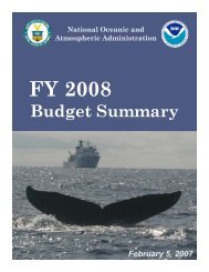
NATIONAL OCEANIC AND ATMOSPHERIC ADMINISTRATION<br />
FY2011 BUDGET SUMMARY<br />
<strong>Procurement</strong>, <strong>Acquisition</strong>, <strong>and</strong> <strong>Construction</strong> (PAC)<br />
(Dollars in Thous<strong>and</strong>s)<br />
FY 2009<br />
Enacted<br />
FY 2010<br />
enacted<br />
FY 2011<br />
Request<br />
Increase<br />
(Decrease)<br />
National Ocean Service 46,188 40,890 34,385 (6,505)<br />
National Marine Fisheries Service 4,600 0 0 0<br />
Ocean <strong>and</strong> Atmospheric Research 11,579 10,379 10,379 0<br />
National Weather Service 110,951 102,727 100,731 (1,996)<br />
National Environmental Satellite, Data <strong>and</strong> 990,579 1,199,357 2,018,796 819,439<br />
Information Service<br />
Program Support 81,750 2,000 26,800 24,800<br />
GRAND TOTAL PAC 1,245,647 1,360,353 2,191,091 830,738<br />
Total FTE 190 190 190 0<br />
Systems <strong>Acquisition</strong> 1,098,727 1,317,731 2,149,528 831,797<br />
<strong>Construction</strong> 135,420 40,622 28,763 (11,859)<br />
Fleet Replacement 11,500 2,000 12,800 10,800<br />
TOTAL 1,245,647 1,360,353 2,191,091 830,738<br />
Budget Trends FY 2005-2011<br />
$2500000<br />
(Dollars in thous<strong>and</strong>s)<br />
$2000000<br />
$1500000<br />
PAC<br />
$1000000<br />
$500000<br />
$0<br />
2005<br />
Enacted<br />
2006<br />
Enacted<br />
2007<br />
Enacted<br />
2008<br />
Enacted<br />
2009<br />
Enacted<br />
2010<br />
Enacted<br />
2011<br />
Request<br />
PAC: <strong>Procurement</strong>, <strong>Acquisition</strong>, & <strong>Construction</strong><br />
3-84
CHAPTER 3<br />
<strong>NOAA</strong> procurement, acquisition, & construction<br />
NATIONAL OCEAN SERVICE $34,385,000<br />
<strong>Construction</strong>: <strong>NOAA</strong> requests an increase of $10,000,000 <strong>and</strong> 0 FTEs. This increase is comprised of one<br />
initiative:<br />
(BA IN THOUSANDS)<br />
FY 2011<br />
Request FY 2012 FY 2013 FY 2014 FY 2015<br />
CELCP 25,000 25,000 25,000 25,000 25,000<br />
Coastal <strong>and</strong> Estuarine L<strong>and</strong> Conservation Program: <strong>NOAA</strong> requests an increase of<br />
$10,000,000 <strong>and</strong> 0 FTE for the Coastal <strong>and</strong> Estuarine L<strong>and</strong> Conservation Program<br />
(CELCP). Coastal counties are home to almost 153 million people, about 53 percent of the<br />
total U.S. population, <strong>and</strong> by 2015 the coastal population is estimated to reach 165 million.<br />
As the coastal population continues to increase, there are many competing dem<strong>and</strong>s for<br />
limited coastal areas <strong>and</strong> growing pressure to develop the remaining l<strong>and</strong>s. Coastal l<strong>and</strong>s<br />
<strong>and</strong> estuaries are ecologically productive <strong>and</strong> economically important. Through the competitive<br />
CELCP program, <strong>NOAA</strong> provides grants to state <strong>and</strong> local governments to protect<br />
important coastal <strong>and</strong> estuarine areas that have significant conservation, recreational,<br />
ecological, historic or aesthetic value that are threatened by development, such as tidal or<br />
freshwater wetl<strong>and</strong>s, stream buffers, <strong>and</strong> floodplains. This increase of $10,000,000 will<br />
support l<strong>and</strong> conservation grants, approximately 2-3 conservation projects per year. This<br />
funding will also enable <strong>NOAA</strong> to ensure that conservation projects satisfy the requirements<br />
of NEPA <strong>and</strong> meet federal appraisal st<strong>and</strong>ards. The federal grants require matching funds,<br />
which leverage additional state, local or private contributions. The program gives priority to<br />
l<strong>and</strong>s that can be effectively managed <strong>and</strong> protected <strong>and</strong> have significant ecological value.<br />
NATIONAL WEATHER SERVICE $100,731,000<br />
Systems <strong>Acquisition</strong>: <strong>NOAA</strong> requests an increase of $7,358,000 <strong>and</strong> 0 FTEs. This increase is composed<br />
of four new initiatives:<br />
FY 2011<br />
(BA IN THOUSANDS) Request FY 2012 FY 2013 FY 2014 FY 2015<br />
NEXRAD 11,126 5,819 0 0 0<br />
NEXRAD Radar located at the WSR-88D Radar Operations<br />
Center in Norman, Oklahoma<br />
Next Generation Weather Radar (NEXRAD) Product Improvement (PI): <strong>NOAA</strong> requests<br />
an increase of $3,150,000 <strong>and</strong> 0 FTEs to fund projected costs for the<br />
acquisition <strong>and</strong> deployment of Dual Polarization technology to NWS operational<br />
<strong>and</strong> support site NEXRAD locations. Doppler weather radar is the primary tool for<br />
issuing local storm warnings for flash floods, tornados, <strong>and</strong> severe thunderstorms.<br />
Currently, NEXRAD only transmits <strong>and</strong> receives a horizontal signal. Dual Polarization will<br />
add a vertical component. The addition of a vertical component greatly improves<br />
accuracy in estimation (quantity) <strong>and</strong> differentiation (rain, hail, snow, freezing rain, etc.)<br />
of precipitation. The outcome will be improved flash flood warnings; improved identification<br />
of <strong>and</strong> warnings for tornados, severe hail, dangerous freezing rain, snow; <strong>and</strong><br />
enhanced water management capability.<br />
3-85
NATIONAL OCEANIC AND ATMOSPHERIC ADMINISTRATION<br />
FY2011 BUDGET SUMMARY<br />
(BA IN THOUSANDS)<br />
Complete & Sustain<br />
NWR<br />
FY 2011<br />
Request FY 2012 FY 2013 FY 2014 FY 2015<br />
12,614 5,594 5,594 5,590 5,590<br />
Complete <strong>and</strong> Sustain <strong>NOAA</strong> Weather Radio (NWR): <strong>NOAA</strong> requests an increase of<br />
$1,614,000 <strong>and</strong> 0 FTEs to continue the modernization of the <strong>NOAA</strong><br />
Weather Radio system via the Weather Radio Improvement Project<br />
(WRIP). The NWS is required to provide weather watches <strong>and</strong> warnings <strong>and</strong><br />
other non-weather emergency messages to the public <strong>and</strong> emergency<br />
managers through the <strong>NOAA</strong> Weather Radio <strong>and</strong> the NWS. The most critical<br />
component of WRIP is the replacement of the obsolete <strong>and</strong> unsupportable<br />
broadcast recoding equipment, the Console Replacement System (CRS), at<br />
each of the Weather Forecast Offices (WFOs). NWS will deploy the NWR<br />
Broadcast Management System (BMS) as a replacement for the CRS. The<br />
CRS is a main component of <strong>NOAA</strong> Weather Radio that converts text warning<br />
messages into digital voice, which gives the NWS the ability to quickly <strong>NOAA</strong> Weather Radios<br />
disseminate Severe <strong>and</strong> High Impact Weather Warnings, Watches <strong>and</strong><br />
forecasts <strong>and</strong> Non-Weather Emergency Messages to the public. This increase<br />
is required to keep the project on schedule for completion of the CRS replacement in<br />
FY 2012. Funding for FY 2013-2015 is required to sustain a steady state operation of the<br />
NWR.<br />
FY 2011<br />
(BA IN THOUSANDS) Request FY 2012 FY2013 FY 2014 FY 2015<br />
<strong>NOAA</strong> Profiler Network 9,730 9,730 11,960 0 0<br />
<strong>NOAA</strong> Profiler Conversion: <strong>NOAA</strong> requests a restoration of $2,230,000 <strong>and</strong> 0 FTEs<br />
to increase the base level funding for the <strong>NOAA</strong> Profiler Network (NPN) to continue<br />
the planned technology refresh <strong>and</strong> operating frequency conversion of the 20-year<br />
old NPN to that recommended in the President’s FY 2010 Budget but<br />
not provided for in the Consolidated Appropriations Act, 2010. The<br />
Wind Profilers, vertical looking radars installed in 1988, are used as input for<br />
numerical (computer) weather models that predict clouds, precipitation, <strong>and</strong><br />
temperature. The data also provides important indicators of where severe<br />
weather such as tornadoes <strong>and</strong> winter storms will form <strong>and</strong> is used for<br />
issuing aviation advisories, volcanic ash plumes <strong>and</strong> wildfire predictions.<br />
NPN winds improve probability of detection (+27%), decrease false alarm<br />
rate (-20%), <strong>and</strong> improve lead time (+14%) for tornado warnings, as well as<br />
severe thunderstorms, flash floods, <strong>and</strong> winter storms. They also improve<br />
<strong>NOAA</strong> Profiler in McCook, NE<br />
warnings related to aviation <strong>and</strong> fire weather. The NPN has been installed for<br />
over 20 years without any technology refresh during its life cycle. The<br />
proposed increase will (1) convert thirty-two of the profilers currently operating at 404MHz<br />
to 449MHz <strong>and</strong> to provide technology refresh to each (20-year old system) <strong>and</strong> (2) provide<br />
technology refresh to the five profilers which are currently operating at the 449 Mhz frequency.<br />
Without this funding, all radars operating on the old frequency will be shut down<br />
due to interference with the European Galileo satellites.<br />
3-86
CHAPTER 3<br />
<strong>NOAA</strong> procurement, acquisition, & construction<br />
(BA IN THOUSANDS)<br />
FY 2011<br />
Request FY 2012 FY 2013 FY 2014 FY 2015<br />
AWIPS Tech Infusion 24,364 24,364 24,364 24,364 24,364<br />
AWIPS Workstations in Tallahassee, FL<br />
AWIPS Technology Infusion: <strong>NOAA</strong> requests an increase of $364,000 <strong>and</strong> 0 FTEs to<br />
increase the base level of funding to that recommended in the FY 2010 President’s<br />
Budget, but not provided for in the Consolidated Appropriations Act, 2010.<br />
AWIPS is the cornerstone of the modernized NWS. This system integrates <strong>and</strong> displays<br />
all hydrometeorological data at NWS field offices. This system integrates satellite,<br />
NEXRAD Doppler weather radar data, <strong>and</strong> Numerical Weather Prediction (NWP) data,<br />
enabling field forecasters to visualize environmental processes to create timely <strong>and</strong><br />
accurate forecasts <strong>and</strong> warnings. An upgrade from AWIPS I to AWIPS II will provide<br />
improved hardware <strong>and</strong> software for this system. AWIPS II will optimize data access<br />
<strong>and</strong> use by allowing regional queries, enabling forecasters to create timely <strong>and</strong> accurate<br />
forecasts <strong>and</strong> warnings. AWIPS II Extended is a multi-phase program to add significant<br />
improvements to AWIPS II to provide improved functionalities <strong>and</strong> capabilities to the<br />
NWS field forecasters, <strong>NOAA</strong> partners <strong>and</strong> the public.<br />
<strong>Construction</strong>: <strong>NOAA</strong> requests an increase of $3,150,000 <strong>and</strong> 0 FTEs for NWS <strong>Construction</strong>. This increase<br />
is composed of one new initiative:<br />
FY 2011<br />
(BA IN THOUSANDS) Request FY 2012 FY 2013 FY 2014 FY 2015<br />
WFO <strong>Construction</strong> 3,150 3,150 3,150 3,150 3,150<br />
Weather Forecast Office (WFO) <strong>Construction</strong>: <strong>NOAA</strong> requests an increase of<br />
$3,150,000 <strong>and</strong> 0 FTEs for modernization projects in the Alaska <strong>and</strong> Pacific Regions<br />
as well as the replacement of end of life heating, ventilating, <strong>and</strong> air conditioning<br />
(HVAC) systems at six (6) WFOs with modern, high efficiency (green) units.<br />
Specifically, increased funding completes Barrow, Alaska employee housing <strong>and</strong> the<br />
upper air inflatable shelter, Weather Service Office Koror renovations, <strong>and</strong> six HVAC<br />
replacements at WFOs with newer energy efficient models.<br />
<strong>Construction</strong> of the Weather Service Office in Annette, Alaska<br />
3-87
NATIONAL OCEANIC AND ATMOSPHERIC ADMINISTRATION<br />
FY2011 BUDGET SUMMARY<br />
National Environmental Satellite, Data, & Information Service $2,018,796,000<br />
Systems <strong>Acquisition</strong>: <strong>NOAA</strong> requests a net increase of $831,439,000 <strong>and</strong> 0 FTEs. This increase is comprised<br />
of six new initiatives <strong>and</strong> one planned decrease:<br />
(BA IN THOUSANDS)<br />
FY 2011<br />
Request FY 2012 FY 2013 FY 2014 FY 2015<br />
GOES-R 730,000 773,700 777,800 779,500 780,300<br />
Geostationary Operational Environmental Satellites (GOES): <strong>NOAA</strong> requests a<br />
planned increase of $62,500,000 <strong>and</strong> 0 FTEs for the GOES-R Series to<br />
provide continued satellite engineering development <strong>and</strong> production<br />
activities. GOES-R is a cooperative venture between <strong>NOAA</strong> <strong>and</strong> the National<br />
Aeronautics <strong>and</strong> Space Administration (NASA). <strong>NOAA</strong> defines requirements,<br />
implements system integration, procures ground segments, manages,<br />
funds, <strong>and</strong> operates the satellites. NASA serves as the agency with<br />
multi-disciplinary engineering expertise, develops detailed system specifications,<br />
procures <strong>and</strong> launches the spacecraft, <strong>and</strong> assists <strong>NOAA</strong> in system<br />
integration.<br />
The GOES system provides an uninterrupted, continuous flow of environmental<br />
<strong>and</strong> weather data <strong>and</strong> information that meets customers’ spatial,<br />
Artist’s rendering of GOES-R<br />
temporal <strong>and</strong> accuracy requirements, providing significant customer benefit<br />
within an established Life Cycle Cost (LCC). The GOES-R series provides for two satellites<br />
with a LCC of $7.67 billion through 2028. The series includes the following instruments<br />
that are under development: the Advanced Baseline Imager (ABI), Space Environment<br />
In-Situ Suite (SEISS), Extreme Ultraviolet Sensor/X-Ray Sensor Irradiance Sensors (EXIS),<br />
Solar Ultraviolet Imager (SUVI), Geostationary Lightning Mapper (GLM), <strong>and</strong> Magnetometer.<br />
The GOES-R series satellites will not only provide critical weather observations for severe<br />
weather events such as hurricanes, but will also provide key enhancements in observational<br />
capabilities for climate, oceans <strong>and</strong> coasts, <strong>and</strong> the space environment. In FY 2011, the<br />
program will continue development of the instruments, spacecraft, <strong>and</strong> ground system.<br />
Funds will also be used to conduct Critical Design Reviews (CDR) for the spacecraft <strong>and</strong><br />
ground system for a planned launch in 2015, as well as the continuation of the ground<br />
system antenna contract.<br />
FY 2011<br />
(BA IN THOUSANDS) Request FY2012 FY2013 FY2014 FY2015<br />
POES 40,874 40,874 40,874 40,874 40,874<br />
Polar-orbiting Operational Environmental Satellite (POES): <strong>NOAA</strong> requests a<br />
planned decrease of $2,261,000 <strong>and</strong> 0 FTEs for the continuation of the POES program<br />
<strong>and</strong> continued support for the MetOp (European Weather Satellite) program.<br />
POES launched the last satellite in the POES Series (N-Prime) in February 2009. Funds will<br />
be used to provide satellite <strong>and</strong> instrument anomaly support to the on-orbit POES satellites,<br />
maintain the ground system for their operation, <strong>and</strong> support the maintenance <strong>and</strong> testing of<br />
U.S. instruments on the MetOp satellites.<br />
3-88
CHAPTER 3<br />
<strong>NOAA</strong> procurement, acquisition, & construction<br />
(BA IN THOUSANDS)<br />
FY 2011<br />
Request FY 2012 FY 2013 FY 2014 FY 2015<br />
Jason-3 50,000 53,000 29,000 2,000 2,000<br />
Jason-3: <strong>NOAA</strong> requests an increase of $30,000,000 <strong>and</strong> 0 FTEs to continue the<br />
development of the Jason-3 satellite altimetry mission in partnership with the<br />
European Organization for the Exploitation of Meteorological Satellites (EUMET-<br />
SAT), which started in FY 2010. Jason-3 will provide continuity of precise measurement<br />
of sea surface height, which is an important measurement to assess climate change, for<br />
applications in ocean climatology (global sea-level rise, decadal variability in the ocean,<br />
seasonal/inter-annual variability, <strong>and</strong> coastal variability <strong>and</strong> its impact on ecosystems);<br />
<strong>and</strong> ocean weather (operational oceanography, surface wave forecasting, <strong>and</strong> hurricane<br />
intensity forecasting). Jason-3 will continue the nearly 20-year climate data record created<br />
by the altimetry missions of TOPEX/POSEIDON <strong>and</strong> Jasons-1 <strong>and</strong> -2. <strong>NOAA</strong> will provide<br />
the launch vehicle <strong>and</strong> services <strong>and</strong> the microwave radiometer. EUMETSAT will provide the<br />
spacecraft <strong>and</strong> the altimeter. Both agencies will provide precision orbit <strong>and</strong> ground system<br />
components as required for respective operations of the satellite. The satellite will be<br />
comm<strong>and</strong>ed from either of the two <strong>NOAA</strong> Comm<strong>and</strong> <strong>and</strong> Data <strong>Acquisition</strong>s (CDA) stations<br />
or the third EUMETSA station in Europe depending on which ground station is visible to<br />
the satellite. The data collected from each ground station is shared between the partners<br />
so that each will have a complete data set. This request allows <strong>NOAA</strong> <strong>and</strong> EUMETSAT to<br />
launch Jason-3 in 2013, providing an overlap with the Jason-2 mission of six months. This<br />
overlap period is necessary to conduct calibration <strong>and</strong> validation with Jason-2, complete<br />
on-orbit check-out operations, <strong>and</strong> maintain consistent observations of sea surface height<br />
between successive altimeter missions. In FY 2011, funds will continue to be used to<br />
procure the microwave radiometer <strong>and</strong> precision orbit determination components, <strong>and</strong> start<br />
launch vehicle building <strong>and</strong> testing.<br />
(BA IN THOUSANDS)<br />
Joint Polar Satellie<br />
System<br />
FY 2011<br />
Request FY 2012 FY 2013 FY 2014 FY 2015<br />
1,060,800 1,160,000 960,000 740,000 610,000<br />
Joint Polar Satellite System (formerly-National Polar-orbiting Operational Environmental<br />
Satellite System (NPOESS)): <strong>NOAA</strong> requests an increase of $678,600,000<br />
<strong>and</strong> 0 FTEs to continue development of the instruments <strong>and</strong> spacecraft under the<br />
restructured next generation polar orbiting satellite program. The program will continue<br />
to address <strong>NOAA</strong>’s requirements to provide global environmental data used in numerical<br />
weather prediction models for near-term (1-3 day) <strong>and</strong> mid-term (3-5 day) forecasts,<br />
as well as provide space weather observation, search <strong>and</strong> rescue detection capabilities,<br />
<strong>and</strong> direct read-out <strong>and</strong> data collection products <strong>and</strong> services to customers. The new Joint<br />
Polar Satellite System continues a number of management <strong>and</strong> acquisition reforms that<br />
will be initiated in FY 2010 to deliver polar observations necessary to meet both the civil<br />
<strong>and</strong> military needs for weather <strong>and</strong> climate information. NASA, on behalf of <strong>NOAA</strong>, will<br />
provide the acquisition management for those segments that support the afternoon mission<br />
requirement, as well as those segments common to both the civil <strong>and</strong> military mission<br />
(e.g., ground systems). The Department of Defense will continue the acquisition of its early<br />
morning orbit assets. FY 2011 funds will continue to transition afternoon orbit instrument<br />
3-89
NATIONAL OCEANIC AND ATMOSPHERIC ADMINISTRATION<br />
FY2011 BUDGET SUMMARY<br />
asset acquisitions from DoD to NASA <strong>and</strong> will continue the procurement of an NPP-like<br />
spacecraft for the afternoon orbit. In addition, funds will support the launch readiness of<br />
NPP. A successful system will improve the nation’s ability to collect <strong>and</strong> distribute higher<br />
resolution data <strong>and</strong> products. This is achieved through the modernization of sensors <strong>and</strong><br />
systems to ensure improved performance, compatibility, supportability, <strong>and</strong> maintainability.<br />
It will improve forecasts, climate monitoring, <strong>and</strong> warning lead times for severe storms. Data<br />
<strong>and</strong> imagery obtained from the Joint Polar Satellite System will help increase timeliness,<br />
accuracy, <strong>and</strong> cost effectiveness of public warnings <strong>and</strong> forecasts of climate <strong>and</strong> weather<br />
events, thus reducing the potential loss of human life <strong>and</strong> property.<br />
FY 2011<br />
(BA IN THOUSANDS) Request FY 2012 FY 2013 FY 2014 FY 2015<br />
Climate Sensors 49,400 55,400 51,100 50,600 35,500<br />
Restoration of Climate Sensors: <strong>NOAA</strong> requests an increase of $49,400,000 <strong>and</strong><br />
0 FTEs to continue with the remanifest of NPOESS climate sensors that were<br />
demanifested from the NPOESS program as a result of the Nunn-McCurdy Certification<br />
Process in FY 2006. The re-manifestation plan that is being implemented is based<br />
on a prioritized list of measurements that was developed by <strong>NOAA</strong>, NASA, <strong>and</strong> the Office of<br />
Science <strong>and</strong> Technology Policy in consultation with the National Academy of Sciences. The<br />
continuation of the data sets from these instruments is critical to climate change research<br />
<strong>and</strong> underst<strong>and</strong>ing the impacts of climate change. The prospect of climate change has<br />
profound implications for global society <strong>and</strong> the environment, underscoring the need for information<br />
derived from these instruments to aid decision makers in developing <strong>and</strong> evaluating<br />
options for mitigating the impacts of climate change as well as alternatives for adapting<br />
to a changing climate. These climate sensors will improve the nation’s ability to collect <strong>and</strong><br />
distribute higher resolution data <strong>and</strong> products. This is achieved through the modernization<br />
of sensors <strong>and</strong> systems to ensure improved performance, compatibility, supportability, <strong>and</strong><br />
maintainability. The modernization of sensors will improve forecasts <strong>and</strong> climate monitoring<br />
which will benefit agriculture, transportation, <strong>and</strong> energy production. Funding provided in<br />
FY 2011 will continue to build the Cloud <strong>and</strong> Earth Radiant System (CERES) Flight Model<br />
6 (FM-6) <strong>and</strong> Total Solar Irradiance Sensor (TSIS) #1 for the first satellite of the Joint Polar<br />
Satellite System, as well as begin instrument development work for CERES FM-7 (for Earth<br />
Radiation Budget) <strong>and</strong> the Ozone Mapping <strong>and</strong> Profiler Suite (OMPS) (for ozone).<br />
3-90<br />
FY 2011<br />
(BA IN THOUSANDS) Request FY 2012 FY 2013 FY 2014 FY 2015<br />
COSMIC-2 3,700 8,300 10,300 9,500 16,500<br />
Constellation Observing System for Meteorology, Ionosphere, <strong>and</strong> Climate (COS-<br />
MIC-2): <strong>NOAA</strong> requests an increase of $3,700,000 <strong>and</strong> 0 FTEs to collaborate with<br />
the Taiwan National Space Organization (NSPO) for the launch of 12 satellites to<br />
provide replenishment <strong>and</strong> operational upgrade for the current COSMIC constellation.<br />
COSMIC is a 6 satellite constellation that was launched in 2006 in collaboration<br />
between Taiwan, National Science Foundation, NASA, U.S. Air Force <strong>and</strong> the University<br />
Corporation for Atmospheric Research (UCAR). This constellation was a proof-of-concept<br />
effort for a new <strong>and</strong> inexpensive atmospheric sounding technique using the U.S. Air Force<br />
GPS system as a sounding source, called GPS Radio Occultation (GPSRO). The new tech-
CHAPTER 3<br />
<strong>NOAA</strong> procurement, acquisition, & construction<br />
Six microsatellites are entering low-Earth orbit to<br />
form COSMIC, the Constellation Observing System for<br />
Meteorology, Ionosphere, <strong>and</strong> Climate<br />
Illustration courtesy Orbital Sciences Corporation<br />
nique proved so accurate <strong>and</strong> beneficial that <strong>NOAA</strong> began using the data operationally for<br />
weather forecasting within a year of the COSMIC launch. COSMIC provides extremely<br />
accurate, bias free, daily worldwide measurements of atmospheric temperature <strong>and</strong><br />
moisture profiles over the oceans <strong>and</strong> l<strong>and</strong> that greatly improve <strong>NOAA</strong>’s operational<br />
weather forecasting accuracy. COSMIC also helps to eliminate bias for artificial offsets<br />
in other observing systems, which advances the overall impact on operational model<br />
systems <strong>and</strong> makes it a backbone for the total observing system. COSMIC provides<br />
over 2500 atmospheric soundings every 24 hours around the globe, an improvement of<br />
about twice the number of daily weather balloon observations which are concentrated<br />
mostly over l<strong>and</strong>. The success of the mission has inaugurated an age of operational<br />
GPS sounding for weather forecasting, climate analysis <strong>and</strong> research, ionospheric<br />
monitoring, <strong>and</strong> a suite of related Earth science pursuits. In this partnership, <strong>NOAA</strong> will<br />
procure radio occultation (RO) sensors, launch services, ground station support <strong>and</strong><br />
sensor processing support. Taiwan will provide the spacecraft <strong>and</strong> integrate the sensors<br />
onto them. The funding in FY 2011 will start the development efforts for the sensors for<br />
COSMIC 2, as well as systems engineering, which is necessary to meet the FY 2014<br />
launch date.<br />
FY 2011<br />
(BA in Thous<strong>and</strong>s) Request FY 2012 FY 2013 FY 2014 FY 2015<br />
DSCOVR 9,500 38,300 25,400 3,800 2,400<br />
Deep Space Climate Observatory (DSCOVR): <strong>NOAA</strong> requests an increase of<br />
$9,500,000 <strong>and</strong> 0 FTEs to acquire solar wind <strong>and</strong> Coronal Mass Ejection (CME)<br />
data. This acquisition will fund the refurbishment of an existing NASA satellite DSCOVR,<br />
as well as purchase <strong>and</strong> add a CME imager to the mission to provide solar wind data for<br />
geomagnetic storm forecasting. Under a reimbursable agreement between NESDIS <strong>and</strong><br />
NASA, NASA/Goddard Space Flight Center (GSFC) will perform the refurbishment of the<br />
DSCOVR satellite currently housed at GSFC. It is anticipated that <strong>NOAA</strong> will lose two of its<br />
most critical observational data sources for geomagnetic storm warnings when the NASA<br />
ACE <strong>and</strong> the NASA/ESA SOHO satellites (which have already exceeded their operational<br />
life) fail. Low reliability of the satellites <strong>and</strong> sensors <strong>and</strong> the high risk of unavailability of the<br />
data pose one of the most serious gaps for <strong>NOAA</strong>’s space weather services. This comes<br />
at a time when a large increase in geomagnetic storm frequency <strong>and</strong> severity is expected<br />
during the next solar maximum beginning in 2013 lasting for several years. According to<br />
a recent report by the National Academies, geomagnetic storm-disabled electric power<br />
grids <strong>and</strong> collateral impacts could result in projected economic <strong>and</strong> societal costs of ~$1<br />
-$2 trillion, <strong>and</strong> full recovery could take 4 –10 years. Space weather has demonstrated the<br />
potential to disrupt virtually every major public infrastructure system, including commercial<br />
airlines <strong>and</strong> other transportation systems, telecommunications, electric power grids, <strong>and</strong><br />
global positioning systems (GPS). With this increase, <strong>NOAA</strong> will continue to provide timely<br />
<strong>and</strong> accurate alerts <strong>and</strong> warnings of geomagnetic storms to support these key industries<br />
<strong>and</strong> minimize disruptions to service.<br />
Program Support $26,800,000<br />
<strong>Construction</strong>: <strong>NOAA</strong> requests an increase of $14,000,000 <strong>and</strong> 0 FTEs in the Program Support <strong>Construction</strong><br />
sub-activity. This increase is comprised of one new initiative:<br />
3-91
NATIONAL OCEANIC AND ATMOSPHERIC ADMINISTRATION<br />
FY2011 BUDGET SUMMARY<br />
(BA in Thous<strong>and</strong>s)<br />
FY 2011<br />
Request FY 2012 FY 2013 FY 2014 FY 2015<br />
Pacific Regional Center 14,000 1,000 1,000 0 0<br />
Pacific Regional Center: <strong>NOAA</strong> requests an increase of $14,000,000 <strong>and</strong> 0 FTEs<br />
to support acquisition <strong>and</strong> installation of the IT infrastructure for the main facility<br />
at the new Pacific Regional Center (PRC) on Ford Isl<strong>and</strong>, in Honolulu, HI. <strong>NOAA</strong><br />
received funding in the American Recovery <strong>and</strong> Reinvestment Act of 2009 ( P.L. 111-5)<br />
<strong>and</strong> the Omnibus Budget Act of 2009 ( P.L. 111-8) to complete the building construction<br />
phase of the PRC project <strong>and</strong> achieve full consolidation of its operations on the isl<strong>and</strong> of<br />
Oahu, Hawaii, with construction of the Main Facility. The FY2011 request will enable <strong>NOAA</strong><br />
to complete acquisition <strong>and</strong> installation of the information technology infrastructure for the<br />
Main Facility <strong>and</strong> <strong>NOAA</strong> project management costs associated with the project. The Pacific<br />
Regional Center is a multi-phase, multi-year construction project to consolidate <strong>NOAA</strong><br />
programs <strong>and</strong> operations on the isl<strong>and</strong> of Oahu into a single facility on federally-owned<br />
property at Ford Isl<strong>and</strong>. By bringing the programs together into one facility, <strong>NOAA</strong> expects<br />
to realize benefits in improved operations <strong>and</strong> mission performance, longer-term operational<br />
savings, <strong>and</strong> opportunities for greater program collaboration <strong>and</strong> synergy-both within <strong>NOAA</strong><br />
<strong>and</strong> with external partners.<br />
OMAO Fleet Replacement: <strong>NOAA</strong> requests an increase of $10,800,000 <strong>and</strong> 0 FTEs in the Program<br />
Support OMAO Fleet Replacement sub-activity. This increase is comprised of four new initiatives:<br />
(BA in Thous<strong>and</strong>s)<br />
Fleet Capital Improvements<br />
& Technology Refresh<br />
FY 2011<br />
Request FY 2012 FY 2013 FY 2014 FY 2015<br />
8,400 1,000 1,000 1,000 1,000<br />
Fleet Capital Improvements <strong>and</strong> Technology Infusion: <strong>NOAA</strong> requests an increase of<br />
$7,400,000 <strong>and</strong> 0 FTE to accelerate a planned FY 2013 Major Repair Period (MRP)<br />
for Miller Freeman. Miller Freeman was delivered to <strong>NOAA</strong> in 1967 <strong>and</strong> is one of the<br />
oldest ships in the fleet. Recent dry dock work <strong>and</strong> associated material assessments in FY<br />
2009 confirm the ship’s continuing <strong>and</strong> rapidly deteriorating condition from its<br />
advanced age. In FY 2009 <strong>NOAA</strong> Fisheries experienced higher loss of Miller<br />
Freeman operating times due to mechanical breakdown <strong>and</strong> shipyard delays,<br />
negatively affecting their ability to conduct critical science <strong>and</strong> stock assessments.<br />
To extend ship service life <strong>and</strong> ensure safe operations, this increase<br />
will address the most critical structural, mechanical, <strong>and</strong> electrical maintenance<br />
<strong>and</strong> repair needs in order to safely operate Miller Freeman through<br />
2017. If the MRP is not completed, OMAO risks continued unplanned mechanical<br />
or infrastructure failures due to poor structural integrity resulting from<br />
Miller Freeman underway<br />
hull <strong>and</strong> structural metal loss that will result in lost days at sea. Also, the ship’s<br />
condition may jeopardize compliance with the ship certification requirements of the American<br />
Bureau of Shipping (ABS) <strong>and</strong> result in increased lost days at sea.<br />
3-92
CHAPTER 3<br />
<strong>NOAA</strong> procurement, acquisition, & construction<br />
(BA in Thous<strong>and</strong>s)<br />
New Vessel <strong>Construction</strong><br />
(FSV5)<br />
FY 2011<br />
Request FY 2012 FY 2013 FY 2014 FY 2015<br />
3,000 0 0 0 0<br />
New Vessel <strong>Construction</strong> FSV5: <strong>NOAA</strong> requests an increase of $3,000,000 <strong>and</strong> 0<br />
FTEs to design a new shallow-draft Fisheries Survey Vessel (FSV 5). <strong>NOAA</strong> plans to<br />
modernize its fleet, consistent with <strong>NOAA</strong>’s Ship Recapitalization Plan (SRP), <strong>and</strong> addresses<br />
the oldest vessels <strong>and</strong> those at-sea requirements most at risk first. A shallow-draft FSV<br />
will be needed to replace Oregon II which is among the oldest ships in the <strong>NOAA</strong> Fleet at<br />
44 years of service life by FY 2011. Oregon II is an Oscar Dyson class vessel (FSV1-FSV4)<br />
which has a draft of 19 feet <strong>and</strong> 29 feet with the scientific center-board extended. The draft<br />
limits the ability to conduct living-resource <strong>and</strong> coral-habitat surveys in waters shallower<br />
than 42 feet, making it unsuitable to operate in the Gulf of Mexico. The shallow-draft FSV<br />
will operate in near-shore coastal waters as shallow as 30 feet <strong>and</strong> is intended to be the<br />
primary ship supporting Gulf of Mexico living-marine resource, habitat, <strong>and</strong> integratedecosystem<br />
surveys. The funding for additional design work would leverage existing<br />
designs while developing a shallow draft vessel to meet these requirements. Data from<br />
these cruises are critical to assessments of the snapper-grouper complex, billfish, tunas,<br />
swordfish <strong>and</strong> sharks, <strong>and</strong> status of protected species, habitat, <strong>and</strong> ecosystem health. From<br />
FY 2000 to FY 2006, Oregon II lost an average of 19 days of operation each year due to<br />
engineering related problems. If a suitable replacement ship is not acquired, Oregon II will<br />
reach the end of its useful service life <strong>and</strong> will be removed from service in FY 2016.<br />
(BA in Thous<strong>and</strong>s)<br />
Fisheries Survey Vessel<br />
(FSV 6)<br />
FY 2011<br />
Request FY 2012 FY 2013 FY 2014 FY 2015<br />
1,400 1,400 2,900 0 0<br />
New Vessel <strong>Construction</strong> FSV6: <strong>NOAA</strong> requests an increase of $1,400,000 <strong>and</strong> 0<br />
FTE to provide project management <strong>and</strong> change margin funds for Fisheries Survey<br />
Vessel (FSV6). FSV6 will replace David Starr Jordan <strong>and</strong> perform acoustic surveys for fish<br />
<strong>and</strong> zooplankton <strong>and</strong> launch <strong>and</strong> recover a work boat in open seas. <strong>NOAA</strong> requires data<br />
collected at sea to achieve outcomes m<strong>and</strong>ated by Congress <strong>and</strong> the economic impact is<br />
significant. The Magnuson-Stevens Fisheries Conservation <strong>and</strong> Management Reauthorization<br />
Act require sufficient data to establish annual catch limits for fisheries. If sufficient data<br />
is not available, catch limits must be reduced from current levels with an estimated negative<br />
impact on the commercial fishing industry of up to $7 billion annually. With this increase<br />
OMAO will procure continuity in the civilian expertise required to monitor <strong>and</strong> evaluate the<br />
contractor’s progress during construction. The requested funding is necessary to complete<br />
construction <strong>and</strong> bring FSV6 into operations.<br />
3-93
NATIONAL OCEANIC AND ATMOSPHERIC ADMINISTRATION<br />
FY2011 BUDGET SUMMARY<br />
(BA in Thous<strong>and</strong>s)<br />
FY 2011<br />
Request FY 2012 FY 2013 FY 2014 FY 2015<br />
Temporary Berthing 0 0 0 0 0<br />
Temporary Berthing: <strong>NOAA</strong> requests a decrease of $1,000,000 <strong>and</strong> 0 FTE for<br />
temporary berthing. Actual costs to berth Bigelow are substantially lower <strong>and</strong> will be<br />
accommodated within the Marine Operations <strong>and</strong> Maintenance-Marine Services activity in<br />
the ORF account.<br />
3-94