Modeling Distribution Poles - Power Line Systems
Modeling Distribution Poles - Power Line Systems
Modeling Distribution Poles - Power Line Systems

You also want an ePaper? Increase the reach of your titles
YUMPU automatically turns print PDFs into web optimized ePapers that Google loves.
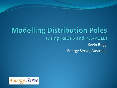
Kevin Rugg<br />
Energy Serve, Australia
You speak a different language and do things a little<br />
different down-under
But basically it is all the same, isn’t it?
Outline<br />
• Introduction – distribution in PLSCADD?<br />
• Before ikeGPS cometh<br />
• What is ike, how it works & what can it do<br />
• Collecting distribution poles data using ikePLS<br />
• Building distribution pole models in ikePLS & PLS-POLE<br />
• <strong>Distribution</strong> line design – importing into PLSCADD<br />
• Accuracy limitations & options
Introduction<br />
• Modelling distribution structures in PLSCADD/POLE is a<br />
challenge due to the variety and variability<br />
• When modelling existing lines, recording the various<br />
structure types and measurements has seen many tools<br />
and approaches taken<br />
• Even if one or more photographs of each pole are taken,<br />
tying the photos and all related info together has been<br />
difficult<br />
• Now all can be managed simply with a single tool - ikeGPS
Before<br />
After
Introduction cont’d<br />
• Most power companies have GIS network databases<br />
including pole locations, size, age, type, condition etc<br />
• Some are now recording & storing images as well<br />
• Using ikeGPS has the added benefit of geo-location of<br />
images, scaled measurement and PLS-POLE modelling<br />
(whether immediately or later)<br />
• Horizon <strong>Power</strong> in Australia being one example<br />
• So how does ikeGPS work?
July 20, 2013 ikeGPS Proprietary<br />
8<br />
Sub-meter GPS<br />
Digital camera<br />
Removable SD card<br />
Ruggedized mobile computer<br />
Laser rangefinder<br />
Best-in-class compass<br />
Military tough, waterproof<br />
<strong>Power</strong>ful ikeTools<br />
& ikeSolutions
ikeGPS Overview - ikeTools
ikeGPS Overview - ikeTools
ikeGPS Overview - ikeTools
ikeGPS Overview - ikeAnnotate<br />
True-Size function
ikePLS Overview - ikeAnnotatePLS
ikePLS Overview - ikeAnnotatePLS
Generated in PLS-POLE
Including kml file
ikePLS & PLS-POLE<br />
• ikePLS uses same libraries as PLS-POLE<br />
• Uses library settings for New Projects in File/Preferences<br />
• Demonstration of ikePLS including<br />
• Simple structure modelling<br />
• Creating framing<br />
• Modelling using framing<br />
• Aligning members to images<br />
• Uploading to PLS-POLE
Spotting in PLSCADD<br />
• Importing <strong>Poles</strong> into PLS-CADD for line design<br />
• Automatic Spotting at Feature Codes & alternatives?<br />
• Associate structure photos<br />
• Orientation of structures – primary picture reference<br />
• Mid span heights<br />
• Limitations on GPS accuracy for direct placement of<br />
structures and/or profiling
Using ikeGPS with PLS-CADD<br />
There are several ways to use the ikeGPS system with PLS-CADD for line design, each has their own benefits.<br />
ikeGPS<br />
ikeGPS + Digital<br />
Elevation Model (DEM)<br />
ikeGPS for pole models + Precision<br />
GPS system for pole location<br />
+<br />
+<br />
• Fast, Simple, one piece of kit<br />
• Make pole models<br />
• Improve ground elevation<br />
accuracy (Z-axis) by adding DEM<br />
model data<br />
• Improve pole location and ground profile<br />
accuracy by adding survey grade GPS data<br />
• Two independent operations<br />
- Person 1 Collects photos for pole<br />
models with ikeGPS<br />
- Person 2 Collects pole location/ground<br />
elevation with survey grade GPS<br />
24
Questions