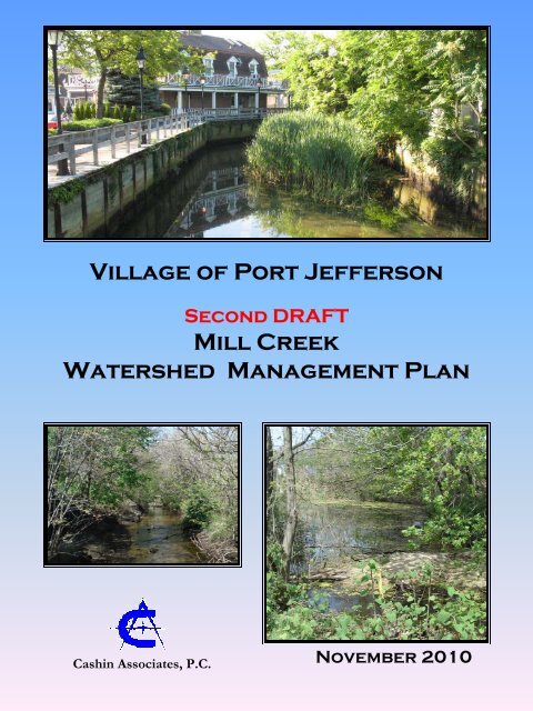
Village of Port Jefferson Mill Creek Watershed Management Plan
Village of Port Jefferson Mill Creek Watershed Management Plan
Village of Port Jefferson Mill Creek Watershed Management Plan

You also want an ePaper? Increase the reach of your titles
YUMPU automatically turns print PDFs into web optimized ePapers that Google loves.
<strong>Village</strong> <strong>of</strong> <strong>Port</strong> <strong>Jefferson</strong><br />
Second DRAFT<br />
<strong>Mill</strong> <strong>Creek</strong><br />
<strong>Watershed</strong> <strong>Management</strong> <strong>Plan</strong><br />
Cashin Associates, P.C.<br />
November 2010
<strong>Village</strong> <strong>of</strong> <strong>Port</strong> <strong>Jefferson</strong><br />
Second Draft<br />
MILL CREEK<br />
WATERSHED MANAGEMENT PLAN<br />
Submitted to:<br />
<strong>Village</strong> <strong>of</strong> <strong>Port</strong> <strong>Jefferson</strong><br />
Prepared by:<br />
Cashin Associates, P.C.<br />
1200 Veterans Memorial Highway<br />
Hauppauge, NY 11788<br />
November 2010<br />
This <strong>Watershed</strong> <strong>Management</strong> <strong>Plan</strong> was prepared for the New York State Department <strong>of</strong><br />
State Division <strong>of</strong> Coastal Resources with funds provided under Title 11 <strong>of</strong> the<br />
Environmental Protection Fund.
Acknowledgements<br />
The <strong>Mill</strong> <strong>Creek</strong> <strong>Watershed</strong> <strong>Management</strong> <strong>Plan</strong> was prepared by the diligent efforts <strong>of</strong> the<br />
following government <strong>of</strong>ficials, agencies, community advisors and consultants.<br />
STATE OF NEW YORK<br />
David Paterson, Governor, State <strong>of</strong> New York<br />
Lorraine Cortés-Vázquez, Secretary <strong>of</strong> State<br />
Dennis Mildner, Coastal Resource Specialist, New York State Department <strong>of</strong> State<br />
Tracey L.M. O’Malley, New York State Department <strong>of</strong> State<br />
VILLAGE OF PORT JEFFERSON<br />
Margot Garant, Mayor<br />
Jim Burke, Trustee<br />
Lee Rosner, Trustee,<br />
Adrienne Kessel, Trustee<br />
Leslea Snyder, Trustee<br />
DEPARTMENTS<br />
Bob Tumilowicz, Grants Administrator, Project Manager<br />
WATERSHED ADVISORY COMMITTEE<br />
Michael Schwarting<br />
Mildred Michos<br />
Peter Koutrakos<br />
CASHIN ASSOCIATES, P.C.<br />
Gregory T. Greene, Principal<br />
Nancy Lenz, RLA, Project Manager
TABLE OF CONTENTS<br />
<strong>Village</strong> <strong>of</strong> <strong>Port</strong> <strong>Jefferson</strong><br />
<strong>Mill</strong> <strong>Creek</strong><br />
<strong>Watershed</strong> <strong>Management</strong> <strong>Plan</strong><br />
ACKNOWLEDGEMENTS<br />
EXECUTIVE SUMMARY ........................................................................................ ES-1<br />
1.0 INTRODUCTION.............................................................................................. 1-1<br />
1.1 PURPOSE OF THE PLAN.............................................................................................. 1-1<br />
1.2 THE WATERSHED ....................................................................................................... 1-2<br />
1.3 PROJECT GOALS.......................................................................................................... 1-2<br />
1.4 PROJECT OBJECTIVES AND METHODOLOGY ...................................................... 1-3<br />
1.5 WATERSHED ACTION COMMITTEE........................................................................ 1-4<br />
2.0 WATERSHED CHARACTERIZATION ....................................................... 2-1<br />
2.1 WATERSHED STUDY AREA DELINEATION........................................................... 2-1<br />
2.2 GEOGRAPHIC SETTING.............................................................................................. 2-2<br />
2.2.1 TOPOGRAPHY .................................................................................................................. 2-2<br />
2.2.2 HYDROLOGY.................................................................................................................... 2-2<br />
2.2.3 SOILS.................................................................................................................................. 2-7<br />
2.2.4 CLIMATE ........................................................................................................................... 2-8<br />
2.2.5 LAND USE AND COVER ................................................................................................. 2-8<br />
2.2.6 ZONING AND POPULATION ........................................................................................ 2-12<br />
2.2.7 PARKS, PRESERVES AND RECREATIONAL SPACES.............................................. 2-13<br />
2.2.8 NATURAL RESOURCES ................................................................................................ 2-14<br />
2.3 WATER QUALITY CHARACTERIZATION ............................................................. 2-20<br />
2.3.1 WATER QUALITY CLASSIFICATIONS AND DESIGNATED USES ........................ 2-21<br />
2.3.2 RESOURCE ISSUES AND IMPAIRMENTS .................................................................. 2-22<br />
2.3.3 PRIOR WATER QUALITY STUDIES AND MONITORING RESULTS...................... 2-23<br />
2.3.4 LAWRENCE AVIATION INDUSTRIES SUPERFUND SITE REMEDIATION .......... 2-25<br />
3.0 EXISTING DRAINAGE AND HABITAT CONDITIONS ASSESSMENT 3-1<br />
3.1 FIELD DATA COLLECTION AND REACH ASSESSMENT...................................... 3-2<br />
3.1.1 EXISTING INFORMATION.............................................................................................. 3-2<br />
3.1.2 INFRASTRUCTURE SURVEY AND MAPPING METHODOLOGY............................. 3-2<br />
3.1.3 REACH DRAINAGE AND HABITAT ASSESSMENTS ................................................. 3-3<br />
3.1.4 WATERSHED QUALITY IMPROVEMENT PROJECTS AND PROGRAMS ............. 3-11<br />
3.2 INTER-MUNICIPAL JURISDICTION AND AGREEMENTS................................... 3-12<br />
3.2.1 JURISDICTIONAL BOUNDARIES ................................................................................ 3-12<br />
November 2010 2 ND Draft<br />
i
<strong>Village</strong> <strong>of</strong> <strong>Port</strong> <strong>Jefferson</strong><br />
<strong>Mill</strong> <strong>Creek</strong><br />
<strong>Watershed</strong> <strong>Management</strong> <strong>Plan</strong><br />
3.2.2 FEDERAL .........................................................................................................................3-12<br />
3.2.3 NEW YORK STATE ........................................................................................................ 3-13<br />
3.2.4 TOWN OF BROOKHAVEN ............................................................................................ 3-15<br />
3.2.5 VILLAGE OF PORT JEFFERSON .................................................................................. 3-16<br />
3.2.6 CITIZEN / CIVIC GROUPS ............................................................................................. 3-16<br />
3.3 LAND AND WATER USE REGULATIONS AND CONTROLS ............................... 3-17<br />
3.3.1 REGULATIONS ............................................................................................................... 3-17<br />
3.3.2 PROGRAMS ..................................................................................................................... 3-22<br />
3.4 POLLUTION POTENTIAL.......................................................................................... 3-22<br />
3.4.1 POLLUTANTS OF CONCERN. ...................................................................................... 3-23<br />
3.4.2 IMPERVIOUS COVER AND RUNOFF POTENTIAL ................................................... 3-27<br />
3.4.3 POLLUTION LOAD ANALYSIS .................................................................................... 3-29<br />
4.0 STORMWATER POLLUTANT CONTROL RECOMMENDATIONS..... 4-1<br />
4.1 WATERSHED-WIDE MITIGATION RECOMMENDATIONS................................... 4-1<br />
4.1.1 NATURAL RESOURCE IDENTIFICATION, PROTECTION AND RESTORATION<br />
RECOMMENDATIONS ................................................................................................... 4-1<br />
4.1.2 EDUCATION AND OUTREACH RECOMMENDATIONS ............................................ 4-5<br />
4.1.3 POINT AND NON-POINT SOURCE MANAGEMENT AND CONTROL<br />
RECOMMENDATIONS ................................................................................................... 4-9<br />
4.1.4 WATER QUALITY AND POLLUTION REDUCTION MONITORING<br />
RECOMMENDATIONS ................................................................................................. 4-17<br />
4.2 SITE-SPECIFIC STRCUTURAL MITIGATION AND TARGET PROJECT<br />
RECOMMENDATIONS .............................................................................................. 4-18<br />
4.2.1 STRUCTURAL BMPS ................................................................................................... 4-18<br />
4.2.2 SITE-SPECIFIC STRUCTURAL MITIGATION RECOMMENDATIONS ................... 4-25<br />
4.2.3 TARGET MITIGATION PROJECT RECOMMENDATIONS ....................................... 4-26<br />
5.0 CREEK CORRIDOR RESTORATION ......................................................... 5-1<br />
6.0 IMPLEMENTATION STRATEGIES............................................................. 6-1<br />
6.1 IMPLEMENTATION SCHEDULE ............................................................................... 6-2<br />
6.2 IMPLEMENTATION PARTNERS................................................................................ 6-3<br />
6.3 CODE AND ORDINANCE ENFORCEMENT AND REVISION ................................ 6-5<br />
6.4 SOURCES OF FUNDING ............................................................................................. 6-6<br />
6.4.1 FEDERAL ........................................................................................................................... 6-6<br />
6.4.2 NEW YORK STATE .......................................................................................................... 6-7<br />
6.4.3 SUFFOLK COUNTY.......................................................................................................... 6-9<br />
ii<br />
November 2010 2 ND Draft
<strong>Village</strong> <strong>of</strong> <strong>Port</strong> <strong>Jefferson</strong><br />
<strong>Mill</strong> <strong>Creek</strong><br />
<strong>Watershed</strong> <strong>Management</strong> <strong>Plan</strong><br />
6.4.4 PORT JEFFERSON VILLAGE ........................................................................................ 6-10<br />
6.5. PHASE II STORMWATER PERMIT COMPLIANCE ............................................. 6-10<br />
6.6 MONITORING AND ASSESSMENT ........................................................................ 6-12<br />
7.0 REFERENCES................................................................................................... 7-1<br />
LIST OF TABLES<br />
Table 2-1 Average Impervious Cover .............................................................................. 2-11<br />
Table 2-2 <strong>Creek</strong> Corridor <strong>Plan</strong>t Species Inventory.....................................Follows Page 2-14<br />
Table 2-3 <strong>Port</strong> <strong>Jefferson</strong> Harbor South and Tributaries Use Impairments ....................... 2-23<br />
Follows page:<br />
Table 3-1 Land Use and Impervious Cover...................................................................... 3-28<br />
Table 3-2A Annual <strong>Watershed</strong> Pollution Load Estimates................................................... 3-32<br />
Table 3-2B Annual Road ROW Pollution Load Estimates ................................................. 3-32<br />
Table 4-1 Neighbor Stewardship - Pollution Source Control BMPS ................................. 4-6<br />
Table 4-2 Hotspot Pollution Prevention - Pollution Source Control BMPS....................... 4-7<br />
Table 4-3<br />
Municipal Pollution Prevention and Good Housekeeping - Pollution Source<br />
Control BMPS .................................................................................................. 4-10<br />
Table 4-4 Reach Stormwater Assessment and Structural Mitigation Recommendations. 4-18<br />
Table 5-1 <strong>Creek</strong> Corridor Restoration Recommendations.................................................. 5-1<br />
Table 6-1 Recommendations Implementation Strategies ................................................... 6-1<br />
LIST OF MAPS........................................................................................Follows page:7-2<br />
1 <strong>Watershed</strong> Boundary<br />
2 Topography<br />
3 Land Use<br />
4 Municipal Lands and Recharge Basins<br />
5 Outfalls<br />
6 Drainage Structures Key Map<br />
6A Drainage Structures 1<br />
6B Drainage Structures 2<br />
6C Drainage Structures 3<br />
6D Drainage Structures 4<br />
7 Habitat Assessment<br />
8 Target Projects and Mitigation Recommednations<br />
9 <strong>Creek</strong> Corridor Restoration Recommendations<br />
APPENDIX A - GIS Data Tables for Drainage Infrastructure<br />
APPENDIX B - Lawrence Aviation Industries Plume Figure<br />
SCDPW <strong>Port</strong> <strong>Jefferson</strong> Sewer District Boundary Map<br />
APPENDIX C - Riparian Buffer <strong>Plan</strong>t List<br />
November 2010 2 ND Draft<br />
iii
LIST OF ABBREVIATIONS AND ACRONYMS<br />
<strong>Village</strong> <strong>of</strong> <strong>Port</strong> <strong>Jefferson</strong><br />
<strong>Mill</strong> <strong>Creek</strong><br />
<strong>Watershed</strong> <strong>Management</strong> <strong>Plan</strong><br />
BMP<br />
CBI<br />
CEA<br />
CF<br />
CCMP<br />
County<br />
CR<br />
CF<br />
DCR<br />
DO<br />
FC<br />
GIS<br />
GPS<br />
HHW<br />
IDDR<br />
IPM<br />
LF<br />
LIPA<br />
LIRR<br />
LISS<br />
MF<br />
mg/l<br />
MPN<br />
MS4<br />
NPDES<br />
NYCRR<br />
NYS<br />
NYSDEC<br />
NYSDOH<br />
NYSDOS<br />
NYSDOT<br />
NYSSMDM<br />
<strong>Plan</strong><br />
PWL<br />
ROW<br />
Rte.<br />
SC<br />
SCDHS<br />
SCWA<br />
SF<br />
SPDES<br />
TMDL<br />
TN<br />
Best management practice<br />
Catch basin insert<br />
Critical Environmental Area<br />
Cubic feet<br />
Comprehensive Conservation and <strong>Management</strong> <strong>Plan</strong><br />
Suffolk County<br />
County Road<br />
Cubic feet<br />
NYSDOS Department <strong>of</strong> Coastal Resources<br />
Dissolved oxygen<br />
Fecal coliform<br />
Geographical Information System<br />
Global Positioning System<br />
Household hazardous waste<br />
Illicit Discharge Detection and Response<br />
Integrated Pest <strong>Management</strong><br />
Linear feet<br />
Long Island Power Authority<br />
Long Island Rail Road<br />
Long Island Sound Study<br />
media filter<br />
milligrams per liter<br />
Most Probable Number<br />
Municipal Separate Storm Sewer System<br />
National Pollution Discharge Elimination System<br />
New York Code <strong>of</strong> Rules and Regulations<br />
New York State<br />
NYS Department <strong>of</strong> Environmental Conservation<br />
NYS Department <strong>of</strong> Health<br />
NYS Department <strong>of</strong> State<br />
NYS Department <strong>of</strong> Transportation<br />
NYS Stormwater Managers Design Manual<br />
<strong>Mill</strong> <strong>Creek</strong> Stormwater <strong>Management</strong> <strong>Plan</strong><br />
Priority Waterbodies List<br />
right-<strong>of</strong>-way<br />
Route<br />
Suffolk County<br />
Suffolk County Department <strong>of</strong> Health Services<br />
Suffolk County Water Authority<br />
Square feet<br />
State Pollution Discharge Elimination System<br />
Total Maximum Daily Load<br />
total nitrogen<br />
November 2010 2 ND Draft<br />
v
<strong>Village</strong> <strong>of</strong> <strong>Port</strong> <strong>Jefferson</strong><br />
<strong>Mill</strong> <strong>Creek</strong><br />
<strong>Watershed</strong> <strong>Management</strong> <strong>Plan</strong><br />
Town<br />
TP<br />
TSS<br />
USACE<br />
USEPA<br />
USGS<br />
<strong>Village</strong><br />
VOC<br />
WQI<br />
WQSE<br />
WQV<br />
Town <strong>of</strong> Brookhaven<br />
total phosphorus<br />
total suspended solids<br />
US Army Corps <strong>of</strong> Engineers<br />
US Environmental Protection Agency<br />
US Geological Survey<br />
<strong>Village</strong> <strong>of</strong> <strong>Port</strong> <strong>Jefferson</strong><br />
Volatile Organic Compound<br />
Water Quality Inlet<br />
Water Quality Storm Event<br />
Water Quality Volume<br />
vi<br />
November 2010 2 ND Draft
<strong>Village</strong> <strong>of</strong> <strong>Port</strong> <strong>Jefferson</strong><br />
<strong>Mill</strong> <strong>Creek</strong><br />
<strong>Watershed</strong> <strong>Management</strong> <strong>Plan</strong><br />
EXECUTIVE SUMMARY<br />
Description, Purpose, and Goal <strong>of</strong> <strong>Plan</strong><br />
<strong>Mill</strong> <strong>Creek</strong> is a small tributary located in the downtown <strong>of</strong> the <strong>Village</strong> <strong>of</strong> <strong>Port</strong> <strong>Jefferson</strong>.<br />
The creek collects run<strong>of</strong>f from a large watershed that includes the urbanized downtown<br />
area. <strong>Mill</strong> <strong>Creek</strong> is a major outfall into the <strong>Port</strong> <strong>Jefferson</strong> Harbor, subsequently draining<br />
to the Long Island Sound and influencing these critical natural resource’s water quality<br />
and biological systems.<br />
The overall goal <strong>of</strong> the <strong>Mill</strong> <strong>Creek</strong> <strong>Watershed</strong> <strong>Management</strong> <strong>Plan</strong> is to provide a<br />
mechanism to restore, enhance and protect the <strong>Mill</strong> <strong>Creek</strong> and the community, by<br />
ultimately improving water quality, the corridor environment, and the aesthetic value <strong>of</strong><br />
the watershed. This <strong>Plan</strong> focuses on measures and strategies to reduce the pollutant loads<br />
generated in this watershed and provides recommendations for improvements to the creek<br />
corridor that will enhance the creek flow, habitat and aesthetics <strong>of</strong> the corridor. It is the<br />
intent <strong>of</strong> this <strong>Plan</strong> to create a vision for the corridor that will:<br />
• Improve the quality <strong>of</strong> the water discharging into the creek and the harbor<br />
• Enhance the biological integrity and values <strong>of</strong> the <strong>Mill</strong> <strong>Creek</strong> corridor<br />
• Protect the natural and open space values along the corridor for public enjoyment<br />
and preservation <strong>of</strong> community character<br />
• Improve habitats and living resources within the creek corridor<br />
• Support and encourage watershed educational programs and outreach efforts that<br />
support protection and restoration <strong>of</strong> the creek corridor<br />
• Provide a comprehensive framework <strong>of</strong> guidance by which government entities,<br />
citizens and organizations can restore, manage and preserve the <strong>Mill</strong> <strong>Creek</strong> and its<br />
watershed<br />
November 2010 2 ND Draft<br />
ES-i
<strong>Village</strong> <strong>of</strong> <strong>Port</strong> <strong>Jefferson</strong><br />
<strong>Mill</strong> <strong>Creek</strong><br />
<strong>Watershed</strong> <strong>Management</strong> <strong>Plan</strong><br />
• Recommend methods to improve institutional programs and legal jurisdictions to<br />
enhance protection <strong>of</strong> surface waters<br />
• Provide a process to measure creek corridor restoration progress<br />
Study Area<br />
The study area for this plan is the <strong>Mill</strong> <strong>Creek</strong> watershed. The 517-acre watershed is<br />
located in the center <strong>of</strong> the <strong>Village</strong> <strong>of</strong> <strong>Port</strong> <strong>Jefferson</strong>. The <strong>Mill</strong> <strong>Creek</strong> watershed is<br />
located on the north shore <strong>of</strong> Suffolk County, NY along the southern end <strong>of</strong> <strong>Port</strong><br />
<strong>Jefferson</strong> Harbor. The boundaries <strong>of</strong> the watershed study area are described in Section 2<br />
and shown on Map 1.<br />
Methodology<br />
The methodology for the <strong>Plan</strong>’s development involved the following steps and tasks:<br />
• Creating the <strong>Mill</strong> <strong>Creek</strong> <strong>Watershed</strong> Action Committee<br />
• Providing inventory, description, and assessment <strong>of</strong> existing watershed<br />
conditions, outfalls and creek corridor<br />
• Gathering relevant information regarding the <strong>Mill</strong> <strong>Creek</strong> and its watershed from<br />
applicable agencies and resources<br />
• Conducting field assessment <strong>of</strong> the drainage infrastructure system in the<br />
watershed including inlet locations and piping systems<br />
• Developing goals and objectives to facilitate preservation, protection and<br />
restoration <strong>of</strong> the creek<br />
• Identifying drainage areas, significant nonpoint pollution sources and pollutant<br />
loads<br />
• Developing a program <strong>of</strong> watershed-wide mitigation strategies for pollution<br />
reduction including source control pollution reduction BMP measures for<br />
residents, property owners, businesses and municipal employees and departments<br />
• Identifying site-specific and target structural pollutant mitigation capital projects<br />
to reduce pollutant loads<br />
ES-ii<br />
November 2010 2 ND Draft
<strong>Village</strong> <strong>of</strong> <strong>Port</strong> <strong>Jefferson</strong><br />
<strong>Mill</strong> <strong>Creek</strong><br />
<strong>Watershed</strong> <strong>Management</strong> <strong>Plan</strong><br />
• Assessing the creek corridor and identifying restoration and protection<br />
recommendations to improve the habitat and aesthetics <strong>of</strong> the corridor<br />
• Establishing a framework for implementing the recommendations and identifying<br />
project funding sources<br />
Community Outreach<br />
A <strong>Mill</strong> <strong>Creek</strong> <strong>Watershed</strong> Action Committee was formed to assist with the planning<br />
process. The committee included a variety <strong>of</strong> individuals with interest in the goals <strong>of</strong> this<br />
<strong>Plan</strong>. The committee held seven meetings to discuss various watershed topics and issues.<br />
During these meetings, two drafts <strong>of</strong> the plan were reviewed and commented on by<br />
committee members. Two public meetings were held where the <strong>Plan</strong> was presented to<br />
the community and the community provided comment.<br />
Recommendations<br />
Mitigation strategies and recommendations are measures that address existing pollutant<br />
loads and creek corridor issues. The measures include both preventative measures that<br />
will reduce the amount <strong>of</strong> pollution deposited in the watershed, and corrective projects<br />
and recommendations that remove pollutant loads to prevent discharge into the creek and<br />
that will restore the creek corridor habitat and aesthetics. The strategies and<br />
recommendations in this <strong>Plan</strong> include:<br />
• <strong>Watershed</strong>–wide pollutant source reduction best management practices for<br />
neighborhoods stewardship, hotspots pollution prevention, and municipal good<br />
housekeeping<br />
• General structural project recommendations for site-specific locations throughout<br />
the watershed<br />
• Target pollution removal projects for six specific locations in the watershed. The<br />
proposed target projects include:<br />
• Municipal maintenance <strong>of</strong> existing stormwater control facilities<br />
• Eastern municipal parking lot storm drainage improvements<br />
• Inwood Avenue and Myrtle Avenue storm drainage improvements<br />
November 2010 2 ND Draft<br />
ES-iii
<strong>Village</strong> <strong>of</strong> <strong>Port</strong> <strong>Jefferson</strong><br />
<strong>Mill</strong> <strong>Creek</strong><br />
<strong>Watershed</strong> <strong>Management</strong> <strong>Plan</strong><br />
• Barnum Avenue stormwater mitigation, habitat restoration and bridge<br />
replacement<br />
• Brook Road Drainage improvements, habitat restoration and pond dredging<br />
• Old Post Road stormwater quality volume infiltration<br />
• Restoration projects along the creek corridor. The proposed projects include:<br />
• tidal flow improvement<br />
• sediment removal<br />
• invasive species removal<br />
• riparian buffer improvements<br />
• streambank stabilization<br />
• habitat assessment<br />
• public access and aesthetic enhancements<br />
• Funding sources for corrective watershed impact measures and a framework for<br />
undertaking implementation <strong>of</strong> the recommendations <strong>of</strong> this <strong>Plan</strong><br />
ES-iv<br />
November 2010 2 ND Draft
<strong>Village</strong> <strong>of</strong> <strong>Port</strong> <strong>Jefferson</strong><br />
<strong>Mill</strong> <strong>Creek</strong><br />
<strong>Watershed</strong> <strong>Management</strong> <strong>Plan</strong><br />
1.0 INTRODUCTION<br />
1.1 PURPOSE OF THE PLAN<br />
<strong>Watershed</strong> <strong>Management</strong> <strong>Plan</strong>s (WMPs) guide the long-term management <strong>of</strong> a<br />
community’s land and water resources with the ultimate goal <strong>of</strong> protecting and improving<br />
both water quality and living resources. A WMP is necessary because there is evidence<br />
that water quality and natural resources <strong>of</strong> <strong>Mill</strong> <strong>Creek</strong> corridor have been impaired. This<br />
watershed management and corridor restoration plan analyzes these impacts as they relate<br />
to the watershed and corridor by examining water quality, natural resources, wildlife<br />
habitats, and the surrounding built environment. The plan identifies impairments and<br />
examines options to either eliminate or mitigate the source or sources <strong>of</strong> the impairment.<br />
It proposes actions within the watershed based on resources, policies, priorities, and<br />
regulatory responsibilities that, if implemented, will protect the creek from further<br />
degradation. Preparation <strong>of</strong> the watershed management and corridor restoration plan is<br />
also an important step toward protecting, preserving, and managing <strong>Port</strong> <strong>Jefferson</strong> Harbor<br />
and the Long Island Sound.<br />
The <strong>Mill</strong> <strong>Creek</strong> <strong>Watershed</strong> <strong>Management</strong> <strong>Plan</strong> (<strong>Plan</strong>) will serve as a blueprint for actions<br />
that government agencies and non-governmental organizations can utilize to protect the<br />
natural resources <strong>of</strong> the <strong>Mill</strong> <strong>Creek</strong> watershed. The plan creates a vision for the<br />
watershed and identifies those projects and opportunities that, when implemented, will<br />
help in achieving this vision. The framework <strong>of</strong> this plan follows and adheres to the<br />
accepted NYSDOS framework for watershed management, will guide future decisions,<br />
and become a point <strong>of</strong> reference by which progress can be measured. The <strong>Plan</strong> will guide<br />
long-term development <strong>of</strong> the <strong>Mill</strong> <strong>Creek</strong> watershed’s land and water resources to<br />
improve water quality in the creek and subsequently the southern portion <strong>of</strong> <strong>Port</strong><br />
<strong>Jefferson</strong> Harbor.<br />
November 2010 2 ND Draft 1-1
<strong>Village</strong> <strong>of</strong> <strong>Port</strong> <strong>Jefferson</strong><br />
<strong>Mill</strong> <strong>Creek</strong><br />
<strong>Watershed</strong> <strong>Management</strong> <strong>Plan</strong><br />
1.2 THE WATERSHED<br />
A watershed is defined as the area <strong>of</strong> land that drains to a particular point along a creek,<br />
stream or other waterbody. Each body <strong>of</strong> water has its own watershed, which is<br />
determined by topography, drainage infrastructure, surface hydrology and groundwater<br />
flow. Topography is a key watershed element, with the boundary <strong>of</strong> a watershed defined<br />
by the highest elevations surrounding the waterbody. A drop <strong>of</strong> water falling outside <strong>of</strong><br />
the boundary could not theoretically surface drain to the identified watershed. The actual<br />
portion <strong>of</strong> the watershed that drains to the waterbody may be altered by the addition <strong>of</strong><br />
drainage infrastructure and changes to surface areas by development, regrading or surface<br />
materials such as asphalt or concrete.<br />
<strong>Mill</strong> <strong>Creek</strong> and its watershed are located on the north shore <strong>of</strong> Long Island in the <strong>Village</strong><br />
<strong>of</strong> <strong>Port</strong> <strong>Jefferson</strong>, and is a tributary to <strong>Port</strong> <strong>Jefferson</strong> Harbor, which drains to the Long<br />
Island Sound (the Sound). <strong>Mill</strong> <strong>Creek</strong> is a small tributary located in the downtown <strong>of</strong> the<br />
<strong>Village</strong> <strong>of</strong> <strong>Port</strong> <strong>Jefferson</strong>. The creek collects run<strong>of</strong>f from a large portion <strong>of</strong> the watershed<br />
that includes the urbanized downtown area. Development surrounding <strong>Mill</strong> <strong>Creek</strong> has<br />
adversely influenced the creek and riparian corridor.<br />
1.3 PROJECT GOALS<br />
The overall goal <strong>of</strong> the <strong>Mill</strong> <strong>Creek</strong> <strong>Watershed</strong> <strong>Management</strong> <strong>Plan</strong> is to provide a<br />
mechanism to restore, enhance and protect the <strong>Mill</strong> <strong>Creek</strong> to improve the corridor<br />
environment, the water quality and the aesthetic value to the community. This <strong>Plan</strong><br />
focuses on measures and strategies to reduce the pollutant loads generated in this<br />
watershed and provides recommendations for improvements to the creek corridor that<br />
will enhance the creek flow, habitat and aesthetics <strong>of</strong> the corridor. It is the intent <strong>of</strong> this<br />
<strong>Plan</strong> to create a vision for the corridor that will:<br />
• Improve the quality <strong>of</strong> the water discharging into the creek and the harbor, and by<br />
extension, the Long Island Sound<br />
• Enhance the biological integrity and values <strong>of</strong> the <strong>Mill</strong> <strong>Creek</strong> corridor<br />
1-2 November 2010 2 ND Draft
<strong>Village</strong> <strong>of</strong> <strong>Port</strong> <strong>Jefferson</strong><br />
<strong>Mill</strong> <strong>Creek</strong><br />
<strong>Watershed</strong> <strong>Management</strong> <strong>Plan</strong><br />
• Protect the natural and open space values along the corridor for public enjoyment<br />
and preservation <strong>of</strong> community character<br />
• Improve habitats and living resources within the creek corridor<br />
• Support and encourage watershed educational programs and outreach efforts that<br />
support protection and restoration <strong>of</strong> the creek corridor<br />
• Provide a comprehensive framework <strong>of</strong> guidance by which government entities,<br />
citizens and organizations can restore, manage and preserve the <strong>Mill</strong> <strong>Creek</strong> and its<br />
watershed<br />
• Recommend methods to improve institutional programs and legal jurisdictions to<br />
enhance protection <strong>of</strong> surface waters<br />
• Provide a process to measure creek corridor restoration progress<br />
1.4 PROJECT OBJECTIVES AND METHODOLOGY<br />
The following project objectives served as the methodology for completion <strong>of</strong> the WMP<br />
and its subsequent implementation.<br />
• Create a <strong>Mill</strong> <strong>Creek</strong> <strong>Watershed</strong> Action Committee<br />
• Provide inventory, description, and assessment <strong>of</strong> existing watershed conditions,<br />
outfalls and creek corridor<br />
• Gather relevant information regarding the <strong>Mill</strong> <strong>Creek</strong> and its watershed from<br />
applicable agencies and resources<br />
• Conduct field assessment <strong>of</strong> the drainage infrastructure system in the watershed<br />
including inlet locations and piping systems<br />
• Develop goals to facilitate preservation, protection and restoration <strong>of</strong> the creek<br />
• Identify drainage areas, significant nonpoint pollution sources and pollutant loads<br />
• Develop a program <strong>of</strong> watershed-wide mitigation strategies for pollution<br />
reduction including source control pollution reduction BMP measures for<br />
residents, property owners, businesses and municipal employees and departments<br />
• Identify site-specific and target pollutant mitigation capital projects to reduce<br />
pollutant loads<br />
November 2010 2 ND Draft 1-3
<strong>Village</strong> <strong>of</strong> <strong>Port</strong> <strong>Jefferson</strong><br />
<strong>Mill</strong> <strong>Creek</strong><br />
<strong>Watershed</strong> <strong>Management</strong> <strong>Plan</strong><br />
• Assess the creek corridor and identify restoration and protection<br />
recommendations to improve the habitat and aesthetics <strong>of</strong> the corridor<br />
• Establish a framework for implementing the recommendations and identifying<br />
project funding sources<br />
1.5 WATERSHED ACTION COMMITTEE<br />
A <strong>Mill</strong> <strong>Creek</strong> <strong>Watershed</strong> Action Committee was formed to assist with the planning<br />
process. The community included a variety <strong>of</strong> individuals with interest in the goals <strong>of</strong><br />
this <strong>Plan</strong>. The committee held seven meetings to discuss various watershed topics and<br />
issues. During these meetings, two drafts <strong>of</strong> the plan were reviewed and commented on<br />
by committee members.<br />
1-4 November 2010 2 ND Draft
<strong>Village</strong> <strong>of</strong> <strong>Port</strong> <strong>Jefferson</strong><br />
<strong>Mill</strong> <strong>Creek</strong><br />
<strong>Watershed</strong> <strong>Management</strong> <strong>Plan</strong><br />
2.0 WATERSHED CHARACTERIZATION<br />
The watershed characterization includes a delineation <strong>of</strong> the watershed that contributes<br />
surface run<strong>of</strong>f to <strong>Mill</strong> <strong>Creek</strong>, and describes the available information or factors that have<br />
been identified as contributing to the deterioration <strong>of</strong> water quality <strong>of</strong> the waterbodies.<br />
The watershed characterization describes the following aspects <strong>of</strong> the study area:<br />
• <strong>Watershed</strong> boundaries through delineation <strong>of</strong> the lands that drain to the surface<br />
waters.<br />
• Geographic setting including topography, hydrology, soils, climate, land use and<br />
cover, zoning and population, park and preserved lands, and natural resources<br />
including habitats, wetlands, and invasive species.<br />
• Water quality characterization through review <strong>of</strong> existing records and data<br />
including classifications and designated uses, known issues and impairments,<br />
prior studies and monitoring results, and pollution remediation efforts.<br />
2.1 WATERSHED STUDY AREA DELINEATION<br />
The <strong>Mill</strong> <strong>Creek</strong> watershed is the central watershed located within the <strong>Village</strong> <strong>of</strong> <strong>Port</strong><br />
<strong>Jefferson</strong> (Map 1). The creek is a perennial groundwater-fed freshwater stream and pond<br />
system that receives large inputs <strong>of</strong> stormwater run<strong>of</strong>f during significant storm events.<br />
The creek is freshwater from the headwaters northeast to Barnum Avenue. The stream<br />
segment from Barnum Avenue to the outfall to <strong>Port</strong> <strong>Jefferson</strong> Harbor is tidal. It should<br />
be noted that it appears that a blockage under Barnum Avenue may be preventing<br />
upstream tidal exchange west <strong>of</strong> Barnum Avenue. This is discussed in sections 2.2.2.1<br />
and 3.1.3.1. The watershed limits are shown on aerial photography on Map 1 <strong>of</strong> this<br />
<strong>Plan</strong>.<br />
November 2010 2 ND Draft 2-1
<strong>Village</strong> <strong>of</strong> <strong>Port</strong> <strong>Jefferson</strong><br />
<strong>Mill</strong> <strong>Creek</strong><br />
<strong>Watershed</strong> <strong>Management</strong> <strong>Plan</strong><br />
2.2 GEOGRAPHIC SETTING<br />
This section includes descriptions <strong>of</strong> the geographic factors that determine the watershed<br />
boundaries, affect the conditions <strong>of</strong> the run<strong>of</strong>f, and impact the recommendations and<br />
strategies for water quality improvements. In addition, this section includes an analysis<br />
<strong>of</strong> the surface areas that drain to <strong>Mill</strong> <strong>Creek</strong> and a description <strong>of</strong> the reaches <strong>of</strong> the creek.<br />
2.2.1 TOPOGRAPHY<br />
The topography and stormwater run<strong>of</strong>f patterns <strong>of</strong> the lands surrounding <strong>Mill</strong> <strong>Creek</strong> were<br />
assessed using United States Geological Survey (USGS) topographic maps and NYS GIS<br />
data. The area topography is shown on Map 2. The general landform <strong>of</strong> the <strong>Mill</strong> <strong>Creek</strong><br />
watershed can be generally describe as steep to rolling moraine to the east, west and<br />
south, and a relatively flat valley in the northern section <strong>of</strong> the <strong>Village</strong>. The elevation<br />
ranges from approximately 10 feet above mean sea level (MSL) at the northern watershed<br />
boundary to approximately 180 feet above MSL at the southern watershed boundary.<br />
The watershed extends approximately 5,500 feet south from the northern boundary at<br />
West Broadway (NYS 25A). Significant grading to construct area roads and housing<br />
developments has altered the drainage pattern throughout the watershed. Much <strong>of</strong> the<br />
land within the watershed that is identified as vacant on the Map 3 - Land Use is steeply<br />
sloped land that is not suitable for development.<br />
There has been significant filling in the flood zone on both sides <strong>of</strong> the creek particularly<br />
at several bulkheaded segments and other areas with steep side slopes, including the<br />
creek segment west <strong>of</strong> Barnum Avenue.<br />
2.2.2 HYDROLOGY<br />
The following section includes a description <strong>of</strong> the hydrology and methods used to<br />
determine the surface drainage area <strong>of</strong> the watershed, groundwater flows, and sanitary<br />
disposal systems and issues.<br />
2-2 November 2010 2 ND Draft
<strong>Village</strong> <strong>of</strong> <strong>Port</strong> <strong>Jefferson</strong><br />
<strong>Mill</strong> <strong>Creek</strong><br />
<strong>Watershed</strong> <strong>Management</strong> <strong>Plan</strong><br />
2.2.2.1 Surface Hydrology<br />
In its current form, the creek’s headwaters originate at a vernal seep located on the<br />
western side <strong>of</strong> Brook Road at the intersection with Longfellow Lane and terminate<br />
at a piped outfall into <strong>Port</strong> <strong>Jefferson</strong> Harbor. The main creek is approximately<br />
2,900 linear feet in length. Several additional surface freshwater seeps discharge<br />
into <strong>Mill</strong> <strong>Creek</strong> in the Brook Road area. Stream length varies depending on<br />
seasonal fluctuations in groundwater levels, prevailing weather patterns, and<br />
resultant stormwater inputs. <strong>Mill</strong> <strong>Creek</strong> included a branch that extended south<br />
through the municipal parking lot behind the commercial district on the west side<br />
on Main Street/Route 25a. This branch was culverted during the construction <strong>of</strong> the<br />
parking lot, but still contributes perennial flow to <strong>Mill</strong> <strong>Creek</strong>. A large portion <strong>of</strong> the<br />
drainage infrastructure within the watershed ties into this culverted section.<br />
Preparation <strong>of</strong> this <strong>Plan</strong> included review <strong>of</strong> drainage structure connectivity, along<br />
with the locations <strong>of</strong> topographic high points, to determine the limits <strong>of</strong> the drainage<br />
areas contributing run<strong>of</strong>f to the creek. The <strong>Mill</strong> <strong>Creek</strong> watershed was determined to<br />
encompass a total <strong>of</strong> 517 acres or 0.81 square miles. The delineation is discussed<br />
further in Section 3.0 Existing Drainage and Habitat Condition Assessment.<br />
The northern portion <strong>of</strong> the creek from the harbor outfall to the Barnum Avenue<br />
area is tidally influenced. The tidal range in the harbor is 6.59’. The tidal influence<br />
in the creek may be impacted by a tide gate that exists at the harbor outfall. It is not<br />
known if the tide gate is functioning properly to reduce tidal action in the creek. At<br />
Barnum Avenue, blockages beneath or near the culvert may prevent tidal influence<br />
upstream <strong>of</strong> this location. Potential blockages include unknown materials in the<br />
structure beneath Barnum Avenue, sediment deposits and phragmites infestation<br />
east <strong>of</strong> the culvert and/or an exposed sanitary force main east <strong>of</strong> Barnum Avenue.<br />
November 2010 2 ND Draft 2-3
<strong>Village</strong> <strong>of</strong> <strong>Port</strong> <strong>Jefferson</strong><br />
<strong>Mill</strong> <strong>Creek</strong><br />
<strong>Watershed</strong> <strong>Management</strong> <strong>Plan</strong><br />
2.2.2.2 Drainage Infrastructure<br />
The <strong>Mill</strong> <strong>Creek</strong> watershed contains an extensive subsurface stormwater<br />
conveyance system that includes drainage inlets and piping that direct stormwater<br />
run<strong>of</strong>f to outfalls into <strong>Mill</strong> <strong>Creek</strong>. As part <strong>of</strong> the requirements <strong>of</strong> the New York<br />
State Pollution Discharge Elimination System (SPDES) General Permit for<br />
Stormwater Discharge for Municipal Separate Storm Sewer Systems (MS4s), the<br />
<strong>Village</strong> mapped the locations <strong>of</strong> <strong>Village</strong> outfalls and inlets structures. The mapped<br />
structures were reviewed and the piping system assessed as part <strong>of</strong> this field data<br />
collection completed for this <strong>Plan</strong>. The results <strong>of</strong> the field investigation are<br />
described in Section 3.1.3 <strong>of</strong> this <strong>Plan</strong>. The data collected on the drainage<br />
structures is included in Appendix A <strong>of</strong> this <strong>Plan</strong>.<br />
2.2.2.3 Flood Zones<br />
The eastern segment <strong>of</strong> <strong>Mill</strong> <strong>Creek</strong> is located within a Federal Emergency<br />
<strong>Management</strong> Agency (FEMA) designated flood zone. The flood zones were<br />
updated effective September 2009. The flood zone extends south from the harbor<br />
to the south side <strong>of</strong> <strong>Mill</strong> <strong>Creek</strong> to Barnum Avenue. The creek is within Flood<br />
Zone AE (elevation 8). AE (el 8) is defined as an area inundated by 100-year<br />
flooding (a 1% chance <strong>of</strong> flooding each year) for which a base flood elevation<br />
(BFE) <strong>of</strong> eight has been set. BFE is the height <strong>of</strong> a base flood in relation to a set<br />
datum <strong>of</strong> mean sea level. The majority <strong>of</strong> the creek, from Barnum Avenue to the<br />
headwaters, is outside <strong>of</strong> a FEMA flood zone, except for a small segment between<br />
Brook Road and Barnum Avenue. This area within the FEMA flood zone is<br />
adjacent to the low land area within an existing boatyard and is subject to overland<br />
flooding from the harbor. Detailed flood zone maps are available for viewing at<br />
www.fema.gov/hazard/map/firm.shtm.<br />
2-4 November 2010 2 ND Draft
<strong>Village</strong> <strong>of</strong> <strong>Port</strong> <strong>Jefferson</strong><br />
<strong>Mill</strong> <strong>Creek</strong><br />
<strong>Watershed</strong> <strong>Management</strong> <strong>Plan</strong><br />
2.2.2.4 Groundwater Flow<br />
Some areas <strong>of</strong> the watershed no longer drain to <strong>Mill</strong> <strong>Creek</strong> but are intercepted by<br />
drainage leaching structures that infiltrate run<strong>of</strong>f to groundwater. This run<strong>of</strong>f may<br />
eventually reach the creek in the form <strong>of</strong> groundwater flow. Due to the filtering<br />
action <strong>of</strong> the soils, this flow will have substantially lower pollutant levels than the<br />
surface flow that reaches the creek and harbor.<br />
According to the Suffolk County Department <strong>of</strong> Health Services (SCDHS) Water<br />
Table Contours Mapping, dated March 2002, the depth to groundwater ranges<br />
from sea level at the harbor to approximately 25 feet at the southern limits <strong>of</strong> the<br />
watershed (Sheep Pasture Road/North Country Road).<br />
According to the Suffolk County Hydrogeologic Zones Map, the <strong>Mill</strong> <strong>Creek</strong><br />
watershed is located within Hydrogeologic Zone I. According to the<br />
hydrogeologic zone descriptions included in the Special Ground-water Protection<br />
Area Project (LIRPB, 1986), Zone I is characterized as a major deep recharge<br />
zone, contributing water to the middle and lower portions <strong>of</strong> the Magothy Aquifer.<br />
As the source <strong>of</strong> water supply for the majority <strong>of</strong> Nassau and Suffolk County<br />
residents, Zone I requires careful management. The greater part <strong>of</strong> this zone is<br />
urbanized and subject to contamination, although several sections <strong>of</strong> the northern<br />
portion <strong>of</strong> this zone are relatively undeveloped and provide opportunities for clean<br />
recharge <strong>of</strong> the aquifers.<br />
2.2.2.5 Sanitary Waste Disposal<br />
Sanitary waste disposal in the watershed is performed through two methods. A<br />
significant portion <strong>of</strong> the downtown section <strong>of</strong> the <strong>Village</strong> <strong>of</strong> <strong>Port</strong> <strong>Jefferson</strong> is<br />
within Suffolk County Sewer District No. 1 - <strong>Port</strong> <strong>Jefferson</strong>. The sewage<br />
treatment plant and collection system are under the jurisdiction <strong>of</strong> Suffolk County.<br />
. Many <strong>of</strong> the downtown buildings are connected to this sewer system. Sewer<br />
November 2010 2 ND Draft 2-5
<strong>Village</strong> <strong>of</strong> <strong>Port</strong> <strong>Jefferson</strong><br />
<strong>Mill</strong> <strong>Creek</strong><br />
<strong>Watershed</strong> <strong>Management</strong> <strong>Plan</strong><br />
District No. 1 is defined largely by the NYS Route 25A corridor. The sewer<br />
district includes all commercially designated land along this corridor, as well as<br />
surrounding residential properties on the adjacent side streets. Appendix B<br />
contains a map that shows the limits <strong>of</strong> the sewer district boundary. The<br />
approximate boundaries <strong>of</strong> this area are the Long Island Rail Road to the south,<br />
East and West Broadway to the north, Belle Terre Road to the east, and Barnum<br />
Avenue to the west, as well as the area surrounding Beach Street north <strong>of</strong> Route<br />
25A where the sewage treatment plant is located.<br />
Suffolk County records show that 151 commercial businesses, 141 residences<br />
(includes apartment houses, condominiums, cooperatives, inns and rooming<br />
houses) and 28 not-for-pr<strong>of</strong>it or municipal parcels are connected to the PJWWTP.<br />
Several <strong>of</strong> the connectees are developments or properties located outside the<br />
district, including St. Charles Hospital, John J. Mather Hospital, School District<br />
No. 16, a nursing home and apartment complexes. The County does not maintain<br />
records <strong>of</strong> the properties that are within the district but are not connected.<br />
The PJWWTP discharges to the southwestern section <strong>of</strong> <strong>Port</strong> <strong>Jefferson</strong> Harbor.<br />
The PJWWTP has a capacity <strong>of</strong> 1 million gallons per day and was upgraded to<br />
include an ultraviolet treatment system in 2007.<br />
A sanitary sewer piping system force main crosses <strong>Mill</strong> <strong>Creek</strong> just east <strong>of</strong> Barnum<br />
Avenue. The main at the creek crossing is exposed in the creek canal creating an<br />
obstruction <strong>of</strong> flow and a sediment and debris trap in the channel.<br />
Those locations outside <strong>of</strong> the sewer district boundary or not connected to the<br />
sewage treatment plant accomplish sanitary waste disposal through individual onsite<br />
septic systems or cesspools.<br />
2-6 November 2010 2 ND Draft
<strong>Village</strong> <strong>of</strong> <strong>Port</strong> <strong>Jefferson</strong><br />
<strong>Mill</strong> <strong>Creek</strong><br />
<strong>Watershed</strong> <strong>Management</strong> <strong>Plan</strong><br />
2.2.2.6 Water Supply<br />
Suffolk County Water Authority (SCWA) provides all <strong>of</strong> the public water supply<br />
wells within the watershed. Service to this region is administered through the<br />
Authority’s central regional <strong>of</strong>fice. SCWA states that the majority <strong>of</strong> the water<br />
served to SCWA customers is pumped from the Magothy aquifer.<br />
2.2.3 SOILS<br />
In general, soils types in the watershed area are similar to those found throughout the<br />
north shore <strong>of</strong> Long Island. Soil associations are landscapes having distinctive general<br />
soil properties. Each association is named for the major soils it contains, and normally<br />
consists <strong>of</strong> one <strong>of</strong> more major soil type and at least one minor soil.<br />
Based upon information obtained in the Soil Survey <strong>of</strong> Suffolk County, New York (U.S.<br />
Soil Conservation Service, April 1975) and review <strong>of</strong> development since 1975, the<br />
downtown village center and much <strong>of</strong> the land surrounding <strong>Mill</strong> <strong>Creek</strong> are primarily<br />
comprised <strong>of</strong> urban land, with cut and fill lands to the south and west. Cut and fill land is<br />
made up <strong>of</strong> areas that have been altered by grading operations associated with<br />
development. These lands are cut to make room for streets and parking lots, and later<br />
filled in to the appropriate finished grade. Due to the change in soil type and location, as<br />
well as the depth <strong>of</strong> cuts and fills, identification <strong>of</strong> soils is not possible. The soil that<br />
remains after grading operations has low available moisture capacity, is droughty, and is<br />
low to very low in natural fertility. Urban land is defined as an area consisting <strong>of</strong> more<br />
than 80 percent coverage by buildings and pavement. These areas have very low levels<br />
<strong>of</strong> pervious land, with examination and identification <strong>of</strong> the remaining soils being largely<br />
impractical.<br />
The remainder <strong>of</strong> the watershed area soils are characterized as Carver and Plymouth<br />
sands, Haven loam, Riverhead sandy loam, and Riverhead and Haven soils outside <strong>of</strong> the<br />
downtown village center. The Riverhead, Plymouth and Haven series soils are generally<br />
November 2010 2 ND Draft 2-7
<strong>Village</strong> <strong>of</strong> <strong>Port</strong> <strong>Jefferson</strong><br />
<strong>Mill</strong> <strong>Creek</strong><br />
<strong>Watershed</strong> <strong>Management</strong> <strong>Plan</strong><br />
deep, well drained, medium to moderately coarse textured soils. Permeability is<br />
moderately-rapid to rapid with low fertility. Native vegetation associated with these soils<br />
consists <strong>of</strong> black oak, white oak, red oak, scrub oak, and pitch pine. Carver Series soils<br />
are generally deep, excessively drained, coarse texture soils with rapid permeability.<br />
These soils have low available moisture and low natural fertility. Native vegetation<br />
includes white oak, black oak, scrub oak, and pitch pine.<br />
Since the 1975 soils maps were developed, the watershed has seen additional<br />
development and the areas that should be identified as Urban or Cut & Fill have<br />
expanded considerably. In addition, the areas that are not developed are typically steeply<br />
sloped making any potential development difficult.<br />
2.2.4 CLIMATE<br />
Temperatures in Suffolk County in the winter average 32.4 degrees Fahrenheit, compared<br />
to a summer average <strong>of</strong> 71.9 degrees. The Suffolk County area receives a total annual<br />
precipitation <strong>of</strong> 42-inches, with a portion <strong>of</strong> this figure including snowfall. The average<br />
annual snow depth for Suffolk County is 30.0-inches.<br />
2.2.5 LAND USE AND COVER<br />
The land use and cover section <strong>of</strong> the <strong>Plan</strong> includes a description <strong>of</strong> the predominant land<br />
uses in the watershed and the role that impervious cover plays in the generation <strong>of</strong><br />
stormwater run<strong>of</strong>f and pollutant load calculations.<br />
2.2.5.1 Land Use<br />
Land uses and activities <strong>of</strong>ten play an important role in surface water usage and<br />
the quality <strong>of</strong> those waters. For that reason, land use is a consideration in the<br />
development <strong>of</strong> a WMP. The land uses within the <strong>Mill</strong> <strong>Creek</strong> watershed are<br />
shown on Map 3 as contained in the NYS GIS database. The predominant land<br />
use in the <strong>Mill</strong> <strong>Creek</strong> watershed is residential, including high- and medium-density<br />
2-8 November 2010 2 ND Draft
<strong>Village</strong> <strong>of</strong> <strong>Port</strong> <strong>Jefferson</strong><br />
<strong>Mill</strong> <strong>Creek</strong><br />
<strong>Watershed</strong> <strong>Management</strong> <strong>Plan</strong><br />
single-family detached housing including several townhouse and apartment<br />
complexes.<br />
Land uses identified as community services are located through the watershed and<br />
contain a wide variety <strong>of</strong> uses. The actual land uses <strong>of</strong> community service lands<br />
include the campuses <strong>of</strong> Earl L. Vandermeulen High School and <strong>Port</strong> <strong>Jefferson</strong><br />
Middle School, St. Charles Hospital and Mather Hospital, <strong>Village</strong> <strong>of</strong> <strong>Port</strong> <strong>Jefferson</strong><br />
athletic fields, several <strong>Village</strong>-owned parking districts and Cedar Hill Cemetery.<br />
Numerous parcels have been identified as vacant; however, these parcels are<br />
generally associated with parkland or residential cluster development, or have<br />
topography that is too steep to allow development.<br />
Commercial land uses are located along Main Street/Route 25A, West Broadway<br />
and Belle Terre Road.<br />
Individual parcels within the watershed are identified as recreation and<br />
entertainment or as public service. There are no industrial or wild, forested,<br />
conservation or public lands in the watershed.<br />
This GIS data has been further assessed to provide land use data that coincides<br />
with the land use categories contained in the NYS Stormwater Design manual that<br />
are required to provide an estimate <strong>of</strong> impervious surfaces as described in Section<br />
2.2.5.2 below for the pollutant loading analysis contained in Section 4.1.3.<br />
Medium-density residential accounts for 208 acres and is predominantly located<br />
along the western and southern limits <strong>of</strong> the watershed. High-density residential<br />
accounts for 72.5 acres and is generally located closest to the business district<br />
between Route 25A and High Street.<br />
November 2010 2 ND Draft 2-9
<strong>Village</strong> <strong>of</strong> <strong>Port</strong> <strong>Jefferson</strong><br />
<strong>Mill</strong> <strong>Creek</strong><br />
<strong>Watershed</strong> <strong>Management</strong> <strong>Plan</strong><br />
Open lands and cultivated areas account for 87.9 acres <strong>of</strong> the watershed and<br />
include locations such as the <strong>Village</strong> parkland, school grounds and the cemetery,<br />
as well as the undeveloped parcels in the watershed. The open and cultivated<br />
lands are spaced throughout the watershed and include lands identified as vacant<br />
or public service in the GIS database.<br />
Roads, parking districts and the downtown business district encompass 81.3 acres<br />
<strong>of</strong> the watershed. The parking district and business district are located at the<br />
center <strong>of</strong> the watershed close to <strong>Port</strong> <strong>Jefferson</strong> Harbor and extend south along<br />
Route 25A. The parking districts are identified as community service in the GIS<br />
database.<br />
Commercial land use includes 68 acres <strong>of</strong> commercial usage located outside <strong>of</strong> the<br />
downtown business district within the watershed. The commercial areas are<br />
generally located along Broadway, Belle Terre Road and the southern portion <strong>of</strong><br />
Route 25A.<br />
The land uses within the <strong>Mill</strong> <strong>Creek</strong> watershed are shown on Map 3, from data<br />
included in the NYS GIS database.<br />
2.2.5.2 Impervious Cover<br />
The conversion <strong>of</strong> land underlain by permeable soils to impervious surfaces, such<br />
as streets, sidewalks, ro<strong>of</strong>ed areas and parking lots, significantly reduces on-site<br />
infiltration <strong>of</strong> precipitation to groundwater and creates large volumes <strong>of</strong> surface<br />
run<strong>of</strong>f. Run<strong>of</strong>f from impervious surfaces flows to either surface water or to<br />
drainage infrastructure systems that may discharge to surface waters or to<br />
groundwater. Run<strong>of</strong>f from impervious surfaces that reaches surface waters has<br />
several hydrologic consequences. Stormwater does not replenish the ground-water<br />
systems, and peak stream discharges during individual storms are larger and more<br />
variable than discharges from undeveloped areas. The ratio <strong>of</strong> surface run<strong>of</strong>f to<br />
2-10 November 2010 2 ND Draft
<strong>Village</strong> <strong>of</strong> <strong>Port</strong> <strong>Jefferson</strong><br />
<strong>Mill</strong> <strong>Creek</strong><br />
<strong>Watershed</strong> <strong>Management</strong> <strong>Plan</strong><br />
base flow in streams that receive street run<strong>of</strong>f is increased. Pollutants that wash<br />
<strong>of</strong>f lawn and landscaped area and from impervious surfaces are carried directly<br />
into surface waters.<br />
Impervious cover is one <strong>of</strong> the factors considered in the analysis <strong>of</strong> pollutant<br />
loading in Section 4.1.3 Pollutant Load Analysis. Percentage <strong>of</strong> impervious has<br />
been found to be tied to land use and the density <strong>of</strong> the development with low<br />
density residential land use having the lowest levels <strong>of</strong> impervious surface while<br />
commercial development has been found to have some <strong>of</strong> the highest levels <strong>of</strong><br />
impervious development. Impervious cover was estimated using an average <strong>of</strong> the<br />
mean values provided on Table 4.2 <strong>of</strong> the NYS Stormwater <strong>Management</strong> Design<br />
Manual. A value <strong>of</strong> 90% impervious was added to this table for roads, parking<br />
districts and downtown business areas based on the field assessment <strong>of</strong> the<br />
impervious area <strong>of</strong> these land uses. The watershed on a whole is estimated to be<br />
41.7% impervious.<br />
Table 2-1<br />
Average Impervious Cover<br />
Land Use Category<br />
Average<br />
Impervious Cover<br />
High Density Residential (typically < 1/4 ac) 40%<br />
Medium-Density Residential (1/4 ac to 1/2 ac)/<br />
28%<br />
Institutional Areas (Hospitals, Government Offices,<br />
Schools)<br />
Commercial Areas 70%<br />
Open Urban Land/Cultivated Areas (Park Land, 9%<br />
Recreational Areas, Golf Courses)<br />
Road Right-<strong>of</strong> Ways/ Parking and Business District 90%<br />
Average Impervious Factors % – Averaged from mean value on the<br />
NYSSMDM Table 4.2 Land Use & Impervious Cover (2008), Road Right-<strong>of</strong><br />
Ways, Parking Business District added as 90%.<br />
It should be noted that for the design <strong>of</strong> drainage infrastructure systems the actual<br />
impervious percentage will be based on the actual project limits and area and may<br />
November 2010 2 ND Draft 2-11
<strong>Village</strong> <strong>of</strong> <strong>Port</strong> <strong>Jefferson</strong><br />
<strong>Mill</strong> <strong>Creek</strong><br />
<strong>Watershed</strong> <strong>Management</strong> <strong>Plan</strong><br />
vary from the impervious percentages used for planning purposes in this<br />
document.<br />
2.2.6 ZONING AND POPULATION<br />
The development trends section <strong>of</strong> this report includes a description <strong>of</strong> the zoning in<br />
place in the watershed and the population <strong>of</strong> the communities where the watershed is<br />
located.<br />
2.2.6.1 Zoning<br />
According to a <strong>Village</strong> Zoning Map dated 1997, residentially zoned, single-family<br />
parcels (Zones R-B2 and R-B3) account for approximately two-thirds <strong>of</strong> the <strong>Mill</strong><br />
<strong>Creek</strong> watershed. A central commercial zone (C-1) is located in the northern<br />
section <strong>of</strong> the watershed along Main Street (Rte 25A) from Old Post Road to the<br />
northern limits <strong>of</strong> the watershed boundary. A second commercial zone (C-2) is<br />
located south <strong>of</strong> the intersection Main Street (25A) and Sheep Pasture Road/North<br />
Country Road. Land designated residential or <strong>of</strong>fice (R-O) is located along Main<br />
Street (25A) from Old Post Road to Sheep Pasture Road/North Country Road. An<br />
additional section <strong>of</strong> residential or <strong>of</strong>fice land is located on the west side <strong>of</strong> Belle<br />
Terre Road. Along the eastern section <strong>of</strong> the watershed boundary, the land is<br />
designated as pr<strong>of</strong>essional <strong>of</strong>fice (P-O); St. Charles and Mather Hospitals, as well<br />
as several medical <strong>of</strong>fices, are located within this zone. There is an additional<br />
section <strong>of</strong> pr<strong>of</strong>essional <strong>of</strong>fice land located in the southwestern section <strong>of</strong> the<br />
watershed area along Dark Hollow Road. Two sections <strong>of</strong> moderate density<br />
residential land (R-M) are also located along Dark Hollow Road in this portion <strong>of</strong><br />
the watershed.<br />
This watershed is centered on the oldest part <strong>of</strong> the <strong>Village</strong>, which was a<br />
commercial center as early as the mid-1800s and was tied to the major<br />
shipbuilding operations centered on the harbor. Within the watershed, parcels are<br />
almost entirely developed and the majority <strong>of</strong> proposed new development would<br />
2-12 November 2010 2 ND Draft
<strong>Village</strong> <strong>of</strong> <strong>Port</strong> <strong>Jefferson</strong><br />
<strong>Mill</strong> <strong>Creek</strong><br />
<strong>Watershed</strong> <strong>Management</strong> <strong>Plan</strong><br />
be on sites which were previously developed. Due to the highly developed nature<br />
<strong>of</strong> the watershed, it not expected that major rezoning would be a factor in future<br />
development within the watershed.<br />
2.2.6.2 Population<br />
The following population data was taken from the Long Island Power Authority’s<br />
2008 Long Island Population Survey. Long Island was home to approximately<br />
2.87 million people, with Suffolk County accounting for about 1.5 million <strong>of</strong> the<br />
total. The <strong>Village</strong> <strong>of</strong> <strong>Port</strong> <strong>Jefferson</strong> had a population <strong>of</strong> 8,192. The watershed area<br />
accounts for approximately 25% <strong>of</strong> the <strong>Village</strong>’s population, or 2,048 residents.<br />
Review <strong>of</strong> US Census data from 1990 and 2000 show that the population <strong>of</strong> the<br />
<strong>Village</strong> <strong>of</strong> <strong>Port</strong> <strong>Jefferson</strong> increased approximately 5% in that period and<br />
approximately 4.6% from 2000 to 2008 based on the LIPA data discussed above.<br />
Due to the developed nature <strong>of</strong> the watershed, it is expected that most <strong>of</strong> the<br />
population increase is occurring in the outer portions <strong>of</strong> the <strong>Village</strong> where some<br />
parcels <strong>of</strong> land are available and development can still occur.<br />
2.2.7 PARKS, PRESERVES AND RECREATIONAL SPACES<br />
There are two park areas within the <strong>Mill</strong> <strong>Creek</strong> watershed, both owned and maintained by<br />
the <strong>Village</strong> <strong>of</strong> <strong>Port</strong> <strong>Jefferson</strong>. The first is located adjacent to <strong>Village</strong> parking lot between<br />
Barnum Avenue and north-south segment <strong>of</strong> Main Street (25A). This location contains<br />
several tennis courts, a playground and a brick path along the south side <strong>of</strong> <strong>Mill</strong> <strong>Creek</strong><br />
that connects to a pedestrian bridge crossing that allows pedestrian travel from <strong>Village</strong><br />
parking south <strong>of</strong> <strong>Mill</strong> <strong>Creek</strong> to the <strong>Village</strong> Hall to the north. The second, larger park area<br />
is located on the south side <strong>of</strong> <strong>Mill</strong> <strong>Creek</strong> on Caroline Street between Brook Road and<br />
Barnum Avenue. This location features athletic fields, wooded areas, and a worn trail<br />
along the upper banks <strong>of</strong> the creek. There are numerous other recreational opportunities<br />
within the <strong>Village</strong> including a number <strong>of</strong> park spaces and a Town <strong>of</strong> Brookhaven public<br />
marina along <strong>Port</strong> <strong>Jefferson</strong> Harbor to the north <strong>of</strong> the <strong>Mill</strong> <strong>Creek</strong> watershed. Beyond the<br />
November 2010 2 ND Draft 2-13
<strong>Village</strong> <strong>of</strong> <strong>Port</strong> <strong>Jefferson</strong><br />
<strong>Mill</strong> <strong>Creek</strong><br />
<strong>Watershed</strong> <strong>Management</strong> <strong>Plan</strong><br />
parks, which are predominately developed for active recreational use, there are no large<br />
public preserved parcels within the <strong>Mill</strong> <strong>Creek</strong> watershed. Municipal Lands are shown<br />
on Map 4.<br />
2.2.8 NATURAL RESOURCES<br />
The natural resources section <strong>of</strong> this report includes descriptions <strong>of</strong> the wetland habitats,<br />
living resources, and endangered species within the watershed and the land use<br />
impairments, habitat losses, and invasive species that affect natural resources.<br />
2.2.8.1 Wetland Habitats<br />
Wetlands can be considered a transitional habitat that occurs between upland and<br />
aquatic environments where water is the primary controlling factor <strong>of</strong> the<br />
associated plant and wildlife. According to the National Wetlands Inventory<br />
(NWI), one segment <strong>of</strong> <strong>Mill</strong> <strong>Creek</strong> is classified as a wetland. The pond, located on<br />
the east side <strong>of</strong> Brook Road, is classified as belonging to the Palustrine System,<br />
having an unconsolidated bottom, and remaining semi-permanently flooded.<br />
Table 2-1 <strong>Creek</strong> Corridor <strong>Plan</strong>t Species Inventory includes the wetland species<br />
identified.<br />
Freshwater Wetlands<br />
The Palustrine System consists <strong>of</strong> non-tidal wetlands dominated by trees, shrubs<br />
and persistent emergents, and all wetlands where salinity due to ocean-derived<br />
salts is below 0.5%. The system groups together vegetated wetlands traditionally<br />
called marshes, swamps, bogs, fens, or prairies; it also includes small, shallow,<br />
permanent or intermittent water bodies <strong>of</strong>ten referred to as ponds. Palustrine<br />
wetlands are typically situated along the shore <strong>of</strong> lakes, creek channels, or<br />
estuaries; on creek floodplains; or on slopes.<br />
Wetlands designated as having an unconsolidated bottom contain at least 25%<br />
cover <strong>of</strong> particles smaller than stones (less than 6-7 cm), and a vegetative cover<br />
2-14 November 2010 2 ND Draft
Common Name<br />
Table 2-2<br />
<strong>Mill</strong> <strong>Creek</strong> <strong>Watershed</strong> <strong>Management</strong> <strong>Plan</strong>t<br />
<strong>Creek</strong> Corridor <strong>Plan</strong>t Species Inventory<br />
Botanical Name<br />
<strong>Plan</strong>t Type<br />
Native, Non-native,<br />
Ornamental, Invasive<br />
A. platanoides Ornamental<br />
REACH<br />
1 2 3 4<br />
Crimson King<br />
X<br />
maple<br />
“Crimson King’<br />
Silver maple A. saccharinum Native X X<br />
Norway maple Acer platanoides Non-native X X X<br />
Tree <strong>of</strong> Heaven Ailanthus altissima Non-native, invasive X<br />
Garlic mustard Alliaria petiolata Invasive X X X<br />
Speckled alder Alnus rugosa Native X<br />
Mugwort Artemesia vulgaris Invasive X X X<br />
Groundsel bush Baccharis halimifolia Native, wetland X<br />
Japanese barberry Berberis thunbergii Ornamental, Invasive X<br />
Black birch Betula nigra Native X<br />
Catalpa Catalpa sp. Ornamental X<br />
Asiatic<br />
Celastrus orbiculatus Non-native, invasive X X X<br />
bittersweet<br />
Spotted<br />
Chimaphila maculata Native X X<br />
wintergreen<br />
Chicory Cichorium intybus Invasive X<br />
Hedge bindweed Convolvulus sepium Non-native, Invasive X X<br />
Dogwood Cornus sp. Native/Non-native sp. X<br />
Crown vetch Coronilla varia Non-native, invasive X<br />
Sedge Cyperus sp. Nativ/non-native sp.,<br />
some invasive<br />
American beech Fagus grandifolia Native, Ornamental X<br />
Ground ivy Glechoma hederacea Invasive X X X<br />
English ivy Hedera helix Ornamental, Invasive X<br />
American holly Ilex opaca Native, Ornamental X<br />
Orange<br />
Impatiens capensis Native, wetland X<br />
jewelweed<br />
Black walnut Juglans nigra Native X<br />
S<strong>of</strong>t rush Juncus effusus Native X X<br />
Common duck Lemna sp. Native, wetland X<br />
weed<br />
Japanese Lonicera japonica Ornamental, Invasive X<br />
honeysuckle<br />
Purple loosestrife Lythrum salicaria Nonnative, Invasive X X<br />
Ornamental grass Miscanthus Sp Ornamental X<br />
White mulberry Morus alba Invasive X<br />
Virginia creeper<br />
Parthenocissus<br />
quinquefolia<br />
Native X X X<br />
X
Common reed, Phragmites australis Non-native, Invasive X X X<br />
phragmites<br />
Pokeweed Phytolacca americana X X<br />
Japanese Polygonum cuspidatum Invasive X X X<br />
knotweed<br />
Smartweed Polygonum sp. Invasive X X X<br />
Black cherry Prunus serotina Native X X<br />
Cherry Prunus sp. Native/non-native sp X X<br />
Scarlet oak Q. coccinea Native X<br />
Red oak Q. rubra Native X<br />
Black oak Quercus velutina Native X<br />
Smooth sumac Rhus glabra Native X<br />
Black locust Robinia pseudoacacia Non-native, Invasive X X<br />
Multiflora rose Rosa multifora Non-native, Invasive X X X<br />
Highbush Rubus allegheniensis Native X<br />
blackberry<br />
Wineberry Rubus phoenicolasius Invasive X<br />
Curly dock Rumex crispus Invasive X<br />
Bittersweet Solarium dulcamara Invasive X X X<br />
nightshade<br />
Willow Salix sp. Native/non-native sp.,<br />
X<br />
some invasives<br />
Horse nettle Solanum carolinense X<br />
Skunk cabbage Symplocarpus foetidus Native, wetland X<br />
Poison ivy Toxicodendron Native X X X<br />
radicans<br />
Red clover Trifolium pratense Non-native, invasive X<br />
Broad-leaved Typha latifolia Native, wetland X X<br />
cattail<br />
Viburnum Viburnum sp. Native X<br />
Myrtle Vinca minor Ornamental, invasive X<br />
Grape Vitis sp. Native/non-native sp X X<br />
<strong>Plan</strong>t Type Information Sources:<br />
A Field Guide to Long Island’s Freshwater Wetlands<br />
Native Species <strong>Plan</strong>ting Guide for New York City and Vicinity<br />
Native Alternatives to Invasive <strong>Plan</strong>ts
<strong>Village</strong> <strong>of</strong> <strong>Port</strong> <strong>Jefferson</strong><br />
<strong>Mill</strong> <strong>Creek</strong><br />
<strong>Watershed</strong> <strong>Management</strong> <strong>Plan</strong><br />
less than 30%. A semi-permanently flooded wetland is designated as having<br />
surface waters that persist throughout the growing season, in most years; when<br />
surface water is absent, the water table is usually at or near the land’s surface.<br />
The NYSDEC also delineated freshwater wetlands. In accordance with Article 23<br />
<strong>of</strong> the New York State Environmental Conservation Law (NYS, 1075), freshwater<br />
wetlands are defined as those lands and waters that meet the following criteria:<br />
• Contain marshes, swamps, bogs, wetland trees, wetland shrubs, emergent<br />
vegetation, free-floating vegetation, rooted floating vegetation, or<br />
submergent vegetation.<br />
• Are substantially enclosed by aquatic or semi-aquatic vegetation.<br />
• Are shown on the NYS Freshwater Wetlands Maps.<br />
Freshwater wetlands associated with <strong>Mill</strong> <strong>Creek</strong> are located on Brook Road, on<br />
both sides <strong>of</strong> the roadway (including <strong>Mill</strong> Pond, located on the east side <strong>of</strong> the<br />
roadway discussed earlier in this section). An area <strong>of</strong> NYSDEC-designated<br />
freshwater wetland on the west side <strong>of</strong> Brook Road has been filled and a residence<br />
now occupies the site. Freshwater seeps from this site are collected into drainage<br />
structures and piped through a catch basin system into the creek on the east side <strong>of</strong><br />
Brook Road. These wetlands have a NYSDEC designation <strong>of</strong> PJ-3. The<br />
NYSDEC wetland is noted on the in Habitat Assessment on Map 7.<br />
Tidal Wetlands<br />
Tidal wetlands are ecologically important environmentally productive and support<br />
a diversity <strong>of</strong> species. Tidal wetlands provide a number <strong>of</strong> valuable stormwater<br />
mitigation functions such as flood control, shore protection, sediment reduction,<br />
and pollution mitigation.<br />
The tidal wetlands were inventoried and mapped by the NYSDEC in 1979. While<br />
<strong>Mill</strong> <strong>Creek</strong> does not appear on NYSDEC tidal wetlands maps, the eastern segment<br />
November 2010 2 ND Draft 2-15
<strong>Village</strong> <strong>of</strong> <strong>Port</strong> <strong>Jefferson</strong><br />
<strong>Mill</strong> <strong>Creek</strong><br />
<strong>Watershed</strong> <strong>Management</strong> <strong>Plan</strong><br />
<strong>of</strong> the creek has been observed to be tidal in nature, with an approximate six-foot<br />
tidal range. A tide gate located at the creek outfall to the harbor can affect the tidal<br />
range within the creek. The following categories <strong>of</strong> tidal wetlands are found<br />
within the eastern segment <strong>of</strong> <strong>Mill</strong> <strong>Creek</strong>:<br />
• Littoral Zone (LZ): Underwater lands and open water up to a maximum<br />
depth <strong>of</strong> six feet at mean low water.<br />
• Coastal Shoals, Bars, and Mudflats (SM): Areas that are exposed at low<br />
tide or covered to a maximum depth <strong>of</strong> one foot and generally not<br />
vegetated by smooth cordgrass (Spartina alterniflora).<br />
2.2.8.2 Significant Coastal Fish and Wildlife Habitats<br />
<strong>Mill</strong> <strong>Creek</strong> is not within a New York State designated Significant Coastal Fish and<br />
Wildlife Habitat (SCFWH). However, <strong>Port</strong> <strong>Jefferson</strong> Harbor, <strong>of</strong> which <strong>Mill</strong> <strong>Creek</strong><br />
is a major tributary, is designated as a SCFWH. In addition, the majority <strong>of</strong> the<br />
creek is located within the landward coastal boundary as shown on the New York<br />
State Coastal Atlas, as determined by the NYSDOS Division <strong>of</strong> Coastal<br />
Resources. As a major tributary, <strong>Mill</strong> <strong>Creek</strong> has the potential to influence water<br />
quality in the harbor.<br />
<strong>Port</strong> <strong>Jefferson</strong> Harbor is recognized as a protected coastal bay that is important to<br />
fish and wildlife throughout the year. The harbor provides an important feeding<br />
habitat for shorebirds such as piping plover, least tern and common tern. It is also<br />
a valuable waterfowl wintering area, with aerial surveys <strong>of</strong> waterfowl abundance<br />
for the period <strong>of</strong> 1986-1996 depicting a significant number <strong>of</strong> birds from a<br />
multitude <strong>of</strong> species in the bay each year. Waterfowl species identified as<br />
inhabiting the area include: American black duck; mallard; lesser or greater scaup;<br />
Canada goose; canvasback; common goldeneye; bufflehead; long-tailed duck;<br />
American wigeon; merganser species; and scoter. The use <strong>of</strong> the harbor by<br />
waterfowl during the winter months can be affected in part by the extent <strong>of</strong> ice<br />
cover within the area each year. Significant concentrations <strong>of</strong> waterfowl have also<br />
2-16 November 2010 2 ND Draft
<strong>Village</strong> <strong>of</strong> <strong>Port</strong> <strong>Jefferson</strong><br />
<strong>Mill</strong> <strong>Creek</strong><br />
<strong>Watershed</strong> <strong>Management</strong> <strong>Plan</strong><br />
been documented during the spring and fall migration periods. The following bird<br />
species were field identified during evaluation <strong>of</strong> the creek corridor: northern<br />
cardinal (male and female), gray catbird, red-winged blackbird, mallard duck<br />
(female), and black-crowned night heron (adult and juvenile).<br />
<strong>Port</strong> <strong>Jefferson</strong> Harbor is also recognized as a productive area for marine finfish,<br />
shellfish, and crustaceans. While the southern section <strong>of</strong> the harbor closest to <strong>Mill</strong><br />
<strong>Creek</strong> is an uncertified shellfishing area, approximately 27% <strong>of</strong> the remaining area<br />
<strong>of</strong> the harbor is designated as certified waters for seasonal or conditional shellfish<br />
harvesting for recreational or commercial purposes. Harvested species <strong>of</strong> shellfish<br />
include American oyster and hard clam. The harbor shellfishing areas available<br />
for review at www.dec.ny.gov/outdoor/40540.html.<br />
The harbor supports a moderate recreational fin fishery <strong>of</strong> county-level<br />
significance from late winter through fall. Finfish species found in the harbor<br />
include scup, bluefish, Atlantic silversides, Atlantic menhaden, northern puffer,<br />
striped bass, blackfish, and winter flounder.<br />
<strong>Port</strong> <strong>Jefferson</strong> Harbor and adjacent portions <strong>of</strong> the Long Island Sound have been<br />
identified as being a potentially important habitat for juvenile Atlantic ridley<br />
turtles, especially during the late summer and fall. Atlantic ridley turtles are<br />
recognized as a species that carries an endangered status on the state and federal<br />
level, with the distinction <strong>of</strong> being the smallest and most endangered member <strong>of</strong><br />
the sea turtle family.<br />
No fish shellfish or crustaceans were identified in the creek during the field<br />
assessment for this <strong>Plan</strong>. Due to the narrow vegetated corridor adjacent to the<br />
creek and the developed nature <strong>of</strong> the watershed, there are few mammal species<br />
within the area. Eastern gray squirrel was observed and raccoon tracks were<br />
identified.<br />
November 2010 2 ND Draft 2-17
<strong>Village</strong> <strong>of</strong> <strong>Port</strong> <strong>Jefferson</strong><br />
<strong>Mill</strong> <strong>Creek</strong><br />
<strong>Watershed</strong> <strong>Management</strong> <strong>Plan</strong><br />
2.2.8.3 Rare, Threatened and Endangered Species (RTE)<br />
According to data from the NYSDEC Environmental Resource Mapper, there are<br />
no occurrences <strong>of</strong> rare, threatened or endangered species found within the<br />
watershed.<br />
2.2.8.4 Habitat Loss<br />
Habitat loss can be attributed to a number <strong>of</strong> conditions. Development <strong>of</strong> the area<br />
included filling <strong>of</strong> wetlands to increase buildable land, culverting <strong>of</strong> a creek<br />
tributary, hardening <strong>of</strong> the shoreline through bulkhead and revetment construction<br />
to reduce erosion and stabilize lands, and increasing the amount <strong>of</strong> impervious<br />
surfaces throughout the watershed, All <strong>of</strong> these factors contribute to habitat loss.<br />
Development and the associated population growth have strained the stormwater<br />
infrastructure and local natural resources. Local groundwater supplies have been<br />
contaminated by development and industrial activities. Groundwater levels<br />
decrease with increased water demand and affect stream flow, and untreated<br />
stormwater is released directly into surface waters. Filling along the shoreline for<br />
construction purposes also reduced the wetland habitat.<br />
2.2.8.5 Invasive Species<br />
Invasive plants may include exotics, or genetic variants <strong>of</strong> species otherwise<br />
considered native that have developed adaptive strategies to compete successfully<br />
with local native populations for limited habitat resources. Exotics include any<br />
non-native species that may have been released directly into the watershed area or<br />
have expanded populations in the surrounding area that spread over time into the<br />
watershed. Invasive species are <strong>of</strong> concern due to their potential to displace<br />
indigenous species and threaten native local populations.<br />
Several species identified by the Invasive <strong>Plan</strong>t Council <strong>of</strong> New York (IPC) were<br />
observed along the <strong>Mill</strong> <strong>Creek</strong> corridor. These species include: common reed<br />
(Phragmites australis); garlic mustard (Alliaria petiolata); ground ivy (Glechoma<br />
2-18 November 2010 2 ND Draft
<strong>Village</strong> <strong>of</strong> <strong>Port</strong> <strong>Jefferson</strong><br />
<strong>Mill</strong> <strong>Creek</strong><br />
<strong>Watershed</strong> <strong>Management</strong> <strong>Plan</strong><br />
hederacea); Japanese knotweed (Polygonum cuspidatum); multiflora rose (Rosa<br />
multiflora); Norway maple (Acer platanoides); ornamental sweet cherry (Prunus<br />
avium); and tree-<strong>of</strong>-heaven (Ailanthus altissima). Phragmites is the dominant<br />
invasive species along <strong>Mill</strong> <strong>Creek</strong>. Extensive areas <strong>of</strong> the creek corridor have been<br />
infested with the species, including the bulkheaded section adjacent to West<br />
Broadway (25A); both sides <strong>of</strong> Barnum Avenue; and the northern section <strong>of</strong> the<br />
pond adjacent to Brook Road. As the watershed is densely developed, little native<br />
vegetation remains outside <strong>of</strong> the parcels that have not been developed due to<br />
cluster development preservation or steepness <strong>of</strong> slopes. In the remainder <strong>of</strong> the<br />
watershed, the vegetation is likely to consist mainly <strong>of</strong> ornamental species<br />
associated with residential and commercial property development. Table 2-1<br />
identifies all invasive species found along the creek corridor.<br />
2.2.8.6 <strong>Plan</strong>t Species Inventory<br />
During the field assessment, an inventory <strong>of</strong> existing vegetative species located<br />
along the creek corridor was conducted. The inventory <strong>of</strong> species identified is<br />
included on Table 2-1 <strong>Creek</strong> Corridor <strong>Plan</strong>t Species Inventory. The table includes<br />
the common name and botanical name <strong>of</strong> each species and the plant type<br />
including:<br />
• Native – a species expected to be found occurring naturally on undisturbed<br />
portions <strong>of</strong> Long island including wetlands and woodlands<br />
• Non-native – a species that does not occur naturally but is reseeding or<br />
propagating itself in the area<br />
• Ornamental – a plant which has been specifically planted and typically<br />
occur along segments adjacent to developed properties<br />
• Wetland – species found in wetland areas<br />
• Invasive –species that have been able to propagate quickly, outcompete and<br />
<strong>of</strong>ten displace native species if not controlled.<br />
November 2010 2 ND Draft 2-19
<strong>Village</strong> <strong>of</strong> <strong>Port</strong> <strong>Jefferson</strong><br />
<strong>Mill</strong> <strong>Creek</strong><br />
<strong>Watershed</strong> <strong>Management</strong> <strong>Plan</strong><br />
Table 2-1 also includes columns that identify which reach or reaches a species was<br />
located in which is related to the reach habitat assessment discussions included in<br />
Section 3.1.3.<br />
2.3 WATER QUALITY CHARACTERIZATION<br />
The primary objective <strong>of</strong> most water quality monitoring programs in New York State is<br />
to prevent human health impacts from exposure to pathogenic bacteria and viruses (e.g.,<br />
the hepatitis and Norwalk viruses, and Salmonella bacteria). Pathogen exposure can<br />
result from either direct contact with contaminated water or the consumption <strong>of</strong> tainted<br />
shellfish. Water quality testing for these pathogens typically entails testing for the<br />
presence <strong>of</strong> coliform bacteria, which are generally non-pathogenic, but are relatively easy<br />
to measure. Because coliform bacteria co-exist with the pathogens <strong>of</strong> primary concern,<br />
as mentioned above, the coliform bacteria serve as an indicator <strong>of</strong> the possible presence<br />
<strong>of</strong> pathogens.<br />
Fluctuations in stream and stormwater system discharge occur as a result <strong>of</strong> a seasonal<br />
and yearly fluctuations in precipitation, seasonal changes in groundwater levels, and<br />
increased urbanization. Removal <strong>of</strong> vegetation, compaction <strong>of</strong> soils, and construction <strong>of</strong><br />
impervious surfaces are examples <strong>of</strong> human activities that can significantly impact<br />
normal hydrologic processes. These activities can cause waters to become stagnant or<br />
turbulent; decrease soil permeability; cause erosion and soil deposition; improve or<br />
aggravate flooding conditions; increase or decrease water and pollutant residence times;<br />
and affect natural water quality functions, such as the settling <strong>of</strong> soil particles.<br />
Waterbodies that are classified with a best usage that allows greater human contact (e.g.<br />
water supply for drinking, food processing, contact recreation, fish propagation and<br />
shellfishing) must meet a higher standard than waters that are classified for lesser human<br />
contact, such as fish survival.<br />
The groundwater within the western section <strong>of</strong> the <strong>Mill</strong> <strong>Creek</strong> watershed and the surface<br />
waters within <strong>Mill</strong> <strong>Creek</strong> have been identified by the USEPA as being impacted by a<br />
2-20 November 2010 2 ND Draft
<strong>Village</strong> <strong>of</strong> <strong>Port</strong> <strong>Jefferson</strong><br />
<strong>Mill</strong> <strong>Creek</strong><br />
<strong>Watershed</strong> <strong>Management</strong> <strong>Plan</strong><br />
hazardous waste plume that is emanating from a site formerly occupied by Lawrence<br />
Aviation Industries and migrating north toward <strong>Port</strong> <strong>Jefferson</strong> Harbor. The site has been<br />
designated a federal superfund site and the USEPA is currently undertaking remedial<br />
actions as discussed below in Section 2.3.4.<br />
2.3.1 WATER QUALITY CLASSIFICATIONS AND DESIGNATED USES<br />
The southern section <strong>of</strong> <strong>Port</strong> <strong>Jefferson</strong> Harbor and its tributaries, including <strong>Mill</strong> <strong>Creek</strong>,<br />
are included within the Priority Waterbodies List (PWL) for the Long Island Sound<br />
Basin. For the purposes <strong>of</strong> the PWL, <strong>Port</strong> <strong>Jefferson</strong> Harbor south is separated from the<br />
northern portion <strong>of</strong> the Harbor by a line extending from the Long Island Power Authority<br />
bulkhead on the west side <strong>of</strong> the harbor to Beach Road on the east. A priority waterbody<br />
is a waterbody determined by NYSDEC staff, with public input, to have their uses<br />
precluded, impaired, stressed, or threatened. See Table 2-3: <strong>Port</strong> <strong>Jefferson</strong> Harbor South<br />
and Tributaries Use Impairments for the identified impacts to the waterbodies. The<br />
causes <strong>of</strong> this impairment are identified as priority organics (PCBs), pathogens, dissolved<br />
oxygen levels, nutrients (nitrogen levels), and oil and grease caused by sources including<br />
storm sewers and urban run<strong>of</strong>f.<br />
The southern segment <strong>of</strong> the harbor is classified by the NYSDEC as Class SC waters,<br />
which indicates a best usage is fishing. New York Codes, Rules and Regulations<br />
(NYCRR) Part 701: Classifications <strong>of</strong> Surface Waters and Groundwaters defines Class<br />
SC waters as suitable for fish, shellfish, and wildlife propagation and survival, with water<br />
quality suitable for primary and secondary contact recreation, although other factors may<br />
limit the use for these purposes. While this classification identifies “best usages,” the<br />
actual usage <strong>of</strong> the waters is dependent on the impairments <strong>of</strong> the quality <strong>of</strong> the waters.<br />
The numerous parameters that commonly characterize water quality include taste, color,<br />
suspended solids, oils, refuse, thermal discharges, phosphorus, nitrogen, and dissolved<br />
solids. Year-round shellfishing restrictions apply to the southern segment <strong>of</strong> the harbor,<br />
due to pathogens from surrounding stormwater and urban run<strong>of</strong>f, recreational boating and<br />
marina use.<br />
November 2010 2 ND Draft 2-21
<strong>Village</strong> <strong>of</strong> <strong>Port</strong> <strong>Jefferson</strong><br />
<strong>Mill</strong> <strong>Creek</strong><br />
<strong>Watershed</strong> <strong>Management</strong> <strong>Plan</strong><br />
2.3.2 RESOURCE ISSUES AND IMPAIRMENTS<br />
Impairments to waterbodies are <strong>of</strong>ten described in terms <strong>of</strong> their effects on the fish and<br />
game population <strong>of</strong> the waterbodies. The New York State Department <strong>of</strong> Health<br />
(NYSDOH) issues health advisories concerning the consumption <strong>of</strong> sport fish caught in<br />
New York State waters. No specific advisories for <strong>Port</strong> <strong>Jefferson</strong> Harbor South and its<br />
tributaries were included in the 2009-2010 Health Advisories: Chemicals in Sportfish and<br />
Game released by the NYSDOH. However, this document does include general<br />
advisories issued for all waters <strong>of</strong> the Long Island Sound. The contaminants <strong>of</strong> concern<br />
are PCBs in fish, and cadmium, dioxin and PCBs in crabs and lobsters. The general<br />
advisories include the following:<br />
• Women <strong>of</strong> childbearing age and children under the age <strong>of</strong> 15 should:<br />
o Eat no weakfish greater than 25 inches.<br />
o Eat no more than one meal per month <strong>of</strong> American eel, striped bass,<br />
bluefish greater than 20 inches, and smaller weakfish.<br />
o Eat no more than one meal per week <strong>of</strong> smaller bluefish<br />
• Women <strong>of</strong> childbearing age and adult males should:<br />
o Eat no more than one meal per month <strong>of</strong> weakfish greater than 25 inches.<br />
o Eat no more than one meal per week <strong>of</strong> American eel, bluefish and striped<br />
bass and smaller weakfish.<br />
• The population in general should not consume the hepatopancreas, the s<strong>of</strong>t green<br />
substance also referred to as tomalley and liver, found in crabs and lobsters. The<br />
cooking liquid should also be discarded as contaminants, such as cadmium, dioxin<br />
and PCBs, are transferred during the cooking process.<br />
Table 2-3 presents the use impairment, pollution sources, and types <strong>of</strong> pollution within<br />
the watershed.<br />
2-22 November 2010 2 ND Draft
<strong>Village</strong> <strong>of</strong> <strong>Port</strong> <strong>Jefferson</strong><br />
<strong>Mill</strong> <strong>Creek</strong><br />
<strong>Watershed</strong> <strong>Management</strong> <strong>Plan</strong><br />
Table 2-3<br />
<strong>Port</strong> <strong>Jefferson</strong> Harbor South and Tributaries Use Impairments<br />
Uses Impacted Pollution Type Pollution Source<br />
• Fish Consumption<br />
• Aquatic Life<br />
• Recreation<br />
• Priority Organics<br />
(PCBs/migratory fish)<br />
• D.O./Oxygen demand<br />
• Nutrients (nitrogen)<br />
• Pathogens<br />
• Oil and grease<br />
• Sewage Treatment <strong>Plan</strong>ts<br />
• Boat pollution<br />
• Storm sewers<br />
• Urban run<strong>of</strong>f<br />
• Migratory fish species<br />
• Failing on-site septic system<br />
Bold items indicate MAJOR use impacts/pollutants/sources<br />
Source: NYSDEC Atlantic Ocean/Long Island Sound Waterbody Inventory and Priority<br />
Waterbody List - 2002<br />
2.3.3 PRIOR WATER QUALITY STUDIES AND MONITORING RESULTS<br />
The following are summaries <strong>of</strong> prior studies, reports, and water monitoring data that are<br />
related to <strong>Port</strong> <strong>Jefferson</strong> Harbor and its tributaries, including <strong>Mill</strong> <strong>Creek</strong>.<br />
Long Island Sound Study<br />
The Long Island Sound Study (LISS), a cooperative effort between the USEPA, New<br />
York and Connecticut, works to protect and improve the health <strong>of</strong> the Long Island Sound.<br />
It has identified pollutant loading to waterbodies that contribute to the Long Island<br />
Sound, such as <strong>Port</strong> <strong>Jefferson</strong> Harbor and its tributaries, as a concern for the overall<br />
health <strong>of</strong> the Long Island Sound. The LISS planning effort includes the 1994 Long<br />
Island Comprehensive Conservation and <strong>Management</strong> <strong>Plan</strong> (CCMP) and the 2003 LIS<br />
Agreement. The work characterized several high priority issues around the Sound<br />
including several to which <strong>Port</strong> <strong>Jefferson</strong> Harbor, its tributaries and their respective<br />
watersheds may contribute. These issues include pathogen contamination, floatable<br />
debris, living resources and habitat management, and land use and development. The<br />
CCMP identified specific commitments and recommendations for actions to improve<br />
water quality, protect resources, and monitor progress.<br />
November 2010 2 ND Draft 2-23
<strong>Village</strong> <strong>of</strong> <strong>Port</strong> <strong>Jefferson</strong><br />
<strong>Mill</strong> <strong>Creek</strong><br />
<strong>Watershed</strong> <strong>Management</strong> <strong>Plan</strong><br />
Long Island Sound Coastal <strong>Management</strong> Program (LIS CMP)<br />
The LIS CMP defines what constitutes a balance between appropriate and needed<br />
economic development and protection and restoration <strong>of</strong> the natural and living resources<br />
<strong>of</strong> the Sound. It complements the LIS CCMP, which focuses on water quality in the deep<br />
waters <strong>of</strong> the Sound, by addressing the upland watershed and harbor and nearshore<br />
waters. This Program is based on public consensus and close consultation with the state<br />
agencies whose programs and activities affect the coast and integrates the capabilities <strong>of</strong><br />
state and local government into an enforceable program for the Sound. The LIS CMP<br />
includes four components to 1) enhance community character, 2) reclaim and achieve<br />
sustainable use <strong>of</strong> natural resources, 3) improve visual and physical access to the<br />
waterfront and recreational opportunities, and 4) reinvigorate the Sounds’ working<br />
waterfronts. The analysis completed for the LIS CMP led to the development <strong>of</strong> a set <strong>of</strong><br />
coastal policies that provide standards for region-specific planning, regulatory issues, and<br />
community needs. The policies are the basis for federal and state consistency<br />
determinations for activities affecting the Long Island Sound coastal area.<br />
Water Quality Trends for <strong>Port</strong> <strong>Jefferson</strong> Harbor<br />
A report presented on the <strong>Village</strong> <strong>of</strong> <strong>Port</strong> <strong>Jefferson</strong>’s website contains data compiled from<br />
NYSDEC and SCDHS Office <strong>of</strong> Ecology water quality monitoring sites. The report<br />
utilized four monitoring sites to analyze data for three parameters <strong>of</strong> water quality: fecal<br />
coliform, total nitrogen, and total phosphorous. Four locations within the <strong>Port</strong> <strong>Jefferson</strong><br />
Harbor were selected for inclusion in the report in an effort to identify water quality<br />
trends, one <strong>of</strong> these locations being the outfall <strong>of</strong> <strong>Mill</strong> <strong>Creek</strong> into the southern portion <strong>of</strong><br />
the harbor. A study period <strong>of</strong> December 1998 through November 2005 was identified for<br />
inclusion in the report.<br />
The report found that fecal coliform levels were higher in the southern portion <strong>of</strong> the<br />
harbor. The average fecal coliform level at the monitoring station at the <strong>Mill</strong> <strong>Creek</strong><br />
outfall was 269 MPN/100 ml as opposed to a 10 MPN/100 ml count at the monitoring<br />
2-24 November 2010 2 ND Draft
<strong>Village</strong> <strong>of</strong> <strong>Port</strong> <strong>Jefferson</strong><br />
<strong>Mill</strong> <strong>Creek</strong><br />
<strong>Watershed</strong> <strong>Management</strong> <strong>Plan</strong><br />
station at the northern part <strong>of</strong> the harbor. Data from the study period at all four locations<br />
included in the report demonstrated that the fecal coliform trends were decreasing.<br />
Total nitrogen levels were found to be higher at the southern end <strong>of</strong> the harbor. The<br />
average total nitrogen level over the course <strong>of</strong> the study period at the monitoring station<br />
located at the <strong>Mill</strong> <strong>Creek</strong> outfall was measured at 0.56 mg/l. Average nitrogen levels<br />
within the same period at the northern part <strong>of</strong> the harbor were measured at 0.24 mg/l.<br />
The report determined that the total nitrogen trend at all four stations was increasing<br />
slightly.<br />
The report found that total phosphorous was fairly consistent at all four monitoring<br />
stations. Within the study period, the average total phosphorous level at the <strong>Mill</strong> <strong>Creek</strong><br />
outfall was 0.066 mg/l, while the monitoring station at the northern part <strong>of</strong> the harbor<br />
recorded an average total phosphorous level <strong>of</strong> 0.061 mg/l. Total phosphorous levels<br />
over the course <strong>of</strong> the study period were shown to be slightly decreasing.<br />
Shellfish Pathogen Total Maximum Daily Load (TMDL)<br />
The New York Shellfish Pathogen TMDL was completed in September 2007 and<br />
established a required Fecal Coliform load reduction level <strong>of</strong> 94% in <strong>Port</strong> <strong>Jefferson</strong><br />
Harbor North where the waters are classified for shellfishing. As <strong>Mill</strong> <strong>Creek</strong> is a main<br />
flow contributor to the harbor, the creek flow can affect the water quality in the harbor<br />
and may be contributing to the high Fecal Coliform levels.<br />
2.3.4 LAWRENCE AVIATION INDUSTRIES SUPERFUND SITE REMEDIATION<br />
The Lawrence Aviation Industries (LAI) site is located southwest <strong>of</strong> and outside <strong>of</strong> the<br />
<strong>Mill</strong> <strong>Creek</strong> watershed area along Sheep Pasture Road. A hazardous waste plume has<br />
been identified as emanating from the site and migrating north into the groundwater<br />
beneath the <strong>Mill</strong> <strong>Creek</strong> watershed. The plume is shown on a USEPA figure included in<br />
Appendix B. The following three paragraphs regarding the contamination and<br />
remediation effort have been summarized from the USEPA document entitled “Lawrence<br />
November 2010 2 ND Draft 2-25
<strong>Village</strong> <strong>of</strong> <strong>Port</strong> <strong>Jefferson</strong><br />
<strong>Mill</strong> <strong>Creek</strong><br />
<strong>Watershed</strong> <strong>Management</strong> <strong>Plan</strong><br />
Aviation Industries Superfund Site – Superfund Proposal <strong>Plan</strong> (LAI Proposal <strong>Plan</strong>)” and<br />
<strong>Village</strong> discussions with the USEPA project representatives as follows:<br />
Surface water samples collected from the pond and creek show that the<br />
waterbodies have been contaminated with VOCs, including TCE, PCE,<br />
and 1,2-DCE at concentrations exceeding delineation criteria. The VOCs<br />
in the surface waters at the LAI site are relayed to the groundwater and<br />
discharged to surface waters in the <strong>Mill</strong> <strong>Creek</strong> and <strong>Mill</strong> Pond area. The<br />
United States Army Corps <strong>of</strong> Engineers (USACOE) has designated the<br />
LAI site as a federal superfund site and has been conducting investigations<br />
and developing remediation plans for the property and the contaminated<br />
groundwater.<br />
Due to the plume, the remediation efforts have extended to <strong>Mill</strong> <strong>Creek</strong><br />
where groundwater impacted by the plume is emanating from groundwater<br />
into <strong>Mill</strong> <strong>Creek</strong> and <strong>Mill</strong> Pond and subsequently the <strong>Port</strong> <strong>Jefferson</strong> Harbor.<br />
The USEPA has been progressing clean-up efforts at the LAI site and is in<br />
the process <strong>of</strong> developing remedial plans for the groundwater plume. The<br />
USEPA maintains warning signs along the pond shoreline indicating that<br />
the water is contaminated and should not be consumed and prolonged<br />
contact should be minimized.<br />
The groundwater remediation will include the construction <strong>of</strong> a<br />
groundwater extraction and treatment plant at the southwest corner <strong>of</strong> the<br />
<strong>Village</strong> Park located on Caroline Avenue between Barnum Avenue and<br />
Brook Road. The treatment plant will be near the northeast corner <strong>of</strong> the<br />
Brook Road and Caroline Street intersection. The plan proposes to extract<br />
and collect the contaminated groundwater, process it in the treatment plan<br />
and discharge the clean groundwater into <strong>Mill</strong> <strong>Creek</strong> where it will be<br />
carried to the harbor. The sediments in <strong>Mill</strong> <strong>Creek</strong> and <strong>Mill</strong> Pond were<br />
2-26 November 2010 2 ND Draft
<strong>Village</strong> <strong>of</strong> <strong>Port</strong> <strong>Jefferson</strong><br />
<strong>Mill</strong> <strong>Creek</strong><br />
<strong>Watershed</strong> <strong>Management</strong> <strong>Plan</strong><br />
also sampled and found to be contaminated with elevated levels <strong>of</strong> TCE.<br />
The LAI Proposal <strong>Plan</strong> states that the VOCs in the sediments are likely<br />
related to the discharge <strong>of</strong> the VOC-contaminated groundwater to the pond<br />
and creek. After groundwater remediation, site-related VOC<br />
contamination will not persist in the sediments and no remedial action will<br />
be required.<br />
The proposed project summarized above is a long-term project that is estimated by the<br />
USEPA to last approximately 30 years. <strong>Village</strong> representatives have expressed concern<br />
with the ability <strong>of</strong> <strong>Mill</strong> <strong>Creek</strong> to accommodate the flow from the remediation discharge in<br />
conjunction with the storm flows from major storm events. Several areas <strong>of</strong> <strong>Village</strong><br />
concern have been presented to the USEPA including the minimal creek cross-section<br />
and depth at outfall from the pond, groundwater seeps located on the northwest side <strong>of</strong><br />
the pond and Brook Road, and potential blockages reducing flow capacity at the Barnum<br />
Avenue culvert. According to <strong>Village</strong> representatives, the USEPA will be addressing<br />
these concerns during the facility design phase. All recommendations <strong>of</strong> this WMP will<br />
need to be coordinated with the efforts to remediate the hazardous waste spill and may<br />
require a delay in implementation due to the remediation efforts.<br />
November 2010 2 ND Draft 2-27
<strong>Village</strong> <strong>of</strong> <strong>Port</strong> <strong>Jefferson</strong><br />
<strong>Mill</strong> <strong>Creek</strong><br />
<strong>Watershed</strong> <strong>Management</strong> <strong>Plan</strong><br />
3.0 EXISTING DRAINAGE AND HABITAT<br />
CONDITIONS ASSESSMENT<br />
Stormwater drainage systems installed to collect run<strong>of</strong>f from the network <strong>of</strong> roads and<br />
extensive development have altered the drainage patterns within the watershed and the<br />
<strong>Creek</strong>. Mapping <strong>of</strong> the drainage structures, along with the piping systems,<br />
interconnections and structure conditions, provided data that was necessary to identify<br />
watershed–wide recommendations and site-specific locations for improvement projects.<br />
Outfalls are shown on Map 5 and all drainage structures located within the <strong>Mill</strong> <strong>Creek</strong><br />
watershed can be found on Maps 6 and 6A-D.<br />
The drainage and habitat assessment describes the following aspects <strong>of</strong> the watershed and<br />
creek corridor:<br />
• Stormwater drainage infrastructure data collection and mapping from existing<br />
information and field assessments.<br />
• Reach drainage system and habitat assessments<br />
• Existing municipal projects to reduce pollutant loads<br />
• Inter-municipal jurisdiction and agreements through review <strong>of</strong> municipal<br />
boundaries and responsible authorities.<br />
• Land and water use regulations and laws from local codes and regulations.<br />
• Pollutant load analysis based on identified pollutants <strong>of</strong> concern, impervious<br />
cover and run<strong>of</strong>f potential.<br />
November 2010 2 ND Draft 3-1
<strong>Village</strong> <strong>of</strong> <strong>Port</strong> <strong>Jefferson</strong><br />
<strong>Mill</strong> <strong>Creek</strong><br />
<strong>Watershed</strong> <strong>Management</strong> <strong>Plan</strong><br />
3.1 FIELD DATA COLLECTION AND REACH ASSESSMENT<br />
3.1.1 EXISTING INFORMATION<br />
Under the requirements <strong>of</strong> the State Pollution Discharge Elimination System Municipal<br />
Separate Storm Sewer Systems Phase II (SPDES MS4 Phase II) program, the <strong>Village</strong><br />
mapped the locations <strong>of</strong> their outfalls and drainage structures. This data served as the<br />
base for further analysis and assessment <strong>of</strong> the drainage systems, including mapping <strong>of</strong><br />
connective piping and conditions <strong>of</strong> structures, such as sediment levels in structures.<br />
3.1.2 INFRASTRUCTURE SURVEY AND MAPPING METHODOLOGY<br />
The method utilized to collect drainage data in the field was GPS field collection.<br />
Structures were field located by visual reconnaissance. Upon locating an outfall or<br />
structure, the field team used a mobile Geographic Information System (GIS) tracking<br />
device with integrated geographical positioning system (GPS) (Trimble Nomad with<br />
Windows CE and ERSI ArcPad) to collect the GPS position, structure information, and<br />
photographs for each asset. The GPS-collected data was downloaded by GIS personnel<br />
to ArcGIS 9.3, and assigned structure identification numbers. As required by the SPDES<br />
MS4s program, all locations where surface flow enters the waterbodies from outfall<br />
piping, swales or concentrated overland flow were designated as outfalls. The collected<br />
information was provided to the <strong>Village</strong> for review and inclusion in their SPDES MS4<br />
and Highway Department data files at the completion <strong>of</strong> this project.<br />
The field personnel assessed each field-identified structure. Accessible structures were<br />
visually inspected to determine if upgradient structures were contributing surface run<strong>of</strong>f<br />
to <strong>Mill</strong> <strong>Creek</strong>. Inspection <strong>of</strong> accessible structures included an assessment <strong>of</strong> pipe size,<br />
structure connectivity, and direction <strong>of</strong> flow. In some instances, if a structure was not<br />
accessible due to a field condition, assumptions as to condition were made. The<br />
condition <strong>of</strong> the interior <strong>of</strong> each accessible structure was noted, including the existence <strong>of</strong><br />
sediments or standing water in the structure. Locations where run<strong>of</strong>f flows to surface<br />
3-2 November 2010 2 ND Draft
<strong>Village</strong> <strong>of</strong> <strong>Port</strong> <strong>Jefferson</strong><br />
<strong>Mill</strong> <strong>Creek</strong><br />
<strong>Watershed</strong> <strong>Management</strong> <strong>Plan</strong><br />
waters or wetlands were also identified. All locations were mapped and data collected<br />
using the hand-held GPS device and the information downloaded to the GIS program<br />
upon return to the <strong>of</strong>fice. The findings are discussed below.<br />
During field inspection, 28 outfalls were identified. Of the 28 outfalls, 19 are structural<br />
outfalls such as pipes, headwalls, or road grates. There are five additional locations<br />
where surface flow from roads and paved areas enters the surface waters via open<br />
channels or swales, and four locations where additional investigation is required to<br />
determine the outfall method. All outfall locations and identified drainage structures<br />
were assigned identification numbers. The outfalls are shown on Map 5.<br />
Each drainage structure has an assigned identification number as described above.<br />
Inspected drainage structures, including outfalls, catch and leaching basins, and<br />
manholes, are listed by these identification numbers within their respective tables (Tables<br />
A-1 through A-4 located within Appendix A <strong>of</strong> this <strong>Plan</strong>) and depicted on Maps 6 and<br />
detailed Maps 6A through 6D. Tables A1-A4 were developed from the GIS data files.<br />
During the field assessment, data about each structure was entered into the GPS unit and<br />
downloaded to GIS files. The GIS data files contain additional data on bank location,<br />
odor, submerged flow, color, turbidity, floatables, access, and file names for photographs<br />
<strong>of</strong> each structure. Printed copies <strong>of</strong> the GIS data files are included for information<br />
purposes as Appendix A to this <strong>Plan</strong> and were provided to the <strong>Village</strong> as document files<br />
for incorporation into GIS databases.<br />
3.1.3 REACH DRAINAGE AND HABITAT ASSESSMENTS<br />
In order to aid in the assessment <strong>of</strong> impairments associated with the watershed, this<br />
section divides the creek watershed by reaches. The reaches were defined to provide<br />
general delineation <strong>of</strong> areas to target recommendations. The reaches are shown on Map 1<br />
and have been defined as follows:<br />
• Reach 1 – <strong>Creek</strong> outfall at <strong>Port</strong> <strong>Jefferson</strong> Harbor to Barnum Avenue<br />
November 2010 2 ND Draft 3-3
<strong>Village</strong> <strong>of</strong> <strong>Port</strong> <strong>Jefferson</strong><br />
<strong>Mill</strong> <strong>Creek</strong><br />
<strong>Watershed</strong> <strong>Management</strong> <strong>Plan</strong><br />
• Reach 2 – West side <strong>of</strong> Barnum Avenue to Brook Road<br />
• Reach 3 – West side <strong>of</strong> Brook Road to north side <strong>of</strong> Longfellow Lane<br />
• Reach 4 – Freshwater seeps in the northeast and northwest corners <strong>of</strong> a parking lot<br />
at the corner <strong>of</strong> West Broadway (Rte. 25A) and Brook Road that drain via a<br />
piping system into Reach 2<br />
The eastern reach, Reach 1, is tidal and extends from Barnum Avenue to the piped<br />
culvert where <strong>Mill</strong> <strong>Creek</strong> outfalls to <strong>Port</strong> <strong>Jefferson</strong> Harbor. Reach 1 includes two<br />
bulkheaded sections. Reach 1 begins at the harbor outfall and is culverted to the south<br />
side <strong>of</strong> Route 25A. The first daylighted section is from Route 25A south to the creek’s<br />
turn to the west, and the second, in the rear <strong>of</strong> the <strong>Village</strong> Hall, where a pedestrian bridge<br />
crosses over the creek connecting <strong>Village</strong> Hall with the parking lots to the south. Land<br />
use in Reach 1 is predominantly commercial to the north and east, with <strong>Village</strong> parkland<br />
and parking lots to the south. Reach 2 is freshwater and extends west from Barnum<br />
Avenue to Brook Road. <strong>Mill</strong> Pond is located at the western limit <strong>of</strong> Reach 2. The land<br />
use surrounding Reach 2 is primarily commercial to the north, while the creek is bordered<br />
by athletic fields and parkland to the south. In Reach 3, the creek is narrow flowing<br />
through a natural channel in the front <strong>of</strong> several residential properties and into a small<br />
freshwater wetland. The wetland connects to the pond at the western end <strong>of</strong> Reach 2<br />
through a piped culvert under Brook Road. Reach 4 includes natural seeps that are<br />
daylighted through stone channels into a drainage system that outfalls into <strong>Mill</strong> <strong>Creek</strong><br />
within Reach 2.<br />
The following sections contain an assessment <strong>of</strong> the drainage infrastructure and habitat<br />
conditions found within each reach. The habitat assessment for the creek area is detailed<br />
on Map 7.<br />
3-4 November 2010 2 ND Draft
<strong>Village</strong> <strong>of</strong> <strong>Port</strong> <strong>Jefferson</strong><br />
<strong>Mill</strong> <strong>Creek</strong><br />
<strong>Watershed</strong> <strong>Management</strong> <strong>Plan</strong><br />
3.1.3.1 Reach 1<br />
Drainage Assessment<br />
This tidally influenced creek segment extends from the harbor outfall to Barnum<br />
Avenue. The first section <strong>of</strong> the creek is completely culverted from the outfall to<br />
the south side <strong>of</strong> Route 25A. A tide gate at the outfall controls flow from the<br />
harbor into the creek, but is reported to not be functioning properly and requires<br />
additional analysis. There are two existing sections <strong>of</strong> bulkhead along his reach: a<br />
45-foot wide bottom section immediately south <strong>of</strong> the culvert at Route 25A; and a<br />
second 20-foot wide bottom section at the approximate middle <strong>of</strong> Reach 1, where a<br />
pedestrian bridge crosses over the creek connecting <strong>Village</strong> Hall with the parking<br />
lots to the south. The banks for the remainder <strong>of</strong> this reach are natural, with an<br />
approximate bottom section <strong>of</strong> 20 feet. Land use in Reach 1 includes commercial<br />
properties to the north and east <strong>of</strong> the creek, and community use, including <strong>Village</strong><br />
parking lots, tennis courts, and the <strong>Village</strong> Highway Department Building, to the<br />
south.<br />
In Reach 1, storm water run<strong>of</strong>f enters the creek via nine piped outfalls, in addition<br />
to one catch basin that outfalls directly to this segment <strong>of</strong> the creek from Barnum<br />
Avenue.<br />
A potential illicit discharge was identified within this reach. The first is a 4” PVC<br />
pipe extending from within a commercial building (restaurant) to the adjacent<br />
asphalt. Flow from that pipe may either surface flow over the bulkhead or into the<br />
pavement drainage system surrounding the building that discharges to the creek<br />
via Outfall # 27. The flow from this pipe should be tested to ensure that it is not<br />
discharge from the operations <strong>of</strong> the restaurant. It should be noted that due to the<br />
commercial nature and high density <strong>of</strong> development in the <strong>Port</strong> <strong>Jefferson</strong><br />
downtown many <strong>of</strong> the commercial buildings have ro<strong>of</strong> drainage that is piped into<br />
the drainage systems that outfall to the creek or harbor.<br />
November 2010 2 ND Draft 3-5
<strong>Village</strong> <strong>of</strong> <strong>Port</strong> <strong>Jefferson</strong><br />
<strong>Mill</strong> <strong>Creek</strong><br />
<strong>Watershed</strong> <strong>Management</strong> <strong>Plan</strong><br />
The piped outfalls in this reach include: roadway drainage from catch basins<br />
located at the intersection <strong>of</strong> Main Street (25A) with East/West Broadway and the<br />
adjacent <strong>Village</strong> parking lots east <strong>of</strong> the creek; drainage from <strong>Village</strong> parking lots<br />
south <strong>of</strong> the creek, located between Main Street (25A) and Barnum Avenue; two<br />
piped outfalls from catch basins north <strong>of</strong> the creek located within the <strong>Village</strong> Hall<br />
parking lot; roadway drainage from catch basins located on the east side <strong>of</strong><br />
Barnum Avenue north <strong>of</strong> Caroline Street; and a 6’ x 3’ concrete box culvert. The<br />
box culvert receives drainage contributions from several systems located on Main<br />
Street (25A) from East Main Street to North Country Road, including any basins<br />
on intersecting side streets, as well as catch basins located on the southern end <strong>of</strong><br />
Barnum Avenue and the entrance roadway to the campus <strong>of</strong> Earl L. Vandermeulen<br />
High School and <strong>Port</strong> <strong>Jefferson</strong> Middle School. The culvert begins on Barnum<br />
Avenue at the intersection with Main Street (25A) and continues north where it<br />
outfalls to the creek in the bulkheaded section <strong>of</strong> Reach 1 adjacent to the<br />
pedestrian bridge.<br />
This reach also has one location that was designated as an outfall where overland<br />
flow caused significant erosion to the banks <strong>of</strong> the creek, creating an earthen<br />
channel. This outfall is located south <strong>of</strong> the creek in a wooded area adjacent to the<br />
tennis courts discussed earlier in this section.<br />
This reach has an approximate length <strong>of</strong> 680 feet.<br />
Habitat Assessment<br />
The initial segment <strong>of</strong> this reach is culverted. At the discharge to the harbor a tide<br />
gate exists that is designed to prevent backflow into the creek. <strong>Village</strong><br />
representatives are unsure <strong>of</strong> the operation <strong>of</strong> the gate as the tidal range observed<br />
south <strong>of</strong> the culvert in the creek does not appear to be modified. The segment <strong>of</strong><br />
the creek south <strong>of</strong> the culvert is bulkheaded with paved surfaces on both sides that<br />
3-6 November 2010 2 ND Draft
<strong>Village</strong> <strong>of</strong> <strong>Port</strong> <strong>Jefferson</strong><br />
<strong>Mill</strong> <strong>Creek</strong><br />
<strong>Watershed</strong> <strong>Management</strong> <strong>Plan</strong><br />
flow toward either the creek or a drainage system that discharges into the creek.<br />
Sediment deposits have accumulated in the 20’-wide channel and phragmites and<br />
some additional sparse wetland vegetation have begun to establish on the sediment<br />
buildup. As the creek turns to the west, the bulkhead ends and the banks become<br />
steep earth, having been filled when the properties north and south <strong>of</strong> the creek<br />
were developed. The banks have eroded along the bottom section likely due to the<br />
heavy flows during large storm events when drainage from the entire watershed<br />
flows though this segment <strong>of</strong> the reach. An outfall (OT-35) on the south side <strong>of</strong><br />
the creek has eroded a section <strong>of</strong> the earth bank and undermined the bulkhead.<br />
Vegetation along this section consists <strong>of</strong> Norway maple and invasive species that<br />
prevent other species from establishing. The Norway maple roots help to stabilize<br />
the steep bank but the species prevents under story vegetation from establishing<br />
creating barren slopes that will eventually become unstable. Table 2-1 identifies<br />
the plant species found along the creek corridor by reach and includes several<br />
ornamental species that were planted along the creek corridor as part <strong>of</strong> the upland<br />
development.<br />
Further west a segment <strong>of</strong> bulkhead exists where the culvert outfalls. Sediment<br />
deposits in the creek channel have been vegetated with phragmites and ornamental<br />
grass species. The slopes on top <strong>of</strong> the bulkhead are unvegetated and mulched to<br />
the north and planted with ornamental species to the south. The next segment <strong>of</strong><br />
the reach again has steeply sloped banks with numerous Norway maples, silver<br />
maple, and tree-<strong>of</strong>-heaven. Adult and juvenile black-crowned night heron were<br />
observed roosting in the trees in this segment. The western most segment <strong>of</strong> this<br />
reach is infested with a dense stand <strong>of</strong> phragmites. The phragmites may be<br />
preventing sediments from flowing further east in the channel and building up<br />
beneath Barnum Road causing a partial blockage and flooding issues in this<br />
location. The actual cause <strong>of</strong> the blockage requires further investigation.<br />
November 2010 2 ND Draft 3-7
<strong>Village</strong> <strong>of</strong> <strong>Port</strong> <strong>Jefferson</strong><br />
<strong>Mill</strong> <strong>Creek</strong><br />
<strong>Watershed</strong> <strong>Management</strong> <strong>Plan</strong><br />
3.1.3.2 Reach 2<br />
Drainage Assessment<br />
This freshwater segment <strong>of</strong> the creek extends west from Barnum Avenue to Brook<br />
Road. The creek is approximately 20 feet in width at the eastern end <strong>of</strong> the reach<br />
at Barnum Avenue, narrowing to 6 feet as it turns between property boundaries,<br />
widening again at the western end <strong>of</strong> the reach at Brook Road to form a pond<br />
approximately 75 feet wide. Land use bordering the creek in this reach is<br />
commercial to the north with parkland, including athletic fields and wooded areas,<br />
to the south.<br />
There are five piped outfalls within this segment <strong>of</strong> the creek. These outfalls<br />
include: two pipes, one on the north side <strong>of</strong> the creek and one on the south,<br />
containing roadway drainage from the west side <strong>of</strong> Barnum Avenue; a 4”<br />
corrugated polyethylene pipe on the north side <strong>of</strong> the creek that appears to drain<br />
from a building on the west side <strong>of</strong> Barnum Avenue; a concrete pipe connecting<br />
the pond in Reach 2 with a wetland area in Reach 3; and a piped outfall that<br />
contains roadway drainage from Brook Road. The roadway drainage located on<br />
Brook Road includes freshwater contributions from natural seeps on the west side<br />
<strong>of</strong> the roadway, as well as from Reaches 4 and 5 which outfall into two catch<br />
basins located at the end <strong>of</strong> stone channels that connect via piping to structures<br />
located within the roadway.<br />
This reach has three locations designated as outfalls where significant overland<br />
flow caused heavy erosion to the southern banks <strong>of</strong> the creek, creating an earthen<br />
channel. These outfalls are located in a wooded area between the creek and<br />
athletic fields to the south.<br />
This reach has an approximate length <strong>of</strong> 940 feet.<br />
3-8 November 2010 2 ND Draft
<strong>Village</strong> <strong>of</strong> <strong>Port</strong> <strong>Jefferson</strong><br />
<strong>Mill</strong> <strong>Creek</strong><br />
<strong>Watershed</strong> <strong>Management</strong> <strong>Plan</strong><br />
Habitat Assessment<br />
Reach 2 extends from Barnum Avenue west to Brook Road. The first segment <strong>of</strong><br />
this reach extends west (flows east) through a steeply banked channel. The creek<br />
was channelized by filling <strong>of</strong> the adjacent properties during development. The<br />
creek channel is shaded by the trees. Vegetation identified in this segment is listed<br />
in Table 2-1. As the reach nears Brook Road the creek channel changes direction<br />
extending south. At this change in direction is a small wetland area. This wetland<br />
is located on private property that is littered with trash and debris. The site<br />
condition makes flow assessment difficult, but it appears that flow from Reach 4<br />
discussed below outfalls into this wetland. The north-flowing creek channel is<br />
very narrow (less than 3 feet) and shallow (less that 12”) and is adjacent to a<br />
gravel- and grass-surfaced open area. This channel is flowing from <strong>Mill</strong> Pond<br />
located on <strong>Village</strong> property along Brook Road. <strong>Mill</strong> Pond is 0.20-acre surface<br />
waterbody. Vegetation surrounding the pond includes phragmites along the north<br />
and western shorelines. The eastern and southern shores are tree lined with a<br />
variety <strong>of</strong> tree species included in Table 2-1.<br />
3.1.3.3 Reach 3<br />
Drainage Assessment<br />
This freshwater segment <strong>of</strong> the creek extends south from a wetland area at the<br />
northern section <strong>of</strong> the reach and follows along the right <strong>of</strong> way on the west side <strong>of</strong><br />
Brook Road ending approximately at the intersection <strong>of</strong> Brook Road and<br />
Longfellow Lane. The creek ranges in width from 3' to 5' for the majority <strong>of</strong> this<br />
reach, widening to approximately 40' in the wetlands at the northern end <strong>of</strong> the<br />
reach. Land use on the west side <strong>of</strong> the roadway where the creek is located is<br />
single-family residential; athletic fields <strong>of</strong> Earl L. Vandermeulen High School and<br />
<strong>Port</strong> <strong>Jefferson</strong> Middle School are located on the opposite side <strong>of</strong> the roadway.<br />
There are two piped outfalls within this segment <strong>of</strong> the creek in the form <strong>of</strong><br />
corrugated polyethylene pipes installed under several residential driveways to<br />
November 2010 2 ND Draft 3-9
<strong>Village</strong> <strong>of</strong> <strong>Port</strong> <strong>Jefferson</strong><br />
<strong>Mill</strong> <strong>Creek</strong><br />
<strong>Watershed</strong> <strong>Management</strong> <strong>Plan</strong><br />
allow flow to continue to the wetlands at the northern end <strong>of</strong> this reach. There is<br />
also a concrete sluiceway located within this reach that connects what was<br />
observed as a dry, sand bed to the wetlands in the northern section <strong>of</strong> this reach.<br />
Due to the significant amount <strong>of</strong> vegetation in this area, the sluiceway was not<br />
accessible and therefore not included in the GPS data points discussed in this<br />
report.<br />
This reach has an approximate length <strong>of</strong> 920 feet.<br />
Habitat Assessment<br />
A culvert under Brook Road connects Reach 3 to Reach 2, allowing the wetland on<br />
the west side <strong>of</strong> Brook Road to flow into <strong>Mill</strong> Pond. A channel extends south to<br />
Longfellow Lane. The wetlands in this reach include a few wetland vegetation<br />
species such as groundsel bush, orange jewelweed, skunk cabbage and broadleaved<br />
cattail. Vegetation along this segment also includes many invasive species<br />
including bitter nightshade, multiflora rose, phragmites and purple loosestrife. The<br />
complete list <strong>of</strong> plant species identifies in this reach is included in Table 2-1. The<br />
channel includes flow from a vernal seep that is dormant at some times during the<br />
year. Flow from additional seeps feed the wetlands via the channel. There is a<br />
heavy sediment buildup south <strong>of</strong> the concrete flow structure.<br />
3.1.3.4 Reach 4<br />
Drainage Assessment<br />
This freshwater segment <strong>of</strong> the creek is located in the parking lot behind several<br />
residential buildings on the corner <strong>of</strong> Brook Road and West Broadway (25A).<br />
There are natural groundwater seep outfalls within this reach (one in the<br />
northwestern corner and a second in the northeastern corner <strong>of</strong> the property) that<br />
discharge into stone-lined channels that direct the flow around the perimeter <strong>of</strong> the<br />
parking lot and into catch basins that are connected via piping to a catch basin<br />
drainage system (CB192-CB198, CB234-CB240) located along Brook Road that<br />
3-10 November 2010 2 ND Draft
<strong>Village</strong> <strong>of</strong> <strong>Port</strong> <strong>Jefferson</strong><br />
<strong>Mill</strong> <strong>Creek</strong><br />
<strong>Watershed</strong> <strong>Management</strong> <strong>Plan</strong><br />
outfalls into <strong>Mill</strong> <strong>Creek</strong> within Reach 2. Additional outfalls located near the seeps<br />
are suspected to direct ro<strong>of</strong> run<strong>of</strong>f to the channel. One catch basin (CB191)<br />
collects parking lot run<strong>of</strong>f and discharges to the western channel. The piped<br />
system extends south on Brook Road and collects drainage from several additional<br />
catch basins (CB234, CB235, CB237 and CB238) that appear to collect<br />
groundwater flow from several additional seeps as well as road run<strong>of</strong>f. This reach<br />
has an approximate maximum length <strong>of</strong> 240 feet.<br />
Habitat Assessment<br />
This reach has no remaining natural vegetation. The plant materials are limited to<br />
mown grass and ornamental trees as included on Table 2-1. The channels have<br />
vertical stone-lined walls approximately 12-18 inches in depth with soil bottoms<br />
approximately 2’-3’ width. The adjacent surface areas are narrow, grassed and<br />
curbed. The channels carry flow to catch basins at the eastern side <strong>of</strong> the property<br />
that appear to drain easterly to a small low wetland area where the creek turns<br />
sharply south in Reach 2. Flow was observed discharging in this area through<br />
vegetative cover and an accumulation <strong>of</strong> trash and debris made definitive<br />
assessment impossible. This wetland was discussed under Reach 2. The flow in<br />
the channels appears to be clear. While this reach provides little habitat value, the<br />
clear groundwater flow is a valuable contribution to the creek.<br />
3.1.4 WATERSHED QUALITY IMPROVEMENT PROJECTS AND PROGRAMS<br />
The <strong>Village</strong> has undertaken the following water quality improvement educational efforts<br />
and projects:<br />
• Storm Drain Stenciling Program – <strong>Port</strong> <strong>Jefferson</strong> School District and <strong>Village</strong><br />
Highway Department<br />
• Stormwater Educational Newsletter – Conservation Advisory Council<br />
• Earth Day Beautification Project – <strong>Creek</strong> Clean-up Events – <strong>Village</strong> Board<br />
• School-based Pollution Education and Awareness Programs – <strong>Port</strong> <strong>Jefferson</strong><br />
School District and <strong>Village</strong> Board<br />
November 2010 2 ND Draft 3-11
<strong>Village</strong> <strong>of</strong> <strong>Port</strong> <strong>Jefferson</strong><br />
<strong>Mill</strong> <strong>Creek</strong><br />
<strong>Watershed</strong> <strong>Management</strong> <strong>Plan</strong><br />
• <strong>Village</strong> Personnel Stormwater Educational Training – <strong>Village</strong> Board<br />
• Stormwater <strong>Management</strong> Program Webpage – <strong>Village</strong> Board<br />
• Beach Clean-up Events – <strong>Village</strong> Board<br />
3.2 INTER-MUNICIPAL JURISDICTION AND AGREEMENTS<br />
Jurisdiction <strong>of</strong> the <strong>Mill</strong> <strong>Creek</strong> waterway and the watershed is shared at multiple levels <strong>of</strong><br />
government. Although the <strong>Village</strong> <strong>of</strong> <strong>Port</strong> <strong>Jefferson</strong> exercises the primary authority over<br />
land use decisions pertaining to these waters, there are a number <strong>of</strong> Federal, State,<br />
County, and local private entities that have responsibilities concerning the management<br />
and uses in this area.<br />
The following sections provide a brief description <strong>of</strong> the roles played by public agencies<br />
that could be involved in implementing the recommendations <strong>of</strong> this <strong>Plan</strong>.<br />
JURISDICTIONAL BOUNDARIES<br />
The watershed is located completely within the <strong>Village</strong> <strong>of</strong> <strong>Port</strong> <strong>Jefferson</strong>. The creek<br />
discharges to the harbor through a closed culvert located beneath a Town <strong>of</strong> Brookhavenowned<br />
parking lot and the Town has jurisdiction over the underwater lands <strong>of</strong> the marina.<br />
New York State has jurisdiction over NYS Route 25A (West Broadway and Main Street)<br />
and the associated drainage systems.<br />
3.2.2 FEDERAL<br />
3.2.2.1 United States Environmental Protection Agency (USEPA)<br />
USEPA’s mission is to safeguard human health by protecting the integrity <strong>of</strong> the<br />
environment. USEPA pursues this goal by developing legislation and national<br />
environmental protection programs and by administering funding to states and<br />
municipalities for the development and implementation <strong>of</strong> environmental plans,<br />
policies, projects, and programs. USEPA sponsors a number <strong>of</strong> programs that<br />
3-12 November 2010 2 ND Draft
<strong>Village</strong> <strong>of</strong> <strong>Port</strong> <strong>Jefferson</strong><br />
<strong>Mill</strong> <strong>Creek</strong><br />
<strong>Watershed</strong> <strong>Management</strong> <strong>Plan</strong><br />
advocate the protection <strong>of</strong> natural resources such as surface water quality,<br />
including various Clean Water Act (CWA) programs, and publishes a variety <strong>of</strong><br />
environmental protection and planning guidance documents to provide technical<br />
support and educational assistance to the public. These actions may impact<br />
activities undertaken along the <strong>Mill</strong> <strong>Creek</strong>.<br />
The USEPA is also responsible for the remediation program being undertaken for<br />
the Lawrence Aviation Industries site and contamination plume that extends to<br />
<strong>Mill</strong> <strong>Creek</strong>. The remediation program is discussed in Section 2.3.4 <strong>of</strong> this <strong>Plan</strong>.<br />
3.2.2.2 United States Army Corp <strong>of</strong> Engineers (USACE)<br />
The USACE mission with regards to the waters <strong>of</strong> the United States is to provide<br />
services for planning, design, building, and operating water resources and other<br />
civil works projects including navigation and dredging, flood control,<br />
environmental protection and disaster response. The USACE reviews and permits<br />
projects proposed in navigational waters to ensure compliance with federal<br />
environmental laws. The outfall <strong>of</strong> <strong>Mill</strong> <strong>Creek</strong> into the <strong>Port</strong> <strong>Jefferson</strong> Harbor may<br />
be under the jurisdiction <strong>of</strong> the USACE.<br />
3.2.3 NEW YORK STATE<br />
3.2.3.1 New York State Department <strong>of</strong> Environmental Conservation (NYSDEC)<br />
The NYSDEC manages the State’s recreational and commercial fisheries, tidal<br />
and freshwater wetlands, and other natural resources common to the coastal<br />
environment. NYSDEC is responsible for the preservation <strong>of</strong> water quality<br />
throughout New York State, especially through the administration <strong>of</strong> the permit<br />
program under the State Pollution Discharge Elimination System (SPDES). The<br />
SPDES (Phase II) covers municipal stormwater systems, construction sites greater<br />
than one acre in area, and oversight <strong>of</strong> spill remediation activities.<br />
November 2010 2 ND Draft 3-13
<strong>Village</strong> <strong>of</strong> <strong>Port</strong> <strong>Jefferson</strong><br />
<strong>Mill</strong> <strong>Creek</strong><br />
<strong>Watershed</strong> <strong>Management</strong> <strong>Plan</strong><br />
NYSDEC’s role within the <strong>Mill</strong> <strong>Creek</strong> watershed includes establishing and<br />
implementing natural resource protection programs, including environmental<br />
permitting programs; enforcing the State’s environmental laws; resource<br />
management and planning; conducting site inspections, scientific research, and<br />
water quality testing; and providing technical assistance to private entities and<br />
municipalities.<br />
3.2.3.2 New York State Department <strong>of</strong> State (NYSDOS) Division <strong>of</strong> Coastal<br />
Resources (DCR)<br />
NYSDOS DCR provides technical and financial assistance to governments,<br />
businesses, and private organizations for the improvement <strong>of</strong> waterfronts, and<br />
specifies policies on issues that affect coastal areas. The DCR is responsible for<br />
administering the mandates <strong>of</strong> the Federal Coastal Zone <strong>Management</strong> Act <strong>of</strong> 1972<br />
and the State Waterfront Revitalization Act <strong>of</strong> 1981, including its responsibility<br />
for reviewing Local Waterfront Revitalization Programs (LWRP), Harbor<br />
<strong>Management</strong> <strong>Plan</strong>s (HMP), and various coastal projects for consistency with the<br />
State’s Coastal <strong>Management</strong> <strong>Plan</strong>. NYSDOS has provided the funding to<br />
undertake this <strong>Plan</strong>.<br />
3.2.3.3 New York State Department <strong>of</strong> Health (NYSDOH)<br />
NYSDOH identifies waterbodies that have compromised water quality that may<br />
have adversely affected the suitability <strong>of</strong> fish for human consumption, including<br />
<strong>Mill</strong> <strong>Creek</strong>. See Section 2.3.2 for specific advisories.<br />
3.2.3.4 New York State Department <strong>of</strong> Transportation (NYSDOT)<br />
The NYSDOT designs and maintains state roads and the corresponding drainage<br />
infrastructure. NYS Route 25A (West Broadway and Main Street) is under<br />
NYSDOT jurisdiction. The West Broadway segment <strong>of</strong> Route 25A has a<br />
drainage infrastructure system that is separate from the <strong>Mill</strong> <strong>Creek</strong> System and<br />
discharges directly to the harbor from an outfall located west <strong>of</strong> the <strong>Mill</strong> <strong>Creek</strong><br />
3-14 November 2010 2 ND Draft
<strong>Village</strong> <strong>of</strong> <strong>Port</strong> <strong>Jefferson</strong><br />
<strong>Mill</strong> <strong>Creek</strong><br />
<strong>Watershed</strong> <strong>Management</strong> <strong>Plan</strong><br />
outfall. The drainage system along the Main Street segment <strong>of</strong> Route 25A is<br />
interconnected with the drainage systems from the <strong>Village</strong> roads. NYSDOT<br />
employs a trained environmental staff that ensures that departmental actions<br />
comply with various state policies, laws and regulations enacted to protect the<br />
environment. The NYSDOT employs environmentally sound techniques while<br />
performing its duties; including maintaining roads and bridges, and requiring<br />
erosion and sedimentation control practices for every project. The NYSDOT is a<br />
regulated small Municipal Separate Storm Sewer System (MS4) within a<br />
Designated Urbanized Area identified by the NYSDEC. As a designated MS4<br />
under State Pollution Discharge Elimination System (SPDES) Phase II, the<br />
NYSDOT was required to develop and implement a Stormwater <strong>Management</strong><br />
Program (SWMP). The NYSDOT SWMP identifies several activities that<br />
overlap with the WMP including public education, municipal coordination and<br />
stormwater infrastructure mapping.<br />
As a designated MS4, the state is required to address the stormwater discharges<br />
from their systems and will need to coordinate with <strong>Port</strong> <strong>Jefferson</strong> to improve<br />
water quality from road run<strong>of</strong>f in this system.<br />
3.2.4 TOWN OF BROOKHAVEN<br />
The Town has the authority to regulate land use activities in its respective unincorporated<br />
communities. The Town also regulates the use <strong>of</strong> underwater lands and the placement <strong>of</strong><br />
structures on underwater lands within its respective boundary. The Town has jurisdiction<br />
<strong>of</strong> the underwater lands <strong>of</strong> the Town marina and owns the lands <strong>of</strong> the adjacent parking<br />
field located along <strong>Port</strong> <strong>Jefferson</strong> Harbor north <strong>of</strong> <strong>Mill</strong> <strong>Creek</strong>. The drainage from the<br />
parking field is collected in leaching pools within the parking area. No outfall to either<br />
the creek or the harbor was identified from these structures. <strong>Mill</strong> <strong>Creek</strong> is contained in a<br />
culvert that runs beneath the Town parking field and outfalls into the harbor at the Town<br />
marina.<br />
November 2010 2 ND Draft 3-15
<strong>Village</strong> <strong>of</strong> <strong>Port</strong> <strong>Jefferson</strong><br />
<strong>Mill</strong> <strong>Creek</strong><br />
<strong>Watershed</strong> <strong>Management</strong> <strong>Plan</strong><br />
3.2.5 VILLAGE OF PORT JEFFERSON<br />
The <strong>Village</strong> <strong>of</strong> <strong>Port</strong> <strong>Jefferson</strong> is a regulated small MS4 within a designated Urbanized<br />
Area as identified by the NYSDEC. As a regulated MS4 under SPDES Phase II, the<br />
<strong>Village</strong> is required to develop and implement a SWMP. The <strong>Village</strong> has the authority to<br />
regulate land use activities in its jurisdiction. Departments within the <strong>Village</strong> that<br />
influence land use include:<br />
• <strong>Village</strong> Board – Mayor and Trustees<br />
• <strong>Plan</strong>ning Board<br />
• Conservation Advisory Council<br />
• Zoning Board <strong>of</strong> Appeals<br />
• Engineering Department<br />
• Department <strong>of</strong> Public Works<br />
• Building Department<br />
3.2.6 CITIZEN / CIVIC GROUPS<br />
In addition to federal, state, county and local governmental agencies, a variety <strong>of</strong> private<br />
organizations have been created to oversee, protect and preserve significant<br />
environmental features that are important to their region or municipality. Private<br />
organizations that may have interest in the <strong>Mill</strong> <strong>Creek</strong> watershed include the Business<br />
Improvement District (BID) and the Long Island Seaport and Eco Center (LISEC). The<br />
BID sponsors many events in the <strong>Village</strong> including annual Earth Day Clean-Up events<br />
that have focused on the creek corridor. LISEC is a not-for-pr<strong>of</strong>it organization that uses<br />
the Sound and the Harbor as a living laboratory and is dedicated to promoting<br />
appreciation, awareness and understanding <strong>of</strong> the local maritime history and the maritime<br />
environment. LISEC focuses on creation, education, conservation and restoration<br />
projects that have included wood boat building, Bayles boathouse restoration, adopt-abeach<br />
programs, and shellfish restoration projects.<br />
3-16 November 2010 2 ND Draft
<strong>Village</strong> <strong>of</strong> <strong>Port</strong> <strong>Jefferson</strong><br />
<strong>Mill</strong> <strong>Creek</strong><br />
<strong>Watershed</strong> <strong>Management</strong> <strong>Plan</strong><br />
Additional groups that may be used to undertake projects or educational programs<br />
include the Lions Club, local Boy Scouts and Girl Scouts groups and the high school<br />
Ecology Club.<br />
Go Green is a joint project <strong>of</strong> the <strong>Village</strong> <strong>of</strong> <strong>Port</strong> <strong>Jefferson</strong> and the Humanities Institute at<br />
Stony Brook University. In 2009, Go Green has focused on programs to reduce chemical<br />
use within the <strong>Village</strong> and conducted educational events including the <strong>Port</strong> <strong>Jefferson</strong> Go<br />
Green Street Fest.<br />
.<br />
3.3 LAND AND WATER USE REGULATIONS AND CONTROLS<br />
3.3.1 REGULATIONS<br />
The following list <strong>of</strong> <strong>Village</strong> regulations and programs contain requirements that can<br />
have an effect on the use and quality <strong>of</strong> lands and waters <strong>of</strong> the <strong>Mill</strong> <strong>Creek</strong> watershed.<br />
Building Construction - Chapter 101. This chapter applies the NYS Uniform Fire<br />
Prevention and Building Code to all buildings and construction in the <strong>Village</strong>. The<br />
administration <strong>of</strong> the code rests with the <strong>Village</strong> Building Department. The Division is<br />
charged with the enforcement <strong>of</strong> the code relating to the erection, repairing, remodeling,<br />
altering, moving and inspection <strong>of</strong> buildings.<br />
Dogs and Other Animals - Chapter 117. This law includes provisions that require that<br />
dog waste on public property, or private property without permission, must be picked up<br />
and properly disposed <strong>of</strong>, and cannot be deposited in drainage systems.<br />
Environmental Quality Review - Chapter 129. The intent <strong>of</strong> this chapter is that all<br />
agencies <strong>of</strong> the village shall conduct their affairs with an awareness that they are stewards<br />
<strong>of</strong> the air, water, land and living resources <strong>of</strong> the village and that they have an obligation<br />
to protect its environment for use and enjoyment by this and future generations. Type I<br />
November 2010 2 ND Draft 3-17
<strong>Village</strong> <strong>of</strong> <strong>Port</strong> <strong>Jefferson</strong><br />
<strong>Mill</strong> <strong>Creek</strong><br />
<strong>Watershed</strong> <strong>Management</strong> <strong>Plan</strong><br />
actions include any construction or disturbance <strong>of</strong> land within 50 feet <strong>of</strong> any bluff,<br />
wetland, pond, stream, creek, beach or waterway.<br />
Fire Prevention - Chapter 139. This chapter prescribes regulations consistent with<br />
nationally recognized good practice for the safeguarding <strong>of</strong> life and property from the<br />
hazards <strong>of</strong> fire and explosion arising from the storage, handling and use <strong>of</strong> hazardous<br />
substances, materials and devices and from conditions hazardous to life or property in the<br />
use or occupancy <strong>of</strong> buildings or premises.<br />
Flood Damage Prevention - Chapter 145. This chapter regulates uses, which are<br />
dangerous to health and safety; controls uses vulnerable to floods; controls the alteration<br />
<strong>of</strong> natural floodplains, stream channels and natural protective barriers; controls filling,<br />
grading, dredging and other development that may increase erosion or flood damages;<br />
and regulates the construction <strong>of</strong> flood barriers.<br />
Housing – Chapter 161. This chapter requires that proper drainage facilities be installed<br />
and maintained for public health and safety.<br />
Pollution – Chapter 191. This chapter prohibits the disposal <strong>of</strong> waste oil and petroleum<br />
products on lands or in waters and drainage systems. This chapter also prohibits the<br />
release <strong>of</strong> helium balloons because <strong>of</strong> impacts on marine life and mammals.<br />
Sand Pits and Quarries - Chapter 207. The purpose and intent <strong>of</strong> this chapter is to<br />
restrict the removal <strong>of</strong> sand and gravel to those instances where it is absolutely essential<br />
to remove said raw materials from a site in connection with the residential, commercial or<br />
industrial development <strong>of</strong> the premises, and to encourage development which utilizes<br />
3-18 November 2010 2 ND Draft
<strong>Village</strong> <strong>of</strong> <strong>Port</strong> <strong>Jefferson</strong><br />
<strong>Mill</strong> <strong>Creek</strong><br />
<strong>Watershed</strong> <strong>Management</strong> <strong>Plan</strong><br />
existing slope contours wherever possible so that drainage patterns and existing<br />
vegetation will be subjected to the least disturbance as is practicable.<br />
Sewers - Chapter 211. Section 211-6 <strong>of</strong> this Chapter allows for connection to storm<br />
sewers for buildings and premises. Where storm sewers are not available for singlefamily<br />
residences, this requirement may be waved by the Building Department if run<strong>of</strong>f<br />
can be maintained on-site and will not impact adjoining properties or public streets and<br />
sidewalks. The potential for Section 211-6 <strong>of</strong> Chapter 211 to conflict with Chapter 213 -<br />
Stormwater <strong>Management</strong> requirements should be investigated.<br />
Stormwater <strong>Management</strong> – Chapter 213. This Chapter includes provisions for<br />
stormwater management, erosion and sediment control and illicit discharges and<br />
connections as outlined below. These regulations were adopted in accordance with<br />
NYSDEC SPDES MS4 Phase II requirements.<br />
Stormwater <strong>Management</strong> and Erosion and Sediment Control – Article I<br />
Article I <strong>of</strong> Chapter 213 establishes minimum stormwater management requirements<br />
and controls to protect and safeguard the general health, safety, and welfare <strong>of</strong> the<br />
public. This article seeks to meet those purposes by achieving the following<br />
objectives:<br />
• Meet the requirements <strong>of</strong> minimum measures 4 and 5 <strong>of</strong> the SPDES General<br />
Permit for Stormwater Discharges from Municipal Separate Stormwater Sewer<br />
Systems (MS4s), Permit No. GP-02-02, or as amended or revised;<br />
• Require land development activities to conform to the substantive requirements <strong>of</strong><br />
the NYS Department <strong>of</strong> Environmental Conservation State Pollutant Discharge<br />
Elimination System (SPDES) General Permit for Construction Activities, GP-02-<br />
01, or as amended or revised;<br />
November 2010 2 ND Draft 3-19
<strong>Village</strong> <strong>of</strong> <strong>Port</strong> <strong>Jefferson</strong><br />
<strong>Mill</strong> <strong>Creek</strong><br />
<strong>Watershed</strong> <strong>Management</strong> <strong>Plan</strong><br />
• Minimize increases in stormwater run<strong>of</strong>f from land development activities in<br />
order to reduce flooding, siltation, increases in stream temperature, and streambank<br />
erosion and maintain the integrity <strong>of</strong> stream channels;<br />
• Minimize increases in pollution caused by stormwater run<strong>of</strong>f from land<br />
development activities which would otherwise degrade local water quality;<br />
• Minimize the total annual volume <strong>of</strong> stormwater run<strong>of</strong>f which flows from any<br />
specific site during and following development to the maximum extent<br />
practicable; and<br />
• Reduce stormwater run<strong>of</strong>f rates and volumes, soil erosion and nonpoint source<br />
pollution, wherever possible, through stormwater management practices and to<br />
ensure that these management practices are properly maintained and eliminate<br />
threats to public safety.<br />
Illicit Discharge and Connection – Article II<br />
The purpose <strong>of</strong> Article II <strong>of</strong> Chapter 213 is to provide for the health, safety, and<br />
general welfare <strong>of</strong> the citizens <strong>of</strong> The Incorporated <strong>Village</strong> <strong>of</strong> <strong>Port</strong> <strong>Jefferson</strong> through<br />
the regulation <strong>of</strong> non-stormwater discharges to the storm drainage system to the<br />
maximum extent practicable as required by federal and state law. This article<br />
establishes methods for controlling the introduction <strong>of</strong> pollutants into the municipal<br />
separate storm sewer system (MS4) in order to comply with requirements <strong>of</strong> the<br />
National Pollutant Discharge Elimination System (NPDES) permit process. The<br />
objectives <strong>of</strong> this article are:<br />
• To regulate the contribution <strong>of</strong> pollutants to the municipal separate storm sewer<br />
system (MS4) by stormwater discharges by any user;<br />
• To prohibit illicit connections and discharges to the municipal separate storm<br />
sewer system;<br />
3-20 November 2010 2 ND Draft
<strong>Village</strong> <strong>of</strong> <strong>Port</strong> <strong>Jefferson</strong><br />
<strong>Mill</strong> <strong>Creek</strong><br />
<strong>Watershed</strong> <strong>Management</strong> <strong>Plan</strong><br />
• To establish legal authority to carry out all inspection, surveillance and<br />
monitoring procedures necessary to ensure compliance with this article.<br />
Subdivision <strong>of</strong> Land – Chapter 220. This chapter includes the following requirements<br />
for development <strong>of</strong> property for a subdivision with regards to existing watercourses and<br />
drainage ways:<br />
Where existing brooks, water bearing ditches and dry streambeds giving evidence to<br />
seasonal run-<strong>of</strong>f use are encountered, such areas shall be maintained for drainage<br />
purposes or other adequate means for providing for such drainage shall be installed at<br />
developer’s expense. A right-<strong>of</strong>-way or drainage easement <strong>of</strong> sufficient minimum<br />
width to include a 20-foot access strip in addition to the width <strong>of</strong> the ditch, brook, or<br />
streambed as measured from bank top to bank top shall be provided to the <strong>Village</strong> for<br />
drainage purposes. Such right-<strong>of</strong>-way or easement shall be shown on the final plan<br />
with property bearings and distances.<br />
Recharge basins shall be required to contain a five (5) inch rainfall, with coefficient<br />
<strong>of</strong> run<strong>of</strong>f based on run<strong>of</strong>f characteristics, where a positive overflow is provided.<br />
On-site drainage facilities shall be provided for to collect ten-year storm including up<br />
stream drainage entering the site and shall assess down stream impacts <strong>of</strong> run<strong>of</strong>f.<br />
A Stormwater Pollution Prevention <strong>Plan</strong> shall be submitted as part <strong>of</strong> the subdivision<br />
application and application shall receive State Environmental Quality Review.<br />
Trees, Grading and Land Clearing – Chapter 241. This chapter includes provision for<br />
permit requirements for large-scale land clearance, including requirements for stormwater<br />
run<strong>of</strong>f and erosion control measures.<br />
November 2010 2 ND Draft 3-21
<strong>Village</strong> <strong>of</strong> <strong>Port</strong> <strong>Jefferson</strong><br />
<strong>Mill</strong> <strong>Creek</strong><br />
<strong>Watershed</strong> <strong>Management</strong> <strong>Plan</strong><br />
Zoning - Chapter 250. This chapter establishes the zoning ordinance for the <strong>Village</strong>, the<br />
zoning map, zoning districts and regulations.<br />
3.3.2 PROGRAMS<br />
The following <strong>Village</strong> programs are related to reducing pollutants that can potentially<br />
reach the creek and increasing resident stewardship <strong>of</strong> waterbodies in their communities.<br />
Residential Curbside Recycling. The <strong>Village</strong> has established a curbside recycling<br />
program that accepts paper, #1 and #2 plastics, aluminum, glass and metal grocery store<br />
type containers.<br />
Stormwater <strong>Management</strong> Program. This permit program has been implemented in<br />
accordance with the requirements <strong>of</strong> the NYSDEC SPDES Phase II Stormwater<br />
<strong>Management</strong> Program. The program includes state mandated programs and practices in<br />
public education and outreach, public participation and involvement, illicit discharge<br />
detection and elimination, construction site stormwater run<strong>of</strong>f control, post-construction<br />
stormwater management in new development and redevelopment projects, and pollution<br />
prevention/good housekeeping for municipal operations. This program is discussed<br />
further in Section 6: Phase II Stormwater Permit Compliance, which includes<br />
descriptions <strong>of</strong> the <strong>Village</strong> efforts to implement this program.<br />
3.4 POLLUTION POTENTIAL<br />
A watershed’s potential to generate pollution that reaches waterbodies is based on<br />
assessing several conditions, including identifying sources that generate pollutants and<br />
the potential for the pollutant to be carried in run<strong>of</strong>f. Pollutant sources are based on<br />
assessment <strong>of</strong> land uses, while run<strong>of</strong>f potential is based on the assessment <strong>of</strong> the<br />
imperviousness <strong>of</strong> the catchment area. Potential pollutant load calculations consider the<br />
land uses and impervious areas within a watershed.<br />
3-22 November 2010 2 ND Draft
<strong>Village</strong> <strong>of</strong> <strong>Port</strong> <strong>Jefferson</strong><br />
<strong>Mill</strong> <strong>Creek</strong><br />
<strong>Watershed</strong> <strong>Management</strong> <strong>Plan</strong><br />
3.4.1 POLLUTANTS OF CONCERN<br />
<strong>Mill</strong> <strong>Creek</strong> is listed in the NYSDEC Atlantic Ocean/Long Island Sound Waterbody<br />
Inventory and Priority Waterbody List – 2002 (PWL) as a tributary to <strong>Port</strong> <strong>Jefferson</strong><br />
Harbor south (1702-0241). As a main tributary <strong>of</strong> a large watershed that is primarily a<br />
mix <strong>of</strong> medium to high-density residential and commercial land use, <strong>Mill</strong> <strong>Creek</strong> has the<br />
potential to be contributing large pollutant loads into the harbor.<br />
Southern <strong>Port</strong> <strong>Jefferson</strong> Harbor is closed for shellfish harvesting because <strong>of</strong> high bacteria<br />
levels. Fish consumption and various recreational activities in the southern harbor are<br />
limited by pathogens, nutrients, and other pollutants. According to the PWL, the major<br />
pollutant sources contributing to the closures and pollutant loads in the southern harbor<br />
are the municipal sewage treatment plant, storm sewers, urban run<strong>of</strong>f, and boat pollution.<br />
A secondary source suspected <strong>of</strong> contributing to the closures is failing on-site septic<br />
systems. The <strong>Mill</strong> <strong>Creek</strong> is contributing flow to the harbor that is impacted by storm<br />
sewers, urban run<strong>of</strong>f and on-site septic systems. The constricted tidal exchange between<br />
the harbor and the Long Island Sound can also contribute to pollutant levels in the harbor.<br />
The pollutants <strong>of</strong> concern for waters where uses impacted include fish consumption,<br />
aquatic life and recreation are described below. The PWL lists priority organics<br />
(PCBs/migratory fish), dissolved oxygen/oxygen demand, nutrients (nitrogen), and<br />
pathogens as known pollutants <strong>of</strong> concern for the <strong>Port</strong> <strong>Jefferson</strong> Harbor south. Other<br />
suspected or possible pollutants <strong>of</strong> concern include oil and grease (hydrocarbons). The<br />
Pathogen TMDL discussed in Section 2.3.3 identified pathogens, including total coliform<br />
and fecal coliform, as a pollutant <strong>of</strong> concern in the <strong>Port</strong> <strong>Jefferson</strong> Harbor watersheds and<br />
calls for a 94% reduction in fecal coliform loads in the north harbor where shellfishing is<br />
seasonally certified. Many <strong>of</strong> the pollutants <strong>of</strong> concern are typically related to the highdensity<br />
residential and commercial land uses and roadways predominant in this<br />
watershed. These pollutants can be carried from <strong>Mill</strong> <strong>Creek</strong> into the southern harbor and<br />
may eventually impact water quality in the northern harbor. The following is a<br />
discussion <strong>of</strong> potential pollutants in the <strong>Mill</strong> <strong>Creek</strong> watershed:<br />
November 2010 2 ND Draft 3-23
<strong>Village</strong> <strong>of</strong> <strong>Port</strong> <strong>Jefferson</strong><br />
<strong>Mill</strong> <strong>Creek</strong><br />
<strong>Watershed</strong> <strong>Management</strong> <strong>Plan</strong><br />
Fecal Coliform and Pathogens – Pathogens include bacteria, viruses, and other<br />
microorganisms that can cause human illnesses. Common pathogens include bacteria<br />
such as E. coli. E. coli is an enteric (intestinal) bacterium, usually not harmful in and <strong>of</strong><br />
itself. It is easily detected and its presence is used to indicate the possible presence <strong>of</strong><br />
pathogens that are both more serious and more difficult to detect. Bacteria levels in<br />
undiluted urban run<strong>of</strong>f exceed public health standards for primary contact in-water<br />
recreational activities almost without exception. Pathogens <strong>of</strong> concern include the<br />
hepatitis A virus, salmonella, Norwalk virus, Norwalk-like virus, vibrio bacteria and other<br />
pathogens associated with sewage and animal waste. Exposure pathways include<br />
consumption <strong>of</strong> shellfish that have acquired the pathogens through filter feeding <strong>of</strong><br />
surrounding waters containing the pathogens and swimming or other contact with waters<br />
with elevated levels <strong>of</strong> pathogens. The suspected causes <strong>of</strong> this impairment are<br />
stormwater run<strong>of</strong>f carrying pet, wildlife and waterfowl wastes and improperly operating<br />
sanitary systems.<br />
Total Suspended Solids (TSS) (Silts and Sediments) – TSS includes silts and sediments<br />
that constitute the largest mass <strong>of</strong> pollutant loads to surface waters. Mineral and organic<br />
sediment is generally considered the largest surface water pollutant in both mass and<br />
volume. TSS is exported in the greatest quantities from construction sites. After<br />
development is complete, the greatest loads are exported from larger, intensively<br />
developed watersheds with high percentages <strong>of</strong> impervious surfaces. Many other types<br />
<strong>of</strong> contaminants (including hydrocarbons, nutrients, and pathogens) associate closely<br />
with sediment particles, especially fine-grained particles that are suspended in the<br />
stormwater flow. Thus, the fate <strong>of</strong> sediment loads carried by stormwater in large measure<br />
dictates the fate <strong>of</strong> these sediment-associated contaminants. The suspended sediment<br />
itself can have adverse impacts on the environment, including increased turbidity and<br />
reduced light penetration, which in turn can decrease submerged aquatic vegetation<br />
survival. After reaching slower moving, open-water areas, suspended sediment particles<br />
settle to the bottom where they may smother the benthic community, change the<br />
3-24 November 2010 2 ND Draft
<strong>Village</strong> <strong>of</strong> <strong>Port</strong> <strong>Jefferson</strong><br />
<strong>Mill</strong> <strong>Creek</strong><br />
<strong>Watershed</strong> <strong>Management</strong> <strong>Plan</strong><br />
composition <strong>of</strong> the substrate, fill impoundments, and decrease aesthetic values <strong>of</strong> the<br />
water body. The major contributors to this impairment are soil erosion, winter road<br />
sanding operations and road run<strong>of</strong>f. Sediment loads may be largely retained in the creek<br />
due to the piped outfall to the harbor and water elevations in the tidal segment <strong>of</strong> the<br />
creek.<br />
Large-scale deposition <strong>of</strong> soil can inhibit natural pollutant attenuation processes, silt-up<br />
stream channels and wetlands, decrease flood storage capacity, reduce the effectiveness<br />
<strong>of</strong> stormwater pollution treatment devices, and inhibit the natural functions <strong>of</strong> water<br />
bodies, including fish and wildlife feeding, breeding, and cover uses. In addition, mineral<br />
soil particulate matter, organic debris, and man-made pollutants can act in concert to<br />
increase the level <strong>of</strong> turbidity in streams, creeks and shallow, low-energy coastal systems.<br />
The resultant decrease in water clarity diminishes sunlight penetration and inhibits<br />
photosynthesis in submerged aquatic vegetation.<br />
Floatables (Large Scale Debris and Trash) – Large-scale debris or trash (floatables)<br />
have additional negative effects on the watershed. Besides the obvious negative aesthetic<br />
effects, trash can impact aquatic life through either ingestion or entanglement. Marine<br />
mammals, turtles, birds, fish, and crustaceans have been affected by entanglement in or<br />
ingestion <strong>of</strong> debris. Entanglement can cause wounds, loss <strong>of</strong> limbs, strangulation, and<br />
loss <strong>of</strong> ability to swim. Ingestion can block intestinal tracts and sharp items can damage<br />
mouths, intestinal tracts, and stomachs. Buoyant floatables transported through the<br />
waterbody into the marine environment and items manufactured from synthetics that<br />
persist in the environment for long periods <strong>of</strong> time tend to be more harmful than<br />
settleable elements and materials that biodegrade quickly. The dumping <strong>of</strong> larger debris,<br />
such as furniture, automobiles parts, construction debris and shopping carts, can create<br />
physical barriers to the stream flow and increase shoreline erosion. Human littering and<br />
dumping are major contributing factors to large-scale debris pollution. Large quantities<br />
<strong>of</strong> floatables and smaller amounts <strong>of</strong> construction debris were observed in several<br />
locations <strong>of</strong> the creek, mainly upstream <strong>of</strong> Barnum Avenue.<br />
November 2010 2 ND Draft 3-25
<strong>Village</strong> <strong>of</strong> <strong>Port</strong> <strong>Jefferson</strong><br />
<strong>Mill</strong> <strong>Creek</strong><br />
<strong>Watershed</strong> <strong>Management</strong> <strong>Plan</strong><br />
Nutrients and Dissolved Oxygen – Nutrients usually refer primarily to phosphorus and<br />
nitrogen, two elements that are necessary for plant growth. Nonpoint sources <strong>of</strong><br />
phosphorus and nitrogen are the recognized causes <strong>of</strong> water quality degradation in many<br />
water bodies. In freshwater systems, phosphorus is usually the least available element<br />
relative to demand, while in marine systems, nitrogen is <strong>of</strong>ten the controlling factor. The<br />
fertilizing effects <strong>of</strong> nitrogen and phosphorus have created water quality problems in<br />
many coastal and inland areas. They cause cultural eutrophication. Eutrophication is<br />
typified by rampant plant growth leading to diminished water quality, which can cause<br />
problems including aesthetic impairments, and undesirable swimming conditions.<br />
Nighttime respiration by plant growth and bacterial decomposition <strong>of</strong> dead vegetation<br />
reduces the level <strong>of</strong> dissolved oxygen in the water. Oxygen deprivation can cause mobile<br />
animals to leave an area, which is one reason areas low in oxygen (hypoxic) <strong>of</strong>ten have<br />
low numbers <strong>of</strong> fish. In cases that are more serious and for species that cannot flee,<br />
hypoxia can stunt growth or kill. The major contributors to this impairment are run<strong>of</strong>f<br />
from cultivated lawns and landscaped areas, pet and waterfowl wastes, and improperly<br />
operating sanitary systems.<br />
Phosphorus discharge regulations are set through the National Pollutant Discharge<br />
Elimination System (NPDES). According to the NYSDEC Stormwater Design Manual,<br />
the New York State Recommended Guidance Value for phosphorus is 20 ug/l.<br />
Petroleum Compounds (Oils and Grease) - Petroleum compounds (oils and grease)<br />
contain an array <strong>of</strong> hydrocarbon compounds, some <strong>of</strong> which can be toxic to aquatic life at<br />
low concentrations. The major source <strong>of</strong> hydrocarbons in urban run<strong>of</strong>f is through the<br />
leakage <strong>of</strong> crankcase oil and other lubricating agents from motor vehicles and from<br />
facilities that service motor vehicles (e.g., repair shops and gasoline stations).<br />
Hydrocarbon concentrations are typically highest in run<strong>of</strong>f from parking lots, roadways,<br />
and service stations. Illegal disposal <strong>of</strong> waste oil onto streets and into storm sewers can<br />
also contribute to the problem on a localized level. Specific site uses that have been<br />
3-26 November 2010 2 ND Draft
<strong>Village</strong> <strong>of</strong> <strong>Port</strong> <strong>Jefferson</strong><br />
<strong>Mill</strong> <strong>Creek</strong><br />
<strong>Watershed</strong> <strong>Management</strong> <strong>Plan</strong><br />
identified to generate high pollutant loads on impervious surfaces are defined as “hot<br />
spots.” The large parking areas and road systems that drain to the creek contribute<br />
hydrocarbon load to the creek.<br />
Toxic Substances – Toxic substances encompass a broad range <strong>of</strong> materials that can have<br />
adverse impacts on the environment or human health. These substances include organic<br />
and metallic chemical residues from manufacturing, anthropogenic (human-made)<br />
chemicals, and agricultural and horticultural pesticides. Many <strong>of</strong> these toxic substances<br />
are a result <strong>of</strong> human development and activity. One <strong>of</strong> the major contributors to this<br />
impairment is the Lawrence Aviation Industries site hazardous waste plume migrating<br />
north in the groundwater below the <strong>Mill</strong> <strong>Creek</strong> watershed and emanating into the surface<br />
waters <strong>of</strong> <strong>Mill</strong> Pond and <strong>Mill</strong> <strong>Creek</strong>. As discussed in Section 2.3.4 Lawrence Aviation<br />
Industries Superfund Site Remediation, the waterbodies have been contaminated with<br />
VOCs including TCE, PCE, and 1,2-DCE at concentrations exceeding delineation<br />
criteria. A remediation program is currently being developed and implemented by the<br />
USEPA. Assessment <strong>of</strong> the pollutant levels for these materials has been completed by<br />
the USEPA and is not included in the pollutant load analysis in Section 4.1.3.<br />
3.4.2 IMPERVIOUS COVER AND RUNOFF POTENTIAL<br />
Stormwater run<strong>of</strong>f carries pollutants to receiving waters. Human activities, in particular<br />
the creation <strong>of</strong> impervious surfaces, have an overriding effect on contaminant inputs in<br />
stormwater discharges. Land development alters stormwater drainage characteristics<br />
within a watershed, which can have a pr<strong>of</strong>ound effect on water quality <strong>of</strong> adjacent<br />
waterbodies. Development results in the replacement <strong>of</strong> permeable natural land surfaces<br />
(e.g., wetlands, woodlands, meadows, etc.) with impervious surfaces such as roadways,<br />
buildings, walkways, and pavements. Even in areas cleared for development that are<br />
subsequently replaced with landscaping, the planted vegetation generally has a lower<br />
capacity for absorbing rainwater than the original vegetation; this is especially true with<br />
respect to turf areas. The overall consequence <strong>of</strong> these conditions is that development<br />
generally increases the amount <strong>of</strong> run<strong>of</strong>f generated on a given parcel <strong>of</strong> land. The<br />
November 2010 2 ND Draft 3-27
<strong>Village</strong> <strong>of</strong> <strong>Port</strong> <strong>Jefferson</strong><br />
<strong>Mill</strong> <strong>Creek</strong><br />
<strong>Watershed</strong> <strong>Management</strong> <strong>Plan</strong><br />
augmented volume <strong>of</strong> run<strong>of</strong>f from developed properties results in increased flow volumes<br />
in creeks and also an increase <strong>of</strong> pathogens and other deleterious substances carried from<br />
the land surface to receiving waters.<br />
The pollutant loads in run<strong>of</strong>f were estimated by utilizing the “Simple Method” as<br />
discussed below in Section 3.4.3. The Simple Method formula requires an estimate <strong>of</strong><br />
the impervious surface contributing run<strong>of</strong>f to an outfall. The method for estimating the<br />
impervious surface in the subdrainage areas is the use <strong>of</strong> the impervious cover factor<br />
tables included in the NYS Stormwater <strong>Management</strong> Design Manual (NYSSMDM). The<br />
impervious cover factor table percentages are estimated by calculating the area <strong>of</strong> each<br />
land use within each catchment area and assigning impervious cover factors as identified<br />
on NYSSMDM Table 4.2 Land Use and Impervious Cover (2010). Table 3-1 Land Use<br />
and Impervious Cover <strong>of</strong> this <strong>Plan</strong> includes the impervious cover estimates for the<br />
drainage areas if each reach.<br />
Pollutants accumulate on imperious surfaces and each rainfall event that generates run<strong>of</strong>f<br />
washes up to 90% <strong>of</strong> the accumulated pollutants into the receiving waters. The<br />
watersheds various surfaces and land uses are the primary sources <strong>of</strong> most pollutants<br />
including sediments, waterfowl and pet wastes, hydrocarbons from vehicle oil and grease,<br />
vegetative matter, litter, and debris. In addition, unvegetated surfaces erode, oils are<br />
dumped to storm structures, excessive amounts <strong>of</strong> fertilizer and pesticides are applied to<br />
lawns and gardens, sanitary systems age and their function decreases, and salts and sands<br />
are applied to roads in winter.<br />
The following factors are additional indicators <strong>of</strong> increased run<strong>of</strong>f potential:<br />
• Water bodies located close to pollutant sources<br />
• Shoreline areas lacking adjacent upland vegetated buffers<br />
• Steep slopes<br />
• High waterfowl populations<br />
3-28 November 2010 2 ND Draft
<strong>Village</strong> <strong>of</strong> <strong>Port</strong> <strong>Jefferson</strong><br />
<strong>Mill</strong> <strong>Creek</strong> <strong>Watershed</strong> <strong>Management</strong> <strong>Plan</strong><br />
Table 3-1<br />
Land Use and Impervious Cover<br />
Total Area<br />
High Density Residential<br />
(typically < 1/4 ac)<br />
Medium-Density Residential<br />
(typically generally 1/4 ac to 1/2<br />
ac) /Institutional Areas<br />
Commercial/ Industrial Areas<br />
Open Urban Land/Cultivated<br />
Areas (Park Land, Recreational<br />
Areas, Golf Courses, Schools )<br />
Road Right-<strong>of</strong> Ways/ Parking<br />
and Business District<br />
Reach Average Percent Impervious<br />
SUB-DRAINAGE AREA<br />
(28% impervious) (70% impervious) (9% impervious) (90% impervious)<br />
acres acres percent acres percent acres percent acres percent acres percent<br />
(40% impervious)<br />
REACH 1 - TOTAL 433.5 60.6 14 173.8 40.1 62.7 14.5 66.9 15.5 69.5 16.1 42.8<br />
Drainage Area 1A - <strong>Village</strong> Parking 2.5 0 0 0 0 0 0 0 0 2.5 100 90.0<br />
Drainage Area 1B - <strong>Village</strong> Parking 8.8 0 0 0 0 0 0 0 0 8.8 100 90.0<br />
Drainage Area 1C - <strong>Village</strong> Parking 12.0 4 33.4 0 0 2 16.7 0 0 6 50 70.0<br />
Drainage Area 1D - Prospect, South, Spring, Tuthill 46.4 20.1 43.4 10.9 25.2 5.5 21.9 4.0 18.3 5.9 32.3 44.4<br />
Drainage Area 1E - Jones/Old Post South 340.5 36.5 10.8 157.7 46.4 55.2 16.3 49.4 14.6 41.7 12.3 40.9<br />
Drainage Area 1F - School 15.5 0 0 2 13 0 0 13.5 87.1 0 0 11.5<br />
Drainage Area 1G - Markham & Barnum @ Maple 5.4 0.0 0 3.2 59.3 0.0 0 0.0 0 2.2 40.8 53.3<br />
Drainage Area 1H - Commercial @ W. Broadway 2.4 0 0 0 0 0 0 0 0 2.4 100 90.0<br />
REACH 2 - Barnum Avenue 30.4 3.9 12.9 6.9 22.7 5 16.5 10 32.9 4.6 15.2 39.6<br />
REACH 3 - Brook Road to Longfellow 44.1 8 18.2 18.6 42.2 0 0 11 25 6.5 14.8 34.6<br />
REACH 4 - Brook Road to West Broadway 9.9 0 0 8.7 87.9 0.5 5.1 0 0 0.7 7.1 34.5<br />
WATERSHED TOTAL 517.9 72.5 14 208.0 40.2 68.2 13.2 87.9 17 81.3 15.7 41.7<br />
Note: Acres and Percentages exceed 100% due to rounding<br />
Sources: Land Use Areas - Suffolk County Tax Data<br />
% Impervious Factors - NYSSMDM Table 4.2 Land Use & Impervious Cover (2010) Average, Road Right-<strong>of</strong> Ways, Parking Business District added as 90%
<strong>Village</strong> <strong>of</strong> <strong>Port</strong> <strong>Jefferson</strong><br />
<strong>Mill</strong> <strong>Creek</strong><br />
<strong>Watershed</strong> <strong>Management</strong> <strong>Plan</strong><br />
• High-density residential development with lot sizes less than 1 acre per unit<br />
• Septic systems in excess <strong>of</strong> 1-2 systems per acre<br />
• Flows that are extreme for the channel condition<br />
• Soils with poor percolation properties<br />
• Maintenance practices that are not routinely undertaken<br />
• Erodable soils without well-established vegetation cover<br />
• Parking facilities where run<strong>of</strong>f is not self-contained<br />
Most <strong>of</strong> the factors included in this list are related to the conditions found in locations<br />
within the <strong>Mill</strong> <strong>Creek</strong> watershed including the waterbody location, lack <strong>of</strong> buffers, steep<br />
slopes, high-density residential development, septic systems, extreme flows, lack <strong>of</strong><br />
vegetative cover, lack <strong>of</strong> routine maintenance and parking area that do not contain storm<br />
run<strong>of</strong>f. The following paragraphs <strong>of</strong> this section <strong>of</strong> the <strong>Plan</strong> estimate the pollutant loads<br />
generated in each reach. Sections 4.0 <strong>of</strong> this <strong>Plan</strong> identifies methods to reduce pollutant<br />
loads through the implementation <strong>of</strong> stormwater mitigation projects, the incorporation <strong>of</strong><br />
run<strong>of</strong>f management practices and strategies, and the continuation <strong>of</strong> educational<br />
programs for area residents and businesses.<br />
3.4.3 POLLUTION LOAD ANALYSIS<br />
Typically, water turbidity is at its highest during and immediately after the “first flush” <strong>of</strong><br />
a storm event as a result <strong>of</strong> increased stormwater and pollutant load discharge. The “first<br />
flush” refers to the initial rainfall event that washes the majority <strong>of</strong> the surface pollutant<br />
deposits into the waterbodies. The “first flush” is also referred to as the water quality<br />
volume (WQV). In order to quantify pollutant loading from each reach, a watershed<br />
planning-level method to estimate these loads was utilized. The NYSSMDM identifies<br />
the WQV to be used to capture and treat 90% <strong>of</strong> the average annual stormwater run<strong>of</strong>f<br />
volume from a 1.3-inch rainfall event on Long Island. Pollutant loading calculations<br />
were developed using the “Simple Method” outlined in the publication Controlling<br />
Urban Run<strong>of</strong>f: A Practical Manual for <strong>Plan</strong>ning and Designing Urban BMPs and at the<br />
NYSDEC Stormwater Webpage “Tools – Stormwater Technical Standards”<br />
(www.dec.ny.gov/chemical/29085.html). The “Simple Method” calculations estimate the<br />
November 2010 2 ND Draft 3-29
<strong>Village</strong> <strong>of</strong> <strong>Port</strong> <strong>Jefferson</strong><br />
<strong>Mill</strong> <strong>Creek</strong><br />
<strong>Watershed</strong> <strong>Management</strong> <strong>Plan</strong><br />
WQV for each reach. Capturing and infiltrating, or detaining and filtering, the identified<br />
run<strong>of</strong>f quantities will significantly reduce the pollutants reaching the surface waters.<br />
Actual final design criteria and calculations used to determine mitigation measures and<br />
pollution removal rates will be dependent on a detailed analysis <strong>of</strong> the land use,<br />
impervious cover, soil types, hydrology and topography <strong>of</strong> the site.<br />
WQVs were sized using the NYSSMDM Sizing Criteria 90 % rule where as:<br />
WQv = ((P) (Rv) (A))/12<br />
WQv = Water quality volume (in acre feet)<br />
Rv = 0.05+0.009(I)<br />
I = Impervious Cover (Percent) (as described above)<br />
P = 90% rainfall event number per chart = 1.3 inches on Long Island<br />
A = Site area in acres<br />
The Simple Method estimates pollutant loads as a product <strong>of</strong> annual run<strong>of</strong>f volume and<br />
pollutant concentration where as:<br />
L = 0.226*R*C*A<br />
L = Annual Load (lbs)<br />
R = Annual Run<strong>of</strong>f (inches) (See below)<br />
C = Pollutant Concentration (mg/l) (see below)<br />
A = Area (Acres)<br />
0.226 = Unit Conversion factor<br />
The Simple Method estimates pollutant loads for bacteria with a different unit conversion<br />
factor to account for different units. Fecal coliform calculations were developed using<br />
the conversion factor outlined on the Stormwater Managers Resource Center website<br />
(www.stormwatercenter.net) on the monitor/assess page under Simple Method.<br />
L = (1.03*10¯³)*R*C*A<br />
L = Annual Load (Billion Colonies)<br />
R = Annual Run<strong>of</strong>f (inches) (See Below)<br />
C = Pollutant Concentration (mg/l)*<br />
A = Area (Acres)<br />
3-30 November 2010 2 ND Draft
<strong>Village</strong> <strong>of</strong> <strong>Port</strong> <strong>Jefferson</strong><br />
<strong>Mill</strong> <strong>Creek</strong><br />
<strong>Watershed</strong> <strong>Management</strong> <strong>Plan</strong><br />
(1.03*10¯³) = Unit Conversion factor<br />
*The pollutant concentrations for ‘C’ for TSS, TP, TN, and oil and grease are taken from NYSSMDM (2008) Table<br />
2.1 - National Median Concentrations for Chemical Constituents in Stormwater. The pollutant concentration<br />
for “C” for Fecal Coliform is taken from NPDES Database Summary (University <strong>of</strong> Alabama/CWP) (2003).<br />
Total Suspended Solids (TSS)<br />
54.5 mg/l<br />
Total Phosphorus (TP)<br />
0.26 mg/l<br />
Total Nitrogen (TN)<br />
2.00 mg/l<br />
Oil and grease<br />
03.0 mg/l<br />
Fecal Coliform (FC)<br />
5,000 MPN/100 ml<br />
Annual run<strong>of</strong>f was calculated as:<br />
R = P*Pj*Rv<br />
R = Annual Run<strong>of</strong>f (inches)<br />
P = Annual Rainfall (Inches) (42” for Long Island)<br />
Pj = Fraction <strong>of</strong> annual rainfall events that<br />
produce run<strong>of</strong>f (typically 0.9)<br />
Rv = Run<strong>of</strong>f coefficient<br />
Rv = 0.05+0.9(Ia)<br />
Ia = impervious fraction – See Table 2-5<br />
Based on the Simple Method calculations, the annual pollutant loads for the <strong>Mill</strong> <strong>Creek</strong><br />
watershed is estimated for the entire drainage area and for the road right-<strong>of</strong> ways only as<br />
shown below.<br />
ANNUAL POLLUTANT LOADS<br />
DRAINAGE AREA TOTAL<br />
ROADS ROW ONLY<br />
3,774 lbs <strong>of</strong> total nitrogen 764 lbs <strong>of</strong> total nitrogen<br />
102,596 lbs total suspended solids 20,564 lbs total suspended solids<br />
503 lbs total phosphorus 107 lbs total phosphorus<br />
5,657 lbs <strong>of</strong> oil and grease 1,141 lbs <strong>of</strong> oil and grease<br />
42,905 billion colonies fecal coliform 8,608 billion colonies fecal coliform<br />
The distinction between total drainage area and road right-<strong>of</strong>-way is made as mitigation<br />
measures to reduce pollutant loads fall into two categories: structural measures that<br />
remove pollutants carried by storm run<strong>of</strong>f and source control actions that reduce the<br />
November 2010 2 ND Draft 3-31
<strong>Village</strong> <strong>of</strong> <strong>Port</strong> <strong>Jefferson</strong><br />
<strong>Mill</strong> <strong>Creek</strong><br />
<strong>Watershed</strong> <strong>Management</strong> <strong>Plan</strong><br />
pollutant loads generated. Structural measures are generally implemented by municipal<br />
jurisdictions that construct and maintain the measures on public streets, while source<br />
control actions can be implemented by individual property owners and residents within<br />
the watershed to reduce the amount <strong>of</strong> pollutants generated.<br />
The total annual pollutant load estimate for the watershed drainage area is shown on<br />
Table 3-2A: Annual <strong>Watershed</strong> Pollutant Load Estimates along with annual pollutant<br />
loads estimates for each drainage area. Table 3-2B: Annual Road ROW Pollutant Load<br />
Estimates shows the annual pollutant loads estimated to be generated from the roads<br />
within the watershed only. The run<strong>of</strong>f from roads represents 20% <strong>of</strong> the potential<br />
pollutant load from the entire watershed. The selection <strong>of</strong> an abatement action and the<br />
size <strong>of</strong> the area to be treated (watershed or road area) will include consideration <strong>of</strong> the<br />
ability for private properties and individual lots to contain run<strong>of</strong>f on-site.<br />
To complete the pollutant load calculations in Reach 1, the watershed was divided into<br />
drainage areas. The drainage areas are streets sections that drain to a specific outfall or<br />
pipe segment and have been defined by reviewing the area topography, in conjunction<br />
with existing drainage structures and piping. These drainage areas will be used to<br />
identify upgradient mitigation measures and the WQVs in Reach 1.<br />
3-32 November 2010 2 ND Draft
<strong>Village</strong> <strong>of</strong> <strong>Port</strong> <strong>Jefferson</strong><br />
<strong>Mill</strong> <strong>Creek</strong> <strong>Watershed</strong> <strong>Management</strong> <strong>Plan</strong><br />
Table 3-2A<br />
Annual <strong>Watershed</strong> Pollution Load Estimates<br />
Total Nitrogen<br />
(TN)<br />
c = 2.0 mg/l<br />
Total Suspended<br />
Solids (TSS)<br />
c = 54.5 mg/l<br />
Total<br />
Phosphorus (TP)<br />
c= 0.26 mg/l<br />
Oil and Grease<br />
c = 3.0 mg/l<br />
Fecal Coliform<br />
c= 5000MPN/100<br />
ml<br />
SF Acres %<br />
WQv-acrefeet<br />
ESTIMATED AVERAGE ANNUAL LOAD<br />
Contributory Area<br />
Contributory Area<br />
Impervious Area<br />
Water Quality<br />
Storm Event<br />
Volume<br />
Water Quality<br />
Storm Event<br />
Volume<br />
Annual Rainfall<br />
Annual Run<strong>of</strong>f<br />
SUB-DRAINAGE AREA<br />
WQv-Cubic<br />
Feet inches inches lbs lbs lbs lbs<br />
billion<br />
colonies<br />
REACH 1 - TOTAL 35,889,910 433.5 42.8 20.42 820,265 42 16.44 3,221 87,764 419 4,832 36,696<br />
Drainage Area 1A - <strong>Village</strong> Parking 105,627 2.5 90.0 0.23 11,208 42 32.51 37 1,002 5 56 419<br />
Drainage Area 1B - <strong>Village</strong> Parking 382,543 8.8 90.0 0.82 39,451 42 32.51 130 3,524 17 194 1,474<br />
Drainage Area 1C - <strong>Village</strong> Parking 520,349 12.0 70.0 0.88 41,055 42 25.70 140 3,800 19 210 1,589<br />
Drainage Area 1D - Prospect, South, Spring, Tuthill 2,013,281 46 44.4 2.26 107,145 42 17.00 358 9,719 49 537 4,066<br />
Drainage Area 1E - Jones/Old Post South 14,809,175 340.5 40.9 15.43 735,753 42 15.81 2,438 66,332 323 3,655 27,739<br />
Drainage Area 1F - School 672,034 15.5 11.5 0.26 11195 42 5.79 41 1,105 6 61 462<br />
Drainage Area 1G - Markham & Barnum @ Maple 231,277 5.4 53.3 0.31 15,952 42 20.009 49 1331 7 74 557<br />
Drainage Area 1H - Commercial @ W. Broadway 101,891 2.4 90.0 0.22 10,759 42 32.51 36 961 5 53 402<br />
REACH 2 - Barnum Avenue 1322916 30.4 39.6 1.34 58,274 42 15.35 211 5,750 28 317 2,404<br />
REACH 3 - Brook Road to Longfellow 1919738 44.1 34.6 1.73 75,165 42 13.65 273 7,416 36 409 3,101<br />
REACH 4 - Brook Road to West Broadway 427,046 9.9 34.5 0.39 16,844 42 13.63 61 1,662 8 92 695<br />
WATERSHED TOTAL 3,774 102,602 503 5,658 42,908<br />
Sources : Pollutant Coefficient "c" Valves - NYSDEC Stormwater <strong>Management</strong> Design Manual, Table 2.1, 2003; except F Coliform - NPDES Database Summary (University <strong>of</strong> Alabama/CWP, 2003)<br />
Impervious Area: See Table 4-1 <strong>of</strong> this <strong>Plan</strong>
<strong>Village</strong> <strong>of</strong> <strong>Port</strong> <strong>Jefferson</strong><br />
<strong>Mill</strong> <strong>Creek</strong> <strong>Watershed</strong> <strong>Management</strong> <strong>Plan</strong><br />
Table 3-2B<br />
Annual Road ROW Pollutant Load Estimate<br />
Total Nitrogen<br />
(TN)<br />
c = 2.0 mg/l<br />
Total<br />
Suspended<br />
Solids (TSS)<br />
c = 54.5 mg/l<br />
Total<br />
Phosphorus<br />
(TP) c= 0.26<br />
mg/l<br />
Oil and Grease<br />
c = 3.0 mg/l<br />
Fecal Coliform<br />
c=<br />
5000MPN/100<br />
ml<br />
SF Acres %<br />
ESTIMATED AVERAGE ANNUAL LOAD<br />
Road ROW Area<br />
Road ROW Area<br />
Impervious Area<br />
Water Quality<br />
Storm Event<br />
Volume<br />
Water Quality<br />
Storm Event<br />
Volume<br />
Annual Rainfall<br />
Annual Run<strong>of</strong>f<br />
Drainage Area<br />
WQv-acrefeet<br />
WQv-<br />
Cubic<br />
Feet inches inches lbs lbs lbs lbs<br />
billion<br />
colonies<br />
REACH 1 - Drainage Areas Total 2,146,500 49.3 75.0 3.87 168,590 42 27.41 611 16,634 80 916 6,955<br />
Drainage Area 1A - <strong>Village</strong> Parking 0 0.0 75.0 0.00 0 42 27.41 0 0 0 0 0<br />
Drainage Area 1B - <strong>Village</strong> Parking 0 0.0 75.0 0.00 0 42 27.41 0 0 0 0 0<br />
Drainage Area 1C - <strong>Village</strong> Parking 0 0.0 75.0 0.00 0 42 27.41 0 0 0 0 0<br />
Drainage Area 1D - Prospect, South, Spring, Tuthill 252,750 5.8 75.0 0.46 19,851 42 27.41 75 1,960 12 110 822<br />
Drainage Area 1E - Jones/Old Post South 1,798,750 41.3 75.0 3.24 141,277 42 27.41 515 13,945 70 772 5,833<br />
Drainage Area 1F - School 0 0.0 75.0 0.00 0 42 27.41 0 0 0 0 0<br />
Drainage Area 1G - Markham & Barnum @ Maple 95,000 2.2 75.0 0.17 7,461 42 27.41 28 737 4 41 308<br />
Drainage Area 1H - Commercial @ W. Broadway 0 0.0 75.0 0.00 0 42 27.41 0 0 0 0 0<br />
REACH 2 - Barnum Avenue 197,500 4.5 75.0 0.36 15,512 42 27.41 57 1,531 8 85 640<br />
REACH 3 - Brook Road to Longfellow 280,000 6.4 75.0 0.50 21,992 42 27.41 80 2,170 11 120 908<br />
REACH 4 - Brook Road to West Broadway 29,700 0.7 75.0 0.05 2,333 42 27.41 9 231 2 13 97<br />
60.9<br />
WATERSHED TOTAL ANNUAL POLLUTANT LOAD ESTIMATES<br />
764 20,574 107 1,141 8,608<br />
Sources : Pollutant Coefficient "c" Valves - NYSDEC Stormwater <strong>Management</strong> Design Manual, Table 2.1, 2003; except F Coliform - NPDES Database Summary (University <strong>of</strong> Alabama/CWP, 200<br />
Impervious Area: See Table 4-1 <strong>of</strong> this <strong>Plan</strong>
<strong>Village</strong> <strong>of</strong> <strong>Port</strong> <strong>Jefferson</strong><br />
<strong>Mill</strong> <strong>Creek</strong><br />
<strong>Watershed</strong> <strong>Management</strong> <strong>Plan</strong><br />
4.0 STORMWATER POLLUTANT CONTROL<br />
RECOMMENDATIONS<br />
4.1 WATERSHED-WIDE MITIGATION RECOMMENDATIONS<br />
Strategies to minimize point and non-point source pollution and improve the <strong>Creek</strong><br />
corridor habitat require an integrated, approach involving natural resource protection,<br />
educational efforts, watershed-wide management measures, land use modifications, nonstructural<br />
source control best management practices, site-specific structural control<br />
measures and target project recommendations. Natural resource recommendations focus<br />
on actions that will result in habitat improvements and protection along the creek<br />
corridor. Education and outreach recommendations focus on increasing the information<br />
available to community members including residents, property owners, businesses and<br />
municipal employee and agencies on ways they can modify behaviors and activities to<br />
reduce pollution deposits. Point and non-point source management and control<br />
recommendations include actions to mitigate the levels <strong>of</strong> pollutants generated and to<br />
remove pollutants in run<strong>of</strong>f prior to outfalling into the <strong>Creek</strong>. Water quality and<br />
pollution reduction monitoring includes measures to monitor and assess changes in water<br />
quality and pollutant levels over time.<br />
4.1.1 NATURAL RESOURCE IDENTIFICATION, PROTECTION AND<br />
RESTORATION RECOMMENDATIONS<br />
These following recommendations are proposed to promote restoration and protection <strong>of</strong><br />
the natural resources and improve the health <strong>of</strong> <strong>Mill</strong> <strong>Creek</strong>. The long-term ability to<br />
implement improvements to <strong>Mill</strong> <strong>Creek</strong> is contingent upon the ability to sustain support<br />
and encourage collaboration with local groups and organizations. This section identifies<br />
measures for creek corridor restoration, property acquisition, land use modifications,<br />
creek maintenance and habitat and water quality monitoring. Implementation <strong>of</strong> the<br />
November 2010 2 ND Draft 4-1
<strong>Village</strong> <strong>of</strong> <strong>Port</strong> <strong>Jefferson</strong><br />
<strong>Mill</strong> <strong>Creek</strong><br />
<strong>Watershed</strong> <strong>Management</strong> <strong>Plan</strong><br />
specific actions can reduce development impacts on the creek corridor, provide<br />
opportunities for pollution reduction and storm run<strong>of</strong>f mitigation, and measure habitat<br />
and water quality improvements.<br />
<strong>Creek</strong> Corridor Restoration<br />
A program can be implemented to restore, enhance and protect the existing wetland, pond<br />
and creek and adjacent natural shorelines and upland areas. Section 5.0 <strong>of</strong> this <strong>Plan</strong><br />
discusses the <strong>Creek</strong> corridor restoration recommendations in further detail and for<br />
specific locations. The following recommendations are an overview <strong>of</strong> restoration<br />
recommendations.<br />
Specific Actions:<br />
• Investigate removal <strong>of</strong> creek flow restrictions and methods to improve tidal flow<br />
within the creek.<br />
• Remove sediment from segments <strong>of</strong> the creek where road run<strong>of</strong>f has resulted in<br />
sediment deposits impacting the creek cross section and depths.<br />
• Stabilize shoreline segments that are currently eroding through revegetation <strong>of</strong> the<br />
riparian buffer.<br />
• Map existing extents <strong>of</strong> natural vegetation and invasive, non-native vegetation,<br />
remove invasive species within the creek corridor and restore shoreline with<br />
native plant materials appropriate to the creek habitats.<br />
• Institute a program to assess the creek corridor for wildlife habitat potential and<br />
improvements due to restoration efforts.<br />
Property Acquisition, Land Preservation and Land Use Modification<br />
The acquisition and preservation <strong>of</strong> parcels within a watershed can reduce the total<br />
amount <strong>of</strong> impervious surfaces that can be developed and can increase public access to<br />
the creek. Acquisition <strong>of</strong> property can provide opportunities to locate water quality<br />
improvement projects that require a larger area, such as infiltration basins, stormwater<br />
wetlands and bioretention ponds.<br />
4-2 November 2010 2 ND Draft
Specific Actions:<br />
<strong>Village</strong> <strong>of</strong> <strong>Port</strong> <strong>Jefferson</strong><br />
<strong>Mill</strong> <strong>Creek</strong><br />
<strong>Watershed</strong> <strong>Management</strong> <strong>Plan</strong><br />
• Acquire for preservation privately held parcels that include existing wetlands or<br />
are immediately adjacent to the creek corridor to protect the creek from further<br />
encroachment and to provide additional run<strong>of</strong>f retention capacity. Specific<br />
parcels recommended for acquisition include privately-owned, undeveloped or<br />
underutilized parcels such as:<br />
• Tax Map No 0206-12-6-7 on the west side <strong>of</strong> Barnum Avenue in Reach 2<br />
• Tax Map No’s 0206-11-6-18, 19, 20 east side <strong>of</strong> Brook Road in Reach 2<br />
• Where parcels cannot be acquired for preservation, increasing vegetated buffers<br />
along the creek can reduce surface run<strong>of</strong>f, and improve water quality and<br />
aesthetics. Current code requirements state that a site developer shall “<strong>of</strong>fer the<br />
<strong>Village</strong> a right-<strong>of</strong>-way <strong>of</strong> sufficient minimum width to include a 20-foot access<br />
strip in addition to the width <strong>of</strong> the waterway as measured from bank top to bank<br />
top”. The <strong>Village</strong> should modify the code to require a minimum 10-foot width<br />
vegetated buffer along the top <strong>of</strong> the creek bank where the potential for vehicle<br />
access is deemed necessary to a full 20-foot width vegetated buffer where vehicle<br />
access is not necessary. The code should require submission <strong>of</strong> riparian buffer<br />
and bank restoration plans that include removal <strong>of</strong> invasive species and planting<br />
<strong>of</strong> appropriate native materials as part <strong>of</strong> the site plan approval documents.<br />
Although relevant to all parcels along the creek, the parcels reported to have the<br />
potential for redevelopment are the Tax Map parcels identified above and parcels<br />
0206-12-6-2.1, 0206-11-6-3, and 0206-11-6-4.1.<br />
Community and Volunteer Programs<br />
Local community groups can be instrumental in implementing many <strong>of</strong> the natural<br />
resource improvement recommendations in this <strong>Plan</strong> through their active participation in<br />
public education, program planning and oversight, restoration activities, maintenance<br />
efforts and monitoring programs.<br />
Specific Actions:<br />
• A cooperative arrangement between the <strong>Village</strong> and local schools can provide<br />
significant mutual benefit and serve as an important mechanism for local<br />
involvement in protecting the <strong>Mill</strong> <strong>Creek</strong> watershed. A collaborative effort can be<br />
undertaken in a variety <strong>of</strong> projects, depending upon the needs <strong>of</strong> the school<br />
district and the interests <strong>of</strong> its teachers and students, and could range from civicminded<br />
involvement to more academically-oriented research projects. These<br />
programs can also work with stakeholder organizations such as the BID, LISEC<br />
and Go Green, as well as NYSDOS, <strong>Village</strong> Parks, Highways and <strong>Plan</strong>ning<br />
Departments. It is important to note that projects along the creek corridor that can<br />
put citizens in contact with creek waters, such as water sampling, invasive plant<br />
November 2010 2 ND Draft 4-3
<strong>Village</strong> <strong>of</strong> <strong>Port</strong> <strong>Jefferson</strong><br />
<strong>Mill</strong> <strong>Creek</strong><br />
<strong>Watershed</strong> <strong>Management</strong> <strong>Plan</strong><br />
removal, restoration planting and creek clean-up events, should be conducted only<br />
after USEPA has agreed that contact with the creek waters does not pose potential<br />
risk.<br />
• Establish a program that utilizes classes or clubs associated with local schools to<br />
collect data and study pollution <strong>of</strong> the creek. There are numerous academic areas<br />
that could provide the opportunity for the practical application <strong>of</strong> scientific<br />
principles, while advancing environmental protection. These could be integrated<br />
into the curriculum in a directed research class or an advanced science class.<br />
Ecological surveys, water quality studies, and the effects <strong>of</strong> pollution are<br />
examples <strong>of</strong> topic areas that could be explored. The <strong>Village</strong> could supply<br />
technical support, mapping resources, background information, or contacts with<br />
individuals or agencies with expertise.<br />
• Encourage development <strong>of</strong> civic stewardship activities and programs such as<br />
storm-drain stenciling, creek clean ups, or other civic-type projects that can be<br />
designed and implemented by students and may be suited to ecology or civic<br />
clubs and organizations. These activities could induce environmental stewardship<br />
by students, or promote leadership and enable the students themselves to foster<br />
stewardship within the community. The <strong>Village</strong> could provide support such as<br />
disposal following clean up activities and providing drainage infrastructure maps<br />
or other logistical materials.<br />
<strong>Creek</strong> Interpretative Signage and Identification<br />
Signage that provides identification <strong>of</strong> the creek and a discussion <strong>of</strong> the importance <strong>of</strong> the<br />
waterbodies can aid in public awareness <strong>of</strong> the significance <strong>of</strong> individual actions on the<br />
health <strong>of</strong> the waters. Signs identifying the location <strong>of</strong> the <strong>Mill</strong> <strong>Creek</strong> at road overpasses<br />
will build public awareness <strong>of</strong> their proximity to the creek and its watershed.<br />
Specific Actions:<br />
• Expand the <strong>Mill</strong> <strong>Creek</strong> tributary identification program. The <strong>Village</strong> should work<br />
with assistance from local schools and other local organizations to expand the<br />
system <strong>of</strong> signs identifying the creek at road crossings. In addition to signage,<br />
consider increasing views to the <strong>Creek</strong> at cross streets including Barnum Avenue<br />
and Brook Street through measures such as plant pruning and invasive species<br />
removal. Incorporate creek identification and interpretation signage installation<br />
into other projects such as <strong>Mill</strong> Pond shoreline improvements or Barnum Avenue<br />
flow improvements.<br />
• Expand the program <strong>of</strong> strategically located signs, interpreting the historical,<br />
ecological, and recreational value <strong>of</strong> <strong>Mill</strong> <strong>Creek</strong> to increase public awareness,<br />
appreciation, and stewardship <strong>of</strong> the creek and its watershed. Potential locations<br />
for additional signage include <strong>Mill</strong> Pond and the vernal stream on the west side <strong>of</strong><br />
Brook Street.<br />
4-4 November 2010 2 ND Draft
<strong>Village</strong> <strong>of</strong> <strong>Port</strong> <strong>Jefferson</strong><br />
<strong>Mill</strong> <strong>Creek</strong><br />
<strong>Watershed</strong> <strong>Management</strong> <strong>Plan</strong><br />
Task Force Establishment<br />
Establishment <strong>of</strong> a task force will provide a mechanism for maintaining momentum and<br />
implementing the recommendations included in this <strong>Plan</strong>. Continuing to seek methods to<br />
move these recommendations forward will in turn lead to significant funding<br />
opportunities from a variety <strong>of</strong> programs with the mutual goal <strong>of</strong> restoring creek habitat<br />
and water quality improvements.<br />
Specific Actions<br />
• Assemble a task force to begin planning for a comprehensive approach to<br />
addressing the management issues discussed in this <strong>Plan</strong>. The task force should<br />
include government representatives, local concerned citizens, business owners,<br />
and environmental groups. The current <strong>Plan</strong> advisory committee could serve as<br />
the basis for the formation <strong>of</strong> the task force.<br />
4.1.2 EDUCATION AND OUTREACH RECOMMENDATIONS<br />
Education and outreach focuses on increasing the community stewardship <strong>of</strong> the <strong>Mill</strong><br />
<strong>Creek</strong> natural resources through enhancing public awareness <strong>of</strong> water quality issues,<br />
citizens’ roles in reducing pollutant loads and the potential for <strong>Mill</strong> <strong>Creek</strong> habitat<br />
improvements. As a SPDES Phase II MS4, <strong>Port</strong> <strong>Jefferson</strong> has begun educational efforts<br />
through literature distribution and website development under the educational component<br />
<strong>of</strong> the <strong>Village</strong>-wide Stormwater <strong>Management</strong> Program. The following recommendations<br />
will further the public awareness <strong>of</strong> the water quality issues within the <strong>Mill</strong> <strong>Creek</strong><br />
watershed and promote improved stewardship practices that can result in a reduction in<br />
the pollutants both generated within the watershed and transported into the creek.<br />
Neighborhood Stewardship Source Reduction Practices<br />
The <strong>Village</strong> should undertake an on-going educational program that focuses on<br />
developing and disseminating information on methods to reduce neighborhood pollution<br />
sources. Implementing stewardship best management practices can significantly reduce<br />
or prevent non-point source pollutants from being deposited on watershed surfaces and<br />
washed into the creek or drainage systems.<br />
November 2010 2 ND Draft 4-5
<strong>Village</strong> <strong>of</strong> <strong>Port</strong> <strong>Jefferson</strong><br />
<strong>Mill</strong> <strong>Creek</strong><br />
<strong>Watershed</strong> <strong>Management</strong> <strong>Plan</strong><br />
Neighborhood pollution sources are primarily from five areas: yards and lawns;<br />
driveways and sidewalks; ro<strong>of</strong>tops; garages; and common open areas. Table 4-1:<br />
Neighborhood Stewardship - Pollution Source Control BMPs includes best management<br />
practices for neighborhood stewardship that includes pollutant source reduction practices,<br />
pollutant impacts, reduction recommendations, and outreach and implementation means.<br />
Pollution source control BMPs for neighborhood stewardship includes recommendations<br />
for the following categories found in the <strong>Mill</strong> <strong>Creek</strong> watershed:<br />
• Landscape practices including fertilizer and pesticide usage reductions and IPM<br />
methods, xeriscaping, landscape buffer and natural shoreline vegetation filter<br />
restoration, and tree planting<br />
• Methods to reduce waste material discharges to the creek including yard waste<br />
composting, hazardous materials disposal procedures, car fluids recycling, pool water<br />
discharges, and pet waste clean-up regulations and requirements<br />
• Vehicle and impervious surface maintenance including safe vehicle washing,<br />
driveways and pavement cleaning, and pavement deicing<br />
• Sanitary system inspection and maintenance recommendations and methods<br />
• Run<strong>of</strong>f reduction and stormwater maintenance recommendations including downspout<br />
disconnection, stormwater practice maintenance, and storm drain marking<br />
The following actions include methods and means to distribute educational materials and<br />
increase public knowledge <strong>of</strong> pollutant sources and reduction through behavioral<br />
changes.<br />
Specific Actions:<br />
• Develop and disseminate Homeowner Outreach materials that focus on<br />
stewardship recommendations identified in this <strong>Plan</strong>. Initial focus should be on<br />
measures identified to be a high priority for the <strong>Mill</strong> <strong>Creek</strong> watershed.<br />
• Develop a library <strong>of</strong> educational materials and informational sources for residents<br />
and businesses. There are numerous sources <strong>of</strong> information, brochures and flyers<br />
available on websites through the NYSDEC and the USEPA that can be used to<br />
provide this information. Additional sources are available for specific<br />
4-6 November 2010 2 ND Draft
Pollutant Source<br />
Reduction<br />
Stewardship Practice<br />
<strong>Village</strong> <strong>of</strong> <strong>Port</strong> <strong>Jefferson</strong><br />
<strong>Mill</strong> <strong>Creek</strong> <strong>Watershed</strong> <strong>Management</strong> <strong>Plan</strong><br />
Table 4-1<br />
Neighborhood Stewardship<br />
Pollution Source Control Best <strong>Management</strong> Practices<br />
Description<br />
Outreach &<br />
Implementation<br />
Means<br />
Land Use<br />
1 <strong>of</strong> 8<br />
Priority Level<br />
for <strong>Mill</strong> <strong>Creek</strong><br />
<strong>Watershed</strong><br />
Residential<br />
Commercial<br />
Industrial<br />
Park/Cultiv<br />
ated Areas<br />
Municipal<br />
Pollutant<br />
Reduced<br />
Additional<br />
Information:<br />
CWP Source<br />
Control Pr<strong>of</strong>ile<br />
Sheets<br />
H<br />
Fertilizer Use<br />
Reduction<br />
M<br />
Pesticide Use<br />
Reduction<br />
L Xeriscaping<br />
Impacts:<br />
• Maintenance practices <strong>of</strong> lawn and<br />
landscape areas have potential to<br />
contribute pollutant loads to surface<br />
waters.<br />
Recommendations:<br />
• Encourage the use <strong>of</strong> organic and<br />
slow-release fertilizers and reducing<br />
the amount <strong>of</strong> fertilizer application by<br />
soil testing reduces the potential for<br />
nutrients to run<strong>of</strong>f lawns and<br />
landscaped areas to water bodies.<br />
Impacts:<br />
• Maintenance practices <strong>of</strong> lawn and<br />
landscape areas have potential to<br />
contribute pollutant loads to surface<br />
waters.<br />
Recommendations:<br />
• Encourage the use <strong>of</strong> safer products<br />
and reducing the amount <strong>of</strong> pesticides<br />
applied by soil testing, IPM and pest<br />
analysis reduces the potential for<br />
run<strong>of</strong>f to water bodies.<br />
Impacts:<br />
• Excess irrigation can run<strong>of</strong>f and carry<br />
pollutants to waterbodies.<br />
Recommendations:<br />
• Reduce irrigation needs by using<br />
plant materials appropriate to the site<br />
conditions, including soil type and<br />
rainfall amounts, reduces the need for<br />
• Develop seasonal<br />
media campaigns and<br />
education materials.<br />
• Encourage retail store<br />
demonstrations and<br />
educational<br />
opportunities.<br />
• Provide free or lowcost<br />
soil tests.<br />
• Develop seasonal<br />
media campaigns and<br />
educational materials.<br />
• Encourage retail store<br />
demonstrations and<br />
educational<br />
opportunities.<br />
• Provide local<br />
opportunities for pest<br />
and disease<br />
identification clinics.<br />
• Develop seasonal<br />
water conservation<br />
media campaigns and<br />
education materials.<br />
• <strong>Plan</strong>t local<br />
demonstration<br />
gardens.<br />
• Impose mandatory<br />
X X N, P<br />
N-1, N-7, MO-<br />
8<br />
X X C N-2, MO-8<br />
X X N, P, C N-3, MO-8
Pollutant Source<br />
Reduction<br />
Stewardship Practice<br />
<strong>Village</strong> <strong>of</strong> <strong>Port</strong> <strong>Jefferson</strong><br />
<strong>Mill</strong> <strong>Creek</strong> <strong>Watershed</strong> <strong>Management</strong> <strong>Plan</strong><br />
Table 4-1<br />
Neighborhood Stewardship<br />
Pollution Source Control Best <strong>Management</strong> Practices<br />
Description<br />
Outreach &<br />
Implementation<br />
Means<br />
Land Use<br />
2 <strong>of</strong> 8<br />
Priority Level<br />
for <strong>Mill</strong> <strong>Creek</strong><br />
<strong>Watershed</strong><br />
Residential<br />
Commercial<br />
Industrial<br />
Park/Cultiv<br />
ated Areas<br />
Municipal<br />
Pollutant<br />
Reduced<br />
Additional<br />
Information:<br />
CWP Source<br />
Control Pr<strong>of</strong>ile<br />
Sheets<br />
H<br />
Natural Landscaping<br />
& Shoreline Filter<br />
Restoration<br />
L Tree <strong>Plan</strong>ting<br />
M<br />
Yard Waste<br />
Composting<br />
additional irrigation that can run<strong>of</strong>f<br />
sites carrying sediments, fertilizers<br />
and pesticides to waterbodies.<br />
Impacts:<br />
• Lawns adjacent to surface waters<br />
allow greater run<strong>of</strong>f than sites<br />
vegetated with taller materials and<br />
perennials, shrubs and trees, which<br />
provide additional absorption.<br />
Recommendations:<br />
• Landscape with taller and native<br />
materials, especially in natural areas<br />
along creeks and wetlands to improve<br />
habitat.<br />
Impacts:<br />
• Tree clearing reduces the tree canopy<br />
that captures rainfall and increases<br />
surface run<strong>of</strong>f.<br />
Recommendations:<br />
• Encourage tree-planting programs and<br />
require new site developments to<br />
plant trees.<br />
Impacts:<br />
• Disposal <strong>of</strong> yard wastes in creeks,<br />
wetlands, along curblines, and in<br />
drainage systems can wash nutrients,<br />
organic maters and bacteria into<br />
surface waters.<br />
Recommendations:<br />
• On-site composting or municipal<br />
outdoor water<br />
restrictions<br />
• Develop educational<br />
materials.<br />
• <strong>Plan</strong>t local<br />
demonstration<br />
gardens.<br />
• Develop a backyard<br />
habitat program.<br />
• Organize native plant<br />
sales.<br />
• Distribute native<br />
seedlings or seed<br />
mixes.<br />
• Develop educational<br />
materials.<br />
• Adopt a tree clearing<br />
ordinance.<br />
• Undertake a<br />
municipal treeplanting<br />
program.<br />
• Develop an education<br />
program for<br />
composting and<br />
mulching mowers<br />
usage.<br />
• Distribute fall leaf<br />
collection bags.<br />
• Distribute free or<br />
X X S, N, P N-4, MO-8<br />
X X X X S, N, P N-5, MO-8<br />
X<br />
S, N, P,<br />
B<br />
N-6, MO-8
Pollutant Source<br />
Reduction<br />
Stewardship Practice<br />
<strong>Village</strong> <strong>of</strong> <strong>Port</strong> <strong>Jefferson</strong><br />
<strong>Mill</strong> <strong>Creek</strong> <strong>Watershed</strong> <strong>Management</strong> <strong>Plan</strong><br />
Table 4-1<br />
Neighborhood Stewardship<br />
Pollution Source Control Best <strong>Management</strong> Practices<br />
Land Use<br />
Description<br />
Outreach &<br />
Implementation<br />
Means<br />
3 <strong>of</strong> 8<br />
Priority Level<br />
for <strong>Mill</strong> <strong>Creek</strong><br />
<strong>Watershed</strong><br />
Residential<br />
Commercial<br />
Industrial<br />
Park/Cultiv<br />
ated Areas<br />
Municipal<br />
Pollutant<br />
Reduced<br />
Additional<br />
Information:<br />
CWP Source<br />
Control Pr<strong>of</strong>ile<br />
Sheets<br />
M<br />
Soil Erosion<br />
Repair/Soil<br />
Reclamation<br />
collections <strong>of</strong> bagged materials<br />
reduce pollutant loads to waterbodies.<br />
Impacts:<br />
• Compacted soils and unvegetated<br />
soils can increase erosion and<br />
contribute sediment in run<strong>of</strong>f.<br />
Recommendations:<br />
• Stabilize locations where soils have<br />
eroded by revegetation or other cover<br />
materials and stabilization methods to<br />
prevent further erosion.<br />
• Due to the age <strong>of</strong> sections <strong>of</strong> the<br />
watershed, soil reclamation <strong>of</strong><br />
compacted soils may be needed to<br />
improve soil condition to improve<br />
vegetation viability.<br />
discounted compost<br />
bins.<br />
• Provide regular yard<br />
waste collection.<br />
• Increase access to<br />
municipally<br />
composted materials.<br />
• Ban collection <strong>of</strong><br />
grass clippings.<br />
• Develop educational<br />
materials.<br />
• Provide free or<br />
reduced cost soil<br />
testing.<br />
• Provide access to free<br />
compost and to<br />
technical assistance.<br />
• Enforce ESC, water<br />
quality and/or<br />
nuisance ordinances.<br />
X X X X X<br />
S, N, P,<br />
B<br />
N-7, N-8, MO-<br />
8
Pollutant Source<br />
Reduction<br />
Stewardship Practice<br />
<strong>Village</strong> <strong>of</strong> <strong>Port</strong> <strong>Jefferson</strong><br />
<strong>Mill</strong> <strong>Creek</strong> <strong>Watershed</strong> <strong>Management</strong> <strong>Plan</strong><br />
Table 4-1<br />
Neighborhood Stewardship<br />
Pollution Source Control Best <strong>Management</strong> Practices<br />
Description<br />
Outreach &<br />
Implementation<br />
Means<br />
Land Use<br />
4 <strong>of</strong> 8<br />
Priority Level<br />
for <strong>Mill</strong> <strong>Creek</strong><br />
<strong>Watershed</strong><br />
Residential<br />
Commercial<br />
Industrial<br />
Park/Cultiv<br />
ated Areas<br />
Municipal<br />
Pollutant<br />
Reduced<br />
Additional<br />
Information:<br />
CWP Source<br />
Control Pr<strong>of</strong>ile<br />
Sheets<br />
H<br />
Septic System<br />
Maintenance<br />
L<br />
Pool Water<br />
Discharges<br />
M Safe Vehicle Washing<br />
Impacts:<br />
• Improperly operating septic systems<br />
can contribute to bacteria and nutrient<br />
loads in waterbodies.<br />
• Factors linked to system failure<br />
include small lot sizes, aging systems,<br />
poor soils, high water tables, and<br />
proximity to waterbodies.<br />
Recommendations:<br />
• Develop and distribute educational<br />
materials on the impacts <strong>of</strong><br />
improperly operating systems.<br />
• Implement programs to require<br />
regular inspection and repair <strong>of</strong><br />
systems.<br />
Impacts:<br />
• Discharging chlorinated pool water<br />
into surface waters can be toxic to<br />
aquatic life.<br />
Recommendations:<br />
• Discharge only when necessary, allow<br />
chlorine to break down over 7 to 10<br />
days prior to discharge, and discharge<br />
to a pervious area if possible.<br />
• Filter backwash should be directed<br />
toward a septic tank or pit. No<br />
discharge to surface waters.<br />
Impacts:<br />
• Washing vehicles on impervious<br />
surfaces allows detergents to run<strong>of</strong>f<br />
and pollutant waterbodies.<br />
• Encourage connection<br />
to WWTP when<br />
possible.<br />
• Develop educational<br />
materials and media<br />
campaigns.<br />
• Require mandatory<br />
system inspection and<br />
performance<br />
certification.<br />
• Offer free or reducedcost<br />
septic system<br />
inspections.<br />
• Provide educational<br />
materials on proper<br />
discharge.<br />
• Develop ordinance<br />
and fines for<br />
improper discharge.<br />
• Provide educational<br />
materials.<br />
• Implement a storm<br />
drain marking<br />
X N, P, B N-9, MO-8<br />
X C<br />
X X X X X<br />
S, H, N,<br />
P, M, C<br />
N-10, H-15,<br />
MO-8<br />
N-11, MO-8
Pollutant Source<br />
Reduction<br />
Stewardship Practice<br />
<strong>Village</strong> <strong>of</strong> <strong>Port</strong> <strong>Jefferson</strong><br />
<strong>Mill</strong> <strong>Creek</strong> <strong>Watershed</strong> <strong>Management</strong> <strong>Plan</strong><br />
Table 4-1<br />
Neighborhood Stewardship<br />
Pollution Source Control Best <strong>Management</strong> Practices<br />
Description<br />
Outreach &<br />
Implementation<br />
Means<br />
Land Use<br />
5 <strong>of</strong> 8<br />
Priority Level<br />
for <strong>Mill</strong> <strong>Creek</strong><br />
<strong>Watershed</strong><br />
Residential<br />
Commercial<br />
Industrial<br />
Park/Cultiv<br />
ated Areas<br />
Municipal<br />
Pollutant<br />
Reduced<br />
Additional<br />
Information:<br />
CWP Source<br />
Control Pr<strong>of</strong>ile<br />
Sheets<br />
M<br />
M<br />
M<br />
Driveways &<br />
Pavement Sweeping<br />
Pavement De-icing<br />
Use Reduction and<br />
Modification<br />
Household Hazardous<br />
Waste Collection<br />
Program And<br />
Recommendations:<br />
• Encourage use <strong>of</strong> phosphorus-free<br />
and/or non-toxic detergents and<br />
cleaning products or use <strong>of</strong> a<br />
commercial car wash that recycles<br />
wash water.<br />
• Require charity car wash events take<br />
place on self-contained pavements.<br />
Impacts:<br />
• Hosing <strong>of</strong> pavements and use <strong>of</strong> leaf<br />
blowers to dispose <strong>of</strong> sediments in<br />
gutters carries sediments and<br />
pollutants to waterbodies.<br />
Recommendations:<br />
• Sweeping or vacuuming and<br />
disposing <strong>of</strong> sediments in trash<br />
removes pollutants from run<strong>of</strong>f.<br />
Impacts:<br />
• Indiscriminate application <strong>of</strong> de-icing<br />
materials increases sediments, toxins<br />
and nutrients carried to surface<br />
waters.<br />
Recommendations:<br />
• Minimize de-icing materials by<br />
clearing pavements manually and<br />
using environmentally (and pet)<br />
friendly products sparingly.<br />
Impacts:<br />
• Improper disposal can result in<br />
pollutants discharges to surface<br />
waters.<br />
program.<br />
• Modify code or<br />
ordinance nuisance<br />
codes.<br />
• Provide educational<br />
materials.<br />
• Conduct media<br />
campaign.<br />
• Provide contractor<br />
training.<br />
• Provide educational<br />
materials and<br />
informational<br />
brochures at point-<strong>of</strong>sale.<br />
• Develop media<br />
campaign.<br />
• Increase number <strong>of</strong><br />
collection events<br />
X X<br />
S, H, N,<br />
P, M,<br />
N-12, MO-8<br />
X X S, C N-13, MO-8<br />
X H, C, M N-14, MO-8
<strong>Village</strong> <strong>of</strong> <strong>Port</strong> <strong>Jefferson</strong><br />
<strong>Mill</strong> <strong>Creek</strong> <strong>Watershed</strong> <strong>Management</strong> <strong>Plan</strong><br />
Pollutant Source<br />
Reduction<br />
Stewardship Practice<br />
Table 4-1<br />
Neighborhood Stewardship<br />
Pollution Source Control Best <strong>Management</strong> Practices<br />
Description<br />
Outreach &<br />
Implementation<br />
Means<br />
Land Use<br />
Priority Level<br />
for <strong>Mill</strong> <strong>Creek</strong><br />
<strong>Watershed</strong><br />
Residential<br />
Commercial<br />
Industrial<br />
Park/Cultiv<br />
ated Areas<br />
Municipal<br />
Pollutant<br />
Reduced<br />
Additional<br />
Information:<br />
CWP Source<br />
Control Pr<strong>of</strong>ile<br />
Sheets<br />
Recycling Recommendations:<br />
• Collection <strong>of</strong> these materials can<br />
reduce the amount <strong>of</strong> materials<br />
illegally disposed <strong>of</strong> on streets and<br />
into storm drains.<br />
M Car Fluids Recycling<br />
M<br />
M<br />
Downspout<br />
Disconnection<br />
Impervious Cover<br />
Reduction<br />
Impacts:<br />
• Improper storage and changing <strong>of</strong><br />
automotive fluids on driveways and<br />
streets can result in spills and illegal<br />
dumping <strong>of</strong> waste fluids.<br />
Recommendations:<br />
• Encourage use <strong>of</strong> commercial<br />
automotive operations that require<br />
stringent control and recycling<br />
practices.<br />
• Provide information on BMPs and<br />
local laws for at home operations.<br />
Impacts:<br />
• Numerous ro<strong>of</strong> drains on residential<br />
and commercial properties discharge<br />
to gutters or pavement.<br />
Recommendations:<br />
• Encourage installation <strong>of</strong> drywells,<br />
rain gardens or rain barrels that allow<br />
for infiltration or reuse <strong>of</strong> ro<strong>of</strong><br />
drainage on-site to reduce volume <strong>of</strong><br />
flow into street systems.<br />
Impacts:<br />
• Impervious cover increases watershed<br />
run<strong>of</strong>f.<br />
Recommendations:<br />
and/or locations.<br />
• Provide directory to<br />
HHW collection<br />
locations.<br />
• Develop educational<br />
brochure for point-<strong>of</strong>sale<br />
locations.<br />
• Implement storm<br />
drain marking<br />
program.<br />
• Develop directory <strong>of</strong><br />
disposal locations.<br />
• Develop educational<br />
materials.<br />
• Provide discounted<br />
rain barrels.<br />
• Construct<br />
demonstration<br />
projects.<br />
• Develop educational<br />
materials.<br />
• Modify local land use<br />
ordinances to require<br />
X X M, H, C N-15, MO-8<br />
X X<br />
S, N, P,<br />
M, B<br />
N-16, MO-8<br />
X X X X S, M N-17, MO-8<br />
6 <strong>of</strong> 8
Pollutant Source<br />
Reduction<br />
Stewardship Practice<br />
<strong>Village</strong> <strong>of</strong> <strong>Port</strong> <strong>Jefferson</strong><br />
<strong>Mill</strong> <strong>Creek</strong> <strong>Watershed</strong> <strong>Management</strong> <strong>Plan</strong><br />
Table 4-1<br />
Neighborhood Stewardship<br />
Pollution Source Control Best <strong>Management</strong> Practices<br />
Description<br />
Outreach &<br />
Implementation<br />
Means<br />
Land Use<br />
7 <strong>of</strong> 8<br />
Priority Level<br />
for <strong>Mill</strong> <strong>Creek</strong><br />
<strong>Watershed</strong><br />
Residential<br />
Commercial<br />
Industrial<br />
Park/Cultiv<br />
ated Areas<br />
Municipal<br />
Pollutant<br />
Reduced<br />
Additional<br />
Information:<br />
CWP Source<br />
Control Pr<strong>of</strong>ile<br />
Sheets<br />
H Pet Waste Clean-up<br />
H<br />
Stormwater Practice<br />
Maintenance<br />
• Reduce pervious surfaces by<br />
eliminating unused pavements,<br />
converting to pervious pavements<br />
and/or increasing natural landscape<br />
areas.<br />
Impacts:<br />
• Pet waste from public streets and<br />
from lands adjacent to surface waters<br />
is carried to surface waterbodies and<br />
is potentially a major source <strong>of</strong><br />
bacteria and pathogens in the harbor.<br />
Recommendations:<br />
• Educate public on the levels <strong>of</strong><br />
pathogens pet waste contributes to<br />
waterbodies and enforce <strong>of</strong> pet waste<br />
codes in effect in all municipalities.<br />
• Provide additional educational efforts<br />
for property owners adjacent to<br />
surface waters.<br />
• Increase enforcement <strong>of</strong> pet waste<br />
disposal ordinances.<br />
Impacts:<br />
• On-site drainage systems that are not<br />
inspected and maintained may not be<br />
providing pollutant removal.<br />
Recommendations:<br />
• Conduct maintenance activities to<br />
ensure that the stormwater practices<br />
are operating properly.<br />
• Provide maintenance reminders due<br />
to ownership and management<br />
a percentage <strong>of</strong><br />
pervious pavement.<br />
• Increase code<br />
enforcement.<br />
• Develop media<br />
campaign and<br />
educational materials.<br />
• Install pet waste<br />
stations/bags and<br />
signage.<br />
• Implement storm<br />
drain marking.<br />
• Develop educational<br />
materials.<br />
• Distribute<br />
maintenance<br />
reminders.<br />
• Provide civic<br />
association seminars.<br />
• Implement inspection<br />
requirements.<br />
X N, P, B N-18, MO-8<br />
X X X<br />
S, N, P,<br />
M, B<br />
N-19, MO-8
<strong>Village</strong> <strong>of</strong> <strong>Port</strong> <strong>Jefferson</strong><br />
<strong>Mill</strong> <strong>Creek</strong> <strong>Watershed</strong> <strong>Management</strong> <strong>Plan</strong><br />
Table 4-1<br />
Neighborhood Stewardship<br />
Pollution Source Control Best <strong>Management</strong> Practices<br />
Land Use<br />
Pollutant Source<br />
Reduction<br />
Stewardship Practice<br />
Description<br />
Outreach &<br />
Implementation<br />
Means<br />
Priority Level<br />
for <strong>Mill</strong> <strong>Creek</strong><br />
<strong>Watershed</strong><br />
Residential<br />
Commercial<br />
Industrial<br />
Park/Cultiv<br />
ated Areas<br />
Municipal<br />
Pollutant<br />
Reduced<br />
Additional<br />
Information:<br />
CWP Source<br />
Control Pr<strong>of</strong>ile<br />
Sheets<br />
changes.<br />
H<br />
Bufferscaping along<br />
creek, wetland and<br />
drainage swales<br />
H Storm Drain Marking<br />
Impacts:<br />
• Lawns and pavement extending to<br />
creek edges allow nutrients to drain<br />
into waterbodies.<br />
Recommendations:<br />
• <strong>Plan</strong>ting <strong>of</strong> taller grasses and natural<br />
vegetation along creeks, waterbodies<br />
shoreline and swales provides<br />
filtering <strong>of</strong> pollutants in run<strong>of</strong>f prior<br />
to entering waterbodies and improves<br />
habitat.<br />
Impact:<br />
• Residents may dump materials in<br />
storm drains, not understanding where<br />
storm drains discharge.<br />
Recommendations:<br />
• A program to physically identify<br />
drainage inlets that carry run<strong>of</strong>f the<br />
surface waters can reduce use <strong>of</strong><br />
inlets for oils, pet waste, debris and<br />
trash disposal.<br />
• Develop educational<br />
materials.<br />
• Provide civic<br />
association seminars.<br />
• Adopt a buffer<br />
requirements<br />
ordinance.<br />
• Inspect and enforce<br />
buffer boundary<br />
requirements<br />
• Post stream boundary<br />
signs.<br />
• Implement storm<br />
drain marking<br />
program - this can be<br />
conducted with local<br />
community members<br />
under municipal<br />
oversight.<br />
X X X X<br />
X<br />
S, H N,<br />
P, B, M<br />
S, M, B,<br />
H, C<br />
Source: Center for <strong>Watershed</strong> Protection. 2005. Urban Subwatershed Restoration Manual No. 8 Pollution Source Control Practices. February.<br />
Center for <strong>Watershed</strong> Protection. 2008. Urban Subwatershed Restoration Manual No. 9 Municipal Pollution Prevention/ Good Housekeeping Practices. September.<br />
(See complete manuals at www.cwp.com)<br />
Pollutant Legend: S - sediments; H – hydrocarbons; N – nitrogen; P – phosphorus; B – Bacteria (fecal coliform), M – Metals, C – Chemicals/Pesticides/Toxin<br />
Underlined Pollutant is a major contributor.<br />
8 <strong>of</strong> 8<br />
N-20, MO-8<br />
N-21, MO-8
<strong>Village</strong> <strong>of</strong> <strong>Port</strong> <strong>Jefferson</strong><br />
<strong>Mill</strong> <strong>Creek</strong><br />
<strong>Watershed</strong> <strong>Management</strong> <strong>Plan</strong><br />
information such as Cornell University’s New York State IPM Program website<br />
(www.nysipm.cornell.edu) for fertilizer and pesticide use reduction and The<br />
Nature Conservancy Invasive Species Task Force for plant materials.<br />
• Post educational materials and web sources on <strong>Village</strong> Stormwater Webpage<br />
• Include educational materials in <strong>Village</strong> newsletters and for publication in local<br />
newspapers.<br />
• Additional opportunities to distribute education materials for neighborhoods<br />
stewardship are available through local businesses. Businesses can be encouraged<br />
to carry appropriate informational materials and alternative products. For<br />
example, plant nurseries, home and garden centers, and lawn care businesses<br />
provide point-<strong>of</strong>-sale opportunities to educate residents on fertilizer and pesticide<br />
reduction and IPM practices. Some businesses may also be able to <strong>of</strong>fer<br />
educational seminars on IPM and BMP’s and the effects <strong>of</strong> indiscriminant and<br />
overuse <strong>of</strong> fertilizers and pesticides on the watershed, creek and harbor.<br />
Business and Commercial Property Education and Outreach Opportunities<br />
<strong>Village</strong> educational efforts should include watershed businesses and commercial property<br />
owners whose daily activities can contribute to stormwater pollution through site run<strong>of</strong>f.<br />
The <strong>Village</strong> should provide educational materials to local businesses and commercial<br />
property owners to educate them on how their daily activities can contribute to surface<br />
water pollution. Many <strong>of</strong> the neighborhood stewardship practices discussed above and<br />
on Table 4-1, such as landscape maintenance, waste disposal, sanitary systems inspection<br />
and drainage infrastructure maintenance, are also appropriate for local businesses and<br />
commercial properties. Specific businesses and commercial properties within the<br />
watershed may also be hotspots that generate increased pollution loads, such as<br />
businesses with vehicular service facilities, chemical storage area, or dumpsters, or may<br />
be the sites <strong>of</strong> illicit discharge points. Table 4-2: Hotspot Pollution Prevention -<br />
Pollution Source Control BMPs is a table <strong>of</strong> hotspot pollution prevention practices that<br />
includes pollution impacts, improvement and outreach recommendations and<br />
implementation methods that can reduce the level <strong>of</strong> pollutants generated on commercial<br />
properties and carried to the creek.<br />
Specific Actions:<br />
• Include local businesses and commercial property owners in the neighborhood<br />
stewardship educational programs as described above.<br />
November 2010 2 ND Draft 4-7
<strong>Village</strong> <strong>of</strong> <strong>Port</strong> <strong>Jefferson</strong><br />
<strong>Mill</strong> <strong>Creek</strong><br />
<strong>Watershed</strong> <strong>Management</strong> <strong>Plan</strong><br />
• Develop and disseminate reminders to local commercial businesses that are<br />
identified as potential hotspots to remind businesses that maintenance measures<br />
on their properties can reduce the pollutant amounts generated on these sites and<br />
carried to surface waters. The outreach materials can be specific to <strong>Port</strong> <strong>Jefferson</strong><br />
or can utilize standardized brochures developed by the NYSDEC and the USEPA<br />
for stormwater programs. The material should be distributed to appropriate<br />
commercial businesses and made available at public locations such as libraries.<br />
Materials can also be published in local newspapers, community newsletters and<br />
the <strong>Village</strong> website.<br />
• Work with local businesses and commercial property owners to locate and<br />
mitigate illicit discharges to the creek and the <strong>Village</strong> storm drainage system.<br />
Municipal Employee Educational Training Programs<br />
The <strong>Village</strong>’s daily operations can result in pollution deposits on <strong>Village</strong> streets and<br />
properties. Proper maintenance practices can significantly reduce or prevent sediment<br />
deposits and good housekeeping programs can remove any deposits prior to washing into<br />
the creek. <strong>Village</strong> personnel, including those charged with developing and implementing<br />
<strong>Village</strong> operations and policies that can affect the watershed, should receive regular<br />
education on the impacts <strong>of</strong> non-point source pollution and mitigation methods.<br />
Specific Actions:<br />
• Establish an ongoing stormwater pollution prevention educational program for<br />
<strong>Village</strong> employees including personnel from Highways, Engineering, Parks,<br />
<strong>Plan</strong>ning, Environment and Development, and Public Safety. The educational<br />
effort should include those employees working in the field such as inspectors,<br />
maintenance crews and field workers to ensure that the regulations and practices<br />
pertaining to stormwater pollution management are uniformly understood and<br />
enforced. New York Sea Grant operates a program entitled Nonpoint Education<br />
<strong>of</strong> Municipal Officials (NEMO) - Water Quality Education that introduces the<br />
concept <strong>of</strong> nonpoint source pollution to local <strong>of</strong>ficials and provides local<br />
governments with tools for improving water quality that can be used to implement<br />
this program. This effort can be coordinated with the municipal educational<br />
efforts required under the MS4 program and the required adoption <strong>of</strong> municipal<br />
operation and maintenance and good housekeeping programs.<br />
• Educate <strong>Village</strong> inspectors and field personnel to identify and respond to<br />
hazardous waste spills in the watershed and on the proper notification procedure<br />
requirements.<br />
4-8 November 2010 2 ND Draft
Pollutant Source<br />
Reduction<br />
Stewardship Practice<br />
<strong>Village</strong> <strong>of</strong> <strong>Port</strong> <strong>Jefferson</strong><br />
<strong>Mill</strong> <strong>Creek</strong> <strong>Watershed</strong> <strong>Management</strong> <strong>Plan</strong><br />
Table 4-2<br />
Hotspot Pollution Prevention<br />
Pollution Source Control Best <strong>Management</strong> Practices<br />
Land use<br />
Description<br />
Outreach &<br />
Implementation<br />
Means<br />
1 <strong>of</strong> 3<br />
Priority Level<br />
for <strong>Mill</strong> <strong>Creek</strong><br />
<strong>Watershed</strong><br />
Residential<br />
Commercial<br />
Industrial<br />
Park/Golf<br />
Course<br />
Municipal<br />
Pollutant<br />
Reduced<br />
Additional<br />
Information:<br />
CWP Source<br />
Control Pr<strong>of</strong>ile<br />
Sheet<br />
H<br />
Vehicle<br />
Maintenance and<br />
Repair , Fueling,<br />
Washing, Storage,<br />
and Loading Areas<br />
L Outdoor Storage<br />
M<br />
Spill Prevention and<br />
Response<br />
Impacts:<br />
• Vehicular facilities such as gas<br />
stations, service stations, bus depots,<br />
fleet operations, car washes and<br />
vehicle parking areas have the<br />
potential to contribute sediments,<br />
hydrocarbons, chemicals and toxins to<br />
surface waters.<br />
Recommendations:<br />
• Proper secondary containment and<br />
facilities operation can significantly<br />
reduce polluted run<strong>of</strong>f from these<br />
sites.<br />
• All facilities should follow applicable<br />
laws for containment and clean up.<br />
Impacts:<br />
• Outdoor storage <strong>of</strong> landscape<br />
materials, chemicals and fertilizers<br />
may allow spills and run<strong>of</strong>f into storm<br />
system.<br />
Recommendations:<br />
• Protect materials stored outdoors<br />
from rainfall and in areas with<br />
secondary containment systems.<br />
Impacts:<br />
• Without a system to report spills, they<br />
may go unreported and undetected.<br />
Recommendations:<br />
• Development <strong>of</strong> spill prevention<br />
• Employee training.<br />
• Conduct site<br />
inspections and code<br />
enforcement.<br />
• Separate containment<br />
system installation<br />
and maintenance.<br />
• Proper disposal<br />
methods.<br />
• Employee education.<br />
• Minimize outdoor<br />
storage.<br />
• Site inspections and<br />
code enforcement.<br />
• Separate secondary<br />
containment system<br />
installation and<br />
maintenance.<br />
• Maintain updated<br />
spill prevention and<br />
response plans as<br />
required by NPDES.<br />
• Require employee<br />
X X X X<br />
X X X<br />
X X X<br />
S, N, H,<br />
C, M<br />
S, N, P,<br />
H, C<br />
N, P, H,<br />
C<br />
H-1, H-2, H-<br />
3, H-4, H-5,<br />
H-7<br />
H-6<br />
H-7
Pollutant Source<br />
Reduction<br />
Stewardship Practice<br />
<strong>Village</strong> <strong>of</strong> <strong>Port</strong> <strong>Jefferson</strong><br />
<strong>Mill</strong> <strong>Creek</strong> <strong>Watershed</strong> <strong>Management</strong> <strong>Plan</strong><br />
Table 4-2<br />
Hotspot Pollution Prevention<br />
Pollution Source Control Best <strong>Management</strong> Practices<br />
Description<br />
Outreach &<br />
Implementation<br />
Means<br />
Land use<br />
2 <strong>of</strong> 3<br />
Priority Level<br />
for <strong>Mill</strong> <strong>Creek</strong><br />
<strong>Watershed</strong><br />
Residential<br />
Commercial<br />
Industrial<br />
Park/Golf<br />
Course<br />
Municipal<br />
Pollutant<br />
Reduced<br />
Additional<br />
Information:<br />
CWP Source<br />
Control Pr<strong>of</strong>ile<br />
Sheet<br />
L<br />
H<br />
L<br />
Dumpster and<br />
Waste <strong>Management</strong><br />
Construction<br />
Project Erosion and<br />
Sediment Controls<br />
Building<br />
Maintenance or<br />
programs for commercial and<br />
industrial sites, such as gas stations<br />
and utility facilities, and roadways.<br />
Impacts:<br />
• Rainfall into dumpsters can carry<br />
bacteria, nutrients, chemicals and<br />
debris to run<strong>of</strong>f.<br />
• Improper disposal can result in<br />
sediments and trash being carried into<br />
storm system.<br />
Recommendations:<br />
• Require proper dumpster operation<br />
and placement on a self-contained<br />
pad.<br />
Impacts:<br />
• Construction projects that disturb the<br />
ground surface areas have the<br />
potential to allow erosion and<br />
sediment run<strong>of</strong>f.<br />
Recommendations:<br />
• Sediment and erosion control<br />
measures should be employed for all<br />
private projects as well as for<br />
municipal projects, such as road<br />
reconstruction and utility repair, to<br />
prevent sediment run<strong>of</strong>f to water<br />
bodies.<br />
Impacts:<br />
• Construction projects that do not<br />
training.<br />
• Require employee<br />
training.<br />
• Require secondary<br />
containment.<br />
• Establish proper<br />
operation procedures.<br />
• Conduct site<br />
inspections and code<br />
enforcement.<br />
• All construction sites<br />
should be required to<br />
prevent <strong>of</strong>f-site<br />
erosion and provide<br />
sediment and run<strong>of</strong>f<br />
control.<br />
• State mandated<br />
SWPPP plans are<br />
required for sites<br />
disturbing over one<br />
acre.<br />
X X<br />
N, P, B,<br />
C<br />
H-8<br />
X X X X X S, C H-9<br />
• Provide educational<br />
materials to licensed X X X X x<br />
S, M, H,<br />
C<br />
H-10, MO-2
<strong>Village</strong> <strong>of</strong> <strong>Port</strong> <strong>Jefferson</strong><br />
<strong>Mill</strong> <strong>Creek</strong> <strong>Watershed</strong> <strong>Management</strong> <strong>Plan</strong><br />
Pollutant Source<br />
Reduction<br />
Stewardship Practice<br />
Table 4-2<br />
Hotspot Pollution Prevention<br />
Pollution Source Control Best <strong>Management</strong> Practices<br />
Description<br />
Outreach &<br />
Implementation<br />
Means<br />
Land use<br />
Priority Level<br />
for <strong>Mill</strong> <strong>Creek</strong><br />
<strong>Watershed</strong><br />
Residential<br />
Commercial<br />
Industrial<br />
Park/Golf<br />
Course<br />
Municipal<br />
Pollutant<br />
Reduced<br />
Additional<br />
Information:<br />
CWP Source<br />
Control Pr<strong>of</strong>ile<br />
Sheet<br />
Remodeling Control disturb surface area still have the<br />
potential to allow pollutant run<strong>of</strong>f<br />
through the use <strong>of</strong> hazardous<br />
materials, improper operations.<br />
Recommendations:<br />
• Require proper control measures to<br />
prevent pollutant run<strong>of</strong>f.<br />
contractors or<br />
distribute with<br />
permits.<br />
• Employee training<br />
program.<br />
• Require proper<br />
operation procedures.<br />
Source: Center for <strong>Watershed</strong> Protection. 2005. Urban Subwatershed Restoration Manual No. 8 Pollution Source Control Practices. February.<br />
Center for <strong>Watershed</strong> Protection. 2008. Urban Subwatershed Restoration Manual No. 9 Municipal Pollution Prevention/ Good Housekeeping Practices. September. (See complete manuals<br />
at www.cwp.com)<br />
Pollutant Legend: S - sediments; H – hydrocarbons; N – nitrogen; P – phosphorus; B – Bacteria (fecal coliform), M – Metals, C – Chemicals/Pesticides/Toxin<br />
Underlined Pollutant is a major contributor.<br />
3 <strong>of</strong> 3
<strong>Village</strong> <strong>of</strong> <strong>Port</strong> <strong>Jefferson</strong><br />
<strong>Mill</strong> <strong>Creek</strong><br />
<strong>Watershed</strong> <strong>Management</strong> <strong>Plan</strong><br />
4.1.3 POINT AND NON-POINT SOURCE MANAGEMENT AND CONTROL<br />
RECOMMENDATIONS<br />
Non-point source pollution is pollution from diffuse sources that cannot be attributed to<br />
one activity. This is typically the condition <strong>of</strong> urban run<strong>of</strong>f, where the contaminated<br />
stormwater that washes <strong>of</strong>f roads, parking lots, pavements and lawns is carried into<br />
waterbodies. Point source pollution discharges occur at a single location, such as<br />
discharges from a specific roadway or municipal storm drain outfall. Not all urban run<strong>of</strong>f<br />
flows through storm drain systems before entering waterbodies, some may flow directly<br />
into waterbodies. Because this run<strong>of</strong>f is not caused by an easily identified and regulated<br />
activity, urban run<strong>of</strong>f pollution sources are difficult to control and are <strong>of</strong>ten treated as<br />
nonpoint sources as municipalities work to abate them. Section 4.1.2 identified<br />
recommendations to reduce the levels <strong>of</strong> pollution generated in the watershed through<br />
educational programs that focus <strong>of</strong> behavioral changes <strong>of</strong> landowners within the<br />
watershed. In addition, municipalities may adopt laws and regulations, such as erosion<br />
and sedimentation control regulations, which will result in a reduction <strong>of</strong> pollutants<br />
deposited within a watershed.<br />
The following recommendations identify methods to mitigate point and non-point sources<br />
<strong>of</strong> pollution within the watershed. <strong>Management</strong> recommendations include municipal<br />
programs and operational measures that can be implemented to reduce the pollutants on<br />
public surfaces from entering drainage systems and maintaining operational infrastructure<br />
systems. Structural pollution mitigation and control recommendations include physical<br />
alteration and construction projects that can be installed to remove the pollutant loads<br />
entering surface waters. Specific target projects are included in Section 4.2 Structural<br />
Pollution Mitigation <strong>of</strong> this <strong>Plan</strong>.<br />
Municipal Pollution Prevention and Good Housekeeping Program<br />
Proper operational and maintenance practices can significantly reduce pollutant-laden<br />
sediment deposits on watershed surfaces and can remove pollutant deposits prior to<br />
washing into the creek. A <strong>Village</strong> Pollution Prevention and Good Housekeeping program<br />
November 2010 2 ND Draft 4-9
<strong>Village</strong> <strong>of</strong> <strong>Port</strong> <strong>Jefferson</strong><br />
<strong>Mill</strong> <strong>Creek</strong><br />
<strong>Watershed</strong> <strong>Management</strong> <strong>Plan</strong><br />
is required under the SPDES MS4 Phase II program. Table 4-3: Municipal Pollution<br />
Prevention and Good Housekeeping - Pollution Source Control BMPs includes the<br />
components <strong>of</strong> a Municipal Pollution Prevention and Good Housekeeping program. The<br />
following specific actions include recommendations for implementing the stewardship<br />
practices within the <strong>Mill</strong> <strong>Creek</strong> watershed.<br />
Specific Actions:<br />
• Drainage Structure Maintenance Practices. During the mapping <strong>of</strong> the<br />
watershed drainage infrastructure, numerous structures were found to be filled<br />
with sediment, significantly reducing the system capacity and potentially<br />
increasing street flooding during significant rainfall events. Inspection and<br />
cleaning <strong>of</strong> drainage structures (and stormwater management practices such as<br />
WQIs when installed) should be conducted on a regular basis. Lack <strong>of</strong><br />
maintenance reduces system capacity allowing flow volumes and pollutants to<br />
overflow into the creek, resulting in increases in flooding, pollutant deposits and<br />
erosion. The Drainage Structure Maintenance Program should include the<br />
following components<br />
• Develop a systematic maintenance program to clean debris from all<br />
drainage structures in the watershed. The Tables in Appendix A identify<br />
the structures filled with sediment and requiring cleaning. This work has<br />
been identified as Target Project 1 in Section 4.2.3 <strong>of</strong> this <strong>Plan</strong>, which<br />
includes a detailed description <strong>of</strong> the proposed work. Because a large<br />
portion <strong>of</strong> the watershed is within a hazardous waste plume, sediments in<br />
the drainage structures should undergo sampling and lab analysis prior to<br />
removal and disposal to determine if the sediments contain hazardous<br />
materials.<br />
• Identify funding sources for equipment purchases and personnel increases<br />
necessary to maintain drainage infrastructure. Review the feasibility <strong>of</strong><br />
developing a maintenance agreement with other municipalities to share<br />
equipment and costs.<br />
• Develop a system for mapping all newly installed drainage structures in<br />
the <strong>Village</strong> and adding structure information to the Tables included in<br />
Appendix A. Detailed information on structure location, size, depth and<br />
connectivity is necessary for the development <strong>of</strong> a maintenance program.<br />
• Develop a program to use the excel tables (and GIS when available to the<br />
<strong>Village</strong>) to track cleaning schedules and identify areas that require<br />
maintenance. As the program is implemented, patterns for required<br />
maintenance should emerge and the maintenance schedules modified<br />
accordingly.<br />
4-10 November 2010 2 ND Draft
Pollutant Source<br />
Reduction<br />
Stewardship Practice<br />
<strong>Village</strong> <strong>of</strong> <strong>Port</strong> <strong>Jefferson</strong><br />
<strong>Mill</strong> <strong>Creek</strong> <strong>Watershed</strong> <strong>Management</strong> <strong>Plan</strong><br />
Table 4-3<br />
Municipal Pollution Prevention and Good Housekeeping<br />
Pollution Source Control Best <strong>Management</strong> Practices<br />
Land use<br />
Description<br />
Outreach &<br />
Implementation<br />
Means<br />
1 <strong>of</strong> 4<br />
Priority Level<br />
for <strong>Mill</strong> <strong>Creek</strong><br />
<strong>Watershed</strong><br />
Residential<br />
Commercial<br />
Industrial<br />
Park/Golf<br />
Course<br />
Municipal<br />
Pollutant<br />
Reduced<br />
Additional<br />
Information:<br />
CWP Source<br />
Control Pr<strong>of</strong>ile<br />
Sheet<br />
M<br />
H<br />
Street Repair and<br />
Maintenance<br />
Street Sweeping<br />
Operations<br />
Impacts:<br />
• Deteriorated street surfaces can cause<br />
increased sedimentation.<br />
• Regular maintenance activities<br />
without proper BMPs can increase<br />
pollutants that can be carried in run<strong>of</strong>f<br />
to surface waters.<br />
Recommendations:<br />
• Applicable BMPs and erosion and<br />
sedimentation control measures should<br />
be used to prevent pollution deposits<br />
and run<strong>of</strong>f.<br />
Impacts:<br />
• Sediments on streets contribute<br />
significant sediment and hydrocarbon<br />
load to surface waters.<br />
Recommendations:<br />
• Municipal programs to clean streets<br />
can be adjusted to focus on watershed<br />
streets particularly after winter storm<br />
events when salt and sand materials<br />
have been utilized.<br />
• Establish and enforce<br />
employee pollution<br />
prevention program<br />
training.<br />
• Undertake annual<br />
street repair projects.<br />
• Require erosion and<br />
sedimentation control<br />
measures.<br />
• Establish and enforce<br />
employee pollution<br />
prevention training.<br />
• Adjust sweeping<br />
schedule to follow<br />
snowfall events in<br />
watershed areas.<br />
X<br />
X<br />
S, H, C,<br />
N, P, M<br />
S, H, M,<br />
B<br />
MO-3<br />
MO-4
Pollutant Source<br />
Reduction<br />
Stewardship Practice<br />
<strong>Village</strong> <strong>of</strong> <strong>Port</strong> <strong>Jefferson</strong><br />
<strong>Mill</strong> <strong>Creek</strong> <strong>Watershed</strong> <strong>Management</strong> <strong>Plan</strong><br />
Table 4-3<br />
Municipal Pollution Prevention and Good Housekeeping<br />
Pollution Source Control Best <strong>Management</strong> Practices<br />
Land use<br />
Description<br />
Outreach &<br />
Implementation<br />
Means<br />
2 <strong>of</strong> 4<br />
Priority Level<br />
for <strong>Mill</strong> <strong>Creek</strong><br />
<strong>Watershed</strong><br />
Residential<br />
Commercial<br />
Industrial<br />
Park/Golf<br />
Course<br />
Municipal<br />
Pollutant<br />
Reduced<br />
Additional<br />
Information:<br />
CWP Source<br />
Control Pr<strong>of</strong>ile<br />
Sheet<br />
M<br />
H<br />
M<br />
Develop safe<br />
pavement deicing<br />
program<br />
Storm Drain<br />
Maintenance<br />
Stormwater Hotline<br />
Response<br />
Impacts:<br />
• Indiscriminate or over application <strong>of</strong><br />
de-icing materials increases<br />
sediments, toxins and nutrients<br />
carried to surface waters.<br />
Recommendations:<br />
• Alternative de-icing methods and<br />
materials exist than can reduce salt<br />
and sediment usage.<br />
• Develop and implement a BMP<br />
program for winter roads clearing.<br />
Impacts:<br />
• Lack <strong>of</strong> maintenance results in storm<br />
water structures that are full <strong>of</strong><br />
sediment and debris which increases<br />
surface flows and pollutant<br />
discharges.<br />
Recommendations:<br />
• Regular maintenance operations<br />
maintain a functioning storm system<br />
and reduce pollutant loads.<br />
• Tracking cleans can identify a pattern<br />
<strong>of</strong> underperforming systems.<br />
Impacts:<br />
• The ability to report spills and illicit<br />
discharges can reduce the amount <strong>of</strong><br />
pollutants that enter surface waters.<br />
Recommendations:<br />
• As required by the NYSDEC SPDES<br />
• Provide employee<br />
BMPs training for<br />
winter road<br />
maintenance<br />
operations.<br />
• Investigate methods<br />
and materials to<br />
reduce salt and sand<br />
usage.<br />
• Develop a program to<br />
regularly clean storm<br />
basin.<br />
• Track storm system<br />
maintenance in<br />
accordance with MS4<br />
program<br />
requirements.<br />
• Provide education<br />
materials for spill and<br />
illicit discharge<br />
reporting.<br />
X X X X<br />
X S, C<br />
X S, H MO-5<br />
S, H, C.<br />
B<br />
MO-6
Pollutant Source<br />
Reduction<br />
Stewardship Practice<br />
<strong>Village</strong> <strong>of</strong> <strong>Port</strong> <strong>Jefferson</strong><br />
<strong>Mill</strong> <strong>Creek</strong> <strong>Watershed</strong> <strong>Management</strong> <strong>Plan</strong><br />
Table 4-3<br />
Municipal Pollution Prevention and Good Housekeeping<br />
Pollution Source Control Best <strong>Management</strong> Practices<br />
Land use<br />
Description<br />
Outreach &<br />
Implementation<br />
Means<br />
3 <strong>of</strong> 4<br />
Priority Level<br />
for <strong>Mill</strong> <strong>Creek</strong><br />
<strong>Watershed</strong><br />
Residential<br />
Commercial<br />
Industrial<br />
Park/Golf<br />
Course<br />
Municipal<br />
Pollutant<br />
Reduced<br />
Additional<br />
Information:<br />
CWP Source<br />
Control Pr<strong>of</strong>ile<br />
Sheet<br />
H<br />
H<br />
Stormwater<br />
<strong>Management</strong><br />
Practice<br />
Maintenance<br />
Parking Lot<br />
Maintenance<br />
Phase II Program Nassau County<br />
maintains a telephone number to<br />
report suspected illicit discharges.<br />
• The NYSDEC spill hotline is 800-<br />
457-7362.<br />
Impacts:<br />
• Improper maintenance <strong>of</strong> new<br />
alternative storm management practices<br />
such as water quality inlets,<br />
bioretention basin, will reduce the<br />
amount <strong>of</strong> pollutant load captured.<br />
Recommendations:<br />
• As new alternative storm<br />
management practices are installed,<br />
such as water quality inlets,<br />
bioretention basin, education on the<br />
additional and modified maintenance<br />
practices will be required.<br />
Impacts:<br />
• Maintenance operations such as<br />
power washing, resealing, and<br />
resurfacing can deliver sediments,<br />
nutrients, hydrocarbons to drainage<br />
systems.<br />
Recommendations:<br />
• Removal <strong>of</strong> loose debris before<br />
cleaning, covering drainage inlets,<br />
working in dry weather and avoiding<br />
use to soaps and cleaning agents can<br />
• Provide employee<br />
training and seminars<br />
on maintenance<br />
operations as new<br />
stormwater practices<br />
are implemented.<br />
• Provide handouts to<br />
licensed contractors<br />
or with permits<br />
issued.<br />
X<br />
X X<br />
S, N, P,<br />
M<br />
S, N, P,<br />
H<br />
MO-9<br />
H- 11
<strong>Village</strong> <strong>of</strong> <strong>Port</strong> <strong>Jefferson</strong><br />
<strong>Mill</strong> <strong>Creek</strong> <strong>Watershed</strong> <strong>Management</strong> <strong>Plan</strong><br />
Table 4-3<br />
Municipal Pollution Prevention and Good Housekeeping<br />
Pollution Source Control Best <strong>Management</strong> Practices<br />
Land use<br />
Priority Level<br />
for <strong>Mill</strong> <strong>Creek</strong><br />
<strong>Watershed</strong><br />
Residential<br />
Commercial<br />
Industrial<br />
Park/Golf<br />
Course<br />
Municipal<br />
Pollutant<br />
Reduced<br />
Additional<br />
Information:<br />
CWP Source<br />
Control Pr<strong>of</strong>ile<br />
Sheet<br />
Pollutant Source<br />
Reduction<br />
Stewardship Practice<br />
Description<br />
Outreach &<br />
Implementation<br />
Means<br />
H<br />
Landscape and<br />
Grounds<br />
<strong>Management</strong><br />
H Employee Training<br />
reduce pollutant discharges.<br />
Impacts:<br />
• Intensively managed turf areas may<br />
have poor management practices that<br />
generate pollutant such as sediments,<br />
nutrients, pesticides.<br />
Recommendations:<br />
• Follow turf and landscape best<br />
management practices and IPM<br />
practices to reduce pollutant levels.<br />
Impacts:<br />
• All stormwater infrastructure<br />
components require proper operation<br />
and maintenance by staff to ensure<br />
proper operation and pollution<br />
reduction.<br />
Recommendations:<br />
• Providing employee with proper<br />
training that describes both the correct<br />
BMP procedures and the impacts <strong>of</strong><br />
improper operations can reduce<br />
pollutant discharge to surface waters.<br />
• Require lawn care<br />
contractor licensing.<br />
• Distribute educational<br />
materials with license<br />
renewal.<br />
• Require employee<br />
training.<br />
• Provide employee<br />
training programs and<br />
seminars.<br />
x x x x S, N, P<br />
X<br />
S, N, P,<br />
H, B, M,<br />
C<br />
H-12, H-13,<br />
MO-7<br />
MO-10<br />
Source: Center for <strong>Watershed</strong> Protection. 2005. Urban Subwatershed Restoration Manual No. 8 Pollution Source Control Practices. February.<br />
Center for <strong>Watershed</strong> Protection. 2008. Urban Subwatershed Restoration Manual No. 9 Municipal Pollution Prevention/ Good Housekeeping Practices. September. (See complete manuals<br />
at www.cwp.com)<br />
Priority Level: H – High; M – Moderate; L - Low<br />
Pollutant Legend: S - sediments; H – hydrocarbons; N – nitrogen; P – phosphorus; B – Bacteria (fecal coliform), M – Metals, C – Chemicals/Pesticides/Toxin<br />
Underlined Pollutant is a major contributor.<br />
4 <strong>of</strong> 4
<strong>Village</strong> <strong>of</strong> <strong>Port</strong> <strong>Jefferson</strong><br />
<strong>Mill</strong> <strong>Creek</strong><br />
<strong>Watershed</strong> <strong>Management</strong> <strong>Plan</strong><br />
• Implement a storm drain stenciling program that identifies all inlets that<br />
drain to surface waters in the watershed. School and community groups<br />
may be able to assist with installation under the public outreach<br />
component <strong>of</strong> this plan. The <strong>Village</strong> should develop a procedure for<br />
volunteer groups to follow to identify and record the locations <strong>of</strong> the<br />
stenciling on <strong>Village</strong> drainage tables and for SPDES Phase II reporting.<br />
• Street Sweeping and Road Deicing Operation Practices. Sediments are<br />
heavily deposited on streets during certain months <strong>of</strong> the year, particularly in the<br />
winter months during road deicing operations. Modification to the street<br />
sweeping program and changes in deicing materials can result in significant<br />
reduction in the pollutants that enter the creek.<br />
• Review the street sweeping program and determine if modifications are<br />
necessary, such as focusing on roads that drain to the creek, and<br />
conducting road sweepings in early spring and following major winter<br />
storm events to remove sediments prior to be deposited into drainage<br />
infrastructure or the creek in stormwater run<strong>of</strong>f.<br />
• Investigate alternative road deicing materials that can be less harmful to<br />
water quality for use in the watershed.<br />
• Pavement Repair and Maintenance Program. Pavements that are allowed to<br />
deteriorate can be the sources <strong>of</strong> increased sedimentation in the watershed.<br />
• The <strong>Village</strong> pavement repair program should include consideration <strong>of</strong> the<br />
condition <strong>of</strong> pavements where run<strong>of</strong>f washes into drainage systems that<br />
discharge to surface waters when determining the pavement repair<br />
ranking.<br />
• All construction operations should be required to utilize BMPs that will<br />
prevent pollutants from being washed into drainage systems and surface<br />
waters.<br />
Hotspot Pollution Prevention and Mitigation<br />
Hotspots are locations known to generate higher levels <strong>of</strong> pollutants or have increased<br />
potential for spills, leaks or illicit discharges <strong>of</strong> pollutants. Hotpsots typically occur on<br />
commercial, industrial, institutional, municipal and/or transport-related land uses.<br />
Common hotspot operations are vehicle operations, outdoor materials storage, waste<br />
management, physical plant maintenance and large turf or landscape areas. Proper<br />
maintenance practices can significantly reduce the deposit <strong>of</strong> pollutants at hotspots<br />
locations while mitigation actions can prevent pollutants from being washed <strong>of</strong>fsite into<br />
the creek. Table 4-2: Hotspot Pollution Prevention - Pollution Source Control BMPs<br />
November 2010 2 ND Draft 4-11
<strong>Village</strong> <strong>of</strong> <strong>Port</strong> <strong>Jefferson</strong><br />
<strong>Mill</strong> <strong>Creek</strong><br />
<strong>Watershed</strong> <strong>Management</strong> <strong>Plan</strong><br />
includes hotspot pollution prevention practices. The following specific actions include<br />
recommendation for implementing a Hotspot Pollution Prevention measures.<br />
Specific Actions:<br />
• Map locations <strong>of</strong> hotspots within the watershed.<br />
• Identify changes in operational procedures that will result in a reduction in the<br />
pollutants that are deposited <strong>of</strong> land surfaces within the watershed. Examples <strong>of</strong><br />
operational modifications include prohibiting activities such as vehicle washing<br />
and equipment fueling in locations that drain to a surface water outfall, providing<br />
spill clean–up training, and requiring proper waste disposal.<br />
• Identify locations where structural modifications such as secondary containment<br />
and water quality inlets are necessary to prevent discharge to surface waters.<br />
Illicit Discharge Detection and Response (IDDR) Program<br />
The NYSDEC SPDES MS4 program and the <strong>Village</strong> regulation adopted as a requirement<br />
<strong>of</strong> that program require that the <strong>Village</strong> conduct Illicit Discharge Detection and Response<br />
(IDDR) investigations for creek discharges. Sources <strong>of</strong> illicit discharges can include<br />
sanitary wastewater, effluent from septic tanks, commercial car wash wastewaters, oil<br />
disposal, radiators flushing, laundry wastewater, spills from road accidents, and improper<br />
disposal <strong>of</strong> automobile and household toxics materials.<br />
Specific Actions:<br />
• Provide educational training to <strong>Village</strong> employees on identification <strong>of</strong> illicit<br />
discharges and procedures for investigation<br />
• Include illicit discharge contact and educational information on the <strong>Village</strong>’s<br />
Stormwater webpage.<br />
• Develop a documentation system for incorporating the illicit discharge reporting<br />
and investigation findings into the data required for the annual stormwater<br />
reporting requirements.<br />
• Investigate a potential illicit discharge from a commercial business located on the<br />
west side <strong>of</strong> the creek on the south side on West Broadway.<br />
Pollution Mitigation Projects<br />
The impervious character <strong>of</strong> this densely developed residential and commercial<br />
watershed results in a water quality volume flowing into <strong>Mill</strong> <strong>Creek</strong> that carries high<br />
pollutant loads that affect the creek and <strong>Port</strong> <strong>Jefferson</strong> Harbor’s water quality.<br />
4-12 November 2010 2 ND Draft
<strong>Village</strong> <strong>of</strong> <strong>Port</strong> <strong>Jefferson</strong><br />
<strong>Mill</strong> <strong>Creek</strong><br />
<strong>Watershed</strong> <strong>Management</strong> <strong>Plan</strong><br />
Undertaking an on-going program to install measures that remove pollutants will<br />
significantly reduce the pollutant loads contributed to waterbodies and result in improved<br />
water quality over time. NYSDEC requires that stormwater treatment from new<br />
development remove 80% <strong>of</strong> the suspended organic and inorganic material and 40% <strong>of</strong><br />
total phosphorus, while redevelopment projects must attempt to reach those goals to the<br />
maximum extent practicable. As the TMDL discussed in Section 2.3.3 identified the<br />
need to reduce harbor pathogen levels by 94%, priority should also be given to measures<br />
that will result in the highest levels <strong>of</strong> pathogen reduction. Section 4.2 <strong>of</strong> this <strong>Plan</strong> and<br />
Table 4-4 identify structural pollution mitigation projects for implementation.<br />
Specific Actions:<br />
• Prior to undertaking road reconstruction projects, this <strong>Plan</strong> should be reviewed to<br />
identify recommended improvements for pollution mitigation to incorporate into<br />
the reconstruction projects. Reconstruction projects should mitigate the impacts<br />
<strong>of</strong> the storm run<strong>of</strong>f through the installation <strong>of</strong> drainage infrastructure designed in<br />
accordance with the requirements <strong>of</strong> NYS Stormwater <strong>Management</strong> Design<br />
Manual.<br />
• Monitor the success <strong>of</strong> the structural control measures in meeting the NYSDEC<br />
water quality goals. Data collection should include analysis <strong>of</strong> improvements to<br />
water quality and hydrology. Sampling and testing <strong>of</strong> water quality prior to<br />
implementation <strong>of</strong> improvements will provide background data and provide a<br />
level <strong>of</strong> comparison to assess improvements.<br />
• Require new development and redevelopment projects to follow the requirements<br />
<strong>of</strong> the NYS Stormwater <strong>Management</strong> Design Manual for installation <strong>of</strong> drainage<br />
infrastructure and enforcement regulations for on-site containment <strong>of</strong> site run<strong>of</strong>f<br />
in accordance with Chapter 213 Stormwater <strong>Management</strong> <strong>of</strong> the <strong>Village</strong> Code.<br />
Drainage Infrastructure Investigations<br />
Further investigation should be peformed for locations where the extent and alignment <strong>of</strong><br />
storm systems could not be verified including additional field investigation, review <strong>of</strong><br />
historic documents, interviews with <strong>Village</strong> road personnel and residents, and conducting<br />
testing programs such as ink-dye testing or video inspection.<br />
November 2010 2 ND Draft 4-13
<strong>Village</strong> <strong>of</strong> <strong>Port</strong> <strong>Jefferson</strong><br />
<strong>Mill</strong> <strong>Creek</strong><br />
<strong>Watershed</strong> <strong>Management</strong> <strong>Plan</strong><br />
Specific Actions:<br />
• Investigate the culvert extending south from Reach 1 near <strong>Village</strong> Hall to the<br />
Barnum Road and Main Street intersection. Due to the lack <strong>of</strong> surface access<br />
structures, actual piped connections to this culvert could not be assessed via visual<br />
inspection. This may require ink-dye testing or video inspection to complete.<br />
• Investigate the potential to re-pipe the eastern portion <strong>of</strong> Reach 1 (the eastern<br />
municipal parking lot) to an outfall east <strong>of</strong> the West Broadway and Main Street<br />
intersection. If re-piped, a water quality inlet must be installed to reduce the<br />
pollutant load from the outfall. This may require ink-dye testing to complete.<br />
• Investigate the connection from the Reach 4 drainage infrastructure to Reach 2.<br />
The piping may extend across private property and an easement should be<br />
established. This may require ink-dye testing to complete.<br />
• The NYSDOT drainage system along Route 25A (Main Street) is interconnected<br />
with the <strong>Village</strong> drainage system. Route 25A system reconstruction could affect<br />
village property owners if modifications to the system reduce <strong>Village</strong> drainage<br />
connections. Implementation <strong>of</strong> storm drainage improvements on roads with<br />
interconnected storm systems should be coordinated with all municipalities prior<br />
to construction.<br />
Impervious Surface Reduction<br />
Reducing the amount <strong>of</strong> paved surface within the watershed allows additional<br />
precipitation to infiltrate into groundwater and reduces concentrated flow volumes into<br />
the creek.<br />
Specific Actions:<br />
• Develop recommendations on ways to decrease impervious surface in the<br />
watershed. Recommendations could include the use <strong>of</strong> gravel surfaces, planted<br />
islands that contain run<strong>of</strong>f or porous pavements.<br />
• Identify locations to install and test various porous pavements. Location selection<br />
should focus on lower elevations in the watershed where depth to groundwater<br />
precludes structural infiltration practices and on those areas with less intensive<br />
usage during inclement weather such as recreational facility parking lots.<br />
Regularly inspect and evaluate these products for further use.<br />
• Acquire environmentally sensitive undeveloped watershed parcels to reduce<br />
future development and the associated increase in impervious surfaces. Specific<br />
parcels identified for acquisition are included in the prior Section 4.1.1 - Property<br />
Acquisition, Land Preservation and Land Use Modification.<br />
4-14 November 2010 2 ND Draft
<strong>Village</strong> <strong>of</strong> <strong>Port</strong> <strong>Jefferson</strong><br />
<strong>Mill</strong> <strong>Creek</strong><br />
<strong>Watershed</strong> <strong>Management</strong> <strong>Plan</strong><br />
On-site Sanitary System <strong>Management</strong> Program<br />
Discharges from improperly functioning individual sanitary systems have been identified<br />
as a conduit by which pollutants are discharged and eventually impact surface<br />
waterbodies. There is currently no program to educate homeowners and commercial<br />
businesses about the proper use <strong>of</strong> on-site septic systems and the need for periodic<br />
maintenance for effective operation. There is also no requirement that systems be<br />
inspected to confirm proper operation.<br />
Specific Actions:<br />
• The <strong>Village</strong> should encourage connection to the wastewater treatment plant<br />
(WWTP) for all properties with the <strong>Village</strong> sewer district. This action requires an<br />
initial determination <strong>of</strong> unconnected properties within the sewer district.<br />
• Initially, for those properties not connected to the WWTP, the <strong>Village</strong> should<br />
establish an educational program to increase voluntary inspection and<br />
maintenance <strong>of</strong> on-site systems.<br />
• A more effective maintenance approach should be investigated, such as the<br />
establishment <strong>of</strong> a program requiring periodic inspection and recommendations<br />
for system pump-out. One approach is to require pump out, inspection and<br />
necessary maintenance and repairs be performed at the time <strong>of</strong> real property<br />
transfers, major redevelopment or following a certain period <strong>of</strong> years. This<br />
approach requires implementation beyond the watershed boundary and would<br />
most likely need to be developed and overseen in conjunction with Suffolk<br />
County Department <strong>of</strong> Heath Services (SCDHS) as they currently approve<br />
installation <strong>of</strong> sanitary systems and licenses installers. Inspections and repairs<br />
should be performed by licensed private inspectors and contractors. This program<br />
would require development <strong>of</strong> a training program to license private system<br />
installers to conduct system inspections, perform repairs and certify system<br />
operations.<br />
Law and Regulation Enforcement<br />
Section 3.3 <strong>of</strong> this <strong>Plan</strong> outlined the existing local <strong>Village</strong> regulations that can influence<br />
water quality and pollutant loads generated in the watershed. Enforcement <strong>of</strong> the codes is<br />
necessary to ensure that the regulations are followed.<br />
November 2010 2 ND Draft 4-15
<strong>Village</strong> <strong>of</strong> <strong>Port</strong> <strong>Jefferson</strong><br />
<strong>Mill</strong> <strong>Creek</strong><br />
<strong>Watershed</strong> <strong>Management</strong> <strong>Plan</strong><br />
Specific Actions:<br />
• Field investigation identified several activities within the watershed where<br />
additional effort may be required to ensure compliance with <strong>Village</strong> regulations.<br />
Additional employee educational training may be required to increase code<br />
compliance. The following is brief list <strong>of</strong> observed activities that may not be in<br />
conformance with <strong>Village</strong> regulations:<br />
• Wetland and creek setbacks – encroachments observed<br />
• Sedimentation and erosion control – unvegetated property draining to creek<br />
• Illicit discharges – pipe outfall from building to pavement discussed earlier<br />
• Trash dumping and removal – observed in rear <strong>of</strong> several properties along<br />
creek<br />
• Environmental quality review – insufficient review <strong>of</strong> new development<br />
impacts on wetlands<br />
• Pet waste disposal – dog walking along creek observed<br />
Modification <strong>of</strong> Existing Laws and Regulations<br />
Section 3.3 <strong>of</strong> this <strong>Plan</strong> outlined the existing local <strong>Village</strong> regulations that can influence<br />
water quality and pollutant loads generated in the watershed and identified locations in<br />
the code where modification <strong>of</strong> regulations may be necessary to protect water quality and<br />
reduce pollutant loads.<br />
Specific Actions:<br />
• Chapter 211-6 <strong>of</strong> the <strong>Village</strong> Code allows connection to storm sewers for<br />
buildings and premises within the <strong>Village</strong>. This regulation may be incompatible<br />
with Chapter 213 Stormwater <strong>Management</strong>, which requires reductions in site<br />
run<strong>of</strong>f volumes and pollution discharges, and should be reviewed by the <strong>Village</strong><br />
attorney for consistency.<br />
• Chapter 220 <strong>of</strong> the <strong>Village</strong> Code, Subdivision <strong>of</strong> Land, should be modified to<br />
clarify that the <strong>Village</strong> can access the easement along brooks, water-bearing<br />
ditches and dry streambeds to improve drainage and habitat and that property<br />
activities shall not impact the easement or reduce creek flow capacity.<br />
• In Chapter 220 <strong>of</strong> the <strong>Village</strong> Code, Subdivision <strong>of</strong> Land, the <strong>Village</strong> should<br />
clarify that the 20’ access strip is required on both banks and that the access strip<br />
is to be vegetated with appropriate native or non-invasive species to provide<br />
filtering, reduce erosion and increase habitat.<br />
4-16 November 2010 2 ND Draft
<strong>Village</strong> <strong>of</strong> <strong>Port</strong> <strong>Jefferson</strong><br />
<strong>Mill</strong> <strong>Creek</strong><br />
<strong>Watershed</strong> <strong>Management</strong> <strong>Plan</strong><br />
4.1.4 WATER QUALITY AND POLLUTION REDUCTION MONITORING<br />
RECOMMENDATIONS<br />
Means to monitor and assess changes in water quality and pollution levels over time are<br />
important in determining the success <strong>of</strong> the <strong>Plan</strong> recommendations in improving water<br />
quality, reducing pollutant loads and improving habitat and to determine if further<br />
modifications or additional and alternative actions are necessary to reach the water<br />
quality goals.<br />
Water Quality Sampling and Monitoring Program<br />
In order to assess actual changes in pollutant loads in the creek, the <strong>Village</strong> should<br />
establish a <strong>Mill</strong> <strong>Creek</strong> watershed sampling and analysis program. To determine the<br />
improvements achieved, a baseline measure <strong>of</strong> actual pollutant loads in run<strong>of</strong>f from the<br />
<strong>Mill</strong> <strong>Creek</strong> watershed should be conducted. Monitoring should include analysis <strong>of</strong> flow<br />
condition. Both dry-weather and wet-weather sampling and analysis should be conducted<br />
either monthly or seasonally to assess the watershed conditions. Sampling locations<br />
should include creek flow from the harbor outfall (OT32), the culvert flow (OT39), the<br />
creek on the west side <strong>of</strong> Barnum Avenue, and <strong>Mill</strong> Pond. Existing monitoring data from<br />
the USEPA plume investigation and harbor monitoring can serve as a starting point, with<br />
new monitoring data including sampling for the pollutants typically associated with point<br />
and nonpoint sources from roads, urban areas and parks, such as suspended solids,<br />
hydrocarbons, nitrogen, phosphorus, and fecal coliform, included as part <strong>of</strong> this program.<br />
Specific Actions:<br />
• This sampling and monitoring program can be coordinated with <strong>Village</strong><br />
volunteers or through a school programs. If the program is conducted through<br />
volunteer or school efforts, standard procedures and practices that ensure<br />
consistency and future value <strong>of</strong> the data should be followed as described in the<br />
USEPA publication Volunteer Stream Monitoring: A Methods Manual (EPA 841-<br />
B47-003). This publication details practices <strong>of</strong> quality assurance, quality control<br />
and quality assessment measures for water quality conditions <strong>of</strong> stream flow,<br />
dissolved oxygen, temperature, pH, turbidity, phosphorus, nitrates, total solids,<br />
conductivity, total alkalinity, and fecal bacteria.<br />
• The <strong>Village</strong> should establish a central database to maintain the inventory <strong>of</strong><br />
testing results.<br />
November 2010 2 ND Draft 4-17
<strong>Village</strong> <strong>of</strong> <strong>Port</strong> <strong>Jefferson</strong><br />
<strong>Mill</strong> <strong>Creek</strong><br />
<strong>Watershed</strong> <strong>Management</strong> <strong>Plan</strong><br />
4.2 SITE-SPECIFIC MITIGATION & TARGET PROJECT<br />
RECOMMENDATIONS<br />
The following paragraphs describe potential structural pollutant abatement alternatives<br />
that are available to address the issues identified in the <strong>Mill</strong> <strong>Creek</strong> watershed and<br />
recommendations for locations <strong>of</strong> specific target projects.<br />
4.2.1 STRUCTURAL BMPS<br />
The structural BMPs described below have been selected based on the site characteristics<br />
<strong>of</strong> a developed, suburban area with an extensive road system and landscaped properties,<br />
where retr<strong>of</strong>it and reconstruction actions will account for the majority <strong>of</strong> measures<br />
proposed. Table 4-4: Reach Stormwater Assessment & Structural Mitigation<br />
Recommendations includes the information used to select recommended practices from<br />
the BMPs described below for each area identified.<br />
Structural BMP selection is dependent upon the identified pollutants <strong>of</strong> concern. Road<br />
run<strong>of</strong>f with heavy sediment and hydrocarbon loads requires different mitigation measures<br />
than residential areas with fewer roadways but more landscaped areas and domestic pets<br />
that produce increased soluble pollutant loads <strong>of</strong> phosphorus, nitrogen and fecal bacteria.<br />
As the majority <strong>of</strong> the <strong>Mill</strong> <strong>Creek</strong> watershed is fully developed, the requirements <strong>of</strong><br />
NYSSMDM Chapter 9 for retr<strong>of</strong>it and redevelopment projects were considered when<br />
selecting the stormwater management practices for the target projects for this watershed.<br />
The identified recommended practices have been selected in accordance with the<br />
NYSSMDM (2010) and NYS Verified Proprietary Stormwater <strong>Management</strong> Practices<br />
(May 2009). If an undeveloped site is identified for development, the requirements <strong>of</strong><br />
NYSSMDM Chapter 5 will be utilized to select stormwater mitigation measures.<br />
Unit costs for the structural stormwater management practices (SMP) described in this<br />
section have been estimated to provide a cost comparison basis for review <strong>of</strong> the<br />
implementation actions. These unit costs are for construction <strong>of</strong> the SMP and do not<br />
4-18 November 2010 2 ND Draft
<strong>Village</strong> <strong>of</strong> <strong>Port</strong> <strong>Jefferson</strong><br />
<strong>Mill</strong> <strong>Creek</strong> <strong>Watershed</strong> <strong>Management</strong> <strong>Plan</strong><br />
Table 4-4<br />
Reach Stormwater Assessment and Structural Mitigation Recommendations<br />
Drainage Area<br />
Piped<br />
Outfalls<br />
(CA #)<br />
REACH 1 - TOTAL 32,33<br />
System<br />
Drains all reaches and<br />
drainage areas to<br />
harbor<br />
Discharge<br />
Condition<br />
Tide gate is not<br />
functioning<br />
Acreage<br />
Land Use<br />
Drainage<br />
Area WQV -<br />
CF<br />
Roadway<br />
Road<br />
ROW<br />
WQV - CF<br />
433.5 820,265 168,590<br />
Concerns<br />
Due to large reach land area, see<br />
drainage areas below for issues<br />
and concerns<br />
Municipal<br />
Jurisdiction<br />
MITIGATION ACTIONS<br />
See Drainage Areas Below<br />
Implementation<br />
Considerations<br />
ALTERNATIVE/ADDITIONAL<br />
MITIGATION ACTIONS<br />
See Drainage Areas Below<br />
Implementation<br />
Considerations<br />
Drainage Area 1A -<br />
<strong>Village</strong> Parking<br />
34 Piped to Outfall 34<br />
Outfall thru<br />
bulkhead<br />
2.5<br />
Business and<br />
Parking<br />
District<br />
11,208 NA 0<br />
Potential Interconnection to NYS<br />
system and other outfalls, Highly<br />
impervious, tidal flow backs up<br />
into pipe and floods parking area.<br />
VPJ<br />
System repiping to harbor outfall with WQI.<br />
See TARGET PROJECT 2 - Eastern<br />
Municipal Parking Lot Storm Drainage<br />
Improvements.<br />
Needs further investigation<br />
<strong>of</strong> drainage system and<br />
repiping to harbor<br />
OT 34 WQI, Upgradient LBs,<br />
Require private property on-site<br />
containment<br />
Tidal backflow in pipe,<br />
Depth to GW<br />
Drainage Area 1B -<br />
<strong>Village</strong> Parking<br />
Drainage Area 1C -<br />
<strong>Village</strong> Parking<br />
36 Pipe to Outfall 36<br />
38,39<br />
Pipes to Culvert<br />
Outfall 39<br />
Outfall<br />
Collapsing<br />
Subsurface<br />
Culvert -<br />
Condition<br />
Unknown<br />
8.8<br />
12.0<br />
Business and<br />
Parking<br />
District<br />
Business and<br />
Parking<br />
District<br />
39,451 NA 0 Outfall at collapsing bulkhead, VPJ WQI at outfall<br />
41,055 NA 0<br />
Connections to culvert below<br />
grade w/o access<br />
VPJ<br />
WQIs at pipe connections to culvert<br />
bulkhead and piping<br />
reconstruction<br />
Investigation <strong>of</strong> pipe<br />
connection in culvert<br />
needed, No access from<br />
surface.<br />
Upgradient infiltration structures,<br />
Require private property on-site<br />
containment<br />
Upgradient infiltration structures,<br />
Require private property on-site<br />
containment<br />
Depth to GW<br />
Depth to GW<br />
Drainage Area 1D -<br />
Prospect, South,<br />
Spring, Tuthill<br />
NA<br />
Piped discharge to<br />
outfall to culvert near<br />
Maple Place<br />
Underground<br />
connection to<br />
culvert<br />
46.4<br />
Residential<br />
with<br />
commercial<br />
on 25A<br />
107,145<br />
6525 x 40'<br />
aver<br />
19,851<br />
Surface run<strong>of</strong>f drains from <strong>Village</strong><br />
road into NYSDOT Rt 25A<br />
drainage infrastructure then to<br />
<strong>Village</strong> culvert<br />
VPJ,<br />
NYSDOT<br />
WQIs at pipe connections to culvert at Maple<br />
and pipe near Tuthill<br />
Investigation <strong>of</strong> pipe<br />
connection in culvert<br />
needed, No access from<br />
surface. Rte 25A drainage<br />
NYSDOT jurisdiction<br />
Upgradient infiltration structures,<br />
WQI in subdrainage area,<br />
Require private property on-site<br />
containment<br />
Drainage Area 1E -<br />
Jones/Old Post<br />
South<br />
Drainage Area 1F -<br />
School<br />
Drainage Area 1G -<br />
Markham & Barnum<br />
@ Maple<br />
Drainage Area 1H -<br />
Commercial @ W.<br />
Broadway<br />
NA<br />
NA<br />
NA<br />
27, 35,<br />
37, 40<br />
Piped system along<br />
Main Street Route<br />
25A into culvert at<br />
Barnum / Main Street<br />
intersection<br />
Underground<br />
connection to<br />
culvert<br />
Piped system<br />
Overflow to pipe<br />
connects to 184 & 185<br />
system in road<br />
at 25A<br />
Piped discharge to<br />
outfall to culvert near<br />
Maple Place<br />
Several piped and<br />
surface flows into<br />
creek<br />
Underground<br />
connection to<br />
culvert<br />
340.5<br />
15.5<br />
Residential<br />
with<br />
commercial<br />
on 25A<br />
School<br />
Property<br />
735,753<br />
36,150 x<br />
varied width<br />
30'-70'<br />
141,277<br />
11,195 NA 0<br />
5.4 Residential 15,952 7,461<br />
Possible IDs 2.4 Commercial 10,759 NA 0<br />
Surface run<strong>of</strong>f drains from <strong>Village</strong><br />
road into NYSDOT Rt 25A<br />
drainage infrastructure to <strong>Village</strong><br />
culvert. Inwood Road system<br />
failing. Belle Terre Rd structures<br />
sediment filled. Franklin St<br />
residence connection to street<br />
system.<br />
School should be able to contain<br />
WQV at minimum on site.<br />
Connection to culvert could not be<br />
field observed.<br />
Individual commercial properties<br />
have piped or surface flow to<br />
creek. Some potential illicit<br />
discharges.<br />
VPJ,<br />
NYSDOT<br />
VPJ<br />
VPJ<br />
Large WQI near Barnum/ 25A intersection ay<br />
beginning <strong>of</strong> culvert, upgradient infiltration<br />
structures. See TARGET PROJECT 6 -<br />
Old Post Road WQV Infiltration &<br />
TARGET PROJECT 3 - Inwood and Myrtle<br />
Avenues Storm Drainage Improvements.<br />
Bi<strong>of</strong>iltration rain garden<br />
WQI at pipe discharge to culvert<br />
WQI in subdrainage area,<br />
Need space to locate WQI,<br />
Require private on-site<br />
Need property for<br />
Rte 25A drainage NYSDOT<br />
containment, property acquisition recharge basin<br />
jurisdiction<br />
for infiltration<br />
School site <strong>of</strong>fers<br />
educational opportunity<br />
Investigation <strong>of</strong> pipe<br />
connection in culvert<br />
needed, No access from<br />
surface.<br />
Require private on-site containment or WQIs. <strong>Village</strong> Hall WQI <strong>of</strong>fers<br />
<strong>Village</strong> Hall WQI<br />
educational opportunity<br />
On-site containment<br />
Upgradient infiltration structures.<br />
Require private on-site<br />
containment<br />
Require private on-site<br />
containment or extended<br />
detention w/ overflow<br />
Depth to GW. Code<br />
conflicts<br />
REACH 2 - Barnum<br />
Avenue<br />
2,26,28,2<br />
9,31<br />
surface flow to piped<br />
system to Barnum<br />
Avenue outfalls. Also<br />
several surface flows<br />
into channel<br />
Flooding at<br />
bridge reported,<br />
heavy flows<br />
observed on<br />
Caroline Avenue<br />
30.4<br />
Residential,<br />
open space<br />
58,274 3950 x 50 15,512<br />
Flow blockage at Barnum creating<br />
flooding issues, pond<br />
contamination reported<br />
VPJ<br />
Property acquisition and stormwater<br />
bioretention system. WQI at outfall 28 and<br />
31. require private on-site containment or<br />
WQI. See TARGET PROJECT 5 - Barnum<br />
Avenue Stormwater mitigation, Habitat<br />
Restoration & Bridge Replacement.<br />
Property acquisition costs,<br />
Bridge condition, USEPA<br />
plume remediation work<br />
Upgradient infiltration structures<br />
REACH 3 - Brook<br />
Road to<br />
Longfellow<br />
NA<br />
Surface flow to piped<br />
system to Old <strong>Mill</strong><br />
Pond Reach 2. Dry<br />
stream channel<br />
Vernal stream<br />
on private<br />
property<br />
44.1 Residential 75,165 5600 x 50 21,992<br />
Flooding occurs near <strong>Mill</strong> Pond.<br />
Groundwater appears near<br />
surface in the vicinity <strong>of</strong> the pond<br />
VPJ<br />
Clean and redevelop stream channel to<br />
carry low volume storm flow with check<br />
dams. See TARGET PROJECT 4 - Brook<br />
Road Drainage Improvements, Habitat<br />
Restoration and Pond Dredging.<br />
Confirm easement access.<br />
USEPA plume remediation<br />
work<br />
Upgradient infiltration structures<br />
REACH 4 - Brook<br />
Road to West<br />
Broadway<br />
NA<br />
Groundwater seeps to<br />
Brook Road piping to<br />
Outfall 2 in Reach 2<br />
Pipe connection<br />
not confirmed -<br />
thru private<br />
property<br />
9.9 Residential 16,844 900 x 33 2,333<br />
Pipe flow beneath private property<br />
to main creek<br />
VPJ<br />
Property acquisition and stormwater wetland<br />
or bioretention system in Reach 2 see above<br />
Property acquisition costs,<br />
USEPA plume remediation<br />
work<br />
Revegetate swale to provide<br />
filtering.<br />
Groundwater seeps<br />
are on private property
<strong>Village</strong> <strong>of</strong> <strong>Port</strong> <strong>Jefferson</strong><br />
<strong>Mill</strong> <strong>Creek</strong><br />
<strong>Watershed</strong> <strong>Management</strong> <strong>Plan</strong><br />
include costs for design and engineering, land acquisition, demolition, permitting or<br />
unusual site conditions. The median pollutant removal rates and construction costs are<br />
based on data provided in the Center for <strong>Watershed</strong> Protection’s Urban Subwatershed<br />
Restoration Series Manual 3 – Urban Stormwater Retr<strong>of</strong>it Practices – Appendices<br />
(August 2007), unless noted otherwise.<br />
Stormwater Infiltration Practices<br />
Infiltration practices are designed to capture, retain, and infiltrate run<strong>of</strong>f through the soil<br />
layer where pollutant removal processes occur. Infiltration practices have moderate to<br />
high removal capabilities for particulate and soluble urban pollutants. Design parameters<br />
can enhance the removal rates, but particles can rapidly clog some infiltration methods.<br />
A means to remove the accumulated sediments should be addressed prior to installation.<br />
Infiltration in underground leaching wells or structures, leaching basins, and recharge<br />
basins can be utilized in upgradient sections <strong>of</strong> urban and developed areas where there is<br />
sufficient separation to groundwater to provide WQV run<strong>of</strong>f reduction and impervious<br />
cover disconnection. Porous pavements provide an alternative infiltration practice<br />
generally restricted to smaller areas <strong>of</strong> low-volume parking, particularly where depth to<br />
groundwater precludes other infiltration practices. Due to the lack <strong>of</strong> available land to<br />
site recharge basins and aboveground structures, the infiltration practice that will be most<br />
applicable to the <strong>Mill</strong> <strong>Creek</strong> watershed is alternative underground infiltration systems.<br />
For infiltration systems, the cost to install leaching basins was utilized to estimate the<br />
target project costs in Section 4.4.3. The cost is based on pr<strong>of</strong>essional knowledge <strong>of</strong> bid<br />
costs for this type <strong>of</strong> work and is estimated upon the installation <strong>of</strong> a 10’ diameter<br />
structure. Each installed leaching basin, including asphalt pavement and concrete curb<br />
restoration, averages $8.75 per cubic foot <strong>of</strong> storage volume. Newer shallow horizontal<br />
systems should have slightly higher construction costs and are good alternatives where<br />
depth to groundwater is a design issue. Infiltration practices are estimated to have<br />
median removal rates <strong>of</strong> 90% TSS, 65% TP 40% TN, 90% FC and 90% hydrocarbons.<br />
The shallow horizontal systems provide similar removal rates.<br />
November 2010 2 ND Draft 4-19
<strong>Village</strong> <strong>of</strong> <strong>Port</strong> <strong>Jefferson</strong><br />
<strong>Mill</strong> <strong>Creek</strong><br />
<strong>Watershed</strong> <strong>Management</strong> <strong>Plan</strong><br />
The cost for construction <strong>of</strong> a recharge basin to infiltrate run<strong>of</strong>f to groundwater is<br />
estimated at $9.00 per CF <strong>of</strong> volume stored. These estimates do not include the cost <strong>of</strong><br />
acquiring land to site the basin. A recharge basin that infiltrates the WQV is estimated to<br />
have median removal rates <strong>of</strong> 90% TSS, 65% TP, 40% TN, and 40% FC and 90%<br />
hydrocarbons, the same as for the infiltration system discussed above.<br />
Stormwater Filtering Practices<br />
Filtering practices are designed to detain, filter and release stormwater through porous<br />
materials, such as sand, soil, or organic materials. During the filtering process, sediment<br />
particles and attached pollutants, such as hydrocarbons, are removed. Removal <strong>of</strong><br />
soluble pollutants, such as nitrogen and phosphorus, is limited by the filtration period and<br />
filtering material. Filtering systems include bioretention basins, sand or organic filters,<br />
dry swales and wet swales that can detain, filter and release the WQSE. Green ro<strong>of</strong>s are<br />
an alternative means <strong>of</strong> filtering and reducing urban run<strong>of</strong>f. Filtering practices, such as<br />
bioretention basins, may be applicable in several locations within the watershed where<br />
open spaces exist including parkland and lawn areas on the school grounds that are not<br />
sports fields or facilities.<br />
An average cost for bioretention basins in small urban retr<strong>of</strong>it areas (less than a half acre<br />
<strong>of</strong> contributing drainage area) is estimated at an average range <strong>of</strong> $35 per cubic foot<br />
treated. Bioretention basins are used to remove both nutrients and bacteria from run<strong>of</strong>f.<br />
A bioretention basin requires a means for removal <strong>of</strong> sediment be sited prior to the basin<br />
to prevent sediments from clogging the filtering medium. Bioretention basins are<br />
estimated to have median removal rates <strong>of</strong> 60% TSS, 5% TP, 45% TN, 50% FC and 90%<br />
hydrocarbons.<br />
Open Channels<br />
Open channels are designed to capture and treat the WQV within dry or wet cells formed<br />
by check dams or other means that contain the run<strong>of</strong>f within the swale. There are<br />
4-20 November 2010 2 ND Draft
<strong>Village</strong> <strong>of</strong> <strong>Port</strong> <strong>Jefferson</strong><br />
<strong>Mill</strong> <strong>Creek</strong><br />
<strong>Watershed</strong> <strong>Management</strong> <strong>Plan</strong><br />
segments <strong>of</strong> <strong>Mill</strong> <strong>Creek</strong> within Reach 3 and Reach 4 that have the potential to provide<br />
treatment <strong>of</strong> the WQV in open channels.<br />
The cost for swale improvements to improve filtering capacity and slow velocity is<br />
estimated to be $15.00 per cubic foot stormwater treated. Swales are estimated to have<br />
median removal rates <strong>of</strong> 80% TSS, 5% TP, 55% TN, and 80% hydrocarbons. The same<br />
data found that swales did not remove bacteria.<br />
Constructed Ponds and Wetlands<br />
Constructed stormwater ponds and wetlands provide moderate to high soluble and<br />
particulate pollutant removal capacity through both settling and biological uptake.<br />
Construction <strong>of</strong> wetlands and ponds require the availability <strong>of</strong> significant public land area<br />
that is a level grade. In order to implement this SMP, the <strong>Village</strong> will need to acquire<br />
property.<br />
Alternative <strong>Management</strong> Practices (Water Quality Inlets And Other Proprietary<br />
Practices)<br />
With the increased awareness <strong>of</strong> the effect <strong>of</strong> storm run<strong>of</strong>f on the surrounding<br />
waterbodies, the development <strong>of</strong> numerous technologies to provide pollutant removal<br />
from run<strong>of</strong>f has ensued. Many <strong>of</strong> the new practices are designed for retr<strong>of</strong>it or<br />
redevelopment projects or as pretreatment devices in new development and are best<br />
suited for urban areas and road ROWs where sediment and hydrocarbons are <strong>of</strong> greatest<br />
concern. Locations where soluble pollutants, such as fertilizers and pesticides, are<br />
prevalent may not be suited to many <strong>of</strong> these devices. As most projects within the<br />
watershed will be considered retr<strong>of</strong>it or redevelopment projects with little available lands<br />
for siting SMPs, these measures are applicable for use throughout the <strong>Mill</strong> <strong>Creek</strong><br />
watershed<br />
The NYSDEC verifies that proprietary WQIs practices, including hydrodynamic systems,<br />
wet vaults, media filters and underground infiltration systems, meet the performance<br />
November 2010 2 ND Draft 4-21
<strong>Village</strong> <strong>of</strong> <strong>Port</strong> <strong>Jefferson</strong><br />
<strong>Mill</strong> <strong>Creek</strong><br />
<strong>Watershed</strong> <strong>Management</strong> <strong>Plan</strong><br />
criteria for redevelopment applications. Verifications are based on existing stormwater<br />
management practice evaluation systems such as the USEPA Environmental Technology<br />
Verification Program, the Technology Acceptance Reciprocity Partnership Protocol<br />
(TARP), the New Jersey Corporation for Advanced Technology (NJCAT), and the State<br />
<strong>of</strong> Washington Technology Assessment Protocol - Ecology (TAPE). It is important to<br />
note that many <strong>of</strong> the manufacturers <strong>of</strong> these practices claim removal <strong>of</strong> several<br />
pollutants including sediments, hydrocarbons/oil and grease, nutrients, bacteria and<br />
metals; however, most <strong>of</strong> the technologies have only been verified for sediments removal.<br />
Use <strong>of</strong> these technologies for removal <strong>of</strong> other pollutants will require selection <strong>of</strong> a<br />
specific verified unit. Some <strong>of</strong> these technologies may also be used as an interim<br />
measure to reduce pollutant levels in stormwater run<strong>of</strong>f until long-term solutions can be<br />
implemented.<br />
WQIs costs vary widely based on type, manufacturer, size and site conditions. The<br />
Federal Highway Administration publication “Stormwater Best <strong>Management</strong> Practices in<br />
an Ultra-Urban Setting: Selection and Monitoring” provides costing information based<br />
on impervious acres. According to the data included in that document, the adjusted 2010<br />
cost per impervious acre is estimated to be $7,920 to $21,440 for the WQI. For the<br />
conceptual construction cost estimates included in this document, an average cost <strong>of</strong><br />
$18,000 per impervious acre is assumed. Installation costs will vary based on site<br />
conditions, but are estimated to be 50% the cost <strong>of</strong> the unit. The pollutant and percentage<br />
<strong>of</strong> removal <strong>of</strong> WQI varies dependent the manufacturer and the types <strong>of</strong> pollutants that the<br />
system is designed to remove. For this plan, a hydrodynamic system is assumed with a<br />
removal rate <strong>of</strong> 80% for sediments and hydrocarbons. These units do not provide<br />
removal <strong>of</strong> nutrients and bacteria. A media filter would have removal rates <strong>of</strong> 85% TSS,<br />
60% TP, 30% TN, 40% FC, and 85% hydrocarbons but can generally only handle flows<br />
from smaller individual sites.<br />
4-22 November 2010 2 ND Draft
<strong>Village</strong> <strong>of</strong> <strong>Port</strong> <strong>Jefferson</strong><br />
<strong>Mill</strong> <strong>Creek</strong><br />
<strong>Watershed</strong> <strong>Management</strong> <strong>Plan</strong><br />
The general categories <strong>of</strong> new technology are:<br />
Hydrodynamic Separators. These devices, a common form <strong>of</strong> water quality inlet<br />
(WQI), remove sediments and attached hydrocarbons using a swirl concentrator or<br />
other means <strong>of</strong> separation. These systems can allow a high flow storm event to<br />
bypass the swirl. These devices are suitable for ultra-urban retr<strong>of</strong>it sites and have the<br />
longest history <strong>of</strong> use <strong>of</strong> the emerging technologies. References to WQIs in this <strong>Plan</strong><br />
are typically referring to this type <strong>of</strong> unit unless noted otherwise.<br />
Wet Vaults. Wet vaults, a form <strong>of</strong> WQI, are watertight structures that include a<br />
permanent water pool and promote settlement sediments and separation <strong>of</strong> oils<br />
through detention and the use <strong>of</strong> internal baffles, screens or chambers. These systems<br />
can be designed <strong>of</strong>fline to allow a high flow storm event to bypass the system. These<br />
devices are suitable for ultra-urban retr<strong>of</strong>it sites.<br />
Underground Infiltration Systems. These systems can be standard leaching well<br />
systems or prefabricated pipe and vault systems that capture and infiltrate run<strong>of</strong>f.<br />
When designed as <strong>of</strong>fline systems, these devices have the potential to perform at an<br />
acceptable treatment level when designed to the technical specifications <strong>of</strong> standard<br />
infiltration systems and can be considered a standard infiltration practice when they<br />
incorporate all required design guidance and requirements as defined in the<br />
NYSSMDM.<br />
Media Filters. Media Filters (MF), a form <strong>of</strong> WQI, are flow through, surface or<br />
subsurface practices that contain filter beds <strong>of</strong> adsorptive media that promote settling<br />
<strong>of</strong> sediments as well as adsorption and absorption <strong>of</strong> other pollutants that are attracted<br />
to the characteristics <strong>of</strong> the specific filter media. The proprietary filter media can be a<br />
combination <strong>of</strong> materials, including fabrics, organic medium, sand, or charcoal, that<br />
can trap particulates and soluble pollutants dependent on the filtration period. These<br />
systems can be designed <strong>of</strong>fline to allow a high flow storm event to bypass the<br />
November 2010 2 ND Draft 4-23
<strong>Village</strong> <strong>of</strong> <strong>Port</strong> <strong>Jefferson</strong><br />
<strong>Mill</strong> <strong>Creek</strong><br />
<strong>Watershed</strong> <strong>Management</strong> <strong>Plan</strong><br />
system. These devices are suitable for ultra-urban retr<strong>of</strong>it sites and have the potential<br />
to remove bacteria or nutrients from run<strong>of</strong>f.<br />
Additional Water Quality Treatment Practices<br />
The following practices have not been included as an alternative practice in the<br />
NYSSMDM. Catch basin inserts have been used in some locations to provide interim<br />
pollutant removal capacity until long-term solutions can be implemented. Disinfectants<br />
and oxidants systems are not addressed in the NYSSMDM and have rarely been used on<br />
the east coast to treat stormwater run<strong>of</strong>f for bacteria removal. The need to meet TMDL<br />
reduction may increase consideration <strong>of</strong> these systems in the future.<br />
Catch Basin Insert. Catch Basin Inserts (CBI) contain a pollutant removal medium<br />
that is suspended in existing basins. Stormwater is treated as it passes through the<br />
insert. CBIs may be suitable for small drainage areas and ultra-urban retr<strong>of</strong>it sites.<br />
The type <strong>of</strong> pollutant removed varies by specific insert and include both particulate<br />
and soluble pollutants. CBIs are approved for use in other states where most units<br />
have only received third-party evaluation for sediment removal, although<br />
manufacturers may identify specific units or components that provide additional<br />
pollutants removal. The Abtech Ultra-Urban Filter with Smart Sponge Plus 4<br />
Antimicrobial (Abtech filter) was only catch basin insert identified as receiving third<br />
party evaluation for E. coli and enterococcus removal with tested efficiencies <strong>of</strong> 51%<br />
and 43% respectively. Proper disposal <strong>of</strong> contaminated materials removed from the<br />
CBI during <strong>of</strong> the filters is necessary.<br />
Catch basin inserts (CBI) are best used to provide short-term pollutant removal until<br />
permanent measures can be installed, as the units require frequent cleaning and<br />
replacement. The cost to install a catch basin in suitable structure is $1000 - $2500<br />
per unit-installed dependent on the type and manufacturer <strong>of</strong> the unit. $1800 per unit<br />
was used for this estimate. For this plan, a CBI is assumed with a removal rate <strong>of</strong><br />
70% TSS only.<br />
4-24 November 2010 2 ND Draft
<strong>Village</strong> <strong>of</strong> <strong>Port</strong> <strong>Jefferson</strong><br />
<strong>Mill</strong> <strong>Creek</strong><br />
<strong>Watershed</strong> <strong>Management</strong> <strong>Plan</strong><br />
Disinfectants and Oxidants Systems<br />
A second additional practice is disinfectant methods using ultraviolet or ozone<br />
treatment for the removal <strong>of</strong> bacteria from stormwater. These practices require that<br />
additional pollutant removal practices as discussed above be implemented as well to<br />
move sediments, hydrocarbons and nutrients. If bacteria are identified at levels where<br />
installation <strong>of</strong> other practices will be ineffective in lowering bacteria levels, then<br />
these practices could be considered.<br />
As TMDLs are adopted that require efforts to remove substantial percentages <strong>of</strong><br />
pathogens (94% in <strong>Port</strong> <strong>Jefferson</strong> Harbor) they may be used more <strong>of</strong>ten. UV systems<br />
remove 99% <strong>of</strong> bacteria. They do not remove any other pollutants and require<br />
sediment removal prior to passing the UV to operate properly. The construction cost<br />
for a system is estimated to be $7.25 per cubic foot <strong>of</strong> water treated, as given in a<br />
presentation by Fuss & O’Neil in February 2010. Costs do not include land<br />
acquisition for siting the facility, design and engineering, permitting, operating,<br />
power, staffing or maintenance.<br />
4.2.2 SITE-SPECIFIC STRUCTURAL MITIGATION RECOMMENDATIONS<br />
The general site-specific mitigation recommendations have been identified based on<br />
review <strong>of</strong> the existing conditions within the watershed. The drainage systems were<br />
discussed in detail in Section 3.0 Existing Drainage and Habitat Conditions Assessment.<br />
The watershed is a densely developed area with little available land for location <strong>of</strong><br />
mitigation actions such as wetlands and bioretention basins. No recharge basins are<br />
located within the watershed. The majority <strong>of</strong> the existing drainage systems’ catch basins<br />
and drainage inlet structures have limited storage capacity. Where storage capacity<br />
exists, structures were <strong>of</strong>ten found to be filled with leaves, sediments and floatable debris.<br />
In addition to preventing structure inspection and data collection during the watershed<br />
assessment phase the filled structures reduce system capacity increasing the likelihood<br />
that the system will overflow and cause flooding.<br />
November 2010 2 ND Draft 4-25
<strong>Village</strong> <strong>of</strong> <strong>Port</strong> <strong>Jefferson</strong><br />
<strong>Mill</strong> <strong>Creek</strong><br />
<strong>Watershed</strong> <strong>Management</strong> <strong>Plan</strong><br />
Due to the large size <strong>of</strong> the Reach 1 watershed area, Reach 1 was divided into drainage<br />
areas for the pollutant load calculations in Section 3.4. The drainage areas are streets<br />
sections that drain to a specific outfall or pipe segment and have been defined by<br />
reviewing the area topography, in conjunction with existing drainage structures and<br />
piping. These drainage areas are used to identify the WQVs and upgradient mitigation<br />
measures within Reach 1.<br />
Table 4-4: Reach Stormwater Assessment and Structural Mitigation Recommendations<br />
identify each reach and drainage area by the identification number on Maps 6, 6A and<br />
6B. The table includes street locations, drainage system, discharge condition, area, land<br />
use WQV, road area, concerns, jurisdictions, recommended mitigation action(s) and<br />
target projects with implementation concerns, as well as potential alternative or additional<br />
mitigation actions.<br />
The structural pollution mitigation recommendations <strong>of</strong> this section, including the target<br />
projects identified in Section 4.2.3 are shown on Map 8 - Target Projects and Mitigation<br />
Recommendations. Section 4.2.3 <strong>of</strong> this <strong>Plan</strong> <strong>of</strong>fers a detailed discussion <strong>of</strong> six<br />
mitigation projects identified to be Target Projects. The additional mitigation project<br />
recommendations are conceptual and the mitigation measures may be modified based on<br />
additional site conditions identified during further site analysis that is beyond the scope<br />
<strong>of</strong> this <strong>Plan</strong>.<br />
4.2.3 TARGET MITIGATION PROJECT RECOMMENDATIONS<br />
From the reach and drainage area findings and the general structural pollution mitigation<br />
recommendations identified in Section 4.2.2 above, six target projects were identified.<br />
The target projects are projects that have a high potential to improve the water quality <strong>of</strong><br />
the run<strong>of</strong>f from the watershed. A detailed assessment <strong>of</strong> the work required and the design<br />
and construction costs for each <strong>of</strong> these target projects was conducted. The following<br />
4-26 November 2010 2 ND Draft
<strong>Village</strong> <strong>of</strong> <strong>Port</strong> <strong>Jefferson</strong><br />
<strong>Mill</strong> <strong>Creek</strong><br />
<strong>Watershed</strong> <strong>Management</strong> <strong>Plan</strong><br />
paragraphs include a discussion <strong>of</strong> the six target structural mitigation projects identified<br />
for the <strong>Mill</strong> <strong>Creek</strong> watershed along with estimated costs and implementation<br />
considerations.<br />
The order in which projects and actions are initiated should be based on several key<br />
components including, but not limited to, the following:<br />
• Severity <strong>of</strong> the problem<br />
• Goals and objectives <strong>of</strong> the project and the assumed or known effectiveness <strong>of</strong> the<br />
project or action<br />
• Technical feasibility<br />
• Timing<br />
• <strong>Plan</strong>ned or necessary road reconstruction work<br />
• Availability <strong>of</strong> funding<br />
• Other planned local and regional planning efforts and implementation projects<br />
All <strong>of</strong> the target projects address requirements <strong>of</strong> the MS4 program minimum measures<br />
for stormwater control and are in accordance with the recommendations <strong>of</strong> the Long<br />
Island Sound Coastal <strong>Management</strong> Program and the Comprehensive Conservation and<br />
<strong>Management</strong> <strong>Plan</strong> for the Long Island Sound.<br />
Target Project 1.<br />
Drainage Infrastructure Maintenance Program<br />
Target Project 1 recommends cleaning <strong>of</strong> the entire watershed stormwater system and<br />
purchase <strong>of</strong> a vacuum truck to allow the village to develop an annual maintenance<br />
program to maintain the integrity <strong>of</strong> the system. This target project is proposed because<br />
the field assessment <strong>of</strong> the drainage infrastructure identified the large number <strong>of</strong> drainage<br />
structures that are filled with sediments, such that limited capacity remains. At the same<br />
time, the <strong>Village</strong> has documented increased flooding complaints for the Barnum Avenue<br />
and Brook Road areas near <strong>Mill</strong> <strong>Creek</strong> that may be due in part to the lack <strong>of</strong> drainage<br />
November 2010 2 ND Draft 4-27
<strong>Village</strong> <strong>of</strong> <strong>Port</strong> <strong>Jefferson</strong><br />
<strong>Mill</strong> <strong>Creek</strong><br />
<strong>Watershed</strong> <strong>Management</strong> <strong>Plan</strong><br />
system capacity. In addition, the USEPA has completed extensive studies <strong>of</strong> the<br />
hazardous waste plume that extends to Old <strong>Mill</strong> Pond. Storm drainage structures<br />
throughout the <strong>Mill</strong> <strong>Creek</strong> watershed should be cleaned as soon as possible.<br />
Because a large portion <strong>of</strong> the watershed is within a hazardous waste plume, drainage<br />
structure sediments will require sampling and lab analysis to determine if hazardous<br />
materials are in the sediments. The <strong>Village</strong> should retain an environmental firm to<br />
conduct the sampling and oversee the lab analysis procedures. The project cost estimate<br />
assumes that 50% <strong>of</strong> the structures will be uncontaminated, 40% will be contaminated<br />
with non-hazardous materials and 10% will be contaminated with hazardous materials.<br />
Disposal costs increase dependent on the level <strong>of</strong> contamination. As an initial estimate,<br />
the proposed work should include testing sediments from 25% percentage <strong>of</strong> the<br />
structures to determine the sediment disposal requirements and costs for disposal, but<br />
additional testing could be required based on the initial findings.<br />
Because <strong>of</strong> the immediate need for structure maintenance, it is proposed that the <strong>Village</strong><br />
contract with a maintenance firm to conduct the initial round <strong>of</strong> sediment removal and<br />
legal disposal operations once the materials have been sampled and tested.<br />
As a second phase <strong>of</strong> this target project, and in order to maintain the drainage structures<br />
in the future, the <strong>Village</strong> should purchase a vacuum truck capable <strong>of</strong> removing sediments<br />
from <strong>Village</strong> drainage structures, provide the Highway Department staff with vehicle<br />
operation training, and develop a maintenance evaluation and scheduling program. The<br />
maintenance program will allow the <strong>Village</strong> to identify structure cleaning needs,<br />
completion dates and to develop maintenance schedules based on the data collected. As<br />
the <strong>Village</strong> will need to purchase, staff and educate personal on vehicle operation, this<br />
project is proposed as a long-term solution to maintaining drainage infrastructure that<br />
would follow the contracting for emergency needs discussed above.<br />
4-28 November 2010 2 ND Draft
<strong>Village</strong> <strong>of</strong> <strong>Port</strong> <strong>Jefferson</strong><br />
<strong>Mill</strong> <strong>Creek</strong><br />
<strong>Watershed</strong> <strong>Management</strong> <strong>Plan</strong><br />
The estimated project cost for this sampling, testing and contractor cleaning <strong>of</strong> the<br />
drainage infrastructure is $ 395,400. The estimated project cost for the purchase <strong>of</strong> the<br />
vacuum truck, staffing training and a scheduling program is $330,000.<br />
Implementation <strong>of</strong> the project discussed above will reduce the pollutant loads entering<br />
<strong>Mill</strong> <strong>Creek</strong> and the harbor by allowing more <strong>of</strong> the run<strong>of</strong>f to be infiltrated in the existing<br />
drainage structures and reducing erosion caused by surface flooding. Implementation <strong>of</strong><br />
the first component will result in an immediate pollutant load reduction and the second<br />
component, the purchase <strong>of</strong> the vacuum truck, will maintain the system in operating<br />
condition. In addition, as other water quality control measures are installed, the <strong>Village</strong><br />
will have the equipment immediately available to maintain these structures in operating<br />
condition. This target project is a continuing step toward improving the water quality <strong>of</strong><br />
the <strong>Mill</strong> <strong>Creek</strong> and <strong>Port</strong> <strong>Jefferson</strong> Harbor under the <strong>Village</strong> MS4 program.<br />
The environmental benefit <strong>of</strong> the proposed project will be a reduction <strong>of</strong> the quantity <strong>of</strong><br />
run<strong>of</strong>f that is reaching <strong>Mill</strong> <strong>Creek</strong> and <strong>Port</strong> <strong>Jefferson</strong> Harbor and an improvement in the<br />
quality <strong>of</strong> the water that does reach the surface water because the maximum extent<br />
practicable <strong>of</strong> the WQV will be contained in existing upgradient leaching structures. This<br />
maintenance program will focus on the drainage systems within the <strong>Mill</strong> <strong>Creek</strong> watershed<br />
including those structures located within the area <strong>of</strong> the hazardous waste plume that<br />
extends to Old <strong>Mill</strong> Pond<br />
Target Project 2.<br />
Eastern Municipal Parking Lot Storm Drainage Improvements.<br />
Target Project 2 is recommended because Outfall 34 is an existing drainage pipe outfall<br />
to <strong>Mill</strong> <strong>Creek</strong> that drains a piped system that extends to a municipal parking lot on the<br />
east side <strong>of</strong> Main Street (Route 25A). This parking lot is located behind the businesses<br />
on Main Street, East Main Street and East Broadway. The area is drained by several<br />
infrastructure systems that are piped to drain to OT34 or directly to the harbor via other<br />
November 2010 2 ND Draft 4-29
<strong>Village</strong> <strong>of</strong> <strong>Port</strong> <strong>Jefferson</strong><br />
<strong>Mill</strong> <strong>Creek</strong><br />
<strong>Watershed</strong> <strong>Management</strong> <strong>Plan</strong><br />
outfalls. This parking lot floods regularly due to the high surface water levels and the<br />
tidal influence into the piped system.<br />
Target Project 2 proposes to complete the storm drainage infrastructure mapping for the<br />
systems that drain this downtown municipal parking lot, develop a proposed design that<br />
alleviates parking lot flooding and installs additional leaching basins or WQIs, and<br />
constructs the proposed design. The total project cost is estimated to be $640,000 for<br />
design, engineering, project construction and construction inspection. This project can be<br />
constructed in two components as follows; 1) structure cleaning, testing and WQI<br />
installation ($360,000) and 2) leaching pools installation and OT34 disconnect<br />
($280,000).<br />
Implementation <strong>of</strong> this project will reduce the pollutant loads entering <strong>Mill</strong> <strong>Creek</strong> and the<br />
harbor by increasing the run<strong>of</strong>f infiltrated in cleaned, reconstructed or additional leaching<br />
structures. The expected environmental benefits will be a reduction <strong>of</strong> the pollutant loads<br />
reaching <strong>Mill</strong> <strong>Creek</strong> and the harbor and an improvement in the quality <strong>of</strong> the run<strong>of</strong>f that<br />
does reach the surface waters.<br />
Target Project 3.<br />
Inwood Avenue and Myrtle Avenue Storm Drainage Improvements<br />
Target Project 3 is recommended because an existing leaching system on Inwood Road<br />
and Dickerson Court that was designed to contain 2” <strong>of</strong> stormwater from road run<strong>of</strong>f is<br />
not properly collecting and infiltrating the run<strong>of</strong>f to groundwater. The improper<br />
operation is causing the run<strong>of</strong>f to overflow the leaching system and surface drain along<br />
<strong>Village</strong> streets until it is collected into the piped storm system that discharges into <strong>Mill</strong><br />
<strong>Creek</strong>. This target project proposes to assess the problems <strong>of</strong> the improperly functioning<br />
drainage system, develop a proposed reconstruction design and construct the<br />
improvements. The existing system will be excavated, structures cleaned, the<br />
infrastructure assessed, a design developed, plans, specifications and cost estimate<br />
prepared, the proposed design constructed and the construction inspected. The total<br />
4-30 November 2010 2 ND Draft
<strong>Village</strong> <strong>of</strong> <strong>Port</strong> <strong>Jefferson</strong><br />
<strong>Mill</strong> <strong>Creek</strong><br />
<strong>Watershed</strong> <strong>Management</strong> <strong>Plan</strong><br />
estimated project cost is $290,000 for design, engineering, project construction and<br />
construction inspection.<br />
Implementation <strong>of</strong> the project discussed above will reduce the pollutant loads entering<br />
<strong>Mill</strong> <strong>Creek</strong> and the harbor by increasing the run<strong>of</strong>f infiltrated in cleaned, reconstructed or<br />
additional leaching structures and by the use <strong>of</strong> a water quality inlet to reduce the<br />
pollutant load from the first flush run<strong>of</strong>f. The expected environmental benefits will be a<br />
reduction <strong>of</strong> the pollutant loads reaching <strong>Mill</strong> <strong>Creek</strong> and the harbor and an improvement<br />
in the quality <strong>of</strong> the run<strong>of</strong>f that does reach the surface waters.<br />
Target Project 4,<br />
Brook Road Drainage Improvements, Habitat Restoration and Pond Dredging.<br />
Target Project 4 is envisioned to provide a comprehensive and coordinated approach to<br />
solving water quality impairments and restoring aquatic habitat by reducing pollutants in<br />
the surface run<strong>of</strong>f WQV, removing sediment deposits, increasing storage capacities,<br />
removing invasive plant material and reestablishing buffers <strong>of</strong> native species.<br />
This target project recommends replacement <strong>of</strong> piping under Brook Road, installation <strong>of</strong><br />
a WQI or upgradient infiltration structures, pond dredging, phragmites and invasive<br />
species removal and shoreline and pond edge restoration. Under this project, the <strong>Village</strong><br />
will assess <strong>Mill</strong> Pond, the creek segments adjacent to the Pond and the existing road<br />
drainage; develop proposed improvement designs for pollution removal, phragmites<br />
removal and habitat restoration; prepare plans, specifications and cost estimate; construct<br />
the proposed design; and provide inspection services during construction.<br />
This project will reduce flooding in the Brook Road area by improving creek flow and<br />
reducing the WQV and pollutant discharges through the installation <strong>of</strong> mitigation<br />
measures. The total project cost is estimated to be $700,000 for design, engineering,<br />
project construction and construction inspection; however, this component can be<br />
implemented in two phases if necessary to meet available funding allowances.<br />
November 2010 2 ND Draft 4-31
<strong>Village</strong> <strong>of</strong> <strong>Port</strong> <strong>Jefferson</strong><br />
<strong>Mill</strong> <strong>Creek</strong><br />
<strong>Watershed</strong> <strong>Management</strong> <strong>Plan</strong><br />
Implementation <strong>of</strong> this project will reduce the pollutant loads entering <strong>Mill</strong> <strong>Creek</strong> and the<br />
harbor by allowing a larger percentage <strong>of</strong> the run<strong>of</strong>f to be filtered through pollution<br />
mitigation measures or infiltrated to groundwater before entering the <strong>Creek</strong>.<br />
The expected benefits <strong>of</strong> this proposed project will be mitigation <strong>of</strong> pollution loads that<br />
reach <strong>Mill</strong> <strong>Creek</strong> and <strong>Port</strong> <strong>Jefferson</strong> Harbor, improved creek flow and reduced flooding.<br />
In addition, phragmites removal and revegetation with native species appropriate to the<br />
hydrologic condition will improve the habitat along the creek.<br />
Target Project 5.<br />
Barnum Avenue Stormwater Mitigation, Habitat Restoration and Bridge Replacement.<br />
Target Project 3 is envisioned to provide a comprehensive and coordinated approach to<br />
solving water quality impairments and restoring aquatic habitat by reducing pollutants in<br />
the surface run<strong>of</strong>f WQV, removing sediment deposits, increasing storage capacities,<br />
removing invasive plant material and reestablishing buffers <strong>of</strong> native species.<br />
The existing conditions assessment completed for this <strong>Plan</strong> identified flooding issues on<br />
Barnum Avenue. The <strong>Village</strong> Highway Department identified a possible blockage in the<br />
culvert under Barnum Avenue as a potential source <strong>of</strong> the flooding. Due to the age <strong>of</strong> the<br />
bridge, no data or design plans are available. Prior to attempting to remove any blockage<br />
and possibility damaging or destabilizing the existing structure, the <strong>Village</strong> needs to<br />
assess the condition <strong>of</strong> the existing bridge and/or culvert structure. The <strong>Village</strong> should<br />
develop designs for the installation <strong>of</strong> pollutant mitigation measures in the vicinity <strong>of</strong><br />
Barnum Avenue to reduce pollutant discharges into the creek. These measures may<br />
include an upgradient bioretention basin on existing park property, infiltration structures<br />
and/or WQIs on Barnum Avenue.<br />
This target project includes the replacement <strong>of</strong> the Barnum Avenue bridge/culvert,<br />
installation <strong>of</strong> water quality improvement measures; and Phragmites removal and habitat<br />
4-32 November 2010 2 ND Draft
<strong>Village</strong> <strong>of</strong> <strong>Port</strong> <strong>Jefferson</strong><br />
<strong>Mill</strong> <strong>Creek</strong><br />
<strong>Watershed</strong> <strong>Management</strong> <strong>Plan</strong><br />
restoration. This work will include necessary permitting, design development and<br />
studies, preparation <strong>of</strong> plans, specifications and cost estimate, project construction, and<br />
construction inspection. The final project will control existing flooding in the Barnum<br />
Avenue area by improving channel capacity or reducing storm discharges and will reduce<br />
pollutant discharges through the installation <strong>of</strong> mitigation measures. The total project<br />
cost is $1,265,000 for design, engineering, project construction and construction<br />
inspection. This component can be implemented in multiple phases to meet funding<br />
allowances. The project components would be as follows: install water quality inlet(s);<br />
construct bioretention pond; install upgradient infiltration structures; creek shoreline<br />
restoration; and bridge replacement.<br />
Implementation <strong>of</strong> this project will reduce the pollutant loads entering <strong>Mill</strong> <strong>Creek</strong> and the<br />
harbor by allowing a larger percentage <strong>of</strong> the run<strong>of</strong>f to be filtered through pollution<br />
mitigation measures or infiltrated to groundwater before entering the <strong>Creek</strong>.<br />
The expected benefits <strong>of</strong> this proposed project will be mitigation <strong>of</strong> pollution loads that<br />
reach <strong>Mill</strong> <strong>Creek</strong> and <strong>Port</strong> <strong>Jefferson</strong> Harbor, improved creek flow and reduced flooding.<br />
In addition, phragmites removal and revegetation with native species appropriate to the<br />
hydrologic condition will improve the habitat along the creek.<br />
Target Project 6.<br />
Old Post Road WQV Infiltration<br />
Target Project 6 recommends the installation <strong>of</strong> upgradient infiltration structures to<br />
reduce the run<strong>of</strong>f volume from the upper limits <strong>of</strong> the watershed. This target project is<br />
recommended because the subdrainage area <strong>of</strong> Reach 1 that drains to Old Post Road is<br />
116.9 acres in size and has an estimated road run<strong>of</strong>f WQV <strong>of</strong> 39,869 CF. Existing<br />
drainage infrastructure is limited to 16 unconnected structures located on Old Post and on<br />
Dark Hollow Roads. Surface run<strong>of</strong>f enters the piped system at inlets 158 and 159 and is<br />
carried to OT 39. Installation <strong>of</strong> a series <strong>of</strong> upgradient infiltration structures along Old<br />
Post Road, Dark Hollow Road, Liberty Avenue and Willis Avenue will allow the WQV<br />
November 2010 2 ND Draft 4-33
<strong>Village</strong> <strong>of</strong> <strong>Port</strong> <strong>Jefferson</strong><br />
<strong>Mill</strong> <strong>Creek</strong><br />
<strong>Watershed</strong> <strong>Management</strong> <strong>Plan</strong><br />
<strong>of</strong> run<strong>of</strong>f from the road section to be stored upgradient and infiltrated to groundwater.<br />
The estimated construction cost for this project is $350,000 for design, engineering,<br />
project construction and construction inspection. This project can also be implemented<br />
on a per structure basis as funds become available.<br />
Implementation <strong>of</strong> this target project will reduce the pollutant loads entering <strong>Mill</strong> <strong>Creek</strong><br />
and the harbor by allowing a larger percentage <strong>of</strong> the run<strong>of</strong>f to be infiltrated to<br />
groundwater before entering the system that will carry the larger storm volumes to the<br />
creek. The expected benefits <strong>of</strong> this proposed project will be mitigation <strong>of</strong> pollution<br />
loads that reach <strong>Mill</strong> <strong>Creek</strong> and <strong>Port</strong> <strong>Jefferson</strong> Harbor.<br />
4-34 November 2010 2 ND Draft
<strong>Village</strong> <strong>of</strong> <strong>Port</strong> <strong>Jefferson</strong><br />
<strong>Mill</strong> <strong>Creek</strong><br />
<strong>Watershed</strong> <strong>Management</strong> <strong>Plan</strong><br />
5.0 CREEK CORRIDOR RESTORATION<br />
The <strong>Mill</strong> <strong>Creek</strong> WAC identified improvement and restoration <strong>of</strong> the creek corridor as the<br />
overall goal <strong>of</strong> this <strong>Plan</strong>. The restoration recommendations address improvements for<br />
creek flow, public access, vegetation and habitat, and public stewardship. It is important<br />
to consider a coordinated approach between water quality improvements discussed in<br />
Section 4.0 and creek restoration improvements presented in this section as the two are<br />
inextricably linked. Healthy habitat is dependent on adequate water quality, and water<br />
quality is influenced by the presence and biological integrity <strong>of</strong> wetland and riparian<br />
habitats. The creek corridor restoration recommendations are shown on Map 9.0.<br />
Corridor restoration includes several components discussed in general in the following<br />
paragraphs. Specific location for the restoration recommendations are described by creek<br />
reach in Table 5.1: <strong>Creek</strong> Corridor Restoration Recommendations and shown on Map 9:<br />
<strong>Creek</strong> Corridor Restoration Recommendations. The corridor restoration and protection<br />
recommendations include flow improvements, sediment removal, shoreline stabilization,<br />
invasive plant removal, riparian buffer improvements, stewardship opportunities,<br />
instream habitat assessment and potential improvements for wildlife.<br />
<strong>Creek</strong> Flow Restriction Removals and Tidal Flow Improvement Recommendations<br />
Natural tidal movement and creek flow that previously existed in the watershed have<br />
been altered by human activities including, but not limited to, road construction, sewer<br />
force main crossing, shoreline hardening, storm drainage and filling <strong>of</strong> wetlands. Flow<br />
and tidal movement restrictions degrade vegetative communities and habitat. Increased<br />
velocities causes erosion and increases overbank flooding conditions during storm events.<br />
Specific flow restrictions were identified at the tide gate to the harbor, at the sanitary<br />
November 2010 2 ND Draft 5-1
<strong>Village</strong> <strong>of</strong> <strong>Port</strong> <strong>Jefferson</strong><br />
<strong>Mill</strong> <strong>Creek</strong><br />
<strong>Watershed</strong> <strong>Management</strong> <strong>Plan</strong><br />
sewer force main crossing and at the Barnum Avenue culvert. Opportunities to improve<br />
creek flow and remove tidal restriction are identified in numerous locations on Table 5-1.<br />
Specific Action<br />
See items numbers 1, 2, 6, 12, 16, 28 and 33 on Table 5.1.<br />
Sediment Removal<br />
Lack <strong>of</strong> drainage infrastructure to remove sediments before storm run<strong>of</strong>f reaches the<br />
creek along with the flow restrictions discussed above has resulted in heavy sediment<br />
deposits along the entire creek length. Specific locations that have the heaviest deposits<br />
are immediately south <strong>of</strong> Route 25A, at the culvert discharge to the creek in the rear <strong>of</strong><br />
<strong>Village</strong> Hall (OT39), at Barnum Avenue, in <strong>Mill</strong> Pond and in the vernal stream along the<br />
west side <strong>of</strong> Brook Road. The recommendations to install structures to prevent sediment<br />
deposits into the creek along with cleaning existing structures and removal <strong>of</strong> deposits in<br />
the creek will improve the creek flow and habitat potential. In many cases, the sediment<br />
deposits have allowed stands <strong>of</strong> phragmites to establish along the creek corridor.<br />
Removal <strong>of</strong> sediments should be to a depth that will allow removal the phragmites root<br />
system as well.<br />
Specific Action<br />
See items numbers 3, 10, 12, 22, 24, 26, 29 and 30 on Table 5.1.<br />
Shoreline Stabilization<br />
Filling that creates steep creek banks in concert with increased storm flows from the<br />
watershed have resulted in locations along the creek where the shoreline is eroding.<br />
<strong>Creek</strong> flow has increased in volume and velocity because <strong>of</strong> human activities including,<br />
but not limited to, road and impervious pavement construction, shoreline hardening,<br />
storm drainage outfalls and filling <strong>of</strong> wetlands. Increased flow volume and velocity<br />
5-2 November 2010 2 ND Draft
<strong>Village</strong> <strong>of</strong> <strong>Port</strong> <strong>Jefferson</strong><br />
<strong>Mill</strong> <strong>Creek</strong> <strong>Watershed</strong> <strong>Management</strong> <strong>Plan</strong><br />
Table 5-1<br />
<strong>Creek</strong> Corridor Restoration Recommendations<br />
Item No.<br />
<strong>Creek</strong> Restoration<br />
Recommendation<br />
Improvement Benefits Implementation Considerations<br />
REACH 1 – PORT JEFERSON HARBOR OUTFALL TO BARNUM AVENUE<br />
1. Restore flood gate function<br />
2.<br />
3.<br />
4.<br />
Daylight creek segment through waterfront<br />
parking lot<br />
Dredge sediment from reach segment south<br />
<strong>of</strong> West Broadway<br />
Remove phragmites from creek segment<br />
south <strong>of</strong> West Broadway<br />
Restoration <strong>of</strong> floodgate function will reduce flooding<br />
caused by improper function that is allowing high tides to<br />
back up into <strong>Mill</strong> <strong>Creek</strong> and into OT34 creating flood<br />
conditions in the eastern municipal parking lot and at<br />
Barnum Avenue.<br />
Daylighting will create a connection between the harbor<br />
and the creek. The <strong>Village</strong> has received funding to study<br />
the daylighting in conjunction with creating public park<br />
space in the Town lot and identifying additional parking<br />
opportunities on non-waterfront parcels. May provide<br />
opportunities to increase marine/fish access to creek.<br />
Removal on sediment deposits will increase creek depths.<br />
Removal <strong>of</strong> sediments may improve the creek habitat for<br />
fish and other marine life.<br />
Phragmites has established on sediment deposits in the<br />
creek and displaced native species. Removal will allow for<br />
reestablishment <strong>of</strong> native species.<br />
5. Restore damaged bulkhead near OT36. Restoration <strong>of</strong> damages bulkhead will reduce soil erosion.<br />
6.<br />
Remove OT34 or redesign to prevent backup<br />
to <strong>Village</strong> Parking field<br />
Repiping the drainage system in the eastern municipal<br />
parking field will remove some flow volume from <strong>Mill</strong><br />
<strong>Creek</strong> and prevent surface water backup into the parking<br />
filed during high tide events. Project detailed in prior<br />
TARGET PROJECT 2 description.<br />
This project will require coordination with the<br />
Town <strong>of</strong> Brookhaven, which has jurisdiction <strong>of</strong> the<br />
floodgate, requiring work to be completed by<br />
Town. Improvement to fish/marine access should<br />
be considered.<br />
The parking lot is owned by the Town <strong>of</strong><br />
Brookhaven. The parking field serves the Town<br />
marina and fills to capacity many days during<br />
boating season. Alternative parking needs to be<br />
identified. Daylighting the creek may require that<br />
the tide gate in Item 1 be relocated south to West<br />
Broadway. This project is being studied by the<br />
VPJ under a separate grant.<br />
Dredged materials need to be tested to determine if<br />
they contain hazardous materials and disposed <strong>of</strong><br />
accordingly.<br />
Phragmites removals in conjunction with dredging<br />
will allows for removal <strong>of</strong> root mass. A program to<br />
monitor phragmites re-infestation is necessary to<br />
ensue that phragmites does no displace planted<br />
natives.<br />
The eastern parking field has two drainage systems.<br />
One system outfalls to OT34 and the other to the<br />
harbor east <strong>of</strong> OT4. Repiping to the eastern outfall<br />
will require that a WQI be installed at that outfall.<br />
The <strong>Village</strong> is applying for a WQIP grant to<br />
undertake this work.<br />
1 <strong>of</strong> 7
<strong>Village</strong> <strong>of</strong> <strong>Port</strong> <strong>Jefferson</strong><br />
<strong>Mill</strong> <strong>Creek</strong> <strong>Watershed</strong> <strong>Management</strong> <strong>Plan</strong><br />
Table 5-1<br />
<strong>Creek</strong> Corridor Restoration Recommendations<br />
Item No.<br />
<strong>Creek</strong> Restoration<br />
Recommendation<br />
Improvement Benefits Implementation Considerations<br />
7.<br />
8.<br />
9.<br />
10.<br />
Revegetate creek banks with native species.<br />
Remove upland invasives – including<br />
Norway maples and multiflora rose.<br />
Stabilize creek edge with coir logs and brush<br />
layering<br />
Revegetate banks at <strong>Village</strong> Hall with native<br />
species that provide stormwater filtering<br />
ability.<br />
Remove sediment deposits from culvert<br />
entrance.<br />
Removal <strong>of</strong> invasive species and replacement with native<br />
species will increase habitat and improve filtering capacity<br />
<strong>of</strong> vegetation.<br />
Stabilization and revegetation will mitigate bank failure<br />
and prevent continued erosion.<br />
Replacement <strong>of</strong> mulched beds with native species<br />
increases habitat and the natural environment <strong>of</strong> the creek<br />
shoreline.<br />
Removal <strong>of</strong> sediment deposits will increase creek depth,<br />
which may improve the creek habitat for fish and other<br />
marine life.<br />
11. Install WQI at <strong>Village</strong> outfalls. WQIs will remove sediment carried into creek.<br />
12.<br />
13.<br />
14.<br />
Remove phragmites and sediment deposits<br />
east side <strong>of</strong> Barnum Avenue. Investigate<br />
force main crossing for creek flow<br />
restriction.<br />
<strong>Plan</strong>t native grasses and forbs along shoreline<br />
to filter run<strong>of</strong>f.<br />
Provide evergreen screening <strong>of</strong> parking lots<br />
and poor views along north shoreline.<br />
15. Increase views to creek from park walk.<br />
Removing heavy sediment deposits and phragmites<br />
infestation will improve creek flow and capacity,<br />
reducing flooding and may increase fish and marine<br />
access.<br />
Grass buffers will filter pollutants from any direct run<strong>of</strong>f<br />
into the creek.<br />
Evergreen screens will improve aesthetic values from the<br />
pedestrian trail on the south side <strong>of</strong> the creek and can<br />
provide cover for many bird species.<br />
Stewardship <strong>of</strong> the creek can increase as citizens’ and<br />
community members’ awareness <strong>of</strong> the creek increases.<br />
Removal <strong>of</strong> invasive species that are screening the creek<br />
such as stands <strong>of</strong> phragmites and multiflora rose will open<br />
additional views <strong>of</strong> the creek.<br />
Removal <strong>of</strong> species and root mass has the potential<br />
to destabilize slopes and must be replanted quickly<br />
and stabilized during plant establishment period.<br />
The maximum elevation <strong>of</strong> the creek during large<br />
storm flows must to determined and stabilization<br />
extended to that elevation.<br />
A dense planting <strong>of</strong> grasses will provide filtering <strong>of</strong><br />
any surface run<strong>of</strong>f from the parking lot and walks.<br />
Dredged materials must be tested to determine if it<br />
contains hazardous materials and disposed <strong>of</strong><br />
accordingly.<br />
This small parking lot <strong>of</strong>fers good opportunity to<br />
install an initial WQI in the <strong>Village</strong> and an<br />
associated educational effort.<br />
An exposed force main may be restricting creek<br />
flow and allowing heavy sediment deposits that<br />
have become phragmites infested. This issue may<br />
be related to the backup <strong>of</strong> flow to Barnum Avenue<br />
culvert.<br />
To provide filtering plants need to be to be 6”<br />
minimum height.<br />
Limited planting space may be available at top <strong>of</strong><br />
bank. Alternative screening may be a solid fence or<br />
a fence structure planted with non-invasive<br />
evergreen vines.<br />
Removal <strong>of</strong> existing plants can destabilize slopes<br />
and plantings need to be reinstalled quickly and<br />
with appropriate stabilization measures.<br />
2 <strong>of</strong> 7
Item No.<br />
16.<br />
17.<br />
18.<br />
19.<br />
20.<br />
21.<br />
22.<br />
<strong>Village</strong> <strong>of</strong> <strong>Port</strong> <strong>Jefferson</strong><br />
<strong>Mill</strong> <strong>Creek</strong> <strong>Watershed</strong> <strong>Management</strong> <strong>Plan</strong><br />
Table 5-1<br />
<strong>Creek</strong> Corridor Restoration Recommendations<br />
<strong>Creek</strong> Restoration<br />
Recommendation<br />
Improvement Benefits Implementation Considerations<br />
Reconstruct Barnum Street culvert to<br />
improve flow.<br />
Acquire property south side <strong>of</strong> creek at<br />
Barnum (Parcel 0206-12-6-7) for park walk<br />
extension and storm water filtering<br />
Revegetate steep creek banks with native<br />
species. Remove upland invasives –<br />
including Norway maples and multiflora<br />
rose.<br />
Provide evergreen screen planting or fencing<br />
<strong>of</strong> parking lots and poor views along north<br />
shoreline<br />
Remove invasive species at shoreline and<br />
revegetate with native species <strong>of</strong> grasses and<br />
forbs along shoreline to filter run<strong>of</strong>f.<br />
Stabilize creek banks at ball field where it is<br />
eroding.<br />
Remove debris and trash from creek and<br />
banks<br />
Heavy sediment deposits and phragmites infestation exist<br />
between Barnum Avenue and the <strong>Village</strong> Hall property.<br />
Removal <strong>of</strong> sediments and invasives, followed by<br />
shoreline stabilization and revegetaton will increase<br />
habitat and aesthetic <strong>of</strong> the creek corridor. As discussed in<br />
Item No. 12, build up may be related to a SCDHS sewer<br />
force main that restricts flow. This project is a component<br />
<strong>of</strong> TARGET PROJECT 5 described in the prior section.<br />
REACH 2 – BARNUM AVENUE TO BROOK STREET<br />
Acquisition <strong>of</strong> this property will provide an opportunity<br />
to extend the public walk the length <strong>of</strong> Reach 2 and to<br />
provide a filtering system for a portion <strong>of</strong> the WQV.<br />
Removal <strong>of</strong> invasive species and replacement with native<br />
species will increase habitat and improve filtering capacity<br />
<strong>of</strong> vegetation<br />
Evergreen screens will improve aesthetic values from the<br />
pedestrian trail on the south side <strong>of</strong> the creek and can<br />
provide cover for many bird species.<br />
Grass buffers will filter pollutants from any direct run<strong>of</strong>f<br />
into the creek.<br />
Stabilization <strong>of</strong> this eroding slope will reduce the pollutant<br />
load in the creek.<br />
Debris removal will provide habitat and aesthetic<br />
improvements as well as provides opportunities to<br />
revegetate shoreline with native species.<br />
The actual condition <strong>of</strong> the Barnum Avenue culvert<br />
needs to be assessed as part <strong>of</strong> this work. The<br />
<strong>Village</strong> has applied for a WQIP grant to undertake<br />
this study. An exposed force main may be<br />
restricting creek flow and causing heavy sediment<br />
deposits that have become phragmites infested.<br />
This property is currently proposed for development.<br />
If acquisition is not possible, require that the <strong>Village</strong><br />
shoreline easement grant pedestrian access along the<br />
shoreline and a pedestrian walk installed.<br />
Removal <strong>of</strong> species and root mass has the potential<br />
to destabilize slopes and must be replanted quickly<br />
and stabilized during plant establishment period.<br />
Limited space may be available at top <strong>of</strong> bank.<br />
Alternative screening may be a solid fence or a<br />
fence structure planted with non-invasive<br />
evergreen vines.<br />
To provide filtering plants need to be to be 6”<br />
minimum height.<br />
A path worn down the side slope <strong>of</strong> the creek<br />
appears to be the result <strong>of</strong> ongoing creek access.<br />
Stabilize the slope and confine disturbance so<br />
erosion does not spread.<br />
Construction debris is located on private properties<br />
along the creek and removal can be handled as<br />
code enforcement issues.<br />
3 <strong>of</strong> 7
<strong>Village</strong> <strong>of</strong> <strong>Port</strong> <strong>Jefferson</strong><br />
<strong>Mill</strong> <strong>Creek</strong> <strong>Watershed</strong> <strong>Management</strong> <strong>Plan</strong><br />
Table 5-1<br />
<strong>Creek</strong> Corridor Restoration Recommendations<br />
Item No.<br />
<strong>Creek</strong> Restoration<br />
Recommendation<br />
Improvement Benefits Implementation Considerations<br />
23.<br />
24.<br />
25.<br />
Extend the pedestrian walk west from<br />
Barnum Avenue to Brook Road.<br />
Remove debris from wetland area northeast<br />
<strong>of</strong> creek bridge at ball field.<br />
Acquire properties (0206-11-6-18, 19, 20)<br />
along Brook Road for wetland expansion.<br />
26. Dredge Old <strong>Mill</strong> Pond to remove sediments<br />
27.<br />
Remove phragmites and other invasive<br />
species from pond perimeter, remove lawn<br />
on north side <strong>of</strong> pond and revegetate with<br />
native species.<br />
Extension <strong>of</strong> the public walk will increase public views<br />
and stewardship <strong>of</strong> the creek. Acquisition and<br />
preservation <strong>of</strong> land will reduce potential for additional<br />
impervious areas near the creek.<br />
Debris removal will provide habitat and aesthetics<br />
improvements as well as provides opportunities to<br />
revegetate shoreline with native species.<br />
These parcels would the opportunity to develop a filtering<br />
wetland that can filter pollutants from run<strong>of</strong>f from Brook<br />
Street. The pedestrian creek walk can be extended through<br />
three parcels and the design tied to the wetland<br />
development and ball field access.<br />
Removal on sediment deposits will increase pond depths<br />
and capacities. Removal <strong>of</strong> sediments may improve the<br />
pond habitat for fish and other marine life This project is a<br />
component <strong>of</strong> TARGET PROJECT 4 described in the prior<br />
section.<br />
Phragmites has established along the eastern side <strong>of</strong> the<br />
pond and displaced native species. Removal will allow for<br />
reestablishment <strong>of</strong> native species. Replacement <strong>of</strong> lawn<br />
with native species will provide additional run<strong>of</strong>f filtering.<br />
As discussed in Item No. 17 property acquisition or<br />
public easement is required to extend walk. The<br />
available level area at the top <strong>of</strong> the creek bank at<br />
the ball field is limited.<br />
Construction debris is located on private properties<br />
along the creek and removal can be handled as<br />
code enforcement issues.<br />
These parcels are currently part <strong>of</strong> a proposed<br />
development. If acquisition is not possible, require<br />
that the <strong>Village</strong> shoreline easement grant pedestrian<br />
access along the shoreline and a pedestrian walk<br />
installed.<br />
Dredged materials need to be tested to determine if<br />
they contain hazardous materials and disposed <strong>of</strong><br />
accordingly. The <strong>Village</strong> is applying for a WQIP<br />
grant to undertake this work.<br />
Phragmites removals in conjunction with dredging<br />
will allows for removal <strong>of</strong> root mass. A program to<br />
monitor phragmites re-infestation is necessary to<br />
ensue that phragmites does no displace planted<br />
natives.<br />
REACH 3 – BROOK STREET TO LONGFELLOW LANE<br />
28. Reconstruct pipe culvert under Brook Street<br />
Improvement <strong>of</strong> flow will prevent over road flooding that<br />
carries sediment and pollutants into the pond. This project<br />
is a component <strong>of</strong> TARGET PROJECT 4 described in the<br />
prior section.<br />
Road levels may need to be raised to provide<br />
proper pipe cover. Curbing this section <strong>of</strong> road and<br />
directing road run<strong>of</strong>f to a WQI prior to discharge<br />
will reduce sediment deposits in the wetland and<br />
pond. See Item No 25 for potential property<br />
acquisition at this outfall. The <strong>Village</strong> has applied<br />
for a WQIP grant to undertake this work.<br />
4 <strong>of</strong> 7
Item No.<br />
29.<br />
30.<br />
31.<br />
32.<br />
33.<br />
<strong>Village</strong> <strong>of</strong> <strong>Port</strong> <strong>Jefferson</strong><br />
<strong>Mill</strong> <strong>Creek</strong> <strong>Watershed</strong> <strong>Management</strong> <strong>Plan</strong><br />
Table 5-1<br />
<strong>Creek</strong> Corridor Restoration Recommendations<br />
<strong>Creek</strong> Restoration<br />
Recommendation<br />
Improvement Benefits Implementation Considerations<br />
Remove sediment and invasives in remaining<br />
wetland and revegetate with native species.<br />
The remains <strong>of</strong> a NYSDEC designated wetland exist on<br />
the west side <strong>of</strong> Brook Street near Old <strong>Mill</strong> Pond.<br />
Removal <strong>of</strong> debris and invasive species and introduction <strong>of</strong><br />
native species will improve the wetland quality.<br />
The wetland is on private property and educational<br />
meetings and coordination with residents will be<br />
required.<br />
Remove sediment deposits from vernal<br />
channel, regrade to provide infiltration and<br />
revegetate with native species<br />
This channel is heavily sedimented. Removal <strong>of</strong> sediment<br />
and planting with native vegetation will increase creek<br />
corridor habitat and improve aesthetics. Removal <strong>of</strong><br />
sediments will also improve channel capacity.<br />
The vernal channel is located on the west side <strong>of</strong><br />
Brook Street on private property and extends to<br />
Longfellow. In accordance with <strong>Village</strong> code<br />
Chapter 220, the <strong>Village</strong> maintains an access<br />
easement along dry streambanks with a 20’ access<br />
strips along the top <strong>of</strong> the streambank.<br />
Direct WQV <strong>of</strong> storm flow to vernal stream<br />
channel to provide filtering and infiltration.<br />
Install sediment trap prior to this inlet.<br />
A portion <strong>of</strong> the drainage from the Longfellow and<br />
Carolina intersection can be directed to this channel to<br />
provide filtering and infiltration prior to entering the<br />
wetland and the pond. This project is a component <strong>of</strong><br />
TARGET PROJECT 4 described in the prior section.<br />
As the channel is on private property, educational<br />
meetings and coordination with residents will be<br />
required.<br />
REACH 4 – BROOK STREET TO WEST BROADWAY<br />
<strong>Plan</strong>t channel with native and/or tall grass<br />
species to provide filtering <strong>of</strong> flow.<br />
Tall plant materials will provide additional filtering <strong>of</strong><br />
pollutants from storm run<strong>of</strong>f from parking lots.<br />
Perennial flow in these channels appears to be from<br />
ground seeps. Require private outfall to install and<br />
maintain a WQI prior to the outfall to reduce<br />
pollutant inputs.<br />
Assess pipe culvert under Brook Street and<br />
investigate discharge location at creek<br />
Curbing this section <strong>of</strong> road and directing road run<strong>of</strong>f to a<br />
WQI prior to discharge will reduce sediment deposits in<br />
the wetland. This project is a component <strong>of</strong> TARGET<br />
PROJECT 4 described in the prior section.<br />
Road levels may need to be raised to provide<br />
proper pipe cover. Pipe appears to run under<br />
private property and discharge into a small wetland<br />
area at the rear <strong>of</strong> the boat storage yard. See Item<br />
No 25 for potential property acquisition at this<br />
outfall.<br />
5 <strong>of</strong> 7
<strong>Village</strong> <strong>of</strong> <strong>Port</strong> <strong>Jefferson</strong><br />
<strong>Mill</strong> <strong>Creek</strong> <strong>Watershed</strong> <strong>Management</strong> <strong>Plan</strong><br />
Table 5-1<br />
<strong>Creek</strong> Corridor Restoration Recommendations<br />
Item No.<br />
<strong>Creek</strong> Restoration<br />
Recommendation<br />
Improvement Benefits Implementation Considerations<br />
GENERAL RECOMMENDATIONS<br />
34.<br />
Establish maintenance easement access and<br />
require vegetated buffer in easement.<br />
Requiring easement to be vegetated will improve the water<br />
quality <strong>of</strong> surface run<strong>of</strong>f that enters the creek.<br />
Much <strong>of</strong> the creek is on private properties and<br />
<strong>Village</strong> code requires that municipal easement <strong>of</strong><br />
the water body plus an additional 20’ access<br />
easement be maintained. Land use <strong>of</strong> the easement<br />
is not discussed so easement may be impervious<br />
surface and not provide a buffer between the land<br />
uses.<br />
35.<br />
Work with local school or environmental<br />
groups develop a program to assess habitat<br />
condition in the creek.<br />
36. Sponsor creek clean-up events.<br />
37.<br />
Require all redevelopment along creek to<br />
provide a planted buffer that contains<br />
grasses and forbs to improve habitat and<br />
increase pollutant filtering and trees with root<br />
systems to stabilize banks.<br />
Increasing the number <strong>of</strong> citizens and community<br />
members involved in creek restoration will increase creek<br />
stewardship.<br />
Conducting events that increase the number <strong>of</strong> citizens<br />
and community members involved in creek restoration<br />
will increase creek stewardship.<br />
Requiring easement to be vegetated will improve the<br />
water quality <strong>of</strong> surface run<strong>of</strong>f that enters the creek.<br />
As the <strong>Creek</strong> and pond are involved in a plume<br />
remediation project, activities that bring citizens or<br />
community members in contact with the sediments<br />
or surface waters must be assessed for safety prior<br />
to undertaking any activities.<br />
As the <strong>Creek</strong> and pond are involved in a plume<br />
remediation project, activities that bring citizens or<br />
community members in contact with the sediments<br />
or surface waters must be assessed for safety prior<br />
to undertaking any activities.<br />
Modify <strong>Village</strong> code to require that the 20’<br />
easement include a portion <strong>of</strong> the easement be<br />
maintained as vegetation that provides filtering <strong>of</strong><br />
overland flow.<br />
38.<br />
Install leaching pools and/or WQIs to all<br />
outfalls to reduce pollutant inputs to creek.<br />
Reducing the pollutants that enter the creek will improve<br />
the creek water quality and the potential to provide<br />
habitat.<br />
Installation <strong>of</strong> infiltration structures and WQIs<br />
requires significant levels <strong>of</strong> funding. These<br />
structures must also be maintained on a regular<br />
basis to retain pollutant removal capacities. The<br />
<strong>Village</strong> has begun to seek funding for several target<br />
pollution removal projects discussed in Section 4.0<br />
6 <strong>of</strong> 7
Item No.<br />
39.<br />
<strong>Village</strong> <strong>of</strong> <strong>Port</strong> <strong>Jefferson</strong><br />
<strong>Mill</strong> <strong>Creek</strong> <strong>Watershed</strong> <strong>Management</strong> <strong>Plan</strong><br />
Table 5-1<br />
<strong>Creek</strong> Corridor Restoration Recommendations<br />
<strong>Creek</strong> Restoration<br />
Recommendation<br />
Improvement Benefits Implementation Considerations<br />
Develop a pedestrian creek walk from the<br />
harbor at the Town parking lot along the<br />
south side <strong>of</strong> the creek to the ball field and<br />
then along the north side <strong>of</strong> the creek to<br />
Brook Street<br />
A continuous walk will increase citizen awareness and<br />
stewardship <strong>of</strong> the creek and provide an additional form<br />
<strong>of</strong> waterfront access opportunity in the <strong>Village</strong><br />
Property acquisition or public access easements are<br />
required to extend this walk.<br />
7 <strong>of</strong> 7
<strong>Village</strong> <strong>of</strong> <strong>Port</strong> <strong>Jefferson</strong><br />
<strong>Mill</strong> <strong>Creek</strong><br />
<strong>Watershed</strong> <strong>Management</strong> <strong>Plan</strong><br />
degrades vegetative communities and habitat, causes erosion and increases overbank<br />
flooding during storm events.<br />
Slope stabilization measures also include locations where foot traffic has worn away<br />
vegetation and run<strong>of</strong>f is carrying soil from the denuded slope into the creek. In Reach 2,<br />
foot trails from the ball field and along the southern shoreline <strong>of</strong> the creek are impacting<br />
stability <strong>of</strong> the shoreline.<br />
Stabilization <strong>of</strong> streambanks helps to prevent erosion and sediment loading, thereby<br />
contributing to improved water quality. Stabilization projects can <strong>of</strong>ten be successfully<br />
combined with trail and other access enhancements. Locations where the shoreline is<br />
eroding and plant materials have been impacted are identified on Table 5-1 and projects<br />
to implement slope stabilization and plant restoration are identified. For the<br />
recommendation to develop a continuous pedestrian foot trail along the creek, a trail<br />
stabilization plan should be developed.<br />
Specific Action<br />
See items numbers 5, 8 and 21 on Table 5.1.<br />
Invasive Species Removal and Native <strong>Plan</strong>t Restoration Recommendations<br />
The most widespread and visibly notable plant threats are phragmites along the creek and<br />
pond shoreline, and Norway maples, an upland invasive, along the creek banks. Other<br />
invasive species include multiflora rose, Japanese knotweed, Asiatic bittersweet and<br />
numerous non-native herbaceous plants including curly dock, smartweed, ground ivy,<br />
and English ivy. Control methods will vary based on numerous factors but there is<br />
general recognition that invasive species threats are increasingly widespread, and<br />
deleterious to natural vegetation and wetland functions. Phragmites can be removed as<br />
part <strong>of</strong> the sediment removal projects discussed above. Following removal, a program to<br />
November 2010 2 ND Draft 5-3
<strong>Village</strong> <strong>of</strong> <strong>Port</strong> <strong>Jefferson</strong><br />
<strong>Mill</strong> <strong>Creek</strong><br />
<strong>Watershed</strong> <strong>Management</strong> <strong>Plan</strong><br />
monitor the removal effort is necessary to ensure that phragmites does not reestablish and<br />
displace any native species planted in its place.<br />
Upgradient invasive species such as Norway maple, Japanese knotweed and Asiatic<br />
bittersweet are abundant in the upland areas in all reaches. Removal should be<br />
coordinated with native plant restoration and stabilization efforts so that slope erosion is<br />
not increased.<br />
The removal <strong>of</strong> invasive species in the watershed is principally aimed at invasive plants,<br />
but this should also include control <strong>of</strong> invasive animal organisms, such as alien or<br />
introduced fish species that threaten natural biodiversity, if identified.<br />
Specific Action<br />
See items numbers 4, 7, 12, 18, 20, 27 and 29 on Table 5.1.<br />
Riparian Buffers Improvements<br />
Re-establishment or conversion <strong>of</strong> the interface <strong>of</strong> the creek corridor and residential<br />
and/or other land uses can be improved with the use <strong>of</strong> native and non-invasive<br />
vegetative plantings that restore pollutant-filtering capabilities. The interface between<br />
the <strong>Village</strong> properties on the south side <strong>of</strong> the creek in Reach 1 <strong>of</strong>fer opportunities for<br />
improved filtering capacity. The shoreline <strong>of</strong> <strong>Mill</strong> Pond provides excellent opportunities<br />
to restore a shoreline buffer that can filter run<strong>of</strong>f and increase aesthetics. The restoration<br />
effort can be coordinated with areas civic groups and school programs. This restoration<br />
can be used in the effort to educate residents to the importance <strong>of</strong> maintaining buffers.<br />
This work must be coordinated with the USEPA plume remediation.<br />
5-4 November 2010 2 ND Draft
<strong>Village</strong> <strong>of</strong> <strong>Port</strong> <strong>Jefferson</strong><br />
<strong>Mill</strong> <strong>Creek</strong><br />
<strong>Watershed</strong> <strong>Management</strong> <strong>Plan</strong><br />
Specific Action<br />
See items numbers 7, 9, 13, 18, 20, 27, 29, 34 and 37 on Table 5.1.<br />
Stewardship Opportunities<br />
Volunteer groups provide opportunities to conduct studies, undertake restoration projects<br />
and attend creek clean-up events. In some watersheds, school groups, environmental<br />
programs, ecology clubs, or local civic groups undertake water testing and environmental<br />
studies. Volunteer groups can also provide labor for restoration projects such as invasive<br />
plant removal and native species planting or conduct annual creek clean-up efforts in<br />
conjunction with harbor events or Earth Day programs. The <strong>Village</strong> can encourage<br />
volunteer efforts by providing the equipment, dumpsters and disposal components<br />
necessary for a clean-up event or underwriting the costs <strong>of</strong> some project materials.<br />
Specific Action<br />
See items numbers 35 and 36 on Table 5.1.<br />
Instream Habitat Assessment and Improvements<br />
The natural streambed has been altered by numerous human activities. Channel functions<br />
have been degraded by dredging and filling for residential and commercial uses. Physical<br />
improvements can be undertaken to increase dissolved oxygen levels and improve<br />
aquatic communities. Restoration to a natural, stable channel and improvement <strong>of</strong> stream<br />
flow can restore ecosystem function and protect property and infrastructure while<br />
reducing maintenance costs. Aquatic habitat restoration recommendations include<br />
improvements to allow fish greater access to the length <strong>of</strong> the creek by modification to<br />
impediments, daylighting creek segments, improving the instream habitat, stabilizing<br />
eroding streambanks, and conducting research into fish populations and management<br />
improvements.<br />
November 2010 2 ND Draft 5-5
<strong>Village</strong> <strong>of</strong> <strong>Port</strong> <strong>Jefferson</strong><br />
<strong>Mill</strong> <strong>Creek</strong><br />
<strong>Watershed</strong> <strong>Management</strong> <strong>Plan</strong><br />
Further research into the types <strong>of</strong> fish currently found in the creek, along with a review <strong>of</strong><br />
the habitats, followed by fish and habitat management improvements may increase the<br />
populations <strong>of</strong> native fish or marine life in the creek. Investigations into current<br />
impediments to fish passage in the watershed should include the existing harbor pipe<br />
outfall, tide gates, and blockage at Barnum Avenue along with the potential for removal<br />
or improvement and the applicability <strong>of</strong> marine habitat improvement strategies.<br />
Determination <strong>of</strong> the potential to reestablishment fish populations in the <strong>Mill</strong> <strong>Creek</strong><br />
should be completed after sediment removal and flow improvements. Existence <strong>of</strong><br />
shallow water depths and the tide gate may make reestablishment infeasible. Studies<br />
should be carried out through collaborative efforts between the Town, Suffolk County,<br />
NYSDEC, and civic groups.<br />
Specific Action<br />
See items numbers 11, 17, 25, 30, 31, 32, 33 and 38 on Table 5.1.<br />
Potential Improvements for Wildlife<br />
Stream corridors <strong>of</strong>fer habitat for many forms <strong>of</strong> wildlife because <strong>of</strong> the proximity <strong>of</strong> a<br />
water source to ecological communities that include trees and plant materials that provide<br />
food, nesting, and cover. For preparation <strong>of</strong> this <strong>Plan</strong>, field investigations were limited to<br />
visible observations and indentified northern cardinal (male and female), mallard duck<br />
(female), gray catbird, red-winged blackbird, black-crowned night heron (adult and<br />
juvenile), eastern grey squirrel, and raccoon (tracks). No additional information on<br />
species currently utilizing the creek corridor was identified.<br />
The habitat restoration improvements recommended in this <strong>Plan</strong> will improve the creek<br />
habitats and benefit the fauna that have the potential to survive and live along the stream<br />
corridor. The creek corridor contains several habitats including tidal stream, freshwater<br />
stream, pond, freshwater wetland and intermittent stream. The <strong>Mill</strong> <strong>Creek</strong> will remain a<br />
narrow urban corridor but this <strong>Plan</strong>’s proposed improvements can result in additional or<br />
5-6 November 2010 2 ND Draft
<strong>Village</strong> <strong>of</strong> <strong>Port</strong> <strong>Jefferson</strong><br />
<strong>Mill</strong> <strong>Creek</strong><br />
<strong>Watershed</strong> <strong>Management</strong> <strong>Plan</strong><br />
expanded habitat that can be home to fish, birds, small mammals, and reptiles and<br />
amphibians (salamanders, turtles, toads, frogs and snakes). In addition, stream fauna<br />
including aquatic and terrestrial invertebrates (mayflies, midges, black flies, aquatic<br />
insects, worms and crustaceans) are important to the food chain and their survival is<br />
impacted by heavy sediment loads and decreased water quality.<br />
Most <strong>of</strong> the recommendations identified in this section <strong>of</strong> this plan, including pond<br />
dredging, flow improvements, invasive species removal, native species restoration, slope<br />
stabilization and creek daylighting are effective means to improve habitat for wildlife.<br />
Daylighting <strong>of</strong> the creek at the harbor may additionally increase the potential for fish<br />
species to better utilize the creek. Installation <strong>of</strong> native plant materials appropriate to the<br />
habitat is important for wildlife as the plant materials provide food, nesting and cover.<br />
Dredging <strong>of</strong> sediment from the pond and creek will improve the environment for benthic<br />
macro invertebrates. Overall, improvements to the physical setting <strong>of</strong> the creek and<br />
improvement to water quality are expected to increase the diversity and abundance <strong>of</strong><br />
desirable wildlife species including birds, fish, amphibians and invertebrates.<br />
Water quality sampling and study <strong>of</strong> species utilizing the creek should be conducted<br />
following USEPA approval <strong>of</strong> contact with the creek waters. Macro invertebrates,<br />
because <strong>of</strong> their abundance and sensitivity to environmental impacts are widely used in<br />
biomonitoring programs to assess water quality changes. Monitoring <strong>of</strong> the creek can be<br />
conducted in conjunction with a university program or a high school ecology club or<br />
science program. Initial sampling will provide a baseline to assess improvements to the<br />
creek habitats and water quality over time.<br />
Specific Action<br />
See items numbers 1, 2, 7, 9, 10, 13, 16, 18, 20, 26, 29 and 30 on Table 5.1.<br />
November 2010 2 ND Draft 5-7
<strong>Village</strong> <strong>of</strong> <strong>Port</strong> <strong>Jefferson</strong><br />
<strong>Mill</strong> <strong>Creek</strong><br />
<strong>Watershed</strong> <strong>Management</strong> <strong>Plan</strong><br />
Public Access and Aesthetic Enhancements<br />
In addition to water quality and habitat improvements, numerous improvements were<br />
identified for the creek corridor that will improve public access to the creek and the<br />
aesthetic environment <strong>of</strong> the corridor. Improving creek access and aesthetics can play an<br />
important role in improving community stewardship <strong>of</strong> the waterbody by increasing<br />
identification <strong>of</strong> the creek as an asset to the community that deserves protect, restoration<br />
and stewardship.<br />
Specific Action<br />
See items numbers 14, 15, 17, 19, 23 and 39 on Table 5.1.<br />
5-8 November 2010 2 ND Draft
<strong>Village</strong> <strong>of</strong> <strong>Port</strong> <strong>Jefferson</strong><br />
<strong>Mill</strong> <strong>Creek</strong><br />
<strong>Watershed</strong> <strong>Management</strong> <strong>Plan</strong><br />
6.0 IMPLEMENTATION STRATEGIES<br />
Implementation strategies address the methods and means by which the recommendations for<br />
pollutant control measures and creek corridor restoration projects identified in the prior sections<br />
can be implemented. These strategies include a framework for implementing the work including<br />
project priorities, partnerships, budgets, funding sources and code and ordinance modification<br />
and enforcement. Table 6-1 <strong>Mill</strong> <strong>Creek</strong> Recommendations – Implementation Strategies lists the<br />
watershed-wide mitigation recommendations, site-specific structural pollution control<br />
recommendations and creek corridor restoration recommendations. For each recommendation,<br />
Table 6-1 lists the type <strong>of</strong> action, responsible entity, priority, potential funding sources and<br />
public budget cost and final product. The type <strong>of</strong> action lists whether the action is undertaken by<br />
a municipality, a private group or is an educational or legislative action organization. The<br />
responsible entity includes the specific entity who would oversee the action, such as the <strong>Village</strong><br />
<strong>of</strong> <strong>Port</strong> <strong>Jefferson</strong>, Town <strong>of</strong> Brookhaven, New York State Department <strong>of</strong> Transportation or<br />
property owners. Funding sources are identified based on the type <strong>of</strong> projects and the possible<br />
sources described in Section 6.4. Public budget costs and product list the relative cost <strong>of</strong> each<br />
product and the type <strong>of</strong> final product that will be delivered.<br />
The project priority has been assigned a rating <strong>of</strong> high, medium or low based on preliminary<br />
consideration <strong>of</strong> several key components including, but not limited to, the goals and objectives <strong>of</strong><br />
the project, the assumed or known effectiveness <strong>of</strong> the project or action, technical feasibility,<br />
coordination with other projects or planning efforts and funding availability. Due to the need to<br />
consider the availability <strong>of</strong> funding to implement most <strong>of</strong> the project recommendations, an actual<br />
schedule <strong>of</strong> implementation has not been included in this <strong>Plan</strong>.<br />
November 2010 2 ND Draft 6-1
<strong>Village</strong> <strong>of</strong> <strong>Port</strong> <strong>Jefferson</strong><br />
<strong>Mill</strong> <strong>Creek</strong><br />
<strong>Watershed</strong> <strong>Management</strong> <strong>Plan</strong><br />
6.1 IMPLEMENTATION SCHEDULE<br />
Implementation <strong>of</strong> a watershed management plan typically requires a period <strong>of</strong> several years.<br />
Implementation timeframes will vary based on numerous factors including availability <strong>of</strong><br />
funding, public input, permitting requirements, agency coordination, land acquisition, and<br />
technical issues. The following is a recommended framework for implementing the<br />
improvements included in this <strong>Plan</strong>.<br />
• The initial steps should be to begin preparation <strong>of</strong> funding applications for target<br />
structural project as program funds become available.<br />
• At the same time, the <strong>Village</strong> can begin to focus the initial educational efforts on the<br />
removal <strong>of</strong> bacteria and nutrients from run<strong>of</strong>f through educational efforts for fertilizer<br />
reduction, pet waste clean up and septic system maintenance. Initial municipal good<br />
housekeeping operations should include increased watershed street sweeping, particularly<br />
focused on periods following winter storm events and prior to heavy spring rains.<br />
Additional educational and good housekeeping efforts identified in this plan should be<br />
implemented annually and can be coordinated with the requirements <strong>of</strong> the SPDES MS4<br />
educational and municipal program requirements.<br />
• Implementation <strong>of</strong> structural target projects should begin with cleaning <strong>of</strong> the storm<br />
drainage infrastructure, which has been identified as a high priority target project, and the<br />
development <strong>of</strong> a program to monitor the creek waters for pollutants including sediments,<br />
nitrogen, phosphorus, bacteria, and hydrocarbons. The result <strong>of</strong> this initial monitoring<br />
will be useful in assessing the improvements in water quality in the creek over time.<br />
• Prior to undertaking any <strong>of</strong> the following projects, the <strong>Village</strong> should coordinate with<br />
USEPA to ensure that any <strong>of</strong> the watershed remediation and associated infrastructure<br />
improvements included herein are planned and implemented with consideration <strong>of</strong> the<br />
plume remediation work.<br />
6-2 November 2010 2 ND Draft
<strong>Village</strong> <strong>of</strong> <strong>Port</strong> <strong>Jefferson</strong><br />
<strong>Mill</strong> <strong>Creek</strong> <strong>Watershed</strong> <strong>Management</strong> <strong>Plan</strong><br />
Table 6-1<br />
<strong>Mill</strong> <strong>Creek</strong> Recommendations - Implementation Strategies<br />
NO. RECOMMENDATION<br />
TYPE OF<br />
ACTION<br />
RESPONSIBLE<br />
ENTITY<br />
PRIORITY FUNDING<br />
SOURCES<br />
WATERSHED-WIDE RECOMMENDATIONS<br />
Natural Resource Identification, Protection and Restoration Recommendations<br />
<strong>Creek</strong> Corridor Restoration. Municipal <strong>Village</strong> HIGH 2,4,5,7,9 $$$; P<br />
Property Acquisition, Land Preservation and<br />
Municipal <strong>Village</strong> HIGH 4,8,9 $$$; L, C<br />
Land Use Modification.<br />
Community and Volunteer Programs. Private<br />
<strong>Creek</strong> Interpretative Signage and<br />
Identification.<br />
School/Private<br />
groups<br />
LOW 3,4,10,11 $; S<br />
Municipal, Private <strong>Village</strong> LOW 3,4,5,9,10,11 $; P<br />
Task Force Establishment. Municipal, Private <strong>Village</strong> MEDIUM 10,11 $; S<br />
Education and Outreach Recommendations<br />
Neighborhood Stewardship Source Reduction Practices.<br />
Education, Private<br />
Implementation<br />
Business and Commercial Property<br />
Education, Private<br />
Education and Outreach Opportunities. Implementation<br />
Municipal Employee Educational Training Education,<br />
Programs.<br />
Municipal<br />
Nonpoint and Point Source <strong>Management</strong> and Control Recommendations<br />
Municipal Pollution Prevention and Good<br />
Housekeeping Program.<br />
TARGET PROJECT 1 – Drain structure<br />
Maintenance.<br />
Street Cleaning.<br />
<strong>Village</strong>/Residents MEDIUM 3,4,7,10,11 $; E<br />
<strong>Village</strong>/Private<br />
Business Groups<br />
MEDIUM 3,4,7 $; E<br />
<strong>Village</strong> HIGH 3,4,9,10 $; E<br />
Municipal <strong>Village</strong> HIGH<br />
MEDIUM<br />
LOW<br />
3,4,9,10<br />
PUBLIC BUDGET<br />
COST/PRODUCT<br />
Project 1 - $$$; P<br />
St Cleaning – varies; P<br />
Pav’t repair – varies; P<br />
Pavement Repair.<br />
Hotspot Pollution Prevention and Mitigation Municipal, Private <strong>Village</strong> MEDIUM 1,3,4,7,9,10 Varies; P<br />
Illicit Discharge Detection and Response<br />
Detection - $; D<br />
Municipal, Private <strong>Village</strong> MEDIUM 1,3,4,7,9,10<br />
(IDDR) Program.<br />
Response – varies; P<br />
Pollution Mitigation Projects. Municipal, Private <strong>Village</strong>/NYSDOT HIGH 1,3,4,6,7,9,10<br />
Varies by project see<br />
below; P<br />
Drainage Infrastructure Investigations. Municipal <strong>Village</strong> HIGH 3,4,9,10 $; D<br />
Impervious Surface Reduction. Municipal, Private<br />
<strong>Village</strong>/Property<br />
Owners<br />
LOW 3,4,6,9,10 Varies by area; P<br />
1 <strong>of</strong> 7
<strong>Village</strong> <strong>of</strong> <strong>Port</strong> <strong>Jefferson</strong><br />
<strong>Mill</strong> <strong>Creek</strong> <strong>Watershed</strong> <strong>Management</strong> <strong>Plan</strong><br />
Table 6-1<br />
<strong>Mill</strong> <strong>Creek</strong> Recommendations - Implementation Strategies<br />
NO. RECOMMENDATION<br />
On-site Sanitary System <strong>Management</strong><br />
Program.<br />
TYPE OF<br />
ACTION<br />
Education,<br />
Municipal<br />
RESPONSIBLE<br />
ENTITY<br />
PRIORITY FUNDING<br />
SOURCES<br />
SCDHS/<strong>Village</strong> LOW 1,3,4,7,9,10,11 $; E, C<br />
Law and Regulation Enforcement. Municipal <strong>Village</strong> MEDIUM 10 $; S<br />
Modification <strong>of</strong> Existing Laws and<br />
Regulations.<br />
Water Quality and Pollution Reduction Monitoring<br />
Water Quality Sampling and Monitoring<br />
Program.<br />
Legislative <strong>Village</strong> LOW 10 $; C<br />
Municipal, Private<br />
<strong>Village</strong>/Private<br />
Groups<br />
SITE-SPECIFIC STRUCTURAL STORMWATER POLLUTION MITIGATION RECOMMENDATIONS<br />
REACH 1 -<br />
TOTAL<br />
Drainage<br />
Area 1A -<br />
<strong>Village</strong><br />
Parking<br />
Drainage<br />
Area 1B -<br />
<strong>Village</strong><br />
Parking<br />
Drainage<br />
Area 1C -<br />
<strong>Village</strong><br />
Parking<br />
Drainage<br />
Area 1D -<br />
Prospect,<br />
South,<br />
Spring,<br />
Tuthill<br />
Drainage<br />
Area 1E -<br />
Jones/Old<br />
See Drainage Areas 1A-1H Below<br />
System repiping to harbor outfall with WQI-<br />
TARGET PROJECT 2.<br />
LOW 3,4,10 $; S<br />
Municipal <strong>Village</strong> HIGH 2,3,4,6,7,9,10<br />
WQI at outfall. Municipal <strong>Village</strong> MEDIUM 3,4,7,9,10 $; P<br />
WQIs at pipe connections to culvert. Municipal <strong>Village</strong> MEDIUM 3,4,7,9,10 $$; P<br />
WQIs at pipe connections to culvert at Maple<br />
and pipe near Tuthill.<br />
Large WQI near Barnum/ 25A intersection at<br />
beginning <strong>of</strong> culvert.<br />
Upgradient infiltration structures.<br />
Municipal <strong>Village</strong> MEDIUM 3,4,7,9,10 $$; P<br />
Municipal <strong>Village</strong> HIGH<br />
MEDIUM<br />
3,4,6,7,9,10<br />
PUBLIC BUDGET<br />
COST/PRODUCT<br />
Repiping - $$; P<br />
Project 2 - $$; P<br />
WQI - $$; P<br />
Infiltration - $$; P<br />
2 <strong>of</strong> 7
<strong>Village</strong> <strong>of</strong> <strong>Port</strong> <strong>Jefferson</strong><br />
<strong>Mill</strong> <strong>Creek</strong> <strong>Watershed</strong> <strong>Management</strong> <strong>Plan</strong><br />
Table 6-1<br />
<strong>Mill</strong> <strong>Creek</strong> Recommendations - Implementation Strategies<br />
NO. RECOMMENDATION<br />
Post South TARGET PROJECT 6<br />
TARGET PROJECT 3.<br />
Drainage<br />
Area 1F -<br />
School<br />
Drainage<br />
Area 1G -<br />
Markham &<br />
Barnum @<br />
Maple<br />
Drainage<br />
Area 1H -<br />
Commercial<br />
@ W.<br />
Broadway<br />
REACH 2 -<br />
Barnum<br />
Avenue<br />
REACH 3 -<br />
Brook Road<br />
to<br />
TYPE OF<br />
ACTION<br />
RESPONSIBLE<br />
ENTITY<br />
PRIORITY FUNDING<br />
SOURCES<br />
Bi<strong>of</strong>iltration rain garden. Private School LOW 3,4,7,11 $; P<br />
WQI at pipe discharge to culvert.<br />
Private on-site containment or WQIs.<br />
<strong>Village</strong> Hall WQI.<br />
Property acquisition.<br />
Stormwater bioretention system.<br />
WQI at outfall 28 and 31.<br />
Private on-site containment or WQI.<br />
TARGET PROJECT 5.<br />
Clean and redevelop stream channel to carry<br />
low volume storm flow with check dams.<br />
TARGET PROJECT 4.<br />
HIGH<br />
HIGH<br />
Municipal <strong>Village</strong> MEDIUM 3,4,7,9,10 $; P<br />
Private<br />
Municipal<br />
Municipal<br />
Private<br />
<strong>Village</strong>, Property<br />
Owners<br />
<strong>Village</strong>, Property<br />
Owners<br />
PUBLIC BUDGET<br />
COST/PRODUCT<br />
Project 6 - $$; P<br />
Project 3 - $$; P<br />
MEDIUM 3,4,7,9,10,11 On-site - $ each; P<br />
WQI - $; P<br />
Bioretention-$$; P<br />
WQI-$$; P<br />
On-site - $ each; P<br />
Project 5 $$$; P<br />
HIGH 2,3,4,6,7,8,9,10,11 Acq.-$$$; L<br />
Municipal <strong>Village</strong> HIGH 2,3,4,7,9,10<br />
Stream Channel - $; P<br />
Longfellow<br />
Project 4 - $$$; P<br />
REACH 4 -<br />
Property acquisition and stormwater<br />
Brook Road<br />
wetland/bioretention system in Reach 2, see Municipal<br />
to West<br />
<strong>Village</strong> HIGH 2,3,4,,7,8,9,10 P<br />
above.<br />
Broadway<br />
CREEK CORRIDOR RESTORATION RECOMMENDATIONS<br />
REACH 1 – PORT JEFFERSON HARBOR OUTFALL TO BARNUM AVENUE<br />
1 Restore flood gate function. Municipal Town <strong>of</strong> Brookhaven HIGH 2,3,4,5,6,7 $$$; P<br />
2 Daylight creek segment through waterfront Municipal Town <strong>of</strong> Brookhaven MEDIUM 2,3,4,5,6,7 $$$; P<br />
3 <strong>of</strong> 7
<strong>Village</strong> <strong>of</strong> <strong>Port</strong> <strong>Jefferson</strong><br />
<strong>Mill</strong> <strong>Creek</strong> <strong>Watershed</strong> <strong>Management</strong> <strong>Plan</strong><br />
Table 6-1<br />
<strong>Mill</strong> <strong>Creek</strong> Recommendations - Implementation Strategies<br />
NO. RECOMMENDATION<br />
TYPE OF<br />
ACTION<br />
RESPONSIBLE<br />
ENTITY<br />
PRIORITY FUNDING<br />
SOURCES<br />
parking lot.<br />
3<br />
Dredge sediment from reach segment south<br />
<strong>of</strong> West Broadway.<br />
Municipal<br />
<strong>Village</strong> MEDIUM 1,2,3,4,7,9,10 $$; P<br />
4<br />
Remove phragmites from creek segment<br />
south <strong>of</strong> West Broadway.<br />
Municipal<br />
<strong>Village</strong> MEDIUM 2,3,4,7,9,10 $; P<br />
5 Restore damaged bulkhead near OT36. Municipal <strong>Village</strong> HIGH 9,10 $$; P<br />
6<br />
Remove OT34 or redesign to prevent backup<br />
to <strong>Village</strong> Parking field.<br />
Municipal<br />
<strong>Village</strong> HIGH 3,4,7,9,10 $$$; P<br />
7<br />
Revegetate creek banks with native species.<br />
Remove upland invasives – including Municipal <strong>Village</strong> MEDIUM 2,3,4,7,9,10 $$; P<br />
Norway maples and multiflora rose.<br />
8<br />
Stabilize creek edge with coir logs and brush<br />
layering.<br />
Municipal<br />
<strong>Village</strong> MEDIUM 2,3,4,7,9,10 $$; P<br />
9<br />
Revegetate banks at <strong>Village</strong> Hall with native<br />
species that provide stormwater filtering Municipal <strong>Village</strong> MEDIUM 2,3,4,7,9,10 $; P<br />
ability.<br />
10<br />
Remove sediment deposits from culvert<br />
entrance.<br />
Municipal<br />
<strong>Village</strong> HIGH 3,4,7,9,10 $; P<br />
11 Install WQI at <strong>Village</strong> outfalls. Municipal <strong>Village</strong> HIGH 3,4,7,9,10 $; P<br />
Remove phragmites and sediment deposits<br />
east side <strong>of</strong> Barnum Avenue. Investigate<br />
12<br />
Municipal <strong>Village</strong>, SCWA HIGH 2,3,4,7,9,10,11 $; P<br />
force main crossing for creek flow restriction.<br />
13<br />
<strong>Plan</strong>t native grasses and forbs along shoreline<br />
to filter run<strong>of</strong>f.<br />
Municipal<br />
<strong>Village</strong> MEDIUM 2,3,4,7,9,10 $$; P<br />
14<br />
Provide evergreen screening <strong>of</strong> parking lots<br />
and poor views along north shoreline.<br />
Municipal<br />
<strong>Village</strong> LOW 10,11 $; P<br />
15 Increase views to creek from park walk. Municipal <strong>Village</strong> LOW 10 $; P<br />
16<br />
Reconstruct Barnum Street culvert to<br />
improve flow.<br />
REACH 2 – BARNUM AVENUE TO BROOK STREET<br />
17<br />
Acquire property south side <strong>of</strong> creek at<br />
Barnum (Parcel 0206-12-6-7) for park walk<br />
Municipal <strong>Village</strong> HIGH 3,4,7,9,10 $$; P<br />
Municipal <strong>Village</strong> HIGH 4,8,9 $$$; L<br />
PUBLIC BUDGET<br />
COST/PRODUCT<br />
4 <strong>of</strong> 7
<strong>Village</strong> <strong>of</strong> <strong>Port</strong> <strong>Jefferson</strong><br />
<strong>Mill</strong> <strong>Creek</strong> <strong>Watershed</strong> <strong>Management</strong> <strong>Plan</strong><br />
Table 6-1<br />
<strong>Mill</strong> <strong>Creek</strong> Recommendations - Implementation Strategies<br />
18<br />
NO. RECOMMENDATION<br />
extension and storm water filtering.<br />
Revegetate steep creek banks with native<br />
species. Remove upland invasives –<br />
including Norway maples and multiflora<br />
TYPE OF<br />
ACTION<br />
RESPONSIBLE<br />
ENTITY<br />
PRIORITY FUNDING<br />
SOURCES<br />
Municipal <strong>Village</strong> MEDIUM 2,3,4,7,9,10 $$; P<br />
rose.<br />
Provide evergreen screen planting or fencing<br />
19<br />
<strong>of</strong> parking lots and poor views along north Municipal <strong>Village</strong> LOW 10,11 $; P<br />
shoreline.<br />
Remove invasive species at shoreline and<br />
20<br />
revegetate with native species <strong>of</strong> grasses and Municipal <strong>Village</strong> MEDIUM 2,3,4,7,9,10 $$; P<br />
forbs along shoreline to filter run<strong>of</strong>f.<br />
21<br />
Stabilize creek banks at ball field where it is<br />
eroding.<br />
Municipal<br />
<strong>Village</strong> MEDIUM 2,3,4,7,9,10 $; P<br />
22<br />
Remove debris and trash from creek and<br />
banks.<br />
Municipal<br />
<strong>Village</strong> HIGH 10,11 $; P<br />
23<br />
Extend the pedestrian walk west from<br />
Barnum Avenue to Brook Road.<br />
Municipal<br />
<strong>Village</strong> LOW 5,6,9 $$; P<br />
24<br />
Remove debris from wetland area northeast<br />
<strong>of</strong> creek bridge at ball field.<br />
Municipal<br />
<strong>Village</strong> HIGH 10,11 $; P<br />
25<br />
Acquire properties (0206-11-6-18, 19, 20)<br />
along Brook Road for wetland expansion.<br />
Municipal<br />
<strong>Village</strong> HIGH 4,8,9 $$$; L<br />
26 Dredge Old <strong>Mill</strong> Pond to remove sediments. Municipal <strong>Village</strong> MEDIUM 1,2,3,4,7,9,10 $$; P<br />
27<br />
Remove phragmites and other invasive<br />
species from pond perimeter, remove lawn on<br />
north side <strong>of</strong> pond and revegetate with native<br />
species.<br />
Municipal <strong>Village</strong> MEDIUM 1,2,3,4,7,9,10 $$; P<br />
REACH 3 – BROOK STREET TO LONGFELLOW LANE<br />
28 Reconstruct pipe culvert under Brook Street. Municipal <strong>Village</strong> HIGH 3,4,6,7,9,10 $; P<br />
29<br />
30<br />
Remove sediment and invasives in remaining<br />
wetland and revegetate with native species.<br />
Remove sediment deposits from vernal<br />
channel, regrade to provide infiltration and<br />
Municipal <strong>Village</strong> MEDIUM 1,2,3,4,7,9,10 $; P<br />
Municipal <strong>Village</strong> MEDIUM 1,2,3,4,7,9,10 $; P<br />
PUBLIC BUDGET<br />
COST/PRODUCT<br />
5 <strong>of</strong> 7
<strong>Village</strong> <strong>of</strong> <strong>Port</strong> <strong>Jefferson</strong><br />
<strong>Mill</strong> <strong>Creek</strong> <strong>Watershed</strong> <strong>Management</strong> <strong>Plan</strong><br />
Table 6-1<br />
<strong>Mill</strong> <strong>Creek</strong> Recommendations - Implementation Strategies<br />
31<br />
NO. RECOMMENDATION<br />
revegetate with native species.<br />
Direct WQV <strong>of</strong> storm flow to vernal stream<br />
channel to provide filtering and infiltrate<br />
Install sediment trap prior to this inlet.<br />
TYPE OF<br />
ACTION<br />
RESPONSIBLE<br />
ENTITY<br />
PRIORITY FUNDING<br />
SOURCES<br />
Municipal <strong>Village</strong> LOW 2,3,4,6,7,9,10,11 $; P<br />
REACH 4 – BROOK STREET TO WEST BROADWAY<br />
<strong>Plan</strong>t channel with native and/or taller grass<br />
32<br />
Municipal <strong>Village</strong> MEDIUM 2, 4,7,9,10,11 $; P<br />
species to provide filtering <strong>of</strong> flow.<br />
Assess pipe culvert under Brook Street and<br />
33<br />
Municipal<br />
investigate discharge location at creek.<br />
<strong>Village</strong> HIGH 3,4,6,7,9,10 $; D<br />
GENERAL RECOMMENDATIONS<br />
Establish maintenance easement access and<br />
34<br />
Legislative<br />
require vegetated buffer in easement.<br />
<strong>Village</strong> MEDIUM 10 $; C<br />
Work with local school or environmental<br />
Education, Private School, Private<br />
35<br />
groups develop a program to assess habitat<br />
LOW<br />
Implementation groups<br />
10,11 $; D<br />
condition in the creek.<br />
36 Sponsor creek clean-up events. Municipal, Private Private groups MEDIUM 10,11 $; P<br />
37<br />
38<br />
39<br />
Require all redevelopment along creek to<br />
provide a planted buffer that contains grasses<br />
and forbs to improve habitat and increase<br />
pollutant filtering and trees with root systems<br />
to stabilize banks.<br />
Install leaching pools and/or WQIs to all<br />
outfalls to reduce pollutant inputs to creek.<br />
Develop a pedestrian creek walk from the<br />
harbor at the Town parking lot along the<br />
south side <strong>of</strong> the creek to the ball field and<br />
then along the north side <strong>of</strong> the creek to<br />
Brook Street.<br />
Legislative <strong>Village</strong> MEDIUM 10, 11 $; C<br />
Municipal <strong>Village</strong> HIGH 3,4,7,9,10 $$; P<br />
Municipal <strong>Village</strong> LOW 5,6,9 $$; P<br />
PUBLIC BUDGET<br />
COST/PRODUCT<br />
6 <strong>of</strong> 7
<strong>Village</strong> <strong>of</strong> <strong>Port</strong> <strong>Jefferson</strong><br />
<strong>Mill</strong> <strong>Creek</strong> <strong>Watershed</strong> <strong>Management</strong> <strong>Plan</strong><br />
Table 6-1<br />
<strong>Mill</strong> <strong>Creek</strong> Recommendations - Implementation Strategies<br />
Notes:<br />
Funding Sources (Availability may change based on budget cycles and legislative agenda/funding). Funding program descriptions are included in Section 6.4 <strong>of</strong><br />
this <strong>Plan</strong><br />
1. NOAA CRC<br />
2. NOAA CRP<br />
3. Federal CWA<br />
4. NYS EPF<br />
5. NYS LWRP<br />
6. NYS TEA-21<br />
7. SC Water Quality Protection & Restoration Program<br />
8. SC Land Acquisition Programs<br />
9. VPJ Capital Improvement Funding/Municipal Bonds<br />
10. VPJ Annual Budget<br />
11. Non-pr<strong>of</strong>it or private contributions<br />
Public Budget Cost: $ = ≤100,000; $$ = ≤ $500,000; $$$ = > $500,000. (2010 Dollars)<br />
Product:<br />
C - Code Modification<br />
D - Data/Information<br />
E - Educational Materials<br />
L - Land Acquisition<br />
P - Physical Modification<br />
S - Staff Manhours<br />
7 <strong>of</strong> 7
<strong>Village</strong> <strong>of</strong> <strong>Port</strong> <strong>Jefferson</strong><br />
<strong>Mill</strong> <strong>Creek</strong><br />
<strong>Watershed</strong> <strong>Management</strong> <strong>Plan</strong><br />
• The target projects for the Eastern Municipal Parking Lot, Brook Road and Barnum<br />
Avenue are identified as high priority projects and should be timed to coincide with any<br />
road and parking lot improvements projects in those locations.<br />
• Reconstruction <strong>of</strong> Inwood Road drainage and improvements along Myrtle Avenue and<br />
the installation <strong>of</strong> infiltration structures in the Old Post Road drainage area should follow<br />
the above target projects.<br />
• Following implementation <strong>of</strong> target projects and results <strong>of</strong> sampling and monitoring<br />
program, the <strong>Village</strong> should reassess the plan, identify the next series <strong>of</strong> water quality<br />
improvements, and focus funding application on these projects. These projects should<br />
focus on upgradient infiltration systems and WQIs on specific outfalls.<br />
6.2 IMPLEMENTATION PARTNERS<br />
Improvement <strong>of</strong> the water quality in <strong>Mill</strong> <strong>Creek</strong>, and subsequently <strong>Port</strong> <strong>Jefferson</strong> Harbor requires<br />
coordination between many levels <strong>of</strong> government, civic groups, and involved citizens. The<br />
<strong>Village</strong> will need to work closely with all <strong>of</strong> these groups to reach the goals and objectives set<br />
forth in this <strong>Plan</strong>.<br />
SPDES Phase II regulations require the <strong>Village</strong>, County, and State to reduce the impact <strong>of</strong><br />
nonpoint source pollutants to waterbodies, including the <strong>Mill</strong> <strong>Creek</strong>. These entities should<br />
consider the formation <strong>of</strong> a coalition <strong>of</strong> interrelated agencies similar to the Nassau County Storm<br />
Water Coalition, to facilitate awareness <strong>of</strong> the actions undertaken by the various agencies. While<br />
this inter-municipal coordination would be on a countywide basis, it would also provide a<br />
conduit to exchange information and coordinate projects within individual watersheds such as<br />
the <strong>Mill</strong> <strong>Creek</strong>. Inter-municipal coordination for Phase II implementation is highly encouraged<br />
by the State and can be financially beneficial to the municipalities involved. The task force<br />
could include municipal personnel charged with responsibility for drainage infrastructure and<br />
November 2010 2 ND Draft 6-3
<strong>Village</strong> <strong>of</strong> <strong>Port</strong> <strong>Jefferson</strong><br />
<strong>Mill</strong> <strong>Creek</strong><br />
<strong>Watershed</strong> <strong>Management</strong> <strong>Plan</strong><br />
roads, planning personnel, GIS staff, and other agency personnel who influence municipal<br />
resources that affect surface waters. GIS information sharing can lead to mapping <strong>of</strong> the entire<br />
drainage infrastructure in the <strong>Village</strong> and County. Greater coordination <strong>of</strong> NYS and <strong>Village</strong><br />
efforts to implement pollution control measures should be investigated. Joint efforts can include<br />
design <strong>of</strong> infrastructure for both <strong>Village</strong> and NYS road run<strong>of</strong>f, <strong>Village</strong> support for acquisition <strong>of</strong><br />
properties for recharge structures, infrastructure maintenance agreements, and the utilization <strong>of</strong><br />
County or NYS funds - such as the County Save Open Space Fund - to preserve sensitive<br />
properties within the watershed from development.<br />
A <strong>Mill</strong> <strong>Creek</strong> Task Force should be assembled to begin planning for a comprehensive approach<br />
to addressing the management issues as discussed in Sections 4.0 and 5.0. The task force should<br />
include local government representatives, local concerned citizens, business owners, and<br />
environmental groups. The current watershed advisory committee could serve as the basis for<br />
formation <strong>of</strong> this task force. Establishment <strong>of</strong> a task force could facilitate significant funding<br />
from a variety <strong>of</strong> programs with the goal <strong>of</strong> improving water quality and restoring the creek<br />
corridor.<br />
The NYSDOS DCR and the LISS are important resources for the <strong>Village</strong> as they can provide<br />
information on the development <strong>of</strong> educational, outreach and stewardship materials as well as<br />
information regarding the activities throughout the LISS area that are relevant to the<br />
recommendations <strong>of</strong> this plan. Additional government agencies, including Suffolk County<br />
Cooperative Extension, New York Sea Grant, and the SC SWCD, have information and<br />
educational materials at their disposal that relate to many <strong>of</strong> the subjects discussed in this <strong>Plan</strong><br />
including best management practices (BMP), integrated pest management (IPM) and erosion and<br />
sediment control (ESC). These groups can also provide educational sessions for <strong>Village</strong><br />
personnel and residents.<br />
6-4 November 2010 2 ND Draft
<strong>Village</strong> <strong>of</strong> <strong>Port</strong> <strong>Jefferson</strong><br />
<strong>Mill</strong> <strong>Creek</strong><br />
<strong>Watershed</strong> <strong>Management</strong> <strong>Plan</strong><br />
Acquisition <strong>of</strong> project funding from federal and state grant programs is discussed in Section 6.4<br />
Sources <strong>of</strong> Funding. Grants can reduce the local costs <strong>of</strong> implementation measures.<br />
Environmental permits and approvals for waterfront projects and projects that drain to<br />
waterbodies may be required from NYSDEC, NYSDOS and USACOE.<br />
School groups and other volunteers interested in monitoring and researching the creek can<br />
partner with the <strong>Village</strong> in the development <strong>of</strong> a data bank <strong>of</strong> information on such topics as water<br />
quality and species presence.<br />
6.3 CODE AND ORDINANCE ENFORCEMENT AND REVISION<br />
The <strong>Village</strong> has implemented many <strong>of</strong> the codes and regulations recommended to reduce<br />
pollutant loads including regulations for pet waste disposal (Chapter 17), environmental quality<br />
review (Chapter 29), prohibition <strong>of</strong> alteration to stream channels and natural floodplains<br />
(Chapter 145), pollutant waste disposal (Chapter 191), storm drainage (Chapter 211 and 213) and<br />
requirements for drainage easements along brooks and dry streambeds. The <strong>Village</strong> should focus<br />
on the enforcement <strong>of</strong> current codes and regulations that reduce pollutants to ensure that the<br />
highest levels <strong>of</strong> compliance are met.<br />
The <strong>Village</strong> should consider revisions to sections <strong>of</strong> the existing code to provide appropriate<br />
references to implementation <strong>of</strong> BMP’s for storm drainage systems and sanitary systems that are<br />
referenced in this <strong>Plan</strong>. The <strong>Village</strong> should assess Chapter 211 for conformance with the<br />
requirements <strong>of</strong> Chapter 213, which were adopted in accordance with the NYSDEC SPDES<br />
Phase II MS4 program. The allowance for connecting to existing drainage infrastructure may<br />
require coordination with the Chapter 213 requirement to minimize increase in storm run<strong>of</strong>f<br />
pollutant discharges and flow volumes.<br />
November 2010 2 ND Draft 6-5
<strong>Village</strong> <strong>of</strong> <strong>Port</strong> <strong>Jefferson</strong><br />
<strong>Mill</strong> <strong>Creek</strong><br />
<strong>Watershed</strong> <strong>Management</strong> <strong>Plan</strong><br />
The <strong>Village</strong> should view procedures for site plan review to ensure that projects along the creek<br />
receive consideration <strong>of</strong> its impacts on the creek and appropriate NYSDEC review and permits<br />
when applicable.<br />
6.4 SOURCES OF FUNDING<br />
This section identifies sources <strong>of</strong> funding that can provide a means to finance the development <strong>of</strong><br />
programs and implementation <strong>of</strong> improvements for the <strong>Mill</strong> <strong>Creek</strong> watershed.<br />
6.4.1 Federal<br />
National Oceanic and Atmospheric Administration (NOAA)<br />
NOAA is responsible for providing technical assistance through the Resource Conservation<br />
and Assessment/Coastal Resources Coordinator (CRC) program. The CRC program was<br />
established to restore coastal and marine environments affected by hazardous waste releases<br />
through the development <strong>of</strong> plans and projects to address the elimination <strong>of</strong> waste sources<br />
and the decontamination <strong>of</strong> affected sites. The CRC program <strong>of</strong>fers technical assistance from<br />
a variety <strong>of</strong> pr<strong>of</strong>essionals having expertise in evaluating ecological risk, the potential types<br />
and sources <strong>of</strong> pollutants, development and implementation <strong>of</strong> techniques for evaluating the<br />
magnitude and consequences <strong>of</strong> environmental degradation, assessment <strong>of</strong> the costeffectiveness<br />
<strong>of</strong> strategies for remediation, and the design <strong>of</strong> monitoring protocol.<br />
In addition to the CRC, NOAA’s Community-based Restoration Program (CRP) applies a<br />
grass-roots approach to restoration by actively engaging communities in on-the-ground<br />
restoration <strong>of</strong> fishery habitats around the nation. According to the NOAA website<br />
(www.nmfs.noaa.gov/habitat/restoration/projects), the CRP emphasizes partnerships and<br />
collaborative strategies built around restoring NOAA trust resources and improving the<br />
environmental quality <strong>of</strong> local communities. The Program provides seed money and<br />
technical expertise to help communities restore degraded fishery habitats, develops strong<br />
partnerships to accomplish sound coastal restoration projects, promoting significant<br />
community support and volunteer participation, instills stewardship and an abiding<br />
6-6 November 2010 2 ND Draft
<strong>Village</strong> <strong>of</strong> <strong>Port</strong> <strong>Jefferson</strong><br />
<strong>Mill</strong> <strong>Creek</strong><br />
<strong>Watershed</strong> <strong>Management</strong> <strong>Plan</strong><br />
conservation ethic, and leverages resources through national, regional, and local partnerships.<br />
The CRP is a source <strong>of</strong> funding to implement the projects and recommendations <strong>of</strong> the <strong>Plan</strong><br />
including habitat restoration projects for wetland and riparian buffers and stewardship<br />
opportunities.<br />
Federal Clean Water Act (CWA), Section 319<br />
In 1987, Congress amended the Federal CWA by adding Subsection 319, entitled the<br />
Nonpoint Source <strong>Management</strong> Program. The purpose <strong>of</strong> the amendment was to provide<br />
guidance and monetary support to state and local governments for the development and<br />
implementation <strong>of</strong> non-point source initiatives.<br />
The USEPA is authorized under subsection 319 <strong>of</strong> the CWA to distribute federal grants to<br />
states for use in state stormwater control programs and projects that have been subject to<br />
USEPA review and approval. Grants are available for a number <strong>of</strong> non-point source ventures<br />
including financing, procurement <strong>of</strong> technical expertise, educational instruction, technology<br />
transfer, implementation <strong>of</strong> pilot projects, and the monitoring <strong>of</strong> particular non-point source<br />
projects. NYSDEC implements many <strong>of</strong> the environmental programs developed at the<br />
federal level and is responsible for distributing some federal funds to local communities.<br />
These funds can be used for both the implementation and the monitoring <strong>of</strong> the drainage<br />
improvements projects recommend in this <strong>Plan</strong>.<br />
6.4.2 New York State<br />
New York State Environmental Protection Fund (EPF)<br />
The Environmental Protection Fund was created in 1993 to provide funding for<br />
environmental protection initiatives. NYSDOS DCR awards EPF Local Waterfront<br />
Revitalization Program (LWRP) grants; the NYSDEC provides grants for Water Quality<br />
Improvement grants for projects including those for storm water mitigation, and the NYS<br />
Office <strong>of</strong> Parks, Recreation and Historic Preservation for grants for the acquisition and<br />
November 2010 2 ND Draft 6-7
<strong>Village</strong> <strong>of</strong> <strong>Port</strong> <strong>Jefferson</strong><br />
<strong>Mill</strong> <strong>Creek</strong><br />
<strong>Watershed</strong> <strong>Management</strong> <strong>Plan</strong><br />
preservation <strong>of</strong> land to be included as public parklands. The EPF grants can be used to<br />
implement the projects and recommendations included in this plan such as land acquisition,<br />
stormwater mitigation, habitat restoration projects, sediment removal, and educational<br />
efforts.<br />
New York State EPF Local Waterfront Revitalization Program (EPF LWRP)<br />
The Department <strong>of</strong> State administers the Environmental Protection Fund Local Waterfront<br />
Revitalization Program (Title 11). EPF LWRP funds are available to cities, towns, villages<br />
and counties for projects that fall under the following categories:<br />
• Visioning and development <strong>of</strong> local or regional revitalization strategies<br />
• Completing or implementing a Local or Regional Waterfront Revitalization Program<br />
• Adapting to climate change<br />
• Downtown and hamlet revitalization<br />
• Preparing or implementing a local or regional watershed management plan<br />
• Urban waterfront redevelopment<br />
• Creating a blueway trail<br />
• Interpreting waterfront resources - New York State Coastal Resources Interpretive<br />
Program<br />
Transportation Equity Act for the 21 st Century (TEA-21)<br />
The Nassau Suffolk Transportation Coordinating Committee (NSTCC) is authorized to<br />
administer the initiatives <strong>of</strong> TEA-21. TEA-21 provides funding for a number <strong>of</strong><br />
transportation-related projects including stormwater control projects that are proposed for<br />
improving environmental quality. The TEA-21 funds can be used to implement the drainage<br />
improvement projects and trails recommendations <strong>of</strong> this <strong>Plan</strong>.<br />
Clean Water Act (CWA) State Revolving Loan Fund (SRLF)<br />
The primary purpose <strong>of</strong> the CWA SRLF is to promote water quality by funding proactive,<br />
reactive, and restoration projects and programs to protect water resources. Low-interest loans<br />
6-8 November 2010 2 ND Draft
<strong>Village</strong> <strong>of</strong> <strong>Port</strong> <strong>Jefferson</strong><br />
<strong>Mill</strong> <strong>Creek</strong><br />
<strong>Watershed</strong> <strong>Management</strong> <strong>Plan</strong><br />
for water quality control improvements are <strong>of</strong>fered to communities under the Federal<br />
government’s CWA SRLF. The SRLF was initially seeded by funds provided by federal<br />
grants and the matching funds <strong>of</strong> states to finance non-point pollution sources projects that<br />
are developed in accordance with the State’s Nonpoint Source <strong>Management</strong> <strong>Plan</strong>. Projects<br />
considered eligible for funding include acquisition <strong>of</strong> environmentally sensitive land, water<br />
body and wetland restoration projects, and erosion and sedimentation control projects. As<br />
SRLFs are amortized, the loan fund is replenished, and funds become available for dispersal<br />
to other entities for their projects. The self-sustaining nature <strong>of</strong> revolving loan programs is<br />
essential in ensuring the availability <strong>of</strong> future funding resources and the perpetuation <strong>of</strong><br />
adequate stormwater treatment control. The SRLF grants can be used to implement the<br />
projects and recommendations included in this <strong>Plan</strong> such as land acquisition and habitat<br />
restoration projects. Although funding may be used for a variety <strong>of</strong> reasons, the fund has<br />
<strong>of</strong>ten been used for projects that prevent and remediate contamination from methyl tertiary<br />
butyl ether (MTBE).<br />
6.4.3 Suffolk County<br />
Suffolk County Water Quality Protection and Restoration Program<br />
The County collects funds for implementation <strong>of</strong> projects that will result in the protection<br />
and/or restoration <strong>of</strong> surface water quality throughout Suffolk County through a ¼% sales<br />
tax. The program is approved though December 31, 2013. Eligible project types include<br />
nonpoint source pollution abatement and control, aquatic habitat restoration, and pollution<br />
prevention initiatives. Educational and outreach programs and projects that implement vessel<br />
waste no-discharge zones are also eligible. Information regarding the program and<br />
application forms is available on the Suffolk County’s website. These funds can be used to<br />
implement the projects and recommendations included in this <strong>Plan</strong> such as stormwater<br />
mitigation, habitat restoration projects and education.<br />
November 2010 2 ND Draft 6-9
<strong>Village</strong> <strong>of</strong> <strong>Port</strong> <strong>Jefferson</strong><br />
<strong>Mill</strong> <strong>Creek</strong><br />
<strong>Watershed</strong> <strong>Management</strong> <strong>Plan</strong><br />
Suffolk County Land Acquisition Programs<br />
The County has a total <strong>of</strong> twelve programs that provide mechanisms through which the<br />
County acquires properties for the following purposes: preserving environmentally sensitive<br />
habitats; protecting important groundwater aquifers; preserving tidal and freshwater wetlands<br />
and their associated stream corridors; providing access to the bay, sound, and ocean<br />
shorelines and beaches; developing active recreation sites for County residents; and<br />
acquisition <strong>of</strong> farmland development rights to retain agricultural use. These programs may be<br />
used for land acquisition.<br />
6.4.4 <strong>Port</strong> <strong>Jefferson</strong> <strong>Village</strong><br />
<strong>Village</strong> Capital Improvement Funding/Municipal Bonds<br />
In addition to the general budget, the <strong>Village</strong> can fund stormwater infrastructure projects<br />
through a variety <strong>of</strong> standard municipal financing mechanisms such as the use <strong>of</strong> <strong>Village</strong><br />
Capital Improvement Funds and General Obligation Bonds (Municipal Bonds).<br />
Although villages are eligible to receive lower interest rates than most other entities when<br />
they pledge the full faith and credit <strong>of</strong> their taxing authority to guarantee payment, bonds <strong>of</strong><br />
less than one million dollars do not usually meet the minimum requirements for costeffective<br />
underwriting and can, as a result, be prohibitively expensive to issue.<br />
6.5 PHASE II STORMWATER PERMIT COMPLIANCE<br />
In 1990, EPA promulgated rules establishing Phase I <strong>of</strong> the National Pollutant Discharge<br />
Elimination System (NPDES) stormwater program. The Phase I program for MS4s required<br />
operators <strong>of</strong> medium and large MS4s, that is, those that generally serve populations <strong>of</strong> 100,000<br />
or greater, to implement a stormwater management program as a means to control polluted<br />
discharges from these MS4s. The Stormwater Phase II Rule extends coverage <strong>of</strong> the NPDES<br />
stormwater program to certain small MS4s but takes a slightly different approach to how the<br />
stormwater management program is developed and implemented. NYSDEC acts as the NPDES<br />
6-10 November 2010 2 ND Draft
<strong>Village</strong> <strong>of</strong> <strong>Port</strong> <strong>Jefferson</strong><br />
<strong>Mill</strong> <strong>Creek</strong><br />
<strong>Watershed</strong> <strong>Management</strong> <strong>Plan</strong><br />
permit-issuing authority for the state and has issued requirements for two SPDES general permits<br />
for stormwater run<strong>of</strong>f.<br />
Polluted stormwater run<strong>of</strong>f is <strong>of</strong>ten transported to municipal separate storm sewer systems<br />
(MS4s) and ultimately discharged into local surface waters without treatment. The EPA's<br />
Stormwater Phase II Rule establishes an MS4 stormwater management program that is intended<br />
to improve the Nation's waterways by reducing the quantity <strong>of</strong> pollutants that stormwater picks<br />
up and carries into storm sewer systems during storm events. When these pollutants are<br />
deposited into nearby waterways, they can impair the waterways, thereby discouraging<br />
recreational use <strong>of</strong> the resource, contaminating drinking water supplies and interfering with the<br />
suitability <strong>of</strong> habitat for fish, other aquatic organisms, and wildlife. The EPA established six<br />
minimum measures outlining the Phase II program:<br />
Public Education and Outreach: Distributing educational materials and performing outreach to<br />
inform citizens about the impacts polluted stormwater run<strong>of</strong>f discharges can have on water<br />
quality.<br />
Public Participation/Involvement: Providing opportunities for citizens to participate in program<br />
development and implementation, including effectively publicizing public hearings and/or<br />
encouraging citizen representatives on a stormwater management panel.<br />
Illicit Discharge Detection and Elimination: Developing and implementing a plan to detect and<br />
eliminate illicit discharges to the storm sewer system, including developing a system map and<br />
informing the community about hazards associated with illegal discharges and improper disposal<br />
<strong>of</strong> waste). The <strong>Village</strong> has identified and mapped all outfall structures. As part <strong>of</strong> the field<br />
assessment completed for this <strong>Plan</strong>, the <strong>Village</strong> has mapped input structures such as catch basins,<br />
manholes and leaching wells, connectivity, and illicit discharges within the <strong>Mill</strong> <strong>Creek</strong><br />
watershed. The <strong>Village</strong> has also adopted the local law for Illicit Discharge Detection and<br />
Elimination.<br />
November 2010 2 ND Draft 6-11
<strong>Village</strong> <strong>of</strong> <strong>Port</strong> <strong>Jefferson</strong><br />
<strong>Mill</strong> <strong>Creek</strong><br />
<strong>Watershed</strong> <strong>Management</strong> <strong>Plan</strong><br />
Construction Site Run<strong>of</strong>f Control: Developing, implementing, and enforcing an erosion and<br />
sediment control program for construction activities that disturb one or more acres <strong>of</strong> land<br />
(controls could include silt fences and temporary stormwater detention ponds). The <strong>Village</strong> has<br />
adopted the local law for Stormwater <strong>Management</strong> and Erosion Control.<br />
Post-Construction Run<strong>of</strong>f Control: Developing, implementing, and enforcing a program to<br />
address discharges <strong>of</strong> post-construction stormwater run<strong>of</strong>f from new development and<br />
redevelopment areas. Applicable controls could include preventative actions such as protecting<br />
sensitive areas (e.g., wetlands) or the use <strong>of</strong> structural BMPs such as grassed swales or porous<br />
pavement. The <strong>Village</strong> has adopted the local law that requires post-construction run<strong>of</strong>f control.<br />
Pollution Prevention/Good Housekeeping: Developing and implementing a program with the<br />
goal <strong>of</strong> preventing or reducing pollutant run<strong>of</strong>f from municipal operations. The program must<br />
include municipal staff training on pollution prevention measures and techniques (e.g., regular<br />
street sweeping, reduction in the use <strong>of</strong> pesticides or street salt, or frequent catch basin cleaning).<br />
The <strong>Village</strong> continues improvements to stormwater infrastructure through retr<strong>of</strong>its and<br />
installation <strong>of</strong> new drainage structures throughout the <strong>Village</strong>. In addition, the <strong>Village</strong> has<br />
identified and mapped <strong>of</strong> all drainage outfalls and has mapped all interconnected drainage<br />
infrastructure within the <strong>Mill</strong> <strong>Creek</strong> watershed as part <strong>of</strong> this plan. The mapping will be used to<br />
enhance municipal maintenance procedures. Employee training sessions are planned on<br />
pollution prevention and good housekeeping procedures.<br />
This <strong>Plan</strong> overlaps all <strong>of</strong> the measures included in the SPDES Phase II implementation. The<br />
most significant overlaps are with regards to public outreach and education, illicit discharge<br />
detection and elimination, and pollution prevention/good housekeeping. The WMP provides<br />
recommendations for educational opportunities, includes infrastructure system mapping <strong>of</strong><br />
surface water discharges, and identifies priority actions and target projects where municipal<br />
agencies resources can produce pollution reduction solutions.<br />
6-12 November 2010 2 ND Draft
<strong>Village</strong> <strong>of</strong> <strong>Port</strong> <strong>Jefferson</strong><br />
<strong>Mill</strong> <strong>Creek</strong><br />
<strong>Watershed</strong> <strong>Management</strong> <strong>Plan</strong><br />
6.6 PERFORMANCE MONITORING AND ASSESSMENT<br />
In order to ensure smooth implementation and to measure progress toward meeting goals <strong>of</strong> this<br />
watershed management and corridor restoration plan, it is imperative to design a monitoring<br />
strategy for evaluating performance. It is necessary to have an adaptive management approach<br />
that is not linear but circular to allow for feedback and integration <strong>of</strong> results back into the plan.<br />
It is important to create decision points at which data collected can be reviewed and then a<br />
decision made as to whether to make changes to the plan or stay on course. The <strong>Mill</strong> <strong>Creek</strong><br />
<strong>Watershed</strong> <strong>Management</strong> <strong>Plan</strong> should be reviewed periodically by a designated local <strong>of</strong>ficial and<br />
staff in order to monitor the plan’s success. Implementation monitoring should be coordinated<br />
with other involved agencies and local <strong>of</strong>ficials. It should also be fully examined and amended<br />
as necessary in no more than five-year increments to address changing conditions.<br />
Water quality testing procedures should be in accordance with the established protocols.<br />
Volunteer Stream Monitoring: A Methods Manual (EPA 841-B47-003 and Volunteer Lake<br />
Monitoring: A Methods Manual (EPA 440-4-91-00) provide protocols and procedures for<br />
programs conducted by volunteers. Testing protocols and results should be reviewed by qualified<br />
pr<strong>of</strong>essionals for quality control and quality assurance and to ensure that the data meets standards<br />
that allow for comparison to prior results or to data from other watersheds.<br />
Stream restoration projects should be monitored and evaluated in accordance with the USDA<br />
Stream Corridor Restoration: Principles, Processes and Practices, Chapter 6B. Post<br />
construction protocols. The plan should include monitoring procedures and performance criteria,<br />
monitoring parameters, methods duration, evaluating procedures, and adaptive management<br />
measures when required.<br />
Monitoring the implementation <strong>of</strong> nonpoint source control measures should be in accordance<br />
with the USEPA publications Techniques for Tracking, Evaluating, and Reporting the<br />
Implementation <strong>of</strong> Nonpoint Source Control Measures – Urban (2001) and Monitoring Guidance<br />
for Determining the Effectiveness <strong>of</strong> Nonpoint Source Controls (1997). Monitoring plans should<br />
November 2010 2 ND Draft 6-13
<strong>Village</strong> <strong>of</strong> <strong>Port</strong> <strong>Jefferson</strong><br />
<strong>Mill</strong> <strong>Creek</strong><br />
<strong>Watershed</strong> <strong>Management</strong> <strong>Plan</strong><br />
include at a minimum an inspection program, maintenance oversight, and implementation<br />
confirmation. The inspection program should include a system to inspect all drainage structures<br />
in the drainage areas and data recording to establish a pattern <strong>of</strong> maintenance requirements.<br />
Maintenance oversight should include a centralized system to record monitoring results and<br />
maintenance information, standards forms to complete for each inspection and cleaning event,<br />
and management team to administer, coordinate and schedule the maintenance program.<br />
Implementation confirmation should include a record <strong>of</strong> the recommendations enacted, the<br />
success <strong>of</strong> each, their effectiveness in improving water quality and identification <strong>of</strong><br />
modifications. Data management is important to the success <strong>of</strong> the monitoring effort. The system<br />
used should address quality control and quality assurance for handling and storage <strong>of</strong> data.<br />
6-14 November 2010 2 ND Draft
Town <strong>of</strong> <strong>Port</strong> <strong>Jefferson</strong><br />
<strong>Mill</strong> <strong>Creek</strong><br />
<strong>Watershed</strong> <strong>Management</strong> <strong>Plan</strong><br />
7.0 REFERENCES<br />
Battelle. 2007. Final Report for Shellfish Pathogen TMDLs for 27 303(d)-listed Waters.<br />
USEPA. September.<br />
Burrell, C. C. 2007. Native Alternatives to Invasive <strong>Plan</strong>ts. Brooklyn, NY: Brooklyn<br />
Botanic Garden, Inc.<br />
Center for <strong>Watershed</strong> Protection. 1996. Design <strong>of</strong> Stormwater Filtering Systems.<br />
December.<br />
Center for <strong>Watershed</strong> Protection. 2005. Urban <strong>Watershed</strong> Restoration Series Manual 8 -<br />
Pollution Source Control Practices, Version 2.0. February.<br />
Center for <strong>Watershed</strong> Protection. 2008. Urban <strong>Watershed</strong> Restoration Series Manual 9 –<br />
Municipal Pollution Prevention/ Good Housekeeping Practices, Version 1.0.<br />
September.<br />
Fuss & O’Neil. 2010. Presentation to the Hempstead Harbor Protection Committee at<br />
<strong>Village</strong> <strong>of</strong> Sea Cliff. February.<br />
Gargiullo, M. B. 2007. A Guide to Native <strong>Plan</strong>ts <strong>of</strong> the New York City Region.<br />
Piscataway, NJ: Rutgers University Press.<br />
Long Island Power Authority. 2008. 2008 Long Island Population Survey.<br />
Long Island Regional <strong>Plan</strong>ning Board. 1982. The Long Island Segment <strong>of</strong> the Nationwide<br />
Urban Run<strong>of</strong>f Program. LIRPB: Hauppauge, NY. December.<br />
Luttenberg, D., Lev, D., & Feller, M. 1993. Native Species <strong>Plan</strong>ting Guide for New York<br />
City and Vicinity. New York City Parks & Recreation: Natural Resources Group<br />
Metropolitan Washington Council <strong>of</strong> Governments, Department <strong>of</strong> Environmental<br />
Programs. 1987. Controlling Urban Run<strong>of</strong>f: A Practical Manual for <strong>Plan</strong>ning and<br />
Designing Urban BMPs. July.<br />
National Oceanic and Atmospheric Administration. 2003. Coastal Nonpoint Pollution<br />
Control Program. Internet Website: http://www.ocrm.nos.noaa.gov/czm/6217<br />
New York State Department <strong>of</strong> Environmental Conservation. 1996. Urban/Stormwater<br />
Run<strong>of</strong>f <strong>Management</strong> Practices: Catalogue for Nonpoint Source Pollution<br />
Prevention and Water Quality Protection in New York State. November.<br />
New York State Department <strong>of</strong> Environmental Conservation. 1992. Reducing the Impacts<br />
<strong>of</strong> Stormwater Run<strong>of</strong>f from New Development. April.<br />
New York State Department <strong>of</strong> Environmental Conservation. 1997. New York Guidelines<br />
for Urban Erosion & Sediment Control. April.<br />
New York State Department <strong>of</strong> Environmental Conservation. 2001/August 2003. New<br />
York State Stormwater <strong>Management</strong> Design Manual. October.<br />
New York State Department <strong>of</strong> Environmental Conservation. 2002. The 2000 Atlantic<br />
Ocean/Long Island Sound Basin <strong>Watershed</strong> Inventory and Priority Waterbodies<br />
List – Volume 2. Bureau <strong>of</strong> Water; <strong>Watershed</strong> Assessment and Research. April.<br />
November 2010 2 ND Draft 7-1
<strong>Village</strong> <strong>of</strong> <strong>Port</strong> <strong>Jefferson</strong><br />
<strong>Mill</strong> <strong>Creek</strong><br />
<strong>Watershed</strong> <strong>Management</strong> <strong>Plan</strong><br />
New York State Department <strong>of</strong> Environmental Conservation. 2008. 2008 Section 303(d)<br />
List <strong>of</strong> Impaired Water Requiring a TMDL/Other Strategy.<br />
<strong>Port</strong> <strong>Jefferson</strong> <strong>Village</strong>. 2009. Code <strong>of</strong> the <strong>Village</strong> <strong>of</strong> <strong>Port</strong> <strong>Jefferson</strong>, County <strong>of</strong> Suffolk,<br />
State <strong>of</strong> New York. General Code Publishers Corp.: Rochester, NY.<br />
Stewart, P. G., & Springer-Rushia, L. 1998. A Field Guide to Long Island’s Freshwater<br />
Wetlands. Stony Brook, NY: Museum <strong>of</strong> Long Island Natural Sciences.<br />
Suffolk County Real Property Tax Service Agency. 2004. Tax Maps.<br />
Suffolk County Department <strong>of</strong> Health Services. 2002. Water Table Contours Mapping.<br />
March.<br />
United States Department <strong>of</strong> Agriculture, Soil Conservation Service. 1986. Technical<br />
Release 55: Urban Hydrology for Small <strong>Watershed</strong>s. June.<br />
United States Department <strong>of</strong> Agriculture. 1998. Stream Visual Assessment Protocol.<br />
National Water and Climate Center Technical Note 99-1. December.<br />
United States Department <strong>of</strong> Agriculture. 1998. Stream Corridor Restoration: Principles,<br />
Processes and Practices. October.<br />
United States Environmental Protection Agency, Office <strong>of</strong> Water. 1993. Guidance<br />
Specifying <strong>Management</strong> Measures for Sources <strong>of</strong> Nonpoint Pollution in Coastal<br />
Waters. January.<br />
United States Fish and Wildlife Service. 1979. Classification <strong>of</strong> Wetlands and Deepwater<br />
Habitats <strong>of</strong> the United States. December.<br />
November 2010 2 ND Draft 7-2
<strong>Mill</strong> <strong>Creek</strong><br />
<strong>Watershed</strong> <strong>Management</strong> <strong>Plan</strong><br />
Maps
MIDLAND AV<br />
LONGACRE CT<br />
GLENWOOD LN<br />
MAIN ST<br />
CALIFORNIA AV<br />
Target Project 5<br />
Barnum Ave.<br />
Stormwater Mitigation,<br />
Habitat Restoration and<br />
Bridge Replacement<br />
CANTERBURY BLVD<br />
JAYNE AV<br />
213<br />
212<br />
")<br />
")<br />
8 146<br />
11<br />
145<br />
32<br />
11<br />
")<br />
") ") 17<br />
!R 19<br />
9<br />
144 ^_ !R 18 ") 12<br />
142<br />
7<br />
141<br />
!R 140<br />
")<br />
") ") 10<br />
")<br />
Reconstruct Pipe and Bulkhead,<br />
6<br />
")<br />
SAINT CHARLES<br />
143 ")<br />
251<br />
") !R 12 13<br />
13<br />
")") ")") ")<br />
34<br />
25<br />
") 16 Install WQI<br />
HOSPITAL<br />
138<br />
!(!( ")")<br />
20 14<br />
139<br />
")<br />
")<br />
35<br />
2<br />
^_<br />
")<br />
!R<br />
") ")<br />
") ")<br />
")<br />
!R<br />
") ") ")")<br />
")<br />
")")<br />
")<br />
")<br />
^_^_^_<br />
1<br />
33<br />
15<br />
245<br />
174<br />
244<br />
241<br />
137 27<br />
36<br />
248<br />
167 34<br />
175<br />
166<br />
Land Aquisition for Storm Drain<br />
37<br />
171<br />
243<br />
")<br />
23<br />
21<br />
")<br />
37 ") ") ^_ ") 170<br />
249<br />
Improvements and Pedestrian Access<br />
200<br />
242<br />
71<br />
^_^_^_^_<br />
246<br />
40 36<br />
169 172<br />
35<br />
") ") 38<br />
")")<br />
")<br />
!R<br />
")<br />
") ")<br />
22 72<br />
247<br />
")<br />
")<br />
") ")<br />
^_<br />
!( !(<br />
24<br />
203 202 201 250<br />
38<br />
39<br />
^_<br />
12 ") ")") 25<br />
")<br />
26<br />
")<br />
204<br />
^_^_ 39<br />
199 ^_<br />
168 173 ")<br />
59 ")")<br />
")") 198<br />
29<br />
60<br />
5<br />
197<br />
") ") 23<br />
176 ") ")<br />
Construct Bioretention <strong>Plan</strong>ting<br />
7<br />
28<br />
70<br />
6<br />
")")<br />
24 ")") 62 ")<br />
")") 58<br />
41 ") ")") 40<br />
196<br />
30 31<br />
177<br />
")<br />
") ")<br />
")<br />
") ") ")")<br />
") ") ")<br />
^_^_ !R ^_<br />
73<br />
3<br />
61<br />
195 2 23<br />
214<br />
on <strong>Village</strong> Property<br />
215<br />
216 178<br />
")")<br />
") 63<br />
65<br />
8<br />
4 ^_^_<br />
^_<br />
179<br />
^_ !( ^_<br />
219<br />
181 64<br />
68<br />
3 191<br />
194<br />
")") !( ^_<br />
217<br />
33<br />
^_^_^_^_<br />
22<br />
180<br />
") 69<br />
192 ") 240<br />
")<br />
") ") 66<br />
")<br />
239<br />
38<br />
218<br />
")")<br />
") ")<br />
")<br />
")") ") 14<br />
!R !R<br />
")<br />
4<br />
28<br />
193<br />
238 24<br />
30<br />
227<br />
Install WQI Prior to 133<br />
56<br />
237<br />
29<br />
39<br />
224<br />
13 67<br />
") ") Target Project 3<br />
")<br />
")<br />
")")<br />
") ")<br />
") ") ")<br />
")")<br />
^_^_ !( 2<br />
55<br />
134<br />
32<br />
21<br />
220<br />
20<br />
236<br />
Outfall to Culvert<br />
19<br />
")")<br />
")") 57<br />
135<br />
31<br />
18<br />
27<br />
235<br />
")<br />
2 ")<br />
225<br />
")<br />
")<br />
")<br />
182<br />
")<br />
!(<br />
!R<br />
234<br />
52<br />
54<br />
26<br />
!(<br />
17<br />
221<br />
!(<br />
226<br />
!(<br />
4<br />
")<br />
^_<br />
")<br />
53<br />
27<br />
16<br />
37<br />
228<br />
229<br />
97<br />
136<br />
233 231<br />
75<br />
Install WQI's Prior to<br />
222<br />
95 ") ")")<br />
^_ ")<br />
")<br />
") 11<br />
43<br />
12<br />
98<br />
42<br />
9<br />
186<br />
^_<br />
^_^_ 223<br />
187 77<br />
10<br />
")<br />
232<br />
13<br />
")<br />
")<br />
Outfall 74<br />
to Culvert<br />
^_<br />
")<br />
8<br />
14 ")<br />
") ")")<br />
")<br />
")") ") 34<br />
184<br />
76<br />
96<br />
") 92<br />
10<br />
15<br />
!(<br />
183 ") ") 90<br />
91<br />
")<br />
") !R 78<br />
44<br />
205<br />
230<br />
188<br />
")<br />
") 94<br />
")")<br />
11<br />
")") !( 10<br />
") 45<br />
35<br />
^_^_<br />
189<br />
185<br />
41<br />
79 ") 89<br />
87 88 ")<br />
207<br />
190<br />
!(<br />
")") 93<br />
")<br />
") 99<br />
161<br />
")<br />
^_<br />
") ") ")<br />
206<br />
210<br />
25<br />
") ")<br />
158<br />
81<br />
86<br />
") ")<br />
")<br />
")<br />
110<br />
100<br />
46<br />
26<br />
") ")<br />
157<br />
80<br />
") 47 ")")<br />
") ") ")")<br />
114<br />
")")<br />
!( 36<br />
82<br />
")<br />
!(<br />
SCHOOL<br />
") 84<br />
!(<br />
208<br />
160<br />
83<br />
209<br />
85<br />
") ") 9<br />
3<br />
154<br />
112<br />
116<br />
159<br />
113<br />
49<br />
156<br />
48 ")")<br />
")<br />
")") ")<br />
155<br />
")<br />
")<br />
108<br />
")<br />
")<br />
^_ 1<br />
VILLAGE OF PORT JEFFERSON<br />
120<br />
") 153<br />
117<br />
") !(<br />
33<br />
!(<br />
")<br />
4<br />
")<br />
151<br />
115<br />
109<br />
107<br />
3<br />
32<br />
29<br />
") !(<br />
28<br />
")<br />
") ") ")<br />
!(<br />
!( !(<br />
211<br />
152<br />
Target Project 6<br />
118<br />
50<br />
Old Post Road WQV Infiltration<br />
30<br />
119<br />
102<br />
101<br />
31<br />
51<br />
132<br />
!( !(<br />
124<br />
103<br />
5<br />
Install Upgradiant<br />
106 ") ")<br />
") ") !(<br />
122<br />
!( !(<br />
") 6<br />
1<br />
17<br />
14 16 15<br />
Infiltration Structures on<br />
129 128<br />
") ") ") ")<br />
!(<br />
121<br />
!(<br />
") ") 7<br />
22<br />
8<br />
")<br />
!(<br />
!(!(<br />
All Roads in Reach 3<br />
123<br />
") ") ") ") !(<br />
")<br />
126<br />
105 104<br />
!(<br />
125 127<br />
")")<br />
131<br />
164 165<br />
") ") 5<br />
") ")<br />
!R<br />
1<br />
130<br />
2<br />
CEMETERY<br />
")<br />
163<br />
") ")<br />
162<br />
7 ")<br />
20<br />
6<br />
!(<br />
1<br />
149<br />
!(<br />
!(<br />
21<br />
3<br />
")")<br />
")<br />
150<br />
Install Infiltration Structures<br />
4<br />
!R ")<br />
5<br />
") 9 147<br />
on All Roads South <strong>of</strong><br />
!(<br />
19 ")<br />
Route 25A and Reeves Road<br />
") 148<br />
SHELLDRAKE AV<br />
ARLINGTON AV<br />
HAWTHORNE ST<br />
MAIN ST<br />
JEFFERSON AV<br />
MICHIGAN AV<br />
EVANS PL<br />
OWASCO DR<br />
WHITTIER PL<br />
WASHINGTON AV<br />
BEACH ST<br />
Install Upgradiant<br />
Infiltration Structures on<br />
All Roads in Reach 2<br />
Land Aquisition for<br />
Storm Drain Wetland<br />
Target Project 4<br />
Brook Road<br />
Drainage Improvements,<br />
Habitat Restoration<br />
and Pond Dredging<br />
CALIFORNIA AV<br />
BAYVIEW TR<br />
BROOK RD<br />
LONGFELLOW ST<br />
EMERSON ST<br />
LOWELL PL<br />
LINCOLN AV<br />
HARDING ST<br />
PORT JEFFERSON HARBOR<br />
BROOK RD<br />
OLD POST RD<br />
ROOSEVELT AV<br />
LAUREL LN<br />
WILSON DR<br />
RUSTIC RD<br />
CAROLINE AV<br />
PRESIDENTS DR<br />
OAKES<br />
BARNUM AV<br />
HALLETT AV<br />
RT 25A<br />
RANDALL AV<br />
DARK HOLLOW RD<br />
RT 25A<br />
ARDEN PL<br />
MAPLE PL<br />
OLD POST RD<br />
E MAIN ST<br />
PASSWAY<br />
FLOYD ST<br />
SR 25A<br />
LIBERTY AV<br />
BLEEKER ST<br />
E BROADWAY<br />
VINEYARD PL<br />
ALICE ST<br />
PASSWAY<br />
THOMPSON ST<br />
WILLIS AV<br />
BUENA VISTA RD<br />
PASSWAY<br />
SPRING ST<br />
HIGH ST<br />
HIGH ST<br />
PROSPECT ST<br />
SOUTH ST<br />
JONES AV<br />
ROBBINS ST<br />
SR 25A<br />
GRANT ST<br />
TUTHILL ST<br />
AVENUE A<br />
HIGH ST<br />
DIVISION ST<br />
HARBOR VW<br />
CRESCENT RD<br />
Install WQI at All<br />
Commercial Property Outfalls<br />
Target Project 2<br />
Eastern Municipal Parking Lot<br />
Storm Drainage Improvements<br />
CAMPBELL ST<br />
WILLIAM ST<br />
HAWKINS AV<br />
MYRTLE AV<br />
CHESTNUT ST<br />
RT 25A<br />
INWOOD<br />
FRANKLIN ST<br />
MAIN<br />
JAMES WY<br />
BURKE RD<br />
MAIDEN LN<br />
REEVES RD<br />
NICHOLAS ST<br />
SOUNDVIEW DR<br />
JAYNE ST<br />
THOMPSON<br />
RD<br />
FIRST ST<br />
E BROADWAY<br />
PRINCESS TREE CT<br />
HIGH ST<br />
±<br />
STONY HILL RD<br />
RT 25A<br />
HIGH ST<br />
OVERTON RD<br />
WESTVIEW AV<br />
THORNE LN<br />
TEXACO AV<br />
BELLE TERRE RD<br />
OAKWOOD RD<br />
OLD POST RD<br />
SCAGGY HILL RD<br />
WALNUT ST<br />
LINDEN PL<br />
PILGRIM DR<br />
ROE LN<br />
Install Additional<br />
Infiltration Structures<br />
on Belle Terre Road<br />
Inwood Avenue and Myrtle Avenue<br />
Storm Drainage Improvements<br />
BREWSTER DR<br />
Install Infiltration Structures on<br />
All Roads South <strong>of</strong> Myrtle Avenue<br />
ELM ST<br />
PERRY<br />
SETAUKET<br />
18<br />
!(<br />
LIRR<br />
SHEEP PASTURE RD<br />
OAK ST<br />
BAY AV<br />
BAYLES AV<br />
WILSON ST<br />
DAYTON AV<br />
BROOK LN<br />
SR 112<br />
KEEWAYDIN CT<br />
COMSEQUOGUE RD<br />
PARK AV<br />
Target Project 1<br />
<strong>Watershed</strong>-Wide<br />
Drainage Infrastructure Maintenance Program<br />
HULSE RD<br />
OAK ST<br />
LAWRENCE<br />
AVIATION<br />
Legend<br />
WATERSHED BOUNDARY<br />
JURISDICTIONAL BOUNDARY<br />
^_ OUTFALL<br />
^_ GROUNDWATER SEEP<br />
!( LEACHING BASIN<br />
!R MANHOLE<br />
") CATCH BASIN<br />
PIPE RUNS<br />
CULVERT<br />
HARBORVIEW AV<br />
LIMITS OF REACH 1<br />
LIMITS OF REACH 2<br />
LIMITS OF REACH 3<br />
LIMITS OF REACH 4<br />
PORT JEFFERSON STATION/<br />
TERRYVILLE<br />
WOODHULL AV<br />
13TH ST<br />
RADBURN LN<br />
WELDON LN<br />
Notes:<br />
1. See Detailed Target Project Descriptions in <strong>Plan</strong> Section 4.2.3.<br />
2. See Mitigation Recommendations on Table 4-4.<br />
JARVIN RD<br />
GAYMORE RD<br />
CLIFTON PL<br />
MONTROSE DR<br />
WOODHULL AV<br />
JEFFERSON BLVD<br />
Cashin Associates, P.C.<br />
ENGINEERING PLANNING CONSTRUCTION MANAGEMENT<br />
0 700 Feet<br />
VILLAGE OF PORT JEFFERSON<br />
MILL CREEK<br />
WATERSHED MANAGEMENT PLAN<br />
TARGET PROJECTS AND<br />
MITIGATION RECOMMENDATIONS<br />
MAP 8
H ST<br />
±<br />
Tidal Gate at Outfall<br />
May Not be Functioning<br />
^_<br />
EVANS PL<br />
BROOK RD<br />
Culverted/Segmented<br />
Under Town Parking Lot<br />
Phragmites Infestation<br />
and Sediment Deposit<br />
^_<br />
Potential Illicit Discharge<br />
^_<br />
^_<br />
^_<br />
W BROADWAY<br />
RT 25A<br />
Phragmites Infestation<br />
PASSWAY<br />
Bulkheaded Segment<br />
BAYVIEW TR<br />
Existing Undesignated<br />
Wetland Fed by Pipes<br />
from Seeps<br />
Vehicle Storage and<br />
Trash in Wetland<br />
Trash<br />
BARNUM AV<br />
^_^_<br />
^_<br />
^_<br />
^_<br />
^_^_<br />
^_<br />
^_<br />
CHANGLER SQ<br />
Damaged Bulkhead,<br />
Erosion and<br />
Deteriorated Outfall<br />
Culverted Connection<br />
Can Not be Determined<br />
Phragmites Infestation<br />
and Sediment Deposit<br />
ASCO DR<br />
Numerous Seeps<br />
Drain to <strong>Creek</strong><br />
^_<br />
^_ ^_ ^_<br />
^_<br />
^_<br />
CAROLINE AV<br />
Narrow Shallow Segment<br />
Phragmites Infestation<br />
Old <strong>Mill</strong> Pond<br />
Superfund Hazardous Waste Site<br />
with Future Mitigation<br />
Steep Slopes with<br />
Erosion in Some Locations<br />
Ballpark<br />
OAKS ST<br />
Culvert Blockage<br />
RANDALL AV<br />
Exposed Concrete<br />
Encased Sewer Lines<br />
^_<br />
^_<br />
NYSDEC Wetland with<br />
Some Wetlands Species<br />
and Many Invasives<br />
^_<br />
Vernal Spring-Fed Wetland<br />
Impacted by Sediment Build-up<br />
^_^_<br />
HALLETT AV<br />
^_<br />
^_<br />
^_<br />
^_<br />
Legend<br />
LONGFELLOW ST<br />
WATERSHED BOUNDARY<br />
MILL CREEK<br />
^_ OUTFALL VILLAGE OF PORT JEFFERSON<br />
SOURCE: AERIAL, NEW YORK STATE GIS CLEARINGHOUSE, 2007<br />
EMERSON ST<br />
OLD POST RD<br />
Cashin Associates, P.C.<br />
ENGINEERING PLANNING CONSTRUCTION MANAGEMENT<br />
0 200 Feet<br />
MILL CREEK<br />
WATERSHED MANAGEMENT PLAN<br />
HABITAT ASSESSMENT<br />
MAP 7
MIDLAND AV<br />
A<br />
PORT JEFFERSON HARBOR<br />
PASSWAY<br />
BLEEKER ST<br />
BUENA VISTA RD<br />
GRANT ST<br />
HARBOR VW<br />
CRESCENT RD<br />
BURKE RD<br />
±<br />
SOUNDVIEW DR<br />
JAYNE ST<br />
E BROADWAY<br />
OAKWOOD RD<br />
PILGRIM DR<br />
B<br />
ROE LN<br />
JAMES WY<br />
BEACH ST<br />
HIGH ST<br />
E BROADWAY<br />
LONGACRE CT<br />
GLENWOOD LN<br />
MAIN ST<br />
CALIFORNIA AV<br />
CANTERBURY BLVD<br />
JAYNE AV<br />
213<br />
CALIFORNIA AV<br />
212<br />
")<br />
")<br />
8 146<br />
11<br />
145<br />
32<br />
11<br />
")<br />
") ") 17<br />
!R 19<br />
9<br />
144 ^_ !R 18 ") 12<br />
142<br />
7<br />
141<br />
!R 140<br />
")<br />
") ") 10<br />
6<br />
")<br />
")<br />
SAINT CHARLES<br />
143 ")<br />
251<br />
") !R 12 13<br />
13<br />
")") ")") ")<br />
34<br />
25<br />
") 16<br />
HOSPITAL<br />
138<br />
!(!( ")")<br />
20 14<br />
139<br />
")<br />
")<br />
35<br />
2<br />
^_<br />
")<br />
!R<br />
") ")<br />
") ")<br />
")<br />
!R<br />
") ") ")")<br />
")<br />
")")<br />
")<br />
")<br />
^_^_^_<br />
1<br />
33<br />
15<br />
245<br />
174<br />
244<br />
241<br />
137 27<br />
36<br />
248<br />
167 34<br />
175<br />
166<br />
37<br />
171<br />
243<br />
")<br />
23<br />
21<br />
")<br />
37 ") ") ^_ ") 170<br />
200<br />
249<br />
242<br />
71<br />
^_^_^_^_<br />
246<br />
40 36<br />
169 172<br />
35<br />
") ") 38<br />
")")<br />
")<br />
!R<br />
")<br />
") ")<br />
22 72<br />
247<br />
")<br />
")<br />
") ")<br />
^_<br />
!( !(<br />
24<br />
203 202 201 38<br />
39<br />
250 ^_<br />
12 ") ")") 25<br />
")<br />
26<br />
")<br />
204<br />
^_^_ 39<br />
199<br />
168 173 ")<br />
59 ")")<br />
")") 198 197<br />
29<br />
60<br />
7 5<br />
28 ") ") 23<br />
176 ") ") 70<br />
6<br />
")")<br />
24 ")") 62 ")<br />
")") 58<br />
41 ") ")") 40<br />
196<br />
31<br />
177<br />
")<br />
") ")<br />
")<br />
") ") ")")<br />
") ") ")<br />
^_^_ !R ^_<br />
73<br />
3<br />
61<br />
195 2 23<br />
214 215<br />
216 178<br />
")")<br />
") 63<br />
65<br />
8<br />
4 ^_^_<br />
^_<br />
179<br />
^_ !( ^_<br />
219<br />
181 64<br />
68<br />
3 191<br />
194<br />
")") !( ^_<br />
217<br />
33<br />
^_^_^_^_<br />
22<br />
180<br />
") 69<br />
192 ") 240<br />
")<br />
") ") 66<br />
")<br />
239<br />
38<br />
218<br />
")")<br />
") ")<br />
")<br />
")") ") 14<br />
!R !R<br />
")<br />
4<br />
28<br />
193<br />
238 24<br />
133<br />
30<br />
227<br />
56<br />
237<br />
29<br />
39<br />
224<br />
13<br />
") ")<br />
")<br />
")<br />
")")<br />
") ")<br />
") ") ")<br />
")")<br />
^_^_ !( 2<br />
67<br />
55<br />
134<br />
32<br />
21<br />
220<br />
20<br />
236<br />
19<br />
")")<br />
")") 57<br />
135<br />
31<br />
18<br />
27<br />
235<br />
")<br />
")<br />
225<br />
2 ")<br />
")<br />
")<br />
182<br />
")<br />
!(<br />
!R<br />
234<br />
52<br />
54<br />
26<br />
!(<br />
17<br />
221<br />
!(<br />
4<br />
226<br />
!(<br />
")<br />
^_<br />
")<br />
53<br />
27<br />
16<br />
37<br />
228<br />
229<br />
97<br />
136<br />
233 231<br />
75<br />
222<br />
95 ") ")")<br />
^_ ")<br />
")<br />
") 11<br />
43<br />
12<br />
98<br />
42<br />
9<br />
186<br />
^_<br />
^_^_ 223<br />
187 77<br />
10<br />
")<br />
232<br />
13<br />
")<br />
") 74<br />
^_<br />
")<br />
8<br />
14 ")<br />
") ")")<br />
")<br />
")") ") 34<br />
184<br />
76<br />
96<br />
") 92<br />
10<br />
15<br />
!(<br />
183 ") ") 90<br />
91<br />
")<br />
") !R 78<br />
44<br />
205<br />
230<br />
")<br />
") 94<br />
")")<br />
11<br />
188 ")") !( 10<br />
") 45<br />
35<br />
^_^_<br />
189<br />
185<br />
41<br />
79 ") 89<br />
87 88 ")<br />
207<br />
190<br />
!(<br />
")") 93<br />
")<br />
") 99<br />
161<br />
")<br />
^_<br />
") ") ")<br />
206<br />
210<br />
25<br />
") ")<br />
158<br />
81<br />
86<br />
") ")<br />
")<br />
")<br />
110<br />
100<br />
46<br />
26<br />
") ")<br />
157<br />
80<br />
") 47 ")")<br />
") ") ")")<br />
114<br />
")")<br />
!( 36<br />
82<br />
")<br />
!(<br />
SCHOOL<br />
") 84<br />
!(<br />
208<br />
160<br />
83<br />
209<br />
85<br />
") ") 9<br />
3<br />
154<br />
112<br />
116<br />
159<br />
113<br />
49<br />
156<br />
48 ")")<br />
")<br />
")") ")<br />
155<br />
")<br />
")<br />
")<br />
")<br />
^_ 1 108<br />
VILLAGE OF PORT JEFFERSON<br />
120<br />
") 153<br />
117<br />
") !(<br />
33<br />
!(<br />
")<br />
4<br />
")<br />
151<br />
115<br />
109<br />
107<br />
3<br />
32<br />
29<br />
") !(<br />
28<br />
")<br />
") ") ")<br />
!(<br />
!( !(<br />
211<br />
152<br />
118<br />
50<br />
30<br />
119<br />
102<br />
101<br />
31<br />
51<br />
132<br />
!( !(<br />
124<br />
103<br />
5<br />
106 ") ")<br />
") ") !(<br />
122<br />
!( !(<br />
") 6<br />
1<br />
17<br />
14 16 15<br />
129 128<br />
") ") ") ")<br />
!(<br />
121<br />
!(<br />
") ") 7<br />
22<br />
8<br />
")<br />
!(<br />
!(!(<br />
123<br />
") ") ") ") !(<br />
")<br />
126<br />
105 104<br />
!(<br />
125 127<br />
")")<br />
131<br />
164 165<br />
") ") 5<br />
") ")<br />
!R<br />
1<br />
130<br />
2<br />
CEMETERY<br />
")<br />
163<br />
") ")<br />
162<br />
7 ")<br />
20<br />
6<br />
!(<br />
1<br />
149<br />
!(<br />
!(<br />
21<br />
3<br />
")")<br />
")<br />
150<br />
4<br />
!R ")<br />
5<br />
") 9 147<br />
!(<br />
19 ")<br />
") 148<br />
SHELLDRAKE AV<br />
ARLINGTON AV<br />
HAWTHORNE ST<br />
MAIN ST<br />
JEFFERSON AV<br />
MICHIGAN AV<br />
EVANS PL<br />
OWASCO DR<br />
WHITTIER PL<br />
WASHINGTON AV<br />
BAYVIEW TR<br />
BROOK RD<br />
LONGFELLOW ST<br />
EMERSON ST<br />
LOWELL PL<br />
LINCOLN AV<br />
BROOK RD<br />
HARDING ST<br />
BROOK RD<br />
OLD POST RD<br />
ROOSEVELT AV<br />
LAUREL LN<br />
WILSON DR<br />
RUSTIC RD<br />
CAROLINE AV<br />
PRESIDENTS DR<br />
OAKES<br />
BARNUM AV<br />
HALLETT AV<br />
RT 25A<br />
RANDALL AV<br />
DARK HOLLOW RD<br />
RT 25A<br />
ARDEN PL<br />
MAPLE PL<br />
OLD POST RD<br />
E MAIN ST<br />
PASSWAY<br />
FLOYD ST<br />
THOMPSON ST<br />
VINEYARD PL<br />
SR 25A<br />
LIBERTY AV<br />
ALICE ST<br />
WILLIS AV<br />
PASSWAY<br />
SPRING ST<br />
HIGH ST<br />
PROSPECT ST<br />
SOUTH ST<br />
JONES AV<br />
TUTHILL ST<br />
AVENUE A<br />
ROBBINS ST<br />
SR 25A<br />
CAMPBELL ST<br />
HIGH ST<br />
DIVISION ST<br />
WILLIAM ST<br />
HAWKINS AV<br />
MYRTLE AV<br />
CHESTNUT ST<br />
RT 25A<br />
FRANKLIN ST<br />
MAIN<br />
THOMPSON<br />
INWOOD RD<br />
MAIDEN LN<br />
FIRST ST<br />
REEVES RD<br />
NICHOLAS ST<br />
PRINCESS TREE CT<br />
HIGH ST<br />
STONY HILL RD<br />
RT 25A<br />
HIGH ST<br />
OVERTON RD<br />
WESTVIEW AV<br />
THORNE LN<br />
TEXACO AV<br />
BELLE TERRE RD<br />
OLD POST RD<br />
SCAGGY HILL RD<br />
WALNUT ST<br />
LINDEN PL<br />
BREWSTER DR<br />
ELM ST<br />
PERRY<br />
SETAUKET<br />
18<br />
!(<br />
LIRR<br />
SHEEP PASTURE RD<br />
OAK ST<br />
BAY AV<br />
BAYLES AV<br />
WILSON ST<br />
DAYTON AV<br />
SR 112<br />
BROOK LN<br />
KEEWAYDIN CT<br />
LAWRENCE<br />
AVIATION<br />
COMSEQUOGUE RD<br />
HULSE RD<br />
OAK ST<br />
PARK AV<br />
RADBURN LN<br />
Legend<br />
HARBORVIEW AV<br />
C<br />
WATERSHED BOUNDARY<br />
JURISDICTIONAL BOUNDARY<br />
^_<br />
OUTFALL<br />
PORT ^_ JEFFERSON GROUNDWATER SEEP STATION/<br />
TERRYVILLE<br />
LIMITS OF REACH 1<br />
LIMITS OF REACH 2<br />
!( LEACHING BASIN<br />
LIMITS OF REACH 3<br />
LIMITS OF REACH 4<br />
!R MANHOLE<br />
") CATCH BASIN<br />
PIPE RUNS<br />
WOODHULL AV<br />
13TH ST<br />
MONTROSE DR<br />
WELDON LN<br />
JARVIN RD<br />
GAYMORE RD<br />
CLIFTON PL<br />
D<br />
CULVERT<br />
WOODHULL AV<br />
JEFFERSON BLVD<br />
Cashin Associates, P.C.<br />
ENGINEERING PLANNING CONSTRUCTION MANAGEMENT<br />
0 700 Feet<br />
VILLAGE OF PORT JEFFERSON<br />
MILL CREEK<br />
WATERSHED MANAGEMENT PLAN<br />
DRAINAGE STRUCTURE KEY MAP<br />
MAP 6
MIDLAND AV<br />
185<br />
79<br />
161<br />
25<br />
81<br />
") 80<br />
82<br />
160<br />
83<br />
ROBBIN<br />
89<br />
OF PORT JEFFERSON<br />
87 88<br />
SR 25A<br />
84<br />
")<br />
85<br />
86<br />
112<br />
")")<br />
")<br />
110<br />
93<br />
113<br />
HAWKINS AV<br />
114<br />
") ") 116<br />
")<br />
")<br />
")<br />
117<br />
115<br />
100<br />
118<br />
^_<br />
!(<br />
120<br />
9<br />
CHESTNUT ST<br />
RT 25A<br />
1<br />
")<br />
") ")<br />
99<br />
FRANKLIN ST<br />
108<br />
") ")<br />
109<br />
MAIDEN LN<br />
HIGH ST<br />
107<br />
")<br />
") ")<br />
3<br />
!(<br />
MATCH TO DRAINAGE STRUCTURE MAP 6B<br />
47<br />
48<br />
WESTVIEW AV<br />
BELLE TERRE RD<br />
46<br />
") ") ") !(<br />
49<br />
4<br />
50<br />
±<br />
LIBERTY AV<br />
YD ST<br />
119<br />
122<br />
MAIN<br />
121<br />
123<br />
126<br />
")<br />
")<br />
FIRST ST<br />
124<br />
102<br />
106<br />
129 128<br />
105<br />
") ")<br />
")<br />
") ")<br />
")<br />
HIGH ST<br />
101<br />
103<br />
STONY HILL RD<br />
104<br />
!(<br />
8<br />
THORNE LN<br />
132<br />
51<br />
5<br />
") ") !(<br />
6<br />
!(<br />
!(<br />
7<br />
!(<br />
")")<br />
125 127<br />
RT 25A<br />
131<br />
BAY AV<br />
ALICE ST<br />
WILLIS AV<br />
MATCH TO DRAINAGE STRUCTURE MAP 6C<br />
CEMETERY<br />
163<br />
164<br />
REEVES RD<br />
") ")<br />
165<br />
162<br />
NICHOLAS ST<br />
") ") ") ") ") ")<br />
")<br />
")<br />
BAYLES AV<br />
OVERTON RD<br />
")<br />
5<br />
!R<br />
130<br />
")<br />
") ")<br />
")<br />
7<br />
6<br />
1<br />
!(<br />
TEXACO AV<br />
1<br />
WALNUT ST<br />
2<br />
LINDEN PL<br />
")<br />
")<br />
")<br />
WILSON ST<br />
ELM ST<br />
3<br />
4<br />
PERRY<br />
5<br />
SR 112<br />
AK ST<br />
DAYTON AV<br />
BROOK LN<br />
LAWRENCE<br />
AVIATION<br />
RADBURN LN<br />
PORT JEFFERSON STATION/<br />
TERRYVILLE<br />
Legend<br />
WATERSHED BOUNDARY<br />
JURISDICTIONAL BOUNDARY<br />
WELDON LN<br />
GAYMORE RD<br />
CLIFTON PL<br />
^_ OUTFALL<br />
^_ GROUNDWATER SEEP<br />
!( LEACHING BASIN<br />
!R MANHOLE<br />
LIMITS OF REACH 1<br />
LIMITS OF REACH 2<br />
LIMITS OF REACH 3<br />
LIMITS OF REACH 4<br />
JARVIN RD<br />
") CATCH BASIN<br />
13TH ST<br />
MONTROSE DR<br />
PIPE RUNS<br />
WOODHULL AV<br />
D<br />
Cashin Associates, P.C.<br />
ENGINEERING PLANNING CONSTRUCTION MANAGEMENT<br />
0 400 Feet<br />
VILLAGE OF PORT JEFFERSON<br />
MILL CREEK<br />
WATERSHED MANAGEMENT PLAN<br />
DRAINAGE STRUCTURE<br />
MAP 6D
E RD<br />
LA<br />
A<br />
E<br />
CALIFORNIA AV<br />
212<br />
±<br />
")<br />
")<br />
213<br />
CANTERBURY BLVD<br />
CALIFO<br />
HAWTHORNE ST<br />
17<br />
30<br />
26<br />
32<br />
!(<br />
!(<br />
207<br />
!(<br />
!( !(<br />
35<br />
!(<br />
!(<br />
WHITTIER PL<br />
14<br />
31<br />
33<br />
28<br />
!(<br />
LONGFELLOW ST<br />
EMERSON ST<br />
29<br />
!( !(<br />
!(<br />
16 15<br />
LOWELL PL<br />
211<br />
41<br />
BROOK RD<br />
206<br />
208<br />
")<br />
!(<br />
") ")<br />
209<br />
210<br />
157<br />
MATCH TO DRAINAGE STRUCTURE MAP 6A<br />
OLD POST RD<br />
36<br />
LAUREL LN<br />
SCHOOL<br />
") ")<br />
")<br />
156<br />
155<br />
154<br />
")<br />
") ") ")<br />
")<br />
")<br />
152<br />
!(<br />
22<br />
151<br />
153<br />
189<br />
190<br />
OLD POST RD<br />
158<br />
159<br />
25<br />
FLOYD ST<br />
40<br />
!(<br />
161<br />
160<br />
79<br />
81<br />
80<br />
82<br />
83<br />
ROB<br />
VILLAGE OF PORT JEFFERSON<br />
LIBERTY AV<br />
89<br />
87<br />
SR 25A<br />
84<br />
88<br />
85<br />
86<br />
112<br />
SETAUKET<br />
JEFFERSON AV<br />
WASHINGTON AV<br />
LINCOLN AV<br />
HARDING ST<br />
ROOSEVELT AV<br />
WILSON DR<br />
RUSTIC RD<br />
!(<br />
18<br />
150<br />
")<br />
!(<br />
19<br />
PRESIDENTS DR<br />
149<br />
!R ")<br />
9<br />
20<br />
!(<br />
!(<br />
147<br />
")<br />
")<br />
21<br />
LIRR<br />
148<br />
SHEEP PASTURE RD<br />
DARK HOLLOW RD<br />
OAK ST<br />
BAY AV<br />
ALICE ST<br />
WILLIS AV<br />
MATCH TO DRAINAGE STRUCTURE MAP 6D<br />
CEME<br />
KEEWAYDIN CT<br />
COMSEQUOGUE RD<br />
PARK AV<br />
OAK ST<br />
HARBORVIEW AV<br />
Legend<br />
WATERSHED BOUNDARY<br />
JURISDICTIONAL BOUNDARY<br />
^_ OUTFALL<br />
^_ GROUNDWATER SEEP<br />
!( LEACHING BASIN<br />
!R MANHOLE<br />
LIMITS OF REACH 1<br />
LIMITS OF REACH 2<br />
LIMITS OF REACH 3<br />
LIMITS OF REACH 4<br />
PORT JEFFERSON STATION/<br />
TERRYVILLE<br />
") CATCH BASIN<br />
PIPE RUNS<br />
C<br />
Cashin Associates, P.C.<br />
ENGINEERING PLANNING CONSTRUCTION MANAGEMENT<br />
0 400 Feet<br />
VILLAGE OF PORT JEFFERSON<br />
MILL CREEK<br />
WATERSHED MANAGEMENT PLAN<br />
DRAINAGE STRUCTURE<br />
MAP 6C
±<br />
B<br />
PASSWAY<br />
BUENA VISTA RD<br />
GRANT ST<br />
CRESCENT RD<br />
HARBOR VW<br />
BURKE RD<br />
Legend<br />
JAYNE ST<br />
SOUNDVIEW DR<br />
PILGRIM DR<br />
WATERSHED BOUNDARY ^_ OUTFALL<br />
LIMITS OF REACH 1<br />
JURISDICTIONAL BOUNDARY ^_ GROUNDWATER SEEP LIMITS OF REACH 2<br />
!( LEACHING BASIN<br />
LIMITS OF REACH 3<br />
LIMITS OF REACH 4<br />
!R MANHOLE<br />
") CATCH BASIN<br />
OAKWOOD RD<br />
BLEEKER ST<br />
E BROADWAY<br />
PIPE RUNS<br />
ROE LN<br />
JAMES WY<br />
E BROADWAY<br />
HIGH ST<br />
THOMPSON<br />
OLD POST RD<br />
SCAGGY HILL RD<br />
THOMPSON ST<br />
CAMPBELL ST<br />
HIGH ST<br />
22<br />
5<br />
59<br />
58<br />
61<br />
65<br />
VINEYARD PL<br />
68<br />
")<br />
")<br />
") ")<br />
")<br />
33<br />
") 69<br />
")<br />
") ") ")<br />
133<br />
28 30<br />
56<br />
") ")<br />
29<br />
")<br />
")<br />
55<br />
134<br />
135<br />
") ") ")<br />
")<br />
") ") ") 57<br />
27<br />
")") ")<br />
2 ")<br />
!R ")<br />
54<br />
") 26<br />
!(<br />
!(<br />
!(<br />
4<br />
3<br />
97<br />
136<br />
75<br />
11<br />
")<br />
186<br />
95 ") 98<br />
")<br />
187 77<br />
10<br />
") 74<br />
")<br />
")<br />
") ")<br />
")<br />
") ") 96<br />
")<br />
") 76<br />
92<br />
")<br />
")<br />
90<br />
!R 78<br />
91<br />
")<br />
") 94<br />
")<br />
185<br />
SR 25A<br />
161<br />
")<br />
")<br />
10<br />
160<br />
72<br />
73<br />
79<br />
81<br />
MATCH TO DRAINAGE STRUCTURE MAP 6A<br />
80<br />
") ") ") 89 87<br />
")<br />
88<br />
")<br />
") ")<br />
86<br />
") ")<br />
") ")<br />
")<br />
82<br />
71<br />
70<br />
83<br />
PASSWAY<br />
PROSPECT ST<br />
SPRING ST<br />
JONES AV<br />
SOUTH ST<br />
8<br />
ROBBINS ST<br />
TUTHILL ST<br />
SR 25A<br />
84<br />
AVENUE A<br />
85<br />
WILLIAM ST<br />
")")<br />
")<br />
") ") 116<br />
")<br />
")<br />
")<br />
F PORT JEFFERSON ^_ 1<br />
112<br />
DIVISION ST<br />
HIGH ST<br />
110<br />
93<br />
113<br />
HAWKINS AV<br />
114<br />
117<br />
SAINT CHARLES<br />
HOSPITAL<br />
MYRTLE AV<br />
115<br />
100<br />
118<br />
")<br />
")<br />
!(<br />
120<br />
9<br />
CHESTNUT ST<br />
RT 25A<br />
")<br />
") ")<br />
99<br />
FRANKLIN ST<br />
108<br />
") ")<br />
119<br />
INWOOD RD<br />
MAIDEN LN<br />
109<br />
FIRST ST<br />
37<br />
34<br />
") ")<br />
32<br />
HIGH ST<br />
39<br />
31<br />
") ")<br />
") ")<br />
41<br />
")<br />
") 40<br />
")<br />
35<br />
36<br />
107<br />
38<br />
PRINCESS TREE CT<br />
43<br />
") ") 42<br />
45<br />
47<br />
") ")<br />
48<br />
WESTVIEW AV<br />
3<br />
") ")<br />
!(<br />
50<br />
44<br />
BELLE TERRE RD<br />
46<br />
") ") ") !(<br />
49<br />
4<br />
BREWSTER DR<br />
RTY AV<br />
T<br />
MATCH TO DRAINAGE STRUCTURE MAP 6D<br />
MAIN<br />
122<br />
121<br />
123<br />
126<br />
102<br />
101<br />
51<br />
132<br />
124<br />
103<br />
5<br />
106 ") ")<br />
") !(<br />
")<br />
") 129 128<br />
")<br />
!(<br />
")<br />
") ")<br />
") ") 8<br />
")<br />
") ") ")<br />
!(<br />
")<br />
")<br />
105 104<br />
STONY HILL RD<br />
6<br />
!(<br />
7<br />
Cashin Associates, P.C.<br />
ENGINEERING PLANNING CONSTRUCTION MANAGEMENT<br />
164<br />
0 400 Feet<br />
125 127<br />
165<br />
RT 25A<br />
HIGH ST<br />
131<br />
THORNE LN<br />
VILLAGE OF PORT JEFFERSON<br />
MILL CREEK<br />
WATERSHED MANAGEMENT PLAN<br />
DRAINAGE STRUCTURE<br />
MAP 6B
A<br />
PORT JEFFERSON HARBOR<br />
±<br />
Legend<br />
WATERSHED BOUNDARY<br />
JURISDICTIONAL BOUNDARY<br />
^_ OUTFALL<br />
^_ GROUNDWATER SEEP<br />
!( LEACHING BASIN<br />
!R MANHOLE<br />
") CATCH BASIN<br />
PIPE RUNS<br />
LIMITS OF REACH 1<br />
LIMITS OF REACH 2<br />
LIMITS OF REACH 3<br />
LIMITS OF REACH 4<br />
PASSWAY<br />
BUENA VISTA RD<br />
GRAN<br />
CULVERT<br />
BLEEKER ST<br />
E BROADWAY<br />
BEACH ST<br />
HIGH ST<br />
E MAIN ST<br />
LONGACRE CT<br />
GLENWOOD LN<br />
MAIN ST<br />
CALIFORNIA AV<br />
CANTERBURY BLVD<br />
JAYNE AV<br />
CALIFORNIA AV<br />
")<br />
")<br />
213<br />
212<br />
HAWTHORNE ST<br />
ARLINGTON AV<br />
SHELLDRAKE AV<br />
MAIN ST<br />
17<br />
30<br />
26<br />
MICHIGAN AV<br />
32<br />
Cashin Associates, P.C.<br />
!(<br />
!(<br />
207<br />
!(<br />
!( !(<br />
!(<br />
!(<br />
EVANS PL<br />
OWASCO DR<br />
WHITTIER PL<br />
!(<br />
")<br />
ENGINEERING PLANNING CONSTRUCTION MANAGEMENT<br />
35<br />
14<br />
31<br />
34<br />
33<br />
28<br />
!(<br />
27<br />
!(<br />
BAYVIEW TR<br />
!(<br />
!( !(<br />
BROOK RD<br />
!(<br />
206<br />
208<br />
")<br />
^_<br />
")<br />
") ")<br />
!(<br />
") ")<br />
")<br />
^_<br />
^_<br />
^_<br />
^_<br />
211<br />
248<br />
200<br />
233<br />
")<br />
")<br />
")<br />
241<br />
247<br />
203 202 201 ")<br />
")<br />
204<br />
199<br />
")<br />
")<br />
7 5<br />
198 197<br />
6<br />
")")<br />
196<br />
3<br />
")<br />
")<br />
!R ^_^_<br />
") ")")<br />
^_^_<br />
^_ 195 2<br />
4<br />
") ^_<br />
") ") ^_<br />
!(<br />
3 191<br />
194<br />
")")<br />
192<br />
^_^_ ") 240<br />
239<br />
193<br />
") 238<br />
^_ ")")<br />
237 39<br />
21<br />
^_ ")<br />
20<br />
236<br />
19<br />
18 ^_ ^_<br />
235<br />
LONGFELLOW ST<br />
EMERSON ST<br />
29<br />
LOWELL PL<br />
16 15<br />
BROOK RD<br />
10<br />
11<br />
41<br />
BROOK RD<br />
9<br />
8<br />
16<br />
OLD POST RD<br />
234<br />
17<br />
209<br />
210<br />
36<br />
232<br />
205<br />
25<br />
LAUREL LN<br />
0 400 Feet<br />
8<br />
145<br />
32<br />
11<br />
")<br />
!R 17<br />
") 19<br />
144<br />
9<br />
^_<br />
") !R<br />
18 ") 12<br />
142<br />
7<br />
141<br />
!R<br />
")<br />
140<br />
") 10<br />
6<br />
") ")<br />
143<br />
")<br />
251<br />
")<br />
") ")<br />
")<br />
!R 12 13<br />
13<br />
") ")<br />
") 16<br />
138<br />
")<br />
!(!( ")")<br />
20 14<br />
139<br />
1<br />
")<br />
2<br />
")<br />
^_<br />
") 33<br />
!R<br />
15<br />
245 ") ") ^_<br />
") ^_<br />
!R 174<br />
244 ") 137 27<br />
^_<br />
")<br />
")<br />
")<br />
167 34<br />
175<br />
")<br />
")<br />
166<br />
")<br />
^_<br />
171<br />
243<br />
23<br />
21<br />
37<br />
") ") ^_<br />
") 170<br />
249<br />
242<br />
^_<br />
^_^_<br />
")<br />
246<br />
40 36<br />
169 172<br />
35 !R<br />
")<br />
")<br />
")<br />
") 22 72<br />
")<br />
^_<br />
!( ") !( ") 24<br />
250 ^_ 38<br />
12<br />
")<br />
")<br />
26<br />
") 25<br />
^_^_ 39<br />
^_<br />
173 ")<br />
")<br />
29<br />
28<br />
168<br />
59<br />
")<br />
60<br />
")<br />
30 31<br />
") 23<br />
176 ")<br />
")")<br />
24<br />
")<br />
")<br />
62<br />
58<br />
177<br />
") ")<br />
")<br />
61 73<br />
23<br />
214<br />
215 ") 216 178 ")<br />
")<br />
")<br />
63 ") ") 65<br />
179<br />
^_<br />
219<br />
181 64<br />
68<br />
!(<br />
^_<br />
217<br />
22<br />
180<br />
") 69<br />
38<br />
218<br />
")<br />
")<br />
") 66<br />
")<br />
14<br />
!R<br />
") ")<br />
!R<br />
")<br />
24<br />
227<br />
56<br />
224<br />
13<br />
67<br />
220<br />
")<br />
55<br />
") ") ") ")<br />
") ") ") 57<br />
!(<br />
")")<br />
")")<br />
225<br />
")<br />
")<br />
182<br />
52<br />
54<br />
221<br />
226<br />
53<br />
37<br />
229 ")<br />
") 228<br />
231<br />
^_<br />
75<br />
222<br />
12<br />
186<br />
^_^_<br />
223<br />
187 77<br />
13<br />
")<br />
")<br />
")<br />
")<br />
^_<br />
14<br />
")<br />
184 ")<br />
") ")<br />
")<br />
")<br />
")<br />
15<br />
")<br />
")<br />
183<br />
!R 78<br />
") ")<br />
230<br />
188<br />
") !(<br />
10<br />
189<br />
") 185<br />
CAROLINE AV<br />
SCHOOL<br />
OAKES<br />
146<br />
HALLETT AV<br />
BARNUM AV<br />
157<br />
") ")<br />
")<br />
156<br />
155<br />
154<br />
")<br />
")<br />
") ")<br />
")<br />
")<br />
152<br />
!(<br />
151<br />
153<br />
MAPLE PL<br />
190<br />
MATCH TO DRAINAGE STRUCTURE MAP 6C<br />
11<br />
RANDALL AV<br />
22<br />
RT 25A<br />
RT 25A<br />
ARDEN PL<br />
OLD POST RD<br />
158<br />
159<br />
PASSWAY<br />
25<br />
LIBERTY AV<br />
FLOYD ST<br />
SR 25A<br />
161<br />
")<br />
")<br />
VINEYARD PL<br />
160<br />
THOMPSON ST<br />
79<br />
81<br />
SOUTH ST<br />
80<br />
") ")<br />
76<br />
90<br />
") ") ")<br />
")<br />
") ")<br />
82<br />
71<br />
70<br />
SPRING ST<br />
83<br />
PASSWAY<br />
HIGH ST<br />
PROSPECT ST<br />
MATCH TO DRAINAGE STRUCTURE MAP 6B<br />
JONES AV<br />
74<br />
89<br />
")<br />
8<br />
ROBBINS ST<br />
VILLAGE OF PORT JEFFERSON<br />
87<br />
88<br />
") ")<br />
") ")<br />
")<br />
SR 25A<br />
VILLAGE OF PORT JEFFERSON<br />
MILL CREEK<br />
WATERSHED MANAGEMENT PLAN<br />
DRAINAGE STRUCTURE<br />
MAP 6A<br />
1<br />
TUTHILL ST<br />
84<br />
AVENUE A<br />
85<br />
C
MIDLAND AV<br />
PORT JEFFERSON HARBOR<br />
PASSWAY<br />
BLEEKER ST<br />
BUENA VISTA RD<br />
GRANT ST<br />
HARBOR VW<br />
CRESCENT RD<br />
BURKE RD<br />
SOUNDVIEW DR<br />
JAYNE ST<br />
E BROADWAY<br />
OAKWOOD RD<br />
±<br />
PILGRIM DR<br />
ROE LN<br />
VILLAGE WOODS RD<br />
BEACH ST<br />
E BROADWAY<br />
HIGH ST<br />
JAMES WY<br />
LONGACRE CT<br />
QUINTIN CT<br />
GLENWOOD LN<br />
CANTERBURY BLVD<br />
JAYNE AV<br />
CALIFORNIA AV<br />
SHELLDRAKE AV<br />
ARLINGTON AV<br />
HAWTHORNE ST<br />
MAIN ST<br />
MICHIGAN AV<br />
EVANS PL<br />
OWASCO DR<br />
WHITTIER PL<br />
BAYVIEW TR<br />
BROOK RD<br />
^_^_ ^_^_ ^_<br />
LONGFELLOW ST<br />
LOWELL PL<br />
4<br />
3<br />
EMERSON ST<br />
7<br />
6 5<br />
20<br />
19<br />
41<br />
18<br />
10<br />
11<br />
BROOK RD<br />
16<br />
9<br />
8<br />
^_<br />
^_^_^_^_<br />
^_^_<br />
^_<br />
^_<br />
^_^_<br />
25<br />
OLD POST RD<br />
2<br />
^_<br />
^_ ^_ ^_ ^_<br />
21<br />
17<br />
CAROLINE AV<br />
LAUREL LN<br />
40<br />
^_ ^_<br />
^_<br />
^_^_<br />
^_^_^_^_<br />
^_<br />
^_<br />
^_<br />
^_^_<br />
^_<br />
^_^_^_<br />
36<br />
26<br />
39<br />
38<br />
29 28<br />
30<br />
31<br />
24 23 22<br />
12<br />
13<br />
32<br />
OAKS ST<br />
14<br />
15<br />
37<br />
BARNUM AV<br />
HALLETT AV<br />
SCHOOL<br />
33<br />
35<br />
RANDALL AV<br />
27<br />
34<br />
RT 25A<br />
MAPLE PL<br />
ARDEN PL<br />
WYNN LN<br />
OLD POST RD<br />
E MAIN ST<br />
PASSWAY<br />
FLOYD ST<br />
THOMPSON ST<br />
VINEYARD PL<br />
RT 25A<br />
SOUTH ST<br />
SPRING ST<br />
PROSPECT ST<br />
PASSWAY<br />
JONES AV<br />
TUTHILL ST<br />
AVENUE A<br />
ROBBINS ST<br />
SR 25A<br />
CAMPBELL ST<br />
DIVISION ST<br />
WILLIAM ST<br />
HIGH ST<br />
HAWKINS AV<br />
VILLAGE OF PORT JEFFERSON<br />
LIBERTY AV<br />
HIGH ST<br />
SAINT CHARLES<br />
HOSPITAL<br />
1<br />
MYRTLE AV<br />
CHESTNUT ST<br />
^_<br />
RT 25A<br />
FRANKLIN ST<br />
THOMPSON<br />
INWOOD RD<br />
MAIDEN LN<br />
PRINCESS TREE CT<br />
HAWKINS AV<br />
HIGH ST<br />
STONY HILL RD<br />
RT 25A<br />
WESTVIEW AV<br />
THORNE LN<br />
OLD POST RD<br />
SCAGGY HILL RD<br />
BELLE TERRE RD<br />
BREWSTER DR<br />
REEVES RD<br />
FRUITA ST<br />
JEFFERSON AV<br />
WASHINGTON AV<br />
LINCOLN AV<br />
HARDING ST<br />
ROOSEVELT AV<br />
WILSON DR<br />
RUSTIC RD<br />
PRESIDENTS DR<br />
DARK HOLLOW RD<br />
ALICE ST<br />
WILLIS AV<br />
CEMETERY<br />
NICHOLAS ST<br />
OVERTON RD<br />
TEXACO AV<br />
WALNUT ST<br />
LINDEN PL<br />
ELM ST<br />
PERRY<br />
OAKLAND AV<br />
LIRR<br />
SHEEP PASTURE RD<br />
OAK ST<br />
BAY AV<br />
BAYLES AV<br />
WILSON ST<br />
DAYTON AV<br />
SR 112<br />
SETAUKET<br />
BROOK LN<br />
COMSEQUOGUE RD<br />
KEEWAYDIN CT<br />
PARK AV<br />
LAWRENCE<br />
AVIATION<br />
HULSE RD<br />
OAK ST<br />
RADBURN LN<br />
HARBORVIEW AV<br />
CLIFTON PL<br />
PORT JEFFERSON STATION/<br />
TERRYVILLE<br />
WELDON LN<br />
GAYMORE RD<br />
WOODHULL AV<br />
JARVIN RD<br />
MONTROSE DR<br />
Legend<br />
WATERSHED BOUNDARY<br />
JURISDICTIONAL BOUNDARY<br />
^_<br />
^_<br />
OUTFALL<br />
GROUNDWATER SEEP<br />
13TH ST<br />
MILL CREEK<br />
WOODHULL AV<br />
JEFFERSON BLVD<br />
Cashin Associates, P.C.<br />
ENGINEERING PLANNING CONSTRUCTION MANAGEMENT<br />
0 700 Feet<br />
VILLAGE OF PORT JEFFERSON<br />
MILL CREEK<br />
WATERSHED MANAGEMENT PLAN<br />
OUTFALLS<br />
MAP 5
MIDLAND AV<br />
HARBOR HILLS DR<br />
EAST GATE RD<br />
AV<br />
PORT JEFFERSON HARBOR<br />
PASSWAY<br />
BLEEKER ST<br />
BUENA VISTA RD<br />
GRANT ST<br />
HARBOR VW<br />
CRESCENT RD<br />
CLIFF RD<br />
BURKE RD<br />
SOUNDVIEW DR<br />
JAYNE ST<br />
E BROADWAY<br />
OAKWOOD RD<br />
±<br />
PILGRIM DR<br />
ROE LN<br />
VILLAGE WOODS RD<br />
BEACH ST<br />
E BROADWAY<br />
HIGH ST<br />
JAMES WY<br />
LN<br />
T<br />
LONGACRE CT<br />
QUINTIN CT<br />
GLENWOOD LN<br />
CANTERBURY BLVD<br />
JAYNE AV<br />
SHELLDRAKE AV<br />
ARLINGTON AV<br />
OWASCO DR<br />
EVANS PL<br />
VILLAGE, TOWN, COUNTY<br />
CO-OWNED PROPERTY<br />
CALIFORNIA AV<br />
HAWTHORNE ST<br />
MAIN ST<br />
MICHIGAN AV<br />
OWASCO DR<br />
WHITTIER PL<br />
BAYVIEW TR<br />
BROOK RD<br />
LONGFELLOW ST<br />
EMERSON ST<br />
LOWELL PL<br />
BROOK RD<br />
OLD POST RD<br />
LAUREL LN<br />
BARNUM AV<br />
CAROLINE AV<br />
PASSWAY<br />
OAKS ST<br />
HALLETT AV<br />
SCHOOL<br />
W BROADWAY<br />
RANDALL AV<br />
ATLANTIC BV<br />
RT 25A<br />
MAPLE PL<br />
ARDEN PL<br />
WYNN LN<br />
OLD POST RD<br />
E MAIN ST<br />
PASSWAY<br />
FLOYD ST<br />
THOMPSON ST<br />
VINEYARD PL<br />
RT 25A<br />
SOUTH ST<br />
SPRING ST<br />
PROSPECT ST<br />
PASSWAY<br />
JONES AV<br />
TUTHILL ST<br />
AVENUE A<br />
ROBBINS ST<br />
SR 25A<br />
CAMPBELL ST<br />
HIGH ST<br />
DIVISION ST<br />
WILLIAM ST<br />
VILLAGE OF PORT JEFFERSON<br />
LIBERTY AV<br />
HIGH ST<br />
SAINT CHARLES<br />
HOSPITAL<br />
HAWKINS AV<br />
MYRTLE AV<br />
CHESTNUT ST<br />
FRANKLIN ST<br />
RT 25A<br />
THOMPSON<br />
INWOOD RD<br />
MAIDEN LN<br />
PRINCESS TREE CT<br />
HAWKINS AV<br />
HIGH ST<br />
STONY HILL RD<br />
RT 25A<br />
WESTVIEW AV<br />
THORNE LN<br />
OLD POST RD<br />
SCAGGY HILL RD<br />
BELLE TERRE RD<br />
THOMPSON<br />
BREWSTER DR<br />
SCRAGGY HILL RD<br />
C<br />
REEVES RD<br />
FRUITA ST<br />
JEFFERSON AV<br />
WASHINGTON AV<br />
LINCOLN AV<br />
HARDING ST<br />
ROOSEVELT AV<br />
WILSON DR<br />
RUSTIC RD<br />
PRESIDENTS DR<br />
DARK HOLLOW RD<br />
ALICE ST<br />
WILLIS AV<br />
CEMETERY<br />
NICHOLAS ST<br />
OVERTON RD<br />
TEXACO AV<br />
WALNUT ST<br />
LINDEN PL<br />
ELM ST<br />
PERRY<br />
OAKLAND AV<br />
SETAUKET<br />
LIRR<br />
SHEEP PASTURE RD<br />
OAK ST<br />
BAY AV<br />
BAYLES AV<br />
WILSON ST<br />
DAYTON AV<br />
BROOK LN<br />
SR 112<br />
MAP<br />
COMSEQUOGUE RD<br />
KEEWAYDIN CT<br />
PARK AV<br />
LAWRENCE<br />
AVIATION<br />
HULSE RD<br />
OAK ST<br />
RADBURN LN<br />
HARBORVIEW AV<br />
CLIFTON PL<br />
GAYMORE RD<br />
Legend<br />
PORT JEFFERSON STATION/<br />
TERRYVILLE<br />
WELDON LN<br />
WOODHULL AV<br />
JARVIN RD<br />
WATERSHED BOUNDARY<br />
STATE OF NEW YORK<br />
MONTROSE DR<br />
MILL CREEK<br />
VILLAGE OF PORT JEFFERSON<br />
13TH ST<br />
JURISDICTIONAL BOUNDARY<br />
SUFFOLK COUNTY WATER AUTHORITY<br />
RECHARGE BASIN<br />
COUNTY OF SUFFOLK<br />
TOWN OF BROOKHAVEN<br />
SOURCE: SUFFOLK COUNTY REAL PROPERTY<br />
JARVIN RD<br />
Cashin Associates, P.C.<br />
ENGINEERING PLANNING<br />
CONSTRUCTION MANAGEMENT<br />
0 700 Feet<br />
VILLAGE OF PORT JEFFERSON<br />
MILL CREEK<br />
WATERSHED MANAGEMENT PLAN<br />
MUNICIPAL LANDS AND<br />
RECHARGE BASINS<br />
MAP 4
MIDLAND AV<br />
AV<br />
AV<br />
PORT JEFFERSON HARBOR<br />
HILL CRESCENT RD<br />
PASSWAY<br />
BLEEKER ST<br />
BUENA VISTA RD<br />
GRANT ST<br />
HILL CRESCENT RD<br />
HARBOR VW<br />
CRESCENT RD<br />
BUENA VISTA RD<br />
CLIFF RD<br />
BURKE RD<br />
HARBOR HILLS DR<br />
SOUNDVIEW DR<br />
JAYNE ST<br />
E BROADWAY<br />
HARBOR HILLS DR<br />
EAST GATE RD<br />
EAST GATE<br />
OAKWOOD RD<br />
±<br />
PILGRIM DR<br />
ROE LN<br />
VILLAGE WOODS RD<br />
BEACH ST<br />
E BROADWAY<br />
HIGH ST<br />
JAMES WY<br />
LONGACRE CT<br />
LONGACRE CT<br />
QUINTIN CT<br />
GLENWOOD LN<br />
CANTERBURY BLVD<br />
JAYNE AV<br />
CALIFORNIA AV<br />
SHELLDRAKE AV<br />
ARLINGTON AV<br />
HAWTHORNE ST<br />
MAIN ST<br />
MICHIGAN AV<br />
OWASCO DR<br />
EVANS PL<br />
OWASCO DR<br />
WHITTIER PL<br />
BAYVIEW TR<br />
BROOK RD<br />
LONGFELLOW ST<br />
EMERSON ST<br />
LOWELL PL<br />
BROOK RD<br />
OLD POST RD<br />
LAUREL LN<br />
BARNUM AV<br />
CAROLINE AV<br />
OAKS ST<br />
HALLETT AV<br />
SCHOOL<br />
W BROADWAY<br />
RANDALL AV<br />
ATLANTIC BV<br />
RT 25A<br />
MAPLE PL<br />
WYNN LN<br />
OLD POST RD<br />
E MAIN ST<br />
ARDEN PL<br />
PASSWAY<br />
FLOYD ST<br />
THOMPSON ST<br />
VINEYARD PL<br />
RT 25A<br />
SOUTH ST<br />
SPRING ST<br />
PROSPECT ST<br />
PASSWAY<br />
JONES AV<br />
TUTHILL ST<br />
AVENUE A<br />
ROBBINS ST<br />
SR 25A<br />
CAMPBELL ST<br />
HIGH ST<br />
DIVISION ST<br />
WILLIAM ST<br />
VILLAGE OF PORT JEFFERSON<br />
LIBERTY AV<br />
HIGH ST<br />
SAINT CHARLES<br />
HOSPITAL<br />
HAWKINS AV<br />
MYRTLE AV<br />
CHESTNUT ST<br />
FRANKLIN ST<br />
RT 25A<br />
THOMPSON<br />
INWOOD RD<br />
MAIDEN LN<br />
PRINCESS TREE CT<br />
HAWKINS AV<br />
STONY HILL RD<br />
RT 25A<br />
WESTVIEW AV<br />
THORNE LN<br />
OLD POST RD<br />
SCAGGY HILL RD<br />
BELLE TERRE RD<br />
BREWSTER DR<br />
N COUNTRY RD<br />
REEVES RD<br />
FRUITA ST<br />
SETAUKET<br />
JEFFERSON AV<br />
WASHINGTON AV<br />
LINCOLN AV<br />
HARDING ST<br />
ROOSEVELT AV<br />
WILSON DR<br />
RUSTIC RD<br />
PRESIDENTS DR<br />
DARK HOLLOW RD<br />
LIRR<br />
SHEEP PASTURE RD<br />
OAK ST<br />
ALICE ST<br />
WILLIS AV<br />
BAY AV<br />
CEMETERY<br />
NICHOLAS ST<br />
OVERTON RD<br />
BAYLES AV<br />
TEXACO AV<br />
WALNUT ST<br />
LINDEN PL<br />
ELM ST<br />
PERRY<br />
WILSON ST<br />
DAYTON AV<br />
OAKLAND AV<br />
HIGHLAND BV<br />
HIGHLAND BV<br />
PORT JEFFERSON RAILROAD STA<br />
SR 112<br />
RAILROAD A<br />
RAILROAD A<br />
PATCHOGUE RD<br />
MAP<br />
MAP<br />
BROOK LN<br />
COMSEQUOGUE RD<br />
KEEWAYDIN CT<br />
LAWRENCE<br />
AVIATION<br />
HULSE RD<br />
HULSE RD<br />
OAK ST<br />
PARK AV<br />
RADBURN LN<br />
CHERUB LN<br />
HARBORVIEW AV<br />
PORT JEFFERSON STATION/<br />
TERRYVILLE<br />
WELDON LN<br />
CLIFTON PL<br />
GAYMORE RD<br />
WOODHULL AV<br />
JARVIN RD<br />
Legend<br />
WATERSHED BOUNDARY LANDUSE<br />
MILL CREEK<br />
RESIDENTIAL<br />
VACANT<br />
COMMERCIAL<br />
RECREATION AND ENTERTAINEMNT<br />
COMMUNITY SERVICE<br />
INDUSTRIAL<br />
PUBLIC SERVICE<br />
WILD, FORESTED, CONSERVATION AND PUBLIC LANDS<br />
UNKNOWN<br />
JEFFERSON BLVD<br />
13TH ST<br />
MONTROSE DR<br />
GAYMORE RD<br />
GAYMORE RD<br />
JARVIN RD<br />
JARVIN RD<br />
SOURCE: LANDUSE, SUFFOLK COUNTY REAL PROPERTY<br />
Cashin Associates, P.C.<br />
ENGINEERING PLANNING CONSTRUCTION MANAGEMENT<br />
0 700 Feet<br />
VILLAGE OF PORT JEFFERSON<br />
MILL CREEK<br />
WATERSHED MANAGEMENT PLAN<br />
LAND USE<br />
MAP 3
MIDLAND AV<br />
AV<br />
AV<br />
PORT JEFFERSON HARBOR<br />
HILL CRESCENT RD<br />
PASSWAY<br />
BLEEKER ST<br />
BUENA VISTA RD<br />
GRANT ST<br />
HILL CRESCENT RD<br />
HARBOR VW<br />
CRESCENT RD<br />
BUENA VISTA RD<br />
CLIFF RD<br />
BURKE RD<br />
HARBOR HILLS DR<br />
SOUNDVIEW DR<br />
JAYNE ST<br />
E BROADWAY<br />
HARBOR HILLS DR<br />
EAST GATE RD<br />
EAST GATE<br />
OAKWOOD RD<br />
±<br />
PILGRIM DR<br />
ROE LN<br />
VILLAGE WOODS RD<br />
BEACH ST<br />
E BROADWAY<br />
HIGH ST<br />
JAMES WY<br />
T<br />
LONGACRE CT<br />
LONGACRE CT<br />
QUINTIN CT<br />
GLENWOOD LN<br />
CANTERBURY BLVD<br />
JAYNE AV<br />
CALIFORNIA AV<br />
SHELLDRAKE AV<br />
ARLINGTON AV<br />
HAWTHORNE ST<br />
MAIN ST<br />
MICHIGAN AV<br />
OWASCO DR<br />
EVANS PL<br />
OWASCO DR<br />
WHITTIER PL<br />
140<br />
150<br />
BAYVIEW TR<br />
100<br />
BROOK RD<br />
LONGFELLOW ST<br />
EMERSON ST<br />
160<br />
LOWELL PL<br />
80<br />
120<br />
60<br />
160<br />
20<br />
40<br />
BROOK RD<br />
170<br />
20<br />
40<br />
OLD POST RD<br />
10<br />
30<br />
LAUREL LN<br />
BARNUM AV<br />
CAROLINE AV<br />
50<br />
10<br />
60<br />
OAKS ST<br />
70<br />
HALLETT AV<br />
80<br />
60<br />
RANDALL AV<br />
90<br />
70<br />
50<br />
W BROADWAY<br />
80<br />
40<br />
SCHOOL<br />
ATLANTIC BV<br />
RT 25A<br />
10<br />
MAPLE PL<br />
40<br />
ARDEN PL<br />
WYNN LN<br />
60<br />
50<br />
70<br />
OLD POST RD<br />
E MAIN ST<br />
PASSWAY<br />
20<br />
8090<br />
FLOYD ST<br />
VINEYARD PL<br />
RT 25A<br />
LIBERTY AV<br />
THOMPSON ST<br />
SPRING ST<br />
PROSPECT ST<br />
PASSWAY<br />
SOUTH ST<br />
JONES AV<br />
HIGH ST<br />
TUTHILL ST<br />
AVENUE A<br />
ROBBINS ST<br />
SR 25A<br />
CAMPBELL ST<br />
HUNT ST<br />
HIGH ST<br />
DIVISION ST<br />
WILLIAM ST<br />
VILLAGE OF PORT JEFFERSON<br />
150<br />
40<br />
60<br />
100<br />
110<br />
80<br />
120<br />
130<br />
140<br />
100<br />
150<br />
190<br />
200<br />
210<br />
220<br />
120<br />
SAINT CHARLES<br />
HOSPITAL<br />
180<br />
140 160<br />
HAWKINS AV<br />
160 170<br />
180<br />
200<br />
MYRTLE AV<br />
CHESTNUT ST<br />
FRANKLIN ST<br />
RT 25A<br />
220<br />
INWOOD<br />
THOMPSON<br />
230<br />
RD<br />
MAIDEN LN<br />
240<br />
PRINCESS TREE CT<br />
HAWKINS AV<br />
HIGH ST<br />
120<br />
STONY HILL RD<br />
RT 25A<br />
250<br />
140<br />
WESTVIEW AV<br />
180<br />
160<br />
260<br />
200<br />
THORNE LN<br />
OLD POST RD<br />
SCAGGY HILL RD<br />
220<br />
BELLE TERRE RD<br />
BREWSTER DR<br />
N COUNTRY RD<br />
REEVES RD<br />
FRUITA ST<br />
JEFFERSON AV<br />
SETAUKET<br />
WASHINGTON AV<br />
LINCOLN AV<br />
HARDING ST<br />
ROOSEVELT AV<br />
180<br />
WILSON DR<br />
RUSTIC RD<br />
140160<br />
PRESIDENTS DR<br />
120<br />
DARK HOLLOW RD<br />
LIRR<br />
140<br />
SHEEP PASTURE RD<br />
120 100 80<br />
160<br />
180<br />
190<br />
OAK ST<br />
ALICE ST<br />
WILLIS AV<br />
BAY AV<br />
220<br />
CEMETERY<br />
230<br />
230<br />
240<br />
240<br />
260<br />
220<br />
210<br />
250<br />
250<br />
NICHOLAS ST<br />
OVERTON RD<br />
BAYLES AV<br />
180<br />
TEXACO AV<br />
190<br />
WALNUT ST<br />
LINDEN PL<br />
ELM ST<br />
PERRY<br />
WILSON ST<br />
DAYTON AV<br />
BROOK LN<br />
OAKLAND AV<br />
HIGHLAND BV<br />
HIGHLAND BV<br />
PORT JEFFERSON RAILROAD STA<br />
SR 112<br />
RAILROAD A<br />
RAILROAD A<br />
PATCHOGUE RD<br />
MAP<br />
MAP<br />
COMSEQUOGUE RD<br />
KEEWAYDIN CT<br />
LAWRENCE<br />
AVIATION<br />
HULSE RD<br />
HULSE RD<br />
OAK ST<br />
PARK AV<br />
RADBURN LN<br />
CHERUB LN<br />
HARBORVIEW AV<br />
CLIFTON PL<br />
PORT JEFFERSON STATION/<br />
TERRYVILLE<br />
WELDON LN<br />
GAYMORE RD<br />
WOODHULL AV<br />
JARVIN RD<br />
MONTROSE DR<br />
13TH ST<br />
JEFFERSON BLVD<br />
GAYMORE RD<br />
GAYMORE RD<br />
JARVIN RD<br />
JARVIN RD<br />
Cashin Associates, P.C.<br />
ENGINEERING PLANNING CONSTRUCTION MANAGEMENT<br />
0 700 Feet<br />
VILLAGE OF PORT JEFFERSON<br />
MILL CREEK<br />
WATERSHED MANAGEMENT PLAN<br />
TOPOGRAPHY<br />
MAP 2
V<br />
PORT JEFFERSON HARBOR<br />
BLEEKER ST<br />
BUENA VISTA RD<br />
GRANT ST<br />
CRESCENT RD<br />
VALLEY RD<br />
VALLEY RD<br />
HARBOR VW<br />
CLIFF RD<br />
BURKE RD<br />
HARBOR HILLS DR<br />
SOUNDVIEW DR<br />
JAYNE ST<br />
E BROADWAY<br />
EAST GATE<br />
OAKWOOD RD<br />
PILGRIM DR<br />
±<br />
ROE LN<br />
VILLAGE WOODS RD<br />
E BROADWAY<br />
LONGACRE CT<br />
GLENWOOD LN<br />
JAYNE AV<br />
QUINTIN CT<br />
GLENWOOD LN<br />
CALIFORNIA AV<br />
HAWTHORNE ST<br />
SHELLDRAKE AV<br />
ARLINGTON AV<br />
MAIN ST<br />
MICHIGAN AV<br />
OWASCO DR<br />
EVANS PL<br />
OWASCO DR<br />
BEACH ST<br />
BAYVIEW TR<br />
BROOK RD<br />
REACH #4<br />
LONGFELLOW ST<br />
EMERSON ST<br />
BARNUM AV<br />
CAROLINE AV<br />
PASSWAY<br />
REACH #3<br />
CHANGLER SQ<br />
REACH #2<br />
OAKS ST<br />
HALLETT AV<br />
SCHOOL<br />
W BROADWAY<br />
RANDALL AV<br />
RT 25A<br />
E MAIN ST<br />
ARDEN PL<br />
WYNN LN<br />
REACH #1<br />
THOMPSON ST<br />
SOUTH ST<br />
SPRING ST<br />
VILLAGE OF PORT JEFFERSON<br />
OLD POST RD<br />
PASSWAY<br />
VINEYARD PL<br />
RT 25A<br />
HIGH ST<br />
PROSPECT ST<br />
PASSWAY<br />
JONES AV<br />
HIGH ST<br />
TUTHILL ST<br />
AVENUE A<br />
ROBBINS ST<br />
SR 25A<br />
CAMPBELL ST<br />
DIVISION ST<br />
WILLIAM ST<br />
HIGH ST<br />
SAINT CHARLES<br />
HOSPITAL<br />
HAWKINS AV<br />
MYRTLE AV<br />
CHESTNUT ST<br />
FRANKLIN ST<br />
RT 25A<br />
JAMES WY<br />
THOMPSON<br />
INWOOD RD<br />
PRINCESS TREE CT<br />
MAIDEN LN<br />
WESTVIEW AV<br />
OLD POST RD<br />
SCAGGY HILL RD<br />
BREWSTER DR<br />
BELLE TERRE RD<br />
HIGH ST<br />
CANTERBURY BLVD<br />
WHITTIER PL<br />
LOWELL PL<br />
BROOK RD<br />
OLD POST RD<br />
LAUREL LN<br />
LIBERTY AV<br />
FLOYD ST<br />
FRUITA ST<br />
VANTAGE CT<br />
REEVES RD<br />
HAWKINS AV<br />
STONY HILL RD<br />
RT 25A<br />
N COUNTRY RD<br />
CR<br />
THORNE LN<br />
HULSE RD<br />
SETAUKET<br />
COMSEQUOGUE RD<br />
OAK ST<br />
JEFFERSON AV<br />
WASHINGTON AV<br />
LINCOLN AV<br />
HARDING ST<br />
ROOSEVELT AV<br />
WILSON DR<br />
RUSTIC RD<br />
PRESIDENTS DR<br />
DARK HOLLOW RD<br />
LIRR<br />
SHEEP PASTURE RD<br />
KEEWAYDIN CT<br />
PARK AV<br />
KEEWAYDIN CT<br />
OAK ST<br />
BAYVIEW AV<br />
ALICE ST<br />
WILLIS AV<br />
BAY AV<br />
CEMETERY<br />
LAWRENCE<br />
AVIATION<br />
MIDLAND AV<br />
NICHOLAS ST<br />
OVERTON RD<br />
BAYLES AV<br />
TEXACO AV<br />
RADBURN LN<br />
WALNUT ST<br />
LINDEN PL<br />
ELM ST<br />
PERRY<br />
WILSON ST<br />
DAYTON AV<br />
BRETON RD<br />
BROOK LN<br />
OAKLAND AV<br />
HIGHLAND BV<br />
HIGHLAND BV<br />
SR 112<br />
CHERUB LN<br />
RAILROAD AV<br />
RAILROAD AV<br />
MAPL<br />
HARBORVIEW AV<br />
CLIFTON PL<br />
GAYMORE RD<br />
PORT JEFFERSON STATION/<br />
TERRYVILLE<br />
WELDON LN<br />
WOODHULL AV<br />
JARVIN RD<br />
MONTROSE DR<br />
13TH ST<br />
JEFFERSON BLVD<br />
SOURCE: AERIAL, NEW YORK STATE GIS CLEARINGHOUSE, 2007<br />
Cashin Associates, P.C.<br />
ENGINEERING PLANNING CONSTRUCTION MANAGEMENT<br />
Legend<br />
WATERSHED BOUNDARY<br />
JURISDICTIONAL BOUNDARY<br />
MILL CREEK<br />
0 700 Feet<br />
VILLAGE OF PORT JEFFERSON<br />
MILL CREEK<br />
WATERSHED MANAGEMENT PLAN<br />
WATERSHED BOUNDARY<br />
MAP 1<br />
GAYMORE RD
H ST<br />
±<br />
1. Repair Flood Gate<br />
^_<br />
EVANS PL<br />
BROOK RD<br />
2. Daylight <strong>Creek</strong><br />
14. Provide Evergreen Screen<br />
^_<br />
10. Remove Sediment<br />
^_<br />
^_<br />
^_<br />
W BROADWAY<br />
3. Dredge Sediment<br />
4. Remove Phragmities<br />
RT 25A<br />
6. Remove OT34<br />
BAYVIEW TR<br />
24. Remove Debris<br />
22. Remove Debris<br />
19. Provide Evergreen Screen<br />
9. Revegetate Banks<br />
11. Install WQI<br />
12. Remove Phragmities and Sediment<br />
BARNUM AV<br />
^_^_<br />
^_<br />
^_<br />
^_<br />
^_<br />
^_^_<br />
PASSWAY<br />
^_<br />
CHANGLER SQ<br />
^_<br />
16. Reconstruct Culvert<br />
5. Repair Bulkhead<br />
7. Revegetate Banks<br />
8. Stabilize Banks<br />
13. <strong>Plan</strong>t Native Grasses<br />
15. Increase Views<br />
33. Assess Pipe Culvert<br />
23. Extend Pedestrian Walk<br />
ASCO DR<br />
32. <strong>Plan</strong>t Native Grasses<br />
29. Remove Sediment<br />
25. Acquire Properties<br />
^_<br />
^_ ^_ ^_<br />
^_<br />
^_<br />
CAROLINE AV<br />
26. Dredge Old <strong>Mill</strong> Pond<br />
27. Remove Phragmities<br />
28. Reconstruct Pipe Culvert<br />
17. Acquire Property<br />
18. Revegetate Banks<br />
20. Remove Invasive Species<br />
21. Stabilize Banks<br />
OAKS ST<br />
30. Remove Sediment<br />
^_<br />
^_<br />
31. Direct WQV to Vernal Stream<br />
^_<br />
^_^_<br />
HALLETT AV<br />
GENERAL RECOMMENDATIONS ^_<br />
RANDALL AV<br />
Legend<br />
^_<br />
OUTFALL<br />
LONGFELLOW ST<br />
MILL CREEK<br />
^_<br />
^_<br />
^_<br />
34. Establish Maintenance Easement<br />
35. Local School or Environmental Group Stewardship<br />
36. Sponsor <strong>Creek</strong> Clean-ups<br />
37. Require Redevelopment Buffers<br />
38. Install Leaching Pools and/or WQI's<br />
39. Develop Pedestrian <strong>Creek</strong> Walk<br />
Note:<br />
See Table 5-1 for Detailed Description <strong>of</strong> Projects<br />
WATERSHED BOUNDARY<br />
SCHOOL<br />
PEDESTRIAN TRAIL<br />
SOURCE: AERIAL, NEW YORK STATE GIS CLEARINGHOUSE, 2007<br />
EMERSON ST<br />
Cashin Associates, P.C.<br />
ENGINEERING PLANNING CONSTRUCTION MANAGEMENT<br />
0 200 Feet<br />
VILLAGE OF PORT JEFFERSON<br />
MILL CREEK<br />
WATERSHED MANAGEMENT PLAN<br />
CREEK CORRIDOR<br />
RESTORATION RECOMMENDATIONS<br />
MAP 9<br />
OLD POST RD
<strong>Mill</strong> <strong>Creek</strong><br />
<strong>Watershed</strong> <strong>Management</strong> <strong>Plan</strong><br />
APPENDIX A<br />
GIS Data Collection Tables for Outfalls,<br />
Catch Basins, Leaching Basins and<br />
Manholes
VILLAGE OF PORT JEFFERSON<br />
MILL CREEK WATERSHED MANAGEMENT PLAN<br />
TABLE A-1<br />
OUTFALLS AND GROUNDWATER SEEPS<br />
GIS FIELD DATA COLLECTION<br />
Cashin OT <strong>Village</strong> Outfall<br />
No. No.<br />
Photo Photo2 Bank Size Material Shape Access Pipe Info / Notes Pipe Info / Notes Pipe Info / Notes Point ID<br />
1 R061508A~files\Photo-342798 R061508A~files\Photo-343799 6" Metal Circular Easy 6cmp curb gutter outfalls into conc curb gutter unable to verify start <strong>of</strong> pipe 13<br />
2 R052709A~files\Photo-194784 R052709A~files\Photo-195784 Head Concrete Circular Difficult outfall blocked by vegetation moderate flow from st w/o outfall pipe to sd-666/CB-194? 89<br />
3 R052208A~files\Photo-047769 R052208A~files\Photo-048769 Right 4" Concrete Circular Easy ne 4rcp - poss ro<strong>of</strong> drain groundwater seep 3<br />
4 R052208A~files\Photo-049770 Right 4" PVC Circular Easy ne 4pvc to mh? groundwater seep 4<br />
5 R052208A~files\Photo-065771 R052208A~files\Photo-066771 Left 4" PVC Circular Easy nw 4pvc into reach4 groundwater seep 21<br />
6 R052208A~files\Photo-067771 Left 6" PVC Circular Easy e 6pvc possibly from MH-3 reach4 groundwater seep 22<br />
7 R052208A~files\Photo-068771 Left
VILLAGE OF PORT JEFFERSON<br />
MILL CREEK WATERSHED MANAGEMENT PLAN<br />
TABLE A-2<br />
CATCH BASINS<br />
GIS FIELD DATA COLLECTION<br />
Cashin<br />
CB No.<br />
<strong>Village</strong> Structure<br />
No.<br />
Photo Photo2 Leaching Condition Casting Type<br />
No. <strong>of</strong><br />
Castings<br />
Casting<br />
Condition<br />
Odor Pipe Info / Notes Pipe Info / Notes Pipe Info / Notes Pipe Info / Notes Point ID<br />
1 SD-312/847 R061508A~files\Photo-331797 No Part Full (Wet) Curb Box/Grate Single Good No w ?rcp to sd-313/CB-7 1<br />
2 SD-311/848 R061508A~files\Photo-332797 No Part Full (Wet) Curb Box/Grate Single Good No unable to verify pipes 3<br />
3 SD-309 R061508A~files\Photo-333798 Unknown Part Full (Wet) Grate (Circular) Single Good No possible pipe to sd-308/CB-4 4<br />
4 SD-308 R061508A~files\Photo-334798 No Part Full (Dry) Curb Box/Grate Single Good No s 18rcp to sd-307/CB-5 possible pipe to sd-309/CB-3 5<br />
5 SD-307 R061508A~files\Photo-335798 No Part Full (Wet) Curb Box/Grate Single Good No n 18rcp to sd-308/CB-4 6<br />
6 SD-310 R061508A~files\Photo-336798 No Part Full (Wet) Curb Box/Grate Single Good No se 30rcp to sd-309?/CB-3 nw 30?rcp to sd-313/CB-7 7<br />
7 SD-313 R061508A~files\Photo-337798 No Good Curb Box/Grate Single Good No se ?rcp to sd-310/CB-6 nw ?rcp to sd-314/CB-131 ne ?rcp to sd-312/847 /CB-1 8<br />
8 SD-755 R061508A~files\Photo-341798 Unknown Full (Dry) Grate (Circular) Single Good No 12<br />
9 SD-120 R061508A~files\Photo-344799 No Part Full (Dry) Grate (Circular) Single Good No s 15rcp to sd-119/CB-10 14<br />
10 SD-119 R061508A~files\Photo-345799 No Good Grate (Rectangular) Single Good No n 15rcp to sd-120 /CB-9 s 15rcp to sd-118/CB-13 15<br />
11 SD-117 R061508A~files\Photo-346799 R061508A~files\Photo-347799 No Part Full (Wet) Grate (Rectangular) Single Loose No unknown se pipe to sd-115/CB-12 grooved gutter to building <strong>of</strong> req. discharge investigation 16<br />
12 SD-115 R061508A~files\Photo-348799 No Good Grate (Circular) Single Good No n 6pvc to sd-117/CB-11 sw 8rcp to sd-118/CB-13 17<br />
13 SD-118 R061508A~files\Photo-349799 No Good Grate (Rectangular) Single Good No nw 15rcp to sd-119/CB-10 ne 8rcp to sd-115/CB-12 sw unk pipe to sd-27/CB-16 18<br />
14 SD-121 R061508A~files\Photo-350799 Unknown Full (Dry) Grate (Circular) Single Good No 19<br />
15 SD-122 R061508A~files\Photo-351799 Unknown Full (Dry) Grate (Circular) Single Good No 20<br />
16 SD-027 R061508A~files\Photo-352799 Unknown Good Grate (Rectangular) Single Good No access to drainage culvert probable ne pipe to sd-115/CB-12 probable sw pipe to sd-050/CB-20 21<br />
17 SD-029 R061508A~files\Photo-353800 Unknown Full (Wet) Grate (Rectangular) Single Good No 22<br />
18 SD-028 R061508A~files\Photo-354800 No Good Curb Box/Grate Single Good No unable to verify pipes 23<br />
19 SD-102 R061508A~files\Photo-355800 No Good Curb Box/Grate Single Good No nw 24rcp to sd-101/CB-141 se 24rcp to sd-050/CB-20 24<br />
20 SD-050 R061508A~files\Photo-356800 No Part Full (Wet) Curb Box/Grate Single Good No access to drainage culvert sw to sd-126 (then <strong>of</strong>-011) /MH-2 ne to sd-027/CB-16 nw 24rcp to sd-102/CB-19 25<br />
21 SD-038 R061508A~files\Photo-357800 R061508A~files\Photo-358800 No Good Curb Box/Grate Single Good No unable to verify pipes cb blocked by parked veh. possible w pipe to sd-026/CB-23 26<br />
22 SD-024 R061508A~files\Photo-359800 No Good Curb Box/Grate Single Good No n 12rcp to sd-026/CB-23 sw 15rcp to sd-025/CB-24 27<br />
23 SD-026 R061508A~files\Photo-360800 No Part Full (Dry) Curb Box/Grate Single Good No s 12rcp to sd-024/CB-22 unable to verify if n pipe ex. 28<br />
24 SD-025 R061508A~files\Photo-361800 No Good Curb Box/Grate Single Good No ne 15rcp to sd-024/CB-22 probable sw pipe to sd-039/CB-25 29<br />
25 SD-039 R061508A~files\Photo-362800 No Good Grate (Rectangular) Single Good No probable ne pipe to sd-025/CB-24 s ?rcp to sd-040/CB-62 30<br />
26 SD-770 R061211A~files\Photo-294794 No Good Curb Box/Grate Single Good No w 15rcp to ? n 15rcp to sd-771/CB-27 1<br />
27 SD-771 R061211A~files\Photo-295794 No Good Curb Box/Grate Single Good No s 15rcp to sd-770/CB-26 n 6pvc to cb(no sd#)/CB-28 n 6pvc to cb(no sd#) /CB-29 2<br />
28 no sd# R061211A~files\Photo-296794 R061211A~files\Photo-297794 No Part Full (Wet) Grate (Rectangular) Single Good No s 6pvc to sd-771/CB-27 3<br />
29 no sd# R061211A~files\Photo-298794 R061211A~files\Photo-299794 No Part Full (Wet) Grate (Rectangular) Single Good No s 6pvc to sd-771/CB-27 4<br />
30 SD-772 R061211A~files\Photo-300794 No Part Full (Dry) Curb Box/Grate Single Good No w 15pvc to sd-770?/CA-26 6<br />
31 SD-769 R061211A~files\Photo-303795 R061211A~files\Photo-304795 No Part Full (Wet) Curb Box/Grate Single Good No w 15rcp to leaching mh/no sd# /MH-4 n 15rcp to sd-773/CB-32 10<br />
32 SD-773 R061211A~files\Photo-305795 No Good Curb Box/Grate Single Good No s 15rcp to sd-769/CB-31 11<br />
33 no sd# R061211A~files\Photo-306795 No Part Full (Dry) Curb Box/Grate Single Good No sw 12pvc to sd-765?/CB-133 12<br />
34 SD-776 R061211A~files\Photo-307795 Unknown Full (Wet) Curb Box/Grate Single Good No 13<br />
35 SD-347 R061211A~files\Photo-308795 Unknown Full (Wet) Single Good No cb completely submerged 14<br />
36 SD-348 R061211A~files\Photo-309795 Unknown Full (Dry) Curb Box/Grate Single Good No 15<br />
37 SD-349 R061211A~files\Photo-310795 Unknown Full (Dry) Curb Box/Grate Single Good No 16<br />
38 SD-351 R061211A~files\Photo-311795 Unknown Full (Dry) Curb Box/Grate Single Good No 17<br />
39 SD-350 R061211A~files\Photo-312795 Unknown Full (Dry) Curb Box/Grate Single Good No 18<br />
40 SD-353 R061211A~files\Photo-313796 Unknown Full (Wet) Curb Box/Grate Single Good No 19<br />
41 SD-352 R061211A~files\Photo-314796 Unknown Full (Wet) Curb Box/Grate Single Good No 27<br />
42 SD-355 R061211A~files\Photo-315796 Unknown Full (Dry) Curb Box/Grate Single Good No 28<br />
43 SD-354 R061211A~files\Photo-316796 Unknown Full (Dry) Curb Box/Grate Single Good No 29<br />
44 SD-356 R061211A~files\Photo-317796 Unknown Full (Wet) Curb Box/Grate Single Good No 30<br />
45 SD-357 R061211A~files\Photo-318796 Unknown Full (Dry) Curb Box/Grate Single Good No 31<br />
46 SD-358 R061211A~files\Photo-319796 Unknown Full (Dry) Curb Box/Grate Single Good No 32<br />
47 SD-359 R061211A~files\Photo-320796 Unknown Full (Dry) Grate (Rectangular) Single Good No 33<br />
48 SD-361 R061211A~files\Photo-321796 Unknown Full (Dry) Curb Box/Grate Single Good No 34<br />
49 SD-360 R061211A~files\Photo-322796 Yes Part Full (Wet) Curb Box/Grate Single Good No w 18cpep to sd-361/CB-48 35<br />
50 SD-364 R061211A~files\Photo-324797 Unknown Full (Dry) Curb Box/Grate Single Good No 40<br />
51 SD-365 R061211A~files\Photo-327797 Unknown Full (Dry) Curb Box/Grate Single Good No 50<br />
52 SD-045 R060808A~files\Photo-196784 No Part Full (Wet) Curb Box/Grate Single Good No capped w 12rcp to ? s 24rcp to sd-046/CB-53 unknown if pipe ex to sd-014/CB-56 2<br />
53 SD-046 R060808A~files\Photo-197784 No Part Full (Wet) Curb Box/Grate Single Good No n 24rcp to sd-045/CB-52 s 24rcp to sd-047/CB-54 capped w 12rcp to ? 3<br />
54 SD-047 R060808A~files\Photo-198784 Unknown Part Full (Wet) Curb Box/Grate Single Good No n 24rcp to sd-046/CB-53 possible w pipe to culvert? 4<br />
55 SD-013 R060808A~files\Photo-199784 No Good Curb Box/Grate Single Good No nw 12rcp to sd-014/CB-56 5<br />
56 SD-014 R060808A~files\Photo-200784 No Part Full (Dry) Curb Box/Grate Single Good No s 15?rcp to sd-012/CB-57 unknown if pipe ex to sd-045/CB-52 6<br />
57 SD-012 R060808A~files\Photo-201784 No Good Curb Box/Grate Single Good No n 15?rcp to sd-014/CB-56 possible pipe to sd-047/CB-54 7<br />
58 no sd# R060808A~files\Photo-202785 R060808A~files\Photo-203785 No Part Full (Wet) Curb Box/Grate Single Good No nw 8cpep to sd-022/CB-59 s 2pvc to building 8<br />
59 SD-022 R060808A~files\Photo-204785 No Part Full (Wet) Curb Box/Grate Single Good No se 8pvc to cb/no sd# /CB-58 nw 15rcp to sd-023/CB-60 e 18rcp to sd-758/CB-72 9<br />
60 SD-023 R060808A~files\Photo-205785 No Part Full (Wet) Curb Box/Grate Single Good No se 15rcp to sd-022/CB-59 s ? to sd-021/CB-61 10<br />
61 SD-021 R060808A~files\Photo-206785 No Part Full (Dry) Curb Box/Grate Single Good No n ? to sd-23/CB-60 w ? to sd-040/CB-62 11<br />
62 SD-040 R060808A~files\Photo-207785 No Part Full (Wet) Curb Box/Grate Single Good No n 18rcp to ? SD-039/CB-25 s 24rcp to sd-041/CB-63 e ? to sd-021/CB-61 12<br />
63 SD-041 R060808A~files\Photo-208785 No Part Full (Dry) Curb Box/Grate Single Good No n 24rcp to sd-040/CB-62 s 24rcp to sd-042/CB-64 13<br />
64 SD-042 R060808A~files\Photo-209785 No Part Full (Wet) Curb Box/Grate Single Good No n 24rcp to sd-041/CB-63 w 24rcp to sd-552/CB-181 e ? to sd-020/CB-65 14<br />
65 SD-020 R060808A~files\Photo-210785 No Good Curb Box/Grate Single Good No w ? to sd-042/CB-64 15<br />
66 SD-043 R060808A~files\Photo-211785 Unknown Full (Dry) Curb Box/Grate Single Good No 16<br />
67 SD-044 R060808A~files\Photo-212786 No Part Full (Wet) Curb Box/Grate Single Good No s 18?rcp to sd-045?/CB-52 e ? to sd-019/CB-68 17<br />
68 SD-019 R060808A~files\Photo-213786 No Part Full (Wet) Curb Box/Grate Single Good No s 18?rcp to sd-018/CB-69 w ? to sd-044/CB-67 18<br />
69 SD-018 R060808A~files\Photo-214786 No Part Full (Wet) Curb Box/Grate Single Good No n 18?rcp to sd-019/CB-68 19<br />
70 SD-757 R060808A~files\Photo-215786 No Part Full (Dry) Curb Box/Grate Single Good No n ? to sd-756/CB-71 20<br />
71 SD-756 R060808A~files\Photo-216786 R060808A~files\Photo-217786 No Good Curb Box/Grate Single Broken (Minor) No s ? to sd-757/CB-70 w 18rcp to sd-758/CB-72 8? in capped steel pipe to? Sewer overflow? 21<br />
72 SD-758 R060808A~files\Photo-218786 No Part Full (Wet) Curb Box/Grate Single Good No e 18rcp to sd-756/CB-71 w 18rcp to sd-022/CB-59 s ? to sd-759/CB-73 22<br />
73 SD-759 R060808A~files\Photo-219786 No Part Full (Dry) Curb Box/Grate Single Good No n ? to sd-758/CB-72 23<br />
74 SD-760 R060808A~files\Photo-220786 No Good Curb Box/Grate Single Good No w 12rcp to sd-016/CB-76 assume nw ?rcp to sd-761/CB-75 24<br />
75 SD-761 R060808A~files\Photo-222786 No Good Curb Box/Grate Single Good No assume se ?rcp to sd-760/CB-74 26<br />
76 SD-016 R060808A~files\Photo-223787 No Part Full (Dry) Curb Box/Grate Single Good No e 15?rcp to sd-760/CB-74 s 24?rcp to sd-017/CB-78 probable n pipe to sd-015/CB-77 28<br />
77 SD-015 R060808A~files\Photo-224787 No Part Full (Dry) Curb Box/Grate Single Good No unable to verify pipes probable s pipe to sd-016/CB-76 29<br />
78 SD-017 R060808A~files\Photo-225787 No Good Curb Box/Grate Single Good No n 24rcp to sd-016/CB-76 probable w pipe to sd-048? /MH-10 30<br />
79 SD-332 R060808A~files\Photo-228787 No Good Curb Box/Grate Single Good No n 32rcp to sd-048 (mh) /MH-10 s 32rcp to sd-008/331 /CB-81 36<br />
80 SD-009/330 R060808A~files\Photo-229787 R060808A~files\Photo-230787 No Good Curb Box/Grate Single Good No e 15rcp to sd-008/331 /CB-81 37<br />
81 SD-008/331 R060808A~files\Photo-231787 No Part Full (Wet) Curb Box/Grate Single Good No n 24rcp to sd-332/CB-79 s 24rcp to sd-006/328 /CB-83 w 15rcp to sd-009/330 /CB-80 e ?rcp to sd-010/CB-90 38<br />
82 SD-007/012 R060808A~files\Photo-232787 No Good Curb Box/Grate Single Good No se 15rcp to sd-006/328 /CB-83 w 12rcp to sd-566/CB-160 39<br />
83 SD-006/328 R060808A~files\Photo-233788 No Good Curb Box/Grate Single Good No n 24rcp to sd-008/331 /CB-81 s 24rcp to sd-327/CB-84 e ?rcp to sd-011/CB-89 40<br />
84 SD-327 R060808A~files\Photo-234788 Unknown Part Full (Wet) Curb Box/Grate Single Good No nw 24?rcp to sd-006-328 /CB-83 se 36rcp to sd-005/CB-85 n ?rcp to sd-004/CB-87 41<br />
85 SD-005 R060808A~files\Photo-235788 No Part Full (Wet) Curb Box/Grate Single Good No w 36rcp to sd-327/CB-84 e 36rcp to sd-326/CB-112 n ?rcp to sd-003/CB-86 42<br />
86 SD-003 R060808A~files\Photo-236788 No Good Curb Box/Grate Single Good No s ?rcp to sd-005/CB-85 43<br />
87 SD-004 R060808A~files\Photo-237788 No Full (Wet) Curb Box/Grate Single Good No s ?rcp to sd-327/CB-84 e 15rcp to cb(no sd#) /CB-88 44<br />
88 no sd# R060808A~files\Photo-238788 R060808A~files\Photo-241788 No Good Curb Box/Grate Single Good No w 15rcp to sd-004/CB-87 45<br />
89 SD-011 R060808A~files\Photo-239788 No Part Full (Dry) Curb Box/Grate Single Good No sw ?rcp to sd-006/328 /CB-83 46<br />
90 SD-010 R060808A~files\Photo-240788 No Good Curb Box/Grate Single Good No sw ?rcp to sd-008/331 /CB-81 47<br />
91 SD-764 R060808A~files\Photo-242788 No Part Full (Wet) Curb Box/Grate Single Good No sw 15rcp to sd-004/CB-83 ne 15rcp to sd-762/CB-92 48<br />
Page 1 <strong>of</strong> 3
VILLAGE OF PORT JEFFERSON<br />
MILL CREEK WATERSHED MANAGEMENT PLAN<br />
TABLE A-2<br />
CATCH BASINS<br />
GIS FIELD DATA COLLECTION<br />
Cashin<br />
CB No.<br />
<strong>Village</strong> Structure<br />
No.<br />
Photo Photo2 Leaching Condition Casting Type<br />
No. <strong>of</strong><br />
Castings<br />
Casting<br />
Condition<br />
Odor Pipe Info / Notes Pipe Info / Notes Pipe Info / Notes Pipe Info / Notes Point ID<br />
92 SD-762 R060808A~files\Photo-243789 No Part Full (Wet) Curb Box/Grate Single Good No sw 15rcp to sd-764/CB-91 s 15rcp to sd-763/CB-93 ne 15rcp to sd-747/CB-95 49<br />
93 SD-763 R060808A~files\Photo-244789 No Good Curb Box/Grate Single Good No n 15rcp to sd-762/CB-92 50<br />
94 SD-748 R060808A~files\Photo-245789 No Part Full (Dry) Curb Box/Grate Single Good No n 15rcp to sd-747/CB-95 51<br />
95 SD-747 R060808A~files\Photo-246789 No Curb Box/Grate Single Good No s 15rcp to sd-748/CB-94 probable w 15rcp to sd-762/CB-92 cb mh cover buried by landscap probable ne 15rcp to sd-746/CB-97 52<br />
96 SD-745 R060808A~files\Photo-247789 No Part Full (Dry) Curb Box/Grate Single Good No nw 15rcp to sd-746/CB-97 ne 15rcp to sd-744/CB-98 se 15rcp to cb(no sd#) /CB-100 53<br />
97 SD-746 R060808A~files\Photo-248789 No Good Curb Box/Grate Single Good No se 15rcp to sd-745/CB-96 cb mh buried/inaccessible 54<br />
98 SD-744 R060808A~files\Photo-249789 No Good Curb Box/Grate Single Good No sw 15rcp to sd-745/CB-96 cb mh buried/inaccessible 55<br />
99 SD-743 R060808A~files\Photo-250789 Unknown Full (Dry) Curb Box/Grate Single Good No 56<br />
100 no sd# R060808A~files\Photo-251789 No Good Curb Box/Grate Single Good No ne 15rcp to sd-743/CB-99 nw 15rcp to sd-745/CB-96 57<br />
101 SD-737 R060808A~files\Photo-253790 No Part Full (Wet) Curb Box/Grate Single Good No n 15rcp to sd-739/CB-107 w 15rcp to sd-738/CB-102 s 15rcp to sd-318/CB-103 59<br />
102 SD-738 R060808A~files\Photo-254790 No Part Full (Wet) Curb Box/Grate Single Good No e 15rcp to sd-737/CB-101 60<br />
103 SD-318 R060808A~files\Photo-255790 No Part Full (Wet) Curb Box/Grate Single Good No n 15rcp to sd-737/CB-101 possible sw 15rcp to sd-319/CB-106 s 15rcp to sd-317/CB-104 61<br />
104 SD-317 R060808A~files\Photo-256790 No Good Curb Box/Grate Single Good No n 15rcp to sd-318/CB-103 62<br />
105 SD-316 R060808A~files\Photo-257790 No Full (Dry) Curb Box/Grate Single Good No 63<br />
106 SD-319 R060808A~files\Photo-258790 No Part Full (Dry) Grate (Rectangular) Single Good No unable to verify all pipes w 24rcp pipe to sd-851? /CB-126 64<br />
107 SD-739 R060808A~files\Photo-259790 No Good Curb Box/Grate Single Good No s 15rcp to sd-737/CB-101 65<br />
108 SD-741 R060808A~files\Photo-260790 Unknown Full (Dry) Curb Box/Grate Single Good No unable to verify pipes 66<br />
109 SD-740 R060808A~files\Photo-261790 No Part Full (Dry) Curb Box/Grate Single Good No unable to verify pipes 78<br />
110 SD-002 R060808A~files\Photo-262790 No Good Curb Box/Grate Single Good No s ?rcp to sd-326/CB-112 79<br />
111 SD-326 R060808A~files\Photo-263791 No Good Curb Box/Grate Single Good No w 36rcp to sd-005/CB-85 se 36rcp to sd-325/CB-113 n ?rcp to sd-002/CB-110 80<br />
112 SD-326 R060808A~files\Photo-264791 No Good Curb Box/Grate Single Good No w 36rcp to sd-005/CB-85 n ?rcp to sd-002/CB-110 e 36rcp to sd-325/CB-113 86<br />
113 SD-325 R060808A~files\Photo-265791 No Good Curb Box/Grate Single Good No w 36?rcp to sd-326/CB-112 n ?rcp to sd-001/CB-114 e 36rcp to sd-324/CB-117 89<br />
114 SD-001 R060808A~files\Photo-266791 No Good Curb Box/Grate Single Good No s ?rcp to sd-325/CB-113 90<br />
115 SD-855 R060808A~files\Photo-267791 No Good Curb Box/Grate Single Good No nw 30?rcp to sd-854/CB-116 91<br />
116 SD-854 R060808A~files\Photo-268791 No Part Full (Dry) Curb Box/Grate Single Good No se 30?rcp to sd-855/CB-115 sw ?rcp to sd-324/CB-117 92<br />
117 SD-324 R060808A~files\Photo-269791 No Part Full (Wet) Curb Box/Grate Single Good No ne ?rcp to sd-854/CB-116 se 36?rcp to sd-323/CB-118 nw 36?rcp to sd-325/CB-113 93<br />
118 SD-323 R060808A~files\Photo-270791 No Part Full (Wet) Curb Box/Grate Single Good No probable nw 36?rcp to sd-324/CB-117 probable se 36?rcp to sd-322/CB-122 probable ne ?rcp to sd-852/CB-120 94<br />
119 SD-853 R060808A~files\Photo-271791 No Good Curb Box/Grate Single Good No ne 18rcp to sd-740/CB-109 probable w rcp to sd-323/CB-118 95<br />
120 SD-852 R060808A~files\Photo-272791 No Part Full (Dry) Curb Box/Grate Single Good No probable w rcp to sd-323/CB-118 96<br />
121 no sd# R060808A~files\Photo-273792 No Good Curb Box/Grate Single Good No s 15?rcp to sd-735? /CB-164 n 24rcp to sd-322/CB-122 97<br />
122 SD-322 R060808A~files\Photo-274792 No Part Full (Wet) Grate (Rectangular) Single Good No s 24rcp to cb(no sd#) /CB-121 nw 36?rcp to sd-323/CB-118 se 36?rcp to sd-321/CB-124 se 18rcp to cb(no sd#) /CB-123 100<br />
123 no sd# R060808A~files\Photo-275792 No Good Curb Box/Grate Single Good No nw 18rcp to sd-322/CB-122 s 18rcp to sd-734/CB-165 101<br />
124 SD-321 R060808A~files\Photo-276792 No Good Grate (Rectangular) Single Good No nw 36?rcp to sd-322/CB-122 se 36?rcp to sd-320/CB-125 102<br />
125 SD-320 R060808A~files\Photo-277792 No Part Full (Wet) Curb Box/Grate Single Good No nw 36?rcp to sd-321/CB-124 se 36?rcp to sd-314/CB-131 ne ?rcp to sd-851/CB-126 104<br />
126 SD-851 R060808A~files\Photo-278792 No Part Full (Wet) Grate (Rectangular) Single Good No possible see rcp to sd-850/CB-129 sw ?rcp to sd-320/CB-125 105<br />
127 no sd# R060808A~files\Photo-279792 No Part Full (Wet) Grate (Rectangular) Single Good No sw 24rcp to sd-320/CB-125 ne 24rcp to sd-318/CB-103 106<br />
128 no sd# R060808A~files\Photo-280792 No Part Full (Dry) Curb Box/Grate Single Good No s 8pvc to sd-850/CB-129 107<br />
129 SD-850 R060808A~files\Photo-281792 Unknown Good Grate (Rectangular) Single Good No n 8pvc to cb(no sd#) /CB-128 unable to verify other pipes probable w rcp to sd-320/CB-125 108<br />
130 SD-315 R060808A~files\Photo-282792 No Part Full (Dry) Grate (Rectangular) Single Good No unable to verify pipes probable sw rcp to sd-314/CB-131 113<br />
131 SD-314 R060808A~files\Photo-283793 No Good Curb Box/Grate Single Good No probable ne rcp to sd-315/CB-138 nw 36?rcp to sd-320/CB-125 se 36?rcp to sd-313/CB-7 114<br />
132 SD-? R060808A~files\Photo-284793 Unknown Full (Dry) Curb Box/Grate Single Good No 128<br />
133 SD-765 R060808A~files\Photo-285793 R060808A~files\Photo-286793 Unknown Collapsing Grate (Circular) Single Collapsing No 129<br />
134 SD-766 R060808A~files\Photo-287793 R060808A~files\Photo-288793 No Part Full (Dry) Curb Box/Grate Single Broken (Minor) No se 18?cpep to sd-767/CB-767 130<br />
135 SD-775 R060808A~files\Photo-289793 No Good Curb Box/Grate Single Good No nw 18rcp to sd-766/CB-134 131<br />
136 SD-767 R060808A~files\Photo-290793 No Good Curb Box/Grate Single Good No nw 18rcp to sd-766/CB-134 132<br />
137 SD-051 R052908A~files\Photo-175782 No Good Curb Box/Grate Single Good No n 12rcp to sd-055/CB-244 w 18rcp to sd-052/CB-243 6<br />
138 SD-060 R052908A~files\Photo-176782 No Part Full (Dry) Curb Box/Grate Single Good No s 12rcp to sd-052/CB-243 7<br />
139 SD-059 R052908A~files\Photo-177782 Unknown Grate (Circular) Single Good No unable to verify pipe exists 8<br />
140 SD-071 R052908A~files\Photo-178782 No Part Full (Wet) Curb Box/Grate Single Good No e 24rcp to sd-101/CB-141 13<br />
141 SD-101 R052908A~files\Photo-179782 No Good Curb Box/Grate Single Good No w 24rcp to sd-071/CB-140 se 24rcp to sd-102/CB-19 sw 24rcp? to ? 14<br />
142 SD-062 R052908A~files\Photo-184783 No Part Full (Wet) Curb Box/Grate Single Good No w 12cpep to sd-061/CB-143 s 8?cmp to mh(no sd#) /MH-6 23<br />
143 SD-061 R052908A~files\Photo-185783 No Part Full (Dry) Grate (Rectangular) Single Good No e 12cpep to sd-062/CB-142 25<br />
144 SD-063 R052908A~files\Photo-186783 No Full (Wet) Curb Box/Grate Single Good No possible s pipe to mh (no sd#) /MH-7 29<br />
145 SD-064 R052908A~files\Photo-187783 No Full (Wet) Curb Box/Grate Single Good No possible s pipe to mh (no sd#) /MH-8 30<br />
146 SD-069 R052908A~files\Photo-188783 No Full (Wet) Curb Box/Grate Single Good No s 12cmp to mh (no sd#) /MH-11 32<br />
147 SD-710 R052808A~files\Photo-142779 No Good Curb Box/Grate Double Good No sw 12rcp to sd-711/CB-148 22<br />
148 SD-711 R052808A~files\Photo-143779 No Good Curb Box/Grate Double Good No ne 12rcp to sd-710/CB-147 23<br />
149 SD-712 R052808A~files\Photo-146779 No Good Curb Box/Grate Double Good No e 18rcp to mh (no sd#) /MH-9 unable to verify w pipe exists Closed System (leaching manhole MH-9) 38<br />
150 SD-713 R052808A~files\Photo-147779 No Good Curb Box/Grate Double Good No e 18rcp to mh (no sd#) /MH-9 41<br />
151 SD-706 R052808A~files\Photo-152780 R052808A~files\Photo-153780 No Part Full (Wet) Curb Box/Grate Single Good No ne 12cmp to cb(no sd#) /CB-152 69<br />
152 no sd# R052808A~files\Photo-154780 No Part Full (Dry) Curb Box/Grate Single Good No sw 12cmp to sd-706/CB-151 73<br />
153 no sd# R052808A~files\Photo-155780 R052808A~files\Photo-156780 No Good Curb Box/Grate Single Good No sw 8cmp to cb(no sd#) /CB-154 unable to verify pipe to sd564/CB-155 74<br />
154 no sd# R052808A~files\Photo-157780 No Good Curb Box/Grate Single Good No ne 8cmp to cb(no sd#) /CB-153 75<br />
155 SD-564 R052808A~files\Photo-158780 Yes Good Grate (Circular) Single Good No s 18cmp to cb(no sd#) /CB-153 76<br />
156 SD-565 R052808A~files\Photo-159780 No Part Full (Wet) Curb Box/Grate Single Good No s 24rcp to sd-564/CB-155 77<br />
157 SD-563 R052808A~files\Photo-160781 No Part Full (Wet) Curb Box/Grate Single Good No se 12cmp to ? 81<br />
158 SD-865 R052808A~files\Photo-161781 No Part Full (Dry) Curb Box/Grate Single Good No e 15rcp to sd-857/CB-159 90<br />
159 SD-857 R052808A~files\Photo-162781 No Part Full (Dry) Curb Box/Grate Single Good No w 15rcp to sd-856/CB-158 unable to verify ne pipe exists probable 3 pipe to sd-566/CB-160 91<br />
160 SD-566 R052808A~files\Photo-163781 No Part Full (Wet) Curb Box/Grate Single Good No e 24?rcp? to ? n 15rcp to sd-567/CB-161 96<br />
161 SD-567 R052808A~files\Photo-164781 No Part Full (Dry) Curb Box/Grate Single Good No s 15rcp to sd-566/CB-160 97<br />
162 SD-732 R052808A~files\Photo-165781 No Good Curb Box/Grate Single Good No n 24rcp to sd-734? /CB-165 148<br />
163 SD-733 R052808A~files\Photo-166781 No Part Full (Dry) Curb Box/Grate Single Good No possible e pipe to sd-732/CB-162 unable to verify pipe size 149<br />
164 SD-735 R052808A~files\Photo-167781 R052808A~files\Photo-168781 No Good Grate (Rectangular) Single Broken (Minor) No possible e pipe to sd-734/CB-165 153<br />
165 SD-734 R052808A~files\Photo-169781 No Good Curb Box/Grate Single Good No s 24rcp to sd-732/CB-162 n 24rcp to sd-321? /CB-124 possible w pipe to sd-735/CB-164 154<br />
166 SD-056 R052709A~files\Photo-101775 Unknown Part Full (Wet) Grate (Circular) Single Good No s 8rcp to <strong>of</strong>-018?/OT-38 e 15rcp to sd-057/CB-167 2<br />
167 SD-057 R052709A~files\Photo-102775 Unknown Part Full (Wet) Grate (Circular) Single Good No w 15rcp to sd-056/CB-166 s 12rcp to <strong>of</strong>-019/OT-37 3<br />
168 SD-130 R052709A~files\Photo-104775 No Full (Dry) Grate (Rectangular) Single Good No 6<br />
169 no sd# R052709A~files\Photo-106775 No Part Full (Wet) Curb Box/Grate Single Good No n 12cpep to sd-128/CB-170 13<br />
170 SD-128 R052709A~files\Photo-107775 R052709A~files\Photo-193784 Yes Full (Wet) Grate (Circular) Single No s 12cpep to cb(no sd#) /CB-169 n 18cmp to sd-127/CB-171 14<br />
171 SD-127 R052709A~files\Photo-109775 Yes Full (Wet) Grate (Circular) Single Good No w 18cmp to mh(no sd#) /MH-12 s 18cmp to sd-128/CB-170 25<br />
172 SD-132 R052709A~files\Photo-110776 R052709A~files\Photo-111776 Unknown Full (Wet) Grate (Circular) Single Good No unknown - submerged 28<br />
173 SD-133 R052709A~files\Photo-112776 Unknown Full (Dry) Curb Box/Grate Single Broken (Major) No 30<br />
174 SD-124 R052709A~files\Photo-113776 Yes Full (Dry) Grate (Circular) Single Good No unable to verify pipe exist 35<br />
175 SD-125 R052709A~files\Photo-114776 Yes Full (Wet) Grate (Circular) Single Good No unable to verify pipe exist 36<br />
176 SD-134 R052709A~files\Photo-116776 No Full (Wet) Curb Box/Grate Single Good No possible se pipe to sd-135/CB-177 48<br />
177 SD-135 R052709A~files\Photo-117776 No Part Full (Wet) Curb Box/Grate Single Good No s ?cmp to sd-136/CB-178 possible nw pipe to sd-134/CB-176 49<br />
178 SD-136 R052709A~files\Photo-118776 No Full (Wet) Grate (Rectangular) Single Good No n ?cmp to sd-135/CB-177 50<br />
179 SD-137 R052709A~files\Photo-119776 Unknown Full (Wet) Grate (Circular) Single Good No unknown 51<br />
180 SD-553 R052709A~files\Photo-120777 Unknown Curb Inlet Single Good No unknown 55<br />
181 SD-552 R052709A~files\Photo-122777 No Part Full (Wet) Curb Box/Grate Single Good No s 15cpep to mh(no sd#) /MH-13 possible pipe to sd-553/CB-180 57<br />
182 no sd# R052709A~files\Photo-125777 No Grate (Circular) Single Good No shute to culvert 61<br />
Page 2 <strong>of</strong> 3
VILLAGE OF PORT JEFFERSON<br />
MILL CREEK WATERSHED MANAGEMENT PLAN<br />
TABLE A-2<br />
CATCH BASINS<br />
GIS FIELD DATA COLLECTION<br />
Cashin<br />
CB No.<br />
<strong>Village</strong> Structure<br />
No.<br />
Photo Photo2 Leaching Condition Casting Type<br />
No. <strong>of</strong><br />
Castings<br />
Casting<br />
Condition<br />
Odor Pipe Info / Notes Pipe Info / Notes Pipe Info / Notes Pipe Info / Notes Point ID<br />
183 no sd# R052709A~files\Photo-127777 No Part Full (Wet) Grate (Rectangular) Single Good No w 18cpep to sd-560/LB-25 ne 18cpep to sd-558/CB-184 77<br />
184 SD-558 R052709A~files\Photo-128777 No Good Grate (Rectangular) Single Good No sw 18cpep to cb(no sd#) /CB-183 n 12pvc to sd-557/CB-185 ne 24cpep to sd-559/CB-186 80<br />
185 SD-557 R052709A~files\Photo-129777 No Part Full (Dry) Grate (Rectangular) Single Good No s 12pvc to sd-558/CB-184 81<br />
186 SD-559 R052709A~files\Photo-130778 R052709A~files\Photo-131778 No Part Full (Wet) Curb Box/Grate Single Good No sw 24cpep to sd-558/CB-184 se rcp to double grate cb shute to drainage culvert rcp utilized to turn culvert 82<br />
187 no sd# -see 559 R052709A~files\Photo-132778 R052709A~files\Photo-133778 No Good Curb Box/Grate Double Good No nw rcp to sd-559/CB-186 shute to drainage culvert rcp utilIzed to connect to sd-559/CB-186 83<br />
188 SD-561 R052709A~files\Photo-134778 No Good Curb Box/Grate Single Good No n 18rcp to sd-562/LB-15 s 18rcp to leaching cb(no sd#) /CB-190 84<br />
189 SD-563 R052709A~files\Photo-135778 No Good Curb Box/Grate Single Broken (Minor) No s 18rcp to sd-561/CB-188 85<br />
190 no sd# R052709A~files\Photo-136778 Yes Part Full (Wet) Grate (Circular) Single Good No n 18rcp to sd-561/CB-188 e 18cpep to sd-560/LB-25 86<br />
191 no sd# R052208A~files\Photo-050770 Yes Full (Wet) Grate (Circular) Single Good No n 4cpep to mh? /MH-3 5<br />
192 SD-670 R052208A~files\Photo-052770 R052208A~files\Photo-053770 No Part Full (Wet) Grate (Rectangular) Single Good No unable to determine - flow moderate flow from reach 4 10<br />
193 SD-671 R052208A~files\Photo-054770 R052208A~files\Photo-055770 No Part Full (Wet) Grate (Rectangular) Single Good No n 12cpep to sd-670/CB-192 e 12cpep to sd-666/CB-194 s 8rcp? to sd-672? /CB-239 11<br />
194 SD-666 R052208A~files\Photo-057770 R052208A~files\Photo-058770 No Part Full (Wet) Grate (Rectangular) Single Good No w 12cpep to sd-671/CB-193 s 12cpep to sd-672/CB-239 n 12cpep to sd-667/CB-195 12<br />
195 SF-667 R052208A~files\Photo-059770 No Part Full (Dry) Grate (Rectangular) Single Good No s 12cpep to sd-666/CB-194 17<br />
196 SD-668 R052208A~files\Photo-060771 No Part Full (Wet) Grate (Rectangular) Single Good No nw 12cpep to sd-669/CB-197 sw 12cpep to sd-670/CB-192 18<br />
197 SD-669 R052208A~files\Photo-061771 R052208A~files\Photo-062771 No Part Full (Wet) Grate (Rectangular) Single Good No nw 12cpep to cb(no sd#) /CB-198 se 12cpep to sd-668/CB-196 19<br />
198 no sd# R052208A~files\Photo-063771 R052208A~files\Photo-064771 No Part Full (Wet) Curb Box/Grate Single Good No se 12cpep to sd-669/CB-197 cb for reach5 20<br />
199 SD-591 R052208A~files\Photo-069771 No Good Curb Box/Grate Single Good No ne 24rcp to sd-592/CB-247 sw 24rcp to cb/no sd# n 18rcp to sd-590/CB-200 29<br />
200 SD-590 R052208A~files\Photo-070772 No Part Full (Dry) Curb Box/Grate Single Good No s 18rcp to sd-591/CB-199 30<br />
201 SD-594 R052208A~files\Photo-071772 No Good Curb Box/Grate Single Good No e 24rcp to sd-590/CB-200 w 24rcp to sd-595 CA-202 32<br />
202 SD-595 R052208A~files\Photo-072772 No Good Curb Box/Grate Single Good No e 24rcp to sd-594/CB-201 w 24rcp to ? 33<br />
203 no sd# R052208A~files\Photo-073772 No Good Curb Box/Grate Single Good No e 24rcp to cb(no sd#) /CB-199 w 24rcp to cb(no sd#) /CB-204 34<br />
204 no sd# R052208A~files\Photo-074772 No Good Curb Box/Grate Single Good No w 24rcp to ? e 24rcp to cb(no sd#) /CB-203 35<br />
205 no sd# R052208A~files\Photo-077772 Yes Grate (Circular) Single Good No s 18cpep to sd-675/CB-206 n 18cpep to cb(no sd#) /CB-232 61<br />
206 SD-675 R052208A~files\Photo-080773 No Good Curb Box/Grate Single Good No n 18cpep to leaching cb(no sd#) /CB-205 e 15?cmp to sd-663/CB-210 69<br />
207 SD-677 R052208A~files\Photo-091774 Unknown Part Full (Dry) Curb Inlet Single Good No e 12cmp to sd-679/LB-35 200<br />
208 SD-680 R052208A~files\Photo-094774 R052208A~files\Photo-093774 Yes Good Curb Inlet Single Good No e 12cmp to sd-681/CB-209 214<br />
209 SD-681 R052208A~files\Photo-095774 R052208A~files\Photo-096774 Yes Good Curb Inlet Single Good No w 12cmp to sd-680/CB-208 215<br />
210 SD-663 R052208A~files\Photo-097774 No Good Grate (Rectangular) Single Good No w 15?cmp to sd-675/CB-206 217<br />
211 SD-662 R052208A~files\Photo-098774 Unknown Full (Dry) Curb Box/Grate Single Good No 224<br />
212 SD-683 R052208A~files\Photo-099774 Yes Good Grate (Circular) Single Good No sw ?rcp to sd-684/CB-213 262<br />
213 SD-684 R052208A~files\Photo-100775 Unknown Full (Dry) Curb Box/Grate Single Good No ne ?cmp to sd-683/CB-212 264<br />
214 SD-583 R052110A~files\Photo-999765 Yes Full (Wet) Curb Box/Grate Single Good No possible pipe to <strong>of</strong>-016? /OT-31 2<br />
215 SD-581 R052110A~files\Photo-001765 Yes Part Full (Wet) Curb Box/Grate Single Good No n 18rcp to <strong>of</strong>-? eastern reach 3<br />
216 SD-580 R052110A~files\Photo-002765 No Good Curb Box/Grate Single Good No w 12rcp to sd-579/CB-217 4<br />
217 SD-579 R052110A~files\Photo-003765 No Good Curb Box/Grate Single Good No n 15rcp to sd-583? /CB-214 e 12rcp to sd-580/CB-216 5<br />
218 SD-568 R052110A~files\Photo-004765 Unknown Good Curb Box/Grate Single Good No s 18rcp to sd-569/CB-219 6<br />
219 SD-569 R052110A~files\Photo-005765 Unknown Part Full (Dry) Curb Box/Grate Single Good No unknown 7<br />
220 no sd # R052110A~files\Photo-006765 No Good Curb Box/Grate Single Good No e 15rcp to sd-554/CB-221 10<br />
221 SD-554 R052110A~files\Photo-007765 No Good Curb Box/Grate Single Good No w 15rcp to cb7 (no sd#) /CB-220 e pipe to culvert? 11<br />
222 SD-556 R052110A~files\Photo-008766 No Good Curb Box/Grate Single Good Sewage direct shute to culvert? flowing water heard at bottom 17<br />
223 SD-555 R052110A~files\Photo-009766 No Good Curb Box/Grate Single Good No ne 18rcp to sd-556/CB-222 18<br />
224 SD-570 R052110A~files\Photo-010766 Unknown Part Full (Wet) Curb Box/Grate Single Good No unknown 38<br />
225 SD-571 R052110A~files\Photo-011766 Unknown Part Full (Dry) Curb Box/Grate Single Good No unknown 39<br />
226 SD-572 R052110A~files\Photo-012766 No Good Curb Box/Grate Single Good No n 12cmp to sd-573/CB-227 possible s 15cmp to sd-571/CB-225 e 12cmp to sd-570/CB-224 w 12cmp to sd-575/CB-228 ? 40<br />
227 SD-573 R052110A~files\Photo-013766 No Good Curb Box/Grate Single Good No s 12rcp to sd-572/CB-226 41<br />
228 SD-575 R052110A~files\Photo-014766 Unknown Full (Dry) Grate (Rectangular) Single Good No cb for asp gutter east side <strong>of</strong> roadway 44<br />
229 SD-576 R052110A~files\Photo-015766 Unknown Full (Dry) Grate (Rectangular) Single Good No possible s 15cmp to ot/gutter 45<br />
230 SD-574 R052110A~files\Photo-021767 No Part Full (Dry) Grate (Rectangular) Single Good No n 6pvc to asp gutter? 54<br />
231 SD-577 R052110A~files\Photo-022767 No Good Grate (Rectangular) Single Good No ne 18cmp to sd-578/LB-37 79<br />
232 no sd# R052110A~files\Photo-024767 No Part Full (Dry) Grate (Rectangular) Single Good No n 18cpep to outfall? s 18cpep to cb(no sd#)/CB-205 113<br />
233 SD-664 R052110A~files\Photo-025767 Yes Part Full (Dry) Grate (Circular) Single Good No unknown n pipe to reach2 118<br />
234 no sd# R052110A~files\Photo-028768 No Part Full (Wet) Grate (Circular) Single Good No n 12cpep to SD-674/CB-235 121<br />
235 SD-674 R052110A~files\Photo-030768 No Part Full (Wet) Curb Box/Grate Single Good No s 12cpep to cb (no sd#) /CB-234 n 12cpep to/CB-237 e to sd-665/CB-206 123<br />
236 SD-665 R052110A~files\Photo-032768 No Part Full (Wet) Curb Box/Grate Single Good No w 12(?)cmp to sd-674 (broken) /CB-235 125<br />
237 no sd# R052110A~files\Photo-033768 No Full (Wet) Grate (Rectangular) Single Good No outfall from property into cb unable to verify pipe exist 126<br />
238 SD-673 R052110A~files\Photo-035768 No Part Full (Wet) Grate (Rectangular) Single Good No unable to verify pipe exist outfall from property into cb 135<br />
239 SD-672 R052110A~files\Photo-037768 No Part Full (Wet) Grate (Rectangular) Single Good No s 12cpep to sd-673/CB-238 n 12cpep to sd-671/CB-193 138<br />
240 no sd# R052110A~files\Photo-038769 No Full (Dry) Grate (Rectangular) Single Good No n 12cpep to sd-666/CB-194 139<br />
241 SD-054/588 R052010A~files\Photo-981763 No Part Full (Wet) Curb Box/Grate Single Good No possible n? to <strong>of</strong>-004(<strong>of</strong>-10) /OT-25 possible s? to sd-053/587 /CB-242 7<br />
242 SD-053/587 R052010A~files\Photo-982763 No Part Full (Wet) Curb Box/Grate Single Good No e 18rcp to sd-052/CB-243 w 18rcp to sd-593/CB-246 probable n? to sd-054/588 /CB-241 8<br />
243 SD-052 R052010A~files\Photo-983763 No Good Curb Box/Grate Single Good No w 18rcp to sd-053/587 /CB-242 e 18rcp to sd-051/CB-137 20<br />
244 SD-055 R052010A~files\Photo-984763 No Full (Dry) Curb Box/Grate Single Good No unknown s 18rcp to sd-052/CB-243 25<br />
245 SD-058 R052010A~files\Photo-985763 R052010A~files\Photo-986763 Unknown Full (Dry) Grate (Rectangular) Single Other No 28<br />
246 SD-593 R052010A~files\Photo-987764 No Part Full (Wet) Curb Box/Grate Single Good No e ? to sd-053/587 /CB-242 w ? to sd-592/CB-247 35<br />
247 SD-592 R052010A~files\Photo-988764 No Good Curb Box/Grate Single Good No e 18rcp to sd-593/CB-246 w 18rcp to sd-591/CB-199 37<br />
248 SD-589 R052010A~files\Photo-989764 No Good Curb Box/Grate Single Good No s 15rcp to sd-592/CB-247 38<br />
249 SD-? (583?) R052010A~files\Photo-992764 R052010A~files\Photo-993764 No Good Grate (Rectangular) Single Good No e ? to eastern reach <strong>of</strong> creek direct pipe to creek 45<br />
250 SD-584 R052010A~files\Photo-995764 No Full (Wet) Curb Box/Grate Single Good No probable sw pipe to <strong>of</strong>-015/OT-29 47<br />
251 SD-068 R051910A~files\Photo-965762 No Good Curb Box/ Grate Single Good No n ? to? s ? to ? w ? to ? 17<br />
Page 3 <strong>of</strong> 3
VILLAGE OF PORT JEFFERSON<br />
MILL CREEK WATERSHED MANAGEMENT PLAN<br />
TABLE A-3<br />
LEACHING BASINS<br />
GIS FIELD DATA COLLECTION<br />
Cashin LB<br />
No.<br />
<strong>Village</strong> Structure<br />
No.<br />
Photo Photo2 Condition Casting Type<br />
No. <strong>of</strong><br />
Castings<br />
Casting<br />
Condition<br />
Odor Pipe Info / Notes Pipe Info / Notes Point ID<br />
1 SD-727 R061508A~files\Photo-338798 Part Full (Dry) Curb Box/Grate Single Good No 9<br />
2 no sd# R061211A~files\Photo-301794 Full (Wet) Grate (Circular) Single Good No 8<br />
3 SD-362 R061211A~files\Photo-323797 Full (Wet) Grate (Circular) Single Good No lb completely submerged 39<br />
4 SD-363 R061211A~files\Photo-325797 Full (Wet) Curb Box/Grate Single Good No possible pipe to sd-364?/CB-50 41<br />
5 SD-367 R061211A~files\Photo-326797 Full (Wet) Curb Box/Grate Single Good No 49<br />
6 SD-368 R061211A~files\Photo-328797 Part Full (Dry) Grate (Circular) Single Good No 58<br />
7 SD-369 R061211A~files\Photo-329797 Full (Wet) Grate (Circular) Single Good No 59<br />
8 SD-736 R061211A~files\Photo-330797 Part Full (Wet) Grate (Circular) Single Good No 60<br />
9 SD-742 R060808A~files\Photo-252789 Part Full (Wet) Grate (Circular) Single Good No 58<br />
10 SD-774 R060808A~files\Photo-291793 Part Full (Dry) Curb Box/Grate Single Good No 133<br />
11 SD-768 R060808A~files\Photo-292793 R060808A~files\Photo-293794 Full (Wet) Curb Box/Grate Single Collapsing No 134<br />
12 no sd# R052908A~files\Photo-190783 Full (Wet) Grate (Circular) Single Good No 41<br />
13 no sd# R052908A~files\Photo-191784 Full (Wet) Grate (Circular) Single Good No 42<br />
14 SD-692 R052808A~files\Photo-137778 Good Grate (Circular) Single Good No 2<br />
15 SD-652 R052808A~files\Photo-138778 Part Full (Wet) Curb Box/Grate Single Good No 7<br />
16 SD-651 \R052808A~files\Photo-139778 Part Full (Wet) Curb Box/Grate Single Good No 8<br />
17 SD-691 R052808A~files\Photo-140779 Part Full (Dry) Grate (Circular) Single Good No 12<br />
18 no sd# R052808A~files\Photo-141779 Part Full (Dry) Curb Box/Grate Single Good No s 4pvc to ? 14<br />
19 SD-714 R052808A~files\Photo-145779 Full (Dry) Curb Box/Grate Single Good No unable to verify pipe exist. 29<br />
20 SD-708 R052808A~files\Photo-148779 Good Grate (Circular) Single Good No 49<br />
21 SD-709 R052808A~files\Photo-149779 R052808A~files\Photo-150780 Part Full (Wet) Grate (Circular) Single Broken (Minor) No 50<br />
22 no sd# R052808A~files\Photo-151780 Part Full (Wet) Grate (Circular) Single Good No 60<br />
23 SD-131 R052709A~files\Photo-103775 Part Full (Wet) Grate (Circular) Single Good No no visible pipe to creek possible n pipe to <strong>of</strong>-001/OT-40 4<br />
24 SD-129 R052709A~files\Photo-105775 Part Full (Dry) Grate (Circular) Single Good No unable to verify pipe exist possible nw pipe to mh 12<br />
25 SD-560 R052709A~files\Photo-126777 Part Full (Wet) Curb Box/Grate Single Good No e 18cpep to cb/no sd#/CB-183 w 18cpep to leaching cb/no sd#/CB-190 75<br />
26 SD-682 R052208A~files\Photo-081773 Good Grate (Circular) Single Good No 94<br />
27 SD-685 R052208A~files\Photo-082773 Part Full (Wet) Curb Box/Grate Single Good No 106<br />
28 SD-687 R052208A~files\Photo-083773 Full (Wet) Curb Box/Grate Single Good No 132<br />
29 SD-686 R052208A~files\Photo-084773 Full (Dry) Curb Box/Grate Single Other No 134<br />
30 SD-690 R052208A~files\Photo-085773 Part Full (Wet) Grate (Circular) Single Good No 143<br />
31 no sd# R052208A~files\Photo-086773 Part Full (Dry) Grate (Rectangular) Single Other No 144<br />
32 SD-669 R052208A~files\Photo-087773 Good Grate (Circular) Single Good No 146<br />
33 SD-668 R052208A~files\Photo-088773 Part Full (Wet) Grate (Rectangular) Single Good No 157<br />
34 SD-678 R052208A~files\Photo-089773 Good Curb Box/Grate Double Good No 196<br />
35 SD-679 R052208A~files\Photo-090774 Part Full (Dry) Grate (Rectangular) Single Good No w 12cmp to sd-677/CB-207 199<br />
36 SD-676 R052208A~files\Photo-092774 Part Full (Dry) Curb Inlet Single Good No 213<br />
37 SD-578 R052110A~files\Photo-023767 Full (Dry) Grate (Circular) Single Good No possible sw 18cmp to sd-577/CB-231 85<br />
38 no sd# R052110A~files\Photo-045769 Good Grate (Circular) Single Good No 148<br />
39 no sd# R052110A~files\Photo-046769 Grate (Circular) Single Other No casting covered/blocked 157<br />
Page 1 <strong>of</strong> 1
VILLAGE OF PORT JEFFERSON<br />
MILL CREEK WATERSHED MANAGEMENT PLAN<br />
TABLE A-4<br />
MANHOLES<br />
GIS FIELD DATA COLLECTION<br />
Cashin<br />
MH No.<br />
<strong>Village</strong> Structure<br />
No.<br />
Photo Photo2 Accessable Leaching Condition<br />
Casting<br />
Type<br />
Casting<br />
Condtion<br />
Odor Pipe Info / Notes Pipe Info / Notes Pipe Info / Notes Pipe Info / Notes Pipe Info / Notes Point_ID<br />
01 R052908A~files\Photo-171782 R052908A~files\Photo-172782 Yes No Good Solid Good No sanitary sewer manhole n 8rcp? to? s 8rcp tp? 2<br />
02 SD-126? R052908A~files\Photo-173782 R052908A~files\Photo-174782 Yes No Solid Good No sanitary sewer manhole cap over pvc - straight down 3<br />
03 R052208A~files\Photo-051770 No Unknown Unknown Solid Other No 6<br />
04 R061211A~files\Photo-302794 Yes Yes Part Full (Wet) Solid Good No 9<br />
05 SD-849 R061508A~files\Photo-339798 R061508A~files\Photo-340798 No Unknown Unknown Solid Good No sanitary sewer manhole 11<br />
06 R052908A~files\Photo-180782 R052908A~files\Photo-181783 Yes Unknown Part Full (Wet) Solid Good No n 18cmp to sd-062/CB-142 19<br />
07 R052908A~files\Photo-182783 Yes Unknown Full (Wet) Solid Good No possible n pipe to sd-063/CB-144 20<br />
08 R052908A~files\Photo-183783 Yes Unknown Full (Wet) Solid Good No possible n pipe to sd-064/CB-145 21<br />
09 R052808A~files\Photo-144779 No Unknown Unknown Solid Good No possible leaching mh 27<br />
10 SD-048 R060808A~files\Photo-226787 R060808A~files\Photo-227787 Yes No Part Full (Wet) Solid Other No w 36?rcp to sd-559/CB-186/187 nw? 24?rcp to ? (overflow?) to CB-186/187 ? ne 24?rcp to sd-017/CB-78 s 32?rcp to sd-332/CB-79 possible sw ?rcp to ? (broken end <strong>of</strong> pipe) 31<br />
11 R052908A~files\Photo-189783 No Unknown Unknown Solid Good No 33<br />
12 R052709A~files\Photo-115776 Yes No Good Solid Good No 24 n cmp to <strong>of</strong>-12/OT-35 se 15?cmp to sd-129?/LB-24 42<br />
13 R052709A~files\Photo-121777 Yes No Part Full (Wet) Solid Good No n 15cpep to sd-552/CB-181 w 24cpep to culvert e 24rcp to sd-042/CA-64 56<br />
14 R052709A~files\Photo-123777 R052709A~files\Photo-124777 Yes No Solid Good No mh access to drainage culvert 60<br />
Page 1 <strong>of</strong> 1
<strong>Mill</strong> <strong>Creek</strong><br />
<strong>Watershed</strong> <strong>Management</strong> <strong>Plan</strong><br />
APPENDIX B<br />
Lawrence Aviation Industries Plume Figure<br />
SCDPW Sanitary Sewer District Boundary<br />
Map
Superfund Proposed <strong>Plan</strong><br />
Lawrence Aviation Industries Site<br />
EPA Region 2 - July 2006 Page 15
<strong>Mill</strong> <strong>Creek</strong><br />
<strong>Watershed</strong> <strong>Management</strong> <strong>Plan</strong><br />
APPENDIX C<br />
Riparian Buffer <strong>Plan</strong>t List
NATIVE<br />
NAME<br />
Silver maple<br />
Acer saccharinum<br />
Box elder<br />
Acer negundo<br />
Pagoda dogwood<br />
Cornus alternifolia<br />
Black willow<br />
Salix nigra<br />
Red maple<br />
Acer rubrum<br />
Striped maple<br />
Acer pensylvanicum<br />
Sugar maple<br />
Acer saccharum<br />
American beech<br />
Fagus grandifolius<br />
Black cherry<br />
Prunus serotina<br />
Wild plum<br />
Prunus nigra<br />
American mountain ash<br />
Sorbus americana<br />
Shadbush, serviceberry<br />
Amelanchier laevis<br />
Black walnut<br />
Juglans nigra<br />
Northern red oak<br />
Quercus rubra<br />
Yellow birch<br />
Betula allegheniensis<br />
TREES for Riparian Buffers in the Upper Connecticut River Valley <strong>of</strong> New Hampshire and Vermont<br />
LIGHT PREFERENCE SOIL PREFERENCE<br />
DECID/<br />
EVERGR<br />
MATURE<br />
HEIGHT<br />
GROWTH<br />
RATE ROOTING<br />
full/<br />
part shade full sun dry moist<br />
flood<br />
tolerant<br />
WILDLIFE HABITAT<br />
& FOOD VALUE ORNAMENTAL VALUE<br />
BANK<br />
STABILIZING<br />
VALUE<br />
HARDINESS<br />
ZONE<br />
d 60' moderate shallow x x x x low – moderate; provides cover silvery foliage very good, esp.<br />
for flood chute<br />
4<br />
d 40-70’ very fast deep<br />
lateral<br />
x x x x low - seeds eaten; provides cover very good, esp.<br />
for flood chute<br />
3<br />
d 15' fast shallow x x x high – fruits eaten by many birds inc.<br />
bluebirds, turkey, grouse<br />
elegant branching habit; white<br />
flowers<br />
very good 3<br />
d 50' very fast very<br />
shallow<br />
x x x high – cover for nesting new foliage is attractively colored excellent, esp.<br />
for flood chute<br />
3<br />
d 40–75' moderate<br />
to fast<br />
very<br />
shallow<br />
x x x x high – seeds, buds eaten by birds &<br />
mammals<br />
early red flowers, bright fall color very good 3<br />
d 20–35' moderate shallow x x low – moderate white striped bark attractive all<br />
seasons<br />
3<br />
d 60–100' slow shallow x x x moderate – seeds and buds eaten by<br />
large & small mammals, seeds eaten by<br />
grosbeaks & finches<br />
excellent fall color, attractive<br />
shape<br />
3<br />
d 70–90' slow shallow x x x x high – nuts valued by large and small<br />
mammals, turkey; favorite tree for black<br />
bears<br />
smooth gray bark in winter,<br />
copper fall color<br />
3<br />
d 40–60' moderate deep<br />
taproot<br />
x x high – berries eaten by many songbirds,<br />
mammals, inc. thrushes, foxes, bears,<br />
raccoons; avoid planting near areas used<br />
by livestock<br />
flowers, attractive reddish brown<br />
bark; however, prone to tent<br />
caterpillar<br />
3<br />
d 25' moderate shallow x x x x moderate early white flowers, attractive<br />
black bark; handsome fall foliage<br />
3<br />
d 25' fast shallow x x x x high – early fruit eaten by grosbeaks,<br />
bluebirds<br />
attractive shape, good for small<br />
lawns; brilliant orange red fall<br />
foliage, showy white flowers,<br />
clusters <strong>of</strong> bright red or orange<br />
berries<br />
3<br />
d 15–25' slow shallow x x x x x high – berries eaten by many songbirds;<br />
bluebirds, cardinals, orioles, thrushes<br />
masses <strong>of</strong> early white flowers,<br />
berries, bright fall color; effective<br />
screening<br />
4<br />
d 50–75' moderate very deep x x high – nuts eaten by mammals; plant<br />
away from edge <strong>of</strong> water and from<br />
gardens: a chemical in the roots and<br />
husks <strong>of</strong> nuts affects fish and many<br />
garden plants<br />
edible nuts, attractive shape<br />
4<br />
d 60–80' moderate deep<br />
lateral<br />
x x x x high – acorns for bear, raccoon, turkey,<br />
grouse; favored by hawks for nesting<br />
attractive shape, fine fall color 3<br />
d 60–90' slow shallow/<br />
moderate<br />
x x x high – seeds favorite winter food <strong>of</strong> pine<br />
siskins and redpolls; also snowshoe hare;<br />
used by hawks for nesting<br />
shining golden bark 3
NAME<br />
Paper birch<br />
Betula papyrifera<br />
Grey birch<br />
Betula populifolia<br />
Black birch<br />
Betula lenta<br />
Hophornbeam<br />
Ostrya virginiana<br />
American hornbeam<br />
Carpinus caroliniana<br />
White ash<br />
Fraxinus americana<br />
Green ash<br />
Fraxinus pennsylvanica<br />
Black ash<br />
Fraxinus nigra<br />
Basswood<br />
Tilia americana<br />
Balsam poplar<br />
Populus balsamea<br />
Eastern cottonwood<br />
Populus deltoides<br />
Quaking aspen<br />
Populus tremuloides<br />
White pine<br />
Pinus strobus<br />
Red pine<br />
Pinus resinosa<br />
White spruce<br />
Picea glauca<br />
Balsam fir<br />
Abies balsamea<br />
Hemlock<br />
Tsuga canadensis<br />
Northern white cedar<br />
Thuja occidentalis<br />
Tamarack<br />
Larix laricina<br />
LIGHT PREFERENCE SOIL PREFERENCE<br />
DECID/<br />
EVERGR<br />
MATURE<br />
HEIGHT<br />
GROWTH<br />
RATE ROOTING<br />
full/<br />
part<br />
shade full sun dry moist<br />
flood<br />
tolerant<br />
WILDLIFE HABITAT<br />
& FOOD VALUE ORNAMENTAL VALUE<br />
BANK<br />
STABILIZING<br />
VALUE<br />
HARDINESS<br />
ZONE<br />
d 50–75' fast shallow x x x moderate – seeds eaten by grouse,<br />
siskins; buds by small mammals<br />
attractive white bark (avoid<br />
planting in public areas to avoid<br />
problem <strong>of</strong> bark stripping)<br />
3<br />
d 20–35' fast shallow x x moderate – seeds, buds gray bark 3<br />
d 50–75' moderate shallow x x moderate – catkins, seeds reddish brown bark 4<br />
d 25–50' slow shallow x x x x moderate – seeds yellow fall color; red bark 4<br />
d 20–30' slow moderate x x x x x moderate – seeds eaten by birds,<br />
squirrels<br />
gray bark, fall color 3<br />
d 70–100' moderate shallow x x x x moderate purple fall color 3<br />
d 60–80' fast shallow x x x x low purple fall color very good 3<br />
d 60–80' moderate shallow x x x moderate wood used for splint baskets excellent 3<br />
d 70–80' moderate deep x x x moderate attractive foliage and shape 3<br />
d 60–80' fast shallow x x x low can be brittle and drop branches very good 3<br />
d 80–100' fast shallow x x x x low – grouse browse catkins can be brittle and drop branches 3<br />
d 40–60' fast shallow x x x moderate – beaver, porcupine, deer;<br />
favorite food <strong>of</strong> beaver and snowshoe<br />
hare; buds important to grouse<br />
can be brittle and drop branches;<br />
fluttering gray–green leaves 3<br />
e 70–100' moderate shallow x x x high – food & cover for birds &<br />
mammals, inc. crossbills and cardinals<br />
feathery foliage; good year–round<br />
screen<br />
3<br />
e 50–80’ moderate shallow x x x moderate orange–red bark; good<br />
year–round screen<br />
4<br />
e 40–70’ moderate shallow x x x x moderate – seeds foliage; windbreak, screen 3<br />
e 50–75' fast shallow x x x high – seeds; bird roosting, nesting fragrant, glossy foliage, attractive<br />
habit, Xmas trees<br />
3<br />
e 40–70' moderate shallow<br />
lateral<br />
x x x moderate – winter deer cover, seeds<br />
eaten by small mammals, chickadees,<br />
siskins, crossbills, grouse; nesting<br />
cover for warblers<br />
attractive foliage, habit; screen 3<br />
e 25–50' slow/mod shallow x x x moderate – winter cover attractive foliage; screen 3<br />
d 40–80' variable moderate x x x high pale new foliage; yellow fall color 3<br />
from Riparian Buffers for the Connecticut River <strong>Watershed</strong>, Connecticut River Joint Commissions, 2000
NAME<br />
Silky dogwood<br />
Cornus amomum<br />
Grey dogwood<br />
Cornus racemosa<br />
Red osier dogwood<br />
Cornus sericea, ssp. stolonifera<br />
Willows<br />
Salix spp.<br />
Pussy willow<br />
Salix discolor<br />
Buttonbush<br />
Cephalanthus occidentalis<br />
Highbush blueberry<br />
Vaccinium corymbosum<br />
Lowbush blueberry<br />
Vaccinium angustifolium<br />
Black chokeberry<br />
Aronia melanocarpa<br />
Pin cherry, bird cherry<br />
Prunus pennsylvanica<br />
Chokecherry<br />
Prunus virginiana<br />
American cranberry bush<br />
Viburnum trilobum<br />
Wild raisin, witherod<br />
Viburnum cassinoides<br />
Nannyberry<br />
Viburnum lentago<br />
Northern arrowwood<br />
Viburnum recognitum<br />
Maple-leaf viburnum<br />
Viburnum acerifolium<br />
Hobblebush<br />
Viburnum alnifolium<br />
Winterberry holly<br />
Ilex verticillata<br />
Inkberry holly<br />
Ilex glabra<br />
NATIVE SHRUBS for Riparian Buffers in the Upper Connecticut River Valley <strong>of</strong> New Hampshire and Vermont<br />
LIGHT PREFERENCE SOIL PREFERENCE<br />
DECID/<br />
EVERGR<br />
MATURE<br />
HEIGHT<br />
GROWTH<br />
RATE<br />
full/<br />
part shade full sun dry moist<br />
flood<br />
tolerant WILDLIFE HABITAT & FOOD VALUE ORNAMENTAL VALUE<br />
BANK<br />
STABILIZING<br />
VALUE<br />
HARDINESS<br />
ZONE<br />
d 6-10' fast x x x x x high – fruits eaten by birds & mammals; cover purple twigs excellent 4<br />
d 10' moderate x x x x very high – fruit eaten by grouse and pheasant small whitish flower cluster, white<br />
fruits<br />
very good 4<br />
d 4-8' fast x x x x high – whitish fruit eaten by birds bright red stems attractive in winter;<br />
white flowers<br />
very good 3<br />
d 4-10' fast x x x high – provides good cover foliage excellent 3<br />
d 20' fast x x x moderate – nesting; buds eaten; male flowers<br />
attract butterflies<br />
early buds are used in horticultural<br />
arrangements<br />
excellent 3<br />
d 6-12' moderate x x x x moderate – high; nectar used by<br />
hummingbirds; waterfowl eat seed<br />
white pom-pom like flower clusters;<br />
glossy foliage<br />
excellent 4<br />
d 6-12' slow x x x x x high – fruits eaten by birds & mammals;<br />
favorite <strong>of</strong> scarlet tanagers, bluebirds, grouse<br />
flowers, fruits, bright fall color,<br />
attractive habit<br />
3<br />
d 1 -2' slow x x x x high – fruits eaten by birds and mammals flowers, fruits, scarlet fall color,<br />
good ground cover<br />
3<br />
d 10' moderate x x x x x very high – fruits purple fruits, purple fall color 4<br />
d 30' fast x x high – fruits used by birds shining dark red bark, white flower<br />
clusters, red fruits<br />
3<br />
d 15-25' moderate x x x x moderate – fruits, cover flowers, fruits, good fall color 3<br />
d 10' slow to<br />
moderate<br />
x x x x x high – fruits persist into winter white flower clusters, scarlet fruits,<br />
good fall color 3<br />
d 6-10' moderate x x x high – fruit eaten by grouse, songbirds;<br />
rabbits & deer browse twigs<br />
white flowers, edible blue-black<br />
fruits, good fall color<br />
4<br />
d 10-20' moderate x x x x high – fruits remain into winter fruits, good fall color 3<br />
d 10-15' moderate x x x x moderate – fruits eaten by birds; nesting flowers, blue fruits, good fall color 3<br />
d 3-6' moderate x x x moderate – fruits eaten by birds fruits, attractive foliage, good fall<br />
color<br />
3<br />
d 10' moderate x x x moderate – fruits eaten by birds very showy white flower clusters in<br />
halo arrangement; purple fall color;<br />
open habit<br />
4<br />
d 6-10' slow x x x x high – fruits eaten by flickers, thrushes, cedar<br />
waxwings, also birds in winter<br />
attractive bright red berries persist<br />
into winter, make excellent Xmas<br />
decorations<br />
3<br />
e 6-8' slow x x x x high – fruits eaten by songbirds, turkey,<br />
grouse<br />
leathery evergreen foliage; black<br />
fruits<br />
4
NAME<br />
Sheep laurel<br />
Kalmia angustifolia<br />
Elderberry<br />
Sambucus canadensis<br />
Sweet pepperbush<br />
Clethra alnifolia<br />
Hazelnut<br />
Corylus americana<br />
Beaked hazelnut<br />
Corylus cornuta<br />
Speckled alder<br />
Alnus rugosa<br />
Spicebush<br />
Lindera benzoin<br />
Witch hazel<br />
Hamamelis virginiana<br />
Rhodora azalea<br />
Rhododendron canadense<br />
Swamp azalea<br />
Rhododendron viscosum<br />
Early azalea<br />
Rhododendron roseum<br />
Blackberry<br />
Rubus allegheniensis<br />
Raspberry<br />
Rubus idaeus<br />
Meadowsweet<br />
Spiraea latifolia<br />
Steeplebush<br />
Spiraea tomentosa<br />
Staghorn sumac<br />
Rhus typhina<br />
Smooth sumac<br />
Rhus glabra<br />
Sweet gale<br />
Myrica gale<br />
Sweetfern<br />
Comptonia peregrina<br />
Pasture juniper<br />
Juniperus communis<br />
LIGHT PREFERENCE SOIL PREFERENCE<br />
DECID/<br />
EVERGR<br />
MATURE<br />
HEIGHT<br />
GROWTH<br />
RATE<br />
full/<br />
part shade full sun dry moist<br />
flood<br />
tolerant WILDLIFE HABITAT & FOOD VALUE ORNAMENTAL VALUE<br />
BANK<br />
STABILIZING<br />
VALUE<br />
HARDINESS<br />
ZONE<br />
semi-e 4' slow x x x x x (poisonous to livestock) very showy pink-red flowers<br />
3<br />
d 12' moderate x x x x very high – berries an important summer food<br />
for songbirds inc. bluebirds, rose-breasted<br />
grosbeaks, pileated woodpeckers, thrushes<br />
showy white flower clusters; blue<br />
berries; jelly and wine can be made<br />
from berries<br />
very good<br />
3<br />
d 8' moderate x x x x high – fruits white flowers 4<br />
d 10' moderate x x x high – nuts eaten by mammals, grouse,<br />
pheasant<br />
edible nuts<br />
3<br />
d 6-10' moderate x x x high – beaked nuts used by both mammals &<br />
birds<br />
good for hedges; edible nuts<br />
5<br />
d 15-25' fast x x x moderate – buds & twigs browsed by muskrat,<br />
rabbits, moose, deer, beaver, grouse<br />
tiny cones make Xmas decorations very good<br />
3<br />
d 12' moderate x x x high – many mammals and birds eat fruits,<br />
buds, & twigs; attracts swallowtail butterflies<br />
spicy scented flowers and leaves;<br />
shiny red fruits 5<br />
d 20-30' slow x x x moderate yellow flowers in autumn after leaves<br />
fall 4<br />
d 3-4' slow x x x low very showy rose purple flowers<br />
before leaves 3<br />
d 5' moderate x x x x low glossy leaves, very showy white -<br />
pink flowers 5<br />
d 10' slow x x x low very showy white or pink flowers<br />
4<br />
d 6' fast x x x x very high – fruits eaten by over 40 species <strong>of</strong><br />
birds inc. woodcock, turkey, grouse; also by<br />
many mammals<br />
makes good barrier<br />
3<br />
d 6' fast x x x x same as above – fruits eaten by many<br />
mammals & birds<br />
makes good barrier<br />
3<br />
d 5' moderate x x low white or pale pink flowers very good<br />
2<br />
d 4' moderate x x x x low spires <strong>of</strong> pink flowers<br />
3<br />
d 20' fast x x x very high – fruits late winter survival food for<br />
mammals and migrating songbirds; twigs<br />
eaten by moose, deer, N E cottontail rabbit<br />
colorful fruit clusters, brilliant fall<br />
color; velvet covered branches<br />
good<br />
3<br />
d 9-15' fast x x high – fruits red fruit clusters, orange-red fall<br />
color 3<br />
d 2-4' slow x x x moderate – grouse eat buds and leaves; deer<br />
browse<br />
aromatic foliage<br />
3<br />
d 2-4' slowmoderate<br />
x x x moderate – grouse, deer feed on foliage gray green aromatic fern-like leaves<br />
3<br />
e 1-4' slow x x moderate – food for grouse, pheasant, deer,<br />
moose, small mammals, & birds<br />
foliage; good ground cover<br />
3<br />
from Riparian Buffers for the Connecticut River <strong>Watershed</strong>, Connecticut River Joint Commissions, 2000
NAME<br />
Riverbank grape<br />
Vitis riparia<br />
Virginia creeper, woodbine<br />
Parthenocissus quinquefolia<br />
Partridge berry<br />
Mitchella repens<br />
Bearberry<br />
Arctostaphylos uva-ursi<br />
Wintergreen<br />
Gaultheria procumbens<br />
Blue flag iris<br />
Iris versicolor<br />
Milkweed<br />
Asclepias tuberosa<br />
Blue-eyed grasses<br />
Sisyrinchium spp.<br />
Ginseng<br />
Panax quinquefolius<br />
Bunchberry<br />
Cornus canadensis<br />
Foamflower<br />
Tiarella cordifolia<br />
Twinflower<br />
Linnaea borealis<br />
Marsh marigold<br />
Caltha palustris<br />
Whorled loosestrife<br />
Lysimachia quadrifolia<br />
Cardinal flower<br />
Lobelia cardinalis<br />
Blue false indigo<br />
Baptisia australis<br />
Joe pye weed<br />
Eupatorium purpureum<br />
Boneset<br />
Eupatorium perfoliatum<br />
NATIVE GROUND COVERS, Vines, and Herbaceous Perennials for Riparian Buffers<br />
in the Upper Connecticut River Valley <strong>of</strong> New Hampshire and Vermont<br />
LIGHT PREFERENCE SOIL PREFERENCE<br />
DECID/<br />
EVERGR HT<br />
full/part<br />
shade full sun dry moist<br />
flood<br />
tolerant WILDLIFE HABITAT & FOOD VALUE ORNAMENTAL VALUE<br />
d 25' x x x x very high – fruits a favorite <strong>of</strong> turkeys, grouse, wood<br />
duck, pileated woodpeckers, & mammals inc. bear<br />
vines useful for making wreaths<br />
d 25' x x x x moderate – provides cover; pileated woodpecker, crested<br />
flycatcher, vireo<br />
foliage – good cover for walls and rockpiles when leafed out<br />
e 2" x x x high – berries eaten by grouse & mammals dark green, glossy foliage; paired white flowers in June; bright<br />
red berries in late summer, fall<br />
e 1' x x high – fruits handsome foliage; good ground cover<br />
e 4" x x high – fruits flowers, fruits, glossy aromatic foliage<br />
d 1-3' x x x low showy purple-blue flowers in late spring<br />
d<br />
2<br />
x x very high – one <strong>of</strong> most important butterfly plants;<br />
monarchs rely exclusively on it; hummingbirds & many<br />
other insects use flower nectar<br />
fragrant pink-purple flowers; distinctive seed pods useful for<br />
decorations<br />
d 1' x x x low stiff, grass-like plants with blue-violet flowers<br />
d 8-16" x x low woodland wildflower <strong>of</strong> pharmaceutical interest. Wild<br />
populations are suffering from over-collecting, but cultivated<br />
plants could be harvested from a forested riparian buffer.<br />
e 6" x x high – fruits eaten by birds and mammals showy white spring flowers and red summer berries, purplish<br />
fall color; excellent ground cover<br />
d 1' x x low small star-like flowers in a loose spike<br />
e 6" x x low trailing plant; white and pink paired flowers<br />
d 1-2' x x x low early yellow flowers<br />
d 4' x x x x low yellow flowers with red markings; attractive foliage; not related<br />
to invasive purple loosestrife<br />
d 2-4' x x x moderate – hummingbirds attracted to flowers brilliant red flowers<br />
d 3-4' x x x x low large dark blue or violet flowers<br />
d 5-6' x x x high – butterflies are attracted to flowers large flat-topped cluster <strong>of</strong> fuzzy purple flowers<br />
d 4-6' x x x high – attracts butterflies & other insects white flowers
NAME<br />
Wild lupine<br />
Lupinus perennis<br />
Harebell<br />
Campanula rotundifolia<br />
Jewelweed<br />
Impatiens capensis<br />
Daisy<br />
Chrysanthemum leucanthemum<br />
Goldenrod<br />
Solidago spp.<br />
New England aster<br />
Aster novae-angliae<br />
Christmas fern<br />
Polystichum acrostichoides<br />
Hay-scented fern<br />
Dennstaedtia punctilobula<br />
Bracken fern<br />
Pteridium aquilinum<br />
Cinnamon fern<br />
Osmunda cinnamomea<br />
Royal fern<br />
Osmunda regalis<br />
Interrupted fern<br />
Osmunda claytoniana<br />
Sensitive fern<br />
Onoclea sensibilis<br />
Cattail<br />
Typha latifolia<br />
Reed grass<br />
Calamagrostis canadensis<br />
Pennsylvania sedge<br />
Carex pensylvanica<br />
Tussock sedge<br />
Carex stricta<br />
Rattlesnake manna grass<br />
Glyceria canadensis<br />
Rice cutgrass<br />
Leersia oryzoides<br />
Tufted hair grass<br />
Deschampsia caespitosa<br />
LIGHT PREFERENCE SOIL PREFERENCE<br />
DECID/<br />
EVERGR HT<br />
full/part<br />
shade full sun dry moist<br />
flood<br />
tolerant WILDLIFE HABITAT & FOOD VALUE ORNAMENTAL VALUE<br />
d 1-3' x x x low purple-blue flower spires in June; attractive foliage<br />
d 1' x x low delicate wildflower with blue-lavender bell shaped flowers<br />
d 1-3' x x x x high – favored by hummingbirds, butterflies orange flowers in summer; seed capsules burst when touched;<br />
juice <strong>of</strong> plant said to help defend against exposure to poison ivy<br />
d 1-4' x x x moderate – seeds favored by finches; common nectar<br />
source for butterflies<br />
familiar white ray flower with yellow center<br />
d 1-5' x x x moderate – seeds eaten by finches; nectar by butterflies many species <strong>of</strong> wildflowers in midsummer to early fall; all<br />
except silverrod are yellow<br />
d 5' x x x high – seeds used by songbirds; attracts butterflies late summer/fall purple flowers with yellow centers<br />
e 1' x x low evergreen ground cover; glossy foliage<br />
d 2' x x x x low fragrant light-green foliage; spreads well, forms pure stands;<br />
tolerates full sun<br />
d 2-3' x x x low sturdy foliage; tolerates full sun<br />
d 3-4' x x x low vase-shaped clusters; handsome foliage; cinnamon colored<br />
fertile fronds<br />
d 6' x x x x low handsome foliage; new crosiers edible as “fiddle heads”<br />
d 3-4' x x low vase-shaped clusters<br />
d 2' x x x low fertile fronds used in dried arrangements<br />
d 6’ x x x high – seed heads valuable food for birds strap shaped leaves; brown seed head is distinctive and <strong>of</strong>ten<br />
used in horticultural arrangements<br />
d 5' x x x moderate attractive grass forms clumps, stabilizes soils well<br />
d 2' x x low forms low turf on sunny dry soils<br />
d 4' x x x moderate – food for sparrows, grouse, snipe, others forms clumps or tussocks<br />
d 3' x x moderate grass with delicate and distinctive inflorescence; plant in<br />
clusters where no competition by others is likely<br />
d 5' x x x high – food for waterfowl; cover for fish, reptiles,<br />
amphibians<br />
attractive seed head<br />
d 4' x moderate attractive seed head<br />
from Riparian Buffers for the Connecticut River <strong>Watershed</strong>, Connecticut River Joint Commissions, 2000