master plan - City of Central
master plan - City of Central
master plan - City of Central

You also want an ePaper? Increase the reach of your titles
YUMPU automatically turns print PDFs into web optimized ePapers that Google loves.
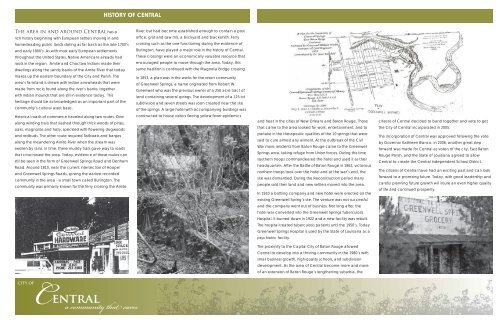
HISTORY OF CENTRAL<br />
The area in and around <strong>Central</strong> has a<br />
rich history beginning with European settlers moving in and<br />
homesteading public lands dating as far back as the late 1700’s<br />
and early 1800’s. As with most early European settlements<br />
throughout the United States, Native Americans already had<br />
roots in the region. Amite and Choctaw Indians made their<br />
dwellings along the sandy banks <strong>of</strong> the Amite River that today<br />
River, but had become established enough to contain a post<br />
<strong>of</strong>fi ce, grist and saw mill, a brickyard and blacksmith. Ferry<br />
crossing such as the one functioning during the existence <strong>of</strong><br />
Burlington, have played a major role in the history <strong>of</strong> <strong>Central</strong>.<br />
These crossings were an economically valuable resource that<br />
encouraged people to move through the area. Today, this<br />
same tradition is continued with the Magnolia Bridge crossing.<br />
makes up the eastern boundary <strong>of</strong> the <strong>City</strong> and Parish. The<br />
area’s farmland is strewn with Indian arrowheads that were<br />
made from rocks found along the river’s banks, together<br />
with Indian mounds that are still in existence today. This<br />
heritage should be acknowledged as an important part <strong>of</strong> the<br />
community’s cultural asset base.<br />
In 1853, a <strong>plan</strong> was in the works for the resort community<br />
<strong>of</strong> Greenwell Springs, a name originated from Robert W.<br />
Greenwell who was the previous owner <strong>of</strong> a 250 acre tract <strong>of</strong><br />
land containing several springs. The development <strong>of</strong> a 125 lot<br />
subdivision and seven streets was soon created near the site<br />
<strong>of</strong> the springs. A large hotel with accompanying buildings was<br />
Historical roads <strong>of</strong> commerce traveled along two routes. One<br />
along winding trails that slashed through thick woods <strong>of</strong> pines,<br />
oaks, magnolias and holly, speckled with fl owering dogwoods<br />
and redbuds. The other route required fl atboats and barges<br />
along the meandering Amite River when the stream was<br />
swollen by rains. In time, these muddy trails gave way to roads<br />
that crisscrossed the area. Today, evidence <strong>of</strong> these routes can<br />
still be seen in the form <strong>of</strong> Greenwell Springs Road and Denham<br />
Road. Around 1810, near the current intersection <strong>of</strong> Hooper<br />
and Greenwell Springs Roads, sprang the earliest recorded<br />
community in the area - a small town called Burlington. The<br />
community was primarily known for the ferry crossing the Amite<br />
constructed to house visitors fl eeing yellow fever epidemics<br />
and heat in the cities <strong>of</strong> New Orleans and Baton Rouge. Those<br />
that came to the area looked for work, entertainment, and to<br />
partake in the therapeutic qualities <strong>of</strong> the 10 springs that were<br />
said to cure almost any ailment. At the outbreak <strong>of</strong> the Civil<br />
War more residents from Baton Rouge came to the Greenwell<br />
Springs area, taking refuge from Union forces. During this time<br />
southern troops commandeered the hotel and used it as their<br />
headquarters. After the Battle <strong>of</strong> Baton Rouge in 1862, victorious<br />
northern troops took over the hotel and at the war’s end, the<br />
site was dismantled. During the Reconstruction period many<br />
people sold their land and new settlers moved into the area.<br />
In 1910 a bottling company and new hotel were erected on the<br />
citizens <strong>of</strong> <strong>Central</strong> decided to band together and vote to get<br />
the <strong>City</strong> <strong>of</strong> <strong>Central</strong> incorporated in 2005.<br />
The incorporation <strong>of</strong> <strong>Central</strong> was approved following the vote<br />
by Governor Kathleen Blanco. In 2006, another great step<br />
forward was made for <strong>Central</strong> as voters <strong>of</strong> the city, East Baton<br />
Rouge Parish, and the State <strong>of</strong> Louisiana agreed to allow<br />
<strong>Central</strong> to create the <strong>Central</strong> Independent School District.<br />
The citizens <strong>of</strong> <strong>Central</strong> have had an exciting past and can look<br />
forward to a promising future. Today, with good leadership and<br />
careful <strong>plan</strong>ning future growth will insure an even higher quality<br />
<strong>of</strong> life and continued prosperity.<br />
existing Greenwell Spring’s site. The venture was not successful<br />
and the company went out <strong>of</strong> business. Not long after, the<br />
hotel was converted into the Greenwell Springs Tuberculosis<br />
Hospital. It burned down in 1922 and a new facility was rebuilt.<br />
The hospital treated tuberculosis patients until the 1950’s. Today<br />
Greenwell Springs Hospital is used by the State <strong>of</strong> Louisiana as a<br />
psychiatric facility.<br />
The proximity to the Capital <strong>City</strong> <strong>of</strong> Baton Rouge allowed<br />
<strong>Central</strong> to develop into a thriving community in the 1980’s with<br />
small business growth, high-quality schools, and subdivision<br />
development. As the area <strong>of</strong> <strong>Central</strong> become more and more<br />
<strong>of</strong> an extension <strong>of</strong> Baton Rouge’s lengthening suburbia, the<br />
CITY OF<br />
<strong>Central</strong><br />
a community that cares