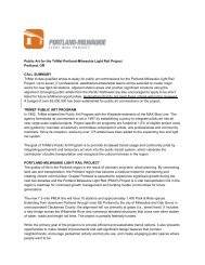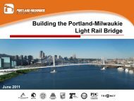
Portland-Milwaukie Light Rail Project - FEIS - Volume 1 - TriMet
Portland-Milwaukie Light Rail Project - FEIS - Volume 1 - TriMet
Portland-Milwaukie Light Rail Project - FEIS - Volume 1 - TriMet

You also want an ePaper? Increase the reach of your titles
YUMPU automatically turns print PDFs into web optimized ePapers that Google loves.
The following persons may be contacted for additional information regarding this<br />
document:<br />
Ms. Linda Gehrke<br />
Deputy Regional Administrator<br />
or Mr. James Saxton, Transportation<br />
Program Specialist<br />
at:<br />
Federal Transit Administration<br />
Region 10<br />
Jackson Federal Building, Suite 3142<br />
915 Second Avenue<br />
Seattle, WA 98174<br />
(206) 220-7954<br />
Ms. Bridget Wieghart, <strong>Project</strong> Manager<br />
or Mr. Mark Turpel, <strong>FEIS</strong> Manager<br />
Metro<br />
600 NE Grand Avenue<br />
<strong>Portland</strong>, OR 97232<br />
(503) 797-1700<br />
or<br />
Mr. David Unsworth, Deputy Director<br />
<strong>TriMet</strong><br />
710 NE Holladay<br />
<strong>Portland</strong>, OR 97232<br />
(503) 962-2150<br />
Abstract:<br />
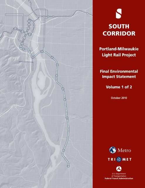
<strong>TriMet</strong> proposes to construct and operate 7.3 miles of light rail transit and related<br />
facilities between downtown <strong>Portland</strong>, Oregon, the City of <strong>Milwaukie</strong>, and north<br />
Clackamas County. The <strong>Portland</strong>-<strong>Milwaukie</strong> <strong>Light</strong> <strong>Rail</strong> <strong>Project</strong> Final Environmental<br />
Impact Statement (<strong>FEIS</strong>) updates information contained in the <strong>Portland</strong>-<strong>Milwaukie</strong> <strong>Light</strong><br />
<strong>Rail</strong> <strong>Project</strong> Supplemental Draft Environmental Impact Statement (SDEIS). It also<br />
considers findings from the South Corridor SDEIS published in December 2002, and the<br />
South/North Corridor <strong>Project</strong> Draft Environmental Impact Statement published in<br />
February 1998. This <strong>FEIS</strong> also examines a No-Build Alternative, which is compared to<br />
the project’s Locally Preferred Alternative (LPA) and its related facilities and options,<br />
includes a new Willamette River bridge, a maintenance base expansion, bus and streetcar<br />
connections, up to 11 stations and two park-and-rides, modified roadway improvements,<br />
and an interim terminus. The LPA was identified in 2008 by the Metro Council after the<br />
publication of the South Corridor SDEIS, and its 45-day public review and comment<br />
period. The <strong>FEIS</strong> analysis and mitigation address long-term, short-term, and cumulative<br />
effects on transit service, ridership, accessibility, traffic, regional and local roadways,<br />
freight movements, acquisitions and displacements, land use, economics, neighborhoods,<br />
visual and aesthetic resources, ecosystems, water quality and hydrology, geology and<br />
seismology, air quality, hazardous materials, noise and vibration, energy, hazardous<br />
materials, parklands, safety and security, utilities, historic and cultural resources, and<br />
public services. The analysis also considers the financial feasibility of the LPA and its<br />
options.<br />
Following the publication of this <strong>FEIS</strong>, the Federal Transit Administration (FTA) will<br />
issue a Record of Decision.
S. EXECUTIVE SUMMARY<br />
TABLE OF CONTENTS<br />
S.1 <strong>Portland</strong>-<strong>Milwaukie</strong> Corridor ................................................................................................ S-3<br />
S.2 <strong>Project</strong> History and Decision-Making Process ...................................................................... S-3<br />
S.3 Purpose and Need .................................................................................................................. S-5<br />
S.3.1 <strong>Project</strong> Goals and Objectives ..................................................................................... S-6<br />
S.4 Alternatives ............................................................................................................................ S-6<br />
S.4.1 Locally Preferred Alternative (LPA) to Park Avenue ................................................. S-6<br />
S.4.2 Minimum Operating Segment (MOS) to Lake Road ................................................. S-12<br />
S.4.3 Related Facilities ...................................................................................................... S-12<br />
S.4.4 Stations and Park-and-Rides .................................................................................... S-13<br />
S.4.5 Willamette River Bridge ............................................................................................ S-15<br />
S.4.6 <strong>Light</strong> <strong>Rail</strong> Operations and Maintenance Facilities................................................... S-15<br />
S.5 Transportation Impacts ........................................................................................................ S-16<br />
S.5.1 Transit Impacts ......................................................................................................... S-16<br />
S.5.2 Traffic Impacts .......................................................................................................... S-16<br />
S.5.3 Navigational Impacts ................................................................................................ S-17<br />
S.6 Environmental Consequences .............................................................................................. S-18<br />
S.6.1 Acquisitions and Displacements ............................................................................... S-19<br />
S.6.2 Land Use and Economics .......................................................................................... S-19<br />
S.6.3 Communities ............................................................................................................. S-20<br />
S.6.4 Visual Resources ....................................................................................................... S-20<br />
S.6.5 Historical and Cultural Resources ........................................................................... S-21<br />
S.6.6 Parks and Recreation ................................................................................................ S-21<br />
S.6.7 Geology and Soils ..................................................................................................... S-21<br />
S.6.8 Ecosystems ................................................................................................................ S-21<br />
S.6.9 Water Quality, Hydrology, and Floodplain .............................................................. S-22<br />
S.6.10 Noise and Vibration ................................................................................................ S-22<br />
S.6.11 Air Quality and Greenhouse Gas Emissions .......................................................... S-22<br />
S.6.12 Energy ..................................................................................................................... S-22<br />
S.6.13 Hazardous Materials .............................................................................................. S-23<br />
S.6.14 Utilities and Public Services ................................................................................... S-23<br />
S.6.15 Construction Impacts .............................................................................................. S-23<br />
<strong>Portland</strong>-<strong>Milwaukie</strong> <strong>Light</strong> <strong>Rail</strong> <strong>Project</strong> <strong>FEIS</strong> i<br />
Table of Contents
S.7 Evaluation of the Alternatives ............................................................................................. S-24<br />
S.7.1 Financial Feasibility Analysis .................................................................................. S-24<br />
S.7.2 Costs .......................................................................................................................... S-25<br />
S.8 Social Equity Considerations ............................................................................................... S-27<br />
S.9 <strong>Project</strong> implementation ........................................................................................................ S-28<br />
S.9.1 Selection of a New Locally Preferred Alternative (LPA) .......................................... S-28<br />
S.9.2 Publication of the Final Environmental Impact Statement ....................................... S-28<br />
S.9.3 Implementation of the Finance Plan ......................................................................... S-29<br />
S.9.4 <strong>Project</strong> Timeline ........................................................................................................ S-29<br />
1. PURPOSE AND NEED<br />
1.1 Statement of the <strong>Portland</strong>-<strong>Milwaukie</strong> <strong>Light</strong> <strong>Rail</strong> <strong>Project</strong>’s Purpose and Need ..................... 1-4<br />
1.1.1 <strong>Project</strong> Goals and Objectives ..................................................................................... 1-5<br />
1.2 High Capacity Transit and the Regional Strategy for Managing Growth ............................. 1-6<br />
1.3 Description of the <strong>Portland</strong>-<strong>Milwaukie</strong> Corridor ................................................................... 1-8<br />
1.3.1 Description of the <strong>Portland</strong>-<strong>Milwaukie</strong> Corridor Transportation System ................. 1-8<br />
1.4 Growth in the Region and the <strong>Project</strong> Corridor ................................................................... 1-11<br />
1.4.1 Future Growth in the <strong>Portland</strong>/Vancouver Metropolitan Area ................................ 1-11<br />
1.4.2 Future Growth in the <strong>Portland</strong>-<strong>Milwaukie</strong> <strong>Project</strong> Corridor ................................... 1-12<br />
1.5 The Effect of Traffic Congestion and Vehicle Delay on the <strong>Portland</strong>-<strong>Milwaukie</strong> <strong>Project</strong><br />
Corridor ............................................................................................................................ 1-16<br />
1.6 State, Regional, and Local Planning and Policy Framework ............................................... 1-18<br />
2. ALTERNATIVES<br />
2.1 Definition Of Alternatives ..................................................................................................... 2-2<br />
2.1.1 <strong>Portland</strong>-<strong>Milwaukie</strong> <strong>Light</strong> <strong>Rail</strong> <strong>Project</strong> Description .................................................. 2-5<br />
2.1.2 No-Build Alternative ................................................................................................. 2-40<br />
2.2 Cost Estimates ...................................................................................................................... 2-41<br />
2.2.1 Capital Cost Estimates .............................................................................................. 2-41<br />
2.2.2 Operations and Maintenance Cost Estimates ........................................................... 2-42<br />
2.3 Background On Alternatives Considered ............................................................................ 2-43<br />
2.3.1 The <strong>Portland</strong>-<strong>Milwaukie</strong> Refinement Study .............................................................. 2-44<br />
2.3.2 The <strong>Portland</strong>-<strong>Milwaukie</strong> <strong>Light</strong> <strong>Rail</strong> <strong>Project</strong> SDEIS .................................................. 2-51<br />
2.4 Next Steps ............................................................................................................................ 2-62<br />
2.4.1 Federal Record of Decision ...................................................................................... 2-62<br />
2.4.2 Final Design and Full Funding Grant Agreement ................................................... 2-62<br />
2.4.3 Construction, Testing, and Operations ..................................................................... 2-63<br />
ii<br />
<strong>Portland</strong>-<strong>Milwaukie</strong> <strong>Light</strong> <strong>Rail</strong> <strong>Project</strong> <strong>FEIS</strong><br />
Table of Contents
3. ENVIRONMENTAL ANALYSIS AND CONSEQUENCES<br />
3.1 Acquisitions and Displacements ............................................................................................ 3-2<br />
3.1.1 Affected Environment .................................................................................................. 3-2<br />
3.1.2 Environmental Impacts ............................................................................................... 3-3<br />
3.1.3 Mitigation .................................................................................................................... 3-9<br />
3.2 Land Use and Economy ....................................................................................................... 3-10<br />
3.2.1 Affected Environment ................................................................................................ 3-11<br />
3.2.2 Environmental Consequences for Land Use ............................................................. 3-21<br />
3.2.3 Land Use Mitigation Measures ................................................................................. 3-38<br />
3.2.4 Economic Affected Environment ............................................................................... 3-38<br />
3.2.5 Economic Impacts ..................................................................................................... 3-40<br />
3.2.6 Mitigation Measures for Economic Impacts ............................................................. 3-49<br />
3.3 Community Impact Assessment .......................................................................................... 3-50<br />
3.3.1 Affected Environment ................................................................................................ 3-50<br />
3.3.2 Environmental Consequences ................................................................................... 3-57<br />
3.3.3 Mitigation Measures ................................................................................................. 3-68<br />
3.3.4 Environmental Justice Compliance .......................................................................... 3-69<br />
3.4 Visual Quality and Aesthetics .............................................................................................. 3-75<br />
3.4.1 Affected Environment ................................................................................................ 3-75<br />
3.4.2 Environmental Impacts ............................................................................................. 3-79<br />
3.4.3 Mitigation .................................................................................................................. 3-99<br />
3.5 Historic, Archaeological, and Cultural Resources ............................................................. 3-100<br />
3.5.1 Affected Environment .............................................................................................. 3-101<br />
3.5.2 Environmental Impacts ........................................................................................... 3-110<br />
3.5.3 Short-Term Impacts (Construction) ........................................................................ 3-115<br />
3.5.4 Indirect and Cumulative Impacts ............................................................................ 3-116<br />
3.5.5 Mitigation Measures ............................................................................................... 3-117<br />
3.6 Parks and Recreational Resources ..................................................................................... 3-119<br />
3.6.1 Affected Environment .............................................................................................. 3-120<br />
3.6.2 Environmental Impacts ........................................................................................... 3-123<br />
3.6.3 Mitigation ................................................................................................................ 3-129<br />
3.6.4 Section 4(f) Resources ............................................................................................. 3-129<br />
3.6.5 Section 6(f) Resources ............................................................................................. 3-130<br />
3.7 Geology, Soils, and Groundwater ...................................................................................... 3-131<br />
3.7.1 Affected Environment .............................................................................................. 3-131<br />
3.7.2 Environmental Impacts ........................................................................................... 3-135<br />
3.7.3 Mitigation ................................................................................................................ 3-139<br />
<strong>Portland</strong>-<strong>Milwaukie</strong> <strong>Light</strong> <strong>Rail</strong> <strong>Project</strong> <strong>FEIS</strong> iii<br />
Table of Contents
3.8 Ecosystems ......................................................................................................................... 3-140<br />
3.8.1 Affected Environment .............................................................................................. 3-142<br />
3.8.2 Environmental Consequences ................................................................................. 3-155<br />
3.8.3 Mitigation ................................................................................................................ 3-173<br />
3.9 Water Quality and Hydrology ............................................................................................ 3-178<br />
3.9.1 Affected Environment .............................................................................................. 3-178<br />
3.9.2 Environmental Impacts ........................................................................................... 3-183<br />
3.9.3 Mitigation Measures ............................................................................................... 3-196<br />
3.10 Noise and Vibration ......................................................................................................... 3-198<br />
3.10.1 Introduction to Noise ............................................................................................ 3-198<br />
3.10.2 Introduction to Vibration ...................................................................................... 3-199<br />
3.10.3 Impact Criteria and Methods for Noise and Vibration ......................................... 3-199<br />
3.10.4 Affected Environment ............................................................................................ 3-207<br />
3.10.5 Environmental Consequences ............................................................................... 3-212<br />
3.10.6 Short-Term Impacts (Construction) ...................................................................... 3-229<br />
3.10.7 <strong>Project</strong> Noise Abatement and Mitigation Measures ............................................. 3-231<br />
3.10.8 <strong>Light</strong> <strong>Rail</strong> Vibration Mitigation ............................................................................ 3-238<br />
3.10.9 Fixed Noise Sources and Ancillary Facilities ....................................................... 3-240<br />
3.11 Air Quality ....................................................................................................................... 3-241<br />
3.11.1 Affected Environment ............................................................................................ 3-241<br />
3.11.2 Environmental Consequences ............................................................................... 3-244<br />
3.11.3 Mitigation .............................................................................................................. 3-248<br />
3.12 Energy Analysis ............................................................................................................... 3-249<br />
3.12.1 Affected Environment ............................................................................................ 3-250<br />
3.12.2 Environmental Consequences ............................................................................... 3-250<br />
3.12.3 Mitigation .............................................................................................................. 3-253<br />
3.13 Hazardous Materials ........................................................................................................ 3-253<br />
3.13.1 Affected Environment ............................................................................................ 3-254<br />
3.13.2 Environmental Impacts ......................................................................................... 3-263<br />
3.13.3 Mitigation .............................................................................................................. 3-270<br />
3.14 Utilities ............................................................................................................................. 3-272<br />
3.14.1 Affected Environment ............................................................................................ 3-272<br />
3.14.2 Environmental Impacts ......................................................................................... 3-272<br />
3.14.3 Mitigation .............................................................................................................. 3-280<br />
3.15 Public Services ................................................................................................................. 3-280<br />
3.15.1 Affected Environment ............................................................................................ 3-281<br />
3.15.2 Environmental Impacts ......................................................................................... 3-285<br />
3.15.3 Mitigation .............................................................................................................. 3-290<br />
iv<br />
<strong>Portland</strong>-<strong>Milwaukie</strong> <strong>Light</strong> <strong>Rail</strong> <strong>Project</strong> <strong>FEIS</strong><br />
Table of Contents
3.16 Safety and Security .......................................................................................................... 3-290<br />
3.16.1 Affected Environment ............................................................................................ 3-290<br />
3.16.2 Impact Assessment ................................................................................................ 3-294<br />
3.16.3 Mitigation Measures ............................................................................................. 3-298<br />
3.17 Section 4(F) ...................................................................................................................... 3-300<br />
3.17.1 Applicable Regulations ......................................................................................... 3-300<br />
3.17.2 Section 4(f) Resources ........................................................................................... 3-301<br />
3.17.3 Conclusion ............................................................................................................ 3-303<br />
4. TRANSPORTATION<br />
4.1 Affected Environment ............................................................................................................ 4-1<br />
4.1.1 Public Transportation ................................................................................................. 4-1<br />
4.1.2 Travel Behavior .......................................................................................................... 4-3<br />
4.1.3 Roadways .................................................................................................................... 4-3<br />
4.1.4 Bicycle Activity ............................................................................................................ 4-9<br />
4.1.5 Pedestrian Activity .................................................................................................... 4-10<br />
4.1.6 Parking ...................................................................................................................... 4-11<br />
4.1.7 Streetcar .................................................................................................................... 4-12<br />
4.1.8 Freight Facilities ...................................................................................................... 4-13<br />
4.1.9 Navigable Waterways ............................................................................................... 4-14<br />
4.2 Transportation Impacts ........................................................................................................ 4-14<br />
4.2.1 Service Characteristics ............................................................................................. 4-14<br />
4.3 Highway And Street Impacts ............................................................................................... 4-29<br />
4.3.1 System-wide Impacts ................................................................................................. 4-29<br />
4.3.2 Local Impacts, Mitigation, and <strong>Project</strong> Improvements ............................................ 4-30<br />
4.3.3 Freight Impacts ......................................................................................................... 4-60<br />
4.3.4 Navigation Impacts ................................................................................................... 4-63<br />
4.4 Short-Term Construction Impacts ........................................................................................ 4-64<br />
4.4.1 Station Area Impacts ................................................................................................. 4-65<br />
4.4.2 Corridor/Street Impacts ............................................................................................ 4-65<br />
4.4.3 Intersection Area Impacts ......................................................................................... 4-65<br />
4.4.4 Navigation ................................................................................................................. 4-65<br />
4.4.5 Mitigation for Short-Term Construction Impacts ..................................................... 4-66<br />
<strong>Portland</strong>-<strong>Milwaukie</strong> <strong>Light</strong> <strong>Rail</strong> <strong>Project</strong> <strong>FEIS</strong> v<br />
Table of Contents
5. FINANCIAL ANALYSIS AND EVALUATION OF ALTERNATIVES<br />
5.1 Financial Analysis .................................................................................................................. 5-1<br />
5.1.1 Costs ............................................................................................................................ 5-3<br />
5.1.2 Available Resources .................................................................................................... 5-6<br />
5.1.3 Existing Revenue Shortfalls ...................................................................................... 5-13<br />
5.1.4 Opportunities for Additional Revenues ..................................................................... 5-14<br />
5.1.5 Conclusions ............................................................................................................... 5-16<br />
5.2 Evaluation of the project ...................................................................................................... 5-19<br />
5.2.1 Effectiveness in Meeting Corridor Objectives .......................................................... 5-19<br />
5.2.2 Significant Trade-offs ................................................................................................ 5-30<br />
5.3 New Starts Evaluation Process ............................................................................................ 5-31<br />
5.3.1 <strong>Project</strong> Justification: Medium-High ......................................................................... 5-32<br />
5.3.2 Local Financial Commitment: Medium .................................................................... 5-34<br />
6. COMMUNITY PARTICIPATION, AGENCY COORDINATION, AND<br />
REQUIRED PERMITS .................................................................................................... 6-1<br />
6.1 Goals of the Community Participation Program .................................................................... 6-1<br />
6.1.1 Citizens Advisory Committee ...................................................................................... 6-2<br />
6.1.2 Stakeholder Meetings .................................................................................................. 6-4<br />
6.1.3 Other Community Meetings ........................................................................................ 6-6<br />
6.1.4 Mitigation Related Outreach .................................................................................... 6-15<br />
6.1.5 Community Outreach Tools ...................................................................................... 6-15<br />
6.1.6 Media Outreach and Advertising .............................................................................. 6-16<br />
6.1.7 Documentation .......................................................................................................... 6-16<br />
6.1.8 Notification ............................................................................................................... 6-17<br />
6.1.9 Environmental Justice Outreach and Compliance ................................................... 6-17<br />
6.1.10 Complying with Federal and State Regulations ..................................................... 6-17<br />
6.2 Public Participation Efforts in Previous <strong>Project</strong> Phases ...................................................... 6-17<br />
6.2.1 South/North Corridor DEIS ...................................................................................... 6-17<br />
6.2.2 South Corridor <strong>Project</strong> ............................................................................................. 6-18<br />
6.2.3 <strong>Portland</strong>-<strong>Milwaukie</strong> <strong>Light</strong> <strong>Rail</strong> <strong>Project</strong> SDEIS ......................................................... 6-18<br />
6.3 Agency Coordination ........................................................................................................... 6-20<br />
6.4 Tribal Coordination .............................................................................................................. 6-23<br />
6.5 <strong>Project</strong> Permits and Approvals ............................................................................................. 6-23<br />
6.6 Federal Permits and Approvals ............................................................................................ 6-23<br />
6.7 State of Oregon Permits and Approvals ............................................................................... 6-24<br />
6.8 Local Jurisdiction Permits and Approvals ........................................................................... 6-25<br />
vi<br />
<strong>Portland</strong>-<strong>Milwaukie</strong> <strong>Light</strong> <strong>Rail</strong> <strong>Project</strong> <strong>FEIS</strong><br />
Table of Contents
7. PUBLIC COMMENT SUMMARY<br />
7.1 SDEIS Public Comment Period .......................................................................................... 7-1<br />
7.2 Comm ents Received ........................................................................................................... 7-1<br />
7.2.1 Comments Supportive of the <strong>Project</strong> ........................................................................... 7-2<br />
7.2.2 Comments Expressing Major Concerns or Opposition to the <strong>Project</strong>........................ 7-3<br />
7.2.3 Summary of Other Public Concerns ........................................................................... 7-3<br />
7.2.4 Comments Relating to <strong>Project</strong> Scope .......................................................................... 7-9<br />
7.2.5 Comments Relating to Breadth and Depth of SDEIS .................................................. 7-9<br />
7.3 Common Comments and Responses ................................................................................. 7-10<br />
7.4 South Corridor Comments ................................................................................................ 7-12<br />
APPENDICES<br />
Attached with the <strong>FEIS</strong><br />
Appendix A. Agency Coordination and Correspondence<br />
Appendix B. Environmental Justice Compliance<br />
Appendix C. Supporting Documents<br />
Appendix D. Visual Simulation Locations<br />
Appendix E. List of Preparers<br />
Appendix F. List of Recipients<br />
Appendix G. Properties Affected by Acquisitions<br />
Appendix H. Conceptual Design Information<br />
Appendix I. Index<br />
Appendix J. Acronyms and Abbreviations<br />
Appendix K. Final Section 4(f) Evaluation<br />
Appendix L. Background on Alternatives Development<br />
Appendix M. Mitigation<br />
Appendix N. Memorandum of Agreement and Programmatic Agreement for Historic<br />
and Archaeological Resources<br />
Appendix O. Navigation and Climate Change Summary<br />
Appendix P. Public Comments and Responses<br />
Appendix Q. Biological Opinion<br />
<strong>Portland</strong>-<strong>Milwaukie</strong> <strong>Light</strong> <strong>Rail</strong> <strong>Project</strong> <strong>FEIS</strong> vii<br />
Table of Contents
Technical Results Reports<br />
Air Quality Analysis Results Report<br />
Biological Assessment for the <strong>Portland</strong>-<strong>Milwaukie</strong> <strong>Light</strong> <strong>Rail</strong> <strong>Project</strong><br />
Navigation Results Report<br />
Noise and Vibration Results Report<br />
Section 106/Historic and Archaeological Resources Results Report<br />
Transportation Results Report<br />
LIST OF FIGURES<br />
Figure S-1. Regional Setting ........................................................................................................ S-2<br />
Figure S-2. Regional Setting with Regional <strong>Rail</strong> System ............................................................ S-4<br />
Figure S-3. Locally Preferred Alternative and Minimum Operable Segment ............................. S-7<br />
Figure S-4. Willamette River Bridge Area and Related Transportation Facilities ...................... S-8<br />
Figure 1.1-1. Regional Setting ..................................................................................................... 1-2<br />
Figure 1.1-2. Regional Setting with Regional <strong>Rail</strong> System ......................................................... 1-3<br />
Figure 1.2-1. 2040 Growth Concept [Region]............................................................................. 1-7<br />
Figure 1.3-1. Existing Transportation System ........................................................................... 1-10<br />
Figure 1.4-1. Percent Change in Forecasted Household, 2005-2030 ........................................ 1-14<br />
Figure 1.4-2. Percent Change in Forecasted Employment, 2005-2030 ..................................... 1-15<br />
Figure 1.5-1. Vehicle Miles Traveled (VMT) <strong>Project</strong>ed Change, 2005-2030 ........................... 1-17<br />
Figure 1.5-2. Two-Hour P.M. Peak Conditions in the Corridor, 2005-2030 ............................. 1-19<br />
Figure 2.1-1. Locally Preferred Alternative and Minimum Operable Segment .......................... 2-4<br />
Figure 2.1-2. Downtown <strong>Portland</strong> Transit Mall to Willamette River Bridge .............................. 2-8<br />
Figure 2.1-3. Willamette River Bridge ........................................................................................ 2-9<br />
Figure 2.1-4. Willamette River Bridge Design .......................................................................... 2-10<br />
Figure 2.1-5. OMSI to SE Tacoma Street .................................................................................. 2-12<br />
Figure 2.1-6. SE Tacoma Street to SE Lake Road ..................................................................... 2-16<br />
Figure 2-1-7. SE Lake to SE Park Avenue ................................................................................ 2-18<br />
Figure 2.1-8. Ruby Junction Maintenance Facility Location .................................................... 2-24<br />
Figure 2.1-9. Willamette River Bridge Area Related Transportation Facilities ........................ 2-25<br />
Figure 2.3-1. South/North Corridor and <strong>Portland</strong> Streetcar Loop Development Processes ...... 2-46<br />
Figure 2.3-2. Refinement Study ................................................................................................. 2-47<br />
Figure 2.3-3. Willamette River Crossing: SDEIS Study Options and 2008 LPA ..................... 2-48<br />
Figure 2.3-4. Bridge Type Narrowing and Selection ................................................................. 2-54<br />
Figure 2.3-5. SDEIS Study Options: Tacoma to <strong>Project</strong> Terminus ........................................... 2-55<br />
Figure 3.1-1 Properties Potentially Affected by Acquisitions, All Alternatives ......................... 3-5<br />
viii<br />
<strong>Portland</strong>-<strong>Milwaukie</strong> <strong>Light</strong> <strong>Rail</strong> <strong>Project</strong> <strong>FEIS</strong><br />
Table of Contents
Figure 3.2-1 2040 Growth Concept ........................................................................................... 3-13<br />
Figure 3.2-2 2040 Growth Concept – Focus on SE <strong>Portland</strong> and Clackamas County .............. 3-14<br />
Figure 3.2-3 Jurisdictions and Boundaries................................................................................. 3-20<br />
Figure 3.2-4 Comprehensive Plans ............................................................................................ 3-22<br />
Figure 3.2-5 Zoning ................................................................................................................... 3-23<br />
Figure 3.3-1 Neighborhood and Boundaries .............................................................................. 3-51<br />
Figure 3.3-2 Poverty Level by Census Tract ............................................................................. 3-54<br />
Figure 3.3-3 Minority Residents by Census Tract ..................................................................... 3-55<br />
Figure 3.4-1 Visual Analysis Units and Neighborhoods ........................................................... 3-77<br />
Figure 3.5-1 Identified Historic Resources .............................................................................. 3-108<br />
Figure 3.6-1 Parkland Resources ............................................................................................. 3-122<br />
Figure 3.7-1 Relative Earthquake Hazard ................................................................................ 3-134<br />
Figure 3.8-1 Wetland/Waterway Sites and Locations ............................................................. 3-145<br />
Figure 3.8-2 Vegetative Cover in <strong>Project</strong> Study Area ............................................................. 3-148<br />
Figure 3.8-3 Stream Crossing Locations and Threatened, Endangered, and Sensitive Fish<br />
Species ............................................................................................................................ 3-160<br />
Figure 3.9-1 River, Stream, and Floodplain Crossings ............................................................ 3-180<br />
Figure 3.10-1 Typical Ldn Noise Levels and Compatible Land Uses ..................................... 3-199<br />
Figure 3.10-2 Typical Vibration Levels ................................................................................... 3-200<br />
Figure 3.10-3 FTA Noise Impact Criteria for Category 1 or 2 Land Uses .............................. 3-201<br />
Figure 3.10-4 Noise and Vibration Monitoring Sites .............................................................. 3-208<br />
Figure 3.10-5 Freight Train Pass-By Test at the <strong>Portland</strong> Waldorf School ............................. 3-212<br />
Figure 3.10-6 <strong>Light</strong> <strong>Rail</strong> and Shared Transitway Noise and Vibration Impacts ..................... 3-217<br />
Figure 3.10-7 Traffic Noise Impacts ........................................................................................ 3-224<br />
Figure 3.13-1 Identified Hazardous Materials Site Locations ................................................. 3-257<br />
Figure 3.13-2 Willamette River Area – Sites of Concern ........................................................ 3-258<br />
Figure 3.15-1 Public Services Locations in <strong>Project</strong> Area ........................................................ 3-282<br />
Figure 4.1-1. Transportation Affected Environment ................................................................... 4-6<br />
Figure 4.2-1. 2030 No-Build Transit Network .......................................................................... 4-15<br />
Figure 4.2-2. 2030 <strong>Light</strong> <strong>Rail</strong> Alternative Transit Network ...................................................... 4-16<br />
Figure 4.2-3. Average Weekday Corridor and System Transit Trips1: Change from<br />
No-Build Alternative, Year 2030, with and without Streetcar ......................................... 4-22<br />
Figure 4.2-4. Change in Transit Trip Productions ..................................................................... 4-25<br />
<strong>Portland</strong>-<strong>Milwaukie</strong> <strong>Light</strong> <strong>Rail</strong> <strong>Project</strong> <strong>FEIS</strong> ix<br />
Table of Contents
LIST OF TABLES<br />
Table S-1 Summary of Transit and Roadway Improvements/Modifications ............................ S-14<br />
Table S-2 Summary of Environmental Impacts ......................................................................... S-18<br />
Table S-3 Capital Costs of <strong>Portland</strong>-<strong>Milwaukie</strong> <strong>Light</strong> <strong>Rail</strong> <strong>Project</strong> In Millions of 2010 and<br />
Year-of-Expenditure (YOE) Dollars ................................................................................ S-25<br />
Table S-4 Capital Funding Plan for <strong>Portland</strong>-<strong>Milwaukie</strong> <strong>Light</strong> <strong>Rail</strong> project by Funding<br />
Scenario In Millions of Year-of-Expenditure Dollars ...................................................... S-26<br />
Table 1.4-1 Historical and Future Growth in Population and Employment within the Four-<br />
County <strong>Portland</strong>/Vancouver Standard Metropolitan Statistical Area1 ............................. 1-12<br />
Table 1.5-1 Historic Growth in <strong>Portland</strong>-<strong>Milwaukie</strong> <strong>Project</strong> Corridor Traffic <strong>Volume</strong>s .......... 1-16<br />
Table 2.1-1 Summary of Transit and Roadway Improvements/Modifications ........................... 2-5<br />
Table 2.1-2 Travel Times ........................................................................................................... 2-29<br />
Table 2.1-3 Number of Willamette River Bridge Crossings per Hour in Peak Direction in<br />
2030 .................................................................................................................................. 2-31<br />
Table 2.2-1 <strong>Light</strong> <strong>Rail</strong> <strong>Project</strong> Capital Cost Estimates (in millions of 2010 dollars) ................ 2-43<br />
Table 2.2-2 Annual Operating and Maintenance Cost Estimates for Year 2030 Service<br />
Levels In Millions of (2010) Dollars ................................................................................ 2-44<br />
Table 2.4-1. <strong>Portland</strong>-<strong>Milwaukie</strong> <strong>Light</strong> <strong>Rail</strong> <strong>Project</strong> Timeline ................................................. 2-63<br />
Table 3.1-1 Summary of Full and Partial Acquisitions and Breakdown of Displaced Uses ....... 3-6<br />
Table 3.2-1 Current Zoning and Potential Transit-Oriented Development Opportunities ........ 3-31<br />
Table 3.2-2 Assessments of Redevelopment Potential Within 1/4 Mile of Selected Stations .. 3-36<br />
Table 3.2-3 Population and Employment within One-Half Mile of Station, 2008 to 2030 ....... 3-39<br />
Table 3.2-4 Estimated Businesses and Jobs Affected by Displacements .................................. 3-42<br />
Table 3.2-6 Short-Term Construction Effects: Direct, Indirect, and Induced Effects ............... 3-46<br />
Table 3.3-1 Historical Growth in Population and Employment within the Four-County<br />
<strong>Portland</strong>-Vancouver Standard Metropolitan Statistical Area1 ......................................... 3-52<br />
Table 3.3-2 Summary of Socioeconomic Data by Neighborhood ............................................. 3-53<br />
Table 3.3-3 Percentages of Homes with Limited English-Speaking Ability (2000) ................. 3-56<br />
Table 3.3-4 Comparison of EJ Population Ratios ...................................................................... 3-70<br />
Table 3.3-5 Characteristics of Potential Rider Populations ....................................................... 3-72<br />
Table 3.3-6 Rockwood Neighborhood Minority and Low-Income Populations ....................... 3-73<br />
Table 3.4-1 Characteristics of High, Moderate, and Low Levels of Visual Change ................. 3-80<br />
Table 3.4-2 Summary of Potential Visual Quality and Aesthetic Impacts of the <strong>Portland</strong>-<br />
<strong>Milwaukie</strong> <strong>Light</strong> <strong>Rail</strong> <strong>Project</strong> ........................................................................................... 3-94<br />
Table 3.5-1 Historic Resources and Effects ............................................................................. 3-103<br />
Table 3.5-2 Summary of Adverse Effects ................................................................................ 3-111<br />
Table 3.6-1 Summary of Potential Parkland and Recreational Resources Evaluated ............. 3-120<br />
x<br />
<strong>Portland</strong>-<strong>Milwaukie</strong> <strong>Light</strong> <strong>Rail</strong> <strong>Project</strong> <strong>FEIS</strong><br />
Table of Contents
Table 3.6-2 Summary of Direct Impacts to Parks and Recreational Resources from the<br />
LPA to Park Avenue and the MOS to Lake Road .......................................................... 3-124<br />
Table 3.6-3 Potential Secondary Impacts to Parks and Recreational Resources from the<br />
LPA to Park Avenue and the MOS to Lake Road .......................................................... 3-124<br />
Table 3.8-1 Summary of Potential Natural Resource Permit Requirements ........................... 3-140<br />
Table 3.8-2 Summary of Wetlands and Waterways within the <strong>Project</strong> Study Area ................ 3-143<br />
Table 3.8-3 <strong>Project</strong> Area Streams ............................................................................................ 3-144<br />
Table 3.8-4 Summary of Existing Conditions in <strong>Project</strong> Area Streams .................................. 3-146<br />
Table 3.8-5 Vegetation Cover Types/Plant Communities within the <strong>Project</strong> Study Area ....... 3-149<br />
Table 3.8-6 Threatened, Endangered, and Sensitive Wildlife and Plant Species with<br />
Recorded Presence Near the <strong>Project</strong> .............................................................................. 3-153<br />
Table 3.8-7 Fish Species with Federal Status Likely to be Present near the <strong>Project</strong> ............... 3-155<br />
Table 3.8-8 Potential Wetland Impacts (Acres)....................................................................... 3-157<br />
Table 3.8-9 Permanent Footprint of <strong>Project</strong> Area Stream Crossings ....................................... 3-159<br />
Table 3.8-10 Total New Impervious Surface Area (acres) by Watershed ............................... 3-163<br />
Table 3.8-11 Potential Vegetation Cover Impacts ................................................................... 3-165<br />
Table 3.8-12 Determinations of Effect for Listed Species and Designated Critical Habitat ... 3-171<br />
Table 3.9-1 Summary of Existing Conditions in <strong>Project</strong> Area Streams .................................. 3-181<br />
Table 3.9-2 Estimated Average and Flood Flows in the Willamette River ............................. 3-182<br />
Table 3.9-3 <strong>Project</strong> Area Streams with Crossings ................................................................... 3-184<br />
Table 3.9-4 Total New Impervious Surface Area (acres) by Watershed ................................. 3-186<br />
Table 3.9-5 Combined Acreage of Facilities in Mapped <strong>Project</strong>-Area Floodplains ................ 3-187<br />
Table 3.9-6 Ordinal Scale of Impacts ...................................................................................... 3-189<br />
Table 3.9-7 Summary of Long-Term Impacts ......................................................................... 3-190<br />
Table 3.9-8 Summary of Short-Term Impacts ......................................................................... 3-194<br />
Table 3.10-1 FTA Vibration Impact Criteria for Frequent Events .......................................... 3-202<br />
Table 3.10-2 FHWA Traffic Noise Abatement Criteria .......................................................... 3-203<br />
Table 3.10-3 Existing Conditions Noise Levels ...................................................................... 3-210<br />
Table 3.10-4 <strong>Light</strong> <strong>Rail</strong> and Fixed Guideway Noise Impacts without Mitigation Measures .. 3-218<br />
Table 3.10-5 Traffic Noise Impacts Before Mitigation ........................................................... 3-222<br />
Table 3.10-6 <strong>Light</strong> <strong>Rail</strong> Vibration Levels without Mitigation ................................................. 3-227<br />
Table 3.10-7 Summary and Comparison of Transit Noise and Vibration Impacts<br />
without/with Mitigation .................................................................................................. 3-232<br />
Table 3.10-8 Summary of Noise Mitigation Measures for <strong>Light</strong> <strong>Rail</strong>, Bus, Streetcar,<br />
Warning Bell, and Traffic Noise ..................................................................................... 3-236<br />
Table 3.10-9 <strong>Light</strong> <strong>Rail</strong> Vibration Mitigation Measures ......................................................... 3-239<br />
Table 3.11-1 Federal and State Ambient Air Quality Standards ............................................. 3-242<br />
<strong>Portland</strong>-<strong>Milwaukie</strong> <strong>Light</strong> <strong>Rail</strong> <strong>Project</strong> <strong>FEIS</strong> xi<br />
Table of Contents
Table 3.11-2 Estimated Regional Average Weekday Pollutant Emissions for Motor<br />
Vehicles (tons/day) ......................................................................................................... 3-245<br />
Table 3.11-3 Estimated Regional MSAT Pollutant Emissions (pounds/day).......................... 3-246<br />
Table 3.11-4 Highest <strong>Project</strong>ed 8-Hour and 1-Hour Carbon Monoxide Concentrations Near<br />
Intersections (ppm) ......................................................................................................... 3-247<br />
Table 3.12-1 Transportation Operations Energy Consumption in Base Year of 2005<br />
(Billions of Btu) <strong>Portland</strong> Metropolitan Area ................................................................. 3-250<br />
Table 3.12-2 Summary of Daily Corridor Transportation Operations Energy Consumption<br />
in 2030 (Billions of Btu1) <strong>Portland</strong>-<strong>Milwaukie</strong> <strong>Light</strong> <strong>Rail</strong> <strong>Project</strong> ................................ 3-252<br />
Table 3.12-3 Summary of Construction Energy Consumption (Billions of Btu) <strong>Portland</strong>-<br />
<strong>Milwaukie</strong> <strong>Light</strong> <strong>Rail</strong> <strong>Project</strong> Alternatives ..................................................................... 3-252<br />
Table 3.12-4 Summary of Annual Energy Consumption by Alternatives (Billions of Btu) ... 3-253<br />
Table 3.13-1 Summary of Sites with Complex Contamination Issues that Would Potentially<br />
Be Acquired by the <strong>Portland</strong>-<strong>Milwaukie</strong> <strong>Light</strong> <strong>Rail</strong> <strong>Project</strong> .......................................... 3-263<br />
Table 3.15-1 <strong>Portland</strong> Public Schools within the <strong>Portland</strong>-<strong>Milwaukie</strong> <strong>Light</strong> <strong>Rail</strong> <strong>Project</strong><br />
Area ................................................................................................................................ 3-284<br />
Table 3.15-2 North Clackamas Public Schools within the <strong>Portland</strong>-<strong>Milwaukie</strong> <strong>Light</strong> <strong>Rail</strong><br />
<strong>Project</strong> Area .................................................................................................................... 3-285<br />
Table 3.17-1 <strong>Portland</strong>-<strong>Milwaukie</strong> <strong>Light</strong> <strong>Rail</strong> <strong>Project</strong> - Summary of Park and Recreational<br />
Resource Use .................................................................................................................. 3-301<br />
Table 3.17-2 <strong>Portland</strong>-<strong>Milwaukie</strong> <strong>Light</strong> <strong>Rail</strong> <strong>Project</strong> - Section 4(f) Historic Sites Used ........ 3-302<br />
Table 4.1-1 <strong>TriMet</strong> Fixed-Route Service Summary .................................................................... 4-2<br />
Table 4.1-2 Existing <strong>Portland</strong>-<strong>Milwaukie</strong> <strong>Light</strong> <strong>Rail</strong> <strong>Project</strong> Station Area On-Street Parking<br />
Spaces and Use ................................................................................................................. 4-12<br />
Table 4.2-1 Average Weekday Corridor1 Transit Service Characteristics, Year 2030 ............. 4-17<br />
Table 4.2-2 Transit and Auto Average Weekday PM Peak Hour Travel Times to Selected<br />
Locations from Selected Downtown <strong>Portland</strong> Locations, Year 2030 .............................. 4-19<br />
Table 4.2-3 Measures of Transit Reliability in the Corridor ..................................................... 4-20<br />
Table 4.2-4 Average Weekday <strong>Light</strong> <strong>Rail</strong>, Streetcar, and Commuter <strong>Rail</strong> Ridership,<br />
Year 2030 .......................................................................................................................... 4-21<br />
Table 4.2-5 Average Weekday Total System-wide and <strong>Portland</strong>-<strong>Milwaukie</strong> Corridor Transit<br />
Trips,1 Year 2030 ............................................................................................................. 4-22<br />
Table 4.2-6 Average Weekday Ridership Across the Willamette River Bridge1 by Transit<br />
Mode, Year 2030 .............................................................................................................. 4-23<br />
Table 4.2-7 Average Weekday Work and Nonwork Corridor Transit Trips and Transit Mode<br />
Share to Downtown <strong>Portland</strong>, Year 2030 ......................................................................... 4-24<br />
Table 4.3-1 Average Weekday Regional Roadway Data, Year 2030 ........................................ 4-30<br />
Table 4.3-2 Average Weekday PM Peak Vehicle <strong>Volume</strong>s at Select Corridor Screenlines,<br />
Year 2030 .......................................................................................................................... 4-30<br />
Table 4.3-3 Pedestrian Facilities Provided by the <strong>Project</strong> by Transit Station ........................... 4-31<br />
xii<br />
<strong>Portland</strong>-<strong>Milwaukie</strong> <strong>Light</strong> <strong>Rail</strong> <strong>Project</strong> <strong>FEIS</strong><br />
Table of Contents
Table 4.3-4 Bicycle Facility Improvements Locations by Transit Station ................................ 4-33<br />
Table 4.3-5 Off-Street Parking Reduction Impact Minimization Measures .............................. 4-35<br />
Table 4.3-6 Sub-Area A - <strong>Portland</strong> State University to SE Powell Boulevard Potential<br />
Motor Vehicle Impacts in 2030 PM Peak Hour ............................................................... 4-37<br />
Table 4.3-7 Sub-area A - <strong>Portland</strong> State University to SE Powell Boulevard 2030 PM Peak<br />
Hour Motor Vehicle Operations by Jurisdiction ............................................................... 4-39<br />
Table 4.3-8 Sub-area A - <strong>Portland</strong> State University to SE Powell Boulevard Summary of<br />
2030 Potential Motor Vehicle Operation Improvements .................................................. 4-41<br />
Table 4.3-9 Sub-area B: SE Powell Boulevard to SE Tacoma Street Motor Vehicle Impacts .. 4-45<br />
Table 4.3-10 Sub-area B - SE Powell Boulevard to SE Tacoma Street 2030 PM Peak Hour<br />
No-Build Alternative and <strong>Light</strong> <strong>Rail</strong> <strong>Project</strong> Intersection Operations ............................. 4-47<br />
Table 4.3-11 Sub-area B - SE Powell Boulevard to SE Tacoma Street Summary of 2030<br />
Potential Motor Vehicle Impact Minimization Measures................................................. 4-48<br />
Table 4.3-12 Sub-area C - SE Powell Boulevard to SE Tacoma Street Potential Motor<br />
Vehicle Impacts ................................................................................................................ 4-49<br />
Table 4.3-14 Sub-area C - SE Tacoma Street to Highway 224 Summary of 2030 Potential<br />
Motor Vehicle Impact Minimization Measures ................................................................ 4-52<br />
Table 4.3-15 Sub-area D - Highway 224 to SE Park Avenue Motor Vehicle Impact<br />
Locations .......................................................................................................................... 4-55<br />
Table 4.3-16 Sub-Area D - Highway 224 to SE Park Avenue 2030 PM Peak Hour Average<br />
Delay and 95th Percentile Queuing at <strong>Light</strong> <strong>Rail</strong> At-Grade Crossings in Downtown<br />
<strong>Milwaukie</strong> ......................................................................................................................... 4-58<br />
Table 4.3-17 Sub-Area D - Highway 224 to SE Park Avenue 2030 PM Peak Hour No-Build<br />
Alternative and <strong>Light</strong> <strong>Rail</strong> <strong>Project</strong> Intersection Operations .............................................. 4-58<br />
Table 4.3-18 Sub-Area D - Highway 224 to SE Park Avenue Summary of 2030 Potential<br />
Motor Vehicle Impact Minimization Measures ................................................................ 4-61<br />
Table 5.1-1 Capital Costs for <strong>Portland</strong>-<strong>Milwaukie</strong> <strong>Light</strong> <strong>Rail</strong> <strong>Project</strong> In Millions of 2010 and<br />
Year-of-Expenditure (YOE) Dollars .................................................................................. 5-4<br />
Table 5.1-2 <strong>Portland</strong>-<strong>Milwaukie</strong> <strong>Light</strong> <strong>Rail</strong> <strong>Project</strong> Operating Costs for Year 2030 Service<br />
Levels In millions of 2010 dollars ..................................................................................... 5-5<br />
Table 5.1-3 Summary of Transit System Costs: Cumulative Total from FY 2010 to FY 2030<br />
In Millions of Year-of-Expenditure Dollars ....................................................................... 5-6<br />
Table 5.1-4 Required Local Matching Funds In Millions of Year-of-Expenditure (YOE)<br />
Dollars ................................................................................................................................ 5-7<br />
Table 5.1-5 Summary of Transit System Revenues: Cumulative Total from FY 2010 to<br />
FY 2030 Millions of Year-of-Expenditure Dollars .......................................................... 5-12<br />
Table 5.1-6 Summary of Capital Revenue Shortfalls In Millions of Year-of-Expenditure<br />
Dollars .............................................................................................................................. 5-13<br />
Table 5.1-7 System Fiscal Feasibility Analysis: Beginning Cash Reserves by Fiscal Year In<br />
Millions of Year-of-Expenditure Dollars ......................................................................... 5-14<br />
<strong>Portland</strong>-<strong>Milwaukie</strong> <strong>Light</strong> <strong>Rail</strong> <strong>Project</strong> <strong>FEIS</strong> xiii<br />
Table of Contents
Table 5.1-8 Capital Funding Plan for <strong>Portland</strong>-<strong>Milwaukie</strong> <strong>Light</strong> <strong>Rail</strong> <strong>Project</strong> In Millions of<br />
Year-of-Expenditure Dollars ............................................................................................ 5-16<br />
Table 5.1-9 Summary of Detailed Cash Flow Analysis - LPA Phasing Option In Millions of<br />
Year-of-Expenditure Dollars ............................................................................................ 5-18<br />
Table 5.2-1 Objectives, Criteria, and Measures of Effectiveness ...............................................5-19<br />
Table 5.2-2 Households and Employment within One-Half Mile of Stations by 2030 ............. 5-21<br />
Table 5.2-3 Transit and Auto Average Weekday PM Peak Hour Travel Times to Selected<br />
Locations from Selected Downtown <strong>Portland</strong> Locations, Year 2030 .............................. 5-21<br />
Table 5.2-4 Reliability: Miles of <strong>Light</strong> <strong>Rail</strong> Right-of-Way and Average Weekday Passenger<br />
Miles on <strong>Light</strong> <strong>Rail</strong> Right-of-Way in Corridor, Year 2030 .............................................. 5-22<br />
Table 5.2-5 Average Weekday Total System-wide and <strong>Portland</strong>-<strong>Milwaukie</strong> Corridor Transit<br />
Trips, Year 2030 ............................................................................................................... 5-23<br />
Table 5.2-6 Average Weekday Transit Mode Share to Downtown <strong>Portland</strong>, Year 2030 ......... 5-24<br />
Table 5.2-7 Highway System Use: 2030 Average Weekday Two-hour PM Peak Vehicle<br />
<strong>Volume</strong>s at Select Corridor Screenlines ........................................................................... 5-25<br />
Table 5.2-8 Highway System Use: 2030 Region-wide VMT, VHT, and VHD compared to<br />
the No-Build ..................................................................................................................... 5-26<br />
Table 5.2-9 Cost-Effectiveness: Corridor Cost Per Boarding Ride, Year 2030 ........................ 5-28<br />
Table 5.2-10 Summary of Environmental Impacts .................................................................... 5-29<br />
Table 6.1-1 Stakeholder Meetings ............................................................................................... 6-4<br />
Table 6.1-2 <strong>Project</strong> Briefings to Established Groups................................................................... 6-7<br />
Table 6.3-1 Federal, State, and Local Agency Coordination ..................................................... 6-20<br />
xiv<br />
<strong>Portland</strong>-<strong>Milwaukie</strong> <strong>Light</strong> <strong>Rail</strong> <strong>Project</strong> <strong>FEIS</strong><br />
Table of Contents
S. EXECUTIVE SUMMARY<br />
The <strong>Portland</strong>-<strong>Milwaukie</strong> <strong>Light</strong> <strong>Rail</strong> <strong>Project</strong><br />
Final Environmental Impact Statement (<strong>FEIS</strong>)<br />
examines a proposal to develop a light rail<br />
transit extension to connect downtown <strong>Portland</strong>,<br />
Oregon, the City of <strong>Milwaukie</strong>, and north<br />
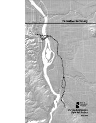
Clackamas County. Figure S-1 shows the<br />
regional setting for the proposed project.<br />
CHAPTER CONTENTS<br />
S.1 PORTLAND-MILWAUKIE CORRIDOR ........................... S-3<br />
S.2 PROJECT HISTORY AND DECISION-MAKING<br />
PROCESS ................................................................ S-3<br />
S.3 PURPOSE AND NEED ................................................ S-5<br />
S.4 ALTERNATIVES ......................................................... S-6<br />
S.5 TRANSPORTATION IMPACTS .................................... S-16<br />
S.6 ENVIRONMENTAL CONSEQUENCES ......................... S-18<br />
S.7 EVALUATION OF THE ALTERNATIVES ....................... S-24<br />
S.8 SOCIAL EQUITY CONSIDERATIONS .......................... S-27<br />
S.9 PROJECT IMPLEMENTATION .................................... S-28<br />
The project is part of a larger high-capacity<br />
transit corridor known as the South/North<br />
Corridor, which extends from Clackamas<br />
County to downtown <strong>Portland</strong> and north to the Columbia River and Vancouver, Washington.<br />
Figure S-2 shows the regional high-capacity transit system serving this area. In 1998, the Federal<br />
Transit Administration (FTA), Metro, and the Tri-County Metropolitan Transportation District<br />
(<strong>TriMet</strong>) released the South/North Corridor <strong>Project</strong> Draft Environmental Impact Statement<br />
(DEIS). The Supplemental DEIS (SDEIS) prepared for this project in May 2008 augmented the<br />
South/North DEIS by updating information on the purpose and need, alternatives considered,<br />
affected environment, and anticipated environmental impacts for the <strong>Portland</strong>-<strong>Milwaukie</strong><br />
Corridor to reflect the changed conditions since the South/North DEIS was published. It also<br />
incorporated findings developed through the South Corridor Supplemental Draft Environmental<br />
Impact Statement, issued in December 2002. This <strong>FEIS</strong> presents the proposed light rail project<br />
and updated estimates of impacts compared to a No-Build Alternative, and presents and responds<br />
to the public and agency comments received by the project.<br />
This <strong>FEIS</strong> has been prepared in compliance with the National Environmental Policy Act<br />
(NEPA). The FTA is the federal lead agency for this <strong>FEIS</strong>, and Metro is the project’s local lead<br />
agency, working in cooperation with <strong>TriMet</strong>. The purpose of this <strong>FEIS</strong> is to present details of the<br />
Locally Preferred Alternative (LPA) and its environmental and transportation performance.<br />
When the LPA was adopted in 2008, it included a recommendation for a Minimum Operable<br />
Segment (MOS) if funding could not be secured to construct the full LPA alignment to SE Park<br />
Avenue. In addition, the <strong>FEIS</strong> evaluates a phasing option (the LPA Phasing Option) that allows<br />
the project to be completed to SE Park Avenue at a lower cost by deferring or modifying some<br />
features of the LPA. The <strong>FEIS</strong> also addresses an expansion of the Ruby Junction maintenance<br />
facility in Gresham, Oregon. Streetcar and roadway facilities in and around the Willamette River<br />
bridge crossing that are associated with, but not funded by, the project are also included in this<br />
<strong>FEIS</strong>. These related projects complement the <strong>Portland</strong>-<strong>Milwaukie</strong> <strong>Light</strong> <strong>Rail</strong> <strong>Project</strong>, but they are<br />
each independent.<br />
<strong>Portland</strong>-<strong>Milwaukie</strong> <strong>Light</strong> <strong>Rail</strong> <strong>Project</strong> <strong>FEIS</strong> S-1<br />
Executive Summary
S.1 PORTLAND-MILWAUKIE CORRIDOR<br />
The <strong>Portland</strong>-<strong>Milwaukie</strong> Corridor, part of the larger South/North Corridor and a subset of the<br />
South Corridor, is located in the <strong>Portland</strong>, Oregon metropolitan region, the population and<br />
economic center of an extensive area that includes southern Washington and much of Oregon.<br />
The <strong>Portland</strong>-Vancouver metropolitan area incorporates the urban portion of three Oregon<br />
counties (Multnomah, Clackamas, and Washington) and the urban portion of Clark County,<br />
Washington.<br />
Figure S-2 shows other planned high-capacity transit projects in addition to the <strong>Portland</strong>-<br />
<strong>Milwaukie</strong> <strong>Light</strong> <strong>Rail</strong> <strong>Project</strong>. This figure includes the Columbia River Crossing <strong>Project</strong> that<br />
would extend light rail to Vancouver, Washington.<br />
The <strong>Portland</strong>-<strong>Milwaukie</strong> Corridor includes the city of <strong>Milwaukie</strong> and much of southeast <strong>Portland</strong><br />
and the <strong>Portland</strong> Central City, including the <strong>Portland</strong> Central Business District, the South<br />
Waterfront District, and the Central Eastside Industrial District (CEID). These areas have some<br />
of the region’s highest concentrations of population and employment, and they include many of<br />
the region’s major educational, health services, government/civic, and entertainment facilities.<br />
Travelers within the corridor use a variety of local, regional, state, and interstate facilities.<br />
<strong>TriMet</strong> is the provider of public transportation, operating light rail, commuter rail, fixed-route<br />
transit buses, and on-demand vans and small bus service for the elderly and disabled.<br />
S.2 PROJECT HISTORY AND DECISION-MAKING PROCESS<br />
The Metro Council approved the current LPA for the project in July 2008, following the<br />
publication and public comment period for the 2008 <strong>Portland</strong>-<strong>Milwaukie</strong> <strong>Light</strong> <strong>Rail</strong> <strong>Project</strong><br />
SDEIS in May 2008. Previously, in 2003, the Metro Council approved an LPA for the South<br />
Corridor, calling for two phases of light rail investment between downtown <strong>Portland</strong> and<br />
Clackamas County. The earlier 2003 LPA selection followed the publication of the South<br />
Corridor <strong>Project</strong> SDEIS in December 2002. Phase I of the South Corridor LPA was the<br />
I-205/<strong>Portland</strong> Mall <strong>Project</strong>, which released an <strong>FEIS</strong> in November 2004 and is now in operation.<br />
Phase II is the light rail segment between downtown <strong>Portland</strong> and <strong>Milwaukie</strong>, and it would<br />
connect directly to Phase I’s Downtown <strong>Portland</strong> Transit Mall segment at <strong>Portland</strong> State<br />
University (PSU).<br />
The region’s decision to select light rail for the South Corridor and move forward in two phases<br />
of investment is documented in the South Corridor <strong>Project</strong> LPA Report (Metro 2003). The<br />
I-205/<strong>Portland</strong> Mall <strong>Light</strong> <strong>Rail</strong> <strong>Project</strong> Final Environmental Impact Statement of 2004 further<br />
confirmed the LPA’s selection of light rail for the <strong>Portland</strong>-<strong>Milwaukie</strong> Corridor.<br />
<strong>Portland</strong>-<strong>Milwaukie</strong> <strong>Light</strong> <strong>Rail</strong> <strong>Project</strong> <strong>FEIS</strong> S-3<br />
Executive Summary
Other planning and environmental studies that have guided the development of light rail in the<br />
South Corridor include:<br />
<br />
1993 South/North Alternatives Analysis Tier I and Tier II (1993 South/North Alternatives<br />
Analysis)<br />
1998 South/North Corridor <strong>Project</strong> Draft Environmental Impact Statement (1998<br />
South/North DEIS)<br />
<br />
<br />
<br />
2000 South Corridor Transportation Alternatives Study (2000 SCTAS)<br />
2002 South Corridor Supplemental Draft Environmental Impact Statement (2002 South<br />
Corridor SDEIS)<br />
2003 Downtown Amendment to the South Corridor <strong>Project</strong> Supplemental Draft<br />
Environmental Impact Statement (2003 Downtown Amendment)<br />
A more detailed description of the history and decision-making process for light rail may be<br />
found in Section 2.3, Background on Alternatives Development and Appendix L of this <strong>FEIS</strong>. A<br />
summary of public and agency comments received on the 2008 SDEIS is presented in Chapter 7,<br />
Public Comment Summary. A full documentation of comments received and responses is<br />
included in Appendix P, Public Comments and Responses.<br />
S.3 PURPOSE AND NEED<br />
The purpose and need for this project was originally defined by the South/North Corridor<br />
<strong>Project</strong> DEIS in 1998. The purpose and need was updated with the South Corridor SDEIS in<br />
December 2002 and the subsequent South Corridor LPA decision in 2003. The purpose is:<br />
To implement a major transit improvement in the South Corridor that maintains livability<br />
in the metropolitan region, supports land use goals, optimizes the transportation system,<br />
is environmentally sensitive, reflects community values, and is fiscally responsive.<br />
Since the Phase I investment for the South Corridor, involving the I-205 and <strong>Portland</strong> Mall light<br />
rail investments, is now completed, this project focuses on the remaining need to develop light<br />
rail within the <strong>Portland</strong>-<strong>Milwaukie</strong> Corridor as Phase II of the South Corridor.<br />
The need for a major transit investment in the <strong>Portland</strong>-<strong>Milwaukie</strong> Corridor is identified as:<br />
<br />
<br />
<br />
Historic and projected rapid population and employment growth in the corridor, which<br />
creates an unmet demand for increased travel choices and transit capacity<br />
High levels of existing traffic congestion and travel delay in the corridor and deteriorating<br />
travel conditions in the future<br />
The need for high-quality transit service in the corridor to achieve regional and local land use<br />
objectives<br />
<strong>Portland</strong>-<strong>Milwaukie</strong> <strong>Light</strong> <strong>Rail</strong> <strong>Project</strong> <strong>FEIS</strong> S-5<br />
Executive Summary
S.3.1 <strong>Project</strong> Goals and Objectives<br />
The goals and objectives established for the <strong>Portland</strong>-<strong>Milwaukie</strong> <strong>Light</strong> <strong>Rail</strong> <strong>Project</strong> derive from<br />
the purpose and need analysis summarized above and as originally defined for the South/North<br />
Corridor Study and reaffirmed through the South Corridor SDEIS.<br />
The goals and objectives of the <strong>Portland</strong>-<strong>Milwaukie</strong> <strong>Light</strong> <strong>Rail</strong> <strong>Project</strong> (in its capacity as the<br />
south segment of the South/North Corridor) are to:<br />
<br />
<br />
<br />
<br />
<br />
<br />
<br />
Provide high-quality transit service in the corridor<br />
Ensure effective transit system operations in the corridor<br />
Maximize the ability of the transit system to accommodate future growth in travel demand in<br />
the corridor<br />
Minimize traffic congestion and traffic infiltration through neighborhoods in the corridor<br />
Promote regionally agreed-upon land use patterns and development in the corridor<br />
Provide for a fiscally stable and financially efficient transit system<br />
Maximize the efficiency and environmental sensitivity of the engineering design of the<br />
proposed project<br />
S.4 ALTERNATIVES<br />
This <strong>FEIS</strong> examines a No-Build Alternative and a Locally Preferred Alternative and related<br />
options and facilities for the <strong>Portland</strong>-<strong>Milwaukie</strong> Corridor. The No-Build Alternative is required<br />
under NEPA and represents future conditions without the <strong>Portland</strong>-<strong>Milwaukie</strong> <strong>Light</strong> <strong>Rail</strong> <strong>Project</strong>.<br />
The No-Build analysis assumes the same levels of growth in population and employment<br />
through the year 2030 as the <strong>Portland</strong>-<strong>Milwaukie</strong> <strong>Light</strong> <strong>Rail</strong> <strong>Project</strong>, but depicts the region’s<br />
future transportation system without the light rail project. This <strong>FEIS</strong> examines the selected LPA<br />
and a Minimum Operable Segment, compared to the No-Build Alternative.<br />
The Locally Preferred Alternative to Park Avenue (LPA to Park Avenue) and Minimum<br />
Operable Segment to Lake Road (MOS to Lake Road) are shown in Figures S-3 and S-4 and are<br />
described below.<br />
S.4.1 Locally Preferred Alternative (LPA) to Park Avenue<br />
The LPA to Park Avenue includes approximately 7.3 miles of light rail, ten stations (plus one<br />
deferred from the <strong>Portland</strong> Mall Transit <strong>Project</strong> at SW Jackson Street and one planned for the<br />
future at SE Harold Street), five shelters deferred from the <strong>Portland</strong> Mall Transit <strong>Project</strong>, two<br />
park-and-rides, and a new bridge across the Willamette River. The route would begin near PSU,<br />
at the southern end of downtown <strong>Portland</strong>, connecting with the Downtown <strong>Portland</strong> Transit Mall<br />
light rail that opened in 2009 at SW 5 th and 6 th avenues. The LPA to Park Avenue would end in<br />
unincorporated Clackamas County at SE Park Avenue. In addition, the LPA Phasing Option<br />
describes how some elements of the LPA to Park Avenue could be deferred or modified in the<br />
project’s initial construction and operation.<br />
S-6 <strong>Portland</strong>-<strong>Milwaukie</strong> <strong>Light</strong> <strong>Rail</strong> <strong>Project</strong> <strong>FEIS</strong><br />
Executive Summary
Downtown <strong>Portland</strong> to SE Tacoma Street<br />
Starting at the Downtown <strong>Portland</strong> Transit Mall near PSU, the LPA to Park Avenue alignment<br />
would turn east and cross SW 5 th Avenue, the I-405 on-ramp, SW Grant Street, and SW 4 th<br />
Avenue at grade, and continue east on SW Lincoln Street. The alignment would follow SW<br />
Lincoln Street in a center median, with an extension of SW Lincoln Street to a new intersection<br />
at SW Naito Parkway. This one-block extension would be exclusively for use by light rail trains,<br />
buses, pedestrians, and bicycles.<br />
The shared transitway would cross on structures over the SW Harrison Street connector and SW<br />
Harbor Drive, turn southward, and remain on structures to travel under the I-405 ramp and over<br />
SW Sheridan Street. It would continue south along the west side of SW Moody Avenue into the<br />
South Waterfront District on retained fill. At the intersection of SW Moody Avenue and SW<br />
Porter Street, the alignment would turn toward the river, return to grade, and cross the <strong>Portland</strong><br />
Streetcar tracks and SW Moody Avenue at grade.<br />
A South Waterfront transit station would be located between SW Moody Avenue and the<br />
planned location of SW Bond Street. The station would be configured to accommodate light rail<br />
and buses, and adjacent streetcar platforms would be located on SW Moody Avenue.<br />
Leaving the station, the alignment would begin to climb as it approaches the new bridge crossing<br />
the Willamette River. The alignment would cross the planned SW Bond Street on retained fill,<br />
and then be elevated on structure to cross over the proposed future Willamette River Greenway<br />
Trail.<br />
The Willamette River bridge would be a cable-stayed structure that would accommodate light<br />
rail trains, streetcars, buses, pedestrians, bicycles, and emergency vehicles. Buses, light rail<br />
trains, and streetcars would share a set of paved tracks in the center of the bridge. Two 14-foot<br />
multi-use paths would be on the sides of the bridge, separated from the transit vehicles and tracks<br />
by barriers.<br />
The bridge would touch down south of the existing Oregon Museum of Science and Industry<br />
(OMSI) building. A station would be located east of OMSI and would have separate platforms<br />
for buses and light rail vehicles. Streetcars would leave the alignment prior to the station by<br />
turning north. Buses would depart the shared transitway at SE 7 th Avenue.<br />
Several related street improvements as well as facilities for connecting the streetcar to the<br />
Willamette River bridge are also planned. These improvements are discussed in more detail in<br />
Sections S.4.3 and 2.1.1.6, Related Bridge Area Transportation Facilities, but they include:<br />
<br />
<br />
<br />
Completion of streetcar facilities connecting to the <strong>Portland</strong> Streetcar Loop <strong>Project</strong> on the<br />
east side at OMSI and the <strong>Portland</strong> Streetcar in the South Waterfront at SW Moody Avenue,<br />
allowing streetcars to operate across the new Willamette River bridge<br />
The relocation of SW Water Avenue to a new alignment approximately one block east<br />
The reconstruction of SW Moody Avenue and the <strong>Portland</strong> Streetcar tracks between SW<br />
River Parkway and SW Gibbs Street<br />
<strong>Portland</strong>-<strong>Milwaukie</strong> <strong>Light</strong> <strong>Rail</strong> <strong>Project</strong> <strong>FEIS</strong> S-9<br />
Executive Summary
The light rail alignment then would continue east, crossing the Oregon Pacific <strong>Rail</strong>road (OPR) at<br />
grade and then continuing underneath the SE Martin Luther King Jr. Boulevard viaduct before<br />
turning southeast and running along the south and west side of Union Pacific <strong>Rail</strong>road (UPRR)<br />
right-of-way. From near SE 7 th Avenue and SE Powell Boulevard, the LPA to Park Avenue<br />
would continue south and west of the UPRR tracks. An existing railroad spur, the Darigold Spur,<br />
would be closed. The OPR switching yard, which the light rail tracks would otherwise cross,<br />
would be relocated to the north of its existing location. Three at-grade street crossings of the<br />
UPRR tracks would be consolidated into one crossing of the UPRR and light rail tracks. The<br />
consolidated crossing would occur at a realigned SE 8 th Avenue. SE Division Place and SE 9 th<br />
Avenue would also be realigned to provide access to the consolidated crossing. The reconfigured<br />
intersections would have sidewalks and a combination of medians and crossing gates.<br />
A station would be located on SE Gideon Street southwest of the SE 12 th Avenue and SE Clinton<br />
Street intersection. To improve station access and traffic operations, several modifications to the<br />
surrounding street network would occur in the station area, including signalization, rerouting of<br />
traffic, and replacement of an existing pedestrian overpass, as described in Chapter 2.<br />
The crossing of SE Powell Boulevard at SE 17 th Avenue would be on a replacement structure<br />
adjacent to the existing UPRR bridge. South of SE Powell Boulevard, the light rail alignment<br />
would then transition to the center of SE 17 th Avenue and continue to run in the center of SE 17 th<br />
Avenue to south of SE Schiller Street to just north of SE McLoughlin Boulevard (OR 99E). To<br />
accommodate light rail, SE 17 th Avenue would be realigned to the west, and widened to provide<br />
sidewalk, landscaping, stormwater swales, and other improvements. A center platform station<br />
would be located north of the SE 17 th Avenue and SE Rhine Street intersection. The existing<br />
pedestrian overpass of the UPRR tracks at SE Lafayette Street would be replaced with a<br />
reconfigured overcrossing to better facilitate connections between the neighborhoods and the<br />
station at SE Rhine Street. Under the LPA Phasing Option, the construction of this overpass may<br />
be initially deferred. An island station would be located in a median of SE 17 th Avenue, just<br />
north of SE Holgate Boulevard.<br />
South of SE Schiller Street, immediately north of SE McLoughlin Boulevard, the alignment<br />
leaves SE 17 th Avenue and transitions to a structure that allows an elevated overcrossing of SE<br />
Harold Street, and the future Harold Station would be located to the south. The construction of<br />
the station is accommodated in the design, but is not planned as part of the initial development of<br />
the LPA to Park Avenue. In addition, the LPA Phasing Option defers construction of some of the<br />
future station’s structural facilities. After descending from the elevated structure at SE Harold<br />
Street, the light rail alignment to SE Tacoma Street is located between SE McLoughlin<br />
Boulevard and the UPRR tracks.<br />
Along this section within the UPRR right-of-way, a bridge would be constructed for the light rail<br />
tracks to cross over Crystal Springs Creek, which is currently in a culvert that continues under<br />
the UPRR tracks. Constructing the bridge over the culvert would allow the culvert to be removed<br />
in the future. Wetlands would be filled in this area, which would require mitigation. Wetlands<br />
mitigation requirements are anticipated to be met through partial funding of the City of<br />
<strong>Portland</strong>’s Westmoreland Park Restoration <strong>Project</strong>.<br />
As the light rail line proceeds south, the tracks would rise on fill and be on structure over the<br />
northbound SE McLoughlin Boulevard ramp and then would cross under SE Tacoma Street<br />
S-10 <strong>Portland</strong>-<strong>Milwaukie</strong> <strong>Light</strong> <strong>Rail</strong> <strong>Project</strong> <strong>FEIS</strong><br />
Executive Summary
efore crossing Johnson Creek on a new structure. A station and park-and-ride would be located<br />
south of Johnson Creek. As the alignment approaches the Tacoma Station, it would turn toward<br />
the southeast.<br />
SE Tacoma Street to SE Lake Road<br />
The Tacoma Station would be located south of SE Tacoma Street and Johnson Creek, between<br />
SE McLoughlin Boulevard and the UPRR main line tracks. The station platform would be<br />
toward the north side of the station site. The station would include a 800-space parking garage.<br />
The LPA Phasing Option would defer construction of the parking garage and would provide<br />
initially for 320 surface park-and-ride spaces. A new pathway would be constructed that would<br />
connect to the Springwater Corridor trail to the south of the site.<br />
South of the station, the light rail line would cross under the existing Springwater Corridor trail<br />
bridge, which spans over the UPRR tracks. The light rail line would then rise on retained fill and<br />
cross over the Tillamook Branch line railroad tracks on an elevated structure. The Tillamook<br />
Branch line and the Anderson spur would be realigned to accommodate the required 25-foot<br />
track offset from freight sidings and the Tillamook main line. The light rail tracks would then<br />
cross under Highway 224.<br />
The alignment remains along the east side of the Tillamook Branch line, separated by a 25-foot<br />
offset, through <strong>Milwaukie</strong>. A station in downtown <strong>Milwaukie</strong> would be located at SE Lake Road<br />
and SE 21 st Avenue. The City of <strong>Milwaukie</strong> is planning transit-oriented development adjacent to<br />
the station at SE Lake Road.<br />
SE Lake Road to SE Park Avenue<br />
The tracks would cross over SE Lake Road and Kellogg Lake on a new bridge along the east side<br />
of the existing freight rail trestle within the railroad right-of-way. The alignment would cross<br />
over SE McLoughlin Boulevard to run along the west side of the roadway, and would continue<br />
on an elevated structure to cross over SE 22 nd Street, SE Bluebird Street, and SE River Road.<br />
Along the west side of SE McLoughlin Boulevard in this area, the light rail project would use a<br />
portion of an old streetcar right-of-way that was purchased by Metro and the North Clackamas<br />
Parks and Recreation for the development of the Trolley Trail, a six-mile regional multi-use path<br />
that is to extend from downtown <strong>Milwaukie</strong> to Gladstone. A section of trail between SE River<br />
Road and SE Park Avenue would be constructed along with the light rail project. <strong>Light</strong> rail<br />
would operate between the trail and SE McLoughlin Boulevard. As the light rail project and the<br />
trail approach SE Park Avenue and a new station, light rail leaves the Trolley Tail alignment to<br />
stay along SE McLoughlin Boulevard, while the trail continues to follow the old streetcar rightof-way<br />
to the west and continues south to Gladstone. The tracks would terminate at a station on<br />
the north side of SE Park Avenue, and a 600-space park-and-ride structure would be located<br />
south of SE Park Avenue. The LPA Phasing Option would provide for development of a 355-<br />
space structure.<br />
<strong>Portland</strong>-<strong>Milwaukie</strong> <strong>Light</strong> <strong>Rail</strong> <strong>Project</strong> <strong>FEIS</strong> S-11<br />
Executive Summary
LPA Phasing Option<br />
The LPA Phasing Option differs from the LPA by eliminating or deferring the elements of the<br />
LPA noted above in order to reduce the project cost. <strong>TriMet</strong> is seeking additional funding for the<br />
project to proceed with the LPA, but may need to implement some of the cost-reduction elements<br />
identified in the LPA Phasing Option. In this Final EIS, <strong>TriMet</strong>, Metro and FTA fully evaluate<br />
the environmental and community impacts of all of these elements as part of the LPA, and also<br />
consider the impacts of their deletion from the project as part of the LPA Phasing Option. If<br />
after the environmental Record of Decision has been issued by FTA, <strong>TriMet</strong>’s financial plan<br />
requires additional deferral or elimination of project elements not identified in the ROD, <strong>TriMet</strong>,<br />
Metro and FTA will follow the environmental procedures defined in 23 CFR Part 771.129, and<br />
FTA may issue an amended ROD to identify the modified elements and any additional<br />
commitments to mitigate environmental and community impacts for such amended project.<br />
S.4.2 Minimum Operating Segment (MOS) to Lake Road<br />
The MOS to Lake Road would be the same as the LPA to Park Avenue except that it would have<br />
an initial southern terminus at SE Lake Road. The MOS to Lake Road would allow the project to<br />
be developed in phases if there is not sufficient funding to fully extend the project to SE Park<br />
Avenue. The MOS would still be designed to accommodate a future extension to the south. A<br />
downtown <strong>Milwaukie</strong> station would be located at SE Lake Road, similar to the LPA to Park<br />
Avenue, but there would be a third track at the terminus and a park-and-ride with 275 parking<br />
spaces located north of Kellogg Lake between SE Washington Street and SE McLoughlin<br />
Boulevard. In addition, the capacity of the Tacoma Park-and-Ride would increase to<br />
accommodate up to 1,000 spaces.<br />
S.4.3 Related Facilities<br />
Ruby Junction<br />
The <strong>Portland</strong>-<strong>Milwaukie</strong> <strong>Light</strong> <strong>Rail</strong> <strong>Project</strong> would also require expanding the existing Ruby<br />
Junction Operations and Maintenance Facility in Gresham to store and service the additional<br />
light rail vehicles and supporting maintenance activities associated with the project.<br />
Related Bridge Area Transportation Facilities<br />
This <strong>FEIS</strong> also evaluates streetcar facility improvements designed to connect with the shared<br />
transitway over the Willamette River bridge, as well as related street modifications. On the west<br />
side, this would involve raising and reconstructing a portion of SW Moody Avenue to include<br />
double tracks in the median for the existing <strong>Portland</strong> Streetcar line serving the South Waterfront.<br />
On the east side, the improvements would complete the streetcar connection between the shared<br />
transitway and the <strong>Portland</strong> Streetcar Loop <strong>Project</strong> streetcar line (now under construction) at<br />
OMSI, which would also involve realigning a portion of SE Water Avenue.<br />
S-12 <strong>Portland</strong>-<strong>Milwaukie</strong> <strong>Light</strong> <strong>Rail</strong> <strong>Project</strong> <strong>FEIS</strong><br />
Executive Summary
S.4.4 Stations and Park-and-Rides<br />
The <strong>FEIS</strong> examines station and park-and-ride options for the project. The LPA to Park Avenue<br />
would have ten stations, with a future station at SE Harold Street to be developed when land uses<br />
and ridership support its development, and the Jackson Station, deferred from a previous light<br />
rail project. The MOS would have one fewer station, with its terminus at SE Lake Road. Major<br />
elements that would be incorporated on the platform include shelters, ticket machines, lighting,<br />
furniture, and fencing and railings. All stations would include Americans With Disabilities Act<br />
(ADA)-accessible connections to the local street network and sidewalks.<br />
From PSU and heading south, the stations include:<br />
<br />
<br />
<br />
Jackson (deferred from <strong>Portland</strong> Mall<br />
Transit <strong>Project</strong>)<br />
Lincoln<br />
South Waterfront (designed to<br />
accommodate bus and streetcar)<br />
<br />
<br />
<br />
<br />
Rhine<br />
Holgate<br />
Harold (future)<br />
Bybee<br />
<br />
<br />
OMSI (with adjacent OMSI streetcar<br />
station)<br />
Clinton<br />
<br />
<br />
<br />
Tacoma<br />
Lake Road<br />
Park Avenue (LPA to Park Avenue only)<br />
There are options for park-and-rides at the following stations (although the LPA Phasing Option<br />
identifies smaller initial capacities):<br />
<br />
<br />
<br />
Tacoma Station (800 spaces with LPA to Park Avenue, 320 spaces with the LPA Phasing<br />
Option, and 1,000 with MOS to Lake Road)<br />
Lake Road Station (park-and-ride developed only with MOS to Lake Road, 275 spaces)<br />
Park Avenue Station (600 spaces with the LPA to Park Avenue, 355 spaces with the LPA<br />
Phasing Option, and no park-and-ride with MOS to Lake Road)<br />
The key characteristics of the light rail project and the No-Build Alternative are summarized in<br />
Table S-1 below, and discussed in more detail in Chapter 2.<br />
<strong>Portland</strong>-<strong>Milwaukie</strong> <strong>Light</strong> <strong>Rail</strong> <strong>Project</strong> <strong>FEIS</strong> S-13<br />
Executive Summary
Table S-1<br />
Summary of Transit and Roadway Improvements/Modifications<br />
Alternative Transit Roadway<br />
No-Build<br />
LPA to<br />
Park Ave. 1<br />
Existing transit services and facilities, plus:<br />
Some increases in route frequency and/or run times to avoid<br />
peak overloads and/or to maintain schedule reliability.<br />
Incremental increases in service hours and vehicle<br />
procurement, consistent with available revenue sources and<br />
consistent with the RTP’s year 2025 financially constrained<br />
transit network.<br />
A new #30 Johnson Creek bus route on SE Johnson Creek<br />
Boulevard that would connect the Clackamas Transit Center<br />
and downtown <strong>Milwaukie</strong>.<br />
The South Corridor <strong>Project</strong> on the Downtown <strong>Portland</strong> Transit<br />
Mall and I-205.<br />
A 100-space shared park-and-ride at Clackamas Community<br />
College.<br />
Minor changes in transit operations and routing in the South<br />
Corridor.<br />
Expansion of <strong>TriMet</strong>’s Powell Garage facility to accommodate at<br />
least 50 additional buses.<br />
All transit improvements included within the No-Build Alternative,<br />
plus:<br />
A double-tracked light rail between downtown <strong>Portland</strong> and<br />
<strong>Milwaukie</strong>, terminating at SE Park Avenue, generally parallel to<br />
and east of SE McLoughlin Boulevard, with 10 light rail stations,<br />
(plus a previously deferred SW Jackson station and a future SE<br />
Harold station) and 20 additional light rail vehicles (17 to 20<br />
vehicles with the phasing option).<br />
Adjustments to the bus routing to eliminate or modify bus routes<br />
that would duplicate light rail service and adjustment of routes to<br />
connect to light rail stations or transit centers.<br />
An 800-space park-and-ride structure at SE Tacoma Street (with<br />
as few as 320 spaces on a surface lot with the phasing option).<br />
A 600-space park-and-ride structure at SE Park Avenue (or a<br />
structure with as few as 355 spaces with the phasing option).<br />
Elevated structures and track over SW Harbor Dr., the<br />
Willamette River, SE Powell Blvd., SE Harold St., Crystal<br />
Springs Creek, SE Tacoma St. ramps, Johnson Creek, the<br />
Tillamook Branch line, SE Lake Road, Kellogg Lake, and SE<br />
McLoughlin Blvd.<br />
A new Willamette River bridge that will accommodate light rail,<br />
buses, bicycles, pedestrians, and a future streetcar.<br />
Access to the new Willamette River bridge and transitway for<br />
bus lines 9, 17, and 19, allowing rerouting of buses from<br />
congested streets.<br />
Expansion of the Ruby Junction Maintenance Facility to<br />
accommodate 17 to 20 additional light rail vehicles (a smaller<br />
expansion size if phasing is used).<br />
New and consolidated control center for light rail transit (LRT)<br />
operations located at <strong>TriMet</strong>’s Center Street facility.<br />
Road improvements included in the<br />
Regional Transportation Plan (RTP)<br />
year 2025 financially constrained<br />
highway network. See Appendix B of<br />
the Detailed Definition of<br />
Alternatives Report (Metro 2010) for<br />
a detailed listing of the planned<br />
roadway projects within the<br />
<strong>Portland</strong>-<strong>Milwaukie</strong> project area.<br />
The following road improvements<br />
and modifications in addition to<br />
those in the 2004 Regional<br />
Transportation Plan (RTP) financially<br />
constrained highway network:<br />
Modifications to segments of<br />
roadways along SW Lincoln<br />
Street; SW Harbor Drive; SW<br />
Moody Avenue between SW River<br />
Parkway and SW Gibbs Street<br />
and SE Water Avenue from the<br />
north side of the OMSI parking lot<br />
to SE Caruthers; and SE 8 th ,<br />
SE 9 th , and SE 17 th avenues in<br />
<strong>Portland</strong>.<br />
Reconfiguration of access to SE<br />
McLoughlin Boulevard at the<br />
Tacoma Station.<br />
Reconfigurations that would close<br />
SE Adams Street and SE Sparrow<br />
Street to through traffic.<br />
S-14 <strong>Portland</strong>-<strong>Milwaukie</strong> <strong>Light</strong> <strong>Rail</strong> <strong>Project</strong> <strong>FEIS</strong><br />
Executive Summary
Table S-1<br />
Summary of Transit and Roadway Improvements/Modifications<br />
Alternative Transit Roadway<br />
MOS to<br />
Lake Rd.<br />
Related<br />
Bridge<br />
Area<br />
Facilities<br />
All improvements included with the LPA to Park Avenue except:<br />
<strong>Light</strong> rail would terminate in <strong>Milwaukie</strong> at SE Lake Rd., with no<br />
structure from SE Lake Rd. to SE McLoughlin Blvd. and would<br />
include 16 additional light rail vehicles.<br />
A 1,000-space park-and-ride facility at SE Tacoma St. and a<br />
275-space facility at SE Lake Rd. There would be no park-andride<br />
at SE Park Ave.<br />
Expansion of the Ruby Junction Maintenance Facility to<br />
accommodate 16 additional light rail vehicles.<br />
New double track for the <strong>Portland</strong> Streetcar in South<br />
Waterfront, realigned to remain within median of SW Moody<br />
Ave.<br />
Realigned streetcar tracks and station at OMSI connecting to<br />
shared transitway,<br />
1<br />
Includes features that could be modified by the LPA Phasing Option. .<br />
Improvements and modifications<br />
included in the LPA to Park Avenue,<br />
except SE Sparrow Street would not<br />
be closed.<br />
Reconstruction of SW Moody Ave.<br />
between SW River Parkway and<br />
SW Gibbs St. and realignment of<br />
SE Water Ave.<br />
S.4.5 Willamette River Bridge<br />
The light rail project includes a new bridge for light rail across the Willamette River. The<br />
Willamette River bridge would be a two-tower cable-stayed structure. It would have two towers<br />
nearly 180 feet high, anchored in foundations in the river. The bridge would be nearly 1,720 feet<br />
long from abutment to abutment. The bridge would have a shared transitway designed to<br />
accommodate light rail, streetcars, and buses, and it would provide bicycle and pedestrian paths<br />
on each side. The structure would provide 77.52 feet vertical clearance (Columbia River<br />
Datum) for approximately 150 feet in the center space of the bridge, and a minimum of 75.41<br />
feet for nearly 300 feet. The bridge design was selected based on the project’s navigational<br />
analysis, a river use survey, public outreach, landside land use and transportation needs, and a<br />
review of environmental constraints for both the human and natural environment.<br />
S.4.6 <strong>Light</strong> <strong>Rail</strong> Operations and Maintenance Facilities<br />
The project would require an additional 20 light rail vehicles (a phased approach for the LPA<br />
would require 17 to 20 new vehicles) compared to the No-Build Alternative. In addition, the<br />
proposed Columbia River Crossing <strong>Project</strong> is currently considering a proposal to extend the<br />
Yellow Line to Vancouver, Washington, which will also require additional light rail vehicles.<br />
Therefore, both projects are preparing <strong>FEIS</strong> documents that evaluate the expansion of <strong>TriMet</strong>’s<br />
existing Ruby Junction Operations and Maintenance Facility, located in the city of Gresham on<br />
NW Eleven Mile Avenue. The expansion could be conducted in phases to enlarge the existing<br />
maintenance facility site, including adding new structures and storage tracks to accommodate the<br />
maintenance needs. The existing operations control center at Ruby Junction would be relocated<br />
to <strong>TriMet</strong>’s Center Street offices on SE 17 th Avenue in <strong>Portland</strong>. The <strong>FEIS</strong> evaluates an initial<br />
phase that expands the facility to meet the needs of the <strong>Portland</strong>-<strong>Milwaukie</strong> <strong>Light</strong> <strong>Rail</strong> <strong>Project</strong>,<br />
and then a full expansion that meets the needs of both projects.<br />
<strong>Portland</strong>-<strong>Milwaukie</strong> <strong>Light</strong> <strong>Rail</strong> <strong>Project</strong> <strong>FEIS</strong> S-15<br />
Executive Summary
S.5 TRANSPORTATION IMPACTS<br />
This section summarizes the transit, highway, and freight impacts (by 2030) of the project,<br />
including the connection provided for the <strong>Portland</strong> Streetcar.<br />
S.5.1 Transit Impacts<br />
The project would offer benefits to transit riders by providing faster, more reliable service,<br />
improved access to stations, and more convenient connections to other destinations in the region.<br />
In addition to the improvements directly due to light rail operations, the new bridge will allow<br />
improved service and better connections for buses and the streetcar system, which will improve<br />
transit times and access for riders on those modes.<br />
With the light rail project, total transit travel time savings from downtown <strong>Milwaukie</strong> would be<br />
from three to four minutes to Pioneer Square, 8 to 15 minutes to PSU, and between 23 to 32<br />
minutes for transit trips between <strong>Milwaukie</strong> and the South Waterfront area, which is not<br />
currently a direct route. Transit travel times would be competitive with automobile trips<br />
throughout the corridor, and light rail would be faster than driving for a trip from the east side to<br />
the South Waterfront District area.<br />
S.5.1.1 Transit Ridership<br />
The project would increase transit trips at both corridor and system levels. Up to 25,570 daily<br />
trips on light rail would be expected in the <strong>Portland</strong>-<strong>Milwaukie</strong> Corridor by the year 2030. The<br />
most light rail trips would occur with the LPA to Park Avenue because the longer route allows<br />
more stations and more park-and-rides, providing greater accessibility to more people. The MOS<br />
to Lake Road would have slightly lower ridership at up to 24,810. The LPA Phasing Option<br />
would produce 22,700 projected trips. Completion of the streetcar loop provides the highest<br />
level of increased ridership systemwide. There are also travel time benefits provided by the<br />
Willamette River bridge and the shared transitway.<br />
The light rail project would result in up to 547,000 average weekday systemwide trips on transit<br />
(all modes) in 2030, compared to approximately 532,500 trips with the No-Build Alternative.<br />
<strong>Rail</strong> trips systemwide would increase from 240,200 in 2030 with the No-Build Alternative to<br />
262,500 with light rail and the new streetcar connection across the bridge.<br />
S.5.2 Traffic Impacts<br />
S.5.2.1 Regional Traffic Impacts<br />
The project would benefit the regional transportation system by reducing vehicle use, as<br />
measured in changes in vehicle miles traveled (VMT), vehicle hours traveled (VHT), and vehicle<br />
hours of delay (VHD). 1<br />
The project would reduce VMT by as much as 70,000 miles daily, VHT by up to 6,500 hours,<br />
and VHD by about 400 hours per average weekday compared to the No-Build Alternative.<br />
1 Vehicle hours of delay is the amount of delay on congested roadways (above 0.9 vehicle-to-capacity ratio).<br />
S-16 <strong>Portland</strong>-<strong>Milwaukie</strong> <strong>Light</strong> <strong>Rail</strong> <strong>Project</strong> <strong>FEIS</strong><br />
Executive Summary
S.5.2.2 Local Transportation Impacts<br />
The analysis of the <strong>Portland</strong>-<strong>Milwaukie</strong> <strong>Light</strong> <strong>Rail</strong> <strong>Project</strong> considers effects on local<br />
transportation facilities and uses, including bicycle and pedestrian activity, parking, congestion<br />
and delays, and freight access.<br />
S.5.2.3 Bicycle and Pedestrian Activities<br />
The project offers connections to several regional trails, including via the new bridge, as well as<br />
by existing and planned regional trails near the Tacoma Station and downtown <strong>Milwaukie</strong>.<br />
S.5.2.4 Parking<br />
The project would affect over 300 existing parking spaces in the corridor, but would provide<br />
between 675 and 1,400 new spaces in park-and-rides. In most areas, the losses have low impacts<br />
considering available supply and project demand. Along SE 17 th Avenue, the loss of on-street<br />
and off-street parking near <strong>TriMet</strong>’s maintenance facility would result in an undersupply of<br />
parking, requiring a mitigation and management strategy, including the replacement of spaces.<br />
<strong>Light</strong> rail would also offset demand by offering an alternative to driving and parking.<br />
S.5.2.5 Congestion and Delay<br />
Without mitigation, the project would degrade intersection conditions below standards at up to<br />
18 locations in <strong>Portland</strong>, <strong>Milwaukie</strong>, and Clackamas County. Most of these locations would be<br />
below standards even with the No-Build Alternative, but the light rail project would increase<br />
delays. The major affected intersections are on streets in the South Waterfront, along SE 17 th<br />
Avenue, and along SE McLoughlin Boulevard. Potential mitigation measures or design<br />
refinements are available to reduce the impacts of light rail, and will be further defined through<br />
work with local jurisdictions and the Oregon Department of Transportation.<br />
S.5.2.6 Freight Access<br />
Some of the delays listed above, as well as street modifications, could affect freight access and<br />
travel times, particularly in the CEID and in the McLoughlin Industrial District. Travel times for<br />
trucks could increase by approximately 30 seconds in the CEID, and up to 22 seconds in the<br />
McLoughlin Industrial District.<br />
S.5.3 Navigational Impacts<br />
The <strong>Portland</strong>-<strong>Milwaukie</strong> <strong>Light</strong> <strong>Rail</strong> <strong>Project</strong> proposes a new bridge over the Willamette River<br />
between the Marquam and Ross Island bridges (shown on Figure S-2). The proposed bridge<br />
provides a vertical navigational clearance of 77.52 feet, with river levels as measured by<br />
Columbia River Datum.<br />
Both the Ross Island and Marquam bridges have maximum vertical clearances of 120 feet. The<br />
lowest existing vertical clearance in this part of the river is 75 feet at the Sellwood Bridge. A<br />
survey of river users (including commercial and recreational users) found that most uses would<br />
be accommodated with a 65- to 72-foot clearance and the majority of the river’s commercial<br />
navigational use is located downstream of the proposed bridge. Some ships arriving for the Rose<br />
<strong>Portland</strong>-<strong>Milwaukie</strong> <strong>Light</strong> <strong>Rail</strong> <strong>Project</strong> <strong>FEIS</strong> S-17<br />
Executive Summary
Festival have higher clearance requirements than are proposed. Several industrial users may be<br />
affected because their operations periodically use crane barges that require higher clearances at<br />
high water. The U.S. Coast Guard will make the final decision. It appears that most users can be<br />
accommodated with 77.52-foot clearance and the proposed bridge will be adequate for river<br />
traffic, accommodating the majority of users without restrictions.<br />
S.6 ENVIRONMENTAL CONSEQUENCES<br />
Table S-2 summarizes environmental impacts that would occur with the No-Build Alternative,<br />
the LPA to Park Avenue, the MOS to Lake Road, the streetcar and Related Bridge Area<br />
Transportation Facilities, and Ruby Junction, followed by a discussion of major effects by area<br />
by environmental topic.<br />
Measures<br />
Table S-2<br />
Summary of Environmental Impacts<br />
No-Build<br />
LPA to Park<br />
Ave.*<br />
MOS to Lake<br />
Rd.<br />
Related Bridge<br />
Area Facilities<br />
Ruby Junction*<br />
Displacements and Acquisitions<br />
Full Acquisitions 0 93-95 77-78 0 9-14<br />
Partial Acquisitions 0 112-120 107 6 1<br />
Permanent Easements 0 2 2 0 0<br />
Displaced Residences; Businesses;<br />
0 11; 56-58; 3 1; 52-53; 4 0;0 5-9; 6-9<br />
Vacant Buildings;Other<br />
Land Use and Economic<br />
Compatibility with Local Land Use<br />
Plans<br />
Low High High High High<br />
Construction: Potential Temporary<br />
Increase in Personal Income<br />
(millions) direct and indirect<br />
Construction: Estimated Increase in<br />
Employment (jobs)<br />
0 $532-573 $513 Included in LPA<br />
and MOS<br />
0 13,500-14,500 13,000 Included in LPA<br />
and MOS<br />
Included in LPA<br />
and MOS<br />
Included in LPA<br />
and MOS<br />
Estimated Jobs Displaced 0 675-850 651-726 0 79<br />
Tax Revenue Impact Due to Full<br />
0 $1.14-1.15 million $1.08 million 0 $19,400-41,905<br />
Property Acquisition<br />
Community Impact Assessment<br />
Neighborhood Benefits Low High High High Low<br />
Neighborhood Impacts Low Low Low Low Low-Medium<br />
Visual Resources Impacts Low Low-High Low-High Medium-High Low<br />
Historic and Archaeological<br />
Resources<br />
Properties with Identified Historic<br />
0 53 44 2 0<br />
Resources<br />
Historic Resources with Expected<br />
0 3 3 0 0<br />
Adverse Effects<br />
Recorded Sites in APE; Sites or<br />
7; 0 6; 26 2; 22 1; 2 (overlap with 1;1<br />
Potential Probability Areas for<br />
Encountering Archaeological<br />
Resources<br />
LPA;MOS)<br />
Parks and Recreational Resources<br />
Number of Existing Parks Impacted 0 4 3 0 0<br />
Number of Planned Parks Impacted 0 2 1 0 0<br />
Geology and Soils Impacts None None None None None<br />
S-18 <strong>Portland</strong>-<strong>Milwaukie</strong> <strong>Light</strong> <strong>Rail</strong> <strong>Project</strong> <strong>FEIS</strong><br />
Executive Summary
Measures<br />
Table S-2<br />
Summary of Environmental Impacts<br />
No-Build<br />
LPA to Park<br />
Ave.*<br />
MOS to Lake<br />
Rd.<br />
Related Bridge<br />
Area Facilities<br />
Ruby Junction*<br />
Ecosystems<br />
Wetland Filled; Spanned (acres) 0 1.11 1.11 0 0<br />
Permanent Footprint of <strong>Project</strong> Area 0 122,785 114,785 0 0<br />
Stream Crossings (ft 2 )<br />
Impervious Surface Area (acres) 0 18.5 - 20.3 15.7 4.7 0.4 - 0.7<br />
Vegetation Impacts Excluding Open 0 16.2 11.4 0 0<br />
Water (acres)<br />
Impacts to Threatened or<br />
0 222 182 0 0<br />
Endangered Fish-Bearing Streams<br />
(lineal feet)<br />
Water Quality; Hydrology<br />
Combined Acreage in Floodplain 0 5.3 5.2 2.3
The project supports the regional 2040 Growth Concept, which directs most new development to<br />
mixed-use urban centers and along major transportation corridors. The proposed project also<br />
supports local jurisdiction land use plans and policies. For example, the project would serve the<br />
South Waterfront area, an area targeted for major development by the City of <strong>Portland</strong>, and it<br />
would support revitalization plans for downtown <strong>Milwaukie</strong>.<br />
Sixty-one to 67 businesses with up to 929 jobs could be affected by property acquisition and<br />
business displacement and relocation actions. The project’s mitigation measures include<br />
compensation and relocation for property owners and businesses, which would minimize the<br />
effects. If businesses are able to relocate within the area or region, job losses would be lower.<br />
Construction of light rail would also provide near-term economic benefits by providing<br />
employment, with direct, indirect, and induced effects projected to include up to 14,500<br />
additional person-year jobs and up to $573 million more in additional personal income,<br />
compared to the No-Build Alternative.<br />
S.6.3 Communities<br />
The project would have generally positive effects on local communities, including low-income<br />
and minority populations within the corridor, because it would increase access and mobility<br />
within the corridor and to areas throughout the region. Most of the project is located along<br />
existing transportation corridors, thus avoiding the division of neighborhoods and limiting<br />
property impacts, and there are no significant impacts to public or community facilities. Indirect<br />
impacts to neighborhood quality, such as severe noise and vibration impacts, would be mitigated.<br />
Stations are expected to support neighborhood commercial centers and provide improved access<br />
to nearby residents.<br />
Since the light rail project would include stations to serve minority and/or low-income populations,<br />
and has limited other impacts such as displacements, noise, and vibration that cannot be mitigated,<br />
the light rail project would result in a net benefit to minority and/or low-income neighborhoods,<br />
compared to the No-Build Alternative. At the Ruby Junction Maintenance Facility, where the<br />
project will displace residents and businesses, the project’s mitigation commitments including<br />
compensation and relocation assistance will mitigate impacts to avoid adverse and disproportionate<br />
impacts.<br />
S.6.4 Visual Resources<br />
The project would be largely within established transportation corridors in urbanized areas.<br />
Visual impacts vary in the corridor from low to high. In many areas, visual impacts would be<br />
low. However, where there are major structures, localized impacts are often high. For example, a<br />
new bridge over the Willamette River would be the largest visual change created by the project.<br />
The cable-stayed bridge would have a high visual impact but also is an opportunity to create<br />
visual interest. In a few other locations, structures required for the project would affect localized<br />
views, including near South Waterfront and in sections with elevated structures that are needed<br />
for the alignment, such as at SW Harbor Drive, along the UPRR near the Ardenwald<br />
neighborhood, and SE McLoughlin Boulevard near SE River Road. At SE Harold Street, the<br />
elevated structure and future elevated station would be visible to parts of three adjacent<br />
neighborhoods, but would be located in the Brooklyn Yard. Park-and-rides would also introduce<br />
new multi-story parking structures at SE Tacoma Street (or a surface facility with the LPA<br />
S-20 <strong>Portland</strong>-<strong>Milwaukie</strong> <strong>Light</strong> <strong>Rail</strong> <strong>Project</strong> <strong>FEIS</strong><br />
Executive Summary
Phasing Option), at SE Lake Road (only with the MOS to Lake Road), and at SE Park Avenue<br />
(with LPA to Park Avenue, and a smaller facility with the LPA Phasing Option).<br />
S.6.5 Historical and Cultural Resources<br />
The project (either the LPA to Park Avenue or the MOS to Lake Road, including the Ruby<br />
Junction Facility and the Related Bridge Area Transportation Facilities) would adversely impact<br />
three historic resources, requiring mitigation. Construction activities could affect 22 to 26 areas<br />
with the potential to contain archaeological resources. Most of these potential areas are small and<br />
related to individual properties that are being acquired where previous historic period activities<br />
had occurred. The three historic resources are the Royal Foods Warehouse at SE 8 th Avenue in<br />
<strong>Portland</strong> (project would require the full acquisition of the property and partial to full demolition<br />
of the building), Westmoreland Park at 7605 SE McLoughlin Boulevard (mitigation for the<br />
project at that site will turn a duck pond into a riparian wetland), and the R. Derwey House at<br />
2206 SE Washington Street in <strong>Milwaukie</strong> (the project would require the acquisition of land along<br />
the west side to within approximately 10 feet of the historic house).<br />
S.6.6 Parks and Recreation<br />
The project would affect up to four existing park or recreational resources and two planned parks<br />
or recreational resources. Most of these effects involve the light rail crossing over or near a<br />
resource. The light rail project would cross two regional trails: the Eastside Willamette River<br />
Greenway and the Springwater Corridor. The Eastside Willamette River Greenway trail would<br />
be modified during construction and a section of the trail would be closed with a detour<br />
provided. The project has also coordinated the design of light rail in conjunction with the<br />
planned Trolley Trail project, allowing both facilities to develop within a shared right-of-way.<br />
The light rail project also involves developing natural resource mitigation within Westmoreland<br />
Park, in partnership with a City of <strong>Portland</strong> project that is seeking to restore natural stream and<br />
wetland functions along Crystal Creek, where a constructed duck pond currently exists. The<br />
project also will temporarily use a portion of Robert Kronberg Park for construction staging.<br />
S.6.7 Geology and Soils<br />
The project would not have adverse impacts on geology or soil resources.<br />
S.6.8 Ecosystems<br />
The project would have impacts to one acre of wetlands. The project would cross the Willamette<br />
River and up to six streams. There are species protected under the Endangered Species Act that<br />
are likely to occur in the project area. This includes seven aquatic species, including salmon,<br />
which are likely to be present in the Willamette River and tributary streams. The project would<br />
involve alteration of their habitats, and construction could also involve activities that could harm<br />
fish. The light rail project would cross the Willamette River and six streams, with 123,000 square<br />
feet crossing above a stream (115,000 square feet for the MOS to Lake Road). However, most of<br />
this area would involve structures spanning over the streams, and only the Willamette River and<br />
possibly Kellogg Creek would have structures below flood levels. These waterways are critical<br />
habitat to endangered species, but the expected long-term impact to habitat and channel integrity<br />
is low, particularly after project mitigation measures are included.<br />
<strong>Portland</strong>-<strong>Milwaukie</strong> <strong>Light</strong> <strong>Rail</strong> <strong>Project</strong> <strong>FEIS</strong> S-21<br />
Executive Summary
S.6.9 Water Quality, Hydrology, and Floodplain<br />
The project would place up to 7.6 acres of facilities and related fill in floodplains, (5.3 acres for<br />
the light rail elements and 2.3 acres with the Related Bridge Area Transportation Facilities). It<br />
would encroach upon the floodplains of Crystal Springs Creek, Johnson Creek, and the<br />
Willamette River. Under the LPA to Park Avenue, the project also would encroach on the<br />
Kellogg Lake floodplain. The acreage of light rail and other transportation facilities located in a<br />
floodplain was used to provide rough estimates of floodplain impacts. With the Ruby Junction<br />
Facility, there would be less than 0.01 acre of new impervious surface within a mapped<br />
floodplain, and the phasing option would avoid the mapped floodplain area. With the LPA<br />
Phasing Option, surface parking at the Tacoma Station would increase impervious surface<br />
compared to the LPA to Park Avenue.<br />
The project would also place structures and fill within the Willamette River floodway, resulting<br />
in a 0.6-inch net rise in peak flood levels, which would require a Conditional Letter of Map<br />
Revision from the Federal Emergency Management Agency (FEMA). Impacts due to new<br />
impervious surface are relatively low due to the size of the watershed and because the light rail<br />
project would adhere to all applicable stormwater management regulations.<br />
S.6.10 Noise and Vibration<br />
The project would result in 40 to 52 adverse noise impacts without mitigation; three of the<br />
impacts are severe due to noise from warning bells at crossing gates. All of the impacts can be<br />
mitigated. Without mitigation, the light rail project would have 32 to 40 vibration impacts, most<br />
of which occur in areas south of the Tacoma Station. Mitigation measures are available to<br />
eliminate these impacts.<br />
S.6.11 Air Quality and Greenhouse Gas Emissions<br />
Federal regulations require states to prepare State Implementation Plans that identify emission<br />
reduction strategies for non-attainment and maintenance areas. As part of these plans, federal<br />
regulations also call for federal review of the air quality effects of transportation-related<br />
investment required for regional transportation plans. A light rail line connecting <strong>Portland</strong> to<br />
<strong>Milwaukie</strong> is included in the RTP financially constrained network and in the <strong>Portland</strong> area<br />
Metropolitan Transportation Improvement Program (MTIP). Both the RTP financially<br />
constrained network and the MTIP have been determined to conform to the State Implementation<br />
Plan for controlling emissions.<br />
Regional vehicle emissions are expected to decrease for all future conditions relative to existing<br />
conditions, and the light rail project would further support state and regional plans by providing<br />
an alternative to automobile use. The project would help reduce regional emissions for carbon<br />
monoxide, supporting federal air quality conformity requirements for the region. Greenhouse gas<br />
production due to regional travel would also be lower for the light rail project compared to the<br />
No-Build Alternative, which helps support regional reductions in greenhouse gases.<br />
S.6.12 Energy<br />
Compared to the No-Build Alternative, the project would reduce total regional energy<br />
consumption, with a reduction of up to 0.261 x 10 9 Btu per average weekday.<br />
S-22 <strong>Portland</strong>-<strong>Milwaukie</strong> <strong>Light</strong> <strong>Rail</strong> <strong>Project</strong> <strong>FEIS</strong><br />
Executive Summary
S.6.13 Hazardous Materials<br />
The project would involve construction in areas with hazardous materials releases, but the risk of<br />
exposure to people or the environment would be low, and contamination of affected sites would<br />
be reduced or managed. Hazardous materials can increase the complexity of construction and<br />
increase costs. The Willamette River bridge would encounter two contaminated sites of high<br />
concern. During bridge construction, the project would also encounter contaminated in-water<br />
sediments, requiring special measures to minimize impacts.<br />
S.6.14 Utilities and Public Services<br />
The project will require the relocation of public and private utilities along the alignment,<br />
including water, sewer, power, and telecommunication utilities. Through coordination with the<br />
utility owners, protection of adjacent utilities and other best practices for construction, disruption<br />
of services can be minimized or avoided. Public services including emergency services could<br />
also be affected during construction, particularly where the alignment is within public street<br />
right-of-way; through coordination with service providers and effective construction traffic<br />
controls, impacts would be minimized.<br />
S.6.15 Construction Impacts<br />
The construction of the project is a major activity that will involve both temporary and<br />
permanent changes along the project alignment, with the potential to affect natural resources and<br />
the adjacent communities. Construction is planned to begin in summer 2011 and extend through<br />
summer of 2015. Although overall project construction is assumed to require four years, the<br />
major activities usually occur over about a two-year period. In order to minimize disruption to<br />
businesses and residences, construction that would affect access would be planned, staged, and<br />
completed in a manner that would minimize disruption. The duration of heavy civil construction<br />
in front of any particular property would typically not exceed six to twelve months, with some<br />
exceptions possible.<br />
The most complex structure being developed for the project is the Willamette River bridge,<br />
which would likely take the full four years of construction to complete. It involves the<br />
construction of in-water structures to support the two towers of the bridge, and the placement of<br />
rock on the river bottom to prevent erosion or “scour” of river sediments due to changes in<br />
currents around bridge piers.<br />
Other major construction activities include:<br />
<br />
<br />
<br />
<br />
<br />
Transport of workers, materials, and equipment<br />
Demolition (buildings, pavement and structures, other obstructions)<br />
Relocation and possible disruption of utilities, including fiber optic, gas, sewer, water, and<br />
communication<br />
Clearing, grubbing, excavation, fill, and grading<br />
Construction or reconstruction of structures, including bridges, overpasses, or retaining walls<br />
<strong>Portland</strong>-<strong>Milwaukie</strong> <strong>Light</strong> <strong>Rail</strong> <strong>Project</strong> <strong>FEIS</strong> S-23<br />
Executive Summary
Pile driving or drilling<br />
Concrete casting<br />
Roadway construction, including intersections, signal systems, sidewalks, bicycle facilities,<br />
or trails<br />
Trackway and roadway construction<br />
Station construction<br />
Parking garage and maintenance facility construction<br />
Landscaping and replanting<br />
These activities would be a major source of jobs and economic activity, but they are also<br />
potential sources for impacts such as localized increases in traffic and delays, loss of parking,<br />
reduced access, increased noise, increased dust and dirt, and visual impacts. The removal of<br />
natural or built features from the existing landscape would also have the potential to impact<br />
ecosystems habitat, expose soils to erosion, and affect stormwater runoff with impacts to water<br />
quality, fish, and wildlife. Some of the removed soils or buildings could contain hazardous<br />
materials, requiring treatment and handling consistent with state and federal laws. <strong>Project</strong><br />
construction would also consume energy, and the use of combustible fuels would be a source of<br />
pollutants and greenhouse gases. The <strong>FEIS</strong> environmental and transportation chapters provide<br />
more details on these and other construction impacts and then identify best practices and<br />
mitigation commitments that the project will employ to minimize impacts and reduce their<br />
severity and duration.<br />
S.7 EVALUATION OF THE ALTERNATIVES<br />
This section summarizes the financial analysis in Chapter 5, which also examines the ability of<br />
the project to meet the purpose and need and related performance objectives.<br />
S.7.1 Financial Feasibility Analysis<br />
This section assesses the financial feasibility of the alternatives, given the costs of the<br />
alternatives and the current, anticipated, and potential sources of revenue. The financial<br />
feasibility analysis is divided into two elements, because each element would have a different<br />
financing plan:<br />
<br />
<strong>Project</strong> Capital Financial Feasibility Analysis focuses on whether there are adequate<br />
project capital resources currently available to construct light rail and, if not, the options for<br />
resolving the project capital need for additional resources.<br />
S-24 <strong>Portland</strong>-<strong>Milwaukie</strong> <strong>Light</strong> <strong>Rail</strong> <strong>Project</strong> <strong>FEIS</strong><br />
Executive Summary
System Fiscal Feasibility Analysis focuses on whether there are adequate resources to<br />
operate and maintain the entire transit system, including operations of the <strong>Portland</strong>-<br />
<strong>Milwaukie</strong> <strong>Light</strong> <strong>Rail</strong> <strong>Project</strong>, between now and the year 2030 and, if not, the options for<br />
resolving the system’s financial needs. System costs include all transit operation and<br />
maintenance (O&M) costs and all transit capital expenditures to the year 2030, except for the<br />
capital costs of the <strong>Portland</strong>-<strong>Milwaukie</strong> <strong>Light</strong> <strong>Rail</strong> <strong>Project</strong> accounted for in the <strong>Project</strong><br />
Capital Financial Feasibility Analysis.<br />
S.7.2 Costs<br />
S.7.2.1 <strong>Project</strong> Capital Costs<br />
As shown in Table S-3, LPA to Park Avenue is estimated to cost about $1.548 billion in YOE<br />
dollars, about $57 million more than the LPA Phasing Option and almost $167 million more than<br />
the MOS to Lake Road. The LPA Phasing Option is estimated to cost about $109 million (YOE<br />
dollars) more than the MOS to Lake Road.<br />
Table S-3<br />
Capital Costs of <strong>Portland</strong>-<strong>Milwaukie</strong> <strong>Light</strong> <strong>Rail</strong> <strong>Project</strong><br />
In Millions of 2010 and Year-of-Expenditure (YOE) Dollars<br />
LPA to Park<br />
Ave<br />
LPA Phasing<br />
Option<br />
MOS to Lake<br />
Rd<br />
Insurance, Special Condition $49.6 $49.3 $44.3<br />
Utilities/street construction $76.5 $76.8 $69.6<br />
Track Grade, Structures, Installation $274.1 $270.2 $247.7<br />
Stations/Park and Rides $50.1 $34.8 $48.6<br />
System $69.9 $69.1 $64.9<br />
Operations/Maintenance Facility $8.1 $5.1 $7.8<br />
Right-of-Way 3 $204.0 $203.6 $196.8<br />
Vehicles 1 $87.1 $77.3 $69.9<br />
Professional Services $173.5 $166.3 $154.8<br />
Unallocated Contingency $161.0 $159.6 $139.3<br />
Sub-Total (2010 Dollars) $1,153.9 $1,112.1 $1,043.7<br />
Escalation to Year-of-Expenditure on Sub-Total $120.6 $116.2 $111.1<br />
Finance Charges 2 $273.4 $262.1 $226.4<br />
Total in Year-of-Expenditure Dollars $1,547.9 $1,490.4 $1,381.2<br />
Source: <strong>TriMet</strong>, 2010; numbers may not add due to rounding.<br />
1 LPA to Park Avenue cost incorporates 20 vehicles; LPA Phasing Option incorporates 18 vehicles, and MOS to Lake Road cost incorporates16<br />
vehicles.<br />
2 Includes interest payments for interim borrowing and net finance costs during the construction period on bonds issued to provide local match. Finance<br />
costs are based on assumption that annual appropriations of New Start funds for the project would not exceed $100 million in any one year.<br />
Finance costs and, therefore, total project costs would change if assumption regarding annual appropriation levels change during Final Design.<br />
3 Includes Land and right-of-way purchased plus value of land and right-of-way donated to project.<br />
<strong>Portland</strong>-<strong>Milwaukie</strong> <strong>Light</strong> <strong>Rail</strong> <strong>Project</strong> <strong>FEIS</strong> S-25<br />
Executive Summary
S.7.2.2 Capital Funding Conclusions<br />
Table S-4 illustrates the proposed capital funding plans for the LPA to Park Avenue, the LPA<br />
Phasing Option, and the MOS to Lake Road.<br />
Table S-4<br />
Capital Funding Plan for <strong>Portland</strong>-<strong>Milwaukie</strong> <strong>Light</strong> <strong>Rail</strong> project by Funding Scenario<br />
In Millions of Year-of-Expenditure Dollars<br />
LPA to Park Ave.<br />
LPA Phasing<br />
Option<br />
MOS to Lake Rd.<br />
Capital Cost in YOE Dollars $1,547.9 $1,490.4 $1,381.2<br />
Capital Revenues<br />
U New Starts $773.9 $745.2 $690.6<br />
A State Lottery Bond Proceeds $250.0 $250.0 $250.0<br />
A MTIP-GARVEEs $99.8 $99.8 $99.8<br />
A/U In-Kind Property Contributions $56.7 $56.7 $56.7<br />
A <strong>Milwaukie</strong> $5.0 $5.0 $5.0<br />
A <strong>Portland</strong> $30.0 $30.0 $30.0<br />
A Clackamas County $25.0 $25.0<br />
A/U <strong>TriMet</strong> $40.0 $40.0 $40.0<br />
A Metro Grant $0.3 $0.3<br />
U Additional Local $80.6 $54.2 $46.2<br />
A ODOT CMAQ Grant $10.0 $10.0 $10.0<br />
A/U<br />
Local Funds for Net Finance Costs<br />
for Local Match<br />
$176.6 $174.2 $153.0<br />
Total Revenues $1,547.9 $1,490.4 $1,381.2<br />
Source: <strong>TriMet</strong> 2010<br />
U = Unavailable Currently (subject to future approvals); A = Available, A/U = Partially currently available.<br />
Even with a Full Funding Grant Agreement (FFGA), a project must have New Starts funds<br />
appropriated to it by Congress on an annual basis to actually receive such funds. The amount of<br />
New Starts Funds appropriated to the project is subject to a variety of variables and the demand<br />
for appropriations from other projects. The amount of New Starts funds appropriated to a project<br />
in a given year may be less than the <strong>Portland</strong>-<strong>Milwaukie</strong> <strong>Light</strong> <strong>Rail</strong> <strong>Project</strong> requires that year.<br />
In years when fewer New Starts funds are appropriated for the project than are needed by the<br />
project, the finance plan must use interim borrowing to maintain its optimum construction<br />
schedule. Interim-borrowed funds would be repaid with later-appropriated New Starts funds, but<br />
the <strong>Portland</strong>-<strong>Milwaukie</strong> <strong>Light</strong> <strong>Rail</strong> <strong>Project</strong> would incur interest costs during that interim. The<br />
cost estimates shown in Table 5.1-1 in Chapter 5 include the finance costs associated with the<br />
interim-borrowing program.<br />
S.7.2.3 Operating and System Costs<br />
Transit operating and maintenance costs for the No-Build Alternative in this corridor are<br />
estimated to be $28.73 million in 2010 dollars. Operations and maintenance for the light rail<br />
project would cost $9.02 to $7.62 million (2010) a year more than the No-Build Alternative<br />
S-26 <strong>Portland</strong>-<strong>Milwaukie</strong> <strong>Light</strong> <strong>Rail</strong> <strong>Project</strong> <strong>FEIS</strong><br />
Executive Summary
(costs for LPA to Park Avenue and MOS to Lake Road respectively, with the LPA Phasing<br />
Option costs slightly lower than the LPA to Park Avenue), due to higher service levels associated<br />
with the project.<br />
The total system cost of an alternative is the sum of system capital costs and system operating<br />
costs. The total system costs for the build alternatives during the planning period are about<br />
$257 - $283 million higher than for the No Build alternative. Over the planning period, total<br />
systems costs for the LPA to Park Avenue would be about $16 million more than for the LPA<br />
Phasing Option and about $26 million more than for the MOS to Lake Road.<br />
S.7.2.4 System Feasibility<br />
A transit system cash flow analysis of the project has found that there are sufficient beginning<br />
cash amounts to meet transit system needs to implement the project.<br />
S.8 SOCIAL EQUITY CONSIDERATIONS<br />
Social equity is measured in this <strong>FEIS</strong> by comparing impacts and benefits of the light rail project<br />
to conditions with the No-Build Alternative in order to ensure that there are not unfairly<br />
distributed adverse impacts or benefits occurring across population sub-groups. <strong>Project</strong> benefits<br />
are primarily the improved transit access that would be provided, and project impacts are those<br />
effects that would affect the function and livability of neighborhoods. This analysis focuses on<br />
corridor neighborhoods that have a higher-than-average minority and/or low-income population<br />
(i.e., based on the <strong>Portland</strong> metropolitan area average). Definitions for minority (i.e., non-white<br />
and/or of Hispanic or Latino origin—referred to in this <strong>FEIS</strong> as Hispanic) and low-income<br />
(below the federal poverty level) neighborhoods are based on U.S. Census definitions and 2000<br />
U.S. Census data. Additional information is available in Section 3.3, Community Impact<br />
Assessment.<br />
As summarized in Table 3.3-2, the proposed light rail project would pass through 11<br />
neighborhoods: seven in the City of <strong>Portland</strong>, four in the City of <strong>Milwaukie</strong>, and one in<br />
unincorporated Clackamas County (Ardenwald neighborhood is in both <strong>Portland</strong> and <strong>Milwaukie</strong>).<br />
Two neighborhoods have minority and/or Hispanic populations greater than the regional average of<br />
17.1 and 8.0 percent, respectively (2000 U.S. Census). In alphabetical order, these neighborhoods<br />
are: Downtown <strong>Portland</strong> (23.7 percent minority) and north <strong>Milwaukie</strong> (23.5 percent minority and<br />
15.7 percent Hispanic). Several also have a percentage of low-income residents that is greater than<br />
the regional average of 8.7 percent: Downtown <strong>Portland</strong> (32.1 percent); Brooklyn (11.9 percent);<br />
Hosford-Abernethy (12.9 percent); Sellwood-Moreland (10.8 percent); and Ardenwald (13.9<br />
percent). The Ruby Junction Facility expansion would occur in the Rockwood neighborhood in<br />
Gresham.<br />
The expansion of the Ruby Junction Facility will displace residences and businesses in an area<br />
that has a higher proportion of low-income residents compared to the region as a whole. The<br />
LPA Phasing Option would reduce the level of displacements at Ruby Junction, but would still<br />
affect businesses and residences. With the project’s commitments to fulfill applicable federal<br />
and state requirements for property acquisition and the treatment of displaced residences and<br />
businesses, including providing suitable replacement housing, compensation, and relocation<br />
assistance, the impacts are mitigated and would not be adverse.<br />
<strong>Portland</strong>-<strong>Milwaukie</strong> <strong>Light</strong> <strong>Rail</strong> <strong>Project</strong> <strong>FEIS</strong> S-27<br />
Executive Summary
The light rail project would include stations to serve minority and/or low-income neighborhoods<br />
along the alignment where most of the project impacts occur, except for at the Ruby Junction<br />
facility. However, the project mitigates impacts such as displacements, noise, and vibration, and<br />
it aligns along existing streets and right-of-way. Considering the low level of impacts after<br />
mitigation and the mobility improvements offered, the light rail project would result in a net<br />
benefit to minority and/or low-income neighborhoods, compared to the No-Build Alternative.<br />
S.9 PROJECT IMPLEMENTATION<br />
This section addresses some of the more important and immediate landmarks accomplished since<br />
the publication of the SDEIS and decision points or project actions moving forward.<br />
S.9.1 Selection of a New Locally Preferred Alternative (LPA)<br />
The publication of the SDEIS initiated a 45-day public comment period, which included a public<br />
hearing. The SDEIS, related technical documents, and comments received during the public<br />
review period provided a basis for local jurisdictions to recommend and adopt the LPA presented<br />
in the <strong>FEIS</strong>.<br />
To organize groups and input regarding the project, the <strong>Portland</strong>-<strong>Milwaukie</strong> <strong>Light</strong> <strong>Rail</strong> <strong>Project</strong><br />
established a steering committee and, with the help of participating jurisdictions and the general<br />
public, developed and presented independent recommendations on project elements to be<br />
included in the LPA. The project also established a Citizen Advisory Committee and a working<br />
group focused on river crossing issues. Public comments are summarized in the Public Comment<br />
Report, published by Metro in June 2008. After the close of the public comment period, the<br />
Metro Council considered public comments, including recommendations from the steering<br />
committee, the Citizen Advisory Committee and other jurisdictions. The Metro Council also<br />
considered recommendations by the <strong>TriMet</strong> Board of Directors, and the Joint Policy Advisory<br />
Committee on Transportation (JPACT). The selection of the new LPA and option(s) is<br />
summarized in the Locally Preferred Alternative Report, published by Metro in July 2008.<br />
S.9.2 Publication of the Final Environmental Impact Statement<br />
FTA is releasing this <strong>FEIS</strong> and advertising its availability with a notice in the Federal Register.<br />
<strong>TriMet</strong> and Metro are also making the <strong>FEIS</strong> available in a variety of formats, and is notifying<br />
agencies and all parties who have commented previously. Publication of this <strong>FEIS</strong> initiates a 30-<br />
day public review period.<br />
S.9.2.1 Record of Decision<br />
Following the 30-day public review period following publication of this <strong>FEIS</strong>, the FTA will<br />
issue a Record of Decision (ROD) documenting its findings on the environmental effects and<br />
mitigation commitments, including whether the project has satisfied the requirements of all<br />
applicable federal regulations. The U.S. Coast Guard and the U.S. Army Corps of Engineers are<br />
cooperating agencies and must also provide approvals for the new bridge prior to its<br />
construction. Chapter 6 provides an extended list of the permits and approvals that would be<br />
required. Appendix M contains the Mitigation Plan for the project. With the ROD, the project<br />
S-28 <strong>Portland</strong>-<strong>Milwaukie</strong> <strong>Light</strong> <strong>Rail</strong> <strong>Project</strong> <strong>FEIS</strong><br />
Executive Summary
would be eligible for additional federal funding, allowing final design, right-of-way acquisition,<br />
permitting, and construction activities to be initiated.<br />
S.9.3 Implementation of the Finance Plan<br />
The financial analysis presented in the <strong>FEIS</strong> shows that the <strong>Portland</strong>-<strong>Milwaukie</strong> <strong>Light</strong> <strong>Rail</strong><br />
<strong>Project</strong> will require, in varying degrees, significant revenue that is currently not available. The<br />
financial analysis also identified required new levels, and proposed sources, of revenue. New<br />
federal funds will need to be secured through the Federal Section 5309 New Starts authorization<br />
and appropriations cycles and through the FTA grant process. New local funds will also need to<br />
be secured through one or more local intergovernmental agreements.<br />
Implementation of the finance plan depends on successfully obtaining:<br />
<br />
<br />
<br />
<br />
<br />
Issuance of the ROD by FTA<br />
Formal commitments of the remaining donations of right-of-way and construction staging<br />
areas, to be used as in-kind local match<br />
A sufficient New Starts rating to be eligible for New Starts funding<br />
FTA approval to begin Final Design<br />
FTA approval of an FFGA that provides Section 5309 New Starts funds in the amount<br />
required by the finance plan, and annual appropriations of the New Starts Funds by Congress<br />
S.9.4 <strong>Project</strong> Timeline<br />
The release of the <strong>FEIS</strong> and its following 30-day public review period allows the FTA to prepare<br />
and publish an ROD on the project. Other key dates in the project’s anticipated schedule include:<br />
Final Design and Construction Planning: 2010 to 2011<br />
<strong>Project</strong> Construction and Testing: 2011 to 2015<br />
Revenue Operations: as early as 2015<br />
<strong>Portland</strong>-<strong>Milwaukie</strong> <strong>Light</strong> <strong>Rail</strong> <strong>Project</strong> <strong>FEIS</strong> S-29<br />
Executive Summary
1. PURPOSE AND NEED<br />
CHAPTER CONTENTS<br />
The <strong>Portland</strong>-<strong>Milwaukie</strong> <strong>Light</strong> <strong>Rail</strong><br />
<strong>Project</strong> Final Environmental Impact<br />
Statement (<strong>FEIS</strong>) focuses on a<br />
proposal to extend the regional light<br />
rail system to serve the southern<br />
portion of the <strong>Portland</strong>, Oregon<br />
metropolitan area, connecting urban<br />
centers in Multnomah and<br />
Clackamas counties. Figure 1.1-1<br />
shows the regional setting for the<br />
proposed project, and Figure 1.1-2<br />
shows the regional high capacity<br />
transit system. The <strong>Portland</strong>-<br />
<strong>Milwaukie</strong> <strong>Light</strong> <strong>Rail</strong> <strong>Project</strong> is part<br />
of a two-phase program to develop<br />
light rail serving what is known as the “South Corridor” in the <strong>Portland</strong> metropolitan area.<br />
1.1 STATEMENT OF THE PORTLAND-MILWAUKIE LIGHT RAIL<br />
PROJECT’S PURPOSE AND NEED .............................................. 1-4<br />
1.1.1 <strong>Project</strong> Goals and Objectives 1-5<br />
1.2 HIGH CAPACITY TRANSIT AND THE REGIONAL<br />
STRATEGY FOR MANAGING GROWTH ........................................ 1-6<br />
1.3 DESCRIPTION OF THE PORTLAND-MILWAUKIE PROJECT<br />
CORRIDOR ............................................................................... 1-8<br />
1.3.1 Description of the <strong>Portland</strong>-<strong>Milwaukie</strong> Corridor<br />
Transportation System 1-8<br />
1.4 GROWTH IN THE REGION AND THE PROJECT CORRIDOR .... 1-11<br />
1.4.1 Future Growth in the <strong>Portland</strong>/Vancouver Metropolitan Area<br />
1-11<br />
1.4.2 Future Growth in the <strong>Portland</strong>-<strong>Milwaukie</strong><br />
<strong>Project</strong> Corridor 1-12<br />
1.5 THE EFFECT OF TRAFFIC CONGESTION AND VEHICLE<br />
DELAY ON THE PORTLAND-MILWAUKIE PROJECT CORRIDOR ... 1-16<br />
1.6 STATE, REGIONAL, AND LOCAL PLANNING AND<br />
POLICY FRAMEWORK ............................................................. 1-18<br />
This <strong>FEIS</strong> has been prepared pursuant to the requirements of the National Environmental<br />
Policy Act of 1969 (42 USC 4321 et seq.), as amended, and 23 Code of Federal Regulations<br />
(CFR) Section 771.127. The Federal Transit Administration (FTA) is the federal lead agency<br />
for the <strong>FEIS</strong>, and the Tri-County Metropolitan Transportation District of Oregon (<strong>TriMet</strong>)<br />
and Metro are the local lead agencies.<br />
In May 2008, FTA, <strong>TriMet</strong>, and Metro released a Supplemental Draft Environmental Impact<br />
Statement (SDEIS), which modified the South/North Corridor <strong>Project</strong> Draft Environmental<br />
Impact Statement (DEIS) published in February 1998, as well as the South Corridor <strong>Project</strong><br />
SDEIS published in December 2002. In July 2008, the Metro Council identified a Locally<br />
Preferred Alternative (LPA) for the <strong>Portland</strong>-<strong>Milwaukie</strong> <strong>Light</strong> <strong>Rail</strong> <strong>Project</strong>, including a new<br />
bridge across the Willamette River. The LPA and the reasons for its selection were<br />
documented in the <strong>Portland</strong>-<strong>Milwaukie</strong> <strong>Light</strong> <strong>Rail</strong> <strong>Project</strong> Locally Preferred Alternative<br />
Report (Metro 2008).<br />
The South/North Corridor <strong>Project</strong> DEIS (1998) examined a major transit capital investment<br />
from Vancouver, Washington, to downtown <strong>Portland</strong> and across the Willamette River to<br />
Clackamas County. The South Corridor <strong>Project</strong> SDEIS (2002) included high capacity transit<br />
<strong>Portland</strong>-<strong>Milwaukie</strong> <strong>Light</strong> <strong>Rail</strong> <strong>Project</strong> <strong>FEIS</strong> 1-1<br />
Chapter 1. Purpose and Need
alternatives connecting downtown <strong>Portland</strong> and Clackamas County, including a light rail<br />
alignment to <strong>Milwaukie</strong>, and an I-205 alignment to the Clackamas Regional Center<br />
connecting to the east side Metropolitan Area Express (MAX) line. Chapter 2, Alternatives,<br />
provides more detail about the range of alternatives that have been considered through the<br />
extensive planning history for the South Corridor<br />
The LPA selection made in 2008 was based on these earlier environmental studies and public<br />
decisions for the corridor. Phase I of the South Corridor <strong>Project</strong> was the I-205/<strong>Portland</strong> Mall<br />
Transit <strong>Project</strong>, which began operating in 2009.<br />
Phase II is the <strong>Portland</strong>-<strong>Milwaukie</strong> <strong>Light</strong> <strong>Rail</strong> <strong>Project</strong>, a light rail alignment that would<br />
connect to light rail at <strong>Portland</strong> State University and extend south to the City of <strong>Milwaukie</strong><br />
and north Clackamas County. More detail on the project’s development history and<br />
environmental record is provided in Chapter 2 and Appendix L.<br />
The region’s decision to select light rail and a new Willamette River bridge crossing for the<br />
South Corridor and move forward in two phases of investment is documented in the South<br />
Corridor <strong>Project</strong> LPA Report (Metro 2003). The South Corridor I-205/<strong>Portland</strong> Mall <strong>FEIS</strong><br />
of 2004 further confirmed the LPA’s selection of light rail for the <strong>Portland</strong>-<strong>Milwaukie</strong><br />
Corridor. The 2005 LPA report further specified that the new Willamette River Bridge would<br />
provide a shared transitway accommodating light rail, buses, and streetcar, with a multi-use<br />
path.<br />
This chapter describes the project’s intended purpose for completing the light rail alignment<br />
between <strong>Portland</strong> and <strong>Milwaukie</strong>, and it explains why the project is needed. It provides a<br />
geographical and demographic description of the corridor, and it describes the corridor’s<br />
existing transportation system. It also includes an overview of historic and projected<br />
population and employment growth; a description of the existing and projected traffic<br />
congestion in the corridor; a summary of the existing and projected impacts of congestion on<br />
the operation of the transit system in the corridor; an overview of the land use policies that<br />
affect the corridor transportation network; an overview of how state, regional, and local<br />
transportation policies affect the corridor; and a summary of the project’s goals and<br />
objectives.<br />
1.1 STATEMENT OF THE PORTLAND-MILWAUKIE LIGHT RAIL<br />
PROJECT’S PURPOSE AND NEED<br />
The purpose leading to the proposed light rail investment was originally defined by the<br />
South/North Corridor <strong>Project</strong> DEIS in 1998. The purpose and need was updated with the<br />
South Corridor Supplemental DEIS in December 2002 and a subsequent South Corridor LPA<br />
decision in 2003, and was confirmed in the most recent LPA decision in 2008. The purpose<br />
is:<br />
To implement a major transit improvement in the South Corridor that maintains<br />
livability in the metropolitan region, supports land use goals, optimizes the<br />
1-4 <strong>Portland</strong>-<strong>Milwaukie</strong> <strong>Light</strong> <strong>Rail</strong> <strong>FEIS</strong><br />
Chapter 1. Purpose and Need
transportation system, is environmentally sensitive, reflects community values, and is<br />
fiscally responsive.<br />
The Phase I investment for the South Corridor is now complete, and Phase II focuses on the<br />
need to develop light rail within the <strong>Portland</strong>-<strong>Milwaukie</strong> Corridor. The need for a major<br />
transit investment in the <strong>Portland</strong>-<strong>Milwaukie</strong> Corridor is identified as:<br />
<br />
<br />
<br />
Historic and projected rapid population and employment growth in the corridor, which<br />
creates an unmet demand for increased travel choices and transit capacity<br />
High levels of existing traffic congestion and travel delay in the corridor and<br />
deteriorating travel conditions in the future<br />
The need for high-quality transit service in the corridor to achieve regional and local land<br />
use objectives<br />
1.1.1 <strong>Project</strong> Goals and Objectives<br />
The goals and objectives established for the <strong>Portland</strong>-<strong>Milwaukie</strong> <strong>Light</strong> <strong>Rail</strong> <strong>Project</strong> derive<br />
from the purpose and need statement described above. These goals and objectives were first<br />
articulated in the South/North Transit Corridor Study, and have been refined through the<br />
South Corridor <strong>Project</strong> SDEIS, the selection of a 2003 LPA and the most recent 2008 LPA,<br />
and the decision to implement light rail in the South Corridor in two phases.<br />
The goals and objectives for the project are to:<br />
Provide high-quality transit service in the corridor<br />
Ensure effective transit system operations in the corridor<br />
Maximize the ability of the transit system to accommodate future growth in travel<br />
demand in the corridor<br />
Minimize traffic congestion and traffic infiltration through neighborhoods in the corridor<br />
Promote regionally agreed-upon land use patterns and development in the corridor<br />
Provide for a fiscally stable and financially efficient transit system<br />
Maximize the efficiency and environmental sensitivity of the engineering design of the<br />
proposed project<br />
These goals and objectives have been reinforced by several other regional and national<br />
initiatives including efforts to address climate change and reduce our dependence on fossil<br />
fuels, and Metro’s recently adopted High Capacity Transit System Plan update conducted as<br />
part of the Regional Transportation Plan (RTP). In this <strong>FEIS</strong>, the goals and objectives are<br />
used to help guide the evaluations of how the LPA compares to a No-Build Alternative.<br />
<strong>Portland</strong>-<strong>Milwaukie</strong> <strong>Light</strong> <strong>Rail</strong> <strong>Project</strong> <strong>FEIS</strong> 1-5<br />
Chapter 1. Purpose and Need
1.2 HIGH CAPACITY TRANSIT AND THE REGIONAL STRATEGY<br />
FOR MANAGING GROWTH<br />
Oregon state law requires that the urban areas define “urban growth boundaries” that contain<br />
sufficient land to accommodate expected growth for 20 years. State law also requires that<br />
county governments prohibit or sharply restrict the type and density of development allowed<br />
outside the urban growth boundary (UGB). The <strong>Portland</strong> metropolitan region has had a<br />
defined strategy for managing growth and providing effective transportation within an<br />
adopted UGB since 1979. Metro’s Regional Urban Growth Goals and Objectives define the<br />
Region 2040 Growth Concept (see Figure 1.2-1), which is directly linked to the RTP, as<br />
updated in 2010. The RTP identifies the projects and transportation measures needed to meet<br />
the demand for future growth, and it includes the <strong>Portland</strong>-<strong>Milwaukie</strong> <strong>Light</strong> <strong>Rail</strong> <strong>Project</strong>.<br />
This linked land use/transportation policy approach is critical to managing the UGB and<br />
achieving the focused development patterns that are needed to achieve the region’s goals and<br />
objectives. The growth concept is designed to accommodate 720,000 additional residents in<br />
the Oregon portion of the region, while limiting the expansion of the UGB.<br />
The 2040 Growth Concept, created by Metro in cooperation with its local government<br />
partners, seeks to accommodate growth in a compact urban form that reduces conversion of<br />
natural and rural lands. The concept includes strategies to protect and support existing<br />
residential neighborhoods, make more efficient use of existing urban lands, reduce<br />
dependence on the automobile, and encourage mixed-use development in centers and<br />
corridors. Centers and corridors are the areas within the existing UGB where much of the<br />
expected growth is to be accommodated.<br />
The Central City in downtown <strong>Portland</strong> is the region’s high capacity transit (HCT) hub,<br />
serving current and future connections to regional centers and town centers. The role of the<br />
<strong>Portland</strong> Central City as the region’s financial, cultural, tourism, retail, and commercial<br />
center is reinforced by the 2040 Growth Concept. The concept designates several “regional<br />
centers” and defines them as mixed-use areas consisting of high-density employment and<br />
residential developments served by HCT. It also designates “town centers” and defines them<br />
as smaller and slightly less dense than the regional centers. Within or adjacent to the corridor,<br />
the area around the Clackamas Town Center and the central area of Oregon City are<br />
designated as regional centers. The central area of <strong>Milwaukie</strong>, central Gladstone, the Lents<br />
district, and nearby Lake Oswego and West Linn are designated as town centers within the<br />
South Corridor.<br />
1-6 <strong>Portland</strong>-<strong>Milwaukie</strong> <strong>Light</strong> <strong>Rail</strong> <strong>FEIS</strong><br />
Chapter 1. Purpose and Need
1.3 DESCRIPTION OF THE PORTLAND-MILWAUKIE CORRIDOR<br />
The <strong>Portland</strong>-<strong>Milwaukie</strong> Corridor is shown in Figure 1.3-1, which also shows the corridor’s<br />
transportation system. The corridor is in the <strong>Portland</strong>/Vancouver metropolitan region, the<br />
population and economic center of an extensive area that includes southern Washington and<br />
much of Oregon. The metropolitan area incorporates the urban portion of three Oregon<br />
counties (Multnomah, Clackamas, and Washington) and the urban portion of Clark County,<br />
Washington. <strong>Portland</strong>, Oregon, is the largest city in the region and is located at its geographic<br />
center. The <strong>Portland</strong>-<strong>Milwaukie</strong> Corridor is generally defined as the “travelshed” between the<br />
urbanized portion of Clackamas County, Oregon City, <strong>Milwaukie</strong>, and the <strong>Portland</strong> Central<br />
City.<br />
The corridor consists of the cities in a portion of unincorporated Clackamas County, the City<br />
of <strong>Milwaukie</strong>, a significant portion of southeast <strong>Portland</strong>, and <strong>Portland</strong>’s Central City, which<br />
includes the Central Eastside Industrial District (CEID), the South Waterfront District, and<br />
the central business district (CBD).<br />
1.3.1 Description of the <strong>Portland</strong>-<strong>Milwaukie</strong> Corridor Transportation System<br />
The project corridor shown in Figure 1.3-1 includes four interstate highways: I-5, I-205, I-84,<br />
and I-405. Two interstate bridges cross the Willamette River near downtown <strong>Portland</strong>: the<br />
I-5/Marquam Bridge (south) and the I-405/Fremont Bridge (north). Between the interstate<br />
bridges, there are six bridges that connect the local street systems between downtown and<br />
<strong>Portland</strong>’s east side. South of the Marquam Bridge, there are only two bridges across the<br />
Willamette River between the South Waterfront District of downtown <strong>Portland</strong> and<br />
<strong>Milwaukie</strong>: the Ross Island Bridge and the Sellwood Bridge.<br />
SE McLoughlin Boulevard (OR 99E) is the only major highway serving north/south travel in<br />
the corridor. It provides the primary access between downtown <strong>Portland</strong>, the inner southeast<br />
<strong>Portland</strong> neighborhoods, the City of <strong>Milwaukie</strong>, the Oak Grove and Oak Lodge<br />
neighborhoods, the City of Gladstone, and the City of Oregon City. Near the southern end of<br />
the corridor, Highway 224 connects SE McLoughlin Boulevard to the Clackamas Regional<br />
Center area to the east.<br />
Freight and passenger rail service in the corridor uses the Union Pacific <strong>Rail</strong>road (UPRR)<br />
main line, which runs through the corridor on the east side of the Willamette River. The line<br />
runs through the Central Eastside Industrial District (CEID) into Brooklyn Yard near SE<br />
Holgate Boulevard, continues south into <strong>Milwaukie</strong>, and then turns east just north of<br />
Highway 224 and parallels SE <strong>Rail</strong>road Avenue. Other rail lines in the project corridor<br />
include UPRR’s Tillamook Branch line, which connects to the UPRR main line in north<br />
<strong>Milwaukie</strong>, and the Oregon Pacific <strong>Rail</strong>road’s East <strong>Portland</strong> Branch.<br />
Bus and light rail service within the corridor is provided by <strong>TriMet</strong>. <strong>TriMet</strong> operates five bus<br />
lines on SE McLoughlin Boulevard. These bus lines connect the <strong>Portland</strong> Central Business<br />
District (CBD) with <strong>Milwaukie</strong>, Clackamas Regional Center, and Oregon City.<br />
1-8 <strong>Portland</strong>-<strong>Milwaukie</strong> <strong>Light</strong> <strong>Rail</strong> <strong>FEIS</strong><br />
Chapter 1. Purpose and Need
<strong>TriMet</strong>’s light rail service (i.e., MAX, shown in Figure 1.1-2) has four major lines. The Blue<br />
Line connects Gresham and the Downtown <strong>Portland</strong> Transit Mall in downtown <strong>Portland</strong>, and<br />
continues to Hillsboro. The Red Line runs between the <strong>Portland</strong> International Airport,<br />
downtown <strong>Portland</strong>, and Beaverton. The Yellow Line (i.e., Interstate MAX) provides light<br />
rail service between the south end of the Downtown <strong>Portland</strong> Transit Mall and continues<br />
north to the Expo Center in North <strong>Portland</strong>, connecting with the Blue Line and the Red Line<br />
in downtown <strong>Portland</strong> and at the Rose Quarter Transit Center. The Blue Line and the Red<br />
Line connect at the Gateway Transit Center. The Green Line (part of the South Corridor<br />
Phase I project) runs from the Downtown <strong>Portland</strong> Transit Mall to the Clackamas Regional<br />
Center via I-205, connecting to the Blue and Red lines at the Gateway Transit Center. The<br />
proposed <strong>Portland</strong>-<strong>Milwaukie</strong> <strong>Light</strong> <strong>Rail</strong> <strong>Project</strong> would extend light rail from its current<br />
southern terminus on the Downtown <strong>Portland</strong> Transit Mall at <strong>Portland</strong> State University<br />
(PSU).<br />
The <strong>Portland</strong> Aerial Tram operates between the South Waterfront District and the Oregon<br />
Health & Science University (OHSU) campus on SW Sam Jackson Park Road on Marquam<br />
Hill. Marquam Hill also houses the OHSU Hospital, the Shriners Hospital for Children, the<br />
<strong>Portland</strong> Veterans Affairs Medical Center, and other medical facilities. The tram provides an<br />
alternative mode of transportation between South <strong>Portland</strong> and Marquam Hill, which has a<br />
limited street network.<br />
The City of <strong>Portland</strong> operates a streetcar in downtown <strong>Portland</strong>, with an existing line that is<br />
within the light rail corridor, along with the <strong>Portland</strong> Streetcar Loop <strong>Project</strong>, a 3.3-mile loop<br />
extension to the east side that is scheduled for opening in 2012. The City of <strong>Portland</strong>’s<br />
currently operating streetcar system runs on both NW Northrup and NW Lovejoy streets<br />
from NW 23 rd Avenue through downtown <strong>Portland</strong> via SW 10 th and SW 11 th avenues and<br />
terminates at SW Lowell Street in South Waterfront, providing a connection to the <strong>Portland</strong><br />
Aerial Tram. The <strong>Portland</strong> Streetcar Loop <strong>Project</strong> would extend the streetcar system across<br />
the Broadway Bridge and along SE Grand Avenue and SE Martin Luther King Jr. Boulevard<br />
to the Oregon Museum of Science and Industry (OMSI) on SE Water Avenue.<br />
<strong>Portland</strong>-<strong>Milwaukie</strong> <strong>Light</strong> <strong>Rail</strong> <strong>Project</strong> <strong>FEIS</strong> 1-9<br />
Chapter 1. Purpose and Need
1.4 GROWTH IN THE REGION AND THE PROJECT CORRIDOR<br />
High rates of population and employment growth have occurred within the <strong>Portland</strong>-<br />
Vancouver Standard Metropolitan Statistical Area (SMSA) and in the corridor, and this<br />
growth is expected to continue.<br />
The historic and future growth in employment and households:<br />
Results in deteriorating travel conditions<br />
Creates a demand for additional transit service<br />
Creates opportunities for high-density development nodes that could be well served by<br />
light rail transit alternatives<br />
1.4.1 Future Growth in the <strong>Portland</strong>/Vancouver Metropolitan Area<br />
Over the past 30 years, the population within the four-county <strong>Portland</strong>/Vancouver<br />
metropolitan area has grown by approximately 76 percent, from 1,106,800 people in 1975 to<br />
1,946,000 people in 2005. By 2030, the region will need to accommodate nearly one million<br />
more residents.<br />
Since 1980, the rate of employment growth in the <strong>Portland</strong>/Vancouver metropolitan area has<br />
been almost 50 percent greater than the national average. In 30 years, the employment in the<br />
region increased by approximately 113 percent, from 441,500 jobs in 1975 to 941,600 jobs in<br />
2005. During the late 1980s, the region’s employment grew rapidly, ranking fourth fastest in<br />
the country and averaging about 27,300 net new jobs per year from 1985 to 1990.<br />
Employment growth slowed in the early 1990s during a short national recession. In the late<br />
1990s the region again experienced strong job growth, with an average increase of about<br />
32,200 net new jobs from 1993 to 1998, reflecting about a 4 percent annual growth rate. By<br />
2030, the region expects to see 750,000 more jobs.<br />
This pattern of ebb and flow has continued through the current decade, with periods of more<br />
rapid growth interspersed with periodic slowdowns. Long-range forecasts through the year<br />
2030 take these cycles into account, but the region continues to expect growth that exceeds<br />
the national average.<br />
Table 1.4-1 shows the population and employment history in the SMSA for 1975, 1985,<br />
1995, and 2005. It also provides regional forecasts for growth through the year 2030.<br />
<strong>Portland</strong>-<strong>Milwaukie</strong> <strong>Light</strong> <strong>Rail</strong> <strong>Project</strong> <strong>FEIS</strong> 1-11<br />
Chapter 1. Purpose and Need
Table 1.4-1<br />
Historical and Future Growth in Population and Employment within the Four-County<br />
<strong>Portland</strong>/Vancouver Standard Metropolitan Statistical Area 1<br />
Year Population 2 Employment 3<br />
1975 1,106,800 441,500<br />
1985 1,289,200 562,000<br />
1995 1,623,500 809,900<br />
2005 1,946,000 941,600<br />
2030 4 2,857,600 1,691,860<br />
Metro DRC 2007.<br />
1 Clackamas, Multnomah, and Washington counties in Oregon and Clark County in Washington.<br />
2 Source: U.S. Census.<br />
3 Source: Bureau of Labor Statistics.<br />
4 Source: Metro Forecasts.<br />
1.4.2 Future Growth in the <strong>Portland</strong>-<strong>Milwaukie</strong> <strong>Project</strong> Corridor<br />
The <strong>Portland</strong>-<strong>Milwaukie</strong> <strong>Project</strong> Corridor includes portions within Clackamas County and<br />
portions within the <strong>Portland</strong> Central City. Figures 1.4-1 and 1.4-2 map the projections of<br />
household and employment growth by 2030 for areas (districts 1 through 9 on the figures)<br />
within the corridor.<br />
Between 2005 and 2030, households in the corridor are expected to increase by 59 percent,<br />
which is higher than Metro’s projected region-wide household growth of 48 percent.<br />
Employment in the corridor is projected to increase by 42 percent between 2005 and 2030,<br />
which is lower than the region-wide average. The corridor’s faster growth in households and<br />
slower growth in jobs will increase the demand for commute trips to destinations outside the<br />
corridor. At the same time, there will be fairly robust growth in population and employment<br />
in several areas along the corridor, as well as in nearby centers with existing light rail service,<br />
increasing overall demand for effective transportation services.<br />
1.4.2.1 <strong>Portland</strong> Central City<br />
The <strong>Portland</strong> Central City includes the downtown area/Central Business District (CBD) and<br />
the Central Eastside Industrial District (CEID)/Lloyd District/Rose Quarter. The <strong>Portland</strong><br />
Central City contains the largest concentration of employment in the region. As of 2005, the<br />
<strong>Portland</strong> Central City contained 141,600 jobs and 19,100 households. As shown in Figure<br />
1.4-2, employment in the <strong>Portland</strong> Central City is expected to grow by about 38 percent over<br />
25 years, reaching a total of 195,100 jobs by 2030. The number of households is expected to<br />
grow to 44,200 over the same period.<br />
The <strong>Portland</strong> Central City also includes the rapidly developing South Waterfront District.<br />
Between 2004 and 2007, several residential towers and OHSU’s Center for Health and<br />
Healing opened in the area, which is connected to OHSU’s campus on Marquam Hill by the<br />
<strong>Portland</strong> Aerial Tram. Zidell Companies and OHSU, the major property owners in the<br />
district, are planning for a major redevelopment and a campus expansion on their properties.<br />
OHSU is planning a 19-acre campus that would include teaching facilities, student housing,<br />
1-12 <strong>Portland</strong>-<strong>Milwaukie</strong> <strong>Light</strong> <strong>Rail</strong> <strong>FEIS</strong><br />
Chapter 1. Purpose and Need
and classrooms. Zidell Companies is planning a six-acre major redevelopment of its current<br />
barge-building industrial site. As of 2005, the southern portions of the <strong>Portland</strong> Central City<br />
contained about 25,700 jobs and about 2,200 households. Employment in these areas is<br />
expected to grow by about 59 percent over 25 years and total about 41,000 jobs by 2030. The<br />
number of households in the district is expected to grow by about 5,000, reaching around<br />
7,200 households by 2030, a threefold increase over 2005.<br />
Effective connections between the South Waterfront District and Marquam Hill can help<br />
maximize the use of transit as an alternative to the automobile. OHSU limits parking for<br />
employees and students, and the three major employers on Marquam Hill (OHSU, Shriners<br />
Hospital for Children, and <strong>Portland</strong> Veterans Affairs Medical Center) have more than 50<br />
percent of their employees using public transit. Development plans in the South Waterfront<br />
District also restrict access to parking and envision a high percentage of all trips by modes<br />
other than the automobile, with 20 percent of all trips to be made by transit and 40 percent by<br />
modes such as biking and walking.<br />
1.4.2.2 Inner Southeast <strong>Portland</strong><br />
The portion of southeast <strong>Portland</strong> that is in the corridor currently contains a high density of<br />
housing units. Employment in the district is at 18,900 jobs and is expected to grow by 24<br />
percent to about 23,400 jobs by 2030 (Figures 1.4-1 and 1.4-2).<br />
1.4.2.3 City of <strong>Milwaukie</strong><br />
All of the City of <strong>Milwaukie</strong> is inside the corridor. As of 2005, <strong>Milwaukie</strong> contained about<br />
21,800 jobs and about 18,200 households. Employment in <strong>Milwaukie</strong> is expected to grow by<br />
about 38 percent over 25 years and total about 30,100 jobs by 2030 (Figure 1.4-2). The area<br />
currently contains a relatively high number of households and is expected to grow by about<br />
13 percent and reach around 20,500 households by 2030 (Figure 1.4-1).<br />
<strong>Milwaukie</strong> serves as a major travel market for auto and transit trips in the corridor.<br />
Downtown <strong>Milwaukie</strong> is a major transit hub and is served by ten bus lines, including two<br />
Frequent Service Lines.<br />
<strong>Portland</strong>-<strong>Milwaukie</strong> <strong>Light</strong> <strong>Rail</strong> <strong>Project</strong> <strong>FEIS</strong> 1-13<br />
Chapter 1. Purpose and Need
1.5 THE EFFECT OF TRAFFIC CONGESTION AND VEHICLE DELAY<br />
ON THE PORTLAND-MILWAUKIE PROJECT CORRIDOR<br />
Over the past two decades, traffic volumes on the corridor’s regional roadways have<br />
increased significantly. High levels of population and employment growth are expected to<br />
make traffic congestion worse.<br />
Table 1.5-1 shows how traffic volumes have grown on SE McLoughlin Boulevard, the<br />
primary roadway serving the corridor. From 1985 to 2005, traffic volumes grew 22 percent at<br />
I-205 and 66 percent at Highway 224 in <strong>Milwaukie</strong>.<br />
Table 1.5-1<br />
Historic Growth in <strong>Portland</strong>-<strong>Milwaukie</strong> <strong>Project</strong> Corridor Traffic <strong>Volume</strong>s<br />
% Change (1985-<br />
1985 ADT1 1995 ADT1 2005 ADT1<br />
2005)<br />
SE McLoughlin Boulevard at:<br />
SE 17th Avenue 39,000 45,000 48,000 23%<br />
Highway 224 31,100 48,600 51,700 66%<br />
I-205 32,700 35,300 40,000 22%<br />
Source: Oregon Department of Transportation 2005.<br />
1 ADT = average daily traffic (vehicle volumes in both directions).<br />
Increasing traffic in the corridor will likely cause deteriorating traffic conditions over the<br />
next two decades. Figure 1.5-1 shows growth in vehicle miles traveled (VMT) from 2005 to<br />
2030 by district within the corridor. This VMT growth will more than double the miles of<br />
major roads in the corridor that are congested (i.e., roadways that have volumes in excess of<br />
90 percent of their design capacity). Some of the districts within the corridor are projected to<br />
be much more congested by 2030. Congestion in South <strong>Portland</strong> (district 3 on Figure 1.5-1)<br />
is projected to grow by more than 70 percent by 2030. Congestion in <strong>Milwaukie</strong> (district 5 on<br />
Figure 1.5-1) is expected to more than double by 2030. Throughout the corridor, VMT are<br />
expected to increase by nearly 25 percent, while congested road miles would more than<br />
double.<br />
Figure 1.5-2 shows how growth in the South Corridor will create greater transportation<br />
demand than the primary roadway facilities can effectively manage. By 2030, many locations<br />
on SE McLoughlin Boulevard will have a projected demand that would exceed the<br />
roadway’s capacity. This would increase travel times and delays for drivers as well as for<br />
freight and bus transit. As travel demand on SE McLoughlin Boulevard exceeds capacity,<br />
more trips would also divert onto neighborhood arterials, creating additional congestion and<br />
delay. Increased congestion and travel times would diminish schedule reliability for bus<br />
transit, and could lower its ability to attract riders. These factors could cause <strong>TriMet</strong> to<br />
consider increases in service hours, operating costs, and the size of its bus fleet in order to<br />
maintain a constant level of service and operating efficiency.<br />
1-16 <strong>Portland</strong>-<strong>Milwaukie</strong> <strong>Light</strong> <strong>Rail</strong> <strong>FEIS</strong><br />
Chapter 1. Purpose and Need
1.6 STATE, REGIONAL, AND LOCAL PLANNING AND POLICY<br />
FRAMEWORK<br />
In addition to state requirements for managing growth within an urban growth boundary,<br />
there is an established framework of state, regional, and local plans and policies that<br />
emphasize the link between land use and transportation decisions.<br />
In 1991, to strengthen the connections between land use policies and transportation policies,<br />
the state developed the Transportation Planning Rule (TPR) to implement Statewide<br />
Planning Goal 12, Transportation. The TPR requires cities and counties to:<br />
Consider changes to land use densities and designs as a way to meet transportation needs<br />
Adopt changes to their subdivision and development ordinances to encourage more<br />
transit- and pedestrian-friendly development and street patterns<br />
Amend their comprehensive plans to allow transit-oriented developments along transit<br />
routes<br />
Regionally and within the project corridor, there has been extensive public and private<br />
investment in support of these policies. For instance:<br />
The 2040 Growth Concept calls for accommodating urban growth in centers and<br />
corridors, and for connecting centers with high capacity transit.<br />
The <strong>Portland</strong>-<strong>Milwaukie</strong> <strong>Project</strong> Corridor has land use development patterns that support<br />
transit use; the corridor connects directly to the region’s largest urban center, the <strong>Portland</strong><br />
Central City and its south and eastern neighborhoods, and it connects to the City of<br />
<strong>Milwaukie</strong>, a designated town center that is midway between the <strong>Portland</strong> Central City<br />
and Oregon City Regional Center.<br />
<br />
The 2040 Growth Concept includes potential light rail stations from the <strong>Portland</strong> Central<br />
City south to <strong>Milwaukie</strong>, roughly along SE McLoughlin Boulevard (OR 99E), and<br />
identifies future high capacity transit from <strong>Milwaukie</strong> Town Center to Oregon City<br />
Regional Center; this corridor is also identified in the region’s recently adopted High<br />
Capacity Transit System Plan.<br />
Finally, all applicable local and regional land use plans and policies in the Oregon portion of<br />
the region have been formulated on, among other things, providing high capacity transit in<br />
regional corridors such as the South Corridor, which includes the <strong>Portland</strong>-<strong>Milwaukie</strong> <strong>Project</strong><br />
Corridor. Land use designations, zoning patterns, and water, sewer, and other infrastructure<br />
plans and investments in all local jurisdictions have been located and sized on development<br />
forecasts in high capacity transit corridors.<br />
1-18 <strong>Portland</strong>-<strong>Milwaukie</strong> <strong>Light</strong> <strong>Rail</strong> <strong>FEIS</strong><br />
Chapter 1. Purpose and Need
2. ALTERNATIVES<br />
The <strong>Portland</strong>-<strong>Milwaukie</strong> <strong>Light</strong> <strong>Rail</strong><br />
<strong>Project</strong> Final Environmental Impact<br />
Statement (<strong>FEIS</strong>) is being prepared under<br />
the National Environmental Policy Act<br />
(NEPA), which requires disclosing the<br />
environmental impacts and proposed<br />
mitigation for projects with federal<br />
funding or that involve other federal<br />
actions or approvals. The Federal Transit<br />
Administration (FTA), Metro, and the<br />
Tri-County Metropolitan Transportation<br />
District of Oregon (<strong>TriMet</strong>) are<br />
CHAPTER CONTENTS<br />
2.1 DEFINITION OF ALTERNATIVES ............................................ 2-2<br />
2.1.1 <strong>Portland</strong>-<strong>Milwaukie</strong> <strong>Light</strong> <strong>Rail</strong> <strong>Project</strong> Description ... 2-5<br />
2.1.2 No-Build Alternative ............................................... 2-40<br />
2.2 COST ESTIMATES ............................................................. 2-41<br />
2.2.1 Capital Cost Estimates ........................................... 2-41<br />
2.2.2 Operations and Maintenance Cost Estimates ........ 2-42<br />
2.3 BACKGROUND ON ALTERNATIVES CONSIDERED................. 2-42<br />
2.3.1 The <strong>Portland</strong>-<strong>Milwaukie</strong> Refinement Study ............ 2-43<br />
2.3.2 The <strong>Portland</strong>-<strong>Milwaukie</strong> <strong>Light</strong> <strong>Rail</strong> <strong>Project</strong> SDEIS . 2-51<br />
2.4 NEXT STEPS ..................................................................... 2-62<br />
2.4.1 Federal Record Of Decision ................................... 2-62<br />
2.4.2 Final Design and Full Funding Grant Agreement ... 2-63<br />
2.4.3 Construction, Testing, and Operations .................. 2-63<br />
considering a 7.3-mile extension of light rail for the South Corridor between downtown <strong>Portland</strong><br />
and north Clackamas County that would include federal as well as local funds. FTA is the federal<br />
lead agency under NEPA.<br />
This <strong>FEIS</strong> considers a Locally Preferred Alternative (LPA) for a light rail project that would<br />
connect downtown <strong>Portland</strong> to the City of <strong>Milwaukie</strong> and north Clackamas County, and<br />
compares the light rail project to a No-Build Alternative. When the LPA was adopted in 2008, it<br />
included a recommendation for a Minimum Operable Segment (MOS) if funding could not be<br />
secured to construct the full-length LPA alignment to SE Park Avenue. In this <strong>FEIS</strong>, the MOS is<br />
evaluated as an option. Prior to making the decision on the MOS, the timing and priority for the<br />
future SE Lake Road to SE Park Avenue alignment would be addressed. The SE Lake Road to<br />
SE Park Avenue alignment will remain a regional transit priority until constructed. For this<br />
reason, the <strong>FEIS</strong> also evaluates a lower cost LPA phasing option that allows the project to be<br />
completed to SE Park Avenue by deferring some features of the LPA.<br />
In addition, streetcar-related tracks and roadway facilities that are associated with, but not funded<br />
by, the project are included in this <strong>FEIS</strong>. These related projects are not necessary for the<br />
<strong>Portland</strong>-<strong>Milwaukie</strong> <strong>Light</strong> <strong>Rail</strong> <strong>Project</strong>, but the light rail project has some features that support<br />
the development and operation of these related facilities.<br />
This chapter describes the light rail project, provides cost estimates and reviews decisions that<br />
led to the selection of the LPA to Park Avenue and MOS to Lake Road for the project. Section<br />
2.1 provides a description of the alternatives evaluated for this <strong>FEIS</strong>. This description is based on<br />
preliminary engineering information developed by <strong>TriMet</strong>. Section 2.2 includes capital costs and<br />
operating and maintenance costs for light rail. Section 2.3 describes the process that led to the<br />
selection of LPA for this project. It focuses on the analysis undertaken and results of the<br />
<strong>Portland</strong>-<strong>Milwaukie</strong> Supplemental Draft Environmental Impact Statement (SDEIS). Appendix L,<br />
Background on Alternatives Development, provides additional detail on the modes and<br />
alignments evaluated in the corridor prior to the <strong>Portland</strong>-<strong>Milwaukie</strong> SDEIS.<br />
<strong>Portland</strong>-<strong>Milwaukie</strong> <strong>Light</strong> <strong>Rail</strong> <strong>Project</strong> <strong>FEIS</strong> 2-1<br />
Chapter 2. Alternatives
2.1 DEFINITION OF ALTERNATIVES<br />
The alternatives considered in this <strong>FEIS</strong> were developed through a NEPA environmental process<br />
that began in 1993 for the South/North Corridor <strong>Project</strong>, which produced a Draft Environmental<br />
Impact Statement (DEIS) in 1998. Since then, several other studies and supporting NEPA<br />
documents have helped shape the South Corridor alternatives, including the South Corridor<br />
<strong>Project</strong> SDEIS (2002), the Downtown Amendment to the South Corridor <strong>Project</strong> SDEIS (2003),<br />
and the South Corridor <strong>FEIS</strong> (2004). Most recently, the <strong>Portland</strong>-<strong>Milwaukie</strong> <strong>Light</strong> <strong>Rail</strong> <strong>Project</strong><br />
SDEIS (2008) focused specifically on a set of light rail alternatives that serve the South Corridor<br />
between downtown <strong>Portland</strong>, the City of <strong>Milwaukie</strong>, and northern Clackamas County.<br />
This <strong>FEIS</strong> examines the impacts and benefits of the following:<br />
<br />
<br />
<br />
<br />
<br />
No-Build Alternative representing future conditions without the <strong>Portland</strong>-<strong>Milwaukie</strong> <strong>Light</strong><br />
<strong>Rail</strong> <strong>Project</strong>. The No-Build Alternative represents both a possible outcome of this <strong>FEIS</strong><br />
process and a reference point to gauge the benefits, costs, and impacts of the LPA to Park<br />
Avenue and the MOS to Lake Road. Characteristics of these alternatives are summarized in<br />
Table 2.1-1 and described below. The No-Build Alternative is required under NEPA.<br />
Locally Preferred Alternative (LPA) to Park Avenue from the Downtown <strong>Portland</strong> Transit<br />
Mall to SE Park Avenue in north Clackamas County, including approximately 7.3 miles of<br />
light rail, ten stations (plus a previously deferred station on the <strong>Portland</strong> Transit Mall and a<br />
future station), two park-and-rides, and a new bridge across the Willamette River.<br />
Locally Preferred Alternative (LPA) Phasing Option There is a lower cost phasing option<br />
for the LPA to Park Avenue (the LPA Phasing Option) that describes how some elements of<br />
the LPA could be deferred or modified in the project’s initial construction and operation.<br />
Figure 2.1-1 shows the LPA alignment and the location of stations and park-and-rides. For<br />
further detail see Section 2.1.1.1 for the LPA to Park Avenue, and Section 2.1.1.2 for the LPA<br />
Phasing Option.<br />
Minimum Operable Segment (MOS) to Lake Road, an option to terminate at SE Lake<br />
Road in downtown <strong>Milwaukie</strong>, with 6.5 miles of light rail plus five shelters and one station<br />
deferred from the <strong>Portland</strong> Mall Transit <strong>Project</strong> at SW Jackson Street. The MOS alignment is<br />
the same as the LPA alignment between the Downtown <strong>Portland</strong> Transit Mall and SE Lake<br />
Road, but would add a park-and-ride facility associated with the Lake Road Station and<br />
increase park-and-ride capacity at the Tacoma Station. For further detail see Section 2.1.1.3.<br />
Related Bridge Area Transportation Facilities including streetcar and local roadway<br />
improvements in the vicinity of the new Willamette River bridge. Streetcar improvements<br />
would connect the <strong>Portland</strong> Streetcar currently operating in South Waterfront to the <strong>Portland</strong><br />
Streetcar Loop <strong>Project</strong> now under construction on the east side of the Willamette River. SW<br />
Moody Avenue and SE Water Avenue would be reconstructed to accommodate light rail and<br />
streetcar to maximize the transportation benefits of the light rail project and to allow it to be<br />
built and operated consistent with local development plans. Streetcar stations would be located<br />
in South Waterfront and near OMSI. The Related Bridge Area Transportation Facilities are<br />
not assumed to be funded as a part of the <strong>Portland</strong>-<strong>Milwaukie</strong> <strong>Light</strong> <strong>Rail</strong> <strong>Project</strong>. For further<br />
detail see Section 2.1.1.6.<br />
2-2 <strong>Portland</strong>-<strong>Milwaukie</strong> <strong>Light</strong> <strong>Rail</strong> <strong>Project</strong> <strong>FEIS</strong><br />
Chapter 2. Alternatives
Ruby Junction Maintenance Facility. The <strong>Portland</strong>-<strong>Milwaukie</strong> <strong>Light</strong> <strong>Rail</strong> <strong>Project</strong> would<br />
also require expanding the existing Ruby Junction Facility in Gresham to store and service the<br />
additional light rail vehicles and support the maintenance activities associated with the project.<br />
Table 2.1-1<br />
Summary of Transit and Roadway Improvements/Modifications<br />
No-Build<br />
LPA to Park<br />
Ave. 1<br />
Transit<br />
Existing transit services and facilities, plus:<br />
Some increases in route frequency and/or run times to avoid<br />
peak overloads and/or to maintain schedule reliability.<br />
Incremental increases in service hours and vehicle procurement,<br />
consistent with available revenue sources and consistent with the<br />
Regional Transportation Plan (RTP) 2025 financially constrained<br />
transit network.<br />
A new #30 Johnson Creek bus route that would connect the<br />
Clackamas Transit Center and downtown <strong>Milwaukie</strong> on SE<br />
Johnson Creek Boulevard.<br />
A 100-space shared park-and-ride at Clackamas Community<br />
College.<br />
Minor changes in transit operations and routing in the South<br />
Corridor.<br />
Expansion of <strong>TriMet</strong>’s Powell Garage facility to accommodate at<br />
least 50 additional buses.<br />
All transit improvements included within the No-Build Alternative,<br />
plus:<br />
A double-tracked light rail between downtown <strong>Portland</strong> and<br />
<strong>Milwaukie</strong>, terminating at SE Park Avenue, generally parallel to<br />
and east of SE McLoughlin Boulevard, with 10 light rail stations,<br />
and 20 additional light rail vehicles (17 to 20 vehicles with the<br />
phasing option).<br />
Adjustments to the bus routing to eliminate or modify bus routes<br />
that would duplicate light rail service and adjustment of routes to<br />
connect to light rail stations or transit centers.<br />
An 800-space park-and-ride structure at SE Tacoma Street (with<br />
as few as 320 spaces on a surface lot with the phasing option).<br />
A 600-space park-and-ride structure at SE Park Avenue (or a<br />
structure with as few as 355 spaces with the phasing option.)<br />
Elevated structures and track over SW Harbor Dr., the Willamette<br />
River, SE Powell Blvd., SE Harold St., Crystal Springs Creek, SE<br />
Tacoma St. ramps, Johnson Creek, the Tillamook Branch line, SE<br />
Lake Road, Kellogg Lake, and SE McLoughlin Blvd.<br />
A new Willamette River bridge that will accommodate light rail,<br />
buses, bicycles, pedestrians, and a future streetcar.<br />
Access to the new Willamette River bridge and transitway for bus<br />
lines 9, 17, and 19, allowing rerouting of buses from congested<br />
streets.<br />
Expansion of the Ruby Junction Maintenance Facility to<br />
accommodate 17 to 20 additional light rail vehicles (a smaller<br />
expansion size if phasing is used).<br />
New and consolidated control center for light rail transit (LRT)<br />
operations located at <strong>TriMet</strong>’s Center Street facility.<br />
Roadway<br />
Road improvements included in<br />
the 2004 Regional Transportation<br />
Plan (RTP) financially constrained<br />
highway network. See Appendix<br />
B of the Detailed Definition of<br />
Alternatives Report (Metro 2007)<br />
for a detailed listing of the<br />
planned roadway projects within<br />
the <strong>Portland</strong>-<strong>Milwaukie</strong> <strong>Light</strong> <strong>Rail</strong><br />
<strong>Project</strong> area.<br />
The following road improvements<br />
and modifications in addition to<br />
those in the 2004 RTP financially<br />
constrained highway network:<br />
Modifications to segments of<br />
roadways along SW Lincoln<br />
Street; SW Harbor Drive; SW<br />
Moody Avenue between SW<br />
River Parkway and SW Gibbs<br />
Street and SE Water Avenue<br />
from the north side of the OMSI<br />
parking lot to SE Caruthers; and<br />
SE 8 th , SE 9 th , and SE 17 th<br />
avenues in <strong>Portland</strong>.<br />
Reconfiguration of access to SE<br />
McLoughlin Boulevard at the<br />
Tacoma Station.<br />
Reconfigurations that would<br />
close SE Adams Street and SE<br />
Sparrow Street to through<br />
traffic.<br />
2-4 <strong>Portland</strong>-<strong>Milwaukie</strong> <strong>Light</strong> <strong>Rail</strong> <strong>Project</strong> <strong>FEIS</strong><br />
Chapter 2. Alternatives
Table 2.1-1<br />
Summary of Transit and Roadway Improvements/Modifications<br />
MOS to<br />
Lake Rd.<br />
Related<br />
Bridge Area<br />
Facilities<br />
Transit<br />
All improvements included with the LPA except:<br />
<strong>Light</strong> rail would terminate in <strong>Milwaukie</strong> at SE Lake Rd., with no<br />
structure from SE Lake Rd. to SE McLoughlin Blvd. and would<br />
include 16 additional light rail vehicles.<br />
A 1,000-space park-and-ride facility at SE Tacoma St. and a 275-<br />
space facility at SE Lake Rd. There would be no park-and-ride at<br />
SE Park Ave.<br />
Expansion of the Ruby Junction Maintenance Facility to<br />
accommodate 16 additional light rail vehicles.<br />
New double track for the <strong>Portland</strong> Streetcar in South Waterfront,<br />
realigned to remain within median of SW Moody Ave.<br />
Realigned streetcar tracks and station at OMSI connecting to<br />
shared transitway,<br />
Roadway<br />
Improvements and modifications<br />
included in the LPA, except SE<br />
Sparrow Street would not be<br />
closed.<br />
Reconstruction of SW Moody<br />
Ave. between SW River Parkway<br />
and SW Gibbs St. and<br />
realignment of SE Water Ave.<br />
1 Includes features that could be phased or modified by LPA Phasing Option. The elements that would be potentially affected by the LPA Phasing<br />
Option are described in Section 2.1.1.2.<br />
2.1.1 <strong>Portland</strong>-<strong>Milwaukie</strong> <strong>Light</strong> <strong>Rail</strong> <strong>Project</strong> Description<br />
This section describes the major features of the LPA to Park Avenue and the MOS to Lake Road<br />
including the alignment, a new Willamette River bridge, station and park-and-ride locations, and<br />
other facilities that are associated with the project. This section also describes the project’s<br />
construction plans. The No-Build Alternative is described at the end of the section.<br />
2.1.1.1 Locally Preferred Alternative (LPA) to Park Avenue<br />
This section describes the LPA to Park Avenue alignment from the Downtown <strong>Portland</strong> Transit<br />
Mall to a terminus station at SE Park Avenue in Clackamas County. The alignment would be<br />
double track, at grade unless otherwise noted.<br />
Downtown <strong>Portland</strong> Transit Mall to the Willamette River Bridge<br />
This section of the alignment is shown in Figure 2.1-2. The alignment would connect with the<br />
MAX light rail on the Downtown <strong>Portland</strong> Transit Mall near <strong>Portland</strong> State University. From the<br />
connection with the Downtown <strong>Portland</strong> Transit Mall at SW Jackson Street on SW 5 th Avenue<br />
southbound and SW 6 th Avenue northbound, the alignment would turn east and cross SW 5 th<br />
Avenue, SW Grant Street, and SW 4 th Avenue at grade, and continue east on SW Lincoln Street.<br />
SW Lincoln Street would be rebuilt with light rail tracks in a center median, with a station<br />
located between the SW 2 nd Avenue and SW 3 rd Avenue pedestrian walkways and a left-turn<br />
pocket from SW Lincoln Street to SW 1 st Avenue. The north side of SW Lincoln Street, which is<br />
uphill, would have a bike lane; the south side lane, which is downhill, would have a shared<br />
vehicle and bicycle lane. SW Lincoln Street would be extended one block west of SW 1 st<br />
Avenue, creating a new intersection at SW Naito Parkway. This one-block extension would be<br />
exclusively for use by light rail trains, buses, pedestrians, and bicycles.<br />
<strong>Portland</strong>-<strong>Milwaukie</strong> <strong>Light</strong> <strong>Rail</strong> <strong>Project</strong> <strong>FEIS</strong> 2-5<br />
Chapter 2. Alternatives
Three bus lines, #9 Powell, #17 Holgate, and #19 Woodstock, would be rerouted to operate on a<br />
shared transitway, accessing the transitway via SW Lincoln Street at SW Naito Parkway. After<br />
crossing SW Naito Parkway at grade, the LPA to Park Avenue alignment would be an exclusive<br />
transitway for use by light rail vehicles and buses.<br />
The shared transitway would cross on structures over SW Harrison Street and SW Harbor Drive,<br />
turn southward, and remain on structures to travel under the I-405 ramp structure and over SW<br />
Sheridan Street. It would continue south along the west side of SW Moody Avenue into the<br />
South Waterfront District on up to 14 feet of retained fill. At the intersection of SW Moody<br />
Avenue and SW Porter Street, the alignment would turn toward the river and cross the <strong>Portland</strong><br />
Streetcar tracks and SW Moody Avenue at grade.<br />
Facilities to provide additional transit connections to and from the bridge are also being<br />
considered in conjunction with the light rail project. These include streetcar connections and<br />
modifications to the local street system. These facilities are discussed in more detail in Section<br />
2.1.1.6, Related Bridge Area Transportation Facilities, below. As a part of the Related Bridge<br />
Area Transportation Facilities, two sets of streetcar tracks would replace an existing single-track<br />
section of SW Moody Avenue between SW River Parkway and SW Gibbs Street, and SW<br />
Moody Avenue would be reconstructed. This project was awarded a Transportation Investment<br />
Generating Economic Recovery (TIGER) grant, and would be implemented independent of the<br />
light rail project. The streetcar would access the transitway just to the east of where the light rail<br />
alignment turns toward the river.<br />
A South Waterfront transit station would be located between SW Moody Avenue and the<br />
planned location of SW Bond Street. This station would be coordinated with a planned Oregon<br />
University Systems Life Science building that is under development. The station would feature<br />
separate platforms for light rail and bus stops with streetcar platforms located nearby on SW<br />
Moody Avenue.<br />
Leaving the station, the light rail alignment would begin to climb as it approaches the new bridge<br />
crossing the Willamette River. The alignment would cross the planned SW Bond Street on<br />
retained fill, and then be elevated on structure to cross over the proposed future Willamette River<br />
Greenway Trail on the west bank.<br />
Willamette River Bridge<br />
The Willamette River bridge would be a cable-stayed structure that would accommodate light<br />
rail trains, streetcars, buses, pedestrians, bicycles, and emergency vehicles. Buses, light rail<br />
trains, and streetcars would share a set of paved tracks in the center of the bridge. Both sides of<br />
the bridge would have 14-foot multi-use paths that would be separated from the transit vehicles<br />
and tracks by barriers.<br />
The alignment for the Willamette River bridge is shown in Figure 2.1-3, and Figure 2.1-4 shows<br />
typical section, plan, and elevation design drawings. Photographic simulations of the bridge are<br />
shown in Appendix D, and preliminary engineering drawings of the bridge are shown in<br />
Appendix H.<br />
2-6 <strong>Portland</strong>-<strong>Milwaukie</strong> <strong>Light</strong> <strong>Rail</strong> <strong>Project</strong> <strong>FEIS</strong><br />
Chapter 2. Alternatives
The <strong>Portland</strong>-<strong>Milwaukie</strong> <strong>Light</strong> <strong>Rail</strong> <strong>Project</strong> would construct the switches and elements necessary<br />
to allow the streetcar to operate on the bridge, although with a phasing option for the LPA, some<br />
of these elements could be deferred until other connecting streetcar improvements are in place.<br />
Additional elements that would be required in order to allow the streetcar to access the bridge are<br />
described in more detail in Section 2.1.1.6, Related Bridge Area Transportation Facilities, and<br />
are shown in Figure 2.1-9.<br />
The bridge would have two towers, both approximately 180 feet high, connected to cables<br />
extending down to the bridge deck. Each of the towers would be anchored in foundations<br />
provided by concrete-capped pier structures in the water. Each of the capped pier structures<br />
would be approximately 96 feet in diameter and about 20 feet thick, and would be supported by a<br />
set of up to nine 10-foot-diameter drilled shafts that would be anchored in bedrock below the<br />
river bottom. The bridge would be approximately 1,720 feet long from abutment to abutment. In<br />
addition, up to eighteen 24-inch-diameter steel pipe piles may be needed near the east pier,<br />
upstream of the bridge, to assist commercial passenger boat operations in maneuvering vessels to<br />
and from an existing dock.<br />
The bridge would also have two landside piers, one on each side of the river, located above<br />
ordinary high water but below top of bank. The west bank abutment is anticipated to be<br />
approximately 100 feet west of the existing mapped top of bank. The east bank abutment is<br />
anticipated to be approximately 62 feet east of the existing top of bank. Abutments and retaining<br />
walls would be placed to allow clearance for the Willamette River Greenway Trail on the east<br />
bank and a planned trail on the west bank.<br />
The new bridge is being designed to provide 77.52 feet of vertical clearance for navigation as<br />
measured from the Columbia River Datum for approximately 150 feet in the middle of the center<br />
span of the bridge. The bridge’s 180-foot towers are approximately 780 feet apart. Measuring<br />
from their capped piers near water level, there would be approximately 694 feet of waterway<br />
between them.<br />
The bridge design was developed considering a range of factors, including river navigation,<br />
landside transportation, land use, environmental impacts, costs, and visual and aesthetic appeal.<br />
The project’s assessment of navigational needs was based on extensive study of Willamette<br />
River navigational conditions and needs, including a river user survey, climate change analysis,<br />
bridge and landside design implications for various heights, the navigational channel, and<br />
information about existing bridge clearances upstream and downstream. Analysis of the<br />
navigational effects of the new bridge options is provided in Chapter 4, Transportation, and in<br />
Appendix O, Navigation Report. The climate change analysis (Willamette River Stage and the<br />
Effect of Global Climate Change, Parametrix, January 27, 2010) is summarized in Section O.5.7<br />
of Appendix O, Navigation. See Section 2.3.2.2, Selection of Willamette River Bridge Type, for<br />
more information on the development of the bridge design.<br />
Oregon Museum of Science and Industry (OMSI) to SE Tacoma Street<br />
The alignment between OMSI and SE Tacoma Street is shown in Figure 2.1-5. On the east side<br />
of the river, the bridge would transition onto retained fill near the former SE Sherman Street<br />
alignment. The bridge abutment is approximately one block south of the Oregon Museum of<br />
2-10 <strong>Portland</strong>-<strong>Milwaukie</strong> <strong>Light</strong> <strong>Rail</strong> <strong>Project</strong> <strong>FEIS</strong><br />
Chapter 2. Alternatives
Science and Industry (OMSI) and immediately north of the <strong>Portland</strong> Opera building. A station<br />
would be located east of OMSI and would have shared platforms for buses and light rail<br />
vehicles. Streetcars would turn north, leaving the transitway west of the station that would serve<br />
light rail and buses. A streetcar station would be located at OMSI just to the north of the shared<br />
transitway.<br />
Several related street improvements as well as facilities for connecting the streetcar to the<br />
Willamette River bridge are planned in the area between OMSI and SE Martin Luther King Jr.<br />
Boulevard. These improvements are discussed in more detail in Section 2.1.1.6, Related Bridge<br />
Area Transportation Facilities, and shown in Figure 2.1-9.<br />
The alignment for the shared transitway would proceed east and cross the Oregon Pacific<br />
<strong>Rail</strong>road (OPR) line at grade. The OPR switching yard, which the light rail tracks would<br />
otherwise cross, would be relocated to the north of its existing location. The new location of the<br />
switching yard had previously been identified as the future location for the home of the Oregon<br />
<strong>Rail</strong> Heritage Foundation museum and storage for three steam locomotives. The Oregon <strong>Rail</strong><br />
Heritage Foundation has now, with project assistance, identified a potential new location south<br />
and east of the OPR switching yard.<br />
The alignment would pass under the SE Martin Luther King Jr. Boulevard viaduct. The light rail<br />
tracks would run adjacent to and south and west of the Union Pacific <strong>Rail</strong>road (UPRR) tracks<br />
between SE 7 th Avenue and SE Powell Boulevard (US 26). An existing railroad spur, the<br />
Darigold Spur, would be closed.<br />
Three at-grade street crossings of the UPRR tracks would be consolidated into one crossing of<br />
the UPRR and light rail tracks. The consolidated crossing would occur at a realigned SE 8 th<br />
Avenue. SE Division Place and SE 9 th Avenue would also be realigned to provide access to the<br />
consolidated crossing. The reconfigured intersections would have sidewalks and a combination<br />
of medians and crossing gates. A future multi-use path could be constructed along the alignment<br />
from SE Division Place and SE 9 th Avenue to SE Clinton Street at SE 11 th Avenue, but would<br />
not be constructed as a part of the <strong>Portland</strong>-<strong>Milwaukie</strong> <strong>Light</strong> <strong>Rail</strong> <strong>Project</strong>.<br />
A station would be located on SE Gideon Street southwest of the SE 12 th Avenue and SE Clinton<br />
Street intersection. To improve station access and traffic operations, several modifications to the<br />
surrounding street and pedestrian and bicycles network would occur in the station area. The atgrade<br />
UPRR and light rail crossings at SE 11 th and SE 12 th avenues would be modified to include<br />
crossing gates, signals, and sidewalks. The SE Clinton Street crossing of the UPRR tracks would<br />
be closed, with traffic rerouted to SE 11 th and SE 12 th avenues. Intersections at SE Clinton Street<br />
and SE 12 th Avenue and at SE 11 th Avenue, SE <strong>Milwaukie</strong> Avenue/SE 12 th Avenue, and SE<br />
Gideon Street would be signalized and provided with crosswalks and sidewalks connecting to the<br />
station, improving walk and bike access and will be designed to meet American with Disabilities<br />
Act (ADA) requirements.<br />
In addition, a pedestrian overcrossing of the UPRR tracks currently located west of SE 16 th<br />
Avenue and SE Brooklyn Street would be removed. A new pedestrian overcrossing that would<br />
include ramps meeting ADA requirements would be constructed from SE 14 th Avenue over the<br />
2-12 <strong>Portland</strong>-<strong>Milwaukie</strong> <strong>Light</strong> <strong>Rail</strong> <strong>Project</strong> <strong>FEIS</strong><br />
Chapter 2. Alternatives
UPRR to the Clinton Station. Under the LPA Phasing Option, the construction of this overpass<br />
would be deferred, but the project will still be designed to meet ADA requirements and includes<br />
the other station area access improvements described above.<br />
Where the alignment crosses SE Powell Boulevard at SE 17 th Avenue, the existing overcrossing<br />
of SE Powell Boulevard would be replaced with a wider structure adjacent to the existing UPRR<br />
bridge. This would also require reconstruction of on-ramps and off-ramps to and from SE Powell<br />
Boulevard. Motor vehicles, bicycles, and pedestrians would be accommodated on the rebuilt SE<br />
Powell Boulevard overcrossing with separate travel lanes.<br />
After crossing SE Powell Boulevard, the light rail alignment would transition to the center of SE<br />
17 th Avenue and continue to run in the center of SE 17 th Avenue to south of SE Schiller Street<br />
from just north of SE McLoughlin Boulevard (OR 99E). A center platform station would be<br />
located north of the SE 17 th Avenue and SE Rhine Street intersection. The existing pedestrian<br />
overpass of the UPRR tracks at SE Lafayette Street would be replaced with a reconfigured<br />
overcrossing to better facilitate connections between the neighborhoods and the station at SE<br />
Rhine Street. As with all the project facilities, the new overcrossing would meet ADA<br />
requirements. Under the LPA Phasing Option, the construction of this overpass would be<br />
initially deferred, and the existing bridge would remain, although it does not currently meet<br />
ADA standards.<br />
Along SE 17 th Avenue, the addition of light rail would require modifications at most<br />
intersections and a widening of the SE 17 th Avenue right-of-way improving bicycle and<br />
pedestrian facilities and providing ADA-compliant access. Signalized intersections with<br />
crosswalks would be provided for the crossings of light rail and SE 17 th Avenue at SE Rhine<br />
Street, SE Center Street, SE Holgate Boulevard, and SE Schiller Street. A traffic signal would<br />
also be located at the <strong>TriMet</strong> bus parking access on SE 17 th Avenue. Other side streets and<br />
driveways along SE 17 th Avenue would be restricted to right-in, right-out movements only. An<br />
island station would be located in a median of SE 17 th Avenue, just north of SE Holgate<br />
Boulevard.<br />
South of SE Schiller Street, immediately north of SE McLoughlin Boulevard, the alignment<br />
leaves SE 17 th Avenue, moving to the east where it would run east of SE McLoughlin Boulevard.<br />
The intersection of SE McLoughlin Boulevard and SE 17 th Avenue would also be improved,<br />
including the addition of a pedestrian crosswalk and pedestrian islands.<br />
The light rail follows the east side of SE McLoughlin Boulevard, and a grade-separated crossing<br />
would be constructed over SE Harold Street to provide freight access to SE McLoughlin<br />
Boulevard from the Brooklyn Yards. The design accommodates a future station at SE Harold<br />
Street, which would be elevated. Construction and operation of the station is not included in the<br />
<strong>Portland</strong>-<strong>Milwaukie</strong> <strong>Light</strong> <strong>Rail</strong> <strong>Project</strong>, and the phasing option defers construction of some of the<br />
station structural facilities. Between SE Harold Street and SE Tacoma Street, the light rail track<br />
center line would be located 50 feet west of the UPRR track center line and to the east of SE<br />
McLoughlin Boulevard.<br />
A bridge would be constructed for the light rail tracks to cross over Crystal Springs Creek, which<br />
is currently in a culvert that continues under the UPRR tracks. Constructing the bridge over the<br />
culvert would allow the culvert to be removed in the future.<br />
<strong>Portland</strong>-<strong>Milwaukie</strong> <strong>Light</strong> <strong>Rail</strong> <strong>Project</strong> <strong>FEIS</strong> 2-13<br />
Chapter 2. Alternatives
North of SE Bybee Boulevard, near the Eastmoreland Golf Course, a station with stairs and<br />
elevators would connect to the Bybee Bridge. The Bybee Bridge would be expanded to the north<br />
and the south and restriped to provide bus pullouts and bus stops on each side. Under the LPA<br />
Phasing Option, the expansion on the south side of the bridge and the elevator on the south side<br />
potentially would be deferred. The stairs on the south side would provide access to the south side<br />
of the station and bus station located at SE 27 th Avenue.<br />
As the light rail line proceeds south, the tracks would rise on fill and be on structure over the<br />
northbound SE McLoughlin Boulevard ramp that provides access to and from SE Tacoma Street.<br />
It would then cross under SE Tacoma Street, cross Johnson Creek on a new structure, and then<br />
turn slightly to the east. A station and park-and-ride would be located south of Johnson Creek.<br />
SE Tacoma Street to SE Lake Road<br />
Figure 2.1-6 shows the alignment from SE Tacoma Street to SE Lake Road. The Tacoma Station<br />
would be located south of SE Tacoma Street and Johnson Creek, between SE McLoughlin<br />
Boulevard and the UPRR main line tracks. The station platform would be toward the north side<br />
of the station site. The station would include an 800-space parking facility, which is reduced<br />
from the 1,000-space facility originally identified when the LPA was adopted. However, to help<br />
the project remain cost-effective, the capacity of the park-and-ride was reduced during<br />
preliminary engineering. Similarly, the LPA Phasing Option reduces costs by deferring the<br />
construction of the parking garage and providing a 320-space surface park-and-ride facility at the<br />
Tacoma Station. See Section 2.1.1.4, Stations and Park-and-Rides, for more information on the<br />
park-and-ride capacities. Access to the park-and-ride would be from SE Tacoma Street, and there<br />
would be right-in, right-out only access from SE McLoughlin Boulevard. Pedestrian and bicycle<br />
access from the south would be via the Springwater Corridor Trail; access from the north would<br />
be via the SE Tacoma Street bridge. Sidewalks connecting to the SE Tacoma Street bridge would<br />
be added to an existing access ramp and bridge over Johnson Creek that serves the Tacoma<br />
Station site. A new pathway would be constructed that would connect to the Springwater<br />
Corridor Trail to the south of the site. The Tacoma Station would also be designed to<br />
accommodate potential storefront retail opportunities on nearby properties or potentially in the<br />
parking structure. South of the station, the light rail line would cross under the existing<br />
Springwater Corridor Trail bridge over the UPRR tracks, requiring excavation around the<br />
existing west bridge abutment. Then the light rail line would rise on retained fill and cross over<br />
the Tillamook Branch line railroad tracks on an elevated structure. The alignment would return<br />
to grade north of SE Mailwell Drive, which would be crossed at grade. The Tillamook Branch<br />
line and the Anderson spur would be realigned to accommodate the required 25-foot track offset<br />
from freight sidings and the Tillamook main line. A minor realignment of SE 26 th Avenue would<br />
also be required. The light rail tracks would cross under Highway 224.<br />
From near the undercrossing of Highway 224, the light rail alignment would run at grade along<br />
the east side of the rail right-of-way, separated by a 25-foot offset from the Tillamook Branch<br />
line tracks. As a condition of using the UPRR right-of-way in this area, UPRR requires the light<br />
rail project to have a 6-foot safety wall that would continue in sections through downtown<br />
<strong>Milwaukie</strong> to SE Lake Road. To maintain safe sight distance near street intersections, the safety<br />
walls would end 250 feet from each location where light rail crosses existing streets.<br />
2-14 <strong>Portland</strong>-<strong>Milwaukie</strong> <strong>Light</strong> <strong>Rail</strong> <strong>Project</strong> <strong>FEIS</strong><br />
Chapter 2. Alternatives
The project would modify intersections at SE Mailwell Drive, SE Harrison, SE Monroe, SE<br />
Washington, and SE Adams streets, SE 21 st Avenue, and SE Lake Road, providing new<br />
sidewalks, installing crossing gates, and adding in-street vehicle detectors within the crossings as<br />
an additional safety measure. Fences would also be provided between the light rail alignment and<br />
adjacent properties, and some sections require new retaining walls. SE Adams Street would be<br />
closed to through vehicle traffic to the west at SE 21 st Avenue and redesigned for pedestrian and<br />
bicycle connections.<br />
A station in downtown <strong>Milwaukie</strong> would be located at SE Lake Road and SE 21 st Avenue. The<br />
station would include improved pedestrian facilities, passenger drop-off, as well as nearby bus<br />
stops designed for access by individuals with impaired mobility. The City of <strong>Milwaukie</strong> is<br />
planning transit-oriented development (TOD) adjacent to the station at SE Lake Road. TODs<br />
typically mix residential, retail, office, open space, and public uses in a way that maximizes the<br />
benefits of the improved access provided by the public transportation investment. Additional<br />
discussion of TOD opportunities in this and other station areas is provided in Section 3.2, Land<br />
Use and Economy.<br />
SE Lake Road to SE Park Avenue<br />
Figure 2.1-7 shows the alignment from SE Lake Road to SE Park Avenue. The tracks would<br />
cross over SE Lake Road and Kellogg Lake on a new bridge along the east side of the existing<br />
freight rail trestle within the railroad right-of-way. The bridge would be constructed to allow the<br />
City of <strong>Milwaukie</strong> to construct a multi-use path beneath the bridge deck that would provide a<br />
connection from the area south of Kellogg Lake to the Lake Road Station and downtown<br />
<strong>Milwaukie</strong> in the future. The path would not be constructed as a part of the <strong>Portland</strong>-<strong>Milwaukie</strong><br />
<strong>Light</strong> <strong>Rail</strong> <strong>Project</strong>.<br />
The alignment would cross over SE McLoughlin Boulevard to run along the west side of the<br />
roadway, and would continue on an elevated structure to cross over SE 23 rd Avenue, SE Bluebird<br />
Street, and SE River Road. SE Sparrow Street would be closed at SE McLoughlin Boulevard.<br />
The alignment would be on a retained fill structure from just south of SE River Road to<br />
approximately 200 feet north of SE Sparrow Street.<br />
Along the west side of SE McLoughlin Boulevard, the light rail project would use a portion of an<br />
old streetcar right-of-way that was purchased by Metro and the North Clackamas Parks and<br />
Recreation District for the development of the Trolley Trail, a six-mile regional multi-use path<br />
that is to extend from downtown <strong>Milwaukie</strong> to Gladstone and is expected to begin construction<br />
in 2010. <strong>Light</strong> rail would operate between the trail and SE McLoughlin Boulevard. As the light<br />
rail and the trail approach SE Park Avenue, light rail leaves the Trolley Tail alignment to stay<br />
along SE McLoughlin Boulevard, while the trail continues to follow the old streetcar right-ofway<br />
to the west and continues south to Gladstone. Design coordination between the two projects<br />
will continue.<br />
2-16 <strong>Portland</strong>-<strong>Milwaukie</strong> <strong>Light</strong> <strong>Rail</strong> <strong>Project</strong> <strong>FEIS</strong><br />
Chapter 2. Alternatives
The tracks would terminate at a station on the north side of SE Park Avenue, and a 600-space<br />
park-and-ride structure would be located south of SE Park Avenue. The capacity of the park-andride<br />
has been reduced since the adoption of the LPA, which had identified a 1,000-space<br />
structure. The LPA Phasing Option potentially would defer the construction of some levels of the<br />
parking garage, but would provide for 355 parking spaces. See Section 2.1.1.4, Stations and<br />
Park-and-Rides, for more information on the park-and-ride capacities. The project includes<br />
reconstructed sidewalks and improved street crossings leading to the station along SE Park<br />
Avenue and SE McLoughlin Boulevard, providing improved pedestrian, bicycle, and ADA<br />
access. The project would modify the intersection at SE Park Avenue and SE McLoughlin<br />
Boulevard and provide a new signalized intersection at SE Park Avenue and SE 27 th Avenue that<br />
would be designed to provide for the crossing of the Trolley Trail. Vehicular access to and from<br />
the park-and-ride would be provided on SE 27 th Avenue. Right-in and right-out only access<br />
would be provided to and from southbound SE McLoughlin Boulevard. The parking structure<br />
would include a pedestrian overpass over SE Park Avenue connecting the station to the parkand-ride<br />
(although with the LPA Phasing Option this structure would not be included, as<br />
described below).<br />
2.1.1.2 LPA Phasing Option<br />
<strong>TriMet</strong> and its partners have also developed a lower cost phasing option for the LPA to Park<br />
Avenue, which would reduce initial capital and operating costs for the LPA to Park Avenue<br />
alignment while maintaining a high level of project benefits for light rail service that extends to<br />
SE Park Avenue. The LPA Phasing Option reduces costs by deferring some investments and<br />
applying lower cost design approaches to several facilities and system features. It also assumes<br />
additional local funding sources. The phasing option is included in the <strong>FEIS</strong> to disclose how<br />
these modifications to various project features would affect the environmental effects and<br />
mitigation of the project. Many of the cost-saving elements were identified through “value<br />
engineering” reviews conducted as part of the preliminary engineering for the LPA to Park<br />
Avenue, and are typical of refinements for major capital projects entering final design. As the<br />
project continues into final design, some of these cost-saving measures may not be needed if<br />
other cost savings or funding is available.<br />
The primary modifications that the phasing option features compared to the LPA to Park Avenue<br />
are:<br />
<br />
<br />
<br />
The Tacoma Station and Park-and-Ride would feature a 320-space surface parking<br />
facility, deferring an 800-space multi-floor parking structure;<br />
The Park Avenue Station and Park-and-Ride would feature a 355-space parking structure,<br />
deferring the full 600-space structure identified in the LPA to Park Avenue, and a<br />
pedestrian bridge between the structure and the station would not be constructed;<br />
The development of a new pedestrian overcrossing of the UPRR at the Clinton Station<br />
would be deferred (an existing pedestrian bridge at SE 16 th Avenue/SE Brooklyn Street<br />
would still need to be removed);<br />
2-18 <strong>Portland</strong>-<strong>Milwaukie</strong> <strong>Light</strong> <strong>Rail</strong> <strong>Project</strong> <strong>FEIS</strong><br />
Chapter 2. Alternatives
A new pedestrian overcrossing at the Rhine Station would be deferred (an existing<br />
pedestrian bridge at SE Lafayette Street would remain in place);<br />
The initial fleet requirements needed would be phased to include 17 to 20 new LRT<br />
vehicles, compared to the full 20 vehicles assumed in the LPA to Park Avenue;<br />
The bicycle and pedestrian pathways over the Willamette River bridge would retain 14-<br />
foot minimum widths, but extra widening near the towers and at a mid-bridge belvedere<br />
would be eliminated;<br />
<br />
<br />
<br />
<br />
<br />
<br />
The Willamette River bridge would eliminate some aesthetic design elements currently<br />
assumed in the LPA to Park Avenue, including eliminating the specification for whitepigmented<br />
concrete for the towers, and eliminating an aesthetic design treatment at the<br />
tower pier caps;<br />
At the Bybee Station, the phasing option would defer widening of the Bybee Bridge for<br />
the more southern of two bus pullouts, and would defer the elevator on the south side of<br />
the structure; a bus pullout and elevator would remain on the north side, as well as<br />
stairways on both the north and south sides;<br />
A potential new signal at SE Johnson Creek Boulevard/SE 42 nd Street and related trafficcalming<br />
features would not be included;<br />
Streetcar switches on the transitway leading to the Willamette River bridge would be<br />
deferred;<br />
At the Lake Road Station in downtown <strong>Milwaukie</strong>, the side platform of a center-and-side<br />
platform station would be deferred;<br />
At the site of the future Harold Station, a narrower elevated structure would be<br />
developed.<br />
The LPA Phasing Option also includes other cost reduction measures that would not affect the<br />
analysis of environmental effects. These include not building system features such as switch<br />
heaters and overhead wire ice-caps, and deferring a contribution to a system-wide electronic fare<br />
system replacement previously assumed to coincide with the <strong>Portland</strong>-<strong>Milwaukie</strong> <strong>Light</strong> <strong>Rail</strong><br />
<strong>Project</strong>. Other items being considered are reducing the Art Program funding by 10 percent, and<br />
reducing the initial supply of bike parking by 20 percent.<br />
The LPA Phasing Option differs from the LPA by eliminating or deferring the elements of the<br />
LPA noted above in order to reduce the project cost. <strong>TriMet</strong> is seeking additional funding for the<br />
project to proceed with the LPA, but may need to implement some of the cost-reduction elements<br />
identified in the LPA Phasing Option. In this Final EIS, <strong>TriMet</strong>, Metro and FTA fully evaluate<br />
the environmental and community impacts of all of these elements as part of the LPA, and also<br />
consider the impacts of their deletion from the project as part of the LPA Phasing Option. If<br />
after the environmental Record of Decision has been issued by FTA, <strong>TriMet</strong>’s financial plan<br />
requires additional deferral or elimination of project elements not identified in the ROD, <strong>TriMet</strong>,<br />
Metro and FTA will follow the environmental procedures defined in 23 CFR Part 771.129, and<br />
<strong>Portland</strong>-<strong>Milwaukie</strong> <strong>Light</strong> <strong>Rail</strong> <strong>Project</strong> <strong>FEIS</strong> 2-19<br />
Chapter 2. Alternatives
FTA may issue an amended ROD to identify the modified elements and any additional<br />
commitments to mitigate environmental and community impacts for such amended project.<br />
2.1.1.3 Minimum Operable Segment (MOS) to Lake Road<br />
The MOS to Lake Road would be the same as the LPA to Park Avenue except that it would have<br />
a southern terminus at SE Lake Road, and would not cross Kellogg Lake or SE McLoughlin<br />
Boulevard. A downtown <strong>Milwaukie</strong> station would be located at SE Lake Road, similar to the<br />
LPA to Park Avenue, but there would be a third track at the terminus. The MOS to Lake Road<br />
would include a park-and-ride with 275 parking spaces located north of Kellogg Lake between<br />
SE Washington Street and SE McLoughlin Boulevard. The capacity of the Tacoma Park-and-<br />
Ride would increase to accommodate up to 1,000 spaces. The MOS to Lake Road would allow<br />
the project to be developed in phases if there is not sufficient funding to fully extend the project<br />
to SE Park Avenue. The MOS would be designed to accommodate a future extension to the<br />
south.<br />
2.1.1.4 Stations and Park-and-Rides<br />
Stations would be approximately 200 to 250 feet long and could have either one center platform<br />
between the tracks or two platforms with one on each side of the tracks. The single center<br />
platforms would be approximately 15 to 20 feet wide. With platforms on each side, each<br />
platform would be approximately 12 to 15 feet wide. The platforms would allow for level<br />
boarding of the light rail cars to provide accessibility for individuals with impaired mobility.<br />
Major elements that would be incorporated on the platform include shelters, ticket machines,<br />
lighting, furniture, and fencing and railings. All stations will be designed to meet ADA<br />
requirements, including accessible connections to the local street network and sidewalks.<br />
No stations would be elevated except for a future station at SE Harold Street. The Bybee Station<br />
would be below the Bybee Bridge.<br />
The LPA to Park Avenue would include park-and-ride structures at the Tacoma and Park Avenue<br />
stations. The Tacoma Park-and-Ride would include 800 spaces, and the Park Avenue Park-and-<br />
Ride would include 600 spaces, although a phased approach for the LPA identifies smaller initial<br />
capacities for the park-and-rides. This reflects the results of transportation analysis conducted<br />
during preliminary engineering, which identified the predicted mode of access for stations<br />
throughout the line, and found high levels of ridership would still remain even if lower supplies<br />
of parking were provided. Much of the area served by the project has access to the line without<br />
relying on park-and-ride lots. The transportation analysis found that potential riders would also<br />
take transit, walk, or bike to reach the light rail line. In response, the maximum capacity of these<br />
park-and-rides has been reduced since the adoption of the LPA, which originally identified 1,000<br />
spaces for both of these structures. The reduction in the capacity of the park-and-rides would<br />
reduce traffic, property impacts, and costs while still maintaining strong ridership and costeffectiveness.<br />
If the project is not able to identify the resources to extend the project to SE Park Avenue, the<br />
MOS to Lake Road provides an option for constructing the project with 1,000 parking spaces at<br />
the Tacoma Park-and-Ride and 275 spaces at a Lake Road Park-and-Ride. The capacity at the<br />
Tacoma Park-and-Ride for the MOS to Lake Road has been reduced to 1,000 spaces from the<br />
1,250 spaces identified when the MOS was originally defined in 2008.<br />
2-20 <strong>Portland</strong>-<strong>Milwaukie</strong> <strong>Light</strong> <strong>Rail</strong> <strong>Project</strong> <strong>FEIS</strong><br />
Chapter 2. Alternatives
2.1.1.5 Ruby Junction Maintenance Facility<br />
The LPA to Park Avenue would require an additional 20 light rail vehicles (compared to 17 to 20<br />
new vehicles assumed for the LPA Phasing Option); and the MOS to Lake Road would require<br />
16 vehicles. In addition, the proposed Columbia River Crossing <strong>Project</strong> is currently considering a<br />
proposal to extend the Yellow Line to Vancouver, Washington, which would also require<br />
additional light rail vehicles. Therefore, both projects are preparing <strong>FEIS</strong> documents that<br />
evaluate expanding the existing <strong>TriMet</strong> Ruby Junction Operations and Maintenance Facility on<br />
NW Eleven Mile Avenue in Gresham. This expansion would require enlarging the existing<br />
maintenance facility site and adding new structures and storage tracks. The expanded facility<br />
would encompass property to the west and south of the existing facility, and a portion of NW<br />
Eleven Mile Avenue would be vacated to the street’s southern terminus. The existing operations<br />
control center at Ruby Junction would be relocated to <strong>TriMet</strong>’s Center Street offices on SE 17 th<br />
Avenue in <strong>Portland</strong>. Figure 2.1-8 shows the location of the maintenance facility, and Appendix H<br />
provides preliminary engineering drawings of the proposed expansion. A phased option for<br />
expanding the Ruby Junction Facility has also been developed to expand the facility in several<br />
steps as system capacity increases. The initial phase would expand the facility to the west of NW<br />
Eleven Mile Avenue but defer the development of some track, internal roadway, parking<br />
facilities, and other structures. NW Eleven Mile Avenue would remain open, with two at-grade<br />
gated rail crossings of the street to allow light rail cars to move to and from the main yard to car<br />
wash and storage tracks in the expanded yard area to the west.<br />
2.1.1.6 Related Bridge Area Transportation Facilities<br />
This section provides additional detail on future or separately funded projects, including streetcar<br />
improvements, as well as several other transportation improvements related to the light rail<br />
project. Related Bridge Area Transportation Facilities are shown in Figure 2.1-9. These elements<br />
would complement the <strong>Portland</strong>-<strong>Milwaukie</strong> <strong>Light</strong> <strong>Rail</strong> <strong>Project</strong>, but they are not required for the<br />
light rail project to be implemented. In several cases, the projects could be developed by <strong>TriMet</strong><br />
in partnership with local agencies, and they may include the use of federal funds. The<br />
environmental impacts of these projects are disclosed in this <strong>FEIS</strong>.<br />
Related Bridge Area Transportation Facilities include streetcar connections to the bridge and<br />
roadway reconstruction and on both the sides of the Willamette River. These transportation<br />
facilities include the following elements, which are described below:<br />
<br />
<br />
<br />
<strong>Portland</strong> Streetcar<br />
SW Moody Avenue<br />
SE Water Avenue<br />
The <strong>Portland</strong> Streetcar element would connect the <strong>Portland</strong> Streetcar line currently operating in<br />
South Waterfront to the <strong>Portland</strong> Streetcar Loop <strong>Project</strong> now under construction on the east side<br />
of the Willamette River. The loop project, which extends streetcar from Northwest <strong>Portland</strong> to<br />
the east side of the Willamette River and south to OMSI, published a NEPA Environmental<br />
Assessment in February 2008 and received a Finding of No Significant Impact from the FTA in<br />
July 2008. Construction began in 2009 for the project.<br />
<strong>Portland</strong>-<strong>Milwaukie</strong> <strong>Light</strong> <strong>Rail</strong> <strong>Project</strong> <strong>FEIS</strong> 2-21<br />
Chapter 2. Alternatives
The extension of streetcar over the new Willamette River bridge along with the light rail project is<br />
consistent with long-range plans for the streetcar system, which called for another crossing of the<br />
Willamette River at the southern end of downtown <strong>Portland</strong>. The streetcar connection project<br />
would construct additional trackway in South Waterfront and use the new Willamette River bridge<br />
to complete an urban circulator loop. Two sets of streetcar tracks would replace the existing singletrack<br />
section between SW River Parkway and SW Gibbs Street to provide separate inbound and<br />
outbound tracks. Stations for streetcar would be located in South Waterfront on the west side and<br />
at OMSI on the east side of the river. On the west side, the streetcar station would be located on<br />
SW Moody Avenue north of the light rail alignment. It would access the transitway south of the<br />
streetcar station and would pass through the light rail station. On the east side, streetcars would<br />
turn north and leave the transitway west of the OMSI light rail station. A streetcar station would be<br />
located at OMSI north of the transitway.<br />
Additional facilities would complete the connections needed for streetcars to travel to and from the<br />
shared transitway on the new Willamette River bridge. These facilities would include the five<br />
additional streetcars, trackway, and switches to connect streetcar and light rail tracks from the<br />
bridge to the Eastside and South Waterfront streetcar sections. All streetcars using the shared<br />
transitway would need to be equipped with Automatic Train Stop (ATS) technology and associated<br />
systems that are being developed for the new bridge. Figure 2.1-9 shows the streetcar trackway and<br />
roadway reconfigurations associated with the Related Bridge Area Transportation Facilities.<br />
A streetcar maintenance facility is located in northwest <strong>Portland</strong> under I-405 at NW Northrup<br />
Street between NW 15 th and NW 16 th avenues. This facility is being expanded as a part of the<br />
<strong>Portland</strong> Streetcar Loop <strong>Project</strong> currently under construction. The new configuration will include<br />
storage adequate for the 26-car fleet planned for 2030 service levels. Additional information on<br />
fleet size and service levels is available in the Streetcar Service section of 2.1.1.9, Transit<br />
Operating Plans.<br />
SW Moody Avenue<br />
SW Moody Avenue from SW River Parkway to SW Gibbs Street would be reconstructed to<br />
accommodate the double track for streetcar and to raise the grade of the street to match the grade<br />
of the light rail track and transitway. Reconstruction would include three traffic lanes with<br />
northbound and southbound streetcar tracks and pedestrian and bicycle facilities. The grades of<br />
SW Moody Avenue and SW Porter Street would be constructed with 14 feet of fill to allow for<br />
redevelopment of brownfields in the South Waterfront area. Street improvements are consistent<br />
with the City of <strong>Portland</strong>’s South Waterfront North District Street Plan for a new street network<br />
in the area of the South Waterfront light rail station.<br />
SE Water Avenue<br />
The roadway function of SE Water Avenue would be relocated to the east from SE Caruthers<br />
Street northward to match the existing alignment of SE 4 th Avenue south of SE Caruthers Street.<br />
On the north, the relocated alignment would reconnect with the current alignment northwest of<br />
OMSI, approximately 500 feet north of the SE Lincoln Street right-of-way. SE Water Avenue is<br />
currently in a temporary alignment slightly west of the proposed location because of a sewer<br />
construction project. The existing SE Water Avenue would be converted to a bicycle and<br />
pedestrian facility. Figure 2.1-9 shows the relocated SE Water Avenue.<br />
2-22 <strong>Portland</strong>-<strong>Milwaukie</strong> <strong>Light</strong> <strong>Rail</strong> <strong>Project</strong> <strong>FEIS</strong><br />
Chapter 2. Alternatives
2.1.1.7 Other <strong>Light</strong> <strong>Rail</strong> Facilities<br />
The operation of the light rail project with either the LPA to Park Avenue or the MOS to Lake<br />
Road also involves a number of other facilities and system features, which are described in this<br />
section.<br />
Crossover tracks and switches to allow trains to safely pass from one set of tracks to the other<br />
during track maintenance, to bypass a stalled train, or to turn in the opposite direction, are<br />
currently assumed to be:<br />
Between SW 4 th and SW 5 th avenues<br />
North of the South Waterfront Station along SW Moody Avenue<br />
North of the Bybee Station, north and south of the Crystal Springs Creek bridge<br />
Near SE Hanna Harvester Drive<br />
Storage tracks, which are used to hold trains and allow trains to switch directions, would be<br />
located between Clinton Station and SE Powell Boulevard and at the terminus station north of<br />
SE Park Avenue with the LPA to Park Avenue, or at the Lake Road Station with the MOS to<br />
Lake Road. A pocket track, between the main tracks, would be located between the Clinton<br />
Station and SE Powell Boulevard. There would be a third track for storage at either the Park<br />
Avenue or Lake Road station. These storage tracks include switches to and from the main tracks<br />
and allow trains to be moved off of the main tracks. Disabled trains can use storage tracks to<br />
move off the main tracks to maintain service, and the tracks can also hold trains that may be<br />
needed to serve special events or other operational needs.<br />
The light rail system would be electrically powered using an overhead catenary (contact wire),<br />
supported on poles. The power to the catenary is fed from electrical traction power substations.<br />
Substations are usually located adjacent to the right-of-way near stations. Substations would be<br />
located:<br />
West of SW Moody Avenue north of the South Waterfront Station<br />
East of the SE Martin Luther King Jr. Boulevard viaduct<br />
South of the Clinton Station platform<br />
Northeast of the Rhine Station on SE Haig Street<br />
West of the Bybee Station<br />
East of the Tacoma Park-and-Ride<br />
In downtown <strong>Milwaukie</strong> between SE Monroe Street and SE Washington Street<br />
Southeast of SE Washington Street and SE 21 st Avenue<br />
West of the Park Avenue Station<br />
In addition, upgraded transmission lines may be needed to feed to the power substations, which<br />
could result in the replacement or relocation of nearby power lines and poles.<br />
<strong>Portland</strong>-<strong>Milwaukie</strong> <strong>Light</strong> <strong>Rail</strong> <strong>Project</strong> <strong>FEIS</strong> 2-25<br />
Chapter 2. Alternatives
Signal and communication facilities would generally be located adjacent to substation locations,<br />
including:<br />
<br />
<br />
<br />
<br />
<br />
<br />
North of the Lincoln Station between the sidewalk and the multifamily dwelling north of the<br />
station<br />
On SW Moody Avenue to the west of the South Waterfront Station<br />
East of the SE Martin Luther King Jr. Boulevard viaduct<br />
South of the Bybee Station platform<br />
East of the Tacoma Park-and-Ride<br />
West of the Park Avenue Station<br />
Retaining walls are commonly, but not always, associated with overcrossing structures and<br />
would be located:<br />
<br />
<br />
<br />
From SW Naito Parkway to the abutment of the SW Harbor Drive structure over SW Harrison<br />
Street<br />
From the SW Harbor Drive structure abutment south of SW Sheridan Street south to the<br />
Willamette River bridge<br />
From the east Willamette River bridge abutment to near the existing SE Water Avenue<br />
alignment<br />
On the east side of the Willamette River, extending from under the bridge approximately 200<br />
feet to the north and 160 feet to the south<br />
<br />
<br />
<br />
<br />
<br />
<br />
Along SE Powell Boulevard<br />
North and south of the SE Harold Street overcrossing structure<br />
North and south of the Spring Creek structure<br />
North of the SE Tacoma Street ramp structure<br />
North and south of the Johnson Creek structure<br />
North and south of the elevated structure over the Tillamook Branch line<br />
Under Highway 224<br />
<br />
<br />
<br />
<br />
From Highway 224 to just south of SE Monroe Street<br />
Between SE Washington Street and the Kellogg Lake overcrossing structure at SE Lake Road<br />
From south of the SE McLoughlin Boulevard overcrossing structure, including a section along<br />
the Trolley Trail<br />
From SE Sparrow Street to approximately one-half mile north of the Park Avenue Station<br />
Where the alignment is within 25 feet of the UPRR tracks, safety walls would be located<br />
between the light rail and UPRR tracks. Safety walls would be located:<br />
<br />
From approximately 250 feet south of SE Mailwell Drive to approximately 250 feet north of<br />
SE Harrison Street<br />
2-26 <strong>Portland</strong>-<strong>Milwaukie</strong> <strong>Light</strong> <strong>Rail</strong> <strong>Project</strong> <strong>FEIS</strong><br />
Chapter 2. Alternatives
From approximately 250 feet south of SE Harrison Street to approximately 250 feet north of<br />
SE Monroe Street<br />
The existing operations control center at the Ruby Junction Facility would be relocated to<br />
<strong>TriMet</strong>’s Center Street offices on SE 17 th Avenue in <strong>Portland</strong>.<br />
2.1.1.8 Stormwater Management<br />
Stormwater facilities would be constructed to meet the City of <strong>Portland</strong>’s stormwater<br />
management requirements, including areas outside of the city’s jurisdiction. The City of<br />
<strong>Portland</strong>’s approach to stormwater management emphasizes the use of vegetated surface<br />
facilities to treat and infiltrate stormwater on-site. The requirements, which are described in the<br />
City’s Stormwater Management Manual, are based on a stormwater hierarchy. The higher<br />
categories include on-site filtration; lower categories include off-site discharge. The highest<br />
technically feasible category must be used.<br />
The project would use tie and ballast track where feasible and allowed by the local jurisdictions<br />
to minimize the amount of impervious areas. Stormwater treatment would be required from SW<br />
Jackson Street to SE 8 th Avenue and from the SE Powell Boulevard overpass along SE 17 th<br />
Avenue to SE McLoughlin Boulevard. From SE 17 th Avenue and SE McLoughlin Boulevard to<br />
SE Park Avenue, the alignment would be tie and ballast except for the structures at Crystal<br />
Springs Creek, Johnson Creek, and the elevated structures over the Tillamook Branch rail line,<br />
Kellogg Lake, and SE McLoughlin Boulevard. The project would also result in new impervious<br />
areas at stations and park-and-rides, which would be treated.<br />
Larger water quality features are planned for the following locations:<br />
<br />
<br />
<br />
<br />
<br />
<br />
<br />
<br />
<br />
<br />
<br />
<br />
An infiltration basin southwest of the South Waterfront Station<br />
An infiltration swale along the south side of the trackway from east of “new” SE Water<br />
Avenue to SE 7 th Avenue<br />
Vegetated infiltration basins in the vicinity of the rebuilt consolidated intersection at SE 8 th<br />
Avenue and SE Division Place<br />
Vegetated infiltration basins at the intersection of SE <strong>Milwaukie</strong>, SE 11 th , and SE 12 th avenues<br />
An infiltration planter adjacent to the Clinton Station and along SE Gideon Street<br />
A vegetated infiltration basin at the intersection of SE 17 th Avenue and SE McLoughlin<br />
Boulevard<br />
A stormwater planter north of structure over SE Tacoma Street ramps, west of the trackway<br />
Four stormwater planters adjacent to or near the Tacoma Station and Park-and-Ride<br />
Stormwater planters along SE Harrison Street west of the trackway<br />
A stormwater planter north of and adjacent to or within the current SE Lake Road right-ofway<br />
A stormwater planter south of the SE McLoughlin Boulevard structure<br />
Stormwater planters near the Park Avenue Station and Park-and-Ride structure<br />
<strong>Portland</strong>-<strong>Milwaukie</strong> <strong>Light</strong> <strong>Rail</strong> <strong>Project</strong> <strong>FEIS</strong> 2-27<br />
Chapter 2. Alternatives
Stormwater collection pipes will be mounted to the elevated structures at the Willamette River,<br />
the SE Tacoma Street ramps, between the Springwater Corridor Trail and SE Mailwell Drive,<br />
Kellogg Lake, and SE McLoughlin Boulevard. Stormwater from all structures will be collected<br />
and treated.<br />
2.1.1.9 Transit Operating Plans<br />
This section describes other transit service in the <strong>Portland</strong>-<strong>Milwaukie</strong> <strong>Project</strong> Corridor and on the<br />
Willamette River bridge. Operations for bus, streetcar, and light rail would affect or be affected<br />
by the project, mainly by enhancing connections. Some bus service would be modified to<br />
provide service to the new light rail stations. These transit connections are components of the<br />
transportation analysis and are described in Chapter 4. This section describes other key<br />
considerations concerning transit operations.<br />
<strong>Light</strong> <strong>Rail</strong> Service<br />
<strong>Light</strong> rail service between downtown <strong>Portland</strong> and the southern terminus station would operate<br />
weekdays between approximately 4:30 a.m. and 1:30 a.m., with headways (the frequency of<br />
service) of 7.5 minutes in the peak periods from 6:00 a.m. to 9:00 a.m. and 3:00 p.m. to<br />
6:00 p.m., and approximately 15 minutes in the off-peak periods in 2030. Opening year<br />
operations during the peak periods would have headways of 10 minutes and off-peak headways<br />
of 15 minutes. Some weekend or late-night service could be less frequent than 15 minutes. The<br />
travel times from SE Park Avenue to PSU are shown in Table 2.1-2. With the LPA Phasing<br />
Option, which would potentially reduce park-and-ride capacity at SE Tacoma Street and SE Park<br />
Avenue, the frequency of trains during the peak period could be reduced from 7.5-minute service<br />
to 8.6-minute service. Off-peak service would be unaffected by the phasing option.<br />
Table 2.1-2<br />
Travel Times<br />
Section Location<br />
Travel Time<br />
(station to station)<br />
(in minutes, including stops)<br />
Park Avenue to Lake Road 1.53<br />
Lake Road to Tacoma 3.05<br />
Tacoma to Bybee 2.03<br />
Bybee to Holgate 2.68<br />
Holgate to Rhine 1.57<br />
Rhine to Clinton 1.83<br />
Clinton to OMSI 1.48<br />
OMSI to South Waterfront 2.1<br />
South Waterfront to Lincoln 2.7<br />
Lincoln to Jackson 1.15<br />
Total - Park Avenue to Jackson 20.12<br />
Source: <strong>TriMet</strong> 2010.<br />
The service would connect with other light rail lines, as well as with buses on the Downtown<br />
<strong>Portland</strong> Transit Mall. The service would also connect with the <strong>Portland</strong> Streetcar Loop at South<br />
Waterfront and OMSI. From the south, trains would travel through downtown <strong>Portland</strong> and turn<br />
2-28 <strong>Portland</strong>-<strong>Milwaukie</strong> <strong>Light</strong> <strong>Rail</strong> <strong>Project</strong> <strong>FEIS</strong><br />
Chapter 2. Alternatives
ack at Union Station, or would continue north on the Yellow Line to the <strong>Portland</strong> Metropolitan<br />
Exposition Center.<br />
The light rail would operate at the speed limit while traveling in streets or in urban areas at<br />
grade. Speeds up to 55 miles per hour could be achieved where the track is grade-separated, with<br />
slower speeds at curves and elevation changes, in congested locations, and near schools.<br />
Streetcar Service<br />
A streetcar connection on the Willamette River bridge would complete an extension of the<br />
existing <strong>Portland</strong> Streetcar and create an urban circulator loop serving the urban core on the east<br />
and west sides of the Willamette River. The <strong>Portland</strong> Streetcar Loop <strong>Project</strong> from northwest<br />
<strong>Portland</strong> to OMSI is currently under construction, but the Willamette River bridge connection<br />
would not be completed as a part of that project. Elements that would facilitate completion of the<br />
streetcar project would be included in the <strong>Portland</strong>-<strong>Milwaukie</strong> <strong>Light</strong> <strong>Rail</strong> <strong>Project</strong>, and this <strong>FEIS</strong><br />
documents the impacts of operating streetcars on the Willamette River bridge. (The LPA Phasing<br />
Option would not install streetcar track crossovers in anticipation of the future completion of the<br />
<strong>Portland</strong> Streetcar urban circulator loop.) With the completion of the <strong>Portland</strong> Streetcar Loop<br />
<strong>Project</strong> to OMSI in 2012, the <strong>Portland</strong> Streetcar fleet size will increase from 11 to 17 vehicles,<br />
and service will be provided 18 hours per day, with 12- to 14-minute headways (the frequency of<br />
service). In 2015, with completion of the Willamette River bridge connection, the fleet size<br />
would increase to 22 vehicles. In 2030, the fleet size would increase to 26 vehicles, and service<br />
would be provided 18 hours per day, with 10-minute headways.<br />
<strong>Portland</strong>-<strong>Milwaukie</strong> Corridor Bus Transit Service<br />
The bus service on SE McLoughlin Boulevard north of <strong>Milwaukie</strong>, which is currently provided<br />
by lines #31 Estacada, #32 Oatfield, #33 McLoughlin, #41 Tacoma, and #99X McLoughlin<br />
Express, would be restructured to provide better coverage in the area and would no longer<br />
provide service north of <strong>Milwaukie</strong>. The line #32 Oatfield would terminate in <strong>Milwaukie</strong>, and<br />
line #99X McLoughlin Express would terminate at SE Milport Street. Line #31 Estacada would<br />
continue to run from <strong>Milwaukie</strong>, alternating between Damascus and Estacada, and would extend<br />
south from <strong>Milwaukie</strong> to Clackamas Community College to provide service currently provided<br />
by line #33 McLoughlin. Line #33 McLoughlin would be restructured to provide service<br />
between <strong>Milwaukie</strong> and Clackamas Community College. Headways on some corridor routes<br />
would be adjusted to meet estimated demand. Buses would likely serve all the light rail station<br />
locations.<br />
Lines #70 12 th Avenue and #75 Lombard/39 th currently terminate at the <strong>Milwaukie</strong> Transit<br />
Center. These lines would continue to terminate in downtown <strong>Milwaukie</strong>, and a layover location<br />
would be identified during final design.<br />
Shared Transitway Operations<br />
The shared transitway across the new Willamette River bridge would allow joint operations of<br />
light rail, buses, and streetcars. It would be the first transitway in the country to operate with all<br />
three modes. However, similar “joint operations” transit systems are in place for the new Green<br />
Line along the Downtown <strong>Portland</strong> Transit Mall and in Seattle’s downtown transit tunnel. The<br />
transitway would be constructed with an automated control system. These systems will also be<br />
<strong>Portland</strong>-<strong>Milwaukie</strong> <strong>Light</strong> <strong>Rail</strong> <strong>Project</strong> <strong>FEIS</strong> 2-29<br />
Chapter 2. Alternatives
designed to control all transit traffic if there is a disruption in service, such as a stopped transit<br />
vehicle or other incident in the transitway.<br />
Buses that currently travel between southeast and southwest <strong>Portland</strong> on the Ross Island Bridge<br />
would use the new bridge to improve travel time and reliability. Lines #9 Powell, #17 Holgate,<br />
and #19 Woodstock would be modified to use the new Willamette River bridge instead of the<br />
Ross Island Bridge.<br />
From the Downtown <strong>Portland</strong> Transit Mall, outbound buses would use SW 5 th Avenue and SW<br />
Grant Street to SW Lincoln Street and access the transitway at SW Lincoln Street and SW Naito<br />
Parkway. Outbound buses would exit the transitway at SE 7 th Avenue and SE Caruthers Street,<br />
travel in a mixed traffic lane on SE Division Place between SE 7 th and SE 9 th avenues, then use<br />
the dedicated transitway between SE 9 th Avenue and SE <strong>Milwaukie</strong> Boulevard, and then merge<br />
onto SE <strong>Milwaukie</strong> Boulevard. Buses using the transitway inbound to the Downtown <strong>Portland</strong><br />
Transit Mall would travel north from SE Powell Boulevard on SE 9 th Avenue, turn left on SE<br />
Division Place, and then north to access the transitway at SE 7 th Avenue and SE Caruthers Street.<br />
Inbound buses would exit the transitway at SW Naito Parkway and SW Lincoln Street. Except<br />
for a short segment between SW Naito Parkway and SW 1 st Avenue, they would travel in mixed<br />
traffic lanes west on SW Lincoln Street, north on SW 4 th Avenue, and north on SW Hall Street to<br />
access the Downtown <strong>Portland</strong> Transit Mall. Separate bus pullouts would be provided along the<br />
transitway at the South Waterfront and OMSI light rail stations.<br />
Table 2.1-3 shows the frequency of transit service by mode that is planned on the new bridge in<br />
2030.<br />
Table 2.1-3<br />
Number of Willamette River Bridge Crossings per Hour in Peak Direction in 2030<br />
Mode During Peak During Off-Peak<br />
<strong>Light</strong> rail 1 8 4<br />
Streetcar 2 6 4<br />
Bus 3 33 12<br />
1 With the LPA Phasing Option, peak period peak direction crossings would be 7 per hour; off peak would be the same as the LPA to Park Avenue.<br />
2 Streetcar service for the <strong>Portland</strong> Streetcar Loop would require five additional vehicles to provide a central city circulator that would connect east and<br />
west sides of the <strong>Portland</strong> Central City. Additional improvements necessary to complete the <strong>Portland</strong> Streetcar Loop <strong>Project</strong> are not included in the<br />
<strong>Portland</strong>-<strong>Milwaukie</strong> <strong>Light</strong> <strong>Rail</strong> <strong>Project</strong>.<br />
3 Bus service provided by #9 Powell, #17 Holgate, and #19 Woodstock.<br />
At the South Waterfront and OMSI stations, station platforms would serve buses on the inside<br />
and light rail vehicles on the outside. At the South Waterfront Station, streetcars would travel<br />
through the station in the bus lanes, but would not stop. Streetcar stops would be provided on<br />
SW Moody Avenue. At the OMSI Station, streetcars would exit and enter the shared transitway<br />
west of the light rail station and would not travel through the station. A streetcar station would be<br />
located to the northwest of the OMSI Station at the former SE Water Avenue location.<br />
2-30 <strong>Portland</strong>-<strong>Milwaukie</strong> <strong>Light</strong> <strong>Rail</strong> <strong>Project</strong> <strong>FEIS</strong><br />
Chapter 2. Alternatives
<strong>Light</strong> <strong>Rail</strong> Early Operations<br />
The light rail from the Downtown <strong>Portland</strong> Transit Mall to the South Waterfront Station may be<br />
opened for operation before the Willamette River bridge has completed construction and testing.<br />
<strong>TriMet</strong> is considering operating light rail between PSU and the South Waterfront Station early to<br />
provide service to the proposed Oregon University System Life Science building that is planned<br />
adjacent to the station. The Oregon University System may share in the expense of building the<br />
station. Operations could begin in early 2015. Early operations to the South Waterfront could be<br />
conducted without changes to the project LPA to Park Avenue or the MOS to Lake Road. These<br />
early light rail operations are expected to be less than nine months in duration, and would likely<br />
be without streetcar or bus operations across the bridge. Therefore, their effects would be the<br />
same or less than those stated in Chapters 3 and 4 for the full LPA operations.<br />
2.1.1.10 <strong>Light</strong> <strong>Rail</strong> Construction<br />
This section describes construction of the <strong>Portland</strong>-<strong>Milwaukie</strong> <strong>Light</strong> <strong>Rail</strong> <strong>Project</strong> and the<br />
expected effects of construction. The environmental and social effects are summarized at the end<br />
of this section and discussed in more detail as they relate to each section topic in Chapter 3,<br />
Environmental Analysis and Consequences; traffic and transit construction impacts and<br />
mitigation are discussed in Chapter 4, Transportation.<br />
This description is generally based on the preliminary engineering information. Construction<br />
practices and approaches will continue to be refined during final engineering stages. Specific<br />
construction plans would be developed during final design to establish the limits for the various<br />
construction phases and construction contracts. Final refinement of construction plans would<br />
continue into construction procurement selection and negotiations, in order to finalize the<br />
requirements to ensure appropriate mitigation of construction impacts. Where possible,<br />
construction activities would be coordinated with other capital improvement projects, including<br />
projects carried out by the local jurisdictions or a potential Columbia River Crossing <strong>Project</strong>, to<br />
help minimize construction impacts. In addition, extensive involvement of local jurisdictions<br />
starting in preliminary engineering and continuing through construction would help ensure<br />
coordination to resolve issues, and would seek to reduce inspection and approval times.<br />
Construction Activities<br />
The major construction activities include:<br />
<br />
<br />
<br />
<br />
<br />
<br />
<br />
<br />
Delivery of materials and equipment<br />
Demolition (buildings, pavement and structures, other obstructions)<br />
Relocation and possible disruption of utilities, including fiber optic, gas, sewer, water, and<br />
communication<br />
Clearing and grubbing<br />
Fill and excavation and grading<br />
Elevated track structure construction and reconstruction<br />
Retaining wall construction<br />
Pile driving or drilling<br />
<strong>Portland</strong>-<strong>Milwaukie</strong> <strong>Light</strong> <strong>Rail</strong> <strong>Project</strong> <strong>FEIS</strong> 2-31<br />
Chapter 2. Alternatives
Concrete casting<br />
Roadway construction, including roadway crossings and traffic detours<br />
Trackway construction<br />
Roadway construction<br />
At-grade station construction<br />
Parking garage and maintenance facility construction<br />
Construction of signal communications buildings and substations<br />
Construction activity in or near waterways and wetlands<br />
Temporary in-water work elements, including work bridges, cofferdams, and barges<br />
Subterranean soil stabilization<br />
Possible relocation of underwater utilities<br />
Landscaping and replanting<br />
Construction Approach and Sequence<br />
The project would use two contracting methods and construction would be divided among<br />
several contracts. Construction of the Willamette River bridge and the park-and-ride structures is<br />
planned to be accomplished through separate design-build contracts. Design-build construction<br />
was successfully used for <strong>TriMet</strong>’s Red Line that opened for revenue service in September 2001,<br />
on a section of the Yellow Line that opened for service in May 2004, and on the I-205 portion of<br />
the Green Line that opened September 2009.<br />
<strong>TriMet</strong> intends to divide the remainder of the project into two or three contract packages for two<br />
or three sections and use a construction management/general contractor (CMGC) approach. The<br />
CMGC contracts would likely be Segments A, C, and D, shown in the <strong>TriMet</strong>’s preliminary<br />
engineering drawings. Segments C and D might be combined. The CMGC contracting method<br />
allows the contractor to provide pre-construction design and costing input during the final<br />
engineering phase of the project.<br />
The earliest steps in the construction process would include setting up staging sites and<br />
relocation of multiple utilities (water, sewer, stormwater, electrical, and communications). A<br />
combination of private and public utilities and <strong>TriMet</strong> contractors would perform this utility<br />
relocation work. The trackway would be prepared by developing drainage, preparing subgrade,<br />
adding ballast, and then laying tracks. The stations and park-and-ride structures would be<br />
constructed. The overhead catenary would be constructed by adding foundations and poles along<br />
the alignment, span wires, and electrical catenary. Signals and communication equipment<br />
required for the train operations would be added along the alignment and at small buildings<br />
located along the alignment. The final stages of construction include addition of station finishes,<br />
art and signage, and landscaping. Following completion of the construction, <strong>TriMet</strong> would<br />
extensively test the line prior to opening it for passenger service.<br />
2-32 <strong>Portland</strong>-<strong>Milwaukie</strong> <strong>Light</strong> <strong>Rail</strong> <strong>Project</strong> <strong>FEIS</strong><br />
Chapter 2. Alternatives
Construction Duration and Timing<br />
Construction is planned to begin in summer 2011 and extend through summer of 2015. With the<br />
LPA Phasing Option or the MOS to Lake, the initial construction would also occur during this<br />
time period, with other deferred facilities or features developed in later phases depending on the<br />
availability of funding and other factors. Although overall project construction is assumed to<br />
require four years, the major activities usually occur over about a two-year period. In order to<br />
minimize disruption to businesses and residences, construction that would affect access would be<br />
planned, staged, and completed in a manner that would minimize disruption. The duration of<br />
heavy civil construction in front of any particular property would typically not exceed six to<br />
twelve months, with some exceptions possible. For instance, complex structures such as the<br />
Willamette River bridge would take longer to construct. All in-water work necessary for<br />
constructing bridges over water would be restricted to the approved in-water work time periods.<br />
For additional information on bridge construction see the Willamette River Bridge section<br />
below; Chapter 3, Environmental Analysis and Consequences; Section 3.8, Ecosystems; and the<br />
Biological Assessment: <strong>Portland</strong>-<strong>Milwaukie</strong> <strong>Light</strong> <strong>Rail</strong> <strong>Project</strong> (Metro 2010).<br />
Construction Staging Areas and Temporary Easements<br />
<strong>TriMet</strong> is expected to need temporary construction easements (TCEs) for most properties that<br />
immediately abut the project footprint to complete construction, and additional areas would be<br />
required for construction staging. Staging areas are needed in advance of all construction work,<br />
but the need and proximity vary depending on the feature being constructed, available space,<br />
presence of sensitive areas, schedule restrictions, and contractor desires. Bridges and other<br />
elevated structures would be staged adjacent to or very near their construction site. Other types<br />
of staging and materials storage are more flexible in location.<br />
<strong>Project</strong> staging areas would be used to stockpile, load, and haul excavated and demolished<br />
materials; receive and stockpile materials and equipment; assemble and, in limited cases,<br />
fabricate project elements; stage prefabricated elements prior to erection/assembly; and locate<br />
construction field administration offices and, possibly, construction worker parking. Staging<br />
areas in South Waterfront would include a temporary roadway at SW Bond Avenue.<br />
Appendix G, Properties Affected by Acquisitions includes a list of properties where TCEs could<br />
be negotiated and maps of potential staging sites. Staging areas would be selected from these<br />
potential sites during final design and construction.<br />
Construction Traffic<br />
Construction traffic and localized transportation modifications will be needed to accommodate<br />
activities including construction operations, truck hauling, and construction staging, and can alter<br />
existing traffic and circulation patterns, add volume to specific locations, and often require<br />
localized reduction of traffic capacity to allow construction to occur. See Chapter 4,<br />
Transportation and the Traffic Impacts Results Report (Metro 2010) for details about specific<br />
locations.<br />
Construction-related truck traffic would be greatest at the locations generating the highest<br />
amounts of excavation and spoils and delivery of materials, such as the Willamette River bridge,<br />
parking structures, and other elevated structures.<br />
<strong>Portland</strong>-<strong>Milwaukie</strong> <strong>Light</strong> <strong>Rail</strong> <strong>Project</strong> <strong>FEIS</strong> 2-33<br />
Chapter 2. Alternatives
Demolition and Utility Work<br />
The initial phase of construction work would involve demolition/clearing and rerouting of<br />
utilities. In some areas it would be necessary to demolish existing buildings or structures before<br />
starting construction of light rail facilities. Demolition would involve implementing stormwater<br />
erosion control measures, tearing down buildings and structures, removing debris, and containing<br />
and disposing of hazardous materials. Materials from demolition would be recycled if possible.<br />
Demolished structures could potentially contain asbestos material, lead paint, or other regulated<br />
materials.<br />
Public and private utilities, both underground and aerial, would be relocated as required. There<br />
may also be underground storage tanks associated with some structures and excavations for<br />
utilities, thus increasing the risk of potential soil contamination. Both demolition and utility work<br />
can also generate noise and dust, and truck traffic associated with debris removal. Three utility<br />
lines, including a 36-inch water line that is approximately 45 feet from the east pier location of<br />
the proposed Willamette River bridge, are located near the bridge alignment toward the east bank<br />
of the Willamette River. These lines would be protected or, if deemed necessary, relocated.<br />
At-Grade <strong>Light</strong> <strong>Rail</strong> Construction<br />
Open track segments of the route, consisting of at-grade tracks, would require clearing and<br />
grading, and shallow excavations. Clearing may include demolition and/or removal of pavement,<br />
vegetation, and other surface features, and implementation of an erosion, sediment, and<br />
stormwater control plan. During the grading phase, the contractors would install culverts or other<br />
permanent drainage structures and below-grade light rail infrastructure. This process may require<br />
temporary steel plates in the roadway and temporary lane closures. Where in-street track would<br />
be within existing or expanded street right-of-way, grading would generally minimal, but<br />
extensive reconstruction of streets, sidewalks, and other existing facilities may occur.<br />
Shallow, near-surface excavations would be required to construct the subgrade and track and<br />
station platform slabs for at-grade segments. Overhead catenary support poles would be placed in<br />
the street or on the sidewalks, before the overhead catenary system would be installed above the<br />
trackway. This work in streets, including street reconstruction, can disrupt traffic.<br />
Some at-grade light rail construction would require retaining walls. Retained fill areas would be<br />
created by constructing new retaining walls and filling behind them. This increases the quantity<br />
of excavation and the duration of construction in an area. The locations of retaining walls are<br />
listed in Section 2.1.1.7, Other <strong>Light</strong> <strong>Rail</strong> Facilities.<br />
Safety walls would be constructed in <strong>Milwaukie</strong> in locations where the alignment is within 25<br />
feet of the UPRR tracks. The construction could require earthmoving equipment for site<br />
preparation and pile driving.<br />
Parking Structures<br />
A park-and-ride structure would be constructed at the Tacoma Station. With the LPA to Park<br />
Avenue, a park-and-ride structure would be constructed south of SE Park Avenue west of SE<br />
McLoughlin Boulevard. With the MOS to Lake Road, a park-and-ride structure would be<br />
2-34 <strong>Portland</strong>-<strong>Milwaukie</strong> <strong>Light</strong> <strong>Rail</strong> <strong>Project</strong> <strong>FEIS</strong><br />
Chapter 2. Alternatives
constructed north of Kellogg Lake between SE Washington Street and SE McLoughlin<br />
Boulevard.<br />
Construction activities at the park-and-ride structures would begin with mobilization of the<br />
contractor, including temporary work trailers and electrical and communication services.<br />
Environmental protection for erosion and temporary water quality control would be installed<br />
prior to clearing and grubbing the site. Ground preparation and pile driving to support the<br />
foundations for the parking structure would then occur. The amount, depth, and type of ground<br />
preparation and pile driving will be determined by geotechnical analysis and structural<br />
calculations. Contractors would install reinforcing steel cages and mats, construct concrete<br />
forms, and pour concrete for the structural support piers. The ramps and garage decks would use<br />
cast in place concrete methods. Final water quality facilities and other utilities would be<br />
installed. The final stages would be the development of finishes, including railings, lighting,<br />
installation of elevator(s), and landscaping and site finish work.<br />
This construction would generate concentrated construction material delivery traffic that may<br />
impact local traffic and that may generate episodic noise during excavation, and foundation and<br />
structure construction. Chapter 4, Transportation provides additional information on<br />
construction-related traffic impacts.<br />
Elevated <strong>Light</strong> <strong>Rail</strong> Construction<br />
Elevated structures would be built over other land and over water. Elevated structures would be<br />
constructed at the following locations:<br />
<br />
<br />
<br />
<br />
<br />
<br />
<br />
<br />
SW Harbor Drive<br />
Willamette River<br />
SE Powell Boulevard at SE 17 th Avenue<br />
SE Harold Street<br />
Crystal Springs Creek<br />
SE Tacoma Street ramps<br />
Johnson Creek<br />
Between the Springwater Corridor Trail and SE Mailwell Drive in the North <strong>Milwaukie</strong><br />
Industrial Area<br />
With the LPA to Park Avenue, elevated structures would also be constructed over SE Lake<br />
Road, Kellogg Lake, and SE McLoughlin Boulevard to SE River Road.<br />
The structures over water are discussed separately below. Construction activities related to<br />
structures over land would include the following general activities:<br />
<br />
<br />
<br />
Contractor mobilization including preparation for construction trailers and development of<br />
material staging and storage areas<br />
Placement of environmental protection for erosion and stormwater control<br />
Site preparation including clearing and grubbing<br />
<strong>Portland</strong>-<strong>Milwaukie</strong> <strong>Light</strong> <strong>Rail</strong> <strong>Project</strong> <strong>FEIS</strong> 2-35<br />
Chapter 2. Alternatives
Relocation of site utilities<br />
Installation of driven piles and/or drilled shafts to support bridge piers—the depth, amount and<br />
type of piles or drilled shafts necessary will depend on the geotechnical investigation and<br />
structural analysis<br />
Placement of embankment material for retained earth structures and bridge approaches<br />
Installation of reinforcing steel cages and mats, construction of concrete forms, and placement<br />
of concrete for bridge piers<br />
Bridge superstructure construction using cast-in-place concrete or precast concrete methods<br />
Development of permanent water quality facilities<br />
Placement of track, drainage, and railing and overhead electrical systems<br />
Landscaping and finish work<br />
The construction of elevated trackways over existing streets may impact traffic because of<br />
temporary road closures. The new SE Powell Boulevard overcrossing would require<br />
deconstruction of the existing SE 17 th Avenue structure over SE Powell Boulevard.<br />
Clearing and grading activities, along with demolition of other structures for newly acquired<br />
right-of-way, would likely be greater where the elevated trackway transitions to at-grade track.<br />
Elevated trackways would be constructed of combinations of steel and reinforced concrete.<br />
Construction would begin with preparation to build foundations with shallow spread footings,<br />
deep driven or augured piles, or drilled shafts. Noise and vibration can result from foundation<br />
installation. Once foundations are in place, concrete columns and crossbeams would be<br />
constructed. Superstructures would be built of steel, cast-in-place concrete, or precast concrete. If<br />
steel and/or precast concrete is used, it can be transported to the site and lifted onto the<br />
substructure from the street. If cast-in-place concrete is used, then temporary structures would be<br />
required to support the superstructure until the cast concrete has gained enough strength (during<br />
curing) to support itself.<br />
No stations would be constructed on structure. However, a future station at SE Harold Street<br />
would be built on an elevated structure, and the South Waterfront Station would be built on fill to<br />
a height of approximately 14 feet above the current grade.<br />
The alignment crosses creeks and small streams that will be crossed on structure, which are<br />
described in more detail below. For additional details on construction methods of stream<br />
crossings, see the Biological Assessment: <strong>Portland</strong>-<strong>Milwaukie</strong> <strong>Light</strong> <strong>Rail</strong> <strong>Project</strong> (Metro 2010).<br />
Construction of the Willamette River bridge is discussed in detail below.<br />
Willamette River Bridge<br />
Bridge construction is anticipated to take approximately 36 to 42 months. In-water construction<br />
would be staged to occur during the Willamette River in-water work window from July 1 to<br />
October 31. Construction work could occur at any time of the day and would be required to meet<br />
the City of <strong>Portland</strong> noise ordinance requirements, which can apply to time outside of normal<br />
working hours. If night work is required, the work areas would be illuminated.<br />
2-36 <strong>Portland</strong>-<strong>Milwaukie</strong> <strong>Light</strong> <strong>Rail</strong> <strong>Project</strong> <strong>FEIS</strong><br />
Chapter 2. Alternatives
Barges and temporary work bridges would be used to construct the Willamette River bridge. A<br />
work bridge would be constructed from each bank to the in-water pier locations. On the west<br />
bank, the work bridge would be designed to avoid a planned hazardous material cap that is to be<br />
constructed by Zidell Companies as part of Remedial Action Objectives for hazardous materials<br />
present on the site. The east pier and temporary work bridge are located near a 36-inch City of<br />
<strong>Portland</strong> water line. The project would be designed and constructed to avoid damage to the water<br />
line and other underwater utilities. Scour protection materials would be placed around the pier<br />
and utility lines to prevent damage from hydraulic scour.<br />
Each of the temporary bridges would include up to 138 (134 in-water) steel pipe piles. The piles<br />
would be driven either from barges or from the bank, and would be driven initially by vibratory<br />
methods into the cemented gravel layer, estimated to be 60 to 80 feet below the mud line of the<br />
river. Once the gravel layer is reached, piles would be struck with an impact hammer 30 to 50<br />
times. Hydroacoustic attenuation methods would be used during impact driving. Installation of<br />
each temporary work bridge pile would take between one-quarter to one full work day, but no<br />
more than 12 hours of impact pile driving activity would occur per day.<br />
For barge-mounted equipment, anchors or temporary piles (spuds) would be required to keep the<br />
barge in its desired position. Placement and removal of spuds could occur year-round.<br />
The in-water piers would be constructed within fully contained sand islands using cofferdams.<br />
Cofferdams for the in-water piers would be constructed of steel sheet pile and placed in an<br />
approximately 100-foot-diameter circular pattern. Individual sheets would be installed using<br />
vibratory methods. Once the cofferdam is in place, the water level would be lowered by<br />
pumping, using best management practices to avoid harming fish. Pumped water would be<br />
disposed of in accordance with applicable permits and regulations. Sand would be pumped or<br />
dumped into the cofferdam to create a sand island for pier construction. Sand would be obtained<br />
from a permitted source, and would meet Sediment Evaluation Framework standards for in-water<br />
placement.<br />
It is anticipated that the equipment used to install the drilled shafts would be mounted on one or<br />
more barges around the perimeter of the sand island, and drilling operations are expected to be<br />
performed outside of the in-water work windows. Drilled shaft steel casings would be installed<br />
via oscillatory (non-vibratory) or vibratory methods approximately to the depth of the Troutdale<br />
Formation, which is approximately 100 feet below the mud line. Drilled shafts would be installed<br />
to approximately 40 feet into the Troutdale Formation. Installation of each 10-foot-diameter<br />
drilled shaft will require approximately one week to vibrate or oscillate the temporary steel<br />
casings to the depth required and to construct each of the concrete shaft foundations.<br />
The anticipated bridge construction sequence for the bridge is as follows. The bridge will be<br />
constructed through a design-build approach, which provides contractors the ability to propose<br />
other methods and sequences that would remain consistent with the findings of this <strong>FEIS</strong>,<br />
including its assessment of impacts and mitigation commitments, as well as other regulations and<br />
permits required of the project.<br />
Stage 1 – Drive the piles for and construct work bridges concurrently from each bank to the inwater<br />
tower locations. Place rock for scour protection, construct cofferdams, perform fish<br />
removal, and fill with sand, gravel, and cobbles. Construct drilled shaft foundations and<br />
<strong>Portland</strong>-<strong>Milwaukie</strong> <strong>Light</strong> <strong>Rail</strong> <strong>Project</strong> <strong>FEIS</strong> 2-37<br />
Chapter 2. Alternatives
einforced concrete pile cap for each tower. Remove sand within cofferdam, allow water to fill<br />
volume, and remove cofferdams.<br />
Stage 2 – Construct drilled shaft foundation and pile caps. Construct reinforced concrete tower<br />
for first tower.<br />
Stage 3 – Attach first stay cable to either side of the tower and stress to predetermined load.<br />
Stage 4 – Attach stay cable and construct deck in segments with form travelers (mobile forms)<br />
starting from the tower using a “balanced cantilever” approach.<br />
Stage 5 – Cast center-span segment and end diaphragm, remove form travelers, and stress outer<br />
cables.<br />
Stage 6 – Construct second tower and repeat balanced cantilever deck construction.<br />
Stage 7 – Connect center-span traveler to both deck cantilevers and construct deck closure pour<br />
at mid-span. Drill shafts, and construct concrete columns and caps for landside piers. Drive<br />
abutment piles, form and pour abutments. Construct falsework for end spans. Form and pour end<br />
spans. Construct barriers, install rail, and pour concrete around rail. Remove work bridges and<br />
sand islands and dispose of sand. Install lighting and LRT systems.<br />
The west bank of the river is composed of soft to medium density silty sands that have the<br />
potential to liquefy and lose strength during the design earthquake (1000-year). To minimize the<br />
potential damage, ground improvements are anticipated to be required. Stone columns or deep<br />
soil mixing may be necessary, and ground surface may be disturbed up to a maximum 240-footwide<br />
by 150-foot-long upland area to the west of the landside pier. With these ground<br />
improvements, the hazardous soils anticipated within the upper 10 feet would either be removed<br />
entirely in the case of stone columns, or be cemented in place with the deep soil mixing method.<br />
Crystal Springs Creek and Johnson Creek Bridges<br />
The bridge crossing Crystal Springs Creek would be a single-span structure with precastprestressed<br />
(PCPS) concrete on cast-in-place abutments with a driven pile foundation.<br />
Construction will use typical cast-in-place concrete practices, with reinforcement and formwork.<br />
The bridge would completely span Crystal Springs Creek; no element of the structure will be<br />
within the 20-foot active waterway channel.<br />
The bridge over Johnson Creek would be a single-span steel through girder structure with PCPS<br />
floorbeams on cast-in-place abutments founded on driven piles. It is anticipated that ground<br />
strengthening would be required for the abutment on the north side of Johnson Creek in an area<br />
approximately 100 feet wide and extending 100 feet north. The bridge will completely span<br />
Johnson Creek. In addition to the new bridge structure over Johnson Creek, there is an existing<br />
bridge that would provide access to the new Tacoma Park-and-Ride structure that would be<br />
modified slightly to accommodate a sidewalk for pedestrian access. Construction of the sidewalk<br />
modification is anticipated to include a minimal extension of the existing abutment on which a<br />
new primary superstructure element (PCPS structural elements) will be placed.<br />
There will be approximately 30 piles driven for each of these two bridges, 15 for each abutment.<br />
Piles will be driven using a diesel impact hammer mounted on a crane. Operations will meet<br />
2-38 <strong>Portland</strong>-<strong>Milwaukie</strong> <strong>Light</strong> <strong>Rail</strong> <strong>Project</strong> <strong>FEIS</strong><br />
Chapter 2. Alternatives
noise requirements as required by local jurisdictions. Each pile will take approximately 12<br />
continuous hours to complete, and all pile installations are anticipated to be complete within 30<br />
days. Pile driving would be subject to City of <strong>Portland</strong> noise regulations, but may occur at any<br />
time of the day and at any time of the year, unless in-water work becomes necessary. No inwater<br />
work is anticipated at Crystal Springs Creek or Johnson Creek. If work is scheduled to<br />
occur at night, mobile light plants would be required.<br />
Primary access to the sites would be within the trackway. Staging areas will be located either on<br />
the trackway or to the east of the trackway in the vicinity of Crystal Springs Creek. Access to the<br />
north bridge abutment at Johnson Creek is proposed to be from the existing access driveway into<br />
the site and set back 25 feet from the top of bank. Access to the south bridge abutment is<br />
proposed to be from the Tacoma Park-and-Ride site. Staging will be located outside of the area<br />
designated as a conservation zone under the City of <strong>Portland</strong> Environmental Zone.<br />
Kellogg Lake<br />
The Kellogg Lake bridge would be a box girder structure with multiple spans. The box girders,<br />
pier foundations, and abutments will be cast-in-place and founded on drilled shafts and driven<br />
piles. Additionally, structural provision for a future pedestrian path under the bridge would be<br />
included. It is anticipated that the truss for this path will be installed by the City of <strong>Milwaukie</strong>.<br />
One H-pier consisting of two 6-foot-diameter columns will be constructed in the Kellogg Lake<br />
bed, with the remainder of the piers above ordinary high water. Two temporary 8-foot-diameter<br />
steel casings will be driven into the creek bed with a crane-mounted vibratory hammer or<br />
oscillator. The drilled shafts for the H-pier will be excavated to the scheduled elevation. Then,<br />
reinforcing cages will be placed into the excavation and the shaft will be filled with concrete.<br />
Upon completion of the shafts above the water surface, the temporary steel casings will be<br />
removed.<br />
Additional in-water work includes installation of approximately 60 steel pipe pilings for support<br />
of a temporary work bridge extending from each bank. These temporary work bridges would<br />
provide access to the in-water H-pier and all bridge construction operations. Each temporary<br />
steel pipe piling will be installed using a vibratory hammer. When the pile can no longer be<br />
driven using vibratory methods, a diesel hammer would be used to proof each pile. The total<br />
driving duration for each pile is estimated to be one to four hours. The temporary piles will be<br />
extracted using a vibratory hammer when the bridge is complete.<br />
Landside bridge supports include two H-piers consisting of two 6-foot-diameter drilled shafts for<br />
the piers and abutments. For the piers, some amount of excavation may be required. The shafts<br />
will be drilled to the scheduled depth, and temporary 8-foot-diameter steel casings will be driven<br />
with a crane-mounted vibratory hammer or oscillator. All landside piers and the cross beam<br />
associated with the in-water H-pier will be located above ordinary high water. The H-pier shafts<br />
and cross beams will be formed, reinforced, and filled with concrete. The pile driver for the steel<br />
piles for the landside abutments will be a crane-mounted, diesel-powered impact hammer, and<br />
will have a maximum noise level of 120 dBA. Next, the abutment walls and bearing seats will be<br />
formed, reinforcement installed, and the concrete for the abutment walls and bearing seat placed.<br />
The forms will be stripped, the bearings placed, and the abutment will be ready for installation of<br />
the superstructure.<br />
<strong>Portland</strong>-<strong>Milwaukie</strong> <strong>Light</strong> <strong>Rail</strong> <strong>Project</strong> <strong>FEIS</strong> 2-39<br />
Chapter 2. Alternatives
Once the abutments and piers are constructed, prefabricated structural members will be placed on<br />
pier caps and abutments with the use of cranes. The prefabricated structural members will be<br />
constructed offsite and delivered to the construction site on trucks. Scaffolding and formwork<br />
will be utilized to construct the superstructure of the bridge. The temporary formwork and<br />
scaffolding will be removed once the superstructure is complete.<br />
In addition to the light rail bridge, a multi-use bridge is proposed to be attached underneath the<br />
light rail bridge superstructure. Construction of the approximately 240-foot pedestrian structure<br />
would include the installation of ADA-compliant approach ramps on both the north and south<br />
banks, attached to concrete substructure supports that would support the main pedestrian<br />
superstructure. The anticipated superstructure could consist of a prefabricated 14-foot-wide steel<br />
truss with a concrete walking surface. The truss would be fabricated offsite and delivered to the<br />
construction site on trucks.<br />
Ruby Junction Maintenance Facility<br />
Construction activities associated with the expansion of the Ruby Junction Facility would<br />
include utility relocation, removal of buildings, building construction or rebuilding, some minor<br />
grading, and roadway and trackway construction. Demolition would involve implementing<br />
stormwater erosion control measures, tearing down buildings and structures, removing debris,<br />
and containing and disposing of hazardous materials. Demolished structures may potentially<br />
contain asbestos material, lead paint, or other regulated material. Demolition will generate noise<br />
and dust, and truck traffic.<br />
2.1.2 No-Build Alternative<br />
The No-Build Alternative represents transportation and environmental conditions with no light<br />
rail connection between <strong>Portland</strong> and north Clackamas County. The No-Build Alternative is<br />
required by NEPA and provides a reference point to gauge the benefits, costs, and impacts of the<br />
LPA to Park Avenue and the MOS to Lake Road. The No-Build Alternative includes<br />
assumptions about future growth in population and employment in the region and in the project<br />
corridor through the year 2030. <strong>Project</strong>ed population and employment growth through the year<br />
2030 is discussed in Chapter 1, Purpose and Need.<br />
The No-Build Alternative also includes the regional transportation system with the committed<br />
transportation investments that would occur with or without the <strong>Portland</strong>-<strong>Milwaukie</strong> <strong>Light</strong> <strong>Rail</strong><br />
<strong>Project</strong>. Transportation components of the No-Build Alternative are summarized in Table 2.1-1.<br />
The No-Build Alternative transportation system improvements are projects in the corridor that<br />
are currently planned and for which a source of funding has been identified. They are listed in<br />
the “financially constrained” project list of the 2004 Regional Transportation Plan (RTP), which<br />
is the transportation plan adopted for the region in 2007, when the current EIS analysis was<br />
re-initiated. The highway and road projects in the No-Build Alternative would also be included<br />
in the <strong>Portland</strong>-<strong>Milwaukie</strong> <strong>Light</strong> <strong>Rail</strong> <strong>Project</strong>.<br />
The No-Build Alternative would not involve construction activities for light rail or any other<br />
specific project, but does assume that other RTP projects will be constructed over time. See<br />
Chapter 4 for additional information on the No-Build Alternative.<br />
2-40 <strong>Portland</strong>-<strong>Milwaukie</strong> <strong>Light</strong> <strong>Rail</strong> <strong>Project</strong> <strong>FEIS</strong><br />
Chapter 2. Alternatives
2.2 COST ESTIMATES<br />
This section provides capital cost estimates and operations and maintenance (O&M) cost<br />
estimates for the <strong>Portland</strong>-<strong>Milwaukie</strong> <strong>Light</strong> <strong>Rail</strong> <strong>Project</strong>. This chapter uses 2010 dollars. These<br />
costs do not include inflation or financing. Chapter 5, Evaluation of Alternatives, provides<br />
estimates in year-of-expenditure (YOE) dollars, which include financing costs. Cost estimate<br />
details are shown below.<br />
2.2.1 Capital Cost Estimates<br />
The 2010 capital cost estimate (not including finance charges) for the <strong>Portland</strong>-<strong>Milwaukie</strong> <strong>Light</strong><br />
<strong>Rail</strong> <strong>Project</strong> is $1.15 billion for the LPA to Park Avenue, $1.12 billion for the LPA Phasing<br />
Option and $1.04 billion for the MOS to Lake Road (Table 2.2-1). These estimates include the<br />
full cost of capital improvements for the service levels and operating requirements needed to<br />
meet the projected 2030 demand for the light rail project. Cost estimates for elements necessary<br />
to provide access to the Willamette River bridge for light rail and buses are included in the<br />
project cost estimates. The estimated cost for the additional facilities described in Section<br />
2.1.1.6, Related Bridge Area Transportation Facilities, are still being developed by the City of<br />
<strong>Portland</strong>, but initial estimates have ranged from $60 million to $80 million, depending on<br />
sequencing and other elements. These are not included in the project costs. Costs do not reflect<br />
cost reductions because fewer buses would be necessary with the light rail project compared to<br />
the No-Build Alternative.<br />
Table 2.2-1<br />
<strong>Light</strong> <strong>Rail</strong> <strong>Project</strong> Capital Cost Estimates (in millions of 2010 dollars)<br />
LPA to Park Ave.<br />
LPA Phasing<br />
Option MOS to Lake Rd<br />
Insurance, Special Condition $49.6 $49.3 $44.3<br />
Utilities/street construction $76.5 $76.8 $69.6<br />
Track Grade, Structures, Installation $274.1 $270.2 $247.7<br />
Stations/Park and Rides $50.1 $34.8 $48.6<br />
System $69.9 $69.1 $64.9<br />
Operations/Maintenance Facility $8.1 $5.1 $7.8<br />
Right-of-Way 3 $204.0 $203.6 $196.8<br />
Vehicles 1 $87.1 $77.3 $69.9<br />
Professional Services $173.5 $166.3 $154.8<br />
Unallocated Contingency $161.0 $159.6 $139.3<br />
Sub-Total (2010 Dollars) $1,153.9 $1,112.1 $1,043.7<br />
Escalation to Year-of-Expenditure on Sub-Total $120.6 $116.2 $111.1<br />
Finance Charges 2 $273.4 $262.1 $226.4<br />
Total in Year-of-Expenditure Dollars $1,547.9 $1,490.4 $1,381.2<br />
Source: <strong>TriMet</strong> 2010; numbers may not add due to rounding.<br />
1 LPA to Park Avenue cost incorporates 20 vehicles; LPA Phasing Option incorporates 18 vehicles, and MOS to Lake Road cost incorporates16<br />
vehicles.<br />
2 Includes interest payments for interim borrowing and net finance costs during the construction period on bonds issued to provide local match. Finance<br />
costs are based on assumption that annual appropriations of New Start funds for the project would not exceed $100 million in any one year.<br />
Finance costs and, therefore, total project costs would change if assumption regarding annual appropriation levels change during Final Design.<br />
3 Includes Land and right-of-way purchased plus value of land and right-of-way donated to project.<br />
<strong>Portland</strong>-<strong>Milwaukie</strong> <strong>Light</strong> <strong>Rail</strong> <strong>Project</strong> <strong>FEIS</strong> 2-41<br />
Chapter 2. Alternatives
Capital cost estimates are based on 30 percent engineering drawings and are provided by <strong>TriMet</strong>.<br />
The estimates are for 2030 service levels with a fleet size of 20 additional light rail vehicles for<br />
the LPA to Park Avenue and 16 for the MOS to Lake Road.<br />
The opening year fleet would require fewer light rail vehicles and would have lower capital costs<br />
than in 2030. Costs that correspond to an opening day funding scenario are presented in<br />
Chapter 5, Financial Analysis and Evaluation of Alternatives. The opening day costs in YOE<br />
dollars would form the basis of a project funding plan and would constitute the basis for<br />
developing federal funding requests and local match requirements.<br />
2.2.2 Operations and Maintenance Cost Estimates<br />
The LPA to Park Avenue would increase transit services and annual transit system O&M<br />
expenditures in 2030 over the No-Build Alternative by approximately $8.89 million, the LPA<br />
Phasing Option by $8.54 million, and the MOS to Lake Road would increase annual O&M<br />
expenditures by approximately $7.49 million. The O&M cost estimates are based on the transit<br />
system described in Section 2.1, Definition of Alternatives. All O&M cost estimates are for 2030<br />
service levels in 2010 dollars.<br />
Table 2.2-2 provides a summary of the annual O&M cost estimates for the LPA to Park Avenue<br />
and the MOS to Lake Road, with separate estimates for bus and light rail.<br />
Table 2.2-2<br />
Annual Operating and Maintenance Cost Estimates for Year 2030 Service Levels<br />
In Millions of (2010) Dollars<br />
No-Build<br />
LPA to Park Ave<br />
LPA Phasing<br />
Option<br />
MOS to Lake Rd<br />
<strong>Light</strong> <strong>Rail</strong> <strong>Project</strong> O&M Costs 1 $0.00 $9.01 $8.66 $7.62<br />
Corridor Bus O&M Costs 2 $28.73 $28.60 $28.60 $28.60<br />
Total Corridor O&M Costs $28.73 $37.61 $37.26 $36.22<br />
Difference from No-Build NA $8.89 $8.54 $7.49<br />
Source: <strong>TriMet</strong> and Metro 2010.<br />
1<br />
<strong>Portland</strong>-<strong>Milwaukie</strong> <strong>Light</strong> <strong>Rail</strong> <strong>Project</strong> O&M costs<br />
2<br />
O&M costs of buses serving the <strong>Portland</strong>-<strong>Milwaukie</strong> corridor.<br />
2.3 BACKGROUND ON ALTERNATIVES CONSIDERED<br />
The <strong>Portland</strong>-<strong>Milwaukie</strong> <strong>Light</strong> <strong>Rail</strong> <strong>Project</strong> builds on the following key environmental and<br />
planning efforts for high capacity transit in the South Corridor:<br />
<br />
<br />
<br />
1993 South/North Alternatives Analysis (1993 South/North AA)<br />
South/North Major Investment Study Final Report (1995 South/North MIS)<br />
1998 South/North Corridor <strong>Project</strong> Draft Environmental Impact Statement (1998 South/North<br />
DEIS)<br />
2-42 <strong>Portland</strong>-<strong>Milwaukie</strong> <strong>Light</strong> <strong>Rail</strong> <strong>Project</strong> <strong>FEIS</strong><br />
Chapter 2. Alternatives
2000 South Corridor Transportation Alternatives Study (2000 SCTAS)<br />
2002 South Corridor Supplemental Draft Environmental Impact Statement (2002 South<br />
Corridor SDEIS)<br />
2003 Downtown Amendment to the South Corridor <strong>Project</strong> Supplemental Draft<br />
Environmental Impact Statement (2003 Downtown Amendment)<br />
The selection of the LPA in 2008 was based on the alternatives and options studied in the<br />
<strong>Portland</strong>-<strong>Milwaukie</strong> <strong>Light</strong> <strong>Rail</strong> <strong>Project</strong> SDEIS process initiated in 2007. The alternatives studied<br />
in the SDEIS were based on:<br />
<br />
<br />
The LPA adopted in 2003 at the completion of the South Corridor SDEIS<br />
The 2003 Downtown Amendment to the South Corridor SDEIS<br />
Additional information on the 2003 LPA selection process and recommendations is available in<br />
Appendix L, Background on Alternatives Development, and the South Corridor <strong>Project</strong> Locally<br />
Preferred Alternative Report (Metro 2003). The project development process is illustrated in<br />
Figure 2.3-1.<br />
2.3.1 The <strong>Portland</strong>-<strong>Milwaukie</strong> Refinement Study<br />
In preparation for the <strong>Portland</strong>-<strong>Milwaukie</strong> <strong>Light</strong> <strong>Rail</strong> <strong>Project</strong> SDEIS, Metro and <strong>TriMet</strong><br />
conducted a Refinement Study. The purpose of the Refinement Study was to ensure that all<br />
reasonable alternatives were considered in the <strong>Portland</strong>-<strong>Milwaukie</strong> SDEIS, and to finalize those<br />
alternatives for study. Areas identified for study focused on the areas shown Figure 2.3-2:<br />
Willamette River crossing alignment<br />
North <strong>Milwaukie</strong> Industrial Area alignment<br />
Southern terminus location<br />
The other areas of focus included:<br />
Willamette River bridge type<br />
Station locations and park-and-ride locations and capacity<br />
This section provides an overview of the options considered and eliminated. See Appendix L,<br />
Background on Alternatives Development and the <strong>Portland</strong>-<strong>Milwaukie</strong> Refinement Report<br />
(Metro 2007) for additional information on the options, evaluation, selection process, and<br />
recommendations on the options evaluated in the <strong>Portland</strong>-<strong>Milwaukie</strong> SDEIS.<br />
A potential alignment on SE Division Place was subsequently eliminated because it:<br />
Had many more traffic and property impacts in the Central Eastside Industrial District (CEID)<br />
than other alignments being studied<br />
Would not serve OMSI as well as other options<br />
The SE Division Place alignment is therefore not a reasonable alternative to meet the project<br />
purpose and need statements to:<br />
Optimize the transportation system<br />
<strong>Portland</strong>-<strong>Milwaukie</strong> <strong>Light</strong> <strong>Rail</strong> <strong>Project</strong> <strong>FEIS</strong> 2-43<br />
Chapter 2. Alternatives
Be environmentally sensitive<br />
Support land use goals<br />
Reflect community values<br />
The following Willamette River crossing options, shown in Figure 2.3-3, were brought forward<br />
for study in the <strong>Portland</strong>-<strong>Milwaukie</strong> SDEIS based on recommendations of the Willamette River<br />
Partnership, a committee comprising representatives of affected property owners and agencies:<br />
<br />
<br />
<br />
<br />
<br />
2003 LPA<br />
Meade-Sherman<br />
Porter-Caruthers<br />
Meade-Caruthers<br />
Porter-Sherman<br />
2.3.1.1 Willamette River Crossing Alignments Considered and Eliminated<br />
The LPA adopted in 2003 included the Caruthers Willamette River crossing between RiverPlace<br />
and OMSI, which had last been evaluated in 1998. In order to respond to the significant growth<br />
that had taken place in the South Waterfront District since 1998, several options between the<br />
Marquam Bridge and the Ross Island Bridge were developed and evaluated to identify the<br />
options that would be most promising in terms of meeting the project purpose and need, goals<br />
and objectives, and criteria and measures.<br />
The Ross Island Bridge alignment was eliminated due to the following issues:<br />
<br />
<br />
<br />
<br />
<br />
Potentially significant impact to the historic Ross Island Bridge<br />
Lack of service to the CEID and OMSI<br />
Substantial property impacts on the east side<br />
Elevated station in South Waterfront District<br />
High cost<br />
The Ross Island Bridge alignment is therefore not a reasonable alternative to meet the project<br />
purpose and need statements to:<br />
<br />
<br />
<br />
Be environmentally sensitive<br />
Support land use goals<br />
Be fiscally responsive<br />
An alignment along SW Naito Parkway was eliminated due to the following issues:<br />
<br />
<br />
<br />
<br />
Longest alignment<br />
Longest travel time<br />
Very significant infrastructure cost<br />
Significant property impacts<br />
<strong>Portland</strong>-<strong>Milwaukie</strong> <strong>Light</strong> <strong>Rail</strong> <strong>Project</strong> <strong>FEIS</strong> 2-47<br />
Chapter 2. Alternatives
Elevated station in South Waterfront District<br />
Poor streetcar connections<br />
Lack of service to RiverPlace<br />
The SW Naito Parkway alignment is therefore not a reasonable alternative to meet the project<br />
purpose and need statements to:<br />
<br />
<br />
<br />
<br />
<br />
Optimize the transportation system<br />
Be environmentally sensitive<br />
Be fiscally responsive<br />
Support land use goals<br />
Reflect community values<br />
2.3.1.2 North <strong>Milwaukie</strong> Industrial Area Alternatives Considered and Eliminated<br />
Two alignment options in the North <strong>Milwaukie</strong> Industrial Area were included in the Refinement<br />
Study, neither of which was eliminated during the study. The Southgate Crossover alignment<br />
was the 2003 LPA. It was evaluated in the Refinement Study and recommended for study in the<br />
<strong>Portland</strong>-<strong>Milwaukie</strong> SDEIS with a 600-space park-and-ride at the Southgate Theater site.<br />
Following the adoption of the 2003 LPA, the Transit Working Group, a committee convened by<br />
the City of <strong>Milwaukie</strong>, recommended that the Tillamook Branch line option be reconsidered.<br />
However, their recommendation included a park-and-ride on a site south of Kellogg Lake, which<br />
the City of <strong>Milwaukie</strong> later learned was not available for use as a park-and-ride. Since the parkand-ride<br />
recommended at Kellogg Lake was not available, and the Tillamook Branch line<br />
precluded a park-and-ride at Southgate, additional opportunities for park-and-ride locations were<br />
sought.<br />
2.3.1.3 North <strong>Milwaukie</strong> Industrial Area Alternatives Recommended for Further Study<br />
The alignment options in the North <strong>Milwaukie</strong> Industrial Area recommended for further study in<br />
the <strong>Portland</strong>-<strong>Milwaukie</strong> SDEIS were:<br />
<br />
<br />
The 2003 LPA (Southgate Crossover) alignment with a park-and-ride<br />
The (<strong>Milwaukie</strong> Transit Working Group) Tillamook Branch line alignment without a parkand-ride<br />
2.3.1.4 Southern Terminus Alternatives Considered and Rejected<br />
The terminus for the 2003 LPA was at SE Lake Road, north of Kellogg Lake. The terminus<br />
identified for the Tillamook Branch line was not available. In order to provide additional parkand-ride<br />
opportunities, an alignment south of downtown <strong>Milwaukie</strong> along SE McLoughlin<br />
Boulevard to SE Park Avenue was considered as an extension to both the 2003 LPA and the<br />
Tillamook Branch line alignment. A variety of potential park-and-ride and station locations with<br />
various capacities were reviewed for each of these alignments. Park-and-ride options reviewed<br />
included locations at SE Sparrow Street and SE Park Avenue.<br />
2-48 <strong>Portland</strong>-<strong>Milwaukie</strong> <strong>Light</strong> <strong>Rail</strong> <strong>Project</strong> <strong>FEIS</strong><br />
Chapter 2. Alternatives
During the refinement phase, the following problems were identified with the SE Sparrow Street<br />
park-and-ride:<br />
<br />
<br />
<br />
<br />
Limited parking capacity<br />
Traffic impacts<br />
Inconsistency with the surrounding (residential) zoning<br />
Local opposition<br />
The park-and-ride at SE Sparrow Street is therefore not a reasonable alternative in terms of<br />
meeting the project purpose statements to:<br />
<br />
<br />
<br />
Optimize the transportation system<br />
Support local land use goals<br />
Reflect community values<br />
During the refinement phase, additional alignments through downtown <strong>Milwaukie</strong> were<br />
reviewed at the request of the community. Public workshops and hearings were held in<br />
<strong>Milwaukie</strong> in the summer of 2007. The results of the process are documented in <strong>Portland</strong>-<br />
<strong>Milwaukie</strong> <strong>Light</strong> <strong>Rail</strong> <strong>Project</strong> Downtown <strong>Milwaukie</strong> Alignments Review (Metro 2007) and<br />
<strong>Portland</strong>-<strong>Milwaukie</strong> <strong>Light</strong> <strong>Rail</strong> <strong>Project</strong> Downtown <strong>Milwaukie</strong> Workshop Summary SE Main<br />
Street/SE 21 st Avenue (Metro 2007).<br />
Alignments along SE McLoughlin Boulevard and SE Main Street were developed and evaluated<br />
first. The alignments were found to have the following issues based on the project purpose and<br />
need, goals and objectives, and criteria:<br />
<br />
<br />
<br />
Conflicts with <strong>Milwaukie</strong>’s Downtown and Riverfront Framework Plan, which includes an<br />
enhanced connection between downtown and Riverfront Park; the alignments would have<br />
required substantial impacts to the small park and further separated it from the downtown<br />
Numerous significant traffic impacts to SE McLoughlin Boulevard<br />
Costs associated with acquisitions and reconstruction of SE McLoughlin Boulevard in this<br />
area<br />
The alignments along SE McLoughlin Boulevard and SE Main Street are therefore not<br />
reasonable alternatives in terms of meeting the project purpose statements to:<br />
<br />
<br />
<br />
<br />
Support land use goals and reflect community values<br />
Optimize the transportation system<br />
Be environmentally sensitive<br />
Be fiscally responsive<br />
Alignments through downtown <strong>Milwaukie</strong> along SE Main Street and SE 21 st Avenue were<br />
evaluated next. The <strong>Portland</strong>-<strong>Milwaukie</strong> <strong>Light</strong> <strong>Rail</strong> <strong>Project</strong> Steering Committee decided not to<br />
carry the alignments forward because of the following issues:<br />
<br />
Displacement of downtown businesses<br />
<strong>Portland</strong>-<strong>Milwaukie</strong> <strong>Light</strong> <strong>Rail</strong> <strong>Project</strong> <strong>FEIS</strong> 2-49<br />
Chapter 2. Alternatives
Loss of over 100 parking spaces<br />
Conflicts with <strong>Milwaukie</strong>’s Downtown and Riverfront Framework Plan vision for a<br />
revitalized retail and mixed-use development along SE Main Street<br />
Downtown traffic impacts, including the addition of seven new signals and left-turn<br />
restrictions<br />
Reduced light rail reliability<br />
Additional cost due to highway overpass and downtown street reconstruction<br />
The alignments through downtown <strong>Milwaukie</strong> along SE Main Street and SE 21 st Avenue<br />
therefore were not reasonable alternatives in terms of meeting the project purpose statements to:<br />
<br />
<br />
<br />
Support land use goals and reflect community values<br />
Optimize the transportation system<br />
Be fiscally responsive<br />
In addition, in response to testimony during the Refinement Study, the project considered<br />
terminus points north of downtown <strong>Milwaukie</strong> at SE Tacoma Street and in the North <strong>Milwaukie</strong><br />
Industrial Area. Terminus points north of Highway 224 were eliminated because these options<br />
would:<br />
<br />
<br />
<br />
<br />
Require a transfer to reach the town center, which has the greatest concentration of households<br />
and jobs<br />
Not support the region’s 2040 Growth Concept, which calls for connecting regional and town<br />
centers with high quality transit service<br />
Not address the demand for service to points south and east of the area<br />
Significantly degrade the transit service, adding time and uncertainty, and deter potential<br />
riders<br />
A permanent terminus north of downtown <strong>Milwaukie</strong> is therefore not a reasonable alternative to<br />
meet the project purpose and need statements to:<br />
<br />
<br />
Support land use goals<br />
Optimize the transportation system<br />
The 2003 LPA included a station at SE Harrison Street in <strong>Milwaukie</strong>. During the refinement<br />
phase, community members raised several issues concerning that location, so several other<br />
possible locations were proposed. Station location options in <strong>Milwaukie</strong> that were reviewed<br />
included SE Harrison Street, SE Monroe Street, and SE Lake Road, and south of <strong>Milwaukie</strong> at<br />
SE Bluebird Street, SE Sparrow Street, and SE Park Avenue.<br />
2.3.1.5 Southern Terminus Area Alternatives Recommended for Further Study<br />
The alignment options recommended for further study in the <strong>Portland</strong>-<strong>Milwaukie</strong> SDEIS were:<br />
<br />
2003 LPA with a station at SE Harrison Street, and a station and 275-space park-and-ride at<br />
SE Lake Road<br />
2-50 <strong>Portland</strong>-<strong>Milwaukie</strong> <strong>Light</strong> <strong>Rail</strong> <strong>Project</strong> <strong>FEIS</strong><br />
Chapter 2. Alternatives
2003 LPA with extension to SE Park Avenue, stations at SE Washington Street and SE<br />
Bluebird Street, and a station and 1,000-space park-and-ride at SE Park Avenue<br />
Tillamook Branch line alignment with a station at SE Monroe Street, a station and 275-space<br />
park-and-ride at SE Lake Road, and a 1,000-space park-and-ride at SE Park Avenue<br />
2.3.2 The <strong>Portland</strong>-<strong>Milwaukie</strong> <strong>Light</strong> <strong>Rail</strong> <strong>Project</strong> SDEIS<br />
The sections below describe the options studied in the <strong>Portland</strong>-<strong>Milwaukie</strong> SDEIS. The purpose<br />
of the <strong>Portland</strong>-<strong>Milwaukie</strong> SDEIS was to identify the alternative and options that best met the<br />
purpose and need, goals and objectives, and criteria and measures for the project in order to<br />
select the LPA. See Appendix L and the <strong>Portland</strong>-<strong>Milwaukie</strong> SDEIS for additional background<br />
on project development.<br />
The alignment options selected for study in the SDEIS included:<br />
2003 LPA from the Downtown <strong>Portland</strong> Transit Mall to SE Lake Road in <strong>Milwaukie</strong> with a<br />
new bridge across the Willamette River and an alignment along SE McLoughlin Boulevard<br />
and SE Main Street in the North <strong>Milwaukie</strong> Industrial Area<br />
Willamette River crossing options from the South Waterfront District to southeast <strong>Portland</strong>,<br />
with four location options in addition to the 2003 LPA river crossing<br />
Extension to SE Park Avenue, an alignment terminus option that would extend light rail<br />
approximately 0.84 mile from SE Lake Road to SE Park Avenue and possibly add two stations<br />
and provide additional park-and-ride capacity at SE Park Avenue<br />
Tillamook Branch Line, an alignment option between SE Tacoma Street and Highway 224<br />
that would transition to an alignment along the existing Tillamook Branch <strong>Rail</strong>road at the<br />
Tacoma Station and include the extension to SE Park Avenue<br />
Figure 2.3-3 (shown previously) and Figures 2.3-4 and 2.3-5 (on the following pages) show the<br />
options studied in the SDEIS. For a detailed description of the options, see the <strong>Portland</strong>-<br />
<strong>Milwaukie</strong> SDEIS.<br />
Other localized options that were studied included:<br />
An additional station on the elevated structure over SW Harbor Drive<br />
An additional station in southeast <strong>Portland</strong> at SE Harold Street<br />
Station options in downtown <strong>Milwaukie</strong>, in addition to the station at SE Harrison Street that<br />
was identified in the 2003 LPA<br />
Bridge options that would accommodate bus and <strong>Portland</strong> Streetcar access<br />
Bridge type and height<br />
Options for elevated or at-grade crossings of the OPR line and SE McLoughlin Boulevard east<br />
of the Willamette River<br />
The detailed results of this analysis are documented in Chapter 3, Environmental Analysis and<br />
Consequences, and Chapter 4, Transportation of the <strong>Portland</strong>-<strong>Milwaukie</strong> SDEIS. For the most<br />
comprehensive information, also see the results reports prepared for each area of study. The 2003<br />
LPA represented the baseline for the <strong>Portland</strong>-<strong>Milwaukie</strong> SDEIS and provided a point of<br />
<strong>Portland</strong>-<strong>Milwaukie</strong> <strong>Light</strong> <strong>Rail</strong> <strong>Project</strong> <strong>FEIS</strong> 2-51<br />
Chapter 2. Alternatives
comparison for the options described below and the decision on the <strong>Portland</strong>-<strong>Milwaukie</strong> <strong>Light</strong><br />
<strong>Rail</strong> <strong>Project</strong> 2008 LPA. The 2003 LPA studied in the <strong>Portland</strong>-<strong>Milwaukie</strong> SDEIS included<br />
approximately 6.4 miles of light rail, 11 stations, and a new bridge across the Willamette River.<br />
The route would begin near PSU, where it would connect with the recently completed<br />
Downtown <strong>Portland</strong> Transit Mall light rail, and end in downtown <strong>Milwaukie</strong> at SE Lake Road.<br />
2.3.2.1 Selection of Willamette River Crossing Alignment Option<br />
During the SDEIS process, the City of <strong>Portland</strong> convened the Willamette River Partnership, a<br />
committee of local property owners, river users, businesses, and agencies in the vicinity of the<br />
proposed bridge crossings. The committee was charged with coordinating private development<br />
plans and investments with City of <strong>Portland</strong> utility, street, streetcar, and park improvements and<br />
the light rail project. The committee recommended a refined Porter-Sherman crossing. The<br />
refined Porter-Sherman alignment is parallel to, and between, the Meade-Sherman and Porter-<br />
Sherman options on the west side of the river and is similar to them on the east side.<br />
Compared to the 2003 LPA river crossing, the refined Porter-Sherman alignment would:<br />
<br />
<br />
<br />
<br />
<br />
<br />
<br />
Serve almost 3,000 more residents and more than 4,000 additional employees<br />
Add 1,200 to 1,400 light rail trips a day between downtown <strong>Portland</strong> and <strong>Milwaukie</strong> or Oak<br />
Grove<br />
Reduce total transit travel time to South Waterfront by five minutes<br />
Have fewer noise impacts and impact one less park<br />
Be more likely to serve as a catalyst for development in the area<br />
Provide substantial travel time benefits for buses, with over 13,000 riders gaining benefits<br />
Provide an additional transit connection across the Willamette River for 2,500 streetcar riders<br />
daily<br />
Therefore, the refined Porter-Sherman alignment better met the purpose and need for the project<br />
because it would:<br />
<br />
<br />
<br />
<br />
<br />
Optimize the transportation system<br />
Support land use goals<br />
Be environmentally sensitive<br />
Reflect community values<br />
Maintain livability in the region<br />
The refined Porter-Sherman crossing also would have several additional advantages not shared<br />
by the other options that would serve South Waterfront. It would:<br />
<br />
<br />
Avoid the greater impacts to eastside industrial business required by the Meade-Caruthers or<br />
Porter-Caruthers options<br />
Be compatible with the OHSU and OMSI master plans<br />
2-54 <strong>Portland</strong>-<strong>Milwaukie</strong> <strong>Light</strong> <strong>Rail</strong> <strong>Project</strong> <strong>FEIS</strong><br />
Chapter 2. Alternatives
Be more compatible with the South Waterfront Willamette River Greenway plans for natural<br />
habitat area between SW Porter Street and the Marquam Bridge<br />
Offer a short walk connection to the <strong>Portland</strong> Aerial Tram, which provides access to more<br />
than 10,000 jobs on Marquam Hill<br />
The refined Porter-Sherman crossing better met the purpose and need because it would:<br />
<br />
<br />
<br />
<br />
<br />
Optimize the transportation system<br />
Support land use goals<br />
Be environmentally sensitive<br />
Maintain livability in the metropolitan region<br />
Reflect community values<br />
2.3.2.2 Selection of Willamette River Bridge Type<br />
Willamette River bridge types identified for study in the SDEIS included cable-stayed, concrete<br />
segmental, and cable-stayed through-truss hybrid bridge types. During the SDEIS, bridge<br />
concept designs were developed to explore the range of impacts of the most likely bridge types<br />
for the alignment options. Since the adoption of the 2008 LPA, more details on the design have<br />
been developed through the efforts of the Willamette River Bridge Advisory Committee<br />
(WRBAC). These efforts are described following discussion of the bridge type options studied in<br />
the SDEIS.<br />
The designs studied in the SDEIS included deck widths that ranged from 58 to 66 feet depending<br />
on the location of the bridge and the bridge type, and included a 13-foot lane in each direction<br />
shared by light rail and streetcar, and two 12-foot bicycle/pedestrian lanes. Buses were included<br />
on all options, and the 2003 LPA was studied with and without buses. The SDEIS studied both a<br />
65-foot and a 72-foot vertical navigational clearance. Each bridge type was studied with the<br />
vertical clearance most appropriate to it, in order to represent the range of likely impacts. The<br />
navigational needs were assessed through a river user survey, which is discussed in Chapter 4<br />
(Section 4.3.4, Navigational Impacts). The United States Coast Guard will ultimately decide the<br />
navigational clearance requirements based on that assessment.<br />
At the time the 2008 LPA was adopted, several issues related to the bridge height and type were<br />
identified. Given the multi-use purpose of the bridge, its location, and its vital importance to the<br />
<strong>Portland</strong>-<strong>Milwaukie</strong> <strong>Light</strong> <strong>Rail</strong> <strong>Project</strong>, the project asked a committee of design, transportation,<br />
business, and community leaders to study all bridge types and recommend types appropriate for<br />
the context and the budget. The WRBAC, a volunteer citizen committee under the leadership of<br />
former <strong>Portland</strong> Mayor Vera Katz, was formed to advise project partners on bridge type selection.<br />
The WRBAC agreed on the selection criteria and considered cost, risk, navigation, fundamental<br />
performance, architecture, urban context, greenways, environmental sustainability, bridge<br />
operations, other technical considerations, and opportunities, including which bridge types are<br />
best at treating stormwater, supporting wildlife and fish habitat, and incorporating alternative<br />
energy. The committee initially eliminated bridge types that would not meet the navigation needs<br />
of current users with plans to operate at their current locations for the long term. Steel girder,<br />
steel box, sail blade girder, moveable swing span, moveable vertical lift, and double deck<br />
<strong>Portland</strong>-<strong>Milwaukie</strong> <strong>Light</strong> <strong>Rail</strong> <strong>Project</strong> <strong>FEIS</strong> 2-55<br />
Chapter 2. Alternatives
composite bridge types were eliminated because they would not provide the horizontal<br />
navigational clearance or would not meet other selection criteria, including cost, constructability,<br />
number and location of piers, and navigation requirements.<br />
As a result, bridge types that met the selection criteria and remained under consideration<br />
included:<br />
<br />
<br />
<br />
<br />
<br />
<br />
Concrete segmental<br />
Tied arch<br />
Through arch<br />
Two-pier cable-stayed<br />
Four-pier cable-stayed<br />
Wave frame<br />
The concrete segmental bridge type was subsequently eliminated due to the higher cost required<br />
to meet the minimum span. The committee further evaluated the remaining five bridge types and,<br />
because of risks associated with cost, geotechnical issues, navigation, and construction<br />
scheduling, selected the wave frame and two variations of the cable-stayed bridge type to carry<br />
forward. Cost estimates showed that the wave frame bridge type had a substantially higher<br />
estimated cost than the cable-stayed bridge type. Committee members considered the wave<br />
frame cost estimates and project risk and recommended a cable-stayed bridge type for the<br />
project.<br />
The cable-stayed bridge type was selected over other types because:<br />
It is efficient at spanning long distances, which allowed the number of piers in the water to be<br />
reduced, and increased navigational clearance.<br />
Fewer in-water piers would reduce the long-term environmental impact of the structure.<br />
The cantilevered construction process used would reduce environmental impact during<br />
construction.<br />
In comparison with steel girder bridge types, less steel would be required.<br />
It can be designed with thinner decks than other bridge types, allowing a more transparent<br />
structure on the city skyline and a greater vertical navigation clearance.<br />
Therefore, the cable-stayed bridge type better met the purpose and need to:<br />
Be environmentally sensitive<br />
Reflect community values<br />
Maintain livability in the metropolitan region<br />
Be fiscally responsive<br />
Optimize the transportation system<br />
Additional information about the bridge study process is available in <strong>Portland</strong>-<strong>Milwaukie</strong> <strong>Light</strong><br />
<strong>Rail</strong> <strong>Project</strong> Willamette River Bridge Type Selection Process (<strong>TriMet</strong> 2009). Reports, agendas,<br />
2-56 <strong>Portland</strong>-<strong>Milwaukie</strong> <strong>Light</strong> <strong>Rail</strong> <strong>Project</strong> <strong>FEIS</strong><br />
Chapter 2. Alternatives
presentations, and meeting summaries from the WRBAC meetings are available at:<br />
trimet.org/pm/library/bridge.htm.<br />
2.3.2.3 Selection of the North <strong>Milwaukie</strong> Industrial Area Alignment and Southern<br />
Terminus<br />
Alignment options studied in this section were developed based on the recommendations of a<br />
Transit Working Group established by the City of <strong>Milwaukie</strong> following the adoption of the LPA<br />
in 2003 and the Refinement Study. The options studied in the <strong>Portland</strong>-<strong>Milwaukie</strong> SDEIS<br />
included alignments in the North <strong>Milwaukie</strong> Industrial Area south of SE Tacoma Street in the<br />
city of <strong>Portland</strong> and north of Highway 224 in the city of <strong>Milwaukie</strong>, and terminus options at SE<br />
Lake Road in <strong>Milwaukie</strong> and SE Park Avenue in the Oak Grove neighborhood. There were also<br />
options for station and park-and-ride locations. Additional information on the development of<br />
these options is available in Appendix L.<br />
The 2003 LPA alignment would follow SE McLoughlin Boulevard and SE Main Street in the<br />
North <strong>Milwaukie</strong> Industrial Area, and cross over to the Tillamook Branch line north of Highway<br />
224. It would run along the east side of the rail line through downtown <strong>Milwaukie</strong> and terminate<br />
at a station with a park-and-ride at SE Lake Road.<br />
The 2003 LPA with Extension to SE Park Avenue would be identical to the 2003 LPA except,<br />
rather than terminating at SE Lake Road, it would continue south and cross over SE Lake Road<br />
and Kellogg Lake alongside the east side the existing freight rail trestle. It would cross SE<br />
McLoughlin Boulevard, SE River Road, and SE 22 nd Avenue. Options included an elevated<br />
structure and an at-grade crossing over SE McLoughlin Boulevard. After the crossing, the<br />
alignment would run on the west side of SE McLoughlin Boulevard and terminate north of SE<br />
Park Avenue.<br />
The Tillamook Branch line alignment would turn to the southeast at the Tacoma Station. South<br />
of the station, it would cross under the Springwater Corridor multi-use path, then rise to cross<br />
over the Tillamook Branch line tracks and remain on an elevated structure until descending to<br />
cross under Highway 224. It would run along the east side of the rail line through downtown<br />
<strong>Milwaukie</strong>. This option would also extend to SE Park Avenue and had the same options as the<br />
2003 LPA with Extension to SE Park Avenue to cross SE McLoughlin Boulevard either at or<br />
above grade.<br />
Many comments received during the SDEIS public comment period advocated for the SE Park<br />
Avenue terminus. They cited access for Clackamas County residents and downtown <strong>Milwaukie</strong><br />
livability issues as the primary reasons. A number of comments opposed the SE Park Avenue<br />
terminus also, citing livability issues and a perceived increase in criminal activity.<br />
In July 2008, the Metro Council adopted the LPA with a Tillamook Branch line alignment,<br />
including the extension to SE Park Avenue, and a Minimum Operable Segment with a terminus<br />
at SE Lake Road, as shown in Figure 2.1-1.<br />
Compared to the 2003 LPA or the 2003 LPA to SE Park Avenue, the Tillamook Branch line<br />
alignment was adopted as the LPA in 2008 because it would:<br />
<strong>Portland</strong>-<strong>Milwaukie</strong> <strong>Light</strong> <strong>Rail</strong> <strong>Project</strong> <strong>FEIS</strong> 2-57<br />
Chapter 2. Alternatives
Require fewer impacts to traffic and freight access for businesses in the North <strong>Milwaukie</strong><br />
Industrial Area<br />
Result in fewer acquisitions and displacements of North <strong>Milwaukie</strong> Industrial Area businesses<br />
Reduce light rail travel time by one minute along the length of the segment<br />
Cost approximately $39 million less to construct than the 2003 LPA alignment<br />
Avoid adverse impacts to a historic property (ODOT building and grounds on SE McLoughlin<br />
Boulevard)<br />
Have support of the businesses in the North <strong>Milwaukie</strong> Industrial Area and would be similar<br />
to the <strong>Milwaukie</strong> Transit Working Group recommendation<br />
Avoid traffic impacts at SE Ochoco and SE Milport streets<br />
The Tillamook Branch line alignment was selected because it best met the purpose and need<br />
requirements to:<br />
<br />
<br />
<br />
<br />
<br />
<br />
Optimize the transportation system<br />
Support land use goals<br />
Be environmentally sensitive<br />
Be fiscally responsive<br />
Maintain livability in the metropolitan region<br />
Reflect community values<br />
2.3.2.4 Selection of Station Locations and Park-and-Ride Facilities<br />
The station locations considered in the <strong>Portland</strong>-<strong>Milwaukie</strong> SDEIS were based on the 2003 LPA,<br />
findings of the 2007 Refinement Study, and recommendations of the Willamette River<br />
Partnership and the Steering Committee. Station locations studied included:<br />
<br />
<br />
<br />
<br />
<br />
<br />
<br />
<br />
<br />
Lincoln<br />
Harbor Drive<br />
RiverPlace<br />
South Waterfront (with several site options)<br />
OMSI (with several site options)<br />
Clinton<br />
Rhine<br />
Holgate<br />
Harold<br />
<br />
<br />
<br />
<br />
<br />
<br />
<br />
<br />
<br />
Bybee<br />
Tacoma<br />
<strong>Milwaukie</strong> (the former Southgate site)<br />
Harrison<br />
Monroe<br />
Washington<br />
Lake Road<br />
Bluebird<br />
Park Avenue<br />
2-58 <strong>Portland</strong>-<strong>Milwaukie</strong> <strong>Light</strong> <strong>Rail</strong> <strong>Project</strong> <strong>FEIS</strong><br />
Chapter 2. Alternatives
Based on Citizen Advisory Committee and Steering Committee recommendations, the Metro<br />
Council adopted station locations at:<br />
<br />
<br />
<br />
<br />
<br />
<br />
<br />
<br />
<br />
<br />
SW Lincoln Street<br />
South Waterfront<br />
OMSI<br />
SE Clinton Street<br />
SE Rhine Street<br />
SE Holgate Boulevard<br />
SE Bybee Boulevard<br />
SE Tacoma Street<br />
SE Lake Road<br />
SE Park Avenue<br />
In addition, <strong>Portland</strong> Streetcar stations would be located in South Waterfront and near OMSI.<br />
The Harbor Drive Station was combined with the Lincoln Station. The LPA adopted in 2008<br />
included a combined station at SW Lincoln Street and SW Harbor Drive. Metro Council directed<br />
the project to reexamine the Lincoln and Harbor stations and identify a single station location<br />
that would optimize ridership, be fiscally responsible, and serve the RiverPlace and the South<br />
Auditorium areas. During preliminary engineering, project staff reviewed the station location and<br />
determined that a station location at SW Lincoln Street and SW 4 th Avenue would best meet<br />
project goals and objectives. Reasons for the decision to consolidate stations included:<br />
<br />
<br />
<br />
<br />
The location best supports PSU’s development plans and the development planned by the City<br />
of <strong>Portland</strong> in the South Auditorium District<br />
The location is within walking distance to RiverPlace, and would have streetcar access that<br />
will serve OHSU, OMSI, and downtown<br />
The SW Harbor Drive Station would require an elevated station at substantially more cost than<br />
other options<br />
The SW Harbor Drive station boardings were estimated to be among the lowest of any station,<br />
with 70 percent estimated to be transfers, and reduced overall ridership because of trip delay<br />
A future station is planned at SE Harold Street. Many comments received during the SDEIS<br />
public comment period advocated for including the Harold Station in the built project. The<br />
Citizens Advisory Committee also included the Harold Station in their recommendation to the<br />
Steering Committee. A few comments expressed a preference for no station at SE Harold Street.<br />
The 2008 LPA recommendation directed staff to consider the Harold Station as a future station,<br />
and to coordinate with the City of <strong>Portland</strong> to evaluate ridership, cost-effectiveness, alternative<br />
funding sources, land use, zoning, infrastructure, and bus routing options that would support a<br />
future Harold Station. Reasons for this decision included:<br />
<strong>Portland</strong>-<strong>Milwaukie</strong> <strong>Light</strong> <strong>Rail</strong> <strong>Project</strong> <strong>FEIS</strong> 2-59<br />
Chapter 2. Alternatives
Current land uses and zoning do not adequately support a Harold Station at this time. A<br />
Harold Station would benefit by having a multi-use bridge over the railroad tracks at SE<br />
Reedway Street to connect to the Reed Neighborhood and Reed College. The cost of the<br />
bridge is estimated at $6 million to $8 million.<br />
There would be low ridership (1,400 boardings per day even with a pedestrian bridge that<br />
would provide access to neighborhoods to the east) compared with other stations.<br />
Most of the station area is within one-half mile of either the Bybee Station or the Holgate<br />
Station.<br />
Most riders could be served by the existing #19 Woodstock bus route or other routes that will<br />
benefit from using the new Willamette River bridge, which will increase reliability and<br />
decrease bus travel times.<br />
19,000 daily light rail riders traveling through the station would experience a 30- to 60-second<br />
delay, thereby reducing the cost-effectiveness of the light rail project.<br />
In the City of <strong>Milwaukie</strong>, stations at SE Harrison Street, SE Monroe Street, SE Washington<br />
Street, and SE Lake Road were studied in the SDEIS. Reasons for recommending one station at<br />
SE Lake Road included:<br />
<br />
<br />
<br />
<br />
<br />
The station location is the closest of the four stations studied to SE Main Street, the retail<br />
spine of downtown <strong>Milwaukie</strong><br />
The station location encourages the greatest possible use of SE Main Street, helping to<br />
activate the entire length of the street with pedestrian activity compared with the other station<br />
alternatives in downtown <strong>Milwaukie</strong><br />
The station location provides downtown <strong>Milwaukie</strong> with the anchor that <strong>Milwaukie</strong>’s<br />
Downtown Plan suggests is necessary for strengthening SE Main Street<br />
The station location will be highly convenient to <strong>Milwaukie</strong> High School<br />
The station location has community support and was recommended by the <strong>Milwaukie</strong> City<br />
Council<br />
The adopted LPA did not recommend a station location at SE Bluebird Street in Clackamas<br />
County. Reasons for not recommending a SE Bluebird Street station included:<br />
<br />
<br />
<br />
<br />
The station would need to be elevated, and station construction costs and visual impacts would<br />
be substantially greater than for at-grade stations<br />
The light rail ridership would be significantly lower than other stations along the light rail line<br />
(the SE Bluebird Street station is estimated to have had only about 1,400 boardings and<br />
alightings daily, compared to the station median of 2,748)<br />
The potential for substantially increasing ridership by increasing the density and intensity of<br />
land use is very limited because of existing zoning and land uses<br />
There are existing commercial uses that would have to be acquired and displaced at the site<br />
The adopted LPA recommended park-and-ride locations at SE Tacoma Street and SE Park<br />
Avenue. The SE Lake Road park-and-ride facility was not recommended to be included in the<br />
LPA to Park Avenue. It is included in the MOS to Lake Road, which is discussed below. Many<br />
2-60 <strong>Portland</strong>-<strong>Milwaukie</strong> <strong>Light</strong> <strong>Rail</strong> <strong>Project</strong> <strong>FEIS</strong><br />
Chapter 2. Alternatives
comments received during the SDEIS public comment period expressed a desire for no park-andride<br />
at SE Lake Road. They cited concerns about livability issues, negative impacts to downtown<br />
and traffic, and a perceived increase in criminal activity.<br />
2.3.2.5 Minimum Operable Segment (MOS) Option<br />
In July 2008, Metro Council also identified an MOS terminating at SE Lake Road. This would be<br />
pursued only if sufficient funds to construct the preferred alignment with a terminus at SE Park<br />
Avenue cannot be identified. The preferred alternative would remain a SE Park Avenue<br />
terminus. In order to accommodate the demand for a park-and-ride, a park-and-ride would be<br />
necessary with the terminus at SE Lake Road, and the parking capacity at the Tacoma Park-and-<br />
Ride would increase. The Lake Road Park-and-Ride structure would accommodate up to 275<br />
spaces.<br />
2.4 NEXT STEPS<br />
The analysis and preparation of this <strong>FEIS</strong> represents one of the concluding steps in the planning<br />
and environmental review phase of the development of the <strong>Portland</strong>-<strong>Milwaukie</strong> <strong>Light</strong> <strong>Rail</strong><br />
<strong>Project</strong> before the project moves on to final design and construction. This section outlines other<br />
major steps in the project timeline, as shown in Table 2.4-1.<br />
Table 2.4-1.<br />
<strong>Portland</strong>-<strong>Milwaukie</strong> <strong>Light</strong> <strong>Rail</strong> <strong>Project</strong> Timeline<br />
Preliminary Engineering March 2009 – Summer 2010<br />
Final Environmental Impact Statement Spring 2009 – Fall 2010<br />
Record of Decision Fall 2010<br />
Final Design Winter 2010 – Winter 2012<br />
Utility Relocation Spring 2011 – Spring 2013<br />
Willamette River Bridge Construction Early 2011 – Fall 2014<br />
Bridge In-Water Work Summer 2011 – Fall 2014<br />
<strong>Light</strong> <strong>Rail</strong> Construction Summer 2011 – May 2015<br />
Systems Installation and Testing Summer 2013 – Spring 2015<br />
Operations Training and Simulated Service Summer 2015<br />
Service Begins Fall 2015<br />
2.4.1 Federal Record of Decision<br />
Following the release of the <strong>FEIS</strong>, the FTA is expected to issue a Record of Decision<br />
documenting its findings on the environmental effects and mitigation commitments for the<br />
project, including whether the project has satisfied the requirements of all applicable federal<br />
regulations. These include meeting the requirements of the Endangered Species Act, requiring<br />
consultation and approval with the National Oceanic and Atmospheric Administration (NOAA)<br />
National Marine Fisheries Service, which must occur before publication of the <strong>FEIS</strong>. The U.S.<br />
Coast Guard and the U.S. Army Corps of Engineers and State of Oregon and City of <strong>Portland</strong><br />
<strong>Portland</strong>-<strong>Milwaukie</strong> <strong>Light</strong> <strong>Rail</strong> <strong>Project</strong> <strong>FEIS</strong> 2-61<br />
Chapter 2. Alternatives
must also provide approvals for the Willamette River bridge prior to its construction. Chapter 6<br />
provides a list of the permits and approvals that would be required. With the Record of Decision,<br />
the project would be eligible for FTA’s approval to enter final design, and can begin other<br />
activities such as right-of-way acquisition, permitting, and some limited construction activities.<br />
2.4.2 Final Design and Full Funding Grant Agreement<br />
The final design phase completes the engineering and construction planning for the project,<br />
including documentation of all construction details. During this phase all project permits are<br />
obtained and right-of-way is acquired. A list of project permits is available in Chapter 6.<br />
The Full Funding Grant Agreement (FFGA) is a grant agreement that the FTA uses for making a<br />
major investment in a new fixed guideway system, such as light rail. In exchange for the FTA’s<br />
commitment to provide federal funds over a multiyear construction schedule, <strong>TriMet</strong> would<br />
commit to completing the light rail project on time, within budget, and in compliance with all<br />
applicable federal requirements, and to bear any cost increases that might occur subsequent to<br />
award and execution of the FFGA.<br />
An FFGA benefits both parties to the agreement in that it defines the project scope, establishes a<br />
firm date for project completion, provides a mechanism for designating funds for future years,<br />
leads to the development of accurate cost estimates, and permits the use of state and local<br />
funding for early project activities without jeopardizing future federal funding for those<br />
activities.<br />
2.4.3 Construction, Testing, and Operations<br />
Construction is expected to take four years. The construction start depends on the funding<br />
scenario. After construction is completed, system testing will occur to ensure safe and reliable<br />
operations before opening for revenue service as early as 2015.<br />
2-62 <strong>Portland</strong>-<strong>Milwaukie</strong> <strong>Light</strong> <strong>Rail</strong> <strong>Project</strong> <strong>FEIS</strong><br />
Chapter 2. Alternatives
3. ENVIRONMENTAL ANALYSIS AND CONSEQUENCES<br />
This chapter discusses the environmental<br />
analysis and effects associated with the<br />
proposed project, including the development<br />
and operation of light rail and the<br />
completion of the streetcar loop. The chapter<br />
includes seventeen sections, covering topics<br />
including multiple aspects of the built<br />
environment (e.g., acquisitions and<br />
displacements, land use), the natural<br />
environment (e.g., ecosystems, water<br />
quality), historic and cultural resources, and<br />
safety and security.<br />
Each section in this chapter provides an<br />
overview of the affected environment,<br />
presents an analysis of the potential<br />
environmental consequences that would<br />
result from the No-Build Alternative and the<br />
Locally Preferred Alternative (including options and related facilities), and proposes mitigation<br />
and enhancement strategies to minimize negative environmental effects. The analysis of impacts<br />
in each section covers long-term, short-term (construction), and cumulative impacts.<br />
The analysis of long-term impacts of the project covers the permanent changes that would occur<br />
with the completed project. This includes the light rail facilities and related improvements such<br />
as reconstructed streets, sidewalks, and landscaping, and any mitigation measures developed as<br />
part of the project. The ongoing operation of the project is also considered in the long-term<br />
impacts analysis.<br />
The analysis of short-term or construction effects covers the activities required to build the light<br />
rail project, including all of the heavy construction activities and staging that would occur during<br />
the construction period. Typical construction impacts would include the following:<br />
Land use and economics – construction-related land use and economic impacts would<br />
typically consist of short-term increases in construction and related employment and<br />
temporary access, parking and localized effects on surrounding land uses, including<br />
businesses.<br />
<br />
CHAPTER CONTENTS<br />
3.1 ACQUISITIONS AND DISPLACEMENTS ................................... 3-2<br />
3.2 LAND USE AND ECONOMY ............................................... 3-10<br />
3.3 COMMUNITY IMPACT ASSESSMENT .................................... 3-50<br />
3.4 VISUAL QUALITY AND AESTHETICS .................................... 3-75<br />
3.5 HISTORIC, ARCHAEOLOGICAL, AND CULTURAL RESOURCES . 3-100<br />
3.6 PARKS AND RECREATIONAL RESOURCES ......................... 3-119<br />
3.7 GEOLOGY, SOILS, AND GROUNDWATER ........................... 3-131<br />
3.8 ECOSYSTEMS ............................................................. 3-140<br />
3.9 WATER QUALITY AND HYDROLOGY .................................. 3-177<br />
3.10 NOISE AND VIBRATION ................................................ 3-198<br />
3.11 AIR QUALITY ............................................................. 3-241<br />
3.12 ENERGY ANALYSIS ..................................................... 3-249<br />
3.13 HAZARDOUS MATERIALS ............................................. 3-253<br />
3.14 UTILITIES ................................................................. 3-272<br />
3.15 PUBLIC SERVICES ...................................................... 3-280<br />
3.16 SAFETY AND SECURITY ............................................... 3-290<br />
3.17 SECTION 4(F) ............................................................ 3-300<br />
Social and neighborhoods – construction-related impacts to neighborhoods could result from<br />
increased traffic congestion, truck traffic, noise, vibration, and dust. Temporary street<br />
closures, traffic, and bus reroutes and traffic detours could temporarily increase or decrease<br />
traffic within neighborhoods.<br />
<strong>Portland</strong>-<strong>Milwaukie</strong> <strong>Light</strong> <strong>Rail</strong> <strong>Project</strong> <strong>FEIS</strong> 3-1<br />
Chapter 3. Environmental Analysis and Consequences
Noise and vibration – the operation of machinery used in construction (e.g., bulldozers,<br />
scrapers and pavers, pile drivers, and jackhammers) would typically generate noise and<br />
vibration during construction. Pile driving would likely occur where new structures would be<br />
constructed.<br />
Ecosystems, water quality, and soils – construction impacts typically include water quality<br />
related impacts, fish and wildlife habitat removal or temporary disruption, and soil erosion<br />
from ground cover removal.<br />
Hazardous materials – disturbing hazardous materials can cause contamination in<br />
waterbodies, groundwater or soils; hazardous materials that are used or stored on sites can be<br />
dangerous to construction workers and release contaminants into the environment.<br />
Public utilities and services – temporary interruption of some utilities and services could occur<br />
during construction.<br />
Air quality – construction-related impacts could occur from truck and equipment emissions,<br />
dust from excavation and demolition, and emissions from increased congestion.<br />
The <strong>FEIS</strong> also considers the secondary or indirect effects to the environment with the project in<br />
place. As defined under 40 CFR Section 1508.8(b), indirect effects “are caused by the action and<br />
are later in time or farther removed in distance, but are still reasonably foreseeable. Indirect<br />
effects may include growth inducing effects and other effects related to induced changes in the<br />
pattern of land use, population density or growth rate, and related effects on air and water and<br />
other natural systems, including ecosystems.”<br />
The analysis of cumulative impacts considers the overall changes to the environment over time,<br />
including past, present, or reasonably foreseeable future actions, and evaluates the added effects<br />
of the proposed project. For example, the proposal to build a new Willamette River bridge would<br />
be considered within the context of other changes to the river over time.<br />
3.1 ACQUISITIONS AND DISPLACEMENTS<br />
This section discusses the effects of potential property acquisitions and displacements of existing<br />
uses that may be required to construct and operate the <strong>Portland</strong>-<strong>Milwaukie</strong> <strong>Light</strong> <strong>Rail</strong> <strong>Project</strong>.<br />
The secondary effects of the property acquisitions and displacements, including changes in<br />
employment, tax revenues, or changes in community character, are discussed in Section 3.2,<br />
Land Use and Economy, and Section 3.3, Community Impact Assessment. For additional<br />
information on the properties identified as being affected, see Appendix G of this <strong>FEIS</strong>,<br />
Properties Affected by Acquisitions.<br />
3.1.1 Affected Environment<br />
The project area includes public and private properties, the Willamette River, and railroad and<br />
public rights-of-way. Most of the land within the project area is developed, although vacant lots,<br />
parks, and other lands are interspersed among the residential, institutional, and employment uses.<br />
The project area is within the cities of <strong>Portland</strong>, <strong>Milwaukie</strong>, Gresham, and an unincorporated<br />
area of Clackamas County.<br />
3-2 <strong>Portland</strong>-<strong>Milwaukie</strong> <strong>Light</strong> <strong>Rail</strong> <strong>Project</strong> <strong>FEIS</strong><br />
Section 3.1. Acquisitions and Displacements
Starting from the north, the <strong>Portland</strong>-<strong>Milwaukie</strong> <strong>Light</strong> <strong>Rail</strong> <strong>Project</strong> begins in downtown <strong>Portland</strong>,<br />
a high-density area with mixed uses that includes commercial and residential tower<br />
developments. It continues to the South Waterfront area, where there are established as well as<br />
planned development areas with a mix of uses, including residential, office/commercial, and<br />
institutional (Oregon Health and Science University (OHSU)). The corridor then crosses the<br />
Willamette River. On the east side of the river, properties include institutions such as the Oregon<br />
Museum of Science and Industry (OMSI) and the <strong>Portland</strong> Opera, as well as businesses and<br />
waterfront uses in an industrial area. Moving south in the corridor, uses are primarily industrial<br />
with some commercial and residential neighborhoods nearby. The project would occupy property<br />
owned by the Union Pacific <strong>Rail</strong>road (UPRR) from southeast <strong>Portland</strong> into downtown<br />
<strong>Milwaukie</strong>. Residential neighborhoods lie to the east of the UPRR. The corridor then passes<br />
primarily industrial and commercial uses as it approaches downtown <strong>Milwaukie</strong>, with a<br />
residential neighborhood located on the east side of the tracks between the Springwater Corridor<br />
Trail and SE Mailwell Drive. In Downtown <strong>Milwaukie</strong> there is a mix of uses including<br />
commercial, residential, governmental, and educational. From downtown <strong>Milwaukie</strong> to SE Park<br />
Avenue, there is a mix of uses that include properties owned by the State of Oregon as well as<br />
businesses, residences, and a planned park adjacent to SE McLoughlin Boulevard. In Gresham,<br />
the land uses around the Ruby Junction Facility include a varied mix of single-family residences,<br />
service businesses, and industrial businesses.<br />
A relocation plan completed for <strong>TriMet</strong> by Universal Field Services (2009) researched in detail<br />
the potential for available property for industrial, commercial, and residential relocations. The<br />
relocation plan concluded that the existing and recent past vacancy rates for industrial and office<br />
property indicate that the supply of vacant properties appears to be adequate to allow relocation.<br />
The plan also concluded that there is an adequate supply of residential properties on the market<br />
to accommodate relocations needed by the project.<br />
Section 3.2, Land Use and Economy, and Section 3.3, Community Impact Assessment, provide<br />
further details on land use and economic and social conditions in the project area. These sections<br />
also provide more detail on secondary impacts of property acquisitions and displacements.<br />
3.1.2 Environmental Impacts<br />
3.1.2.1 Long-Term Impacts<br />
The construction and operation of a major transportation improvement such as the <strong>Portland</strong>-<br />
<strong>Milwaukie</strong> <strong>Light</strong> <strong>Rail</strong> <strong>Project</strong> typically require the acquisition and use of property. In most<br />
locations of the project corridor, the light rail project has been routed to use public and available<br />
railroad right-of-way where they coincide with the travel markets that need to be served. In these<br />
locations, easements are typically obtained from the right-of-way owner, including cities,<br />
counties, the state, and railroads. <strong>TriMet</strong> has established policies and programs for transportation<br />
improvement projects that need to acquire right-of-way or other property interests, which can<br />
involve moving households and businesses. <strong>TriMet</strong>’s goal is to serve all property owners and<br />
occupants fairly and equitably in accordance with applicable federal and state laws. Since the<br />
<strong>Portland</strong>-<strong>Milwaukie</strong> <strong>Light</strong> <strong>Rail</strong> <strong>Project</strong> would involve federal funding, it will comply with the<br />
Uniform Relocation Assistance and Real Property Acquisition Policies Act of 1970 (Uniform<br />
Relocation Act) (42 USC Sec. 4601) and associated regulations contained in 40 CFR part 24.<br />
<strong>TriMet</strong> has condemnation authority under Chapter 35 of the Oregon Revised Statutes. In<br />
<strong>Portland</strong>-<strong>Milwaukie</strong> <strong>Light</strong> <strong>Rail</strong> <strong>Project</strong> <strong>FEIS</strong> 3-3<br />
Section 3.1. Acquisitions and Displacements
addition, <strong>TriMet</strong> is a municipal government agency and can acquire or condemn property for<br />
public purposes, as authorized in ORS 267.200(2) and ORS 267.225(2).<br />
The estimates of impacts to property assumed that there is potential for acquisition and/or<br />
displacement if part of a proposed transit facility (such as rails, station platforms, substations,<br />
relocated traffic lanes, sidewalks, or turn lanes) would physically touch a property, structure, or<br />
other improvement. A full acquisition would occur when the entire parcel is expected to be<br />
needed, and a partial acquisition would occur when a portion of a property is needed, but when<br />
most of the parcel is left intact and the functional use of the parcel can still reasonably continue.<br />
A project element is considered as having the potential for causing a displacement if any one or<br />
more of the following circumstances occurs:<br />
Any building used for residential, social/recreational, institutional or business purposes lies in<br />
the path of a portion of the proposed transit facility or related improvements, such that it could<br />
not continue to function in its current use<br />
Vehicular access to a building would be completely and permanently eliminated and could not<br />
be restored by reconfiguring the access or building<br />
Not all impacts to buildings have been considered displacements for the <strong>Portland</strong>-<strong>Milwaukie</strong><br />
<strong>Project</strong> Final Environmental Impact Statement (<strong>FEIS</strong>). Where discussions with business owners<br />
have indicated that they can continue to function on their remaining property, even with the loss<br />
of a building, no displacement has been identified.<br />
Table 3.1-1 provides a summary of the permanent displacements and full or partial acquisitions<br />
associated with the LPA to Park Avenue, the LPA Phasing Option, the MOS to Lake Road, and<br />
the Related Bridge Area Transportation Facilities. Figure 3.1-1 provides a map of the areas<br />
where property acquisitions are expected. A listing of affected properties by alternative is<br />
provided in Appendix G, Properties Affected by Acquisitions. For an analysis of potential<br />
economic impacts associated with acquisitions and displacements, see Section 3.2, Land Use and<br />
Economy.<br />
No-Build Alternative<br />
The No-Build Alternative is not expected to displace any residences or businesses or require any<br />
other form of property acquisition.<br />
Locally Preferred Alternative (LPA) to Park Avenue<br />
The LPA to Park Avenue would require the acquisition of approximately 94 to 95 tax lots, which<br />
would potentially displace 11 residences, 57-58 businesses, and 3 parking lots. The full<br />
acquisitions also include 3 currently vacant buildings and 13 vacant tax lots. The affected<br />
residences consist of seven single-family homes and one multifamily dwelling with four units.<br />
Most of the business displacements would be in southeast <strong>Portland</strong>, between the Willamette<br />
River and SE Ellis Street.<br />
Several smaller commercial businesses and one residence would be displaced in downtown<br />
<strong>Milwaukie</strong> where the alignment follows the UPRR/Tillamook Branch line. Ten residences and<br />
eight businesses would be displaced along the alignment from SE Lake Road to SE Park<br />
3-4 <strong>Portland</strong>-<strong>Milwaukie</strong> <strong>Light</strong> <strong>Rail</strong> <strong>Project</strong> <strong>FEIS</strong><br />
Section 3.1. Acquisitions and Displacements
Avenue: six residences within the city of <strong>Milwaukie</strong>, and four residences and eight businesses in<br />
Clackamas County. A permanent easement has been identified as being needed across two<br />
properties in downtown <strong>Milwaukie</strong> to access a tax lot that will be acquired in full as part of the<br />
project. The tax lot is currently accessed from the railroad right-of-way.<br />
The project is also identifying a potential full acquisition of a parcel on the east bank of the<br />
Willamette River, where the construction of the bridge will be near a mooring and loading dock<br />
for the <strong>Portland</strong> Spirit, affecting dock access. This will affect the operations of the business, and<br />
could require its temporary or permanent relocation. The project is exploring options with the<br />
property owner to avoid displacing the business; these options include modifying operations or<br />
evaluating bridge construction approaches to avoid impacts to the dock.<br />
LPA to<br />
Park Ave.*<br />
MOS to<br />
Lake Rd.<br />
Related<br />
Bridge<br />
Area<br />
Facilities<br />
Ruby<br />
Junction**<br />
TOTALS<br />
(Range)***<br />
Table 3.1-1<br />
Summary of Full and Partial Acquisitions and Breakdown of Displaced Uses<br />
Tax Lots<br />
to be<br />
Fully<br />
Acquired<br />
Tax Lots<br />
to be<br />
Partially<br />
Acquired<br />
Tax Lots<br />
to have<br />
Permanent<br />
Easements<br />
Breakdown of Displaced Uses<br />
Parking Vacant<br />
Businesses Residences Only Buildings<br />
93-95 112-120 2 56-58 11 3 3 13<br />
77-78 107 2 52-53 1 3 4 15<br />
0 6 0 0 0 0 0 0<br />
9-14 0-1 0 5-9 6-9 0 0 0<br />
91 to 109 114 to 127 2 61 to 67 10 to 20 3 3 to 4 13 to<br />
15<br />
Vacant<br />
Lots<br />
* The low end of the range represents the LPA Phasing Option, and a potential displacement due to altered waterfront access..<br />
** The low end of the range represents Ruby Junction phasing.<br />
*** The range represents the total acquisitions associated with Related Bridge Area Facilities, which includes streetcar and SW Moody Avenue, and<br />
SE Water Avenue improvements, and the Ruby Junction Maintenance Facility when paired with either the MOS to Lake Road (lowest) or the LPA<br />
to Park Avenue (highest). The LPA Phasing Option, which falls between the range of the MOS to Lake Road and the LPA to Park Avenue,<br />
represents the lowest value for Ruby Junction paired with the lowest value for the LPA to Park Avenue. The range also reflects a property<br />
acquisition and business displacement due to an access impact; if access can be maintained the impacts will be avoided. Some tax lots contain<br />
both a business and a residence.<br />
There would be partial acquisitions from approximately 120 tax lots along the LPA to Park<br />
Avenue alignment. Most of the partial acquisitions are caused by the intersection improvements<br />
and reconstruction of streets. These improvements are typically assumed to meet current<br />
standards, and include improving sidewalks, adding street landscaping, and upgrading<br />
stormwater treatment facilities. At the north end of the alignment, frontage would be acquired<br />
from 11 tax lots along SW Lincoln Street. Right-of-way would also be needed from tax lots<br />
between SW Harbor Drive and the Willamette River. On the east side of the Willamette River,<br />
partial acquisitions would occur along the alignment between OMSI and SE Harold Street. In<br />
<strong>Milwaukie</strong>, right-of-way would be acquired from tax lots as the alignment follows the UPRR<br />
Tillamook Branch line. Partial acquisitions would be required from 19 tax lots from SE Lake<br />
3-6 <strong>Portland</strong>-<strong>Milwaukie</strong> <strong>Light</strong> <strong>Rail</strong> <strong>Project</strong> <strong>FEIS</strong><br />
Section 3.1. Acquisitions and Displacements
Road to SE Park Avenue, including several tax lots belonging to the North Clackamas Park and<br />
Recreation District, the City of <strong>Milwaukie</strong>, and single-family tax lots.<br />
Partial acquisitions will also be required away from the LPA to Park Avenue alignment in<br />
several areas where mitigation is being provided to address traffic impacts due to the project.<br />
This will affect intersections at SE Johnson Creek Boulevard and SE 32 nd Avenue, SE Johnson<br />
Creek Boulevard and SE 42 nd Avenue, and SE Park Avenue and SE Oatfield Road. The<br />
SE Johnson Creek Boulevard and SE 32 nd Avenue intersection will require partial acquisitions<br />
from six tax lots. Partial acquisitions will be required from six tax lots at the SE Park Avenue<br />
and SE Oatfield Road intersection. The SE 42 nd Avenue and SE Johnson Creek Boulevard<br />
intersection will require temporary construction easements from four tax lots.<br />
LPA Phasing Option<br />
The LPA Phasing Option would defer the need for one full acquisition and eight partial<br />
acquisitions due to the deferral of new pedestrian bridges at the Clinton and Rhine stations. This<br />
would result in 93 to 95 full acquisitions, displacing 56 to 58 businesses and 11 residences.<br />
Minimum Operable Segment (MOS) to Lake Road<br />
The MOS to Lake Road would end at SE Lake Road in the city of <strong>Milwaukie</strong>. The MOS to Lake<br />
Road includes a Lake Road Park-and-Ride, which would require the acquisition of five tax lots<br />
not included in the LPA to Park Avenue and would displace three businesses. Overall, the<br />
acquisitions associated with the MOS to Lake Road would displace 52-53 businesses, 1<br />
residence, 4 vacant buildings, and 3 parking lots.<br />
The MOS to Lake Road would reduce the overall total of full and partial acquisitions required,<br />
compared to the LPA to Park Avenue. With the five full acquisitions mentioned above, the total<br />
number of full acquisitions would be 77 to 78; a reduction of 17 full tax lots when compared to<br />
the LPA to Park Avenue.<br />
The MOS to Lake Road would require partial acquisitions from 107 tax lots; this is a reduction<br />
of 13 partial tax lots when compared to the LPA to Park Avenue.<br />
Related Facilities<br />
Related Bridge Area Transportation Facilities<br />
Related Bridge Area Transportation Facilities would require the partial acquisition of six tax lots<br />
not otherwise impacted by the light rail project—three tax lots south of the Ross Island Bridge on<br />
the west side of the Willamette River and three tax lots on the east side of the Willamette River.<br />
Additional square footage would be required from some tax lots impacted by the light rail<br />
project, increasing the amount of property required.<br />
Ruby Junction Maintenance Facility<br />
A total of 15 tax lots would be acquired (14 full, 1 partial) for the expansion of the Ruby<br />
Junction Facility, displacing an estimated eight light industrial businesses and nine residences.<br />
Under the LPA Phasing Option, there would be 9 full acquisitions with the acquisition of five<br />
<strong>Portland</strong>-<strong>Milwaukie</strong> <strong>Light</strong> <strong>Rail</strong> <strong>Project</strong> <strong>FEIS</strong> 3-7<br />
Section 3.1. Acquisitions and Displacements
properties deferred until later expansion phases. Some of these tax lots support both residential<br />
and business uses.<br />
3.1.2.2 Short-Term Impacts (Construction)<br />
No-Build Alternative<br />
With the No-Build Alternative, the light rail project would not be developed, and no<br />
displacement impacts are anticipated.<br />
Locally Preferred Alternative (LPA) to Park Avenue<br />
If construction involves only a temporary use of land, <strong>TriMet</strong> could negotiate a temporary<br />
construction easement (TCE) from the property owner. All permanent acquisitions and<br />
displacements that are anticipated for the project, including those for staging, are discussed<br />
above. <strong>TriMet</strong> or the construction contractor may also need the use of additional properties for<br />
construction staging, including equipment storage, contractor offices, and other activities. While<br />
these areas are generally confirmed during final design and are leased rather than permanently<br />
acquired, <strong>TriMet</strong> has identified the properties most likely to be used for construction staging.<br />
For this <strong>FEIS</strong>, several tax lots have been identified as potential staging sites and include property<br />
owned by the Oregon Department of Transportation (ODOT), the City of <strong>Portland</strong>, UPRR,<br />
Oregon Department of State Lands (DSL), and others. Permits to work within ODOT, City of<br />
<strong>Portland</strong>, UPRR, Oregon DSL, and other rights-of-way will be required. Appendix G includes<br />
maps of potential staging sites. Staging areas will be selected from these potential sites during<br />
final design and construction.<br />
<strong>TriMet</strong> is expected to need temporary construction easements for most properties that<br />
immediately abut the project footprint. For instance, in areas where improvements to sidewalks<br />
or utilities are needed but they are at the edge of the public right-of-way, <strong>TriMet</strong> will need<br />
easements onto private property to complete construction.<br />
LPA Phasing Option<br />
Short-term impacts for the LPA Phasing Option will be similar to those of the LPA to Park<br />
Avenue. However, when project features that were deferred in the LPA Phasing Option are<br />
constructed, temporary easements for construction may again be needed in locations along the<br />
alignment corridor.<br />
Minimum Operable Segment (MOS) to Lake Road<br />
Short-term impacts for the MOS to Lake Road are similar to those for the LPA to Park Avenue.<br />
Related Facilities<br />
Related Bridge Area Transportation Facilities<br />
Short-term impacts of the Related Bridge Area Transportation Facilities are the same as those<br />
described for the LPA to Park Avenue. Staging locations would be shared for these facilities if<br />
construction occurs in the same timeframe as the project.<br />
3-8 <strong>Portland</strong>-<strong>Milwaukie</strong> <strong>Light</strong> <strong>Rail</strong> <strong>Project</strong> <strong>FEIS</strong><br />
Section 3.1. Acquisitions and Displacements
Ruby Junction Maintenance Facility<br />
No additional parcels have been identified for temporary construction easements or staging. The<br />
construction of the facility is expected to be largely accommodated within the areas currently<br />
owned by <strong>TriMet</strong> and within the parcels identified for permanent acquisition for the MOS to<br />
Lake Road, the LPA to Park Avenue, and the LPA Phasing Option.<br />
3.1.2.3 Secondary and Cumulative Impacts<br />
The No-Build Alternative would not have secondary or cumulative effects due to property<br />
acquisitions or displacements. Indirect impacts such as changes in demand or potential<br />
redevelopment activities by others are discussed in more detail in the Sections 3.2 and 3.3.<br />
The LPA to Park Avenue, the LPA Phasing Option, and the MOS to Lake Road would add to<br />
previous displacements and land acquisitions in the region, such as those needed to develop I-5,<br />
I-405, and other highways in the project area. Potential future redevelopments of properties near<br />
the light rail project could cause land values to rise and some existing tenants may choose to<br />
move from the area to find more affordable accommodations. However, property owners not<br />
affected by acquisitions could see long-term benefits from the transit improvements, and this<br />
could also encourage more demand for properties in underutilized areas along the corridor.<br />
Partial acquisitions of frontage along the transit corridors can reduce the buffer between traffic<br />
and adjacent residences and businesses, further reduce setbacks to be nonconforming with<br />
current regulations, and add to gradual erosion of the usability of sites over time. Loss of<br />
industrial land in particular can be susceptible to pressures to convert to non-industrial uses if the<br />
number of establishments and size of tax lots are reduced below a “critical mass.”<br />
3.1.3 Mitigation<br />
Summary of Mitigation and Minimization Activities<br />
Direct property acquisition and relocation impacts for federally funded projects must be<br />
mitigated through financial compensation and technical assistance, regulated in accordance with<br />
the federal Uniform Relocation Act and Oregon Revised Statues.<br />
The Uniform Relocation Act requires fair and equitable treatment of all property owners as well<br />
as businesses or residents displaced as a direct result of programs or projects. Its primary purpose<br />
is to ensure that people will not suffer disproportionate injuries as a result of programs and<br />
projects designed for the benefit of the public as a whole and to minimize the hardship for<br />
directly displaced people.<br />
<strong>TriMet</strong>’s policies for implementation of the Uniform Relocation Act are outlined in its<br />
publication Acquisition and Relocation Assistance for Transportation <strong>Project</strong>s. These policies<br />
incorporate federal and state guidance on programs needed to assist businesses and residents in<br />
relocating and to provide for their compensation. <strong>TriMet</strong>’s policies are posted online at:<br />
http://trimet.org/pdfs/publications/acquisition-relocation.pdf.<br />
<strong>TriMet</strong> conducted relocation planning to identify the needs of those who will potentially be<br />
displaced in comparison to the resources available to meet those needs. In a report prepared<br />
<strong>Portland</strong>-<strong>Milwaukie</strong> <strong>Light</strong> <strong>Rail</strong> <strong>Project</strong> <strong>FEIS</strong> 3-9<br />
Section 3.1. Acquisitions and Displacements
during preliminary engineering, as of October 2009 there were 509 commercial properties for<br />
sale and nearly 1,300 commercial properties for lease in the greater <strong>Portland</strong> metropolitan area,<br />
not including Beaverton and Hillsboro. There were also between 9 and 135 potential replacement<br />
residences for each residence potentially displaced when taking into account housing needs and<br />
monthly payments. The plan concluded that there appears to be adequate property available to<br />
meet the needs of potential relocation.<br />
Owners of property are offered “just compensation” for the required property or property<br />
interest. Just compensation is the estimated value of all the land and improvements within the<br />
needed area based on recent similar sales in the area. Where displacements are unavoidable,<br />
relocation assistance will be available to assist displaced residents and businesses. Relocation<br />
assistance differs for displaced residences compared to businesses, but eligible parties would<br />
typically receive assistance to cover moving expenses. Residents may also be eligible for<br />
housing replacement payments, as necessary, to ensure that the replacement dwelling meets<br />
federal standards for decent, safe, and sanitary housing.<br />
In addition, <strong>TriMet</strong> is working with <strong>Portland</strong> State University and the <strong>Portland</strong> Development<br />
Commission to develop a special program to assist businesses that will be displaced as a result of<br />
the project. This is a project-specific extension of existing <strong>TriMet</strong> programs to provide relocation<br />
assistance to displaced businesses. The program is designed to help ease the transition to new<br />
locations by providing a range of advisory services in coordination with <strong>Portland</strong> State<br />
University, the <strong>Portland</strong> Development Commission, <strong>Portland</strong> Community College, the State of<br />
Oregon, and other business planning services. The program will include providing business<br />
development advice, help with business practices such as accounting, and other needed<br />
assistance. Goals of the program are to retain the businesses within the metropolitan area and<br />
minimize the potential disruption that relocation may have on a business.<br />
Mitigation Commitments<br />
<strong>TriMet</strong> will conduct property acquisitions and provide for relocation of displaced parties in<br />
compliance with 49 CFR Part 24, Uniform Relocation Assistance and Real Property Acquisition<br />
Act of 1970, as amended. This will include providing business advisory services for displaced<br />
businesses, with access to resources at <strong>Portland</strong> State University, the <strong>Portland</strong> Development<br />
Commission, <strong>Portland</strong> Community College, the State of Oregon, and other business planning<br />
services.<br />
3.2 LAND USE AND ECONOMY<br />
The section describes the general land use and economic conditions and potential impacts of the<br />
project. Sections 3.2.1 through 3.2.3 summarize information on existing and planned land uses in<br />
the <strong>Portland</strong>-<strong>Milwaukie</strong> corridor; identify expected direct and indirect consequences of the No-<br />
Build Alternative, the LPA to Park Avenue, including the LPA Phasing Option, the MOS to<br />
Lake Road, and the Related Bridge Area Transportation Facilities; and describe potential<br />
mitigation measures. Sections 3.2.4 through 3.2.6 describe the existing economic conditions,<br />
potential economic impacts of the alternatives, and potential mitigation measures for the<br />
economic impacts.<br />
3-10 <strong>Portland</strong>-<strong>Milwaukie</strong> <strong>Light</strong> <strong>Rail</strong> <strong>Project</strong> <strong>FEIS</strong><br />
Section 3.2. Land Use and Economy
3.2.1 Affected Environment<br />
This section describes the land use planning and policy framework in the jurisdictions affected<br />
by the proposed project, the existing and planned land use conditions, and potential land use<br />
impacts of the alternatives, including the LPA Phasing Option, and the Related Bridge Area<br />
Transportation Facilities. The analysis reviews land uses by jurisdiction and subarea, then<br />
describes existing and planned land uses within one-half mile of station areas and within 200 feet<br />
of the alignment between station areas.<br />
3.2.1.1 Planning and Policy Framework<br />
In Oregon, land use planning and development is guided by statewide planning goals and<br />
objectives implemented through local land use plans and codes.<br />
State Land Use Planning<br />
In 1973, the State of Oregon implemented a comprehensive system of land use planning that<br />
requires all cities and counties to adopt and implement comprehensive plans. The urban growth<br />
boundary (UGB) is one tool in the state’s land use planning program that assists in managing<br />
growth and the economy, planning transportation, and protecting natural resources. Oregon has<br />
developed a set of 19 Statewide Planning Goals that express the state’s policies on land use and<br />
on related topics, such as citizen involvement, housing, economic development, and natural<br />
resources. Under Goal 14, Urbanization, every city in the state must establish a UGB that<br />
contains sufficient urban land to accommodate new population and jobs for 20 years. In the<br />
<strong>Portland</strong> area, Metro is responsible for the UGB that includes 25 cities and the urban portion of<br />
three counties. Urban growth must occur only within approved UGBs. This requirement<br />
improves the efficiency of public infrastructure investments such as light rail, because light rail<br />
can serve a more concentrated population within a limited urban area.<br />
Goal 12, Transportation, as authorized by ORS 197.040 and implemented through the<br />
Transportation Planning Rule (TPR) and Oregon Administration Rules 660-012-0000,<br />
strengthens the connection between land use and transportation planning, requiring state and<br />
local governments to plan and develop transportation facilities and services in close coordination<br />
with urban development plans. It encourages coordinated land use and transportation plans that<br />
make it more convenient for people to walk, bike, use transit, and drive less. The TPR applies to<br />
Metro, the regional government and federally recognized Metropolitan Planning Organization<br />
(MPO), and requires the preparation of transportation system plans. As part of this, the TPR<br />
requires metropolitan areas to set standards for reducing vehicle miles traveled (VMT) per<br />
capita.<br />
Goal 9, Economic Development, requires plans to designate the type and level of public facilities<br />
and services appropriate to support the degree of economic development and revitalization that<br />
the plans target. Goal 15, Willamette River Greenway, instructs local governments to develop<br />
plans to protect, conserve, enhance, and maintain the natural, scenic, historical, agricultural,<br />
economic, and recreational qualities of lands along the Willamette River as the Willamette River<br />
Greenway.<br />
In 1996, the Oregon Legislature enabled the Metro region to approve land use final orders<br />
(LUFOs) to address the multi-jurisdictional land use aspects of light rail projects in the<br />
<strong>Portland</strong>-<strong>Milwaukie</strong> <strong>Light</strong> <strong>Rail</strong> <strong>Project</strong> <strong>FEIS</strong> 3-11<br />
Section 3.2. Land Use and Economy
South/North Corridor <strong>Project</strong>. The LUFO is intended to provide a single process for considering<br />
consistency with the Statewide Planning Goals for light rail projects that traverse multiple<br />
jurisdictions, rather than requiring individual land use findings for each jurisdiction. <strong>TriMet</strong> is<br />
responsible for completing LUFO applications for its projects. The local jurisdictions review the<br />
project applications through participation in the <strong>Project</strong> Steering Committee. Metro Council<br />
issues the determinations based on consistency with Statewide Planning Goals.<br />
Regional Plans and Policies<br />
Regional plans and policies include the 2040 Growth Concept, the Regional Framework Plan,<br />
Urban Growth Management Functional Plan (Functional Plan), and the Regional Transportation<br />
Plan (RTP).<br />
2040 Growth Concept<br />
The 2040 Growth Concept and map, adopted in 1995, articulate graphically where growth should<br />
occur in the region (see Figures 3.2-1 and 3.2-2). The 2040 Growth Concept map and associated<br />
policies direct growth to a hierarchy of interrelated mixed-use corridors (e.g., SE McLoughlin<br />
Boulevard) and urban centers: <strong>Portland</strong> Central City, Regional Centers (e.g., Clackamas<br />
Regional Center), and Town Centers (e.g., <strong>Milwaukie</strong>). This strategy is intended to limit the<br />
expansion of the urban area and to concentrate growth in mixed-use areas that can be better<br />
served by transit and alternative modes. The 2040 Growth Concept envisions that all Regional<br />
Centers will be connected by light rail to the <strong>Portland</strong> Central City. Currently, six of the seven<br />
designated Regional Centers within Oregon are linked by light rail or commuter transit to the<br />
<strong>Portland</strong> Central City.<br />
In September 2005, the region received a forecast that more than one million more people would<br />
live here within 25 years. In response, Metro has undertaken five years of study, analysis, and<br />
collaboration with regional partners, including elected officials and residents. Metro is in the<br />
process of updating regional policies aimed at protecting our valuable farm and forest land while<br />
maintaining and investing in our town and regional centers, transportation corridors, and<br />
employment areas.<br />
Key decisions in 2010 related to the Growth Concept and other regional plans include: the<br />
adoption of the 2035 RTP; designation of urban and rural reserves outside the current UGB for<br />
future population and employment growth; adoption of an integrated regional investment<br />
strategy; creation of the climate change action plan to meet Oregon’s greenhouse gas reduction<br />
goals for 2020 and 2050; and the creation of a Climate Prosperity <strong>Project</strong> to foster a green<br />
economy.<br />
These efforts build on the strong foundation of the 2040 Growth Concept, which calls for<br />
focusing development in city and town centers, along transportation corridors, and near<br />
employment areas. These decisions will be codified within the Regional Framework Plan and<br />
Urban Growth Management Functional Plan and RTP as described below.<br />
The Regional Framework Plan and Urban Growth Management Functional Plan<br />
The Regional Framework Plan integrates land use, transportation, and other important regional<br />
policies consistent with the 2040 Growth Concept. The Functional Plan implements the 2040<br />
3-12 <strong>Portland</strong>-<strong>Milwaukie</strong> <strong>Light</strong> <strong>Rail</strong> <strong>Project</strong> <strong>FEIS</strong><br />
Section 3.2. Land Use and Economy
Growth Concept and the Regional Framework Plan. The Functional Plan requires cities and<br />
counties to designate boundaries for the 2040 Growth Concept Design Types, including the<br />
<strong>Portland</strong> Central City, Regional Centers, and Town Centers.<br />
Metro Regional Transportation Plan<br />
Metro has responsibility for planning the regional aspects of the transportation system of the<br />
urban area. The <strong>Portland</strong>-<strong>Milwaukie</strong> <strong>Light</strong> <strong>Rail</strong> <strong>Project</strong> is included in the current RTP.<br />
On June 10, 2010, the Joint Policy Advisory Committee on Transportation and the Metro<br />
Council approved the 2035 Regional Transportation Plan for the purpose of completing a federal<br />
and state-required air quality conformity analysis of the proposed system. This considered public<br />
comments on a draft RTP that Metro voted to accept in December 2009. The RTP is arranged by<br />
high priority mobility corridors, which provide a framework for how the goals and policies of the<br />
RTP are to be implemented. The <strong>Portland</strong>-<strong>Milwaukie</strong> corridor is identified as one of the mobility<br />
corridors in the RTP. The plan proposes a high functioning and integrated transportation system<br />
where residents have safe and realistic options for multimodal travel: walking, biking, and riding<br />
transit. Proposed projects include high capacity transit connections within the region. The plan<br />
recommends how to invest more than $20 billion in anticipated federal, state, and local<br />
transportation funding in the <strong>Portland</strong> metropolitan area during the next 25 years.<br />
The new RTP focuses on outcomes and achieving the region’s 2040 Growth Concept—a<br />
publicly supported vision for directing growth toward centers, corridors, and employment areas.<br />
The plan invests in the region’s downtowns, main streets, employment areas, and major travel<br />
corridors to help attract growth in these areas. Well-developed centers and corridors manage<br />
growth in a way that makes daily life more convenient for residents by minimizing the distances<br />
they must travel to work. They also create centers of activity that can be served by multiple<br />
transportation options. These compact communities also result in lower greenhouse gas<br />
emissions and lower costs for providing roads and utilities.<br />
City of <strong>Portland</strong> Plans and Policies<br />
The City of <strong>Portland</strong> is in the process of updating its 1980 Comprehensive Plan in concert with<br />
an update to the 1988 Central City Plan, based on input from an extensive public engagement<br />
process called visionPDX. The final result, called the <strong>Portland</strong> Plan, is anticipated to be adopted<br />
and implemented in 2011. Until then, the 1980 <strong>Portland</strong> Comprehensive Plan governs land uses.<br />
<strong>Portland</strong> Comprehensive Plan<br />
The <strong>Portland</strong> Comprehensive Plan includes a number of policies that support transit and<br />
additional development around transit stations. The policies that support additional development<br />
are balanced by policies that protect industrial land and guide infill development.<br />
Policy 6.24, Public Transportation, in the <strong>Portland</strong> Comprehensive Plan focuses on the<br />
development of a public transportation system that efficiently and conveniently connects<br />
downtown <strong>Portland</strong> with regional destinations, Town Centers, main streets, and station<br />
communities. The policy identifies light rail transit, along with buses, as the foundation of the<br />
<strong>Portland</strong>-<strong>Milwaukie</strong> <strong>Light</strong> <strong>Rail</strong> <strong>Project</strong> <strong>FEIS</strong> 3-15<br />
Section 3.2. Land Use and Economy
egional transportation system intended to reinforce the 2040 Growth Concept. The policy also<br />
plans for streetcar lines in the <strong>Portland</strong> Central City to connect new or redeveloping<br />
neighborhoods to resources such as employment.<br />
The <strong>Portland</strong> Comprehensive Plan reinforces the position of downtown as the principal<br />
commercial, service, cultural, and high-density housing center in the region (Policy 2.10).<br />
Transit corridors and transit stations are envisioned as areas where there is a mix of uses that<br />
support transit and higher density residential development within one-half mile of transit stations<br />
and one-quarter mile of transit centers (Policies 2.12, 2.17, 2.18, and 6.19).<br />
The <strong>Portland</strong> Comprehensive Plan has policies that seek to ensure the stability of land uses and<br />
neighborhoods. There is a strong policy for preserving industrially zoned land within the city and<br />
encouraging the growth of industrial activities (Policy 2.14). Sensitive development within<br />
existing neighborhoods is the objective of policies that encourage infill and redevelopment at<br />
densities consistent with the surrounding neighborhood (Policy 2.19).<br />
Streetcar System Concept Plan (2009)<br />
On September 9, 2009, the <strong>Portland</strong> City Council adopted a resolution to accept the Streetcar<br />
System Concept Plan (SSCP). The SSCP is anticipated to be an integral element of the city’s<br />
update to the comprehensive land use plan discussed above and will be included in the updated<br />
<strong>Portland</strong> Comprehensive Plan (<strong>Portland</strong> Plan). The <strong>Portland</strong> SSCP identifies potential corridors<br />
to expand service and effectively serve those <strong>Portland</strong> neighborhoods and business districts that<br />
are anticipated to have an influx of new residents.<br />
Central City Plan<br />
The Central City Plan provides the vision and framing policies for the area with the highest<br />
density development in the region. The <strong>Portland</strong>-<strong>Milwaukie</strong> <strong>Light</strong> <strong>Rail</strong> <strong>Project</strong> affects four of the<br />
Central City Plan subdistricts: the Downtown <strong>Portland</strong> District, the University District, the South<br />
Waterfront subdistrict, and the Central Eastside Industrial District (CEID). The Downtown<br />
District is largely designated for Central Commercial use. This designation permits high-density<br />
office, retail, and residential developments in single-use or mixed-use projects. The CEID is still<br />
composed primarily of industrial uses and is designated as an industrial sanctuary to help<br />
preserve land for existing and future industrial uses. The area south of SE Caruthers Street is one<br />
of the areas designated for industrial uses. The area surrounding the OMSI and the <strong>Portland</strong><br />
Opera building, centered on SE Sherman Street, is designated for a broader range of mixed<br />
employment uses. The South Waterfront subdistrict is an area in transition from heavy industrial<br />
uses to intensive mixed uses, for which separate planning documents were developed. Due to the<br />
dynamic changes under way in the area, the South Waterfront Plan is described in more detail<br />
below.<br />
A key transportation policy states that the <strong>Portland</strong> Central City will become more accessible to<br />
the rest of the region and accommodate more growth by extending the light rail system,<br />
improving other forms of transit, and enhancing street and highway access. New surface parking<br />
development is also severely limited in the <strong>Portland</strong> Central City.<br />
3-16 <strong>Portland</strong>-<strong>Milwaukie</strong> <strong>Light</strong> <strong>Rail</strong> <strong>Project</strong> <strong>FEIS</strong><br />
Section 3.2. Land Use and Economy
South Waterfront Plan (2002)<br />
The South Waterfront Plan sets a goal of providing 10,000 jobs and 3,000 housing units within<br />
the South Waterfront subdistrict by 2019. Important plan objectives are to achieve an overall<br />
mode split of at least 30 percent non-single occupant vehicle travel and a work trip split of at<br />
least 40 percent by 2019. The plan calls for transportation projects to connect the South<br />
Waterfront District to the regional light rail system by 2022.<br />
Since the adoption of the South Waterfront Plan, OHSU has been evaluating development<br />
options for its property between the Ross Island and Marquam bridges. OHSU has indicated that<br />
its plans will be consistent with the South Waterfront Plan, although changes to some elements<br />
such as streets, open space, and the Willamette River Greenway could be needed to<br />
accommodate OHSU’s development vision.<br />
Johnson Creek Basin Protection Plan (1991)<br />
The Johnson Creek Basin Protection Plan provides identification, analysis, and regulation for<br />
lands within the Johnson Creek basin watershed and the significant natural resources associated<br />
with the basin such as floodplains and wetlands. The plan identifies two natural resource sites<br />
within the project area: Site 2, Crystal Springs, and Site 3, City of <strong>Portland</strong>/<strong>Milwaukie</strong> Limit.<br />
The plan is implemented through the Johnson Creek Plan District and is intended to be used in<br />
conjunction with environmental zoning placed on significant resources and functional values in<br />
the Johnson Creek basin, to protect resources and functional values in conformance with Goal<br />
8.11.d of the City of <strong>Portland</strong> Comprehensive Plan and Statewide Planning Goal 5.<br />
Neighborhood Plans<br />
Each neighborhood along the project alignment has an adopted neighborhood plan. They include<br />
the Hosford-Abernethy Plan, Brooklyn Neighborhood Plan, and the Sellwood-Moreland<br />
Neighborhood Plan. The policies of neighborhood plans are adopted as part of the <strong>Portland</strong><br />
Comprehensive Plan. The neighborhood plans support the project by including denser residential<br />
and other transit-oriented uses around transit stations.<br />
Street/Boulevard Plans<br />
The project passes through or is in an area of influence of several adopted Street or Boulevard<br />
Plans: the South Waterfront North District Street Plan (2007, in the process of being updated),<br />
the Inner Powell Boulevard Street Plan (2008), the Central Eastside Street Plan (2009), and the<br />
Division Green Street/Main Street Plan (2006). The South Waterfront North District Street Plan<br />
plans a new street network in the area of the South Waterfront Station. The Inner Powell<br />
Boulevard Street Plan recommends resolving the barrier that the SE 17 th Avenue and SE Powell<br />
Boulevard intersection creates for pedestrians and bicyclists. The Central Eastside Street Plan<br />
will guide circulation and access for trucks and truck loading, and bicycle, pedestrian, and transit<br />
users as the area redevelops. The goal of the Division Green Street/Main Street Plan is to provide<br />
“cohesiveness and pedestrian amenities along the street,” and one of the emphases of the plan is<br />
to balance all modes of travel.<br />
<strong>Portland</strong>-<strong>Milwaukie</strong> <strong>Light</strong> <strong>Rail</strong> <strong>Project</strong> <strong>FEIS</strong> 3-17<br />
Section 3.2. Land Use and Economy
City of <strong>Milwaukie</strong> Land Use Planning Framework<br />
<strong>Milwaukie</strong> Comprehensive Plan<br />
This plan identifies downtown <strong>Milwaukie</strong> as a Town Center consistent with the 2040 Growth<br />
Concept. Transit policies call for actively supporting and participating in high capacity transit<br />
planning and development and locating transit-oriented development around transit stations,<br />
along major transit routes, and in the designated Town Center area. In December 2007, the City<br />
of <strong>Milwaukie</strong> adopted the revised Transportation System Plan (TSP) as the Transportation<br />
Element of the <strong>Milwaukie</strong> Comprehensive Plan. The Proposed Transit Section of the TSP shows<br />
the <strong>Portland</strong>-<strong>Milwaukie</strong> <strong>Light</strong> <strong>Rail</strong> <strong>Project</strong> alignment as a high capacity transit route.<br />
Downtown and Riverfront Framework Plan<br />
This plan implements the Town Center designation in the 2040 Growth Concept. The Town<br />
Center boundaries include the <strong>Portland</strong>-<strong>Milwaukie</strong> <strong>Light</strong> <strong>Rail</strong> <strong>Project</strong> area along the Union<br />
Pacific <strong>Rail</strong>road (UPRR) rail line (Tillamook Branch). The key land use concepts are minimum<br />
densities and mixed uses, but the Downtown and Riverfront Framework Plan calls for a variety<br />
of strategies to support a revitalized downtown for <strong>Milwaukie</strong>. These include strategies to<br />
highlight the unique characteristics of downtown subareas and to implement a unified plan for<br />
streets, parks, and open space connecting downtown and the riverfront.<br />
South Downtown Concept<br />
The City of <strong>Milwaukie</strong> is in the process of developing a South Downtown concept. The project is<br />
situated at the southern end of SE Main Street, overlooking the Willamette River, proximate to<br />
future parks, development, and natural areas and anticipates a light rail station to serve the area.<br />
During 2008 and 2009, the city created a Pattern Language for the South Downtown. The work<br />
is a framework for new development in the South Downtown intended to enhance the<br />
natural features and be consistent with the community’s vision for a new downtown<br />
neighborhood. The concept includes a new public plaza, adjacent development, and a unique<br />
vision for construction, maintenance, and tenancy. Additional work is under way to determine<br />
the steps necessary to implement the concept.<br />
Ongoing Studies<br />
The City of <strong>Milwaukie</strong> is working on several code update projects that would improve the city’s<br />
land use and development permit review process. The city is also considering urban renewal to<br />
help further <strong>Milwaukie</strong>’s redevelopment efforts.<br />
Clackamas County Land Use Planning Framework<br />
Clackamas County Comprehensive Plan<br />
The Clackamas County Comprehensive Plan identifies a high capacity transit route generally<br />
following SE McLoughlin Boulevard from the <strong>Portland</strong> city limits to Oregon City. The<br />
Transportation Element of the plan also includes a design plan for the McLoughlin Corridor,<br />
which suggests strategies supporting higher density redevelopment along SE McLoughlin<br />
3-18 <strong>Portland</strong>-<strong>Milwaukie</strong> <strong>Light</strong> <strong>Rail</strong> <strong>Project</strong> <strong>FEIS</strong><br />
Section 3.2. Land Use and Economy
Boulevard and residential neighborhoods to the west and identifies improvements to<br />
intersections, including the intersection of SE McLoughlin Boulevard and SE Park Avenue.<br />
McLoughlin Area Plan<br />
Clackamas County has just initiated a McLoughlin Area Plan for the area between SE River<br />
Road and Gladstone. The first phase of the process is devoted to developing the community’s<br />
vision for the area. Later phases will include planning, programming, and development of the<br />
area along SE McLoughlin Boulevard.<br />
City of Gresham Plans and Policies<br />
The City of Gresham’s Comprehensive Plan, <strong>Volume</strong> II consists of goals, policies, actions,<br />
measures, and implementation strategies to meet the intent of the goals and carry out the policies.<br />
The plan includes goals and policies that support industrial uses (Section 10.313 Industrial Land<br />
Use), expanded regional transit service, and support of adopted regional strategies for transit<br />
improvements as well as inter-agency coordination (Section 10.320.2 Transit System).<br />
3.2.1.2 Existing and Planned Land Uses<br />
The metropolitan area includes Multnomah, Clackamas, and Washington counties in Oregon,<br />
and Clark County in Washington. Figure 3.2-3 shows the jurisdictions and boundaries for the<br />
<strong>Portland</strong>-<strong>Milwaukie</strong> <strong>Light</strong> <strong>Rail</strong> <strong>Project</strong>. The LPA to Park Avenue extends from the Downtown<br />
<strong>Portland</strong> Transit Mall in downtown <strong>Portland</strong> to SE Park Avenue in Clackamas County. The MOS<br />
to Lake Road terminates at SE Lake Road in <strong>Milwaukie</strong>. The Ruby Junction Facility is in<br />
Gresham, east of <strong>Portland</strong>. The streetcar connections and improvements to SE Water Avenue and<br />
SW Moody Avenue are all within the City of <strong>Portland</strong>. The existing and planned land uses are<br />
described from north to south, in four general areas: downtown <strong>Portland</strong> to southeast <strong>Portland</strong><br />
(just past the SE Martin Luther King Jr. Boulevard viaduct), southeast <strong>Portland</strong> to <strong>Milwaukie</strong>,<br />
and <strong>Milwaukie</strong> ending at SE Park Avenue in Clackamas County. The existing and planned land<br />
uses around the Ruby Junction Facility in Gresham are also described.<br />
Existing Land Uses in the <strong>Project</strong> Area<br />
Land use in the project area is diverse. It ranges from downtown <strong>Portland</strong>’s high-density, mixeduse<br />
central business district and the redeveloping area of the southwest waterfront to the older<br />
industrial areas of the CEID, Brooklyn Yard, and the North McLoughlin Industrial District to<br />
historic downtown <strong>Milwaukie</strong>, to more suburban Clackamas County. The most recent<br />
development activity in the project area has occurred in the <strong>Portland</strong> State University (PSU) and<br />
South Waterfront areas and is dominated by condominium, apartment, student housing, and<br />
institutional buildings. The CEID has also experienced considerable redevelopment.<br />
The Brooklyn Yard continues to be a major rail operations hub, as the UPRR has consolidated<br />
operations from the Albina Yard and concentrated them at the Brooklyn Yard. Accordingly, rail<br />
and truck movements have recently increased in the Brooklyn Yard.<br />
<strong>Portland</strong>-<strong>Milwaukie</strong> <strong>Light</strong> <strong>Rail</strong> <strong>Project</strong> <strong>FEIS</strong> 3-19<br />
Section 3.2. Land Use and Economy
Many of the other established neighborhoods, which include the Hosford-Abernethy, Brooklyn,<br />
Sellwood-Moreland, Eastmoreland, and Ardenwald neighborhoods, feature mostly single-family<br />
residences built between approximately 1910 and 1940. The North McLoughlin Industrial<br />
District provides land and buildings for industrial use. In recent years in downtown <strong>Milwaukie</strong>, a<br />
mixed-use residential building has been developed, two commercial buildings on SE Main Street<br />
have been extensively remodeled, and <strong>Milwaukie</strong> High School has undergone improvements<br />
including a new fine arts building. The areas south of downtown <strong>Milwaukie</strong> along<br />
SE McLoughlin Boulevard to SE Park Avenue have not experienced recent major<br />
redevelopment. Development immediately adjacent to the roadway is limited up to SE Park<br />
Avenue, but the surrounding areas are largely developed. The land uses around the Ruby<br />
Junction Facility include a varied mix of single-family residences, service businesses, and<br />
industrial businesses. For a more detailed description of the existing land uses in the corridor, see<br />
the Land Use and Economy Results Report (Metro 2008).<br />
Planned Land Uses in the <strong>Project</strong> Area<br />
The <strong>Portland</strong>-<strong>Milwaukie</strong> <strong>Light</strong> <strong>Rail</strong> <strong>Project</strong> area, in the context of the region, is largely<br />
developed, and in most areas the existing land uses are consistent with adopted comprehensive<br />
plans. However, there are several locations where the density of development is far lower than is<br />
permitted today in comprehensive plans and zoning codes. The South Waterfront District, the<br />
CEID, and downtown <strong>Milwaukie</strong> are the most prominent areas, but there are also vacant and<br />
redevelopable parcels throughout the project area. The density of development in the South<br />
Waterfront District has substantially increased in the past few years, and there are programs and<br />
policies in place to continue encouraging dense development of this area.<br />
<strong>Milwaukie</strong>’s Riverfront Park project is planned as a centerpiece of downtown <strong>Milwaukie</strong> once<br />
completed. The park has been a passive recreation area for years, and plans have been drafted and<br />
modified with extensive citizen input. <strong>Milwaukie</strong> Riverfront Park will include an amphitheatre for<br />
performances, a festival lawn, two overlooks for river viewing, and pathways for pedestrians and<br />
bikers. The project will restore natural features and provide a central gathering place for residents.<br />
In support of the South Downtown concept process described above, the City of <strong>Milwaukie</strong> and<br />
<strong>TriMet</strong> are working on plans for transit-oriented development (TOD) on vacant land at the corner<br />
of SE 21 st Avenue and SE Lake Road. Current options show a range of building footprints from<br />
2,500 to 7,500 square feet.<br />
The Ruby Junction Facility area is zoned heavy industrial but currently includes single-family<br />
residences, service businesses, and industrial businesses.<br />
Figure 3.2-4 illustrates planned land uses according to the comprehensive plan designations, and<br />
Figure 3.2-5 illustrates existing zoning in the <strong>Portland</strong>-<strong>Milwaukie</strong> <strong>Light</strong> <strong>Rail</strong> <strong>Project</strong> Corridor.<br />
3.2.2 Environmental Consequences for Land Use<br />
This section describes the project’s compatibility with land use plans and potential impacts on<br />
land uses.<br />
<strong>Portland</strong>-<strong>Milwaukie</strong> <strong>Light</strong> <strong>Rail</strong> <strong>Project</strong> <strong>FEIS</strong> 3-21<br />
Section 3.2. Land Use and Economy
3.2.2.1 Compatibility with Adopted Plans and Policies<br />
This section describes compatibility of the alternatives with adopted plans and policies discussed<br />
in Section 3.2.1.1.<br />
No-Build Alternative<br />
Compatibility with Statewide Planning Goals<br />
The No-Build Alternative would be consistent with Statewide Planning Goals. However, it is far<br />
less likely than the proposed project to achieve the goals for focused growth reduction in VMT<br />
per capita called for in Goal 12 as implemented by the TPR.<br />
Compatibility with Regional and Local Plans<br />
The No-Build Alternative would not deliver the transportation and mobility improvements to<br />
support the long-range plans of Metro at the regional level and of <strong>Portland</strong>, <strong>Milwaukie</strong>, and<br />
Clackamas County at the localized level, all of which anticipate intensified development in this<br />
corridor, supported by a strong multimodal transportation system. Without light rail, areas<br />
anticipating higher rates of growth, such as downtown <strong>Portland</strong>, the South Waterfront District, the<br />
<strong>Portland</strong> east side, and <strong>Milwaukie</strong>, would likely have a more difficult time achieving high levels<br />
of transit usage (see Chapter 2, Alternatives). The lack of transit infrastructure investment would<br />
likely slow or discourage growth in these areas, because congestion and more limited mobility<br />
choices would make the areas less attractive for businesses and residents. This could also create<br />
more pressure for growth in less congested areas, typically on the fringes of the urban area.<br />
The No-Build Alternative does not change any plan designations, so it would not prevent the<br />
2040 Growth Concept from being achieved, but it could hinder its implementation. The<br />
multimodal transportation improvements in the RTP would not provide service to the designated<br />
Regional Centers and Town Centers to the degree envisioned in the 2040 Growth Concept.<br />
Locally Preferred Alternative (LPA) to Park Avenue<br />
Compatibility with State Plans<br />
The LPA to Park Avenue implements the TPR to a greater extent than the No-Build Alternative,<br />
because it would provide the capacity and reliability of transit service sufficient to support plans<br />
for transit-oriented redevelopment in the cities and station areas. This more intensive growth<br />
would be in accordance with Goal 12 as implemented by the TPR. The project is compatible<br />
with Goal 9, because it provides improved facilities to serve areas targeted in plans for economic<br />
development. The project is compatible with Goal 15, the Willamette River Greenway, because<br />
the project will be designed to meet the City of <strong>Portland</strong>’s and City of <strong>Milwaukie</strong>’s greenway<br />
regulations that implement Goal 15 (although analysis of permit requirements is not part of the<br />
<strong>FEIS</strong>). For example, where the project crosses the Willamette River it will include setbacks<br />
consistent with the City of <strong>Portland</strong> Willamette River Greenway Plan and South Waterfront<br />
greenway regulations, and will improve the recreational and scenic resources in accordance with<br />
the plans governing the area. On the east side of the Willamette River crossing, the project will<br />
3-24 <strong>Portland</strong>-<strong>Milwaukie</strong> <strong>Light</strong> <strong>Rail</strong> <strong>Project</strong> <strong>FEIS</strong><br />
Section 3.2. Land Use and Economy
also include replacement of the existing trail and landscaping where impacted by construction of<br />
the new bridge. In <strong>Milwaukie</strong>, the crossing of Kellogg Lake will include removal of invasive<br />
species and revegetation with native species, providing a long-term water quality and fish habitat<br />
benefit related to stream cooling and large woody debris, which is consistent with the goals of<br />
preserving the natural environment of the Willamette River Greenway.<br />
Compatibility with Regional and Local Plans<br />
As noted above, the Oregon Legislature enabled the Metro region to approve land use final<br />
orders (LUFOs) to address the multi-jurisdictional land use aspects of light rail projects in the<br />
South/North Corridor <strong>Project</strong>. In July 2008, the Metro Council held a public hearing to consider<br />
amending existing LUFOs for light rail in the <strong>Portland</strong>-<strong>Milwaukie</strong> area to reflect changes<br />
adopted as part of the South Corridor <strong>Project</strong>. The amended LUFO was adopted in July 2008.<br />
Local comprehensive plans and zoning are required to become consistent with the land use order.<br />
The LPA to Park Avenue would be compatible with regional plans and policies. The regional<br />
2040 Growth Concept creates, and the Functional Plan implements, the idea of regional transit<br />
connecting the most active centers of <strong>Portland</strong> and <strong>Milwaukie</strong>. The RTP identifies light rail as<br />
the preferred public transportation mode to serve and connect the <strong>Portland</strong> Central City and the<br />
Regional Centers, while Town Centers can be served at a secondary level by light rail. The LPA<br />
to Park Avenue directly links transportation and land use through TOD in downtown <strong>Portland</strong>, in<br />
the South Waterfront area, in the southeast <strong>Portland</strong> station areas, and in the <strong>Milwaukie</strong> Town<br />
Center. The 2035 RTP supports construction of light rail between <strong>Portland</strong> and <strong>Milwaukie</strong>.<br />
The LPA to Park Avenue is also compatible with all local plans. The <strong>Portland</strong> Comprehensive<br />
Plan supports and encourages light rail and streetcars as a means to increase access into the<br />
downtown core and increase the proportion of all trips occurring on transit. The Central City<br />
Plan and South Waterfront Plan depend on light rail to achieve their development objectives.<br />
Individual neighborhood plans along the corridor anticipate light rail and support connecting<br />
their neighborhoods to the <strong>Portland</strong> Central City through light rail. Local street design plans fuse<br />
with the project design, including its associated pedestrian and bicycle improvements. The<br />
project is consistent with all the plans either directly (such as with the Inner Powell Boulevard<br />
Street Plan) or generally (such as with the Division Green Street/Main Street Plan). The project<br />
is consistent with these local plans because it provides transit improvements, increases pedestrian<br />
and bicycle accommodations, and also provides replacement street trees and new street lighting.<br />
The project will meet the requirements of the Johnson Creek Protection Plan and other federal,<br />
state, and local requirements through the design approach and mitigation actions described in<br />
Section 3.8, Ecosystems, and Section 3.9, Water Quality and Hydrology.<br />
The <strong>Milwaukie</strong> Comprehensive Plan and Downtown and Riverfront Framework Plan implement<br />
<strong>Milwaukie</strong>’s designation as a Town Center. The goals of these plans will be achieved more<br />
quickly through light rail service to the city.<br />
The project would be consistent with the goals of the Clackamas County Comprehensive Plan,<br />
which identifies SE McLoughlin Boulevard as a high capacity transit corridor.<br />
<strong>Portland</strong>-<strong>Milwaukie</strong> <strong>Light</strong> <strong>Rail</strong> <strong>Project</strong> <strong>FEIS</strong> 3-25<br />
Section 3.2. Land Use and Economy
LPA Phasing Option<br />
Compatibility with State Plans<br />
The LPA Phasing Option implements the TPR to a similar extent as the LPA to Park Avenue,<br />
because it would provide the level and capacity of transit service to support plans for transitoriented<br />
redevelopment in the cities and station areas that support more intensive growth, in<br />
accordance with Goal 12 as implemented by the TPR. The LPA Phasing Option will be<br />
compatible with other state plans and goals, similar to the LPA to Park Avenue.<br />
Compatibility with Regional and Local Plans<br />
The LPA Phasing Option is compatible with the intent of the LUFO. The LPA Phasing Option is<br />
compatible with regional and local plans, similar to the LPA to Park Avenue. The LPA Phasing<br />
Option is compatible with City of <strong>Portland</strong> local plans and policies. However, it does not<br />
implement all plans to the same degree as the LPA to Park Avenue because of the deferred<br />
pedestrian and bicycle facilities at the Clinton and Rhine stations. The LPA Phasing Option is<br />
compatible with the City of <strong>Milwaukie</strong>’s Plans, Clackamas County’s Comprehensive Plan, and<br />
the City of Gresham Comprehensive Plan.<br />
Minimum Operable Segment (MOS) to Lake Road<br />
Compatibility with State Plans<br />
The MOS to Lake Road implements the TPR to a greater extent than the No-Build Alternative,<br />
because it would provide the level and capacity of transit service to support plans for transitoriented<br />
redevelopment in the cities and station areas that support more intensive growth, in<br />
accordance with Goal 12 as implemented by the TPR. It would be slightly less consistent with<br />
the TPR than the LPA to Park Avenue, because the latter would serve a larger population and<br />
geographic area within the UGB.<br />
Compatibility with Regional and Local Plans<br />
The MOS to Lake Road would have the same compatibility with regional plans and policies as<br />
the LPA to Park Avenue for the project area within the City of <strong>Portland</strong>. However, it would not<br />
completely implement the policies of the City of <strong>Milwaukie</strong> TSP, which identifies a high<br />
capacity transit corridor extending south to SE Park Avenue. The park-and-ride at SE Lake Road<br />
is conditionally compatible with the TSP, as long as it does not impede pedestrian connectivity to<br />
downtown and the river and has parking spaces dedicated for downtown rather than just for<br />
commuter uses.<br />
The MOS to Lake Road is not as compatible as the LPA to Park Avenue with the Downtown and<br />
Riverfront Framework Plan, which identifies the area as a pedestrian “campus” setting with<br />
increased pedestrian connectivity to the river. The Lake Road Park-and-Ride would take up an<br />
area that could otherwise be used for TOD. Traffic analysis shows queues of automobiles<br />
accessing the park-and–ride, which may somewhat impede pedestrian access in those areas and<br />
take up parking for downtown uses (see Chapter 4, Transportation). On the other hand,<br />
automobile uses (parking and “drop off” area) are identified for the site in <strong>Milwaukie</strong>’s<br />
Downtown and Riverfront Framework Plan.<br />
3-26 <strong>Portland</strong>-<strong>Milwaukie</strong> <strong>Light</strong> <strong>Rail</strong> <strong>Project</strong> <strong>FEIS</strong><br />
Section 3.2. Land Use and Economy
The MOS to Lake Road is less compatible with the emerging vision of the South Downtown<br />
concept (this concept is in the planning process and not an adopted plan), which identifies TOD<br />
(two- and three-story buildings abutting the right-of-way with pedestrian areas and walkways<br />
dispersed throughout the development). With the MOS to Lake Road, the Lake Road Park-and-<br />
Ride would occupy that area, but other TOD opportunities would still be available.<br />
The MOS to Lake Road would not completely fulfill the policies of the Clackamas County<br />
Comprehensive Plan, which identifies SE McLoughlin Boulevard as a high capacity transit<br />
corridor, but it would serve the northern portion of the corridor and provide a location for future<br />
connections in the corridor.<br />
Related Bridge Area Transportation Facilities<br />
Compatibility with State Plans<br />
The Related Bridge Area Transportation Facilities would support the TPR to a greater extent<br />
than the No-Build Alternative, because they would provide the level and capacity of transit<br />
service to support plans for transit-oriented redevelopment in <strong>Portland</strong> Central City that would,<br />
in turn, support more intensive growth, in accordance with Goal 12 as implemented by the TPR.<br />
They also would support Goal 9, which emphasizes services and infrastructure to support<br />
economic development and has policies to encourage compatible development within industrial<br />
and commercial areas.<br />
Compatibility with Regional and Local Plans<br />
The 2040 Growth Concept map designates the <strong>Portland</strong> Central City as the employment and<br />
cultural hub of the <strong>Portland</strong> metropolitan area. The 2040 Growth Concept is predicated on<br />
implementation of more intense and improved transit network and facilities, aimed at attracting<br />
greater market shares of travel to, from, and within activity centers such as <strong>Portland</strong> Central City.<br />
Likewise, the City of <strong>Portland</strong>’s Plan and Policy contains Policy 5.4, calling on the city to<br />
improve transit service to provide better circulation within and between districts of <strong>Portland</strong><br />
Central City, and Objective 5.4.4, which calls for identifying a strategy for developing the<br />
<strong>Portland</strong> Central City streetcar system and integrating it with other transit services. This is being<br />
accomplished by the <strong>Portland</strong> Streetcar System Concept Plan (SSCP). The <strong>Portland</strong> Streetcar<br />
Loop <strong>Project</strong> is included in the SSCP, and the light rail project would complete a connection<br />
between the eastside loop and the South Waterfront Streetcar. Improvements to a realigned<br />
SE Water Avenue and reconstruction of SW Moody Avenue are being developed in partnership<br />
with the City of <strong>Portland</strong> and are designed to support local plans for the CEID and the South<br />
Waterfront District.<br />
Ruby Junction Maintenance Facility<br />
Compatibility with State Plans<br />
The Ruby Junction Facility, either fully expanded or developed in phases, supports the TPR<br />
more than the No-Build Alternative by providing the necessary facility to store and repair the<br />
additional light rail vehicles required to expand the regional light rail system. The increased<br />
capacity of the facility allows for the operation of additional light rail vehicles, which<br />
<strong>Portland</strong>-<strong>Milwaukie</strong> <strong>Light</strong> <strong>Rail</strong> <strong>Project</strong> <strong>FEIS</strong> 3-27<br />
Section 3.2. Land Use and Economy
subsequently provides the opportunity for increased development associated with high capacity<br />
transit.<br />
Compatibility with Regional and Local Plans<br />
The City of Gresham Comprehensive Plan, Section 10.313 Industrial Land Use Implementation<br />
Strategy 2 states that the City will establish three industrial districts, including “a heavy<br />
industrial district for industrial uses which process, fabricate, utilize heavy equipment or require<br />
substantial areas for outdoor storage.” The project is in an area designated as heavy industrial<br />
and would be utilized for storage of light rail vehicles; thus it meets the intent of this strategy.<br />
The project would implement several Transit System goals and policies with Section 10320.2 of<br />
the City of Gresham Comprehensive Plan that calls for expanded service and service area of light<br />
rail including logical extensions of light rail. Section 10320.2 also includes a policy that states<br />
that the City shall support adopted regional strategies and priorities for transit improvements.<br />
The project is part of an adopted regional strategy. Therefore, the expansion of the Ruby<br />
Junction Facility, including the phasing option, is compatible with local plans and policies.<br />
3.2.2.2 Impacts on Existing and Planned Land Uses<br />
No-Build Alternative<br />
The No-Build Alternative would not develop light rail connecting downtown <strong>Portland</strong>, the South<br />
Waterfront, and <strong>Milwaukie</strong> and would not connect this part of the region to the existing regional<br />
light rail system. This alternative would avoid direct impacts of building and operating the<br />
<strong>Portland</strong>-<strong>Milwaukie</strong> <strong>Light</strong> <strong>Rail</strong> <strong>Project</strong>, and there would not be a need to acquire property or<br />
displace existing uses. The region would still make other transportation improvements in and<br />
around the project corridor, but these would be localized changes rather than improvements<br />
along the length of the corridor, and they would not improve overall connections between<br />
activity centers and would not provide additional transportation mobility or a more competitive<br />
travel mode choice.<br />
Locally Preferred Alternative (LPA) to Park Avenue<br />
Regional Land Use Impacts<br />
The light rail project will augment the regional transportation system, increasing access and<br />
mobility within the UGB. Of particular importance to the region will be increased access to two<br />
key regional institutions, OHSU and OMSI, and to the new jobs that light rail will facilitate at<br />
these institutions.<br />
Local Land Use Impacts<br />
This section provides a summary of the local land use impacts on existing and planned land uses<br />
for the LPA to Park Avenue. The analysis proceeds segment by segment from north to south. At<br />
some stations, the understanding of the impacts has been enhanced by the station area planning<br />
work performed as part of the development of the <strong>Portland</strong>-<strong>Milwaukie</strong> <strong>Light</strong> <strong>Rail</strong> <strong>Project</strong>. Metro,<br />
<strong>TriMet</strong>, and their partners have conducted station area assessments to help maximize the ability<br />
of the light rail project to help support land use goals. Station area plans help to coordinate the<br />
design of the project with the plans and decisions of local jurisdictions and adjacent property<br />
3-28 <strong>Portland</strong>-<strong>Milwaukie</strong> <strong>Light</strong> <strong>Rail</strong> <strong>Project</strong> <strong>FEIS</strong><br />
Section 3.2. Land Use and Economy
owners and are part of an ongoing process that continues through final design and into<br />
construction and operation. The station area planning process has featured open public<br />
workshops and meetings designed to help identify local area goals and the potential for<br />
redevelopment near stations. As the project continues toward final design and permitting phases,<br />
similar efforts are anticipated. The project clearly recognizes that local governments control the<br />
decisions about land use, including zoning and specific development approvals.<br />
Impacts from conversion of land from existing uses to a transportation use would be minor in the<br />
context of both local and regional land supply. Some of the properties to be partially acquired by<br />
the project will leave sufficient land for redevelopment following light rail construction, which<br />
would reduce long-term impacts compared to full acquisition. Because much of the alignment<br />
follows existing rights-of-way, the acquisition impacts are localized.<br />
There has been a substantial increase in the density of jobs and housing in the South Waterfront<br />
District area, as well as new transportation options in the form of the <strong>Portland</strong> Streetcar extension<br />
and the <strong>Portland</strong> Aerial Tram. By 2030, the South Waterfront Station is projected to serve about<br />
400 percent more households than existed in 2005 and about 95 percent more employees (see<br />
Table 3.2-1 below). A portion of the job growth is expected to occur on the vacant OHSU and<br />
Oregon University System (OUS) properties located between the Ross Island and Marquam<br />
bridges. The project would support accelerated growth in housing and jobs by increasing access<br />
to the entire South Waterfront District area from throughout the region. The light rail and the<br />
bridgehead transportation projects would provide the transit options needed to support the highdensity<br />
land uses planned for, and being developed in, the area.<br />
In terms of impacts on land supply and the overall land use patterns, the alignment between<br />
downtown <strong>Portland</strong> and the west side of the Willamette River would require a few building<br />
acquisitions and business displacements. While these effects impact individual employees and<br />
business owners, the experience of other light rail projects is that overall employment in the<br />
corridor increases as a result of the light rail investment, and many of the displaced businesses<br />
typically have been able to relocate within the region. Acquisition of properties at fair market<br />
value and relocation assistance will be provided (see Section 3.1, Acquisitions and<br />
Displacements, for additional information).<br />
In the CEID (beginning around SE Water Avenue), in Brooklyn Yard, and in the North <strong>Milwaukie</strong><br />
Industrial District, parcels with industrial and commercial uses would be acquired and their uses<br />
displaced. In the CEID, the area is fairly densely developed adjacent to the UPRR lines. The light<br />
rail project requires additional right-of-way width that results in the conversion of industrial land<br />
to transportation use, displacing warehouse, service, and manufacturing businesses. The<br />
Willamette River Bridge will also affect dock access for a water-dependent use, which could result<br />
in its displacement, although a full displacement may be avoided through coordinated planning<br />
between <strong>TriMet</strong> and the business owner. Along SE 17 th Avenue, the alignment shifts from the east<br />
to the west side of the road, converting some of the fronting industrial and commercial land uses<br />
such as office and service businesses in the area. The project also affects parcels owned by<br />
<strong>Portland</strong> General Electric (PGE), as well as parcels used by <strong>TriMet</strong> for parking and storage. <strong>TriMet</strong><br />
expects to consolidate operations and its command center at its Center Street headquarters, while<br />
moving administrative functions off-site. Along SE McLoughlin Boulevard, near SE Harold Street,<br />
the project would also displace industrial and commercial uses, including offices used by UPRR.<br />
As the project progresses south through the Eastmoreland residential neighborhood, most of the<br />
<strong>Portland</strong>-<strong>Milwaukie</strong> <strong>Light</strong> <strong>Rail</strong> <strong>Project</strong> <strong>FEIS</strong> 3-29<br />
Section 3.2. Land Use and Economy
acquisition would be from the UPRR rail alignment. Approaching the boundary between the cities<br />
of <strong>Portland</strong> and <strong>Milwaukie</strong>, the alignment would acquire properties and displace industrial uses to<br />
accommodate the Tacoma Station and Park-and-Ride and place light rail facilities within the<br />
UPRR corridor. South of the Tacoma Station in <strong>Milwaukie</strong>, west of the UPRR rail lines between<br />
the Tacoma Station and SE Hanna Harvester Drive, there would be three industrial acquisitions.<br />
Through <strong>Milwaukie</strong> and along the west side of SE McLoughlin Boulevard, the project will affect a<br />
series of bordering properties in order to accommodate light rail. This includes a section on the<br />
west side of SE McLoughlin Boulevard that would place the planned Trolley Trail to the west of<br />
the light rail alignment and the acquisition of groupings of commercial properties where the Park<br />
Avenue Station and Park-and-Ride would be located. South of downtown <strong>Milwaukie</strong>, where<br />
SE 22 nd Avenue meets SE McLoughlin Boulevard, light rail trackway would be over SE 22 nd<br />
Avenue in the public right-of-way in front of commercial buildings. Access from local streets<br />
would be maintained; however, the raised structure would create visual changes, affecting the<br />
setting or visibility of the adjacent commercial uses.<br />
Overall, the acquisitions represent a small fraction of the total industrial and commercial land in<br />
those areas, and no major changes to area land use patterns would be expected as a result.<br />
With respect to the potential for infill development, areas to the west of the alignment south of the<br />
Rhine Station to <strong>Milwaukie</strong> offer more opportunities for infill development and redevelopment<br />
than areas to the east side of the alignment. Redevelopment on the east side is limited by the<br />
<strong>TriMet</strong> bus storage facilities, the Brooklyn Yard, the UPRR line, Eastmoreland Golf Course, and<br />
the topography.<br />
A series of residential acquisitions and displacements would occur between SE Lake Road and<br />
SE Park Avenue. No major changes to area land use patterns would be expected, although there<br />
may be sporadic infill development.<br />
Other changes as a result of the project are likely to have minor or beneficial effects on area land<br />
uses. The project has a number of intersection improvements that will consolidate and improve<br />
safety for at-grade rail crossings of the UPRR and light rail lines, providing improved safety for<br />
vehicles and pedestrians. Some of these improvements, as well as restricted turning movements<br />
for some intersections along SE 17 th Avenue, would cause minor delays in travel times and minor<br />
out-of-direction travel. In downtown <strong>Milwaukie</strong>, the gated at-grade crossings of SE Harrison<br />
Street, SE Washington Street, SE Adams Street, and SE Monroe Street would stop east-west<br />
traffic when trains are crossing and cause delays. The new crossings are unlikely to affect land<br />
use in the immediate area.<br />
<strong>Light</strong> rail is likely to advance the timing and intensity of development allowed by the<br />
comprehensive plans in <strong>Portland</strong>, <strong>Milwaukie</strong>, and unincorporated Clackamas County, particularly<br />
in station areas or as a result of transit-oriented developments. Based on these changes in<br />
development potential, the cities of <strong>Portland</strong> and <strong>Milwaukie</strong> and Clackamas County may decide<br />
to rezone industrial or residential single-dwelling zoned sites to mixed-use designations in select<br />
areas near or adjacent to stations. Overall, the project will likely encourage land uses to intensify<br />
within existing zoning and comprehensive plan constraints. Other potential developments in<br />
station areas, including public investment in a SE Lake Road TOD site related to the Lake Road<br />
Station, or similar transit-oriented developments near the Tacoma or Park Avenue stations and<br />
park-and-rides, may further stimulate infill and redevelopment in those areas. Table 3.2-1 presents<br />
3-30 <strong>Portland</strong>-<strong>Milwaukie</strong> <strong>Light</strong> <strong>Rail</strong> <strong>Project</strong> <strong>FEIS</strong><br />
Section 3.2. Land Use and Economy
a summary of station-area zoning and potential for transit-oriented development. However, since<br />
the future potential developments would require the actions of others, and are not assumed as part<br />
of the project, their effects are generally discussed in 3.2.2.4, Land Use Secondary and<br />
Cumulative Impacts.<br />
Table 3.2-1<br />
Current Zoning and Potential Transit-Oriented Development Opportunities<br />
Station Area Current Zoning Potential TOD<br />
Lincoln Station<br />
South Waterfront<br />
Station<br />
OMSI Station<br />
- Central Residential (RX): This zone promotes<br />
medium- and high-rise apartments and<br />
condominiums, typically mixed with some other<br />
use. The RX zones are positioned close to<br />
transit options.<br />
- Central Commercial (CX): Development in this<br />
zone is intended to be very intense with high<br />
building coverage, large buildings, and<br />
buildings placed close together. Development<br />
is intended to be pedestrian-oriented with a<br />
strong emphasis on a safe and attractive<br />
streetscape<br />
- Open Space (OS): Zoning intended to<br />
preserve and enhance public and private open,<br />
natural, and improved park and recreational<br />
areas identified in the Comprehensive Plan.<br />
- Central Commercial (CX): Development is<br />
intended to be very intense with high building<br />
coverage, large buildings, and buildings placed<br />
close together. Development is intended to be<br />
pedestrian-oriented with a strong emphasis on<br />
a safe and attractive streetscape.<br />
- High Density Residential (RH): Density is not<br />
regulated by a maximum number of units per<br />
acre. Rather, the maximum size of buildings<br />
and intensity of use is regulated by floor area<br />
ratio (FAR) limits and other site development<br />
standards. Generally the density will range from<br />
80 to 125 units per acre. Allowed housing is<br />
characterized by medium to high height and a<br />
relatively high percentage of building coverage.<br />
The major types of new housing development<br />
will be low-, medium-, and high-rise apartments<br />
and condominiums. Generally, RH zones will<br />
be well served by transit facilities or be near<br />
areas with supportive commercial services.<br />
– General Employment (EG): The zones allow<br />
a wide range of employment opportunities<br />
without potential conflicts from interspersed<br />
residential uses. The emphasis of the zones is<br />
on industrial and industrially related uses. Other<br />
commercial uses are also allowed to support a<br />
wide range of services and employment<br />
opportunities.<br />
- General Industrial (IG): Zone where most<br />
industrial uses may locate, while other uses are<br />
restricted to prevent potential conflicts and to<br />
preserve land for industry.<br />
– Heavy Industrial (IH): The zone provides<br />
areas where all kinds of industries may locate<br />
The station area surrounding Lincoln Station is a<br />
high density mixed-use residential and commercial<br />
area that includes PSU and its supporting uses. The<br />
area supports pedestrian uses through a network of<br />
public walkways, plazas, and open spaces designed<br />
by renowned landscape architect Lawrence Halprin.<br />
The station area is in the North Macadam Urban<br />
Renewal Area. Current zoning promotes high<br />
density residential and commercial mixed uses in<br />
support of transit and pedestrian fluidity.<br />
TOD is planned for the area at the PSU University<br />
Place Hotel and adjacent properties. Further TOD<br />
could be incorporated onto underutilized sites in the<br />
surrounding area and would be consistent with<br />
current zoning.<br />
The station area is in the North Macadam Urban<br />
Renewal Area. Currently, the area is undeveloped.<br />
A 26-acre OHSU campus is planned adjacent and<br />
north of the station area. Development is also<br />
planned adjacent and south of the station.<br />
The area is currently used for industrial and<br />
institutional uses such as the <strong>Portland</strong> Opera and<br />
OMSI.<br />
The station is in the Central Eastside Urban<br />
Renewal Area. The employment zone allows for a<br />
mix of uses. Redevelopment and expansion of the<br />
institutions near and around the station is planned. A<br />
small amount of further redevelopment such as retail<br />
redevelopment could occur near the station within<br />
existing zoning.<br />
<strong>Portland</strong>-<strong>Milwaukie</strong> <strong>Light</strong> <strong>Rail</strong> <strong>Project</strong> <strong>FEIS</strong> 3-31<br />
Section 3.2. Land Use and Economy
Table 3.2-1<br />
Current Zoning and Potential Transit-Oriented Development Opportunities<br />
Station Area Current Zoning Potential TOD<br />
Clinton Station<br />
Rhine Station<br />
Holgate Station<br />
including those not desirable in other zones<br />
due to their objectionable impacts or<br />
appearance. The development standards are<br />
the minimum necessary to ensure safe,<br />
functional, efficient, and environmentally sound<br />
development.<br />
– General Employment (EG): The zones allow<br />
a wide range of employment opportunities<br />
without potential conflicts from interspersed<br />
residential uses. The emphasis of the zones is<br />
on industrial and industrially related uses. Other<br />
commercial uses are also allowed to support a<br />
wide range of services and employment<br />
opportunities.<br />
- General Industrial (IG): Zone where most<br />
industrial uses may locate, while other uses are<br />
restricted to prevent potential conflicts and to<br />
preserve land for industry.<br />
- Central Employment Zone (EX): The zone<br />
allows mixed uses and is intended for areas in<br />
the center of the city that have predominantly<br />
industrial-type development. The intent of the<br />
zone is to allow industrial, business, and<br />
service uses that need a central location.<br />
Residential uses are allowed, but are not<br />
intended to predominate or set development<br />
standards for other uses in the area. The<br />
development standards are intended to allow<br />
new development that is similar in character to<br />
existing development.<br />
– General Employment (EG): The zones allow<br />
a wide range of employment opportunities<br />
without potential conflicts from interspersed<br />
residential uses. The emphasis of the zones is<br />
on industrial and industrially related uses. Other<br />
commercial uses are also allowed to support a<br />
wide range of services and employment<br />
opportunities.<br />
- General Industrial (IG): Zone where most<br />
industrial uses may locate, while other uses are<br />
restricted to prevent potential conflicts and to<br />
preserve land for industry.<br />
– Single-Family Residential (R2, R5): The<br />
single-dwelling zones are intended to preserve<br />
land for housing and to provide housing<br />
opportunities for individual households.<br />
– General Employment (EG): The zones allow<br />
a wide range of employment opportunities<br />
without potential conflicts from interspersed<br />
residential uses. The emphasis of the zones is<br />
on industrial and industrially related uses. Other<br />
commercial uses are also allowed to support a<br />
wide range of services and employment<br />
opportunities.<br />
- General Industrial (IG): Zone where most<br />
Station area planning identified 26.7 acres vacant or<br />
redevelopable property within ¼ mile. Land uses<br />
directly along the station corridor of the station are<br />
chiefly industrial, light industrial, and general<br />
commercial with residential areas to the north. Large<br />
property owners near the station include:<br />
- NW Natural Gas’s southeast distribution center is<br />
west of the station across SE 11 th Ave.<br />
- A lumberyard is south of the station where<br />
SE Gideon St. dead-ends.<br />
- <strong>Portland</strong> Fire and Rescue Station is south of the<br />
station.<br />
TOD is limited in the area adjacent and south and<br />
west of the station by the IG zone designation.<br />
The area north of the station is zoned EG and EX,<br />
which allows more flexibility for potential TOD.<br />
Station area planning identified 20 acres of vacant<br />
or redevelopable land within ¼ mile. The area east<br />
of the station is mainly industrial. The west side of<br />
the station area has a band of commercial uses<br />
along SE 17 th Ave. with a single-family residential<br />
neighborhood behind it.<br />
TOD potential within existing zoning is primarily<br />
along the west side of SE 17 th Ave. However,<br />
project-related street improvements make the lot<br />
depths too short for a large development.<br />
Land use to the east of the station is generally<br />
industrial. Station area planning identified 16.7 acres<br />
of vacant or redevelopable land within ¼ mile.<br />
<strong>TriMet</strong> offices, and service and storage hub are<br />
adjacent and northeast of the station. The Southern<br />
Pacific rail yard is east past <strong>TriMet</strong> and industrial<br />
buildings. The west side of SE 17 th Ave. is mostly<br />
commercial with residential areas further west.<br />
Overall, TOD could occur within existing zoning on<br />
3-32 <strong>Portland</strong>-<strong>Milwaukie</strong> <strong>Light</strong> <strong>Rail</strong> <strong>Project</strong> <strong>FEIS</strong><br />
Section 3.2. Land Use and Economy
Table 3.2-1<br />
Current Zoning and Potential Transit-Oriented Development Opportunities<br />
Station Area Current Zoning Potential TOD<br />
Bybee Station<br />
Tacoma Station<br />
industrial uses may locate, while other uses are<br />
restricted to prevent potential conflicts and to<br />
preserve land for industry.<br />
– Single-Family Residential (R2, R5): The<br />
single-dwelling zones are intended to preserve<br />
land for housing and to provide housing<br />
opportunities for individual households.<br />
OS – Open space, intended to preserve and<br />
enhance public and private open, natural, and<br />
improved park and recreational areas identified<br />
in the Comprehensive Plan.<br />
– Single-Family Residential (R5): The singledwelling<br />
zones are intended to preserve land<br />
for housing and to provide housing<br />
opportunities for individual households.<br />
- Medium Density Multi-dwelling (R1): The R1<br />
zone is a medium density multi-dwelling zone.<br />
It allows approximately 43 units per acre.<br />
– General Employment (EG): The zones allow<br />
a wide range of employment opportunities<br />
without potential conflicts from interspersed<br />
residential uses. The emphasis of the zones is<br />
on industrial and industrially related uses. Other<br />
commercial uses are also allowed to support a<br />
wide range of services and employment<br />
opportunities.<br />
– General Commercial (CG): Intended to allow<br />
auto-accommodating commercial development<br />
in areas already predominately built in this<br />
manner and in most newer commercial areas.<br />
The zone allows a full range of retail and<br />
service businesses with a local or regional<br />
market. Industrial uses are allowed but are<br />
limited in size to avoid adverse effects different<br />
in kind or amount than commercial uses and to<br />
ensure that they do not dominate the character<br />
of the commercial area. Development is<br />
expected to be generally auto-accommodating,<br />
except where the site is adjacent to a transit<br />
street or in a Pedestrian District.<br />
- General Industrial (IG): Zone where most<br />
industrial uses may locate, while other uses are<br />
restricted to prevent potential conflicts and to<br />
preserve land for industry.<br />
- Medium Density Multi-dwelling (R1): The R1<br />
zone is a medium density multi-dwelling zone.<br />
It allows approximately 43 units per acre.<br />
– Single-Family Residential (R2): The singledwelling<br />
zones are intended to preserve land<br />
for housing and to provide housing<br />
opportunities for individual<br />
- Manufacturing (M): The purpose of this<br />
manufacturing zone is to promote clean,<br />
employee-intensive industries which may also<br />
underutilized parcels on the west side of SE 17 th<br />
Ave. north of the station and on the east side of<br />
SE 17 th Ave. south of the station. A few small vacant<br />
parcels near the station could allow small scale<br />
TOD.<br />
The immediate station area is dominated by public<br />
open space that is unlikely to convert to a more<br />
intensified use. Eastmoreland Public Golf Course is<br />
just past the tracks both to the east and southeast.<br />
Westmoreland Park is southwest of the station<br />
across SE McLoughlin Blvd.<br />
The areas past the park and open space are<br />
predominately single-family residential<br />
neighborhoods except for Westmoreland Union<br />
Manor, which provides senior housing.<br />
Significant redevelopment is limited due to existing<br />
zoning and uses.<br />
Station area planning identified 22.9 acres of vacant<br />
or redevelopable land within ¼ mile. Directly<br />
surrounding the station to the southeast and<br />
southwest are predominately industrial uses with<br />
some general commercial areas. In the peripheries<br />
of the station area there is multifamily and singlefamily<br />
residential housing.<br />
Within existing zoning, there is opportunity for<br />
development and redevelopment adjacent to the<br />
station and a small amount of medium density<br />
residential development opportunity west of<br />
SE McLoughlin Blvd.<br />
With the LPA Phasing Option, the new station would<br />
still be an improvement to the area, with the<br />
potential for future opportunities for joint<br />
development of TOD with a future structured parking<br />
facility.<br />
<strong>Portland</strong>-<strong>Milwaukie</strong> <strong>Light</strong> <strong>Rail</strong> <strong>Project</strong> <strong>FEIS</strong> 3-33<br />
Section 3.2. Land Use and Economy
Table 3.2-1<br />
Current Zoning and Potential Transit-Oriented Development Opportunities<br />
Station Area Current Zoning Potential TOD<br />
Lake Road<br />
Station<br />
Park Avenue<br />
Station<br />
include related accessory uses, such as<br />
commercial and office uses, which serve the<br />
industrial area.<br />
- Downtown office (DO): The Downtown Office<br />
Zone is established to provide for office,<br />
entertainment, and hotel uses along highvisibility<br />
major arterial streets, as designated by<br />
the City of <strong>Milwaukie</strong>’s Transportation System<br />
Plan. Retail commercial uses are limited to<br />
support the primary uses (office, entertainment,<br />
and hotel establishments) and encourage retail<br />
development along SE Main Street. The<br />
desired character for this zone will vary<br />
depending on the nature of the proposed use<br />
and individual site features.<br />
– Downtown Residential (DR):<br />
The Downtown Residential Zone is established<br />
to increase housing opportunities in proximity to<br />
downtown shopping, transit, and open space<br />
amenities. The major types of new housing will<br />
be apartments and condominiums. Minimum<br />
densities of 30 units per acre will ensure that<br />
land is used efficiently and will increase the<br />
customer base for nearby businesses.<br />
Additionally, the higher densities will support<br />
urban features such as parking under<br />
structures and durable building materials.<br />
Development at minimum densities of 10 units<br />
per acre up to a maximum of 30 units per acre<br />
will be permitted in a defined portion of the<br />
Downtown Residential Zone to provide a<br />
transition to lower density residential zones.<br />
The desired character for the Downtown<br />
Residential Zone includes buildings located<br />
close to and oriented to the public sidewalk,<br />
with off-street parking located under or internal<br />
to building sites.<br />
- Downtown Open Space (DOS):<br />
The Downtown Open Space Zone is<br />
established to implement the “Public”<br />
designation of the <strong>Milwaukie</strong> Comprehensive<br />
Plan and to provide a specific zone to<br />
accommodate open space, park, and riverfront<br />
uses. The Downtown Open Space Zone is<br />
generally applied to lands that are in public<br />
ownership along the Willamette River, Kellogg<br />
Creek, Spring Creek, and Johnson Creek in the<br />
downtown area. The desired character for the<br />
Downtown Open Space Zone includes<br />
parkland, open space, and riverfront amenities.<br />
- General Commercial (C3): General<br />
commercial includes office, retail, and service<br />
commercial uses.<br />
- Single-dwelling Residential (R7): This zone is<br />
for urban low density residential development<br />
Station area planning identified 23.4 acres of vacant<br />
or redevelopable land within ¼ mile. Lake Road<br />
Station is on the southern edge of central <strong>Milwaukie</strong>.<br />
Lake Road Station is surrounded by offices and<br />
commercial uses to the east, west, and north of the<br />
station. Station zoning is mostly downtown zoning<br />
guided by <strong>Milwaukie</strong> Downtown Design Guidelines,<br />
which were established to support the City’s plans<br />
for downtown and the riverfront.<br />
TOD is planned for the “triangle site” east of the<br />
station and the site is proposed for purchase by<br />
<strong>TriMet</strong> to be made available for TOD. TOD<br />
opportunities may be possible through<br />
redevelopment of lots west of the station and<br />
between SE Washington and SE Monroe streets<br />
north of the station.<br />
The MOS to Lake Rd. would reduce TOD<br />
opportunity by using available redevelopable land<br />
for transportation-associated uses and structures<br />
such as the park-and-ride.<br />
Station area planning identified 30.8 acres of vacant<br />
or redevelopable land within ¼ mile. Both to the<br />
west and east of the station are residential<br />
neighborhoods. Commercial uses predominate<br />
south of SE Park Ave. along SE McLoughlin Blvd.<br />
3-34 <strong>Portland</strong>-<strong>Milwaukie</strong> <strong>Light</strong> <strong>Rail</strong> <strong>Project</strong> <strong>FEIS</strong><br />
Section 3.2. Land Use and Economy
Table 3.2-1<br />
Current Zoning and Potential Transit-Oriented Development Opportunities<br />
Station Area Current Zoning Potential TOD<br />
within a minimum lot size of 7,000 feet.<br />
– High Density Residential (HDR): High density<br />
residential areas, which include provision for<br />
residential development at densities that are<br />
supportive of public service and facility<br />
capacities in locations with good access to<br />
employment, shipping areas, open space, and<br />
public transportation.<br />
– Medium Density Residential (MR1): Medium<br />
density residential includes single-family,<br />
multifamily, and two- and three-family. Mixeduse<br />
developments are a conditional use.<br />
TOD opportunities in the Park Avenue Station area<br />
within existing zoning are primarily redevelopment of<br />
parcels directly south of the station area. These<br />
opprotunities would be the same with the LPA<br />
Phasing Option.<br />
Table 3.2-2 provides the results of the project’s station area analysis conducted during the<br />
development of the SDEIS. The analysis does not cover all stations, since some were found to<br />
have transit-supportive development in place (i.e., the Lincoln Station) or have already been the<br />
subject of area planning (South Waterfront). The stations below were identified by the project<br />
partners for the more detailed analysis of TOD potential.<br />
<strong>Portland</strong>-<strong>Milwaukie</strong> <strong>Light</strong> <strong>Rail</strong> <strong>Project</strong> <strong>FEIS</strong> 3-35<br />
Section 3.2. Land Use and Economy
Table 3.2-2<br />
Assessments of Redevelopment Potential Within 1/4 Mile of Selected Stations<br />
City/Station<br />
Acres of Redevelopable<br />
Land<br />
Potential Residential<br />
Units (existing zoning)<br />
Potential Commercial<br />
Acreage (existing zoning)<br />
<strong>Portland</strong> Stations<br />
Clinton 26.7 106 21.0<br />
Rhine 20.0 72 14.0<br />
Holgate 16.7 89 11.9<br />
Harold 11.2 145 11.2<br />
Bybee 1.2 23 0.0<br />
<strong>Milwaukie</strong> Stations<br />
Lake Road 23.4 29.4 14.0<br />
Park Avenue 30.8 23.2 14.3<br />
Source: <strong>Portland</strong>-<strong>Milwaukie</strong> <strong>Light</strong> <strong>Rail</strong> <strong>Project</strong> Station Area Planning Study Final Report, Metro 2009.<br />
LPA Phasing Option<br />
The LPA Phasing Option would have similar regional and local impacts as the LPA to Park Avenue.<br />
The deferred parking, pedestrian, and bicycle features at the Clinton and Rhine stations could<br />
initially avoid property impacts. The reduced amenities may make TOD slightly less attractive to<br />
developers, although the additional access provided by the station is a major improvement.<br />
Minimum Operable Segment (MOS) to Lake Road<br />
The MOS to Lake Road would have the same impacts as the LPA to Park Avenue in <strong>Portland</strong>. In<br />
<strong>Milwaukie</strong> one difference would be that, although there would be fewer residential and<br />
commercial displacements overall, there would be more concentrated displacements in downtown<br />
<strong>Milwaukie</strong>. A larger area and integral block of downtown <strong>Milwaukie</strong> would be converted to<br />
transportation use from commercial use. Compared to the LPA to Park Avenue, the MOS to Lake<br />
Road would require a higher level of street improvements and widening of city streets and<br />
intersections in order to serve the access needs of the park-and-ride. The Lake Road Park-and-Ride<br />
would result in redevelopment that could affect the site design of the planned TOD near the Lake<br />
Road Station. The park-and-ride, at a location that is a major gateway to the city, is a more autooriented<br />
than pedestrian-oriented use, which can potentially cause conflicts with local pedestrian<br />
uses and impede connections from the downtown to its riverfront and the nearby parks.<br />
Related Facilities<br />
Related Bridge Area Transportation Facilities<br />
The completion of the streetcar connections to the shared transitway and the related modifications<br />
to SE Water Avenue and SW Moody Avenue do not require any additional full acquisitions other<br />
than those identified for the proposed project; land uses are anticipated to remain the same mix of<br />
industrial and recreational and cultural uses. The double-track facilities for streetcar and the<br />
multimodal improvements to SW Moody Avenue also support the planned intensification of land<br />
uses in the South Waterfront area.<br />
3-36 <strong>Portland</strong>-<strong>Milwaukie</strong> <strong>Light</strong> <strong>Rail</strong> <strong>Project</strong> <strong>FEIS</strong><br />
Section 3.2. Land Use and Economy
Ruby Junction Maintenance Facility<br />
<strong>TriMet</strong>’s existing Ruby Junction Facility in Gresham could be expanded to support the extra light<br />
rail service for the <strong>Portland</strong>-<strong>Milwaukie</strong> <strong>Light</strong> <strong>Rail</strong> <strong>Project</strong> and other planned system improvements.<br />
The expansion of the maintenance facility would require the full acquisition of 14 parcels and one<br />
partial acquisition. The 14 parcels that would be fully acquired currently include single-family<br />
residences, service businesses, and industrial businesses, and are all zoned for heavy industrial uses.<br />
In several cases, there are several uses occurring on a single property. Because the existing facility is<br />
located in an area primarily composed of light manufacturing uses and is industrially zoned, the<br />
expansion of the maintenance facility would not appreciably change land use patterns. The LPA<br />
Phasing Option would have similar regional and local impacts as the LPA to Park Avenue except<br />
that it would convert less land to transportation-supportive industrial use in the Ruby Junction area.<br />
3.2.2.3 Short-Term Impacts (Construction)<br />
No-Build Alternative<br />
While there would not be construction of light rail in the corridor under the No-Build Alternative,<br />
the planned improvement projects for pedestrians, bicycles, roadways, and boulevards would be<br />
constructed. Impacts would be more localized and short-term than with the light rail project.<br />
Locally Preferred Alternative (LPA) to Park Avenue<br />
Short-term impacts to existing land uses would be experienced mostly by businesses and residents in<br />
the project area for several years. It is not expected that any of these short-term impacts would<br />
change land use patterns or raise issues regarding compatibility with local land use plans and<br />
policies. The affected neighborhoods and jurisdictions will likely want to participate in a public<br />
involvement outreach program to keep residents and businesses apprised of project developments.<br />
Construction-related impacts are discussed in further detail below in Section 3.2.5.2.<br />
LPA Phasing Option<br />
Short-term impacts would be generally similar to those for the LPA to Park Avenue. However,<br />
as funding becomes available and features that were deferred under the LPA Phasing Option are<br />
constructed, several areas along the alignment may experience additional short-term impacts.<br />
Minimum Operable Segment (MOS) to Lake Road<br />
Short-term impacts for the MOS to Lake Road are similar to those for the LPA to Park Avenue.<br />
Related Facilities<br />
Related Bridge Area Transportation Facilities<br />
Short-term impacts for the Related Bridge Area Transportation Facilities are the same as<br />
described for the LPA to Park Avenue. Staging locations would be shared for these facilities.<br />
<strong>Portland</strong>-<strong>Milwaukie</strong> <strong>Light</strong> <strong>Rail</strong> <strong>Project</strong> <strong>FEIS</strong> 3-37<br />
Section 3.2. Land Use and Economy
Ruby Junction Maintenance Facility<br />
Short-term impacts to existing land uses would be limited because of the nature of the existing<br />
land uses in the area, topography, and the limited street network. Any short-term impacts are not<br />
anticipated to change land use patterns or raise issues regarding compatibility with local land use<br />
plans and policies.<br />
3.2.2.4 Land Use Secondary and Cumulative Impacts<br />
The No-Build Alternative, by not supporting the planned growth in the inner neighborhoods, could<br />
effectively induce growth farther out from designated planned population and employment centers<br />
and indirectly increase pressure to expand the UGB.<br />
Cumulatively, the light rail project is consistent with state, regional, and local land use plan,<br />
policies, and goals. Land use impacts of the <strong>Portland</strong>-<strong>Milwaukie</strong> <strong>Light</strong> <strong>Rail</strong> <strong>Project</strong> are most<br />
directly related to regional and local plans to stimulate new development in the designated centers.<br />
Public investment and improvements are planned to support new private investment in the urban<br />
renewal areas and would be encouraged by the project. In particular, transit-oriented developments<br />
could create higher density mixed use activity centers in station areas, and local jurisdictions could<br />
revise zoning to allow higher density uses. This could alter the pattern of development, but would<br />
be subject to the approval of the local jurisdiction.<br />
Transit-oriented developments in station areas are already assumed in much of the other analysis<br />
conducted in the <strong>FEIS</strong>, particularly the predictions of future population and employment and future<br />
traffic.<br />
3.2.3 Land Use Mitigation Measures<br />
No mitigation is required, because the project will not adversely affect land use patterns.<br />
3.2.4 Economic Affected Environment<br />
3.2.4.1 Regional Economy and Development Trends<br />
The <strong>Portland</strong>-Vancouver metropolitan region is the economic center of an extensive geographic<br />
area that includes most of Oregon and southwest Washington. Over the past 20 years, Oregon and<br />
the <strong>Portland</strong> metropolitan area have been growing at a faster rate than the U.S. average. Mirroring<br />
national trends, non-farm employment in Oregon grew each year through the 1990s, declined<br />
between 2001 and 2003, and steadily increased through 2007. In Oregon, the job growth was<br />
positive each year since the first quarter of 2004 but slowed through 2007, and since then Oregon<br />
has suffered job losses each quarter in the following years, with the worst losses in 2008. Recovery<br />
to pre-recession job levels is expected by 2013 (Office of Economic Analysis for the State of<br />
Oregon [OEA]). 1<br />
1<br />
http://www.oregon.gov/DAS/OEA/docs/economic/oregon.pdf, August 27, 2009.<br />
3-38 <strong>Portland</strong>-<strong>Milwaukie</strong> <strong>Light</strong> <strong>Rail</strong> <strong>Project</strong> <strong>FEIS</strong><br />
Section 3.2. Land Use and Economy
3.2.4.2 Local Economic Conditions<br />
Section 3.2.1.2, Existing and Planned Land Uses, provides an overview of the land use and<br />
economic context for the project corridor. This section describes in more detail the current<br />
employment and economic conditions in the <strong>Portland</strong> region and in the corridor.<br />
Generally, the <strong>Portland</strong> region showed strong economic growth through 2007, with recent<br />
downturns beginning in 2008 that have followed national conditions. Some measures, such as<br />
unemployment, have been higher than the national averages. The <strong>Portland</strong> region saw a slowdown<br />
in job growth—a drop from 2.7 percent in the fourth quarter of 2006 to 1.5 percent in the fourth<br />
quarter of 2007. The <strong>Portland</strong> region posted year-over-year employment gains in the first three<br />
quarters of 2008, but declines in the fourth quarter of 2008 and in the first two quarters in 2009<br />
brought down total employment to pre-2007 levels.<br />
In the <strong>Portland</strong> region, vacancy rates have been rising since the publication of the SDEIS in May<br />
2008, and are generally expected to stabilize in the coming year. 2<br />
Table 3.2-3 shows the estimated number of households and jobs in 2005 within one-half mile of<br />
the planned station areas. By 2030, the projected growth in households and jobs would increase in<br />
accordance with the plan designations around each proposed station area. The projections are<br />
based on Metro’s regional population and employment forecast.<br />
Table 3.2-3<br />
Population and Employment within One-Half Mile of Station, 2008 to 2030<br />
Station<br />
Households<br />
2008<br />
Households<br />
2030<br />
# of New<br />
Households<br />
%<br />
Change<br />
Jobs<br />
2008<br />
Jobs<br />
2030<br />
# of New<br />
Jobs<br />
%<br />
Change<br />
Lincoln Station* 5,508 7,407 1,899 34% 27,576 46,255 18,679 68%<br />
South Waterfront Station 2,502 4,990 2,488 99% 6,940 21,257 14,317 206%<br />
OMSI Station 768 2,043 1,275 166% 6,935 14,321 7,386 106%<br />
Clinton Station 2,137 2,681 544 25% 5,846 8,292 2,446 42%<br />
Rhine Station 2,045 2,019 - 26 -1% 5,621 10,601 4,980 89%<br />
Holgate Station 1,656 1,345 - 311 -19% 3,800 6,825 3,025 80%<br />
Harold Station (future) 2,439 1,785 - 654 -27% 2,058 3,685 1,627 79%<br />
Bybee Station 1,890 1,962 72 4% 1,266 1,668 402 32%<br />
Tacoma Station 1,641 1,739 98 6% 1,292 2,196 904 70%<br />
Lake Road Station 1,428 1,987 559 39% 2,117 2,733 616 29%<br />
Park Avenue Station 2,036 1,873 - 163 -8% 588 1,368 780 133%<br />
Source: Metro 2010.<br />
Note: Columns in table cannot be summed because there is overlap between the ½-mile station areas. Totals may not sum due to rounding.<br />
* The project also includes a Jackson Station deferred from the <strong>Portland</strong> Mall light rail project; this station is within the one-half mile radius of the<br />
Lincoln Station, but the overlap is minor.<br />
2<br />
Page 46 of http://www.oregon.gov/DAS/OEA/docs/economic/forecast0909.pdf.<br />
<strong>Portland</strong>-<strong>Milwaukie</strong> <strong>Light</strong> <strong>Rail</strong> <strong>Project</strong> <strong>FEIS</strong> 3-39<br />
Section 3.2. Land Use and Economy
Special Tax Districts – Urban Renewal<br />
Within the <strong>Portland</strong>-<strong>Milwaukie</strong> <strong>Light</strong> <strong>Rail</strong> <strong>Project</strong> Corridor, there are special taxing districts that<br />
allow property tax increases to be redirected to beneficial public activities within the districts.<br />
Two within <strong>Portland</strong> are the North Macadam Urban Renewal Area and the Central Eastside<br />
Urban Renewal Area. A primary objective of the South Waterfront subarea of the North<br />
Macadam Urban Renewal Area is the creation of a mixed-use central city neighborhood. The<br />
main goal of the Central Eastside Urban Renewal Plan is to maintain and enhance the district as<br />
an inner city job center.<br />
Special Tax Districts – Enterprise Zone<br />
A third special district is the <strong>Milwaukie</strong>/North Clackamas County Enterprise Zone, in which<br />
businesses can apply for short-term property tax abatements on new investments that increase<br />
employment. The enterprise zone covers all of the land zoned as industrial in northwest<br />
<strong>Milwaukie</strong>. It is bisected by the project. A wide range of industrial companies, from<br />
manufacturing firms to warehousing and distribution companies, are eligible for tax benefits<br />
under the state-established program guidelines.<br />
River Users<br />
The <strong>Portland</strong>-<strong>Milwaukie</strong> <strong>Light</strong> <strong>Rail</strong> <strong>Project</strong> requires a new Willamette River crossing. There are<br />
a variety of commercial, industrial, and private boat operators along this stretch of the river. The<br />
most frequent users operate on the river daily: barge traffic from Ross Island Sand and Gravel<br />
and tour boat traffic from the <strong>Portland</strong> Spirit. Bridge heights in a range of between 65 feet and<br />
120 feet were analyzed for navigational impacts, as were vertical clearances. Ross Island Sand<br />
and Gravel, Zidell Marine Corporation, and commercial tour operators have a business interest in<br />
the navigational effects of any new bridge in this area. See Appendix O, Navigation, for<br />
additional information on the existing navigation users.<br />
3.2.5 Economic Impacts<br />
Economic and employment impacts as a result of the construction and operation of the project<br />
would be experienced throughout the region. The investment in light rail could result in<br />
increased development and increased property values in the corridor. The long-term benefits<br />
directly resulting from the project operations to the economy include employment and the<br />
economic multiplier associated with that employment and with the other services required to<br />
operate and maintain the light rail line. The direct negative impacts consist of the loss of tax<br />
revenues from the properties displaced by acquisition, as well as any jobs, services or products,<br />
and revenues lost by displaced businesses that elect not to relocate within the project area or the<br />
greater metropolitan region. However, these negative impacts are minor within the context of the<br />
regional economy. They may also be partially or fully offset by increased property values and the<br />
higher development densities that could be attracted to the corridor by the light rail project and<br />
its improved transportation service.<br />
3-40 <strong>Portland</strong>-<strong>Milwaukie</strong> <strong>Light</strong> <strong>Rail</strong> <strong>Project</strong> <strong>FEIS</strong><br />
Section 3.2. Land Use and Economy
3.2.5.1 Long-Term Direct Impacts<br />
The project is being developed to improve transportation service through increased connectivity,<br />
mobility, and travel time reliability. This should support development and redevelopment in the<br />
corridor, consistent with adopted land use plans. One or more of the jurisdictions along the<br />
alignment could choose to change zoning to afford different types of development in the<br />
corridor. This type of zoning change would be in alignment with comprehensive plans and local<br />
policies and could result in positive economic impacts.<br />
In contrast, the No-Build Alternative would have little direct impact compared to the project,<br />
because the scale of other planned transportation improvements in the area is much smaller and<br />
does not cover the full length of the corridor that would be served by the project. Several areas,<br />
such as the South Waterfront District, would be less likely to develop as quickly without<br />
substantial improvements in transportation infrastructure. While the No-Build Alternative would<br />
avoid acquisitions and displacements and no tax revenues or employment income would be lost,<br />
there would also be fewer opportunities for redevelopment and revitalization near station areas.<br />
Additional long-term direct impacts fall into the following categories. Each is described in<br />
further detail below.<br />
Employment impacts from transit operations<br />
Acquisition, displacement, and access changes<br />
Changes for river users<br />
Tax base and revenue impacts<br />
Employment Impacts from Transit Operations<br />
The No-Build Alternative assumes total operations costs in the <strong>Portland</strong>-<strong>Milwaukie</strong> <strong>Light</strong> <strong>Rail</strong><br />
<strong>Project</strong> Corridor of $28.7 million. The project would have yearly operations costs of between<br />
$7.5 to $8.9 million more than for the No-Build Alternative. Based on these estimates, there<br />
could be between 18 and 32 additional full-time equivalent jobs to operate and maintain the<br />
additional transit services. The operations and employment numbers are in addition to the No-<br />
Build Alternative costs and represent increases in operating costs and employment. Operations<br />
and employment costs for the LPA Phasing Option would be lower than the LPA to Park<br />
Avenue, but would be higher than the MOS to Lake Road.<br />
Acquisition, Displacement, and Access Changes<br />
Business and Employment Impacts from Property Acquisitions<br />
The number of jobs within one-half mile of stations is forecast to increase an average of nearly<br />
50 percent by 2030 with some station areas slowing by up to 200 percent (see Table 3.2-3<br />
above). This job growth is due to a variety of factors—transportation and transit are but two. The<br />
mobility and reliability provided by the project to areas around stations would help offset losses<br />
to employment that may occur as a result of project displacements, even with the worst case<br />
assumption that displaced businesses are not able relocate within the region. The LPA to Park<br />
Avenue would displace 57 to 58 businesses (potentially 56 with the LPA Phasing Option), and<br />
the MOS to Lake Road would displace 52 to 53 businesses. Nine businesses would be displaced<br />
<strong>Portland</strong>-<strong>Milwaukie</strong> <strong>Light</strong> <strong>Rail</strong> <strong>Project</strong> <strong>FEIS</strong> 3-41<br />
Section 3.2. Land Use and Economy
with the expansion of the Ruby Junction Facility, resulting in a total of 61 to 67 business<br />
displacements for the project. Phased development of the facility would initially have four fewer<br />
business displacements in the vicinity of the Ruby Junction Facility than full build-out. Table<br />
3.2-4 shows the estimated potential job displacement from business displacements, if none of the<br />
jobs were replaced in the local area. These numbers were estimated based on an analysis of<br />
business displacements (see Section 3.1, Acquisitions and Displacements) and <strong>TriMet</strong>’s count of<br />
employees at registered businesses.<br />
Table 3.2-4<br />
Estimated Businesses and Jobs Affected by Displacements<br />
Estimated Businesses<br />
Affected<br />
Estimated Jobs<br />
Affected<br />
No-Build 0 0<br />
LPA to Park Ave.* 56-58 663-850<br />
MOS to Lake Rd. 52-53 651-726<br />
Other Facilities<br />
Related Bridge Area Facilities 0 0<br />
Ruby Junction** 5-9 21-79<br />
Total (Range)*** 61 to 67 730 to 929<br />
Source: <strong>TriMet</strong> 2009.<br />
* The low end of the range represents the LPA Phasing Option, and a potential business displacement due to waterfront access impacts.<br />
** The low end of the range represents partial build out.<br />
*** The range represents quantities associated with Related Bridge Area Facilities, which includes streetcar, SW Moody Avenue, and SE Water<br />
Avenue improvements, and the Ruby Junction Maintenance Facility when paired with either the MOS to Lake Road (lowest) or the LPA to Park<br />
Avenue (highest). The LPA Phasing Option, which falls between the range of the MOS to Lake Road and the LPA to Park Avenue, represents the<br />
lowest value for Ruby Junction paired with the lowest value for the LPA to Park Avenue. The range also reflects a property acquisition and<br />
business displacement due to an access impact; if access can be maintained the impacts will be avoided.<br />
Several industrial areas along the route would be affected by acquisitions and related<br />
displacements of businesses. In several locations where the project requires parts of properties<br />
but not an entire property, businesses may have changes to entry or driveway access, loss of<br />
parking, and/or restrictions in loading areas. A charter boat/river cruise business will also be<br />
affected by a change in dock access, affecting some of its operations. The key industrial areas are<br />
the CEID, the SE 17 th Avenue/Brooklyn Yard corridor, and the North <strong>Milwaukie</strong> Industrial Area.<br />
However, the light rail project uses an alignment that minimizes impacts to these areas compared<br />
to other alternatives previously considered, particularly in the North <strong>Milwaukie</strong> Industrial Area.<br />
The LPA to Park Avenue and the MOS to Lake Road would displace businesses in all three<br />
areas, including one business with a complex industrial operation that had previously been<br />
identified as a partial acquisition but had concerns that modifying its buildings would disrupt its<br />
business. The LPA Phasing Option would have fewer partial displacements in the SE 17 th<br />
Avenue/Brooklyn Yard corridor due to the deferral of the pedestrian overpass at SE Rhine Street.<br />
Given the project’s commitments to provide for compensation and relocation assistance, and the<br />
favorable vacancy rate in the regional market, it is expected that most commercial businesses<br />
would find opportunities to relocate locally. While the amount of redevelopable or vacant<br />
properties varies in areas along the project corridor, there remain opportunities for<br />
redevelopment in <strong>Portland</strong> as well as in <strong>Milwaukie</strong> and in north Clackamas County. Some<br />
specialized uses, such as the charter boat/river cruise operator near the Willamette River bridge,<br />
have more limited opportunities to relocate nearby. A combination of final design and<br />
3-42 <strong>Portland</strong>-<strong>Milwaukie</strong> <strong>Light</strong> <strong>Rail</strong> <strong>Project</strong> <strong>FEIS</strong><br />
Section 3.2. Land Use and Economy
construction approach refinements will be explored to avoid or minimize impacts, and where<br />
impacts cannot be avoided, compensation and relocation assistance will be provided as described<br />
in Section 3.1.3.<br />
Access Changes<br />
<strong>Portland</strong> State University to SE Powell Boulevard<br />
Minimal right-of-way acquisition would be required on the west side of the Willamette River,<br />
including frontage of lots and the displacement of a radio station building at the corner of SW 1 st<br />
Avenue and SW Lincoln Street. SW Lincoln Street would be rebuilt with light rail tracks in a<br />
center median, and a center platform station would be located west of SW 1 st Avenue in the<br />
center of the roadway. SW Lincoln Street would be extended one block beyond SW 1 st Avenue,<br />
creating a new intersection at SW Naito Parkway. This one-block extension would be<br />
exclusively for use by light rail trains, buses, pedestrians, and bicycles. In addition to changing<br />
access for private vehicles, approximately 35 on-street parking spaces would be eliminated on<br />
SW Lincoln Street, and seven off-street parking spaces are anticipated to be removed near<br />
SW Lincoln Street. However, the analysis provided in Chapter 4 concludes that overall parking<br />
supply appears to be adequate to serve demand, especially given the improved mobility to be<br />
provided by light rail.<br />
On the east side of the river, the LPA to Park Avenue and MOS to Lake Road may displace<br />
approximately 25 on-street parking spaces in the Clinton Station area. The project would revise<br />
several area intersections, including at SE Clinton Street/SE 12 th Avenue and SE <strong>Milwaukie</strong><br />
Avenue/SE Gideon Street, which could affect overall travel times during the evening peak traffic<br />
hours (see Chapter 4, Transportation).<br />
SE Powell Boulevard to Tacoma Station<br />
Changes to driveway access would occur to all properties with access to SE 17 th Avenue, which<br />
would become right-in/right-out only access for most of the length of SE 17 th Avenue from<br />
SE Powell Boulevard to SE McLoughlin Boulevard. Several side streets would be similarly<br />
restricted to right-in/right-out only. This would improve safety by reducing conflicts between<br />
different travel modes, but would increase out-of-direction travel by up to five blocks. Both onstreet<br />
and off-street parking for businesses would be reduced. Approximately over 100 on-street<br />
spaces on SE 17 th Avenue would be removed. About 110 parking spaces for <strong>TriMet</strong> employees<br />
would be removed. If not replaced or protected by parking policies, the loss of these parking<br />
spaces could have a spillover parking impact on the Brooklyn neighborhood.<br />
The project would involve modifications to intersections for freight routes serving Brooklyn<br />
Yard, but the project avoids potential impacts at SE Harold Street, one of the primary freight<br />
access points, by providing an overcrossing.<br />
Tacoma Station to Lake Road Station<br />
Where the light rail alignment would be built south of SE Mailwell Drive, access from some<br />
industrial buildings to loading bays on the rail line would be relocated. The industrial buildings<br />
would otherwise remain intact.<br />
<strong>Portland</strong>-<strong>Milwaukie</strong> <strong>Light</strong> <strong>Rail</strong> <strong>Project</strong> <strong>FEIS</strong> 3-43<br />
Section 3.2. Land Use and Economy
Since the project runs beside the Tillamook Branch line, it avoids reductions in existing street<br />
rights-of-way, access, or parking in the <strong>Milwaukie</strong> Industrial Area. In downtown <strong>Milwaukie</strong>, the<br />
project would reconstruct existing at-grade crossings of five downtown streets. SE Adams Street<br />
will be closed where it intersects with SE 21 st Avenue. One driveway in the southeast corner of the<br />
intersection with SE Harrison Street will have the driveway re-angled. Overall, the area’s<br />
circulation patterns and property accesses would still be maintained. The downtown area will<br />
lose 52 on-street and 6 off-street parking spaces. Current parking analysis shows 257 spaces in<br />
downtown <strong>Milwaukie</strong> that are 57 percent utilized. See Chapter 4, Transportation, for more<br />
information.<br />
Changes for River Users – Bridge Height<br />
With some exceptions, the current and likely future navigation activities would not be affected by<br />
the bridge height (77.52 feet). There is some potential that a combination of high river levels<br />
(particularly during flood events), coupled with the long-term effects of climate change, could<br />
temporarily restrict passage of the highest vessels north of the Willamette River bridge. These<br />
events are expected to occur within a narrow time window each year, mostly in winter. Given the<br />
limited activities that would be affected, the economic impacts are expected to remain minor and<br />
temporary. Individual private boat owners may be affected, but typically their maximum heights<br />
are lower than the industrial river users. Two river cruise excursion operations also could have<br />
limited periods when their passage would be restricted. See Section 4.3.4, Navigation Impacts,<br />
and Appendix O, Navigation, for additional information.<br />
Tax Base and Revenue Impacts<br />
Tax bases can be reduced when private properties are acquired for public use and removed from<br />
the public tax rolls. There can also be increases in the tax base if property values increase as a<br />
result of the project. Displaced businesses may close or move outside of a jurisdiction or the<br />
project area, and their current tax district would lose related tax revenue. The project could<br />
ultimately deliver benefits if land use or market changes increase the assessed values of private<br />
properties around light rail stations, but this analysis does not attempt to forecast such changes.<br />
Table 3.2-5 shows the estimate of assessed value and estimated property tax impacts of acquired<br />
properties by alternative and by jurisdiction. Given the size of tax revenues overall to the<br />
jurisdictions affected, these effects on tax revenues are minor, especially if property values rise<br />
and economic development occurs as a result of the project.<br />
Special Tax Districts<br />
If the project were to displace properties included in an urban renewal district, the properties<br />
could no longer generate tax revenues to pay off the tax-revenue bonds. However, <strong>Portland</strong>’s<br />
experience has shown that the value of the remaining properties surrounding light rail stations<br />
can exceed current projections with light rail investment. No companies enrolled in the North<br />
Clackamas County Enterprise Zone program are directly affected by the project. The City of<br />
Gresham has a Rockwood Urban Renewal District. The Ruby Junction Facility is outside, but<br />
immediately to the south, of this district, and therefore no urban renewal direct impact will occur<br />
as a result of the light rail project.<br />
3-44 <strong>Portland</strong>-<strong>Milwaukie</strong> <strong>Light</strong> <strong>Rail</strong> <strong>Project</strong> <strong>FEIS</strong><br />
Section 3.2. Land Use and Economy
Income Tax Revenue<br />
The degree to which new jobs created by construction and operation would be an economic<br />
benefit would depend on the source of funding for the project. Locally funded operations yield a<br />
smaller economic benefit than federally funded operations, because local money would be spent<br />
on other projects in the region if not on the light rail project.<br />
3.2.5.2 Short-Term Impacts (Construction)<br />
Short-term impacts include construction-related impacts. These can be divided into two general<br />
groups: positive impacts related to construction employment and related induced effects, and<br />
negative impacts associated with temporary increases in congestion, access issues, and the<br />
generation of noise and dust. These types of impacts are described in greater detail below.<br />
Positive Construction Impacts<br />
No-Build Alternative<br />
The No-Build Alternative would have little to no impact on the local economy. There would be<br />
no income from construction. Increased bus service could require more full-time employees or<br />
could be accommodated by reallocating employees from other bus routes.<br />
Locally Preferred Alternative (LPA) to Park Avenue, LPA Phasing Option, and Minimum<br />
Operable Segment (MOS) to Lake Road<br />
The project would result in short-term regional income and employment benefits. The short-term<br />
income impacts from construction of the light rail project would include:<br />
Direct added income associated with new construction jobs<br />
Indirect added income from jobs created in industries that supply goods and services to the<br />
construction firms<br />
Induced added income based on increased spending resulting from direct and indirect income<br />
growth<br />
The estimated cost of construction of the MOS to Lake Road or LPA to Park Avenue (including<br />
LPA Phasing Option) would range from $766 to $854 million dollars (not including right-ofway,<br />
insurance, or vehicle purchase costs). Employment impacts from construction expenditures<br />
would include the direct employment impacts of immediate construction hiring, as well as<br />
indirect and induced impacts. Indirect employment impacts would include employment by<br />
businesses that provide goods and services to the construction firms. Induced impacts would<br />
include jobs created as a result of additional purchases made by households due to increased<br />
incomes linked to direct or indirect employment impacts. Table 3.2-6 shows the expected<br />
construction effects of the project. The LPA to Park Avenue would increase the short-term<br />
impacts commensurate with the construction costs for that leg of the project, compared to the<br />
MOS to Lake Road.<br />
Based on the analysis outlined above, short-term direct, indirect, and induced job or employment<br />
effects resulting from construction spending of the light rail project would generate between<br />
13,000 and 14,500 jobs in the metropolitan area. (These are total full-time, part-time, and<br />
<strong>Portland</strong>-<strong>Milwaukie</strong> <strong>Light</strong> <strong>Rail</strong> <strong>Project</strong> <strong>FEIS</strong> 3-45<br />
Section 3.2. Land Use and Economy
temporary jobs over the construction period.) This construction spending could generate over<br />
$500 million of added personal income from construction jobs, industries supplying construction<br />
materials, and other purchases from new income.<br />
These employment and income impacts could be expected to dissipate relatively quickly<br />
following the end of the construction period.<br />
Table 3.2-6<br />
Short-Term Construction Effects: Direct, Indirect, and Induced Effects<br />
Construction Effects 2<br />
Construction Costs 1<br />
(millions) Jobs Personal Income (millions)<br />
LPA to Park Ave. 3 $794-854 13,500-14,500 $532-573<br />
MOS to Lake Rd. $766 13,000 $513<br />
Source: <strong>TriMet</strong> 2010, 1999 IMPLAN data.<br />
1 Construction costs do not include right-of-way, insurance, or vehicle purchase costs. The costs of construction at Ruby Junction are integrated into<br />
the MOS to Lake Road and LPA to Park Avenue estimates.<br />
2 Jobs and personal income impacts include direct, indirect, and induced employment and income generated by construction expenditures. These<br />
calculations are based on a regional input-output economic model. These are total full-time, part-time, and temporary jobs over the construction<br />
period. Benefits would dissipate after construction is complete.<br />
3 The LPA Phasing Option is the lower of the costs in the range, while LPA to Park Avenue is the higher cost.<br />
Negative Construction Impacts (Congestion, Noise, and Dust)<br />
No-Build Alternative<br />
The No-Build Alternative would not result in construction impacts for the length of the corridor.<br />
Other transportation projects assumed in the No-Build Alternative could involve localized<br />
construction.<br />
Locally Preferred Alternative (LPA) to Park Avenue<br />
Temporary construction-related impacts to residences and businesses could result from access<br />
disruptions, increased traffic congestion, truck traffic, noise, vibration, and dust. Short-term<br />
impacts would be experienced mostly by businesses and residents along SW Lincoln Street,<br />
SW Harbor Drive, and SW Moody Avenue. Other areas of impact include the OMSI and<br />
<strong>Portland</strong> Opera area, areas of the CEID, SE Gideon and SE Clinton streets, along SE 17 th<br />
Avenue, in <strong>Milwaukie</strong>, and along SE McLoughlin Boulevard to SE Park Avenue. There would<br />
likely be construction-related street or lane closures in downtown <strong>Portland</strong>, inner southeast<br />
<strong>Portland</strong>, downtown <strong>Milwaukie</strong> and south to SE Park Avenue, as well as in several nearby areas<br />
where minor street or intersection improvements are needed to mitigate project traffic impacts.<br />
The construction of the new Willamette River bridge will be a major undertaking, and there are<br />
several other areas where substantial new structures will be developed, including for the parkand-rides<br />
and several of the other bridges and elevated structures. Depending on the construction<br />
methods used, the project will be bringing large volumes of materials as well as workers to these<br />
sites, and localized construction activities can last from one to three years or more. While truck<br />
traffic will generally be focused on highway and major arterials, the volumes can be high during<br />
the most intensive construction periods, such as for debris removal, excavation or fill, and during<br />
3-46 <strong>Portland</strong>-<strong>Milwaukie</strong> <strong>Light</strong> <strong>Rail</strong> <strong>Project</strong> <strong>FEIS</strong><br />
Section 3.2. Land Use and Economy
the pouring of concrete foundations. Construction methods that use precast sections for<br />
structures or supports can require hauling of oversize loads.<br />
LPA Phasing Option<br />
Construction impacts for the LPA Phasing Option would be similar to those for the LPA to Park<br />
Avenue.<br />
Minimum Operable Segment (MOS) to Lake Road<br />
Construction-related impacts will be similar for the MOS to Lake Road as for the LPA to Park<br />
Avenue, except that the MOS to Lake Road includes a park-and-ride at the Lake Road Station, so<br />
there will be additional construction activity at that location, resulting in higher levels of truck<br />
traffic and additional delay, dust, and noise. The MOS to Lake Road avoids localized<br />
construction impacts associated with the extension of light rail to SE Park Avenue.<br />
Related Facilities<br />
Related Bridge Area Transportation Facilities<br />
Extensive construction activities will also be needed to develop the street improvements and<br />
streetcar facilities in the South Waterfront District and near OMSI. These activities include the<br />
construction of SE Water Avenue, the regrading and reconstruction of SW Moody Avenue, and<br />
the development of a temporary traffic detour route on the proposed future alignment of<br />
SW Bond Street in the South Waterfront District. The impacts would be similar to those<br />
described for other sections of the light rail project, but they increase the intensity of localized<br />
construction activities in the riverside areas.<br />
Ruby Junction Maintenance Facility<br />
The expansion of <strong>TriMet</strong>’s Ruby Junction Facility in Gresham would cause few traffic<br />
disruptions, because the properties to be acquired are on a dead-end street, bordered by a<br />
working gravel pit, and adjacent to the existing Ruby Junction Facility. However, these<br />
acquisitions would require the relocation of businesses and residences. Noise and dust generated<br />
by construction activities are not likely to be an issue, except to the existing employees of <strong>TriMet</strong><br />
at the Ruby Junction Facility.<br />
3.2.5.3 Indirect and Cumulative Impacts<br />
No-Build Alternative<br />
Not building the project would eliminate the potential indirect, or secondary, effects of<br />
displacements on interdependent businesses, which could happen when suppliers or clients are<br />
displaced or moved to a new location. The No-Build Alternative would not add to past or future<br />
impacts from displacements and would not support previous investments in the region’s light rail<br />
system.<br />
<strong>Portland</strong>-<strong>Milwaukie</strong> <strong>Light</strong> <strong>Rail</strong> <strong>Project</strong> <strong>FEIS</strong> 3-47<br />
Section 3.2. Land Use and Economy
<strong>Portland</strong>-<strong>Milwaukie</strong> <strong>Light</strong> <strong>Rail</strong> <strong>Project</strong><br />
The project offers a much greater potential for beneficial indirect impacts than the No-Build<br />
Alternative. <strong>TriMet</strong>’s experience with previous projects has found that that new, concentrated<br />
mixed-use development is more likely to occur in response to fixed lines and stations than in<br />
response to bus stop locations, although supporting land use plans and policies and appropriate<br />
market conditions must also be in place to support redevelopment. <strong>Light</strong> rail increases transit<br />
access and pedestrian activity, especially in areas surrounding the stations. Improved transit<br />
access can improve the convenience and desirability of surrounding residential and commercial<br />
properties. Increased pedestrian activity can increase the patronage of adjacent retail uses.<br />
Overall, improved transit accessibility could result in increased land values in proximity to the<br />
stations.<br />
Despite a short-term displacement in assessed value and property tax revenue caused by<br />
displacement of properties, properties close to some of the proposed light rail stations would<br />
likely experience an increase in value upon completion of the light rail project, thereby<br />
increasing property tax revenue in the long term. Though new development could provide<br />
expanded opportunities for housing and employment in the station areas, redevelopment of<br />
existing neighborhoods if currently zoned for higher densities or nonresidential uses could be a<br />
potential negative effect if it contributes to displacement of affordable housing and business<br />
space.<br />
Initially, property acquisitions, business displacements, and construction activities could<br />
indirectly impact remaining local businesses. In the long run, however, given the improved<br />
transportation service and access, properties near station areas are expected to generate net<br />
growth in employment and consequently improve the economy in the project area. In the CEID,<br />
which includes OMSI, the project is being constructed in an area that has been experiencing high<br />
levels of construction activities for improvements of the SE Martin Luther King Jr. Boulevard<br />
viaduct (OR 99E), the City of <strong>Portland</strong>’s Big Pipe project, and the eastside <strong>Portland</strong> Streetcar<br />
Loop <strong>Project</strong>. These projects are expected to be complete prior to the start of construction for the<br />
<strong>Portland</strong>-<strong>Milwaukie</strong> <strong>Light</strong> <strong>Rail</strong> <strong>Project</strong>, but ongoing disruptions can reduce the visibility of<br />
businesses and could discourage patrons.<br />
In general, the secondary and cumulative impacts described above are positive. However,<br />
negative cumulative impacts could occur from right-of-way acquisition associated with the<br />
project. In some localized cases, access revisions can combine with the development of<br />
structures or other visual changes, affecting the setting or visibility of an adjacent use,<br />
particularly a business. In addition, potential development of vacant parcels or the redevelopment<br />
of other parcels in station areas can alter the characteristics of an area; generally, the higher<br />
levels of activity would be positive for businesses.<br />
Displacements caused by the project would add to previous displacements in neighborhoods<br />
where land uses changed in the past and transportation projects were constructed to serve those<br />
uses. For example, partial acquisitions can reduce the land buffer between traffic and adjacent<br />
uses, reduce setbacks to be nonconforming with current regulations, and gradually erode the<br />
usability of sites over time. Loss of industrial land can cause additional conversions to nonindustrial<br />
uses if the number of industrial establishments and size of lots fall below critical levels.<br />
3-48 <strong>Portland</strong>-<strong>Milwaukie</strong> <strong>Light</strong> <strong>Rail</strong> <strong>Project</strong> <strong>FEIS</strong><br />
Section 3.2. Land Use and Economy
Ruby Junction Maintenance Facility<br />
The original development of the Ruby Junction Facility (opened in 1984) and subsequent<br />
expansions and improvements since then displaced existing uses from that site, including singlefamily<br />
residences. This project will continue the trend of displacement of residences and<br />
businesses in the immediate area, but will not change the dominant use, which is industrial.<br />
3.2.6 Mitigation Measures for Economic Impacts<br />
3.2.6.1 No-Build Alternative<br />
There are few direct economic impacts associated with the No-Build Alternative. Secondary<br />
impacts associated with increased traffic, delays, and reduced mobility compared to the light rail<br />
project could hamper economic vitality. Potentially available mitigation would increase bus<br />
service more than is currently programmed by <strong>TriMet</strong> to mitigate impacts associated with delay<br />
and mobility restrictions, though without an exclusive right-of-way, adding more buses to<br />
already congested roads would have more limited benefits than light rail.<br />
3.2.6.2 <strong>Portland</strong>-<strong>Milwaukie</strong> <strong>Light</strong> <strong>Rail</strong> <strong>Project</strong><br />
Most of the project’s direct impacts to land use and economic activity are caused by right-of-way<br />
acquisitions, and are mitigated through compensation and assistance, as described in Section 3.1,<br />
Acquisitions and Displacements. Where displacements are unavoidable, relocation assistance<br />
will be available to assist displaced residences and businesses.<br />
The permanent or construction period loss of parking can also have adverse economic impacts on<br />
businesses. Where existing parking spaces cannot be replaced and parking demand could be<br />
expected to exceed the available parking spaces that remain after development of the project,<br />
replacement parking or other measures may need to be provided. For further detail, see<br />
Chapter 4, Transportation.<br />
For secondary or indirect impacts, including future transit-oriented developments within station<br />
areas, the implementation of the light rail project would help to reduce potential demand for<br />
parking or traffic that might otherwise accompany new development. The individual parties<br />
proposing each development project would be responsible for meeting applicable local<br />
development and permitting requirements. No additional mitigation from the light rail project<br />
would be required.<br />
Mitigation Commitments: Long-Term Impacts<br />
No other mitigation for long-term impacts is required beyond those discussed above for<br />
acquisitions and displacements and transportation.<br />
Mitigation Commitments: Short-Term Impacts<br />
For construction, mitigation measures to reduce vicinity impacts to affected businesses during<br />
project construction include:<br />
Develop and implement a construction outreach plan that will ensure that impacted<br />
community members such as local residents, businesses, community members, institutions,<br />
<strong>Portland</strong>-<strong>Milwaukie</strong> <strong>Light</strong> <strong>Rail</strong> <strong>Project</strong> <strong>FEIS</strong> 3-49<br />
Section 3.2. Land Use and Economy
and property owners are fully informed about potentially major disruptions such as temporary<br />
street closures; utility relocations; out of the ordinary construction noise, vibration, light, or<br />
glare; changes in transit service; and parking availability.<br />
Make a plan to establish effective communication with residents and businesses through<br />
means such as holding public meetings with project team members and the contractor and<br />
producing materials and processes to distribute information about construction updates, alerts,<br />
and construction schedules.<br />
Provide outreach to impacted community members such as affected business owners,<br />
institutions, chambers of commerce, merchants associations, ethnic community organizations,<br />
and others on construction business mitigation that will provide measures to assist impacted<br />
businesses maintain their customer base during construction; this could include promotional<br />
programs and other marketing or advertising programs to encourage patronage during<br />
construction.<br />
Provide clear signage to identify and make accessible paths to and from major transportation<br />
facilities, such as designated pedestrian routes, bicycle lanes, bus routes and stops, designated<br />
truck routes, and tunnel entrances.<br />
Provide a hotline service, ombudsman or other easily accessible points of contact for the<br />
public to leave construction complaints and obtain timely resolution.<br />
Maintain access to businesses and other properties during construction activities when<br />
possible and coordinate closely with businesses during times of limited access due to public<br />
safety or construction-related issues.<br />
3.3 COMMUNITY IMPACT ASSESSMENT<br />
The community impact assessment evaluates the potential effects on neighborhoods and<br />
communities in the project corridor. The analysis includes effects on minority and low-income<br />
populations, in accordance with Executive Order 12898, Federal Actions to Address<br />
Environmental Justice in Minority Populations and Low-Income Populations. The Executive<br />
Order states that “each Federal agency shall make achieving environmental justice part of its<br />
mission by identifying and addressing, as appropriate, disproportionately high and adverse<br />
human health or environmental effects of its programs, policies, and activities on minority<br />
populations and low-income populations in the United States.”<br />
3.3.1 Affected Environment<br />
The proposed alignment of the <strong>Portland</strong>-<strong>Milwaukie</strong> <strong>Light</strong> <strong>Rail</strong> <strong>Project</strong> passes through 11<br />
neighborhoods. The Ruby Junction Facility is located in Gresham, where a twelfth neighborhood<br />
is located. This section provides a summary of each neighborhood’s character and community<br />
facilities. The locations and boundaries of each neighborhood are shown in Figure 3.3-1.<br />
Additional information on neighborhood characteristics is available in the Community Impact<br />
Assessment Results Report (Metro 2008).<br />
3-50 <strong>Portland</strong>-<strong>Milwaukie</strong> <strong>Light</strong> <strong>Rail</strong> <strong>Project</strong> <strong>FEIS</strong><br />
Section 3.3. Community Impact Assessment
3.3.1.1 County, Regional, and Neighborhood Socioeconomic Data<br />
Data from the 2000 U.S. Census show that the population of the four-county region (Multnomah,<br />
Clackamas, Washington (Oregon), and Clark (Washington)) has been growing between 16 and<br />
26 percent each decade since the 1970s. Generally, employment grew more quickly than<br />
population, particularly through the mid-1990s. Population and employment growth rates can<br />
vary considerably in shorter periods due to the fluctuations in the economy, such as the most<br />
recent economic downturn. Growth from 2006 to 2009 has slowed compared to the first half of<br />
the decade. However, over the longer term, overall growth rates for the region are expected to be<br />
similar to historic trends and exceed the national average, following a trend typical among<br />
population centers in the western states. Table 3.3-1 shows data by decade through 2005.<br />
Table 3.3-1<br />
Historical Growth in Population and Employment within the Four-County<br />
<strong>Portland</strong>-Vancouver Standard Metropolitan Statistical Area 1<br />
Year Population 2 Previous Employment 3 Previous<br />
% Change from<br />
% Change from<br />
1975 1,106,800 441,500<br />
1985 1,289,200 16% 562,000 27%<br />
1995 1,623,500 26% 809,900 44%<br />
2005 1,946,000 20% 932,721 15%<br />
2008 2,062,865 6% 979,090 5%<br />
Source: Metro Data Resource Center 2010.<br />
1 Clackamas, Multnomah, and Washington counties in Oregon and Clark County in Washington.<br />
2 Source: U.S. Census and Metro.<br />
3 Source: Bureau of Labor Statistics.<br />
Section 3.2, Land Use and Economy, discusses population and employment forecasts at the city,<br />
county, and localized county level. Metro’s transportation model includes population and job<br />
growth forecasts allocated to a localized scale, which helps identify likely changes to<br />
neighborhoods with or without the light rail project. In Section 3.2, Table 3.2-3 shows how many<br />
new households and jobs are expected to be created between 2005 and 2030 within one-half mile<br />
of each station area.<br />
Generalized socioeconomic information for the neighborhoods covering the <strong>Portland</strong>-<strong>Milwaukie</strong><br />
<strong>Light</strong> <strong>Rail</strong> <strong>Project</strong> area is provided in Table 3.3-2 and illustrated in Figures 3.3-2 and 3.3-3. The<br />
socioeconomic characteristics of the block groups have been compared to data for the entire Tri-<br />
County area (Clackamas, Multnomah, and Washington counties), and significant differences<br />
from regional characteristics are noted in the discussion. Poverty statistics for each neighborhood<br />
refer to the percentage of households with incomes below the federally defined poverty level.<br />
Poverty data are based on data from the U.S. Census 2000. Employment data were collected by<br />
the State of Oregon Employment Department in 2000.<br />
3-52 <strong>Portland</strong>-<strong>Milwaukie</strong> <strong>Light</strong> <strong>Rail</strong> <strong>Project</strong> <strong>FEIS</strong><br />
Section 3.3. Community Impact Assessment
Neighborhood<br />
<strong>Portland</strong><br />
Table 3.3-2<br />
Summary of Socioeconomic Data by Neighborhood<br />
Households Population Employment<br />
% % % % %<br />
Minority 1 Hispanic 2 Poverty 3 Elderly 4 Renters 5<br />
Median<br />
Home<br />
Value 6<br />
Downtown 6,488 10,225 106,639 23.7% 4.5% 32.1% 15.3% 91.9% $469,000<br />
South<br />
Waterfront 7 0 0 0 0 0 0 0 0 N/A<br />
Hosford-<br />
Abernethy<br />
3,436 7,229 9,111 15.4% 3.8% 12.9% 8.8% 51.4% $359,000<br />
Brooklyn 1,690 3,595 9,282 14.8% 5.7% 11.9% 5.5% 63.2% $330,000<br />
Sellwood-<br />
Moreland<br />
5,211 10,617 3,951 9.5% 3.0% 10.8% 13.1% 47.2% $330,000<br />
Eastmoreland 1,642 5,044 1,763 7.2% 2.6% 5.6% 11.5% 10.8% $330,000<br />
<strong>Milwaukie</strong><br />
Ardenwald 1,861 4,455 1,860 8.1% 3.8% 13.9% 12.9% 40.6% $240,150<br />
McLoughlin<br />
Industrial<br />
23 158 2,859 13.3% 3.2% N/A 8 1.3% 78.3% $240,150<br />
Historic<br />
<strong>Milwaukie</strong><br />
1,089 1,941 2,720 9.8% 5.8% 5.7% 16.9% 77.0% $240,150<br />
Island Station 417 873 51 13.3% 3.1% 4.6% 7.6% 68.8% $257,000 9<br />
Clackamas County<br />
Oak Lodge 9,466 22,814 9,428 8.7% 6.3% 6.1% 17.9% 33.7% $257,000 9<br />
Gresham<br />
Rockwood 10 692 2,342 962 39.3% 46.6% 34.7% 8.5% 81.1% $236,600<br />
Tri-County Area 569,461 1,444,219 1,014,401 17.1% 8.0% 8.7% 10.4% 27.1% N/A<br />
Clackamas<br />
128,201 338,391 180,635 8.7% 4.9% 6.1% 11.1% 28.9% $329,000<br />
County<br />
Multnomah<br />
272,098 660,486 555,161 20.8% 7.5% 11.4% 11.1% 43.1% $287,000<br />
County<br />
Sources: 2000 Census, South Corridor Phases 1 and 2 Social and Neighborhood Impacts Results Reports (Metro 2002, 2008).<br />
1 Minority- Percentage of residents whose race is not white alone.<br />
2 Hispanic- Percentage of residents of Hispanic or Latino origin.<br />
3 Poverty- Percentage of households with incomes below the federally specified poverty level.<br />
4 Elderly- Percentage of residents who are age 65 or older (elderly).<br />
5 Renter- Percentage of occupied housing units occupied by renters.<br />
6<br />
Median Home Price- Real estate values for <strong>Portland</strong> neighborhoods were provided by the <strong>Portland</strong> Office of Neighborhood Involvement. Values were<br />
derived from a 2006 market report provided by the Realtors Multiple Listings Service, which organizes its data by ZIP code. Because ZIP codes<br />
often extend across neighborhood boundaries, and some neighborhoods contain more than one ZIP code, only data from the predominant ZIP<br />
code or codes were used. The real estate information presented reflects statistics for the entire ZIP code to which each respective neighborhood<br />
belongs and therefore should be treated as guidelines only.<br />
7 The South Waterfront District is part of the block group that covers downtown <strong>Portland</strong>. However, the district is covered by a census block that in<br />
2000 did not have any residents. Therefore, although in the next census data would be applicable to this area, there are no socioeconomic<br />
characteristics for the area from the 2000 Census.<br />
8 The number of households with poverty-level incomes was not available for this neighborhood due to the geographic level (block group rather than<br />
block) at which the results were released by the U.S. Census Bureau.<br />
9 Median home prices for Island Station and Oak Lodge were derived from Zillow.com, a real estate website that provides data from recent home<br />
sales. MLS data for these neighborhoods is averaged over a large area, and is less reliable for local estimates than Zillow. These 2006-07 prices<br />
were for houses in the ZIP code for 97222, which includes <strong>Milwaukie</strong> and parts of Clackamas County, including Oak Lodge.<br />
10 Population estimates for the Ruby Junction area of Rockwood neighborhood is based on Block Group 1 of Census Tract 98.01 (2000 Census).<br />
Median home price obtained in September 2009 from Zillow.com. Price is for mid-2006 for ZIP code 97030.<br />
<strong>Portland</strong>-<strong>Milwaukie</strong> <strong>Light</strong> <strong>Rail</strong> <strong>Project</strong> <strong>FEIS</strong> 3-53<br />
Section 3.3. Community Impact Assessment
To update census data after 2000, data from the U.S. Census Bureau’s American Community<br />
Survey (ACS) were also used. The ACS provides comparable geographic data. The 2002 to 2005<br />
and 2006 to 2008 three-year and one-year data were reviewed for changes in race for the Tri-<br />
County area, and the data indicate little change in the ratio of minorities for each county: Clackamas<br />
County, 10 percent; Multnomah County, 20 percent; and Washington County, 21 percent, for an<br />
area-wide average of 17 percent. The 2006-2008 ACS data on poverty showed increased poverty<br />
rates for the three counties since 2000: Clackamas, 9 percent; Multnomah, 15 percent; and<br />
Washington, 9 percent, for an area-wide average of 12 percent, up from 9 percent in 2000.<br />
The analysis of socioeconomic characteristics includes census block groups where there are<br />
higher numbers of people who speak little or no English, or block groups where people are<br />
considered to be “linguistically isolated” by their unfamiliarity with English (Table 3.3-3). A<br />
linguistically isolated household is one in which all members of the household 14 years old and<br />
older have at least some difficulty with English. In 2000 (the most recent source of data at the<br />
block group level), there were three block groups in three neighborhoods—Brooklyn, Oak<br />
Lodge, and Rockwood—where the percentage of households with members speaking little or no<br />
English exceeded the percentage for the counties. The Rockwood neighborhood in Gresham has<br />
a rate of people who have difficulty speaking English six times higher than the county rate.<br />
In 2008, the ACS data also showed that in Multnomah County approximately 9 percent of people<br />
spoke English “less than very well.” In Clackamas County, the rate was 5 percent. This is almost<br />
a doubling in each county since 2000. More specific geographic data are not available for years<br />
after the 2000 census.<br />
Table 3.3-3<br />
Percentages of Homes with Limited English-Speaking Ability (2000)<br />
Persons Able to Speak<br />
English “not well” or<br />
“not at all”<br />
Census<br />
Identification 1<br />
Total<br />
Population<br />
Number of<br />
Persons<br />
% of Total<br />
Population<br />
Multnomah County 618,617 29,981 5%<br />
Downtown and South Waterfront 2 BG 1, CT 57 2,413 25 1%<br />
Hosford-Abernethy BG 1, CT 11.02 1,314 11 1%<br />
Hosford-Abernethy BG 3, CT 10 424 12 3%<br />
Brooklyn BG 2, CT 10 1,142 58 5%<br />
Brooklyn BG 6, CT 10 766 61 8%<br />
Brooklyn BG 3, CT 3.01 2,463 114 5%<br />
Brooklyn and Eastmoreland BG 2, CT 3.01 1,159 19 2%<br />
Eastmoreland and Ardenwald BG 4, CT 3.02 1,197 0 0%<br />
Eastmoreland BG 6, CT 3.02 1,244 8 1%<br />
Sellwood-Moreland BG 1, CT 2 867 0 0%<br />
Sellwood-Moreland BG 2, CT 2 1,750 10 1%<br />
Sellwood-Moreland BG 3, CT 2 1,279 27 2%<br />
3-56 <strong>Portland</strong>-<strong>Milwaukie</strong> <strong>Light</strong> <strong>Rail</strong> <strong>Project</strong> <strong>FEIS</strong><br />
Section 3.3. Community Impact Assessment
Table 3.3-3<br />
Percentages of Homes with Limited English-Speaking Ability (2000)<br />
Persons Able to Speak<br />
English “not well” or<br />
“not at all”<br />
Census<br />
Identification 1<br />
Total<br />
Population<br />
Number of<br />
Persons<br />
% of Total<br />
Population<br />
Clackamas County 316,516 6,771 2%<br />
Ardenwald BG 1, CT 209 875 0 0%<br />
Ardenwald, <strong>Milwaukie</strong> Industrial, and Historic<br />
<strong>Milwaukie</strong> BG 2, CT 209 1,268 21 2%<br />
<strong>Milwaukie</strong> Industrial and Historic <strong>Milwaukie</strong> BG 1, CT 208 1,400 17 1%<br />
<strong>Milwaukie</strong> Industrial and Historic <strong>Milwaukie</strong> BG 3, CT 208 1,467 8 1%<br />
Island Station BG 1, CT 212 2,322 9 0%<br />
Oak Lodge BG 2, CT 212 1,328 117 9%<br />
Oak Lodge BG 3, CT 214 913 24 3%<br />
Gresham<br />
Rockwood BG 1, CT 98.01 2,065 657 32%<br />
Source: U.S. Census Bureau, Census 2000. Summary File 3 – Sample Data, Table P19.<br />
1<br />
BG = block group; CT = census tract.<br />
2<br />
South Waterfront is a relatively small part of the South <strong>Portland</strong> neighborhood, recently created out of several smaller neighborhoods south of the<br />
Marquam Bridge. The census block group discussed for Downtown in Section 2.2 also covers the light rail alignment in Downtown and the South<br />
Waterfront district of the South <strong>Portland</strong> neighborhood.<br />
3.3.2 Environmental Consequences<br />
This section summarizes how the <strong>Portland</strong>-<strong>Milwaukie</strong> <strong>Light</strong> <strong>Rail</strong> <strong>Project</strong> could affect<br />
neighborhood cohesion or character by impacts such as changing access and local circulation,<br />
creating noise and vibration, displacing residences or businesses, creating high visual impacts, or<br />
changing the availability of public services. These impacts are considered in terms of their<br />
overall potential to affect neighborhood livability, as well as to affect minority and low-income<br />
communities. Detailed analysis of these individual impacts can be found in related sections of<br />
the <strong>FEIS</strong> on transportation (Chapter 4), noise and vibration (Section 3.10), visual quality<br />
(Section 3.4), acquisitions and displacements (Section 3.1), and safety and security impacts<br />
(Section 3.16).<br />
3.3.2.1 Long-Term Impacts<br />
No-Build Alternative<br />
The No-Build Alternative would not displace any residents or businesses or create any major<br />
capital improvements. Not building the light rail project would have minimal adverse impacts to<br />
neighborhood cohesion because there would be no visual, noise, vibration, or access changes to<br />
existing or future conditions as a result of not building the light rail line.<br />
The No-Build Alternative also would not substantially enhance livability and connectivity by<br />
improving transit service and transit capacity to neighborhoods. Bus transit travel times between<br />
<strong>Milwaukie</strong> and downtown <strong>Portland</strong> would be one to four minutes slower than light rail travel and<br />
<strong>Portland</strong>-<strong>Milwaukie</strong> <strong>Light</strong> <strong>Rail</strong> <strong>Project</strong> <strong>FEIS</strong> 3-57<br />
Section 3.3. Community Impact Assessment
as much as 33 minutes slower for travelers to the South Waterfront. There would also be more<br />
congestion on SE McLoughlin Boulevard without light rail in the corridor.<br />
Not building the light rail would fail to take advantage of improving connectivity to other<br />
projects being completed on or near the alignment, including the <strong>Portland</strong> Streetcar Loop <strong>Project</strong>.<br />
Not building the Willamette River bridge would mean that automobiles, pedestrians, buses, and<br />
cyclists would continue to share existing bridges, which are deficient in terms of their capacity to<br />
handle all of those traffic modes. An extension connecting the <strong>Portland</strong> Streetcar Loop <strong>Project</strong> to<br />
the South Waterfront Streetcar also would not be completed as planned, and the streetcar would<br />
terminate near OMSI.<br />
Locally Preferred Alternative (LPA) to Park Avenue<br />
Downtown [<strong>Portland</strong>]<br />
The LPA to Park Avenue has limited displacements from downtown <strong>Portland</strong> to the South<br />
Waterfront District. Three low-density commercial buildings would be displaced, including a<br />
popular venue for live music. Along SW Lincoln Street, noise impacts would affect two<br />
apartment buildings and require mitigation, and vibration impacts would also affect two<br />
buildings and require mitigation. The existing center median and mature street trees on<br />
SW Lincoln Street between SW 4 th and SW 1 st avenues would be removed, creating visual<br />
impacts. However, the project will rebuild sidewalks and provide replacement landscaping,<br />
including street trees. Bus traffic would also increase on SW Lincoln Street and SW Hall Street<br />
due to the rerouting of up to three bus lines, which will be using the shared transitway over the<br />
Willamette River. With the light rail and additional bus traffic, congestion in the area would<br />
increase, and minor out-of-direction travel and slight delays at the intersections of SW 4 th and<br />
SW 1 st avenues would occur. There will be traffic noise impacts due to widening of the road in<br />
this area. The impacts to residences can be mitigated.<br />
As the transitway extends west beyond SW 1 st Avenue and crosses on a structure over SW Naito<br />
Parkway, residents in an apartment building would experience high visual impacts. Noise<br />
impacts previously predicted in the SDEIS would be avoided with the <strong>FEIS</strong> design because the<br />
light rail alignment has been moved farther away from the building.<br />
The downtown <strong>Portland</strong> neighborhood is large, with high levels of activity. The changes are<br />
primarily within a several block area. The project will build on improvements from the <strong>Portland</strong><br />
Mall Transit <strong>Project</strong> and the streetcar to provide improved transit service connecting between the<br />
southern end of downtown and central downtown and other neighborhoods, including the South<br />
Waterfront. These changes would be beneficial. Overall, the character, livability, and cohesion of<br />
the Downtown neighborhood would not be adversely affected since it is already intensively<br />
developed with residential and commercial uses and heavily trafficked.<br />
While there is a relatively high representation of minority and low-income populations in<br />
downtown <strong>Portland</strong> compared to Multnomah County, the project would have positive impacts by<br />
enhancing multiple transportation options, including much higher levels of transit access and<br />
service to residential and employment centers. This effect is particularly important given that 12<br />
percent of downtown <strong>Portland</strong> residents took public transit to work in 2005. Of the 17,300 daily<br />
work trips from the corridor to the Central Business District (CBD) in 2005, 5,000 (29 percent)<br />
3-58 <strong>Portland</strong>-<strong>Milwaukie</strong> <strong>Light</strong> <strong>Rail</strong> <strong>Project</strong> <strong>FEIS</strong><br />
Section 3.3. Community Impact Assessment
were on transit. Another group that would benefit would be the elderly population and persons<br />
with disabilities, who may have more limited alternatives that may not include driving. No<br />
known publicly owned affordable housing units would be impacted. The light rail project would<br />
improve access to public facilities such as <strong>Portland</strong> State University, <strong>Portland</strong> Chinese School,<br />
and the Islamic School of Met, particularly from the east side of the Willamette River. <strong>Light</strong> rail<br />
would connect to the <strong>Portland</strong> Streetcar and its proposed connections and would improve<br />
connectivity within and between neighborhoods.<br />
South <strong>Portland</strong><br />
South Waterfront is a relatively small part of the South <strong>Portland</strong> neighborhood, recently created<br />
out of several smaller neighborhoods south of the Marquam Bridge. The Willamette River bridge<br />
provides a multimodal connection between this neighborhood and the east side of <strong>Portland</strong>, with<br />
light rail line, streetcar and buses, sidewalks, and a new bicycle path connecting to the South<br />
Waterfront Station in an area planned for development with office and research facilities related<br />
to OHSU operations, which include medical offices in South Waterfront as well as additional<br />
medical facilities accessible via the aerial tram that is located in the vicinity. The sidewalk and<br />
bicycle path will also connect with a reconstructed SW Moody Avenue, and will provide for<br />
connections to a planned extension of the Willamette River Greenway trail, which currently ends<br />
near the Marquam Bridge to the north.<br />
New retirement residences are currently under construction in the South Waterfront area.<br />
Building the light rail project will expand transportation options for the elderly living in those<br />
residences and help them to connect more easily to other neighborhoods near downtown and<br />
across the river. Finally, access to the OHSU facilities from the east side of <strong>Portland</strong> would be<br />
enhanced.<br />
Hosford-Abernethy<br />
The LPA to Park Avenue would displace 22 to 23 businesses and no residences within this<br />
portion of the alignment. The circulation in the industrial area of this neighborhood will be<br />
revised, with some existing rail crossings closed and consolidated with a nearby crossing. While<br />
this could create minor new delays and out-of-direction travel, the improved intersections will<br />
provide for a higher level of safety, and the new intersections will also feature sidewalks and<br />
amenities for bicyclists. Business displacements could temporarily affect existing jobs and future<br />
job opportunities in the area, but this is expected to be offset by an overall projected growth in<br />
jobs, improved access to other employment centers, and the creation of jobs that would occur<br />
with light rail construction. A large warehouse building that includes several businesses,<br />
including a wholesale food enterprise serving Asian restaurants and markets, would be displaced.<br />
The LPA to Park Avenue would improve access for Hosford-Abernethy households, with the<br />
light rail system directly serving regional entertainment, employment, education, and public<br />
services facilities. The new light rail line would improve regional access for the neighborhood.<br />
The new light rail station and bus connections will improve access to downtown <strong>Portland</strong> and to<br />
areas to the southeast, and it will be one stop away from the <strong>Portland</strong> Loop Streetcar station at<br />
OMSI, adding connectivity to the neighborhoods to the north. <strong>Light</strong> rail as well as the street<br />
improvements and a new pedestrian bridge for a rail overcrossing at the station will also improve<br />
<strong>Portland</strong>-<strong>Milwaukie</strong> <strong>Light</strong> <strong>Rail</strong> <strong>Project</strong> <strong>FEIS</strong> 3-59<br />
Section 3.3. Community Impact Assessment
icycle and pedestrian access in the area. Bicycles and pedestrians will have improved<br />
connections to the Springwater Trail and the Eastside Willamette River Greenway Trail.<br />
The project is revising a number of rail crossings in this area to accommodate light rail and<br />
freight rail and improve traffic and nonmotorized circulation. The LPA to Park Avenue removes<br />
an existing pedestrian overcrossing of the UPRR, and provides a replacement ADA-compliant<br />
structure. 3 The project also includes a number of rail crossing safety features that would support<br />
a quiet zone, which would require approval by the Federal <strong>Rail</strong>road Administration, but could<br />
eliminate the need for warning horns by freight or Amtrak trains, except when tracks are<br />
obstructed. There would be moderate noise and vibration impacts to the <strong>Portland</strong> Opera building.<br />
The impacts can be mitigated.<br />
Impacts on the cohesiveness of this part of the neighborhood will be minimal, since the light rail<br />
corridor follows the UPRR, which currently marks a division between the residential area and<br />
the industrial, commercial and institutional uses in the Central Eastside Industrial District. Major<br />
regional institutions such as OMSI and the <strong>Portland</strong> Opera would have improved access, as<br />
would employees and patrons of area businesses.<br />
Brooklyn<br />
As with the other neighborhoods listed above, higher capacity and faster access to downtown and<br />
the region via light rail could enhance livability in the Brooklyn neighborhood, with a light rail<br />
station directly serving the community. There would be no residents displaced in this<br />
neighborhood, although several businesses will be affected.<br />
The project will be reconstructing much of the SE 17 th Avenue corridor to accommodate light<br />
rail, which will run in a center median. At the intersection of SE 17 th Avenue and SE Powell<br />
Boulevard, the project will reconstruct an overcrossing as well as the eastbound ramp from<br />
SE Powell Boulevard. The project will provide improved bicycle and pedestrian facilities in the<br />
area, improving operations, safety, and visibility for nonmotorized travelers. All along SE 17 th<br />
Avenue, sidewalks and landscaping will be improved to include street trees and a natural<br />
stormwater treatment buffer. To accommodate the new station and a widened SE 17 th Avenue<br />
with light rail, the project will realign the street in several locations, resulting in the removal of<br />
some existing buildings on the east and west sides of the street, and occupying other areas that<br />
are currently used for parking or light industrial storage. The LPA to Park Avenue also replaces<br />
an existing pedestrian bridge over the UPRR, although the LPA Phasing Option defers the<br />
replacement. The current views for some residents one block west of SE 17 th Avenue would be<br />
affected, but the area is currently mostly parking or industrial uses. With the introduction of<br />
street trees, the change would be minor. None of the acquisitions extend beyond the first half<br />
block beyond SE 17 th Avenue, further limiting the effects on the residential areas of the Brooklyn<br />
neighborhood to the west. There will be traffic noise and vibration impacts south of the Rhine<br />
3<br />
This replacement structure would be deferred with the LPA Phasing Option. While this would remove an existing<br />
access route serving the neighborhood, the project still would provide other improvements to access, including<br />
redesigned streets and intersections with improved sidewalks, lighting, and bicycle facilities, as well as<br />
improvements at SE Powell Boulevard,that also serves this neighborhood.<br />
3-60 <strong>Portland</strong>-<strong>Milwaukie</strong> <strong>Light</strong> <strong>Rail</strong> <strong>Project</strong> <strong>FEIS</strong><br />
Section 3.3. Community Impact Assessment
Station, but they can be mitigated. Driveways and several side-streets along SE 17 th Avenue<br />
would be restricted to right-in/right-out only. This would create out-of-direction travel of up to<br />
three blocks. The loss of off-street parking at <strong>TriMet</strong>’s offices on SE 17 th Avenue will be<br />
addressed via programs to reduce parking demand and by providing replacement for lost<br />
employee parking.<br />
Some smaller-scale employment uses on the west and east sides of SE 17 th Avenue would be<br />
displaced. These displacements could affect the small-scale, independent commercial character<br />
and function of this area of the Brooklyn neighborhood. Some of these uses may be able to<br />
relocate in the neighborhood or nearby. The nearest commercial- and industrial-zoned areas are<br />
along SE Powell Boulevard and SE <strong>Milwaukie</strong> Avenue within three to six blocks from SE 17 th<br />
Avenue.<br />
The future Harold Station is within the Brooklyn neighborhood, and is close to the Sellwood-<br />
Moreland, Eastmoreland, and Reed neighborhoods. This future station will provide improved<br />
access to transit in these neighborhoods. An elevated structure over SE Harold Street would<br />
maintain freight access to the UPRR yard to the east, but would be visible from the three<br />
adjacent neighborhoods.<br />
Sellwood-Moreland and Eastmoreland<br />
The LPA to Park Avenue would have little impact on neighborhood cohesion and livability,<br />
because building and operating the light rail project within the existing UPRR rail corridor<br />
minimizes impacts on these neighborhoods. No major changes to circulation within those<br />
neighborhoods would occur. The Bybee Station would provide an accessible point of access for<br />
neighborhood residents, and the light rail service will improve transit times and service<br />
frequency for residents in these established neighborhoods.<br />
Ardenwald<br />
At the north end of the neighborhood, the adjacent residential community would experience<br />
altered views due to light rail facilities, and impacts from increased traffic that would be attracted<br />
to the Tacoma Station. Congestion is likely to increase for the main access point of this<br />
neighborhood from SE McLoughlin Boulevard. The light rail alignment follows an existing rail<br />
right-of-way, so no new barriers to movement would be created, but some visual changes related<br />
to new structures could reinforce existing boundaries for the neighborhood.<br />
The Tacoma Station and Park-and-Ride would introduce a new, multistory structure onto an<br />
undeveloped parcel, but the building and related facilities would be below the residential<br />
neighborhood in an area that is dominated by industrial and transportation uses. The LPA<br />
Phasing Option would develop the park-and-ride as a surface lot with fewer spaces than the LPA<br />
to Park Avenue structure. South of the Tacoma Station, the light rail would turn to the south and<br />
run parallel, at grade, to the UPRR tracks. The alignment would cross under the existing<br />
Springwater Corridor Trail. Pedestrian and bicycle connections to the Springwater Corridor Trail<br />
would be enhanced. The alignment would then cross to the east side of the UPRR Tillamook<br />
Branch line, on a retained earth structure transitioning to a bridge of up to 30 to 35 feet in height.<br />
Since the publication of the SDEIS in 2008, <strong>TriMet</strong> has reduced visual impacts to the Ardenwald<br />
neighborhood by modifying the design of the elevated structure, moving it farther west, and<br />
<strong>Portland</strong>-<strong>Milwaukie</strong> <strong>Light</strong> <strong>Rail</strong> <strong>Project</strong> <strong>FEIS</strong> 3-61<br />
Section 3.3. Community Impact Assessment
shortening the length of the overall structure. The project remains on the established border of<br />
the neighborhood, and does not intrude into the neighborhood.<br />
While the poverty rate for the neighborhood is higher than in Clackamas County and the region<br />
overall, as is the rate of elderly population, both groups could expect to benefit from the project’s<br />
enhanced transit service to regional destinations. Only a small part of this neighborhood is near<br />
the Tacoma Station and Park-and-Ride, but the station would be accessible via SE Tacoma<br />
Street. No displacements would result from the light rail project in this neighborhood.<br />
The streets near the alignment contain a mix of older and newer homes of varying levels of<br />
condition. The line has an elevated structure that would be visible to some of the homes, but the<br />
alignment remains within a separate area dominated by transportation and industrial uses.<br />
The LPA to Park Avenue would follow the existing UPRR right-of-way. There are some<br />
residences immediately adjacent to the existing railroad line at the ends of SE Roswell, SE Boyd,<br />
and SE Malcolm streets. A detailed noise and vibration analysis in this area has been conducted<br />
(see Section 3.10), and as several of these areas have existing high noise levels due to the current<br />
railroad traffic, the light rail project would not increase noise to levels that would constitute an<br />
impact.<br />
The changes that would result from the light rail project in this neighborhood would be localized<br />
and would not result in changes to the neighborhood’s overall character.<br />
McLoughlin Industrial<br />
This is an industrial neighborhood that has expressed concerns about light rail impacts to freight<br />
movement and parking. By following the UPRR alignment, the light rail project would avoid<br />
traffic, parking, and circulation impacts that were associated with previous alternatives that<br />
crossed area streets. The LPA to Park Avenue would serve employees and others destined for the<br />
area, as well as users of the Springwater Corridor Trail, a multi-use trail to the south of the<br />
Tacoma Station. Two buildings and the businesses they contain would be displaced. The<br />
construction of the LPA to Park Avenue track would require relocation of two freight rail spurs.<br />
The relocation of one of the spurs may eliminate access to some of the southernmost loading<br />
bays in the adjacent industrial building but would continue to allow access to most of the loading<br />
bays by the industrial tenants of that building. Those impacts are not expected to affect the<br />
industrial character of the area, which contains a mix of smaller and larger establishments, and<br />
has capacity for redevelopment.<br />
Historic <strong>Milwaukie</strong> Neighborhood<br />
This section of the alignment would develop a new station and place the light rail facilities along<br />
an existing rail corridor. All of the existing rail crossings will be rebuilt to meet Quiet Zone<br />
Standards (see Section 3.10, Noise) current safety standards, and the crossings will all include<br />
improved sidewalks on both sides of the cross streets. The introduction of light rail would<br />
improve regional access and mobility for area residents and businesses, as well as for the general<br />
population of <strong>Milwaukie</strong>. The Lake Road Station would directly serve the downtown area and is<br />
at the center of the City’s revitalizing plan for its downtown. Travel time savings to destinations<br />
such as downtown <strong>Portland</strong> would be substantial compared to bus transit under the No-Build<br />
Alternative and would be competitive with automobile trips.<br />
3-62 <strong>Portland</strong>-<strong>Milwaukie</strong> <strong>Light</strong> <strong>Rail</strong> <strong>Project</strong> <strong>FEIS</strong><br />
Section 3.3. Community Impact Assessment
The LPA to Park Avenue would have little impact on overall neighborhood cohesion in the<br />
Historic <strong>Milwaukie</strong> neighborhood because it is along an existing railroad corridor. Southeast 26 th<br />
Avenue would be shifted slightly east but still would provide a connection under Highway 224.<br />
The Tillamook Branch line already creates a barrier between residential areas, except at the street<br />
intersections. By following the existing railroad, the light rail project will cause few changes to<br />
circulation or access to services in downtown <strong>Milwaukie</strong>. Connectivity in the neighborhood<br />
would continue to be provided on SE Adams and SE Washington streets with little out-ofdirection<br />
travel. There would be increased delays at cross-street intersections with the light rail<br />
line compared to current conditions with only freight travel on the rail line. The delay at light rail<br />
crossings could be up to 50 seconds, but during peak hours this delay is expected to average<br />
between 4 and 17 seconds in downtown <strong>Milwaukie</strong>. The number of trains along this corridor will<br />
increase from the current average of one freight train per day by adding frequent light rail service<br />
to the corridor.<br />
During the public comment period following publication of the SDEIS, the local community<br />
identified concerns about the compatibility of light rail with nearby uses such as <strong>Portland</strong><br />
Waldorf School, <strong>Milwaukie</strong> High School, and St. John the Baptist Church and School. A fence,<br />
retaining wall, and sections of six-foot-high safety walls between the light rail and freight tracks<br />
would be constructed along the length of the light rail segments between several intersections—<br />
Highway 224 and SE Harrison, SE Monroe, and SE Washington streets. These features will<br />
discourage unauthorized crossing of the tracks. While the fences will follow the alignment<br />
between intersections, the safety wall is only in the areas that are beyond a 250-foot sight line of<br />
each intersection. Crossings of light rail would be designed to incorporate both active and<br />
passive safety control measures to prevent conflicts between trains and pedestrians or vehicles.<br />
<strong>TriMet</strong>’s Transit Police Division would provide security, as they currently do throughout the<br />
MAX system. Maintaining security and providing for emergency responses at all of the stations<br />
would be handled through <strong>TriMet</strong>’s established fire, life, and safety programs, which feature<br />
cooperative and ongoing planning between <strong>TriMet</strong> and local jurisdictions. Additionally, <strong>TriMet</strong><br />
considers best practices related to security in the design of its stations. These are derived from<br />
Crime Prevention Through Environmental Design (CPTED) concepts, which provide guidelines<br />
to deter criminal activity. See Section 3.16, Safety and Security, for more information.<br />
Several properties in this area would have light rail noise or vibration impacts that would require<br />
mitigation. These are due to light rail operations as well as the rail crossings in downtown<br />
<strong>Milwaukie</strong>. Without mitigation, severe noise impacts due to light rail trains and bells are<br />
projected at five residences, with moderate impacts at an additional 15 residences. Vibration<br />
impacts at 24 properties would require mitigation, including several businesses with vibrationsensitive<br />
equipment or operations, apartments, and single-family residences. See Section 3.10,<br />
Noise and Vibration, for more information.<br />
The LPA to Park Avenue would displace one residence and one business in Historic <strong>Milwaukie</strong>.<br />
This is a minor impact in the context of the household population overall and is not expected to<br />
alter the residential character of the area. No parking impacts are anticipated. See Section 3.16,<br />
Safety and Security, for information about safety and security concerns expressed by the public.<br />
<strong>Portland</strong>-<strong>Milwaukie</strong> <strong>Light</strong> <strong>Rail</strong> <strong>Project</strong> <strong>FEIS</strong> 3-63<br />
Section 3.3. Community Impact Assessment
Island Station and Unincorporated Clackamas County (Oak Lodge)<br />
The LPA to Park Avenue would serve the Oak Lodge and Island Station neighborhoods at the<br />
Park Avenue Station and Park-and-Ride, improving transit travel times and mobility for<br />
residents. The light rail alignment would cross over SE McLoughlin Boulevard on a new bridge<br />
structure beside an existing railroad trestle. The light rail will then curve to the west side of<br />
SE McLoughlin Boulevard, transitioning from the structure on piers to a retained fill structure<br />
and then to a surface alignment. This will also require the relocation of existing power lines and<br />
poles, reducing the number of poles but introducing some larger poles. The new structures would<br />
be within view of several commercial properties and a single-story apartment building near<br />
SE McLoughlin Boulevard, but are generally removed from residential areas and are primarily<br />
below most residential viewpoints. The light rail alignment is also being developed in<br />
conjunction with the Trolley Trail, a new regional trail project. Section 3.6, Parks and<br />
Recreational Resources, provides additional information on the proposed design approach for<br />
these two projects. The shared trail/light rail alignment in this area would remove some existing<br />
trees and vegetation as well as several residences along SE McLoughlin Boulevard, but it would<br />
also incorporate new landscaping. One road closure, SE Sparrow Street at SE McLoughlin<br />
Boulevard, would occur, and intersection improvements would be made at several other streets<br />
intersecting SE McLoughlin Boulevard.<br />
The LPA to Park Avenue would displace ten residences and eight businesses between SE Lake<br />
Road and SE Park Avenue and have impacts on the front or side yards of additional properties.<br />
There are over 9,000 households in Oak Lodge and Island Station, so the displacement of ten<br />
residences on the boundaries of these neighborhoods is not expected to cause a change in the<br />
character or interactions of the neighborhoods.<br />
The Park Avenue Station and Park-and-Ride would introduce a station, a multistory park-andride,<br />
and an elevated pedestrian bridge at SE Park Avenue and SE McLoughlin Boulevard. The<br />
park-and-ride would be below the sight line for most of the neighborhood. The LPA Phasing<br />
Option would develop a smaller initial parking structure with a lower profile. The project would<br />
also improve and widen several intersections near the station area. The right-of-way needed for<br />
the project and its related improvements would displace restaurants and auto-related commercial<br />
businesses in a commercial strip at SE McLoughlin Boulevard and SE Park Avenue, and will<br />
reduce the front and side yards of several residences. Additional traffic in this area would cause<br />
congestion at the intersection of SE Park Avenue and SE Oatfield Road, but traffic mitigation<br />
would restore the intersection to full operations.<br />
<strong>Light</strong> rail noise levels would affect up to five residential properties to the west of the light rail<br />
alignment along SE McLoughlin Boulevard, but the project has identified noise walls to mitigate<br />
the impact. Vibration impacts would affect eight residences west of the light rail alignment, also<br />
requiring mitigation.<br />
LPA Phasing Option<br />
Long-term impacts associated with the LPA Phasing Option will be consistent with those for the<br />
LPA to Park Avenue for Downtown [<strong>Portland</strong>], South <strong>Portland</strong>, Sellwood-Moreland and<br />
Eastmoreland, McLoughlin Industrial, and Historic <strong>Milwaukie</strong> neighborhoods. The removal of<br />
the pedestrian overcrossings in the Hosford-Abernethy neighborhood will remove an existing<br />
3-64 <strong>Portland</strong>-<strong>Milwaukie</strong> <strong>Light</strong> <strong>Rail</strong> <strong>Project</strong> <strong>FEIS</strong><br />
Section 3.3. Community Impact Assessment
access route, while at the Rhine Station a pedestrian bridge replacement would be deferred. Even<br />
with these deferrals, there will still be other bicycle/pedestrian improvements in the area as a<br />
result of the project. There will also be one fewer acquisition and eight fewer partial acquisitions<br />
as the result of the pedestrian overcrossings being deferred. In the Ardenwald and<br />
Unincorporated Clackamas County (Oak Lodge) neighborhoods, there would not be the<br />
introduction of a multi-story parking structure and the additional traffic associated with the<br />
larger-scale parking structure.<br />
Minimum Operable Segment (MOS) to Lake Road<br />
The MOS to Lake Road has the same impacts as the LPA to Park Avenue between downtown<br />
<strong>Portland</strong> and the terminus at SE Lake Road. The differences in the impacts are primarily in<br />
downtown <strong>Milwaukie</strong>, as described below, and there would be no changes to neighborhoods to<br />
the Oak Lodge neighborhood to the south (see Section 3.10 for noise impacts).<br />
Historic <strong>Milwaukie</strong><br />
Under the MOS to Lake Road, the impacts from Highway 224 to downtown <strong>Milwaukie</strong> would be<br />
the same as for the LPA to Park Avenue, except for the impacts on displacements, noise, and<br />
vibration due to crossover tracks, the loss of land from the park-and-ride, changes to downtown<br />
plans, and increased traffic from the park-and-ride structure. The park-and-ride proposed for<br />
SE Lake Road would create queues that would block adjacent intersections at SE Monroe Street<br />
and SE Main Street and at multiple intersections along SE McLoughlin Boulevard. While the<br />
frequent service of light rail would stop traffic on the east-west streets to downtown <strong>Milwaukie</strong>,<br />
traffic analysis shows that traffic would still operate at acceptable levels.<br />
The MOS to Lake Road would reduce overall displacement impacts compared to the LPA to<br />
Park Avenue, but none of the impacts are major enough to cause a change in neighborhood<br />
character or cohesion.<br />
Related Facilities<br />
Related Bridge Area Transportation Facilities<br />
The Related Bridge Area Transportation Facilities are within the South <strong>Portland</strong> and Hosford-<br />
Abernethy neighborhoods. The impacts consist of changes to existing roadways and circulation,<br />
consistent with long range plans for these areas. In the South Waterfront District, changes to<br />
circulation will occur because SW Moody Avenue will be raised and widened to accommodate<br />
two streetcar tracks and the light rail crossing. Most of the surrounding area is still undeveloped,<br />
and no building displacements are expected along with these projects. Connectivity to the closein<br />
east side to the north will be improved, as will light rail and streetcar connectivity to South<br />
Waterfront. On the east side, the area is largely industrial, with the exception of OMSI, the<br />
<strong>Portland</strong> Opera (offices), and a few retail businesses north of OMSI. In this area, the currently<br />
existing SE Water Avenue would be converted to a streetcar, bicycle, and pedestrian only route<br />
and a new SE Water Avenue would be located to the east. Since the streetcar will travel north<br />
from the bridge’s eastern terminus, it will provide improved connections to and from the other<br />
streetcar and light rail lines on both sides of the bridge, directly benefiting the Hosford-<br />
Abernethy neighborhood.<br />
<strong>Portland</strong>-<strong>Milwaukie</strong> <strong>Light</strong> <strong>Rail</strong> <strong>Project</strong> <strong>FEIS</strong> 3-65<br />
Section 3.3. Community Impact Assessment
Ruby Junction Maintenance Facility<br />
<strong>TriMet</strong>’s existing Ruby Junction Operations and Maintenance Facility in Gresham would be<br />
expanded to support the <strong>Portland</strong>-<strong>Milwaukie</strong> <strong>Light</strong> <strong>Rail</strong> <strong>Project</strong> and other expansions on the<br />
system. The expansion would require enlarging the existing facility site, including the addition of<br />
new structures and storage tracks. Fourteen parcels would be impacted by the expansion of the<br />
Ruby Junction Facility in Gresham, Oregon. Within those fourteen parcels, six residences and<br />
ten businesses would be displaced; some parcels contain two buildings—a residence and a<br />
business. The project would displace these residences and businesses, leaving just one nonindustrial<br />
parcel in this area, which is already separated by heavy industrial uses from other<br />
nearby neighborhoods and has steadily been converting to commercial and industrial uses. With<br />
a phased approach to the Ruby Junction expansion, the project would initially only impact nine<br />
parcels; four residences, three businesses, and two parcels that contain both a business and a<br />
residence. <strong>TriMet</strong> will provide compensation and relocation assistance to eligible displaced<br />
parties per the Uniform Relocation Act, as described in Section 3.1, Acquisitions and<br />
Displacements. Other potential effects to the community are limited because of the fragmented<br />
industrial/commercial/residential composition of the existing area, which has little cohesion<br />
between uses, and no community facilities. With a phased approach, one additional residence<br />
would remain, along with several businesses, but the overall effect would be the same.<br />
3.3.2.2 Short-Term Impacts (Construction)<br />
No-Build Alternative<br />
The No-Build Alternative would not create short-term impacts due to construction, except for<br />
impacts from the separate projects assumed as part of the No-Build Alternative.<br />
Locally Preferred Alternative (LPA) to Park Avenue and LPA Phasing Option, and the Minimum<br />
Operable Segment (MOS) to Lake Road<br />
Temporary construction-related or short-term impacts on neighborhoods under the LPA to Park<br />
Avenue and the LPA Phasing Option, and the MOS to Lake Road could result from increased<br />
traffic congestion, truck traffic, noise, vibration, and dust. More detailed descriptions of specific<br />
types of environmental and transportation impacts are discussed in other sections of Chapter 3<br />
and in Chapter 4. Drivers could experience delays at intersections where light rail crosses streets<br />
or follows the road rights-of-way. Construction of the park-and-ride structures at SE Tacoma<br />
Street and at either SE Lake Road or SE Park Avenue would temporarily disrupt traffic patterns,<br />
cause delays on side streets, and create noise, dust, and light impacts. Under the LPA Phasing<br />
Option, there could be a moderate reduction of construction at the Tacoma Station area, but in<br />
most areas the effects are similar to the LPA to Park Avenue’s construction-related impacts.<br />
Related Facilities<br />
Related Bridge Area Transportation Facilities<br />
Impacts associated with the development of streetcar and related improvements to SW Moody<br />
and SE Water avenues would be similar to those for construction activities for the LPA to Park<br />
Avenue and the MOS to Lake Road. The reconstruction of SW Moody Avenue with doubletracking<br />
of streetcar in the median might require a temporary road detour and a “bus bridge” for<br />
3-66 <strong>Portland</strong>-<strong>Milwaukie</strong> <strong>Light</strong> <strong>Rail</strong> <strong>Project</strong> <strong>FEIS</strong><br />
Section 3.3. Community Impact Assessment
streetcar for travelers using SW Moody Avenue or streetcar to reach the currently developing<br />
areas of the South Waterfront District, which includes residential, restaurant, and<br />
office/commercial properties. While the construction of SW Moody Avenue with streetcar would<br />
temporarily increase travel times during construction, access to the neighborhood would be<br />
maintained. The development of the streetcar and reconstruction of SE Water Avenue in the<br />
Central Eastside Industrial District would also provide localized detours and delays, but alternate<br />
routes are available.<br />
Ruby Junction Maintenance Facility<br />
The construction at the Ruby Junction Facility would occur at the end of a dead-end road, which<br />
would be vacated unless a phased expansion approach to the Ruby Junction Facility is used.<br />
Most of the existing businesses and residences on the street will be relocated prior to<br />
construction. The people accessing the remaining businesses and residences may experience<br />
delays or detours during construction.<br />
3.3.2.3 Indirect and Cumulative Impacts<br />
No-Build Alternative<br />
The lower capacity of a bus system to accommodate growth in ridership could cause an indirect<br />
increase in road congestion compared to the light rail project. Additionally, there would be no<br />
benefits from reduced travel time and improved service levels for people along the corridor. To<br />
the extent that congestion is forecast to be greater under the No-Build Alternative than with the<br />
light rail project, secondary effects of congestion-related delays could affect livability on<br />
residential streets near the major transportation corridors. The beneficial impacts of improved<br />
regional access that would come from high-speed, more reliable, and higher-capacity transit<br />
would not occur.<br />
The No-Build Alternative would not add to past or future impacts from displacements, noise,<br />
vibration, and changes to the visual environment.<br />
Locally Preferred Alternative (LPA) to Park Avenue and LPA Phasing Option, and the Minimum<br />
Operable Segment (MOS) to Lake Road<br />
Many of the impacts on neighborhood cohesion and livability are by their nature secondary<br />
rather than direct. Secondary impacts not discussed above include the potential for beneficial<br />
redevelopment of vacant and underdeveloped land around station areas. Investment in station<br />
areas could enhance the surrounding areas by adding services and value to the neighborhood.<br />
Where lots are vacant or underdeveloped, property owners may find that property values<br />
increase. While this could be a net benefit to property values, low income residents in adjacent<br />
neighborhoods may find it difficult to keep up with rising housing values. Property owners may<br />
benefit from this, but existing renters may need to move from the area to find accommodations<br />
with similar affordability. Another potential negative secondary effect could be changed<br />
circulation and on-street parking if park-and-rides and transit stations cannot accommodate all of<br />
the demand. If such parking demand is created, city programs may be needed to manage the<br />
impacts.<br />
<strong>Portland</strong>-<strong>Milwaukie</strong> <strong>Light</strong> <strong>Rail</strong> <strong>Project</strong> <strong>FEIS</strong> 3-67<br />
Section 3.3. Community Impact Assessment
For the light rail project, construction activities and business displacements could affect the<br />
success of those businesses left behind. For example, the light rail project would compound the<br />
construction impacts in the Central Eastside Industrial District, particularly near OMSI and the<br />
<strong>Portland</strong> Opera building, an area that has been subject to past and current disruptions from the<br />
City of <strong>Portland</strong>’s Big Pipe project, the reconstruction of the SE Martin Luther King Jr.<br />
Boulevard viaduct, and the development of the <strong>Portland</strong> Streetcar Loop project to OMSI.<br />
The <strong>Portland</strong>-<strong>Milwaukie</strong> <strong>Light</strong> <strong>Rail</strong> <strong>Project</strong> would be a major development in the corridor, which<br />
features established neighborhoods; the South Waterfront neighborhood is the only large area of<br />
vacant land for new development. Few other projects of a similar magnitude have occurred in<br />
these areas, and no others are currently planned. Therefore, the cumulative impacts of this<br />
project along with other actions are minimal compared to the direct displacement and<br />
construction impacts. However, on a more localized level, neighborhoods are subject to change<br />
over time as market conditions change, as businesses and residences move in or out, and as<br />
individual developments occur. These conditions could transform neighborhoods, but such<br />
changes would likely occur with or without the project, although the presence of light rail<br />
stations and improved access and activity could accelerate these changes.<br />
Related Facilities<br />
Related Bridge Area Transportation Facilities and Ruby Junction Maintenance Facility<br />
Secondary and cumulative impacts for these facilities would be of the same type as for the light<br />
rail project but would be at smaller scale. Secondary impacts would be confined to the immediate<br />
areas around South Waterfront, the CEID and around the Ruby Junction Facility. Given the<br />
magnitude of the light rail activities proposed for the South Waterfront and CEID, these<br />
activities would have a minor additive effect.<br />
3.3.3 Mitigation Measures<br />
This section describes potential short- and long-term mitigation measures. In addition to those<br />
measures introduced below, other mitigation measures relevant to communities are listed in other<br />
sections of this report (e.g., land use and economics, displacements and acquisitions, etc.).<br />
3.3.3.1 Short-Term Mitigation<br />
Impacts from construction on land uses in neighborhoods and businesses are discussed in Section<br />
3.2, Land Use and Economy. Chapter 4 provides mitigation for transportation impacts during<br />
construction, and other environmental topics in Chapter 3 provide specific mitigation resources<br />
for construction. With these other mitigation commitments, no further mitigation is required for<br />
community impacts.<br />
3.3.3.2 Long-Term Mitigation<br />
After the mitigation identified in other environmental topic areas (such as noise and vibration,<br />
transportation, and displacements/acquisitions), the light rail project would not have long-term<br />
impacts on neighborhood character or socioeconomic characteristics; no additional mitigation for<br />
neighborhood impacts is proposed.<br />
3-68 <strong>Portland</strong>-<strong>Milwaukie</strong> <strong>Light</strong> <strong>Rail</strong> <strong>Project</strong> <strong>FEIS</strong><br />
Section 3.3. Community Impact Assessment
3.3.4 Environmental Justice Compliance<br />
This section describes the <strong>Portland</strong>-<strong>Milwaukie</strong> <strong>Light</strong> <strong>Rail</strong> <strong>Project</strong>’s compliance with Executive<br />
Order 12898, Federal Actions to Address Environmental Justice in Minority Populations and<br />
Low-Income Populations. Appendix B contains additional information. The principles of<br />
Environmental Justice (EJ) are to:<br />
<br />
<br />
<br />
Ensure the full and fair participation by all potentially affected communities in the<br />
transportation decision-making process<br />
Avoid, mitigate, or minimize disproportionately high and adverse human health and<br />
environmental impacts, including social and economic impacts, on minority and low-income<br />
populations<br />
Prevent the denial, reduction, or significant delay in the receipt of benefits by minority and<br />
low-income populations<br />
Guidance on determining impacts states that a low proportion of minority or low-income<br />
population in an area does not eliminate the possibility of disproportionately high and adverse<br />
effects of a proposed action. EJ determinations are made based on effects, not population size. It<br />
is important to consider the comparative impact of an action among different population groups.<br />
The threshold of disproportionately high and adverse impacts requires impacts to be greater in<br />
magnitude or appreciably more severe for a low-income or minority community than those<br />
suffered by non-low-income or non-minority populations/communities.<br />
The <strong>Portland</strong>-<strong>Milwaukie</strong> <strong>Light</strong> <strong>Rail</strong> <strong>Project</strong>’s public involvement and decision-making processes<br />
are designed to ensure “full and fair participation by all potentially affected communities.” Early<br />
in the project, staff evaluated 2000 U.S. Census data and reviewed past documentation of the<br />
project area to identify concentrations of low-income, Hispanic, or minority residents. No<br />
significant concentrations of these groups were identified. However, some limited areas of lowincome,<br />
Hispanic, or minority residents were identified, so areas with potential concentrations of<br />
these groups were targeted for door-to-door canvassing and offered project briefings. More<br />
detailed descriptions of the public involvement effort for the project can be found in Chapter 6.<br />
Potential minority and Hispanic populations or communities for this project were identified by<br />
comparing the 2000 U.S. Census minority or Hispanic proportion of the population of each<br />
census block group with the minority or Hispanic proportion of the population for all census<br />
tracts within the Metro Urban Growth Boundary (UGB). Similarly, potential low-income<br />
populations or communities were identified by comparing the 2000 U.S. Census proportion of<br />
households below poverty level of each census block group with the proportion of households<br />
below the poverty level within the UGB.<br />
In addition, the same 2000 U.S. Census data were used to estimate the probable number of<br />
minority, Hispanic, and low-income displacements and the characteristics of potential rider<br />
populations receiving improved transit service.<br />
In addition to census geographies, the analysis for the <strong>Portland</strong>-<strong>Milwaukie</strong> <strong>Light</strong> <strong>Rail</strong> <strong>Project</strong><br />
looked at 2005 ACS data for changes in overall trends of population growth, poverty, and<br />
minority status at the county level. The ACS data were generally consistent with earlier 2000<br />
U.S. Census data but, as sample data, these data have a wider margin of error.<br />
<strong>Portland</strong>-<strong>Milwaukie</strong> <strong>Light</strong> <strong>Rail</strong> <strong>Project</strong> <strong>FEIS</strong> 3-69<br />
Section 3.3. Community Impact Assessment
Findings<br />
According to the 2000 U.S. Census, 18.7 percent of residents within the Metro UGB were<br />
members of a minority group, compared to 17.1 percent within the Tri-County area and 10.5<br />
percent in the <strong>Portland</strong>-<strong>Milwaukie</strong> <strong>Light</strong> <strong>Rail</strong> <strong>Project</strong> Corridor (represented by block groups<br />
adjacent to the light rail alignment) as shown in Table 3.3-4. ACS data from 2008 suggest little<br />
change in racial, ethnic, and low-income make-up in the project area. Residents of Hispanic<br />
origin comprise 8.3 percent of the population within the Metro UGB population, 8.0 percent in<br />
the Tri-County area, and 4.3 percent in the census block groups of the <strong>Portland</strong>-<strong>Milwaukie</strong> <strong>Light</strong><br />
<strong>Rail</strong> <strong>Project</strong> Corridor. The census block group surrounding the Ruby Junction Facility reports<br />
substantially higher minority and Hispanic populations, 39.3 percent and 46.7 percent,<br />
respectively. A higher proportion of households within the <strong>Portland</strong>-<strong>Milwaukie</strong> <strong>Light</strong> <strong>Rail</strong><br />
<strong>Project</strong> Corridor block groups (10.0 percent) had incomes below the federally defined poverty<br />
level 4 in 1999 than the proportion in either the Metro UGB (9.4 percent) or the Tri-County area<br />
(8.7 percent). The Rockwood area by the Ruby Junction Facility recorded 35 percent below the<br />
poverty level in 2000. Minority populations in the region have grown since 2000 (see Section<br />
3.3.1.1). However, data by block group to assess changes at the corridor level are not available,<br />
so this analysis retains data from the 2000 Census.<br />
Table 3.3-4<br />
Comparison of EJ Population Ratios<br />
Area Population % Minority % Hispanic % Poverty<br />
<strong>Portland</strong>-<strong>Milwaukie</strong> Corridor Census 23,404 10.6% 4.3% 10.0%<br />
Block Groups (2000)<br />
Metro UGB (2000) 1,190,993 18.7% 8.3% 9.4%<br />
Tri-County area 1,444,219 17.1% 8.0% 8.7%<br />
Source: Metro, U.S. Census 2000.<br />
Note: Percent minority and percent Hispanic refer to proportion of populations, whereas percent poverty indicates the proportion of households below<br />
the poverty level.<br />
As indicated by Table 3.3-2, Downtown [<strong>Portland</strong>] and Rockwood were the neighborhoods with<br />
a higher proportion of minority residents than average for the Metro UGB. Rockwood is<br />
exceptional in its high concentration of Hispanic and low-income residents, much higher than the<br />
average for the Metro UGB. Downtown [<strong>Portland</strong>], Brooklyn, Hosford-Abernethy, Sellwood-<br />
Moreland, and Ardenwald had higher proportions of low-income residents than the Metro UGB<br />
average.<br />
Neighborhood Impacts and Benefits<br />
The residential displacements expected to result from the light rail project would occur in the<br />
Historic <strong>Milwaukie</strong>, Island Station, and Oak Lodge neighborhoods, which have proportions of<br />
minority and low-income populations that are comparable to or below the county, tri-county, and<br />
4 The census compares household income to federal standards based on household size and composition in<br />
developing statistics to describe poverty rates by census tract (U.S. Census Bureau: 2000, Summary File 3 Technical<br />
Documentation).<br />
3-70 <strong>Portland</strong>-<strong>Milwaukie</strong> <strong>Light</strong> <strong>Rail</strong> <strong>Project</strong> <strong>FEIS</strong><br />
Section 3.3. Community Impact Assessment
state levels. This is a very low level of impact overall, considering the length of the new light rail<br />
corridor and the fact that residential displacements would be provided with compensation and<br />
relocation assistance. Similarly, as described in Section 3.1, displaced businesses would also be<br />
provided with compensation and relocation assistance. The project has also conducted a review<br />
of the available supply of comparable replacement property for displaced uses, and found that,<br />
for most properties, there is an adequate supply of replacement properties. Therefore, no<br />
disproportionate impacts are anticipated for the project.<br />
Sections 3.1 and 3.2 discuss the number of businesses and other buildings that would be<br />
displaced by the <strong>Portland</strong>-<strong>Milwaukie</strong> <strong>Light</strong> <strong>Rail</strong> <strong>Project</strong>. The project could displace between 10<br />
and 20 residences and 61 to 67 businesses (9 of the residences and 9 businesses are located near<br />
the Ruby Junction Facility). Determination of minority or Hispanic business ownership is not<br />
easily quantified or estimated, but there is no evidence to suggest that a concentration of minority<br />
or Hispanic businesses is located in any given area of the light rail corridor, including station<br />
locations. The affected properties and resulting displacements are also distributed throughout the<br />
corridor, with only one area (SE 17 th Avenue) that has multiple properties affected. Compared to<br />
other linear projects, including highways or other major public works facilities, this represents a<br />
low number of property and business impacts. Up to 11 residential displacements are expected to<br />
result from the project. Ten of these are in the segment between the Lake Road and Park Avenue<br />
stations, and would only occur with the LPA to Park Avenue. These displacements would occur<br />
in areas that have relatively low levels of minority, Hispanic, or low-income populations.<br />
Additionally, 11 residential displacements are a low impact overall, considering the length of<br />
new light rail corridor to be provided and the fact that displacement would be mitigated by<br />
relocation assistance.<br />
However, given the high proportion of Hispanic and minority populations in the block group<br />
around the Ruby Junction Facility, there is a high probability that employees and/or owners of<br />
businesses and residents there belong to a protected population under Executive Order 12898.<br />
See below for an analysis of impacts to the Rockwood neighborhood surrounding the Ruby<br />
Junction Facility.<br />
The Community Impacts Assessment Results Report (Metro 2008) evaluates the environmental<br />
effects that could result in cohesion and livability impacts by neighborhood. None of the<br />
neighborhoods, including the few with minority or low-income populations greater than the<br />
regional average, were found to have adverse effects that would appreciably affect their character<br />
or function.<br />
An analysis of probable racial, ethnic origin, and income characteristics of individuals living<br />
within a quarter-mile radius of stations was completed for the South Corridor light rail<br />
alternatives in 2002 to identify the characteristics of potential riders. Because this information<br />
was based on the 2000 U.S. Census, which is the latest available detailed information on<br />
socioeconomic characteristics by area, it remains a good indication of the likely benefits<br />
anticipated for the project. These characteristics of potential riders were evaluated to determine<br />
who would benefit from each of the alternatives. Although transit riders could live anywhere,<br />
those residing within one-quarter mile of stations are commonly considered to receive improved<br />
access to transit services. In 2002, this distance was thought to be no more than one-quarter mile;<br />
however, recent research indicates that one-half mile more accurately reflects travel behavior.<br />
This document generally uses one-half mile as the area that will capture walking trips to<br />
<strong>Portland</strong>-<strong>Milwaukie</strong> <strong>Light</strong> <strong>Rail</strong> <strong>Project</strong> <strong>FEIS</strong> 3-71<br />
Section 3.3. Community Impact Assessment
proposed light rail stations, but presents one-quarter mile data below for an assessment of the<br />
balance of overall impacts and benefits.<br />
The light rail project would provide a direct transit benefit to low-income populations (see Table<br />
3.3-5). These benefits also include the improved circulation for streetcar and the transit travel<br />
time savings for buses on the new transitway provided by the bridge. The proportion of lowincome<br />
households within one-quarter mile of a station area for each of these alternatives is<br />
slightly higher than the average within the Metro UGB, likely because the project uses rights-ofway<br />
along several major existing transportation facilities that are commonly lower value<br />
properties, including the UPRR. While each of these alternatives would serve many minority and<br />
Hispanic people, none of the alternatives under consideration would provide a direct transit<br />
benefit to areas with a higher concentration of minority or Hispanic residents than the average<br />
concentration within the Metro UGB. The area with the highest concentration of minorities and<br />
low-income households, Rockwood, already has access to light rail.<br />
LPA to Park Avenue (2000<br />
population within 0.25-mile of<br />
stations)<br />
MOS to Lake Road (2000<br />
population within 0.25-mile of<br />
stations)<br />
Table 3.3-5<br />
Characteristics of Potential Rider Populations<br />
Probable Probable Percent Probable Percent<br />
Population Percent Minority Hispanic Below Poverty<br />
9,530 13.2% 4.4% 12.6%<br />
8,605 13.5% 4.1% 12.9%<br />
Metro UGB 1,190,993 18.7% 8.3% 9.4%<br />
Sources: Metro, U.S. Census 2000, and E.D. Hovee & Company.<br />
Note: In order to determine the exact proportion of minority, Hispanic, or persons below poverty level, a survey of all residents within the station areas<br />
would be necessary. In lieu of a survey, an estimate of the probable proportion of residents within a quarter-mile radius of alternative stations has<br />
been made. This has been done by taking a weighted average of representation of these groups within the census block groups that intersect the<br />
quarter-mile radius, applying it to the estimated population within the radius, summing results for stations by alternative, and dividing it by total<br />
population within alternative station radii.<br />
Analysis for Ruby Junction Maintenance Facility<br />
Fifteen parcels would be impacted by the expansion of the Ruby Junction Facility, located in the<br />
Rockwood neighborhood in Gresham, Oregon. Within those fifteen parcels, nine residences and<br />
eight businesses would be displaced; some parcels contain two buildings—a residence and a<br />
business. The project would displace these residences and businesses, leaving just one nonindustrial<br />
parcel in this community. With the LPA Phasing Option, the project would initially<br />
impact nine parcels; four residences, three business, and two parcels that contain both a business<br />
and a residence. <strong>TriMet</strong> will offer compensation and relocation assistance to eligible parties per<br />
the Uniform Relocation Act, as described in Section 3.1, which would mitigate potential<br />
financial impacts due to relocation.<br />
Census data for the area surrounding the Ruby Junction Facility indicate that 40 percent of the<br />
residents are minority and 35 percent have incomes below the poverty line (Table 3.3-2). Given<br />
these data, initial observations had indicated that the expansion of the Ruby Junction Facility<br />
could result in a disproportionate impact to low-income or minority populations.<br />
3-72 <strong>Portland</strong>-<strong>Milwaukie</strong> <strong>Light</strong> <strong>Rail</strong> <strong>Project</strong> <strong>FEIS</strong><br />
Section 3.3. Community Impact Assessment
The project team surveyed the properties that would be displaced or partially displaced by the<br />
expansion at the Ruby Junction Facility to determine whether those impacted by the project<br />
match the demographic characteristics of population in the area. The survey shows that the nine<br />
occupied residences that would be displaced differ somewhat from the characteristics of the<br />
census tract data as a whole, and more closely resemble those in Multnomah County. Only three<br />
of these nine residences (or 33 percent) reported Hispanic or Latino ethnicity. One residence<br />
indicated some other race alone, and five indicated Caucasian race. Additionally, only two of the<br />
nine residences (or 22 percent) potentially earn incomes below the poverty level, based on the<br />
number of occupants in the household and the total annual income reported. The survey<br />
indicated there are six people between 0 and 18 years of age, 17 people between 19 and 64 years<br />
of age, and three people aged 65 and older living in the Ruby Junction area residences.<br />
These surveys indicate that fewer EJ populations will be impacted than would be expected from<br />
census data. However, Table 3.3-6 shows that compared to the project area and Multnomah<br />
County population data, the minority composition in the Rockwood neighborhood is about a<br />
third higher than the county and approximately 22 percent higher than the project area. The<br />
proportion of the low-income population in the surrounding Rockwood neighborhood is nearly<br />
double that of Multnomah County and approximately 46 percent higher than the project area.<br />
These findings indicate that, when assessed in isolation, the displacements at Ruby Junction<br />
would disproportionately impact EJ populations, even though the statistical sample size of the<br />
affected businesses and residences is low and the impacted properties are adjacent to an existing<br />
facility in an industrially zoned area. However, considering the overall displacements for the<br />
project, they do not represent a disproportionate impact. With the mitigation proposed that<br />
provides compensation and relocation assistance in accordance with federal regulations, impacts<br />
to Ruby Junction residents are not expected to be high.<br />
Table 3.3-6<br />
Rockwood Neighborhood Minority and Low-Income Populations<br />
Area Rockwood Multnomah County <strong>Project</strong> Area<br />
Percent Minority 33% 24% 27%<br />
Percent Low-Income 22% 12% 15%<br />
Source: Columbia River Crossing survey of residents; county and project area data from 2000 Census.<br />
Although displacements in the Rockwood neighborhood for the Ruby Junction Facility<br />
expansion must follow the Uniform Relocation Act, the nature of some of the displaced<br />
residences and businesses may require special consideration. Several of the properties being<br />
impacted house both an industrial type of business and a residence. This unique setting allows<br />
for small industrial business owners to live and work at the same location. While <strong>TriMet</strong> will<br />
work with the affected parties to find similar properties, continued live/work arrangements may<br />
not be possible under local zoning that could apply to a relocated household, including housing<br />
that meets federal standards for decent, safe, and sanitary housing. <strong>TriMet</strong>’s commitments to<br />
meet the requirements of the Uniform Relocation Act, along with <strong>TriMet</strong> policy to provide<br />
assistance and compensation for qualified displaced businesses, would still mitigate the impact<br />
for the relocated business portion of a property that currently serves household and business<br />
<strong>Portland</strong>-<strong>Milwaukie</strong> <strong>Light</strong> <strong>Rail</strong> <strong>Project</strong> <strong>FEIS</strong> 3-73<br />
Section 3.3. Community Impact Assessment
functions. While a phased approach to expansion would reduce business and residential<br />
replacements, the remaining properties are concentrated in one area that is already bordered by<br />
industrial uses at the southern terminus at NW Eleven Mile Road. These remaining properties,<br />
which include one residence, would be in a similar setting to what they have today, although<br />
properties to the west and the northwest would be redeveloped to accommodate the expanded<br />
maintenance facility. On a weekly basis, the remaining properties would experience occasional<br />
delays due to the new light rail crossings of NW Eleven Mile Road. The remaining properties, as<br />
well as those that are nearby today, represent a mixture of uses that are not considered<br />
interdependent, particularly given the heavy industrial setting of the area. Other properties that<br />
are acquired and whose uses are displaced would receive the same relocation assistance and<br />
compensation mitigation as described for the full expansion of Ruby Junction.<br />
Conclusion<br />
In evaluating whether the <strong>Portland</strong>-<strong>Milwaukie</strong> <strong>Light</strong> <strong>Rail</strong> <strong>Project</strong> would result in high and<br />
adverse environmental or health impacts being borne disproportionately by low-income,<br />
minority, and Hispanic populations, guidelines indicate that offsetting benefits, mitigation and<br />
enhancement measures, design, comparative impacts, and the number of similar existing system<br />
elements in non-minority and non-low-income areas may be taken into account. The light rail<br />
project would provide the offsetting benefit of direct transit service to those station areas within<br />
neighborhoods containing above-average concentrations of minority, elderly, and low-income<br />
populations. These benefits would also relate to improved access to places of employment,<br />
education, and social services located throughout the region through improved connections to<br />
downtown <strong>Portland</strong> and to other lines to the regional light rail system.<br />
Adverse impacts such as unmitigated noise impacts, traffic impacts, visual impacts, and<br />
displacements do not fall disproportionately on minority or Hispanic populations, because most<br />
of the affected neighborhoods have ratios of minorities below those of Multnomah County, the<br />
Metro UGB, and/or the Tri-County area. Only the Downtown (<strong>Portland</strong>) and Rockwood<br />
(Gresham) neighborhoods are higher than the Multnomah County, Metro UGB, and Tri-County<br />
levels. All but one neighborhood (Historic <strong>Milwaukie</strong>) have lower ratios of Hispanic populations<br />
than all three larger areas.<br />
Adverse impacts such as unmitigated noise impacts, traffic impacts, visual impacts, and<br />
displacements do not fall disproportionately on low-income communities. The light rail project<br />
alignment would affect 4 of 11 neighborhoods having slightly higher ratios of low-income<br />
populations than Multnomah County. The Downtown (<strong>Portland</strong>) neighborhood has a noticeably<br />
higher proportion of low-income people than any of the three larger areas. Some of these people<br />
are likely to be students at <strong>Portland</strong> State University. The area of downtown <strong>Portland</strong> near the<br />
alignment does not appear to contain low-income housing or areas, and the project would<br />
provide offsetting benefits.<br />
The exception to these conclusions is at the Ruby Junction Facility (in the twelfth affected<br />
neighborhood, but not part of the alignment itself), where there could be disproportional<br />
displacement impacts to low-income and minority persons, although the number of affected<br />
parties remains low compared to the total population in Gresham. In addition, with compensation<br />
and relocation assistance, impacts are expected to remain low. There are no anticipated noise<br />
impacts at Ruby Junction that cannot be mitigated (see Section 3.10.5.3).<br />
3-74 <strong>Portland</strong>-<strong>Milwaukie</strong> <strong>Light</strong> <strong>Rail</strong> <strong>Project</strong> <strong>FEIS</strong><br />
Section 3.3. Community Impact Assessment
Therefore, according to the definition established in Executive Order 12898, the light rail project<br />
would not result in disproportionately high and adverse human health, environmental, social,<br />
and/or economic impacts to minority, Hispanic or low-income populations.<br />
Mitigation and Enhancements<br />
The same mitigation measures described above for the general community would apply to EJ<br />
populations. These include the use of <strong>TriMet</strong>’s public involvement programs that provide<br />
outreach and communications to a variety of populations, including populations whose primary<br />
language is not English, and the compensation and relocation programs offered as mitigation for<br />
displaced property owners, businesses, and residents.<br />
3.4 VISUAL QUALITY AND AESTHETICS<br />
The visual quality and aesthetics analysis considers potential changes to the quality of the visual<br />
environment, including regional landscape patterns and local visual resources. For additional<br />
background on the methods and setting for this analysis, see the Visual and Aesthetic Resources<br />
Results Report (Metro 2008).<br />
This analysis describes:<br />
Visual character and patterns in the corridor<br />
Dominant and recognized visual features, including those identified through adopted<br />
Neighborhood Plans and previous planning efforts as important neighborhood features, or<br />
formally designated in local or state planning documents<br />
Neighborhoods within the corridor, including a discussion of the general types of viewers, and<br />
their exposure and sensitivity<br />
Changes to visual conditions as a result of the construction and operation of the project,<br />
including information now available through additional design modifications and refinements<br />
since the SDEIS<br />
Mitigation<br />
3.4.1 Affected Environment<br />
3.4.1.1 Introduction<br />
The <strong>Portland</strong>-<strong>Milwaukie</strong> <strong>Light</strong> <strong>Rail</strong> <strong>Project</strong> lies in the urbanized northern portion of the<br />
Willamette River Valley. The Cascade Mountains and Mt. Hood provide a distant backdrop in<br />
the east; the Tualatin Mountains, also known as the West Hills, frame the western edge of the<br />
viewshed. The <strong>Portland</strong> region encompasses towns and suburbs that surround its largest city.<br />
Urban development of the region began in the mid-1800s, with the first major overland<br />
immigration to Oregon City. Inner southeast neighborhoods developed steadily between the turn<br />
of the century and 1930. This early development was closely related to the dense network of<br />
streetcars and interurban rail. New thoroughfares, including SE McLoughlin Boulevard,<br />
Highway 26, and Highway 224, were created to serve the expanding eastside urban and suburban<br />
areas.<br />
<strong>Portland</strong>-<strong>Milwaukie</strong> <strong>Light</strong> <strong>Rail</strong> <strong>Project</strong> <strong>FEIS</strong> 3-75<br />
Section 3.4. Visual Quality and Aesthetics
Suburban development moved east in the 1920s and escalated after World War II. Older<br />
neighborhoods in <strong>Milwaukie</strong> share the same streetcar-oriented history and housing stock as many<br />
inner neighborhoods in <strong>Portland</strong>, but overall development patterns outside of downtown<br />
<strong>Milwaukie</strong> also reflect auto-oriented retail or industrial corridors. Today, the project area is<br />
mostly urbanized. Many inner eastside <strong>Portland</strong> neighborhoods have changed as a result of a<br />
broader pattern of revitalization and reinvestment in urban infrastructure, and suburban<br />
development is filling in the less dense southeastern portion of the project area. Regional and<br />
local plans have identified centers for focused growth and development.<br />
The visual resources identified in this analysis are focused on major public views, as well as<br />
dominant and recognized visual features (based on accepted practice in the field of visual<br />
analysis). Locations with notable views have also been identified informally by neighborhood<br />
groups through earlier phases of the project, including the 1998 South/North Corridor <strong>Project</strong><br />
DEIS, 2002 South Corridor SDEIS, and the 2008 <strong>Portland</strong>-<strong>Milwaukie</strong> SDEIS. The analysis also<br />
considers neighborhood features or views identified in local plans or ordinances. Figure 3.4-1<br />
shows a map of the corridor and its visual analysis units. Appendix D, Visual Simulation<br />
Locations, provides the visual simulations, with before and after views and a mapping of the<br />
view locations.<br />
3.4.1.2 Visual Analysis Units<br />
Downtown <strong>Portland</strong> Visual Analysis Unit<br />
The Downtown <strong>Portland</strong> Visual Analysis Unit (see Figure 3.4-1) extends from SW 5 th Avenue<br />
and SW Lincoln Street to the Willamette River, and includes portions of the South Waterfront<br />
District. It is an urban environment with medium- to large-scale buildings and a small-grid,<br />
perpendicular street system. Southeast of downtown, the land slopes toward the river, and there<br />
are major transportation facilities such as Interstate 5 (I-5), Interstate 405 (I-405), and SW Naito<br />
Parkway. Between SW Naito Parkway and the Willamette River, the area includes new<br />
developments of the RiverPlace and South Waterfront areas, although the current character also<br />
features large undeveloped sites and an incomplete street system.<br />
Major visual features in the Downtown <strong>Portland</strong> Visual Analysis Unit include the skyline of<br />
downtown <strong>Portland</strong>, views of the Willamette River, and downtown bridges. The City of <strong>Portland</strong><br />
Central City Plan District notes a formalized minor viewpoint in the South Waterfront District<br />
approximately midway between the Marquam Bridge and the Ross Island Bridge in alignment<br />
with the City of <strong>Portland</strong>’s proposed street network. The City of <strong>Portland</strong>’s Scenic Views, Sites,<br />
and Drives Inventory formally identifies two view corridors in <strong>Portland</strong> Central City:<br />
SW Lincoln Street between SW 1 st and SW 4 th avenues and SW 1 st Avenue from I-405 to<br />
SW Market Street. Throughout the unit, the West Hills form the western edge of the viewshed,<br />
and Mt. Hood and the Cascades may be viewed in the eastern distance under fair skies.<br />
3-76 <strong>Portland</strong>-<strong>Milwaukie</strong> <strong>Light</strong> <strong>Rail</strong> <strong>Project</strong> <strong>FEIS</strong><br />
Section 3.4. Visual Quality and Aesthetics
Inner Eastside <strong>Portland</strong> Visual Analysis Unit<br />
The Inner Eastside <strong>Portland</strong> Visual Analysis Unit was once the core of the city of East <strong>Portland</strong><br />
and is now a mix of working industrial areas and pre-war, streetcar-oriented urban<br />
neighborhoods. Some of the most dominant visual features in this unit are the tall concrete<br />
structure of the Marquam Bridge carrying I-5 over the river; the SE Martin Luther King Jr.<br />
Boulevard/SE Grand Avenue (Highway 99E) couplet and viaduct, SE Powell Boulevard<br />
(Highway 26), and SE McLoughlin Boulevard (Oregon Highway 99E). The Union Pacific<br />
<strong>Rail</strong>road (UPRR) line also crosses the unit.<br />
Other recognized landmarks and views include vistas across the Willamette River, the<br />
contemporary architecture of the Oregon Museum of Science and Industry (OMSI), views of the<br />
Marquam Bridge and the Ross Island Bridge, downtown <strong>Portland</strong>, the emerging South<br />
Waterfront skyline, Oregon Health & Science University (OHSU), the <strong>Portland</strong> Aerial Tram, and<br />
the West Hills. This visual analysis unit has one view identified as significant in the City of<br />
<strong>Portland</strong>’s Scenic Views, Sites, and Drives Inventory and Scenic Resource Protection Plan. This<br />
is the view of downtown <strong>Portland</strong> and the Marquam Bridge near OMSI.<br />
SE McLoughlin Boulevard Visual Analysis Unit<br />
SE McLoughlin Boulevard is a major feature of this portion of the corridor, and it marks the<br />
boundaries between neighborhoods. North of SE Reedway Street, SE McLoughlin Boulevard is a<br />
multi-lane highway, fronted with vacant land and auto-oriented development. The nearby<br />
neighborhoods include single-family and multifamily housing of mixed quality and age. South of<br />
SE Reedway Street, the character of SE McLoughlin Boulevard changes dramatically to that of<br />
an urban parkway, with large deciduous trees on either side. Nearby land uses include large<br />
parks and golf courses and established residential neighborhoods. The UPRR corridor continues<br />
to run parallel to SE McLoughlin Boulevard and is wide enough to include trees and several<br />
wetlands.<br />
Johnson Creek flows through the project area just south of the SE Tacoma Street overpass, where<br />
the creek crosses below SE McLoughlin Boulevard and the railroad. The Springwater Corridor<br />
Trail, which parallels Johnson Creek, intersects the corridor. South of SE Tacoma Street,<br />
development is generally composed of a loose-knit pattern of rail-oriented industrial uses, with<br />
much of the area featuring large-scale buildings. Formal landscaping is infrequent, and there are<br />
open areas for parking and for truck maneuvering and storage. Established adjacent single-family<br />
neighborhoods sit on a nearby hill, overlooking the corridor.<br />
Downtown <strong>Milwaukie</strong> Visual Analysis Unit<br />
This unit comprises the Historic <strong>Milwaukie</strong> neighborhood district. Although not a historic<br />
district listed in the National Register, the name reflects the City of <strong>Milwaukie</strong>-sanctioned<br />
neighborhood organization as defined by the City of <strong>Milwaukie</strong> Comprehensive Plan. It extends<br />
from approximately SE <strong>Rail</strong>road Avenue and Highway 224 west to the Willamette River and<br />
from Kellogg Lake on the south to approximately Highway 224 to the north. Highway 224 ramps<br />
to the north, providing a distinct visual boundary. To the west, the land slopes visibly down to<br />
the Willamette River.<br />
3-78 <strong>Portland</strong>-<strong>Milwaukie</strong> <strong>Light</strong> <strong>Rail</strong> <strong>Project</strong> <strong>FEIS</strong><br />
Section 3.4. Visual Quality and Aesthetics
<strong>Milwaukie</strong>’s downtown area is a small town neighborhood that possesses a distinct visual<br />
character because of its commercial, office, and civic blocks surrounded by old houses and<br />
apartments on tree-lined, narrow streets. There are also newer developments of townhomes or<br />
other multifamily housing and commercial uses. The strong physical connection between<br />
downtown and the surrounding residential areas, the natural topography, and the presence of<br />
several dominant community features such as City Hall, Scott Park, St. John the Baptist Catholic<br />
Church, the <strong>Portland</strong> Waldorf School (formerly <strong>Milwaukie</strong> Junior High School), <strong>Milwaukie</strong><br />
High School, and the Ledding Library make the Historic <strong>Milwaukie</strong> neighborhood district the<br />
visual center of this community. The vegetation and water features of Kellogg Lake and Robert<br />
Kronberg Park, with SE McLoughlin Boulevard to the west, provide a visual and physical<br />
contrast to the established downtown.<br />
Southwest <strong>Milwaukie</strong> Visual Analysis Unit<br />
The Southwest <strong>Milwaukie</strong> Visual Analysis Unit is centered on SE McLoughlin Boulevard, a<br />
regional arterial road that connects Clackamas County with <strong>Portland</strong>. To the north is a view of<br />
the Willamette River; to the south the dominant land feature is a ridge, which slopes down<br />
toward the Willamette River on the west. SE River Road closely follows the edge of the ridge.<br />
SE McLoughlin Boulevard skirts the bottom of the ridge, limiting visibility to the roadway from<br />
surrounding areas. As SE McLoughlin Boulevard runs south, it crosses Kellogg Creek and<br />
passes under the trestle for the Tillamook Branch line. The road continues south, passing areas<br />
lined with trees and other vegetation, until it reaches an area of low-density commercial<br />
buildings set back from the street with parking in front.<br />
Northwest Gresham Visual Analysis Unit<br />
The existing maintenance facility has the character of a rail yard, with large maintenance garages<br />
and little landscaping.<br />
3.4.2 Environmental Impacts<br />
3.4.2.1 Long-Term Impacts<br />
Impacts to the visual and aesthetic environment are described as changes to the existing<br />
conditions that may be brought about by construction and operation of light rail and related<br />
facilities. These changes may detract from or enhance the visual environment. Each visual<br />
analysis unit within the corridor is characterized by its visual character and spatial pattern,<br />
recognized views, and other valued visual features. Local plans and policies identify two<br />
viewpoints in the project area: the view from OMSI toward the Willamette River and a minor<br />
viewpoint in the South Waterfront District toward the Willamette River, and two view corridors:<br />
SW Lincoln Street between SW 1 st and SW 4 th avenues and SW 1 st Avenue from I-405 to<br />
SW Market Street. Other community-identified features and local policies were also used to help<br />
establish ratings of viewer sensitivity. Actions that could change the character of these features<br />
from their existing condition and affect viewers’ responses to them could become visual impacts.<br />
The degree of these changes, coupled with viewer sensitivity, would define the severity of the<br />
visual impact. In most cases, greater contrast and incompatibility with existing character and<br />
pattern, along with higher levels of viewer sensitivity, would increase visual impact levels. The<br />
attributes of visual features that usually determine degree of change include:<br />
<strong>Portland</strong>-<strong>Milwaukie</strong> <strong>Light</strong> <strong>Rail</strong> <strong>Project</strong> <strong>FEIS</strong> 3-79<br />
Section 3.4. Visual Quality and Aesthetics
Topography – The visibility and scale of cut or fill relative to existing grades<br />
Vegetation – The degree of removal or replacement of existing vegetation and the relationship<br />
between remaining vegetation and location of proposed project elements<br />
Water – The physical or visual removal of a water feature; the design or structural<br />
compatibility of new elements over it or adjacent to it<br />
Structures – Color, scale, and type of project elements compared to the scale and type of<br />
existing structures and to existing topography<br />
Visual pattern – An increase or decrease in the size of the existing development, or a change<br />
in the arrangement and distribution of existing buildings, streets, land uses, and other<br />
neighborhood features<br />
Blocked or altered views – Changes to the character or extent of views, particularly for<br />
locations with designated public views<br />
Because visual impacts rely on subjective criteria, this assessment focuses on those changes to<br />
the visual environment that may be measured in terms of high, moderate, or low degrees of<br />
change or impact. As shown in Table 3.4-1, each level describes how much the proposed project<br />
elements could change existing visual resources. High, moderate, and low levels of visual change<br />
are shown in Table 3.4-1.<br />
For each of the changes the project causes, the analysis also considers the sensitivity of the<br />
viewer to these changes. “Viewer sensitivity” is the preferences, values, and opinions of different<br />
groups of viewers. This includes considerations of the length of time for which the project is<br />
seen, the distance of the viewer from the project, and the type of viewer (e.g., neighborhood<br />
resident or traveler on a highway).<br />
Table 3.4-1<br />
Characteristics of High, Moderate, and Low Levels of Visual Change<br />
High Level of Visual Change Moderate Level of Visual Change Low Level of Visual Change 1<br />
Elevated structure Minimum grade separation At-grade/below-grade<br />
Substantial property displacement Low property displacement Within existing right-of-way<br />
Major new parking areas or structures Minimum parking No new parking<br />
High view disruption Moderate view disruption Low view disruption<br />
No screening of neighborhood<br />
Inconsistent screening of<br />
Screening of neighborhood<br />
neighborhood<br />
Blocks scenic feature Disruption of visual feature No change to visual feature<br />
Removal of all vegetation Removal of some vegetation Maintains pattern of vegetation<br />
Changes out of scale to street Changes to scale of street Maintains existing scale<br />
1<br />
Some changes associated with transportation projects, such as screening, landscaping, lighting, sound walls, pedestrian and bike improvements,<br />
etc., can be a positive improvement compared to existing conditions.<br />
No-Build Alternative<br />
The No-Build Alternative would include transportation improvements that are in the Regional<br />
Transportation Plan financially constrained network, and also considers current conditions in the<br />
corridor and urban development changes anticipated in adopted local and regional land use plans.<br />
3-80 <strong>Portland</strong>-<strong>Milwaukie</strong> <strong>Light</strong> <strong>Rail</strong> <strong>Project</strong> <strong>FEIS</strong><br />
Section 3.4. Visual Quality and Aesthetics
Other projects and additional development or redevelopment changes within the project area<br />
would have an effect on existing visual resources but would likely tend to be more gradual and<br />
localized rather than affecting the length of the corridor.<br />
Locally Preferred Alternative (LPA) to Park Avenue<br />
The implementation of the light rail project has the potential to cause several types of visual<br />
impacts, including:<br />
Disruptions to neighborhood pattern and scale<br />
Manipulation or removal of existing landforms, vegetation, and structures<br />
Introduction of new elements with prominent visual characteristics, such as overhead<br />
structures, retaining walls, catenary poles and wires, and stations or other structures that<br />
obstruct visual resources and views, such as parking garages<br />
Introduction of prominent new elements to formally designated visual resources such as<br />
views, viewpoints or view corridors<br />
Potential long-term impacts to the visual and aesthetic environment of the <strong>Portland</strong>-<strong>Milwaukie</strong><br />
<strong>Light</strong> <strong>Rail</strong> <strong>Project</strong> are summarized in Table 3.4-2 at the end of this section and are discussed<br />
below. The table considers a variety of factors, including the higher degree of design information<br />
now available for the LPA to Park Avenue, compared to the alternatives evaluated in the SDEIS.<br />
The analysis considers the level of visual change anticipated, the context and scale of the<br />
surrounding area, effects on major public views, the sensitivity of viewers, and design measures<br />
or features now incorporated as part of the project. As noted above, the ratings for the sensitivity<br />
of viewers can be more subjective than the other factors, but they consider the expectations of a<br />
viewer, the length of exposure he or she would have to the changed view, and the viewpoint,<br />
including proximity. For example, residential viewers would be considered highly sensitive to<br />
major changes of view and setting nearby because they would encounter the change on a daily<br />
basis. People at an established viewpoint, such as a public park, would also be more sensitive to<br />
change. Viewers in workplaces, particularly industrial areas, are expected to be less sensitive to<br />
changes in views than residential viewers. Motorists traveling through a corridor would be less<br />
sensitive to localized changes, but they would still notice major changes in views. Within each<br />
visual analysis unit there are many types of viewers. The text below describes the different types<br />
of viewers and their level of sensitivity to the project. Table 3.4-2 combines and averages levels<br />
of sensitivity for all types of viewers to provide one viewer sensitivity rating.<br />
Visual impacts of the LPA Phasing Option are noted in the text below where deferred or<br />
modified facilities are proposed. Table 3.4-2 lists any differences to the degree of change, viewer<br />
sensitivity, or overall visual impact score. In most cases, the overall visual impacts of the LPA<br />
Phasing Option are consistent with the LPA to Park Avenue.<br />
Downtown <strong>Portland</strong> Visual Analysis Unit<br />
<strong>Portland</strong> Central City<br />
The <strong>Portland</strong>-<strong>Milwaukie</strong> <strong>Light</strong> <strong>Rail</strong> <strong>Project</strong> would tie into the existing light rail line at SW 6 th<br />
and SW 5 th avenues. This would remove an existing building on SW Grant Street. Between<br />
<strong>Portland</strong>-<strong>Milwaukie</strong> <strong>Light</strong> <strong>Rail</strong> <strong>Project</strong> <strong>FEIS</strong> 3-81<br />
Section 3.4. Visual Quality and Aesthetics
SW 4 th Avenue and SW 1 st Avenue, the existing center median and mature street trees would be<br />
removed. The Lincoln Station would be constructed, widening the overall streetscape to include<br />
a center platform and associated Overhead Catenary System (OCS) poles, wires, shelters,<br />
bollards/railings, benches, and signage. The widened right-of-way would affect a landscaped<br />
buffer and portions of parking areas on adjacent properties. However, the project would<br />
reconstruct the streetscape to include light rail, trees, vegetated water quality planters, a bike<br />
lane, and sidewalks. A one-story systems communications building would be constructed on a<br />
corner of a parcel to the north of the Lincoln Station. Landscaping and an existing building<br />
would be removed on the west side of SW 1 st Avenue. An at-grade crossing and vegetation<br />
removal would occur at SW Naito Parkway. The intersection at SW 1 st Avenue and SW Naito<br />
Parkway would be reconfigured. East of SW Naito Parkway, the light rail would cross over<br />
SW Harrison Street, SW Harbor Drive, SW Moody Avenue, and SW Sheridan Street on an<br />
elevated shared transitway. The transitway would originate from a retaining wall between<br />
SW Naito Parkway and SW Harrison Street and would reach approximately 20 feet in height.<br />
These changes would impact foreground and middleground views along SW Lincoln Street and<br />
SW 1 st Avenue by removing vegetation. The removal of the existing buildings at SW 1 st Avenue<br />
and SW Lincoln Street and the extension of SW Lincoln Street into the transit corridor would<br />
enlarge the streetscape and open up views to the north, south, and particularly the east. This<br />
would create or enhance views toward the river and downtown for a variety of viewers, including<br />
pedestrians, drivers, transit riders, and bicyclists. However, the introduction of retaining walls in<br />
areas that were vegetated open space, particularly east of SW 1 st Avenue, could reinforce a<br />
stronger, urban, hard-edged character, although the shared transitway overcrossing could add to<br />
the sense of arrival in downtown <strong>Portland</strong>.<br />
The project could have secondary impacts on the multifamily residential property on the north<br />
side of SW Moody Avenue, east of SW Harbor Drive, because the transitway would be built<br />
within 25 feet of the property line (about 75 feet from the residential structure). These changes<br />
could affect the visual setting for the nearest residences, but most residents likely would be<br />
unaffected. At this location the transitway would be elevated above the street.<br />
Viewer sensitivity in the <strong>Portland</strong> Central City neighborhood would be moderate. It is a dynamic,<br />
urban environment on the edge of the downtown core. Most viewers anticipate changes to the<br />
visual environment east of SW Naito Parkway where land has been rapidly developing. Viewers<br />
along SW Lincoln Street would have higher viewer sensitivity, and the change to the street<br />
landscaping would be more notable. Neighborhood residents, business people, and students<br />
would have a higher level of foreground visual impacts. Commuters would have moderate<br />
sensitivity to the shared transitway across SW Harrison Street and SW Harbor Drive due to the<br />
speed at which they would be traveling and the short duration they would be exposed to it.<br />
Overall, there would be a high degree of visual change within affected blocks of the <strong>Portland</strong><br />
Central City neighborhood, but considering the larger urban context and the moderate sensitivity<br />
of viewers, the visual impact would be moderate.<br />
South Waterfront District and Willamette River<br />
From SW Moody Avenue, which would be reconstructed to match the grade of light rail and<br />
would have double-track streetcar in the median, the shared transitway would curve to the south,<br />
3-82 <strong>Portland</strong>-<strong>Milwaukie</strong> <strong>Light</strong> <strong>Rail</strong> <strong>Project</strong> <strong>FEIS</strong><br />
Section 3.4. Visual Quality and Aesthetics
unning parallel to SW Harbor Drive and then to the east of SW Moody Avenue through a<br />
portion of the South Waterfront District area that is currently undeveloped but planned as a<br />
major new urban community. The light rail would cross SW Moody Avenue at grade, which is<br />
being raised in conjunction with the light rail project. The South Waterfront Station would be<br />
built to integrate with a new building planned by OHSU. Stormwater infiltration areas and new<br />
landscaping would be incorporated into numerous locations along the alignment. The alignment<br />
would then transition to the Willamette River bridge, which is a major new structure<br />
approximately 1,720 feet long, which will have two cable-stayed towers rising 180 feet above the<br />
capped piers in the river and large abutments on either side of the river. On the east side of the<br />
Willamette River, the bridge would cross land on a structure north of the <strong>Portland</strong> Opera<br />
building. On both the west and east banks, the bridge is designed to accommodate trail crossings<br />
underneath, including a planned trail on the west and a reconstructed 12-foot-wide asphalt trail<br />
on the east.<br />
A high degree of visual change would occur within the Willamette River and adjacent areas with<br />
the introduction of the new bridge. On the west side, there are today few public viewpoints<br />
currently open, and in the future the area anticipates higher density development, including<br />
residential and commercial uses. The bridge would also be visible from waterfront locations<br />
farther north and south, although from the north the I-5 Marquam Bridge is already in the<br />
foreground of views looking south.<br />
Impacts to views and viewer sensitivity along SW Moody Avenue and in the South Waterfront<br />
District would be low to moderate. Viewer sensitivity toward the South Waterfront District from<br />
Marquam Hill/OHSU and the <strong>Portland</strong> Aerial Tram would be low to moderate. However, the<br />
cable-stayed bridge type chosen was selected through a public forum that engaged area<br />
stakeholders and the public in determining which kind of bridge they felt was most appropriate<br />
for a new crossing in this area. Changes to the existing vacant industrial land would likely be an<br />
improvement. On the east side of the river, and for people on the river, the bridge would be<br />
highly visible. Boaters, tourists, recreational users, pedestrians, bicyclists, and patrons of eastside<br />
institutions and businesses would have moderate to high sensitivity to visual changes due to<br />
foreground, middleground, and background view impacts. However, the bridge would also<br />
introduce new viewpoints available from the abutments and the trail itself, offering more public<br />
viewing opportunities of downtown and up and down the river (under the LPA Phasing Option,<br />
the path width on the bridge around the abutments could be narrower – 14 feet rather than 22 feet<br />
– resulting in fewer viewing opportunities).<br />
Viewer sensitivity would be low to moderate for viewers on I-5 whose short duration open views<br />
down the river to Ross Island and the Ross Island Bridge would be reframed by the new bridge.<br />
Viewer sensitivity would be high for those on the river whose views north and south would be<br />
framed by another overhead structure. Viewer sensitivity would be high for viewers on the east<br />
bank of the river at viewpoints north and south of the bridge. Their views upstream and/or<br />
downstream would be interrupted or framed by the new structure. Viewer sensitivity would be<br />
high for viewers on the west bank.<br />
Overall, the degree of visual change would be high, viewers would have high sensitivity to visual<br />
change, and the visual impacts for the area would be high.<br />
<strong>Portland</strong>-<strong>Milwaukie</strong> <strong>Light</strong> <strong>Rail</strong> <strong>Project</strong> <strong>FEIS</strong> 3-83<br />
Section 3.4. Visual Quality and Aesthetics
Inner Eastside <strong>Portland</strong> Visual Analysis Unit<br />
Hosford-Abernethy Neighborhood<br />
Proceeding past the eastside bridge abutment, the light rail alignment would pass on the shared<br />
transitway through the Central Eastside Industrial District and toward the Hosford-Abernethy<br />
neighborhood. The OMSI Station would be constructed east of the existing SE Water Avenue,<br />
and would include platforms and associated poles, wires, shelters, bollards/railings, benches,<br />
bike shelters, and signage. As part of the Related Bridge Area Transportation Facilities, this area<br />
would also have an adjacent streetcar station and tracks, poles, wires, and structures for the<br />
streetcar connection to the shared transitway. The light rail would cross on the shared transitway<br />
alignment under the SE Martin Luther King Jr. Boulevard viaduct. A new substation and a onestory<br />
systems communications building would be constructed east of the SE Martin Luther King<br />
Jr. Boulevard viaduct. Five buildings would be removed between the SE Martin Luther King Jr.<br />
Boulevard viaduct and SE Division Street, most of which are adjacent to the current UPRR<br />
tracks.<br />
The light rail would cross SE 11 th and SE 12 th avenues at grade. Small- and large-scale industrial<br />
and commercial structures would be removed in the alignment and south of it, and several streets<br />
would be closed, realigned, or reconstructed. Road improvements would include crossing gates,<br />
street trees, curbs, sidewalks, designated bike lanes/routes, pedestrian stairs, and ramps. The<br />
Clinton Station would include platforms, shelters, and associated poles, wires, shelters,<br />
bollards/railings, benches, bike shelters, and signage. An existing pedestrian bridge over the<br />
UPRR tracks would be replaced by a new bridge that will be closer to the station. A new onestory<br />
systems communications building would be built east of the Clinton Station.<br />
A moderate to high degree of change would occur in these areas, but viewer sensitivity is<br />
considered low to moderate in much of the area due to the industrial character of much of the<br />
development in the area, particularly along the UPRR tracks. The project has also refined its<br />
design to place the elevated pedestrian rail crossing closer to the new station, and has provided<br />
more details for the project’s circulation revisions. The reconfiguration of local streets and rail<br />
crossings, introduction of new stations, retaining walls, vegetated infiltration planters and water<br />
quality swales, and more track, poles, and overhead wires would not greatly alter the existing<br />
visual character of the neighborhood, and in several locations will improve the visual quality of<br />
the existing facilities. While the removal of existing structures and the creation of a larger<br />
transportation corridor from SE Grand Avenue to approximately SE Powell Boulevard would<br />
reinforce the separation between the south and north sides of the surrounding neighborhood, the<br />
project also introduces additional pedestrian-scale features, particularly at the rail crossings.<br />
Viewer sensitivity would be higher near OMSI and the <strong>Portland</strong> Opera building, where<br />
pedestrians, patrons, trail users, recreationists, local employees, and other viewers would<br />
experience changes to existing views. As the light rail project moves into the Central Eastside<br />
Industrial District, viewer sensitivity is lower for commuters, residents, and businesses.<br />
Overall, with a moderate to high degree of change and generally moderate sensitivity to changes<br />
in views, visual impacts would be moderate to high. The additional design efforts since the<br />
SDEIS have also provided more detail about visual amenities, such as new sidewalks and<br />
landscaping, that would be included as part of the project.<br />
3-84 <strong>Portland</strong>-<strong>Milwaukie</strong> <strong>Light</strong> <strong>Rail</strong> <strong>Project</strong> <strong>FEIS</strong><br />
Section 3.4. Visual Quality and Aesthetics
Visual impacts of the LPA Phasing Option would be the same as the LPA to Park Avenue except<br />
it would not include the development of a new pedestrian overcrossing of the UPRR at the<br />
Clinton Station. Deferring the pedestrian overpass would not alter the overall degree of change<br />
within the neighborhood or viewer sensitivity. The overall visual impacts would be the same as<br />
for the LPA Park Avenue.<br />
Brooklyn Neighborhood<br />
Beginning at SE Powell Boulevard, where the alignment runs along SE 17 th Avenue, the existing<br />
streetscape would be redefined by the light rail project. The SE Powell Boulevard overcrossing<br />
would be rebuilt, including a new ramp to SE 17 th Avenue. Industrial buildings would be<br />
removed for the new ramp and for the Rhine Station, redefining the edges of SE 17 th Avenue. An<br />
existing pedestrian crossing over the UPRR would be removed and replaced with a new crossing<br />
a block north, connecting to the Rhine Station. SE 17 th Avenue would be widened to<br />
accommodate light rail. <strong>TriMet</strong> has worked with the City of <strong>Portland</strong> to develop a design concept<br />
that improves the pedestrian scale and appearance of the street. The design includes widened<br />
sidewalks, street trees, lighting, and landscaping, including a landscaping strip for stormwater<br />
treatment. The trackway would run in the center of the street. In the sections between<br />
intersections, the center median would have curbs and the rail would be on rock ballast. The<br />
pattern of development along SE 17 th Avenue would change as the street is widened to the west,<br />
removing buildings and reducing the scale of several parcels currently dedicated to parking.<br />
Removing structures along SE 17 th Avenue would change foreground and middleground views<br />
for residents one block west of SE 17 th Avenue by allowing views of the streetscape, station, and<br />
light rail facilities and the properties to the east. The wider sidewalks, street trees, and<br />
landscaping included in the project would help to improve the visual experience for these<br />
viewers, as well as for travelers along SE 17 th Avenue.<br />
Similar changes would occur approaching the Holgate Station, where a large building on the<br />
west side of SE 17 th Avenue would be removed. A substation and communication building<br />
would be constructed north of SE Mall Street. South of SE Holgate Boulevard, widening SE 17 th<br />
Avenue would change the streetscape. Buildings on the west side of the street would be<br />
removed, and other properties such as those with parking or open areas, would also be modified.<br />
From SE 17 th Avenue, the alignment would turn to the east toward SE McLoughlin Boulevard.<br />
Running the light rail on the west side of SE McLoughlin Boulevard would require removal of<br />
several manufacturing and storage buildings to widen the transportation corridor. Some of these<br />
buildings provide a visual buffer between the residential areas to the west of SE McLoughlin<br />
Boulevard and the rail and industrial uses on the east. A new bridge structure would cross<br />
SE Harold Street to avoid an at-grade crossing of a freight access roadway serving UPRR’s<br />
Brooklyn rail yard.<br />
The degree of change in the visual analysis unit would be moderate to high given the new<br />
stations, roadway widening, property displacement, limited screening of the adjacent<br />
neighborhood, and removal of vegetation as well as the replaced SE Powell Boulevard<br />
overcrossing.<br />
Viewer sensitivity in most of this area is low to moderate due to the largely industrial and<br />
commercial uses along SE 17 th Avenue and SE McLoughlin Boulevard. The adjacent residences<br />
<strong>Portland</strong>-<strong>Milwaukie</strong> <strong>Light</strong> <strong>Rail</strong> <strong>Project</strong> <strong>FEIS</strong> 3-85<br />
Section 3.4. Visual Quality and Aesthetics
on SE 16 th Avenue and small businesses would be more sensitive to change, although most of<br />
their views are currently of the existing industrial and commercial uses and parking areas.<br />
Viewer sensitivity would be low for large numbers of travelers with short-term views of the<br />
alignment along SE Powell and SE McLoughlin boulevards.<br />
Overall, the degree of change would be moderate to high and viewer sensitivity is generally low<br />
to moderate. While the project would reconfigure SE 17 th Avenue and introduce stations, it will<br />
also provide an improved streetscape with landscaping, and the visual impacts to the Brooklyn<br />
neighborhood would be moderate.<br />
Visual impacts of the LPA Phasing Option would be the same as the LPA to Park Avenue,<br />
except the LPA Phasing Option would not include the development of a new pedestrian<br />
overcrossing at the Rhine Station or a minor structural widening at the future Harold Station.<br />
These modifications would not significantly change the overall degree of change within the<br />
neighborhood or viewer sensitivity. The overall visual impacts would be the same as for the LPA<br />
Park Avenue.<br />
SE McLoughlin Boulevard Visual Analysis Unit<br />
Sellwood-Moreland Neighborhood<br />
The light rail project follows the western edge of Eastmoreland, but would be visible from<br />
Sellwood-Moreland. The elevated structure and the future elevated Harold Station would be<br />
visible from SE McLoughlin Boulevard and the Sellwood-Moreland neighborhood, though the<br />
degree of change in this area would be low. This section of SE McLoughlin Boulevard is<br />
primarily industrial, with large industrial use buildings and heavy rail facilities visible to the<br />
north. The elevated light rail structure over SE Harold Street, as well as the future elevated<br />
Harold Station, would change visual features within an area dominated by industrial and<br />
transportation uses, removing some larger buildings and replacing them with the elevated facility<br />
and a future elevated station. This would alter some views into the rail yard, but also would<br />
replace some of the visual buffer provided by other buildings and structures that would be<br />
removed by the project.<br />
Moving south, poles, overhead wires, and retaining walls would be seen against the existing<br />
vegetation screen bordering the Eastmoreland Golf Course and would partially obscure views of<br />
the clubhouse from SE McLoughlin Boulevard. The Bybee Station, including shelters, an<br />
equipment room, a communication building, fencing, retaining walls, stairs, elevators, and<br />
platform adjacent to SE McLoughlin Boulevard would create a moderate degree of change<br />
around the SE Bybee Boulevard overpass. The overpass structure would also be modified on the<br />
south side and along SE McLoughlin Boulevard to allow access to the station without requiring<br />
transit patrons to cross SE Bybee Boulevard.<br />
From the west side of SE McLoughlin Boulevard, the light rail corridor would be somewhat<br />
visible to patrons of Westmoreland Park and residents on the eastern edge of the Sellwood-<br />
Moreland neighborhood. The scale, form, and pattern of development would not change. <strong>Light</strong><br />
rail vehicles would be visible in the corridor, where now there are only UPRR rail tracks and<br />
trains. Views of the corridor would be filtered through existing vegetation and trees, as well as<br />
3-86 <strong>Portland</strong>-<strong>Milwaukie</strong> <strong>Light</strong> <strong>Rail</strong> <strong>Project</strong> <strong>FEIS</strong><br />
Section 3.4. Visual Quality and Aesthetics
y the traffic on SE McLoughlin Boulevard. Overall the degree of change visible in the<br />
Sellwood-Moreland neighborhood would be low.<br />
Viewer sensitivity would be low for large numbers of commuters with short duration views<br />
along SE McLoughlin Boulevard and for smaller numbers of recreationists and pedestrians with<br />
short duration views from the golf course and SE Bybee Boulevard overpass. Other viewers<br />
would be less sensitive to the new Bybee Station or changes to the overpass, since views are<br />
generally longer distance and currently dominated by the adjacent transportation uses.<br />
Past the Bybee Station to the south, the light rail would rise on a retaining wall, reaching 20 feet<br />
in height before transitioning to a new bridge structure. A 20-foot by 250-foot vegetated<br />
stormwater facility would be constructed between SE McLoughlin Boulevard and the retaining<br />
wall and would provide some visual screening of the retaining wall. On the south end of the<br />
bridge structure, the light rail would descend on a retaining wall and cross underneath the<br />
SE Tacoma Street overpass. A new 108-foot-long bridge would be constructed to span Johnson<br />
Creek. A retaining wall ranging from 2 feet to 7 feet in height would be visible from<br />
SE McLoughlin Boulevard south of Johnson Creek.<br />
Employees of businesses west of SE McLoughlin Boulevard would have middleground views of<br />
the Tacoma Station and Park-and-Ride. Viewers on the Springwater Corridor Trail to the south<br />
of the station would also see changes in their foreground views to the north. At three to four<br />
stories, the park-and-ride structure would be taller than surrounding development, but the<br />
structure would not be out of scale with other warehouse and industrial uses in the area. The<br />
Tacoma Station and Park-and-Ride could improve the visual environment by introducing an<br />
integrated site development for the area, providing visual and functional connections to adjacent<br />
properties, and landscaping, vegetation, lighting, and a more pedestrian focus.<br />
Overall, the degree of change would be low, and visual sensitivity to the affected area of the<br />
Sellwood-Moreland neighborhood would be low, but could be moderate around the Bybee<br />
Station and the Tacoma Station. Visual impacts would be low to moderate.<br />
Visual impacts of the LPA Phasing Option would be the same as the LPA to Park Avenue,<br />
except the LPA Phasing Option would not include the structural widening at the future Harold<br />
Station or the multi-floor parking structure at the Tacoma Station. These modifications would not<br />
change the overall degree of change within the neighborhood. The overall visual impacts would<br />
be low.<br />
Eastmoreland Neighborhood<br />
In the parkway portion of SE McLoughlin Boulevard, the light rail would run in an area that is<br />
within the UPRR corridor. A new bridge over Crystal Springs Creek would be constructed and<br />
would include retaining walls. The Bybee Station would be visible from the Eastmoreland Golf<br />
Course parking lot and clubhouse, although patrons on the course would be partially screened<br />
from the corridor by existing vegetation.<br />
The primary change in the railroad corridor would be the materials used and the lighting levels at<br />
the Bybee Station. The light rail facilities in this railroad corridor would not substantially alter<br />
the existing visual environment, which is dominated by the rails, riprap, and grasses. The lighting<br />
levels required for the station would be visible from the Eastmoreland Golf Course parking lot,<br />
<strong>Portland</strong>-<strong>Milwaukie</strong> <strong>Light</strong> <strong>Rail</strong> <strong>Project</strong> <strong>FEIS</strong> 3-87<br />
Section 3.4. Visual Quality and Aesthetics
ut would be less visible from other portions of the neighborhood. Trees are included in the<br />
design to screen the golf course parking lot from the station. Modification to the SE Bybee<br />
Boulevard overpass would include bus pullouts on new columns, but this modification would<br />
avoid altering Eastmoreland Golf Course property. Overall, the degree of change within the<br />
Eastmoreland neighborhood would be moderate.<br />
Viewer sensitivity would be low to moderate throughout most of this neighborhood. The<br />
introduction of the light rail line along the east side of SE McLoughlin Boulevard would blend in<br />
with the existing scale and linear character of the corridor. Minimal changes to the visual<br />
environment would be seen only for short periods of time by large numbers of commuters and<br />
small numbers of pedestrians. Recreationists and residents living close to SE Bybee Boulevard<br />
would, however, have longer duration views of the modified overpass. These views could be<br />
moderate to highly sensitive if trees and shrubs were removed, or if the width and height of the<br />
overpass were increased or otherwise majorly altered. Neither the station nor the light rail would<br />
be visible to most travelers on SE Bybee Boulevard. Viewer sensitivity would be low for viewers<br />
along SE McLoughlin Boulevard.<br />
Overall, the degree of change would be moderate, and viewer sensitivity would be moderate (low<br />
in most areas of the Eastmoreland neighborhood, but could be moderate to high around the<br />
SE Bybee Boulevard overpass). Visual impacts would be moderate.<br />
Visual impacts of the LPA Phasing Option would be the same as the LPA to Park Avenue,<br />
except the LPA Phasing Option would not include widening the Bybee Bridge on the south for a<br />
bus pull-out or a second elevator at the Bybee Station. These deferrals would not alter the overall<br />
degree of change within the neighborhood or viewer sensitivity. The overall visual impacts<br />
would be the same as for the LPA to Park Avenue.<br />
Ardenwald Neighborhood (includes Ardenwald-Johnson Creek)<br />
After crossing Johnson Creek, the light rail project would curve to the southeast on a retaining<br />
wall reaching up to 7 feet in height, and intersections and driveways from SE Tacoma Street<br />
would be modified to provide access to the station. The Tacoma Station would include platforms,<br />
shelters, a park-and-ride, a substation building, a communication building, pedestrian<br />
connections, ramps, access roads, and associated poles, wires, signage, and landscaping,<br />
including stormwater plantings. An existing ramp from SE Tacoma Street would be widened to<br />
accommodate a pedestrian sidewalk on the west side of the ramp. South of the Tacoma Station,<br />
the light rail would turn to the south and run parallel, at grade, to the UPRR tracks. The<br />
alignment would cross under the existing Springwater Corridor Trail. Two industrial buildings<br />
would be removed. A retaining wall reaching up to 22 feet in height would transition to a bridge<br />
up to approximately 35 feet in height and 1,400 feet in length. The project would then cross to<br />
the east side of the UPRR Tillamook Branch line. The bridge would transition to a retaining wall<br />
on the south end and cross SE Mailwell Drive at grade. Since the SDEIS in 2008, <strong>TriMet</strong> has<br />
reduced potential visual impacts to the Ardenwald neighborhood by modifying the design of this<br />
bridge, including moving it west and shortening the length of the overall structure by two-thirds.<br />
Where the light rail tracks are at grade beside the UPRR Tillamook Branch line tracks, a six-foot<br />
safety wall would be constructed to the west of the project.<br />
3-88 <strong>Portland</strong>-<strong>Milwaukie</strong> <strong>Light</strong> <strong>Rail</strong> <strong>Project</strong> <strong>FEIS</strong><br />
Section 3.4. Visual Quality and Aesthetics
Development of the Tacoma Station, associated park-and-ride, and new bridge structures would<br />
result in a high level of change to the visual environment, introducing a new large structure,<br />
changing the pattern and character of development, removing landscaping, and introducing<br />
ramps, access roads, retaining walls, and pedestrian facilities. The changes would be in areas<br />
bordering the neighborhood but, because of topography, the station area is not highly visible to<br />
residential areas, and is located in an area dominated by industrial development and major<br />
transportation facilities. The Tacoma Station also provides opportunities to improve the visual<br />
environment by introducing vegetation, a pedestrian focus, and a new building into the area.<br />
The sensitivity of travelers on SE McLoughlin Boulevard to the new station, park-and-ride,<br />
ramps, and retaining walls would be low to moderate for most viewers. Residents (between<br />
SE Roswell and SE Malcolm streets) east of the railroad tracks and SE McLoughlin Boulevard<br />
would see the light rail station, park-and-ride, retaining walls, and bridge crossing the UPRR<br />
tracks.<br />
Overall, the degree of change would be high, the sensitivity of area viewers would vary by<br />
location but would be moderate, and visual impacts to the Ardenwald neighborhood would be<br />
moderate.<br />
Visual impacts of the LPA Phasing Option would be the same as the LPA to Park Avenue,<br />
except the LPA Phasing Option would include a surface parking facility rather than the Tacoma<br />
Station multi-floor parking structure. Due to other light rail facilities and structures, including the<br />
guideway, street improvements, the station, and other features still occurring within the view of<br />
the neighborhood, the overall degree of change and viewer sensitivity would be similar to the<br />
LPA to Park Avenue. The overall visual impacts would remain moderate, as with the LPA to<br />
Park Avenue.<br />
McLoughlin Industrial Neighborhood<br />
Between the Tacoma Station and Highway 224, the project development in this industrial area<br />
would be as described above for the Ardenwald neighborhood. Viewer sensitivity would be low<br />
for employees and other viewers in the industrial area who would see the park-and-ride, light rail<br />
bridge spanning the UPRR Tillamook Branch line, and project elements such as poles and<br />
overhead wires for short durations of time. Travelers on SE McLoughlin Boulevard, as well as<br />
employees of the adjacent businesses, would have low sensitivity to the changes.<br />
The light rail project would run at grade north of Highway 224. A retaining wall would be<br />
constructed, and the light rail alignment would drop below grade to cross under Highway 224.<br />
SE 26 th Avenue would be realigned. Some vegetation would be removed on the northeast edge of<br />
Highway 224. Commuters along Highway 224 likely would not see the light rail and related<br />
retaining walls below. However, short duration views of the light rail overcrossing of the freight<br />
corridor would be visible by westbound travelers on Highway 224.<br />
Overall, the degree of change would be moderate to high, but given the low viewer sensitivity,<br />
visual impacts would be low to moderate in the McLoughlin Industrial neighborhood.<br />
<strong>Portland</strong>-<strong>Milwaukie</strong> <strong>Light</strong> <strong>Rail</strong> <strong>Project</strong> <strong>FEIS</strong> 3-89<br />
Section 3.4. Visual Quality and Aesthetics
Downtown <strong>Milwaukie</strong> Visual Analysis Unit<br />
Historic <strong>Milwaukie</strong> Neighborhood<br />
The light rail line would be located along an existing freight rail line throughout most of the<br />
Historic <strong>Milwaukie</strong> neighborhood (the neighborhood’s name is from the City of <strong>Milwaukie</strong>, but<br />
does not designate the neighborhood as historic using federal criteria). Changes to visual<br />
resources include the introduction of the rail tracks, reconstruction of the at-grade crossings,<br />
intersection improvements, new crossing gates, stormwater quality facilities, and six-foot safety<br />
walls between the light rail and the railroad tracks in areas between intersections. The project<br />
would also have poles, wires, signage, and retaining walls parallel to the light rail line. While the<br />
existing rail right-of-way would not widen, construction of the retaining walls would remove<br />
some trees and vegetation. Two properties along the alignment would be acquired and their<br />
buildings removed. A substation would be constructed south of SE Monroe Street, and a<br />
communication building would be constructed north of SE Adams Street. The Lake Road Station<br />
would be constructed south of SE Adams Street and would include the platforms, shelters,<br />
retaining walls, and pedestrian connections from SE Lake Road. The degree of change in the<br />
Historic <strong>Milwaukie</strong> neighborhood would be moderate.<br />
Residential and small commercial units surrounding the light rail alignment would be more<br />
sensitive to the gates, poles, wires, retaining walls, and safety walls. Travelers on SE Harrison,<br />
SE Monroe, and SE Washington streets would see the light rail elements as they travel from the<br />
east or west. The small businesses surrounding the Lake Road Station and travelers on local<br />
streets would be moderately sensitive to the new station and the bridge. Residences along<br />
SE Lake Road and bordering Kellogg Lake would be more sensitive to the new bridge, which<br />
would alter their views of a wooden rail trestle.<br />
Viewer sensitivity would be moderate for those traveling by vehicle on streets crossing the<br />
alignment, and would be lower on SE McLoughlin Boulevard, given the short duration<br />
foreground views of trains, poles, and overhead wires. Viewer sensitivity would be moderate for<br />
pedestrians and local street users and businesses with longer duration views of poles, overhead<br />
wires, and trains within a commercial context. Viewer sensitivity would be high for residents<br />
located along the light rail alignment.<br />
Overall, the degree of change would be moderate to high and viewer sensitivity would be<br />
moderate to high. Visual impacts to this portion of the Historic <strong>Milwaukie</strong> neighborhood would<br />
be moderate to high.<br />
Southwest <strong>Milwaukie</strong> Visual Analysis Unit<br />
Island Station Neighborhood<br />
Views from this neighborhood south of downtown <strong>Milwaukie</strong> would include the light rail<br />
crossing of Kellogg Lake parallel to the existing Tillamook Branch line trestle. The bridge would<br />
be of a similar scale and height to most of that structure. The bridge would continue along the<br />
southern edge of Robert Kronberg Park and cross over SE McLoughlin Boulevard, with designs<br />
calling for a curved steel structure, which allows a more slender profile compared to a concrete<br />
structure. Here the alignment would curve southeast to run parallel with the west side of<br />
SE McLoughlin Boulevard. The light rail bridge requires the relocation of a section of an<br />
3-90 <strong>Portland</strong>-<strong>Milwaukie</strong> <strong>Light</strong> <strong>Rail</strong> <strong>Project</strong> <strong>FEIS</strong><br />
Section 3.4. Visual Quality and Aesthetics
existing power transmission line that currently runs along SE McLoughlin Boulevard; the<br />
affected section is between the Tillamook Branch line and SE Bluebird Street. The line would be<br />
relocated to continue adjacent to the Tillamook Branch line, along existing right-of-way and an<br />
existing overhead utilities transmission corridor, and then would turn eastward at SE Bluebird<br />
Street to rejoin the existing transmission line corridor along SE McLoughlin Boulevard. Other<br />
existing poles and lines in the area will be consolidated, helping to reduce visual clutter<br />
compared to today. The relocated poles, which will be steel structures up to 6 feet in diameter<br />
and up to 90 feet tall, are of a similar height to the existing transmission facilities. Most of the<br />
land uses near these facilities are businesses, but there are some residences that will be near the<br />
new poles, typically across the street or backing to the existing transmission corridor.<br />
South of SE Bluebird Street, the elevated structure descends on a retaining wall. The tracks<br />
would continue at grade, with the Trolley Trail (planned) to the west, toward the Park Avenue<br />
Station. The light rail project would remove mature trees and vegetation beside SE McLoughlin<br />
Boulevard and on the hillside. To accommodate light rail and the new trail, the project would<br />
require cutting into the hillside and constructing retaining walls, which would also remove trees<br />
and vegetation along part of the hillside, including on bordering private properties that would be<br />
partially or fully acquired by the project. Vegetation removal would alter the mature mixed<br />
vegetation that helps buffer the residential area from SE McLoughlin Boulevard. The degree of<br />
change to those residents would be high. Design concepts have been developed through a<br />
cooperative planning effort with Clackamas County, the trail owner, and include landscaping, a<br />
meandering pathway, and the use of terracing with additional vegetation along the hillside. These<br />
measures moderate the views for trail users and travelers on SE McLoughlin Boulevard, and also<br />
provide screening for residential viewers to replace lost vegetation. More detail is provided in<br />
Section 3.6, Parks and Recreational Resources.<br />
Robert Kronberg Park users would have medium duration foreground views of the bridge<br />
support structure and underside of the track deck. Visual impacts of the structure also affect<br />
views of the existing railroad trestle, which is an historic resource discussed in more detail in<br />
Section 3.5. Northbound traffic on SE McLoughlin Boulevard would have greater duration views<br />
than southbound traffic due to the location of the existing railroad trestle and the curvature of<br />
SE McLoughlin Boulevard. Viewers traveling in vehicles would not have great sensitivity to a<br />
new structure, given the existing structure and the momentary views from vehicles. Several small<br />
commercial businesses on the west side of SE McLoughlin Boulevard would have foreground<br />
views of the elevated structure.<br />
Residences with visual access to SE McLoughlin Boulevard would have long duration<br />
foreground views of the bridge and associated retaining structures, and their sensitivity would be<br />
high. A small number of residents with properties bordering SE McLoughlin Boulevard would<br />
also have high sensitivity.<br />
Overall, the degree of change would be high and viewer sensitivity would be moderate to high.<br />
Viewer sensitivity for residents near the alignment and related facilities would be high. The<br />
visual impact to the Island Station neighborhood would be moderate to high.<br />
<strong>Portland</strong>-<strong>Milwaukie</strong> <strong>Light</strong> <strong>Rail</strong> <strong>Project</strong> <strong>FEIS</strong> 3-91<br />
Section 3.4. Visual Quality and Aesthetics
Unincorporated Clackamas County/Oak Lodge<br />
The light rail project would continue south to a new station and park-and-ride adjacent to<br />
SE McLoughlin Boulevard and SE Park Avenue, just inside the northern boundary of the Oak<br />
Lodge Community Planning Organization (Oak Lodge Community Council), within<br />
unincorporated Clackamas County. Two retail businesses and a vacant parcel would be replaced<br />
by the light rail project. A portion of SE Park Avenue would be modified for station and parkand-ride<br />
access improvements, including additional turn lanes and reconstructed sidewalks. An<br />
operator building, communication building, and a substation would be constructed to the west of<br />
station. The project would include a new elevated pedestrian crossing connecting the station to<br />
the new park-and-ride, access off of SE McLoughlin Boulevard, retaining walls, and landscaping<br />
including stormwater planters. There would also be a new traffic signal at SE Park Avenue and<br />
SE 27 th Avenue to accommodate a trail crossing and an access driveway to the park-and-ride.<br />
The existing intersection of SE Park Avenue and SE McLoughlin Boulevard would be modified<br />
to provide a turn lane and to provide bus stops, including a bus pullout adjacent to the station.<br />
There would also be improvements to the intersection at SE Oatfield Road and SE Park Avenue,<br />
including signalization and widening approaching the intersection.<br />
The park-and-ride structure would displace several commercial establishments, including a used<br />
car lot and several low, utilitarian-type buildings. The structure would be up to four stories on a<br />
sloped lot, and it would be taller than the current buildings that would surround it. Impacts to<br />
surrounding residents would be localized to immediately nearby properties, because the<br />
topography slopes up to the west, south, and east, effectively buffering views from residences<br />
located away from SE McLoughlin Boulevard. However, impacts to neighboring residences<br />
would be moderate to high given the scale of the structure.<br />
Travelers on SE McLoughlin Boulevard would have low to moderate sensitivity to the tracks,<br />
station, and catenary wires; their sensitivity to the park-and-ride structure would be moderate due<br />
to its scale and to the varied scale and limited landscaping of current uses.<br />
Overall, the degree of change would be high due to the displaced buildings and the park-and-ride<br />
structure. Viewer sensitivity would generally be moderate due to the auto-centric context of<br />
SE McLoughlin Boulevard, but bordering residential uses would be more sensitive to change.<br />
The visual impacts to unincorporated Clackamas County/Oak Lodge would be moderate to high<br />
due to the removal of existing trees and vegetation, the development of existing structures, and<br />
the light rail project.<br />
Visual impacts of the LPA Phasing Option would be the same as the LPA to Park Avenue,<br />
except the LPA Phasing Option would include the Park Avenue Station with a smaller multifloor<br />
parking structure, and would not include a pedestrian bridge between the station and the<br />
parking structure. The overall degree of change and viewer sensitivity would be slightly less than<br />
the LPA to Park Avenue. The overall visual impacts would be moderate.<br />
Minimum Operable Segment (MOS) to Lake Road<br />
The MOS to Lake Road would be the same as the LPA to Park Avenue between the Downtown<br />
<strong>Portland</strong> Visual Analysis Unit and the Downtown <strong>Milwaukie</strong> Visual Analysis Unit, but it would<br />
terminate at SE Lake Road. There it would require additional facilities in the station area to<br />
3-92 <strong>Portland</strong>-<strong>Milwaukie</strong> <strong>Light</strong> <strong>Rail</strong> <strong>Project</strong> <strong>FEIS</strong><br />
Section 3.4. Visual Quality and Aesthetics
support its operation as an initial terminus, including the multistory park-and-ride structure<br />
associated with the Lake Road Station in the Historic <strong>Milwaukie</strong> neighborhood, roadway<br />
improvements, and an operator’s building. However, there would not be a new bridge across<br />
Kellogg Creek associated with the MOS to Lake Road. More transit-related facilities would be<br />
visible and the project footprint would be larger in the Historic <strong>Milwaukie</strong> neighborhood.<br />
Additionally, there would be increased park-and-ride capacity with a larger park-and-ride<br />
structure at the Tacoma Station in the Ardenwald neighborhood.<br />
Visual impacts in the Ardenwald neighborhood would be consistent with the LPA to Park<br />
Avenue. With the changes outlined above associated with the SE Lake Road terminus, the degree<br />
of change in the Historic <strong>Milwaukie</strong> neighborhood would be moderate to high and the overall<br />
impacts would be moderate to high. The MOS to Lake Road would not continue into the<br />
Southwest <strong>Milwaukie</strong> Visual Analysis Unit, the Island Station neighborhood, or unincorporated<br />
Clackamas County/Oak Lodge. Other than as noted above, the impacts are similar to those<br />
described for the LPA to Park Avenue. Potential long-term impacts of the MOS to Lake Road<br />
alignment are summarized in Table 3.4-2.<br />
Related Facilities<br />
Related Bridge Area Transportation Facilities<br />
Implementation of the Related Bridge Area Transportation Facilities has the potential to cause<br />
several types of visual impacts, including:<br />
Alteration of neighborhood pattern and scale<br />
Manipulation or removal of existing landforms, vegetation, roadway elevations, and structures<br />
The most prominent visual impact associated with the these improvements would be the<br />
increased elevation and retaining walls associated with the SW Moody Avenue reconstruction in<br />
the South Waterfront District, although this is expected to be temporary because in the long term<br />
the South Waterfront buildings are expected to provide street accesses level with the<br />
reconstructed roadway. Similar improvements are planned in the Central Eastside Industrial<br />
District, where SE Water Avenue would be reconstructed and a revised streetcar station and a<br />
streetcar connection to the transitway would be built. These transportation facilities would<br />
change streetscapes, altering views from the adjacent buildings, bridges, and nearby roadways.<br />
The existing relationship between the street and the buildings would also change. It is possible<br />
that views toward the Willamette River would be enhanced by the elevated perspective. Given<br />
that much of the South Waterfront District area is undeveloped, these impacts are considered<br />
minor. On the east side of the river, the improvements could improve the pedestrian environment<br />
and help introduce a human scale to an environment more traditionally dominated by industrial,<br />
freight, and rail activities. Potential long-term impacts of these facilities are summarized in<br />
Table 3.4-2.<br />
Ruby Junction Maintenance Facility<br />
The expansion of the Ruby Junction Facility will enlarge the footprint and facilities of an<br />
existing large industrial use, and will require the removal of a number of small single-family<br />
homes and other uses nearby, as well as some areas with existing landscaping and vegetation.<br />
<strong>Portland</strong>-<strong>Milwaukie</strong> <strong>Light</strong> <strong>Rail</strong> <strong>Project</strong> <strong>FEIS</strong> 3-93<br />
Section 3.4. Visual Quality and Aesthetics
The overall area includes a mix of undeveloped tracts and industrial two-story box buildings with<br />
parking lots. The maintenance facility will continue to have the character of an industrial facility,<br />
with open areas and minimal landscaping, consistent with the industrial uses permitted in this<br />
area. While this would be a moderate degree of change, overall visual impacts resulting from this<br />
expansion are expected to be low because of the general consistency of the expanded facility<br />
with industrial uses, taken with the limited number of viewers with sensitivity to the change,<br />
particularly as residential uses are removed.<br />
Visual impacts of the phased Ruby Junction expansion would involve less change but more<br />
residential and business viewers would remain in the vicinity. The development of some track,<br />
internal roadway, parking facilities, and other structures would be deferred. The character of the<br />
facility would continue to be consistent with the industrial uses permitted in the area. The degree<br />
of change would be similar to the changes associated with the LPA to Park Avenue. Sensitivity<br />
would be moderate because of the remaining residence and businesses, although the existing<br />
environment is already highly fragmented by a variety of uses. The overall visual impacts would<br />
be moderate.<br />
Alternative<br />
LPA to Park<br />
Ave.<br />
LPA to Park<br />
Ave. (cont.)<br />
Visual<br />
Analysis Unit<br />
Downtown<br />
<strong>Portland</strong><br />
Table 3.4-2<br />
Summary of Potential Visual Quality and Aesthetic Impacts of the<br />
<strong>Portland</strong>-<strong>Milwaukie</strong> <strong>Light</strong> <strong>Rail</strong> <strong>Project</strong><br />
Neighborhood/<br />
Geographic<br />
Area<br />
<strong>Portland</strong> Central<br />
City<br />
Changing Features Visible from or<br />
within Neighborhood/Geographic<br />
Area<br />
(In Addition to <strong>Rail</strong>s and Overhead<br />
Catenary System)<br />
New features within the neighborhood<br />
include: Lincoln Station; shared<br />
transitway overcrossing (SW Harrison<br />
St. connector, SW Harbor Dr.,<br />
SW Moody Ave., and SW Sheridan St.);<br />
retaining walls; OCS spanwire poles;<br />
stormwater facilities;<br />
roadway/intersection reconfiguration<br />
and extension, and a communications<br />
building. Modified or replaced features<br />
include: street trees and landscaping.<br />
Removed features include: existing<br />
buildings.<br />
South New features within the<br />
Waterfront and neighborhood/geographic unit include:<br />
Willamette River shared transitway overcrossing<br />
(SW Sheridan St.); undercrossing (I-5<br />
and I-405); abutments; retaining walls;<br />
OCS spanwire poles; fill/grading; South<br />
Waterfront Station; substation;<br />
communications building, and bridge<br />
with two 180-foot towers.<br />
Viewer<br />
Sensitivity<br />
(H = High;<br />
M = Moderate;<br />
L = Low)<br />
Degree<br />
of<br />
Change<br />
Overall<br />
Score:<br />
Degree of<br />
Change Plus<br />
Viewer<br />
Sensitivity<br />
M H M<br />
H H H<br />
3-94 <strong>Portland</strong>-<strong>Milwaukie</strong> <strong>Light</strong> <strong>Rail</strong> <strong>Project</strong> <strong>FEIS</strong><br />
Section 3.4. Visual Quality and Aesthetics
Alternative<br />
Visual<br />
Analysis Unit<br />
Inner Eastside<br />
<strong>Portland</strong><br />
Table 3.4-2<br />
Summary of Potential Visual Quality and Aesthetic Impacts of the<br />
<strong>Portland</strong>-<strong>Milwaukie</strong> <strong>Light</strong> <strong>Rail</strong> <strong>Project</strong><br />
Neighborhood/<br />
Geographic<br />
Area<br />
Hosford-<br />
Abernethy<br />
Brooklyn<br />
Changing Features Visible from or<br />
within Neighborhood/Geographic<br />
Area<br />
(In Addition to <strong>Rail</strong>s and Overhead<br />
Catenary System)<br />
New features within the neighborhood<br />
include: bridge with two 180-foot<br />
towers, OMSI Station; Clinton Station;<br />
retaining walls; crossing gates and<br />
signals; medians; sidewalk connections;<br />
stormwater facilities; substation;<br />
communications buildings; and fencing.<br />
Modified or replaced features include:<br />
lowering and reconstructing the<br />
eastside Willamette River Greenway<br />
Trail; landscaping; pedestrian<br />
overcrossings and associated stairs<br />
(deferred at the Clinton Station as part<br />
of the LPA Phasing Option), ramps, and<br />
protective screening; Oregon Pacific<br />
<strong>Rail</strong>road switching yard;<br />
roadway/intersection reconfiguration;<br />
and SE Powell Blvd. overcrossing and<br />
on- and off-ramps. Removed features<br />
include: existing buildings.<br />
New features within the neighborhood<br />
include: Rhine Station; Holgate Station;<br />
Harold Structure will still be in the LPA<br />
Phasing Option but it won’t be as wide<br />
(for future station); street trees,<br />
stormwater facilities; sidewalk<br />
connections; substation; and fencing.<br />
Modified or replaced features include:<br />
SE Powell Blvd. overcrossing and onand<br />
off-ramps; pedestrian overcrossing<br />
and associated stairs, ramps, and<br />
protective screening (deferred at the<br />
Rhine Station as part of the LPA<br />
Phasing Option); building modifications;<br />
parking reconfiguration; roadway<br />
realignments; and intersection<br />
modifications. Removed features<br />
include: existing buildings.<br />
Viewer<br />
Sensitivity<br />
(H = High;<br />
M = Moderate;<br />
L = Low)<br />
Degree<br />
of<br />
Change<br />
Overall<br />
Score:<br />
Degree of<br />
Change Plus<br />
Viewer<br />
Sensitivity<br />
M M-H M-H<br />
L-M M-H M<br />
<strong>Portland</strong>-<strong>Milwaukie</strong> <strong>Light</strong> <strong>Rail</strong> <strong>Project</strong> <strong>FEIS</strong> 3-95<br />
Section 3.4. Visual Quality and Aesthetics
Alternative<br />
LPA to<br />
Park Ave.<br />
(cont.)<br />
Visual<br />
Analysis Unit<br />
SE McLoughlin<br />
Boulevard<br />
Table 3.4-2<br />
Summary of Potential Visual Quality and Aesthetic Impacts of the<br />
<strong>Portland</strong>-<strong>Milwaukie</strong> <strong>Light</strong> <strong>Rail</strong> <strong>Project</strong><br />
Neighborhood/<br />
Geographic<br />
Area<br />
Sellwood-<br />
Moreland<br />
Changing Features Visible from or<br />
within Neighborhood/Geographic<br />
Area<br />
(In Addition to <strong>Rail</strong>s and Overhead<br />
Catenary System)<br />
No new features are within the<br />
neighborhood but are bordering. New<br />
features visible from the neighborhood<br />
include: Bybee Station, stairs, and<br />
elevator; future elevated Harold Station<br />
and associated bridge structure<br />
(narrower with the LPA Phasing<br />
Option), Tacoma Station; 3- to 4-story<br />
park-and-ride (320-space surface<br />
parking facility lot as part of the LPA<br />
Phasing Option); retaining walls;<br />
bridges over Crystal Springs Creek; and<br />
elevated structure over Johnson Creek<br />
and SE McLoughlin Blvd. ramp.<br />
Removed features include: existing<br />
buildings and vegetation.<br />
Eastmoreland New features within the neighborhood<br />
include: Bybee Station including stairs<br />
and elevators (one of two elevators<br />
deferred as part of the LPA Phasing<br />
Option); bridge over Crystal Springs<br />
Creek; retaining walls; elevated<br />
structure over SE McLoughlin Blvd.<br />
ramp; and stormwater facilities.<br />
Modified or replaced features include:<br />
new bus pullouts on the Bybee Bridge<br />
(southern pullouts deferred as part of<br />
the LPA Phasing Option). Removed<br />
features include: existing buildings and<br />
vegetation.<br />
Ardenwald New features within or visible from the<br />
(includes neighborhood include: Tacoma Station;<br />
Ardenwald- 3- to 4-story park-and-ride (320-space<br />
Johnson Creek) surface parking facility as part of the<br />
LPA Phasing Option); retaining walls;<br />
stormwater facilities; elevated structure<br />
over Johnson Creek and<br />
SE McLoughlin Blvd. ramp;<br />
undercrossing of the Springwater<br />
Corridor Trail with retaining walls and<br />
new ramps; new sidewalk and stairway<br />
connections; safety walls; fencing; and<br />
elevated structure over Tillamook<br />
Branch line. Modified or replaced<br />
features include: road<br />
improvements/realignments and<br />
modifications to existing buildings.<br />
Viewer<br />
Sensitivity<br />
(H = High;<br />
M = Moderate;<br />
L = Low)<br />
Degree<br />
of<br />
Change<br />
Overall<br />
Score:<br />
Degree of<br />
Change Plus<br />
Viewer<br />
Sensitivity<br />
L-M (L*) L L-M<br />
M M M<br />
M H M<br />
3-96 <strong>Portland</strong>-<strong>Milwaukie</strong> <strong>Light</strong> <strong>Rail</strong> <strong>Project</strong> <strong>FEIS</strong><br />
Section 3.4. Visual Quality and Aesthetics
Alternative<br />
LPA to Park<br />
Ave. (cont.)<br />
Visual<br />
Analysis Unit<br />
Downtown<br />
<strong>Milwaukie</strong><br />
Southwest<br />
<strong>Milwaukie</strong><br />
Table 3.4-2<br />
Summary of Potential Visual Quality and Aesthetic Impacts of the<br />
<strong>Portland</strong>-<strong>Milwaukie</strong> <strong>Light</strong> <strong>Rail</strong> <strong>Project</strong><br />
Neighborhood/<br />
Geographic<br />
Area<br />
McLoughlin<br />
Industrial<br />
Historic<br />
<strong>Milwaukie</strong><br />
Changing Features Visible from or<br />
within Neighborhood/Geographic<br />
Area<br />
(In Addition to <strong>Rail</strong>s and Overhead<br />
Catenary System)<br />
New features within the neighborhood<br />
include: undercrossing of the<br />
Springwater Corridor Trail with retaining<br />
walls and new ramps; new sidewalk<br />
and stairway connections; safety walls;<br />
fencing; structure over Tillamook<br />
Branch line; undercrossing of Highway<br />
224 with retaining walls; and<br />
stormwater facilities. Modified or<br />
replaced features include: road<br />
improvements/realignments and<br />
removal or modifications to existing<br />
buildings. New features visible from the<br />
neighborhood include: Tacoma Station;<br />
3- to 4-story park-and-ride (320-space<br />
surface parking facility as part of the<br />
LPA Phasing Option); and retaining<br />
walls.<br />
New features within the neighborhood<br />
include: 6-foot safety walls; sidewalks;<br />
gate arms and cantilevers; fencing;<br />
stormwater facilities; a substation; a<br />
communication building; Lake Road<br />
Station; retaining walls; and an elevated<br />
structure over Kellogg Lake. Modified or<br />
replaced features include: sidewalk<br />
improvements and road modifications.<br />
Removed features include: an existing<br />
building.<br />
Island Station New features within the neighborhood<br />
include: elevated crossing of roadway<br />
(SE McLoughlin Blvd. and SE Bluebird<br />
St.) and Dogwood Park; retaining walls;<br />
and fencing. Modified or replaced<br />
features include: structural columns<br />
along SE McLoughlin Blvd., and power<br />
transmission lines and poles. Removed<br />
features include: vegetation.<br />
Viewer<br />
Sensitivity<br />
(H = High;<br />
M = Moderate;<br />
L = Low)<br />
Degree<br />
of<br />
Change<br />
Overall<br />
Score:<br />
Degree of<br />
Change Plus<br />
Viewer<br />
Sensitivity<br />
L M-H L-M<br />
M-H M-H M-H<br />
M-H H M-H<br />
<strong>Portland</strong>-<strong>Milwaukie</strong> <strong>Light</strong> <strong>Rail</strong> <strong>Project</strong> <strong>FEIS</strong> 3-97<br />
Section 3.4. Visual Quality and Aesthetics
Alternative<br />
LPA to Park<br />
Ave. (cont.)<br />
MOS to<br />
Lake Rd.<br />
Related<br />
Bridge Area<br />
Facilities<br />
Ruby<br />
Junction<br />
Visual<br />
Analysis Unit<br />
Table 3.4-2<br />
Summary of Potential Visual Quality and Aesthetic Impacts of the<br />
<strong>Portland</strong>-<strong>Milwaukie</strong> <strong>Light</strong> <strong>Rail</strong> <strong>Project</strong><br />
Neighborhood/<br />
Geographic<br />
Area<br />
Oak Lodge<br />
Changing Features Visible from or<br />
within Neighborhood/Geographic<br />
Area<br />
(In Addition to <strong>Rail</strong>s and Overhead<br />
Catenary System)<br />
New features within the neighborhood<br />
include: Park Avenue Station; 4-story<br />
park-and-ride and associated<br />
pedestrian stair and bridge over<br />
SE Park Ave. (355-space structural<br />
parking facility and no pedestrian bridge<br />
as part of the LPA Phasing Option);<br />
<strong>TriMet</strong> operator building; roadway and<br />
intersection improvements; stormwater<br />
facilities; fencing; retaining walls;<br />
roadway reconfiguration; and<br />
substation. Removed features include:<br />
buildings and vegetation.<br />
Viewer<br />
Sensitivity<br />
(H = High;<br />
M = Moderate;<br />
L = Low)<br />
Degree<br />
of<br />
Change<br />
Overall<br />
Score:<br />
Degree of<br />
Change Plus<br />
Viewer<br />
Sensitivity<br />
M H (M*) M-H (M*)<br />
Same as LPA to Park Ave. except that it would have a southern terminus at SE Lake Road. Additional impacts<br />
are noted below. No direct impacts from the project would occur in the Southwest <strong>Milwaukie</strong> Visual Analysis<br />
Unit.<br />
SE McLoughlin<br />
Boulevard<br />
Downtown<br />
<strong>Milwaukie</strong><br />
Downtown<br />
<strong>Portland</strong><br />
Inner Eastside<br />
<strong>Portland</strong><br />
* Rating with phasing option.<br />
Ardenwald<br />
Historic<br />
<strong>Milwaukie</strong><br />
South<br />
Waterfront/<br />
Willamette River<br />
Hosford-<br />
Abernethy<br />
Modified features within the<br />
neighborhood include: increased parkand-ride<br />
size at Tacoma Station.<br />
New features within the neighborhood<br />
include: structured park-and-ride at<br />
Lake Road Station.<br />
New features within the neighborhood<br />
include: regrading of SW Moody Ave.<br />
and retaining walls. Modified or<br />
replaced features include: roadway,<br />
sidewalk, and median reconfiguration;<br />
traffic signals; streetcar location; and<br />
landscaping.<br />
New features within the neighborhood<br />
include: retaining walls; landscaping;<br />
crossing gates; fencing; and streetcar<br />
structure. Modified or replaced features<br />
include: streetcar station; road<br />
reconfiguration; and landscaping.<br />
Gresham Rockwood Expansion of an existing maintenance<br />
facility within an industrial area,<br />
requiring removal of nearby residences<br />
and smaller buildings.<br />
3.4.2.2 Short-Term Impacts (Construction)<br />
M H M<br />
M-H M-H M-H<br />
H H H<br />
M-H H M-H<br />
L (M*) L (L*) L (M*)<br />
Short-term impacts are related to construction. Construction in the project corridor would occur in<br />
stages over a period of up to several years, although any one location would likely experience<br />
construction activities that would be shorter. Construction is conducted in stages but begins with<br />
3-98 <strong>Portland</strong>-<strong>Milwaukie</strong> <strong>Light</strong> <strong>Rail</strong> <strong>Project</strong> <strong>FEIS</strong><br />
Section 3.4. Visual Quality and Aesthetics
elocation of utilities, clearing, demolition, and regrading. These actions, some of which occur at<br />
night, remove existing visual features and create visual clutter. Construction equipment, trailers,<br />
workers’ parking, construction materials, debris, lighting, and signage also change visual<br />
conditions in a corridor under construction. The areas affected could be larger than the permanent<br />
facility, in order to allow enough space for construction equipment and materials to be brought to<br />
the project. Where the project is permanently acquiring all or parts of adjacent parcels, demolition<br />
of existing structures may occur, and existing landscaping features or vegetation may be removed.<br />
The project may also require temporary construction easements for small strips of properties and in<br />
these locations landscaping features, walkways, driveways or vegetation could be affected.<br />
3.4.3 Mitigation<br />
Since the SDEIS, the project has developed additional design information and has identified design<br />
features and treatments that have helped minimize visual impacts compared to the SDEIS,<br />
although some visual impacts are unavoidable. In several areas, such as the Willamette River<br />
bridge, the project worked extensively with the City of <strong>Portland</strong>, advisory groups, and members of<br />
the public to develop a design proposal for an aesthetically pleasing bridge type that met the<br />
project’s functional and affordability requirements. Throughout the project alignment, the project’s<br />
design has considered opportunities to:<br />
Develop the alignment and other project-related facilities consistent with neighborhood<br />
pattern and scale<br />
Use project-related facilities to integrate vacant or unused areas into the neighborhood or to<br />
improve the visual character of neighborhood areas along the project corridor<br />
Buffer or reduce the loss of visual resources through use of street trees and/or landscaping as<br />
well as the thoughtful placement of other project elements<br />
Where possible, reduce obstructions or limitations to designated views, view corridors,<br />
viewpoints, and important neighborhood features affected by the project<br />
Strategies for minimizing impacts to locations with high levels of long-term visual impacts include:<br />
Refinement of the design of bridge, ramps, and overhead structures to match scale and<br />
character of existing environment as much as practicable, sometimes referred to as contextsensitive<br />
design<br />
<br />
<br />
<br />
<br />
Use of elements such as landscaping or fencing to provide a buffer between the project and<br />
the neighborhood where impacts are high<br />
Replacement or restoration of removed vegetation and landscaping where possible<br />
Consideration of neighborhood plan recommendations related to visual and aesthetic concerns<br />
Creation of redevelopment opportunities or community places consistent with the established<br />
features of the surrounding area by making surplus land not required for the project available<br />
Final design efforts will further explore opportunities to improve the visual character of impacted<br />
areas or locations where viewer sensitivity is high and the light rail facilities are prominent. In<br />
other areas, some project elements will constitute a major visual feature, and even with<br />
mitigation will affect visual resources and sensitive viewers. Some of the high visual impacts<br />
<strong>Portland</strong>-<strong>Milwaukie</strong> <strong>Light</strong> <strong>Rail</strong> <strong>Project</strong> <strong>FEIS</strong> 3-99<br />
Section 3.4. Visual Quality and Aesthetics
may be unavoidable, particularly where larger structures are introduced. Major new structures<br />
are needed in order to cross physical barriers in the project corridor, such as the Willamette<br />
River, or to avoid other facilities such as the existing freight and passenger rail lines or<br />
SE McLoughlin Boulevard.<br />
Mitigation Commitments<br />
The following areas were identified as having moderate to high impacts: South Waterfront and<br />
Willamette River, Hosford-Abernethy, Historic <strong>Milwaukie</strong>, Island Station (LPA to Park Avenue<br />
only), and Oak Lodge (LPA to Park Avenue only). In these locations, <strong>TriMet</strong> will continue to<br />
work during final design in coordination with local jurisdictions and neighborhood<br />
representatives to review further opportunities to minimize impacts through the use of design<br />
features and other measures to develop project elements that minimize effects to neighborhood<br />
scale and character. This includes working with the City of <strong>Portland</strong>’s design review process, and<br />
with the City of <strong>Milwaukie</strong> Design and Landmarks Committee.<br />
3.5 HISTORIC, ARCHAEOLOGICAL, AND CULTURAL RESOURCES<br />
This section identifies potentially significant historic, archaeological, and cultural resources in<br />
the <strong>Portland</strong>-<strong>Milwaukie</strong> <strong>Light</strong> <strong>Rail</strong> <strong>Project</strong>’s Area of Potential Effect (APE), and identifies<br />
impacts and mitigation for the project.<br />
Section 106 of the National Historic Preservation Act of 1966 requires that federally assisted<br />
projects take into consideration project effects on historic districts, sites, buildings, structures or<br />
objects, and archaeological sites or districts listed in or eligible for inclusion in the National<br />
Register of Historic Places (NRHP). Federal agencies must coordinate with the State Historic<br />
Preservation Office (SHPO) before undertaking projects that affect significant resources. The<br />
procedures for meeting the Section 106 requirements are defined in 36 CFR 800. The Advisory<br />
Council for Historic Preservation (ACHP) has also established procedures for the protection of<br />
historic and cultural properties that are in, or determined to be eligible for inclusion in, the<br />
NRHP (36 CFR 800), and when there are adverse effects, ACHP is invited as a consulting party.<br />
In addition, there are Oregon statutes that protect archaeological sites on both private and public<br />
lands. A Section 106 review also considers the City of <strong>Portland</strong> Historic Landmarks Commission<br />
requirements and the City of <strong>Milwaukie</strong> historic resource inventory and preservation ordinances.<br />
A separate federal regulation known as Section 4(f) restricts uses or adverse impacts of historic<br />
properties except under certain circumstances; these exceptions include a “de minimis”<br />
determination where only minor effects would occur. For further discussion of Section 4(f)<br />
requirements and findings, see Section 3.17 and Appendix K, Final Section 4(f) Evaluation.<br />
The analysis, documentation, and coordination being conducted to satisfy Section 106<br />
requirements for the <strong>Portland</strong>-<strong>Milwaukie</strong> <strong>Light</strong> <strong>Rail</strong> <strong>Project</strong> continue efforts that were conducted<br />
for the <strong>Portland</strong>-<strong>Milwaukie</strong> <strong>Light</strong> <strong>Rail</strong> <strong>Project</strong> SDEIS, South-North Corridor <strong>Project</strong> DEIS, and<br />
the South Corridor SDEIS. Additional details on the methods, coordination, and analysis used are<br />
available in the Historic, Cultural and Archaeological Resources Results Report (Metro 2010).<br />
The project team conducted an inventory of resources in the APE, which has been defined as<br />
being the area within one-half block in each direction from the alignment within the <strong>Portland</strong> and<br />
<strong>Milwaukie</strong> downtown areas or areas with a similarly defined grid street pattern. In areas outside<br />
3-100 <strong>Portland</strong>-<strong>Milwaukie</strong> <strong>Light</strong> <strong>Rail</strong> <strong>Project</strong> <strong>FEIS</strong><br />
Section 3.5. Historic, Archaeological, and Cultural Resources
a defined grid street pattern, the APE extends approximately one block or 150 feet in each<br />
direction from the study alternatives. A wider area of effect was used for the proposed new<br />
Willamette River crossing because of the potential height and scale of that structure. For the new<br />
bridge across the Willamette River, the APE was 1,000 feet wide, centered on a midpoint of the<br />
proposed crossing alignment. The APE was expanded for the <strong>FEIS</strong> to include a 50-foot buffer<br />
surrounding areas around intersections or streets being improved and around full property<br />
acquisitions, staging areas, and other ancillary facilities, and to encompass modifications to the<br />
Union Pacific <strong>Rail</strong>road (UPRR) and Oregon Pacific <strong>Rail</strong>road (OPR) tracks for safety and to<br />
maintain operations for railroads in the project area.<br />
FTA consulted with tribal nations, including the Confederated Tribes of the Grand Ronde<br />
Community of Oregon, Confederated Tribes of the Siletz Indians, Confederated Tribes of the<br />
Warm Springs Reservation of Oregon, the Cowlitz Indian Tribe, and a non-federally recognized<br />
tribe, the Chinook Indian Tribe. Consultations included correspondence and meetings with tribes<br />
as the SDEIS began development in August 2007, further invitations to discuss or comment on<br />
findings of the SDEIS in May and June 2008, and additional contacts and correspondence in<br />
December 2009 and February 2010. Additional information is provided in Appendix A.<br />
3.5.1 Affected Environment<br />
3.5.1.1 Historic Resources<br />
There are 53 historic properties within the APE that meet the NRHP criteria of eligibility. To<br />
determine which properties meet the NRHP criteria, the project reviewed more than 80 potential<br />
historic resources in the SDEIS, and then reviewed an additional 61 buildings that were<br />
identified within an updated APE. The APE was updated to reflect additional preliminary<br />
engineering information available since the SDEIS, which included areas adjacent to the light<br />
rail alignment, including where related facilities or construction activities would occur, including<br />
around improved intersections, and near natural resource mitigation, or other facilities. The<br />
NRHP criteria for historic properties include:<br />
<br />
<br />
<br />
<br />
Criterion A. The property is associated with events that have made a significant contribution<br />
to the broad patterns of our history.<br />
Criterion B. The property is associated with the lives of persons significant in our past.<br />
Criterion C. The property embodies distinctive characteristics of a type, period, or method of<br />
construction, or that represent the work of a master, or that possess high artistic values, or that<br />
represent a significant and distinguishable entity whose components may lack individual<br />
distinction.<br />
Criterion D. The property has yielded, or may be likely to yield, information important in<br />
prehistory or history. This criterion is generally associated with archaeological resources.<br />
To be eligible, properties that qualify under one or more of the criteria must retain integrity of<br />
design, materials, feeling or setting. One building previously discussed in the 2008 SDEIS for<br />
the project, the State Highway Division Office and Garages at 9002 SE McLoughlin Boulevard,<br />
<strong>Milwaukie</strong>, is no longer in the APE. The NRHP-eligible resources are listed in Table 3.5-1.<br />
Sixteen of the properties were previously studied in the SDEIS, and SHPO concurred on the<br />
eligibility and findings. The remaining properties were identified after project refinements<br />
<strong>Portland</strong>-<strong>Milwaukie</strong> <strong>Light</strong> <strong>Rail</strong> <strong>Project</strong> <strong>FEIS</strong> 3-101<br />
Section 3.5. Historic, Archaeological, and Cultural Resources
extended the APE, and FTA submitted additional information to the SHPO to reach concurrence<br />
on the determinations of eligibility and findings of effect. Figure 3.5-1 shows the locations of all<br />
properties.<br />
3.5.1.2 Archaeological Resources<br />
Seven archaeological sites have been recorded within the project APE. Six archaeological<br />
resources were previously recorded and one archaeological resource was recorded as part of the<br />
current project. Five of these resources either have been previously removed and will not be<br />
impacted by the project or have been determined not eligible for inclusion in the NRHP. The<br />
sixth resource is located within the project APE in <strong>Milwaukie</strong> and has not been evaluated for<br />
NRHP eligibility; current project designs indicate that the archaeological site may be impacted<br />
by construction activities; archaeological monitoring is recommended at that location. The<br />
seventh site, recorded as part of the current project, needs additional testing in order to complete<br />
a recommendation of its eligibility for listing in the National Register. Six additional<br />
archaeological sites containing historic-period and/or prehistoric materials have been recorded<br />
near the project area.<br />
There are also locations along the corridor that have the potential to contain significant<br />
archaeological resources. The project inventory identified areas with high probabilities for<br />
encountering archaeological resources. The probability reflects available information about other<br />
known resources that may be nearby, as well as areas that are typically associated with the<br />
presence of Native American and historic-period Euroamerican archaeological sites. The project<br />
has conducted additional field surveys and assessments to assist in determining the likelihood<br />
that a significant archaeological resource is present in an area that could be disturbed by the<br />
project.<br />
3-102 <strong>Portland</strong>-<strong>Milwaukie</strong> <strong>Light</strong> <strong>Rail</strong> <strong>Project</strong> <strong>FEIS</strong><br />
Section 3.5. Historic, Archaeological, and Cultural Resources
Table 3.5-1<br />
Historic Resources and Effects<br />
Map<br />
ID # Address Name/Type<br />
1<br />
2<br />
3<br />
2000 SW 5 th Ave.,<br />
<strong>Portland</strong><br />
2000 SW 1 st Ave.,<br />
<strong>Portland</strong><br />
3121 SW Moody<br />
Ave., <strong>Portland</strong><br />
<strong>Portland</strong> State<br />
University<br />
School<br />
Building<br />
<strong>Portland</strong> State<br />
University<br />
Building<br />
Zidell<br />
Companies<br />
industrial<br />
complex<br />
Date<br />
Built<br />
NRHP<br />
Status<br />
1<br />
4(f)<br />
Status 2<br />
No-Build<br />
1965 Eligible No use No effect<br />
LPA to Park<br />
Ave. 3<br />
Right-of-way<br />
(ROW)<br />
acquisition<br />
Not Adverse<br />
MOS to Lake<br />
Rd.<br />
ROW<br />
acquisition<br />
Not Adverse<br />
Related Facilities<br />
Related Bridge<br />
Area Facilities<br />
Not Applicable<br />
1965 Eligible No use No effect No effect No effect Not Applicable<br />
Circa<br />
1916<br />
Eligible No use No effect No effect No effect No effect<br />
Ruby<br />
Junction 3<br />
Not<br />
Applicable<br />
Not<br />
Applicable<br />
Not<br />
Applicable<br />
4<br />
3325 SW Moody<br />
Ave., <strong>Portland</strong><br />
industrial<br />
building<br />
Circa<br />
1951<br />
Eligible No use No effect No effect No effect Not Applicable<br />
Not<br />
Applicable<br />
5<br />
6<br />
7<br />
8<br />
9<br />
2001 – 2011 SW 6 th<br />
Ave., <strong>Portland</strong><br />
2021- 2027 SW 6 th<br />
Ave., <strong>Portland</strong><br />
525 SW Jackson St.,<br />
<strong>Portland</strong><br />
614 SW Jackson St.,<br />
<strong>Portland</strong><br />
1200 SW Naito<br />
Parkway, <strong>Portland</strong><br />
10 600 SE Powell Blvd.<br />
11<br />
2425-2445 SE 8 th<br />
Ave.<br />
12 4784 SE 17 th Ave.<br />
apartment 1902 Eligible No use No effect No effect No effect Not Applicable<br />
apartment<br />
Circa<br />
1880<br />
Eligible No use No effect No effect No effect Not Applicable<br />
residence 1894 Eligible No use No effect No effect No effect Not Applicable<br />
apartment<br />
Hawthorne<br />
Bridge<br />
Ross Island<br />
Bridge<br />
Royal Foods<br />
Warehouse &<br />
Office<br />
Iron Fireman<br />
Building (now<br />
PECO<br />
Warehouse)<br />
Circa<br />
1928<br />
Eligible No use No effect No effect No effect Not Applicable<br />
1910 Eligible No use No effect<br />
1926 Eligible No use No effect<br />
1957 Eligible Use No effect<br />
Indirect visual<br />
Not Adverse<br />
Indirect visual<br />
Not Adverse<br />
Full acquisition<br />
ADVERSE<br />
Indirect visual<br />
Not Adverse<br />
Indirect visual<br />
Not Adverse<br />
Full acquisition<br />
ADVERSE<br />
Not Applicable<br />
Indirect visual<br />
Not Adverse<br />
Not Applicable<br />
1927-28 Eligible No use No effect No effect No effect Not Applicable<br />
Not<br />
Applicable<br />
Not<br />
Applicable<br />
Not<br />
Applicable<br />
Not<br />
Applicable<br />
Not<br />
Applicable<br />
Not<br />
Applicable<br />
Not<br />
Applicable<br />
Not<br />
Applicable<br />
<strong>Portland</strong>-<strong>Milwaukie</strong> <strong>Light</strong> <strong>Rail</strong> <strong>Project</strong> <strong>FEIS</strong> 3-103<br />
Section 3.5. Historic, Archaeological, and Cultural Resources
Table 3.5-1<br />
Historic Resources and Effects<br />
Map<br />
ID # Address Name/Type<br />
13 2505 SE 11 th Ave.<br />
14<br />
15<br />
16<br />
17<br />
18<br />
19<br />
20<br />
21<br />
22<br />
23<br />
24<br />
25<br />
26<br />
27<br />
619-627 SE Division<br />
Pl., <strong>Portland</strong><br />
OPR between SE 4 th<br />
Ave., SE Caruthers<br />
St., and SE Water<br />
Ave., <strong>Portland</strong><br />
1735 SE Franklin<br />
St., <strong>Portland</strong><br />
1528 SE Holgate<br />
Blvd., <strong>Portland</strong><br />
1534 SE Holgate<br />
Blvd., <strong>Portland</strong><br />
3330 SE 16 th Ave.,<br />
<strong>Portland</strong><br />
3338 SE 16 th Ave.,<br />
<strong>Portland</strong><br />
4038 SE 16 th Ave.,<br />
<strong>Portland</strong><br />
4244 SE 16 th Ave.,<br />
<strong>Portland</strong><br />
4326 SE 16 th Ave.,<br />
<strong>Portland</strong><br />
4414 SE 16 th Ave.,<br />
<strong>Portland</strong><br />
4806 SE 16 th Ave.,<br />
<strong>Portland</strong><br />
4816 SE 16 th Ave.,<br />
<strong>Portland</strong><br />
4904 SE 16 th Ave.,<br />
<strong>Portland</strong><br />
Ford Motor<br />
Assembly<br />
Plant<br />
industrial<br />
building<br />
OPR Switching<br />
Yard<br />
residence<br />
residence<br />
residence<br />
residence<br />
residence<br />
residence<br />
residence<br />
residence<br />
residence<br />
residence<br />
residence<br />
residence<br />
Date<br />
Built<br />
NRHP<br />
Status<br />
1<br />
4(f)<br />
Status 2<br />
No-Build<br />
LPA to Park<br />
Ave. 3<br />
MOS to Lake<br />
Rd.<br />
Related Facilities<br />
Related Bridge<br />
Area Facilities<br />
1914 Eligible No use No effect No effect No effect Not Applicable<br />
1959 Eligible No use No effect No effect No effect Not Applicable<br />
1900<br />
Various<br />
dates<br />
Circa<br />
1900<br />
Circa<br />
1928<br />
Circa<br />
1915<br />
Circa<br />
1910<br />
Circa<br />
1910<br />
Circa<br />
1925<br />
Circa<br />
1925<br />
Circa<br />
1924<br />
Circa<br />
1925<br />
Circa<br />
1913<br />
Circa<br />
1913<br />
Circa<br />
1913<br />
Eligible<br />
De<br />
minimis<br />
use<br />
No effect<br />
ROW<br />
acquisition<br />
Moving some<br />
tracks<br />
Not Adverse<br />
ROW<br />
acquisition<br />
Moving some<br />
tracks<br />
Not Adverse<br />
ROW<br />
acquisition<br />
Moving some<br />
tracks<br />
Not Adverse<br />
Eligible No use No effect No effect No effect Not Applicable<br />
Eligible No use No effect No effect No effect Not Applicable<br />
Eligible No use No effect No effect No effect Not Applicable<br />
Eligible No use No effect<br />
Eligible No use No effect<br />
Indirect visual<br />
Not Adverse<br />
Indirect visual<br />
Not Adverse<br />
Indirect visual<br />
Not Adverse<br />
Indirect visual<br />
Not Adverse<br />
Not Applicable<br />
Not Applicable<br />
Eligible No use No effect No effect No effect Not Applicable<br />
Eligible No use No effect No effect No effect Not Applicable<br />
Eligible No use No effect No effect No effect Not Applicable<br />
Eligible No use No effect No effect No effect Not Applicable<br />
Eligible No use No effect No effect No effect Not Applicable<br />
Eligible No use No effect No effect No effect Not Applicable<br />
Eligible No use No effect No effect No effect Not Applicable<br />
Ruby<br />
Junction 3<br />
Not<br />
Applicable<br />
Not<br />
Applicable<br />
Not<br />
Applicable<br />
Not<br />
Applicable<br />
Not<br />
Applicable<br />
Not<br />
Applicable<br />
Not<br />
Applicable<br />
Not<br />
Applicable<br />
Not<br />
Applicable<br />
Not<br />
Applicable<br />
Not<br />
Applicable<br />
Not<br />
Applicable<br />
Not<br />
Applicable<br />
Not<br />
Applicable<br />
Not<br />
Applicable<br />
3-104 <strong>Portland</strong>-<strong>Milwaukie</strong> <strong>Light</strong> <strong>Rail</strong> <strong>Project</strong> <strong>FEIS</strong><br />
Section 3.5. Historic, Archaeological, and Cultural Resources
Table 3.5-1<br />
Historic Resources and Effects<br />
Map<br />
ID # Address Name/Type<br />
28<br />
29<br />
30<br />
31<br />
32<br />
33<br />
34<br />
35<br />
36<br />
37<br />
38<br />
4914 SE 16 th Ave.,<br />
<strong>Portland</strong><br />
1635 SE Rhone St.,<br />
<strong>Portland</strong><br />
1625 SE Rhone St.,<br />
<strong>Portland</strong><br />
7605 SE McLoughlin<br />
Blvd., <strong>Portland</strong><br />
2425 SE Bybee<br />
Blvd., <strong>Portland</strong><br />
3236 SE Johnson<br />
Creek Blvd.,<br />
<strong>Portland</strong><br />
5424 SE McLoughlin<br />
Blvd. between<br />
SE Rhone St. and<br />
SE Harold St.,<br />
<strong>Portland</strong><br />
2535 SE Monroe St.,<br />
<strong>Milwaukie</strong><br />
2606 SE Monroe St.,<br />
<strong>Milwaukie</strong><br />
2607 SE Monroe St.,<br />
<strong>Milwaukie</strong><br />
2206<br />
SE Washington St.,<br />
<strong>Milwaukie</strong><br />
residence<br />
residence<br />
residence<br />
Westmoreland<br />
Park<br />
Eastmoreland<br />
Golf Course<br />
residence<br />
UPRR<br />
Brooklyn Yard<br />
residence<br />
residence<br />
residence<br />
R. Derwey<br />
House<br />
Date<br />
Built<br />
Circa<br />
1913<br />
Circa<br />
1926<br />
Circa<br />
1913<br />
1937-<br />
1939<br />
NRHP<br />
Status<br />
1<br />
4(f)<br />
Status 2<br />
No-Build<br />
LPA to Park<br />
Ave. 3<br />
MOS to Lake<br />
Rd.<br />
Related Facilities<br />
Related Bridge<br />
Area Facilities<br />
Eligible No use No effect No effect No effect Not Applicable<br />
Eligible No use No Effect<br />
Partial ROW<br />
acquisition and<br />
noise<br />
Not adverse<br />
Partial ROW<br />
acquisition and<br />
noise<br />
Not adverse<br />
Not Applicable<br />
Eligible No use No effect No effect No effect Not Applicable<br />
Eligible Use No effect<br />
Duck pond for<br />
wetland<br />
mitigation<br />
ADVERSE<br />
Duck pond for<br />
wetland<br />
mitigation<br />
ADVERSE<br />
Not Applicable<br />
1916 Eligible No use No effect No effect No effect Not Applicable<br />
Circa<br />
1936<br />
1912 –<br />
1946 Eligible<br />
Circa<br />
1905<br />
Circa<br />
1925<br />
Circa<br />
1915<br />
Eligible No use No effect<br />
De<br />
minimis<br />
No effect<br />
Intersection<br />
improvement<br />
No effect<br />
ROW<br />
acquisition and<br />
ca. 1966<br />
freight office to<br />
be acquired<br />
Not Adverse<br />
Intersection<br />
improvement<br />
No effect<br />
ROW<br />
acquisition and<br />
ca. 1966<br />
freight office to<br />
be acquired<br />
Not Adverse<br />
Not Applicable<br />
Not Applicable<br />
Eligible No use No effect No effect No effect Not Applicable<br />
Eligible No use No effect No effect No effect Not Applicable<br />
Eligible No use No effect No effect No effect Not Applicable<br />
1925 Eligible Use No effect<br />
ROW<br />
acquisition/<br />
visual and<br />
setting<br />
ADVERSE<br />
ROW<br />
acquisition/<br />
visual and<br />
setting<br />
ADVERSE<br />
Not Applicable<br />
Ruby<br />
Junction 3<br />
Not<br />
Applicable<br />
Not<br />
Applicable<br />
Not<br />
Applicable<br />
Not<br />
Applicable<br />
Not<br />
Applicable<br />
Not<br />
Applicable<br />
Not<br />
Applicable<br />
Not<br />
Applicable<br />
Not<br />
Applicable<br />
Not<br />
Applicable<br />
Not<br />
Applicable<br />
<strong>Portland</strong>-<strong>Milwaukie</strong> <strong>Light</strong> <strong>Rail</strong> <strong>Project</strong> <strong>FEIS</strong> 3-105<br />
Section 3.5. Historic, Archaeological, and Cultural Resources
Map<br />
ID # Address Name/Type<br />
39<br />
40<br />
41<br />
42<br />
43<br />
44<br />
45<br />
46<br />
47<br />
48<br />
49<br />
2300 SE Harrison<br />
St., <strong>Milwaukie</strong><br />
2405 SE Harrison<br />
St., <strong>Milwaukie</strong><br />
2326 SE Monroe St.,<br />
<strong>Milwaukie</strong><br />
UPRR between<br />
SE Caruthers St.<br />
near OMSI to<br />
<strong>Milwaukie</strong> by<br />
Kellogg Lake Park<br />
Approx. 11205<br />
SE McLoughlin<br />
Blvd., <strong>Milwaukie</strong><br />
12006<br />
SE McLoughlin<br />
Blvd., <strong>Milwaukie</strong><br />
12320 SE 25 th Ave.,<br />
<strong>Milwaukie</strong><br />
13003 SE Oatfield<br />
Rd., <strong>Milwaukie</strong><br />
2616 SE Park Ave.,<br />
<strong>Milwaukie</strong><br />
3020 SE Park Ave.,<br />
<strong>Milwaukie</strong><br />
12025 SE River Rd.,<br />
<strong>Milwaukie</strong><br />
<strong>Milwaukie</strong><br />
Middle School<br />
(now <strong>Portland</strong><br />
Waldorf<br />
School)<br />
Date<br />
Built<br />
Table 3.5-1<br />
Historic Resources and Effects<br />
NRHP<br />
Status<br />
1<br />
4(f)<br />
Status 2<br />
No-Build<br />
1937 Eligible No use No effect<br />
Residence 1916 Eligible No use No effect<br />
Spanish<br />
Revival<br />
Residence<br />
Tillamook<br />
Branch line<br />
and UPRR &<br />
trestle<br />
Kellogg Lake<br />
outlet<br />
Birkemeier-<br />
Sweetland<br />
House<br />
residence<br />
residence<br />
residence<br />
residence<br />
residence<br />
1928 Eligible<br />
1912 Eligible<br />
De<br />
minimis<br />
De<br />
minimis<br />
No effect<br />
No effect<br />
LPA to Park<br />
Ave. 3<br />
Indirect visual<br />
Not Adverse<br />
Indirect visual<br />
and noise<br />
Not Adverse<br />
ROW<br />
acquisition and<br />
noise<br />
Not Adverse<br />
Partial ROW<br />
acquisition on<br />
railroad ROW<br />
Indirect visual<br />
to trestle<br />
Not Adverse<br />
MOS to Lake<br />
Rd.<br />
Indirect visual<br />
Not Adverse<br />
Indirect visual<br />
and noise<br />
Not Adverse<br />
ROW<br />
acquisition and<br />
noise<br />
Not Adverse<br />
Partial ROW<br />
acquisition on<br />
railroad ROW<br />
Not Adverse<br />
Related Facilities<br />
Related Bridge<br />
Area Facilities<br />
Not Applicable<br />
Not Applicable<br />
Not Applicable<br />
Not Applicable<br />
1930 Eligible No use No effect No effect No effect Not Applicable<br />
1878 Eligible No use No effect No effect Not effect Not Applicable<br />
Circa<br />
1900<br />
Circa<br />
1927<br />
Circa<br />
1930<br />
Circa<br />
1935<br />
Circa<br />
1925<br />
Eligible No use No effect No effect No effect Not Applicable<br />
Eligible No use No effect No effect No effect Not Applicable<br />
Eligible No use No effect No effect No effect Not Applicable<br />
Eligible No use No effect No effect No effect Not Applicable<br />
Eligible No use No effect No effect No effect Not Applicable<br />
Ruby<br />
Junction 3<br />
Not<br />
Applicable<br />
Not<br />
Applicable<br />
Not<br />
Applicable<br />
Not<br />
Applicable<br />
Not<br />
Applicable<br />
Not<br />
Applicable<br />
Not<br />
Applicable<br />
Not<br />
Applicable<br />
Not<br />
Applicable<br />
Not<br />
Applicable<br />
Not<br />
Applicable<br />
3-106 <strong>Portland</strong>-<strong>Milwaukie</strong> <strong>Light</strong> <strong>Rail</strong> <strong>Project</strong> <strong>FEIS</strong><br />
Section 3.5. Historic, Archaeological, and Cultural Resources
Map<br />
ID # Address Name/Type<br />
50<br />
51<br />
52<br />
12108 SE River Rd.,<br />
<strong>Milwaukie</strong><br />
2311 SE Wren St.,<br />
<strong>Milwaukie</strong><br />
2313 SE Wren St.,<br />
<strong>Milwaukie</strong><br />
53<br />
2316 SE Wren St.,<br />
<strong>Milwaukie</strong><br />
Total 53<br />
residence<br />
residence<br />
residence<br />
residence<br />
Date<br />
Built<br />
Circa<br />
1930<br />
Circa<br />
1938<br />
Circa<br />
1953<br />
Circa<br />
1922<br />
Table 3.5-1<br />
Historic Resources and Effects<br />
NRHP<br />
Status<br />
1<br />
4(f)<br />
Status 2<br />
No-Build<br />
LPA to Park<br />
Ave. 3<br />
MOS to Lake<br />
Rd.<br />
Related Facilities<br />
Related Bridge<br />
Area Facilities<br />
Eligible No use No effect No effect No effect Not Applicable<br />
Eligible No use No effect No effect No effect Not Applicable<br />
Eligible<br />
De<br />
minimis<br />
No effect<br />
1 Determined eligible for inclusion in the National Register of Historic Places, with SHPO concurrence.<br />
2. Use involves a direct impact or acquisitions; de minimis use involves an impact determined by FTA to be minor.<br />
3. Including LPA Phasing Option.<br />
Partial<br />
acquisition and<br />
noise<br />
Not Adverse<br />
Not Applicable<br />
Not Applicable<br />
Eligible No use No effect No effect No effect Not Applicable<br />
Ruby<br />
Junction 3<br />
Not<br />
Applicable<br />
Not<br />
Applicable<br />
Not<br />
Applicable<br />
Not<br />
Applicable<br />
<strong>Portland</strong>-<strong>Milwaukie</strong> <strong>Light</strong> <strong>Rail</strong> <strong>Project</strong> <strong>FEIS</strong> 3-107<br />
Section 3.5. Historic, Archaeological, and Cultural Resources
An area where there is a reasonable expectation that a significant archaeological site may be<br />
present is noted as having a high probability. Thirty-one high probability areas for the presence<br />
of Native American and historic-period Euroamerican archaeological sites were identified within<br />
the APE. The areas include the following:<br />
Five high probability areas (HPA-1, HPA-2, HPA-20, HPA-21, HPA-22) are in downtown<br />
<strong>Portland</strong>; one is near a recorded archaeological site that is outside of the project APE, three for<br />
historic archaeological resources are located along SW Lincoln Street where the corridor is<br />
wider than the historic-period street, and the other high probability area is associated with a<br />
work space where a significant archaeological site, now removed, was previously recorded.<br />
Two additional high probability areas (HPA-9 and HPA-10) are positioned where the<br />
alignment transitions between downtown <strong>Portland</strong> and the South Waterfront area.<br />
<br />
<br />
<br />
<br />
<br />
<br />
<br />
<br />
<br />
<br />
Three high probability areas are located on the east side of the Willamette River near the<br />
waterfront. One of these high probability areas (HPA-3) is located near a recorded<br />
archaeological site on the east side of the Willamette River. There is an additional high<br />
probability area (HPA-11) located between the UPRR and OPR rail facilities. The third high<br />
probability area (HPA-23) that is near these locations is found between SE Water Avenue and<br />
SE 2 nd Avenue.<br />
Five high probability areas (HPA-24, HPA-25, HPA-26, HPA-27, and HPA-28) are located<br />
along the proposed alignment in the outer neighborhoods of <strong>Portland</strong> and <strong>Milwaukie</strong> at<br />
locations where historic-period residences were formerly located.<br />
Two high probability areas (HPA-4 and HPA-5) were previously noted as part of the South<br />
Corridor <strong>Project</strong> SDEIS. They are in the vicinity of Crystal Springs Creek and Johnson Creek.<br />
A high probability area (HPA-8) near SE McLoughlin Boulevard exists where the project will<br />
pass through an area recorded as a former historic brick factory.<br />
An additional high probability area is located within Westmoreland Park (HPA-12) and would<br />
be related to a wetland mitigation site for the project.<br />
One high probability area (HPA-29) is defined in the vicinity of Crystal Lake in the northern<br />
portion of the city of <strong>Milwaukie</strong>.<br />
Four high probability areas (HPA-6, HPA-7, HPA-16, and HPA-31) are located north and<br />
south of Kellogg Lake.<br />
Three high probability areas (HPA-13, HPA-14, and HPA-15) for historic archaeological<br />
resources are within downtown <strong>Milwaukie</strong>.<br />
A high probability area (HPA-30) was also identified near the intersection of SE McLoughlin<br />
Boulevard and SE Park Avenue in <strong>Milwaukie</strong>.<br />
Three high probability areas (HPA-17, HPA-18, and HPA-19) are within the APE of the Ruby<br />
Junction Facility. There are two identified sites containing prehistoric and historic-period<br />
archaeological resources in the vicinity. Maps indicate that a marsh was once present, and<br />
several areas within the expansion area do not appear to have been previously disturbed. A<br />
section of a historic railroad alignment is also within the APE. This resource has been<br />
determined not eligible for listing in the NRHP.<br />
<strong>Portland</strong>-<strong>Milwaukie</strong> <strong>Light</strong> <strong>Rail</strong> <strong>Project</strong> <strong>FEIS</strong> 3-109<br />
Section 3.5. Historic, Archaeological, and Cultural Resources
Full identification and evaluation of archaeological resources within some of the designated high<br />
probability areas is practically and logistically restricted due to factors such as property-owner<br />
consent or active use of areas, such as buildings, parking lots, or roads. For areas where access is<br />
limited by these factors, archaeological assessment will be completed immediately before or<br />
during construction at locations where construction activities may impact buried archaeological<br />
deposits.<br />
Archaeological pedestrian survey and subsurface testing have been conducted within 6 of the 31<br />
high probability areas identified within the project APE. These six high probability areas (HPA-<br />
6, HPA-7, HPA-12, HPA-16, HPA-17, and HPA-18) were not covered in pavement, capped by a<br />
building, or prohibited from access by the landowner at the time of the archaeological work.<br />
Archaeological fieldwork was conducted within these areas where there was access to the<br />
mineral ground surface in order to determine whether archaeological resources were present<br />
within the area and whether additional archaeological work such as testing or monitoring should<br />
occur. The results of the fieldwork are discussed below and summarized in the Historic,<br />
Archaeological and Cultural Resources Results Report, with further detail on file with the SHPO<br />
and FTA.<br />
An archaeological pedestrian survey was conducted within HPA-6, HPA-7, HPA-12, HPA-16,<br />
HPA-17, and HPA-18. Archaeological shovel testing was also conducted at each of these<br />
locations, except for HPA-12, where pedestrian survey indicated that no additional work was<br />
needed. No archaeological materials or deposits were encountered in any of the high probability<br />
locations except for HPA-6, where a shallow, disturbed archaeological site was found. Because<br />
intact archaeological deposits may be found within this site, additional archaeological work is<br />
recommended to determine the site’s eligibility for listing in the NRHP. Additional<br />
archaeological work is recommended at HPA-7, of the other five high probability areas within<br />
which fieldwork was conducted, in the area where deep fill was found capping the location and<br />
where the possibility that subsurface archaeological deposits are present at the location was not<br />
able to be assessed.<br />
As a result of the archaeological investigations that have been conducted for the project thus far,<br />
four high probability areas have been investigated and found not to contain significant<br />
archaeological resources. Of the original 31 high probability areas identified, 27 areas are still<br />
considered to have a high probability for containing significant archaeological resources.<br />
Archaeological investigations at these locations will occur immediately before or during<br />
construction activities at the areas. The procedures and protocols the project will use for further<br />
investigations are described in more detail in Section 3.5.5, Mitigation Measures, and include an<br />
Inadvertent Discovery Plan that stipulates how the project will proceed if sensitive<br />
archaeological resources are encountered.<br />
3.5.2 Environmental Impacts<br />
3.5.2.1 Historic Resources<br />
Of the 53 NRHP-listed or NRHP-eligible historic resources, up to 3 would experience adverse<br />
effects because of the light rail project. The NRHP-listed or NRHP-eligible historic resources<br />
and the project impacts on those properties are described in Tables 3.5-1 and 3.5-2.<br />
3-110 <strong>Portland</strong>-<strong>Milwaukie</strong> <strong>Light</strong> <strong>Rail</strong> <strong>Project</strong> <strong>FEIS</strong><br />
Section 3.5. Historic, Archaeological, and Cultural Resources
Table 3.5-1 identifies the specific resources affected. The range of effects for the <strong>Portland</strong>-<br />
<strong>Milwaukie</strong> <strong>Light</strong> <strong>Rail</strong> <strong>Project</strong> alternatives is provided in Table 3.5-2 and summarized on the next<br />
page.<br />
Alternatives and Related Facilities<br />
Table 3.5-2<br />
Summary of Adverse Effects<br />
Properties with Identified<br />
Historic Resources<br />
No-Build 0 0<br />
LPA to Park Ave. 1 53 3<br />
MOS to Lake Rd. 44 3<br />
Related Facilities<br />
Related Bridge Area Facilities 2 0<br />
Ruby Junction 1 0 0<br />
Total (range) 46 – 55 3<br />
1 Including LPA Phasing Option.<br />
Historic Resources with<br />
Expected Adverse<br />
Effects<br />
No-Build Alternative<br />
No adverse effects to historic resources are expected to occur with the No-Build Alternative.<br />
Locally Preferred Alternative (LPA) to Park Avenue<br />
Of the 53 NRHP-eligible historic resources identified that are located within the APE of the<br />
<strong>Portland</strong>-<strong>Milwaukie</strong> <strong>Light</strong> <strong>Rail</strong> <strong>Project</strong>, 37 would have no effects from the LPA to Park Avenue,<br />
12 to 13 would have no adverse effects (one of these is counted under the MOS to Lake Road<br />
only), and 3 would have adverse effects. These effects are the same with the LPA Phasing<br />
Option. The three adversely affected resources are:<br />
<br />
<br />
Royal Foods Warehouse at SE 8 th Avenue in <strong>Portland</strong>, which was built in 1957 and is<br />
considered NRHP-eligible for its architectural merit. The distinctive qualities of the<br />
architecture include the fenestration patterns consisting of vertical windows arranged in a<br />
horizontal pattern, the use of glass block interwoven with brick surfaces, and the cantilevered<br />
overhang on the second level of the front façade. This building illustrates the blending of<br />
traditional features, such as materials, with the mid-century modern streamlined forms. The<br />
project would require the full acquisition of the property and full demolition of the building. It<br />
is considered a Section 4(f) use, as discussed in Section 3.17 and Appendix K.<br />
Westmoreland Park at 7605 SE McLoughlin Boulevard, which was constructed in 1937–39 as<br />
a City of <strong>Portland</strong> park and is considered to be an NRHP-eligible Historic District for its<br />
contribution as a major recreational facility in <strong>Portland</strong> and its relationship to the Depressionera<br />
Works Progress Administration (WPA) program. The park was built in conjunction with<br />
the completion of SE McLoughlin Boulevard and was one of <strong>Portland</strong>’s largest WPA projects.<br />
The project and the City of <strong>Portland</strong> Parks Bureau would modify the existing duck pond into a<br />
functioning riparian wetland as a wetland mitigation site. While this would be an ecosystem<br />
improvement, the visual change from pond to riparian wetland was determined an adverse<br />
effect by the SHPO in a project proposed by the City of <strong>Portland</strong> in 2003. The NRHP-eligible<br />
<strong>Portland</strong>-<strong>Milwaukie</strong> <strong>Light</strong> <strong>Rail</strong> <strong>Project</strong> <strong>FEIS</strong> 3-111<br />
Section 3.5. Historic, Archaeological, and Cultural Resources
Westmoreland Historic District would remain NRHP-eligible even though the duck pond<br />
would be converted to a wetland; this is still considered a Section 4(f) use.<br />
R. Derwey House at 2206 SE Washington Street, which was built in 1925. This Dutch<br />
Colonial style house was developed by a well-known <strong>Milwaukie</strong> jeweler and watchmaker<br />
named R. Derwey. It is architecturally significant as the best known example of a Dutch<br />
Colonial house in <strong>Milwaukie</strong>. The project would require the acquisition of land along the west<br />
side to within approximately 10 feet of the historic house. It is considered a Section 4(f) use.<br />
The LPA to Park Avenue also requires the use of sections along the historic UPRR/Tillamook<br />
Branch line right-of-way, and would build a structure parallel to the existing tracks, including the<br />
Kellogg Lake trestle near downtown <strong>Milwaukie</strong>. The SDEIS analysis had concluded that the<br />
introduction of the new structure beside the trestle would change views of the trestle and would<br />
constitute a change in setting of the resource, resulting in a finding of adverse effect. However,<br />
as the project continued to be developed, FTA, <strong>TriMet</strong>, and Metro continued to coordinate with<br />
the SHPO to review the previous finding, since the project is avoiding direct alteration of the rail<br />
facility. The project provided additional information to the SHPO to support a finding of no<br />
adverse effect, because the primary characteristics of setting were being preserved by the project.<br />
The project features several other railroad crossings and alignment sections involving the use of<br />
railroad right-of-way, including along the UPRR, as well as a crossing of a local railroad known<br />
as the Oregon Pacific <strong>Rail</strong>road, or OPR. The project’s actions include changing elements of the<br />
railroad properties by relocating some of the tracks and removing a non-historic building in the<br />
UPRR Brooklyn Yard, but the project would not affect the characteristics for which the railroads<br />
are eligible for listing in the NRHP.<br />
The other NRHP-eligible buildings in the APE not adversely affected could experience some<br />
secondary effects to their settings, such as the introduction of visual intrusions or the removal of<br />
existing landscape elements. These effects would not be considered substantial and would not<br />
render the properties ineligible for listing in the NRHP. Additional information is available in the<br />
Historic, Cultural and Archaeological Resources Results Report (Metro 2010).<br />
Minimum Operable Segment (MOS) to Lake Road<br />
The MOS to Lake Road has the same adverse effects to three properties as the LPA to Park<br />
Avenue, including the Royal Foods Warehouse, Westmoreland Park, and the R. Derwey House.<br />
The MOS to Lake Road avoids visual impacts to the Kellogg Lake trestle, and its APE does not<br />
extend south of downtown <strong>Milwaukie</strong>, where nine additional historic resources are located.<br />
Related Facilities<br />
Related Bridge Area Transportation Facilities<br />
Two eligible historic resources, including the Ross Island Bridge and a large marine industrial<br />
property owned by the Zidell Companies, were identified in or near this segment of the project,<br />
but the project would have no effect on these resources.<br />
3-112 <strong>Portland</strong>-<strong>Milwaukie</strong> <strong>Light</strong> <strong>Rail</strong> <strong>Project</strong> <strong>FEIS</strong><br />
Section 3.5. Historic, Archaeological, and Cultural Resources
Ruby Junction Maintenance Facility<br />
No historic resources were identified for the Ruby Junction Facility expansion.<br />
3.5.2.2 Archaeological Resources<br />
No-Build Alternative<br />
There would be no direct long-term impacts to historic-period or Native American<br />
archaeological sites with the No-Build Alternative. There is the potential for indirect effects to<br />
unidentified archaeological resources due to development of other transportation projects that<br />
would still occur even if the light rail project were not developed. These potential indirect effects<br />
cannot be quantified.<br />
Locally Preferred Alternative (LPA) to Park Avenue<br />
The LPA to Park Avenue (including with the LPA Phasing Option) will intersect the locations of<br />
five previously recorded archaeological resources, one recently recorded archaeological<br />
resource, and 25 high probability areas recommended for additional archaeological work. Four of<br />
the previously recorded resources either have been removed and will not be impacted by the<br />
project, or the recorded portions of them have been evaluated and determined to be not eligible<br />
for inclusion in the NRHP. The fifth recorded archaeological resource has not been evaluated for<br />
NRHP eligibility and is located within a portion of the proposed alignment near SE McLoughlin<br />
Boulevard in <strong>Milwaukie</strong> that may be impacted by the project, according to current construction<br />
plans. Archaeological monitoring is recommended during construction activities in the vicinity<br />
of this site (HPA-8). One recently recorded archaeological site at HPA-6 also may be impacted<br />
by the project.<br />
Selection of the LPA to Park Avenue could result in long-term impacts to up to 25 high<br />
probability areas that have the potential for Native American and historic-period Euroamerican<br />
archaeological resources; 24 of these high probability areas have not been investigated for<br />
archaeological resources due to existing buildings or other physical access constraints, and one<br />
was partially investigated. The majority of the high probability sites are for historic-period<br />
Euroamerican archaeological resources. While these impacts would be due to construction<br />
activities, the potential for adverse effects to significant archaeological resources is considered a<br />
long-term (permanent) loss of the archaeological deposits. Construction activities could disturb<br />
buried archaeological sites and result in the permanent loss of the archaeological deposits due to<br />
destruction or removal.<br />
The long-term effects to archaeological resources would result from the development of the light<br />
rail project within the high probability areas identified on each side of the Willamette River.<br />
Although the project has conducted additional field investigations, including subsurface<br />
explorations to help further define the potential presence of resources, resources in the<br />
probability areas could remain undetected and may not be avoided prior to construction.<br />
The long-term effects of the LPA to Park Avenue on high probability areas include the new<br />
Willamette River bridge and its approaches, which involve structures that would have deep<br />
foundations. It also would relocate existing railroad facilities in a larger area north of the light<br />
rail alignment, where archaeological resources may be present. Despite many years of<br />
<strong>Portland</strong>-<strong>Milwaukie</strong> <strong>Light</strong> <strong>Rail</strong> <strong>Project</strong> <strong>FEIS</strong> 3-113<br />
Section 3.5. Historic, Archaeological, and Cultural Resources
disturbance in the South Waterfront District and the Central Eastside Industrial District,<br />
archaeological sites have surfaced during recent construction activities. There are also recorded<br />
archaeological sites in or near portions of the LPA to Park Avenue APE. Because the waterfront<br />
and nearby areas have been subjected to continued ground disruptions during industrial<br />
developments and operations from approximately 1890 to the modern era, it is less likely that<br />
intact Native American archaeological resources would be present, and the most likely intact<br />
resources would be historic-period Euroamerican archaeological resources. However, SHPO<br />
records indicate that Indian camps were in the vicinity of the project on the east and west sides of<br />
the river. The lands along the Willamette River have been impacted by activities such as lumber<br />
mills, steel mills, electrical power plants, railroads, and other industrial enterprises, which filled<br />
many of the areas and conducted industrial operations. Several of these areas were subsequently<br />
subjected to further disturbances during the extensive dismantling, removal, and cleanup of<br />
industrial properties.<br />
Other high probability areas where prehistoric archaeological resources could be impacted<br />
during construction include sites on both sides of the Willamette River, near Johnson Creek,<br />
along Crystal Springs Creek (both at a rail crossing as well as along the creek in Westmoreland<br />
Park, where the project proposes wetland mitigation), near Crystal Lake in <strong>Milwaukie</strong>, adjacent<br />
to Kellogg Lake, and possibly in the vicinity of the Ruby Junction Facility. Historic<br />
archaeological resources could be encountered throughout downtown <strong>Portland</strong>, on the east side<br />
of the Willamette River to where the alignment joins the UPRR, at Johnson Creek, in formerly<br />
residential areas in the outer neighborhoods of <strong>Portland</strong> and <strong>Milwaukie</strong>, in several areas of<br />
downtown <strong>Milwaukie</strong>, and along the west side of SE McLoughlin Boulevard. Other areas within<br />
the proposed project alignment may contain archaeological resources, but the areas have been<br />
previously impacted by modern and historical development and the potential for intact deposits<br />
to be found in these areas is lower than in the high probability areas.<br />
Minimum Operable Segment (MOS) to Lake Road<br />
The MOS to Lake Road has the same effects as the LPA to Park Avenue up to downtown<br />
<strong>Milwaukie</strong>, where it would terminate. It could result in long-term impacts to up to 22 high<br />
probability areas that have the potential for Native American and historic-period Euroamerican<br />
archaeological resources.<br />
Related Facilities<br />
Related Bridge Area Transportation Facilities<br />
The development of connecting streetcar facilities and the related modifications to SE Water<br />
Avenue and SW Moody Avenue were assessed as part of the light rail project’s review of the<br />
APE, and coordinated with the project’s consultations with the SHPO. These facilities are<br />
adjacent to two high probability areas that would also be encountered by the LPA to Park<br />
Avenue. The development of the streetcar connections and SW Moody Avenue and SW Water<br />
Avenue modifications could result in long-term impacts to archaeological resources within these<br />
two areas, and the project’s Memorandum of Agreement (MOA) defines the additional<br />
investigations, monitoring, and treatment plans to be used.<br />
3-114 <strong>Portland</strong>-<strong>Milwaukie</strong> <strong>Light</strong> <strong>Rail</strong> <strong>Project</strong> <strong>FEIS</strong><br />
Section 3.5. Historic, Archaeological, and Cultural Resources
Ruby Junction Maintenance Facility<br />
There is one previously recorded archaeological resource within the Ruby Junction Facility APE.<br />
This resource has been determined not eligible for inclusion in the National Register. There is<br />
one high probability area within the expanded Ruby Junction Facility construction footprint.<br />
(Two additional high probability areas were identified in the APE for the expanded area but are<br />
not within the direct construction footprint). With the phasing option, one of these would be<br />
outside the reduced footprint for the initial expansion.) This area has not been investigated for<br />
archaeological resources due to access constraints. The development of the facility could result<br />
in long-term impacts to archaeological resources within this area.<br />
3.5.3 Short-Term Impacts (Construction)<br />
3.5.3.1 Historic Resources<br />
No-Build Alternative<br />
The No-Build Alternative would not involve construction activities that would affect historic<br />
properties.<br />
Locally Preferred Alternative (LPA) to Park Avenue<br />
Short-term impacts are those that would result from construction activities, and the duration of<br />
the impact is limited to the duration of construction. Where major construction activities are<br />
directly on historic properties, they have been considered as part of the long-term impact<br />
assessment of effects. Otherwise, the construction impacts to historic properties would be<br />
impacts to the vicinity or indirect impacts, and include noise and vibration due to nearby<br />
construction activities, increased truck traffic, traffic congestion and changes to access, shortterm<br />
loss of parking, increased dust, and short-term visual changes due to construction<br />
equipment, staging areas, material storage, etc. In addition, the project could acquire temporary<br />
construction easements along the property lines of some historic properties directly along the<br />
alignment, such as would be needed to construct curbs or sidewalks. Because these impacts are<br />
similar to those that would occur for the community at large, the discussion of the indirect effects<br />
of construction and their mitigation is discussed in more detail in Section 3.3, Community<br />
Impact Assessment. None of the short-term direct impacts on historic built environment<br />
resources would rise to a level that would alter the characteristics that make them eligible for the<br />
NRHP.<br />
Minimum Operable Segment (MOS) to Lake Road<br />
The short-term construction impacts for the MOS to Lake Road would be the same as for the<br />
LPA to Park Avenue.<br />
<strong>Portland</strong>-<strong>Milwaukie</strong> <strong>Light</strong> <strong>Rail</strong> <strong>Project</strong> <strong>FEIS</strong> 3-115<br />
Section 3.5. Historic, Archaeological, and Cultural Resources
Related Facilities<br />
Related Bridge Area Transportation Facilities<br />
Only two historic properties are within the vicinity of these facilities: the Ross Island Bridge and<br />
the Zidell property. The historic characteristics of these resources would not be adversely<br />
affected by construction.<br />
Ruby Junction Maintenance Facility<br />
No historic properties have been identified within the APE of the Ruby Junction Facility.<br />
3.5.3.2 Archaeological Resources<br />
Construction impacts involving the acquisition and demolition or disturbance of an<br />
archaeological site are considered as long-term impacts, and would be as described above for the<br />
light rail project and related facilities.<br />
No-Build Alternative<br />
The No-Build Alternative does not involve construction of light rail and would not result in<br />
effects to recorded archaeological sites or high and medium probability areas.<br />
3.5.4 Indirect and Cumulative Impacts<br />
The <strong>FEIS</strong> identifies five indirect effects to NRHP-eligible buildings that would be caused by the<br />
proposed project. The following buildings would have noise or vibration impacts requiring noise<br />
or vibration residential sound insulation treatments:<br />
<br />
<br />
<br />
<br />
<br />
1635 SE Rhone Street in <strong>Portland</strong>, with traffic noise impacts that would require residential<br />
sound insulation or window treatments.<br />
2405 SE Harrison Street in <strong>Milwaukie</strong> would have light rail transit (LRT) noise impacts that<br />
would require a noise wall, the location of which is to be determined. The noise wall would<br />
need to be approximately 220 feet in length with a height of 6 to 8 feet, depending on the<br />
placement relative to the tracks; alternatively, residential sound insulation could be used.<br />
2326 SE Monroe Street in <strong>Milwaukie</strong> would have light rail noise impacts that would be<br />
mitigated by using reduced level bells with shrouds (meeting the FTA moderate impact<br />
criteria), and further application of residential sound insulation may be required to eliminate<br />
residual noise impacts. Vibration impacts would be mitigated by treatments built into the<br />
project.<br />
2206 SE Washington Street in <strong>Milwaukie</strong> would have vibration impacts that would be<br />
mitigated by treatments built into the project.<br />
2313 SE Wren Street in <strong>Milwaukie</strong> would have light rail noise impacts that would require a<br />
noise wall. A noise wall of 6 to 8 feet in height is sufficient to mitigate noise from light rail<br />
vehicles, depending on the topographical conditions in the area; the affected home is on a hill<br />
overlooking the alignment. A detailed design is to be developed; however, this noise wall<br />
could be placed between the track and the trail, substantially below the grade of the house, or<br />
3-116 <strong>Portland</strong>-<strong>Milwaukie</strong> <strong>Light</strong> <strong>Rail</strong> <strong>Project</strong> <strong>FEIS</strong><br />
Section 3.5. Historic, Archaeological, and Cultural Resources
it could be built into the retaining walls. This would be similar to fencing and other<br />
landscaping/plantings to provide screening to minimize visual impacts and the loss of<br />
vegetation in the backyard of the property.<br />
The impacts were reviewed by the Oregon SHPO and determined to be “no adverse effect,” but<br />
because mitigation required by FTA noise and vibration standards could cause potential adverse<br />
effects to the NRHP-eligible properties if not done appropriately, stipulations to avoid any<br />
adverse effect have been included in the MOA between the SHPO and FTA. These stipulations<br />
are summarized below under mitigation.<br />
3.5.5 Mitigation Measures<br />
3.5.5.1 Historic Resources<br />
Mitigation Commitments<br />
The <strong>Portland</strong>-<strong>Milwaukie</strong> <strong>Light</strong> <strong>Rail</strong> <strong>Project</strong> would have three adverse effects to historic<br />
resources, with mitigation defined in a signed MOA with the SHPO, FTA, and <strong>TriMet</strong> and<br />
executed for inclusion in the <strong>FEIS</strong> (see Appendix N). Mitigation measures defined in the MOA<br />
include documentation meeting the guidance provided by the Oregon SHPO. The properties with<br />
adverse effects requiring mitigation include:<br />
Royal Foods Warehouse and Office, 2425 SE 8 th Avenue, <strong>Portland</strong><br />
Westmoreland Park, 7605 SE McLoughlin Boulevard<br />
R. Derwey House, 2206 SE Washington Street, <strong>Milwaukie</strong><br />
Other Historic Resources<br />
Several properties have been found to have “no adverse effect,” and will be minimally impacted.<br />
For those NRHP-eligible resources the following measures are included:<br />
The <strong>FEIS</strong> has identified secondary impacts to five additional historic built environment resources<br />
at 2405 SE Harrison, 2326 SE Monroe, 2313 SE Wren, and 2206 SE Washington streets in<br />
<strong>Milwaukie</strong> and 1635 SE Rhone Street in <strong>Portland</strong>. These impacts are considered to have “no<br />
adverse effect,” and the impacts would not alter the characteristics for which these resources are<br />
considered eligible for the NRHP. However, because the impacts require noise and vibration<br />
mitigation and that mitigation could have adverse effects to the historic buildings if done<br />
inappropriately, the MOA includes a commitment that all noise and vibration impacts meet the<br />
Secretary of the Interior Standards for Rehabilitation.<br />
For 2206 SE Washington Street, 2313 SE Wren Street, and 1635 SE Rhone Street, where a small<br />
right-of-way acquisition is required, the property owners will be fully compensated in<br />
accordance with FTA policy and the Uniform Relocation Assistance and Real Property<br />
Acquisition Policies Act. No additional mitigation will be required.<br />
3.5.5.2 Archaeological Resources<br />
Archaeological resources within the high probability areas may be affected by construction of<br />
the light rail project. Unlike historic buildings, many of the archaeological resources in the<br />
<strong>Portland</strong>-<strong>Milwaukie</strong> <strong>Light</strong> <strong>Rail</strong> <strong>Project</strong> <strong>FEIS</strong> 3-117<br />
Section 3.5. Historic, Archaeological, and Cultural Resources
egion are concealed beneath sidewalks, buildings, parking lots, and streets. The probability of<br />
encountering archaeological resources is based upon presence of preferred landforms or previous<br />
discoveries adjacent to or within the project area; however, it is usually not possible to locate<br />
archaeological resources before construction, when they are hidden under sidewalks and streets.<br />
To minimize and mitigate the potential adverse effects if archaeological resources are<br />
encountered during construction, the MOA for the project defines the procedures and measures<br />
the project will follow as it continues beyond the <strong>FEIS</strong> and preliminary engineering and into<br />
construction. The MOA was developed through consultation among the lead agencies, FTA,<br />
SHPO, appropriate Tribes, the ACHP, and other affected parties (see Appendix N, Memorandum<br />
of Agreement).<br />
For example, if in preparing for construction or during construction an archaeological site is<br />
found, project construction plans will be reviewed in order to determine whether the site can be<br />
avoided by the project. If the site cannot be avoided, the site will be evaluated for its potential<br />
eligibility for the NRHP.<br />
Archaeological treatment plans will be developed for any sites that are determined significant<br />
under National Register criteria and that will be adversely affected by the project. To minimize<br />
harm and mitigate effects, the project will consider a variety of measures such as construction<br />
modifications, buffering, protective walls or fencing, and construction monitoring. Those sites<br />
that cannot be avoided may require a data recovery plan or other alternatives proposed as the<br />
mitigation for the adverse effect of the project. The options to be considered will take into<br />
account whether the significance of the resource calls for preservation in place, data recovery,<br />
documentation through monitoring, further research, or other mechanisms of mitigation.<br />
Among the measures in the MOA are additional subsurface testing, further shovel tests, and<br />
other exploratory excavations for buried archaeological sites to be conducted during final design<br />
and in early construction for those areas with exposed ground surface where access was not<br />
granted by the landowner. These field efforts can reduce potential impacts and minimize delays<br />
during general construction. For areas that are unavailable for archaeological field inspection<br />
before construction due to the presence of an active transportation corridor, parking lot, or<br />
building, an archaeological monitoring plan will be followed, as defined in the MOA. The early<br />
archaeological field investigations and archaeological monitoring during project construction<br />
activities will be covered by the project’s inadvertent discovery plan, which is also defined in the<br />
MOA. The plan provides procedures for notifying SHPO, the Tribes, and other parties with<br />
jurisdiction should resources be encountered, along with measures for documentation, resource<br />
recovery, and analysis.<br />
The MOA commits the project to follow the guidance of the ACHP covering the recovery of<br />
information from archaeological sites (ACHP 1999 and ACHP 2008). The MOA defines the<br />
hierarchy for specific mitigation actions, considering the state and the nature of the resources<br />
discovered. The mitigation actions can include preservation in place for future study or use,<br />
recovery or partial recovery of archaeological data, public interpretive display, or any<br />
combination of these and other measures. Data recovery as mitigation for adverse effects will be<br />
allowed under specific conditions and will be guided by the project’s data recovery plan.<br />
3-118 <strong>Portland</strong>-<strong>Milwaukie</strong> <strong>Light</strong> <strong>Rail</strong> <strong>Project</strong> <strong>FEIS</strong><br />
Section 3.5. Historic, Archaeological, and Cultural Resources
As defined in the MOA, geotechnical exploration and general construction activities that result in<br />
excavating materials within the probability areas shall be monitored by a professional<br />
archaeologist and, if requested, monitors from appropriate Tribes will be invited. Construction<br />
staff will also be provided training and instruction on the project’s protection plan for<br />
archaeological resources. The project will prepare a Monitoring Protocol before construction<br />
begins, in consultation with the federal agencies, the SHPO, Metro, <strong>TriMet</strong>, and appropriate<br />
Tribes.<br />
3.6 PARKS AND RECREATIONAL RESOURCES<br />
This section identifies parks and recreational resources in the project area and discusses potential<br />
impacts to these resources. Parks and recreational facilities in the project area are owned and<br />
managed by several entities, including <strong>Portland</strong> Parks and Recreation (PP&R), the City of<br />
<strong>Milwaukie</strong>, and the North Clackamas Parks and Recreation District (NCPRD). Metro also owns<br />
and manages public parks and open spaces within unincorporated Multnomah County and<br />
functions as an open space provider for the overall <strong>Portland</strong> metropolitan area. <strong>Portland</strong>,<br />
<strong>Milwaukie</strong>, Multnomah County, and Clackamas County have general parks goals and policies<br />
within their comprehensive plans.<br />
Oregon’s Department of Land Conservation and Development (DLCD) has specific planning<br />
goals that local jurisdictions must address in their comprehensive plans. In particular, Oregon<br />
Statewide Planning Goal 8 addresses the recreational needs of citizens and visitors and provides<br />
for the siting of necessary recreational facilities. Therefore, the analysis for this <strong>FEIS</strong> considers<br />
both existing parks and plans for future parks.<br />
The light rail project is also subject to a federal regulation that protects parks, Section 4(f) of the<br />
U.S. Department of Transportation (USDOT) Act of 1966. The USDOT Act of 1966 (49 USC<br />
303 includes regulations that prohibit the use of parks, recreation areas, historic sites or nature<br />
refuges for transportation projects except in very unusual circumstances. These regulations,<br />
known as Section 4(f), require that USDOT agencies (including the Federal Transit<br />
Administration (FTA)):<br />
… not approve the use of land from a significant publicly-owned park, recreation area or wildlife<br />
and waterfowl refuge or any significant historic site, unless there is no feasible and prudent<br />
alternative to the use of land from the property and the action includes all possible planning to<br />
minimize harm to the property resulting from the use.<br />
Section 6009(a) of the Safe, Accountable, Flexible, Efficient Transportation Equity Act: A<br />
Legacy for Users (SAFETEA-LU), Pub. L. 109-59, amended existing Section 4(f) legislation at<br />
Section 138 of Title 23 and Section 303 of Title 49, United States Code. Section 6009 provided<br />
for uses with minor or “de minimis” impacts, and directed the USDOT to issue regulations that<br />
clarify the factors to be considered and the standards to be applied when determining whether<br />
feasible and prudent alternatives could avoid the use of a Section 4(f) property. On March 12,<br />
2008, the Federal Highway Administration (FHWA) issued a Final Rule on Section 4(f), which<br />
moves the Section 4(f) regulation to 23 CFR 774 and provides updated direction for Section 4(f)<br />
evaluations.<br />
<strong>Portland</strong>-<strong>Milwaukie</strong> <strong>Light</strong> <strong>Rail</strong> <strong>Project</strong> <strong>FEIS</strong> 3-119<br />
Section 3.6. Parks and Recreational Resources
Additional details on parks and recreational resources as they relate to Section 4(f) issues are<br />
noted later in this section, summarized in Section 3.17, and in Appendix K, Final 4(f) Evaluation.<br />
3.6.1 Affected Environment<br />
Figure 3.6-1 and Table 3.6-1 detail the potential trail, recreational, and parkland resources within<br />
150 feet of the project area (this is the area of potential effect, or APE) of the proposed project.<br />
As summarized in Table 3.6-1, not all of these resources were determined to be recreational<br />
resources (e.g., not all are open to the public or developed or programmed for recreational use).<br />
As part of project planning and this <strong>FEIS</strong>, FTA, Metro, and <strong>TriMet</strong> have been coordinating with<br />
the agencies that have jurisdiction over these recreational resources to maximize benefits and<br />
avoid or minimize any impacts. Documentation of this coordination is provided in Appendix A,<br />
Agency Coordination and Correspondence.<br />
Table 3.6-1<br />
Summary of Potential Parkland and Recreational Resources Evaluated<br />
Property Location Owner/Custodian Recreational Use<br />
South Waterfront<br />
Park<br />
South Waterfront<br />
Greenway<br />
(Planned)<br />
Vera Katz<br />
Eastbank<br />
Esplanade<br />
Eastside<br />
Willamette River<br />
Greenway<br />
Brooklyn School<br />
Oaks Bottom<br />
Wildlife Refuge<br />
Eastmoreland Golf<br />
Course<br />
Westmoreland<br />
Park<br />
Springwater<br />
Corridor Trail<br />
North of the Marquam<br />
Bridge on the west<br />
side of the Willamette<br />
River<br />
South of the<br />
Marquam Bridge on<br />
the west side of the<br />
Willamette River<br />
North of the<br />
Hawthorne Bridge<br />
South of the<br />
Hawthorne Bridge<br />
and north of<br />
SE Caruthers St.<br />
SE 15 th Ave. and<br />
SE Bush St.<br />
SE Sellwood Blvd.<br />
and SE 7 th Ave.<br />
7605 SE McLoughlin<br />
Blvd., <strong>Portland</strong><br />
2425 SE Bybee Blvd.,<br />
<strong>Portland</strong><br />
Beginning south of<br />
SE Ivon St. and<br />
connecting to several<br />
parks and open<br />
spaces, including the<br />
I-205 Bike Path<br />
<strong>Portland</strong> Parks<br />
and Recreation<br />
Privately owned<br />
lands<br />
<strong>Portland</strong> Parks<br />
and Recreation<br />
<strong>Portland</strong> Parks<br />
and Recreation<br />
<strong>Portland</strong> Public<br />
Schools<br />
<strong>Portland</strong> Parks<br />
and Recreation<br />
<strong>Portland</strong> Parks<br />
and Recreation<br />
<strong>Portland</strong> Parks<br />
and Recreation<br />
<strong>Portland</strong> Parks<br />
and Recreation /<br />
Metro<br />
Active and passive<br />
recreation<br />
Planned<br />
recreational trail<br />
yet to be<br />
developed<br />
Within<br />
the<br />
APE?<br />
No<br />
Yes<br />
Recreational trail No Yes<br />
Recreational trail Yes Yes<br />
Educational No No<br />
resource<br />
Wildlife refuge No Yes<br />
Golf course; active<br />
recreation<br />
Yes Yes<br />
Active and passive Yes Yes<br />
recreation<br />
Recreational trail Yes Yes<br />
Public Park<br />
or<br />
Recreational<br />
Resource?<br />
Yes<br />
Not yet in<br />
place; no<br />
construction<br />
date<br />
determined<br />
3-120 <strong>Portland</strong>-<strong>Milwaukie</strong> <strong>Light</strong> <strong>Rail</strong> <strong>Project</strong> <strong>FEIS</strong><br />
Section 3.6. Parks and Recreational Resources
Table 3.6-1<br />
Summary of Potential Parkland and Recreational Resources Evaluated<br />
Property Location Owner/Custodian Recreational Use<br />
Roswell Pond East of the Tillamook City of <strong>Milwaukie</strong> Open drainage<br />
Open Space Branch line alignment<br />
space<br />
and south of the<br />
Springwater Corridor<br />
Trail<br />
<strong>Portland</strong> Waldorf<br />
School<br />
<strong>Milwaukie</strong><br />
Riverfront Park<br />
and Jefferson<br />
Street Boat Ramp<br />
<strong>Milwaukie</strong> High<br />
School and<br />
Grounds<br />
Dogwood Park<br />
<strong>Milwaukie</strong> Local<br />
Share Parcel<br />
Robert Kronberg<br />
Park (Planned)<br />
Trolley Trail<br />
(Planned)<br />
Gresham to<br />
Fairview Multi-Use<br />
Trail<br />
Note: APE = Area of Potential Effect<br />
2300 Harrison St.,<br />
<strong>Milwaukie</strong><br />
Adjacent to the east<br />
side of the Willamette<br />
River at SE Jefferson<br />
St., <strong>Milwaukie</strong><br />
11300 SE 23 rd St.,<br />
<strong>Milwaukie</strong><br />
Adjacent to Kellogg<br />
Lake, on SE Main St.,<br />
<strong>Milwaukie</strong><br />
Adjacent to Kellogg<br />
Lake, on<br />
SE McLoughlin Blvd.,<br />
<strong>Milwaukie</strong><br />
Adjacent to Kellogg<br />
Lake, south of<br />
SE Lake Rd.,<br />
<strong>Milwaukie</strong><br />
Beginning east of<br />
SE Jefferson St. Boat<br />
Ramp in <strong>Milwaukie</strong>,<br />
ending at Glen Echo<br />
Rd.<br />
Gresham, adjacent to<br />
Ruby Junction<br />
Within<br />
the<br />
APE?<br />
Yes<br />
Privately owned Private<br />
educational<br />
resource<br />
Yes No<br />
City of <strong>Milwaukie</strong> Active recreation No Yes<br />
<strong>Milwaukie</strong> School<br />
District<br />
Educational<br />
resource<br />
City of <strong>Milwaukie</strong> Passive recreation Yes Yes<br />
City of <strong>Milwaukie</strong><br />
/North Clackamas<br />
Parks and<br />
Recreation District<br />
City of <strong>Milwaukie</strong><br />
North Clackamas<br />
Parks and<br />
Recreation District<br />
City of Gresham<br />
No<br />
Public Park<br />
or<br />
Recreational<br />
Resource?<br />
No<br />
No<br />
Passive recreation Yes Yes<br />
Currently an open<br />
area; passive<br />
recreation planned<br />
Multimodal<br />
recreational trail<br />
Multimodal<br />
recreational trail<br />
Yes<br />
Yes<br />
Yes<br />
Not yet<br />
developed,<br />
but dedicated<br />
for future park<br />
use<br />
Currently<br />
being<br />
designed;<br />
dedicated for<br />
future park<br />
use<br />
Planned<br />
<strong>Portland</strong>-<strong>Milwaukie</strong> <strong>Light</strong> <strong>Rail</strong> <strong>Project</strong> <strong>FEIS</strong> 3-121<br />
Section 3.6. Parks and Recreational Resources
3.6.2 Environmental Impacts<br />
This section addresses the direct physical impacts to parks and recreational resources as well as<br />
indirect effects, such as those to setting or use and those resulting from noise (Section 3.10), visual<br />
(Section 3.4), or traffic, parking, or access (Chapter 4). Impacts are summarized in Tables 3.6-2<br />
and 3.6-3.<br />
3.6.2.1 Long-Term Impacts<br />
No-Build Alternative<br />
With the No-Build Alternative, transportation improvements would be limited to those included<br />
in the 2004 Regional Transportation Plan (RTP) 2030 financially constrained transit and road<br />
network. Under the No-Build Alternative, there would be no impacts to any of the recreational<br />
resources noted above.<br />
Locally Preferred Alternative (LPA) to Park Avenue<br />
South Waterfront Park<br />
The LPA to Park Avenue would not have any direct impacts to South Waterfront Park and would<br />
not require any South Waterfront parkland. The light rail would be several hundred yards to the<br />
south of the park. The new Willamette River bridge would be visible from the park, but the<br />
Marquam Bridge/I-5 lies between the park and the light rail project.<br />
South Waterfront Greenway (Planned)<br />
The LPA to Park Avenue would cross over the planned South Waterfront Greenway, a future<br />
recreational greenway and trail system that PP&R has spent considerable effort in planning over<br />
the last ten years. The project will also participate in a City of <strong>Portland</strong> shoreline/aquatic habitat<br />
restoration project planned for an area south of the Ross Island Bridge, which also will be part of<br />
the planned South Waterfront Greenway. The City of <strong>Portland</strong>’s South Waterfront Plan (2002)<br />
and the South Waterfront Greenway Development Plan (2004) include codes and guidelines to<br />
secure easements needed to develop the trail and greenway, which will link future development<br />
to South Waterfront Park. At this time, no easements for this future facility are in place in the<br />
APE. The LPA to Park Avenue would also provide a new multi-use path crossing over the river,<br />
linking the future South Waterfront Greenway with the Eastside Willamette River Greenway and<br />
the Springwater Corridor Trail. The shoreline/aquatic habitat improvement will also be<br />
coordinated with the planned greenway’s multi-use path.<br />
Eastside Willamette River Greenway<br />
The LPA to Park Avenue alignment would cross over the Eastside Willamette River Greenway<br />
on an elevated structure, inhabiting air space above the trail and requiring the modification of the<br />
trail. The new bridge and related improvements would introduce abutment and embankment<br />
structures beside the trail, and it would reconstruct, lower, and realign a portion of the trail itself.<br />
The permanent modification of the trail will provide clearance of at least 14 feet 4 inches below<br />
the light rail project structures. Several design and construction actions would minimize the<br />
effects of the LPA to Park Avenue.<br />
<strong>Portland</strong>-<strong>Milwaukie</strong> <strong>Light</strong> <strong>Rail</strong> <strong>Project</strong> <strong>FEIS</strong> 3-123<br />
Section 3.6. Parks and Recreational Resources
Table 3.6-2<br />
Summary of Direct Impacts to Parks and Recreational Resources from<br />
the LPA to Park Avenue and the MOS to Lake Road<br />
Name Owner/Custodian Alignment<br />
South Waterfront Privately owned lands<br />
LPA to Park Ave.*<br />
Greenway<br />
and MOS to Lake<br />
(Planned)<br />
Rd.<br />
Eastside<br />
Willamette River<br />
Greenway Trail<br />
Springwater<br />
Corridor Trail<br />
Westmoreland<br />
Park<br />
Robert Kronberg<br />
Park<br />
Trolley Trail<br />
(Planned)<br />
* Including LPA Phasing Option.<br />
City of <strong>Portland</strong><br />
Metro/City of <strong>Portland</strong><br />
City of <strong>Portland</strong><br />
City of <strong>Milwaukie</strong>/North<br />
Clackamas Parks and<br />
Recreation District<br />
North Clackamas Parks and<br />
Recreation District<br />
LPA to Park Ave.*<br />
and MOS to Lake<br />
Rd.<br />
LPA to Park Ave.*<br />
and MOS to Lake<br />
Rd.<br />
LPA to Park Ave.*<br />
and MOS to Lake<br />
Rd.<br />
Estimated Impacted<br />
Acres<br />
n/a<br />
< .05 acres 4.27<br />
< 0.1 acres 350<br />
Approx. 1.0 to 1.5<br />
acres (wetland<br />
enhancement)<br />
LPA to Park Ave.* Approx. 0.05 to 0.10<br />
acres (temporary use)<br />
LPA to Park Ave.*<br />
Approx. 1 acre<br />
(permanent use area)<br />
Total<br />
Acreage of<br />
Resource<br />
n/a<br />
42<br />
3.5<br />
17.41<br />
Table 3.6-3<br />
Potential Secondary Impacts to Parks and Recreational Resources from<br />
the LPA to Park Avenue and the MOS to Lake Road<br />
Name<br />
Owner/ Custodian<br />
Alignments Impacting<br />
Park<br />
South Waterfront<br />
City of <strong>Portland</strong><br />
LPA to Park Ave.* and<br />
Greenway (Planned)<br />
MOS to Lake Rd.<br />
Eastside Willamette River City of <strong>Portland</strong><br />
LPA to Park Ave.* and<br />
Greenway<br />
MOS to Lake Rd.<br />
Springwater Corridor Trail City of <strong>Portland</strong> LPA to Park Ave.* and<br />
MOS to Lake Rd.<br />
Dogwood Park<br />
City of <strong>Milwaukie</strong>/North Clackamas Parks LPA to Park Ave.* and<br />
and Recreation District<br />
MOS to Lake Rd.<br />
<strong>Milwaukie</strong> Local Share City of <strong>Milwaukie</strong>/North Clackamas Parks LPA to Park Ave.* and<br />
Parcel<br />
and Recreation District<br />
MOS to Lake Rd.<br />
Robert Kronberg Park City of <strong>Milwaukie</strong>/North Clackamas Parks LPA to Park Ave.*<br />
and Recreation District<br />
Trolley Trail (Planned) North Clackamas Parks and Recreation LPA to Park Ave.*<br />
District<br />
* Including LPA Phasing Option.<br />
Potential<br />
Impact<br />
Visual<br />
Visual<br />
Visual<br />
Visual<br />
Visual<br />
Visual<br />
Visual<br />
3-124 <strong>Portland</strong>-<strong>Milwaukie</strong> <strong>Light</strong> <strong>Rail</strong> <strong>Project</strong> <strong>FEIS</strong><br />
Section 3.6. Parks and Recreational Resources
The reconstructed trail will be returned to a similar or better condition compared to today. It will<br />
be similar in width, grade, and lighting to the current pathway, and will still safely accommodate<br />
pedestrians, cyclists, and other nonmotorized modes.<br />
The trail will maintain an open view to the river, except where it passes between the bridge<br />
abutment and landside pier. While the visual effects of the new bridge are considered high (see<br />
Section 3.4, Visual Quality and Aesthetics) because it offers a high degree of visual change in<br />
the area, the project, with considerable public input, has selected a cable-stayed bridge type,<br />
which has a distinctive appearance and offers a high degree of visual interest. The visual effects<br />
to the greenway would not create impairments that would adversely affect the activities, features,<br />
and attributes of the trail, which is part of a riverfront system that crosses below a number of<br />
bridges. In addition, the new bridge would feature a new trail across the Willamette River,<br />
providing direct connections to the Eastside Willamette River Greenway Trail as well as the City<br />
of <strong>Portland</strong>’s separately planned South Waterfront Greenway and the street network to the west.<br />
Eastmoreland Golf Course<br />
The LPA to Park Avenue would be along the UPRR to the west of the Eastmoreland Golf Course<br />
land. It does not require land from the property, nor would it have any impacts to the golf course.<br />
The Bybee Station would be located near the golf course, improving public access to the facility.<br />
Westmoreland Park<br />
Westmoreland Park is to the west of the light rail alignment, and SE McLoughlin Boulevard lies<br />
between them. The construction and operation of the light rail facilities would not directly<br />
impact the park. The Bybee Station would improve public access to the park, which includes<br />
several ball fields and other passive and active recreational features. Through a partnership with<br />
the City of <strong>Portland</strong>, the light rail project also proposes a wetland restoration of an existing pond<br />
in Westmoreland Park as mitigation for the project’s wetlands and water resources impacts on<br />
the nearby alignment. This is consistent with the City of <strong>Portland</strong>’s long-range plan for the park<br />
adopted in 2003. Currently, the existing pond is used as a passive resource (duck pond) and is<br />
not used for fishing, swimming, wading, or other active recreational resources. It is anticipated<br />
that any changes will create added value to the park and the natural environment. FTA, Metro,<br />
and <strong>TriMet</strong> are coordinating planning efforts for the potential mitigation facility with PP&R.<br />
Springwater Corridor Trail<br />
The LPA to Park Avenue will provide a new station and park-and-ride south of SE Tacoma<br />
Street, north of the Springwater Corridor Trail, and it will provide direct connections between the<br />
trail and the station. These connections will improve access to the trail. The LPA Phasing Option<br />
would provide a similar benefit of access to the Springwater Corridor, although a pedestrian<br />
stairway would be deferred. After leaving the station, the light rail project would travel along the<br />
UPRR right-of-way and cross under the Springwater Corridor Trail’s existing bridge above the<br />
UPRR. The LPA to Park Avenue is not anticipated to create proximity impacts that would<br />
substantially impair or diminish the trail characteristics so that it could not be used as a<br />
transportation or recreational resource for pedestrians, bicycles, or other nonmotorized modes.<br />
The trail in this area already crosses over a transportation corridor that has substantial traffic and<br />
freight rail traffic, with other industrial uses nearby.<br />
<strong>Portland</strong>-<strong>Milwaukie</strong> <strong>Light</strong> <strong>Rail</strong> <strong>Project</strong> <strong>FEIS</strong> 3-125<br />
Section 3.6. Parks and Recreational Resources
Dogwood Park<br />
This small park in downtown <strong>Milwaukie</strong> is near the new Lake Road Station at the southern end<br />
of downtown. The LPA to Park Avenue would have no direct physical effects on the park, but<br />
the station nearby is likely to improve access and draw more people into the area, which could<br />
increase the use of the park. The project will also be providing street and sidewalk<br />
improvements, which would benefit the park, and it includes a bridge to the north that would<br />
allow a future connection to Robert Kronberg Park to the south of Kellogg Lake. Noise levels in<br />
the park are not expected to impair the use of the park. The new station facility and its<br />
landscaping would be visible from the park, occupying a parcel that is currently undeveloped.<br />
<strong>Milwaukie</strong> Local Share Parcel<br />
The LPA to Park Avenue would have no direct physical effects to this city-owned parcel that is<br />
currently undeveloped but identified for park use. The parcel is bordered by SE McLoughlin<br />
Boulevard to the west and south, Kellogg Lake to the north, and the UPRR/Tillamook Branch<br />
line and its wooden trestle, with Robert Kronberg Park, to the east. The light rail project would<br />
develop a bridge within the UPRR right-of-way to cross over Kellogg Lake and over<br />
SE McLoughlin Boulevard. This bridge would be on the other side of the railroad trestle from<br />
the parcel, and would result in a change in views from the parcel but would still provide for<br />
future connections between the local share parcel and Robert Kronberg Park, as envisioned by<br />
the City of <strong>Milwaukie</strong>.<br />
Robert Kronberg Park<br />
The LPA to Park Avenue would not require any permanent use of right-of-way from the park<br />
property, but it would construct a new bridge beside the western boundary of the park. The new<br />
bridge would be within the UPRR right-of-way, adjacent to the existing wood trestle that<br />
separates Robert Kronberg Park from the <strong>Milwaukie</strong> Local Share Parcel. The bridge is being<br />
designed to accommodate the City of <strong>Milwaukie</strong>’s plans for a trail connecting the park to<br />
downtown <strong>Milwaukie</strong>. This would extend the access benefits that the light rail project provides<br />
to the city.<br />
The light rail structure adjacent to the park is not anticipated to conflict with the City of<br />
<strong>Milwaukie</strong>’s general plans to develop the park. Because Robert Kronberg Park is adjacent to an<br />
existing freight railroad trestle that remains in operation, and because the park is also bounded by<br />
SE McLoughlin Boulevard, a busy thoroughfare, the LPA to Park Avenue is not expected to alter<br />
the park setting or atmosphere.<br />
Specific park access plans will be defined through agreements between the North Clackamas<br />
Parks and Recreation District, City of <strong>Milwaukie</strong>, and <strong>TriMet</strong> during final design.<br />
Trolley Trail (Planned)<br />
The LPA to Park Avenue would extend light rail to a station and park-and-ride at SE Park<br />
Avenue, which requires the use of part of a 40-foot corridor purchased for the planned Trolley<br />
Trail. FTA, Metro, and <strong>TriMet</strong> have been coordinating with the NCPRD to explore options to<br />
minimize impacts to the development of the trail and to increase benefits to the public. The LPA<br />
to Park Avenue would place light rail on the west side of SE McLoughlin Boulevard, between<br />
3-126 <strong>Portland</strong>-<strong>Milwaukie</strong> <strong>Light</strong> <strong>Rail</strong> <strong>Project</strong> <strong>FEIS</strong><br />
Section 3.6. Parks and Recreational Resources
the roadway and the planned Trolley Trail, which would be located along the western edge of the<br />
right-of-way originally purchased for the trail.<br />
Current designs for the light rail project call for a bridge over SE McLoughlin Boulevard,<br />
curving southeast to align with the western edge of SE McLoughlin Boulevard. <strong>Light</strong> rail would<br />
remain elevated to cross over SE 22 nd Street and SE River Road, and then would descend onto a<br />
retained fill structure to transition to an at-grade alignment. The trail would be alongside of the<br />
retaining wall and would cross under the bridge for the SE McLoughlin Boulevard overcrossing<br />
bridge. These elevated crossings were requested by the Oregon Department of Transportation<br />
(ODOT) to address safety and operating concerns about an at-grade crossing of SE McLoughlin<br />
Boulevard and the adjacent intersections, and they are consistent with plans for the trail, which<br />
also seek to avoid conflicts between the trail and cross-streets.<br />
Once light rail is at grade beside SE McLoughlin Boulevard, there will be a 22-foot total trail<br />
cross section that would include a six-foot vegetated buffer area with a barrier that would run<br />
between light rail and the Trolley Trail. The trail itself will be a 12-foot paved trail with 2-foot<br />
shy on either side, consistent with the Trolley Trail Master Plan. To address uphill slopes to the<br />
west of the Trolley Trail corridor, a retaining wall will also be needed in some locations along<br />
the western edge of the corridor.<br />
Longer term, the presence of light rail alongside the trail would alter the visual experience that<br />
users might otherwise have for the affected section of the trail, but the trail’s function as part of a<br />
regional system would be maintained. Compared to the trail facility alone within the original<br />
trolley corridor, the light rail project would be introducing walls and adjacent structures in some<br />
areas. The light rail project includes features that reduce the potential for trail/cross-street<br />
conflicts because it closes the SE Sparrow Street intersection and signalizes the crossing at<br />
SE Park Avenue. In other parts of the shared corridor, light rail would remove trees and other<br />
natural vegetation, and add new vegetation, fencing, and a retaining wall. While light rail could<br />
function as a buffer from roadway traffic, in the at-grade section, light rail trains would be<br />
traveling by two times every 15 minutes (once each way) at speeds similar to the traffic on<br />
SE McLoughlin Boulevard (between 35 miles per hour and 45 miles per hour). However, light<br />
rail and trail operations will remain physically separated, avoiding conflicts between trains and<br />
trail users. In several areas where topography and available right-of-way allows, the current<br />
design provides for the trail to meander east, retaining trees and increasing the distance between<br />
the light rail project and the trail. Existing noise levels along the trail’s right-of-way are<br />
relatively high due to traffic on SE McLoughlin Boulevard, and therefore the future trail is not<br />
considered a facility where quiet is an essential attribute of its use. Specific park access plans and<br />
final enhancement area designs will be defined through agreements between NCPRD and <strong>TriMet</strong><br />
during final design.<br />
At SE Park Avenue, a station would be located on the north side of the street, and a park-andride<br />
would be on the south side of the street, with the trail to the west of both. New signalized<br />
intersections with crosswalks would be provided on SE Park Avenue at SE McLoughlin<br />
Boulevard and at the Trolley Trail crossing of SE Park Avenue. An access point to the trail from<br />
the east would be provided at the north end near SE 22 nd Street and at the south end at SE Park<br />
Avenue.<br />
<strong>Portland</strong>-<strong>Milwaukie</strong> <strong>Light</strong> <strong>Rail</strong> <strong>Project</strong> <strong>FEIS</strong> 3-127<br />
Section 3.6. Parks and Recreational Resources
The amount of property needed to develop the light rail project within the Trolley Trail right-ofway<br />
is approximately one acre. <strong>TriMet</strong> will also obtain the additional property rights needed to<br />
partially realign the future trail immediately to the west of the current right-of-way to mitigate<br />
the use of trail land where the light rail will be located and to improve the buffer between the<br />
light rail and the Trolley Trail.<br />
LPA Phasing Option<br />
Except for a deferred stairway access at the Springwater Corridor Trail, the LPA Phasing Option<br />
would have similar effects as the LPA to Park Avenue.<br />
Minimum Operable Segment (MOS) to Lake Road<br />
The MOS to Lake Road would have the same impacts to parkland as the LPA to Park Avenue,<br />
except that it would not impact Robert Kronberg Park or the planned Trolley Trail. The MOS to<br />
Lake Road includes the Lake Road Station, and a park-and-ride facility at SE Washington Street<br />
and SE Main Street, so there may be minimal visual impacts to the <strong>Milwaukie</strong> Local Share<br />
Parcel and Dogwood Park.<br />
Related Facilities<br />
Related Bridge Area Transportation Facilities<br />
The Related Bridge Area Transportation Facilities will have no impact on parks or recreational<br />
facilities.<br />
Ruby Junction Maintenance Facility<br />
The expansion of the Ruby Junction Facility is not expected to affect any park or recreation<br />
resources. The Gresham to Fairview Multi-Use Trail is planned to run along the east side of the<br />
existing <strong>TriMet</strong> facility, but would not be impacted by the expansion, which would occur to the<br />
west.<br />
3.6.2.2 Short-Term Impacts (Construction)<br />
Short-term effects from construction would include changes or restrictions in access, and<br />
increases in noise, dust, or delays in traveling to events or recreational resources. Mitigation<br />
measures such as signage, alternative traffic routing, and traffic control can mitigate delays and<br />
perceptions of decreased access. See Appendix K, Final Section 4(f) Evaluation, for more detail<br />
on mitigation for short-term impacts.<br />
Construction will temporarily close or limit bicycle or pedestrian access and require a detour for<br />
the Eastside Willamette River Greenway Trail. During some periods of construction, the trail<br />
would be temporarily rerouted away from construction activities, and adequate notification,<br />
signage, and way-finding mitigation would be implemented to ensure a safe and continuous<br />
pathway for trail users.<br />
The LPA to Park Avenue would not require changes to the use of the Springwater Corridor Trail<br />
during construction, but it may require modifying the abutment to a bridge for the trail above the<br />
UPRR. No long-term closure or reroutes are anticipated. If a temporary closure is necessary for<br />
3-128 <strong>Portland</strong>-<strong>Milwaukie</strong> <strong>Light</strong> <strong>Rail</strong> <strong>Project</strong> <strong>FEIS</strong><br />
Section 3.6. Parks and Recreational Resources
safety reasons during construction, the closure would be brief and a temporary detour route will<br />
be provided to maintain the trail’s function.<br />
The LPA to Park Avenue requires a temporary use for construction staging within Robert<br />
Kronberg Park. The construction staging area will be located within a 50-foot-wide area<br />
immediately southeast of the light rail alignment, and after construction the area will be restored<br />
to its current condition or better. The park is currently open space and public access is not<br />
restricted, but it has no developed facilities and there is not yet an adopted master plan in place<br />
for the park. During construction, the site would generally remain open to public access except<br />
for the 50-foot staging area. The construction staging area will be used for approximately three<br />
and one-half years during the estimated four-year construction period.<br />
For the Trolley Trail, <strong>TriMet</strong> and Clackamas County have developed an approach for completing<br />
the link from SE Park Avenue to Kellogg Creek prior to construction of the light rail in this area.<br />
Trail users for this section of trail would be directed to a sidewalk and bike lane on the east side<br />
of SE McLoughlin Boulevard and/or to SE River Road until the light rail and trail construction<br />
are completed in this section. Pedestrians and bicyclists would be able to use existing bike lanes<br />
and sidewalk on the east side of SE McLoughlin Boulevard.<br />
3.6.3 Mitigation<br />
3.6.3.1 Long-Term Mitigation<br />
FTA, <strong>TriMet</strong>, and Metro are coordinating with PP&R, the City of <strong>Milwaukie</strong>, and the NCPRD<br />
for project features and appropriate mitigation measures to reduce impacts to the parks and<br />
recreation properties. Where the use of parkland is required, either during construction or<br />
permanently, <strong>TriMet</strong> will work with the park owner to determine appropriate compensation or<br />
other agreements needed to allow use of the land for the project. Further details on mitigation<br />
commitments for parks properties that would be used by the project are provided in Appendix K,<br />
Final Section 4(f) Evaluation.<br />
3.6.3.2 Short-Term Mitigation<br />
Like long-term mitigation, short-term mitigation measures would be closely coordinated with<br />
park owners. Mitigation measures could include providing detour routes around construction<br />
areas and temporarily modifying access points to maintain access to park resources where<br />
possible. Construction duration around park facilities will be minimized to the extent possible.<br />
3.6.4 Section 4(f) Resources<br />
3.6.4.1 Locally Preferred Alternative (LPA) to Park Avenue<br />
Section 4(f) resources include publicly owned parks, recreation areas, wildlife and waterfowl<br />
refuges, and historic and cultural sites. The analysis of these resources helps FTA determine<br />
whether there would be any use or taking of Section 4(f) lands or whether there would be any<br />
impacts that would diminish the qualities that make them protected Section 4(f) resources.<br />
Some of the park and recreational resources evaluated in the sections above are not considered<br />
Section 4(f) resources because they are not publicly owned. For the LPA to Park Avenue, the<br />
<strong>Portland</strong>-<strong>Milwaukie</strong> <strong>Light</strong> <strong>Rail</strong> <strong>Project</strong> <strong>FEIS</strong> 3-129<br />
Section 3.6. Parks and Recreational Resources
following planned or existing park and recreational resources within the project APE are<br />
considered Section 4(f) resources; along with the Section 4(f) use, if any:<br />
<br />
<br />
<br />
<br />
<br />
<br />
<br />
<br />
Eastside Willamette River Greenway (de minimis impact)<br />
Westmoreland Park (de minimis impact)<br />
Eastmoreland Golf Course (no use)<br />
Springwater Corridor Trail (de minimis impact)<br />
Dogwood Park (no use)<br />
<strong>Milwaukie</strong> Local Share Parcel (Planned) (no use)<br />
Robert Kronberg Park (Planned) (temporary use)<br />
Trolley Trail (Planned) (de minimis impact)<br />
Section 3.17 provides further information on Section 4(f) uses, and Appendix K, Final Section<br />
4(f) Evaluation, contains the Final Section 4(f) evaluation.<br />
3.6.4.2 Minimum Operable Segment (MOS) to Lake Road<br />
The MOS to Lake Road would have the same use of Section 4(f) resources as the LPA to Park<br />
Avenue, except there would be no temporary use of Robert Kronberg Park and there would be no<br />
de minimis impact to the Trolley Trail during the initial period that the MOS to Lake Road is in<br />
place without the full project extension to SE Park Avenue. There would be a station and parkand-ride<br />
near Dogwood Park and the <strong>Milwaukie</strong> Local Share Parcel.<br />
3.6.4.3 Related Facilities<br />
Related Bridge Area Transportation Facilities<br />
The Related Bridge Area Transportation Facilities will have no impact on parks or recreational<br />
facilities; therefore, no mitigation measures are planned for this area.<br />
Ruby Junction Maintenance Facility<br />
The expansion of the Ruby Junction Facility is not expected to affect any park or recreation<br />
resources.<br />
3.6.5 Section 6(f) Resources<br />
Section 6(f) restricts the conversion of uses for properties acquired or developed using monies<br />
from the Land and Water Conservation Fund (LWCF). Neither the LPA to Park Avenue nor the<br />
MOS to Lake Road would impact any resources that were federally funded by the LWCF.<br />
3-130 <strong>Portland</strong>-<strong>Milwaukie</strong> <strong>Light</strong> <strong>Rail</strong> <strong>Project</strong> <strong>FEIS</strong><br />
Section 3.6. Parks and Recreational Resources
3.7 GEOLOGY, SOILS, AND GROUNDWATER<br />
This section discusses the effects to the <strong>Portland</strong>-<strong>Milwaukie</strong> <strong>Light</strong> <strong>Rail</strong> <strong>Project</strong> from geologic<br />
hazards and from the project to geology and groundwater resources. For a discussion of issues<br />
related to surface water, see Section 3.9, Water Quality and Hydrology.<br />
3.7.1 Affected Environment<br />
The project team reviewed existing geologic and groundwater (hydrogeologic) conditions within<br />
the project area, using a study area defined as a 1,000-foot buffer around the sites and alignment<br />
where the project would be built and operated.<br />
3.7.1.1 Geology and Hydrogeology<br />
Soils<br />
Soils within the study area are developed on flood and alluvial deposits, with smaller areas<br />
developed from volcanic rocks. Soils within the study area that are classified as urban land are in<br />
locations where the original soils were removed or modified by cut, fill, and grading associated<br />
with land development. Where undisturbed, soils within the study area consist of sandy to clayey<br />
loam and vary in their ability to drain water to the subsurface.<br />
Geology<br />
The study area is underlain by rocks of Eocene to Pleistocene age and unconsolidated sediments<br />
of Quaternary age. The rock units include several members of the Columbia River Basalt Group<br />
(CRBG), conglomerate and associated rock groups of the Troutdale Formation, and basalts and<br />
pyroclastics of the Boring Lavas. Unconsolidated units include gravels, sands, and fine deposits<br />
related to the Plio-Pleistocene catastrophic floods and recent alluvium from the Willamette and<br />
Clackamas rivers and associated streams. Artificial fill is present along the east and west banks<br />
of the Willamette River in the vicinity of the Hawthorne and Ross Island bridges. The thickness<br />
and extent of the fill varies. Older fill may have been placed with little concern for material type<br />
and stability.<br />
Soil, Aggregate, and Rock Resources<br />
No active quarries with soil, aggregate, or rock resources were identified in the study area. The<br />
only aggregate quarry in the proximity of the study area is the Ross Island Sand and Gravel<br />
Company, at 4315 SE McLoughlin Boulevard.<br />
Hydrogeology<br />
The study area is underlain by eight hydrogeologic units. A hydrogeologic unit is any soil or<br />
rock unit that displays distinct properties regarding its ability to store or influence groundwater<br />
movement. Hydrogeologic units are directly influenced by the environment in which geologic<br />
materials were deposited, the type of material, its thickness, and its extent. In general, these<br />
physical attributes and their spatial relationships to one another help define the hydrogeologic<br />
setting. The eight hydrogeologic units in the study area are:<br />
<strong>Portland</strong>-<strong>Milwaukie</strong> <strong>Light</strong> <strong>Rail</strong> <strong>Project</strong> <strong>FEIS</strong> 3-131<br />
Section 3.7. Geology, Soils, and Groundwater
Unconsolidated Sedimentary Aquifer (USA)<br />
Troutdale Gravel Aquifer (TGA) or the Consolidated Gravel Aquifer<br />
Confining Unit 1 (CU1)<br />
Troutdale Sandstone Aquifer (TSA)<br />
Confining Unit 2 (CU2)<br />
Sand and Gravel Aquifer (SGA)<br />
Older Rocks<br />
Undifferentiated Fine-Grained Sediments<br />
The most productive zones for groundwater use in the study area are the USA and the TGA. The<br />
USA is composed of unconsolidated material associated with the Pleistocene-aged catastrophic<br />
flood deposits and Quaternary alluvium deposits. The TGA is composed of unconsolidated,<br />
semi-cemented and/or cemented material associated with the Pleistocene-aged Troutdale<br />
Formation. The USA and TGA contain the majority of water supply wells and will likely<br />
continue to be the source of water supply as demands increase.<br />
Groundwater Resources<br />
Shallow groundwater may be encountered by the project. These shallow groundwater areas<br />
include those underlain by Quaternary river channel deposits that are found along the project<br />
corridor. Shallow groundwater may discharge locally to surface water, which provides beneficial<br />
use to fish and aquatic organisms. Groundwater flow and movement is controlled in part by tidal<br />
fluctuations and the Columbia River.<br />
Potable groundwater is an important resource for domestic, municipal, industrial, and irrigation<br />
use. However, no wells for potable water appear to be within the study area. There are irrigation<br />
and industrial wells in and near the study area, as well as monitoring wells used for ongoing<br />
groundwater quality and quantity management programs. There are a number of springs that feed<br />
streams in the area, including Crystal Springs, Crystal, and Spring creeks. The City of <strong>Portland</strong><br />
drinking water originates from the Bull Run Reservoir and is augmented with water from the<br />
<strong>Portland</strong> Well Field located east of the <strong>Portland</strong> International Airport. The City of <strong>Milwaukie</strong><br />
drinking water originates from seven groundwater production wells that collect water from the<br />
sand and gravel sediments of the TGA. These wells are located approximately 2,500 feet<br />
hydraulically up-gradient of the study area. The City of <strong>Milwaukie</strong> also purchases approximately<br />
500,000 gallons of drinking water per day from the Clackamas River Water District.<br />
3.7.1.2 Geologic Hazards<br />
Tectonic Setting<br />
The State of Oregon is on the North American continent crustal plate near a convergent plate<br />
boundary with the Juan de Fuca oceanic crustal plate, which lies approximately 100 miles off the<br />
Oregon coast. The oblique convergence of the North American Plate with the Juan de Fuca Plate<br />
has created northwest-trending fault zones and crustal blocks. This regional tectonic regime is<br />
capable of producing subduction zone earthquakes of magnitude (M) 8 or greater. The<br />
3-132 <strong>Portland</strong>-<strong>Milwaukie</strong> <strong>Light</strong> <strong>Rail</strong> <strong>Project</strong> <strong>FEIS</strong><br />
Section 3.7. Geology, Soils, and Groundwater
convergence of the two crustal plates has caused intraplate folding and faulting of rocks and<br />
shallow crustal ruptures in the vicinity of the project. In addition, volcanic activity associated<br />
with the Cascade Range is a source of seismic activity.<br />
Earthquakes<br />
Seismicity in the <strong>Portland</strong> metropolitan area has produced earthquakes with magnitudes of 5.3 in<br />
1877, 5.5 in 1962, and 5.6 during the Scotts Mills earthquake in 1993. There are several crustal<br />
faults in the vicinity of the study area that likely are active and may be a potential seismic<br />
hazard. These include the <strong>Portland</strong> Hills Fault and the East Bank Fault. The <strong>Portland</strong> Hills Fault<br />
crosses the study area approximately one-quarter mile south of the intersection of SE Tacoma<br />
Street and SE <strong>Milwaukie</strong> Boulevard and near the intersection of SE Lake Road and<br />
SE <strong>Milwaukie</strong> Boulevard.<br />
Relative earthquake hazards maps indicate that much of the area is categorized as having a high<br />
earthquake hazard (see Figure 3.7-1). The rating is based on combined effects of liquefaction<br />
susceptibility, lateral spread displacement, dynamic slope instability, and ground motion<br />
amplification. A review of hazards maps indicates that slope instability, liquefaction, and lateral<br />
spread displacement conditions are limited within the study area and are localized along the east<br />
and west banks of the Willamette River and in the South Waterfront, which includes areas with<br />
fill and other soils with high liquefaction potential. Therefore, the high relative earthquake rating<br />
is attributed to ground amplification conditions.<br />
Volcanic Hazards<br />
Primary volcanic hazards include ash fall, lahar, and flooding from Mount Saint Helens and<br />
Mount Hood. These hazards are limited within the vicinity of the project.<br />
Landslides<br />
Landslide hazard areas are typically defined as areas that, due to a combination of slope<br />
inclination, soil type, geologic structure, and presence of water, are susceptible to failure and<br />
subsequent downhill movement. No active and historically active landslides have been identified<br />
within the study area.<br />
Steep Slopes<br />
Steep slope hazard areas are typically defined as areas where there is no mapped or designated<br />
landslide hazard, but where there are slopes equal to or greater than 25 percent. Steep slope<br />
hazards present problems with stormwater runoff, erosion, and slope instability. Steep slopes in<br />
the study area are limited to areas along the east and west banks of the Willamette River, along<br />
the UPRR rail line near the Ardenwald neighborhood, and north and south of Kellogg Lake in<br />
<strong>Milwaukie</strong>. Outside of these identified areas, which are small in aerial extent, no significant<br />
steep slopes greater than 25 percent occur in the study area. However, there are localized areas<br />
where steep slopes have been observed, including along SE Harrison Street and areas adjacent to<br />
SE McLoughlin Boulevard, particularly south of downtown <strong>Milwaukie</strong>.<br />
<strong>Portland</strong>-<strong>Milwaukie</strong> <strong>Light</strong> <strong>Rail</strong> <strong>Project</strong> <strong>FEIS</strong> 3-133<br />
Section 3.7. Geology, Soils, and Groundwater
Hazardous Soil Properties<br />
Two soil hazard types, high shrink-swell soils and hydric soils, have been identified in the study<br />
area. High shrink-swell soils are primarily clay soils that swell when moisture is absorbed. These<br />
soils typically occur in poorly drained bottomland and can exert pressures on solid structures and<br />
cause severe damage. Saum Silt Loam is identified as a potential shrink-swell soil within the<br />
study area near the southern terminus. Wapato Silt Loam has a shrink-swell potential and is<br />
located within the Johnson Creek drainage.<br />
Hydric soils or wet soils are described as having a groundwater table within 1.5 feet of the<br />
ground surface, a condition that likely occurs during the wetter months of the year. The high<br />
water table creates areas of standing water, which can fill excavation sites. Wapato Silt Loam<br />
and Wollent Silt Loam have been identified as hydric soils. These soils are located in the Crystal<br />
Springs and Johnson Creek drainage basins.<br />
3.7.2 Environmental Impacts<br />
3.7.2.1 Long-Term Impacts<br />
No-Build Alternative<br />
The No-Build Alternative would not affect geologic or hydrogeologic resources or geologic<br />
hazards. The regional setting and local conditions would be unchanged, except for other projects<br />
that would occur even if the light rail project were not built. Soils in the region have a relatively<br />
high earthquake hazard rating and are susceptible to a major seismic event. Ongoing growth and<br />
development in the region may put a strain on existing groundwater and rock resources.<br />
Locally Preferred Alternative (LPA) to Park Avenue<br />
The LPA to Park Avenue generally crosses lands that are urbanized and is likely to have limited<br />
long-term effects on existing geologic and hydrogeologic conditions. The following effects could<br />
occur with the LPA to Park Avenue if not correctly mitigated. With appropriate engineering<br />
measures incorporated into the design of the project, the LPA to Park Avenue would not create<br />
any new geologic or hydrogeologic risks, and would minimize impacts from existing geologic or<br />
hydrogeologic conditions.<br />
Earthquakes<br />
The project area is located in a seismically active region capable of producing earthquakes up<br />
to M9 for Cascadian Subduction Zone (CSZ) mega-thrust event and/or M6.8 for a <strong>Portland</strong><br />
Hills Fault Zone (PHFZ) seismic event. The greatest threat from a seismic event is attributed<br />
to ground motion, liquefaction, and lateral spreading of soils. Adverse effects from a major<br />
seismic event include endangerment of public safety, damage to structures, and economic<br />
disruption.<br />
<br />
Engineered bridges and structures (including stations, elevated structures, retained cuts,<br />
retained fill or other structures) must be designed to meet applicable federal, state, and city<br />
seismic standards and building codes. The design of the new bridge and structures must be<br />
based on site-specific information, and advances in earthquake engineering, material science,<br />
<strong>Portland</strong>-<strong>Milwaukie</strong> <strong>Light</strong> <strong>Rail</strong> <strong>Project</strong> <strong>FEIS</strong> 3-135<br />
Section 3.7. Geology, Soils, and Groundwater
and construction techniques. For instance, the Willamette River bridge will include pier<br />
clusters that extend below the surface to the Troutdale Formation and that are anchored into a<br />
very dense layer of gravel and cobbles.<br />
Ground improvements such as cut and fill and soil stabilization measures are needed to limit<br />
liquefaction and lateral spreading. Ground improvements will occur in the South Waterfront<br />
District area, on the east bank of the Willamette River near OMSI, at the south abutment of<br />
the project’s SW Harbor Drive overcrossing structure, and along Johnson Creek. The most<br />
significant ground improvements of up to a maximum 200 feet wide by 150 feet long will<br />
occur along the west bank of the Willamette River. With these ground improvements, the<br />
hazardous soils anticipated within the upper 10 feet will be cemented in place using deep soil<br />
mixing method. In addition, the project may accept, if appropriate, low level hazardous<br />
materials from Zidell Companies’ property to use as fill material along the rail alignment and<br />
station area in the South Waterfront District, east of SW Moody Avenue.<br />
Construction of new or renovation of existing structures could produce settlement. This effect<br />
is thought to be minor.<br />
Steep Slopes<br />
<br />
<br />
Scour<br />
<br />
Further stabilization of existing slopes, through the use of retaining walls or other design<br />
measures, will be required. These slopes occur in several areas, including approaching the<br />
South Waterfront District, near the Tacoma Station, near Kellogg Lake, and along<br />
SE McLoughlin Boulevard where the project will cut into the hillside in order to<br />
accommodate the Trolley Trail to the west of the light rail alignment.<br />
Smaller areas of retained fill will be needed along the alignment in areas such as along the<br />
UPRR rail line and the Tillamook Branch line.<br />
Scour protection blankets will be placed around Tower 3 and Tower 4 of the Willamette River<br />
bridge structure and nearby underground utilities. Scour protection is necessary to limit<br />
exacerbation of existing sediment contamination (see Section 3.13, Hazardous Materials), and<br />
to protect the City of <strong>Portland</strong>’s municipal water line and other utilities during future flood<br />
events. Improper placement of scour protection could result in settlement and potentially lead<br />
to compromising the water line. Mitigation of scour protection from an ecosystems<br />
perspective is addressed in Section 3.8, Ecosystems, and in the Biological Assessment for the<br />
project.<br />
Geologic and Groundwater Resources<br />
<br />
<br />
<br />
Operation of the light rail project will not hinder the access to fill, top soil, quarry rock, and<br />
aggregate resources. Ongoing growth may put a strain on existing groundwater and rock<br />
resources.<br />
Relatively minor changes may be made to topography and drainage patterns.<br />
Groundwater resources are not currently being used within the project area. No adverse effects<br />
to future groundwater resources in the project area have been identified.<br />
3-136 <strong>Portland</strong>-<strong>Milwaukie</strong> <strong>Light</strong> <strong>Rail</strong> <strong>Project</strong> <strong>FEIS</strong><br />
Section 3.7. Geology, Soils, and Groundwater
LPA Phasing Option<br />
The LPA Phasing Option would have similar geologic and soils effects as described for the LPA<br />
to Park Avenue, with the surface park-and-ride being the primary area where the construction<br />
approach and the amount of grading or fill needed could be slightly different than for the LPA to<br />
Park Avenue.<br />
Related Facilities<br />
Related Bridge Area Transportation Facilities<br />
The Related Bridge Area Transportation Facilities would have not adversely impact geology and<br />
soils. The facilities, such as the eastside streetcar connection and relocated SE Water Avenue and<br />
the development of streetcar connections in the reconstructed SW Moody Avenue, will require<br />
fill or regrading. In the South Waterfront District area, the streetcar tracks and SW Moody<br />
Avenue will be developed to match grades anticipated in the area’s future development plans.<br />
This will entail additional fill and retaining structures along SW Moody Avenue.<br />
Ruby Junction Maintenance Facility<br />
The expansion of the Ruby Junction Facility is not expected to adversely affect geology, soils or<br />
groundwater resources. Although the Ruby Junction expansion area is underlain by gravel and is<br />
adjacent to an existing gravel operation, the expansion area includes existing residential,<br />
commercial, and light industrial uses that make it less attractive for use as a gravel quarry. The<br />
stormwater runoff from all impervious areas in the expansion area would be infiltrated to<br />
groundwater. The infiltration techniques will comply with the City of Gresham stormwater<br />
management requirements and will protect and/or improve the quality and quantity of existing<br />
groundwater flows.<br />
The Ruby Junction Facility is also not in the likely path of a lahar from a volcanic eruption of<br />
either Mount St. Helens or Mt. Hood, and therefore no long-term effects from volcanic hazards<br />
are anticipated. The neighboring gravel operation has created a significant slope adjacent to the<br />
Ruby Junction Facility expansion area that could pose potential landslide concerns, particularly<br />
in the event of an earthquake. The Ruby Junction Facility site is also located in earthquake Zone<br />
D, the lowest relative earthquake hazard.<br />
3.7.2.2 Short-Term Impacts (Construction)<br />
Construction impacts are potential short-term impacts to resources within the study area that<br />
occur before or during construction of the <strong>Portland</strong>-<strong>Milwaukie</strong> <strong>Light</strong> <strong>Rail</strong> <strong>Project</strong>.<br />
No-Build Alternative<br />
The impacts of the No-Build Alternative on existing geologic or hydrogeologic resources would<br />
involve only the impacts of other projects that are expected to be developed in the area, even if<br />
light rail were not built.<br />
<strong>Portland</strong>-<strong>Milwaukie</strong> <strong>Light</strong> <strong>Rail</strong> <strong>Project</strong> <strong>FEIS</strong> 3-137<br />
Section 3.7. Geology, Soils, and Groundwater
Locally Preferred Alternative (LPA) to Park Avenue<br />
With respect to geologic and hydrogeologic resources, the following beneficial effects could<br />
occur as a result of construction of the LPA to Park Avenue:<br />
Engineering improvements to areas underlain by historical artificial fill that may be inherently<br />
unstable due to the manner in which the fill was placed; the project will improve these areas in<br />
order to support construction<br />
For example, the construction of the Willamette River bridge will use artificial fill, which may<br />
require special design measures to strengthen or replace soil<br />
The following potential adverse short-term effects could occur during construction, but would be<br />
addressed through adherence to best construction practices and typical construction permit<br />
conditions:<br />
Induced erosion from construction<br />
Degraded groundwater quality from construction<br />
Minimum Operable Segment (MOS) to Lake Road<br />
The MOS to Lake Road would involve the same construction conditions as the LPA to Park<br />
Avenue, except they would not occur in areas south of SE Lake Road.<br />
Related Facilities<br />
Related Bridge Area Transportation Facilities<br />
The construction of the Related Bridge Area Transportation Facilities would have no meaningful<br />
effect on geology and soils. As described for the LPA to Park Avenue, near the Willamette<br />
River, the development of streetcar connections and modifications to SW Moody Avenue and<br />
SW Water Avenue would involve soil strengthening, structures, and transport of fill material into<br />
areas where grades would be changed, particularly in the South Waterfront District.<br />
Ruby Junction Maintenance Facility<br />
The Ruby Junction Facility construction would also have no meaningful effect on geology and<br />
soils. Construction would involve typical activities including excavation, regarding, and<br />
transport of fill material.<br />
3.7.2.3 Cumulative Impacts<br />
The surficial geologic units have been affected by prior activities along the alignment and would<br />
be affected by future developments as well. The small changes that would occur due to this<br />
project include reworking of disturbed soil, localized minor grade changes, minor changes in<br />
slope stability, and ground improvements. These activities would have little or no meaningful<br />
impact to geology or soils and are expected to be beneficial in several areas where previous<br />
development activity included artificial fill or structures not designed to current standards. No<br />
increase in significant cumulative impacts is expected.<br />
3-138 <strong>Portland</strong>-<strong>Milwaukie</strong> <strong>Light</strong> <strong>Rail</strong> <strong>Project</strong> <strong>FEIS</strong><br />
Section 3.7. Geology, Soils, and Groundwater
3.7.3 Mitigation<br />
The project incorporates design measures to minimize geologic impacts through the use of<br />
detailed geotechnical analysis and engineering specifications that meet the standards of<br />
applicable local, state, and federal design and construction codes. Construction standards and<br />
guidance used by <strong>TriMet</strong>, as well as guidance from ODOT, FTA, FHWA, and American<br />
Association of State Highway and Transportation Officials (AASHTO), will be followed to<br />
ensure that appropriate measures are employed.<br />
Engineering and construction specifications will be further developed during final design to<br />
address soil and geologic conditions along the corridor, including:<br />
<br />
<br />
<br />
<br />
<br />
<br />
<br />
Provide protection and stabilization for steep slopes along the east and west banks of the<br />
Willamette River and in the vicinity of Waverly Heights, <strong>Milwaukie</strong> Heights along Kellogg<br />
Creek, and the Ardenwald neighborhood.<br />
Address unstable soils that will support foundations for the project. In areas where unstable<br />
soils are limited, they can be excavated and replaced by engineered fill, or addressed by other<br />
soil strengthening or ground stabilization measures, such as grouting. If this is not feasible,<br />
mat foundations, deep foundations, piles, or other forms of mechanical foundations can be<br />
used.<br />
Address the potential for seismic events through seismic upgrades for existing structures that<br />
will be altered or used, and design new structures to meet current standards. These measures<br />
could involve introduction of stabilizing soil or supporting structures on nonliquefiable soils<br />
or bedrock and more extensive foundation and structural design features.<br />
Continue to identify, characterize, and develop designs to address other geologic hazards.<br />
Establish erosion controls during construction through the implementation of erosion and<br />
sediment control plans (ESCPs) and grading permits. Mitigation should adhere to the<br />
applicable requirements of jurisdictions including ODOT’s Construction <strong>Project</strong> Pollution<br />
Control Manual or the City of <strong>Portland</strong>’s Erosion Control Manual.<br />
Establish erosion control at river and stream banks through the implementation of ESCPs for<br />
bridge crossings.<br />
Protect groundwater resources through stormwater management.<br />
Site-specific design and construction measures to minimize construction impacts will be further<br />
defined in subsequent geotechnical evaluations and geotechnical design conducted during final<br />
design. In cases where avoidance of seismic hazards, steep slopes, known contamination sites,<br />
and hazardous soil types is not possible because of the distribution of these conditions<br />
throughout the project area, the effects of these conditions should be minimized through<br />
appropriate geotechnical and engineering controls. Erosion can be controlled through adherence<br />
to appropriate stormwater management controls, as described in Section 3.9, Water Quality and<br />
Hydrology.<br />
For instance, final design efforts for the project will include subsurface investigations in<br />
proposed construction areas. The investigations will be conducted in accordance with generally<br />
accepted industry practice and will collect information to establish the design criteria for built<br />
<strong>Portland</strong>-<strong>Milwaukie</strong> <strong>Light</strong> <strong>Rail</strong> <strong>Project</strong> <strong>FEIS</strong> 3-139<br />
Section 3.7. Geology, Soils, and Groundwater
structures. Separate geotechnical reports will be prepared during the engineering design portion<br />
of the project. The geotechnical reports will quantify the potential short-term construction<br />
impacts of the existing geologic and geotechnical conditions on the project, and will define<br />
appropriate design and construction.<br />
3.7.3.1 Long-Term Mitigation<br />
With measures incorporated in the current design and refined through the final design process,<br />
no additional mitigation is required to address effects related to long-term soil and geologic<br />
conditions.<br />
3.7.3.2 Construction Mitigation<br />
With measures incorporated in the current design and refined through the final design process,<br />
no additional mitigation is required to address construction effects related to soils and geology.<br />
3.8 ECOSYSTEMS<br />
The ecosystems section discusses the wetlands, vegetation, wildlife, fisheries species, and<br />
Threatened and Endangered Species (TES) that may be affected by the <strong>Portland</strong>-<strong>Milwaukie</strong><br />
<strong>Light</strong> <strong>Rail</strong> <strong>Project</strong>. The <strong>Portland</strong>-<strong>Milwaukie</strong> <strong>Light</strong> <strong>Rail</strong> <strong>Project</strong> will be subject to federal, state,<br />
and local regulations concerning potential impacts to biological resources. Consequently, the<br />
ecosystems analysis provides documentation that will be considered in mitigation measures for<br />
the <strong>FEIS</strong> and also assumes compliance with requirements of permit decisions for the project. In<br />
addition, the Biological Assessment has been completed and provides further analysis of project<br />
effects on Endangered Species Act (ESA) species. A Biological Opinion was issued on June 23,<br />
2010 and includes conservation measures for the project, which have been incorporated into the<br />
mitigation commitments listed in Appendix M; the Biological Opinion is in Appendix N. The<br />
principal regulations, ordinances, and permit actions that may apply to the light rail project are<br />
summarized in Table 3.8-1.<br />
Table 3.8-1<br />
Summary of Potential Natural Resource Permit Requirements<br />
Regulation/Permit Responsible Agency Resource Studies<br />
Federal<br />
National Environmental<br />
Policy Act (NEPA)<br />
Clean Water Act (CWA)<br />
Section 404 Individual<br />
Permit; Section 10 (Rivers<br />
and Harbors Act)<br />
Endangered Species Act<br />
(ESA)<br />
Federal Transit<br />
Administration (FTA)<br />
U.S. Army Corps of<br />
Engineers (USACE)<br />
National Marine Fisheries<br />
Service (NMFS); U.S.<br />
Fish and Wildlife Service<br />
(USFWS)<br />
NEPA Environmental Impact<br />
Statement (EIS) addressing<br />
natural resource conditions,<br />
impacts, and mitigation<br />
Alternatives analysis; wetland<br />
delineation study; wetland<br />
functional assessment and impact<br />
analysis; mitigation plan<br />
Biological Assessment addressing<br />
project impacts to listed species,<br />
species proposed for listing, and<br />
candidate species, and their<br />
habitats<br />
Regulated<br />
Resources<br />
All elements of the<br />
natural<br />
environment /<br />
ecosystems<br />
Waters of the U.S.,<br />
including wetlands<br />
Vegetation,<br />
wildlife, fisheries,<br />
habitats<br />
3-140 <strong>Portland</strong>-<strong>Milwaukie</strong> <strong>Light</strong> <strong>Rail</strong> <strong>Project</strong> <strong>FEIS</strong><br />
Section 3.8. Ecosystems
Table 3.8-1<br />
Summary of Potential Natural Resource Permit Requirements<br />
Regulation/Permit Responsible Agency Resource Studies<br />
Fish and Wildlife<br />
Coordination Act<br />
Magnuson-Stevens Fishery<br />
Conservation Management<br />
Act<br />
USFWS; NMFS; Oregon<br />
Department of Fish and<br />
Wildlife (ODFW)<br />
NMFS<br />
Agency consultation; identify<br />
impacts to fish and wildlife<br />
resources; recommend mitigation<br />
Identify potential impacts to<br />
Essential Fish Habitat (EFH)<br />
Migratory Bird Treaty Act USFWS Identify impacts to migratory birds Wildlife<br />
State<br />
Oregon Removal –<br />
Fill Permit<br />
Oregon State ESA<br />
CWA Section 401 Water<br />
Quality Certification<br />
Oregon Fish Passage<br />
Statute<br />
Oregon Department of<br />
State Lands (DSL)<br />
ODFW; Oregon<br />
Department of Agriculture<br />
(ODA)<br />
Oregon Department of<br />
Environmental Quality<br />
(DEQ); U.S.<br />
Environmental Protection<br />
Agency (EPA)<br />
ODFW<br />
Alternatives analysis; wetland<br />
delineation study; wetland<br />
functional assessment and impact<br />
analysis; mitigation plan<br />
Identify project impact to statelisted<br />
and candidate species<br />
Assess project compliance with<br />
state water quality standards;<br />
implement mitigation measures;<br />
stormwater management plan<br />
Identify stream crossing and<br />
impacts to ability for fish to pass<br />
upstream and downstream<br />
Local<br />
<strong>Portland</strong> Greenway Review City of <strong>Portland</strong> Evaluation of impacts to native<br />
vegetation; mitigation or<br />
preservation of native vegetation<br />
Environmental Overlay<br />
Zone<br />
City of <strong>Milwaukie</strong> Water<br />
Quality and Natural<br />
Resource Overlay Zones<br />
City of <strong>Portland</strong><br />
City of <strong>Milwaukie</strong><br />
Identification of adverse impacts;<br />
mitigation plan<br />
Protection of water quality<br />
resource areas and natural<br />
resources<br />
City of <strong>Milwaukie</strong> Greenway City of <strong>Milwaukie</strong> Evaluation of proposed land use<br />
and compatibility with current land<br />
use and aesthetic and recreational<br />
value of greenway zone<br />
Setback Requirements Clackamas County Protection of river and stream<br />
corridors<br />
Habitat Conservation<br />
Overlay Zone<br />
Water Quality Resource<br />
Area<br />
City of Gresham<br />
Protection of water quality<br />
resource areas and natural<br />
resources<br />
Regulated<br />
Resources<br />
Vegetation,<br />
wildlife, fisheries,<br />
habitats<br />
Habitat for<br />
commercially<br />
significant fish<br />
Waters of the<br />
state, including<br />
wetlands<br />
Vegetation,<br />
wildlife, fisheries<br />
Rivers, streams,<br />
other bodies of<br />
water<br />
Native fish,<br />
streams, and<br />
culverts<br />
Greenway<br />
setback,<br />
vegetation, wildlife,<br />
fisheries<br />
Streams,<br />
wetlands, wildlife<br />
habitat<br />
Designated water<br />
quality resource<br />
areas and habitat<br />
conservation areas<br />
Greenway zone,<br />
vegetation buffer<br />
Rivers and<br />
streams<br />
Designated water<br />
quality resource<br />
areas and habitat<br />
conservation areas<br />
In addition, Executive Order 11990 – Protection of Wetlands requires federal agencies to take<br />
action to minimize the destruction, loss or degradation of wetlands and to preserve and enhance<br />
the natural and beneficial values of wetlands. <strong>Project</strong>s that receive federal funds are required to<br />
<strong>Portland</strong>-<strong>Milwaukie</strong> <strong>Light</strong> <strong>Rail</strong> <strong>Project</strong> <strong>FEIS</strong> 3-141<br />
Section 3.8. Ecosystems
avoid new construction in wetlands unless there is “no practicable alternative to such<br />
construction and that the proposed action includes all practicable measures to minimize harm to<br />
wetlands, which may result from such use.” Economic, environmental, and other pertinent<br />
factors may all be taken into account in making this determination. In addition, Executive Order<br />
11988 – Floodplain Management provides similar protection for floodplains. This is discussed in<br />
more detail in Section 3.9, Water Quality and Hydrology.<br />
3.8.1 Affected Environment<br />
The construction and operation of a light rail line has the potential to affect existing biological<br />
resources. These biological resources include wetlands and waterways, vegetation, wildlife,<br />
fisheries, and threatened and endangered species. The following discussions of the affected<br />
environment focus primarily on resources within a study area defined as 150 feet from the<br />
trackway centerline and from the outer edge of other project elements. The project study area<br />
includes expansion of <strong>TriMet</strong>’s Ruby Junction Facility in Gresham. The analysis also considers<br />
information from field observations, and it applies information from local, state, and federal<br />
agencies, which helps characterize ecosystem resources within the study area and beyond.<br />
3.8.1.1 Wetlands<br />
During the Draft Environmental Impact Statement (DEIS) process, 12 sites, labeled PM 0<br />
through PM 11, were identified within the project study area as having the potential to have<br />
wetlands and/or waterways (i.e., non-wetland waters such as creeks, rivers, and lakes). Eight of<br />
these twelve sites contained wetlands, which are summarized in Table 3.8-2. Sites only<br />
containing waterways are also noted in Table 3.8-2 and are discussed further in Section 3.8.1.2.<br />
A total of approximately 3.88 acres of wetlands and 12.34 acres of waterways were delineated in<br />
the project study area. Wetlands and waterways are displayed in Figure 3.8-1. These features<br />
were delineated for the light rail project in 2009, using the on-site Level II USACE<br />
methodology, and one additional wetland in the study area was delineated by Clackamas County<br />
for the Trolley Trail project. The Oregon DSL concurred with the light rail project delineation on<br />
October 29, 2009 (WD#2009-0285), and concurred with the Trolley Trail delineation on May 23,<br />
2008 (WD#2008-0175). The USACE concurred with the Trolley Trail delineation on<br />
February 5, 2009 (NWP-2008-230).<br />
No wetlands or waterways occur within the Related Bridge Area Transportation Facilities<br />
portion of the project.<br />
The Ruby Junction Facility is situated partially on hydric soils, but no wetlands or waters are<br />
present within the facility’s boundaries or planned expansion area. Wetlands or waters are<br />
present in the vicinity of the facility, but are outside the study area.<br />
3-142 <strong>Portland</strong>-<strong>Milwaukie</strong> <strong>Light</strong> <strong>Rail</strong> <strong>Project</strong> <strong>FEIS</strong><br />
Section 3.8. Ecosystems
Site/Wetland<br />
PM 0<br />
PM 1<br />
Table 3.8-2<br />
Summary of Wetlands and Waterways within the <strong>Project</strong> Study Area<br />
(acres) Wetland Class 1 (acres)<br />
Wetland<br />
Waterway<br />
Determination<br />
Willamette River<br />
(10.15)<br />
Crystal Springs<br />
Creek (0.12)<br />
Comments<br />
NA No wetland No wetlands present along river banks<br />
within the project study area.<br />
RFT Wetland (0.22) Perennial stream bounded by emergent<br />
and scrub-shrub wetland.<br />
PM 2 NA S/F Wetland (2.57) Union Pacific <strong>Rail</strong>road (UPRR) Brooklyn<br />
Yard wetland mitigation site.<br />
PM 3 NA NA No wetland Feature identified in DEIS as potential<br />
wetland, further reviewed and determined<br />
to not meet wetland criteria.<br />
PM 4 NA DEP Wetland (0.07) Small, isolated wetland containing black<br />
cottonwood and Oregon ash trees.<br />
PM 5<br />
Johnson Creek<br />
(0.57)<br />
RFT Wetland (0.06) Emergent wetland along flood bench just<br />
above ordinary high water but below top of<br />
bank.<br />
PM 6 NA DEP Wetland (0.76) City of <strong>Milwaukie</strong> Roswell retention facility<br />
supporting emergent, scrub-shrub, and<br />
forested wetland.<br />
PM 7 Crystal Creek 2<br />
and tributary<br />
(0.02)<br />
RFT Wetland (0.20) Perennial stream and intermittent tributary<br />
supporting emergent, scrub-shrub, and<br />
forested wetland.<br />
PM 8<br />
Spring Creek NA No wetland No wetlands present along creek banks.<br />
(0.08)<br />
PM 9<br />
Kellogg Lake<br />
(1.38)<br />
RI<br />
Wetland (
3.8.1.2 Waterways<br />
Transit improvements proposed as part of the project would cross the Willamette River and<br />
Kellogg Lake 5 as well as up to five streams, all located within the lower portion of the<br />
Willamette River basin. These streams include Crystal Springs Creek, Johnson Creek, Crystal<br />
Creek, Spring Creek, and Courtney Springs Creek. The MOS to Lake Road would not cross<br />
Kellogg Lake or Courtney Springs Creek. Additionally, the proposed expansion of the existing<br />
Ruby Junction Facility in Gresham would occur in proximity to Fairview Creek and, in a later<br />
phase of construction, would occur in a portion of the floodplain, which includes mostly cleared<br />
land within a developed urban area. These streams currently receive runoff from roadways and<br />
other surfaces. The majority of this runoff is not treated to current design standards for quality or<br />
quantity. The floodplains associated with the waterbodies are an integral part of the ecological<br />
function of the waterways, although within the project area, most of the floodplains include<br />
cleared areas. However, active restoration and preservation activities have helped maintain and<br />
improve functional values of Crystal Springs Creek and Johnson Creek.<br />
Figure 3.8-1 shows the rivers and streams in the analysis area. Table 3.8-3 identifies the project<br />
area streams affected by the project by alternative and project component. Table 3.8-4<br />
summarizes existing conditions for each of these waterbodies. Additional details on waterways,<br />
including a floodplains map, as well as water quality and stormwater issues in the corridor, are<br />
provided in Section 3.9, Water Quality and Hydrology.<br />
Table 3.8-3<br />
<strong>Project</strong> Area Streams<br />
Stream 1 LPA to Park Ave. MOS to Lake Rd.<br />
Bridge Area<br />
Transportation<br />
Facilities<br />
Fairview Creek<br />
Willamette River X X X<br />
Crystal Springs Creek X X<br />
Johnson Creek X X<br />
Crystal Creek X X<br />
Spring Creek X X<br />
Kellogg Lake/Creek<br />
X<br />
Courtney Springs Creek<br />
X<br />
Ruby Junction<br />
X<br />
1 Streams are presented in order moving south along the alignment. Fairview Creek is associated with the Ruby Junction Maintenance Facility and is<br />
located northeast of the project area.<br />
5<br />
A dam located at Kellogg Creek’s SE McLoughlin Boulevard bridge impounds the creek to form Kellogg Lake.<br />
The proposed alignment crosses this impounded area. Although there are plans to remove the dam and return the<br />
creek to a free-flowing stream, a specific timeline is not available. Consequently, this report assumes the proposed<br />
project will cross the lake and refers to the affected waterbody as Kellogg Lake.<br />
3-144 <strong>Portland</strong>-<strong>Milwaukie</strong> <strong>Light</strong> <strong>Rail</strong> <strong>Project</strong> <strong>FEIS</strong><br />
Section 3.8. Ecosystems
Table 3.8-4<br />
Summary of Existing Conditions in <strong>Project</strong> Area Streams<br />
Stream Crossed by 1 (Species) 2<br />
Supports TES<br />
Fish Species<br />
Willamette<br />
River<br />
Crystal<br />
Springs<br />
Creek<br />
Johnson<br />
Creek<br />
Crystal Creek<br />
Spring Creek<br />
Kellogg<br />
Lake/Creek<br />
Courtney<br />
Springs<br />
Creek<br />
Fairview<br />
Creek<br />
LPA to<br />
Park Ave.,<br />
MOS to<br />
Lake Rd.<br />
LPA to<br />
Park Ave.,<br />
MOS to<br />
Lake Rd.<br />
LPA to<br />
Park Ave.,<br />
MOS to<br />
Lake Rd.<br />
LPA to<br />
Park Ave.,<br />
MOS to<br />
Lake Rd.<br />
LPA to<br />
Park Ave.,<br />
MOS to<br />
Lake Rd.<br />
LPA to<br />
Park Ave.<br />
LPA to<br />
Park Ave.<br />
Yes<br />
(Chinook, coho,<br />
cutthroat,<br />
steelhead)<br />
Yes<br />
(Chinook, coho,<br />
cutthroat,<br />
steelhead)<br />
Yes<br />
(Chinook, coho,<br />
cutthroat,<br />
steelhead)<br />
Approx.<br />
Basin<br />
Size<br />
(sq mi)<br />
Approx.<br />
Wetted<br />
Width at<br />
Crossing<br />
(ft) 3<br />
Water Quality Limited<br />
Waterbodies for<br />
Following<br />
Parameters 4,5<br />
11,500 1,500 aldrin, biological<br />
criteria, DDT, DDE,<br />
dieldrin, E. coli, fecal<br />
coliform, iron,<br />
manganese, mercury,<br />
PCBs, PAHs,<br />
pentachlorophenol<br />
TMDL(s) Approved<br />
for Following<br />
Parameters 4,6<br />
Dioxin;<br />
temperature;<br />
bacteria<br />
2 15 None Bacteria;<br />
temperature; DDT;<br />
dieldrin<br />
54 35 DDT, temperature,<br />
dieldrin, E. coli, fecal<br />
coliform, PCBs,<br />
PAHs<br />
No
Crystal Springs Creek – east of SE McLoughlin Boulevard and west of the UPRR alignment,<br />
approximately one-quarter mile north of the SE Bybee Boulevard bridge<br />
Johnson Creek – immediately east of SE McLoughlin Boulevard, approximately 100 feet<br />
south of the SE Tacoma Street bridge<br />
Crystal Creek – adjacent to the UPRR, between the Highway 224 and SE Harrison Street<br />
crossings<br />
Spring Creek – adjacent to the UPRR at its SE Harrison Street crossing<br />
Kellogg Lake – east of the existing UPRR crossing<br />
Courtney Springs Creek – to the west of SE McLoughlin Boulevard; north of SE Park Avenue<br />
The Willamette River, Crystal Springs Creek, Johnson Creek, and Kellogg Lake are proposed to<br />
be crossed on new bridge structures. Crystal Creek, Spring Creek, and Courtney Springs Creek<br />
would cross existing culverts. At Crystal Springs Creek, a bridge will be constructed over an<br />
existing culvert in order to facilitate potential future removal of the culvert. Bridges with<br />
foundations below the ordinary high water (OHW) elevation would be constructed at the<br />
Willamette River and Kellogg Lake (if it remains in its current dammed condition). A culvert<br />
extension at Crystal Creek and culvert repairs at Spring Creek and Courtney Springs Creek<br />
would occur below OHW elevations. Crossings of Crystal Springs Creek and Johnson Creek<br />
would be located above the OHW elevation. See Section 3.9 for additional details on<br />
hydrological, stormwater, and floodplain issues.<br />
3.8.1.3 Vegetation<br />
The project study area consists primarily of developed land cover. Developed land cover<br />
includes commercial and residential buildings, roads, sidewalks, train yards and railways, and<br />
other infrastructure. The remainder of the project study area consists of several undeveloped<br />
areas primarily within road and railway rights-of-way, the banks of the Willamette River,<br />
Johnson Creek corridor, park areas adjacent to Kellogg Lake, the Eastmoreland Golf Course, and<br />
a few undeveloped lots. Most areas that do support vegetation have experienced some degree of<br />
past land disturbance and typically are dominated by non-native species such as Himalayan<br />
blackberry (Rubus armeniacus) and reed canarygrass (Phalaris arundinacea), among others.<br />
Five general vegetation cover types have been noted within the alignment including grassland,<br />
scrub-shrub, riparian scrub-shrub, upland forest, and riparian forest. These vegetation cover<br />
types were based on previous studies associated with the South Corridor <strong>Project</strong>, which included<br />
the <strong>Portland</strong>-<strong>Milwaukie</strong> <strong>Light</strong> <strong>Rail</strong> <strong>Project</strong> alignment. Formally established vegetation<br />
classification systems, such as Franklin and Dyrness (1988), were not used because of the highly<br />
altered nature of the corridor. Such classification systems are based on relatively intact natural<br />
ecosystems, which the project corridor lacks. Table 3.8-5 lists the acreage of each plant<br />
community within the project study area. The vegetation cover estimates are based on a 150-foot<br />
buffer around project elements (i.e., a 300-foot-wide corridor centered on track centerline). A<br />
vegetation cover map is also provided in Figure 3.8-2.<br />
<strong>Portland</strong>-<strong>Milwaukie</strong> <strong>Light</strong> <strong>Rail</strong> <strong>Project</strong> <strong>FEIS</strong> 3-147<br />
Section 3.8. Ecosystems
In addition to these general vegetation types discussed below, wetland vegetation types including<br />
palustrine emergent, scrub-shrub, and forested were noted for each wetland area across the<br />
project corridor and are included in Table 3.8-5.<br />
Vegetation Type<br />
Table 3.8-5<br />
Vegetation Cover Types/Plant Communities within the <strong>Project</strong> Study Area<br />
Acres in LPA to<br />
Park Ave. Study<br />
Area 1<br />
Percent of LPA to<br />
Park Ave. Study<br />
Area<br />
Acres in MOS to<br />
Lake Rd. Study<br />
Area 1<br />
Percent of MOS to<br />
Lake Rd. Study<br />
Area<br />
Grassland 11.24 2.4% 6.07 1.6%<br />
Riparian Scrub-<br />
7.65 1.7% 6.80 1.7%<br />
Shrub<br />
Scrub-Shrub 21.66 4.7% 21.66 5.5%<br />
Riparian Forest 3.94 0.9% 2.27 0.6%<br />
Upland Forest 24.82 5.4% 14.48 3.7%<br />
Open Water 16.24 3.5% 13.69 3.5%<br />
Developed Land 377.60 81.5% 325.90 83.4%<br />
Total 2 463.15 100% 390.87 100%<br />
1 Acreage data from GIS mapping based on revisions to data from South Corridor <strong>Project</strong> SDEIS (2002), updated in 2009. Cover type at the Ruby<br />
Junction Facility consists of developed, with small portions of residential lawn and mature trees. Percentage totals include rounding. Also includes<br />
LPA Phasing Option.<br />
2 Percentages may not sum due to rounding.<br />
The following descriptions summarize each vegetation type:<br />
Grassland<br />
Grassland includes areas that are dominated by grasses and other annual and perennial<br />
herbaceous species and have little or no tree and shrub cover. Because much of the vegetation<br />
within the alignment has been altered by human activities such as landscaping, many of the<br />
dominant plants in these grasslands are non-native to the Pacific Northwest. Representative<br />
dominant grasses in the grasslands are sweet vernalgrass (Anthoxanthum odoratum), Kentucky<br />
bluegrass (Poa pratensis), tall fescue (Festuca arundinacea), colonial bentgrass (Agrosotis<br />
tenuis), perennial ryegrass (Lolium perenne), common velvetgrass (Holcus lanatus), reed<br />
canarygrass (Phalaris arundinacea), timothy (Phleum pratense), and meadow foxtail<br />
(Alopecurus pratensis). Common broadleaf species are Canada thistle (Cirsium arvense), bull<br />
thistle (C. vulgare), common dandelion (Taraxacum officinale), red clover (Trifolium pratense),<br />
white clover (T. repens), wild fennel (Foeniculum sp.), Queen Anne’s lace (Daucus carota),<br />
hairy cat’s ear (Hypchaeris radicata), English plantain (Plantago lanceolata), and chicory<br />
(Cichorium intybus). Non-native Himalayan blackberry (Rubus armeniacus) was also<br />
occasionally present, but provided relatively low percent cover.<br />
Grassland typically occurs in disturbed areas scattered throughout the study area in small to<br />
moderate-sized patches. No native grassland or prairie habitat was encountered within the study<br />
area.<br />
<strong>Portland</strong>-<strong>Milwaukie</strong> <strong>Light</strong> <strong>Rail</strong> <strong>Project</strong> <strong>FEIS</strong> 3-149<br />
Section 3.8. Ecosystems
Scrub-shrub<br />
Scrub-shrub is dominated by shrubs and/or small trees (typically less than 20 feet tall). Tree<br />
canopy cover is low to nonexistent, and herbaceous cover may range from high to very low<br />
depending upon the density and cover of the shrubs. Within the study area, scrub-shrub is most<br />
frequently composed of non-native Himalayan blackberry. Although not a true shrub, this highly<br />
invasive perennial vine forms dense, impenetrable stands, especially in open areas that<br />
experience recurrent disturbance (e.g., streambanks, roadsides). Other representative scrub-shrub<br />
species within the study corridor include Scotch broom (Cytisus scoparius), common snowberry<br />
(Symphoricarpos albus), red-osier dogwood (Cornus stolonifera), trailing blackberry (Rubus<br />
ursinus), and English hawthorn (Crataegus monogyna). Small trees and saplings of black<br />
cottonwood, Oregon ash (Fraxinus latifolia), willows (Salix spp.), and crab apple (Malus fusca),<br />
often contribute to the vegetative cover in this habitat as well. Grasses and forbs listed under the<br />
grass community were also commonly found.<br />
Most scrub-shrub vegetation in the alignment consists of small, scattered stands of shrubs along<br />
streams and roadsides. This common cover type frequently consists of stands of Himalayan<br />
blackberry. The larger scrub-shrub stands are located along the west side of the UPRR tracks<br />
north of the SE Tenino Street-SE McLoughlin Boulevard ramp and south of SE Bybee<br />
Boulevard, and adjacent to the east and west sides of the tracks along the Tillamook Branch line.<br />
Riparian Scrub-Shrub<br />
Riparian scrub-shrub is similar to the scrub-shrub community with respect to plant community<br />
composition. The primary distinction is that the riparian scrub-shrub community occurs adjacent<br />
to aquatic features including rivers, lakes, and ponds. Scrub-shrub wetlands were also included in<br />
the riparian scrub-shrub plant community mapping classification. In addition to the species listed<br />
under the scrub-shrub plant community, other species commonly found in the riparian scrubshrub<br />
community include Douglas spiraea (Spiraea douglasii), Nootka rose (Rosa nutkana),<br />
sumac (Rhus sp.), bigleaf maple (Acer macrophyllum), red alder (Alnus rubra), slough sedge<br />
(Carex obnupta), and non-native reed canarygrass.<br />
Within the project study area this habitat type occurs adjacent to the Willamette River, Crystal<br />
Springs Creek, Crystal Creek, and Kellogg Lake. Areas of this community bordering the<br />
Willamette River and portions of Crystal Springs Creek and Kellogg Lake contained a<br />
particularly high percent cover of Himalayan blackberry.<br />
Upland Forest<br />
Upland forest is dominated by broad-leaved deciduous trees, conifers, or a mix of both.<br />
Dominants may include big leaf maple, black cottonwood, Oregon ash, Oregon white oak<br />
(Quercus garryana), non-native oak species (Quercus spp.), red alder (Alnus rubra), Douglas fir<br />
(Pseudostuga menziesii) and western red cedar (Thuja plicata). These areas typically consist of<br />
second- or third-growth forest and treed areas with considerable overstory cover located within<br />
road and railway rights-of-way. The tree canopy can be relatively open to nearly closed and is<br />
dominated by trees well over 20 feet in height. Understory species may include common<br />
snowberry, Indian plum (Oemleria cerasiformis), hazelnut (Corylus cornuta), Douglas hawthorn<br />
(Crataegus douglasii), English hawthorn (Crataegus monogyna), Nootka rose, trailing<br />
3-150 <strong>Portland</strong>-<strong>Milwaukie</strong> <strong>Light</strong> <strong>Rail</strong> <strong>Project</strong> <strong>FEIS</strong><br />
Section 3.8. Ecosystems
lackberry, Himalayan blackberry, sword fern (Polystichum munitum), and English ivy (Hedera<br />
helix).<br />
Within the study area, the larger stands of upland forest are located along SE McLoughlin<br />
Boulevard near Brooklyn Yard, the area due west of Highway 224, and areas adjacent to<br />
SE McLoughlin Boulevard south of Kellogg Lake.<br />
Riparian Forest<br />
Riparian forest is associated with streams, wetlands, and other bodies of water. This cover type is<br />
usually dominated by deciduous species such as Oregon ash, red alder, willow, black<br />
cottonwood, Oregon oak, and bigleaf maple, but may contain scattered Douglas firs and Western<br />
red cedars as well. Common shrubs and small trees include red-osier dogwood, English<br />
hawthorn, hazelnut, salmonberry, Himalayan blackberry, trailing blackberry, and Nootka rose.<br />
Dominant herbaceous species include stinging nettle (Urtica dioica), English ivy, and creeping<br />
buttercup (Ranunculus repens).<br />
Within the project study area, riparian forest occurs along Johnson Creek, Crystal Creek, Spring<br />
Creek, and portions of Kellogg Lake.<br />
Open Water<br />
Open water consists of aquatic habitat that lacks significant vegetative cover and includes ponds<br />
and stream and river channels. Because of the absence of wetland vegetation, most of the<br />
waterways crossed by the alignment are classified as open water habitat. These waterways<br />
include the Willamette River, Crystal Springs Creek, Spring Creek, Johnson Creek, and Kellogg<br />
Lake. A more detailed discussion of these waterways is provided below under Fisheries and<br />
Threatened, Endangered, and Sensitive Species.<br />
Developed Land<br />
Developed land includes residential, commercial, and industrial developments as well as<br />
transportation corridors and other disturbed sites. Development varies from high intensity (e.g.,<br />
dense residential developments, industrial complexes) to low intensity (e.g., large residential lots<br />
with trees and other vegetation). High intensity development includes areas where much of the<br />
land is covered by structures and impervious surfaces and contains little, if any, vegetation.<br />
Examples are commercial and industrial complexes, major roadways, and high density<br />
residential development. Low intensity development contains a combination of vegetated lands<br />
(either naturally or artificially) along with buildings, secondary roadways, rail lines, and other<br />
man-made structures. This category of developed land is typically found in suburban settings and<br />
includes lower density residential areas, recreational sites, and small parks and fields.<br />
3.8.1.4 Wildlife<br />
Wildlife species that occur within the project study area include amphibians, reptiles, birds, and<br />
mammals. Many of these species are commonly found in urban habitats. They are generally<br />
adapted to life in urbanized areas, often occurring in edge habitats that exist along the boundaries<br />
of different habitat types. Some of these common species are non-native, such as the bullfrog,<br />
European starling, and English sparrow.<br />
<strong>Portland</strong>-<strong>Milwaukie</strong> <strong>Light</strong> <strong>Rail</strong> <strong>Project</strong> <strong>FEIS</strong> 3-151<br />
Section 3.8. Ecosystems
At least 20 species of amphibians and reptiles potentially occur within the project study area and<br />
surrounding habitat areas, including native and non-native species. Among these species are the<br />
northwestern salamander, northern red-legged frog, western painted turtle, northwestern pond<br />
turtle, and northern alligator lizard. The amphibians are generally found in quiet waters that are<br />
often cold, clear, and well oxygenated. Reptiles would be expected to occur in moist areas of<br />
riparian and wetland habitats.<br />
Bird species are the largest group of vertebrates that occur in urban areas. Notable bird species in<br />
the area include the great blue heron, red-tailed hawks, and osprey. Peregrine falcons are not<br />
known to nest in the project study area and there is no known suitable nesting habitat, but<br />
peregrine falcons may use some of the project study area for foraging and migration activities.<br />
Bald eagles were delisted from the federal ESA in August 2007 but are still listed as threatened<br />
under Oregon’s ESA; see Threatened, Endangered, and Sensitive (TES) species sections below.<br />
Native mammals in urban areas are usually found near larger undisturbed habitats. Mammals that<br />
occur in the vicinity of the project include Virginia opossum, eastern cottontail, raccoon, coyote,<br />
fox squirrel, native mice and vole species, bat species, house mice, and Norway rat. Black-tailed<br />
deer would be expected in the larger woodland areas. Muskrat, non-native nutria, beaver, and<br />
river otter occur in the Willamette River and its tributaries.<br />
Urban areas, which are usually characterized by fragmented noncontiguous habitats, generally<br />
limit movement of ambulatory wildlife (species that walk or run). Since the alignment is<br />
primarily located along existing streets and railroads, the few wildlife corridors that are near to or<br />
crossed by the alignment tend to be near streams. Wildlife species likely to be present at the<br />
Ruby Junction Facility, which is within an urbanized area, are similar to those within the light<br />
rail alignment study area.<br />
3.8.1.5 Fisheries<br />
Fisheries resources in the project area consist of both native and non-native species in a variety<br />
of urbanized stream habitats. Despite the degraded and altered condition of watersheds located in<br />
the project area, approximately half of the streams crossed by the project alignment are<br />
documented as supporting populations of resident and anadromous fish species. The remaining<br />
streams are much smaller, but may support resident and anadromous species during certain<br />
portions of the year.<br />
3.8.1.6 Threatened, Endangered, and Sensitive Species<br />
Threatened and endangered species, including those species proposed for listing or candidates<br />
for listing, are categorized as such under the federal ESA and the Oregon ESA. The federal<br />
government categorizes species as threatened or endangered, and also identifies candidate<br />
species that may become threatened or endangered and proposed listings, which initiates a<br />
federal review of a species’ status. The Oregon ESA categorizes species of concern through the<br />
Oregon sensitive species lists compiled by Oregon Fish and Wildlife (ODFW) and the Oregon<br />
Department of Agriculture (ODA). In addition, the City of <strong>Portland</strong> and the Oregon Natural<br />
Heritage Information Center (ORNHIC) denote the special status of species.<br />
3-152 <strong>Portland</strong>-<strong>Milwaukie</strong> <strong>Light</strong> <strong>Rail</strong> <strong>Project</strong> <strong>FEIS</strong><br />
Section 3.8. Ecosystems
Section 7 of the federal ESA ensures that through consultation and conferencing with the<br />
National Marine Fisheries Service (NMFS) and the U.S. Fish and Wildlife Service (USFWS),<br />
federal actions do not jeopardize the continued existence of any federally listed threatened,<br />
endangered, or proposed species, or result in the destruction or adverse modification of critical<br />
habitat. Pre-consultation with the NMFS and USFWS was conducted during a series of site<br />
visits, meetings, and phone conversations in the preparation of the Biological Assessment for the<br />
light rail project.<br />
County lists compiled by the USFWS identified 20 federal TES wildlife species and 11 federal<br />
TES plant species with potential to occur within Multnomah and Clackamas counties. The<br />
ORNHIC database provided 18 records of 10 state and federal TES wildlife and plant species<br />
within the two-mile search area, but all are outside of the 300-foot-wide project study area (Table<br />
3.8-6). Several of these records are historic and represent species that are likely extirpated from<br />
the project area. No TES wildlife or plant species were recorded by ORNHIC within one mile of<br />
the Ruby Junction Facility.<br />
Table 3.8-6<br />
Threatened, Endangered, and Sensitive Wildlife and Plant Species with Recorded Presence<br />
Near the <strong>Project</strong><br />
USFWS/<br />
NMFS<br />
Status 1<br />
ODFW/<br />
ODA<br />
Status 1<br />
Year Last<br />
Recorded by<br />
ORNHIC<br />
Documented<br />
in <strong>Project</strong><br />
Study Area<br />
Common Name<br />
Scientific Name<br />
Amphibians and Reptiles<br />
Oregon slender salamander Batrachoseps wrightorum SOC SV 1980s No<br />
Painted turtle Chrysemys picta -- SC 1991 No<br />
Oregon spotted frog Rana pretiosa C SC 1931 No<br />
Birds<br />
American peregrine falcon 2 Falco peregrinus anatum DL SV 2003 No<br />
Bald eagle 2 Haliaeetus leucocephalus DL T 2006 No<br />
Purple martin Progne subis SOC SC 1998 No<br />
Mammals<br />
Townsend’s big-eared bat Corynorhinus townsendii SOC SC 1928 No<br />
Invertebrates<br />
Oregon floater (mussel) Anodonta oregonensis -- -- 2001 No<br />
Shortface lanx (limpet) Fisherola nuttalli -- -- 1985 No<br />
Oregon megomphix (snail) Megomphix hemphilli -- -- 1996 No<br />
Plants<br />
Tall bugbane Cimicifuga elata -- C 1994 No<br />
White rock larkspur Delphinium leucophaeum SOC E 1991 No<br />
Willamette Valley daisy Erigeron decumbens E E 1894 No<br />
Oregon sullivantia Sullivantia oregano SOC C 1976 No<br />
Source: ORNHIC 2009.<br />
1 Status Codes: E= Endangered; T = Threatened; DL = Delisted; C = Candidate for listing as Threatened or Endangered; SOC = Species of Concern;<br />
SC = Sensitive Critical; SV = Sensitive Vulnerable.<br />
2 These species likely utilize portions of the project corridor currently for movement and foraging.<br />
No TES wildlife or plant species were identified within the project study area, and therefore the<br />
project identifies no effect on these species. With the exception of bald eagles and sensitive<br />
<strong>Portland</strong>-<strong>Milwaukie</strong> <strong>Light</strong> <strong>Rail</strong> <strong>Project</strong> <strong>FEIS</strong> 3-153<br />
Section 3.8. Ecosystems
species associated with riparian areas, little or no potentially suitable habitat for any TES wildlife<br />
or plant species have been observed. Bald eagles are likely to use the Willamette River within<br />
the stretch of the proposed crossing for foraging and movement to some extent, but no known<br />
nests are within 600 feet, the distance from construction thought to disturb the nesting activities.<br />
Known nests are located within one mile of the proposed alignment, but not within 0.25 mile,<br />
which is well beyond the distance that would disturb nesting activities. Sensitive wildlife and<br />
plant species, such as amphibians, turtles, and bats, could utilize riparian corridors and wetlands<br />
within the project corridor and at the Ruby Junction Facility.<br />
As shown in the table above, the Willamette Valley daisy (Erigeron decumbens var. decumbens)<br />
is federally listed as endangered. The ORNHIC data acquired for the project area (including a<br />
two-mile radius) document an occurrence of the daisy in the vicinity of Gladstone, Oregon, in<br />
1894. Historically, the Willamette Valley daisy was present within the project area, but currently<br />
the range of the daisy is limited to the southern end of the Willamette Valley (NatureServe<br />
2009). Also, the daisy is commonly found in Deschampsia caespitosa (tufted hairgrass) valley<br />
prairie habitat with clay soils in valley bottoms (NatureServe 2009). Because prairie habitat is<br />
not found within the project study area, and because the project is outside the daisy’s current<br />
observed range, it is highly unlikely for there to be any occurrence of the Willamette Valley<br />
daisy, and therefore, the project would not affect this species.<br />
The Steller sea lion (Eumetopias jubatus) was originally listed as threatened on April 5, 1990,<br />
and individuals have been observed in the Columbia River, 13.8 miles from the project area, but<br />
not in the Willamette River.<br />
Seven of the native fisheries species documented in project area streams are listed as threatened<br />
or endangered under the federal ESA, and several more are species of concern. As listed in Table<br />
3.8-7, waterbodies within the project area that support some or all of these species include<br />
Crystal Springs Creek, Johnson Creek, Kellogg Lake/Creek, and the Willamette River<br />
(StreamNet 2009, City of <strong>Portland</strong> 2007, ODFW 2002). A more detailed listing of both native<br />
and non-native fish species and their presence in project area streams is provided in the<br />
Ecosystems Results Report (Metro 2008).<br />
In addition to these fish species, the southern Distinct Population Segment (DPS) of eulachon<br />
(Thaleichthys pacificus), also known as Columbia River smelt, was listed as threatened on<br />
May 17, 2010 (75 FR 13012). Eulachon is an anadromous smelt that spawns in river systems<br />
between northern California and southern Alaska and is largely semelparous (dies after<br />
spawning). Most eulachon production, currently and historically, has originated in the Columbia<br />
River Basin. Within the Columbia River Basin, the main spawning runs occur along the<br />
mainstem of the Columbia River (between the mouth and immediately downstream of the<br />
Bonneville Dam) and in the Cowlitz River in January, February, and March. Some spawning has<br />
also been documented to occur along medium-sized tributaries such as the Kalama, Lewis, and<br />
Sandy rivers. Soon after emergence, the larvae are carried downstream. Eulachon spawning has<br />
not been documented along the Willamette River (NMFS 2008), and the Columbia River<br />
mainstem is 13.8 river miles away from the project area. Due to the short time spent in<br />
freshwater during their life cycle and the distance from spawning habitat to the project area, it is<br />
unlikely for eulachon to be present within the project area. Moreover, in-water work will occur<br />
between July and October, when eulachon are not likely to be present in the Columbia River<br />
Basin. Therefore, this species will not be affected by the project.<br />
3-154 <strong>Portland</strong>-<strong>Milwaukie</strong> <strong>Light</strong> <strong>Rail</strong> <strong>Project</strong> <strong>FEIS</strong><br />
Section 3.8. Ecosystems
Native Species<br />
Table 3.8-7<br />
Fish Species with Federal Status Likely to be Present near the <strong>Project</strong><br />
Common Name<br />
Scientific Name<br />
Federal Status<br />
State Status<br />
Crystal Springs<br />
Creek<br />
Johnson Creek<br />
Kellogg Lake/<br />
Creek<br />
Lower Columbia River Coho Salmon ESU 1 Oncorhynchus kisutch LT LE X X X X<br />
Lower Columbia River Steelhead DPS 2 O. mykiss LT SC X X X X<br />
Upper Willamette River Steelhead DPS 2 O. mykiss LT SC X<br />
Lower Columbia River Chinook Salmon ESU 1,2 O. tshawytscha LT SC X X X X<br />
Upper Willamette River Chinook Salmon ESU 1,2 O. tshawytscha LT SC X<br />
Green Sturgeon, Southern DPS 3 Acipenser medirostris LT -- X<br />
Pacific Lamprey Lampetra tridentatus SOC SV X X X X<br />
Lower Columbia River Cutthroat Trout ESU O. clarki SOC SC X X X X<br />
Table Key: DPS = Distinct Population Segment, ESU = Evolutionarily Significant Unit, SOC = Species of Concern, LT = Listed Threatened, LE = Listed<br />
Endangered, SC = Sensitive Critical, SV = Sensitive Vulnerable.<br />
Sources: Metro 2003, PNW Ecosystem Research Consortium 2002, StreamNet 2009, City of <strong>Portland</strong> 2007, ODFW 2002, NMFS 2007, ORNHIC 2009.<br />
1 Essential Fish Habitat, as designated in the Magnuson-Stevens Fishery Conservation Management Act, exists for these species in the project area.<br />
2 Critical Habitat, as designated under the Endangered Species Act, exists for these salmon and steelhead species within the project area.<br />
3<br />
Southern DPS green sturgeon may occur in the lower Columbia River basin, including the Willamette River, to an unknown extent, but its presence is<br />
not considered likely.<br />
The southern resident killer whale DPS (Orcinus orca) was listed as endangered on April 4, 2007<br />
(72 FR 16284). Killer whales do not occur within the project area, but their recovery may be<br />
linked to Chinook salmon runs found in the Lower Willamette River and its tributaries.<br />
Based on dam counts of adults returning through Willamette Falls (Sullivan Dam) and the<br />
Bonneville Dam between the 1940s to the present, the Upper Willamette River Chinook salmon<br />
population comprises an average of 13.5 percent of the overall Chinook population passing<br />
Bonneville Dam. This proportion does not account for individuals in the Lower Columbia River<br />
Chinook salmon ESU that are not counted at dams. Based on the dam counts at Willamette Falls,<br />
an average of over 94 percent of adults pass Willamette Falls by July 1 (the start of the in-water<br />
work period) each year. Juvenile Chinook salmon abundances are not known, but are assumed to<br />
be similar to the adult abundances. Passage rates of Upper Willamette River Chinook salmon are<br />
known based on passive integrated transponder tags placed in wild-spawned fish. These tags<br />
show that approximately 55 percent of juveniles pass Willamette Falls before July 1 each year,<br />
and approximately 75 percent pass before July 16 each year. In addition, approximately 8 percent<br />
of juveniles pass after October 31 (the end of the in-water work period), leaving approximately<br />
37 percent of juveniles passing through during the in-water work window.<br />
3.8.2 Environmental Consequences<br />
The <strong>Portland</strong>-<strong>Milwaukie</strong> <strong>Light</strong> <strong>Rail</strong> <strong>Project</strong> has the potential to create long-term, short-term, and<br />
cumulative impacts to ecosystem resources. For this analysis, long-term impacts are likely to<br />
affect the area for the operational life of the proposed project. Direct impacts are those impacts<br />
that occur due to the operation of the project components within the physical footprint of the<br />
project. Indirect impacts are those impacts that take place later in time or outside of the physical<br />
Willamette River<br />
<strong>Portland</strong>-<strong>Milwaukie</strong> <strong>Light</strong> <strong>Rail</strong> <strong>Project</strong> <strong>FEIS</strong> 3-155<br />
Section 3.8. Ecosystems
footprint of the project. Short-term impacts are likely to affect the area only during and<br />
immediately after the construction period. Cumulative impacts are “those additive impacts from<br />
the incremental effects of a proposed action when placed in context with other past, present, and<br />
reasonable foreseeable future actions” (Council on Environmental Quality [CEQ] regulation, 40<br />
CFR 1508.7; CEQ 1978).<br />
3.8.2.1 No-Build Alternative<br />
Long-Term Direct and Indirect Impacts<br />
Existing conditions characterize the No-Build Alternative, which would not include light rail<br />
improvements within the corridor’s transportation system and, therefore, would have no direct<br />
impacts to wetlands, waterways, fisheries, wildlife, plants, and TES species.<br />
Potential indirect adverse effects associated with the No-Build Alternative could include<br />
increased pollutant loading associated with increasing traffic and congestion on roadways<br />
throughout the project area. Increased congestion accelerates brake pad wear and, because brake<br />
pads contain metals such as copper and zinc, increased wear results in increased deposition of<br />
metals on roadways and parking lots. These pollutants subsequently are transported to projectarea<br />
streams by stormwater runoff. The same rationale applies to other motor vehicle pollutants<br />
such as oil and grease, whose deposition on impervious areas and concentrations in stormwater<br />
runoff also increase with increasing traffic and congestion. Degraded water quality and certain<br />
pollutants (e.g., dissolved copper) have been shown to cause detrimental effects to aquatic<br />
species, including salmonids. While traffic and congestion would increase over time with all<br />
project alternatives, the No-Build Alternative would be associated with worse congestion than<br />
with the light rail project.<br />
Furthermore, stormwater runoff from impervious surfaces would continue to flow untreated or<br />
undertreated to project-area receiving waters until redevelopment occurs. Most of the area’s<br />
transportation facilities and adjacent developments were built before current stormwater<br />
management practices were in place. For further detail, see Section 3.9, Water Quality and<br />
Hydrology.<br />
Short-Term Impacts (Construction)<br />
As stated above, existing conditions characterize the No-Build Alternative, which would not<br />
include any of the proposed changes to the corridor’s transportation system. Consequently, the<br />
No-Build Alternative would not include construction over the length of the corridor and,<br />
therefore, would avoid or have fewer short-term impacts to ecosystem resources.<br />
Cumulative Impacts<br />
Cumulative impacts of the No-Build Alternative may occur as a result of any or all of the past,<br />
present, and reasonably foreseeable projects. Over time, these factors have reduced the extent<br />
and diversity of the region’s ecosystems. The No-Build Alternative could exacerbate the decline<br />
of ecosystem health by not retarding personal automobile usage in the region and by not<br />
encouraging growth in a manner that is consistent with regional land use and transportation goals<br />
encouraging more compact urban development that can reduce the extent of resource impacts per<br />
person.<br />
3-156 <strong>Portland</strong>-<strong>Milwaukie</strong> <strong>Light</strong> <strong>Rail</strong> <strong>Project</strong> <strong>FEIS</strong><br />
Section 3.8. Ecosystems
3.8.2.2 Locally Preferred Alternative (LPA) to Park Avenue and Minimum Operable<br />
Segment (MOS) to Lake Road<br />
Wetlands<br />
Long-Term Direct Impacts<br />
In accordance with relevant state and federal regulations and Executive Order 11990, <strong>TriMet</strong> has<br />
designed the light rail project to avoid and minimize impacts to wetlands and jurisdictional<br />
waters to the extent practicable. Estimated wetland impacts associated with the project are shown<br />
in Table 3.8-8. Wetland locations are shown in Figure 3.8-1. Wetland impacts are the same for<br />
both the LPA to Park Avenue and MOS to Lake Road alignments. Wetland impacts will not<br />
change if the phasing option is chosen for the LPA to Park Avenue alignment. Total wetland<br />
impacts would be approximately 1.04 acres and would occur at the following locations, as shown<br />
on Figure 3.8-1.<br />
Table 3.8-8<br />
Potential Wetland Impacts (Acres)<br />
Wetland Impacts LPA to Park Ave. 1 MOS to Lake Rd.<br />
Bridge Area<br />
Transportation<br />
Facilities Ruby Junction<br />
PM 1 and PM 2 1.03 1.03 None None<br />
PM 3 and PM 4 None None None None<br />
PM 5 None None None None<br />
PM 6 None None None None<br />
PM 7 0.01 0.01 None None<br />
PM 8 None None None None<br />
PM 9 None None None None<br />
PM 10 None None None None<br />
PM 11 None None None None<br />
Total 1.04 1.04 None None<br />
Source: DEA, Parametrix, Parsons Brinckerhoff 2009.<br />
1<br />
Including LPA Phasing Option.<br />
Approximately 1.03 acres of impacts would occur at PM 1 and PM 2, with the majority of these<br />
impacts occurring at PM 2. PM 1 is a palustrine emergent riverine flow-through wetland, and<br />
PM 2 wetlands are palustrine emergent and scrub-shrub depressional wetlands. Site PM 2 is also<br />
a mitigation site; however, impacts to this wetland are not expected to require mitigation at a<br />
higher ratio than for a wetland not designated as a mitigation site. This is because of a preexisting<br />
agreement between <strong>TriMet</strong> and the Oregon DSL, which was negotiated when a<br />
mitigation site was developed in the same area identified as a likely location for the light rail<br />
project. However, the USACE has not approved the mitigation plan, and USACE acceptance will<br />
be determined with the USACE final permit decision. The alignment would cross along the east<br />
edge of PM 2 wetlands, and due to site constraints related to the existing railway, roadway, and<br />
Crystal Springs Creek (i.e., PM 1), there is no practicable opportunity to fully avoid this feature.<br />
Minor impacts of only 0.01 acre would also occur to PM 7 wetlands in the vicinity of Crystal<br />
Creek that are riverine impounding wetlands. PM 7 wetlands that would be impacted are<br />
palustrine scrub-shrub, riverine impounded wetlands.<br />
<strong>Portland</strong>-<strong>Milwaukie</strong> <strong>Light</strong> <strong>Rail</strong> <strong>Project</strong> <strong>FEIS</strong> 3-157<br />
Section 3.8. Ecosystems
In addition to the wetland impacts described above, some minor impacts would occur to nonwetland,<br />
other water resources (i.e., waterways including rivers, lakes, and creeks). Impacts to<br />
these features are detailed in the section below.<br />
Vegetation buffering the various wetlands and that would be impacted typically contains a high<br />
percent cover of non-native and often invasive plant species such as Himalayan blackberry<br />
(Rubus armeniacus). These vegetation areas are considered to be degraded habitats.<br />
No additional wetlands impacts are anticipated as part of the construction of the Willamette<br />
River bridge, because no wetlands are present in that area of the project corridor.<br />
Wetland compensatory mitigation activities at Westmoreland Park, which are discussed in<br />
Section 3.8.3.1 below, will benefit wetland habitat functions in the long term through creation<br />
and restoration of wetlands along Crystal Springs Creek. Creation and restoration activities will<br />
include grading and installation of wetland and riparian plants, and removal of concrete pond<br />
banks.<br />
No long-term impacts to wetlands or other waters of the United States are anticipated from<br />
expanding the Ruby Junction Facility in Gresham.<br />
Long-Term Indirect Impacts<br />
Long-term indirect impacts to project area wetlands would be associated primarily with increases<br />
in impervious area and associated impacts to hydrology and water quality, which are detailed in<br />
Section 3.9, Water Quality and Hydrology. These impacts are considered indirect because they<br />
result from actions that occur outside of the wetlands, as opposed to direct impacts, which result<br />
from removal or fill activities in the wetlands that cause a loss of wetland acreage.<br />
Short-Term Impacts (Construction)<br />
Temporary construction impacts may result in soil compaction and/or soil erosion and vegetation<br />
removal in or adjacent to wetlands. Soil compaction could cause changes in hydrology. If the<br />
impacts are severe, they could be permanent and result in impacts to hydrology and vegetation.<br />
Soil erosion and vegetation removal may cause soils to enter the wetlands and waterways,<br />
possibly degrading water quality. Any removal of tree and shrub vegetation for construction<br />
would likely result in decreased shading of project area wetlands and potential habitat loss.<br />
Short-term impacts to a currently channeled stream and pond at Westmoreland Park would occur<br />
as part of wetland creation/restoration activities. Appreciable temporary effects are not<br />
anticipated as part of the project outside of the likely construction area, primarily because of the<br />
implementation of impact minimization measures, including replanting, erosion and sediment<br />
control, and stormwater management.<br />
Cumulative Impacts<br />
Potential cumulative impacts to wetlands include additive impacts from proposed projects that<br />
have been, or will be, constructed near the <strong>Portland</strong>-<strong>Milwaukie</strong> <strong>Light</strong> <strong>Rail</strong> <strong>Project</strong>. These impacts<br />
may be direct or indirect. Direct cumulative impacts include the filling and/or spanning of<br />
wetlands associated with other projects within the <strong>Portland</strong>-<strong>Milwaukie</strong> <strong>Light</strong> <strong>Rail</strong> <strong>Project</strong> area.<br />
Indirect cumulative impacts include increased sediment and pollutant load levels in wetlands<br />
3-158 <strong>Portland</strong>-<strong>Milwaukie</strong> <strong>Light</strong> <strong>Rail</strong> <strong>Project</strong> <strong>FEIS</strong><br />
Section 3.8. Ecosystems
and/or waterways located within the project area due to other projects within the same<br />
watersheds and/or hydrology sources. Past projects have developed the area from natural habitats<br />
to its current condition. Other planned future projects include the removal of the dam at the<br />
outlet of Kellogg Lake; contaminant cleanup and isolation at the Zidell property upland and inwater<br />
sites; replacement of the Sellwood Bridge; construction of the City of <strong>Milwaukie</strong><br />
Riverfront Park; ongoing City of <strong>Portland</strong> and Reed College fish passage restoration projects in<br />
Crystal Springs Creek; enhancement of Oaks Bottom Wildlife Refuge; and Johnson Creek<br />
restoration. The majority of these projects will remediate or update facilities or properties that<br />
would not meet today’s standards for environmental performance, and will result in a net<br />
increase in overall ecosystem functions in the area. In addition, the urbanized area will likely<br />
continue to develop pursuant to land and zoning regulations. Future development projects are<br />
expected to meet permitting requirements to protect and mitigate for sensitive environmental<br />
resources, including water resources.<br />
Waterways<br />
Long-Term Direct Impacts<br />
The light rail project will cross or intersect major and minor watercourses and floodplains within<br />
the lower portion of the Willamette River basin. The LPA to Park Avenue alignment would cross<br />
the Willamette River, Crystal Springs Creek, Johnson Creek, Crystal Creek, Spring Creek,<br />
Kellogg Lake, and Courtney Springs Creek. The MOS to Lake Road alignment would cross each<br />
of these waterways except for Kellogg Lake and Courtney Springs Creek. The proposed Ruby<br />
Junction Facility expansion is located adjacent to Fairview Creek’s floodplain but will not cross<br />
the stream. Figure 3.8-3 shows the project area streams affected by the LPA to Park Avenue and<br />
MOS to Lake Road alignments. Table 3.8-9 shows the area impacted by each crossing option at<br />
each stream.<br />
Approximate Wetted Width 4<br />
(feet)<br />
Estimated Bridge/Crossing<br />
Width (Linear Feet of Stream)<br />
Table 3.8-9<br />
Permanent Footprint of <strong>Project</strong> Area Stream Crossings 1,2<br />
Willamette<br />
River<br />
Crystal<br />
Springs<br />
Creek 3<br />
Johnson<br />
Creek<br />
Crystal<br />
Creek<br />
Kellogg<br />
Lake<br />
Total<br />
1,500 20 35
Although the LPA to Park Avenue would cross up to seven waterways, in-water work will only<br />
occur at two waterways documented as supporting populations of resident and anadromous fish:<br />
the Willamette River and Kellogg Lake. In-water work will occur at the Willamette River during<br />
the summer preferred in-water work period of July 1 to October 31. At Kellogg Lake, in-water<br />
work will occur July 15 to September 30. Other construction below OHW includes a culvert<br />
extension at Crystal Creek, culvert repair at Spring Creek, and culvert repair at Courtney Springs<br />
Creek. However, these creeks are not documented as supporting populations of resident and<br />
anadromous fish species, though ODFW concluded that there was the historic presence of these<br />
fish in these waterways (Todd Alsbury, pers. comm., 2009). At Crystal Springs Creek and<br />
Johnson Creek, no in-water work will be occurring. However, piles will be driven in proximity to<br />
these waterways, and pile driving has been shown to create hydroacoustic impacts that may<br />
adversely affect fish species. Since both Crystal Springs and Johnson creeks support listed fish<br />
species, piles within 30 feet of the creeks will be driven within the preferred in-water work<br />
period of July 15 to August 31. Impacts to floodplains are discussed in more detail in Section<br />
3.9, Water Quality and Hydrology.<br />
For the following reasons, potential impacts to hydrology, geomorphology, and habitat resulting<br />
from the crossings are anticipated to be minor:<br />
Willamette River<br />
Preliminary bridge designs suggest that the east bridge pier would be placed in water that is<br />
over 20 feet deep and, therefore, likely would not affect the integrity of shallow water<br />
(defined as
In-water habitat impacts due to the installation of piers and scour protection in the Willamette<br />
River will be offset through the removal of identified derelict pile fields and through the<br />
creation and enhancement of shallow water and beach habitat within the active channel of the<br />
Willamette River at a site known as the Central District or South Waterfront Greenway,<br />
upstream of the Ross Island Bridge on the western bank. Further detail is included in Section<br />
3.8.3.2.<br />
Kellogg Lake<br />
<br />
<br />
In the project area, Kellogg Creek is impounded to form Kellogg Lake, which currently lacks<br />
the water velocity of a free-flowing stream and has very little habitat diversity. Consequently,<br />
the quality and diversity of the lake’s fish habitat is low and, because velocities are very low,<br />
the impact of the in-water bridge structure to existing habitat and channel integrity, primarily<br />
by scouring, is minimal.<br />
The shafts of the in-water pier would likely be small (two 6-foot columns) relative to the size<br />
of Kellogg Lake (100 feet wide). Depending on the final design of the bridge pier, total area<br />
and volume of the waterbody impacted by the piers would likely be less than 10 percent of the<br />
water column. Analysis and reduction of hydraulic effects from piers could allow for<br />
unimpeded flow under most conditions.<br />
Crystal Springs, Johnson, Crystal, Spring, and Courtney Springs Creeks<br />
Crossings of the other streams would occur with the use of bridge structures above OHW (at<br />
Crystal Springs Creek and Johnson Creek), by utilizing and repairing existing culverts (Spring<br />
Creek and Courtney Springs Creek), or by extending an existing culvert (Crystal Creek). At all<br />
crossings, the project would adhere to applicable regulations and policies, including use of<br />
approved in-water work windows and stormwater management requirements. Unavoidable fill<br />
located in the channel or floodplain also would be offset by a balanced cut, reducing impacts to<br />
floodplain function and stream hydrology.<br />
At Westmoreland Park, Crystal Springs Creek will be rechanneled and revegetated with wetland<br />
and riparian plants. The project will partially fund this City of <strong>Portland</strong> project to mitigate<br />
wetland impacts along the project corridor. Long-term effects of this project include controlling<br />
water temperatures, improving water quality, and restoring in-stream habitat complexity to<br />
benefit native fish species present in Crystal Springs Creek and the Johnson Creek watershed.<br />
Fairview Creek<br />
At the Ruby Junction Facility, no structures are proposed to be built within Fairview Creek or its<br />
floodplain. If structures were constructed in the floodplain or if it were otherwise encroached<br />
upon, balanced cut and fill would be required. In addition, necessary stormwater treatment from<br />
any new construction would result in minimal impacts to surface water or groundwater<br />
resources.<br />
Long-Term Indirect Impacts<br />
Long-term indirect impacts typically are associated with increases in impervious surface area.<br />
Impervious surface can have an adverse impact on hydrology and water quality for four reasons:<br />
3-162 <strong>Portland</strong>-<strong>Milwaukie</strong> <strong>Light</strong> <strong>Rail</strong> <strong>Project</strong> <strong>FEIS</strong><br />
Section 3.8. Ecosystems
It provides a surface for collecting pollutants and retaining heat.<br />
It prevents infiltration, increases runoff and, therefore, can provide a mechanism for<br />
efficiently transporting accumulated pollutants to project area streams and decrease<br />
groundwater recharge, which may decrease baseflows of waterways.<br />
Its construction can necessitate the permanent removal of the riparian vegetation that helps to<br />
moderate water quality by providing shade and filtering pollutants from runoff.<br />
It may increase runoff, which may increase peak flows and erosion, and consequently degrade<br />
instream habitat.<br />
Table 3.8-10 shows the amount of impervious surface that would be created by the project.<br />
These quantities represent a small overall increase in total impervious surface area in each basin,<br />
with less than a 0.06-percent increase over all the basins combined for the LPA to Park Avenue.<br />
Additionally, approximately 50 percent of the total impervious surface areas for the light rail<br />
project would reconstruct existing impervious surface areas. Due to updated stormwater<br />
treatment that would be required under the City of <strong>Portland</strong>, City of <strong>Milwaukie</strong>, City of<br />
Gresham, and the Oregon DEQ permitting processes, the reconstructed areas would improve<br />
stormwater runoff water quality conditions over the No-Build Alternative.<br />
Table 3.8-10<br />
Total New Impervious Surface Area (acres) by Watershed 1,2<br />
Related Facilities<br />
Basin<br />
Acres of<br />
Existing<br />
Impervious<br />
Surface<br />
Area by<br />
Watershed<br />
No-<br />
Build<br />
LPA to<br />
Park<br />
Ave.<br />
MOS to<br />
Lake<br />
Rd.<br />
Bridge Area<br />
Transportation<br />
Facilities<br />
Ruby<br />
Junction Maximum<br />
Lower Willamette<br />
River<br />
27,517 0 8.3 8.3 4.7 0 13.0<br />
Johnson Creek 3 10,386 0 6.6-8.4 6.6 0 0 8.4<br />
Kellogg Lake 4 1,157 0 3.6 0.8 0 0 3.6<br />
Columbia<br />
Slough 5 1,338 0 0 0 0 0.7 0.7<br />
Total 40,398 0 18.5-20.3 15.7 4.7 0.7 25.7<br />
1<br />
Source: Metro 2009.<br />
2 Impervious surface area estimates do not include light rail track on ballast, which is considered pervious. However, these estimates do include paved<br />
track areas that are typically located around roadway intersections and shared roadways.<br />
3 The Johnson Creek watershed includes Crystal Springs Creek, Spring Creek, and Crystal Creek. This is the only watershed where the LPA Phasing<br />
Option would increase surface features compared to the LPA to Park Avenue.<br />
4<br />
The Kellogg Creek watershed includes Courtney Springs Creek.<br />
5 The Columbia Slough watershed includes Fairview Creek.<br />
Because the amount of new impervious surface added is relatively low compared to the overall<br />
size of the basins in which it is located and because the project would adhere to all applicable<br />
stormwater management guidelines, adverse hydrologic and water quality impacts resulting from<br />
impervious surfaces are unlikely to occur. Additionally, water quality impacts from added<br />
impervious surfaces may be partially offset through the reduction of on-road vehicle usage over<br />
<strong>Portland</strong>-<strong>Milwaukie</strong> <strong>Light</strong> <strong>Rail</strong> <strong>Project</strong> <strong>FEIS</strong> 3-163<br />
Section 3.8. Ecosystems
time. Section 3.9, Water Quality and Hydrology, provides additional detail regarding indirect<br />
impacts to project area water quality and hydrology, including floodplains.<br />
Short-Term Impacts (Construction)<br />
The construction of light rail facilities and bridges at the project’s stream crossings would<br />
involve work within and/or above streams and their riparian zones. Short-term impacts include<br />
placing obstructions in the water column, which may alter water flow in certain areas, turbidity<br />
due to sediment disturbance associated with in-water work, toxic contamination due to<br />
disturbance of hazardous sediments during in-water work, hydroacoustic impacts during piledriving,<br />
and toxic contamination due to equipment leaks or spills in the vicinity of project<br />
waterways. These activities would have the potential to cause the following concerns:<br />
<br />
<br />
<br />
<br />
Construction and installation of temporary work bridges and permanent bridge piers in the<br />
Willamette River and Kellogg Lake could affect general fish species as well as endangered<br />
species. Intensive construction activities such as pile installation, the construction of<br />
cofferdams and dewatering, and placement of scour protection could also impact fish species,<br />
particularly if the most intensive in-water activities occur when endangered salmon or<br />
steelhead are migrating through the corridor.<br />
Dropped construction materials can physically harm fish and wildlife, create turbidity, and<br />
affect water quality.<br />
Chemical spills can be directly toxic. If spilled, materials such as fresh concrete and paint<br />
could affect stream chemistry and introduce toxins. The use of work barges in the Willamette<br />
River during construction also would elevate the potential for contaminant leaks and spills.<br />
Construction activities may remove riparian vegetation.<br />
For the LPA to Park Avenue and the MOS to Lake Road, temporary effects would be largely<br />
confined to the immediate project area, and would be managed through the implementation of<br />
impact minimization measures, sediment and erosion control, stormwater management, and<br />
construction phasing to avoid critical fish migration periods. Additional measures are described<br />
under mitigation below.<br />
Cumulative Impacts<br />
Potential cumulative impacts to waterways include additive impacts from proposed projects that<br />
have been, or will be, constructed near the <strong>Portland</strong>-<strong>Milwaukie</strong> <strong>Light</strong> <strong>Rail</strong> <strong>Project</strong>. These impacts<br />
may be direct or indirect. Direct cumulative impacts include the filling and/or spanning of<br />
waterways associated with other projects within the <strong>Portland</strong>-<strong>Milwaukie</strong> <strong>Light</strong> <strong>Rail</strong> <strong>Project</strong> area.<br />
Indirect cumulative impacts include increased sediment and pollutant load levels in waterways<br />
located within the project area due to other projects within the same watersheds and/or hydrology<br />
sources. Past projects have developed the area from natural habitats to its current condition.<br />
The Zidell Companies, a major landowner in the South Waterfront District, is working with DEQ<br />
to conduct an environmental cleanup and containment on and near the Zidell property on the<br />
west side of the Willamette River, between the Marquam Bridge and the Ross Island Bridge.<br />
Disturbance of the upland or in-water sites could result in degradation of water quality in the<br />
Willamette River. Sediment is proposed to be removed in several locations in this stretch of<br />
3-164 <strong>Portland</strong>-<strong>Milwaukie</strong> <strong>Light</strong> <strong>Rail</strong> <strong>Project</strong> <strong>FEIS</strong><br />
Section 3.8. Ecosystems
iver, extending up to 200 feet out from the riverbank. A clean sediment cap would then be<br />
placed over the remaining sediments over the majority of this stretch, and would extend<br />
approximately 200 feet out from the riverbank. Issues associated with disturbance of<br />
contaminated sediment or the weakening of the proposed cap are being addressed through the<br />
implementation of a scour protection blanket in coordination with the Zidell Companies and<br />
DEQ.<br />
Upland sources of contamination have not been fully controlled, but are proposed to be<br />
contained as part of this project. The Willamette River bridge footprint for the <strong>Portland</strong>-<br />
<strong>Milwaukie</strong> <strong>Light</strong> <strong>Rail</strong> <strong>Project</strong> passes over the site of the proposed sediment cap and over some of<br />
the land within the upland site boundary. Further information on this cleanup site is located in<br />
Section 3.13, Hazardous Materials.<br />
In addition, the City of <strong>Portland</strong>’s Willamette River Greenway Plan (see Section 3.6, Parks and<br />
Recreational Resources for more detail) includes a concept to create shallow water habitat along<br />
the west bank of the river within and adjacent to the Zidell Companies’ property, contingent on<br />
that property’s redevelopment. The proposed Willamette River bridge footprint would impact<br />
shallow water habitat and would be subject to Willamette River Greenway regulations. However,<br />
the <strong>Portland</strong>-<strong>Milwaukie</strong> <strong>Light</strong> <strong>Rail</strong> <strong>Project</strong> team would coordinate with the Zidell Companies and<br />
the City of <strong>Portland</strong> to ensure that the Willamette River bridge design is coordinated with both<br />
entities. Permanent scour protection would be part of the bridge design to avoid scour impacts to<br />
the greenway and Zidell’s sediment cap.<br />
Other planned future projects include residential and commercial development within the project<br />
area, the removal of the dam at the outlet of Kellogg Lake, replacement of the Sellwood Bridge,<br />
construction of the City of <strong>Milwaukie</strong> Riverfront Park, enhancement at Oaks Bottom Wildlife<br />
Refuge, and continuing restoration efforts in Crystal Springs Creek and Johnson Creek. The area<br />
will likely continue to develop pursuant to land and zoning regulations, including requirements<br />
to protect and mitigate for sensitive environmental resources. Removal of the Kellogg Lake dam<br />
and restoration efforts in Crystal Springs Creek and Johnson Creek would likely help to increase<br />
overall ecosystem functions in the area.<br />
Vegetation<br />
Long-Term Direct Impacts<br />
Total vegetation impacts, excluding areas of open water (i.e., Willamette River and Kellogg<br />
Lake), for the LPA to Park Avenue would be approximately 16 acres. For the MOS to Lake<br />
Road, vegetation impacts would be approximately 11 acres. Estimates for specific vegetation<br />
type impacts associated with the LPA to Park Avenue and the MOS to Lake Road are provided<br />
in Table 3.8-11.<br />
<strong>Portland</strong>-<strong>Milwaukie</strong> <strong>Light</strong> <strong>Rail</strong> <strong>Project</strong> <strong>FEIS</strong> 3-165<br />
Section 3.8. Ecosystems
Vegetation Type<br />
Table 3.8-11<br />
Potential Vegetation Cover Impacts<br />
LPA to Park Ave.<br />
(acres)<br />
% of LPA to Park<br />
Ave. Study Area<br />
MOS to Lake Rd.<br />
(acres)<br />
% of MOS to Lake<br />
Rd. Study Area<br />
Grassland 2.8 14.2% 0.9 5.9%<br />
Riparian Scrub-Shrub 2.1 10.4% 2.0 13.5%<br />
Scrub-Shrub 6.6 33.4% 6.6 44.8%<br />
Riparian Forest 0.9 4.4% 0.6 4.4%<br />
Upland Forest 3.8 19.5% 1.3 8.9%<br />
Open Water 3.6 18.1% 3.3 22.4%<br />
Total 1 19.8 100% 14.7 100%<br />
Total without Open Water 16.2 81.9% 11.4 77.6%<br />
Source: DEA 2008, 2009.<br />
1 Totals may not sum due to rounding.<br />
Expansion of the Ruby Junction Facility would result in the removal of approximately 30 broadleaf<br />
and conifer trees scattered throughout the proposed 10.5-acre expansion area, which is mostly<br />
developed land with existing streets and buildings. Some of this vegetation removal would not occur<br />
during the initial expansion of the facility but could occur in a later phase of construction.<br />
Long-Term Indirect Impacts<br />
Indirect impacts to project area vegetation could result from changes in hydrological/drainage<br />
patterns and from the inability to restore the impacted area to natural conditions.<br />
Short-Term Impacts (Construction)<br />
Temporary disturbance to vegetation would occur during construction as a re3sult of direct removal<br />
of vegetation and potential soil compaction. Dust from construction also has the potential to adversely<br />
impact surrounding vegetation through settlement of dust on leaf surfaces, thereby reducing<br />
photosynthetic efficiency. Temporary impacts to vegetation would be minimized by limiting<br />
construction staging and access corridors to the minimum size practicable and siting such areas in<br />
areas of previous disturbance whenever possible. All temporarily disturbed areas would be<br />
revegetated with native plant species and restored to pre-project conditions or better. Revegetation<br />
areas would be monitored for five years following construction to ensure plant survival success.<br />
Revegetation in riparian areas would be monitored per the requirements of the Watershed<br />
Revegetation Program of the City of <strong>Portland</strong> Bureau of Environmental Services. Silt fencing and<br />
other sediment and erosion control methods would be utilized to minimize the potential short-term<br />
impacts to adjacent vegetation during construction.<br />
Cumulative Impacts<br />
Other past projects related to urban development have transformed the area from natural habitats to its<br />
current condition. Potential cumulative impacts to vegetation include these past as well as future<br />
projects that are near the <strong>Portland</strong>-<strong>Milwaukie</strong> <strong>Light</strong> <strong>Rail</strong> <strong>Project</strong>. These impacts may be direct or<br />
indirect. Direct cumulative impacts include the removal of vegetation as a result of other projects<br />
within the <strong>Portland</strong>-<strong>Milwaukie</strong> <strong>Light</strong> <strong>Rail</strong> <strong>Project</strong> area. Indirect cumulative impacts include temporary<br />
vegetation removal; modification of soils, hydrology, or other existing growing conditions; and weedy<br />
invasion due to disturbance.<br />
3-166 <strong>Portland</strong>-<strong>Milwaukie</strong> <strong>Light</strong> <strong>Rail</strong> <strong>Project</strong> <strong>FEIS</strong><br />
Section 3.8. Ecosystems
Planned future projects include residential and commercial development. In addition, the City of<br />
<strong>Portland</strong> has adopted a plan for the South Waterfront Greenway in the South Waterfront District.<br />
The plan proposes recreational trails and landscaping enhancements along the western<br />
Willamette riverfront between the Marquam Bridge and the Ross Island Bridge and south. Plans<br />
include planting of native trees, shrubs, and grasses along this trail for a width of approximately<br />
100 feet from the top of the riverbank. Development of the trail is contingent on the development<br />
of the properties by private parties and the integration of a recreation easement along the<br />
alignment, so implementation of the trail could take many years. Shallow water habitat<br />
enhancement is also proposed for part of this area. Across the Willamette River, the Eastside<br />
Willamette River Greenway provides a trail and a strip of native trees and shrubs along the top of<br />
the east bank of the Willamette River.<br />
The LPA to Park Avenue and the MOS to Lake Road alignments pass over these greenways and<br />
their associated vegetation. Shading and piers associated with the other nearby bridges already<br />
decrease potential vegetative productivity in this area, and the light rail project would increase<br />
these effects. Similar effects would be expected in several other locations along the alignment<br />
where new or expanded bridge structures are planned, including at Crystal Springs Creek,<br />
Johnson Creek, and Kellogg Lake, where an existing trestle over Kellogg Lake includes shading<br />
and piers, and a new bridge for light rail would increase shading and potentially decrease<br />
vegetative productivity.<br />
In addition, the metropolitan area will likely continue to develop pursuant to land and zoning<br />
regulations, including requirements to protect and mitigate for sensitive environmental resources.<br />
These activities could help improve vegetation cover, and restore areas previously distributed by<br />
past development.<br />
Wildlife<br />
Long-Term Direct Impacts<br />
Potential long-term direct impacts of the light rail project include disturbance of foraging,<br />
resting, nesting/denning, and movement activities along the Willamette River banks and the area<br />
between <strong>Milwaukie</strong> and Johnson Creek. The LPA to Park Avenue alignment would result in<br />
disturbance of wildlife activities within the currently vegetated land west of SE McLoughlin<br />
Boulevard (an area currently planned for development of the Trolley Trail (Figure 3.8-3; see<br />
Section 3.6, Parks and Recreational Resources). Disturbance of the existing grassland beside<br />
Robert Kronberg Park, located south of Kellogg Lake, could impact foraging by Canada geese<br />
and activities of moles, voles, and other small mammals to a minor extent.<br />
Impacts to wildlife species due to the expansion of the Ruby Junction Facility would be<br />
relatively minor due to its currently developed condition.<br />
Long-Term Indirect Impacts<br />
Long-term indirect impacts to project area wildlife from the LPA to Park Avenue and the MOS<br />
to Lake Road alignments could include disturbance to existing nesting/denning and movement<br />
activities as a result of operation of the light rail. <strong>Light</strong> rail operations for the LPA to Park<br />
Avenue could also disturb habitat east of SE McLoughlin Boulevard and south of SE Lake Road.<br />
<strong>Portland</strong>-<strong>Milwaukie</strong> <strong>Light</strong> <strong>Rail</strong> <strong>Project</strong> <strong>FEIS</strong> 3-167<br />
Section 3.8. Ecosystems
Short-Term Impacts (Construction)<br />
Short-term impacts may include visual and auditory disturbance and removal of vegetation<br />
during construction. Short-term impacts would be expected within an additional 25 feet on both<br />
sides of the physical edges of the proposed project. Birds protected by the Migratory Bird Treaty<br />
Act, which includes the majority of wild bird species in Oregon, that are nesting in areas cleared<br />
or graded during construction could be adversely affected. These impacts could be avoided or<br />
minimized by several methods, including avoidance of primary nesting periods, or field surveys<br />
before construction to identify potential nesting sites before clearing.<br />
Cumulative Impacts<br />
Direct cumulative impacts include increased transportation-related disturbance, increased habitat<br />
fragmentation, increased incidence of wildlife mortality, and permanent vegetation removal to<br />
accommodate facilities, residences, or other structures. Indirect cumulative impacts include<br />
temporary vegetation removal due to construction and modification of soils, hydrology or other<br />
existing growing conditions from other projects. Past projects have developed the area from<br />
natural habitats to its current condition. Planned future projects include residential and<br />
commercial development. The area will likely continue to develop pursuant to land and zoning<br />
regulations, including requirements to protect and mitigate for sensitive environmental resources.<br />
Fisheries<br />
Long-Term Direct Impacts<br />
Potential long-term direct impacts to project area fisheries resulting from the LPA to Park<br />
Avenue or the MOS to Lake Road would be related to changes to habitat. Either of the project<br />
alignments would create new in-water structures (piers) in the Willamette River. The LPA to<br />
Park Avenue would also place an in-water pier in Kellogg Lake. These structures could serve as<br />
refugia habitat for native and non-native piscivorous (predator) fish species. Shading from the<br />
Willamette River bridge deck would be minimal due to its height over the water, but piers could<br />
provide cover for piscivorous fish species and encourage their use of the mainstem of the<br />
Willamette River, which could contribute to increased predation rates on salmonids. Existing<br />
hydrology and river bottom topography would also be impacted through introduction of bridge<br />
footings in a waterway, which would cause scour and resuspend Willamette River contaminated<br />
sediments. Scour would be prevented in part by the placement of permanent scour protection.<br />
While scour protection would minimize scour and resuspension of contaminated sediments, it<br />
would permanently alter substrate and habitat conditions as well as benthic communities.<br />
Hydrology would also be impacted by flood rise caused by the placement of piers and scour<br />
protection within the water column. In addition, filling of wetlands and impacts to floodplains<br />
could alter off-channel habitat used by fish. Table 3.8-9 summarizes the permanent footprint of<br />
the LPA to Park Avenue and the MOS to Lake Road at each of their stream and river crossings.<br />
No direct impacts to fisheries are expected from the expansion of the Ruby Junction Facility.<br />
Hydraulic analysis conducted for the project by West Consultants indicates that up to 0.06 feet of<br />
net flood rise is anticipated to occur in the vicinity of the proposed Willamette River bridge. It is<br />
anticipated that this rise will not be able to be mitigated for by downstream floodplain removal<br />
along the Willamette River. Therefore, the project proposes to pursue a Conditional Letter of<br />
3-168 <strong>Portland</strong>-<strong>Milwaukie</strong> <strong>Light</strong> <strong>Rail</strong> <strong>Project</strong> <strong>FEIS</strong><br />
Section 3.8. Ecosystems
Map Revision for the flood rise. Flooding is a sporadic event and the minor net rise would not<br />
increase the frequency of flooding. The increase in flood levels is also minor in terms of its<br />
extent of additional areas affected, and has a low potential to cause additional impacts to<br />
fisheries or their habitat, particularly outside of the immediate vicinity of the bridge.<br />
Long-Term Indirect Impacts<br />
Potential long-term indirect impacts to project area fisheries are similar to those outlined above<br />
for waterways and in Section 3.9, Water Quality and Hydrology. In summary, the LPA to Park<br />
Avenue and MOS to Lake Road alignments could cause indirect impacts to both water quality<br />
and hydrology. These impacts would result primarily from the addition of new impervious<br />
surfaces. Based on an analysis of the proposed project, if impacts to stream hydrology and water<br />
quality occur, they would likely be detectable only at the local scale. Potential impacts to water<br />
quality likely would be offset by updated stormwater treatment in redeveloped impervious<br />
surface areas, and less congestion and personal vehicle use compared to the No-Build<br />
Alternative. Enhanced stormwater treatment in redeveloped areas and mitigation for floodplain<br />
fill would help offset hydrologic impacts.<br />
Short-Term Impacts (Construction)<br />
Construction activities would temporarily impact a total of between 182 and 222 lineal feet of<br />
potentially fish bearing streams in the following locations:<br />
105 lineal feet at the Willamette River<br />
34 lineal feet at Crystal Springs Creek<br />
43 lineal feet at Johnson Creek<br />
40 lineal feet at Kellogg Lake (LPA to Park Avenue only)<br />
Crystal Creek, Spring Creek, and Courtney Springs Creek would be crossed by the LPA to Park<br />
Avenue alignment; Crystal and Spring creeks would be crossed by the MOS to Lake Road<br />
alignment. These crossings would occur on existing culvert structures, which may require some<br />
repairs and upgrades. A culvert extension will be necessary at Crystal Creek. Substantial shortterm<br />
impacts are not anticipated at these creeks, but minor impacts may occur during the<br />
repair/modification of these culverts.<br />
Potential short-term impacts to project area fisheries resulting from the construction of either the<br />
LPA to Park Avenue or the MOS to Lake Road are similar to those outlined above for project<br />
area waterways. Turbidity from project activities could affect fish by silting spawning beds,<br />
reducing the fishes’ ability to see and successfully capture prey, causing physical abrasion of<br />
tissue such as gills, and limiting self-defense and predator avoidance behavior. Other potential<br />
water quality impacts (e.g., changes in pH due to concrete spills and the potential for<br />
encountering contaminated sediments in the Willamette River) could directly and indirectly<br />
affect fish as well as their prey. Additional discussion is provided in Section 3.9, Water Quality<br />
and Hydrology, and Section 3.13, Hazardous Materials.<br />
In addition to these water quality concerns, during construction of the Willamette River crossing,<br />
stream flow would be disrupted by in-water work area isolation with the use of cofferdams, pile<br />
<strong>Portland</strong>-<strong>Milwaukie</strong> <strong>Light</strong> <strong>Rail</strong> <strong>Project</strong> <strong>FEIS</strong> 3-169<br />
Section 3.8. Ecosystems
driving, and other construction activities required to install bridge supports. Disrupted stream<br />
flow could make navigation through the project area more difficult for both adult and juvenile<br />
fish. Noise and vibration impacts would be expected from pile driving and possibly other<br />
construction methods. Underwater noise from pile driving and associated heavy machinery likely<br />
would have injurious, and potentially lethal, effects to fish. Fish salvage during installation of<br />
cofferdams also could cause stress, injury, and/or death for handled fish.<br />
Potential short-term impacts would be mitigated by completing all work during specified inwater<br />
work windows and by other impact minimization measures, sediment and erosion control,<br />
and stormwater management.<br />
Cumulative Impacts<br />
Past projects have developed the area from natural habitats to its current condition, and include<br />
changes to area waterways. Direct cumulative impacts include the filling and/or spanning of<br />
waterways and associated riparian areas associated with other projects within the <strong>Portland</strong>-<br />
<strong>Milwaukie</strong> <strong>Light</strong> <strong>Rail</strong> <strong>Project</strong> area. Indirect cumulative impacts include increased sediment and<br />
pollutant load levels in waterways located within the project area due to other projects within the<br />
same watersheds and/or hydrology sources.<br />
As discussed in the Waterways section above, other factors that influence cumulative effects<br />
include the cleanup of contaminated properties and sediments on the west side of the Willamette<br />
River. Disturbance of contaminated sediments or of the in-water sediments cap or upland<br />
contamination could release contaminants into the Willamette River, where they could harm fish<br />
and other aquatic life.<br />
As discussed under the Vegetation section above, there are proposed shoreline and offshore<br />
habitat improvements in the City of <strong>Portland</strong>’s plan for the Willamette River Greenway for the<br />
west side of the Willamette River. The bridge crossing would likely produce shade that would<br />
inhibit full production of riparian vegetation within the shadow. Moreover, placement of bridge<br />
piers close to the riverbank would also decrease riparian habitat productivity, resulting in less<br />
large woody debris recruitment; would create passage impediments for salmonids; and would<br />
decrease benthic organism production.<br />
Other planned future projects include residential and commercial development within the project<br />
area, the removal of the dam at the outlet of Kellogg Lake, and continuing restoration efforts in<br />
Crystal Springs Creek and Johnson Creek. The area will likely continue to develop pursuant to<br />
land and zoning regulations, including requirements to protect and mitigate for sensitive<br />
environmental resources. Removal of the Kellogg Lake dam and restoration efforts in Crystal<br />
Springs Creek and Johnson Creek would likely help to increase overall ecosystem functions in<br />
the area, particularly fish usage.<br />
Climate change is an additional area of concern for fisheries, since temperatures affect water<br />
quality and quantity, factors critical to aquatic ecosystem functions. However, as shown in<br />
Section 3.11, Air Quality, the project would help reduce greenhouse gas emissions, and would<br />
not increase the effects of climate change.<br />
3-170 <strong>Portland</strong>-<strong>Milwaukie</strong> <strong>Light</strong> <strong>Rail</strong> <strong>Project</strong> <strong>FEIS</strong><br />
Section 3.8. Ecosystems
TES Species<br />
As part of the development of the <strong>FEIS</strong>, FTA has conducted a Section 7 ESA consultation with<br />
NMFS and USFWS, which included the development of a Biological Assessment, and resulted<br />
in a Biological Opinion for the project (Appendix N). The Biological Assessment stated that the<br />
project may adversely affect listed anadromous salmonids and the southern DPS of green<br />
sturgeon. It also stated that the project may affect, but is not likely to destroy or adversely<br />
modify, designated critical habitat. The LPA to Park Avenue or MOS to Lake Road may<br />
adversely affect essential fish habitat under the Magnuson-Stevens Fishery Conservation and<br />
Management Act of 1976, primarily because the development of the Willamette River bridge<br />
itself would be considered a modification to the habitat as defined under the this act. <strong>Project</strong><br />
design, construction, and conservation measures will be part of the consultation with NMFS and<br />
USFWS as project planning continues. Adverse effects to protected plants and terrestrial wildlife<br />
species are not anticipated at this time. Further discussion of direct, indirect, and cumulative<br />
impacts on TES species follows; Table 3.8-12 summarizes the analysis of effects on ESA<br />
species.<br />
Table 3.8-12<br />
Determinations of Effect for Listed Species and Designated Critical Habitat<br />
ESU/DPS<br />
Southern DPS<br />
Green sturgeon<br />
Acipenser medirostris<br />
Columbia River ESU<br />
Chum salmon<br />
Oncorhynchus keta<br />
Lower Columbia River ESU<br />
Coho salmon<br />
Oncorhynchus kisutch<br />
Lower Columbia River DPS<br />
Steelhead<br />
Oncorhynchus mykiss<br />
Upper Willamette River DPS<br />
Steelhead<br />
Oncorhynchus mykiss<br />
Lower Columbia River ESU<br />
Chinook salmon<br />
Oncorhynchus tshawytscha<br />
Upper Willamette River ESU<br />
Chinook salmon<br />
Oncorhynchus tshawytscha<br />
Determination of Effects to Species<br />
May Affect, Not Likely to Adversely<br />
Affect<br />
May Affect, Not Likely to Adversely<br />
Affect<br />
Determination of Effects to Designated<br />
Critical Habitat<br />
N/A 1<br />
N/A 2<br />
May Affect, Likely to Adversely Affect N/A 3<br />
May Affect, Likely to Adversely Affect<br />
May Affect, Likely to Adversely Affect<br />
May Affect, Likely to Adversely Affect<br />
May Affect, Likely to Adversely Affect<br />
1 For the southern DPS of green sturgeon, critical habitat does not extend into the Willamette River.<br />
2 Critical habitat for Columbia River chum salmon does not extend into the Willamette River.<br />
3 Critical habitat for Lower Columbia River coho salmon has not been designated yet.<br />
Affect<br />
Affect<br />
Affect<br />
Affect<br />
Long-Term Direct Impacts<br />
Impacts to listed threatened and endangered plant and wildlife species are unlikely to occur<br />
because of the absence of these species in or near the project corridor. Sensitive species may<br />
occur in the project corridor, likely within riparian and wetland areas. Long-term direct impacts<br />
<strong>Portland</strong>-<strong>Milwaukie</strong> <strong>Light</strong> <strong>Rail</strong> <strong>Project</strong> <strong>FEIS</strong> 3-171<br />
Section 3.8. Ecosystems
to these species and their habitats would include permanent alteration of habitat components—<br />
including vegetation, food, and cover—to accommodate project facilities and the possibility of<br />
occasional fatalities from being struck by trains or buses.<br />
Depending on the alternative to be built, the project would permanently impact up to 222 lineal<br />
feet of TES fish-bearing streams, place bridge piers within the Willamette River and Kellogg<br />
Lake, and create shadowing at the stream crossings. In-water structures and stream shadowing<br />
could directly affect juvenile salmonids through increased predation risk.<br />
The new structure in the Willamette River would affect usage of benthic habitats by lamprey,<br />
white sturgeon, salmonids, and their prey. Shadowing caused by the bridge is less of a concern<br />
than for other stream crossings due to the height of the bridge, which allows more light to<br />
penetrate, and shadows would move throughout the day. Given the size of piers in the context of<br />
the size of the river, impacts are more related to pier placement than the number or the size of<br />
piers. However, the cable-stayed bridge type, with its higher clearance and fewer in-water<br />
structures, that was chosen for the light rail project has comparatively lower potential for impacts<br />
than the concrete segmental bridge types that were proposed in the SDEIS but have since been<br />
eliminated.<br />
Killer whales will experience no effects as part of this project. Due to their absence within the<br />
action area, killer whales will not experience disturbance or harassment as part of this project,<br />
and do not need to be addressed under the Marine Mammal Protection Act.<br />
Other project elements, as discussed in the mitigation section below, may increase habitat<br />
functions to offset these negative impacts. Other direct impacts to TES fish species located in<br />
project area streams would be similar to those outlined above for project area waterways and<br />
fisheries.<br />
Long-Term Indirect Impacts<br />
Impacts to listed threatened and endangered plant and wildlife species are unlikely to occur due<br />
to the absence of these species in or near the project corridor. Sensitive species may occur in the<br />
project corridor, likely within riparian and wetland areas. Long-term indirect impacts to these<br />
species and their habitats would include permanent alteration of habitat components including<br />
vegetation, food, and cover to accommodate project facilities. Impacts to listed fish species<br />
would primarily be associated with water quality and growth pattern changes. Potential impacts<br />
to water quality likely would be offset by enhanced stormwater treatment in redeveloped<br />
impervious surface areas, and less traffic congestion and personal vehicle use compared with the<br />
No-Build Alternative. Likewise, growth pattern changes would be accomplished through<br />
implementation of existing growth management and land use policies, which would offset<br />
negative impacts to TES species.<br />
Short-Term Impacts (Construction)<br />
Short-term direct and indirect impacts to TES plants and wildlife are not anticipated. Impacts to<br />
sensitive wildlife could occur where the alignment crosses potential habitats such as wetlands,<br />
riparian areas, and native, forested habitats, and could include visual and auditory disturbance<br />
and removal of vegetation during construction.<br />
3-172 <strong>Portland</strong>-<strong>Milwaukie</strong> <strong>Light</strong> <strong>Rail</strong> <strong>Project</strong> <strong>FEIS</strong><br />
Section 3.8. Ecosystems
The project would temporarily impact from 182 to 222 lineal feet of TES fish-bearing<br />
waterbodies, including the Willamette River, Crystal Springs Creek, Johnson Creek, and Kellogg<br />
Lake. The LPA to Park Avenue would impact Kellogg Lake, while the MOS to Lake Road<br />
would not.<br />
These four waterbodies are known to support seven TES fish species. Impacts to these species<br />
are similar to those outlined above for project area waterways and fisheries. Migrating adult<br />
salmonids, as well as outmigrating and rearing juveniles, would pass through the project area<br />
during in-water work and be subjected to these hydrology, water quality, and noise impacts,<br />
which could cause fish to avoid the work area and delay migration. Delayed outmigration of<br />
juvenile salmonids could cause juveniles to reach estuarine and marine habitats later than normal<br />
and disrupt juvenile development. Delayed adult upriver migration could delay spawning and<br />
therefore decrease production. Effects to salmonids during rearing could include harassment,<br />
direct injury (including lethal effects), and avoidance of the work area.<br />
Temporary construction impacts to Chinook salmon will be related to hydroacoustic impacts that<br />
will be limited to approximately 20 cumulative minutes over a 12-hour period (with an additional<br />
12 hours without any pile driving) per day. Therefore, given the short amount of exposure that<br />
the population could experience each day, and the limited exposure during in-migration and outmigration<br />
between July 1 and October 31, population-wide effects on Chinook salmon will not<br />
occur as a result of the project. In addition, proposed habitat enhancements will negate any longterm<br />
adverse impacts to Chinook salmon within and upstream of the project area.<br />
Cumulative Impacts<br />
Direct cumulative impacts to TES species are similar to those listed above for fisheries and<br />
wildlife. In addition, due to the range of many of the TES species, particularly salmonid species<br />
that migrate, long-term changes to the water quality and hydrologic conditions in the Columbia<br />
River system (e.g., Willamette River), including the development of dams, diversions,<br />
channelization, and urbanization, have cumulatively contributed to the degradation and loss of<br />
habitat for TES species.<br />
3.8.3 Mitigation<br />
The <strong>Portland</strong>-<strong>Milwaukie</strong> <strong>Light</strong> <strong>Rail</strong> <strong>Project</strong> is being designed to first avoid and then minimize<br />
and compensate for all unavoidable impacts. The project has avoided and minimized impacts<br />
through many years of project planning and design, including the design and analysis of<br />
alternatives and alignment options that were considered but not advanced due to impacts to<br />
ecosystem and other resources (see Chapter 2). Certain alignment options and design specifics<br />
also have been modified to reduce impacts to resources. These avoidance and minimization<br />
efforts will continue (with ongoing agency input) through final design and construction, and as a<br />
result of the project’s incorporation of the requirements for local, state, and federal regulations<br />
and permit conditions, including the conditions stipulated in the Biological Opinion issued by<br />
NOAA Fisheries on June 23, 2010. These regulatory and permit requirements involve the<br />
following:<br />
<br />
In-Water Work Periods. All work within the active channels of project waterways will be<br />
completed in accordance with the Oregon Guidelines for Timing of In-Water Work to Protect<br />
<strong>Portland</strong>-<strong>Milwaukie</strong> <strong>Light</strong> <strong>Rail</strong> <strong>Project</strong> <strong>FEIS</strong> 3-173<br />
Section 3.8. Ecosystems
Fish and Wildlife Resources (ODFW 2008). Specific to this project, these in-water work<br />
periods are: Johnson Creek and tributaries (Crystal Springs, Crystal, and Spring creeks), July<br />
15 to August 31; Kellogg Creek and tributaries (Courtney Springs Creek), July 15 to<br />
September 30; and Willamette River, July 1 to October 31.<br />
Cessation of Work. <strong>Project</strong> operations shall cease under high-flow conditions that may result<br />
in inundation of the project area, except for efforts to avoid or minimize resource damage. The<br />
project shall ensure that cofferdams are not overtopped.<br />
Piling Installation. When possible, a vibratory hammer shall be used to install pilings. If the<br />
use of an impact hammer is necessary to install the piling to the load-bearing depth, the piling<br />
will be installed first with a vibratory hammer, until it proves no longer effective, and then<br />
proofed with an impact hammer. A bubble curtain will be used, according to NMFS and<br />
USFWS (2006) specifications. It will distribute small air bubbles around 100 percent of the<br />
piling perimeter for the full depth of the water column. If the water velocity in the waterway is<br />
greater than 1.6 feet per second, a confined bubble curtain will be used. Another, more<br />
effective attenuation method may be used with agency approval.<br />
Contaminated Sediments. Resuspension of contaminated sediments in the water column will<br />
be minimized during in-water work at the Willamette River and Kellogg Lake. Sediments<br />
within the footprint of the work bridges or areas of riverbed disturbance at the Willamette<br />
River would be capped with a clean sand layer prior to pile installation. At Kellogg Lake,<br />
similar measures may be taken if deemed necessary.<br />
Hydroacoustic Monitoring. Hydroacoustic monitoring of impact pile installation will occur<br />
according to a protocol approved by NMFS.<br />
Piling Removal. Temporary piles shall be removed with a vibratory hammer and shall never<br />
be intentionally broken by twisting or bending. Except when piles are hollow and when they<br />
were placed in clean, sand-dominated substrate, the holes left by the removed pile shall be<br />
filled with clean, native sediments immediately following removal. No filling of holes shall be<br />
required when hollow piles are removed from clean, sand-dominated substrates.<br />
Fish Capture and Removal. In accordance with an approved fish salvage plan, a qualified<br />
biologist will capture and remove fish in any area that is to be isolated from the active channel<br />
of any project waterway.<br />
Fish Passage. Fish passage must be provided for any adult or juvenile fish within the action<br />
area during construction, unless passage did not exist prior to construction. After construction,<br />
fish passage that meets NMFS’s fish passage criteria (NMFS 2008a) must be provided for the<br />
life of the project.<br />
Fish Screens. NMFS must review and approve all fish screens for surface water diverted by<br />
gravity or pumps that exceeds the flow rate of 3 cubic feet per second. Each fish screen must<br />
be installed, operated, and maintained according to NMFS’s fish screen criteria (NMFS<br />
2008a).<br />
Surface Water Diversion. Surface water may be diverted only if water from developed sources<br />
is unavailable or inadequate. When surface water is diverted, water shall only be taken from<br />
the source with the greatest flow, and a fish screen that meets the above criteria shall be<br />
3-174 <strong>Portland</strong>-<strong>Milwaukie</strong> <strong>Light</strong> <strong>Rail</strong> <strong>Project</strong> <strong>FEIS</strong><br />
Section 3.8. Ecosystems
utilized. No water will be diverted from Crystal Springs Creek, Johnson Creek, Crystal Creek,<br />
Spring Creek, or Courtney Springs Creek.<br />
Construction Discharge Water. All water discharged during construction (e.g., concrete<br />
washout, pumped water for work area isolation, and drilling fluids) shall be treated with the<br />
best available technology in order to remove any contaminants, sediments, debris, etc.<br />
Pollutants such as green concrete, contaminated water, silt, welding slag, sandblasting<br />
abrasive, or grout cured less than 24 hours shall not be allowed to contact any wetland,<br />
waterbody, or stream channel below OHW.<br />
Staging Areas. The environmental impacts of heavy machinery on-site will be minimized to<br />
the greatest extent possible. A vehicle staging area will be located 150 feet or more from any<br />
waterbody or in an isolated hard zone. Vehicles will be fueled, maintained, and stored in this<br />
location. Vehicles and equipment will be inspected daily for fluid leaks before operation<br />
within 50 feet of any waterbody, and will be repaired, if necessary, before leaving the staging<br />
area. Inspections will be documented in a record that will be available for review on request.<br />
Vehicles will be steam-cleaned before operation below OHW and as often as necessary to<br />
ensure that mud, grease, external oil, and other contaminants do not enter surface water.<br />
Generators, pumps, cranes, and any other stationary equipment operated within 150 feet of<br />
waterbodies shall be diapered, contained, and maintained as necessary to prevent<br />
contaminants from entering surface waters.<br />
Preconstruction Activity. Before significant alteration to the action area, the clearing limits<br />
shall be flagged, and erosion and sediment controls shall be installed and properly<br />
functioning.<br />
Site Preparation. Native materials found on-site (e.g., large wood, vegetation, topsoil, and<br />
channel bed materials) shall be preserved to the greatest extent possible and used in<br />
restoration.<br />
Pesticide-Treated Wood. Pesticide-treated wood will not be installed below OHW. During the<br />
removal of pesticide-treated wood piers on-site, no wood debris shall be allowed to fall into<br />
the water, and any debris falling into the water shall be removed immediately. Pesticidetreated<br />
wood and debris will be disposed of properly, and will be stored in a dry place away<br />
from OHW until disposal.<br />
Erosion and Sediment Control Plan and Pollution Control Plan. These plans shall describe<br />
practices that will be used to: contain and control a spill of hazardous materials; avoid or<br />
minimize pollution and erosion at all roads, stream crossings, drilling sites, construction sites,<br />
borrow pits, equipment and material storage sites, fueling operations, and staging areas;<br />
control dust pollution; prevent construction debris from dropping into any waterbody, and to<br />
remove any material that does drop with a minimum of disturbance; avoid or minimize<br />
resource damage if the action area is inundated by precipitation or high stream flow; stabilize<br />
all disturbed soils following any break in work, unless construction will resume within four<br />
days; and inspect erosion and sediment controls, monitor in-stream turbidity, and make repairs<br />
to best management practices that are not functioning correctly.<br />
Site Stabilization. All disturbed areas shall be stabilized following any break in work unless<br />
construction will resume within four days.<br />
<strong>Portland</strong>-<strong>Milwaukie</strong> <strong>Light</strong> <strong>Rail</strong> <strong>Project</strong> <strong>FEIS</strong> 3-175<br />
Section 3.8. Ecosystems
Work Area Isolation. Any action, except for piling installation or removal, that involves a<br />
substantial amount of excavation, backfilling, embankment construction, or similar work<br />
below OHW where adult or juvenile fish are reasonably certain to be present, or 300 feet or<br />
less upstream from spawning habitats, must be effectively isolated from the active stream. A<br />
work area isolation plan will be developed and reviewed by NMFS before the commencement<br />
of this work.<br />
Site Restoration. Any action that results in significant disturbance of riparian vegetation, soils,<br />
streambanks, or the stream channel must clean up and restore those features after the action is<br />
complete. If disturbance is to occur, a notification shall be sent to NMFS explaining how site<br />
restoration will be completed.<br />
Scour Protection. Permanent scour protection will be necessary at the Willamette River<br />
bridge’s two in-water tower structures. The scour protection installed around the western<br />
tower will minimize potential disturbance to the Zidell Companies’ sediment cap and to<br />
contaminated materials within their sediment management area. Scour protection will also be<br />
provided for the west work bridge piles below OHW inside Zidell’s sediment management<br />
area, in addition to the scour protection around the western tower. Permanent scour protection<br />
at the eastern tower will prevent the undermining of the City of <strong>Portland</strong>’s 36-inch critical<br />
water line and other nearby utility lines.<br />
The project would mitigate its potential short- and long-term impacts through full compliance<br />
with all applicable regulations as summarized in Table 3.8.1. It should be noted that further<br />
refinement of mitigation designs, including determination of the size and location of mitigation<br />
features, would occur during final design and project permitting. Discussions with federal, state,<br />
and local agencies to determine appropriate mitigation measures have been initiated and will<br />
continue during the final design and permitting.<br />
3.8.3.1 Wetlands<br />
The project will meet the requirements of Section 404 and Oregon Removal-Fill permit<br />
conditions to be approved by the USACE and Oregon DSL. Unavoidable impacts to wetlands<br />
will be mitigated through compensatory wetland mitigation (CWM), as coordinated with<br />
USACE and the Oregon DSL.<br />
The project will meet wetlands mitigation requirements through partial funding of the City of<br />
<strong>Portland</strong>’s Westmoreland Park Restoration <strong>Project</strong>. If for some reason the Westmoreland Park<br />
Restoration <strong>Project</strong> is not a feasible means to mitigate wetland and fish passage impacts, the<br />
<strong>Portland</strong>-<strong>Milwaukie</strong> <strong>Light</strong> <strong>Rail</strong> <strong>Project</strong> will purchase necessary credits at the Foster Creek<br />
wetland mitigation bank.<br />
3.8.3.2 Waterways<br />
The project’s final design will follow the City of <strong>Portland</strong>’s stormwater management program<br />
and 2008 Stormwater Management Manual, and will meet the City of <strong>Portland</strong>’s stormwater<br />
criteria along the entire light rail alignment. At the Ruby Junction Facility, the City of Gresham<br />
stormwater requirements will be met (City of Gresham 2003). The City of Gresham stormwater<br />
requirements are similar to the City of <strong>Portland</strong> requirements.<br />
3-176 <strong>Portland</strong>-<strong>Milwaukie</strong> <strong>Light</strong> <strong>Rail</strong> <strong>Project</strong> <strong>FEIS</strong><br />
Section 3.8. Ecosystems
Additional discussion of mitigation measures related to waterway, water quality, and hydrologic<br />
mitigation impacts is provided in Section 3.9, Water Quality and Hydrology.<br />
As noted for wetlands, the mitigation site at Westmoreland Park will improve Crystal Springs<br />
Creek functions by rechannelizing and revegetating the stream with wetland and riparian plants.<br />
The project will partially fund this City of <strong>Portland</strong> project to mitigate wetland impacts along the<br />
project corridor. Long-term effects of this project include controlling water temperatures,<br />
improving water quality, and restoring in-stream habitat complexity to benefit native fish species<br />
present in Crystal Springs Creek and the Johnson Creek watershed.<br />
The light rail project is partnering with the City of <strong>Portland</strong> on a planned city project that would<br />
provide creation and enhancement of shallow water and active channel areas at a site located<br />
south (upstream) of the Ross Island Bridge on the western bank (and adjacent to two derelict pile<br />
fields that are proposed to be removed by the project). The site is known as the Central District<br />
and is part of the planned South Waterfront Greenway and consists of two properties. The city’s<br />
project would upgrade an existing path to meet City of <strong>Portland</strong> greenway standards (two<br />
separated paths for bicycles and pedestrians), while excavating the existing bank to provide<br />
approximately 25,500 square feet of shallow-sloped beach habitat and 17,400 square feet of<br />
riparian fringe. The major bank work would consist of an approximately 500-foot-long section<br />
that was excavated up to 60 feet from its current location. Additional bank work in the northern<br />
portion of the site may be conducted, but would likely be limited to minor bank reshaping and<br />
enhancement activities. Activities at this site would begin in 2012. Long-term benefits of the<br />
project include restoring in-stream habitat complexity to benefit native fish species that use the<br />
Willamette River and its tributaries. Kellogg Lake is not anticipated to need scour protection and<br />
therefore would not require floodway mitigation. In addition, the project will also remove<br />
approximately 20,000 square feet of derelict piles from the Lower Willamette River as part of<br />
shallow-water habitat enhancements.<br />
3.8.3.3 Vegetation<br />
Impacts to vegetation removal will be addressed through restoration and enhancement activities<br />
complying with local, state, and federal regulatory and permitting requirements, including the<br />
City of <strong>Portland</strong> Willamette River Greenway, the City of <strong>Portland</strong> Environmental Overlay Zone,<br />
the City of <strong>Milwaukie</strong> Greenway (Kellogg Lake), and Clackamas County river and stream<br />
setback requirements. Sites to be mitigated include Crystal Springs, Johnson, Crystal, Spring,<br />
and Courtney Springs creeks.<br />
3.8.3.4 Wildlife<br />
The Migratory Bird Treaty Act, enacted in 1918, prohibits the taking, killing, or possessing of<br />
native migratory birds, including eggs, nests, and feathers (16 USC 703-712). “Migratory birds”<br />
are generally defined as all birds occurring in the United States in the wild except house<br />
sparrows, European starlings, and pigeons. “Take” is defined as “to pursue, hunt, shoot, wound,<br />
kill, trap, capture, or collect, or attempt to pursue, hunt, shoot, wound, kill, trap, capture, or<br />
collect” (50 CFR 10.12).<br />
Mitigation to avoid construction impacts to birds protected by the Migratory Bird Treaty Act<br />
includes:<br />
<strong>Portland</strong>-<strong>Milwaukie</strong> <strong>Light</strong> <strong>Rail</strong> <strong>Project</strong> <strong>FEIS</strong> 3-177<br />
Section 3.8. Ecosystems
Where native vegetation removal is unavoidable, remove potential bird nest trees outside of<br />
nesting season (approximately March 1 to September 1).<br />
If clearing is necessary during the bird nesting season, have a qualified biologist survey the<br />
clearing areas for migratory bird nests prior to clearing.<br />
3.8.3.5 Fisheries<br />
The project will mitigate detrimental effects to fish habitats, including impacts to both quality<br />
and quantity, through compliance with federal, state, and local regulations, including the<br />
conditions stipulated in NOAA Fisheries Biological Opinion.<br />
3.8.3.6 TES Species<br />
Impacts to threatened and endangered plants and wildlife are not anticipated. Impacts to sensitive<br />
wildlife may occur, but through compliance with other local, state, and federal permitting<br />
requirements, including for riparian areas, waterways, ESA species, and vegetation, no further<br />
mitigation is required.<br />
3.9 WATER QUALITY AND HYDROLOGY<br />
This section discusses the hydrology and water quality issues associated with the construction<br />
and operation of the <strong>Portland</strong>-<strong>Milwaukie</strong> <strong>Light</strong> <strong>Rail</strong> <strong>Project</strong>.<br />
3.9.1 Affected Environment<br />
The <strong>Portland</strong>-<strong>Milwaukie</strong> <strong>Light</strong> <strong>Rail</strong> <strong>Project</strong> is located in the lower portion of the Willamette<br />
River basin and includes a new bridge located at river mile 13.8. Land use in the vicinity of the<br />
project is primarily urban. Current land uses are dominated by single-family residential with<br />
pockets of other urban land use types (e.g., multifamily residential, mixed-use commercial, and<br />
industrial).<br />
Water resources in the project area are protected by regulations addressing stormwater quality<br />
and quantity and restrictions on modifying floodplains. The regulations and standards are<br />
intended to accomplish the following:<br />
Maintain pre-development flow rates and timing (known as the hydrograph)<br />
Prevent flooding conditions from worsening<br />
Protect new facilities considered in the floodplain from damage<br />
Protect water quality<br />
In general, regulations governing stormwater discharge have been developed and implemented<br />
primarily at the local level, while floodplain regulations (e.g., Executive Order 11988 –<br />
Floodplain Management) are developed at the federal level and implemented at the local level.<br />
The State of Oregon does not have specific stormwater quantity control or floodplain<br />
development guidelines; however, under authority of the U.S. Environmental Protection Agency<br />
(EPA), they implement federal water quality regulations. Federal, state, regional, and local<br />
3-178 <strong>Portland</strong>-<strong>Milwaukie</strong> <strong>Light</strong> <strong>Rail</strong> <strong>Project</strong> <strong>FEIS</strong><br />
Section 3.9. Water Quality and Hydrology
agencies also have natural resource management regulations that protect water quality,<br />
hydrologic, and floodplain functions.<br />
At the regional level, Title 3 of Metro Code Section 3.07 (Urban Growth Management<br />
Functional Plan) was established to protect the region’s health and public safety by reducing<br />
flood and landslide hazards, controlling soil erosion, and reducing pollution of the region’s<br />
waterways. 6 Title 3 contains performance standards to protect against flooding, to protect<br />
regionally significant fish and wild habitat areas, and to protect and enhance water quality in<br />
streams, rivers, and wetlands. The South Waterfront area is exempt from Title 3 regulations.<br />
Much of the project study area, which is defined as the area within 200 feet of the project<br />
facilities, is covered with impervious surfaces such as streets, roofs, and parking areas.<br />
Impervious surfaces have an adverse impact on the hydrology of a basin and the water quality<br />
within its receiving streams because they provide a medium for collecting pollutants and a<br />
mechanism (stormwater runoff) for efficiently transporting these pollutants to local streams.<br />
Consequently, the primary indicator of a project’s effect on water resources is the amount of<br />
impervious area it adds to a watershed.<br />
Figure 3.9-1 shows the project corridor crossing or intersecting up to four major waterbodies,<br />
three minor streams, and four Federal Emergency Management Agency (FEMA)-designated<br />
100-year floodplains.<br />
Waterbodies that could be affected by the proposed LPA to Park Avenue and MOS to Lake Road<br />
include the Willamette River, Crystal Springs Creek, Johnson Creek, Crystal Creek, Spring<br />
Creek, Kellogg Lake, 7 Courtney Springs Creek, and Fairview Creek. 8 Under the MOS to Lake<br />
Road, the crossing of Kellogg Lake and Courtney Springs Creek would not occur. All of these<br />
streams have hydrology and water quality issues typical of urban streams. For example, four of<br />
the above-listed waterbodies are listed on the Oregon Department of Environmental Quality<br />
(DEQ) 303(d) list (City of <strong>Portland</strong> 2008; DEQ 2009). Significant portions of most of these<br />
streams also have been channelized and are largely disconnected from their floodplains due to<br />
flood control projects in the early part of the twentieth century.<br />
6 Source: Metro Urban Growth Management Function Plan<br />
(http://www.oregonmetro.gov/index.cfm/go/by.web/id=274).<br />
7 A dam located at Kellogg Creek’s SE McLoughlin Boulevard bridge impounds the creek to form Kellogg Lake.<br />
The proposed alignment crosses this impounded area. Although there are plans to remove the dam and return the<br />
creek to a free-flowing stream, a specific timeline is not available. Consequently, this report assumes the proposed<br />
project will cross the lake and refers to the affected waterbody as Kellogg Lake.<br />
8<br />
The expansion of the existing Ruby Junction Facility would be within Fairview Creek’s floodplain.<br />
<strong>Portland</strong>-<strong>Milwaukie</strong> <strong>Light</strong> <strong>Rail</strong> <strong>Project</strong> <strong>FEIS</strong> 3-179<br />
Section 3.9. Water Quality and Hydrology
Table 3.9-1 summarizes the baseline conditions of the waterways within the proposed project<br />
corridor. Because of anticipated impacts, additional detail regarding the Willamette River,<br />
Johnson Creek, and Kellogg Lake is provided in the sections following.<br />
Stream<br />
Willamette<br />
River<br />
Crystal<br />
Springs<br />
Creek<br />
Johnson<br />
Creek<br />
Crystal Creek<br />
Spring Creek<br />
Kellogg<br />
Lake<br />
Courtney<br />
Springs<br />
Creek<br />
Fairview<br />
Creek<br />
Table 3.9-1<br />
Summary of Existing Conditions in <strong>Project</strong> Area Streams 1<br />
Approx.<br />
Crossed by Basin Size<br />
Alignment 4 (sq mi)<br />
LPA to<br />
Park<br />
Ave.,<br />
MOS to<br />
Lake Rd.<br />
LPA to<br />
Park<br />
Ave.,<br />
MOS to<br />
Lake Rd.<br />
LPA to<br />
Park<br />
Ave.,<br />
MOS to<br />
Lake Rd.<br />
LPA to<br />
Park<br />
Ave.,<br />
MOS to<br />
Lake Rd.<br />
LPA to<br />
Park<br />
Ave.,<br />
MOS to<br />
Lake Rd.<br />
LPA to<br />
Park<br />
Ave.<br />
LPA to<br />
Park<br />
Ave.<br />
Ruby<br />
Junction<br />
Average/100-<br />
Year Flows<br />
(cubic feet<br />
per second)<br />
11,500 32,000/<br />
400,000<br />
Approx.<br />
Wetted Width<br />
at Crossing<br />
(ft)<br />
303(d) Listed for<br />
Following Parameters 2<br />
1,200 Aldrin, biological criteria,<br />
DDT, DDE, dieldrin, E.<br />
coli, fecal coliform, iron,<br />
manganese, mercury,<br />
PCBs, PAHs, and<br />
pentachlorophenol<br />
TMDLs Approved<br />
for Following<br />
Parameters 2,3<br />
Dioxin,<br />
temperature,<br />
bacteria<br />
2 17/NA 15 None Bacteria,<br />
temperature,<br />
DDT, dieldrin<br />
54 76/2,780 35 E. coli, fecal coliform,<br />
PCBs, and PAHs<br />
The lower Willamette River is within a highly urbanized area with residential, commercial,<br />
industrial, and recreational uses. This lower portion of the river is largely channelized, with<br />
much of its banks either constrained by riprap or the <strong>Portland</strong> sea wall. Most of the river’s<br />
original off-channel and floodplain habitats have been eliminated or are highly degraded, and its<br />
channel largely lacks topographic and habitat diversity. Upstream from Oregon City, the river is<br />
regulated by 11 multipurpose flood control/recreation/hydropower reservoirs operated by the<br />
USACE. These facilities have substantially altered the hydrology of the river compared to its<br />
original state. Table 3.9-2 summarizes, by cubic feet per second (cfs), the average flow and flood<br />
flows in the Willamette River in the vicinity of the project area.<br />
Table 3.9-2<br />
Estimated Average and Flood Flows in the Willamette River<br />
Average Flow 1 Peak 1996 Flood Flow 1 (FEMA estimate) 2<br />
100-Year Flood Flow<br />
32,000 cfs 460,000 cfs 375,000 cfs<br />
1 Source: USGS 2002.<br />
2 Source: Bridge Hydraulics and Scour Assessment (West Consultants 2010).<br />
Flooding in February 1996 within downtown <strong>Portland</strong> was, in many areas, more extensive than<br />
the 100-year floodplain area shown on the Flood Insurance Rate Map (FIRM). However, in the<br />
proposed project area, the 1996 flood areas were very similar in extent to the 100-year<br />
floodplain.<br />
General water quality issues in the portion of the Willamette River located in the project area<br />
include aquatic ecosystem degradation, soil erosion from changing land use, and elevated<br />
concentrations of nutrients, synthetic compounds, and trace elements (e.g., heavy metals). The<br />
river is on DEQ’s 303(d) list of water quality limited waterbodies because it does not meet water<br />
quality standards for the following parameters: dieldrin, DDT, DDE (common pesticides that are<br />
now banned by EPA), polycyclic aromatic hydrocarbons (PAHs), E. coli, aldrin, biological<br />
criteria, fecal coliform, polychlorinated biphenyls (PCBs), manganese, mercury, iron, and<br />
pentachlorophenol (DEQ 2009). In addition to these 303(d) listings, DEQ also has set Total<br />
Maximum Daily Loads (TMDLs) for the Willamette River for dioxin (2,3,7,8-TCDD), bacteria,<br />
and temperature, and has established a pollutant reduction target for mercury (City of <strong>Portland</strong><br />
2008b; DEQ 2009). The river bottom and adjacent land along the Willamette River where the<br />
project will cross have been analyzed by various property owners and Oregon DEQ. Although a<br />
Superfund site is located a few river miles downstream, toxin levels at this location are thought<br />
to be low enough to not warrant Superfund designation.<br />
Johnson Creek flows through three cities (Gresham, <strong>Portland</strong>, and Happy Valley) and two<br />
counties (Clackamas and Multnomah) before its confluence with the Willamette River at<br />
approximately river mile 18 in the City of <strong>Milwaukie</strong> (JCWC 2009). At the proposed light rail<br />
crossing, Johnson Creek flows beneath both SE McLoughlin Boulevard and the Goodwill facility<br />
access road bridges. These bridges are elevated relatively high above the creek due to the creek’s<br />
high banks and floodplain. Johnson Creek supports three ESA-listed fish species (Chinook<br />
salmon, coho salmon, and steelhead) (StreamNet 2009a) and is included on DEQ’s 303(d) list for<br />
E. coli (fall/winter/spring/summer), fecal coliform (fall/winter/spring/summer), PCBs, and PAHs<br />
3-182 <strong>Portland</strong>-<strong>Milwaukie</strong> <strong>Light</strong> <strong>Rail</strong> <strong>Project</strong> <strong>FEIS</strong><br />
Section 3.9. Water Quality and Hydrology
(COP 2008a; DEQ 2009). The DEQ also developed TMDL standards for temperature, DDT,<br />
dieldrin, and bacteria for Johnson Creek in 2006 (JCWC 2008, COP 2008b).<br />
Lower Kellogg Creek, which is listed for E. coli, has a large channel that drops steadily until<br />
reaching Kellogg Lake, a man-made, urban lake located in downtown <strong>Milwaukie</strong> (WES<br />
Watershed Action Plan 2009). Kellogg Lake’s outlet (control dam) is located at SE McLoughlin<br />
Boulevard, less than 100 feet from its confluence with the Willamette River. The Kellogg Lake<br />
dam has a fish ladder, and Kellogg Creek/Lake supports three federally listed species (Chinook<br />
salmon, coho salmon, and steelhead) (StreamNet 2009a). No TMDLs have been approved for the<br />
watershed; however, because Kellogg Lake is a tributary to the Willamette River, it is included<br />
in all Willamette River TMDLs by reference (City of <strong>Portland</strong> 2008).<br />
3.9.2 Environmental Impacts<br />
<strong>Project</strong>-related impacts are divided into short- and long-term impacts. Long-term impacts are<br />
likely to affect the area for the operational life of the proposed project, while short-term impacts<br />
are likely to affect the area only during and immediately after the construction period.<br />
Analyses of impacts for water resources are based on the preliminary designs as described in<br />
Chapter 2. This level of design is adequate for analyzing and disclosing the project’s anticipated<br />
impacts and mitigation measures. Final design and natural resource permitting will confirm the<br />
details of water quality requirements and include addressing these requirements in final designs<br />
as required by the local permitting agencies. This <strong>FEIS</strong> is using the most currently available<br />
estimates of volumes for removal/fill activities and hydraulic impacts on streams.<br />
Chapter 2 also describes the proposed stormwater management approach, including a description<br />
of and the location of proposed water quality facilities.<br />
3.9.2.1 Long-Term Impacts<br />
No-Build Alternative<br />
The No-Build Alternative represents existing conditions for flooding, water quality, and<br />
hydrology in the project area. The No-Build Alternative would not include new light rail<br />
facilities in the area and, therefore, would avoid light rail project-related impacts. However,<br />
background development and other projects would occur. Such development would increase<br />
impervious surface area and its related water quality impacts.<br />
The No-Build Alternative would result in continued stormwater runoff from impervious surfaces.<br />
This runoff would flow untreated to project area streams and typically would not be improved<br />
unless areas are redeveloped to current standards.<br />
Additionally, with time and increasing traffic and congestion, pollutant loading likely would<br />
increase. Increased traffic and congestion leads to increases in metals, oil, and grease on<br />
roadways and parking lots. These pollutants subsequently are transported to project area streams<br />
by stormwater runoff. The No-Build Alternative is associated with a greater increase in vehicle<br />
miles traveled and worse congestion than with the light rail project, and so pollutant transport is<br />
expected to be greater with the No-Build Alternative than with the light rail project. The No-<br />
Build Alternative is also associated with less intense development near transit facilities and<br />
<strong>Portland</strong>-<strong>Milwaukie</strong> <strong>Light</strong> <strong>Rail</strong> <strong>Project</strong> <strong>FEIS</strong> 3-183<br />
Section 3.9. Water Quality and Hydrology
therefore would likely contribute to lower density development, more “green field” development<br />
(versus infill development), and more development near upper reaches of the Willamette River’s<br />
tributaries.<br />
<strong>Portland</strong>-<strong>Milwaukie</strong> <strong>Light</strong> <strong>Rail</strong> <strong>Project</strong><br />
Linear development projects typically have the potential to impact water resources in a variety of<br />
ways. Generally, these impacts can be categorized into hydrologic and water quality impacts.<br />
Hydrologic impacts typically include:<br />
<br />
<br />
<br />
<br />
Alterations to the stormwater hydrograph (increased volume, altered timing)<br />
Impacts to floodplains, their storage capacity, and associated flooding conditions<br />
Reduced infiltration and groundwater recharge<br />
Decreases in channel conveyance<br />
Water quality impacts typically include:<br />
<br />
<br />
<br />
<br />
Increased export of pollutants from impervious surfaces and compacted soils<br />
Decreased pollutant filtration<br />
Increased water temperatures as a result of riparian vegetation removal<br />
Export of pollutants from motor vehicles using park-and-ride lots and other associated<br />
infrastructure<br />
These impacts to project-area water quality and hydrology would be caused primarily by creation<br />
of impervious surfaces and encroachment upon floodplains and stream channels.<br />
The LPA to Park Avenue includes crossings of the Willamette River, Crystal Springs Creek,<br />
Johnson Creek, Crystal Creek, Spring Creek, Kellogg Lake, and Courtney Springs Creek, all of<br />
which are located within the lower portion of the Willamette River basin (Figure 3.9-1 and Table<br />
3.9-3). The MOS to Lake Road includes the same crossings except Kellogg Lake and Courtney<br />
Springs Creek would not be crossed. Expansion of the existing Ruby Junction Facility could also<br />
indirectly impact Fairview Creek.<br />
Stream 1<br />
Table 3.9-3<br />
<strong>Project</strong> Area Streams with Crossings<br />
LPA to Park<br />
Ave. 2<br />
MOS to Lake<br />
Rd.<br />
Location of Crossing and Key Features<br />
Willamette River X X Between the Marquam and Ross Island<br />
bridges. Two piers in the Willamette River.<br />
Crystal Springs Creek X X Spans culverted creek approximately onequarter<br />
mile north of the SE Bybee Blvd.<br />
bridge. New structures, but none below<br />
Ordinary High Water (OHW).<br />
3-184 <strong>Portland</strong>-<strong>Milwaukie</strong> <strong>Light</strong> <strong>Rail</strong> <strong>Project</strong> <strong>FEIS</strong><br />
Section 3.9. Water Quality and Hydrology
Stream 1<br />
Table 3.9-3<br />
<strong>Project</strong> Area Streams with Crossings<br />
LPA to Park<br />
Ave. 2<br />
MOS to Lake<br />
Rd.<br />
Location of Crossing and Key Features<br />
Johnson Creek X X Spans creek immediately east of<br />
SE McLoughlin Blvd., approximately 100<br />
feet south of the SE Tacoma St. bridge.<br />
New structures, but none below OHW. An<br />
existing bridge would be modified to<br />
accommodate pedestrian access to the<br />
Tacoma Station.<br />
Crystal Creek X X Spans stream between Highway 224 and<br />
SE Harrison St. Crossing requires<br />
extension of existing culvert under UPRR<br />
alignment (34-foot-long, 3-foot-diameter<br />
corrugated metal pipe), all below OHW.<br />
Spring Creek X X Spans culverted stream adjacent to the<br />
Tillamook Branch line at SE Harrison St.<br />
crossing. Crossing requires repair of<br />
existing culvert (200-foot-long, 3-footdiameter<br />
steel pipe), all below OHW.<br />
Kellogg Creek/Lake X Immediately south of SE Lake Road and<br />
east of the existing Tillamook Branch trestle<br />
crossing. One H-pier consisting of two 6-<br />
foot-diameter columns will be constructed<br />
in the lake bed, with the remainder of piers<br />
above OHW.<br />
Courtney Springs Creek X West of SE McLoughlin Blvd.,<br />
approximately 100 feet north of SE Park<br />
Ave. Park-and-ride construction requires<br />
repair to portions of existing culvert, all<br />
below OHW.<br />
1 Fairview Creek is proximate to the proposed Ruby Junction Facility, which would be expanded as part of the light rail project. It is not crossed by<br />
either the LPA to Park Avenue or the MOS to Lake Road but could be indirectly affected by the proposed expansion of the maintenance facility.<br />
2 Including LPA Phasing Option.<br />
Impacts Associated with Impervious Surfaces<br />
Unmanaged stormwater runoff from impervious surfaces can have an adverse impact on<br />
hydrology and water quality because it collects pollutants and prevents them from filtering into<br />
the ground. Stormwater runoff can then transport accumulated pollutants to project-area streams.<br />
The alignment of the proposed project and associated construction will create up to 26 acres of<br />
impervious surface by replacing existing and adding new impervious surface. Approximately<br />
half of the light rail project’s total impervious area would be constructed on existing impervious<br />
areas. However, the light rail project will also convert 1.0 acre of existing impervious surface to<br />
open space and 8.3 acres to pervious tie and ballast track. Up to 12.6 acres will be pollutantgenerating<br />
impervious surfaces, or PGIS. The LPA Phasing Option has a higher amount of PGIS<br />
due to its surface parking facility at the Tacoma Station, where the LPA to Park Avenue would<br />
have a parking structure. This adds about 1.8 acres of impervious surface compared to the LPA<br />
to Park Avenue. Tie and ballast track, bicycle/pedestrian paths and sidewalks, and streetcar<br />
<strong>Portland</strong>-<strong>Milwaukie</strong> <strong>Light</strong> <strong>Rail</strong> <strong>Project</strong> <strong>FEIS</strong> 3-185<br />
Section 3.9. Water Quality and Hydrology
tracks do not generate pollutants. Stormwater runoff from these surfaces will still be managed,<br />
improving the existing treatment condition across the project alignment.<br />
Table 3.9-4 shows the total amount of impervious surface that would be created by the light rail<br />
project. The new impervious surfaces related to the light rail project represent a small overall<br />
increase in total impervious surface area in each basin. Approximately 50 percent of the light rail<br />
project’s total impervious area would be constructed on existing impervious areas. Most of these<br />
areas were developed before the existence of current stormwater controls, and therefore have<br />
little, if any, stormwater controls. Because current regulations require that stormwater from<br />
redeveloped areas be managed, the project would improve water quality conditions over the No-<br />
Build Alternative, helping to offset potential water quality and quantity impacts resulting from<br />
new impervious surfaces. Similarly, the Willamette River crossing structure includes bus lanes,<br />
and buses would be rerouted from existing bridges that have antiquated (if any) stormwater<br />
treatment to a structure that complies with current regulations. For the MOS to Lake Road, a<br />
275-space park-and-ride is proposed near Kellogg Lake, which also would increase impervious<br />
surfaces within the basin, but less than the LPA to Park Avenue, which would extend to the other<br />
side of Kellogg Creek.<br />
Table 3.9-4<br />
Total New Impervious Surface Area (acres) by Watershed 1,2<br />
Related Facilities<br />
Basin<br />
Acres of<br />
Existing<br />
Impervious<br />
Surface<br />
Area by<br />
Watershed<br />
No-<br />
Build<br />
LPA to<br />
Park<br />
Ave. 2<br />
MOS to<br />
Lake<br />
Rd.<br />
Bridge Area<br />
Transportation<br />
Facilities<br />
Ruby<br />
Junction<br />
Max<br />
Total<br />
Lower Willamette<br />
River<br />
27,517 0 8.3 8.3 4.7 0 13.0<br />
Johnson Creek 3 10,386 0 6.6-8.4 6.6 0 0 8.4<br />
Kellogg Lake 4 1,157 0 3.6 0.8 0 0 3.6<br />
Columbia<br />
Slough 5 1,338 0 0 0 0 0.7 0.7<br />
Total 40,398 0 18.5-20.3 15.7 4.7 0.7 25.7<br />
1<br />
Source: Metro 2009.<br />
2 Impervious surface area estimates do not include light rail track on ballast, which is considered pervious. However, these estimates do include paved<br />
track areas that are typically located around roadway intersections and shared roadways.<br />
3 The Johnson Creek watershed includes Crystal Springs Creek, Spring Creek, and Crystal Creek. This is the only watershed affected by differences in<br />
the LPA Phasing Option of the LPA to Park Avenue.<br />
4<br />
The Kellogg Creek watershed includes Courtney Springs Creek.<br />
5 The Columbia Slough watershed includes Fairview Creek.<br />
Because the amount of new impervious surface added is relatively low compared to the overall<br />
size of the basins in which it is located and because the light rail project would adhere to all<br />
applicable stormwater management regulations, adverse hydrologic impacts resulting from<br />
impervious surfaces are unlikely to occur. Additionally, although operation of light rail facilities<br />
could potentially release very small amounts of pollutants (primarily sediment, oil and grease,<br />
and metals), pollutant generation typically is very low and, as stated above, the <strong>Portland</strong>-<br />
<strong>Milwaukie</strong> <strong>Light</strong> <strong>Rail</strong> <strong>Project</strong> would adhere to all applicable stormwater regulations.<br />
3-186 <strong>Portland</strong>-<strong>Milwaukie</strong> <strong>Light</strong> <strong>Rail</strong> <strong>Project</strong> <strong>FEIS</strong><br />
Section 3.9. Water Quality and Hydrology
Consequently, adverse water quality impacts associated with impervious surfaces and light rail<br />
operation would not result in violations of applicable water quality regulations or appreciable<br />
worsening of project area waterbodies, including those identified on DEQ’s 303(d) list as being<br />
water quality limited.<br />
Impacts Associated with Channel/Floodplain Encroachments at Stream Crossings<br />
With the exception of modifications of existing culvert at Crystal Creek, repair of the culvert at<br />
Spring Creek crossings, and existing metal culvert repairs for park-and ride construction near<br />
Courtney Springs Creek, only the Willamette River and Kellogg Lake bridges would include<br />
new permanent structures located below the OHW elevation. Due to the limited impacts and<br />
proposed floodplain mitigation, none of the creeks that would be crossed, with the exception of<br />
the Willamette River, would have capacity or hydrology impacts.<br />
The light rail project would place between 5.2 to 5.3 acres of light rail facilities and related fill<br />
and roadway improvements in floodplains. It would encroach upon the FEMA-designated<br />
floodplains of Crystal Springs Creek, Johnson Creek, and the Willamette River. Under the LPA<br />
to Park Avenue, the project also would encroach on the Kellogg Lake floodplain. At the Ruby<br />
Junction Facility, floodplain impacts would not occur if only the initial phase of the facility<br />
expansion is constructed, but could still occur later. The acreage of light rail and other<br />
transportation facilities located in a floodplain was used to provide rough estimates of floodplain<br />
impacts. These acreages are reported below where the project encroaches upon a floodplain<br />
(Table 3.9-5).<br />
Table 3.9-5<br />
Combined Acreage of Facilities in Mapped <strong>Project</strong>-Area Floodplains<br />
Floodplain/Stream 1 No-Build LPA to Park Ave. Rd. Junction Facilities<br />
Alternatives Related Facilities<br />
Bridge Area<br />
MOS to Lake Ruby Transportation<br />
Willamette River 0.0 3.9 3.9 0.0 2.3<br />
Crystal Springs Creek 0.0 1.1 1.1 0.0 0.0<br />
Johnson Creek 0.0 0.2 0.2 0.0 0.0<br />
Kellogg Lake 0.0 0.1 0.0 0.0 0.0<br />
Fairview Creek 0.0 0.0 0.0
Willamette River<br />
The proposed Willamette River bridge structure will have two tower structures on capped piers<br />
in the river. These pier structures will alter localized hydraulic conditions, and permanent scour<br />
protection will be necessary at the bridge’s two in-water tower structures and will entail up to<br />
91,000 square feet, varying in depth from 4 to 7.5 feet (scour protection details can be found in<br />
Bridge Hydraulics and Scour Assessment Detailed Report, WEST Consultants 2010). The scour<br />
protection is designed to minimize potential disturbance to contaminated sediments. However,<br />
longer-term impacts from scour could occur with the permanent pier structure during a 500-year<br />
flow event, causing existing sediment to be mobilized around the structure. Lesser volumes may<br />
be mobilized in smaller flood events.<br />
The proposed Willamette River bridge structure and associated scour protection will cause a 0.6-<br />
inch rise in the 100-year flood profile upstream of the structure (0.5 inch associated with the<br />
structure and 0.1 inch associated with the scour protection) (Bridge Hydraulics and Scour<br />
Assessment Detailed Report, WEST Consultants 2010). Because of the rise and the<br />
encroachment into the floodway, and because there are no opportunities to affect or mitigate the<br />
encroachment and net rise within this section of river, the approval of this project is subject to 44<br />
CFR Part 65.7 and would require that a Conditional Letter of Map Revision (CLOMR) be<br />
submitted to the City of <strong>Portland</strong> and FEMA. An accepted CLOMR is FEMA’s comment on a<br />
proposed project that would affect the hydrologic or hydraulic characteristics of a flooding<br />
source and modify a floodway. Then, once the project is completed, the City of <strong>Portland</strong> will<br />
need to request a revision to the Flood Insurance Rate Map. However, the effect of the minor net<br />
rise in flood levels is not anticipated to represent an increased risk of flooding or the exposure of<br />
new areas to flooding compared to existing conditions.<br />
Kellogg Lake<br />
Fill from the permanent piles below existing OHW will cover approximately 60 square feet of<br />
the lake bottom in Kellogg Lake with the LPA to Park Avenue. Potential floodplain impacts are<br />
not anticipated to create an appreciable change in existing conditions within this segment for the<br />
following reasons:<br />
The size of the H-pier relative to the size of the channel (total area and volume of the<br />
river/lake impacted by the pier) likely would be less than 10 percent.<br />
Kellogg Creek is impounded to form Kellogg Lake, which lacks the velocity of a free-flowing<br />
stream; consequently, because velocities are very low, the ability of the bridge pier to impact<br />
(primarily by scouring) channel integrity is very low. The future condition of the creek/lake is<br />
unknown.<br />
<br />
Adherence to applicable regulations and fluvial performance standards will be conditions of<br />
permits to be approved by regulatory agencies prior to project construction.<br />
Related Facilities<br />
Related Bridge Area Transportation Facilities<br />
The effects of the Related Bridge Area Transportation Facilities are included within the calculation<br />
of fill and the creation of impervious surfaces that would occur with the LPA to Park Avenue.<br />
3-188 <strong>Portland</strong>-<strong>Milwaukie</strong> <strong>Light</strong> <strong>Rail</strong> <strong>Project</strong> <strong>FEIS</strong><br />
Section 3.9. Water Quality and Hydrology
Ruby Junction Maintenance Facility<br />
The expansion of the Ruby Junction Facility is within the Fairview Creek drainage area and has a<br />
total area of an approximate 20 acres of which 16.8 are existing pollutant-generating impervious<br />
surface and currently infiltrated. This facility would be expanded to approximately 30 acres,<br />
potentially in phases, in order to meet the needs of the Columbia River Crossing <strong>Project</strong> and the<br />
<strong>Portland</strong>-<strong>Milwaukie</strong> <strong>Light</strong> <strong>Rail</strong> <strong>Project</strong>, both of which are expected to be constructed at<br />
approximately the same time. Three of the 14 parcels that would be added to the maintenance<br />
facility are located within the 100-year floodplain of Fairview Creek. Work in these three parcels<br />
would not occur in the initial phase of the expansion but would occur in a later phase. The<br />
parcels presently contain several buildings and some paved surfaces. No new structures are<br />
planned to be constructed in the floodplain and the existing buildings will be removed. The<br />
expansion would include the addition and replacement of some impervious surface for a total net<br />
gain of 0.7 acres of pollutant-generating impervious surface. This phasing approach would be<br />
similar, because it involves converting properties that are mostly impervious today. Of this<br />
impervious surface, less than 0.01 acre is within the 100-year floodplain of Fairview Creek.<br />
Summary of Long-Term Impacts<br />
The No-Build Alternative would not include any long-term impacts to water resources, but it<br />
would forgo improvement to the existing conditions of project-area runoff and stormwater<br />
management facilities. For the light rail project, however, once minimization and mitigation<br />
measures are implemented, and because it would adhere to all applicable stormwater<br />
management regulations, adverse hydrologic and water quality impacts resulting from the light<br />
rail project are unlikely to occur. Potential effects of the project include the addition of new<br />
impervious surfaces and floodplain fill, increased pollutant loading, one river crossing, one lake<br />
crossing, and as many as five stream crossings.<br />
Table 3.9-6 shows an ordinal scale used to summarize the adverse impacts associated with the<br />
project. Impacts were considered detectable if a noticeable change to the existing conditions of<br />
the receiving waterbody or floodplain would be expected. Impacts were considered significant if<br />
the water quality or hydrologic changes would substantially alter existing conditions. Table 3.9-7<br />
summarizes the assessment of long-term impacts for the project.<br />
Table 3.9-6<br />
Ordinal Scale of Impacts<br />
Impact Level Local Impacts Basin-Wide Impacts<br />
1 Not Detectable Not Detectable<br />
2 Detectable Not Detectable<br />
3 Detectable and Significant Not Detectable<br />
4 Detectable and Significant Detectable<br />
5 Detectable and Significant Detectable and Significant<br />
<strong>Portland</strong>-<strong>Milwaukie</strong> <strong>Light</strong> <strong>Rail</strong> <strong>Project</strong> <strong>FEIS</strong> 3-189<br />
Section 3.9. Water Quality and Hydrology
Alternative 3 Basin Water Quality<br />
Table 3.9-7<br />
Summary of Long-Term Impacts 1, 2<br />
Ordinal<br />
Value<br />
Hydrology<br />
Ordinal<br />
Value<br />
Floodplain<br />
No-Build All None 1 None 1 None 1<br />
LPA to Park Willamette Although unlikely, 2 Direct impacts to 2 3.9 acres of light rail 2<br />
requirements. 4<br />
Ave., MOS<br />
to Lake Rd.,<br />
and Related<br />
Bridge Area<br />
Facilities<br />
River discharge to the<br />
Willamette River<br />
could have a<br />
detectable impact<br />
locally.<br />
the Willamette<br />
River would have a<br />
local impact.<br />
Detectable impacts<br />
from increased<br />
runoff are not<br />
anticipated.<br />
facilities would be located<br />
in the Willamette River<br />
floodplain and floodway.<br />
The SW Moody Ave.<br />
improvements with<br />
streetcar would occupy<br />
2.3 acres in floodplain.<br />
South Waterfront<br />
floodplain is exempt from<br />
balanced cut and fill<br />
LPA to Park<br />
Ave. and<br />
MOS to Lake<br />
Rd.<br />
Crystal<br />
Springs<br />
Creek<br />
Discharge to<br />
Crystal Springs<br />
Creek could have<br />
a detectable<br />
impact locally.<br />
2 Although unlikely,<br />
increased runoff<br />
could be detected<br />
locally. Direct<br />
impacts to the<br />
stream channel are<br />
not anticipated.<br />
2 Up to ~1.1 acres in<br />
floodplain; all fill would be<br />
mitigated via balanced<br />
cut/fill.<br />
2<br />
LPA to Park<br />
Ave. and<br />
MOS to Lake<br />
Rd.<br />
LPA to Park<br />
Ave.<br />
MOS to Lake<br />
Rd.<br />
Ruby<br />
Junction<br />
Facility<br />
Johnson<br />
Creek<br />
Kellogg<br />
Lake<br />
Kellogg<br />
Lake<br />
Fairview<br />
Creek<br />
As described for<br />
Crystal Springs.<br />
As described for<br />
Crystal Springs.<br />
As described for<br />
Crystal Springs.<br />
As described for<br />
Crystal Springs.<br />
2 As described for<br />
Crystal Springs.<br />
2 As described for<br />
the Willamette<br />
River.<br />
2 As described for<br />
the Willamette<br />
River.<br />
2 As described for<br />
Crystal Springs.<br />
2 Up to ~0.2 acres in<br />
floodplain; all fill would be<br />
mitigated via balanced<br />
cut/fill.<br />
2 Up to ~0.1 acres in<br />
floodplain; all fill would be<br />
mitigated.<br />
2 No floodplain impacts<br />
anticipated.<br />
2 Three parcels in 100-year<br />
floodplain will be<br />
acquired; however, no<br />
structures will be built<br />
within floodplain.<br />
1 The ordinal scale of impacts is described in Table 3.9-6 in relationship to whether impacts are detectable and/or significant at the local and/or basin<br />
level.<br />
2<br />
Impacts described here reflect the greatest impact associated with the proposed alignment options and other project components. These impacts are<br />
assessed assuming full implementation of required mitigation measures. Impacts can be further minimized by application of typical permit<br />
requirements as outlined in Chapter 5 of the Water Quality and Hydrology Results Report (Metro 2008). There are no long-term impacts assumed<br />
for Crystal Creek or Spring Creek, which are in culverts.<br />
3 LPA to Park Avenue includes Phasing Option.<br />
4 Floodway fill also cannot be mitigated by balanced cut, and will require a Conditional Letter of Map Revision through FEMA.<br />
Ordinal<br />
Value<br />
2<br />
1<br />
1<br />
1<br />
The ordinal scale of impacts is defined differently for water quality, hydrologic, and floodplain<br />
impacts. For water quality, if stormwater entering a receiving body from a paved park-and-ride<br />
lot would have a direct pathway for pollutant and temperature loading with no opportunity for<br />
dilution, treatment or natural attenuation, the impact likely would be detectable and significant in<br />
the receiving waterbody, particularly during low-flow summer months and/or in a relatively<br />
small waterbody. For hydrologic impacts, if the peak runoff rate associated with the two-year<br />
design storm from the new and redeveloped impervious areas within a basin would be greater<br />
3-190 <strong>Portland</strong>-<strong>Milwaukie</strong> <strong>Light</strong> <strong>Rail</strong> <strong>Project</strong> <strong>FEIS</strong><br />
Section 3.9. Water Quality and Hydrology
than five percent of the average annual flow in the receiving waterbody, the impact likely would<br />
be locally detectable and significant and detectable but not significant at the basin level. For<br />
floodplain impacts, if the amount of fill placed in the floodplain exceeds 500 cubic yards, it is<br />
likely that the impact would be locally detectable and significant, and detectable but not<br />
significant at the basin level.<br />
<strong>Portland</strong>-<strong>Milwaukie</strong> <strong>Light</strong> <strong>Rail</strong> <strong>Project</strong><br />
For the Willamette River bridge crossing, the total in-water work construction time entails<br />
approximately 16 weeks for the installation of both the temporary and permanent components.<br />
Permanent components of the bridge design are outlined below:<br />
Two in-water piers (for the bridge towers), each consisting of a set of up to nine 10-footdiameter<br />
drilled shafts<br />
One concrete pile cap for each pier (each pile cap will be approximately 100 feet in diameter<br />
and 14 feet deep; pile caps will be placed at the waterline, i.e., the bottom of the pile cap will<br />
be at an approximate elevation of -5 feet [City of <strong>Portland</strong> datum])<br />
Up to 18 navigation assistance piles as required by U.S. Coast Guard<br />
Scour protection<br />
Fill from the permanent piles below ordinary high water level in the Willamette River will cover<br />
approximately 1,415 square feet, of which approximately 550 square feet will be within shallow<br />
water. For permanent piles, total exposed volume below ordinary high water will be<br />
approximately 1,210 cubic yards. For each 96-foot-diameter pile cap (one on the west side and<br />
one on the east side), the total volume below ordinary high water will be approximately 3,750<br />
cubic yards for a total of approximately 7,500 cubic yards.<br />
The anticipated Kellogg Lake light rail bridge will be a box girder structure with multiple spans.<br />
The box girders, pier foundations, and abutments will be cast-in-place and founded on drilled<br />
shafts and driven piles. Additionally, structural provision for a future pedestrian path under the<br />
bridge will be included. It is anticipated that the truss for this path will be installed by the City of<br />
<strong>Milwaukie</strong>.<br />
3.9.2.2 Short-Term Impacts (Construction)<br />
Short-term impacts could include increased rates and volumes of sediment-laden runoff during<br />
excavation, potential accidental spills and leaks from construction vehicles and equipment, and<br />
removal of riparian vegetation. Short-term sediment and erosion impacts are more likely to occur<br />
near stream crossings, where slopes are greater and construction activities occur closer to the<br />
receiving water, and where controls may be more difficult to implement and maintain. The<br />
likelihood of spills affecting surface waterbodies also would be greatest in these areas. Although<br />
other, larger areas of construction than the ones near stream crossings would exist in the<br />
<strong>Portland</strong>-<strong>Milwaukie</strong> <strong>Light</strong> <strong>Rail</strong> <strong>Project</strong>, the remainder of the project corridor is relatively flat;<br />
therefore, sediment and erosion impacts would be less likely to occur and spills would be less<br />
likely to reach surface waterbodies.<br />
<strong>Portland</strong>-<strong>Milwaukie</strong> <strong>Light</strong> <strong>Rail</strong> <strong>Project</strong> <strong>FEIS</strong> 3-191<br />
Section 3.9. Water Quality and Hydrology
No-Build Alternative<br />
Existing conditions for flooding, water quality, and hydrology would continue with the No-Build<br />
Alternative, which would not include any of the proposed changes to the corridor’s<br />
transportation system. Consequently, the No-Build Alternative would not include construction of<br />
light rail and, therefore, would avoid short-term impacts caused by light rail construction. Other<br />
projects in the corridor would still be constructed and could create short-term impacts.<br />
<strong>Portland</strong>-<strong>Milwaukie</strong> <strong>Light</strong> <strong>Rail</strong> <strong>Project</strong><br />
Short-term impacts to water resources from construction of the light rail project could occur at<br />
stream crossings, where major structures such as the new Willamette River bridge or, with the<br />
LPA to Park Avenue, the bridge over Kellogg Lake, would be placed. Short-term impacts also<br />
could occur during construction of stations and park-and-ride facilities, particularly the Bybee,<br />
Tacoma, and Lake Road stations, and the Tacoma Park-and-Ride, which are located in proximity<br />
to stream crossings and/or within floodplains. If the MOS to Lake Road is constructed, a parkand-ride<br />
facility would be constructed near Kellogg Lake.<br />
Bridge construction at stream crossings would involve work within and/or above streams and<br />
floodplains; therefore, there is the potential for water quality concerns. Dropped construction<br />
materials can physically harm organisms, stir up sediments, and affect water quality. Chemical<br />
and concrete spills can be directly toxic and affect pH. Construction of bridge piers in the<br />
Willamette River also could disturb bed sediments, create turbidity, and perhaps release<br />
contaminated sediments into the water column. PCBs, butylins, metals, and PAHs, which are<br />
documented in Willamette River bed sediments in the project area, could be disassociated from<br />
parent sediments and become dissolved in the water column. The extent of this potential effect<br />
would depend on the location of bridge piers, construction techniques, environmental chemistry,<br />
contaminant concentrations, and a variety of other factors at the time of re-suspension.<br />
As described above, the total in-water work for the Willamette River bridge crossing<br />
construction entails approximately 16 weeks for the installation of both the temporary and<br />
permanent components. Temporary components of the bridge design are outlined below:<br />
Two 100-foot-diameter cofferdams for construction of the in-water piers<br />
Up to 126 piles (maximum 36-inch diameter) for two work bridges, one from each bank to the<br />
permanent pier locations, of which up to 114 piles would be located below ordinary high<br />
water level<br />
<br />
Temporary bridge structures will be in place for three or four years. The temporary sheet piles<br />
and sand, gravels, and cobbles for the cofferdams will cover approximately 15,700 square<br />
feet, of which 3,900 square feet will be within shallow water. The temporary pipe piles for<br />
work bridges will cover approximately 850 square feet, of which approximately 400 square<br />
feet will be located in shallow water. Total volume of temporary sheet pile and sand, gravels,<br />
and cobbles below ordinary high water will be approximately 12,800 cubic yards, and total<br />
volume of temporary pipe piles will be 1,070 cubic yards.<br />
At Kellogg Lake, the total in-water work construction time entails approximately 12 weeks for<br />
the installation of both the temporary piles for the work bridges and the permanent in-water H-<br />
pier columns. The temporary piles for work bridges below existing OHW will cover<br />
3-192 <strong>Portland</strong>-<strong>Milwaukie</strong> <strong>Light</strong> <strong>Rail</strong> <strong>Project</strong> <strong>FEIS</strong><br />
Section 3.9. Water Quality and Hydrology
approximately 200 square feet. As with the Willamette River bridge, impacts due to disturbing<br />
sediments could occur during construction of the Kellogg Lake bridge piers, although flows are<br />
less erosive in the lake than in the Willamette River.<br />
Short-term impacts at waterbody crossings also could include removal of riparian vegetation,<br />
primarily at the Kellogg Lake and Johnson Creek crossings.<br />
The <strong>Portland</strong>-<strong>Milwaukie</strong> <strong>Light</strong> <strong>Rail</strong> <strong>Project</strong> will obtain all necessary permits and will comply<br />
with all applicable stormwater regulations, including those required to alleviate short-term<br />
impacts during project construction. Additionally, all in-water work will be conducted during<br />
agency coordinated and approved in-water work windows. Details regarding construction<br />
equipment, methods, timing, and sequencing would be defined through final design and<br />
permitting for the project.<br />
Summary of Short-Term Impacts<br />
The No-Build Alternative would not include construction and, therefore, would avoid any shortterm<br />
impacts to water resources. Although anticipated to be detectable only at the local scale,<br />
construction of the light rail project likely would have some level of effect on the water quality<br />
and hydrology of each basin in which it is located. As part of Section 402 of the CWA, the<br />
National Pollutant Discharge Elimination System (NPDES) permitting program requires sources<br />
of point and nonpoint pollutants to have an NPDES permit, which is administered by DEQ. In<br />
the City of <strong>Portland</strong>, NPDES 1200-C Stormwater Discharge Permits are required for any<br />
construction project lager than one acre to control erosion and reduce sedimentation into<br />
waterways.<br />
Pollution reduction requirements outlined in the City of <strong>Portland</strong> Stormwater Management<br />
Manual require 70 percent removal of total suspended solids (TSS) from 90 percent of the<br />
average annual runoff. Also, in watersheds with established TMDLs or that are on the DEQ’s<br />
303(d) list of impaired waters, such as the case for the <strong>Portland</strong>-<strong>Milwaukie</strong> <strong>Light</strong> <strong>Rail</strong> <strong>Project</strong>,<br />
stormwater management facilities must be capable of reducing the pollutants of concern, as<br />
approved by City of <strong>Portland</strong> Bureau of Environmental Services.<br />
Specific pollutants of concern outlined by the City of <strong>Portland</strong> in its Stormwater Management<br />
Manual, typically associated with stormwater runoff, include the following:<br />
Suspended solids (sediment)<br />
Heavy metals (dissolved and particulate, such as lead, copper, zinc, and cadmium)<br />
Nutrients (such as nitrogen and phosphorus)<br />
Bacteria and viruses<br />
Organics (such as oil, grease, hydrocarbons, pesticides, and fertilizers)<br />
Floatable trash and debris<br />
The ordinal scale of impacts in Tables 3.9-7 and 3.9-8 reflect the greatest approximated project<br />
impact at a local and/or basin level and can further be minimized upon implementation of design<br />
standards and criteria outlined in the City of <strong>Portland</strong> Stormwater Management Manual along<br />
<strong>Portland</strong>-<strong>Milwaukie</strong> <strong>Light</strong> <strong>Rail</strong> <strong>Project</strong> <strong>FEIS</strong> 3-193<br />
Section 3.9. Water Quality and Hydrology
with regulatory permit compliance. This will also allow the project to minimize its effects on the<br />
specific water quality parameters of concern for each of the identified waterbodies.<br />
Table 3.9-8 summarizes the assessment of impacts for the project using the ordinal scale<br />
presented in Table 3.9-6.<br />
Alternative 3 Basin(s) Water Quality<br />
Table 3.9-8<br />
Summary of Short-Term Impacts 1,2<br />
Ordinal<br />
Value<br />
Hydrology<br />
Ordinal<br />
Value<br />
Floodplain<br />
No-Build All None 1 None 1 None 1<br />
LPA to Park<br />
Ave., MOS<br />
to Lake Rd.<br />
and Related<br />
Bridge Area<br />
Facilities<br />
Willamette<br />
River<br />
Potential impacts<br />
include sedimentladen<br />
runoff,<br />
accidental spills, and<br />
leaks from<br />
construction<br />
equipment.<br />
3 Potential impacts<br />
include increased<br />
runoff from vegetation<br />
clearing, soil<br />
compaction, and<br />
dewatering portions of<br />
the river during inwater<br />
construction.<br />
3 Potential<br />
impacts include<br />
temporary<br />
decreases in<br />
floodplain<br />
storage.<br />
2<br />
LPA to Park<br />
Ave., MOS<br />
to Lake Rd.<br />
LPA to Park<br />
Ave., MOS<br />
to Lake Rd.<br />
LPA to Park<br />
Ave., MOS<br />
to Lake Rd.<br />
LPA to Park<br />
Ave., MOS<br />
to Lake Rd.<br />
LPA to Park<br />
Ave.<br />
MOS to Lake<br />
Rd.<br />
Ruby<br />
Junction<br />
Crystal<br />
Springs<br />
Creek<br />
Johnson<br />
Creek<br />
Crystal<br />
Creek<br />
Spring<br />
Creek<br />
Kellogg<br />
Lake<br />
Kellogg<br />
Lake<br />
Fairview<br />
Creek<br />
Potential impacts<br />
include sedimentladen<br />
runoff,<br />
accidental spills, leaks<br />
from construction<br />
equipment, and<br />
removal of riparian<br />
vegetation.<br />
Same as Crystal<br />
Springs above.<br />
Same as Crystal<br />
Springs above.<br />
Same as Crystal<br />
Springs above.<br />
Same as Crystal<br />
Springs above.<br />
Same as Crystal<br />
Springs above.<br />
Potential impacts<br />
include sedimentladen<br />
runoff,<br />
accidental spills, and<br />
leaks from<br />
construction<br />
equipment.<br />
3 Potential impacts<br />
include increased<br />
runoff from vegetation<br />
clearing and soil<br />
compaction.<br />
3 Same as Willamette<br />
River above.<br />
3 Same as Willamette<br />
River above.<br />
3 Same as Willamette<br />
River above.<br />
3 Same as Crystal<br />
Springs above.<br />
3 Same as Crystal<br />
Springs above.<br />
2 Potential impacts<br />
include increased<br />
runoff from vegetation<br />
clearing and soil<br />
compaction.<br />
2 Potential<br />
impacts include<br />
temporary<br />
decreases in<br />
floodplain<br />
storage.<br />
3 Same as Crystal<br />
Springs above.<br />
3 Same as Crystal<br />
Springs above.<br />
3 Same as Crystal<br />
Springs above.<br />
2 Same as Crystal<br />
Springs above.<br />
2 No floodplain<br />
impacts<br />
anticipated.<br />
2 No short-term<br />
floodplain<br />
impacts are<br />
anticipated.<br />
1 The ordinal scale of impacts is described in Table 3.9-6 in relationship to whether impacts are detectable and/or significant at the local and/or basin<br />
level.<br />
2 Impacts assume typical permit requirements.<br />
3 LPA to Park Avenue includes Phasing Option.<br />
Ordinal<br />
Value<br />
2<br />
2<br />
2<br />
2<br />
2<br />
1<br />
1<br />
3-194 <strong>Portland</strong>-<strong>Milwaukie</strong> <strong>Light</strong> <strong>Rail</strong> <strong>Project</strong> <strong>FEIS</strong><br />
Section 3.9. Water Quality and Hydrology
3.9.2.3 Cumulative Impacts<br />
Past and future development within the watershed, including transportation but also other<br />
urbanization projects that have occurred in this region, has cumulatively affected the health of<br />
the watershed by removing natural cover, creating impervious surfaces, channelizing streams,<br />
disconnecting streams from floodplains, altering flow regimes, and discharging contaminants<br />
into waterbodies.<br />
With or without the implementation of the light rail project, continued development and<br />
redevelopment activities are expected along the project corridor and throughout the <strong>Portland</strong><br />
metropolitan area. The region’s land use plans envision most of the future growth in population<br />
and employment being focused on established regional and urban centers connected by high<br />
quality multimodal transportation systems. The No-Build Alternative would not include one of<br />
the major transportation investments assumed in regional growth management plans. The most<br />
likely effect would be increased pressure to develop in areas with lower congestion, which tend<br />
to be on the outskirts of the region. These areas would experience an increase in impervious<br />
surfaces as they are further developed. They also would carry higher rates of automobile use and<br />
lower rates of transit use, bicycling, or walking compared to the more dense central areas of the<br />
region.<br />
In contrast, the light rail project would help facilitate future development that reduces<br />
dependence on vehicular travel and is consistent with regional growth plans and density goals.<br />
Much of this development would occur in previously disturbed areas already covered with<br />
impervious surfaces. Additionally, by focusing development in underutilized urban areas,<br />
development pressure in outlying rural areas would be lessened. This would help preserve forests<br />
and farmland in headwater reaches, limit sprawl, and reduce associated water resource issues.<br />
For these reasons, after implementation of the project and with other mitigation, it is not<br />
expected that the light rail project would worsen conditions in the project corridor’s receiving<br />
waterbodies.<br />
Climate Change<br />
Climate change is predicted to affect the hydrologic functions of river systems worldwide<br />
including the Willamette River. The project has reviewed best available science on the potential<br />
effect global climate change may have on water surface elevations (river stages) of the<br />
Willamette River at the project site in <strong>Portland</strong>, Oregon in a technical memorandum (Willamette<br />
River Stage and the Effect of Global Climate Change, Parametrix 2010). In general, the stage of<br />
the Willamette River at the project site is affected by three variables: the hydrology (flow rate) of<br />
the Willamette River, the stage of the Columbia River, and tidal elevation. As shown by the<br />
analysis in the technical memorandum all three of these interrelated variables will be affected by<br />
global climate change over the next 100 years.<br />
The detailed conclusions of this technical memorandum were intended to support a<br />
determination of how global climate change may affect navigation on the Willamette River at the<br />
project site so that informed design decisions can be made about the appropriate height of the<br />
project’s Willamette River bridge.<br />
<strong>Portland</strong>-<strong>Milwaukie</strong> <strong>Light</strong> <strong>Rail</strong> <strong>Project</strong> <strong>FEIS</strong> 3-195<br />
Section 3.9. Water Quality and Hydrology
Detailed results are available in the technical memorandum and summarized in Appendix O, but<br />
based on the methods and assumptions described in the technical memorandum, the following<br />
key results are relevant for the purposes of evaluating potential impacts to navigation to the<br />
Willamette River by the year 2100.<br />
Willamette River stage may increase by 1.8 to 2.5 feet during winter months (median 1.9 feet)<br />
Effect of tide on the Willamette River stage is 0.0 to 1.0 feet (median 0.5 feet)<br />
Estimated sea level change is -0.6 feet to 4.8 feet (median 1.5 feet)<br />
The estimated net result is approximately 3.4 feet increase in Willamette River stage by the year<br />
2100 due to global climate change. This increase, taken with the net rise due to the construction<br />
of the bridge in the floodway, could still result in a statistically similar increase in the Willamette<br />
River stage by year 2100. The best available science does not allow any conclusions to be drawn<br />
about the frequency of these increased stages; however, based on the literature reviewed, it can<br />
be concluded that the increases are likely to occur primarily in the winter months, and it is likely<br />
that summer flows will be lower than currently measured.<br />
3.9.3 Mitigation Measures<br />
The project team considered and incorporated mitigation and minimization measures during the<br />
development of project alternatives and options. These project design and mitigation measures<br />
include both mandatory and voluntary elements that are designed to avoid or reduce impacts to<br />
water resources. Additional detail on mitigation would be developed during the final design stage<br />
and through project permitting.<br />
3.9.3.1 Mitigation for Long-Term Effects<br />
Mitigation for Impacts Associated with New and Redeveloped Impervious Surfaces<br />
Hydrologic and water quality impacts will be minimized by following the City of <strong>Portland</strong>’s<br />
stormwater management program and 2008 Stormwater Management Manual; the project will<br />
meet the City of <strong>Portland</strong>’s stormwater criteria along the entire light rail alignment. The City of<br />
<strong>Portland</strong> criteria were developed to manage stormwater to meet EPA’s Clean Water Act and Safe<br />
Drinking Water Act. Through the application of the City’s Stormwater Management Manual, the<br />
project will incorporate design criteria, best practices, and standards that will protect water<br />
quality in rivers and streams (including 303(d)-listed waters), and protect watershed health as<br />
well as protect groundwater as a drinking water resource.<br />
At the Ruby Junction Facility, the project will adhere to the City of Gresham’s water quality<br />
regulations, which are similar to the City of <strong>Portland</strong>’s standards.<br />
Examples of typical measures include collecting stormwater runoff from impervious surfaces in<br />
the project area and directing it to structural best management practices (BMPs) for treatment.<br />
Water quality benefits are realized when suspended sediment and other pollutants are settled out<br />
of the water; filtered through the use of separators, screens, filter media, or soils; and/or taken up<br />
by plants. Hydrologic benefits are realized when stormwater is collected on-site and discharged<br />
to the receiving stream at a slower rate (detention) and/or lower volume (retention). Hydrologic<br />
3-196 <strong>Portland</strong>-<strong>Milwaukie</strong> <strong>Light</strong> <strong>Rail</strong> <strong>Project</strong> <strong>FEIS</strong><br />
Section 3.9. Water Quality and Hydrology
and water quality impacts also may be mitigated by retaining and infiltrating stormwater on-site<br />
such that little or none is discharged to surface waterbodies.<br />
Nonstructural BMPs also can be used to minimize water quality impacts. Nonstructural BMPs<br />
are source control activities related to maintenance, pollution prevention or other housekeeping<br />
activities that help prevent stormwater from coming in contact with pollutants.<br />
Water quality and hydrologic measures implemented as part of the light rail project will include<br />
minimizing impervious surface area (especially new impervious surfaces) and implementing<br />
structural and nonstructural BMPs (especially on-site treatment facilities). All measures<br />
implemented for the light rail project would not only meet applicable regulations (including<br />
treatment of TMDL-specified parameters), they would also consider treatment of constituents of<br />
particular concern, such as copper, zinc, and 303(d)-listed parameters as required by the local<br />
jurisdictions. See Section 2 of the Water Quality and Hydrology Results Report (Metro 2008)<br />
and COP 2008b for further detail on recommended and required stormwater treatment BMPs.<br />
Mitigation for Direct Impacts at Stream Crossings<br />
With the exception of a culvert extension at Crystal Creek and partial culvert repairs at Spring<br />
Creek and Courtney Springs Creek, of the seven waterway crossings, only the Willamette River<br />
and Kellogg Lake bridges would require piers or abutments to be located below the OHW<br />
elevation. However, at all locations where new crossing structures are required, the potential<br />
long-term impact of a rise in the flood elevation would be addressed by a flood-rise analysis<br />
conducted during final design. If flood rise exceeds that allowed, the rise would be offset through<br />
floodplain excavation activities. The project also would adhere to applicable regulations and<br />
fluvial performance standards negotiated with regulatory agencies prior to project construction.<br />
As described above, preliminary analysis indicates that the proposed Willamette River bridge<br />
structure will cause a rise (maximum increase of 0.06 inches) in the 100-year flood profile<br />
upstream of the structure (Draft Bridge Hydraulics and Scour Assessment Report, WEST<br />
Consultants 2010), which requires that a Conditional Letter of Map Revision (CLOMR) be<br />
submitted to the City of <strong>Portland</strong> and FEMA before project approval and construction.<br />
Mitigation for Channel/Floodplain Impacts<br />
The light rail project will mitigate channel/floodplain impacts through full compliance with<br />
applicable regulations and implementation of other project design features to help maximize<br />
benefits to water resources. Local jurisdictions require balanced cut for fill placed in the 100-<br />
year floodplain and prohibit encroachments into floodplains (of width 15 feet or greater) unless<br />
technical analysis shows that the development would not result in an increase in the base flood<br />
elevation in areas such as the South Waterfront that are exempted. Removal of existing structures<br />
in the floodplain also may be used to partially or fully account for mitigation of floodplain<br />
impacts. In addition to including the same volume of fill, floodplain mitigation should occur at<br />
the same land surface elevation as the impact. Wherever possible, it would be beneficial for<br />
floodplain cuttings to be incorporated with projects that improve water quality, such as<br />
revegetating riparian areas that are currently in a degraded state.<br />
For this project, floodplain mitigation will occur at Crystal Springs Creek, Johnson Creek, and<br />
Kellogg Lake for removal and fill within the floodplain. A CLOMR will likely be required for<br />
<strong>Portland</strong>-<strong>Milwaukie</strong> <strong>Light</strong> <strong>Rail</strong> <strong>Project</strong> <strong>FEIS</strong> 3-197<br />
Section 3.9. Water Quality and Hydrology
the Willamette River for the placement of permanent piers and scour protection. Further analysis<br />
of the rise due to proposed site conditions will be conducted during further design phases.<br />
3.9.3.2 Mitigation for Short-Term Effects<br />
The light rail project will mitigate its potential short-term impacts through full compliance with<br />
applicable regulations including the erosion control manuals and requirements of the local<br />
jurisdictions. Mitigation of short-term impacts primarily consists of erosion control BMPs that<br />
prevent off-site sediment transport. Some of the erosion control BMPs required by state and local<br />
jurisdictions to comply with the NPDES permitting program include the following:<br />
<br />
<br />
<br />
<br />
<br />
Using straw, plastic, or other coverings for exposed ground<br />
Protecting large trees and other components of vegetative buffers<br />
Restricting vegetation clearing activities and site grading to dry weather periods<br />
Installing natural or synthetic geomembranes to prevent soil from eroding<br />
Using barrier berms (such as hay bales or check dams), silt fencing, and/or temporary<br />
sediment detention basins to help control sediment transport<br />
Potential mitigation measures to help control accidental spills and leaks could include diapering<br />
dump trucks, routine inspection and cleaning of heavy equipment, and mandatory presence of<br />
spill control kits. Mitigation measures to protect riparian vegetation could include protecting<br />
large trees and other components of vegetative buffers, limiting construction footprints, and<br />
replanting after construction is complete. Restoration of the streambanks and the riparian zones<br />
will occur through streambank reshaping and planting and maintenance of native ground covers,<br />
shrubs, and trees. Criteria will be monitored and met to ensure compliance with permit<br />
requirements. Success criteria include, but are not limited to, ground cover, proportion of<br />
invasives, proportion of shrubs and trees, and survival.<br />
3.10 NOISE AND VIBRATION<br />
This section provides the results of the noise and vibration impact assessment conducted for the<br />
<strong>Portland</strong>-<strong>Milwaukie</strong> <strong>Light</strong> <strong>Rail</strong> <strong>Project</strong>. Complete details on the analysis along with a detailed<br />
introduction to transit noise and vibration analysis are given in the <strong>Portland</strong>-<strong>Milwaukie</strong> <strong>Light</strong><br />
<strong>Rail</strong> <strong>Project</strong> Noise and Vibration Results Report (Metro 2010).<br />
3.10.1 Introduction to Noise<br />
Noise is defined as unwanted sound, which is measured in terms of sound pressure level and is<br />
usually expressed in decibels (dB). The human ear is less sensitive to higher and lower<br />
frequencies than to mid-range frequencies. Therefore, a weighting system that filters out higher<br />
and lower frequencies in a manner similar to the human ear was developed. Measurements made<br />
with this weighting system are termed “A-weighted” and are specified as “dBA” readings.<br />
The L max is the loudest instantaneous noise level during a pre-set measurement period. The<br />
equivalent sound level (L eq ) is the level of a constant sound for a specified period of time that has<br />
the same sound energy as an actual fluctuating noise over the same period of time. The day-night<br />
3-198 <strong>Portland</strong>-<strong>Milwaukie</strong> <strong>Light</strong> <strong>Rail</strong> <strong>Project</strong> <strong>FEIS</strong><br />
Section 3.10. Noise and Vibration
sound level (L dn ) is an L eq over a 24-hour period, with a 10 dBA penalty factor added to<br />
nighttime sound levels occurring between 10 p.m. and 7 a.m. The L dn is the primary noise level<br />
descriptor for light rail noise at residential land uses. The peak-hour L eq is used for all traffic and<br />
light rail noise analysis for locations with daytime use, such as schools and libraries. Figure 3.10-<br />
1 is a graph of typical L dn noise levels and residential land use compatibility.<br />
Figure 3.10-1<br />
Typical Ldn Noise Levels and Compatible Land Uses<br />
Day Night Equivalent Level (Ldn), dBA<br />
40 5 0 60 70 80<br />
Rural area with no<br />
major roads nearby<br />
Typical quiet<br />
subu rban residential<br />
area<br />
Quiet suburban<br />
residential neighborhood,<br />
not close to major roads,<br />
little nighttime activity<br />
Residential area with<br />
some traffic nearby.<br />
Typical of many<br />
residential areas<br />
Relatively noisy<br />
resident ial area. Usually<br />
a major road or airport is<br />
nearby. Considered<br />
in compatible w ith<br />
residential land use.<br />
Generally considered<br />
unacceptable for<br />
residential use. Strongly<br />
affected by major<br />
transportation source.<br />
Noisy residential area.<br />
Close to a major freeway,<br />
close to t he end of an<br />
airport runway.<br />
Ver y nois y ar ea.<br />
Unusual except in<br />
rare circumstances<br />
Source: FTA 2006.<br />
3.10.2 Introduction to Vibration<br />
There are two components of vibration, ground-borne noise and ground-borne vibration.<br />
Ground-borne noise is normally associated with subway systems and is not an issue on this<br />
project because all alignments are at-grade or elevated. Ground-borne vibration is defined as a<br />
rapidly fluctuating motion that is transmitted through the ground from the vibration source to a<br />
receiver. Although ground-borne vibration attenuates over distance, some soil types transmit the<br />
vibration quite efficiently, while others do not. The response of humans, buildings, and sensitive<br />
equipment to vibration is described in this section in terms of the root-mean-square (RMS)<br />
velocity level in decibel units (VdB). As a point of reference, the average person can just barely<br />
perceive vibration velocity levels below 70 VdB. Figure 3.10-2 compares typical ground-borne<br />
vibration levels.<br />
3.10.3 Impact Criteria and Methods for Noise and Vibration<br />
This section provides the methods for the noise and vibration analysis. More detailed information<br />
on the criteria and methods used in this analysis is provided in the <strong>Portland</strong>-<strong>Milwaukie</strong> <strong>Light</strong><br />
<strong>Rail</strong> <strong>Project</strong> Noise and Vibration Results Report (Metro 2010).<br />
<strong>Portland</strong>-<strong>Milwaukie</strong> <strong>Light</strong> <strong>Rail</strong> <strong>Project</strong> <strong>FEIS</strong> 3-199<br />
Section 3.10. Noise and Vibration
Figure 3.10-2<br />
Typical Vibration Levels<br />
RMS Vibration Velocity Level (VdB)<br />
60 70 80 90 100<br />
Approximate<br />
threshold of human<br />
perception<br />
Generally acceptable<br />
for residential land<br />
uses<br />
Sufficient to cause<br />
difficulty with tasks such<br />
as reading a VDT screen.<br />
Approximate<br />
threshold for<br />
damage<br />
Perceptible to most<br />
people, but rarely<br />
considered<br />
unacceptable<br />
Very noticeable, generally not<br />
intrusive for office or institution<br />
land uses. Only acceptable<br />
for residential land uses if<br />
vibration occurs a limited<br />
number of times per day.<br />
Approximate threshold for damage<br />
to fragile historic buildings.<br />
Sufficient to cause cosmetic<br />
damage to some buildings.<br />
Source: FTA 2006.<br />
3.10.3.1 FTA Noise and Vibration Criteria<br />
The impact criteria given in the Transit Noise and Vibration Impact Assessment Manual, Federal<br />
Transit Administration (FTA, revised May 2006), is based on research of community reaction to<br />
noise, and it reflects changes in noise exposure by using a sliding scale. The FTA Noise Impact<br />
Criteria group noise-sensitive land uses into the following three categories that are taken directly<br />
from the FTA Manual:<br />
<br />
<br />
<br />
Category 1. Buildings or parks where quiet is an essential element of their purpose.<br />
Category 2. Residences and buildings where people normally sleep. This includes residences,<br />
hospitals, and hotels where nighttime sensitivity is assumed to be of utmost importance.<br />
Category 3. Institutional land uses with primarily daytime and evening use. This category<br />
includes schools, libraries, and churches.<br />
The L dn descriptor is used to characterize noise exposure for residential areas (Category 2).<br />
Maximum one-hour L eq during the period that the facility is occupied is used for other noisesensitive<br />
land uses, such as school buildings (Category 3). The <strong>Portland</strong>-<strong>Milwaukie</strong> <strong>Light</strong> <strong>Rail</strong><br />
<strong>Project</strong> corridor was examined extensively, and the only Category 1 land use identified in the<br />
corridor is the Mission Control production studio. There are no noise impact criteria for<br />
commercial or industrial land use under FTA criteria.<br />
There are two levels of impact—severe and moderate—included in the FTA noise criteria. The<br />
interpretation of these two levels of impact is summarized below:<br />
<br />
Severe. Severe noise impacts are considered “significant,” as this term is used in the National<br />
Environmental Policy Act (NEPA). Noise mitigation will normally be specified for severe, or<br />
significant, impact areas unless there is no practical method of mitigating the noise.<br />
3-200 <strong>Portland</strong>-<strong>Milwaukie</strong> <strong>Light</strong> <strong>Rail</strong> <strong>Project</strong> <strong>FEIS</strong><br />
Section 3.10. Noise and Vibration
Moderate. In this range, other project-specific factors, such as the types and number of noisesensitive<br />
land uses that are affected, existing outdoor-indoor sound insulation, and the costeffectiveness<br />
of mitigating noise, must be considered to determine the magnitude of the<br />
impact and the need for mitigation.<br />
The noise impact criteria for light rail operations are summarized in Figure 3.10-3. The bottom<br />
axis of the graph represents the existing L dn at the receiver location, and the side axis represents<br />
the noise resulting from the project. The graph shows that as the existing noise exposure<br />
increases, the amount of the allowable increase in the overall noise exposure caused by the<br />
project decreases. For example, a receiver with an existing L dn of 65 dBA would have an impact<br />
if project noise levels equaled, or were greater than, 61 dBA L dn , and the impact would be<br />
considered severe if the project L dn was greater than 66 dBA L dn . This can be seen by using<br />
Figure 3.10-3, and following the bottom (existing noise level) over to 65 dBA and then looking<br />
up to where the moderate or severe lines cross the 65 dBA line.<br />
Figure 3.10-3<br />
FTA Noise Impact Criteria for Category 1 or 2 Land Uses<br />
3.10.3.2 Ground-Borne Vibration and Ground-Borne Noise Criteria<br />
The FTA also provides criteria for acceptable levels of ground-borne vibration. The criteria are<br />
based in part on the following:<br />
<br />
The threshold of vibration perception for most humans is around 65 VdB. Levels in the 70 to<br />
75 VdB range are often noticeable but acceptable, and levels greater than 80 VdB are<br />
considered unacceptable for most land uses if not limited to a few occurrences daily (see<br />
Figure 3.10-2).<br />
<strong>Portland</strong>-<strong>Milwaukie</strong> <strong>Light</strong> <strong>Rail</strong> <strong>Project</strong> <strong>FEIS</strong> 3-201<br />
Section 3.10. Noise and Vibration
For light rail systems with 10 to 20 trains per hour throughout the day, limits for acceptable<br />
levels of residential ground-borne vibration are usually between 70 and 75 VdB.<br />
<strong>Light</strong> <strong>Rail</strong> Transit (LRT) vibration is rarely high enough to cause building damage; the<br />
primary concern is that vibration could be intrusive to building occupants or interfere with<br />
sensitive equipment.<br />
The vibration analysis includes a 5 VdB safety factor to ensure a conservative analysis. 9<br />
Based on this information, the FTA vibration criteria for ground-borne vibration are 72 VdB for<br />
Category 2 (residential) structures and 75 VdB for Category 3 (institutional) structures. Table<br />
3.10-1 provides a summary of the vibration criteria for the <strong>Portland</strong>-<strong>Milwaukie</strong> <strong>Light</strong> <strong>Rail</strong><br />
<strong>Project</strong>.<br />
Land Use<br />
Category<br />
Table 3.10-1<br />
FTA Vibration Impact Criteria for Frequent Events *<br />
Category Comment<br />
Ground-borne Vibration<br />
(VdB re 1 micro in/sec)<br />
Ground-borne Noise<br />
(dBA re 20<br />
micropascal)<br />
1 Low interior vibration and noise is essential 65 n/a<br />
2 Residential & sleep 72 35<br />
3 Institutional & daytime 75 40<br />
-- Concert hall, TV/Recording Studio** 65 25<br />
-- Auditorium** 72 30<br />
-- Theatre** 72 35<br />
*Vibration and ground-borne noise levels for frequent events, which are defined as greater than or equal to 70 events per day.<br />
** See section 12.2.2 of FTA Manual re: potential for structural damage to fragile structures if operational during transit events.<br />
Source: FTA 2006.<br />
-- Special buildings do not fall into any FTA land use categories.<br />
3.10.3.3 Traffic Noise Criteria<br />
Under FTA criteria, a traffic noise analysis is required only for projects that are considered to<br />
have Type 1 highway/roadway improvements under the Federal Highway Administration<br />
(FHWA) criteria. Type 1 highway/roadway changes include construction of a highway/roadway<br />
on a new location, or involve the physical alteration of an existing highway/roadway that<br />
significantly changes either the horizontal or vertical alignment, or increases the number of<br />
through lanes. Adding turn lanes, or alternative turn lanes, does not qualify as a capacity increase<br />
and is not typically considered a Type 1 highway improvement. The light rail project applies the<br />
FHWA criteria in several locations where traffic lanes will be relocated to accommodate light<br />
rail. Added guidance on Type 1 projects can be found in the <strong>Portland</strong>-<strong>Milwaukie</strong> <strong>Light</strong> <strong>Rail</strong><br />
<strong>Project</strong> Noise and Vibration Results Report (Metro 2010).<br />
9 Noise does not require an additional factor because noise travels through air, which is fairly consistent, whereas<br />
vibration is traveling through different strata which can affect the overall level.<br />
3-202 <strong>Portland</strong>-<strong>Milwaukie</strong> <strong>Light</strong> <strong>Rail</strong> <strong>Project</strong> <strong>FEIS</strong><br />
Section 3.10. Noise and Vibration
For roadways that meet the above requirements, the FTA requires that a traffic noise analysis,<br />
meeting the appropriate state and federal requirements, be performed. The traffic noise<br />
abatement criteria (NAC), against which the project traffic noise levels are evaluated, are taken<br />
from Title 23 of the Code of Federal Regulations (CFR) Part 772, Procedures for Abatement of<br />
Highway Traffic Noise and Construction Noise. The criterion applicable for residences,<br />
churches, schools, recreational uses, and similar areas is an exterior hourly equivalent sound<br />
level (L eq ) that approaches or exceeds 67 dBA. The criterion applicable for other developed<br />
lands, such as commercial and industrial uses, is an exterior L eq that approaches or exceeds<br />
72 dBA. There are no criteria for undeveloped lands or construction noise.<br />
ODOT considers a traffic noise impact to occur when predicted project traffic noise levels<br />
approach, within 2 dBA, the NAC, or substantially exceed existing levels. The substantial<br />
increase criterion is sometimes important in areas where existing shielding is removed, thereby<br />
increasing the traffic noise levels at homes that once had buildings blocking traffic noise.<br />
The FHWA defines land use by types, which are defined in Table 3.10-2. Locations where a<br />
traffic noise analysis was required were investigated and categorized using FHWA land use<br />
types. The Type A category is only used for locations that are currently quiet, and where quiet is<br />
essential to the purpose of the site. An example of a Type A use would be the Grotto or other<br />
quiet place of worship. There are no Type A land uses in the project corridor.<br />
Residential land use, schools, parks and playgrounds, churches, and hospitals are all considered<br />
Type B land uses, and traffic noise impacts would occur if future project-related noise levels<br />
meet or exceed 65 dBA L eq , or have an increase of 10 dBA or more over the existing conditions.<br />
Commercial properties and other developed lands not included in the Type A or B categories are<br />
considered Type C, and traffic noise impacts occur at 70 dBA L eq . A summary of the FHWA and<br />
ODOT noise regulations is contained in Table 3.10-2.<br />
Table 3.10-2<br />
FHWA Traffic Noise Abatement Criteria<br />
Land Use Category and Description<br />
FHWA NAC<br />
ODOT NAC<br />
(2 dB approach)<br />
Hourly L eq (dBA)<br />
Type A:<br />
Lands on which serenity and quiet are of extraordinary significance<br />
and serve an important public need and where<br />
the preservation of those qualities is essential if the area is<br />
57 (exterior) 55 (exterior)<br />
to continue to serve its intended purpose<br />
Type B:<br />
Picnic areas, recreation areas, playgrounds, active sports<br />
areas, parks, residences, motels, hotels, schools,<br />
67 (exterior) 65 (exterior)<br />
churches, libraries, and hospitals<br />
Type C:<br />
Developed lands, properties or activities not included in the<br />
above categories<br />
72 (exterior) 70 (exterior)<br />
Type D: Undeveloped land — —<br />
3.10.3.4 Local Noise Regulations<br />
Local (state, city, and county) regulations are not applicable to public transit in public right-ofway<br />
or to traffic on public roadways. They are applicable to ancillary facilities, such as park-and-<br />
<strong>Portland</strong>-<strong>Milwaukie</strong> <strong>Light</strong> <strong>Rail</strong> <strong>Project</strong> <strong>FEIS</strong> 3-203<br />
Section 3.10. Noise and Vibration
ides and maintenance bases, and to construction noise. In the City of <strong>Portland</strong>, construction<br />
noise and noise from ancillary facilities are regulated under Title 18, Chapter 10, Maximum<br />
Permissible Sound Levels. The regulations limit noise from ancillary facilities at residential<br />
lands uses to no more than 60 to 65 dBA during daytime hours (7:00 a.m. to 10:00 p.m., Monday<br />
through Saturday), and 55 to 60 dBA during nighttime hours (10:00 p.m. to 7:00 a.m.) and on<br />
Sundays. Construction noise is exempt from the criteria Monday through Saturday, between the<br />
hours of 7:00 a.m. and 10:00 p.m.<br />
The City of <strong>Milwaukie</strong> has a noise control ordinance contained in the <strong>Milwaukie</strong> Municipal<br />
Code, Chapter 8, Section 08. The regulations are similar to the City of <strong>Portland</strong>’s, with noise<br />
levels restrictions of 60 to 65 dBA during daytime hours (7:00 a.m. to 10:00 p.m., Monday<br />
through Saturday), and 55 to 60 dBA during nighttime hours (10:00 p.m. to 7:00 a.m.) and on<br />
Sundays. Construction is exempt from the criteria Monday through Saturday, between the hours<br />
of 7:00 a.m. and 10:00 p.m.<br />
The City of Gresham also has a noise control ordinance contained in the City’s Municipal Code,<br />
Chapter 7, Section 20. Under the City of Gresham criteria, the maximum allowable noise levels<br />
are based on the time when the noise is present. Between the hours of 7:00 a.m. and 10:00 p.m.,<br />
the maximum allowable noise levels are 60 dBA, and during nighttime hours of 10:00 p.m. and<br />
7:00 a.m., the maximum allowable levels are reduced to 50 dBA. These regulations are only<br />
applicable to the proposed expansion at the Ruby Junction Facility in Gresham, off NW Eleven<br />
Mile Road, if .residential receptors remain nearby.<br />
3.10.3.5 <strong>Light</strong> <strong>Rail</strong> Noise and Vibration Analysis Methods<br />
The light rail noise and vibration analysis was performed in accordance with the Transit Noise<br />
and Vibration Impact Assessment Manual, Federal Transit Administration (FTA, revised May<br />
2006). Models were developed to predict noise and vibration using the methods given in the FTA<br />
manual. Inputs to the models include the track type (elevated, at-grade, and embedded), distance<br />
from the light rail tracks to sensitive properties, train speed, number of trains per hour per day,<br />
and special trackwork such as switches. The FTA manual provides the following factors for<br />
special and elevated trackwork:<br />
At-grade ballast and tie track + 0 dBA<br />
Jointed track and switches + 5 dBA<br />
Elevated trackway + 4 dBA<br />
Embedded trackway + 3 dBA<br />
The analysis also assumes that the light rail vehicle operators will briefly sound the low warning<br />
bell when departing from station platforms, which produces a maximum level of 60 dBA at 50<br />
feet. For those areas where the light rail will be in a shared corridor with freight and Amtrak<br />
trains, noise related to light rail warning horns and warning bells for crossing gates is also<br />
included in the noise model. Noise impacts were evaluated using measured noise levels from<br />
<strong>TriMet</strong>’s newest light rail vehicle types. Reference noise levels for crossing gate bells were also<br />
used in the analysis.<br />
3-204 <strong>Portland</strong>-<strong>Milwaukie</strong> <strong>Light</strong> <strong>Rail</strong> <strong>Project</strong> <strong>FEIS</strong><br />
Section 3.10. Noise and Vibration
The proposed light rail alignment will be in a shared corridor with freight and Amtrak trains<br />
beginning at SE 7 th Avenue and SE Sherman Street and ending at SE 17 th Avenue and<br />
SE Pershing Street. It will also be in a shared freight and Amtrak train corridor beginning near<br />
SE McLoughlin Boulevard at SE Reedway Street and ending at SE McLoughlin Boulevard near<br />
SE Bluebird Street in <strong>Milwaukie</strong>. The project assumes a successful application for a quiet zone<br />
exemption or a light rail horn waiver. Under the quiet zone exemption, neither the light rail nor<br />
Amtrak or freight trains would be required to sound the vehicle-mounted horns unless there was<br />
an obstruction on the tracks or in case of emergency.<br />
During preliminary engineering, the project held “pre-diagnostic” review of the intersections<br />
with staff from the Federal <strong>Rail</strong>road Administration (FRA), Union Pacific <strong>Rail</strong>road (UPRR),<br />
<strong>Portland</strong> and Western <strong>Rail</strong>road, ODOT <strong>Rail</strong>, City of <strong>Portland</strong>, and City of <strong>Milwaukie</strong> to discuss<br />
and refine designs of the shared crossings and to incorporate the appropriate supplemental safety<br />
measures in order to qualify for quiet zone consideration. These supplemental safety measures<br />
have been compared to FRA’s on-line quiet zone calculator (http://safetydata.fra.dot.gov/quiet/),<br />
and these improvements appear to conform to the standards. The Cities of <strong>Portland</strong> and<br />
<strong>Milwaukie</strong> are supportive of these supplemental safety measures, and they are the jurisdictions<br />
that would apply for the quiet zone exemption.<br />
The establishment of a quiet zone often requires that supplemental safety measures (SSMs) be<br />
used in place of the locomotive horn to provide an equivalent level of safety at at-grade<br />
crossings. By adopting an approved SSM at each public grade crossing, a quiet zone of at least a<br />
half-mile long can be established. These measures are in addition to the standard safety devices<br />
required at most public grade crossings (e.g., stop signs and flashing lights with gates that do not<br />
completely block travel over the tracks). The project is proposing to use a four-quadrant gate<br />
system. This measure involves the installation of at least one gate for each direction of traffic to<br />
fully block vehicles from entering the crossing. The other option being considered is gates with<br />
medians or channelization devices. This measure keeps traffic in the proper travel lanes as it<br />
approaches the crossing. This denies the driver the option of circumventing the gates by traveling<br />
in the opposing lane.<br />
Other options, such as increased monitoring by law enforcement for grade crossing violations or<br />
instituting public education and awareness programs that emphasize the risks associated with<br />
grade crossings, were not considered sufficient given the high volume of rail traffic on the UPRR<br />
mainline at the SE 8 th , SE 9 th , SE 11 th , and SE 12 th avenues at-grade crossings.<br />
Locomotive horns are extremely loud, producing up to 105 dBA at 50 feet, and the existing horn<br />
noise is one of the major noise sources in the vicinity of SE 8 th through SE 11 th and SE 12 th<br />
avenues. Freight train crossings are currently less frequent along the Tillamook Branch line<br />
compared to the UPRR mainline, but they are still a noise source. Since sound barriers are not<br />
feasible at at-grade crossings, the establishment of quiet zones was the best overall option for the<br />
<strong>Portland</strong>-<strong>Milwaukie</strong> <strong>Light</strong> <strong>Rail</strong> <strong>Project</strong>. Establishment of the project’s quiet zones will not be<br />
completed prior to completion of the environmental review process. However, this document<br />
provides a discussion of the main considerations in adopting the quiet zone, including<br />
engineering feasibility, receptiveness of the local public authority, consultation with the railroad,<br />
and preliminary cost estimates, and it summarizes the planning and interagency coordination that<br />
has occurred to date. Finally, it describes the four-quadrant gate systems proposed and the<br />
<strong>Portland</strong>-<strong>Milwaukie</strong> <strong>Light</strong> <strong>Rail</strong> <strong>Project</strong> <strong>FEIS</strong> 3-205<br />
Section 3.10. Noise and Vibration
project’s commitments for supporting the process to obtain the quiet zone exemption, including<br />
commitments for all associated equipment required for the exemption.<br />
<strong>Light</strong> rail vibration impacts were determined using the equations provided by the FTA and<br />
measured vibration levels from <strong>TriMet</strong>’s light rail vehicles. The measured levels were adjusted<br />
for ground type using data from propagation tests performed along the project corridor, and a 5<br />
VdB safety factor was included in the vibration projections to ensure that all possible vibration<br />
impacts are identified. The corrected vibration levels were compared to the appropriate vibration<br />
criteria, and vibration impacts were identified.<br />
3.10.3.6 Traffic Noise Analysis Methods<br />
There are several areas where roadway modifications are necessary to accommodate light rail,<br />
including two locations that meet the FHWA criteria for a Type 1 study. The first is a roadway<br />
realignment along SW Lincoln Street, between SW 4 th Avenue and SW 1 st Avenue, where the<br />
addition of the light rail and station to the center of the roadway requires the widening of the<br />
roadway. The second area is from SE Powell Boulevard to SE McLoughlin Boulevard and<br />
includes the reconstruction of the overpass over SE Powell Boulevard, the removal of buildings<br />
that currently shield residences along SE 17 th Avenue, and the widening of SE 17 th Avenue to<br />
allow for the light rail to be placed in the center of the roadway.<br />
In addition to these two locations where roadway realignment and displacements could result in<br />
traffic noise impacts, other locations where existing shielding will be removed to accommodate<br />
the light rail were also considered for potential traffic noise impacts. This occurs along<br />
SE McLoughlin Boulevard between the Lake Road Station and the Park Avenue Station under<br />
the LPA to Park Avenue. After a review of the area, the structures to be removed, and the<br />
topography between the remaining structures and SE McLoughlin Boulevard, no additional<br />
traffic noise impacts were identified.<br />
Other roadway modifications that did not require a traffic noise analysis include improvements<br />
to SE Division Street and in the vicinity of the proposed Park Avenue Park-and-Ride. New<br />
medians proposed near gated crossings and an updated at-grade crossing near SE Division Place<br />
and SE 9 th Avenue are all planned as part of the project to increase safety along the corridor.<br />
There will also be some intersection improvements at the Tacoma Park-and-Ride and along<br />
SE Oatfield Road. However, none of these improvements meet the requirement for an FHWA<br />
traffic noise study, because they do not add capacity or significantly change the vertical or<br />
horizontal alignment of any roadways.<br />
Traffic noise levels for the realigned roadways were calculated using the FHWA Traffic Noise<br />
Model (TNM version 2.5 - USDOT 2004), developed for FHWA. Inputs to the model included<br />
existing and proposed roadway alignments, traffic volume and speed information from roadway<br />
traffic counts, and data generated by Metro and DKS Associates (see Chapter 4 of the<br />
Transportation Results Report, Metro 2010). Noise emission levels used in the model were<br />
nationwide averages for automobiles, medium trucks, and heavy trucks provided by the FHWA<br />
and built into the FHWA Traffic Noise Model.<br />
3-206 <strong>Portland</strong>-<strong>Milwaukie</strong> <strong>Light</strong> <strong>Rail</strong> <strong>Project</strong> <strong>FEIS</strong><br />
Section 3.10. Noise and Vibration
3.10.3.7 Fixed Noise Sources and Ancillary Facilities<br />
As required by the FTA, fixed sources, such as park-and-rides, maintenance bases, power<br />
substations, and other fixed ancillary and support facilities must meet any local noise ordinances<br />
or regulations. For these sites, actual measured noise levels, noise levels from similar projects,<br />
and standard acoustical formulas and calculations are used to predict future operational noise<br />
levels. The predicted levels are then compared to the applicable regulations. Where noise levels<br />
are predicted to meet or exceed the FTA criteria, noise impacts are identified and mitigation<br />
measures will be investigated. Mitigation that is deemed feasible and reasonable can be<br />
recommended for inclusion with the project.<br />
3.10.4 Affected Environment<br />
The project corridor was examined to identify noise-sensitive and vibration-sensitive locations<br />
and to select locations for supplemental noise monitoring. Noise and vibration measurement<br />
locations used in the analysis are shown in Figure 3.10-4.<br />
Land use along the <strong>Portland</strong>-<strong>Milwaukie</strong> <strong>Light</strong> <strong>Rail</strong> <strong>Project</strong> Corridor includes single-family and<br />
multifamily residential, office and commercial, industrial, institutional, educational, and<br />
recreational. Residential land use on the west side of the Willamette River includes the Village at<br />
Lovejoy Fountain and the American Plaza Towers Condominiums, both on SW Lincoln Street,<br />
and the RiverPlace Square Apartments and Marriott Residence Inn, both in the RiverPlace<br />
community. Other noise- and vibration-sensitive uses include the Mission Control production<br />
studio on SW 1 st Avenue and the International School on SW Sherman Street. There are also<br />
commercial, industrial, and undeveloped land uses near the proposed Willamette River crossing.<br />
Sensitive land uses on the east side of the Willamette River include OMSI, the <strong>Portland</strong> Opera<br />
Offices, and the Willamette River Greenway. Land use along the shared corridor between SE 7 th<br />
Avenue and SE 12 th Avenue is predominantly commercial and industrial; however, there are<br />
residential land uses on SE Caruthers Street, SE 9 th Avenue, and along SE 12 th Avenue. There is<br />
also a church located near the at-grade crossing on SE 12 th Avenue north of SE Clinton Street.<br />
South of SE Powell Boulevard, land use directly adjacent to the alignment is primarily<br />
commercial and industrial, and includes <strong>Portland</strong> General Electric and <strong>TriMet</strong>’s bus maintenance<br />
facility. There are also two residences on SE 17 th Avenue. Land use along SE 16 th Avenue,<br />
directly west of the project corridor, is virtually all residential between SE Powell Boulevard and<br />
SE Holgate Boulevard. <strong>Project</strong> corridor land use south of SE Holgate Boulevard is primarily<br />
commercial and industrial to SE McLoughlin Boulevard. There are four residences along SE 16 th<br />
Avenue, just north of SE McLoughlin Boulevard.<br />
Land use along SE McLoughlin Boulevard includes commercial and industrial uses, a golf<br />
course and the UPRR train tracks to the east, and residences on the west side of SE McLoughlin<br />
Boulevard. Westmoreland Park is located on the west side of SE McLoughlin Boulevard, south<br />
of SE Bybee Boulevard.<br />
South of SE Tacoma Street, east of the alignment is the Ardenwald residential community, and<br />
to the west, the land use is mainly commercial and light industrial. South of Highway 224, land<br />
uses include single-family and multifamily residential, the <strong>Portland</strong> Waldorf School, St. John the<br />
Baptist Catholic School, <strong>Milwaukie</strong> High School, the Ledding Library, Dogwood Park, the<br />
<strong>Portland</strong>-<strong>Milwaukie</strong> <strong>Light</strong> <strong>Rail</strong> <strong>Project</strong> <strong>FEIS</strong> 3-207<br />
Section 3.10. Noise and Vibration
planned Robert Kronberg Park, and commercial and retail space. The land uses south of<br />
downtown <strong>Milwaukie</strong> include the primarily single-family residential area to the west of the<br />
alignment, and multifamily residential area on the east side of SE McLoughlin Boulevard. There<br />
are also some other commercial uses including retail shops; however, none are considered noise<br />
or vibration sensitive under the FTA criteria.<br />
South of downtown <strong>Milwaukie</strong> there are two large multifamily apartment complexes on the east<br />
side of SE McLoughlin Boulevard, and one smaller multifamily apartment on the west side of<br />
SE McLoughlin Boulevard. South of SE Bluebird Street to the proposed Park Avenue Park-and-<br />
Ride, land use is virtually all single-family residential. There are also three commercial<br />
structures near SE Bluebird Street and south of SE Park Avenue. Land use along SE McLoughlin<br />
Boulevard is primarily commercial.<br />
Land use near the Ruby Junction Facility includes residential, commercial, and light industrial.<br />
Ruby Junction may be expanded in several phases to accommodate the future system needs with<br />
the <strong>Portland</strong>-<strong>Milwaukie</strong> <strong>Light</strong> <strong>Rail</strong> <strong>Project</strong> and the Columbia River Crossing <strong>Project</strong>. In the full<br />
expansion plan, 14 properties adjacent to the current facility would be displaced, while in an<br />
initial first phase, 9 would be displaced. The site was investigated for noise-sensitive land uses,<br />
and the only remaining noise-sensitive property under the Phase 1 acquisitions is a single-family<br />
residence to the south of the facility, partially shielded from the maintenance facility by an<br />
existing commercial use. There are three other properties, also south of the facility, that are used<br />
for light to medium commercial and industrial activities. The only other use near the base is a<br />
quarry, and no other noise-sensitive uses were identified.<br />
3.10.4.1 Ambient Noise Environment<br />
Measured noise levels were taken from on-site monitoring between October 24 and October 30,<br />
2007, and November 18 and December 12, 2009, along with measured noise levels from the<br />
South Corridor Noise and Vibration Results Report (Metro 2002). Some noise monitoring data<br />
presented in previous South Corridor studies have been removed from the analysis because they<br />
were no longer needed based on the selected Locally Preferred Alternative (LPA). Additional<br />
noise monitoring was performed at several locations along SE 16 th Avenue and SE 17 th Avenue<br />
and near the SE Park Avenue terminus due to proposed roadway improvements and potential<br />
displacements. Finally, some measurements were updated to reflect current conditions along the<br />
corridor.<br />
Existing noise levels along the project corridor range from 52 dBA L eq to 76 dBA L eq . Major<br />
existing noise sources include Amtrak trains, freight trains, the Brooklyn Yard freight rail<br />
operations, major arterial roadways, and <strong>TriMet</strong>’s bus maintenance facility. A summary of the<br />
measured data is given in Table 3.10-3, with the locations shown in Figure 3.10-4.<br />
Some of the highest noise levels in the corridor are currently from freight train warning horns,<br />
which begin well before the trains enter all at-grade crossings, and continue through the<br />
crossings. A maximum noise level of 105 dBA at 50 feet is typical for freight train horns.<br />
<strong>Portland</strong>-<strong>Milwaukie</strong> <strong>Light</strong> <strong>Rail</strong> <strong>Project</strong> <strong>FEIS</strong> 3-209<br />
Section 3.10. Noise and Vibration
Table 3.10-3<br />
Existing Conditions Noise Levels*<br />
M# 1 Location 2 L eq<br />
3<br />
M1 2211 SW 1 st Ave. (American Plaza Towers) 66 64<br />
M2 SW Grant St. near SW River Pkwy. 69 69<br />
M3 25 SW Sherman Street (International School Main Campus) 71 71<br />
M4 SE Clay St. at SE Water Ave. 69 69<br />
M5 SE Caruthers St. at SE 8 th Ave. 70 71<br />
M6 SE Clinton St. at SE 12 th Ave. 68 72<br />
M7 3301 SE 16 th Ave. 64 62<br />
M8 3355 SE 16 th Ave. 60 58<br />
M9 3384 SE 16 th Ave. 62 60<br />
M10 1704 SE Haig St. 71 69<br />
M11 3626 SE 16 th Ave. 56 57<br />
M12 1635 SE Rhone St. 65 64<br />
M13 3704 SE 16 th Ave. 59 59<br />
M14 4806 SE 16 th Ave. 60 61<br />
M15 5147 SE 18 th Ave. 67 69<br />
M16 5411 SE McLoughlin Blvd. 76 74<br />
M17 5912 SE 23 rd Ave. 68 69<br />
M18 6106 SE 23 rd Ave. 69 70<br />
M19 Eastmoreland Golf Course 62 63<br />
M20 Westmoreland Park 68 70<br />
M21 2516 SE Nehalem St. 64 66<br />
M22 8825 SE 28 th Ave. 60 62<br />
M23 2700 SE Boyd St. 66 74<br />
M24 SE Malcolm St. (90 feet east of center of near tracks) 60 68<br />
M25 10506 SE 24 th Ave. 52 54<br />
M26 10500 SE 26 th Ave. 58 60<br />
M27 2171 SE Monroe St. 60 62<br />
M28 <strong>Milwaukie</strong> High School 58 60<br />
M29 2046 SE Lake Rd. 58 60<br />
M30 SE McLoughlin Blvd. at SE River Rd. 72 72<br />
M31 12810 SE Oatfield Rd. 72 70<br />
M32 SE McLoughlin Blvd. at SE Park Ave. 67 66<br />
M33 SE 27 th Ave. at SE Park Ave. 61 60<br />
* Noise data from on-site monitoring between October 24 and October 30, 2007, and November 18 and December 12, 2009, and updated data from<br />
the South Corridor Noise and Vibration Results Report (Metro 2002).<br />
1 Monitoring locations shown in Figure 3.10-4.<br />
2 Address nearest monitoring site.<br />
3 Peak hour daytime Leq in dBA.<br />
4 24-hour Ldn noise level in dBA.<br />
L dn<br />
4<br />
Using reference noise levels for light rail operations based on <strong>TriMet</strong>’s light rail vehicles, a<br />
single train is 75 dBA L max at 50 feet when traveling at 40 miles per hour (mph). Reference noise<br />
measurements were also taken for buses during normal operation. Reference bus pass-by<br />
measurements included acceleration from a stop, climbing up a hill, and traveling at-grade. The<br />
measured bus noise levels are used to predict bus-related noise levels along the shared corridor.<br />
Maximum noise levels ranged from 81 to 82 dBA L max at 50 feet for at-grade operation, to 82 to<br />
85 dBA L max for a bus traveling uphill.<br />
3-210 <strong>Portland</strong>-<strong>Milwaukie</strong> <strong>Light</strong> <strong>Rail</strong> <strong>Project</strong> <strong>FEIS</strong><br />
Section 3.10. Noise and Vibration
The analysis of potential noise impacts near the Ruby Junction Facility reflects the standards of<br />
the City of Gresham noise ordinance. Land use near the facility is mostly commercial and<br />
industrial, with several single-family residences along NW Eleven Mile Road. Typical daytime<br />
noise levels in these types of mixed use areas range from 60 to 85 dBA depending on the<br />
activity, although the City of Gresham’s ordinance is focused on noise sources that exceed a<br />
standard threshold, regardless of ambient noise. Nighttime noise levels can vary greatly<br />
depending on the level of commercial and industrial activities that continue to operate at night.<br />
Because the Ruby Junction Facility has nighttime operations, and there also appear to be some<br />
shipping and receiving facilities in the vicinity, current noise levels could vary by as much as 50<br />
to 60 dBA L max for a low, to the upper level of 80 to 85 dBA L max during heavy truck pass-bys.<br />
3.10.4.2 Ambient Vibration Environment<br />
Vibration propagation measurements were performed at six locations along the project corridor.<br />
Current vibration levels in the project corridor range from 30 to 55 VdB, excluding Amtrak and<br />
freight trains, where levels frequently exceed 80 VdB at locations near the tracks. The vibration<br />
test and measurement locations, V1 through V6, are shown in Figure 3.10-4. Vibration<br />
propagation information from the initial South/North Corridor <strong>Project</strong> Draft Environmental<br />
Impact Statement (Metro 1998) was used for the analysis for sites in the <strong>Portland</strong> business<br />
district, for the <strong>Portland</strong> Opera Offices, and along the alignment to the Tacoma Park-and-Ride.<br />
A separate analysis of noise and vibration was performed for the Digital One/Mission Control<br />
building at 2112 SW 1 st Avenue. Details on this analysis can be found in the Assessment of the<br />
Impact of <strong>TriMet</strong> <strong>Light</strong> <strong>Rail</strong> Sound and Vibration on the Digital One/Mission Control Facility,<br />
Daly, Standlee & Associates, Inc., December 2009 (DSA 2009). A summary of the results of this<br />
analysis are included in this document.<br />
Supplemental vibration propagation measurements were performed near the <strong>Portland</strong> Waldorf<br />
School and at the proposed Park Avenue Station location. The additional measurements were<br />
taken to verify the efficient vibration propagation levels presented in the DEIS (Metro 1998).<br />
These more recent propagation measurements were used for the Ardenwald neighborhood,<br />
downtown <strong>Milwaukie</strong>, and residential areas along the Trolley Trail to the Park Avenue Park-and-<br />
Ride.<br />
To better quantify vibration transmission at the <strong>Portland</strong> Waldorf School, a freight train pass-by<br />
vibration measurement was performed at the building nearest the tracks. The purpose of the passby<br />
measurement was to obtain the building’s coupling loss. The coupling loss is the reduction of<br />
vibration that occurs due to a building’s foundation. Figure 3.10-5 is a plot of the interior and<br />
exterior vibration levels measured at the <strong>Portland</strong> Waldorf School building nearest the tracks.<br />
Peak VdBs measured outside of the <strong>Portland</strong> Waldorf School during a typical freight train passby<br />
were 85 to 86 VdB. At the same time, peak levels measured inside the school ranged from 80<br />
to 81 VdB, indicating a coupling loss of approximately 5 VdB.<br />
<strong>Portland</strong>-<strong>Milwaukie</strong> <strong>Light</strong> <strong>Rail</strong> <strong>Project</strong> <strong>FEIS</strong> 3-211<br />
Section 3.10. Noise and Vibration
Figure 3.10-5<br />
Freight Train Pass-By Test at the <strong>Portland</strong> Waldorf School<br />
90<br />
85<br />
RMS Vib. Velocity Level, VdB re 1µin/sec<br />
80<br />
75<br />
70<br />
65<br />
60<br />
55<br />
50<br />
0 5 10 15 20 25 30<br />
Time, Seconds<br />
Interior Transducer<br />
Exterior Transducer<br />
Further details on the measured vibration propagation characteristics, along with graphs of the<br />
frequency content, are provided in the <strong>Portland</strong>-<strong>Milwaukie</strong> <strong>Light</strong> <strong>Rail</strong> <strong>Project</strong> Noise and<br />
Vibration Results Report (Metro 2010).<br />
3.10.5 Environmental Consequences<br />
<strong>Project</strong> noise impacts are presented in two separate categories: fixed guideway and traffic. Fixed<br />
guideway impacts include all light rail operations as well as bus and streetcar operations in the<br />
shared transitway between SW 1 st Avenue and SE 7 th Avenue at SE Division Street. The project<br />
applied the operating plan for the year 2030 for the LPA to Park Avenue, including its<br />
assumptions about train frequencies. Trains may run less frequently for initial year operations, or<br />
for the MOS to Lake Road or for the LPA Phasing Option, and resulting noise levels then could<br />
be lower than projected. The fixed guideway noise analysis, where the roadway crossings are<br />
shared with freight, also includes crossing gate warning bell noise, because these bells would be<br />
required for safety and would sound every time the light rail passes through a gated crossing.<br />
Crossing gate bells were modeled using the FRA-recommended maximum sound level of 85<br />
dBA at 10 feet. This includes the gated crossings at SE 8 th , SE 11 th , and SE 12 th avenues in<br />
Southeast <strong>Portland</strong> and at SE Mailwell Drive, just north of <strong>Milwaukie</strong>, and the four gated<br />
crossings in downtown <strong>Milwaukie</strong> including SE Harrison, SE Monroe, SE Washington, and<br />
SE 21 st /SE Adams streets. For the pedestrian warning bells located near SE Sherman Street at<br />
SE Water Avenue and on SE 17 th Avenue near SE Pershing Street, a level of 75 dBA L max at 10<br />
feet was assumed.<br />
3-212 <strong>Portland</strong>-<strong>Milwaukie</strong> <strong>Light</strong> <strong>Rail</strong> <strong>Project</strong> <strong>FEIS</strong><br />
Section 3.10. Noise and Vibration
Traffic noise analysis using FHWA criteria was performed for the realignments of SW Lincoln<br />
Street and SE 17 th Avenue, and addresses noise levels generated by all forms of traffic using<br />
these modified city streets.<br />
<strong>TriMet</strong> and Metro have been working with the cities of <strong>Portland</strong> and <strong>Milwaukie</strong>, ODOT <strong>Rail</strong>, the<br />
FRA, and the UPRR, the <strong>Portland</strong> and Western <strong>Rail</strong>road, and others to design roadway crossings<br />
that are shared by light rail and freight tracks. These intersections have been designed to lower<br />
risks for the public and to allow for the successful quiet zone application. The cities will be<br />
responsible for applying for the quiet zones in coordination with the project during final design,<br />
but <strong>TriMet</strong> and its consultants will perform all necessary analyses and document preparation to<br />
support the quiet-zone applications, and the project will cover all costs associated with<br />
establishing the quiet zones. The project has used the FRA’s on-line quiet zone calculator and,<br />
based on this preliminary review, the project partners believe that these quiet zone applications<br />
for shared roadway crossings in southeast <strong>Portland</strong> and <strong>Milwaukie</strong> will be successful. Additional<br />
information is provided in Section 3.10.3.5, <strong>Light</strong> <strong>Rail</strong> Noise and Vibration Analysis Methods.<br />
Under the quiet zone scenario, the only other additional noise source besides the trains (light rail,<br />
Amtrak, and freight trains) related to at-grade shared crossings would be the crossing gate bells<br />
sounding as the gates are lowered and again when they are raised. Neither the light rail nor<br />
freight or Amtrak trains would be required to sound the vehicle-mounted horns unless there were<br />
an obstruction on the tracks or in case of emergency.<br />
The vibration analysis was performed mainly for light rail vehicles and the streetcar in the shared<br />
transitway. Vibration from buses is not predicted to cause impacts. The results are presented in<br />
the following sections.<br />
3.10.5.1 <strong>Light</strong> <strong>Rail</strong> and Shared Transitway Noise Analysis<br />
Buses and light rail would operate on the shared transitway between SE 7 th Avenue/SE Division<br />
Place and SW 1 st Avenue/SW Lincoln Street. Streetcars would eventually operate across the<br />
Willamette River bridge between SW Moody Avenue and SE Water Avenue. No light rail noise<br />
impacts are predicted near the beginning of the corridor at the Unitus Credit Union Building, the<br />
Village at Lovejoy Fountain Apartments or the American Plaza Towers. The light rail is in the<br />
center of the roadway, moving at a slow speed due to curves and the station, and therefore light<br />
rail noise levels are within the FTA criteria at both residential locations.<br />
The results of sound predictions for the Digital One/Mission Control building suggest transit<br />
noise impacts will be minimal at the Mission Control studios (DSA 2009). Currently, traffic<br />
noise from vehicles along SW Naito Parkway is audible in several of the video rooms located in<br />
the northeast corner of the building. Airborne sound associated with light rail and bus pass-by<br />
events is also predicted to be audible in the rooms located along the north side of the building.<br />
According to the DSA analysis, the highest potential for impacts at the Mission Control facility<br />
will be in the rooms that are used to show clients a finished work product. A moderate noise<br />
impact was identified along the northern side of the building under FTA criteria, with exterior<br />
levels that exceed the criteria by 1 dBA L eq .<br />
The RiverPlace Square Apartments are located within 100 feet of the elevated shared transitway<br />
corridor alignment. The combined noise from light rail, buses, and streetcar on the structure are<br />
<strong>Portland</strong>-<strong>Milwaukie</strong> <strong>Light</strong> <strong>Rail</strong> <strong>Project</strong> <strong>FEIS</strong> 3-213<br />
Section 3.10. Noise and Vibration
predicted to remain below the impact criteria, with future project-related noise levels of 59 to 61<br />
dBA L dn . The low noise levels are due to the slow speeds in this area, along with a high existing<br />
L dn . This analysis also assumes that if any light rail wheel squeal were present on the 300-footradius<br />
curve, trackside lubricators would be installed. Noise levels at the International School are<br />
also predicted to be below the FTA impact criteria, with peak hour levels of 58 to 59 dBA L eq .<br />
Noise levels at the exterior of the <strong>Portland</strong> Opera Offices are predicted to be below the FTA<br />
criteria for a Category 3 land use by 1 to 3 dBA. The main project-related noise source at this<br />
location is related to the operation of buses in the shared transitway, which was not included in<br />
the previous analysis. The <strong>Portland</strong> Opera building is considered a Category 3 structure because<br />
it is sometimes used for practice. The <strong>Portland</strong> Opera Offices have an existing noise level of 69<br />
dBA L eq . Based on the existing noise levels, the FTA impact criterion is 69 dBA L eq for a<br />
moderate impact. <strong>Project</strong>-related peak hour L eq at the <strong>Portland</strong> Opera Offices are predicted at 66<br />
to 68 dBA, which is below the moderate impact FTA criterion. An inspection of the building will<br />
be performed to ensure compliance with the FTA criteria.<br />
There are several single-family homes along the corridor between SE McLoughlin Boulevard<br />
and SE Powell Boulevard. <strong>Light</strong> rail noise levels, including warning bells at gated crossings<br />
where appropriate, were evaluated at 13 residences along this segment of the corridor, and future<br />
project-related levels are predicted to range from 57 to 64 dBA L dn . This area has a high existing<br />
L dn due to traffic and existing freight train operations, and therefore no project noise impacts<br />
were predicted in this segment.<br />
South of SE Powell Boulevard, where the alignment transitions to the center of SE 17 th Avenue,<br />
there are no light rail noise impacts predicted. Homes that have some shielding removed, near<br />
SE 16 th Avenue, have light rail noise levels of 55 to 59 dBA L dn , with the higher level due in part<br />
to the crossing gate bells near SE Pershing Street. Most other homes along SE 16 th Avenue,<br />
between SE Pershing and SE Lafayette streets, have some shielding from existing structures and<br />
project noise levels of 52 to 55 dBA L dn . There are two single-family residences on SE 17 th<br />
Avenue at SE Rhone Street, where light rail noise levels are predicted at 59 dBA L dn ; however,<br />
the FTA impact criterion is 61 dBA for a moderate impact, and therefore no light rail impact was<br />
identified. The remaining homes in this segment are sufficiently set back from the alignment as<br />
not to exceed the FTA criteria.<br />
No noise impacts are predicted for the alignment along the east side of SE McLoughlin<br />
Boulevard to the Tacoma Park-and-Ride. Existing noise from vehicle traffic on SE McLoughlin<br />
Boulevard and freight and Amtrak trains will continue to be the dominant noise source in this<br />
segment of the corridor.<br />
South of the Tacoma Station, along the Ardenwald neighborhood, future light rail noise levels<br />
are predicted to range from 55 to 61 dBA L dn . At the north end of the neighborhood, near<br />
SE Van Waters Street, the homes are 300 to 350 feet from the alignment, and light rail noise<br />
levels are predicted at 55 to 58 dBA L dn , with a criterion of 59 to 65 dBA for a moderate impact.<br />
Approximately 20 single-family residences, located along the UPRR alignment between<br />
SE Roswell Street and SE Olsen Street, are predicted to have light rail noise levels ranging from<br />
59 to 61 dBA L dn . The criterion for a moderate impact along this area is 66 dBA L dn because<br />
residences in this area are predicted to have existing L dn noise levels of at least 68 dBA (see M23<br />
and M24). No noise impacts were identified in this area because of a higher existing L dn between<br />
3-214 <strong>Portland</strong>-<strong>Milwaukie</strong> <strong>Light</strong> <strong>Rail</strong> <strong>Project</strong> <strong>FEIS</strong><br />
Section 3.10. Noise and Vibration
SE Roswell Street and SE Olsen Street. Homes located near the crossing bells on SE Mailwell<br />
Drive are predicted to have combined noise levels of 59 dBA L dn . The predicted light rail noise<br />
levels are below the FTA criteria throughout this area, and no noise impacts are predicted.<br />
Additional noise analysis will be performed to assess any reflected noise off of retaining walls or<br />
safety walls that are required along the corridor during final design.<br />
South of Highway 224, noise impacts were identified at four single-family residences. Two of<br />
the four impacts meet the 64 dBA L dn severe impact criteria due to the warning bells at the<br />
SE Harrison Street crossing. The other two impacts are predicted at 63 dBA L dn , which is 4 dBA<br />
over the moderate impact criterion of 59 dBA L dn . The primary reason for all four noise impacts<br />
is noise from the warning bells; however, the noise level from light rail vehicles also meets the<br />
moderate impact criteria at two of the four single-family residences.<br />
The <strong>Portland</strong> Waldorf School, like all schools, libraries, colleges, and universities, is considered<br />
a school under FTA criteria. <strong>Light</strong> rail and warning gate noise levels at the <strong>Portland</strong> Waldorf<br />
School are predicted at 56 to 58 dBA L eq during peak operational hours. This is below the FTA<br />
criterion of 64 dBA for a Category 3 institutional land use. This analysis includes noise related to<br />
the warning bells at the SE Harrison Street and SE Monroe Street gated crossings. The train<br />
speed used in the analysis of 35 mph is taken from the most current project demand forecast for<br />
project operations.<br />
Moderate noise impacts are predicted at two different Category 2 residential buildings at the<br />
Spring Creek Apartments, located south of SE Harrison Street and east of the alignment. There<br />
are six impacts predicted for units in the building closest to the at-grade crossing as a result of<br />
the combined noise from the light rail vehicle and warning bells at the gates. An additional six<br />
moderate impacts were identified at the units located nearest the proposed alignment because of<br />
their proximity to the tracks.<br />
One severe and two moderate noise impacts are predicted at the single-family residences located<br />
near the at-grade crossing on SE Monroe Street. The severe impact is primarily due to crossing<br />
gate bells at the at-grade crossing. A moderate noise impact is also predicted at the single-family<br />
residence on SE Lake Road near the elevated structure. The impact here is primarily a result of<br />
the light rail on the elevated structure, with some contribution from the warning bells near<br />
SE Adams Street. The light rail noise contribution at this location is 59 dBA L dn , which equals<br />
the criterion of 60 dBA, and the noise from the crossing gates, approximately 350 feet away,<br />
produces an L dn of 51 dBA, which is just enough to increase the total noise to 60 dBA L dn .<br />
Due to topographical conditions, a retaining wall is required along portions of the east side of the<br />
alignment between Highway 224 and SE Monroe Street. In addition, a safety wall is required<br />
between the existing freight train tracks and the light rail tracks along this entire area. A detailed<br />
review of the proposed wall locations and configuration was performed using preliminary<br />
engineering information. The light rail alignment is between the retaining wall and the safety<br />
wall and therefore no increase in light rail noise is predicted. There were also concerns about the<br />
wall’s effect on noise from freight and Amtrak trains; however, the safety wall is between the<br />
mainline and the sensitive receivers. This wall, while not predicted to result in any appreciable<br />
noise reduction from locomotives or rail horn noise, could provide some reduction in noise from<br />
rail cars, because the majority of noise from the cars is from the wheel/rail interface. Therefore,<br />
no increase is predicted from any potential reflections off either of the walls. Significant noise<br />
<strong>Portland</strong>-<strong>Milwaukie</strong> <strong>Light</strong> <strong>Rail</strong> <strong>Project</strong> <strong>FEIS</strong> 3-215<br />
Section 3.10. Noise and Vibration
impacts are not anticipated, but if they are found to occur they will be mitigated under the<br />
methods noted here.<br />
South of the Lake Road Station, along the Trolley Trail, there are 11 moderate noise impacts<br />
predicted. The impacts at most residences are due to the proximity of the homes to the tracks and<br />
faster light rail speed, and for six of the homes, the proximity to the crossover near the station is<br />
also a contributor to the overall project noise levels. Peak hour light rail noise levels along the<br />
Trolley Trail are predicted to range from 66 dBA L eq at the northern end, where the alignment is<br />
elevated, to a low of 60 dBA L eq at the southern end of the ballast and tie section approaching the<br />
Park Avenue Station. Existing peak hour noise levels along the Trolley Trail, due to the high<br />
volume of traffic on SE McLoughlin Boulevard, are predicted at 68 dBA L eq . Under FTA<br />
criteria, a Category 3 impact occurs if project noise levels meet or exceed 68 dBA L eq , and since<br />
the light rail project noise levels will be below these levels, no noise impact was identified along<br />
the trail. Figure 3.10-6 contains the approximate location of the noise impacts. Table 3.10-4<br />
provides a summary of the transit noise impacts. This does not include Ruby Junction, which is<br />
assessed as a fixed facility using the City of Gresham noise ordinance, consistent with FTA<br />
guidance.<br />
3.10.5.2 Traffic Noise Impacts<br />
A traffic noise analysis was required for SW Lincoln Street, between SW 4 th Avenue and SW 1 st<br />
Avenue, where the addition of the light rail and station to the center of the roadway requires the<br />
widening of the roadway. The realignment of SE Powell Boulevard and SE 17 th Avenue to<br />
accommodate the light rail down the center of the roadway also required a traffic noise analysis.<br />
The traffic study along SE Powell Boulevard and SE 17 th Avenue also includes the removal of<br />
buildings shielding residences near SE 16 th Avenue and SE Powell Boulevard and again between<br />
SE Rhone Street and SE Holgate Boulevard. (Existing cinder block walls along the <strong>TriMet</strong><br />
parking areas are expected to remain or would be replaced with similar barriers, and therefore are<br />
included in the traffic noise model.) Complete details on the traffic noise modeling for SE 17 th<br />
Avenue can be found in the <strong>Portland</strong>-<strong>Milwaukie</strong> <strong>Light</strong> <strong>Rail</strong> <strong>Project</strong> Noise and Vibration Results<br />
Report (Metro 2010).<br />
Table 3.10-5 provides a summary of traffic noise levels along SW Lincoln Street and the<br />
SE Powell Boulevard and SE 17 th Avenue areas. The table includes noise levels for the current<br />
conditions and future conditions with the project using year 2030 traffic data.<br />
3-216 <strong>Portland</strong>-<strong>Milwaukie</strong> <strong>Light</strong> <strong>Rail</strong> <strong>Project</strong> <strong>FEIS</strong><br />
Section 3.10. Noise and Vibration
34TH AVE<br />
37TH AVE<br />
50TH AVE<br />
NSET BLVD<br />
VISTA AVE<br />
JEFFERSON ST<br />
CLAY ST<br />
MADISON ST<br />
BROADWAY AVE<br />
!( ! P!(<br />
!(<br />
!( ! P<br />
§¨¦ 405<br />
§¨¦ 5<br />
KELLY AVE<br />
MACADAM AVE<br />
MORRISON BRG<br />
A: <strong>Light</strong> <strong>Rail</strong> Alternative<br />
Lincoln<br />
PORTLAND AERIAL TRAM<br />
BARBUR BLVD<br />
HAWTHORNE BRG<br />
MARQUAM BRG<br />
! P<br />
MLK BLVD<br />
South<br />
Waterfront<br />
ROSS ISLAND BRG<br />
GRAND<br />
GRAND AVE<br />
OMSI<br />
PACIFIC HWY<br />
11TH AVE<br />
12TH AVE<br />
! P<br />
MILWAUKIE AVE<br />
Clinton<br />
17TH AVE<br />
! P<br />
! P<br />
20TH AVE<br />
20<br />
20TH AVE<br />
21ST AVE<br />
STARK ST<br />
BELMONT ST<br />
Rhine<br />
Holgate<br />
!(<br />
HAWTHORNE BLVD<br />
DIVISION ST<br />
POWELL BLVD<br />
HOLGATE BLVD<br />
28TH AVE<br />
Harold<br />
(future)<br />
STEELE ST<br />
39TH AVE<br />
WOODSTOCK BLVD<br />
52ND AVE<br />
60TH AVE<br />
62ND AVE<br />
THORBURN ST<br />
<strong>Portland</strong>-<strong>Milwaukie</strong><br />
<strong>Light</strong> <strong>Rail</strong> <strong>Project</strong><br />
<strong>Light</strong> <strong>Rail</strong> and Shared<br />
Transitway Noise and<br />
Vibration Impacts<br />
(!<br />
!(<br />
!(<br />
Figure 3.10-6<br />
Noise Impact<br />
Vibration Impact<br />
POWELL BLVD<br />
Noise and Vibration<br />
Impact<br />
<strong>Light</strong> <strong>Rail</strong> Alternative<br />
!P Station<br />
MILWAUKIE AVE<br />
BERTHA BLVD<br />
BYBEE BLVD<br />
! P<br />
Bybee<br />
MCLOUGHLIN BLVD<br />
!( Future Station<br />
! P Park-and-Ride<br />
NSON ST<br />
NAUS RD<br />
N BLVD<br />
GOODALL RD<br />
BOONES FERRY RD<br />
BOONES FERRY RD<br />
BOCA RATAN DR<br />
COUNTRY CLUB RD<br />
TAYLORS FERRY RD<br />
B: Ruby Junction<br />
!( Noise Impact<br />
Ruby Junction <strong>Rail</strong><br />
Ruby Junction<br />
CHANDLER RD<br />
Ruby Junction Expansion<br />
0 500 1,000<br />
Feet<br />
A AVE<br />
SELLWOOD BRG<br />
TERWILLIGER BLVD<br />
Lake Oswego<br />
!(<br />
STATE ST<br />
RIVERSIDE DR<br />
MULTNOMAH CO.<br />
CLACKAMAS CO.<br />
13TH AVE<br />
TACOMA ST<br />
17TH AVE<br />
RIVER RD<br />
MAIN ST<br />
!<br />
P<br />
!(!(!(!(!(<br />
!( !(<br />
!(!(!(<br />
!(!( !(<br />
! !(<br />
!(<br />
P Lake<br />
MCLOUGHLIN BLVD<br />
!(!(!(<br />
PARK AVE<br />
OAK GROVE BLVD<br />
!(!(!(!(!(!(!(!( !<br />
P<br />
COURTNEY AVE<br />
Tacoma<br />
32ND AVE<br />
HARRISON ST<br />
MONROE ST<br />
WASHINGTON ST<br />
MCLOUGHLIN BLVD<br />
OAK GROVE BLVD<br />
LAKE RD<br />
Park<br />
34TH AVE<br />
ALDERCREST RD<br />
HILL RD<br />
OATFIELD RD<br />
42ND AVE<br />
43RD AVE<br />
RAILROAD AVE<br />
HWY 224<br />
0 0.5 1<br />
Miles<br />
HOME AVE<br />
I<br />
HARNEY DR<br />
JOHNSON CREEK BLVD<br />
KING RD<br />
HWY 224<br />
STANLEY AVE<br />
! P MOS Park-and-Ride<br />
STANLEY AVE<br />
FLAVEL DR<br />
RUSK RD<br />
MONROE ST<br />
LINWOOD AVE<br />
FLAVEL ST<br />
CLATSOP ST<br />
ALBERTA AVE<br />
BELL AVE<br />
A<br />
72ND AVE<br />
Existing MAX<br />
Existing Streetcar<br />
Under Construction<br />
Streetcar<br />
<strong>Rail</strong>road<br />
County Line<br />
LAKE RD<br />
THIESSEN RD<br />
LUTHER RD<br />
B<br />
HARMONY RD<br />
WEBSTER RD<br />
GREENTREE RD<br />
CORNELL ST<br />
MCVEY AVE<br />
CONCORD RD<br />
0 5<br />
Miles<br />
September 2010<br />
CLACKAMAS RD<br />
ROOTS RD<br />
MCLOUGHLIN BLVD<br />
OLD RIV<br />
P
Rec.# 1 Type 3<br />
Area Description 2 Use<br />
Land<br />
Table 3.10-4<br />
<strong>Light</strong> <strong>Rail</strong> and Fixed Guideway Noise Impacts without Mitigation Measures<br />
Noise<br />
Level<br />
Existing 4<br />
<strong>Project</strong> Noise Contributions Total Criteria 6 Impacts 7<br />
<strong>Light</strong><br />
<strong>Project</strong><br />
Streetcar<br />
Bus<br />
Bells Noise 5 Moderate Severe Moderate Severe<br />
<strong>Rail</strong><br />
Downtown <strong>Portland</strong><br />
S1<br />
Unitus Credit Union/PSU<br />
Classrooms<br />
3 66 62 -- -- -- 62 67 72 -- --<br />
R1 Village at Lovejoy Fountain<br />
R1a Apartments (MFR)<br />
2 66 55 -- -- -- 55 62 67 -- --<br />
R2<br />
R2a<br />
American Plaza Towers (MFR) 2 66 55 -- -- -- 55 62 67 -- --<br />
D1 Digital One/Mission Control 1 66 52 63 48 -- 63* 62 67 1 --<br />
R3<br />
RiverPlace Square Apartments<br />
(MFR-bldg. nearest to tracks)<br />
2 66 52 60 50 -- 61 62 67 -- --<br />
R4<br />
RiverPlace Square Apartments<br />
(MFR-north bldg.)<br />
2 66 50 58 48 -- 59 62 67 -- --<br />
R5<br />
RiverPlace Square Apartments<br />
(MFR-east bldg.)<br />
2 66 50 58 48 -- 59 62 67 -- --<br />
S2 International School (play area) 3 66 49 58 45 -- 59 67 72 -- --<br />
S3 International School (main bldg.) 3 70 49 58 45 -- 58 70 74 -- --<br />
East Bank Waterfront to SE Powell Boulevard Underpass<br />
O1 <strong>Portland</strong> Opera (northeast) 3 69 54 65 50 56 66 69 74<br />
--<br />
--<br />
O2 <strong>Portland</strong> Opera (southwest) 3 69 61 66 57 56 68 69 74 --<br />
R10<br />
SE Caruthers St. at SE 8 th Ave.<br />
2 71<br />
66 70<br />
(SFR)<br />
59 -- -- 63 64<br />
-- --<br />
R11 SE Division at SE 9 th Ave. (SFR) 2 68 57 -- -- 54 59 63 68 -- --<br />
R12<br />
SE 12 th Ave. at SE Clinton St.<br />
2 68<br />
63 68<br />
(SFR)<br />
53 -- -- 54 57<br />
-- --<br />
S4<br />
SE 12 th Ave. at SE Clinton St.<br />
3 68<br />
68 73<br />
(church)<br />
53 -- -- 54 57<br />
-- --<br />
R13<br />
SE 16 th Ave. at SE Woodward St.<br />
2 68<br />
63 68<br />
(SFR)<br />
57 -- -- -- 57<br />
-- --<br />
SE Powell Boulevard Underpass to Tacoma Station<br />
R14 SE Pershing St. at SE 16 th Ave. 2 67 59 -- -- 56 59 63 67 -- --<br />
3-218 <strong>Portland</strong>-<strong>Milwaukie</strong> <strong>Light</strong> <strong>Rail</strong> <strong>Project</strong> <strong>FEIS</strong><br />
Section 3.10. Noise and Vibration
Rec.# 1 Type 3<br />
Area Description 2 Use<br />
Land<br />
Table 3.10-4<br />
<strong>Light</strong> <strong>Rail</strong> and Fixed Guideway Noise Impacts without Mitigation Measures<br />
Noise<br />
Level<br />
Existing 4<br />
<strong>Project</strong> Noise Contributions Total Criteria 6 Impacts 7<br />
<strong>Light</strong><br />
<strong>Project</strong><br />
Streetcar<br />
Bus<br />
Bells Noise 5 Moderate Severe Moderate Severe<br />
<strong>Rail</strong><br />
(SFR)<br />
R15<br />
SE Rhone St. and SE 17 th Ave.<br />
2 64<br />
(SFR)<br />
59 -- -- --<br />
59 61 65 -- --<br />
R16<br />
SE Rhone St. to SE Bush St.<br />
2 59<br />
(SFR)<br />
55 -- -- --<br />
55 58 63 -- --<br />
R17<br />
SE Bush St. to SE Center St.<br />
2 59<br />
(SFR)<br />
55 -- -- --<br />
55 58 63 -- --<br />
R18<br />
SE Bush St. to SE Center St.<br />
2 59<br />
(SFR)<br />
54 -- -- --<br />
54 58 63 -- --<br />
R19<br />
SE Center St. to SE Boise St.<br />
2 59<br />
(SFR)<br />
55 -- -- --<br />
55 58 63 -- --<br />
R20 SE Boise St. to SE Mall St. (SFR) 2 62 55 -- -- -- 55 59 64 -- --<br />
R21<br />
SE Mall St. to SE Holgate Blvd.<br />
2 62<br />
(SFR)<br />
52 -- -- --<br />
52 59 64 -- --<br />
R22<br />
SE Schiller St. and SE 17 th Ave.<br />
2 61<br />
(SFR)<br />
55 -- -- --<br />
55 59 64 -- --<br />
R23<br />
SE Schiller St. and SE 17 th Ave.<br />
2 66<br />
(SFR)<br />
55 -- -- --<br />
55 62 67 -- --<br />
SE McLoughlin Blvd. at<br />
R24 SE Ellis St. and SE Reedway St. 2 68 58 -- -- -- 58 63 68 -- --<br />
(SFR)<br />
Tacoma Station to Highway 224<br />
R25 N of SE Roswell St. (SFR uphill) 2 62 55 -- -- -- 55 59 64 -- --<br />
R26<br />
N of SE Roswell St. near UPPR<br />
(SFR)<br />
2 70 58 -- -- -- 58 65 69 -- --<br />
R27<br />
SE Roswell St. - SE Boyd St.<br />
(SFR)<br />
2 74 61 -- -- -- 61 66 72 -- --<br />
R28<br />
SE Boyd St. - 1/2 block south<br />
(SFR)<br />
2 74 59 -- -- -- 59 66 72 -- --<br />
R29<br />
SE Malcolm St. - 1/2 block north<br />
and south house (SFR)<br />
2 74 59 -- -- -- 59 66 72 -- --<br />
<strong>Portland</strong>-<strong>Milwaukie</strong> <strong>Light</strong> <strong>Rail</strong> <strong>Project</strong> <strong>FEIS</strong> 3-219<br />
Section 3.10. Noise and Vibration
Rec.# 1 Type 3<br />
Area Description 2 Use<br />
Land<br />
Table 3.10-4<br />
<strong>Light</strong> <strong>Rail</strong> and Fixed Guideway Noise Impacts without Mitigation Measures<br />
Noise<br />
Level<br />
Existing 4<br />
<strong>Project</strong> Noise Contributions Total Criteria 6 Impacts 7<br />
<strong>Light</strong><br />
<strong>Project</strong><br />
Streetcar<br />
Bus<br />
Bells Noise 5 Moderate Severe Moderate Severe<br />
<strong>Rail</strong><br />
R30<br />
SE Malcolm St. South and<br />
SE Olsen St. (SFR)<br />
2 74 58 -- -- 54 59 66 72 -- --<br />
Highway 224 to Lake Road Station (MOS to Lake Road)<br />
R31 Crystal Lake Apartments (MFR) 2 66 55 -- -- -- 55 62 67 -- --<br />
R32<br />
North of SE Harrison St. (west –<br />
SFR)<br />
2 62 54 -- -- -- 54 59 64 -- --<br />
R33<br />
North of SE Harrison St. (west –<br />
SFR)<br />
2 62 53 -- -- 63 63* 59 64 2 --<br />
R34<br />
North of SE Harrison St. (east –<br />
SFR)<br />
2 62 59 -- -- 63 64* 59 64 -- 2<br />
S6<br />
<strong>Portland</strong> Waldorf High School<br />
Bldg.<br />
3 62 53 -- -- 57 58 64 69 -- --<br />
S7 <strong>Portland</strong> Waldorf Main Bldg. 3 62 52 -- -- 54 56 64 69 -- --<br />
R35<br />
Spring Creek Apartments (closest<br />
MFR to tracks)<br />
2 62 60 -- -- 55 61 59 64 6 --<br />
R36<br />
Spring Creek Apartments (closest<br />
MFR to crossing)<br />
2 62 55 -- -- 58 60 59 64 6 --<br />
R37<br />
SE Monroe St. (SFR nearest<br />
2 62<br />
tracks)<br />
55 -- -- 63 64* 59 64 -- 1<br />
R37A SE Monroe St. (SFR 2 nd home) 2 62 54 -- -- 62 63* 59 64 1 --<br />
R37B SE Monroe St. (SFR 3 rd home) 2 62 54 -- -- 61 62* 59 64 1 --<br />
R38 SE Lake Rd. (SFR) 2 62 58 -- -- 51 59* 59 64 1 --<br />
Lake Road Station to Park Avenue Station (LPA to Park Ave.)<br />
R39 SE Bluebird St. (MFR) 2 72 62 -- -- -- 62 66 71 -- --<br />
R40<br />
SE River Rd. at SE McLoughlin<br />
Blvd. (SFR west)<br />
2 72 65 -- -- -- 65 66 71 -- --<br />
R41<br />
SE River Rd. at SE McLoughlin<br />
Blvd. (SFR west)<br />
2 72 62 -- -- -- 62 66 71 -- --<br />
R42 SE Wren St. (closest SFR) 2 68 64 -- -- -- 64* 63 68 1 --<br />
R43 SE Wren St. (other SFR) 2 65 61 -- -- -- 61* 61 66 2 --<br />
3-220 <strong>Portland</strong>-<strong>Milwaukie</strong> <strong>Light</strong> <strong>Rail</strong> <strong>Project</strong> <strong>FEIS</strong><br />
Section 3.10. Noise and Vibration
Rec.# 1 Type 3<br />
Area Description 2 Use<br />
Land<br />
Table 3.10-4<br />
<strong>Light</strong> <strong>Rail</strong> and Fixed Guideway Noise Impacts without Mitigation Measures<br />
Noise<br />
Level<br />
Existing 4<br />
<strong>Project</strong> Noise Contributions Total Criteria 6 Impacts 7<br />
<strong>Light</strong><br />
<strong>Project</strong><br />
Streetcar<br />
Bus<br />
Bells Noise 5 Moderate Severe Moderate Severe<br />
<strong>Rail</strong><br />
R44<br />
SE Sparrow St. (nearest MFR east<br />
2 65 57 -- -- -- 57 61 66<br />
side of SE McLoughlin Blvd.)<br />
-- --<br />
R45 South of SE Sparrow St. 1 65 58 -- -- -- 58 61 66 -- --<br />
R46<br />
SE Lark St. at SE 27 th Ave. (2<br />
2 65 58 -- -- -- 58 61 66<br />
SFR)<br />
-- --<br />
R47 SE 27 th Ave. 2 65 62 -- -- -- 62* 61 66 1 --<br />
R48 SE 27 th Ave. 2 65 61 -- -- -- 61* 61 66 1 --<br />
R49 SE 27 th Ave. (SFR near switch) 2 65 61 -- -- -- 61* 61 66 6 --<br />
R50 SE 27 th Ave. (SFR near station) 2 65 54 -- -- -- 54 61 66 -- --<br />
See Section 3.10.5.3 for Ruby Junction Facility noise impacts.<br />
1 Receiver numbers as shown on impact figures.<br />
2 General description of sensitive receivers: SFR = single-family residence / MFR = multifamily residence / Comm = commercial.<br />
3<br />
Land use type by FTA criteria (2 = residential).<br />
4 Existing L dn for Category 2 and L eq for Category 1 or 3 land uses.<br />
5 <strong>Project</strong> L dn for Category 2 and L eq for Category 1 or 3 land uses. * exceeds criteria.<br />
6 FTA impact criteria for moderate and severe impacts – compare to <strong>Project</strong> L dn.<br />
7 Number of noise impacts.<br />
<strong>Portland</strong>-<strong>Milwaukie</strong> <strong>Light</strong> <strong>Rail</strong> <strong>Project</strong> <strong>FEIS</strong> 3-221<br />
Section 3.10. Noise and Vibration
Along SW Lincoln Street, traffic noise impacts are predicted for 12 units at the Village at<br />
Lovejoy Fountain Apartments with balconies facing SW Lincoln Street on floors 2, 3, 4, and 5.<br />
Traffic noise impacts are also predicted for the first five floors of the American Plaza Towers at<br />
those five units that have balconies facing SW Lincoln Street. The impacts at both buildings are<br />
due to a combination of added bus traffic, the proximity of the buses to the buildings, and<br />
roadway realignment, and they result in predicted noise measurements that exceed standards by 2<br />
to 3 decibels.<br />
The analysis along SE Powell Boulevard and SE 17 th Avenue identified traffic noise impacts at<br />
two single-family residences located on SE 17 th Avenue, north of SE Rhone Street. Noise levels<br />
at these homes currently exceed traffic noise impact criteria, and the project would result in a<br />
two-decibel increase. Several other homes that are currently shielded by a building at the<br />
intersection of SE 17 th Avenue and SE Pershing Street are predicted to have noise levels increase<br />
by up to 8 dBA, with future levels of 64 dBA L eq ; however, they remain below the NAC of 65<br />
dBA and do not have a 10 decibel increase, so there is no noise impact based on criterion. Other<br />
residences along the corridor can expect increases of 0 to 4 dBA. The locations of the two<br />
residential noise impacts, along with the modeling locations, are shown in Figure 3.10-7.<br />
Table 3.10-5<br />
Traffic Noise Impacts Before Mitigation<br />
Rec. # 1<br />
Traffic Noise Levels<br />
Land<br />
Use Units 3 NAC 4<br />
Number Change<br />
(L eq dBA)<br />
of in Levels<br />
Type 2 (L eq dBA)<br />
Impacts 7 (dB) 8<br />
Existing 5 Build 6<br />
Lovejoy Fountain B 6 65 65 67* 6 2<br />
TR1 2 nd & 3 rd floors<br />
Lovejoy Fountain B 6 65 65 66* 6 1<br />
TR2 4 th & 5 th floors<br />
American Plaza B 2 65 65 68* 2 3<br />
TR3 Ground & 2 nd floors<br />
American Plaza B 3 65 65 67* 3 2<br />
TR4 3 rd , 4 th & 5 th floors<br />
TR5 SFR on SE 16 th B 3 65 60 62 - 2<br />
SFR on SE 16 th / B 3 65 57 59 - 2<br />
TR6 SE Pershing<br />
SFR on SE 16 th / B 2 65 56 64 - 8<br />
TR7 SE Pershing<br />
SFR on SE 16 th / B 3 65 59 61 - 2<br />
TR8 SE Pershing<br />
SFR on SE 16 th / B 5 65 54 55 - 1<br />
TR9 SE Haig<br />
SFR on SE 16 th / B 2 65 57 57 - 0<br />
TR10 SE Haig<br />
TR11 SFR on SE 16 th B 2 65 55 55 - 0<br />
SFR on SE 16 th / B 3 65 56 56 - 0<br />
TR12 SE Rhine<br />
SFR on SE 16 th / B 3 65 57 57 - 0<br />
TR13 SE Lafayette<br />
TR14 SFR on SE 16 th / B 4 65 58 60 - 2<br />
3-222 <strong>Portland</strong>-<strong>Milwaukie</strong> <strong>Light</strong> <strong>Rail</strong> <strong>Project</strong> <strong>FEIS</strong><br />
Section 3.10. Noise and Vibration
Rec. # 1<br />
TR15<br />
TR16<br />
SE Rhone<br />
SFR on SE 17 th /<br />
SE Rhone<br />
SFR on SE 16 th /<br />
SE Rhone<br />
Table 3.10-5<br />
Traffic Noise Impacts Before Mitigation<br />
Land<br />
Use<br />
Type 2 Units 3 NAC 4<br />
(L eq dBA)<br />
Traffic Noise Levels<br />
(L eq dBA)<br />
Existing 5 Build 6<br />
Number<br />
of<br />
Impacts 7<br />
B 2 65 67 69* 2 2<br />
B 2 65 57 59 - 2<br />
TR17 SFR on SE 16 th B 2 65 56 60 - 4<br />
TR18 MFR on SE 16 th B 5 65 57 60 - 3<br />
TR19 MFR on SE 16 th B 6 65 58 62 - 4<br />
TR20 School Grounds B 1 65 53 55 - 2<br />
TR21<br />
TR22<br />
SFR on SE 16 th /<br />
SE Center<br />
SFR on SE 16 th /<br />
SE Center<br />
B 1 65 59 62 - 3<br />
B 5 65 54 55 - 1<br />
TR23 SFR on SE 16 th B 4 65 55 58 - 3<br />
TR24<br />
TR25<br />
TR26<br />
SFR on SE 16 th /<br />
SE Boise<br />
SFR on SE 16 th /<br />
SE Boise<br />
SFR on SE 16 th /<br />
SE Boise<br />
B 3 65 58 61 - 3<br />
B 5 65 54 56 - 2<br />
B 3 65 58 61 - 3<br />
TR27 SFR on SE 16 th B 3 65 55 58 - 3<br />
TR28 SFR on SE 16 th B 10 65 54 56 - 2<br />
TR29<br />
TR30<br />
SFR on SE 16 th /<br />
SE Mall<br />
SFR on SE 16 th /<br />
SE Mall<br />
B 3 65 59 61 - 2<br />
B 3 65 55 56 - 1<br />
TR31 SFR on SE 16 th B 2 65 61 63 - 2<br />
TR32 <strong>TriMet</strong> Entrance C 1 70 65 65 - 0<br />
1 Noise modeling locations shown in Figure 3.10-7.<br />
2 Land use type by FHWA for traffic noise criteria.<br />
3 Number of individual residences or structures represented by each receiver.<br />
4 ODOT noise abatement criteria.<br />
5 Existing modeled noise levels. * exceeds criteria.<br />
6<br />
Future (year 2030) traffic noise levels with proposed project. Bold typeface exceeds criteria.<br />
7 Number of noise impacts with proposed project.<br />
8<br />
Change in noise levels between existing and future with the project.<br />
Change<br />
in Levels<br />
(dB) 8<br />
<strong>Portland</strong>-<strong>Milwaukie</strong> <strong>Light</strong> <strong>Rail</strong> <strong>Project</strong> <strong>FEIS</strong> 3-223<br />
Section 3.10. Noise and Vibration
3.10.5.3 Noise at Park-and-Rides and Ruby Junction Maintenance Facility<br />
Noise related to the operation of the Tacoma Station and Park-and-Ride is not expected to<br />
change the existing noise environment more than 1 to 2 dBA. Under the MOS to Lake Road,<br />
operation of the 275-space park-and-ride garage on SE Washington Street is also not projected to<br />
increase noise by more than 1 dBA in the downtown <strong>Milwaukie</strong> area. The Park Avenue Station<br />
and Park-and-Ride would shield residential areas from both bus traffic and passenger vehicles<br />
accessing SE McLoughlin Boulevard, and no noise impacts are projected in this area either.<br />
The additional light rail traffic to and from the maintenance facility is not projected to result in<br />
any additional noise impacts given the industrial area in which the Ruby Junction Facility is<br />
located and the slow speed of the train yard operations. There are, however, improvements at the<br />
facility that were analyzed for potential noise impacts. Improvements at Ruby Junction would<br />
include the addition of a new light rail washing station to the west of the current facility. To<br />
accommodate this facility, new crossing gates would be required to allow for the trains to cross<br />
NW Eleven Mile Road.<br />
With a full build-out, the project would acquire all noise-sensitive properties adjacent to the<br />
facility. With a two-phased approach, the only remaining noise-sensitive property under the<br />
Phase 1 acquisitions is a single-family residence to the south of the facility, partially shielded<br />
from the maintenance facility by an existing commercial use. The remaining residence is<br />
approximately 120 feet south of a proposed at-grade crossing of NW Eleven Mile Road, which<br />
will require the addition of crossing gates. The gates have warning bells that sound for<br />
approximately 10 seconds whenever the gates are lowered, but not when they are raised. The<br />
gates would operate whenever a train travels from the new wash area back to the main<br />
maintenance area. The new wash area is predicted to be used on Tuesdays between the hours of<br />
7:00 a.m. and 10:00 p.m., when approximately 12 vehicle crossings would occur. An additional<br />
30 crossings are predicted to occur on Tuesday nights and Wednesday mornings, during the<br />
nighttime hours of 10:00 p.m. to 7:00 a.m.<br />
Because this is a fixed facility, the noise criteria applicable to the facility are those from the City of<br />
Gresham, provided in Chapter 7, Section 20 of the City’s Municipal Code. The maximum allowable<br />
noise levels between the hours of 7:00 a.m. and 10:00 p.m. are 60 dBA, and during nighttime hours<br />
of 10:00 p.m. and 7:00 a.m., the maximum allowable levels are reduced to 50 dBA.<br />
An analysis of the maximum noise levels from the combined noise resulting from the light rail<br />
operation with the crossing gate bells was performed to determine whether if the operation would<br />
meet or exceed the City of Gresham criteria. The analysis assumes that the train crossing would<br />
be approximately 120 feet from the residence and the crossing gates approximately 100 feet from<br />
the residence. The reference level for the crossing bells of 75 dBA at 10 feet was used for the<br />
analysis.<br />
The combined noise for a single crossing at the residence was calculated at 56 dBA, which is an<br />
exceedance of the nighttime criteria in the City of Gresham. No exceedance of the daytime<br />
criteria is predicted. The primary reason for the exceedance is noise related to the crossing bells,<br />
which contributes 55 dBA to the overall noise levels. The analysis assumed a slow light rail<br />
crossing speed of under 25 mph, which contributes 50 dBA to the total noise levels at the<br />
residence.<br />
<strong>Portland</strong>-<strong>Milwaukie</strong> <strong>Light</strong> <strong>Rail</strong> <strong>Project</strong> <strong>FEIS</strong> 3-225<br />
Section 3.10. Noise and Vibration
3.10.5.4 Vibration Impacts<br />
Since the initial analysis, there have been several changes in the project that have affected the<br />
overall vibration levels and number and severity of potential impacts. Slight changes in the<br />
alignment location, additional crossovers, and changes in train speed have affected impacts in<br />
downtown <strong>Portland</strong> and in the <strong>Milwaukie</strong> area. As noted above in Section 3.10.3.5, the vibration<br />
analysis includes a 5 VdB safety factor that is added to the calculation.<br />
In downtown <strong>Portland</strong>, a crossover switch would result in vibration impacts at the Unitus Credit<br />
Union building, which also houses several PSU classes. Because of their proximity to the new<br />
alignment and efficient vibration propagation, the Village at Lovejoy Fountain Apartments were<br />
also identified as having nine vibration impacts for units on the second, third, and fourth floors<br />
(three units per floor). Although the current projections estimate up to nine impacts at the Village<br />
at Lovejoy Fountain Apartments, the actual number would likely be lower due to the large<br />
foundation that supports the building. This is also likely the case for the Unitus Credit Union<br />
building. Additional testing is being conducted to determine the coupling factor and verify the<br />
vibration impact during final design and to determine appropriate mitigation to reduce vibration<br />
to acceptable levels. It is likely that some of the vibration impacts will be eliminated following<br />
the testing, because the 5 VdB safety factor will no longer be needed with updated<br />
measurements.<br />
The results of vibration predictions for the Digital One/Mission Control building suggest there<br />
are no vibration impacts (DSA 2009). Vibration propagation measurements were performed by<br />
DSA, and DSA’s analysis of project-related vibration levels inside the building’s sensitive rooms<br />
were all below the 65 VdB FTA criteria for a vibration-sensitive building, such as a recording<br />
studio.<br />
Vibration at other sensitive properties, such as the RiverPlace Square Apartments and the<br />
International School, is predicted to remain below the threshold for mitigation because of added<br />
vibration reduction from the elevated structure. The reduced level of vibration impact when<br />
compared to the previous studies is a result of the realignment of the guideway farther away from<br />
the apartments. There is a potential for vibration levels to exceed 72 VdB near the crossovers at<br />
the South Waterfront Station, and therefore future development should be compatible with the<br />
vibration projections.<br />
Vibration impacts were also identified at the <strong>Portland</strong> Opera Offices because of the nearby rail<br />
turnouts and rail crossing diamond and proximity of the alignment to the building. As with other<br />
potential vibration impacts, additional vibration propagation testing will be performed to verify<br />
the impact, to better understand the coupling loss related to the building, and to further confirm<br />
mitigation measures to reduce vibration to acceptable levels. The only other vibration impacts<br />
north of downtown <strong>Milwaukie</strong> are at two single-family homes north of SE Rhone Street on<br />
SE 17 th Avenue. The reference vibration levels for these sites were taken from the measurements<br />
at OMSI, and therefore may not accurately predict the vibration level in this area. During final<br />
design, additional testing will be performed to verify the impacts and assist with mitigation.<br />
These two homes were also identified with traffic noise impacts. The low number of impacts<br />
along SE 17 th Avenue is a result of the distance between residences and the alignment, reduced<br />
propagation characteristics, and shielding by existing buildings and block walls in the parking<br />
areas. There are no vibration impacts identified along the alignment from SE Holgate Boulevard<br />
3-226 <strong>Portland</strong>-<strong>Milwaukie</strong> <strong>Light</strong> <strong>Rail</strong> <strong>Project</strong> <strong>FEIS</strong><br />
Section 3.10. Noise and Vibration
to the Tacoma Park-and-Ride because of land use and distance from the tracks. Between the<br />
Tacoma Park-and-Ride and Highway 224, vibration levels range from 49 to 71 VdB, and no<br />
exceedance of the FTA criteria was identified.<br />
Vibration impacts in the downtown section of <strong>Milwaukie</strong> are similar to those in previous studies<br />
and are a result of efficient propagation characteristics in the downtown segment. On the north<br />
side of SE Harrison Street there are four homes with vibration impacts, two on the west side of<br />
the alignment and two on the east side of the alignment. Vibration impacts were also identified at<br />
up to 12 multifamily units at the apartments just south of SE Harrison Street, at a single-family<br />
residence on SE Monroe Street, and at another single-family residence near the Lake Road<br />
Station.<br />
There was no vibration impact predicted at the <strong>Portland</strong> Waldorf School. The distance between<br />
the school and tracks and the 5 VdB coupling loss all contribute to a predicted vibration level at<br />
the school of 71 to 73 VdB, with an impact criterion of 75 VdB. There are vibration impacts<br />
predicted at two commercial structures: the Business Center on SE Washington Street and the<br />
building that houses Jenco Scientific and Electrodyne Inc. Vibration levels at these three<br />
commercial uses are predicted at 82 VdB. Vibration levels at the Tartan and Thistle restaurant on<br />
SE 21 st Avenue are also predicted to exceed the criteria, with future vibration levels of 76 VdB.<br />
South of the Lake Road Station, vibration impacts were identified at eight single-family<br />
residences. Five of the eight impacts are a result of the proximity of the residences to a double<br />
crossover near the terminus. The other three impacts are because of the proximity to the tracks<br />
and high train speed. Table 3.10-6 summarizes the project vibration impacts.<br />
Table 3.10-6<br />
<strong>Light</strong> <strong>Rail</strong> Vibration Levels without Mitigation<br />
Rec. # Area Description 1 Land<br />
Use<br />
Type 2<br />
Vibration<br />
Criteria 3<br />
Vibration<br />
Level 4<br />
Exceeds<br />
Criteria 5<br />
Number of<br />
Impacts 6<br />
Downtown <strong>Portland</strong><br />
S1 Unitus Credit Union/PSU Classrooms 3 75 79* 4 1<br />
R1 Village at Lovejoy Fountain<br />
R1a Apartments (MFR)<br />
2 72 72* 0 9<br />
R2<br />
R2a<br />
American Plaza Towers (MFR) 2 72 70 -- --<br />
D1 Digital One/Mission Control 1 65 57 (interior) -- --<br />
R3<br />
RiverPlace Square Apartments<br />
(MFR-angled)<br />
2 72 62 -- --<br />
R4<br />
RiverPlace Square Apartments<br />
(MFR-north)<br />
2 72 51 -- --<br />
R5<br />
RiverPlace Square Apartments<br />
(MFR-east)<br />
2 72 51 -- --<br />
S2 International School (play area) 3 75 57 -- --<br />
S3 International School (main bldg.) 3 75 57 -- --<br />
East Bank Waterfront to SE Powell Boulevard Overpass<br />
O1 <strong>Portland</strong> Opera (Northeast) 3 75 80* 5<br />
O2 <strong>Portland</strong> Opera (Southwest) 3 75 67 --<br />
1<br />
<strong>Portland</strong>-<strong>Milwaukie</strong> <strong>Light</strong> <strong>Rail</strong> <strong>Project</strong> <strong>FEIS</strong> 3-227<br />
Section 3.10. Noise and Vibration
Rec. # Area Description 1 Land<br />
Use<br />
Type 2<br />
Table 3.10-6<br />
<strong>Light</strong> <strong>Rail</strong> Vibration Levels without Mitigation<br />
Vibration<br />
Criteria 3<br />
Vibration<br />
Level 4<br />
Exceeds<br />
Criteria 5<br />
R10<br />
SE Caruthers St. and SE 8 th Ave.<br />
(SFR)<br />
2 72 61 -- --<br />
R11 SE Division at SE 9 th Ave. (SFR) 2 72 57 -- --<br />
R12<br />
SE 12 th Ave. and SE Clinton St.<br />
(SFR)<br />
2 72 53 -- --<br />
S4<br />
SE 12 th Ave. and SE Clinton St.<br />
(Church)<br />
3 72 55 -- --<br />
R13<br />
SE 16 th Ave. at SE Woodward St.<br />
(SFR)<br />
2 72 57 -- --<br />
SE Powell Boulevard Overpass to Tacoma Station<br />
R14<br />
SE Pershing St. at SE 16 th Ave.<br />
(SFR)<br />
2 72 55 -- --<br />
R15<br />
SE Rhone St. and SE 17 th Ave.<br />
(SFR)<br />
2 72 74* 2 2<br />
R16 SE Rhone St. to SE Bush St. (SFR) 2 72 57 -- --<br />
R17 SE Bush St. to SE Center St. (SFR) 2 72 56 -- --<br />
R18 SE Bush St. to SE Center St. (SFR) 2 72 56 -- --<br />
R19 SE Center St. to SE Boise St. (SFR) 2 72 57 -- --<br />
R20 SE Boise St. to SE Mall St. (SFR) 2 72 57 -- --<br />
R21<br />
SE Mall St. to SE Holgate Blvd.<br />
(SFR)<br />
2 72 55 -- --<br />
R22<br />
SE Schiller St. and SE 17 th Ave.<br />
(SFR)<br />
2 72 56 -- --<br />
R23<br />
SE Schiller St. and SE 17 th Ave.<br />
(SFR)<br />
2 72 56 -- --<br />
R24<br />
SE McLoughlin Blvd. at SE Ellis St. –<br />
SE Reedway St. (SFR)<br />
2 72 >50 -- --<br />
Tacoma Station to Highway 224<br />
R25 North of SE Roswell St. (SFR up hill) 2 72 49 -- --<br />
R26<br />
North of SE Roswell St. near UPPR<br />
(SFR)<br />
2 72 62 -- --<br />
R27 SE Roswell St. – SE Boyd St. (SFR) 2 72 71 -- --<br />
R28 SE Boyd St. - 1/2 block south (SFR) 2 72 65 -- --<br />
R29<br />
SE Malcolm St. - 1/2 block north and<br />
south house (SFR)<br />
2 72 65 -- --<br />
R30<br />
SE Malcolm St. South & SE Olsen<br />
St. (SFR)<br />
2 72 61 -- --<br />
Highway 224 to Lake Road Station Terminus (MOS to Lake Rd.)<br />
R31 Crystal Lake Apartments (MFR) 2 72 66 -- --<br />
R32<br />
North of SE Harrison St. (west –<br />
SFR)<br />
2 72 73* 1 2<br />
R33<br />
North of SE Harrison St. (west –<br />
SFR)<br />
2 72 70 -- --<br />
R34<br />
North of SE Harrison St. (east –<br />
SFR)<br />
2 72 82* 10 2<br />
S6 <strong>Portland</strong> Waldorf School 3 75 73 -- --<br />
Number of<br />
Impacts 6<br />
3-228 <strong>Portland</strong>-<strong>Milwaukie</strong> <strong>Light</strong> <strong>Rail</strong> <strong>Project</strong> <strong>FEIS</strong><br />
Section 3.10. Noise and Vibration
Rec. # Area Description 1 Land<br />
Use<br />
Type 2<br />
Table 3.10-6<br />
<strong>Light</strong> <strong>Rail</strong> Vibration Levels without Mitigation<br />
Vibration<br />
Criteria 3<br />
Vibration<br />
Level 4<br />
Exceeds<br />
Criteria 5<br />
S7 <strong>Portland</strong> Waldorf School Main Bldg. 3 75 71 -- --<br />
R35<br />
South of SE Harrison St. (closest<br />
MFR to track)<br />
2 72 83* 11 6<br />
R36 South of SE Harrison St. (MFR) 2 72 75* 3 6<br />
R37 SE Monroe St. (SFR) 2 72 76* 4 1<br />
R37A SE Monroe St. (SFR 2 nd home) 2 72 68 -- --<br />
R37B SE Monroe St. (SFR 3 rd home) 2 72 62 -- --<br />
S8 Church 3 75 59 -- --<br />
S9 SE Washington Street "L" Bldg. 3 75 82* 7 1<br />
S10 Tartan and Thistle 3 75 76* 1 1<br />
S11 SE Washington St. (Center) 3 75 82* 7 1<br />
S12<br />
SE 21 st at SE Adams St. (Jenco<br />
Scientific and Electrodyne Inc.)<br />
3 75 82* 7 1<br />
R38 SE Lake Rd. (SFR by structure) 2 72 69 -- --<br />
Lake Road Station to Park Avenue Station Terminus (LPA to Park Ave.)<br />
R39 SE Bluebird St. (MFR) 2 72 60 -- --<br />
R40<br />
SE River Rd. at SE McLoughlin Blvd.<br />
(SFR west)<br />
2 72 67 -- --<br />
R41<br />
SE River Rd. at SE McLoughlin Blvd.<br />
(SFR west)<br />
2 72 60 -- --<br />
R42 SE Wren St. (closest SFR) 2 72 64 -- --<br />
R43 SE Wren St. (other SFR) 2 72 56 -- --<br />
R44<br />
SE Sparrow St. (nearest MFR east<br />
side of SE McLoughlin Blvd.)<br />
2 72 60 -- --<br />
R45<br />
South of SE Sparrow St. (SFR<br />
behind displacement)<br />
2 72 61 -- --<br />
R46 SE Lark St. at SE 27 th Ave. (2 SFR) 2 72 62 -- --<br />
R47<br />
SE 27 th Ave. (SFR south of<br />
displacement)<br />
2 72 73* 1 1<br />
R48<br />
SE 27 th Ave. (SFR south of<br />
displacement)<br />
2 72 74* 2 1<br />
R49 SE 27 th Ave. (SFR near switch) 72 73* 1 6<br />
R50 SE 27 th Ave. (SFR near station) 2 72 60 -- --<br />
1 General description of sensitive receiver location: SFR = single-family residence / MFR = multifamily residence / Comm = commercial.<br />
2 Land use type by FTA criteria.<br />
3 FTA vibration criteria.<br />
4 Predicted maximum vibration level during train pass-by – * indicates a vibration impact.<br />
5 Amount of project vibration exceeds the FTA criteria.<br />
6 Estimated number of structures or apartments predicted to exceed the criteria.<br />
Number of<br />
Impacts 6<br />
3.10.6 Short-Term Impacts (Construction)<br />
Noise and vibration related to construction would result from the operation of heavy equipment<br />
needed to construct bridges, retaining walls, roads, park-and-ride facilities, and transit centers.<br />
Local ordinances regulate construction noise (see Section 3.10.3.4, Local Noise Regulations),<br />
and the contractor would be required to adhere to these regulations. Construction outside normal<br />
<strong>Portland</strong>-<strong>Milwaukie</strong> <strong>Light</strong> <strong>Rail</strong> <strong>Project</strong> <strong>FEIS</strong> 3-229<br />
Section 3.10. Noise and Vibration
weekday and Saturday, daytime hours (7:00 a.m. to 10:00 p.m.) may require a noise variance<br />
from the city or county where the work is being performed. However, during daytime hours of<br />
7:00 a.m. to 10:00 p.m., Monday through Saturday, all construction except pile driving is exempt<br />
from the local regulations, and virtually any construction activity can take place. Pile driving is<br />
normally limited to: 7:00 a.m. to 7:00 p.m. Monday through Friday and 8:00 a.m. to 5:00 p.m. on<br />
Saturdays.<br />
3.10.6.1 Construction Noise<br />
Major noise-producing equipment used during construction preparation could include saw<br />
cutters, concrete pumps, cranes, excavators, haul trucks, loaders, tractor trailers, impact<br />
hammers, and vibratory equipment. Other less notable noise-producing equipment that may be<br />
used during this phase include backhoes, air compressors, forklifts, pumps, power plants, service<br />
trucks, and utility trucks.<br />
Near downtown <strong>Portland</strong>, at the start of the alignment, major construction activities would<br />
include utilities relocation, building demolition, paving, track installation, and construction of the<br />
Lincoln Station. Noise levels could range from 80 to 88 dBA at the nearest receivers, including<br />
the Unitus Credit Union, Village at Lovejoy Fountain Apartments, American Plaza<br />
Condominiums, the Digital One/Mission Control building, and other nearby buildings.<br />
Maximum noise levels for construction of bridges and other structures would range from 80 to<br />
94 dBA at the receiver locations within 50 to 100 feet of the construction. Buildings with<br />
potential construction noise effects include the <strong>Portland</strong> Opera Offices, RiverPlace Square<br />
Apartments, the International School, the Marriott Residence Inn, and other sensitive buildings<br />
near the waterfront on SW Moody Avenue, and along the elevated guideway by SW Harbor<br />
Way. Following heavy construction, general construction such as the installation of bridge<br />
railings, signage, roadway striping, and other general activities would still occur. These less<br />
intensive activities are not expected to produce noise levels above 80 dBA at 50 feet except<br />
during rare occasions and for short periods. Pile driving may be used in this segment of the<br />
corridor, and a more detailed discussion of pile driving noise is provided below. Locations<br />
nearest the corridor will have the highest noise levels.<br />
Construction in the corridor along SE Division Street to SE Powell Boulevard, and again from<br />
SE Powell Boulevard to SE McLoughlin Boulevard, would include utilities relocation,<br />
demolition, paving, track installation, and construction of the Clinton and Holgate stations. As<br />
with other areas, noise levels will range from 80 to 94 dBA at 50 to 100 feet. Construction noise<br />
effects along the SE McLoughlin Boulevard corridor are not predicted to result in substantial<br />
effects to sensitive properties due to the distance between the corridor and sensitive properties.<br />
The Tacoma Park-and-Ride construction is also not projected to cause substantial increases in<br />
noise at noise-sensitive properties. The nearest residences to the west are over 500 feet from the<br />
site, and to the east the residences are over 700 feet from the site. Construction of the retained fill<br />
and elevated structure and installation of track along the Ardenwald neighborhood are predicted<br />
to increase noise at residences located near the alignment. During periods of heavy construction,<br />
noise levels at the nearest residences could reach 75 to 80 dBA L max for short periods of time.<br />
3-230 <strong>Portland</strong>-<strong>Milwaukie</strong> <strong>Light</strong> <strong>Rail</strong> <strong>Project</strong> <strong>FEIS</strong><br />
Section 3.10. Noise and Vibration
General construction of the alignment from Highway 224 through the downtown <strong>Milwaukie</strong><br />
segment is expected to produce noise levels in the range of 80 to 94 dBA at 50 to 100 feet. Pile<br />
driving for the Kellogg Lake structure could also result in increased noise levels at nearby<br />
homes. Construction of the elevated structure and installation of retaining walls along<br />
SE McLoughlin Boulevard from SE Lake Road to the Park Avenue Station is predicted to result<br />
in noise levels at the single-family and multifamily residences in the range of 70 to 90 dBA<br />
during periods of heavy construction. Pile driving may be used in this part of the segment also,<br />
and the discussion of pile driving is provided below.<br />
Pile Driving<br />
Pile driving could be required for the river crossing and for elevated structures. Potential<br />
locations where pile driving may be required include the structure over SW Harbor Drive,<br />
Willamette River bridge abutments, the SE Powell Boulevard overpass, the elevated structure<br />
built to accommodate the future Harold Station, pedestrian overcrossings, the Tacoma Park-and-<br />
Ride structure, the retained fill and structure near the Ardenwald neighborhood, the Kellogg<br />
Lake bridge, the SE McLoughlin Boulevard overpass, and the Park Avenue Park-and-Ride. Pile<br />
driving can produce maximum short-term noise levels of 99 to 105 dBA at 50 feet. More detail<br />
on construction noise and vibration is given in the <strong>Portland</strong>-<strong>Milwaukie</strong> <strong>Light</strong> <strong>Rail</strong> <strong>Project</strong> Noise<br />
and Vibration Results Report (Metro 2010).<br />
Noise from pile driving also has the potential to affect fish and wildlife, as discussed in further<br />
detail in Section 3.8, Ecosystems.<br />
3.10.6.2 Construction Vibration<br />
Major vibration-producing activities would occur primarily during demolition and preparation<br />
for the new bridges. Activities with the potential to produce a high level of vibration include pile<br />
driving, vibratory shoring, soil compacting, and some hauling and demolition activities.<br />
Vibration effects from pile driving or vibratory sheet installations could occur within 50 to<br />
200 feet of sensitive receivers. There are areas in the corridor with efficient vibration<br />
propagation (meaning that vibration dose not reduce with distance as much as would be normally<br />
expected), such as the downtown <strong>Milwaukie</strong> area, where vibration from construction equipment<br />
may carry much farther, and with less attenuation than one would normally expect. Because of<br />
the efficient propagation of vibration in the downtown <strong>Milwaukie</strong> area, vibration effects will be<br />
noticeable farther away from the tracks than in most other areas of active construction.<br />
3.10.7 <strong>Project</strong> Noise Abatement and Mitigation Measures<br />
As required by the FTA, noise and vibration impacts associated with the project will be<br />
mitigated, except where no reasonable form of mitigation exists. This section provides<br />
commitments to specific mitigation measures for each noise impact of the project, and where no<br />
reasonable form of mitigation exists, it provides an explanation of the conditions that foreclose<br />
the possibility of mitigating the adverse impact. Table 3.10-7 provides a summary of noise<br />
impacts without and with the recommended noise and vibration mitigation measures.<br />
<strong>Portland</strong>-<strong>Milwaukie</strong> <strong>Light</strong> <strong>Rail</strong> <strong>Project</strong> <strong>FEIS</strong> 3-231<br />
Section 3.10. Noise and Vibration
Table 3.10-7<br />
Summary and Comparison of Transit Noise and Vibration Impacts without/with Mitigation<br />
Alternative<br />
<strong>Light</strong> <strong>Rail</strong> & Shared<br />
Transitway Noise Impacts 1<br />
Traffic<br />
Noise<br />
Impacts 3, 4<br />
Moderate Severe<br />
LPA to Park Ave. 6 29 3 19 40<br />
Vibration<br />
Impacts 5<br />
LPA to Park Ave. with Mitigation 6 : Noise walls,<br />
9 (exterior) 0 0 9<br />
Insulation, and adjustable directional bells<br />
MOS to Lake Rd. 18 3 19 32<br />
MOS to Lake Rd. with Mitigation: Noise walls,<br />
9 (exterior) 0 0 9<br />
insulation, and adjustable directional bells<br />
1 Noise impact count is for number of residential units along with schools, churches, and other sensitive uses, assuming a quiet zone or light rail horn<br />
waiver.<br />
3 Traffic noise impacts occur along SW Lincoln Street and SE 17 th Avenue due to the realignment of project roadways and removal of shielding.<br />
4 Traffic noise levels after mitigation would involve 19 properties with exterior noise levels exceeding FTA standards; however, sound insulation would<br />
reduce interior noise levels to meet applicable Department of Housing and Urban Development (HUD) standards, mitigating the impact.<br />
5 Vibration impact count is for number of residential units along with number of structures for schools, churches, and other sensitive uses.<br />
6 LPA Phasing Option would have some effects as the LPA to Park Avenue. See Section 3.10.9 for Ruby Junction mitigation.<br />
The noise mitigation is divided into two sections, one for mitigation of noise from light rail,<br />
buses, streetcars, and warning bells (where applicable), and a second section for traffic noise<br />
mitigation. Finally, a third section provides potential mitigation for vibration impacts.<br />
3.10.7.1 <strong>Light</strong> <strong>Rail</strong>, Bus, Streetcar, and Warning Bell Noise Mitigation<br />
Mitigation measures evaluated for reducing noise impacts from light rail include:<br />
<br />
<br />
Sound Barriers. Construction of noise barriers between a roadway or trackway and the<br />
affected receivers would reduce noise levels by physically blocking the transmission of noise.<br />
The heights of barriers depend on the proximity of the roadway or tracks to the barrier,<br />
location of the noise-sensitive properties, and topographical conditions. Typically, barriers for<br />
light rail range from four to eight feet tall.<br />
Track Lubrication at Curves. Trackside lubricators can be effective at reducing wheel<br />
squeal that sometimes occurs on tight-radius curves. There are currently several areas on<br />
existing light rail alignments that use trackside lubricators, and their effectiveness at reducing<br />
wheel squeal is documented. Therefore, wayside lubricators will be installed at all curves with<br />
a radius of 300 feet or less that are near any noise sensitive properties.<br />
Building Sound Insulation. Insulating affected structures can reduce noise levels inside homes<br />
that would be impacted by noise. This technique does not reduce exterior noise levels and would<br />
be used as a final measure to reduce noise to acceptable levels for sensitive receptors such as<br />
residences. On several previous projects, <strong>TriMet</strong> has developed a sound insulation program to<br />
mitigate operational noise impacts when other forms of mitigation were not feasible. <strong>TriMet</strong><br />
typically provides mitigation at the noise source whenever possible; however, options such as<br />
noise walls, upgraded windows or wall insulation can be considered if sound mitigation at the<br />
source is not possible.<br />
Warning bells would be required for the gated crossings. Regardless of the mitigation option, it<br />
must be noted that the crossing gate bells and warning lights must still operate every time the<br />
gates are raised or lowered. Typical warning bells at FRA crossings produce 85 dBA at 10 feet,<br />
3-232 <strong>Portland</strong>-<strong>Milwaukie</strong> <strong>Light</strong> <strong>Rail</strong> <strong>Project</strong> <strong>FEIS</strong><br />
Section 3.10. Noise and Vibration
and for pedestrian crossings not in FRA corridors, the levels typically used by <strong>TriMet</strong> are also 85<br />
dBA at 10 feet. In some cases the warning bells are a major contributor to noise at sensitive<br />
structures near at-grade crossings. A description of the different crossing gate bell mitigation<br />
measures evaluated is provided below.<br />
Adjustable Crossing Bells. Adjustable crossing bells are electronic versions of the standard<br />
crossing bells used at crossings for freight trains. Adjustable bells typically have variable<br />
outputs ranging from 75 dBA to 105 dBA at 10 feet. The bells adjust their loudness based on<br />
the current ambient noise using a built-in microphone. When traffic is heavy, the bells<br />
increase their level, and when traffic is reduced, the bell levels also reduce. Because of <strong>TriMet</strong><br />
policy, a minimum level of 85 dBA at 10 feet was used for gated crossing bell noise levels<br />
Directional Bells and Bell Shrouds. Directional bells are electronic bells with built-in<br />
funnels that direct the sound at the intersection. Bell shrouds are metal plates installed inside<br />
an non-directional electronic bell that help to direct the noise from the bell directly toward<br />
traffic, reducing the noise that is transmitted toward nearby noise-sensitive properties.<br />
Directional bells and bells with shrouds have been shown to reduce noise from crossing bells<br />
by 3 to 5 dBA.<br />
A moderate noise impact was identified on the second floor of the Digital One/Mission Control<br />
building. The project will provide upgraded windows for those rooms facing the alignment that<br />
are considered sensitive and crucial to the facility’s operation. The project will also add an<br />
interior wall to reduce noise transmission to Mission Control facilities.<br />
No noise mitigation is recommended for the RiverPlace Square Apartments or the International<br />
School, because no impacts were identified. Trackside lubricators will be used on the tight radius<br />
curve near the apartments to make sure that there is no wheel squeal from the light rail or<br />
streetcars.<br />
Because of the noise related to buses, light rail, and streetcar traffic, it is recommended that<br />
future developers in the South Waterfront area, within 100 to 300 feet of the alignment, consider<br />
methods to maintain interior noise levels compatible with the proposed uses. For residential land<br />
uses, the interior noise level of 45 dBA L dn recommended by the U.S. Department of Housing<br />
and Urban Development (HUD) is used as the target noise level for living and sleeping areas.<br />
No noise impact was identified at the <strong>Portland</strong> Opera Offices, and no mitigation is proposed.<br />
<strong>Light</strong> rail and warning bell noise impacts were identified at four single-family residences north<br />
of SE Harrison Street and at up to 12 units at the Spring Creek Apartments, with two of the<br />
single-family impacts in the severe category. An additional three severe noise impacts were<br />
identified on SE Monroe Street, due mainly to bells, and a moderate impact was identified near<br />
the elevated structure over SE Lake Road.<br />
Mitigation of these impacts will require a combination of directional bells, noise wall(s), and<br />
sound insulation. The only mitigation measure for bell noise is to commit to use directional bells.<br />
These mitigation measures will be effective at reducing noise levels at six apartments and two<br />
homes. The remaining 12 impacts are at three single-family residences on SE Harrison Street and<br />
six units at the Spring Creek Apartments, and three homes on SE Monroe Street.<br />
<strong>Portland</strong>-<strong>Milwaukie</strong> <strong>Light</strong> <strong>Rail</strong> <strong>Project</strong> <strong>FEIS</strong> 3-233<br />
Section 3.10. Noise and Vibration
A noise wall will be used to mitigate one of the single-family residential impacts on the north<br />
side of SE Harrison Street, east of the tracks. Because of topography and right-of-way, the noise<br />
wall would need to be approximately 220 feet in length with a height of 6 feet (approximately<br />
station 429 to station 431 (stations from 25% design drawings)). The 6-foot wall would be<br />
required because of the area’s difficult topographical conditions. A second residence, closest to<br />
SE Harrison Street, would also receive benefit from the noise wall; however, noise from the<br />
crossing bells would still result in noise levels that exceed the FTA criteria. Therefore, sound<br />
insulation will be used to mitigate the noise related to bells at this single residence. Also, if a<br />
reasonable and feasible wall cannot be constructed due to sight distance and other safety issues,<br />
then sound insulation will be used to mitigate both of these impacts.<br />
Because the multifamily units at the Spring Creek Apartments are located uphill from the tracks,<br />
a noise wall would not be effective at reducing the noise impacts, and therefore sound insulation<br />
will be used to mitigate the remaining impacts at the Spring Creek Apartments.<br />
Mitigation for the one severe and two moderate impacts on SE Monroe Street will include<br />
installing directional bells. This will reduce the project noise levels to 1 to 2 dB over the FTA<br />
moderate impact criteria. The project will provide residential sound insulation to all three homes,<br />
eliminating all noise impacts in this area.<br />
The only remaining impact near downtown <strong>Milwaukie</strong> would be to a single-family residence<br />
located near the Lake Road Station. Mitigation for this home will include a noise wall on the<br />
elevated structure. The structure-mounted wall would be approximately 200 feet (station 458 to<br />
station 460) in length and 4 feet above the top of the rail.<br />
South of the Lake Road Station, under the LPA to Park Avenue, there are 11 residential impacts.<br />
Three of the impacts are to single-family residences along SE Wren Street. Mitigation could<br />
include a noise wall along the west side of the alignment or sound insulation. A sound wall<br />
approximately 350 feet in length (from station 474+50 to station 478) will be installed and is<br />
sufficient to mitigate all light rail noise impacts in this area. The wall height is dependent on the<br />
horizontal placement and final elevation of a retaining wall, which may be used as a base for the<br />
sound wall.<br />
The remaining eight noise impacts will be mitigated with a noise wall along the western edge of<br />
the alignment. The noise wall will be an effective method of eliminating the noise impacts in this<br />
area. The noise wall would be approximately 675 feet long with a height of 6 feet above the top<br />
of the rail. The wall will go from station 492 to station 498+75. Table 3.10-8 provides a<br />
summary of the noise impacts and mitigation measures.<br />
For mitigation of impacts at Ruby Junction, see Section 3.10.8.<br />
3.10.7.2 Traffic Noise Mitigation<br />
Traffic noise mitigation is normally performed using noise walls. Noise walls for traffic noise<br />
can be anywhere from 8 to 10 feet up to 20 feet in height. The two primary factors that determine<br />
the height of noise walls are area topographical conditions and the level of heavy truck traffic.<br />
Because the only traffic noise impacts are in locations where a noise wall would not be feasible,<br />
no sound walls are proposed for traffic noise mitigation. In the past, <strong>TriMet</strong> has used sound<br />
insulation to mitigate traffic noise impacts when a noise wall was not a feasible option. <strong>TriMet</strong>’s<br />
3-234 <strong>Portland</strong>-<strong>Milwaukie</strong> <strong>Light</strong> <strong>Rail</strong> <strong>Project</strong> <strong>FEIS</strong><br />
Section 3.10. Noise and Vibration
policy is to provide mitigation at the source whenever possible, sound insulation is only<br />
considered when all other methods are not feasible or reasonable forms of mitigation.<br />
The traffic noise impacts at the Village at Lovejoy Fountain Apartments and the American Plaza<br />
Towers exist at units that are above the revised roadway, and therefore noise barriers would not<br />
be effective at reducing noise levels from buses and other vehicles on SW Lincoln Street.<br />
Therefore, noise impacts at these multifamily buildings will be mitigated using sound insulation.<br />
The FTA criteria are only for exterior noise levels. For interior levels the FTA recommends that<br />
any sound insulation provide at least a 5 dBA reduction of noise levels and provide a maximum<br />
interior noise level of 65 dBA or less from transit noise. Proposed upgrades to buildings where<br />
sound insulation is proposed will include the necessary improvements to the buildings to meet<br />
the FTA requirements. During final design, measurements will be taken at units to determine the<br />
exterior/interior sound loss with the existing windows. Based on these measurements, the final<br />
determination of sound insulation will be developed.<br />
Traffic noise impacts were also identified at two single-family residences on SE 17 th Avenue.<br />
The two homes just north of SE Rhone Street have direct pedestrian access to SE 17 th Avenue,<br />
and therefore noise walls are not a feasible option for mitigation. Because a sound wall is not<br />
feasible, residential sound insulation will be used to mitigate the impacts at these two homes. No<br />
other traffic noise impacts are projected for the <strong>Portland</strong>-<strong>Milwaukie</strong> <strong>Light</strong> <strong>Rail</strong> <strong>Project</strong>. Table<br />
3.10-8 provides a summary of the noise impacts and mitigation measures.<br />
<strong>Portland</strong>-<strong>Milwaukie</strong> <strong>Light</strong> <strong>Rail</strong> <strong>Project</strong> <strong>FEIS</strong> 3-235<br />
Section 3.10. Noise and Vibration
Table 3.10-8<br />
Summary of Noise Mitigation Measures for <strong>Light</strong> <strong>Rail</strong>, Bus, Streetcar, Warning Bell, and Traffic Noise<br />
Noise Levels<br />
Exterior<br />
Rec. # 1 Area Description 2 Impact Type 3 Criteria<br />
Mitigation 6 Level with<br />
Existing 4 <strong>Project</strong> 5 FTA/FHWA<br />
Mitigation 7<br />
Downtown <strong>Portland</strong><br />
TR1<br />
Village at Lovejoy Fountain 2 nd & 3 rd<br />
floors<br />
Traffic 65 67* 65 (FHWA) Sound Insulation 67<br />
TR1a<br />
Village at Lovejoy Fountain 4 th & 5 th<br />
floors<br />
Traffic 65 66* 65 (FHWA) Sound Insulation 66<br />
TR2 American Plaza Ground & 2 nd floors Traffic 65 68* 65 (FHWA) Sound Insulation 68<br />
TR2a American Plaza 3 rd , 4 th & 5 th floors Traffic 65 67* 65 (FHWA) Sound Insulation 67<br />
D1 Digital One/Mission Control LRT/Bus 66 63* 62 Sound Insulation 63<br />
East Bank Waterfront to SE Powell Boulevard Overpass<br />
No noise impacts in this area<br />
SE Powell Boulevard Overpass to Tacoma Station<br />
2-SFR on SE 17 th Ave. at SE Rhone<br />
Traffic 65 67* 65 (FHWA) Sound Insulation 67<br />
TR15 St.<br />
Highway 224 to Lake Road Station (MOS to Lake Rd.)<br />
R33<br />
R34<br />
R35<br />
R36<br />
North of SE Harrison St. (east –<br />
SFR)<br />
North of SE Harrison St. (west –<br />
SFR)<br />
Spring Creek Apartments (closest<br />
MFR to tracks)<br />
Spring Creek Apartments (closest<br />
MFR to crossing)<br />
Bells/LRT 62 63* 59<br />
Bells/LRT 62 64* 59<br />
Bells/LRT 62 61* 59<br />
Bells/LRT 62 60* 59<br />
R37 SE Monroe St. (SFR nearest tracks) Bells 62 64* 59<br />
R37A SE Monroe St. (SFR 2nd home) Bells 62 63* 59<br />
Sound Insulation<br />
(or walls) &<br />
directional bells<br />
Sound Insulation<br />
(or walls) &<br />
directional bells<br />
with shrouds<br />
Insulation and<br />
directional bells<br />
with shrouds<br />
Insulation and<br />
directional bells<br />
Insulation and<br />
directional bells<br />
Insulation and<br />
directional bells<br />
63<br />
63<br />
61<br />
Residual<br />
Impacts 8<br />
58 None<br />
61<br />
60<br />
Interior (0)<br />
Exterior (17)<br />
Interior (0)<br />
Exterior (1)<br />
Interior (0)<br />
Exterior (2)<br />
None<br />
Exterior (1 on<br />
Harrison)<br />
None<br />
Exterior (1 on<br />
Harrison)<br />
Interior (0)<br />
Exterior (6)<br />
None<br />
Exterior (1)<br />
None<br />
Exterior (1)<br />
3-236 <strong>Portland</strong>-<strong>Milwaukie</strong> <strong>Light</strong> <strong>Rail</strong> <strong>Project</strong> <strong>FEIS</strong><br />
Section 3.10. Noise and Vibration
1<br />
2<br />
3<br />
4<br />
5<br />
6<br />
7<br />
8<br />
9<br />
Table 3.10-8<br />
Summary of Noise Mitigation Measures for <strong>Light</strong> <strong>Rail</strong>, Bus, Streetcar, Warning Bell, and Traffic Noise<br />
Noise Levels<br />
Rec. # 1 Area Description 2 Impact Type 3 Existing 4 <strong>Project</strong> 5<br />
R37B SE Monroe St. (SFR 3 rd home) Bells 62 62* 59<br />
R38 SE Lake Rd. (SFR) LRT 62 60* 59<br />
Criteria<br />
FTA/FHWA<br />
Mitigation 6<br />
Insulation and<br />
directional bells<br />
Noise wall or<br />
Insulation<br />
Exterior<br />
Level with<br />
Mitigation 7<br />
Lake Road Station to Park Avenue Station (LPA to Park Ave.)<br />
R42 SE Wren St. (closest SFR) LRT 68 64* 63 Noise wall 59 None<br />
R43 SE Wren St. (other SFR) LRT 65 61* 61 Noise wall 56 None<br />
R47<br />
SE 27 th Ave. (SFR south of<br />
displacement)<br />
LRT 65 62* 61 Noise wall 57 None<br />
R48<br />
SE 27 th Ave. (SFR south of<br />
displacement)<br />
LRT 65 61* 61 Noise wall 56 None<br />
R49 SE 27 th Ave. (SFR near switch) LRT 65 61* 61 Noise wall 56 None<br />
Ruby Junction Facility (Phasing Option Only)<br />
Ruby<br />
NW Eleven Mile Rd. (SFR near<br />
Ruby Junction)<br />
Ruby Junction N/A N/A<br />
50<br />
(nighttime)<br />
City of<br />
Gresham<br />
Noise insulation or<br />
acquisition and<br />
relocation<br />
Receiver numbers as shown on Figure 3.10-6.<br />
General description of sensitive receiver.<br />
Impact type: LRT = light rail; Bells = warning bells at crossing gates; Traffic = traffic noise impact; Bus = bus traffic.<br />
Existing L dn for Category 2 and L eq for Category 1 or 3 land uses.<br />
<strong>Project</strong> L dn for Category 2 and L eq for Category 1 or 3 land uses. * exceeds criteria.<br />
Proposed mitigation methods .<br />
Noise level with mitigation measures<br />
Number of remaining noise impacts with mitigation. Interior noise levels would be mitigated to meet HUD standards, reducing the impact. Exterior noise levels would exceed FTA criteria.<br />
Applies City of Gresham noise ordinance threshold. Existing and combined noise levels are not applicable.<br />
59<br />
59<br />
N/A<br />
Residual<br />
Impacts 8<br />
None<br />
Exterior (1)<br />
None with Wall<br />
Exterior (1<br />
w/insulation)<br />
None<br />
<strong>Portland</strong>-<strong>Milwaukie</strong> <strong>Light</strong> <strong>Rail</strong> <strong>Project</strong> <strong>FEIS</strong> 3-237<br />
Section 3.10. Noise and Vibration
3.10.8 <strong>Light</strong> <strong>Rail</strong> Vibration Mitigation<br />
This section provides commitments to specific mitigation measures for each vibration impact of<br />
the project, and where no reasonable form of mitigation exists, it provides an explanation of the<br />
conditions that foreclose the possibility of mitigating the adverse impact. The following vibration<br />
mitigation measures were evaluated for use on this project:<br />
Ballast Mats. Ballast mats are a rubber-type material that is placed between the track ballast<br />
and the supporting concrete base. Ballast mats can be effective at reducing vibration when the<br />
frequency of the vibration impact is included as a design consideration.<br />
Resilient Fasteners. Resilient fasteners are vibration-reducing fasteners that attach between<br />
the rail and ties. As with ballast mats, fasteners can be effective at reducing vibration when<br />
the frequency of the vibration impact is included as a design consideration. For locations with<br />
embedded track, rail boots can accomplish similar vibration reduction.<br />
Tire Derived Aggregate (TDA). TDA normally consists of 12 inches of shredded rubber<br />
ballast under the standard ballast.<br />
Use of Ballasting Track (with Ballast Mats) instead of Paved Track. Vibration mitigation<br />
can be more effective with ballasted track. Ballasted track with ballast mats could be<br />
considered where paved track has been specified for urban design effect only (not to support<br />
bus operations).<br />
<br />
<br />
<br />
Special Trackwork at Crossovers and Turnouts. The FTA cites that light rail train wheels<br />
over rail gaps of special trackwork may increase light rail noise by 5 dB and vibration by<br />
about 10 VdB in some conditions. The use of spring-rail, flange-bearing or moveable-point<br />
frogs in place of standard rigid frogs allows the gap to remain closed, reducing vibration<br />
levels.<br />
Floating Slab. A floating slab is typically an isolated slab of concrete set in a supporting<br />
concrete base.<br />
<strong>Rail</strong> Grinding/Wheel Truing. These regular maintenance activities can address impacts that<br />
are only slightly above the threshold.<br />
Vibration impacts were identified at 45 structures, including 39 single-family and multifamily<br />
units, the Unitus Credit Union building, the <strong>Portland</strong> Opera Offices, and four businesses in<br />
downtown <strong>Milwaukie</strong>. Vibration mitigation measures including crossover modification, ballast<br />
mats, TDA, 12Hz resonance floating slab, and resilient fasteners will be used to reduce vibration<br />
levels. The vibration mitigation commitments herein are firm commitments to meet the FTA<br />
vibration criterion applicable at each location. However, if during final design it is determined<br />
that the relevant vibration criterion can be achieved by a less costly means, or that the vibration<br />
impact at that location will not occur even without mitigation, then the mitigation measure may<br />
be dropped or modified, but only with FTA’s written approval. Table 3.10-9 provides a summary<br />
of the vibration mitigation measures and resulting vibration levels.<br />
Vibration impacts along SW Lincoln Street will include a combination of mitigation measures,<br />
including special trackwork at the crossover, and either rail boots or resilient fasteners between<br />
SW 4 th Avenue and SW 1 st Avenue.<br />
3-238 <strong>Portland</strong>-<strong>Milwaukie</strong> <strong>Light</strong> <strong>Rail</strong> <strong>Project</strong> <strong>FEIS</strong><br />
Section 3.10. Noise and Vibration
Vibration mitigation for the <strong>Portland</strong> Opera Offices will include special trackwork. Even with the<br />
proposed vibration mitigation, there is still a potential for a vibration impact at the <strong>Portland</strong><br />
Opera Offices as a result of its proximity to the crossover for the streetcar connection. Because<br />
the tracks are on a retained fill, actual vibration levels will likely be lower than stated, and<br />
further research and measurements will be performed during final design to determine whether<br />
vibration levels at the <strong>Portland</strong> Opera Offices will actually exceed the FTA criteria.<br />
There is also the potential for vibration impacts at two single-family residences and six<br />
multifamily units in downtown <strong>Milwaukie</strong> as a result of their proximity to the tracks and<br />
efficient vibration propagation. The vibration impacts at the two-single family residences on<br />
SE 17 th Avenue will be mitigated with ballast mats. Vibration impacts in downtown <strong>Milwaukie</strong><br />
will be mitigated with TDA or floating slabs, whichever is necessary to meet FTA vibration<br />
criteria, and an evaluation of vibration propagation in the area during Final Design will<br />
determine which mitigation measure is needed. The single impact near the Lake Road Station<br />
will be mitigated with resilient fasteners. Finally, vibration impacts south of the Lake Road<br />
Station will be mitigated with ballast mat and special trackwork, as needed.<br />
It is important to note that the vibration projections contain a 5 VdB safety factor and that during<br />
final design it is possible that many of the predicted vibration impacts may be eliminated.<br />
Additional testing during final design will be conducted to verify the vibration projections, and<br />
confirm the most cost-effective vibration mitigation measures. The testing will also measure the<br />
coupling factor of the foundations of the potentially affected buildings to determine any<br />
reduction in vibration levels as the vibratory waves meet the foundations of the buildings. As<br />
shown in Figure 3.10-5, Freight Train Pass-By Test at the <strong>Portland</strong> Waldorf School, even a<br />
single-story building with a slab-at-grade foundation can provide a reduction in vibration levels<br />
of 2 VdB or more. Many of the structures along the corridor with vibration impacts have larger<br />
foundations than the <strong>Portland</strong> Waldorf School and would be expected to have a similar or greater<br />
coupling loss at their foundations. Significant vibration impacts not anticipated but found to<br />
occur will be mitigated under the methods noted here.<br />
Rec.<br />
#<br />
Area Description 1<br />
Downtown <strong>Portland</strong><br />
S1<br />
R1<br />
R1a<br />
Table 3.10-9<br />
<strong>Light</strong> <strong>Rail</strong> Vibration Mitigation Measures<br />
Land<br />
Use<br />
Type 2<br />
Vibration<br />
Criteria 3<br />
Vibration<br />
Level with<br />
4 Mitigation5<br />
Level Mitigation 6<br />
Flange<br />
Unitus Credit<br />
Union/PSU Classrooms 8 3 75 79* bearing 74 9 0<br />
crossover<br />
Lovejoy Fountain<br />
2 72 72* <strong>Rail</strong> boot 68 0<br />
Apartments (MFR)<br />
East Bank Waterfront to SE Powell Boulevard Overpass<br />
O1 <strong>Portland</strong> Opera Offices 1 75 80*<br />
SE Powell Boulevard Overpass to Tacoma Station<br />
SE Rhone St. and<br />
R15<br />
SE 17 th Ave. (SFR) 2 72 74*<br />
Flange<br />
bearing<br />
crossover<br />
75 9 1<br />
Ballast<br />
mats 63 0<br />
Impacts with<br />
Mitigation 7,8<br />
<strong>Portland</strong>-<strong>Milwaukie</strong> <strong>Light</strong> <strong>Rail</strong> <strong>Project</strong> <strong>FEIS</strong> 3-239<br />
Section 3.10. Noise and Vibration
Table 3.10-9<br />
<strong>Light</strong> <strong>Rail</strong> Vibration Mitigation Measures<br />
Land<br />
Rec.<br />
Area Description 1<br />
Vibration Vibration<br />
Level with Impacts with<br />
Use<br />
#<br />
Type 2 Criteria 3<br />
4 Mitigation5<br />
Level Mitigation 6 Mitigation 7,8<br />
Highway 224 to Lake Road Station (MOS to Lake Rd.)<br />
R32<br />
North of SE Harrison St.<br />
(west – SFR)<br />
2 72 73*<br />
59 0<br />
R34<br />
North of SE Harrison St.<br />
(east – SFR)<br />
2 72 82* 72 2<br />
R35<br />
South of SE Harrison St.<br />
(closest MFR to track)<br />
2 72 83* 72 6<br />
R36<br />
South of SE Harrison St.<br />
(MFR)<br />
2 72 75* 0<br />
R37 SE Monroe St. (SFR) 2 72 76* Tire derived<br />
0<br />
S9<br />
SE Washington St. "L"<br />
aggregate<br />
3 75 82*<br />
Bldg<br />
72 0<br />
S10<br />
Tartan and Thistle<br />
Restaurant<br />
3 75 76* 65 0<br />
S11<br />
SE Washington St.<br />
(Center)<br />
3 75 82* 72 0<br />
S12<br />
SE 21 st at SE Adams St.<br />
(Jenco Scientific and<br />
Electrodyne Inc.)<br />
3 75 82* 71 0<br />
R38<br />
SE Lake Rd. (SFR by<br />
structure)<br />
2 72 72*<br />
Lake Road Station to Park Avenue Station (LPA to Park Ave.)<br />
R47<br />
SE 27 th Ave. (SFR south<br />
of displacement)<br />
2 72 73*<br />
R48<br />
SE 27 th Ave. (SFR south<br />
of displacement)<br />
R49<br />
SE 27 th Ave. (SFR near<br />
switch)<br />
Resilient<br />
fasteners<br />
Ballast<br />
mats<br />
69 0<br />
63 0<br />
2 72 74* Flange 59 0<br />
bearing<br />
72 73* crossover 58 0<br />
1 General description of sensitive receiver location: SFR = single-family residence / MFR = multifamily residence / Comm = commercial.<br />
2 Land use type by FTA criteria.<br />
3 FTA vibration criteria.<br />
4 Predicted maximum vibration level during train pass-by – * indicates a vibration impact.<br />
5 Potential vibration mitigation measures pending additional testing during final design.<br />
6 Vibration levels with proposed mitigation.<br />
7 Residual vibration impacts.<br />
8 Additional testing will be performed at all residences, the Unitus Credit Union building, Lovejoy Fountain Apartments, and <strong>Portland</strong> Opera building,<br />
and all residential structures to determine the level of mitigation required.<br />
9 Assumes a 5 VdB reduction for special trackwork.<br />
3.10.9 Fixed Noise Sources and Ancillary Facilities<br />
The only fixed noise source noise impact identified was to a single-family residence south of the<br />
Ruby Junction Facility due to noise from a new at-grade crossing. The at-grade crossing requires<br />
the installation of crossing gates, and the combined noise levels from the gates and light rail<br />
vehicles exceed the nighttime criteria by up to 6 dBA. The recommended mitigation for the<br />
single noise impact would be to provide the residence with a sound insulation package. This<br />
3-240 <strong>Portland</strong>-<strong>Milwaukie</strong> <strong>Light</strong> <strong>Rail</strong> <strong>Project</strong> <strong>FEIS</strong><br />
Section 3.10. Noise and Vibration
package would ensure that the interior noise levels are mitigated within the recommendation of<br />
the FTA and meet the U.S. Housing and Urban Department criteria for living quarters. If this<br />
mitigation is found to be ineffective in reducing interior noise levels, <strong>TriMet</strong> will offer to acquire<br />
the property and provide relocation assistance, consistent with mitigation commitments in<br />
Section 3.1.<br />
3.10.9.1 Construction Noise and Vibration Mitigation<br />
Several construction noise and vibration abatement methods can be implemented to limit the<br />
impacts. Operation of construction equipment will be prohibited within 1,000 feet of any<br />
occupied dwelling unit at nighttime hours (10 p.m. to 6 a.m.) or on Sundays or legal holidays,<br />
when noise would have the most severe effect. All engine-powered equipment will be required to<br />
have mufflers installed according to the manufacturer’s specifications, and all equipment will be<br />
required to comply with pertinent equipment noise standards of the U.S. Environmental<br />
Protection Agency. If specific noise complaints are received during construction, the contractor,<br />
at its own expense, will be required to implement one or more of the following noise mitigation<br />
measures, as directed by the project manager:<br />
Locate stationary construction equipment as far from nearby noise-sensitive properties as<br />
possible.<br />
<br />
<br />
<br />
<br />
Shut off idling equipment.<br />
Reschedule operations to avoid periods of noise annoyance identified in the complaint.<br />
Notify nearby residents whenever extremely noisy work will be occurring.<br />
Install temporary or portable acoustic barriers around stationary construction noise sources.<br />
3.11 AIR QUALITY<br />
This section summarizes relevant air quality regulations and existing air quality in the <strong>Portland</strong><br />
metropolitan area and discusses the environmental consequences and potential mitigation<br />
measures for the project alternatives. The Air Quality Results Report (Metro 2010) contains<br />
additional information.<br />
3.11.1 Affected Environment<br />
The federal government has established National Ambient Air Quality Standards (NAAQS) to<br />
protect the public from air pollution. In addition, the Oregon Department of Environmental<br />
Quality (DEQ) has established State Ambient Air Quality Standards (SAAQS), which are at least<br />
as stringent as the NAAQS (see Table 3.11-1). The U.S. Environmental Protection Agency<br />
(EPA) has delegated air quality program implementation to DEQ.<br />
<strong>Portland</strong>-<strong>Milwaukie</strong> <strong>Light</strong> <strong>Rail</strong> <strong>Project</strong> <strong>FEIS</strong> 3-241<br />
Section 3.11. Air Quality
Carbon Monoxide<br />
Table 3.11-1<br />
Federal and State Ambient Air Quality Standards<br />
Pollutant Averaging Time Federal Oregon<br />
8-hour<br />
1-hour<br />
9 ppm<br />
35 ppm<br />
9 ppm<br />
35 ppm<br />
Lead Rolling 3-Month Average 0.15 μg/m 3 0.15 μg/m 3<br />
Ozone 8-hour 0.075 ppm 0.075 ppm<br />
Nitrogen Dioxide<br />
Annual Arithmetic Mean<br />
1-hour (effective late March 2010) 1<br />
0.053 ppm<br />
0.100 ppm<br />
0.053 ppm<br />
Sulfur Dioxide<br />
Annual Arithmetic Mean<br />
24-hour<br />
3-hour<br />
0.03 ppm<br />
0.14 ppm<br />
N/A<br />
0.02 ppm<br />
0.10 ppm<br />
0.5 ppm<br />
PM 10 24-hour Average 150 μg/m 3 150 μg/m 3<br />
PM 2.5<br />
3-year Average Annual Arithmetic Mean 15 μg/m 3<br />
35 μg/m 3 15 μg/m 3<br />
3-year Average of the 98 th Percentile 24-<br />
hour Concentrations<br />
35 μg/m 3<br />
1 The three-year average of the 98 th percentile daily maximum one-hour average nitrogen dioxide concentrations must be less than 100 parts per billion.<br />
Sources: EPA Office of Air Quality Planning and Standards (OAQPS) and DEQ 2006.<br />
Notes: ppm = parts per million; μg/m 3 = micrograms per cubic meter; PM 10 = particulate with an aerodynamic diameter of less than or equal to 10<br />
micrometers; PM 2.5 = particulate with an aerodynamic diameter of less than or equal to 2.5 micrometers.<br />
Geographic areas in which concentrations of a pollutant exceed the ambient air quality standards<br />
are classified as nonattainment areas (i.e., they do not attain the standards). Areas previously<br />
designated as nonattainment areas that are now in compliance with air quality standards are<br />
classified as maintenance areas. Federal regulations require states to prepare a State<br />
Implementation Plan (SIP) that identifies emission reduction strategies for nonattainment and<br />
maintenance areas. The <strong>Portland</strong>/Vancouver metropolitan area is a carbon monoxide (CO)<br />
maintenance area. DEQ has identified measures to ensure compliance and maintain healthy air<br />
quality in the region.<br />
As a result of the federal Clean Air Act Amendments of 1990, Oregon developed regulations<br />
designed to ensure that transportation plans and regionally significant transportation projects are<br />
consistent (i.e., in conformance) with the SIP. There are two parts to demonstrating conformity<br />
for transportation projects. In the first part, a region-wide estimate of the pollutant emissions is<br />
made. These estimated emissions must not exceed the “budget” levels established for on-road<br />
motor vehicles by plans approved for the region by the Oregon Environmental Quality<br />
Commission and the EPA. The second part requires that vehicle emissions from an individual<br />
project (e.g., a hot spot) does not cause or contribute to a violation of the NAAQS.<br />
A light rail line connecting <strong>Portland</strong> to <strong>Milwaukie</strong> and a streetcar loop connection are included in<br />
the 2035 RTP financially constrained network and in the 2010-13 <strong>Portland</strong> area Metropolitan<br />
Transportation Improvement Program (MTIP). Both the RTP financially constrained network<br />
and the MTIP have been determined to conform to the SIP. Metro prepared the conformity<br />
determinations for these plans, and Metro and JPACT approved the 2035 RTP on June 10, 2010.<br />
The updated air quality conformity analysis, continues to show the RTP conforms to the SIP. In<br />
the 1980s, the <strong>Portland</strong>/Vancouver metropolitan area was also designated as a nonattainment<br />
3-242 <strong>Portland</strong>-<strong>Milwaukie</strong> <strong>Light</strong> <strong>Rail</strong> <strong>Project</strong> <strong>FEIS</strong><br />
Section 3.11. Air Quality
area for ground level ozone. Over the following years, air quality improved, and on April 30,<br />
1997, EPA redesignated the area as a maintenance area for ground level ozone. EPA set a new<br />
ozone standard, which became effective in September 1997, but was remanded in May 1999. In<br />
March 2002, the D.C. District Court rejected all remaining challenges to the new ozone standard.<br />
Under this new standard, one-hour values would no longer be evaluated for attainment purposes.<br />
Future compliance would be assessed using the three-year average of the fourth highest eighthour<br />
average value. Under EPA’s 2004 ozone implementation rules (40 CFR 51.900), neither<br />
general conformity nor transportation conformity is required for areas attaining the eight-hour<br />
ozone standard. This means that new transportation project plans will no longer need to<br />
demonstrate conformance to the ozone maintenance plans in the <strong>Portland</strong>-Vancouver Air Quality<br />
Management Area. The Ozone Maintenance Plan indicates that DEQ and Metro will informally<br />
track volatile organic compounds (VOCs) and nitrous oxides (NO x ) (along with air toxics and<br />
greenhouse gas emissions) when Metro assesses conformity. Thus, emission estimates of VOCs,<br />
NO x , fine particulate matter (PM 2.5 ), and carbon dioxide (CO 2 ) have been included for<br />
informational purposes only and not for conformity purposes. Lead and sulfur dioxide (SO 2 )<br />
emission estimates were not developed because the transportation sector impacts from these<br />
pollutants are known to be minimal. For example, concentrations of lead have dropped to<br />
nominal values as the use of lead in gasoline was phased out. For SO 2 , the transportation sector<br />
is currently not a primary contributor of emissions in the state.<br />
The Clean Air Act Amendments of 1990 identified 188 air toxics, also known as hazardous air<br />
pollutants (HAPs). The EPA defines air toxics as pollutants that cause or may cause cancer or<br />
other serious health effects. The EPA assessed this expansive list of toxics and identified a group<br />
of 21 as Mobile Source Air Toxics (MSATs), which are set forth in an EPA final rule, Control of<br />
Emissions of Hazardous Air Pollutants from Mobile Sources (66 FR 17235). From the list of 21<br />
MSATs, EPA identified seven toxics as the priority MSATs. These are acrolein, benzene, 1,3-<br />
butadiene, diesel particulate matter plus diesel exhaust organic gases (diesel PM), formaldehyde,<br />
naphthalene, and polycyclic organic matter (POM). While these MSATs are considered the<br />
priority transportation toxics, the EPA stresses that the lists are subject to change and may be<br />
adjusted in future rules.<br />
The EPA is responsible for the establishment of NAAQS, national guidance, and guidelines for<br />
the uniform and scientifically reliable study of air pollutants. To date, there are no NAAQS for<br />
MSATs, and there are no established criteria for determining when MSAT emissions should be<br />
considered a significant issue. However, the EPA issued a Final Rule on Controlling Emissions<br />
of Hazardous Air Pollutants from Mobile Sources, 66 FR 17229 (March 29, 2001). This rule<br />
pertains to gasoline- and diesel-powered vehicles. The rule does not apply to all electric vehicles,<br />
like light rail, but does apply to gasoline- or diesel-powered cars, trucks, buses, and diesel<br />
locomotives. That is, very low or no emission vehicles such as electric-powered light rail are not<br />
a primary concern for air toxics. However, to the extent that a light rail project may influence<br />
motor vehicle travel, especially at congested intersections and at park-and-ride lots, assessment<br />
of air toxics from on-road motor vehicles may be considered.<br />
In its September 2009 interim guidance for MSATs in National Environmental Policy Act<br />
(NEPA) documents, the FHWA has identified three levels of analysis:<br />
<br />
No analysis for projects with no potential for meaningful MSAT effects;<br />
<strong>Portland</strong>-<strong>Milwaukie</strong> <strong>Light</strong> <strong>Rail</strong> <strong>Project</strong> <strong>FEIS</strong> 3-243<br />
Section 3.11. Air Quality
Qualitative analysis for projects with low potential MSAT effects; or<br />
Quantitative analysis to differentiate alternatives for projects with higher potential MSAT<br />
effects. (Greater potential for MSAT effects typically occurs for roadways with an annual<br />
averaged daily traffic (AADT) volume of 140,000 to 150,000 vehicles or more per day in the<br />
design year.)<br />
The maximum volume along the light rail project corridor is approximately 69,000 vehicles per<br />
day. Further, the project does not create or significantly alter a major intermodal freight facility<br />
that could have the potential to concentrate high levels of diesel particulate matter in a single<br />
location or create new or add significant capacity to urban highways such as interstates, urban<br />
arterials, or urban collector-distributor routes with traffic volumes where the AADT is projected<br />
to be in the range of 140,000 to 150,000 or greater by the design year. Thus, following the<br />
FHWA guidance listed above, a qualitative analysis for the <strong>Portland</strong>-<strong>Milwaukie</strong> <strong>Light</strong> <strong>Rail</strong><br />
<strong>Project</strong> <strong>FEIS</strong> was completed. A simplified calculation method was used to estimate annual study<br />
area emissions of MSATs based on vehicle miles traveled (VMT) for the No-Build Alternative<br />
and the light rail project.<br />
3.11.2 Environmental Consequences<br />
3.11.2.1 Long-Term Impacts<br />
The project area is located within the <strong>Portland</strong> CO and ozone maintenance area. Thus, the<br />
primary pollutants of concern for transportation projects are CO and ozone precursors (NO x , and<br />
VOCs). Other pollutants of concern are fine particulate matter and MSATs. For these pollutants,<br />
a comparison between existing conditions and future conditions with and without the light rail<br />
project was made for the region. In addition, a projection of greenhouse gas emissions is<br />
included. Because CO is subject to the transportation conformity regulations, the analysis for CO<br />
includes a “hot spot” analysis of the impacts of the worst intersections as well as the regional<br />
emissions forecast. These analyses allow a comparison between existing conditions and future<br />
conditions with and without the light rail project.<br />
Estimated region-wide total average weekday emissions of CO from vehicles (auto, truck, and<br />
transit) are shown in Table 3.11-2. VMT are projected to increase for the 25-year period between<br />
the existing (2005) and future (2030) scenarios as a result of growth in the region. The VMT for<br />
the No-Build Alternative are based on the conditions that would exist if the light rail is not built.<br />
The LPA to Park Avenue, LPA Phasing Option, and MOS to Lake Road VMT estimates reflect<br />
the changes in driving patterns if the light rail is built and also includes vehicle trips related to<br />
light rail transit (e.g., driving to park-and-rides) (see Table 3.11-2). The table also shows lower<br />
VMT with light rail than under the No-Build Alternative.<br />
Despite the increase in VMT in the future, vehicle CO emissions are expected to be lower. This<br />
is possible because the projected increase in VMT would be more than offset by anticipated<br />
reductions in vehicle CO emissions due to improvements in technology, a compact urban form<br />
and land use pattern within the region, and more stringent vehicle inspection and maintenance<br />
programs. Regional CO emissions are expected to decrease for all future conditions relative to<br />
existing conditions.<br />
3-244 <strong>Portland</strong>-<strong>Milwaukie</strong> <strong>Light</strong> <strong>Rail</strong> <strong>Project</strong> <strong>FEIS</strong><br />
Section 3.11. Air Quality
Table 3.11-2 also shows, for informational purposes, the projected emission estimates for NO x ,<br />
VOCs, PM 2.5 , and CO 2 for each alternative. Just as for CO, the regional vehicle-related emissions<br />
of PM 2.5 , VOCs, and NO x are projected to decrease between 2005 and 2030 due to improvements<br />
in vehicle emissions technology.<br />
Greenhouse Gas Emissions<br />
Unlike the decrease shown for other pollutants, Table 3.11-2 shows an increase in CO 2 emissions<br />
from 2005 to 2030 for the No-Build Alternative conditions as well as with the project, although<br />
the increase with the project is less than under the No-Build Alternative. This is because the<br />
current CO 2 emission factor from MOBILE6.2 (EPA’s approved on-road emissions model) is<br />
only a function of the type and amount of fuel consumed and holds this constant between 2005<br />
and 2030. Actual emissions depend on fuel usage, and CO 2 emissions increase as VMT increase.<br />
The recently enacted Corporate Average Fuel Economy (CAFE) fuel standards will decrease the<br />
emissions as a result of better fuel economy. These fuel standards have not been incorporated in<br />
the MOBILE6.2 emissions model. Regardless, CO 2 emissions would be slightly lower with the<br />
LPA to Park Avenue, LPA Phasing Option, and the MOS to Lake Road than with the No-Build<br />
Alternative.<br />
Table 3.11-2<br />
Estimated Regional Average Weekday Pollutant Emissions 1 for Motor Vehicles (tons/day)<br />
Alternative<br />
Vehicle Miles<br />
Traveled (VMT) 2 CO VOCs NO x PM 2.5 CO 2<br />
Existing Conditions<br />
(2005)<br />
41,663,269 896.1 51.2 96.6 1.90 24,810<br />
No-Build (2030) 58,479,607 584.5 18.0 15.9 0.82 36,292<br />
LPA to Park Ave.<br />
(2030), including<br />
58,419,469 584.0 18.0 the 0.82 36,255<br />
streetcar 3<br />
MOS to Lake Rd.<br />
(2030), including<br />
58,416,647 583.9 18.0 15.9 0.82 36,253<br />
streetcar<br />
Source: Air Sciences 2010.<br />
1 Emission factors are based on peak daily speed. They also include greenhouse gases (CO2 ).<br />
2 VMT includes transit vehicles, which are not included in other measures of VMT shown in this <strong>FEIS</strong> (Chapter 4, Transportation and Section 3.12,<br />
Energy.)<br />
3 LPA Phasing Option values are similar to those for LPA to Park Avenue and the MOS to Lake Road.<br />
Air Toxics<br />
Table 3.11-3 shows the projected emission estimates for the MSATs for each alternative. Since<br />
naphthalene accounts for about 87 percent of the POM mass for mobile sources, naphthalene is<br />
used to represent POM emissions. For each alternative in this <strong>FEIS</strong>, the amount of MSATs<br />
emitted would be proportional to the VMT, assuming that other variables such as fleet mix are<br />
the same for each alternative. Because the VMT estimate for the No-Build Alternative is higher<br />
than the VMT for the light rail project alternatives, lower levels of MSATs are expected from the<br />
light rail project compared to the No-Build Alternative. In addition, because the estimated VMT<br />
under each of the light rail project alternatives are nearly the same (they vary by less than 1<br />
percent), it is expected that there would be no appreciable difference in overall MSAT emissions<br />
<strong>Portland</strong>-<strong>Milwaukie</strong> <strong>Light</strong> <strong>Rail</strong> <strong>Project</strong> <strong>FEIS</strong> 3-245<br />
Section 3.11. Air Quality
among the alternatives. Also, regardless of the alternative chosen, emissions will likely be lower<br />
than present levels in the design year as a result of EPA’s national control programs that are<br />
projected to reduce annual MSAT emissions by 72 percent from 1999 to 2050. Local conditions<br />
may differ from these national projections in terms of fleet mix and turnover, VMT growth rates,<br />
and local control measures. However, the magnitude of the EPA-projected reductions is so great<br />
(even after accounting for VMT growth) that MSAT emissions in the study area are likely to be<br />
lower in the future in virtually all locations.<br />
Alternative<br />
Table 3.11-3<br />
Estimated Regional MSAT Pollutant Emissions (pounds/day)<br />
Benzene<br />
1,3<br />
Butadiene Formaldehyde Acrolein Naphthalene/POM<br />
Diesel<br />
PM<br />
Existing Conditions<br />
(2005)<br />
3206.3 387.8 1210.3 58.2 66.6 2,333.0<br />
No-Build (2030) 1073.0 126.3 414.2 20.1 46.7 180.5<br />
LPA to Park Ave.<br />
(2030) including<br />
streetcar* 1071.9 122.1 414 20.1 46.7 180.3<br />
MOS to Lake Rd.<br />
(2030) including<br />
streetcar 1071.9 122.1 414 20.1 46.7 180.3<br />
Source: Air Sciences 2009.<br />
* LPA Phasing Option would be similar to those for the LPA to Park Avenue and the MOS to Lake Road.<br />
Three intersections throughout the corridor were selected for analysis based on their projected<br />
2030 traffic volumes or level of service (LOS). The selected intersections, or “hot spots,” are<br />
those whose conditions would be most likely to have high CO concentration impacts. The<br />
highest CO concentration modeled for each intersection is shown in Table 3.11-4. Both one-hour<br />
and eight-hour CO concentrations were forecasted.<br />
The results of the hot spots analysis show that all of the intersections modeled have maximum<br />
one-hour and eight-hour CO concentrations below the NAAQS of 35 parts per million (ppm) and<br />
9 ppm, respectively. In addition, the results show that there would be either an improvement or<br />
no difference in localized CO concentrations between the existing and the future conditions for<br />
all alternatives. A comparison of the conditions with the LPA to Park Avenue and MOS to Lake<br />
Road to the No-Build Alternative shows that there would be no appreciable difference. Traffic<br />
volumes will increase between 2005 and 2030 but are more than offset by reductions in<br />
individual vehicle emissions resulting from technology improvements over the same period. As a<br />
result, the estimated one-hour and eight-hour CO concentrations for future years are lower than<br />
existing conditions. The light rail project has the potential to increase localized traffic volumes,<br />
delay, and queuing when compared to the No-Build Alternative conditions. However, because<br />
future individual vehicle emission rates would be reduced and conditions are already congested<br />
at most intersections under the No-Build Alternative conditions, very little change in CO<br />
concentrations is predicted.<br />
Maintenance of light rail transit vehicles would occur at the <strong>TriMet</strong> Ruby Junction Facility in<br />
Gresham. Stationary sources such as maintenance facilities are subject to the permitting<br />
regulations of DEQ, and no impacts are expected as a result of maintenance facility operations.<br />
3-246 <strong>Portland</strong>-<strong>Milwaukie</strong> <strong>Light</strong> <strong>Rail</strong> <strong>Project</strong> <strong>FEIS</strong><br />
Section 3.11. Air Quality
Table 3.11-4<br />
Highest <strong>Project</strong>ed 8-Hour and 1-Hour Carbon Monoxide Concentrations Near Intersections (ppm) 1<br />
SE McLoughlin<br />
Blvd./SE Harrison St.<br />
(<strong>Milwaukie</strong>)<br />
SE Powell<br />
Blvd./SE <strong>Milwaukie</strong><br />
Ave.<br />
(<strong>Portland</strong>)<br />
SE Courtney Ave./<br />
SE McLoughlin Blvd.<br />
(<strong>Milwaukie</strong>)<br />
1-Hour CO Concentration (federal standard 35 ppm)<br />
Scenario<br />
Existing (1-hour) 6.3 7.1 6.3<br />
Opening Year No-Build (2015) 4.5 4.9 4.8<br />
Opening Year LPA to Park Ave. (2015) 4.5 4.9 4.9<br />
Opening Year MOS to Lake Rd. (2015) 4.5 4.9 4.6<br />
Design Year No-Build (2030) 4.1 4.7 4.6<br />
Design Year LPA to Park Ave. (2030) 4.1 4.7 4.8<br />
Design Year MOS to Lake Rd. (2030) 4.7 4.7 4.5<br />
8-Hour CO Concentration (federal standard 9 ppm)<br />
Scenario<br />
Existing 5.3 5.9 5.3<br />
Opening Year No-Build (2015) 3.9 4.2 4.1<br />
Opening Year LPA to Park Ave. (2015) 3.9 4.2 4.2<br />
Opening Year MOS to Lake Rd. (2015) 3.9 4.2 4.0<br />
Design Year No-Build (2030) 3.6 4.1 4.0<br />
Design Year LPA to Park Ave. (2030) 3.6 4.1 4.1<br />
Design Year MOS to Lake Rd. (2030) 3.6 4.1 3.9<br />
1 ppm = parts per million; forecasts assume ambient background concentrations of 2 ppm.<br />
3.11.2.2 Short-Term (Construction) Impacts<br />
The primary impacts of construction would be the generation of dust from site clearing,<br />
excavation, and grading, and impacts to traffic flow in the project area. In addition, construction<br />
machinery, particularly with diesel engines, can affect air quality and cause localized<br />
concentrations of pollutants. The use of newer construction equipment can reduce diesel<br />
emissions, because new construction equipment is subject to exhaust emission standards similar<br />
to those imposed on on-road diesel engines. Traffic congestion increases idling times and<br />
reduces travel speeds, which results in increased vehicle emission levels. Construction of<br />
concrete structures may have associated dust-emitting sources, such as concrete mixing<br />
operations. Stationary sources such as concrete mix plants are generally required to obtain air<br />
contaminant discharge permits from the DEQ and to comply with regulations to control dust and<br />
other pollutant emissions. The No-Build Alternative would have the lowest construction impacts<br />
because it involves a smaller set of projects that would be constructed as part of the regional<br />
transportation improvement plan, and the LPA to Park Avenue would have the highest impact<br />
because it involves the highest amount of construction over the largest area.<br />
<strong>Portland</strong>-<strong>Milwaukie</strong> <strong>Light</strong> <strong>Rail</strong> <strong>Project</strong> <strong>FEIS</strong> 3-247<br />
Section 3.11. Air Quality
Greenhouse Gas Emissions<br />
The light rail project is likely to have higher CO 2 emissions than the No-Build Alternative during<br />
construction. However, the current methods for calculating CO 2 emissions from construction are<br />
primitive at best. The use of energy consumption for construction CO 2 is based on older<br />
methodologies and is likely overly conservative because these methodologies are designed to<br />
show whether a project or action would disrupt energy supply, but they are not intended for<br />
detailed estimates of fuel consumption. There are also many factors in the engineering and<br />
construction approach that would influence amount of CO 2 released. Thus, given the uncertainty,<br />
construction level CO 2 estimates were not attempted, because such estimates could lead to an<br />
inaccurate estimate of CO 2 impacts. However, the mitigation section describes emissions<br />
minimization measures that are available.<br />
In addition, the long-term benefits of lower greenhouse gas emissions as a result of the project<br />
will offset construction period emissions and result in a long-term net reduction in greenhouse<br />
gas production compared to the No-Build Alternative.<br />
3.11.2.3 Indirect and Cumulative Impacts<br />
The forecast traffic volumes used to analyze air quality impacts of the light rail project include<br />
traffic from all sources. Background concentrations representing the cumulative emissions of<br />
other sources in the area are added to the predicted local concentrations for CO at intersections.<br />
Because of these inclusive analysis methodologies, the impacts shown throughout this section<br />
represent indirect and cumulative air quality impacts.<br />
3.11.2.4 Compliance with State Implementation Plans<br />
The <strong>Portland</strong>-<strong>Milwaukie</strong> <strong>Light</strong> <strong>Rail</strong> <strong>Project</strong> is included in the 2035 RTP financially constrained<br />
network and in the 2010-13 <strong>Portland</strong> area MTIP. Both the RTP financially constrained network<br />
and the MTIP have been determined to conform to the SIP. The long-term impacts analysis<br />
conducted for the <strong>FEIS</strong> also shows that the project would not cause or contribute to a violation of<br />
the NAAQS; the project therefore meets air quality conformity requirements.<br />
The hot spots analysis performed for the SDEIS analyzed localized impacts at three intersections<br />
in the <strong>Portland</strong>-<strong>Milwaukie</strong> corridor that, based on traffic analysis findings, are expected to have<br />
the highest CO concentrations. The results showed that even at these highest impact locations,<br />
the NAAQS are not expected to be violated in the design year at any location for any alternative.<br />
3.11.3 Mitigation<br />
3.11.3.1 Long-Term Impact Mitigation<br />
The results of the regional conformity and the local hot spots analyses show that no exceedances<br />
of the air quality standards are expected as a result of any project alternative; therefore, no<br />
mitigation is required. No localized impacts are predicted as a result of the construction of parkand-ride<br />
facilities; therefore, no mitigation is needed.<br />
3-248 <strong>Portland</strong>-<strong>Milwaukie</strong> <strong>Light</strong> <strong>Rail</strong> <strong>Project</strong> <strong>FEIS</strong><br />
Section 3.11. Air Quality
3.11.3.2 Short-Term Impact Mitigation<br />
Construction contractors will comply with state regulations (OAR 340-208-0210) requiring that<br />
reasonable precautions be taken to avoid dust emissions. <strong>TriMet</strong> is assessing the use of<br />
incentives with the contractors to encourage best management practices with regard to air quality<br />
and diesel-powered construction equipment. This includes incentives for using low-sulfur fuel<br />
for diesel equipment and cleaner fuels for other equipment, properly maintaining equipment,<br />
reducing idling, retrofitting diesel engines with verified technologies, and replacing older<br />
equipment and engines.<br />
Other best practices that are commonly used include applying water or suppressants during dry<br />
weather and taking other measures, such as truck and equipment washing, to prevent the<br />
transport of dirt and dust from construction areas onto nearby roads. To reduce the effect of<br />
construction delays on traffic flow and resultant emissions, road or lane closures could also avoid<br />
peak traffic periods, when detours or other measures would still result in extended periods of<br />
congestion. <strong>TriMet</strong> will also develop its procurements and specifications to encourage<br />
construction contractors to utilize newer equipment, since more recent engines are cleaner,<br />
particularly diesel. The contractor will also be encouraged to consider other construction<br />
approaches that minimize the use of fossil fuels and reduce localized exposure to emissions,<br />
particularly diesel.<br />
For instance, staging areas for truck and motorized equipment with diesel-powered engines<br />
should be located where they have a minimum impact on sensitive populations, such as<br />
residences, schools, hospitals, and nursing homes. Also, trucks and other diesel-powered<br />
equipment can limit idling to five minutes, when the equipment is not in use or in motion,<br />
except:<br />
When traffic conditions or mechanical difficulties, over which the operator has no control,<br />
force the equipment to remain motionless<br />
<br />
<br />
<br />
<br />
<br />
When operating the equipment’s heating, cooling or auxiliary systems is necessary to<br />
accomplish the equipment’s intended use<br />
To bring the equipment to the manufacturer’s recommended operating temperature<br />
When the outdoor temperature is below 20° F<br />
When needing to repair equipment<br />
Under other circumstances specifically authorized by the Engineer<br />
Strategies to minimize the occurrence and effect of roadway congestion during construction in<br />
the project area will be developed throughout the final design phase, as described in Chapter 4,<br />
Transportation.<br />
3.12 ENERGY ANALYSIS<br />
This section summarizes transportation energy consumption in the <strong>Portland</strong> metropolitan area for the<br />
No-Build Alternative and the <strong>Portland</strong>-<strong>Milwaukie</strong> <strong>Light</strong> <strong>Rail</strong> <strong>Project</strong>, considering consumption<br />
<strong>Portland</strong>-<strong>Milwaukie</strong> <strong>Light</strong> <strong>Rail</strong> <strong>Project</strong> <strong>FEIS</strong> 3-249<br />
Section 3.12. Energy Analysis
impacts during construction and operation. For more detailed information on the methodologies used<br />
here, see the Energy Results Report (Metro 2008).<br />
3.12.1 Affected Environment<br />
3.12.1.1 Base Year (2005) Transportation Energy Consumption<br />
Base year (2005) transportation energy consumption in the <strong>Portland</strong> metropolitan area includes<br />
energy used for motor vehicles (automobiles, trucks, and motorcycles), the LRT system, transit<br />
vehicle maintenance and operation of maintenance facilities, and park-and-ride lots. Table 3.12-1<br />
summarizes daily energy consumption for these activities. Base year (2005) total daily transportation<br />
energy consumption in the <strong>Portland</strong> metropolitan area is estimated at 353.152 x 10 9 (Billion) Btu 10 per<br />
day (Btu/day). 11<br />
Table 3.12-1<br />
Transportation Operations Energy Consumption in Base Year of 2005<br />
(Billions of Btu 1 ) <strong>Portland</strong> Metropolitan Area<br />
Vehicle and Facility Operations Daily VMT 1 (Gallons)<br />
Daily Fuel Consumption 2<br />
Motor Vehicle Operations Totals 41,600,013 2,530,296 322.220<br />
(All vehicles except transit)<br />
Motor Vehicle Maintenance 3 28.908<br />
Total Motor Vehicle Energy Usage 351.128<br />
Transit Bus Vehicles 63,256 10,041 1.393<br />
Non-Fuel Source Transit System 4 12,130 0.339<br />
LRT Maintenance Facility Operation 5 0.029<br />
Bus Vehicle Maintenance 5 0.108<br />
Bus Maintenance Facility Operation 5 0.147<br />
Park-and-Ride Operation 5 0.008<br />
Total Transit Energy Usage 2.024<br />
Combined Energy Usage 353.152<br />
Note: * Btu = British Thermal Unit, Btu/gallon of gasoline = 125,000 (gross), Btu/gallon of diesel = 138,700 (gross) .<br />
1 Metro 2002.<br />
2 Caltrans 1997.<br />
3 Caltrans 1983.<br />
4 Includes MAX, <strong>Portland</strong> Streetcar, and Tram; energy calculated as (8.2 kWH/car mile) x (13,127 car miles) x (3,412 Btu/kWH).<br />
5 <strong>TriMet</strong> 2007.<br />
Daily Energy Consumption<br />
(Billions of Btu*)<br />
3.12.2 Environmental Consequences<br />
This section summarizes the energy analysis for the <strong>Portland</strong>-<strong>Milwaukie</strong> <strong>Light</strong> <strong>Rail</strong> <strong>Project</strong> for:<br />
10 Note: Energy consumption is measured in British thermal units (Btu [both singular and plural]). One Btu is the<br />
quantity of energy necessary to raise one pound of water one degree Fahrenheit at one atmosphere of pressure. For<br />
comparison, 1 gallon of diesel fuel = 138,700 Btu and 1 gallon of gasoline = 125,000 Btu. Also, 1 U.S. barrel of<br />
crude oil = 42 gallons of gasoline.<br />
11 Note: this number varies from the 2005 estimate presented in the SDEIS. The 2005 base year was updated to<br />
reflect the most recently available RTP network model outputs developed by Metro.<br />
3-250 <strong>Portland</strong>-<strong>Milwaukie</strong> <strong>Light</strong> <strong>Rail</strong> <strong>Project</strong> <strong>FEIS</strong><br />
Section 3.12. Energy Analysis
Energy that would be consumed during operation of the light rail project (long-term or direct<br />
impacts), compared to the No-Build Alternative.<br />
Energy that would be consumed during construction of the light rail project (short-term or<br />
indirect impacts), compared to the No-Build Alternative.<br />
<strong>Project</strong>ed long-term energy savings for the transportation system with the operation of the<br />
light rail project, compared to the No-Build Alternative.<br />
The Related Bridge Area Transportation Facilities (i.e., the operation of the streetcar across the<br />
bridge and related roadway improvements) are incorporated within the regional transportation<br />
system forecasts that form the basis for the assessment of energy use. If they were not included as<br />
part of the light rail project, they would have a very minor difference in energy use (less than 1<br />
percent) on a system-wide level. In general, long-term energy use would decrease slightly with the<br />
streetcar elements, since they improve transit services, increasing ridership. Short-term energy use<br />
is slightly higher with those elements of the project included, because they involve additional<br />
construction compared to the light rail facilities alone.<br />
3.12.2.1 Summary of Long-Term Impacts<br />
Direct (long-term) energy impacts would consist of energy consumed for operation of the vehicle<br />
transportation system and includes all modes operating within the regional transportation system,<br />
including cars, trucks, buses, and light rail. The energy consumed by light rail would result from<br />
maintenance, repair, and operation of the light rail system and the operations, maintenance<br />
facilities, and park-and-ride lots (although the park-and-rides may be deferred under the LPA<br />
Phasing Option) used for light rail transit. Table 3.12-2 summarizes the predicted operational<br />
energy use for the <strong>Portland</strong>-<strong>Milwaukie</strong> <strong>Light</strong> <strong>Rail</strong> <strong>Project</strong> in the year 2030. The comparisons<br />
assume that gasoline prices would have to increase significantly to trigger a major change in<br />
gasoline consumption.<br />
Compared to the No-Build Alternative, the light rail project would reduce operational energy use.<br />
For example, the No-Build Alternative would consume the most energy, with use peaking at<br />
495.458 x 10 9 Btu/day. With the LPA to Park Avenue, the LPA Phasing Option, or the MOS to<br />
Lake Road in place, the regional transportation system would consume less energy, or up to 546<br />
billion Btu/day, which equates to 4,368 gallons of gasoline per day (or 3,937 gallons of diesel per<br />
day). While the regional energy savings of approximately 0.1 percent is small in percentage terms,<br />
this is largely due to size of energy consumption considered at the regional level. The difference<br />
between the LPA to Park Avenue and the MOS to Lake Road themselves is smaller: the LPA to<br />
Park Avenue would consume less than 0.01 percent more energy daily than the MOS to Lake Road<br />
(the LPA Phasing Option consumption energy savings compared to No-Build would be less than<br />
that for the LPA to Park Avenue and the MOS to Lake Road), but all project scenarios would have<br />
a beneficial effect on energy consumption by lowering regional demand. Compared to the No-<br />
Build Alternative, this would also reduce the consumption of fossil fuels, a major source of<br />
greenhouse gas emissions, as discussed in Section 3.11, Air Quality.<br />
<strong>Portland</strong>-<strong>Milwaukie</strong> <strong>Light</strong> <strong>Rail</strong> <strong>Project</strong> <strong>FEIS</strong> 3-251<br />
Section 3.12. Energy Analysis
Table 3.12-2<br />
Summary of Daily Corridor Transportation Operations Energy Consumption in 2030 (Billions of<br />
Btu 1 ) <strong>Portland</strong>-<strong>Milwaukie</strong> <strong>Light</strong> <strong>Rail</strong> <strong>Project</strong><br />
Energy Usage No-Build MOS to Lake Rd.* LPA to Park Ave.**<br />
Motor Vehicle Operations Totals 452.225 451.674 451.701<br />
Motor Vehicle Maintenance 40.573 40.523 40.526<br />
Total Motor Vehicle Energy Usage 492.798 492.197 492.227<br />
Transit Bus Vehicles 2.002 2.027 2.027<br />
Commuter <strong>Rail</strong> Vehicles 0.005 0.005 0.005<br />
Non-Fuel Source Transit System 0.303 0.327 0.330<br />
LRT Maintenance Facility Operation 0.036 0.039 0.039<br />
Bus Vehicle Maintenance 0.156 0.158 0.158<br />
<strong>Rail</strong> Vehicle Maintenance 0.000 0.000 0.000<br />
Bus Maintenance Facility Operation 0.147 0.147 0.147<br />
Park-and-ride Operation 0.011 0.012 0.012<br />
Total Transit Energy Usage 2.660 2.715 2.718<br />
Combined Energy Usage 495.458 2 494.912 494.945<br />
* The Ruby Junction Facility and Bridge Area Transportation Facilities, including streetcar, are within these regional transportation system<br />
calculations. Modeling includes the completion of the <strong>Portland</strong> Streetcar Loop.<br />
** The LPA Phasing Option values are similar to those of the MOS to Lake Road and the LPA to Park Avenue.<br />
Sources: DEA 2009, Metro 2009, <strong>TriMet</strong> 2009, Caltrans 1974.<br />
1 Btu = British Thermal Unit. Btu/gallon of gasoline = 125,000 (gross), Btu/gallon of diesel = 138,700 (gross)<br />
2 This number differs from the SDEIS. The No-Build has been updated to reflect the most recent RTP network model outputs.<br />
3.12.2.2 Short-Term Impacts (Construction)<br />
For the purpose of assessing indirect (short-term) impacts to energy consumption that would<br />
occur from construction of the <strong>Portland</strong>-<strong>Milwaukie</strong> <strong>Light</strong> <strong>Rail</strong> <strong>Project</strong>, the analysis focused on<br />
the greatest effect alternative (LPA to Park Avenue), which entails the most construction and<br />
therefore consumes the most energy during construction. As shown in Table 3.12-3, construction<br />
energy usage would be 2,943.6 x 10 9 Btu/day. The level of energy required for project<br />
construction is based on preliminary engineering and anticipated construction costs, and factors<br />
are then applied to estimate likely levels of energy consumption.<br />
Table 3.12-3<br />
Summary of Construction Energy Consumption (Billions of Btu 1 ) <strong>Portland</strong>-<strong>Milwaukie</strong> <strong>Light</strong> <strong>Rail</strong><br />
<strong>Project</strong> Alternatives<br />
No-Build<br />
Greatest Effect Alternative (LPA to Park Ave.)*<br />
0 2,943.6<br />
* The Ruby Junction Facility and the Related Bridge Area Facilities, including streetcar, are within these calculations.<br />
Sources: Metro 2009, <strong>TriMet</strong> 2009, Parametrix 2010.<br />
1 Btu = British Thermal Unit. One gallon of gasoline = 125,000 Btu. One gallon of diesel = 138,700 Btu.<br />
3.12.2.3 Summary of Total Energy Impacts<br />
Table 3.12-4 summarizes the operational annual energy use for the <strong>Portland</strong>-<strong>Milwaukie</strong> <strong>Light</strong><br />
<strong>Rail</strong> <strong>Project</strong>.<br />
3-252 <strong>Portland</strong>-<strong>Milwaukie</strong> <strong>Light</strong> <strong>Rail</strong> <strong>Project</strong> <strong>FEIS</strong><br />
Section 3.12. Energy Analysis
Alternative<br />
Table 3.12-4<br />
Summary of Annual 1 Energy Consumption by Alternatives (Billions of Btu 2 )<br />
Motor Vehicle 3<br />
Annual Energy<br />
Use<br />
Bus Annual<br />
Energy Use<br />
LRT Annual<br />
Energy Use<br />
Total Annual<br />
Operations<br />
Energy<br />
No-Build 167,551.32 783.70 120.70 168,455.72 0.0<br />
MOS to Lake Rd.* 167,346.98 792.88 130.22 168,270.08 185.64<br />
LPA to Park Ave.* 167,357.18 792.88 131.24 168,281.30 174.42<br />
Annual<br />
Operational<br />
Energy Savings 4<br />
* The Ruby Junction Facility and the Related Bridge Area Facilities, including the streetcar facilities, are assumed within these regional<br />
transportation system calculations of energy use. The LPA Phasing Option would be similar to LPA to Park Avenue and the MOS to Lake Road.<br />
Sources: DEA 2009, Metro 2009, <strong>TriMet</strong> 2009.<br />
1 Assumes an annualization factor of 340 days per year.<br />
2 Btu = British Thermal Unit. One gallon of gasoline = 125,000 Btu. One gallon of diesel = 138,700 Btu.<br />
3<br />
Not including buses.<br />
4<br />
As compared to No-Build Alternative.<br />
3.12.2.4 Cumulative Energy Impacts<br />
The light rail project is expected to have beneficial effects but would not be likely to alter energy<br />
supply or consumption at a regional level, and, therefore, cumulative effects of this project with<br />
other projects and ongoing increased demand for energy are expected to be limited. Construction<br />
and operation of the project is not expected to affect local or regional fuel availability or require<br />
the development of new energy sources. Compared to the No-Build Alternative, operation of<br />
either the LPA to Park Avenue, the LPA Phasing Option, or the MOS to Lake Road would<br />
cumulatively reduce overall VMT and associated energy consumption in the <strong>Portland</strong><br />
metropolitan area.<br />
3.12.3 Mitigation<br />
One of the goals for the <strong>Portland</strong>-<strong>Milwaukie</strong> <strong>Light</strong> <strong>Rail</strong> <strong>Project</strong> is to reduce long-term demand<br />
for energy. Operation of either the LPA to Park Avenue, the LPA Phasing Option, or the MOS to<br />
Lake Road would not affect regional power supply and would reduce overall energy<br />
consumption for the total transportation system compared to the No-Build Alternative.<br />
Therefore, no mitigation measures are necessary to meet this goal.<br />
3.13 HAZARDOUS MATERIALS<br />
This section identifies known and suspected hazardous materials sites in the vicinity of the<br />
<strong>Portland</strong>-<strong>Milwaukie</strong> <strong>Light</strong> <strong>Rail</strong> <strong>Project</strong> and evaluates short-term and long-term impacts of the<br />
construction and operation of the light rail project. The section provides minimization and<br />
mitigation measures to address identified impacts.<br />
For the purposes of this <strong>FEIS</strong>, a hazardous material is soil, sediment, water, and/or building<br />
materials that contain detectable concentrations of a regulated organic and/or inorganic<br />
contaminant. Unchecked, hazardous materials could impact the project in terms of financial<br />
liability from property acquisition; exacerbation of existing contamination; risk to workers, the<br />
public, and/or the environment; project schedule delay; and increased project cost. Conversely,<br />
identifying and remediating hazardous materials can have long-term benefits to human health<br />
and the environment.<br />
<strong>Portland</strong>-<strong>Milwaukie</strong> <strong>Light</strong> <strong>Rail</strong> <strong>Project</strong> <strong>FEIS</strong> 3-253<br />
Section 3.13. Hazardous Materials
3.13.1 Affected Environment<br />
3.13.1.1 <strong>Project</strong> Study Area<br />
The project study area is defined as a 500-foot buffer, which encompasses the locations most<br />
likely to have direct impacts from construction and operation of the light rail project, including<br />
its alignment and related facilities.<br />
3.13.1.2 <strong>Project</strong> Elements<br />
The light rail project consists of an array of project elements that support light rail, streetcar, bus,<br />
bicycle, and pedestrian travel, as well as providing for related street improvements, stations, and<br />
park-and-rides.<br />
Certain project elements, such as structures, will require more complex and intensive<br />
construction activities and/or operation than others. For instance, construction of the Willamette<br />
River bridge is the most substantial structural element of the project, and this element sets the<br />
sequencing for other project components. The river crossing and adjacent transit improvement<br />
elements will require the majority of construction activity necessary to complete this project.<br />
In general, project construction activities that create significant subsurface disturbances have the<br />
greatest potential to exacerbate existing contamination or generate hazardous or non-hazardous<br />
waste requiring special handling and disposal. These activities include excavation, fill, grading,<br />
foundation installation, scour protection, sediment capping, soil stabilization, dewatering,<br />
demolition of acquired structures, and utility line installation.<br />
3.13.1.3 Physical and Environmental Setting<br />
The project corridor lies within the <strong>Portland</strong> Basin. Elevations in the project study area range<br />
from 10 feet mean sea level (MSL) in the Willamette River floodplain to about 45 feet MSL in<br />
upland areas. The Willamette River is the dominant topographic feature within the project study<br />
area. The river intersects the project study area at river mile (RM) 13.5. The river is<br />
approximately 1,000 feet wide and extends to a depth of approximately -70 feet MSL. In-water<br />
sediments at RM 13.5 are deposited along the west side of the river, creating a broad, shallow<br />
water environment approximately 350 feet wide. A fairly thin and steep depositional shelf is<br />
observed on the east side of the river. Sediment in the river is contaminated from historical<br />
riverside industry and stormwater discharge. Willamette River surface water quality also can be<br />
impaired from combined sewer and stormwater overflow events.<br />
The river has a number of small tributary creeks that intersect the light rail project and provide<br />
localized drainage. These include Crystal Springs Creek, Johnson Creek, Crystal Creek, Spring<br />
Creek, Kellogg Lake, and Courtney Springs Creek. Surface water quality is impaired in Johnson<br />
Creek, and sediments in Kellogg Lake are contaminated from commercial and industrial activity.<br />
Kellogg Lake has been dammed at the mouth of Kellogg Creek since the early 1900s.<br />
A succession of fill material was placed along the east and west sides of the Willamette River to<br />
accommodate the growth of riverside industrial uses. Fill also is present in areas throughout the<br />
project study area. The thickness, extent, and composition of the fill vary. Where undisturbed,<br />
soils consist of sandy to clayey loams that vary in their ability to infiltrate water to the<br />
3-254 <strong>Portland</strong>-<strong>Milwaukie</strong> <strong>Light</strong> <strong>Rail</strong> <strong>Project</strong> <strong>FEIS</strong><br />
Section 3.13. Hazardous Materials
subsurface. Underlying these units are unconsolidated sediments related to Pleistocene-aged<br />
catastrophic flood deposits and Quaternary alluvial deposits of the ancestral Willamette River.<br />
These sediments consist of sands and gravels, with local accumulations up to 250 feet thick.<br />
These in turn are underlain by ancestral Columbia River consolidated sedimentary deposits of<br />
the Troutdale Formation.<br />
The most productive zones for groundwater use in the project study area are the Unconsolidated<br />
Sedimentary Aquifer (USA) and the Troutdale Gravel Aquifer (TGA), which compose the upper<br />
sedimentary subsystem of the Troutdale Aquifer. The USA is composed of unconsolidated<br />
material associated with the catastrophic flood deposits and alluvium deposits. The TGA is<br />
composed of unconsolidated, semi-cemented and/or cemented material associated with the Mio-<br />
Pliocene-aged Troutdale Formation. The USA and TGA contain the majority of water supply<br />
wells and will likely continue to be the source of water supply as demands increase. However,<br />
there is no drinking water beneficial use of groundwater within the project study area. That is,<br />
drinking water is supplied by City of <strong>Portland</strong> and City of <strong>Milwaukie</strong> municipal water systems<br />
from sources outside the project study area. Within the project study area, groundwater is<br />
extracted from the Troutdale Aquifer for irrigation, industrial, and commercial use. Groundwater<br />
resources within the project study area are not considered part of the Troutdale Sole Source<br />
Aquifer designated by the EPA.<br />
3.13.1.4 Hazardous Material Sites<br />
For the purposes of this <strong>FEIS</strong>, a hazardous materials site is a location or facility that potentially<br />
contains a recognized environmental condition (REC). The term “recognized environmental<br />
condition” is defined by American Society of Testing Materials E-1527 as:<br />
...the presence or likely presence of any hazardous substances or petroleum<br />
products on a property under conditions that indicate an existing release, a past<br />
release, or a material threat of a release of any hazardous substances or petroleum<br />
products into structures on the property or into the ground, groundwater or surface<br />
water of the property. The term includes hazardous substances or petroleum<br />
products even under conditions in compliance with laws.<br />
A review of regulatory database records from federal and state sources was conducted on<br />
October 22, 2007, by Environmental Data Resources to provide information on sites with RECs<br />
within the project study area. A supplemental web-based database search was conducted<br />
independently by project staff on November 10, 2009, to account for any changes in the<br />
regulatory environment within the project study area. The review of sites found 374 potential<br />
hazardous materials sites within the project study area. This number is not unusual for an<br />
established urban area that includes waterfront, rail corridors, major highways, and a number of<br />
industrial areas.<br />
Hazardous material sites identified in one or more of the listed databases were ranked based on a<br />
assessment of their potential to act as a contaminant source. Ranking was based on the following<br />
criteria:<br />
Location of the site in relation to proposed property acquisitions or construction activities.<br />
<strong>Portland</strong>-<strong>Milwaukie</strong> <strong>Light</strong> <strong>Rail</strong> <strong>Project</strong> <strong>FEIS</strong> 3-255<br />
Section 3.13. Hazardous Materials
Type of database listing. Identified sites were assigned a database class (A, B, or C) based on<br />
the regulatory significance of the database listing for that site, where A represents a high<br />
possibility that hazardous substances are present in soil, groundwater, sediment, or surface<br />
water at the site and C indicates a low possibility.<br />
Status of cleanup – Active, Inactive, 12 or unknown.<br />
Identified hazardous material sites were ranked on a relative scale of 0 to 5 (low to high) for<br />
being a potential source of contamination within the project study area. Ranking is based on the<br />
following criteria: proximity of the site to the light rail project; if the site will be acquired; if a<br />
release occurred; and status of the site. Out of 374 sites identified during the database search, 42<br />
sites have a #4 ranking, indicating a moderate to high potential as a source of contamination, and<br />
17 sites have a #5 ranking, indicating a high potential to be a source of contamination. These 59<br />
sites are referred to as higher priority sites because of their potential to cause environmental<br />
effects.<br />
<strong>Project</strong> elements that require intensive or complex construction activities and are co-located with<br />
higher priority sites have the greatest potential to exacerbate existing contamination during<br />
construction or may pose long-term effects during operation, or both (Figure 3.13-1).<br />
3.13.1.5 Regulatory File Review and Other Investigations<br />
Based on the ranking results and the complexity of construction and long-term issues for a<br />
selected set of sites, a review of files from the Department of Environmental Quality (DEQ) was<br />
performed on three hazardous material sites (all ranked #4 or #5) that represented the highest<br />
levels of concern for the light rail project. These sites were in the South Waterfront District or<br />
the Central Eastside Industrial District, along the Willamette River. These are the areas where the<br />
project will have the most intensive construction activity in order to build the new bridge, and<br />
where there are the largest sites with high levels of contamination in both upland and in-water<br />
media. The file review provided the project with further understanding of the contaminant<br />
release, type of contaminants, affected media, and current status of these sites.<br />
In addition, the project reviewed the results of earlier field surveys and tests at Kellogg Lake in<br />
<strong>Milwaukie</strong>, where contaminated sediments exist and where the project is developing a new<br />
structure that will involve in-water construction.<br />
Summary of Sites of Concern<br />
Zidell Companies Property<br />
A property owned by Zidell Companies (Zidell) extends along the west bank of the Willamette<br />
River between the I-5 Marquam Bridge and just south of the US 26 Ross Island Bridge. The site<br />
is approximately 32.2 acres. Approximately 15.7 acres are currently undeveloped (Figure 3.13-2).<br />
Zidell continues a ship-building operation on a portion of the property located south of the Ross<br />
Island Bridge.<br />
12<br />
All sites are considered active unless identified as having no further action or inactive status.<br />
3-256 <strong>Portland</strong>-<strong>Milwaukie</strong> <strong>Light</strong> <strong>Rail</strong> <strong>Project</strong> <strong>FEIS</strong><br />
Section 3.13. Hazardous Materials
R I<br />
34TH AVE<br />
37TH AVE<br />
50TH AVE<br />
SET BLVD<br />
SON ST<br />
AUS RD<br />
GOODALL RD<br />
BLVD<br />
VISTA AVE<br />
BERTHA BLVD<br />
JEFFERSON ST<br />
BOONES FERRY RD<br />
!(<br />
!( !(<br />
!( !(!(<br />
!(<br />
!(<br />
!(!( Lincoln<br />
!( !(<br />
!(<br />
!( !(!(!( !(<br />
!(!(!(<br />
!(<br />
! P<br />
OMSI<br />
!(<br />
!( !( !(<br />
!(<br />
!(<br />
!( !(<br />
! P<br />
!( !(<br />
!(!( !( !(<br />
!(!( !(<br />
§¨¦ 405<br />
!( !( !( !( !( !( !( !( !( !(!(!( !( !(<br />
!(!(<br />
!(<br />
!(<br />
!( !(<br />
!(<br />
!( !(!( !( !(<br />
!( !( !( !( !( !( !(<br />
!(<br />
!(<br />
! P<br />
!(!( ! P<br />
!(<br />
!(<br />
!(!(<br />
!( South<br />
!(<br />
!(<br />
Waterfront<br />
!(<br />
BOCA RATAN DR<br />
CLAY ST<br />
COUNTRY CLUB RD<br />
MADISON ST<br />
BROADWAY AVE<br />
§¨¦ 5<br />
KELLY AVE<br />
MACADAM AVE<br />
TAYLORS FERRY RD<br />
MORRISON BRG<br />
A: <strong>Light</strong> <strong>Rail</strong> Alternative<br />
BOONES FERRY RD<br />
CHANDLER RD<br />
4TH AVE<br />
Willamette River<br />
PORTLAND AERIAL TRAM<br />
BARBUR BLVD<br />
B: Ruby Junction<br />
Identified Hazardous<br />
Material Sites<br />
Rank<br />
!( 1<br />
!( 2<br />
!( 3<br />
!( 4<br />
BOCA RATAN DR<br />
!( 5 Ruby Junction <strong>Rail</strong><br />
Ruby Junction<br />
Ruby Junction Expansion<br />
0 500 1,000<br />
Feet<br />
HAWTHORNE BRG<br />
!(!( !(<br />
!(<br />
!( !(<br />
!( !(<br />
!(<br />
!(<br />
!(<br />
A AVE<br />
MARQUAM BRG<br />
TERWILLIGER BLVD<br />
STATE ST<br />
!( !(<br />
ROSS ISLAND BRG<br />
W I L<br />
!( !( !(<br />
!( !(<br />
!(<br />
MULTNOMAH CO<br />
CLACKAMAS CO<br />
L A M E<br />
T T E<br />
V E R<br />
SELLWOOD BRG<br />
Lake Oswego<br />
!(<br />
MLK BLVD<br />
GRAND<br />
GRAND AVE<br />
12TH AVE<br />
!(<br />
!( !( !(<br />
PACIFIC HWY<br />
RIVERSIDE DR<br />
MULTNOMAH CO.<br />
CLACKAMAS CO.<br />
11TH AVE<br />
Clinton SE Powell Boulevard<br />
!(!(!(!(!(!(!( !(<br />
Overcrossing<br />
!(!( !( !(<br />
!( !(!(!(!(<br />
!(<br />
!( !( !( !(<br />
!( !( !(!( !(!(!(<br />
!(<br />
!(!( !(<br />
!( Rhine<br />
!(<br />
!(!( !(!( !( !(<br />
!( !(<br />
13TH AVE<br />
MILWAUKIE AVE<br />
BELMONT ST<br />
!(<br />
!( !( !(<br />
!( ! P!(!(<br />
!( !(!(<br />
!(<br />
!( !(<br />
!(<br />
!(<br />
!(<br />
!( !(<br />
!(<br />
!(<br />
!( !(<br />
!(<br />
!(!(<br />
!( !( !(<br />
Holgate<br />
!(!( ! P!( !(<br />
!( !( !(!(<br />
!(<br />
!(!( !(<br />
!( !( !( !( !(!( !(<br />
!( !(!(<br />
!(!( !(<br />
!( !(!(<br />
!( !( !( !( !(!(<br />
!( !(<br />
!(<br />
!(<br />
!( !( !(!(!(<br />
!(!(<br />
!(!(!(<br />
!(<br />
!(<br />
!(<br />
!( !(<br />
!(<br />
!(<br />
!(<br />
!(<br />
17TH AVE<br />
MILWAUKIE AVE<br />
17TH AVE<br />
20TH AVE<br />
20<br />
20TH AVE<br />
21ST AVE<br />
BYBEE BLVD<br />
Johnson Creek<br />
TACOMA ST<br />
Tacoma<br />
Park-and-Ride<br />
Crystal Creek<br />
Spring Creek<br />
Kellogg Lake<br />
RIVER RD<br />
!(<br />
!(<br />
!( !(!( !(!(<br />
!(<br />
!( !(<br />
P<br />
!(!(<br />
!(<br />
!( !( !( !(!(<br />
!( !(<br />
!( !(<br />
!(!(<br />
!(!(<br />
!(<br />
!( !(<br />
!(!(<br />
!(<br />
!(<br />
!( !(<br />
!(<br />
!(<br />
!(<br />
!(<br />
!( !( !(<br />
!( !(<br />
!(<br />
!( !(<br />
!( !(<br />
!( !(<br />
!(<br />
!(!(!(!(<br />
!( !(<br />
!(<br />
!(<br />
! P !( Lake<br />
!(<br />
!(<br />
!(<br />
!(<br />
!( Bybee<br />
!(<br />
!( !( !(<br />
!(<br />
! P<br />
PARK AVE<br />
OAK GROVE BLVD<br />
DIVISION ST<br />
POWELL BLVD<br />
MCLOUGHLIN BLVD<br />
HOLGATE BLVD<br />
!(<br />
!(<br />
!( !(<br />
!(<br />
!(<br />
!(!(<br />
!( !(<br />
!(<br />
!( !( P<br />
!( !( Park !(<br />
!(<br />
!(<br />
!( !(!(<br />
Park Avenue<br />
Park-and-Ride<br />
MAIN ST<br />
28TH AVE<br />
MCLOUGHLIN BLVD<br />
!<br />
!(<br />
COURTNEY AVE<br />
STEELE ST<br />
32ND AVE<br />
HARRISON ST<br />
MONROE ST<br />
WASHINGTON ST<br />
MCLOUGHLIN BLVD<br />
OAK GROVE BLVD<br />
LAKE RD<br />
STARK ST<br />
HAWTHORNE BLVD<br />
Crystal Springs Creek<br />
Harold<br />
(future)<br />
Tacoma<br />
34TH AVE<br />
ALDERCREST RD<br />
HILL RD<br />
OATFIELD RD<br />
39TH AVE<br />
WOODSTOCK BLVD<br />
42ND AVE<br />
43RD AVE<br />
RAILROAD AVE<br />
HWY 224<br />
Courtney Springs Creek<br />
0 0.5 1<br />
Miles<br />
HOME AVE<br />
I<br />
52ND AVE<br />
HARNEY DR<br />
JOHNSON CREEK BLVD<br />
KING RD<br />
HWY 224<br />
STANLEY AVE<br />
STANLEY AVE<br />
FLAVEL DR<br />
RUSK RD<br />
60TH AVE<br />
MONROE ST<br />
LINWOOD AVE<br />
62ND AVE<br />
FLAVEL ST<br />
CLATSOP ST<br />
ALBERTA AVE<br />
BELL AVE<br />
72ND AVE<br />
LAKE RD<br />
THIESSEN RD<br />
THORBURN ST<br />
<strong>Portland</strong>-<strong>Milwaukie</strong><br />
<strong>Light</strong> <strong>Rail</strong> <strong>Project</strong><br />
Identified Hazardous Material<br />
Site Locations<br />
Figure 3.13-1<br />
76TH AVE<br />
Identified Hazardous<br />
Material Sites<br />
Rank<br />
!(<br />
1<br />
!( 2<br />
!( 3<br />
!( 4<br />
!( 5<br />
A<br />
POWELL BLVD<br />
<strong>Light</strong> <strong>Rail</strong> Alternative<br />
!P Station<br />
!( Future Station<br />
! P Park-and-Ride<br />
! P MOS Park-and-Ride<br />
Existing MAX<br />
LUTHER RD<br />
Existing Streetcar<br />
Under Construction<br />
Streetcar<br />
<strong>Rail</strong>road<br />
County Line<br />
B<br />
FULLER RD<br />
HARMONY RD<br />
WEBSTER RD<br />
GREENTREE RD<br />
CORNELL ST<br />
MCVEY AVE<br />
CONCORD RD<br />
0 5<br />
Miles<br />
December 2009<br />
CLACKAMAS RD<br />
ROOTS RD<br />
MCLOUGHLIN BLVD<br />
OLD RIV<br />
P
Industrial activities have been conducted on this site from the 1890s to the present. Zidell has<br />
operated at the site from the 1940s; activities include dismantling and selling the scrap of World<br />
War II-era ships and constructing barges and other crafts. The World War II-era ships were<br />
dismantled alongside a dock at the site, and petroleum products were pumped off the ships into<br />
portable storage tanks on the docks. Many oil spills on the property were documented from the<br />
1960s to 1980s. A dock fire occurred in 1956 that destroyed several oil tanks. Ship-related<br />
transformers may have also been kept on-site. Ship paint was sandblasted off, and the material<br />
was allowed to enter the Willamette River. This debris would often contain lead-based paint.<br />
Asbestos containing material (ACM) incorporated into ship construction was removed from the<br />
ships and piled along the river bank. Oil from decommissioned ships was recovered and<br />
processed using oil/water separators and an old ship hull floating on the river. Soil, sediment, and<br />
groundwater contamination have resulted from spills to surface soils and the Willamette River,<br />
past operating practices, open burning, and uncontrolled filling.<br />
Contaminants identified in the soil include: metals, petroleum hydrocarbons, asbestos, polycyclic<br />
aromatic hydrocarbons (PAHs), and polychlorinated biphenyls (PCBs). Surface and near-surface<br />
soil contaminants may pose the most significant threat to human health via direct contact,<br />
ingestion or possibly inhalation. Chlorinated volatile organic compounds (CVOCs) have been<br />
detected in sludges from oil/water separators. Areas with high levels of contamination in soil<br />
(commonly known as “hot spots”) are displayed on Figure 3.13-2.<br />
Contaminants identified in groundwater include: metals, CVOCs, PAHs, and PCBs. Pesticides<br />
and herbicides have been detected on-site, although they are thought to originate from the<br />
adjacent former Schnitzer Corporation site. Groundwater beneficial use in the immediate vicinity<br />
of the Zidell property appears limited. However, groundwater does discharge to the Willamette<br />
River.<br />
Contaminants identified in sediments include: metals (antimony, arsenic, cadmium, chromium,<br />
lead, mercury, copper, nickel, and zinc), tributyltin, PAHs, and PCBs. Approximately 17 acres of<br />
sediments within 100 feet of the west bank of the Willamette River are impacted by PCBs and<br />
metals. Sediments contaminated with PCBs are thought to pose a threat to the health of aquatic<br />
organisms.<br />
Proposed Remedial Actions (RAs) for the Zidell Property<br />
The Zidell property’s proposed RAs for contaminated sediment consist of hot spot removal,<br />
select dredging, placement of a sediment cap, and long-term monitoring and maintenance of a<br />
sediment management area that extends into the river and downstream of the property. The<br />
sediment cap encompasses an area of approximately 16 acres, extending from Zidell’s barge<br />
ramp to the Marquam Bridge (Figure 3.13-2). The proposed sediment cap design consists of<br />
different rock type armaments. Within the footprint of the project study area, the sediment cap<br />
consists of Type A rock armor and a thin layer sand cap. The Type A rock armor is composed of<br />
a 24-inch-thick layer of clean sand and gravel material. Long-term maintenance and monitoring<br />
of the cap will be conducted to determine the effectiveness of the remedy. Currently, DEQ is<br />
reviewing the Zidell Initial Remedial Design Report, which was submitted in July 2009. The<br />
final sediment cap is anticipated to be completed by the winter of 2012.<br />
<strong>Portland</strong>-<strong>Milwaukie</strong> <strong>Light</strong> <strong>Rail</strong> <strong>Project</strong> <strong>FEIS</strong> 3-259<br />
Section 3.13. Hazardous Materials
The remedial design of the river embankment is an important component for bridge design and<br />
construction. The remedial design for both the embankment and the sediment cap will be shaped<br />
by a number of factors that include, but are not limited to, requirements of federal agencies<br />
(National Oceanic and Atmospheric Administration, U.S. Army Corp of Engineers (USACE),<br />
U.S. Fish and Wildlife Service), state agencies (DEQ, Oregon Department of State Lands<br />
[DSL]), and city departments (Bureau of Environmental Services, Bureau of Development<br />
Services, Bureau of Parks and Recreation, <strong>Portland</strong> Development Commission), as well as input<br />
from the private sector and environmental groups. Remedial design (50 percent) will be<br />
consistent with Zidell’s submittal of a 404 permit application and Biological Assessment. A wide<br />
range of design options will be considered for fish habitat, capping material, embankment slopes,<br />
step backs, armament, and grade. In addition, the design and permitting of the RAs is likely to<br />
need to address the requirements of the City of <strong>Portland</strong>’s Willamette River Greenway. Longterm<br />
maintenance and monitoring of the embankment cap will be conducted to determine the<br />
effectiveness of the remedy.<br />
RAs for upland soils include:<br />
Implementation of interim source control measures to prevent releases of contaminants to the<br />
Willamette River through control of stormwater runoff from uplands and riverbank soils<br />
Excavation of approximately 8,000 cubic feet of contaminated soil exceeding Oregon DEQ’s<br />
recommended concentrations and/or containing ACMs or asbestos-containing soils; soil<br />
would be staged in one on-site management area before disposal off-site<br />
Excavation and on-site consolidation of contaminated soils exceeding cleanup levels in the<br />
greenway and/or right-of-way to non-greenway areas prior to soil capping (Note: The size or<br />
boundaries of these areas have not been determined)<br />
Placement of an engineered soil cap over residual soil contamination that still exceeds state<br />
and federal agency-recommended concentrations; the cap dimensions have not been approved<br />
On-site soil management, which includes storage, characterization, and disposal and/or<br />
containment of soils disturbed by the remedial action<br />
Long-term monitoring to ensure that the above measures are effective<br />
Legal restrictions limiting in-water and uplands development may also be put in place. In-water<br />
restrictions and other institutional controls may require approval by DSL and/or Zidell.<br />
OHSU/ Former Schnitzer Corporation Property<br />
The former Schnitzer Corporation property is an approximately 13.5-acre parcel. The property is<br />
currently owned by OHSU and is separated into three units: A, B, and C (Figure 3.13-2). Unit A<br />
is the northernmost unit and is 3.4 acres in area. Unit A borders the I-5 Marquam Bridge to the<br />
north, SW Moody Avenue to the west, and the Willamette River and the Zidell property to the<br />
east. Some construction has occurred on Unit A related to the City of <strong>Portland</strong>’s Combined<br />
Sewer Overflow project, including a pipeline installation. DEQ has allowed Cirque du Soleil to<br />
set up large tents and other temporary support structures about once a year on Unit B, and has<br />
allowed parking on other portions of the Schnitzer property. Recently a parking lot has been<br />
constructed on the northern portion of Unit B. The southernmost portion of the property, Unit C,<br />
is 10.2 acres in area and is currently undeveloped.<br />
3-260 <strong>Portland</strong>-<strong>Milwaukie</strong> <strong>Light</strong> <strong>Rail</strong> <strong>Project</strong> <strong>FEIS</strong><br />
Section 3.13. Hazardous Materials
The Miller Products Company operated a pesticide and agricultural products manufacturing<br />
facility on Unit A from the 1920s to the 1960s. Miller Products housed its plant on the northern<br />
third of the property. A main environmental feature was a holding pond (sludge pond) that<br />
contained lime sludge from the pesticide production process. The facility was purchased by R.W.<br />
Grace in 1965. Units B and C were occupied by Barde Steel Company (a plate and structural<br />
steel warehouse) and Alaska Junk Company (a metals salvaging, ship dismantling, and<br />
automobile shredding operation). All three units were purchased by Schnitzer in 1972, and<br />
donated to OHSU by Schnitzer in 2004.<br />
Contaminants identified in Unit A soils at the site to date include chlorinated pesticides, PCBs,<br />
petroleum hydrocarbons, CVOCs, and metals. Metals are primarily found in fill debris, which<br />
contains metal pipes, drums, cans, and sheet metal. The highest concentrations of pesticides have<br />
been identified in the former sludge area and building footprints. Contaminants identified in Unit<br />
C soils at the site to date include lead, PCBs, and PAHs.<br />
Contaminants identified in Unit A groundwater at the site to date include metals and volatile<br />
organic compounds, and hydrogen sulfide. Hydrogen sulfide is thought to be a by-product of<br />
sulfur compounds associated with sludges. Inhalation of hydrogen sulfide is considered a threat<br />
to site workers.<br />
Remedial Actions for the former Schnitzer Corporation Property<br />
Direct contact with soil contamination was the primary concern driving much of the remedial<br />
work. RAs on Unit B are complete and consist of a soil cap. Phase I of the RAs for Units A and<br />
C is complete and included removal of surface soils and a one-foot gravel/geotextile cap as an<br />
interim remedial action measure (Figure 3.13-2). Phase II RAs for Units A and C are pending.<br />
RAs for these units include capping during site development that will be completed by OHSU;<br />
these RAs were initiated with submittal of the Draft Phase II work plan in July 1997.<br />
<strong>Portland</strong> General Electric (PGE) Property – Station L<br />
A site that was formerly owned by PGE is located on the eastern bank of the Willamette River.<br />
The 28-acre site is bounded by SE Market Street, SE Water Avenue, and SE Caruthers Street<br />
(Figure 3.13-2). PGE donated the northern 18 acres to the Oregon Museum of Science and<br />
Industry (OMSI) on December 31, 1986. OMSI currently operates on the majority of the<br />
property once held by PGE. PGE still maintains a substation on the northeast corner of the<br />
property. PGE is responsible for cleanup of donated land. PGE entered into a Consent Order<br />
(ODEQ ECSR-NWR-88-02) in March 1988.<br />
The PGE Station L steam power generation facility was constructed around 1910, and served<br />
communities in Oregon and Washington until approximately 1975. In addition to the steam<br />
plant, many related facilities and activities occurred at Station L. These facilities included fuel<br />
storage, two electrical substations, underground storage tanks, aboveground storage tanks, a<br />
warehouse, utility pole storage, a staging area, and a motor pool. Several areas on the site were<br />
used for the storage of electrical equipment. PCB oils were generally used in electrical<br />
equipment from the mid-1930s to the 1970s.<br />
Releases of PCBs and petroleum products to site soils and groundwater are known to have<br />
occurred. Willamette River sediments are known to be contaminated with PCBs. This<br />
<strong>Portland</strong>-<strong>Milwaukie</strong> <strong>Light</strong> <strong>Rail</strong> <strong>Project</strong> <strong>FEIS</strong> 3-261<br />
Section 3.13. Hazardous Materials
contamination likely occurred from releases of oil from transformers. Areas of the site with<br />
potential environmental concerns are shown on Figure 3.13-2.<br />
Soils with elevated concentrations of petroleum hydrocarbons were detected beneath a helipad at<br />
the site. PCBs were detected in surface soils throughout the site. In approximately 1993, a<br />
4-million-gallon aboveground storage tank was demolished in the southeast corner of the site<br />
after petroleum-contaminated soil was discovered beneath the tank. A limited area of gasolinecontaminated<br />
groundwater is also present in the northern portion of the site.<br />
In contaminated sediments in the area, the maximum residual concentration of PCBs is<br />
approximately 21 parts per million (ppm), with an average concentration of 8 ppm. For<br />
comparison, the USACE sediment screening levels for PCBs in fresh water is 0.06 ppm. The<br />
impacted sediments are located just west of the turbine building at OMSI.<br />
Remedial Actions for the PGE Property<br />
The Consent Order specifies that remedial work be conducted in three phases. The first two<br />
phases dealt with PCBs contamination caused by release of transformer fluid into Willamette<br />
River sediments. This area is also referred to as Units A and B, which consist of an 80-foot-by-<br />
120-foot area bordering the eastern bank of the Willamette River. Phase I involved the removal<br />
of PCB-contaminated sediment exposed by low river conditions in Units A and B in the summer<br />
of 1988. Phase II involved removal and capping. River sediment remediation, including dredging<br />
of 17 tons of river sediment and capping, was conducted from July 1990 to January 1991. The<br />
regulatory order also required dredging sediments to a depth of 2 feet below the river bed,<br />
coating contaminated concrete with a special sealant, and capping the contaminated area with at<br />
least 6 feet of a multilayer cap composed of sand, gravel, and riprap. DEQ issued a Certificate of<br />
Completion for Phases I and II of the sediment cleanup in April 1991. Monitoring of the<br />
sediment cap is ongoing through 2020.<br />
Phase III required that PGE investigate the nature and extent of chemicals present in sediment,<br />
soil, groundwater, surface water, and structures on the upland portion of Station L. This area is<br />
also referred to as Unit C, which is approximately 18 acres. The work was completed by PGE in<br />
July 1993. A No Further Action for the site was issued by DEQ on September 26, 1994. A<br />
Willamette River sediment cap monitoring program is ongoing until 2020.<br />
Kellogg Lake<br />
The light rail project team also reviewed information for Kellogg Lake, because sediments<br />
within the lake are known to be contaminated and in-water work activities are proposed. The site<br />
contamination stems from a sawmill formerly located near the dammed mouth of the lake, and<br />
historic discharges from unidentified upland and upgradient sources. Under request from the City<br />
of <strong>Milwaukie</strong> as part of a proposed restoration of the lake, a limited sediment evaluation was<br />
conducted in the summer of 2002. The evaluation indicated that surface sediments within the<br />
lake had detectable concentrations of pesticides (DDT, chlordane), PCBs, and PAHs that<br />
exceeded USACE sediment evaluation framework screening levels.<br />
3-262 <strong>Portland</strong>-<strong>Milwaukie</strong> <strong>Light</strong> <strong>Rail</strong> <strong>Project</strong> <strong>FEIS</strong><br />
Section 3.13. Hazardous Materials
3.13.2 Environmental Impacts<br />
3.13.2.1 Long-Term Impacts<br />
This section discusses future long-term effects from the operation and maintenance of the light<br />
rail project, and provides a comparison to the No-Build Alternative. Potential long-term impacts<br />
include financial liability or costs arising from the ownership, operation, and maintenance of the<br />
light rail project in hazardous material areas.<br />
Operation of transit may result in release of hazardous substances or petroleum products into the<br />
environment from accidental spills. These releases, which would primarily be related to<br />
maintenance operations, since the light rail vehicles do not contain fuel, can migrate to surface<br />
water or groundwater, and/or affect properties outside of the right-of-way. Impacts include road<br />
closures and delays, cleanup costs, and regulatory fines.<br />
Scour around Willamette River pier structures could also result in long term-impacts to the<br />
environment. Preliminary scour modeling indicates that substantial scour footprints would occur<br />
during a 100-year flood event around each pier tower if not mitigated correctly (see Figure 3.13-2).<br />
Resulting scour could resuspend contaminants into the water column, redeposit contaminants<br />
down river, and/or expose new contaminant surfaces. Scour around the west tower piers could<br />
undermine Zidell’s proposed sediment cap. Scour around the east tower piers could compromise<br />
the integrity of the City of <strong>Portland</strong>’s 36-inch water line (see Figure 3.13-2).<br />
Long-term liability could result from the ownership of, or becoming legally obligated to, a<br />
property that is undergoing investigation, cleanup, and/or requirements associated with long-term<br />
operation of cleanup action. Liability may come in the form of restriction in current or future<br />
property use, and/or incurring costs for cleanup, and/or interfere with project operation and<br />
maintenance. Liability regulations require that the potential purchaser apply an all appropriate<br />
inquiry, or AAI, prior to property transaction as a means of safeguarding and managing liability.<br />
In this way RECs are disclosed prior to the sale of the property. This may result in responsibility<br />
for cleanup by the seller and or reduction in the property’s value. Of the properties that may be<br />
fully or partially acquired, 66 have been identified as hazardous material sites (ranked 3, 4, or 5).<br />
Of these 66 sites, 33 (including 1 at Ruby Junction) have potentially significant environmental<br />
issues (ranked 4 or 5). A summary of these sites is displayed in Table 3.13-1.<br />
Table 3.13-1<br />
Summary of Sites with Complex Contamination Issues that Would Potentially Be Acquired by the<br />
<strong>Portland</strong>-<strong>Milwaukie</strong> <strong>Light</strong> <strong>Rail</strong> <strong>Project</strong><br />
Site ID Name Address Ranking<br />
1 PGE Station L/OMSI 1701 SE Water Ave. 4<br />
6 PGE Station L 1841 SE Water Ave. 5<br />
12 Majestic Cleaners West & Laundry Inc. 1975 SW 1 st Ave. 5<br />
16 2020 SW 4 th Ave. 2020 SW 4 th Ave. 5<br />
17 Budget Rent A Car System Inc. 2033 SW 4 th Ave. 4<br />
19 245 SW Lincoln St. 245 SW Lincoln St. 5<br />
<strong>Portland</strong>-<strong>Milwaukie</strong> <strong>Light</strong> <strong>Rail</strong> <strong>Project</strong> <strong>FEIS</strong> 3-263<br />
Section 3.13. Hazardous Materials
Table 3.13-1<br />
Summary of Sites with Complex Contamination Issues that Would Potentially Be Acquired by the<br />
<strong>Portland</strong>-<strong>Milwaukie</strong> <strong>Light</strong> <strong>Rail</strong> <strong>Project</strong><br />
Site ID Name Address Ranking<br />
23 Red Lion Hotel - Downtown 310 SW Lincoln St. 4<br />
SW River Pkwy., SW River<br />
32 South Waterfront Redevelopment Area 3 Pkwy./ SW Harbor Dr. 5<br />
34 Risberg S Truck Line 2339 SE Grand Ave. 4<br />
84 NW Natural Gas <strong>Portland</strong> Gas & Coke Gas 2630 SE 9 th Ave. 5<br />
93 SW Moody Ave. - Right-Of-Way SW Moody Ave. 5<br />
97 Adeline Landis 1267 SE Gideon St. 5<br />
116 North Pacific Lumber Co. 1505 SE Gideon St. 4<br />
129 Zidell Marine Corporation 3121 SW Moody Ave. 5<br />
167 Kalacraft, Inc., Pai Custom Cabinet Inc. 3600 SE 17 th Ave. 4<br />
168 PGE, Central Service Center 3700 SE 17 th Ave. 4<br />
172 <strong>Portland</strong> General Electric Company 3840 SE 17 th Ave. 4<br />
194 Pmt Properties 4621 SE 17 th Ave. 5<br />
200 Peco Mfg. Co. Inc. 4707 SE 17 th Ave. 5<br />
205 Columbia Battery Mfg. Co. 4915 SE 17 th Ave. 5<br />
214 Piper Storage & Transport Inc. 5200 SE McLoughlin Blvd. 5<br />
ADM Company, Minnesota Corn Processors,<br />
216<br />
LLC 5300 SE McLoughlin Blvd. 4<br />
223 Hydraulic Oil - UPRR 05-0701 5425 SE McLoughlin Blvd. 5<br />
224 UPRR – Brooklyn Yard 5424 SE McLoughlin Blvd. 4<br />
225 Brooklyn Yard Brooklyn Yard 5<br />
250 Old Shell Station/Oregon Worsted Co. 8118 SE McLoughlin Blvd. 4<br />
276 West Coast Training Inc. 2525 SE Stubb St. 4<br />
279 ODOT Region 1 9002 SE McLoughlin Blvd. 4<br />
338 City Of <strong>Milwaukie</strong> 11100 SE McLoughlin Blvd. 4<br />
360 Schnitzer – SW Moody Ave. Units A, B & C 2750 SW Moody Ave. 5<br />
371 VLF 301 SW Lincoln St. 4<br />
372 Groundwater SE 1 st Ave. and Stephens 5<br />
RUBY<br />
JUNCTION Coachman Body and Frame 1841 Eleven Mile Road 4<br />
No-Build Alternative<br />
The No-Build Alternative has no potential for impacts from property acquisition liability. For the<br />
purposes of this <strong>FEIS</strong>, the environmental conditions and local settings would remain unchanged<br />
and are used for comparison purposes.<br />
3-264 <strong>Portland</strong>-<strong>Milwaukie</strong> <strong>Light</strong> <strong>Rail</strong> <strong>Project</strong> <strong>FEIS</strong><br />
Section 3.13. Hazardous Materials
The No-Build Alternative would not have impacts due to construction, operation, and<br />
maintenance of the light rail project, but the region would continue to operate bus transit service<br />
and related facilities to serve the travel needs along the corridor, and these facilities and services<br />
involve the use of hazardous materials. Further, the No-Build Alternative would not include<br />
remediation of sites that, if properly completed, would reduce overall environmental hazardous<br />
materials.<br />
Locally Preferred Alternative (LPA) to Park Avenue<br />
The LPA to Park Avenue has the potential to have impacts from property acquisition liability.<br />
This includes properties that will be fully or partially acquired or have permanent easements for<br />
the LPA to Park Avenue. Of these properties, 65 (not including 1 at Ruby Junction) have been<br />
identified as hazardous material sites (ranked 3, 4, or 5). Thirty-two (32) properties are ranked as<br />
priority sites (a ranking of 4 or 5). The project will require property acquisition, which may result<br />
in ownership of properties undergoing some form of actions overseen or conducted by regulatory<br />
agencies. Actions may include site investigation, cleanup, or long-term operation, maintenance<br />
or monitoring of an RA.<br />
Of particular concern are potential long-term liabilities to future RAs conducted by Zidell.<br />
Operation and maintenance of the LPA to Park Avenue may affect the integrity, operation,<br />
and/or monitoring of future RAs conducted by Zidell. These RAs include, but are not limited to,<br />
in-water sediment cap, limited dredging, soil removal and capping, embankment modifications,<br />
and deed restrictions on land use. Scour protection is being placed around the west tower piers to<br />
ensure that sediments within Zidell’s proposed sediment cap are not compromised. <strong>TriMet</strong> is<br />
working with Zidell and DEQ to coordinate placement of <strong>TriMet</strong>’s scour protection and<br />
placement of Zidell’s sediment and embankment modifications. This effort is more fully<br />
described in the Biological Assessment and the Joint Permit Application.<br />
The Ruby Junction Facility would contain most of the project’s operating and maintenance<br />
materials, which include hazardous materials. Additionally, the project’s Willamette River<br />
bridge could result in changes in hydrology and could cause sediment scour, potentially causing<br />
the spread of contaminated materials. However, the project design includes measures to<br />
minimize these effects.<br />
The LPA to Park Avenue has a potential for impacts from legacy sites. These effects are<br />
expected to be significant if not mitigated correctly. A number of priority hazardous material<br />
sites occur within or near the physical footprint of the LPA to Park Avenue alignment and its<br />
facilities. Of particular concern are the Zidell Site (ESCI No. 689), the PGE Station L (ESCI No.<br />
51), Former Schnitzer Steel Property (ESCI No. 875), Majestic Cleaners (ESCI No. 2459),<br />
Southwest Waterfront Redevelopment Area 3 (ESCI No. 2492), NW Natural Gas, <strong>Portland</strong> Gas<br />
& Coke (ESCI No. 1488), PECO Manufacturing Company, Inc. (ESCI No. 1973), SW Moody<br />
Ave. Right-of-Way (ESCI No. 1401), and Columbia Battery Manufacturing Co. (ESCI No.<br />
4282). These sites have not completed their cleanup actions and/or have not received a No<br />
Further Action determination by the DEQ. In addition, a potential legacy site could be<br />
discovered during project construction activities.<br />
<strong>Portland</strong>-<strong>Milwaukie</strong> <strong>Light</strong> <strong>Rail</strong> <strong>Project</strong> <strong>FEIS</strong> 3-265<br />
Section 3.13. Hazardous Materials
LPA Phasing Option<br />
The LPA Phasing Option will have the same potential impacts as the LPA to Park Avenue.<br />
Minimum Operable Segment (MOS) to Lake Road<br />
The MOS to Lake Road has the potential to have impacts from property acquisition liability.<br />
This includes properties that will be fully or partially acquired, or will have permanent<br />
easements. Of these properties, 65 have been identified as hazardous material sites. Thirty-three<br />
(33) properties (not including 1 at Ruby Junction) are ranked as priority sites, and are the same<br />
properties affected by the LPA to Park Avenue until the MOS to Lake Road reaches SE Lake<br />
Road, where additional properties would be acquired to develop a park-and-ride near the Lake<br />
Road Station. As with the LPA to Park Avenue, the primary sites of concern for the MOS to<br />
Lake Road are near the Willamette River bridge crossing. The MOS to Lake Road would avoid<br />
the new bridge structure in Kellogg Lake, where hazardous sediments exist.<br />
Related Facilities<br />
Related Bridge Area Transportation Facilities<br />
The Related Bridge Area Transportation Facilities are within the same project study area as the<br />
LPA to Park Avenue; they involve construction largely within existing rights-of-way, but are<br />
adjacent to several of the sites of highest concern, including the Zidell and former Schnitzer Steel<br />
sites on the west side of the Willamette River, and the PGE property on the east side. However,<br />
since they involve little acquisition of additional parcels in comparison with the other project<br />
elements, their impacts are relatively minor compared to what the project would encounter with<br />
the light rail facilities alone.<br />
Ruby Junction Maintenance Facility<br />
The light rail project includes expansion of the Ruby Junction Maintenance Facility. Expansion<br />
will require 14 properties to be fully acquired, 1 property to be partially acquired, as well as<br />
modifications to the existing building structure. A review of the DEQ facility profiler indicates<br />
that 8 sites have releases of environmental contaminants that exist at or near the facility. Of these<br />
sites, 1 (Coachman Body and Frame) will be acquired. Potential effects of acquisition include<br />
cleanup and/or liability issues related to property acquisition. The phased expansion of Ruby<br />
Junction would defer acquisitions of five parcels, but none contain an identified release site.<br />
3.13.2.2 Short-Term Impacts (Construction)<br />
The potential short-term effects to the physical environment or to people during construction<br />
include potential spread of contamination in areas where hazardous materials exist, releases of<br />
new contamination, and effects on construction workers from hazardous materials.<br />
The environmental media that can be affected include soils, sediments, surface water,<br />
stormwater, and groundwater, which can be affected by the exacerbation of existing<br />
contamination or the release of hazardous substances during construction activities. Effects from<br />
hazardous materials may cause a risk to human health or the environment, raise liability issues,<br />
increase project costs, or cause schedule delays.<br />
3-266 <strong>Portland</strong>-<strong>Milwaukie</strong> <strong>Light</strong> <strong>Rail</strong> <strong>Project</strong> <strong>FEIS</strong><br />
Section 3.13. Hazardous Materials
The degree to which existing contamination can be exacerbated and released into the<br />
environment is attributed to the type, intensity, and duration of construction activities, and by the<br />
nature and extent of contamination. Types of construction activities that can exacerbate<br />
contamination include, but are not limited to: excavation, grading, dewatering, drilling, dredging,<br />
and demolition. The type, intensity, and duration of these activities will be defined during the<br />
design phase and contractor procurement.<br />
Documented contaminants at identified hazardous material sites include chlorinated solvents,<br />
petroleum hydrocarbons, pollutant metals, pesticides, and PCBs. Unidentified hazardous material<br />
sites likely exist within the project study area. The nature and extent of contamination in areas<br />
where below-grade construction will be conducted will need to be evaluated on a site-by-site<br />
basis before significant construction begins, in order to limit effects to the environment.<br />
Construction equipment can release petroleum products into the environment from the improper<br />
transfers of fuels or spills. Other pollutants such as paints, acids for cleaning masonry, solvents,<br />
and concrete-curing compounds are present at construction sites and may enter the environment<br />
if not managed correctly.<br />
Impacts to the environment from contamination are most critical in areas sensitive to human and<br />
ecological health, such as rivers, creeks, and residential areas. Within the light rail project area,<br />
these areas include, but are not limited to, Willamette River, Crystal Springs Creek, Johnson<br />
Creek, Spring Creek, Kellogg Creek, and Courtney Springs Creek.<br />
Sediment quality can be impacted by exacerbating existing contamination through construction<br />
activities. These activities include pier installation, pile installation and removal, barge support,<br />
and scour protection placement. Exacerbation can occur from redepositing contaminated<br />
sediments or exposing residual contaminated surfaces. Exacerbation of sediment contamination<br />
can also lead to impacts to surface water quality through resuspension into the water column. In<br />
addition, effects could be realized to sediment and surface water quality if the integrity of the<br />
City of <strong>Portland</strong>’s water main is compromised during pile installation or scour protection<br />
placement. A compromised water pipe would release chlorinated water under pressure and likely<br />
exacerbate existing contamination.<br />
The project can also achieve environmental benefits through the cleanup and/or containment of<br />
residual soil and sediment contamination during construction. This potential cleanup of<br />
contaminated soil and sediment might not otherwise be realized, or it may occur at a later date<br />
than it would with the light rail project. <strong>TriMet</strong> is considering accepting soil material containing<br />
low levels of contamination to be used as fill material under the light rail alignment between<br />
SW Moody Avenue and the riverbank. The fill material would be capped to limit direct contact,<br />
and this action would be subject to compliance with applicable hazardous material regulations<br />
and DEQ-approved treatment plans for the Zidell property.<br />
Surface and subsurface soils often are the most likely media to be affected by an initial<br />
contaminant release or releases. Common contaminant release mechanisms include spills, belowground<br />
disposal, leaking underground storage tanks, and soil leaching. Contaminated soil can<br />
also spread to other environmental media such as sediments, surface water, and groundwater<br />
during construction activities such as excavation, grading, and utility work.<br />
<strong>Portland</strong>-<strong>Milwaukie</strong> <strong>Light</strong> <strong>Rail</strong> <strong>Project</strong> <strong>FEIS</strong> 3-267<br />
Section 3.13. Hazardous Materials
Precipitation events can generate stormwater runoff at construction sites. Without adequate<br />
management and treatment, stormwater quality can be diminished and soil erosion can occur.<br />
Stormwater quality can also be affected by a direct release of a hazardous substance to<br />
stormwater lines during construction. Effects to stormwater quality can further exacerbate<br />
surface water, groundwater, and sediments. Infiltration of stormwater at stormwater treatment<br />
facilities into subsurface soils where contaminated materials are present could result in the<br />
migration of contaminants to groundwater and/or surface water.<br />
Surface water quality can be affected by near-water or in-water construction activities. Nearwater<br />
activities such as embankment modifications have the potential to allow contaminated soils<br />
to migrate to surface water. In-water activities such as barge support, pier installation, and<br />
temporary pile installation and removal have the potential to resuspend contaminated sediments<br />
into the water column.<br />
Groundwater conditions can also be affected by construction. Groundwater conditions can be<br />
affected by the exacerbation of existing contamination during construction in the following<br />
ways. Existing contamination to or below the water table could be affected by project<br />
construction if it results in: (1) downward migration of surface contamination; (2) downward<br />
migration of mobile contamination along conduits or preferential pathways; (3) leaching of<br />
exposed contamination; (4) migration of contamination from dewatering activities;<br />
(5) infiltration of impacted stormwater; and (6) accidental release of hazardous substances or<br />
petroleum products.<br />
The most significant effects to groundwater quality during construction could occur in areas<br />
where: (1) abundant or gross contamination is present in saturated or unsaturated soils;<br />
(2) contaminants are soluble in water and/or are in a dense non-aqueous form; (3) the depth to<br />
the water table is shallow; and/or (4) construction activities extend to or below the water table.<br />
These conditions or a combination of these conditions could allow contamination to migrate<br />
downward and affect groundwater quality if not mitigated correctly. However, the current use of<br />
groundwater for drinking water or other beneficial use in the project study area is limited.<br />
Effects to worker safety and public health from hazardous materials can occur during<br />
construction, although the handling of contaminated materials is regulated at the state and federal<br />
levels. Potential exposure routes include dermal contact and ingestion of contaminated soil and<br />
water, and inhalation of contaminated vapors or particulates. Potential receptors include<br />
construction workers, excavation workers, transients, and residents (adults/children). Health<br />
effects are dependent on the type of contaminants, duration, dosage, exposure route, and age.<br />
Identified contaminants such as chlorinated solvents, metals, pesticides, and PCBs are mainly<br />
associated with long-term chronic effects to human health; however, these contaminants and/or<br />
unidentified contaminants do have the potential to cause acute effects to human health.<br />
Hazardous and non-hazardous wastes can be generated during construction activities when<br />
contaminated materials are encountered. Waste can consist of contaminated soils, sediments, and<br />
groundwater generated from excavation, drilling, dewatering activities, and building materials<br />
containing lead or asbestos from demolition. Wastes can be harmful to human health and/or the<br />
environment and require management in accordance with applicable federal and state<br />
3-268 <strong>Portland</strong>-<strong>Milwaukie</strong> <strong>Light</strong> <strong>Rail</strong> <strong>Project</strong> <strong>FEIS</strong><br />
Section 3.13. Hazardous Materials
egulations. Characterizing, managing, storing, and disposing of hazardous waste can increase<br />
project costs and cause schedule delays, and are a source of liability to the project.<br />
The project could also demolish or alter buildings and structures that have lead or ACMs, and will<br />
need to have proper abatement conducted prior to any demolition, renovation, or repair activities.<br />
Abatement must follow state guidelines and be conducted by licensed abatement firms. Abatement<br />
materials must be properly disposed of at authorized solid waste facilities. In general, buildings<br />
and structures that were built before 1980 have a higher likelihood of containing asbestos. The<br />
Environmental Protection Agency issued a ban and phase-out rule for asbestos in 1989.<br />
Locally Preferred Alternative (LPA) to Park Avenue<br />
The LPA to Park Avenue has the potential for impacts to the environment from exacerbation of<br />
existing contaminated soils or accidental release during construction. These potential impacts are<br />
expected to be significant if not mitigated correctly. Construction activities for the LPA to Park<br />
Avenue are relatively intensive and complex, with a higher occurrence of excavation and grading<br />
activities on properties outside of the right-of-way to support the installation of bridge<br />
abutments, overpasses, and utility corridors. Of particular concern is the exacerbation of existing<br />
soil contamination from ranked #4 and #5 sites or from unidentified sites along the east side and<br />
west side of the Willamette River bridge as a result of bridge construction.<br />
The LPA to Park Avenue has a potential for impacts to sediment quality from construction<br />
activities. Of most concern are impacts to shallow water environments along the west side of the<br />
Willamette River that have been identified for fish habitat, migration, and rearing. Sediments<br />
within Kellogg Lake are contaminated from historical industrial activities that include a former<br />
sawmill and flour mill, although the sediments are limited in their ability to migrate because they<br />
are currently contained behind a dam.<br />
While water quality issues are also discussed in Section 3.9, Water Quality and Hydrology, the<br />
presence of contaminated sites within the LPA to Park Avenue project study area can carry<br />
specific environmental consequences. The LPA to Park Avenue could impact stormwater quality<br />
due to the erosion of exposed contaminated surfaces during precipitation events when<br />
stormwater is not controlled or adequately treated, and/or release to stormwater occurs during<br />
construction. Surface water quality can also be affected by construction, such as through<br />
exacerbation of contaminated soils and sediments during construction. These effects are of most<br />
concern in the Willamette River, where modifications to the embankments and pile installation<br />
and removal are proposed at or near identified hazardous material sites. The LPA to Park Avenue<br />
has a potential for impacts to groundwater quality from the exacerbation of existing<br />
contamination during construction activities. However, these effects are not expected to be<br />
significant, because there is limited groundwater beneficial use within and in the vicinity of the<br />
project study area, and construction activities that extend to or below the water table are limited.<br />
LPA Phasing Option<br />
The LPA Phasing Option would have the same potential impacts as the LPA to Park Avenue.<br />
<strong>Portland</strong>-<strong>Milwaukie</strong> <strong>Light</strong> <strong>Rail</strong> <strong>Project</strong> <strong>FEIS</strong> 3-269<br />
Section 3.13. Hazardous Materials
Minimum Operable Segment (MOS) to Lake Road<br />
The short-term impacts of the MOS to Lake Road are similar to those described for the LPA to<br />
Park Avenue, except that the project would terminate in downtown <strong>Milwaukie</strong>, avoiding one site<br />
of highest concern, and several other contaminated sites of lesser concern near the Park Avenue<br />
Station. Construction activities would also include the development of a park-and-ride structure<br />
adjacent to the Lake Road Station.<br />
Related Facilities<br />
Related Bridge Area Transportation Facilities<br />
The Related Bridge Area Transportation Facilities including streetcar and the reconstruction of<br />
SW Moody Avenue are within the same project study area as the LPA to Park Avenue. They are<br />
within areas that have several of the previously contaminated sites of highest concern, including<br />
the Zidell property, but they are adjacent to the facility. The types of construction impacts would<br />
be similar to the LPA to Park Avenue, but they would be more localized, and they would not<br />
involve the sediment or shoreline contamination concerns of the LPA to Park Avenue. The<br />
properties affected would also be the same as those identified for the LPA to Park Avenue, and<br />
no other full acquisition of properties is needed for the right-of-way to be used by these<br />
additional facilities.<br />
Ruby Junction Maintenance Facility<br />
The light rail project includes expansion of the Ruby Junction Facility. Expansion will require 15<br />
properties to be acquired (9 for the LPA Phasing Option) as well as modifications to the existing<br />
building structure. A review of the DEQ facility profiler indicates that a number of RECs exist at<br />
or near the facility. Potential effects include liability issues in property acquisition, and site<br />
investigation and cleanup to accommodate modifications to building structures. These effects<br />
will be more fully realized as further details on facility expansion become available.<br />
3.13.2.3 Cumulative Impacts<br />
The light rail project is not expected to reduce and not expected to add to the number of<br />
hazardous materials sites along the corridor. With the project’s commitments to adhere to<br />
applicable regulations regarding the handling and treatment of contaminated materials during<br />
construction and during long-term operation of the light rail project, the project would have a<br />
beneficial effect on the environment. Existing sites as well as currently unidentified sites, if any,<br />
would be cleaned up or contained. Near station areas, the project could also encourage the<br />
redevelopment of other adjacent sites that may have contamination, which would create a<br />
beneficial cumulative effect to the environment.<br />
3.13.3 Mitigation<br />
The following presents the anticipated practices and procedures that the project will undertake to<br />
comply with applicable federal and state hazardous materials regulations and permits. These are<br />
project-wide regulatory and permitting requirement commitments, and therefore apply to the<br />
LPA to Park Avenue, and LPA Phasing Option or MOS to Lake Road, and all related facilities.<br />
These permits and requirements are expected to include:<br />
3-270 <strong>Portland</strong>-<strong>Milwaukie</strong> <strong>Light</strong> <strong>Rail</strong> <strong>Project</strong> <strong>FEIS</strong><br />
Section 3.13. Hazardous Materials
Focused site assessments conducted before construction to assess potential effects to the<br />
environment or construction activities. Focused site assessments will characterize and<br />
evaluate potential existing impacts to soil, sediment, and groundwater that could be<br />
exacerbated through the construction process. Areas of focused assessment include, but are<br />
not limited to, the South Waterfront District, SE Powell Boulevard overpass, and Kellogg<br />
Lake. Findings will be used to support an avoidance or mitigation strategy, or help guide<br />
appropriate cleanup actions.<br />
A temporary in-water sediment cap placed in the footprint of the temporary work bridges to<br />
be used during construction of the permanent Willamette River bridge. The sediment cap will<br />
limit the exacerbation of sediment contamination during pile installation and removal.<br />
Preliminary design and specifications for the sediment cap will be outlined in the design<br />
report. The sediment cap will consist of at least a two-foot layer of sand placed in the pier<br />
structure footprint of each tower.<br />
Armament to prevent scour of contaminated sediments around in-water pier structures for the<br />
Willamette River crossing. Preliminary design and specifications for the armament is<br />
described in the light rail project’s Biological Assessment and 401 Water Quality<br />
Certification. Armament will consist of layered sand, cobbles, and ballast rock.<br />
Construction Stormwater Pollution Prevention Plans (SWPPPs) to prevent or minimize soil or<br />
sediment from being carried into surface water by stormwater runoff. Plans will be required<br />
for all permitted construction sites and are subject to approval from the regulatory agencies,<br />
and must comply with City of <strong>Portland</strong> Codes (CPC) Title 10. Plans are to be prepared and<br />
put in place prior to clearing, grading, or construction.<br />
National Pollutant Discharge Elimination System (NPDES) Construction General Stormwater<br />
(1200-CA) Permits to cover all <strong>TriMet</strong> construction activities that would disturb more than<br />
one acre. Under the conditions of these permits, <strong>TriMet</strong> must submit to the regulatory<br />
agencies a Notice of Intent (NOI) to discharge stormwater associated with construction<br />
activities and to meet stormwater pollution prevention requirements. Permits are subject to<br />
approval from the DEQ pursuant to Oregon Administrative Rules (OAR) 340-045<br />
Health and Safety Plans (HASPs) for construction activities to minimize exposure to<br />
construction and excavation workers and reduce the risk to human health and the<br />
environment. Construction will be conducted under site-specific HASPs prepared by the<br />
contractors.<br />
Spill Control and Prevention Plans (SCPPs) to address the use, storage, and disposal of<br />
asphalt, fuel, raw concrete, striping paint, solvents, spray paint, landscaping chemicals, etc.<br />
SCPPs will be used to limit the generation and exacerbation of hazardous substances or<br />
petroleum products, and will outline best management practices (BMPs) to be used by<br />
contractors. Plans will be required for all permitted construction sites and are subject to<br />
approval from the DEQ pursuant to OAR 340-142.<br />
Contaminated Media Management Plans (CMMPs) to properly characterize, manage, store,<br />
and dispose of contaminated materials encountered during construction activities. The CMMP<br />
will outline roles and responsibilities of personnel; health and safety requirements; methods<br />
and procedures for characterizing, managing, storing, and disposing of waste; and reporting<br />
requirements.<br />
<strong>Portland</strong>-<strong>Milwaukie</strong> <strong>Light</strong> <strong>Rail</strong> <strong>Project</strong> <strong>FEIS</strong> 3-271<br />
Section 3.13. Hazardous Materials
Phase I Environmental Site Assessments (ESAs) for the potential for encountering hazardous<br />
materials or incurring environmental liability for purchased properties. A Phase I ESA is also<br />
often conducted for leased properties to establish environmental baseline conditions prior to<br />
occupation of the site. Phase II ESAs may be conducted based on the results and<br />
recommendations of the Phase I ESA for that property and the project requirements.<br />
Where buildings are to be demolished or removed, hazardous building materials surveys<br />
identify any ACMs and lead-based paint. Any ACMs or lead-based paint identified will be<br />
abated and disposed in accordance with state and federal regulations. If residential buildings<br />
are to be demolished or removed, the septic systems, if present, should be decommissioned in<br />
accordance with local and state regulations.<br />
Lead and Asbestos Surveys, prior to acquisition of buildings or structures, will be required,<br />
consistent with OAR 248. Based on survey results, abatement will be conducted prior to<br />
demolition, renovation, and/or repair.<br />
3.14 UTILITIES<br />
This section provides a review of potential long-term effects as well as short-term, temporary<br />
construction effects on utilities. The summary below is not meant to be a comprehensive listing<br />
of all utility conflicts, but rather to highlight congested areas where extensive utility relocation is<br />
anticipated and to identify major utility crossings, which could have greater impacts to the<br />
project’s scope and schedule.<br />
3.14.1 Affected Environment<br />
The <strong>Portland</strong>-<strong>Milwaukie</strong> corridor currently has both aerial and underground utilities. Aerial<br />
utilities include electrical services and communications facilities. Aerial communication facilities<br />
are typically on electric distribution poles but can also be on their own structures. Electrical<br />
service providers within the <strong>Portland</strong>-<strong>Milwaukie</strong> Corridor include <strong>Portland</strong> General Electric<br />
(PGE) and PacifiCorp. Communication providers in the project study area include Qwest, Sprint,<br />
T-Mobile, Verizon, Level 3 Communications, and Comcast.<br />
Below-grade or underground utilities include water, sanitary facilities, storm facilities, and<br />
natural gas. Electrical services and communication facilities can also be located underground.<br />
Underground utilities in the project study area include City of <strong>Portland</strong> Water Bureau; City of<br />
<strong>Portland</strong> Bureau of Environmental Services, including storm and sanitary; City of <strong>Portland</strong><br />
electrical facilities; ODOT storm facilities and electrical facilities; City of <strong>Milwaukie</strong> water,<br />
wastewater and stormwater; Oak Lodge Sanitary District; Oak Lodge water district; and<br />
Northwest Natural Gas; and can include the electrical and communication providers listed above.<br />
3.14.2 Environmental Impacts<br />
The conceptual engineering efforts for the <strong>Portland</strong>-<strong>Milwaukie</strong> <strong>Light</strong> <strong>Rail</strong> <strong>Project</strong> have involved<br />
initial reviews of major utilities to identify locations where the light rail alignment and existing<br />
major utilities may be in conflict. In general, the light rail would be developed to allow utilities<br />
to cross under or above the alignment, because ongoing utility maintenance or improvements<br />
could conflict with light rail operations. Specific utility impacts are typically identified during<br />
3-272 <strong>Portland</strong>-<strong>Milwaukie</strong> <strong>Light</strong> <strong>Rail</strong> <strong>Project</strong> <strong>FEIS</strong><br />
Section 3.14. Utilities
the advanced engineering phase of the light rail project after a preferred alternative has been<br />
identified. For example, a higher level of detailed engineering information is required to verify<br />
site-specific conditions, such as depth of excavation for construction, or how the drainage system<br />
would be constructed. Therefore, the utility’s facility and infrastructure impacts identified for<br />
this <strong>FEIS</strong> represent typical conditions as well as any major conflicts that have been identified in<br />
available engineering documents.<br />
The impact of the <strong>Portland</strong>-<strong>Milwaukie</strong> <strong>Light</strong> <strong>Rail</strong> <strong>Project</strong> on utilities would be either a<br />
longitudinal impact or a crossing impact. A longitudinal impact is where the utility is located<br />
along or parallel with the light rail alignment. A crossing impact is when the light rail alignment<br />
intersects the utility’s facilities. The greatest potential impacts to the utilities are the longitudinal<br />
impacts, because more of a utility’s facilities would require relocation outside of the light rail<br />
operating envelope. There is an increased potential for longitudinal impacts on major arterial<br />
roads such as SE 17 th Avenue and SE McLoughlin Boulevard, because major roadways such as<br />
these are typically utility corridors. There is also an increased potential for a longitudinal impact<br />
to underground communications lines, typically fiber optic cable, along the Union Pacific<br />
<strong>Rail</strong>road (UPRR) right-of-way.<br />
Construction impacts occur when the alignment requires placing tracks or other structures where<br />
a utility, such as a power line, is located. A reduction in clearance could occur when a gradeseparated<br />
option or an increase in existing grade could reduce an aerial utility’s clearance. The<br />
alignment could involve lowering the grade and exposing or reducing the depth of cover of an<br />
underground utility. Underground utilities in direct conflict with tracks are normally moved in<br />
order to facilitate future utility maintenance without disruption to transit service. New drainage<br />
or stormwater features could also affect a utility’s location.<br />
Private utilities located within public right-of-way typically pay for their own relocation costs as<br />
part of their permitting agreement to use public right-of-way. An exception to this could be a<br />
specific provision in a franchise agreement. In contrast, a private utility that is located on private<br />
property is typically there by an easement agreement. Private utilities located within an easement<br />
usually have the right to be reimbursed the cost of their relocation. Public utility relocation costs<br />
are normally paid for by the project.<br />
There may be temporary utility impacts such as service disruption during construction activities,<br />
but in general these impacts are short in duration and the conditions for service interruptions are<br />
often controlled by permits required by local jurisdictions. All affected utility owners would be<br />
contacted, and proper coordination would ensure minimum disturbance to system users.<br />
Typically, new facilities such as poles or ducts or other utility lines are installed and then service<br />
is switched over, minimizing any disruption of service.<br />
3.14.2.1 Long-Term Impacts<br />
No-Build Alternative<br />
The No-Build Alternative is not expected to have long-term impacts on utility facilities.<br />
Although other transportation improvement projects are programmed to be developed in the area,<br />
utility conflicts would be addressed through the individual projects’ design and construction<br />
measures, and long-term effects are not anticipated.<br />
<strong>Portland</strong>-<strong>Milwaukie</strong> <strong>Light</strong> <strong>Rail</strong> <strong>Project</strong> <strong>FEIS</strong> 3-273<br />
Section 3.14. Utilities
Locally Preferred Alternative (LPA) to Park Avenue<br />
The LPA to Park Avenue is not anticipated to pose long-term impacts to utilities, because sitespecific<br />
conflicts would be addressed by design measures, such as relocating utilities as<br />
appropriate. For underground utilities, there is the potential for stray electrical current to<br />
accelerate corrosion, but the project would be designed to include measures to minimize stray<br />
current.<br />
The electric energy demands for the light rail project could also require upgrades to electrical<br />
transmission systems along the corridor, which could involve increasing the capacity of<br />
transmission lines, replacing poles or towers, and improving electrical substations. Necessary<br />
improvements would be determined through consultation with the electrical utility providers, but<br />
would usually involve upgrading existing transmission facilities rather than creating new<br />
facilities. However, at a system level, the light rail project represents a small fraction of regional<br />
energy consumption needs (see Section 3.12, Energy Analysis), and the existing regional<br />
providers have adequate long-term capacity to meet regional needs with the addition of the light<br />
rail project.<br />
LPA Phasing Option<br />
The long-term impacts for the LPA Phasing Option would be similar to those for the LPA to<br />
Park Avenue.<br />
Minimum Operable Segment (MOS) to Lake Road<br />
Construction impacts to utilities for MOS to Lake Road are anticipated to be the same as those<br />
for the LPA to Park Avenue, except that there would not be any impacts to Clackamas County<br />
sanitary and storm facilities.<br />
Related Facilities<br />
Related Bridge Area Transportation Facilities<br />
The Related Bridge Area Transportation Facilities are anticipated to have the same impacts as<br />
the LPA to Park Avenue and the MOS to Lake Road.<br />
Ruby Junction Maintenance Facility<br />
The expansion of the <strong>TriMet</strong> Ruby Junction Facility in Gresham is not expected to affect the<br />
provision of any public services or utilities.<br />
3.14.2.2 Short-Term Impacts (Construction)<br />
No-Build Alternative<br />
The No-Build Alternative would still involve the construction of other projects in the area, some<br />
of which could affect aboveground or belowground utility facilities. However, the No-Build<br />
Alternative does not call for other projects along the full corridor connecting <strong>Portland</strong> and<br />
<strong>Milwaukie</strong> and would not involve the extent of potential relocations for both aboveground and<br />
belowground facilities as anticipated for the LPA to Park Avenue and the MOS to Lake Road.<br />
3-274 <strong>Portland</strong>-<strong>Milwaukie</strong> <strong>Light</strong> <strong>Rail</strong> <strong>Project</strong> <strong>FEIS</strong><br />
Section 3.14. Utilities
Locally Preferred Alternative (LPA) to Park Avenue<br />
The various options being considered for the LPA to Park Avenue would involve construction of<br />
an alignment that could conflict with existing utilities. Construction of light rail would require<br />
the relocation of utilities that are within the light rail alignment to minimize conflicts with the<br />
long-term operations of the light rail system. Intersecting utilities may be raised or lowered,<br />
depending on the project profile, and parallel utilities currently within the project’s proposed<br />
alignment would be relocated outside the rail alignment. Roadway improvements or<br />
modifications required for the light rail project, including travel lanes, turn lanes, bicycle lanes,<br />
and sidewalks, could also affect the location of utilities. Underground utilities would typically be<br />
located within the modified roadway or beside the light rail alignment. Overhead utilities would<br />
more typically be moved to the edges of the modified rights-of-way. For example, power or<br />
telephone poles and overhead lines may be relocated to the side, placing them closer to other<br />
existing uses alongside the alignment. <strong>TriMet</strong> would employ standard construction measures to<br />
minimize the potential for damage or disruption to utilities during construction. Specific utility<br />
impacts are identified below.<br />
City of <strong>Portland</strong><br />
Sanitary and Storm Facilities (Bureau of Environmental Service [BES]): The proposed light<br />
rail track crosses numerous City of <strong>Portland</strong> storm and sanitary pipes, ranging in size from 6<br />
inches to 116 inches in diameter, and in age from new to over 100 years old. Pipes or manholes<br />
under the tracks are to be relocated. Pipes that cross the tracks may be “lined,” depending on<br />
pipe material, age, and condition. In total, approximately 120 pipe conflicts exist.<br />
The following are noteworthy examples of work scope:<br />
The storm sewer and sanitary sewer along SW Lincoln Street between SW 5 th Avenue and<br />
SW Naito Parkway would require extensive reconstruction due to the track alignment down<br />
the center of SW Lincoln Street. New storm and sanitary lines and manholes would be placed<br />
on SW Lincoln Street in accordance with the BES design guidelines in order to maintain<br />
required clearances between their facilities and the track. Existing service laterals would be<br />
connected to the new storm and sanitary systems where appropriate. The roadway may be<br />
closed temporarily, with appropriate traffic control, on one side while construction is under<br />
way, reversing the closure where appropriate to complete the storm and sanitary sewer<br />
construction. All existing storm and sanitary main lines that cross the track throughout<br />
SW Lincoln Street and the remaining alignment will be lined from manhole to manhole, with<br />
pre- and post-construction video inspection (new mainlines that cross the track will not be<br />
lined).<br />
<br />
At the intersection of SW Moody Avenue and SW Porter Street, the track crosses the existing<br />
72-inch sanitary main line on a proposed 14-foot fill section of roadway. Geotechnical testing<br />
is under way to determine whether mitigation is required for the pipe or the soil surrounding<br />
the pipe as a result of the additional loading caused by the fill of proposed SW Moody<br />
Avenue. The investigation is not expected to cause an impact to the level of service of existing<br />
SW Moody Avenue. A 42-inch sanitary sewer pipe at SW Moody Avenue will be relocated as<br />
part of the City of <strong>Portland</strong>’s SW Moody Avenue project. This relocation work shall be done<br />
during the SW Moody Avenue reconstruction, when traffic will be detoured around the<br />
project.<br />
<strong>Portland</strong>-<strong>Milwaukie</strong> <strong>Light</strong> <strong>Rail</strong> <strong>Project</strong> <strong>FEIS</strong> 3-275<br />
Section 3.14. Utilities
At SE 4 th Avenue, drainage for water quality facilities and the proposed OMSI station would<br />
be conveyed to a new storm system that ties in at SE 4 th Avenue and SE Caruthers Street. The<br />
storm system will be outside of the project corridor and will require the temporary closure of<br />
parts of the roadway of SE 4 th Avenue and SE Caruthers Street.<br />
Twelve locations contain large diameter pipes crossing the proposed track alignment. The<br />
project proposes to protect pipes using a polyester sock lining impregnated in epoxy resin.<br />
This construction technique is preferred because it eliminates deep trenched pipe work and<br />
significantly reduces traffic impacts. The locations and descriptions of the large diameter<br />
pipes are as follows:<br />
SE Clinton Avenue – 66-inch concrete pipe<br />
SE Powell Boulevard – 116-inch, 90-inch, and 90-inch brick pipes<br />
SE Rhine Street – 56-inch concrete pipe<br />
SE Holgate Boulevard – 62-inch brick pipe<br />
SE McLoughlin Boulevard and SE 18 th Avenue – 54-inch concrete pipe<br />
SE Insley Street – 96-inch concrete pipe<br />
SE Harold Street – 48-inch concrete pipe<br />
SE Bybee Boulevard – 48-inch concrete pipe<br />
SE Tacoma Street – 39-inch concrete pipe<br />
SE Umatilla Street – 61-inch concrete pipe (crosses under light rail station)<br />
SE 17 th Avenue from SE Rhone Street to SE Center Street contains a section of sanitary sewer<br />
in direct conflict with the proposed track alignment. This section of sewer would need to be<br />
relocated to the west of the alignment, in property that would be acquired by the project to<br />
create a southbound traffic lane. This activity will precede civil construction and require<br />
appropriate traffic control.<br />
Aerial Electrical Utilities: There exist several overhead electric lines that cross the proposed<br />
SW Harbor Drive overcrossing at SW River Parkway from the adjacent Pacific Power and <strong>Light</strong><br />
substation. The lines would need to be raised to achieve clearance requirements with the light<br />
rail’s overhead catenary system. This work would be conducted in advance of the light rail<br />
project construction efforts and is expected to be conducted on private property.<br />
At SE 4 th Avenue, a PGE transmission tower would need to be relocated due to the proposed<br />
alignment of the trackway. The relocation of the tower would cause the twin wooden pole<br />
directly south of the tower to be rebuilt as a steel mono-pole. The construction of utilities outside<br />
the limits of the project corridor will be minimized. This work would be conducted in advance of<br />
the light rail project construction efforts.<br />
Aerial Communication Facilities: There is a potential conflict with one or more<br />
communications companies on any of the electrical distribution lines, both crossings and<br />
longitudinal, discussed above. Typically, communications lines are mounted on poles owned by<br />
the power company and relocated when the poles move.<br />
3-276 <strong>Portland</strong>-<strong>Milwaukie</strong> <strong>Light</strong> <strong>Rail</strong> <strong>Project</strong> <strong>FEIS</strong><br />
Section 3.14. Utilities
Underground Electrical Utilities: Existing PGE underground power between SW 5 th and<br />
SW 1 st avenues along SW Lincoln Street will need to be relocated due to the alignment of the<br />
proposed trackway. This work would be done in advance of the public utility relocations and<br />
may require the temporary closure of portions of the roadway. Appropriate traffic control will be<br />
provided to minimize impacts. Electrical vaults and access points would be placed such that<br />
future maintenance may be performed with limited impact to the transportation system.<br />
At SE Water Avenue, existing PGE underground utilities will be relocated due to the alignment<br />
of the proposed trackway. Electrical vaults and access points would be placed such that future<br />
maintenance may be performed with limited impact to the transportation system.<br />
Underground Communication Facilities: Longitudinal conflicts with existing underground<br />
communication facilities will be mitigated by relocating the facilities outside of the proposed<br />
trackway. All crossing conflicts with access points that fall under the proposed trackway will be<br />
relocated.<br />
Water Facilities (<strong>Portland</strong> Water Bureau): A 16-inch water main in SW Lincoln Street,<br />
between SW 4 th and SW 1 st avenues would need to be relocated as a result of the proposed track<br />
alignment. Construction of the new water main may require part of the road to be closed for<br />
extended durations, which would be handled with appropriate traffic control.<br />
A 24-inch water main at SW Lincoln Street and SW Naito Parkway will be relocated. All water<br />
main crossings with the proposed light rail track would be encased in a steel pipe for ease of<br />
future maintenance and to enhance the cathodic protection (corrosion resistance) of the water<br />
main. At water main crossings, the trench will need to be larger and deeper to account for the<br />
additional size requirements of the steel casing. The easternmost lane of travel on SW Naito<br />
Parkway may be closed temporarily to complete this work.<br />
At SW Moody Avenue, a 30-inch water main and 12-inch water main would be relocated as part<br />
of the City of <strong>Portland</strong>’s SW Moody Avenue project.<br />
A 36-inch water main crosses the Willamette River close to the proposed footing of the<br />
Willamette River bridge and the proposed piles of the associated work bridge. Pile locations for<br />
the work bridge will be selected to be clear of the existing water main. Bridge pier, work bridge,<br />
and the tower structures for the Willamette River bridge will avoid the City of <strong>Portland</strong> water<br />
main under the Willamette River and will also incorporate protective measures during<br />
construction.<br />
At SE 7 th Avenue and SE Caruthers Street, an existing 36-inch cast iron water main would be<br />
fitted with a steel casing for the section under the proposed light rail track. Construction would<br />
be required adjacent to the existing UPRR freight railroad. No notable impacts to SE 7 th Avenue<br />
or SE Caruthers Street are expected for this work.<br />
Along SE 17 th Avenue, a water main located between SE Pershing Street and SE Rhone Street,<br />
and under SE McLoughlin Boulevard and SE Schiller Street, is in direct conflict with the<br />
proposed track alignment and would need to be relocated. In addition, crossing water mains<br />
would be lowered, encased, and protected from stray current. All water service laterals crossing<br />
the track or connected to a new water main will require new pipe, and connections to the<br />
buildings would be conducted by <strong>Portland</strong> Water Bureau crews.<br />
<strong>Portland</strong>-<strong>Milwaukie</strong> <strong>Light</strong> <strong>Rail</strong> <strong>Project</strong> <strong>FEIS</strong> 3-277<br />
Section 3.14. Utilities
At SE Reedway Street, a 60-inch concrete cylinder transmission line crosses the proposed<br />
alignment. <strong>Project</strong> scope is to install a precast concrete box over the pipe, similar to work<br />
completed on the South Corridor <strong>Project</strong> on the same water main at I-205. This mitigation does<br />
not require the 60-inch water main to be cut and placed out of service.<br />
NW Natural Gas: The existing NW Natural Gas (NWNG) infrastructure in SW Lincoln Street<br />
between SW 5 th Avenue and SW 1 st Avenue will be relocated as a result of the proposed<br />
trackway. This work would be done in advance of the public utility work and may require<br />
temporary closure to parts of SW Lincoln Street and minor service interruptions to customers<br />
that are fed from this system.<br />
A 16-inch high pressure gas line and a 6-inch gas line are located under the proposed SW Harbor<br />
Drive structure adjacent to SW River Parkway. Portions of the 6-inch gas line may need to be<br />
relocated due to the proposed SW Harbor Drive structure footings. The 16-inch high pressure gas<br />
line is to be protected in place.<br />
There are two gas lines that cross the Willamette River near the proposed footing of the<br />
Willamette River bridge and the proposed piles of the associated work bridge. Extensive efforts<br />
are under way to locate the existing 12-inch gas line (not in use) and the existing 20-inch gas<br />
line. Both gas lines are to be protected in place.<br />
A large NWNG facility is located between SE 9 th Avenue and SE Clinton Street, adjacent to the<br />
existing UPRR tracks. This facility provides gas to <strong>Portland</strong> under the Willamette River via high<br />
pressure gas lines. Two main lines are to be relocated within NWNG private property, and<br />
excluding the tie-in work in SE Clinton Street and SE 9 th Avenue, all the pipe work requires no<br />
traffic control. Pipe cutover work is restricted to early spring so as to avoid disruption to supply<br />
during months of peak usage.<br />
Other smaller service gas pipes crossing the track, and not in direct conflict with the track slab,<br />
will remain in place and be protected against stray current by adding a geomembrane under the<br />
track slab during track construction.<br />
City of <strong>Milwaukie</strong><br />
Sanitary and Storm Facilities: There exist several crossings (SE Harrison, SE Monroe,<br />
SE Washington, and SE Adams streets, SE 21 st Avenue, SE Mailwell Drive, SE Lake Road,<br />
SE 26 th Avenue, and the North Industrial Freight <strong>Rail</strong> relocation) with the proposed track<br />
alignment and the City of <strong>Milwaukie</strong>’s sanitary and storm system that need to be addressed.<br />
Excavation in the roadway will cause partial closure of the road and require traffic control. This<br />
work would be performed in advance of civil/track construction.<br />
Aerial Electrical Utilities: The City of <strong>Milwaukie</strong> is requiring overhead power lines to be<br />
undergrounded at SE Harrison, SE Monroe, SE Washington, and SE Adams streets and at<br />
SE 21 st Avenue. This will require a duct bank of conduits to be placed under the future light rail<br />
tracks and to be bored under the existing UPRR tracks. This work would be performed in<br />
advance of the civil/track construction and will require excavation in the roadway, temporary<br />
closure, and traffic control.<br />
3-278 <strong>Portland</strong>-<strong>Milwaukie</strong> <strong>Light</strong> <strong>Rail</strong> <strong>Project</strong> <strong>FEIS</strong><br />
Section 3.14. Utilities
At Kellogg Lake, a power line will need to be relocated to build the proposed bridge across the<br />
lake. This work is minor and design can be done to minimize power delivery impacts as well as<br />
impacts to adjacent uses.<br />
Along SE McLoughlin Boulevard, from the Tillamook <strong>Rail</strong>road Bridge to SE River Road, a<br />
section of 115-kilovolt transmission power lines and poles needs to be relocated for a three-block<br />
area due to a direct conflict with the proposed light rail structure. New self-supporting 90-foot<br />
poles are required to reroute the power line via adjacent streets (UPRR right-of-way and<br />
SE Bluebird Street). The construction of these poles will be performed in advance of the<br />
civil/track construction and should not impact travel on adjacent SE McLoughlin Boulevard.<br />
Other existing aerial utilities in the area will also be consolidated where possible, and some will<br />
be undergrounded or integrated within the project, helping to reduce the large array of poles and<br />
lines occurring in the vicinity. Related neighborhood and visual impacts are discussed in<br />
Sections 3.3 and 3.4.<br />
From SE River Road to SE Park Avenue, along the North Clackamas County right-of-way for<br />
the proposed Trolley Trail, approximately 5,000 linear feet of 13-kilovolt power line including a<br />
power pole will require relocation. This work is not expected to have notable impact to roadway<br />
or adjacent facilities, and the power line would remain in the same vicinity.<br />
Aerial Communication Facilities: Communications lines will also require undergrounding<br />
according to the City of <strong>Milwaukie</strong> requirements, as noted above for aerial electric utilities. All<br />
communications line crossings at SE Harrison, SE Monroe, SE Washington, and SE Adams<br />
streets, SE McLoughlin Boulevard, SE Lake Road, and SE 21 st Avenue will be placed in the<br />
common duct bank with the undergrounded electrical utilities. This work would be done<br />
concurrently or with a similar schedule to the underground electrical utilities, so as to not require<br />
additional impacts to the roadway during construction. This work would be performed in<br />
advance of civil/track construction.<br />
<strong>Milwaukie</strong> Water: At each road crossing in <strong>Milwaukie</strong> (SE Harrison, SE Monroe,<br />
SE Washington, and SE Adams streets, SE 21 st Avenue, SE Mailwell Drive, SE Lake Road, and<br />
SE 26 th Avenue), water lines will be reconstructed/relocated and placed in a steel casing to<br />
enhance future maintenance access and protect against stray current. At water main crossings,<br />
the trench will need to be larger and deeper to account for the additional size requirements of the<br />
steel casing. Excavation in the roadway will cause partial closure of the road and require traffic<br />
control. This work would be performed in advance of civil/track construction.<br />
Clackamas County<br />
Sanitary and Storm Facilities: An Oak Lodge Sanitary District pump station is located at the<br />
corner of the Park Avenue Station site, with connecting conveyance pipes. The pump station will<br />
not be affected by the proposed work.<br />
LPA Phasing Option<br />
The short-term impacts for the LPA Phasing Option would be similar to those for the LPA to<br />
Park Avenue.<br />
<strong>Portland</strong>-<strong>Milwaukie</strong> <strong>Light</strong> <strong>Rail</strong> <strong>Project</strong> <strong>FEIS</strong> 3-279<br />
Section 3.14. Utilities
Minimum Operable Segment (MOS) to Lake Road<br />
Construction impacts to utilities for the MOS to Lake Road are anticipated to be the same as for<br />
the LPA to Park Avenue except there would not be any impacts to Clackamas County sanitary<br />
and storm facilities, and it would not affect the aerial power line between SE River Road and<br />
SE Park Avenue.<br />
Related Facilities<br />
Related Bridge Area Transportation Facilities<br />
Construction impacts to utilities for the area of the Related Bridge Area Transportation Facilities<br />
are discussed above under the City of <strong>Portland</strong>. Design of the facilities will avoid impacts to the<br />
Eastside Combined Sewer Overflow <strong>Project</strong>.<br />
Ruby Junction Maintenance Facility<br />
The expansion of the <strong>TriMet</strong> Ruby Junction Facility in Gresham is not expected to affect the<br />
provision of any public services or utilities.<br />
3.14.3 Mitigation<br />
All affected utility companies would be contacted during the preliminary engineering phase to<br />
help locate and map potentially affected utilities and to develop plans to coordinate either<br />
protection of the facilities within the construction area or relocation of impacted facilities. Proper<br />
coordination and the use of standard construction techniques would ensure minimum disturbance<br />
to system users and avoid damage or impacts to existing facilities that do not require relocation.<br />
Typically, new facilities such as poles or ducts are installed and then service is switched over,<br />
thereby minimizing any disruption of service. With these measures in place, no significant<br />
impacts to utilities are expected and no additional mitigation measures would be required.<br />
However, the relocation of utilities can involve impacts of its own, including the need to<br />
reconstruct or widen existing street rights-of-way, which can result in effects on adjacent<br />
properties, and in limited cases could require acquisition of additional property.<br />
Near SE 17 th Avenue, <strong>TriMet</strong> would coordinate with the City of <strong>Portland</strong> to identify design<br />
measures to avoid conflicts with the Eastside Combined Sewer Overflow <strong>Project</strong>.<br />
For the Willamette River bridge, specific requirements will be incorporated into the Design-<br />
Build contract to ensure protection of the existing 36-inch water main and 12-inch (inactive) and<br />
20-inch gas mains. These requirements would include accurate location of the lines, monitoring<br />
of vibrations and settlement during installation of temporary work bridge and cofferdams, and<br />
installation of rock aggregates to protect the lines from scour. Methods of installing cofferdams,<br />
sheets, and support piles for the work bridge will be limited to those which minimize transmitted<br />
vibrations to the lines.<br />
3.15 PUBLIC SERVICES<br />
This section describes existing conditions and potential impacts of the <strong>Portland</strong>-<strong>Milwaukie</strong> <strong>Light</strong><br />
<strong>Rail</strong> <strong>Project</strong> to major public services provided within the <strong>Portland</strong>-<strong>Milwaukie</strong> corridor, including<br />
3-280 <strong>Portland</strong>-<strong>Milwaukie</strong> <strong>Light</strong> <strong>Rail</strong> <strong>Project</strong> <strong>FEIS</strong><br />
Section 3.15. Public Services
law enforcement, fire and emergency services, schools, hospitals, and other public service<br />
facilities. The section primarily focuses on impacts to the service providers’ ability to fulfill their<br />
missions to the community, including impacts to their facilities, service, and response routes.<br />
Section 3.16, Safety and Security, describes safety issues for light rail, including at stations and<br />
park-and-rides and on board the light rail trains.<br />
3.15.1 Affected Environment<br />
Figure 3.15-1 depicts the law enforcement, fire, emergency services, schools, hospitals, and other<br />
public service facilities found in the <strong>Portland</strong>-<strong>Milwaukie</strong> corridor.<br />
3.15.1.1 Law Enforcement, Fire, and Emergency Medical Services<br />
City of <strong>Portland</strong> Police Bureau<br />
<strong>Portland</strong> Police Bureau (PPB) provides law enforcement for the city of <strong>Portland</strong> as well as for<br />
some areas outside of the city limits. PPB headquarters is located in downtown <strong>Portland</strong>, and<br />
there are three precincts: Central, North, and East. 13 The <strong>Portland</strong>-<strong>Milwaukie</strong> <strong>Light</strong> <strong>Rail</strong> <strong>Project</strong><br />
would travel within the Central precinct. The Central precinct station is at 1111 SW 2 nd Avenue,<br />
approximately one-half mile north of the project corridor. Typically police responders use main<br />
thoroughfares, such as SE 17 th Avenue and SE McLoughlin Boulevard, as emergency access<br />
routes.<br />
City of <strong>Portland</strong> Fire and Rescue<br />
<strong>Portland</strong> Fire and Rescue (PF&R) is Oregon’s largest fire and emergency services provider. It<br />
provides fire, emergency response, and special response services within the city limits and<br />
contracted areas outside of the city limits. PF&R has 31 stations within the City of <strong>Portland</strong>. Four<br />
stations serve areas near the proposed project:<br />
Station 1, at 55 SW Ash Street (downtown <strong>Portland</strong>), which serves Old Town/Chinatown and<br />
other areas because of technical rescue skills<br />
Station 4 (<strong>Portland</strong> State University), which serves downtown, South <strong>Portland</strong> (formerly<br />
Corbett-Terwilliger-Lair Hill), and Homestead neighborhoods from its location at 511 College<br />
Street<br />
<br />
<br />
Station 23 (Lower Eastside), which serves the Hosford-Abernethy and Brooklyn<br />
neighborhoods, from its location at 2915 SE 13 th Place<br />
Station 20 (Sellwood-Moreland), which serves Sellwood-Moreland, Ardenwald, and<br />
Eastmoreland neighborhoods, from 2235 SE Bybee Boulevard<br />
SE Martin Luther King Jr. Boulevard, SE Division Street, and SE 11 th and SE 12 th avenues are<br />
major emergency response routes for Station 23. Within and near the project corridor, SE 17 th<br />
13 For information on <strong>TriMet</strong> security provided by local police bureaus, refer to the Safety and Security Results<br />
Report.<br />
<strong>Portland</strong>-<strong>Milwaukie</strong> <strong>Light</strong> <strong>Rail</strong> <strong>Project</strong> <strong>FEIS</strong> 3-281<br />
Section 3.15. Public Services
Avenue and SE McLoughlin Boulevard are considered primary emergency routes. SE 13 th<br />
Avenue, SE Bybee Boulevard, and SE Harney Street near SE 28 th Avenue are major emergency<br />
routes for Station 20.<br />
Three PF&R administrative offices are within two blocks of the Clinton Station: the Emergency<br />
Medical Services administrative office, which is temporarily located at 2915 SE 13 th Place, the<br />
Logistics Department located at 1135 SE Powell Boulevard, and the Fire Prevention Division<br />
located at 1300 SE Gideon Street.<br />
City of Gresham Facilities<br />
There are no City of Gresham public services facilities within the area required for the expansion<br />
of the Ruby Junction Facility.<br />
City of <strong>Milwaukie</strong> Police Department<br />
City of <strong>Milwaukie</strong> Police Department (PD) provides law enforcement within the jurisdiction of<br />
<strong>Milwaukie</strong>. Critical access routes for law enforcement are defined as the entire transportation<br />
network within the city limits. <strong>Milwaukie</strong>’s Police Station is located at the <strong>Milwaukie</strong> Public<br />
Safety Building located at 3200 SE Harrison Street, approximately one-third mile east of the<br />
project corridor.<br />
Clackamas County Sheriff<br />
Clackamas County Sheriff’s Office (CCSO) has 17 patrol districts that provide patrol,<br />
incarceration, civil process, and search and rescue services for approximately 1,893 square miles<br />
within Clackamas County. The OR 99E patrol district, which covers the southernmost end of the<br />
project corridor, is bounded to the north by <strong>Milwaukie</strong>’s southern city boundary, to the south by<br />
Gladstone’s northern city boundary, to the west by the Willamette River, and to the east by<br />
SE Webster Road and Highway 224.<br />
Critical north/south access routes for the CCSO include OR 99E (SE McLoughlin Boulevard),<br />
SE River Road, and SE Oatfield Road. Critical east/west access routes include SE Park Avenue,<br />
SE Courtney Avenue, and SE Oak Grove Boulevard. Patrol deputies are dispatched out of the<br />
North Station (12800 SE 82 nd Avenue in Clackamas) and use the Oak Lodge Sub-Station (2930<br />
SE Oak Grove Boulevard in <strong>Milwaukie</strong>).<br />
Clackamas County Fire District #1<br />
Clackamas County Fire District #1 (CCFD #1) provides fire, rescue, and emergency service to<br />
five cities as well as to unincorporated areas countywide. These include <strong>Milwaukie</strong>, areas south<br />
of <strong>Milwaukie</strong>, and Oak Lodge. CCFD #1 has 17 fire stations strategically located throughout<br />
Clackamas County to cover a total service area of 197 square miles. Three stations serve areas<br />
near the proposed project:<br />
Station 2: Serves <strong>Milwaukie</strong> and is located at 3200 SE Harrison Street, approximately onethird<br />
mile east of the project corridor<br />
Station 3: Serves the Oak Grove community and is located at 2930 Oak Grove Boulevard<br />
<strong>Portland</strong>-<strong>Milwaukie</strong> <strong>Light</strong> <strong>Rail</strong> <strong>Project</strong> <strong>FEIS</strong> 3-283<br />
Section 3.15. Public Services
Station 4: Serves the Lake Road, Westwood, Johnson City, and Webster neighborhoods, as<br />
well as the <strong>Milwaukie</strong> Expressway and the I-205 freeway and is located at 6600 SE Lake<br />
Road<br />
All nonresidential through streets with centerlines that are within the CCFD #1 service district<br />
are considered critical access routes for fire and emergency vehicles. CCFD #1’s <strong>Milwaukie</strong> Fire<br />
Station is located at the <strong>Milwaukie</strong> Public Safety Building at 3200 SE Harrison Street,<br />
approximately one-third mile east of the project corridor.<br />
3.15.1.2 School Transportation<br />
<strong>Portland</strong><br />
<strong>Portland</strong> Public Schools provides bus transportation for elementary students living one mile or<br />
more from the school, for middle school students living one and one-half miles or more from the<br />
school, and for high school students who reside more than one and one-half miles from the<br />
school they attend (within their attendance boundary) and one mile or more from <strong>TriMet</strong> or other<br />
public services. Measurement is determined from the street immediately in front of the student<br />
residence to the closest stop. Students attending <strong>Portland</strong> public high schools are provided free<br />
<strong>TriMet</strong> bus passes.<br />
General transportation routes are developed to keep the students’ travel time to 60 minutes or<br />
less. Major bus routes near the project corridor are SE 17 th Avenue, SE <strong>Milwaukie</strong> Avenue,<br />
SE Holgate Boulevard, and SE Tacoma Street. <strong>Portland</strong> Public Schools in the project study area<br />
are listed in Table 3.15-1.<br />
Table 3.15-1<br />
<strong>Portland</strong> Public Schools within the <strong>Portland</strong>-<strong>Milwaukie</strong> <strong>Light</strong> <strong>Rail</strong> <strong>Project</strong> Area<br />
Location<br />
2008 Enrollment<br />
Elementary Schools<br />
Abernethy Elementary School 2421 SE Orange Avenue, <strong>Portland</strong> 349<br />
Winterhaven School (K-8) 3830 SE 14 th Avenue, <strong>Portland</strong> 345<br />
Grout Elementary School 3119 SE Holgate Boulevard, <strong>Portland</strong> 339<br />
Llewellyn Elementary School 6301 SE 14 th Avenue, <strong>Portland</strong> 396<br />
Duniway Elementary School 7700 SE Reed College Place, <strong>Portland</strong> 411<br />
Middle Schools<br />
Hosford Middle School 2303 SE 28 th Place, <strong>Portland</strong> 531<br />
Sellwood Middle School 8300 SE 15 th Avenue, <strong>Portland</strong> 474<br />
High Schools<br />
Cleveland High School 3400 SE 26 th Avenue, <strong>Portland</strong> 1516<br />
North Clackamas County School District<br />
North Clackamas School District provides bus transportation for high school and middle school<br />
students living one and one-half miles or more from school and for elementary students living<br />
one mile or more from school. Major bus routes near the project corridor are SE McLoughlin<br />
Boulevard, SE Park Avenue, and SE River Road. SE Washington Street is a primary bus route<br />
for <strong>Milwaukie</strong> High School, which is located approximately 200 feet from the project corridor.<br />
3-284 <strong>Portland</strong>-<strong>Milwaukie</strong> <strong>Light</strong> <strong>Rail</strong> <strong>Project</strong> <strong>FEIS</strong><br />
Section 3.15. Public Services
To access Oak Grove Elementary School, buses cross SE McLoughlin Boulevard. Critical<br />
transportation times for the bus routes are between 7 a.m. and 8 a.m. in the morning and between<br />
2 p.m. and 5 p.m. in the evening. North Clackamas Schools in the project study area are listed in<br />
Table 3.15-2.<br />
Table 3.15-2<br />
North Clackamas Public Schools within the <strong>Portland</strong>-<strong>Milwaukie</strong> <strong>Light</strong> <strong>Rail</strong> <strong>Project</strong> Area*<br />
Location<br />
2008 Enrollment<br />
Elementary Schools<br />
Ardenwald Elementary School 3606 SE Lake Road, <strong>Milwaukie</strong> 264<br />
<strong>Milwaukie</strong> Elementary School 11250 SE 27 th Avenue, <strong>Milwaukie</strong> 279<br />
Oak Grove Elementary School 2150 SE Torbank Road, <strong>Milwaukie</strong> 559<br />
Middle Schools<br />
Rowe Middle School 4444 SE Lake Road, <strong>Milwaukie</strong> 720<br />
High Schools<br />
<strong>Milwaukie</strong> High School 11300 SE 23 rd Avenue, <strong>Milwaukie</strong> 1240<br />
* Two private schools in <strong>Milwaukie</strong> are also near the proposed alignment but are not evaluated in this section because they are not public services:<br />
<strong>Portland</strong> Waldorf School (SE Harrison Street) and St. John the Baptist Catholic School (SE Washington Street). Potential effects to these schools<br />
are discussed in Section 3.3, Community Impact Assessment.<br />
3.15.1.3 Postal Service and Solid Waste<br />
Three U.S. Postal Service (USPS) offices lie within the <strong>Portland</strong>-<strong>Milwaukie</strong> corridor. One is<br />
located at 1410 SE Powell Boulevard, <strong>Portland</strong>; the second is located at 6723 SE 16 th Avenue,<br />
near SE Bybee Boulevard; and the third is located at 11222 SE Main Street, <strong>Milwaukie</strong>.<br />
<strong>Portland</strong>’s residential garbage and recycling service is provided by 21 private garbage and<br />
recycling companies franchised by the City of <strong>Portland</strong>. The City of <strong>Milwaukie</strong>’s residential<br />
garbage and recycling services are provided by seven franchised garbage companies. Metro<br />
operates two transfer stations, one in Oregon City and one in Northwest <strong>Portland</strong>. The transfer<br />
stations accept trash and recyclables from citizens, businesses, and commercial waste haulers.<br />
Hazardous waste facilities are next to these stations.<br />
3.15.1.4 Other Public Facilities<br />
<strong>Milwaukie</strong> City Hall is within a one-quarter mile of the project corridor. <strong>Milwaukie</strong> Providence<br />
Hospital, which has emergency facilities, is located within one-half mile of the project corridor.<br />
OHSU Center for Health and Healing is within a one-quarter mile of the project corridor. OHSU<br />
Hospitals and emergency facilities are within three-quarter mile of the project corridor.<br />
3.15.2 Environmental Impacts<br />
3.15.2.1 Long-Term Impacts<br />
No-Build Alternative<br />
Population and employment are projected to increase through the year 2030 in the <strong>Portland</strong><br />
metropolitan area including the project corridor. As the region and the communities along the<br />
<strong>Portland</strong>-<strong>Milwaukie</strong> <strong>Light</strong> <strong>Rail</strong> <strong>Project</strong> <strong>FEIS</strong> 3-285<br />
Section 3.15. Public Services
<strong>Portland</strong>-<strong>Milwaukie</strong> corridor grow, there will be increased demand for public services, which<br />
will create a need for additional services and facilities to maintain adequate service levels.<br />
Transportation forecasts for the region also predict increased congestion on roadways. With the<br />
No-Build Alternative, the future congestion could result in inadequate service, delays during<br />
peak hours, and slower emergency response times.<br />
Locally Preferred Alternative (LPA) to Park Avenue<br />
The development of light rail could require the response of emergency services at any of its new<br />
facilities, including bridges, elevated structures, and tracks within their own right-of-way,<br />
stations and park-and-rides, and other structures. For information on <strong>TriMet</strong> security provided by<br />
local police bureaus, refer to the Safety and Security Results Report (Metro 2008) and Section<br />
3.16, Safety and Security.<br />
Fire and Emergency Medical Services and Law Enforcement<br />
City of <strong>Portland</strong> Police Bureau, <strong>Portland</strong> Fire and Rescue<br />
No PPB or permanent PF&R facilities would be relocated by construction of the LPA to Park<br />
Avenue. Gate closures associated with light rail trains are in the down position for approximately<br />
50 seconds as the light rail vehicles pass through, which can delay emergency vehicles. In<br />
downtown <strong>Portland</strong>, and specifically for SW Naito Parkway, which is a southbound fire response<br />
route, new traffic signals, increased crossing of transit vehicles, and other obstacles associated<br />
with light rail vehicles passing through a busy urban environment (such as crossing gates) could<br />
increase emergency response time for emergency providers using critical access routes in the<br />
area.<br />
The new bridge across the Willamette River, while not for single-occupancy vehicle use, will be<br />
used by emergency vehicles if an incident occurs on the bridge. As part of the public safety<br />
programs discussed in Section 3.16, specific emergency response plans, routing, and training for<br />
emergency services staff will be conducted to incorporate the new bridge into emergency<br />
services operations.<br />
<strong>Light</strong> rail would still allow movements along SE 17 th Avenue, a critical response route, but there<br />
may be access restrictions placed on side streets and increased potential for delays. Southeast<br />
11 th and SE 12 th avenues have been identified as major emergency response routes for PF&R’s<br />
Station 23. Delays from gated crossings at the intersections of SE 11 th and SE 12 th avenues and<br />
SE <strong>Milwaukie</strong> Avenue could increase response times. Response plans would be needed for<br />
sections of the light rail alignment that are along the UPRR right-of-way and not directly<br />
accessible via streets.<br />
City of <strong>Milwaukie</strong> Police Department<br />
No City of <strong>Milwaukie</strong> PD facilities would be relocated by the LPA to Park Avenue. No facilities<br />
would be detrimentally affected. The LPA to Park Avenue does not involve major modifications<br />
to police response routes. The installation of crossing arms and the more frequent rail traffic<br />
crossing SE Harrison, SE Monroe, and SE Washington streets and SE 21 st Avenue could increase<br />
delays for police response if the response coincides with when a train is passing, which would<br />
3-286 <strong>Portland</strong>-<strong>Milwaukie</strong> <strong>Light</strong> <strong>Rail</strong> <strong>Project</strong> <strong>FEIS</strong><br />
Section 3.15. Public Services
typically occur every 7.5 minutes. <strong>TriMet</strong>’s operations and communications systems and<br />
protocols are also designed to allow adjustments in operations in the event of a major emergency.<br />
Clackamas County Fire District #1<br />
No CCFD #1 facilities would be relocated for the LPA to Park Avenue, and after the project is<br />
complete, none would be detrimentally affected. The LPA to Park Avenue does not involve<br />
major modifications to the fire district response routes, and response times are not expected to be<br />
appreciably affected. Chapter 4, Transportation, identifies the need for improvements to<br />
SE Johnson Creek Boulevard to avoid congestion and delays along this critical response route for<br />
CCFD; increased delays due to congestion are expected with or without the light rail project. If<br />
future improvements include traffic signals, Opticon Systems, which clear the way for<br />
emergency vehicles by turning traffic lights green, would mitigate impacts. Speed cushions may<br />
be used instead of signals as a traffic calming feature. Speed cushions are allowed on emergency<br />
routes. The installation of crossing arms on SE Harrison, SE Monroe, and SE Washington streets<br />
and SE 21 st Avenue, which are one block apart, could cause an increase in response times if the<br />
response coincides with when a train is passing. <strong>TriMet</strong> has specifications in place to ensure that<br />
gate crossings allow emergency vehicles to safely cross the light rail tracks.<br />
School Transportation<br />
The LPA to Park Avenue would not require the removal of public schools or major facilities<br />
owned by <strong>Portland</strong> Public Schools, North Clackamas School District schools, or private entities.<br />
All major routes providing access to the schools would remain open after the completion of the<br />
project. Some bus and access routes for schools such as <strong>Milwaukie</strong> High School and Oak Grove<br />
Elementary School may be minimally affected by movement restrictions, gated crossings, or<br />
other modifications required for the safe operation of light rail, but vehicle and walk routes<br />
would be maintained. (See Chapter 4, Transportation, for more discussion.) <strong>Light</strong> rail also would<br />
greatly improve accessibility for transit users, including visitors, employees, and students at the<br />
schools.<br />
Postal Service and Solid Waste<br />
After the project is complete, no transportation or facilities of the USPS would be detrimentally<br />
affected. Similarly, the project is not expected to affect routes or recycling and garbage<br />
stations/transfer stations handling solid waste. No facilities would be relocated as a part of this<br />
project, although some routes may need to be modified because of turn restrictions or other<br />
roadway alterations required for the project.<br />
Other Public Facilities<br />
Access to <strong>Milwaukie</strong> City Hall, located at 10722 SE Main Street, would not be adversely<br />
affected by the project. Although the installation of crossing arms may temporarily delay some<br />
vehicles when trains are passing, the facility is not an emergency facility. There would also be<br />
increased public transit access to the facility via Lake Road Station, which is approximately onequarter<br />
mile away.<br />
As with other locations with crossing arms, the rail crossing at SE Harrison Street could add up<br />
to 50 seconds to a vehicle accessing the <strong>Milwaukie</strong> Providence Hospital Emergency Department<br />
<strong>Portland</strong>-<strong>Milwaukie</strong> <strong>Light</strong> <strong>Rail</strong> <strong>Project</strong> <strong>FEIS</strong> 3-287<br />
Section 3.15. Public Services
if a train is passing at the same time. Although the project will not directly impede access to the<br />
facility, an alternative emergency response route to the hospital from the southwest may need to<br />
be developed. There will be no long-term detrimental impacts to the OHSU Center for Health<br />
and Healing or OHSU Hospitals on Marquam Hill or at the future Schnitzer Campus. <strong>Light</strong> rail<br />
will improve access to the facilities for staff, patients, and visitors.<br />
Minimum Operable Segment (MOS) to Lake Road<br />
The long-term impacts for MOS to Lake Road would be the same as for the LPA to Park Avenue<br />
except there would be no impact on Oak Grove School and its associated school bus route, and<br />
there would not be any potential increase in emergency response times south of SE Lake Road<br />
due to light rail facilities.<br />
LPA Phasing Option<br />
The impacts associated with the LPA Phasing Option are consistent with those for the LPA to<br />
Park Avenue.<br />
Related Facilities<br />
Related Bridge Area Transportation Facilities<br />
The impacts associated with the Related Bridge Area Transportation Facilities would be the<br />
same as those under the LPA to Park Avenue or the MOS to Lake Road.<br />
Ruby Junction Maintenance Facility<br />
The expansion of the Ruby Junction Facility in Gresham is not expected to adversely affect<br />
public services facilities or the City’s ability to provide public services in the area.<br />
3.15.2.2 Short-Term Impacts (Construction)<br />
No-Build Alternative<br />
There would be no construction impacts with the No-Build Alternative.<br />
Locally Preferred Alternative (LPA) to Park Avenue<br />
Fire and Emergency Medical Services and Law Enforcement<br />
City of <strong>Portland</strong> Police Bureau, <strong>Portland</strong> Fire and Rescue<br />
During construction of the LPA to Park Avenue, there would be closures of streets or lanes in<br />
downtown <strong>Portland</strong> and inner southeast <strong>Portland</strong>. SE 17 th Avenue, as a primary response route,<br />
would be affected. Closures and delays may require alternative response routes or construction,<br />
staging, and traffic control measures to avoid delays to emergency response. All closures would<br />
require notification and coordination with police, fire, and rescue services.<br />
3-288 <strong>Portland</strong>-<strong>Milwaukie</strong> <strong>Light</strong> <strong>Rail</strong> <strong>Project</strong> <strong>FEIS</strong><br />
Section 3.15. Public Services
City of <strong>Milwaukie</strong> Police Department and Clackamas County Fire District #1<br />
For the LPA to Park Avenue, there would be construction-related street or lane closures that<br />
could affect patrol and response routes. With much of the construction taking place along the<br />
railroad right-of-way through downtown <strong>Milwaukie</strong>, the number of affected locations would be<br />
limited. However, the industrial area between SE Tacoma Street and Highway 224 has a limited<br />
street network, and construction would affect the major streets including SE Ochoco Street and<br />
SE Main Street. Construction would involve an at-grade or elevated crossing on SE McLoughlin<br />
Boulevard and at SE Park Avenue, which are primary routes for many public service providers.<br />
Several side streets to SE McLoughlin Boulevard would also be restricted or modified. Closures<br />
and delays may require alternative response routes or other construction coordination, staging,<br />
and traffic control measures to avoid delays to emergency response.<br />
School Transportation<br />
Bus routes are adjusted every year to meet student needs. Therefore, coordination with the school<br />
districts prior to construction can minimize the impacts of street or lane closures in downtown<br />
<strong>Portland</strong>, inner southeast <strong>Portland</strong>, <strong>Milwaukie</strong>, and North Clackamas County. In downtown<br />
<strong>Milwaukie</strong>, where both public and private schools are near the alignment, walk routes could be<br />
affected by construction. Appropriate control measures, including bypasses or detours, signage,<br />
and flaggers, would be available to minimize impacts, as addressed by construction traffic<br />
management plans for the project. These plans would be developed in coordination with the city,<br />
schools, and others. Additional details are provided in Chapter 4, Transportation.<br />
Postal Service and Solid Waste<br />
Construction activities and lane closures should not prevent the use of postal service or solid<br />
waste facilities, none of which are directly on the alignment. Construction activities may require<br />
coordination for the pickup of solid waste or delivery of mail at individual addresses directly<br />
along the alignment.<br />
Other Public Facilities<br />
Construction activities and lane closures should not prevent the use of the OHSU Center for<br />
Health and Healing or OHSU Hospitals and emergency facilities. Construction activities and<br />
lane closures should not prevent the use of <strong>Milwaukie</strong> City Hall. However, during construction,<br />
emergency vehicle detour routes to <strong>Milwaukie</strong> Providence Hospital may need to be established.<br />
LPA Phasing Option<br />
The impacts associated with the LPA Phasing Option are consistent with those for the LPA to<br />
Park Avenue.<br />
Minimum Operable Segment (MOS) to Lake Road<br />
Construction impacts will be the same for the MOS to Lake Road as they would be for the LPA<br />
to Park Avenue except there would be no temporary impacts to emergency responder or school<br />
access routes on SE McLoughlin Boulevard south of SE Lake Road and SE Park Avenue.<br />
<strong>Portland</strong>-<strong>Milwaukie</strong> <strong>Light</strong> <strong>Rail</strong> <strong>Project</strong> <strong>FEIS</strong> 3-289<br />
Section 3.15. Public Services
Mitigation Related Facilities<br />
Related Bridge Area Transportation Facilities<br />
Short-term impacts for the Related Bridge Area Transportation Facilities would be similar to<br />
those for the LPA to Park Avenue and the MOS to Lake Road.<br />
Ruby Junction Maintenance Facility<br />
There are no public services facilities located within the Ruby Junction Facility expansion area,<br />
and no adverse effects are anticipated. With the phasing option for Ruby Junction, the project<br />
would introduce two at-grade rail crossings with gates, which would be used typically weekly to<br />
transport light rail vehicles to and from a car wash facility. These crossings could delay<br />
emergency responders to the one residence and four businesses that are at the south end of NW<br />
Eleven Mile Road. These delays would be momentary if an emergency occurred, as <strong>TriMet</strong> staff<br />
would control the trains and could clear the crossing.<br />
3.15.3 Mitigation<br />
Short-term impacts related to the <strong>Portland</strong>-<strong>Milwaukie</strong> <strong>Light</strong> <strong>Rail</strong> <strong>Project</strong> could include impacts to<br />
intersections where light rail crosses streets at-grade, where light rail is constructed adjacent to<br />
roads, and where park-and-ride construction impacts nearby streets. There would likely be<br />
construction-related street or lane closures in downtown <strong>Portland</strong>, inner southeast <strong>Portland</strong>, and<br />
downtown <strong>Milwaukie</strong>. <strong>TriMet</strong> will work closely and communicate with the police departments,<br />
fire and rescue providers, schools, USPS, and hospitals regarding construction detours and<br />
changes that would occur as a result of the completed project. Construction period<br />
communications and coordination, including contacts, will be further defined through a detailed<br />
construction management plan to be developed during final design. Final design coordination<br />
and review will also continue coordination with potentially affected public services providers.<br />
3.16 SAFETY AND SECURITY<br />
This section describes the safety and security conditions in the project study area and evaluates<br />
potential effects of the light rail project. The <strong>FEIS</strong> also has a related section, Section 3.15, Public<br />
Services, which evaluates effects on a variety of service providers and facilities, including fire,<br />
police, emergency medical services, and hospitals. Section 3.15 focuses on impacts to the<br />
provision of services, including impacts to emergency response routes. This section focuses on<br />
public safety and security factors for the light rail facilities.<br />
3.16.1 Affected Environment<br />
Figure 3.15-1 in the Public Services section shows fire, emergency services, law enforcement,<br />
and other public service providers found in the project study area.<br />
3-290 <strong>Portland</strong>-<strong>Milwaukie</strong> <strong>Light</strong> <strong>Rail</strong> <strong>Project</strong> <strong>FEIS</strong><br />
Section 3.16. SAFETY AND SECURITY
3.16.1.1 Law Enforcement, Fire, and Emergency Medical Services<br />
City of <strong>Portland</strong> Police Bureau<br />
<strong>Portland</strong> Police Bureau (PPB) provides law enforcement for the City of <strong>Portland</strong> as well as some<br />
areas outside of the city limits. PPB provides law enforcement services from police headquarters<br />
in three precincts: central, north, and east. The <strong>Portland</strong>-<strong>Milwaukie</strong> <strong>Light</strong> <strong>Rail</strong> <strong>Project</strong> will be<br />
located within the central precinct. PPB central precinct headquarters is located in downtown<br />
<strong>Portland</strong> approximately one-half mile north of the project study area. The central precinct<br />
encompasses 43 square miles and serves a population of nearly 170,000. There are 153 officers,<br />
including officers in specialty units such as mounted police and Neighborhood Response Team<br />
in the central precinct. Three Neighborhood Response Team officers serve as liaisons between<br />
the various businesses and neighborhood associations within the project corridor and PPB to<br />
solve problems as they relate to crime, nuisance, and livability issues.<br />
City of <strong>Portland</strong> Fire and Rescue<br />
<strong>Portland</strong> Fire and Rescue (PF&R) is Oregon’s largest fire and emergency response provider.<br />
PF&R has 31 stations within the City of <strong>Portland</strong>. Four stations serve the proposed project study<br />
area:<br />
Station 1, located at 55 SW Ash Street (downtown <strong>Portland</strong>), which serves Old<br />
Town/Chinatown and other areas because of technical rescue skills<br />
<br />
<br />
<br />
Station 4 (<strong>Portland</strong> State University), which serves downtown, South <strong>Portland</strong> (formerly<br />
Corbett-Terwilliger-Lair Hill), and Homestead neighborhoods from its location at 511<br />
SW College Street<br />
Station 23 (Lower Eastside), which serves the Hosford-Abernethy and Brooklyn<br />
neighborhoods, from its location at 2915 SE 13 th Place<br />
Station 20 (Sellwood-Moreland), which serves Sellwood-Moreland, Ardenwald, and<br />
Eastmoreland neighborhoods, from 2235 SE Bybee Street<br />
While each station is responsible for specific parts of the city, stations support one another to<br />
ensure 24-hour emergency operational readiness.<br />
City of <strong>Milwaukie</strong> Police Department<br />
The City of <strong>Milwaukie</strong> Police Department (PD) provides law enforcement within the jurisdiction<br />
of <strong>Milwaukie</strong>, backup to the Clackamas County Sheriff’s Office, response to major crimes in<br />
Clackamas County and direct support to the City of <strong>Portland</strong>. <strong>Milwaukie</strong>’s Police Station, which<br />
is where all officers are dispatched from, is in the <strong>Milwaukie</strong> Public Safety Building at 3200<br />
SE Harrison Street, approximately one-third mile east of the project corridor. The City of<br />
<strong>Milwaukie</strong> has one chief, two captains, eight police sergeants, and 27 officers that service<br />
approximately five square miles.<br />
<strong>Portland</strong>-<strong>Milwaukie</strong> <strong>Light</strong> <strong>Rail</strong> <strong>Project</strong> <strong>FEIS</strong> 3-291<br />
Section 3.16. SAFETY AND SECURITY
Clackamas County Sheriff’s Office<br />
Clackamas County Sheriff’s Office (CCSO) provides patrol, incarceration, civil process, and<br />
search and rescue services for approximately 1,893 square miles within Clackamas County. In<br />
addition to enforcing state statutes and county ordinances, patrol deputies provide direct<br />
assistance to city residents as well as routine emergency backup for city police officers and<br />
specialized units. There are 152 sworn officers in the CCSO.<br />
The Highway 99E patrol district, which covers the southernmost end of the project corridor<br />
including the Oak Lodge and Oak Grove neighborhoods, is bounded to the north by <strong>Milwaukie</strong>’s<br />
southern city boundary, to the south by Gladstone’s northern city boundary, to the west by the<br />
Willamette River, and to the east by SE Webster Road and Highway 224. There are typically<br />
four officers who service the Highway 99E patrol district at one time. The officers are dispatched<br />
from the North Station at 12800 SE 82 nd Road in Clackamas. The patrol district is broken up into<br />
grid units. The project is in the B1 grid.<br />
Clackamas County Fire District Number One<br />
Clackamas County Fire District Number One (CCFD #1) provides fire, rescue, and emergency<br />
medical service to five cities including <strong>Milwaukie</strong> and the unincorporated areas of Clackamas<br />
County within the project study area. Three stations serve areas near the proposed project:<br />
<br />
<br />
<br />
Station 2: Serves <strong>Milwaukie</strong> and is located at 3200 SE Harrison Street, approximately onethird<br />
mile east of the project corridor.<br />
Station 3: Serves the Oak Grove Community and is located at 2930 Oak Grove Boulevard.<br />
Station 4: Serves the Lake Road, Westwood, Johnson City, and Webster neighborhoods, as<br />
well as the <strong>Milwaukie</strong> Expressway and the I-205 freeway, and is located at 6600 SE Lake<br />
Road.<br />
3.16.1.2 Safety Statistics by Neighborhood<br />
<strong>TriMet</strong>’s service district serves 570 square miles in the urban portions of the tri-county area.<br />
<strong>TriMet</strong>’s 52-mile light rail system and 81 bus lines provided an average of 324,080 weekday<br />
trips in fiscal year 2009. On average, about three incidents are reported per day for the entire<br />
transit system including on buses, MAX trains, and on <strong>TriMet</strong> property. Generally, these are<br />
unarmed and nonviolent incidents. During both calendar years 2007 and 2008, there were<br />
approximately 35 million boardings on the MAX system, with a total of 619 reported crimes for<br />
calendar year 2007, and 507 reported crimes for calendar year 2008.<br />
3-292 <strong>Portland</strong>-<strong>Milwaukie</strong> <strong>Light</strong> <strong>Rail</strong> <strong>Project</strong> <strong>FEIS</strong><br />
Section 3.16. SAFETY AND SECURITY
City of <strong>Portland</strong> and City of <strong>Milwaukie</strong><br />
Table 3.16.1 shows City of <strong>Portland</strong>, City of <strong>Milwaukie</strong>, and Clackamas County crime statistics 14<br />
for neighborhoods affected by the light rail project. For comparison purposes, the multiple crime<br />
categories were collapsed into three categories: serious crimes, property crimes, and<br />
misdemeanors.<br />
Table 3.16-1<br />
Number of Crimes in <strong>Portland</strong> and <strong>Milwaukie</strong>, January–June 2009<br />
Serious Crimes Property Crimes Misdemeanors Total<br />
<strong>Portland</strong><br />
Downtown 126 784 1544 2454<br />
South <strong>Portland</strong> 7 121 61 189<br />
Hosford-Abernethy 18 209 160 387<br />
Brooklyn 6 95 78 179<br />
Sellwood-Moreland 6 192 74 272<br />
Eastmoreland 0 61 18 79<br />
Ardenwald 3 6 6 15<br />
<strong>Milwaukie</strong><br />
Ardenwald 1 1 24 23 48<br />
McLoughlin Industrial 0 14 9 23<br />
Historic <strong>Milwaukie</strong> 5 44 37 86<br />
Island Station 4 23 8 35<br />
Clackamas County<br />
99E Patrol District - B1 34 92 112 238<br />
Sources: <strong>Portland</strong> Police Bureau 2009, <strong>Milwaukie</strong> Police Department 2009, Clackamas County Sheriff’s Office 2009.<br />
1 Part of the Ardenwald neighborhood is within the City of <strong>Portland</strong> and part within the City of <strong>Milwaukie</strong>.<br />
In the City of <strong>Portland</strong>, property crimes and misdemeanors make up the majority of total crimes<br />
and are concentrated in the downtown area. On the west side of the river, the project corridor is<br />
mostly in South <strong>Portland</strong>, which in general has less crime than the central downtown. Other than<br />
in downtown <strong>Portland</strong>, few serious crimes are reported for all neighborhoods. However,<br />
somewhat higher levels of property crimes and misdemeanors are shown in the closer-in<br />
southeast neighborhood of Hosford-Abernethy compared to other neighborhoods along the<br />
project corridor, although these are not reported per capita. The crimes appear to cluster around<br />
busy streets and intersections such as SE Powell Boulevard and SE Holgate Boulevard. Property<br />
crimes and misdemeanors make up the majority of total crimes within the City of <strong>Milwaukie</strong>,<br />
with most occurrences taking place within the Ardenwald and Historic <strong>Milwaukie</strong><br />
neighborhoods.<br />
14 For the City of <strong>Portland</strong>, serious crimes include murder, sexual assault, sex crimes, robbery, and aggravated<br />
assault. Property crimes include residential burglary, nonresidential burglary, theft from automobiles (car prowl),<br />
bike theft, motor vehicle theft, and vandalism. Misdemeanors include arson and other larceny incidents. For the City<br />
of <strong>Milwaukie</strong>, serious crimes include rape, robbery, aggravated assault, and sex crimes. Property crimes include<br />
simple assault, violations of weapons laws, drug laws, and liquor laws, disorderly conduct, trespass/threats, curfew,<br />
and runaway. Forgery/counterfeit and fraud were not included in the analysis. Clackamas County serious crimes<br />
include sex crimes, robbery, and assault. Property crimes include theft. Misdemeanors include criminal mischief.<br />
<strong>Portland</strong>-<strong>Milwaukie</strong> <strong>Light</strong> <strong>Rail</strong> <strong>Project</strong> <strong>FEIS</strong> 3-293<br />
Section 3.16. SAFETY AND SECURITY
Clackamas County crime statistics are reported at the patrol district level and are not available at<br />
the neighborhood level, so comparison to other neighborhood crime levels along the corridor is<br />
not appropriate. Property crimes in the Highway 99E patrol district within the project corridor<br />
are concentrated along SE McLoughlin Boulevard. Crimes are mostly property crimes, burglary,<br />
theft, robbery, and stolen vehicles.<br />
3.16.2 Impact Assessment<br />
Public safety and security planning are major considerations in the development of light rail<br />
projects such as the <strong>Portland</strong>-<strong>Milwaukie</strong> <strong>Light</strong> <strong>Rail</strong> <strong>Project</strong>. Public involvement efforts for the<br />
project have also highlighted a number of questions and concerns from the community about<br />
how the project will manage safety and security. Concerns were raised during the comment<br />
period for the Supplemental Draft Environmental Impact Statement (SDEIS). In response, a<br />
Safety and Security Task Force was formed. The task force was made up of citizens and<br />
culminated in the Safety and Security Task Force Report provided to the <strong>Project</strong> Steering<br />
Committee. The report identified concerns and actions related to the light rail project.<br />
Recommendations were categorized in the following manner:<br />
<br />
<br />
Current <strong>TriMet</strong> practice and policy (already included in the light rail project)<br />
Issues to be addressed during Supplemental Draft Environmental Impact Statement (published<br />
May 2008)<br />
Issues to be addressed during design and construction (2009 to 2015)<br />
<br />
System-wide policy decision (for consideration by <strong>TriMet</strong> policy makers)<br />
During the SDEIS public comment period (May to June 2008), many people submitted<br />
comments related to safety and security. These comments included concerns about:<br />
<br />
<br />
<br />
<br />
<br />
<br />
<br />
Potential for crime along the light rail corridor, including fear of increased incidence of crime<br />
as a result of the project<br />
<strong>TriMet</strong> fare and behavior enforcement practices, specifically a perceived lack of personnel<br />
The proximity of light rail vehicles to schools, specifically in downtown <strong>Milwaukie</strong><br />
Livability concerns with nuisance behavior<br />
Presence of homeless individuals and the perception of safety near parks and trails<br />
<strong>Light</strong> rail transit station placement and access<br />
Vehicular, pedestrian, and bike crossings of the light rail alignment<br />
This section describes impacts related to the No-Build Alternative and the Locally Preferred<br />
Alternative (LPA) to Park Avenue; impacts related to the Minimum Operable Segment (MOS) to<br />
Lake Road would be comparable to those of the LPA to Park Avenue.<br />
No-Build Alternative<br />
With future growth in households and employment in the corridor, there would be increased<br />
demand for emergency services and law enforcement services. As the population grows, there is<br />
3-294 <strong>Portland</strong>-<strong>Milwaukie</strong> <strong>Light</strong> <strong>Rail</strong> <strong>Project</strong> <strong>FEIS</strong><br />
Section 3.16. SAFETY AND SECURITY
the potential for the incidence of crime to grow as well. Increased traffic would be a by-product<br />
of the growth and is likely to increase congestion on roadways, which has the potential to slow<br />
emergency response time, as discussed in Section 3.15. Because no new light rail stations or<br />
facilities would be built along the corridor with the No-Build Alternative, local opportunities to<br />
improve conditions through light rail-related improvements to streets, intersections, sidewalks<br />
and lighting, additional safety and security patrols in station areas, and overall higher activity<br />
levels would not occur.<br />
Locally Preferred Alternative (LPA), LPA Phasing Option, and Minimum Operable Segment<br />
(MOS) to Lake Road<br />
Households and employment growth are forecast to be the same both under the No-Build<br />
Alternative and with LPA to Park Avenue, LPA Phasing Option, and MOS to Lake Road. As<br />
with the No-Build Alternative, regionally and locally there will be increased demand for public<br />
safety and security services to meet the demands of growth. Increased traffic would also occur at<br />
levels similar to the No-Build Alternative, and this increased traffic is likely to increase<br />
congestion on roadways and slow emergency response times, as discussed in more detail in<br />
Chapter 4, Transportation, and in Section 3.15, Public Services.<br />
<strong>TriMet</strong> develops and operates its light rail projects to provide a transportation benefit to the<br />
community, to support long-range land use plans and economic development goals, and to<br />
minimize other environmental impacts. Based on the agency’s experience with its existing<br />
system and on national information, crime levels along light rail project corridors are typically<br />
closely related to the existing crime conditions that prevail in the surrounding community. 15 <strong>Light</strong><br />
rail stations are places that attract people and can be a place where incidents occur. Similarly,<br />
vehicles at park-and-rides can be potential targets for vandalism and theft.<br />
The rates and types of existing crimes in future station areas provide one measure of the potential<br />
for crime. When stations are developed in these areas, <strong>TriMet</strong>’s Transit Police Division would<br />
provide security, as they currently do throughout the MAX system. Maintaining security and<br />
providing for emergency responses at all of the stations would be handled through <strong>TriMet</strong>’s<br />
established fire, life, and safety programs, which feature cooperative and ongoing planning<br />
between <strong>TriMet</strong> and local jurisdictions. This allows <strong>TriMet</strong> and its local partners to identify and<br />
address safety concerns and response needs at all phases of system development and operation.<br />
15<br />
Numerous reports have been written and studies conducted across the United States and Europe regarding general<br />
crime patterns and criminal behavior. A study of transit security by the U.S. Department of Transportation noted that<br />
transit stations with high crime rates are generally located in neighborhoods with high crime rates (USDOT: Transit<br />
Security: A Description of Problems and Countermeasures, Mauri, Ronald et a1., October 1984, reprint May 1985).<br />
Similarly, a study of' the Los Angeles Green Line light rail revealed that inner city stations showed a decrease in<br />
crime that generally followed a decrease in crime throughout Los Angeles County; crime in the higher income<br />
western suburbs did not increase after the Green Line was built (Liggett, R ., A. Loukaitou-Sideris, and H. Isek,<br />
Journeys to Crime: Assessing the Effects of a <strong>Light</strong> <strong>Rail</strong> Line on Crime in the Neighborhoods, 2002). In 2006, RTD<br />
of Denver, which administers the FASTRACKS light rail system, conducted a review of one Denver light rail<br />
station and revealed that crime rates at the station directly correlated to the amount of crime in the surrounding<br />
neighborhood (Denver Regional Transportation District, Technical Memorandum: Neighborhood vs. Station Crime<br />
Myths and Facts, November 16, 2006).<br />
<strong>Portland</strong>-<strong>Milwaukie</strong> <strong>Light</strong> <strong>Rail</strong> <strong>Project</strong> <strong>FEIS</strong> 3-295<br />
Section 3.16. SAFETY AND SECURITY
In general, the majority of crimes that occurred between January 2009 and June 2009 were<br />
reported in the downtown <strong>Portland</strong> area, which is typical of urban centers where large numbers<br />
of people are present and overall activity levels are high. Likewise, this pattern is seen to a<br />
smaller degree in downtown <strong>Milwaukie</strong> and along the commercial areas of SE McLoughlin<br />
Boulevard in Clackamas County, which have higher crime rates than the surrounding and more<br />
residential neighborhoods. There were somewhat higher numbers of crimes committed in the<br />
statistical areas that encompass the proposed site for the Clinton Station most likely because of<br />
its proximity to the busy SE Powell Boulevard and SE <strong>Milwaukie</strong> Avenue intersection. The<br />
proposed Tacoma Station is located in a quiet commercial and industrial area and near the<br />
Ardenwald neighborhood, where relatively few crimes are committed.<br />
<strong>TriMet</strong> considers safety and security management an integral part of its mission for developing<br />
and operating an effective light rail system. Safety and security are key factors in the planning<br />
and design of light rail stations and other facilities. The agency uses a combination of design,<br />
public education, and operations measures to lower the potential for crime and to minimize<br />
potential conflicts among trains, people, and other vehicles. The agency also has an established<br />
transit rider security program that combines <strong>TriMet</strong> enforcement with public safety resources<br />
from other jurisdictions.<br />
<strong>TriMet</strong>’s Transit Police Division (TPD) is a special unit within the PPB and is made up of<br />
contracted law enforcement officers from police agencies in the region, providing <strong>TriMet</strong>’s<br />
police force with qualification and training standards commensurate to those used by local<br />
agencies. The TPD then provides officers with specialized training and procedures for the<br />
conditions unique to transit facilities and operations. To provide more focused deployment and<br />
presence, central, westside, eastside, and south precincts have been established, with offices in<br />
downtown <strong>Portland</strong>, Hillsboro, Gresham, and Clackamas County, respectively. The TPD<br />
currently consists of 58 sworn officers. <strong>TriMet</strong>’s Director of Safety and Security and the TPD<br />
commander meet regularly with various community members, law enforcement agencies, and<br />
security partners to evaluate issues and collaborate on solutions. <strong>TriMet</strong>’s police officers spend<br />
the majority of their time patrolling buses, trains, and stations. They coordinate security efforts<br />
with local and regional law enforcement agencies, and their efforts are supplemented by<br />
contracted security personnel, <strong>TriMet</strong> operators, supervisors, fare inspectors, customer service<br />
staff and maintenance workers, who also provide a presence throughout the system and who are<br />
trained to identify and respond to security concerns.<br />
In addition to enforcement, security improvements and crime reduction can be greatly affected<br />
by technology, community outreach, and system design and maintenance.<br />
<strong>TriMet</strong> uses security cameras, which serve as a deterrent to criminal activity and as evidence<br />
for prosecuting crimes. Closed-circuit television (CCTV) cameras are on every MAX train,<br />
and in all parking garages and elevators, in addition to most MAX stations.<br />
<br />
<br />
Before opening a new light rail line, <strong>TriMet</strong> takes special care to educate new users, especially<br />
children, on how to be safe around its system.<br />
<strong>TriMet</strong> has replaced all of the original, older-model ticket vending machines and has doubled<br />
field technician staffing to two shifts a day, seven days a week to address ticket vending<br />
machine issues. Reliable ticket vending machine operation reduces opportunities for fare<br />
evasion.<br />
3-296 <strong>Portland</strong>-<strong>Milwaukie</strong> <strong>Light</strong> <strong>Rail</strong> <strong>Project</strong> <strong>FEIS</strong><br />
Section 3.16. SAFETY AND SECURITY
Thirty <strong>TriMet</strong> staff members are dedicated to checking fares, and they issue warnings,<br />
citations, and exclusions for riders without a valid fare. Another 46 <strong>TriMet</strong> supervisors check<br />
fares as a part of their daily duties.<br />
The <strong>TriMet</strong> Code includes penalties for fare evasion and rowdy or intimidating behavior on<br />
the system. Riders can also be immediately excluded from the system for up to six hours, and<br />
can receive longer exclusion periods of up to 90 days. Juvenile detention allows for a safety<br />
hold of up to 36 hours for repeat offenders violating the <strong>TriMet</strong> code or engaged in certain<br />
criminal activity, so that officials can work with the youths and their families to stop the<br />
activity.<br />
Furthermore, a system design that deters crime and promotes safety is of utmost importance. In<br />
planning the proposed light rail alignment and station locations, <strong>TriMet</strong> is designing its facilities<br />
to be responsive to the neighborhood context and to maximize community benefits. <strong>TriMet</strong><br />
evaluates safety and security considerations in making choices about station siting, layout,<br />
platform design, and park-and-ride facilities, beginning with the project’s earliest planning<br />
stages. This allows crime prevention principles to be fully incorporated into the project.<br />
<strong>TriMet</strong> considers best practices related to security in the design of its stations. These are derived<br />
from Crime Prevention Through Environmental Design (CPTED) concepts, which provide<br />
guidelines to deter criminal activity in a number of areas, described as follows:<br />
<br />
<br />
<br />
<br />
<br />
Design and Maintenance. Station security starts with good design and upkeep. Generally,<br />
physical attributes that correlate with lower crime rates include well-kept and well-lit<br />
neighborhoods, office and industrial parks, good building stock, and few vacant spaces.<br />
Natural Surveillance. This concept is to keep activity areas and people visible at stations, in<br />
parking areas, and while connecting to stations. Strategies include good platform visibility,<br />
street-level windows, adequate lighting, and pedestrian-friendly designs. The activity levels<br />
on surrounding streets or neighborhoods, and the presence of passersby, transit personnel, and<br />
other riders waiting for transit or on transit all contribute to “the number of eyes” on the<br />
station area, thus helping to reduce the potential for safety concerns.<br />
Territorial Reinforcement. This concept is to promote a sense of ownership among users that<br />
translates into a deterrent to intruders. Examples include features that define property lines<br />
and distinguish public from private spaces through the use of plantings, landscaping design,<br />
pavement materials, and fencing.<br />
Natural Access Control. This concept denies access to potential targets and creates a sense of<br />
risk in potential offenders. This is achieved by clearly delineating public routes through<br />
landscaping and design and preventing access to private property through physical barriers.<br />
Target Hardening. This concept concerns features that manage entry and access, and includes<br />
CCTV.<br />
According to these principles, station areas should be easily accessible to law enforcement<br />
personnel and should maximize opportunities for natural surveillance. The design of the station<br />
and surroundings should promote personal safety and security by providing good sight-lines and<br />
avoiding conditions such as tall landscaping or other features that could obscure the presence of<br />
individuals and block CCTV cameras from capturing activity on transit property. Well-lit, bright<br />
<strong>Portland</strong>-<strong>Milwaukie</strong> <strong>Light</strong> <strong>Rail</strong> <strong>Project</strong> <strong>FEIS</strong> 3-297<br />
Section 3.16. SAFETY AND SECURITY
environments with high degrees of visibility from nearby streets or public areas also help deter<br />
vandalism and increase the perception of security. Though the lights from stations should be<br />
shielded from adjacent neighborhoods, the safety of pedestrians walking to those neighborhoods<br />
must be considered in design. Bright designated station areas and walkways with appropriate<br />
landscaping, free of entrapment areas, deter crime. Stations should be kept clean, and signs of<br />
vandalism should be removed immediately to send the message that the community is in control.<br />
Ruby Junction Maintenance Facility<br />
The light rail project would require expansion of the existing Ruby Junction Facility on NW<br />
Eleven Mile Avenue in Gresham. The light rail vehicles using the maintenance facility would not<br />
be carrying any passengers, and the proposed expansion would not result in any adverse effects<br />
to safety and security.<br />
3.16.3 Mitigation Measures<br />
This section describes mitigation measures related to the No-Build Alternative and the LPA to<br />
Park Avenue; mitigation measures related to the MOS to Lake Road would be comparable to<br />
those of the LPA to Park Avenue.<br />
No-Build Alternative<br />
There would be no mitigation measures with the No-Build Alternative.<br />
<strong>Portland</strong>-<strong>Milwaukie</strong> <strong>Light</strong> <strong>Rail</strong> <strong>Project</strong><br />
The project is incorporating safety and security programs and measures that are based on<br />
<strong>TriMet</strong>’s existing programs and its responses to ongoing safety and security issues throughout<br />
the MAX system. These programs and measures are designed to adapt and respond to public<br />
concerns and questions regarding safety issues related to specific conditions that may occur<br />
throughout the system, including issues identified in public comments on the <strong>Portland</strong>-<br />
<strong>Milwaukie</strong> <strong>Light</strong> <strong>Rail</strong> <strong>Project</strong>.<br />
As it has during the development of the <strong>FEIS</strong>, <strong>TriMet</strong>’s final design and operations planning for<br />
the project will continue to allow the agency to develop and refine specific safety and security<br />
measures in consultation with the public and the corridor jurisdictions. Security measures will<br />
take into account and respond to the ideas from the Safety and Security Task Force Report.<br />
These efforts will include the following:<br />
As part of the <strong>FEIS</strong> and preliminary engineering efforts, <strong>TriMet</strong> formed a <strong>Project</strong> Safety and<br />
Security Committee composed of internal operations staff, staff from local jurisdictions,<br />
project design staff, and maintenance staff. The committee is charged with ensuring that<br />
CPTED principles and lessons from past projects are being applied to the project. The<br />
committee is helping further refine the mitigation commitments for the project.<br />
<br />
To enter final design, <strong>TriMet</strong> will be required by FTA to prepare a Safety and Security<br />
Management Plan. This plan will define the safety and security activities and methods for<br />
identifying, evaluating, and resolving potential safety hazards and security vulnerabilities, and<br />
establishing responsibility and accountability for safety and security during each phase—<br />
preliminary engineering through startup. A Safety and Security Certification Program, also a<br />
3-298 <strong>Portland</strong>-<strong>Milwaukie</strong> <strong>Light</strong> <strong>Rail</strong> <strong>Project</strong> <strong>FEIS</strong><br />
Section 3.16. SAFETY AND SECURITY
equired element, will verify that identified safety-critical items have been designed and<br />
constructed into the system. These reports will be reviewed by the FTA’s <strong>Project</strong><br />
Management Oversight Committee and FTA staff.<br />
During final design, <strong>TriMet</strong> engineering staff will meet regularly with a Fire, Life, and Safety<br />
Committee composed of police, firefighters, and safety personnel along with internal staff to<br />
ensure that project operations will be safe. During operations, a similar committee structure is<br />
used system-wide to review procedures, staffing levels, and safety and security measures. This<br />
allows <strong>TriMet</strong> and its partners to identify and respond to localized security concerns that may<br />
occur over time.<br />
Other potential measures to address safety and security concerns along the <strong>Portland</strong>-<strong>Milwaukie</strong><br />
<strong>Light</strong> <strong>Rail</strong> <strong>Project</strong> include the following:<br />
To address the issue of light rail safety for school children, <strong>TriMet</strong> would educate new users,<br />
especially children, on how to be safe around its system, particularly before opening a new<br />
light rail extension. By collaborating with teachers and parents, <strong>TriMet</strong> has developed an<br />
extensive safety outreach program especially for schools located close to light rail service.<br />
To address the issue of safe roadway crossings, <strong>TriMet</strong> would convey to the public that light<br />
rail trains pass through gated crossings with a brief signal cycle. The system would operate<br />
with computer controls and operator procedures that minimize the potential for conflicts.<br />
To address the issue of safe pedestrian crossings, <strong>TriMet</strong> would evaluate the pedestrian and<br />
bicycle network along the proposed light rail alignment and add Z-crossings where needed.<br />
After station platforms have been sited, the pedestrian network may be re-evaluated and the Z-<br />
crossings refined. The Z-crossings control movements of pedestrians by turning pedestrians<br />
toward the direction of approaching trains before they cross each track. Z-crossings may be<br />
used at locations where pedestrians are likely to run unimpeded across the tracks, such as at<br />
isolated, midblock or pedestrian-only crossings.<br />
To address the issue of vandalism and graffiti, <strong>TriMet</strong> has quick clean-up response time<br />
mechanisms in place. Murals and etched glass are used at station platforms to deter<br />
vandalism.<br />
To address the issue of isolation of passengers on light rail trains at night, <strong>TriMet</strong> would<br />
encourage riders to implement personal safety strategies such as choosing to sit near the driver<br />
in the front of the train. Since 2003, <strong>TriMet</strong> has used an educational campaign “See<br />
Something, Say Something” to encourage riders to play a more active role in reporting<br />
suspicious activity to <strong>TriMet</strong> personnel. <strong>TriMet</strong> has also increased the penalty for disruptive<br />
behavior on buses and light rail to help maintain the safety and integrity of the transit system.<br />
<strong>TriMet</strong> employs more than 2,600 staff members who receive system safety and security<br />
training. Most of the employees work in the community and serve as “eyes and ears” and are<br />
visible deterrents to crime.<br />
<br />
Consistent with <strong>TriMet</strong>’s commitments and practices throughout the MAX system, <strong>TriMet</strong><br />
will provide police and security officers and fare inspectors on the light rail system. A visible<br />
security presence helps to reduce the potential for crimes against transit users, school children,<br />
or others. <strong>TriMet</strong> and its partners continuously monitor the staffing levels, hours, routes, and<br />
<strong>Portland</strong>-<strong>Milwaukie</strong> <strong>Light</strong> <strong>Rail</strong> <strong>Project</strong> <strong>FEIS</strong> 3-299<br />
Section 3.16. SAFETY AND SECURITY
locations for security personnel in order to help address emerging concerns throughout the<br />
light rail system.<br />
Ruby Junction Maintenance Facility<br />
The light rail project would require expansion of the existing Ruby Junction Facility on NW<br />
Eleven Mile Avenue in Gresham. The light rail vehicles using the maintenance facility would not<br />
be carrying any passengers, and the proposed expansion would not result in any unique safety<br />
and security conditions requiring additional mitigation beyond those practices currently applied<br />
for the facility, which has restricted access.<br />
3.17 SECTION 4(F)<br />
This section summarizes how the <strong>Portland</strong>-<strong>Milwaukie</strong> <strong>Light</strong> <strong>Rail</strong> <strong>Project</strong> is responding to a<br />
federal environmental law known as Section 4(f), which protects parks, recreation areas, historic<br />
and cultural resources, and nature refuges. This section summarizes the 4(f) analysis and<br />
evaluation that is attached in Appendix K, Final Section 4(f) Evaluation.<br />
3.17.1 Applicable Regulations<br />
The United States Department of Transportation (USDOT) Act of 1966 (49 USC 303) includes<br />
regulations that prohibit the use of parks, recreation areas, historic sites or nature refuges for<br />
transportation projects except in very unusual circumstances. These regulations, known as<br />
Section 4(f), require that USDOT agencies (including the FTA):<br />
…not approve the use of land from a significant publicly-owned park, recreation area or<br />
wildlife and waterfowl refuge or any significant historic site, unless there is no feasible and<br />
prudent alternative to the use of land from the property and the action includes all possible<br />
planning to minimize harm to the property resulting from the use.<br />
A use is generally defined as a transportation activity that permanently or temporarily acquires<br />
land from a Section 4(f) property. Section 6009(a) of the Safe, Accountable, Flexible, Efficient<br />
Transportation Equity Act: A Legacy for Users (SAFETEA-LU), Pub. L. 109-59, amended<br />
existing Section 4(f) legislation at Section 138 of Title 23 and Section 303 of Title 49, United<br />
States Code. Section 6009 directed the USDOT to issue regulations that clarify the factors to be<br />
considered and the standards to be applied when determining whether feasible and prudent<br />
alternatives could avoid the use of a Section 4(f) property. On March 12, 2008, the Federal<br />
Highway Administration (FHWA) issued a Final Rule on Section 4(f), which moves the Section<br />
4(f) regulation to 23 CFR 774 and provides updated direction for Section 4(f) evaluations.<br />
Section 6009 of SAFETEA-LU also provided regulations simplifying the processing and<br />
approval of projects that have only de minimis impacts or uses of lands protected by Section 4(f).<br />
This revision provides for minor uses of Section 4(f) properties under specific conditions. If<br />
USDOT determines that a transportation use of Section 4(f) property (including any impact<br />
avoidance, minimization, and mitigation or enhancement measures) results in a de minimis<br />
impact on that property, an analysis of avoidance alternatives is not required and the Section 4(f)<br />
evaluation process is complete.<br />
3-300 <strong>Portland</strong>-<strong>Milwaukie</strong> <strong>Light</strong> <strong>Rail</strong> <strong>Project</strong> <strong>FEIS</strong><br />
Section 3.17. Section 4(F)
The Final Section 4(f) Evaluation provided in Appendix K addresses the <strong>Portland</strong>-<strong>Milwaukie</strong><br />
<strong>Light</strong> <strong>Rail</strong> <strong>Project</strong> and its Locally Preferred Alternative (LPA) to Park Avenue, the Minimum<br />
Operable Segment (MOS) to Lake Road, and Related Bridge Area Transportation Facilities. It<br />
identifies potential uses of Section 4(f) properties as outlined in 23 CFR 774. A previous Draft<br />
Section 4(f) Evaluation was released for public review in May of 2008 as part of the <strong>Portland</strong>-<br />
<strong>Milwaukie</strong> <strong>Light</strong> <strong>Rail</strong> <strong>Project</strong> SDEIS.<br />
Section 4(f) properties may not be used for any transportation project receiving federal funds or<br />
approval from a USDOT agency, except where de minimis impacts occur, where there is a<br />
specific exception to a use in Section 4(f) regulations, or where no feasible or prudent alternative<br />
exists. Section 4(f) ensures that all possible planning has been done to minimize harm to those<br />
properties covered by the act.<br />
3.17.2 Section 4(f) Resources<br />
3.17.2.1 Park and Recreational Resources<br />
Table 3.17-1 summarizes the park and recreational resource uses as identified for the project.<br />
Properties not identified were either not affected by the <strong>Portland</strong>-<strong>Milwaukie</strong> <strong>Light</strong> <strong>Rail</strong> <strong>Project</strong> or<br />
they do not qualify for Section 4(f) protection. This includes future planned parks and recreation<br />
facilities not currently in public ownership or control, such as sections of the City of <strong>Portland</strong>’s<br />
Willamette River Greenway in the South Waterfront and Central Waterfront areas, where the<br />
lands are currently still in private ownership.<br />
Table 3.17-1<br />
<strong>Portland</strong>-<strong>Milwaukie</strong> <strong>Light</strong> <strong>Rail</strong> <strong>Project</strong> - Summary of Park and Recreational Resource Use<br />
Name<br />
Eastside<br />
Willamette<br />
River<br />
Greenway<br />
Trail<br />
Springwater<br />
Corridor Trail<br />
Westmoreland<br />
Park<br />
Trolley Trail<br />
(Planned)<br />
Owner/Custodian<br />
City of <strong>Portland</strong><br />
Metro / City of<br />
<strong>Portland</strong><br />
Type of Use and<br />
<strong>Project</strong> Element<br />
Involved<br />
De minimis<br />
LPA to Park Ave.<br />
MOS to Lake Rd.<br />
De minimis<br />
LPA to Park Ave.<br />
MOS to Lake Rd.<br />
City of <strong>Portland</strong> De minimis 1<br />
LPA to Park Ave.<br />
MOS to Lake Rd.<br />
North Clackamas<br />
Parks and<br />
Recreation District<br />
De minimis<br />
LPA to Park Ave.<br />
Description of <strong>Project</strong><br />
Activity<br />
Reconstruction of trail<br />
under a new Willamette<br />
River bridge, and<br />
construction of a bridge<br />
abutment<br />
Reconstruction of<br />
abutment of trail bridge<br />
over light rail; new trail<br />
access; potential<br />
sidewalk improvements<br />
Partly funding city<br />
project to restore stream<br />
and wetland functions to<br />
replace a constructed<br />
pond; mitigates light rail<br />
wetland impacts<br />
Use of trail right-of-way<br />
(ROW)<br />
Approximate<br />
Area of Use<br />
< 0.05 acre<br />
Temporary<br />
use area and<br />
lowering of<br />
trail<br />
< 0.1 acre<br />
use area<br />
beneath trail<br />
Restoring 3<br />
acres of the<br />
pond,<br />
including 1.03<br />
acres for<br />
wetland<br />
mitigation<br />
0.87 acres<br />
permanent<br />
use area<br />
Total<br />
Acreage of<br />
Resource<br />
4.27<br />
n/a<br />
17.41<br />
1 Westmoreland Park is a Section 4(f) resource as a park as well as an historic resource under Section 106.<br />
<strong>Portland</strong>-<strong>Milwaukie</strong> <strong>Light</strong> <strong>Rail</strong> <strong>Project</strong> <strong>FEIS</strong> 3-301<br />
Section 3.17. Section 4(F)
3.17.2.2 Historic and Cultural Resources<br />
Table 3.17-2 summarizes the historic resources used by the project.<br />
Table 3.17-2<br />
<strong>Portland</strong>-<strong>Milwaukie</strong> <strong>Light</strong> <strong>Rail</strong> <strong>Project</strong> - Section 4(f) Historic Sites Used<br />
Name/Type<br />
PSU/School<br />
Royal<br />
Foods/Warehouse/<br />
Office<br />
Residence<br />
Address<br />
2000 SW 5 th<br />
Ave.<br />
2425-2445<br />
SE 8 th Ave.<br />
1635 SE Rhone<br />
St.<br />
Westmoreland Park 7605<br />
SE McLoughlin<br />
Blvd.<br />
Brooklyn Yard 2001<br />
SE Holgate<br />
Blvd.<br />
Built<br />
Date<br />
1965 Determined<br />
Eligible<br />
1957 Determined<br />
Eligible<br />
1926 Determined<br />
Eligible<br />
1937 Determined<br />
Eligible<br />
1912-<br />
1946<br />
Section<br />
106 Section 106<br />
Status 1 Finding 2<br />
Determined<br />
Eligible<br />
ROW<br />
acquisition; No<br />
adverse effect<br />
Full or partial<br />
demolition;<br />
Adverse effect<br />
Partial ROW<br />
acquisition; No<br />
adverse effect<br />
No ROW<br />
acquisition;<br />
Adverse effect<br />
ROW<br />
acquisition; No<br />
adverse effect<br />
Type of<br />
Section 4(f)<br />
Use<br />
De minimis<br />
LPA to Park<br />
Ave.<br />
MOS to Lake<br />
Rd.<br />
Use<br />
LPA to Park<br />
Ave.<br />
MOS to Lake<br />
Rd.<br />
De minimis<br />
LPA to Park<br />
Ave.<br />
MOS to Lake<br />
Rd.<br />
Use<br />
LPA to Park<br />
Ave.<br />
MOS to Lake<br />
Rd.<br />
De minimis<br />
LPA to Park<br />
Ave.<br />
MOS to Lake<br />
Rd.<br />
Description of<br />
Use<br />
No adverse effect;<br />
partial acquisition<br />
of property behind<br />
the building<br />
Adverse effect due<br />
to full acquisition<br />
and demolition<br />
No adverse effect;<br />
minor acquisition<br />
required for<br />
sidewalk and<br />
streetscape<br />
treatments<br />
Adverse effect due<br />
to enhancement of<br />
park feature as<br />
mitigation for<br />
project wetland<br />
impacts<br />
No adverse effect;<br />
partial acquisition<br />
and relocation of<br />
one facility in yard;<br />
no change of use<br />
R. Derwey House 2206<br />
SE Washington<br />
St.<br />
Spanish Revival<br />
House<br />
Oregon Pacific<br />
<strong>Rail</strong>road<br />
2326 SE Monroe<br />
St.<br />
Various<br />
locations along<br />
the alignment<br />
1925 Determined<br />
Eligible<br />
1928 Determined<br />
Eligible<br />
Various<br />
Determined<br />
Eligible<br />
ROW<br />
acquisition –<br />
Impacts setting;<br />
Adverse effect<br />
ROW<br />
acquisition; No<br />
adverse effect<br />
Direct use of<br />
ROW; No<br />
adverse effect,<br />
railroad only<br />
(not trestle)<br />
Use<br />
LPA to Park<br />
Ave.<br />
MOS to Lake<br />
Rd.<br />
De minimis<br />
LPA to Park<br />
Ave.<br />
MOS to Lake<br />
Rd.<br />
De minimis<br />
LPA to Park<br />
Ave.<br />
MOS to Lake<br />
Rd.<br />
Adverse effect due<br />
to partial<br />
acquisition and<br />
change of setting<br />
No adverse effect;<br />
partial acquisition<br />
but no change of<br />
setting<br />
No adverse effect;<br />
partial use of ROW<br />
and relocation of<br />
yard facilities<br />
3-302 <strong>Portland</strong>-<strong>Milwaukie</strong> <strong>Light</strong> <strong>Rail</strong> <strong>Project</strong> <strong>FEIS</strong><br />
Section 3.17. Section 4(F)
Table 3.17-2<br />
<strong>Portland</strong>-<strong>Milwaukie</strong> <strong>Light</strong> <strong>Rail</strong> <strong>Project</strong> - Section 4(f) Historic Sites Used<br />
Name/Type<br />
Union Pacific<br />
<strong>Rail</strong>road (excluding<br />
trestle)<br />
Address<br />
Various<br />
locations along<br />
the alignment<br />
Built<br />
Date<br />
1900 Determined<br />
Eligible<br />
<strong>Rail</strong>road Trestle At Kellogg Lake 1900 Determined<br />
Eligible<br />
Residence<br />
2313 SE Wren<br />
Street<br />
1953 Determined<br />
Eligible<br />
Section<br />
106<br />
Status 1 Section 106<br />
Finding 2<br />
Direct use of<br />
ROW; No<br />
adverse effect,<br />
railroad only<br />
(not trestle)<br />
Indirect, visual;<br />
No adverse<br />
effect<br />
Partial<br />
acquisition; no<br />
adverse effect<br />
Type of<br />
Section 4(f)<br />
Use<br />
De minimis<br />
LPA to Park<br />
Ave.<br />
MOS to Lake<br />
Rd.<br />
De minimis<br />
LPA to Park<br />
Ave.<br />
De minimis<br />
LPA to Park<br />
Ave.<br />
Description of<br />
Use<br />
No adverse effect;<br />
partial use of ROW<br />
and relocation of<br />
yard facilities<br />
No adverse effect;<br />
use of ROW but no<br />
direct alterations;<br />
change of setting,<br />
decreased visual<br />
opportunities<br />
No adverse effect;<br />
use of small area<br />
at rear of lot;<br />
removal of trees<br />
1 Listed or Determined Eligible for Listing in the National Register of Historic Places; Oregon SHPO has concurred.<br />
2 Determination of Effect with concurrence by the Oregon SHPO.<br />
3.17.3 Conclusion<br />
Based on the analysis presented in Appendix K, Final Section 4(f) Evaluation, FTA determines<br />
that:<br />
there is no feasible and prudent alternative that completely avoids the use of Section 4(f)<br />
property;<br />
the LPA to Park Avenue is the alternative that causes “least overall harm” and still meets the<br />
project’s purpose and need; and<br />
<br />
the LPA to Park Avenue incorporates all possible planning to minimize harm to Section 4(f)<br />
resources.<br />
Locally Preferred Alternative (LPA) to Park Avenue<br />
The LPA to Park Avenue would result in a permanent use of three historic Section 4(f)<br />
resources. It has been designed to minimize its effects on the other Section 4(f) resources that are<br />
along its alignment, with either de minimis or temporary use of other Section 4(f) resources. The<br />
LPA to Park Avenue is the only feasible and prudent alternative that has been found to satisfy<br />
the project’s purpose and need for a major transit investment. The LPA to Park Avenue involves<br />
the same full use of Section 4(f) resources as does the MOS to Lake Road or the LPA Phasing<br />
Option. While the LPA to Park Avenue does involve de minimis impacts to the historic trestle<br />
and the Trolley Trail, de minimis findings do not require further evaluation of avoidance<br />
alternatives.<br />
<strong>Portland</strong>-<strong>Milwaukie</strong> <strong>Light</strong> <strong>Rail</strong> <strong>Project</strong> <strong>FEIS</strong> 3-303<br />
Section 3.17. Section 4(F)
The LPA to Park Avenue would provide multimodal transportation options, support land use<br />
goals, contribute to the decrease in congestion, and provide better connections throughout the<br />
region. It would therefore best meet the project purposes of maintaining livability, supporting<br />
land use goals, minimizing environmental impacts, reflecting community values, and optimizing<br />
the transportation system.<br />
Minimum Operable Segment (MOS) to Lake Road<br />
The MOS to Lake Road does not offer the opportunity to avoid any Section 4(f) resources that<br />
require a full use under the LPA to Park Avenue. Because it has the same full uses of Section<br />
4(f) properties, it does not represent a separate Section 4(f) avoidance alternative. The MOS to<br />
Lake Road, which is similar to a previously considered alternative terminating in downtown<br />
<strong>Milwaukie</strong> (as evaluated in the 2008 SDEIS), represents an interim phasing approach for the<br />
project, and is not considered an alternative to ultimately building and operating the LPA to Park<br />
Avenue. Further, because the MOS to Lake Road would have a terminus at SE Lake Road and<br />
requires developing a park-and-ride in downtown <strong>Milwaukie</strong>, it carries higher traffic impacts<br />
within the downtown area and increases the right-of-way acquisition in downtown to provide for<br />
a park-and-ride. The City of <strong>Milwaukie</strong> has stated that the park-and-ride structure required for<br />
the MOS to Lake Road is inconsistent with the city’s plans for its downtown revitalization,<br />
which includes goals for a pedestrian scale downtown area and a stronger connection between<br />
the downtown area and the Willamette River waterfront. The MOS also has one less station and<br />
a lower supply of parking than the LPA to Park Avenue. It has lower ridership and lower<br />
transportation system benefits, and lower levels of environmental benefits. All of these factors<br />
show that the MOS to Lake Road would have higher localized impacts and lower local and<br />
regional mobility benefits than the LPA to Park Avenue. It also offers less opportunity for<br />
efficient transit connections from areas to the south. The region’s High Capacity Transit Plan, an<br />
element of the adopted RTP, also identifies a future extension of light rail to Oregon City, which<br />
would further extend the benefits of light rail. As a stand-alone project, the MOS to Lake Road,<br />
with a permanent terminus at SE Lake Road, would therefore not fully achieve the project’s<br />
purposes of maintaining the livability of the region, supporting land use goals, optimizing the<br />
transportation system, and reflecting community values.<br />
3-304 <strong>Portland</strong>-<strong>Milwaukie</strong> <strong>Light</strong> <strong>Rail</strong> <strong>Project</strong> <strong>FEIS</strong><br />
Section 3.17. Section 4(F)
4. TRANSPORTATION<br />
This chapter describes the effects that the<br />
<strong>Portland</strong>-<strong>Milwaukie</strong> <strong>Light</strong> <strong>Rail</strong> <strong>Project</strong><br />
would have on the regional transportation<br />
system. This includes effects on transit,<br />
traffic movements, freight movement, and<br />
navigable waterways in the project corridor.<br />
The analysis considers travel demand by<br />
mode, transit service, travel times, parking<br />
loss, parking demand reduction, changes of<br />
access, bicycle travel, pedestrian activity,<br />
and congestion of streets, freeways, and<br />
intersections. A brief discussion of the<br />
impacts to freight railroads and truck<br />
delivery is also provided. The chapter also<br />
discusses navigation issues relating to the<br />
height of the proposed Willamette River<br />
bridge.<br />
For more detailed information on<br />
transportation impacts, see the<br />
Transportation Impacts Results Report (Metro 2010).<br />
4.1 AFFECTED ENVIRONMENT<br />
This section summarizes characteristics of the existing transportation system and the conditions<br />
within the region and corridor, highlighting travel behavior, the public transportation<br />
infrastructure and network, the highway infrastructure and network, regional and local parking<br />
policies and supplies, regional and local transportation plans, the pedestrian and bicycle<br />
infrastructure and network, and freight movements.<br />
4.1.1 Public Transportation<br />
CHAPTER CONTENTS<br />
4.1 AFFECTED ENVIRONMENT 4-1<br />
4.1.1 Public Transportation 4-1<br />
4.1.2 Travel Behavior 4-3<br />
4.1.3 Roadways 4-3<br />
4.1.4 Bicycle Activity 4-8<br />
4.1.5 Pedestrian Activity 4-9<br />
4.1.6 Parking 4-10<br />
4.1.7 Streetcar 4-11<br />
4.1.8 Freight Facilities 4-12<br />
4.1.9 Navigable Waterways 4-13<br />
4.2 TRANSPORTATION IMPACTS 4-13<br />
4.2.1 Service Characteristics 4-13<br />
4.3 HIGHWAY AND STREET IMPACTS 4-28<br />
4.3.1 System-wide Impacts 4-28<br />
4.3.2 Local Impacts, Mitigation, and <strong>Project</strong><br />
Improvements 4-29<br />
4.3.3 Freight Impacts 4-59<br />
4.3.4 Navigation Impacts 4-62<br />
4.4 SHORT-TERM CONSTRUCTION IMPACTS 4-63<br />
4.4.1 Station Area Impacts 4-64<br />
4.4.2 Corridor/Street Impacts 4-64<br />
4.4.3 Intersection Area Impacts 4-64<br />
4.4.4 Navigation 4-64<br />
4.4.5 Mitigation for Short-Term Construction Impacts 4-65<br />
Transit service in the corridor is primarily provided by fixed-route, fixed-schedule buses<br />
operating in mixed traffic on freeways, highways, arterials, and collectors. Intra-suburban trips<br />
are served by feeder bus lines that connect suburban residential neighborhoods with transit<br />
centers in <strong>Milwaukie</strong> and in Oregon City. These transit centers are linked to downtown <strong>Portland</strong><br />
with high-frequency trunk line service. The Clackamas County trunk lines primarily operate on<br />
SE McLoughlin Boulevard and Highway 224.<br />
<strong>Portland</strong>-<strong>Milwaukie</strong> <strong>Light</strong> <strong>Rail</strong> <strong>Project</strong> <strong>FEIS</strong> 4-1<br />
Chapter 4. Transportation
4.1.1.1 Public Transportation Providers<br />
There are six fixed-route transit providers in the <strong>Portland</strong>-<strong>Milwaukie</strong> Corridor. The Tri-County<br />
Metropolitan Transportation District of Oregon (<strong>TriMet</strong>) is the mass transit operating agency in<br />
the <strong>Portland</strong>/Vancouver metropolitan area. It is the largest transit district in Oregon and the fifth<br />
largest on the West Coast. Under Oregon law (ORS 267), <strong>TriMet</strong> is a nonprofit, municipal<br />
corporation operating in the urbanized portion of three Oregon counties: Multnomah, Clackamas,<br />
and Washington. Its operating area covers approximately 570 square miles, and it serves a<br />
population of approximately 1.48 million. Oregon Health and Science University (OHSU),<br />
through an Intergovernmental Agreement (IGA) with the City of <strong>Portland</strong>, operates the <strong>Portland</strong><br />
Aerial Tram, while the city is responsible for maintenance and provides oversight. The City of<br />
<strong>Portland</strong> operates the <strong>Portland</strong> Streetcar, which provides service in the <strong>Portland</strong> Central City and<br />
the South Waterfront area. C-Tran operates seven weekday commuter routes between<br />
Vancouver, Washington, and the <strong>Portland</strong> Central City, connecting to the north end of the<br />
corridor.<br />
The two smaller transit providers are: Canby Area Transit, which provides weekday service<br />
between Woodburn, Canby, and Oregon City, connecting to the southern end of the corridor; and<br />
Tillamook County Transportation District, which provides daily service between Tillamook and<br />
downtown <strong>Portland</strong>, connecting to the north end of the corridor.<br />
4.1.1.2 Transit Lines, Operations, and Facilities<br />
<strong>TriMet</strong>’s current fleet of 652 buses serves 81 bus lines and seasonal shuttles with 7,155 bus stops<br />
and 1,040 bus shelters. There are 164 miles of frequent-service bus lines on 12 routes that<br />
provide 15-minute or better service throughout the day, seven days a week. The 84-station<br />
Metropolitan Area Express (MAX) light rail system is 52 miles long and also operates at least<br />
every 15 minutes. The 14.7-mile Westside Express Service (WES) Commuter <strong>Rail</strong> provides<br />
eight peak period trips in each direction during weekdays, serving five stations. In addition to<br />
fixed-route bus and MAX service, <strong>TriMet</strong> operates 254 LIFT vehicles and 15 sedans that provide<br />
door-to-door service for people with special needs.<br />
Table 4.1-1 summarizes <strong>TriMet</strong>’s fixed-route service. Overall, 90 percent of people within the<br />
<strong>TriMet</strong> district live within one-half mile of <strong>TriMet</strong> service.<br />
Table 4.1-1<br />
<strong>TriMet</strong> Fixed-Route Service Summary<br />
MAX <strong>Light</strong> <strong>Rail</strong> Frequent–Service Bus Standard Service Bus<br />
Routes 4 12 81<br />
Length 52 miles 164 miles 792 miles<br />
Source: <strong>TriMet</strong> 2009.<br />
In addition to the transit service provided by <strong>TriMet</strong>, the <strong>Portland</strong> Streetcar operates along 7.2<br />
miles between the intersection of NW 23 rd Avenue and NW Northrup Street and SW Lowell<br />
Street in the South Waterfront District. Streetcars run approximately every 12 to 14 minutes<br />
during most of the day and less frequently in the evening and on weekends. An extension of the<br />
<strong>Portland</strong> Streetcar from NW Northrup Street to the Oregon Museum of Science and Industry<br />
4-2 <strong>Portland</strong>-<strong>Milwaukie</strong> <strong>Light</strong> <strong>Rail</strong> <strong>Project</strong> <strong>FEIS</strong><br />
Chapter 4. Transportation
(OMSI) and the Central Eastside Industrial District is currently under construction and is<br />
expected to open in 2012. It will provide 12-minute frequency between these two locations.<br />
The aerial tram operates between South Waterfront and the OHSU campus on SW Sam Jackson<br />
Park Road on Marquam Hill. Marquam Hill also houses the OHSU Hospital, the Shriners<br />
Hospital for Children, and the <strong>Portland</strong> Veterans Affairs Medical Center.<br />
4.1.1.3 Current Ridership, Operating Revenue, and Operating Expense<br />
For fiscal year (FY) 2009, <strong>TriMet</strong> weekday system boarding rides (bus and light rail) averaged<br />
approximately 322,900 boarding rides, with 215,300 on bus and 107,600 on light rail. Weekend<br />
ridership (bus and light rail) averaged 351,800 trips. In addition, weekday boarding rides on<br />
streetcar averaged 12,100 during the same period.<br />
Between FY 1999 and FY 2009, <strong>TriMet</strong>’s annual system-wide fare box revenues increased from<br />
$40.6 million to $88.7 million. Costs for operations and maintenance during this period increased<br />
from $141.5 million to $261.1 million. Fare revenue as a percentage of the cost of operation and<br />
maintenance improved from 28.7 percent to 34.0 percent, and the average operations cost per<br />
boarding ride for the entire fixed-route system increased from $1.85 to $2.57, reflecting inflation<br />
and service expansion to lower ridership areas and times. Cost per boarding ride for light rail, at<br />
$1.92, is lower than that for buses, at $2.88 (FY 2009).<br />
4.1.2 Travel Behavior<br />
The basic unit of measurement used in describing travel behavior is the “person trip,” which is a<br />
trip made by one person from a point of origin to a destination, via any travel mode. Several trip<br />
variables, including the origin, destination, mode, and purpose of the trip, further describe travel<br />
behavior.<br />
For 2005 (the base year for this <strong>Portland</strong>-<strong>Milwaukie</strong> <strong>Project</strong> Final Environmental Impact<br />
Statement (<strong>FEIS</strong>), the transportation facilities in the <strong>Portland</strong>-<strong>Milwaukie</strong> Corridor have been<br />
estimated to carry 70,700 person-trips from the corridor to downtown <strong>Portland</strong> on an average<br />
weekday. Of these, approximately 11,600 (16 percent) were on the transit system. Of the 17,300<br />
daily work trips from the corridor to downtown <strong>Portland</strong>, 5,000 (29 percent) were on transit.<br />
4.1.3 Roadways<br />
The <strong>Portland</strong>-<strong>Milwaukie</strong> <strong>Light</strong> <strong>Rail</strong> <strong>Project</strong> corridor is served by a network of roads under the<br />
jurisdiction of the Oregon Department of Transportation (ODOT), Clackamas and Multnomah<br />
counties, the City of <strong>Portland</strong>, and the City of <strong>Milwaukie</strong>. Congestion currently occurs on the<br />
corridor’s regional highways, local streets, and arterials.<br />
4.1.3.1 Regional Highway Network<br />
Many of the region’s freeways and highways serve a portion of the <strong>Portland</strong>-<strong>Milwaukie</strong> <strong>Light</strong><br />
<strong>Rail</strong> <strong>Project</strong> corridor. The regional facilities include the Marquam Bridge (I-5), Ross Island<br />
Bridge (US 26), I-405, Highway 224, and SE McLoughlin Boulevard (OR 99E).<br />
<strong>Portland</strong>-<strong>Milwaukie</strong> <strong>Light</strong> <strong>Rail</strong> <strong>Project</strong> <strong>FEIS</strong> 4-3<br />
Chapter 4. Transportation
4.1.3.2 Local Street Network<br />
Motor vehicle performance on local streets analyzed in this <strong>FEIS</strong> is characterized by intersection<br />
level of service (LOS), or volume-to-capacity (V/C) ratio. The LOS and V/C ratio for local<br />
streets are based on an assessment of delay and available capacity for existing or forecasted<br />
traffic volumes, consistent with the methodology in the Highway Capacity Manual.<br />
Intersections are categorized as either signalized (i.e., controlled by a traffic signal) or<br />
unsignalized (i.e., controlled by stop and/or yield signs, or uncontrolled). Delay is used to define<br />
the LOS at intersections, which is a measure of operational conditions and how those conditions<br />
are perceived by motorists. Delay at signalized intersections depends on two factors: the capacity<br />
of the intersections (as defined by the number of lanes and lane widths) and signal timing. For<br />
unsignalized intersections, delay is also determined using two factors: street capacity and the<br />
type of stop or yield sign used to control the intersection. LOS for an intersection is classified<br />
into ratings that range from “A” to “F,” where “A” represents the least congested operations and<br />
“F” represents the most congested operations. Both delay (LOS) and capacity (V/C ratio) at<br />
intersections are described in more detail in the Transportation Impacts Results Report (Metro<br />
and DKS 2010).<br />
The study area is divided into two segments: the <strong>Portland</strong>-to-<strong>Milwaukie</strong> Segment and the<br />
<strong>Milwaukie</strong> Terminus Segment. Each segment contains two smaller subareas for a more focused<br />
analysis. Figure 4.1-1 indicates the sub-areas defined for the affected environment traffic results.<br />
The <strong>Portland</strong>-to-<strong>Milwaukie</strong> Segment contains sub-areas A and B and includes the City of<br />
<strong>Portland</strong> sections on the west and east sides of the Willamette River. The segment extends from<br />
<strong>Portland</strong> State University to SE Tacoma Street and falls within the jurisdictions of the City of<br />
<strong>Portland</strong> and ODOT.<br />
The <strong>Milwaukie</strong> Terminus Segment contains sub-areas C and D. It extends from SE Tacoma<br />
Street to SE Park Avenue. This segment includes ODOT facilities and is within the jurisdictions<br />
of the City of <strong>Portland</strong>, the City of <strong>Milwaukie</strong>, and Clackamas County.<br />
Motor Vehicle Operations<br />
Existing traffic counts available between May 2007 and November 2007 were utilized and<br />
supplemented with additional traffic counts conducted in December 2008 to June 2009 to<br />
comprise 81 study area intersections. All of the study intersections were counted during the PM<br />
peak period, with some of the major intersections counted in the AM peak period as well. All of<br />
the study area intersections meet local jurisdictional standards with the exception of the<br />
following:<br />
<br />
<br />
<br />
<br />
<br />
SE 8 th Avenue/SE Woodward Street (three-way stop intersection) – AM peak<br />
SE Bybee Boulevard/SE 27 th Avenue (two-way stop intersection) – PM peak<br />
SE 32 nd Avenue/SE Johnson Creek Boulevard (all-way stop intersection) – AM and PM peak<br />
SE 42 nd Avenue/SE Johnson Creek Boulevard (all-way stop intersection) – AM peak<br />
SE Harney Drive/SE Johnson Creek Boulevard (signalized intersection) – PM peak<br />
4-4 <strong>Portland</strong>-<strong>Milwaukie</strong> <strong>Light</strong> <strong>Rail</strong> <strong>Project</strong> <strong>FEIS</strong><br />
Chapter 4. Transportation
SE Park Avenue/SE Oatfield Road (two-way stop intersection) – AM and PM peak<br />
For a more detailed analysis of existing transportation operating conditions, see the<br />
Transportation Impacts Results Report (Metro and DKS 2010).<br />
Queuing<br />
In addition to the intersection operations, queuing (a measure of the extent of backups at<br />
intersections) was assessed at study area intersections to determine the 95 th percentile queues. 1<br />
The queues were assessed for the PM peak hour for all study area intersections, and for some<br />
select intersections for the AM peak hour. Locations of the study area intersections where<br />
queuing was analyzed, and information about the amount of existing queuing and available<br />
storage space, are described in detail in the Transportation Impacts Results Report (Metro and<br />
DKS 2010). The following locations have existing queuing that exceeds available storage:<br />
<br />
<br />
<br />
<br />
<br />
<br />
<br />
<br />
<br />
<br />
<br />
<br />
<br />
<br />
<br />
<br />
<br />
SW Naito Parkway/SW Harrison Street – southbound through, eastbound left,<br />
northbound left directions<br />
SE Division Place/SE 8 th Avenue – eastbound direction<br />
SE Division Street/SE 8 th Avenue – eastbound direction<br />
SE Division Street/SE 11 th Avenue – westbound direction<br />
SE Clinton Street/SE 11 th Avenue – westbound direction<br />
SE Clinton Street/SE 12 th Avenue – eastbound direction<br />
SE Woodward Street/SE 8 th Avenue – westbound and eastbound directions<br />
SE Woodward Street/SE 9 th Avenue – westbound direction<br />
SE 8 th Avenue/SE Powell Boulevard – southbound direction<br />
SE Powell Boulevard/SE <strong>Milwaukie</strong> Avenue – northbound, southbound, eastbound, and<br />
westbound directions<br />
SE Powell Boulevard/SE 13 th Place – eastbound left direction<br />
SE 17 th Avenue/SE Holgate Boulevard – northbound and southbound directions<br />
SE <strong>Milwaukie</strong> Avenue/SE Holgate Boulevard – southbound direction<br />
SE McLoughlin Boulevard/SE Holgate Boulevard – eastbound and westbound directions<br />
SE McLoughlin Boulevard/SE 17 th Avenue – southbound, eastbound, and northbound<br />
directions; and westbound right direction<br />
SE McLoughlin Boulevard/SE Harold Street – southbound direction<br />
SE Bybee Boulevard/SE 23 rd Avenue – eastbound direction<br />
1 The 95 th percentile queuing analysis was conducted using Synchro, which is based on the Highway Capacity<br />
Manual methodology.<br />
4-6 <strong>Portland</strong>-<strong>Milwaukie</strong> <strong>Light</strong> <strong>Rail</strong> <strong>Project</strong> <strong>FEIS</strong><br />
Chapter 4. Transportation
SE 17 th Avenue/SE Tacoma Street – northbound left and southbound directions<br />
SE Johnson Creek Boulevard/SE 32 nd Avenue – southbound and westbound directions<br />
SE Johnson Creek Boulevard/SE 42 nd Avenue – eastbound and westbound directions<br />
SE Johnson Creek Boulevard/SE Harney Drive – southbound and westbound directions<br />
SE McLoughlin Boulevard/SE 17 th Avenue/SE Harrison Street – northbound and<br />
eastbound directions<br />
SE McLoughlin Boulevard/SE Jefferson Street – southbound direction<br />
SE McLoughlin Boulevard/SE Washington Street – westbound direction<br />
SE McLoughlin Boulevard/SE Bluebird Street – southbound and eastbound directions<br />
SE Lake Road/SE Oatfield Drive – westbound direction<br />
Warrants<br />
Signal warrants were conducted for the PM peak hour on unsignalized intersections along the<br />
corridor to determine whether any intersection that does not meet the jurisdictional standard<br />
meets the PM peak hour warrant for installation of a signal. 2 Turn lane warrants were also<br />
conducted for unsignalized intersections that do not meet the jurisdictional standard. The<br />
following locations meet warrants for the PM peak hour:<br />
<br />
<br />
<br />
<br />
SE 8 th Avenue/SE Powell Boulevard – signal warrant met<br />
SE 8 th Avenue/SE Woodward Avenue – eastbound right-turn lane and signal warrant met<br />
SE Johnson Creek Boulevard/SE 32 nd Avenue – signal warrant met<br />
SE Johnson Creek Boulevard/SE 42 nd Avenue – signal warrant met<br />
Access Spacing<br />
Study area roadways were evaluated for compliance with current access spacing standards (the<br />
distances between driveways and intersections) by jurisdiction. Although the City of <strong>Portland</strong><br />
does not have access spacing standards, all access points are reviewed and approved by a City<br />
Engineer. Therefore, all City of <strong>Portland</strong> driveways/intersections are assumed to be compliant.<br />
Access spacing standards for other jurisdictions vary based on the functional classification of the<br />
roadway. Higher speed roadways, which typically have higher volumes, usually have longer<br />
distances between access points. The following summarizes the existing access spacing<br />
deficiencies within the study area:<br />
<br />
Interstate 405 (I-405) interchange access ramps at SW 4 th Avenue, SW 5 th Avenue, SW<br />
6 th Avenue, and SW Broadway do not meet ODOT’s access spacing standards<br />
2 Signal warrants are based on the 2003 Manual of Uniform Traffic Control Devices, and turn lane warrants are<br />
based on Highway Research Board methodology.<br />
<strong>Portland</strong>-<strong>Milwaukie</strong> <strong>Light</strong> <strong>Rail</strong> <strong>Project</strong> <strong>FEIS</strong> 4-7<br />
Chapter 4. Transportation
SE McLoughlin Boulevard at SE Bybee Boulevard and at SE Tacoma Street do not meet<br />
ODOT’s access spacing standards<br />
Most roadways within the City of <strong>Milwaukie</strong> do not meet ODOT’s access spacing<br />
standards<br />
For a complete listing of all existing access spacing deficiencies, please refer to the<br />
Transportation Impacts Results Report (Metro and DKS 2010).<br />
Weave analysis was also conducted for the I-405 on-/off-ramp access to I-5. In the northbound<br />
direction, the weaving segment on I-405 between I-5 and SW 4 th Avenue operates at LOS D<br />
conditions during the AM and PM peak hours. In the southbound direction, the weaving segment<br />
on I-405 between SW 5 th Avenue and I-5 operates at LOS F conditions during the AM and PM<br />
peak hours because of the existing configuration and short spacing of the segment.<br />
Collisions<br />
Collisions at study area intersections were evaluated for the period between January 2005 and<br />
December 2007. Typically, a calculated collision rate of 1.0 or higher indicates an intersection<br />
with a high collision rate. The highest calculated collision rate in this period is 0.84 at the<br />
intersection of SE Clinton Street and SE 11 th Avenue. While no intersection in the study area was<br />
calculated at a rate over 1.0, there are some locations that had fatalities and/or bicycle- or<br />
pedestrian-related collisions during the period between January 2005 and December 2007. The<br />
following summarizes those locations:<br />
<br />
<br />
<br />
<br />
<br />
<br />
<br />
<br />
SE 11 th Avenue/SE Division Street (two bicycle collisions)<br />
SE 9 th Avenue/SE Powell Boulevard (pedestrian collision)<br />
SE 17 th Avenue/SE Holgate Boulevard (pedestrian collision)<br />
SE McLoughlin Boulevard/SE 17 th Avenue (two fatalities and one pedestrian collision)<br />
SE Tacoma Street/SE McLoughlin Boulevard southbound on-ramp (bicycle collision)<br />
SE McLoughlin Boulevard/SE Ochoco Street (bicycle collision)<br />
SE McLoughlin Boulevard/SE Harrison Street (pedestrian collision)<br />
SE McLoughlin Boulevard/SE Park Avenue (pedestrian collision)<br />
4.1.4 Bicycle Activity<br />
As part of the transportation data collection effort, bicycle activity was collected at study area<br />
intersections and compiled for the PM peak hour. Bicycle counts are the highest in downtown<br />
<strong>Portland</strong>, near <strong>Portland</strong> State University. Intersections farther away from downtown <strong>Portland</strong><br />
generally have less bicycle activity than those closer to downtown <strong>Portland</strong>. A summary of the<br />
bicycle facilities and activity within the project area, organized by sub-area from north to south,<br />
follows.<br />
<br />
Sub-area A - <strong>Portland</strong> State University to SE Powell Boulevard. Bicycle activity<br />
observed at several intersections within this sub-area is relatively high compared to the<br />
other sub-areas. Six intersections have between 30 and 115 bicycle trips in the PM peak<br />
4-8 <strong>Portland</strong>-<strong>Milwaukie</strong> <strong>Light</strong> <strong>Rail</strong> <strong>Project</strong> <strong>FEIS</strong><br />
Chapter 4. Transportation
hour. The highest bicycle volumes are near the connection to the Eastbank Esplanade and<br />
Springwater Corridor Trail east of the Willamette River, and on SE Division Street near<br />
SE 11 th and SE 12 th avenues. There is minimal PM peak hour bicycle activity on SE<br />
Powell Boulevard that occurs only at the intersection with SE <strong>Milwaukie</strong> Avenue.<br />
<br />
<br />
<br />
Sub-area B - SE Powell Boulevard Area to SE Tacoma Street. The PM peak hour<br />
bicycle counts at study area intersections indicate lower bike activity than in sub-area A.<br />
Along SE 17 th Avenue, the intersection of SE 17 th Avenue and SE Holgate Boulevard has<br />
the highest bicycle activity (four bicycles) during the PM peak hour. No bicycle activity<br />
was observed during the PM peak period along SE McLoughlin Boulevard or SE Bybee<br />
Boulevard.<br />
Sub-area C - SE Tacoma Street to Highway 224. The highest on-street bicycle activity<br />
in this sub-area is along SE Johnson Creek Boulevard at SE 42 nd Avenue (four bicycles).<br />
No bicycle activity was observed along SE Tacoma Street or SE McLoughlin Boulevard<br />
during the PM peak period. It should be noted that the Springwater Corridor Trail, an offstreet<br />
multi-use path, also services this sub-area, but was not counted for activity levels.<br />
Sub-area D - Highway 224 to SE Park Avenue. At many of the sub-area intersections,<br />
fewer than five bicycle trips per hour were observed at intersections during the PM peak<br />
period. The highest bicyclist count (seven) was observed at the intersection of SE Main<br />
Street/SE Adams Street during the PM peak hour.<br />
An inventory of bicycle functional classification and bicycle facilities conducted in the study<br />
area identified the roadways that provided bicycle connectivity, as well as the potential gaps in<br />
the bicycle network. For a more detailed analysis of bicycle facilities and activity, see the<br />
Transportation Impacts Results Report (Metro and DKS 2010).<br />
4.1.5 Pedestrian Activity<br />
As part of the transportation data collection effort for the intersections studied, pedestrian trips<br />
were counted and compiled for the PM peak hour. Pedestrian counts were observed to be highest<br />
in downtown <strong>Portland</strong>, and within other activity centers along the corridor. Intersections farther<br />
away from the downtown areas have fewer pedestrian trips than those closer to downtown cores.<br />
A summary of pedestrian activity within the project corridor, organized by sub-area from north<br />
to south, follows.<br />
<br />
<br />
Sub-area A - <strong>Portland</strong> State University to SE Powell Boulevard. Pedestrian volumes<br />
are highest near <strong>Portland</strong> State University; volumes on SW Jackson Street and SW<br />
Lincoln Street range from approximately 65 to 175 crossings in the PM peak hour. On the<br />
east side of the Willamette River, observed pedestrian volumes ranged from zero to 66<br />
PM peak hour crossings, with the exception of the SE <strong>Milwaukie</strong> Avenue/SE Powell<br />
Boulevard intersection, which has 140 pedestrian trips in the peak hour. The location<br />
with the second highest pedestrian crossing volumes, approximately 66 in the PM peak<br />
hour, is the intersection of SE Gideon Avenue and SE <strong>Milwaukie</strong> Avenue.<br />
Sub-area B - SE Powell Boulevard Area to SE Tacoma Street. Along SE 17 th Avenue,<br />
pedestrian crossing volumes were observed ranging from 1 to 70 in the PM peak hour.<br />
The two highest pedestrian crossing volumes for this sub-area occur at SE 17 th<br />
Avenue/SE Center Street near the <strong>TriMet</strong> operations center (70 pedestrian crossings), and<br />
<strong>Portland</strong>-<strong>Milwaukie</strong> <strong>Light</strong> <strong>Rail</strong> <strong>Project</strong> <strong>FEIS</strong> 4-9<br />
Chapter 4. Transportation
at both SE 17 th Avenue/SE Mall Street and SE 17 th Avenue/SE Holgate Boulevard (31<br />
pedestrian crossings at each intersection). No pedestrian crossing activity was observed<br />
along SE McLoughlin Boulevard during the PM peak hour.<br />
<br />
<br />
Sub-area C - SE Tacoma Street to Highway 224. The highest on-street level of<br />
pedestrian activity in this sub-area (nine pedestrian crossings) was observed at the<br />
intersection of SE Tacoma Street and SE McLoughlin Boulevard northbound ramps. The<br />
next highest level of pedestrian activity was observed at SE Johnson Creek Boulevard at<br />
SE 32 nd Avenue and at SE Johnson Creek Boulevard at SE Harney Drive (both with<br />
seven pedestrian crossings). All other intersections have five or fewer pedestrian<br />
crossings during the PM peak hour. It should be noted that the Springwater Corridor<br />
Trail, an off-street multi-use path, also services this sub-area, but was not counted for<br />
activity levels.<br />
Sub-area D - Highway 224 to SE Park Avenue. The highest level of pedestrian activity<br />
in this sub-area was observed at the intersection of SE 21 st Avenue and SE Monroe<br />
Street, with 142 pedestrian crossings during the PM peak hour. The intersection of SE<br />
Monroe Street and SE Main Street has 100 pedestrian crossings during the PM peak hour,<br />
and other intersections within the downtown <strong>Milwaukie</strong> area have between 0 and 82<br />
pedestrian crossings. The remaining sub-area intersections have 15 or fewer pedestrian<br />
crossings during the PM peak hour.<br />
An inventory of pedestrian functional classification and existing sidewalks was also conducted<br />
that identified the roadways providing pedestrian connectivity, as well as the potential gaps in<br />
the sidewalk network. For a more detailed analysis of pedestrian facilities and activity, see the<br />
Transportation Impacts Results Report (Metro and DKS 2010).<br />
4.1.6 Parking<br />
Numerous on-street parking spaces are located on the roadways that would parallel and intersect<br />
the proposed light rail project alignment. Table 4.1-2 documents the supply and utilization of onstreet<br />
parking in the vicinity of the capital improvements within the <strong>Portland</strong>-<strong>Milwaukie</strong> <strong>Light</strong><br />
<strong>Rail</strong> <strong>Project</strong> corridor. It is not expected that on-street parking provides parking for light rail<br />
stations; these are only used as a reference location for analysis.<br />
Many of the proposed transit station locations have adjacent on-street parking spaces, some of<br />
which have time restrictions and others of which allow unrestricted use. Off-street parking in the<br />
corridor is generally privately owned and typically serves commercial activity. In general, offstreet<br />
parking spaces in downtown <strong>Portland</strong> are priced or are provided for the exclusive use of<br />
one or more adjacent businesses. Almost all of the existing off-street parking lots in the corridor,<br />
outside of downtown <strong>Portland</strong>, are not priced. The City of <strong>Milwaukie</strong> currently does operate a<br />
parking permit program that allows for individuals to purchase parking permits for monthly use.<br />
4-10 <strong>Portland</strong>-<strong>Milwaukie</strong> <strong>Light</strong> <strong>Rail</strong> <strong>Project</strong> <strong>FEIS</strong><br />
Chapter 4. Transportation
Table 4.1-2<br />
Existing <strong>Portland</strong>-<strong>Milwaukie</strong> <strong>Light</strong> <strong>Rail</strong> <strong>Project</strong> Station Area On-Street Parking Spaces and Use<br />
Station Option Spaces Within 1,000 Feet 1 Utilization (%) Within 1,000 Feet 2<br />
Lincoln LPA/MOS 190 79%<br />
South Waterfront LPA/MOS 0 0%<br />
OMSI LPA/MOS 55 73%<br />
Clinton LPA/MOS 650 58%<br />
Rhine LPA/MOS 230 41%<br />
Holgate LPA/MOS 135 52%<br />
Bybee LPA/MOS 100 20%<br />
Tacoma 3 LPA/MOS 0 0%<br />
Lake Road LPA/MOS 254 57%<br />
Park Avenue LPA 79 23%<br />
Source: DKS Associates 2007 and City of <strong>Milwaukie</strong> (Dec) 2009.<br />
LPA = Locally Preferred Alternative (LPA) to Park Avenue.<br />
MOS = Minimum Operable Segment (MOS) to Lake Road.<br />
1 Approximate number of on-street spaces near proposed station location.<br />
2 Weekday, midday estimate of utilization, August 2007, with exception of Lake Road Station, which used December 1, 2009 (Tuesday).<br />
3 SE McLoughlin Boulevard blocks all access to on-street parking within 1,000 feet of the proposed station location.<br />
4.1.7 Streetcar<br />
This section provides additional detail on projected traffic impacts of the future, separately<br />
funded streetcar improvements that cross the Willamette River on the new light rail bridge.<br />
Streetcar improvements at each end of the bridge were considered, and the analysis found no<br />
additional transportation impacts or need for mitigation. The streetcar project that crosses the<br />
river will complement the light rail project, but is not required for the light rail project to be<br />
implemented. The streetcar service that crosses the river could be developed by <strong>TriMet</strong> in<br />
partnership with local agencies and may include the use of federal funds, and its environmental<br />
impacts are disclosed in this <strong>FEIS</strong>. See Chapter 2, Section 2.1.1.5, Related Bridge Area<br />
Transportation Facilities, for more detail. Related Bridge Area Transportation Facilities include<br />
additional trackway in South Waterfront, and roadway reconstruction and streetcar connections<br />
to the bridge on both the sides of the Willamette River. New streetcar tracks would replace the<br />
existing single-track section between SW River Parkway and SW Gibbs Street to provided<br />
separate inbound and outbound tracks. Roadway reconstruction in South Waterfront includes<br />
reconstruction of SW Moody Avenue from SW River Parkway to SW Gibbs Street to<br />
accommodate the additional trackway. SW Moody Avenue would include three traffic lanes with<br />
northbound and southbound streetcar tracks and pedestrian and bicycle facilities. SW Bond<br />
Avenue would be extended north. Street improvements are consistent with the City of <strong>Portland</strong>’s<br />
South Waterfront North District Street Plan for a new street network in the area of the South<br />
Waterfront light rail station.<br />
To accommodate the light rail crossing of SW Moody Avenue and streetcar access to the new<br />
transit bridge, a new signalized intersection at SW Moody Avenue would be added. The<br />
inclusion of this signal and the completion of the SW Moody Avenue-SW Bond Avenue couplet<br />
provide an adequate level of service for auto traffic and an access to the bridge for buses, light<br />
rail, and streetcar. The signal at this intersection would not provide for light rail or streetcar<br />
<strong>Portland</strong>-<strong>Milwaukie</strong> <strong>Light</strong> <strong>Rail</strong> <strong>Project</strong> <strong>FEIS</strong> 4-11<br />
Chapter 4. Transportation
priority treatment. Streetcar stops are located on SW Moody Avenue just north of this<br />
intersection.<br />
On the east side, the roadway function of SE Water Avenue would be relocated to the east and<br />
the existing SE Water Avenue would be converted to a bicycle and pedestrian facility. SE Water<br />
Avenue would be relocated to the east from SE Caruthers Street northward to match the existing<br />
alignment of SE 4 th Avenue south of SE Caruthers Street. On the north, the relocated alignment<br />
would reconnect with the current alignment northwest of OMSI, approximately 500 feet north of<br />
the SE Lincoln Street right-of-way. The streetcar tracks would join the light rail alignment just<br />
west of the OMSI Station (from the planned east side streetcar line) and would not impact traffic<br />
at the signalized intersection just east of the OMSI Station. Streetcar stops are located along the<br />
streetcar alignment north of the OMSI Station.<br />
4.1.8 Freight Facilities<br />
Freight movement within the project area comprises two modes: railroad and truck. Details about<br />
truck activity can be found in the Transportation Impacts Results Report (Metro and DKS 2010).<br />
The existing railroad lines within the project area are owned by Union Pacific <strong>Rail</strong>road (UPRR),<br />
East <strong>Portland</strong> Traction Company, Oregon Pacific <strong>Rail</strong>road, and <strong>Portland</strong> and Western <strong>Rail</strong>road<br />
Company. UPRR’s Brooklyn Yard is located east of SE 17 th Avenue between SE Powell<br />
Boulevard and SE Harold Street.<br />
While peak periods of truck activity typically occur during the midday, when total traffic levels<br />
are lower, the PM peak hour was selected for this analysis because it is the most congested<br />
period of the day. A summary of truck movements in the project corridor, organized by sub-area,<br />
follows.<br />
<br />
<br />
<br />
Sub-area A - <strong>Portland</strong> State University to SE Powell Boulevard. The truck activity on<br />
the west side of the Willamette River during the PM peak hour ranges from 1 to 5 percent<br />
of all vehicle trips at any given location. Generally, truck activity increases on the east<br />
side of the river, specifically south of SE Division Street. The highest truck activity<br />
occurs at SE <strong>Milwaukie</strong> Avenue and SE Powell Boulevard and represents 3 percent of the<br />
total intersection volumes during the PM peak hour. The highest truck percentage occurs<br />
on SE Division Place (13 percent), but truck volume is still relatively lower than volumes<br />
on SE Powell Boulevard because of low total traffic volumes on that street.<br />
Sub-area B - SE Powell Boulevard Area to SE Tacoma Street. Along SE McLoughlin<br />
Boulevard, truck traffic represents about 8 percent of total daily trips, while on SE 17 th<br />
Avenue truck traffic represents approximately 7 percent of the total daily trips. The<br />
busiest intersection with heavy vehicular traffic in this sub-area is SE 17 th Avenue and SE<br />
McLoughlin Boulevard. During the PM peak hour, heavy vehicular traffic on several of<br />
the side streets along SE 17 th Avenue is over 15 percent of the total trips, which correlates<br />
to approximately 5 to 10 trucks.<br />
Sub-area C - SE Tacoma Street to Highway 224. The truck activity along SE<br />
McLoughlin Boulevard during the PM peak hour comprises 2 to 3 percent of all vehicular<br />
trips. The activity along the side streets in this area varies between 1 and 21 percent,<br />
which correlates to 10 to 50 heavy vehicles. The intersection of SE McLoughlin<br />
4-12 <strong>Portland</strong>-<strong>Milwaukie</strong> <strong>Light</strong> <strong>Rail</strong> <strong>Project</strong> <strong>FEIS</strong><br />
Chapter 4. Transportation
Boulevard/SE Ochoco Street has the highest freight activity, with nearly 200 heavy<br />
vehicles during the PM peak hour.<br />
<br />
Sub-area D - Highway 224 to SE Park Avenue. The truck activity along SE<br />
McLoughlin Boulevard consists of approximately 2 to 3 percent of all vehicular trips<br />
along this corridor. The activity along the side streets in downtown <strong>Milwaukie</strong> varies<br />
between 2 to 12 percent, which correlates to approximately 2 to 20 heavy vehicles during<br />
the PM peak hour.<br />
4.1.9 Navigable Waterways<br />
The project corridor crosses one navigable waterway, the Willamette River. In the vicinity of<br />
project corridor, the lift span of the Hawthorne Bridge has the highest clearance at 159 feet,<br />
when the deck is raised. Operators raise the bridge an average of 200 times per month (300 times<br />
per month in the summer). Both the Ross Island and Marquam bridges have maximum vertical<br />
clearances of 120 feet. Adjacent spans on both bridges have lower vertical clearances but wider<br />
horizontal clearances. The lowest vertical clearance in the area is upstream at the Sellwood<br />
Bridge at 75 feet. The Sellwood Bridge is scheduled for replacement/renovation through a<br />
separate project. There are a variety of navigational uses in the area. These include recreational,<br />
commercial, and industrial uses, which were surveyed in 2008 in a River Users Survey Report<br />
(<strong>TriMet</strong> 2008), with information updated for this <strong>FEIS</strong>. Additional details are provided in<br />
Appendix O, Navigation.<br />
4.2 TRANSPORTATION IMPACTS<br />
This section presents the impacts that the <strong>Portland</strong>-<strong>Milwaukie</strong> <strong>Light</strong> <strong>Rail</strong> <strong>Project</strong> would have on<br />
the transit system, traffic movements, freight movement, and navigable waterways in the project<br />
corridor. Transit impacts are defined by measures of demand including congestion of streets,<br />
freeways, and intersections; parking loss; and parking demand reduction. Impacts to freight<br />
railroads and truck delivery are discussed, as are issues relating to the height of the proposed<br />
Willamette River bridge. The River Users Survey Report provides additional information on<br />
existing and future river traffic, including the first step in establishing appropriate navigational<br />
clearance. Section 4.3 evaluates the impacts of the project to the highway and street network.<br />
For more detailed information on transportation impacts, see the Transportation Impacts Results<br />
Report (Metro and DKS 2010).<br />
4.2.1 Service Characteristics<br />
The No-Build Alternative represents the service characteristics of the financially constrained<br />
transit network associated with the 2004 Regional Transportation Plan (RTP) (Metro) (see<br />
Figure 4.2-1), without the planned investment in light rail to <strong>Milwaukie</strong>. Figure 4.2-2 shows the<br />
RTP with the light rail project. The supporting bus network is different between the LPA to Park<br />
Avenue and the MOS to Lake Road compared to the No-Build Alternative. See Section 2.1 for a<br />
detailed description of the options.<br />
<strong>Portland</strong>-<strong>Milwaukie</strong> <strong>Light</strong> <strong>Rail</strong> <strong>Project</strong> <strong>FEIS</strong> 4-13<br />
Chapter 4. Transportation
4.2.1.1 Amount of Service<br />
The amount of transit service provided is measured by daily vehicle hours traveled (VHT) in<br />
revenue service, daily vehicle miles traveled (VMT) in revenue service, and daily place-miles of<br />
service. Daily VHT represent the cumulative time that transit vehicles are in service and daily<br />
VMT represent the distance they travel, independent of the size of the vehicle. “Daily” is defined<br />
as an average weekday in the year 2030. Place-miles refers to the total carrying capacity (seated<br />
and standing) of each bus or train and is calculated by multiplying the vehicle capacity of each<br />
bus or light rail vehicle by the daily VMT. Place-miles highlight differences between alternatives<br />
caused by a different mix of vehicles and levels of service. Table 4.2-1 summarizes these transit<br />
service characteristics.<br />
Transit VMT<br />
Table 4.2-1<br />
Average Weekday Corridor 1 Transit Service Characteristics, Year 2030<br />
Existing<br />
(2005) No-Build<br />
without<br />
Streetcar<br />
Loop<br />
LPA to Park Ave.<br />
with<br />
Streetcar<br />
Loop<br />
LPA<br />
Phasing<br />
Option<br />
MOS to Lake Rd.<br />
without<br />
Streetcar<br />
Loop<br />
with<br />
Streetcar<br />
Loop<br />
Bus 10,140 13,120 13,300 13,300 13,300 13,300 13,300<br />
LRT 2 0 0 1,060 1,060 1,020 920 920<br />
Streetcar 2 0 210 210 390 210 210 380<br />
Total 10,140 13,330 14,570 14,750 14,530 14,430 14,600<br />
% Change 3 N/A 31% 9% 11% 9% 8% 10%<br />
Transit VHT<br />
Bus 0 810 820 820 820 810 810<br />
LRT 2 590 0 40 40 40 40 40<br />
Streetcar 2 0 20 20 30 20 20 30<br />
Total 590 830 880 890 880 870 880<br />
% Change 3 N/A 41% 6% 7% 5% 5% 7%<br />
Place-Miles 4<br />
Bus 517,240 669,170 678,300 678,300 678,300 678,290 678,290<br />
LRT 2 0 0 282,760 282,760 270,790 244,240 244,240<br />
Streetcar 2 0 19,410 19,410 35,420 19,410 19,370 35,380<br />
Total 517,240 688,580 980,470 996,480 968,500 941,900 957,910<br />
% Change 3 N/A 33% 42% 45% 41% 37% 39%<br />
Source: Metro 2010. Numbers may not sum due to rounding.<br />
Note: LRT = light rail transit; VMT = vehicle miles traveled in revenue service; VHT = vehicle hours traveled in revenue service<br />
1 Excludes Downtown <strong>Portland</strong>, Lloyd District, and <strong>Portland</strong> Central Eastside Industrial District.<br />
2 For LRT and Streetcar, transit VMT is measured in train miles, rather than in car miles.<br />
3 For the No-Build Alternative, the % change is from existing; for all other alternatives, the % change is from the No-Build Alternative.<br />
4 Place miles = transit vehicle capacity (seated and standing) for each vehicle type multiplied by VMT for each vehicle type. Bus capacity is 51,<br />
LRT capacity is 266 (LRT consists of two-car trains; each car carries 133 people), streetcar capacity = 92.<br />
4-16 <strong>Portland</strong>-<strong>Milwaukie</strong> <strong>Light</strong> <strong>Rail</strong> <strong>Project</strong> <strong>FEIS</strong><br />
Chapter 4. Transportation
4.2.1.2 Service Growth<br />
Service growth under the No-Build Alternative would be constrained by available revenue<br />
sources, consistent with the financially constrained transit network in Metro’s 2004 RTP. With<br />
the No-Build Alternative, weekday corridor transit VMT and VHT would increase compared to<br />
existing levels by 31 and 41 percent, respectively. The greater percentage increase in VHT<br />
compared to VMT indicates that transit speeds in the corridor would slow relative to existing<br />
conditions due to increasingly congested and slowing traffic on highways, arterials, and local<br />
streets.<br />
The LPA to Park Avenue and the LPA Phasing Option include an approximately 7.3-mile,<br />
double-tracked light rail alignment between downtown <strong>Portland</strong> and SE Park Avenue south of<br />
downtown <strong>Milwaukie</strong>; the MOS to Lake Road terminates at SE Lake Road in <strong>Milwaukie</strong>. With<br />
the LPA to Park Avenue and the MOS to Lake Road, two-car trains would operate every 7.5<br />
minutes in the peak direction to meet projected demand. With the LPA Phasing Option, trains<br />
would operate every 8.6 minutes in the peak direction. The bus feeder network would be<br />
reconfigured to provide better connectivity with light rail stations and transit centers. Bus service<br />
that would be parallel to and duplicative of light rail service is assumed to be eliminated 3 (see<br />
Section 2.1.1.8 for details). Two new park-and-ride lots would be constructed as part of the light<br />
rail project—adjacent to the Tacoma and Park Avenue stations with the LPA to Park Avenue and<br />
adjacent to the Tacoma and Lake Road stations with the MOS to Lake Road.<br />
4.2.1.3 Travel Time<br />
Transit and auto travel times are assessed using in-vehicle time and total travel time, as shown in<br />
Table 4.2-2. This table summarizes the change in PM peak hour in-vehicle and total travel times<br />
between the No-Build Alternative, the LPA to Park Avenue, the LPA Phasing Option, and the<br />
MOS to Lake Road.<br />
3 <strong>TriMet</strong> will determine final bus routing to serve the light rail.<br />
<strong>Portland</strong>-<strong>Milwaukie</strong> <strong>Light</strong> <strong>Rail</strong> <strong>Project</strong> <strong>FEIS</strong> 4-17<br />
Chapter 4. Transportation
Table 4.2-2<br />
Transit and Auto Average Weekday PM Peak Hour Travel Times to Selected Locations<br />
from Selected Downtown <strong>Portland</strong> Locations, Year 2030<br />
Origin/Destination<br />
In-Vehicle Travel Time 1<br />
To <strong>Milwaukie</strong> - Lake Rd. from:<br />
4-18 <strong>Portland</strong>-<strong>Milwaukie</strong> <strong>Light</strong> <strong>Rail</strong> <strong>Project</strong> <strong>FEIS</strong><br />
No-Build LPA to Park Ave. MOS to Lake Rd.<br />
Auto Transit Auto Transit<br />
Chapter 4. Transportation<br />
Transit- LPA<br />
Phasing<br />
Option 3 Auto Transit<br />
Pioneer Square 24 28 24 24 24 24 24<br />
<strong>Portland</strong> State University 23 27 23 19 19 23 19<br />
South Waterfront 22 38 22 15 15 22 15<br />
To <strong>Milwaukie</strong> - Park Ave. from:<br />
Pioneer Square 27 33 26 26 26 26 31<br />
<strong>Portland</strong> State University 26 32 25 20 20 25 24<br />
South Waterfront 25 43 24 16 16 24 20<br />
Total Travel Time 2<br />
To <strong>Milwaukie</strong>- Lake Rd. from:<br />
Pioneer Square 29 34 29 31 32 29 31<br />
<strong>Portland</strong> State University 28 41 28 26 27 28 26<br />
South Waterfront 27 54 27 22 23 27 22<br />
To <strong>Milwaukie</strong>- Park Ave. from:<br />
Pioneer Square 32 39 31 33 34 31 40<br />
<strong>Portland</strong> State University 31 46 30 28 28 30 34<br />
South Waterfront 30 60 29 24 24 29 29<br />
Source: Metro 2010.<br />
1 In minutes; in-vehicle time is only the time that a passenger would spend within a public transit vehicle or an automobile.<br />
2 In minutes; total time is the sum of in-vehicle time and all other time related to completing the trip, including walking and waiting time.<br />
3 Total travel time with LPA Phasing Option is one-half minute longer between origins and destinations compared to LPA to Park Avenue due to less<br />
frequent service in the peak period (8.6-minute headways vs. 7.5-minute headways).<br />
4.2.1.4 Reliability<br />
In the <strong>TriMet</strong> system, existing light rail lines, which use reserved or separated right-of-way,<br />
exhibit greater percentages of on-time arrivals than buses operating in mixed traffic. Transit<br />
service that would utilize no reserved right-of-way or small amounts of reserved right-of-way<br />
would operate in mixed traffic and would be subject to traffic congestion and delay.<br />
Table 4.2-3 summarizes three measures of transit reliability in the corridor: miles of light rail<br />
right-of-way, the number of passenger miles that would occur on that light rail right-of-way, and<br />
the percentage of passenger miles that would occur on the light rail right-of-way. The No-Build<br />
Alternative would provide no light rail passenger miles in the corridor. The LPA to Park Avenue<br />
would add 7.3 miles of light rail right-of-way, which would result in 87,500 passenger miles on<br />
light rail. The LPA Phasing Option would provide the same right-of-way length as the LPA to<br />
Park Avenue, with 80,000 passenger miles on light rail. The MOS to Lake Road would add 6.5<br />
miles of light rail right-of-way, which would result in 79,900 passenger miles on light rail. Of the
average weekday passenger miles in the corridor in 2030, approximately 24, 22, and 22 percent<br />
would be on light rail with the LPA to Park Avenue, the LPA Phasing Option, and the MOS to<br />
Lake Road, respectively.<br />
<strong>Light</strong> <strong>Rail</strong> Right-of-Way Measure<br />
Table 4.2-3<br />
Measures of Transit Reliability in the Corridor 1<br />
No-Build<br />
LPA to Park<br />
Ave.<br />
LPA Phasing<br />
Option<br />
MOS to Lake<br />
Miles of <strong>Light</strong> <strong>Rail</strong> 0 7.3 7.3 6.5<br />
Average Weekday Passenger Miles (2030) 2 0 87,500 80,000 79,900<br />
% of Total Corridor Passenger Miles 2 0 24% 22% 22%<br />
Source: Metro 2010.<br />
1 <strong>Light</strong> rail provides an exclusive grade-separated and/or barrier-separated transit right-of-way.<br />
2 Excludes downtown <strong>Portland</strong> and inner NW <strong>Portland</strong> in order to isolate transit lines that primarily serve the corridor.<br />
Rd.<br />
4.2.1.5 Transit Ridership<br />
This section includes the following ridership figures: <strong>Portland</strong>-<strong>Milwaukie</strong> light rail ridership,<br />
total corridor transit ridership, total transit system ridership, work and non-work transit trips and<br />
mode share, and <strong>Portland</strong>-<strong>Milwaukie</strong> light rail station boardings and peak load points.<br />
<strong>Portland</strong>-<strong>Milwaukie</strong> <strong>Light</strong> <strong>Rail</strong> Line and <strong>Light</strong> <strong>Rail</strong> System Ridership<br />
The light rail ridership figures presented in Table 4.2-4 include average weekday trips for the<br />
line between the proposed Lincoln Station and the terminus in <strong>Milwaukie</strong>. The LPA to Park<br />
Avenue would produce 25,480 projected trips, the LPA Phasing Option would produce 22,770<br />
projected trips, and the MOS to Lake Road would produce 24,780 projected trips.<br />
<strong>Portland</strong>-<strong>Milwaukie</strong> <strong>Light</strong> <strong>Rail</strong> <strong>Project</strong> <strong>FEIS</strong> 4-19<br />
Chapter 4. Transportation
Table 4.2-4<br />
Average Weekday <strong>Light</strong> <strong>Rail</strong>, Streetcar, and Commuter <strong>Rail</strong> Ridership, Year 2030<br />
Average Weekday Ridership 1<br />
No-Build<br />
without<br />
Streetcar<br />
Loop<br />
LPA to Park Ave.<br />
with<br />
Streetcar<br />
Loop<br />
LPA<br />
Phasing<br />
Option<br />
MOS to Lake Rd.<br />
without<br />
Streetcar<br />
Loop<br />
with<br />
Streetcar<br />
Loop<br />
<strong>Portland</strong>-<strong>Milwaukie</strong> <strong>Light</strong> <strong>Rail</strong> 2 N/A 25,480 25,570 22,770 24,780 24,810<br />
Interstate MAX (Yellow Line) 3 13,840 13,280 13,250 12,750 13,320 13,270<br />
I-205 MAX (Green Line) 46,410 45,900 45,840 45,980 45,950 45,920<br />
East-West MAX (Blue Line) 106,790 107,080 107,120 106,860 107,130 107,130<br />
Airport MAX (Red Line) 31,770 31,910 31,930 31,910 32,040 32,040<br />
Mall Circulator 400 400 390 400 410 390<br />
Total <strong>Light</strong> <strong>Rail</strong> System 199,220 224,060 224,100 221,440 223,630 223,560<br />
<strong>Portland</strong> Streetcar - NW 23 rd Ave. to<br />
SW Lowell St.<br />
25,480 20,330 19,910 20,230 20,320 19,890<br />
<strong>Portland</strong> Streetcar Loop 13,490 13,930 16,540 13,880 13,890 16,500<br />
Westside Express Service<br />
(Commuter <strong>Rail</strong>)<br />
1,990 1,990 1,980 1,980 1,990 1,980<br />
Total <strong>Rail</strong> System 240,180 260,310 262,530 257,530 259,830 261,930<br />
PM Peak-Hour, Peak-Direction<br />
Peak Load Point 4<br />
<strong>Portland</strong>-<strong>Milwaukie</strong> <strong>Light</strong> <strong>Rail</strong> 2 N/A 1,870 1,890 1,620 1,840 1,840<br />
Interstate MAX (Yellow Line) 3 750 740 740 740 750 750<br />
I-205 MAX (Green Line) 2,360 2,310 2,300 2,330 2,310 2,300<br />
East-West MAX (Blue Line) EB 2,660 2,600 2,610 2,650 2,600 2,600<br />
East-West MAX (Blue Line) WB 3,220 3,250 3,250 3,250 3,250 3,250<br />
Airport MAX (Red Line) EB 530 530 530 530 530 530<br />
Airport MAX (Red Line) WB 480 490 490 490 490 490<br />
<strong>Portland</strong> Streetcar - NW 23 rd Ave. to<br />
SW Lowell St.<br />
1,100 770 710 770 760 710<br />
<strong>Portland</strong> Streetcar Loop 720 620 620 610 620 610<br />
Westside Express Service<br />
280 280 280 280 280 280<br />
(Commuter <strong>Rail</strong>)<br />
Source: Metro 2009. Numbers may not sum due to rounding.<br />
Note: N/A = Not Applicable; EB = Eastbound, WB = Westbound.<br />
1 LRT ridership is boarding rides per line. Linked trips are counted twice if the passenger transfers from one LRT line to another LRT line.<br />
2 <strong>Portland</strong>-<strong>Milwaukie</strong> <strong>Light</strong> <strong>Rail</strong> will connect to the MAX Yellow Line at the southern end of the transit mall. <strong>Portland</strong> <strong>Milwaukie</strong> <strong>Light</strong> <strong>Rail</strong> ridership<br />
consists of trips that would board or deboard south of the transit mall.<br />
3 <strong>Portland</strong>-<strong>Milwaukie</strong> <strong>Light</strong> <strong>Rail</strong> will connect to the MAX Yellow Line at the southern end of the transit mall. Interstate MAX (Yellow Line) ridership<br />
includes trips that would not travel south of the transit mall.<br />
4 With LPA to Park Ave. without streetcar loop, and MOS to Lake Rd. without streetcar loop, <strong>Portland</strong> Streetcar Loop alignment is identical to No-Build<br />
Alternative. With LPA to Park Ave. with streetcar loop, and MOS to Lake Rd. with streetcar loop, <strong>Portland</strong> Streetcar Loop includes connection<br />
between South Waterfront and OMSI over the <strong>Milwaukie</strong> LRT Bridge.<br />
5 The peak-load points for each line would be in the following locations: <strong>Portland</strong>-<strong>Milwaukie</strong> <strong>Light</strong> <strong>Rail</strong> -- south of Holgate Station; MAX Yellow Line --<br />
north of Rose Quarter; MAX Green Line -- south of Gateway; MAX Blue Line West -- west of Goose Hollow; MAX Blue Line East -- east of Lloyd<br />
Center; MAX Red Line West -- west of Goose Hollow; MAX Red Line East -- east of Lloyd Center.<br />
4-20 <strong>Portland</strong>-<strong>Milwaukie</strong> <strong>Light</strong> <strong>Rail</strong> <strong>Project</strong> <strong>FEIS</strong><br />
Chapter 4. Transportation
Corridor and Total System-wide Ridership<br />
Total transit ridership in the corridor would increase over the No-Build Alternative by 13,200<br />
with the LPA to Park Avenue, by 10,700 with the LPA Phasing Option, and by 12,800 with the<br />
MOS to Lake Road (Table 4.2-5). The completion of the <strong>Portland</strong> Streetcar Loop, in which<br />
streetcar would extend between South Waterfront and OMSI across the bridge constructed as<br />
part of the <strong>Portland</strong>-<strong>Milwaukie</strong> <strong>Light</strong> <strong>Rail</strong> <strong>Project</strong>, would increase corridor transit ridership by<br />
over 800 trips for both the LPA to Park Avenue and the MOS to Lake Road (Figure 4.2-3).<br />
Table 4.2-5<br />
Average Weekday Total System-wide and <strong>Portland</strong>-<strong>Milwaukie</strong> Corridor Transit Trips, 1 Year 2030<br />
Total Corridor Transit<br />
Trips (originating rides)<br />
Existing<br />
(2005) No-Build<br />
without<br />
Streetcar<br />
Loop<br />
LPA to Park Ave.<br />
with<br />
Streetcar<br />
Loop<br />
LPA<br />
Phasing<br />
Option<br />
MOS to Lake Rd.<br />
without<br />
Streetcar<br />
Loop<br />
with<br />
Streetcar<br />
Loop<br />
143,500 285,600 298,800 299,600 296,310 298,400 299,200<br />
Change from Existing N/A 142,100 155,300 156,100 152,850 154,900 155,700<br />
% Change from Existing N/A +99% +108% +109% +106% +108% +109%<br />
Change from No-Build N/A N/A 13,200 14,000 10,700 12,800 13,600<br />
% Change from No-Build N/A N/A +5% +5% +4% +5% +5%<br />
Total System-wide<br />
277,100 532,500 545,800 547,000 541,000 545,400 546,600<br />
Transit Trips<br />
Source: Metro 2010. Numbers may not sum due to rounding.<br />
Note: N/A = not applicable.<br />
1 Transit trips are one-way linked trips from an origin (e.g., home) to a destination (e.g., place of work or school), independent of whether the trip<br />
requires a transfer or not. A person traveling from home, to work, and back, counts as two trips. Total corridor transit trips include all light rail, bus,<br />
and streetcar trips produced in or attracted to the <strong>Portland</strong>-<strong>Milwaukie</strong> Corridor. Trips within the Central Business District are not included.<br />
Figure 4.2-3.<br />
Average Weekday Corridor and System Transit Trips 1 :<br />
Change from No-Build Alternative, Year 2030, with and without Streetcar<br />
1 Transit trips are one-way linked trips from an origin (e.g., home) to a destination (e.g., place of work or school), independent of whether the trip<br />
requires a transfer or not. A person traveling from home to work and back counts as two trips. Total corridor transit trips include all light rail, bus,<br />
and streetcar trips produced in or attracted to the corridor, with or without the completion of streetcar connections over the Willamette River bridge.<br />
Trips within the Central Business District are not included.<br />
<strong>Portland</strong>-<strong>Milwaukie</strong> <strong>Light</strong> <strong>Rail</strong> <strong>Project</strong> <strong>FEIS</strong> 4-21<br />
Chapter 4. Transportation
Bridge Ridership<br />
Table 4.2-6 illustrates the average daily ridership by transit mode across the new bridge that<br />
would be constructed as part of the project. In addition to the new light rail line, three bus routes<br />
would use the bridge. The <strong>Portland</strong> Streetcar is proposed to use the bridge through separate<br />
infrastructure improvements. Buses would carry between 48 percent and 56 percent of transit<br />
riders across the bridge, and streetcars would carry 7 percent.<br />
Table 4.2-6<br />
Average Weekday Ridership Across the Willamette River Bridge 1 by Transit Mode, Year 2030<br />
LPA to Park Ave.<br />
MOS to Lake Rd.<br />
without<br />
Streetcar<br />
Loop<br />
with<br />
Streetcar<br />
Loop<br />
LPA<br />
Phasing<br />
Option<br />
without<br />
Streetcar<br />
Loop<br />
with<br />
Streetcar<br />
Total Bridge Crossings 35,400 37,300 32,600 34,600 37,000<br />
LRT 16,700 16,800 14,400 16,300 16,400<br />
% LRT 47% 45% 44% 47% 44%<br />
Bus 2 18,700 18,000 18,200 18,300 18,100<br />
% Bus 53% 48% 56% 53% 49%<br />
Streetcar N/A 2,500 N/A N/A 2,500<br />
% Streetcar N/A 7% N/A N/A 7%<br />
Source: Metro 2010.<br />
Note: LRT = <strong>Light</strong> <strong>Rail</strong> Transit; N/A = not applicable.<br />
1 The Willamette River bridge is the new bridge crossing the Willamette River that would be constructed with the LPA to Park Ave. or the MOS to Lake<br />
Rd.<br />
2 Bus routes 9-Powell, 17-Holgate, and 19-Woodstock.<br />
Loop<br />
4.2.1.6 Transit Trip Productions<br />
Figure 4.2-4 shows the change in transit trip productions (i.e., where trips would originate) for<br />
the LPA to Park Avenue compared to the No-Build Alternative. The map indicates areas within<br />
the <strong>Portland</strong>-<strong>Milwaukie</strong> Corridor that would experience an increase or decrease in transit<br />
ridership production compared to the No-Build Alternative.<br />
Of the 217 transportation analysis zones in the corridor, 196 zones would see an increase or no<br />
change in weekday transit trip productions compared to the No-Build Alternative. In total, the<br />
corridor would gain 9,897 average weekday transit trip productions. Increases in transit trip<br />
productions would be due to improvements in travel time and accessibility with the proposed<br />
light rail line and bus line modifications. Reductions in transit trip productions occur in areas that<br />
would not have direct access to light rail and would have less bus service compared to the No-<br />
Build Alternative.<br />
4-22 <strong>Portland</strong>-<strong>Milwaukie</strong> <strong>Light</strong> <strong>Rail</strong> <strong>Project</strong> <strong>FEIS</strong><br />
Chapter 4. Transportation
4.2.1.7 Work and Nonwork Transit Trips and Mode Share<br />
Table 4.2-7 shows projected transit trips and transit mode share for trips produced in the corridor<br />
that would be destined to <strong>Portland</strong>’s downtown for work and nonwork purposes. Downtown<br />
<strong>Portland</strong> is projected to have 139,770 jobs in 2030, accounting for 41 percent of the jobs in the<br />
corridor. The LPA to Park Avenue, the LPA Phasing Option, and the MOS to Lake Road would<br />
have higher transit mode shares for both home-based work and nonwork trips destined to<br />
downtown <strong>Portland</strong>, compared to the No-Build Alternative.<br />
Table 4.2-7<br />
Average Weekday Work and Nonwork Corridor Transit Trips and Transit Mode Share<br />
to Downtown <strong>Portland</strong>, Year 2030<br />
Home-Based Work 1<br />
Existing (2005)<br />
No-Build<br />
without<br />
Streetcar<br />
Loop<br />
LPA to Park Ave.<br />
with<br />
Streetcar<br />
Loop<br />
LPA<br />
Phasing<br />
Option<br />
MOS to Lake Rd.<br />
without<br />
Streetcar<br />
Loop<br />
with<br />
Streetcar<br />
Loop<br />
Transit 5,040 10,990 12,830 12,840 12,040 12,790 12,800<br />
Transit Mode Share 29% 47% 56% 56% 54% 56% 56%<br />
Nonwork 2<br />
Transit 6,600 13,990 15,620 15,680 15,270 15,550 15,600<br />
Transit Mode Share 12% 17% 19% 19% 19% 19% 19%<br />
Total<br />
Transit 11,640 24,980 28,450 28,520 27,310 28,340 28,400<br />
Transit Mode Share 16% 23% 27% 27% 26% 27% 27%<br />
Source: Metro 2010. Numbers may not sum due to rounding.<br />
1 Home-based work trips are defined as trips taken directly between one's home and one's place of work.<br />
2 Nonwork trips are defined as all trips that are not home-based work trips.<br />
4.2.1.8 Station Usage and Mode Access and Egress<br />
Table 4.2-8 summarizes individual station use, trip levels, and mode of access and egress to the<br />
light rail project for the LPA to Park Avenue and the MOS to SE Lake Road.<br />
With both the LPA to Park Avenue and the MOS to SE Lake Road, the most frequently used<br />
station would be the Lake Road Station in downtown <strong>Milwaukie</strong>. The station would account for<br />
22 percent of the line’s boardings and alightings for the LPA to Park Avenue, and 33 percent for<br />
the MOS to Lake Road.<br />
<strong>Portland</strong>-<strong>Milwaukie</strong> <strong>Light</strong> <strong>Rail</strong> <strong>Project</strong> <strong>FEIS</strong> 4-23<br />
Chapter 4. Transportation
Station<br />
Table 4.2-8<br />
<strong>Milwaukie</strong> LRT Average Weekday Station Usage (Ons and Offs) by Mode of Access and Egress, Year 2030<br />
Station Ons/Offs<br />
LPA to Park Ave. (LPA Phasing Option) MOS to Lake Rd.<br />
% of Total<br />
Ons/Offs % by Mode of Access<br />
Station<br />
Ons/Offs<br />
% of<br />
Total<br />
Ons/Off<br />
s<br />
% by Mode of Access<br />
Lincoln Station 1,940 (1,916) 6% (6%) 81% (82%) Walk 1,916 6% 82% Walk<br />
19% (18%) Transfer 18% Transfer<br />
0% (0%) Park-and-Ride 0% Park-and-Ride<br />
SOWA – Porter 5,873 (5,565) 17% (17%) 79% (80%) Walk 5,909 17% 79% Walk<br />
St. Station<br />
21% (20%) Transfer 21% Transfer<br />
0% (0%) Park-and-Ride 0% Park-and-Ride<br />
OMSI Station 2,133 (1,995) 6% (6%) 55% (57%) Walk 2,062 6% 56% Walk<br />
45% (43%) Transfer 44% Transfer<br />
0% (0%) Park-and-Ride 0% Park-and-Ride<br />
Clinton Station 1,895 (1,766) 5% (6%) 59% (61%) Walk 1,797 5% 62% Walk<br />
40% (38%) Transfer 37% Transfer<br />
1% (2%) Park-and-Ride 2% Park-and-Ride<br />
Rhine Station 1,150 (1,077) 3% (3%) 95% (94%) Walk 1,135 3% 95% Walk<br />
0% (0%) Transfer 0% Transfer<br />
5% (6%) Park-and-Ride 5% Park-and-Ride<br />
Holgate Station 1,277 (1,212) 4% (4%) 70% (70%) Walk 1,243 4% 71% Walk<br />
30% (30%) Transfer 29% Transfer<br />
0% (0%) Park-and-Ride 0% Park-and-Ride<br />
Bybee Station 3,574 (3,478) 10% (11%) 93% (92%) Walk 3,537 10% 94% Walk<br />
4% (3%) Transfer 3% Transfer<br />
3% (5%) Park-and-Ride 3% Park-and-Ride<br />
<strong>Portland</strong>-<strong>Milwaukie</strong> <strong>Light</strong> <strong>Rail</strong> <strong>Project</strong> <strong>FEIS</strong> 4-25<br />
Chapter 4. Transportation
Table 4.2-8<br />
<strong>Milwaukie</strong> LRT Average Weekday Station Usage (Ons and Offs) by Mode of Access and Egress, Year 2030<br />
LPA to Park Ave. (LPA Phasing Option) MOS to Lake Rd.<br />
Tacoma Station 4,675 (3,382) 13% (11%) 43% (58%) Walk 5,228 15% 38% Walk<br />
Lake Road<br />
Station<br />
Park Avenue<br />
Station<br />
15% (20%) Transfer 13% Transfer<br />
42% (22%) Park-and-Ride 49% Park-and-Ride<br />
7,873 (7,666) 22% (24%) 20% (21%) Walk 11,184 33% 14% Walk<br />
80% (79%) Transfer 80% Transfer<br />
0% (0%) Park-and-Ride 6% Park-and-Ride<br />
4,678 (3,979) 13% (12%) 28% (33%) Walk 0 0% 0% Walk<br />
42% (47%) Transfer 0% Transfer<br />
31% (20%) Park-and-Ride 0% Park-and-Ride<br />
Total Station Ons/Offs<br />
Total Station Ons/Offs<br />
by Mode of Access<br />
% of Total Ons/Offs<br />
by Mode of Access<br />
% of Total Ons/Offs<br />
Walk 18,725 (18,125) 53% (57%) Walk 17,373 51%<br />
Transfer 12,735 (12,086) 36% (38%) Transfer 13,265 39%<br />
Park-and-Ride 3,608 (1,784) 10% (5%) Park-and-Ride 3,373 10%<br />
Total Station Ons/Offs 35,068 (31,995) 100% (100%) Total Station Ons/Offs 34,011 100%<br />
4-26 <strong>Portland</strong>-<strong>Milwaukie</strong> <strong>Light</strong> <strong>Rail</strong> <strong>Project</strong> <strong>FEIS</strong><br />
Chapter 4. Transportation
4.2.1.9 Year 2016 Forecast<br />
A ridership forecast was developed for an average weekday one year after the opening year of<br />
service, assuming the LPA to Park Avenue. The transit network used in the modeling represents<br />
a logical incremental build-up toward the service levels assumed for the 2030 forecasts. The<br />
highway network includes all roadway projects in the corridor identified as having committed<br />
funding, as well as improvements to be made with the LPA to Park Avenue. The population and<br />
employment assumed for 2016 represents a forecast projection between the 2005 base year and<br />
the 2030 forecast year.<br />
The average weekday ridership for the LPA to Park Avenue between SE Park Avenue and<br />
Lincoln Station is projected to be 19,500 boardings, with a PM, peak hour, peak direction, peak<br />
load point of 1,440. For the LPA Phasing Option, projected weekday ridership is estimated to be<br />
17,000, with 1,180 at the peak hour, peak direction.<br />
4.2.1.10 Alignment, Design, and Park-and-Ride Options<br />
The following section describes alignment and design options related to the proposed stations<br />
and park-and-ride opportunities that affect the local transportation network. For additional<br />
information related to the description of alignments and alternatives considered, refer to<br />
Chapter 2, Alternatives, found in this <strong>FEIS</strong>.<br />
Future Harold Station. Under the LPA to Park Avenue, LPA Phasing Option and MOS to Lake<br />
Road alignments, a future potential station has been proposed at SE Harold Street. This station<br />
would be a transit-only station and would not include a park-and-ride, and may not be<br />
constructed or operated in the initial phases of the project.<br />
Tacoma Park-and-Ride. This park-and-ride is associated with all of the light rail alignment<br />
options. With the LPA to Park Avenue, the Tacoma Park-and-Ride would consist of an<br />
800-space parking structure. With the MOS to Lake Road, the park-and-ride would be increased<br />
to 1,000 spaces. With the LPA Phasing Option, the facility would be a surface lot consisting of<br />
320 spaces. For all design options, the park-and-ride would be located on the east side of SE<br />
McLoughlin Boulevard just south of SE Tacoma Street. Under the LPA to Park Avenue, this<br />
park-and-ride would generate approximately 560 vehicle trips (400 out and 160 in) during the<br />
PM peak hour. The LPA Phasing Option would decrease this trip generation to approximately<br />
225 vehicle trips (160 out and 65 in). The MOS to Lake Road would increase the trip generation<br />
to approximately 700 vehicle trips (500 out and 200 in) during the PM peak hour.<br />
The Tacoma Park-and-Ride includes two vehicular access points (a full access pre-existing<br />
signalized intersection to SE Tacoma Street, and a pre-existing right-in/right-out access on SE<br />
McLoughlin Boulevard). The right-in/right-out access point on SE McLoughlin Boulevard is<br />
proposed to be a right-in access only, with right-out as emergency vehicle access only.<br />
Conversion of this access to a right-in only for motor vehicles minimizes weaving and safety<br />
concerns along SE McLoughlin Boulevard within the interchange area. The SE McLoughlin<br />
Boulevard access point is 1,375 feet south of the northbound ramps from SE Tacoma Street and<br />
1,100 feet north of the SE Ochoco Street intersection. While this would meet ODOT spacing<br />
standards, the proposed access on SE McLoughlin Boulevard would be nonconforming to<br />
<strong>Portland</strong>-<strong>Milwaukie</strong> <strong>Light</strong> <strong>Rail</strong> <strong>Project</strong> <strong>FEIS</strong> 4-27<br />
Chapter 4. Transportation
ODOT’s access spacing standards at this location (990 feet), because there are two existing rightin/right-out<br />
accesses, located approximately 100 and 300 feet to the south.<br />
Lake Road Park-and-Ride. This park-and-ride is associated with the MOS to Lake Road. The<br />
park-and-ride would provide a 275-space parking structure at the southwest corner of SE<br />
Washington Street/SE Main Street, just north of Kellogg Lake. The park-and-ride would<br />
generate approximately 200 vehicle trips (140 out and 60 in) during the PM peak hour.<br />
There are two proposed access points for the park-and-ride. One is a right-in/right-out access<br />
located on SE Washington Street halfway between SE McLoughlin Boulevard and SE Main<br />
Street, and the second is a full access located on SE Main Street just north of SE Adams Street.<br />
The proposed access points are nonconforming to the City of <strong>Milwaukie</strong>’s 300-foot access<br />
spacing standard for designated collectors, such as SE Washington Street.<br />
Park Avenue Park-and-Ride. This park-and-ride is associated with the LPA to Park Avenue<br />
and with the LPA Phasing Option. This station would provide a 600-space parking structure at<br />
the southwest corner of SE McLoughlin Boulevard and SE Park Avenue with the LPA to Park<br />
Avenue, and a 355-space structure with the LPA Phasing Option. The park-and-ride would<br />
generate approximately 420 vehicle trips (300 out and 120 in) during the PM peak hour under the<br />
LPA to Park Avenue, and approximately 240 vehicle trips (170 out and 70 in) for the LPA<br />
Phasing Option.<br />
The park-and-ride would be accessible from the full access intersection of SE 27 th Avenue/SE<br />
Park Avenue, and from the right-in/right-out intersection on the west side of SE McLoughlin<br />
Boulevard located approximately 425 feet south of the intersection of SE McLoughlin Boulevard<br />
and SE Park Avenue. This right-in/right-out access point would not meet ODOT’s access<br />
spacing standards of 500 feet for a right-in/right-out driveway.<br />
4.3 HIGHWAY AND STREET IMPACTS<br />
This section evaluates the impacts to the highway and street network based on the <strong>Portland</strong>-<br />
<strong>Milwaukie</strong> <strong>Light</strong> <strong>Rail</strong> <strong>Project</strong> alternatives and design options. Impacts to the highway and street<br />
system are separated into system-wide and local impacts. Transit improvements in the <strong>Portland</strong>-<br />
<strong>Milwaukie</strong> Corridor could affect traffic operations and congestion in two ways. First, these<br />
improvements could divert trips from automobiles to transit, resulting in reduced system-wide<br />
vehicular travel, as discussed in Section 4.3.1. Second, transit facilities could affect localized<br />
traffic operations on highways and streets in the corridor, as discussed in Section 4.3.2.<br />
4.3.1 System-wide Impacts<br />
System-wide traffic impacts could result from transit alternatives that substantially affect the way<br />
transportation choices are made. The system-wide traffic measures include the roadway vehicle<br />
miles and hours traveled (VMT and VHT), the vehicle hours of delay (VHD), and the traffic<br />
across selected screenlines; see Tables 4.3-1 and 4.3-2.<br />
Table 4.3-1 shows the projected change in regional roadway VMT for the LPA to Park Avenue,<br />
the LPA Phasing Option, and the MOS to Lake Road compared with the No-Build Alternative.<br />
4-28 <strong>Portland</strong>-<strong>Milwaukie</strong> <strong>Light</strong> <strong>Rail</strong> <strong>Project</strong> <strong>FEIS</strong><br />
Chapter 4. Transportation
VMT on the region’s roadways would decrease by a range of 51,600 to 69,500 miles with the<br />
project.<br />
Table 4.3-1<br />
Average Weekday Regional Roadway Data, Year 2030<br />
LPA to Park Ave.<br />
MOS to Lake Rd.<br />
No-Build<br />
without<br />
Streetcar<br />
Loop<br />
with<br />
Streetcar<br />
Loop<br />
LPA<br />
Phasing<br />
Option 3<br />
without<br />
Streetcar<br />
Loop<br />
with<br />
Streetcar<br />
Vehicle Miles Traveled (VMT) 1 58,388,500 58,327,200 58,322,400 58,336,900 58,324,400 58,319,000<br />
VMT Change from No-Build N/A -61,300 -66,100 -51,600 -64,100 -69,500<br />
Vehicle Hours Traveled (VHT) 1 2,263,800 2,258,100 2,257,700 2,259,00 2,257,700 2,257,200<br />
VHT Change from No-Build N/A -5,700 -6,100 -4,800 -6,100 -6,600<br />
Vehicle Hours of Delay (VHD) 1,2 39,900 39,500 39,600 39,600 39,500 39,500<br />
VHD Change from No-Build N/A -400 -300 -300 -400 -400<br />
Source: Metro 2010. Numbers may not sum due to rounding.<br />
1 Based on average weekday conditions in 2030.<br />
2 Based on PM peak-hour conditions in 2030 on freeways, major and minor arterials, and collector streets.<br />
3 Sensitivity analysis based on vmt/vht/vhd reduction per new transit rider with LPA to Park Ave without Streetcar Loop model results<br />
Loop<br />
Table 4.3-2 shows the total 2030 traffic volumes forecasted at two screenline locations in the<br />
<strong>Portland</strong>-<strong>Milwaukie</strong> Corridor, one south of SE Powell Boulevard, and one north of downtown<br />
<strong>Milwaukie</strong>. With the LPA to Park Avenue, the LPA Phasing Option, and the MOS to Lake Road,<br />
PM peak two-hour vehicle volumes near SE Powell Boulevard would decrease by 500 vehicles<br />
compared to the No-Build Alternative. North of downtown <strong>Milwaukie</strong>, vehicle volumes would<br />
decrease by 200 vehicles in the PM peak two-hour period with the LPA to Park Avenue.<br />
Table 4.3-2<br />
Average Weekday PM Peak Vehicle <strong>Volume</strong>s at Select Corridor Screenlines, Year 2030<br />
No-Build<br />
LPA to<br />
Park Ave.<br />
LPA<br />
Phasing<br />
Option<br />
MOS to<br />
Lake Rd.<br />
SE McLoughlin Blvd. and Parallel Streets at SE Powell Blvd. 1 19,700 19,200 19,500 19,200<br />
SE McLoughlin Blvd. and Parallel Streets North of <strong>Milwaukie</strong> 2 17,800 17,600 17,800 17,700<br />
Source: Metro 2010.<br />
1 Screenline comprises the following roadways: SE McLoughlin Boulevard, SE <strong>Milwaukie</strong> Avenue, and SE 17 th Avenue.<br />
2 Screenline comprises the following roadways: SE 17 th Avenue, SE McLoughlin Boulevard, SE Main Street, and SE 32 nd Avenue.<br />
4.3.2 Local Impacts, Mitigation, and <strong>Project</strong> Improvements<br />
The following sections analyze the localized impacts, mitigation, and other improvements that<br />
could be considered for each mode of travel to maximize the benefits of the project. Similar to<br />
the affected environment, the impacts have been analyzed based on the previously defined subareas<br />
for the corridor. This approach allows for a more focused analysis by mode of travel.<br />
<strong>Portland</strong>-<strong>Milwaukie</strong> <strong>Light</strong> <strong>Rail</strong> <strong>Project</strong> <strong>FEIS</strong> 4-29<br />
Chapter 4. Transportation
4.3.2.1 Pedestrian Facilities<br />
The following section summarizes opportunities to improve connections in the pedestrian system<br />
within each sub-area of the project corridor.<br />
Table 4.3-3 summarizes the identified pedestrian features that are designed as part of the project<br />
near proposed stations (within a 500-foot radius).<br />
Table 4.3-3<br />
Pedestrian Facilities Provided by the <strong>Project</strong> by Transit Station<br />
LPA to Park Ave.<br />
MOS to Lake Rd.<br />
Location<br />
Facilities<br />
Lincoln Station Provide pedestrian improvements on SW Lincoln Street between SW 1 st Avenue<br />
and SW 4 th Avenue.<br />
South Waterfront* Provide pedestrian improvements (including sidewalks and crosswalks) between the<br />
streetcar station located on SW Moody Avenue, to the proposed light rail station<br />
located within the South Waterfront area.<br />
OMSI Station* Provide sidewalks along SE 4 th Avenue between SE Division Place and SE<br />
Caruthers Street.<br />
Clinton Station Provide new traffic signals with crosswalks in the SE 11 th Avenue/SE 12 th<br />
Avenue/SE Clinton Street area to address gaps in the pedestrian system. Enhance<br />
pedestrian station access with the provision of a new pedestrian bridge between SE<br />
14 th Avenue and SE Gideon Street,** and through the elimination of complexities at<br />
the existing SE Clinton Street railroad crossing.<br />
Rhine Station Provide sidewalks, crosswalks, and pedestrian facilities for the new SE 17 th Avenue<br />
overcrossing of SE Powell Boulevard. Provide a reconstructed pedestrian bridge<br />
with stairs and a ramp over the heavy-rail line to the east of SE 17 th Avenue along<br />
SE Rhine Street to allow additional access to the Rhine Station.***<br />
Holgate Station Provide pedestrian improvements along SE 17 th Avenue.<br />
Tacoma Station Provide pedestrian access along the Tacoma Station access ramp from SE Tacoma<br />
Street to the station. This includes a multi-use path along the north edge of the<br />
Tacoma Park-and-Ride connecting the access road to the Tacoma Station and a<br />
multi-use path between Springwater Corridor Trail and the Tacoma Station.<br />
Lake Road Station Provide sidewalks along SE Adams Street from SE Main Street to SE 21 st Avenue.<br />
Park Avenue Station Provide new traffic signal at SE 27 th Avenue/SE Park Avenue for access to parkand-ride<br />
with sidewalks along SE Park Avenue from SE 27 th Avenue to SE<br />
McLoughlin Boulevard. Provide pedestrian bridge connecting park-and-ride south of<br />
SE Park Avenue to station north of SE Park Avenue.**<br />
* Indicates stations with streetcar stop in the adjacent area (South Waterfront has streetcar stops on SW Moody Avenue, and OMSI has streetcar<br />
stops north of the station).<br />
** Deferred under the LPA Phasing Option.<br />
*** Deferred under the LPA Phasing Option although existing overcrossing would remain.<br />
4-30 <strong>Portland</strong>-<strong>Milwaukie</strong> <strong>Light</strong> <strong>Rail</strong> <strong>Project</strong> <strong>FEIS</strong><br />
Chapter 4. Transportation
LPA Phasing Option<br />
With the LPA Phasing Option, three of the above-listed projects would be deferred. For the<br />
Clinton Station area, the pedestrian bridge at SE 14 th Avenue and SE Gideon Street would be<br />
deferred and an existing bridge would be removed. For the Rhine Station area, the ADA<br />
pedestrian bridge would be deferred, and an the existing bridge there would remain. For the Park<br />
Avenue Station, the pedestrian bridge would be deferred. However, the additional pedestrian<br />
enhancements provided by the project for the Clinton Station area, Rhine Station (described in<br />
Table 4-3.3), and Park Avenue Station will enhance overall the pedestrian network near the<br />
stations.<br />
Other Potential Improvements. In addition to the proposed project improvements listed above,<br />
there are a number of potential improvements that could further build on the benefits of the<br />
project. These are not assumed as part of the project, but could provide an opportunity to<br />
enhance local as well as regional pedestrian connectivity and accessibility. Please refer to the<br />
Transportation Impacts Results Report (Metro and DKS 2010) for a full listing and description of<br />
these potential improvements.<br />
4.3.2.2 Bicycle Network Gaps and Improvements<br />
The following section summarizes gaps, proposed project improvements, and other potential<br />
improvements related to bicycle facilities and connectivity. The bicycle environment was<br />
inventoried on roadways accessing proposed stations within 500 feet of the proposed station. For<br />
a more detailed analysis of these findings, please refer to the Transportation Impacts Results<br />
Report (Metro and DKS 2010).<br />
Bicycle Network Gaps. This section identifies gaps in the dedicated bicycle network that would<br />
connect the bicycle network to the stations.<br />
There is a gap along SW Lincoln Street between the existing bike lanes on SW 1 st Avenue and<br />
SW 4 th Avenue. There are gaps between the OMSI Station and the Clinton Station, to the<br />
existing City Bikeways along SE Division Place, SE Clinton Street, SE 11 th Avenue, and SE 12 th<br />
Avenue. There are two gaps in the bicycle network accessing the Tacoma Station. The first gap<br />
is linking the bicycle lanes on SE Tacoma Street south to the platform via the park-and-ride<br />
access road. The second gap is between the Springwater Corridor Trail and the Tacoma Station<br />
platform.<br />
Within the downtown <strong>Milwaukie</strong> area, there are gaps in the proposed bicycle network within the<br />
immediate station area. These exist along SE 21 st Avenue from SE Washington Street to SE Lake<br />
Road, and along SE Lake Road from SE 21 st Avenue to approximately SE 23 rd Avenue.<br />
There is a gap in the bicycle network accessing the Park Avenue Station along SE Park Avenue<br />
between SE McLoughlin Boulevard and the bike lanes on SE Oatfield Road.<br />
Other <strong>Project</strong> Improvements . In addition to locations where the project incorporates measures<br />
to improve the bicycle network and address impacts of the project, it also includes appropriate<br />
bike/pedestrian warnings and conflict prevention at intersections where light rail crosses the<br />
existing bicycle network will be provided for safe and adequate crossings of bicyclists. The<br />
<strong>Portland</strong>-<strong>Milwaukie</strong> <strong>Light</strong> <strong>Rail</strong> <strong>Project</strong> <strong>FEIS</strong> 4-31<br />
Chapter 4. Transportation
following table summarizes proposed project improvements based on the identified gaps in the<br />
bicycle network near proposed stations.<br />
Table 4.3-4<br />
Bicycle Facility Improvements Locations by Transit Station<br />
Location<br />
LPA to Park Ave.<br />
MOS to Lake Rd.<br />
Improvements<br />
Lincoln Station Provide bicycle improvements on SW Lincoln Street between SW 1 st<br />
Avenue and SW 4 th Avenue.<br />
South Waterfront* Provide bicycle connectivity from streetcar station (on SW Moody Avenue)<br />
to proposed light rail station in South Waterfront area.<br />
OMSI Station* Provide new bicycle facilities crossing the Willamette River on the transit<br />
bridge and the conversion of the existing SE Water Avenue to a bicycle-,<br />
pedestrian-, and streetcar-only facility. The new alignment of SE Water<br />
Avenue to the east would be retained.<br />
Clinton Station Provide bicycle access along SE Clinton Street for the portion of roadway<br />
that crosses SE 11 th Avenue and SE 12 th Avenue. This would provide direct<br />
access to the Clinton Station to/from the west.<br />
Rhine Station Provide multi-use path for the new SE 17 th Avenue overcrossing of SE<br />
Powell Boulevard.<br />
Holgate Station Provide bike lanes along SE 17 th Avenue.<br />
Tacoma Station Provide bicycle access along the Tacoma Station access ramp from SE<br />
Tacoma Street to the station. This includes a multi-use path along the north<br />
edge of the Tacoma Park-and-Ride connecting the access road to the<br />
Tacoma Station and a multi-use path between Springwater Corridor Trail<br />
and the Tacoma Station.<br />
Lake Road Station Provide bike lanes along SE 21 st Avenue and SE Lake Road from SE<br />
Washington Street to approximately SE 23 rd Avenue.<br />
Park Avenue Station Provide bike lanes along SE Park Avenue from SE McLoughlin Boulevard to<br />
SE Oatfield Road.<br />
LPA Phasing Option<br />
All bicycle improvements listed in Table 4.3-4 for the LPA to Park Avenue alternative would<br />
remain the same for the LPA Phasing Option.<br />
Other Potential Improvements. In addition to the project improvements that are designed as<br />
part of the project, there are a number of other opportunities for improvements within the study<br />
area. Addressing these gaps would further enhance the connectivity for the area and regional<br />
bicycle network, and increase the mobility benefits of the light rail project.<br />
4.3.2.3 Parking Impacts<br />
The following section summarizes impacts related to the transit alternatives and parking within<br />
the proposed station areas along the transit alternatives. The project identifies where mitigation<br />
measures will be provided, and where mitigation is not required but effects could be minimized<br />
through additional coordination with local jurisdictions and neighborhoods. A more detailed<br />
4-32 <strong>Portland</strong>-<strong>Milwaukie</strong> <strong>Light</strong> <strong>Rail</strong> <strong>Project</strong> <strong>FEIS</strong><br />
Chapter 4. Transportation
discussion of parking impacts and mitigation measures considered can be found in the<br />
Transportation Impacts Results Report (Metro and DKS 2010).<br />
Sub-area A - <strong>Portland</strong> State University to SE Powell Boulevard: The LPA to Park Avenue<br />
and the MOS to Lake Road would remove on-street parking in some locations and affect offstreet<br />
parking lots within the sub-area. Approximately 35 on-street parking spaces would be<br />
removed on SW Lincoln Street. The Lincoln Station would impact approximately seven offstreet<br />
parking spaces at 2000 SW 5 th Avenue. Approximately four on-street spaces would be<br />
removed on the north side of SW Hall Street as part of the bus routing to the bus mall.<br />
On the east side of the river near the OMSI Station, upon completion of a Bureau of<br />
Environmental Services (BES) project, the <strong>Portland</strong> Opera House parking lots will be<br />
reconfigured. Reconfiguring the <strong>Portland</strong> Opera House parking lots may displace up to nine offstreet<br />
parking spaces, and the LPA to Park Avenue and MOS to Lake Road may displace up to<br />
four on-street spaces on the north side of SE Caruthers Street. Also on the east side of the river,<br />
the LPA to Park Avenue and the MOS to Lake Road may displace approximately 25 on-street<br />
parking spaces in the Clinton Station area.<br />
Sub-area B - SE Powell Boulevard to SE Tacoma Street: The alignment would remove onstreet<br />
parking along SE 17 th Avenue as well as approximately 105 parking spaces between SE<br />
Pershing Street and SE McLoughlin Boulevard. Off-street parking impacts would occur in two<br />
parking lots on the west side of SE 17 th Avenue near SE Center Street. Other off-street parking<br />
would be removed. The two off-street lots on SE 17 th Avenue are exclusively for <strong>TriMet</strong><br />
employees (near <strong>TriMet</strong>’s administration building and bus maintenance facility). These lots<br />
currently are near 100 percent occupancy and approximately 110 parking spaces would be lost.<br />
Sub-area C - SE Tacoma Street to Highway 224: The LPA to Park Avenue and the MOS to<br />
Lake Road have no impact within this area.<br />
Sub-area D - Highway 224 to SE Park Avenue: On-street parking to be impacted/removed by<br />
the project includes a total of 52 on-street spaces, with 6 spaces along SE Monroe Street, six<br />
spaces along SE Washington Street, 21 spaces along SE 21 st Avenue, 10 spaces along SE Adams<br />
Street, and 9 spaces along SE Lake Road. The majority of these spots are short-term parking<br />
spaces managed by the City of <strong>Milwaukie</strong>. Off-street spaces that would be impacted include six<br />
spaces off of SE Monroe Street, which are on private property, and would be addressed through<br />
compensation as described in Section 3.1.<br />
Potential Improvements. The following table summarizes potential options to help address the<br />
loss of off-street parking near the proposed stations:<br />
<strong>Portland</strong>-<strong>Milwaukie</strong> <strong>Light</strong> <strong>Rail</strong> <strong>Project</strong> <strong>FEIS</strong> 4-33<br />
Chapter 4. Transportation
Table 4.3-5<br />
Off-Street Parking Reduction Impact Minimization Measures<br />
Location<br />
LPA to Park Ave.<br />
MOS to Lake Rd.<br />
Potential Impact Minimization Measures<br />
Lincoln Station Compensate the property owner for the loss of approximately seven<br />
off-street parking spaces at 2000 SW 5 th Avenue. Station also<br />
increases access and helps offset demand. See Section 3.1 for further<br />
details of property acquisition mitigation commitments.<br />
OMSI Station Reconfiguring the <strong>Portland</strong> Opera House parking lots may displace up<br />
to nine off-street parking spaces. Compensation will also be provided.<br />
Clinton Station The loss of off-street parking between SE 11 th and SE 12 th avenues<br />
south of SE Clinton Street, with approximately 20 parking spaces,<br />
would be addressed through compensation to the property owner. It is<br />
likely that demand would be reduced through the provision of a station.<br />
17 th Avenue/Holgate Station <strong>TriMet</strong>’s off-street parking capacity for employees will be replaced, or<br />
an adequate supply will be provided through a combination of<br />
relocation and a parking management measures. The loss of other offstreet<br />
lots would be addressed through compensation to affected<br />
property owners.<br />
Tacoma Station 1 Coordinate with the City of <strong>Portland</strong> and the City of <strong>Milwaukie</strong> to<br />
monitor for increases in parking activity in station area neighborhoods<br />
and if impacts occur, apply the cities’ existing parking management<br />
program measures.<br />
Lake Road Station Coordinate with the City of <strong>Milwaukie</strong> to apply its existing parking<br />
management program and maximize station access benefits to<br />
minimize effects of parking removal.<br />
Park Avenue Station 1 Coordinate with Clackamas County to monitor for increases in transitrelated<br />
parking activity in station area neighborhoods, and if impacts<br />
occur, apply parking management strategies.<br />
1 LPA Phasing Option<br />
With the exception of the parking displaced along the SE 17 th Avenue area, all other sub-areas<br />
appear to have an adequate supply of off-street parking to accommodate displaced parking<br />
without requiring replacement as mitigation. <strong>Light</strong> rail stations are expected to help reduce<br />
parking demand. In several cases uses associated with off-street parking spaces would be<br />
displaced, reducing the localized demand.<br />
For the SE 17 th Avenue, area, <strong>TriMet</strong> will be reducing parking demand for its current lots on SE<br />
17 th Avenue by moving its administrative function to an off-site location. Other travel demand<br />
reduction measures could further reduce the number of parking spots required, but <strong>TriMet</strong> will<br />
maintain an adequate off-street parking supply to accommodate remaining staff based at the SE<br />
Center Street facility.<br />
There is limited potential for transit-related parking impacts within a neighborhood or a<br />
downtown area near the stations in most locations. This is due in part to the proposed park-andride<br />
facilities at the stations near the southern portion of the line, where demand would be higher,<br />
the ability of transit patrons to use other modes of access to reach a station, and also due to the<br />
4-34 <strong>Portland</strong>-<strong>Milwaukie</strong> <strong>Light</strong> <strong>Rail</strong> <strong>Project</strong> <strong>FEIS</strong><br />
Chapter 4. Transportation
lower availability of unrestricted parking in most other station vicinities. The LPA Phasing<br />
Option provides lower park-and-ride capacity than the LPA to Park Avenue, and has a higher<br />
potential for transit-related parking to occur near the Tacoma and Park Avenue Station<br />
neighborhoods. However, if this type of activity becomes an issue within the first few years of<br />
light rail operation, <strong>TriMet</strong> will work with the local jurisdiction(s) and the community to develop<br />
and implement parking management solutions to prevent transit-related parking in<br />
neighborhoods. The cities of <strong>Portland</strong> and <strong>Milwaukie</strong> both already have parking management<br />
plans that provide examples of potential measures, including parking permit programs, or<br />
restricted time limits.<br />
4.3.2.4 Motor Vehicle Impacts and Potential Improvements<br />
Motor vehicle operations were evaluated at study area intersections under 2030 No-Build<br />
Alternative conditions as well as under all transit alternatives and design options. In addition to<br />
standard intersection operations (LOS and V/C ratio), additional operations and safety aspects<br />
were evaluated. These additional factors were queuing, signal warrants, turn lane warrants, and<br />
access spacing. The following section summarizes the impacts by sub-area and potential<br />
mitigation strategies based on these impacts. A full analysis of all motor vehicle operations can<br />
be found in more detail in the Transportation Impacts Results Report (Metro and DKS 2010).<br />
Mitigation Criteria<br />
The project identifies mitigation when specific criteria are met in comparison to the No-Build<br />
Alternative. The areas where evaluation may identify mitigation include intersection operations<br />
(LOS or V/C ratio), queuing, warrants, and access. Criteria for mitigation for intersection<br />
operations includes added delay of 10 seconds or more, or increase in the V/C ratio of 0.05 or<br />
more, when the No-Build Alternative condition meets jurisdictional standard and the light rail<br />
project does not. Criteria for mitigation for queuing includes when the project backs up over an<br />
adjacent signalized intersection and the No-Build Alternative does not. Multiple warrants (left<br />
turn, right turn, and signal) will be looked at under the LPA to Park Avenue and the MOS to<br />
Lake Road to determine whether they meet these warrants. The same will be done for the No-<br />
Build Alternative. New access locations will be evaluated against jurisdictional standards to<br />
determine whether they meet access spacing standards. A detailed description of methodology<br />
for mitigation criteria can be found in the Transportation Impacts Results Report (Metro and<br />
DKS 2010).<br />
Sub-area A - <strong>Portland</strong> State University to SE Powell Boulevard: Under the No-Build<br />
Alternative, five intersections would not meet jurisdictional performance standards, including:<br />
SW Naito Parkway/SW Harrison Street (intersection V/C ratio over 0.99)<br />
SE 11 th Avenue/SE Clinton Street (intersection delay of LOS A/F)<br />
SE 12 th Avenue/SE Clinton Street (intersection delay of LOS A/F)<br />
SE Powell Boulevard/SE <strong>Milwaukie</strong> Boulevard (intersection V/C ratio over 0.99)<br />
SE Woodward Street/SE 8 th Avenue (intersection delay of LOS A/F)<br />
<strong>Portland</strong>-<strong>Milwaukie</strong> <strong>Light</strong> <strong>Rail</strong> <strong>Project</strong> <strong>FEIS</strong> 4-35<br />
Chapter 4. Transportation
In addition to the intersections listed for the No-Build Alternative not meeting jurisdictional<br />
standard by 2030, Table 4.3-6 summarizes impacts of the LPA to Park Avenue and the MOS to<br />
Lake Road.<br />
Table 4.3-6<br />
Sub-Area A - <strong>Portland</strong> State University to SE Powell Boulevard<br />
Potential Motor Vehicle Impacts in 2030 PM Peak Hour<br />
LPA to Park Ave.<br />
MOS to Lake Rd.<br />
Intersection/Location<br />
Impact<br />
SW Naito Parkway/SW Harrison Street Queuing issue associated with proximity to new signalized<br />
intersection to the south of SW Naito Parkway/SW Lincoln<br />
Street.<br />
SE Woodward Street/SE 8 th Avenue Queuing issues in the southbound approach direction due to<br />
new signalized intersection of SE 8 th Avenue/SE Division Place<br />
to the north.<br />
In addition to the intersections listed in Table 4.3-6, there are some locations that need additional<br />
consideration based on the implementation and/or impacts associated with the light rail project<br />
alternatives. The following summarizes these locations.<br />
I-405 on-/off-ramps with SW 4 th Avenue/SW 5 th Avenue/SW 6 th Avenue/SW Broadway<br />
These ramps were evaluated for the AM and PM peak hour operations due to peak directional<br />
usage. The additional delay from light rail operations would not have operational or queuing<br />
impacts at these intersections.<br />
SW 5 th Avenue/SW Jackson Street – LPA to Park Avenue and MOS to Lake Road<br />
This intersection has a slightly higher V/C ratio for the LPA to Park Avenue and the MOS to<br />
Lake Road because additional time is factored into the traffic signal to allow for the eastbound<br />
light rail to cross SW 5 th Avenue toward SW Lincoln Street. Although the V/C ratios would be<br />
slightly higher, the increase would be less than 0.05, and no mitigation would be required.<br />
SW 4 th Avenue/SW Lincoln Street – LPA to Park Avenue and MOS to Lake Road<br />
This intersection has a slightly higher V/C ratio for the LPA to Park Avenue and the MOS to<br />
Lake Road because additional time is factored into the traffic signal to allow for the light rail to<br />
cross SW 4 th Avenue. Although the V/C ratios would be slightly higher, the increase is less than<br />
0.05; no mitigation would be required.<br />
SW Naito Parkway/SW Lincoln Street – LPA to Park Avenue and MOS to Lake Road<br />
The intersection at SW Lincoln Street/SW Naito Parkway would become a signalized<br />
intersection. Because SW Lincoln Street would be a transit-only facility through this intersection,<br />
the majority of green time can be allocated to through traffic on SW Naito Parkway. The future<br />
analysis shows the proposed intersection operating with a V/C ratio well below 0.99.<br />
4-36 <strong>Portland</strong>-<strong>Milwaukie</strong> <strong>Light</strong> <strong>Rail</strong> <strong>Project</strong> <strong>FEIS</strong><br />
Chapter 4. Transportation
SE 8 th Avenue/SE Powell Boulevard – 2030 No-Build Alternative, LPA to Park Avenue, and<br />
MOS to Lake Road<br />
During the PM peak hour, the free-flow movement from SE 8 th Avenue is currently heavy and<br />
continues to be heavy in 2030. Relatively free-flow conditions in the westbound direction on SE<br />
Powell Boulevard allow for the SE Woodward Street eastbound to SE 8 th Avenue southbound<br />
movement to be free flow to access SE Powell Boulevard. This does not allow for gaps in the<br />
traffic flow for southbound stop-controlled traffic on SE 8 th Avenue at SE Woodward Street to<br />
discharge at an adequate rate, and consequently queuing on SE 8 th Avenue becomes problematic<br />
(as previously described). During the AM peak hour, the merge area on SE Powell Boulevard<br />
(westbound) creates congestion due to heavy traffic flow that has queuing spillback to the<br />
intersection of SE 8 th Avenue/SE Woodward Street, but the southbound queue on SE 8 th Avenue<br />
is not problematic. The merge area cannot be relocated due to the constraints of the Ross Island<br />
Bridge and therefore represents an existing non-project-related problem that has impacts to<br />
surrounding study area intersections.<br />
SE 12 th Avenue/SE Division Street (due to closing SE Clinton between SE 11 th and SE 12 th )<br />
With the light rail alignment, SE Clinton Street will be closed between SE 11 th and SE 12 th<br />
Avenues. Vehicles that currently travel through this portion of SE Clinton Street eastbound will<br />
be directed to a new traffic signal at SE <strong>Milwaukie</strong> Avenue/SE Gideon Street, and westbound<br />
vehicles on SE Clinton Street will be directed to existing traffic signals at SE 12 th Avenue/SE<br />
Division Street and SE 11 th Avenue/SE Division Street. Without an improvement at SE 12 th<br />
Avenue/SE Division Street, larger trucks would need to continue to travel north through the<br />
neighborhood (out of direction) on SE 12 th to SE Madison Avenue before turning westbound.<br />
In order to allow westbound trucks to be redirected to SE Division Street, the project has<br />
identified mitigation at SE 12 th Avenue/SE Division Street. This intersection would be modified<br />
to allow trucks to turn northbound to westbound, providing adequate turning radii for WB 67<br />
trucks (with 53-foot trailers). This improvement should minimize freight access impacts for the<br />
CEID.<br />
SE 11 th /SE 12 th /SE <strong>Milwaukie</strong> Avenues from SE Division Street to SE Powell Boulevard<br />
There is a need to develop and coordinate appropriate mitigation strategies with ODOT and the<br />
City of <strong>Portland</strong> that address the vehicle operations at SE 11 th Avenue/SE Division Street with<br />
the project and other traffic-related concerns in this segment of roadways. Mitigation strategies<br />
should address the following concerns:<br />
<br />
<br />
<br />
Potential southbound queuing along SE <strong>Milwaukie</strong> Avenue from SE Powell Boulevard to<br />
eliminate potential for queue to extend to, and over, the light rail and heavy rail tracks<br />
Identify and analyze potential diversion for vehicles to surrounding roadway network due<br />
to delay and develop strategies (if necessary) to address diversion<br />
Additional delay at SE 11 th Avenue/SE Division Street intersection due to light rail<br />
crossings of SE 11 th Avenue<br />
The work that is needed to develop these mitigation strategies will be determined through<br />
coordination and detailed analysis within the scope of extended Preliminary Engineering.<br />
<strong>Portland</strong>-<strong>Milwaukie</strong> <strong>Light</strong> <strong>Rail</strong> <strong>Project</strong> <strong>FEIS</strong> 4-37<br />
Chapter 4. Transportation
Non-Intersection Impacts<br />
Delays from gated crossings would add approximately 50 seconds of delay per light rail<br />
occurrence and/or 20 seconds per bus occurrence (if bus crossings for the dedicated transitway<br />
are gate-operated) to trucks/motor vehicles. These would occur along SE Water Avenue (north of<br />
SE Caruthers Street) and SE 8 th Avenue (south of SE Division Street). All other light rail<br />
crossings are proposed to occur at signalized locations.<br />
Table 4.3-7 summarizes the motor vehicle operations (LOS or V/C ratio) for each alternative<br />
within Sub-area A for the 2030 PM peak hour.<br />
Table 4.3-7<br />
Sub-area A - <strong>Portland</strong> State University to SE Powell Boulevard<br />
2030 PM Peak Hour Motor Vehicle Operations by Jurisdiction<br />
Jurisdiction / Intersection<br />
Jurisdictional<br />
Standard<br />
No-Build<br />
LPA to Park<br />
Ave.<br />
MOS to Lake<br />
Rd.<br />
ODOT<br />
A1 - SW 6 th Ave. /SW Jackson St. ** 0.85 / D 0.29 / B 0.28 / B 0.28 / B<br />
A2 – SW 5 th Ave./SW Jackson St. ** 0.85 / D 0.56 / A 0.59 / B 0.60 / B<br />
A3 - SW Lincoln St./SW 4 th Ave. ** 0.85 / D 0.61 / B 0.65 / B 0.65 / B<br />
SW Lincoln St./SW 5 th Ave. ** 0.85 / D n/a 0.38 / A 0.38 / A<br />
A5 - SW Naito Pkwy/SW Harrison St. ** 0.99 / D 1.06 / E 1.00 / E 1.02 / E<br />
A6 - SW Naito Pkwy/SW Lincoln St. ** 0.99 / D n/a 0.62 / A 0.62 / A<br />
A21 - SE 8 th Ave./SE Woodward St. 3 ** 0.99 / D 1.54 / F 1.48 / F 1.48 / F<br />
A25 - SE Powell Blvd./SE 8 th Ave. 0.99 0.86* 0.85* 0.85*<br />
A26 - SE Powell Blvd./SE 9 th Ave. 0.99 0.84 0.84 0.84<br />
A27 - SE Powell Blvd./SE <strong>Milwaukie</strong> Ave. 0.99 1.08 1.06 1.07<br />
A28 - SE 13 th Pl./SE Powell Blvd. 0.99 0.68 0.67 0.67<br />
City of <strong>Portland</strong><br />
A4 - SW Lincoln St./SW 1 st Ave. D C B B<br />
A7 - SW Moody Ave./SW Sheridan St. 2 D C C C<br />
A8 - SW Moody Ave./light rail crossing D n/a A 1 A 1<br />
A9 - SE Water Ave./light rail crossing D n/a A 1 A 1<br />
A10 - SE 4 th Ave./SE Caruthers St. D A/C A/C A/C<br />
A11 - SE 5 th Ave./SE Caruthers St. D A/A A/B A/B<br />
A12 - SE 6 th Ave./SE Division Place D A/B A/B A/B<br />
A13 - SE 8 th Ave./SE Division Place D A/D B 1 B 1<br />
A14 - SE 8 th Ave./SE Division St. D B B C<br />
A15 - SE 9 th Ave./SE Division Place D A/A n/a n/a<br />
A16 - SE 11 th Ave/.SE Division St. D C E* E*<br />
A17 - SE 12 th Ave./SE Division St. D C C* C*<br />
A18 - SE 11 th Ave./SE Clinton St. D A/F D 1* D 1*<br />
4-38 <strong>Portland</strong>-<strong>Milwaukie</strong> <strong>Light</strong> <strong>Rail</strong> <strong>Project</strong> <strong>FEIS</strong><br />
Chapter 4. Transportation
Table 4.3-7<br />
Sub-area A - <strong>Portland</strong> State University to SE Powell Boulevard<br />
2030 PM Peak Hour Motor Vehicle Operations by Jurisdiction<br />
Jurisdictional<br />
Standard<br />
Jurisdiction / Intersection<br />
A19 - SE 12 th Ave/.SE Clinton St. D A/F A 1* A 1*<br />
A20 - SE <strong>Milwaukie</strong> Ave./SE Gideon St. D A/C C 1* C 1*<br />
A22 - SE 9 th Ave/.SE Woodward St. D A/A A/A A/A<br />
A23 - SE 10 th Ave./SE Woodward St. D A/B A/B A/B<br />
A24 - SE <strong>Milwaukie</strong> Ave./SE Woodward St. D A/D A/D A/D<br />
Source: DKS Associates 2009.<br />
Notes: BOLD values do not meet jurisdictional standards.<br />
Shaded values indicate a project impact with a delay greater than 10 seconds or a V/C ratio change greater than 0.05.<br />
* Indicates VISSIM results. **Indicates an unsignalized intersection.<br />
** Indicates an intersection under both ODOT and City of <strong>Portland</strong> standards either now or in the future.<br />
1 Indicates a new signalized intersection.<br />
2 Moody/Bond couplet assumed to be constructed by 2030 for all scenarios. At SW Moody Avenue/SW Sheridan Street, this configuration assumes a<br />
WBL lane with 150 feet of storage, one WBT lane, two SBT lanes and one SBR lane with 150 feet of storage, one EBT lane and one EBR lane.<br />
3 SE 8 th Avenue/SE Woodward Street is unsignalized and has a jurisdictional standard of 0.99. If the intersection were signalized, it would become a<br />
ramp terminal and the jurisdictional standard becomes 0.85. The V/C ratio at this intersection assumes a two-way stop during the PM peak period<br />
for the northbound and southbound approaches and the V/C ratio represents the leg with the highest V/C ratio, which is the southbound<br />
movement. A three-way strop-controlled intersection with one free flow approach cannot be analyzed using Highway Capacity Manual<br />
methodology.<br />
LPA Phasing Option<br />
No-Build<br />
LPA to Park<br />
Ave.<br />
Similar mitigations as found in the LPA to Park Avenue alternative would be needed under this<br />
alternative.<br />
MOS to Lake<br />
Rd.<br />
<strong>Portland</strong>-<strong>Milwaukie</strong> <strong>Light</strong> <strong>Rail</strong> <strong>Project</strong> <strong>FEIS</strong> 4-39<br />
Chapter 4. Transportation
Table 4.3-8<br />
Sub-area A - <strong>Portland</strong> State University to SE Powell Boulevard<br />
Summary of 2030 Potential Motor Vehicle Operation Improvements<br />
Type of<br />
Impact<br />
Operations<br />
Queuing<br />
Access<br />
Warrants<br />
Intersection<br />
Measures<br />
LPA to Park Ave., LPA Phasing Option and MOS to Lake Rd.<br />
SW 4 th Avenue/SW Lincoln Street Install loop detectors on the northbound approach<br />
from the I-405 exit ramp to ensure vehicle queuing<br />
does not interfere with safety on I-405 (requested<br />
by ODOT).<br />
SW Naito Parkway/SW Harrison<br />
Street<br />
SE Water Avenue/light rail<br />
alignment<br />
SE 8 th Avenue between SE Division<br />
Place and SE Division Street<br />
Increase green time for the northbound movement<br />
for the AM peak hour<br />
Provide vehicle queue detection northbound at SW<br />
Lincoln Street and provide a northbound clear-out<br />
phase; this clear-out phase will need to consider<br />
the northbound vehicle queue to the Hawthorne<br />
Bridge.<br />
Install signals at the east and west ends of the<br />
OMSI Station that are triggered when buses and<br />
light rail trains are entering and leaving the station.<br />
Add gates on SE 8 th Avenue at the light rail tracks<br />
to prevent conflicting movements between light rail<br />
and vehicles.<br />
SE 8 th Avenue/SE Division Street Include a clear-out phase for vehicles on SE 8 th<br />
Avenue to avoid conflicts with trains and light rail.<br />
Prohibit eastbound right turns on red.<br />
SE 8 th Avenue/SE Division Place Include a clear-out phase for vehicles on SE 8 th<br />
Avenue to avoid conflicts with trains and light rail.<br />
Criteria to Meet<br />
500 ft<br />
500 ft N/A<br />
No-Build<br />
Queue lengths:<br />
PM peak 125 ft<br />
AM peak 150 ft<br />
Operations<br />
Proposed<br />
<strong>Project</strong><br />
(Mitigated)<br />
Queue lengths:<br />
PM peak 75 ft<br />
AM peak 150 ft<br />
Queue lengths:<br />
PM peak 500 ft<br />
safety N/A improved safety<br />
N/A N/A improved safety<br />
N/A N/A queue clear-out<br />
100 ft n/a queue clear-out<br />
4-40 <strong>Portland</strong>-<strong>Milwaukie</strong> <strong>Light</strong> <strong>Rail</strong> <strong>Project</strong> <strong>FEIS</strong><br />
Chapter 4. Transportation
Table 4.3-8<br />
Sub-area A - <strong>Portland</strong> State University to SE Powell Boulevard<br />
Summary of 2030 Potential Motor Vehicle Operation Improvements<br />
Type of<br />
Impact<br />
Operations<br />
Queuing<br />
Access<br />
Warrants<br />
Intersection<br />
Measures<br />
SE 11 th Avenue/SE Division Street Signal timing at this intersection will need to be<br />
coordinated with the other signals in the near<br />
vicinity (12 th /Division, 11 th /Clinton, 12 th /Clinton,<br />
<strong>Milwaukie</strong>/Gideon, 8 th /Division Street, and<br />
8 th /Division Place); advanced traffic signal control<br />
strategies and/or other innovative software and<br />
hardware may be necessary.<br />
SE 12 th Avenue/SE Division Street Improve intersection to allow larger trucks to turn<br />
northbound to westbound. The new street<br />
improvement will allow for adequate turning radii<br />
for WB-67 trucks (with 53 foot trailers).<br />
Signal timing at this intersection will need to be<br />
coordinated with the other signals in the near<br />
vicinity (11 th /Division, 11 th /Clinton, 12 th /Clinton,<br />
<strong>Milwaukie</strong>/Gideon, 8 th /Division Street, and<br />
8 th /Division Place).<br />
SE 11 th Avenue/SE Clinton Street Implement advanced traffic signal control strategies<br />
to coordinate signal timing and allow for<br />
progression of southbound movement at this<br />
intersection with the traffic signals at SE 11 th<br />
Avenue/SE Division Street and SE <strong>Milwaukie</strong><br />
Avenue/SE Powell Boulevard to operate with a<br />
clear-out phase as trains approach the at-grade<br />
crossing on SE 11 th Avenue<br />
New signals in this area should include 2070<br />
controllers or conform to the most up-to-date City<br />
of <strong>Portland</strong> standards.<br />
Criteria to Meet<br />
LOS D<br />
SB 2,000 ft<br />
EB 400 ft<br />
WB 200 ft<br />
No-Build<br />
LOS C<br />
SB 1,125 ft<br />
EB 775 ft<br />
WB 150 ft<br />
Operations<br />
Proposed<br />
<strong>Project</strong><br />
(Mitigated)<br />
LOS E 1<br />
SB 900 ft<br />
EB 375 ft<br />
WB 175 ft<br />
LOS D LOS C LOS C<br />
SB 275 ft N/A SB 150 ft 1<br />
<strong>Portland</strong>-<strong>Milwaukie</strong> <strong>Light</strong> <strong>Rail</strong> <strong>Project</strong> <strong>FEIS</strong> 4-41<br />
Chapter 4. Transportation
Table 4.3-8<br />
Sub-area A - <strong>Portland</strong> State University to SE Powell Boulevard<br />
Summary of 2030 Potential Motor Vehicle Operation Improvements<br />
Type of<br />
Impact<br />
Operations<br />
Queuing<br />
Access<br />
Warrants<br />
Intersection<br />
Measures<br />
SE Clinton Street/SE 12 th Avenue Implement advanced traffic signal control strategies<br />
to coordinate signal timing and allow for<br />
progression of vehicles along SE 11 th and 12 th<br />
avenues and adequate clear-out phasing for<br />
vehicles to get off the light rail tracks as trains<br />
approach.<br />
New signals in this area should include 2070<br />
controllers or conform to the most up-to-date City<br />
of <strong>Portland</strong> standards.<br />
SE <strong>Milwaukie</strong> Avenue/SE Gideon<br />
Street<br />
SE <strong>Milwaukie</strong> Avenue/SE Powell<br />
Boulevard<br />
Restripe the second eastbound lane as a shared<br />
through/left; with the reconfigured intersection the<br />
left turning volume is significantly greater than the<br />
through movement. By providing the left-turn<br />
capability from both lanes, queuing and operations<br />
will improve in this short connecting segment.<br />
New signals in this area should include 2070<br />
controllers or conform to the most up-to-date City<br />
of <strong>Portland</strong> standards.<br />
Extend striping of southbound left-turn pocket north<br />
to approximately SE Gideon Street. Roadway cross<br />
section would also include bicycle lanes on both<br />
the east and west sides of the roadway in this<br />
section.<br />
Operations<br />
Criteria to Meet<br />
No-Build<br />
Proposed<br />
<strong>Project</strong><br />
(Mitigated)<br />
NB 200 ft N/A NB 100 ft<br />
LOS D N/A LOS C<br />
SB 500 ft N/A SB 250 ft<br />
4-42 <strong>Portland</strong>-<strong>Milwaukie</strong> <strong>Light</strong> <strong>Rail</strong> <strong>Project</strong> <strong>FEIS</strong><br />
Chapter 4. Transportation
Intersection<br />
SE 8 th Avenue/SE Woodward<br />
Street<br />
SW Naito Parkway/SW Lincoln<br />
Street and SE 12 th Avenue/SE<br />
Gideon Street<br />
Table 4.3-8<br />
Sub-area A - <strong>Portland</strong> State University to SE Powell Boulevard<br />
Summary of 2030 Potential Motor Vehicle Operation Improvements<br />
Type of<br />
Impact<br />
Operations<br />
Queuing<br />
Access<br />
Warrants<br />
Measures<br />
Install a traffic signal at this intersection.<br />
Install advance queue warning detectors and<br />
flashing beacons for the northbound SE<br />
McLoughlin Boulevard exit ramp.<br />
Emergency vehicle preemption strategies need to<br />
be addressed at these locations. <strong>Light</strong> rail trains<br />
can either be held at nearby stations during<br />
emergency response or a preemption method can<br />
be implemented so that emergency responders do<br />
not experience additional delay due to the light rail.<br />
Criteria to Meet<br />
SB 950 ft<br />
EB 200 ft 2<br />
0.99<br />
without<br />
signal<br />
or 0.85 with<br />
signal<br />
Emergency<br />
response<br />
No-Build<br />
SB 1,000 ft (PM<br />
peak)<br />
EB 300 ft (PM<br />
peak)<br />
V/C = 1.54<br />
N/A<br />
Operations<br />
Proposed<br />
<strong>Project</strong><br />
(Mitigated)<br />
SB 300 ft (PM peak)<br />
EB 500 ft (AM<br />
peak) 3<br />
V/C = 0.74 (PM)<br />
V/C = 0.73 (AM)<br />
appropriate<br />
preemption for<br />
emergency<br />
response vehicles<br />
Notes: Jurisdictional operational standard.<br />
LOS = Level of service based on average intersection delay.<br />
V/C = <strong>Volume</strong>-to-capacity ratio.<br />
1 The results shown here are based on VISSIM analysis that do not account for the possibility of adaptive signal timing or other advanced signal timing methods. As part of the final engineering design phase,<br />
the 11 th /12 th /Division/Clinton area will continue to be analyzed using specialized signal timing methods.<br />
2 The length of the roadway segment is about 1,000 feet between the gore area on SE McLoughlin Boulevard and SE 8 th Avenue/SE Woodward Street: however, for adequate sight distance around the exit<br />
ramp, the maximum queue length is 200 feet. Due to the limited sight distance, an end of queue warning system is recommended for the exit ramp.<br />
3 The eastbound queue may increase due to downstream congestion at SE 8 th Avenue/SE Powell Boulevard and westbound across the Ross Island Bridge. There is a westbound merge on SE Powell<br />
Boulevard at the east end of the Ross Island Bridge from three lanes to two lanes. This merge area creates westbound vehicle queues, particularly during the AM peak period, that impact the eastbound<br />
vehicle queue at SE 8 th Avenue/SE Woodward Street by limiting vehicles from flowing freely onto SE Powell Boulevard.<br />
<strong>Portland</strong>-<strong>Milwaukie</strong> <strong>Light</strong> <strong>Rail</strong> <strong>Project</strong> <strong>FEIS</strong> 4-43<br />
Chapter 4. Transportation
Sub-area B - SE Powell Boulevard to SE Tacoma Street: A more detailed analysis of motor<br />
vehicle operations for this area can be found in the Transportation Impacts Results Report<br />
(Metro and DKS 2010). Under the No-Build Alternative, two intersections do not meet<br />
jurisdictional performance standards:<br />
<br />
<br />
SE 17 th Avenue/SE Schiller Street (intersection delay of LOS A/F)<br />
SE Bybee Boulevard/SE 27 th Avenue (intersection delay of LOS A/F)<br />
The intersection of SE Holgate Boulevard and SE 17 th Avenue would meet operational standards<br />
in the No-Build Alternative, in 2030; however, a westbound left-turn lane is warranted today<br />
with existing conditions and continues to be warranted with the No-Build Alternative in 2030<br />
due to the projected increase in queue length.<br />
Table 4.3-9 summarizes impacts in Sub-area B for the <strong>Light</strong> <strong>Rail</strong> <strong>Project</strong>.<br />
Table 4.3-9<br />
Sub-area B: SE Powell Boulevard to SE Tacoma Street<br />
Motor Vehicle Impacts<br />
Intersection/Location<br />
LPA to Park Ave.<br />
MOS to Lake Rd.<br />
Impact<br />
SE Holgate Boulevard/SE 17 th Avenue Additional motor vehicle delay on multiple approaches due<br />
to light rail operations.<br />
Additional capacity constraints and queuing (specifically in<br />
the westbound and southbound directions) due to light rail<br />
operations.<br />
In addition to the intersection listed in Table 4.3-9, there are some locations that also warrant<br />
additional discussion based on the implementation and/or impacts associated with the project.<br />
The following summarizes these locations.<br />
SE 17 th Avenue/SE McLoughlin Boulevard<br />
The current project design for the LPA to Park Avenue includes a dual southbound left turn. This<br />
would improve the queuing over a single southbound left-turn lane, but would require protected<br />
turns for the north and southbound movements, and improved signal timing and phasing. In<br />
addition, the current project design adds a pedestrian crossing on the west leg of the intersection.<br />
SE 17 th Avenue/SE Holgate Boulevard<br />
This intersection is expected to operate below jurisdictional standards with an LOS E as a result<br />
of the introduction of light rail operations. Although the intersection has available capacity,<br />
additional delays occur with new protected left-turn phasing at the intersection, which pushes the<br />
overall intersection delay beyond the jurisdictional standard for the light rail project. The heavier<br />
4-44 <strong>Portland</strong>-<strong>Milwaukie</strong> <strong>Light</strong> <strong>Rail</strong> <strong>Project</strong> <strong>FEIS</strong><br />
Chapter 4. Transportation
volume movements (typically the through directions) would operate with acceptable delays by<br />
jurisdictional standard, and would also not be over capacity.<br />
Additionally, different signal cycle lengths were pursued to help mitigate the potential delays at<br />
this intersection and meet jurisdictional standard. It was determined that this intersection could<br />
operate at a 110-second cycle length and meet the jurisdictional standard of LOS D with the light<br />
rail project in place. This cycle length does not match surrounding cycle lengths of adjacent<br />
signals on SE Holgate Boulevard or SE 17 th Avenue. Operation at this cycle length would<br />
require being run under a “free” mode (meaning not in coordination with surrounding signals).<br />
The frequency of light rail crossings would make it difficult to operate this signal in a<br />
coordinated system, and running “uncoordinated” is a potential mitigation strategy.<br />
SE 17 th Avenue/SE Pershing Street<br />
At the intersection of SE 17 th Avenue/SE Pershing Street, the northbound traffic conflicts with<br />
the light rail tracks and a pedestrian/bike path. This intersection was analyzed as a gated<br />
crossing, and the analysis shows the intersection would operate with very little delay and<br />
minimal queuing.<br />
Non-Intersection Impacts<br />
The modification of driveways from full access to right-in/right-out along SE 17 th Avenue would<br />
create out-of-direction travel for some trips where left-turn access would be restricted. At most,<br />
this out-of-direction travel would be approximately three blocks. Streets modified to rightin/right-out<br />
access include: SE Pershing Street, SE Haig Street, SE Lafayette Street, SE Rhone<br />
Street, SE Bush Street, SE Boise Street, SE Mall Street, and SE Pardee Street. Delay may also be<br />
experienced as a result of priority being given to light rail trains at gated crossings. This delay<br />
could be a maximum of 50 seconds for vehicles that experience a light rail gate closure, from<br />
start to finish. The average vehicle delay at a light rail crossing would be less.<br />
Table 4.3-10 summarizes the intersection operations during the 2030 PM peak hour for the light<br />
rail project and the No-Build Alternative and identifies those intersections where project-related<br />
impacts may occur.<br />
In addition, AM analysis was done at select locations for the No-Build Alternative and the light<br />
rail project alternatives. The AM analysis includes the ODOT intersections found in Table 4.3-<br />
10, with the addition of SE Holgate Boulevard/SE 17 th Avenue. All intersections met<br />
jurisdictional standard under the No-Build Alternative, the LPA to Park Avenue, and the MOS to<br />
Lake Road.<br />
Potential Impact Minimization Measures. Table 4.3-11 summarizes the potential measures to<br />
minimize the impacts associated with the LPA to Park Avenue and the MOS to Lake Road and<br />
allow for operations similar to the No-Build Alternative.<br />
<strong>Portland</strong>-<strong>Milwaukie</strong> <strong>Light</strong> <strong>Rail</strong> <strong>Project</strong> <strong>FEIS</strong> 4-45<br />
Chapter 4. Transportation
Table 4.3-10<br />
Sub-area B - SE Powell Boulevard to SE Tacoma Street<br />
2030 PM Peak Hour No-Build Alternative and <strong>Light</strong> <strong>Rail</strong> <strong>Project</strong> Intersection Operations<br />
Jurisdiction / Intersection<br />
Jurisdictional<br />
Standard<br />
No-Build<br />
LPA to Park Ave.<br />
MOS to Lake Rd.<br />
ODOT<br />
B11 – SE McLoughlin Blvd./SE Holgate Blvd. 1.10 0.97 0.94 0.95<br />
B14 – SE McLoughlin Blvd./SE 17 th Ave. 1.10 1.17 0.97 0.98<br />
B15 – SE McLoughlin Blvd./SE Harold St. 1.10 1.00 0.95 0.96<br />
City of <strong>Portland</strong> (Standard = Level of Service)<br />
B1 – SE 17 th Ave./SE Pershing St.* D/E A/C A A<br />
B2 – SE 17 th Ave./SE Haig St.* D/E A/C B/B B/B<br />
B3 – SE 17 th Ave./SE Rhine St. D/E A/C B 1 B 1<br />
B4 – SE 17 th Ave./SE Lafayette St.* D/E A/C B/B B/B<br />
B5 – SE 17 th Ave./SE Rhone St.* D/E A/C B/B B/B<br />
B6 – SE 17 th Ave./SE Center St. D/E A/D B 1 B 1<br />
B7 – SE 17 th Ave./SE Boise St. D/E A/C A 1 A 1<br />
B8 – SE 17 th Ave./SE Mall St.* D/E A/C B/B B/B<br />
B9 – SE 17 th Ave./SE Holgate Blvd. D D E 2 E 2<br />
B10 – SE <strong>Milwaukie</strong> Ave./SE Holgate Blvd. D C C C<br />
B12 – SE 17 th Ave./SE Pardee St.* D/E A/C B/B B/B<br />
B13 – SE 17 th Ave./SE Schiller St. D/E A/F B 1,2 B 1,2<br />
B16 – SE Bybee Blvd./SE 23 rd Ave.* D B B B<br />
B17 – SE Bybee Blvd./SE 27 th Ave.* D/E A/F A/F A/F<br />
Source: DKS Associates 2009.<br />
Notes: BOLD values do not meet jurisdictional standards.<br />
Shaded values indicate a project impact with a delay greater than 10 seconds or a V/C ratio change greater than 0.05.<br />
* Indicates an unsignalized intersection.<br />
1 Indicates a new signalized intersection.<br />
2 Includes mitigation called out in previous traffic impacts results report for the Supplemental Draft Environmental Impact Statement (SDEIS).<br />
LPA Phasing Option<br />
Similar mitigations as found in the LPA to Park Avenue alternative would be needed under this<br />
alternative.<br />
4-46 <strong>Portland</strong>-<strong>Milwaukie</strong> <strong>Light</strong> <strong>Rail</strong> <strong>Project</strong> <strong>FEIS</strong><br />
Chapter 4. Transportation
Table 4.3-11<br />
Sub-area B - SE Powell Boulevard to SE Tacoma Street<br />
Summary of 2030 Potential Motor Vehicle Impact Minimization Measures<br />
Type of Impact<br />
Intersection<br />
LPA to Park Ave., LPA Phasing Option & MOS to Lake Rd.<br />
SE 17 th Ave. between SE<br />
Powell Blvd. and SE<br />
McLoughlin Blvd.<br />
Operations<br />
Queuing<br />
Access<br />
Warrants<br />
Measures<br />
Intersections and driveways along SE 17 th Avenue<br />
should be designed to meet jurisdictional design<br />
standards and accommodate trucks and buses.<br />
17 th Ave./SE Pershing Street Traffic control to provide a safe crossing for motor<br />
vehicles, light rail, and pedestrians/bikes is<br />
required. A gated crossing is anticipated to<br />
provide safe operations with minimal queuing and<br />
delay.<br />
SE 17 th Ave./SE Holgate Blvd. Provide a minimum of 300 feet for the southbound<br />
left turn.<br />
Provide a minimum of 300 feet for the westbound<br />
left turn.<br />
Provide a minimum of 100 feet for the eastbound<br />
left turn.<br />
Operate intersection with a 110-second cycle<br />
length.<br />
Coordinate light rail operations with north-south<br />
vehicle phases.<br />
SE 17 th Ave./SE McLoughlin<br />
Blvd.<br />
Notes:<br />
LOS = Level of service based on average intersection delay.<br />
V/C = <strong>Volume</strong> to capacity ratio.<br />
Provide dual southbound left-turn lanes.<br />
Add pedestrian crossing on west leg of<br />
intersection.<br />
Provide a minimum of 300 feet for the westbound<br />
right-turn lane.<br />
Adjust signal timing to optimize southbound leftturn<br />
lane green time without impacting green time<br />
along SE McLoughlin Boulevard.<br />
Criteria to Meet<br />
No-Build<br />
Operations<br />
N/A N/A N/A<br />
N/A N/A N/A<br />
SBL<br />
300 ft<br />
WBL<br />
300 ft<br />
EBL<br />
100 ft<br />
LOS<br />
D<br />
SBL<br />
400 ft<br />
WBR<br />
300 ft<br />
V/C<br />
1.10<br />
SBL 275 ft<br />
WBL N/A<br />
EBL N/A<br />
LOS D<br />
SB Queue >500<br />
ft<br />
WBR N/A<br />
V/C 1.17<br />
Mitigated<br />
Proposed<br />
<strong>Project</strong><br />
SBL 300 ft<br />
WBL 300 ft<br />
EBL 25 ft<br />
LOS D<br />
SB Queue >500<br />
ft<br />
WBR 300 ft<br />
V/C 0.97<br />
<strong>Portland</strong>-<strong>Milwaukie</strong> <strong>Light</strong> <strong>Rail</strong> <strong>Project</strong> <strong>FEIS</strong> 4-47<br />
Chapter 4. Transportation
Sub-area C - SE Tacoma Street to Highway 224: A more detailed analysis of motor vehicle<br />
operations can be found in the Transportation Impacts Results Report (Metro and DKS 2010).<br />
Under the No-Build Alternative, five intersections do not meet jurisdictional performance<br />
standards:<br />
<br />
<br />
<br />
<br />
<br />
SE Tacoma Street/SE 17 th Avenue<br />
SE Johnson Creek Boulevard/SE 32 nd Avenue<br />
SE Johnson Creek Boulevard/SE 36 th Avenue<br />
SE Johnson Creek Boulevard/SE 42 nd Avenue<br />
SE Harney Drive/SE Johnson Creek Boulevard<br />
<strong>Project</strong>ed traffic volumes in year 2030 along SE Johnson Creek Boulevard would use most of the<br />
intersection capacity along this corridor and in some locations the demand would exceed<br />
capacity.<br />
Table 4.3-12 summarizes impacts that are beyond the operations found in the No-Build<br />
Alternative.<br />
Table 4.3-12<br />
Sub-area C - SE Powell Boulevard to SE Tacoma Street<br />
Potential Motor Vehicle Impacts<br />
Intersection/Location<br />
SE Tacoma St./SE McLoughlin Blvd.<br />
southbound off-ramp<br />
SE Tacoma St./SE McLoughlin Blvd.<br />
northbound on-/off-ramp<br />
LPA to Park<br />
Ave.<br />
MOS to Lake<br />
Rd.<br />
Impact<br />
Intersection has additional delay due to the motor vehicle<br />
trips associated with the Tacoma Park-and-Ride<br />
Intersection has additional delay due to the motor vehicle<br />
trips associated with the Tacoma Park-and-Ride<br />
SE Johnson Creek Blvd./SE 32 nd Ave. Intersection has additional delay due to the motor vehicle<br />
trips associated with the Tacoma Park-and-Ride<br />
In addition to the intersections listed in Table 4.3-12, there are some locations that also warrant<br />
additional discussion based on the implementation and/or impacts associated with the light rail<br />
project. The following summarizes these locations.<br />
SE Tacoma Street/SE McLoughlin Boulevard Southbound Off-ramp<br />
The intersection of SE Tacoma Street and the SE McLoughlin Boulevard southbound off-ramp<br />
(unsignalized) would not operate within jurisdictional standards during the AM peak hour for<br />
both the LPA to Park Avenue and the MOS to Lake Road. This intersection would not meet<br />
signal warrants; however, restriping SE Tacoma Street to allow for dual stage left turns onto the<br />
street would allow for operations within jurisdictional standards.<br />
4-48 <strong>Portland</strong>-<strong>Milwaukie</strong> <strong>Light</strong> <strong>Rail</strong> <strong>Project</strong> <strong>FEIS</strong><br />
Chapter 4. Transportation
SE Tacoma Street/SE McLoughlin Boulevard Northbound On-/Off-ramp<br />
Restriping the intersection and signal modifications and timing adjustments at this intersection<br />
would improve operations. The restriping would include separate southbound left-turn, through-, and<br />
right-turn lanes. Signal modification that would allow for protected/permissive left turns from SE<br />
Tacoma Street onto the ramp and into the park-and-ride would also improve operations. However,<br />
with these modifications the intersection does not quite meet ODOT jurisdictional standards. The<br />
project will need to seek a design exception to allow operations over 0.85 V/C ratio rather than<br />
widening SE Tacoma Street to meet the standard.<br />
SE Johnson Creek Boulevard/SE 32 nd Avenue<br />
Similar to the No-Build Alternative, both the LPA to Park Avenue and the MOS to Lake Road<br />
(unsignalized) do not meet jurisdictional standard at this intersection during the AM or PM peak<br />
hours. The eastbound queue from this intersection spills over the adjacent SE McLoughlin<br />
Boulevard/SE Tacoma Street interchange. This queue spillover further cascades onto the ramps and<br />
mainlines of SE McLoughlin Boulevard and represents a serious safety concern for the roadway<br />
users. Under the LPA to Park Avenue and the MOS to Lake Road, signalization combined with the<br />
construction of a westbound right-turn lane at this intersection would improve queuing and allow for<br />
intersection operations to meet jurisdictional standards during the AM and PM peak hours.<br />
SE Johnson Creek Boulevard/SE 42 nd Avenue<br />
Similar to the No-Build Alternative, both the LPA to Park Avenue and the MOS to Lake Road do<br />
not meet jurisdictional standard at this intersection during the AM and PM peak hours. Currently,<br />
this intersection operates with all-way stop control. The intersection meets signal warrants with the<br />
No-Build Alternative and continues to meet signal warrants with the light rail project. City of<br />
<strong>Milwaukie</strong> staff recommended that this intersection be signalized as part of the project mitigation.<br />
On April 20, 2010, the signalization of this intersection was brought before the <strong>Milwaukie</strong> City<br />
Council, and the council made a decision to leave this intersection as it is today. A design exception<br />
would be sought to leave this intersection controlled with stop signs for all approaches. With the<br />
LPA Phasing Option, the project assumes no signalized intersection at this location.<br />
SE Johnson Creek Boulevard Corridor<br />
In the No-Build Alternative westbound traffic volumes in the AM peak hour and eastbound traffic<br />
volumes in the PM peak hour are such that delay approaches LOS E and F conditions. The use of allway<br />
stop control intersections assumed in the No-Build Alternative restricts the flow of vehicles<br />
along SE Johnson Creek Boulevard, and is the source of long queues and delay. Improvements are<br />
needed at several locations along the corridor to achieve jurisdictional standards and reduce queuing<br />
at the study intersections.<br />
Weaving and Merging Analysis<br />
A weaving and merging analysis was performed for the SE McLoughlin Boulevard on- and offramps<br />
at SE Tacoma Street and at the Tacoma Park-and-Ride access. In general, the addition of<br />
park-and-ride trips to the network would not have a noticeable impact on the V/C ratio at these<br />
locations.<br />
<strong>Portland</strong>-<strong>Milwaukie</strong> <strong>Light</strong> <strong>Rail</strong> <strong>Project</strong> <strong>FEIS</strong> 4-49<br />
Chapter 4. Transportation
Table 4.3-13 summarizes the intersection operations during the 2030 PM peak hour (except at<br />
SE Tacoma Street/SE McLoughlin Boulevard southbound off-ramp, which has intersection<br />
operations for both the AM and PM peak hours) for these conditions and identifies those<br />
intersections where project-related impacts may occur. In addition, AM analysis was done at<br />
select locations for the No-Build Alternative and the LPA to Park Avenue and the MOS to Lake<br />
Road. The AM analysis focused on the ODOT ramp heads that have intersections on SE Tacoma<br />
Street, and the same City of <strong>Portland</strong> and City of <strong>Milwaukie</strong> intersections found in Table 4.3-13.<br />
For detailed information on AM operations, see the Transportation Impacts Results Report<br />
(Metro and DKS 2010).<br />
Table 4.3-13<br />
Sub-area C - SE Tacoma Street to Highway 224<br />
2030 PM Peak Hour No-Build Alternative and <strong>Light</strong> <strong>Rail</strong> <strong>Project</strong> Intersection Operations<br />
Jurisdiction / Intersection<br />
Jurisdictional<br />
Standard<br />
No-Build<br />
LPA to Park<br />
Ave.<br />
MOS to Lake<br />
Rd.<br />
ODOT<br />
C2-SE Tacoma St./SE McLoughlin Blvd. southbound offramp<br />
0.85 0.72 3 0.86 3 0.96 3<br />
C3-SE Tacoma St./SE McLoughlin Blvd. southbound onramp<br />
0.85 0.75 0.76 0.73<br />
C4-SE Tacoma St./SE McLoughlin Blvd. northbound on- 0.85 0.64 0.87 2 0.98 2<br />
/off-ramp 4<br />
C11-SE McLoughlin Blvd./SE Moores St. 1.10 0.07 0.05 0.05<br />
C10-SE McLoughlin Blvd./SE Ochoco St. 1.10 0.98 1.01 1.03<br />
City of <strong>Portland</strong><br />
C1-SE Tacoma St./SE 17 th Ave. D F F F<br />
C5-SE 32 nd Ave./SE Johnson Creek Blvd. E F D 1 D 1<br />
C7-SE Harney Dr./SE Johnson Creek Blvd. E F F 2 F 2<br />
C9-SE 36 th Ave./SE Johnson Creek Blvd. E E F 2 F 2<br />
City of <strong>Milwaukie</strong><br />
C6-SE 42 nd Ave./SE Johnson Creek Blvd. E F F 2 F 2<br />
Source: DKS Associates 2009.<br />
Notes BOLD values do not meet jurisdictional standards.<br />
Shaded values indicate a project impact with a delay greater than 10 seconds or a V/C ratio change greater than 0.05.<br />
1 Indicates a new signalized intersection.<br />
2 Indicates intersection with a delay impact greater than 10 seconds or a demand-to-capacity ratio change greater than 0.05.<br />
3 No-Build Alternative and The light rail project reflect a 2030 AM peak one hour, all other results on this table are for a 2030 PM peak one hour period.<br />
4 With the LPA Phasing Option, the reduction in park-and-ride size reduces the impact at this intersection, and it would operate at 0.72 V/C ratio and<br />
meet the jurisdictional standard.<br />
Potential Impact Minimization Measures. Table 4.3-14 summarizes the potential measures to<br />
minimize the impacts associated with the light rail project and allow for operations similar to the<br />
No-Build Alternative.<br />
4-50 <strong>Portland</strong>-<strong>Milwaukie</strong> <strong>Light</strong> <strong>Rail</strong> <strong>Project</strong> <strong>FEIS</strong><br />
Chapter 4. Transportation
Table 4.3-14<br />
Sub-area C - SE Tacoma Street to Highway 224<br />
Summary of 2030 Potential Motor Vehicle Impact Minimization Measures<br />
Operations<br />
Intersection<br />
LPA to Park Ave. and LPA Phasing Option<br />
Tacoma Park-and-Ride south<br />
access<br />
SE Tacoma St./<br />
SE McLoughlin Blvd. SB Off-<br />
Ramp<br />
SE Tacoma St./<br />
SE McLoughlin Blvd. NB On-<br />
/Off-Ramp<br />
SE Johnson Creek Blvd./SE 32 nd<br />
Ave.<br />
SE Johnson Creek Blvd./SE 36 th<br />
Ave.<br />
SE Johnson Creek Blvd./SE 42 nd<br />
Ave.<br />
Type of Impact<br />
Queuing<br />
Access<br />
Warrants<br />
Measure<br />
Consolidate business accesses south of park-andride<br />
with access road.<br />
Only allow right-in operations to minimize effects of<br />
weaving on SE McLoughlin Boulevard.<br />
Restripe for dual stage left turn onto SE Tacoma St.<br />
or<br />
Modify interchange and signalize intersection.<br />
or<br />
Do nothing and seek a design exception.<br />
Restripe SE Tacoma Street between park-and-ride<br />
access and SE Tenino Drive to be a two-way center<br />
turn lane.<br />
Seek design exception to allow for operations over<br />
0.85 V/C ratio rather than widen SE Tacoma Street to<br />
meet standard. 2<br />
Add westbound right-turn pocket of 100 feet.<br />
Signalize intersection.<br />
Signalize intersection and coordinate operations with<br />
SE 32 nd Avenue/SE Johnson Creek Boulevard.<br />
or<br />
Do nothing and seek a design exception.<br />
Signalize intersection.<br />
or<br />
Do nothing and seek a design exception.<br />
Criteria to Meet<br />
No-Build<br />
Operations<br />
Proposed<br />
<strong>Project</strong><br />
990 ft n/a 990 ft access<br />
spacing<br />
V/C =<br />
0.85<br />
150 ft<br />
V/C =<br />
0.85<br />
V/C = 0.22<br />
V/C = 0.72<br />
n/a<br />
V/C = 0.64<br />
V/C = 0.50<br />
V/C = 0.45 1<br />
150 ft<br />
storage<br />
V/C = 0.87<br />
LOS D LOS F LOS D<br />
LOS D LOS F LOS F<br />
LOS D LOS F LOS F<br />
<strong>Portland</strong>-<strong>Milwaukie</strong> <strong>Light</strong> <strong>Rail</strong> <strong>Project</strong> <strong>FEIS</strong> 4-51<br />
Chapter 4. Transportation
Table 4.3-14<br />
Sub-area C - SE Tacoma Street to Highway 224<br />
Summary of 2030 Potential Motor Vehicle Impact Minimization Measures<br />
Intersection<br />
Tacoma Park-and-Ride south<br />
access<br />
SE Tacoma St./<br />
SE McLoughlin Blvd. SB Off-<br />
Ramp<br />
SE Tacoma St./<br />
SE McLoughlin Blvd. NB On-<br />
/Off-Ramp<br />
SE Johnson Creek Blvd./SE 32 nd<br />
Ave.<br />
SE Johnson Creek Blvd./SE 36 th<br />
Ave.<br />
SE Johnson Creek Blvd./SE 42 nd<br />
Ave.<br />
Operations<br />
Type of Impact<br />
Queuing<br />
Access<br />
Warrants<br />
Measure<br />
MOS to Lake Rd.<br />
Consolidate business accesses south of park-andride<br />
with access road.<br />
Only allow right-in operations in order to minimize<br />
effects of weaving on SE McLoughlin Boulevard.<br />
Restripe for dual stage left turn onto SE Tacoma St.<br />
or<br />
Modify interchange and signalize intersection.<br />
or<br />
Do nothing and seek a design exception.<br />
Restripe westbound left-turn lane to be back to back<br />
with eastbound left-turn lane at SE Tacoma St./SE<br />
Tenino Dr.<br />
Seek design exception to allow for operations over<br />
0.85 V/C ratio rather than widen SE Tacoma Street to<br />
meet standard. 2<br />
Add westbound right-turn pocket of 100 feet.<br />
Signalize intersection.<br />
Signalize intersection and coordinate operations with<br />
SE 32 nd Avenue/SE Johnson Creek Boulevard.<br />
or<br />
No additional improvements per direction of City of<br />
<strong>Milwaukie</strong>.<br />
Signalize intersection.<br />
or<br />
No additional improvements per direction of City of<br />
<strong>Milwaukie</strong>.<br />
Notes:<br />
LOS = Level of service based on average intersection delay.<br />
V/C = <strong>Volume</strong>-to-capacity ratio.<br />
1 <strong>Light</strong> rail project reflects a mitigated 2030 AM peak one hour V/C, all other results on this table are for a 2030 PM peak one hour period..<br />
Criteria to Meet<br />
No-Build<br />
Operations<br />
Proposed<br />
<strong>Project</strong><br />
990 ft N/A 990 ft access<br />
spacing<br />
V/C =<br />
0.85<br />
150 ft<br />
V/C =<br />
0.85<br />
V/C = 0.22<br />
V/C = 0.72<br />
N/A<br />
V/C = 0.64<br />
V/C = 0.53<br />
V/C = 0.48 1<br />
150 ft<br />
storage<br />
V/C = 0.98<br />
LOS D LOS F LOS D<br />
LOS D LOS F LOS F<br />
LOS D LOS F LOS F<br />
2 LPA Phasing Option does not require this mitigation.<br />
4-52 <strong>Portland</strong>-<strong>Milwaukie</strong> <strong>Light</strong> <strong>Rail</strong> <strong>Project</strong> <strong>FEIS</strong><br />
Chapter 4. Transportation
LPA Phasing Option<br />
Intersection analysis was conducted on the four intersections that are closest to the park-and-ride<br />
to determine whether similar mitigation measures as proposed for the LPA to Park Avenue<br />
would be necessary. The four intersections were SE Tacoma Street/SE McLoughlin Boulevard<br />
southbound off-ramp, SE Tacoma Street/SE McLoughlin Boulevard southbound on-ramp, SE<br />
Tacoma Street/SE McLoughlin Boulevard northbound on/off-ramp (park-and-ride entrance), and<br />
SE Tacoma Boulevard/SE 32 nd Avenue/SE Johnson Creek Boulevard.<br />
Based on the analysis, all but one of the proposed mitigations would remain. There would be no<br />
need to seek a design exception at the signalized park-and-ride access point on SE Tacoma<br />
Street. The reduction in park-and-ride size reduces the potential impacts at this intersection and<br />
would operate at a 0.72 V/C ratio during the PM peak hour and meet jurisdictional standards.<br />
The other intersections (with proposed mitigation) are as follows:<br />
<br />
<br />
SE Tacoma Street/SE McLoughlin Boulevard off-ramp (0.44 V/C ratio)<br />
SE Tacoma Street/SE McLoughlin Boulevard on/off-ramp (0.76 V/C ratio)<br />
SE Tacoma Boulevard/SE 32 nd Avenue/SE Johnson Creek Boulevard (LOS C)<br />
Sub-area D - Highway 224 to SE Park Avenue: A more detailed analysis of motor vehicle<br />
operations can be found in the Transportation Impacts Results Report (Metro and DKS 2010).<br />
Under the No-Build Alternative, eight intersections do not meet jurisdictional performance<br />
standards, and one other intersection shows the potential for queuing that would block an adjacent<br />
signalized intersection.<br />
SE McLoughlin Boulevard/SE Harrison Street (V/C ratio over 1.10)<br />
SE McLoughlin Boulevard/SE Washington Street (V/C ratio over 1.10)<br />
SE McLoughlin Boulevard/SE Sparrow Street (V/C ratio over 0.99)<br />
SE McLoughlin Boulevard/SE Park Avenue (V/C ratio over 0.99)<br />
SE McLoughlin Boulevard/SE Courtney Road (V/C ratio over 0.99)<br />
SE Harrison Street/SE Main Street (intersection delay of LOS E)<br />
<br />
<br />
SE Washington Street/SE Oak Street (intersection delay of LOS A/F)<br />
SE Park Avenue/SE Oatfield Road (intersection delay of LOS A/F)<br />
Traffic volumes along SE McLoughlin Boulevard have increased over time and are projected to<br />
continue increasing. The increased demand-to-capacity ratio is apparent at the intersections of SE<br />
McLoughlin Boulevard/SE Harrison Street, SE McLoughlin Boulevard/SE Sparrow Street, SE<br />
McLoughlin Boulevard/SE Washington Street, SE McLoughlin Boulevard/SE Park Avenue, and<br />
SE McLoughlin Boulevard/SE Courtney Road.<br />
Table 4.3-15 summarizes impacts of the light rail project, compared to operations for the No-Build<br />
Alternative.<br />
<strong>Portland</strong>-<strong>Milwaukie</strong> <strong>Light</strong> <strong>Rail</strong> <strong>Project</strong> <strong>FEIS</strong> 4-53<br />
Chapter 4. Transportation
Intersection/Location<br />
Table 4.3-15<br />
Sub-area D - Highway 224 to SE Park Avenue<br />
Motor Vehicle Impact Locations<br />
LPA to<br />
Park Ave.<br />
MOS to<br />
Lake Rd.<br />
Impact<br />
SE McLoughlin Blvd./SE Harrison St. Intersection is over capacity due to additional parkand-ride<br />
related trips.<br />
SE McLoughlin Blvd./SE Washington St. Intersection is over capacity due to additional parkand-ride<br />
related trips.<br />
SE McLoughlin Blvd./SE River Rd. Intersection is over capacity due to heavy<br />
southbound volumes, some of which are associated<br />
with park-and-rides to the north.<br />
SE Washington St./SE Oak St. Delay at intersection increases due to additional<br />
park-and-ride related trips.<br />
SE Harrison St./SE Main St. Delay at intersection increases due to additional<br />
park-and-ride related trips.<br />
SE Park Ave./SE Oatfield Rd. Intersection is experiencing more than an additional<br />
10 seconds of delay due to additional park-and-ride<br />
related trips in the LPA to Park Avenue. 1<br />
1 LPA Phasing Option has a smaller park-and-ride at Park Avenue Station and does not have an additional 10 seconds of delay due to park-and-ride<br />
related trips.<br />
A few of the intersections listed in Table 4.3-15 have more complicated operations beyond the<br />
2030 intersection operations, or interrelations with park-and-ride locations, and warrant further<br />
explanation of operations/deficiencies. The following discussion summarizes those locations.<br />
SE McLoughlin Boulevard<br />
In the future there will continue to be heavy commuter traffic volume present on SE McLoughlin<br />
Boulevard during the AM and PM peak hours. During the morning the majority of the vehicles<br />
are heading north toward <strong>Portland</strong>, and during the evening the majority of the vehicles are<br />
heading south. This trend can also be seen in the queues. During the AM peak, the longer queues<br />
are formed by the northbound traffic on SE McLoughlin Boulevard, or on the side streets trying<br />
to access SE McLoughlin Boulevard. Similarly in the PM peak, the longer queues are resulting<br />
from southbound motor vehicle traffic.<br />
SE McLoughlin Boulevard/SE Harrison Street/SE 17 th Avenue<br />
Under the No-Build Alternative, AM peak hour queues along SE McLoughlin Boulevard in the<br />
northbound direction exceed the available storage and spill past the adjacent signalized<br />
intersection of SE Monroe Street. Signal timing adjustments to this intersection and adjacent<br />
intersections would facilitate the flow of traffic through downtown <strong>Milwaukie</strong> and remove the<br />
tendency for spillover traffic.<br />
It should be noted that the 95 th percentile queue (southbound direction) at the intersection of SE<br />
McLoughlin Boulevard/SE Harrison Street/SE 17 th Avenue would be over 1,000 feet during the<br />
PM peak hour. This queue length can be adequately handled at this intersection because it does<br />
not spill over to an adjacent signalized intersection. The nearest signalized intersection to the<br />
4-54 <strong>Portland</strong>-<strong>Milwaukie</strong> <strong>Light</strong> <strong>Rail</strong> <strong>Project</strong> <strong>FEIS</strong><br />
Chapter 4. Transportation
north is SE McLoughlin Boulevard/SE Milport Road (2,775 feet) and the on-ramp for Highway<br />
224 is 1,500 feet away. Approximately 600 vehicles are projected to enter SE McLoughlin<br />
Boulevard from SE 17 th Avenue at this location. Queues for this movement would also exceed<br />
the available storage. Improvements identified in the motor vehicle operations section would<br />
help with the queues at this location. Modifications to the signal timing at this location would<br />
also improve queuing, but should also be conducted at the adjacent signalized intersections to<br />
maintain bandwidth along SE McLoughlin Boulevard.<br />
SE McLoughlin Boulevard/SE Monroe Street<br />
Under the No-Build Alternative, AM peak hour queues along SE McLoughlin Boulevard in the<br />
northbound direction exceed the available storage at SE McLoughlin Boulevard/SE 17 th<br />
Avenue/SE Harrison Street and spill past this intersection. In turn, the queues at this intersection<br />
then spill back past the adjacent intersection of SE McLoughlin Boulevard/SE Washington<br />
Street.<br />
During the PM peak hour, queues in the westbound direction would exceed the available storage<br />
and extend past the adjacent unsignalized intersection of SE Monroe Street/SE Main Street.<br />
Modifications to the signal timing at the signalized intersections to the north and south of this<br />
location to promote vehicle progression through downtown <strong>Milwaukie</strong> would improve queuing<br />
along SE McLoughlin Boulevard at this intersection such that there would not be spillover.<br />
SE McLoughlin Boulevard/SE Washington Street<br />
Motor vehicle demand at the intersection of SE McLoughlin Boulevard/SE Washington Street<br />
during both the AM and PM peak hours cause the northbound queue to exceed 1,000 feet.<br />
Similar to the intersection of SE McLoughlin Boulevard/SE 17 th Avenue/SE Harrison Street, this<br />
long of a queue can be adequately handled at this intersection. It should also be noted that<br />
westbound left-turn queues at this intersection would extend beyond the available storage during<br />
the AM and PM peak hours. Modifications to the signal timing at this location would improve<br />
queuing, but should also be conducted at the adjacent signalized intersections to maintain<br />
operating capacity along SE McLoughlin Boulevard.<br />
SE Washington Street/SE Oak Street<br />
Queues for the westbound left-turn lane are projected to exceed the available capacity at this<br />
intersection.<br />
SE McLoughlin Boulevard/SE Bluebird Road/SE River Road<br />
Queues during the AM and PM peak hours along SE McLoughlin Boulevard northbound and<br />
southbound would extend past adjacent unsignalized intersections, but would not spill back past<br />
a signalized intersection. The same can be said for the queue on SE River Road. It would extend<br />
past an adjacent unsignalized intersection, but would not block any signalized intersection.<br />
SE McLoughlin Boulevard/SE Park Avenue<br />
During the AM and PM peak hours, traffic volumes on SE Park Avenue would exceed the<br />
capacity of the intersection of SE McLoughlin Boulevard and SE Park Avenue, given the current<br />
<strong>Portland</strong>-<strong>Milwaukie</strong> <strong>Light</strong> <strong>Rail</strong> <strong>Project</strong> <strong>FEIS</strong> 4-55<br />
Chapter 4. Transportation
signal timing. This results in queues that exceed the available storage space for the westbound<br />
direction and spill over to the adjacent unsignalized intersection of SE Park Avenue and SE<br />
Oatfield Road. During the PM peak hour, traffic volume in the southbound direction on SE<br />
McLoughlin Boulevard would cause queues in excess of 1,000 feet. This queue length can be<br />
adequately handled at this intersection since it does not extend beyond an adjacent signalized<br />
intersection.<br />
SE Park Avenue/SE Oatfield Road<br />
Potential mitigation at this intersection is predicated on the size of the park-and-ride that is<br />
constructed and can range from implementing a new (separate) eastbound right turn pocket, to as<br />
much as signalization of the intersection with new eastbound right turn, northbound left turn and<br />
southbound left turn pockets. The <strong>FEIS</strong> identifies the eastbound right turn pocket only for the<br />
LPA Phasing Option, while the full signal with additional turn pockets is identified in the 2008<br />
LPA. For cost estimating purposes, the full signal and additional turn pockets at three locations<br />
has been used. The final improvements at this location will be developed and finalized through<br />
coordination with Clackamas County through the final design portion of the <strong>Portland</strong>-<strong>Milwaukie</strong><br />
LRT <strong>Project</strong> which includes a development review process for the park-and-ride for final<br />
permitting.<br />
SE McLoughlin Boulevard/SE Courtney Road<br />
During the AM and PM peak hours, queues for eastbound, northbound, and westbound left-turn<br />
movements would exceed the available storage space at this intersection. Signal timing<br />
modification could improve the queues at this location. Any modification to the signal timing<br />
should minimize the impact to progression and operating capacities along SE McLoughlin<br />
Boulevard to be within jurisdictional standards.<br />
Non-intersection Impacts<br />
Proposed at-grade light rail crossings associated with all transit alignments would create<br />
additional delay on eastbound/westbound travel along SE Harrison Street, SE Monroe Street, and<br />
SE Washington Street. Table 4.3-16 summarizes the average delay and the 95 th percentile queues<br />
associated with these locations. These results show no queuing that would interfere with a<br />
signalized intersection or adversely affect any other traffic criteria. Accordingly, no impact is<br />
found and no project mitigation would be required.<br />
4-56 <strong>Portland</strong>-<strong>Milwaukie</strong> <strong>Light</strong> <strong>Rail</strong> <strong>Project</strong> <strong>FEIS</strong><br />
Chapter 4. Transportation
Table 4.3-16<br />
Sub-Area D - Highway 224 to SE Park Avenue<br />
2030 PM Peak Hour Average Delay and 95 th Percentile Queuing at<br />
<strong>Light</strong> <strong>Rail</strong> At-Grade Crossings in Downtown <strong>Milwaukie</strong><br />
Location Direction Average Delay 95 th Percentile Queue<br />
SE Harrison Street Eastbound 6 seconds 250 feet<br />
Westbound 13 seconds 325 feet<br />
SE Monroe Street Eastbound 4 seconds 75 feet<br />
Westbound 4 seconds 125 feet<br />
SE Washington Street Eastbound 5 seconds 125 feet<br />
Westbound 12 seconds 175 feet<br />
SE Adams Street Northbound 7 seconds 175 feet<br />
Southbound 5 seconds 75 feet<br />
Westbound 17 seconds 50 feet<br />
Table 4.3-17 summarizes the intersection operations during the 2030 PM peak hour for these<br />
conditions and identifies those intersections where project-related impacts may occur.<br />
Table 4.3-17<br />
Sub-Area D - Highway 224 to SE Park Avenue<br />
2030 PM Peak Hour No-Build Alternative and <strong>Light</strong> <strong>Rail</strong> <strong>Project</strong> Intersection Operations<br />
Jurisdiction / Intersection<br />
Jurisdictional<br />
Standard<br />
No-Build<br />
LPA to<br />
Park Ave.<br />
MOS to<br />
Lake Rd.<br />
ODOT<br />
D1-SE McLoughlin Blvd/.SE Harrison St. 1.10 1.15 1.15 1.19<br />
D4-SE McLoughlin Blvd./SE Jackson St. 1.10 0.13 0.14 0.14<br />
D5-SE McLoughlin Blvd./SE Monroe St. 1.10 0.95 0.96 1.08<br />
D8-SE McLoughlin Blvd./SE Jefferson St. 1.10 0.10 0.12 0.11<br />
D9-SE McLoughlin Blvd./SE Washington St. 1.10 1.12 1.09 1.23<br />
D17-SE McLoughlin Blvd./SE 22 nd Ave. 1.10 0.01 0.01 0.01<br />
D18-SE McLoughlin Blvd./SE River Rd. 1.10 0.97 0.98 0.99<br />
D19-SE McLoughlin Blvd./SE Sparrow St. 0.99 >2.0 - -<br />
D22-SE McLoughlin Blvd./SE Park Ave. 0.99 1.00 1.02 1.04<br />
D25-SE McLoughlin Blvd./Park Ave. Park-and-Ride access 0.99 - 0.67 -<br />
D26-SE McLoughlin Blvd./SE Courtney Ave. 0.99 1.07 1.07 1.07<br />
City of <strong>Milwaukie</strong><br />
D2-SE Harrison St./SE Main St. D E E F<br />
D3-SE Harrison St./SE 21 st Ave. D C C C<br />
D6-SE Monroe St./SE Main St. D A A A<br />
D7-SE Monroe St./SE 21 st Ave. D A A A<br />
D10-SE Washington St./SE Main St. D B B C<br />
D11-SE 21 st Ave./SE Washington St. D C C C<br />
D13-SE 21 st Ave./SE Adams St. D A/B A/B A/B<br />
<strong>Portland</strong>-<strong>Milwaukie</strong> <strong>Light</strong> <strong>Rail</strong> <strong>Project</strong> <strong>FEIS</strong> 4-57<br />
Chapter 4. Transportation
Table 4.3-17<br />
Sub-Area D - Highway 224 to SE Park Avenue<br />
2030 PM Peak Hour No-Build Alternative and <strong>Light</strong> <strong>Rail</strong> <strong>Project</strong> Intersection Operations<br />
Jurisdictional<br />
Standard<br />
Jurisdiction / Intersection<br />
D12-SE Main St./SE Adams St. (park-and-ride access) D - - A<br />
D14-SE Lake Rd./SE 21 st Ave. D - - -<br />
D15-SE Washington St./SE Oak St. D A/F A/F A/F<br />
D16-SE Lake Rd./SE Oatfield Rd./SE 34 th Ave. D D D D<br />
D27-SE Washington St./Lake Rd. Park-and-Ride access D - A/B<br />
No-Build<br />
LPA to<br />
Park Ave.<br />
MOS to<br />
Lake Rd.<br />
Clackamas County<br />
D20-SE Park Ave./SE River Rd. D A/C A/C A/C<br />
D21-SE Park Ave./SE Park Ave. Park-and-Ride west access D C 1 -<br />
D23-SE Park Ave./SE Oatfield Rd. D A/F A/F 3 A/F<br />
D24-SE Oatfield Rd./SE Aldercrest Rd. D A/D A/D A/D<br />
Notes: BOLD values do not meet jurisdictional standards.<br />
Shaded values indicate a project impact with a delay greater than 10 seconds or a V/C ratio change greater than 0.05.<br />
* Indicates an unsignalized intersection.<br />
1 Indicates a new signalized intersection.<br />
2 Includes mitigation called out in previous traffic impacts results report for the SDEIS.<br />
3 LPA Phasing Option has a smaller park-and-ride at Park Avenue Station and does not have a delay greater than 10 seconds or a V/C ratio change<br />
greater than 0.05.<br />
In addition, AM analysis was done at select locations for the No-Build Alternative and the LPA<br />
to Park Avenue and the MOS to Lake Road. The AM analysis focused primarily on the ODOT<br />
intersections in Table 4.3-17.<br />
LPA Phasing Option<br />
Intersection analysis was conducted on the three intersections that are closest to the park-andride<br />
to determine whether similar mitigation measures as proposed for the LPA to Park Avenue<br />
would be necessary. The three intersections were SE Park Avenue/SE 27 th Avenue (park-andride<br />
entrance), SE Park Avenue/SE McLoughlin Boulevard, and SE Park Avenue/Oatfield Road.<br />
Based on the analysis, two of the three intersections could have reduced mitigation compared to<br />
the LPA to Park Avenue alternative. The two intersections are those of SE Park Avenue/SE<br />
McLoughlin Boulevard and SE Park Avenue/SE Oatfield Road. The smaller park-and-ride has<br />
fewer motor vehicle trips associated with it and therefore less of an impact.<br />
The following summarizes the intersection operations for the two intersections with reduced<br />
impacts and summarizes the potential mitigations:<br />
<br />
SE Park Avenue/SE McLoughlin Boulevard – Retain existing southbound geometry of<br />
left turn and two through lanes. Modify eastbound approach geometry to include separate<br />
left-turn pocket and shared through/right-turn lane. All other previously identified<br />
4-58 <strong>Portland</strong>-<strong>Milwaukie</strong> <strong>Light</strong> <strong>Rail</strong> <strong>Project</strong> <strong>FEIS</strong><br />
Chapter 4. Transportation
mitigations remain. Intersection would operate at 0.98 V/C ratio and meet jurisdictional<br />
standard with this configuration and mitigation.<br />
<br />
SE Park Avenue/SE Oatfield Road – Retain intersection control as east/west stop<br />
controlled and north/south free-flow. Modify eastbound approach geometry to have<br />
separate right-turn pocket of 200 feet in length. Retain southbound, northbound, and<br />
westbound approach geometry. Intersection would operate at LOS F conditions, but has<br />
less than ten seconds of delay impact over No-Build conditions with delay 38.7 seconds<br />
during the PM peak hour (No-Build has delay of 29.4 seconds).<br />
Impact Minimization Measures. Table 4.3-18 summarizes proposed strategies to minimize the<br />
impacts associated with the light rail project and allow for operations similar to the No-Build<br />
Alternative.<br />
4.3.3 Freight Impacts<br />
The light rail project has the potential to affect freight operations within the corridor. The<br />
following section summarizes impacts and improvements related to freight operations within<br />
each sub-area of the <strong>Portland</strong>-<strong>Milwaukie</strong> <strong>Light</strong> <strong>Rail</strong> <strong>Project</strong>. Similar to motor vehicle operations,<br />
freight operations could be impacted due to light rail gate closures, roadway realignments<br />
creating out-of-direction travel, changes to curb radii that restrict large vehicle turning<br />
movements, and/or potential roadway closures creating out-of-direction travel. These impacts<br />
have been identified in the motor vehicle section. A full analysis of all freight operations can be<br />
found in more detail in the Transportation Impacts Results Report (Metro 2010).<br />
<strong>Portland</strong> State University to SE Powell Boulevard: Freight activity is generally low through<br />
intersections in this area on the west side of the river. Local delivery access will be affected<br />
along SW Lincoln Street, where the center-running light rail alignment would restrict access to<br />
right-in/right-out movements only and increase the potential for out-of-direction travel.<br />
On the east side of the Willamette River, the area is classified as a Freight District, with SE 11 th<br />
Avenue and SE 12 th Avenue classified as major truck streets by the City of <strong>Portland</strong>. All streets<br />
within a freight district are intended to allow truck movements. The LPA to Park Avenue and the<br />
MOS to Lake Road would not affect freight route alignments, although some intersections will<br />
be reconstructed to maintain freight circulation and access within the freight district. Delays from<br />
gated crossings would add approximately 30 seconds (on average) of motor vehicle delay per<br />
occurrence to truck/motor vehicles.<br />
SE Powell Boulevard to SE Tacoma Street: Freight operations could be affected from<br />
driveway access changes. Along SE 17 th Avenue, most of the driveways and unsignalized<br />
intersections would be modified to right-in/right-out access due to the center-running light rail<br />
alignment. Because of the change in access, several businesses with driveways on SE 17 th<br />
Avenue might be affected, and some out-of-direction travel could result.<br />
<strong>Portland</strong>-<strong>Milwaukie</strong> <strong>Light</strong> <strong>Rail</strong> <strong>Project</strong> <strong>FEIS</strong> 4-59<br />
Chapter 4. Transportation
Table 4.3-18<br />
Sub-Area D - Highway 224 to SE Park Avenue<br />
Summary of 2030 Potential Motor Vehicle Impact Minimization Measures<br />
Operations<br />
Type of Impact<br />
Queuing<br />
Intersection<br />
Measures<br />
LPA to Park Ave.<br />
SE Park Ave./SE Oatfield Rd. Signalize intersection<br />
Add eastbound right-turn pocket<br />
Add northbound left-turn lane<br />
Add southbound left-turn lane<br />
SE Park Ave. between SE 27 th<br />
Ave. and SE McLoughlin Blvd<br />
Access<br />
Warrants<br />
Stripe for back to back left turns/slight sideby-side<br />
left turns in middle of section to<br />
accommodate eastbound and westbound<br />
queuing<br />
LPA Phasing Option<br />
SE Park Ave/SE McLoughlin Blvd Retain southbound approach<br />
Modify eastbound approach to be separate<br />
left-turn pocket and shared through rightturn<br />
lane<br />
SE Park Ave./SE Oatfield Rd. Add eastbound right-turn pocket<br />
Retain east-west stop controlled intersection<br />
Retain southbound, northbound, and<br />
westbound approaches<br />
SE Park Ave. between SE 27 th<br />
Ave. and SE McLoughlin Blvd<br />
Stripe for back-to-back left turns/slight sideby-side<br />
left turns in middle of section to<br />
accommodate eastbound and westbound<br />
queuing<br />
Criteria to Meet<br />
No-Build<br />
Operations<br />
LOS D LOS F LOS A<br />
280 ft EBL Queue =<br />
250 ft<br />
WBL Queue = n/a<br />
Mitigated<br />
Proposed<br />
<strong>Project</strong><br />
EBL Queue =<br />
125 ft<br />
WBL Queue =<br />
175 ft<br />
V/C 0.99 V/C = 1.00 V/C = 0.98<br />
LOS D LOS F LOS F<br />
280 ft EBL Queue =<br />
250 ft<br />
WBL Queue = n/a<br />
EBL Queue =<br />
125 ft<br />
WBL Queue =<br />
175 ft<br />
4-60 <strong>Portland</strong>-<strong>Milwaukie</strong> <strong>Light</strong> <strong>Rail</strong> <strong>Project</strong> <strong>FEIS</strong><br />
Chapter 4. Transportation
Table 4.3-18<br />
Sub-Area D - Highway 224 to SE Park Avenue<br />
Summary of 2030 Potential Motor Vehicle Impact Minimization Measures<br />
Operations<br />
Type of Impact<br />
Queuing<br />
Intersection<br />
Measures<br />
MOS to Lake Rd.<br />
SE Harrison St./SE Main St. Signalize intersection<br />
or<br />
Add eastbound right-turn lane<br />
SE McLoughlin Blvd./SE<br />
Washington St.<br />
Access<br />
Warrants<br />
Add second westbound left-turn lane<br />
or<br />
Remove and relocate west leg of<br />
intersection (currently City of <strong>Milwaukie</strong> is<br />
pursuing this)<br />
SE Washington St./SE Oak St.. Signalize<br />
or<br />
Roundabout<br />
or<br />
Restrict eastbound left turns<br />
or<br />
Seek a design exception<br />
Notes: LOS = Level of service based on average intersection delay.<br />
d/c ratio = demand-to-capacity ratio.<br />
1 Improvement needed under No-Build Alternative as well to meet jurisdictional standard.<br />
Criteria to Meet<br />
No-Build<br />
Operations<br />
LOS D LOS F LOS B<br />
d/c ratio =<br />
1.10<br />
Queue<br />
Storage<br />
~500 ft<br />
d/c ratio =<br />
1.10<br />
Queue<br />
Storage<br />
~500 ft<br />
d/c ratio = 1.10<br />
SB Queue = 450 ft<br />
d/c ratio = 1.10<br />
SB Queue = 450 ft<br />
Mitigated<br />
Proposed<br />
<strong>Project</strong><br />
LOS C<br />
d/c ratio = 1.10<br />
SB Queue = 300 ft<br />
d/c ratio = 1.06<br />
SB Queue = 175 ft<br />
d/c ratio = 1.10<br />
SB Queue = 300 ft<br />
d/c ratio = 1.06<br />
SB Queue = 175 ft<br />
<strong>Portland</strong>-<strong>Milwaukie</strong> <strong>Light</strong> <strong>Rail</strong> <strong>Project</strong> <strong>FEIS</strong> 4-61<br />
Chapter 4. Transportation
Heavy trucks that currently access SE McLoughlin Boulevard via SE 18 th Avenue could<br />
experience up to 800 feet of out-of-direction travel. Assuming a travel speed of 25 miles per<br />
hour, this would add approximately 22 seconds of travel time.<br />
SE Tacoma Street to Highway 224: Potential impact to freight operations could result from<br />
disruptions due to additional vehicle/truck activity in the area as a result of construction of the<br />
light rail alignment. After construction of the light rail project, the alignment should not directly<br />
affect freight operations within this area.<br />
Highway 224 to SE Park Avenue: Local freight access and circulation within downtown<br />
<strong>Milwaukie</strong> could be affected by gate closures at SE Harrison Street (a minor local freight route).<br />
During the PM peak hour, the largest 95 th percentile queue length on SE Harrison Street that<br />
could be expected is 13 to 15 vehicles, and the average delay could be approximately 11 to 13<br />
seconds for the peak vehicle direction during the PM peak hour.<br />
Mitigation. With the improvements outlined above, it is not expected that any additional<br />
improvements or mitigation beyond those already assumed under the motor vehicle analysis as<br />
part of the current project design would need to occur to address freight impacts. It is expected<br />
that the motor vehicle improvements would allow for adequate freight operations.<br />
4.3.4 Navigation Impacts<br />
As described in Chapter 2, the project will construct a new Willamette River bridge, which<br />
would be a cable-stayed structure with two in-water piers. The bridge is designed to<br />
accommodate light rail trains, streetcars, buses, pedestrians, bicycles, and emergency vehicles.<br />
Two 14-foot multi-use paths would be on the sides of the bridge, separated from the transit<br />
vehicles and tracks by barriers. The bridge will cross the Willamette River between the Marquam<br />
and Ross Island bridges (River Mile (RM) 13.5 and RM 14, respectively). In developing the<br />
design concept for the proposed new bridge, the project initiated a review of current and future<br />
navigational needs, beginning with the SDEIS efforts in 2007 and 2008, and continuing through<br />
the preparation of this <strong>FEIS</strong>. These efforts included document research, field investigations, and<br />
outreach to navigational users and interests, coupled with an extensive open public process to<br />
review and refine various design concepts. As a result, the proposed vertical clearance for the<br />
project was increased from the SDEIS alternatives. The current navigational clearance proposal<br />
was balanced with detailed engineering and constructability considerations for the complex new<br />
bridge structure, and also considered such factors as land-side urban fit, visual and aesthetic<br />
appeal, Americans with Disabilities Act requirements, and costs. The bridge would provide<br />
77.52 feet of vertical clearance as measured from the Columbia River Datum (CRD) for<br />
approximately 300 feet in the middle of the center span of the bridge.<br />
Federal authority to permit new bridges is delegated to the U.S. Coast Guard (USCG), according<br />
to Section 9 of the Rivers and Harbors Act of 1899 and the General Bridge Act of 1946. The<br />
purpose of the two acts is to preserve the public right of navigation and to prevent interference<br />
with interstate and foreign commerce. The Willamette River to RM 183.2 is designated a<br />
navigable waterway by the USCG. None of the other streams crossed by the project are<br />
navigable. Issuance of the bridge permit that defines the required clearances is based on the<br />
USCG consideration of existing navigation uses. This consideration includes vessel heights,<br />
4-62 <strong>Portland</strong>-<strong>Milwaukie</strong> <strong>Light</strong> <strong>Rail</strong> <strong>Project</strong> <strong>FEIS</strong><br />
Chapter 4. Transportation
location of onshore facilities, frequency of use, seasonality of use, availability of alternative<br />
facilities or operation, and other factors.<br />
In the vicinity of the proposed crossing, the lift span of the Hawthorne Bridge has the highest<br />
clearance at 159 feet, when the deck is raised. Operators raise the bridge an average of 200 times<br />
per month (300 times per month in the summer). Both the Ross Island and Marquam bridges<br />
(which would be immediately adjacent to a proposed transit bridge) have maximum vertical<br />
clearances of 120 feet. Adjacent spans on both bridges have lower vertical clearances but wider<br />
horizontal clearances.<br />
The lowest vertical clearance in the vicinity of the new crossing is at the current Sellwood Bridge<br />
at 75 feet. The Sellwood Bridge is scheduled for replacement/renovation through a separate<br />
project, but its replacement height has not yet been finalized. There are potential navigational<br />
uses between the proposed bridge and the Sellwood Bridge. If the proposed new transit bridge<br />
has a clearance that matches or is greater than the Sellwood Bridge clearance, the constraint<br />
would be shared at both locations and limit use between them by taller vessels.<br />
An analysis of existing and future river navigation needs (including commercial and recreational<br />
users) found that a 77.52 feet vertical clearance would allow for the passage of the majority of<br />
the anticipated navigational users. Any restrictions in passage would be primarily in the winter,<br />
during high water events, and could be minimized or reduced through existing river management<br />
systems, including dams and control devices on the Columbia River and Willamette River. The<br />
estimate of the current and future passage rates reflects an additional 3.5-foot allowance for<br />
safety and river level fluctuations, including the potential future effects of climate change.<br />
A river user, the owner of a charter sail company, Sail Scovare Yachts & Expeditions, Inc.,<br />
expressed concerns regarding the project’s vertical navigation restrictions for one of its vessels.<br />
The affected vessel has a vertical clearance of 65.8 feet. The effects to Sail Scovare would be<br />
similar to other charter operations in the area with an estimated 90 percent and above passage<br />
rate under the bridge (discussed in more detail in Appendix O).<br />
Additional details on the results of the navigation and climate change analysis are provided in<br />
Appendix O of this <strong>FEIS</strong>. The USCG will make the final decision regarding vertical clearance<br />
after <strong>TriMet</strong> submits its bridge permit request, after the publication of this <strong>FEIS</strong>.<br />
4.4 SHORT-TERM CONSTRUCTION IMPACTS<br />
Construction of the light rail project within the <strong>Portland</strong>-<strong>Milwaukie</strong> Corridor would result in<br />
temporary short-term impacts to local and regional transportation operations. These impacts<br />
could potentially include temporary lane closures, temporary signals, detours, and disruption of<br />
traffic during peak and nonpeak times.<br />
Potential outcomes of these impacts could result in the temporary intrusion of through traffic into<br />
local neighborhoods because of congestion and/or detours, disruption of access by motorized and<br />
non-motorized modes to local businesses, and the temporary loss of on-street parking.<br />
Construction impacts along the corridor fall into four primary categories: Station Area Impacts,<br />
Corridor/Street Impacts, Intersection Impacts, and Navigation Impacts. The following discussion<br />
<strong>Portland</strong>-<strong>Milwaukie</strong> <strong>Light</strong> <strong>Rail</strong> <strong>Project</strong> <strong>FEIS</strong> 4-63<br />
Chapter 4. Transportation
describes the types of areas where construction impacts could occur and potential mitigation<br />
measures.<br />
4.4.1 Station Area Impacts<br />
Construction impacts related to station areas are location-specific and would occur where new<br />
park-and-rides or stations are being proposed. Impacts associated with park-and-ride lot<br />
construction (surface or garage) would potentially include (but are not limited to) temporary<br />
impacts such as increased freight within the surrounding area, detours, lane closures, and/or loss<br />
of on-street parking. Station construction impacts are similar to park-and-ride impacts; however,<br />
there could be fewer impacts with the station construction because of reduced freight activity for<br />
areas that would now be occupied by stations and their construction. Most of these construction<br />
impacts would be temporary and would be related to the construction of the station areas.<br />
4.4.2 Corridor/Street Impacts<br />
The construction impacts for these areas are defined as a length of roadway that would be<br />
affected due to construction of the project beyond a single location, such as an intersection.<br />
<strong>Project</strong> elements, like bridges, that affect a corridor could have construction impacts such as<br />
temporary detours, lane closures, intrusion of traffic into local neighborhoods due to congestion,<br />
and loss of on-street parking. Most of these impacts would be temporary, with the exception of<br />
the loss of some on-street parking in certain locations. Please refer to the parking impacts<br />
discussion in Section 4.1.6 to see which areas would be affected by loss of on-street parking.<br />
4.4.3 Intersection Area Impacts<br />
The implementation of the light rail project would have some adverse operational effects at<br />
specific intersections within segments. The construction of the potential mitigation measures<br />
would create short-term temporary construction impacts at individual intersections. These<br />
temporary construction impacts would generally be related to lane closures, temporary signals,<br />
and/or detours. These impacts would be temporary during the implementation of the mitigation<br />
measures at intersections.<br />
4.4.4 Navigation<br />
Construction of the bridge may require temporary periods where barges, in-water construction,<br />
or overhead construction would constrain the channel or cause delays to vessels.<br />
There is also a separate and unique temporary construction impact to a navigation user, the<br />
<strong>Portland</strong> Spirit. <strong>Portland</strong> Spirit moors its vessels at Caruthers Landing, which is just south of the<br />
east bridge span. The proximity between the bridge construction and Caruthers Landing may<br />
cause maneuvering difficulties for two of <strong>Portland</strong> Spirit's vessels.<br />
Construction of the east span of the bridge may result in temporary loss of dock access for the<br />
<strong>Portland</strong> Spirit. As discussed further in Appendix O, <strong>Portland</strong> Spirit moors its two largest<br />
vessels, the <strong>Portland</strong> Spirit and the Sternwheeler Columbia Gorge, at the northern portion of<br />
Caruthers Landing. The northernmost portion of Caruthers Landing is in close proximity to<br />
anticipated bridge construction activities, such as barge and crane movements. This proximity<br />
4-64 <strong>Portland</strong>-<strong>Milwaukie</strong> <strong>Light</strong> <strong>Rail</strong> <strong>Project</strong> <strong>FEIS</strong><br />
Chapter 4. Transportation
may cause maneuvering difficulties for these two large vessels as they access to and from the<br />
dock to avoid the bridge activities.<br />
4.4.5 Mitigation for Short-Term Construction Impacts<br />
Several potential mitigation measures could be explored to help minimize construction impacts.<br />
The potential mitigation strategies range from the provision of temporary facilities to replace<br />
affected facilities to limiting work areas and working hours. The following is a list of some<br />
potential construction mitigation measures. This list is not comprehensive, but represents a range<br />
of alternatives that could be implemented.<br />
<br />
<br />
<br />
<br />
<br />
<br />
<br />
During construction, affected transit stops would be temporarily relocated to the nearest<br />
possible location on the same transit route without interfering with the construction<br />
process.<br />
During construction, temporary sidewalks and/or pathways would be provided to replace<br />
any sidewalks and/or trails adjacent to the project that are affected by construction.<br />
To minimize the amount of truck excavation trips to and from the sites, efforts should be<br />
made to recycle as much of the excavated earth from the project sites as practical.<br />
A comprehensive public outreach program would be developed to inform local residents<br />
and businesses of potential delays and impacts to the local street network due to<br />
temporary construction.<br />
To help minimize on-street parking impacts, temporary parking could be identified to<br />
mitigate the temporary loss of on-street parking due to construction.<br />
Staging areas should be identified along the alignment to help minimize the impact of<br />
materials and equipment intruding into surrounding residential or commercial areas.<br />
If <strong>Portland</strong> Spirit mooring impacts cannot be avoided and to avoid the potential for<br />
permanent displacement and relocation as described in Section 3.1, the project would<br />
provide off-site temporary mooring facilities so that <strong>Portland</strong> Spirit may dock its two<br />
largest vessels at another location during construction, while still maintaining operations.<br />
<strong>Portland</strong>-<strong>Milwaukie</strong> <strong>Light</strong> <strong>Rail</strong> <strong>Project</strong> <strong>FEIS</strong> 4-65<br />
Chapter 4. Transportation
5. FINANCIAL ANALYSIS AND EVALUATION OF ALTERNATIVES<br />
This chapter presents a financial<br />
analysis and an evaluation of the<br />
<strong>Portland</strong>-<strong>Milwaukie</strong> <strong>Light</strong> <strong>Rail</strong><br />
<strong>Project</strong>’s ability to meet its purpose and<br />
need. Section 5.1, Financial Analysis,<br />
provides information to assess the<br />
fiscal feasibility of construction and<br />
operations. Section 5.2, Evaluation of<br />
the <strong>Project</strong>, synthesizes key findings of<br />
the other chapters of this Final<br />
Environmental Impact Statement<br />
(<strong>FEIS</strong>) to address measures of the<br />
effectiveness of the <strong>Portland</strong>-<br />
<strong>Milwaukie</strong> <strong>Light</strong> <strong>Rail</strong> <strong>Project</strong> related to<br />
its purpose and need. Section 5.3 describes the New Starts evaluation and rating process used by<br />
Federal Transit Administration (FTA) to decide which projects to recommend to Congress for<br />
New Starts funding and how the <strong>Portland</strong>-<strong>Milwaukie</strong> <strong>Light</strong> <strong>Rail</strong> <strong>Project</strong> has fared in that process.<br />
5.1 FINANCIAL ANALYSIS<br />
This section analyzes the funding plans for the <strong>Portland</strong>-<strong>Milwaukie</strong> <strong>Light</strong> <strong>Rail</strong> <strong>Project</strong>. The<br />
analysis is conducted in two parts, a <strong>Project</strong> Capital Funding Analysis and a System Funding<br />
Analysis, to differentiate clearly between one-time-only project capital cost requirements and ongoing<br />
system fiscal costs.<br />
<strong>Project</strong> Capital funding plans are shown for each of the alternatives that assume New Start funds<br />
would provide 50 percent of the total project funding. New Starts funds are federal funds that are<br />
dedicated by federal statute to fixed guideway projects, such as light rail transit. Under these<br />
statutes, New Starts funds are granted to projects through a competitive process administered by<br />
FTA. <strong>Project</strong>s approved for funding receive a Full Funding Grant Agreement (FFGA) that<br />
establishes the maximum amount of New Starts funds available to the project, and the terms and<br />
conditions for receiving these New Start funds. The <strong>Project</strong> Capital funding plan also<br />
incorporates federal formula funds committed to the project through the region’s Metropolitan<br />
Transportation Improvement Program (MTIP). In addition, 20-year system cash flow plans are<br />
presented that address the annual cash-flow needs of the entire <strong>TriMet</strong> system.<br />
<strong>Project</strong> Capital Funding Analysis<br />
CHAPTER CONTENTS<br />
5.1 FINANCIAL ANALYSIS .......................................................... 5-1<br />
5.1.1 Costs ........................................................................ 5-3<br />
5.1.2 Available Resources ................................................ 5-6<br />
5.1.3 Existing Revenue Shortfalls ................................... 5-13<br />
5.1.4 Opportunities for Additional Revenues ................... 5-14<br />
5.1.5 Conclusions ............................................................ 5-16<br />
5.2 EVALUATION OF THE PROJECT .......................................... 5-19<br />
5.2.1 Effectiveness In Meeting Corridor<br />
Objectives........................................................................ 5-19<br />
5.2.2 Significant Trade-Offs ............................................ 5-30<br />
5.3 NEW STARTS EVALUATION PROCESS ................................ 5-31<br />
5.3.1 <strong>Project</strong> Justification: Medium-High ......................... 5-32<br />
5.3.2 Local Financial Commitment:<br />
Medium............................................................................ 5-34<br />
The <strong>Project</strong> Capital Funding Analysis focuses on the capital resources required to construct the<br />
<strong>Portland</strong>-<strong>Milwaukie</strong> <strong>Light</strong> <strong>Rail</strong> <strong>Project</strong>. The capital costs addressed in this portion of the analysis<br />
<strong>Portland</strong>-<strong>Milwaukie</strong> <strong>Light</strong> <strong>Rail</strong> <strong>Project</strong> <strong>FEIS</strong> 5-1<br />
Chapter 5. Financial Analysis and Evaluation of Alternatives
are only those costs associated with constructing the light rail project; other capital expenditures<br />
of <strong>TriMet</strong> are addressed in the System Funding Analysis.<br />
The <strong>Project</strong> Capital Funding Analysis is based on the following key factors:<br />
• Construction Schedule. The estimates of capital costs are provided in 2010 dollars and yearof-expenditure<br />
(YOE) dollars. The YOE estimate is based on a project development schedule<br />
that assumes final design, civil construction, vehicle and systems procurement, and right-ofway<br />
acquisition would occur between Fiscal Year (FY) 2011 and FY 2016 and revenue<br />
service would start in September 2015.<br />
• Construction Cost Inflation. Construction costs are projected to inflate between 2010 (the<br />
date of the capital cost estimate in current year dollars) and the date when project<br />
construction is complete and revenue operations begin. The assumed annual inflation rates<br />
fluctuate by year ranging between 0.2 and 5.9 percent per year over the construction period.<br />
System Funding Analysis<br />
The System Funding Analysis focuses on whether there are adequate resources to operate and<br />
maintain the entire transit system, including operations of the <strong>Portland</strong>-<strong>Milwaukie</strong> <strong>Light</strong> <strong>Rail</strong><br />
<strong>Project</strong>, over the fiscal year (FY) 2010-2030 planning period. System costs include all transit<br />
operating and maintenance costs and all transit capital expenditures through FY 2030 except for<br />
<strong>Portland</strong>-<strong>Milwaukie</strong> <strong>Light</strong> <strong>Rail</strong> <strong>Project</strong> capital costs. The System Funding Analysis is based on<br />
the following key factors:<br />
• Annual Transit Service Increase. Bus service levels in FY 2010 and FY 2011 reflect the<br />
service cutbacks undertaken by <strong>TriMet</strong> in response to the economic slowdown. Bus service<br />
expansion (measured in revenue hours) is assumed to resume in FY 2013, growing at an<br />
annual rate of 0.25 percent in FY 2013 and FY 2014 and 0.8 percent between FY 2015 and<br />
FY 2030. In addition, over a 10-year period beginning in FY 2016 the bus service reductions<br />
that occurred in FY 2009 and 2010 are incrementally restored. Beginning in FY 2018, on<br />
average five additional buses are purchased every two years to support these bus service<br />
increases. In addition, the system capital plan incorporates a regular schedule of bus and light<br />
rail fleet replacement.<br />
Existing light rail and commuter rail operations are assumed to expand on an on-going basis<br />
in response to increasing demand. Specifically, the forecast assumes that rail vehicle hours<br />
will grow 0.6 percent per year and rail miles will grow 0.4 – 0.5 percent per year beginning<br />
in FY 2013, as the economy recovers from the recession. In addition, the forecast assumes<br />
that the light rail service reductions that occurred in FY 2009 and 2010 are incrementally<br />
restored over a 10-year period beginning in FY 2016. The forecast assumes a continuation of<br />
<strong>TriMet</strong>’s payment of about one-half of the <strong>Portland</strong> Streetcar operations costs to SW Lowell<br />
Street, and beginning in FY 2012 an additional annual payment of $1.3 million (inflating) for<br />
<strong>Portland</strong> Streetcar operations on the east side. The assumed transit network incorporates the<br />
planned light rail extension between Expo Center and Clark College in Vancouver,<br />
Washington that is part of the locally preferred alternative for the Columbia River Crossing<br />
<strong>Project</strong>. In addition, it incorporates the specific rail and bus service increases associated with<br />
the LPA to Park Avenue, LPA Phasing Option, and the MOS to Lake Road, as applicable.<br />
<strong>Portland</strong>-<strong>Milwaukie</strong> <strong>Light</strong> <strong>Rail</strong> <strong>Project</strong> <strong>FEIS</strong> 5-2<br />
Chapter 5. Financial Analysis and Evaluation of Alternatives
• Operations Cost Inflation. The forecast assumes that management wages are flat in<br />
FY 2010 and FY 2011 and increase 3 percent per year thereafter, consistent with recent<br />
trends. Growth in union wage rates, which is tied to the Consumer Price Index with a 5<br />
percent ceiling, is assumed to be about 2.1 percent per year throughout the forecast period.<br />
Health benefit costs are assumed to escalate 5.6 percent in FY 2011. Thereafter, all health<br />
benefits are anticipated to grow 0.7 percent in FY 2012 (with the implementation of selfinsurance),<br />
6.0 percent in FY 2013, 7.5 percent in FY 2014, and 8.0 percent annually in FY<br />
2015 and thereafter.<br />
The financial forecast uses the Energy Information Agency projections of diesel fuel cost.<br />
The annual escalation in fuel cost is assumed to be 7.0 percent in FY 2012, 6.0 percent in FY<br />
2013 and 2014, and 5.0 percent in FY 2015 and thereafter. Beginning in FY 2016, fuel costs<br />
are anticipated to increase by 6.0 percent per year throughout the planning period. Electricity<br />
costs are anticipated to escalate at 5 percent per year, and other materials and service costs<br />
are assumed to escalate at 2.1 percent per year throughout the forecast period.<br />
• System Capital Cost Inflation. Transit capital costs other than for the <strong>Portland</strong>-<strong>Milwaukie</strong><br />
<strong>Light</strong> <strong>Rail</strong> <strong>Project</strong> are assumed to inflate at 3 percent per year throughout the forecast period.<br />
To balance expenditures with reduced revenues caused by the recent recession, $4 million of<br />
equipment replacement is deferred from FY 2011 to FY 2012.<br />
• Tax Revenue Increases. The key assumptions underlying forecasts of payroll tax revenues,<br />
self-employment tax revenues, and state in-lieu tax revenues are documented in Section<br />
5.1.2.2.<br />
• Fares. The forecast assumes a continuation of this policy, with a 2.1 – 2.6 percent inflationadjusted<br />
fare increase each year between FY 2011 and FY 2030.<br />
5.1.1 Costs<br />
This section examines both project capital costs and systems costs. Costs are shown in 2010<br />
dollars and YOE dollars. YOE dollars were calculated by inflating 2010-dollar costs by the<br />
appropriate inflation index.<br />
5.1.1.1 <strong>Portland</strong>-<strong>Milwaukie</strong> <strong>Light</strong> <strong>Rail</strong> <strong>Project</strong> Costs<br />
This section addresses the capital costs and the operations and maintenance (O&M) costs of the<br />
<strong>Portland</strong>-<strong>Milwaukie</strong> <strong>Light</strong> <strong>Rail</strong> <strong>Project</strong>.<br />
<strong>Portland</strong>-<strong>Milwaukie</strong> <strong>Light</strong> <strong>Rail</strong> <strong>Project</strong> Capital Costs<br />
Table 5.1-1 shows the capital costs for the LPA to Park Avenue, LPA Phasing Option, and the<br />
MOS to Lake Road. The capital costs include all facility and system improvements, right-of-way<br />
costs, and vehicle purchases required for each of these that are in excess of the alreadycommitted<br />
capital costs associated with the No-Build Alternative. They also include the value of<br />
the contributed right-of-way and land easements, the finance costs including the cost of interim<br />
borrowing, and the net finance costs during the project development period on borrowings used<br />
to provide local matching funds.<br />
<strong>Portland</strong>-<strong>Milwaukie</strong> <strong>Light</strong> <strong>Rail</strong> <strong>Project</strong> <strong>FEIS</strong> 5-3<br />
Chapter 5. Financial Analysis and Evaluation of Alternatives
Table 5.1-1<br />
Capital Costs for <strong>Portland</strong>-<strong>Milwaukie</strong> <strong>Light</strong> <strong>Rail</strong> <strong>Project</strong><br />
In Millions of 2010 and Year-of-Expenditure (YOE) Dollars<br />
LPA to Park<br />
Ave<br />
LPA Phasing<br />
Option<br />
MOS to Lake<br />
Rd<br />
Insurance, Special Condition $49.6 $49.3 $44.3<br />
Utilities/street construction $76.5 $76.8 $69.6<br />
Track Grade, Structures, Installation $274.1 $270.2 $247.7<br />
Stations/Park and Rides $50.1 $34.8 $48.6<br />
System $69.9 $69.1 $64.9<br />
Operations/Maintenance Facility $8.1 $5.1 $7.8<br />
Right-of-Way 3 $204.0 $203.6 $196.8<br />
Vehicles 1 $87.1 $77.3 $69.9<br />
Professional Services $173.5 $166.3 $154.8<br />
Unallocated Contingency $161.0 $159.6 $139.3<br />
Sub-Total (2010 Dollars) $1,153.9 $1,112.1 $1,043.7<br />
Escalation to Year-of-Expenditure on Sub-Total $120.6 $116.2 $111.1<br />
Finance Charges 2 $273.4 $262.1 $226.4<br />
Total in Year-of-Expenditure Dollars $1,547.9 $1,490.4 $1,381.2<br />
Source: <strong>TriMet</strong>, 2010; numbers may not add due to rounding.<br />
1<br />
LPA to Park Avenue cost incorporates 20 vehicles; LPA Phasing Option incorporates 18 vehicles, and MOS to Lake Road cost incorporates16<br />
vehicles.<br />
2<br />
Includes interest payments for interim borrowing and net finance costs during the construction period on bonds issued to provide local match. Finance<br />
costs are based on assumption that annual appropriations of New Start funds for the project would not exceed $100 million in any one year.<br />
Finance costs and, therefore, total project costs would change if assumption regarding annual appropriation levels change during Final Design.<br />
3 Includes Land and right-of-way purchased plus value of land and right-of-way donated to project.<br />
As shown in Table 5.1-1, the LPA to Park Avenue is estimated to cost about $1.55 billion in<br />
YOE dollars, about $58 million more than the LPA Phasing Option and almost $167 million<br />
more than the MOS to Lake Road. The LPA Phasing Option is estimated to cost about $109<br />
million (YOE dollars) more than the MOS to Lake Road.<br />
<strong>Portland</strong>-<strong>Milwaukie</strong> <strong>Light</strong> <strong>Rail</strong> <strong>Project</strong> O&M Costs<br />
Table 5.1-2 shows year 2030 transit O&M costs in 2010 dollars for the No-Build Alternative, the<br />
LPA to Park Avenue, LPA Phasing Option, and the MOS to Lake Road. These O&M costs<br />
include the cost of operating and maintaining the light rail transit (LRT) line, where applicable,<br />
and the buses in the <strong>Portland</strong>-<strong>Milwaukie</strong> corridor.<br />
<strong>Portland</strong>-<strong>Milwaukie</strong> <strong>Light</strong> <strong>Rail</strong> <strong>Project</strong> <strong>FEIS</strong> 5-4<br />
Chapter 5. Financial Analysis and Evaluation of Alternatives
Table 5.1-2<br />
<strong>Portland</strong>-<strong>Milwaukie</strong> <strong>Light</strong> <strong>Rail</strong> <strong>Project</strong> Operating Costs for Year 2030 Service Levels<br />
In millions of 2010 dollars 1<br />
No-Build<br />
LPA to Park<br />
Ave<br />
LPA Phasing<br />
Option<br />
MOS to Lake<br />
Rd<br />
<strong>Light</strong> <strong>Rail</strong> O&M Costs 1 $0.00 $9.01 $8.66 $7.62<br />
Corridor Bus O&M Costs 2 $28.73 $28.60 $28.60 $28.60<br />
Total Corridor O & M Costs $28.73 $37.61 $37.26 $36.22<br />
Difference from No-Build NA $8.89 $8.54 $7.49<br />
Source: <strong>TriMet</strong> and Metro 2010.<br />
1 <strong>Portland</strong>-<strong>Milwaukie</strong> <strong>Light</strong> <strong>Rail</strong> <strong>Project</strong> O&M costs.<br />
2 O&M costs of buses serving the <strong>Portland</strong>-<strong>Milwaukie</strong> corridor.<br />
As shown, the year 2030 corridor O&M costs for the LPA to Park Avenue are $8.89 million<br />
(2010 dollars) higher than the No-Build Alternative due to the increased service levels. Corridor<br />
buses would be replaced by light rail. While the LPA Phasing Option would exhibit the same<br />
2030 corridor bus O&M cost as the LPA to Park Avenue, its 2030 light rail O&M costs would be<br />
about $0.35 million less due to its slightly longer headways. The 2030 corridor bus O&M costs<br />
for the MOS to Lake Road are the same as those of the LPA to Park Avenue and the LPA<br />
Phasing Option because in all of these alternatives trunk-line buses would be routed to the<br />
downtown <strong>Milwaukie</strong> transit center to facilitate transfers to intra-county buses. However, the<br />
2030 light rail O&M cost for the MOS to Lake Road is estimated to be about $1.02 - $1.39<br />
million (2010 dollars) less than for the LPA Phasing Option and LPA to Park Avenue,<br />
respectively, due to its shorter route miles and service hours.<br />
5.1.1.2 System Costs<br />
System costs include all capital and O&M expenditures by <strong>TriMet</strong> over the 21-year planning<br />
period, except the capital costs for building the <strong>Portland</strong>-<strong>Milwaukie</strong> <strong>Light</strong> <strong>Rail</strong> <strong>Project</strong>. Total<br />
system cost is the aggregate of system operating costs and system capital costs. System operating<br />
costs are the annual O&M costs of the <strong>TriMet</strong> system including the <strong>Portland</strong>-<strong>Milwaukie</strong> <strong>Light</strong><br />
<strong>Rail</strong> <strong>Project</strong>. This includes the cost of operating and maintaining the existing transit and demandresponsive<br />
system, anticipated increases in transit service required to maintain headways and<br />
capacity, expanded demand-responsive service, expanded bus service, and operations of the<br />
planned light rail extension to Clark College in Vancouver, Washington, as part of the Columbia<br />
River Crossing <strong>Project</strong>. System costs also include <strong>TriMet</strong>’s contribution toward annual <strong>Portland</strong><br />
Streetcar operating costs.<br />
<strong>TriMet</strong> must borrow funds to provide local match for the project by issuing revenue bonds to be<br />
repaid by its general fund revenues. The debt service on these revenue bonds is a system cost and<br />
the general fund revenues used to pay these revenue bonds are system revenues.<br />
Table 5.1-3 shows the cumulative system operating and maintenance (O&M) costs for the light<br />
rail project alternatives compared to the No-Build Alternative in 10-year increments between FY<br />
2010 and FY 2030 and the 21-year total in YOE dollars.<br />
<strong>Portland</strong>-<strong>Milwaukie</strong> <strong>Light</strong> <strong>Rail</strong> <strong>Project</strong> <strong>FEIS</strong> 5-5<br />
Chapter 5. Financial Analysis and Evaluation of Alternatives
Table 5.1-3<br />
Summary of Transit System Costs: Cumulative Total from FY 2010 to FY 2030<br />
In Millions of Year-of-Expenditure Dollars<br />
No-Build<br />
LPA to Park<br />
Ave<br />
LPA<br />
Phasing<br />
Option<br />
MOS to<br />
Lake Rd<br />
2010 System Operating Cost $411.5 $411.5 $411.5 $411.5<br />
2010 System Capital Cost $60.0 $60.0 $60.0 $60.0<br />
2010 Total $471.6 $471.6 $471.6 $471.6<br />
2020 System Operating Cost 639.6 $653.4 $652.6 $652.5<br />
2020 System Capital Cost $67.3 $67.3 $67.3 $67.3<br />
2020 Total $706.9 $720.7 $719.9 $719.9<br />
2030 System Operating Cost $1,011.9 $1,025.6 $1,024.4 $1,022.7<br />
2030 System Capital Cost $62.2 $62.2 $62.2 $62.2<br />
2030 Total $1,074.1 $1,087.8 $1,086.5 $1,084.8<br />
Total 2010-2030 System Operating Costs 1 $13,671.6 $13,893.4 $13,877.2 $13,867.2<br />
Total 2010-2030 System Capital Costs 2 $1,408.7 $1,470.2 $1,470.2 $1,470.2<br />
2010-2030 Total $15,080.3 $15,363.6 $15,347.4 $15,337.4<br />
Source: <strong>TriMet</strong> 2010.<br />
1<br />
All operating and maintenance costs between FY 2010 and FY 2030, including the <strong>Portland</strong>-<strong>Milwaukie</strong> <strong>Light</strong> <strong>Rail</strong> Transit <strong>Project</strong>.<br />
2<br />
All capital replacement and improvement costs between FY 2010 and FY 2030, excluding <strong>Portland</strong>-<strong>Milwaukie</strong> <strong>Light</strong> <strong>Rail</strong> <strong>Project</strong><br />
Table 5.1-3 also shows the cumulative system capital costs of the light rail project. System<br />
capital costs include all currently committed capital projects except the <strong>Portland</strong>-<strong>Milwaukie</strong><br />
<strong>Light</strong> <strong>Rail</strong> <strong>Project</strong>, a regular schedule of vehicle replacement purchases, and the purchase of<br />
additional vehicles required by anticipated service increases.<br />
The total system cost of an alternative is the sum of system capital costs and system operating<br />
costs. Table 5.1-3 shows that total system costs for the build alternatives during the planning<br />
period are about $257 - $283 million higher than for the No Build alternative. Over the planning<br />
period, total systems costs for the LPA to Park Avenue would be about $16 million more than for<br />
the LPA Phasing Option and about $26 million more than for the MOS to Lake Road.<br />
5.1.2 Available Resources<br />
Two categories of available revenue resources are examined within this section: (i) revenue<br />
resources for <strong>Portland</strong>-<strong>Milwaukie</strong> <strong>Light</strong> <strong>Rail</strong> <strong>Project</strong> capital costs and (ii) revenue resources for<br />
its transit system costs.<br />
5.1.2.1 Available <strong>Project</strong> Capital Revenues<br />
The required amounts of local matching funds for each of the alternatives is shown below in<br />
Table 5.1-4.<br />
<strong>Portland</strong>-<strong>Milwaukie</strong> <strong>Light</strong> <strong>Rail</strong> <strong>Project</strong> <strong>FEIS</strong> 5-6<br />
Chapter 5. Financial Analysis and Evaluation of Alternatives
Table 5.1-4<br />
Required Local Matching Funds<br />
In Millions of Year-of-Expenditure (YOE) Dollars<br />
LPA to Park Ave.<br />
LPA Phasing<br />
Option<br />
MOS to Lake Rd.<br />
Total Capital Cost in YOE Dollars 1 $1,547.9 $1,490.4 $1,381.2<br />
Proposed Percent of New Starts Funds 50% 50% 50%<br />
Proposed Amount of New Starts Funds $773.9 $745.2 $690.6<br />
Required Amount of Local Funds $773.9 $745.2 $690.6<br />
Note: Numbers may not add due to rounding<br />
Up to $656.5 million (YOE dollars) of local matching funds are currently available to pay the<br />
capital costs of the <strong>Portland</strong>-<strong>Milwaukie</strong> <strong>Light</strong> <strong>Rail</strong> <strong>Project</strong>, depending on the alternative. The<br />
currently available local matching funds are the same for the LPA to Park Avenue and LPA<br />
Phasing Option. However, certain funds that are available for these alternatives are not available<br />
for the MOS to Lake Road. The following paragraphs describe these currently available local<br />
matching funds.<br />
$250 million in State Lottery Bond Proceeds. In June 2007, the Oregon Legislature passed<br />
House Bill 5036, which authorized $250 million in lottery bond proceeds for the <strong>Portland</strong>-<br />
<strong>Milwaukie</strong> <strong>Light</strong> <strong>Rail</strong> <strong>Project</strong>. Lottery bonds are borrowings undertaken by the State of Oregon<br />
that pledge the proceeds from the state lottery to repay the bonds. <strong>TriMet</strong>’s general fund revenue<br />
is not affected by repayment of the lottery bonds. Consistent with the act, these lottery bonds<br />
have been issued and the proceeds have been deposited in an account dedicated to the project.<br />
These funds, including interest earnings on the bond proceeds, must be provided to <strong>TriMet</strong> for<br />
the project. Bond proceeds are distributed to <strong>TriMet</strong> as <strong>TriMet</strong> establishes finance plans to<br />
complete the project or a phase of the project. <strong>TriMet</strong> and the Oregon Department of<br />
Transportation (ODOT) have executed an intergovernmental agreement that sets forth the<br />
detailed terms and conditions for the distribution and use of these funds.<br />
$99.8 million in GARVEE Bonds Issued by <strong>TriMet</strong>: A Grant Anticipation Revenue Vehicle<br />
(GARVEE) bond is a debt-financing instrument that pledges future federal funds to repay<br />
bondholders (23 USC 122(a) and (b)). <strong>TriMet</strong> plans to issue GARVEE bonds secured by a<br />
stream of Metropolitan Transportation Improvement Program (MTIP) funds pledged to <strong>TriMet</strong><br />
by Metro for the <strong>Portland</strong>-<strong>Milwaukie</strong> <strong>Light</strong> <strong>Rail</strong> <strong>Project</strong>. MTIP funds include federal Surface<br />
Transportation Program (STP) funds and Congestion Management Air Quality (CMAQ)<br />
Program funds, which are funds allocated to Metro as the <strong>Portland</strong> Metropolitan Planning<br />
Organization (MPO).<br />
Metro Resolutions No. 08-0932 and No. 10-4133 provide <strong>TriMet</strong> a multi-year commitment of<br />
such funds totaling $144.8 million to support borrowings that allow <strong>TriMet</strong> to be reimbursed for<br />
the $13.3 million it provided to the Westside Express Service <strong>Project</strong> and to provide $72.5<br />
million in net bond proceeds for the <strong>Portland</strong>-<strong>Milwaukie</strong> <strong>Light</strong> <strong>Rail</strong> <strong>Project</strong>. Metro Resolution<br />
10-4185 added $66.0 million or regional flexible funds to the multi-year commitment to support<br />
additional borrowings to provide approximately another $27.4 million for the <strong>Portland</strong>-<br />
<strong>Milwaukie</strong> <strong>Light</strong> <strong>Rail</strong> <strong>Project</strong> (making a total of about $99.8 million available to the project from<br />
this source) and $12.0 million for high capacity transit studies in other corridors.<br />
<strong>Portland</strong>-<strong>Milwaukie</strong> <strong>Light</strong> <strong>Rail</strong> <strong>Project</strong> <strong>FEIS</strong> 5-7<br />
Chapter 5. Financial Analysis and Evaluation of Alternatives
<strong>TriMet</strong> and Metro have entered into an “Intergovernmental Agreement to Provide and Utilize<br />
MTIP Funds to Implement the <strong>Milwaukie</strong> LRT and Commuter <strong>Rail</strong> Funding Plan,” which sets<br />
forth the rights and obligations of the parties with respect to these funds 1 . <strong>TriMet</strong> will be<br />
responsible for implementing the borrowing program that provides the stated amount of funds to<br />
the <strong>Portland</strong>-<strong>Milwaukie</strong> <strong>Light</strong> <strong>Rail</strong> <strong>Project</strong>, and will structure debt service so that principal and<br />
interest can be fully paid with the flow of MTIP funds.<br />
Up to $100.3 million in Committed State, Local, and Regional Funds. The state, regional, and<br />
local governmental entities participating in the project have executed binding agreements with<br />
<strong>TriMet</strong> committing $100.3 million to fund project costs of the LPA to Park Avenue and LPA<br />
Phasing Option and $75.0 million to fund the cost of the MOS to Lake Road.<br />
On June 17, 2009, the <strong>Portland</strong> City Council approved Resolution No. 36709, which established<br />
a $30 million funding plan for the City of <strong>Portland</strong>’s contribution to the <strong>Portland</strong>-<strong>Milwaukie</strong><br />
<strong>Light</strong> <strong>Rail</strong> <strong>Project</strong>. Subsequently, <strong>TriMet</strong> and the City of <strong>Portland</strong> have entered into an<br />
intergovernmental agreement that commits the City of <strong>Portland</strong> to provide $30 million to <strong>TriMet</strong><br />
to pay project costs. <strong>TriMet</strong> and Clackamas County have entered into a similar<br />
intergovernmental agreement committing Clackamas County to provide $25 million for project<br />
costs, depending on the alternative. In December 2008, the City of <strong>Milwaukie</strong> executed a similar<br />
agreement with <strong>TriMet</strong>, committing $5 million to the project. Under the intergovernmental<br />
agreements, these funds would be available to the project within sixty days from the date the Full<br />
Funding Grant Agreement (FFGA) committing New Start funds to the project is executed.<br />
<strong>TriMet</strong> has committed or budgeted to provide $40.0 million to the project. <strong>TriMet</strong> has committed<br />
$30 million in intergovernmental agreements with local jurisdictions, and is carrying another<br />
$10.0 million in its financial plans. Thus, $30 million is considered currently available from<br />
<strong>TriMet</strong> and the remaining $10.0 million is considered additional (i.e. budgeted) revenue (see<br />
Section 5.1.4.1, below). As explained above, <strong>TriMet</strong> will need to borrow funds to provide these<br />
amounts to the project by issuing revenue bonds that will be repaid with <strong>TriMet</strong> payroll tax<br />
revenues. <strong>TriMet</strong> expects to issue these revenue bonds when the FFGA is executed.<br />
In addition to the $90.0 million committed through intergovernmental agreements, Metro has<br />
provided <strong>TriMet</strong> a $349,000 “Nature in Neighborhoods” grant that will be used to pay eligible<br />
expenses of the <strong>Portland</strong>-<strong>Milwaukie</strong> <strong>Light</strong> <strong>Rail</strong> <strong>Project</strong> near the SE Park Avenue terminus of the<br />
LPA and LPA Phasing alternatives. These funds are not available to pay the project costs of the<br />
MOS to Lake Road. In addition, ODOT has provided a $10.0 million grant of Congestion<br />
Mitigation/Air Quality (CMAQ) funds to the project; these funds are available for all of the<br />
alternatives.<br />
1<br />
The current intergovernmental agreement addresses the funds committed under Resolution 08-0932 and Resolution<br />
No. 10-4133; the agreement will be amended to address the additional funds committed under Resolution 10-4185.<br />
<strong>Portland</strong>-<strong>Milwaukie</strong> <strong>Light</strong> <strong>Rail</strong> <strong>Project</strong> <strong>FEIS</strong> 5-8<br />
Chapter 5. Financial Analysis and Evaluation of Alternatives
Up to $164.9 million in Committed State and Local Revenues Used to Pay Net Finance<br />
Costs during the Construction Period on Bonds Used for Local Match. Under FTA policy,<br />
the financing costs paid during the project development period on bonds issued to provide local<br />
match for a project, net of any interest earnings on the bond proceeds, constitute project costs<br />
(and are included in the capital cost estimates shown in Table 5.1-1). The local revenues used to<br />
pay such net finance costs constitute project revenues. The project development period begins<br />
when preliminary engineering is authorized and ends at the later of: (i) the start of revenue<br />
operations or (ii) receipt of the final federal funds committed to the project in the FFGA. Based<br />
on the project cash flows shown in Tables 5.1-9, the development period is anticipated to end in<br />
2020 for the LPA to Park Avenue and LPA Phasing Option and 2019 for the MOS to Lake Road,<br />
upon receipt of the final allocation of federal funds for the respective alternative.<br />
As discussed above, several separate bond issuances are anticipated to fulfill the existing<br />
commitments to provide local match to the project. These include: (i) $250 million from lottery<br />
bonds issued by the state, (ii) $99.8 million from GARVEE bonds issued by <strong>TriMet</strong>, (iii) $40.0<br />
million (of which $30 million is currently committed) from <strong>TriMet</strong> revenue bonds, and (iv) an<br />
estimated $40.0 million in bonds issued by the City of <strong>Portland</strong>, City of <strong>Milwaukie</strong>, and<br />
Clackamas County (for the LPA to Park Avenue and LPA Phasing Option) to provide a portion<br />
of their committed local matching funds. The net amount of local revenues currently available to<br />
pay the net finance costs associated with these bonds during the project development period are<br />
estimated to be $164.9 million (YOE dollars) for the LPA to Park Avenue and LPA Phasing<br />
Option and $144.6 million for the MOS to Park Avenue.<br />
Additional local matching funds are required for each of the alternatives, which will require<br />
additional bonds to be issued by the local funding partners. Since these bonds are planned but not<br />
committed, the local revenues associated with paying the net finance costs on these additional<br />
local bonds are not currently committed, but instead are an additional planned funding source<br />
addressed in Section 5.1.4.1.<br />
$41.5 million Committed In-Kind Contribution of Real Property. The value of the right-ofway<br />
and other real property interests contributed to the project are the same for all of the<br />
alternatives. Agreements committing the donation are currently in place for most of the<br />
anticipated in-kind contributions; the value of the in-kind contribution that is not fully committed<br />
in an existing agreement is addressed as a future additional funding source in Section 5.1.4.1.<br />
Portions of the Willamette Shore Line right-of-way, owned by the Willamette Shore Line<br />
Consortium, will be used for project improvements and mitigation. The governing bodies<br />
comprising the Willamette Shore Line Consortium approved the donation of the affected rightof-way<br />
to the project and entered into an intergovernmental agreement authorizing the<br />
conveyance. The donated real property has an estimated market value of about $26.3 million in<br />
YOE dollars, which would be used as in-kind match.<br />
<strong>TriMet</strong> has also entered into an agreement with Oregon Health and Science University (OHSU)<br />
wherein OHSU commits to donate real property needed for right-of-way and a temporary<br />
easement on another parcel for construction staging. This contribution has an estimated market<br />
value of about $15.2 million in YOE dollars.<br />
<strong>Portland</strong>-<strong>Milwaukie</strong> <strong>Light</strong> <strong>Rail</strong> <strong>Project</strong> <strong>FEIS</strong> 5-9<br />
Chapter 5. Financial Analysis and Evaluation of Alternatives
Discussions are underway with participating governmental and non-profit agencies to secure<br />
additional in-kind contributions of right-of-way and construction staging areas; these are<br />
discussed in Section 5.1.4.1.<br />
5.1.2.2 Available Transit System Revenues<br />
Available transit system revenues are derived from a variety of sources. Other than interest<br />
earnings and passenger revenues, the system revenue sources are not affected by the alternative.<br />
The major sources of available transit system revenues and the key assumptions used to forecast<br />
these revenues follow.<br />
Payroll Tax Revenues<br />
Payroll taxes are <strong>TriMet</strong>’s largest source of operating revenue, accounting for approximately 52<br />
percent (about $195 million) of FY 2010 operating revenues.<br />
As of January 2010, the payroll tax is currently levied at 0.6818 percent ($6.818 per $1,000) on<br />
the gross payrolls of private businesses and municipalities within the district. In August 2004, the<br />
<strong>TriMet</strong> Board authorized a one-hundredth of one percent per year increase in the payroll tax rate<br />
over ten years, which will ultimately reach 0.7218 percent on January 1, 2014.<br />
In its 2009 session, the Oregon Legislature (Senate Bill 34) granted the <strong>TriMet</strong> Board the<br />
authority to further increase the payroll tax rate to 0.8218 percent. The legislation specifies that<br />
the tax rate increase cannot be implemented until the <strong>TriMet</strong> Board determines that the economy<br />
in the district has sufficiently recovered to warrant the increase; that it must be phased in over ten<br />
years; and that no annual increase can exceed 0.02 percent. The forecast anticipates that <strong>TriMet</strong><br />
begins to implement the additional payroll tax authority in Senate Bill 34 on January 1, 2015,<br />
increasing the rate an additional one-one hundredth of a percent for ten years. This would result<br />
in a payroll tax rate of 0.8218 percent beginning January 1, 2024.<br />
In addition to the increases in the tax rate, payroll tax collections are anticipated to grow as the<br />
number of jobs in the district and wages grow. Underlying (i.e., excluding any increase in tax<br />
rate) payroll tax receipts in FY 2010 declined by 4.0 percent (the decline was 2.6 percent with<br />
the increase in the tax rate). The underlying annual growth in payroll tax receipts is assumed to<br />
be 3 percent increase in FY 2011, 4.4 percent in FY 2012, 4.9 percent in FY 2013, and 4.5<br />
percent in FY 2014 and subsequent years.<br />
Self-Employment Tax Revenues<br />
In addition to the payroll tax, <strong>TriMet</strong> currently levies a 0.6818 percent tax on the net income<br />
earned within its district by self-employed individuals. The self-employment tax rate will<br />
increase at the same rate as the payroll tax rate.<br />
The annual fluctuations in the amount proceeds received from the self-employment tax are wider<br />
than for the payroll tax. After growth of 4 percent in FY 2004 and 5.0 percent in FY 2005, selfemployment<br />
tax receipts increased 19.8 percent in FY 2006 and 21.3 percent in FY 2007.<br />
Because of the recent economic turndown, self-employment tax revenues decreased 2.7 percent<br />
in FY 2008, 7.7 percent in FY 2009, and 2.6 percent in FY 2010. The forecast of selfemployment<br />
tax revenues assumes an underlying (excluding any tax rate increase) annual growth<br />
of 3 percent in FY 2011 and 4.5 percent in FY 2012 through FY 2030.<br />
<strong>Portland</strong>-<strong>Milwaukie</strong> <strong>Light</strong> <strong>Rail</strong> <strong>Project</strong> <strong>FEIS</strong> 5-10<br />
Chapter 5. Financial Analysis and Evaluation of Alternatives
State Payroll “In-Lieu” Revenues<br />
State of Oregon government offices located within <strong>TriMet</strong>’s district boundaries are not subject to<br />
the municipal payroll tax. Instead, they make “in lieu of” tax payments to <strong>TriMet</strong> based on<br />
0.6218 percent of their gross payrolls within the <strong>TriMet</strong> district.<br />
State “in-lieu” revenues increased by 7.8 percent in FY 2010, and are assumed to grow by 3.0<br />
percent in FY 2011 and 4.5 percent annually in FY 2012 through FY 2030, consistent with<br />
historic trends since OHSU was converted from a state agency to a private employer paying<br />
<strong>TriMet</strong>’s payroll tax.<br />
Grants and Capital Reimbursement<br />
Currently <strong>TriMet</strong> receives about $45 million annually in federal transit formula funds, which are<br />
used for maintenance. In addition, <strong>TriMet</strong> receives about $11 million dollars annually in federal<br />
transportation funds from the Surface Transportation Program (STP) and Congestion Mitigation<br />
Air Quality (CMAQ) programs, which are used for the regional rail program, passenger amenity<br />
improvements, and promoting transit use. Federal funds in total constitute about 15 percent of<br />
<strong>TriMet</strong>’s O&M revenues.<br />
Section 5307 Urbanized Area Formula Funds are <strong>TriMet</strong>’s primary federal formula grant funds.<br />
The forecast assumes that Section 5307 Urbanized Area Formula Funds are flat in FY 2010 and<br />
FY 2011, and grow 1.7 percent in FY 2012, 2.0 percent in FY 2013, and 3 percent per year in FY<br />
2014 and subsequent years.<br />
Fixed Guideway Modernization Funds (Mod Funds) represent <strong>TriMet</strong>’s second largest source of<br />
federal formula funds. Mod Funds is a federal formula funding program, administered by FTA,<br />
that provides dedicated funding to transit agencies that operate fixed guideway transit lines such<br />
as light rail, streetcar, and commuter rail Under the federal statutes, a transit district’s allocation<br />
of Mod Funds is based, in part, on the number of light rail and streetcar vehicle miles operated<br />
within its district for at least for seven years (<strong>Rail</strong> Mod funds are not provided to a project during<br />
its first seven years of operations). <strong>TriMet</strong>’s allocation of Mod Funds is forecast to grow 6.5<br />
percent in FY 2010, stay flat in FY 2011, and grow 3 percent per year between FY 2012 and<br />
FY 2016. In FY 2017, when Westside Express Service (WES) Commuter <strong>Rail</strong> enters its eighth<br />
year of operation, Mod Funds are anticipated to increase 17 percent. A 15 percent increase is<br />
anticipated in FY 2018, when the Green Line enters its eighth year of operation. A 14.5 percent<br />
increase is projected for FY 2023, when the <strong>Portland</strong>-<strong>Milwaukie</strong> light rail line would enter its<br />
eighth year of operation.<br />
In addition, the amounts of STP funds currently approved by Metro’s Joint Policy Advisory<br />
Committee on Transportation (JPACT) and Metro for <strong>TriMet</strong>’s preventive maintenance program<br />
are assumed to continue throughout the forecast period. The forecast also assumes the<br />
continuation of the regional allocation of the federal CMAQ funds for public education and<br />
outreach activities to promote increased transit use.<br />
Passenger Revenues<br />
Revenues from passenger fares (from LIFT Paratransit Program, MAX <strong>Light</strong> <strong>Rail</strong>, WES<br />
Commuter <strong>Rail</strong>, demand-responsive transit, and bus services) are <strong>TriMet</strong>’s second largest<br />
<strong>Portland</strong>-<strong>Milwaukie</strong> <strong>Light</strong> <strong>Rail</strong> <strong>Project</strong> <strong>FEIS</strong> 5-11<br />
Chapter 5. Financial Analysis and Evaluation of Alternatives
evenue source, contributing about $92.6 million (over 25 percent) of continuing operating<br />
revenue in FY 2010. In 1990, <strong>TriMet</strong> implemented a policy of regular fare increases, and the<br />
passenger revenue forecast is based on a continuation of this policy. The passenger revenue<br />
forecast assumes a 2.0 – 2.6 percent per year increase in fares during the planning period.<br />
Passenger revenue forecasts also reflect the forecast of bus and rail ridership. Due to year-overyear<br />
declines in gas prices and job losses in the region, bus ridership is projected to decline 8<br />
percent in FY 2010. Bus ridership is expected to remain flat in FY 2011 due to service reductions<br />
on low-ridership bus lines planned for FY 2011, which are expected to offset anticipated bus<br />
ridership gains from an anticipated gradual increase in employment. Thereafter, bus ridership on<br />
existing services is forecast to grow 2.0 – 2.5 percent per year. With the newly opened Green<br />
Line, MAX (the aggregation of the Blue, Red, Yellow, and Green lines) ridership is estimated to<br />
grow by 9.1 percent in FY 2010. Ridership on these lines is projected to grow 3.0 percent in<br />
FY 2011 and 3.5 percent each year thereafter, consistent with the underlying historic trend.<br />
Table 5.1-5 shows, based on the assumptions described above, that transit system O&M revenue<br />
sources are projected to provide between $14.32 billion and $14.43 billion (YOE dollars)<br />
through FY 2030, depending on the alternative. The range primarily reflects differences in<br />
passenger revenues and interest earnings.<br />
Table 5.1-5<br />
Summary of Transit System Revenues: Cumulative Total from FY 2010 to FY 2030<br />
Millions of Year-of-Expenditure Dollars<br />
System O&M Revenues<br />
No-Build<br />
LPA to Park<br />
Ave.<br />
LPA Phasing<br />
Option<br />
MOS to Lake<br />
Rd.<br />
Passenger Revenue $3,505 $3,629 $3,621 $3,615<br />
Other Operating Revenue $379 $379 $379 $379<br />
Employer/Municipal Payroll Tax 1 $7,564 $7,564 $7,564 $7,564<br />
Self-Employment Tax $349 $349 $349 $349<br />
State In-Lieu Payment $89 $89 $89 $89<br />
Grants and Capital Reimbursement $1,595 $1,615 $1,615 $1,615<br />
Interest Earnings $133 $95 $99 $97<br />
Accessible Transportation/Other $706 $706 $706 $706<br />
Total System O&M Revenues $14,321 $14,426 $14,422 $14,414<br />
System Capital Revenues 2<br />
Grants: State and Federal $123 $123 $123 $123<br />
Bond Proceeds $934 $998 $998 $998<br />
Transfer from General Fund $352 $349 $349 $349<br />
Total System Capital Revenues $1,409 $1,470 $1,470 $1,470<br />
Source: <strong>TriMet</strong> 2010.<br />
1<br />
Includes implementation of payroll tax rate increase authorized by House Bill 3183 (2009 Legislative Session) beginning January 2013.<br />
2 System capital revenues exclude capital revenues for New Starts projects<br />
<strong>Portland</strong>-<strong>Milwaukie</strong> <strong>Light</strong> <strong>Rail</strong> <strong>Project</strong> <strong>FEIS</strong> 5-12<br />
Chapter 5. Financial Analysis and Evaluation of Alternatives
5.1.3 Existing Revenue Shortfalls<br />
This section discusses the additional project and system revenues needed to make the project<br />
fiscally feasible. The project is fiscally feasible if:<br />
• <strong>Project</strong> capital revenues are sufficient to meet the capital costs<br />
• On-going revenues are sufficient to meet on-going total system costs, including the<br />
operations of the <strong>Portland</strong>-<strong>Milwaukie</strong> <strong>Light</strong> <strong>Rail</strong> <strong>Project</strong>, and to maintain an on-going<br />
beginning-of-the-year cash and cash equivalent reserve (Beginning Cash Reserve) of at least<br />
12 percent of annual system operating costs<br />
5.1.3.1 Existing <strong>Project</strong> Capital Revenue Shortfalls<br />
Table 5.1-6 summarizes the capital funding shortfalls (project capital cost minus currently<br />
available capital revenues) in YOE dollars. Additional capital revenues are required to make the<br />
capital project fiscally feasible. Opportunities for eliminating the shortfall are discussed in<br />
Section 5.1.4.<br />
Table 5.1-6<br />
Summary of Capital Revenue Shortfalls<br />
In Millions of Year-of-Expenditure Dollars<br />
LPA to Park<br />
Ave.<br />
LPA Phasing<br />
Option<br />
MOS to<br />
Lake Rd.<br />
Capital Cost $1,547.9 $1,490.4 $1,381.2<br />
Available Capital Revenues ($656.5) ($656.5) ($611.0)<br />
Capital Revenue Shortfall $891.4 $833.9 $770.2<br />
5.1.3.2 Existing System Revenue Shortfalls<br />
For each alternative, system costs and revenues were projected for each year of the 21-year<br />
planning period based on the assumptions described in previous sections.<br />
Table 5.1-7 shows the Beginning Cash Reserve results for each alternative expressed in YOE<br />
dollars and in percent of annual operations. As mentioned previously, the fiscal condition of<br />
transit system operations is considered adequate if the Beginning Cash Reserve is maintained at<br />
12 percent of annual operations costs each year.<br />
<strong>Portland</strong>-<strong>Milwaukie</strong> <strong>Light</strong> <strong>Rail</strong> <strong>Project</strong> <strong>FEIS</strong> 5-13<br />
Chapter 5. Financial Analysis and Evaluation of Alternatives
Fiscal<br />
Year<br />
Table 5.1-7<br />
System Fiscal Feasibility Analysis: Beginning Cash Reserves by Fiscal Year<br />
In Millions of Year-of-Expenditure Dollars<br />
Beginning<br />
Reserve 1<br />
% Annual<br />
Operating<br />
Cost 2<br />
Beginning<br />
Reserve 1<br />
% Annual<br />
Operating<br />
Cost 2<br />
Beginning<br />
Reserve 1<br />
% Annual<br />
Operating<br />
Cost 2<br />
Beginning<br />
Reserve 1<br />
% Annual<br />
Operating<br />
Cost 2<br />
FY2010 $57.5 16% $57.5 16% $57.5 16% $57.5 16%<br />
FY2011 $93.9 25% $93.9 25% $93.9 25% $93.9 25%<br />
FY2012 $80.1 21% $80.1 21% $80.2 22% $80.1 21%<br />
FY2013 $81.7 21% $79.7 20% $80.0 20% $79.7 20%<br />
FY2014 $79.2 19% $73.3 18% $74.3 18% $73.3 18%<br />
FY2015 $79.8 18% $70.7 16% $72.4 17% $70.7 16%<br />
FY2016 $83.2 18% $68.0 15% $70.6 15% $68.1 15%<br />
FY2017 $88.1 18% $66.1 14% $69.1 14% $66.2 14%<br />
FY2018 $97.5 19% $68.8 13% $72.2 14% $68.9 13%<br />
FY2019 $110.7 21% $75.3 14% $79.1 15% $75.5 14%<br />
FY2020 $121.8 22% $78.4 14% $82.7 14% $78.6 14%<br />
FY2021 $131.3 22% $80.0 13% $84.8 14% $80.3 13%<br />
FY2022 $138.3 22% $79.0 13% $84.3 13% $79.4 13%<br />
FY2023 $147.1 23% $80.0 12% $85.8 13% $80.5 12%<br />
FY2024 $157.5 23% $83.5 12% $90.0 13% $85.3 12%<br />
FY2025 $171.7 24% $91.0 12% $98.2 13% $94.2 13%<br />
FY2026 $190.0 25% $102.2 13% $110.2 14% $106.9 14%<br />
FY2027 $207.1 26% $112.6 14% $121.4 15% $118.9 15%<br />
FY2028 $236.4 29% $135.4 16% $145.0 17% $143.5 17%<br />
FY2029 $259.9 30% $152.9 18% $163.4 19% $162.8 19%<br />
FY2030 $290.9 32% $178.6 20% $190.0 21% $190.5 21%<br />
1 Amount of unrestricted cash and cash equivalents available at beginning of fiscal year. Unrestricted cash reserves are equal to total cash minus cash<br />
restricted to pay debt service.<br />
2 Percent of annual operating costs that could be funded with beginning year unrestricted cash and cash equivalents. % Annual Operating cost does<br />
not include debt service costs or revenues, as restricted cash is dedicated to debt service payments.<br />
As shown in Table 5.1-7, the Beginning Cash Reserves do not dip below the 12 percent threshold<br />
in any year during the planning period for any alternative. Thus, the project is fiscally feasible from<br />
a total systems costs perspective.<br />
5.1.4 Opportunities for Additional Revenues<br />
This section discusses opportunities for additional revenues that <strong>TriMet</strong> may seek to eliminate<br />
revenue shortfalls.<br />
5.1.4.1 <strong>Project</strong> Capital Revenue Options<br />
All of the alternatives require additional capital revenues to cover the shortfalls shown in Table<br />
5.1-6. Potential sources to eliminate the shortfalls in local and regional revenues are listed below.<br />
<strong>Portland</strong>-<strong>Milwaukie</strong> <strong>Light</strong> <strong>Rail</strong> <strong>Project</strong> <strong>FEIS</strong> 5-14<br />
Chapter 5. Financial Analysis and Evaluation of Alternatives
Additional Budgeted <strong>TriMet</strong> Contribution of Up To $10 Million<br />
As discussed earlier in Section 5.1.2.1, <strong>TriMet</strong> is budgeting in its agency finance plans a $40.0<br />
million contribution to the <strong>Portland</strong>-<strong>Milwaukie</strong> <strong>Light</strong> <strong>Rail</strong> <strong>Project</strong> finance plan. This is<br />
$10.0 million more than it committed to provide to the project in intergovernmental agreements<br />
with the participating local governments. These additional funds would be provided through<br />
additional borrowings to be repaid with <strong>TriMet</strong>’s payroll tax revenues.<br />
Additional Budgeted Property Donations as In-Kind Match<br />
Section 5.1.2.1 described $41.5 million (YOE dollars) in right-of-way and temporary<br />
construction easements that would be donated to the project as in-kind local match. There is a<br />
conditional (non-binding) agreement with another property owner regarding a donation of the<br />
right to use a parcel for construction staging (in lieu of leasing such properties). The estimated<br />
market value of this additional in-kind contribution is about $5.2 million in YOE dollars.<br />
Additional Planned Local Matching Funds<br />
Additional local matching funds are required for all alternatives beyond those local matching<br />
funds discussed above that are committed or budgeted. Depending on the alternative, committed<br />
and budgeted funds account for about 86.6 – 90.5 percent of the required local matching funds.<br />
The participating local governmental entities are engaged in implementing a plan to address the<br />
remaining funding requirements.<br />
Discussions are on-going with several governmental and non-profit entities regarding additional<br />
in-kind donations of real property, either in the form of right-of-way, field office space, or<br />
temporary staging areas. The finance plan targets an additional $10 million in real property<br />
interests to be secured as in-kind contributions. All total with these additional in-kind<br />
contributions, the finance plan would incorporate about $56.7 million in real property<br />
contributions used as in-kind local match.<br />
The participating local governmental entities are also engaged in securing additional revenues for<br />
the project. As part of this plan, the <strong>Project</strong> Management Group and <strong>Project</strong> Steering Committee<br />
are preparing a prioritized list of project scope deferrals, which would be phased-in or eliminated<br />
in the event that the full amount of planned local matching funds is not secured. The range of<br />
environmental impacts documented in this <strong>FEIS</strong> account for the differing impacts that would be<br />
incurred if these project scope deferrals are required.<br />
Revenues Used to Pay Net Finance Costs during the Construction Period on Bonds for<br />
Additional Planned and Budgeted Local Matching Funds<br />
As discussed earlier in Section 5.1.2.1, under FTA policy the financing costs paid during the<br />
project development period on borrowings used to provide the additional local funding described<br />
above constitute project costs (and are included in the capital cost estimates shown in Table<br />
5.1-1). The local revenues used to pay such net finance costs constitute local matching funds.<br />
The finance plan for all of the alternatives incorporate $3.2 million in additional net finance costs<br />
derived from the budgeted $10 million <strong>TriMet</strong> contribution. In addition, each of the alternatives<br />
incorporates the additional net finance costs from borrowings required to provide their respective<br />
planned amounts of additional local revenues. All total, these additional amounts of net finance<br />
costs range from about $8.3 to $11.7 million depending on the alternative.<br />
<strong>Portland</strong>-<strong>Milwaukie</strong> <strong>Light</strong> <strong>Rail</strong> <strong>Project</strong> <strong>FEIS</strong> 5-15<br />
Chapter 5. Financial Analysis and Evaluation of Alternatives
5.1.4.2 System Revenue Options<br />
As shown in Table 5.1-7 and discussed in Section 5.1.3.2, with implementation of the payroll tax<br />
authority provided by Senate Bill 34, <strong>TriMet</strong> will have sufficient system revenues to operate the<br />
<strong>Portland</strong>-<strong>Milwaukie</strong> <strong>Light</strong> <strong>Rail</strong> <strong>Project</strong> and maintain adequate Beginning Cash Reserves under its<br />
existing authorities.<br />
5.1.5 Conclusions<br />
A 21-year cash flow analysis was prepared, in which transit revenues (by source expenditures,<br />
transit expenditures, and line item) were projected by year using key elements of the fiscal<br />
analysis described in previous sections. The following paragraphs summarize the analysis.<br />
5.1.5.1 <strong>Project</strong> Capital Funding Conclusions<br />
Table 5.1-8 illustrates the proposed capital funding plans for the LPA to Park Avenue, LPA<br />
Phasing Option, and MOS to Lake Road.<br />
Table 5.1-8<br />
Capital Funding Plan for <strong>Portland</strong>-<strong>Milwaukie</strong> <strong>Light</strong> <strong>Rail</strong> <strong>Project</strong><br />
In Millions of Year-of-Expenditure Dollars<br />
LPA to<br />
Park Ave.<br />
LPA<br />
Phasing<br />
Option<br />
MOS to<br />
Lake Rd.<br />
Capital Cost in YOE Dollars $1,547.9 $1,490.4 $1,381.2<br />
Capital Revenues<br />
U New Starts $773.9 $745.2 $690.6<br />
A State Lottery Bond Proceeds $250.0 $250.0 $250.0<br />
A MTIP-GARVEEs $99.8 $99.8 $99.8<br />
A/U In-Kind Property Contributions $56.7 $56.7 $56.7<br />
A <strong>Milwaukie</strong> $5.0 $5.0 $5.0<br />
A <strong>Portland</strong> $30.0 $30.0 $30.0<br />
A Clackamas County $25.0 $25.0<br />
A/U <strong>TriMet</strong> $40.0 $40.0 $40.0<br />
A Metro Grant $0.3 $0.3<br />
U Additional Local $80.6 $54.2 $46.2<br />
A ODOT CMAQ Grant $10.0 $10.0 $10.0<br />
A/U Local Funds for Net Finance Costs<br />
for Local Match<br />
$176.6 $174.2 $153.0<br />
Source: <strong>TriMet</strong>, 2010<br />
U = Unavailable Currently (subject to future approvals), A = Available, A/U = Partially Available<br />
TOTAL $1,547.9 $1,490.4 $1,381.2<br />
Even with an FFGA, a project must have New Starts funds appropriated to it by Congress on an<br />
annual basis to actually receive such funds. The amount of New Start funds appropriated to the<br />
<strong>Project</strong> is subject to a variety of variables such as budget limits and the demand for appropriations<br />
from other projects. The amount of New Starts funds appropriated to a project in a given year may<br />
be less than the <strong>Portland</strong>-<strong>Milwaukie</strong> <strong>Light</strong> <strong>Rail</strong> <strong>Project</strong> requires that year.<br />
<strong>Portland</strong>-<strong>Milwaukie</strong> <strong>Light</strong> <strong>Rail</strong> <strong>Project</strong> <strong>FEIS</strong> 5-16<br />
Chapter 5. Financial Analysis and Evaluation of Alternatives
In years when less New Starts funds are appropriated for the project than are needed by the project,<br />
the finance plan must use interim borrowing to maintain its optimum construction schedule.<br />
Interim-borrowed funds would be repaid with later-appropriated New Starts funds, but the <strong>Portland</strong>-<br />
<strong>Milwaukie</strong> <strong>Light</strong> <strong>Rail</strong> <strong>Project</strong> would incur interest costs during that interim. The cost estimates<br />
shown in Tables 5.1-1 include the finance costs associated with the interim-borrowing program.<br />
5.1.5.2 System Fiscal Feasibility Conclusions<br />
As explained in Section 5.1.3.2, the transit system cash flow analysis for the light rail project<br />
found that there were sufficient Beginning Cash Reserve amounts to meet transit system needs.<br />
Table 5.1-9 shows the year-by-year system cash flow, including the project capital cost, for the<br />
LPA Phasing Option. Similar analyses were prepared for the LPA to Park Avenue and MOS to<br />
Lake Road.<br />
5.1.5.3 Implementation of the Finance Plan<br />
Implementation of the finance plan depends on successfully obtaining:<br />
<br />
<br />
<br />
<br />
<br />
<br />
Issuance of the Record of Decision (ROD) by FTA<br />
Formal commitments of the budgeted and planned donations of right-of-way and<br />
construction staging areas to be used as in-kind local match<br />
Formal commitments of the additional budgeted and planning local matching funds.<br />
A sufficient New Starts rating to be eligible for New Starts funding<br />
FTA approval to begin final design<br />
FTA approval of an FFGA that provides Section 5309 New Starts funds in the<br />
amount required by the finance plan<br />
<strong>Portland</strong>-<strong>Milwaukie</strong> <strong>Light</strong> <strong>Rail</strong> <strong>Project</strong> <strong>FEIS</strong> 5-17<br />
Chapter 5. Financial Analysis and Evaluation of Alternatives
Operating Revenues<br />
Table 5.1-9: Summary of Detailed Cash Flow Analysis - LPA Phasing Option<br />
In Millions of Year-of-Expenditure Dollars<br />
2010 2011 2012 2013 2014 2015 2016 2017 2018 2019 2020 2021 2022 2023 2024 2025 2026 2027 2028 2029 2030<br />
Passenger 92.6 96.7 100.9 105.5 111.0 117.8 130.1 137.7 145.7 154.8 163.8 173.3 183.4 194.0 205.3 217.5 230.1 243.4 257.5 272.4 288.1<br />
Taxes 208.2 217.5 230.3 245.0 259.6 274.8 291.0 308.2 326.3 345.4 365.5 386.8 409.2 432.9 457.9 482.8 504.5 527.2 551.0 575.8 601.7<br />
Other 212.5 140.5 167.3 161.1 152.7 137.3 155.6 120.2 177.9 129.6 180.5 216.1 356.7 172.1 180.4 183.0 192.2 298.8 189.3 192.6 203.5<br />
Total 513.3 454.7 498.5 511.5 523.2 529.9 576.7 566.0 649.9 629.8 709.8 776.2 949.3 799.0 843.6 883.4 926.9 1,069.4 997.7 1,040.7 1,093.3<br />
Operating Cost 415.5 407.8 422.6 446.3 466.5 486.7 520.8 544.8 571.7 604.6 635.8 670.5 710.4 743.8 779.4 816.9 853.0 898.4 922.5 960.0 999.1<br />
System Capital Revenues<br />
Grants 23.7 28.4 5.9 3.1 4.5 3.0 4.4 3.0 4.3 3.6 3.6 3.6 3.6 3.6 3.6 3.6 3.5 3.5 3.6 3.6 3.6<br />
General Fund Bonds 36.3 29.3 65.9 67.2 54.2 38.9 53.0 14.0 66.9 14.9 63.7 95.6 232.3 45.6 50.7 49.0 52.4 152.2 54.3 52.1 58.6<br />
Total 60.0 57.8 71.8 70.3 58.7 41.9 57.4 17.0 71.2 18.5 67.3 99.2 235.9 49.2 54.3 52.5 55.9 155.7 57.9 55.6 62.2<br />
System Capital Cost 60.0 57.8 71.8 70.3 58.7 41.9 57.4 17.0 71.2 18.5 67.3 99.2 235.9 49.2 54.3 52.5 55.9 155.7 57.9 55.6 62.2<br />
Beginning Cash Reserves<br />
Beginning Unrestricted Cash 57.5 93.9 80.2 80.0 74.3 72.4 70.6 69.1 72.2 79.1 82.7 84.8 84.3 85.8 90.0 98.2 110.2 121.4 145.0 163.4 190.0<br />
%of Annual Operating Cost 16% 25% 22% 20% 18% 17% 15% 14% 14% 15% 14% 14% 13% 13% 13% 13% 14% 15% 17% 19% 21%<br />
<strong>Portland</strong>-<strong>Milwaukie</strong> LRT <strong>Project</strong> Costs and Revenues<br />
Costs: Total<br />
Design/Construction 22.2 54.7 210.3 378.8 409.3 147.3 5.6 0 0 0 0 1,228.3<br />
Finance Costs 9.8 9.8 11.4 17.9 30.6 39.6 39.2 35 29.6 23.9 15.5 262.1<br />
Total Costs 31.9 64.5 221.7 396.7 439.9 187.0 44.8 35.0 29.6 23.9 15.5 1490.4<br />
Revenues:<br />
Federal New Starts 100.0 100.0 100.0 100.0 100.0 100.0 100.0 45.2 745.2<br />
State 250.0 250.0<br />
GARVEE Bonds 99.8 99.8<br />
In-Kind Property Donations 56.7 56.7<br />
Local 10.0 100.0 0.3 54.2 164.5<br />
Interim Borrowing 50.3 321.4 13.2 (74.8) (84.6) (88.9) (93.4) (43.2) 0.0<br />
Local Revenue for Net<br />
9.8 9.8 11.4 17.2 18.2 19.6 19.7 19.5 18.4 17.3 13.5<br />
Finance<br />
174.2<br />
Total Revenues 259.8 119.5 11.4 324.1 439.9 187.0 44.8 35.0 29.6 23.9 15.5 1,490.4<br />
Cumulative Costs 31.9<br />
96.4 318.1<br />
714.8<br />
1,154.7 1,341.6 1,386.5 1,421.4 1,451.0 1,474.9<br />
1,490.4<br />
Cumulative Revenues 259.8<br />
Cum. Revenues-<br />
Expenditures<br />
379.3 390.6<br />
Source: <strong>TriMet</strong>, 2010<br />
(a) Excludes the capital costs and revenues for the <strong>Portland</strong>-<strong>Milwaukie</strong> LRT <strong>Project</strong>.<br />
(b) <strong>Project</strong> costs and revenues shown in FY 2010 represent total of FY 2009 plus FY 2010.<br />
714.8<br />
1,154.7 1,341.6 1,386.5 1,421.4 1,451.0 1,474.9<br />
1,490.4<br />
227.9 282.9 72.6 0.0 0.0 0.0 0.0 0.0 0.0 0.0 0.0<br />
5-18 <strong>Portland</strong>-<strong>Milwaukie</strong> <strong>Light</strong> <strong>Rail</strong> <strong>Project</strong> <strong>FEIS</strong><br />
Chapter 5. Financial Analysis and Evaluation of Alternatives
5.2 EVALUATION OF THE PROJECT<br />
This section presents an evaluation of ability of the <strong>Portland</strong> <strong>Milwaukie</strong> <strong>Light</strong> <strong>Rail</strong> <strong>Project</strong> to<br />
meet the purpose and need and its related performance objectives.<br />
5.2.1 Effectiveness in Meeting Corridor Objectives<br />
Based on the purpose and need, seven objectives were established during the South Corridor<br />
<strong>Project</strong> Supplemental Draft Environmental Impact Statement in 2002. These remained the<br />
objectives used to determine the Locally Preferred Alternative for the <strong>Portland</strong>-<strong>Milwaukie</strong> <strong>Light</strong><br />
<strong>Rail</strong> <strong>Project</strong> following the publication of the 2008 <strong>Portland</strong>-<strong>Milwaukie</strong> SDEIS. Table 5.2-1<br />
outlines the criteria and measures that are associated with each objective. Most of the measures<br />
summarized in this section are based on analyses documented in Chapter 2, Alternatives; Chapter<br />
3, Environmental Analysis and Consequences; and Chapter 4, Transportation. See those chapters<br />
for more detail.<br />
Objective/Criteria<br />
Access to and from the light rail<br />
network<br />
Transferability<br />
Travel times<br />
Reliability<br />
Table 5.2-1<br />
Objectives, Criteria, and Measures of Effectiveness<br />
Measure<br />
Provide High Quality Transit Service<br />
Change in households and employment with access to light rail station (2030)<br />
Ability to provide park-and-ride access<br />
Ease of transfers<br />
In-vehicle travel times between major origins and destinations in the corridor<br />
Total travel times between major origins and destinations in the corridor<br />
Miles of light rail right-of-way<br />
Passenger miles on light rail right-of-way<br />
Percent of total corridor passenger miles on light rail right-of-way<br />
Ridership Total system-wide average weekday transit ridership (2030)<br />
Total system-wide average weekday light rail ridership (2030)<br />
Transit mode share between the corridor and downtown <strong>Portland</strong> (2030)<br />
Operating effectiveness<br />
Ensure Effective Transit System Operations<br />
Operational safety considerations<br />
Operating considerations<br />
Maximize the Ability of the Transit Network to Accommodate Future Growth in Travel Demand<br />
Future Expansion Capability Corridor transit network expansion capability<br />
Minimize Traffic Congestion and Traffic Infiltration through Neighborhoods<br />
Highway System Use<br />
PM vehicle volumes on parallel highways<br />
Vehicle miles traveled, Vehicle hours traveled, Vehicle hours of delay<br />
Traffic Infiltration into<br />
PM peak volumes on local parallel streets<br />
Neighborhoods<br />
<strong>Portland</strong>-<strong>Milwaukie</strong> <strong>Light</strong> <strong>Rail</strong> <strong>Project</strong> <strong>FEIS</strong> 5-19<br />
Chapter 5. Financial Analysis and Evaluation of Alternatives
Objective/Criteria<br />
Support of Activity Centers<br />
Support of Land Use Policies<br />
Access to Labor Force and<br />
Employment<br />
Table 5.2-1<br />
Objectives, Criteria, and Measures of Effectiveness<br />
Measure<br />
Promote Desired Land Use Patterns and Development<br />
Ability to provide high quality transit connections between the <strong>Portland</strong> Central City,<br />
Regional Centers, and Town Centers<br />
Ability to be physically and functionally integrated into activity centers<br />
Ability of transit stations and access points to be pedestrian-accessible and visible<br />
Compatibility with state and regional land use plans and policies<br />
Ability to provide residential areas with good access to jobs<br />
Change in short-term and long-term employment<br />
Provide for a Fiscally Stable and Financially Efficient Transit System<br />
Cost-Effectiveness Measures Cost per boarding ride<br />
Financial Feasibility<br />
Capital costs, Operating and maintenance costs<br />
Maximize the Efficiency and Environmental Sensitivity of the Engineering Design<br />
Displacements<br />
Number of residential units, businesses, and public facilities displaced<br />
Noise and Vibration<br />
Number of receptors exposed to noise impacts requiring mitigation<br />
Number of structures exposed to vibration impacts requiring mitigation<br />
Air Quality<br />
Reduction in carbon monoxide emissions and support for Air Quality Plans<br />
Ecosystems, Wetlands, and<br />
Parks<br />
Acres of impacted wetlands<br />
Cubic feet of fill in the 100-year floodplain<br />
Number of and acres of parks used<br />
Historic and Cultural Resources Number of historic resources adversely impacted<br />
Number of archaeologically sensitive areas potentially affected<br />
Significant Design<br />
Major engineering and project development considerations<br />
Considerations/Trade-offs<br />
5.2.1.1 Provide High Quality Transit Service<br />
Access<br />
The light rail project will provide direct access to transit service for residential and employment<br />
sites (within one-half mile of a light rail station) and to accommodate future growth within the<br />
region’s adopted urban growth boundary (UGB) as envisioned by state, regional, and local land<br />
use plans. Under Metro’s 2040 Growth Concept, many fixed-guideway stations would receive<br />
more intense and more broadly ranging mix of uses. Table 5.2-2 lists the number of households<br />
and jobs in the <strong>Portland</strong>-<strong>Milwaukie</strong> corridor for 2005 and 2030 within one-half mile of proposed<br />
light rail transit stations. There is strong projected growth between through 2030 for areas within<br />
one-half mile of the proposed light rail station areas. From 2008 to 2030, households within<br />
station areas are expected to grow by 29 percent, and jobs by 73 percent. The project also<br />
provides up to two light rail stations with parking to meet the demand for park-and-ride in the<br />
southern portion of the corridor.<br />
5-20 <strong>Portland</strong>-<strong>Milwaukie</strong> <strong>Light</strong> <strong>Rail</strong> <strong>Project</strong> <strong>FEIS</strong><br />
Chapter 5. Financial Analysis and Evaluation of Alternatives
Table 5.2-2<br />
Households and Employment within One-Half Mile of Stations by 2030<br />
LPA to Park Ave. 1<br />
MOS to Lake Rd.<br />
2008 Households 17,750 16,000<br />
2030 Households 22,820 21,190<br />
2008 Employment 48,410 48,010<br />
2030 Employment 83,680 82,580<br />
1<br />
Includes LPA Phasing Option.<br />
Transferability<br />
The light rail project will serve many trips without requiring transfers, but it is also designed to<br />
accommodate transfers between other elements of the transit system. The light rail project will<br />
provide direct access to the <strong>Portland</strong> Streetcar at <strong>Portland</strong> State University (PSU), in the South<br />
Waterfront, and near the OMSI Station. It will provide access to bus lines operating in the south<br />
end of downtown <strong>Portland</strong>. In southeast <strong>Portland</strong>, at the Clinton, Rhine, Holgate, and Bybee<br />
stations, passengers could transfer between light rail and bus lines. At the Tacoma Station, in<br />
downtown <strong>Milwaukie</strong>, and at the Park Avenue Station in Clackamas County, stations will be<br />
designed to provide convenient transfers between light rail and connecting buses. The light rail<br />
project will have convenient walk access to the <strong>Portland</strong> Aerial Tram at OHSU, with a light rail<br />
station within one-quarter mile of the tram and even closer access via a streetcar transfer.<br />
Travel Times<br />
For the origins and destinations illustrated in Table 5.2-3, the light rail project will improve PM<br />
peak 2030 transit travel times compared to the No-Build Alternative, and also provides more<br />
competitive travel times compared to the automobile. Travel between South Waterfront and<br />
<strong>Milwaukie</strong> (SE Lake Road) improves the most, with total travel times decreasing by 32 minutes.<br />
Table 5.2-3<br />
Transit and Auto Average Weekday PM Peak Hour Travel Times to Selected Locations<br />
from Selected Downtown <strong>Portland</strong> Locations, Year 2030<br />
No-Build<br />
LPA to Park Ave.<br />
MOS to Lake<br />
Rd.<br />
Origin/Destination Auto Transit Auto Transit Transit- LPA Phasing Option 3 Auto Transit<br />
In-Vehicle Travel Time 1<br />
To <strong>Milwaukie</strong> - Lake Rd. from:<br />
Pioneer Square 24 28 24 24 24 24 24<br />
<strong>Portland</strong> State University 23 27 23 19 19 23 19<br />
South Waterfront 22 38 22 15 15 22 15<br />
To <strong>Milwaukie</strong> - Park Ave. from:<br />
Pioneer Square 27 33 26 26 26 26 31<br />
<strong>Portland</strong> State University 26 32 25 20 20 25 24<br />
South Waterfront 25 43 24 16 16 24 20<br />
<strong>Portland</strong>-<strong>Milwaukie</strong> <strong>Light</strong> <strong>Rail</strong> <strong>Project</strong> <strong>FEIS</strong> 5-21<br />
Chapter 5. Financial Analysis and Evaluation of Alternatives
Table 5.2-3<br />
Transit and Auto Average Weekday PM Peak Hour Travel Times to Selected Locations<br />
from Selected Downtown <strong>Portland</strong> Locations, Year 2030<br />
No-Build<br />
LPA to Park Ave.<br />
MOS to Lake<br />
Rd.<br />
Origin/Destination Auto Transit Auto Transit Transit- LPA Phasing Option 3 Auto Transit<br />
Total Travel Time 2<br />
To <strong>Milwaukie</strong>- Lake Rd. from:<br />
Pioneer Square 29 34 29 31 32 29 31<br />
<strong>Portland</strong> State University 28 41 28 26 27 28 26<br />
South Waterfront 27 54 27 22 23 27 22<br />
To <strong>Milwaukie</strong>- Park Ave. from:<br />
Pioneer Square 32 39 31 33 34 31 40<br />
<strong>Portland</strong> State University 31 46 30 28 28 30 34<br />
South Waterfront 30 60 29 24 24 29 29<br />
Source: Metro 2010.<br />
1<br />
In minutes; in-vehicle time is only the time that a passenger would spend within a public transit vehicle or an automobile.<br />
2 In minutes; total time is the sum of in-vehicle time and all other time related to completing the trip, including walking and waiting time.<br />
3 Total travel time with LPA Phasing Option is one-half minute longer between origins and destinations compared to LPA to Park Avenue due to less<br />
frequent service in the peak period (8.6-minute headways vs. 7.5-minute headways).<br />
5.2.1.2 Reliability<br />
In 2008, 87 percent of <strong>TriMet</strong> light rail trains were on time, compared to bus on-time arrivals of<br />
82 percent. The light rail vehicles had higher on-time performance because they are less subject<br />
to the traffic congestion and delay that buses often encounter. Table 5.2-4 shows that the added<br />
miles of light rail right-of-way will accommodate more than 87,500 additional passenger miles<br />
each weekday, or 22 to 24 percent of transit trips in the corridor.<br />
Table 5.2-4<br />
Reliability: Miles of <strong>Light</strong> <strong>Rail</strong> 1 Right-of-Way and Average Weekday Passenger Miles on <strong>Light</strong> <strong>Rail</strong><br />
Right-of-Way in Corridor, 2 Year 2030<br />
<strong>Light</strong> <strong>Rail</strong> Right-of-Way Measure<br />
No-Build<br />
LPA to Park<br />
Ave.<br />
LPA Phasing<br />
Option<br />
MOS to Lake<br />
Rd.<br />
Miles of <strong>Light</strong> <strong>Rail</strong> 0 7.3 7.3 6.5<br />
Average Weekday Passenger Miles (2030) 2 0 87,500 80,000 79,900<br />
% of Total Corridor Passenger Miles 2 0 24% 22% 22%<br />
Source: Metro 2010.<br />
1 <strong>Light</strong> rail provides an exclusive grade-separated and/or barrier-separated transit right-of-way.<br />
2 Excludes downtown <strong>Portland</strong> and inner NW <strong>Portland</strong> in order to isolate transit lines that primarily serve the corridor.<br />
5-22 <strong>Portland</strong>-<strong>Milwaukie</strong> <strong>Light</strong> <strong>Rail</strong> <strong>Project</strong> <strong>FEIS</strong><br />
Chapter 5. Financial Analysis and Evaluation of Alternatives
Transit Ridership<br />
Table 5.2-5 summarizes total 2030 average weekday ridership system-wide and in the project<br />
corridor; it compares No-Build Alternative and the LPA to Park Avenue and MOS to Lake Road.<br />
The <strong>Portland</strong>-<strong>Milwaukie</strong> <strong>Light</strong> <strong>Rail</strong> <strong>Project</strong> would result in up to 14,000 more average weekday<br />
trips system-wide than the No-Build Alternative.<br />
Table 5.2-5<br />
Average Weekday Total System-wide and <strong>Portland</strong>-<strong>Milwaukie</strong> Corridor Transit Trips, 1 Year 2030<br />
Total Corridor Transit<br />
Trips (originating rides)<br />
Existing<br />
(2005) No-Build<br />
without<br />
Streetcar<br />
Loop<br />
LPA to Park Ave.<br />
with<br />
Streetcar<br />
Loop<br />
LPA<br />
Phasing<br />
Option<br />
MOS to Lake Rd.<br />
without<br />
Streetcar<br />
Loop<br />
with<br />
Streetcar<br />
Loop<br />
143,500 285,600 298,800 299,600 296,310 298,400 299,200<br />
Change from Existing N/A 142,100 155,300 156,100 152,850 154,900 155,700<br />
% Change from Existing N/A +99% +108% +109% +106% +108% +109%<br />
Change from No-Build N/A N/A 13,200 14,000 10,700 12,800 13,600<br />
% Change from No-Build N/A N/A +5% +5% +4% +5% +5%<br />
Total System-wide<br />
Transit Trips<br />
277,100 532,500 545,800 547,000 541,000 545,400 546,600<br />
Source: Metro 2009. Numbers may not sum due to rounding.<br />
Note: N/A = Not Applicable<br />
1 Transit trips are one-way linked trips from an origin (e.g., home) to a destination (e.g., place of work or school), independent of whether the trip<br />
requires a transfer or not. A person traveling from home to work and back counts as two trips. Total corridor transit trips include all light rail, bus,<br />
and streetcar trips produced in or attracted to the <strong>Portland</strong>-<strong>Milwaukie</strong> Corridor. Trips within the Central Business District are not included.<br />
Transit Mode Share to <strong>Portland</strong> Central City<br />
Table 5.2-6 summarizes the average weekday transit mode share (bus, streetcar, or light rail)<br />
from the <strong>Portland</strong>-<strong>Milwaukie</strong> corridor to <strong>Portland</strong> Central City. Intra-Central City trips are<br />
excluded. The light rail project is projected to increase transit mode share in 2030 for all trips<br />
between the corridor and the <strong>Portland</strong> Central City by up to 4 percentage points.<br />
<strong>Portland</strong>-<strong>Milwaukie</strong> <strong>Light</strong> <strong>Rail</strong> <strong>Project</strong> <strong>FEIS</strong> 5-23<br />
Chapter 5. Financial Analysis and Evaluation of Alternatives
Table 5.2-6<br />
Average Weekday Transit Mode Share to Downtown <strong>Portland</strong>, Year 2030 1,2,3<br />
LPA to Park Ave.<br />
MOS to Lake Rd.<br />
Home-Based Work 1<br />
Existing<br />
(2005) No-Build<br />
without<br />
Streetcar<br />
Loop<br />
with<br />
Streetcar<br />
Loop<br />
LPA<br />
Phasing<br />
Option<br />
without<br />
Streetcar<br />
Loop<br />
with<br />
Streetcar<br />
Loop<br />
Transit 5,040 10,990 12,830 12,840 12,040 12,790 12,800<br />
Transit Mode Share 29% 47% 56% 56% 54% 56% 56%<br />
Nonwork 2<br />
Transit 6,600 13,990 15,620 15,680 15,270 15,550 15,600<br />
Transit Mode Share 12% 17% 19% 19% 19% 19% 19%<br />
Total<br />
Transit 11,640 24,980 28,450 28,520 27,310 28,340 28,400<br />
Transit Mode Share 16% 23% 27% 27% 26% 27% 27%<br />
Source: Metro 2010. Numbers may not sum due to rounding.<br />
1 Home-based work trips are defined as trips taken directly between one's home and one's place of work.<br />
2 Nonwork trips are defined as all trips that are not home-based work trips.<br />
5.2.1.3 Ensure Effective Transit System Operations<br />
Operational Safety<br />
The light rail project will provide operational safety by using adopted local and industry-wide<br />
design standards. It includes safety measures that have been developed through preliminary<br />
engineering, and that will continue to be refined through final design. Compared to the No-Build<br />
Alternative, the light rail project provides more sections for transit to operate without potential<br />
conflicts with other vehicles, either through the use of exclusive rights-of-way, grade-separated<br />
crossings at several locations, and signal systems and gates at other crossing locations.<br />
Operating Considerations<br />
The light rail project includes structures and alignments that help minimize steep grades and<br />
other factors that can be problematic during periods of ice or snow. It avoids tight radius curves<br />
that would require track lubrication or increase wear to the track and light rail vehicles. Some<br />
design features increase operating complexity but provide greater benefits to safety and mobility.<br />
The grade-protected at-grade crossing of the Oregon Pacific <strong>Rail</strong>road involves specialized<br />
equipment and maintenance. Having light rail, buses, and streetcars on the bridge and shared<br />
transitway is also a unique operational factor, and it requires additional switches and<br />
signal/controls systems compared to a light rail-only bridge.<br />
The project has specific design features providing safe and effective operations along sections<br />
where in-street operations and intersection crossings occur, and where the project is along<br />
railroad right-of-way and encounters at-grade crossings. This includes grade-separated crossings<br />
of SW Harbor Boulevard and OR 99/SE McLoughlin Boulevard, and improved intersections<br />
along the existing rail line in the Central Eastside Industrial District.<br />
5-24 <strong>Portland</strong>-<strong>Milwaukie</strong> <strong>Light</strong> <strong>Rail</strong> <strong>Project</strong> <strong>FEIS</strong><br />
Chapter 5. Financial Analysis and Evaluation of Alternatives
5.2.1.4 Transit Network’s Ability to Accommodate Future Growth in Travel Demand<br />
<strong>Light</strong> rail can carry approximately five times as many riders per two-car train than a standard 40-<br />
foot bus. At 2030 service levels, light rail will operate at 7.5-minute headways during the peak<br />
period in the peak direction and at 15-minute headways during the off-peak period. This<br />
frequency can be expanded to serve more riders as demand warrants. The light rail line can carry<br />
approximately 2,000 riders per hour in each direction, and future expansion of the light rail line<br />
has capacity to serve 5,000 riders per hour in each direction.<br />
5.2.1.5 Minimize Traffic Congestion and Traffic Infiltration Through Neighborhoods<br />
Table 5.2-7 shows that light rail project would reduce PM peak vehicle demand at key points in<br />
the corridor. The largest reductions (about 2.5 percent) would be on SE McLoughlin Boulevard<br />
and adjacent parallel streets south of SE Powell Boulevard with the LPA to Park Avenue. The<br />
MOS to Lake Road also provides a reduction, while the LPA Phasing Option less reduction.<br />
Table 5.2-7<br />
Highway System Use: 2030 Average Weekday Two-hour PM Peak Vehicle <strong>Volume</strong>s 1<br />
at Select Corridor Screenlines<br />
No-Build<br />
LPA to<br />
Park Ave.<br />
LPA<br />
Phasing<br />
Option<br />
MOS to<br />
Lake Rd.<br />
SE McLoughlin Blvd. and Parallel Streets at SE Powell Blvd. 1 19,700 19,200 19,500 19,200<br />
SE McLoughlin Blvd. and Parallel Streets North of <strong>Milwaukie</strong> 2 17,800 17,600 17,800 17,700<br />
Source: Metro 2010.<br />
1 Screenline comprises the following roadways: SE McLoughlin Boulevard, SE <strong>Milwaukie</strong> Avenue, and SE 17 th Avenue.<br />
2<br />
Screenline comprises the following roadways: SE 17 th Avenue, SE McLoughlin Boulevard, SE Main Street, and SE 32 nd Avenue.<br />
Vehicle Miles and Hours Traveled and Vehicle Hours of Delay<br />
As shown in Table 5.2-8, the LPA to Park Avenue and the MOS to Lake Road will reduce VMT,<br />
VHT, and VHD compared to the No-Build Alternative.<br />
<strong>Portland</strong>-<strong>Milwaukie</strong> <strong>Light</strong> <strong>Rail</strong> <strong>Project</strong> <strong>FEIS</strong> 5-25<br />
Chapter 5. Financial Analysis and Evaluation of Alternatives
Table 5.2-8<br />
Highway System Use: 2030 Region-wide VMT, VHT, and VHD compared to the No-Build<br />
LPA to Park Ave.<br />
MOS to Lake Rd.<br />
No-Build<br />
without<br />
Streetcar<br />
Loop<br />
with<br />
Streetcar<br />
Loop<br />
LPA<br />
Phasing<br />
Option 3<br />
without<br />
Streetcar<br />
Loop<br />
with<br />
Streetcar<br />
Loop<br />
Vehicle Miles Traveled (VMT) 1 58,388,500 58,327,200 58,322,400 58,336,900 58,324,400 58,319,000<br />
VMT Change from No-Build N/A -61,300 -66,100 -51,600 -64,100 -69,500<br />
Vehicle Hours Traveled (VHT) 1 2,263,800 2,258,100 2,257,700 2,259,00 2,257,700 2,257,200<br />
VHT Change from No-Build N/A -5,700 -6,100 -4,800 -6,100 -6,600<br />
Vehicle Hours of Delay (VHD) 1,2 39,900 39,500 39,600 39,600 39,500 39,500<br />
VHD Change from No-Build N/A -400 -300 -300 -400 -400<br />
Source: Metro 2010.<br />
1<br />
Based on average weekday conditions in 2030.<br />
2<br />
Based on PM peak-hour conditions in 2030 on freeways, major and minor arterials, and collector streets.<br />
3 Sensitivity analysis based on vmt/vht/vhd reduction per new transit rider with LPA to Park Avenue without Streetcar Loop model results.<br />
5.2.1.6 Ability to Promote Desired Land Use Patterns and Development<br />
Connections between the <strong>Portland</strong> Central City, Regional Centers, and Town Centers<br />
The light rail project will improve transit service in the corridor to <strong>Portland</strong> Central City and the<br />
<strong>Milwaukie</strong> Town Center. It will provide a new high quality light rail transit connection of the<br />
<strong>Milwaukie</strong> Town Center with the <strong>Portland</strong> Central City, with light rail transit connections to<br />
other regional centers throughout the region. <strong>Milwaukie</strong> will have new high quality transit<br />
connections to several activity centers contained within the <strong>Portland</strong> Central City, including the<br />
Central Eastside Industrial District.<br />
Physical and Functional Integration into Activity Centers<br />
The light rail project will integrate with mixed-use activity centers, helping the centers achieve<br />
land use and density objectives consistent with regional and local plans. Having transit service in<br />
the centers also helps increase the amount of transit use.<br />
In the <strong>Portland</strong> Central City, the light rail project will connect with transit on the Downtown<br />
<strong>Portland</strong> Transit Mall on SW 5 th and SW 6 th avenues in downtown <strong>Portland</strong>, providing expanded<br />
access and higher levels of service in the <strong>Portland</strong> State University, south downtown, and South<br />
Waterfront areas. The project will provide more direct service with a station in South Waterfront,<br />
which will allow transfers to and from the <strong>Portland</strong> Streetcar. The new bridge and its shared<br />
transitway will improve connections within the <strong>Portland</strong> Central City for streetcar, buses,<br />
bicycles, and pedestrians. The light rail project will also provide a station in the <strong>Milwaukie</strong> Town<br />
Center in downtown <strong>Milwaukie</strong>.<br />
Pedestrian-Accessible and Visible Transit Stations<br />
The light rail project’s stations have a variety of pedestrian environments. Stations in downtown<br />
<strong>Portland</strong>, South Waterfront, and downtown <strong>Milwaukie</strong> will be highly visible in a pedestrianfriendly<br />
and highly urbanized environment. Many of the stations in southeast <strong>Portland</strong> and north<br />
5-26 <strong>Portland</strong>-<strong>Milwaukie</strong> <strong>Light</strong> <strong>Rail</strong> <strong>Project</strong> <strong>FEIS</strong><br />
Chapter 5. Financial Analysis and Evaluation of Alternatives
<strong>Milwaukie</strong> will be in or near single-family residential neighborhoods with a good pedestrian<br />
environment and visibility. The Bybee and Tacoma stations will provide improved pedestrian<br />
linkages and feature bus transfer facilities. The Park Avenue Station will be on a major<br />
transportation corridor, with several adjacent residential neighborhoods, and a direct connection<br />
to the multi-use Trolley Trail. All stations will have lighting, open railings, and other design<br />
details to maximize visibility and connections between the street, pedestrian facilities,<br />
connecting transit elements, and surrounding activities.<br />
Support of Land Use Policies<br />
Statewide Planning Goals<br />
Oregon law mandates that statewide planning goals be implemented through state, regional, and<br />
local comprehensive plans. The light rail project is supportive of the Statewide Planning Goals,<br />
by providing improved transit service to lands within the region’s UGB targeted to receive urban<br />
development, particularly Goal 11 – Public Facilities and Services, Goal 12 – Transportation,<br />
and Goal 14 – Urbanization. The proposed transit improvements do not convert rural lands to<br />
urban uses, consistent with the emphasis of Goal 3 – Agricultural Lands, Goal 4 – Forest Lands,<br />
and Goals 11, 12, and 14.<br />
The light rail project will support Statewide Planning Goals by providing convenient<br />
transportation systems to help reduce reliance on the automobile and achieve state and regional<br />
goals for reducing per capita VMT.<br />
Regional Plans and Policies<br />
Regional plans and policies, including the Regional Urban Growth Goals and Objectives, the<br />
2040 Growth Concept, the Regional Transportation Plan (RTP), and the Regional Framework<br />
Plan, emphasize maintaining compact urban form by focusing new growth in specific mixed-use<br />
activity centers. The light rail project will support regional plans and policies because it will<br />
provide light rail connections between designated regional centers and town centers, as well as<br />
major regional employment, commercial, and residential areas, including the <strong>Portland</strong> Central<br />
City, the <strong>Milwaukie</strong> Town Center, and other activity centers such as OMSI and the South<br />
Waterfront. It also will expand the regional light rail system’s ability to support regional growth<br />
patterns.<br />
5.2.1.7 Ability to Provide for a Fiscally Stable and Financially Efficient Transit System<br />
The ability of the light rail project to provide for a fiscally stable and financially efficient transit<br />
system is measured through two sets of measures: a range of cost-effectiveness measures and<br />
capital and O&M costs.<br />
Cost-Effectiveness<br />
Compared to the No-Build Alternative, the light rail project would result in a decrease in cost per<br />
boarding ride in the corridor, with a cost of $1.43 per boarding ride (in 2010 dollars; see Table<br />
5.2-9). Transit VHT in the corridor would be 7 to 9 percent greater with the light rail project<br />
compared to the No-Build Alternative, and corridor transit person trips would increase by 9 to 14<br />
percent (see Section 4.2).<br />
<strong>Portland</strong>-<strong>Milwaukie</strong> <strong>Light</strong> <strong>Rail</strong> <strong>Project</strong> <strong>FEIS</strong> 5-27<br />
Chapter 5. Financial Analysis and Evaluation of Alternatives
Table 5.2-9<br />
Cost-Effectiveness: Corridor Cost Per Boarding Ride, 1 Year 2030<br />
No-Build LPA to Park Ave. MOS to Lake Rd.<br />
Cost Per Boarding Ride in<br />
Dollars<br />
$1.51 $1.43 $1.37<br />
Source: Metro 2010.<br />
1 Costs and boardings are included for the entire length of bus lines occurring within the corridor and for the <strong>Portland</strong>-<strong>Milwaukie</strong> <strong>Light</strong> <strong>Rail</strong> <strong>Project</strong><br />
(Lincoln Station to terminus).<br />
Financial Feasibility<br />
Capital Costs<br />
Capital costs for the <strong>Portland</strong>-<strong>Milwaukie</strong> <strong>Light</strong> <strong>Rail</strong> <strong>Project</strong> are expressed in both current (2010)<br />
dollars and YOE dollars. Chapter 2 describes the methodology used to prepare the current year<br />
cost. YOE costs are based on the base year cost estimates, a current construction schedule,<br />
projected inflation rates for right-of-way and construction costs, and estimated finance costs. A<br />
description of the methodology used to prepare the YOE cost estimates and a more detailed<br />
breakdown of those cost estimates is found in Section 5.1, with additional background provided<br />
in the <strong>Portland</strong>-<strong>Milwaukie</strong> <strong>Project</strong> Capital Cost Methods Report (<strong>TriMet</strong> 2010). Table 5.1-1<br />
summarizes the capital cost for the LPA to Park Avenue and the MOS to Lake Road. As shown<br />
in Table 5.1-1, the LPA to Park Avenue is estimated to cost about $1.55 billion (YOE dollars),<br />
the LPA Phasing Option about $1.49 billion, and the MOS to Lake Road about $1.38 billion (in<br />
YOE dollars).<br />
O&M Costs<br />
O&M costs for the <strong>Portland</strong>-<strong>Milwaukie</strong> <strong>Light</strong> <strong>Rail</strong> <strong>Project</strong> are based on ridership forecasts for<br />
2030 and on the resulting transit operating plan that would accommodate that ridership demand,<br />
expressed in current year (2010) dollars. Transit corridor O&M costs include the <strong>Portland</strong><br />
<strong>Milwaukie</strong> <strong>Light</strong> <strong>Rail</strong> <strong>Project</strong> O&M costs plus the O&M costs for the buses serving the <strong>Portland</strong>-<br />
<strong>Milwaukie</strong> corridor. Table 5.1-2 summarizes the 2030 corridor O&M costs (in 2010 dollars) for<br />
the <strong>Portland</strong>-<strong>Milwaukie</strong> <strong>Light</strong> <strong>Rail</strong> <strong>Project</strong>. The 2030 corridor O&M cost for the LPA to Park<br />
Avenue is estimated to be about $37.6 million (2010 dollars), about $8.9 million more than the<br />
No-Build Alternative. The 2030 corridor O&M cost for the MOS to Lake Road is estimated to be<br />
about $36.2 million (2010 dollars), about $7.5 million more than the No-Build Alternative. The<br />
LPA Phasing Option would be about $37.2 million (2010 dollars), or $8.5 million more than the<br />
No-Build Alternative. The cost increases associated with the light rail project result from<br />
increases in light rail vehicle hours and miles and the reduction in bus miles and hours in the<br />
corridor.<br />
5.2.1.8 Ability to Maximize Efficiency and Environmental Sensitivity<br />
Table 5.2-10 highlight impacts and benefits that reflect the environmental performance of the<br />
light rail project.<br />
5-28 <strong>Portland</strong>-<strong>Milwaukie</strong> <strong>Light</strong> <strong>Rail</strong> <strong>Project</strong> <strong>FEIS</strong><br />
Chapter 5. Financial Analysis and Evaluation of Alternatives
Measures<br />
Displacements and Acquisitions<br />
Table 5.2-10<br />
Summary of Environmental Impacts<br />
No-Build<br />
LPA to Park<br />
Ave.*<br />
MOS to Lake<br />
Rd.<br />
Related Bridge<br />
Area Facilities<br />
Ruby Junction**<br />
Full Acquisitions 0 93-95 77-78 0 9-14<br />
Partial Acquisitions 0 112-120 107 6 1<br />
Permanent Easements 0 2 2 0 0<br />
Displaced Residences; Businesses; 0 11; 56-58; 3 1; 52-53; 4 0;0 5-9; 6-9<br />
Vacant Buildings;Other<br />
Land Use and Economic<br />
Compatibility with Local Land Use<br />
Plans<br />
Low High High High High<br />
Construction: Potential Temporary<br />
Increase in Personal Income<br />
(millions) direct and indirect<br />
Construction: Estimated Increase in<br />
Employment (jobs)<br />
0 $532-573 $513 Included in LPA<br />
and MOS<br />
0 13,500-14,500 13,000 Included in LPA<br />
and MOS<br />
Included in LPA and<br />
MOS<br />
Included in LPA and<br />
MOS<br />
Estimated Jobs Displaced 0 675-850 651-726 0 79<br />
Tax Revenue Impact Due to Full<br />
0 $1.14-1.15 million $1.08 million 0 $19,400-41,905<br />
Property Acquisition<br />
Community Impact Assessment<br />
Neighborhood Benefits Low High High High Low<br />
Neighborhood Impacts Low Low Low Low Low-Medium<br />
Visual Resources Impacts Low Low-High Low-High Medium-High Low<br />
Historic and Archaeological<br />
Resources<br />
Properties with Identified Historic<br />
0 53 44 2 0<br />
Resources<br />
Historic Resources with Expected<br />
0 3 3 0 0<br />
Adverse Effects<br />
Recorded Sites in APE; Sites or<br />
7; 0 6; 26 2; 22 1; 2 (overlap with 1;1<br />
Potential Probability Areas for<br />
Encountering Archaeological<br />
Resources<br />
LPA;MOS)<br />
Parks and Recreational Resources<br />
Number of Existing Parks Impacted 0 4 3 0 0<br />
Number of Planned Parks Impacted 0 2 1 0 0<br />
Geology and Soils Impacts None None None None None<br />
Ecosystems<br />
Wetland Filled; Spanned (acres) 0 1.11 1.11 0 0<br />
Permanent Footprint of <strong>Project</strong> Area 0 122,785 114,785 0 0<br />
Stream Crossings (ft 2 )<br />
Impervious Surface Area (acres) 0 18.5 - 20.3 15.7 4.7 0.4 - 0.7<br />
Vegetation Impacts Excluding Open 0 16.2 11.4 0 0<br />
Water (acres)<br />
Impacts to Threatened or<br />
0 222 182 0 0<br />
Endangered Fish-Bearing Streams<br />
(lineal feet)<br />
Water Quality; Hydrology<br />
Combined Acreage in Floodplain 0 5.3 5.2 2.3
Measures<br />
Regional Air Quality (tons per day)<br />
and Greenhouse Gas<br />
Table 5.2-10<br />
Summary of Environmental Impacts<br />
No-Build<br />
LPA to Park<br />
Ave.*<br />
MOS to Lake<br />
Rd.<br />
Related Bridge<br />
Area Facilities<br />
Ruby Junction**<br />
Carbon Monoxide 584.5 584.0 583.9 Included in LPA Included in LPA<br />
Nitrogen Oxides 15.9 15.9 15.9 Included in LPA Included in LPA<br />
Volatile Organic Compounds 18.0 18.0 18.0 Included in LPA Included in LPA<br />
Carbon Dioxide 36,292 36,255 36,253 Included in LPA Included in LPA<br />
Energy Consumption<br />
Regional Daily Vehicle (10 9 BTU) 495.458 494.945 494.912 Included in LPA Included in LPA<br />
Hazardous Materials<br />
Acquired Sites of Concern; Sites of<br />
Highest Concern<br />
0 65; 32 65; 33 Included in LPA;<br />
MOS<br />
Public Services Impacts None Minor Minor Minor Minor<br />
* Ranges indicate the LPA to Park Avenue and LPA Phasing Option and phased development of the Ruby Junction Facility. When no range is<br />
shown, effects for the LPA Phasing Option are similar to the LPA to Park Avenue.<br />
5.2.2 Significant Trade-offs<br />
This section draws on the evaluations in the preceding sections to identify the major trade-offs<br />
that would be involved in the development of the light rail project compared to the No-Build<br />
Alternative. All estimates of ridership, operating cost, coverage, and highway system use that<br />
follow are 2030 estimates, and the capital and O&M costs are based on 2030 service levels and<br />
expressed in 2010 dollars.<br />
The light rail project will result in:<br />
• Up to 22,820 more households and 83,680 more employees within one-half mile of light rail<br />
access (2030)<br />
• Between 1,400 (LPA to Park Avenue) to 1,275 (MOS to Lake Road) to 675 (LPA Phasing<br />
Option) additional park-and-ride lot spaces<br />
• Up to 59 percent total travel time reductions within the corridor<br />
• Up to 79,800 additional passenger miles on fixed-guideway right-of-way<br />
• Up to 24,480 additional light rail rides per average weekday<br />
• Up to a 4 percent increase in the transit mode split between the corridor and downtown<br />
<strong>Portland</strong><br />
• Up to 12,100 additional linked transit trips (linked trips)<br />
• Short-term construction-related jobs (which would produce up to $573 million in additional<br />
direct, indirect, and induced personal income in the region)<br />
• Eighteen to 32 additional long-term jobs compared to the No-Build Alternative<br />
The light rail project will also promote land use patterns and policies that are more compatible<br />
with state and regional land use plans than the No-Build Alternative.<br />
1<br />
5-30 <strong>Portland</strong>-<strong>Milwaukie</strong> <strong>Light</strong> <strong>Rail</strong> <strong>Project</strong> <strong>FEIS</strong><br />
Chapter 5. Financial Analysis and Evaluation of Alternatives
The No-Build Alternative would avoid:<br />
• Up to 95 property acquisitions and related displacements (an additional 9 to 14 properties<br />
would be affected by the Ruby Junction Facility, but that expansion could still occur with the<br />
Columbia River Crossing <strong>Project</strong>.)<br />
• Adversely impacting up to three historic resources and construction within up to 26 areas<br />
with potential for archaeological resources<br />
• Minor impacts to up to four existing and two planned parks, which would largely be confined<br />
to construction periods<br />
• Impacts to 222 lineal feet of Threatened and Endangered Species (TES) fish-bearing streams<br />
• Between $1.38 and $1.55 billion in construction costs (YOE dollars)<br />
• Up to $8.9 million in annual O&M costs (2010 dollars)<br />
5.3 NEW STARTS EVALUATION PROCESS<br />
The Section 5309 “New Starts” program is the federal government’s primary program for<br />
providing major capital support to locally planned, implemented, and operated fixed-guideway<br />
transit projects. The New Starts evaluation process is used in conjunction with the evaluation<br />
process under the National Environmental Policy Act (NEPA) for which this <strong>FEIS</strong> has been<br />
prepared. This section describes the how FTA evaluates projects for its New Starts funding<br />
recommendations. The <strong>Portland</strong>-<strong>Milwaukie</strong> <strong>Light</strong> <strong>Rail</strong> <strong>Project</strong> is seeking New Starts funding<br />
and, therefore, will be subject to this evaluation and rating process.<br />
Each year FTA submits its Annual Report on Funding Recommendations to Congress as a<br />
companion document to the annual budget submitted by the President. The report provides<br />
recommendations for the allocation of New Starts funds under Section 5309 of Title 49 of the<br />
United States Code. As required by the Safe Accountable, Flexible, Efficient Transportation<br />
Equity Act: A Legacy for Users (SAFETEA-LU), FTA uses the following project justification<br />
criteria to evaluate New Starts projects: mobility improvements; environmental benefits;<br />
cost-effectiveness; operating efficiencies; transit-supportive land use policies, existing and future<br />
land use patterns, and economic development; and other factors. FTA must also consider the<br />
local financial commitment for the proposed project. In total, the criteria are intended to measure<br />
the overall merits of the project and the sponsor’s ability to build and operate it. The <strong>Portland</strong>-<br />
<strong>Milwaukie</strong> <strong>Light</strong> <strong>Rail</strong> <strong>Project</strong> is presented on page A-159 of the most recent report, which is for<br />
fiscal year 2011, at:<br />
http://www.fta.dot.gov/publications/reports/reports_to_congress/_11092.html<br />
Prior to authorizing entry into final design, FTA will review the project’s justification criteria in<br />
Fall 2010 as part of its annual New Starts evaluation reporting. FTA reviews the project<br />
justification and local financial commitment criteria for each candidate project and assigns a<br />
rating for each criterion. For some of the project justification criteria, the proposed project is<br />
compared against a New Starts “baseline alternative.” The New Starts baseline alternative<br />
consists of improvements to the transit system that are relatively low in cost and represent the<br />
“best that can be done” to improve transit without major capital investment in new guideway<br />
infrastructure. As such, the New Starts baseline alternative is usually different from the No-Build<br />
<strong>Portland</strong>-<strong>Milwaukie</strong> <strong>Light</strong> <strong>Rail</strong> <strong>Project</strong> <strong>FEIS</strong> 5-31<br />
Chapter 5. Financial Analysis and Evaluation of Alternatives
Alternative, which is the NEPA baseline against which environmental impacts are measured in<br />
this <strong>FEIS</strong>.<br />
A candidate project is given an overall rating of “High,” “Medium-High,” “Medium,” “Medium-<br />
Low,” or “Low,” based on ratings assigned by FTA to each of the project justification and local<br />
financial commitment criteria described above. These ratings are important, because FTA<br />
considers them in its decision to recommend projects for New Starts funding. Specifically, FTA<br />
will not recommend funding for projects which are rated “Medium-Low” or “Low.” Moreover,<br />
federal budget constraints mean that a “High,” “Medium-High,” or “Medium” rating does not<br />
automatically translate into a funding recommendation, although the potential for receiving New<br />
Starts funding is much greater with these ratings.<br />
The New Starts evaluation of a project is an on-going process. FTA’s evaluation and rating<br />
occurs annually in support of budget recommendations presented in the Annual Report on<br />
Funding Recommendations and intermittently when the project sponsor requests FTA approval<br />
to enter into preliminary engineering or final design. Consequently, as proposed New Starts<br />
projects proceed through the project development process, information concerning costs,<br />
benefits, and impacts is refined and the ratings are updated to reflect new information. The<br />
following represents FTA’s most recent rating of the <strong>Portland</strong>-<strong>Milwaukie</strong> <strong>Light</strong> <strong>Rail</strong> <strong>Project</strong>.<br />
5.3.1 <strong>Project</strong> Justification: Medium-High<br />
The project justification takes into account the following six factors:<br />
Mobility Improvements: Medium-High<br />
In its evaluation of the mobility improvements that would be realized by implementation of a<br />
proposed project, FTA evaluates four measures:<br />
1. User Benefits per Passenger Mile on the <strong>Project</strong><br />
2. Number of Transit Dependents Using the <strong>Project</strong><br />
3. Transit Dependent User Benefits per Passenger Mile on the <strong>Project</strong><br />
4. Share of User Benefits Received by Transit Dependents Compared to Share of Transit<br />
Dependents in the Region<br />
User Benefits essentially represent all the travel time savings to transit riders in the forecast year<br />
that result from the New Starts project as compared to the New Starts baseline alternative. The<br />
benefits include reductions in walk times, wait times, transfers, and, most importantly, in-vehicle<br />
times. In order to rate projects in comparison to other proposed New Starts, this measure is<br />
normalized by the annual passenger miles traveled on the New Starts project in the forecast year.<br />
The result is a measure of the intensity of the user benefits.<br />
Number of Transit Dependent Individuals Using the <strong>Project</strong> and Transit Dependent User<br />
Benefits per Passenger Mile on the <strong>Project</strong>: These two measures represent the number of<br />
transit dependents affected by the project and the intensity of the benefits to those transit<br />
dependent users. The first is self-explanatory, while the second is defined the same as the<br />
5-32 <strong>Portland</strong>-<strong>Milwaukie</strong> <strong>Light</strong> <strong>Rail</strong> <strong>Project</strong> <strong>FEIS</strong><br />
Chapter 5. Financial Analysis and Evaluation of Alternatives
measure of user benefits per passenger mile described above, but for transit dependent<br />
passengers.<br />
Share of User Benefits Received by Transit Dependents Compared to Share of Transit<br />
Dependents in the Region: This measure represents the extent to which the project benefits<br />
transit dependents compared to their regional representation. For example, if 10 percent of the<br />
user benefits for the project accrued to transit dependents, but they represented 20 percent of the<br />
region’s population, the measure would be 0.5, indicating that the project did not benefit transit<br />
dependents compared to their share of the region’s population.<br />
Environmental Benefits: Medium<br />
In its evaluation of environmental benefits that would be realized through the implementation of<br />
a proposed project, FTA considers the current air quality designation of the project area by the<br />
U.S. Environmental Protection Agency (EPA). This measure is defined for each of the<br />
transportation-related pollutants (ozone, CO, and PM 10 and PM 2.5 ) as the current air quality<br />
designation by EPA for the metropolitan region in which the proposed project is located,<br />
indicating the severity of the metropolitan area’s noncompliance with the health-based EPA<br />
standard (NAAQS) for the pollutant, or its compliance with that standard. FTA has found that<br />
the air quality information submitted to assess the environmental benefits does not significantly<br />
distinguish the competing New Starts projects. While FTA reports the information submitted by<br />
project sponsors on environmental benefits to Congress in the Annual Report on Funding<br />
Recommendations, it does not formally incorporate this measure in its evaluation of New Starts<br />
projects.<br />
Operating Efficiencies: Medium<br />
Based upon its prior experience in evaluating New Starts projects, FTA has previously<br />
determined that locally generated and reported information in support of the operating<br />
efficiencies criterion does not distinguish in any meaningful way differences between competing<br />
major transit capital investments. FTA further believes that the anticipated operating efficiencies<br />
of proposed New Starts projects are adequately captured under its measure for evaluating project<br />
cost-effectiveness.<br />
Cost-Effectiveness: Medium<br />
Significant among the project justification criteria is cost-effectiveness, which is the annualized<br />
capital and operating cost per hour of user benefits for the forecast year. It captures the additional<br />
costs of the New Starts project compared to the transportation benefits to transit riders. User<br />
benefits are defined identical to the measure used in the mobility improvements criterion.<br />
New Starts projects must be rated “Medium” for cost-effectiveness, in addition to receiving an<br />
overall “Medium” rating, in order to be considered by the FTA for New Starts funding.<br />
Transit-Supportive Land Use: Medium<br />
This criterion reflects the population and employment densities within 0.5 mile of each proposed<br />
station in the project.<br />
<strong>Portland</strong>-<strong>Milwaukie</strong> <strong>Light</strong> <strong>Rail</strong> <strong>Project</strong> <strong>FEIS</strong> 5-33<br />
Chapter 5. Financial Analysis and Evaluation of Alternatives
Economic Development: High<br />
This criterion addresses the extent that transit-oriented development is likely to occur in the New<br />
Starts project’s corridor. FTA explicitly considers the following transit-supportive land use<br />
categories and factors:<br />
1. Transit-Supportive Plans and Policies, including the following factors:<br />
Growth management;<br />
Transit-supportive corridor policies;<br />
Supportive zoning regulations near transit stations; and<br />
Tools to implement land use policies.<br />
2. Performance and Impacts of Policies, including the following factors:<br />
Performance of land use policies; and<br />
Potential impact of transit project on regional land use.<br />
5.3.2 Local Financial Commitment: Medium<br />
Proposed New Starts projects must be supported by evidence of stable and dependable financial<br />
resources to construct, operate, and maintain the existing and the new transit system. The<br />
measures FTA uses to evaluate local financial commitment are:<br />
Local Share: Medium<br />
FTA examines the proposed share of total project costs from sources other than Section 5309<br />
New Starts, including federal formula and flexible funds, the local match required by federal<br />
law, and any additional capital funding. The share of the project cost covered from funding<br />
sources other than Section 5309 New Starts will be 50 percent.<br />
Strength of Capital Financing Plan: Medium<br />
FTA looks at the stability and reliability of the proposed capital financing plan, including the<br />
current capital condition of the project sponsor, the level of commitment of capital funds to the<br />
proposed project and to other projects, the financial capacity of the project sponsor to withstand<br />
cost overruns or funding shortfalls, and the reliability of the capital cost estimates and planning<br />
assumptions.<br />
Strength of Operating Financing Plan: Medium<br />
FTA looks at the ability of the sponsoring agency to fund operation and maintenance of the<br />
entire system (including existing service) as planned, once the guideway project is built. This<br />
includes: an examination of the current operating condition of the project sponsor; the level of<br />
commitment of operating funds for the transit system; the financial capacity of the project<br />
sponsor to operate and maintain all proposed, existing, and planned transit services; and the<br />
reliability of the operating cost estimates and planning assumptions.<br />
5-34 <strong>Portland</strong>-<strong>Milwaukie</strong> <strong>Light</strong> <strong>Rail</strong> <strong>Project</strong> <strong>FEIS</strong><br />
Chapter 5. Financial Analysis and Evaluation of Alternatives
6. COMMUNITY PARTICIPATION, AGENCY COORDINATION, AND<br />
REQUIRED PERMITS<br />
This section summarizes the community<br />
participation process for the <strong>Portland</strong>-<br />
<strong>Milwaukie</strong> <strong>Light</strong> <strong>Rail</strong> <strong>Project</strong>, describing<br />
past activities and elements as well as<br />
those used to support the preparation of<br />
the Final Environmental Impact Statement<br />
(<strong>FEIS</strong>) and Preliminary Engineering.<br />
Additional information on community<br />
participation activities can be found in the<br />
Preface; Chapter 2, Alternatives<br />
Considered; and Appendix B,<br />
Environmental Justice Compliance.<br />
Responses to public comments received<br />
during the Supplemental Draft<br />
Environmental Impact Statement (SDEIS)<br />
public comment period are introduced in<br />
Chapter 7, Public Comment Summary and<br />
contained in full in Appendix P, SDEIS<br />
Public Comments and Responses.<br />
6.1 GOALS OF THE<br />
COMMUNITY PARTICIPATION PROGRAM<br />
CHAPTER CONTENTS<br />
6.1 GOALS OF THE COMMUNITY PARTICIPATION PROGRAM.......... 6-1<br />
6.1.1 Citizens Advisory Committee .................................. 6-2<br />
6.1.2 Stakeholder Meetings ............................................. 6-4<br />
6.1.3 Other Community Meetings .................................... 6-6<br />
6.1.4 Mitigation Related Outreach .................................. 6-15<br />
6.1.5 Community Outreach Tools .................................. 6-15<br />
6.1.6 Media Outreach and Advertising ........................... 6-16<br />
6.1.7 Documentation ...................................................... 6-16<br />
6.1.8 Notification ............................................................ 6-17<br />
6.1.9 Environmental Justice Outreach and<br />
Compliance .................................................................... 6-17<br />
6.1.10 Complying with Federal and State<br />
Regulations .................................................................... 6-17<br />
6.2 PUBLIC PARTICIPATION EFFORTS IN PREVIOUS PROJECT<br />
PHASES ................................................................................... 6-17<br />
6.2.1 South/North Corridor DEIS .................................... 6-17<br />
6.2.2 South Corridor <strong>Project</strong> ........................................... 6-18<br />
6.2.3 <strong>Portland</strong>-<strong>Milwaukie</strong> <strong>Light</strong> <strong>Rail</strong><br />
<strong>Project</strong> SDEIS ................................................................ 6-18<br />
6.3 AGENCY COORDINATION .................................................... 6-20<br />
6.4 TRIBAL COORDINATION ...................................................... 6-23<br />
6.5 PROJECT PERMITS AND APPROVALS .................................. 6-23<br />
6.6 FEDERAL PERMITS AND APPROVALS ................................... 6-23<br />
6.7 STATE OF OREGON PERMITS AND APPROVALS .................. 6-24<br />
6.8 LOCAL JURISDICTION PERMITS AND APPROVALS ................. 6-25<br />
The goal of the public involvement process has been to support detailed design and engineering<br />
and avoidance or mitigation of community and environmental impacts through participation of<br />
well-informed and involved community members and local governments. This process was<br />
designed to ensure that community concerns and issues were identified and addressed in the<br />
planning, engineering, environmental, economic, and financial analysis of the project as well as<br />
to ensure that previously identified concerns were addressed as designs were refined and<br />
mitigation plans developed. Public involvement and participation have been critical in the<br />
development of the project and decision-making processes during this and earlier phases<br />
including the <strong>Portland</strong>-<strong>Milwaukie</strong> SDEIS, South Corridor I-205/<strong>Portland</strong> Mall <strong>Light</strong> <strong>Rail</strong> <strong>Project</strong>,<br />
and the South/North Transit Corridor Study. Active public participation and involvement have<br />
been integral elements in all phases of the <strong>Portland</strong>-<strong>Milwaukie</strong> <strong>Light</strong> <strong>Rail</strong> <strong>Project</strong>, including:<br />
<br />
Proactive public involvement and education programs to provide comprehensive and<br />
understandable information for the project as a whole and programs tailored to specific<br />
geographical areas, design issues, and community concerns<br />
<strong>Portland</strong>-<strong>Milwaukie</strong> <strong>Light</strong> <strong>Rail</strong> <strong>Project</strong> <strong>FEIS</strong> 6-1<br />
Chapter 6. Community Participation, Agency Coordination, and Required Permits
Public involvement programs designed in collaboration with local governments to meet local<br />
needs<br />
Timely public notice via postal mail and electronic announcements<br />
Comprehensive web site providing project information and promoting public comment and<br />
public meetings<br />
Full public access and involvement in key information, actions, and decisions<br />
Outreach to segments of the community that typically do not become involved in<br />
transportation planning<br />
Support for early and continuing involvement of the public General Elements of the<br />
Community Participation Program<br />
This section outlines the general elements included within the community participation program.<br />
Community participation efforts were led by <strong>TriMet</strong> with direct support from Metro, in<br />
coordination with staff from the cities of <strong>Portland</strong> and <strong>Milwaukie</strong>, Clackamas County, and the<br />
Oregon Department of Transportation (ODOT).<br />
6.1.1 Citizens Advisory Committee<br />
The 24-member Citizens Advisory Committee (CAC) continued to meet during the preparation<br />
of the <strong>FEIS</strong> and Preliminary Engineering. Many committee members were members of the<br />
SDEIS CAC. Membership was expanded to ensure representation from all geographic segments<br />
of the <strong>Portland</strong>-<strong>Milwaukie</strong> <strong>Light</strong> <strong>Rail</strong> <strong>Project</strong> alignment as well as specialized user groups.<br />
Members represented the following:<br />
City of <strong>Portland</strong><br />
<br />
<br />
<br />
<br />
<br />
<br />
<br />
<br />
<br />
<br />
South Waterfront Neighborhood<br />
South <strong>Portland</strong> Neighborhood<br />
Hosford-Abernethy Neighborhood<br />
Sellwood-Moreland Neighborhood<br />
Eastmoreland Neighborhood<br />
Brooklyn Neighborhood<br />
<strong>Portland</strong> State University<br />
Central Eastside Industrial Council<br />
Oregon Museum of Science and Industry<br />
<strong>Portland</strong> Opera<br />
6-2 <strong>Portland</strong>-<strong>Milwaukie</strong> <strong>Light</strong> <strong>Rail</strong> <strong>Project</strong> <strong>FEIS</strong><br />
Chapter 6. Community Participation, Agency Coordination, and Required Permits
Lloyd District Transportation Management Association<br />
City of <strong>Milwaukie</strong><br />
<br />
<br />
<br />
<br />
<br />
<br />
<br />
Historic <strong>Milwaukie</strong> Neighborhood<br />
Ardenwald-Johnson Creek Neighborhood<br />
Island Station Neighborhood<br />
Greater <strong>Milwaukie</strong> area<br />
<strong>Portland</strong> Waldorf School<br />
Downtown <strong>Milwaukie</strong> businesses<br />
North <strong>Milwaukie</strong> Industrial Area businesses<br />
Clackamas County<br />
<br />
<br />
Oak Grove<br />
Oak Lodge Community Council<br />
User Groups<br />
<br />
<br />
<br />
<br />
<strong>TriMet</strong> Committee on Accessible Transportation<br />
Transit riders<br />
Bicycle Transportation Alliance<br />
Bicycle and pedestrian interests<br />
The CAC holds monthly public meetings with project staff to provide advice on project design,<br />
construction, impacts on businesses and neighborhoods, and other issues as they arise. The<br />
meeting format allows time for a committee member roundtable for members to address issues of<br />
significance for their communities, as well as time for public comment. <strong>TriMet</strong> sends electronic<br />
notices of CAC meetings to its interested party list that reaches more than 3,300 subscribers and<br />
publishes meeting information on the project web site. Meeting notes, presentations, and other<br />
materials also are archived on the project web site.<br />
The committee works with <strong>TriMet</strong> and Metro staff to review and understand technical, design,<br />
and operational information in order to facilitate informed recommendations from their<br />
communities. Its feedback provides a local perspective and establishes a forum for corridor-wide<br />
community input. The CAC advises the <strong>Portland</strong>-<strong>Milwaukie</strong> Steering Committee and project<br />
staff on issues related to neighborhood character and needs.<br />
<strong>Portland</strong>-<strong>Milwaukie</strong> <strong>Light</strong> <strong>Rail</strong> <strong>Project</strong> <strong>FEIS</strong> 6-3<br />
Chapter 6. Community Participation, Agency Coordination, and Required Permits
6.1.2 Stakeholder Meetings<br />
To supplement general and corridor-wide updates at CAC meetings, the project hosted numerous<br />
stakeholder meetings from March 2009 through mid October 2010, with more meetings to be<br />
scheduled through the beginning of Final Design. These meetings focused on topics related to<br />
specific portions of the alignment, such as station areas, or single topics of community concern,<br />
such as visual impacts or traffic. These meetings were planned collaboratively by <strong>TriMet</strong>, Metro,<br />
the cities of <strong>Portland</strong> and <strong>Milwaukie</strong>, Clackamas County, and ODOT. <strong>TriMet</strong> sent electronic<br />
notice of the meetings to its interested party list and mailed meeting announcements for many of<br />
the events. Table 6.1-1 lists the stakeholder meetings.<br />
Table 6.1-1<br />
Stakeholder Meetings<br />
Date<br />
Meeting<br />
2/20/2009 <strong>Project</strong> open house<br />
3/4/2009 <strong>Project</strong> open house<br />
3/10/2009 <strong>Project</strong> open house<br />
3/11/2009 SE 17 th Avenue stakeholder meeting<br />
4/7/2009 South Auditorium/ RiverPlace stakeholder meeting<br />
4/7/2009 Train horn noise information session<br />
4/22/2009 SE 17 th Avenue stakeholder meeting<br />
5/7/2009 Willamette River bridge vertical clearance meeting<br />
5/7/2009 Park Avenue Station stakeholder meeting<br />
5/18/2009 Tacoma Station stakeholder meeting<br />
6/4/2009 Park Avenue Station design workshop #1<br />
6/11/2009 Willamette River bridge open house<br />
6/22/2009 Ardenwald stakeholder meeting<br />
7/9/2009 Island Station stakeholder meeting<br />
7/15/2009 Park Avenue Station design workshop #2<br />
7/22/2009 Oak Lodge Community Planning Organization (CPO) stakeholder meeting<br />
7/24/2009 Willamette River bridge design forum<br />
8/3/2009 Tacoma Station design workshop<br />
6-4 <strong>Portland</strong>-<strong>Milwaukie</strong> <strong>Light</strong> <strong>Rail</strong> <strong>Project</strong> <strong>FEIS</strong><br />
Chapter 6. Community Participation, Agency Coordination, and Required Permits
Table 6.1-1<br />
Stakeholder Meetings<br />
Date<br />
Meeting<br />
8/10/2009 Kellogg Lake bridge and Trolley Trail stakeholder meeting<br />
8/24/2009 Lincoln Station stakeholder meeting<br />
8/25/2009 Bike and pedestrian integration stakeholder meeting<br />
8/26/2009 Freight Committee briefing on Central Eastside<br />
9/14/2009 Park Avenue Nature in Neighborhoods charrette #1<br />
9/15/2009 Clinton Station stakeholder meeting<br />
9/23/2009 SE 17 th Avenue stakeholder meeting<br />
9/24/2009 Willamette River bridge programming workshop #1<br />
9/24/2009 Park Avenue Nature in Neighborhoods charrette #2<br />
10/5/2009 Lake Road Station design workshop<br />
10/12/2009 Tacoma Station design and traffic meeting<br />
10/22/2009 Park Avenue Station stakeholder meeting<br />
10/26/2009 Tacoma Station traffic meeting #2<br />
11/9/2009 Bybee Station stakeholder meeting<br />
12/2/2009 Southeast <strong>Portland</strong> Bike/Pedestrian Review<br />
12/17/2009 Citizens Advisory Committee review of 25% engineering plans<br />
1/25/2010 West Bank Future Connections - Willamette River bridge<br />
1/28/2009 Willamette River bridge programming workshop #2<br />
1/28/2010 Bybee Station discussion with neighborhood leaders<br />
2/1/2010 East Bank Future Connections - Willamette River bridge<br />
2/10/2010 Future Harold Station discussion with neighborhood leaders<br />
2/11/2010 Tacoma Station and park-and-ride traffic impacts meeting<br />
2/22/2010 <strong>Project</strong> open house<br />
2/25/2010 <strong>Project</strong> open house<br />
<strong>Portland</strong>-<strong>Milwaukie</strong> <strong>Light</strong> <strong>Rail</strong> <strong>Project</strong> <strong>FEIS</strong> 6-5<br />
Chapter 6. Community Participation, Agency Coordination, and Required Permits
Table 6.1-1<br />
Stakeholder Meetings<br />
Date<br />
Meeting<br />
3/30/2010 Willamette River bridge programming workshop #3<br />
4/5/2010 Citizens Advisory Committee review of 30% engineering plans<br />
4/9/2010 Citizens Advisory Committee review of 30% engineering plans<br />
5/24/2010 Willamette River Bridge railing mock-up session<br />
6/3/2010 Tacoma: integrating habitat design charrette #1<br />
6/23/2010 Tacoma: integrating habitat design charrette #2<br />
6/24/2010 Trolley Trail coordination meeting<br />
7/13/2010 Tacoma: integrating habitat design charrette #3<br />
9/29/2010 Park Avenue station stakeholder meeting<br />
6.1.3 Other Community Meetings<br />
In addition to CAC and stakeholder meetings, public meetings and events of various sizes and<br />
formats occurred through the process to provide information to the public and gather input.<br />
Community meetings targeted a wide variety of groups, including neighborhood and business<br />
groups, property owners, tenants adjacent to the alignment, transportation and environmental<br />
interest groups, major employers, civic organizations and elected officials.<br />
<strong>Project</strong> open houses - To kick off the Preliminary Engineering and <strong>FEIS</strong> phase of the <strong>Portland</strong>-<br />
<strong>Milwaukie</strong> <strong>Light</strong> <strong>Rail</strong> <strong>Project</strong>, three open houses were held in February and March 2009.<br />
Postcards were mailed to more than 17,000 property owners along the alignment, paid<br />
announcements were placed in the Clackamas Review, electronic announcements were sent to<br />
the project subscriber list and calendar listings were sent to a number of community newsletters<br />
and web sites. Two open houses were again held to mark 25% engineering and share information<br />
about the <strong>FEIS</strong> in February 2010. To promote these events, <strong>TriMet</strong> sent announcements to<br />
17,000 property owners, more than 3,300 email subscribers and advertised in the Clackamas<br />
Review.<br />
Willamette River Bridge Advisory Committee - The committee, comprised of design,<br />
transportation, business and community leaders, was charged with making a recommendation on<br />
the type of bridge to advance into Preliminary Engineering. WRBAC, supported by technical<br />
staff making up the bridge working group, studied a wide variety of bridge types and ultimately<br />
made its recommendation of cable-stayed based on several selection criteria: cost, risk,<br />
navigation, fundamental performance, architectural, urban context, greenway impact,<br />
environmental-sustainability, operations, miscellaneous technical considerations and<br />
opportunities. The committee met 10 times from July 2008 to November 2009. WRBAC<br />
6-6 <strong>Portland</strong>-<strong>Milwaukie</strong> <strong>Light</strong> <strong>Rail</strong> <strong>Project</strong> <strong>FEIS</strong><br />
Chapter 6. Community Participation, Agency Coordination, and Required Permits
meetings were open to the public, were advertised by <strong>TriMet</strong> via electronic notification and all<br />
meeting materials are posted on <strong>TriMet</strong>’s <strong>Portland</strong>-<strong>Milwaukie</strong> web site.<br />
River user meetings - As a part of the bridge study process, project staff met with numerous<br />
river users and other related river organizations to discuss both vertical and horizontal clearance<br />
for the new Willamette River bridge.<br />
Property owner meetings - <strong>Project</strong> staff met with all property owners along the alignment who<br />
had significant impacts to their property. Additionally, numerous meetings were held with<br />
property owners at the landside of the Willamette River bridge to fully understand the<br />
implications of the bridge and its design. Topics included connections to and from the bridge for<br />
cyclists and pedestrians as well as station configuration and impacts to the City of <strong>Portland</strong>’s<br />
Greenway. Meetings with property owners near the alignment will continue as the project moves<br />
forward.<br />
<strong>Milwaukie</strong> monthly light rail meetings - City of <strong>Milwaukie</strong> staff hosts on-going light rail<br />
meetings monthly, beginning in April 2009, to provide project updates and solicit community<br />
feedback. Meetings are advertised in <strong>Milwaukie</strong>’s newsletter which is mailed to city residents,<br />
and regular email notices are sent to individuals who signed up on the City’s light rail project<br />
interested persons list. From these meetings, issues are identified that call for more information<br />
or further public process.<br />
Public Art Advisory Committee - The PAAC is a recently formed community advisory<br />
committee whose primary task is to oversee the implementation of the public art plan for the<br />
light rail project. The PAAC is comprised of volunteer arts and design professionals, such as<br />
artists, architects, landscape architects, curators or individuals with considerable experience in<br />
the visual arts. PAAC members are representative of communities along the alignment and will<br />
act as liaisons to the larger community, as well as select artists, review artwork concept<br />
proposals and approve final designs of artwork. The PAAC holds public meetings monthly<br />
throughout the design phase of the project. Meeting notices and summaries are posted on the<br />
project web site, as are fact sheets describing art program milestones. Periodic updates of PAAC<br />
activities are also presented to the Citizens Advisory Committee and other community forums.<br />
<strong>Project</strong> briefings to established groups - <strong>Project</strong> briefings were regularly provided to groups<br />
and organizations during their established meeting times. Typically, these were advertised and<br />
open to all members. Between January 2009 and mid October 2010, project staff participated in<br />
numerous briefings. Additional briefings will be scheduled through the beginning of Final<br />
Design. Table 6.1-2 lists the briefings.<br />
Table 6.1-2<br />
<strong>Project</strong> Briefings to Established Groups<br />
Date<br />
Meeting<br />
1/2/2009 Hosford-Abernethy Neighborhood Development<br />
1/13/2009 City of <strong>Portland</strong> Planning Commission<br />
<strong>Portland</strong>-<strong>Milwaukie</strong> <strong>Light</strong> <strong>Rail</strong> <strong>Project</strong> <strong>FEIS</strong> 6-7<br />
Chapter 6. Community Participation, Agency Coordination, and Required Permits
Table 6.1-2<br />
<strong>Project</strong> Briefings to Established Groups<br />
Date<br />
Meeting<br />
1/28/2009 Brooklyn Action Corps<br />
2/3/2009 Central Eastside Industrial Council Land Use Committee<br />
2/4/2009 Sellwood-Moreland Improvement League<br />
2/9/2009 Central Eastside Urban Renewal Advisory Committee<br />
2/10/2009 Creston Kenilworth Neighborhood Association<br />
2/10/2009 South Waterfront 20/20 Transportation Committee<br />
2/12/2009 North Macadam Urban Renewal Advisory Committee<br />
2/16/2009 North Clackamas Chamber of Commerce<br />
2/18/2009 <strong>TriMet</strong> Committee for Accessible Transportation<br />
2/19/2009 <strong>Portland</strong> Mall Management, Inc.<br />
2/19/2009 City of <strong>Portland</strong> Design Commission<br />
2/24/2009 <strong>Portland</strong> Business Alliance Central City Committee<br />
2/26/2009 <strong>Portland</strong> Waldorf School<br />
2/27/2009 Lloyd District Business Improvement District<br />
3/9/2009 Historic <strong>Milwaukie</strong> Neighborhood Association<br />
3/10/2009 <strong>Portland</strong> Business Alliance Transportation Committee<br />
3/10/2009 City of <strong>Portland</strong> Planning Commission<br />
3/10/2009 Ardenwald-Johnson Creek Neighborhood Association<br />
3/11/2009 <strong>Portland</strong> Development Commission<br />
3/12/2009 Oregon Maritime Museum Board<br />
3/17/2009 Metro Council (work session)<br />
3/24/2009<br />
<strong>Portland</strong> Chapter, American Institute of Architects Downtown Urban Design<br />
Panel<br />
3/25/2009 <strong>Milwaukie</strong> Neighborhood Leadership<br />
6-8 <strong>Portland</strong>-<strong>Milwaukie</strong> <strong>Light</strong> <strong>Rail</strong> <strong>Project</strong> <strong>FEIS</strong><br />
Chapter 6. Community Participation, Agency Coordination, and Required Permits
Table 6.1-2<br />
<strong>Project</strong> Briefings to Established Groups<br />
Date<br />
Meeting<br />
3/25/2009 Brooklyn Action Corps<br />
4/21/2009 Hosford-Abernethy Neighborhood Development<br />
4/28/2009 Jennings Lodge Neighborhood Association<br />
5/6/2009 South <strong>Portland</strong> Neighborhood Association<br />
5/13/2009 Lower Columbia Region Harbor Safety Committee<br />
5/14/2009 North Macadam Urban Renewal Advisory Committee<br />
5/26/2009 <strong>Milwaukie</strong> Elks Lodge Board of Directors<br />
6/2/2009 City of <strong>Portland</strong> City Council (work session)<br />
6/8/2009 Central Eastside Urban Renewal Advisory Committee<br />
6/9/2009 City of <strong>Portland</strong> Bicycle Advisory Committee<br />
6/9/2009 American Plaza Condos<br />
6/10/2009 <strong>Portland</strong> Development Commission<br />
6/16/2009 City of <strong>Portland</strong> Pedestrian Advisory Committee<br />
6/17/2009 City of <strong>Portland</strong> City Council<br />
8/18/2009 American Plaza Condos<br />
8/25/2009 <strong>Portland</strong> Chapter, American Institute of Architects Urban Design Committee<br />
8/27/2009 Village at Lovejoy Fountain apartments<br />
9/1/2009 Central Eastside Industrial Council Land Use Committee<br />
9/15/2009 OMSI District Property Owners meeting<br />
9/15/2009 Environmental and Water Resource Group Boat Trip and Presentation<br />
9/22/2009<br />
<strong>Portland</strong> Chapter, American Institute of Architects Downtown Urban Design<br />
Panel<br />
10/15/2009 American Plaza MAX Committee<br />
11/4/2009 Westmoreland Union Manor (senior housing) Civic Club<br />
<strong>Portland</strong>-<strong>Milwaukie</strong> <strong>Light</strong> <strong>Rail</strong> <strong>Project</strong> <strong>FEIS</strong> 6-9<br />
Chapter 6. Community Participation, Agency Coordination, and Required Permits
Table 6.1-2<br />
<strong>Project</strong> Briefings to Established Groups<br />
Date<br />
Meeting<br />
11/10/2009 Women’s Transportation Seminar<br />
11/12/2009 <strong>Portland</strong> Waldorf School <strong>Light</strong> <strong>Rail</strong> Committee<br />
11/18/2009 Sellwood-Moreland Improvement League Board<br />
11/19/2009 Eastmoreland Neighborhood Association<br />
12/2/2009 Bike and Pedestrian Stakeholder User Group<br />
12/3/2009 City of <strong>Portland</strong> Design Commission<br />
12/4/2009 <strong>Milwaukie</strong> Elks Grand Lodge Steering Committee<br />
12/8/2009 City of <strong>Portland</strong> Planning Commission<br />
12/16/2010 <strong>TriMet</strong>’s Committee on Accessible Transportation<br />
1/6/2010 Clinton & Rhine station area discussion group<br />
1/12/2010 City of <strong>Portland</strong> Planning Commission<br />
1/19/2010 OMSI/SE Water Ave station area planning meeting<br />
1/19/2010 City of <strong>Portland</strong> Pedestrian Advisory Committee<br />
1/19/2010 University of Oregon Architecture Program<br />
1/21/2010 City of <strong>Portland</strong> Design Commission<br />
1/27/2010 Trolley Trail neighbors<br />
2/3/2010 Hosford-Abernethy/Brooklyn station area discussion group<br />
2/9/2010 City of <strong>Portland</strong> Planning Commission<br />
2/10/2010 American Plaza MAX Committee<br />
2/16/2010 Reed Neighborhood<br />
2/18/2010 Eastmoreland Neighborhood<br />
2/18/2010 City of <strong>Portland</strong> Design Commission<br />
2/18/2010 City of <strong>Portland</strong> City Council<br />
2/18/2010 Sellwood-Westmoreland Business Alliance<br />
6-10 <strong>Portland</strong>-<strong>Milwaukie</strong> <strong>Light</strong> <strong>Rail</strong> <strong>Project</strong> <strong>FEIS</strong><br />
Chapter 6. Community Participation, Agency Coordination, and Required Permits
Table 6.1-2<br />
<strong>Project</strong> Briefings to Established Groups<br />
Date<br />
Meeting<br />
2/22/2010 Professional Engineers of Oregon<br />
2/23/2010 American Institute of Architects Downtown Urban Design Panel<br />
2/24/2010 Oak Lodge Community Council<br />
3/4/2010 <strong>Portland</strong> Freight Committee<br />
3/8/2010 Central Eastside Urban Renewal Advisory Committee<br />
3/8/2010 Hector Campbell Neighborhood<br />
3/8/2010 Historic <strong>Milwaukie</strong> Neighborhood<br />
3/9/2010 Creston-Kenilworth Neighborhood<br />
3/9/2010 City of <strong>Portland</strong> Bicycle Advisory Committee<br />
3/9/2010 City of <strong>Portland</strong> Planning Commission<br />
3/9/2010 City of <strong>Milwaukie</strong> Design/Landmarks Commission and Planning Commission<br />
3/9/2010 Ardenwald-Johnson Creek Neighborhood<br />
3/10/2010 Public Art Advisory Committee<br />
3/10/2010 Brooklyn Action Corps Board<br />
3/10/2010 Lake Road Neighborhood<br />
3/10/2010 Lewelling Neighborhood<br />
3/11/2010 Willamette Pedestrian Coalition<br />
3/11/2010 Linwood Neighborhood<br />
3/11/2010 Island Station Neighborhood<br />
3/15/2010 Southeast Uplift Land Use and Sustainability Committee<br />
3/16/2010 Metro Council (work session)<br />
3/16/2010 Hosford-Abernethy Neighborhood<br />
3/16/2010 <strong>Milwaukie</strong> City Council<br />
3/16/2010 Johnson Creek Watershed Council<br />
<strong>Portland</strong>-<strong>Milwaukie</strong> <strong>Light</strong> <strong>Rail</strong> <strong>Project</strong> <strong>FEIS</strong> 6-11<br />
Chapter 6. Community Participation, Agency Coordination, and Required Permits
Table 6.1-2<br />
<strong>Project</strong> Briefings to Established Groups<br />
Date<br />
Meeting<br />
3/17/2010 <strong>TriMet</strong> Committee on Accessible Transportation<br />
3/18/2010 Metro Council<br />
3/18/2010 City of <strong>Portland</strong> Design Commission<br />
3/30/2010 Eastmoreland Neighborhood Association Transportation Committee<br />
4/1/2010 City of <strong>Portland</strong> Design Commission<br />
4/6/2010 Central Eastside Industrial Council Land Use and Transportation Committee<br />
4/7/2010 Sellwood-Moreland Improvement League<br />
4/8/2010 North Macadam Urban Renewal Advisory Committee<br />
4/10/2010 McLoughlin Area Plan open house<br />
4/12/2010 North Clackamas Chamber of Commerce<br />
4/12/2010 Clackamas County Planning Commission<br />
4/12/2010 Richmond Neighborhood Association<br />
4/13/2010 City of <strong>Portland</strong> Planning Commission<br />
4/14/2010 <strong>Portland</strong> Development Commission<br />
4/15/2010 American Plaza Condos<br />
4/15/2010 Ambassador Condos Annual Residents Meeting<br />
4/20/2010 <strong>Milwaukie</strong> City Council on Johnson Creek Blvd<br />
4/20/2010 City of <strong>Portland</strong> Pedestrian Advisory Committee<br />
4/28/2010 Johnson Creek Watershed Council<br />
4/28/2010 American Plaza Lincoln Tower residents meeting<br />
4/30/2010 American Plaza MAX Committee<br />
5/4/2010 Halprin Landscape Conservancy<br />
5/5/2010 Hosford-Abernethy/Brooklyn station area discussion group<br />
5/5/2010 South <strong>Portland</strong> Neighborhood<br />
6-12 <strong>Portland</strong>-<strong>Milwaukie</strong> <strong>Light</strong> <strong>Rail</strong> <strong>Project</strong> <strong>FEIS</strong><br />
Chapter 6. Community Participation, Agency Coordination, and Required Permits
Table 6.1-2<br />
<strong>Project</strong> Briefings to Established Groups<br />
Date<br />
Meeting<br />
5/12/2010 <strong>Portland</strong> City Council<br />
5/13/2010 Waldorf School <strong>Light</strong> <strong>Rail</strong> Committee<br />
5/17/2010 <strong>Milwaukie</strong> City Council<br />
5/24/2010 Clackamas County Planning Commission<br />
5/26/2010 City of <strong>Portland</strong> Office of Healthy Working Rivers<br />
6/2/2010 Collaborative Life Sciences Building Steering Committee<br />
6/16/2010 American Plaza MAX Committee<br />
6/17/2010 South Waterfront Open House<br />
6/22/2010 Oregon State Marine Board<br />
6/24/2010 Central Eastside/Southern Triangle planning session<br />
6/26/2010 Operation Lifesaver Safety Train (multiple tour times)<br />
7/7/2010 Hosford-Abernethy /Brooklyn station area discussion group (walk tour)<br />
7/14/2010 American Plaza MAX Committee<br />
7/15/2010 American Plaza Condo Board meeting<br />
7/21/2010 Sellwood-Moreland Improvement League Transportation Committee<br />
7/27/2010 RiverPlace Community project update<br />
7/28/2010 PDX Bridge Festival presentation<br />
7/28/2010 Brooklyn Action Corps General Meeting<br />
8/31/2010 <strong>Milwaukie</strong> City Council work session<br />
9/7/2010 Clackamas County Board of County Commissioners work session<br />
9/14/2010 City of <strong>Portland</strong> Bicycle Advisory Committee<br />
9/16/2010 Eastmoreland Neighborhood<br />
9/21/2010 River-in-Focus brownbag presentation<br />
9/21/2010 City of <strong>Portland</strong> Pedestrian Advisory Committee<br />
<strong>Portland</strong>-<strong>Milwaukie</strong> <strong>Light</strong> <strong>Rail</strong> <strong>Project</strong> <strong>FEIS</strong> 6-13<br />
Chapter 6. Community Participation, Agency Coordination, and Required Permits
Table 6.1-2<br />
<strong>Project</strong> Briefings to Established Groups<br />
Date<br />
Meeting<br />
9/21/2010 Hosford-Abernethy Neighborhood<br />
9/22/2010 Oak Lodge Community Council<br />
9/22/2010 American Plaza MAX Committee<br />
9/22/2010 Brooklyn Action Corps<br />
9/22/2010 Oak Lodge Community Council<br />
10/5/2010 Central Eastside Industrial Council Transportation Committee<br />
10/6/2010 Sellwood-Moreland Improvement League<br />
10/6/2010 South <strong>Portland</strong> Neighborhood<br />
10/11/2010 Richmond Neighborhood Association<br />
10/11/2010 Central Eastside Urban Renewal Advisory Committee<br />
10/11/2010 <strong>Portland</strong> Downtown Neighborhood Association<br />
10/14/2010 North Macadam Urban Renewal Advisory Committee<br />
Oct-Nov<br />
Oct-Nov<br />
Oct-Nov<br />
Oct-Nov<br />
Oct-Nov<br />
Oct-Nov<br />
Oct-Nov<br />
Oct-Nov<br />
Oct-Nov<br />
Oct-Nov<br />
Oct-Nov<br />
Oct-Nov<br />
Hosford-Abernethy Neighborhood<br />
Eastmoreland Neighborhood<br />
Oak Lodge Community Council<br />
Ardenwald Neighborhood<br />
Bicycle Transportation Alliance<br />
Johnson Creek Watershed Council<br />
<strong>TriMet</strong> Board<br />
Metro Council<br />
<strong>Portland</strong> City Council<br />
<strong>Milwaukie</strong> City Council<br />
Clackamas County Board of County Commissioners<br />
<strong>Portland</strong> Development Commission Board<br />
6-14 <strong>Portland</strong>-<strong>Milwaukie</strong> <strong>Light</strong> <strong>Rail</strong> <strong>Project</strong> <strong>FEIS</strong><br />
Chapter 6. Community Participation, Agency Coordination, and Required Permits
Table 6.1-2<br />
<strong>Project</strong> Briefings to Established Groups<br />
Date<br />
Oct-Nov<br />
Oct-Nov<br />
Oct-Nov<br />
Meeting<br />
City of <strong>Portland</strong> Design Commission<br />
City of <strong>Portland</strong> Planning Commission<br />
<strong>Milwaukie</strong> Planning Commission<br />
6.1.4 Mitigation Related Outreach<br />
Mitigation is an important mechanism to avoid, minimize, rectify, reduce, or compensate adverse<br />
environmental impacts. Draft mitigation measures were identified in the SDEIS and provided for<br />
public comment as part of the SDEIS review and public meetings conducted in 2008.<br />
Subsequently, as the project conducted Preliminary Engineering and further environmental<br />
analysis, and in keeping with NEPA’s objective to be transparent and open, project staff has<br />
involved stakeholders in discussions about proposed project mitigations. Topics have included<br />
traffic and transportation mitigations, noise and vibration mitigations, visual mitigations, among<br />
others. Many of these discussions were the focus of meetings listed in 6.1.2 Stakeholder<br />
Meetings. When appropriate, project staff and jurisdictional partners engaged property owners<br />
and interested parties in one-on-one meetings about mitigation efforts. Outreach related to<br />
mitigation will continue through Final Design.<br />
6.1.5 Community Outreach Tools<br />
In addition to project-sponsored meetings and briefings to community groups, a wide range of<br />
other tools provided information about the light rail project and opportunities for participation.<br />
<strong>Project</strong> website. The <strong>Portland</strong>-<strong>Milwaukie</strong> <strong>Light</strong> <strong>Rail</strong> <strong>Project</strong> web site (trimet.org/pm) is<br />
continuously updated with upcoming meeting information and materials from past meetings and<br />
includes a way for people to sign up for email updates project-wide or for a particular area. The<br />
web site also provides a library of planning documents, including the SDEIS (May 2008),<br />
Willamette River bridge materials, station area planning materials, and project fact sheets. In<br />
addition to the primary project web site, information about the project is included on Metro’s<br />
web site as well as the City of <strong>Milwaukie</strong>’s light rail web site, where <strong>Milwaukie</strong> monthly light<br />
rail meeting agendas, presentations, and meeting materials are posted.<br />
Social media. The project initiated a Facebook group intended to further disseminate project<br />
updates and meeting announcements to users of this social media channel. The project Facebook<br />
group page allows for short videos, photographs, and exchange with group members, and has a<br />
more conversational tone that the official project web site.<br />
<strong>Project</strong> fact sheets. Fact sheets were distributed at all light rail meetings and are available on the<br />
project web site. Topics include project timeline, general project information, <strong>FEIS</strong> and<br />
preliminary/final engineering processes, safety and security, business support, and community<br />
participation opportunities.<br />
<strong>Portland</strong>-<strong>Milwaukie</strong> <strong>Light</strong> <strong>Rail</strong> <strong>Project</strong> <strong>FEIS</strong> 6-15<br />
Chapter 6. Community Participation, Agency Coordination, and Required Permits
Direct mailing. Postcards were mailed to residents along the alignment and the project’s<br />
interested persons list announcing upcoming meetings. From March 2009 through February<br />
2010, more than 68,000 postcards were mailed for ten direct mailings to property owners along<br />
the alignment.<br />
Conceptual Design Report. The Conceptual Design Report presents the vision, process, and<br />
preliminary design for the project. Concepts and recommendations will guide the project into the<br />
final design phase. The report presents the current conceptual design of a number of project<br />
elements such as major structures, stations, pedestrian and bike connections, and terminus points,<br />
and provides an overview of the urban design vision. It also details the public process and key<br />
outstanding issues, and identifies future projects and processes that influence the design of the<br />
project. Community briefings held through February and March 2010 provided opportunities for<br />
public review of the design choices for essential project elements.<br />
Willamette River Bridge Type Selection Process. This booklet describes the process of<br />
narrowing bridge types for consideration, focusing on the Willamette River Bridge Advisory<br />
Committee. It was distributed at open houses and is available for download on the project web<br />
site.<br />
Visual simulations. The project created visual simulations of design concepts and mitigation<br />
strategies conceived for the alignment to increase public understanding and convey project scale,<br />
design, and impacts and mitigation where applicable.<br />
6.1.6 Media Outreach and Advertising<br />
<strong>Project</strong> meetings in <strong>Milwaukie</strong> and Oak Grove were advertised in the Clackamas Review and<br />
Oregon City News. Tacoma and Bybee station meetings were listed in the Clackamas Review<br />
and Sellwood Bee event calendar sections.<br />
Communications staff provided information to reporters from the Oregonian, the <strong>Portland</strong><br />
Tribune, and the Sellwood Bee regarding various aspects of the project, including the beginning<br />
of Preliminary Engineering, the selection of a bridge type, and bridge design. Staff also worked<br />
with regional bloggers covering the bridge type selection process. This outreach resulted in<br />
numerous articles and media coverage on a variety of project topics.<br />
6.1.7 Documentation<br />
A wide range of documentation was prepared and made available to the public throughout each<br />
project phase. Beyond outreach material developed specifically to engage the public, other<br />
documents that were made available include the following:<br />
Results Reports. The project’s results reports are available to the public for review and are listed<br />
in Appendix C, Supporting Documents.<br />
SDEIS/<strong>FEIS</strong>. The SDEIS and <strong>FEIS</strong> are key public information documents available to all<br />
community members, stakeholders, agencies, and other interested people. The SDEIS provides<br />
information about the alternatives under consideration as well as a comparison of the benefits,<br />
costs, and impacts associated with each alternative. This <strong>FEIS</strong> presents impacts and mitigations<br />
of the <strong>Light</strong> <strong>Rail</strong> <strong>Project</strong> as well as responses to SDEIS public comments.<br />
6-16 <strong>Portland</strong>-<strong>Milwaukie</strong> <strong>Light</strong> <strong>Rail</strong> <strong>Project</strong> <strong>FEIS</strong><br />
Chapter 6. Community Participation, Agency Coordination, and Required Permits
SDEIS Public Comment and Responses. A public comment report was published at the close<br />
of the SDEIS 45-day public comment period. As mandated by the National Environmental<br />
Policy Act (NEPA), the <strong>FEIS</strong> includes responses to those comments in Appendix P, SDEIS<br />
Public Comments and Responses.<br />
6.1.8 Notification<br />
A range of techniques has been used to notify the public of project-related meetings and decision<br />
points. Information about project meetings has been provided at community meetings, emailed to<br />
the project’s public notice subscription list, and posted on the project web site. Meetings<br />
regarding the Bybee, Tacoma, <strong>Milwaukie</strong>, and Oak Grove stations have been advertised or<br />
included in calendar announcements in the Clackamas Review, the Oregon City News, and the<br />
Sellwood Bee. Open house or workshop invitations were mailed or hand-delivered to homes and<br />
businesses in a targeted geographic area.<br />
6.1.9 Environmental Justice Outreach and Compliance<br />
Early in the project, Metro staff evaluated 2000 U.S. Census data and reviewed past<br />
documentation of the project area to identify concentrations of low-income, Hispanic or minority<br />
residents. No significant concentrations of these groups were identified. The 2000 U.S. Census<br />
data related to low-income, minority, and Hispanic populations are provided in Section 3.3,<br />
Community Impact Assessment and Appendix B, Environmental Justice Compliance.<br />
6.1.10 Complying with Federal and State Regulations<br />
Metro’s Public Involvement Planning Guide ensures that the appropriate publics are involved,<br />
that adequate notice of meetings and decision points are given, and that a variety of appropriate<br />
public involvement strategies are used. Metro coordinated directly with <strong>TriMet</strong> in designing and<br />
implementing the <strong>FEIS</strong> community participation strategy. The Federal Transit Administration<br />
(FTA) also provides guidance and review to ensure that the requirements of NEPA and other<br />
applicable federal laws are met. The public involvement effort for this <strong>FEIS</strong> complies with<br />
Metro’s Transportation Planning Public Involvement Policy. Metro’s policy exceeds federal and<br />
state requirements for public involvement and notification.<br />
6.2 PUBLIC PARTICIPATION EFFORTS IN PREVIOUS PROJECT<br />
PHASES<br />
The key public involvement activities undertaken within the previous major project phases prior<br />
to undertaking this in the <strong>FEIS</strong> are summarized below. Chapter 2, Alternatives Considered of this<br />
<strong>FEIS</strong> provides a project timeline and a more detailed description of these project phases.<br />
6.2.1 South/North Corridor DEIS<br />
The South Corridor <strong>Project</strong> was preceded by the South/North Corridor <strong>Project</strong>. A DEIS was<br />
published in February 1998 that evaluated various light rail alternatives in the South/North<br />
Corridor. The South/North <strong>Project</strong> Locally Preferred Alternative (LPA) was revised when voters<br />
failed to re-approve local funding in 1998. The North Corridor Interstate MAX <strong>Project</strong> evolved<br />
with alternative sources of local funding in the north portion of the corridor, and the South<br />
<strong>Portland</strong>-<strong>Milwaukie</strong> <strong>Light</strong> <strong>Rail</strong> <strong>Project</strong> <strong>FEIS</strong> 6-17<br />
Chapter 6. Community Participation, Agency Coordination, and Required Permits
Corridor <strong>Project</strong> evolved from a re-examination of a variety of high-capacity transit alternatives<br />
in the South Corridor. Community participation during the South/North <strong>Project</strong> began in 1991<br />
with preliminary alternatives analysis and is detailed in the South/North Corridor <strong>Project</strong> DEIS<br />
(Metro 1998).<br />
6.2.2 South Corridor <strong>Project</strong><br />
Between 2000 and 2005, the South Corridor <strong>Project</strong> conducted public involvement for the South<br />
Corridor Alternatives Analysis; its SDEIS, which included alternatives for light rail, bus rapid<br />
transit, and busways in the <strong>Portland</strong>-<strong>Milwaukie</strong> Corridor and in the I-205 Corridor; and its <strong>FEIS</strong>.<br />
Details on the public involvement efforts conducted for that SDEIS are available in the South<br />
Corridor SDEIS (Metro 2002) and I-205/<strong>Portland</strong> Mall <strong>Light</strong> <strong>Rail</strong> <strong>FEIS</strong> (Metro 2005).<br />
6.2.3 <strong>Portland</strong>-<strong>Milwaukie</strong> <strong>Light</strong> <strong>Rail</strong> <strong>Project</strong> SDEIS<br />
Metro, in conjunction with project partners, conducted extensive outreach and public<br />
involvement in preparation of the <strong>Portland</strong>-<strong>Milwaukie</strong> SDEIS and adoption of the 2008 LPA. A<br />
public comment period accompanied the publication of the SDEIS and ran from May 9 to June<br />
23, 2008. All comments received during the comment period appear in Appendix P, SDEIS<br />
Public Comments and Responses.<br />
Actions supporting the SDEIS are summarized below and are divided into the following<br />
sections: project committees, project events and meetings, community presentations, and<br />
outreach products.<br />
<strong>Project</strong> Committees<br />
Citizen Advisory Committee - The 21-member SDEIS CAC was formed in the summer of 2007<br />
and met 14 times. They provided feedback from a community perspective on such things as cost,<br />
acquisitions and displacements, safety and security, traffic impacts, ridership, project finance, the<br />
river crossing, and station areas. On June 12, 2008, the CAC made a recommendation on the<br />
LPA to the project’s Steering Committee.<br />
Safety and Security Task Force - The 18-member task force was formed in response to<br />
community concerns regarding safety and security on the proposed light rail line. Participants<br />
provided input on how to ensure the safety and security of passengers and the public. The group<br />
met five times between September 2007 and January 2008, and produced a report. More<br />
information about the task force can be found in Section 3.16, Safety and Security.<br />
Willamette River Crossing Partnership - The partnership group included property owners and<br />
neighborhood representatives from both sides of the river to study possible locations for the new<br />
bridge. The met four times in a nine-month period and presented a recommendation on the river<br />
crossing to the project’s Steering Committee.<br />
Metro Committee for Citizen Involvement - The committee reviewed the project public<br />
involvement plan early in the project study. The group made recommendations that enhanced the<br />
project’s outreach efforts.<br />
6-18 <strong>Portland</strong>-<strong>Milwaukie</strong> <strong>Light</strong> <strong>Rail</strong> <strong>Project</strong> <strong>FEIS</strong><br />
Chapter 6. Community Participation, Agency Coordination, and Required Permits
<strong>Project</strong> events and meetings<br />
<strong>Project</strong> open houses - Seven open houses, three “segment meetings,” and two community<br />
workshops were held from March 2007 to May 2008 to share project updates and solicit input.<br />
Station area planning workshops - Four station area planning workshops were held from<br />
October 2007 to March 2008.<br />
Community briefings - Metro staff and project partners made 123 presentations to community<br />
groups, neighborhood associations, business organizations, interested advisory committees, and<br />
local governments.<br />
Property owner meetings - Metro, <strong>TriMet</strong>, and <strong>Portland</strong> and <strong>Milwaukie</strong> city staff sent letters to<br />
and met with potentially affected owners to provide early notice of potential impacts due to light<br />
rail operations.<br />
Public hearing - A public hearing before the project Steering Committee was held Monday,<br />
June 9, 2008 at Metro Regional Center council chambers.<br />
Outreach products<br />
<strong>Project</strong> newsletters - A September 2007 newsletter, mailed to approximately 11,000 residents,<br />
provided a project overview and invited participation in the decision-making process. A May<br />
2008 newsletter, mailed to approximately 12,000 residents, summarized SDEIS findings and<br />
invited participation in the public events and comment opportunities. Other supplemental<br />
newsletters included three Metro Councilor newsletters sent to approximately 1,400 constituents,<br />
and three Metro e-newsletters, each of which was sent to approximately 4,700 residents.<br />
<strong>Project</strong> fact sheets - <strong>Project</strong> fact sheets provided information and opportunities for participation.<br />
<strong>Project</strong> web site - Metro’s web site contained regularly updated project information for review<br />
and download.<br />
Direct mailing - Postcards were mailed to business and property owners along the proposed<br />
alignments in <strong>Milwaukie</strong> as well as interested persons, advocacy groups, neighborhood groups,<br />
and elected officials. Approximately 8,600 residents of Oak Grove received postcard invitations<br />
to a station area planning workshop held in March 2008. Following the publication of the<br />
SDEIS, a postcard was sent to approximately 13,000 residents in April 2008 to invite<br />
participation in two project open houses, the public hearing, and the comment period.<br />
Canvassing - In May 2008, targeted door-to-door canvassing made property owners aware of the<br />
project and upcoming project events. In advance of project events, many retailers agreed to post<br />
and distribute project flyers. In June 2008, flyers were also distributed in local schools in the Oak<br />
Grove area to approximately 3,000 students and their families.<br />
Media - Media advisories informed local communities about the Safety and Security Task Force<br />
(December 2007) and the publication of the SDEIS (May 2008), as well as the 45-day public<br />
comment period and related events. In May 2008, advertisements were placed in the Oregonian,<br />
the Clackamas Review, the Oregon City News, El Hispanic News, and the Asian Reporter to<br />
announce the publication of the SDEIS and the public comment period.<br />
<strong>Portland</strong>-<strong>Milwaukie</strong> <strong>Light</strong> <strong>Rail</strong> <strong>Project</strong> <strong>FEIS</strong> 6-19<br />
Chapter 6. Community Participation, Agency Coordination, and Required Permits
Local government outreach activities - The City of <strong>Milwaukie</strong> hosted local meetings, sent<br />
media advisories, and placed newspaper ads in the Clackamas Review (May 2007 and July 2007)<br />
to announce meetings and events. The City of <strong>Milwaukie</strong> sent postcards and emails to<br />
constituents and included stories in the city newsletter. The city also created a project web page.<br />
Clackamas County sent media advisories (February 2007 and April 2007), placed ads in the<br />
Clackamas Review, and sent e-newsletters, mailings, and postcards to residents to announce<br />
events. The City of <strong>Portland</strong> included project information in two daily e-newsletters and sent a<br />
media advisory in May 2008 regarding the release of the SDEIS.<br />
6.3 AGENCY COORDINATION<br />
This section summarizes the agency coordination that the <strong>Portland</strong>-<strong>Milwaukie</strong> LRT <strong>Project</strong> has<br />
undertaken through the preparation of this <strong>Portland</strong>-<strong>Milwaukie</strong> LRT <strong>Project</strong> Final Environmental<br />
Impact Statement (<strong>FEIS</strong>). Agency coordination has played an important role throughout the<br />
<strong>Portland</strong>-<strong>Milwaukie</strong> LRT <strong>Project</strong> process including the preparation of this <strong>FEIS</strong>. The agencies<br />
listed in Table 6-1 were contacted during data collection, resource identification, determination<br />
of regulatory compliance requirements, development of analysis methods, or inventorying of<br />
resources and identification of mitigation measures. For additional detail on cooperating and<br />
participating agencies, see Appendix A, Agency Coordination and Correspondence.<br />
Table 6.3-1<br />
Federal, State, and Local Agency Coordination<br />
Agencies<br />
Topics<br />
Federal Agencies<br />
U.S. Department of Defense, Army Corps<br />
of Engineers<br />
U.S. Department of Homeland Security,<br />
U.S. Coast Guard<br />
Wetlands, Hydrology/Water Quality, and Navigation<br />
Navigation, Climate Change, Hydrology/Water Quality<br />
U.S. Department of Transportation,<br />
Federal Highway Administration<br />
U.S. Department of Transportation,<br />
Federal <strong>Rail</strong>road Administration<br />
Freeway and Highway Access, Hydrology/Water<br />
Quality, Wetlands, Traffic, Air Quality, Right-of-Way,<br />
Displacements/ Relocations, Highway Improvement<br />
Plans, Noise and Vibration, and Capital Cost Estimates<br />
Right-of-Way, Traffic, Transit, Safety and Security<br />
U.S. Department of Homeland Security,<br />
Federal Emergency Management Agency<br />
Hydrology/Water Quality<br />
6-20 <strong>Portland</strong>-<strong>Milwaukie</strong> <strong>Light</strong> <strong>Rail</strong> <strong>Project</strong> <strong>FEIS</strong><br />
Chapter 6. Community Participation, Agency Coordination, and Required Permits
Table 6.3-1<br />
Federal, State, and Local Agency Coordination<br />
Agencies<br />
Topics<br />
U.S. Department of Homeland Security,<br />
Transportation Security Administration<br />
U.S. Department of Energy, Bonneville<br />
Power Administration<br />
U.S. Department of the Interior,<br />
Geological Survey<br />
U.S. Department of the Interior, Park<br />
Service<br />
Advisory Council on Historic<br />
Preservation<br />
U.S. Environmental Protection Agency<br />
U.S. Department of the Interior, Fish and<br />
Wildlife Service<br />
U.S. Department of Agriculture, Natural<br />
Resources Conservation Service<br />
U.S Department of Commerce, National<br />
Oceanic and Atmospheric Administration<br />
(NOAA) Fisheries<br />
Safety and Security<br />
Energy<br />
Hydrology/Water Quality, Geology/Soils<br />
Parklands Resources and Visual Impact Assessment<br />
Historic/Cultural Resources<br />
Wetlands, Air Quality, Hazardous Materials, and<br />
Ecosystems, Water Quality/Sole Source Acquifer<br />
Threatened and Endangered Species, Essential Fish<br />
Habitat, Least Environmentally Practicable Alternative<br />
Wetlands, and Geology/Soils<br />
Threatened and Endangered Species, Essential Fish<br />
Habitat, Least Environmentally Practicable Alternative<br />
Radio Broadcasting Studio Move – Change of Address<br />
Federal Communications Commission<br />
Tribal<br />
Columbia River Inter-Tribal Fish<br />
Commission<br />
Grande Ronde Tribe<br />
Siletz Tribe<br />
Cultural Resources, Fisheries<br />
Cultural Resources<br />
Cultural Resources<br />
<strong>Portland</strong>-<strong>Milwaukie</strong> <strong>Light</strong> <strong>Rail</strong> <strong>Project</strong> <strong>FEIS</strong> 6-21<br />
Chapter 6. Community Participation, Agency Coordination, and Required Permits
Table 6.3-1<br />
Federal, State, and Local Agency Coordination<br />
Agencies<br />
Topics<br />
Warm Springs Tribe<br />
Cultural Resources<br />
State of Oregon Agencies<br />
Department of State Lands<br />
Department of Fish and Wildlife<br />
Department of Energy<br />
Department of Environmental Quality<br />
Department of Transportation<br />
State Historic Preservation Office<br />
Department of Geology and Mineral<br />
Industries<br />
Hydrology/Water Quality and Wetlands<br />
Wetlands, Threatened and Endangered Species, Fish<br />
Passage and Wildlife<br />
Energy<br />
Hydrology/Water Quality, Wetlands, Air Quality,<br />
Energy, Hazardous Materials, and Noise and Vibration<br />
Hydrology/Water Quality, Wetlands, Traffic,<br />
Hazardous Materials, Air Quality, Energy,<br />
Geology/Soils, Displacements/Relocations, Highway<br />
Improvement Plans, Historic Resources, Noise and<br />
Vibration, and Capital Cost Estimates<br />
Historic and Archaeological Resources<br />
Geology/Soils<br />
Local/Regional Agencies<br />
City of <strong>Portland</strong>, City of <strong>Milwaukie</strong>, City<br />
of Gresham, and Clackamas County<br />
Wetlands, Hydrology/Water Quality, Fish and Wildlife,<br />
Land Use and Economic Development, Historic<br />
Resources, Displacements/ Relocations, Transportation<br />
Plans and Traffic, Noise and Vibration, Visual<br />
Resources, Historic and Archaeological Resources,<br />
Neighborhoods, and Hazardous Materials<br />
6-22 <strong>Portland</strong>-<strong>Milwaukie</strong> <strong>Light</strong> <strong>Rail</strong> <strong>Project</strong> <strong>FEIS</strong><br />
Chapter 6. Community Participation, Agency Coordination, and Required Permits
Table 6.3-1<br />
Federal, State, and Local Agency Coordination<br />
Agencies<br />
<strong>TriMet</strong><br />
Topics<br />
Capital Costs, Operations and Maintenance Costs,<br />
Transit Operating Plans, Transit Facility Design, and<br />
Facility and Operation Guidelines<br />
Source: Metro 2010.<br />
Consultation regarding compliance with specific regulatory issues with the U.S. Army Corps of<br />
Engineers (USACE), National Oceanic and Atmospheric Administration (NOAA) Fisheries, and<br />
the Oregon State Historic Preservation Office (SHPO) is reflected in letters from these agencies,<br />
included in Appendix A, Agency Correspondence.<br />
6.4 TRIBAL COORDINATION<br />
During the preparation of the <strong>FEIS</strong>, tribal representatives were contacted before major decision<br />
milestones to seek their comments and advice. The tribes contacted are listed above. See<br />
Appendix A, Agency Coordination and Correspondence.<br />
6.5 PROJECT PERMITS AND APPROVALS<br />
The sections below list the major federal, state, and local permits, programs, and approvals<br />
required for the <strong>Portland</strong>-<strong>Milwaukie</strong> <strong>Light</strong> <strong>Rail</strong> <strong>Project</strong>. For those permits and approvals not<br />
accomplished during the NEPA review, the project will seek intergovernmental agreements to<br />
consolidate and simplify permitting and approval, to the extent possible.<br />
6.6 FEDERAL PERMITS AND APPROVALS<br />
<br />
<br />
<br />
<br />
<br />
<br />
<br />
National Environmental Policy Act – Federal Transit Administration – FTA<br />
Executive Order 12898—Environmental Justice – FTA<br />
Executive Order 11514—Protection and Enhancement of Environmental Quality – FTA<br />
Executive Order 11593—Protection and Enhancement of the Cultural Environment – FTA,<br />
DOI, and Oregon SHPO Executive Order 13007 Protection and Accommodation of Access<br />
to “Indian Sacred Sites” – FTA, DOI and Oregon SHPO<br />
Executive Order 13175 Consultation and Coordination With Indian Tribal Governments<br />
Executive Order 11990 Protection of Wetlands – FTA, USACE, NMFS<br />
Executive Order 11988—Floodplain Management – FTA, USACE, NMFS<br />
<strong>Portland</strong>-<strong>Milwaukie</strong> <strong>Light</strong> <strong>Rail</strong> <strong>Project</strong> <strong>FEIS</strong> 6-23<br />
Chapter 6. Community Participation, Agency Coordination, and Required Permits
National Historic Preservation Act Section 106 – FTA and Oregon SHPO<br />
Section 4(f) Impact to Historic and Recreation Resources – FTA and U.S. Department of the<br />
Interior<br />
Clean Water Act Section 404 Permit—USACE and Oregon Department of State Lands<br />
Clean Water Act Section 401 Permit – see Oregon Department of Environmental Quality<br />
(DEQ) below<br />
General Bridge Act of 1946 – U.S. Coast Guard (USCG)<br />
Section 9 of the Rivers and Harbors Act of 1899 – USCG<br />
Section 10 of the Rivers and Harbors Act of 1899 – USACE<br />
Conditional Letter of Map Revision (CLOMR) – Federal Emergency Management Agency<br />
Federal Endangered Species Act – NOAA Fisheries and U.S. Fish and Wildlife Service<br />
(USFWS)<br />
Magnuson-Stevens Fishery Conservation and Management Act – NOAA Fisheries<br />
Fish and Wildlife Coordination Act – USFWS<br />
Migratory Bird Treaty Act – USFWS<br />
Quiet Zones – Federal <strong>Rail</strong>road Administration (applied for by cities of <strong>Portland</strong> and<br />
<strong>Milwaukie</strong>)<br />
Shared Crossing Waiver – Federal <strong>Rail</strong>road Administration<br />
Clean Air Act Amendments Air Quality Conformity – FTA<br />
Right-of-Way Permit (Interstate) – Federal Highway Administration<br />
Change of Address – FCC (for Alpha Broadcasting, LLC, for KUFO-FM, KXJM-FM, and<br />
KCMD-AM station address change).<br />
6.7 STATE OF OREGON PERMITS AND APPROVALS<br />
<br />
<br />
<br />
<br />
<br />
Section 106 Memorandum of Agreement – Oregon SHPO<br />
Review of Water-Related Permits – Oregon SHPO<br />
Removal and Fill (404) Permit – Oregon Department of State Lands<br />
Waterway Structure Registration – Oregon Department of State Lands<br />
Air Quality Indirect Source Permit – Oregon DEQ<br />
6-24 <strong>Portland</strong>-<strong>Milwaukie</strong> <strong>Light</strong> <strong>Rail</strong> <strong>Project</strong> <strong>FEIS</strong><br />
Chapter 6. Community Participation, Agency Coordination, and Required Permits
Section 401 Water Quality Certification – Oregon DEQ<br />
National Pollutant Discharge Elimination System (NPDES) 1200-A Permit – DEQ<br />
1200-C Construction Storm Water Permits NPDES – DEQ<br />
Underground Injection Control Permit – DEQ<br />
Guidelines for Timing of In-Water Work – Oregon Department of Fish and Wildlife<br />
(ODFW)<br />
Fish and Wildlife Habitat Mitigation Recommendations – ODFW<br />
Oregon Endangered Species Act – ODFW<br />
Scientific Take Permit – ODFW<br />
Oregon Fish Passage Requirements – ODFW<br />
Fish Screening or Bypass Requirement – ODFW<br />
Public Utilities Commission Permits – Oregon Public Utilities Commission<br />
Interchange Operations Design Permit – ODOT<br />
Signal Warrants – ODOT<br />
Right-of-Way Permit – ODOT<br />
6.8 LOCAL JURISDICTION PERMITS AND APPROVALS<br />
City of <strong>Portland</strong><br />
<br />
<br />
<br />
<br />
<br />
<br />
<br />
<br />
<br />
Environmental Overlay Zone – Bureau of Development Services (BDS)<br />
Willamette Greenway Overlay Zone – BDS<br />
Johnson Creek Plan – BDS<br />
Conditional Use Permit – BDS<br />
Development Review – BDS<br />
Design Review – BDS<br />
Construction within Right-of-Way Permit – <strong>Portland</strong> Bureau of Transportation (PBOT)<br />
Public Works Permit – Bureau of Environmental Services<br />
Building Permits – BDS<br />
<strong>Portland</strong>-<strong>Milwaukie</strong> <strong>Light</strong> <strong>Rail</strong> <strong>Project</strong> <strong>FEIS</strong> 6-25<br />
Chapter 6. Community Participation, Agency Coordination, and Required Permits
Demolition – BDS<br />
Signage – BDS<br />
Electrical, Mechanical, and Plumbing Trade Permits – BDS<br />
Noise Variance – BDS<br />
Non-Park Use of Park – <strong>Portland</strong> Parks and Recreation (PP&R)<br />
Tree Permits – PP&R<br />
City of <strong>Milwaukie</strong><br />
<br />
<br />
<br />
<br />
<br />
<br />
<br />
<br />
<br />
<br />
<br />
<br />
<br />
<br />
<br />
<br />
<br />
Willamette Greenway – Planning<br />
Community Service Use – Planning<br />
Water Quality Resource Overlay – Planning<br />
Design Review – Planning<br />
Title 13 Habitat Conservation Areas – Planning<br />
Title 19 Zoning Variances – Planning<br />
Annexation – Planning<br />
Flood Hazard Area Development Permit – Engineering Department<br />
Building Permit – Building Department<br />
Grading Permit – Building Department<br />
Tree Removal / Pruning Permit – Planning Department<br />
Electrical, Mechanical, and Plumbing Trade Permits – Building Department<br />
Stormwater Construction Permit – Building Department<br />
Right-of-Way Permit – Building Department<br />
Sign Permit – Building Department<br />
Erosion Permit – Building Department<br />
Demolition Permit – Building Department<br />
Clackamas County<br />
<br />
Development Permit – Department of Transportation and Development<br />
6-26 <strong>Portland</strong>-<strong>Milwaukie</strong> <strong>Light</strong> <strong>Rail</strong> <strong>Project</strong> <strong>FEIS</strong><br />
Chapter 6. Community Participation, Agency Coordination, and Required Permits
Building Permits – Department of Transportation and Development<br />
Design Review<br />
City of Gresham<br />
<br />
<br />
<br />
<br />
Demolition Permit – Community Development<br />
Building Permit – Community Development<br />
Grading Fill Permit – Community Development<br />
Electrical, Mechanical, and Plumbing Trade Permits – Community Development<br />
Metro<br />
<br />
Land Use Final Order<br />
<strong>Portland</strong>-<strong>Milwaukie</strong> <strong>Light</strong> <strong>Rail</strong> <strong>Project</strong> <strong>FEIS</strong> 6-27<br />
Chapter 6. Community Participation, Agency Coordination, and Required Permits
7. PUBLIC COMMENT SUMMARY<br />
This chapter describes the public and<br />
agency comments received on the project<br />
during the public review period for the<br />
SDEIS, and describes how those comments<br />
are addressed in this <strong>FEIS</strong>.<br />
Section 7.1 provides an overview of the<br />
public comment period, Section 7.2<br />
describes the range of comments received,<br />
and Section 7.3 provides a thematic<br />
overview of the common comments and<br />
responses. A full record of the comments<br />
and the project’s responses is included as Appendix P, Public Comments and Responses.<br />
7.1 SDEIS Public Comment Period<br />
The <strong>Portland</strong>-<strong>Milwaukie</strong> <strong>Light</strong> <strong>Rail</strong> <strong>Project</strong> SDEIS was distributed on May 1, 2008, and Notice<br />
of Availability was published in the Federal Register on May 9, 2008. The document was also<br />
circulated and discussed at four community open houses (May 21, 22, 27, and 28, 2008). The 45-<br />
day local public comment period ended on June 23, 2008, and included numerous neighborhood<br />
meetings and a public hearing on June 9, 2008. The project accepted public comments in a<br />
variety of formats, including by email, by written correspondence, through remarks delivered<br />
during the public hearing, and by comment forms provided at the neighborhood meetings and the<br />
public hearing. All forms of comments received by the close of the comment period have been<br />
individually listed by party or individual, and the comments were then further detailed by the<br />
topics raised. For the <strong>FEIS</strong>, the project then responded in writing to all comments made during<br />
the public comment period. <strong>TriMet</strong>, Metro, and FTA also responded through correspondence and<br />
meetings to a number of the commenting parties, such as federal or state agencies or others<br />
requesting specific information or contact.<br />
The South Corridor Steering Committee made the initial recommendation for the Locally<br />
Preferred Alternative (LPA) for the <strong>Portland</strong>-<strong>Milwaukie</strong> <strong>Light</strong> <strong>Rail</strong> <strong>Project</strong>. Based on that<br />
recommendation, Metro prepared the <strong>Portland</strong>-<strong>Milwaukie</strong> <strong>Project</strong> Locally Preferred Alternative<br />
Report (Metro 2008) to document the amendment to the 2003 LPA and define the elements of<br />
the 2008 <strong>Portland</strong>-<strong>Milwaukie</strong> LPA.<br />
7.2 Comments Received<br />
CHAPTER CONTENTS<br />
7.1 SDEIS PUBLIC COMMENT PERIOD ...................................... 7-1<br />
7.2 COMMENTS RECEIVED ........................................................ 7-1<br />
7.2.1 Comments Supportive of the <strong>Project</strong> ..................... 7-2<br />
7.2.2 Comments Expressing Major Concerns or<br />
Opposition to the <strong>Project</strong> ........................................................ 7-3<br />
7.2.3 Summary of Other Public Concerns ....................... 7-3<br />
7.2.4 Comments Relating to <strong>Project</strong> Scope .................... 7-9<br />
7.2.5 Comments Relating to Breadth and Depth<br />
of SDEIS ............................................................................... 7-9<br />
7.3 COMMON COMMENTS AND RESPONSES ................................. 7-10<br />
7.4 SOUTH CORRIDOR COMMENTS .............................................. 7-12<br />
A total of 339 comments were submitted in the form of 150 emails, 11 public testimonies at the<br />
public hearing, 123 comment cards, 52 letters, and 3 telephone messages during the 45-day<br />
public comment period. The majority of these comments came from individuals, largely<br />
residents living adjacent to or near the proposed facility.<br />
<strong>Portland</strong>-<strong>Milwaukie</strong> <strong>Light</strong> <strong>Rail</strong> <strong>Project</strong> <strong>FEIS</strong> 7-1<br />
Chapter 7. Public Comment Summary
The project also received over 51 comments from government agencies, public institutions,<br />
businesses, and organizations.<br />
Of the comments received, the majority supported the <strong>Portland</strong>-<strong>Milwaukie</strong> <strong>Light</strong> <strong>Rail</strong> <strong>Project</strong>,<br />
although a solid minority had concerns about key elements or opposed the project as a whole. A<br />
substantial number of people were neither clearly in favor of or opposed to the project, but<br />
expressed preferences regarding specific issues, ranging from station choice to bridge location.<br />
<strong>Project</strong> supporters were more regionally focused and included mobility and environmental<br />
benefits as key reasons for their support. Most people voicing concerns cited the alignment<br />
through <strong>Milwaukie</strong> as their primary issue. Others questioned the overall project on the basis of<br />
cost, benefits, impacts, or the underlying need for a transit improvement.<br />
The section is divided by themes—first a summary of comments supportive or opposed to the<br />
project, and second comments related to other public concerns, including comments related to<br />
design options, technical issues (e.g., safety and security, traffic, public involvement, and the<br />
environment), project scope, and breadth and depth of the SDEIS. The full record of public<br />
comments is included in Appendix P, Public Comments and Responses.<br />
7.2.1 Comments Supportive of the <strong>Project</strong><br />
<strong>Project</strong> supporters looked forward to accessing places around the region using light rail, and<br />
having a quicker commute and easier access to downtown <strong>Portland</strong> and <strong>Milwaukie</strong>, as well as to<br />
regional destinations like the Oregon Museum of Science and Industry and the Oregon Zoo.<br />
A number of people mentioned a desire to reduce dependence on automobiles. Many cited the<br />
project’s potential to reduce emissions, others looked forward to lowering their gas expenses,<br />
and those without cars anticipated more complete transit options. Others focused on light rail’s<br />
ability to provide another transportation choice in light of ever-increasing traffic congestion.<br />
Many people highlighted the value of development and business opportunities associated with<br />
light rail and encouraged specific alignment and station location alternatives. Others welcomed<br />
light rail as a community-building enhancement to neighborhoods. Some people also believed<br />
proximity to light rail stations would increase property values. Others described the benefit for<br />
visitors and regional tourism.<br />
Some supported the project because they believed light rail to be an acceptable way to manage<br />
regional growth while addressing pollution and congestion. Finally, a number of individuals<br />
simply expressed support of the project, noting that it should be built as soon as possible.<br />
People expressing support for the project were mostly individuals. However, a sizeable group of<br />
organizations or businesses also expressed clear support for the project:<br />
<br />
<br />
<br />
<strong>Portland</strong> neighborhood associations or association members: HAND (Hosford-Abernethy),<br />
SMILE (Sellwood-Moreland), Buckman, Brooklyn, and Reed<br />
<strong>Milwaukie</strong> Neighborhood District Associations or association members: Hector-Campbell<br />
and Island Station<br />
Businesses or business organizations: Central Eastside Industrial District, Clackamas County<br />
Business Alliance, Dark Horse Comics, Balzer Pacific, and Mason Supply<br />
7-2 <strong>Portland</strong>-<strong>Milwaukie</strong> <strong>Light</strong> <strong>Rail</strong> <strong>Project</strong> <strong>FEIS</strong><br />
Chapter 7. Public Comment Summary
Educational institutions: Oregon Health & Science University (OHSU), <strong>Portland</strong> State<br />
University, Reed College, and <strong>Portland</strong> Community College, and three people associated<br />
with St. John the Baptist School and Church<br />
Community organizations: Oregon Museum of Science and Industry, REACH Community<br />
Development Corporation, Willamette Watershed, Willamette Pedestrian Coalition<br />
Governmental or semi-governmental organizations: Oregon Department of Transportation<br />
(ODOT), North Clackamas Parks and Recreation District, and Oregon City Transportation<br />
Advisory Committee<br />
7.2.2 Comments Expressing Major Concerns or Opposition to the <strong>Project</strong><br />
Most concerns about the project came from the southern portion of the alignment and were<br />
focused on light rail operations in downtown <strong>Milwaukie</strong> and the possible extension to Oak<br />
Grove. People were concerned about light rail negatively impacting downtown <strong>Milwaukie</strong> and<br />
the nearby schools and residences. Many felt that light rail would not be consistent with the<br />
character of downtown <strong>Milwaukie</strong>. A significant number mentioned safety and security for the<br />
four nearby schools – <strong>Portland</strong> Waldorf School, <strong>Milwaukie</strong> High School, St. John the Baptist<br />
School, and Winterhaven School – as well as potential noise, congestion, and construction<br />
impacts.<br />
Some people suggested other alignments or stations for light rail, such as a terminus north of<br />
<strong>Milwaukie</strong>. Several commenters felt that the range of alternatives being considered was too<br />
narrow and that they were being given only one choice – either for light rail or against it.<br />
<strong>Project</strong> and operating costs provided the basis for another set of issues. Concern about costs<br />
included personal costs and benefits related to fares. Others said a nearly $1 billion in investment<br />
would be better spent on other projects like roads and buses.<br />
Some people voiced apprehension about reduced parking in neighborhoods around the stations.<br />
Others believed that operation of the light rail would lead to congestion of local roads. The fact<br />
that the project will displace businesses caused some people to oppose the project for fear of its<br />
detrimental effect on local economies.<br />
People expressing concerns were primarily individuals, most associated with St. John the Baptist<br />
Catholic School and Church and <strong>Portland</strong> Waldorf School. In addition, the Linwood<br />
Neighborhood District Association and representatives of the CATO Institute, the Cascade<br />
Policy Institute, and a transit and railroad advocacy group also supplied comments.<br />
7.2.3 Summary of Other Public Concerns<br />
Predominant issues of public concern can be organized into four sections: (1) comments relating<br />
to design options, such as alignment and station choices; (2) comments relating to other issues<br />
such as environmental concerns or cost; (3) comments focused on the project scope; and<br />
(4) comments focused on the breadth and depth of the SDEIS. The comments received on these<br />
issues are summarized in the following sections.<br />
<strong>Portland</strong>-<strong>Milwaukie</strong> <strong>Light</strong> <strong>Rail</strong> <strong>Project</strong> <strong>FEIS</strong> 7-3<br />
Chapter 7. Public Comment Summary
7.2.3.1 Comments Related to Design Options<br />
This section presents a summary of the comments that focused on specific design elements or<br />
decision points. The preferences relayed here illustrate the range of comments received.<br />
River Crossing<br />
The SDEIS studied four new locations for a river crossing of the Willamette, in addition to the<br />
alignment favored in 2003. Three issues were raised pertaining to the river crossing: (1) the<br />
location of the crossing, (2) the type of bridge selected for the crossing, and (3) the height and<br />
width of the crossing.<br />
The location of the proposed river crossing generated about twelve comments with ten in favor<br />
of a Porter-Sherman alignment over the other choices. OHSU identified a variation of Sherman-<br />
Porter as a promising option, and stated its interests in developing its properties in partnership<br />
with the light rail project.<br />
A few people suggested avoiding the construction of the new bridge by connecting to the light<br />
rail alignment in the Rose Quarter rather than beginning in downtown <strong>Portland</strong>.<br />
Four people expressed a preference for a cable-stayed bridge because it was considered more<br />
aesthetically pleasing. Four comments were received regarding the bridge height. These<br />
comments included oral testimony from the owner of the <strong>Portland</strong> Spirit, a letter from the Central<br />
Eastside Industrial District, an email from the U.S. Army Corps of Engineers, and a letter from<br />
the Columbia Region Harbor Safety Committee suggesting that the bridge be constructed with<br />
river traffic in mind. These commenters recommended either a bridge higher than 75 feet, or the<br />
installation of a draw, lift, or swing bridge. The Port of <strong>Portland</strong> provided a letter stating a<br />
preference for a two-pier cable-stayed design because of its ability to provide greater<br />
navigational clearances.<br />
Several commenters, including ODOT and a coalition of bicycle users, suggested wider multiuse<br />
paths on the bridge. Some suggested that a lower bridge could be easier for more people to<br />
use for walking and biking. The U.S. Army Corps of Engineers provided a comment from its<br />
local permitting office that requested more information on alternatives that would use an existing<br />
bridge.<br />
Alignment through Central Eastside Industrial District and SE <strong>Portland</strong> Neighborhoods<br />
Several comments identified the importance of industrial businesses in areas along the light rail<br />
alignment. A letter from Mason Supply, a business owner in the Central Eastside Industrial<br />
District, cited concerns about maintaining access, parking, and loading areas for its business.<br />
Other comments by organizations, businesses, and individuals raised concerns about displacing<br />
businesses along SE 17 th Avenue. Several comments also mentioned impacts to nearby<br />
residential areas, including impacts from the loss of business uses that buffer the neighborhood<br />
from traffic, as well as potential loss of parking. <strong>Portland</strong> Community College wrote to express<br />
its support for the project, and noted that the Central Eastside Industrial District was important<br />
both for training and future employment for its students. The letter urged that business impacts<br />
and the loss of industrially zoned lands be minimized.<br />
7-4 <strong>Portland</strong>-<strong>Milwaukie</strong> <strong>Light</strong> <strong>Rail</strong> <strong>Project</strong> <strong>FEIS</strong><br />
Chapter 7. Public Comment Summary
The Central Eastside Industrial Council (CEIC) wrote to express support for the project, but<br />
asked that work continue to address specific design concerns, particularly a transit-only traffic<br />
signal at SE 8 th Avenue and SE Powell Boulevard. The CEIC urged efforts to minimize potential<br />
loss of living wage jobs currently provided in the area.<br />
Alignment through North <strong>Milwaukie</strong> Industrial Area<br />
The light rail alignment through the North <strong>Milwaukie</strong> Industrial Area could follow SE Main<br />
Street (2003 LPA alignment) or an existing railroad line called the Tillamook Branch. Most of<br />
the comments were from businesses and a law firm representing business and property interests<br />
in the north industrial area. All of these letters supported the Tillamook Branch alignment<br />
because it reduced or avoided impacts to the industrial area compared to the 2003 LPA<br />
alignment, particularly traffic and property impacts. Several of these letters provided background<br />
information on their businesses, including a 2006 economic study that identified more than<br />
$300 million in economic benefits generated by business activities in this area. Many of these<br />
letters reinforced the findings that the 2003 LPA alignment along SE Main Street would involve<br />
acquisitions, street and intersection modifications, increased traffic, and a park-and-ride site that<br />
would make it difficult or impossible for some properties to continue as viable business<br />
operations. ODOT also supported the Tillamook Branch alignment because it would have fewer<br />
traffic impacts on SE McLoughlin Boulevard.<br />
Terminus Options<br />
The SDEIS studied two terminus options at the southern portion of the alignment. The most<br />
southern terminus option is at SE Park Avenue in the unincorporated area of north Clackamas<br />
County. This terminus would also include a 1,000-space park-and-ride facility. The other option<br />
for a terminus is in downtown <strong>Milwaukie</strong> at SE Lake Road. This terminus could include a 275-<br />
space park-and-ride facility.<br />
Of those commenting on the terminus option, more than five times as many people supported a<br />
SE Park Avenue terminus compared to a terminus at SE Lake Road. Thirty-three people<br />
supported the line’s terminus at SE Park Avenue, with many also supporting a park-and-ride<br />
facility there. People liked SE Park Avenue’s central location, accessible by SE Oatfield and SE<br />
Lake roads as well as by SE McLoughlin Boulevard, because it would draw potential riders from<br />
Oak Grove, Gladstone, and Oregon City. People felt this location would allow the greatest<br />
redevelopment opportunities.<br />
In contrast, eight people preferred SE Lake Road as the line’s terminus, believing that it would<br />
cost less than a terminus at SE Park Avenue, produce less noise and vibration, and have fewer<br />
impacts on parks. Others questioned whether there would be sufficient ridership south of<br />
<strong>Milwaukie</strong> for an extension of the line and a station south of <strong>Milwaukie</strong>. Some suggested that if a<br />
station were built at SE Lake Road, it ought to be the only station in <strong>Milwaukie</strong>, in order to<br />
reduce the light rail’s impacts on traffic and downtown businesses.<br />
Station Options<br />
The SDEIS evaluated station options along the alignment. Those in the southern portion of the<br />
alignment generated the most comments. The Harold Station option in southeast <strong>Portland</strong> also<br />
<strong>Portland</strong>-<strong>Milwaukie</strong> <strong>Light</strong> <strong>Rail</strong> <strong>Project</strong> <strong>FEIS</strong> 7-5<br />
Chapter 7. Public Comment Summary
elicited significant support. Comments on the stations are presented from north to south along<br />
the alignment.<br />
A few people expressed support for the RiverPlace station, suggesting it provides good<br />
connectivity to RiverPlace and OHSU and because South Waterfront is already being served by<br />
the <strong>Portland</strong> Streetcar.<br />
Thirty-two people supported the station option at SE Harold Street. Some Sellwood-Moreland<br />
residents argued that the Bybee and Holgate station locations would be a further and more<br />
difficult walk and that a station at SE Harold Street would provide more feasible access to the<br />
light rail. Some residents believed a number of benefits would follow a station at SE Harold<br />
Street: increased property values, more stable schools, local business opportunities, and greater<br />
community cohesion. Also, several people noted that students and staff at Reed College would<br />
be able to access the light rail from the Harold Station. Concerned with hazards to pedestrians<br />
crossing at SE McLoughlin Boulevard, some people urged the construction of a pedestrian overcrossing<br />
to the station. As the neighborhood’s population grows and gas prices rise, supporters<br />
argued that more and more residents will wish to utilize car-free transportation alternatives, such<br />
as light rail.<br />
Four people opposed the station at SE Harold Street. One believed that the stop would be<br />
redundant, with nearby stops at Bybee and Holgate stations. One person felt that the crossing at<br />
SE McLoughlin Boulevard was dangerous, but found a pedestrian overpass too costly. Another<br />
argued that a station at SE Harold Street would make sense only if it were surrounded by highdensity<br />
development, which it currently is not.<br />
Four people supported the proposed <strong>Milwaukie</strong>/Southgate station and park-and-ride, believing it<br />
will help alleviate congestion in downtown <strong>Milwaukie</strong>.<br />
The station option at SE Harrison Street received no supportive comments. Four people opposed<br />
the station, concerned that it would be too close to the <strong>Portland</strong> Waldorf School. This sentiment<br />
was also expressed in discussions with <strong>Portland</strong> Waldorf School leaders and parents during<br />
project-hosted meetings held to share SDEIS findings and discuss the school’s questions and<br />
concerns.<br />
Two comments expressed support for a station at SE Monroe Street, while six people opposed<br />
the station. Apprehensive about traffic congestion, some suggested that the alignment follow SE<br />
McLoughlin Boulevard instead.<br />
The proposed station at SE Washington Street received four supportive comments. Twelve<br />
people opposed the station, concerned that its proximity to St. John the Baptist Catholic School<br />
would endanger the students and cause congestion and noise.<br />
Five people supported the proposed SE Bluebird Street station, arguing that it would prevent<br />
congestion in downtown <strong>Milwaukie</strong> by allowing bus riders headed north to transfer to light rail<br />
before entering town. Three people opposed the proposed station on the grounds that its<br />
inclusion would create more traffic congestion.<br />
7-6 <strong>Portland</strong>-<strong>Milwaukie</strong> <strong>Light</strong> <strong>Rail</strong> <strong>Project</strong> <strong>FEIS</strong><br />
Chapter 7. Public Comment Summary
7.2.3.2 Comments Relating to Technical Issues<br />
This section presents a summary of the comments that focused on other issues, such as general<br />
community and environmental concerns. The preferences relayed here are meant to be<br />
illustrative of the comments received. The full record of public comments is included in<br />
Appendix P, Public Comments and Responses.<br />
Safety and Security<br />
Safety and security issues were mentioned by 99 commenters. Some people referred to security<br />
problems on MAX in Gresham and Hillsboro and were apprehensive about how these problems<br />
would be prevented on the <strong>Portland</strong>-<strong>Milwaukie</strong> line. Some did not believe that security would be<br />
addressed on the line and, on these grounds, opposed the project in its entirety. People expressed<br />
concern about security on the train and urged increased surveillance by more staff and<br />
conductors. People were also concerned about security off the train, and worried that more foot<br />
traffic would bring an increase in theft and threaten neighborhood security.<br />
In downtown <strong>Milwaukie</strong> there are four schools in proximity to the proposed alignment. Sixtytwo<br />
people objected to the proximity of the alignment to schools and churches, concerned that<br />
children would be put at risk due to increased traffic, more passing trains, and potential crime in<br />
station areas. Eighty comments were received from people associated with St. John the Baptist<br />
Catholic School and Church, many following a similar format. The <strong>Portland</strong> Waldorf School<br />
wrote a letter expressing specific concerns regarding their school and said that the SDEIS should<br />
discuss impacts in addition to those required under federal environmental regulations. The school<br />
also had a representative on the project’s Citizen Advisory Committee who shared these and<br />
other <strong>Portland</strong> Waldorf School concerns.<br />
Traffic<br />
Sixty-six people referred to traffic, with seven people believing that traffic will improve in the<br />
corridor as a result of light rail and 59 noting traffic as a concern. About eight people believed<br />
that the alignment would create traffic congestion that would impact their business, school, or<br />
church. Fifty-one felt light rail would create traffic that would clog local roads. Some<br />
commenters requested that the project not result in any reductions in travel lanes for vehicles<br />
along the alignment. A specific concern mentioned by the CEIC was the intersection of SE 8 th<br />
Avenue and SE Powell Boulevard, which they said is critical for their transportation needs. The<br />
group recommended routing buses to a different intersection, which would avoid the need to<br />
install a stoplight at that location.<br />
ODOT provided a detailed letter stating its opinions on design features and alignments that<br />
ODOT felt had the potential to affect operations on transportation facilities under its jurisdiction.<br />
ODOT stated support for the Porter-Sherman river crossing option, a Tillamook Branch<br />
alignment, the downtown <strong>Milwaukie</strong> alignment, and the extension to a SE Park Avenue<br />
terminus. ODOT is opposed to an at-grade crossing of SE McLoughlin Boulevard. ODOT is also<br />
opposed to a design with a signalized transit-only left turn at SE 8 th Avenue and SE Powell<br />
Boulevard. Other concerns included the width of at-grade rail crossings adjacent to the Union<br />
Pacific <strong>Rail</strong>road corridor, and potential issues involving traffic control devices.<br />
<strong>Portland</strong>-<strong>Milwaukie</strong> <strong>Light</strong> <strong>Rail</strong> <strong>Project</strong> <strong>FEIS</strong> 7-7<br />
Chapter 7. Public Comment Summary
Noise and Vibration<br />
Fifty-two people, all but one from the southern end of the alignment, were concerned about the<br />
noise generated by the light rail. Some <strong>Milwaukie</strong> residents were concerned that the noise from<br />
the light rail would distract students in the schools or churches adjacent to the alignment, and<br />
some suggested using a different alignment. One person asked what could be done to mitigate<br />
noise and vibration. Another questioned the methods used to evaluate noise and vibration<br />
impacts. The project also conducted an additional vibration measurement inside the <strong>Portland</strong><br />
Waldorf School, and shared the test results with the school and community.<br />
Cost<br />
The project’s predicted cost was an issue for about 27 people. Some opposed the entire project<br />
because they believed that it could not be implemented at a reasonable cost. Others, while<br />
supportive of the idea of light rail, found fares too expensive to make a new light rail line<br />
convenient, or felt the line would not be cost-effective given projected ridership. Others argued<br />
that the project should focus on buses rather than light rail, believing that buses had lower capital<br />
and operating costs. A few people thought the project’s funding could be better spent on<br />
upgrading roads, because they believed that the majority of commuters drive alone, rather than<br />
using public transit. These concerns led some to voice a desire to not contribute their tax dollars<br />
to the project.<br />
Some people referred to cost to explain a preference for a particular alternative. For example,<br />
one person suggested that building a new bridge would be too expensive and that the alignment<br />
should cross the Steel Bridge.<br />
Parking<br />
Twenty-three people voiced concern about the light rail’s impact on neighborhood parking,<br />
while others suggested that the light rail project would create more parking given that fewer<br />
people would be driving. Especially in proposed station areas where no park-and-ride facility<br />
was planned, residents were fearful that commuters would drive to the station and park in spots<br />
normally dedicated to neighborhood use. Several people asked that measures would be taken to<br />
ease parking impacts in neighborhoods.<br />
Bicycle and Pedestrian Issues<br />
Twenty-one people addressed bike and pedestrian issues, with many urging that each station be<br />
guaranteed adequate bicycle and pedestrian access. Comments focused particularly on the<br />
crossing over SE McLoughlin Boulevard south to the Harold Station option and the crossing<br />
over SE Powell Boulevard near the proposed Clinton Station. People also urged that more<br />
attention be paid to enhance the track crossings at 14 th , 15 th , and 16 th avenues near the Clinton<br />
Station. In addition, there were requests for secure bicycle parking at the Tacoma and Harold<br />
stations.<br />
Natural Environment<br />
Fourteen commenters supported the project, attracted to its potential to reduce dependence on<br />
cars. One person felt light rail would not reduce energy use compared to autos.<br />
7-8 <strong>Portland</strong>-<strong>Milwaukie</strong> <strong>Light</strong> <strong>Rail</strong> <strong>Project</strong> <strong>FEIS</strong><br />
Chapter 7. Public Comment Summary
The Oak Grove Sanitary District provided a letter focused on the need to coordinate design to<br />
avoid impacts to a facility it owns near the Park Avenue park-and-ride station. They also<br />
provided comments about water quality and environmental issues related to potential crossings<br />
of Courtney Springs Creek and Kellogg Lake/Creek, both of which are tributaries to the<br />
Willamette River.<br />
Park and Recreation Facilities<br />
Some commented on the light rail’s proximity to the planned Trolley Trail in Clackamas County.<br />
A letter from the Trolley Trail planner for North Clackamas Parks and Recreation District raised<br />
a few questions and concerns about impacts to the trail, but stated that with close coordination<br />
and thoughtful mitigation some of these issues could be resolved. North Clackamas Parks and<br />
Recreation District stated that if the final decision is to extend the light rail project to SE Park<br />
Avenue, Metro and <strong>TriMet</strong> will coordinate design, phasing, and mitigation strategies with the<br />
Trolley Trail to ensure the successful completion of both projects.<br />
Other comments took issue with the displacement of parks or open space required by certain<br />
alignments, encouraging the study of alternative alignments with less of an impact. One<br />
commenter noted that the past, present, and future impacts to Kellogg Lake were not sufficiently<br />
analyzed in the SDEIS.<br />
Citizen Involvement<br />
Seventeen people were dissatisfied with role of citizen involvement in the project, expressing the<br />
feeling that public opinion played an insignificant role in important decisions or that they had<br />
voted against funding a similar project in the past and were frustrated to see it up for discussion<br />
again.<br />
7.2.4 Comments Relating to <strong>Project</strong> Scope<br />
Approximately 40 people voiced objections to the alignments studied and preferred to see the<br />
alignment follow another route. Nine individuals encouraged the extension of the light rail to<br />
Oregon City. In a similar sentiment, others encouraged the line’s extension as far as possible.<br />
Conversely, some people were adamantly opposed to the line continuing south to Oregon City.<br />
In <strong>Milwaukie</strong>, people suggested an alignment down SE McLoughlin Boulevard and Highway<br />
224. Other people suggested a terminus north of <strong>Milwaukie</strong>’s downtown. In <strong>Portland</strong>, a few<br />
people suggested an alignment that did not cross the Willamette River, with a north/south<br />
connection to the Yellow Line.<br />
Some people expressed specific concerns about the project’s compliance with National<br />
Environmental Policy Act guidelines related to the analysis of all reasonable alternatives. Others<br />
questioned the SDEIS section that explained how alternatives were eliminated during previous<br />
processes.<br />
7.2.5 Comments Relating to Breadth and Depth of SDEIS<br />
Some people did not clearly indicate support or opposition to the project as a whole, but focused<br />
their comments on the analysis or improvements to the project. Others asked questions about the<br />
SDEIS document or specific environmental issues. A few people commented on the new light<br />
<strong>Portland</strong>-<strong>Milwaukie</strong> <strong>Light</strong> <strong>Rail</strong> <strong>Project</strong> <strong>FEIS</strong> 7-9<br />
Chapter 7. Public Comment Summary
ail line’s influence on other transit connections. About 20 people voiced concerns about the<br />
breadth and depth of the SDEIS. These comments included, but were not limited to, the<br />
following issues:<br />
Requests to study different alignments in downtown <strong>Milwaukie</strong><br />
Questions about or requests for more definition about cost calculations<br />
Incomplete or inadequate description of pedestrian and bicycle overpasses, or light rail<br />
overpasses (e.g., at SE Powell Boulevard)<br />
<br />
<br />
Concern about adequate attention to mitigation of impacts along SE 17 th Avenue<br />
Incomplete or inaccurate depiction of Trolley Trail and SE McLoughlin Boulevard<br />
The U.S. Environmental Protection Agency (EPA) requested additional information be provided<br />
as part of the <strong>FEIS</strong> to address avoidance, minimization, and mitigation measures, primarily<br />
focused on impacts to waterways including the Willamette River. For instance, the EPA<br />
recommended design options that would involve the fewest number of piers in the water for a<br />
new Willamette River bridge.<br />
People whose comments focused on project scope were primarily individuals, although a<br />
sizeable number of businesses and other organizations also commented:<br />
<strong>Portland</strong> neighborhood associations or association members: SMILE (Sellwood-Moreland)<br />
<strong>Milwaukie</strong> Neighborhood District Associations or association members: Island Station<br />
Businesses or business associations: <strong>Portland</strong> Spirit, <strong>Portland</strong> Futsal<br />
Educational institutions: <strong>Portland</strong> Waldorf School, about 25 people associated with St. John<br />
the Baptist Catholic School and Church<br />
<br />
Governmental or semi-governmental organizations: Oak Lodge Sanitary District, U.S.<br />
Environmental Protection Agency, U.S. Army Corps of Engineers, Port of <strong>Portland</strong>,<br />
Columbia Region Harbor Safety Committee<br />
In addition, several businesses in the North <strong>Milwaukie</strong> Industrial Area provided comments in<br />
support of the Tillamook Branch alignment and expressing concerns about the SE Main Street<br />
route and its impacts on their operations.<br />
7.3 Common Comments and Responses<br />
This section outlines the common comments and responses for the project. Common comments<br />
fall into four general categories: supportive comments, comments opposed to the project,<br />
comments raising specific issues related to the project, and comments related to project scope.<br />
Responses are summarized here and provided in full in Appendix P, Public Comments and<br />
Responses.<br />
Comments supportive of the project or specific elements. Many comments expressed support<br />
for the project in general. Others focused on particular aspects, including:<br />
River crossing alignment – a modified Porter-Sherman river crossing alignment was selected<br />
as part of the LPA.<br />
7-10 <strong>Portland</strong>-<strong>Milwaukie</strong> <strong>Light</strong> <strong>Rail</strong> <strong>Project</strong> <strong>FEIS</strong><br />
Chapter 7. Public Comment Summary
Single station in downtown <strong>Milwaukie</strong> at SE Lake Road - The LPA includes a single<br />
<strong>Milwaukie</strong> station at SE Lake Road, and was endorsed by participating jurisdictions in<br />
summer 2008.<br />
Terminus at SE Park Avenue - The LPA for the light rail project includes a terminus at SE<br />
Park Avenue, and a phasing option also allows completion to SE Park Avenue for a lower<br />
initial cost.<br />
Comments opposing the project. Some comments voiced opposition to the project in general.<br />
The response to these comments indicates that participating jurisdictions endorsed the LPA in<br />
summer 2008. Other comments expressing opposition focus on specific project elements and are<br />
included below.<br />
Comments raising specific issues. Many comments focused on a particular area of alignment or<br />
theme.<br />
Harold Station - The LPA identified a future station at SE Harold Street. Most of the station<br />
area is within one-half mile of either the Bybee Station or the Holgate Station, and most<br />
riders could currently be served by the existing #19 or other bus routes, which will have<br />
increased reliability and decreased travel times with the new Willamette River bridge. As a<br />
part of future area planning processes conducted in coordination with the City of <strong>Portland</strong>,<br />
ridership, cost-effectiveness, alternative funding sources, land use, zoning, infrastructure<br />
(including a pedestrian bridge), and bus routing options that would support a station at SE<br />
Harold Street will be evaluated. The LPA to Park Avenue included infrastructure to support<br />
the development of the station; the LPA Phasing Option does not include the infrastructure.<br />
See Chapter 2 for more information.<br />
<br />
<br />
Safety and security related to enforcement - Crime levels along light rail project corridors are<br />
typically closely related to the existing crime conditions that prevail in the surrounding<br />
community. To ensure safety around light rail operations and facilities, <strong>TriMet</strong> applies design<br />
measures with education and continued outreach to nearby schools and community<br />
organizations and facilities. <strong>TriMet</strong> uses a combination of design, public education, and<br />
operations measures to lower the potential for crime and to minimize potential conflicts<br />
among trains, people, and other vehicles. <strong>TriMet</strong>’s Transit Police Division currently consists<br />
of 58 sworn officers, and an additional 30 <strong>TriMet</strong> staff members are dedicated to checking<br />
fares and issuing warnings, citations, and exclusions for riders without a valid fare. Another<br />
46 <strong>TriMet</strong> supervisors check fares as a part of their daily duties. The <strong>TriMet</strong> Code includes<br />
penalties for fare evasion and rowdy or intimidating behavior on the system. Riders can also<br />
be immediately excluded from the system for up to six hours, and can receive longer<br />
exclusion periods of up to 90 days. Juvenile detention allows for a safety hold of up to 36<br />
hours for repeat offenders violating the <strong>TriMet</strong> Code or engaged in certain criminal activity,<br />
so officials can work with the youths and their families to stop the activity. The agency also<br />
has an established transit rider security program that combines <strong>TriMet</strong> enforcement with<br />
public safety resources from other jurisdictions. See Section 3.16 for more information on<br />
safety and security.<br />
Proximity of schools in downtown <strong>Milwaukie</strong> - The alignment through downtown <strong>Milwaukie</strong><br />
lies within the existing, active railroad right-of-way. The project will improve existing<br />
conditions by constructing safety fences, crossing gates, and pedestrian zones, and safety<br />
<strong>Portland</strong>-<strong>Milwaukie</strong> <strong>Light</strong> <strong>Rail</strong> <strong>Project</strong> <strong>FEIS</strong> 7-11<br />
Chapter 7. Public Comment Summary
treatments will be designed to meet all applicable standards and regulations. All pedestrian<br />
crossings occur in their current locations and will be improved as a result of the light rail<br />
project. Improvements may include pedestrian crossing control structures such as zee<br />
crossings, which compel pedestrians to slow down and increase awareness when crossing<br />
light rail tracks, and part-time warning systems, which flash lights in the direction of<br />
pedestrian traffic when trains are approaching. To ensure safety around light rail operations<br />
and facilities, <strong>TriMet</strong> combines design with education and outreach. This includes classroom<br />
assistance to educate school-age children about safety around and on rail vehicles. Successful<br />
programs for other lines in operation near schools include the Lloyd District light rail<br />
stations, and a partnership with Operation Lifesaver to provide safety education to residents<br />
and school-aged children near the Westside Express Service Commuter <strong>Rail</strong> line. See Section<br />
3.16 for more detailed information about safety.<br />
Comments related to project scope. Other comments raised alternatives outside of the scope of<br />
the <strong>Portland</strong>-<strong>Milwaukie</strong> <strong>Light</strong> <strong>Rail</strong> <strong>Project</strong> and adopted LPA.<br />
<br />
<br />
Other alignments in <strong>Milwaukie</strong> - The LPA alignment and stations serving <strong>Milwaukie</strong> reflect<br />
an extensive public planning process dating back to 1993. This process included detailed<br />
reviews of the alignments and transit technologies that were found to best meet the project's<br />
purpose and need, providing effective service to the city and the region while minimizing<br />
environmental impacts. See Chapter 2 for a summary of the alignments, including the factors<br />
shaping the selection of an alignment in <strong>Milwaukie</strong>. Previous studies covering the project<br />
corridor include: South/North Alternatives Analysis, 1993-1998; South/North Corridor<br />
<strong>Project</strong> DEIS, 1998; South Corridor <strong>Project</strong> SDEIS, 2002; and the South Corridor <strong>Portland</strong>-<br />
<strong>Milwaukie</strong> <strong>Light</strong> <strong>Rail</strong> SDEIS, 2008. In addition to the Chapter 2 discussion, Appendix L<br />
presents a chronicled summary of alignment studies. The routes studied are shown in Figures<br />
L-5 and L-6. The <strong>Milwaukie</strong> Transit Working Group process in 2003 recommended the<br />
Tillamook Branch alignment in the North <strong>Milwaukie</strong> Industrial Area. The Refinement Study<br />
in 2007, due to concerns about the Tillamook Branch alignment through downtown<br />
<strong>Milwaukie</strong>, evaluated alignment options between Highway 224 and SE Lake Road along SE<br />
McLoughlin Boulevard or SE Main Street and also a SE McLoughlin Boulevard/SE Main<br />
Street couplet option or a SE Main Street/SE 21 st Avenue couplet option. A series of public<br />
workshops and hearings before the <strong>Milwaukie</strong> Planning Commission and <strong>Milwaukie</strong> City<br />
Council during June through August 2007 resulted in elimination of the SE McLoughlin<br />
Boulevard options and SE Main Street options, including the couplet options, for not meeting<br />
the <strong>Portland</strong>-<strong>Milwaukie</strong> <strong>Light</strong> <strong>Rail</strong> <strong>Project</strong> purpose and need.<br />
Extending the alignment to Oregon City - The southernmost point of the <strong>Portland</strong>-<strong>Milwaukie</strong><br />
<strong>Light</strong> <strong>Rail</strong> <strong>Project</strong> is SE Park Avenue. An extension of light rail to Oregon City on SE<br />
McLoughlin Boulevard or any other route is outside the scope of this project. See Chapter 2<br />
for a description of the project’s scope.<br />
7.4 South Corridor Comments<br />
The South Corridor project provided responses to public comments received in the 2002 South<br />
Corridor SDEIS when Metro and <strong>TriMet</strong> released the <strong>FEIS</strong> for the I-205/<strong>Portland</strong> Mall project<br />
(November 2004). The responses to comments received regarding the <strong>Portland</strong>-<strong>Milwaukie</strong><br />
portion of the corridor noted that a subsequent alternatives analysis and an SDEIS would be<br />
7-12 <strong>Portland</strong>-<strong>Milwaukie</strong> <strong>Light</strong> <strong>Rail</strong> <strong>Project</strong> <strong>FEIS</strong><br />
Chapter 7. Public Comment Summary
needed for the <strong>Portland</strong>-<strong>Milwaukie</strong> <strong>Light</strong> <strong>Rail</strong> <strong>Project</strong>. These parties were also included on the<br />
project’s mailing lists when the <strong>Portland</strong>-<strong>Milwaukie</strong> <strong>Light</strong> <strong>Rail</strong> <strong>Project</strong> re-initiated its SDEIS<br />
process in 2007 and when it issued the SDEIS for public review in 2008. Beyond general support<br />
or opposition to the project, the earlier SDEIS comments fell into three general categories, as<br />
described below.<br />
Comments no longer within the scope of the currently proposed project. Some comments<br />
are no longer are within the scope of the alternatives or actions the 2008 SDEIS analyzed.<br />
Chapter 2 and Appendix L of this <strong>FEIS</strong> describe the project’s decision process since the 2002<br />
SDEIS, including how prior alternatives and other elements of the project were refined or<br />
eliminated from consideration. The comments in 2002 included general statements, opposition or<br />
support for the following:<br />
Widening SE McLoughlin Boulevard in Oak Grove<br />
Bus rapid transit<br />
Use of the Hawthorne Bridge<br />
Alignments no longer considered as alternatives<br />
Comments related to Harmony Road<br />
Transit center near <strong>Portland</strong> Waldorf School in <strong>Milwaukie</strong><br />
Stations options in <strong>Milwaukie</strong> no longer considered as alternatives<br />
Streetcar<br />
Fixed-guideway transit in general<br />
Comments supportive of the project as a whole, or voicing support for a particular area.<br />
Some comments focused on general support for the <strong>Portland</strong>-<strong>Milwaukie</strong> <strong>Light</strong> <strong>Rail</strong> <strong>Project</strong>.<br />
Others pointed to specific project elements, including:<br />
Station along SE 17 th Avenue - There are two stations planned for SE 17 th Avenue, at SE<br />
Rhine Street and SE Holgate Boulevard. (See Chapter 2 for more information.)<br />
Pedestrian and bicycle access - Pedestrian and bicycle access has been an important element<br />
in the light rail project’s design, which includes access to stations, a 14-foot-wide path on the<br />
Willamette River bridge, and enhanced bicycle parking. (See Chapter 4 for more<br />
information.)<br />
Southgate option - The Southgate option was eliminated with the 2008 LPA. (See Chapter 2<br />
for more information.)<br />
Comments raising issues of concern. Some comments pointed to particular issues related to<br />
the development of the <strong>Portland</strong>-<strong>Milwaukie</strong> light rail alternative being considered in 2002, and<br />
similar issues were again raised in the 2008 SDEIS. These include:<br />
<br />
Traffic - The impacts on traffic were a concern for parties in several portions of the<br />
alignment, particularly in the North <strong>Milwaukie</strong> Industrial Area. A comprehensive analysis of<br />
traffic impacts as well as proposed mitigations for the full alignment is found in Chapter 4.<br />
<strong>Portland</strong>-<strong>Milwaukie</strong> <strong>Light</strong> <strong>Rail</strong> <strong>Project</strong> <strong>FEIS</strong> 7-13<br />
Chapter 7. Public Comment Summary
Transit-oriented development - The scope of the project did not include rezoning<br />
or redevelopment proposals; however, fixed-rail projects are known to stimulate more intense<br />
development or redevelopment where the zoning allows. Additional information is provided<br />
in the <strong>FEIS</strong> Section 3.2, Land Use and Economy.<br />
Pedestrian and bicycle access - Pedestrian and bicycle access has been an important element<br />
in the light rail project’s design, which includes access to stations, a 14-foot-wide path on the<br />
Willamette River bridge, and enhanced bicycle parking. See Chapter 2 for a description of<br />
the project, and Chapter 4 for more information on pedestrian and bicycle system functions.<br />
Public outreach approach - Some parties requested more detail on the public involvement<br />
program and wanted additional opportunities to participate. Chapter 6 of this <strong>FEIS</strong> details the<br />
public involvement programs and activities subsequently conducted during the Alternatives<br />
Analysis, scoping, SDEIS, <strong>FEIS</strong>, and Preliminary Engineering.<br />
7-14 <strong>Portland</strong>-<strong>Milwaukie</strong> <strong>Light</strong> <strong>Rail</strong> <strong>Project</strong> <strong>FEIS</strong><br />
Chapter 7. Public Comment Summary